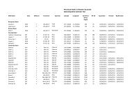
Area Summary L12-14 - Department of Mines and Petroleum
Area Summary L12-14 - Department of Mines and Petroleum
Area Summary L12-14 - Department of Mines and Petroleum

Create successful ePaper yourself
Turn your PDF publications into a flip-book with our unique Google optimized e-Paper software.
Government <strong>of</strong> Western Australia<br />
<strong>Department</strong> <strong>of</strong> <strong>Mines</strong> <strong>and</strong> <strong>Petroleum</strong><br />
GEOLOGY AND PETROLEUM PROSPECTIVITY<br />
OF STATE ACREAGE RELEASE AREA <strong>L12</strong>-<strong>14</strong>,<br />
SOUTHERN PERTH BASIN, WESTERN AUSTRALIA<br />
by<br />
Geological Survey <strong>of</strong> Western Australia<br />
Perth 2012
MINISTER FOR MINES AND PETROLEUM<br />
Hon. Norman Moore MLC<br />
DIRECTOR GENERAL, DEPARTMENT OF MINES AND PETROLEUM<br />
Richard Sellers<br />
EXECUTIVE DIRECTOR, GEOLOGICAL SURVEY OF WESTERN AUSTRALIA<br />
Rick Rogerson<br />
REFERENCE<br />
The recommended reference for this publication is:<br />
Geological Survey <strong>of</strong> Western Australia 2012, Geology <strong>and</strong> petroleum prospectivity <strong>of</strong> State Acreage Release <strong>Area</strong> <strong>L12</strong>-<strong>14</strong>,<br />
Southern Perth Basin, Western Australia: Geological Survey <strong>of</strong> Western Australia, 9p.<br />
National Library <strong>of</strong> Australia Card Number <strong>and</strong> ISBN 978-1-74168-461-2<br />
Grid references in this publication refer to the Geocentric Datum <strong>of</strong> Australia 1994 (GDA94). Locations mentioned<br />
in the text are referenced using Map Grid Australia (MGA) coordinates, Zone 51. All locations are quoted to at<br />
least the nearest 100 m.<br />
Published 2012 by Geological Survey <strong>of</strong> Western Australia<br />
This non-series book is published in digital format (PDF), as part <strong>of</strong> a digital dataset on CD, <strong>and</strong> is available online at<br />
.<br />
Further details <strong>of</strong> geological publications <strong>and</strong> maps produced by the Geological Survey <strong>of</strong> Western Australia<br />
are available from:<br />
Information Centre<br />
<strong>Department</strong> <strong>of</strong> <strong>Mines</strong> <strong>and</strong> <strong>Petroleum</strong><br />
100 Plain Street<br />
EAST PERTH, WESTERN AUSTRALIA 6004<br />
Telephone: +61 8 9222 3459 Facsimile: +61 8 9222 3444<br />
http://www.dmp.wa.gov.au/GSWApublications
Contents<br />
Abstract ..................................................................................................................................................................1<br />
Introduction ............................................................................................................................................................1<br />
Location <strong>and</strong> infrastructure .............................................................................................................................1<br />
Topography .....................................................................................................................................................5<br />
Wells <strong>and</strong> seismic coverage ....................................................................................................................................5<br />
Regional geology <strong>and</strong> prospectivity .......................................................................................................................5<br />
Stratigraphy .....................................................................................................................................................6<br />
Permian ....................................................................................................................................................6<br />
Triassic .....................................................................................................................................................7<br />
Jurassic .....................................................................................................................................................7<br />
Cretaceous ................................................................................................................................................7<br />
Conclusions ............................................................................................................................................................9<br />
References ..............................................................................................................................................................9<br />
Figures<br />
1. Location <strong>of</strong> State Acreage Release <strong>Area</strong> <strong>L12</strong>-<strong>14</strong> .........................................................................................2<br />
2. Schematic geological cross-section <strong>of</strong> the Bunbury Trough ........................................................................3<br />
3. Seismic coverage, highways, railways, <strong>and</strong> locations <strong>of</strong> the GSWA water <strong>and</strong> hydrogeological<br />
boreholes ......................................................................................................................................................4<br />
4. Comparative stratigraphy <strong>of</strong> the northern <strong>and</strong> southern parts <strong>of</strong> the onshore Perth Basin ...........................8<br />
Tables<br />
1. <strong>Petroleum</strong> wells up to 35 km south <strong>of</strong> State Acreage Release <strong>Area</strong> <strong>L12</strong>-<strong>14</strong> <strong>and</strong> within the<br />
Bunbury Trough ...........................................................................................................................................6<br />
iii
Geology <strong>and</strong> petroleum prospectivity<br />
<strong>of</strong> State Acreage Release <strong>Area</strong> <strong>L12</strong>-<strong>14</strong><br />
Southern Perth Basin, Western Australia<br />
by<br />
Geological Survey <strong>of</strong> Western Australia<br />
Abstract<br />
State Acreage Release <strong>Area</strong> <strong>L12</strong>-<strong>14</strong> covers about 10.5 graticular blocks (716.8 km 2 ) <strong>of</strong> the northern part <strong>of</strong> the<br />
Bunbury Trough with excellent access to infrastructure. The area spans the Swan Coastal Plain to the Whicher<br />
Range, <strong>and</strong> is bounded by the Darling Fault to the east. There are no petroleum exploration wells within the area<br />
<strong>and</strong> the seismic coverage is sparse. Fair to good gas shows are known from several wells within the Bunbury Trough<br />
to the south <strong>of</strong> the area, including Wonnerup 1, which is the closest. The Whicher Range Gasfield is also 30 km<br />
south <strong>of</strong> this well. The Permian section is estimated to be up to 6.5 km thick in the area, <strong>and</strong> the top <strong>of</strong> the Sue Coal<br />
Measures varies from a depth <strong>of</strong> 4200 m in the southwest to 8200 m in the northeast. The Lower Cretaceous – Upper<br />
Jurassic section gently dips eastward <strong>and</strong> becomes thicker toward the Darling Fault. Various trapping mechanisms<br />
are possible, although mature source rocks younger than Permian are unlikely to be present. The main risks are<br />
likely to be reservoir quality <strong>and</strong> trap integrity.<br />
KEYWORDS: State Acreage Release, Bunbury Trough, Southern Perth Basin, Western Australia, <strong>Petroleum</strong><br />
prospects, tight gas<br />
Introduction<br />
The Perth Basin covers about 100 000 km 2 <strong>and</strong> contains<br />
a number <strong>of</strong> proven Permian <strong>and</strong> Mesozoic petroleum<br />
systems. The onshore part <strong>of</strong> the basin covers approximately<br />
45 000 km 2 <strong>and</strong> extends 650 km along the southwest coast<br />
<strong>of</strong> Western Australia, mainly to the south <strong>of</strong> Geraldton<br />
(Hocking, 1994). In total, 300 wells have been drilled in<br />
the basin, onshore <strong>and</strong> <strong>of</strong>fshore (as <strong>of</strong> December 2011),<br />
resulting in the discovery <strong>of</strong> 31 hydrocarbon fields <strong>and</strong><br />
several significant accumulations (GSWA, 2011), mostly<br />
within the northern onshore part <strong>of</strong> the basin.<br />
The southern Perth Basin extends from the Harvey Ridge<br />
southwards across the south coast <strong>of</strong> the State, consisting<br />
<strong>of</strong> the Bunbury Trough <strong>and</strong> the Vasse Shelf (Figs 1 <strong>and</strong> 2;<br />
Crostella <strong>and</strong> Backhouse, 2000, fig. 4). Hydrocarbon<br />
shows have been reported from several wells within<br />
the Bunbury Trough, including those close to the State<br />
Acreage Release <strong>Area</strong> <strong>L12</strong>-<strong>14</strong> (Fig. 2). Wonnerup 1 is the<br />
closest well. It was drilled on the crest <strong>of</strong> a north–south<br />
trending anticline (Crostella <strong>and</strong> Backhouse, 2000, figs 62<br />
<strong>and</strong> 69). This structure extends northward into the Release<br />
<strong>Area</strong>, although there were no successful mechanical tests.<br />
The location has been ranked as the Wonnerup prospect<br />
(Fig. 2; Ferdin<strong>and</strong>o <strong>and</strong> Dedman, 2003).<br />
1<br />
The only major discovery within the Bunbury Trough has<br />
been the Whicher Range Gasfield, where significant gas<br />
flows from the Upper Permian Willespie Formation were<br />
encountered in five wells (Table 1; Sharif, 2007). This is<br />
a much larger structure than the one at the Wonnerup 1<br />
site, <strong>and</strong> it is estimated to contain an original gas in place<br />
volume <strong>of</strong> up to <strong>14</strong>2.5 Gm 3 (5 Tcf), although attempts to<br />
develop the field have been unsuccessful so far. A major<br />
research project has analyzed causes <strong>of</strong> failure, <strong>and</strong> has<br />
proposed new drilling methods <strong>and</strong> approaches to reservoir<br />
stimulation (WA:ERA, 2012).<br />
Location <strong>and</strong> infrastructure<br />
State Acreage Release <strong>Area</strong> <strong>L12</strong>-<strong>14</strong> (716.8 km 2 ) covers<br />
almost 10.5 graticular blocks within the poorly explored<br />
northern part <strong>of</strong> the Bunbury Trough, nearly 170 km<br />
south <strong>of</strong> Perth (Figs 1–3). The port city <strong>of</strong> Bunbury is<br />
partially within the Release <strong>Area</strong>, <strong>and</strong> Busselton is about<br />
13 km to the southwest (Fig. 3). The Dampier–Bunbury<br />
Gas Pipeline extends to 7 km north <strong>of</strong> the area, <strong>and</strong> the<br />
BP Kwinana Refinery is 30 km south <strong>of</strong> Perth. Rising<br />
dem<strong>and</strong> <strong>and</strong> proximity to potential industrial consumers<br />
could facilitate commercialization <strong>of</strong> even a relatively<br />
small discovery.
GSWA<br />
32°00'<br />
33°00'<br />
34°00'<br />
SNA58<br />
115°00'<br />
Yallingup Shelf<br />
Vlaming Sub-basin<br />
Eastern Mentelle<br />
Sub-basin<br />
Leeuwin<br />
Inlier<br />
Augusta<br />
Vasse<br />
Shelf<br />
Busselton<br />
Dunsborough<br />
Busselton<br />
Fault<br />
Vasse<br />
Shelf<br />
Harvey Ridge<br />
Bunbury<br />
Whicher<br />
Range<br />
Gasfield<br />
Fault<br />
Darradup Fault<br />
PERTH<br />
M<strong>and</strong>urah<br />
Terrace<br />
Bunbury<br />
Trough<br />
Dampier–Bunbury Gas<br />
Pipeline<br />
<strong>L12</strong>-<strong>14</strong><br />
Darling Fault<br />
Esperance<br />
Shelf<br />
116°00'<br />
2<br />
Darling Fault<br />
YILGARN<br />
CRATON<br />
Collie<br />
Sub-basin<br />
17.07.12<br />
Figure 1. Location <strong>of</strong> State Acreage Release <strong>Area</strong> <strong>L12</strong>-<strong>14</strong><br />
Offshore/onshore<br />
Phanerozoic basin<br />
Offshore/onshore<br />
basement<br />
Acreage Release <strong>Area</strong><br />
<strong>L12</strong>-<strong>14</strong><br />
Tectonic boundary<br />
Coastline<br />
Fault<br />
Pipeline<br />
Town<br />
<strong>Petroleum</strong> exploration<br />
well<br />
50 km
10 km<br />
Geology <strong>and</strong> petroleum prospectivity <strong>of</strong> State Acreage Release <strong>Area</strong> <strong>L12</strong>-<strong>14</strong>, Southern Perth Basin<br />
D D'<br />
LEEUWIN<br />
INLIER<br />
0<br />
Kilometres<br />
Dunsborough<br />
Fault<br />
2<br />
4<br />
6<br />
8<br />
VASSE SHELF<br />
34°00'<br />
Cretaceous<br />
Jurassic<br />
Triassic<br />
Eastern Mentelle<br />
Sub-basin<br />
Yallingup<br />
Shelf<br />
Chapman Hill 1<br />
(projected)<br />
Busselton Fault<br />
Vertical exaggeration = 2.5<br />
D<br />
Permian<br />
Basement<br />
SNA57 23.07.12<br />
Offshore/onshore<br />
Phanerozoic basin<br />
Onshore/<strong>of</strong>fshore<br />
basement<br />
Acreage Release <strong>Area</strong><br />
<strong>L12</strong>-<strong>14</strong><br />
BUNBURY TROUGH<br />
Whicher Range 1<br />
Sabina River 1 (projected) Warnbro Group <strong>and</strong><br />
(projected)<br />
Bunbury Basalt<br />
Sabina S<strong>and</strong>stone<br />
50 km<br />
3<br />
Main unconformity<br />
115°00' 116°00'<br />
Leeuwin<br />
Inlier<br />
Augusta<br />
Gas discovery<br />
Vasse<br />
Shelf<br />
Busselton<br />
Bunbury<br />
Sabina River 1<br />
Chapman Hill 1<br />
Dunsborough Fault<br />
Vasse<br />
Shelf<br />
Busselton<br />
Sabina<br />
Fault<br />
Fault<br />
Sub-basin boundary<br />
Bunbury<br />
Trough<br />
<strong>L12</strong>-<strong>14</strong><br />
Wonnerup 1<br />
Whicher<br />
Range<br />
Gasfield<br />
Darradup<br />
Fault<br />
<strong>Petroleum</strong> exploration well, dry<br />
Other petroleum exploration wells<br />
Town<br />
Cattamarra Coal Measures<br />
Lesueur S<strong>and</strong>stone<br />
Stockton Group<br />
Sue Group<br />
Fault<br />
(717 km )<br />
2<br />
Darling Fault<br />
D’<br />
YILGARN<br />
CRATON<br />
Wonnerup<br />
prospect<br />
Section line<br />
D D’<br />
Gasfield<br />
YarragadeeYILGARN<br />
Formation CRATON<br />
Figure 2. Schematic geological cross-section <strong>of</strong> the Bunbury Trough (from Crostella <strong>and</strong> Backhouse, 2000; Ferdin<strong>and</strong>o <strong>and</strong><br />
Dedman, 2003)<br />
Darling Fault
GSWA<br />
33°15’<br />
33°30’<br />
BUSSELTON<br />
33°45’<br />
Chapman Hill 1<br />
SNA59<br />
Vasse<br />
Shelf<br />
Vlaming Sub-basin<br />
Wonnerup<br />
Offshore/onshore<br />
Phanerozoic basin<br />
Basement<br />
115°30'<br />
Wonnerup 1<br />
5<br />
Ruabon<br />
Sabina River 1<br />
Whicher<br />
Range<br />
Gasfield<br />
Acreage Release <strong>Area</strong><br />
<strong>L12</strong>-<strong>14</strong><br />
Bunbury<br />
Trough<br />
BUNBURY<br />
1 2<br />
MR68-AL<br />
Capel<br />
Binningup<br />
MR68-AM<br />
10 km<br />
Tectonic boundary<br />
Coastline<br />
Fault<br />
Seismic line<br />
Highway<br />
Railway<br />
Pipeline<br />
4<br />
<strong>L12</strong>-<strong>14</strong><br />
A61-049 1<br />
2<br />
MR68-AN<br />
3<br />
H69-Y<br />
6 7 8<br />
Railway<br />
Bunbury<br />
Trough<br />
115°45'<br />
Jarrahwood<br />
M<strong>and</strong>urah<br />
Terrace<br />
Harvey Ridge<br />
Dampier–<br />
Bunbury<br />
Gas Pipeline<br />
Roel<strong>and</strong>s<br />
Burekup<br />
3 4<br />
Dardanup<br />
GSWA<br />
Donnybrook<br />
DNB 3<br />
Donnybrook<br />
Quindalup Line<br />
Newl<strong>and</strong>s<br />
YILGARN<br />
CRATON<br />
4<br />
Boyanup Line<br />
GSWA<br />
Boyanup Donnybrook<br />
DNB 4<br />
Gwindinup GSWA<br />
Donnybrook<br />
DNB 5<br />
9<br />
DARLING FAULT<br />
DARLING<br />
FAULT<br />
Picton Line<br />
Kirup<br />
17.07.12<br />
Town<br />
Whicher Range 1–5 wells<br />
<strong>Petroleum</strong> exploration well, dry<br />
Water bore<br />
Hydrogeological bore<br />
Figure 3. Seismic coverage, highways, railways, <strong>and</strong> locations <strong>of</strong> the GSWA water <strong>and</strong> hydrogeological<br />
boreholes (from Comm<strong>and</strong>er, 1982)
Topography<br />
Release <strong>Area</strong> <strong>L12</strong>-<strong>14</strong> extends eastward over a coastal<br />
system <strong>of</strong> dunes, limestone ridges, <strong>and</strong> wetl<strong>and</strong>s, <strong>and</strong><br />
spans the relatively featureless Swan Coastal Plain, which<br />
is bounded by the Whicher Range in the eastern <strong>and</strong><br />
southeastern parts <strong>of</strong> the area. The range contains eroded<br />
Lower Cretaceous rocks, rising to a maximum elevation <strong>of</strong><br />
160 m, <strong>and</strong> is bounded by the Whicher Scarp. The scarp is<br />
a curved erosional feature extending parallel to the coast<br />
about 15 km inl<strong>and</strong>. The more prominent Darling Scarp<br />
is located farther east <strong>and</strong> joins the Whicher Range to the<br />
northeast <strong>of</strong> the area (Freeman <strong>and</strong> Donaldson, 2006). The<br />
Whicher Range is a part <strong>of</strong> the Blackwood Plateau, covered<br />
with native eucalypt forest. The Darling Scarp is associated<br />
with the position <strong>of</strong> the Darling Fault, which defines the<br />
eastern boundary <strong>of</strong> the Perth Basin (Figs 1 <strong>and</strong> 2).<br />
Wells <strong>and</strong> seismic coverage<br />
Twelve deep (>1000 m) stratigraphic <strong>and</strong> exploration<br />
wells have been drilled within the Bunbury Trough, all to<br />
the south <strong>of</strong> the Release <strong>Area</strong> (Table 1). Fair to good gas<br />
shows were encountered within the Willespie Formation<br />
in most wells, including Sabina River 1. The latter<br />
was drilled 7 km southwest <strong>of</strong> Wonnerup 1 to test the<br />
hydrocarbon potential <strong>of</strong> Permian s<strong>and</strong>stones within the<br />
Sue Group, though the well may not have tested a valid<br />
trap (Crostella <strong>and</strong> Backhouse, 2000).<br />
Some stratigraphic data are available from hydrogeological<br />
bores within the Release <strong>Area</strong> (Fig. 3; Comm<strong>and</strong>er, 1982).<br />
Four <strong>of</strong> these are between 1000 m <strong>and</strong> 1200 m deep. Five<br />
others are located close to the southern border <strong>of</strong> the area,<br />
four <strong>of</strong> which are over 1000 m deep (Wharton, 1981).<br />
Several <strong>of</strong> the bores appear to have terminated within the<br />
Cattamarra Coal Measures, although only two (Q2 <strong>and</strong><br />
Q3) intersected the Sue Group. They are located to the<br />
west <strong>of</strong> the Wirring Fault in the Vasse Shelf, between 10<br />
<strong>and</strong> 15 km west <strong>of</strong> Busselton (Wharton, 1981).<br />
Seismic coverage is sparse, except for the southwestern<br />
part <strong>of</strong> the Release <strong>Area</strong> (Fig. 3). Line H69-7 (Harvey<br />
SS, 1969) extends into the Release <strong>Area</strong> from the north<br />
<strong>and</strong> terminates at its southern border. Line A61-049<br />
(Ambergate SS, 1980–81) also extends from southwest<br />
into the area. Three lines <strong>of</strong> the Margaret River seismic<br />
survey (1968) lie entirely within the area. From north to<br />
south, these are MR68-AM, MR68-AL, <strong>and</strong> MR68-AN.<br />
The quality <strong>of</strong> vintage data can be an issue for effective<br />
exploration (Luck, 1990; WA:ERA, 2012), although<br />
reprocessing may significantly improve the data quality.<br />
Regional geology <strong>and</strong><br />
prospectivity<br />
The Bunbury Trough is an asymmetrical full-graben,<br />
nearly 150 km long <strong>and</strong> up to 50 km wide, extending<br />
<strong>of</strong>fshore (Fig. 2). It is tilted toward the east across a series<br />
<strong>of</strong> longitudinal normal faults between its bounding faults,<br />
Geology <strong>and</strong> petroleum prospectivity <strong>of</strong> State Acreage Release <strong>Area</strong> <strong>L12</strong>-<strong>14</strong>, Southern Perth Basin<br />
5<br />
the Darling <strong>and</strong> the Busselton Faults (Iasky, 1993, fig. 10).<br />
The Darling Fault has an estimated cumulative throw <strong>of</strong><br />
up to about 11 km in the eastern part <strong>of</strong> the Release <strong>Area</strong><br />
(Iasky, 1993). It has had a longer history <strong>of</strong> reactivation<br />
than the Busselton Fault, probably going back to early<br />
Proterozoic (Wilde <strong>and</strong> Nelson, 2001). The Darling Fault<br />
has also exerted fundamental control on the development<br />
<strong>of</strong> the Perth Basin <strong>and</strong> its pattern <strong>of</strong> subsidence (Dentith<br />
et al., 1994). By comparison, the Busselton Fault is a<br />
Middle–Late Mesozoic normal fault.<br />
The structural configuration <strong>of</strong> the Perth Basin is a<br />
product <strong>of</strong> a multi-phase process <strong>of</strong> oblique rifting, which<br />
commenced in the Early Permian <strong>and</strong> terminated with the<br />
breakup <strong>of</strong> Australia from Greater India during the Early<br />
Cretaceous (Harris, 1994). In the southern Perth Basin,<br />
two phases <strong>of</strong> transtension <strong>and</strong> transpression followed by<br />
another phase <strong>of</strong> extension have been recognized between<br />
the Dunsborough <strong>and</strong> the Darling Faults (Iasky et al.,<br />
1991; Iasky, 1993, fig. <strong>14</strong>). In the first phase, right-lateral<br />
movement along the Darling Fault along with northeast–<br />
southwest compression resulted in north-northwest<br />
trending folds during the Late Permian to the Early<br />
Triassic. In the second phase, left-lateral movement along<br />
the Dunsborough Fault took place along with northwest–<br />
southeast compression during the Jurassic. Finally, normal<br />
faulting along the Darling <strong>and</strong> the Dunsborough Faults<br />
<strong>and</strong> right-lateral movement along the Harvey Ridge led<br />
to continental breakup during the Early Cretaceous.<br />
Therefore, wrench-induced en echelon folds — such as<br />
those drilled in the Whicher Range Gasfield <strong>and</strong> Wonnerup<br />
1 (Crostella <strong>and</strong> Backhouse, 2000) — may have been<br />
dissected by the dominantly extensional phase <strong>of</strong> faulting<br />
during the Early Cretaceous.<br />
Folding may have been augmented along the Bunbury<br />
Trough by the presence <strong>of</strong> two rigid crystalline blocks<br />
to the east <strong>and</strong> west (Iasky, 1993). The Leeuwin Inlier<br />
extends northward <strong>of</strong>fshore <strong>and</strong> joins the Southern Turtle<br />
Dove Ridge, which defines the western boundary <strong>of</strong> the<br />
central Perth Basin (Iasky <strong>and</strong> Lockwood, 2004). Further<br />
faulting <strong>and</strong> fault reactivation during the Early Cretaceous<br />
<strong>and</strong> the absence <strong>of</strong> regional or effective marine seals can<br />
have serious implications for seal integrity in the s<strong>and</strong>rich<br />
<strong>and</strong> faulted Upper Permian to Lower Cretaceous<br />
succession <strong>of</strong> the Bunbury Trough. However, not all <strong>of</strong> the<br />
folds have been dissected <strong>and</strong> other types <strong>of</strong> traps are also<br />
possible (Crostella <strong>and</strong> Backhouse, 2000).<br />
The northern <strong>and</strong> southern parts <strong>of</strong> the basin have<br />
similar stratigraphic histories (Fig. 4). For example, both<br />
parts contain thick intervals <strong>of</strong> coal measures within<br />
the Permian <strong>and</strong> Jurassic sections. However, viable<br />
objectives younger than Permian may be less likely in<br />
the Bunbury Trough (Crostella <strong>and</strong> Backhouse, 2000),<br />
as thermal maturity modelling suggests that only the<br />
Permian–Triassic section is within the oil window<br />
(Iasky, 1993). This is probably because <strong>of</strong> a lower rate<br />
<strong>of</strong> heat flow, which might be due the thick <strong>and</strong> relatively<br />
‘cool’ continental crust <strong>of</strong> the trough (Iasky, 1993). The<br />
D<strong>and</strong>aragan Trough, which is the main depocentre <strong>and</strong><br />
kitchen <strong>of</strong> the northern part <strong>of</strong> the basin with a comparable<br />
sedimentary fill to that <strong>of</strong> Bunbury Trough, has an<br />
average geothermal gradient <strong>of</strong> 2.5°C/100 m (Crostella,
GSWA<br />
Table 1. <strong>Petroleum</strong> wells up to 35 km south <strong>of</strong> State Acreage Release <strong>Area</strong> <strong>L12</strong>-<strong>14</strong> <strong>and</strong> within the Bunbury Trough<br />
TD age Year Operator Status1 Status2 Gas show Oil show<br />
Total depth<br />
(m)<br />
Rig elevation<br />
(KB m, ASL)<br />
Name Class Latitude (S) Longitude(E)<br />
Chapman Hill 1 NFW 33°46'15.9" 115°18'54" 36.45 1 350 Jurassic 1992 Discovery Dry P&A Nil Nil<br />
Sabina River 1 NFW 33°39'53.3" 115°24'40.3" 13.24 4 309.3 Permian 1982 BP Dry P&A Poor Nil<br />
Whicher Range 1 NFW 33°50'07.9” 115°22'28.0" 153.16 4 653.08 Permian 1968 Union Gas P&A G Good Nil<br />
Whicher Range 2 EXT 33°50'26.3” 115°23'02.0" 159.19 4 330 Permian 1980 Mesa Gas P&A G Good Nil<br />
Whicher Range 3 EXT 33°52'15.0” 115°23'39.2" 137.58 4 496 Permian 1982 BP Gas P&A G Excellent Nil<br />
Whicher Range 4 EXT 33°50'22.3” 115°22'06.4" <strong>14</strong>0.12 4 575 Permian 1997 Pennzoil Gas SUSP G Excellent Nil<br />
Whicher Range 5 EXT 33°50'54.3” 115°21'36.8" 134.3 4 307 Permian 2003 Amity Gas P&A G Good –<br />
Wonnerup 1 NFW 33°50'54.3” 115°21'36.8" 24.38 4 727.45 Permian 1972 Union Dry P&A Fair Nil<br />
Amity Southern Amity Inc.<br />
BP BP <strong>Petroleum</strong> Development Australia Ltd<br />
Discovery Discovery <strong>Petroleum</strong> NL<br />
Mesa Mesa Australia Ltd<br />
Pennzoil Pennzoil Exploration Australia Inc.<br />
Union Union Oil Development Corp.<br />
P&A Plug <strong>and</strong> ab<strong>and</strong>oned<br />
G Gas<br />
SUSP Suspended<br />
– No data<br />
NOTES: ASL Above sealevel<br />
TD Total depth<br />
NFW New field wildcat<br />
EXT Extension (as <strong>of</strong> December 2007)<br />
Wells in bold font are the most relevant <strong>and</strong> are discussed in detail.<br />
6<br />
1995). The corresponding rate for the Bunbury Trough<br />
is 1.9°C/100 m, despite the Early Cretaceous thermotectonic<br />
event, which resulted in widespread injection<br />
(<strong>and</strong> flows) <strong>of</strong> doleritic rocks in the Bunbury Trough<br />
(Iasky <strong>and</strong> Lockwood, 2004), including the Release <strong>Area</strong><br />
(Comm<strong>and</strong>er, 1982; Iasky <strong>and</strong> Lockwood, 2004). Thus,<br />
a burial depth <strong>of</strong> more than 3 km is required for source<br />
rock maturity in the Bunbury Trough, as modelled for<br />
Wonnerup 1 <strong>and</strong> Sabina 1 (Iasky, 1993, figs. 38–41),<br />
although with increasing depth, reservoir quality is also<br />
likely to deteriorate (Crostella <strong>and</strong> Backhouse, 2000,<br />
fig. 30). It is also likely that contact metamorphism may<br />
have some local detrimental effect on reservoir quality<br />
(Sharif, 2007). Igneous intrusives are known from the<br />
Willespie Formation in Wonnerup 1, <strong>and</strong> the Lesueur<br />
S<strong>and</strong>stone <strong>and</strong> the Yarragadee Formation in Whicher<br />
Range 2 (Crostella <strong>and</strong> Backhouse, 2000).<br />
Stratigraphy<br />
Geophysical studies suggest that the northern part <strong>of</strong> the<br />
Bunbury Trough is likely to contain a Permian section<br />
that is more than 6 km thick (Crostella <strong>and</strong> Backhouse,<br />
2000, fig. 12). The section consists <strong>of</strong> the Stockton Group,<br />
directly overlain with the coal-bearing Sue Group (Fig. 4).<br />
The latter group includes thermally mature source rocks,<br />
<strong>and</strong> potential s<strong>and</strong>stone reservoirs. The Permian section<br />
has an overburden up to 4 km thick, mainly consisting <strong>of</strong><br />
Triassic <strong>and</strong> Jurassic continental clastic facies. These are<br />
likely to be overlain with up to about 400 m <strong>of</strong> the Lower<br />
Cretaceous Leederville Formation in the central-northern<br />
<strong>and</strong> eastern parts <strong>of</strong> the Release <strong>Area</strong>. A veneer <strong>of</strong> late<br />
Cenozoic sediments not more than 30 m thick may cover<br />
the Swan Coastal Plain, mainly along the Whicher Scarp.<br />
The Upper Jurassic Yarragadee Formation <strong>and</strong> the Lower<br />
Cretaceous Bunbury Basalt <strong>and</strong> the Leederville Formation<br />
may be exposed along, <strong>and</strong> to the east <strong>of</strong>, the axis <strong>of</strong> the<br />
Capel Anticline, in the central to northwestern parts <strong>of</strong> the<br />
Release <strong>Area</strong> (Comm<strong>and</strong>er, 1982).<br />
Since the southern part <strong>of</strong> the Perth Basin was probably<br />
emergent during most <strong>of</strong> the Permian <strong>and</strong> Mesozoic<br />
(Norvick, 2004), regional or effective marine seal <strong>and</strong><br />
source rocks — such as the Lower Triassic Kockatea<br />
Shale or the Middle Jurassic Cadda Formation — are<br />
unlikely to be present in the Bunbury Trough (Fig. 4).<br />
Thus, blanketing <strong>of</strong> the Permian synrift reservoirs by a<br />
thick post-rift <strong>and</strong> shale-rich Lower Triassic succession<br />
did not extend to the south. For the same reason, good<br />
quality shallow marine reservoirs may be missing from<br />
the Permian section in the south (Crostella <strong>and</strong> Backhouse,<br />
2000, fig. 26).<br />
Permian<br />
Deposition in the southern Perth Basin began in the<br />
Early Permian with the Stockton Group, consisting <strong>of</strong><br />
fluviolacustrine argillaceous s<strong>and</strong>stone <strong>and</strong> siltstone <strong>of</strong> the<br />
Mosswood Formation <strong>and</strong> a basal diamictite unit (Fig. 4).<br />
This formation grades up to the Sue Group, consisting
<strong>of</strong> poorly sorted feldspathic s<strong>and</strong>stone with subordinate<br />
intervals <strong>of</strong> conglomerate, siltstone, shale, <strong>and</strong> sporadic<br />
thin or lenticular sub-bituminous to bituminous coal. The<br />
Sue Group consists <strong>of</strong> two intervals <strong>of</strong> coal measures<br />
<strong>and</strong> three s<strong>and</strong>stone-rich units in the Vasse Shelf area<br />
(Crostella <strong>and</strong> Backhouse, 2000). However, none <strong>of</strong> the<br />
wells in the Bunbury Trough has completely penetrated<br />
this succession.<br />
Wonnerup 1 penetrated 623 m <strong>of</strong> the Willespie Formation<br />
at the top <strong>of</strong> the Sue Group (depth <strong>of</strong> 4104–4727 m,<br />
Crostella <strong>and</strong> Backhouse, 2000, appendix 3), including<br />
two doleritic sills 2 m <strong>and</strong> 13 m thick. Analyses <strong>of</strong> wireline<br />
logs show that porosity ranges between 29% <strong>and</strong> 43% <strong>and</strong><br />
permeability between 32 mD <strong>and</strong> 650 mD, whereas water<br />
saturation varies between 38% <strong>and</strong> 74% in this formation<br />
(Crostella <strong>and</strong> Backhouse, 2000, table 6). These values<br />
are well above those normally given for a tight s<strong>and</strong><br />
reservoir (0.1 mD; WA:ERA, 2012). Sabina River 1 also<br />
penetrated 469 m <strong>of</strong> the Willespie Formation, showing<br />
porosity <strong>of</strong> 9.5% to 16%. This well may have failed to test<br />
a valid trap, <strong>and</strong> it is likely that subseismic faulting has<br />
compromised trap integrity in Wonnerup 1 (Crostella <strong>and</strong><br />
Backhouse, 2000).<br />
Triassic<br />
The Triassic section consists <strong>of</strong> the fluvial Sabina<br />
S<strong>and</strong>stone <strong>and</strong> the Lesueur S<strong>and</strong>stone (Fig. 4). The<br />
Sabina S<strong>and</strong>stone consists <strong>of</strong> moderately sorted, poorly<br />
consolidated <strong>and</strong> micaceous green-grey s<strong>and</strong>stone with<br />
disconformable contact with the Willespie Formation,<br />
<strong>and</strong> grading up to the Lesueur S<strong>and</strong>stone. The Sabina<br />
S<strong>and</strong>stone is 226 m thick in Sabina River 1 <strong>and</strong> 461 m<br />
thick in Wonnerup 1. This unit may become over 500 m<br />
thick in the northeastern part <strong>of</strong> the Bunbury Trough<br />
(Crostella <strong>and</strong> Backhouse, 2000, fig. 13), containing<br />
thicker or more frequent layers <strong>of</strong> shale, claystone, <strong>and</strong><br />
siltstone with increasing distance from the Vasse Shelf.<br />
The Lesueur S<strong>and</strong>stone is likely to be more than 1700 m in<br />
the Release <strong>Area</strong> (Crostella <strong>and</strong> Backhouse, 2000, fig. <strong>14</strong>).<br />
It is divided into two informal members, the Wonnerup<br />
<strong>and</strong> the Yalgorup (formerly the Myalup), in ascending<br />
order. The Wonnerup Member is 1004 m thick at its type<br />
section in Wonnerup 1, consisting <strong>of</strong> homogenous, poorly<br />
sorted, coarse to very coarse-gained <strong>and</strong> feldspathic, lightgrey<br />
s<strong>and</strong>stone. The Yalgorup Member is 1158 m thick in<br />
Wonnerup 1, consisting <strong>of</strong> dark-grey s<strong>and</strong>stone, probably<br />
grading up to the Eneabba Formation rather than the<br />
Cattamarra Coal Measures. The boundary between the two<br />
members <strong>of</strong> the Lesueur S<strong>and</strong>stone is a regional seismic<br />
marker, although they were both probably deposited as<br />
channel deposits in fluviatile environments.<br />
Jurassic<br />
The Jurassic section consists <strong>of</strong> predominantly continental<br />
deposits in the Perth Basin, except for the relatively<br />
thin marine Cadda Formation, which is restricted to the<br />
northern part <strong>of</strong> the basin (Fig. 4). The Lower Jurassic<br />
Geology <strong>and</strong> petroleum prospectivity <strong>of</strong> State Acreage Release <strong>Area</strong> <strong>L12</strong>-<strong>14</strong>, Southern Perth Basin<br />
7<br />
Cattamarra Coal Measures may be over 1200 m thick in<br />
the Release <strong>Area</strong> (Crostella <strong>and</strong> Backhouse, 2000, fig. 15),<br />
given that it is 1271 m thick in Wonnerup 1 <strong>and</strong> thins out<br />
to 850 m in Sabina River 1 (Crostella <strong>and</strong> Backhouse,<br />
2000). Thickness <strong>of</strong> the coal measures may increase from<br />
429 m in bore 1 <strong>of</strong> the Boyanup Line near the coast to<br />
as much as 635 m in bore 1 <strong>of</strong> the Picton Line, east <strong>of</strong><br />
Bunbury (Fig. 3). The upper contact with the Yarragadee<br />
Formation appears to generally deepen from the west<br />
to the east across the Release <strong>Area</strong> (Smith, 1984). As<br />
noted above, the distinction between the Cattamarra Coal<br />
Measures <strong>and</strong> the Eneabba Formation is not clear in the<br />
Bunbury Trough.<br />
The Cattamarra Coal Measures contain coarse-grained<br />
quartz s<strong>and</strong>stone, interbedded with dark <strong>and</strong> carbonaceous<br />
fine-grained clastic rocks <strong>and</strong> coal seams. The coal seams<br />
are good seismic markers, although they cannot be<br />
correlated over a large distance because <strong>of</strong> the lenticular<br />
nature <strong>of</strong> the seams (Crostella <strong>and</strong> Backhouse, 2000). The<br />
s<strong>and</strong>stone units are interpreted to have been deposited in<br />
distributory channels within a fluvial braided <strong>and</strong> paludal<br />
complex. Coaly intervals indicate deposition in a marshy<br />
embayment, showing a conformable contact with the<br />
overlying Middle–Upper Yarragadee Formation.<br />
The Yarragadee Formation is about 800 m thick in the<br />
Sabina River 1 <strong>and</strong> Wonnerup 1, becoming up to about<br />
850 m thick in Picton Line bore number 4 (PL 4) near<br />
the Darling Fault (Fig. 3; Wharton, 1980). This unit has a<br />
comparable thickness <strong>of</strong> 700 m to 800 m in bores BL 2,<br />
BL 3, <strong>and</strong> BL 4 along the Boyanup Line, although its<br />
thickness is reduced to about 500 m near the coast in<br />
bore BL 1 (Smith, 1984). The formation consists <strong>of</strong> fine<br />
to coarse-grained, poorly sorted feldspathic s<strong>and</strong>stone,<br />
showing a conformable contact with the overlying<br />
Parmelia Group. Thin beds <strong>of</strong> shale, siltstone <strong>and</strong> coal may<br />
be also present with the formation, which is predominantly<br />
<strong>of</strong> fluvial origin, with minor overbank or swamp deposits.<br />
Along the Quindalup Line (Fig. 3), the Mesozoic section is<br />
dissected by the Darradup Fault between bores QL 5 <strong>and</strong><br />
QL 6 (Wharton, 1981, fig. 3). The top <strong>of</strong> the Cattamarra<br />
Coal Measures deepens eastward between QL 4 <strong>and</strong> QL 9,<br />
<strong>and</strong> the overlying Yarragadee Formation thickens in the<br />
same direction, becoming over 1200 m near the Darling<br />
Fault. These trends are in general agreement with those <strong>of</strong><br />
seismic interpretation (Iasky, 1993), confirming that the<br />
thickness <strong>of</strong> the Mesozoic section increases from west to<br />
east across the Release <strong>Area</strong>.<br />
Cretaceous<br />
The Cretaceous sedimentary section is divided into a<br />
number <strong>of</strong> units within the Bunbury Trough (Crostella<br />
<strong>and</strong> Backhouse, 2000). The Bunbury Basalt <strong>and</strong> the<br />
Leederville Formation are most widely intersected in<br />
hydrogeological bores, covered by no more than a few<br />
tens <strong>of</strong> metres <strong>of</strong> Cenozoic sediments, mainly near the<br />
coast <strong>and</strong> the Whicher Range. The Leederville Formation<br />
<strong>and</strong> the basalt may crop out in the northwestern part <strong>of</strong> the<br />
area (Comm<strong>and</strong>er, 1982).
GSWA<br />
Cretaceous<br />
Jurassic<br />
Triassic<br />
Permian<br />
AGE<br />
Cenozoic<br />
65<br />
<strong>14</strong>5<br />
200<br />
252<br />
Lower M U L Middle Upper Lower Middle Upper Lower<br />
Upper<br />
259<br />
Carboniferous<br />
Devonian<br />
Silurian<br />
OrdovicianPrecambrian<br />
S N<br />
STRATIGRAPHY<br />
Source<br />
Coolyena Group<br />
Warnbro<br />
Group<br />
Bunbury<br />
Basalt<br />
Sue<br />
Group<br />
Stockton<br />
Group<br />
Sabina<br />
S<strong>and</strong>stone<br />
Poison Hill<br />
Greens<strong>and</strong><br />
Leederville Fm<br />
South Perth Shale<br />
Willespie Fm.<br />
Redgate C.M.<br />
Ashbrook Ss.<br />
Rosabrook<br />
Coal Measures<br />
Woodynook Ss.<br />
Mosswood Fm.<br />
Parmelia Group<br />
Yarragadee<br />
Formation<br />
‘Cullens Diamictite’<br />
laterite<br />
Kings Park Shale<br />
Gingin Chalk<br />
Molecap Greens<strong>and</strong><br />
Osborne Formation<br />
D<strong>and</strong>aragan Ss.<br />
NOT PENETRATED<br />
Lancelin<br />
Formation<br />
Cattamarra<br />
Coal<br />
Measures<br />
Lesueur<br />
S<strong>and</strong>stone<br />
Eneabba Formation<br />
Beekeeper<br />
Fm.<br />
basement<br />
Quaternary units<br />
Gage Sst.<br />
Cadda Formation<br />
Woodada Fm.<br />
Kockatea Shale<br />
Dongara Ss.<br />
Otorowiri Fm.<br />
Irwin River Carynginia Fm.<br />
Coal Measures<br />
High Cliff S<strong>and</strong>stone<br />
Holmwood Shale<br />
Nangetty Formation<br />
Tumblagooda<br />
S<strong>and</strong>stone<br />
8<br />
Gage Roads 1<br />
Gingin 1 Warro 1, Bootine 1,<br />
Ocean Hill 1,<br />
Gingin West 1<br />
Mt Horner/North Yardanogo 1<br />
Walyering<br />
Houtman 1/Ocean Hill 1/<br />
Erregulla 1/Walyering 1<br />
Erregulla 1<br />
Agonis<br />
Dongara/Mt Horner<br />
Dongara* Whicher Range<br />
Ev<strong>and</strong>ra<br />
Woodada/<br />
Hovea Beharra Springs<br />
Yardarino Arrowsmith 1<br />
Dongara<br />
†<br />
Cliff Head<br />
* also Xyris, Tarantula, Apium,<br />
Mondarra (now depleted),<br />
Corybas<br />
†<br />
also Beharra Springs N,<br />
Jingemia, Eremia<br />
AJM777a 18.06.12<br />
Dominant lithology<br />
S<strong>and</strong>stone<br />
Carbonate–<br />
shale, marl<br />
Secondary lithology<br />
S<strong>and</strong>stone<br />
Shale<br />
Basalt<br />
Shale<br />
Mixed siliciclastic<br />
<strong>and</strong> coal<br />
Carbonate<br />
Basement Diamictite<br />
Wagina<br />
Fm.<br />
Gas show<br />
Oil show<br />
Oil <strong>and</strong> gas<br />
show<br />
Oilfield<br />
Gasfield<br />
Reservoir<br />
Seal<br />
Oil <strong>and</strong> gas field<br />
Gas <strong>and</strong> condensate<br />
field<br />
Fm. Formation<br />
Ss. S<strong>and</strong>stone<br />
C.M. Coal Measures<br />
Hydrocarbon<br />
fields <strong>and</strong><br />
significant shows<br />
Figure 4. Comparative stratigraphy <strong>of</strong> the northern <strong>and</strong> southern parts <strong>of</strong> the onshore Perth Basin<br />
Unconformity<br />
Disconformity
Conclusions<br />
A Permian section over 6 km thick is likely to be present<br />
in the Release <strong>Area</strong>. The section should contain mature<br />
source rocks, as its overburden is more than 3 km thick.<br />
Some intervals <strong>of</strong> the Willespie Formation may have a<br />
porosity <strong>and</strong> permeability greater than 0.1 mD, which is<br />
the limit <strong>of</strong> a tight s<strong>and</strong>stone reservoir. The presence <strong>of</strong> gas<br />
may also inhibit silicification <strong>of</strong> the s<strong>and</strong>stone.<br />
Structural trends <strong>of</strong> the Wonnerup prospect <strong>and</strong> the<br />
Whicher Range Gasfield appear to extend northward into<br />
the area, where the Mesozoic section is gently folded near<br />
the coast. North–south trending normal faults may also<br />
dissect the pre-Cretaceous succession in the area.<br />
Early Cretaceous igneous intrusives have been<br />
encountered in many water bores within the area.<br />
Interpretation <strong>of</strong> aeromagnetic data also suggests that the<br />
intrusives are widely distributed in the northern part <strong>of</strong><br />
the Bunbury Trough. Significant intervals <strong>of</strong> intrusives<br />
have also been encountered in the Willespie Formation<br />
(Wonnerup 1), Lesueur S<strong>and</strong>stone, <strong>and</strong> Yarragadee<br />
Formation (Whicher Range 2). It is not known if the<br />
associated heat pulse had any effect on maturity <strong>of</strong> the<br />
post-Permian to pre-Cretaceous organic-rich intervals,<br />
such as the Jurassic coal measures.<br />
References<br />
Comm<strong>and</strong>er, DP 1982, The Bunbury shallow drilling groundwater<br />
investigation: Geological Survey <strong>of</strong> Western Australia, Report 12,<br />
p. 32–52.<br />
Crostella, A 1995, An evaluation <strong>of</strong> the hydrocarbon potential <strong>of</strong> the<br />
onshore northern Perth Basin, Western Australia: Geological Survey<br />
<strong>of</strong> Western Australia, Report 43, 67p.<br />
Crostella, A <strong>and</strong> Backhouse, J 2000, Geology <strong>and</strong> petroleum exploration<br />
<strong>of</strong> the central <strong>and</strong> southern Perth Basin, Western Australia: Geological<br />
Survey <strong>of</strong> Western Australia, Report 57, 85p.<br />
Dentith, MC, Long, A, Scott, J, Harris, LB <strong>and</strong> Wilde, SA 1994, The<br />
influence <strong>of</strong> basement on faulting within the Perth Basin, Western<br />
Australia, in The Sedimentary Basins <strong>of</strong> Western Australia edited<br />
by PG Purcell <strong>and</strong> RR Purcell: <strong>Petroleum</strong> Exploration Society <strong>of</strong><br />
Australia; Western Australian Basins Symposium, Perth, WA, 1994,<br />
Proceedings, p. 791–799.<br />
Ferdin<strong>and</strong>o, D <strong>and</strong> Dedman, R 2003, Review <strong>of</strong> 2002 exploration,<br />
production <strong>and</strong> development activities in Western Australia:<br />
<strong>Department</strong> <strong>of</strong> Industry <strong>and</strong> Resources, <strong>Petroleum</strong> in Western<br />
Australia, April 2003, p. 6–24.<br />
Freeman, MJ <strong>and</strong> Donaldson, MJ 2006, Geology <strong>of</strong> the southern Perth<br />
Basin <strong>and</strong> Margaret River wine district, southwestern Western<br />
Australia: Geological Survey <strong>of</strong> Western Australia – a field guide,<br />
Record 2006/20, 38p.<br />
Geological Survey <strong>of</strong> Western Australia (GSWA) 2011, <strong>Summary</strong><br />
<strong>of</strong> petroleum prospectivity, Western Australia 2011: Amadeus,<br />
Bonaparte, Bight, Browse, Canning, Officer, Perth, Southern<br />
Carnarvon, <strong>and</strong> Northern Carnarvon Basins: Geological Survey <strong>of</strong><br />
Western Australia, Perth, Western Australia, 42p.<br />
Harris, LB 1994, Structural <strong>and</strong> tectonic synthesis <strong>of</strong> the Perth Basin,<br />
Western Australia: Journal <strong>of</strong> <strong>Petroleum</strong> Geology, v. 17, p. 129–156.<br />
Geology <strong>and</strong> petroleum prospectivity <strong>of</strong> State Acreage Release <strong>Area</strong> <strong>L12</strong>-<strong>14</strong>, Southern Perth Basin<br />
9<br />
Hocking, RM 1994, Subdivisions <strong>of</strong> Western Australian Neoproterozoic<br />
<strong>and</strong> Phanerozoic sedimentary basins: Geological Survey <strong>of</strong> Western<br />
Australia, Record 1994/4, 84p.<br />
Iasky, RP 1993, A structural study <strong>of</strong> the southern Perth Basin, Western<br />
Australia: Geological Survey <strong>of</strong> Western Australia, Report 31, 56p.<br />
Iasky, RP <strong>and</strong> Lockwood, AM 2004, Gravity <strong>and</strong> magnetic interpretation<br />
<strong>of</strong> the southern Perth Basin, Western Australia: Geological Survey <strong>of</strong><br />
Western Australia, Record 2004/8, 32p.<br />
Iasky, RP, Young, RA <strong>and</strong> Middleton, MF 1991, Structural study <strong>of</strong><br />
the southern Perth Basin by geophysical methods: Exploration<br />
Geophysics, v. 22, p. 199–206.<br />
Luck, GR 1990, Hydrocarbon potential <strong>of</strong> the Perth Basin: Geological<br />
Survey <strong>of</strong> Western Australia, Record 1995/5, 26p.<br />
Norvick, MS 2004, Tectonic <strong>and</strong> stratigraphic history <strong>of</strong> the Perth Basin:<br />
Geoscience Australia, Record 2004/16, 30p.<br />
Sharif, A 2007, Tight gas resources in Western Australia: <strong>Department</strong> <strong>of</strong><br />
Industry <strong>and</strong> Resources, <strong>Petroleum</strong> in Western Australia, September<br />
2007, p. 28–31.<br />
Smith, RA 1984, Geology <strong>and</strong> hydrogeology <strong>of</strong> the Boyanup bore line,<br />
Perth Basin, in Pr<strong>of</strong>essional Papers for 1982: Geological Survey <strong>of</strong><br />
Western Australia, Report 12, p.72–81.<br />
Western Australian Energy Research Alliance (WA:ERA) 2012, Whicher<br />
Range tight gas s<strong>and</strong>s study: Geological Survey <strong>of</strong> Western Australia,<br />
Report 112, 405p.<br />
Wharton, PH 1980, The geology <strong>and</strong> hydrogeology <strong>of</strong> the Picton<br />
borehole line, in Annual Report <strong>of</strong> the Year 1979: Geological Survey<br />
<strong>of</strong> Western Australia, Perth, Western Australia, p. <strong>14</strong>–19.<br />
Wharton, PH 1981, The geology <strong>and</strong> hydrogeology <strong>of</strong> the Quindalup<br />
borehole line, in Annual Report <strong>of</strong> the Year 1980: Geological Survey<br />
<strong>of</strong> Western Australia, Perth, Western Australia, p. 27–35.<br />
Wilde, SA <strong>and</strong> Nelson, DR 2001, Geology <strong>of</strong> the western Yilgarn Craton<br />
<strong>and</strong> Leeuwin Complex, Western Australia – a field guide: Geological<br />
Survey <strong>of</strong> Western Australia, Record 2001/15, 41p.