Moneydarragh More - Queen's University Belfast
Moneydarragh More - Queen's University Belfast
Moneydarragh More - Queen's University Belfast

Create successful ePaper yourself
Turn your PDF publications into a flip-book with our unique Google optimized e-Paper software.
<strong>Moneydarragh</strong> <strong>More</strong>, Annalong, Co. Down<br />
Evaluation/Monitoring Report No. 076<br />
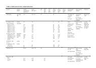
Figure Two: Berry and Nolan’s plan of the location of cist burials discovered during the cutting of a<br />
trench along the roadway at <strong>Moneydarragh</strong> more, Annalong (from Berry and Nolan 1932, 220).<br />
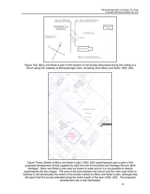
Figure Three: Details of Berry and Nolan’s plan (1932, 220) superimposed upon a plan of the<br />
proposed development (kindly supplied by staff from the Environment and Heritage Service: Built<br />
Heritage). Berry and Nolan’s plan was not drawn to scale and so it is not possible to directly<br />
superimpose the two images. The area of the lane between the church and the main road which is<br />
hatched in red demarcates the extent of the burials marked on Berry and Nolan’s plan, although they<br />
did report that the burials extended along the entire length of the lane (1932, 220). The proposed<br />
development site is also delineated.<br />
23