Mansion_rev8.qxd - National Park Service
Mansion_rev8.qxd - National Park Service
Mansion_rev8.qxd - National Park Service
You also want an ePaper? Increase the reach of your titles
YUMPU automatically turns print PDFs into web optimized ePapers that Google loves.
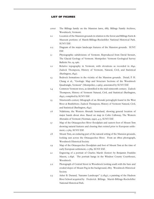
LIST OF FIGURES<br />
cover The Billings family on the <strong>Mansion</strong> lawn, 1887. Billings Family Archives,<br />
Woodstock, Vermont.<br />
0.1 Location of the <strong>Mansion</strong> grounds in relation to the forest and Billings Farm &<br />
Museum portions of Marsh-Billings-Rockefeller <strong>National</strong> Historical <strong>Park</strong>.<br />
SUNY ESF.<br />
0.2 Diagram of the major landscape features of the <strong>Mansion</strong> grounds. SUNY<br />
ESF.<br />
1.1 Physiographic subdivisions of Vermont. Reproduced from David Stewart,<br />
The Glacial Geology of Vermont. Montpelier: Vermont Geological Survey<br />
Bulletin No. 19, 1961.<br />
1.2 Relative topography in Vermont, with elevations as recorded in 1842.<br />
Zadock Thompson, History of Vermont, Natural, Civil, and Statistical<br />
(Burlington, 1842).<br />
1.3 Bedrock formations in the vicinity of the <strong>Mansion</strong> grounds. Detail, P. H.<br />
Chang et al., "Geologic Map and Structure Sections of the Woodstock<br />
Quadrangle, Vermont" (Montpelier, c.1965), annotated by SUNY ESF.<br />
1.4 Common Vermont trees, as identified in the mid-ninteenth century. Zadock<br />
Thompson, History of Vermont Natural, Civil, and Statistical (Burlington,<br />
1842), compiled by SUNY ESF.<br />
1.5 Nineteenth-century lithograph of an Abenaki petroglyph found in the West<br />
River at Brattleboro. Zadock Thompson, History of Vermont Natural, Civil,<br />
and Statistical (Burlington, 1842).<br />
1.6 Ndakinna, the Western Abenaki homeland, showing general location of<br />
major bands about 1600. Based on map in Colin Calloway, The Western<br />
Abenakis of Vermont (Norman, 1990), 4-5. SUNY ESF.<br />
1.7 Map of the Ottauquechee River floodplain and eastern foot of Mount Tom<br />
showing natural features and clearing that existed prior to European settlement,<br />
c.1765. SUNY ESF.<br />
1.8 Mount Tom, an enduring part of the natural setting of the <strong>Mansion</strong> grounds,<br />
looking east across the Ottauquechee River. From an 1860s photograph,<br />
Woodstock Historical Society.<br />
1.9 Map of the Ottauquechee floodplain and foot of Mount Tom at the time of<br />
early European settlement, c.1789. SUNY ESF.<br />
2.1 Engraving of a portrait of Charles Marsh (Senior) by Benjamin Franklin<br />
Mason, c.1846. The portrait hangs in the Windsor County Courthouse,<br />
Woodstock.<br />
2.2 Photograph of Central Street in Woodstock looking south with the bare and<br />
eroded slopes of Mount Peg in the background, 1867. Woodstock Historical<br />
Society.<br />
2.3 Asher B. Durand, “Autumn Landscape” (c.1847), a painting of the Hudson<br />
River School acquired by Frederick Billings. Marsh-Billings-Rockefeller<br />
<strong>National</strong> Historical <strong>Park</strong>.<br />
v


