

Norfolk health, heritage and biodiversity walks - Enjoying the Norfolk ...
Norfolk health, heritage and biodiversity walks - Enjoying the Norfolk ...
Norfolk health, heritage and biodiversity walks - Enjoying the Norfolk ...

Create successful ePaper yourself
Turn your PDF publications into a flip-book with our unique Google optimized e-Paper software.
<strong>Norfolk</strong> <strong>health</strong>, <strong>heritage</strong><br />
<strong>and</strong> <strong>biodiversity</strong> <strong>walks</strong><br />
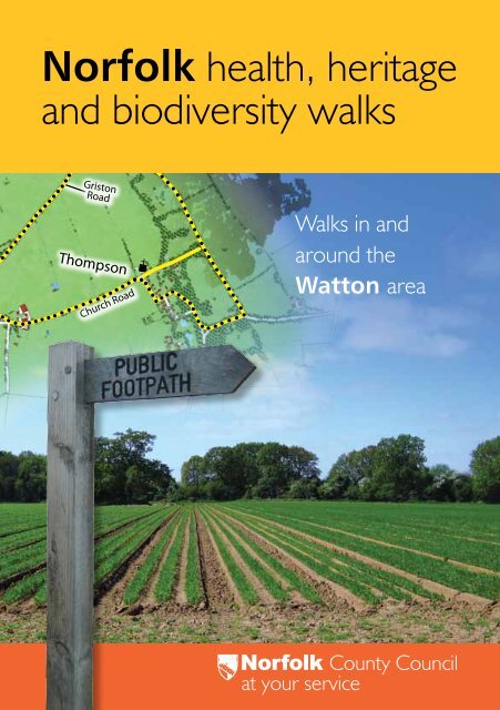
Griston<br />
Road<br />
Thompson<br />
Church Road<br />
Walks in <strong>and</strong><br />
around <strong>the</strong><br />
Watton area<br />
<strong>Norfolk</strong> County Council<br />
at your service
Contents<br />
Introduction page 2<br />
Walk 1 Loch Neaton/Church Walk page 6<br />
Walk 2 Watton Church/Town Green page 10<br />
Walk 3 Watton/Merton page 14<br />
Walk 4 Watton/Wayl<strong>and</strong> Wood page 18<br />
Walks 5 <strong>and</strong> 6 Ashill Church/ Ashill Panworth page 22<br />
Walk 7 Caston/Stow Bedon page 28<br />
Walks 8 <strong>and</strong> 9 Thompson’s College/Sparrow Hill page 32<br />
Walk 10 Carbrooke page 40<br />
Walk 11 Merton Sally’s Walk page 44<br />
Walk 12 Great/Little Cressingham page 48<br />
Project information page 52<br />
Explore fur<strong>the</strong>r page 53<br />
Walks locations page 54<br />
Useful contacts page 55<br />
1<br />
<strong>Norfolk</strong> Walks<br />
<strong>Norfolk</strong> County Council – Health • Heritage • Biodiversity
Introduction<br />
Welcome to a l<strong>and</strong> of enormous skies <strong>and</strong> open spaces; quiet <strong>walks</strong><br />
<strong>and</strong> peaceful lanes; rolling farml<strong>and</strong> <strong>and</strong> secretive woods <strong>and</strong><br />
enchanting villages which surround <strong>the</strong> ancient bustling market town of<br />
Watton; <strong>the</strong> heart of Wayl<strong>and</strong>.<br />
Wayl<strong>and</strong> is a place of mystery <strong>and</strong> legend. It is steeped in history with<br />
much evidence of its past visible across <strong>the</strong> area. The name ‘Wayl<strong>and</strong>’<br />
dates from <strong>the</strong> 11th Century <strong>and</strong> <strong>the</strong> time of William <strong>the</strong> Conqueror. It<br />
is thought to mean <strong>the</strong> ‘Dark L<strong>and</strong>’ or ‘Marshy L<strong>and</strong>’; perhaps a reference<br />
to <strong>the</strong> <strong>the</strong>n densely wooded nature of <strong>the</strong> area. Much of <strong>the</strong> forest has<br />
been cleared over <strong>the</strong> years <strong>and</strong> <strong>the</strong> wood used for construction leaving<br />
<strong>the</strong> l<strong>and</strong> free for farming. This has left an open l<strong>and</strong>scape studded with small<br />
patches of woodl<strong>and</strong> which, combined with <strong>the</strong> gentle undulations of <strong>the</strong><br />
countryside, facilitate <strong>the</strong> beautiful views that are so typical of <strong>the</strong> Brecks.<br />
The parishes of Wayl<strong>and</strong> are full of attractive features, interesting<br />
architecture, history <strong>and</strong> wildlife. Like <strong>the</strong> town, each village has something<br />
unique to offer as well as many paths <strong>and</strong> bridleways for walking <strong>and</strong> riding.<br />
The Peddars Way National Trail runs through <strong>the</strong> Wayl<strong>and</strong> area <strong>and</strong> links<br />
with <strong>the</strong> Great Eastern Pingo Trail with its many Ice Age pools.<br />
The <strong>walks</strong> in this booklet will help you uncover <strong>the</strong> beauty <strong>and</strong> diversity<br />
of Wayl<strong>and</strong>.<br />
2<br />
Why Walk?<br />
These <strong>walks</strong> have been carefully selected to encourage exploration of your<br />
local area on foot, making it easy for you to discover <strong>and</strong> enjoy <strong>the</strong> natural<br />
<strong>and</strong> man-made <strong>heritage</strong> of <strong>Norfolk</strong>.<br />
Exposure to nature simply makes us feel good. Nature is free <strong>the</strong>rapy with<br />
no side effects. If <strong>the</strong>re is blue sky, green vegetation <strong>and</strong> water in a scene,<br />
we like it even more. Contact with natural surroundings offers a restorative<br />
environment which allows us to relax, unwind <strong>and</strong> re-charge our batteries,<br />
improving our happiness <strong>and</strong> reducing our stress levels.<br />
Moderate physical activity such as a regular brisk walk in <strong>the</strong> fresh air is a<br />
simple <strong>and</strong> enjoyable way of keeping fit. To gain maximum benefit, aim<br />
to walk at a pace where your heart beats a little faster, your breathing<br />
becomes a little heavier <strong>and</strong> you feel a little warmer. Regular exercise can<br />
help to prevent major conditions, such as coronary heart disease, type II<br />
diabetes, high blood pressure, strokes, obesity, osteoporosis, osteoarthritis,<br />
bowel cancer <strong>and</strong> back pain.<br />
Getting around<br />
For details of public/community transport, contact Traveline on<br />
0871 200 2233 or visit www.travelineeastanglia.co.uk.<br />
Walking from Schools<br />
Some of <strong>the</strong>se walk routes pass close to schools providing ideal<br />
opportunities for teachers, parents <strong>and</strong> children to enjoy walking, whe<strong>the</strong>r<br />
this be walking to <strong>and</strong> from school or after school. The <strong>walks</strong> could also<br />
provide <strong>the</strong> basis for outdoor educational opportunities such as local school<br />
trips <strong>and</strong> projects as well as providing an additional <strong>and</strong> enjoyable form of<br />
physical activity.<br />
3
Walk information<br />
Information about <strong>the</strong> <strong>walks</strong> includes details such as <strong>the</strong> start point,<br />
distances, path surfaces, gradients <strong>and</strong> facilities available. The following<br />
symbols will help you to decide if <strong>the</strong> walk is suitable:<br />
Start point The start of <strong>the</strong> walk with Ordnance Survey grid references<br />
<strong>and</strong> Postcode<br />
Parking Nearest parking;<br />
not always <strong>the</strong> same as <strong>the</strong> walk start point<br />
Distance Distance of <strong>the</strong> walk<br />
Details Gentle gradient, 20% soft<br />
Steps<br />
Stile<br />
Suitable for buggies/<br />
wheelchairs...<br />
Cattle (or o<strong>the</strong>r farm<br />
animals) could be grazing<br />
in some meadows<br />
Café nearby<br />
Public house nearby<br />
The route could contain muddy/<br />
uneven sections <strong>and</strong> stout shoes<br />
or boots are recommended<br />
Toilets<br />
nearby<br />
If you have not exercised for a while, it is better to start with <strong>the</strong> shorter<br />
routes before moving on to <strong>the</strong> more challenging <strong>walks</strong>.<br />
Tread lightly <strong>and</strong> safely<br />
Some of <strong>the</strong> <strong>walks</strong> take you through or close to areas designated for<br />
conserving or protecting vulnerable/rare species <strong>and</strong> habitats such as<br />
County Wildlife Sites <strong>and</strong> nature reserves. Some of <strong>the</strong> routes also pass<br />
through areas grazed by cattle, sheep or horses. Please respect <strong>the</strong><br />
surroundings as you walk; stay on <strong>the</strong> designated footpaths, leave gates as<br />
you find <strong>the</strong>m <strong>and</strong> take any litter (including dog litter) home or use bins<br />
provided. Please take some time to read any advice that is given about <strong>the</strong><br />
area in which you are walking.<br />
Please note that dogs must be kept under close control on public rights<br />
of way <strong>and</strong> must not be allowed to stray from <strong>the</strong> line of <strong>the</strong> path.<br />
Stanford Military Training Area<br />
The l<strong>and</strong> to <strong>the</strong> west of Peddars Way, as indicated on <strong>the</strong> route maps for<br />
Thompson Sparrow Hill (page 36) <strong>and</strong> Merton Sally’s Walk (page 47),<br />
forms part of Stanford Military Training Area. The area is used intensively<br />
for military training, including live firing, <strong>and</strong> has been since World War II.<br />
Due to <strong>the</strong> risks associated with live firing <strong>and</strong> <strong>the</strong> presence of legacy<br />
munitions on site public access to <strong>the</strong> training area is strictly prohibited.<br />
Warning signs are in place to highlight <strong>the</strong> boundary of <strong>the</strong> ranges.<br />
County Wildlife Sites<br />
• County Wildlife Sites (CWS) are areas rich in wildlife – toge<strong>the</strong>r with<br />
Sites of Special Scientific Interest <strong>the</strong>y represent <strong>the</strong> most important<br />
habitats in <strong>the</strong> county.<br />
• Many of <strong>the</strong>se habitats <strong>and</strong> <strong>the</strong>ir associated species will be priorities<br />
under <strong>the</strong> UK <strong>and</strong> <strong>Norfolk</strong> Biodiversity Action Plans (BAP).<br />
These plans set out strategies for conserving our most vulnerable wildlife.<br />
Visit www.norfolk<strong>biodiversity</strong>.org for more information.<br />
Long Distance Paths<br />
Some of <strong>the</strong>se <strong>walks</strong> incorporate sections of<br />
<strong>the</strong> Peddars Way National Trail. To find out<br />
more visit www.nationaltrail.co.uk/peddarsway<br />
4 5
Walk<br />
1<br />
Loch Neaton/<br />
Church Walk<br />
Start point War Memorial (Memorial Way, Watton)<br />
Grid reference TF917006 • Postcode IP25 6BS<br />
Parking Free parking on Thetford Road by <strong>the</strong> War Memorial/<br />
various town centre car parks<br />
Distance 1.8 miles<br />
Details Minor gradients, 10% soft<br />
Walk instructions<br />
Please note that walkers are asked to keep dogs on leads in <strong>the</strong><br />
grounds of Loch Neaton.<br />
1. Start at <strong>the</strong> war memorial <strong>and</strong> turn right on to Thetford Road towards<br />
<strong>the</strong> High Street. Turn left onto <strong>the</strong> High Street <strong>and</strong> after a short<br />
distance, cross at <strong>the</strong> zebra crossing, turning right into Middle Street.<br />
2. Follow <strong>the</strong> road round to <strong>the</strong> right in front of <strong>the</strong> town hall <strong>and</strong> <strong>the</strong>n<br />
turn left at <strong>the</strong> end. Almost immediately, turn right onto Dereham<br />
Road (one way street).<br />
3. Turn left at <strong>the</strong> T-junction on to <strong>the</strong> A1075 Dereham Road. Follow <strong>the</strong><br />
road for just under half a mile <strong>and</strong> <strong>the</strong>n turn left on to Loch Lane.<br />
Buggies, wheelchairs <strong>and</strong> mobility scooters: enter at <strong>the</strong> green gate<br />
near <strong>the</strong> Sports Centre on Dereham Road. Follow <strong>the</strong> path left <strong>and</strong> <strong>the</strong>n<br />
bear right around <strong>the</strong> loch on a wide gravel track to an open grassy area.<br />
Return to Dereham Road <strong>the</strong> way you came. Note that tracks around<br />
<strong>the</strong> loch can be uneven <strong>and</strong> narrow.<br />
4. Shortly after walking through <strong>the</strong> remains of <strong>the</strong> dismantled railway<br />
bridge climb <strong>the</strong> steps on <strong>the</strong> left <strong>and</strong> go through <strong>the</strong> green gate to <strong>the</strong><br />
picnic area.<br />
5. Follow <strong>the</strong> wide gravel track to <strong>the</strong> right of Loch Neaton, turning left in<br />
front of <strong>the</strong> gates of <strong>the</strong> sports centre to walk on <strong>the</strong> raised path around<br />
6<br />
(Easy access option<br />
avoids steps on<br />
Loch Lane)<br />
<strong>the</strong> end of <strong>the</strong> loch. Alternatively, you could follow <strong>the</strong> rough paths<br />
around <strong>the</strong> loch for a closer view; watch out for raised tree roots.<br />
6. Leave <strong>the</strong> nature reserve via <strong>the</strong> green gates <strong>and</strong> turn right on to<br />
Dereham Road again.<br />
7. Retrace your steps back along Dereham Road <strong>and</strong> <strong>the</strong>n turn left<br />
through <strong>the</strong> white gates on to Church Walk, a wide lime tree-lined<br />
pathway. At <strong>the</strong> end, turn right along Church Road past St Mary’s<br />
Church.<br />
8. Turn right at <strong>the</strong> T-junction <strong>and</strong> walk along Norwich Road to <strong>the</strong> traffic<br />
lights. Turn left on to Memorial Way to return to your start point beside<br />
<strong>the</strong> war memorial.<br />
Loch Neaton <br />
This late nineteenth century pleasure ground was formerly <strong>the</strong> site of a<br />
railway ballast pit created by <strong>the</strong> construction of <strong>the</strong> railways in <strong>the</strong> early<br />
1870s. At some time between 1883 <strong>and</strong> 1893 <strong>the</strong> pit was flooded <strong>and</strong><br />
an ornamental lake was created. By 1907 a wind driven pump had been<br />
erected at <strong>the</strong> nor<strong>the</strong>rn end of <strong>the</strong> site to pump spring water into <strong>the</strong> lake.<br />
In 1907 <strong>the</strong> site was presented to <strong>the</strong> town, a b<strong>and</strong>st<strong>and</strong> was constructed<br />
<strong>and</strong> provision made for bowls <strong>and</strong> croquet. By <strong>the</strong> 1920s <strong>the</strong> emphasis<br />
was changing from pleasure ground to sports usage. Please visit <strong>the</strong><br />
website for more information: www.lochneaton.org.uk<br />
7
Walk<br />
1<br />
Loch Neaton/<br />
Church Walk<br />
An easy-going figure of eight walk<br />
around picturesque Loch Neaton<br />
<strong>and</strong> St Mary’s Church.<br />
Church Walk <br />
This tree lined walk is also known as Walsingham Way. The western<br />
end of <strong>the</strong> walk appears on a map of 1792. The footway was<br />
allotted to <strong>the</strong> inhabitants of Watton, as a way to <strong>the</strong>ir church, by <strong>the</strong><br />
enclosure commissioners in 1801. The avenue was bisected by <strong>the</strong><br />
railway in <strong>the</strong> 1860s <strong>and</strong> a period of decline followed. The walk was<br />
replanted with lime trees in 1903 resulting from proposals made in<br />
commemoration of <strong>the</strong> coronation of King Edward VII. Ornamental<br />
iron gates dating from <strong>the</strong> 1830s<br />
were given by Lord Walsingham<br />
<strong>and</strong> relocated from his Merton<br />
estate. The iron gate piers,<br />
embossed with ‘1902’ <strong>and</strong><br />
‘Walsingham’, survive, however<br />
<strong>the</strong> gates have been removed.<br />
Key<br />
Walk 1<br />
Parking P<br />
Church<br />
0 ½km<br />
8<br />
¼mile<br />
Sports<br />
Centre<br />
Dereham<br />
Road<br />
Middle<br />
Street<br />
Thetford<br />
Road<br />
Start<br />
A1075<br />
Loch Lane<br />
Loch<br />
Neaton<br />
<br />
<br />
P<br />
War<br />
Memorial<br />
<br />
<br />
Dereham<br />
Road<br />
Church Walk<br />
Norwich Road<br />
9<br />
Church<br />
Road<br />
Memorial Way<br />
St Mary’s<br />
Church<br />
Watton<br />
© Crown copyright <strong>and</strong> database rights<br />
2011 Ordnance Survey 100019340
Walk<br />
2<br />
Watton Church/<br />
Town Green<br />
Start point War Memorial (Memorial Way, Watton)<br />
Grid reference TF917006 • Postcode IP25 6BS<br />
Parking Free parking on Thetford Road by <strong>the</strong> War Memorial/<br />
various town centre car parks<br />
Distance 2.2 miles<br />
Details Minor gradients, 100% firm<br />
Walk instructions<br />
1. Starting at <strong>the</strong> war memorial, turn left<br />
on to Memorial Way. At <strong>the</strong> traffic<br />
light junction cross to Cadman Way.<br />
Cross to walk along <strong>the</strong> right h<strong>and</strong><br />
side of <strong>the</strong> road, pass Kittle Close<br />
<strong>and</strong> <strong>the</strong>n turn right on to Church<br />
Walk via <strong>the</strong> white gates.<br />
2. Continue ahead at <strong>the</strong> end on to<br />
Church Road. Pass St Mary’s Church<br />
which will be on your right <strong>and</strong> follow<br />
this quiet country lane to <strong>the</strong> end (note<br />
Church Road becomes Town Green Road).<br />
3. Turn right at <strong>the</strong> T-junction to Watton Green <strong>and</strong> follow <strong>the</strong> road<br />
around <strong>the</strong> corner to <strong>the</strong> end.<br />
4. Cross Norwich Road on to <strong>the</strong> cycle way opposite (<strong>the</strong>re is a safe<br />
crossing point a little to <strong>the</strong> left).<br />
5. At <strong>the</strong> end of <strong>the</strong> cycle way turn right on to Griston Road <strong>and</strong> walk all<br />
<strong>the</strong> way to <strong>the</strong> end. Turn left at <strong>the</strong> T-junction on to Norwich Road.<br />
6. Turn left at <strong>the</strong> traffic lights on to Memorial Way <strong>and</strong> return to your start<br />
point by <strong>the</strong> war memorial.<br />
10<br />
• Peacock butterfly<br />
Nissen Huts<br />
Look to your left as you walk along Town Green Road; <strong>the</strong>re are some<br />
old Nissen huts that are being quietly reclaimed by nature. A Nissen<br />
hut, named so after its designer Colonel Nissen is a pre-fabricated steel<br />
structure made from a semi-cylindrical skin of corrugated steel. The<br />
Nissen hut was first produced in 1915 <strong>and</strong> was used extensively during<br />
both World Wars. The huts in Watton were erected during World War<br />
Two <strong>and</strong> relate to <strong>the</strong> airfield which lies to <strong>the</strong> east of <strong>the</strong> town. The site is<br />
one of several World War Two military sites on Town Green Road that are<br />
visible on RAF aerial photographs taken in 1946.<br />
A tangle of wild plants now dominates <strong>the</strong> military remains. Ivy <strong>and</strong><br />
brambles scramble over <strong>the</strong> ruins, whilst scrubby hedgerow species such as<br />
hazel <strong>and</strong> elder provide a great habitat for many birds <strong>and</strong> insects.<br />
11
Walk<br />
2<br />
Watton Church/<br />
Town Green<br />
On this walk you will see nature quietly reclaiming some<br />
of Watton’s old military remains; creating a new use for<br />
structures that once sheltered troops during <strong>the</strong> war.<br />
• Blackthorn<br />
• Iron gate pier,<br />
Church Walk<br />
12<br />
Key<br />
Cadman<br />
Way<br />
<br />
P<br />
Start<br />
War<br />
Memorial<br />
Memorial<br />
Way<br />
Walk 2<br />
Parking P Church<br />
0 ½km<br />
¼mile<br />
St Mary’s<br />
Church<br />
Church Walk<br />
Watton<br />
Church<br />
Road<br />
St Mary’s Church <br />
This church has a Norman round tower of 13th century date, although<br />
<strong>the</strong> top of <strong>the</strong> tower is a later addition. The core of <strong>the</strong> church is of this<br />
date, with <strong>the</strong> chancel <strong>and</strong> south arcade being in <strong>the</strong> Early English style.<br />
However, <strong>the</strong> north arcade is in <strong>the</strong> later Perpendicular style. The church<br />
was altered in <strong>the</strong> 15th century <strong>and</strong> <strong>the</strong> exterior reclad in <strong>the</strong> late 19th<br />
century. Inside, <strong>the</strong>re are screens dating to 1852 <strong>and</strong> a wooden poor box<br />
in <strong>the</strong> form of a stiffly st<strong>and</strong>ing parson which dates to 1639. The churchyard<br />
is a regionally important example of an ornamental churchyard.<br />
Norwich Road<br />
Town Green Road<br />
Griston Road<br />
© Crown copyright <strong>and</strong> database rights<br />
2011 Ordnance Survey 100019340<br />
Watton Green<br />
13
Walk<br />
3 Watton/<br />
Merton<br />
Start point War Memorial (Memorial Way, Watton)<br />
Grid reference TF917006 • Postcode IP25 6BS<br />
Parking Free parking on Thetford Road by <strong>the</strong> War Memorial/<br />
various town centre car parks<br />
Distance 3.7 miles (or shorter walk 2.7 miles)<br />
Details Minor gradients, long walk 25% soft, short walk 30% soft<br />
Walk instructions<br />
1. Starting at <strong>the</strong> war memorial, bear right along Merton Road. Pass all<br />
<strong>the</strong> houses <strong>and</strong> <strong>the</strong> High School <strong>and</strong> follow Merton Road out in to <strong>the</strong><br />
countryside.<br />
2. For <strong>the</strong> longer walk stay on Merton Road until reaching Merton<br />
Green. Turn first right before <strong>the</strong> village shelter on to Tottington<br />
Terrace <strong>and</strong> <strong>the</strong>n bear right at <strong>the</strong> T-junction on to The Green leading<br />
to Home Farm Lane.<br />
3. Follow <strong>the</strong> road past Merton Village Hall to <strong>the</strong> junction <strong>and</strong> turn right;<br />
<strong>the</strong> hard surface gives way to a farm track. Follow <strong>the</strong> restricted byway<br />
to <strong>the</strong> end (now follow instruction 5 below).<br />
4. For <strong>the</strong> short walk (continued from instruction 1): approximately<br />
500 yards after passing <strong>the</strong> last of <strong>the</strong> houses on Merton Road, turn<br />
right on to <strong>the</strong> public footpath opposite <strong>the</strong> wood (Rabbit Plantation).<br />
Follow <strong>the</strong> path around <strong>the</strong> edge of <strong>the</strong> field, keeping <strong>the</strong> hedge on<br />
your right. At <strong>the</strong> end, turn right to cross a footbridge (now follow<br />
instruction 5 below).<br />
5. Cross <strong>the</strong> footbridge over <strong>the</strong> stream <strong>and</strong> bear left along <strong>the</strong> track<br />
called Long Bridle Road. After approximately a third of a mile, look<br />
out for a row of houses on your right. Turn right on to <strong>the</strong> hard<br />
surface path leading into <strong>the</strong> housing estate; <strong>the</strong>n bear left on to Stokes<br />
Avenue. Pass Bridle Road on your right <strong>and</strong> keep walking to <strong>the</strong> end of<br />
Stokes Avenue.<br />
14<br />
6. Turn right at <strong>the</strong> T-junction on to Br<strong>and</strong>on Road. Continue ahead over<br />
<strong>the</strong> roundabout onto <strong>the</strong> High Street. Walk all <strong>the</strong> way along <strong>the</strong> High<br />
Street <strong>and</strong> <strong>the</strong>n just before you reach <strong>the</strong> traffic light junction, turn right<br />
on to Thetford Road <strong>and</strong> walk back to your start point beside <strong>the</strong> war<br />
memorial.<br />
Flints <br />
An abundance of flint in<br />
nearby fields indicates<br />
that buildings such as<br />
<strong>the</strong>se cottages will have<br />
been constructed using<br />
local materials.<br />
The Clock Tower<br />
The clock tower is narrow with three<br />
storeys <strong>and</strong> is thought to have been<br />
erected after <strong>the</strong> great fire of 1674 which<br />
destroyed many of Watton’s buildings.<br />
The clock itself dates to 1827 <strong>and</strong> is set<br />
below <strong>the</strong> lintel of a medieval cross <strong>and</strong><br />
above a shield depicting a hare <strong>and</strong> barrel.<br />
Additionally, wooden sp<strong>and</strong>rels in <strong>the</strong><br />
clock tower may have come from ano<strong>the</strong>r<br />
medieval market cross. The tower is<br />
topped with a cupola in which a bell was<br />
placed, supposedly to warn inhabitants if<br />
fire broke out again. It is thought to have<br />
been re-faced in <strong>the</strong> 19th century.<br />
The Cupola is mounted by a wea<strong>the</strong>rvane<br />
dating to 1820, also in <strong>the</strong> form of a hare<br />
<strong>and</strong> a barrel. Virtually all <strong>the</strong> visible façade<br />
is of latter date.<br />
15
Walk<br />
3<br />
Watton/<br />
Merton<br />
A great example of <strong>the</strong> close links between rural<br />
Wayl<strong>and</strong> <strong>and</strong> <strong>the</strong> bustling town of Watton. You can<br />
walk to <strong>the</strong> pretty village of Merton from <strong>the</strong> town<br />
<strong>and</strong> it’s an ideal length to fit in with everyday life.<br />
Ancient Trees<br />
There are a few ancient oak trees on Merton Road near<br />
<strong>the</strong> school. Ancient trees support life forms that can live<br />
nowhere else. They are full of nooks <strong>and</strong> crannies, holes<br />
<strong>and</strong> dead <strong>and</strong> rotting wood. As <strong>the</strong> years go by <strong>the</strong>y<br />
provide perfect homes for thous<strong>and</strong>s of species of plants,<br />
animals <strong>and</strong> fungi, including many rare <strong>and</strong> threatened<br />
species. Clusters of ancient trees are even more<br />
important because toge<strong>the</strong>r all <strong>the</strong> trees will offer a<br />
really wide range of niche homes for lots of different<br />
specialist species in just one small area (Woodl<strong>and</strong><br />
Trust, 2011). See www.woodl<strong>and</strong>trust.org.uk for<br />
more information.<br />
Farml<strong>and</strong> hedgerows also provide<br />
valuable habitats for wildlife.<br />
Visit www.norfolk<strong>biodiversity</strong>.org<br />
for information on <strong>the</strong> Biodiversity<br />
Action Plan for hedgerows.<br />
• Lords <strong>and</strong> ladies<br />
(or cuckoo pint)<br />
growing in <strong>the</strong><br />
hedge <strong>and</strong><br />
in flower.<br />
16<br />
Home Farm<br />
Lane<br />
Br<strong>and</strong>on Road<br />
Long Bridle<br />
Road (track)<br />
Stokes<br />
Avenue<br />
Merton<br />
Common<br />
Village<br />
Hall<br />
© Crown copyright <strong>and</strong> database rights<br />
2011 Ordnance Survey 100019340<br />
Merton<br />
17<br />
Watton<br />
(County<br />
Wildlife Site)<br />
Rabbit<br />
Plantation<br />
Key<br />
High Street<br />
Merton Road<br />
Start <br />
P<br />
War<br />
Memorial<br />
Walk 3<br />
Short cut<br />
Parking P<br />
0 ½km<br />
¼mile
Walk<br />
4 Watton/<br />
Wayl<strong>and</strong> Wood<br />
Start point War Memorial (Memorial Way, Watton)<br />
Grid reference TF917006 • Postcode IP25 6BS<br />
Parking Free parking on Thetford Road by <strong>the</strong> War Memorial/<br />
various town centre car parks<br />
Distance 3.5 miles<br />
Details Minor gradients, 75% soft<br />
Walk instructions<br />
Please note: to prevent disturbance to wildlife, dogs are not allowed<br />
within Wayl<strong>and</strong> Wood Nature Reserve.<br />
1. Starting at <strong>the</strong> war memorial, turn left along Memorial Way to <strong>the</strong> traffic<br />
light junction <strong>and</strong> <strong>the</strong>n turn right on to Norwich Road.<br />
2. Just after <strong>the</strong> right turn to <strong>the</strong> industrial estate, turn right on to Griston<br />
Road. After approximately a quarter of a mile, turn right on to Field<br />
Maple Road. Bear right into Whitebeam Crescent <strong>and</strong> <strong>the</strong>n bear left<br />
around <strong>the</strong> green.<br />
3. Follow Whitebeam Crescent to <strong>the</strong> end <strong>and</strong> <strong>the</strong>n leave <strong>the</strong> housing<br />
estate, turning right on to a path behind <strong>the</strong> houses <strong>and</strong> around <strong>the</strong><br />
outer boundary of a field which will be on your left.<br />
4. At <strong>the</strong> fenceline, turn left to follow <strong>the</strong> direction of <strong>the</strong> public footpath<br />
across <strong>the</strong> field to <strong>the</strong> opposite hedge. Go through <strong>the</strong> gap in <strong>the</strong><br />
hedge beside <strong>the</strong> waymark post <strong>and</strong> continue in <strong>the</strong> same direction<br />
across a second field, heading for <strong>the</strong> corner of Wayl<strong>and</strong> Wood.<br />
5. As you approach <strong>the</strong> hedgeline, follow <strong>the</strong> path through <strong>the</strong> field<br />
boundary. Go through <strong>the</strong> kissing gate to Wayl<strong>and</strong> Wood in front<br />
of you.<br />
18<br />
6. Follow <strong>the</strong> path straight on (don’t follow <strong>the</strong> public footpath to your<br />
right). Pass a pond <strong>and</strong> go through/round a gate before heading straight<br />
on over a small earth bank.<br />
7. Follow <strong>the</strong> path until<br />
it opens out to a<br />
main track. Here<br />
you will see some<br />
<strong>Norfolk</strong> Wildlife<br />
Trust waymarker<br />
posts. Follow <strong>the</strong><br />
<strong>Norfolk</strong> Wildlife Trust<br />
waymarked circular<br />
trail through <strong>the</strong><br />
wood, ignoring all<br />
paths leading off <strong>the</strong><br />
main wide grassy path.<br />
Please note: <strong>the</strong>re is an information panel by <strong>the</strong> car parking area.<br />
8. Eventually you should come back to <strong>the</strong> point at which you joined <strong>the</strong><br />
circular trail <strong>and</strong> you can retrace your steps back out of <strong>the</strong> wood, over<br />
<strong>the</strong> earth bank, through/round <strong>the</strong> metal gate <strong>and</strong> <strong>the</strong>n through <strong>the</strong><br />
kissing gate.<br />
9. Cross <strong>the</strong> track <strong>and</strong> go through <strong>the</strong> hedgeline in front of you. Retrace<br />
your steps back across <strong>the</strong> field. Go through <strong>the</strong> hedge with <strong>the</strong><br />
waymarker post <strong>and</strong> <strong>the</strong>n turn left along <strong>the</strong> footpath cross-field.<br />
10. Go through <strong>the</strong> hedgeline at <strong>the</strong> waymarker post <strong>and</strong> turn right to<br />
follow this footpath past some houses to <strong>the</strong> road.<br />
11. Turn left, crossing Abbey Road to head straight along Vicarage Walk.<br />
Follow Vicarage Walk round to <strong>the</strong> right. Turn left onto Monkhams<br />
Drive, <strong>the</strong>n turn right at <strong>the</strong> T-junction on to Thetford Road. Continue<br />
along Thetford Road to return to your start point at <strong>the</strong> war memorial.<br />
19<br />
Photograph © David North, <strong>Norfolk</strong> Wildlife Trust
Walk<br />
4<br />
Watton/<br />
Wayl<strong>and</strong> Wood<br />
This walk takes you to <strong>the</strong> wonderful ancient Wayl<strong>and</strong><br />
Wood; thought to be <strong>the</strong> setting for Babes in <strong>the</strong> Wood, this<br />
peaceful retreat is especially beautiful in spring with carpets<br />
of bluebells <strong>and</strong> o<strong>the</strong>r woodl<strong>and</strong> flowers.<br />
<strong>Norfolk</strong> Wildlife Trust<br />
Wayl<strong>and</strong> Wood Nature Reserve<br />
Wayl<strong>and</strong> Wood is a wonderful ancient<br />
woodl<strong>and</strong> of oak, ash, hazel <strong>and</strong> bird cherry.<br />
In spring you will find carpets of bluebells,<br />
bugle <strong>and</strong> wood anemones <strong>and</strong> may spot<br />
rarer woodl<strong>and</strong> flowers including early purple<br />
orchids <strong>and</strong> yellow archangel. At any time of<br />
year you are likely to see both muntjac <strong>and</strong> roe<br />
deer. Birds to look <strong>and</strong> listen for include great<br />
spotted woodpecker, tawny owl, treecreeper,<br />
woodcock <strong>and</strong><br />
sparrowhawk, plus<br />
in spring <strong>and</strong> summer many migrant warblers<br />
including blackcap, chiffchaff, willow warbler<br />
<strong>and</strong> garden warbler. Some people believe<br />
this woodl<strong>and</strong> is a direct descendent of <strong>the</strong><br />
original ‘wildwood’ which covered much<br />
of Engl<strong>and</strong> many thous<strong>and</strong>s of years ago.<br />
• Bugle (above) <strong>and</strong><br />
Red Campion (left)<br />
Photographs © David North,<br />
<strong>Norfolk</strong> Wildlife Trust<br />
Babes in <strong>the</strong> Wood<br />
Legend has it that Wayl<strong>and</strong> Wood is <strong>the</strong> place where two young children<br />
died as a result of <strong>the</strong>ir wicked uncle’s plan to get his h<strong>and</strong>s on <strong>the</strong>ir<br />
inherited fortunes.<br />
20<br />
P<br />
War<br />
Memorial<br />
Key<br />
Thetford Road<br />
Start<br />
Norwich Road<br />
Watton<br />
Monkhams<br />
Drive<br />
Vicarage<br />
Walk<br />
<br />
A1075<br />
Walk 4<br />
Parking P<br />
0 ½km<br />
¼mile<br />
Abbey<br />
Road<br />
21<br />
<br />
Griston Road<br />
Field Maple<br />
Road<br />
Whitebeam<br />
Crescent<br />
Wayl<strong>and</strong> Wood<br />
(SSSI)<br />
Follow<br />
waymarked<br />
circular trail<br />
© Crown copyright <strong>and</strong> database rights<br />
2011 Ordnance Survey 100019340
Walk<br />
5<br />
Ashill<br />
Church<br />
Start point Community Centre (Hale Road, Ashill)<br />
Grid reference TF886048 • Postcode IP25 7BL<br />
Parking Community Centre car park – free<br />
Distance 1.2 miles<br />
Details Minor gradients, 55% soft<br />
Walk instructions<br />
(Village shop<br />
on Hale Road)<br />
1. From <strong>the</strong> community centre, turn right along Hale Road.<br />
After approximately 200 yards <strong>and</strong> just before you reach Chapel Lane<br />
<strong>and</strong> <strong>the</strong> Methodist church, turn right on to a public footpath between<br />
<strong>the</strong> houses.<br />
2. Follow <strong>the</strong> footpath right <strong>and</strong> <strong>the</strong>n at <strong>the</strong> end, turn left on to a track.<br />
At <strong>the</strong> end of <strong>the</strong> track, cross <strong>the</strong> drain via a footbridge <strong>and</strong> turn left.<br />
Keep following <strong>the</strong> public footpath along <strong>the</strong> field edge as it turns right<br />
<strong>and</strong> <strong>the</strong>n left.<br />
3. At <strong>the</strong> end of <strong>the</strong> footpath, turn left on to Swaffham Road. Just after<br />
St Nicholas Church, continue straight on to Church Street.<br />
4. At <strong>the</strong> end of Church Street, turn left on to Hale Road. Follow Hale<br />
Road back through <strong>the</strong> village to <strong>the</strong> Community Centre on your left.<br />
22<br />
Church of St Nicholas <br />
This is an impressive late medieval church with a west tower, a nave<br />
with just one aisle <strong>and</strong> a series of upper windows. The tower has an<br />
extraordinary main doorway formed with a flame-like ogee arch.<br />
The church is built in a mixture of styles including Early English, suggesting<br />
that <strong>the</strong> parishioners of Ashill felt wealthy enough to continually rebuild<br />
sections of <strong>the</strong>ir church. The nave roof is dated 1618. The church was<br />
restored in <strong>the</strong> 19th century.<br />
23
Walk<br />
5<br />
Walk<br />
6<br />
Ashill Church/<br />
Ashill Panworth<br />
Fascinating <strong>walks</strong> which include <strong>the</strong> deserted medieval<br />
settlement of Panworth <strong>and</strong> <strong>the</strong> impressive Church of<br />
St Nicholas. There are some wonderful views across<br />
Breckl<strong>and</strong> farml<strong>and</strong>.<br />
Ashill Common<br />
Look out for skylark <strong>and</strong> linnet<br />
across this open grassy area.<br />
Willow warblers have been found<br />
to breed here. Hawthorn found in<br />
<strong>the</strong> Devil’s Dyke is ideal for small<br />
mammals, birds, insects <strong>and</strong> o<strong>the</strong>r<br />
invertebrates to nest, roost or<br />
hibernate in. It supports many<br />
insect species such as shield<br />
bugs, earwigs, bumblebees,<br />
cockchafers, etc. These in<br />
turn are eaten by predatory<br />
insects such as <strong>the</strong> violet<br />
ground beetle or harvestman<br />
spider, as well as small birds<br />
such as <strong>the</strong> wren or blue tit.<br />
The bright red berries in <strong>the</strong><br />
autumn (pictured) provide<br />
essential autumn feeding for<br />
blackbirds <strong>and</strong> thrushes, finches<br />
<strong>and</strong> yellow hammers along with<br />
winter visitors such as redwing<br />
<strong>and</strong> fieldfares.<br />
24<br />
St Nicholas<br />
Church<br />
Swaffham<br />
Road<br />
Community<br />
Centre<br />
P<br />
<br />
Hale Road<br />
Walk 5<br />
Start<br />
Walk 6<br />
Start<br />
Goose<br />
Green<br />
The Green<br />
Church<br />
Street<br />
Ashill<br />
Dunnetts Close<br />
Green<br />
Farm<br />
© Crown copyright <strong>and</strong> database rights<br />
2011 Ordnance Survey 100019340<br />
• Hawthorn<br />
berries<br />
Ashill<br />
Common<br />
Panworth<br />
Cottages<br />
Short cut<br />
25<br />
Key<br />
Panworth<br />
Hall<br />
Panworth Hall<br />
Farm Cottages<br />
Walk 5<br />
Walk 6<br />
Short cut<br />
Parking P Church<br />
0 ½km<br />
¼mile
Walk<br />
6<br />
Ashill<br />
Panworth<br />
Start point Community Centre (Hale Road, Ashill)<br />
Grid reference TF886048 • Postcode IP25 7BL<br />
Parking Community Centre car park – free<br />
Distance 2.2 miles or short walk 1.4 miles<br />
Details Minor gradients, 50% soft<br />
Walk instructions<br />
1. Starting at <strong>the</strong> Community Centre, cross over Hale Road to Dunnetts<br />
Close opposite. Walk along Dunnetts Close for almost half a mile.<br />
2. Turn right on to a public footpath along <strong>the</strong> drive to Panworth Hall.<br />
3. Follow <strong>the</strong> drive left at Panworth Cottages <strong>and</strong> <strong>the</strong>n immediately after<br />
passing <strong>the</strong> cottages turn right, climbing a stile, onto a public footpath.<br />
See map for short walk: After climbing <strong>the</strong> stile, do not cross <strong>the</strong> field<br />
diagonally but instead, follow <strong>the</strong> hedge on your right <strong>and</strong> <strong>the</strong>n bear right<br />
over to ano<strong>the</strong>r stile. Follow <strong>the</strong> public footpath <strong>and</strong> turn right onto a<br />
grassy track. Now follow instruction no. 8 below.<br />
4. Walk diagonally across this field to <strong>the</strong> far left h<strong>and</strong> corner. Turn right on<br />
to <strong>the</strong> lane.<br />
5. At Panworth Hall Farm Cottages, turn right, still following <strong>the</strong> public<br />
footpath (this is a wide farm track).<br />
6. At <strong>the</strong> corner, continue to walk straight on following <strong>the</strong> grassy footpath<br />
along <strong>the</strong> field edge, keeping <strong>the</strong> hedge on your right.<br />
7. At <strong>the</strong> end, cross <strong>the</strong> drain via <strong>the</strong> footbridge <strong>and</strong> turn right along a<br />
wide grassy field margin. Follow this until you reach Green Farm.<br />
8. Follow <strong>the</strong> farm track straight on past <strong>the</strong> pond on your right <strong>and</strong> <strong>the</strong>n<br />
bear left past <strong>the</strong> farm buildings.<br />
26<br />
(Village shop<br />
on Hale Road)<br />
9. Keep walking straight on to The Green. Pass <strong>the</strong> playing field (Goose<br />
Green) on your right.<br />
10. Turn right on to Hale Road <strong>and</strong> continue until you arrive back at <strong>the</strong><br />
community centre on your left.<br />
Deserted medieval settlement of Panworth<br />
The route takes you through <strong>the</strong> site of <strong>the</strong> medieval deserted settlement<br />
of Panworth, mentioned in <strong>the</strong> Domesday Book, but which does not<br />
appear on a map of 1581. The earthworks of <strong>the</strong> former manor, moat <strong>and</strong><br />
houses are visible on <strong>the</strong> ground. Part of <strong>the</strong> moat appears to have been<br />
made out of <strong>the</strong> Panworth Ditch. The field crossed diagonally by <strong>the</strong> public<br />
footpath is protected by Scheduled Monument status.<br />
Panworth Ditch/Devil’s Dyke<br />
The Panworth Ditch or Devil’s Dyke is one of only four similar linear<br />
earthworks in western <strong>Norfolk</strong>. The surviving section is a Scheduled<br />
Monument, about 300m long <strong>and</strong> comprises a ditch <strong>and</strong> bank. Its date is<br />
uncertain, although it could be Iron Age or Early Anglo-Saxon. The existing<br />
gap in <strong>the</strong> earthwork is original <strong>and</strong> may have been where a Roman<br />
road crossed. If Early Anglo-Saxon, it probably served as a tribal or estate<br />
boundary or allowed travel <strong>and</strong> <strong>the</strong> transport of goods to be controlled <strong>and</strong><br />
tolls to be levied.<br />
27
Walk<br />
7<br />
Caston/<br />
Stow Bedon<br />
Start point Caston Village Green<br />
Grid reference TF958975 • Postcode NR17 1DB<br />
Parking Caston Village Hall car park – free<br />
Distance 2.7 miles<br />
(add approx 2/3 mile to distance if parking at village hall)<br />
Details Minor gradients, 100% firm<br />
Walk instructions<br />
Caston Village Hall coffee drop-in – every<br />
Friday morning. Toilets available if using<br />
village hall for refreshments.<br />
Note: please park at rear of <strong>the</strong> village hall <strong>and</strong> avoid parking here<br />
when <strong>the</strong> hall is busy <strong>and</strong> in use by o<strong>the</strong>r groups. You are welcome<br />
to drop in to <strong>the</strong> village hall for tea or coffee on Friday mornings<br />
between 9:30am <strong>and</strong> 11:30am.<br />
1. From <strong>the</strong> village green, walk past Holy Cross Church on your left <strong>and</strong><br />
continue straight on along this road. Continue walking until you reach<br />
Stow Bedon.<br />
2. At <strong>the</strong> road junction in Stow Bedon, turn right along Mere Road.<br />
3. At <strong>the</strong> end, turn right <strong>and</strong> follow this road all <strong>the</strong> way back to <strong>the</strong> village<br />
green in Caston.<br />
Remains of <strong>the</strong> Caston village cross<br />
The remains of <strong>the</strong> medieval st<strong>and</strong>ing stone village<br />
cross is said to have been a stopping point for pilgrims<br />
on <strong>the</strong>ir way to Walsingham Priory. The shaft of <strong>the</strong><br />
cross was taken down in <strong>the</strong> 19th century but <strong>the</strong><br />
three tiered circular base is still <strong>the</strong>re.<br />
Holy Cross Church<br />
The medieval period following<br />
<strong>the</strong> Norman Conquest has left<br />
<strong>the</strong> parish with its oldest surviving<br />
building, Holy Cross Church.<br />
The oldest part of <strong>the</strong> church is<br />
<strong>the</strong> 13th century chancel, <strong>the</strong><br />
west tower, nave <strong>and</strong> two storey<br />
north porch (now a vestry) being<br />
from <strong>the</strong> 14th <strong>and</strong> 15th centuries.<br />
A very fine 17th century brass<br />
ch<strong>and</strong>elier hangs in <strong>the</strong> chancel. Legend has it that it comes from Hampton<br />
Court <strong>and</strong> was given away by Charles I, eventually ending up in Caston in<br />
1871. The building underwent restoration in <strong>the</strong> 19th century.<br />
St Botolph’s Church,<br />
Stow Bedon <br />
Take some time to visit<br />
St Botolph’s Church<br />
at Stow Bedon. It is a<br />
little off <strong>the</strong> route but<br />
this pretty church in its<br />
picturesque setting is<br />
certainly worth seeing.<br />
Great Breckles<br />
Nearby Great Breckles was once a separate parish but is now<br />
incorporated into Stow Bedon although it still has its own church<br />
(St Margaret’s). There was also a medieval settlement of Little Breckles<br />
which was mentioned as a separate town in Domesday. This village had<br />
become ab<strong>and</strong>oned by 1547, having had its church demolished during <strong>the</strong><br />
reign of Edward III (1327-77).<br />
28 29
Walk<br />
7<br />
Caston/<br />
Stow Bedon<br />
With particularly fantastic views across a vast agricultural<br />
l<strong>and</strong>scape, this walk is extremely uplifting.<br />
Stow Bedon Mere<br />
Although this walk is entirely on quiet country<br />
roads, <strong>the</strong> route takes you beside a series of<br />
County Wildlife Sites in Stow Bedon. There are<br />
approximately 1,300 County Wildlife Sites in<br />
<strong>Norfolk</strong> supporting a wide range of <strong>biodiversity</strong>.<br />
Behind <strong>the</strong> trees to <strong>the</strong> south of Mere Road is<br />
Stow Bedon Mere, a large shallow lake with a deep<br />
silty bottom. The lake is surrounded by a mixture<br />
of wet woodl<strong>and</strong> <strong>and</strong> fen species. The nationally<br />
scarce marsh fern grows both here <strong>and</strong> on Caston<br />
Common, ano<strong>the</strong>r<br />
excellent wildlife-rich<br />
area comprising a mix of<br />
grassl<strong>and</strong>, broad-leaved<br />
high forest <strong>and</strong> coppice<br />
along with a lake <strong>and</strong><br />
several ponds. Please<br />
note <strong>the</strong>re is no public<br />
access to <strong>the</strong> Stow Bedon<br />
County Wildlife Sites.<br />
Walk 7<br />
Parking P Church<br />
0 ½km<br />
Mere Road<br />
Stow Bedon<br />
Mere<br />
P<br />
Village<br />
Hall<br />
30 31<br />
Key<br />
¼mile<br />
© Crown copyright <strong>and</strong> database rights<br />
2011 Ordnance Survey 100019340<br />
Stow<br />
Bedon<br />
Caston<br />
Start
Walk<br />
8<br />
Thompson’s<br />
College<br />
Start point The Chequers Inn (Griston Road, Thompson)<br />
Grid reference TF922968 • Postcode IP24 1PX<br />
Parking Chequers Inn car park – free<br />
Distance 2.5 miles<br />
Details Minor gradients, 30% soft<br />
The Chequers Inn during<br />
opening hours, toilets available<br />
if using pub for refreshments.<br />
Walk instructions<br />
1. Starting at The Chequers Inn, turn left along Griston Road. Walk for<br />
just over half a mile (ignoring <strong>the</strong> public footpath on your right) <strong>and</strong><br />
<strong>the</strong>n turn right on to a public bridleway (Drove Lane), immediately after<br />
passing <strong>the</strong> white railings.<br />
2. Follow <strong>the</strong> bridleway all <strong>the</strong> way<br />
to <strong>the</strong> end <strong>and</strong> <strong>the</strong>n turn right<br />
on to Stow Bedon Road.<br />
3. At <strong>the</strong> isl<strong>and</strong>, turn right. Stow<br />
Bedon Road becomes Church<br />
Road. Follow <strong>the</strong> road as it<br />
bends left <strong>and</strong> <strong>the</strong>n right through<br />
<strong>the</strong> village.<br />
4. At <strong>the</strong> church, follow <strong>the</strong> road<br />
left. At <strong>the</strong> end of Church Road,<br />
bear right onto School Road.<br />
5. At <strong>the</strong> crossroads, turn right on<br />
to Griston Road <strong>and</strong> walk back<br />
to The Chequers which will be<br />
on your left.<br />
32<br />
The Chequers Inn <br />
This Grade II Listed, thatched Inn has a mid 16th century core although<br />
<strong>the</strong> majority of <strong>the</strong> fabric dates to <strong>the</strong> 17th to 18th centuries. It is timberframed<br />
with clay lump <strong>and</strong> brick infill <strong>and</strong> sits on a brick <strong>and</strong> flint plinth.<br />
Chantry College of St Martin,<br />
Blessed Virgin Mary <strong>and</strong> All Saints<br />
Around 1349, Sir Thomas <strong>and</strong> John de Shardelow founded <strong>the</strong> chantry<br />
college of St Martin, Blessed Virgin Mary <strong>and</strong> All Saints. The date of <strong>the</strong><br />
rebuilding of <strong>the</strong> College building is a little vague since it is believed <strong>the</strong>re<br />
may have been a small chantry of earlier date on <strong>the</strong> site which may<br />
have been altered or enlarged some time after <strong>the</strong> 1350 endowment.<br />
The college was surrendered in April 1541 with <strong>the</strong> Dissolution of <strong>the</strong><br />
Monasteries. The remains of this building survive as part of College<br />
Farmhouse, although <strong>the</strong>re were substantial alterations in <strong>the</strong><br />
17th to 19th centuries.<br />
Drove Lane<br />
Look to <strong>the</strong> right<br />
through <strong>the</strong> trees when<br />
walking along <strong>the</strong><br />
Drove Lane bridleway.<br />
Stunning highl<strong>and</strong> cattle<br />
graze <strong>the</strong> meadows<br />
beside <strong>the</strong> stream in this<br />
<strong>biodiversity</strong>-rich County<br />
Wildlife Site, where plants<br />
such as water mint, marshmarigold,<br />
wild angelica,<br />
greater bird’s foot trefoil<br />
<strong>and</strong> ragged robin flourish<br />
in <strong>the</strong> wet meadows.<br />
33
Walk<br />
8<br />
Thompson Common<br />
nature reserve<br />
<strong>Norfolk</strong> Wildlife Trust Thompson Common Nature Reserve<br />
Please note: dogs are allowed on leads along <strong>the</strong> pingo trail route but<br />
not elsewhere on this nature reserve due to livestock on site.<br />
This area is famous for its pingos – more than 300 shallow pools are found<br />
on <strong>the</strong> reserve <strong>and</strong> support a dazzling array of water plants. In spring <strong>and</strong><br />
summer <strong>the</strong>y are perfect spots to enjoy watching dragonflies <strong>and</strong> brightly<br />
coloured damselflies. Experts still argue about exactly how <strong>the</strong>se ponds<br />
formed. However it is generally thought that <strong>the</strong>y date back more than<br />
10,000 years <strong>and</strong> were formed by <strong>the</strong> action of sub-surface ice which<br />
melted leaving shallow depressions.<br />
Today <strong>the</strong> nature reserve is a wonderful mix of Breckl<strong>and</strong> habitats including<br />
grassl<strong>and</strong>, fen, scrub <strong>and</strong> woodl<strong>and</strong> <strong>and</strong> supporting a huge range of<br />
wildlife. More than 400 species of plants have been recorded including<br />
water violets, marsh pennywort, bogbean, marsh orchids, tormentil <strong>and</strong><br />
agrimony. Birds to look for include kestrels, barn owls, grey partridges,<br />
woodcock, reed buntings, yellowhammers, bullfinches <strong>and</strong> linnets.<br />
You can follow <strong>the</strong> Great Eastern Pingo Trail through <strong>the</strong> reserve which<br />
leads to Thompson Water, a 6 hectare man-made lake originally designed<br />
for fishing by Thomas de Grey in 1854. Today it’s a great spot for water<br />
birds. Look for great crested grebes, gadwalls, tufted ducks <strong>and</strong> in summer,<br />
reed warblers. You may also spot otters here.<br />
When you walk on this reserve look out for <strong>the</strong><br />
Konik ponies. <strong>Norfolk</strong> Wildlife Trust uses <strong>the</strong>se<br />
small hardy ponies to graze <strong>the</strong> wet grassl<strong>and</strong>s <strong>and</strong><br />
open fens preventing too much scrub developing<br />
<strong>and</strong> shading out more diverse plant communities.<br />
You may also spot native breeds of sheep on <strong>the</strong><br />
reserve. You can access <strong>the</strong> reserve from Butters<br />
Hall Lane.<br />
34<br />
35
Walk<br />
8<br />
Walk<br />
9<br />
Two <strong>walks</strong> full of variety. Don’t miss visiting Thompson<br />
Common, a <strong>Norfolk</strong> Wildlife Trust Nature Reserve where<br />
you will see <strong>the</strong> many Ice Age pingos clustered around <strong>the</strong><br />
Great Eastern Pingo Trail.<br />
Merton<br />
Wood<br />
Sparrow<br />
Hill<br />
Peddars Way<br />
Stanford Military<br />
Training Area<br />
Thompson’s College/<br />
Sparrow Hill<br />
War<br />
Memorial<br />
Tottington<br />
Road<br />
Watton Road<br />
Marlpit<br />
Road<br />
The Chequers<br />
Inn Walk 8<br />
Start<br />
Mill<br />
Road<br />
Tottington<br />
Road<br />
Walk 9<br />
Start <br />
P<br />
© Crown copyright <strong>and</strong> database rights<br />
2011 Ordnance Survey 100019340<br />
School<br />
Road<br />
St Martin’s Church <br />
The church belonged to <strong>the</strong> adjacent college<br />
of canons which was a small community of<br />
priests. This explains <strong>the</strong> surviving stalls in <strong>the</strong><br />
chancel with carved misericords. The building<br />
is mainly 14th century with an impressive west<br />
tower. The aisleless nave has its original<br />
scissor-braced roof although it underwent restoration in<br />
1974. The style of <strong>the</strong> chancel is firmly Decorated.<br />
There is much surviving woodwork of interest,<br />
as well as some fragmentary wall paintings<br />
from <strong>the</strong> 14th century.<br />
Griston<br />
Road<br />
Thompson<br />
Church Road<br />
Drove Lane<br />
Beware of live firing!<br />
The l<strong>and</strong> to <strong>the</strong> west of Peddars Way<br />
(shaded on <strong>the</strong> map) forms part of<br />
Stanford Military Training Area.<br />
36 37<br />
Key<br />
Walk 8<br />
Short cut<br />
Walk 9<br />
Parking P Church<br />
0 ½km<br />
Thompson<br />
Common<br />
Stow Bedon<br />
Road<br />
¼mile<br />
Due to <strong>the</strong> risks associated<br />
with live firing <strong>and</strong> <strong>the</strong><br />
presence of legacy munitions<br />
on site, public access to<br />
Stanford Military Training Area<br />
is strictly prohibited. Warning<br />
signs are in place to highlight<br />
<strong>the</strong> boundary of <strong>the</strong> ranges.
Walk<br />
9<br />
Sparrow<br />
Hill<br />
Start point The Chequers Inn (Griston Road, Thompson)<br />
Grid reference TF922968 • Postcode IP24 1PX<br />
Parking Chequers Inn car park – free<br />
Distance 3.3 miles<br />
Details Minor gradients, 15% soft<br />
The Chequers Inn during<br />
opening hours, toilets available<br />
if using pub for refreshments.<br />
Walk instructions<br />
Please see important note on page 5.<br />
1. Starting at The Chequers Inn, turn right on to Griston Road. At <strong>the</strong><br />
crossroads, walk straight on to Tottington Road.<br />
2. Walk past Hallfield Road <strong>and</strong> <strong>the</strong>n at <strong>the</strong> junction with Marlpit Road,<br />
bear left, heading straight on along Tottington Road. Follow <strong>the</strong> road as<br />
it bends right.<br />
3. At <strong>the</strong> end of Tottington Road, turn right along <strong>the</strong> Peddars Way which<br />
follows <strong>the</strong> edge of <strong>the</strong> Stanford Training area.<br />
4. When you reach <strong>the</strong> road, turn right. This is Sparrow Hill. Walk all <strong>the</strong><br />
way to <strong>the</strong> end of Sparrow Hill.<br />
5. At <strong>the</strong> junction (where you will see <strong>the</strong> war memorial), turn right along<br />
Watton Road.<br />
6. At <strong>the</strong> crossroads, turn left along Mill Road <strong>and</strong> <strong>the</strong>n at <strong>the</strong> next<br />
crossroads, turn left on to Griston Road <strong>and</strong> make your way back to<br />
The Chequers Inn which will be on your left.<br />
38<br />
Breckl<strong>and</strong> Farml<strong>and</strong><br />
Many of <strong>the</strong> <strong>walks</strong> in <strong>the</strong><br />
Watton area pass through<br />
a predominately large<br />
scale arable l<strong>and</strong>scape with<br />
long, open views which<br />
provide a valuable habitat<br />
for farml<strong>and</strong> birds. With<br />
rare birds such as <strong>the</strong> stone<br />
curlew nesting in cultivated<br />
l<strong>and</strong> which has plenty of<br />
bare ground <strong>and</strong> very short<br />
vegetation, much of <strong>the</strong><br />
area is under National <strong>and</strong><br />
European protection.<br />
Some of Breckl<strong>and</strong>’s<br />
farml<strong>and</strong> is designated Site<br />
of Special Scientific Interest<br />
(SSSI) characterised by its<br />
climate <strong>and</strong> soils. Situated<br />
in <strong>the</strong> driest region in Britain<br />
it is subject to great extremes of temperature <strong>and</strong> <strong>the</strong> soil is a complex mix<br />
of free draining chalk, s<strong>and</strong>, silt, clay <strong>and</strong> flints. Some Breckl<strong>and</strong> farml<strong>and</strong><br />
is also designated a Special Protection Area (SPA). SPAs are designed<br />
to protect internationally rare breeding birds (in this case, stone curlew,<br />
nightjar <strong>and</strong> woodlark) <strong>and</strong> form a European network of ‘Natura 2000’<br />
sites, designed to protect Europe’s most threatened wildlife.<br />
This walk passes Merton Wood (County Wildlife Site), a traditionally<br />
managed coppiced woodl<strong>and</strong>. Many of <strong>the</strong> oaks are over 150 years old<br />
<strong>and</strong> scattered amongst <strong>the</strong>m are exotic curiosities such as <strong>the</strong> monkey<br />
puzzle tree <strong>and</strong> sequoia.<br />
39
Walk<br />
10<br />
Carbrooke<br />
Start point Carbrooke Village Hall (Church Street)<br />
Grid reference TF949021 • Postcode IP25 6SW<br />
Parking Carbrooke Village Hall car park – free<br />
Distance 3.3 miles<br />
Details Minor gradients, 50% soft<br />
Note: please park at <strong>the</strong> rear of <strong>the</strong> Village Hall to keep front access<br />
<strong>and</strong> hall access areas clear.<br />
Walk instructions<br />
1. Starting at <strong>the</strong> village hall, turn left on to Church Street <strong>and</strong> follow <strong>the</strong><br />
road through <strong>the</strong> village (Church Street becomes Shipdham Road).<br />
2. Turn left along a public footpath towards Fen Farm (you will see a large<br />
sign for ‘Fen Farm’ at this turning).<br />
3. Follow <strong>the</strong> track sharp left when you reach <strong>the</strong> farm buildings.<br />
4. Bear right, continuing to follow <strong>the</strong> track through <strong>the</strong> trees <strong>and</strong> ignoring<br />
any paths to your left.<br />
5. After almost three quarters of a mile, turn a sharp left at <strong>the</strong> junction of<br />
tracks, still following <strong>the</strong> track through open fields.<br />
6. At <strong>the</strong> corner, bear left, still following <strong>the</strong> track.<br />
40<br />
7. At <strong>the</strong> water works, go under or around <strong>the</strong> gate <strong>and</strong> turn right on to a<br />
hard surface lane.<br />
8. Turn left at Water House <strong>and</strong> <strong>the</strong>n when you reach <strong>the</strong> road, bear left<br />
(effectively walking straight on).<br />
9. At <strong>the</strong> road junction, turn left. Follow <strong>the</strong> road through Caudlesprings<br />
<strong>and</strong> continue on as it becomes Drury Lane.<br />
10. At <strong>the</strong> end of <strong>the</strong> road, turn left on to Bridge Street using a raised<br />
pavement on <strong>the</strong> right. Follow Bridge Street (which becomes Church<br />
Street) back to <strong>the</strong> village hall on your left.<br />
Church of St Peter <strong>and</strong> St Paul <br />
A massive late medieval church with a tall west tower <strong>and</strong> aisled nave. It is<br />
all 15th century except for <strong>the</strong> chancel which is late 13th century <strong>and</strong> has<br />
very elaborate Geometric tracery in its east window. It has a collection<br />
of late 16th century armour <strong>and</strong> <strong>the</strong> oldest identifiable tombs in <strong>Norfolk</strong> -<br />
those of Matilda de Clare <strong>and</strong> her son - dating to <strong>the</strong> late 13th century.<br />
And <strong>the</strong>n <strong>the</strong>re was one…<br />
Originally <strong>the</strong> Manor of Carbrooke was split in two,<br />
with two churches: Carbrooke Parva, where a<br />
church was sited to <strong>the</strong> right of <strong>the</strong> bridge on<br />
Ovington Road at Caudle Springs; <strong>and</strong><br />
Carbrooke Magna, where <strong>the</strong> Church<br />
still dominates <strong>the</strong> village. In about<br />
1424 <strong>the</strong> Church at Carbrooke Parva<br />
had fallen down, but stone from<br />
<strong>the</strong> ruin was removed <strong>and</strong> used<br />
to extend <strong>the</strong> o<strong>the</strong>r church, thus<br />
making it <strong>the</strong> large church it is today.<br />
www.midnorfolktimes.com/<br />
41
Walk<br />
10<br />
Carbrooke<br />
A peaceful <strong>and</strong> pretty route; you won’t miss <strong>the</strong> church with<br />
its extremely tall tower; stunning in <strong>the</strong> evening sunshine.<br />
The Preceptory of <strong>the</strong> Knights of St John<br />
The modern village of Carbrooke is now centred around <strong>the</strong><br />
medieval site of <strong>the</strong> comm<strong>and</strong>ry or preceptory of <strong>the</strong> Knights<br />
of St John of Jerusalem (a military monastic order similar to <strong>the</strong><br />
Knights Templar) that was established in 1193 <strong>and</strong> was in use<br />
until Henry VIII closed it down in 1540. In <strong>the</strong> 14th century <strong>the</strong><br />
Comm<strong>and</strong>ery at Carbrooke was <strong>the</strong> largest in Engl<strong>and</strong>.<br />
The great crested newt<br />
The walk passes close to four County Wildlife Sites (none with<br />
public access). One of <strong>the</strong>se is noted for a cluster of ponds<br />
supporting great crested newts, which are <strong>the</strong> largest European<br />
newt <strong>and</strong> are fully protected under European law. The male has<br />
a splendid orange belly with black spots <strong>and</strong> a dinosaur-like ridge<br />
along its back in <strong>the</strong> breeding season. It spends <strong>the</strong> spring <strong>and</strong><br />
summer in ponds, but at o<strong>the</strong>r times inhabits damp terrestrial<br />
places such as wet grassl<strong>and</strong>. The site is managed solely for nature<br />
conservation by seasonal mowing <strong>and</strong> light grazing by sheep<br />
resulting in a mosaic of species-rich grassl<strong>and</strong> <strong>and</strong> fen-meadow.<br />
Visit www.norfolk<strong>biodiversity</strong>.org <strong>and</strong> read <strong>the</strong> Species Action Plan<br />
for more information on <strong>the</strong> newt.<br />
Key<br />
Walk 10<br />
Parking P Church<br />
0 ½km<br />
• Great crested newt<br />
Photograph © Karl Charters, <strong>Norfolk</strong> Wildlife Trust<br />
42<br />
¼mile<br />
Water<br />
House<br />
Water<br />
Works<br />
Caudlesprings<br />
© Crown copyright <strong>and</strong> database rights<br />
2011 Ordnance Survey 100019340<br />
Drury Lane<br />
43<br />
Church<br />
Street<br />
Start<br />
Village P<br />
Hall<br />
Bridge<br />
Street<br />
Carbrooke<br />
Fen<br />
Farm<br />
Shipdham<br />
Road
Walk<br />
11 Merton<br />
Sally’s Walk<br />
Start point Merton Village Hall (Home Farm Lane)<br />
Grid reference TF905989 • Postcode IP25 6QU<br />
Parking Merton Village Hall car park – free<br />
Distance 4.2 miles<br />
Details Minor gradients, 60% soft<br />
Walk instructions<br />
Please see important note on page 5.<br />
1. Starting at <strong>the</strong> village hall, turn left on to <strong>the</strong> road. Walk along The<br />
Green <strong>and</strong> past Tottington Terrace. Head straight on to Crow’s Lane.<br />
2. Take your first right on to a gravely lane where you see a public path<br />
post. After a few yards, bear left on to Sally’s Walk.<br />
3. Follow <strong>the</strong> grassy path, continuing straight on along <strong>the</strong> edge of <strong>the</strong><br />
field. You will see a belt of trees ahead. Bear left along <strong>the</strong> path as you<br />
pass <strong>the</strong> trees on your right <strong>and</strong> continue through <strong>the</strong> wood.<br />
4. At <strong>the</strong> end of this woodl<strong>and</strong> track, turn<br />
left on to an open track. You will see a<br />
view of <strong>the</strong> church through <strong>the</strong> trees.<br />
Go past The Lodge on your left <strong>and</strong><br />
walk through <strong>the</strong> gates straight ahead<br />
of you to <strong>the</strong> road.<br />
5. Turn right along <strong>the</strong> road. Walk for<br />
just under half a mile <strong>and</strong> <strong>the</strong>n turn<br />
right on Sparrow Hill (you will see a<br />
war memorial at this junction).<br />
6. Walk for just over three quarters<br />
of a mile <strong>and</strong> <strong>the</strong>n turn right along<br />
Peddars Way.<br />
44<br />
7. Follow Peddars Way all <strong>the</strong> way to Home Farm <strong>and</strong> Hawthorn Farm.<br />
Go through a gate <strong>and</strong> continue past <strong>the</strong> farm along Home Farm Lane.<br />
8. At <strong>the</strong> end of <strong>the</strong> track (where Peddars Way goes left), turn right on to<br />
<strong>the</strong> road (still Home Farm Lane). Walk for a quarter of a mile <strong>and</strong> <strong>the</strong>n<br />
turn left in to <strong>the</strong> village hall.<br />
St Peter’s Church<br />
This church has an attractive setting<br />
in <strong>the</strong> park of Merton Hall with <strong>the</strong><br />
great house nearby (superb views<br />
from behind <strong>the</strong> church). The<br />
west tower was built during <strong>the</strong><br />
late 11th or early 12th century;<br />
some of it may date to before<br />
<strong>the</strong> Norman Conquest of 1066.<br />
The rest of <strong>the</strong> church dates to <strong>the</strong> 14th century, with later 15th <strong>and</strong> 16th<br />
century alterations.<br />
Merton Hall <strong>and</strong> Park<br />
Merton Park is part of <strong>the</strong> estate of<br />
<strong>the</strong> de Grey family, who have held<br />
<strong>the</strong> Manor of Merton since <strong>the</strong> early<br />
fourteenth century. In 1780 William de<br />
Grey was ennobled, becoming <strong>the</strong> first<br />
Baron Walsingham.<br />
Merton Hall was built of red brick in<br />
1613, with a wing <strong>and</strong> extra rooms<br />
added during <strong>the</strong> 1830s <strong>and</strong> 1840s. All but <strong>the</strong> 1840s wing was destroyed<br />
by fire in 1956. There is a surviving 17th century red brick Jacobean style<br />
gatehouse to <strong>the</strong> east of <strong>the</strong> Hall. The l<strong>and</strong>scape park was established<br />
by <strong>the</strong> early 18th century <strong>and</strong> was exp<strong>and</strong>ed during <strong>the</strong> late 18th century<br />
when woodl<strong>and</strong> <strong>and</strong> an ornamental nursery were established. The great<br />
pond is one of several late 18th <strong>and</strong> 19th century additions to <strong>the</strong> park.<br />
45
Walk<br />
11<br />
Merton<br />
Sally’s Walk<br />
Visit <strong>the</strong> church <strong>and</strong> you will find a stunning view of Merton<br />
Hall with its great pond; a lovely spot to enjoy a quiet<br />
moment before enjoying <strong>the</strong> rest of this pretty route.<br />
The Squares<br />
‘The Squares’ is a County Wildlife Site; an area of broad-leaved plantation<br />
situated between Merton village <strong>and</strong> Merton Hall. The wood is old<br />
parkl<strong>and</strong> type woodl<strong>and</strong>, visually attractive with a mixture of tree species<br />
such as oak, silver birch, sweet<br />
chestnut <strong>and</strong> beech. There are<br />
some large old trees with spreading<br />
boughs. Sally’s Walk runs north to<br />
south through <strong>the</strong> wood.<br />
Merton Wood<br />
Merton Wood is ano<strong>the</strong>r County<br />
Wildlife Site. Look out for bluebells<br />
as you pass; <strong>the</strong>y are abundant<br />
across much of <strong>the</strong> woodl<strong>and</strong> here in<br />
spring. You may also spot oak trees<br />
over 150 years old at <strong>the</strong> eastern<br />
end of <strong>the</strong> site.<br />
Ancient trees<br />
Due to <strong>the</strong> risks associated<br />
with live firing <strong>and</strong> <strong>the</strong><br />
presence of legacy munitions<br />
on site, public access to<br />
Stanford Military Training Area<br />
is strictly prohibited. Warning<br />
signs are in place to highlight<br />
<strong>the</strong> boundary of <strong>the</strong> ranges.<br />
This horse chestnut in flower is just<br />
one of several ancient trees growing<br />
beside <strong>the</strong> road on <strong>the</strong> edge of<br />
Merton Wood.<br />
Beware of live firing!<br />
The l<strong>and</strong> to <strong>the</strong> west of Peddars Way<br />
(shaded on <strong>the</strong> map) forms part of<br />
Stanford Military Training Area.<br />
Village<br />
Hall<br />
Hawthorn<br />
Farm<br />
Home<br />
Farm<br />
Stanford Military<br />
Training Area<br />
Home Farm<br />
Lane<br />
46 47<br />
Home Farm Lane<br />
Peddars Way<br />
P<br />
Key<br />
Walk 11<br />
Parking P Church<br />
0 ½km<br />
Start<br />
The<br />
Squares<br />
Merton<br />
Wood<br />
Sparrow<br />
Hill<br />
Merton<br />
Crow’s Lane<br />
Sally’s Walk<br />
The<br />
Lodge<br />
¼mile<br />
War<br />
Memorial<br />
Watton Road<br />
© Crown copyright <strong>and</strong> database rights<br />
2011 Ordnance Survey 100019340
Walk<br />
12 Great/Little<br />
Cressingham<br />
Start point Great Cressingham village sign (St Michael’s Crescent)<br />
Grid reference TF851017 • Postcode IP25 6NH<br />
Parking The Olde Windmill Inn car park – free<br />
Distance 5.1 miles<br />
Details Gentle gradients, 20% soft<br />
100% hard avoiding Green Lane <br />
Walk instructions<br />
The Olde Windmill Inn, Water End<br />
(just over ¼ mile from south-west<br />
end of The Street. Toilets available<br />
if using <strong>the</strong> pub for refreshments.<br />
If you have parked at <strong>the</strong> Windmill Inn, turn left on to <strong>the</strong> road <strong>and</strong><br />
walk for just over a quarter of a mile. Turn left on to The Street <strong>and</strong><br />
walk for a little over 350 yards to St Michael’s Crescent.<br />
1. From St Michael’s Crescent (by <strong>the</strong> church), walk straight on along<br />
Priory Drove, passing <strong>the</strong> church which will be on your right. Priory<br />
Drove becomes Priory Road.<br />
2. At <strong>the</strong> end of <strong>the</strong> road, turn right to follow <strong>the</strong> Peddars Way along a<br />
quiet road.<br />
3. At <strong>the</strong> crossroads, walk straight on, still following <strong>the</strong> Peddars Way<br />
towards Little Cressingham.<br />
4. At <strong>the</strong> end of <strong>the</strong> road, when you reach Little Cressingham, turn right<br />
on to Fairstead Lane. You will walk past <strong>the</strong> disused mill.<br />
5. After approximately 500 yards, bear right off <strong>the</strong> road onto Green Lane<br />
(track). At <strong>the</strong> T-junction, turn left.<br />
Buggies, wheelchairs <strong>and</strong> mobility scooters: continue following<br />
Fairstead Lane <strong>and</strong> turn right at <strong>the</strong> T-junction.<br />
48<br />
6. When you reach <strong>the</strong> road, turn right <strong>and</strong> follow <strong>the</strong> road back to<br />
Great Cressingham.<br />
7. If parked at <strong>the</strong> Windmill, walk straight on past The Street <strong>and</strong> back<br />
to <strong>the</strong> pub on your right. If you started in <strong>the</strong> village, turn right on to<br />
The Street <strong>and</strong> make your way back to your starting point.<br />
St Andrew’s Church, Little Cressingham <br />
Originally a large 14th century church, St Andrew’s is partly ruined.<br />
The building contains Norman fragments although it is mostly in Decorated<br />
style. It was repaired <strong>and</strong> restored in <strong>the</strong> 18th <strong>and</strong> 19th century. A storm<br />
in 1781 brought down <strong>the</strong> tower <strong>and</strong> damaged half <strong>the</strong> nave but it was<br />
restored with a brick wall separating it from <strong>the</strong> ruined tower. In 1990 <strong>the</strong><br />
tower, still ruined, was secured with help from <strong>the</strong> <strong>Norfolk</strong> Churches Trust.<br />
St Michael’s Church, Great Cressingham<br />
A medieval parish church dating from <strong>the</strong> 13th century, with extensive<br />
15th century alterations. The church contains 13th century wall arcading,<br />
a 14th century piscina <strong>and</strong> late medieval poppy head bench ends.<br />
In 1086 Great Cressingham was almost entirely<br />
in <strong>the</strong> h<strong>and</strong>s of <strong>the</strong> Bishop of Thetford, before<br />
passing to Norwich Ca<strong>the</strong>dral Priory who held<br />
l<strong>and</strong> in <strong>the</strong> parish until <strong>the</strong> Dissolution. Manor<br />
Farm, once known as Priory Farm, was thought<br />
to be <strong>the</strong> site of a monastic manor. In fact,<br />
<strong>the</strong>re was never a religious foundation on <strong>the</strong><br />
site, <strong>and</strong> although <strong>the</strong> manor has been linked to<br />
<strong>the</strong> Priory of Norwich, <strong>the</strong> double moated site<br />
is thought to be that of Risley's Manor, recorded<br />
from <strong>the</strong> 15th century. In <strong>the</strong> mid 16th century<br />
<strong>the</strong> house was acquired by <strong>the</strong> Jenny family who built an elaborate <strong>and</strong><br />
substantial courtyard house, only a small portion of which survives.<br />
Manor Farm is surrounded by earthworks relating to <strong>the</strong> medieval village<br />
of Great Cressingham.<br />
49
Walk<br />
12 Great/Little<br />
Cressingham<br />
With breathtaking views, particularly across to<br />
<strong>the</strong> mill at Little Cressingham, this walk will fill<br />
you with a sense of energy <strong>and</strong> inspiration.<br />
The Olde<br />
Windmill Inn<br />
P<br />
The<br />
Street<br />
Wind <strong>and</strong> Watermill,<br />
Little Cressingham <br />
This combined wind <strong>and</strong><br />
watermill is a unique type in<br />
<strong>Norfolk</strong>. It was built in 1821 <strong>and</strong><br />
lies on <strong>the</strong> site of an earlier watermill<br />
marked on Faden’s 1797 map. A<br />
waterwheel turned two pairs of stones<br />
on <strong>the</strong> first floor of <strong>the</strong> mill whilst <strong>the</strong> sails<br />
Priory<br />
Drove<br />
Start<br />
Great<br />
Cressingham<br />
turned two pairs of stones on <strong>the</strong> fourth floor.<br />
There is a decorative pump house on <strong>the</strong> site<br />
built around 1806 that housed a Bramah pump<br />
<strong>and</strong> later two hydraulic rams which were used to<br />
raise water to Clermont<br />
Lodge. There is also a<br />
19th century Miller’s House<br />
adjacent to <strong>the</strong> mill. The<br />
mill last worked by windpower<br />
in 1916 though it continued by<br />
waterpower <strong>and</strong> an oil engine into<br />
<strong>the</strong> 1950s. The site (excluding <strong>the</strong><br />
mill house) is managed by <strong>the</strong> <strong>Norfolk</strong><br />
Windmill Trust. Some restoration work<br />
was carried out during <strong>the</strong> 1980s <strong>and</strong> 1990s.<br />
Priory Road<br />
Fairstead<br />
Lane<br />
Green Lane (track)<br />
© Crown copyright <strong>and</strong> database rights<br />
2011 Ordnance Survey 100019340<br />
Peddars Way<br />
Disused<br />
Mill<br />
50 51<br />
Key<br />
Walk 12<br />
Parking P<br />
Church<br />
0 ½km<br />
Fairstead<br />
Lane<br />
¼mile<br />
Little<br />
Cressingham
Project information Explore fur<strong>the</strong>r...<br />
Acknowledgements<br />
Many thanks to <strong>the</strong> following organisations for <strong>the</strong>ir support of <strong>the</strong> Health,<br />
Heritage <strong>and</strong> Biodiversity Walks project, for <strong>the</strong>ir help in developing <strong>the</strong> walking<br />
routes <strong>and</strong> <strong>the</strong>ir general input to <strong>the</strong> publication:<br />
Wayl<strong>and</strong> Partnership; Watton Town Council; Breckl<strong>and</strong> District Council; Active<br />
<strong>Norfolk</strong>; Breckl<strong>and</strong> <strong>and</strong> Br<strong>and</strong>on ‘Fit Toge<strong>the</strong>r’ Walking for Health Scheme <strong>and</strong><br />
its volunteers; NHS <strong>Norfolk</strong>; local parish councils; local village hall committees;<br />
local l<strong>and</strong>owners; local public houses; <strong>Norfolk</strong> Wildlife Trust<br />
Fur<strong>the</strong>r information<br />
Watton’s Tourist & Local Information Facility (Visitor Centre) is staffed<br />
wholly by volunteers <strong>and</strong> is located in <strong>the</strong> Dragonfly Gallery & Visitor<br />
Centre at <strong>the</strong> address below:<br />
The Wayl<strong>and</strong> Tourism Association:<br />
c/o Wayl<strong>and</strong> House, High Street, Watton, <strong>Norfolk</strong>, IP25 6AR<br />
Tel: Administration 01953 884224<br />
Telephone (when open): 01953 880212<br />
We are open during <strong>the</strong> season:<br />
10am – 4pm Mon-Fri, 10am – 1pm Saturdays & Public Holidays<br />
Also by appointment: Please telephone: 01953 883915 (office hours) or<br />
884224 or email: wayl<strong>and</strong>tourism@aol.com<br />
Wayl<strong>and</strong> Trails<br />
The Wayl<strong>and</strong> Word Journey contains four trails for visitors <strong>and</strong> local people to<br />
explore by car, cycle or on foot, offering a challenge to find Wayl<strong>and</strong>’s treasures.<br />
The poetry <strong>and</strong> reflective thoughts in this attractive, colourful book have been<br />
written by members of <strong>the</strong> local community who wanted to celebrate <strong>the</strong><br />
distinctiveness of this quiet <strong>and</strong> lovely part of <strong>Norfolk</strong>. All trails start from <strong>the</strong><br />
Dragonfly Visitor Centre at Wayl<strong>and</strong> House on Watton High Street<br />
(01953 880212). The book is priced at £3.00.<br />
The Watton Heritage Trail includes 20 places of particular interest. These<br />
are listed <strong>and</strong> illustrated in <strong>the</strong> Heritage Trail brochure with a short background<br />
note about each one. You can pick up free copies of <strong>the</strong> brochure at Wayl<strong>and</strong><br />
House. Guided <strong>walks</strong> of <strong>the</strong> Heritage Trail can be arranged for small groups;<br />
contact <strong>the</strong> Visitor Centre for more information.<br />
The Peddars Way is an historic Roman Road dating back to 61AD. Starting at<br />
Knettishall Heath Country Park in Suffolk, <strong>the</strong> Peddars Way National Trail runs<br />
for 46 miles through <strong>the</strong> Brecks <strong>and</strong> on to <strong>the</strong> rolling open farml<strong>and</strong> of northwest<br />
<strong>Norfolk</strong> where it meets <strong>the</strong> <strong>Norfolk</strong> Coast Path.<br />
The Great Eastern Pingo Trail is an 8-mile/12.9km circular (waymaked) walk<br />
<strong>and</strong> includes parts of <strong>the</strong> Peddars Way, <strong>the</strong> old Thetford to Watton railway line<br />
<strong>and</strong> crosses Thompson Common Nature Reserve. There is an access for all<br />
trail situated at <strong>the</strong> main car park just off <strong>the</strong> A1075 Watton to Great Hockham<br />
Road in <strong>the</strong> former Stow Bedon station yard. The trail is 300m long <strong>and</strong><br />
follows part of <strong>the</strong> old railway line with a firm <strong>and</strong> level surface.<br />
Visit <strong>the</strong> Countryside Access website for more information about <strong>the</strong><br />
Great Eastern Pingo Trail.<br />
See ‘Useful contacts’ for more websites.<br />
52 53
Walks locations<br />
A47<br />
Ashill<br />
Carbrooke<br />
Great/Little<br />
10<br />
Cressingham 12<br />
Merton<br />
Caston<br />
Thompson 9 8<br />
5 6<br />
1<br />
2<br />
3 Watton<br />
4<br />
11<br />
7<br />
A1065<br />
B1077<br />
B1108<br />
A1075<br />
Are you interested in walking with a group?<br />
Walking for Health<br />
The Breckl<strong>and</strong> <strong>and</strong> Br<strong>and</strong>on Walking for Health Scheme delivers a series<br />
of led <strong>walks</strong> in <strong>the</strong> Watton area.<br />
Visit www.activenorfolk.org/fittoge<strong>the</strong>r/ or call 01603 732333 for<br />
more information <strong>and</strong> contact details.<br />
54<br />
A1075<br />
B1077<br />
A11<br />
B1108<br />
© Crown copyright <strong>and</strong> database rights<br />
2011 Ordnance Survey 100019340<br />
Useful contacts<br />
Active <strong>Norfolk</strong><br />
www.activenorfolk.org<br />
Breckl<strong>and</strong> District Council<br />
www.breckl<strong>and</strong>.gov.uk<br />
Breckl<strong>and</strong> Society<br />
www.brecsoc.org.uk<br />
Brecks Partnership<br />
www.brecks.org<br />
English Heritage<br />
www.english-<strong>heritage</strong>.org.uk<br />
Loch Neaton<br />
www.lochneaton.org.uk<br />
National Trail<br />
www.nationaltrail.co.uk<br />
National Trust<br />
www.nationaltrust.org.uk<br />
Natural Engl<strong>and</strong><br />
www.naturalengl<strong>and</strong>.org.uk<br />
NHS <strong>Norfolk</strong><br />
www.norfolk-pct.nhs.uk<br />
<strong>Norfolk</strong> Biodiversity Partnership<br />
www.norfolk<strong>biodiversity</strong>.org<br />
<strong>Norfolk</strong> Churches Trust<br />
www.norfolkchurches.co.uk<br />
55<br />
<strong>Norfolk</strong> Countryside Access<br />
www.countrysideaccess.norfolk.gov.uk<br />
<strong>Norfolk</strong> County Council<br />
www.norfolk.gov.uk<br />
<strong>Norfolk</strong> Heritage Explorer<br />
www.<strong>heritage</strong>.norfolk.gov.uk<br />
<strong>Norfolk</strong> Online Access to Heritage<br />
www.noah.norfolk.gov.uk<br />
<strong>Norfolk</strong> Wildlife Trust<br />
www.norfolkwildlifetrust.org.uk<br />
Traveline 0871 200 2233<br />
www.travelineeastanglia.co.uk<br />
Wayl<strong>and</strong> Trails<br />
www.wayl<strong>and</strong>-tourism.org.uk/<br />
wayl<strong>and</strong>trails.htm<br />
Wayl<strong>and</strong> Walking <strong>and</strong> Cycling<br />
www.wayl<strong>and</strong>-tourism.org.uk/<br />
walkingcycling.htm<br />
Wayl<strong>and</strong> Partnership<br />
Development Trust<br />
www.wayl<strong>and</strong>.org.uk<br />
Watton Town Council<br />
www.wattontowncouncil.gov.uk
Download<br />
You can download a copy of this booklet at<br />
www.countrysideaccess.norfolk.gov.uk/<strong>health</strong>-<strong>walks</strong>.aspx<br />
Contact<br />
If you have any comments regarding <strong>the</strong>se <strong>walks</strong>,<br />
whe<strong>the</strong>r good or not so good – tell us what you think!<br />
Write to: <strong>Norfolk</strong> County Council, County Hall,<br />
Martineau Lane, Norwich, <strong>Norfolk</strong>, NR1 2SG<br />
Email: environment@norfolk.gov.uk<br />
Phone: 01603 222769<br />
• All information correct at time of going to press (July 2011)<br />
• Printed on recycled paper using vegetable based inks<br />
<strong>Norfolk</strong> County Council<br />
at your service<br />
56<br />
G25473 7/11 CB
Going for a walk in natural<br />
surroundings is one of <strong>the</strong> easiest<br />
<strong>and</strong> most enjoyable ways to maintain<br />
good <strong>health</strong>, to relax, unwind<br />
<strong>and</strong> re-charge your<br />
batteries. This book<br />
has 12 <strong>walks</strong> of<br />
varying lengths, ideal<br />
to fit in with daily life.<br />
The locations have been chosen<br />
to help you enjoy <strong>and</strong> appreciate our<br />
<strong>Norfolk</strong> <strong>heritage</strong>, both natural <strong>and</strong><br />
man-made, linking history<br />
to nature <strong>and</strong> <strong>health</strong>.<br />
<strong>Norfolk</strong> County Council<br />
at your service<br />
<strong>Norfolk</strong> Walks<br />
<strong>Norfolk</strong> County Council – Health • Heritage • Biodiversity<br />
Enjoy <strong>the</strong> <strong>walks</strong>!