ALMDS - Northrop Grumman Corporation
ALMDS - Northrop Grumman Corporation
ALMDS - Northrop Grumman Corporation

You also want an ePaper? Increase the reach of your titles
YUMPU automatically turns print PDFs into web optimized ePapers that Google loves.
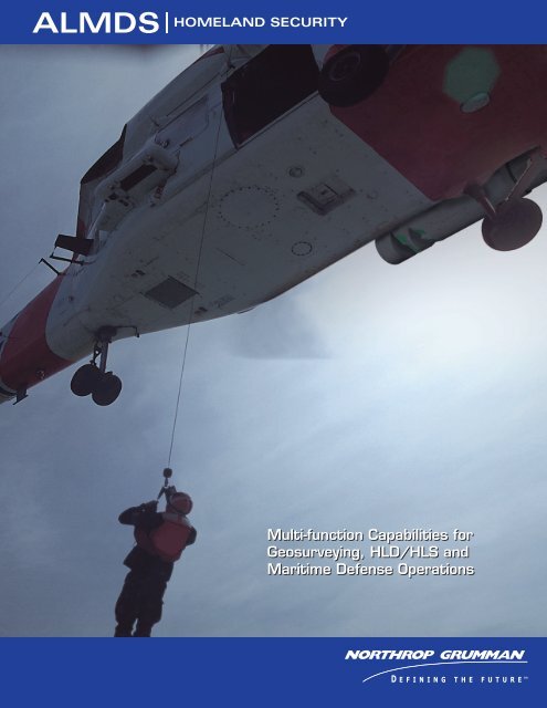
<strong>ALMDS</strong><br />
HOMELAND SECURITY<br />
Multi-function Capabilities for<br />
Geosurveying, HLD/HLS and<br />
Maritime Defense Operations
<strong>ALMDS</strong><br />
HOMELAND SECURITY<br />
<strong>ALMDS</strong> (AN/AES-1)<br />
The U.S. Navy’s <strong>ALMDS</strong> Low Rate Initial Production (LRIP) sensor has successfully<br />
demonstrated a myriad of multi-mission capabilities for expanded Fleet operations,<br />
in addition to direct applications for Coast Guard and Homeland Security assigned<br />
missions such as Surveillance, Search and Rescue, bottom mapping, and counter camoufl<br />
age.<br />
<strong>ALMDS</strong> was developed by the U.S. Navy to detect and classify fl oating and nearsurface<br />
moored mines. This capability has provided superior 3D imagery to detect divers<br />
and small boats, and map underwater surfaces. The wide area surveillance radar<br />
can identify objects in day or night conditions. <strong>ALMDS</strong> is currently being tested on<br />
MH-60S helicopters, but can be integrated on other rotary and fi xed-wing platforms.<br />
These development initiatives can provide both DOD and Non-DOD agencies with<br />
a multi-mission, low-risk system that reduces cost and response times … and is available<br />
today.<br />
Homeland Defense<br />
To support the Coast Guard Homeland Defense mission, <strong>ALMDS</strong> can fi nd, detect,<br />
and image fast boats, towed sleds, divers or other objects in the water. The system<br />
provides accurate, 3D bathymetry mapping and identifi es possible threats in port<br />
areas and waterways. This capability will greatly improve the Coast Guard’s ability to<br />
fi nd illegal aliens migrating by vessel, enhance drug interdiction activities, and support<br />
other aspects of maritime law enforcement.<br />
Maritime Safety<br />
Because it can cover a large area quickly, <strong>ALMDS</strong> provides superior capabilities to fi nd<br />
swimmers, divers, and capsized boats. This rapid search capability can greatly accelerate<br />
search operations when minutes can mean the difference between life and death.<br />
Protection of Natural Resources<br />
Recent tests indicate that <strong>ALMDS</strong> can detect changes in water turbidity, which can be<br />
used to identify the extent of pollution across an area. For example, should there be<br />
an oil spill, <strong>ALMDS</strong> can identify the spill area and track its movement. It has also been<br />
used to track marine life.<br />
System Description<br />
The <strong>ALMDS</strong> uses pulsed laser light and streak tube imaging receivers housed in an<br />
external equipment pod to image the surface-to-depth volume for people, boats, or<br />
other objects. <strong>ALMDS</strong> is capable of day or night operations with high search rates.<br />
The <strong>ALMDS</strong> design uses the forward motion of the aircraft in what is called a “pushbroom”<br />
data collection process, thereby eliminating the need for complex scanning<br />
mechanisms and ensuring high system reliability. <strong>ALMDS</strong> also provides accurate localization<br />
to support synchronization of rescue or interdiction activities.<br />
All <strong>ALMDS</strong> components are housed within a pod that weighs about 820 pounds and<br />
is approximately 107 inches long, with a 21-inch diameter. The pod is attached to the<br />
MH-60S helicopter with a standard Bomb Rack Unit (BRU-14).<br />
<strong>Northrop</strong> <strong>Grumman</strong> investment includes development of an early prototype system<br />
(ALDS) and a lightweight composite, onboard workstation that is 20-20-10 crashworthy,<br />
certifi ed to display the imagery real-time, and automatic detection algorithms to<br />
assist in identifi cation and onboard operator cueing.<br />
Program Status<br />
<strong>ALMDS</strong> entered the Production and Deployment acquisition phase for the U.S. Navy<br />
following a successful Milestone C decision on May 12, 2005 and is currently in Low<br />
Rate Initial Production, with the fi rst two LRIP units delivered to the US Navy. Preplanned<br />
product improvements are scheduled to expand the system capability into the<br />
very shallow water region, and also to investigate sensor fusion and miniaturization.<br />
Approved for Public Release; Distribution is unlimited. The system<br />
has not been tested for other missions, therefore specific performance<br />
parameters and limitations are unknown.<br />
ISER-MLB-PR-07-156<br />
This photo and bathymetry of a waterway show how the<br />
<strong>ALMDS</strong> system can accurately map port depths and activity<br />
in real time.<br />
Rapid, wide-area reconnaissance and assessment capabilities<br />
allow identifi cation and tracking of vessel traffi c.<br />
Small or large objects are easily spotted using <strong>ALMDS</strong> as<br />
illustrated by this image of a porpoise. Divers and swimmers<br />
can also be tracked and found. GPS coordinates allow<br />
Coast Guard or law enforcement resources to proceed<br />
directly to a search and rescue or interdiction area.<br />
For additional information, please contact:<br />
<strong>Northrop</strong> <strong>Grumman</strong> <strong>Corporation</strong><br />
Dex Guzmán<br />
Maritime & Tactical Systems<br />
<strong>Northrop</strong> <strong>Grumman</strong> Integrated Systems<br />
Office [321] 951-5396<br />
Mobile [321] 514-3137
![[x] amendment of solicitation/modification of contract - Northrop ...](https://img.yumpu.com/51622731/1/190x245/x-amendment-of-solicitation-modification-of-contract-northrop-.jpg?quality=85)