

SELKIRK LOOP SELKIRK LOOP - International Selkirk Loop
SELKIRK LOOP SELKIRK LOOP - International Selkirk Loop
SELKIRK LOOP SELKIRK LOOP - International Selkirk Loop

Create successful ePaper yourself
Turn your PDF publications into a flip-book with our unique Google optimized e-Paper software.
north Kootenay Lake-Silvery Slocan Super Side Trip<br />
BrItISh ColumBIa<br />
46 www.selkirkloop.org<br />
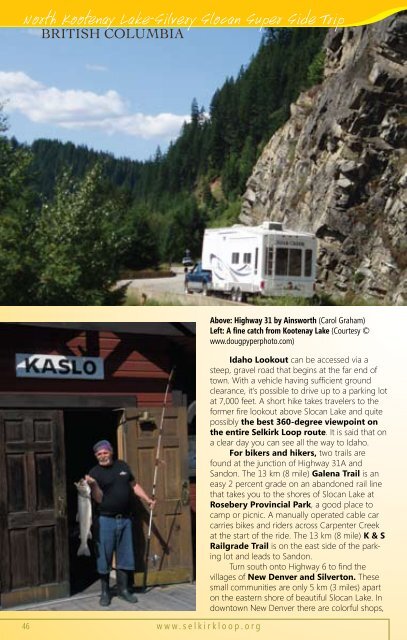
Above: Highway 31 by Ainsworth (Carol Graham)<br />
Left: A fine catch from Kootenay Lake (Courtesy ©<br />
www.dougpyperphoto.com)<br />
Idaho Lookout can be accessed via a<br />
steep, gravel road that begins at the far end of<br />
town. With a vehicle having sufficient ground<br />
clearance, it’s possible to drive up to a parking lot<br />
at 7,000 feet. A short hike takes travelers to the<br />
former fire lookout above Slocan Lake and quite<br />
possibly the best 360-degree viewpoint on<br />
the entire <strong>Selkirk</strong> <strong>Loop</strong> route. It is said that on<br />
a clear day you can see all the way to Idaho.<br />
For bikers and hikers, two trails are<br />
found at the junction of Highway 31A and<br />
Sandon. The 13 km (8 mile) Galena Trail is an<br />
easy 2 percent grade on an abandoned rail line<br />
that takes you to the shores of Slocan Lake at<br />
Rosebery Provincial Park, a good place to<br />
camp or picnic. A manually operated cable car<br />
carries bikes and riders across Carpenter Creek<br />
at the start of the ride. The 13 km (8 mile) K & S<br />
Railgrade Trail is on the east side of the parking<br />
lot and leads to Sandon.<br />
Turn south onto Highway 6 to find the<br />
villages of New Denver and Silverton. These<br />
small communities are only 5 km (3 miles) apart<br />
on the eastern shore of beautiful Slocan Lake. In<br />
downtown New Denver there are colorful shops,