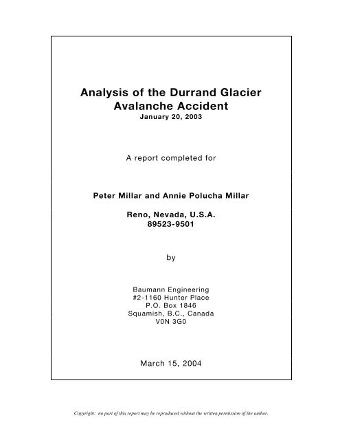
Analysis of the Durrand Glacier Avalanche Accident
Analysis of the Durrand Glacier Avalanche Accident
Analysis of the Durrand Glacier Avalanche Accident

You also want an ePaper? Increase the reach of your titles
YUMPU automatically turns print PDFs into web optimized ePapers that Google loves.
<strong>Analysis</strong> <strong>of</strong> <strong>the</strong> <strong>Durrand</strong> <strong>Glacier</strong><br />
<strong>Avalanche</strong> <strong>Accident</strong><br />
January 20, 2003<br />
A report completed for<br />
Peter Millar and Annie Polucha Millar<br />
Reno, Nevada, U.S.A.<br />
89523-9501<br />
by<br />
Baumann Engineering<br />
#2-1160 Hunter Place<br />
P.O. Box 1846<br />
Squamish, B.C., Canada<br />
V0N 3G0<br />
March 15, 2004<br />
Copyright: no part <strong>of</strong> this report may be reproduced without <strong>the</strong> written permission <strong>of</strong> <strong>the</strong> author.
Executive Summary<br />
On January 20, 2003, seven <strong>of</strong> 21 ski tourers under <strong>the</strong> leadership <strong>of</strong> Mr. Ruedi Beglinger, a<br />
Swiss-trained mountain guide, owner and chief guide <strong>of</strong> Selkirk Mountain Experience Ltd., and<br />
member <strong>of</strong> <strong>the</strong> Association <strong>of</strong> Canadian Mountain Guides (ACMG) and <strong>the</strong> Canadian <strong>Avalanche</strong><br />
Association (CAA), died when <strong>the</strong>y were buried by a large (Size 3-4) avalanche in <strong>the</strong> <strong>Durrand</strong><br />
<strong>Glacier</strong> area, 35 km north nor<strong>the</strong>ast <strong>of</strong> Revelstoke, B.C., Canada.<br />
Guide<br />
310 m (1017 feet)<br />
37° upper slope<br />
<strong>Durrand</strong> <strong>Glacier</strong><br />
Chalet<br />
Uphill track<br />
June 19, 2003<br />
Figure 1: looking east at <strong>the</strong> site <strong>of</strong> <strong>the</strong> fatal avalanche accident in <strong>the</strong> La Traviata couloir.<br />
For several weeks prior to <strong>the</strong> accident, warnings <strong>of</strong> <strong>the</strong> presence <strong>of</strong> a widespread persistent<br />
weak layer <strong>of</strong> faceted crystals in <strong>the</strong> winter snow pack, and an overlying snow slab that could<br />
produce large avalanches, were being widely reported in public avalanche bulletins issued by<br />
<strong>the</strong> Canadian <strong>Avalanche</strong> Association, and <strong>the</strong> <strong>Avalanche</strong> Control Section <strong>of</strong> Parks Canada at<br />
Rogers Pass. The Canadian <strong>Avalanche</strong> Association’s private data exchange system (InfoEx)<br />
was also warning <strong>of</strong> <strong>the</strong> hazard; however, Selkirk Mountain Experience did not subscribe to<br />
InfoEx and <strong>the</strong>refore was not able to obtain this detailed, daily information on avalanche hazard.<br />
After <strong>the</strong> accident, all nine snow pr<strong>of</strong>iles dug in <strong>the</strong> vicinity <strong>of</strong> <strong>the</strong> fatal avalanche by<br />
investigators, and o<strong>the</strong>r tests, confirmed <strong>the</strong> widespread presence <strong>of</strong> <strong>the</strong> persistent weak layer<br />
and overlying snow slab. This means that <strong>the</strong> dangerous avalanche conditions in <strong>the</strong> <strong>Durrand</strong><br />
glacier area should have been detected in standard snow pr<strong>of</strong>iles, and by doing stability tests,<br />
as described in <strong>the</strong> Canadian <strong>Avalanche</strong> Association’s Observation Guidelines and Recording<br />
Standards for Wea<strong>the</strong>r, Snowpack and <strong>Avalanche</strong>s (2002).<br />
Copyright: no part <strong>of</strong> this report may be reproduced without <strong>the</strong> written permission <strong>of</strong> <strong>the</strong> author.
Executive Summary page 2<br />
The destination chosen for this fatal ski tour first required going down into <strong>the</strong> narrow valley <strong>of</strong><br />
Cairns Creek, and <strong>the</strong>n up to a sub-alpine area called Swiss Meadows. This part <strong>of</strong> <strong>the</strong> route<br />
required crossing potentially high risk and unavoidable avalanche terrain on <strong>the</strong> south face <strong>of</strong><br />
Tumbledown Mountain during a period <strong>of</strong> considerable avalanche hazard. The overall slope <strong>of</strong><br />
this face is about 38° to 40°, which, statistically, is within <strong>the</strong> most common range <strong>of</strong> slope angle<br />
where avalanches occur. An avalanche occurring on this face would carry skiers down over<br />
bluffs or through gullies and into <strong>the</strong> terrain trap at <strong>the</strong> confined bottom <strong>of</strong> <strong>the</strong> Cairns Creek<br />
valley.<br />
From Swiss Meadows, <strong>the</strong> group originally intended to go up low-angled and relatively safe<br />
slopes to <strong>the</strong> summit <strong>of</strong> Fronalp Peak, as shown on Selkirk Mountain Experience’s guiding map.<br />
Instead, <strong>the</strong>y toured up below <strong>the</strong> west ridge <strong>of</strong> Tumbledown Mountain on a route that was so<br />
close to <strong>the</strong> base <strong>of</strong> <strong>the</strong> slope that it was subsequently overrun by <strong>the</strong> avalanches that occurred<br />
later that day.<br />
The La Traviata couloir, where <strong>the</strong> fatal accident occurred, is a steep, wind-loaded, 310 metre<br />
long shallow gully with a 37° upper slope where <strong>the</strong> avalanche started. All <strong>the</strong> avalanche<br />
reference books and o<strong>the</strong>r sources consulted warn that such couloirs have a high probability <strong>of</strong><br />
being potential sites <strong>of</strong> avalanche activity. According to <strong>the</strong> references, <strong>the</strong> specific features <strong>of</strong><br />
this couloir that were indicators <strong>of</strong> high avalanche hazard are:<br />
(a) The slope steepness. <strong>Avalanche</strong> accidents most commonly occur on slopes <strong>of</strong> 31° to 35°;<br />
this one is even steeper at 36° to 37°.<br />
(b) Lee slope build-up and cross-slope loading. Most avalanches occur on slopes where<br />
winds cause snow to accumulate and build up to form dense and potentially dangerous<br />
snow slabs. In this case, more than a metre <strong>of</strong> additional snow was present in <strong>the</strong> gully.<br />
(c) A convex upper slope. At such places <strong>of</strong> convex curvature, a snow slab resting on a<br />
persistent weak layer would be in tension due to <strong>the</strong> difference in <strong>the</strong> rate <strong>of</strong> snow creep<br />
above and below <strong>the</strong> break in slope. A skier crossing over such a convex slope is more<br />
likely to trigger a release compared to o<strong>the</strong>r slopes.<br />
(d) Relatively smooth underlying terrain. This would not provide <strong>the</strong> anchors that a more<br />
coarse, rocky slope would have, and means that <strong>the</strong> slope would have a relatively small<br />
surface roughness depth. Compared to o<strong>the</strong>r areas, this slope would be more prone to<br />
slide with lesser amounts <strong>of</strong> snow.<br />
(e) Connectivity to an area <strong>of</strong> shallow snow. In such areas, <strong>the</strong> weight <strong>of</strong> a person skiing over<br />
into <strong>the</strong> more shallow snow pack can set-<strong>of</strong>f a skier remote triggered avalanche. This is<br />
more likely to happen if <strong>the</strong> snow slab rests on a persistent weak layer, such as a layer <strong>of</strong><br />
faceted crystals, as was <strong>the</strong> case at <strong>Durrand</strong>.<br />
Copyright: no part <strong>of</strong> this report may be reproduced without <strong>the</strong> written permission <strong>of</strong> <strong>the</strong> author.
Executive Summary page 3<br />
By taking his entire party up <strong>the</strong> La Traviata couloir at <strong>the</strong> same time, <strong>the</strong> guide was<br />
unnecessarily exposing his group to a higher avalanche risk, and not following generally<br />
accepted safety procedures described in <strong>the</strong> avalanche references consulted. Specifically, <strong>the</strong><br />
following features or actions increased <strong>the</strong> avalanche risk:<br />
(a) The presence <strong>of</strong> <strong>the</strong> whole group in <strong>the</strong> couloir at <strong>the</strong> same time. This exposed <strong>the</strong> entire<br />
party to avalanche hazard, and reduced <strong>the</strong> number <strong>of</strong> potential rescuers available. It also<br />
meant that a rescue would likely involve <strong>the</strong> difficult task <strong>of</strong> tracking down several<br />
transceivers buried in a small area. Finally, <strong>the</strong> large group size meant that a greater weight<br />
<strong>of</strong> skiers (surcharge) was present on <strong>the</strong> unstable snow slab, especially at <strong>the</strong> convex top <strong>of</strong><br />
<strong>the</strong> couloir, and on <strong>the</strong> thinner snowpack above.<br />
(b) The presence <strong>of</strong> a terrain trap at <strong>the</strong> base <strong>of</strong> <strong>the</strong> La Traviata couloir. The abrupt change in<br />
slope and flat area beyond caused rapid deceleration and deposition <strong>of</strong> snow, allowing an<br />
initial 310 metre long moving snow slab in <strong>the</strong> gully to cascade over itself and form a deep,<br />
65 to 85 metre long debris deposit. This deeply buried many <strong>of</strong> <strong>the</strong> victims and greatly<br />
decreased <strong>the</strong>ir chances <strong>of</strong> survival.<br />
(c) The location <strong>of</strong> <strong>the</strong> guide some distance ahead <strong>of</strong> his group. This did not allow him to track<br />
<strong>the</strong>ir progress and well-being, or immediately notice that a large avalanche had occurred.<br />
(d) The remote location <strong>of</strong> <strong>the</strong> accident site and poor wea<strong>the</strong>r conditions. This did not allow<br />
outside rescuers to arrive at <strong>the</strong> accident scene until nearly an hour after <strong>the</strong> avalanche<br />
happened, at which point all but one <strong>of</strong> <strong>the</strong> totally buried victims had been recovered, and<br />
were dead.<br />
(e) The lack <strong>of</strong> <strong>the</strong> most efficient equipment to find and dig out buried victims. Specifically, <strong>the</strong><br />
group members did not all have dedicated avalanche probes and full-sized, robust shovels.<br />
The September 23 rd , 2003 Coroner’s Inquiry report on <strong>the</strong> <strong>Durrand</strong> accident has numerous errors<br />
and omissions and does not, in our opinion, fulfill <strong>the</strong> objectives <strong>of</strong> a coroner’s inquiry report, as<br />
described in <strong>the</strong> British Columbia Coroner’s Act and related documentation. Specifically, <strong>the</strong><br />
Coroner’s Inquiry report does not establish <strong>the</strong> full body <strong>of</strong> facts that led up to this accident, and<br />
<strong>the</strong>refore allow a thorough set <strong>of</strong> recommendations, to prevent a reoccurrence, from being<br />
developed. Some <strong>of</strong> <strong>the</strong> errors and omissions are as follows:<br />
(a) The location <strong>of</strong> <strong>the</strong> accident site is incorrectly reported as being 25 km north <strong>of</strong> Revelstoke,<br />
when in fact it is 35 km north nor<strong>the</strong>ast <strong>of</strong> Revelstoke. The Universal Transverse Mercator<br />
(UTM) grid location is also not correctly stated.<br />
(b) The report inconsistently reports <strong>the</strong> steepness <strong>of</strong> <strong>the</strong> slope, and does not give <strong>the</strong> correct<br />
elevation <strong>of</strong> <strong>the</strong> avalanche’s starting zone (crown).<br />
(c) The report does not say anything about what was done by <strong>the</strong> guide to evaluate snow<br />
stability in <strong>the</strong> weeks prior to, or on <strong>the</strong> day <strong>of</strong>, <strong>the</strong> accident.<br />
(d) There is no mention <strong>of</strong> what training <strong>the</strong> group received with regard to dealing with an<br />
avalanche, or conducting an avalanche rescue, especially one with multiple burials.<br />
Copyright: no part <strong>of</strong> this report may be reproduced without <strong>the</strong> written permission <strong>of</strong> <strong>the</strong> author.
Executive Summary page 4<br />
(e) There is no comment on <strong>the</strong> destination and route finding choices that were made by <strong>the</strong><br />
guide. Specifically, <strong>the</strong>re is no mention that <strong>the</strong> group had to cross <strong>the</strong> high risk south face<br />
<strong>of</strong> Tumbledown Mountain before even getting to <strong>the</strong> La Traviata couloir, and that <strong>the</strong>y<br />
toured up so close under <strong>the</strong> west ridge <strong>of</strong> Tumbledown Mountain that <strong>the</strong>ir uphill track<br />
was subsequently overrun by <strong>the</strong> avalanches that occurred.<br />
(f) There is no description <strong>of</strong> how <strong>the</strong> guide’s route finding decisions, and o<strong>the</strong>r actions,<br />
compare with commonly accepted principles for traveling safely in avalanche terrain, as<br />
described in numerous textbooks and o<strong>the</strong>r literature on <strong>the</strong> subject, including <strong>the</strong><br />
Association <strong>of</strong> Canadian Mountain Guide’s guide training manual.<br />
(g) There is only a brief mention <strong>of</strong> <strong>the</strong> rescue efforts, and no description <strong>of</strong> how <strong>the</strong> remote<br />
location, poor wea<strong>the</strong>r conditions, deep burials, large number <strong>of</strong> buried transceivers, and<br />
available probes and shovels affected <strong>the</strong> rescue efforts, and how efficient those rescue<br />
efforts were.<br />
To more thoroughly establish <strong>the</strong> body <strong>of</strong> facts related to this accident, and develop meaningful<br />
recommendations to avoid a similar tragedy, a Coroner’s Inquest should be convened as soon<br />
as possible.<br />
The Association <strong>of</strong> Canadian Mountain Guides should work with an independent third party to<br />
complete a thorough investigation <strong>of</strong> this accident, develop recommendations that will improve<br />
<strong>the</strong> safety <strong>of</strong> guided trips, and determine whe<strong>the</strong>r action should be taken against <strong>the</strong> guide.<br />
The British Columbia Government should work with <strong>the</strong> pr<strong>of</strong>essional mountain guides to<br />
establish a guiding association, similar to o<strong>the</strong>r pr<strong>of</strong>essional associations, that would set<br />
minimum standards for guides, codes <strong>of</strong> conduct, establish an investigation and disciplinary<br />
process, and have requirements for on-going pr<strong>of</strong>essional development.<br />
To warn backcountry users <strong>of</strong> potentially hazardous conditions, <strong>the</strong> Provincial Government<br />
should work with <strong>the</strong> Canadian <strong>Avalanche</strong> Association to develop a protocol that would provide<br />
for an immediate preliminary analysis and public report when an avalanche accident or near<br />
miss occurs. This should <strong>the</strong>n be followed by a more thorough analysis and report.<br />
Commercial recreation companies and guides should be required to report all accidents and<br />
near misses. This information should <strong>the</strong>n be made available to prospective clients so that <strong>the</strong>y<br />
can make informed choices about what activities <strong>the</strong>y participate in, and where <strong>the</strong>y go on<br />
backcountry excursions.<br />
Copyright: no part <strong>of</strong> this report may be reproduced without <strong>the</strong> written permission <strong>of</strong> <strong>the</strong> author.
Table <strong>of</strong> Contents<br />
Section A Introduction page 1<br />
Section B Public avalanche bulletin and o<strong>the</strong>r warnings <strong>of</strong> avalanche hazard page 1<br />
Section C Formation <strong>of</strong> slab avalanche hazard page 4<br />
Section D Relationship <strong>of</strong> avalanche activity to slope angle page 5<br />
Section E History <strong>of</strong> <strong>the</strong> winter snowpack in <strong>the</strong> Selkirk mountains page 6<br />
Section F History <strong>of</strong> wind activity in <strong>the</strong> Columbia mountains page 7<br />
Section G History <strong>of</strong> avalanche activity in <strong>the</strong> Columbia mountains page 8<br />
Section H Snowpack and o<strong>the</strong>r records at <strong>Durrand</strong> Chalet page 8<br />
Section I Chronology <strong>of</strong> events on January 20, 2003 page 9<br />
Section J The La Traviata couloir page 11<br />
Section K The avalanches page 14<br />
Section L Relationship <strong>of</strong> avalanche accidents to slope angle page 15<br />
Section M Wind loading in <strong>the</strong> La Traviata couloir page 16<br />
Section N Size <strong>of</strong> <strong>the</strong> fatal avalanche page 17<br />
Section O Alpha and beta angles page 17<br />
Section P Nature <strong>of</strong> <strong>the</strong> underlying ground in <strong>the</strong> La Traviata couloir page 18<br />
Section Q Initial response to <strong>the</strong> avalanche page 18<br />
Section R The avalanche rescue page 19<br />
Section S Probability <strong>of</strong> death with burial time and burial depth page 19<br />
Section T Textbook advice on how to travel safely in avalanche terrain page 21<br />
Section U Police statements on <strong>the</strong> accident page 22<br />
Section V The Coroner’s Inquiry report page 22<br />
Section W Information in <strong>the</strong> ACMG mountain guide’s training manual page 25<br />
Section X The Association <strong>of</strong> Canadian Mountain Guide’s Code <strong>of</strong> Ethics page 26<br />
Comments and Conclusions page 27<br />
Recommendations page 32<br />
Illustrations<br />
Figure 1 Overview picture <strong>of</strong> <strong>the</strong> accident site Executive Summary<br />
Figure 2 Location <strong>of</strong> <strong>the</strong> <strong>Durrand</strong> <strong>Glacier</strong> in British Columbia page 1<br />
Figure 3 Canadian avalanche hazard classification system page 2<br />
Figure 4 Rogers Pass snow pr<strong>of</strong>ile page 3<br />
Figure 5 Formation <strong>of</strong> slab avalanche hazard page 4<br />
Figure 6 Frequency <strong>of</strong> avalanche occurrence relative to slope angle page 5<br />
Figure 7 25° avalanche shadow zone in <strong>the</strong> vicinity <strong>of</strong> <strong>the</strong> La Traviata couloir page 6<br />
Figure 8 The upper Cairns Creek valley page 9<br />
Figure 9 Slope pr<strong>of</strong>ile <strong>of</strong> Tumbledown Mountain’s south face page 10<br />
Figure 10 Overview picture <strong>of</strong> <strong>the</strong> south face <strong>of</strong> Tumbledown Mountain page 10<br />
Figure 11 South face <strong>of</strong> Tumbledown Mountain in winter page 11<br />
Figure 12 Overview picture <strong>of</strong> <strong>the</strong> La Traviata couloir page 12<br />
Figure 13 Upper portion <strong>of</strong> <strong>the</strong> La Traviata couloir page 13<br />
Copyright: no part <strong>of</strong> this report may be reproduced without <strong>the</strong> written permission <strong>of</strong> <strong>the</strong> author.
Table <strong>of</strong> Contents page 2<br />
Figure 14 Looking westerly across <strong>the</strong> top <strong>of</strong> <strong>the</strong> La Traviata couloir page 14<br />
Figure 15 <strong>Avalanche</strong> accident occurrence versus starting zone slope angle page 15<br />
Figure 16 Percentage <strong>of</strong> accidents by wind exposure page 16<br />
Figure 17 Alpha and beta angles and o<strong>the</strong>r features in <strong>the</strong> La Traviata couloir page 17<br />
Figure 18 Top portion <strong>of</strong> <strong>the</strong> La Traviata couloir page 18<br />
Figure 19 Probability <strong>of</strong> death with burial time page 20<br />
Figure 20 Survival rate versus depth <strong>of</strong> burial page 20<br />
Figure 21 Route options available to <strong>the</strong> touring group page 26<br />
Figure 22 Probable triggering mechanism <strong>of</strong> <strong>the</strong> fatal avalanche page 30<br />
Tables<br />
Table 1 General description <strong>of</strong> wind activity page 7<br />
Table 2 History <strong>of</strong> avalanche activity page 8<br />
Table 3 Canadian snow avalanche size classification page 17<br />
Appendices<br />
Appendix 1 Slope pr<strong>of</strong>iles at accident site. appended<br />
Appendix 2 Routefinding options and slope features. appended<br />
Appendix 3 Contour map and additional site information appended<br />
Copyright: no part <strong>of</strong> this report may be reproduced without <strong>the</strong> written permission <strong>of</strong> <strong>the</strong> author.
A. Introduction<br />
<strong>Analysis</strong> <strong>of</strong> <strong>the</strong> <strong>Durrand</strong> <strong>Glacier</strong> <strong>Avalanche</strong> <strong>Accident</strong><br />
1. On January 20, 2003, seven ski tourers, under <strong>the</strong> leadership <strong>of</strong> Mr. Ruedi Beglinger, a<br />
Swiss-trained mountain guide, owner and chief guide <strong>of</strong> Selkirk Mountain Experience, Ltd.<br />
and member <strong>of</strong> <strong>the</strong> Association <strong>of</strong> Canadian Mountain Guides (ACMG) and <strong>the</strong> Canadian<br />
<strong>Avalanche</strong> Association (CAA), died when <strong>the</strong>y were buried by an avalanche in <strong>the</strong> <strong>Durrand</strong><br />
<strong>Glacier</strong> area, 35 km north nor<strong>the</strong>ast <strong>of</strong> Revelstoke, B.C., Canada.<br />
0 100 km<br />
Vancouver<br />
DURRAND<br />
GLACIER<br />
Revelstoke<br />
Fig. 2: Location <strong>of</strong> <strong>the</strong> accident site near Revelstoke, British Columbia, Canada.<br />
2. The victims were part <strong>of</strong> a group <strong>of</strong> 21 skiers that had departed that morning from <strong>the</strong><br />
<strong>Durrand</strong> Chalet, a remote, helicopter-accessed mountain lodge located at <strong>the</strong> headwaters<br />
<strong>of</strong> Cairns Creek, on <strong>the</strong> west side <strong>of</strong> <strong>the</strong> Selkirk Mountains, and owned by Ruedi<br />
Beglinger’s company, Selkirk Mountain Experience Limited.<br />
B. Public avalanche bulletin and o<strong>the</strong>r warnings <strong>of</strong> avalanche hazard<br />
1. For <strong>the</strong> day <strong>of</strong> <strong>the</strong> accident, <strong>the</strong> Canadian <strong>Avalanche</strong> Association’s Public <strong>Avalanche</strong><br />
Bulletin (PAB) for <strong>the</strong> North Columbia Mountains (which includes <strong>the</strong> <strong>Durrand</strong> <strong>Glacier</strong> area)<br />
was warning that a deep seated instability was present in <strong>the</strong> snowpack, and that natural<br />
avalanches were possible, and skier-triggered avalanches were probable. Overall <strong>the</strong><br />
hazard in <strong>the</strong> mountains was rated as being “Considerable”, which is <strong>the</strong> mid-point <strong>of</strong> <strong>the</strong><br />
five class hazard scale.<br />
Copyright: no part <strong>of</strong> this report may be reproduced without <strong>the</strong> written permission <strong>of</strong> <strong>the</strong> author.
<strong>Durrand</strong> <strong>Avalanche</strong> Report page 2<br />
Danger Level Probability and Trigger Recommended Action<br />
Low<br />
Moderate<br />
Considerable<br />
High<br />
Extreme<br />
Natural avalanches very<br />
unlikely. Human triggered<br />
avalanches unlikely.<br />
Natural avalanches unlikely.<br />
Human triggered avalanches<br />
possible.<br />
Natural avalanches possible,<br />
human triggered avalanches<br />
probable.<br />
Natural and human triggered<br />
avalanches likely.<br />
Widespread natural or human<br />
triggered avalanches certain.<br />
Travel is generally safe. Normal caution<br />
advised.<br />
Use caution in steeper terrain on certain<br />
aspects.<br />
Be increasingly cautious in steeper<br />
terrain.<br />
Travel in avalanche terrain is not<br />
recommended.<br />
Travel in avalanche terrain should be<br />
avoided and confined to low angle terrain,<br />
well away from avalanche path runouts.<br />
Fig. 3: Canadian avalanche hazard classification system. Key phrases are highlighted.<br />
2. The Bulletin for January 17 to January 20 th provided <strong>the</strong> following additional information;<br />
key phrases have been highlighted.<br />
NORTH COLUMBIA REGION<br />
WEATHER: The strong ridge <strong>of</strong> high pressure over <strong>the</strong> south coast and interior BC will persist<br />
through Friday and Saturday, bringing mainly clear skies in <strong>the</strong> alpine and extensive valley fog. The<br />
ridge will begin to give way on Sunday. Expect cooler temperatures in <strong>the</strong> valley and temperatures<br />
above freezing in <strong>the</strong> alpine. Winds will be light to moderate from <strong>the</strong> NW throughout <strong>the</strong> weekend.<br />
SNOWPACK: The 15-30 cm <strong>of</strong> new snow that fell early in <strong>the</strong> week continues to settle and bond to<br />
<strong>the</strong> previous surfaces. This new snow has formed windslab in exposed areas. Moderate to hard<br />
shears are still occurring on two surface hoar layers down 70 and 100 cm. Watch for cornices failing<br />
with forecasted warm temperatures, particularly as <strong>the</strong>y can be a trigger for a deep instability, which<br />
we certainly have this year.<br />
AVALANCHES: Several size 1 to 1.5 natural and human triggered avalanches, at treeline and<br />
in <strong>the</strong> alpine, were reported as recent as Wednesday. These occurrences are now becoming<br />
isolated as <strong>the</strong> recent storm snow continues to bond. A few remotely triggered size 2.5 avalanches<br />
failed in <strong>the</strong> Eastern Selkirks, some triggered from over 100 metres away. Widespread<br />
whumpfing continues to be observed in all areas.<br />
FORECAST OF AVALANCHE DANGER UP TO MONDAY EVENING (JANUARY 20 th )<br />
ALPINE – Considerable<br />
TREELINE – Considerable<br />
BELOW TREELINE – Moderate<br />
TRAVEL ADVISORY: It is important to remember that this El Nino year is producing a<br />
complex and unusual snowpack for <strong>the</strong> mountains <strong>of</strong> BC. We have two deeply buried problem<br />
layers that are slow to heal and need our continued attention. Be alert for remote triggering and<br />
continue to be vigilant about avoiding those tempting big steep alpine faces. Any avalanche<br />
triggered on <strong>the</strong> older weaknesses may propagate extensively into a large and dangerous<br />
avalanche event. Be aware <strong>of</strong> how stresses penetrate deeper into <strong>the</strong> snowpack as you group up.<br />
Copyright: no part <strong>of</strong> this report may be reproduced without <strong>the</strong> written permission <strong>of</strong> <strong>the</strong> author.
<strong>Durrand</strong> <strong>Avalanche</strong> Report page 3<br />
3. At Rogers Pass in <strong>Glacier</strong> National park, about 30 km east <strong>of</strong> <strong>the</strong> <strong>Durrand</strong> <strong>Glacier</strong>, <strong>the</strong><br />
<strong>Avalanche</strong> Control Section <strong>of</strong> Parks Canada was also warning <strong>of</strong> considerable avalanche<br />
hazard. Besides public avalanche bulletins, <strong>the</strong> <strong>Avalanche</strong> Control Section also produces<br />
and releases snow pr<strong>of</strong>iles for study plots at Mt. Fidelity and Mt. MacDonald. For example,<br />
<strong>the</strong> Mt. MacDonald snow pr<strong>of</strong>ile for January 20, 2003 is shown below; ano<strong>the</strong>r pr<strong>of</strong>ile<br />
showing similar conditions was produced at <strong>the</strong> Mt. Fidelity plot on December 31, 2002.<br />
Fig. 4: Snow pr<strong>of</strong>ile at <strong>the</strong> Mt. MacDonald study plot near Rogers Pass.<br />
4. The snow pr<strong>of</strong>ile shows <strong>the</strong> presence <strong>of</strong> a weak layer <strong>of</strong> faceted crystals between about 45<br />
and 50 cm, resting on an ice crust; this is probably <strong>the</strong> same layer on which <strong>the</strong> fatal<br />
avalanche in <strong>the</strong> La Traviata couloir ran.<br />
5. Both <strong>the</strong> Coroner’s Inquiry report, and a March, 2003 report prepared for <strong>the</strong> Coroner by<br />
Larry Stanier, a mountain guide and avalanche authority, also describe <strong>the</strong> presence <strong>of</strong> this<br />
persistent weak layer <strong>of</strong> faceted crystals buried in <strong>the</strong> snowpack. Specifically, Larry Stanier<br />
found that this weak layer was present in all nine snow pr<strong>of</strong>iles dug in <strong>the</strong> vicinity <strong>of</strong> <strong>the</strong> La<br />
Traviata couloir area by investigators working after <strong>the</strong> fatal avalanche.<br />
Copyright: no part <strong>of</strong> this report may be reproduced without <strong>the</strong> written permission <strong>of</strong> <strong>the</strong> author.
<strong>Durrand</strong> <strong>Avalanche</strong> Report page 4<br />
6. In addition to <strong>the</strong> Public <strong>Avalanche</strong> Bulletin and <strong>the</strong> publicly available information from<br />
Rogers Pass, <strong>the</strong> Canadian <strong>Avalanche</strong> Association’s private Information Exchange system<br />
(InfoEx) provided a considerable amount <strong>of</strong> additional information about <strong>the</strong> avalanche<br />
hazard, specifically, <strong>the</strong> nature <strong>of</strong> <strong>the</strong> deep seated and reactive early season facet layer.<br />
This information is described in general terms in <strong>the</strong> September 23 rd , 2003 Coroner’s<br />
Inquiry report on this accident, and in more detail in <strong>the</strong> March, 2003 report for <strong>the</strong> Coroner<br />
prepared by Larry Stanier. According to <strong>the</strong> Coroner’s Inquiry report, Selkirk Mountain<br />
Experience was not a subscriber to <strong>the</strong> InfoEx system at <strong>the</strong> time <strong>of</strong> <strong>the</strong> accident.<br />
C. Formation <strong>of</strong> slab avalanche hazard<br />
1. To understand <strong>the</strong> significance <strong>of</strong> <strong>the</strong> avalanche warnings given above, and why <strong>the</strong><br />
presence <strong>of</strong> a persistent weak layer and overlying snow slab creates an avalanche hazard,<br />
one must understand <strong>the</strong> forces that act on a unit <strong>of</strong> snow resting on a slope.<br />
weak<br />
layer<br />
force <strong>of</strong><br />
gravity<br />
old<br />
snow<br />
force <strong>of</strong><br />
gravity on<br />
snow slab<br />
shear<br />
force<br />
snow<br />
slab<br />
normal<br />
force<br />
37°<br />
snow shear<br />
force<br />
normal<br />
force<br />
Shear force = force<br />
<strong>of</strong> gravity x sin 37°<br />
Fig. 5: Formation <strong>of</strong> slab avalanche hazard. An avalanche occurs if <strong>the</strong> shear force<br />
component <strong>of</strong> gravity pulling <strong>the</strong> slab down <strong>the</strong> slope is greater than <strong>the</strong> forces (mainly<br />
friction) holding it up. Adding a person to <strong>the</strong> snow will increase <strong>the</strong> shear force.<br />
2. A layer <strong>of</strong> snow that forms a cohesive (bonded) unit is called a snow slab. When such a<br />
slab sits on a slope, <strong>the</strong> only force acting on it is <strong>the</strong> force <strong>of</strong> gravity, which can be broken<br />
down into a component acting perpendicular to <strong>the</strong> slope (<strong>the</strong> normal force), and one that<br />
acts to try and pull <strong>the</strong> block down <strong>the</strong> slope (<strong>the</strong> shear force).<br />
3. The normal force creates friction between <strong>the</strong> snow slab and <strong>the</strong> underlying layer, and this<br />
frictional force keeps <strong>the</strong> snow slab from moving down <strong>the</strong> slope; that is, it acts to counter<br />
<strong>the</strong> shear force. There are o<strong>the</strong>r forces that act to keep <strong>the</strong> snow slab from moving (shear<br />
forces on <strong>the</strong> sides, a tensional force at <strong>the</strong> top, and a compressional force at <strong>the</strong> bottom),<br />
but <strong>the</strong> frictional force is usually <strong>the</strong> greatest, and <strong>the</strong>refore <strong>the</strong> most important.<br />
Copyright: no part <strong>of</strong> this report may be reproduced without <strong>the</strong> written permission <strong>of</strong> <strong>the</strong> author.
<strong>Durrand</strong> <strong>Avalanche</strong> Report page 5<br />
4. The frictional force (Ff) present is equal to <strong>the</strong> coefficient <strong>of</strong> friction (µ) multiplied by <strong>the</strong><br />
normal force (Fn); that is Ff=µ x Fn. The coefficient <strong>of</strong> friction is a measure <strong>of</strong> how smooth<br />
or rough <strong>the</strong> boundary between <strong>the</strong> snow slab and <strong>the</strong> underlying snow is. Persistent weak<br />
layers, such as a buried layer <strong>of</strong> faceted crystals, have a relatively low coefficient <strong>of</strong> friction,<br />
and do not bond well to surrounding snow. Snow slabs resting on <strong>the</strong>m will <strong>the</strong>refore have<br />
a relatively low frictional force.<br />
5. There are several ways in which <strong>the</strong> shear force may become greater than <strong>the</strong> forces<br />
resisting motion, and cause an avalanche to release. For example, adding new snow or <strong>the</strong><br />
weight <strong>of</strong> a skier to a slab increases <strong>the</strong> shear force and may cause a release. Once a<br />
failure is initiated, it can rapidly spread out into o<strong>the</strong>r unstable areas, where <strong>the</strong><br />
combination <strong>of</strong> a persistent weak layer and a snow slab is present.<br />
6. The presence <strong>of</strong> a persistent weak layer is a warning sign that an avalanche hazard may<br />
develop. If <strong>the</strong> weak layer is covered with a snow slab, <strong>the</strong>n an avalanche hazard is<br />
present. The hazard increases as <strong>the</strong> slope angle increases, or as <strong>the</strong> thickness and<br />
density <strong>of</strong> <strong>the</strong> snow slab increases. It also increases if <strong>the</strong> coefficient <strong>of</strong> friction decreases.<br />
D. Relationship <strong>of</strong> avalanche activity to slope angle<br />
1. <strong>Avalanche</strong> occurrence is directly related to slope angle. For example, according to<br />
Tremper (2001), <strong>the</strong> following relationship applies:<br />
Number <strong>of</strong> avalanches<br />
350<br />
300<br />
250<br />
200<br />
150<br />
100<br />
50<br />
0<br />
n=809<br />
25-28 29-31 32-34 35-37 38-40 41-43 44-46 47-49 50-52 53-65<br />
Starting slope angle (degrees)<br />
Fig. 6: Frequency <strong>of</strong> avalanche occurrence relative to slope angle.<br />
Copyright: no part <strong>of</strong> this report may be reproduced without <strong>the</strong> written permission <strong>of</strong> <strong>the</strong> author.
<strong>Durrand</strong> <strong>Avalanche</strong> Report page 6<br />
3. In this specific case, measurements taken <strong>of</strong>f <strong>the</strong> 1:20 000 Terrain Resource Inventory Map<br />
(which is <strong>the</strong> best available contour map <strong>of</strong> <strong>the</strong> <strong>Durrand</strong> glacier area; see Appendix 3),<br />
indicate that <strong>the</strong> overall slope <strong>of</strong> <strong>the</strong> Tumbledown south face above <strong>the</strong> group’s traverse<br />
route out <strong>of</strong> Cairns Creek valley is about 38° to 40°. This would place this face in <strong>the</strong> slope<br />
category most likely to experience avalanche activity.<br />
4. Note that very few dry slab avalanches start on slopes <strong>of</strong> less than 25°. Also, information<br />
from both <strong>the</strong> Canadian <strong>Avalanche</strong> Association (2004) and from Weir (2002) indicate that<br />
avalanches very rarely run-out beyond a 25° shadow zone, as measured from <strong>the</strong> starting<br />
point <strong>of</strong> an avalanche (see below and Appendix 1).<br />
37°<br />
slope<br />
Starting Zone (Crown)<br />
25°<br />
<strong>Avalanche</strong> shadow zone<br />
<strong>Avalanche</strong> debris<br />
0 50 m<br />
Fig. 7: 25° avalanche shadow zone in <strong>the</strong> vicinity <strong>of</strong> <strong>the</strong> La Traviata couloir.<br />
E. History <strong>of</strong> <strong>the</strong> winter snowpack in <strong>the</strong> Selkirk mountains<br />
1. In his March, 2003 report to <strong>the</strong> Coroner, Larry Stanier provided a succinct description <strong>of</strong><br />
<strong>the</strong> history <strong>of</strong> <strong>the</strong> winter snowpack. The key elements <strong>of</strong> his description are given below,<br />
and are mainly based on data obtained from <strong>the</strong> Mt. Fidelity remote wea<strong>the</strong>r station,<br />
located about 20 km east <strong>of</strong> <strong>Durrand</strong> <strong>Glacier</strong>, at an elevation <strong>of</strong> about 1905 metres.<br />
(a) Winter started in <strong>the</strong> North Columbia mountains on about November 1, 2002 and by<br />
November 19, <strong>the</strong>re were 118 cm <strong>of</strong> snow on <strong>the</strong> ground at <strong>the</strong> Fidelity study plot.<br />
(b) On November 20, 21, and 22, temperatures remained above freezing and significant<br />
amounts <strong>of</strong> rain, and rain mixed with snow at higher elevations, fell.<br />
(c) On November 23, temperatures dropped, and a melt-freeze crust formed on <strong>the</strong> surface <strong>of</strong><br />
<strong>the</strong> snow. This crust was extremely widespread geographically, and was particularly<br />
pronounced in <strong>the</strong> Nor<strong>the</strong>rn Selkirk Mountains.<br />
(d) Temperatures remained cold from November 23 until December 6, when light snow fell and<br />
was deposited on <strong>the</strong> crust. The cold, clear conditions prevailed until December 10, which<br />
allowed <strong>the</strong> crust and <strong>the</strong> light snow to change and develop faceted crystals. Faceted<br />
crystals are inherently unstable, and do not bond well to surrounding snow.<br />
Copyright: no part <strong>of</strong> this report may be reproduced without <strong>the</strong> written permission <strong>of</strong> <strong>the</strong> author.
<strong>Durrand</strong> <strong>Avalanche</strong> Report page 7<br />
(e) When new snow started to fall on December 10, winds were light, and <strong>the</strong> faceted crystals<br />
were left intact, and were <strong>the</strong>n covered by <strong>the</strong> new snow that fell between December 10<br />
and 27 th (including 40 cm between December 25 th and 27 th ). The preserved facet layer is<br />
believed to have formed <strong>the</strong> failure plane on which many subsequent avalanches, including<br />
<strong>the</strong> ones in <strong>the</strong> <strong>Durrand</strong> <strong>Glacier</strong> area, ran.<br />
F. History <strong>of</strong> wind activity in <strong>the</strong> Columbia mountains<br />
1. Winds are an important element that factor into <strong>the</strong> formation <strong>of</strong> avalanche hazard. Winds<br />
take snow from windward slopes and deposit <strong>the</strong>m on downwind, or lee, slopes. This may<br />
cause a build-up <strong>of</strong> snow (lee slope deposition) to occur in some areas, such as below<br />
ridges or in couloirs. The greater <strong>the</strong> wind speed, <strong>the</strong> more lee slope deposition occurs,<br />
and <strong>the</strong> denser is <strong>the</strong> slab that is formed. The wind direction and terrain determines on<br />
which slopes, or aspects, lee slope deposition occurs. Note that lee slope deposition may<br />
occur, and produce avalanche hazard, even during clear wea<strong>the</strong>r when no snow is falling.<br />
2. According to Larry Stanier’s report to <strong>the</strong> Coroner, significant winds (those with velocities <strong>of</strong><br />
more than 25 km/h) were reported on eight separate occasions between January 1 and 19<br />
on <strong>the</strong> InfoEx system by ski operations in <strong>the</strong> Nor<strong>the</strong>rn Selkirks. Moderate winds are those<br />
with wind speeds <strong>of</strong> between 26 and 40 km/h, and strong winds are those with wind<br />
speeds <strong>of</strong> greater than 40 km/h. The significant wind events noted were as follows:<br />
Date Wind Description<br />
Jan 2 Strong southwest winds.<br />
Jan 3 Strong south and southwest winds.<br />
Jan 4 Moderate southwest winds.<br />
Jan 7 Strong southwest.<br />
Jan 8 Moderate northwest.<br />
Jan 12 Moderate west.<br />
Jan 19 Moderate to strong southwest.<br />
Table 1: General description <strong>of</strong> winds, North Columbia mountains, January 2 to 19, 2003.<br />
3. The La Traviata couloir, where <strong>the</strong> fatal avalanche occurred, faces approximately<br />
southwest, and <strong>the</strong> snow pillows and wind rolls present indicate that it would most heavily<br />
be loaded by sou<strong>the</strong>asterly winds that blow across <strong>the</strong> sou<strong>the</strong>rly face <strong>of</strong> Tumbledown<br />
Mountain. In this specific case, <strong>the</strong> snow pr<strong>of</strong>iles recorded immediately after <strong>the</strong> accident,<br />
show that a considerable amount <strong>of</strong> lee slope build-up occurred. Specifically, it was found<br />
that snow in <strong>the</strong> La Traviata couloir (2475 m elevation) was up to 260 cm deep. By<br />
comparison, a 148 cm depth <strong>of</strong> snow was recorded in a sheltered study plot at <strong>Durrand</strong><br />
Chalet (1940 m elevation), and windward slopes above <strong>the</strong> La Traviata couloir only had<br />
about 50 cm <strong>of</strong> snow.<br />
Copyright: no part <strong>of</strong> this report may be reproduced without <strong>the</strong> written permission <strong>of</strong> <strong>the</strong> author.
<strong>Durrand</strong> <strong>Avalanche</strong> Report page 8<br />
G. History <strong>of</strong> avalanche activity in <strong>the</strong> Columbia Mountains<br />
1. According to Larry Stanier’s report to <strong>the</strong> Coroner, widespread avalanche activity was<br />
reported in <strong>the</strong> Columbia Mountains (which includes <strong>the</strong> Selkirk mountains) on <strong>the</strong> InfoEx<br />
system between January 2 and January 19, 2003. A summary <strong>of</strong> <strong>the</strong> events is given below:<br />
Jan 2 Widespread natural and explosive-triggered avalanches up to Size<br />
2.5 on all aspects. This included one size 2 skier remote triggered<br />
slide (a slide that was triggered by <strong>the</strong> skier’s weight, but released<br />
some distance away).<br />
Jan 3 Widespread natural and explosive triggered slides to size 3.5.<br />
Jan 4 Widespread natural and explosive triggered slides to size 3.<br />
Jan 5 Widespread natural avalanches, including skier and helicopterremote<br />
releases (a slide that was triggered by <strong>the</strong> weight <strong>of</strong> <strong>the</strong><br />
skier or a helicopter, but released up to 500 metres away).<br />
Jan 6 Widespread natural and explosive triggered avalanches to size 3.5.<br />
Jan 8 Widespread natural avalanches to size 3.<br />
Jan 9 Widespread natural and explosive triggered avalanches to size 2.5.<br />
Jan 10 to 12 Light avalanche activity.<br />
Jan 13 Widespread natural and explosive triggered avalanches to size 2.5.<br />
Jan 14 One size 2.5 skier-remote triggered avalanche.<br />
Jan 15 Two size 2.5, skier-remote triggered avalanches.<br />
Jan 16 to 18 Light avalanche activity.<br />
January 19 Widespread explosive triggered avalanches.<br />
Table 2: <strong>Avalanche</strong> activity in <strong>the</strong> North Columbia mountains between January 2 and 19, 2003.<br />
Of significance are <strong>the</strong> numerous remote triggered slides reported, which Larry Stanier<br />
notes is good evidence <strong>of</strong> <strong>the</strong> lingering, widespread nature <strong>of</strong> <strong>the</strong> avalanche hazard related<br />
to <strong>the</strong> facet layer that formed between December 6th and December 10th, 2002.<br />
H. Snowpack and o<strong>the</strong>r records at <strong>Durrand</strong> Chalet<br />
1. According to Larry Stanier’s report, Selkirk Mountain Experience started operations for <strong>the</strong><br />
season at <strong>the</strong> <strong>Durrand</strong> <strong>Glacier</strong> chalet (1940 metres elevation) on December 28, 2002. On<br />
that date, <strong>the</strong>y reported a total snow depth <strong>of</strong> 161 cm, including 20 cm <strong>of</strong> new snow. An<br />
additional 11 cm <strong>of</strong> snow was recorded between December 28 and January 4, 2003, 12 cm<br />
between January 12 and 14, and one centimeter <strong>of</strong> snow on January 20 (<strong>the</strong> accident day).<br />
2. On January 20, 2003, <strong>the</strong> total snow depth at <strong>Durrand</strong> Chalet was measured to be 148 cm,<br />
indicating that a considerable amount <strong>of</strong> settlement and consolidation had taken place<br />
since wea<strong>the</strong>r and snowpack observations were started on December 28, 2002.<br />
3. There is no indication in ei<strong>the</strong>r <strong>the</strong> Coroner’s Inquiry, or Larry Stanier’s report to <strong>the</strong><br />
Coroner, that standard snow pr<strong>of</strong>iles were prepared by Selkirk Mountain Experience at<br />
<strong>Durrand</strong> Chalet, or that any stability tests, such as Rutschblock tests, were done. Also,<br />
Larry Stanier did not find any standard snow pr<strong>of</strong>iles when he stayed at <strong>the</strong> <strong>Durrand</strong> Chalet<br />
immediately after <strong>the</strong> accident.<br />
4. There is also no indication in ei<strong>the</strong>r <strong>the</strong> Coroner’s Inquiry Report or Larry Stanier’s report<br />
that Selkirk Mountain Experience reviewed any <strong>of</strong> <strong>the</strong> publicly available avalanche bulletins<br />
for <strong>the</strong> North Columbia mountains. It is <strong>the</strong>refore not known what, if anything, was done by<br />
<strong>the</strong> guides to evaluate snow stability before <strong>the</strong> group left <strong>the</strong> <strong>Durrand</strong> Chalet on <strong>the</strong><br />
morning <strong>of</strong> January 20 th , 2003.<br />
Copyright: no part <strong>of</strong> this report may be reproduced without <strong>the</strong> written permission <strong>of</strong> <strong>the</strong> author.
<strong>Durrand</strong> <strong>Avalanche</strong> Report page 9<br />
5. Finally, <strong>the</strong>re is no indication in ei<strong>the</strong>r <strong>the</strong> Coroner’s or Larry Stanier’s report to <strong>the</strong> Coroner<br />
<strong>of</strong> whe<strong>the</strong>r <strong>the</strong> guides at <strong>Durrand</strong> discussed snow conditions and stability with o<strong>the</strong>r nearby<br />
operations, such as neighbouring Selkirk Tangiers Heli-skiing, and how <strong>the</strong>ir risk<br />
management and approach to <strong>the</strong> hazard differed from <strong>the</strong>se o<strong>the</strong>r operations.<br />
I. Chronology <strong>of</strong> events on January 20, 2003<br />
1. At about 8 am on January 20, 2003, two groups <strong>of</strong> skiers (12 led by Ruedi Beglinger, and a<br />
second group <strong>of</strong> 7 skiers led by assistant guide Ken Wylie), left <strong>the</strong> <strong>Durrand</strong> Chalet (1940 m<br />
elevation) and headed north down into <strong>the</strong> headwaters <strong>of</strong> Cairns Creek.<br />
2. There is no indication in ei<strong>the</strong>r <strong>the</strong> Coroner’s Inquiry report or Larry Stanier’s report to <strong>the</strong><br />
Coroner <strong>of</strong> whe<strong>the</strong>r <strong>the</strong> guides checked <strong>the</strong> avalanche transceivers <strong>of</strong> <strong>the</strong>ir guests before<br />
leaving, and what, if anything was done to provide <strong>the</strong>m with instructions in what to do if an<br />
avalanche occurred, and how, if necessary, to carry out an avalanche rescue, especially<br />
one involving multiple burials.<br />
Chalet<br />
Cairns Creek<br />
Swiss Meadows<br />
Run-up<br />
Bluffs, gullies<br />
Tumbledown<br />
South Face<br />
June 19, 2003<br />
Fig. 8: Looking northwest at <strong>the</strong> upper Cairns Creek valley, and <strong>the</strong> route from <strong>the</strong> Chalet to<br />
Swiss Meadows. See also <strong>the</strong> map on Appendix 3.<br />
3. At <strong>the</strong> bottom <strong>of</strong> <strong>the</strong> valley (about 1620 m), <strong>the</strong>y put on climbing skins and <strong>the</strong>n ski toured<br />
up across <strong>the</strong> south face <strong>of</strong> Tumbledown Mountain, heading for a relatively low-angled<br />
wooded area at timberline known as Swiss Meadows (about 1900 m). Both <strong>the</strong> headwaters<br />
<strong>of</strong> Cairns Creek, and especially <strong>the</strong> south face <strong>of</strong> Tumbledown Mountain, are areas where<br />
<strong>the</strong> lack <strong>of</strong> trees indicates that frequent snow avalanche activity occurs.<br />
Copyright: no part <strong>of</strong> this report may be reproduced without <strong>the</strong> written permission <strong>of</strong> <strong>the</strong> author.
<strong>Durrand</strong> <strong>Avalanche</strong> Report page 10<br />
4. Natural avalanches on Tumbledown Mountain (2747 m) probably occur numerous times per<br />
year, and run down across discontinuous bluffs to <strong>the</strong> confined bottom <strong>of</strong> <strong>the</strong> valley.<br />
Based on vegetation patterns, some avalanches cross <strong>the</strong> valley and run for hundreds <strong>of</strong><br />
metres up <strong>the</strong> opposite slope. The vegetation damage and amount <strong>of</strong> run-up is good<br />
evidence <strong>of</strong> <strong>the</strong> immense size and destructive power <strong>of</strong> some <strong>of</strong> <strong>the</strong> avalanches that<br />
periodically descend <strong>of</strong>f <strong>the</strong> large south face <strong>of</strong> <strong>the</strong> aptly named Tumbledown Mountain.<br />
Tumbledown Mountain (2747 m)<br />
38°<br />
Approximate location<br />
<strong>of</strong> skier’s uphill track<br />
Cairns<br />
Creek<br />
(1550 m)<br />
0 200 m<br />
Fig. 9: Slope pr<strong>of</strong>ile <strong>of</strong> Tumbledown Mountain’s south face, looking easterly (upstream). This is<br />
based on contours given on <strong>the</strong> 1:20000 map <strong>of</strong> <strong>the</strong> area (see Appendix 3).<br />
Fronalp Peak<br />
Glarona Peak<br />
Fatal<br />
<strong>Avalanche</strong><br />
June 19, 2003<br />
Fig. 10: Overview picture looking north at <strong>the</strong> south face <strong>of</strong> Tumbledown Mountain, and <strong>the</strong><br />
approximate route from <strong>the</strong> <strong>Durrand</strong> Chalet to <strong>the</strong> La Traviata couloir.<br />
Copyright: no part <strong>of</strong> this report may be reproduced without <strong>the</strong> written permission <strong>of</strong> <strong>the</strong> author.<br />
25°<br />
Tumbledown Mountain<br />
Chalet
<strong>Durrand</strong> <strong>Avalanche</strong> Report page 11<br />
5. One <strong>of</strong> <strong>the</strong> skiers reported that <strong>the</strong> group had to cross debris left by a recent avalanche on<br />
<strong>the</strong> ski tour up to Swiss Meadows. Such a slide would carry anyone trapped in it over<br />
bluffs or through gullies, and <strong>the</strong>n into <strong>the</strong> narrow valley <strong>of</strong> Cairns Creek.<br />
Fig. 11: The south face <strong>of</strong> Tumbledown Mountain in early winter. On <strong>the</strong>ir way up to Swiss<br />
Meadows, <strong>the</strong> 21 ski tourers crossed almost <strong>the</strong> entire slope below <strong>the</strong> bottom <strong>of</strong> this<br />
picture. The overall slope <strong>of</strong> this face is between about 38° and 40°.<br />
6. From Swiss Meadows, <strong>the</strong> touring group continued up through relatively gently sloping and<br />
open terrain at <strong>the</strong> base <strong>of</strong> <strong>the</strong> steeper slopes that go up to <strong>the</strong> long west ridge <strong>of</strong><br />
Tumbledown Mountain. The ascending route was so close to <strong>the</strong> base <strong>of</strong> <strong>the</strong> slope that it<br />
was subsequently overrun by <strong>the</strong> avalanches that occurred later that day.<br />
7. At about 2240 metres, <strong>the</strong> lead group took a rest break near <strong>the</strong> base <strong>of</strong> a shallow gully (<strong>the</strong><br />
La Traviata couloir) that goes up to <strong>the</strong> west ridge <strong>of</strong> Tumbledown Mountain. Apparently,<br />
<strong>the</strong> objective up to this point had been to tour up to Fronalp Peak, a small 2500 m high<br />
summit near <strong>the</strong> west end <strong>of</strong> <strong>the</strong> Tumbledown west ridge. At this juncture, however, Ruedi<br />
Beglinger decided to go up <strong>the</strong> La Traviata couloir instead.<br />
J. The La Traviata couloir<br />
1. The La Traviata couloir is a trough-like feature that starts on flat-lying glacial till deposits<br />
located at about 2300 m elevation. The base <strong>of</strong> <strong>the</strong> couloir consists <strong>of</strong> a concave talus<br />
apron that is about 71 metres long, and is sloped at an average angle <strong>of</strong> about 27°. Above<br />
this, <strong>the</strong> slope is steeper and more uniform and consists <strong>of</strong> colluvial deposits (scree) that go<br />
up for 204 metres at an angle <strong>of</strong> about 36°, and <strong>the</strong>n an additional 36 metres at an average<br />
angle <strong>of</strong> about 37°, to a convex roll-over (see Appendix 1; attached).<br />
Copyright: no part <strong>of</strong> this report may be reproduced without <strong>the</strong> written permission <strong>of</strong> <strong>the</strong> author.
<strong>Durrand</strong> <strong>Avalanche</strong> Report page 12<br />
2. The couloir itself is located between rock outcrops on <strong>the</strong> west side, and a broad rocky<br />
ridge on <strong>the</strong> east. It is about 310 metres long in total (slope distance), about 160 metres<br />
wide at <strong>the</strong> bottom, and about 90 metres wide at <strong>the</strong> top.<br />
June 19, 2003<br />
Fatal avalanche<br />
Fig. 12: Overview picture <strong>of</strong> <strong>the</strong> La Traviata couloir showing <strong>the</strong> approximate uphill track <strong>of</strong> <strong>the</strong><br />
21 skiers, and <strong>the</strong> approximate outline <strong>of</strong> where <strong>the</strong> avalanche occurred.<br />
3. Above <strong>the</strong> convex roll-over at <strong>the</strong> top <strong>of</strong> <strong>the</strong> couloir, <strong>the</strong> angle <strong>of</strong> <strong>the</strong> scree slope decreases<br />
slightly to 34° for 26 metres. Above this, <strong>the</strong> ground consists <strong>of</strong> broken rock and bluffs that<br />
continue up to <strong>the</strong> ridge crest for 16 metres at an average slope <strong>of</strong> 51°. The top <strong>of</strong> <strong>the</strong><br />
ridge is located at an elevation <strong>of</strong> about 2500 metres. All told, <strong>the</strong> slope from <strong>the</strong> ridge<br />
crest to <strong>the</strong> flat valley bottom is about 350 metres long, and is inclined at an average angle<br />
<strong>of</strong> about 35° (see <strong>the</strong> pr<strong>of</strong>ile on <strong>the</strong> attached Appendix 1).<br />
Copyright: no part <strong>of</strong> this report may be reproduced without <strong>the</strong> written permission <strong>of</strong> <strong>the</strong> author.
<strong>Durrand</strong> <strong>Avalanche</strong> Report page 13<br />
June 19, 2003<br />
Guide’s<br />
Position<br />
Fatal<br />
<strong>Avalanche</strong><br />
<strong>Durrand</strong> <strong>Glacier</strong><br />
Fig. 13: Upper portion <strong>of</strong> <strong>the</strong> La Traviata gully, looking easterly. The dashed blue line is <strong>the</strong><br />
approximate uphill track <strong>of</strong> <strong>the</strong> ski tourers.<br />
4. The two groups <strong>of</strong> ski tourers first traversed across <strong>the</strong> base <strong>of</strong> <strong>the</strong> couloir, and continued<br />
up as far as <strong>the</strong>y could to under rock bluffs on <strong>the</strong> west side <strong>of</strong> <strong>the</strong> La Traviata couloir (see<br />
Figure 12 above). They <strong>the</strong>n kick turned, and traversed back across <strong>the</strong> couloir to <strong>the</strong><br />
rocky ridge on <strong>the</strong> east side. At this point, <strong>the</strong>y continued to zigzag up <strong>the</strong> couloir, making<br />
several more kick turns before <strong>the</strong>y reached <strong>the</strong> top. According to Larry Stanier’s report to<br />
<strong>the</strong> Coroner, <strong>the</strong>y were told to stay two metres (five feet) apart as <strong>the</strong>y ascended <strong>the</strong><br />
couloir.<br />
5. To <strong>the</strong> east (ascender’s right) <strong>of</strong> <strong>the</strong> top <strong>of</strong> <strong>the</strong> La Traviata couloir, <strong>the</strong> slope angle<br />
decreases to an average angle <strong>of</strong> about 23° (see Pr<strong>of</strong>ile 2 on Appendix 1). This means that<br />
once <strong>the</strong>y left <strong>the</strong> top <strong>of</strong> <strong>the</strong> couloir, <strong>the</strong> guide and <strong>the</strong> first seven skiers were on much more<br />
gentle ground (see Figure 14 below). This windswept area near <strong>the</strong> top <strong>of</strong> <strong>the</strong> slope is an<br />
open slope on <strong>the</strong> windward (east) side <strong>of</strong> <strong>the</strong> prominent rocky ridge that borders <strong>the</strong> top <strong>of</strong><br />
<strong>the</strong> La Traviata couloir. According to snow pr<strong>of</strong>iles prepared immediately after <strong>the</strong><br />
accident, <strong>the</strong> snow in <strong>the</strong> windswept area above and to <strong>the</strong> east <strong>of</strong> <strong>the</strong> couloir was in <strong>the</strong><br />
order <strong>of</strong> 50 cm deep.<br />
6. At <strong>the</strong> top <strong>of</strong> <strong>the</strong> couloir, Ruedi Beglinger exited to <strong>the</strong> right (east) crossing from deep,<br />
wind-deposited snow in <strong>the</strong> couloir to more shallow and low angled snow on his right.<br />
Seven o<strong>the</strong>r members <strong>of</strong> his group soon followed him onto <strong>the</strong> shallower snow.<br />
Copyright: no part <strong>of</strong> this report may be reproduced without <strong>the</strong> written permission <strong>of</strong> <strong>the</strong> author.
<strong>Durrand</strong> <strong>Avalanche</strong> Report page 14<br />
K. The avalanches<br />
1. At about 10:45 am, according to Larry Stanier’s report to <strong>the</strong> Coroner, <strong>the</strong> eight ski tourers<br />
who were above <strong>the</strong> La Traviata couloir heard a sudden “whumpf” and noticed an<br />
adjustment <strong>of</strong> <strong>the</strong> snowpack. Then a slab avalanche, estimated to be about 50 m wide,<br />
400 m long, and 50 cm deep, moved down <strong>the</strong> approximately 39° slope to <strong>the</strong> sou<strong>the</strong>ast <strong>of</strong><br />
where this upper group was located. At <strong>the</strong> bottom <strong>of</strong> <strong>the</strong> slope, it spread out across flat<br />
ground, crossing <strong>the</strong> uphill track <strong>of</strong> <strong>the</strong> group from earlier in <strong>the</strong> day.<br />
2. At about <strong>the</strong> same time, a second smaller slide started lower down on <strong>the</strong> slope, in rocky<br />
ground halfway between <strong>the</strong> first avalanche and <strong>the</strong> La Traviata couloir. A crack also ran<br />
across <strong>the</strong> entire top <strong>of</strong> <strong>the</strong> La Traviata couloir to <strong>the</strong> southwest. Where it crossed through<br />
<strong>the</strong> wind-deposited snow in <strong>the</strong> gully, it broke out a 65 metre wide snow slab that varied in<br />
depth from 63 cm to 260 cm, and had an average depth <strong>of</strong> about 150 cm.<br />
June 18, 2003<br />
Fronalp Peak<br />
SME route 19<br />
(safer route)<br />
Glarona Peak<br />
Convex roll<br />
Fatal <strong>Avalanche</strong><br />
Gully<br />
Uphill track<br />
23° slope<br />
Fig. 14: Looking in a westerly direction across <strong>the</strong> terrain above and to <strong>the</strong> east <strong>of</strong> <strong>the</strong> La<br />
Traviata couloir. Note that it is not possible to look down <strong>the</strong> couloir from this position.<br />
Also notice <strong>the</strong> safer routes, identified on Selkirk Mountain Experience’s maps, that go<br />
up to Fronalp and Glarona Peak, and <strong>the</strong> west ridge <strong>of</strong> Tumbledown Mountain. From<br />
Glarona, one can easily tour along <strong>the</strong> west ridge to <strong>the</strong> top <strong>of</strong> <strong>the</strong> La Traviata couloir.<br />
Copyright: no part <strong>of</strong> this report may be reproduced without <strong>the</strong> written permission <strong>of</strong> <strong>the</strong> author.
<strong>Durrand</strong> <strong>Avalanche</strong> Report page 15<br />
3. Note that <strong>the</strong> exact sequence <strong>of</strong> avalanching is not known. Larry Stanier’s report suggests<br />
that <strong>the</strong> sou<strong>the</strong>asterly slide occurred first, but it is possible that all three slides occurred at<br />
approximately <strong>the</strong> same time. It is also not certain where <strong>the</strong> fatal slide was triggered.<br />
Although <strong>the</strong> Coroner’s Inquiry report claims it was started by <strong>the</strong> first eight ski tourers<br />
above <strong>the</strong> La Traviata couloir, it is also possible, although unlikely, that it was started in <strong>the</strong><br />
couloir itself by <strong>the</strong> rest <strong>of</strong> <strong>the</strong> ascending ski tourers.<br />
4. Larry Stanier found that <strong>the</strong> November rain crust and facet layer was present in every one<br />
<strong>of</strong> <strong>the</strong> nine test pits that were dug in <strong>the</strong> vicinity <strong>of</strong> <strong>the</strong> avalanche crown, and was noted in<br />
all locations while probing. The facet layer formed a persistent weak layer, as described by<br />
Johnson (2000). Johnson found that such weak layers “can persist for weeks and even<br />
months in <strong>the</strong> snowpack, providing a potential failure plane for avalanches and whumpfs”<br />
(page 6, Johnson, 2000).<br />
5. Once mobilized, <strong>the</strong> avalanche in <strong>the</strong> couloir moved rapidly down <strong>the</strong> slope, overwhelming<br />
<strong>the</strong> last five skiers in <strong>the</strong> upper group, and all eight skiers in <strong>the</strong> second group. It ran for a<br />
total <strong>of</strong> 310 metres to <strong>the</strong> base <strong>of</strong> <strong>the</strong> slope, and <strong>the</strong>n for ano<strong>the</strong>r 65 to 85 metres across<br />
flat ground beyond.<br />
6. According to Larry Stanier’s report, <strong>the</strong> avalanche debris was about 185 metres long<br />
across <strong>the</strong> slope, and about 85 metres wide, and appears to have had an average depth <strong>of</strong><br />
about 300 cm. If <strong>the</strong>se figures are correct, <strong>the</strong> debris contained a total <strong>of</strong> about 47 000<br />
cubic metres <strong>of</strong> hard snow. If a typical avalanche snow density <strong>of</strong> 0.4 tonnes per cubic<br />
metre is used, <strong>the</strong> slide would have contained a total <strong>of</strong> about 19 000 tonnes <strong>of</strong> snow.<br />
L. Relationship <strong>of</strong> avalanche accidents to slope angle<br />
1. <strong>Avalanche</strong> accident occurrence is directly related to slope angle. According to <strong>the</strong><br />
Canadian <strong>Avalanche</strong> Association (2004), for dry slab avalanches, like that which occurred<br />
at <strong>Durrand</strong>, <strong>the</strong> following relationship exists between slope angle and accident occurrence:<br />
Number <strong>of</strong> accidents<br />
160<br />
140<br />
120<br />
100<br />
80<br />
60<br />
40<br />
20<br />
0<br />
45°<br />
Fig. 15: <strong>Avalanche</strong> accident occurrence versus starting zone slope angle.<br />
Copyright: no part <strong>of</strong> this report may be reproduced without <strong>the</strong> written permission <strong>of</strong> <strong>the</strong> author.
<strong>Durrand</strong> <strong>Avalanche</strong> Report page 16<br />
2. According to this data, most avalanche accidents start on slopes <strong>of</strong> between 31° and 35°<br />
The overall slope <strong>of</strong> <strong>the</strong> La Traviata couloir is about 36°, and <strong>the</strong> top 36 metres has a slope<br />
<strong>of</strong> about 37°, which means that it is even steeper than slopes on which most avalanche<br />
accidents occur.<br />
M. Wind loading in <strong>the</strong> La Traviata couloir<br />
1. The presence <strong>of</strong> large cornices on <strong>the</strong> west side <strong>of</strong> <strong>the</strong> ridge between Fronalp and Glarona<br />
Peaks, <strong>the</strong> lack <strong>of</strong> pronounced cornices on <strong>the</strong> north side <strong>of</strong> <strong>the</strong> Tumbledown west ridge,<br />
and <strong>the</strong> configuration <strong>of</strong> a pronounced wind roll on <strong>the</strong> east side <strong>of</strong> <strong>the</strong> La Traviata couloir,<br />
all indicate that <strong>the</strong> predominant winds in this area are easterly ones that blow across this<br />
slope and would cause lee slope deposition to occur in <strong>the</strong> La Traviata couloir.<br />
1. The depth <strong>of</strong> snow as measured at <strong>the</strong> crown (up to 260 cm), is a good indication <strong>of</strong> how<br />
much wind-loading had occurred in <strong>the</strong> La Traviata couloir, compared to nearby wind-swept<br />
slopes where <strong>the</strong>re was only about 50 cm <strong>of</strong> snow. Note that <strong>the</strong> snow depth in a study plot<br />
at <strong>the</strong> <strong>Durrand</strong> Chalet at this time was about 148 cm.<br />
21%<br />
2%<br />
Fig. 16: Percentage <strong>of</strong> accidents versus wind exposure (n=55; source: CAA).<br />
3. This graph indicates that when traveling from one place to ano<strong>the</strong>r through avalanche<br />
terrain, ski tourers can improve <strong>the</strong>ir margin <strong>of</strong> safety by selecting windward slopes. In this<br />
case, <strong>the</strong> group was exposed to both lee slope and cross slope wind loading.<br />
67%<br />
Lee Slope<br />
Copyright: no part <strong>of</strong> this report may be reproduced without <strong>the</strong> written permission <strong>of</strong> <strong>the</strong> author.<br />
Cross-loaded<br />
Windward
<strong>Durrand</strong> <strong>Avalanche</strong> Report page 17<br />
N. Size <strong>of</strong> <strong>the</strong> fatal avalanche<br />
1. If <strong>the</strong> area <strong>of</strong> snow that became mobilized is used, <strong>the</strong> volume <strong>of</strong> snow involved in <strong>the</strong><br />
avalanche would be about 52 500 cubic metres (125 m wide on average x 280 m long x 1.5<br />
metres deep). If a typical avalanche snow density <strong>of</strong> 0.4 tonnes per cubic metre is used,<br />
<strong>the</strong> mass <strong>of</strong> snow in <strong>the</strong> slide by this calculation would have been about 21 000 tonnes.<br />
2. The Canadian avalanche size classification system uses mass, typical path length, and<br />
typical impact pressures to define size.<br />
Size Description Typical<br />
Mass<br />
(tonnes)<br />
1<br />
Relatively harmless to people<br />
2<br />
3<br />
4<br />
5<br />
Could bury, injure or kill a person<br />
Could bury a car, destroy a small building, or<br />
break a few trees<br />
Could destroy a large truck, several buildings,<br />
or a forest with an area up to 4 hectares<br />
Largest snow avalanches known. Could<br />
destroy a village or a 40 ha forest<br />
Typical Path<br />
Length<br />
<strong>Durrand</strong> <strong>Avalanche</strong> Report page 18<br />
2. Dry slab avalanches rarely move beyond a 25° avalanche shadow zone (that is, <strong>the</strong>y rarely<br />
have less than a 25° alpha angle). This means that ski tourers can stay reasonably safe by<br />
staying outside <strong>of</strong> this shadow zone. In this case, much <strong>of</strong> <strong>the</strong> uphill track was within <strong>the</strong><br />
25° avalanche shadow zone below <strong>the</strong> west ridge <strong>of</strong> Tumbledown Mountain, which would<br />
explain why all <strong>the</strong> avalanches that occurred crossed <strong>the</strong> skier’s uphill track.<br />
P. Nature <strong>of</strong> <strong>the</strong> underlying ground in <strong>the</strong> La Traviata couloir<br />
1. From limited exposures observed during a site visit in June, 2003, it appears that <strong>the</strong><br />
underlying ground in <strong>the</strong> La Traviata couloir is covered with colluvium, derived from <strong>the</strong><br />
rocks above. Most <strong>of</strong> this material is relatively fine textured, suggesting that <strong>the</strong> surface<br />
roughness depth would be less than 50 cm, and probably less than 20 cm. There are no<br />
trees, bluffs, large rocks, or o<strong>the</strong>r features that would provide obstacles to <strong>the</strong> flow <strong>of</strong> snow<br />
down <strong>the</strong> slope. A shallow draw running east down <strong>the</strong> slope (perpendicular to <strong>the</strong> fall line)<br />
is located about 70 metres from <strong>the</strong> base <strong>of</strong> <strong>the</strong> slope. Some avalanche debris appears to<br />
have cascaded into this draw, but most <strong>of</strong> it stopped just before it.<br />
Q. Initial response to <strong>the</strong> avalanche<br />
1. Ruedi Beglinger was above <strong>the</strong> La Traviata couloir, and some distance <strong>of</strong>f to <strong>the</strong> east side<br />
when <strong>the</strong> avalanche occurred. It was not possible to determine exactly where he was, but<br />
most likely, it was about 70 metres north nor<strong>the</strong>ast <strong>of</strong> <strong>the</strong> slide scarp. One skier estimates<br />
that he was about 20 metres from <strong>the</strong> next person in <strong>the</strong> track, and that person was about<br />
50 metres up beyond <strong>the</strong> avalanche head scarp at <strong>the</strong> top <strong>of</strong> <strong>the</strong> couloir.<br />
Crown at convex<br />
roll-over<br />
Fatal avalanche<br />
Dominant wind direction<br />
Guide’s<br />
position<br />
June 19, 2003<br />
Fig. 18: Top portion <strong>of</strong> <strong>the</strong> La Traviata couloir, and lower angled ground at <strong>the</strong> top east.<br />
Copyright: no part <strong>of</strong> this report may be reproduced without <strong>the</strong> written permission <strong>of</strong> <strong>the</strong> author.
<strong>Durrand</strong> <strong>Avalanche</strong> Report page 19<br />
2. From <strong>the</strong> guide’s position, it would not have been possible for him to see <strong>the</strong> avalanche<br />
crown, or look down <strong>the</strong> couloir and see <strong>the</strong> slide path, or even <strong>the</strong> debris field where his<br />
clients were buried. This may explain why, according to at least one participant, <strong>the</strong>re was<br />
some initial disbelief and hesitation by <strong>the</strong> guide when he was first told that an avalanche<br />
had occurred, and that people were buried. Once <strong>the</strong> full impact <strong>of</strong> <strong>the</strong> situation was<br />
recognized, <strong>the</strong> eight survivors above <strong>the</strong> avalanche scarp removed <strong>the</strong>ir climbing skins,<br />
made <strong>the</strong>ir way over <strong>the</strong> scarp, and <strong>the</strong>n down <strong>the</strong> 36-37°, 310 metre long, smooth and icy<br />
bed surface <strong>of</strong> <strong>the</strong> avalanche to where <strong>the</strong> victims were buried.<br />
R. The avalanche rescue<br />
1. After <strong>the</strong> avalanche occurred, Ruedi Beglinger radioed <strong>the</strong> <strong>Durrand</strong> Chalet, and asked for all<br />
available assistance. But personnel in <strong>the</strong> lodge were too far away to <strong>of</strong>fer any direct<br />
assistance, so all <strong>the</strong>y could do was call Selkirk Mountain Helicopters (SMH), who initiated<br />
<strong>the</strong> main outside rescue response. There is an incomplete record <strong>of</strong> <strong>the</strong> response, but <strong>the</strong><br />
following times were reconstructed from various sources:<br />
10:45 am: The fatal avalanche occurs (<strong>the</strong>re is no independent corroboration <strong>of</strong> <strong>the</strong> exact<br />
time). Ruedi Beglinger radios <strong>the</strong> <strong>Durrand</strong> Chalet and asks for all available help.<br />
10:50 am: <strong>Durrand</strong> Chalet personnel radio Selkirk Mountain Helicopters, who initiate <strong>the</strong> main<br />
outside rescue response.<br />
11:05: Selkirk Tangiers Heli-Skiing (STHS) personnel overhear radio conversations related<br />
to <strong>the</strong> accident, and volunteer to send three <strong>of</strong> <strong>the</strong>ir guides in to help.<br />
11:20: Revelstoke RCMP are notified that an avalanche has occurred in <strong>the</strong> <strong>Durrand</strong><br />
<strong>Glacier</strong> area. It is not clear why it took about 35 minutes to alert <strong>the</strong> police.<br />
11:23: The three STHS guides are picked up by Selkirk Mountain Helicopters and flown to<br />
<strong>the</strong> accident area. However, due to bad wea<strong>the</strong>r, <strong>the</strong>y cannot land at <strong>the</strong> accident<br />
site until 11:41, just in time to help dig out <strong>the</strong> last victim.<br />
11:38: Thirteen Provincial Emergency Program personnel in Golden are mobilized to help<br />
in <strong>the</strong> rescue effort. It is not clear if <strong>the</strong>y were flown to <strong>the</strong> accident site.<br />
11:41: The first helicopter arrives at <strong>the</strong> accident scene with three outside rescuers (<strong>the</strong><br />
STHS guides).<br />
11:45: The last victim is pulled from <strong>the</strong> avalanche debris.<br />
S. Probability <strong>of</strong> death with burial time and burial depth<br />
1. Statistically, <strong>the</strong> probability <strong>of</strong> finding buried avalanche victims alive diminishes rapidly with<br />
time. A recent compilation is summarized in <strong>the</strong> graph below and indicates that less than<br />
50% <strong>of</strong> buried victims are pulled out alive after about 30 minutes. Note that many (by some<br />
estimates up to 35%) totally buried victims die due to trauma, <strong>the</strong> rest through asphyxiation<br />
that occurs as an ice mask forms around <strong>the</strong>ir face.<br />
These statistics emphasize <strong>the</strong> urgent need for speed, and an efficient rescue operation,<br />
when an avalanche accident occurs.<br />
Copyright: no part <strong>of</strong> this report may be reproduced without <strong>the</strong> written permission <strong>of</strong> <strong>the</strong> author.
<strong>Durrand</strong> <strong>Avalanche</strong> Report page 20<br />
100%<br />
80%<br />
Survivors<br />
60%<br />
50%<br />
40%<br />
20%<br />
n = 638<br />
0<br />
0 20 40 60 80 100 120 140 160 180 200 220 240 m<br />
Burial Time (minutes)<br />
Fig. 19: Survival rate versus time before rescue (minutes) for buried avalanche victims.<br />
2. In this case, <strong>the</strong> data suggests that, given <strong>the</strong> deep burial <strong>of</strong> <strong>the</strong> victims, and <strong>the</strong> delay in<br />
getting outside rescuers to <strong>the</strong> site, <strong>the</strong> totally buried victims had a very low probability <strong>of</strong><br />
survival. This may explain why all but one <strong>of</strong> <strong>the</strong> fully buried victims died.<br />
90%<br />
80%<br />
70%<br />
60%<br />
50%<br />
40%<br />
30%<br />
20%<br />
10%<br />
0%<br />
0.0-0.4 m 0.5-0.9 m 1.0-1.4 m 1.5-1.9 m 2.0 m<br />
Fig. 20: Survival rate versus depth <strong>of</strong> burial (n=252; source: CAA).<br />
Copyright: no part <strong>of</strong> this report may be reproduced without <strong>the</strong> written permission <strong>of</strong> <strong>the</strong> author.
<strong>Durrand</strong> <strong>Avalanche</strong> Report page 21<br />
3. At <strong>the</strong> accident scene, <strong>the</strong>re were initially only seven survivors available to carry out <strong>the</strong><br />
rescue. There is no record <strong>of</strong> whe<strong>the</strong>r all <strong>of</strong> <strong>the</strong> rescuers had proper dedicated avalanches<br />
probes and shovels, and whe<strong>the</strong>r <strong>the</strong>y were able to efficiently use <strong>the</strong>ir avalanche<br />
transceivers to locate <strong>the</strong> buried victims. Some reports suggest that some <strong>of</strong> <strong>the</strong> rescuers<br />
only had ski poles to use as probes, and small, less effective plastic shovels. There is also<br />
some indication that <strong>the</strong> rescuers coming down <strong>the</strong> couloir initially walked over <strong>the</strong> first two<br />
fully buried victims without picking up a transceiver signal, which suggests that <strong>the</strong>y may<br />
not have been effectively using <strong>the</strong>ir avalanche transceivers at this time. One client claims<br />
that <strong>the</strong> group received only an hour and a half <strong>of</strong> transceiver and rescue practice when<br />
<strong>the</strong>y arrived at <strong>the</strong> chalet. It is also not known what brand <strong>of</strong> transceivers were being used,<br />
and whe<strong>the</strong>r <strong>the</strong>y were all in good working order.<br />
4. Of <strong>the</strong> 13 skiers who were caught in <strong>the</strong> slide, six survived and seven died. There is some<br />
inconsistency about how many people were totally buried; most likely eight were fully<br />
buried, and five were partially buried. Only one <strong>of</strong> <strong>the</strong> eight skiers who were totally buried<br />
survived; he was found 280 centimetres down after 30 minutes. According to Larry<br />
Stanier’s report to <strong>the</strong> Coroner, those who died were buried from 130 to 280 cm deep.<br />
T. Textbook advice on how to travel safely in avalanche terrain<br />
1. Numerous avalanche books describe wea<strong>the</strong>r, snowpack and terrain features likely to<br />
increase avalanche risk, and also how to travel with relative safety in avalanche country.<br />
The most common edicts noted are as follows:<br />
(a) Before heading out into <strong>the</strong> backcountry, check and heed <strong>the</strong> advice in Public <strong>Avalanche</strong><br />
Bulletins, and from o<strong>the</strong>r information sources.<br />
(b) Be aware <strong>of</strong> how smooth <strong>the</strong> underlying ground is on a potential avalanche slope (assess<br />
ground roughness), and what depth <strong>of</strong> snow may create an avalanche hazard.<br />
(c) Track <strong>the</strong> history <strong>of</strong> <strong>the</strong> winter snowpack so that potentially unstable layers, or conditions<br />
that might cause unusual avalanche activity, can be recognized and managed.<br />
(d) Be extra cautious about avalanche hazard immediately after a storm, especially if more<br />
than 25 cm <strong>of</strong> snow has fallen in a short period <strong>of</strong> time, strong winds have been present,<br />
temperatures are rising, or o<strong>the</strong>r unusual wea<strong>the</strong>r or snowpack conditions have occurred.<br />
(e) In winter, be extra cautious <strong>of</strong> lingering hazard during cold conditions, or on colder, shaded<br />
slopes where processes that create unstable snow crystals, or retard <strong>the</strong> stabilization <strong>of</strong><br />
new snow, may be present.<br />
(f) Be aware <strong>of</strong> exposures, especially in spring and summer, where <strong>the</strong> effects caused by<br />
increasing temperatures or radiation may destabilize <strong>the</strong> snow and increase avalanche<br />
hazard.<br />
(g) Be aware <strong>of</strong> wind loaded lee slope areas where winds have caused larger amounts <strong>of</strong><br />
denser snow to accumulate. Lee slope build-up may occur below ridges, or any place on a<br />
slope where <strong>the</strong> presence <strong>of</strong> undulating terrain, such as a couloir, causes snow to<br />
accumulate.<br />
Copyright: no part <strong>of</strong> this report may be reproduced without <strong>the</strong> written permission <strong>of</strong> <strong>the</strong> author.
<strong>Durrand</strong> <strong>Avalanche</strong> Report page 22<br />
(h) Be extra cautious in areas where stresses in <strong>the</strong> snow may be greater, such as steep<br />
slopes (especially those greater than about 30°), convex slopes, and wind-loaded slopes.<br />
(i) Be sure to consider not only whe<strong>the</strong>r a slope may slide, but also what would happen if it<br />
does. Gullies, large slopes, slopes above cliffs, crevasses, flat valley bottoms, narrow<br />
valleys, bodies <strong>of</strong> water, and o<strong>the</strong>r terrain traps, must be treated with extra caution.<br />
(j) Before deciding on whe<strong>the</strong>r or not to cross a potential avalanche slope, consider <strong>the</strong><br />
remoteness <strong>of</strong> <strong>the</strong> location, wea<strong>the</strong>r, time <strong>of</strong> day, strength <strong>of</strong> <strong>the</strong> party, and similar factors<br />
that may influence how effective an avalanche rescue would be. Consider also whe<strong>the</strong>r<br />
safer alternative routes are available, and whe<strong>the</strong>r <strong>the</strong> party should turn around, ra<strong>the</strong>r than<br />
risk being avalanched.<br />
(k) If a slope that may avalanche must be crossed, complete additional snow stability<br />
assessments, check safety equipment, do up clothing, ensure that a minimum number <strong>of</strong><br />
people at a time are exposed to <strong>the</strong> hazard, take advantage <strong>of</strong> islands <strong>of</strong> relative safety,<br />
move as quickly as it is safely possible to do so, and be prepared to carry out an avalanche<br />
rescue.<br />
(l) When touring up a valley, try and stay outside <strong>of</strong> <strong>the</strong> 25° avalanche shadow zone below a<br />
potential avalanche slope.<br />
(m) Complete regular transceiver practices, including ones with multiple burials. Ensure that a<br />
touring group knows how to carry out an efficient avalanche rescue if a slide occurs.<br />
U. Police statements on <strong>the</strong> accident<br />
1. After <strong>the</strong> accident, on January 21, 2003, <strong>the</strong> Royal Canadian Mounted Police in Revelstoke<br />
held a press conference at which <strong>the</strong>y made <strong>the</strong> following statements:<br />
(a) The avalanche had occurred at approximately 10 am (ano<strong>the</strong>r press release stated that <strong>the</strong><br />
avalanche had occurred shortly before 11 am).<br />
(b) The accident site was approximately 55 km nor<strong>the</strong>ast <strong>of</strong> Revelstoke.<br />
Measurements with a global positioning system (GPS) indicate <strong>the</strong> accident site is<br />
about 35 km north nor<strong>the</strong>ast <strong>of</strong> Revelstoke. The Coroner’s Inquiry report describes it<br />
as being 25 km north <strong>of</strong> Revelstoke.<br />
(c) The avalanche was 300 feet (91 m) long, and 75 to 100 feet (23 to 30 m) wide.<br />
Information in Larry Stanier’s report to <strong>the</strong> Coroner indicates that <strong>the</strong> avalanche was a<br />
total <strong>of</strong> 360 metres long, 65 metres wide at <strong>the</strong> crown, and 185 metres wide in <strong>the</strong><br />
deposition area.<br />
(d) That “<strong>the</strong>re is nothing in <strong>the</strong> initial investigation at this time to lead investigators to believe<br />
that this is nothing more than a tragic accident.”<br />
This statement was made while investigators were still in <strong>the</strong> field ga<strong>the</strong>ring data, and<br />
before any analysis <strong>of</strong> <strong>the</strong> accident had even been started.<br />
Copyright: no part <strong>of</strong> this report may be reproduced without <strong>the</strong> written permission <strong>of</strong> <strong>the</strong> author.
<strong>Durrand</strong> <strong>Avalanche</strong> Report page 23<br />
V. The Coroner’s Inquiry report<br />
1. The Coroner’s Inquiry report on this accident, dated September 23 rd , 2003, included <strong>the</strong><br />
following statements:<br />
(a) “Search and rescue efforts had been underway since 10:45 hours and Emergency Health<br />
Services had personnel on site.”<br />
In fact, <strong>the</strong> first rescue helicopter did not arrive until about 11:41; and no Emergency<br />
Health Services personnel were on site until after that time. Of course, self-rescue<br />
efforts would have started immediately after <strong>the</strong> accident.<br />
(b) “Selkirk Mountain Experience is a world-renowned hut based wilderness ski touring<br />
lodge….”.<br />
It is not known on what basis this operation would be “world renowned”, or how this<br />
statement relates to <strong>the</strong> reporting requirements in <strong>the</strong> Coroner’s act.<br />
(c) “Both <strong>the</strong> lead guide and <strong>the</strong> assistant guide were operating within <strong>the</strong> guidelines set out by<br />
<strong>the</strong> ACMG (Association <strong>of</strong> Canadian Mountain Guides) Terrain Guidelines.”<br />
This statement in <strong>the</strong> Coroner’s Inquiry report is misleading in that it implies that <strong>the</strong><br />
terrain that <strong>the</strong> party was on was acceptable, according to <strong>the</strong> ACMG terrain<br />
guidelines.<br />
But <strong>the</strong> Association <strong>of</strong> Canadian Mountain Guides’ Terrain guidelines refer to <strong>the</strong> level<br />
<strong>of</strong> supervision that an assistant guide must have when he or she is taking clients on a<br />
given excursion. They have nothing whatsoever to do with <strong>the</strong> terrain that clients are<br />
being led over, and whe<strong>the</strong>r a chosen route in that terrain is reasonably safe, given <strong>the</strong><br />
avalanche conditions, or o<strong>the</strong>r factors.<br />
(d) Describes <strong>the</strong> accident site as being “approximately 25 kilometres north <strong>of</strong> Revelstoke,<br />
British Columbia.”<br />
In fact, <strong>the</strong> accident site is 35 km north nor<strong>the</strong>ast <strong>of</strong> Revelstoke, B.C.<br />
(e) States that <strong>the</strong> “UTM coordinates are east 294 and north 823.”<br />
This in fact is an incomplete and erroneous description <strong>of</strong> <strong>the</strong> UTM co-ordinates, and<br />
suggests that <strong>the</strong> Coroner does not understand <strong>the</strong> workings <strong>of</strong> <strong>the</strong> Universal<br />
Transverse Mercator (UTM) co-ordinate system. The actual location is at UTM Zone<br />
11U, 0429244 east, 5682451 north, 2300 m elevation, NAD 83, EPE±10 m, DOP 1.5.<br />
(f) Inconsistently describes <strong>the</strong> slope on which <strong>the</strong> avalanche started as being 37°, but <strong>the</strong>n<br />
later in <strong>the</strong> report as 33°.<br />
(g) Reports <strong>the</strong> elevation <strong>of</strong> <strong>the</strong> starting point (crown) <strong>of</strong> <strong>the</strong> avalanche as being at 2510<br />
metres. However, according to <strong>the</strong> best available contour map <strong>of</strong> <strong>the</strong> area, <strong>the</strong> crown was<br />
at about 2465 metres elevation. A global positioning system (GPS) gave <strong>the</strong> elevation as<br />
being about 2474 metres.<br />
Copyright: no part <strong>of</strong> this report may be reproduced without <strong>the</strong> written permission <strong>of</strong> <strong>the</strong> author.
<strong>Durrand</strong> <strong>Avalanche</strong> Report page 24<br />
2. The Coroner’s Inquiry report does not address <strong>the</strong> following key facts that pertain to travel<br />
in avalanche terrain, and that are directly applicable and important in this specific case:<br />
(a) There is no mention that any standard snow pr<strong>of</strong>iles, as described in <strong>the</strong> Canadian<br />
<strong>Avalanche</strong> Association’s Observation Guidelines and Recording Standards for Wea<strong>the</strong>r,<br />
Snowpack and <strong>Avalanche</strong>s (2002) were prepared, or that standard stability tests or a<br />
stability analysis <strong>of</strong> <strong>the</strong> snowpack at <strong>Durrand</strong> was carried out before <strong>the</strong> group set out on<br />
<strong>the</strong> morning <strong>of</strong> January 20 th .<br />
(b) There is no mention <strong>of</strong> what instructions <strong>the</strong> guests had received with regard to dealing<br />
with avalanches, or conducting an avalanche rescue, especially one with so many buried<br />
victims.<br />
(c) There is no description <strong>of</strong> <strong>the</strong> route taken by <strong>the</strong> group from <strong>the</strong> <strong>Durrand</strong> Chalet to Swiss<br />
Meadows, and <strong>the</strong> fact that <strong>the</strong>y had to cross <strong>the</strong> narrow upper valley <strong>of</strong> Cairns Creek, and<br />
<strong>the</strong> very large, steep, and potentially dangerous south face <strong>of</strong> Tumbledown Mountain.<br />
(d) There is no description <strong>of</strong> <strong>the</strong> route finding decisions made that day; specifically, how close<br />
under <strong>the</strong> west ridge <strong>of</strong> Tumbledown Mountain <strong>the</strong> group toured up. There is only a brief<br />
mention that part <strong>of</strong> <strong>the</strong>ir uphill track was subsequently overrun by <strong>the</strong> avalanches that<br />
occurred.<br />
(e) There is no full description <strong>of</strong> <strong>the</strong> dimensions, configuration, and slope <strong>of</strong> <strong>the</strong> La Traviata<br />
couloir, and no attempt to define what <strong>the</strong> many avalanche books on safe travel in<br />
avalanche country have to say about going up such a couloir during a time <strong>of</strong> considerable<br />
avalanche hazard.<br />
(f) There is no detailed description <strong>of</strong> how wind loading affects this couloir, what <strong>the</strong> slope<br />
configuration at <strong>the</strong> top <strong>of</strong> <strong>the</strong> gully is like (convex), how <strong>the</strong> snowpack thickness varied in<br />
and above <strong>the</strong> couloir, and how all <strong>of</strong> <strong>the</strong>se factors relate to <strong>the</strong> avalanche that<br />
subsequently occurred.<br />
(g) There is no mention <strong>of</strong> how far ahead <strong>of</strong> <strong>the</strong> group Ruedi Beglinger was, and whe<strong>the</strong>r his<br />
location allowed him to attend to <strong>the</strong> well-being <strong>of</strong> his clients in an effective manner, and<br />
efficiently respond to <strong>the</strong> avalanche emergency that presented itself.<br />
(h) There is no mention <strong>of</strong> whe<strong>the</strong>r <strong>the</strong> group spacing used by <strong>the</strong> guide was appropriate<br />
relative to commonly accepted standards described in various avalanche books on <strong>the</strong><br />
subject. Most books on <strong>the</strong> subject suggest exposing only one person at a time, or a<br />
limited number <strong>of</strong> people, to avalanche hazard.<br />
(i) There is no mention <strong>of</strong> how <strong>the</strong> guide’s actions compare with those described in <strong>the</strong><br />
Association <strong>of</strong> Canadian Mountain Guide’s training manuals, and o<strong>the</strong>r publications.<br />
(j) There is only a rudimentary description <strong>of</strong> whe<strong>the</strong>r Ruedi Beglinger took notice <strong>of</strong> and<br />
acted on <strong>the</strong> basic terrain, wea<strong>the</strong>r, snow stability, route finding, and o<strong>the</strong>r edicts given in<br />
various avalanche books.<br />
(k) There is no description <strong>of</strong> how effectively survivors used <strong>the</strong>ir transceivers to locate buried<br />
victims, and whe<strong>the</strong>r <strong>the</strong> rescue equipment <strong>the</strong>y had was appropriate for finding and<br />
extricating <strong>the</strong> victims.<br />
Copyright: no part <strong>of</strong> this report may be reproduced without <strong>the</strong> written permission <strong>of</strong> <strong>the</strong> author.
<strong>Durrand</strong> <strong>Avalanche</strong> Report page 25<br />
W. Information in <strong>the</strong> ACMG mountain guide’s training manual<br />
1. The Association <strong>of</strong> Canadian Mountain Guides and <strong>the</strong> American Mountain Guides<br />
Association Technical Handbook for Pr<strong>of</strong>essional Mountain Guides (1999) provides some<br />
general guidelines for traveling safely in avalanche terrain. Specifically, this manual states<br />
<strong>the</strong> following:<br />
(a) “Safe travel protocols for traveling in avalanche terrain that are treated as “rules” in<br />
recreational circles and taught as required learning on many avalanche courses are less<br />
applicable in guiding. This is not to say safe travel procedures are not used or<br />
inappropriate; only that <strong>the</strong>y are tools which are used when required, not as a matter <strong>of</strong><br />
course.”<br />
(b) “In some cases spreading out whenever in avalanche terrain can be more hazardous than<br />
staying close toge<strong>the</strong>r. A spread out party is harder to manage and control, potentially<br />
leading to a situation where guides can’t provide adequate care in pacing, coaching, or<br />
observing clients’ condition which could lead to overexertion, unsafe techniques, or<br />
deterioration <strong>of</strong> health and well-being; all <strong>of</strong> which can be as great or greater a hazard than<br />
exposure to avalanche.<br />
Skiing one at a time can also cause a party to spread out and make it difficult for a guide to<br />
respond should a client require assistance. One at a time, while perhaps reducing<br />
exposure <strong>of</strong> skiers to avalanche terrain, can greatly increase exposure times <strong>of</strong> <strong>the</strong> party if<br />
mis-applied.”<br />
(c) “Skiing one at a time slows down progress and <strong>the</strong> extra time required must be factored<br />
into <strong>the</strong> decision. It may be more efficient and safer to avoid an area where skiing one at a<br />
time is required, even when avoidance involves a longer route, if <strong>the</strong> group can be kept<br />
toge<strong>the</strong>r and can move constantly.”<br />
(d) “Guides must constantly evaluate and upgrade <strong>the</strong>ir evaluation <strong>of</strong> snow stability and<br />
avalanche hazard as <strong>the</strong>y ski. Each run and every pitch requires a conscious decision be<br />
made: to ski it or not.”<br />
(e) “While it is impossible to be 100% certain about snow stability (just as 100% certainty is<br />
impossible in practically all hazard assessment, both in <strong>the</strong> mountains and out) guides must<br />
realistically analyze and forecast snow stability and avalanche hazard. If <strong>the</strong> potential for<br />
avalanche is low and <strong>the</strong> consequences are minimal, increased exposure may be<br />
acceptable.”<br />
(f) “Guides must accept that <strong>the</strong>y will be in avalanche terrain and a small sluff in a glade can<br />
be just as deadly as a large slab in an alpine bowl. In all cases, <strong>the</strong> key lies in determining<br />
what and where <strong>the</strong> real hazard is, choosing an appropriate technique to manage risk, and<br />
above all, maximizing use <strong>of</strong> safe points in <strong>the</strong> terrain.”<br />
Copyright: no part <strong>of</strong> this report may be reproduced without <strong>the</strong> written permission <strong>of</strong> <strong>the</strong> author.
<strong>Durrand</strong> <strong>Avalanche</strong> Report page 26<br />
X. The Association <strong>of</strong> Canadian Mountain Guide’s Code <strong>of</strong> Ethics<br />
1. The first article in <strong>the</strong> Association <strong>of</strong> Canadian Mountain Guides Code <strong>of</strong> Ethics reads as<br />
follows:<br />
“The safety <strong>of</strong> our clients must be our prime concern at all times. All personal objectives<br />
and <strong>the</strong> objectives <strong>of</strong> our clients must be subordinate to this concern.”<br />
The third article <strong>of</strong> <strong>the</strong> ACMG Code <strong>of</strong> Ethics states:<br />
“Our clients have <strong>the</strong> right to expect all guides to be up-to-date on methods and<br />
techniques and to always use appropriate and well-functioning equipment.”<br />
The eighth article <strong>of</strong> <strong>the</strong> Code <strong>of</strong> Ethics states:<br />
“It is <strong>the</strong> duty <strong>of</strong> <strong>the</strong> executive committee <strong>of</strong> <strong>the</strong> ACMG to see that all members adhere to<br />
<strong>the</strong> articles <strong>of</strong> <strong>the</strong> code and take <strong>the</strong> necessary disciplinary action should any breach<br />
occur.”<br />
Copyright: no part <strong>of</strong> this report may be reproduced without <strong>the</strong> written permission <strong>of</strong> <strong>the</strong> author.
<strong>Durrand</strong> <strong>Avalanche</strong> Report page 27<br />
Comments and Conclusions<br />
1. For several weeks prior to <strong>the</strong> accident, warnings <strong>of</strong> <strong>the</strong> presence <strong>of</strong> a widespread<br />
persistent weak layer <strong>of</strong> faceted crystals in <strong>the</strong> winter snow pack, and an overlying snow<br />
slab that could produce large avalanches, were being widely reported in public avalanche<br />
bulletins issued by <strong>the</strong> Canadian <strong>Avalanche</strong> Association, and <strong>the</strong> <strong>Avalanche</strong> Control<br />
Section <strong>of</strong> Parks Canada at Rogers Pass. The Canadian <strong>Avalanche</strong> Association’s private<br />
data exchange system (InfoEx) was also warning <strong>of</strong> <strong>the</strong> hazard; however, Selkirk Mountain<br />
Experience did not subscribe to InfoEx and <strong>the</strong>refore was not able to obtain this detailed,<br />
daily information on avalanche hazard.<br />
2. After <strong>the</strong> accident, all nine snow pr<strong>of</strong>iles dug in <strong>the</strong> vicinity <strong>of</strong> <strong>the</strong> fatal avalanche by<br />
investigators, and o<strong>the</strong>r tests, confirmed <strong>the</strong> widespread presence <strong>of</strong> <strong>the</strong> persistent weak<br />
layer and overlying snow slab. This means that <strong>the</strong> dangerous (potentially life threatening)<br />
avalanche conditions in <strong>the</strong> <strong>Durrand</strong> glacier area should have been detected in standard<br />
snow pr<strong>of</strong>iles, and by doing stability tests, as described in <strong>the</strong> Canadian <strong>Avalanche</strong><br />
Association’s Observation Guidelines and Recording Standards for Wea<strong>the</strong>r, Snowpack<br />
and <strong>Avalanche</strong>s (2002).<br />
3. The destination chosen for this fatal ski tour first required going down into <strong>the</strong> narrow valley<br />
<strong>of</strong> Cairns Creek, and <strong>the</strong>n up to a sub-alpine area called Swiss Meadows. This part <strong>of</strong> <strong>the</strong><br />
route required crossing potentially high risk and unavoidable avalanche terrain on <strong>the</strong> south<br />
face <strong>of</strong> Tumbledown Mountain during a period <strong>of</strong> considerable avalanche hazard. The<br />
overall slope angle <strong>of</strong> this face is about 38° to 40°, which, statistically, is <strong>the</strong> most common<br />
range <strong>of</strong> slope angle where avalanches occur. An avalanche occurring on this face would<br />
carry skiers down over bluffs or through gullies and into <strong>the</strong> terrain trap at <strong>the</strong> confined<br />
bottom <strong>of</strong> <strong>the</strong> Cairns Creek valley.<br />
4. From Swiss Meadows, <strong>the</strong> group originally intended to go up low angled and relatively safe<br />
slopes to <strong>the</strong> summit <strong>of</strong> Fronalp Peak, as shown on Selkirk Mountain Experience’s guiding<br />
map. Instead, <strong>the</strong>y toured up below <strong>the</strong> west ridge <strong>of</strong> Tumbledown Mountain on a route<br />
that was so close to <strong>the</strong> base <strong>of</strong> <strong>the</strong> slope that it was subsequently overrun by <strong>the</strong><br />
avalanches that occurred later that day.<br />
Safer route<br />
avalanche<br />
Tumbledown Mountain<br />
Fig. 21: Safer route option (dashed green line; SME Route 19) to <strong>the</strong> top <strong>of</strong> <strong>the</strong> La Traviata<br />
couloir on <strong>the</strong> west ridge <strong>of</strong> Tumbledown Mountain. View approximately north.<br />
Copyright: no part <strong>of</strong> this report may be reproduced without <strong>the</strong> written permission <strong>of</strong> <strong>the</strong> author.
<strong>Durrand</strong> <strong>Avalanche</strong> Report page 28<br />
5. The La Traviata couloir, where <strong>the</strong> fatal accident occurred, is a steep, wind-loaded, 310<br />
metre long shallow gully with a 37° upper slope where <strong>the</strong> avalanche started. All <strong>the</strong><br />
avalanche reference books and o<strong>the</strong>r sources consulted warn that couloirs such as this<br />
have a high probability <strong>of</strong> being potential sites <strong>of</strong> avalanche activity. According to <strong>the</strong><br />
references, <strong>the</strong> specific features <strong>of</strong> this couloir that were indicators <strong>of</strong> high avalanche<br />
hazard are:<br />
(a) The slope steepness. <strong>Avalanche</strong> accidents most commonly occur on slopes <strong>of</strong> 31° to 35°;<br />
this one is even steeper at 36° to 37°.<br />
(b) Lee slope build-up and cross-slope loading. Most avalanches occur on slopes where<br />
winds cause snow to accumulate and build-up to form dense and potentially dangerous<br />
snow slabs. In this case, more than a metre <strong>of</strong> additional snow was present in <strong>the</strong> gully.<br />
(c) A convex upper slope. At such places <strong>of</strong> convex curvature, a snow slab resting on a<br />
persistent weak layer would be in tension due to <strong>the</strong> difference in <strong>the</strong> rate <strong>of</strong> snow creep<br />
above and below <strong>the</strong> break in slope. A skier crossing over such a convex slope is more<br />
likely to trigger a release compared to o<strong>the</strong>r slopes.<br />
(d) Relatively smooth underlying terrain (scree in this case). This would not provide <strong>the</strong><br />
anchors that a more rocky slope would have, and means that <strong>the</strong> slope would have a<br />
relatively small surface roughness depth. Compared to more rocky slopes, it would be<br />
more prone to slide with lesser amounts <strong>of</strong> snow.<br />
(e) Connectivity to an area <strong>of</strong> shallow snow. In such areas, <strong>the</strong> weight <strong>of</strong> a person skiing over<br />
into <strong>the</strong> more shallow snowpack can set <strong>of</strong>f a skier remote triggered avalanche. This is<br />
more likely to happen if <strong>the</strong> snow slab rests on a persistent weak layer, such as a layer <strong>of</strong><br />
faceted crystals, as was <strong>the</strong> case at <strong>Durrand</strong>.<br />
6. By taking his entire party up <strong>the</strong> La Traviata couloir at <strong>the</strong> same time, <strong>the</strong> guide was<br />
unnecessarily exposing his group to a higher avalanche risk, and not following generally<br />
accepted safety procedures described in <strong>the</strong> avalanche references consulted. Specifically,<br />
<strong>the</strong> following features or actions increased <strong>the</strong> avalanche risk and <strong>the</strong> risk generally to <strong>the</strong><br />
group.<br />
(a) The presence <strong>of</strong> <strong>the</strong> whole group in <strong>the</strong> couloir at <strong>the</strong> same time. This exposed <strong>the</strong> entire<br />
party to avalanche hazard, and reduced <strong>the</strong> number <strong>of</strong> potential rescuers available. It also<br />
meant that a rescue would likely involve <strong>the</strong> difficult task <strong>of</strong> tracking down several<br />
transceivers buried in a small area. Finally, <strong>the</strong> large group size meant that a greater weight<br />
<strong>of</strong> skiers (surcharge) was present on <strong>the</strong> unstable snow slab, especially at <strong>the</strong> convex top <strong>of</strong><br />
<strong>the</strong> couloir, and on <strong>the</strong> thinner snowpack above.<br />
(b) The presence <strong>of</strong> a terrain trap at <strong>the</strong> base <strong>of</strong> <strong>the</strong> La Traviata couloir. The abrupt change in<br />
slope caused rapid deceleration and deposition <strong>of</strong> snow, allowing an initial 310 metre long<br />
moving snow slab in <strong>the</strong> gully to cascade over itself and form a deep, 65 to 85 metre long<br />
debris deposit. This deeply buried many <strong>of</strong> <strong>the</strong> victims and greatly decreased <strong>the</strong>ir<br />
chances <strong>of</strong> survival.<br />
(c) The location <strong>of</strong> <strong>the</strong> guide some distance ahead <strong>of</strong> his group. This did not allow him to track<br />
<strong>the</strong>ir progress and well-being, or immediately notice that a large avalanche had occurred.<br />
Copyright: no part <strong>of</strong> this report may be reproduced without <strong>the</strong> written permission <strong>of</strong> <strong>the</strong> author.
<strong>Durrand</strong> <strong>Avalanche</strong> Report page 29<br />
(d) The remote location <strong>of</strong> <strong>the</strong> accident site and poor wea<strong>the</strong>r conditions. This did not allow<br />
outside rescuers to arrive at <strong>the</strong> accident scene until nearly an hour after <strong>the</strong> avalanche<br />
happened, at which point all but one <strong>of</strong> <strong>the</strong> totally buried victims had been recovered, and<br />
were dead.<br />
(e) The lack <strong>of</strong> <strong>the</strong> most efficient equipment to find and dig out buried victims. Specifically, <strong>the</strong><br />
group did not all have dedicated avalanche probes and full-sized, robust shovels.<br />
7. The September 23 rd , 2003 Coroner’s Inquiry report on <strong>the</strong> <strong>Durrand</strong> accident has numerous<br />
errors and omissions and does not, in our opinion, fulfill <strong>the</strong> objectives <strong>of</strong> a coroner’s<br />
inquiry report, as described in <strong>the</strong> British Columbia Coroner’s Act and related<br />
documentation. Specifically, <strong>the</strong> Coroner’s Inquiry report does not establish <strong>the</strong> full body<br />
<strong>of</strong> facts that led up to this accident, and <strong>the</strong>refore does not allow a thorough set <strong>of</strong><br />
recommendations, to prevent a reoccurrence, to be developed. Some <strong>of</strong> <strong>the</strong> errors and<br />
omissions are as follows:<br />
(a) The location <strong>of</strong> <strong>the</strong> accident site is erroneously reported as being 25 km north <strong>of</strong><br />
Revelstoke, when in fact it is 35 km north nor<strong>the</strong>ast <strong>of</strong> Revelstoke. The Universal<br />
Transverse Mercator (UTM) grid location is also not correctly stated.<br />
(b) The report inconsistently reports <strong>the</strong> steepness <strong>of</strong> <strong>the</strong> slope, and does not give <strong>the</strong> correct<br />
elevation <strong>of</strong> <strong>the</strong> starting zone (crown).<br />
(c) The report does not say anything about what was done by <strong>the</strong> guide to evaluate snow<br />
stability in <strong>the</strong> weeks prior to, or on <strong>the</strong> day <strong>of</strong>, <strong>the</strong> accident.<br />
(d) There is no mention <strong>of</strong> what instructions <strong>the</strong> guests received with regard to dealing with an<br />
avalanche, or conducting an avalanche rescue, especially one with so many buried victims.<br />
(e) There is no comment on <strong>the</strong> destination and route finding choices that were made by <strong>the</strong><br />
guide. Specifically, <strong>the</strong>re is no mention that <strong>the</strong> group had to cross <strong>the</strong> high risk face <strong>of</strong><br />
Tumbledown Mountain before even getting to <strong>the</strong> La Traviata couloir, and that <strong>the</strong>y toured<br />
up so close under <strong>the</strong> west ridge <strong>of</strong> Tumbledown Mountain that <strong>the</strong>ir uphill track was<br />
subsequently overrun by <strong>the</strong> avalanches that occurred later <strong>the</strong> same day.<br />
(f) There is no description <strong>of</strong> how <strong>the</strong> guide’s route finding decisions, and o<strong>the</strong>r actions,<br />
compare with commonly accepted principles for traveling safely in avalanche terrain, as<br />
described in numerous textbooks and o<strong>the</strong>r literature on <strong>the</strong> subject, including <strong>the</strong><br />
Association <strong>of</strong> Canadian Mountain Guide’s training manual.<br />
(g) There is only a brief mention <strong>of</strong> <strong>the</strong> rescue efforts, and no description <strong>of</strong> how <strong>the</strong> remote<br />
location, poor wea<strong>the</strong>r conditions, deep burial, large number <strong>of</strong> buried transceivers, and<br />
available probes and shovels affected <strong>the</strong> rescue efforts, and how efficient those rescue<br />
efforts were.<br />
8. A Coroner’s Inquiry report is limited in scope and cannot establish fault or censure anyone<br />
who may bear responsibility for an accident. By relying on <strong>the</strong> Coroner’s Inquiry report, not<br />
conducting its own thorough investigation <strong>of</strong> this accident, and not considering taking<br />
disciplinary action against its member, <strong>the</strong> Association <strong>of</strong> Canadian Mountain Guides is not<br />
following its own Code <strong>of</strong> Ethics, and standards common to many pr<strong>of</strong>essional<br />
organizations in Canada. This lack <strong>of</strong> action does not, in our opinion, encourage safe<br />
operating standards, or serve <strong>the</strong> best interests <strong>of</strong> <strong>the</strong> winter recreation industry, society as<br />
a whole, or <strong>the</strong> ACMG itself.<br />
Copyright: no part <strong>of</strong> this report may be reproduced without <strong>the</strong> written permission <strong>of</strong> <strong>the</strong> author.
<strong>Durrand</strong> <strong>Avalanche</strong> Report page 30<br />
9. The fatal slide was most likely a skier-remote triggered Size 3-4 slab avalanche involving at<br />
least 19 000 tonnes <strong>of</strong> snow. It most likely occurred as a result <strong>of</strong> <strong>the</strong> following sequence<br />
<strong>of</strong> events:<br />
(a) Early winter snow and wea<strong>the</strong>r conditions which produced a deep seated layer <strong>of</strong> unstable<br />
faceted snow resting on a rain crust.<br />
(b) Deposition <strong>of</strong> an initial layer <strong>of</strong> new snow, without much wind, on <strong>the</strong> facet layer. This<br />
protected <strong>the</strong> facet layer, and prevented it from being destroyed by wind. This was<br />
followed by fur<strong>the</strong>r deposition <strong>of</strong> wind-driven snow, which would have formed a cohesive,<br />
dense snow slab. In areas <strong>of</strong> lee slope build-up in <strong>the</strong> La Traviata couloir, <strong>the</strong> snow resting<br />
on <strong>the</strong> weak facet layer was up to 260 cm deep.<br />
(c) The widespread presence <strong>of</strong> <strong>the</strong> persistent weak facet layer, which allowed a slide, once it<br />
started, to propagate over a very large area. It is important to recognize that <strong>the</strong>re must be<br />
a weak layer <strong>of</strong> snow to begin with, o<strong>the</strong>rwise it would be physically impossible for an<br />
avalanche to start and propagate out into more distant snow.<br />
(d) In <strong>the</strong> La Traviata couloir itself, <strong>the</strong> wind-deposited snow may have been deep enough to<br />
support <strong>the</strong> weight <strong>of</strong> <strong>the</strong> skiers ascending <strong>the</strong> slope, and did not initially trigger a release.<br />
(e) As <strong>the</strong> lead skiers crossed over <strong>the</strong> convex roll at <strong>the</strong> top <strong>of</strong> <strong>the</strong> La Traviata couloir, <strong>the</strong>y<br />
crossed onto a much shallower snowpack, where <strong>the</strong> weight <strong>of</strong> <strong>the</strong> skiers relative to <strong>the</strong><br />
weight <strong>of</strong> snow was much greater, and <strong>the</strong> snowpack was not capable <strong>of</strong> supporting <strong>the</strong>ir<br />
weight. This may <strong>the</strong>n have caused <strong>the</strong> surface snow slab to collapse into <strong>the</strong> underlying<br />
weak (faceted) snow, which would explain <strong>the</strong> “whumpf” that was heard, and adjustment <strong>of</strong><br />
<strong>the</strong> snowpack that was noticed.<br />
snow slab<br />
weak layer<br />
old snow<br />
' Frank W. Baumann<br />
1. stress 2. Whumpf!<br />
3. propagation<br />
4. fracture<br />
5. AVALANCHE!<br />
frictional<br />
force<br />
Fig. 22: Probable triggering mechanism <strong>of</strong> <strong>the</strong> fatal La Traviata avalanche. The weight <strong>of</strong><br />
skiers above <strong>the</strong> crown caused a thin snow slab resting on an unstable facet layer to<br />
collapse. This collapse created a flexural wave that propagated into <strong>the</strong> deeper, winddeposited<br />
snow at <strong>the</strong> top <strong>of</strong> <strong>the</strong> couloir, where it set-<strong>of</strong>f <strong>the</strong> fatal avalanche.<br />
Copyright: no part <strong>of</strong> this report may be reproduced without <strong>the</strong> written permission <strong>of</strong> <strong>the</strong> author.<br />
force <strong>of</strong><br />
gravity<br />
shear<br />
force<br />
normal<br />
force
<strong>Durrand</strong> <strong>Avalanche</strong> Report page 31<br />
(f) As <strong>the</strong> snow collapsed, a flexural wave propagated through <strong>the</strong> slab, and <strong>the</strong> weak facet<br />
layer was ruptured, ultimately precipitating a shear failure in <strong>the</strong> deeper snow at <strong>the</strong> top <strong>of</strong><br />
<strong>the</strong> La Traviata couloir. This in turn caused <strong>the</strong> snow slab in <strong>the</strong> couloir to catastrophically<br />
fail over a wide area, and move rapidly down <strong>the</strong> slope.<br />
(g) At <strong>the</strong> bottom <strong>of</strong> <strong>the</strong> couloir, <strong>the</strong> first portion <strong>of</strong> <strong>the</strong> moving snow rapidly decelerated as it<br />
hit <strong>the</strong> flat ground in this area, and was deposited. This <strong>the</strong>n allowed <strong>the</strong> remaining snow to<br />
cascade in a series <strong>of</strong> waves over <strong>the</strong> initial deposits, compressing about 310 metres <strong>of</strong> <strong>the</strong><br />
initial 150 cm thick slab into a 65 to 85 metre long, 300 cm deep deposit <strong>of</strong> avalanche<br />
debris. This would explain why many <strong>of</strong> <strong>the</strong> victims were so deeply buried.<br />
Copyright: no part <strong>of</strong> this report may be reproduced without <strong>the</strong> written permission <strong>of</strong> <strong>the</strong> author.
<strong>Durrand</strong> <strong>Avalanche</strong> Report page 32<br />
Recommendations<br />
1. A Coroner’s Inquest should be convened as soon as possible to more thoroughly establish<br />
<strong>the</strong> body <strong>of</strong> facts related to this accident, and develop meaningful recommendations to<br />
avoid a similar tragedy.<br />
2. The Association <strong>of</strong> Canadian Mountain Guides should work with an independent third party<br />
to complete a thorough investigation <strong>of</strong> this accident, develop recommendations that will<br />
improve <strong>the</strong> safety <strong>of</strong> guided trips, and determine whe<strong>the</strong>r action should be taken against<br />
<strong>the</strong> guide.<br />
3. The British Columbia Government should work with <strong>the</strong> pr<strong>of</strong>essional mountain guides to<br />
establish a guiding association, similar to o<strong>the</strong>r pr<strong>of</strong>essional associations, that would set<br />
minimum standards for guides, codes <strong>of</strong> conduct, establish an investigation and<br />
disciplinary process, and have requirements for on-going pr<strong>of</strong>essional development.<br />
4. To warn all backcountry users <strong>of</strong> potentially hazardous conditions, <strong>the</strong> British Columbia<br />
government should work with <strong>the</strong> Canadian <strong>Avalanche</strong> Association to develop a protocol<br />
that would provide for an immediate preliminary analysis and public report when an<br />
avalanche accident or near miss occurs. This should <strong>the</strong>n be followed by a more thorough<br />
analysis and report.<br />
5. Commercial recreation companies and guides should be required to report all accidents<br />
and near misses. This information should <strong>the</strong>n be made available to prospective clients so<br />
that <strong>the</strong>y can make informed choices about what activities <strong>the</strong>y participate in, and where<br />
<strong>the</strong>y go on backcountry excursions.<br />
Copyright: no part <strong>of</strong> this report may be reproduced without <strong>the</strong> written permission <strong>of</strong> <strong>the</strong> author.
<strong>Durrand</strong> <strong>Avalanche</strong> Report page 33<br />
An Understanding:<br />
The conclusions <strong>of</strong> this report are based on <strong>the</strong> currently available data and may need to be<br />
modified if additional information becomes available. It must be stressed that terrain analysis,<br />
hazard assessment, and <strong>the</strong> evaluation <strong>of</strong> avalanche risk are inexact sciences and that any<br />
activity in mountainous terrain is subject to a certain degree <strong>of</strong> inherent risk. Despite this<br />
uncertainty, it should be noted that many <strong>of</strong> <strong>the</strong>se risks are predictable and can be managed. If<br />
questions remain, additional specialist advice or a second opinion should be obtained.<br />
Yours truly,<br />
Frank W. Baumann, P.Eng.<br />
Consulting Pr<strong>of</strong>essional Engineer<br />
Copyright: no part <strong>of</strong> this report may be reproduced without <strong>the</strong> written permission <strong>of</strong> <strong>the</strong> author.
<strong>Durrand</strong> <strong>Avalanche</strong> Report page 34<br />
References:<br />
Association <strong>of</strong> Canadian Mountain Guides and American Mountain Guides<br />
Association. 1999. Technical Handbook for Pr<strong>of</strong>essional Mountain Guides. Association<br />
<strong>of</strong> Canadian Mountain Guides and <strong>the</strong> American Association <strong>of</strong> Mountain Guides.<br />
Canadian <strong>Avalanche</strong> Association. 2004. <strong>Avalanche</strong> tutorial and information resource<br />
on <strong>the</strong>ir Web site at http://www.avalanche.ca/accident/index.html.<br />
Brugger H, Durrer B, Adler-Kastner L, Falk M, Tschirky F. Field management <strong>of</strong><br />
avalanche victims. Resuscitation 2001; 51: 7-15<br />
Canadian <strong>Avalanche</strong> Association. 2002. Observation guidelines and recording<br />
standards for wea<strong>the</strong>r, snowpack and avalanches. Peter Weir, Editor. Canadian<br />
<strong>Avalanche</strong> Association.<br />
Daffern, Tony. 2002. <strong>Avalanche</strong> safety for skiers, climbers and snowboarders. Rocky<br />
Mountain Books.<br />
Ferguson, Sue and LaChapelle, Edward. 2003. The ABC’s <strong>of</strong> <strong>Avalanche</strong> Safety, 3 rd<br />
edition. The Mountaineers Books.<br />
Jamieson, Bruce. 2000. Backcountry <strong>Avalanche</strong> Awareness, 7 th Edition. Canadian<br />
<strong>Avalanche</strong> Association.<br />
Johnson III, Benjamin Crane. 2000. Remotely Triggered Slab <strong>Avalanche</strong>s. A <strong>the</strong>sis<br />
submitted to <strong>the</strong> faculty <strong>of</strong> graduate studies in partial fulfillment <strong>of</strong> <strong>the</strong> requirements for<br />
<strong>the</strong> degree <strong>of</strong> Master <strong>of</strong> Science. University <strong>of</strong> Calgary.<br />
McClung, David and Schaerer, Peter. 1998. The <strong>Avalanche</strong> Handbook. The<br />
Mountaineers.<br />
Purse, Charles. September 23, 2003. Judgment <strong>of</strong> Inquiry into <strong>the</strong> Death <strong>of</strong> Kathleen<br />
Kessler. B.C. Coroner’s Service case 2003:528:0008. PSS No. 03-556<br />
Stanier, Larry. March, 2003. Coroners Report from <strong>the</strong> <strong>Avalanche</strong> <strong>Accident</strong> on La<br />
Traviata, <strong>Durrand</strong> <strong>Glacier</strong> <strong>Avalanche</strong> Area, Nor<strong>the</strong>rn Selkirks, January 20 th , 2003.<br />
Prepared for <strong>the</strong> B.C. Coroner’s Service. Note: this was a report prepared for <strong>the</strong><br />
Coroner by Larry Stanier. Despite <strong>the</strong> title, it is not <strong>the</strong> Coroner’s report itself.<br />
Tremper, Bruce. 2001. Staying Alive in <strong>Avalanche</strong> Terrain. Mountaineer Books.<br />
Weir, Peter. 2002. Snow <strong>Avalanche</strong> Management in Forested Terrain. British<br />
Columbia Ministry <strong>of</strong> Forests.<br />
Copyright: no part <strong>of</strong> this report may be reproduced without <strong>the</strong> written permission <strong>of</strong> <strong>the</strong> author.
#2-1160 Hunter Place, Box 1846<br />
Squamish, B.C., V0N 3G0, Canada<br />
Phone: (604) 892-2303<br />
E-mail: baumann.eng@telus.net<br />
Biographical Sketch, Frank W. Baumann, P.Eng.<br />
AUMANN<br />
NGINEERING<br />
Geological Engineers<br />
and Geoscientists<br />
Frank Baumann is a pr<strong>of</strong>essional engineer residing in Squamish, B.C. who specializes in <strong>the</strong><br />
evaluation and management <strong>of</strong> terrain and geotechnical issues and slope hazards, including<br />
avalanche hazard, for <strong>the</strong> resource industry, land developers, and, most recently, <strong>the</strong> run <strong>of</strong> river<br />
hydroelectric power generating industry.<br />
Frank graduated from <strong>the</strong> University <strong>of</strong> British Columbia and became a pr<strong>of</strong>essional engineer in<br />
1973. For many years, he worked in <strong>the</strong> mineral exploration industry, where he first learned to<br />
deal with terrain issues and slope hazards, including avalanche hazard, while working in<br />
mountainous terrain in British Columbia, Washington State, Colorado, Utah, and Alaska. After a<br />
period <strong>of</strong> time that included both managing mineral exploration programs and teaching, Frank<br />
started his own consulting firm in 1991, but still teaches some courses at <strong>the</strong> British Columbia<br />
Institute <strong>of</strong> Technology.<br />
During all <strong>the</strong>se years, Frank has been an active mountaineer; most notably, completing <strong>the</strong> first<br />
ascent in 1977 <strong>of</strong> Warbler Ridge on 5956 metre high Mt. Logan, Canada's highest mountain,<br />
and, in 2003, climbing 4807 metre high Mont Blanc, Europe's highest mountain. In 1971, he<br />
was <strong>the</strong> training <strong>of</strong>ficer for <strong>the</strong> Mountain Rescue Group in British Columbia, and received his first<br />
formal avalanche training through a program <strong>of</strong>fered by <strong>the</strong> National Research Council <strong>of</strong><br />
Canada. In 1974, he successfully completed additional avalanche course work and earned his<br />
Ski Guide's certification through <strong>the</strong> Association <strong>of</strong> Canadian Mountain Guides. For many years,<br />
he led numerous trips for <strong>the</strong> British Columbia Mountaineering Club, was <strong>the</strong> co-owner <strong>of</strong> Coast<br />
Range Guiding and heli-ski guided part time, was on <strong>the</strong> First Aid Ski Patrol at Whistler<br />
Mountain, and taught avalanche courses to ski patrollers, mountain rescuers, B.C. corrections<br />
staff, and to climbing clubs, as well as giving public lectures through Mountain Equipment Coop<br />
and o<strong>the</strong>r organizations. In 1979, he developed, and <strong>the</strong>n taught for many years, <strong>the</strong><br />
Federation <strong>of</strong> Mountain Clubs <strong>of</strong> B.C.'s first Recreational <strong>Avalanche</strong> Course (now provided by<br />
Canada West Mountain School). During this time, he also produced articles dealing with<br />
avalanches that were published in <strong>the</strong> Alpine Club <strong>of</strong> Canada’s Canadian Alpine Journal, and coauthored<br />
an avalanche safety pamphlet.<br />
Currently, he still provides avalanche safety training, but spends more time dealing with <strong>the</strong><br />
management <strong>of</strong> avalanche risk in <strong>the</strong> greater context <strong>of</strong> dealing with slope hazards in rugged<br />
mountainous terrain. His latest contribution to avalanche knowledge was at <strong>the</strong> 2003<br />
Association <strong>of</strong> Pr<strong>of</strong>essional Engineers and Geoscientist’s Annual General Meeting where he<br />
presented a paper on managing avalanche hazard in forestry settings.<br />
Copyright: no part <strong>of</strong> this report may be reproduced without <strong>the</strong> written permission <strong>of</strong> <strong>the</strong> author.