The Rocks Weir Fishway Concept Report - Wiki - NQ Dry Tropics
The Rocks Weir Fishway Concept Report - Wiki - NQ Dry Tropics
The Rocks Weir Fishway Concept Report - Wiki - NQ Dry Tropics

Create successful ePaper yourself
Turn your PDF publications into a flip-book with our unique Google optimized e-Paper software.
<strong>The</strong> <strong>Rocks</strong> <strong>Weir</strong><br />
<strong>Fishway</strong> <strong>Concept</strong><br />
<strong>Report</strong><br />
2009<br />
Prepared By:<br />
Tim Marsden<br />
Melinda Ferguson
Published by <strong>NQ</strong> <strong>Dry</strong> <strong>Tropics</strong> Ltd trading as <strong>NQ</strong> <strong>Dry</strong><br />
<strong>Tropics</strong><br />
Copyright 2009 <strong>NQ</strong> <strong>Dry</strong> <strong>Tropics</strong> Ltd<br />
ISBN ??????????????<br />
<strong>The</strong> copyright Act 1968 permits fair dealing for study<br />
research, news reporting, criticism or review. Selected<br />
passages, tables or diagrams may be reproduced for<br />
such purposes provided acknowledgement of the<br />
source is included. Major extracts of the entire<br />
document may not be reproduced by any process<br />
without the written permission of the Chief Executive<br />
Officer, <strong>NQ</strong> <strong>Dry</strong> <strong>Tropics</strong>.<br />
Please reference as: ????????????<br />
Further copies may be obtained from <strong>NQ</strong> <strong>Dry</strong><br />
<strong>Tropics</strong> or from our website:<br />
www.nqdrytropics.com.au<br />
Cnr McIlwraith and Dean Sts,<br />
Townsville, Q 4810<br />
P.O Box 1466, Townsville Q 4810<br />
Ph: (07) 47243 544 Fax: (07) 47243 577<br />
“<strong>The</strong> information contained in this report has been complied in good faith from sources Burdekin Solutions<br />
Limited trading as <strong>NQ</strong> <strong>Dry</strong> <strong>Tropics</strong> believes to be reliable. However, <strong>NQ</strong> <strong>Dry</strong> <strong>Tropics</strong>, its officers, board<br />
members, employees and consultants do not invite reliance upon, nor accept responsibility for, or guarantee<br />
the accuracy or completeness of the information. Before relying on any information in this report, the reader<br />
should make their own enquiries and seek independent professional, scientific and technical advice. <strong>The</strong><br />
reliance upon and/or use of any information contained in this report shall be at the reader’s own risk and no<br />
liability will be accepted for any consequences which may arise directly or indirectly as a result.”<br />
Information contained in this publication is provided as general advice for this specific site only. For application<br />
to other specific circumstances, professional advice should be sought. <strong>The</strong> Queensland Department of Primary<br />
Industries and Fisheries has taken all reasonable steps to ensure the information contained in this publication is<br />
accurate at the time of publication. Readers should ensure that they make appropriate enquires to determine<br />
whether new information is available on the particular subject matter.
Table of Contents<br />
Glossary of Terms.................................................................................................................................... 4<br />
Introduction ............................................................................................................................................ 5<br />
Site Information ...................................................................................................................................... 6<br />
Burdekin River System ........................................................................................................................ 6<br />
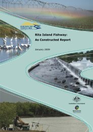
Rita Island Sand-Dam <strong>Fishway</strong> ........................................................................................................ 7<br />
Clare <strong>Weir</strong> Fishlock .......................................................................................................................... 7<br />
Bogie River <strong>Fishway</strong> ........................................................................................................................ 7<br />
<strong>The</strong> <strong>Rocks</strong> <strong>Weir</strong> ................................................................................................................................... 8<br />
Fish Passage Requirements ................................................................................................................... 10<br />
Fish Species ....................................................................................................................................... 10<br />
Migration Timings ............................................................................................................................. 10<br />
Size Ranges ........................................................................................................................................ 10<br />
Fish Passage Option .............................................................................................................................. 13<br />
<strong>Fishway</strong> Type ..................................................................................................................................... 13<br />
Rock ramp fishways ...................................................................................................................... 13<br />
<strong>Fishway</strong> Configuration ...................................................................................................................... 14<br />
Materials ........................................................................................................................................... 14<br />
Foundation and Structural Stability .................................................................................................. 14<br />
Equipment ......................................................................................................................................... 14<br />
Timing................................................................................................................................................ 14<br />
Costing .............................................................................................................................................. 15<br />
Conclusion ............................................................................................................................................. 15<br />
Recommendations ................................................................................................................................ 15<br />
Acknowledgements ............................................................................................................................... 15<br />
References ............................................................................................................................................ 16<br />
Appendix 2: Straight Rock Ramp <strong>Concept</strong> <strong>Fishway</strong> Design ................................................................... 18<br />
APPENDIX 2 – Dog-leg rock-ramp concept fishway design ................................................................... 20
Glossary of Terms<br />
Diadromous - Diadromous fishes are truly migratory species whose distinctive characteristics include<br />
that they (i) migrate between freshwaters and the sea; (ii) the movement is usually obligatory; and<br />
(iii) migration takes place at fixed seasons or life stages. <strong>The</strong>re are three distinctions within the<br />
diadromous category, catadromous, amphidromous and anadromous.<br />
• Catadromous - Diadromous fishes which spend most of their lives in fresh water, and migrate to<br />
sea to breed.<br />
• Amphidromous - Diadromous fishes in which migration between freshwater and the sea is not for<br />
the purpose of breeding, but occurs at some other stage of the life cycle.<br />
• Anadromous - Diadromous fishes which spend most of their lives at sea, and migrate to freshwater<br />
to breed.<br />
• Potamodromous - fish species whose migrations occur wholly within freshwater for breeding and<br />
other purposes.
Introduction<br />
In 2007 the Burdekin <strong>Dry</strong> <strong>Tropics</strong> Natural Resource Management (BDTNRM) group completed a ‘Fish<br />
Passage Study’ that examined potential fish barriers within the Burdekin Catchment. From this study<br />
the report, ‘Final <strong>Report</strong>: Burdekin <strong>Dry</strong> <strong>Tropics</strong> NRM Region Fish Passage Study’ (November 2007,<br />
Alluvium Consulting) was generated and delivered. This report identified 31 potential barriers to the<br />
migration of Australian native fresh water fish species in the Burdekin Catchment.<br />
Following the delivery of the report, a field assessment was undertaken in March, 2008 involving<br />
several parties: Jason Carter (Alluvium), Jim Tait (Econcern), Ross Kaptitzke (JCU) and Tim Marsden<br />
(DPI&F). Each of these parties brought together extensive expertise in fish ecology and passage,<br />
waterway management and environmental engineering. <strong>The</strong> field assessment examined the 31<br />
barriers identified in the report, and considered fish passage requirements in relation to the existing<br />
barrier structure and waterway condition. Following this assessment, recommendations and<br />
prioritisations for their remediation were made.<br />
<strong>The</strong> Department of Primary Industries & Fisheries (DPI&F) have been contracted by BDTNRM to<br />
undertake the production of fishway concept design reports for those fish barriers ranked highest on<br />
the priority list for remediation works. In October 2008, eleven sites were re-visited and ground<br />
surveys undertaken. From these surveys concept plans have been created offering (for some sites)<br />
several options for possible remediation works.<br />
This report contains the concept design and rationale for suggested remediation works to restore<br />
fish passage at <strong>The</strong> <strong>Rocks</strong> <strong>Weir</strong>, Burdekin River.
Site Information<br />
Burdekin River System<br />
Covering an area of approximately 130,000 km2, the Burdekin River catchment is the second largest<br />
coastal catchment in Queensland, stretching almost 600km from the central Queensland township<br />
of Alpha to just inland of Ingham, in North Queensland, (Marsden, 2001). <strong>The</strong> majority of this<br />
extensive catchment lies inland in the Central Highlands with only a small portion of the catchment<br />
located on the coast where it has formed a substantial flood plain and delta system, (Marsden,<br />
2001).<br />
Commencing west of Ingham in the Great Dividing Range, the Burdekin River meanders south<br />
through Charters Towers and down to Lake Dalrymple (Burdekin Falls Dam). At this reach, water<br />
from the the Belyando-Suttor-Cape catchment, the largest coastal catchment in Queensland, enters<br />
the Burdekin River (Burrows et al., 1999). This water is transported from the south and west by the<br />
Belyando and Suttor Rivers which combine to form the Cape River before spilling into the Burdekin.<br />
From Burdekin Falls Dam, the River changes direction and flows northeast to Ayr entering the Coral<br />
Sea in Upstart Bay, (Marsden, 2001), (see figure 1).<br />
Figure 1. Burdekin River System – Inland of Ingham through Charters Towers, into Lake Dalrymple<br />
and northeast to Ayr.<br />
Existing fishways have been installed in the Burdekin River to restore connectivity for fish migration<br />
(figure 2). <strong>The</strong>se fishways are:<br />
• a rock-ramp/bypass channel at Rita Island in the Burdekin River delta;<br />
• a fish lock system on Clare <strong>Weir</strong> 19km upstream of <strong>The</strong> <strong>Rocks</strong>, and;<br />
• a double rock ramp in the Bogie River 85km upstream of <strong>The</strong> <strong>Rocks</strong>.
Figure 2. <strong>Fishway</strong>s completed on the Burdekin River system and the proposed <strong>Rocks</strong> fishway Rita<br />
Island Sand-Dam <strong>Fishway</strong><br />
Rita Island Sand-Dam <strong>Fishway</strong><br />
<strong>The</strong> Rita Island Sand-dam is located within the Burdekin River anabranch, at the salt water interface.<br />
<strong>The</strong> Rita Island rock ramp/bypass channel was constructed in December, 2009 to permit fish passage<br />
past the sand dam that is constructed following each wet season. <strong>The</strong> fishway consists of a shallow<br />
channel leading to rock ramp that exits into an overflow channel originating upstream of the sand<br />
dam. It is designed to allow fish passage around the sand dam during both low and medium flows.<br />
Clare <strong>Weir</strong> Fishlock<br />
Clare <strong>Weir</strong> is a 7.0m high by 350m wide mass concrete structure located at 50.3km AMTD. A fishlock<br />
was installed on the weir in 2004? to permit year round fish passage. <strong>The</strong> lock consists of three<br />
distinct sections; the entrance chamber, the lock chamber and the exit channel. <strong>The</strong> lock is<br />
controlled automatically and fish are attracted to the flow of water (Attraction Flow) leaving the<br />
entrance chamber (approximately 0.6m/s). Results from monitoring studies indicate that the<br />
Fishlock is highly effective, passing large numbers and a wide variety of fish species ranging in size<br />
from 14mm-1000mm.<br />
Bogie River <strong>Fishway</strong><br />
<strong>The</strong> Bogie River flows into the Burdekin River 20km upstream of Clare <strong>Weir</strong>. <strong>The</strong> fishway is located<br />
46km from the Burdekin River junction on the Tondara Road crossing, a 140 long by 4m wide sheet<br />
metal and concrete structure. In December, 2008, two 18m partial-width rock ramps running<br />
alongside the roadway were constructed. <strong>The</strong>y are designed to function most effectively during low<br />
to medium flows.<br />
<strong>The</strong> construction of a fishway at the <strong>Rocks</strong> <strong>Weir</strong> will ensure that connectivity throughout the lower<br />
Burdekin River is achieved.
<strong>The</strong> <strong>Rocks</strong> <strong>Weir</strong><br />
Thirty kilometres upstream of Upstart Bay, the Burdekin River narrows and turns east as it passes<br />
through two hills at a location known as <strong>The</strong> <strong>Rocks</strong>. Exiting this pass, the channel splits as flows are<br />
deflected around a mid-stream bedrock and sand island. In the northern channel, a 20m wide by<br />
0.7m high concrete and bedrock weir has been constructed extending from the northern bank to the<br />
bedrock island (figure 3 & 4). Adjacent to the weir is a pumping station used to pump water from the<br />
river for irrigation purposes. To maintain pool levels for the pumps, seasonal sand dams are<br />
constructed across the southern channel following the wet season (figure3).<br />
Figure 3. Aerial view of the <strong>Rocks</strong> <strong>Weir</strong> (A) and location of sand dams constructed after the wet<br />
season (B) (image Google Earth).<br />
As the site is on the outside of a large bend, high flows that constantly scour out any sediment buildup.<br />
<strong>The</strong> river bed immediately around the weir is composed mostly of bedrock (figure 4). Upstream,<br />
and on the inside of the bend, the river bed is composed of river sand which is carried downstream<br />
and deposited as seasonal sand banks and aggradations in low-energy zones. Riparian vegetation<br />
surrounding <strong>The</strong> <strong>Rocks</strong> section, is dominated by eucalypts, malaleucas and callistemons many of<br />
which grow on the mid-stream island.
Flow Characteristics at <strong>The</strong> <strong>Rocks</strong> <strong>Weir</strong><br />
Figure 4. <strong>The</strong> <strong>Rocks</strong> <strong>Weir</strong>, Burdekin River<br />
<strong>The</strong> <strong>Rocks</strong> <strong>Weir</strong> reach of the Burdekin River flows year round and levels can vary depending on wet<br />
season flows and releases from dams upstream. <strong>The</strong> river experiences extremely high flows during<br />
the wet season from December to April (figure 5). During high flow events, <strong>The</strong> <strong>Rocks</strong> <strong>Weir</strong> is<br />
completely flooded, sand dams are washed away and fish passage I permitted past this site.<br />
However, when water levels fall and the sand dams are constructed in the southern channel, flows<br />
are directed solely over the weir which creates a barrier to fish movement as water plunges over its<br />
0.7m high edge. Fish consequently congregate at the base of weir which has made it a popular<br />
fishing spot for local residents. <strong>The</strong>se conditions can last for several months until wet season flows<br />
return to wash the sand dams away offering fish a migration path upstream.<br />
Figure 5. Annual flow records for the Burdekin River at Clare 1949-2006
Fish Passage Requirements<br />
Fish Species<br />
A number of comprehensive studies have been completed on the fish communities of the Burdekin<br />
River and its tributaries which have identified forty-two species of fish (Table 1) (Macleay 1883,<br />
Midgley 1977, Hogan et al. 1997, Pusey et al. 1998, Marsden 2001). Two of these fish species are<br />
endemic: one species of neosilurid catfish (Neosilurus mollespiculum) (Allen and Feinberg 1998,) and<br />
the small-headed grunter (Scortum parviceps) (Merrick and Schmida 1984, Marsden, 2001). Table 1<br />
outlines the most likely species to be encountered in the Burdekin River at the <strong>Rocks</strong> <strong>Weir</strong><br />
Migration Timings<br />
High flows during the wet season have been identified as important trigger events for fish<br />
movement throughout Australia and it has often been assumed that migrations of native fish only<br />
take place on these flows (Marsden, 2001). However, sampling from fishways along the East Coast of<br />
Australia, indicate that upstream migrations are likely to occur all year round on a variety of flows<br />
(Table 1) (Thorncraft 1995, Mallen-Cooper 1996, Marsden 1997, Stuart and Berghuis 1999, Stuart<br />
1999, Marsden, 2001). Given the highly variable nature of flows in the Burdekin River, fish would be<br />
keyed into moving on any flow events that occur; even relatively small events. <strong>The</strong> most likely time<br />
for fish movement would be late in the wet season. Some migration would be undertaken on the<br />
high flows, especially spawning migrations of eel-tailed catfish species, but it is on the recession of<br />
these flows that the peak movements occur, especially for juveniles dispersing to refuge habitats.<br />
Fish passage is predominantly affected at <strong>The</strong> <strong>Rocks</strong> <strong>Weir</strong> when sand dams are first put in place in<br />
the southern channel. During these times, water velocities passing and plunging over the weir’s<br />
downstream crest are too powerful for fish to negotiate. It is for these low to medium flows that the<br />
fishway will be designed to function most effectively in.<br />
Size Ranges<br />
Eighteen of the likely species from the Burdekin River are highly migratory fish species (Table 1), and<br />
require free passage at all life stages and size ranges (Renfree & Marsden, 2006). <strong>The</strong> most likely<br />
small fish to migrate include the olive perchlet, bony bream, long-finned eels, rainbowfish, empire<br />
gudgeons and juvenile barramundi which can be as small as 10mm when they are migrating, but<br />
mostly range from 20-150mm long (Stuart 1999, Marsden, 2001). <strong>The</strong> most likely large fish to<br />
migrate in the Burdekin River include adults/sub-adults of a number of larger fish species, including<br />
barramundi, fork-tailed catfish, the three eel tailed catfish, sooty grunter and sleepy cod which range<br />
in size from 250mm to 450mm (Renfree & Marsden, 2006, Stuart and Berghuis 1997).
Table 1. Migration patterns of the freshwater fish of the Burdekin River, Queensland, adapted from<br />
Allen 1989, Merrick and Schmida 1984, McDowall 1996, ASFB 1999, Stuart 1999, Marsden 2001 and<br />
ACTFR 2008.
Fish Passage Option<br />
<strong>Fishway</strong> Type<br />
<strong>The</strong> most appropriate fishway for the <strong>Rocks</strong> <strong>Weir</strong> can be determined by consideration of a number<br />
of factors including:<br />
• flow characteristics – the fishway needs to operate on both low and medium flows when the sand<br />
dams are in place.<br />
• weir structure – unknown structural condition of weir means designs that least affect the structure<br />
are best.<br />
• stream geopmorphology – weir located in high energy environment, therefore small structure can<br />
be better protected.<br />
• funding – limited funding available, so low cost design best.<br />
Based on these characteristics, the most appropriate fishway to install at <strong>The</strong> <strong>Rocks</strong> <strong>Weir</strong> would be a<br />
partial-width rock ramp fishway situated against the northern bank.<br />
Rock ramp fishways<br />
Over the past decade, rock ramp fishways have been constructed and refined to suit Australian<br />
systems and represent a low-cost alternative to more formal fishway designs (Gebler 1988; Pasche<br />
et al 1995; Steiner 1995; Eberstaller et at 1998; Baumgartner and Lay 2002). <strong>The</strong>y are generally<br />
constructed on barriers up to two metres in height and consist of a series of stepped ridges and<br />
pools (Figure 6). Ridges are formed in such a way as to create 100mm falls between rocks that native<br />
fish are able to negotiate in short swimming bursts. Low flow pools formed in between ridges afford<br />
fish a safe place to rest before they tackle the next ridge. Rock ramps cater for fish of many sizes,<br />
particularly small fish and juveniles, functioning most effectively during mid to low flows. <strong>The</strong>y have<br />
successfully been constructed in many parts of Australia and have proven to be highly efficient.<br />
Figure 6. <strong>Concept</strong>ual layout of a partial-width rock ramp fishway.
<strong>Fishway</strong> Configuration<br />
<strong>The</strong> partial-width rock ramp fishway would be tied into the existing bedrock below and along the<br />
northern bank (appendix 1). It would be designed to operate on lower flows up to 300mm above the<br />
weir crest. <strong>The</strong>re are two possible configurations for the fishway, both consisting of a total of 7<br />
ridges and 7 cells placed 1.5m apart. <strong>The</strong> first configuration (see Appendix 1), is a relatively straight<br />
channel that follows the contour of the northern bank placing the entrance 10.5m downstream of<br />
the weir crest. Option two (appendix 2), is dog-legged rock-ramp that places the entrance<br />
immediately below the weir crest taking advantage of the attraction flows spilling over the weir.<br />
Both options are feasible with the dog-leg version likely to attract the greatest number of fish, while<br />
the straight version is a more simple engineering design. <strong>The</strong> final option will be determined onsite<br />
with project engineers and equipment operators.<br />
Materials<br />
<strong>The</strong> rock ramp fishway would consist of 1.0 - 1.2m diameter rocks to build up both the base (where<br />
necessary) and the walls, 0.8m diameter rocks would be used to form the ridges and 0.3m rock to<br />
build up floors of the cells. <strong>The</strong> whole structure will be bound together with pumped concrete to<br />
seal the pools and the walls to prevent leakage and movement of rocks within the structure.<br />
Concrete may be omitted from the design if not suitable from an engineering standpoint.<br />
Foundation and Structural Stability<br />
<strong>The</strong> structure would be built immediately downstream of the weir on the northern bank, with no<br />
structural modification to the wall required. Large rock will be used to build up the base, filling any<br />
depressions that may be present in the bedrock substrate. Once a relatively uniform base is<br />
achieved, a reinforced concrete slab will be formed upon which the walls and ridges of the fishway<br />
will be constructed.<br />
Equipment<br />
To construct the rock ramp, a 20t excavator provided by the Water Board will be utilised to prepare<br />
the site and to place rock into position. A concrete pump will be utilised to move concrete (if<br />
required).<br />
Timing<br />
It is estimated that to complete the fishway, 8 days of on-site construction works will be required.
Costing<br />
Conclusion<br />
It is evident that in order to complete the facilitation and restoration of fish passage to important<br />
aquatic habitat on the lower Burdekin River and its tributaries, <strong>The</strong> <strong>Rocks</strong> <strong>Weir</strong> requires remediation<br />
work. It is recommended that this fishway be constructed as soon as possible to ensure that the<br />
coming dry season sees the free migration of fish into the system.<br />
Recommendations<br />
• To improve the impacts of this structure on fish passage a fishway should be constructed to<br />
provide passage past the weir.<br />
• Since it is a very wide crossing, it is recommended that a partial-width rock ramp be constructed.<br />
• <strong>The</strong> fishway should be built, with its entrance placed in the existing downstream scour pool and<br />
channel to utilise natural attraction flows.<br />
• <strong>The</strong> fishway should be built to operate during medium to low flows.<br />
• <strong>The</strong> fishway should be constructed to pass various size ranges – 10mm-450mm.<br />
Acknowledgements<br />
<strong>The</strong> concept design developed in this report was developed after onsite inspections of the site with<br />
Ross Kapitzke (JCU School of Engineering) and Jason Carter (Alluvium Consulting), their engineering<br />
expertise has contributed to this design and the authors would like to thank them for their<br />
contribution. <strong>The</strong> authors would also like to thank the North Burdekin Water Board for their ongoing<br />
support and Neil Cunnington for his assistance with the detailed site surveys.
References<br />
Allen, G.R. (1989). Freshwater fishes of Australia. T.F.H. Publications, Inc., Neptune City 240 pp.<br />
Allen, G.R. & Feinberg, M.N. (1998) Descriptions of a new genus and four new species of freshwater<br />
catfishes (Plostidae) from Australia. Aqua. J. I. & Aqua. Biol. 3(1): 9-18<br />
Alluvium 2007, Burdekin <strong>Dry</strong> <strong>Tropics</strong> NRM Region Fish Passage Study, report to Burdekin <strong>Dry</strong> <strong>Tropics</strong><br />
NRM, Townsville.<br />
Bureau of Metorology. (2008). “BurdekinRiver”.<br />
http://www.bom.gov.au/hydro/wr/unesco/friend/burdekin/burdekin.shtml<br />
Burrows, D., Faithful, J., Kutt, A., Tait, J. and Blunden, L. (1999). Environmental Study of a Proposed<br />
Dam at Mount Douglas on the Belyando River. Australian Centre for Tropical Freshwater Research,<br />
Townsville.<br />
Donald A. Hancock, David C. Smith and John D. Koehn (editors). (1999). Proceedings of Fish<br />
Movement and Migration, Bendigo 28-29 September. Australian Society for Fish Biology.<br />
Hogan, Alf., Graham, Peter. and Vallance, Terry. (1997) Re-design of the Clare <strong>Weir</strong> <strong>Fishway</strong>,<br />
Identification of fish movement. Department of Primary Industries, Internal <strong>Report</strong>.<br />
Macleay, W. (1883). Notes on a collection of fishes from the Burdekin and Mary rivers, Queensland.<br />
Proceedings of the Linnean Society of New South Wales 8:199-215.<br />
Mallen-Cooper, M.C. (1996). ‘<strong>Fishway</strong>s and freshwater fish migrations in South-eastern Australia.’<br />
Ph.D. <strong>The</strong>sis. University of Technology, Sydney. 378pp.<br />
Marsden, T. (2001). Clare <strong>Weir</strong> Pre-Construction <strong>Report</strong>. Department of Primary Industries &<br />
Fisheries, Queensland.<br />
Marsden, T. J., Gehrke, P. C. and Harris, J. H. (1997) ‘Tallowa Dam High <strong>Fishway</strong> Project. Stage 2<br />
Comprehensive report', NSW Fisheries and Cooperative Research Centre for Freshwater Ecology,<br />
Cronulla.<br />
McDowall, R.M. (ed.) (1996). ‘Freshwater fishes of South-eastern Australia’. (2 nd ed.). Reed Books:<br />
Sydney.<br />
Merrick, J.R. and Schmida, G.E. (1984). ‘Australian freshwater fishes: biology and management.’<br />
(Griffin Press: Adelaide).<br />
Midgley, S.H. (1977). Burdekin River Catchment Survey. Queensland Fisheries Service Special <strong>Report</strong><br />
No. 10, February 1977.<br />
NRW, QLD. (2007). Bogie River Flow Statistics <strong>Report</strong>.<br />
http://www.nrw.qld.gov.au/watershed/precomp/120005b/fsr.htm<br />
Pusey, B.J., Arthington, A.H. and Read, M.G. (1998). Freshwater fishes of the Burdekin River,<br />
Australia: biogeography, history and spatial variation in community structure. Environmental Biology<br />
of Fishes 53, 303-318.<br />
Renfree, M. and Marsden, T. ( 2006). Clare <strong>Weir</strong> Post-Construction Monitoring <strong>Report</strong>. Department<br />
of Primary Industries & Fisheries, Queensland.
Stuart, I.G. (1999). Assessment of a vertical-slot fishway for non-salmonid fish at a tidal barrier on<br />
the subtropical Fitzroy River, Queensland. MSc <strong>The</strong>sis. Central Queensland University, Rockhampton.<br />
208pp.<br />
Stuart, I.G. and Berghuis, A.P. (1997). Assessment of Eden Bann <strong>Weir</strong> fishlock, Fitzroy River,<br />
Queensland. Department of Primary Industries Internal <strong>Report</strong>. 49 pp.<br />
Stuart, I.G. and Berghuis, A.P. (1999). Passage of native fish in a modified vertical-slot fishway on the<br />
Burnett River barrage, South-eastern Queensland. Department of Primary Industries Internal <strong>Report</strong>.<br />
53 pp.,<br />
Thorncraft, G.A. (1995). Preliminary assessment of the Fitzroy Barrage vertical-slot fishway and<br />
comments on future assessment of fishways in the Fitzroy River. Department of Primary Industries<br />
Internal <strong>Report</strong>. 17 pp.
Appendix 2: Straight Rock Ramp <strong>Concept</strong> <strong>Fishway</strong> Design<br />
Partial-width straight rock ramp fishway concept on <strong>Rocks</strong> <strong>Weir</strong>.<br />
Partial-width straight rock ramp fishway, Kirknie Creek (photo Jason Carter).
APPENDIX 2 – Dog-leg rock-ramp concept fishway design<br />
Partial-width dog-legged rock ramp fishway <strong>Concept</strong> on <strong>Rocks</strong> <strong>Weir</strong>.<br />
Partial-width dog-legged rock ramp fishway, Reliance Creek, Habana.