Kaniere Water Race Walkway Brochure - Department of Conservation
Kaniere Water Race Walkway Brochure - Department of Conservation
Kaniere Water Race Walkway Brochure - Department of Conservation
Create successful ePaper yourself
Turn your PDF publications into a flip-book with our unique Google optimized e-Paper software.
Natural Features<br />
The first 400m <strong>of</strong> the track passes through cool and shady forest,<br />
dominated by young rimu and kamahi. Beside the track at ground<br />
level, you may see a number <strong>of</strong> tiny native plants, including nertera<br />
(with small orange berries), panakenake (with pink berries) and<br />
dainty umbrella moss.<br />
Soon, the bush opens out to an<br />
area that was logged and burnt in<br />
the 1920’s. Here, the ground is wet<br />
and infertile so native regrowth is<br />
slow. Further along, dense stands<br />
<strong>of</strong> manuka are being replaced with<br />
kamahi, rimu, celery pine, silver pine,<br />
and the distinctive stringy-barked New<br />
Zealand cedar. Another notable tree<br />
is the Westland quintinia - the new<br />
foliage is a bright yellow-green, and<br />
mature green leaves turn bronze when<br />
exposed to the sun, as seen alongside<br />
the track. Other common plants here<br />
include lancewood (the juveniles<br />
looking like skeleton umbrellas), two<br />
species <strong>of</strong> tree fern and the graceful,<br />
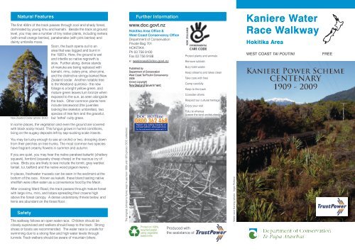
New Zealand Cedar (photo: DOC) but ‘lethal’ cutty grass.<br />
In some places, the vegetation and even the ground are covered<br />
with black sooty mould. This fungus grows in humid conditions,<br />
living on the sugary deposits left by sap-sucking scale insects.<br />
You may be lucky enough to see an orchid or two, drooping down<br />
from their perches on tree trunks. The most common two species<br />
have fragrant creamy flowers in summer and autumn.<br />
If you are quiet, you may hear the native parakeet kakariki (chattery<br />
squawk), fernbird (squeaky cheep cheep) or the raucous cry <strong>of</strong><br />
a kea. Birds you are likely to see include the tomtit, grey warbler,<br />
fantail, tui, bellbird and the native wood pigeon kereru.<br />
In places, freshwater mussels can be seen in the sediment at the<br />
bottom <strong>of</strong> the race. Known as kakahi, these bland tasting native<br />
shellfish were <strong>of</strong>ten eaten as a convenience food by the Maori.<br />
After crossing Ward Road, the track passes through mature forest<br />
with large rimu, miro, and totara spreading their crowns high<br />
above the forest canopy. A dense understorey thrives below, and<br />
ferns are abundant on the forest floor.<br />
Safety<br />
The walkway follows an open water race. Children should be<br />
closely supervised and walkers should keep to the track. Strong<br />
shoes or boots are recommended. The water race is unsafe for<br />
swimming due to a strong flow and high water levels through<br />
tunnels. Track walkers should be aware <strong>of</strong> mountain bikers.<br />
The original Johnson’s flume, kept in use from 1909 until 1973 (photo: DOC collection)<br />
Further information<br />
www.doc.govt.nz<br />
Hokitika Area Office &<br />
West Coast Conservancy Office<br />
<strong>Department</strong> <strong>of</strong> <strong>Conservation</strong><br />
Private Bag 701<br />
HOKITIKA<br />
Ph 03 756 9100<br />
Fax 03 756 9188<br />
e: westcoast@doc.govt.nz<br />
Published by<br />
<strong>Department</strong> <strong>of</strong> <strong>Conservation</strong><br />
West Coast Tai Poutini Conservancy<br />
2009<br />
Crown copyright<br />
Printed on 100%<br />
recycled paper<br />
using vegetable<br />
based inks<br />
Produced with<br />
the assistance <strong>of</strong><br />
Protect plants and animals<br />
Remove rubbish<br />
Bury toilet waste<br />
Keep streams and lakes clean<br />
Take care with fires<br />
Camp carefully<br />
Keep to the track<br />
Consider others<br />
Respect our cultural heritage<br />
Enjoy your visit<br />
Toitu te whenua<br />
(Leave the land undisturbed)<br />
<strong>Water</strong> race fluming (photo: Inger Perkins)<br />
<strong>Kaniere</strong> <strong>Water</strong><br />
<strong>Race</strong> <strong>Walkway</strong><br />
Hokitika Area<br />
West coast tai poutini FRee<br />
<strong>Kaniere</strong> Power Scheme<br />
CENTENARY<br />
1909 - 2009
Introduction History<br />
The <strong>Kaniere</strong> <strong>Water</strong> <strong>Race</strong> <strong>Walkway</strong> provides an opportunity for<br />
a pleasant bush walk in an area that is rich in history. It follows<br />
a 9km water race from Lake <strong>Kaniere</strong> to Kennedy Creek, which<br />
feeds a small hydro electric power station at nearby <strong>Kaniere</strong><br />
Forks. This power station, first built in 1907, began generating<br />
power on 8 September 1909. It supplied the first electric power<br />
to Central Westland and continues to pump out an average <strong>of</strong> 3.5<br />
gigawatthours <strong>of</strong> power annually into the national grid.<br />
Walking the Track<br />
Time: 3.5 - 4 hours<br />
Distance: 10 km<br />
The track, suitable for people <strong>of</strong> average fitness, follows the<br />
historic <strong>Kaniere</strong> water race as it meanders along the edge <strong>of</strong> the<br />
Lake <strong>Kaniere</strong> Scenic Reserve. Although the track can be walked<br />
in either direction, the recommended route is to start at the lake<br />
(park at The Landing) and follow the flow <strong>of</strong> water down the gentle<br />
gradient <strong>of</strong> the race to finish at Kennedy Creek (park at the layby<br />
on <strong>Kaniere</strong> Road). Whichever way the trip is made, return transport<br />
will need to be arranged for the other end. Shorter sections <strong>of</strong> the<br />
track can be walked, the most popular being the easier stretch<br />
from The Landing to Ward Road (1 hour).<br />
The track is popular for mountain biking. The stretch<br />
between The Landing and Ward Road is easy mountain<br />
biking, while the remaining section is more suitable for<br />
intermediate/advanced bikers.<br />
This historic water race has been operating since 1875, supplying<br />
water first for gold sluicing operations, and later to turn the<br />
turbines at the power house, generating electricity for both gold<br />
mines and domestic supply.<br />
<strong>Water</strong> for gold sluices<br />
The water race was built in 1875 to carry water 20 km from Lake<br />
<strong>Kaniere</strong> to struggling gold claims at <strong>Kaniere</strong>. The enormous cost<br />
<strong>of</strong> 23,800 pounds didn’t pay <strong>of</strong>f, as the goldfield continued to<br />
decline and the race was abandoned only six years later.<br />
In 1889, another mining company made use <strong>of</strong> the first 5km <strong>of</strong> the<br />
race, adding a smaller 4km branch to supply their sluice claims<br />
at <strong>Kaniere</strong> Forks and Bluebottle Creek. This is the path that the<br />
current water race follows.<br />
Electricity supply to gold mines<br />
In 1907, the water race was taken over by Ross Goldfields Ltd,<br />
who built a power house at the Forks to provide elecricity for their<br />
water pumps. The race was modified, and two iron pipes were<br />
installed, dropping the final 80 metres to the station to provide<br />
sufficient volume and pressure to drive the two 350 kilowatt<br />
turbines. From 1909, electricity flowed to the mine workings in<br />
Ross, until the mine closed in 1916.<br />
That same year, a concrete weir was constructed at the lake outlet,<br />
raising the lake level by half a metre to ensure a reliable water<br />
supply to the power station. A new power company took over the<br />
scheme and supplied electricity for water pumps at Woodstock<br />
and Rimu sluice claims, and to a flax mill near <strong>Kaniere</strong>.<br />
The power plant was sold again in 1920, this time to supply a large<br />
gold dredging operation at Rimu. Power was also supplied to<br />
Hokitika Borough and the Westland Hospital. The dredge caused<br />
such huge power fluctuations that in 1931 another power station<br />
was built at nearby McKays Creek (the race and fluming can be<br />
seen from the track). The Rimu dredge ceased operation in 1953.<br />
Domestic power supply<br />
In 1960, both stations were taken over by the Westland Electric<br />
Power Board to supply electricity to Hokitika Borough and the<br />
wider Westland County. By 1969, the operation became fully<br />
automatic. Two fires at the <strong>Kaniere</strong> Forks station, one in 1979<br />
and another in 1981, caused extensive damage resulting in a<br />
total rebuild. Fortunately, the turbines and generators were able<br />
to be restored and are now the oldest commercially operating<br />
equipment <strong>of</strong> this kind in New Zealand.<br />
Power generation recommenced in 1983, and the station<br />
continues to generate approximately 420 kilowatts, enough to<br />
supply more than 100 homes in Westland.<br />
TrustPower took over the power scheme in April 1999, and works<br />
with the <strong>Department</strong> <strong>of</strong> <strong>Conservation</strong> to keep the historic water<br />
race walkway available to the public.<br />
As you walk the track, look out for these features:<br />
• The intake for the water race is at the Landing near the<br />
outlet <strong>of</strong> Lake <strong>Kaniere</strong>. You’ll see two control gates that<br />
regulate water flow into the race and into the <strong>Kaniere</strong> River.<br />
•<br />
•<br />
Most <strong>of</strong> the race is channelled in the ground but where this<br />
is unstable, you’ll see that the sides have been timbered.<br />
Look for tunnels through rises and spurs.<br />
• Timber fluming allows the water race to cross gullies. Heart<br />
rimu was predominantly used to construct the water race,<br />
but repairs are now carried out using treated pine. In some<br />
places, the original, durable silver pine posts can be seen.<br />
•<br />
•<br />
Features <strong>of</strong> the <strong>Water</strong> <strong>Race</strong><br />
There are a number <strong>of</strong> large side creeks that are flumed<br />
either under or over the water race.<br />
Look for overflow sections where excess water is released<br />
to maintain an even water volume for the power station.<br />
• Occasionally, you’ll see the <strong>Kaniere</strong> River flowing well<br />
below the level <strong>of</strong> the water race. This difference <strong>of</strong> up to<br />
97m is essential to give a ‘head’ <strong>of</strong> water sufficient to drive<br />
the turbines at the power station.<br />
• Where the water race crosses steeper hillsides, you’ll<br />
notice a lot more tunnels and flumes, especially just after<br />
Ward Road. The longest tunnel, constructed in 1907<br />
through ‘Tunnel Hill’ is 2km long. From this point, although<br />
the race is seldom seen, it is never far away.


