Consolidated DCP Introduction - Burwood Council
Consolidated DCP Introduction - Burwood Council
Consolidated DCP Introduction - Burwood Council

Create successful ePaper yourself
Turn your PDF publications into a flip-book with our unique Google optimized e-Paper software.
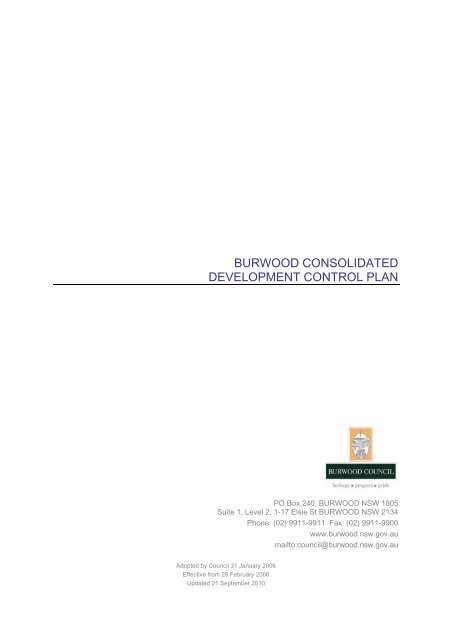
BURWOOD CONSOLIDATED<br />
DEVELOPMENT CONTROL PLAN<br />
PO Box 240, BURWOOD NSW 1805<br />
Suite 1, Level 2, 1-17 Elsie St BURWOOD NSW 2134<br />
Phone: (02) 9911-9911 Fax: (02) 9911-9900<br />
www.burwood.nsw.gov.au<br />
mailto:council@burwood.nsw.gov.au<br />
Adopted by <strong>Council</strong> 31 January 2006<br />
Effective from 28 February 2006<br />
Updated 21 September 2010
1. INTRODUCTION<br />
Division 6 of Part 3 of the Environmental Planning & Assessment Act 1979 (EP&A<br />
Act) introduced under the Environmental Planning and Assessment (Infrastructure<br />
and Other Planning Reform) Act 2005 (Reform Act) commenced on 30 September<br />
2005. This Division introduced new requirements for development control plans<br />
(<strong>DCP</strong>s).<br />
As a result of these changes to the EP&A Act, <strong>Council</strong> has decided to consolidate all<br />
of its <strong>DCP</strong>s into one instrument.<br />
On commencement of this <strong>Consolidated</strong> Plan, all of the <strong>DCP</strong>s which previously<br />
applied to land within the <strong>Burwood</strong> local government area will cease to have any<br />
effect. Instead, the provisions within those <strong>DCP</strong>s will now be contained within this<br />
<strong>Consolidated</strong> Plan. Accordingly, this Plan will be the only <strong>DCP</strong> applying to land<br />
within the <strong>Burwood</strong> local government area.<br />
2. NAME OF THIS CONSOLIDATED PLAN<br />
This development control plan is called the <strong>Burwood</strong> <strong>Consolidated</strong> Development<br />
Control Plan. It is referred to herein as "<strong>Consolidated</strong> Plan".<br />
3. LAND TO WHICH THIS CONSOLIDATED PLAN APPLIES<br />
This <strong>Consolidated</strong> Plan covers all land within the <strong>Burwood</strong> local government area.<br />
The provisions of some Parts of this <strong>Consolidated</strong> Plan apply to the whole <strong>Burwood</strong><br />
local government area, whilst the provisions of other Parts of this <strong>Consolidated</strong> Plan<br />
apply only to specific sites or zones within the <strong>Burwood</strong> local government area. The<br />
table below sets out the application of the various Parts of this <strong>Consolidated</strong> Plan.<br />
PART OLD NAME OF<br />
PART<br />
APPLICATION OF PART<br />
Part 1 - Grosvenor Street <strong>DCP</strong> No. 1 Applies to all land within the Residential 2(c2)<br />
zone bounded by Grosvenor St/Young St/<br />
Boundary St/Webb St.<br />
Parts 2 and 3 - These Parts are blank and have no<br />
application.<br />
Part 4 - Appian Way <strong>DCP</strong> No. 4 Applies to all land within Appian Way<br />
Conservation Area.<br />
Part 5 - Malvern Hill <strong>DCP</strong> No. 5 Applies to all land within the Malvern Hill<br />
Conservation Area.<br />
Part 6 - Notification of<br />
<strong>DCP</strong> No. 6 Applies to all land within the <strong>Burwood</strong> local<br />
Development Applications<br />
government area.<br />
Parts 7 and 8 - These Parts are blank and have no<br />
application.<br />
Part 9 - Advertising Signs <strong>DCP</strong> No. 9 Applies to all land within the <strong>Burwood</strong> local<br />
government area.<br />
Parts 10 and 11 - These Parts are blank and have no<br />
application.<br />
Part 12 - Exempt and Complying <strong>DCP</strong> No. 12 Applies to all land within the <strong>Burwood</strong> local<br />
Development<br />
government area.<br />
Part 13 - This Part is blank and has no application.<br />
Part 14 - Liverpool Rd / Byer St <strong>DCP</strong> No. 14 Applies to 260-286 Liverpool Rd and Nos. 8-<br />
28,1-3A, 7-23 Byer Street.<br />
Part 15 - This Part is blank and has no application.<br />
2
PART OLD NAME OF<br />
PART<br />
APPLICATION OF PART<br />
Part 16 - Lucas Road /<br />
<strong>DCP</strong> No. 16 Applies to 12-66 Lucas Road and 1-51<br />
Cheltenham Road.<br />
Cheltenham Road.<br />
Part 17 - Waste Management <strong>DCP</strong> No. 17 Applies to all land within the <strong>Burwood</strong> local<br />
government area.<br />
Part 18 - Residential Flat<br />
<strong>DCP</strong> No. 18 Applies to all land within the <strong>Burwood</strong> local<br />
Buildings<br />
government area zoned Residential 2(b2),<br />
Residential 2(c1), Residential 2(c2).<br />
Parts 19 and 20 - These Parts are blank and have no<br />
application.<br />
Part 21 - Dual Occupancy <strong>DCP</strong> No. 21 Applies to all land within the <strong>Burwood</strong> local<br />
government area.<br />
Part 22 - Car Parking <strong>DCP</strong> No. 22 Applies to all land within the <strong>Burwood</strong> local<br />
government area.<br />
Parts 23, 24 and 25 - These Parts are blank and have no<br />
application.<br />
Part 26 - Child Care Centres <strong>DCP</strong> No. 26 Applies to all land within the <strong>Burwood</strong> local<br />
government area.<br />
Parts 27 - 33 - These Parts are blank and have no<br />
application.<br />
Part 34 – Development in Special <strong>DCP</strong> No. 34 Applies to all land zoned Special Uses 5B<br />
Uses 5B (Railways) Zone<br />
(Railways)<br />
Part 35 – Public Works <strong>DCP</strong> No. 35 Applies to all land within the <strong>Burwood</strong> local<br />
government area.<br />
Part 36 – <strong>Burwood</strong> Town Centre - Applies to all land within the <strong>Burwood</strong> Town<br />
Centre.<br />
Part 37 – Shared Accommodation <strong>DCP</strong> No. 37 Applies to all land within <strong>Burwood</strong> <strong>Council</strong>.<br />
Part 38 – Single Dwelling Houses<br />
and Ancillary Structures<br />
<strong>DCP</strong> No. 38 Applies to all land within <strong>Burwood</strong> <strong>Council</strong>.<br />
Note:<br />
<strong>DCP</strong> Part 3 (Fences on Heritage Listed Properties) repealed 15 Dec 2009, following <strong>Council</strong> resolution of 1 Dec 2009.<br />
<strong>DCP</strong> Part 2 (Marmaduke Street) repealed 21 Sept 2010, following <strong>Council</strong> resolution of 27 Jul 2010.<br />
<strong>DCP</strong> Part 7 (Post Supported Verandahs in BTC) repealed 21 Sept 2010, following <strong>Council</strong> resolution of 27 Jul 2010.<br />
<strong>DCP</strong> Part 8 (General Residential Development) repealed 21 Sept 2010, following <strong>Council</strong> resolution of 27 Jul 2010.<br />
4. RELATIONSHIP WITH THE BURWOOD PLANNING SCHEME ORDINANCE 1979<br />
4.1 This <strong>Consolidated</strong> Plan should be read in conjunction with the provisions of<br />
the <strong>Burwood</strong> Planning Scheme Ordinance 1979 (BPSO), which applies to<br />
all land within the <strong>Burwood</strong> local government area.<br />
4.2 A provision of this <strong>Consolidated</strong> Plan will have no effect to the extent that:<br />
4.2.1 it is the same or substantially the same as a provision in the BPSO<br />
or another environmental planning instrument (EPI) applying to the<br />
same land; or<br />
4.2.2 it is inconsistent with a provision of the BPSO or another PI<br />
applying to the same land, or its application prevents compliance<br />
with a provision of the BPSO or another EPI applying to the same<br />
land,<br />
and the provision in the BPSO or other EPI will apply.<br />
3
5. HOW TO READ THIS CONSOLIDATED PLAN<br />
Any reference in a Part of this <strong>Consolidated</strong> Plan to "this <strong>DCP</strong>" or "this Plan" is a<br />
reference to the Part of this <strong>Consolidated</strong> Plan where the reference is contained.<br />
6. PLANNING AGREEMENTS<br />
6.1 Any person who lodges a development application with <strong>Council</strong>, may<br />
accompany such application with an offer to enter into a planning<br />
agreement under section 93F of the EP&A Act.<br />
6.2 Pursuant to section 93I of the EP&A Act, <strong>Council</strong> may require a planning<br />
agreement to be entered into as a condition of development consent, but<br />
only if it requires a planning agreement that is in the terms of an offer made<br />
by the developer in connection with:<br />
6.2.1 the development application; or<br />
6.2.2 a change to an EPI sought by the developer for the purposes of<br />
making the development application.<br />
4
BURWOOD CONSOLIDATED <strong>DCP</strong><br />
TABLE OF CONTENTS<br />
<strong>DCP</strong> PART<br />
NO<br />
TITLE DESCRIPTION<br />
Part No 1 Grosvenor Street Applies to all land within the Residential 2(c2) zone<br />
bounded by Grosvenor St/Young St/Boundary St/Webb<br />
St.<br />
Part No 4 Appian Way Applies to all land within Appian Way Conservation<br />
Area.<br />
Part No 5 Malvern Hill Applies to all land within the Malvern Hill Conservation<br />
Area.<br />
Part No 6 Notification of Development<br />
Applications<br />
Applies to all land within <strong>Burwood</strong> <strong>Council</strong>.<br />
Part No 9 Advertising Signs Applies to all land within <strong>Burwood</strong> <strong>Council</strong>.<br />
Part No 12 Exempt and Complying Development Applies to all land within <strong>Burwood</strong> <strong>Council</strong>.<br />
Part No 14 Liverpool Rd / Byer St Applies to 260-286 Liverpool Rd and Nos. 8-28, 1-3A, 7-<br />
23 Byer Street.<br />
Part No 16 Lucas Road / Cheltenham Road. Applies to 12-66 Lucas Road and 1-51 Cheltenham<br />
Road.<br />
Part No 17 Waste Management. Applies to all land within <strong>Burwood</strong> <strong>Council</strong>.<br />
Part No 18 Residential Flat Buildings Applies to all land within <strong>Burwood</strong> <strong>Council</strong> area zoned<br />
Residential 2(b2), Residential 2(c1), Residential 2(c2).<br />
Part No 21 Dual Occupancy Applies to all land within <strong>Burwood</strong> <strong>Council</strong><br />
Part No 22 Car Parking Applies to all land within <strong>Burwood</strong> <strong>Council</strong><br />
Part No 26 Child Care Centres Applies to all land within <strong>Burwood</strong> <strong>Council</strong><br />
Part No 34 Development in Special Uses 5B<br />
(Railways) Zone<br />
Applies to all land zoned Special Uses 5B (Railways)<br />
Part No 35 Public Works for the purpose of the<br />
Environmental Planning &<br />
Assessment Act 1979<br />
Applies to all land within <strong>Burwood</strong> <strong>Council</strong><br />
Part No 36 <strong>Burwood</strong> Town Centre Applies to all land within the <strong>Burwood</strong> Town Centre.<br />
Part No 37 Shared Accommodation Applies to all land within <strong>Burwood</strong> <strong>Council</strong>.<br />
Part No 38 Single Dwelling Houses and Ancillary<br />
Structures<br />
Applies to all land within <strong>Burwood</strong> <strong>Council</strong>.<br />
5