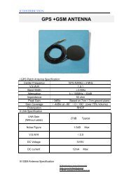
GPS Data sheet - ICDistribution.net
GPS Data sheet - ICDistribution.net
GPS Data sheet - ICDistribution.net

You also want an ePaper? Increase the reach of your titles
YUMPU automatically turns print PDFs into web optimized ePapers that Google loves.
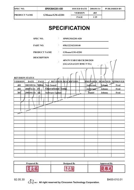
SPEC NO. SP05GM42201<br />
SP05GM42201-020 SP05GM42201<br />
ISSUED DATE 2004/01/14 PUBLISHED BY<br />
PRODUCT NAME GMouse/GM-42201<br />
VERSION d03<br />
PAGE 1/25<br />
SPECIFICATION<br />
SPEC NO. : SP05GM42201-020<br />
PART NO. : 05K122342110140<br />
PRODUCT NAME : GMouse/GM-42201<br />
DESCRIPTION<br />
:<br />
48N/5V/USB/USB/CR/200/2020<br />
(GGA/GSA/GSV/RMC/VTG)<br />
REVISION STATUS<br />
VERSION DATE PAGE REVISION DESCRIPTION PREPARED DESIGNED APPROVED<br />
d01 2003/09/16 Whole New Issued Anderson Johnny Fred<br />
d02 2003/11/21 P5 Operational Temp. Anderson Johnny Fred<br />
d03 2004/01/14 All Software Update Daniel Johnny Fred<br />
Prepared By Designed By Approved By<br />
92.05.30 B400-010.01<br />
All right reserved by Cirocomm Technology Corporation.
SPEC NO. SP05GM42201-020 ISSUED DATE 2004/01/14 PUBLISHED BY<br />
PRODUCT NAME GMouse/GM-42201<br />
INDEX<br />
VERSION d03<br />
PAGE 2/25<br />
Item No. Contents Page<br />
1.0 Cautions 4<br />
2.0 Absolute Maximum Ratings 5<br />
3.0 Normal Operating Conditions 5<br />
4.0 Specification 5<br />
5.0 Time To First Fix (TTFF) 6<br />
6.0 Interface 6<br />
7.0 Communication Specification 6<br />
8.0 I/O Connector Pins 6<br />
9.0 Electrical Characteristics 7<br />
10.0 Dimension 7<br />
11.0 NMEA Protocol 8<br />
11.1 General NMEA commands 8<br />
11.1.1 START – Start Navigation 8<br />
11.1.2 STOP – Stop Navigation 9<br />
11.1.3 ODO - Odometer 9<br />
11.1.4 SW – GM-42201 software revision 9<br />
11.2 Configuration commands 10<br />
11.2.1 NMEA – NMEA Serial Communication 10<br />
11.2.2 AUTOSTART – Set Autostart Mode 11<br />
11.2.3 CONF – Set configuration parameters 11<br />
11.2.4 DATUM – Set Local Coordinate System 12<br />
11.2.5 FIXRATE – Set Fixrate 12<br />
11.2.6 SYNCMODE – synchronous NMEA output mode 12<br />
11.2.7 STORE – Store Current Parameter Set 13<br />
11.2.8 RESETDATA 13<br />
11.2.9 RESTORE – Restores Default Parameter Set 13<br />
11.3 Navigation Aiding Commands 14<br />
11.3.1 INITAID – Initial position and time aiding 14<br />
All right reserved by Cirocomm Technology Corporation.
SPEC NO. SP05GM42201-020 ISSUED DATE 2004/01/14 PUBLISHED BY<br />
PRODUCT NAME GMouse/GM-42201<br />
VERSION d03<br />
PAGE 3/25<br />
11.3.2 ALTAID – Set the altitude aiding mode 14<br />
11.3.3 SETLIMIT – Set limits for altitude, velocity and acceleration 15<br />
11.4 Logging Commands 16<br />
11.4.1 LOGCLEAR – Clear log data 16<br />
11.4.2 LOGFREE – Amount of free space for log data 16<br />
11.4.3 LOGGET – Output logged data 16<br />
11.4.4 LOGINFO – Show log information 16<br />
11.4.5 LOGMODE – Set logging start mode 17<br />
11.4.6 LOGNAME – Set log name 17<br />
11.4.7 LOGNUM – Get number of logs 17<br />
11.4.8 LOGSETTING - Set logging settings 17<br />
11.4.9 LOGSTOP – Stop Logging 18<br />
12.0 NMEA MESSAGES 19<br />
12.1 GGA – Global Positioning System Fix <strong>Data</strong> 19<br />
12.2 GLL – Geographic Position – Latitude/Longitude 20<br />
12.3 GSA – DOP and Active Satellites 20<br />
12.4 GSV – Satellites in view 21<br />
12.5 RMC – Recommended Minimum Specific GNSS <strong>Data</strong> 22<br />
12.6 VTG – Course Over Ground and Ground Speed 23<br />
12.7 ZDA – Time and Date 23<br />
12.8 PFST,FOM – Position figure of merit 23<br />
13.0 APPENDIX: DATUM IDS 24<br />
All right reserved by Cirocomm Technology Corporation.
SPEC NO. SP05GM42201-020 ISSUED DATE 2004/01/14 PUBLISHED BY<br />
PRODUCT NAME GMouse/GM-42201<br />
1.0 Cautions<br />
VERSION d03<br />
PAGE 4/25<br />
<strong>GPS</strong> (Global Positioning System) is a satellite-based navigation system. In an unobstructed clear<br />
view of the sky, <strong>GPS</strong> works anywhere in the world, 24 hours a day.<br />
<strong>GPS</strong> is developed and operated by the government of United States. Under the policy of the<br />
government, the degradation in accuracy shall occur without prior warnings, and sometimes<br />
satellites don’t transmit signal due to adjustment, test, and orbital revision.<br />
Please be aware that the performance of the <strong>GPS</strong> receiver module does not warrant against the<br />
above factors.<br />
(Position Accuracy)<br />
Position data and position accuracy are affected or degraded by the satellite geometry,<br />
electric mag<strong>net</strong>ic interference, and multipath.<br />
(Equipment)<br />
The high frequency noise will interfere with signal receiving. The high frequency noise within the<br />
receiver frequency band, 1575Mhz ± 10MHz, will affect the receiver quality. Also, because of<br />
the mixer and modulation, the low frequency noise will be increased by several times. If this<br />
increased frequency drops into the 1575MHz ± 10MHz band, it will also affect the receiver<br />
quality.<br />
(Warranty)<br />
If the product fails within one year after the date of delivery while it has been used properly<br />
it will be replaced or repaired free of charge.<br />
All right reserved by Cirocomm Technology Corporation.
SPEC NO. SP05GM42201-020 ISSUED DATE 2004/01/14 PUBLISHED BY<br />
PRODUCT NAME GMouse/GM-42201<br />
2.0 Absolute Maximum Ratings<br />
VERSION d03<br />
PAGE 5/25<br />
Symbol Parameter Min Typ Max Units<br />
Vdd Supply Voltage 4.5 5.0 5.5 V<br />
VI Input Voltage - 0.3 V dd+0.3 V<br />
VO Output Voltage - 0.3 V dd+0.3 V<br />
TA Ambient Temp. (Power applied) - 40 95 °C<br />
TSTG Storage Temp. - 40 95 °C<br />
3.0 Normal Operating Conditions<br />
Symbol Parameter Min Typ Max Units<br />
Vdd Voltage 4.5 5.0 5.5 V<br />
Vddn Supply Voltage Noise 50 mVP-P<br />
Pw Power Dissipation 350 400 mW<br />
Top Operational Temp. (<strong>GPS</strong>) -30 70 °C<br />
Operational Temp. (USB Cable) -10 70 °C<br />
4.0 Specification<br />
Satellite Tracking 12 Parallel channels<br />
RF input Center frequency 1575.42MHz L1 band, C/A code<br />
Characteristics impedance 50 ohm<br />
Signal sensitivity -145 dBm or less<br />
Positioning system Default WGS-84<br />
Software Selectable All major coordinate systems<br />
Positioning accuracy Position 10m CEP(50%)<br />
Velocity 0.2m/s (50%)<br />
Positioning condition A) DOP limit:<br />
3D: PDOP < 12<br />
2D: HDOP < 6<br />
B) Elevation mask: 5°<br />
Follow-up performance Acceleration 4G<br />
Navigation Update Rate 1second(Default)<br />
Navigation method All-In-View solution<br />
2-Satelite solution<br />
Operation Temperature(<strong>GPS</strong>) -30℃ to 70℃<br />
Operation Temperature(USB Cable) -10℃ to 70℃<br />
Storage Temperature -40℃ to 95℃<br />
All right reserved by Cirocomm Technology Corporation.
SPEC NO. SP05GM42201-020 ISSUED DATE 2004/01/14 PUBLISHED BY<br />
PRODUCT NAME GMouse/GM-42201<br />
VERSION d03<br />
PAGE 6/25<br />
5.0 Time To First Fix (TTFF)<br />
Assumes previously listed navigation conditions and 8 satellites in view<br />
TTFF Typ Units<br />
Hot Start (time, position, valid ephemeris, and valid almanac) 12 seconds<br />
Warm Start (time, position, no ephemeris, and valid almanac) 35 seconds<br />
Cold Start (time, position, no ephemeris, and valid almanac) 50 seconds<br />
The G-mouse has to establish location fix before accurate time information can be provided.<br />
6.0 Interface<br />
I/O connector (Power supply, serial data) USB<br />
7.0 Communication Specification<br />
Communication method Start-stop synchronization<br />
Transfer rate input/output 2400/4800/9600/19200/115200<br />
bps NMEA (Default 4800)<br />
Logic levels TTL<br />
I/O code ASCII<br />
Communication format NMEA<br />
8.0 I/O Connector Pins<br />
Pin Configuration<br />
Pin<br />
No.<br />
Symbol I/O Description<br />
1 Vdd - Main power input.<br />
2 USB_D+ O TX<br />
3 USB_D- I RX<br />
4 GND - Ground<br />
CN1<br />
正面<br />
4<br />
3<br />
2<br />
1<br />
All right reserved by Cirocomm Technology Corporation.
SPEC NO. SP05GM42201-020 ISSUED DATE 2004/01/14 PUBLISHED BY<br />
PRODUCT NAME GMouse/GM-42201<br />
9.0Electrical Characteristics Vdd=5.0V<br />
VERSION d03<br />
PAGE 7/25<br />
Item Symbol Parameter Min Typ Max Units<br />
Vdd Condition Voltage 5.0 V<br />
Input VIH Input signal high level 0.7Vdd V<br />
Voltage VIL Input signal low level 0.3Vdd V<br />
VOH Output signal high level IOH = 3.5 V<br />
Output<br />
-1.0mA<br />
Voltage VOL Output signal low level IOL = 1.6<br />
mA<br />
0.4 V<br />
Schmitt<br />
Trigger<br />
Threshol<br />
d Voltage<br />
Vt-<br />
Vt+<br />
10.0 Dimension<br />
Negative going<br />
Positive going<br />
0.8<br />
All right reserved by Cirocomm Technology Corporation.<br />
2.0<br />
PIN<br />
V<br />
V
SPEC NO. SP05GM42201-020 ISSUED DATE 2004/01/14 PUBLISHED BY<br />
PRODUCT NAME GMouse/GM-42201<br />
11.0NMEA Protocol<br />
NMEA COMMANDS<br />
This chapter describes the supported NMEA commands.<br />
VERSION d03<br />
PAGE 8/25<br />
11.1 General NMEA commands<br />
The following sections introduces the general-purpose NMEA commands the<br />
basic GM-42201 operations.<br />
11.1.1 START – Start Navigation<br />
Commands GM-42201 to start navigation. The command has no effect if called while<br />
GM-42201 is already navigating. After the start command has been given, it takes some<br />
time for GM-42201 to acquire satellites, gather data from the signal and calculate a first<br />
fix.<br />
$PFST,START,<br />
Navigation start modes:<br />
0=Auto start. Always uses the fastest possible start mode (1-4). Default<br />
value.<br />
1=Force cold start. Module will behave as if no valid ephemeris or PVT<br />
data were available.<br />
2=Request warm start.<br />
3=Request hot start. Requires RTC time, valid ephemeris and PT data.<br />
Calculates a fix as soon as PS time is acquired from the <strong>GPS</strong> signal.<br />
4=Request quick start. Requires RTC time and recent ephemeris.<br />
Assumes that RTC time is very accurate and doesn’t wait for <strong>GPS</strong><br />
time.<br />
Notice that if the host requests faster start mode than possible (e.g. hot<br />
start when there is no ephemeris data available) start mode 0 will be<br />
used.<br />
RTC time is available if the module has already been navigating after<br />
the previous power-up, or if the time has been given by using the<br />
$PFST, INITAID command.<br />
Valid ephemeris data is available if the module has been navigating<br />
within the last two hours and the navigation has been stopped properly<br />
by giving the $PFST, STOP command.<br />
All right reserved by Cirocomm Technology Corporation.
SPEC NO. SP05GM42201-020 ISSUED DATE 2004/01/14 PUBLISHED BY<br />
PRODUCT NAME GMouse/GM-42201<br />
VERSION d03<br />
PAGE 9/25<br />
11.1.2 STOP – Stop Navigation<br />
Commands GM-42201 to stop navigating and enter the idle state. While in idle state, the<br />
GM-42201 receiver doesn’t navigate but still accept commands., less power<br />
is consumed in the idle state than in the navigation state; however, remarkably more<br />
than in the power-down mode. This command also stores the “LastKnownGood” fix,<br />
ephemeris and almanac data in flash memory.<br />
$PFST,STOP,<br />
1 to save, 0 not to save “LastKnownGood” fix, ephemeris<br />
and almanac data to flash memory.<br />
11.1.3 ODO - Odometer<br />
This message displays the distance traveled by the receiver. The odometer distance is set<br />
to zero at module reset, and increasing as it moves.<br />
$PFST,ODO,<br />
New odometer distance setting. If it is omitted, the odometer distance<br />
reading is displayed.<br />
]<br />
11.1.4 SW – GM-42201 software revision<br />
Shows the firmware revision of the GM-42201 module.<br />
$PFST,SW, < revision><br />
All right reserved by Cirocomm Technology Corporation.
SPEC NO. SP05GM42201-020 ISSUED DATE 2004/01/14 PUBLISHED BY<br />
PRODUCT NAME GMouse/GM-42201<br />
VERSION d03<br />
PAGE 10/25<br />
11.2Configuration commands<br />
The following sections introduce the commands used for controlling the behavior of<br />
GM-42201.<br />
11.2.1 NMEA – NMEA Serial Communication<br />
Sets the NMEA message mask and NMEA serial port communication speed. This<br />
message mask defines which of the NMEA messages are being outputted.<br />
$PFST,NMEA,,<br />
NMEA messaging mask bitmap in hexadecimal notation. If<br />
it’s desired to change only the speed while keeping the<br />
old message mask, this parameter may be omitted and<br />
use “,,” instead.<br />
Mask bits for message are defined as follows:<br />
Message bit<br />
GSV 0x0001<br />
GSA 0x0002<br />
ZDA 0x0004<br />
PPS 0x0010<br />
FOM 0x0020<br />
Reserved* 0x0040<br />
GLL 0x1000<br />
GGA 0x2000<br />
VTG 0x4000<br />
RMC 0x8000<br />
I.e. to allow GLL and RMC messages one would set mask as 0x1000 +<br />
0x8000 = 0x9000. See examples below.<br />
Note that hexadecimal digits A, B, C, D, E and F must be in capital<br />
letters.!<br />
* Enables a message used for special purposes.<br />
Communication speed. Either 1200, 2400, 4800, 9600,19200, 57600 or<br />
115200.<br />
NOTE:<br />
Using message mask FFFF (command $PFST,NMEA,FFFF)is not recommended.<br />
Although it may be used to turn on all messages, the side effect of this would be that all<br />
new messages in future GM-42201 versions will also be turned on. The following<br />
messages are enabled by default: GGA, RMC, GSA, GSV.<br />
NOTE:<br />
NMEA Serial port settings other than speed cannot be changed. The settings for the port<br />
are:<br />
- Default speed 4800 bps<br />
- No parity (cannot be changed)<br />
- 8 data bits (cannot be changed)<br />
- 1 stop bit (cannot be changed)<br />
All right reserved by Cirocomm Technology Corporation.
SPEC NO. SP05GM42201-020 ISSUED DATE 2004/01/14 PUBLISHED BY<br />
PRODUCT NAME GMouse/GM-42201<br />
VERSION d03<br />
PAGE 11/25<br />
NOTE:<br />
In order to preserve this setting after reset or power-up, the new setting has to be<br />
stored in flash memory by using the $PFST,STORE command (only GM-42201<br />
modules).<br />
11.2.2 AUTOSTART – Set Autostart Mode<br />
Defines if GM-42201 automatically starts navigation when power is turned<br />
on or GM-42201 is reset.<br />
$PFST,AUTOSTART,<br />
1 to enable, 0 to disable autostart.<br />
NOTE: In order for this message to have an effect, the new setting has to be stored in<br />
flash memory by using the $PFST,STORE command.<br />
NOTE: Since GM-42201 doesn’t save parameters in non-volatile memory,<br />
AUTOSTART command has no effect in GM-42201.<br />
11.2.3 CONF – Set configuration parameters<br />
This command is used for setting the configuration parameters of GM-42201.<br />
$PFST,CONF,,<br />
Configuration parameter ID number. See the table below for possible<br />
values.<br />
New value for the parameter. If omitted, the command shows the current<br />
value of the configuration parameter.<br />
Available configuration parameter ID’s are:<br />
Param ID Param. Default<br />
Description<br />
Type value<br />
1 BOOL 1 Position pinning on/off (1=on)<br />
3 BOOL 1 Velocity smoothing on/off<br />
4 BOOL 1 Position smoothing on/off<br />
10 BOOL 1 Carrier smoothing on/off<br />
17 BOOL 0 Route nav- & msg-task messages to host<br />
(enables calculating the navigation fix in host)<br />
45 WORD 12 Number of receiver channels<br />
47 BOOL 0 Disable fast search (=> uses slower but more sensitive<br />
search mode)<br />
48 WORD 7000 Acq search window width (Hz, from middle of the<br />
window)<br />
50 DOUBLE 5 Timeout for resetting the post filters<br />
51 DOUBLE 0.4 Coefficient for position smoothing, high<br />
52 DOUBLE 0.12 Coefficient for position smoothing, low<br />
53 DOUBLE 0.0001 Velocity filter coefficient, low limit<br />
54 DOUBLE 0.5 Velocity filter coefficient, high limit<br />
All right reserved by Cirocomm Technology Corporation.
SPEC NO. SP05GM42201-020 ISSUED DATE 2004/01/14 PUBLISHED BY<br />
PRODUCT NAME GMouse/GM-42201<br />
VERSION d03<br />
PAGE 12/25<br />
55 DOUBLE 3.0 Pinning lag criteria (meters). In pinning mode, the<br />
position may lag behind the actual position by this<br />
amount.<br />
59 DOUBLE 1.0 Pinning velocity limit. Goes to pinning mode if<br />
velocity is below this limit.<br />
70 DOUBLE 50 FOM limit. Fix is marked invalid if FOM is larger than<br />
this value.<br />
71 DOUBLE 22 HDOP limit. Fix is marked invalid if HDOP is larger<br />
than this value.<br />
NOTE: In order to preserve this setting after reset or power-up, the new setting has to be<br />
stored to flash memory by using the $PFST,STORE command (only GM-42201<br />
modules).<br />
11.2.4 DATUM – Set Local Coordinate System<br />
Selects the local coordinate system. After this command, the GM-42201 will return<br />
positions in the selected coordinate system.<br />
$PFST,DATUM,<br />
Coordinate system id. See appendix for supported DATUM id’s.<br />
NOTE: In order to preserve this setting after reset or power-up, the new setting has to be<br />
stored to flash memory by using the $PFST,STORE command (only GM-42201<br />
modules).<br />
11.2.5 FIXRATE – Set Fixrate<br />
Defines how often GM-42201 should acquire navigation fix and thus output<br />
the NMEA messages.<br />
$PFST,FIXRATE,<br />
Number of seconds to between navigation fixes<br />
NOTE: In order to preserve this setting after reset or power-up, the new setting has to be<br />
stored to flash memory by using the $PFST,STORE command (only GM-42201<br />
modules).<br />
11.2.6 SYNCMODE – synchronous NMEA output mode<br />
Enables or disables the synchronous NMEA output mode. In the synchronous output<br />
mode, all the enabled NMEA navigation messages are outputted approx. once per<br />
second, regardless of the availability of a valid navigation fix. The synchronous mode is<br />
enabled by default.<br />
$PFST,SYNCMODE,<br />
Set synchronous mode on or off, 0 = off, 1 = on (default).<br />
NOTE: In order to preserve this setting after reset or power-up, the new setting has to be<br />
stored to flash memory by using the $PFST,STORE command (only GM-42201<br />
modules).<br />
All right reserved by Cirocomm Technology Corporation.
SPEC NO. SP05GM42201-020 ISSUED DATE 2004/01/14 PUBLISHED BY<br />
PRODUCT NAME GMouse/GM-42201<br />
VERSION d03<br />
PAGE 13/25<br />
11.2.7STORE – Store Current Parameter Set<br />
Stores the current parameter set in GM-42201’s flash memory. These parameters include<br />
those that are defined by the commands, ALTAID, AUTOSTART, CONF, CABLEDEL,<br />
DATUM, FIXRATE, NMEA, PPSMODE, PULSEPOL, PULSELEN, SETLIMIT,<br />
SURVEYLEN, and SYNCMODE.<br />
$PFST,STORE<br />
NOTE: Navigation has to be stopped before giving this command.<br />
NOTE: GM-42201 doesn’t store configuration parameters in flash memory, and thus<br />
this command doesn’t have any effects on the GM-42201 modules. For GM-42201,<br />
the preferred way is to set parameters each time, when the module is reset or<br />
switched on.<br />
11.2.8 RESETDATA<br />
Erases the navigation data stored in the flash memory, i.e. erases the last good known<br />
navigation fix, ephemeris, almanac and UTC/Ionosphere model data. The module has to<br />
be reset after this command to abandon all the above data; otherwise, some of the data<br />
may still reside in RAM memory.<br />
$PFST,RESETDATA<br />
NOTE: Navigation has to be stopped before giving this command.<br />
NOTE: This command doesn’t affect logged data. Log data is cleared with<br />
$PFST,LOGCLEAR command.<br />
11.2.9 RESTORE – Restores Default Parameter Set<br />
Restores factory default parameter set.<br />
$PFST,RESTORE<br />
NOTE: Navigation has to be stopped before giving this command.<br />
NOTE: GM-42201 doesn’t store configuration parameters to flash memory, and thus<br />
this command is irrelevant with GM-42201 module.<br />
NOTE: This command doesn’t affect the last good navigation fix, ephemeris,<br />
UTC/ionosphere model data or log data. Navigation, ephemeris and model data is<br />
erased with the $PFST,RESETDATA command. Log data is cleared with the<br />
$PFST,LOGCLEAR command.<br />
All right reserved by Cirocomm Technology Corporation.
SPEC NO. SP05GM42201-020 ISSUED DATE 2004/01/14 PUBLISHED BY<br />
PRODUCT NAME GMouse/GM-42201<br />
VERSION d03<br />
PAGE 14/25<br />
11.3 Navigation Aiding Commands<br />
The following sections introduce the commands that provide the GM-42201 receiver with<br />
additional data, which may be helpful for starting and during navigations.<br />
11.3.1 INITAID – Initial position and time aiding<br />
Gives the GM-42201 module the current position and time information for aiding the<br />
navigation startup. Setting this information before navigation starts with the<br />
$PFST,START command reduces the time required for finding the satellites,<br />
and receiving the first valid navigation fix.<br />
If the position isn’t known, the initial time may also be given alone by omitting the<br />
position parameters, i.e. using the command with only the two first parameters. The<br />
altitude information is not critical and can be set to zero (i.e. mean sea level) if not<br />
known.<br />
NOTE: Even when INITAID is being used, the GM-42201 module reports navigation<br />
data of the previous actual navigation fix until a new fix is acquired, not the position<br />
and time data given in the INITAID command.<br />
$PFST,INITAID,,,,,,,<br />
UTC time in “hhmmss.dd” format, hh = hours (2 digits), mm = minutes<br />
(2 digits), ss.dd = seconds with two decimals (2+2 digits).<br />
UTC date in “ddmmyy” format, dd = day (2 digits), mm = month (2<br />
digits), yy = year (2 digits).<br />
Latitude in degrees and minutes in “xxmm.dddd” format, xx = degrees<br />
(1-2 digits), mm.dddd = minutes with four decimals (2+4 digits).<br />
Either a character N or S (N = north, S = south).<br />
Longitude in degrees and minutes in “yyymm.dddd” format, yyy =<br />
degrees (1-3 digits), mm.dddd = minutes with four decimals (2+4<br />
digits).<br />
Either a character E or W (E = east, W = west).<br />
Altitude from the sea level in meters (1-5 digits).<br />
11.3.2 ALTAID – Set the altitude aiding mode<br />
Sets or disables the altitude aiding mode, where the navigation is assisted by using the<br />
given altitude value or an altitude value from a previous fix. Altitude aiding enables a<br />
navigation fix with fewer than four satellites, and as a matter of fact altitude aiding is<br />
used only if there are four or less satellites visible. Note that the aided altitude is used as<br />
an additional observation and the altitude is still calculated, not fixed to the given or<br />
aided altitude.<br />
Altitude aiding commands can be given before starting or during the navigation. The<br />
altitude aiding mode is reset to “no altitude aiding” when navigation is stopped.<br />
By default, the altitude aiding mode is disabled.<br />
$PFST,ALTAID,,<br />
All right reserved by Cirocomm Technology Corporation.
SPEC NO. SP05GM42201-020 ISSUED DATE 2004/01/14 PUBLISHED BY<br />
PRODUCT NAME GMouse/GM-42201<br />
VERSION d03<br />
PAGE 15/25<br />
A numeric value indicating the new altitude aiding mode:<br />
0: No altitude aiding (default)<br />
1: Altitude hold mode: Use an altitude from the previous fix<br />
2: External altitude mode: Use constant altitude given in the <br />
parameter.<br />
Constant altitude in meters above the sea level, used in altitude aiding<br />
mode 2. This parameter is ignored in other modes.<br />
The constant altitude is subject to the altitude limits as defined in<br />
the command $PFST, SETLIMITS<br />
11.3.3 SETLIMIT – Set limits for altitude, velocity and acceleration<br />
Sets the upper limits for altitude, velocity and acceleration parameters that the<br />
GM-42201 navigation subsystem accepts for a valid fix. Setting realistic,<br />
lower-than-default limits for these parameters hastens finding a valid navigation fix.<br />
$PFST,SETLIMIT,,,<br />
Maximum value for altitude (meters).<br />
Maximum value for velocity (m/s).<br />
Maximum value for acceleration (m/s2).<br />
The GM-42201 module checks the given parameters values against fixed upper limits<br />
for each of these parameters (same as the factory defaults, see below), thus the<br />
user cannot set the parameters beyond these values.<br />
If necessary, the , and parameters may be omitted.<br />
If all the three parameters are omitted, the command displays the current maximum limit<br />
values.<br />
All right reserved by Cirocomm Technology Corporation.
SPEC NO. SP05GM42201-020 ISSUED DATE 2004/01/14 PUBLISHED BY<br />
PRODUCT NAME GMouse/GM-42201<br />
VERSION d03<br />
PAGE 16/25<br />
11.4Logging Commands<br />
The following sections introduce commands related to the CT5501 logging system.<br />
11.4.1 LOGCLEAR – Clear log data<br />
Erases logs in CT5501’s memory.<br />
$PFST,LOGCLEAR,<br />
“Clear” operation.<br />
0 - Reclaim the flash file system only. Doesn’t delete any logged data,<br />
only frees up data clusters that have been deleted but not freed yet.<br />
1 – Delete log data (default). Deletes logged data but keeps the current<br />
logging settings.<br />
2 – Format the flash file system. Formats the file system used by the<br />
logging system. Not recommended for normal use, useable only for<br />
recovering from an extreme system disaster.<br />
11.4.2 LOGFREE – Amount of free space for log data<br />
Calculates how much space is available for log data.<br />
$PFST,LOGFREE<br />
This command outputs the amount of free space in the reply message:<br />
$PFST,LOGFREE,,*hh<br />
Where is the amount of free space in 16bit words and is how many log<br />
items fit into the free space with the current logging settings.<br />
11.4.3 LOGGET – Output logged data<br />
Output logged data items. This command outputs the logged data in standard NMEA<br />
format messages according to the current NMEA settings.<br />
$PFST,LOGGET,,,<br />
Log number.<br />
(optional)The first item that is outputted.<br />
If omitted, starts from the first item of the log.<br />
(optional) The amount of items being outputted.<br />
If omitted, outputs all items until the end of the log.<br />
11.4.4 LOGINFO – Show log information<br />
Show log information, including log name, how many items have been<br />
stored to the log and what data level has been used.<br />
$PFST,LOGINFO, OGNUM><br />
Number of the log of interest.<br />
The log information is displayed on the reply message:<br />
$PFST,LOGINFO,,,,*hh<br />
Where is name of the log, is the amount of items (data points) that<br />
are in the log and is the data level setting.<br />
All right reserved by Cirocomm Technology Corporation.
SPEC NO. SP05GM42201-020 ISSUED DATE 2004/01/14 PUBLISHED BY<br />
PRODUCT NAME GMouse/GM-42201<br />
11.4.5 LOGMODE – Set logging start mode<br />
Set logging start mode.<br />
$PFST,LOGMODE,<br />
VERSION d03<br />
PAGE 17/25<br />
Log start mode. May be one of the following:<br />
0 -Logging disabled (default).<br />
1 -Logging is started so that a new log is created once when navigation<br />
is started for the next time. On consecutive navigation starts, logging<br />
won’t be used after that.<br />
2 -The previous log is continued once when navigation is started for the<br />
next time. On the consecutive navigation starts, logging won’t be<br />
used after that.<br />
3 -Logging is started so that a new log is created each time when<br />
navigation is started. Logging is active until user changes the start<br />
mode again.<br />
4 -The previous log is continued each time when navigation is started.<br />
Logging is active until user changes the start mode again.<br />
11.4.6 LOGNAME – Set log name<br />
Set log name. This name concatenated with the log number is displayed in the log<br />
information.<br />
$PFST,LOGNAME,<br />
New name to be used with new logs. If omitted, displays the current<br />
name.<br />
11.4.7 LOGNUM – Get number of logs<br />
Show how many logs are currently stored in the memory.<br />
$PFST,LOGNUM<br />
The number of logs is displayed on the reply message:<br />
$PFST,LOGNUM,*hh<br />
11.4.8 LOGSETTING - Set logging settings<br />
Sets the logging settings.<br />
$PFST,LOGSETTING,,,,,<br />
How much information is saved along each log item, may have values<br />
between 1..6<br />
Minimum interval time (seconds): A new point won’t be added to a log<br />
if the time elapsed is less the set value since the previous log point. An<br />
exception is that if the maximum movement limit is exceeded, then a<br />
new point is logged.<br />
Minimum movement (meters): A new point won’t be added to a log if<br />
the distance traveled from the previous log point is less than this limit.<br />
An exception is that if the maximum interval time from the previous log<br />
point is exceeded, then a new point is logged.<br />
(optional) Maximum interval time (seconds): If this time or longer has<br />
elapsed since the previous log point, a new point is logged. If omitted or<br />
set to zero, the maximum limit isn’t used.<br />
(optional) Maximum movement (meters): If distance from the previous<br />
All right reserved by Cirocomm Technology Corporation.
SPEC NO. SP05GM42201-020 ISSUED DATE 2004/01/14 PUBLISHED BY<br />
PRODUCT NAME GMouse/GM-42201<br />
VERSION d03<br />
PAGE 18/25<br />
log point is this distance or more, a new point is logged. If omitted or set<br />
to zero, the maximum limit isn’t used.<br />
If all parameters are omitted, the command shows the current settings in the reply<br />
message.<br />
11.4.9 LOGSTOP – Stop Logging<br />
This command can be used to stop logging while navigating without stopping navigation<br />
at the same time.<br />
When navigation is started next time, logging is started in a normal fashion as<br />
defined by the logging start mode.<br />
All right reserved by Cirocomm Technology Corporation.
SPEC NO. SP05GM42201-020 ISSUED DATE 2004/01/14 PUBLISHED BY<br />
PRODUCT NAME GMouse/GM-42201<br />
12.0 NMEA MESSAGES<br />
This chapter describes the supported NMEA output messages.<br />
VERSION d03<br />
PAGE 19/25<br />
12.1 GGA – Global Positioning System Fix <strong>Data</strong><br />
Time, position and fix related data for a <strong>GPS</strong> receiver.<br />
$GPGGA,hhmmss.dd,xxmm.dddd,,yyymm.dddd,,v,ss,d.d,h.h,M,g.g,M,a.a,xxxx*hh<br />
hhmmss.dd UTC time<br />
hh = hours<br />
mm = minutes<br />
ss = seconds<br />
dd = decimal part of seconds<br />
xxmm.dddd Latitude<br />
xx = degrees<br />
mm = minutes<br />
dddd = decimal part of minutes<br />
Either character N or character S, ( N = North, S =<br />
South )<br />
yyymm.dddd Longitude<br />
yyy = degrees<br />
mm = minutes<br />
dddd = decimal part of minutes<br />
Either character E or character W, E = East, W = West<br />
V Fix valid indicator<br />
0=Fix not valid<br />
1=Fix valid<br />
Ss Number of satellites used in position fix, 00-12. Fixed length<br />
d.d HDOP – Horizontal Dilution Of Precision<br />
h.h Altitude (mean-sea-level, geoid)<br />
M letter M<br />
g.g Difference between the WGS-84 reference ellipsoid surface and the<br />
mean-sea-level altitude.<br />
M letter M<br />
a.a NULL (missing)<br />
Xxxx NULL (missing).<br />
All right reserved by Cirocomm Technology Corporation.
SPEC NO. SP05GM42201-020 ISSUED DATE 2004/01/14 PUBLISHED BY<br />
PRODUCT NAME GMouse/GM-42201<br />
VERSION d03<br />
PAGE 20/25<br />
12.2 GLL – Geographic Position – Latitude/Longitude<br />
Latitude and Longitude, UTC time of fix and status.<br />
$GPGLL,xxmm.dddd,,yyymm.dddd,,hhmmss.dd,S,M*hh<br />
xxmm.dddd Latitude<br />
xx = degrees<br />
mm = minutes<br />
dddd = decimal part of minutes<br />
Either character N or character S, ( N = North, S =<br />
South )<br />
yyymm.dddd Longitude<br />
yyy = degrees<br />
mm = minutes<br />
dddd = decimal part of minutes<br />
Either character E or character W, E = East, W =<br />
West<br />
hhmmss.dd UTC time<br />
hh = hours<br />
mm = minutes<br />
ss = seconds<br />
dd = decimal part of seconds<br />
S Status indicator<br />
A = valid<br />
V = invalid<br />
M Mode indicator<br />
A=autonomous<br />
N=data not valid<br />
12.3 GSA – DOP and Active Satellites<br />
<strong>GPS</strong> receiver operating mode, satellites used in the navigation<br />
solution reported by the GGA sentence, and DOP values.<br />
$GPGSA,a,b,xx,xx,xx,xx,xx,xx,xx,xx,xx,xx,xx,xx,p.p,h.h,v.v*hh<br />
A Mode: M = Manual, forced to operate in 2D or 3D mode. A=<br />
Automatic, allowed to automatically switch 2D/3D.<br />
B Mode: 1 = Fix not available, 2 = 2D, 3 = 3D<br />
xx ID (PRN) numbers of <strong>GPS</strong> satellites used in solution<br />
p.p PDOP<br />
h.h HDOP<br />
v.v VDOP<br />
All right reserved by Cirocomm Technology Corporation.
SPEC NO. SP05GM42201-020 ISSUED DATE 2004/01/14 PUBLISHED BY<br />
PRODUCT NAME GMouse/GM-42201<br />
VERSION d03<br />
PAGE 21/25<br />
12.4 GSV – Satellites in view<br />
Number of satellites in view, satellite ID (PRN) numbers, elevation, azimuth, and SNR value.<br />
The maximum information for each message is four satellites. Additional messages up to a<br />
maximum of eight is sent as needed. The satellites are in the PRN number order.<br />
Only the SNR (signal to noise ratio) value is available until a position fix is attained. The<br />
elevation and azimuth angles are also added after a fix. Note that there CAN be “theoretical”<br />
satellites in the GSV message. These are the satellites with known angles (elevation, azimuth),<br />
but for some reason, e.g. due to an obstruction, have not been found by GM-42201. The SNR<br />
value for these satellites are set to zero.<br />
Please notice that as all viewable satellites are reported, the amount of satellites may<br />
occasionally be exceed the number of receiver tracking channels, 12.<br />
$GPGSV,n,m,ss,xx,ee,aaa,cn,…………. ,xx,e ee,aaa,cn*hh<br />
N Total number of messages, 1 to 9<br />
M Message number, 1 to 9<br />
Ss Total number of satellites in view<br />
Xx Satellite ID (PRN) number<br />
Ee Satellite elevation, degrees 90 max<br />
Aaa Satellite azimuth, degrees True, 000 to 359<br />
Cn SNR ( C/No) 00-99 dB-Hz. zero when not tracking<br />
All right reserved by Cirocomm Technology Corporation.
SPEC NO. SP05GM42201-020 ISSUED DATE 2004/01/14 PUBLISHED BY<br />
PRODUCT NAME GMouse/GM-42201<br />
VERSION d03<br />
PAGE 22/25<br />
12.5 RMC – Recommended Minimum Specific GNSS <strong>Data</strong><br />
Time, date, position, course and speed data.<br />
$GPRMC,hhmmss.dd,S,xxmm.dddd,,yyymm.dddd,,s.s,h.h,ddmmyy,d.d,,M*hh<br />
hhmmss.dd UTC time<br />
hh = hours<br />
mm = minutes<br />
ss = seconds<br />
dd = decimal part of seconds<br />
S Status indicator<br />
A = valid<br />
V = invalid<br />
xxmm.dddd Latitude<br />
xx = degrees<br />
mm = minutes<br />
dddd = decimal part of minutes<br />
Either character N or character S, ( N = North, S =<br />
South )<br />
yyymm.dddd Longitude<br />
yyy = degrees<br />
mm = minutes<br />
dddd = decimal part of minutes<br />
Either character E or character W, E = East, W = West<br />
s.s Speed, knots.<br />
h.h Heading<br />
ddmmyy Date<br />
dd – date<br />
mm = month<br />
yy = year<br />
d.d Mag<strong>net</strong>ic variation. This value is available if mag<strong>net</strong>ic<br />
model data has been stored to the flash memory<br />
(available since firmware rev. 1.08)<br />
Declination. Either character E or character W, E = East,<br />
W = West<br />
M Mode indicator<br />
A=autonomous<br />
N=data not valid<br />
All right reserved by Cirocomm Technology Corporation.
SPEC NO. SP05GM42201-020 ISSUED DATE 2004/01/14 PUBLISHED BY<br />
PRODUCT NAME GMouse/GM-42201<br />
12.6VTG – Course Over Ground and Ground Speed<br />
Course and speed<br />
$GPVTG,h.h,T,m.m,M,s.s,N,s.s,K,M*hh<br />
VERSION d03<br />
PAGE 23/25<br />
h.h Heading<br />
T Degrees (heading units).<br />
m.m Mag<strong>net</strong>ic heading. This value is available if mag<strong>net</strong>ic model data has<br />
been stored to the flash memory (available since firmware rev. 1.08)<br />
M Degrees. Mag<strong>net</strong>ic heading units.<br />
s.s Speed, knots.<br />
N Knots (Speed unit)<br />
s.s Speed, km/h.<br />
K km/h (Speed units).<br />
M Mode indicator<br />
A=autonomous<br />
N=data not valid<br />
12.7 ZDA – Time and Date<br />
Outputs the current UTC time and date. Unlike other messages, the time outputted by this<br />
message is bound to GM-42201’s internal realtime clock (RTC) and thus it is updated even<br />
when navigation fix is unavailable. The RTC time is maintained also while the module is in<br />
sleep mode.<br />
$GPZDA,hhmmss.dd,ddmmyyyy,xx,yy*hh<br />
hhmmss.dd UTC time in hours, minutes, seconds and fractions of a second.<br />
ddmmyyyy UTC data in day-month-year format<br />
Xx Local zone hours. Not implemented, 00 outputted always.<br />
Yy Local zone minutes. Not implemented, 00 outputted always.<br />
12.8 PFST,FOM – Position figure of merit<br />
Figure of merit (FOM) value for the position fix. Indicates the accuracy of the position in<br />
meters. The FOM value cannot be calculated before at least one fix has been made with more<br />
than four observations (five satellites, or four satellites and an altitude aid); before that a value<br />
of “–1” is reported, indicating that FOM is not available yet. After this the FOM value is<br />
always available. The only exception being the altitude aiding modes, when a fix has<br />
been calculated using three satellites.<br />
$PFST,FOM,n*hh<br />
N Position FOM value, i.e. the position accuracy in meters.<br />
All right reserved by Cirocomm Technology Corporation.
SPEC NO. SP05GM42201-020 ISSUED DATE 2004/01/14 PUBLISHED BY<br />
PRODUCT NAME GMouse/GM-42201<br />
VERSION d03<br />
PAGE 24/25<br />
13.0 APPENDIX: DATUM IDS<br />
Table below defines all coordinate systems that CT-5501 supports with appropriate datum ids .<br />
Id Description<br />
-1 WGS84<br />
000 Ethiopian+Sudan<br />
001 Burkina Faso<br />
002 Cameroon<br />
003 Ethiopia<br />
004 Mali<br />
005 Senegal<br />
006<br />
Sudan<br />
007 Somalia<br />
008 Botswana<br />
009 Burundi<br />
010 Lesotho<br />
011 Malawi<br />
012 Swaziland<br />
013 Zaire<br />
014 Zambia<br />
015 Zimbabwe<br />
016 Kenya+Tanzania<br />
017 Kenya<br />
018 Tanzania<br />
019 Djibouti<br />
020 Guinea-Bissau<br />
021 South Africa<br />
022 Tunisia<br />
023 Guinea-Bissau<br />
024 Egypt<br />
025 Tunisia<br />
026 Ghana<br />
027 Liberia<br />
028 Eritrea<br />
029 Morocco<br />
030 Cameroon<br />
031 Nigeria<br />
032 Gabon<br />
033 Algeria<br />
Id Description<br />
034 Old Egypt<br />
035 Burkina Faso and Niger<br />
036 Congo<br />
037 Namibia<br />
038 Sierra Leone<br />
039 Algeria<br />
040 Bahrain Island<br />
041 Saudi Arabia<br />
042 Sumatra (Indonesia)<br />
043 Iran<br />
044 Hong Kong<br />
045 Taiwan<br />
046 Bangladesh<br />
047 India and Nepal<br />
048 Thailand<br />
049 Vietnam<br />
050 Con Son Island<br />
051 Thailand(1997)<br />
052 Indonesia<br />
053 Sri Lanka<br />
054 West Malaysia ,Singapore<br />
055 Korean Geodetic System<br />
056 Masirah Island<br />
057 United Arab Emirates<br />
058 Saudi Arabia<br />
059 Oman<br />
060 Qatar<br />
061 Singapore<br />
062 East Malaysia<br />
063 Japan, Korea<br />
064 Japan<br />
065 Okinawa<br />
066 South Korea<br />
067 Australia 1966<br />
068 Australia 1984<br />
Id Description<br />
069 Estonia<br />
070 Europe 1950<br />
All right reserved by Cirocomm Technology Corporation.<br />
071 Westerm Europe(1950)<br />
072 Cyprus<br />
073 England, Channel Islands<br />
074 England, Ireland<br />
075 Greece<br />
076 Italy(Sardinia)<br />
077 Italy(Sicily)<br />
078 Malta<br />
079 Finland and Norway<br />
080 Portugal and Spain<br />
081 European 1979<br />
082 Iceland<br />
083 Ireland<br />
084 England, Isle of Man,<br />
085 England<br />
086 England, Wales<br />
087 Scotland, Shetland Islands<br />
088 Wales<br />
089 Sardinia<br />
090 Hungary<br />
091 Poland<br />
092 Czechoslovakia<br />
093 Latvia<br />
094 Kazakhstan<br />
095 Albania<br />
096 Romania<br />
097 Czechoslovakia<br />
098 Florida and Bahamas<br />
099 CONUS<br />
100 Western USA<br />
101 Eastern USA<br />
102 Alaska(excluding Aleutian Islands)<br />
103 Aleutian Isle (East of 180° W )
SPEC NO. SP05GM42201-020 ISSUED DATE 2004/01/14 PUBLISHED BY<br />
PRODUCT NAME GMouse/GM-42201<br />
104 Aleutian Isle (West of 180° W)<br />
105 Bahamas<br />
106 San Salvador Island<br />
107 Canada Mean Solution<br />
108 Alberta and British Columbia<br />
109 Eastern Canada<br />
110 Manitoba and Ontario<br />
111 NW Territories and Saskatchewan<br />
112 Yukon<br />
113 Canal Zone<br />
114 Caribbean<br />
115 Central America<br />
116 Cuba<br />
117 Greenland (Hayes Peninsula)<br />
118 Mexico<br />
119 Alaska (excluding Aleutian Islands)<br />
120 Aleutian Islands<br />
121 Canada<br />
122 CONUS<br />
123 Hawaii<br />
124 Mexico and Central America<br />
125 Colombia<br />
126 Argentina<br />
127 Paraguay<br />
128 Brazil<br />
Bolivia, Chile, Colombia, Ecuador,<br />
129 Guyana, Peru and Venezuela<br />
130 Bolivia<br />
131 Northern Chile<br />
132 Southern Chile<br />
133 Colombia<br />
134 Ecuador<br />
135 Guyana<br />
136 Peru<br />
137 Venezuela<br />
138 Southern Chile<br />
139 Mean Solution<br />
140 Argentina<br />
141 Bolivia<br />
142 Brazil<br />
143 Chile<br />
144 Colombia<br />
VERSION d03<br />
145 Ecuador (excluding Galapagos Islands)<br />
146 Baltra, Galapagos Islands<br />
147 Guyana<br />
148 Paraguay<br />
149 Peru<br />
150 Trinidad and Tobago<br />
151 Venezuela<br />
152 Suriname<br />
153 Antigua, Leeward Islands<br />
154 Ascencion Island<br />
155 St. Helena Island<br />
156 Bermuda Island<br />
157 Deception Island, Antarctica<br />
158 Nevis, St. Kitts, Leeward Island<br />
159 Pico, Sao Jorge<br />
160 South Georgia Island<br />
161 Cayman Brac Island<br />
162 Montserrat, Leeward Islands<br />
163 Trinidad and Tobago<br />
164 Corvo and Flores Islands<br />
165 Cayman Island<br />
166 Porto Santo and Madeira Islands<br />
167 Puerto Rico and Virgin Islands<br />
168 South Greenland<br />
169 Sao Miguel<br />
170 East Falkland Island<br />
171 Salvage Islands<br />
172 Tristan da Cunha<br />
173 Cocos Islands<br />
174 Republic of Maldives<br />
175 Diego Garcia<br />
176 Kerguelen Island<br />
177 Mahe Island<br />
178 Mascarence Island<br />
179 Ameriacn Samoa Island<br />
180 Iwo Jima<br />
181 Tern Island<br />
PAGE 25/25<br />
182 Marcus Island<br />
All right reserved by Cirocomm Technology Corporation.<br />
183 Efate and Erromango Islands<br />
184 Phoenix Islands<br />
185 Chatham Island New Zealand<br />
186 Gizo Island<br />
187 Easter Island<br />
188 New Zealand<br />
189 Guam<br />
190 Guadalcanal Island<br />
191 Johnston Island<br />
Caroline Island, Fed. States of<br />
192 Micronesia<br />
193 Philippines<br />
194 Mindanao Island<br />
195 Midway Islands<br />
196 old Hawaiian<br />
197 Hawaii<br />
198 Kauai<br />
199 Maui<br />
200 Oahu<br />
201 Pitcairn Island<br />
202 Espirito Santo Island<br />
203 Viti Levu Island (Fiji Islands)<br />
204 Marshall Isalands<br />
205 Wake Atoll<br />
Bankga and Belitung Islands<br />
206 (Indonesia0<br />
207 Camp McMurdo Area, Antarctica<br />
Iraq, Israel, Jordan, Lebanon, S. Arabia<br />
208 and Syria<br />
209 Kalimantan (Indonesia)<br />
210 Afghanistan<br />
211 former Yugoslavia<br />
212 Pakistan<br />
213 Russia<br />
214 Madagascar<br />
215 Tunisia/Algeria<br />
216 Tunisia/Algeria<br />
217 Uruguay<br />
Kartta Koordinaatisto Jarjestelma,<br />
300 Finland