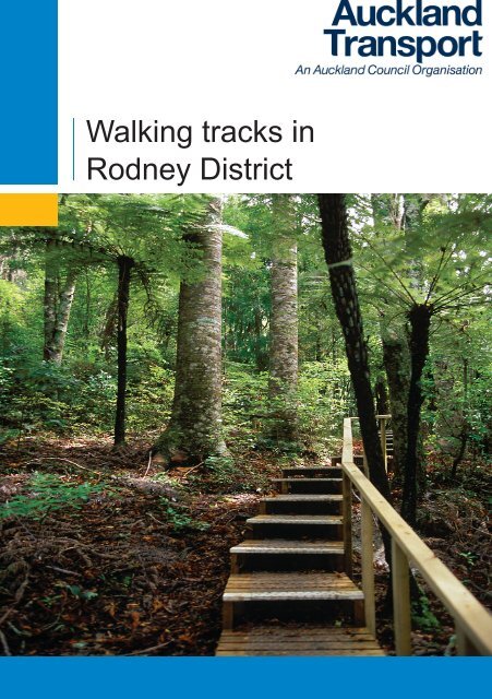
Walking tracks in Rodney District - Auckland Transport
Walking tracks in Rodney District - Auckland Transport
Walking tracks in Rodney District - Auckland Transport

Create successful ePaper yourself
Turn your PDF publications into a flip-book with our unique Google optimized e-Paper software.
<strong>Walk<strong>in</strong>g</strong> <strong>tracks</strong> <strong>in</strong><br />
<strong>Rodney</strong> <strong>District</strong>
2<br />
<br />
Key<br />
Welcome to <strong>Rodney</strong><br />
Only 30 m<strong>in</strong>utes north of <strong>Auckland</strong> and stretch<strong>in</strong>g from the east to the west coast, <strong>Rodney</strong><br />
<strong>District</strong> boasts sandy beaches, sparkl<strong>in</strong>g coastal waters, rugged cliffs, native bush, dune<br />
lakes, wetlands and walk<strong>in</strong>g <strong>tracks</strong>.<br />
This booklet <strong>in</strong>cludes three maps of walk<strong>in</strong>g areas <strong>in</strong> the <strong>Rodney</strong> <strong>District</strong>: Map 1 covers<br />
north <strong>Rodney</strong>, Map 2 west <strong>Rodney</strong> and Map 3 the Hibiscus Coast and Whangaparaoa<br />
Pen<strong>in</strong>sula.<br />
On the Hibiscus Coast and Whangaparaoa Pen<strong>in</strong>sula map, numbers 61-67 <strong>in</strong>dicate the<br />
Coastal Walkway. Signs along this walk<strong>in</strong>g track show access po<strong>in</strong>ts, however some<br />
sections may be restricted at high tide. See pages 8-9 for details.<br />
This booklet also <strong>in</strong>cludes Te Araroa – the Long Pathway. This is a 2920km trail that<br />
extends the length of New Zealand from Cape Re<strong>in</strong>ga to Bluff (see www.teararoa.org.nz<br />
for further details). Te Araroa’s route through <strong>Rodney</strong> starts south of Mangawhai <strong>in</strong><br />
the north and f<strong>in</strong>ishes at Okura Estuary <strong>in</strong> the south. Some of these <strong>tracks</strong> have been<br />
developed with the support of local landowners so it’s important that walkers respect the<br />
environment and:<br />
• Keep to the track<br />
• Leave gates as you f<strong>in</strong>d them/use the stiles provided<br />
• Always take litter with you<br />
• Always bury toilet waste; avoid toilet<strong>in</strong>g near water<br />
• Park your car thoughtfully (never drive onto private properties or park <strong>in</strong> front of gates)<br />
• Dogs are prohibited on farms and <strong>in</strong> protected bird areas. For rules regard<strong>in</strong>g dogs on<br />
beaches, please see <strong>Rodney</strong> <strong>District</strong> Council’s website.<br />
The key below <strong>in</strong>dicates the condition of the walk<strong>in</strong>g <strong>tracks</strong> and the level of fitness needed<br />
so you can plan appropriately and enjoy <strong>Rodney</strong> <strong>District</strong>’s wonderful natural environment.
<strong>Rodney</strong> <strong>District</strong><br />
Map 2<br />
1<br />
16<br />
16<br />
16<br />
1<br />
17<br />
1<br />
<br />
17<br />
<br />
<br />
1<br />
<br />
<br />
<br />
Map 1<br />
<br />
Map 3<br />
3
4<br />
1 Te Arai Reserve. Te Arai Po<strong>in</strong>t Rd, Te Arai, Wellsford.<br />
★★ V,P,B. 1 – 1.5hrs. Coastal walk<strong>in</strong>g <strong>tracks</strong> over high<br />
headland between two sections of Mangawhai Forest.<br />
Spectacular views of coastl<strong>in</strong>e. Safe swimm<strong>in</strong>g <strong>in</strong> exquarry<br />
lagoon. RDC<br />
2 Mangawhai Forest. Te Arai, Wellsford. ★★ T,P,B,I.<br />
Several walk<strong>in</strong>g and bridle <strong>tracks</strong> rang<strong>in</strong>g from 20 m<strong>in</strong><br />
walk to beach to 12km forest and beach trail. Track l<strong>in</strong>ks<br />
to No. 1 and Lake Tomarata. PF<br />
3 Logues Bush Scenic Reserve. Day Rd off Waiteitei Rd,<br />
Wellsford. ★★★ B,I. Ma<strong>in</strong> track a 90m<strong>in</strong> loop. Easiest<br />
walked clockwise through young kauri and lush bush.<br />
DOC<br />
4 Currys Bush. Wi Apo Pl, Wellsford. ★★★ B,I. 15 – 30<br />
m<strong>in</strong>s. Circular walk<strong>in</strong>g track <strong>in</strong> small remnant kahikatea<br />
forest. RDC<br />
Map 1: North <strong>Rodney</strong><br />
5 Goat Island Walkway. Goat Island Rd, Leigh. ★★ V,<br />
T, P, B. I. 2 hr return walk beh<strong>in</strong>d <strong>Auckland</strong> University<br />
Mar<strong>in</strong>e Laboratory climb<strong>in</strong>g farm hill marked by white<br />
poles. Follows clifftop through patches of coastal forest<br />
with views to outer Hauraki Gulf, Goat Island and Cape<br />
<strong>Rodney</strong>-Okakari Po<strong>in</strong>t Mar<strong>in</strong>e Reserve. DOC<br />
6 Omaha Cove Walkway. Leigh Harbour, Leigh. ★★ B, I.<br />
1 hr return walk start<strong>in</strong>g from Leigh Wharf around top of<br />
harbour through coastal forest. DOC/RDC<br />
7 Leigh Coastal Walkway. Leigh Township. ★ V. Clifftop<br />
walkway. Cotterell St to Pengu<strong>in</strong> St (15 m<strong>in</strong>s return) easy<br />
gradient; Kyle St to Wonderview Rd (40 m<strong>in</strong>s return) has<br />
some steep sections. Good views of rocky coastl<strong>in</strong>e.<br />
Daniels Reef access. Connects to No. 8. RDC
8 Matheson Bay Reserve. Grand View/Matheson Bay Rd,<br />
Matheson Bay. ★ T, P, B. 40 m<strong>in</strong>. return walk from reserve<br />
carpark along southern side of Kohuroa Stream. Muddy<br />
when wet. Popular swimm<strong>in</strong>g and div<strong>in</strong>g area. RDC<br />
9 Ti Po<strong>in</strong>t Coastal Walkway. Ti Po<strong>in</strong>t Rd, Ti Po<strong>in</strong>t. ★ T. 2<br />
hr return walk start<strong>in</strong>g from jetty around foreshore to Ti<br />
Po<strong>in</strong>t Scenic Reserve (DOC). Private property to Tatham<br />
Rd from Scenic Reserve. Popular fish<strong>in</strong>g spot off rocks.<br />
RDC/DOC<br />
10 Mt Tamahunga Walkway. 3.6 km down Omaha Valley<br />
Rd (off Leigh Rd), Matakana, or start end of <strong>Rodney</strong> Rd<br />
or Bathgate Rd, Pakiri. ★ V,P, B, I. 1.5 hrs one way to<br />
summit, 3.5 hrs one way to <strong>Rodney</strong> Rd, or 4.5 hrs from<br />
Omaha Valley Rd to Pakiri. Magnificent views up and<br />
down coast. Track is marked. TA/RDC/DOC.<br />
11 Po<strong>in</strong>t Wells Reserve. Riverside Dr, Po<strong>in</strong>t Wells.★★★<br />
T,P. 45 m<strong>in</strong>. return walk start<strong>in</strong>g from boatramp, around<br />
grass foreshore reserve beside Whangateau Harbour and<br />
follow<strong>in</strong>g bollard markers to Waimanu Reserve/Pl. Return<br />
the same way or walk back through village via accessway<br />
to Harbour View Rd. RDC<br />
12 Omaha Beach. Omaha. ★★★ T,P. A variety of walks <strong>in</strong><br />
area <strong>in</strong>clud<strong>in</strong>g reserves, foreshore and boardwalks. Dogs<br />
not permitted <strong>in</strong> dotterel bird sanctuary at top end of spit.<br />
Several start<strong>in</strong>g po<strong>in</strong>ts for a range of shorter and longer<br />
walks <strong>in</strong>clud<strong>in</strong>g wetlands and quarry. RDC<br />
13 Tawharanui Regional Park. Takatu Rd, Matakana.<br />
V,T,P,B,I. A 588ha Open Sanctuary protected by a<br />
predator-proof fence. A range of coastal walks. ARC<br />
14 Buckleton Beach. Buckleton Rd. ★★ P, B. 30 – 40<br />
m<strong>in</strong>s. A circular walk start<strong>in</strong>g from boatramp. Go left<br />
along beach reserve, follow grass track up hill <strong>in</strong>to<br />
reserve with small area of bush. Follow track through<br />
bush to accessway (with steps back onto Buckleton Rd).<br />
Follow the road back to ramp. RDC<br />
15 Sandspit Spit. Sandspit Rd, Sandspit. ★★★ D,T,P. A<br />
pleasant return walk (45 m<strong>in</strong>s) through the reserves on<br />
the spit; boardwalks through mangroves, past Deans<br />
Island and bird roost<strong>in</strong>g area on sandbar. Go through<br />
camp to No. 16. RDC<br />
16 Brick Bay Reserve. Brick Bay Dr, Sandspit. ★★ T,B.<br />
1.5-2 hrs. A series of bush <strong>tracks</strong> developed by local<br />
community through bush reserves overlook<strong>in</strong>g the mouth<br />
of the Matakana River. Various entry po<strong>in</strong>ts: off end<br />
of Kotare Pl, Puriri Pl, lefthand side near Brick Bay Dr<br />
<strong>in</strong>tersection, and beach reserve end of Brick Bay Dr. RDC<br />
17 Snells Beach Beachfront Reserve. Snells Beach Rd,<br />
Snells Beach. ★★★ D,T,P. Walkway along beachfront.<br />
Range of short and long walks. RDC<br />
18 Goodall Reserve. Cnr Hamatana and Mahurangi East<br />
Roads, Snells Beach. ★★★ D,T,P. 45 – 60 m<strong>in</strong>s. A<br />
circular walk around this reserve. Concrete path through<br />
to Foster Cres. and metal track on lower slop<strong>in</strong>g area.<br />
Toilets by tennis courts. RDC<br />
19 Algies Bay/Highfield Garden Reserve. Gordon Craig<br />
Pl / Mahurangi East Rd, Algies Bay. ★★ V,T,P,B,I. 60<br />
– 90 m<strong>in</strong>s. A walk along beachfront reserve to Highfield<br />
Garden Reserve at north end to see the donkeys and<br />
water fowl. Return along beach, take a stroll towards the<br />
southern end through the attractive garden area on the<br />
esplanade reserve. Map on sign by toilets. RDC<br />
20 Scandrett Regional Park. Scandrett Rd, Snells Beach.<br />
★ V,T,P,H,I. Various walks with l<strong>in</strong>ks to Mart<strong>in</strong>s Bay<br />
Holiday Park. ARC<br />
21 Mart<strong>in</strong>s Bay Reserve. Mart<strong>in</strong>s Bay Rd, Mart<strong>in</strong>s Bay.<br />
★★ P,B,T,I. 90 m<strong>in</strong>s. Map on sign at ma<strong>in</strong> carpark to<br />
left of boatramp. Cross stiles and through grazed area<br />
to reach bush area beh<strong>in</strong>d campground. Track has been<br />
upgraded but is muddy and slippery when wet. RDC<br />
22 Scotts Land<strong>in</strong>g. Ridge Rd, Mahurangi East. ★<br />
V,T,P,B,H,I. Walkway l<strong>in</strong>k<strong>in</strong>g several reserves <strong>in</strong>clud<strong>in</strong>g<br />
Mahurangi and Burton Wells Scenic Reserves (DOC)<br />
and Mahurangi Regional Park (ARC) with historic Scott<br />
homestead. Some tidal sections. Sign with map at<br />
Williams St carpark. Range of short and long walks.<br />
RDC/DOC/ARC<br />
23 Mahurangi East – Poplar Bay. Mahurangi Pen<strong>in</strong>sula.<br />
★★ V,I. 30 m<strong>in</strong>s one way. <strong>Walk<strong>in</strong>g</strong> track at Mahurangi<br />
Regional Park on headland east of Scotts Land<strong>in</strong>g<br />
between Poplar and Lagoon Bays. Access by boat only.<br />
ARC<br />
24 Mansion House. Kawau Island. ★★★ V,T,H,I. A series<br />
of walks from Mansion House to old copper m<strong>in</strong>e and<br />
School House Bay. View Sir George Grey’s house,<br />
grounds and wallabies. Take ferry from Sandspit. Range<br />
of short and long walks. DOC<br />
25 South Cove. Kawau Island. ★★ V. A pleasant return<br />
walk from South Cove wharf through small settlement<br />
and p<strong>in</strong>e plantation. Good views of Hauraki Gulf Islands.<br />
Take ferry from Sandspit or use own boat. RDC<br />
26 Govan Wilson Rd to Dome Forest. Govan Wilson Rd,<br />
Matakana. ★ P, B, I. 7 hours one way. Note: shorter<br />
walks optional. Bush walks with views. Track is marked.<br />
TA/DOC/ RDC.<br />
27 Dome Forest Walkway. Dome Forest carpark<br />
(tearooms), SH 1, Warkworth. ★★ V, P, B, I. 60 – 90<br />
m<strong>in</strong>s. 1.2km return track to the Dome summit, steep and<br />
rocky ascent. Alternatively a shorter 40 m<strong>in</strong> return walk<br />
to the lookout platform. A small kauri grove 800m beyond<br />
the summit. DOC<br />
28 Dome Forest to Puhoi. Dome Forest carpark<br />
(tearooms), SH 1, Warkworth. ★ & ★★ V, T, P, T. Full<br />
day: 6-7 hrs one way. Immediately across SH1 from the<br />
tearooms is Kraack Rd. Follow small directional markers<br />
on road signs from here to traverse back country roads,<br />
bush, forest and farms to Puhoi. The general directions<br />
are: Kraack Rd, Smyth Rd, Streamlands Swamp Rd, Old<br />
Kaipara Rd, Dr<strong>in</strong>nan’s farm, Edgerley Rd, Mathew Rd,<br />
Moirs Hill, signed 4WD track to Ahuroa Rd, Tolhopf Rd<br />
(connects with Dunn’s Bush/Ridge Track – see No. 37),<br />
then Ahuroa Rd <strong>in</strong>to Puhoi. RDC/TA.<br />
29 Kowhai Park. S.H.1/Matakana Rd, Warkworth. ★★★<br />
T,P,B,H. 45 – 60 m<strong>in</strong>s. Circular bush walk, past historic<br />
lime kilns. Parts can be muddy when wet. RDC<br />
30 Warkworth Town Riverbank. Wharf Rd/Kapanui St,<br />
Warkworth. ★★★ T,P. A walkway extend<strong>in</strong>g along the<br />
town side of Mahurangi River from Fall St, Elizabeth St,<br />
the wharf and Baxter St <strong>in</strong>to Lucy Moore Park, Rivendell<br />
Pl. and extend<strong>in</strong>g to historic cement works off Wilson Rd.<br />
Range of short and long walks. RDC<br />
31 Warkworth 150th Anniversary Walkway. ★★★ V. 15<br />
m<strong>in</strong>s. From Elizabeth Street along the river, boardwalk<br />
under highway to Shoesmith Reserve. RDC<br />
For walks 32-41, see page 6<br />
5
6<br />
32 Parry Kauri Park. Thompson Rd, Warkworth. ★★★<br />
T,P,B,H,I. 15 – 30 m<strong>in</strong>s. A circular bush walk built<br />
by the Kauri Bushmen’s Association. See the two<br />
historic Kauri trees and visit the museum. RDC<br />
33 Wairere Scenic Reserve. Falls Rd, Warkworth<br />
West. ★★ B. 5 – 15 m<strong>in</strong>s. Short walks <strong>in</strong> small bush<br />
reserve by stream (upper reaches of Mahurangi<br />
River). DOC<br />
34 Morison Scenic Reserve. Kaipara Hills Rd, Kaipara<br />
Flats. Southern conifer forest just past cemetery<br />
on righthand side. Cross stile at entrance to reach<br />
reserve. No def<strong>in</strong>ed <strong>tracks</strong>. RDC<br />
35 Moirs Hill Track. Pohuehue Scenic Reserve, SH1,<br />
Puhoi. ★★ P,B, I. Short 30 m<strong>in</strong> walk to waterfall.<br />
DOC/PF<br />
36 Beverly Price Loop Track. Pohuehue Scenic<br />
Reserve, SH1, Puhoi. ★ P,B, I. Beg<strong>in</strong>s from No. 35.<br />
2-hour loop track, best done clockwise. Track is<br />
rough and can be slippery when muddy. DOC/PF<br />
37 Dunn’s Bush & Ridge. Starts southern end Tolhopf<br />
Rd, beside 703 Ahuroa Rd, Puhoi and end of<br />
Remiger Rd, Puhoi. ★ V, B, P. 2 hour loop walk.<br />
Track is marked. TA/Private (QEII).<br />
38 Village Loop Track. Starts at Puhoi Doma<strong>in</strong>. ★★<br />
V, T, P, B. 40 m<strong>in</strong>. loop walk through regenerat<strong>in</strong>g<br />
bush and grasslands to high po<strong>in</strong>t overlook<strong>in</strong>g Puhoi<br />
village. RDC.<br />
39 McElroy Scenic Reserve. Cowan Bay Rd,<br />
Mahurangi West. ★ B,H,I. 45-60 m<strong>in</strong>s return. Add 30-<br />
45m<strong>in</strong>s for loop track. 200ha mixed kauri/broadleaf<br />
forest near end of Cowan Bay Rd. Old logg<strong>in</strong>g track<br />
runs along top of ridge. RDC<br />
40 Wenderholm Regional Park. S.H.1 just north of<br />
Waiwera turnoff. Waiwera. ★★ V,T,P,B,H,I. Three<br />
<strong>tracks</strong> rang<strong>in</strong>g from 30 m<strong>in</strong>s to 2 hrs between<br />
Waiwera and Puhoi Rivers. Historic Couldrey House.<br />
ARC<br />
41 Waiwera Beach. Waiwera. ★★★ T,H. 30-45 m<strong>in</strong>s.<br />
Short walk along beachfront reserve from boatramp<br />
to campground. Tree stumps rema<strong>in</strong> from early<br />
plant<strong>in</strong>gs associated with development of hotspr<strong>in</strong>gs<br />
by Robert Graham. Return along beach or do circuit<br />
beh<strong>in</strong>d hotpools along Waiwera Pl. RDC<br />
42 Albany Scenic Reserve. Lonely Track/Albany<br />
Heights Roads, Redvale. ★ B. 1 hr rough walk<strong>in</strong>g<br />
track <strong>in</strong> DOC reserve conta<strong>in</strong><strong>in</strong>g North Shore’s<br />
largest kauri tree 1.8m dia. and 600 – 800 yrs old.<br />
DOC<br />
43 Huapai Riverbank. S.H.16 – Oraha Rd, Huapai.<br />
★★★ T,P. 5-15m<strong>in</strong>s. Walkway alongside tributary of<br />
Kumeu River next to library/council offices. Mature<br />
totara trees scattered along riverbank. RDC<br />
44 Waimauku Reserves. Buttercup Pl, Sarah Todd Ln,<br />
Roselia Gr, Freshfields, Glasgow Park, Waimauku.<br />
★★★ 15-30m<strong>in</strong>s. A series of reserve walkways<br />
l<strong>in</strong>ked together through settlement. F<strong>in</strong>al l<strong>in</strong>k to<br />
Glasgow Park. RDC<br />
45 Kerr-Taylor Reserve. Taylor Rd, Waimauku. ★★<br />
B. Walks from 30 – 60 m<strong>in</strong>s. Private reserve with<br />
beautiful native bush. Big kauri tree. Steep <strong>in</strong> some<br />
areas. F&B<br />
46 Muriwai Regional Park. Motutara Rd, Muriwai. ★★<br />
V,T,P,B,I. West Coast Regional Park with several<br />
walkways and views of the gannet colony, pillow lava<br />
formations, rugged west coast scenery. Range of short<br />
and long walks via loop <strong>tracks</strong> at Doma<strong>in</strong> Cres, Oaia Rd,<br />
Edw<strong>in</strong> Mitchelson Rd and Waitea Rd. ARC/RDC<br />
47 Te Henga – Goldies Bush. Bethells Rd – Horseman<br />
Rd, Waitakere. ★★ V,B,I. 3 – 4 hrs each way. Starts at<br />
north end of Bethells Beach, follows coastal clifftop track<br />
across farmland, 500m up Constable Rd <strong>in</strong>to Goldies<br />
Bush and Mokoroa waterfall. Separate entrance to bush<br />
from Horseman Rd. Note: this walk crosses private land<br />
and is closed for lamb<strong>in</strong>g 1 Aug – 1 Oct. DOC/RDC<br />
48 Woodhill Forest. Restal & Rimmer Roads, Woodhill.<br />
★★ V,T,B,I. Extensive p<strong>in</strong>e forest extend<strong>in</strong>g from<br />
Muriwai to top of South Head provid<strong>in</strong>g a variety of<br />
recreation activities <strong>in</strong>clud<strong>in</strong>g motorsport, mounta<strong>in</strong><br />
bik<strong>in</strong>g and horse rid<strong>in</strong>g. For further details on these<br />
activities contact forest headquarters on 0800 RECRE8<br />
(0800 732 738). PF<br />
49 Helensville – Parakai. Mill Rd – Parkhurst Rd,<br />
Helensville/Parakai. ★★ V,H,P,D,I. 45-60 m<strong>in</strong>utes one<br />
way. A series of reserves and walkways start<strong>in</strong>g with a<br />
circular track at Helensville River Reserve (old tip site),<br />
along cycle/walkway to Parakai, turn right <strong>in</strong>to reserve by<br />
Te Moau Stream (playground <strong>in</strong> Te Moau Res). Follow<br />
stream to Wharf Reserve and back <strong>in</strong>to Parakai Ave.<br />
RDC<br />
50 Helensville Riverside. Creek Lane, Helensville. ★★★<br />
V,T,P,H,I. 30 - 45m<strong>in</strong>s. Ma<strong>in</strong> entrance from Creek Lane.<br />
Boardwalk along river edge past former dairy factory to<br />
Mill Rd. Also a shorter loop grass walkway. RDC<br />
51 Shelly Beach Reserve. Kaipara Harbour Beach Rd,<br />
Shelly Beach. ★★ V,T,P,H. 45-60m<strong>in</strong>s. Large reserve<br />
on shores of Kaipara Harbour. Informal walks around<br />
<strong>tracks</strong>/clifftop stairs and foreshore. Pa site at north end.<br />
Local store has petrol. Wharf, boatramp, playgrounds,<br />
swimm<strong>in</strong>g and campground. RDC<br />
52 Lake Ototoa. South Head/Donovan Roads, South<br />
Head. ★ H,V,T,B,I. Short track to dune lake stocked with<br />
trout. Good for kayak<strong>in</strong>g. Possible to walk around lake<br />
depend<strong>in</strong>g on lake levels. DOC<br />
53 Mosquito Bay. South Head Rd, South Head. ★★ V.<br />
15-30m<strong>in</strong>s. At end of South Head Rd, steep track to<br />
small bay near head of harbour. Strong currents close to<br />
shore. RDC<br />
54 Omeru Scenic Reserve. Kaipara Coast Highway<br />
(S.H.16.), Kaukapakapa. ★ T,B,H,I. 25-35 m<strong>in</strong>s return.<br />
About 5km north of Kaukapakapa township. Bush<br />
reserve with 2 streams, waterfalls, Pa site and picnic<br />
area. RDC<br />
55 Mt <strong>Auckland</strong> Walkway (Atuanui). 3 km down Glorit-<br />
Kaipara Hills Rd, off Kaipara Coast Highway (SH 16). A<br />
steeper ascent is via the track sign-posted on SH 16, 2<br />
km north of the Glorit-Kaipara Rd turnoff. *V,B,I. 1 hr 45<br />
m<strong>in</strong>s to the summit one way. A lookout at the summit<br />
(305m) provides panoramic views of Kaipara Harbour<br />
and Hoteo river estuary. Retrace your steps or take the<br />
track westward to the Kaipara Coast Highway exit, which<br />
is a steeper descent. This end of the track exits through<br />
farm land to SH 16. DOC
Map 2:<br />
West <strong>Rodney</strong><br />
7
8<br />
56 Alice Eaves Scenic Reserve. Old North Rd, Orewa.<br />
★★★ V,B,H,I. 30-45 m<strong>in</strong>s. F<strong>in</strong>e remnant stand of native<br />
kauri and broadleaf forest at northern end of Orewa.<br />
Lower track beside Nukumea Stream to Kens<strong>in</strong>gton Park<br />
suitable for wheel chairs. Good examples of Kauri and<br />
Puriri. Pa site at Hillcrest Rd entrance. RDC<br />
57 Orewa Esplanade Reserve. S.H.1./Hibiscus Coast<br />
Highway, Orewa. ★★★ D,T,P. 45-60 m<strong>in</strong>s. Paved<br />
walk<strong>in</strong>g track along northern half of beachfront reserve.<br />
Runs from Arundel Reserve, at northern end, to the town<br />
centre by traffic lights. L<strong>in</strong>ks to No. 58. RDC<br />
58 Orewa Millennium Walkway. Orewa Township. ★★★<br />
D,B,T,P,I,V. 2 hrs. ‘Oval’ walkway. Start from south bridge,<br />
follow estuary to Centreway Reserve, turn left down<br />
Riverside Rd and cross road <strong>in</strong>to Grant Park, along<br />
Hatton Rd through Victor Eaves Park to l<strong>in</strong>k with Eaves<br />
Bush return<strong>in</strong>g to south bridge via Orewa beachfront.<br />
Follow the blue footpr<strong>in</strong>ts. RDC<br />
59 Maygrove Reserve. Riverside/Lakeside Drives,<br />
Maygrove, Orewa. ★★★ V,P. A variety of walkways<br />
through residential areas, esplanade reserve and around<br />
Map 3:Hibiscus Coast<br />
& Whangaparaoa Pen<strong>in</strong>sula<br />
= Coastal Walkway (nos. 61-67)<br />
= Orewa Millennium Walkway<br />
the artificial lake <strong>in</strong> Lakeside Reserve. Wet <strong>in</strong> w<strong>in</strong>ter.<br />
Range of short and long walks. RDC<br />
60 Pohutukawa Reserve/Orewa Estuary. Pohutukawa<br />
Ave & Moffat Rd, Orewa. ★ V. 30-45m<strong>in</strong>s. Grass reserve<br />
walkway on south side of estuary runn<strong>in</strong>g from Orewa<br />
south bridge to Jelas Rd/K<strong>in</strong>gsway School <strong>in</strong>to Totara<br />
Views subdivision. RDC<br />
61 Amor<strong>in</strong>o Reserve. S.H.1/Hibiscus Coast Highway, Red<br />
Beach. ★★★ V,D. 15-30m<strong>in</strong>s. Reserve walkway beside<br />
Orewa estuary mouth, l<strong>in</strong>k<strong>in</strong>g with surround<strong>in</strong>g residential<br />
streets. Start of Whangaparaoa Pen<strong>in</strong>sula’s ‘Coastal<br />
Walkways’. Follow signs on lamp posts. RDC<br />
62 Red Beach Reserves. Vista Motu & Marellen Dr, Red<br />
Beach. ★★★ V. 30–45m<strong>in</strong>s. An <strong>in</strong>formal walk between<br />
various reserves <strong>in</strong> the centre of Red Beach. From Red<br />
Beach Lookout Reserve take walkways <strong>in</strong>to Higham<br />
Ferrers Reserve, cross Bay Vista Dr <strong>in</strong>to Gilshennan<br />
Reserve, follow path to right and follow walkways to<br />
Rushden Tce and Red Beach Park, cross Marellen Dr to<br />
beach. RDC
63 Red Beach section of Coastal Walkway.<br />
Ngapara St – Duncansby Rd, Red Beach.<br />
★★ T,P,I. 30m<strong>in</strong>s. Walk along beach from<br />
Ngapara St to Duncansby Rd. May be<br />
restricted at high tide. RDC<br />
64 Stanmore Bay Beach. Cooper Rd &<br />
Stanmore Bay Reserve, Stanmore Bay.<br />
★★★ T,P,I. 15–30m<strong>in</strong>s. Walk along beach<br />
from Cooper Rd/Lea Reserve to Stanmore<br />
Bay Park. Cross arch bridge at eastern end<br />
of park to l<strong>in</strong>k to No. 65. RDC<br />
65 Stanmore Bay Reserve to Manly Beach.<br />
Stanmore Bay Rd – Moreton Dr, Manly.<br />
★★ T,P,H,I. 15-30m<strong>in</strong>s. Walk from end of<br />
Stanmore Bay Rd and take track up through<br />
historic cemetery. Left <strong>in</strong>to Ardern Ave and<br />
cross to next accessway. Turn right <strong>in</strong>to<br />
Swann Beach Rd to the top corner and next<br />
accessway with steps through to Hurdlow Pl<br />
and Moreton Dr / beach. RDC<br />
66 Manly Beach to T<strong>in</strong>dalls Beach. Brown St – T<strong>in</strong>dalls Bay Rd,<br />
T<strong>in</strong>dalls Beach. ★★ T,P. 15-30m<strong>in</strong>s. From end of Brown St, walk<br />
along beach (restricted at high tide) to boatramp. Cross footbridge<br />
by sheds to accessway to The Crescent. Follow road round Crown<br />
Reserve to T<strong>in</strong>dalls Beach. RDC<br />
67 T<strong>in</strong>dalls Beach to Matakatia Beach. ★★★ V,T,P. 15-30m<strong>in</strong>s.<br />
From centre of beach, take series of accessways through to<br />
Whangaparaoa Rd. Cross road and turn right to top of hill, then left<br />
<strong>in</strong>to reserve accessway down to Matakatia Beach. RDC<br />
68 Gulf Harbour. Shakespear Rd – Gulf Harbour Dr, Gulf Harbour<br />
★★★ V,T,P. Walkways progress<strong>in</strong>g as Gulf Harbour estate<br />
develops. Network utilises reserves, roads and runs through the golf<br />
course. Range of short and long walks. Toilets at boatramp. RDC<br />
69 Fisherman’s Rock/Pacific Parade. Fisherman’s Rock Reserve,<br />
Army Bay. ★★ V. 60-90m<strong>in</strong>s. Coastal clifftop walk from Fisherman’s<br />
Rock Reserve to eastern end of Pacific Parade. Two clifftop<br />
staircases and stone ramp provide access onto rocky foreshore.<br />
Access between Fisherman’s Rock and Pacific Parade Reserves via<br />
foreshore, restricted at high tide. RDC<br />
70 Shakespear Regional Park. Army Bay, Whangaparaoa Pen<strong>in</strong>sula.<br />
★★★ V,T,B,I. Various marked <strong>tracks</strong> rang<strong>in</strong>g from 1 – 2 hrs around<br />
farm park at end of pen<strong>in</strong>sula. Includes Fairy Falls bush walk.<br />
Sweep<strong>in</strong>g views of Hauraki Gulf and Islands. ARC<br />
71 Tiritiri Matangi Island. Take ferry from Gulf Harbour Mar<strong>in</strong>a.<br />
★★ V,T,B,I. Open sanctuary for some of New Zealand’s rare and<br />
endangered plant and bird species. ‘Tiri’ supports Saddlebacks, Kiwi,<br />
Takahe, Bellbird and other native birds no longer seen on ma<strong>in</strong>land.<br />
A variety of walk<strong>in</strong>g <strong>tracks</strong> cover island. DOC<br />
72 Tiri Rd – East Ave Clifftop. Starts at 33 Tiri Rd, Little Manly. ★★★<br />
V,D. 5-15m<strong>in</strong>s. Short clifftop reserve walk between Tiri Rd and East<br />
Ave cul de sac. Good views of Gulf. RDC<br />
73 Little Manly Beach. South Ave – Little Manly Beach, Little Manly.<br />
★★★ V,T,P. 5-15m<strong>in</strong>s. Shore reserve and clifftop walk from South<br />
Ave to beach. RDC<br />
74 Arkles Bay Clifftop. Ladies Mile – Arkles Bay. ★★ V,B. 5-15m<strong>in</strong>s.<br />
Short clifftop walk from Ladies Mile/Whangaparaoa Rd <strong>in</strong>tersection<br />
to Arkles Bay beach through coastal bush. Steep flight of steps at<br />
Arkles Bay end. RDC<br />
75 Whangaparaoa Town Centre to Stanmore Bay beach. Town<br />
centre – Brightside Rd, Stanmore Bay. ★★★ D,T. 15-30m<strong>in</strong>s. From<br />
town centre via Palmgreen Court and reserve, walkway to Rata<br />
Rd. Walkway half way along Rimu Rd on right leads <strong>in</strong>to Stanmore<br />
Bay Park past Leisure Centre. Cross Brightside Rd to beach side of<br />
reserve. RDC<br />
76 Ferry Road Reserve. Ferry Rd, Arkles Bay. ★★ B. 5-15m<strong>in</strong>s. Short<br />
reserve walk through coastal bush to foreshore of Weiti River near<br />
mouth of river. Timber steps at top. Slippery rocks on foreshore. RDC<br />
77 Fairhaven Walk. Wade River Rd, Arkles Bay. ★ T,B. 30-45m<strong>in</strong>s.<br />
Rough dead end walk<strong>in</strong>g track off end of Wade River Rd past boat<br />
club on banks of Weiti River flanked by native bush with some big<br />
puriri trees. RDC<br />
78 Okura Walk. Duck Creek Rd, Stillwater or Haigh Access Rd,<br />
Redvale. ★ V,T,B,H,I. 2-2.5hrs from Stillwater through muddy<br />
pastures and along foreshore to historic Dacre cottage (compost<strong>in</strong>g<br />
toilets alongside). 3-3.5hrs from Okura (Haigh Access Rd) through<br />
Scenic Bush Reserve. Coastal walk between Weiti and Okura<br />
Rivers. Boots required. DOC and RDC.<br />
9
10<br />
No matter who you are – thrill seeker, w<strong>in</strong>e buff, sailor, surfer, connoisseur<br />
of f<strong>in</strong>e cuis<strong>in</strong>e, bird watcher or explorer – <strong>Rodney</strong> <strong>District</strong> showcases a wide<br />
variety of activities and sights along 1000 kilometres of stunn<strong>in</strong>g coastl<strong>in</strong>e.<br />
Visit:<br />
• Goat Island Mar<strong>in</strong>e Reserve near Leigh<br />
• Boutique v<strong>in</strong>eyards <strong>in</strong> Kumeu, Matakana and Warkworth<br />
• Waiwera and Parakai thermal m<strong>in</strong>eral hot pools<br />
• Historic Mansion House on Kawau Island<br />
• Coastal and rural horse treks<br />
• The open bird sanctuary at Tiritiri Matangi Island<br />
• The gannet colony at Muriwai<br />
• Kaipara Harbour, the largest enclosed harbour <strong>in</strong> the southern hemisphere<br />
• Woodhill Forest for adventure activities<br />
• Gulf Harbour’s mar<strong>in</strong>a, restaurants and <strong>in</strong>ternational golf course<br />
• Stunn<strong>in</strong>g surf beaches on the west and east coasts<br />
• Historic Puhoi Village<br />
To fully enjoy your visit <strong>in</strong> the <strong>Rodney</strong> <strong>District</strong> there are many accommodation<br />
options <strong>in</strong>clud<strong>in</strong>g <strong>Rodney</strong> <strong>District</strong> Council’s holiday parks.<br />
Orewa Beach Top 10 Holiday Park<br />
35km north of central <strong>Auckland</strong>, front<strong>in</strong>g Orewa Beach. Activities <strong>in</strong>clude<br />
swimm<strong>in</strong>g (close to surf club patrolled area), boat<strong>in</strong>g, fish<strong>in</strong>g, w<strong>in</strong>dsurf<strong>in</strong>g and<br />
golf (<strong>in</strong>clud<strong>in</strong>g the <strong>in</strong>ternational course at Gulf Harbour). Close to restaurants,<br />
shopp<strong>in</strong>g, m<strong>in</strong>i golf, Snowplanet, <strong>Auckland</strong> Luge, Go-Karts and Waiwera<br />
Thermal Spa Resort.<br />
Mart<strong>in</strong>s Bay Holiday Park<br />
On the beachfront at Mart<strong>in</strong>s Bay overlook<strong>in</strong>g the Mahurangi Pen<strong>in</strong>sula, boat<br />
cruis<strong>in</strong>g areas and the Kawau Island fish<strong>in</strong>g grounds. Activities <strong>in</strong>clude fish<strong>in</strong>g,<br />
swimm<strong>in</strong>g, sail<strong>in</strong>g and bush walks. Short drive to Sandspit for scenic trips to<br />
historic Kawau Island.<br />
Whangateau Holiday Park<br />
A family-orientated park situated 18km north-east of Warkworth, right on the<br />
water’s edge overlook<strong>in</strong>g Whangateau Harbour, across the harbour from<br />
Omaha. A great base to visit nearby Goat Island/Cape <strong>Rodney</strong> Mar<strong>in</strong>e Reserve<br />
(popular for div<strong>in</strong>g and snorkell<strong>in</strong>g), the Matakana W<strong>in</strong>e Trail and farmers’<br />
markets. Short drive to Sandspit for scenic trips to Kawau Island. Activities<br />
<strong>in</strong>clude swimm<strong>in</strong>g, fish<strong>in</strong>g, kayak<strong>in</strong>g, sail<strong>in</strong>g and native bird watch<strong>in</strong>g.<br />
Shelly Beach Camp<strong>in</strong>g Ground<br />
On the shores of the historic Kaipara Harbour, 20 m<strong>in</strong>utes/24km from<br />
Helensville. Boat launch<strong>in</strong>g facility and great fish<strong>in</strong>g. Camp with 10 powered<br />
sites for campervans/caravans and four tent sites (no kitchen or laundry<br />
facilities). Public toilets, hot showers, licensed store, shop, cafe, and petrol<br />
pump on site.