

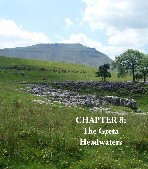
CHAPTER 8: The Greta Headwaters
CHAPTER 8: The Greta Headwaters
CHAPTER 8: The Greta Headwaters

You also want an ePaper? Increase the reach of your titles
YUMPU automatically turns print PDFs into web optimized ePapers that Google loves.
<strong>CHAPTER</strong> 8:<br />
<strong>The</strong> <strong>Greta</strong><br />
<strong>Headwaters</strong>
124 Chapter 8: <strong>The</strong> <strong>Greta</strong> <strong>Headwaters</strong><br />
Gragareth ▲<br />
Great Coum ▲<br />
Green Hill ▲<br />
S<br />
Thornton Force *<br />
•<br />
Yordas<br />
Cave<br />
*<br />
Kingsdale Beck<br />
walk 17<br />
Ingleton<br />
Chapel Beck<br />
* White Scar<br />
Cave<br />
Whernside<br />
▲<br />
B6255<br />
Force Gill<br />
Beck<br />
Winterscales<br />
• Chapelle-Dale<br />
Little Dale Beck<br />
▲ Simon Fell<br />
▲ Ingleborough<br />
Batty Moss Viaduct<br />
*<br />
River <strong>Greta</strong> ▲ Park Fell<br />
walk 16<br />
Scale: 1 cm to 1 km<br />
0 5 kilometres<br />
S<br />
▲ Blea Moor<br />
This is Chapter 8 of <strong>The</strong> Land of the Lune (2nd edition), http://www.drakkar.co.uk/landofthelune.html, Copyright © 2010 John Self
<strong>The</strong> River <strong>Greta</strong> (Chapel Beck) ...<br />
<strong>The</strong> River <strong>Greta</strong> is formed at Ingleton by the<br />
confluence of the River Doe and River Twiss.<br />
Unfortunately, there is confusion as to which is<br />
which. <strong>The</strong> Ordnance Survey and the Ingleton Waterfalls<br />
Walk leaflet have the Doe to the east but Wainwright’s<br />
Walks in Limestone Country and Ingleton’s own leaflet<br />
have the Doe to the west. Upstream, the two rivers are<br />
called Chapel Beck (in Chapel-le-Dale) and Kingsdale<br />
Beck (in Kingsdale) and it seems simplest to retain those<br />
names down to the Ingleton junction, rather than choose<br />
between the river names.<br />
As Chapel Beck is the larger of the two at the<br />
junction I will consider that to provide the source of<br />
the <strong>Greta</strong>, with Kingsdale Beck being a tributary. This<br />
is supported by Thos Johnson’s 1872 book A Pictorial<br />
Handbook to the Valley of the Lune and Gossiping<br />
Guide to Morecambe and District (yes, really), which<br />
considers Chapel-le-Dale to lie in <strong>Greta</strong>dale. Moreover,<br />
he has a River Doe in Kingsdale, so if I were forced off<br />
the fence, I’d say the Ordnance Survey has it wrong.<br />
<strong>The</strong> source of Chapel Beck is at the head of Little<br />
Dale between Whernside and Blea Moor. Here, Little<br />
Dale Beck is joined by Force Gill, which has two fairsized<br />
waterfalls and crosses the Settle-Carlisle railway<br />
line over an aqueduct. Force Gill arises in Greensett, a<br />
boggy plateau on the eastern slopes of Whernside. Our<br />
obsession with getting to the tops of mountains – perhaps<br />
understandable with Whernside, as it is the highest<br />
peak of the Dales – tends to lead us to hurry past more<br />
interesting areas. Although the slopes of Whernside are<br />
now all CRoW land, 99% of walkers dutifully follow<br />
the signposted route, part of the Three Peaks walk, via<br />
Grain Head, ignoring Force Gill and Greensett.<br />
Actually, my preferred route up Whernside is from<br />
Kingsdale Head – all grass and no people (so forget<br />
I mentioned it). But the CRoW policy does raise a<br />
question: is it environmentally better that we all tread<br />
the standard path, thereby giving up that path to erosion<br />
and decay? Or should we spread ourselves thinly across<br />
CRoW land? <strong>The</strong>re seems little point in creating access<br />
land if we are not expected to access it but, on the other<br />
hand, even the occasional walker may be too much for<br />
some of the flora and fauna.<br />
<strong>The</strong> first time we walked the Three Peaks route we<br />
came across a curlew’s nest right by the path. <strong>The</strong>re’s<br />
no chance of that today. <strong>The</strong> curlew is the bird most<br />
<strong>The</strong> River <strong>Greta</strong> (Chapel Beck) ... 125<br />
<strong>The</strong> Three Peaks are Whernside, Ingleborough and Peny-Ghent.<br />
<strong>The</strong> first two, at 736m and 724m, are the two<br />
highest peaks in the Yorkshire Dales and are wholly within<br />
Loyne. Pen-y-Ghent (694m) is the 7 th highest Dales peak<br />
and is in Ribblesdale.<br />
<strong>The</strong> Three Peaks walk of about 38km, with nearly<br />
1600m of ascent, is a challenging all-day expedition. <strong>The</strong><br />
Three Peaks fell race is even more challenging but should<br />
not take all day (only serious runners are allowed: no<br />
pantomime horses). <strong>The</strong> record is 2hr 46min for the present<br />
course and 2hr 29min for a previous course, with the ladies’<br />
record standing at 3hr 13min. In 2008 the 54th Three Peaks<br />
race was run as the 5th World Long Distance Mountain<br />
Running Challenge. <strong>The</strong> start used to be at Chapel-le-Dale<br />
but is now at Horton-in-Ribblesdale, which has taken upon<br />
itself the role of Three Peaks centre. Of course, walkers<br />
may start at any point on the circuit.<br />
However, it is hardly a fell walk or race nowadays.<br />
Much of the route has been so badly eroded that the natural<br />
fell has been replaced. It is a shame that so many people<br />
(an estimated 250,000 a year) continue to follow such a<br />
worn path. Jack Sharp’s New Walks in the Yorkshire Dales<br />
provides a score of alternative long-distance walks.<br />
I would also suggest a Loyne Three Peaks – replace<br />
Pen-y-Ghent with Great Coum. <strong>The</strong> latter is only 7m lower<br />
and this route avoids the long trek over bog and on road<br />
from Pen-y-Ghent to Whernside and the eyesore of the<br />
Horton quarries (and it’s 10km shorter).<br />
redolent of the northern moors, with its distinctive call<br />
as it glides earthwards. Some describe it as plaintive or<br />
melancholy but it sounds bubblingly joyful to me. Never<br />
mind the swallow and cuckoo, it is the call of the curlew<br />
that is for me the most evocative of the new year (as<br />
early as January in 2006) as the curlew returns up the<br />
Lune valley to its nesting haunts.<br />
Below the red-tinged sandstone slopes of Whernside,<br />
grey slate tumbles towards the peat of Greensett Moss.<br />
Here is Greensett Tarn, the sheltered home of blackheaded<br />
gulls, and below the tarn is a line of shakeholes<br />
and caves, including Greensett Cave. <strong>The</strong>ir existence at<br />
560m, when the main potholes and caves of the valley are<br />
at about 300m, shows that there is a layer of limestone<br />
here, as well as in the valley.<br />
Little Dale Beck absorbs Hare Gill and Foul Gutter<br />
from Blea Moor before crossing under the railway<br />
line, 1km north of the Ribblehead Viaduct, to become<br />
Two pages before: Ingleborough from Souther<br />
Scales.<br />
This is Chapter 8 of <strong>The</strong> Land of the Lune (2nd edition), http://www.drakkar.co.uk/landofthelune.html, Copyright © 2010 John Self
126 Chapter 8: <strong>The</strong> <strong>Greta</strong> <strong>Headwaters</strong><br />
Winterscales Beck. This viaduct was originally called<br />
Batty Moss Viaduct, in keeping with the tradition of<br />
naming viaducts after what they cross (Dent Head, Arten<br />
Gill and Dandry Mire). Its renaming, along with that of<br />
Batty Green Station to Ribblehead Station, is a triumph<br />
for the tourist industry of Ribblesdale.<br />
<strong>The</strong> source of the Ribble is 8km north at Newby<br />
Head in Widdale. Standing under the viaduct, it is hard<br />
to tell whether water will flow southwest to the Lune<br />
or southeast to the Ribble, precisely because the viaduct<br />
was built over the watershed. If anything, it looks more<br />
downhill to the southwest and, certainly, the largest beck<br />
of any size that is close to the viaduct is Winterscales<br />
Beck, which flows to the Lune.<br />
It is too late to claim the viaduct for the Lune but<br />
there is every justification for calling it Batty Moss<br />
Viaduct, as I will, not least because its actual existence<br />
Force Gill, with walkers on the Three Peaks route<br />
here may be a little batty. <strong>The</strong> Settle-Carlisle railway<br />
line is now absorbed into the romance of the Dales and<br />
we may marvel at the skill and energy that produced the<br />
scenic section from Batty Moss Viaduct to Dandrymire<br />
Viaduct, via Bleamoor Tunnel, Dent Head Viaduct,<br />
Artengill Viaduct and Risehill Tunnel. But we might<br />
pause to ask: Why? Why was it necessary?<br />
Imagine yourself to be a railway engineer in 1870,<br />
standing at Selside in Ribblesdale. <strong>The</strong> Settle-Carlisle<br />
line will proceed north up Ribblesdale and south below<br />
Wild Boar Fell. How would you bridge the gap? Would<br />
you go over the watershed to Dentdale and then out<br />
again to Garsdale rather than through Widdale (the<br />
present B6265 route), knowing that the line from Hawes<br />
to Garsdale, completed in 1878, was already planned?<br />
I am not a railway engineer but it seems to me that this<br />
route requires no large viaducts and no tunnels.<br />
This is Chapter 8 of <strong>The</strong> Land of the Lune (2nd edition), http://www.drakkar.co.uk/landofthelune.html, Copyright © 2010 John Self
Batty Moss Viaduct<br />
Walk 16: Whernside from Chapel-le-Dale<br />
<strong>The</strong> River <strong>Greta</strong> (Chapel Beck) ... 127<br />
Map: OL2 (please read the general note about the walks in the Introduction).<br />
Starting point: A lay-by on the north side of the B6255 200m northwest of Hill Inn (744777).<br />
Walk past the Hill Inn to take Philpin Lane north to Bruntscar. This is on the Three Peaks walk route but you will avoid the<br />
steep, knee-jarring slog up the reinforced thoroughfare on the flank of Whernside by taking a more leisurely uphill amble, mainly<br />
on grass.<br />
Turn left past Bruntscar and Ellerbeck and on to the bridleway southwest. After about 1km leave the bridleway to cut across<br />
to the straight wall that runs up the West Fell ridge. Follow this wall all the way to the top of Whernside, 1km before which you<br />
rejoin the Three Peaks thoroughfare.<br />
From the top, drop down the slope (steep but not too steep) to reach the remains of a wall 0.5km east and follow it northeast,<br />
investigating the Greensett caves and potholes, as you wish. Follow the wall down east to see the Force Gill waterfalls. Rejoin the<br />
footpath to cross the railway line and after 1km go under the railway to Winterscales and Ivescar. From Ivescar take the footpath<br />
south to Winterscales Beck. Continue on the road and then footpath back to Philpin Lane, noting the caves and potholes and the<br />
signs of damage wrought when the beck is in spate.<br />
When planning a high-level walk, it is always worth having a low-level alternative in mind, for often on arrival we find that<br />
the tops have gathered cloud. Here there is a fine loop walk under the shelter of Whernside: from Chapel-le-Dale take Oddie’s<br />
Lane to Twisleton Hall, then follow the footpath across Scales Moor to Bruntscar and on to Winterscales, and then work your<br />
way back along Winterscales Beck.<br />
Short walk variation: Follow the long walk through Bruntscar and Ellerbeck to the West Fell ridge. Walk by the wall north past<br />
Combe Scar to where it is joined from the right by the broad path from Bruntscar (part of the Three Peaks route). Now you must<br />
summon up all your resolve to not walk the further 1km to the top of Whernside, just 140m higher: this is supposed to be a short<br />
walk and you really cannot expect to get to the highest point of the Yorkshire Dales on a short walk. So, with great fortitude, take<br />
the path down to Bruntscar and back to Philpin Lane.<br />
This is Chapter 8 of <strong>The</strong> Land of the Lune (2nd edition), http://www.drakkar.co.uk/landofthelune.html, Copyright © 2010 John Self
128 Chapter 8: <strong>The</strong> <strong>Greta</strong> <strong>Headwaters</strong><br />
Anyway, let us be grateful, for if they<br />
had so decided all of the Settle-Carlisle<br />
line would be outside Loyne. However, we<br />
should always remember that the “thrilling<br />
story of this magnificent engineering<br />
enterprise”, as Wainwright’s Walks in<br />
Limestone Country puts it, involved a<br />
few thousand people working here, under<br />
appalling conditions, for six years (less<br />
for the two hundred or so who died). <strong>The</strong><br />
Batty Green shantytown sounds jolly but it<br />
must have been a hard, tough life here in the<br />
cold, wet, muddy desolation. I hope that the<br />
workers’ sacrifices were not in the cause of<br />
some vainglorious adventure.<br />
Today, we may admire the results of<br />
their labours. <strong>The</strong> Batty Moss Viaduct is<br />
the most spectacular of all the engineering<br />
works on the Settle-Carlisle line and an<br />
awesome sight from Whernside and other<br />
vantage points. Its 24 arches are made<br />
from local limestone and the embankment<br />
from earth excavated from Bleamoor Tunnel. <strong>The</strong><br />
viaduct is 32m high and 400m long and the spans are<br />
7m wide, with each sixth pier thickened to help prevent<br />
collapse. Its gentle curve seems fully in keeping with the<br />
surroundings, now that the shantytown has long gone.<br />
Winterscales Beck makes its way intermittently<br />
southwest, repeatedly disappearing through its limestone<br />
bed and being re-created by resurgences, of which the<br />
largest is from Gatekirk Cave. In summer much of its<br />
bed will be dry but it is obvious from the erosion that<br />
after heavy rain this is a ferocious torrent. In places,<br />
one can stand in the dry bed and see debris in the trees<br />
several metres above.<br />
After Winterscales Beck disappears, a series of<br />
potholes and caves continues its line until the emergence<br />
of Chapel Beck below Chapel-le-Dale. Some of these<br />
potholes are described in the overblown prose of John<br />
Hutton, vicar of Burton-in-Kendal, who in 1780 wrote<br />
a 49-page pamphlet considered to be the first-ever book<br />
on caving. He considered Weathercote Cave to be “the<br />
most surprising natural curiosity of the kind in the<br />
island of Great Britain … a stupendous subterranean<br />
cataract.” Hurtle Pot, however, was “one of the most<br />
dismal prospects we had yet been presented with … [and<br />
he viewed] with horror and astonishment its dreadful<br />
aspect.”<br />
Winterscales Beck near Winterscales Farm<br />
Like many rural hamlets, Chapel-le-Dale is known<br />
for its pub and its church. <strong>The</strong> Hill Inn was long regarded<br />
as a rowdy base for potholers. St Leonard’s Church is a<br />
more sombre resting place for the “many men, women<br />
and children … who died through accident or disease<br />
during the construction of the Settle-Carlisle railway and<br />
who were buried in this churchyard”, as a millennium<br />
year memorial plaque puts it. Sadly, the plaque does not<br />
list the two hundred names given in the burial register.<br />
A notice in the St Leonard’s Church porch<br />
(Perhaps the boggards of Hurtle Pot - to which legend<br />
attributes the strange noises that Hurtle Pot makes<br />
when in flood - have been up to their tricks.)<br />
This is Chapter 8 of <strong>The</strong> Land of the Lune (2nd edition), http://www.drakkar.co.uk/landofthelune.html, Copyright © 2010 John Self
<strong>The</strong> church itself is neat, with mullioned windows and<br />
bellcot, built in the 17 th century and restored in 1869.<br />
Above Chapel-le-Dale soars Ingleborough, the<br />
supreme peak of the Yorkshire Dales. Although second<br />
in height to Whernside, its isolated location and proud<br />
profile make it seem higher from almost every direction.<br />
Its position at the head of the <strong>Greta</strong> and Wenning valleys<br />
means that it oversees, and can be seen from, much of<br />
Loyne.<br />
Its name alludes, perhaps fortuitously, to two early<br />
roles. <strong>The</strong> word ‘ingle’ is from an old Gaelic word for<br />
fire and no doubt, because of its domineering position,<br />
Ingleborough from White Scars<br />
<strong>The</strong> River <strong>Greta</strong> (Chapel Beck) ... 129<br />
(to look at, not from)<br />
1. Ingleborough<br />
2. Wild Boar Fell<br />
3. Great Coum<br />
4. Grayrigg Pike<br />
5. Calf Top<br />
6. Whinfell<br />
7. Whernside<br />
8. Clougha Pike<br />
9. Winder<br />
10. Mallowdale Pike<br />
<strong>The</strong> Top 10 peaks in Loyne<br />
This is Chapter 8 of <strong>The</strong> Land of the Lune (2nd edition), http://www.drakkar.co.uk/landofthelune.html, Copyright © 2010 John Self
130 Chapter 8: <strong>The</strong> <strong>Greta</strong> <strong>Headwaters</strong><br />
Ingleborough was often in the past the site of a beacon.<br />
<strong>The</strong> ‘borough’ (as we saw with Low Borrowbridge and<br />
Over Burrow) may be associated with an old fortification.<br />
In fact, the Ordnance Survey is bold enough to mark<br />
‘fort’ on its map. <strong>The</strong> fort is variously believed to have<br />
been built by the Romans, by the Brigantes (against the<br />
Romans) and by pre-Roman Iron Age settlers. But David<br />
Johnson, in his 2008 book on Ingleborough, doubts that<br />
it was a fort at all. He does not consider that the remains<br />
of the wall, which some call ramparts, that run round<br />
the rim of the summit plateau are substantial enough to<br />
indicate any defensive role. Also, the lack of water on<br />
the plateau makes it an implausible defensive retreat.<br />
This fact also leads Johnson to doubt that the score<br />
or so of circular remains that can be seen on the plateau<br />
are those of hut circles, as is usually stated. Ancient<br />
people were hardy, but not necessarily masochistic, as<br />
they would need to have been to choose to live here,<br />
completely exposed to the elements, of which there<br />
are many on the top of Ingleborough. He considers the<br />
remains to be those of ring cairns and that in ancient times<br />
the top of Ingleborough served symbolic or ceremonial<br />
functions rather than military or residential ones. Much<br />
like today, in fact.<br />
<strong>The</strong>se ancient remains should not be confused with<br />
the great pile of stones on the western rim. This was a<br />
hospice-cum-tower-cum-shooting-box. It was left to<br />
fall into ruin after damage was caused at a boisterous<br />
opening ceremony in 1830. Recalling this event in the<br />
Lancaster Guardian in 1897, Joseph Carr described the<br />
tower as “one of the wonders of Lunesdale” – note the<br />
Lunesdale. Still standing is the cross-shaped wind shelter<br />
erected in 1953. This provides endless entertainment for,<br />
sitting in one quarter, one cannot help eavesdropping on<br />
conversations in the other three quarters. <strong>The</strong>se are often<br />
disputes over the identification of distant peaks. One<br />
can hardly intrude to point out the view indicator in the<br />
middle of the cross.<br />
Ingleborough’s distinctive profile is a consequence<br />
of its geology, which is similar to that of Whernside and<br />
Wild Boar Fell. <strong>The</strong> top 30m or so are of hardwearing<br />
millstone grit. This sits atop 250m of conglomerate rocks<br />
(the Yoredale series), mainly shales and sandstones, with<br />
a little limestone, all covered with peat except where<br />
exposed on the crags. Below this is a 200m layer of<br />
limestone (the Great Scar limestone), which is visible<br />
on the lower slopes of the mountain. <strong>The</strong>se are all<br />
sedimentary rocks of the Carboniferous period that have<br />
Whernside and the Batty Moss Viaduct from below <strong>The</strong> Arks, Ingleborough<br />
This is Chapter 8 of <strong>The</strong> Land of the Lune (2nd edition), http://www.drakkar.co.uk/landofthelune.html, Copyright © 2010 John Self
not been distorted much from their horizontal layers.<br />
Below the 250m contour are the much older Silurian<br />
slates and grits, which have been folded and contorted.<br />
And the whole has been much shaped by glacial action.<br />
Some of the western slopes of Ingleborough and<br />
Simon Fell form a National Nature Reserve, although at<br />
the moment it is more a matter of reversing nature than<br />
of reserving it. Previously the land had been fertilised<br />
and over-grazed, preventing the growth of wildflowers<br />
and trees. <strong>The</strong> moorland areas are now being managed<br />
to restore lost acid-loving plants such as ling heather<br />
and bilberry, to join plants such as bog asphodel and<br />
purple moor-grass. <strong>The</strong> grazing regime on the limestone<br />
grasslands is intended to enable the flowering of<br />
different plants through the seasons: purple wild thyme,<br />
orchids, yellow rockrose, harebell, and so on. Within the<br />
grikes many woodland plants flourish but now trees and<br />
shrubs (ash, elm, hawthorn, hazel, sycamore) also have<br />
a chance to thrive. This process has been supported by<br />
the Dales-wide Limestone Country Project, which was<br />
partly funded by the EU and ran from 2003 to 2008.<br />
<strong>The</strong> aim was to improve biodiversity by moving from<br />
sheep-intensive farming towards mixed farming using<br />
hardy upland cattle breeds, such as the Blue Grey and<br />
Highland cattle that may be seen at High Howeth on the<br />
western slopes of Ingleborough.<br />
To the north, Scar Close has been protected for<br />
longer and gives an idea of the clint-and-grike flora<br />
before wood clearance and over-grazing. Ash, hazel and<br />
rowan trees have become established. Further north, the<br />
raised terrace of Howrake Rocks has formed a prominent<br />
rectangle of woodland, showing how different the<br />
Ingleborough top (with no people!)<br />
<strong>The</strong> River <strong>Greta</strong> (Chapel Beck) ... 131<br />
Yorkshire Dales would look if left to revert to its natural<br />
state.<br />
Above the limestone terraces, there is a line of caves<br />
and potholes where becks running off the fells disappear<br />
underground. Great Douk Cave and Middle Washfold<br />
Caves are popular with novice cavers. Braithwaite Wife<br />
Hole (which Thos Johnson and Harry Speight, in their 19 th<br />
century guides, rendered more intriguingly as Barefoot<br />
Wives Hole) is a huge shakehole, 60m in diameter.<br />
Raven Scar Cave, only discovered in 1971, was found to<br />
be a Neolithic burial site. Meregill Hole is 170m deep,<br />
with the mere that gives the pot its name visible 12m<br />
down – or so they say. <strong>The</strong> sound of a waterfall below,<br />
when the beck above was dry, was enough for me.<br />
<strong>The</strong>re is a line of springs, particularly clearly seen<br />
after rain, in the green fields below Twisleton Scars,<br />
where the limestone meets the impermeable lower layer.<br />
Below God’s Bridge, several resurgences can be seen<br />
entering Chapel Beck – or in summer creating Chapel<br />
Beck, for then the bed is dry above the bridge. God’s<br />
Bridge, incidentally, is traditionally a name that denotes<br />
a natural, as opposed to man-made or devil-made, bridge<br />
but here it has been sacrilegiously cemented over.<br />
Chapel Beck runs below Oddie’s Lane, which is<br />
along the line of a Roman road that ran from Bainbridge<br />
to near Ingleton and then probably to join the road at<br />
Over Burrow. On the east bank is the site of the disused<br />
Ingleton Granite Quarry. It is, in fact, not granite at all<br />
but greywacke, an impure sandstone with a toughness<br />
that made it a valued stone for roads.<br />
As Chapel Beck flows gently south-east, on the left<br />
a building comes into view that delivers exactly what<br />
This is Chapter 8 of <strong>The</strong> Land of the Lune (2nd edition), http://www.drakkar.co.uk/landofthelune.html, Copyright © 2010 John Self
132 Chapter 8: <strong>The</strong> <strong>Greta</strong> <strong>Headwaters</strong><br />
it says on its roof, that is, caves – to be precise, the<br />
White Scar Caves. By the time Chapel Beck crosses<br />
the footpath from Beezleys it is wide and docile enough<br />
to require nearly fifty stepping-stones to cross. But it<br />
is only girding its loins for a tumultuous fall through<br />
Baxenghyll Gorge, including impressive cascades at<br />
Beezley Falls, Rival Falls and Snow Falls, between<br />
which the water lies black-brown in deep pools.<br />
<strong>The</strong> glen is a Site of Special Scientific Interest<br />
because of its geology and associated flora. It is also<br />
designated an Ancient Semi-Natural Woodland, ancient<br />
in this context being defined as pre-1600. Ancient<br />
woodland is scarce locally because of grazing but much<br />
of this glen is inaccessible to sheep or cattle, enabling<br />
oak and birch, with occasional hazel, holly and rowan,<br />
to flourish on the acidic soils that overlie the Silurian<br />
slate. <strong>The</strong> woodlands are also important for their mosses<br />
and liverworts, which thrive in dark gullies, and ground<br />
plants such as wood rush, dog’s mercury and wild<br />
garlic.<br />
<strong>The</strong> path alongside the falls provides views of<br />
several disused slate quarries, while from high to the<br />
east the stone-crushing noise of Skirwith Quarry may<br />
well intrude. This quarry continues to mine the Ingleton<br />
Granite previously mined upstream.<br />
As Chapel Beck emerges from the wooded glen<br />
it passes through the remains of Mealbank Quarry.<br />
Beezley Falls<br />
White Scar Caves are the longest show caves in England.<br />
<strong>The</strong>y were discovered in 1923 when two Cambridge<br />
students, Christopher Long and John Churchill, investigated<br />
Playfair’s Cave, then thought to lead only a short distance.<br />
<strong>The</strong>y had previously explored the Cheddar Gorge in<br />
Somerset and Stump Cross Cavern near Harrogate and,<br />
having concluded that there was money to be made from<br />
developing a show cave, had come to Ingleborough with<br />
that specific intention.<br />
So, wearing, according to the Yorkshire Post, an outfit<br />
that “consisted of all-leather clothes, thoroughly treated<br />
with dubbin; a helmet, with three candles and an electric<br />
lamp, served by a battery and switch attached to their belts;<br />
rock-climbing boots and a plentiful application of vaseline<br />
to such parts of their body as were exposed” (that is, most<br />
of them), Long and Churchill ventured in. <strong>The</strong>y found a<br />
way beyond a pool and after crawling 200m reached the<br />
first waterfall of the cave’s main stream. Subsequently they<br />
explored upstream, passing many fine formations, now<br />
bearing prosaic names such as the Sword of Damocles and<br />
the Devil’s Tongue, as far as the lakes now bypassed by the<br />
Bagshaw Tunnel.<br />
Unfortunately, they were not rewarded for this<br />
endeavour because Long, a manic depressive, died of a<br />
drug overdose in 1924 and Churchill was unable to raise<br />
sufficient funds to continue the development of the cave.<br />
<strong>The</strong> cave was eventually opened to the public in 1925,<br />
with the first manager, Tom Greenwood, adding further<br />
galleries and passages in the 1930s. In 1971 the massive<br />
200,000-year-old Battlefield Cavern, 100m long and 30m<br />
high with thousands of delicate stalactites and undisturbed<br />
prehistoric mud pools, was discovered and this now forms<br />
the climax of the present tour, 1.5km and 90 minutes from<br />
the entrance.<br />
It contains probably the thickest coal seam within an<br />
English limestone sequence, and the sediments are rich<br />
in fossils yet to be fully understood. <strong>The</strong> quarry also<br />
has the ruins of England’s first Hoffmann kiln, which<br />
operated from 1864 to 1909. This kiln had a literally<br />
revolutionary design, whereby material was burned in<br />
a continuous horizontal loop, rather than tipped into a<br />
vertical furnace.<br />
On the outskirts of Ingleton, Chapel Beck passes an<br />
outdoor swimming pool that a plaque proudly informs<br />
us has been ranked the 52 nd such pool in the world. Just<br />
before the viaduct for the old Lowgill-Clapham line<br />
Chapel Beck is joined by Kingsdale Beck to form the<br />
River <strong>Greta</strong>.<br />
This is Chapter 8 of <strong>The</strong> Land of the Lune (2nd edition), http://www.drakkar.co.uk/landofthelune.html, Copyright © 2010 John Self
Kingsdale Beck<br />
Most visitors to Kingsdale intend to go through<br />
or under it, which is less than it deserves. <strong>The</strong>y<br />
are either using the road between Dent and Thorntonin-Lonsdale<br />
or they are aiming to tackle the potholes<br />
arrayed along the sides of Kingsdale.<br />
Kingsdale is a fine upland valley, flanked by<br />
Whernside to the east and Great Coum and Gragareth<br />
to the west, with its limestone scars below the millstone<br />
grit tops providing superb views. It can be lonely and<br />
wild but also, on sunny summer days, balmy and serene.<br />
It would perhaps have its deserved appeal to tourists if<br />
it reverted to its full name of Vikingsdale – some of the<br />
names here (Yordas, Braida Garth) are of Norse origin,<br />
as indeed are ‘beck’ and ‘dale’.<br />
<strong>The</strong> valley runs straight from north to south for<br />
7km with only 1½ farmsteads in it – Braida Garth and<br />
Kingsdale Head. <strong>The</strong> other ½ of the latter is a holiday<br />
cottage. <strong>The</strong> head of Kingsdale is 3km above Kingsdale<br />
Keld Head Scar in Kingsdale<br />
Kingsdale Beck 133<br />
Head, where the road between Whernside and High Pike<br />
begins to drop down steeply to Dentdale. Kingsdale<br />
Beck gathers off the peaty slopes of Great Coum and<br />
Whernside but, like Barbon Beck to the north, comes<br />
and goes a few times. It has usually gone between<br />
Kingsdale Head and Keld Head. This is convenient for it<br />
means we can follow the new ‘conservation path’ across<br />
the beck to investigate the Apronfull of Stones. This<br />
20m-diameter ring of stones, with gaps to the east and<br />
west (the latter probably from beck erosion), is a Bronze<br />
Age burial cairn.<br />
Directly opposite is Yordas Cave, which was one<br />
of the first tourist attractions in the Dales. <strong>The</strong> aforementioned<br />
Reverend Hutton said of Yordas Cave:<br />
“Having never been in a cave before, a thousand ideas<br />
… were excited in my imagination on my entrance<br />
into this gloomy cavern … As we advanced ... and the<br />
gloom and the horror increased, the den of Cacus, and<br />
the cave of Poliphemus came into my mind [sadly, our<br />
knowledge of Greek mythology is not what it was] …<br />
This is Chapter 8 of <strong>The</strong> Land of the Lune (2nd edition), http://www.drakkar.co.uk/landofthelune.html, Copyright © 2010 John Self
<strong>The</strong> roof was so high, and the bottom and sides so dark,<br />
that, with all the light we could procure from our candles<br />
and torches, we were not able to see the dimensions of<br />
this cavern [it’s about 20m high and 50m long] ... On the<br />
right was the bishop’s throne, and on the left the chapterhouse<br />
... [the religious terminology was in use before the<br />
reverend’s visit and is still used today]. Here we could<br />
not but lament the devastation made in the ornaments of<br />
these sacred places; some Goths not long since having<br />
defaced both throne and chapter-house of their pendant<br />
petrified works, which had been some ages in forming<br />
[so vandalism is not a recent problem].”<br />
Yordas Cave has been formed from Yordas Gill<br />
dropping through the limestone, forming the waterfall<br />
in the chapter-house, and running across the floor of the<br />
cavern. After heavy rain, its present exit is insufficient<br />
and the cavern begins to fill. It is one of a series of caves<br />
and potholes that line the Turbary Road that runs above<br />
the limestone terraces. This track provided access to<br />
turbary, that is, common land where peat or turf may<br />
be cut, an important right in ancient times. Today, it<br />
Left (top): Gragareth and Yordas Wood from the<br />
Apronfull of Stones.<br />
Left (bottom): Kingsdale and Whernside.<br />
Below: Rowten Pot.<br />
Kingsdale Beck 135<br />
provides an excellent walking track, safely guiding us<br />
between the potholes.<br />
<strong>The</strong>se potholes and those on the eastern side of<br />
Kingsdale hold a proud place in potholing history<br />
because in 1991 the route from King Pot (on the east)<br />
to Keld Head provided the then longest diving traverse<br />
in the world. <strong>The</strong> best pothole to view from the surface,<br />
Rowten Pot, can hardly be missed, although I hope it is<br />
avoided. Walking from the south, the sound of the beck<br />
will first be heard, rather scarily, from a hole barely 1m<br />
from the Turbary Road. This hole is in the roof of Rowten<br />
Cave, which can be entered 100m to the west. Rowten<br />
Pot itself is a huge chasm 10m to the east. Actually, it is<br />
two chasms, between which it is possible to walk – with<br />
care, for the southern one falls 70m. Walking from the<br />
north, it is the northern chasm, with trees sprouting out<br />
of it, which is seen first.<br />
<strong>The</strong> Turbary Road swings west towards Masongill<br />
but there is a good path back to the Dent road, past<br />
the Tow Scar trig point. From this there’s a view of<br />
Ingleborough and Whernside and across the <strong>Greta</strong> and<br />
Wenning valleys to the Bowland Fells and Pendle – a<br />
much better view, in fact, than the one afforded by the<br />
Millennium viewing station kindly provided on the Dent<br />
road, for this is dominated to the south by the nearby<br />
mast of a radio station and there is no view to the north.<br />
This is Chapter 8 of <strong>The</strong> Land of the Lune (2nd edition), http://www.drakkar.co.uk/landofthelune.html, Copyright © 2010 John Self
Meanwhile, Kingsdale Beck (if it exists) has run<br />
along its straightened course to be replenished at Keld<br />
Head, where the becks that disappear into the potholes reemerge.<br />
At Keld Head the waters meet the impermeable<br />
Silurian rocks that underlie the limestone and form a<br />
huge underwater cavern. At first glance, it seems that<br />
Kingsdale is enclosed on all four sides by higher ground,<br />
with Raven Ray forming a barrier to the<br />
south. It is easy to imagine Kingsdale as<br />
a glaciated valley, with terminal moraines<br />
being deposited at Raven Ray, so enclosing<br />
a large lake. But there is now a way through<br />
for Kingsdale Beck.<br />
If you innocently follow the beck by<br />
taking the path over Ravenray Bridge you<br />
may be surprised to find yourself struggling<br />
against the flow of walkers in the opposite<br />
direction. Clearly there is something<br />
special downstream – and we soon hear<br />
and see it, that is, Thornton Force, which<br />
many regard as the most picturesque<br />
waterfall in the Dales. At 14m it is not the<br />
highest but the graceful cascade within a<br />
shrub-topped cliff face seems perfectly<br />
designed for tourists’ snapshots from the<br />
footpath. It is even possible, with care, to<br />
scramble behind the waterfall to enhance<br />
the magic.<br />
A better reason for doing so is to<br />
investigate at close quarters the geological<br />
unconformity in the cliff face. An<br />
unconformity does not just mean that there<br />
is a change in the type of rock, which is<br />
obvious to even the untrained eye, but that<br />
two rocks are adjacent when they shouldn’t<br />
be: a younger rock rests upon an older rock<br />
with an expected intervening middle-aged<br />
rock missing, because the sediment either<br />
was never laid or has been eroded away.<br />
Here, the sediments of 350 million year old<br />
Carboniferous limestone lie above distorted<br />
Silurian slates some 100 million years<br />
older, with the Devonian layer missing,<br />
the whole forming a textbook illustration<br />
Left: Ingleborough from Tow Scar.<br />
Right: Thornton Force.<br />
Kingsdale Beck 137<br />
of severe earth movement and erosion. Between them is<br />
a narrow band of softer conglomerate limestone that has<br />
eroded to give the overhanging waterfall lip.<br />
<strong>The</strong> region clearly has a complex geology. Chapel<br />
Beck and Kingsdale Beck are crossed by the North<br />
Craven Fault, one of several Craven Faults that run<br />
across the southern Yorkshire Dales, from Grassington<br />
This is Chapter 8 of <strong>The</strong> Land of the Lune (2nd edition), http://www.drakkar.co.uk/landofthelune.html, Copyright © 2010 John Self
138 Chapter 8: <strong>The</strong> <strong>Greta</strong> <strong>Headwaters</strong><br />
past Malham Cove and Ingleton towards Barbon. <strong>The</strong><br />
faults are responsible for some of the most dramatic<br />
Dales scenery and for the clear change from limestone to<br />
the north to millstone grit to the south. It is less apparent<br />
that on a 2km stroll near Ingleton you may walk over the<br />
oldest sedimentary bedrock in Loyne, that is, Ordovician<br />
(Arenig), 500m years old, and also the youngest, Permian<br />
Red Sandstone, 250m years old.<br />
Our admiration of the outcome is enhanced as we<br />
continue downstream, passing Hollybush Spout and<br />
Pecca Falls, which fall over sandstone and slate, and<br />
entering Swilla Glen, a deep gorge cut into limestone.<br />
<strong>The</strong> gorge woodland is, like Baxenghyll Gorge, a Site<br />
of Special Scientific Interest on account of its geology<br />
and stands of ash, hazel, wych elm and yew, with rich<br />
woodland herbs.<br />
If you follow our path down by Chapel Beck and by<br />
Kingsdale Beck then, as you emerge at Broadwood, an<br />
official may well challenge your innocence by demanding<br />
payment, for you have completed, in an unorthodox<br />
fashion, the famous Ingleton Waterfalls Walk.<br />
Walk 17: Kingsdale and Yordas Cave<br />
Map: OL2 (please read the general note about the walks in the Introduction).<br />
Starting point: A lay-by on the Thornton-in-Lonsdale to Dent road (692757).<br />
This is a shorter walk than usual, to allow time for pottering about. Before I forget, take a torch with you.<br />
From the lay-by walk 200m north along the road to take the track east over Kingsdale Beck. Continue for 1km and then take<br />
the footpath that cuts back north heading for Braida Garth, 3km away. Follow this path below limestone scars to Braida Garth<br />
and then continue across a field to the road.<br />
At this point there is a new path alongside Kingsdale Beck to the Apronfull of Stones, 1km upstream. If Kingsdale Beck is<br />
dry, as it usually is, walk to the Apronfull and then follow a new path west to Yordas Cave, where the torch will come in handy.<br />
(If it isn’t, forget the Apronfull and just walk 1km along the road to the cave). <strong>The</strong> field within which Yordas Wood is located is<br />
CRoW land, so from the cave walk above the wood to locate the line of the permissive path linking to the Turbary Road, which<br />
you follow south. Stray from the Turbary Road only with care, for example, to see Jingling Pot, Rowten Pot (and the cave above<br />
it) and as many other pots as you wish.<br />
Now it only remains to locate the path back to the starting point: after a section where the Turbary Road runs near a wall,<br />
stay on the Road across another field, and your path, a clear track, is 200m further (at 685768), heading south. It goes past Tow<br />
Scar (worth a detour to the trig point) and then drops down to near the lay-by.<br />
Short walk variation: Follow the long walk to Yordas Cave and then return along the road to the lay-by.<br />
<strong>The</strong> Ingleton Waterfalls Walk is an 8km circular walk up<br />
by Kingsdale Beck, across the path by Twisleton Hall and<br />
Beezleys and back down by Chapel Beck, passing a series<br />
of waterfalls.<br />
<strong>The</strong> walk was opened in 1885 and soon there were<br />
packed trains bringing multitudes from places such as<br />
Leeds, Bradford and Manchester. Inevitably, this financial<br />
windfall provoked disputes about who should benefit – the<br />
developers of the pathways, the farmers whose lands were<br />
being crossed, or the village of Ingleton itself. <strong>The</strong>re was<br />
also a debate with Mealbank Quarry, the noise of which<br />
spoilt an idyllic country ramble. At one stage, there were<br />
two companies involved, one charging for the western<br />
glen, the other for the eastern glen: many visitors were so<br />
disgruntled at being charged twice for one walk that they<br />
returned home to put up notices warning others “not to go<br />
to Ingleton unless you want to be robbed”.<br />
<strong>The</strong>re is obviously a difficulty in charging for a walk<br />
that has four entry points – the tops and bottoms of the two<br />
glens. <strong>The</strong> tops may be freely entered, as may the bottom of<br />
the Chapel Beck glen. Some people resent paying for what<br />
nature has freely provided. Guidebooks agree that the fee<br />
is a bargain, authors not wishing to appear curmudgeonly<br />
or to belittle the undoubted splendour of the walk. For<br />
example, Wainwright’s Walks in Limestone Country<br />
effuses “So small a fee! So great a reward!”. But then it<br />
was one shilling (5p) in 1970. It now costs an arm and a<br />
leg, with reduces the pleasure, not to say feasibility, of the<br />
walk. <strong>The</strong> paths do need to be maintained, and they are, to<br />
a high standard, but does it cost so much to do so? Today,<br />
the Waterfalls Walk is managed by the Ingleton Scenery<br />
Company, with an address in Skipton.<br />
This is Chapter 8 of <strong>The</strong> Land of the Lune (2nd edition), http://www.drakkar.co.uk/landofthelune.html, Copyright © 2010 John Self

