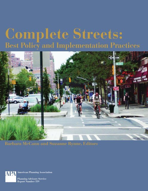
Complete Streets: - American Planning Association
Complete Streets: - American Planning Association
Complete Streets: - American Planning Association

You also want an ePaper? Increase the reach of your titles
YUMPU automatically turns print PDFs into web optimized ePapers that Google loves.
<strong>Complete</strong> <strong>Streets</strong>:<br />
Best Policy and Implementation Practices<br />
Barbara McCann and Suzanne Rynne, Editors<br />
<strong>American</strong> <strong>Planning</strong> <strong>Association</strong><br />
<strong>Planning</strong> Advisory Service<br />
Report Number 559
<strong>Complete</strong> <strong>Streets</strong>: Best Policy and Implementation Practices is the result of a collaborative partnership<br />
among the <strong>American</strong> <strong>Planning</strong> <strong>Association</strong> (APA), the National <strong>Complete</strong> <strong>Streets</strong> Coalition (NCSC),<br />
and the National Policy and Legal Analysis Network to Prevent Childhood Obesity (NPLAN). Funding<br />
was provided by the Federal Highway Administration, the National <strong>Association</strong> of Realtors,<br />
Blue Cross Blue Shield of Minnesota, the Ruth Mott Foundation, and NPLAN, a project of the Robert<br />
Wood Johnson Foundation.<br />
The report was developed under the auspices of the Green Communities Research Center, one of<br />
APA’s National Centers for <strong>Planning</strong>. The Center engages in research, policy, outreach, and education<br />
that advance green communities through planning. For more information, visit www.planning.org/<br />
nationalcenters/green/index.htm. APA’s National Centers for <strong>Planning</strong> conduct policy-relevant research<br />
and education involving community health, natural and man-made hazards, and green communities.<br />
For more detail, visit www.planning.org/nationalcenters/index.htm.<br />
Suzanne Rynne, aicp, served as the project manager and co-principal investigator. She is the manager<br />
of APA’s Green Communities Research Center, a senior research associate, and co-editor of PAS Memo.<br />
Barbara McCann was co-principal investigator and managed NCSC’s work on the project. She is the<br />
executive director of NCSC and runs McCann Consulting.<br />
The chapters in this report were written primarily by Barbara McCann; Suzanne Rynne; Stefanie Seskin,<br />
state and local policy associate at NCSC, and Kimberley Hodgson, manager of APA’s <strong>Planning</strong><br />
and Community Health Research Center. Lead authors of the design techniques section of Chapter 7<br />
were Michael Ronkin of Designing <strong>Streets</strong> for Pedestrians and Bicyclists and Lynn Weigand, director<br />
of the Initiative for Bicycle and Pedestrian Innovation at Portland State University. Susan Handy, director<br />
of the Sustainable Transportation Center at the University of California–Davis, contributed to the<br />
performance measures section of Chapter 5. John LaPlante, director of traffic engineering at T. Y. Lin International,<br />
wrote the low-cost ideas sidebar for Chapter 6. The case studies were authored by Stefanie<br />
Seskin; David Morley, aicp, research associate and PAS coordinator at APA; Ann Dillemuth, research<br />
associate and co-editor of PAS Memo at APA; Barbara McCann; Suzanne Rynne; Kimberley Hodgson;<br />
and Rachel Maiss, a graduate student at UC–Davis. The bibliography in the appendix was compiled by<br />
Rana Salzmann, librarian and education associate at APA, with contributions from other team members.<br />
Sara Zimmerman, senior staff attorney at NPLAN, drafted the model policies in the appendix.<br />
The authors thank the many other individuals who contributed to or supported this project, particularly<br />
the planners, engineers, elected officials, and citizens in the case-study communities who<br />
participated in interviews, shared documents and images, and reviewed drafts of the case studies.<br />
Special thanks also goes to the report reviewers, Michael Ronkin, Lynn Weigand, Susan Handy, John<br />
LaPlante, and Hugh Morris, aicp, smart growth program representative at the National <strong>Association</strong><br />
of Realtors, as well as the scoping symposium participants: Susan Handy; Randy Kline, staff attorney<br />
at NPLAN; John LaPlante; Jana Lynott, aicp, strategic policy advisor at AARP; Michael Ronkin;<br />
Lynn Weigand; and Paul Zykofsky, aicp, director of land use and transportation programs at the<br />
Local Government Commission. Thanks also to Michael Huber of the Center for Prevention of Blue<br />
Cross Blue Shield of Minnesota for his help with the scoping symposium; Bill Klein, aicp, director<br />
of research at APA, who provided valuable input and leadership throughout the project; Ann Dillemuth,<br />
who took the lead on the copyediting; Lisa Jacobson, fellow at NCSC, who helped coordinate<br />
the scoping symposium and did policy research; NCSC staff members Stephanie Potts and Randy<br />
Neufeld, for their contributions; and NPLAN staff members and outside reviewers who provided<br />
input and review of the model policies, particularly Marice Ashe, executive director; Manel Kappagoda,<br />
deputy director; and Heather Wooten, planning and policy associate.<br />
Cover design by Lisa Barton<br />
Cover photo: Ninth Avenue in Manhattan, after complete streets improvements;<br />
image courtesy New York City Department of Transportation<br />
The <strong>Planning</strong> Advisory Service is a subscription service offered by the Research Department of the <strong>American</strong><br />
<strong>Planning</strong> <strong>Association</strong>. Four reports are produced each year. Subscribers also receive PAS Memo and PAS<br />
QuickNotes, and they have access to the Inquiry Answering Service and other valuable benefits.<br />
W. Paul Farmer, faicp, Executive Director and CEO; Sylvia Lewis, Director of Publications; William R. Klein,<br />
aicp, Director of Research.<br />
<strong>Planning</strong> Advisory Service Reports are produced in the Research Department of APA. Timothy Mennel, Editor;<br />
Lisa Barton, Design Associate<br />
© March 2010 by the <strong>American</strong> <strong>Planning</strong> <strong>Association</strong>.<br />
APA’s publications office is at 122 S. Michigan Ave., Suite 1600, Chicago, IL 60603.<br />
APA headquarters office is at 1776 Massachusetts Ave., NW, Suite 400, Washington, DC 20036.<br />
E-mail: pasreports@planning.org
COMPLETE STREETS:<br />
BEST POLICY AND IMPLEMENTATION PRACTICES<br />
Barbara McCann and Suzanne Rynne, aicp, Editors<br />
taBlE of ContEntS<br />
Chapter 1: Introduction ...............................................................................................................1<br />
Chapter 2: Adopting a Policy and Building Support ..................................................................9<br />
Case Studies<br />
Pierce County, Washington ............................................................................................ 10<br />
Columbia, Missouri ......................................................................................................... 13<br />
Rochester, Minnesota ...................................................................................................... 15<br />
Kirkland, Washington ..................................................................................................... 17<br />
Columbus, Ohio ............................................................................................................... 19<br />
East-West Gateway Council of Governments, Missouri .......................................... 21<br />
Chapter 3: Elements of a <strong>Complete</strong> <strong>Streets</strong> Policy ...................................................................23<br />
Case Studies<br />
Decatur, Georgia ............................................................................................................... 25<br />
Oregon ................................................................................................................................ 28<br />
Virginia Department of Transportation ....................................................................... 30<br />
Arlington County, Virginia ............................................................................................ 32<br />
Roanoke, Virginia ............................................................................................................. 33<br />
Chapter 4: Integration and Institutionalization: The Strategic Points of Intervention ............35<br />
Case Studies<br />
University Place, Washington ....................................................................................... 36<br />
Santa Barbara, California ................................................................................................ 38<br />
Washtenaw County, Michigan ....................................................................................... 39<br />
Fort Collins, Colorado ..................................................................................................... 40<br />
Sacramento, California .................................................................................................... 41
Chapter 5: Making the Transition: <strong>Planning</strong> for Change and Addressing Problems ...............45<br />
Case Studies<br />
New Haven, Connecticut ................................................................................................ 46<br />
Chicago ............................................................................................................................... 47<br />
Charlotte, North Carolina ............................................................................................... 48<br />
Pennsylvania Department of Transportation ............................................................. 50<br />
Metropolitan Transportation Commission, California ............................................. 53<br />
Redmond, Washington .................................................................................................... 54<br />
Seattle .................................................................................................................................. 59<br />
Chapter 6: Handling Costs ........................................................................................................65<br />
Case Studies<br />
New York City ................................................................................................................... 66<br />
Colorado Springs, Colorado .......................................................................................... 69<br />
Florida ................................................................................................................................. 71<br />
Boulder, Colorado ............................................................................................................ 73<br />
San Diego County, California ........................................................................................ 75<br />
Chapter 7: Creating <strong>Complete</strong> <strong>Streets</strong>: Design Principles and Features .................................79<br />
Case Studies<br />
Louisville, Kentucky ........................................................................................................ 82<br />
Massachusetts Department of Transportation ........................................................... 83<br />
Chapter 8: Lessons Learned from the Case Studies ..............................................................101<br />
References ................................................................................................................................107<br />
Appendix A: <strong>Complete</strong> <strong>Streets</strong> Bibliography ...........................................................................109<br />
Appendix B: Model <strong>Complete</strong> <strong>Streets</strong> Policies ........................................................................117
s<br />
CHAPTER 3<br />
Elements of a<br />
<strong>Complete</strong> <strong>Streets</strong> Policy<br />
<strong>Complete</strong> streets policies come in many shapes and sizes. City<br />
councils have quickly passed simple resolutions directing their transportation<br />
agencies to consider the needs of all users. State departments<br />
of transportation have gone through extensive public input<br />
processes to rewrite their design manuals. <strong>Planning</strong> departments<br />
have worked with community members to include complete streets<br />
goals in comprehensive plans. Directors of transportation agencies<br />
have written internal memorandums outlining policy changes and<br />
implementation steps. And policy makers at both the state and local<br />
levels have passed complete streets laws and ordinances.<br />
23
24 <strong>Complete</strong> <strong>Streets</strong>: Best Policy and Implementation Practices<br />
Some policies have been developed very quickly, often using the resources<br />
of the National <strong>Complete</strong> <strong>Streets</strong> Coalition or the U.S. DOT Guidance on<br />
Accommodating Bicycle and Pedestrian Travel. In other cases, communities<br />
have engaged in an extensive development process (see Rochester, Minnesota,<br />
sidebar, p. 15).<br />
In many cases, policy development may involve many steps beyond the<br />
initial adoption of a resolution or vision statement. For example, in Massachusetts,<br />
a two-sentence law eventually led the state highway department<br />
to create an award-winning new design manual that firmly entrenches<br />
complete streets into project development and design (see sidebar, p. 83).<br />
In Seattle, the initial inclusion of a complete streets requirement in a bond<br />
measure led to a well-crafted ordinance, followed by the formation of<br />
a steering committee to further define what the ordinance means. Such<br />
gradual processes allow communities to create policies that work in their<br />
particular contexts.<br />
Taking into consideration all of these permutations, the National <strong>Complete</strong><br />
<strong>Streets</strong> Coalition has identified 10 elements that should appear in a<br />
comprehensive complete streets policy document. A good complete streets<br />
policy:<br />
• Includes a vision for how and why the community wants to complete<br />
its streets.<br />
• Specifies that “all users” includes pedestrians, bicyclists, and transit<br />
passengers of all ages and abilities, as well as automobile drivers and<br />
transit-vehicle operators.<br />
• Encourages street connectivity and aims to create a comprehensive, integrated,<br />
connected network for all modes.<br />
• Is adoptable by all relevant agencies to cover all roads.<br />
• Applies to both new and retrofit projects, including design, planning,<br />
maintenance, and operations, for the entire right-of-way.<br />
• Makes any exceptions specific and sets a clear procedure that requires<br />
high-level approval of exceptions.<br />
• Directs the use of the latest and best design standards while recognizing<br />
the need for flexibility in balancing user needs.<br />
• Directs that complete streets solutions will complement the context of<br />
the community.<br />
• Establishes performance standards with measurable outcomes.<br />
• Includes specific next steps for implementing the policy.<br />
SET A VISION<br />
A strong vision statement can keep a community focused on its purpose in<br />
calling for complete streets—and that purpose can vary considerably. Some<br />
communities, especially those that pass resolutions, may list many reasons<br />
for complete streets policy adoption, but it is helpful to be clear about the<br />
primary purpose. For example, Rochester, Minnesota, included no less than<br />
four “whereas” clauses clearly designating “active living” as the primary<br />
reason behind its policy adoption. In all cases, the vision statement can<br />
help guide the inevitable difficult choices that must be made in striking a<br />
balance that provides for the needs of a variety of users along a single rightof-way.<br />
For more information about developing a complete streets vision,<br />
see Chapter 4.
INCLUDE ALL USERS<br />
The complete streets movement initially<br />
arose within the bicycle advocacy<br />
community as a response to the<br />
absence of space for bicyclists and<br />
pedestrians along too many roads. But<br />
a sidewalk without curb ramps is useless<br />
to someone who uses a wheelchair<br />
(and is difficult to use for parents with<br />
strollers and travelers with suitcases).<br />
An awkwardly placed bus stop that<br />
does not provide a safe and convenient<br />
way to cross the street can endanger<br />
transit riders. A true complete streets<br />
policy does not simply call for the<br />
addition of bicycle and pedestrian<br />
facilities but rather inspires a careful<br />
consideration of the needs of all travelers.<br />
Is there a senior center along the<br />
road? A school? A heavily used bus<br />
route? The consideration of such features<br />
and facilities can help identify the<br />
transportation needs of road users and<br />
the design elements that will be most<br />
useful to complete those streets.<br />
The Massachusetts Project Development<br />
and Design Guide gives an<br />
almost comprehensive list, going<br />
beyond pedestrians and bicyclists to<br />
specify “people requiring mobility<br />
aids, drivers and passengers of transit<br />
vehicles, trucks, automobiles and<br />
motorcycles.” However, it leaves out<br />
concern for age. This is a common<br />
omission, but it is particularly important<br />
to consider the mobility needs<br />
of older adults and children. These<br />
populations are more likely to be killed<br />
or injured in a crash, and children and<br />
many older people do not have the<br />
option to drive.<br />
The Community Transportation<br />
Plan of Decatur, Georgia, does make<br />
specific mention of age, stating that the<br />
complete streets policy “is especially<br />
beneficial to the City’s most vulnerable<br />
populations such as low income<br />
households, children and older adults,<br />
all of who experience differing physical,<br />
mental and financial challenges to<br />
mobility.” The plan goes on to discuss<br />
complete streets in the context of Universal<br />
Design principles—the idea<br />
that homes and other places should<br />
be designed for “universal” use, not<br />
just for able-bodied people. The AARP<br />
s<br />
Chapter 3. Elements of a <strong>Complete</strong> <strong>Streets</strong> Policy 25<br />
ShAPINg COmPLETE STREETS ThROUgh A COmmUNITy<br />
TRANSPORTATION PLAN: DECATUR, gEORgIA<br />
The City of Decatur, Georgia, has long been interested in providing travel choices,<br />
especially for pedestrians. Inspired by recent studies demonstrating the link between<br />
the built environment and health, Decatur has committed itself to active living by<br />
increasing opportunities for nonmotorized modes of transportation for people of all<br />
ages and abilities. The city’s interest in promoting active living through good transportation<br />
design is embodied in the 2008 Community Transportation Plan (CTP).<br />
Community input shaped the CTP’s goals, setting a clear vision and ensuring<br />
that the plan would be widely supported. Over a period of eight months, the<br />
project team held two general public meetings; four group meetings for audiences<br />
including older adults, local institutions, and low-income populations;<br />
and four workshops on topics such as traffic calming and health. A telephone<br />
survey developed by project staff, and a private firm was used to seek public<br />
input on a variety of transportation issues and gauge support for a complete<br />
streets policy. The survey findings showed that 61 percent of respondents supported<br />
a complete streets policy.<br />
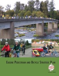
Figure 3.1. A midblock crossing in downtown Decatur<br />
Throughout the planning process, more than 700 public comments were<br />
collected through formal meetings and via letter or email. These comments<br />
emphasized the importance of walking and bicycling and the need to accommodate<br />
all users, especially vulnerable groups such as older adults and those<br />
with disabilities.<br />
To help identify the transportation networks for various travel modes, the<br />
city conducted four technical studies: latent demand score (LDS), level of service<br />
(LOS), street typology, and policy and regulatory audits. The LDS predicted<br />
citywide bicyclist and pedestrian demand if facilities for those users existed near<br />
destinations, such as schools, public transportation stops, and employment centers.<br />
The results will allow decision makers to better prioritize projects based on<br />
the demand for bike and pedestrian trips, as well as have a better understanding<br />
of the types of facilities necessary.<br />
Decatur used traditional measures to evaluate LOS for automobiles but also<br />
based its approach on National Cooperative Highway Research Program Report<br />
616 (TRB NCHRP 2008), which will be included in the 2010 edition of the Highway<br />
Capacity Manual. This method measures the quality of travel for pedestrians and<br />
bicyclists, accounting for comfort, sense of safety, and adjacent land use, rather<br />
than throughput and speed.<br />
(continued on page 26)<br />
City of Decatur, Georgia
26 <strong>Complete</strong> <strong>Streets</strong>: Best Policy and Implementation Practices<br />
(continued from page 25)<br />
The street typology study used a new classification system<br />
that added land-use relationships to typical functional classifications.<br />
With this system, future roadway designs can better match<br />
the uses of the street. Each new type caters to different levels of<br />
need for various travelers, by foot, bike, or car. The typology can<br />
better guide investment decisions when balancing the needs of<br />
all users in construction and reconstruction projects.<br />
Last, Decatur’s existing plans, policies, codes, and practices<br />
were audited to identify potential challenges when implementing<br />
the CTP. Recommendations included updating city codes<br />
and landscaping ordinances to incorporate more specific details<br />
and designs for complete streets, as well as adding standards<br />
for minimum and maximum parking requirements.<br />
Given the largely supportive community and a history of<br />
investment in multiple modes of transportation, city staff had<br />
few barriers to overcome. In addition to extensive public support,<br />
elected officials have stood solidly behind the CTP.<br />
A built-out community, Decatur did not look to acquire<br />
or construct new rights-of-way but instead focused on reallocating<br />
existing roadways more efficiently. Most important,<br />
following the clear community goal meant changing the planning<br />
approach: taking a comprehensive look at all users of the<br />
road rather than focusing on moving automobiles. The project<br />
team was able to create a comprehensive package of designs<br />
and recommendations that promote health, safety, mobility,<br />
and access.<br />
Following adoption of the CTP, <strong>Planning</strong> Director Amanda<br />
Thompson reports that Decatur is thinking beyond pedestrians<br />
and automobiles. Before, the city always thought about building<br />
sidewalks and adding street trees but gave little consideration to<br />
bike lanes or bike racks. Despite having solid public transportation<br />
within the city, staff did not always consider how better bus<br />
stops or improving access to train stations could improve the<br />
street environment. “We truly cover all modes now,” she says.<br />
The CTP includes detailed plans for five intersections and<br />
seven corridors, chosen for their key locations, the public’s input,<br />
and their impact on health. These designs involve a variety<br />
of approaches, including narrowed and reduced travel lanes,<br />
widened sidewalks, and improved crossings. They also include<br />
ideas on how to make room for public transportation users and<br />
vehicles on the right-of-way. The broad definition of complete<br />
streets allows them to remain adaptable to the local context.<br />
By first establishing networks, the project team had considerable<br />
flexibility in street design. Each of the selected areas<br />
is given a section in the CTP where opportunities, needs, and<br />
challenges are addressed. Conceptual drawings of the specific<br />
recommendations accompany each intersection and new crosssections<br />
are shown for each corridor. Such details allow the<br />
city to better envision its transportation goals and ensure that<br />
all future projects, regardless of size or scope, contribute to the<br />
visions specified by the CTP. Thus, the complete streets goal can<br />
be implemented in phases and as funding allows.<br />
Decatur has taken the CTP’s implementation steps to heart.<br />
The city’s recreation department now has a full-time staff dedicated<br />
to administering the Safe Routes to School program and<br />
an Active Living Advisory Board. Some front-yard parking for<br />
downtown businesses has been replaced with pedestrian seating.<br />
Nearby businesses initially resisted the loss of parking but<br />
now see the improved street life. Several of the plan’s projects<br />
have been funded, including two intersection improvements,<br />
a bicycle lane, and streetscape improvements. The city also<br />
adopted a bicycle parking ordinance.<br />
Decatur does face several hurdles in implementing the CTP.<br />
This small city does not directly conduct any transportation<br />
work beyond regular maintenance and repair; it uses Georgia<br />
Department of Transportation (GDOT) grant funding for all<br />
larger projects. Decatur’s complete streets vision is in conflict<br />
with GDOT standards, and therefore every project, from street<br />
tree to bike lane, requires variances. GDOT also controls the<br />
main routes connecting the city to the surrounding Atlanta<br />
region, and because GDOT rarely considers context Decatur’s<br />
main roads are addressed in the same manner as roads through<br />
any other community. Decatur works through this situation by<br />
submitting variances and working to educate GDOT staff on<br />
Decatur’s vision and reasoning. City staff also try to influence<br />
state policy by working with elected officials. Despite these<br />
challenges, Thompson firmly believes their approach is great<br />
for small governments often at the mercy of larger agencies.<br />
The CTP is “a communication tool to build what the community<br />
wants.”<br />
Final design of the CTP’s concepts can also be troublesome.<br />
Working within existing rights-of-way constrains Decatur’s<br />
ability to provide all the facilities it might. But by depending<br />
on the bicycle and pedestrian networks established through<br />
the planning process, staff is better able to balance needs across<br />
the system. They can determine the type of facility that is most<br />
important in each location and ensure its inclusion, then discuss<br />
additional features. Determining the right type of facility<br />
is also a challenge. This is especially true for bicycle facilities,<br />
where deciding among bike lanes, off-street paths, and “share<br />
the road” markings can be difficult.<br />
Transportation project cost is often a barrier. Decatur’s<br />
transportation funding has not increased appreciably since<br />
adopting the CTP, and so plan implementation is a reflection<br />
of what the city can afford each year. To make the most of<br />
those funds, the city tries to be creative in pursuing low-cost<br />
options and prioritizes projects to reflect the network needs<br />
established in the CTP. “The general feeling in Decatur,” says<br />
Thompson, “is that investing public funds into sustainable<br />
transportation, rather than the status quo, is a better investment<br />
of those funds.” To aid in addressing these issues, the<br />
city held a complete streets workshop in April 2008. Nationally<br />
known experts spent a day with elected officials, planners,<br />
and engineers, building a base of support for the CTP as well<br />
as determining how best to tackle its goals. The community,<br />
city commissioners, and city employees agree that Decatur<br />
has much reason to be proud of CTP implementation and<br />
progress toward complete streets.<br />
The CTP is at www.decaturga.com/cgs_citysvcs_dev_<br />
transportationplan.aspx.<br />
s
eport <strong>Planning</strong> <strong>Complete</strong> <strong>Streets</strong> for an Aging America is a good source of<br />
strategies to integrate the needs of older adults into street planning.<br />
Automobile drivers are also an important part of the equation. Maintaining<br />
acceptable vehicle movement will be a primary concern of many<br />
of those charged with implementing complete streets policies, and traffic<br />
volume will influence what treatments are used for other transportation<br />
modes. For example, a major debate during the development of Seattle’s<br />
complete streets ordinance concerned the treatment of freight. The final<br />
policy reads, “Because freight is important to the basic economy of the City<br />
and has unique right-of-way needs to support that role, freight will be the<br />
major priority on streets classified as Major Truck <strong>Streets</strong>. <strong>Complete</strong> Street<br />
improvements that are consistent with freight mobility but also support<br />
other modes may be considered on these streets.” Pedestrian and bicycle<br />
advocates are still not happy with the clause, but the city felt such language<br />
was necessary to gain the support of the freight community.<br />
When preparing to undertake street design changes to better accommodate<br />
other modes, planners need to measure the impact on drivers, decide<br />
what to do, and communicate the change. In some communities, the vision<br />
for complete streets deemphasizes automobility, so explaining to the public<br />
the changes and new mobility options available is important. In other<br />
cases, the changes may actually improve traffic flow, but this may often be<br />
counterintuitive and should be communicated clearly. See Chapter 5 for a<br />
discussion of balancing the needs of automobiles with other users.<br />
CREATE A NETWORK<br />
The ultimate intent of a complete streets policy is to ensure that roadways<br />
provide complete transportation networks for all modes. Often the fastest<br />
way to make progress is to focus on opportunities to close gaps: filling in<br />
missing sidewalk segments or finding a good way for bicyclists to negotiate<br />
a narrow bottleneck. The connectivity of the roadway network is an especially<br />
important feature for pedestrians, who are much more reluctant to take<br />
indirect routes. The transportation plan of Champaign, Illinois, contains a<br />
succinct phrasing of this objective: “Provide a dense, interconnected network<br />
of local and collector streets that supports walking, bicycling, and transit<br />
use, while avoiding excessive traffic in residential neighborhoods.”<br />
A network orientation is also helpful in balancing transportation needs.<br />
Trying to accommodate every traveler on every street is a feat that physical<br />
constraints can make nearly impossible. Instead, planners and engineers can<br />
provide high-quality access for everyone through the creation of interwoven<br />
networks in which certain streets emphasize different modes. For example,<br />
“bicycle boulevards” in Portland, Oregon, allow bicyclists to travel along<br />
lower-traffic streets, avoiding arterials designed primarily for cars. In its<br />
new Urban Street Design Guidelines, Charlotte, North Carolina, has created<br />
a street classification system in which “parkways” are designed primarily<br />
for cars, “main streets” emphasize business uses, and “avenues” serve<br />
diverse needs. See Chapter 7 for more information on design approaches.<br />
In such systems, it is still important to provide a basic level of safe access<br />
on all streets, and no users should be required to take long detours.<br />
COVER ALL ROADS<br />
Creating networks of complete streets is difficult because streets are not controlled<br />
by a single agency. Roads are built and maintained by a patchwork<br />
of state, county, and city agencies, with private developers often responsible<br />
for building roads in new developments. Typically, complete streets policies<br />
cover a single jurisdiction; examples include an internal policy adopted by<br />
a state DOT or a goal or policy in a city’s comprehensive plan. One notable<br />
Chapter 3. Elements of a <strong>Complete</strong> <strong>Streets</strong> Policy 27
28 <strong>Complete</strong> <strong>Streets</strong>: Best Policy and Implementation Practices<br />
s According<br />
PAVINg ThE WAy FOR A COmPREhENSIVE COmPLETE STREETS<br />
NETWORK: OREgON<br />
When the Oregon State Legislature passed the “bike bill” (ORS 366.514) in 1971, no<br />
one was using the phrase “complete streets.” Now, after nearly four decades on the<br />
books, this trailblazing state law is acknowledged as a primary inspiration for the<br />
complete streets movement.<br />
Section 366.514 of the Oregon State Statutes requires that all roadway construction<br />
and reconstruction must include bicycle and pedestrian facilities. Additionally,<br />
at least 1 percent of all state funding received by local governments must be spent<br />
on bicycle and pedestrian improvements.<br />
The bike bill became law around the same time that Oregon’s innovative land-use<br />
planning laws were taking shape. Don Stathos, a conservative legislator from southern<br />
Oregon, secured approval for the measure by a single vote, using the argument<br />
that bicycle and pedestrian facilities were necessary to ensure that schoolchildren<br />
had safe routes to school.<br />
to Michael Ronkin, former pedestrian and bicycle program manager<br />
for Oregon’s Department of Transportation, for the first 20 years local transportation<br />
departments applied the law unevenly. Although there was nothing in the measure<br />
that specifically limited the requirement to ODOT roads, the bill had been codified in<br />
a chapter dealing with highway funds. As a consequence, many local governments<br />
simply ignored the requirements.<br />
The real turning point for the bike bill came when advocates from the Bicycle<br />
Transportation Alliance sued the City of Portland for noncompliance in 1992. The<br />
court’s decision upheld Stathos’s original idea that the law applied to all road<br />
projects. Ronkin and his colleagues wrote an official interpretation of the bike bill,<br />
clarifying that all construction and reconstruction must accommodate bicyclists<br />
and pedestrians.<br />
Although opponents of the law often pointed to cost as a barrier for compliance,<br />
Ronkin contends that the battle over cost was more hype than substance. The bike<br />
bill does not say how road builders should pay for bicycle and pedestrian facilities.<br />
Instead, the measure assumes that transportation authorities and developers will<br />
plan for necessary improvements upfront and pay for them out of the same pots of<br />
money used for all surface transportation facilities.<br />
Adding the required improvements up front is much cheaper than a retrofit.<br />
Ronkin explains that just as people understand that insulation is a necessary component<br />
of any housing project, transportation authorities and developers in Oregon<br />
understand that the up-front costs of compliance with the bike bill are just a normal<br />
part of the road building process.<br />
For additional information about Oregon’s Bicycle and Pedestrian Program and<br />
to read the text of ODOT’s bike bill interpretation, see www.oregon.gov/odot/<br />
hwy/bikeped.<br />
s<br />
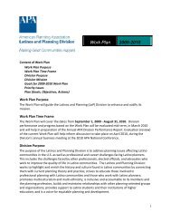
Dan Burden, the Walkable and Livable Communities Institute, Inc.<br />
Figure 3.2.<br />
Oregon state law<br />
mandates bicycle<br />
and pedestrian<br />
accommodation,<br />
as evidenced by<br />
this Portland<br />
intersection.<br />
exception is Oregon’s state law,<br />
which states that “footpaths and<br />
bicycle trails … shall be provided<br />
wherever a highway, road or street<br />
is being constructed, reconstructed,<br />
or relocated.” In 1992, the Oregon<br />
Court of Appeals ruled that this law<br />
applied to all roads in public use,<br />
and therefore state and municipal<br />
governments, as well as private<br />
entities building roads in new<br />
developments, are subject to its<br />
provisions (see sidebar). <strong>Complete</strong><br />
streets elements should ideally<br />
extend to subdivision regulations<br />
governing streets built by private<br />
developers. See Chapter 4 for more<br />
information on this.<br />
INCLUDE ALL PROJECTS<br />
For many years in most communities,<br />
multimodal streets have been<br />
treated as special projects requiring<br />
extra planning, funding, and effort.<br />
The complete streets approach is<br />
different. It is perhaps best stated<br />
in the updated policy adopted by<br />
Caltrans, California’s DOT: “The<br />
Department views all transportation<br />
improvements as opportunities<br />
to improve safety, access,<br />
and mobility for all travelers in<br />
California and recognizes bicycle,<br />
pedestrian, and transit modes as<br />
integral elements of the transportation<br />
system.” Under this approach,<br />
even repaving projects can be an<br />
opportunity to make small adjustments<br />
to better accommodate all<br />
travelers, such as shifting stripes to<br />
provide more room for bicyclists. A<br />
strong complete streets policy will<br />
integrate complete streets planning<br />
into all phases of all types of<br />
projects, including new construction,<br />
reconstruction, rehabilitation,<br />
repair, and maintenance. See<br />
Chapters 5 and 6 for suggestions<br />
on integration of complete streets<br />
into all projects.<br />
SPECIFy EXCEPTIONS<br />
An important element of practical<br />
policy implementation is the<br />
creation of a process for handling<br />
exceptions to requirements that all
modes be accommodated in all projects. The FHWA guidance on accommodating<br />
bicycle and pedestrian travel, issued in 2000, listed three exceptions,<br />
which have become commonly used in complete streets policies. The first<br />
states that accommodation is not necessary on corridors where nonmotorized<br />
use is prohibited, such as a freeway.<br />
The second exception involves project cost. The FHWA Guidance recommends<br />
that exceptions be allowed “when the cost of accommodation<br />
... is excessively disproportionate to the need or probable use.” The FHWA<br />
Guidance includes a set percentage threshold for disproportionate cost, but<br />
some communities have discarded this as arbitrary and make decisions on<br />
a case-by-case basis. See Chapter 6 for discussion of this provision.<br />
The third exception is a documented absence of need—now and in the<br />
future. The future clause is important. Many corridors are unfriendly to<br />
pedestrian travel because past development has discouraged walking, but<br />
redevelopment under new standards could change that. Also, the increasing<br />
mobility of people with disabilities means that people who use wheelchairs<br />
or have visual impairments will need more street networks conducive to<br />
their safe travel.<br />
Many communities have included additional exceptions. One of the<br />
most common excepts ordinary maintenance and repairs, which reassures<br />
planners and engineers that basic maintenance work will not trigger a<br />
full reconstruction. A few policies, such as the law passed by the Illinois<br />
legislature in 2007, make exceptions for repaving projects. But the law also<br />
includes a clause to help agencies take advantage of repaving opportunities<br />
when appropriate: “Bicycle and pedestrian ways may be included in<br />
pavement resurfacing projects when local support is evident or bicycling<br />
and walking accommodations can be added within the overall scope of the<br />
original roadwork.”<br />
Another relatively common exception is for safety. This should be defined<br />
very carefully. A common reaction to an unsafe environment for<br />
nonmotorized users is to prohibit bicycling or walking along the corridor.<br />
But paths beaten into the grass along arterials show that pedestrian travel<br />
is often not optional. High-speed, high-traffic roads that present the greatest<br />
danger to nonmotorized users may be the roads that most desperately<br />
need facilities.<br />
Chapter 3. Elements of a <strong>Complete</strong> <strong>Streets</strong> Policy 29<br />
Barbara McCann<br />
Figure 3.3. Beaten paths are<br />
often indicators of routes that<br />
pedestrians find convenient to<br />
use despite their lack of safety.
30 <strong>Complete</strong> <strong>Streets</strong>: Best Policy and Implementation Practices<br />
s In<br />
nes and Turning Lanes<br />
ChANgINg bUSINESS AS USUAL:<br />
VIRgINIA DEPARTmENT OF TRANSPORTATION<br />
Since 2004, Virginia’s Department of Transportation (VDOT) has had a policy for<br />
routine consideration of the need for accommodating bicyclists and pedestrians<br />
in all state- and federally funded transportation projects. The policy represents<br />
a major sea change in the commonwealth, and its impacts are most profound in<br />
VDOT’s day-to-day operations.<br />
In most of the commonwealth, counties are the default unit of local government.<br />
Because only two counties in Virginia operate and maintain their own roads, VDOT<br />
maintains the third most miles of road of any state in the country. Consequently,<br />
it is the single most important entity for implementing complete streets in rural<br />
and suburban areas statewide.<br />
Changing the course of an agency as large as VDOT has not been easy. For<br />
years, VDOT was slow to react to changing development patterns. The agency had<br />
traditionally focused on building roads to carry vehicular traffic at high speeds over<br />
long distances, but as previously rural parts of the commonwealth became more<br />
urbanized, communities across Virginia as well as voices within the transportation<br />
agency itself called for reform.<br />
nes complicate bicycle and motor vehicle turning movements at intersections. It is<br />
ble to continue the same width of bike lane through the intersection. Locations<br />
a bike lane approaches an intersection (4 feet from the edge of pavement on a<br />
d gutter roadway), the 4 foot wide section should continue parallel to the left of a<br />
rn lane.<br />
Virginia Department of Transportation<br />
FIGURE A-5-3<br />
Figure 3.4. VDOT’s<br />
design manuals include<br />
instruction for bicycle<br />
facilities.<br />
2004, the Commonwealth Transportation Board, which oversees transportation<br />
policies in Virginia, promulgated the “Policy for Integrating Bicycle and<br />
Pedestrian RIGHT Accommodations.” TURN This ONLY internal LANE policy statement outlines a basic<br />
decision-making process to ensure that appropriate accommodations are considered<br />
for all VDOT projects. The policy requires all state- and federally funded projects<br />
to accommodate pedestrians and bicyclists except when bikes and pedestrians are<br />
not allowed by law, when there is a scarcity of population, when there are environmental<br />
or social impacts that discourage accommodation, when the total cost<br />
of accommodation is disproportionate to the benefit, or when the project purpose<br />
is in conflict with accommodation.<br />
(continued on page 31)<br />
Lanes Approaching Right-Turn-Only Lanes<br />
: For other intersection situations see the AASHTO Guide for the Development of<br />
Facilities. For current typical bicycle lane pavement markings see VDOT Road<br />
dge Standards or current insertable sheets.<br />
A-5-3 presents a treatment for pavement markings where a bike lane approaches<br />
rist right-turn-only lane. The design of bike lanes should include appropriate<br />
at intersections to warn of conflicts. The approach shoulder width should be<br />
d through the intersection, where feasible, to accommodate right turning bicyclists<br />
Many policies make the head<br />
of the transportation department<br />
responsible for approving exceptions,<br />
while others require approval<br />
by an elected body, such as the city<br />
council. In Rochester, Minnesota,<br />
the final responsibility for deciding<br />
exceptions is divided among the city<br />
council and the heads of the planning<br />
and public works departments,<br />
depending<br />
A-92<br />
on the type of exception.<br />
Because an exceptions process can<br />
be complex, another strategy is to<br />
use broad exceptions language in<br />
the policy and then allow the transportation<br />
agency to design an exceptions<br />
approval process as part of the<br />
implementation plan. See Chapter 5<br />
for more information about creating<br />
an effective exceptions process.<br />
ADDRESS DESIgN STANDARDS<br />
When the subject of complete streets<br />
comes up, the conversation often<br />
heads straight to design standards.<br />
Engineers in particular are likely<br />
to view the creation of streets for<br />
all users as primarily an issue of<br />
modifying standards; they assume<br />
that a complete streets policy will<br />
include such specific modifications.<br />
However, design specifics are often<br />
less important at first than the political<br />
will to choose different priorities<br />
in transportation planning and the<br />
leadership and confidence to move<br />
away from rigid adherence to doing<br />
things “by the book.”<br />
Some communities have specified<br />
new design standards, such as<br />
Louisville, Kentucky, or Fort Collins,<br />
Colorado. Another approach is to<br />
make reference within the policy to<br />
existing design guidance while emphasizing<br />
flexibility. This is the case<br />
with the State of Virginia’s policy:<br />
“The accommodations will be designed<br />
and built, or installed, using<br />
guidance from VDOT and AASHTO<br />
publications, the MUTCD, and the<br />
<strong>American</strong>s with Disabilities Act<br />
Accessibility Guidelines (ADAAG).<br />
Methods for providing flexibility<br />
within safe design parameters, such<br />
as context sensitive solutions and<br />
design, will be considered.”
COmPLEmENT CONTEXT<br />
Sensitivity to the community context<br />
is essential to an effective complete<br />
streets policy. Being clear about this<br />
in the initial policy statement can allay<br />
common fears that a complete streets<br />
policy will require inappropriately<br />
wide roads in quiet neighborhoods or<br />
miles of little-used sidewalks in rural<br />
areas. The Context Sensitive Solutions<br />
movement has been moving highway<br />
design in this direction for well over<br />
a decade. A strong statement about<br />
context can also help bridge the traditional<br />
divide between transportation<br />
and land-use planning.<br />
The best examples of context statements<br />
can be found in transportation<br />
master plans. Charlotte’s plan states,<br />
“The City will promote context-sensitive<br />
streets (i.e., by designing transportation<br />
projects within the context<br />
of adjacent land uses to improve<br />
safety and neighborhood livability,<br />
promote transportation choices and<br />
meet land use objectives), consistent<br />
with the City’s Urban Street Design<br />
Guidelines.” The guidelines include<br />
a six-step process for designing<br />
complete streets—and the first step<br />
is determining the land-use context.<br />
Arlington County, Virginia, sets out<br />
three components of a complete<br />
street, and the first is context (see<br />
sidebar on p. 32). The streets element<br />
of the master transportation plan<br />
includes this definition:<br />
The context of a street includes the<br />
buildings and sites adjacent to the<br />
street, or right-of-way. This area is<br />
described in terms of land use—<br />
residential, commercial, and industrial.<br />
It is also described in terms of<br />
physical form—such as office buildings,<br />
single-family detached homes,<br />
and townhouses. Intensity (low-, medium-<br />
or high-density development)<br />
also affects how an area is described.<br />
A street’s surroundings are the major<br />
factors that define the character of<br />
the corridor.<br />
ESTAbLISh PERFORmANCE mEASURES<br />
The traditional performance measure<br />
for transportation planning has been<br />
vehicular level of service—a measure<br />
(continued from page 30)<br />
Chapter 3. Elements of a <strong>Complete</strong> <strong>Streets</strong> Policy 31<br />
Perhaps the most important tools for battling business as usual at VDOT have<br />
been the agency’s new project scoping forms and decision tree. In 2006, VDOT<br />
added a new section to its scoping forms for new construction and maintenance<br />
activities to ensure that the state’s accommodation policy was considered for<br />
each project. According to Jakob Helmboldt, aicp, VDOT’s bicycle and pedestrian<br />
program coordinator, the scoping forms follow the Federal Highway Administration<br />
approach of mainstreaming the accommodation policy. Ensuring that each<br />
project contains appropriate bicycle and pedestrian facilities has become a routine<br />
element to check off in the scoping process. To supplement the forms, VDOT has<br />
also created a simple flowchart that helps individuals in charge of scoping see<br />
whether or not each project is exempted for any of the reasons outlined in the<br />
policy statement.<br />
Helmboldt says that mainstreaming the policy has kept VDOT from getting<br />
too caught up in budgeting for bicycle and pedestrian improvements. The policy<br />
has a built-in safety valve in the form of a “cost disproportionate to the need”<br />
exemption. If the cost of accommodation is more than 10 percent of the total project<br />
and if the project is not on a designated bike/ped plan, the project is exempt<br />
from compliance. If the project is on a plan, the cost threshold for exemption<br />
goes up to 20 percent.<br />
In Helmboldt’s view, project costs can be a red herring. “Overengineering<br />
leads to cost problems,” he says. Sometimes costs balloon when someone wants<br />
to make changes that may represent the gold standard in accommodation but<br />
ignores other lower-cost alternatives.<br />
Aside from new projects, VDOT’s nine highway construction districts each<br />
have a goal of using 2 percent of maintenance funds for shoulder paving in rural<br />
areas to improve bicycling conditions. Because paved shoulders stabilize the<br />
pavement edge and reduce crashes, adding the extra pavement has not faced<br />
much resistance in areas not traditionally thought of as bike friendly.<br />
Cross-jurisdictional cooperation in Virginia took a major leap forward in 2006<br />
with the enactment of new legislation that requires more VDOT involvement in<br />
local land-use decisions. Section 15.2-2222.1 requires VDOT to review all new or<br />
amended local comprehensive plans and traffic impact statements for activities<br />
that will substantially affect transportation on state roads. The legislation ensures<br />
that VDOT is aware of new plans for bicycle and pedestrian improvements.<br />
Recognizing that private developers have a major impact on road networks<br />
in Virginia, the commonwealth adopted new secondary-street acceptance requirements<br />
in 2009. According to Nick Donohue, Virginia’s assistant secretary<br />
of transportation, the new requirements were an outgrowth of the governor’s<br />
initiative to improve the coordination of transportation and land use. Prior to<br />
that policy, VDOT accepted streets for perpetual public maintenance without<br />
considering the overall public benefit the new roads provided. Developers built<br />
the roads, and the state accepted maintenance responsibilities as long as the roads<br />
were built to adequate geometric standards.<br />
“Travel distance, which is influenced by street connectivity, has a big impact<br />
on whether you decide to walk or not,” says Donohue. For that reason, the new<br />
acceptance requirements require greater connectivity of the street network along<br />
with sidewalks or other pedestrian features and narrower streets to help reduce<br />
vehicle speeds. In Donohue’s view, the requirements work hand-in-glove with<br />
VDOT’s accommodation policy. While the latter applies to all VDOT projects (new<br />
roads, road expansion, or maintenance) as well as any locally administered project<br />
using state or federal money, the new acceptance standards deal exclusively with<br />
local streets built by private developers.<br />
VDOT’s “Bicycling and Walking in Virginia” page, available at www.virginiadot.org/programs/bk-default.asp,<br />
contains links to the accommodation<br />
policy, the project scoping forms, and the decision tree. For Virginia’s Secondary<br />
Street Acceptance Requirements, see www.virginiadot.org/projects/ssar/<br />
default.asp.<br />
s
32 <strong>Complete</strong> <strong>Streets</strong>: Best Policy and Implementation Practices<br />
s<br />
TyINg TOgEThER A LEgACy OF INNOVATIVE PLANNINg POLICIES: ARLINgTON COUNTy, VIRgINIA<br />
Though Arlington County, Virginia, has only recently adopted<br />
an official complete streets policy, these principles are nothing<br />
new. For more than 30 years, this municipality of nearly 210,000<br />
people and 26 square miles in the metropolitan Washington,<br />
D.C., area has been a leader in smart growth, transit-oriented<br />
development (TOD), and innovative pedestrian, bicycle, and<br />
transit policies.<br />
“[<strong>Complete</strong> streets] had been the policy, before it had<br />
officially been adopted. Over the past 10 years we’ve been<br />
moving towards complete streets without calling it that,” says<br />
Richard Viola, county planning supervisor for transportation<br />
planning.<br />
Implementation of complete streets was called out as one<br />
of the most important guiding themes for Arlington County in<br />
the 2007 update to its Master Transportation Plan. During the<br />
revision process, a group of local cutting-edge transportationplanning<br />
leaders met and decided to draft a complete streets<br />
policy that would formalize 10 years of pedestrian, bicycle,<br />
and transit planning efforts in the county.<br />
The complete streets concept gives good transportation<br />
planning an identity. While Arlington County has received a<br />
lot of attention for TOD, the complete streets policy solidifies<br />
and formalizes the county’s multimodal commitment and<br />
brings attention to its many bicycle and pedestrian improvements,<br />
campaigns, and other promotional activities. Furthermore,<br />
the complete streets policy provides the county with a<br />
more systematic approach to transportation and development<br />
projects. It requires any development project that has an impact<br />
on transportation infrastructure to consider all necessary<br />
transportation modes needed to accommodate all users.<br />
The revision of the Master Transportation Plan and the<br />
adoption of its complete streets policy was a result of a community<br />
planning process which included the county board,<br />
elected officials, a plenary group, two dozen citizens representing<br />
various committees and advisory groups from across<br />
the county, and transportation planning staff. According to<br />
Viola, the county board and the community have been very<br />
supportive of the complete streets policy, largely because of<br />
Arlington County’s legacy of TOD and managed growth.<br />
Despite this legacy, a car-dominated infrastructure is still<br />
present in much of the county. But since the official adoption<br />
of the policy in November 2007, limited retrofits to existing<br />
streets are occurring as financial and staff resources permit,<br />
and complete streets principles are being addressed more<br />
systematically in the conception or initial design of a development<br />
project rather than during later review stages. The<br />
policy has contributed to more cost-effective investment of<br />
public funds.<br />
Some challenges faced by the county include community<br />
parking demand and state design controls. In some neighborhoods,<br />
the demand for on-street parking can present a significant<br />
barrier to implementing innovative uses of limited rightsof-way<br />
on arterial and neighborhood streets. “Residents are<br />
Arlington County<br />
Figure 3.5. Pedestrian safety is emphasized in Arlington County’s<br />
Master Transportation Plan.<br />
reluctant to give up their free curbside parking. This translates<br />
into fewer trees, fewer bike lanes, etc., and ultimately limits<br />
choices,” says David Patton, bicycle and pedestrian planner<br />
for the county. In addition, changes to many arterial streets in<br />
the county require explicit approval from the Virginia Department<br />
of Transportation (VDOT). VDOT design standards have<br />
often prioritized the needs of the automobile, above the needs<br />
of other street users, and have frustrated county intentions for<br />
greater multimodalism. However, as VDOT works to better<br />
implement its own bicycle and pedestrian accommodation<br />
policy (see p. 30), such conflicts should ease.<br />
On July 1, 2008, the county implemented a 0.12 percent<br />
property tax on commercial property for transportation<br />
improvements. This extra revenue has allowed the county to<br />
update streetscapes and transit stations and purchase new<br />
buses, among other things. Arlington County is a model example<br />
of how transportation planners can use the complete<br />
streets concept to highlight synergies among multiple planning<br />
efforts and outcomes, including TOD, smart growth,<br />
bicycle and pedestrian improvements, improved property<br />
values, and more transportation options.<br />
For more information about the county’s complete<br />
streets policy, visit www.arlingtonva.us/Departments/<br />
EnvironmentalServices/dot/planning/mplan/mtp/MTP_Draft<br />
.aspx.<br />
For more information about the transportation plan-<br />
ning in the county, visit www.arlingtonva.us/Depart<br />
ments/EnvironmentalServices/dot/planning/Environ<br />
mentalServices<strong>Planning</strong>.aspx.<br />
s
of automobile congestion.<br />
<strong>Complete</strong> streets planning<br />
requires taking a broader look<br />
at how the system is serving<br />
all users. Some communities,<br />
such as Louisville, Kentucky,<br />
have gone so far as to create<br />
their own metrics that measure<br />
transportation performance in<br />
terms of bicycle or pedestrian<br />
friendliness.<br />
Few policies have established<br />
performance measures<br />
within the original policy<br />
document; in most cases, performance<br />
measures are dealt<br />
with as a later implementation<br />
step. An exception is Roanoke,<br />
Virginia, which lists a series of<br />
simple performance measures<br />
as part of its three-page complete<br />
streets policy:<br />
• Total miles of on-street<br />
bicycle routes defined by<br />
streets with clearly marked<br />
or signed bicycle accommodation<br />
• Linear feet of new pedestrian<br />
accommodation<br />
• Number of new curb ramps<br />
installed along city streets<br />
• Number of new street trees<br />
planted along city streets<br />
Such simple quantitative<br />
performance measures can be a<br />
powerful way to communicate<br />
the intent of the new policy<br />
to the community, but in the<br />
workshops offered by the National<br />
<strong>Complete</strong> <strong>Streets</strong> Coalition<br />
it has become clear that<br />
people want to also measure<br />
qualitative outcomes. Health,<br />
safety, the economy, and user<br />
satisfaction are mentioned<br />
most often.<br />
The performance measures<br />
developed by a community<br />
may also refer back to the vision<br />
statement included in the<br />
policy document. For more<br />
information on performance<br />
measures, see Chapter 5.<br />
s Figure<br />
Ian Shaw, City of Roanoke<br />
Chapter 3. Elements of a <strong>Complete</strong> <strong>Streets</strong> Policy 33<br />
CREATINg COmPLETE STREETS ThROUgh NEW STREET DESIgN<br />
gUIDELINES: ROANOKE, VIRgINIA<br />
Thanks to new street design guidelines and a collaborative approach to project scoping,<br />
Roanoke, Virginia, is putting its recent commitment to complete streets into action. In<br />
2001—seven years before the city adopted a formal complete streets policy—Roanoke’s<br />
comprehensive plan set a goal of creating an integrated, multimodal transportation system<br />
for automobiles, bicycles, pedestrians, and transit. The plan called for new street design<br />
guidelines based on a classification system that would balance the purpose of the roadway<br />
with the impacts on surrounding areas.<br />
To implement this directive, the city formed an interdisciplinary team to draft the guidelines.<br />
Participants included staff from the city’s planning, engineering, and transportation<br />
departments, as well as an urban forester, a park planner, and a representative from the local<br />
MPO. Eventually, after many drafts and multiple reviews, the city planning commission<br />
adopted new street design guidelines in 2007 as an internal guidance document.<br />
According to Cristina Finch, the manager of the project team, the guidelines take a<br />
different approach to street design. In Virginia, every area has a street classification system<br />
determined by the state DOT. Finch and her colleagues took this preexisting street<br />
hierarchy and then simplified it. Instead of being classified as major or minor, roads were<br />
simply arterials, collectors, or local streets. The bulk of the guidelines look at how these<br />
street types relate to different character districts. For example, Finch says her team looked<br />
at what a collector street would look like as it went through a suburban neighborhood<br />
versus in a traditional neighborhood versus in a downtown.<br />
The guidelines present examples of cross-<br />
sections for various street types based on the<br />
character of the area they are in. The illustrations<br />
depict different widths and facilities for<br />
seven distinct roadway zones (travel, parking,<br />
gutter/drainage, curb, planter/utilities, pedestrian,<br />
and right-of-way edge), depending<br />
on where the local or collector street section<br />
is located.<br />
The city council issued a formal endorsement<br />
of the street design guidelines with its<br />
<strong>Complete</strong> <strong>Streets</strong> Resolution in 2008. This resolution<br />
recommends that the guidelines developed<br />
by Finch’s team be used in the planning,<br />
funding, design, operation, and maintenance<br />
of new and modified streets. The new policy<br />
also requires a written explanation to the city<br />
manager if accommodations cannot be made.<br />
3.6. Roanoke’s street design<br />
To help implement the new complete streets<br />
guidelines call for bicycle accommodation.<br />
policy, Roanoke formed a street design team<br />
to make sure that new projects contain the appropriate pedestrian, bicycle, and transit<br />
accommodations. The interdepartmental team has representatives from the departments<br />
of planning, building, and development, parks and recreation, and neighborhood services,<br />
as well as from the transportation and engineering divisions of the public works<br />
department.<br />
“I think that the complete streets policy has helped unify the city in terms of visioning<br />
and its communication about streets,” says Finch. “With the street design team we now<br />
have folks regularly talking about our streets, whereas before, for example, the Transportation<br />
Division would previously work with the state DOT, but other divisions weren’t<br />
necessarily being coordinated with to give input.”<br />
(continued on page 34)
34 <strong>Complete</strong> <strong>Streets</strong>: Best Policy and Implementation Practices<br />
(continued from page 33)<br />
Having a street design team en-<br />
sures that repaving and restriping<br />
projects are now routinely considered<br />
as a method for providing accommodations.<br />
Because Roanoke is a builtout<br />
city where major street projects<br />
are rare, this design input into routine<br />
maintenance activities is important.<br />
Redesign of existing streets (such as<br />
reallocation of existing pavement<br />
with striping) is where Roanoke has<br />
the most impact on accommodating<br />
all street users.<br />
According to Senior Planner<br />
Ian Shaw, his department has also<br />
brought the complete streets approach<br />
into the neighborhood planning<br />
process. Shaw and his colleagues<br />
have developed a scoring system for<br />
major streets in each neighborhood.<br />
The system looks first at safety and<br />
then at connectivity and design. The<br />
scoring also considers whether or<br />
not the available right-of-way can<br />
accommodate a complete street, the<br />
ability to locate street trees within<br />
the right-of-way, and the potential<br />
for stormwater and drainage issues.<br />
So far, the city has scored 30 streets<br />
and hopes to have all major streets<br />
scored with each neighborhood plan<br />
update.<br />
Roanoke’s Street Design Guidelines<br />
and the city’s complete streets<br />
policy are both available at www<br />
.roanokeva.gov.<br />
s<br />
PROVIDE ImPLEmENTATION STEPS<br />
Taking a complete streets policy from paper to practice is not easy, but providing<br />
some specific implementation steps can help build momentum. For<br />
example, Seattle’s complete streets ordinance made clear that a systematic<br />
review of the city’s practices was in order. Section 2 states: “SDOT will<br />
incorporate <strong>Complete</strong> <strong>Streets</strong> principles into: the Department’s Transportation<br />
Strategic Plan; Seattle Transit Plan; Pedestrian and Bicycle Master<br />
Plans; Intelligent Transportation System Strategic Plan; and other SDOT<br />
plans, manuals, rules, regulations and programs as appropriate.”<br />
The internal policy updated by Caltrans in 2008 takes a different approach.<br />
It specifies the responsibilities of each position in the agency in<br />
implementing the plan—from the chief deputy director down to the division<br />
chiefs and general employees. Other communities have established<br />
task forces or commissions to work toward policy implementation. For<br />
more information, see Chapter 5.
of<br />
special<br />
interest<br />
Integrating <strong>Planning</strong> and Public Health<br />
PAS 539/540. Marya Morris, ed. 2006. 132 pp. $60.<br />
Is the form of <strong>American</strong> cities to blame for the shape of <strong>American</strong>s? With<br />
obesity rates climbing ever higher, planners are reconsidering how the<br />
built environment affects public health—not only obesity, but also asthma,<br />
cardiovascular disease, water quality, air pollution, pedestrian safety, and<br />
mental health. This report examines collaborations between planners and<br />
public-health professionals committed to building healthy communities. It<br />
outlines the five strategic points of intervention at which planners and publichealth<br />
professionals can coordinate their efforts: visioning and goal setting,<br />
plans and planning, implementation tools, site design and development, and<br />
public facility siting and capital spending. Case studies illustrate the specific<br />
tools—including health impact assessments—used in such collaborations. It<br />
also examines the role of universal design in creating healthy communities.<br />
Transportation Infrastructure<br />
PAS 557. Marlon G. Boarnet, ed. 2009. 128 pp. $60.<br />
The Transportation/Land Use Connection<br />
PAS 546/547. Terry Moore and Paul Thorsnes, with Bruce Appleyard. 2007.<br />
376 pp. $60.<br />
Communities that integrate transportation and land-use policies are better<br />
able to manage growth, improve the efficiency of travel, and contain infrastructure<br />
costs. Highways have shaped America’s growth, but they have a<br />
big problem: congestion. Building more roads doesn’t solve this problem<br />
for long, but changes in the way we approach transportation and land-use<br />
planning might. This report examines the need for public-sector investment<br />
in land-use and transportation development and presents the tools and techniques<br />
planners can use to integrate transportation and land use.<br />
Transportation infrastructure is one of the most pressing issues for planners<br />
and communities today. In the short term, stimulus funding is being used to<br />
create jobs and fix critical systems; in the long run, communities are struggling<br />
to determine how best to restructure transport networks to encourage better<br />
land use and to foster reductions in greenhouse gas emissions. This report<br />
was compiled with an eye to the urgency and severity of the challenges that<br />
we now face. Some of the leading researchers, scholars, and practitioners in<br />
transportation planning put forth fresh best practices and visionary ideas.<br />
<strong>Planning</strong> for Street Connectivity<br />
PAS 515. Susan Handy, Robert G. Patterson, and Kent Butler.<br />
2003. 95 pp. $48.<br />
The authors provide an overview of efforts by<br />
communities across the U.S. to increase street connectivity.<br />
They look at the motivation behind such efforts, the<br />
wide variety of issues these efforts have raised, and the<br />
different approaches that communities have taken to<br />
resolve them. Planners, decision makers, and residents<br />
will gain a better understanding of the concept of<br />
connectivity as well as ideas on how best to address the<br />
goal of connectivity in their own communities.