Chapter 1 - Caltrans - State of California
Chapter 1 - Caltrans - State of California
Chapter 1 - Caltrans - State of California

Create successful ePaper yourself
Turn your PDF publications into a flip-book with our unique Google optimized e-Paper software.
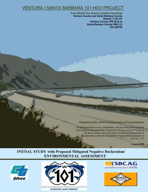
VENTURA / SANTA BARBARA 101 HOV PROJECT<br />
From Mobile Pier Road to Casitas Pass Road<br />
Ventura County and Santa Barbara County<br />
District 7 US 101<br />
Ventura County (PM 39.8) to<br />
Santa Barbara County (PM 2.2)<br />
EA 260700<br />
Prepared by the <strong>California</strong> Department <strong>of</strong> Transportation<br />
The environmental review, consultation, and any other action required<br />
in accordance with applicable Federal laws for this project is being, or<br />
has been, carried out by the <strong>State</strong> <strong>of</strong> <strong>California</strong> Department <strong>of</strong><br />
Transportation under its assumption <strong>of</strong> responsibility pursuant to<br />
23 U.S.C. 327<br />
INITIAL STUDY with Proposed Mitigated Negative Declaration/<br />
ENVIRONMENTAL ASSESSMENT<br />
August 2008
❖
VEN-SB US101 HOV Project IS/EA<br />
❖
<strong>State</strong> <strong>of</strong> <strong>California</strong> SCH Number: 2007081071<br />
Department <strong>of</strong> Transportation 07 U.S. 101 VEN PM 39.8/SB PM2.2<br />
Project Description<br />
Proposed Mitigated Negative Declaration<br />
Pursuant to: Division 13, Public Resources Code<br />
The <strong>State</strong> <strong>of</strong> <strong>California</strong> Department <strong>of</strong> Transportation (The Department) proposes to construct a<br />
High Occupancy Vehicle lane in each direction on the U.S. 101 within the existing median<br />
between the Mobil Pier Undercrossing (PM 39.8) in Ventura County and Casitas Pass Road (PM<br />
2.2) in Santa Barbara County.<br />
Determination<br />
This proposed Mitigated Negative Declaration (MND) is included to give notice to interested<br />
agencies and the public that it is the Department’s intent to adopt a Mitigated Negative<br />
Declaration for this project. This does not mean that the Department’s’ decision regarding the<br />
project is final. This MND is subject to modification based on comments received by interested<br />
agencies and the public during public circulation. The Department has prepared an Initial Study<br />
for this project and pending public review, expects to determine from this study that the proposed<br />
project would not have a significant effect on the environment for the following reasons:<br />
The proposed project would not significantly affect topography, seismic exposure, floodplains,<br />
wetlands or water quality.<br />
The proposed project would not significantly impact any sensitive plant or animal species, other<br />
wildlife, riparian habitat, wetlands, or agricultural land.<br />
The proposed project would not significantly affect land use, public facilities or other socioeconomic<br />
features, cultural resources, open space or parklands.<br />
The proposed project would result in increased noise levels along its route, but with the addition<br />
<strong>of</strong> soundwalls, these effects would be reduced to acceptable levels.<br />
The proposed project would promote improved regional air quality.<br />
The proposed project would affect the scenic resources in the area, but with proposed landscape<br />
treatment, the effects would be minimized.<br />
______________________________ ________________<br />
Ronald Kosinski Date<br />
Deputy District Director<br />
District 7 Division <strong>of</strong> Environmental Planning<br />
<strong>California</strong> Department <strong>of</strong> Transportation
❖<br />
iv VEN-SB US101 HOV Project IS/EA
Table <strong>of</strong> Contents<br />
Title Sheet………………………………………………………..………………….…………………..i<br />
Proposed Mitigated Negative Declaration ………………………………….…………………….. iii<br />
Table <strong>of</strong> Contents.......................................................................................................................v<br />
List <strong>of</strong> Technical Reports that are Bound Separately ............................................................... vi<br />
List <strong>of</strong> Figures ....................................................................................................................... vii<br />
List <strong>of</strong> Tables ...................................................................................................................... viii<br />
<strong>Chapter</strong> 1Proposed Project........................................................................................................1<br />
1.1 Introduction.................................................................................................................1<br />
1.1.1Purpose......................................................................................................................5<br />
1.1.2Need...........................................................................................................................6<br />
1.1.3Related Projects.......................................................................................................10<br />
1.2 Project Description ...................................................................................................11<br />
1.2.1Alternatives ..............................................................................................................12<br />
1.2.2NO BUILD Alternative ..............................................................................................12<br />
1.2.3MINIMUM BUILD Alternative ...................................................................................12<br />
1.2.4FULL BUILD Alternative...........................................................................................13<br />
1.2.5DESIGN OPTIONS - Build Alternatives...................................................................14<br />
1.2.6TRANSPORTATION SYSTEMS MANAGEMENT AND TRANSPORTATION DEMAND<br />
MANAGEMENT OPTION.................................................................................................16<br />
1.2.7Permits and Approvals Needed ...............................................................................17<br />
<strong>Chapter</strong> 2Affected Environment, Environmental Consequences, and Mitigation Measures ...19<br />
2.0 HUMAN ENVIRONMENT ..............................................................................................19<br />
2.1.1Existing and Future Land Use..................................................................................19<br />
2.1.2Consistency with <strong>State</strong>, Regional, and Local Plans.................................................28<br />
2.1.3Coastal Zone............................................................................................................31<br />
2.1.4Parks and Recreation ..............................................................................................34<br />
2.1.5Growth......................................................................................................................37<br />
2.1.6Farmlands ................................................................................................................41<br />
2.1.7Community Impacts – Community Character and Cohesion...................................43<br />
2.1.8Neighborhoods/Communities...................................................................................47<br />
2.1.9Environmental Justice..............................................................................................60<br />
2.1.10Traffic and Transportation/Pedestrian & Bicycle Facilities.....................................64<br />
2.1.11Visual/Aesthetics....................................................................................................95<br />
2.1.12Cultural Resources...............................................................................................121<br />
2.2 PHYSICAL ENVIRONMENT........................................................................................126<br />
2.2.1Hydrology and Floodplain ......................................................................................126<br />
2.2.2Water Quality and Storm-water Run<strong>of</strong>f..................................................................128<br />
2.2.3Geology/Soils/Seismic ...........................................................................................131<br />
2.2.4Paleontology ..........................................................................................................134<br />
2.2.5Hazardous Waste/Materials...................................................................................135<br />
2.2.6Air Quality...............................................................................................................139<br />
2.2.7Noise and Vibration................................................................................................162<br />
2.3 BIOLOGICAL ENVIRONMENT....................................................................................175<br />
2.3.1 Wetlands and Other Waters..................................................................................175<br />
2.3.2 Plant Species ........................................................................................................177<br />
2.3.3 Animal Species .....................................................................................................180<br />
2.3.4Invasive Species ....................................................................................................181<br />
2.4 Cumulative Impacts................................................................................................182<br />
2.5 Climate Change (CEQA)........................................................................................190<br />
<strong>Chapter</strong> 3 Comments and Coordination............................................................................197<br />
<strong>Chapter</strong> 4 List <strong>of</strong> Preparers ...............................................................................................203<br />
<strong>Chapter</strong> 5 Distribution List.................................................................................................205<br />
VEN-SB US101 HOV Project IS/EA v
List <strong>of</strong> Figures<br />
List <strong>of</strong> Figures<br />
Figure 1.1-1 Project Location on The Department District Map ................................................1<br />
Figure 1.1-2 Project Vicinity Map...............................................................................................2<br />
Figure 1.1-3 Levels <strong>of</strong> Service for Multi-Lane Highways ...........................................................7<br />
Figure 1.2-1 Typical Cross-Sections (between Mussel Shoals and Bates Road) ...................15<br />
Figure 2.1-1 Study Area Land Use in Santa Barbara County..................................................23<br />
Figure 2.1-2 Study Area Land Use in Ventura County ............................................................25<br />
Figure 2.1-3 Population Density..............................................................................................40<br />
Figure 2.1-4 Total Minority .......................................................................................................48<br />
Figure 2.1-5 Mainline and Ramp Configuration......................................................................67<br />
Figure 2.1-6 Existing Mainline Peak Hour Volumes ................................................................74<br />
Figure 2.1-7 2015 Traffic Peak Hour Volumes ........................................................................76<br />
Figure 2.1-8 Traffic Peak Hour Volumes – Year 2035.............................................................78<br />
Figure 2.1-9 North Option Bikeway..........................................................................................90<br />
Figure 2.1-10 South Option Bikeway .......................................................................................90<br />
Figure 2.1-11 Proposed Bikeway............................................................................................92<br />
Figure 2.1-12 Existing NB View at Bailard Ave......................................................................106<br />
Figure 2.1-13 Simulation NB View at Bailard Ave. with HOV Lane .......................................106<br />
Figure 2.1-14 Existing View Via Real, City <strong>of</strong> Carpinteria .....................................................108<br />
Figure 2.1-15 Simulation Via Real, City <strong>of</strong> Carpinteria with Soundwall.................................108<br />
Figure 2.1-16 Existing NB View near Bates Rd. Interchange................................................109<br />
Figure 2.1-17 Simulation NB View near Bates Rd. Interchange with CMS sign ...................109<br />
Figure 2.1-18 Existing View NB near Tank Farm ..................................................................110<br />
Figure 2.1-19 Simulation NB near Tank Farm with HOV Lane..............................................110<br />
Figure 2.1-20 Existing SB View near La Conchita.................................................................112<br />
Figure 2.1-21 Simulation SB View near La Conchita with HOV Lane ...................................112<br />
Figure 2.1-22 Existing View Surfside Ave. and Fillmore St. ..................................................113<br />
Figure 2.1-23 Simulation Surfside Ave. and Fillmore St. with Soundwall..............................113<br />
Figure 2.1-24 Simulation Surfside Ave. and Fillmore St. with Concrete Barrier....................113<br />
Figure 2.1-25 Existing View <strong>of</strong> Santa Barbara Ave. La Conchita ..........................................115<br />
Figure 2.1-26 Simulation Santa Barbara Ave. La Conchita North Option Bikeway...............115<br />
Figure 2.1-27 Existing View <strong>of</strong> Santa Barbara Ave. La Conchita ..........................................116<br />
Figure 2.1-28 Simulation Santa Barbara Ave. South Option Bikeway...................................116<br />
Figure 2.1-29 Existing Beachview near La Conchita.............................................................117<br />
Figure 2.1-30 Simulation <strong>of</strong> Beachview near La Conchita with PUC.....................................117<br />
Figure 2.1-31 Existing SB Approach to Mussel Shoals .........................................................119<br />
Figure 2.1-32 Simulation SB Approach Mussel Shoals with Soundwalls..............................119<br />
Figure 2.2-1 Typical Noise Levels decibels (dBA).................................................................167<br />
Figure 2.5-1 CO2 Emissions vs Speed (Highway) ...............................................................192<br />
IS/EA VEN-SB US101 HOV Project vii
List <strong>of</strong> Tables<br />
List <strong>of</strong> Tables<br />
Table 1.1-1 Traffic Volumes and LOS within the Project Limits ............................................... 8<br />
Table 1.1-2 Selective Accident Rate from 01/01/04 to 12/31/06.............................................. 8<br />
Table 1.2-1 Required Permits for the Proposed Project ........................................................ 17<br />
Table 2.1-1 Current Proposed Developments........................................................................ 27<br />
Table 2.1-2 Population and Projections in Study Area and Surrounding Areas ..................... 38<br />
Table 2.1-3 Regional Study Area and Community Race Ethnicity – 1990-2000 .................... 45<br />
Table 2.1-4 Study Area and County Age Breakdown-1990-2000........................................... 46<br />
Table 2.1-5a Housing Data..................................................................................................... 51<br />
Table 2.1-5b Housing Data..................................................................................................... 52<br />
Table 2.1-6 Labor Force Characteristics(cont. on next page) .............................................. 55<br />
Table 2.1-7 Median Household Income and Per Capita Income 1990-2000 .......................... 57<br />
Table 2.1-8 Minority Populations and Income 1990-2000...................................................... 62<br />
Table 2.1-9 Traffic Study Locations at Various Locations....................................................... 68<br />
Table 2.1-10 Existing Traffic Conditions by County ................................................................ 69<br />
Table 2.1-11 Existing and Future Traffic Volumes with Alternatives....................................... 69<br />
Table 2.1-12 Intersection Level <strong>of</strong> Service (LOS) Thresholds ................................................ 70<br />
Table 2.1-13 Existing Intersection Analysis - 2008 ................................................................ 71<br />
Table 2.1-14 AM/PM Peak Hour Intersection Analysis - Year 2015 ....................................... 81<br />
Table 2.1-15 AM/PM Peak Hour Intersection Analysis - Year 2035 ....................................... 83<br />
Table 2.1-16 Travel Time Changes From Median Closures – Reroute only........................... 85<br />
Table 2.1-17 Travel Time Changes From Median Closures – Build ....................................... 85<br />
Table 2.1-18 Year 2035 travel Time Changes with & without median closures (Reroute) ..... 86<br />
Table 2.1-19 Year 2035 travel Time Changes with & without median closures (BUILD)........ 87<br />
Table 2.2-1 <strong>State</strong> and Federal Criteria Air Pollutant Stds, Effects and Sources................... 144<br />
Table 2.2-2 Designations <strong>of</strong> Criteria Pollutants in Ventura Co. (Fed.&<strong>State</strong>) ...................... 145<br />
Table 2.2-3 Designations <strong>of</strong> Criteria Pollutants in Santa Barbara Co.(Fed.&<strong>State</strong>).............. 146<br />
Table 2.2-4 Summary <strong>of</strong> MSAT Emissions in the Existing Year, 2006 (grams/day)............. 153<br />
Table 2.2-5 Summary <strong>of</strong> MSAT Emissions for Year 2016 (in grams per day) ...................... 154<br />
Table 2.2-6 Summary <strong>of</strong> MSAT Emissions for Horizon Year 2036 (grams per day) ........... 154<br />
Table 2.2-7 Noise Abatement Criteria ................................................................................... 164<br />
Table 2.2-8 Noise Measurements and Modeling results (Northbound)................................. 168<br />
Table 2.2-9 Noise Measurements and Modeling results (Southbound)................................ 169<br />
Table 2.2-10 Proposed Soundwalls for BUILD Alternatives (Mussel Shoals)....................... 172<br />
Table 2.2-11 Proposed Soundwalls for BUILD Alternatives (La Conchita)........................... 172<br />
Table 2.2-12 Proposed Soundwalls for BUILD Alternatives (Carpinteria)............................. 173<br />
Table 2.4-1 Cumulative Projects and Impacts....................................................................... 187<br />
Table 2.5-1 Peak Hour Volume for Existing, Opening, and Horizon Years........................... 193<br />
Table 2.5-2 Peak Hour Speeds for Existing, Opening, and Horizon Years ......................... 194<br />
viii IS/EA VEN-SB US101 HOV Project
<strong>Chapter</strong> 1Proposed Project<br />
1.1 Introduction<br />
<strong>Chapter</strong> 1 Proposed Project<br />
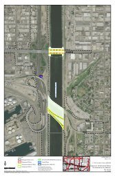
U.S. Highway 101 (U.S. 101) is a primary north-south route extending along the coastal<br />
area <strong>of</strong> the <strong>State</strong> <strong>of</strong> <strong>California</strong>. The segment <strong>of</strong> the highway within the project limits<br />
connects Ventura County to Santa Barbara County as shown in Figure 1.1-1 and 1.1-2<br />
and operates as a four-lane highway.<br />
The <strong>State</strong> <strong>of</strong> <strong>California</strong> Department <strong>of</strong> Transportation (the Department) proposes to<br />
construct a High Occupancy Vehicle (HOV) lane in both directions within the existing<br />
median between the Mobil Pier Undercrossing (PM 39.8) in Ventura County and Casitas<br />
Pass Road (PM 2.2) in Santa Barbara County and would connect to the Department’s<br />
District 5 South Coast 101 HOV project at the northern terminus, which is currently in<br />
the planning phase. Proposed project features include Intelligent Transportation Systems<br />
(ITS), improvement <strong>of</strong> median barriers and closure <strong>of</strong> median openings. The length <strong>of</strong><br />
the proposed project is six miles and would provide six lanes, three northbound (NB)<br />
lanes and three southbound (SB) lanes through the communities <strong>of</strong> Mussel Shoals, La<br />
Conchita, and Rincon in Ventura County and the City <strong>of</strong> Carpinteria in Santa Barbara<br />
Project Location<br />
Figure 1.1-1 Project Location on the Department District Map<br />
IS/EA VEN-SB US101 HOV Project 1
<strong>Chapter</strong> 1 Proposed Project<br />
County, <strong>California</strong>. Three (3) alternatives have been proposed: the NO BUILD<br />
Alternative, the MINIMUM BUILD Alternative, and the FULL BUILD Alternative.<br />
SB-101-PM 0.0<br />
VEN<br />
SB-101-PM<br />
-101-PM R43.6<br />
0.0<br />
VEN -11 -M R43.6<br />
Figure 1.1-2 Project Vicinity Map<br />
In addition to congestion relief, the Department proposes to construct a Pedestrian<br />
Undercrossing at La Conchita, upgrade the access at Mussel Shoals and La Conchita and<br />
close median openings at Mussel Shoals, La Conchita, and Tank Farm. Environmental<br />
studies for this portion <strong>of</strong> the project were completed in the 2002 La Conchita/Mussel<br />
Shoals Access Improvement Mitigated Negative Declaration/Findings <strong>of</strong> No Significant<br />
Impact, (MND/FONSI) and proposed funding for construction is included as part <strong>of</strong> the<br />
VEN/SB 101 HOV project. This document can be accessed on the Internet at:<br />
http://dot.ca.gov/ dist07/resources/envdocs/docs/LaConchita_access_ndfonsi.pdf<br />
The proposed project is fully funded and is included in the Ventura County 2004 RTP.<br />
The 2004 RTP was found to conform by SCAG on April 1, 2004 as Resolution #06-471-<br />
3 and approved by the Federal Highway Administration (FHWA) and Federal Transit<br />
Administration (FTA) on June 7, 2004. The project is also included in SCAG financially<br />
constrained 2006 Regional Transportation Improvement Program (RTIP) as Resolution<br />
#06-477-2. The SCAG 2006 RTIP was found to conform by FHWA and FTA on October<br />
2, 2006. The design concept and scope <strong>of</strong> the proposed project is consistent with the<br />
project description in the 2004 RTP Amendment #3, the 2006 RTIP, and the assumptions<br />
in SCAG’s regional emissions analysis.<br />
2 IS/EA VEN-SB US101 HOV Project
<strong>Chapter</strong> 1 Proposed Project<br />
Background<br />
In the early 1960s consideration for widening the U.S.101 in Santa Barbara County was<br />
introduced. In 1974, the project area was analyzed in the Department’s Feasibility<br />
Report and a six-lane highway was recommended. Consideration for widening the<br />
Ventura County portion <strong>of</strong> the project began in the late 1990s and in 1999, projected<br />
growth and capacity requirements were evaluated in the Department’s Transportation<br />
Concept Report (TCR) and widening was recommended. In 2001, widening the Santa<br />
Barbara County portion <strong>of</strong> the project was analyzed in the Department’s TCR and a<br />
larger facility was recommended.<br />
The Department, Santa Barbara County Association <strong>of</strong> Governments (SBCAG), Ventura<br />
County Transportation Commission (VCTC); and state and local agencies worked<br />
together to develop the 2002 “South Coast Highway 101 Deficiency Plan” and the 2006<br />
“101 In Motion Plan.” These plans included alternatives for widening <strong>of</strong> the highway by<br />
adding lanes in each direction and the “101 In Motion Plan” recommended the addition<br />
<strong>of</strong> a High Occupancy Vehicle (HOV) lane in each direction. Congestion relief was also<br />
analyzed in the VCTC Congestion Management Program (CMP) and this plan also<br />
recommended adding lanes and implementing a peak hour HOV lane.<br />
In 1968, consideration for constructing a pedestrian crossing at La Conchita began when<br />
the Department proposed a pedestrian crossing at La Conchita for safe beach access. In<br />
2002, an environmental document was approved for a proposed pedestrian undercrossing<br />
(PUC) at La Conchita. In 2005, the PUC at La Conchita was recommended in the<br />
Ventura County Transportation Commission (VCTC) Congestion Management Plan and<br />
in 2006, VCTC commenced design <strong>of</strong> the proposed PUC.<br />
Existing Facility<br />
The U.S. 101 is part <strong>of</strong> the National Highway System and has been identified by the<br />
Federal Department <strong>of</strong> Transportation and the Department <strong>of</strong> Defense as a route in the<br />
Strategic Highway Corridor Network and is classified as an urban freeway. It is on the<br />
<strong>State</strong> Freeway and Expressway System and is a designated Focus Route on the<br />
Interregional Road System. It is also a <strong>State</strong> Highway Extra Legal Load Route and is on<br />
the Surface Transportation Assistance Act Truck Network.<br />
The proposed project segment <strong>of</strong> the U.S. 101 connects Ventura County to Santa Barbara<br />
County and operates as a four-lane expressway to freeway, respectively. The original<br />
two-lane highway was completed in 1938. In 1951, the two lane higway was expanded<br />
to four lanes in its current alignment. The median barrier was constructed in 1985.<br />
IS/EA VEN-SB US101 HOV Project 3
<strong>Chapter</strong> 1 Proposed Project<br />
In the northbound direction, beginning in the vicinity <strong>of</strong> Mussel Shoals the U.S. 101<br />
operates as a four lane expressway. The posted speed is 65 mph. Northbound U.S. 101<br />
provides three 12-foot lanes and changes to two 12-foot lanes roughly 0.60 miles<br />
upstream <strong>of</strong> the Mussel Shoals access. U.S. 101 continues north with two lanes past La<br />
Conchita and Tank Farm and then widens to three lanes 0.35 miles upstream <strong>of</strong> the Bates<br />
Road undercrossing. U.S. 101 continues with three lanes in Santa Barbara County,<br />
tapering down to two lanes 0.30 miles downstream <strong>of</strong> the SR 150 overcrossing at the<br />
northern extent <strong>of</strong> the project limits.<br />
In the southbound direction, beginning in the vicinity <strong>of</strong> Casitas Pass Road in Santa<br />
Barbara County, southbound U.S. 101 operates with two 12-foot lanes. Auxiliary lanes<br />
are provided between Bailard Avenue and SR-150 and between SR-150 and Bates Road.<br />
South <strong>of</strong> Bates Road, southbound U.S. 101 <strong>of</strong>fers two 12-foot lanes until 0.25 miles<br />
downstream <strong>of</strong> Mussel Shoals acess, where U.S. 101 widens to three 12-foot lanes.<br />
In Ventura County there are three median openings at Mussel Shoals, Santa Barbara<br />
Avenue (La Conchita), and Tank Farm. These openings provide full access in and out <strong>of</strong><br />
Mussel Shoals and La Conchita by <strong>of</strong>fering:<br />
Left turn deceleration and storage lanes for traffic for turning in<br />
Right turn deceleration lanes for turning in<br />
Left turn acceleration lanes for traffic turning out<br />
Right turn acceleration lanes for turning out<br />
At Tank Farm, the median opening is designed to accommodate U-turns only. There are<br />
no deceleration or acceleration lanes.<br />
In Ventura County, the median width varies from 22 to 46 feet and contains a single row<br />
<strong>of</strong> double thrie-beam median barrier. Inside shoulders vary from 2 to 11 feet. Outside<br />
shoulder vary from zero to 11 feet.<br />
In Santa Barbara County, the median varies from 21 to 41 feet. Inside shoulder width<br />
varies from 4 to 10 feet, and outside shoulder width varies from 8 to 10 feet. The median<br />
is landscaped between a thrie-beam barrier on each side <strong>of</strong> the freeway.<br />
There is a bikeway in both directions between U.S.101/SR 150 interchange and Seacliff<br />
(Old Rincon Highway)/ U.S. 101 interchange just south <strong>of</strong> Mussel Shoals. Cyclists are<br />
allowed because there is no alternative route to the U.S. 101 that <strong>of</strong>fers a direct route<br />
4 IS/EA VEN-SB US101 HOV Project
<strong>Chapter</strong> 1 Proposed Project<br />
between the Seacliff interchange and Carpinteria. There is an existing non-standard<br />
bicycle facility located on the southbound U.S. 101 between the U.S. 101/150<br />
Interchange and the Seacliff exit. Just south <strong>of</strong> Bates Road Interchange there is a 2 mile<br />
section with a non-standard striped bikeway adjacent to the travel lane, with a 3-foot<br />
buffer between the bikeway and emergency parking lane, that ends several feet before the<br />
<strong>of</strong>f-ramp to Mussel Shoals. The existing NB non-standard bikeway connects to the U.S.<br />
101 from the frontage road (Old Rincon Highway) just south <strong>of</strong> Mussel Shoals and<br />
continues to the U.S. 101/150 Interchange. After the intersection <strong>of</strong> U.S.101 and Old<br />
Rincon Road, the NB bicycle facility consists <strong>of</strong> a variable shoulder with non-standard<br />
pavement markings. The bikeway is part <strong>of</strong> the Pacific Coast bicycle route and is<br />
frequently used for recreational and charitable bicycle rides. Emergency shoulder<br />
parking is allowed from south <strong>of</strong> Bates Road Interchange to north <strong>of</strong> the community <strong>of</strong><br />
Mussel Shoals.<br />
A Union Pacific Railroad track runs parallel to the US 101, approximately 50 feet east <strong>of</strong><br />
the northbound edge <strong>of</strong> U.S 101 and 62 feet from the western edge <strong>of</strong> Seaside Ave in La<br />
Conchita. It continues northbound until the Wave Overhead Bridge where it crosses<br />
under the U.S.101 to the southside until the northern project limits. The railroad property<br />
within the project limits varies in width from approximately 60 to 100 feet.<br />
There are four structures: Bates Road Undercrossing (Bridge No. 51-279 L) located in<br />
Ventura County and the Wave Overhead (Bridge No. 51-229 R/L) and structures at the<br />
U.S. 101/SR 150 Interchange and Bailard Avenue Interchange located in Santa Barbara<br />
County.<br />
Purpose and Need<br />
1.1.1 Purpose<br />
The purpose <strong>of</strong> this project is to improve mobility by reducing existing and forecasted<br />
traffic congestion on U.S. 101 within the project limits. This project would reduce<br />
congestion and is expected to enhance traffic operations by adding capacity in an area<br />
that experiences delays during peak hours and enhance safety within the project limits,<br />
while minimizing environmental and socio-economic impacts. Constructing a HOV lane<br />
in this area is a critical element to improve operations as identified in regional<br />
transportation planning studies including the SBCAG 101 In Motion Plan and VCTC<br />
Congestion Management Program and the Department’s TCR. The proposed project is<br />
intended to achieve the following goals:<br />
IS/EA VEN-SB US101 HOV Project 5
<strong>Chapter</strong> 1 Proposed Project<br />
• To reduce existing and forecasted traffic congestion and to eliminate the existing<br />
freeway lane bottleneck and to reduce vehicle weaving within the project limits.<br />
• To facilitate through vehicle trips by increasing the capacity <strong>of</strong> vehicles moving<br />
through the regional highway system.<br />
• To decrease travel times for travelers and promote ridesharing.<br />
• To facilitate the efficient flow <strong>of</strong> goods and services through this area.<br />
1.1.2 Need<br />
Disproportionate demand is overwhelming the existing capacity <strong>of</strong> the U.S. 101 during<br />
peak periods including weekends. The 2006 Average Annual Daily Traffic (AADT) was<br />
calculated to be 82,000 vehicles and during peak periods, the highway is congested for<br />
several hours a day in each direction.<br />
Based upon regional growth studies, the population <strong>of</strong> Ventura and Santa Barbara County<br />
is expected to increase. The population in Ventura County is expected to increase by 26<br />
percent from 753,197 in 2000 to 951,080 in 2025 [Southern <strong>California</strong> Association <strong>of</strong><br />
Governments (SCAG) 2001 Regional Growth Trends] and the population <strong>of</strong> Santa<br />
Barbara County is expected to increase by 20 percent from 417,500 in 2005 to 459,600 in<br />
2020 (SBCAG Regional Growth Forecast 2007).<br />
In addition to population growth, long distance commuting is escalating as affordable<br />
housing is located farther away from employment centers, resulting in an increase in the<br />
number <strong>of</strong> people commuting from Ventura County to Santa Barbara County. Surveys<br />
indicate over 15,000 vehicles commute daily from Ventura to Santa Barbara (SBCAG<br />
2002 Commuter Pr<strong>of</strong>ile Survey). The coastal location, natural amenities, and temperate<br />
weather have made this area a popular tourist destination, resulting in temporary traffic<br />
increases on weekends and during the summer. Without improvements to the existing<br />
highway, population growth and increasing travel demand would present even greater<br />
challenges to an already overtaxed transportation facility. Current congested conditions<br />
would continue to cause delay for local traffic, transit, commercial trucking, tourists,<br />
commuters, and emergency vehicles.<br />
Traffic Demand and Capacity<br />
The quality <strong>of</strong> traffic flow can be defined in terms <strong>of</strong> level <strong>of</strong> service (LOS). The measure<br />
used to provide an estimate <strong>of</strong> LOS is density. There are six LOS, ranging from LOS A<br />
(free traffic flow with low volumes and high speeds, resulting in low densities) to LOS F<br />
(traffic volumes exceed capacity and result in forced flow operations at low speeds,<br />
resulting in high densities), refer to the Figure 1.2-1 on the next page for LOS thresholds<br />
6 IS/EA VEN-SB US101 HOV Project
<strong>Chapter</strong> 1 Proposed Project<br />
on a basic freeway segment. Within the project limits, the U.S.101 experiences a<br />
deficient LOS and exceeds capacity during peak hours.<br />
Figure 1.1-3 Levels <strong>of</strong> Service for Multi-Lane Highways<br />
The Department’s Freeway Operations’ primary objective is to improve the LOS, ensure<br />
trip reliability, and provide motorists with accurate real-time information on highway<br />
conditions. The criteria for the current and projected LOS was derived from the<br />
Department’s Highway Capacity Manual for a free flow speed <strong>of</strong> 50 to 60 mph and from<br />
the Department’s criteria considering the minimum accepted LOS with a flowing volume<br />
<strong>of</strong> 2000 to 2200 vehicles per hour per lane (VPHPL). Table 1.2-1 compares the traffic<br />
volumes and LOS for 2006, existing conditions, and the projected conditions for 2036.<br />
Since this project spans two counties, more congested conditions were used to analyze<br />
the project as a whole. The peak month traffic in 2006 was 82,000 vehicles and the peak<br />
IS/EA VEN-SB US101 HOV Project 7
<strong>Chapter</strong> 1 Proposed Project<br />
hour demand was 8,200 vehicles. The VPHPL was estimated to be 1,822 vehicles and<br />
LOS E, with a VPHPL design capacity <strong>of</strong> 2,000 vehicles. Traffic in the vicinity <strong>of</strong> the<br />
project has an average <strong>of</strong> 6-7% truck traffic.<br />
EXISTING<br />
2006<br />
NO BUILD<br />
2036<br />
Projected<br />
BUILD<br />
2036<br />
Projected<br />
Table 1.1-1 Traffic Volumes and LOS within the Project Limits<br />
Lanes<br />
4 Mixed<br />
Flow<br />
4 Mixed<br />
Flow<br />
4 Mixed<br />
Flow<br />
+ HOV<br />
Source The Department Traffic Report 2007<br />
Average<br />
Annual<br />
Peak<br />
month<br />
Traffic<br />
AM/PM<br />
Peak<br />
Hour<br />
Traffic<br />
Demand<br />
Vehicles<br />
per hour<br />
per lane<br />
Capacity<br />
Vehicles<br />
per hour<br />
per lane<br />
LOS<br />
Vehicle<br />
hours<br />
(VH)<br />
82,000 8,200 1,822 2,000 E N/A<br />
121,161 12,116 2,692 2,000 F<br />
121,161 12,116 1,954 2,200 D<br />
834,165<br />
VH delay<br />
834,165<br />
VH saved<br />
Note: Existing and No Build Facility accounts for four mixed flow lanes with a short section <strong>of</strong> three mixed flow lanes northbound<br />
between Bates Road and the U.S. 101 /SR 150 IC and an auxiliary lane within the same southbound section. In the Build scenario, the<br />
additional mixed flow lane would remain and the auxiliary lane would be converted to a mixed flow lane. HOV capacity used is 85%<br />
<strong>of</strong> maximum capacity <strong>of</strong> Mixed Flow lane (2000 VPHPL) or 1700 VPHPL.<br />
For the projected year 2036, the peak month traffic and the peak hour demand is expected<br />
to increase 50 percent, respectively 121,161 vehicles (AADT) and 12,116 vehicles (peak<br />
hour volume). The expected VPHPL would be 2,692 vehicles and without any<br />
improvements to the facility, the highway would exceed the maximum design capacity.<br />
This would create LOS F conditions and would result in 834,165 vehicle hours <strong>of</strong> delay.<br />
Safety/Accident Data Analysis<br />
Table 1.2-2 Selective Accident Rates, is a summary <strong>of</strong> actual traffic accidents rates<br />
versus average accident rates calculated per million vehicle miles (mvm) during a 36month<br />
period between January 1, 2004 to December 31, 2006. This data was obtained<br />
from the Department’s Traffic Accident Surveillance and Analysis System (TASAS).<br />
Table 1.1-2 Selective Accident Rate from 01/01/04 to 12/31/06<br />
LOCATION<br />
By County and Post Mile<br />
(PM/PM)<br />
US 101<br />
US 101<br />
Ventura County<br />
(PM39.8/PM43.6)<br />
Santa Barbara<br />
County<br />
(PM0.0/PM2.2)<br />
Source The Department TASA Traffic System Network Report 2006<br />
Total<br />
Accidents<br />
Fatal<br />
Accident Rate<br />
Actual <strong>State</strong> Average<br />
Fatal+<br />
Injury<br />
TOTAL Fatal<br />
Fatal+<br />
Injury TOTAL<br />
192 0.004 0.23 0.71 0.022 0.37 0.82<br />
115 0.000 0.27 0.77 0.011 0.27 0.71<br />
8 IS/EA VEN-SB US101 HOV Project
<strong>Chapter</strong> 1 Proposed Project<br />
For Ventura County, the actual total 0.71 accident rate was less than the 0.82 state<br />
average rate and <strong>of</strong> the 194 reported accidents, the three primary causes for the accidents<br />
were speeding (36.6%), improper turns (33%) and the influence <strong>of</strong> alcohol (10.8%). The<br />
three primary types <strong>of</strong> collisions were rear ends (36.6%), hit objects (32.5%), and<br />
overturns (11.3%).<br />
For Santa Barbara County, the actual total 0.77 accident rate was greater than the 0.71<br />
state average rate and <strong>of</strong> the 119 reported accidents, the three primary causes for the<br />
accidents were speeding (46.2%), improper turns (20.2%), and the influence <strong>of</strong> alcohol<br />
(10.1%). The three primary types <strong>of</strong> collisions were rear ends (42%), hit objects (34.5%),<br />
and sideswipes (15.1%).<br />
Operational Deficiency<br />
Congestion in this area may be attributed to several factors. A bottleneck is formed due<br />
to the reduction <strong>of</strong> the mainline cross section from eight lanes to six lanes to four lanes<br />
within various locations. Another factor is heavy traffic volume originating from the<br />
Oxnard, Ventura and Camarillo areas traveling north to Santa Barbara during morning<br />
peak hours and traveling south in afternoon peak hours. There is also heavy merging and<br />
weaving from lane drops that occur within various segments <strong>of</strong> the project area resulting<br />
in considerable delays for several hours in the morning and afternoon in each direction.<br />
If no capacity improvements are made, conditions would continue to deteriorate in the<br />
future from planned growth alone.<br />
The median openings for left turns at Mussel Shoals, La Conchita and Tank Farm allow<br />
motorists to cross two lanes <strong>of</strong> opposing traffic to turn left to access La Conchita or<br />
Mussel Shoals and to re-enter the SB or NB highway which can be challenging.<br />
Implementation <strong>of</strong> the HOV lane would require closure <strong>of</strong> the medians which would also<br />
eliminate accidents caused by left turns through the medians. Lengthening the<br />
acceleration and deceleration lanes to these communities would improve access for<br />
vehicles exiting and entering the community from the highway.<br />
At La Conchita, there is no direct access to the beach and pedestrians have been observed<br />
crossing the highway via the median to access the beach. Pedestrians crossing a highspeed<br />
facility is an undesirable movement which would be eliminated by closing the<br />
medians and providing a pedestrian undercrossing.<br />
Legislation<br />
On November 7, 2006 <strong>California</strong> voters approved Proposition 1B, the Highway Safety,<br />
Traffic Congestion Relief, Air Quality, and Port Security Bond Act <strong>of</strong> 2006. The bond<br />
IS/EA VEN-SB US101 HOV Project 9
<strong>Chapter</strong> 1 Proposed Project<br />
includes $4.5 billion to be deposited in the Corridor Mobility Improvement Account<br />
(CMIA). Based upon the recommendations from previous plans and studies, the<br />
Department, VCTC and SBCAG jointly nominated the Ventura/Santa Barbara 101 High<br />
Occupancy Vehicle project for CMIA funds to widen the project segment, improve traffic<br />
flow and safety and to construct the pedestrian undercrossing in the community <strong>of</strong> La<br />
Conchita to provide safe beach access. The project was allocated CMIA and Interregional<br />
Improvement Program (IIP) funds in the amount <strong>of</strong> $151 million. The total<br />
amount programmed for the project ($151.47 million) is made up <strong>of</strong> a mix <strong>of</strong> CMIA and<br />
IIP funding. The total CMIA funding programmed for the project is available only for<br />
capital construction and construction support. The remaining support costs for the<br />
project are currently programmed with IIP funding.<br />
Independent Utility<br />
This project has independent utility because the proposed HOV lane would merge on the<br />
existing facility in Ventura County at the southern project limit. In addition, several<br />
transportation improvement projects have been proposed, approved, or are under<br />
construction within the City <strong>of</strong> Carpinteria and near by vicinity in Santa Barbara County<br />
that would link to the northern project limits. A proposed project in the City <strong>of</strong><br />
Carpinteria would improve Linden Avenue and the Casitas Pass Interchange to allow for<br />
improved Level <strong>of</strong> Service. The Department’s District 5 project began construction July<br />
2008 and will improve U.S. 101 between Milpas Street and Hot Springs Road/Cabrillo<br />
Boulevard in Santa Barbara County. The project will include the reconstruction <strong>of</strong> two<br />
major interchanges, six new or improved bridges, freeway widening, and improvements<br />
to local streets and circulation. Some <strong>of</strong> the improvements would be completed and<br />
operational before commencement <strong>of</strong> the proposed project’s construction; hence they<br />
would not contribute to impacts directly associated with the proposed project nor<br />
contribute to independent utility. In the interim, bottleneck conditions north <strong>of</strong> the<br />
proposed project may exist and would be addressed when other projects in the corridor<br />
are constructed after the completion <strong>of</strong> this project. This issue would be addressed as part<br />
<strong>of</strong> the project’s Traffic Management Plan.<br />
1.1.3 Related Projects<br />
U.S. 101 Operational Improvements from Milpas to Hot Springs (2.0 miles), this project<br />
adds lanes NB and SB on the U.S. 101 between Cabrillo Road and Milpas Street in the<br />
City <strong>of</strong> Santa Barbara and includes local road improvements and bicycle and pedestrian<br />
enhancements. Construction began July 2008.<br />
10 IS/EA VEN-SB US101 HOV Project
<strong>Chapter</strong> 1 Proposed Project<br />
South Coast 101 HOV (10.3 miles) This project proposes to add median HOV lanes in<br />
both directions on U.S. 101 from 0.4 miles north <strong>of</strong> Bailard Avenue in the City <strong>of</strong><br />
Carpinteria to 0.5 miles south <strong>of</strong> Milpas Street in the City <strong>of</strong> Santa Barbara – Public<br />
circulation <strong>of</strong> draft environmental document – Spring 2011.<br />
Linden to Casitas Pass Interchanges (1.1 miles), this project includes reconstruction <strong>of</strong><br />
interchanges, replacement <strong>of</strong> Carpinteria Creek Bridge, and provides a new Via Real<br />
connection south to Bailard Avenue. Public circulation <strong>of</strong> draft environmental document<br />
– Fall 2008.<br />
Santa Barbara 101 TMS South. This SHOPP project proposes to provide Intelligent<br />
Transportation System (ITS) vehicle detectors on U.S. 101 in Santa Barbara County in<br />
two phases between the SB/VEN County Line (PM 0.0) and Winchester Canyon Road in<br />
the City <strong>of</strong> Goleta. The primary objective <strong>of</strong> this project is to capture traffic speed and<br />
volume information to effectively monitor and manage the freeway. When fully<br />
implemented and integrated with the District Transportation Management Center (TMC)<br />
the project would also provide real-time traffic information to the traveling public.<br />
Ventura U.S. 101 (PM 41.3/42.1) Proposes to replace drainage culverts at Punta Gorda<br />
Undercrossing/Rincon Point. This project is in the project initiation phase.<br />
Ventura U.S. 101 (PM 29.9/30.0) This is a locally funded project with The Department’s<br />
oversight to modify <strong>of</strong>f-ramps at <strong>California</strong> Street in the City <strong>of</strong> San Buenaventura. This<br />
project is in Project Approval/Environmental Document (PA/ED) phase.<br />
Ventura U.S. 101 (PM22.0/23.7) This is a landscape mitigation project near the City <strong>of</strong><br />
Oxnard from SR 232 to Johnson Drive. The project is under construction.<br />
1.2 Project Description<br />
The proposed project is 6 miles in length between the Mobil Pier Undercrossing in<br />
Ventura County and Casitas Pass Road in Santa Barbara County. Within the limits <strong>of</strong> the<br />
proposed project, U.S. 101 is a freeway/expressway with four 12-foot lanes and variable<br />
width median, inside, and outside shoulders. The primary purpose <strong>of</strong> the project is to<br />
improve mobility by reducing existing and forecasted traffic congestion on the U.S. 101<br />
within the project limits by construction <strong>of</strong> an HOV lane in each direction to provide six<br />
lanes, three in each direction.<br />
IS/EA VEN-SB US101 HOV Project 11
<strong>Chapter</strong> 1 Proposed Project<br />
1.2.1 Alternatives<br />
This section describes the proposed action and the design alternatives that were<br />
developed by a multidisciplinary team to achieve the project purpose and need while<br />
avoiding or minimizing environmental impacts. The alternatives considered are the NO<br />
BUILD Alternative, the MINIMUM BUILD Alternative, and the FULL BUILD<br />
Alternative. After the public circulation period, all comments will be considered, and the<br />
Department will select a preferred alternative and make the final determination <strong>of</strong> the<br />
project’s effect on the environment. In accordance with CEQA, if no unmitigable<br />
significant adverse impacts are identified, the Department will prepare a Negative<br />
Declaration (ND) or Mitigated ND. Similarly, if the Department, as assigned by FHWA,<br />
determines the NEPA action does not significantly affect the environment, the<br />
Department will issue a Finding <strong>of</strong> No SignificantImpact (FONSI) in accordance with<br />
NEPA.<br />
1.2.2 NO BUILD Alternative<br />
The NO BUILD alternative provides a baseline for comparing the impacts associated<br />
with the alternatives. The infrastructure in the project area would remain as it now exists<br />
and congested conditions would continue to deteriorate. The NO BUILD alternative<br />
would not result in any foreseeable adverse environmental impacts; however, this<br />
alternative would not be consistent with Ventura and Santa Barbara County Congestion<br />
Management Plans and the 101 In Motion Plan which recommended adding lanes and<br />
implementing HOV lanes or the long-term objective <strong>of</strong> improving traffic congestion<br />
because it would not improve the efficient movement <strong>of</strong> goods and services in the<br />
vicinity <strong>of</strong> the project area.<br />
1.2.3 MINIMUM BUILD Alternative<br />
The MINIMUM BUILD Alternative includes the following project features:<br />
• Construction <strong>of</strong> a 12-foot NB and SB High Occupancy Vehicle (HOV) Lane in the<br />
existing median area from U.S. 101 (PM 39.8) in Ventura County to US 101 (PM 2.2)<br />
in Santa Barbara County.<br />
• Implementation <strong>of</strong> varying shoulder widths that could include sections with a<br />
minimum <strong>of</strong> 2-foot wide inside shoulders and a minimum <strong>of</strong> 7-foot wide outside<br />
shoulders.<br />
• Closure <strong>of</strong> existing median openings at Mussel Shoals (PM 40.9), La Conchita (PM<br />
41.4), and Tank Farm (PM 42.2).<br />
12 IS/EA VEN-SB US101 HOV Project
<strong>Chapter</strong> 1 Proposed Project<br />
• Installation <strong>of</strong> Intelligent Transportation Systems (ITS), vehicle detectors, and Closed<br />
Circuit TV (CCTV) and a changeable message sign near Bates Road.<br />
• Removal and replacement <strong>of</strong> thrie beam barriers with concrete barriers and<br />
construction <strong>of</strong> additional concrete barriers as needed.<br />
• Installation <strong>of</strong> soundwalls and retaining walls as feasible.<br />
• Convert existing lanes located near the U.S. 101/150 Interchange to accommodate the<br />
proposed HOV lane if necessary.<br />
• No new right <strong>of</strong> way acquistion would be required for the proposed improvements.<br />
The design includes deviations from mandatory and advisory design standards for<br />
shoulder width, horizontal and vertical clearances contained in the Highway Design<br />
Manual (HDM).<br />
1.2.4 FULL BUILD Alternative<br />
The FULL BUILD Alternative includes the following project features:<br />
• Construction <strong>of</strong> a 12-foot NB and SB High Occupancy Vehicle (HOV) Lane in the<br />
existing median area from U.S. 101 (PM 39.8) in Ventura County to US 101 (PM 2.2)<br />
in Santa Barbara County.<br />
• Implementation <strong>of</strong> 10-foot wide inside shoulders and a minimum <strong>of</strong> 10-foot wide<br />
outside shoulders. Four bridge structures within the project limits would be widened<br />
to accommodate the full standard shoulders<br />
• Closure <strong>of</strong> existing median openings at Mussel Shoals (PM 40.9), La Conchita (PM<br />
41.4), and Tank Farm (PM 42.2).<br />
• Installation <strong>of</strong> Intelligent Transportation Systems (ITS), vehicle detectors, and Closed<br />
Circuit TV (CCTV) as needed and changeable message sign (CMS) near Bates Road.<br />
• Removal and replacement <strong>of</strong> thrie beam barriers with concrete barriers and<br />
construction <strong>of</strong> concrete barriers as needed.<br />
• Installation <strong>of</strong> soundwalls and retaining walls as feasible.<br />
• Convert lanes located near the U.S. 101/150 Interchange to accommodate the<br />
proposed High Occupancy Vehicle lane if necessary.<br />
• Additional right-<strong>of</strong>-way acquistion would be required.<br />
This alternative complies with the HDM Mandatory Design Standards.<br />
IS/EA VEN-SB US101 HOV Project 13
<strong>Chapter</strong> 1 Proposed Project<br />
Figure 1.2-2 on the next page, illustrates Typical Cross Sections <strong>of</strong> the proposed<br />
alternatives for the roadway section from Mussel Shoals to Bates Road.<br />
1.2.5 DESIGN OPTIONS - Build Alternatives<br />
The following design options would be considered for the MINIMUM BUILD and FULL<br />
BUILD Alternatives.<br />
Part-Time HOV<br />
This option would administratively implement a part-time HOV lane in both directions<br />
within the proposed project limits. The HOV lane would be open to single-occupant<br />
vehicles during <strong>of</strong>f-peak hours. Signage would be installed to inform motorists <strong>of</strong> the<br />
hours <strong>of</strong> operation. The HOV lane would have continuous ingress/egress striping to<br />
allow access.<br />
Bikeway Design Options<br />
• Option A no change to the existing bikeways within the project limits.<br />
• Option B would provide an 8-foot Class I bikeway in the NB direction from<br />
Mussel Shoals to the Bates Road Interchange. The bikeway would be separated<br />
from traffic by a concrete barrier with a fence on top <strong>of</strong> the barrier. To<br />
accommodate the new 8-foot Class I bikeway in the NB direction within the<br />
existing pavement and/or <strong>State</strong> right-<strong>of</strong>-way, the highway centerline would be<br />
realigned towards the SB direction. The existing signage and bikeway<br />
designation on the SB roadway pavement for the Class II bikeway would be<br />
removed for a wider shoulder for emergency parking. Option B would provide a<br />
completely separated two-way bikeway adjacent to the NB roadway and cyclists<br />
would not be prohibited from using the wider SB shoulder A SB Class II<br />
bikeway would begin at the U.S. 101/SR 150 interchange and end at the Seacliff<br />
<strong>of</strong>f-ramp.<br />
14 IS/EA VEN-SB US101 HOV Project
Source: The Department 2008<br />
<strong>Chapter</strong> 1 Proposed Project<br />
Figure 1.2-1 Typical Cross-Sections (between Mussel Shoals and Bates Road)<br />
Pedestrian Undercrossing Design Options<br />
The proposed pedestrian undercrossing (PUC) at the intersection <strong>of</strong> Bakersfield Avenue<br />
and Surfside in La Conchita has already undergone environmental approval<br />
(SCH#2002031013) and was approved in 2002. Although construction <strong>of</strong> the PUC<br />
would take place concurrently with the proposed project, it is not considered an actual<br />
component <strong>of</strong> the proposed project. However, since 2002, other location and design<br />
options are being considered.<br />
PUC 1 – Proposed design would be near the intersection <strong>of</strong> Bakersfield Avenue and<br />
Surfside Street and would span from the beach to just before Surfside Street. This design<br />
has already undergone environmental review and approval in 2002. This option requires<br />
IS/EA VEN-SB US101 HOV Project 15
<strong>Chapter</strong> 1 Proposed Project<br />
Union Pacific Railroad and Ventura County right-<strong>of</strong>-way/land acquisition and Public<br />
Utility Commission approval. Currently, funding for land acquisition is not available.<br />
PUC-2 – Proposed designs (north and south <strong>of</strong> Santa Barbara Avenue) would be near the<br />
intersection <strong>of</strong> Surfside Street and Santa Barbara Avenue. These designs would span<br />
from the beach to just before the Railroad Tracks within state right-<strong>of</strong>-way. These<br />
options would not require land acquisition from the Railroad or Ventura County, but<br />
would require Public Utility Commission approva<br />
1.2.6 TRANSPORTATION SYSTEMS MANAGEMENT AND<br />
TRANSPORTATION DEMAND MANAGEMENT OPTION<br />
Transportation System Management (TSM) strategies consist <strong>of</strong> actions that would<br />
increase the efficiency <strong>of</strong> existing facilities by increasing the number <strong>of</strong> through trips a<br />
facility can carry without increasing the number <strong>of</strong> through lanes. At this time, the<br />
project area does not meet the criteria for a TSM program because population in the<br />
project area is less than 200,000. TSM programs also encourage automobile, public and<br />
private transit, ridesharing programs, and bicycle and pedestrian improvements.<br />
Transportation Systems Management<br />
This option would incorporate implementation <strong>of</strong> traffic systems management (TSM)<br />
measures such as ramp metering, auxilliary lanes, turning lanes, and traffic signal<br />
coordination. The U.S. 101 is the primary transportation corridor connecting northern<br />
Ventura county with Carpinteria and Southern Santa Barbara County and has heavy<br />
commuter traffic. The U.S. 101 amounts to approximately 70% <strong>of</strong> the study corridor and<br />
is a geographically constrained area, bounded by the Pacific Ocean and by mountainous<br />
terrain. There are no alternate routes until the City <strong>of</strong> Carpinteria. TSM measures may<br />
include freeway acceleration lanes, enhanced transit service through the U.S.101 corridor,<br />
and isolated intersection improvements.<br />
Transportation Demand Management<br />
For Santa Barbara County, options such as SBCAG’s Curb Your Commute would be<br />
considered for this project and would be incorporated into the Traffic Management Plan<br />
for this project if feasible. Curb Your Commute includes incentives, programs and<br />
services for commuters and employers designed to shift commuting to <strong>of</strong>f peak hours,<br />
increase carpooling and vanpooling, and increase bus service levels for the Coastal<br />
Express 101.<br />
16 IS/EA VEN-SB US101 HOV Project
<strong>Chapter</strong> 1 Proposed Project<br />
1.2.7 Permits and Approvals Needed<br />
The proposed project would require permits from different federal, state and local<br />
agencies which would vary depending on the alternative selected. The following Table<br />
1.5-1 list the types <strong>of</strong> permits required, agencies involved, and which build alternative<br />
requires the permit.<br />
FULL/MINIMUM BUILD<br />
FULL BUILD ONLY<br />
Table 1.2-1 Required Permits for the Proposed Project<br />
Agency Permit/Approval Status<br />
Ventura County<br />
Santa Barbara County<br />
City <strong>of</strong> Carpinteria<br />
Coastal Development<br />
Permit (CDP)<br />
Coastal Development<br />
Permit<br />
Coastal Development<br />
Permit<br />
Union Pacific RR Encroachment Permit<br />
<strong>State</strong> lands Encroachment Permit<br />
<strong>California</strong> Regional<br />
Water Quality Control<br />
Board<br />
United <strong>State</strong>s Army<br />
Corps <strong>of</strong> Engineers<br />
<strong>California</strong> Department<br />
<strong>of</strong> Fish and Game<br />
401 Certification<br />
Section 404 Permit for<br />
filling or dredging<br />
waters <strong>of</strong> the U.S.<br />
1602 Agreement for<br />
Streambed Alteration<br />
<strong>State</strong> lands Encroachment Permit<br />
2 permits required, one for HOV and one for the<br />
PUC -anticipated submittal after final<br />
environmental document distribution and during<br />
design phase<br />
Anticipated submittal after final environmental<br />
document distribution and during design phase<br />
Anticipated submittal after final environmental<br />
document distribution and during design phase<br />
Temporary Construction Easement<br />
Acquistion agreement has not been finalized<br />
therfore The Department currently owns the land.<br />
Anticipated submittal after final environmental<br />
document distribution and during design phase<br />
Anticipated submittal after final environmental<br />
document distribution and during design phase<br />
Anticipated submittal after final environmental<br />
document distribution and during design phase<br />
Acquistion agreement has not been finalized<br />
therefore The Department currently owns the<br />
land.<br />
Due to the proximity <strong>of</strong> the proposed project, a Coastal Development Permit would be<br />
required for both build alternatives. The culvert extensions for the FULL BUILD<br />
Alternative may have both permanent and temporary impacts to jurisdictional waters <strong>of</strong><br />
the U.S. This work would require permits under section 404 and 401 <strong>of</strong> the Clean Water<br />
Act and Streambed Alteration Agreement under Section 1602 <strong>of</strong> the <strong>California</strong><br />
Department <strong>of</strong> Fish and Game code.<br />
IS/EA VEN-SB US101 HOV Project 17
<strong>Chapter</strong> 1 Proposed Project<br />
18 IS/EA VEN-SB US101 HOV Project
<strong>Chapter</strong> 2 Affected Environment, Environmental Consequences, and Mitigation Measures<br />
<strong>Chapter</strong> 2Affected Environment, Environmental<br />
Consequences, and Mitigation Measures<br />
This chapter explains the impacts that the project would have on the human, physical, and<br />
biological environments within the project and surrounding areas. It describes the<br />
existing environment that could be affected by the project, potential impacts from each <strong>of</strong><br />
the alternatives, and the proposed avoidance, minimization, and/or mitigation measures.<br />
Any indirect impacts are included in the general impacts analysis and discussions.<br />
As part <strong>of</strong> the scoping and environmental analysis conducted, the following<br />
environmental issues were considered but no adverse impacts were indentified.<br />
Consequently, there is no further discussion regarding these issues in this document.<br />
• Wild and Scenic Rivers. The project site contains no Wild and Scenic Rivers.<br />
• Timberlands. The project site contains no Timberlands.<br />
• Community Impacts. No relocations would be required for the proposed project.<br />
• Natural communties were not found to present within the project boundaries.<br />
• Threatened and Endangered Species are not present within the project limits.<br />
Environmental impacts and mitigation measures reported in this Initial<br />
Study/Environmental Assessment were based on technical studies conducted for this<br />
project. The studies are listed after the Table <strong>of</strong> Contents on page vi and are available for<br />
review at:<br />
• The Department’s Dist. 7, 100 South Main Street, Los Angeles, <strong>California</strong> 90012.<br />
• Carpinteria Public Library, 5141 Carpinteria Avenue, Carpinteria, CA 93013<br />
• Carpinteria City Hall, 5775 Carpinteria Avenue, Carpinteria, CA 93013<br />
2.0 HUMAN ENVIRONMENT<br />
2.1.1 Existing and Future Land Use<br />
Regulatory Setting<br />
Santa Barbara County Comprehensive Plan, 1980<br />
The Santa Barbara County Comprehensive Plan is an <strong>of</strong>ficially adopted statement <strong>of</strong> local<br />
policy concerning the County’s long-term development. The Comprehensive Plan<br />
IS/EA VEN-SB US101 HOV Project 19
<strong>Chapter</strong> 2 Affected Environment, Environmental Consequences, and Mitigation Measures<br />
contains goals, objectives, and action plans which guide development within the<br />
unincorporated areas <strong>of</strong> the County. The Comprehensive Plan contains all the required<br />
elements and serves as “an effective guide for orderly growth and development,<br />
preservation and conservation <strong>of</strong> open-space land and natural resources, and the efficient<br />
expenditure <strong>of</strong> public funds relating to the subjects addressed in the general plan.”<br />
Ventura County General Plan, 2005<br />
The Ventura County General Plan is an <strong>of</strong>ficially adopted statement <strong>of</strong> local policy<br />
concerning the County’s long-term development. The General Plan contains goals,<br />
policies, and programs which guide development within the unincorporated areas <strong>of</strong> the<br />
County. The General Plan contains all the required elements.<br />
City <strong>of</strong> Carpinteria General Plan, 2003<br />
The City <strong>of</strong> Carpinteria General Plan is the primary planning policy document for the<br />
City. The General Plan contains objectives, policies, and implementation strategies to<br />
guide development within the City. The General Plan contains all the required elements.<br />
According to the General Plan, the goal <strong>of</strong> the community is “to preserve the essential<br />
character <strong>of</strong> our small beach town, its family-oriented residential neighborhoods, its<br />
unique visual and natural resources, and its open, rural surroundings while enhancing<br />
recreational, cultural, and economic opportunities for our citizens.”<br />
Coastal Plans for Santa Barbara Co, Ventura Co and the City <strong>of</strong> Carpinteria<br />
Please refer to the discussion in Section 2.1.3 Coastal Zone.<br />
Affected Environment<br />
Portions <strong>of</strong> southern Santa Barbara and northern Ventura counties inland <strong>of</strong> U.S. 101 are<br />
comprised primarily <strong>of</strong> open space (18,309 acres) or agricultural uses (including<br />
orchards, vineyards, nurseries, row crops, pasture, and range) (3,504 acres). Many <strong>of</strong><br />
these areas are designated preserve lands or areas devoted to plants and animal<br />
production for commercial purposes, and for other compatible uses. Oil wells and related<br />
industrial facilities are also present along coastal portions <strong>of</strong> the study area. Residential<br />
development within the study area (1,159 acres) consists <strong>of</strong> smaller beach communities,<br />
rural residential, as well as a number <strong>of</strong> mobile home parks, single family, and multifamily<br />
developments located in the southern area <strong>of</strong> Carpinteria.<br />
Within the study area, Santa Barbara County is characterized by a greater proportion <strong>of</strong><br />
developed areas (1,452 acres including commercial, industrial, public services, and<br />
residential), with fewer acres <strong>of</strong> agricultural use (1,353 acres). Conversely, the portion <strong>of</strong><br />
Ventura County within the study area is characterized primarily by open space and/or<br />
20 IS/EA VEN-SB US101 HOV Project
<strong>Chapter</strong> 2 Affected Environment, Environmental Consequences, and Mitigation Measures<br />
recreational uses (18,050 acres) with agricultural uses (2,151 acres). Residential land<br />
uses are sparse in the Ventura County portion <strong>of</strong> the study area at 191 acres. Specific<br />
land uses within each affected community are identified below.<br />
Southern Area <strong>of</strong> Carpinteria & Unincorporated portions <strong>of</strong> Santa Barbara County<br />
The first families arrived in Carpinteria during the 1840s, although the town was not<br />
established until 1887. Historically, agriculture in the area supported crops such as lima<br />
beans, walnuts, and avocados. The area retains some <strong>of</strong> its agricultural uses, especially<br />
through citrus orchards and commercial flower gardens; however, development within<br />
the City has decreased the amount <strong>of</strong> land available for such uses.<br />
The area is characterized by a number <strong>of</strong> business parks as well as industrial uses such as<br />
oil and natural gas facilities. Light industrial processing, assembly, packaging,<br />
wholesale, and service-related industries are supported here. Specifically, petroleum<br />
extraction and natural gas processing (Venoco Oil and Gas Facility, Carpinteria plant) as<br />
well as high technology firms (including research and development firms) are present.<br />
Open space and recreational areas for residents and visitors include Carpinteria Beach<br />
<strong>State</strong> Park, the Carpinteria Bluffs Nature Preserve, Viola Fields (which support playing<br />
fields), Monte Vista Park, Tee Time driving range, and the Thunderbowl roller skating<br />
rink. Public services include the Carpinteria Library, Carpinteria Middle School, as well<br />
as City Hall. Residential areas consist <strong>of</strong> single family residential, multi-family<br />
residential, and mobile home parks.<br />
Commercial uses within the City <strong>of</strong> Carpinteria, west <strong>of</strong> the southern area <strong>of</strong> Carpinteria,<br />
provide daily services to residents and visitors. A mixture <strong>of</strong> retail, wholesale, service,<br />
and <strong>of</strong>fice uses are typically located along transportation corridors such as Carpinteria<br />
Avenue and provide both visitor-serving and local resident uses including neighborhood<br />
retail and grocery services.<br />
According to the City <strong>of</strong> Carpinteria General Plan Land Use Element, there are few<br />
remaining areas within the City where development <strong>of</strong> housing can occur without<br />
conflicting with policies aimed at protecting coastal resources. Moreover, most <strong>of</strong> the<br />
City’s undeveloped land is not designated for residential uses. The majority <strong>of</strong> new<br />
development would occur in the commercial and industrial sector, as most <strong>of</strong> the<br />
currently undeveloped areas are designated as such. However, land use and zoning<br />
standards are flexible to allow residential development within a mixed-use setting within<br />
general commercial and industrial areas (Objective LU-6). Furthermore, the City <strong>of</strong><br />
Carpinteria General Plan Community Design Element identifies that the Northeast<br />
subarea, which contains a portion <strong>of</strong> the study area, provides more opportunities for new<br />
development than other areas. Some additional residential buildout is expected to occur<br />
IS/EA VEN-SB US101 HOV Project 21
<strong>Chapter</strong> 2 Affected Environment, Environmental Consequences, and Mitigation Measures<br />
within areas designated for multi-family use. Figure 2.1-1 illustrates the land uses <strong>of</strong> this<br />
community and the surrounding area.<br />
Rincon Area<br />
Rincon Point is a gated residential community that straddles two counties on the<br />
southside <strong>of</strong> U.S. 101. The County line is defined by Rincon Creek. According to the<br />
Ventura County Coastal Area Plan, Rincon Point is “a 9.4 acre residential area with<br />
controlled access. It is zoned “C-R-1” (Coastal One-Family Residential, 7,000 square<br />
foot minimum lot size).” It is bordered by Rincon Beach Park along the coast, which<br />
boasts world-class surf conditions. Parking is available both west and east <strong>of</strong> Rincon<br />
Point Road for visitors and park users. Aside from residents, the primary user group <strong>of</strong><br />
this area is surfers, and the area is a popular recreation spot. Beach access to Rincon<br />
Beach Park is provided via a walkway to the south <strong>of</strong> Rincon Point or via stairs to the<br />
north <strong>of</strong> Rincon Point.<br />
The area north <strong>of</strong> U.S. 101 is characterized by low-density residential and agricultural<br />
uses within Santa Barbara County, whereas within Ventura County, uses north <strong>of</strong> U.S.<br />
101 are primarily open space or sparsely populated agricultural uses with equestrian<br />
facilities. Given the residences’ orientation toward the ocean, as well as expansive<br />
mature vegetation, views <strong>of</strong> U.S. 101 are not available from Rincon Point. Some <strong>of</strong> the<br />
south-facing rural residences along Bates Road can be seen clearly heading north <strong>of</strong> U.S.<br />
101, which indicates the residences also have views <strong>of</strong> U.S. 101.<br />
Major employment centers are located outside <strong>of</strong> this area; the nearest commercial<br />
services are located in Carpinteria, approximately 2.3 miles north <strong>of</strong> the Rincon area, and<br />
accessible via U.S. 101 and SR192. These services include neighborhood retail and<br />
grocery services.<br />
La Conchita<br />
La Conchita is a tightly-knit residential community located on the east side <strong>of</strong> U.S. 101,<br />
between Rincon Point and Mussel Shoals in unincorporated Ventura County. Known<br />
originally as La Conchita del Mar, this area was first subdivided in 1923. The<br />
community experienced two major landslides, in 1995 and 2005. The first major<br />
landslide destroyed nine homes, although no lives were lost. The second landslide<br />
destroyed an additional ten homes, damaged five, and caused ten deaths/casualties.<br />
22 IS/EA VEN-SB US101 HOV Project
IS/EA VEN-SB US101 HOV Project 23<br />
<strong>Chapter</strong> 2 Affected Environment, Environmental Consequences, and Mitigation Measures<br />
Figure 2.1-1 Study Area Land Use in Santa Barbara County
<strong>Chapter</strong> 2 Affected Environment, Environmental Consequences, and Mitigation Measures<br />
Subsequently, the area was federally classified as a geologic hazard area.<br />
According to the Ventura County Coastal Area Plan, La Conchita is “an older residential<br />
community, about two miles south <strong>of</strong> the Santa Barbara-Ventura County Line, east <strong>of</strong><br />
U.S. Highway 101, that encompasses 19.0 acres and is zoned “R-B” (Residential-Beach)<br />
and “C-C” (Coastal Commercial).” A gas station and convenience store is located at the<br />
corner <strong>of</strong> Surfside Avenue and Santa Barbara Avenue, however, it is not currently<br />
operational. A produce stand is situated on railroad right-<strong>of</strong>-way, near Santa Barbara<br />
Avenue that provides residents and visitors with fresh produce daily. On the plateau <strong>of</strong><br />
Rincon Mountain, sparsely populated agricultural and open space uses are present. To<br />
the northwest <strong>of</strong> La Conchita, avocados are being cultivated. Farther northwest is the<br />
9.8-acre Phillips Petroleum La Conchita Oil and Gas Processing Facility (Tank Farm)<br />
which is no longer active. Agricultural uses and livestock are located immediately<br />
adjacent to La Conchita.<br />
Recreational opportunities within this community are primarily provided by the beach.<br />
While not intended for this purpose, beach users currently utilize a Department<br />
maintained drainage tunnel, located between Oxnard Avenue and Sunland Avenue, for<br />
beach access. The landscaping near the culvert is maintained by the community. In<br />
addition, parking is available along Surfside Avenue. Figure 2.1-2 illustrates the land<br />
uses <strong>of</strong> this community and the surrounding area.<br />
Major employment centers are located outside <strong>of</strong> this area, the nearest commercial<br />
services are located in Carpinteria, approximately 4.3 miles north <strong>of</strong> La Conchita, and<br />
accessible only via U.S. 101. These services include neighborhood retail and grocery<br />
services.<br />
Mussel Shoals<br />
The least populated <strong>of</strong> the communities within the study area, Mussel Shoals is composed<br />
<strong>of</strong> mostly larger single-family residences and the Cliff House Inn, a 24-room hotel and<br />
attached restaurant, established in 1923. In 1924, Mussel Shoals was subdivided into 66<br />
lots. In 1956-7, the Richland Oil Company built an island <strong>of</strong>f Mussel Shoals for oil<br />
drilling. According to the Ventura County Coastal Area Plan, Mussel Shoals is “a 5.6-<br />
acre mixed-density residential area. It is located west <strong>of</strong> U.S. Highway 101 and the Old<br />
Coast Highway, and is zoned “R-B” (Residential Beach” and “C-C” (Coastal<br />
Commercial).” The community is connected via two main streets, Old Pacific Coast<br />
Highway and Old Rincon Highway/Breakers Way and Ocean Avenue. A homeowners<br />
association covers the residences along the north side <strong>of</strong> Breakers Way. Rincon Island,<br />
IS/EA VEN-SB US101 HOV Project 24
IS/EA VEN-SB US101 HOV Project 25<br />
<strong>Chapter</strong> 2 Affected Environment, Environmental Consequences, and Mitigation Measures<br />
Figure 2.1-2 Study Area Land Use in Ventura County
<strong>Chapter</strong> 2 Affected Environment, Environmental Consequences, and Mitigation Measures<br />
an artificial island constructed for well drilling and oil and gas production, is connected<br />
to the shore by Richfield Pier, extending from the southernmost point <strong>of</strong> this area. North<br />
<strong>of</strong> U.S. 101, sparsely populated agricultural and open space uses are present. The Mobil<br />
Rincon Onshore Facility is located south <strong>of</strong> Mussel Shoals. Recreational opportunities<br />
within this community are primarily provided by the beach. Specifically, surfers come to<br />
the area for the popular ‘Little Rincon’ surfing destination. Stairs are provided along the<br />
coast on the west side <strong>of</strong> Ocean Avenue, which are easily accessible to residents north <strong>of</strong><br />
the community. For visitors and residents, rocky beach access is available from Ocean<br />
Avenue.<br />
With the exception <strong>of</strong> a restaurant and the Cliff House Inn, no commercial services are<br />
located within Mussel Shoals. Major employment centers are located outside <strong>of</strong> this area,<br />
the nearest commercial services are located in Carpinteria, approximately 4.8 miles north<br />
<strong>of</strong> Mussel Shoals, and accessible only via U.S. 101. These services include<br />
neighborhood retail and grocery services.<br />
Ventura County Future Development<br />
Future development is limited within Ventura County. According to the Ventura County<br />
Coastal Area Plan, land divisions outside <strong>of</strong> existing developed areas are permitted only<br />
where 50 percent <strong>of</strong> the usable parcels in the area have been developed (<strong>California</strong><br />
Coastal Act, Section 30250(a)). According to the Ventura County Coastal Area Plan,<br />
residential development within the study area will occur mainly within the existing<br />
communities <strong>of</strong> Rincon Point, La Conchita, and Mussel Shoals in accordance with the<br />
Ventura County General Plan and existing zoning designations. The Coastal Area Plan<br />
identifies that more commercial development within La Conchita and Mussel Shoals is<br />
not necessary. However, new development in the Open Space or Agriculture designated<br />
areas could also occur. In addition, the Mobil Rincon Onshore Facility, located south <strong>of</strong><br />
Mussel Shoals, is located within a 395-acre industrial zoned area with 158 acres still<br />
potentially developable. Therefore, it is likely that future industrial development could<br />
occur within this area.<br />
Table 2.1-1 lists currently proposed developments for the Study Area with information<br />
from the City <strong>of</strong> Carpinteria Community Development Department, the Ventura County<br />
Planning Department, and the Santa Barbara County Planning Department.<br />
Environmental Consequences<br />
NO BUILD Alternative<br />
Under the NO BUILD Alternative, existing conditions would remain and no impacts to<br />
existing and future land uses would occur. However, existing congestion along U.S. 101<br />
IS/EA VEN-SB US101 HOV Project 26
<strong>Chapter</strong> 2 Affected Environment, Environmental Consequences, and Mitigation Measures<br />
would not be alleviated, projected growth in the area would not be accommodated, and<br />
safety would not be improved along the roadway with implementation <strong>of</strong> the NO BUILD<br />
Alternative.<br />
Table 2.1-1 Current Proposed Developments<br />
Project Jurisdiction Proposed Uses Address<br />
BEGA Warehouse<br />
Green Heron<br />
Spring<br />
Lagunitas Mixed<br />
Use Development<br />
Lavender Court<br />
Mission Terrace<br />
Venoco’s Paredon<br />
Coral Casino<br />
Project<br />
Miramar Hotel<br />
City <strong>of</strong> Carpinteria<br />
Santa Barbara County<br />
This project includes construction <strong>of</strong> 4000<br />
SF warehouse<br />
Approved project proposes demolition <strong>of</strong><br />
exist. structure and construction <strong>of</strong> 30 new<br />
condominiums<br />
Mixed-use project <strong>of</strong> 85,000 SF <strong>of</strong>fice<br />
space and 73 residential units (73 singlefamily<br />
& 36 three-plex units)<br />
Approved mixed-use with 40<br />
condominiums and 4,672 SF commercial<br />
space.<br />
Approved 27-unit housing project,<br />
includes 24 market rate single-family units<br />
and 3 affordable single-family units.<br />
Application for expansion <strong>of</strong> it’s facility<br />
through the establishment <strong>of</strong> on-shore<br />
directional drilling operation (Initial state <strong>of</strong><br />
submittal).<br />
Revision to Development Plan to include<br />
modifications and additions to Coral<br />
Casino Beach & Cabana Club and the<br />
Four Seasons Biltmore.<br />
Demolition <strong>of</strong> existing structures and the<br />
addition <strong>of</strong> 397,925 SF <strong>of</strong> structural<br />
development including a new restaurant,<br />
ballroom, spa, lobby, guestrooms, retail<br />
stores and beach & tennis club.<br />
Status Definitions:<br />
P = Programmed (the environmental review has begun on the project but not approved, yet)<br />
D = Design (the environmental review is completed but construction has not started).<br />
C = Construction (as <strong>of</strong> this document, project is under constructions.<br />
B = Build-out (the project is fully constructed to build-out conditions.<br />
Project<br />
Status<br />
1000 Bega Way D<br />
1300 & 1326<br />
Cravens Lane<br />
P<br />
6380 Via Real C<br />
4646 Carpinteria<br />
Avenue<br />
1497 Linden<br />
Avenue<br />
5731 Carpinteria<br />
Avenue<br />
1291 and 1260<br />
Channel Drive<br />
1555 South<br />
Jameson Lane<br />
BUILD Alternatives<br />
At the community level, most <strong>of</strong> the proposed project improvements would occur within<br />
existing right-<strong>of</strong>-way, with minimal additional right-<strong>of</strong>-way. However, this action would<br />
not open any new areas to development. No changes to existing or proposed land uses<br />
and/or density would occur as a result <strong>of</strong> the proposed project. None <strong>of</strong> the areas within<br />
the study area identified for future development would be made directly more accessible<br />
with implementation <strong>of</strong> the proposed project.<br />
IS/EA VEN-SB US101 HOV Project 27<br />
B<br />
C<br />
P<br />
B<br />
P
<strong>Chapter</strong> 2 Affected Environment, Environmental Consequences, and Mitigation Measures<br />
Avoidance, Minimization and/or Mitigation Measures<br />
Because none <strong>of</strong> the proposed BUILD alternatives would result in substantial adverse<br />
land use impacts, no avoidance, minimization, and/or mitigation measures are required.<br />
However, the communities <strong>of</strong> Mussel Shoals and La Conchita would not be used for<br />
construction staging. A Traffic Management Plan (TMP) would be developed which<br />
would indicate staging areas.<br />
2.1.2 Consistency with <strong>State</strong>, Regional, and Local Plans<br />
Affected Environment<br />
<strong>State</strong> Transportation Improvement Program (STIP)<br />
In accordance with Government Code 14520 et. seq., the STIP is a statewide program <strong>of</strong><br />
transportation projects which governs the expenditure <strong>of</strong> state revenues for transportation.<br />
The STIP includes projects from regional agencies that are included in the RTIP, and<br />
projects nominated by the Department. Projects from this plan are included for<br />
programming in the STIP's Interregional Improvement Program (IIP). U.S. 101 in Santa<br />
Barbara County is termed both a High Emphasis and a Focus Route for the purpose <strong>of</strong><br />
programming state funding for interregional projects in the STIP's IIP.<br />
2007 Federal Transportation Improvement Program, (FTIP)<br />
The Santa Barbara County Association <strong>of</strong> Governments (SBCAG) and Southern<br />
<strong>California</strong> Association <strong>of</strong> Governments (SCAG) prepared this multi-year Federal<br />
Transportation Improvement Program (FTIP) in accordance with Title 23 <strong>of</strong> the U.S.<br />
Code. The FTIP serves as a short-term program for the use <strong>of</strong> anticipated federal<br />
transportation funds to maintain, operate, and improve the region’s multi-modal<br />
circulation system. The FTIP identifies all federally funded highway, transit, and other<br />
surface transportation projects in the County that are scheduled for implementation and<br />
regionally significant plans even if they are not federally funded. Projects in the FTIP are<br />
identified in SBCAG’s adopted Regional Transportation Plan (RTP) or are consistent<br />
with the RTP’s goals, policies, and objectives. The 101 in Motion South Coast<br />
Congestion Study, U.S. Highway 101 Improvement Program, is included within the 2007<br />
FTIP.<br />
South Coast Highway 101 Deficiency Plan, 2002<br />
The deficiency plan was developed due to congestion along U.S. 101. It was prepared by<br />
SBCAG in cooperation with the County <strong>of</strong> Santa Barbara, and the cities <strong>of</strong> Santa Barbara<br />
and Carpinteria. The Plan includes an analysis <strong>of</strong> the cause <strong>of</strong> the deficiency, the<br />
characteristics <strong>of</strong> the travel demand impacting the deficient facility, an action list <strong>of</strong><br />
short-term improvements that will improve the deficiency, and an implementation<br />
28 IS/EA VEN-SB US101 HOV Project
<strong>Chapter</strong> 2 Affected Environment, Environmental Consequences, and Mitigation Measures<br />
schedule. This plan recognizes the multitude <strong>of</strong> both short-term and long-term plans to<br />
improve U.S. 101 along the South Coast but focuses on improvements within Santa<br />
Barbara County, including widening <strong>of</strong> U.S. 101 between Milpas Street and the Ventura<br />
County line to six lanes with the provision <strong>of</strong> either an HOV lane in both directions or a<br />
reversible HOV/High-Occupancy Toll (HOT) lane within the freeway median.<br />
101 In Motion Final Report, 2006<br />
The SBCAG 101 In Motion is a deficiency plan that addresses the long-term<br />
improvements to the U.S. 101 corridor necessary to reduce congestion. The final adopted<br />
consensus package included the addition <strong>of</strong> a carpool/HOV lane in both directions south<br />
<strong>of</strong> Milpas Street to the Ventura County line. The widening <strong>of</strong> the existing two-lane<br />
section <strong>of</strong> U.S. 101 from the County line north to the Cabrillo/Hot Springs Road<br />
interchange would add one carpool lane in each direction.<br />
Santa Barbara County Association <strong>of</strong> Governments (SBCAG) Metropolitan<br />
Transportation Plan (MTP) 2000-2030, 2004<br />
The preferred strategy <strong>of</strong> the plan is to avoid widening U.S. 101; however, it has been<br />
recognized that trends such as forecast growth and longer trip lengths indicate the<br />
public’s preference for automobile transport. Therefore, a program <strong>of</strong> travel demand<br />
management, development <strong>of</strong> alternative modes <strong>of</strong> transportation, and selective capacity<br />
expansion projects has been developed. The MTP regional transportation improvement<br />
strategy emphasizes implementation <strong>of</strong> U.S. 101 operational improvements including the<br />
addition <strong>of</strong> mixed flow lanes and HOV lanes.<br />
Regional Transportation Improvement Program (RTIP) - Santa Barbara<br />
County, 2006<br />
A project programmed with Regional Improvement Program funding in the RTIP is the<br />
widening <strong>of</strong> U.S. 101 south <strong>of</strong> Milpas Street in the City <strong>of</strong> Santa Barbara to the Ventura<br />
County line. A recommendation was approved in October 2003 by SBCAG that included<br />
widening <strong>of</strong> the existing four-lane highway to six lanes. Therefore, the proposed project<br />
is consistent with the RTIP for Santa Barbara County.<br />
Southern <strong>California</strong> Association <strong>of</strong> Governments (SCAG) Destination 2030:<br />
2004 Regional Transportation Plan (RTP), 2004<br />
The most recent adopted RTP was adopted in April 2004. A project was included in the<br />
RTP that proposed an interchange improvement along U.S. 101 from La Conchita to<br />
Mussel Shoals. Widening <strong>of</strong> U.S. 101 within existing rights-<strong>of</strong>-way is also proposed.<br />
Therefore, the project is consistent with the goals <strong>of</strong> the SCAG RTP.<br />
IS/EA VEN-SB US101 HOV Project 29
<strong>Chapter</strong> 2 Affected Environment, Environmental Consequences, and Mitigation Measures<br />
Santa Barbara County Comprehensive Plan, 1980<br />
Please refer to the discussion in Section 2.1.1. Existing and Future Land Use<br />
City <strong>of</strong> Carpinteria General Plan, 2003<br />
Please refer to the discussion in Section 2.1.1. Existing and Future Land Use<br />
Environmental Consequences<br />
NO BUILD Alternative<br />
Under the NO BUILD Alternative, existing conditions would remain which would be<br />
inconsistent with existing transportation plans which call for the improvement <strong>of</strong> U.S.<br />
101. Existing congestion along U.S. 101 would not be alleviated, projected growth in the<br />
area would not be accommodated, and safety would not be improved along the roadway<br />
with implementation <strong>of</strong> the NO BUILD alternative. This alternatives would be<br />
inconsistent with existing transportation plans which call for the widening <strong>of</strong> U.S. 101.<br />
BUILD Alternatives<br />
Implementation <strong>of</strong> the proposed project would occur within existing right-<strong>of</strong>-way<br />
MINIMUM BUILD, with only minimal, additional right-<strong>of</strong>-way acquired for the FULL<br />
BUILD alternative. No changes to existing or proposed land uses would occur as a result<br />
<strong>of</strong> the proposed project.<br />
The transportation plans outlined above, including the 2007 Federal Transportation<br />
Improvement Program, South Coast Highway 101 Deficiency Plan, 101 In Motion Final<br />
Report, STIP, SBCAG MTP, RTIP for Santa Barbara County, and SCAG RTP specify<br />
the need for and support improvement to U.S. 101. Specifically, widening <strong>of</strong> U.S. 101 to<br />
six lanes is included within each plan. The proposed project would widen the portion <strong>of</strong><br />
U.S. 101 within the project area to six lanes, consistent with the transportation plans.<br />
The Santa Barbara County Comprehensive Plan and City <strong>of</strong> Carpinteria General Plan do<br />
not include specific policies relating to U.S. 101 within their plans; however, the project<br />
would not conflict with any general policies relating to land use. No changes to existing<br />
or proposed land uses would occur. Therefore, the proposed project would not conflict<br />
with the Santa Barbara County Comprehensive Plan or City <strong>of</strong> Carpinteria General Plan.<br />
In contrast, the Ventura County General Plan includes widening <strong>of</strong> U.S. 101 up to six<br />
lanes. The proposed project would widen the portion <strong>of</strong> U.S. 101 within the project area<br />
to six lanes, consistent with the Ventura County General Plan. Therefore,<br />
implementation <strong>of</strong> the proposed project would not conflict with the Ventura County<br />
General Plan.<br />
30 IS/EA VEN-SB US101 HOV Project
<strong>Chapter</strong> 2 Affected Environment, Environmental Consequences, and Mitigation Measures<br />
A Coastal Development Permit would be required for the proposed project<br />
improvements. No additional regional impacts or community level impacts are<br />
anticipated.<br />
Avoidance, Minimization and/or Mitigation Measures<br />
Because none <strong>of</strong> the proposed BUILD alternatives would conflict with local land use<br />
plans, no avoidance, minimization, and/or mitigation measures are required.<br />
2.1.3 Coastal Zone<br />
Regulatory Setting<br />
The Coastal Zone Management Act <strong>of</strong> 1972 (CZMA) is the primary federal law enacted<br />
to preserve and protect coastal resources. The CZMA sets up a program under which<br />
coastal states are encouraged to develop coastal management programs. <strong>State</strong>s with an<br />
approved coastal management plan are able to review federal permits and activities to<br />
determine if they are consistent with the state’s management plan.<br />
<strong>California</strong> has developed a coastal zone management plan and has enacted its own law,<br />
the <strong>California</strong> Coastal Act <strong>of</strong> 1976, to protect the coastline. The policies established by<br />
the <strong>California</strong> Coastal Act are similar to those for the CZMA; they include the protection<br />
and expansion <strong>of</strong> public access and recreation, the protection, enhancement and<br />
restoration <strong>of</strong> environmentally sensitive areas, protection <strong>of</strong> agricultural lands, the<br />
protection <strong>of</strong> scenic beauty, and the protection <strong>of</strong> property and life from coastal hazards.<br />
The <strong>California</strong> Coastal Commission is responsible for implementation and oversight<br />
under the <strong>California</strong> Coastal Act.<br />
Just as the federal CZMA delegates power to coastal states to develop their own coastal<br />
management plans, the <strong>California</strong> Coastal Act delegates power to local governments (15<br />
coastal counties and 58 cities) to enact their own local coastal programs (LCPs). LCPs<br />
determine the short- and long-term use <strong>of</strong> coastal resources in their jurisdiction consistent<br />
with the <strong>California</strong> Coastal Act goals. A federal consistency determination may be<br />
needed as well.<br />
Santa Barbara County Coastal Plan, 1981<br />
Pursuant to Public Resources Code Section 30500 <strong>of</strong> the <strong>California</strong> Coastal Act <strong>of</strong> 1976,<br />
Santa Barbara County is required to prepare a local coastal program for the portion <strong>of</strong> the<br />
unincorporated area <strong>of</strong> the County within the Coastal Zone. As part <strong>of</strong> the local coastal<br />
program, the Santa Barbara County Coastal Land Use Plan (LUP) is a separate element<br />
<strong>of</strong> the County’s Comprehensive Plan. The purpose <strong>of</strong> the Land Use Plan is to protect<br />
IS/EA VEN-SB US101 HOV Project 31
<strong>Chapter</strong> 2 Affected Environment, Environmental Consequences, and Mitigation Measures<br />
coastal resources, provide greater access and recreational opportunities for the public’s<br />
enjoyment, and allow for orderly and well-planned urban development and the siting <strong>of</strong><br />
coastal-dependent and coastal related industry. The Plan proposes that firm urban-rural<br />
boundaries be established which will have the impact <strong>of</strong> redirecting growth from an<br />
outward expansion to redevelopment.<br />
Ventura County General Plan, Coastal Area Plan, 2001<br />
As with Santa Barbara County, Ventura County is required to prepare a local coastal<br />
program for the portion <strong>of</strong> the unincorporated area <strong>of</strong> the County within the Coastal<br />
Zone, Ventura County Coastal Area Plan. It addresses the County's significant coastal<br />
issues with a combination <strong>of</strong> land use designations, resource protection, and development<br />
objectives and policies. Specific issues evaluated in the document include, but are not<br />
limited to, agriculture, recreation and access, housing, and the location and planning <strong>of</strong><br />
new development.<br />
City <strong>of</strong> Carpinteria Local Coastal Plan, 2003<br />
The City <strong>of</strong> Carpinteria Local Coastal Plan (LCP), which is included within the City’s<br />
General Plan, together with the implementation programs, make up the City’s Local<br />
Coastal Program. The Land Use Plan contained within the General Plan includes related<br />
policies for the various implementation programs such as the zoning ordinance consistent<br />
with the <strong>California</strong> Coastal Act <strong>of</strong> 1976.<br />
Affected Environment<br />
This project is located entirely within the coastal zone, defined as “the coastal waters<br />
(including the lands therein and thereunder) and the adjacent shorelands (including the<br />
waters therein and thereunder), strongly influenced by each other and in proximity to the<br />
shorelines <strong>of</strong> several coastal states, and includes islands, transitional and intertidal areas,<br />
salt marshes, wetlands, and beaches” (Coastal Zone Management Act <strong>of</strong> 1972, Section<br />
304(1)).<br />
Three Local Coastal Plans exist within the project study area. The Santa Barbara County<br />
Coastal Land Use Plan, the Ventura County Coastal Area Plan, and the City <strong>of</strong><br />
Carpinteria Local Coastal Plan are included within their respective General Plans. These<br />
plans were prepared pursuant to the <strong>California</strong> Coastal Act <strong>of</strong> 1976.<br />
Environment Consequences<br />
The Santa Barbara County Coastal Land Use Plan, Ventura County Local Coastal Plan,<br />
and City <strong>of</strong> Carpinteria Local Coastal Plan are similar in their inclusion <strong>of</strong> policies to<br />
protect the coast. Implementation <strong>of</strong> the proposed project would not interfere with these<br />
32 IS/EA VEN-SB US101 HOV Project
<strong>Chapter</strong> 2 Affected Environment, Environmental Consequences, and Mitigation Measures<br />
policies. Development would be limited to existing developed areas to avoid urban<br />
sprawl, maintenance <strong>of</strong> and access to coastal areas, and expansion <strong>of</strong> public works<br />
facilities to meet the needs <strong>of</strong> residents. The plans also call for protection <strong>of</strong> agricultural<br />
resources and stipulate that roadway improvements shall not adversely impact<br />
agricultural lands. Consistent with the Ventura County Local Coastal Plan, which<br />
includes one policy to “resolve the access problems from the communities <strong>of</strong> La Conchita<br />
and Mussel Shoals”, implementation <strong>of</strong> the proposed project would improve safety<br />
aspects associated with access to these communities. Preservation <strong>of</strong> existing views from<br />
U.S.101 to the ocean would also be protected through the City <strong>of</strong> Carpinteria, consistent<br />
with the City <strong>of</strong> Carpinteria Local Coastal Plan. To ensure further compliance with the<br />
Santa Barbara County Coastal Land Use Plan, Ventura County Coastal Area Plan, as well<br />
as the City <strong>of</strong> Carpinteria Local Coastal Plan, the proposed project would be required to<br />
apply for a Coastal Development Permit for the proposed improvements. No additional<br />
regional impacts or community level impacts are anticipated.<br />
NO BUILD Alternative<br />
Under the NO BUILD Alternative , existing conditions would remain and no impacts to<br />
the coastal zone would occur. However, existing congestion along U.S. 101 would not be<br />
alleviated, projected growth in the area would not be accommodated, and safety would<br />
not be improved along the roadway with implementation <strong>of</strong> the NO BUILD Alternative.<br />
BUILD Alternatives<br />
A Coastal Development Permit would be required to ensure compliance with the relevant<br />
coastal plans as well as the <strong>California</strong> Coastal Act. In addition, the project would comply<br />
with the Santa Barbara Coastal Land Use Plan, Ventura County Local Coastal Plan, and<br />
City <strong>of</strong> Carpinteria Local Coastal Plan. Specifically, the proposed project would not<br />
adversely impact agricultural lands, development would occur within existing developed<br />
areas, coastal access would be maintained, roadway expansion would occur in response<br />
to growing demand on the roadway, safety associated with access at La Conchita and<br />
Mussel Shoals would be improved, and views <strong>of</strong> the ocean would be preserved. No other<br />
regional or community-level impacts are anticipated.<br />
Avoidance, Minimization and/or Mitigation Measures<br />
The proposed BUILD alternatives would require coordination with local permitting<br />
agencies to ensure approval <strong>of</strong> Local Coastal Development Plans. A Coastal<br />
Development Permit would be required within each jurisdiction (e.g., Santa Barbara and<br />
Ventura Counties and the City <strong>of</strong> Carpinteria) to ensure compliance with the plans and<br />
the <strong>California</strong> Coastal Act.<br />
IS/EA VEN-SB US101 HOV Project 33
<strong>Chapter</strong> 2 Affected Environment, Environmental Consequences, and Mitigation Measures<br />
2.1.4 Parks and Recreation<br />
Affected Environment<br />
Parks<br />
A total <strong>of</strong> 18,309 acres within the project study area are designated open space,<br />
representing approximately 67 percent <strong>of</strong> the study area. This classification includes<br />
beaches, developed parks, flood waterways, and “undeveloped open space.”<br />
A number <strong>of</strong> County and <strong>State</strong>-owned beaches are located within the project study area.<br />
Within the City <strong>of</strong> Carpinteria, existing recreational opportunities are provided by<br />
Carpinteria Beach <strong>State</strong> Park, Tar Pits Park, Carpinteria Bluffs Nature Preserve, Rincon<br />
Beach County Park, Monte Vista Park, and Viola Fields. No designated park space is<br />
located within the Ventura County portion <strong>of</strong> the study area.<br />
Most <strong>of</strong> the park facilities <strong>of</strong>fer space and opportunities for passive recreational uses<br />
including open space, benches and picnic tables, playing fields at Viola Fields, walking<br />
trails at Tar Pits Parks, and playground facilities at Monte Vista Park. A regional bicycle<br />
and hiking path and the alignment <strong>of</strong> the Coastal/De Anza Trail are proposed along a<br />
portion <strong>of</strong> the Carpinteria Bluffs Nature Preserve. Carpinteria Beach <strong>State</strong> Park also<br />
includes space for camping. Beach access is available from many <strong>of</strong> the parks as well as<br />
the communities <strong>of</strong> La Conchita and Mussel Shoals.<br />
According to the National Park Service National Trails System Map (USDOI 2005), The<br />
Juan Bautista de Anza National Historic Trail, which is subject to the National Trails<br />
System Act (P.L. 90-543, as amended through P.L. 109-418) extends from Nogales,<br />
Arizona to San Francisco, <strong>California</strong>. A driving route along the trail follows U.S. 101<br />
within the project area.<br />
Bikeways<br />
A portion <strong>of</strong> the Pacific Coast Bicycle Route is located within the study area. The Pacific<br />
Coast Bicycle Route provides a north/south connection between Vancouver, British<br />
Columbia, Canada and Imperial Beach in San Diego, <strong>California</strong>.<br />
Within the project limits, there are existing bikeways located adjacent to the outside<br />
traffic lanes along most <strong>of</strong> northbound and southbound U.S. 101 until the U.S.101/SR150<br />
Interchange. In the northbound direction, there is a bikeway on the outside shoulder that<br />
from where the Old Coast Highways ends until the U.S 101/SR 150 Interchange where<br />
cyclists must exit the highway. In the southbound direction, the bikeway begins at the<br />
U.S. 101/SR 150 Interchange and continues past the southern project limits to exit the<br />
roadway at Seacliff.<br />
34 IS/EA VEN-SB US101 HOV Project
<strong>Chapter</strong> 2 Affected Environment, Environmental Consequences, and Mitigation Measures<br />
The bikeways are separated from traffic by striping. However, in the southbound<br />
direction from just south <strong>of</strong> the Bates Road Undercrossing to just north <strong>of</strong> Mussel Shoals<br />
in Ventura County, there is a five-foot bikeway that is separated from the eight-foot<br />
highway shoulder by a two-foot no-parking zone. At certain points in both directions,<br />
including the communities <strong>of</strong> La Conchita and Mussels Shoals, cyclists that are<br />
continuing straight must share the lane with vehicles that are entering and exiting the<br />
highway. Where access is authorized, cyclists enter and exit the highway by using the<br />
existing vehicle ramps and other entrances, with the exception <strong>of</strong> where the northbound<br />
Old Coast Highway joins the highway near the southern project limits. At this location,<br />
only cyclists have access to the Old Coast Highway, and there is no vehicle on-ramp.<br />
Please see Section 2.1.9 Traffic and Transportation/Pedestrian& Bicycle Facilities for<br />
further analysis.<br />
Environmental Consequences<br />
NO BUILD Alternative<br />
Under the NO BUILD Alternative, existing conditions would remain and no impacts to<br />
the parks and recreation would occur. However, existing congestion along U.S. 101<br />
would not be alleviated, projected growth in the area would not be accommodated, and<br />
safety would not be improved along the roadway with implementation <strong>of</strong> the NO BUILD<br />
Alternative<br />
BUILD Alternatives<br />
Existing bikeways are located within the project area along U.S. 101. The existing<br />
northbound bikeway would be replaced with a Class I bikeway that would be separated<br />
from the street or highway. During construction, use <strong>of</strong> the existing facilities would be<br />
temporarily disrupted during project construction. However, once constructed, the<br />
bikeway would allow cyclists to continue to use U.S. 101, reducing the need for cyclists<br />
to alter their travel patterns with substantially improved safety. Therefore,<br />
implementation <strong>of</strong> the proposed project would result in positive impacts to travel patterns<br />
for cyclists.<br />
The existing bikeway described above is not considered a Section 4(f) resource. 23 CFR<br />
774.17 defines Section 4(f) Property as “publicly owned land <strong>of</strong> a public park, recreation<br />
area, or wildlife and waterfowl refuge <strong>of</strong> national, <strong>State</strong>, or local significance, or land <strong>of</strong><br />
an historic site <strong>of</strong> national, <strong>State</strong>, or local significance.” The FHWA Section 4(f) Policy<br />
Paper (March 1, 2005) states: “If the publicly owned bikeway is primarily used for<br />
transportation and is an integral part <strong>of</strong> the local transportation system, the requirements<br />
<strong>of</strong> Section 4(f) would not apply, since it is not a recreational area. Section 4(f) would<br />
apply to publicly owned bikeways (or portions there<strong>of</strong>) designated or functioning<br />
IS/EA VEN-SB US101 HOV Project 35
<strong>Chapter</strong> 2 Affected Environment, Environmental Consequences, and Mitigation Measures<br />
primarily for recreation, unless the <strong>of</strong>ficial having jurisdiction determines it is not<br />
significant for such purpose.”<br />
Even though the bikeways within the project limits are sometimes used for regional<br />
bicycle races, organized tours, and club training activities in the area, they are not<br />
designated primarily for recreation. Furthermore, they do not require the use <strong>of</strong><br />
recreation and park areas established and maintained primarily for active recreation, open<br />
space, and similar purposes.<br />
The proposed replacement and restoration <strong>of</strong> the bikeway is not considered an<br />
independent bikeway project. Independent bikeway or walkway construction projects are<br />
those highway construction projects that provide bicycle or pedestrian facilities in<br />
contrast to a project whose primary purpose is to serve motorized vehicles. As such,<br />
Section 4(f) <strong>State</strong>ment and Determination for Independent Bikeway or Walkway<br />
Construction Projects under the FHWA nationwide programmatic applications would not<br />
apply to this project. The Section 4(f) <strong>State</strong>ment does not cover bicycle or pedestrian<br />
facilities that are incidental items <strong>of</strong> construction in conjunction with highway<br />
improvements having the primary purpose <strong>of</strong> serving motor vehicular traffic.<br />
According to the National Trails System Act, Section 7(c), “Other uses along the trail,<br />
which will not substantially interfere with the nature and purposes <strong>of</strong> the trail, may be<br />
permitted by the Secretary charged with the administration <strong>of</strong> the trail.” Implementation<br />
<strong>of</strong> the proposed project would not interfere with the nature and purpose <strong>of</strong> the Juan<br />
Bautista de Anza Historic National Trail.<br />
Access to all other parks and recreational facilities would not be affected during<br />
construction or operation <strong>of</strong> the proposed project. No other regional or community-level<br />
impacts are projected to occur.<br />
Avoidance, Minimization and/or Mitigation Measures<br />
During construction <strong>of</strong> either BUILD alternative measures would be taken to avoid<br />
impacts to cyclists. All possible planning measures to minimize harm would be<br />
implemented, including, but not limited to, the following:<br />
• Construction staging would be implemented so that the affected bikeway would<br />
remain open for use during construction <strong>of</strong> the project, when feasible with K-rail or<br />
temporary barriers could be used.<br />
36 IS/EA VEN-SB US101 HOV Project
<strong>Chapter</strong> 2 Affected Environment, Environmental Consequences, and Mitigation Measures<br />
• The Department shall provide advance notice <strong>of</strong> any access restrictions and/or<br />
closures via appropriate public outreach measures including direct coordination with<br />
affected stakeholders when feasible.<br />
• Alternate route or space would be made available for use during construction and<br />
construction time should be limited to minimize potential route closures.<br />
Additional measures are contained in Section 2.1.9, Traffic and Transportation/Pedestrian<br />
and Bicycle Facilities.<br />
2.1.5 Growth<br />
Regulatory Setting<br />
The Council on Environmental Quality (CEQ) regulations, which implement the National<br />
Environmental Policy Act <strong>of</strong> 1969, require evaluation <strong>of</strong> the potential environmental<br />
consequences <strong>of</strong> all proposed federal activities and programs. This provision includes a<br />
requirement to examine indirect consequences, which may occur in areas beyond the<br />
immediate influence <strong>of</strong> a proposed action and at some time in the future. The CEQ<br />
regulations, 40 CFR 1508.8, refer to these consequences as secondary impacts.<br />
Secondary impacts may include changes in land use, economic vitality, and population<br />
density, which are all elements <strong>of</strong> growth.<br />
The <strong>California</strong> Environmental Quality Act (CEQA) also requires the analysis <strong>of</strong> a<br />
project’s potential to induce growth. CEQA guidelines, Section 15126.2(d), require that<br />
environmental documents “…discuss the ways in which the proposed project could foster<br />
economic or population growth, or the construction <strong>of</strong> additional housing, either directly<br />
or indirectly, in the surrounding environment…”<br />
Affected Environment<br />
As <strong>of</strong> 2000, the population within the study area totaled 15,341 persons. Of this total, the<br />
vast majority, 93.7 percent (14,369 persons), were located in the Santa Barbara County<br />
portion <strong>of</strong> the study area and approximately 6.3 percent (972 persons) located in the<br />
Ventura County portion. The Santa Barbara County and Ventura County portions <strong>of</strong> the<br />
study area accounted for approximately 3.6 percent and 0.1 percent <strong>of</strong> the total county<br />
populations, respectively.<br />
Between 1990 and 2000, the study area showed only a minor increase 1.2 percent in<br />
population, reflecting a much more limited level <strong>of</strong> growth, compared with Santa Barbara<br />
and Ventura Counties at 8.0 percent and 12.6 percent, respectively. Projected regional<br />
population growth reveals that strong population growth within the region is anticipated<br />
to continue, Santa Barbara is expected to grow by 20 percent and Ventura County by 30<br />
IS/EA VEN-SB US101 HOV Project 37
<strong>Chapter</strong> 2 Affected Environment, Environmental Consequences, and Mitigation Measures<br />
percent by 2030. Table 2.1-2 below lists the population and projections for the study area<br />
and Santa Barbara and Ventura County.<br />
Table 2.1-2 Population and Projections in Study Area and Surrounding Areas<br />
1990 2000<br />
% Change<br />
1990-2000<br />
2010 2020 2030<br />
% Change<br />
2000-2030<br />
Study Area 15,166 15,341 175 (1.2%) - - - - - - - -<br />
Santa Barbara<br />
County<br />
Ventura<br />
County<br />
369,608 399,347<br />
29,739<br />
(8.0 %)<br />
669,016 753,197 84,181<br />
(12.6%)<br />
Source: U.S. Bureau <strong>of</strong> the Census 1990 and 2000,<br />
SBCAG Regional Growth Forecast 2007, SCAG City Projections 2004.<br />
430,200 459,600 481,400 20.5<br />
865,149 929,181 989,765 33.0<br />
Note: It is worth noting that between the last two U.S. decennial censuses (1990 and 2000) a number <strong>of</strong> block, block group, and tract<br />
boundaries within the study area were slightly adjusted. As a result, unquantifiable differ<br />
As illustrated in Figure 2.1-3, while most <strong>of</strong> the study area was sparsely populated,<br />
smaller, comparatively densely populated areas were located within the southern area <strong>of</strong><br />
Carpinteria, La Conchita and to a lesser degree, Rincon Point and Mussel Shoals.<br />
However, geographic and planning constraints limit the potential for growth to occur<br />
within the study area. Much <strong>of</strong> the vacant land within the study area is not designated for<br />
residential uses and limited space remains for new development to occur. New<br />
development could occur in the commercial and/or industrial sectors or as mixed-use<br />
development within the City <strong>of</strong> Carpinteria or within the open space or industrial areas in<br />
Ventura County.<br />
Environmental Consequences<br />
NO BUILD Alternative<br />
Under the NO BUILD Alternative, existing conditions would remain and no impacts to<br />
growth would occur. However, existing congestion along U.S. 101 would not be<br />
alleviated, projected growth in the area would not be accommodated, and safety would<br />
not be improved along the roadway with implementation <strong>of</strong> the NO BUILD Alternative<br />
MINIMUM BUILD Alternative<br />
Given that the only differences between the FULL BUILD and MINIMUM BUILD<br />
Alternatives are the widening at the Bates Road Undercrossing, varying shoulder widths<br />
between two and seven feet, as well as limited right-<strong>of</strong>-way acquisition under the “FULL<br />
BUILD” alternative, the MINIMUM BUILD Alternative would be narrower than the<br />
“FULL BUILD” alternative. Therefore, impacts to growth under the MINIMUM BUILD<br />
Alternative would be considered the same as or less than the FULL BUILD Alternative.<br />
38 IS/EA VEN-SB US101 HOV Project
<strong>Chapter</strong> 2 Affected Environment, Environmental Consequences, and Mitigation Measures<br />
FULL BUILD Alternative<br />
Most <strong>of</strong> the proposed project improvements would occur within existing right-<strong>of</strong>-way,<br />
with minimal additional right-<strong>of</strong>-way and would not open any new areas to development.<br />
No changes to existing or proposed land uses and/or density would occur as a result <strong>of</strong><br />
the proposed project. None <strong>of</strong> the areas within the study area identified for future<br />
development would be made directly more accessible with implementation <strong>of</strong> the<br />
proposed project. The proposed project would not result in any regional or communitylevel<br />
growth inducing impacts. No further analysis is required.<br />
No direct growth inducing impacts are anticipated. The proposed project would not<br />
connect previously isolated areas. However, the provision <strong>of</strong> additional lanes to<br />
accommodate existing and projected traffic volumes would alleviate congested<br />
conditions along U.S. 101 within the project area. This could make U.S. 101 increasingly<br />
attractive to motorists as a viable transportation corridor and method <strong>of</strong> traveling through<br />
the project area and could potentially result in an increased interest and pressure to<br />
develop the undeveloped and/or agricultural areas within the study area. Improvements to<br />
traffic circulation along U.S. 101 would likely reduce congestion along other local major<br />
roads throughout the study area, as motorists would not have to use these roads to<br />
compensate for, or avoid, congestion along U.S. 101.<br />
Avoidance, Minimization and/or Mitigation Measures<br />
No growth inducing impacts would occur as a result <strong>of</strong> implementation <strong>of</strong> any <strong>of</strong> the<br />
three alternatives. No avoidance, minimization or mitigation measures are necessary.<br />
IS/EA VEN-SB US101 HOV Project 39
<strong>Chapter</strong> 2 Affected Environment, Environmental Consequences, and Mitigation Measures<br />
Figure 2.1-3 Population Density<br />
40 IS/EA VEN-SB US101 HOV Project
2.1.6 Farmlands<br />
<strong>Chapter</strong> 2 Affected Environment, Environmental Consequences, and Mitigation Measures<br />
Regulatory Setting<br />
The National Environmental Policy Act (NEPA) and the Farmland Protection Policy Act<br />
(FPPA, 7 USC 4201-4209; and its regulations, 7 CFR Part 658) require federal agencies,<br />
such as FHWA, to coordinate with the Natural Resources Conservation Service (NRCS)<br />
if their activities may irreversibly convert farmland (directly or indirectly) to<br />
nonagricultural use. Farmland includes prime farmland, unique farmland, and land <strong>of</strong><br />
statewide or local importance.<br />
The <strong>California</strong> Environmental Quality Act requires the review <strong>of</strong> projects that would<br />
convert Williamson Act contract land to non-agricultural uses. The main purposes <strong>of</strong> the<br />
Williamson Act are to preserve agricultural land and to encourage open space<br />
preservation and efficient urban growth. The Williamson Act provides incentives to<br />
landowners through reduced property taxes to deter the early conversion <strong>of</strong> agricultural<br />
and open space lands to other uses.<br />
According to the Ventura County General Plan, “Ventura County is one <strong>of</strong> the principal<br />
agricultural counties in the <strong>State</strong>.” To preserve farmland within Ventura County, a<br />
number <strong>of</strong> programs have been adopted, including widespread use <strong>of</strong> Land Conservation<br />
Act Contracts to provide tax rate reductions as an incentive for maintaining agriculture<br />
and participation in Greenbelt Agreements that seek to prevent urban encroachment into<br />
agricultural areas. In compliance with the Ventura County General Plan, the Ventura<br />
County Coastal Area Plan seeks to preserve agricultural lands to the maximum extent<br />
feasible, prohibiting land divisions that will affect agricultural productivity. The County<br />
<strong>of</strong> Santa Barbara General Plan Land Use Element cites a policy <strong>of</strong> preservation <strong>of</strong> open<br />
lands under the Williamson Act. The City <strong>of</strong> Carpinteria General Plan identifies similar<br />
objectives and policies related to agricultural land use, including encouraging<br />
establishment and conservation <strong>of</strong> open-field agriculture, as well as discouraging<br />
subdivisions <strong>of</strong> land that could promote conversion <strong>of</strong> agricultural land.<br />
Affected Environment<br />
Agricultural resources within Santa Barbara and Ventura counties include orchards,<br />
vineyards, nurseries, row crops, pastures, and ranges. Approximately 4,204 acres, or 15<br />
percent <strong>of</strong> the area studied for the analysis, is designated as important farmland (prime or<br />
unique farmland and farmland <strong>of</strong> state or local importance). Within the study area,<br />
approximately 12.7 percent (3,504 acres) <strong>of</strong> the total land area is used for agriculture. A<br />
variety <strong>of</strong> vegetable, field, fruit, nut, and seed crops are grown in the area. Fruit and<br />
vegetable crops, such as strawberries, wine grapes, and broccoli remain the highest-<br />
IS/EA VEN-SB US101 HOV Project 41
<strong>Chapter</strong> 2 Affected Environment, Environmental Consequences, and Mitigation Measures<br />
valued crops within Santa Barbara County. Strawberries are also important in Ventura<br />
County, as well as nursery stock, lemons, celery, and tomatoes.<br />
There is approximately 1,000 acres <strong>of</strong> non-preserve agricultural lands located in the<br />
Ventura north coast area. Prime soils occur on about 130 <strong>of</strong> the 1,000 acres. Most <strong>of</strong> the<br />
130 acres are zones "C-A" (Coastal Agricultural, 40 acre minimum). The rest <strong>of</strong> the nonpreserve<br />
agricultural acreage is primarily zoned "C-O-S" (Coastal Open Space, 10 acre<br />
minimum). These other agricultural lands occur in parcel sizes <strong>of</strong> seven to 65 acres.<br />
According to the 2006 Santa Barbara County Agricultural Production Report, gross<br />
production was valued at approximately $1 billion, which is a $19.1 million increase in<br />
gross value as compared to 2005 figures. According to the 2006 Ventura County Crop<br />
Report, the estimated gross value for agriculture was valued at approximately $1.5<br />
billion, which is a $282 million increase as compared to 2005 figures. According to the<br />
Farmland Mapping and Monitoring Program, between 1984 and 2006, Santa Barbara<br />
County lost 11,091 acres <strong>of</strong> agricultural land, representing approximately one percent <strong>of</strong><br />
the County’s total inventoried area. Similarly, Ventura County lost 21,204 acres <strong>of</strong><br />
agricultural land within the same period. This represents approximately four percent <strong>of</strong><br />
the County’s total inventoried area.<br />
About 70 percent, 2,300 acres, <strong>of</strong> the Ventura County north coast agricultural lands are in<br />
two <strong>of</strong> the four agricultural preserves under the <strong>California</strong> Land Conservation Act (a.k.a.,<br />
the Williamson Act) within the project limits. The four preserves are:<br />
1. Rincon Del Mar Preserve: Consists <strong>of</strong> three preserves, 409 acres <strong>of</strong> which are in the<br />
zone. The steep slopes have been graded to accommodate avocado orchards. The area is<br />
zoned "C-A" (Coastal Agricultural, 40 acre minimum lot size).<br />
2. La Conchita Preserve: Immediately inland from the community <strong>of</strong> La Conchita, 342<br />
acres <strong>of</strong> this preserve are in the coastal zone. The property has steep slopes, and avocado<br />
production is the primary agricultural use. The zoning for the 342 acres is "C-A".<br />
3. Faria Family Partnership: Consists <strong>of</strong> a single parcel <strong>of</strong> 249.76 acres almost entirely<br />
within the coastal zone. A portion <strong>of</strong> the land is used for nursery and field crops, with the<br />
rest open field and hilly terrain. The zoning for the portion <strong>of</strong> the property within the<br />
coastal zone is "C-A".<br />
4. Claeyssen (Taylor) Ranch Preserve: Seven parcels with coastal zone portions ranging<br />
in size from 15 to 290 acres, totaling about 1,320 acres. Grazing and row crops near the<br />
Ventura River are the primary agricultural uses. The zoning for the lands within the<br />
42 IS/EA VEN-SB US101 HOV Project
<strong>Chapter</strong> 2 Affected Environment, Environmental Consequences, and Mitigation Measures<br />
coastal zone is "C-A". On its southern boundaries, the Claeyssen Ranch is adjacent to the<br />
City <strong>of</strong> San Buenaventura. Both the City and the County have agreed to maintain a stable<br />
urban boundary at the Ventura River levee.<br />
Within the project limits in the City <strong>of</strong> Carpinteria is zoned farmland near Bailard Road<br />
adjacent to Via Real Blvd.<br />
Environmental Consequences<br />
NO BUILD Alternative<br />
Under the NO BUILD Alternative, existing conditions would remain and no impacts to<br />
farmland would occur. However, existing congestion along U.S. 101 would not be<br />
alleviated, projected growth in the area would not be accommodated, and safety would<br />
not be improved along the roadway with implementation <strong>of</strong> the NO BUILD Alternative<br />
BUILD Alternatives<br />
No farmland impacts are anticipated. Implementation <strong>of</strong> most <strong>of</strong> the proposed project<br />
improvements would occur within existing right-<strong>of</strong>-way, with minimal additional right<strong>of</strong>-way.<br />
No project-related growth is anticipated to occur. Therefore, no changes to<br />
existing or proposed land uses, including farmland, would occur as a result <strong>of</strong> the<br />
proposed project or subsequent project-related growth. While farmland is present within<br />
the study area, the project would not convert or affect any farmland.<br />
Avoidance, Minimization and/or Mitigation Measures<br />
Because none <strong>of</strong> the proposed BUILD alternatives would result in substantial adverse<br />
impacts to farmland, no avoidance, minimization, and/or mitigation measures are<br />
required.<br />
2.1.7 Community Impacts – Community Character and Cohesion<br />
Regulatory Setting<br />
The National Environmental Policy Act <strong>of</strong> 1969, as amended, established that the federal<br />
government use all practicable means to ensure for all Americans safe, healthful,<br />
productive, and aesthetically and culturally pleasing surroundings [42 United <strong>State</strong>s Code<br />
4331(b)(2)]. The Federal Highway Administration in its implementation <strong>of</strong> the National<br />
Environmental Policy Act [23 United <strong>State</strong>s Code 109(h)] directs that final decisions<br />
regarding projects are to be made in the best overall public interest. This requires taking<br />
into account adverse environmental impacts, such as destruction or disruption <strong>of</strong> humanmade<br />
resources, community cohesion, and the availability <strong>of</strong> public facilities and<br />
services.<br />
IS/EA VEN-SB US101 HOV Project 43
<strong>Chapter</strong> 2 Affected Environment, Environmental Consequences, and Mitigation Measures<br />
Under the <strong>California</strong> Environmental Quality Act, an economic or social change by itself<br />
is not to be considered a significant impact on the environment. However, if a social or<br />
economic change is related to a physical change, then social or economic change may be<br />
considered in determining whether the physical change is significant. Since this project<br />
would result in physical change to the environment, it is appropriate to consider changes<br />
to community character and cohesion in assessing the significance <strong>of</strong> the project’s<br />
impacts.<br />
Affected Environment<br />
Population and Housing<br />
The following table, Table 2.1-3 shows the racial and ethnic breakdown for the study area<br />
between 1990 and 2000 (this is the latest known data available for the study area). The<br />
study area was predominantly “White”, accounting for approximately 74.6 percent <strong>of</strong> the<br />
total population. Other single race categories such as “Asian” or “Black or African<br />
American” populations represented much smaller components <strong>of</strong> the population at 2.6<br />
percent and 0.6 percent respectively. “Hispanic” populations within the study area<br />
comprised approximately 40.8 percent <strong>of</strong> the total population. “Hispanic” populations<br />
within the Santa Barbara County portion <strong>of</strong> the study area comprised approximately 34.2<br />
percent <strong>of</strong> the total population within that area, whereas “Hispanic” populations within<br />
the Ventura County portion <strong>of</strong> the study area were proportionately much lower,<br />
comprising 33.4 percent <strong>of</strong> the total population.<br />
In general, as <strong>of</strong> 2000, the racial and ethnic compositions within Santa Barbara and<br />
Ventura counties showed similar trends to those seen in the area studied for this analysis.<br />
When comparing the study area with the surrounding region, “White” populations in<br />
Santa Barbara and Ventura counties accounted for 72.7 and 69.9 percent, respectively, <strong>of</strong><br />
the total population. Other single-race categories such as “Asian” or “Black or African<br />
American” populations were again much lower regionally, but were proportionately<br />
higher when compared with the study area.<br />
As <strong>of</strong> 2000, the “Hispanic” population within the study area was slightly higher than the<br />
region, comprising 40.8 percent <strong>of</strong> the total population, while populations within Santa<br />
Barbara and Ventura Counties were 34.2 percent and 33.4 percent, respectively. Minority<br />
populations within Santa Barbara and Ventura counties, which comprised 43.1 and 43.2<br />
percent, respectively, <strong>of</strong> the total population, were similar to that <strong>of</strong> the study area, at 46.2<br />
percent.<br />
44 IS/EA VEN-SB US101 HOV Project
Total<br />
Population<br />
Race<br />
White<br />
Black or<br />
African<br />
American<br />
American<br />
Indian and<br />
Alaska<br />
Native<br />
Asian<br />
Native<br />
Hawaiian<br />
and Other<br />
Pacific<br />
Islander*<br />
Some Other<br />
Race<br />
Two or<br />
More<br />
Races*<br />
Total Non-<br />
White<br />
Santa Barbara<br />
County<br />
1990<br />
369,608<br />
285,461<br />
(77.2%)<br />
10,402<br />
(2.8%)<br />
3,351<br />
(0.9%)<br />
16,429<br />
(4.4%)<br />
N/A<br />
53,965<br />
(14.6%)<br />
N/A<br />
--<br />
Hispanic or Latino<br />
Hispanic or<br />
Latino (<strong>of</strong><br />
any race)<br />
Total<br />
Minority<br />
98,199<br />
(26.6%)<br />
124,534<br />
(33.7%)<br />
<strong>Chapter</strong> 2 Affected Environment, Environmental Consequences, and Mitigation Measures<br />
Table 2.1-3 Regional Study Area and Community Race Ethnicity – 1990-2000<br />
Ventura County<br />
Study Area (Santa<br />
Barbara County)<br />
Study Area<br />
(Ventura County)<br />
Study Area Total<br />
Southern<br />
Area <strong>of</strong><br />
Carpinteria<br />
Rincon<br />
Point<br />
Rincon<br />
Hills<br />
Rincon<br />
Area<br />
Total<br />
La<br />
Conchita<br />
2000 1990 2000 1990 2000 1990 2000 1990 2000 2000 2000 2000 2000 2000 2000<br />
399,347 669,016 753,197 13,879 14,369 1,287 972 15,166 15,341 2,984 146 87 233 338 92<br />
290,418<br />
(72.7%)<br />
9,195<br />
(2.3%)<br />
4,784<br />
(1.2%)<br />
16,344<br />
(4.1%)<br />
700<br />
(0.2%)<br />
60,683<br />
(15.2%)<br />
17,223<br />
(4.3%)<br />
108,929<br />
(27.3%)<br />
136,668<br />
(34.2%)<br />
172,264<br />
(43.1%)<br />
529,166<br />
(79.1%)<br />
15,629<br />
(2.3%)<br />
4,909<br />
(0.7%)<br />
34,579<br />
(5.2%)<br />
N/A<br />
84,733<br />
(12.7%)<br />
N/A<br />
--<br />
176,952<br />
(26.5%)<br />
227,001<br />
(33.9%)<br />
526,721<br />
(69.9%)<br />
14,664<br />
(1.9%)<br />
7,106<br />
(0.9%)<br />
40,284<br />
(5.3%)<br />
1,671<br />
(0.2%)<br />
133,178<br />
(17.7%)<br />
29,573<br />
(3.9%)<br />
226,476<br />
(30.1%)<br />
251,734<br />
(33.4%)<br />
325,748<br />
(43.2%)<br />
12,430<br />
108<br />
114<br />
344<br />
N/A<br />
2,170<br />
N/A<br />
--<br />
5,285<br />
5,687<br />
(41.0%)<br />
10,571 1,191 873<br />
85 3 8<br />
135 8 5<br />
366 12 27<br />
12,430<br />
(82.0%)<br />
108<br />
(0.7%)<br />
114<br />
(0.8%)<br />
344<br />
(2.3%)<br />
25 N/A 7 N/A<br />
2,570 73 28<br />
2,170<br />
(14.3%)<br />
617 N/A 24 N/A<br />
3,798<br />
(26.4%)<br />
--<br />
99<br />
(10.2%)<br />
6,174 183 82<br />
6,944<br />
(48.3%)<br />
289<br />
(22.5%)<br />
147<br />
(15.1%)<br />
--<br />
5,285<br />
(34.8%)<br />
5,687<br />
(37.5%)<br />
11,444<br />
(74.6%)<br />
93<br />
(0.6%)<br />
140<br />
(0.9%)<br />
393<br />
(2.6%)<br />
32<br />
(0.2%)<br />
2,598<br />
(16.9%)<br />
641<br />
(4.2%)<br />
3,897<br />
(25.4%)<br />
6,256<br />
(40.8%)<br />
7,091<br />
(46.2%)<br />
2,193<br />
(73.5%)<br />
26 (0.9%)<br />
27<br />
(0.9%)<br />
85<br />
(2.8%)<br />
3<br />
(0.1%)<br />
501<br />
(16.8%)<br />
149<br />
(5.0%)<br />
791<br />
(26.5%<br />
1,432<br />
(48.0%)<br />
1,642<br />
(55.0%)<br />
136<br />
(93.2%)<br />
1<br />
(0.7%)<br />
0<br />
(0.0%)<br />
7<br />
(4.8%)<br />
0<br />
(0.0%)<br />
2<br />
(1.4%)<br />
0<br />
(0.0%)<br />
10<br />
(6.8%)<br />
3 (2.1%)<br />
10<br />
(6.8%)<br />
82<br />
(94.3%)<br />
0<br />
(0.0%)<br />
0<br />
(0.0%)<br />
4<br />
(4.6%)<br />
0<br />
(0.0%)<br />
0<br />
(0.0%)<br />
1<br />
(1.2%)<br />
5<br />
(5.7%)<br />
12<br />
(13.8%)<br />
16<br />
(18.4%)<br />
218<br />
(93.6%)<br />
1<br />
(0.4%)<br />
0<br />
(0.0%)<br />
11<br />
(4.7%)<br />
0<br />
(0.0%)<br />
2<br />
(0.9%)<br />
1<br />
(0.4%)<br />
15<br />
(6.4%)<br />
15<br />
(6.4%)<br />
26<br />
(11.2%)<br />
304<br />
(89.9%)<br />
1<br />
(0.3%)<br />
1<br />
(0.3%)<br />
5 (1.5%)<br />
1<br />
(0.3%)<br />
15<br />
(4.4%)<br />
11<br />
(3.3%)<br />
34<br />
(10.1%)<br />
Mussel<br />
Shoals<br />
82<br />
(89.1%)<br />
0<br />
(0.0%)<br />
0<br />
(0.0%)<br />
7<br />
(7.6%)<br />
0<br />
(0.0%)<br />
1<br />
(1.0%)<br />
2<br />
(2.2%)<br />
10<br />
(10.9%)<br />
52 (15.4%) 4 (4.3%)<br />
57<br />
(16.9%)<br />
Source: US Bureau <strong>of</strong> the Census, 1900, Table DP-1, Pr<strong>of</strong>ile <strong>of</strong> General Demographic Characteristics; Table P012, Hispanic Origin by Race; US Bureau <strong>of</strong> the Census, 2000, Table DP-1, Pr<strong>of</strong>ile <strong>of</strong><br />
General Demographic Characteristics; Table DP-3, Pr<strong>of</strong>ile <strong>of</strong> General Demographic Characteristics; Table QT-P4, Race, Combinations <strong>of</strong> Two Races, and Not Hispanic or Latino.<br />
Note: In the 1990 Census, Asian and Native Hawaiian and Other Pacific Islander were tabulated together. Two or More Races category not tabulated in 1990 Census.<br />
IS/EA VEN-SB US101 HOV Project 45<br />
11<br />
(12.0%)
<strong>Chapter</strong> 2 Affected Environment, Environmental Consequences, and Mitigation Measures<br />
Between 1990 and 2000, the study area showed an approximately 8.7 percent increase in<br />
the total minority population which was similar to both Santa Barbara and Ventura<br />
Counties, which showed increases <strong>of</strong> 9.3 percent and 9.4 percent respectively. This data<br />
indicates the region is becoming increasingly racially and ethnically diverse.<br />
Age<br />
As <strong>of</strong> 2000, most <strong>of</strong> the total population within the study area (15,341 persons),<br />
approximately 62.5 percent (9,585 persons) were <strong>of</strong> working age, defined as between 18<br />
and 64 years <strong>of</strong> age. Additionally, approximately 25.2 percent were under 18 years and<br />
approximately 12.3 percent were 65 years and over within the study area as well as Santa<br />
Barbara and Ventura Counties which has remained relatively constant.<br />
Table 2.1-4 shows that, as <strong>of</strong> 2000, the age breakdown in the study area was similar to the<br />
surrounding region. In Santa Barbara and Ventura Counties, the working age populations<br />
constituted approximately 62.4 percent and 61.4 percent, respectively, <strong>of</strong> the total<br />
population, similar to the study area at 62.5 percent. Additionally, within these same<br />
regional areas, the population 65 years and older constituted 12.7 percent and 10.2<br />
percent <strong>of</strong> the total population <strong>of</strong> Santa Barbara and Ventura Counties, respectively. The<br />
population 65 years and older constituted approximately 12.3 percent <strong>of</strong> the total<br />
population within the study area.<br />
Table 2.1-4 Study Area and County Age Breakdown-1990-2000<br />
Study Area Santa Barbara Ventura<br />
1990 2000 1990 2000 1990 2000<br />
Total Population 15,166 15,341 369,608 399,347 669,016 753,197<br />
Under 18 Years<br />
3,685<br />
(24.3%)<br />
3,864<br />
(25.2%)<br />
85,887<br />
(23.2%)<br />
99,502<br />
(24.9%)<br />
182,986<br />
(27.4%)<br />
214,244<br />
(28.4%)<br />
18 to 64 Years<br />
9,745 9,585 238,106 249,080 423,025 462,149<br />
65 Years and Over<br />
(64.3%)<br />
1,736<br />
(11.4%)<br />
Median Age N/A*<br />
(62.5%)<br />
1,892<br />
(12.3%)<br />
34.3 –<br />
37.2<br />
(64.4%)<br />
45,615<br />
(12.3%)<br />
(62.4%)<br />
50,765<br />
(12.7%)<br />
(63.2%)<br />
63,005<br />
(9.4%)<br />
(61.4%)<br />
76,804<br />
(10.2%)<br />
N/A 33.4 N/A 34.2<br />
Source: US Bureau <strong>of</strong> the Census, 1990, Table DP-1, Pr<strong>of</strong>ile <strong>of</strong> General Demographic<br />
Characteristics; US Bureau <strong>of</strong> the Census, 2000, Table DP-1, Pr<strong>of</strong>ile <strong>of</strong> General<br />
Demographic Characteristics.<br />
*Median age unavailable in the 1990 census.<br />
The population under 18 years <strong>of</strong> age consisted <strong>of</strong> approximately 25.2 percent <strong>of</strong> the<br />
population within the study area, 24.9 percent <strong>of</strong> the population within Santa Barbara<br />
County, and 28.4 percent <strong>of</strong> the population within Ventura County. Within the study area,<br />
the median age ranged between 34.3 and 37.2 years, slightly higher than that <strong>of</strong> Santa<br />
Barbara or Ventura Counties.<br />
IS/EA VEN-SB US101 HOV Project 46
<strong>Chapter</strong> 2 Affected Environment, Environmental Consequences, and Mitigation Measures<br />
2.1.8 Neighborhoods/Communities<br />
Figure 2.1-4 illustrates the Total Minority Population within the study area.<br />
Affected Environment<br />
Southern Area <strong>of</strong> Carpinteria<br />
Carpinteria <strong>of</strong>fers a mix <strong>of</strong> uses and services available to both residents and visitors. The<br />
southern area <strong>of</strong> Carpinteria within the project limits is characterized by business parks,<br />
industrial uses (including light industrial manufacturing and oil processing), residences,<br />
and open space areas. The City also <strong>of</strong>fers school and library services. As <strong>of</strong> 2000, the<br />
population in this portion totaled 2,984 persons, and represented approximately 21.0 and<br />
19.5 percent <strong>of</strong> the total population <strong>of</strong> the City <strong>of</strong> Carpinteria and the overall study area,<br />
respectively, located to the north <strong>of</strong> the area (Information about the southern area <strong>of</strong><br />
Carpinteria was determined using census tract data and subtracting block data associated<br />
with Rincon Point, as a portion <strong>of</strong> Rincon Point is located within the same census tract as<br />
the southern area <strong>of</strong> Carpinteria). As <strong>of</strong> 2000, the area was predominantly “White”,<br />
which is consistent with the breakdown for the study area overall. “Hispanic” populations<br />
within the southern area <strong>of</strong> Carpinteria were slightly higher than the “Hispanic”<br />
populations within the study area. As <strong>of</strong> 2000, the total minority population within the<br />
southern area <strong>of</strong> Carpinteria was approximately 55.0 percent.<br />
Rincon Area<br />
In contrast to Carpinteria, the Rincon area is characterized by residential and<br />
agricultural/open space areas. Within the Rincon area, Rincon Point is a gated residential<br />
community with 7,000 square foot minimum lots. The area north <strong>of</strong> U.S. 101 is<br />
characterized primarily by agriculture and is sparsely populated. Major employment and<br />
business centers are located outside <strong>of</strong> the area, the closest being within the City <strong>of</strong><br />
Carpinteria, approximately 2.3 miles north and accessible via U.S. 101 and Route 192.<br />
As <strong>of</strong> 2000, the population within the Rincon area totaled approximately 233 1 persons.<br />
Of this population, the majority is located within Rincon Point (approximately 62.7<br />
percent) with the remainder located within the rural residential area north <strong>of</strong> U.S. 101.<br />
The Rincon area represents approximately 1.5 percent <strong>of</strong> the total population <strong>of</strong> the study<br />
area. The Rincon area was less racially and ethnically diverse than the study area, and<br />
predominantly White, representing a higher percentage than the breakdown for the study<br />
area overall. Hispanic populations within the Rincon area were substantially lower than<br />
those within the study area overall. As <strong>of</strong> 2000, total minority population within the<br />
Rincon area was approximately 11.2 percent.<br />
1 Census block data was tabulated to determine the population <strong>of</strong> this community. It should be noted that block 1100 within tract 12.05<br />
in Ventura County also encompasses a portion <strong>of</strong> the community <strong>of</strong> Mussel Shoals.<br />
IS/EA VEN-SB US101 HOV Project 47
IS/EA VEN-SB US101 HOV Project 48<br />
<strong>Chapter</strong> 2 Affected Environment, Environmental Consequences, and Mitigation Measures<br />
Figure 2.1-4 Total Minority
<strong>Chapter</strong> 2 Affected Environment, Environmental Consequences, and Mitigation Measures<br />
La Conchita<br />
As <strong>of</strong> 2000, the population within La Conchita totaled 338 2 persons, and represented<br />
approximately 2.1 percent <strong>of</strong> the total population <strong>of</strong> the study area. As shown in Table<br />
4.1, as <strong>of</strong> 2000, the community was predominantly White, representing a higher<br />
percentage than the breakdown for the study area overall. Hispanic populations within<br />
La Conchita, at 15.4 percent, were substantially lower than the Hispanic populations<br />
within the study area overall. While other racial minority populations were present to<br />
varying degrees in La Conchita, the Hispanic population represented the largest single<br />
minority component within the community. As <strong>of</strong> 2000, total minority population within<br />
La Conchita was approximately 16.9 percent.<br />
Mussel Shoals<br />
As <strong>of</strong> 2000, the population within Mussel Shoals totaled 92* persons, and represented<br />
approximately 0.6 percent <strong>of</strong> the total population <strong>of</strong> the study area and the community<br />
was predominantly White, representing a higher percentage than the breakdown for the<br />
study area overall. Hispanic populations within Mussel Shoals were substantially lower<br />
than that within the study area overall. As <strong>of</strong> 2000, total minority population within the<br />
study area was approximately 12.0 percent.<br />
Environmental Consequences<br />
Due to their relatively isolated locations, defined geographic boundaries, long residency<br />
as well historical events, the communities within the study area exhibit characteristics <strong>of</strong><br />
varying degrees <strong>of</strong> cohesion. While evident to some degree within Mussel Shoals, and to<br />
some extent within Rincon Point and the southern area <strong>of</strong> Carpinteria, the cohesiveness is<br />
most prominent within La Conchita. Additionally, proximity to the ocean as well as the<br />
amenity <strong>of</strong> ocean views from both residences and public areas within the communities<br />
represents an important factor <strong>of</strong> overall quality <strong>of</strong> life.<br />
Housing<br />
As <strong>of</strong> 2000, there were 6,111 housing units within the study area, <strong>of</strong> which 5,650 were<br />
occupied, representing a vacancy rate <strong>of</strong> approximately 10.7 percent. A total <strong>of</strong> 5,524<br />
units were located within Santa Barbara County, representing approximately 3.9 percent<br />
<strong>of</strong> the County’s housing units. A total <strong>of</strong> 587 units were located in Ventura County,<br />
representing approximately only 0.2 percent <strong>of</strong> the County’s 251,712 housing units.<br />
2 Census block data was tabulated to determine the population <strong>of</strong> this community. It should be noted that block 1064 within tract<br />
12.05 in Ventura County also encompasses a portion <strong>of</strong> the agricultural uses to the north and east, so a slight overestimation is<br />
included.<br />
*Census block data was tabulated to determine the population <strong>of</strong> this community. It should be noted that block 1100 within tract<br />
12.05 in Ventura County also encompasses a portion <strong>of</strong> the Rincon Point.<br />
IS/EA VEN-SB US101 HOV Project 49
<strong>Chapter</strong> 2 Affected Environment, Environmental Consequences, and Mitigation Measures<br />
As shown in Tables 2.1-5a/2.1-5b, between 1990 and 2000, the number <strong>of</strong> housing units<br />
increased by approximately 0.9 percent in the study area. During the same period, the<br />
surrounding region showed higher rates <strong>of</strong> increase in housing units, at 3.4 percent and<br />
10.2 percent for Santa Barbara County and Ventura County respectively. Vacancy rates<br />
in Santa Barbara and Ventura Counties, at 4.4 percent and 3.4 percent, respectively, were<br />
substantially lower than that within the study area. As <strong>of</strong> 2000, the homeownership rate<br />
within the study area was 58.6 percent similar to that <strong>of</strong> Santa Barbara County (56.1<br />
percent), but lower than Ventura County (67.6 percent).<br />
As <strong>of</strong> 2000, the majority <strong>of</strong> households within the study area were composed <strong>of</strong> one or<br />
two people, and the vast majority <strong>of</strong> study area residents formed part <strong>of</strong> households <strong>of</strong><br />
four-or-less persons. As <strong>of</strong> 2000, household size within the study area was similar to that<br />
<strong>of</strong> both Santa Barbara and Ventura Counties; however, there are less single-person<br />
households in Ventura County. A number <strong>of</strong> planned future projects are identified within<br />
the study area, including residential developments. Beyond those currently identified,<br />
there are few remaining areas within the City <strong>of</strong> Carpinteria and Ventura County where<br />
development <strong>of</strong> housing could occur without conflicting with existing land use<br />
designations or policies aimed at protecting coastal resources. Additional multi-family<br />
development is expected to occur within areas designated for multi-family use in the City<br />
<strong>of</strong> Carpinteria. Within Ventura County, future residential development could occur within<br />
Rincon Point, La Conchita, and Mussel Shoals, although development is constrained by<br />
lack <strong>of</strong> available vacant space.<br />
50 IS/EA VEN-SB US101 HOV Project
Housing<br />
Units<br />
Owner<br />
Occupied<br />
Renter<br />
Occupied<br />
Total<br />
1990<br />
6,056<br />
--<br />
--<br />
--<br />
Vacancy<br />
Rate<br />
--<br />
Owner-Occupied<br />
1-person<br />
household<br />
--<br />
2-person<br />
household<br />
--<br />
3-person<br />
household<br />
--<br />
4-person<br />
household<br />
--<br />
5-person<br />
household<br />
--<br />
6-person<br />
household<br />
7-or-more-<br />
--<br />
person<br />
household<br />
--<br />
Total --<br />
<strong>Chapter</strong> 2 Affected Environment, Environmental Consequences, and Mitigation Measures<br />
Table 2.1-5a Housing Data<br />
For Communities, Study Area, and Region 1990-2000 (cont. on next page)<br />
Study Area Santa Barbara County Ventura County<br />
Southern<br />
area <strong>of</strong><br />
Carpinteria<br />
Rincon<br />
Point<br />
Rincon<br />
Hills<br />
La<br />
Conchita<br />
Mussel<br />
Shoals<br />
Percent<br />
Percent<br />
Percent<br />
2000<br />
Change<br />
1990-<br />
1990 2000<br />
Change<br />
1990-<br />
1990 2000<br />
Change<br />
1990-<br />
2000 2000 2000 2000 2000<br />
2000<br />
2000<br />
2000<br />
6,111 0.9% 138,149 142,901 3.4% 228,478 251,712 10.2% 1,077 101 28 189 65<br />
3,167<br />
(58.6%)<br />
2,238<br />
(41.4%)<br />
5,405<br />
(100%)<br />
--<br />
--<br />
--<br />
--<br />
-- --<br />
76,611<br />
(56.1%)<br />
60,011<br />
(43.9%)<br />
136,622<br />
(100%)<br />
-- --<br />
-- --<br />
-- --<br />
164,380<br />
(67.6%)<br />
78,854<br />
(32.4%)<br />
243,234<br />
(100%)<br />
-- 662 54 22 81 32<br />
-- 363 10 3 77 12<br />
--<br />
1,025<br />
(100%)<br />
64<br />
(100%)<br />
25<br />
(100%)<br />
158<br />
(100%)<br />
44<br />
(100%)<br />
10.7% -- -- 4.4% -- -- 3.4% -- 4.8% 36.6% 10.7% 16.4% 32.3%<br />
755<br />
(23.8%)<br />
1,123<br />
(35.4%)<br />
472<br />
(14.9%)<br />
420<br />
(13.2%)<br />
205<br />
(6.5%)<br />
82<br />
(2.6%)<br />
110<br />
(3.5%)<br />
3,167<br />
(100%)<br />
--<br />
--<br />
--<br />
--<br />
--<br />
--<br />
--<br />
--<br />
--<br />
--<br />
--<br />
--<br />
--<br />
--<br />
--<br />
--<br />
15,909<br />
(20.7%)<br />
28,345<br />
(37.0%)<br />
11,434<br />
(15.0%)<br />
10,962<br />
(14.3%)<br />
5,262<br />
(6.9%)<br />
2,238<br />
(2.9%)<br />
2,461<br />
(3.2%)<br />
76,611<br />
(100%)<br />
-- --<br />
-- --<br />
-- --<br />
-- --<br />
-- --<br />
-- --<br />
-- --<br />
-- --<br />
26,763<br />
(16.3%)<br />
53,603<br />
(32.6%)<br />
28,202<br />
(17.1%)<br />
29,428<br />
(17.9%)<br />
1,4134<br />
(8.6%)<br />
5,925<br />
(3.6%)<br />
6,325<br />
(3.8%)<br />
164,380<br />
(100%)<br />
IS/EA VEN-SB US101 HOV Project 51<br />
--<br />
--<br />
--<br />
--<br />
--<br />
--<br />
--<br />
--<br />
213<br />
(32.2%)<br />
221<br />
(33.4%)<br />
78<br />
(11.8%)<br />
66<br />
(10.0%)<br />
45<br />
(6.8%)<br />
20<br />
(3.0%)<br />
19<br />
(2.9%)<br />
662<br />
(100%)<br />
10<br />
(18.5)<br />
29 (53.7%)<br />
6<br />
(11.1%)<br />
5<br />
(9.2%)<br />
2<br />
(3.7%)<br />
2<br />
(3.7%)<br />
0<br />
(0.0%)<br />
54<br />
(100%)<br />
2<br />
(9.1%)<br />
5<br />
(22.7%)<br />
5<br />
(22.7%)<br />
6<br />
(27.3%)<br />
1<br />
(4.5%)<br />
1<br />
(4.5%)<br />
2<br />
(9.1%)<br />
22 (100%)<br />
22 (27.1%) 7 (21.9%)<br />
44 (54.3%)<br />
18<br />
(56.3%)<br />
10 (12.3%) 5 (15.6%)<br />
2<br />
(24.6%)<br />
2<br />
(24.7%)<br />
1<br />
(12.3%)<br />
0<br />
(0.0%)<br />
81<br />
(100%)<br />
1<br />
(3.1%)<br />
0<br />
(0.0%)<br />
1<br />
(3.1%)<br />
0<br />
(0.0%)<br />
32<br />
(100%)
1990<br />
Renter-Occupied<br />
1-person<br />
household<br />
2-person<br />
household<br />
3-person<br />
household<br />
4-person<br />
household<br />
5-person<br />
household<br />
6-person<br />
household<br />
7-or-moreperson<br />
household<br />
Total<br />
<strong>Chapter</strong> 2 Affected Environment, Environmental Consequences, and Mitigation Measures<br />
Table 2.1-5b Housing Data<br />
for Communities, Study Area, and Region 1990-2000<br />
Study Area Santa Barbara County Ventura County<br />
Southern<br />
area <strong>of</strong><br />
Carpinteria<br />
Rincon<br />
Point<br />
Rincon<br />
Hills<br />
La<br />
Conchita<br />
Mussel<br />
Shoals<br />
Percent<br />
Percent<br />
Percent<br />
2000<br />
Change<br />
1990-<br />
1990 2000<br />
Change<br />
1990-<br />
1990 2000<br />
Change<br />
1990-<br />
2000 2000 2000 2000 2000<br />
2000<br />
2000<br />
2000<br />
583<br />
(26.0%)<br />
590<br />
(26.3%)<br />
343<br />
(15.3%)<br />
297<br />
(13.2%)<br />
192<br />
(8.6%)<br />
103<br />
(4.7%)<br />
130<br />
(5.8%)<br />
2,238<br />
(100%)<br />
--<br />
--<br />
--<br />
--<br />
--<br />
--<br />
--<br />
--<br />
--<br />
--<br />
--<br />
--<br />
--<br />
--<br />
--<br />
--<br />
17,301<br />
(28.9%)<br />
15,621<br />
(26.0%)<br />
8,864<br />
(14.7%)<br />
8,146<br />
(13.5%)<br />
4,684<br />
(7.8%)<br />
2,483<br />
(4.1%)<br />
2,912<br />
(4.8%)<br />
60,011<br />
(100%)<br />
-- -- --<br />
-- -- --<br />
-- -- --<br />
-- -- --<br />
-- -- --<br />
-- -- --<br />
-- -- --<br />
-- -- --<br />
63<br />
(17.6%)<br />
77<br />
(21.2%)<br />
52<br />
(14.3%)<br />
79<br />
(21.8%)<br />
41<br />
(11.3%)<br />
28<br />
(7.7%)<br />
23<br />
(6.3%)<br />
5<br />
(50%)<br />
4<br />
(40%)<br />
0<br />
(0.0%)<br />
0<br />
(0.0%)<br />
1<br />
(10%)<br />
0<br />
(0.0%)<br />
0<br />
(0.0%)<br />
1<br />
(33.3%)<br />
0<br />
(0.0%)<br />
1<br />
(33.3%)<br />
0<br />
(0.0%)<br />
0<br />
(0.0%)<br />
1<br />
(33.3%)<br />
0<br />
(0.0%)<br />
21 (27.2%) 5 (41.7%)<br />
32 (41.5%) 4 (0.33%)<br />
14 (18.2%)<br />
Source: US Bureau <strong>of</strong> the Census, 1990, 2000, Table DP-1, Pr<strong>of</strong>ile <strong>of</strong> General Demographic Characteristics, Table QT-H1, General Housing Characteristics: 2000, Table QT-H2, Tenure, Household Size,<br />
and Age <strong>of</strong> Householder: 2000.<br />
52 IS/EA VEN-SB US101 HOV Project<br />
363<br />
(100%)<br />
10<br />
(100%)<br />
3<br />
(100%)<br />
5<br />
(6.5%)<br />
3<br />
(3.9%)<br />
2<br />
(2.6%)<br />
0<br />
(0.0%)<br />
77<br />
(100%)<br />
2<br />
(16.6)<br />
0<br />
(0.0%)<br />
1<br />
(8.3%)<br />
0<br />
(0.0%)<br />
0<br />
(0.0%)<br />
12<br />
(100%)
<strong>Chapter</strong> 2 Affected Environment, Environmental Consequences, and Mitigation Measures<br />
Southern Area <strong>of</strong> Carpinteria<br />
As <strong>of</strong> 2000, there were 1,077 housing units within the southern area <strong>of</strong> Carpinteria, with a<br />
vacancy rate <strong>of</strong> approximately 4.8 percent. This is less than the vacancy rate <strong>of</strong> the study<br />
area, but similar to vacancy rates in Santa Barbara County. Home ownership levels<br />
within southern area <strong>of</strong> Carpinteria were slightly higher than the home ownership levels<br />
within the study area and Santa Barbara County. As shown, household size within area<br />
<strong>of</strong> Carpinteria was similar to the overall study area.<br />
Rincon Area<br />
As <strong>of</strong> 2000, there were 129 housing units in the Rincon area, with a vacancy rate <strong>of</strong><br />
approximately 31.0 percent for the area, possibly reflecting a greater degree <strong>of</strong> seasonal<br />
use. Of this total, a majority (101 housing units) was located in Rincon Point, with the<br />
remainder located in the area north <strong>of</strong> U.S. 101. Home ownership levels and household<br />
size were similar to that within the overall study area; however, household size was<br />
generally smaller within Rincon Point<br />
La Conchita<br />
As <strong>of</strong> 2000, there were 189 housing units in La Conchita, with a vacancy rate <strong>of</strong><br />
approximately 16.4 percent. Home ownership rates were slightly less than the home<br />
ownership levels within the overall study area. As shown, household size within La<br />
Conchita was similar to the overall study area.<br />
Mussel Shoals<br />
As <strong>of</strong> 2000, there were 65 housing units in Mussel Shoals, with a vacancy rate <strong>of</strong><br />
approximately 32.3 percent. Home ownership levels were higher than those within the<br />
overall study area. Household size within Mussel Shoals, as shown, was similar to the<br />
overall study area.<br />
Environmental Consequences<br />
No regional or community-level impacts are anticipated to occur with implementation <strong>of</strong><br />
the alternatives. Specifically, no displacement <strong>of</strong> residents or populations would occur<br />
and population characteristics and distribution within the study area would not change.<br />
No residences or businesses would be displaced as a result <strong>of</strong> the proposed project. No<br />
neighborhoods would be divided or separated from existing community facilities.<br />
IS/EA VEN-SB US101 HOV Project 53
<strong>Chapter</strong> 2 Affected Environment, Environmental Consequences, and Mitigation Measures<br />
Economic Conditions<br />
The economy within the study area differs markedly from that <strong>of</strong> the surrounding region.<br />
The economies <strong>of</strong> the greater Santa Barbara and Ventura Counties are diversified and<br />
divided amongst the education, tourism, service, agriculture, and technology sectors.<br />
While tourism and services are present, one <strong>of</strong> the main contributors to the economy <strong>of</strong><br />
the study area remains agricultural production. Due to location and development patterns,<br />
there is a lack <strong>of</strong> a broad range <strong>of</strong> local services in the smaller communities within the<br />
study area. Therefore, the majority <strong>of</strong> the goods and services required by the smaller<br />
communities within the study area are provided by the City <strong>of</strong> Carpinteria. Commercial<br />
uses within the study area, predominantly in the form <strong>of</strong> business parks and <strong>of</strong>fice<br />
development, are primarily located within the southern area <strong>of</strong> Carpinteria, adjacent to<br />
major transportation corridors such as U.S. 101. Industrial development and facilities are<br />
also located in the southern area <strong>of</strong> Carpinteria, and development related to oil extraction<br />
can be found throughout the study area. Additionally, hotel uses can be found in Mussel<br />
Shoals at the form <strong>of</strong> the Cliff House Inn, immediately adjacent to SB U.S. 101 and the<br />
Pacific Ocean.<br />
Employment<br />
Within the study area, top employers within the City <strong>of</strong> Carpinteria include the<br />
Carpinteria Unified School District as well as research companies such as the DAKO<br />
Corporation (cancer diagnostics) and NuSil Technology (Silicone compounds), as well as<br />
AGIA, Inc. (insurance), and CKE Enterprises (restaurant franchises). Within the<br />
remainder <strong>of</strong> the study area (unincorporated portions <strong>of</strong> Santa Barbara and Ventura<br />
Counties), agricultural services and products, large commercial nursery operations, as<br />
well as oil extraction provide primary employment opportunities.<br />
Based on data from the <strong>California</strong> Employment Development Department (EDD), the<br />
unemployment rate in Santa Barbara County has averaged 4.6 percent over the past seven<br />
years (2000-2007) and was 5.2 percent as <strong>of</strong> February 2008. In Ventura County, the<br />
unemployment rate averaged 5.0 percent over the same period and was 5.5 percent as <strong>of</strong><br />
February 2008 (EDD 2007). More recent unemployment information for the study area is<br />
not available.<br />
Labor Force Characteristics<br />
Table 2.1.6 that includes information regarding labor force characteristics was derived<br />
from data provided by the U.S. Bureau <strong>of</strong> the Census. As this data is not available at the<br />
census block group level, the description <strong>of</strong> labor force characteristics for the study area<br />
54 IS/EA VEN-SB US101 HOV Project
<strong>Chapter</strong> 2 Affected Environment, Environmental Consequences, and Mitigation Measures<br />
compares the City <strong>of</strong> Carpinteria and the Ventura County portion <strong>of</strong> the study area to<br />
greater Santa Barbara and Ventura Counties.<br />
As <strong>of</strong> 2000, the Ventura County portion <strong>of</strong> the study area had a population <strong>of</strong> 972<br />
persons, with a labor force <strong>of</strong> 759 persons. The City <strong>of</strong> Carpinteria had a population <strong>of</strong><br />
14,194 persons. Of this, the labor force consisted <strong>of</strong> 11,050 persons. The City <strong>of</strong><br />
Carpinteria and the Ventura County portion <strong>of</strong> the study area generally mirror the labor<br />
force compositions <strong>of</strong> the greater Santa Barbara and Ventura Counties. The primary<br />
occupation in the region is management and pr<strong>of</strong>essional, with the primary industries in<br />
the area education, health, and social services. As shown, the primary class <strong>of</strong> worker is<br />
private wage and salary.<br />
Employment Status<br />
Table 2.1-6 Labor Force Characteristics(cont. on next page)<br />
Ventura County<br />
Portion <strong>of</strong> Study<br />
Area<br />
Santa Barbara<br />
Portion <strong>of</strong> Study<br />
Area<br />
City <strong>of</strong><br />
Carpinteria<br />
Santa Barbara<br />
County<br />
Population 16 years and over 759 11,011 11,050 310,929 562,080<br />
Ventura County<br />
In labor force 547 72.1% 7,355 66.8% 7,432 67.3% 196,304 63.1% 372,020 66.2%<br />
Civilian labor force 547 72.1% 7,340 66.7% 7,417 67.1% 193,720 62.3% 367,453 65.4%<br />
Employed 533 70.2% 7,115 64.6% 7,192 65.1% 180,716 58.1% 348,338 62.0%<br />
Unemployed 14 1.8% 225 2.0% 225 2.0% 13,004 4.2% 19,115 3.4%<br />
Percent <strong>of</strong> civilian labor force -- 2.6% -- 9.7% -- 3.0% -- 6.7% -- 5.2%<br />
Armed Forces 0 0.0% 15 0.1% 15 0.1% 2,584 0.8% 4,567 0.8%<br />
Not in labor force 212 27.9% 3,656 33.2% 3,618 32.7% 114,625 36.9% 190,060 33.8%<br />
Total 759 100.0% 11,011 100.0% 11,050 100.0% 310,929 100.0% 562,080 100.0%<br />
Occupation<br />
Management and pr<strong>of</strong>essional 227 42.6% 2,447 34.4% 2,431 33.8% 63,893 35.4% 127,157 36.5%<br />
Service 66 12.4% 1,283 18.0% 1,332 18.5% 30,865 17.1% 46,762 13.4%<br />
Sales and <strong>of</strong>fice 172 32.3% 1,750 24.6% 1,767 24.6% 45,775 25.3% 95,006 27.3%<br />
Farming, fishing, and forestry 0 0.0% 237 3.3% 225 3.1% 8,818 4.9% 10,869 3.1%<br />
Construction, extraction, and<br />
maintenance<br />
51 9.6% 772 10.9% 798 11.1% 13,940 7.7% 28,589 8.2%<br />
Production, transportation, and<br />
material moving<br />
17 3.2% 626 8.8% 639 8.9% 17,425 9.6% 39,955 11.5%<br />
Total 533 100.0% 7,115 100.0% 7,192 100.0% 180,716 100.0% 348,338 100.0%<br />
Industry<br />
Agriculture, forestry, fishing<br />
and hunting, and mining<br />
50 9.4% 242 3.4% 214 3.0% 12,094 6.7% 14,265 4.1%<br />
Construction 49 9.2% 714 10.0% 700 9.7% 10,773 6.0% 21,946 6.3%<br />
Manufacturing 28 5.3% 858 12.1% 828 11.5% 17,482 9.7% 48,154 13.8%<br />
Wholesale trade 6 1.1% 495 7.0% 493 6.9% 5,912 3.3% 13,811 4.0%<br />
Retail trade 60 11.3% 647 9.1% 676 9.4% 20,347 11.3% 38,539 11.1%<br />
Transportation and<br />
warehousing, and utilities<br />
22 4.1% 184 2.6% 216 3.0% 5,214 2.9% 11,385 3.3%<br />
Information 16 3.0% 191 2.7% 203 2.8% 5,347 3.0% 14,639 4.2%<br />
IS/EA VEN-SB US101 HOV Project 55
<strong>Chapter</strong> 2 Affected Environment, Environmental Consequences, and Mitigation Measures<br />
Ventura County<br />
Portion <strong>of</strong> Study<br />
Area<br />
Santa Barbara<br />
Portion <strong>of</strong> Study<br />
Area<br />
City <strong>of</strong><br />
Carpinteria<br />
Santa Barbara<br />
County<br />
Ventura County<br />
Finance, insurance, real estate,<br />
and rental and leasing<br />
Pr<strong>of</strong>essional, scientific,<br />
62 11.6% 448 6.3% 440 6.1% 9,755 5.4% 28,328 8.1%<br />
management, administrative,<br />
and waste management<br />
services<br />
75 14.1% 798 11.2% 762 10.6% 19,514 10.8% 38,476 11.0%<br />
Educational, health and social<br />
services<br />
Arts, entertainment, recreation,<br />
91 17.1% 1,233 17.3% 1,301 18.1% 38,399 21.2% 59,820 17.2%<br />
accommodation and food<br />
services<br />
13 2.4% 735 10.3% 748 10.4% 18,409 10.2% 23,669 6.8%<br />
Other services (except public<br />
administration)<br />
35 6.6% 347 4.9% 390 5.4% 9,823 5.4% 16,377 4.7%<br />
Public administration 26 4.9% 223 3.1% 221 3.1% 7,647 4.2% 18,929 5.4%<br />
Total 533 100.0% 7,115 100.0% 7,192 100.0% 180,716 100.0% 348,338 100.0%<br />
Class <strong>of</strong> Worker<br />
Private wage and salary 338 63.4% 5,297 74.4% 5,327 74.1% 131,401 72.7% 265,224 76.1%<br />
Government 93 17.4% 910 12.8% 977 13.6% 29,383 16.3% 50,193 14.4%<br />
Self-employed (not<br />
incorporated business)<br />
91 17.1% 908 12.8% 888 12.3% 19,361 10.7% 31,536 9.1%<br />
Unpaid family 11 2.1% 0 0.0% 0 0.0% 571 0.3% 1,385 0.4%<br />
Total 533 100.0% 7,115 100.0% 7,192 100.0% 180,716 100.0% 348,338 100.0%<br />
Source: US Bureau <strong>of</strong> the Census, 2000, Table DP-3, Pr<strong>of</strong>ile <strong>of</strong> Selected Economic Characteristics.<br />
The Ventura County portion <strong>of</strong> the study area showed higher proportions <strong>of</strong> management,<br />
pr<strong>of</strong>essional, sales, and <strong>of</strong>fice occupations, but lower proportions <strong>of</strong> service; farming,<br />
fishing, forestry, construction, extraction and maintenance, production, transportation,<br />
and material moving occupations than those within the City <strong>of</strong> Carpinteria. The area also<br />
showed proportionately higher numbers <strong>of</strong> people employed in agriculture, forestry,<br />
fishing and hunting, mining, retail trade, finance, insurance, real estate, rental and<br />
leasing, pr<strong>of</strong>essional, scientific, management, administrative, and waste management<br />
services but lower proportions <strong>of</strong> people employed in manufacturing, wholesale trade,<br />
arts, entertainment, recreation, accommodation and food service than the City <strong>of</strong><br />
Carpinteria.<br />
The breakdown <strong>of</strong> occupation and industry for both Santa Barbara and Ventura Counties<br />
was generally similar to the City <strong>of</strong> Carpinteria, with minor exceptions. Specifically, the<br />
proportion <strong>of</strong> employed persons in Santa Barbara County was lower than that <strong>of</strong> both the<br />
City <strong>of</strong> Carpinteria and Ventura County.<br />
Household Income<br />
Table 2.1-7 illustrates Median Household Income (MHI) and Per Capita Income. MHI is<br />
defined as the middle value <strong>of</strong> all incomes ranging from highest to lowest in a selected<br />
56 IS/EA VEN-SB US101 HOV Project
<strong>Chapter</strong> 2 Affected Environment, Environmental Consequences, and Mitigation Measures<br />
geographic area. As <strong>of</strong> 2000, MHI within the study area ranged between $39,464 and<br />
$67,743 (US Census Bureau, 2000). Higher MHI values were located in the northernmost<br />
portions study area in the City <strong>of</strong> Carpinteria, as well as in northern Ventura County.<br />
Conversely, lower MHI values were located within eastern portions <strong>of</strong> the City <strong>of</strong><br />
Carpinteria. In comparison, as <strong>of</strong> 2000, MHIs for Santa Barbara and Ventura Counties<br />
were $46,677 and $59,666, respectively.<br />
The study area is shown to have a wider range <strong>of</strong> MHI values than that <strong>of</strong> the surrounding<br />
region. Between 1990 and 2000, MHI within the study area increased at a relatively<br />
higher rate (36.1- 40.5 percent) than that <strong>of</strong> the region (30.8 percent). The most notable<br />
increase was experienced in the area <strong>of</strong> the City <strong>of</strong> Carpinteria, where MHI increased by<br />
$12,975 over the decade.<br />
Per capita income (PCI) is defined as the average income <strong>of</strong> every resident <strong>of</strong> a selected<br />
geographic area, including all adults and children, and is <strong>of</strong>ten used as a measure <strong>of</strong> the<br />
wealth <strong>of</strong> a selected population. As <strong>of</strong> 2000, the average PCI in the study area was<br />
$25,706, with the highest PCI levels ($38,249) found in the Ventura County portion <strong>of</strong><br />
the study area, and the lowest PCI levels ($18,437) found in the eastern area <strong>of</strong><br />
Carpinteria. In both 1990 and 2000, PCI within the study area remained markedly higher<br />
than that <strong>of</strong> both Santa Barbara and Ventura Counties. Following the Office <strong>of</strong><br />
Management and Budget’s Directive 14, the U.S. Census Bureau uses a set <strong>of</strong> income<br />
thresholds that vary by family size and composition to define poverty status. If the total<br />
income for a family or unrelated individual falls below the relevant poverty threshold,<br />
then the family or unrelated individual is classified as being “below the poverty level.”<br />
As <strong>of</strong> 2000, 9.1 percent <strong>of</strong> the population <strong>of</strong> the study area was considered to be below<br />
the poverty level. Values ranged from 9.1 percent to 11.9 percent in the Santa Barbara<br />
County portion <strong>of</strong> the study area, and 4.5 percent in the Ventura County portion. All<br />
respective levels within the study area were substantially below Santa Barbara and<br />
Ventura County averages, at 14.3 percent and 9.2 percent, respectively.<br />
Table 2.1-7 Median Household Income and Per Capita Income 1990-2000<br />
Study Area Santa Barbara Ventura<br />
2000<br />
Median Household Income $39,464 - $67,743 $46,677 $59,666<br />
Per Capita Income<br />
1990<br />
$25,706 $23,059 $24,600<br />
Median Household Income $28,978 - $48,194 $35,677 $45,612<br />
Per Capita Income $20,208 $17,155 $17,861<br />
Source: US Bureau <strong>of</strong> the Census, 2000, Table DP-3, Pr<strong>of</strong>ile <strong>of</strong> Selected Economic Characteristics.<br />
IS/EA VEN-SB US101 HOV Project 57
<strong>Chapter</strong> 2 Affected Environment, Environmental Consequences, and Mitigation Measures<br />
Business Activity<br />
Businesses are located within the City <strong>of</strong> Carpinteria, La Conchita, and Mussel Shoals.<br />
Restaurants, grocery stores, and business centers are located within the City <strong>of</strong><br />
Carpinteria. Within La Conchita, the only business activity is generated by the produce<br />
stand. The Cliff House Inn and Shoals Restaurant provides the only business activity<br />
within Mussel Shoals.<br />
Community Facilities/Services<br />
Schools and Libraries<br />
The Carpinteria Unified School District administers three elementary schools, one junior<br />
high school, and one high school. Library service is provided to the City <strong>of</strong> Carpinteria<br />
through the Carpinteria Library. No schools are located within the Ventura County<br />
portion <strong>of</strong> the study area; however, the Ventura Unified School District, located in the<br />
City <strong>of</strong> Ventura, includes 17 elementary schools, four middle schools, 7 high schools, one<br />
day school, and one adult school.<br />
Emergency Services<br />
Fire protection within the study area is provided by the Carpinteria-Summerland Fire<br />
Protection District, which serves the areas <strong>of</strong> Carpinteria and Summerland, and the<br />
Ventura County Fire Department Station 25, which serves the Ventura County portion <strong>of</strong><br />
the study area. Police protection is provided by the City <strong>of</strong> Carpinteria Police<br />
Department, as well as the Santa Barbara and Ventura County Sheriff’s Departments.<br />
Additionally, because the study area does not support a high population density, there are<br />
no major hospitals located within the study area. Urgent care facilities and medical<br />
clinics, including Sansum Clinic and County Health Clinic, are available in the City <strong>of</strong><br />
Carpinteria<br />
Utilities<br />
Domestic water services in the study area are provided by the Carpinteria Valley Water<br />
District and the Casitas Municipal Water District. Wastewater collection and treatment<br />
services are provided by the Carpinteria Sanitary District and by septic systems in the<br />
unincorporated areas <strong>of</strong> Santa Barbara and Ventura Counties. According to the Coastal<br />
Area Plan for Ventura County (2001), a sewer system is being designed for the northern<br />
portions <strong>of</strong> Ventura County; however, a system has yet to be installed. Natural gas<br />
services in the study area are provided by the Southern <strong>California</strong> Gas Company and<br />
electricity is provided by Southern <strong>California</strong> Edison. Five Fiber optic lines exist parellel<br />
to the railroad tracks within the Union Pacific Railroad property on either side <strong>of</strong> the<br />
railroad tracks in the La Conchita area.<br />
58 IS/EA VEN-SB US101 HOV Project
<strong>Chapter</strong> 2 Affected Environment, Environmental Consequences, and Mitigation Measures<br />
Environmental Consequences<br />
No temporary or long-term impacts to emergency services are anticipated as a result <strong>of</strong><br />
the proposed project. While the median crossings would be closed at both Mussel Shoals<br />
and La Conchita, emergency gate access would be provided. All other access routes used<br />
by emergency vehicles to communities within the study area would not be affected by the<br />
proposed project. Additionally, reduction <strong>of</strong> congestion and improvements to travel times<br />
along U.S. 101 would likely improve emergency access and response times within the<br />
region and is considered to represent an incrementally positive impact from the proposed<br />
project.<br />
The proposed project would not eliminate or restrict automobile or pedestrian access to<br />
stores, public services, schools, or other facilities within the study area. The proposed<br />
project is designed to alleviate congestion along U.S. 101 through the inclusion <strong>of</strong><br />
additional HOV lanes.<br />
No regional or community-level impacts are anticipated to occur with implementation <strong>of</strong><br />
the alternatives. No residences, businesses or community facilities would be displaced as<br />
a result <strong>of</strong> the proposed project and population characteristics and distribution within the<br />
study area would not change. The proposed project would not result in any growth<br />
inducing impacts. The proposed project would not put any additional pressure on existing<br />
community facilities, through an increase in resident populations or visitors, or through<br />
the loss <strong>of</strong> other community facilities elsewhere. No regional or community-level impacts<br />
are anticipated. No neighborhoods would be divided or separated from existing<br />
community facilities.<br />
NO BUILD Alternative<br />
Under the NO BUILD Alternative, existing conditions would remain and no impacts to<br />
emergency services or utitlities would occur. However, existing congestion along U.S.<br />
101 would not be alleviated, projected growth in the area would not be accommodated,<br />
and safety would not be improved along the roadway with implementation <strong>of</strong> the NO<br />
BUILD Alternative.<br />
BUILD Alternatives<br />
Utilities such as the fiber optic lines or telephone poles may need protection in place or<br />
realignment to avoid conflicts during construction. No temporary or long-term impacts<br />
to emergency services are anticipated as a result <strong>of</strong> the proposed project. While the<br />
median crossings would be closed at Mussel Shoals, La Conchita, and Tank Farm,<br />
emergency gate access would be provided. Implementation <strong>of</strong> the vast majority <strong>of</strong> the<br />
IS/EA VEN-SB US101 HOV Project 59
<strong>Chapter</strong> 2 Affected Environment, Environmental Consequences, and Mitigation Measures<br />
proposed project would occur within existing right-<strong>of</strong>-way, A portion <strong>of</strong> the existing<br />
parking at the Cliff House Inn in Mussel Shoals is located on Old Coast Highway.<br />
Implementation <strong>of</strong> the BUILD alternative may result in the loss or temporary loss <strong>of</strong><br />
parking in front <strong>of</strong> the Cliff House Inn.<br />
Avoidance, Minimization and/or Mitigation Measures<br />
Based on the above discussion and analysis, the implementation <strong>of</strong> the proposed project<br />
would not cause substantial impacts to public services within the study area.<br />
• If protection or relocation <strong>of</strong> the utilities would be required, early coordination and<br />
communication with the utility provider would occur so there would be no disruption<br />
<strong>of</strong> services.<br />
• For loss <strong>of</strong> private parking spaces, the property owner would be compensated.<br />
2.1.9 Environmental Justice<br />
Regulatory Setting<br />
All projects involving a federal action (funding, permit, or land) must comply with<br />
Executive Order 12898, Federal Actions to Address Environmental Justice in Minority<br />
Populations and Low-Income Populations, signed by President Bill Clinton on February<br />
11, 1994. This Executive Order directs federal agencies to take the appropriate and<br />
necessary steps to identify and address disproportionately high and adverse impacts <strong>of</strong><br />
federal projects on the health or environment <strong>of</strong> minority and low-income populations to<br />
the greatest extent practicable and permitted by law. Low income is defined based on the<br />
Department <strong>of</strong> Health and Human Services poverty guidelines. For 2008, this was<br />
$21,200 for a family <strong>of</strong> four.<br />
All considerations under Title VI <strong>of</strong> the Civil Rights Act <strong>of</strong> 1964 and related statutes<br />
have also been included in this project. The Department’s commitment to upholding the<br />
mandates <strong>of</strong> Title VI is evidenced by its Title VI Policy <strong>State</strong>ment, signed by the<br />
Director, which can be found in Appendix C <strong>of</strong> this document.<br />
Affected Environment<br />
As shown in Table 2.1-8, none <strong>of</strong> the affected communities have markedly higher levels<br />
<strong>of</strong> non-white or Hispanic populations compared to the surrounding region with the<br />
exception <strong>of</strong> the southern area <strong>of</strong> Carpinteria. In the Rincon area, La Conchita, and<br />
Mussel Shoals, the total non-white population is much lower than the Ventura County<br />
60 IS/EA VEN-SB US101 HOV Project
<strong>Chapter</strong> 2 Affected Environment, Environmental Consequences, and Mitigation Measures<br />
average. Similarly, the total Hispanic population within these communities is much lower<br />
than the Ventura County average.<br />
The proportion <strong>of</strong> the population below the poverty line within the overall study area is<br />
lower than the Santa Barbara County average and is consistent with the Ventura County<br />
average. However, Hispanic populations within the southern area <strong>of</strong> Carpinteria as a<br />
proportion <strong>of</strong> the total population are proportionally higher than the City <strong>of</strong> Carpinteria<br />
average but substantially higher than the Santa Barbara County average. The total<br />
minority population within the southern area <strong>of</strong> Carpinteria is also markedly higher than<br />
the Santa Barbara County average.<br />
Environmental Consequences<br />
NO BUILD Alternative<br />
Under the NO BUILD Alternative, existing conditions would remain and no<br />
environmental justice impacts would occur. However, existing congestion along U.S.<br />
101 would not be alleviated, projected growth in the area would not be accommodated,<br />
and safety would not be improved along the roadway with implementation <strong>of</strong> the NO<br />
BUILD Alternative.<br />
BUILD Alternatives<br />
Based on the above analysis, the southern area <strong>of</strong> Carpinteria is considered to be a<br />
minority Hispanic population. No other minority populations and no low-income<br />
populations are considered to occur within the study area. Potential aesthetic, air quality,<br />
noise, and community character impacts to the southern area <strong>of</strong> Carpinteria have been<br />
identified.<br />
Air quality and noise impacts associated with construction <strong>of</strong> the soundwalls would affect<br />
the southern area <strong>of</strong> Carpinteria. However, air quality and noise impacts associated with<br />
construction <strong>of</strong> soundwalls at Mussel Shoals would also occur, so no disproportionately<br />
high and adverse air quality and noise impacts would occur to the southern area <strong>of</strong><br />
Carpinteria. The affect on air quality is discussed in the air quality section 2.2.6.<br />
IS/EA VEN-SB US101 HOV Project 61
Southern<br />
Area <strong>of</strong><br />
Carpinteria<br />
Rincon<br />
Point<br />
<strong>Chapter</strong> 2 Affected Environment, Environmental Consequences, and Mitigation Measures<br />
Table 2.1-8 Minority Populations and Income 1990-2000<br />
Rincon<br />
Hills<br />
La<br />
Conchita<br />
Mussel<br />
Shoals<br />
Total Population 2,984 146 87 338 92<br />
Non-White<br />
791<br />
(26.5%)<br />
10<br />
(6.8%)<br />
5<br />
(5.7%)<br />
34<br />
(10.1%)<br />
10<br />
(10.9%)<br />
Hispanic<br />
1,432<br />
(48.0%)<br />
3<br />
(2.1%)<br />
12<br />
(13.8%)<br />
52<br />
(15.4%)<br />
4<br />
(4.3%)<br />
Total Minority<br />
1,642<br />
(55.0%)<br />
10<br />
(6.8%)<br />
16<br />
(18.4%)<br />
57<br />
(16.9%)<br />
11<br />
(12.0%)<br />
Below Poverty<br />
Level<br />
Median<br />
Household<br />
Income<br />
N/A<br />
N/A<br />
N/A N/A N/A N/A<br />
Santa Barbara<br />
Portion <strong>of</strong> Study<br />
Area<br />
Ventura<br />
County<br />
Portion <strong>of</strong><br />
Study Area<br />
Study Area<br />
Overall<br />
City <strong>of</strong><br />
Carpinteria<br />
Santa<br />
Barbara<br />
County<br />
Ventura<br />
County<br />
14,369 972 15,341 14,194 399,347 753,197<br />
3,798<br />
99<br />
3,897 3,776 108,929 226,476<br />
(26.4%) (10.2%) (25.4%) (26.6%) (27.3%) (30.1%)<br />
6,174<br />
82<br />
6,256 6,175 136,668 251,734<br />
(43.0%) (8.4%) (40.8%) (43.5%) (34.2%) (33.4%)<br />
6,944<br />
147<br />
7,091 6,928 172,264 325,748<br />
(48.3%) (15.1%) (46.2%) (48.8%) (43.1%) (43.2%)<br />
1,475<br />
(9.1 to 11.9%)<br />
37<br />
(4.5%)<br />
1,512<br />
(4.5 to 11.9%)<br />
1,480<br />
(10.4%)<br />
55,085<br />
(14.3%)<br />
68,540<br />
(9.2%)<br />
N/A N/A N/A N/A $39,464-$67,743 $47,729 $46,677 $59,666<br />
Source: US Bureau <strong>of</strong> the Census, 2000, Table DP-1, Pr<strong>of</strong>ile <strong>of</strong> General Demographic Characteristics; Table DP-3, Pr<strong>of</strong>ile <strong>of</strong> General Demographic Characteristics; Table QT-P4, Race,<br />
Combinations <strong>of</strong> Two Races, and Not Hispanic or Latino.<br />
N/A = Data not available at the block level <strong>of</strong> analysis.<br />
IS/EA VEN-SB US101 HOV Project 62
<strong>Chapter</strong> 3 Comments and Coordination<br />
Views <strong>of</strong> the proposed project from residences within the southern area <strong>of</strong> Carpinteria,<br />
specifically the additional HOV lanes, could incrementally affect the existing community<br />
character potentially through an increased sense <strong>of</strong> urbanization surrounding the<br />
community. Additionally, the proposed soundwalls within southern area <strong>of</strong> Carpinteria<br />
along the roadside, while abating traffic noise levels, would create a defined ‘barrier’<br />
between the northern part <strong>of</strong> the community and the roadway, incrementally changing the<br />
community character. Moreover, inclusion <strong>of</strong> soundwalls would block existing limited<br />
ocean views. The linear nature <strong>of</strong> the proposed project would incrementally increase the<br />
sense <strong>of</strong> urbanization surrounding all affected communities within the project area.<br />
Implementation <strong>of</strong> the proposed project would not cause potentially high and adverse<br />
aesthetic and community character impacts to minority populations within the southern<br />
area <strong>of</strong> Carpinteria because similar impacts resulting from soundwalls would occur in La<br />
Conchita; therefore, these impacts would not be considered disproportional. No<br />
additional regional or community-level impacts would occur.<br />
Avoidance, Minimization and/or Mitigation Measures<br />
Based on the above discussion and analysis, the proposed project would not potentially<br />
cause disproportionately high and adverse impacts to the southern area <strong>of</strong> Carpinteria,<br />
which is considered to be a minority population, with the implementation <strong>of</strong> soundwalls<br />
from either <strong>of</strong> the alternatives.<br />
The recommendation on noise abatement measures is made by the Departmen, the project<br />
proponent; however, an avoidance measure can be considered from the results <strong>of</strong> the<br />
reasonableness determination and information collected during the public input process.<br />
The opinions <strong>of</strong> affected property owners would be considered in reaching a final<br />
decision on the noise abatement measures to be provided. Noise abatement within state<br />
right-<strong>of</strong>-way would not be provided if more than 50 percent <strong>of</strong> the affected property<br />
owners do not want it.<br />
Provision <strong>of</strong> <strong>of</strong>fsetting benefits and opportunities to enhance communities would also be<br />
considered. Such views would be carefully considered when mitigation strategies are<br />
developed to minimize the potential impacts. The Department’s staff would participate<br />
as needed in meetings with neighborhood associations, residents and property owners<br />
from the outset <strong>of</strong> project planning and would continue to participate in these meetings<br />
through the environmental review process.<br />
Consistent with Federal Highway Administration Actions to Address Environmental<br />
Justice in Minority Population and Low-Income Populations, the project would be carried<br />
out only if “further mitigation measures or alternatives that would avoid or reduce the<br />
IS/EA VEN-SB US101 HOV Project 63
<strong>Chapter</strong> 3 Comments and Coordination<br />
disporportionately high and adverse impacts are not practicable. In determining whether<br />
a mitigation measure or an alternative is “practicable,” the social, economic (including<br />
costs) and environmental impacts <strong>of</strong> avoiding or mitigating the adverse impacts would be<br />
taken into account (USDOT1998).<br />
2.1.10 Traffic and Transportation/Pedestrian & Bicycle Facilities<br />
Regulatory Setting<br />
The Department, as assigned by the Federal Highway Administration, directs that full<br />
consideration should be given to the safe accommodation <strong>of</strong> pedestrians and cyclists<br />
during the development <strong>of</strong> federal-aid highway projects (see 23 Code <strong>of</strong> Federal<br />
Regulations 652). It further directs that the special needs <strong>of</strong> the elderly and the disabled<br />
must be considered in all federal-aid projects that include pedestrian facilities. When<br />
current or anticipated pedestrian and/or bicycle traffic presents a potential conflict with<br />
motor vehicle traffic, every effort must be made to minimize the detrimental impacts on<br />
all highway users who share the facility.<br />
The Department is committed to carrying out the 1990 Americans with Disabilities Act<br />
by building transportation facilities that provide equal access for all persons. The same<br />
degree <strong>of</strong> convenience, accessibility, and safety available to the general public will be<br />
provided to persons with disabilities.<br />
Affected Environment<br />
U.S. 101 is part <strong>of</strong> the National Highway System (NHS) and serves as an Interstate/Interregional/Intra-regional<br />
and commute travel route. The roadway portion in Ventura<br />
County is classified as an expressway and the Santa Barbara portion is classified as a<br />
freeway.<br />
According to the City <strong>of</strong> Carpinteria General Plan and Local Coastal Plan, the automobile<br />
is the primary form <strong>of</strong> travel for local residents. Circulation throughout the study area is<br />
provided primarily via U.S. 101, although <strong>State</strong> Route (SR) 150 provides another (longer)<br />
option to connect to Ventura County. U.S. 101 is a major north-south transportation<br />
corridor heavily used by daily commuters. It is known as the Ventura Freeway for a<br />
portion <strong>of</strong> this route within the study area, and it parallels the Pacific Ocean and merges<br />
with <strong>State</strong> Route 1 for 54 miles. It has been designated by the Department as an eligible<br />
state scenic highway (CSHMS, 2007). U.S. 101 serves as the principal intercity arterial<br />
highway connecting cities between Los Angeles and San Francisco and within the study<br />
area, serves as the primary link between Santa Barbara and Ventura Counties. In addition<br />
to traversing two counties, the segment <strong>of</strong> U.S. 101 within the study area passes the<br />
64 IS/EA VEN-SB US101 HOV Project
<strong>Chapter</strong> 3 Comments and Coordination<br />
communities <strong>of</strong> Mussel Shoals, La Conchita, and Rincon Point, as well as the southern<br />
area <strong>of</strong> the City <strong>of</strong> Carpinteria.<br />
The Ventura/Santa Barbara 101 HOV Traffic study was used to determine the operational<br />
benefits <strong>of</strong> the proposed improvements during peak traffic volume conditions on the<br />
highway, while also considering the traffic conditions at the interchange intersections.<br />
Furthermore, this study will analyze the impacts to motorists from Mussel Shoals and La<br />
Conchita as a result <strong>of</strong> proposed median closures. To quantify such impact, it is more<br />
appropriate to use peak hour turning movement data for these locations. As such, we<br />
determined that mainline traffic volumes should be based on the peak hours <strong>of</strong> U.S. 101,<br />
and interchange traffic volumes should be based on the peak hours <strong>of</strong> the interchanges.<br />
This approach will result in a conservative data set and ensures that the peak traffic<br />
conditions for the two study components are evaluated accurately.<br />
Forecasted Traffic Volumes<br />
The Department’s policy is to maintain freeway mainline and ramp operations at LOS<br />
based on the Guide for the Preparation <strong>of</strong> Traffic Impact Studies (The Department’s,<br />
December 2002).<br />
The project study area is experiencing an average traffic growth rate <strong>of</strong> 1.05% to 1.30%<br />
annually and long distance commuters are increasing, as affordable housing is located<br />
further away from business and employment centers.<br />
The Santa Barbara County Association <strong>of</strong> Governments (SBCAG) regional travel model<br />
was used to develop annualized growth rates on the U.S. 101 mainline and ramps. Based<br />
on total daily traffic forecasts for Year 2005 and Year 2030, a 1.8 percent annually<br />
compounded growth rate was used to develop traffic forecasts for the Year 2015<br />
(representing the project opening year) and Year 2035. This growth rate was applied to<br />
Year 2008 traffic counts.<br />
Intersections/Ramp Operation<br />
Peak period intersection counts were conducted during the morning (7:00 to 9:00AM)<br />
and evening (4:00 to 6:00PM) at the nine study intersections during a typical weekday<br />
(Tuesday through Thursday) in April 2008. The data includes peak hour intersection<br />
turning movements and cyclist and pedestrian volumes. The count data indicates that the<br />
AM and PM peak hours vary among locations, further justifying the need to use sitespecific<br />
peak hour volumes at the intersections.<br />
During field reconnaissance, lane configurations, turning movement pocket lengths, and<br />
speed limits were collected. The peak hour volumes presented in this report reflect minor<br />
IS/EA VEN-SB US101 HOV Project 65
<strong>Chapter</strong> 3 Comments and Coordination<br />
adjustments to the raw traffic counts to ensure balanced vehicle trips between adjacent<br />
intersections.<br />
Key assumptions were developed to analyze the intersections. A peak hour truck<br />
percentage <strong>of</strong> 7 percent was used for U.S. 101. A peak hour truck percentage <strong>of</strong> 2 percent<br />
was used for all ramps. A free-flow speed <strong>of</strong> 65 mph was used for the freeway mainline<br />
and 45 mph for the ramps. Analysis peak hours where from 7:00 to 8:00 AM and 4:45 to<br />
5:45 PM. Peak hour intersection turning movement volumes, which occurred between<br />
7:00 and 9:00 AM or 4:00 and 6:00 PM, were superimposed onto the mainline peak hour<br />
volumes.<br />
In order to determine the current operations, peak hour capacity analyses were performed<br />
for each intersection, ramp junction, and mainline freeway segment. The peak hour<br />
signal warrant was also evaluated for unsignalized intersections based on the Manual on<br />
Uniform Traffic Control Devices (MUTCD) (United <strong>State</strong>s Department <strong>of</strong> Transportation<br />
and Federal Highway Administration, 2003).<br />
At side-street stop-controlled intersections, the LOS rating is based on the control delay<br />
for each minor movement. For all-way stop-controlled intersections, the LOS rating is<br />
based on the weighted average control delay <strong>of</strong> all movements. The traffic analysis<br />
s<strong>of</strong>tware Synchro 6.0 was used for this study. Synchro is based on procedures outlined in<br />
the Transportation Research Board’s 2000 Highway Capacity Manual (HCM).<br />
Cartographic orientation <strong>of</strong> the intersection<br />
Throughout the majority <strong>of</strong> the study area, the US 101 follows the coastline and generally<br />
has a northwest-southeast orientation, though the highway does meander and change<br />
orientation. For the purposes <strong>of</strong> this study, US 101 is assumed to be a north-south<br />
facility, and all mainline segments, ramps, and intersections conform to this convention.<br />
This approach simplifies the mainline analysis by assuming all traffic traveling from the<br />
Seacliff interchange towards Carpinteria is northbound, and vice-versa. According to this<br />
convention, the Mussel Shoals access, located on the ocean-side <strong>of</strong> US 101, is oriented<br />
east-west. For example, at Mussel Shoals an "eastbound left turn" is a movement that<br />
allows trips to access northbound US 101, while the cartographic orientation <strong>of</strong> the<br />
intersection would suggest the movement is a northbound left turn. Similarly at La<br />
Conchita, the access is assumed to be oriented east-west.<br />
66 IS/EA VEN-SB US101 HOV Project
<strong>Chapter</strong> 3 Comments and Coordination<br />
Existing Mainline Configuration<br />
Please refer to the description contained in Section 1.1 Introduction, under Existing<br />
Facility.<br />
Source Fehr and Peers Traffic Analysis Report July 2008<br />
Figure 2.1-5 Mainline and Ramp Configuration<br />
IS/EA VEN-SB US101 HOV Project 67
<strong>Chapter</strong> 3 Comments and Coordination<br />
Table 2.1-9 lists the locations that were studied to evaluate traffic circulation impacts as a<br />
result <strong>of</strong> the proposed project.<br />
Table 2.1-9 Traffic Study Locations at Various Locations<br />
Mainline Analysis<br />
NB US 101 Seacliff to Mussel Shoals Access SB US 101 Bailard Avenue to SR-150<br />
NB US 101 La Conchita Access to Bates Road SB US 101 SR-150 to Bates Road<br />
NB US 101 Bates Road to SR-150 SB US 101 Bates Road to La Conchita Access<br />
NB US 101 SR-150 to Bailard Avenue SB US 101 Mussel Shoals to Seacliff<br />
Ramp or Junction Analysis<br />
NB US 101 PCH Off-Ramp SB US 101 SR-150 Off-Ramp<br />
NB US 101 PCH On-Ramp SB US 101 SR-150 On-Ramp<br />
NB US 101 Bates Road Off-Ramp SB US 101 Bates Road Off-Ramp<br />
NB US 101 Bates Road On-Ramp SB US 101 Bates Road On-Ramp<br />
NB US 101 SR-150 Off-Ramp SB US 101 PCH Off-Ramp<br />
NB US 101 SR-150 On-Ramp SB US 101 PCH On-Ramp<br />
1. US 101 SB Ramp/Pacific Coast Highway (PCH) – Seacliff<br />
Intersection Analysis<br />
2. US 101 NB Ramp/Pacific Coast Highway (PCH) – Seacliff 7. Bates Road/US 101 NB Ramps<br />
3. Mussel Shoals Access/US 101 8. SR-150/US 101 SB Ramps<br />
4. Santa Barbara Avenue/US 101 9. SR-150/US 101 NB Ramps<br />
5. Tank Farm/US 101<br />
Source: Fehr and Peers Traffic Analysis Report July 2008<br />
6. Bates Road/US 101 SB Ramps<br />
Freeway Mainline Operation<br />
Peak hour traffic counts were conducted for the mainline (U.S. 101) near La Conchita<br />
and Mussel Shoals. The traffic volumes indicated that the predominant travel direction is<br />
northbound during the AM peak period (7:00 to 8:00 AM) and southbound during the PM<br />
peak period (4:45 to 5:45 PM).<br />
The Department’s traffic data from 2006 indicates that the Average Annual Daily Traffic<br />
(AADT) for 2006 is 74,000 vehicles per day (vpd) in Ventura County and 82,000 vpd in<br />
Santa Barbara County. There are periods <strong>of</strong> peak seasonal traffic that typically coincide<br />
with summer months and include considerable weekend traffic.<br />
Mainline traffic operations on U.S. 101 reflect local commuting patterns with reduced<br />
LOS during the AM peak in the northbound direction; this pattern is mirrored in the PM<br />
peak with higher congestion levels in the southbound direction. Between Seacliff exit and<br />
68 IS/EA VEN-SB US101 HOV Project
<strong>Chapter</strong> 3 Comments and Coordination<br />
Bailard Avenue, northbound U.S. 101 generally operates at LOS C during the AM peak.<br />
During the PM peak, southbound U.S. 101 operates at LOS C between Bailard Avenue at<br />
Bates Road, and at LOS D between Bates Road and Seacliff exit.<br />
Table 2.1-10 illustrates traffic conditions in two counties. Since the project spans two<br />
counties and the traffic conditions are slightly different.<br />
Table 2.1-10 Existing Traffic Conditions by County<br />
U.S 101 Location 2006 AADT<br />
Peak Hour<br />
VPLPH<br />
Average Peak demand<br />
VPHPL<br />
Ventura County (PM39.8/43.6) 74,000 vehicles 7,400 vehicles total 1,850 vehicles per lane E<br />
Santa Barbara County (PM<br />
0.0/2.2)<br />
Source: The Department’s 2007 Traffic Analysis Report<br />
82,000 vehicles 8,200 vehicles total 1,822 vehicles per lane E<br />
As shown in Table 2.1-11, for the purposes <strong>of</strong> environmental analysis, the worst traffic<br />
condition (82,000 AADT in Santa Barbara County) was used. The average annual peak<br />
month traffic in 2006 was 82,000 vehicles and the peak hour demand was 8,200 vehicles.<br />
The vehicles per hour per lane (VPHPL) was estimated to be 1,822 vehicles, with a<br />
VPHPL capacity <strong>of</strong> 2,000 vehicles and LOS E which means there is unstable traffic flow,<br />
greatly varied speeds and unpredictable flow. Traffic in the vicinity <strong>of</strong> the project has an<br />
average <strong>of</strong> 6-7% truck traffic.<br />
Table 2.1-11 Existing and Future Traffic Volumes with Alternatives<br />
Condition Lanes<br />
EXISTING<br />
2006<br />
NO BUILD<br />
2036<br />
BUILD<br />
2036<br />
4 Mixed<br />
Flow*<br />
4 Mixed<br />
Flow*<br />
4 Mixed<br />
Flow<br />
+ HOV<br />
Average<br />
Annual<br />
Peak<br />
month<br />
Traffic<br />
AM/PM<br />
Peak<br />
Hour<br />
Traffic<br />
Source The Department’s 2007 Traffic Analysis Report<br />
Demand<br />
Vehicles<br />
per hour<br />
per lane<br />
Capacity<br />
Vehicles<br />
per hour<br />
per lane<br />
LOS Vehicle<br />
hours<br />
82,000 8,200 1,822 2,000 E N/A<br />
121,161 12,116 2,692 2,000 F<br />
121,161 12,116 1954 2,200 D<br />
834,165<br />
vehicle<br />
hours<br />
delay<br />
834,165<br />
vehicle<br />
hours<br />
saved<br />
Note: * Existing and NO BUILD Facility accounts for four mixed flow lanes with a short section <strong>of</strong> 3 mixed flow lanes<br />
northbound between Bates Road and the 101/150 IC and an auxiliary lane within the same southbound section. In the<br />
BUILD scenario the additional mixed flow lane would remain and the auxiliary lane would be converted to a mixed<br />
flow lane. HOV capacity used is 85% <strong>of</strong> maximum capacity <strong>of</strong> Mixed Flow lane (2000 VPHPL) or 1700 VPHPL.<br />
The peak month traffic in 2036 is expected to increase by 50 percent to 121,161 vehicles<br />
(AADT) and the peak hour demand is expected to be 12,116 vehicles (peak hour<br />
IS/EA VEN-SB US101 HOV Project 69<br />
LOS
<strong>Chapter</strong> 3 Comments and Coordination<br />
volume). The expected VPHPL under the NO BUILD alternative would be 2,692<br />
vehicles.<br />
The NO BUILD Alternative would not improve capacity therefore the highway would<br />
exceed the maximum design capacity (2,000 VPHPL) and create LOS F conditions and<br />
would result in 834,165 vehicle hours <strong>of</strong> delay.<br />
The MINIMUM and FULL BUILD Alternatives would increase capacity and increase<br />
VPHPL capacity from 2,000 to 2,200 and the free-flow speed from 50 mph to 60 mph.<br />
the VPHPL is expected to be 1,954 vehicles with LOS D and would result in 834,165<br />
vehicle hours <strong>of</strong> delay saved.<br />
U.S. 101 would operate at LOS F in the northbound direction during the AM peak hour<br />
from Seacliff exit to the Bates Road Interchange. Southbound, traffic operations would<br />
degrade to LOS F or worse from Bailard Avenue to Seacliff exit during the PM peak<br />
hour.<br />
The LOS for a freeway section is based on measures <strong>of</strong> density (vehicle/mile/lane), while<br />
a secondary measure is travel speed (mph). Freeway LOS is a qualitative description <strong>of</strong><br />
traffic flow based on speed, travel time, delay, and freedom to maneuver. There are six<br />
levels, ranging from LOS A (i.e. the best operating conditions) to LOS F (i.e. the worst).<br />
LOS E represents “at-capacity” operation. When volumes exceed capacity, stop-and-go<br />
conditions result and operations are designated as LOS F.<br />
LOS<br />
Table 2.1-12 Intersection Level <strong>of</strong> Service (LOS) Thresholds<br />
Unsignalized<br />
Intersection Control<br />
Delay (sec/veh) 1<br />
General Description<br />
A 0 – 10.0 Little to no congestion or delays.<br />
B 10.1 – 15.0 Limited congestion. Short delays.<br />
C 15.1 – 25.0 Some congestion with average delays.<br />
D 25.1 – 35.0 Significant congestion and delays.<br />
E 35.1 – 50.0 Severe congestion and delays.<br />
F > 50.0 Total breakdown with extreme delays.<br />
Source: Fehr and Peers Traffic Analysis Report July 2008<br />
Existing intersection conditions were evaluated based on lane configurations and traffic<br />
volumes as shown in Tables 2.1-13 . All <strong>of</strong> the study intersections operate at LOS C or<br />
better during both peak hours, except at the following locations:<br />
70 IS/EA VEN-SB US101 HOV Project
<strong>Chapter</strong> 3 Comments and Coordination<br />
• Mussel Shoals Access/U.S. 101 – The eastbound approach currently operates at LOS<br />
D during the AM peak hour and LOS F during the PM peak hour.<br />
• Santa Barbara Avenue/U.S. 101 – The westbound approach currently operates at LOS<br />
F during the AM peak hour and LOS D during the PM peak hour.<br />
• SR-150/U.S. 101 Southbound Ramps – The southbound (<strong>of</strong>f-ramp) approach currently<br />
operates at LOS E during the PM peak hour.<br />
Table 2.1-13 Existing Intersection Analysis - 2008<br />
Intersection Traffic Control Delay<br />
(sec/veh)<br />
AM Peak Hour PM Peak Hour<br />
LOS 1<br />
Delay<br />
(sec/Veh)<br />
1. U.S. 101 Southbound Ramp/PCH (Seacliff) Side-Street Stop 9 (EB) A 9 (EB) A<br />
2. U.S. 101 Northbound Ramp/PCH (Seacliff) Side-Street Stop 9 (EB) A 9 (EB) A<br />
3. Mussel Shoals Access/U.S. 101 Side-Street Stop 28 (EB) D 212 (EB) F<br />
4. Santa Barbara Avenue/U.S. 101 Side-Street Stop 70 (WB) F 26 (WB) D<br />
5. Tank Farm/U.S. 101 Side-Street Stop < 5 (WB) A 20 (WB) C<br />
6. Bates Road/U.S. 101 Southbound Ramps Side-Street Stop 9 (SB) A 9 (SB) A<br />
7. Bates Road/U.S. 101 Northbound Ramps Side-Street Stop 9 (NB) A 9 (NB) A<br />
8. SR-150/U.S. 101 Southbound Ramps Side-Street Stop 12 (SB) B 40 (SB) E<br />
9. SR-150/U.S. 101 Northbound Ramps Side-Street Stop 11 (NB) B 12 (NB) B<br />
Notes:<br />
Shading denotes locations where LOS threshold is exceeded.<br />
1 Side-street stop intersection LOS is based on worst approach control delay per vehicle, according to 2000 Highway Capacity Manual.<br />
The values shown represent seconds delay per vehicle.<br />
Source: Fehr and Peers Traffic Analysis Report July 2008<br />
The LOS results reflect typical traffic conditions and have not been adjusted to represent<br />
summer conditions.<br />
Median Closure<br />
The project alternatives would restrict left turns into and out <strong>of</strong> Mussel Shoals and La<br />
Conchita and U-turns at Tank Farm by closing the median openings. In future project<br />
scenarios, drivers using the existing median openings were assumed to reroute to the<br />
nearest interchange, reverse direction on U.S. 101, and use the right-in right-out access.<br />
For example, a driver who used the median opening at La Conchita to make a southbound<br />
left turn would reroute to the U.S. 101/PCH interchange (Seacliff), enter northbound U.S.<br />
101 and turn right into La Conchita. The resulting median closures would generate<br />
additional travel time for drivers to reroute to the nearest interchange, though in some<br />
IS/EA VEN-SB US101 HOV Project 71<br />
LOS 1
<strong>Chapter</strong> 3 Comments and Coordination<br />
cases the rerouted travel time is expected to be less than the wait time to turn onto U.S.<br />
101 through the median openings under NO BUILD conditions.<br />
Bikeways<br />
Within the project limits, there are existing bikeways located adjacent to the outside<br />
traffic lanes along most <strong>of</strong> northbound and southbound U.S.101. In the northbound<br />
direction, there is a bikeway on the outside shoulder from where the Old Coast Highway<br />
ends, until the U.S 101/SR 150 Interchange where cyclists must exit the highway. In the<br />
southbound direction, the bikeway begins at the U.S. 101/SR 150 Interchange to the<br />
southern project limits. These lanes are part <strong>of</strong> the Pacific Coast Bicycle Route, which<br />
provides a north/south connection for cyclists between Vancouver, British Columbia,<br />
Canada to Imperial Beach in San Diego, <strong>California</strong> (Adventure Cycling Association,<br />
2007). Some prominent regional cycle groups in the area include Ventura Velo, the<br />
Santa Barbara Bicycle Coalition (SBBC), Echelon Santa Barbara Cycling Club, the<br />
Carpinteria Cycling Club, and Channel Islands Bicycle Club.<br />
For the most part, the bikeways are separated from the traffic only by striping. However,<br />
in the southbound direction from just south <strong>of</strong> Bates Road Interchange to just north <strong>of</strong><br />
Mussel Shoals in Ventura County, there is a five-foot bike lane that is separated from the<br />
eight-foot highway shoulder by a two-foot no-parking zone. At certain points in both<br />
directions, including the communities <strong>of</strong> La Conchita and Mussels Shoals, cyclists that<br />
are continuing straight must share the lane with vehicles that are entering and exiting the<br />
highway. Where access is authorized, cyclists enter and exit the highway by using the<br />
existing vehicle ramps and other entrances, with the exception <strong>of</strong> where the northbound<br />
Old Coast Highway joins the highway near the southern project limits. At this location,<br />
only cyclists have access to the Old Coast Highway, and there is no vehicle onramp.<br />
Because no other roads <strong>of</strong>fer a direct route between the Seacliff Interchange and<br />
Carpinteria, cyclists have no alternative route to the U.S. 101. Generally, cyclists ride on<br />
the paved outside shoulders <strong>of</strong> U.S. 101, using the on-/<strong>of</strong>f-ramps at the Bates Road<br />
Interchange to bypass the Bates Road Overcrossing. Southbound between Bates Road to<br />
Mussel Shoals, a five-foot painted bikeway is adjacent to highway traffic lanes. During<br />
the traffic data collection effort, cyclists using U.S. 101 were counted. During the<br />
weekday AM peak period, a total <strong>of</strong> 35 cyclists were observed. During the weekday PM<br />
peak period, a total <strong>of</strong> 15 cyclists were observed.<br />
Pedestrian<br />
Under existing conditions, substantial weekend pedestrian activity was observed traveling<br />
between La Conchita and the beach via a drainage culvert under U.S. 101. A Saturday<br />
72 IS/EA VEN-SB US101 HOV Project
<strong>Chapter</strong> 3 Comments and Coordination<br />
count conducted from 10:00 AM to 3:00 PM showed that a total <strong>of</strong> 102 pedestrians went<br />
through the culvert; no pedestrians were observed crossing U.S. 101 at the median<br />
opening. Construction <strong>of</strong> a pedestrian undercrossing at La Conchita, proposed as part <strong>of</strong><br />
the project alternative, would provide beach access for the community and serve the<br />
existing demand for such a facility. Design <strong>of</strong> the PUC would be ADA compliant.<br />
Parking<br />
No parking is allowed on the U.S. 101. However, there is emergency shoulder parking<br />
on the expressway near the community <strong>of</strong> La Conchita and 33 parking spaces in front <strong>of</strong><br />
the Cliff House Inn located in Mussel Shoals. There are a total <strong>of</strong> 11 emergency parking<br />
only signs (R 8-4) posted on the southbound direction and 7 signs on the northbound<br />
direction.<br />
Public Transportation<br />
As identified above, the Union Pacific Railroad and Amtrak Pacific Surfliner run<br />
generally parallel to U.S. 101 within the study area with a stop in Carpinteria. Other<br />
public transportation services <strong>of</strong>fered in the study area include local bus service from<br />
MTD Santa Barbara and long distance bus service from Greyhound. The City also<br />
operates a shuttle that connects the Santa Barbara’s Metropolitan Transit District (MTD)<br />
Line 20 and other points <strong>of</strong> interest within the City. Line 20 travels from the Transit<br />
Center on Chapala Street to Via Real at Mark Avenue, primarily along Carpinteria<br />
Avenue, and traveling on U.S. 101 for a portion. MTD Santa Barbara connects<br />
Carpinteria to the greater Santa Barbara County region via Routes 20 and 21x, with<br />
portions <strong>of</strong> Route 21x traveling along U.S. 101 (MTD, 2008b).<br />
The Ventura County Transportation Commission operates the Ventura Intercity Service<br />
Transit Authority (VISTA) Coastal Express which provides 13 round trips from<br />
Oxnard/Ventura to Santa Barbara/Goleta (VCTC 2008). The AMTRAK Pacific Surfliner<br />
service operates between San Luis Obispo and San Diego, with stops at Carpinteria and<br />
Ventura stations. The service has a regular schedule <strong>of</strong> 8 daily round trips (Amtrak,<br />
2008).<br />
Environmental Consequences<br />
Freeway Mainline Operation<br />
The following summarizes the results <strong>of</strong> the traffic analysis <strong>of</strong> mainline traffic operations.<br />
Each mainline segment and ramp junction on U.S. 101 was analyzed based on the<br />
volumes shown in Figures 2.1-6. Mainline traffic operations on U.S. 101 reflect local<br />
commuting patterns with reduced Level <strong>of</strong> Service (LOS) during the AM peak in the<br />
northbound direction; this pattern is mirrored in the PM peak with higher congestion<br />
IS/EA VEN-SB US101 HOV Project 73
Source: Fehr and Peers Traffic Analysis Report July 2008<br />
<strong>Chapter</strong> 3 Comments and Coordination<br />
Figure 2.1-6 Existing Mainline Peak Hour Volumes<br />
74 IS/EA VEN-SB US101 HOV Project
<strong>Chapter</strong> 3 Comments and Coordination<br />
levels in the southbound direction. Between Seacliff exit and Bailard Avenue,<br />
northbound U.S. 101 generally operates at LOS C during the AM peak. During the PM<br />
peak, southbound U.S. 101 operates at LOS C between Bailard Avenue at Bates Road,<br />
and LOS D between Bates Road and Seacliff.<br />
The HCM methodology does not account for the impacts <strong>of</strong> downstream blockage or<br />
capacity reductions. However, several projects are programed to improve the impacts <strong>of</strong><br />
the blockage. Several locations along the U.S. 101 corridor experience localized<br />
congestion during the peak period. Field observations and travel time runs indicate that<br />
northbound vehicle speeds between 7:00 and 8:00 AM slowed substantially near the lane<br />
drop upstream from Mussel Shoals and between U.S. 101 interchanges with Bailard<br />
Avenue and SR-150. At these locations, the U.S. 101 mainline section changes from<br />
three lanes to two, and the merging activity creates congestion and slower speeds during<br />
peak periods. Similar congestion points were not observed for SB PM traffic. SB U.S.<br />
101 maintains a two-lane cross section through the study area and thus does not exhibit<br />
the same merge conflict points as does NB U.S. 101.<br />
MAINLINE LANE UTILIZATION OF HOV LANE<br />
The proposed HOV lane would accommodate vehicles with two or more occupants.<br />
Passenger occupancy counts were collected by the Department in September 2007. The<br />
data indicates that approximately 25 percent <strong>of</strong> existing AM peak period traffic and<br />
approximately 28 percent <strong>of</strong> existing PM peak period traffic had two or more passengers<br />
per vehicle. Since these observed occupancy rates reflect existing local trends, it is<br />
reasonable to assume future occupancy rates would be similar. Therefore, it was<br />
assumed that the HOV lane would carry 25 percent <strong>of</strong> future AM peak traffic and 28<br />
percent <strong>of</strong> future PM peak traffic.<br />
NO BUILD Conditions Year 2015<br />
Under 2015 NO BUILD conditions, the mainline would remain at its current<br />
configuration. Therefore, the existing NB congestion during the AM peak hour would<br />
continue to occur and likely worsen as volumes increase. NB U.S. 101 would operate at<br />
LOS D from Seacliff to the Bates Road Interchange during the AM peak hour. SB traffic<br />
operations would degrade to LOS D or worse from Bailard Avenue to Seacliff exit during<br />
the PM peak hour and would continue to generate worse LOS conditions.<br />
The following figure, Figure 2.1-7 shows 2015 Peak Hour Traffic Volumes for the NO<br />
BUILD and BUILD Alternatives.<br />
IS/EA VEN-SB US101 HOV Project 75
Source: Fehr and Peers Traffic Analysis Report July 2008<br />
<strong>Chapter</strong> 3 Comments and Coordination<br />
Figure 2.1-7 2015 Traffic Peak Hour Volumes<br />
76 IS/EA VEN-SB US101 HOV Project
<strong>Chapter</strong> 3 Comments and Coordination<br />
The three lane to two lane capacity would not be able to accommodate the peak hour<br />
traffic demand <strong>of</strong> 3,245 vph in the northbound morning and 3,725 vph in the southbound<br />
evening. Based on the LOS analysis <strong>of</strong> six study ramps and five study intersections, and<br />
without considering traffic diversion, two intersections at the end <strong>of</strong> the most constrained<br />
part <strong>of</strong> the project limits would experience severe LOS degradation under NO BUILD<br />
conditions during the PM peak hour.<br />
BUILD Conditions Year 2015<br />
Under 2015 BUILD conditions, the U.S. 101 mainline LOS would improve relative to<br />
2015 NO BUILD conditions, resulting in improved corridor travel time in the peak<br />
direction during peak hours. Entering and exiting U.S. 101 at the ramp and junctions<br />
addressed in this study would be easier since vehicle densities in the outer two mixedflow<br />
lanes would be less than under 2015 NO BUILD conditions. The final project<br />
design would add acceleration and deceleration lanes at Mussel Shoals for vehicles to<br />
merge onto and exit the mainline. With the project improvements, Year 2015 traffic<br />
conditions on northbound U.S. 101 are projected to improve from LOS D to LOS C from<br />
Seacliff to the Bailard Avenue Interchange during the AM peak hour. Southbound,<br />
traffic operations would improve from LOS D to LOS C or better from Bailard Avenue to<br />
the Seacliff Interchange during the PM peak hour.<br />
NO BUILD Conditions Year 2035<br />
Under 2035 NO BUILD conditions, the mainline would remain at its current<br />
configuration. Therefore, the existing northbound congestion during the AM peak hour<br />
would continue to occur and likely worsen as volumes increase. Northbound U.S. 101<br />
would operate at LOS F from Seacliff exit to the Bates Road Interchange and north <strong>of</strong> the<br />
SR-150 Interchange during the AM peak hour. Southbound, traffic operations would<br />
degrade to LOS E and F from Bailard Avenue to the Seacliff interchange during the PM<br />
peak hour and would continue to generate worse LOS conditions during the PM peak<br />
hour.<br />
BUILD Conditions Year 2035<br />
Under 2035 BUILD conditions, the U.S. 101 mainline LOS would improve relative to<br />
2035 NO BUILD conditions, resulting in improved corridor travel time during peak<br />
hours. Entering and exiting U.S. 101 at the ramp and junctions addressed in this study<br />
would be easier since vehicle densities in the outer two mixed-flow lanes would be less<br />
than under 2035 NO BUILD conditions. The final Project design would add acceleration<br />
and deceleration lanes at Mussel Shoals for vehicles to merge onto and exit the mainline.<br />
The following figure, Figure 2.1-8 show 2035 Peak Hour Traffic Volumes for the NO<br />
BUILD and BUILD Alternatives.<br />
IS/EA VEN-SB US101 HOV Project 77
Source: Fehr and Peers Traffic Analysis Report July 2008<br />
<strong>Chapter</strong> 3 Comments and Coordination<br />
Figure 2.1-8 Traffic Peak Hour Volumes – Year 2035<br />
78 IS/EA VEN-SB US101 HOV Project
<strong>Chapter</strong> 3 Comments and Coordination<br />
With the project improvements, year 2035 traffic conditions on U.S. 101 are projected to<br />
improve from LOS F to LOS D in the northbound direction during the AM peak hour<br />
from Seacliff exit to the Bailard Avenue Interchange. Southbound, traffic operations<br />
would improve from E and F to LOS D from Bailard Avenue to Seacliff exit during the<br />
PM peak hour.<br />
Intersection/Ramp Operation<br />
The study area experiences seasonal traffic fluctuations. Daily traffic volumes are<br />
generally higher during the summer months as compared to traffic volumes during the<br />
winter months. Traffic Flow charts are contained in Appendix B.<br />
NO BUILD Conditions Year 2015<br />
The following four study intersections are anticipated to operate at LOS D or<br />
worse during the AM and/or PM peak hour under 2015 NO BUILD conditions:<br />
• Mussel Shoals Access/U.S. 101 – The eastbound approach is projected to operate at<br />
LOS D during the AM peak hour and LOS F during the PM peak hour.<br />
• Santa Barbara Avenue/U.S. 101 – The westbound approach is projected to operate at<br />
LOS F during the AM peak hour and LOS D during the PM peak hour.<br />
• Tank Farm Access/U.S. 101 – The westbound approach is projected to operate at LOS<br />
F during the AM peak hour.<br />
• SR-150/U.S. 101 Southbound Ramps – The southbound (<strong>of</strong>f-ramp) approach is<br />
projected to operate at LOS F during the PM peak hour.<br />
BUILD Conditions Year 2015<br />
Under 2015 BUILD conditions, the following study intersection is anticipated to operate<br />
at similar LOS during the AM and/or PM peak hour relative to NO BUILD conditions:<br />
• SR-150/U.S. 101 Southbound Ramps – Essentially unaffected by Project<br />
improvements, the southbound (<strong>of</strong>f-ramp) approach is projected to operate at LOS F<br />
during the PM peak hour.<br />
The following three study intersections are anticipated to operate at an improved LOS<br />
during the AM and/or PM peak hour as a result <strong>of</strong> BUILD conditions: Table 2.1-14<br />
illustrates 2015 AM/PM peak hour intersection analysis.<br />
• Mussel Shoals Access/U.S. 101 – The eastbound approach is projected to improve<br />
from LOS D to LOS B during the AM peak hour. During the PM peak hour, the<br />
eastbound approach is projected to improve from LOS F to LOS D.<br />
IS/EA VEN-SB US101 HOV Project 79
<strong>Chapter</strong> 3 Comments and Coordination<br />
• Santa Barbara Avenue/U.S. 101 – The westbound approach is projected to improve<br />
from LOS F to LOS D during the AM peak hour. During the PM peak hour, the<br />
westbound approach is projected to improve from LOS D to LOS C.<br />
• Tank Farm Access/U.S. 101 – The westbound approach is projected to improve from<br />
LOS F to LOS C during the AM peak hour.<br />
80 IS/EA VEN-SB US101 HOV Project
<strong>Chapter</strong> 3 Comments and Coordination<br />
Table 2.1-14 AM/PM Peak Hour Intersection Analysis - Year 2015<br />
Intersection<br />
1. US 101 Southbound Ramp/PCH<br />
(Seacliff)<br />
2. US 101 Northbound Ramp/PCH<br />
(Seacliff)<br />
Traffic<br />
Control<br />
Side-Street Stop<br />
Side-Street Stop<br />
3. Mussel Shoals Access/US 101 Side-Street Stop<br />
4. Santa Barbara Avenue/US 101 Side-Street Stop<br />
5. Tank Farms/US 101 Side-Street Stop<br />
6. Bates Road/US 101 Southbound<br />
Ramps<br />
7. Bates Road/US 101 Northbound<br />
Ramps<br />
Side-Street Stop<br />
Side-Street Stop<br />
8. SR-150/US 101 Southbound Ramps Side-Street Stop<br />
9. SR-150/US 101 Northbound Ramps Side-Street Stop<br />
NO BUILD BUILD<br />
Time<br />
Period Delay<br />
(sec/veh) LOS1<br />
AM<br />
PM<br />
AM<br />
PM<br />
AM<br />
PM<br />
AM<br />
PM<br />
AM<br />
PM<br />
9<br />
(EB)<br />
9<br />
(EB)<br />
9<br />
(EB)<br />
9<br />
(EB)<br />
34<br />
(EB)<br />
477<br />
(EB)<br />
123<br />
(WB)<br />
33<br />
(WB)<br />
52<br />
(WB)<br />
24<br />
(WB)<br />
A<br />
A<br />
A<br />
A<br />
D<br />
F<br />
F<br />
D<br />
F<br />
C<br />
Delay<br />
(sec/veh) LOS1<br />
9<br />
(EB)<br />
9<br />
(EB)<br />
9<br />
(EB)<br />
9<br />
(EB)<br />
12<br />
(EB)<br />
31<br />
(EB)<br />
29<br />
(WB)<br />
16<br />
(WB)<br />
24<br />
(WB)<br />
16<br />
(WB)<br />
Notes:<br />
1 Side-street stop intersection LOS is based on worst approach control delay per vehicle, according to 2000 Highway Capacity Manual.<br />
Shading denotes locations where LOS threshold is exceeded.<br />
Source: Fehr and Peers Traffic Analysis Report July 2008<br />
NO BUILD Conditions Year 2035<br />
The following four study intersections are anticipated to operate at LOS D or worse<br />
during the AM and/or PM peak hour under Year 2035 NO BUILD conditions:<br />
• Mussel Shoals Access/U.S. 101 – The eastbound approach is projected to operate at<br />
LOS F during the AM and the PM peak hours.<br />
• Santa Barbara Avenue/U.S. 101 – The westbound approach is projected to operate at<br />
LOS F during the AM and the PM peak hours.<br />
IS/EA VEN-SB US101 HOV Project 81<br />
AM<br />
PM<br />
AM<br />
PM<br />
AM<br />
PM<br />
AM<br />
PM<br />
9<br />
(SB)<br />
9<br />
(SB)<br />
9<br />
(NB)<br />
9<br />
(NB)<br />
13<br />
(SB)<br />
80<br />
(SB)<br />
12<br />
(NB)<br />
13<br />
(NB)<br />
A<br />
A<br />
A<br />
A<br />
B<br />
F<br />
B<br />
B<br />
9<br />
(SB)<br />
9<br />
(SB)<br />
9<br />
(NB)<br />
10<br />
(NB)<br />
13<br />
(SB)<br />
80<br />
(SB)<br />
12<br />
(NB)<br />
13<br />
(NB)<br />
A<br />
A<br />
A<br />
A<br />
B<br />
D<br />
D<br />
C<br />
C<br />
C<br />
A<br />
A<br />
A<br />
A<br />
B<br />
F<br />
B<br />
B
<strong>Chapter</strong> 3 Comments and Coordination<br />
• Tank Farm Access/U.S. 101 – The westbound approach is projected to operate at LOS<br />
F during the AM peak hour and LOS E during the PM peak hour.<br />
• SR-150/U.S. 101 Southbound Ramps – The southbound (<strong>of</strong>f-ramp) approach is<br />
projected to operate at LOS F during the PM peak hour.<br />
BUILD Conditions Year 2035<br />
• Under 2035 BUILD conditions, the following three study intersections are anticipated<br />
to operate at similar LOS during the AM and/or PM peak hour relative to NO BUILD<br />
conditions. While the LOS remains constant, the delay decreases substantially.<br />
• Mussel Shoals Access/U.S. 101 – As with 2035 NO BUILD conditions, the eastbound<br />
approach is projected to operate at LOS F during the PM peak hour.<br />
• Santa Barbara Avenue/U.S. 101 – As with 2035 NO BUILD conditions, the<br />
westbound approach is projected to operate at LOS F during the AM peak hour.<br />
• SR-150/U.S. 101 Southbound Ramps – As with 2035 NO BUILD conditions, the<br />
southbound (<strong>of</strong>f-ramp) approach is projected to operate at LOS F during the PM peak<br />
hour. There is no additional delay to vehicles at this location.<br />
The following three study intersections are anticipated to operate at an improved LOS<br />
during the AM and/or PM peak hour as a result <strong>of</strong> BUILD conditions: Table 2.1-15<br />
illustrates the AM/PM Peak Hour Intersection Analysis for year 2035.<br />
• Mussel Shoals Access/U.S. 101 – The eastbound approach is projected to improve<br />
from LOS F to LOS B during the AM peak hour.<br />
• Santa Barbara Avenue/U.S. 101 – The westbound approach is projected to improve<br />
from LOS F to LOS D during the PM peak hour.<br />
• Tank Farm Access/U.S. 101 – The westbound approach is projected to improve from<br />
LOS F to LOS E during the AM peak hour. During the PM peak hour the westbound<br />
approach is projected to improve from LOS E to LOS C.<br />
82 IS/EA VEN-SB US101 HOV Project
<strong>Chapter</strong> 3 Comments and Coordination<br />
Table 2.1-15 AM/PM Peak Hour Intersection Analysis - Year 2035<br />
Intersection<br />
1. US 101 Southbound Ramp/PCH (Seacliff)<br />
2. US 101 Northbound Ramp/PCH (Seacliff)<br />
3. Mussel Shoals Access/US 101<br />
4. Santa Barbara Avenue/US 101<br />
5. Tank Farms/US 101<br />
6. Bates Road/US 101 Southbound Ramps<br />
7. Bates Road/US 101 Northbound Ramps<br />
8. SR-150/US 101 Southbound Ramps<br />
9. SR-150/US 101 Northbound Ramps<br />
Traffic<br />
Control<br />
Side-Street<br />
Stop<br />
Side-Street<br />
Stop<br />
Side-Street<br />
Stop<br />
Side-Street<br />
Stop<br />
Side-Street<br />
Stop<br />
Side-Street<br />
Stop<br />
Side-Street<br />
Stop<br />
Side-Street<br />
Stop<br />
Side-Street<br />
Stop<br />
Time<br />
Period Delay<br />
(sec/veh)<br />
AM<br />
PM<br />
AM<br />
PM<br />
AM<br />
PM<br />
AM<br />
PM<br />
AM<br />
PM<br />
NO BUILD BUILD<br />
9<br />
(EB)<br />
9<br />
(EB)<br />
9<br />
(EB)<br />
9<br />
(EB)<br />
99<br />
(EB)<br />
> 1,000<br />
(EB)<br />
> 1,000<br />
(WB)<br />
130<br />
(WB)<br />
170<br />
(WB)<br />
46<br />
(WB)<br />
LOS 1<br />
A<br />
A<br />
A<br />
A<br />
F<br />
F<br />
F<br />
F<br />
F<br />
E<br />
Delay<br />
(sec/veh) LOS1<br />
9<br />
(EB)<br />
10<br />
(EB)<br />
9<br />
(EB)<br />
9<br />
(EB)<br />
15<br />
(EB)<br />
97<br />
(EB)<br />
122<br />
(WB)<br />
28<br />
(WB)<br />
47<br />
(WB)<br />
23<br />
(WB)<br />
Notes:<br />
1 Side-street stop intersection LOS is based on worst approach control delay per vehicle, according to 2000 Highway Capacity Manual.<br />
Shading denotes locations where LOS threshold is exceeded.<br />
Source Fehr and Peers Traffic Analysis Report July 2008<br />
All study intersections were analyzed under Year 2035 conditions for each project<br />
scenario. Year 2035 intersection conditions were evaluated based on traffic volumes and<br />
lane configurations.<br />
Traffic Signal Warrants<br />
The peak hour traffic volume signal warrant was evaluated for each <strong>of</strong> the unsignalized<br />
ramp intersections that operate at LOS D or worse during the peak hours. According to<br />
IS/EA VEN-SB US101 HOV Project 83<br />
AM<br />
PM<br />
AM<br />
PM<br />
AM<br />
PM<br />
AM<br />
PM<br />
9<br />
(SB)<br />
9<br />
(SB)<br />
9<br />
(NB)<br />
10<br />
(NB)<br />
19<br />
(SB)<br />
745<br />
(SB)<br />
16<br />
(NB)<br />
18<br />
(NB)<br />
A<br />
A<br />
A<br />
A<br />
C<br />
F<br />
C<br />
C<br />
9<br />
(SB)<br />
9<br />
(SB)<br />
10<br />
(NB)<br />
10<br />
(NB)<br />
19<br />
(SB)<br />
745<br />
(SB)<br />
16<br />
(NB)<br />
18<br />
(NB)<br />
A<br />
A<br />
A<br />
A<br />
B<br />
F<br />
F<br />
D<br />
E<br />
C<br />
A<br />
A<br />
A<br />
A<br />
C<br />
F<br />
C<br />
C
<strong>Chapter</strong> 3 Comments and Coordination<br />
the 2003 Manual on Uniform Traffic Control Devices (MUTCD) criteria, none <strong>of</strong> the<br />
unsignalized intersections meet the peak hour traffic volume signal warrant.<br />
Median Closures<br />
The median openings for left turns at Mussel Shoals, La Conchita and Tank Farm allow<br />
motorists to cross two lanes <strong>of</strong> opposing traffic to turn left to exit or enter the highway<br />
which can be challenging. Closure <strong>of</strong> the medians would eliminate accidents caused by<br />
left turns through the medians. Lengthening <strong>of</strong> the acceleration and deceleration lanes<br />
would improve access for vehicles making right turns to exit and to enter the highway.<br />
The BUILD Alternative would eliminate left turns into and out <strong>of</strong> Mussel Shoals and La<br />
Conchita and U-turns at Tank Farm by closing the median openings. Under NO BUILD<br />
conditions, left-turning vehicles are the major contributor to the overall approach delay;<br />
therefore, restricting left turns would reduce the average delay for an intersection<br />
approach. However, intersection approach delay does not account for additional travel<br />
time experienced by drivers who must reroute to the nearest interchange as a result <strong>of</strong> the<br />
median closures.<br />
In future project scenarios, drivers using the median openings in existing conditions were<br />
assumed to reroute to the nearest interchange, reverse direction on U.S. 101, reverse<br />
direction on the U.S 101, and use the right-in right-out access. For example, a driver who<br />
used the median opening at La Conchita to make a southbound left turn would reroute to<br />
the U.S. 101/PCH (Seacliff) interchange, enter northbound U.S. 101 and turn right into<br />
La Conchita.<br />
The resulting median closures, in certain cases, may generate additional travel time for<br />
drivers who reroute. In some cases, reroute travel time is expected to be less than the<br />
wait time to turn onto the freeway through the median opening under the NO BUILD<br />
conditions. No access impacts would occur to the City <strong>of</strong> Carpinteria or Rincon Point.<br />
Tables 2.1-16 and 2.1-17 summarizes the additional travel time experienced by drivers<br />
required to reroute because <strong>of</strong> median closures compared to the delay they would incur<br />
under 2015 and 2035 NO BUILD conditions. Because <strong>of</strong> the heavy peak direction traffic<br />
volume on U.S. 101, the ability to turn left out <strong>of</strong> La Conchita and Mussel Shoals<br />
depends on the time <strong>of</strong> day. Under NO BUILD conditions, a left-turning driver at Mussel<br />
Shoals attempting to go NB on U.S. 101 is expected to experience much higher delay<br />
during the PM peak compared to the AM peak period. Under BUILD conditions, the<br />
additional travel time incurred traveling to Seacliff to reenter the NB U.S. 101 would be<br />
less than the time spent waiting to turn left under NO BUILD conditions during the PM<br />
84 IS/EA VEN-SB US101 HOV Project
<strong>Chapter</strong> 3 Comments and Coordination<br />
peak. This pattern would be reversed at La Conchita, where turning left onto SB U.S. 101<br />
is most difficult during the AM peak hour and the travel time incurred to go to Bates<br />
Road to reenter the SB U.S. 101 would be less than the wait time.<br />
No changes in LOS are expected to occur at the PCH or Bates Road ramp intersections<br />
because <strong>of</strong> the additional rerouted vehicles.<br />
While motorists that must reroute as a result <strong>of</strong> the median closures, would experience an<br />
increase in travel time, they would also experience a decrease in travel time over 2015<br />
NO BUILD conditions as a result <strong>of</strong> the improvements to mainline LOS.<br />
Table 2.1-16 describes the increase/decrease in travel time as a direct result <strong>of</strong> the median<br />
closures. It also considers just the reroute distance due to the closures and not the other<br />
components <strong>of</strong> the project (on the US 101 mainline) used by vehicles entering/exiting<br />
Mussel Shoals and La Conchita.<br />
Potentially<br />
Restricted<br />
Movement<br />
Table 2.1-16 Travel Time Changes From Median Closures – Reroute only<br />
Reroute<br />
Distance<br />
(miles)<br />
AM(PM)<br />
Peak<br />
Hour<br />
Volume<br />
NO BUILD<br />
Time/Veh (min)<br />
BUILD<br />
Time/Veh (min)<br />
Change in Travel Time<br />
Time/Veh (min)<br />
AM PM AM PM AM PM<br />
Mussel EB Left 3.1 11(9) 1 16 3 4 +2 -12<br />
Shoals NB Left 5.4 6(5) - 1 5 5 +5 +4<br />
La WB Left 4.3 7(6) 6 1 5 4 -1 +3<br />
Conchita SB Left 4.3 9(27) 1 - 4 4 +3 +4<br />
Notes:<br />
Reroute speeds: LOS A, B & C = 65 mph, LOS D = 50 mph & LOS E, F = 35 mph<br />
Travel time rounded to the nearest minute<br />
Source Fehr and Peers Traffic Analysis Report July 2008<br />
Table 2.1.17 on the next page, quantifies the increase/decrease in travel time experienced<br />
by the drivers with the entire proposed project. This travel time takes into account<br />
increased travel speeds on the mainline because <strong>of</strong> improvements in LOS as a result <strong>of</strong><br />
the increased mainline capacity.<br />
Table 2.1-17 Travel Time Changes From Median Closures – Build<br />
IS/EA VEN-SB US101 HOV Project 85
Potentially Restricted<br />
Movement<br />
NO BUILD<br />
Time/Veh (min)<br />
<strong>Chapter</strong> 3 Comments and Coordination<br />
BUILD<br />
Time/Veh (min)<br />
Change<br />
Time/Veh (min)<br />
AM PM AM PM AM PM<br />
Mussel Eastbound Left 5 20 7 8 +2 -12<br />
Shoals Northbound Left 2 3 7 7 +5 +4<br />
La Westbound Left 9 4 7 7 -2 +3<br />
Conchita Southbound Left 5 4 8 8 +3 +4<br />
Notes:<br />
Reroute speeds: LOS A, B & C = 65 mph, LOS D = 50 mph & LOS E, F = 35 mph<br />
Travel time rounded to the nearest minute<br />
Source Fehr and Peers Traffic Analysis Report July 2008<br />
While median closures impact the ability to make U-turns at Tank Farm, as allowed<br />
under existing conditions, it is not possible to quantify "reroute delay" due to the nature<br />
<strong>of</strong> movement. Vehicles making U-turns at this location may do so for a number <strong>of</strong><br />
reasons, and assumptions regarding the intent, origin, or destination would be<br />
speculative. Therefore, no reroute delay is reported for drivers impacted by the median<br />
closure at Tank Farms. Additionally, 2015 NO BUILD intersection peak hour volumes<br />
in Appendix B illustrates that the number <strong>of</strong> vehicles projected for this maneuver in 2015<br />
is relatively small, and the impact to these trips is negligible compared to the overall<br />
benefit <strong>of</strong> the project.<br />
Table 2.1-18<br />
Year 2035 travel Time Changes with & without median closures (Reroute)<br />
Potentially Restricted<br />
Movement<br />
Detour<br />
Distance<br />
NO BUILD<br />
Time/Veh (min)<br />
BUILD<br />
Time/Veh (min)<br />
Change in Travel Time<br />
Time/Veh (min)<br />
(miles) AM PM AM PM AM PM<br />
Mussel Eastbound Left 3.1 2 80 4 5 +2 -75<br />
Shoals Northbound Left 5.4 - 9 7 5 +7 -4<br />
La Westbound Left 4.3 36 8 7 5 -29 -3<br />
Conchita Southbound Left 4.3 5 1 5 4 0 +3<br />
Notes:<br />
Reroute speeds: LOS A, B & C = 65 mph, LOS D = 50 mph & LOS E, F = 35 mph<br />
Travel time rounded to the nearest minute<br />
Fehr and Peers Traffic Analysis Report July 2008<br />
Table 2.1-18 summarizes the additional travel time experienced by drivers who reroute<br />
because <strong>of</strong> median closures compared to the delay they would incur under 2035 No Build<br />
conditions. Because <strong>of</strong> the heavy peak direction flows on U.S. 101, the ability to turn left<br />
out <strong>of</strong> La Conchita and Mussel Shoals depends on the time <strong>of</strong> day. Under No build<br />
conditions, a left-turning driver at Mussel Shoals attempting to go northbound on U.S.<br />
101 is expected to experience much higher delay during the PM peak compared to the<br />
AM peak period. Under Build conditions, the additional travel time incurred during the<br />
86 IS/EA VEN-SB US101 HOV Project
<strong>Chapter</strong> 3 Comments and Coordination<br />
reroute would be less than the time spent waiting to turn left under No Build conditions<br />
during the PM peak. This pattern would be reversed at La Conchita, where turning left<br />
onto southbound U.S. 101 is most difficult during the AM peak hour and the reroute<br />
delay would be less than the wait time.<br />
The results in Table 2.1-18 indicate that in 2035, the BUILD alternative has a greater<br />
benefit for vehicles than in 2015, as conditions on the mainline worsen over time. The<br />
locations that experience a decrease/no change in travel time as a result <strong>of</strong> the BUILD<br />
alternative are the following:<br />
• Mussel Shoals eastbound and northbound left – PM Peak hour<br />
• La Conchita westbound and southbound left – AM Peak Hour<br />
• La Conchita westbound left – AM Peak Hour<br />
While median closures impact the ability to make U-turns at Tank Farm, as allowed<br />
under existing conditions, it is not possible to quantify "Reroute delay" due to the nature<br />
<strong>of</strong> movement. Vehicles making U-turns at this location may do so for a number <strong>of</strong><br />
reasons, and assumptions regarding the intent, origin, or destination would be<br />
speculative. Therefore, no detour delay is reported for drivers impacted by the median<br />
closure at Tank Farms. Additionally, Appendix B illustrates that the number <strong>of</strong> vehicles<br />
projected for this maneuver in 2035 is relatively small, and the impact to these trips is<br />
negligible compared to the overall benefit <strong>of</strong> the project.<br />
Table 2.1-19<br />
Year 2035 travel Time Changes with & without median closures (BUILD)<br />
Potentially Restricted<br />
Movement<br />
NO BUILD<br />
Time/Veh (min)<br />
BUILD<br />
Time/Veh (min)<br />
Change in Travel<br />
Time<br />
Time/Veh (min)<br />
AM PM AM PM AM PM<br />
Mussel Eastbound Left 9 84 9 9 0 -75<br />
Shoals Northbound Left 3 10 8 7 +5 -3<br />
La Westbound Left 40 10 10 7 -30 -3<br />
Conchita Southbound Left 11 5 10 8 -1 +3<br />
Notes:<br />
Reroute speeds: LOS A, B & C = 65mph, LOS D = 50 mph & LOS E, F = 35mph<br />
Travel time rounded to the nearest minute<br />
Fehr and Peers Traffic Analysis Report July 2008<br />
Table 2.1-19 considers the full extent <strong>of</strong> the BUILD alternative and the effect that this has<br />
on vehicle travel time to/from Mussel Shoals and La Conchita. As shown in the table, the<br />
benefits to vehicular travel are greater when considering the BUILD alternative as<br />
opposed to only the reroute distance. This travel time takes into account increased travel<br />
IS/EA VEN-SB US101 HOV Project 87
<strong>Chapter</strong> 3 Comments and Coordination<br />
speeds on the mainline because <strong>of</strong> improvements in LOS as a result <strong>of</strong> the increased<br />
mainline capacity.<br />
• Mussel Shoals northbound left – AM Peak Hour<br />
• La Conchita southbound left – PM Peak Hour<br />
All other movements benefit from the median closures.<br />
Some <strong>of</strong> the NO BUILD numbers presented in Tables 2.1-18 and 2.1-19 are large as they<br />
represent delay due to the pure projected demand. It should be noted that with the NO<br />
BUILD, movements such as the eastbound left from Mussel Shoals (through the median<br />
opening) would be unlikely to occur in 2035 because <strong>of</strong> the delay incurred. Drivers<br />
would most likely reroute in the same way as the BUILD alternative would cause them to<br />
do.<br />
TRAFFIC IMPACTS<br />
NO BUILD Alternative<br />
Under the NO BUILD alternative, existing conditions would remain and no impacts to<br />
access, circulation, or parking would occur. However, existing congestion along U.S.<br />
101 would not be alleviated, projected growth in the area would not be accommodated,<br />
and safety would not be improved along the roadway with implementation <strong>of</strong> the NO<br />
BUILD alternative.<br />
BUILD Alternatives<br />
The proposed project would not eliminate or restrict automobile or pedestrian access to<br />
stores, public services, schools, or other facilities within the study area. The proposed<br />
project is designed to alleviate congestion along U.S. 101 through the inclusion <strong>of</strong><br />
additional HOV lanes, and would not increase or decrease traffic on local streets.<br />
As outlined above, no temporary or long-term impacts to emergency services are<br />
anticipated as a result <strong>of</strong> the proposed project. While the median crossings would be<br />
closed at both Mussel Shoals, La Conchita and Tank Farm, emergency gate access would<br />
be provided. All other access routes used by emergency vehicles to communities within<br />
the study area would not be affected by the proposed project. Additionally, reduction <strong>of</strong><br />
congestion and improvements to travel times along U.S. 101 would likely improve<br />
emergency access and response times within the region and is considered to represent an<br />
incrementally positive impact <strong>of</strong> the proposed project.<br />
In summary, compared to the NO BUILD Alternative, BUILD Alternatives would have<br />
an overall beneficial impact on traffic operations for this critical arterial to function as a<br />
88 IS/EA VEN-SB US101 HOV Project
<strong>Chapter</strong> 3 Comments and Coordination<br />
major highway and for the regional system. The BUILD Alternatives would substantially<br />
improve the LOS and reduce congestion in the AM and PM peak periods. In addition to<br />
the U.S. 101, the LOS would be improved at key intersections and ramps at Mussel<br />
Shoals, Santa Barbara Ave. in La Conchita, and Tank Farm in the AM and PM peak<br />
periods with BUILD Alternative, compared to the NO BUILD Alternative. The BUILD<br />
Alternatives would also reduce traffic weaving on the mainline. Closing the median<br />
openings under the BUILD Alternatives would confer the benefit <strong>of</strong> inhibiting drivers<br />
from making unsafe maneuvers resulting from frustration with long wait times. Such<br />
maneuvers have the potential to disrupt the flow <strong>of</strong> traffic on the mainline or cause<br />
accidents.<br />
Construction/Temporary Impacts<br />
Motorists traveling within the project area would experience some inconvenience from<br />
traffic obstruction. Since there would be no closures <strong>of</strong> Mussel Shoals access, La<br />
Conchita access, Tank Farm, or any <strong>of</strong> the other ramps along the corridor, there would be<br />
no obstruction <strong>of</strong> access to the communities <strong>of</strong> Mussel Shoals, La Conchita residents,<br />
employees and patrons. However, residents, business owners, and school attendees in<br />
this immediate vicinity would experience temporary traffic congestion at times due to<br />
lane closures along the highway.<br />
BIKEWAY IMPACTS<br />
NO BUILD Alternative<br />
Under the NO BUILD alternative, the existing bikeway would not change and no impacts<br />
would occur.<br />
BUILD Alternatives<br />
The BUILD Alternative would improve the bikeway in the NB direction with a separated<br />
8-foot 2 directional Class I bikeway from just north <strong>of</strong> Mussel Shoals to the Bates Road<br />
<strong>of</strong>f-ramp.<br />
In the community <strong>of</strong> La Conchita there are two design variations, north or south <strong>of</strong> Santa<br />
Barbara Avenue. The proposed bikeway in these options would intersect with the PUC.<br />
The North Option has design challenges for cyclists. Cyclists would prefer to ride<br />
directly across Santa Barbara Avenue to connect onto the proposed bikeway. Due to<br />
right- <strong>of</strong>-way constraints and the Public Utility Comission requirement for a ten foot<br />
buffer from the railroad right <strong>of</strong> way to the edge <strong>of</strong> the a proposed cross walk/bicycle<br />
crossing, this is not feasible, Consequently, cyclists would have to turn down Santa<br />
Barbara Avenue, cross the railroad tracks, U-turn up Santa Barbara Avenue crossing the<br />
railroad tracks again to connect onto the proposed bikeway. Although this option poses<br />
IS/EA VEN-SB US101 HOV Project 89
<strong>Chapter</strong> 3 Comments and Coordination<br />
problems for cyclists, residents <strong>of</strong> La Conchita prefer this option to maintain vigilance <strong>of</strong><br />
the PUC. Figure 2.1-9 illustrates the North Option.<br />
Figure 2.1-10 illustrates the South Option.<br />
Figure 2.1-9 North Option Bikeway<br />
Figure 2.1-10 South Option Bikeway<br />
The South Option would not require cyclists to cross the railroad tracks to continue on<br />
the proposed bikeway. However, cyclists would need to yield or stop for vehicle traffic<br />
90 IS/EA VEN-SB US101 HOV Project
<strong>Chapter</strong> 3 Comments and Coordination<br />
on Santa Barbara Avenue and would have to cross over the intersection to the proposed<br />
bikeway. The proposed bikeway and PUC would have safety features designed to prevent<br />
accidents between cyclists and pedestrians. For example, the entryway <strong>of</strong> the PUC would<br />
be designed to allow for greater sight distance for both users. Appropriate signage would<br />
be used to alert cyclists and pedestrians to avoid conflicts.<br />
The creation <strong>of</strong> a separated bikeway poses maintenance issues for the Department’s large<br />
street sweepers which cannot be used to clean the proposed bikeway. In addition, lane<br />
closures would be required for maintenance crews to access the area creating yet another<br />
safety issue. Although the barrier would keep cyclists safe from approaching vehicles,<br />
infrequent bikeway maintenance would also be unsafe for cyclists. A mechanical<br />
sweeper that fits inside the bikeway would clean it safely and routinely without lane<br />
closures. The proposed design would either keep the existing SB bikeway or create a<br />
wider outside shoulder that would allow cyclists to travel SB from Bates Road<br />
Interchange to the southern project limits. Figure 2.1-11 illustrates the proposed Option<br />
A and Option B bikeway cross sections.<br />
IS/EA VEN-SB US101 HOV Project 91
<strong>Chapter</strong> 3 Comments and Coordination<br />
Figure 2.1-11 Proposed Bikeway<br />
Construction/Temporary Impacts<br />
For BUILD Alternatives, bikeways would be temporarily obstructed. In areas where<br />
cyclists are permitted on the roadway, it would be necessary to modify and supplement<br />
freeway regulatory signs, particularly those located at U.S.101 ramp entrances and exits.<br />
92 IS/EA VEN-SB US101 HOV Project
<strong>Chapter</strong> 3 Comments and Coordination<br />
PEDESTRIAN FACILITIES IMPACTS<br />
Under either the NO BUILD or BUILD alternative, the PUC would be constructed in the<br />
community <strong>of</strong> La Conchita. The PUC has already undergone environmental review (EA<br />
196400) and was approved in 2002. Under the BUILD Alternative, construction <strong>of</strong> the<br />
PUC was expected to take place concurrently with the proposed project, however, it is<br />
not considered an actual component <strong>of</strong> the proposed project since environmental review<br />
has already been undertaken and approved. Therefore, the PUC would be constructed<br />
and is independent <strong>of</strong> the NO BUILD and BUILD Alternatives.<br />
PARKING IMPACTS<br />
NO BUILD Alternative<br />
Under the NO BUILD Alternative, existing emergency shoulder and Cliff House Inn<br />
parking spaces would not change and no impacts would occur.<br />
MINIMUM BUILD Alternative<br />
Under MINIMUM BUILD Alternative existing freeway emergency parking and Old<br />
Pacific Coast Highway parking spaces would not change and no impacts would occur.<br />
FULL BUILD Alternative<br />
The FULL BUILD Alternative would result in an estimated permanent loss <strong>of</strong><br />
approximately half <strong>of</strong> the parking on Old Pacific Coast Highway. Parking for the Cliff<br />
House Inn and Shoals Restaurant in Mussel Shoals is currently provided in front <strong>of</strong> the<br />
facility. An approximate total <strong>of</strong> 33 parking spaces are located on Old Pacific Coast<br />
Highway, a public street. The Cliff House Inn has more than half <strong>of</strong> its parking lot<br />
located in front <strong>of</strong> the hotel for its patrons. The reduction in adjacent on-street parking<br />
spaces is not anticipated to appreciably impact the business operation because adequate<br />
on-street parking along Old Pacific Coast Highway would remain available. The<br />
mitigation measures for the loss <strong>of</strong> on-street public parking that is owned by Ventura<br />
County are not warranted. Existing emergency freeway parking would not be impacted.<br />
PUBLIC TRANSPORTATION<br />
NO BUILD Alternative<br />
Under the “NO BUILD” alternative, existing conditions would remain and no impacts to<br />
public transportation would occur. However, existing congestion along U.S. 101 would<br />
not be addressed, projected growth in the area would not be accommodated, and safety<br />
would not be improved along the roadway with implementation <strong>of</strong> the “NO BUILD”<br />
alternative.<br />
IS/EA VEN-SB US101 HOV Project 93
<strong>Chapter</strong> 3 Comments and Coordination<br />
BUILD Alternatives<br />
The BUILD Alternatives would not affect existing transit services within the region.<br />
Should temporary transit impacts during construction activities be deemed unavoidable,<br />
coordination with respective transit agencies would occur in advance to limit such<br />
impacts. No regional or community-level impacts are anticipated.<br />
Avoidance, Minimization and/or Mitigation Measures<br />
Construction Transportation Management Plan<br />
A traffic management plan would be developed for this project. Construction is expected<br />
to begin in 2011 and end in 2015. The project involves the construction <strong>of</strong> an HOV lane<br />
NB and SB on the VEN/SB U.S. 101.<br />
The following measures are recommended to address potential traffic impacts and<br />
facilitate traffic flows during project construction:<br />
• Temporary Traffic Controls – Temporary traffic controls, signing, barriers, and flag<br />
men should be employed as necessary and appropriate for the efficient movement <strong>of</strong><br />
traffic (in accordance with standard traffic engineering practices) to facilitate<br />
construction <strong>of</strong> the project improvements while maintaining traffic flows and<br />
minimizing disruption to traffic.<br />
• Street, Ramp Closures and Bikeways (General) – Construction activities should be<br />
staged in such a manner to minimize the need for street, ramp and/or bikeway<br />
closures. To the extent possible, such closures (when required) should be made <strong>of</strong>fpeak<br />
and/or overnight. In advance <strong>of</strong> and during closure periods, appropriate<br />
temporary signage (in accordance with the Department’s guidelines) should be used<br />
to warn motorists and cyclists <strong>of</strong> the closure and direct them to alternative routes.<br />
Details will be developed as needed during lane closures.<br />
Adequate public notice and posted announcements would be required to alert motorists <strong>of</strong><br />
different construction stages and lane closures. During the early and final stages <strong>of</strong><br />
construction, the placement and removal <strong>of</strong> concrete barriers may cause traffic delays.<br />
The actual number <strong>of</strong> stages needed and details for the TMP would be developed during<br />
final design <strong>of</strong> the project. Existing lanes would be kept open to traffic during<br />
construction and efforts would be made to keep at least two lanes open during peak<br />
hours.<br />
94 IS/EA VEN-SB US101 HOV Project
Bikeway<br />
<strong>Chapter</strong> 3 Comments and Coordination<br />
• Purchase compact suction street sweeper to reduce hazards for the Department’s<br />
maintenance crews, cyclists and avoid lane closures for routine maintenance.<br />
• Drainage grates, curbs, and other items hazardous to cyclists would not be placed<br />
within the shared shoulder.<br />
• Installation <strong>of</strong> bicycle signs designating the path (R81), (W11-1), (S17 (CA) W11-1)<br />
and appropriate advisory signs to alert motorists <strong>of</strong> the potential for cyclists to travel<br />
along the roadway, especially if cyclists are expected to cross exiting/entering ramp<br />
traffic.<br />
• Design consideration should be given to items that would affect efficient bicycle<br />
travel and safety, such as expansion joints and bridge railing heights.<br />
During construction <strong>of</strong> either BUILD Alternative, measures should be taken to avoid<br />
impacts to cyclists. Space should be made available for use during construction and<br />
construction time should be limited to minimize potential route closures.<br />
Parking<br />
The property owner would be compensated for any loss <strong>of</strong> private parking.<br />
Signage<br />
Appropriate signage regarding the new route to access the communities <strong>of</strong> La Conchita<br />
and Mussel Shoals would be provided.<br />
2.1.11 Visual/Aesthetics<br />
Regulatory Setting<br />
The National Environmental Policy Act <strong>of</strong> 1969, as amended, establishes that the federal<br />
government use all practicable means to ensure all Americans safe, healthful, productive,<br />
and aesthetically and culturally pleasing surroundings [42 United <strong>State</strong>s Code<br />
4331(b)(2)]. To further emphasize this point, the Federal Highway Administration in its<br />
implementation <strong>of</strong> the National Environmental Policy Act [23 United <strong>State</strong>s Code<br />
109(h)] directs that final decisions regarding projects are to be made in the best overall<br />
public interest taking into account adverse environmental impacts, including among<br />
others, the destruction or disruption <strong>of</strong> aesthetic values.<br />
Likewise, the <strong>California</strong> Environmental Quality Act establishes that it is the policy <strong>of</strong> the<br />
state to take all action necessary to provide the people <strong>of</strong> the state “with…enjoyment <strong>of</strong><br />
aesthetic, natural, scenic, and historic environmental qualities.” [<strong>California</strong> Public<br />
Resources Code Section 21001(b)].<br />
IS/EA VEN-SB US101 HOV Project 95
<strong>Chapter</strong> 3 Comments and Coordination<br />
Affected Environment<br />
This segment <strong>of</strong> U.S. 101 within the project limits is a major north-south transportation<br />
corridor, it is located adjacent to the Pacific Ocean. It travels through the communities <strong>of</strong><br />
Mussel Shoals, La Conchita, and Rincon Point in Ventura County before entering Santa<br />
Barbara County at the Bates Road Interchange and continues on through the City <strong>of</strong><br />
Carpinteria. The U.S. 101 through Ventura and Santa Barbara County is considered<br />
eligible for state scenic highway designation 3 .<br />
The natural visual resources within the project segment <strong>of</strong> U.S. 101 consist <strong>of</strong> the Pacific<br />
Ocean, coastal bluffs, hillsides, relatively varied topography, exposed geological<br />
formations, and mostly ruderal and landscaping vegetation. High quality views <strong>of</strong><br />
resources are available from public locations along U.S. 101, nearby beaches, and<br />
communities.<br />
Primary views in the region include dramatic views <strong>of</strong> coastal bluffs and hillsides to the<br />
northeast <strong>of</strong> U.S. 101 and Pacific Ocean views to the southwest <strong>of</strong> U.S. 101. Throughout<br />
the stretch <strong>of</strong> U.S. 101 within the proposed project limits, there are a few residential<br />
communities located on both sides <strong>of</strong> the highway including Mussel Shoals, La Conchita,<br />
and Rincon Point, which are small residential enclaves along the highway and the City <strong>of</strong><br />
Carpinteria. Other developments along the coast include public campgrounds/open space<br />
uses, oil and gas support facilities, and some commercial, industrial, and agricultural uses<br />
in Carpinteria. The overall character <strong>of</strong> the region is relatively rural and agricultural.<br />
Methodology<br />
To provide a clear description <strong>of</strong> the existing visual setting and to define anticipated<br />
impacts, the project area was divided into two landscape units. A landscape unit is a<br />
portion <strong>of</strong> the regional landscape, and can be thought <strong>of</strong> as an outdoor room that exhibits<br />
a distinct visual character. A landscape unit will <strong>of</strong>ten correspond to a place or district<br />
that is commonly known among local viewers.<br />
Landscape units are areas <strong>of</strong> distinct, but not necessarily homogenous, visual character<br />
that <strong>of</strong>fer similar kinds <strong>of</strong> views toward the proposed project and/or within which there<br />
would likely be similar concerns about landscape issues. These landscape units provide<br />
the framework for analyzing the impacts <strong>of</strong> the alternatives and developing appropriate<br />
mitigation measures.<br />
3 The status <strong>of</strong> a scenic highway changes from eligible to <strong>of</strong>ficially designated when the local jurisdiction adopts a scenic corridor<br />
protection program, applies to the <strong>California</strong> Department <strong>of</strong> Transportation for scenic highway approval, and receives notification<br />
from <strong>Caltrans</strong> that the highway has been designated as a Scenic Highway.<br />
96 IS/EA VEN-SB US101 HOV Project
<strong>Chapter</strong> 3 Comments and Coordination<br />
The primary landscape units and associated landscape types for the proposed project are:<br />
• U.S. 101 – Northern Portion Landscape Unit primarily Santa Barbara County<br />
• U.S. 101 – Southern Portion Landscape Unit primarily Ventura County<br />
Identify Visual Character – Visual character is descriptive and non-evaluative, which<br />
means it is based on defined attributes that are neither good nor bad in and <strong>of</strong> themselves.<br />
A change in visual character cannot be described as having good or bad attributes until it<br />
is compared with the viewer response to that change. If there is public preference for the<br />
established visual character <strong>of</strong> a regional landscape and resistance to a project that would<br />
contrast that character, then changes in the visual character can be evaluated.<br />
Assess Visual Quality – Visual quality is evaluated by identifying the vividness,<br />
intactness, and unity present in the viewshed. The FHWA states that this method should<br />
correlate with public judgments <strong>of</strong> visual quality well enough to predict those judgments.<br />
This approach is particularly useful in highway planning because it does not presume that<br />
a highway project is necessarily an eyesore. This approach to evaluating visual quality<br />
can also help identify specific methods for mitigating each adverse impact that may occur<br />
as a result <strong>of</strong> a project. The three criteria for evaluating visual quality can be defined as<br />
follows:<br />
• Vividness is the visual power or ‘memorability’ <strong>of</strong> landscape components as they<br />
combine in distinctive visual patterns.<br />
• Intactness is the visual integrity <strong>of</strong> the natural and man-built landscape and its<br />
freedom from encroaching elements. It can be present in well-kept urban and rural<br />
landscapes, as well as in natural settings.<br />
• Unity is the visual coherence and compositional harmony <strong>of</strong> the landscape considered<br />
as a whole. It frequently attests to the careful design <strong>of</strong> individual man-made<br />
components in the landscape.<br />
Methods <strong>of</strong> Predicting Viewer Response<br />
Viewer response is composed <strong>of</strong> two elements: viewer sensitivity and viewer exposure.<br />
These elements combine to form a method <strong>of</strong> predicting how the public might react to<br />
visual changes brought about by a highway project.<br />
Viewer sensitivity is defined both as the viewers’ concern for scenic quality and the<br />
viewers’ response to change in the visual resources that make up the view. Local values<br />
IS/EA VEN-SB US101 HOV Project 97
<strong>Chapter</strong> 3 Comments and Coordination<br />
and goals may confer visual significance on landscape components and areas that would<br />
otherwise appear unexceptional in a visual resource analysis. Even when the existing<br />
appearance <strong>of</strong> a project site is uninspiring, a community may still object to projects that<br />
fall short <strong>of</strong> its visual goals. Analysts can learn about these special resources and<br />
community aspirations for visual quality through citizen participation procedures, as well<br />
as from local publications and planning documents.<br />
Viewer exposure is typically assessed by measuring the number <strong>of</strong> viewers exposed to<br />
the resource change, type <strong>of</strong> viewer activity, duration <strong>of</strong> their view, speed at which the<br />
viewer moves, and position <strong>of</strong> the viewer. High viewer exposure heightens the<br />
importance <strong>of</strong> early consideration <strong>of</strong> design, art, and architecture and their roles in<br />
managing the visual resource impacts <strong>of</strong> a project.<br />
Existing Visual Resources and Viewer Response<br />
A description <strong>of</strong> each landscape unit is provided below. To support the descriptions<br />
within each landscape area, one or more simulation viewpoints were selected to capture<br />
views typical <strong>of</strong> those in the viewing area. Typical viewpoints are important because they<br />
provide a basis for evaluating the proposed project’s visual impacts <strong>of</strong> greatest concern.<br />
In selecting these viewpoints, emphasis was placed on views from publicly accessible<br />
locations by the largest numbers <strong>of</strong> sensitive viewers.<br />
A viewshed is a subset <strong>of</strong> a landscape unit and is comprised <strong>of</strong> all the surface areas<br />
visible from an observer’s viewpoint. The limits <strong>of</strong> a viewshed are defined as the visual<br />
limits <strong>of</strong> the views located from the proposed project. The viewshed also includes the<br />
locations <strong>of</strong> viewers likely to be affected by visual changes brought about by project<br />
features.<br />
Potential viewsheds extend out into the surrounding area. But from many areas in the flat<br />
urban landscape, views toward the proposed project and structures are substantially<br />
screened by intervening structures and, in some cases, vegetation. The viewsheds for this<br />
project include locations within the two landscape units where viewers are likely to be<br />
affected by visual changes brought about by the project features. For the purposes <strong>of</strong> this<br />
analysis, viewsheds are the areas defined by the communities within the landscape units.<br />
U.S. 101 Northern Portion Landscape Unit<br />
This landscape unit encompasses the Santa Barbara County portion <strong>of</strong> the project and<br />
begins near the Casitas Pass Road <strong>of</strong>f-ramp, and extends to the Bates Road <strong>of</strong>f-ramp, a<br />
transition area where the coastal rolling hillsides to the northeast become steeper. Most<br />
views in this landscape unit consist <strong>of</strong> the Pacific Ocean in the foreground, rolling<br />
hillsides (south <strong>of</strong> roadway), roadway in the middleground, rolling hillsides (north <strong>of</strong><br />
98 IS/EA VEN-SB US101 HOV Project
<strong>Chapter</strong> 3 Comments and Coordination<br />
roadway) and further north, the Santa Ynez Mountains in the background. On both sides<br />
<strong>of</strong> the roadway, there are commercial, industrial, agricultural, and residential<br />
developments located on the rolling hillsides.<br />
The overall character <strong>of</strong> this landscape unit can be characterized as more urban than the<br />
southern landscape unit due to greater development along the highway, particularly in the<br />
City <strong>of</strong> Carpinteria. However, existing development does not encroach on the existing<br />
natural viewsheds <strong>of</strong> the landscape unit. The vegetation along the highway obscures the<br />
buildings and structures closest to the highway. Because <strong>of</strong> the urban development and<br />
varied topography <strong>of</strong> this landscape unit, it can be characterized as lacking in continuity,<br />
but having great diversity. Finally, the roadway within this landscape unit is further away<br />
from the Pacific Ocean and <strong>of</strong>fers more distant views <strong>of</strong> natural resources.<br />
U.S. 101 Southern Portion Landscape Unit<br />
This landscape unit encompasses Ventura County and begins near the Bates Road<br />
Interchange and closely follows the Pacific Ocean coastline until the terminus west <strong>of</strong> the<br />
Mobil Pier Undercrossing. Most views in this landscape unit consist <strong>of</strong> Pacific Ocean<br />
views in the foreground, beaches and roadway in the middleground, and views <strong>of</strong> coastal<br />
bluffs in the background. Much <strong>of</strong> the bluffs contain largely undeveloped coastal scrub<br />
and ranch grasslands, with some agricultural uses. To the southwest <strong>of</strong> the roadway is<br />
the Pacific Ocean with some open space and recreational areas located <strong>of</strong>f the highway<br />
between the ocean and the roadway. Residential communities visible along the highway<br />
include Mussel Shoals, La Conchita, and Rincon Point. Views beyond the coastal bluffs<br />
to the northeast are not visible to viewers on the road or from the residential<br />
communities.<br />
The overall character <strong>of</strong> this landscape unit can be characterized as rural and relatively<br />
undeveloped, with limited residential communities. The natural setting presents open and<br />
dramatic views <strong>of</strong> the coastal bluffs and the ocean that continue throughout the unit.<br />
Drivers on the road are able to view the surrounding natural resources closely,<br />
particularly the coastal cliffs and the ocean since they border the roadway. Additionally,<br />
because the highway follows the coastline so closely, drivers may have the sense <strong>of</strong><br />
traveling along the edge <strong>of</strong> the ocean.<br />
Carpinteria<br />
The City <strong>of</strong> Carpinteria is located in the southeastern corner <strong>of</strong> Santa Barbara County.<br />
The portion <strong>of</strong> Carpinteria adjacent to the proposed project extends from the eastern city<br />
limits to the Casitas Pass Road <strong>of</strong>f-ramp and is more developed than the remainder <strong>of</strong> the<br />
proposed project area.<br />
IS/EA VEN-SB US101 HOV Project 99
<strong>Chapter</strong> 3 Comments and Coordination<br />
There is a wide range <strong>of</strong> land uses on both sides <strong>of</strong> U.S. 101 including residential,<br />
industrial, commercial, agricultural uses, as well as open space and views vary depending<br />
on the location. In general, north <strong>of</strong> U.S. 101 and east and west <strong>of</strong> Bailard Avenue, a<br />
number <strong>of</strong> residences have limited views <strong>of</strong> the Pacific Ocean and coastal bluffs, and<br />
views from the roadway include limited ocean views, rolling hills, and the Santa Ynez<br />
Mountains in the distance. Along most <strong>of</strong> U.S. 101 within the southern area <strong>of</strong><br />
Carpinteria, views <strong>of</strong> U.S. 101 are partially or fully obstructed by mature landscaping.<br />
Exceptions include residents north and south <strong>of</strong> Bailard Avenue, the Rancho Granada<br />
Mobile Home Park, and the Tee Time driving range along Carpinteria Avenue.<br />
Rincon Point<br />
Rincon Point is located next to the Pacific Ocean and is a small private beach community<br />
located near the U.S. 101 and Bates Road Interchange. The community consists <strong>of</strong> a<br />
small number <strong>of</strong> larger single-family residences with the majority facing the Pacific<br />
Ocean. To the northeast <strong>of</strong> the community, mature vegetation and trees impede views <strong>of</strong><br />
U.S. 101. Views consist <strong>of</strong> unobstructed and partial ocean views and views <strong>of</strong> mature<br />
vegetation, as well as longer views <strong>of</strong> the coastal bluffs and distant and limited views <strong>of</strong><br />
U.S. 101.<br />
La Conchita<br />
The community <strong>of</strong> La Conchita is located in the western portion <strong>of</strong> Ventura County along<br />
U.S. 101, southeast <strong>of</strong> the Santa Barbara County line, approximately five miles southeast<br />
<strong>of</strong> the City <strong>of</strong> Carpinteria. La Conchita is situated between a steep, unstable hillside on<br />
the northeast side <strong>of</strong> U.S. 101, at the base <strong>of</strong> Rincon Mountain. The small community<br />
consists <strong>of</strong> mostly single-family residences, and a gas station/general store with a<br />
population <strong>of</strong> just over 300 people. A number <strong>of</strong> residences have unobstructed views <strong>of</strong><br />
the Pacific Ocean across the Ventura County Railroad and U.S. 101. To the northwest,<br />
the 2,162-foot tall Rincon Mountain rises sharply and residents can only view the hillside<br />
and nothing beyond Rincon Mountain.<br />
Mussel Shoals<br />
The community <strong>of</strong> Mussel Shoals is located immediately adjacent to the Pacific Ocean<br />
and is southwest <strong>of</strong> U.S. 101 <strong>of</strong>f Old Pacific Coast Highway. The small community is<br />
mostly residential but does have some commercial uses (Cliff House Inn). Other features<br />
at Mussel Shoals include the Mussel Shoals Oil Piers and man-made Rincon Island,<br />
which is approximately a half-mile <strong>of</strong>fshore. The residents and visitors <strong>of</strong> Mussel Shoals<br />
have relatively unobstructed views <strong>of</strong> the Pacific Ocean to the southwest and hillsides (on<br />
the northeast side <strong>of</strong> the U.S. 101). The residences and hotel are all oriented towards the<br />
100 IS/EA VEN-SB US101 HOV Project
<strong>Chapter</strong> 3 Comments and Coordination<br />
ocean and therefore residents and visitors do not typically face the coastal hillsides to the<br />
northeast except when they exit the community.<br />
Existing Visual Quality<br />
U.S. 101 Northern Portion Landscape Unit<br />
The visual quality <strong>of</strong> this landscape unit can be described as having moderate-low<br />
vividness and moderate intactness. The lack <strong>of</strong> the high coastal cliff views within the<br />
landscape unit decreases the vividness <strong>of</strong> the visual quality. However, the intactness <strong>of</strong><br />
the unit remains moderate, as along this stretch <strong>of</strong> the project segment the man-made<br />
elements (residential communities and highway) do not encroach on the existing natural<br />
setting. Finally, the landscape unit also shows high unity in its visual quality since the<br />
man-made elements (highway and residential communities) within this unit do not<br />
disrupt the continuity <strong>of</strong> the existing natural lines and landforms.<br />
U.S. 101 Southern Portion Landscape Unit<br />
The visual quality <strong>of</strong> this landscape unit can be described as having moderate to high<br />
vividness and moderate intactness with the dramatic backdrop <strong>of</strong> the coastal cliffs and the<br />
unobtrusive nature <strong>of</strong> communities nestled in coastal plateaus and U.S. 101 built along<br />
the coastline without encroaching on the visual character <strong>of</strong> the landscape unit.<br />
Additionally, the landscape unit shows high unity in its visual quality since the man-made<br />
elements (highway and residential communities) within this unit do not disrupt the<br />
continuity <strong>of</strong> the existing natural lines and landforms.<br />
Existing Viewer Sensitivity<br />
The proposed project is located along the central coast <strong>of</strong> <strong>California</strong>. This portion <strong>of</strong> the<br />
<strong>California</strong> coastline is known for its natural beauty and relatively undisturbed coastal<br />
resources. The potential viewers <strong>of</strong> the project area include residents <strong>of</strong> communities<br />
along U.S. 101, visitors/tourists <strong>of</strong> local communities, employees, and drivers and<br />
cyclists on U.S. 101 through the project segment. Viewer sensitivity for residents and<br />
tourists/visitors to the potential changes to the visual character and quality <strong>of</strong> the project<br />
segment would be high due to the existing visual resources. The residents and<br />
visitors/tourists <strong>of</strong> the area value the existing visual setting and would likely be very<br />
sensitive to any visual disturbance. Drivers and cyclists on the other hand would<br />
probably have lower viewer sensitivity to changes to the existing visual setting. While<br />
cyclists would also need to focus on the road, they are more likely to be cycling for<br />
recreational reasons rather than for commuting reasons. Therefore, viewer sensitivity for<br />
cyclists would be higher than drivers/commuters. Overall, residential viewers have<br />
higher viewer sensitivity than cyclists and drivers/commuters.<br />
IS/EA VEN-SB US101 HOV Project 101
<strong>Chapter</strong> 3 Comments and Coordination<br />
The communities located along the project segment have developed general, community,<br />
and local coastal plans that contain goals, policies, and implementation measures.<br />
Because <strong>of</strong> the high level <strong>of</strong> public scrutiny that development policies and projects<br />
receive within the study area, the policies contained in the general, community, and local<br />
coastal plans for the study area reflect residents’ values and their expectations regarding<br />
the level <strong>of</strong> protection local governments will provide for their visual environment.<br />
Existing Viewer Groups, Viewer Exposure, and Viewer Awareness<br />
Drivers along U.S. 101 within the project segment would be able to view the coastal<br />
setting on both sides <strong>of</strong> the highway through lateral vision. However, due to the high<br />
speed at which cars travel on the highway, the drivers’ focus is usually along the line <strong>of</strong><br />
travel rather than the peripheral views. Since cars may be traveling at high speeds on<br />
U.S. 101, drivers and passengers along the highway would have moderate exposure and<br />
awareness <strong>of</strong> the project segment. Drivers’ concerns about the project impacts on their<br />
views would be moderate in the U.S. 101 Northern Portion Landscape Unit and moderate<br />
to moderately high in the U.S. 101 Southern Portion Landscape Unit because <strong>of</strong><br />
differences in visual character and quality.<br />
Cyclists along U.S. 101 within the project segment would also be able to view the coastal<br />
setting on both sides <strong>of</strong> the highway through lateral vision. Cyclists would have<br />
moderate to moderately high exposure and awareness <strong>of</strong> the project segment and<br />
moderate to moderately high concerns for the impacts on their views resulting from the<br />
project.<br />
Community Residents<br />
Carpinteria<br />
A portion <strong>of</strong> the City <strong>of</strong> Carpinteria is located within the project segment. The residential<br />
developments are located next to the NB side <strong>of</strong> the highway at a higher elevation than<br />
the SB side <strong>of</strong> the highway. The residents have background views <strong>of</strong> the Santa Ynez<br />
Mountains to the north; middleground views <strong>of</strong> the highway; vegetation along the<br />
roadway, hills, and other residential development; and foreground partial views <strong>of</strong> the<br />
Pacific Ocean. The surrounding views <strong>of</strong> the communities within Carpinteria are much<br />
more diversified. Residents <strong>of</strong> Carpinteria would also value the existing visual resources.<br />
The residents <strong>of</strong> Carpinteria would have high exposure and awareness <strong>of</strong> the project<br />
viewsheds, as well as high concern for impacts on their views resulting from the project.<br />
The city has limited views <strong>of</strong> U.S. 101.<br />
102 IS/EA VEN-SB US101 HOV Project
<strong>Chapter</strong> 3 Comments and Coordination<br />
Rincon Point<br />
Rincon Point consists <strong>of</strong> single-family homes facing the southwest towards the Pacific<br />
Ocean. The backdrop <strong>of</strong> the dramatic coastal bluffs to the northeast <strong>of</strong> U.S. 101 can be<br />
viewed while exiting the community or when residents face northeast from their location.<br />
Because the community <strong>of</strong> Rincon Point is located in a relatively isolated point along<br />
U.S. 101, it is presumed that its residents value the existing visual resources greatly. The<br />
residents would have high exposure and awareness <strong>of</strong> the project viewsheds, as well as<br />
high concern for the impacts on their views resulting from the project. The community<br />
has limited views <strong>of</strong> U.S.101.<br />
La Conchita<br />
The single-family residences in the community <strong>of</strong> La Conchita are primarily oriented<br />
towards the Pacific Ocean. Because the community <strong>of</strong> La Conchita is located in a<br />
relatively isolated point along U.S. 101, it is presumed that its residents value the existing<br />
visual resources highly. The residents <strong>of</strong> La Conchita would have high exposure and<br />
awareness <strong>of</strong> the project viewsheds, as well as high concern for the impacts on their<br />
views resulting from the project. The community has direct views <strong>of</strong> U.S. 101.<br />
Mussel Shoals<br />
The single-family homes and Cliff House Inn in Mussel Shoals are primarily designed to<br />
allow residents and visitors to enjoy the views <strong>of</strong> the Pacific Ocean, facing mainly<br />
southwest. The backdrop <strong>of</strong> the coastal bluffs to the northeast <strong>of</strong> U.S. 101 can be viewed<br />
while exiting the community or when visitors/residents face northeast from their location.<br />
It is assumed that both residents and visitors place considerable value on the existing<br />
visual resources and views within the community. The residents <strong>of</strong> and visitors to<br />
Mussel Shoals have a relatively high exposure to and awareness <strong>of</strong> project viewsheds, as<br />
well as potential impacts resulting from the proposed project. The community has<br />
partial views <strong>of</strong> the U.S. 101.<br />
Industrial and Commercial Development – Employees<br />
The employees <strong>of</strong> industrial and commercial development <strong>of</strong>f U.S. 101 on both sides <strong>of</strong><br />
the roadway have views <strong>of</strong> the highway, hillsides, and Pacific Ocean. Employees in<br />
Carpinteria may not value the existing visual quality as highly as residents in the<br />
communities mentioned above; however, employees who work mostly outdoors or whose<br />
<strong>of</strong>fices look out over the mountains or ocean beyond would likely place higher value on<br />
existing visual resources. Therefore, it is presumed they would have moderate to<br />
moderately high exposure and awareness <strong>of</strong> the project viewsheds, as well as moderately<br />
high concern for impacts on their views resulting from the project.<br />
IS/EA VEN-SB US101 HOV Project 103
Environmental Consequences<br />
<strong>Chapter</strong> 3 Comments and Coordination<br />
Method <strong>of</strong> Assessing Project Impacts<br />
The visual impacts <strong>of</strong> the project alternatives were determined by assessing the visual<br />
resource changes that would occur as a result <strong>of</strong> the project and predicting viewer<br />
response to the changes. Visual simulations were used to illustrate proposed project<br />
features. Final design <strong>of</strong> the proposed features would be determined through consultation<br />
with communities in the design phase <strong>of</strong> the project and would also be subject to<br />
feasibility.<br />
Visual resource change is the sum <strong>of</strong> the change in visual character and change in visual<br />
quality. The first step in determining visual resource change is to assess the compatibility<br />
<strong>of</strong> the proposed project with the visual character <strong>of</strong> the existing landscape. The second<br />
step is to compare the visual quality <strong>of</strong> the existing resources with projected visual<br />
quality after the project is constructed.<br />
The viewer response to project changes is the sum <strong>of</strong> viewer exposure and viewer<br />
sensitivity to the project as determined in the preceding section. The resulting level <strong>of</strong><br />
visual impact is determined by combining the severity <strong>of</strong> resource change with the degree<br />
to which people are likely to oppose the change.<br />
Definition <strong>of</strong> Visual Impact Levels<br />
Low - Minor adverse change to the existing visual resource, with low viewer response to<br />
change in the visual environment. May or may not require mitigation.<br />
Moderate - Moderate adverse change to the visual resource with moderate viewer<br />
response. Impact can be mitigated within five years using conventional practices.<br />
Moderately High - Moderate adverse visual resource change with high viewer response<br />
or high adverse visual resource change with moderate viewer response. Extraordinary<br />
mitigation practices may be required. Landscape treatment required would generally take<br />
longer than five years to mitigate.<br />
High - A high level <strong>of</strong> adverse change to the resource or a high level <strong>of</strong> viewer response<br />
to visual change such that architectural design and landscape treatment cannot mitigate<br />
the impacts. Viewer response level is high. An alternative project design may be required<br />
to avoid highly adverse impacts.<br />
104 IS/EA VEN-SB US101 HOV Project
<strong>Chapter</strong> 3 Comments and Coordination<br />
Analysis <strong>of</strong> Key Views<br />
Because it is not feasible to analyze all the views in which the proposed project would be<br />
seen, it is necessary to select a number <strong>of</strong> key viewpoints that would most clearly display<br />
the visual impacts <strong>of</strong> the project. Key views also represent the primary viewer groups that<br />
would potentially be affected by the project. The following locations are depicted as key<br />
views:<br />
• U.S. 101 and Bailard Avenue<br />
• Via Real, City <strong>of</strong> Carpinteria<br />
• U.S. 101 Northbound approaching Bates Road<br />
• U.S. 101 Northbound near Tank Farm<br />
• U.S. 101 Southbound near La Conchita,<br />
• U.S. 101 Southbound approaching Mussel Shoals<br />
There are also associated key views and conceptual project features. For each key view<br />
analyzed, only the project features potentially visible from the key views are described<br />
and evaluated.<br />
IS/EA VEN-SB US101 HOV Project 105
<strong>Chapter</strong> 3 Comments and Coordination<br />
Figure 2.1-12 Existing NB View at Bailard Ave.<br />
Figure 2.1-13 Simulation NB View at Bailard Ave. with HOV Lane<br />
U.S. 101 and Bailard Avenue<br />
At this location, the key view simulations illustrate the changes in the visual environment<br />
as a result <strong>of</strong> the additional High Occupancy Vehicle (HOV) lanes for both directions <strong>of</strong><br />
U.S. 101, replacement <strong>of</strong> metal beam guardrail with concrete barrier, and soundwall on<br />
the northbound side <strong>of</strong> the roadway at Bailard Avenue. Figure 2.1-12 depicts the existing<br />
northbound view <strong>of</strong> U.S. 101 from Bailard Avenue. Figure 2.1-13 is a simulation <strong>of</strong> the<br />
same view with the proposed HOV lanes, median landscape, concrete barriers and<br />
soundwall with vines.<br />
Change to Visual Quality/Character<br />
With the existing visual resources <strong>of</strong> mountains and ocean further out in the distance at<br />
this location, and urban development located along both sides <strong>of</strong> the roadway, the visual<br />
106 IS/EA VEN-SB US101 HOV Project
<strong>Chapter</strong> 3 Comments and Coordination<br />
quality can be described as having moderately-low vividness and moderate intactness and<br />
unity. The resulting changes to the visual character would be the appearance <strong>of</strong> increased<br />
pavement and man-made elements on the roadway resulting from the concrete median<br />
and additional HOV lanes. The soundwall along the highway would be located on the<br />
north side on top <strong>of</strong> rolling hills and surrounded by dense vegetation.<br />
Overall, the visual quality at this location would decrease to some extent. The existing<br />
visual quality <strong>of</strong> the location is characterized by moderate-low vividness and moderate<br />
intactness and unity. The scale and the texture <strong>of</strong> the soundwall would be compatible<br />
with the surrounding landscape <strong>of</strong> hills and vegetation.<br />
Viewer Response<br />
While drivers are expected to have low to moderate sensitivity to viewshed changes, their<br />
response would likely be moderate.<br />
U.S. 101 and Via Real<br />
For the residents at this location on the north side <strong>of</strong> the highway, the soundwalls would<br />
partially block views <strong>of</strong> the roadway, as well as distant views <strong>of</strong> the Pacific Ocean as<br />
seen in Figure 2.1-14 and 2.1-15.<br />
Change to Visual Quality/Character<br />
Residents who reside in houses closer to the soundwalls would likely have a greater<br />
response to the blocked viewshed as a result <strong>of</strong> the soundwalls. Residents further away<br />
from the soundwall would not experience as much <strong>of</strong> a change to their viewshed as a<br />
result <strong>of</strong> higher elevation.<br />
Viewer Response<br />
Overall, residential viewer response would range from moderate to moderately high.<br />
IS/EA VEN-SB US101 HOV Project 107
<strong>Chapter</strong> 3 Comments and Coordination<br />
Figure 2.1-14 Existing View Via Real, City <strong>of</strong> Carpinteria<br />
Figure 2.1-15 Simulation Via Real, City <strong>of</strong> Carpinteria with Soundwall<br />
U.S. 101 and Bates Road<br />
The key view simulation for this location depicts the changes in the visual environment<br />
as a result <strong>of</strong> the proposed changeable message sign (CMS) near the Bates Road<br />
Interchange in Ventura County, bikeway improvements, HOV lanes, and concrete<br />
barriers. See Figure 2.1-16 and 2.1-17 on the next page.<br />
108 IS/EA VEN-SB US101 HOV Project
<strong>Chapter</strong> 3 Comments and Coordination<br />
Figure 2.1-16 Existing NB View near Bates Rd. Interchange<br />
Figure 2.1-17 Simulation NB View near Bates Rd. Interchange with CMS sign<br />
Change to Visual Quality/Character<br />
The addition <strong>of</strong> the changeable message sign would obscure portions <strong>of</strong> the coastal<br />
hillsides for drivers traveling northbound. This man-made feature would partially disrupt<br />
the natural setting and decrease the intactness <strong>of</strong> existing visual quality.<br />
Viewer Response<br />
The changeable message sign would be visible to drivers and cyclists traveling<br />
northbound on U.S. 101. For the residents <strong>of</strong> the Rincon area, this sign may be slightly<br />
IS/EA VEN-SB US101 HOV Project 109
<strong>Chapter</strong> 3 Comments and Coordination<br />
visible in the distant background views <strong>of</strong> the coastal hillsides. The residents’ response<br />
to this project feature would be low as the views <strong>of</strong> the hillsides are not blocked. For the<br />
drivers and the cyclists, the changeable message sign is intentionally placed in the direct<br />
line <strong>of</strong> travel and would inform drivers and cyclists <strong>of</strong> road conditions, so their response<br />
would be short-term and low.<br />
Figure 2.1-18 Existing View NB near Tank Farm<br />
Figure 2.1-19 Simulation NB near Tank Farm with HOV Lane<br />
110 IS/EA VEN-SB US101 HOV Project
<strong>Chapter</strong> 3 Comments and Coordination<br />
Phillips Petroleum La Conchita Oil & Gas Facility (Tank Farm)<br />
This key view simulation shows the changes in the visual environment resulting from the<br />
replacement <strong>of</strong> median turn-out with an emergency gate near Phillips Petroleum/Tank<br />
Farm, HOV lanes, concrete barriers, and bikeway improvements as shown in Figure 2.1-<br />
18. Additional visible features at this location include the HOV lane, concrete barriers<br />
and bikeway improvements as shown in Figure 2.1-18.<br />
Change to Visual Quality/Character<br />
The visual quality <strong>of</strong> this landscape unit can be described as having moderate vividness<br />
and intactness with the dramatic backdrop <strong>of</strong> the coastal bluffs and Phillips Petroleum Oil<br />
and Gas Facility obscured by dense vegetation along the roadway. A HOV lane,<br />
emergency gate that would replace the median opening, concrete barriers, and<br />
improvements to the bikeway would be added. These project features would not impede<br />
views <strong>of</strong> the Pacific Ocean or the coastal bluffs; therefore, the existing visual<br />
character/quality would not be adversely impacted.<br />
Viewer Response<br />
Viewers at this location would include employees at the oil and gas facility, drivers, and<br />
cyclists. Viewer awareness and sensitivity for these views range from low to high.<br />
However, the proposed project features would not obscure or degrade existing viewsheds;<br />
therefore, their response would be low.<br />
La Conchita<br />
At La Conchita, existing photos and simulations that demonstrate the changes in the<br />
visual environment as a result <strong>of</strong> the proposed HOV lanes, median closure and<br />
emergency gate, concrete barriers, soundwalls, bikeway improvements, and proposed<br />
PUC, are shown in Figure 2.1-20 and Figure 2.1-21.<br />
The existing median opening on the U.S. 101 at the community <strong>of</strong> La Conchita would be<br />
closed with a concrete barrier median and an emergency gate. The proposed soundwall<br />
between the railroad and Surfside Street would be approximately the length <strong>of</strong> the<br />
community and a minimum <strong>of</strong> 12-feet high.<br />
IS/EA VEN-SB US101 HOV Project 111
<strong>Chapter</strong> 3 Comments and Coordination<br />
Figure 2.1-20 Existing SB View near La Conchita<br />
Figure 2.1-21 Simulation SB View near La Conchita with HOV Lane<br />
On the next page, Figure 2.1-22 shows the existing view from Surfside and Fillmore<br />
Avenue in La Conchita Figure 2.1-23 shows the same view with proposed simulated<br />
soundwall, and Figure 2.1-24 shows the same view with concrete barriers and without the<br />
soundwall.<br />
112 IS/EA VEN-SB US101 HOV Project
<strong>Chapter</strong> 3 Comments and Coordination<br />
Figure 2.1-22 Existing View Surfside Ave. and Fillmore St.<br />
Figure 2.1-23 Simulation Surfside Ave. and Fillmore St. with Soundwall<br />
Figure 2.1-24 Simulation Surfside Ave. and Fillmore St. with Concrete Barrier<br />
IS/EA VEN-SB US101 HOV Project 113
<strong>Chapter</strong> 3 Comments and Coordination<br />
Existing Visual Quality/Character<br />
The single-family residences in the community <strong>of</strong> La Conchita are primarily oriented<br />
towards the Pacific Ocean. The existing viewsheds consist <strong>of</strong> foreground views <strong>of</strong> the<br />
Pacific Ocean, middleground views <strong>of</strong> U.S. 101 and railroad, and views <strong>of</strong> the tall cliffs<br />
behind the community (facing northeast).<br />
The visual quality <strong>of</strong> this landscape unit can be described as having moderate vividness<br />
and intactness with the dramatic backdrop <strong>of</strong> the coastal cliffs and the unobtrusive nature<br />
<strong>of</strong> communities nestled in coastal plateaus, and U.S. 101 built along the coastline without<br />
encroaching on the visual character <strong>of</strong> the landscape unit.<br />
Additional features at this location include a Class I northbound bikeway and a<br />
Pedestrian Undercrossing (PUC) as shown in Figure 2.1-25 through 2.1-30. The PUC<br />
was analyzed under an IS/EA and approved in 2002. The PUC will be constructed at the<br />
same time as the proposed project and will be evaluated through the cumulative analysis.<br />
Change to Visual Quality/Character<br />
The implementation <strong>of</strong> the proposed features at this location would result in additional<br />
man-made elements that would be visible to the residents <strong>of</strong> La Conchita, drivers, and<br />
cyclists along U.S. 101. The most prominent project feature would be the soundwall<br />
along the community. The proposed concrete barrier median would replace the existing<br />
metal beam guardrail. An emergency crash gate would also be constructed to close <strong>of</strong>f<br />
the existing median turnout. The proposed PUC would include wall panels, ramps, and<br />
signage on both sides <strong>of</strong> the highway. The soundwall would be visible to all residents <strong>of</strong><br />
La Conchita and drivers along the highway, blocking views <strong>of</strong> the roadway and Pacific<br />
Ocean for the residents, and views <strong>of</strong> the community and coastal cliffs for the drivers.<br />
The concrete median and emergency crash gate would not entirely obscure views <strong>of</strong> the<br />
coastal cliffs or the Pacific Ocean. Overall, the visual quality <strong>of</strong> the location would<br />
degrade considerably. The proposed project would introduce man-made features that<br />
would decrease the overall intactness and vividness <strong>of</strong> the existing natural setting.<br />
114 IS/EA VEN-SB US101 HOV Project
<strong>Chapter</strong> 3 Comments and Coordination<br />
Figure 2.1-25 Existing View <strong>of</strong> Santa Barbara Ave. La Conchita<br />
Figure 2.1-26 Simulation Santa Barbara Ave. La Conchita North Option Bikeway<br />
IS/EA VEN-SB US101 HOV Project 115
<strong>Chapter</strong> 3 Comments and Coordination<br />
Figure 2.1-27 Existing View <strong>of</strong> Santa Barbara Ave. La Conchita<br />
Figure 2.1-28 Simulation Santa Barbara Ave. South Option Bikeway<br />
116 IS/EA VEN-SB US101 HOV Project
<strong>Chapter</strong> 3 Comments and Coordination<br />
Figure 2.1-29 Existing Beachview near La Conchita<br />
Figure 2.1-30 Simulation <strong>of</strong> Beachview near La Conchita with PUC<br />
Viewer Response<br />
The proposed sound walls, crash gate, and concrete median would be visible from the<br />
residences within La Conchita and to residents and visitors entering and leaving the<br />
community, as well as to northbound and southbound road users.<br />
Community<br />
The residents <strong>of</strong> La Conchita value the existing visual resources highly, in particular<br />
views <strong>of</strong> the ocean. The residents would have high exposure and awareness <strong>of</strong> the project<br />
viewsheds, as well as high concern for the impacts on their views resulting from the<br />
project. The proposed soundwall which extends the length <strong>of</strong> the community would<br />
IS/EA VEN-SB US101 HOV Project 117
<strong>Chapter</strong> 3 Comments and Coordination<br />
substantially obscure views <strong>of</strong> the Pacific Ocean for the residents. The concrete median<br />
and emergency crash gate would only be visible at the exit <strong>of</strong> the community. La<br />
Conchita residents have high visual awareness and exposure to changes to their daily<br />
views, the project features at this location would change their ocean views drastically.<br />
Therefore, their response to proposed project features would be high.<br />
Drivers and Cyclists<br />
For the drivers and cyclists on U.S. 101 traveling southbound or northbound, the concrete<br />
median and emergency crash gate would be part <strong>of</strong> their peripheral views. The<br />
soundwall would obscure the residential community as well as a portion <strong>of</strong> the coastal<br />
cliffs. For drivers and cyclists, their response to proposed project features would be<br />
moderately high.<br />
Mussel Shoals<br />
Key view simulations for Mussel Shoals show the changes in the visual environment as a<br />
result the proposed HOV lanes, soundwalls, emergency crash gate, concrete barriers and<br />
bikeway improvements. Soundwalls are proposed within state right-<strong>of</strong>-way north and<br />
south <strong>of</strong> the entrance into the community and an emergency crash gate would be installed<br />
at the existing median opening, thereby closing <strong>of</strong>f the median turn-out. Figure 2.1-31<br />
and 2.1-32 depict the existing southbound view approaching the entrance to Mussel<br />
Shoals.<br />
The existing views from U.S. 101 include dramatic views <strong>of</strong> the steep coastal bluffs and<br />
the roadway, community and Pacific Ocean. The visual quality <strong>of</strong> the location can be<br />
described as dramatic and vivid. Overall, the site is relatively intact as the only existing<br />
man-made elements are the roadway and the median.<br />
118 IS/EA VEN-SB US101 HOV Project
<strong>Chapter</strong> 3 Comments and Coordination<br />
Figure 2.1-31 Existing SB Approach to Mussel Shoals<br />
Figure 2.1-32 Simulation SB Approach Mussel Shoals with Soundwalls<br />
Change to Visual Quality/Character<br />
The proposed project features would result in additional man-made elements to the<br />
existing viewshed, thereby decreasing the overall intactness. While the soundwalls and<br />
emergency crash gate would not entirely obscure views <strong>of</strong> the coastal bluffs or the Pacific<br />
Ocean, the visual quality <strong>of</strong> the location would decrease as the man-made additions may<br />
distract from views <strong>of</strong> the natural setting.<br />
Viewer Response<br />
The proposed gate and soundwalls would be visible to residents, individuals entering and<br />
leaving the community, as well as to northbound and southbound highway users. The<br />
residents <strong>of</strong> Mussel Shoals would have high exposure and awareness <strong>of</strong> the project<br />
viewsheds, as well as a high concern for the impacts on their views resulting from the<br />
IS/EA VEN-SB US101 HOV Project 119
<strong>Chapter</strong> 3 Comments and Coordination<br />
project. For the residents, the proposed additions would not interfere with their views <strong>of</strong><br />
the Pacific Ocean, which are highly valued. The soundwall and emergency gate may<br />
partially impede the views <strong>of</strong> the coastal bluffs. However, the residents may not have<br />
high sensitivity to changes in the views <strong>of</strong> the coastal bluffs compared to views <strong>of</strong> the<br />
ocean since their residences are oriented towards the ocean. For the drivers, the<br />
installation <strong>of</strong> the emergency crash gate would partially obscure views <strong>of</strong> the coastal<br />
bluffs for motorists heading south. The soundwalls along the freeway are noticeable for<br />
drivers heading southbound or northbound. Motorists traveling may not have a clear view<br />
<strong>of</strong> the Cliff House Inn because <strong>of</strong> the proposed soundwalls. Overall change in visual<br />
character and visual quality is expected to be moderate.<br />
Construction/Temporary Impacts<br />
Construction impacts associated with the proposed project would result from staging<br />
area, warning signage, potential on-site equipment storage, and possible construction at<br />
night that may require additional lighting. These construction activities may obscure<br />
views from residents, drivers, and cyclists. However, all these changes are temporary<br />
and necessary in the interest <strong>of</strong> safety during construction for workers and drivers.<br />
Therefore, due to the temporary nature <strong>of</strong> the impacts, the loss <strong>of</strong> views and visual quality<br />
during construction is not considered to be adverse.<br />
Avoidance, Minimization and/or Mitigation Measures<br />
The implementation <strong>of</strong> the mitigation measures listed below would decrease the visual<br />
impact resulting from the proposed HOV lanes, concrete barriers and soundwalls. The<br />
following project considerations would be incorporated to minimize impacts and ensure<br />
compatibility with local policies and the surrounding visual environment:<br />
• The decision on noise abatement measures (such as soundwalls) would be made by<br />
the project proponent, considering the results <strong>of</strong> the reasonableness determination and<br />
information collected during the public input process. The opinions <strong>of</strong> the affected<br />
property owners would be considered in reaching a final decision on the<br />
recommended noise abatement measures. Noise abatement within the <strong>State</strong> right-<strong>of</strong>way<br />
would not be provided if more than 50% <strong>of</strong> the affected property owners do not<br />
want it.<br />
• Retain as much existing vegetation as possible or plant vegetation in the median such<br />
as shrubs up to 4 to 5 feet tall as feasible.<br />
• Soundwalls would be planted as feasible with wall vines to s<strong>of</strong>ten their appearance<br />
and reduce associated visual impact.<br />
120 IS/EA VEN-SB US101 HOV Project
• Provide hardscape decorative design on the concrete barrier.<br />
<strong>Chapter</strong> 3 Comments and Coordination<br />
• Visible signage for the Cliff House Inn or installation <strong>of</strong> a type <strong>of</strong> soundwall that<br />
<strong>of</strong>fers more visibility <strong>of</strong> the Inn.<br />
• Architectural texture and/or anti-graffiti coating would be used in retaining wall,<br />
soundwall, and PUC design and construction to deter graffiti vandalism.<br />
The implementation <strong>of</strong> the mitigation measures listed above would decrease the visual<br />
impact resulting from the proposed HOV lanes, concrete barriers and soundwalls. The<br />
resulting visual impact with mitigation measures would be low and would be considered<br />
less than adverse.<br />
2.1.12 Cultural Resources<br />
Regulatory Setting<br />
“Cultural resources” as used in this document refers to all historic-period and<br />
archaeological resources, regardless <strong>of</strong> significance. Laws and regulations dealing with<br />
cultural resources include:<br />
The National Historic Preservation Act <strong>of</strong> 1966, as amended, (NHPA) sets forth national<br />
policy and procedures regarding historic properties, defined as districts, sites, buildings,<br />
structures, and objects included in or eligible for the National Register <strong>of</strong> Historic Places.<br />
Section 106 <strong>of</strong> NHPA requires federal agencies to take into account the effects <strong>of</strong> their<br />
undertakings on such properties and to allow the Advisory Council on Historic<br />
Preservation the opportunity to comment on those undertakings, following regulations<br />
issued by the Advisory Council on Historic Preservation (36 CFR 800). On January 1,<br />
2004, a Section 106 Programmatic Agreement (PA) between the Advisory Council,<br />
FHWA, <strong>State</strong> Historic Preservation Officer (SHPO), and the Department went into effect<br />
for Department projects, both state and local, with FHWA involvement. The PA<br />
implements the Advisory Council’s regulations, 36 CFR 800, streamlining the Section<br />
106 process and delegating certain responsibilities to the Department. The FHWA’s<br />
responsibilities under the PA have been assigned to the Department as part <strong>of</strong> the Surface<br />
Transportation Project Delivery Pilot Program (23 CFR 773) (July 1, 2007).<br />
Historic properties may also be covered under Section 4(f) <strong>of</strong> the U.S. Department <strong>of</strong><br />
Transportation Act, which regulates the “use” <strong>of</strong> land from historic properties.<br />
Historical resources are considered under the <strong>California</strong> Environmental Quality Act<br />
(CEQA), as well as <strong>California</strong> Public Resources Code (PRC) Section 5024.1, which<br />
established the <strong>California</strong> Register <strong>of</strong> Historical Resources. PRC Section 5024 requires<br />
state agencies to identify and protect state-owned resources that meet National Register<br />
IS/EA VEN-SB US101 HOV Project 121
<strong>Chapter</strong> 3 Comments and Coordination<br />
<strong>of</strong> Historic Places listing criteria. It further specifically requires the Department to<br />
inventory state-owned structures in its right-<strong>of</strong>-way. Sections 5024(f) and 5024.5 require<br />
state agencies to provide notice to and consult with the SHPO before altering,<br />
transferring, relocating, or demolishing state-owned historical resources that are listed on<br />
or are eligible for inclusion in the National Register or are registered or eligible for<br />
registration as <strong>California</strong> Historical Landmarks.<br />
Affected Environment<br />
A Historic Property Survey Report (HPSR) (completed in May 2008), an Archaeological<br />
Extended Phase I report, and an Environmentally Sensitive Area (ESA) Action Plan were<br />
completed by the Department’s Division <strong>of</strong> Environmental Planning Cultural Resources<br />
Branch in April 2008.<br />
In preparation for cultural studies, the following records were searched:<br />
• National Register <strong>of</strong> Historic Places 1979-2002 & supplements<br />
• <strong>California</strong> Register <strong>of</strong> Historical Resources 1992 & supplements<br />
• <strong>California</strong> Inventory <strong>of</strong> Historic Resources 1976<br />
• <strong>California</strong> Historical Landmarks 1995 and supplements<br />
• <strong>California</strong> Points <strong>of</strong> Historical Interest 1992 and supplements<br />
• <strong>State</strong> Historic Resources Commission 1980 to present, quarterly meeting minutes<br />
• The Department’s Historic Highway Bridge Inventory 2003 & supplements<br />
• Archaeological site records: South Central Coastal Information Center; <strong>California</strong><br />
<strong>State</strong> University at Fullerton, January 2008.<br />
• Archaeological site records: Central Coast Information Center; University <strong>of</strong><br />
<strong>California</strong>, Santa Barbara, January 2008.<br />
A records search covering a half-mile radius surrounding the project area was obtained<br />
from the South Central Coastal Information Center (SCCIC) and from the Central Coastal<br />
Information Center (CCIC) <strong>of</strong> the <strong>California</strong> Historical Resources Information System<br />
(CHRIS).<br />
Results: The records search indicated that the study area had been previously surveyed<br />
and five cultural resources were previously reported near or within the Area <strong>of</strong> Potential<br />
Effect. The Area <strong>of</strong> Potential Effect (APE) represents the area within which the proposed<br />
project has the potential to affect, either directly or indirectly, any significant<br />
122 IS/EA VEN-SB US101 HOV Project
<strong>Chapter</strong> 3 Comments and Coordination<br />
archaeological or historic-period resources. The HPSR identified five prehistoric sites<br />
within or immediately adjacent to the project Area <strong>of</strong> Direct Impact (ADI), all <strong>of</strong> which<br />
had been identified by previous surveys. An Extended Phase I study was conducted at<br />
specific site locations to determine site integrity within the project ADI. No intact<br />
deposits were identified. For the purposes <strong>of</strong> the present project, however, all <strong>of</strong> the site<br />
areas adjacent to the ADI are being included within the APE and are being assumed<br />
eligible for the National Register. An Environmentally Sensitive Area (ESA) action plan<br />
was prepared, which specifies that all five sites will be protected from disturbance by<br />
ESA fencing.<br />
CA-VEN-41<br />
This site is located on a marine terrace directly north <strong>of</strong> Punta Gorda. It is described (in a<br />
1966 site record) as a scatter <strong>of</strong> chert flakes and Olivella shell beads. Area <strong>of</strong> the site was<br />
20' x 50' and no features or burials were observed. Little additional information is given<br />
other than the fact that the site was not “worth further investigation." Although the site is<br />
near the north side <strong>of</strong> the APE, there is little likelihood that any intact deposits exist<br />
within the project area. Most, if not all, <strong>of</strong> the site occurs on the north side <strong>of</strong> the<br />
Southern Pacific Railroad right-<strong>of</strong>-way. Further investigation is not warranted.<br />
CA-VEN-644<br />
This site is situated on a marine terrace northwest <strong>of</strong> Punta Gorda. It mainly occurs within<br />
the Southern Pacific Railroad right <strong>of</strong> way and is visible on the southwest side <strong>of</strong> the<br />
tracks. As documented by a 1988 site record supplement, the site primarily consists <strong>of</strong><br />
marine shell and "slight midden development." No artifacts or features were observed.<br />
An additional evaluation <strong>of</strong> the site suggested that the deposit is not a site and is more<br />
likely a natural formation containing natural marine shell and asphalt.<br />
CA-VEN-1110<br />
This site, recorded in 1993, is likely a remnant <strong>of</strong> an archaeological deposit that once<br />
began on the bluff north <strong>of</strong> the railroad tracks and encompassed most <strong>of</strong> the marine<br />
terrace south <strong>of</strong> the tracks. Previous construction in the area likely destroyed most <strong>of</strong> the<br />
site. Currently, the site is exposed high on the sea cliff north <strong>of</strong> the tracks. A distinct<br />
cultural lens is present within the cliff face consisting <strong>of</strong> bone, shell, fire-affected rock,<br />
human bone and shell beads.<br />
CA-SBA-1<br />
This site is a very large village located at Rincon Point. Ethnohistorically known as the<br />
village <strong>of</strong> Shuku, this site has been investigated numerous times over the past 80 years.<br />
Currently the site is covered by residential development. It has also been damaged by<br />
IS/EA VEN-SB US101 HOV Project 123
<strong>Chapter</strong> 3 Comments and Coordination<br />
highway and railroad construction. Little <strong>of</strong> the site is visible on the surface. Past research<br />
in the area has identified six locations, two <strong>of</strong> which are found within the APE Another<br />
location, SBA-1C/D is near the APE, but is situated on a high terrace overlooking the<br />
highway. Numerous burials have been removed over the years, and the site contains a<br />
wide range <strong>of</strong> artifactual and ec<strong>of</strong>actual material including groundstone artifacts, beads,<br />
bifaces, marine shell refuse and faunal remains. It is very unlikely that any intact deposits<br />
exist within the project APE.<br />
CA-SBA-1168<br />
This site was discovered in 1980 during construction monitoring. The site consists <strong>of</strong> a<br />
thin cultural lens located approximately 18 feet below existing grade. The deposit,<br />
containing chipped stone tools and shellfish remains, is covered by imported fill<br />
associated with past highway construction. The deposit is visible in the road cut and is<br />
largely undisturbed in its buried context.<br />
The Area <strong>of</strong> Potential Effects (APE) for the project was established in consultation with<br />
the The Department’s Pr<strong>of</strong>essionally Qualified Staff (PQS) Principal Investigator -<br />
Prehistoric Archaeology, and the VEN/SB 101 HOV Project Manager on April 29, 2008.<br />
The APE was established around the proposed project construction easement. The APE<br />
represents the worst case scenario and includes all proposed alternatives and construction<br />
easements.<br />
Most <strong>of</strong> the project is situated on a marine cut terrace which lies directly below the<br />
southern slope <strong>of</strong> the Santa Ynez Mountains. The terrace dates from the Middle Miocene<br />
and is mainly composed <strong>of</strong> Monterey shale and unnamed sandstone, mudstone, and<br />
breccia (coarse grained rock). Little to no soil development occurs on the terrace. While<br />
coastal sage scrub abounds on the slopes above, only grasses and forbs and other ruderal<br />
species occur on the terrace adjacent to the highway. Most <strong>of</strong> the terrace has been<br />
disturbed by freeway and residential development.<br />
The project is located in the ethnographic and historic territory inhabited by the<br />
Barbareño Chumash <strong>of</strong> the Hokan language stock. The coastal adaptation <strong>of</strong> the Chumash<br />
included subsistence based on shellfish, fish, a variety <strong>of</strong> seeds and vegetable products,<br />
and hunting <strong>of</strong> marine mammals and deer. Groups also traveled inland to trade for piñon<br />
nuts, acorns and elk. The nearby village <strong>of</strong> Shuku located near Rincon Creek was<br />
centrally tied to this exchange network and likely traded with adjacent villages and the<br />
Gabrielino to the south. Modern Chumash place a high value on cultural resources such<br />
as archaeological sites, especially historically identified villages, mortuary areas, and<br />
isolated burials, shrines and traditional natural resources and features.<br />
124 IS/EA VEN-SB US101 HOV Project
<strong>Chapter</strong> 3 Comments and Coordination<br />
The history <strong>of</strong> Santa Barbara County can be broken down into four periods; Early<br />
Explorer Period (1542-1769), Spanish Mission Period (1769-1821), Mexican Ranch<br />
Period (1821-1846), and Anglo-American Period (1846- to present). Today, the City <strong>of</strong><br />
Santa Barbara is home to over 90,000 people. The regional metro area has a population <strong>of</strong><br />
approximately 400,000. Tourism continues to be a major source <strong>of</strong> revenue for the area<br />
(Hatcher 2004).<br />
Environmental Consequences<br />
On March 12, 2008, The Department’s archaeologists conducted an Extended Phase I<br />
cultural resources investigation within the proposed project limits located along U.S. 101.<br />
The area investigation encompassed the entire extent <strong>of</strong> the APE for the proposed<br />
widening, pedestrian undercrossing, and bikeway improvements. The purpose <strong>of</strong> the<br />
investigation was to determine the presence or absence <strong>of</strong> subsurface cultural material<br />
within the APE and to ascertain the degree <strong>of</strong> potential disturbance to any identified<br />
resources.<br />
The study, entailing the excavation <strong>of</strong> eight Shovel Test Pits (STPs), effectively<br />
determined whether subsurface cultural material was likely to be present within the APE<br />
The test units were excavated within the area <strong>of</strong> direct impact. However, due to safety<br />
constraints, placement <strong>of</strong> the excavation units was mostly limited to areas adjacent to US-<br />
101 (frontage roads, on- or <strong>of</strong>f-ramps, etc). Nevertheless, it is believed that adequate<br />
coverage <strong>of</strong> the APE (and immediate area) was obtained by testing in these areas. Sites<br />
CA-VEN- 141 and CA-SBA-1B, although occurring near the project, were not tested due<br />
to their considerable distance from the area <strong>of</strong> direct impact.<br />
From the excavation <strong>of</strong> the eight STPs it was determined that none <strong>of</strong> the site locations<br />
within the APE contained intact cultural material. In some locations, marine shell remains<br />
were found, but these were felt to be from natural or secondary deposition. All areas<br />
tested appeared disturbed from previous highway construction. While some site<br />
boundaries (as indicated on existing survey and excavation reports) fall within the project<br />
APE, it is felt that these areas are devoid <strong>of</strong> intact cultural material.<br />
Based on the results <strong>of</strong> the record research and STP excavation, it is highly unlikely that<br />
any resources exist within the project APE so there would be no impacts from any <strong>of</strong> the<br />
BUILD alternatives. The APE has been subjected to pr<strong>of</strong>ound disturbance from previous<br />
highway construction. Cut and fill activities associated with this construction have,<br />
without a doubt, carried away or totally destroyed any existing deposits. Marine shell<br />
remains as seen in some <strong>of</strong> the STPs either represent natural sediments or secondary<br />
IS/EA VEN-SB US101 HOV Project 125
<strong>Chapter</strong> 3 Comments and Coordination<br />
deposits from nearby archaeological sites. All these deposits occur in a disturbed context<br />
and none <strong>of</strong> them qualify as eligible properties under 36 CFR 800.<br />
The Department has determined that this project will have no impact/no adverse impact<br />
to state owned archaeological sites, objects, districts or landscapes within the project<br />
limits that meet National Register and/or <strong>State</strong> Historical Landmarks eligibility criteria.<br />
As a consequence <strong>of</strong> this determination, we are providing notice and a summary <strong>of</strong> our<br />
findings to the <strong>State</strong> Historic Preservation Officer (SHPO) pursuant to PRC §5024(f). A<br />
copy is contained in Appendix G.<br />
Avoidance, Minimization and/or Mitigation Measures<br />
If human remains are discovered, <strong>State</strong> Health and Safety Code Section 7050.5 states that<br />
further disturbances and activities shall cease in any area or nearby area suspected to<br />
overlie remains, and the County Coroner contacted. Pursuant to Public Resources Code<br />
Section 5097.98, if the remains are thought to be Native American, the coroner will<br />
identify and notify the Native American Heritage Commission (NAHC) who will then<br />
notify the Most Likely Descendent (MLD). At this time, the person who discovered the<br />
remains will contact District 7 Environmental Branch so that they may work with the<br />
MLD on the respectful treatment and disposition <strong>of</strong> the remains. Further provisions <strong>of</strong><br />
PRC 5097.98 are to be followed as applicable.<br />
As there are known cultural resources nearby, ESA fencing would be placed along the<br />
entire edge <strong>of</strong> the project (i.e., construction limits) within established areas adjacent to<br />
identified site locations (which have been determined eligible for the purposes <strong>of</strong> this<br />
undertaking), and that an archaeological monitor be present during any ground disturbing<br />
activities. Should any cultural resources be encountered during construction, all work in<br />
the area <strong>of</strong> the discovery must stop until the on-site monitor can evaluate the nature and<br />
significance <strong>of</strong> the find.<br />
2.2 PHYSICAL ENVIRONMENT<br />
2.2.1 Hydrology and Floodplain<br />
Regulatory Setting<br />
Executive Order 11988 (Floodplain Management) directs all federal agencies to refrain<br />
from conducting, supporting, or allowing actions in floodplains unless it is the only<br />
practicable alternative. Requirements for compliance are outlined in 23 Code <strong>of</strong> Federal<br />
Regulations 650 Subpart A.<br />
126 IS/EA VEN-SB US101 HOV Project
To comply, the following must be analyzed:<br />
• The practicability <strong>of</strong> alternatives to any longitudinal encroachments<br />
• Risks <strong>of</strong> the action<br />
• Impacts on natural and beneficial floodplain values<br />
• Support <strong>of</strong> incompatible floodplain development<br />
<strong>Chapter</strong> 3 Comments and Coordination<br />
• Measures to minimize floodplain impacts and to preserve/restore any beneficial<br />
floodplain values affected by the project.<br />
The base floodplain is defined as “the area subject to flooding by the flood or tide having<br />
a one percent chance <strong>of</strong> being exceeded in any given year.” An encroachment is defined<br />
as “an action within the limits <strong>of</strong> the base floodplain.”<br />
Affected Environment<br />
A Location Hydraulics Study and Floodplain Evaluation were completed March 12,<br />
2008. The Rincon run<strong>of</strong>f is the predominant hydrologic feature in the project area.<br />
Mountain run<strong>of</strong>f is collected through the natural channels and discharged to the ocean via<br />
culverts crossing the freeway.<br />
The Federal Emergency Management Agency (FEMA) has identified several types <strong>of</strong><br />
flood hazard areas in the Flood Insurance Rate Map (FIRM):<br />
• Zone A – Areas in the 100 year flood; base flood elevations and flood hazard factors<br />
not determined.<br />
• Zone B – Areas between the limits <strong>of</strong> the 100 year flood and 500 year flood.<br />
• Zone C – Areas <strong>of</strong> minimal flooding.<br />
Based on the FIRM, the project has crossed Zone A just south <strong>of</strong> Mussel Shoals and Zone<br />
B from Carpinteria Avenue in La Conchita to Tank Farm.<br />
The drainage area covers about 465 acres <strong>of</strong> the Rincon Mountain; discharge rate for 100<br />
year storm event (Q 100) is 1174 cubic feet per second (cfs), run<strong>of</strong>f was discharged to the<br />
ocean via the 10 foot by 6.5 foot reinforced concrete box culvert around Carpinteria<br />
Avenue in La Conchita.<br />
Between Carpinteria Avenue in La Conchita to Tank Farm the project crosses Zone B<br />
flood zones, areas between the limits <strong>of</strong> the 100 year flood and 500 year flood. Since<br />
IS/EA VEN-SB US101 HOV Project 127
<strong>Chapter</strong> 3 Comments and Coordination<br />
flooding at these areas are expected only to occur under events exceeding the 100 year<br />
base flood, no further evaluation is warranted by Section 804 <strong>of</strong> the Highway Design<br />
Manual. Floodplain Maps:<br />
• FIRM, Ventura County, <strong>California</strong>, Community Parcel No. 060413-0685BFIRM,<br />
• Santa Barbara County, <strong>California</strong>, Community Panel No. 060331-1440F<br />
• USGS Quadrangle maps, <strong>California</strong><br />
Environmental Consequences<br />
For BUILD alternatives the project proposes no new alignments that encroach into the<br />
floodplain. The roadway widening is proposed within the median area and inside and<br />
outside shoulder area, so there would be no substantial rising <strong>of</strong> the elevation <strong>of</strong> the (100<br />
year) base flood and no floodplain impact caused by this project to the surrounding areas.<br />
The floodway is contained in a channel according to the Flood Insurance Rate Map. The<br />
proposed project impacts would be considered less than significant.<br />
Backwater damages would not affect residents, buildings, crops, and natural beneficial<br />
floodplain values. Floodplain values or damages due to a 100 year storm event and as a<br />
result <strong>of</strong> the project would be minimal. There would be no longitudinal or significant<br />
encroachment, or any support <strong>of</strong> incompatible floodplain development. Based upon the<br />
Location Hydraulic Study, it is determined that this is a low risk project and the impacts<br />
would be less than significant.<br />
Avoidance, Minimization and/or Mitigation Measures<br />
Because none <strong>of</strong> the proposed BUILD alternatives would result in significant impacts to<br />
hydrology or floodplains, no avoidance, minimization, and/or mitigation measures are<br />
required<br />
2.2.2 Water Quality and Storm-water Run<strong>of</strong>f<br />
Regulatory Setting<br />
Section 401 <strong>of</strong> the Clean Water Act requires water quality certification from the <strong>State</strong><br />
Water Resources Control Board or from a Regional Water Quality Control Board when<br />
the project requires a Clean Water Act Section 404 permit to dredge or fill within a water<br />
<strong>of</strong> the United <strong>State</strong>s.<br />
Along with Section 401 <strong>of</strong> the Clean Water Act, Section 402 <strong>of</strong> the Clean Water Act<br />
establishes the National Pollutant Discharge Elimination System permit for the discharge<br />
<strong>of</strong> any pollutant into waters <strong>of</strong> the United <strong>State</strong>s. The U.S. Environmental Protection<br />
128 IS/EA VEN-SB US101 HOV Project
<strong>Chapter</strong> 3 Comments and Coordination<br />
Agency has delegated administration <strong>of</strong> the National Pollutant Discharge Elimination<br />
System program to the <strong>State</strong> Water Resources Control Board and nine Regional Water<br />
Quality Control Boards. The <strong>State</strong> Water Resources Control Board and Regional Water<br />
Quality Control Boards also regulate other waste discharges to land within <strong>California</strong><br />
through the issuance <strong>of</strong> waste discharge requirements under authority <strong>of</strong> the Porter-<br />
Cologne Water Quality Act.<br />
The <strong>State</strong> Water Resources Control Board has developed and issued a statewide National<br />
Pollutant Discharge Elimination System permit to regulate storm water discharges from<br />
all <strong>of</strong> the Department’s activities on its highways and facilities. The Department’s<br />
construction projects are regulated under the statewide permit, and projects performed by<br />
other entities on the Department’s right-<strong>of</strong>-way (encroachments) are regulated by the<br />
<strong>State</strong> Water Resources Control Board’s <strong>State</strong>wide General Construction Permit. All<br />
construction projects require a Storm Water Pollution Prevention Plan to be prepared and<br />
implemented during construction.<br />
Affected Environment<br />
The Los Angeles Regional Water Quality Control Board (LARWQCB) has jurisdiction<br />
for the Ventura County portion and the Central Coast Regional Water Quality Control<br />
Board (CCRWQCB) for the Santa Barbara County portion <strong>of</strong> the project.<br />
The receiving water bodies for the Santa Barbara County portion <strong>of</strong> the project are<br />
Carpinteria Creek, Pacific Ocean at Carpinteria <strong>State</strong> Beach (Carpinteria Creekmouth,<br />
Santa Barbara County), Rincon Creek and the Pacific Ocean at Point Rincon (mouth <strong>of</strong><br />
Rincon Cr., Santa Barbara County). The Hydrologic Area is South Coast and Hydrologic<br />
Sub Area (HAS) number is 315.34. There is one receiving water body, Rincon Beach,<br />
within the Ventura County section. The Hydrologic Area and the HAS are undefined and<br />
401.00, respectively.<br />
Section 303(d) <strong>of</strong> the Federal Clean Water Act (CWA), requires <strong>State</strong>s to identify waters<br />
that do not meet water quality standards after applying effluent limits for point sources<br />
other than POTWs that are based on the best practicable control technology currently<br />
available and effluent limits for POTWs based on secondary treatment. <strong>State</strong>s are then<br />
required to prioritize waters/watersheds for total maximum daily loads (TMDL)<br />
development. <strong>State</strong>s are to compile this information in a list and submit the list to<br />
U.S.EPA for review and approval. This list is known as the 303(d) list <strong>of</strong> impaired waters<br />
(303(d) list).<br />
IS/EA VEN-SB US101 HOV Project 129
<strong>Chapter</strong> 3 Comments and Coordination<br />
The <strong>State</strong> Water Resources Control Board (the <strong>State</strong> Water Board) and Regional Water<br />
Quality Control Boards have ongoing efforts to monitor and assess water quality, to<br />
prepare the Section 303(d) list, and to develop TMDLs 4 .<br />
All the above-mentioned receiving water bodies are on the 2006 303d list. Their<br />
pollutants <strong>of</strong> concerns (POCs) are: pathogens, fecal coliform, total coliform, boron,<br />
toxicity and indicator bacteria.<br />
The project limits are located in both South Coast and Pitas Point watersheds. The South<br />
Coast watershed has no Regional Water Quality Control Board special requirements or<br />
concerns, including Total Maximum Daily Loads(TMDL) and pollutant limits. Pitas<br />
Point watershed is one <strong>of</strong> four coastal watershed groups under the Miscellaneous Ventura<br />
Coastal Watersheds: Pitas Point, Buenaventura, Oxnard and Ventura Coastal Streams<br />
Subwatersheds. These subwatersheds are physically independent from each other.<br />
Oxnard is the only subwatershed that currently has an established TMDL for Santa Clara<br />
River Estuary/Surfers' Knoll, McGrath <strong>State</strong> Beach, and Mandalay Beach Coliform and<br />
Beach Closures.<br />
Environmental Consequences<br />
Regarding Total Maximum Daily Loads for Santa Clara River Estuary/Surfers' Knoll,<br />
McGrath <strong>State</strong> Beach, and Mandalay Beach Coliform and Beach Closures, the<br />
Department is not a responsible party in TMDL and would not contribute to TMDLs.<br />
Avoidance, Minimization and/or Mitigation Measures<br />
Avoidance and minimization measures for storm water are accomplished by<br />
implementation <strong>of</strong> approved Best Management Practices (BMPs), which are generally<br />
broken down into four categories: Pollution Prevention, Treatment, Construction, and<br />
Maintenance BMPs. The Department’s Storm Water Program contains guidance for<br />
implementation <strong>of</strong> each <strong>of</strong> these BMPs. Certain projects may require installation and<br />
maintenance <strong>of</strong> permanent controls to treat storm water. Selection and design <strong>of</strong><br />
permanent project BMPs is refined as the project progresses through the planning stage<br />
and into final design.<br />
Construction Site BMPs for this project shall include the following categories:<br />
4 TMDLs are documents that describe a specific water quality attainment strategy for a water body and related impairment identified on the 303(d) list. TMDLs may include more than one water<br />
body and more than one pollutant. The TMDL defines specific measurable features that describe attainment <strong>of</strong> the relevent water quality standards. TMDLs include a description <strong>of</strong> the total<br />
allowable level <strong>of</strong> the pollutant(s) in question and allocation <strong>of</strong> allowable loads to individual sources or groups <strong>of</strong> sources <strong>of</strong> the pollutantas <strong>of</strong> concern.<br />
130 IS/EA VEN-SB US101 HOV Project
• Soil stabilization Practices<br />
• Sedimentation Control Practices<br />
• Tracking Control Practices<br />
• Wind Erosion Controls<br />
• Non-Storm Water Controls<br />
• Waste Management and Materials Pollution Controls<br />
2.2.3 Geology/Soils/Seismic<br />
<strong>Chapter</strong> 3 Comments and Coordination<br />
Regulatory Setting<br />
For geologic and topographic features, the key federal law is the Historic Sites Act <strong>of</strong><br />
1935, which establishes a national registry <strong>of</strong> natural landmarks and protects “outstanding<br />
examples <strong>of</strong> major geological features.” Topographic and geologic features are also<br />
protected under the <strong>California</strong> Environmental Quality Act.<br />
This section also discusses geology, soils, and seismic concerns as they relate to public<br />
safety and project design. Earthquakes are prime considerations in the design and retr<strong>of</strong>it<br />
<strong>of</strong> structures. The Department’s’ Office <strong>of</strong> Earthquake Engineering is responsible for<br />
assessing the seismic hazard for the Department’s projects. The current policy is to use<br />
the anticipated Maximum Credible Earthquake(MCE) readings from young faults in and<br />
near <strong>California</strong>. The MCE is defined as the largest earthquake that can be expected to<br />
occur on a fault over a particular period <strong>of</strong> time.<br />
Affected Environment<br />
A preliminary Geotechnical Report was prepared by the Department’s Division <strong>of</strong><br />
Engineering Services, Office <strong>of</strong> Geotechnical Design–South 1 on May 14, 2008. The<br />
report is based upon literature research, review <strong>of</strong> the previous field investigations, and a<br />
field review performed on April 10, 2008.<br />
The proposed project area is located within the Transverse Ranges. The Transverse<br />
Ranges (or more accurately, the Los Angeles Ranges) are a group <strong>of</strong> mountain ranges <strong>of</strong><br />
southern <strong>California</strong>, one <strong>of</strong> the various North American Coast Ranges that run along the<br />
Pacific coast from Alaska to Mexico. They begin at the southern end <strong>of</strong> the <strong>California</strong><br />
Coast Ranges and lie between Santa Barbara and San Diego counties. They derive the<br />
name Transverse Ranges due to their East-West orientation, as opposed to the general<br />
North-South orientation <strong>of</strong> most <strong>of</strong> <strong>California</strong>'s coastal mountains, thereby transversing<br />
them.<br />
IS/EA VEN-SB US101 HOV Project 131
<strong>Chapter</strong> 3 Comments and Coordination<br />
The project lies along the Pitas Point Quadrangle in Ventura and Carpinteria Quadrangle<br />
in Santa Barbara County. The land portion <strong>of</strong> this quadrangle is mostly mountainous<br />
terrain bordering the Pacific Ocean to the west. The small, rural communities <strong>of</strong> La<br />
Conchita and Mussel Shoals are located along the coastline in this area. A geological<br />
map <strong>of</strong> the Ventura and Pitas Point quadrangle by Dibblee, 1988 and Carpinteria<br />
Quadrangle in Santa Barbara by Dibblee, 1986 shows that most <strong>of</strong> this section <strong>of</strong> the U.S.<br />
101 in this region lies on alluvium. Alluvium (from the Latin, alluvius, from alluere, "to<br />
wash against") is soil or sediments deposited by a river or other running water. Alluvium<br />
is typically made up <strong>of</strong> a variety <strong>of</strong> materials, including fine particles <strong>of</strong> silt and clay and<br />
larger particles <strong>of</strong> sand and gravel which is unconsolidated floodplain deposits <strong>of</strong> silt,<br />
sand, and gravel. Pico formation lies on the hills on the east side <strong>of</strong> the highway. Pico<br />
formation is mostly light gray to tan sandstone, well bedded, and in some places pebblelike<br />
and including some interbedded claystone. Landslide debris lie on certain locations<br />
on the east side <strong>of</strong> the highway.<br />
Seismicity<br />
The project is located in a seismically active area. Earthquakes have been experienced in<br />
the past and can be expected to continue. A moderate seismic event on the Red Mountain<br />
fault or a larger seismic event on the Ventura-Pitas Point fault and M. Ridge- Arroyo<br />
Parida-Santa Ana fault would most likely produce the greatest bedrock acceleration.<br />
A fault is considered by the <strong>State</strong> <strong>of</strong> <strong>California</strong> to be active if geological evidence<br />
indicates that movement on the fault has occurred in the last 11,000 years and potentially<br />
active if the movement is demonstrated to have occurred in the last 2 million years.<br />
Distances to major faults from La Conchita are 0.56 miles from Red Mountain and 3.30<br />
miles from Ventura–Pitas Point with Maximum Credible Earthquake (MCE) <strong>of</strong> 7.25 and<br />
3.80 miles from M.Ridge-Arroyo Parida-Santa Ana with a MCE <strong>of</strong> 7.50.<br />
Ground Shaking<br />
Ground shaking is the primary cause <strong>of</strong> structural damage during an earthquake. It is<br />
considered the most likely damage producing phenomenon for this project. The<br />
magnitude, duration, and vibration frequency characteristics vary depending on the<br />
particular causative fault and its distance from the project.<br />
The Red Mountain Fault could produce a Maximum Credible Earthquake <strong>of</strong> 7.25 Mw<br />
along this fault system. The Ventura Pitas Point fault can produce a MCE <strong>of</strong> 7.25 Mw<br />
(Mw = Moment Magnitude value <strong>of</strong> which is obtained from seismologists for a particular<br />
seismic event, it replaces the traditional Richter Scale system <strong>of</strong> measurement).<br />
132 IS/EA VEN-SB US101 HOV Project
<strong>Chapter</strong> 3 Comments and Coordination<br />
Ground Rupture<br />
The U.S. 101 passes through the Red Mountain Fault north <strong>of</strong> Carpinteria Avenue in La<br />
Conchita. The intersection <strong>of</strong> the fault and the highway lies north <strong>of</strong> proposed soundwall<br />
#104 in La Conchita. According to the Alquist Priolo Fault zones <strong>of</strong> Southern <strong>California</strong>,<br />
Pitas Point Quadrangle 7.5 minute Map, La Conchita is outside the fault hazard zone and<br />
is less likely to be affected by rupture. Based on the regression <strong>of</strong> displacement and<br />
moment magnitude by Wells and Coppersmith (1994) the area within the rupture zone<br />
can experience an average displacement <strong>of</strong> 2.3 feet to maximum displacement <strong>of</strong> about 6<br />
feet during the event <strong>of</strong> maximum credible earthquake <strong>of</strong> 7.25 Mw.<br />
Liquefaction<br />
Liquefaction typically occurs over widespread areas during long-duration, strong ground<br />
motion generally exceeding 0.15 g peak ground acceleration (g-force is a measurement<br />
<strong>of</strong> an object's acceleration expressed in gs. It quantifies the reaction force resulting from<br />
this acceleration or, more correctly, the net effect <strong>of</strong> that acceleration and the acceleration<br />
imparted by natural gravity as subjectively experienced by an object). These ground<br />
motions typically are produced by large magnitude earthquakes, exceeding magnitude<br />
(Mw) 6.5. Liquefaction-related damage is generally seen in recently alluviated areas that<br />
contain loose, saturated, cohesion free soil.<br />
Virtually all parts <strong>of</strong> the project area are susceptible to liquefaction-related hazards.<br />
Extension <strong>of</strong> young gravel, sand, and silt deposits in the Oxnard Plain and along the<br />
Santa Clara River, shallow groundwater, and the presence <strong>of</strong> nearby potentially active<br />
faults indicate that possibility. Deposits most susceptible to liquefaction are nonengineered<br />
artificial fill placed over estuarine sediment (tidal mud), and latest Holocene<br />
era (9600 BC) stream deposits. Other susceptible deposits include Holocene estuarine<br />
deposits, Holocene stream terrace deposits, Holocene beach and dune sands, Holocene<br />
undifferentiated alluvium, and Holocene basin deposits. These cover nearly all parts <strong>of</strong><br />
the project area.<br />
Groundwater<br />
The groundwater levels monitored using water level indicator by Boyle Engineering<br />
Corporation in June 2007 in the La Conchita area shows presence <strong>of</strong> groundwater at the<br />
depth <strong>of</strong> 15-15.5 feet from ground surface. The groundwater gradient is towards the<br />
beach. Groundwater conditions vary seasonally due to changes in the run<strong>of</strong>f, tidal and<br />
storm conditions, rainfall and other factors.<br />
IS/EA VEN-SB US101 HOV Project 133
<strong>Chapter</strong> 3 Comments and Coordination<br />
Environmental Consequences<br />
Under the NO BUILD alternative, existing conditions would remain and no impacts<br />
Geology, Soils or Seismic would occur.<br />
Ground Shaking/Ground Rupture and Liquefaction<br />
The Department’s Division <strong>of</strong> Engineering Services, Office <strong>of</strong> Geotechnical Design–<br />
South 1 analyzed the potential for the project features to be affected by the results <strong>of</strong><br />
earthquakes. Ground shaking, ground rupture, and liquefaction all have the potential to<br />
occur. Less than adverse impacts are expected to occur for the BUILD alternatives.<br />
Landslides<br />
The project area has a history <strong>of</strong> landslides; major landslides have occurred over the last<br />
several decades. The proposed project alternatives would be constructed on<br />
predominately level ground within the roadway and would not require major grading<br />
activities that would cut into the hillside. The proposed project would not increase or<br />
decrease the potential for landslides, so no impacts are anticipated for the BUILD<br />
alternatives.<br />
Avoidance, Minimization and/or Mitigation Measures<br />
The proposed project structures would be built to current design standards to withstand<br />
ground shaking/ground rupture and liquefaction.<br />
2.2.4 Paleontology<br />
Regulatory Setting<br />
Paleontology is the study <strong>of</strong> life in past geologic time based on fossil plants and animals.<br />
A number <strong>of</strong> federal statutes specifically address paleontological resources, their<br />
treatment, and funding for mitigation as a part <strong>of</strong> federally authorized or funded projects.<br />
(e.g., Antiquities Act <strong>of</strong> 1906 [16 USC 431-433], Federal-Aid Highway Act <strong>of</strong> 1935 [20<br />
USC 78]). Under <strong>California</strong> law, paleontological resources are protected by the<br />
<strong>California</strong> Environmental Quality Act, the <strong>California</strong> Code <strong>of</strong> Regulations, Title 14,<br />
Division 3, <strong>Chapter</strong> 1, Sections 4307 and 4309, and Public Resources Code Section<br />
5097.5.<br />
Affected Environment<br />
U.S. 101 between the U.S.101/SR 150 Interchange, and Carpinteria Creek in Santa<br />
Barbara County is underlain by quaternary alluvium, and quaternary older alluvium.<br />
134 IS/EA VEN-SB US101 HOV Project
<strong>Chapter</strong> 3 Comments and Coordination<br />
Environmental Consequences<br />
Quaternary alluvium and quaternary older alluvium are considered to have a low<br />
potential to contain sensitive paleontological resources in Paleontological Sensitivity<br />
Mapping Project (PSMP), the Department 2000. South <strong>of</strong> SR 150, the highway is<br />
underlain by Pliocene-aged Santa Barbara and Sisquoc Formations, and Miocene-aged<br />
Monterey Formation. These formations have a high potential to contain sensitive<br />
paleontological resources according to PSMP.<br />
Avoidance, Minimization and/or Mitigation Measures<br />
It is recommended that a qualified paleontological monitor ovesee all excavations in the<br />
high sensitivity formations described above. If sensitive paleontolgical resources are<br />
discovered during construction, work will be stopped in the immediate vicinity <strong>of</strong> the<br />
discovery (30-foot radius) until the until fossils can be properly preserved, labeled and<br />
stored.<br />
2.2.5 Hazardous Waste/Materials<br />
Regulatory Setting<br />
Hazardous materials and hazardous wastes are regulated by many state and federal laws.<br />
These include not only specific statutes governing hazardous waste, but also a variety <strong>of</strong><br />
laws regulating air and water quality, human health and land use.<br />
The primary federal laws regulating hazardous wastes/materials are the Resource<br />
Conservation and Recovery Act <strong>of</strong> 1976 (RCRA) and the Comprehensive Environmental<br />
Response, Compensation and Liability Act <strong>of</strong> 1980 (CERCLA). The purpose <strong>of</strong><br />
CERCLA, <strong>of</strong>ten referred to as Superfund, is to clean up contaminated sites so that public<br />
health and welfare are not compromised. RCRA provides for “cradle to grave”<br />
regulation <strong>of</strong> hazardous wastes. Other federal laws include:<br />
• Community Environmental Response Facilitation Act (CERFA) <strong>of</strong> 1992<br />
• Clean Water Act<br />
• Clean Air Act<br />
• Safe Drinking Water Act<br />
• Occupational Safety and Health Act (OSHA)<br />
• Atomic Energy Act<br />
• Toxic Substances Control Act (TSCA)<br />
IS/EA VEN-SB US101 HOV Project 135
• Federal Insecticide, Fungicide, and Rodenticide Act (FIFRA)<br />
<strong>Chapter</strong> 3 Comments and Coordination<br />
In addition to the acts listed above, Executive Order 12088, Federal Compliance with<br />
Pollution Control, mandates that necessary actions be taken to prevent and control<br />
environmental pollution when federal activities or federal facilities are involved.<br />
Hazardous waste in <strong>California</strong> is regulated primarily under the authority <strong>of</strong> the Federal<br />
Resource Conservation and Recovery Act <strong>of</strong> 1976 and the <strong>California</strong> Health and Safety<br />
Code. Other <strong>California</strong> laws that affect hazardous waste are specific to handling, storage,<br />
transportation, disposal, treatment, reduction, cleanup, and emergency planning.<br />
Worker health and safety and public safety are key issues when dealing with hazardous<br />
materials that may affect human health and the environment. Proper disposal <strong>of</strong><br />
hazardous material is vital if it is disturbed during project construction.<br />
Affected Environment<br />
A Hazardous Waste/Materials Assessment was completed by the Department’s Office <strong>of</strong><br />
Environmental Engineering and Corridor Studies, Hazardous Waste Branch on March 25,<br />
2008 based on a Site Investigation Report that was completed on March 17, 2008<br />
evaluating aerially deposited lead (ADL), heavy metals, and groundwater.<br />
To test for lead, soil samples were collected from the proposed location <strong>of</strong> the HOV lanes<br />
alongside the left shoulders <strong>of</strong> the existing northbound and southbound U.S. 101 as well<br />
as at four proposed preliminary soundwall locations. The maximum depth <strong>of</strong> sampling<br />
was two feet, because the proposed median cross-sections as well as the standard<br />
structural soundwall plans (supported by either footing or pile) indicate the depth <strong>of</strong> the<br />
excavations would be on the same order.<br />
A hydraulic direct-push sampling rig and a 2 1/2 inch diameter hand-auger were used to<br />
collect 335 soil samples from 112 boring locations from within the project limits. The<br />
hand auger was used to collect soil samples in areas that were inaccessible to the direct<br />
push rig. Soil samples were collected between December 17, 2007 and January 22, 2008.<br />
Borings were extended to a maximum depth <strong>of</strong> two feet. Soil samples were analyzed for<br />
total lead following the United <strong>State</strong>s Environmental Protection Agency (EPA) Test<br />
Method 6010B. When deemed necessary, selected soil samples were tested for soluble<br />
lead, pH, and/or TCLP (Toxicity Characteristic Leaching Procedure) as well as the heavy<br />
metals.<br />
Hollow-stem auger drilling rigs were utilized to drill borings for installing groundwater<br />
monitoring wells near Mussel Shoals, La Conchita, and Bailard Avenue northbound<br />
136 IS/EA VEN-SB US101 HOV Project
<strong>Chapter</strong> 3 Comments and Coordination<br />
<strong>of</strong>framp and onramp near the preliminary location <strong>of</strong> soundwalls on January 10, 2008 and<br />
January 11, 2008. The monitoring well depth was either 20 or 40 feet, depending on the<br />
anticipated depth <strong>of</strong> dewatering. The drilling and installation <strong>of</strong> monitoring wells were<br />
permitted by governing agency, Ventura County Water Resource Division or Santa<br />
Barbara County Fire Prevention Division, and in accordance with the <strong>California</strong><br />
Department <strong>of</strong> Water Resources Bulletin 74-90 <strong>California</strong> Wells.<br />
Environmental Consequences<br />
There would be no direct impacts associated with hazardous wastes/materials under the<br />
NO BUILD Alternative.<br />
For BUILD Alternatives, the Department <strong>of</strong> Toxic Substances Control (DTSC) has<br />
granted the Department’s District 7 (Los Angeles and Ventura Counties) a variance<br />
allowing reuse <strong>of</strong> Aerially Deposited Lead (ADL) contaminated soils at the hazardous<br />
concentrations within the project limit under certain conditions. Since this is a District 7<br />
project, the variance might be applicable throughout. When hazardous ADL soils are<br />
reused within the project limits, their locations and details should be shown on the design<br />
and as-built plans.<br />
From the southern project limits in Ventura County just west <strong>of</strong> Mobil Pier<br />
Undercrossing (PM 39.8) to 500 feet north <strong>of</strong> Rincon Road in Santa Barbara County, the<br />
soils in the median were determined to be non-hazardous (Type X). The excavation and<br />
management <strong>of</strong> these soils is not regulated. These soils could be reused within the<br />
project limit or relinquished to the contractor without any restrictions. In some <strong>of</strong> the<br />
other areas depending on the excavation scheme, non-hazardous soils (TypeX) may be<br />
encountered as described in the Hazardous Waste Assessment dated 3/25/08.<br />
From 500 feet north <strong>of</strong> Rincon Road to 400 feet south <strong>of</strong> Palmetto Way in Santa Barbara<br />
County the soils were found to be contaminated with Aerially Deposited Lead at<br />
hazardous concentrations. These soils are regulated under the DTSC Variance and<br />
Assembly Bill 414. The variance is invoked if these materials are encountered during<br />
construction excavation. The hazardous soils should be placed more than five feet above<br />
the highest groundwater level and covered with a minimum <strong>of</strong> one foot <strong>of</strong> clean soil (s<strong>of</strong>t<br />
cover). All surplus soil shall be treated as hazardous waste and be transported to and<br />
disposed at a Class I facility per Title 22 <strong>of</strong> the <strong>California</strong> Code <strong>of</strong> Regulation (CCR).<br />
From 400 feet south <strong>of</strong> Palmetto Way to the end <strong>of</strong> the project limits (0.44 miles south <strong>of</strong><br />
Casitas Pass Road in Santa Barbara County), the soils were found to be contaminated<br />
with Aerially Deposited Lead to a higher level. These soils are regulated by the<br />
IS/EA VEN-SB US101 HOV Project 137
<strong>Chapter</strong> 3 Comments and Coordination<br />
Department <strong>of</strong> Toxic Substance Control (DTSC) Variance and Assembly Bill 414. The<br />
Variance is invoked when these materials are encountered during construction, and<br />
contaminated soils should be placed no more than five feet above the highest<br />
groundwater level and covered with pavement (hard cover). The location and details<br />
should be shown on the plans. All surplus soils shall be treated as hazardous waste by the<br />
<strong>State</strong> <strong>of</strong> <strong>California</strong> and shall be transported to and disposed <strong>of</strong> at a Class I facility per<br />
Title 22 <strong>of</strong> the <strong>California</strong> Code <strong>of</strong> Regulations (CCR).<br />
Besides lead in the form <strong>of</strong> ADL, which is addressed above, no heavy metals were<br />
detected above their threshold limits in the soil samples collected from the median and<br />
soundwall locations.<br />
During the drilling for the observation wells, no groundwater was encountered. In<br />
addition, several days after the monitoring wells were installed, inadequate amounts (0.0<br />
to 2.37 feet) <strong>of</strong> water were collected in each <strong>of</strong> the wells, although measurements were<br />
made after substantial rainfall through mid-January 2008.<br />
The paint and/or thermoplastic yellow stripes and markings, which are placed along the<br />
left edge-<strong>of</strong>-travel way, generally contain lead and chromium which may contain a<br />
hazardous concentration depending on the removal procedure. The white stripes and<br />
markings also contain lead and chromium at the concentrations below the threshold.<br />
Avoidance, Minimization and/or Mitigation Measures<br />
Aerially Deposited Lead was found to be present in different concentrations within the<br />
project limits. Per the Department’s requirements, the contractor would prepare a<br />
project-specific Lead Compliance Plan to prevent or minimize field personnel exposure<br />
to lead-contaminated soil. The plans should include protocols for environmental and<br />
personnel monitoring, requirements for personal protective equipment, and other<br />
appropriate health and safety protocols and procedures for handling lead contaminated<br />
soil.<br />
Removal and Disposal <strong>of</strong> Lead and Chromium in yellow and white stripes and markings<br />
(if any) would be addressed during the Design Phase. The appropriate methodology and<br />
special provisions for proper removal and disposal would be provided and followed<br />
during construction regarding handling the existing yellow stripes and markings and<br />
adjacent pavement.<br />
138 IS/EA VEN-SB US101 HOV Project
2.2.6 Air Quality<br />
<strong>Chapter</strong> 3 Comments and Coordination<br />
Regulatory Setting<br />
The Federal Clean Air Act (FCAA), as amended in 1990, is the federal law that governs<br />
air quality. Its counterpart in <strong>California</strong> is the <strong>California</strong> Clean Air Act (CCAA) <strong>of</strong> 1988.<br />
These laws set standards for the concentration <strong>of</strong> pollutants that can be in the air. At the<br />
federal level, these standards are called National Ambient Air Quality Standards<br />
(NAAQS). Standards have been established for six criteria pollutants that have been<br />
linked to potential health concerns: carbon monoxide (CO), nitrogen dioxide (NO2),<br />
ozone (O3), particulate matter (PM), lead (Pb), and sulfur dioxide (SO2). The United<br />
<strong>State</strong>s Environmental Protection Agency (USEPA) designates areas with pollutant<br />
concentrations that do not meet the NAAQS as non-attainment. <strong>State</strong>s are then required<br />
to prepare a <strong>State</strong> Implementation Plan (SIP) for the non-attainment areas. The SIP<br />
demonstrates how the area will achieve the NAAQS by the prescribed deadlines and what<br />
measures will be needed to attain the standards. The USEPA also oversees<br />
implementation <strong>of</strong> the prescribed measures. Areas that achieve the NAAQS after a nonattainment<br />
designation are re-designated as maintenance areas and must have approved<br />
Maintenance Plans to ensure continued attainment <strong>of</strong> the NAAQS.<br />
Under the 1990 Clean Air Act Amendments, the U.S. Department <strong>of</strong> Transportation may<br />
not fund, authorize, or approve federal actions to support programs or projects that are<br />
not first found to conform to the purpose <strong>of</strong> the SIP. Conformity with the purpose <strong>of</strong> the<br />
SIP takes place on two levels – at the regional level and at the project level. The proposed<br />
project must meet the conformity requirement at both levels before any federal actions<br />
are made.<br />
Regional conformity is concerned with how well a region is meeting the standards set for<br />
the criteria pollutants. Santa Barbara County is in attainment <strong>of</strong> all NAAQS while<br />
Ventura County is in attainment <strong>of</strong> all criteria pollutants except for 8-hour O3 (moderate<br />
attainment). At the regional level, Regional Transportation Plans are developed by<br />
regional or metropolitan planning organizations (MPOs) such as SCAG for Ventura<br />
County and SBCAG for Santa Barbara County which include all <strong>of</strong> the transportation<br />
projects planned for a region over a period <strong>of</strong> years, usually at least 20. Based on the<br />
projects included in the Regional Transportation Plan, an air quality model is run to<br />
determine whether or not the implementation <strong>of</strong> those projects would meet the emission<br />
budgets, conform to the purpose <strong>of</strong> the SIP, and meet the statutory requirements <strong>of</strong> the<br />
Clean Air Act. The RTPs are adopted by the MPOs and the USDOT then determines, in<br />
consultation with USEPA and other interagency partners, if the regional conformity<br />
analysis is adequate and satisfactory. If the design and scope <strong>of</strong> the proposed<br />
IS/EA VEN-SB US101 HOV Project 139
<strong>Chapter</strong> 3 Comments and Coordination<br />
transportation project are the same as described in the Regional Transportation Plan, then<br />
the proposed project is deemed to have met the regional conformity requirements and to<br />
conform to the purpose <strong>of</strong> the SIP.<br />
Conformity at the project-level requires “hot spot” analysis if an area is in “nonattainment”<br />
or “maintenance” for carbon monoxide (CO) and/or particulate matter.<br />
Conformity includes some specific standards for projects that require a hot spot analysis.<br />
In general, projects must not create a new violation, contribute to an existing violation, or<br />
delay timely attainment <strong>of</strong> the standard.<br />
Affected Environment<br />
An Air Quality Assessment was prepared to evaluate potential air quality impacts by the<br />
Department’s Office <strong>of</strong> Environmental Engineering and Corridor Studies on April 1,<br />
2008.<br />
Climate and Meteorology<br />
Surface and upper-level wind flow varies both seasonally and geographically and<br />
inversion conditions common to the area can affect the vertical mixing and dispersion <strong>of</strong><br />
pollutants. Semi-permanent high pressure that lies <strong>of</strong>f the Pacific Coast leads to limited<br />
rainfall (around 18 inches per year), with warm, dry summers and relatively damp<br />
winters. Maximum summer temperatures average about 70 degrees Fahrenheit near the<br />
coast and in the high 80s to 90s inland. During winter, average minimum temperatures<br />
range from the 40s along the coast to the 30s inland. Additionally, cool, humid, marine<br />
air causes frequent fog and low clouds along the coast, generally during the night and<br />
morning hours in the late spring and early summer. The fog and low clouds can persist<br />
for several days until broken up by a change in the weather pattern.<br />
The air above the project site <strong>of</strong>ten exhibits weak vertical and horizontal dispersion<br />
characteristics, which limit the dispersion <strong>of</strong> emissions and cause increased ambient air<br />
pollutant levels. Persistent temperature inversions prevent vertical dispersion. The<br />
inversions act as a “ceiling” that prevents pollutants from rising and dispersing.<br />
Mountain ranges act as “walls” that inhibit horizontal dispersion <strong>of</strong> air pollutants. The<br />
land/sea breeze pattern common in the area recirculates air contaminants. Air pollutants<br />
are pushed toward the ocean during the early morning by the land breeze, and toward<br />
land during the afternoon, by the sea breeze. This creates a “sloshing” impact, causing<br />
pollutants to remain in the area for several days. Residual emissions from previous days<br />
accumulate and chemically react with new emissions in the presence <strong>of</strong> sunlight, thereby<br />
increasing Ozone levels. This pollutant “sloshing” impact happens most frequently from<br />
140 IS/EA VEN-SB US101 HOV Project
<strong>Chapter</strong> 3 Comments and Coordination<br />
May through October (“smog” season). Air temperatures are usually higher and sunlight<br />
more intense during the “smog” season.<br />
The prevailing sea breeze in the southern portion <strong>of</strong> the county is from the southwest.<br />
During summer, these winds are stronger and persist later into the night. At night, the sea<br />
breeze weakens and is replaced by light land breezes (from land to sea). The alternation<br />
<strong>of</strong> the land-sea breeze cycle can sometimes produce a "sloshing" impact, where pollutants<br />
are swept <strong>of</strong>fshore at night and subsequently carried back onshore during the day. This<br />
impact is exacerbated during periods when wind speeds are low.<br />
Santa Ana winds are northeasterly winds that occur primarily during fall and winter, but<br />
occasionally in spring. These are warm, dry winds blown from the high inland desert that<br />
descend down the slopes <strong>of</strong> a mountain range. Wind speeds associated with Santa Ana’s<br />
are generally 15-20 mph, though they can sometimes reach speeds in excess <strong>of</strong> 60 mph.<br />
During Santa Ana conditions, pollutants emitted in Santa Barbara, Ventura County, and<br />
the South Coast Air Basin (the Los Angeles region) are moved out to sea. These<br />
pollutants can then be moved back onshore in what is called a "post-Santa Ana”<br />
condition. Not all post-Santa Ana conditions, however, lead to high pollutant<br />
concentrations in Santa Barbara County.<br />
Upper-level winds (measured at Vandenberg Air Force Base once each morning and<br />
afternoon) are generally from the north or northwest throughout the year, but occurrences<br />
<strong>of</strong> southerly and easterly winds do occur in winter, especially during the morning.<br />
Upper-level winds from the south and east are infrequent during the summer. When they<br />
do occur, they are usually associated with periods <strong>of</strong> high ozone levels. Surface and<br />
upper-level winds can move pollutants that originate in other areas into Ventura or Santa<br />
Barbara County.<br />
Surface temperature inversions (0-500 ft) are most frequent during the winter, and<br />
subsidence inversions (1000-2000 ft) are most frequent during the summer. Inversions<br />
are an increase in temperature with height and are directly related to the stability <strong>of</strong> the<br />
atmosphere. Inversions act as a cap to the pollutants that are emitted below or within<br />
them and ozone concentrations are <strong>of</strong>ten higher directly below the base <strong>of</strong> elevated<br />
inversions than they are at the earth’s surface. For this reason, elevated monitoring sites<br />
will occasionally record higher ozone concentrations than sites at lower elevations.<br />
Generally, the lower the inversion base height and the greater the rate <strong>of</strong> temperature<br />
increase from the base to the top, the more pronounced effect the inversion will have on<br />
inhibiting vertical dispersion. The subsidence inversion is very common during summer<br />
along the <strong>California</strong> coast, and is one <strong>of</strong> the principal causes <strong>of</strong> air stagnation.<br />
IS/EA VEN-SB US101 HOV Project 141
<strong>Chapter</strong> 3 Comments and Coordination<br />
Poor air quality is usually associated with "air stagnation" (high stability/restricted air<br />
movement). Therefore, it is reasonable to expect a higher frequency <strong>of</strong> pollution events<br />
where light winds are frequently observed, as opposed to areas where the prevailing<br />
winds are usually strong and persistent.<br />
The climatological station closest to the Santa Barbara County portion <strong>of</strong> the site that<br />
monitors temperature is the Santa Barbara Station (#047902) is maintained by the<br />
Western Regional Climate Center. The annual average maximum temperature recorded<br />
from January 1997 to December 2000 at this station is 21.3C (70.3F), and the annual<br />
average minimum is 11.2 (52.1°F). The Oxnard Station (# 046569) is maintained by the<br />
Western Regional Climate Center for the Ventura County site. The annual average<br />
maximum temperature recorded from January 1997 to December 2000 at this station was<br />
21.3°C (70.3°F), and the annual average minimum was 11.2°C (52.2°F).<br />
Environmental Consequences<br />
Regional Air Quality Conformity<br />
The proposed project is located in the South Central Coast Air Basin (Basin). The Basin<br />
is comprised <strong>of</strong> San Luis Obispo, Santa Barbara, and Ventura Counties. The proposed<br />
project is located in Ventura County (3.8 miles) and in Santa Barbara County (2.2 miles).<br />
The primary agencies responsible for regulations to improve air quality in the Basin are<br />
the Ventura County Air Pollution Control District (VCAPCD), Santa Barbara County Air<br />
Pollution Control District (SBCAPCD), and the <strong>California</strong> Air Resources Board (CARB).<br />
The Southern <strong>California</strong> Association <strong>of</strong> Governments (SCAG) and the Santa Barbara<br />
County Association <strong>of</strong> Governments (SBCAG) are important partners to the VCAPCD<br />
and SBCAPCD, respectively, as they are the designated metropolitan planning authority<br />
for the respective area and produce estimates <strong>of</strong> anticipated future growth and vehicular<br />
travel in the Basin, which are used for air quality planning and analyses.<br />
The proposed project is fully funded and is included in the Ventura County 2004 RTP.<br />
The 2004 RTP was found to conform by SCAG on April 1, 2004 as Resolution #06-471-<br />
3 and approved by the Federal Highway Administration (FHWA) and Federal Transit<br />
Administration (FTA) on June 7, 2004. The project is also included in SCAG financially<br />
constrained 2006 Regional Transportation Improvement Program (RTIP) as Resolution<br />
#06-477-2. The SCAG 2006 RTIP was found to conform by FHWA and FTA on<br />
October 2, 2006. The design concept and scope <strong>of</strong> the proposed project is consistent with<br />
the project description in the 2004 RTP Amendment #3, the 2006 RTIP and the<br />
assumptions in SCAG’s regional emissions analysis.<br />
142 IS/EA VEN-SB US101 HOV Project
<strong>Chapter</strong> 3 Comments and Coordination<br />
As the designated Metropolitan Planning Organization (MPO) for Santa Barbara County,<br />
the Santa Barbara County Association <strong>of</strong> Governments (SBCAG) is responsible for<br />
preparing and adopting the Metropolitan Transportation Plan (MTP). The proposed<br />
project is fully funded and included in the Santa Barbara County 2004 Metropolitan<br />
Transportation Program (MTP) and the 2006 SBCAG Regional Transportation<br />
Improvement Program (RTIP), adopted by SBCAG on January 19, 2006. Santa Barbara<br />
County is in attainment <strong>of</strong> all standards for Federal criteria pollutants in the National<br />
Ambient Air Quality Standards (NAAQS); therefore, conformity requirements do not<br />
apply. The proposed project’s capital costs are funded by the Corridor Mobility<br />
Improvement Account (CMIA—Proposition 1B) program and the Congestion<br />
Management Air Quality (CMAQ) program. Support costs are funded by the <strong>State</strong><br />
Transportation Improvement Plan’s (STIP) Interregional Improvement Program that is<br />
The Department’s’ portion <strong>of</strong> the STIP. Therefore, because <strong>of</strong> the regional significance<br />
<strong>of</strong> the project, and the use <strong>of</strong> federal funds in Ventura County, the Santa Barbara portion<br />
has been included in SBCAG’s Federal Transportation Improvement Plan.<br />
Since the passage <strong>of</strong> the Federal Clean Air Act and subsequent amendments, the<br />
Environmental Protection Agency has established and revised the National Ambient Air<br />
Quality Standards (NAAQS). The NAAQS was established for six major pollutants or<br />
criteria pollutants. The NAAQS are two tiered: primary, to protect public health; and<br />
secondary, to prevent degradation to the environment (i.e., impairment <strong>of</strong> visibility,<br />
damage to vegetation and property). The six criteria pollutants are ozone (O3), carbon<br />
monoxide (CO), particulate matter (PM10 and PM2.5), nitrogen dioxide (NO2), sulfur<br />
dioxide(SO2), and lead (Pb).<br />
Based upon Federal approval <strong>of</strong> the air quality conformity findings in the SCAG 2004<br />
RTP Amendment 3 and 2006 RTIP and Santa Barbara County’s federal attainment status<br />
<strong>of</strong> criteria pollutants standards per the National Ambient Air Quality Standards<br />
(NAAQS); the regional analysis for the project is considered complete and the project as<br />
a whole is considered to be in conformance with the Clean Air Act on a regional level.<br />
A brief explanation <strong>of</strong> each pollutant, effects and sources is presented in Table 2.2-1 on<br />
the next page.<br />
IS/EA VEN-SB US101 HOV Project 143
<strong>Chapter</strong> 3 Comments and Coordination<br />
Table 2.2-1 <strong>State</strong> and Federal Criteria Air Pollutant Stds, Effects and Sources<br />
Pollutant<br />
Ozone (O3) a<br />
Carbon<br />
Monoxide<br />
(CO)<br />
Respirable<br />
Particulate<br />
Matter<br />
(PM10) a<br />
Fine<br />
Particulate<br />
Matter<br />
(PM2.5) a<br />
Nitrogen<br />
Dioxide<br />
(NO2)<br />
Sulfur<br />
Dioxide<br />
(SO2)<br />
Lead (Pb) d<br />
Averaging<br />
Time<br />
1 hour<br />
8 hours<br />
1 hour<br />
8 hours<br />
8 hours<br />
(Lake Tahoe)<br />
24 hours<br />
Annual<br />
24 hours<br />
Annual<br />
1 hour<br />
Annual<br />
1 hour<br />
3 hours<br />
24 hours<br />
Annual<br />
Monthly<br />
Quarterly<br />
<strong>State</strong><br />
Standard<br />
0.09 ppm<br />
0.070 ppm<br />
20 ppm<br />
9.0 ppm c<br />
6 ppm<br />
50 µg/m 3<br />
20 µg/m 3<br />
–<br />
12 µg/m 3<br />
0.18 ppm<br />
0.03 ppm<br />
–<br />
0.25 ppm<br />
–<br />
0.04 ppm<br />
–<br />
1.5 µg/m 3<br />
–<br />
Federal<br />
Standard<br />
– b<br />
0.075<br />
ppm<br />
35 ppm<br />
9 ppm<br />
–<br />
150 µg/m 3<br />
–<br />
35 µg/m 3<br />
15 µg/m 3<br />
–<br />
0.053<br />
ppm<br />
–<br />
0.5 ppm<br />
0.14 ppm<br />
0.030<br />
ppm<br />
–<br />
1.5 µg/m 3<br />
Health and<br />
Atmospheric Effects<br />
High concentrations irritate<br />
lungs. Long-term exposure may<br />
cause lung tissue damage.<br />
Long-term exposure damages<br />
plant materials and reduces crop<br />
productivity. Precursor organic<br />
compounds include a number <strong>of</strong><br />
known toxic air contaminants.<br />
Asphyxiant. CO interferes with<br />
the transfer <strong>of</strong> oxygen to the<br />
blood and deprives sensitive<br />
tissues <strong>of</strong> oxygen.<br />
Irritates eyes and respiratory<br />
tract. Decreases lung capacity.<br />
Associated with increased<br />
cancer and mortality.<br />
Contributes to haze and reduced<br />
visibility. Includes some toxic air<br />
contaminants. Many aerosol and<br />
solid compounds are part <strong>of</strong><br />
PM10.<br />
Increases respiratory disease,<br />
lung damage, cancer, and<br />
premature death. Reduces<br />
visibility and produces surface<br />
soiling. Most diesel exhaust<br />
particulate matter – considered<br />
a toxic air contaminant – is in<br />
the PM2.5 size range. Many<br />
aerosol and solid compounds<br />
are part <strong>of</strong> PM2.5.<br />
Irritating to eyes and respiratory<br />
tract. Colors atmosphere<br />
reddish-brown. Contributes to<br />
acid rain.<br />
Irritates respiratory tract; injures<br />
lung tissue. Can yellow plant<br />
leaves. Destructive to marble,<br />
iron, steel. Contributes to acid<br />
rain. Limits visibility.<br />
Disturbs gastrointestinal system.<br />
Causes anemia, kidney disease,<br />
and neuromuscular and<br />
neurological dysfunction.<br />
Also considered a toxic air<br />
contaminant.<br />
Typical Sources<br />
Low-altitude ozone is almost entirely<br />
formed from reactive organic gases<br />
(ROG) and nitrogen oxides (NOx) in the<br />
presence <strong>of</strong> sunlight and heat. Major<br />
sources include motor vehicles and other<br />
mobile sources, solvent evaporation, and<br />
industrial and other combustion<br />
processes. Biologically-produced ROG<br />
may also contribute.<br />
Combustion sources, especially gasolinepowered<br />
engines and motor vehicles. CO<br />
is the traditional signature pollutant for onroad<br />
mobile sources at the local and<br />
neighborhood scale.<br />
Dust- and fume-producing industrial and<br />
agricultural operations; combustion<br />
smoke; atmospheric chemical reactions;<br />
construction and other dust-producing<br />
activities; unpaved road dust and reentrained<br />
paved road dust; natural<br />
sources (wind-blown dust, ocean spray).<br />
Combustion including motor vehicles,<br />
other mobile sources, and industrial<br />
activities; residential and agricultural<br />
burning; also formed through atmospheric<br />
chemical (including photochemical)<br />
reactions involving other pollutants<br />
including NOx, sulfur oxides (SOx),<br />
ammonia, and ROG.<br />
Motor vehicles and other mobile sources;<br />
refineries; industrial operations.<br />
Fuel combustion (especially coal and<br />
high-sulfur oil), chemical plants, sulfur<br />
recovery plants, metal processing.<br />
Primary: lead-based industrial process<br />
like batter production and smelters. Past:<br />
lead paint, leaded gasoline. Moderate to<br />
high levels <strong>of</strong> aerially deposited lead from<br />
gasoline may still be present in soils along<br />
major roads, and can be a problem if<br />
large amounts <strong>of</strong> soil are disturbed.<br />
Sources: <strong>California</strong> Air Resources Board Ambient Air Quality Standards chart, 05/17/2006 (http://www.arb.ca.gov/aqs/aaqs2.pdf)<br />
Sonoma-Marin Area Rail Transit Draft Air Pollutant Standards and Effects table, November 2005, page 3-52.<br />
U.S. EPA and <strong>California</strong> Air Resources Board air toxics websites, 05/17/2006<br />
Notes: ppm = parts per million; µg/m3 = micrograms per cubic meter<br />
a Annual PM10 NAAQS revoked October 2006; was 50 µg/m3. 24-hr. PM2.5 NAAQS tightened October 2006; was 65<br />
µg/m3.<br />
b 12/22/2006 Federal court decision may affect applicability <strong>of</strong> Federal 1-hour ozone standard. Prior to 6/2005, the 1-hour<br />
standard was 0.12 ppm. Case is still in litigation.<br />
c Rounding to an integer value is not allowed for the <strong>State</strong> 8-hour CO standard. A violation occurs at or above 9.05 ppm.<br />
d The ARB has identified lead, vinyl chloride, and the particulate matter fraction <strong>of</strong> diesel exhaust as toxic air contaminants.<br />
Diesel exhaust particulate matter is part <strong>of</strong> PM10 and, in larger proportion, PM2.5. Both the ARB and U.S. EPA have<br />
identified various organic compounds that are precursors to ozone and PM2.5 as toxic air contaminants. There is no<br />
threshold level <strong>of</strong> exposure for adverse health effect determined for toxic air contaminants, and control measures may<br />
apply at ambient concentrations below any criteria levels specified for these pollutants or the general categories <strong>of</strong><br />
pollutants to which they belong.<br />
144 IS/EA VEN-SB US101 HOV Project
<strong>Chapter</strong> 3 Comments and Coordination<br />
Project Level Conformity<br />
The <strong>California</strong> Air Resources Board (CARB) and local management districts, Air<br />
Pollution Control District (APCD) operate a regional air quality-monitoring network in<br />
the South Central Coast Air Basin (Basin) that provides information on ambient<br />
concentration criteria air pollutants. The entire study area is within the Basin. A portion<br />
<strong>of</strong> the project area (2.2 miles) is located in Santa Barbara County and is governed by the<br />
SBCAPCD. The remaining section (3.8 miles) is located in Ventura County and<br />
governed by the VCAPCD. Areas not in compliance with the AAQS are deemed nonattainment<br />
areas.<br />
Areas that have insufficient data to make a determination are deemed unclassified, and<br />
are treated as being attainment areas until proven otherwise. Using the ambient air<br />
monitoring data collected at the monitoring stations around Santa Barbara and Ventura<br />
counties, the Environmental Protection Agency (EPA) and CARB determine whether the<br />
counties are in attainment <strong>of</strong> the federal and state air quality standards.<br />
The Basin is divided into 30 air-monitoring areas with a designated ambient air<br />
monitoring station representative <strong>of</strong> each area. Tables 2.2-2 and 2.2-3 (next page) show<br />
criteria pollutants emission data taken from three monitoring sites closest to the project<br />
site. Nitrogen Dioxide (NO2) and Ozone (O3) data was obtained from the Ventura-Emma<br />
Wood <strong>State</strong> Beach Station; Particulate Matter (PM10, PM2.5) and Carbon Monoxide (CO)<br />
measurements were obtained from the Santa Barbara – 700 East Canon Perdido Station;<br />
Sulfur Dioxide (SO2) data was obtained from the Exxon Site 10 – UCSB West Campus<br />
Monitoring Station. The most recent data available from this station encompasses the<br />
years 2004 to 2006.<br />
Table 2.2-2 Designations <strong>of</strong> Criteria Pollutants in Ventura Co. (Fed.&<strong>State</strong>)<br />
Criteria Pollutant<br />
Carbon Monoxide<br />
(CO)<br />
Nitrogen Dioxide<br />
(NO2)<br />
Federal Standard<br />
(National Ambient Air<br />
Quality Standards)<br />
35 ppm (1-hour avg.)<br />
9.0 ppm (8-hour avg.)<br />
0.053 ppm<br />
Ozone (O3) 1 avg. hour revoked 6/15/05<br />
Ozone (O3) 0.075 ppm (8 hour avg)<br />
Particulate Matter<br />
(PM10)<br />
Particulate Matter<br />
(PM2.5)<br />
150 µg/m 3 (24 hour avg.)<br />
35 µg/m 3 (24 hour avg)<br />
15 µg/m 3 (annual arithmetic<br />
mean)<br />
Federal<br />
Attainment<br />
Status<br />
Attainment<br />
Unclassified<br />
Attainment/<br />
Unclassified<br />
Revoked by EPA<br />
6/15/05*<br />
Moderate Non-<br />
Attainment<br />
Attainment/<br />
Unclassified<br />
Attainment/<br />
Unclassified<br />
Source: Air Resources Board and The Department’s Air Quality Report 4/1/08<br />
ppm=parts per million<br />
National Ambient Air Quality Standard (NAAQS) <strong>California</strong> Ambient Air Quality Standard (CAAQS)<br />
*1-hour Ozone federal attainment standard revoked after 8-hour standard implemented<br />
<strong>California</strong><br />
<strong>State</strong> Standard<br />
20 ppm (1 hour avg.)<br />
9.0 ppm (8 hour avg.)<br />
0.030 ppm (annual avg.)<br />
0.18 ppm (1-hour avg.)<br />
0.09 ppm (1-hour avg.)<br />
0.070 ppm (8-hour avg.)<br />
50 µg/m 3 (24 hour avg.)<br />
20 µg/m 3 (annual avg.)<br />
12 µg/m 3 (annual avg.)<br />
<strong>State</strong><br />
Attainment<br />
Status<br />
Attainment/<br />
Maintenance<br />
Attainment<br />
Non-<br />
Attainment<br />
Non-<br />
Attainment<br />
Non-<br />
Attainment<br />
Non-<br />
Attainment<br />
IS/EA VEN-SB US101 HOV Project 145
<strong>Chapter</strong> 3 Comments and Coordination<br />
Table 2.2-3 Designations <strong>of</strong> Criteria Pollutants in Santa Barbara Co.(Fed.&<strong>State</strong>)<br />
Criteria Pollutant<br />
Carbon<br />
Monoxide (CO)<br />
Nitrogen<br />
Dioxide (NO2)<br />
Federal Standard<br />
(NAAQS)<br />
35 ppm (1 hour avg)<br />
9.0 ppm (8 hour avg)<br />
Federal<br />
Attainment<br />
Status<br />
Attainment<br />
<strong>State</strong> Standard<br />
(CAAQS)<br />
20 ppm (1 hour avg.)<br />
9.0 ppm (8 hour avg.)<br />
<strong>State</strong><br />
Attainment<br />
Status<br />
Attainment<br />
0.053 ppm (annual avg.) Attainment 0.18 ppm (1-hour avg ) Attainment<br />
Ozone (O3) 1 avg. hour revoked 6/15/05<br />
Revoked by EPA<br />
6/15/05*<br />
0.09 ppm (1-hour avg.) Attainment<br />
Ozone (O3) 0.075 ppm (8 hour avg) Attainment 0.070 ppm (8 hour avg)<br />
Particulate<br />
Matter (PM10)<br />
Particulate<br />
Matter (PM2.5)<br />
150 µg/m 3 (24 hour avg.) Attainment<br />
35 µg/m 3 (24 hour avg)<br />
15 µg/m 3 (annual arithmetic<br />
mean)<br />
Attainment<br />
Unclassified<br />
(24-hour and<br />
annual)<br />
50 µg/m 3 (24 hour avg.)<br />
20 µg/m 3 (annual avg)<br />
Source: Air Resources Board and The Department’s Air Quality Report 4/1/08<br />
ppm=parts per million<br />
National Ambient Air Quality Standard (NAAQS) <strong>California</strong> Ambient Air Quality Standard (CAAQS)<br />
*1-hour Ozone federal attainment standard revoked after 8-hour standard implemented<br />
Nonattainment<br />
Non-<br />
Attainment<br />
(24-hour and<br />
annual)<br />
12 µg/m 3 (annual avg.) Unclassified<br />
Ventura and Santa Barbara County are in attainment <strong>of</strong> federal and state standards for<br />
Carbon Monoxide (CO) and the project was also found to be in conformance according to<br />
the Department’s CO Protocol; therefore no further analysis is needed.<br />
Ventura County is in attainment <strong>of</strong> federal standards for PM2.5 and PM10; however,<br />
Ventura County does not meet the state standards for PM2.5 and PM10. <strong>State</strong> <strong>of</strong> <strong>California</strong><br />
Health and Safety Code Section 39614 requires air districts that violate state air quality<br />
standards for PM to adopt a schedule for implementing cost effective PM control<br />
measures. The two main sources <strong>of</strong> PM2.5 are engine exhaust and PM formed in the<br />
atmosphere from other pollutants, such as Nitrogen Dioxide (NO2) and Reactive Organic<br />
Gases (ROG). These pollutants react chemically in the atmosphere to form PM2.5.<br />
Because existing District rules had already regulated these pollutants, VCAPCD staff did<br />
not propose new measures to control PM2.5. However, a schedule was developed for<br />
adopting new measures to reduce fugitive dust, a coarser form <strong>of</strong> PM, most commonly<br />
created by soil disturbed activities such as farming and construction operations, and<br />
strong winds blowing across disturbed and bare soil. The schedule included new fugitive<br />
dust control measures from the following sources: construction, earthmoving, demolition<br />
operation, bulk material handling, storage operations, agricultural operations, paved and<br />
unpaved roads, unpaved parking lots and staging areas, and weed abatement operations.<br />
The VCAPCD Board approved the PM control measures schedule on June 28, 2005.<br />
Santa Barbara County is in attainment <strong>of</strong> federal standards for PM2.5 and PM10 and <strong>of</strong> the<br />
state standard for PM2.5; however, Santa Barbara County is designated as non-attainment<br />
146 IS/EA VEN-SB US101 HOV Project
<strong>Chapter</strong> 3 Comments and Coordination<br />
<strong>of</strong> the state standard for PM10. Since the proposed project is located in Ventura and Santa<br />
Barbara County which are in attainment <strong>of</strong> federal standards for PM2.5 and PM10, a PM<br />
hot-spot analysis is not required. It was determined that this project meets the conformity<br />
requirements for PM2.5 and PM10 in accordance with the March 10, 2006 Final Rule<br />
without a qualitative hot-spot analysis. Activities associated with the proposed project<br />
are not expected to result in adverse impacts to air quality or cause new violations; and<br />
are therefore consistent with the purposes <strong>of</strong> the <strong>State</strong> Implementation Plan (SIP). The<br />
proposed project therefore is considered to have met the statutory requirements <strong>of</strong> the<br />
Federal Clean Air Act and National Environmental Protection Act (NEPA). Conformity<br />
requirements would not apply to Santa Barbara County which is in attainment <strong>of</strong> all<br />
federal criteria pollutant standards <strong>of</strong> the NAAQS, but would apply to Ventura County<br />
which is in non-attainment <strong>of</strong> Federal 1 hour and 8-hour Standards for Ozone; therefore,<br />
conformity requirements are applicable to projects in Ventura County.<br />
Naturally Occurring Asbestos<br />
Asbestos is a term used for several types <strong>of</strong> naturally occurring fibrous minerals that are a<br />
human health hazard when airborne. The most common type <strong>of</strong> asbestos is chrysotile,<br />
but other types such as tremolite and actinolite are also found in <strong>California</strong>. Asbestos is<br />
classified as a known human carcinogen by state, federal, and international agencies and<br />
was identified as a toxic air contaminant by the CARB in 1986. All types <strong>of</strong> asbestos are<br />
hazardous and may cause lung disease and cancer.<br />
Asbestos can be released from serpentinite and ultramafic rocks when the rock is broken<br />
or crushed. At the point <strong>of</strong> release, the asbestos fibers may become airborne, causing air<br />
quality and human health hazards. These rocks have been commonly used for unpaved<br />
gravel roads, landscaping, fill projects and other improvement projects in some localities.<br />
Asbestos may be released to the atmosphere due to vehicular traffic on unpaved roads,<br />
during grading for development projects, and at quarry operations.<br />
Mobile Source Air Toxics (MSATs)<br />
In addition to the criteria air pollutants for which there are National Ambient Air Quality<br />
Standards (NAAQS), EPA also regulates air toxics. Most air toxics originate from<br />
human-made sources, including on-road mobile sources, non-road mobile sources (e.g.,<br />
airplanes), area sources (e.g., dry cleaners) and stationary sources (e.g., factories or<br />
refineries).<br />
Mobile Source Air Toxics (MSATs) are a subset <strong>of</strong> the 188 air toxics defined by the<br />
Federal Clean Air Act (FCAA). MSATs are compounds emitted from highway vehicles<br />
and non-road equipment. Some toxic compounds are present in fuel and are emitted to<br />
IS/EA VEN-SB US101 HOV Project 147
<strong>Chapter</strong> 3 Comments and Coordination<br />
the air when the fuel evaporates or passes through the engine unburned. Other toxics are<br />
emitted from the incomplete combustion <strong>of</strong> fuels or as secondary combustion products.<br />
Metal air toxics also result from engine wear or from impurities in oil or gasoline.<br />
The EPA is the lead Federal Agency for administering the FCAA and has certain<br />
responsibilities regarding the health effects <strong>of</strong> MSATs. The EPA issued a Final Rule on<br />
Controlling Emissions <strong>of</strong> Hazardous Air Pollutants from Mobile Sources (66 FR 17229,<br />
March 29, 2001). This rule was issued under the authority <strong>of</strong> Section 202 <strong>of</strong> the FCAA.<br />
In its rule, EPA examined the impacts <strong>of</strong> existing and newly issued mobile source control<br />
programs, including its reformulated gasoline (RFG) program, its national low emission<br />
vehicle (NLEV) standards, its Tier 2 motor vehicle emissions standards and gasoline<br />
sulfur control requirements, and its proposed heavy duty engine and vehicle standards<br />
and on-highway diesel fuel sulfur control requirements. Between 2000 and 2020, FHWA<br />
calculates that even with a 64 percent increase in Vehicle Miles Traveled (VMT), with<br />
these programs in place on-highway emissions <strong>of</strong> benzene, formaldehyde, 1,3-butadiene,<br />
and acetaldehyde will be reduced by 57 percent to 65 percent, and will reduce onhighway<br />
diesel Particular Matter (PM) emissions by 87 percent.<br />
<strong>California</strong>’s vehicle emission control and fuel standards are more stringent than Federal<br />
standards, and are effective sooner, so the effect on air toxics <strong>of</strong> combined <strong>State</strong> and<br />
Federal regulations is expected to result in greater emission reductions, more quickly,<br />
than the FHWA analysis shows. The FHWA analysis, with modifications related to use<br />
<strong>of</strong> the <strong>California</strong>-specific EMFAC model rather than the MOBILE model, would be<br />
conservative.<br />
Unavailable Information Project Specific MSAT Impact Analysis<br />
The Air Quality Assessment includes a basic analysis <strong>of</strong> the likely MSAT emission<br />
impacts <strong>of</strong> this project per FHWA guidance. However, available technical tools do not<br />
enable us to predict the project-specific health impacts <strong>of</strong> the emission changes associated<br />
with the project alternatives in this IS/EA. Due to these limitations, the following<br />
discussion is included in accordance with CEQ regulations (40 CFR 1502.22(b))<br />
regarding incomplete or unavailable information:<br />
Information that is Unavailable or Incomplete<br />
Evaluating the environmental and health impacts from MSATs on a proposed highway<br />
project would involve several key elements, including emissions modeling, dispersion<br />
modeling in order to estimate ambient concentrations resulting from the estimated<br />
emissions, exposure modeling in order to estimate human exposure to the estimated<br />
148 IS/EA VEN-SB US101 HOV Project
<strong>Chapter</strong> 3 Comments and Coordination<br />
concentrations, and then final determination <strong>of</strong> health impacts based on the estimated<br />
exposure. Each <strong>of</strong> these steps is encumbered by technical shortcomings or uncertain<br />
science that prevents a more complete determination <strong>of</strong> the MSAT health impacts <strong>of</strong> this<br />
project.<br />
Emissions<br />
The EPA and <strong>California</strong> tools to estimate MSAT emissions from motor vehicles are not<br />
sensitive to key variables determining emissions <strong>of</strong> MSATs in the context <strong>of</strong> highway<br />
projects. While both MOBILE 6.2 and EMFAC2007 versions are used to predict<br />
emissions at a regional level, they have limitations when applied at the project level. Both<br />
are trip-based models--emission factors are projected based on a typical trip <strong>of</strong> around 7.5<br />
miles, and on average speeds for this typical trip. This means that neither model has the<br />
ability to predict emission factors for a specific vehicle operating condition at a specific<br />
location at a specific time. Because <strong>of</strong> this limitation, both models can only approximate<br />
emissions from the operating speeds and levels <strong>of</strong> congestion likely to be present on the<br />
largest-scale projects, and cannot adequately capture emissions effects <strong>of</strong> smaller<br />
projects. For particulate matter, the MOBILE 6.2 model results are not sensitive to<br />
average trip speed; however, particulate matter emissions from the EMFAC model are<br />
sensitive to trip speed. For <strong>California</strong> conditions diesel particulate matter emissions are<br />
treated the same as other emissions. Unlike MOBILE 6.2, the EMFAC model does not<br />
provide MSAT emission factors; <strong>of</strong>f-model speciation <strong>of</strong> EMFAC’s Total Organic<br />
Compounds output must be used to generate MSAT emissions. The emissions rates used<br />
in both MOBILE 6.2 and EMFAC are based on a limited number <strong>of</strong> vehicle tests.<br />
These deficiencies compromise the capability <strong>of</strong> both MOBILE 6.2 and EMFAC2007 to<br />
estimate MSAT emissions. Both are adequate tools for projecting emissions trends, and<br />
performing relative analyses between alternatives for very large projects, but neither is<br />
sensitive enough to capture the effects <strong>of</strong> travel changes caused by smaller projects or to<br />
predict emissions near specific roadside locations.<br />
Dispersion<br />
The tools to predict how MSATs disperse are also limited. The EPA's current regulatory<br />
models, CALINE3 and CAL3QHC, were developed and validated more than a decade<br />
ago for the purpose <strong>of</strong> predicting episodic concentrations <strong>of</strong> carbon monoxide (CO) to<br />
determine compliance with the National Ambient Air Quality Standards (NAAQS). The<br />
CALINE4 model used in <strong>California</strong> is an improvement on the CALINE3- based EPA<br />
models, but was built primarily for CO analysis and has not been specifically validated<br />
for use with other materials such as MSATs. It would be difficult to use for averaging<br />
periods <strong>of</strong> less than 8 hours (health risk data for MSATs are typically based on 24-hr,<br />
IS/EA VEN-SB US101 HOV Project 149
<strong>Chapter</strong> 3 Comments and Coordination<br />
annual, and long- term (30-70 years) exposure). Dispersion models are appropriate for<br />
predicting maximum concentrations that can occur at some time at some location within a<br />
geographic area, but cannot accurately predict exposure patterns at specific times at<br />
specific locations across an urban area to assess potential health risk. The National<br />
Cooperative Highway Research Program is conducting research on best practices in<br />
applying models and other technical methods in the analysis <strong>of</strong> MSATs. This work also<br />
will focus on identifying appropriate methods <strong>of</strong> documenting and communicating<br />
MSAT impacts in the NEPA process and to the general public. Along with these general<br />
limitations <strong>of</strong> dispersion models, FHWA is also faced with a lack <strong>of</strong> adequate monitoring<br />
data in most areas for use in establishing project-specific MSAT background<br />
concentrations.<br />
Exposure Levels and Health Effects<br />
Finally, even if emission levels and concentrations <strong>of</strong> MSATs could be accurately<br />
predicted, shortcomings in current techniques for exposure assessment and risk analysis<br />
preclude us from reaching meaningful conclusions about project-specific health impacts.<br />
Exposure assessments are difficult because it is difficult to accurately calculate annual<br />
concentrations <strong>of</strong> MSATs near roadways, and to determine the portion <strong>of</strong> a year that<br />
people are actually exposed to those concentrations at a specific location. These<br />
difficulties are magnified for 70-year cancer assessments, particularly because<br />
unsupportable assumptions would have to be made regarding changes in travel patterns<br />
and vehicle technology (which affects emissions rates) over a 70-year period. There are<br />
also considerable uncertainties associated with the existing estimates <strong>of</strong> toxicity <strong>of</strong> the<br />
various MSATs, because <strong>of</strong> factors such as low-dose extrapolation and translation <strong>of</strong><br />
occupational exposure data to the general population. Because <strong>of</strong> these shortcomings,<br />
any calculated difference in health impacts between alternatives is likely to be much<br />
smaller than the uncertainties associated with calculating the impacts. Consequently, the<br />
results <strong>of</strong> such assessments would not be useful to decision makers, who would need to<br />
weigh this information against other project impacts that are better suited for quantitative<br />
analysis.<br />
Summary <strong>of</strong> Existing Credible Scientific Evidence Relevant to Evaluating<br />
the Impacts <strong>of</strong> MSATs.<br />
Research into the health impacts <strong>of</strong> MSATs is ongoing. For different emission types,<br />
there are a variety <strong>of</strong> studies that show that some either are statistically associated with<br />
adverse health outcomes through epidemiological studies (frequently based on emissions<br />
levels found in occupational settings) or in animals that demonstrate adverse health<br />
outcomes when exposed to large doses.<br />
150 IS/EA VEN-SB US101 HOV Project
<strong>Chapter</strong> 3 Comments and Coordination<br />
Exposure to toxics has been a focus <strong>of</strong> a number <strong>of</strong> EPA efforts. Most notably, the<br />
agency conducted the National Air Toxics Assessment (NATA) in 1996 to evaluate<br />
modeled estimates <strong>of</strong> human exposure applicable to the county level. While not intended<br />
for use as a measure <strong>of</strong> or benchmark for local exposure, the modeled estimates in the<br />
NATA database best illustrate the levels <strong>of</strong> various toxics when aggregated to a national<br />
or state level.<br />
The EPA is in the process <strong>of</strong> assessing the risks <strong>of</strong> various kinds <strong>of</strong> exposures to these<br />
pollutants. The EPA Integrated Risk Information System (IRIS) is a database <strong>of</strong> human<br />
health effects that may result from exposure to various substances found in the<br />
environment. The IRIS database is located at http://www.epa.gov/iris. The following<br />
toxicity information for the six prioritized MSATs was taken from the IRIS database:<br />
• Benzene is characterized as causing decreased lymphocyte count and has non-cancer<br />
health endpoints <strong>of</strong> potential concern.<br />
• Acrolein the primary health concern is not cancer, but rather a respiratory endpoint.<br />
• Formaldehyde has respiratory endpoints and has non-cancer health endpoints <strong>of</strong><br />
potential concern.<br />
• 1,3-Butadiene is characterized as causing ovarian atrophy and has non-cancer health<br />
endpoints <strong>of</strong> potential concern.<br />
• Acetaldehyde is characterized as causing degeneration <strong>of</strong> the olfactory epithelium<br />
and has non-cancer health endpoints <strong>of</strong> potential concern.<br />
• Diesel exhaust (DE) is likely to be carcinogenic to humans by inhalation from<br />
environmental exposures. Diesel exhaust as reviewed in this document is the<br />
combination <strong>of</strong> diesel particulate matter and diesel exhaust organic gases. The<br />
particulate matter fraction <strong>of</strong> diesel exhaust (Diesel PM) has been identified by the<br />
CARB as a toxic air contaminant due to long-term cancer risk.<br />
• Diesel exhaust is also connected with chronic respiratory effects, possibly the<br />
primary noncancer hazard from MSATs. Prolonged exposures may impair pulmonary<br />
function and could produce symptoms, such as cough, phlegm, and chronic<br />
bronchitis. Exposure relationships have not been developed from these studies.<br />
There have been other studies that address MSAT health impacts in proximity to<br />
roadways. The Health Effects Institute, a non-pr<strong>of</strong>it organization funded by EPA,<br />
FHWA, and industry, has undertaken a major series <strong>of</strong> studies to research near-roadway<br />
IS/EA VEN-SB US101 HOV Project 151
<strong>Chapter</strong> 3 Comments and Coordination<br />
MSAT hot spots, the health implications <strong>of</strong> the entire mix <strong>of</strong> mobile source pollutants,<br />
and other topics. The final summary <strong>of</strong> the series is not expected for several years.<br />
Some recent studies have reported that proximity to roadways is related to adverse health<br />
outcomes particularly respiratory problems. Much <strong>of</strong> this research is not specific to<br />
MSATs, instead surveys the full spectrum <strong>of</strong> both criteria and other pollutants. The<br />
FHWA cannot evaluate the validity <strong>of</strong> these studies, but more importantly, they do not<br />
provide information that would be useful to alleviate the uncertainties listed above, nor<br />
enable us to perform a more comprehensive evaluation <strong>of</strong> the health impacts specific to<br />
this project.<br />
Relevance <strong>of</strong> Unavailable or Incomplete Information to Evaluating<br />
Reasonably Foreseeable Significant Adverse Impacts on the Environment,<br />
and Evaluation <strong>of</strong> Impacts Based upon Theoretical Approaches or<br />
Research Methods Generally Accepted in the Scientific Community<br />
Because <strong>of</strong> the uncertainties outlined above, a reliable quantitative assessment <strong>of</strong> the<br />
effects <strong>of</strong> air toxic emissions impacts on human health cannot be made at the project<br />
level. While available tools do allow us to reasonably predict relative emission changes<br />
between alternatives for larger projects, the amount <strong>of</strong> MSAT emissions from each <strong>of</strong> the<br />
project alternatives and MSAT concentrations or exposures created by each <strong>of</strong> the project<br />
alternatives cannot be predicted with enough accuracy to be useful in estimating health<br />
impacts. (As noted above, the current emissions model is not capable <strong>of</strong> providing a<br />
meaningful emissions analysis tool for smaller projects.) Therefore, the relevance <strong>of</strong> the<br />
unavailable or incomplete information is that it is not possible to make a determination <strong>of</strong><br />
whether any <strong>of</strong> the alternatives would have "significant adverse impacts on the human<br />
environment."<br />
MSAT Emissions in the Project Area<br />
As discussed above, technical shortcomings <strong>of</strong> emission and dispersion models and<br />
uncertain science with respect to health effects prevent meaningful or reliable estimates<br />
<strong>of</strong> MSAT emissions, and effects <strong>of</strong> this project. However, even though reliable methods<br />
do not exist to accurately estimate the health impacts <strong>of</strong> MSATs at the project level, it is<br />
possible to qualitatively assess the levels <strong>of</strong> future MSAT emissions under the project.<br />
Although a qualitative analysis cannot identify and measure health impacts from MSATs,<br />
it can give a basis for identifying and comparing the potential differences among MSAT<br />
emissions if any, from the various alternatives. Based on the FHWA MSAT analysis<br />
guidance (Federal Highway Administration, Memorandum: Interim Guidance on Air<br />
Toxics Analysis in NEPA Documents, February 3, 2006), the proposed project would be<br />
considered a project with potential meaningful differences in MSAT effects among<br />
152 IS/EA VEN-SB US101 HOV Project
<strong>Chapter</strong> 3 Comments and Coordination<br />
project alternatives. Therefore, the level <strong>of</strong> emissions for the six priority MSATs for the<br />
NO BUILD and all BUILD alternatives were evaluated.<br />
The peak period traffic volume and speeds for both mainline and HOV lanes were<br />
obtained to determine existing and future Vehicle Miles Traveled (VMT) for all<br />
alternatives. The peak period used in the analysis is from 6:30am-9:00am for the<br />
morning peak and from 3:30pm-6:30 pm for the afternoon peak. The <strong>of</strong>f-peak period is<br />
all other times. The VMT is calculated using the traffic data (number <strong>of</strong> vehicles)<br />
divided by the length <strong>of</strong> the proposed project. Based on EMFAC2007, CT-EMFAC<br />
estimates composite emission factors by area-specific data, such as population, mileage<br />
accrual, temperature, relative humidity, and vehicle mix.<br />
For each <strong>of</strong> the project alternatives, MSAT emissions from vehicles in HOVs were<br />
estimated separately because vehicle mix and travel activities are different from those in<br />
mixed-flow lanes. MSAT emissions for all alternatives in the existing, opening, and<br />
horizon years are summarized in Tables 2.2-4 through 2.2-6, respectively.<br />
Table 2.2-4 Summary <strong>of</strong> MSAT Emissions in the Existing Year, 2006 (grams/day)<br />
Alternatives<br />
Existing<br />
Mixed-Flow Lanes<br />
Time Period<br />
Truck %<br />
Source: The Department’s Air Quality Study April 2008<br />
Total VMT<br />
Diesel PM<br />
Formaldehyde<br />
Peak 7.0 160,002 1,132 1,070 260 1,256 59 335<br />
Off-Peak 7.0 240,084 1,698 1,605 391 1,885 89 502<br />
The emissions are presented in grams per day <strong>of</strong> each pollutant for each scenario. Tables<br />
2.2-5 and 2.2-6 show projected MSAT emissions in 2016 (opening year) and 2036<br />
(horizon year), respectively.<br />
Both 2016 and 2036 result in similar trends that indicate a decrease in MSAT emissions<br />
for all BUILD Alternatives when compared to the existing MSAT emissions. Because<br />
the proposed project is not expected to attract rerouted trips from elsewhere in the<br />
transportation network, estimated VMT for each <strong>of</strong> the BUILD Alternatives are expected<br />
to be the same MINIMUM BUILD and FULL BUILD have the same overall (mainline<br />
plus HOV) MSAT emissions. As shown in Tables 2.2-5 and 2.2-6, all BUILD emissions<br />
are slightly higher than the NO BUILD MSAT emissions although the VMT stayed the<br />
IS/EA VEN-SB US101 HOV Project 153<br />
Butadiene<br />
Benzene<br />
Acrolein<br />
Acetaldehyde
<strong>Chapter</strong> 3 Comments and Coordination<br />
Table 2.2-5 Summary <strong>of</strong> MSAT Emissions for Year 2016 (in grams per day)<br />
Alternatives<br />
Alt # 1 (No-BUILD)<br />
Alt # 2 (Minimum<br />
Standard Part-Time<br />
HOV lane)<br />
Alt # 3 (Full Standard<br />
Part-Time HOV lane)<br />
Time Period<br />
Truck %<br />
Total VMT<br />
Diesel PM<br />
MF<br />
Peak 7.3 203,244 635 477 105 547 24 157<br />
Only<br />
Off-Pk 12.6 221,778 1,346 788 159 781 36 273<br />
MF<br />
HOV<br />
MF<br />
HOV<br />
Source The Department’s Air Quality Study April 2008<br />
Formaldehyde<br />
Peak 9.2 162,906 661 452 96 488 22 152<br />
Off-Pk 12.6 221,778 1,346 788 159 781 36 273<br />
Peak 0 40,338 24 105 30 144 7 29<br />
Off-Pk N/A; HOV lane in operation during peak periods only<br />
Peak 9.2 162,906 661 452 96 488 22 152<br />
Off-Pk 12.6 221,778 1,346 788 159 781 36 273<br />
Peak 0 40,338 24 105 30 144 7 29<br />
Off-Pk N/A; HOV lane in operation during peak periods only<br />
Table 2.2-6 Summary <strong>of</strong> MSAT Emissions for Horizon Year 2036 (grams per day)<br />
Alternatives<br />
Alt # 1 (No-BUILD)<br />
Alt # 2 (Minimum<br />
Standard Part-Time<br />
HOV lane)<br />
Alt # 3 (Full Standard<br />
Part-Time HOV lane)<br />
Time Period<br />
Truck %<br />
Total VMT<br />
Diesel PM<br />
MF<br />
Peak 7.3 258,306 399 286 53 305 12 103<br />
Only<br />
Off-Pk 6.3 281,850 422 381 90 442 21 122<br />
MF<br />
HOV<br />
MF<br />
HOV<br />
Source The Department’s Air Quality Study April 2008<br />
Formaldehyde<br />
Peak 9.2 207,042 395 261 54 277 12 90<br />
Off-Pk 6.3 281,850 453 462 114 541 26 144<br />
Peak 0 51,264 15 76 22 101 5 21<br />
Off-Pk N/A; HOV lane in operation during peak periods only<br />
Peak 9.2 207,042 395 261 54 277 12 90<br />
Off-Pk 6.3 281,850 453 462 114 541 26 144<br />
Peak 0 51,264 15 76 22 101 5 21<br />
Off-Pk N/A; HOV lane in operation during peak periods only<br />
154 IS/EA VEN-SB US101 HOV Project<br />
Butadiene<br />
Butadiene<br />
Benzene<br />
Benzene<br />
Acrolein<br />
Acrolein<br />
Acetaldehyde<br />
Acetaldehyde
<strong>Chapter</strong> 3 Comments and Coordination<br />
same. This increase in emissions would be <strong>of</strong>fset due to increases in speeds and<br />
reductions in congestion (which are associated with lower MSAT emissions). Regardless<br />
<strong>of</strong> alternative chosen, emissions would likely be lower than present levels in the design<br />
year as a result <strong>of</strong> EPA’s and <strong>California</strong>’s control programs that are projected to reduce<br />
MSAT emissions by at least 57 to 87% between 2000 and 2020. Local conditions may<br />
differ from these national projections in terms <strong>of</strong> fleet mix and turnover, VMT growth<br />
rates, and local control measures. However, the magnitude <strong>of</strong> the EPA-projected<br />
reductions is so great (even after accounting for VMT growth) that MSAT emissions in<br />
the study area are likely to be lower in the future in nearly all cases when compared to the<br />
present level.<br />
Both 2016 and 2036 result in similar trends that indicate a decrease in MSAT emissions<br />
for all BUILD Alternatives when compared to the existing MSAT emissions. Because<br />
the proposed project is not expected to attract rerouted trips from elsewhere in the<br />
transportation network, estimated VMT for each <strong>of</strong> the BUILD Alternatives are expected<br />
to be the same MINIMUM BUILD and FULL BUILD have the same overall (mainline<br />
plus HOV) MSAT emissions. As shown in Tables 2.2-5 and 2.2-6, all BUILD emissions<br />
are slightly higher than the NO BUILD MSAT emissions although the VMT stayed the<br />
same. This increase in emissions would be <strong>of</strong>fset due to increases in speeds and<br />
reductions in congestion (which are associated with lower MSAT emissions). Regardless<br />
<strong>of</strong> alternative chosen, emissions would likely be lower than present levels in the design<br />
year as a result <strong>of</strong> EPA’s and <strong>California</strong>’s control programs that are projected to reduce<br />
MSAT emissions by at least 57 to 87% between 2000 and 2020. Local conditions may<br />
differ from these national projections in terms <strong>of</strong> fleet mix and turnover, VMT growth<br />
rates, and local control measures. However, the magnitude <strong>of</strong> the EPA-projected<br />
reductions is so great (even after accounting for VMT growth) that MSAT emissions in<br />
the study area are likely to be lower in the future in nearly all cases when compared to the<br />
present level.<br />
The additional travel lanes proposed as part <strong>of</strong> the project alternatives would have the<br />
effect <strong>of</strong> moving some traffic closer to nearby homes and/or businesses; therefore, under<br />
BUILD alternatives, there may be localized areas where ambient concentrations <strong>of</strong><br />
MSATs could be higher under certain BUILD alternatives than the NO BUILD<br />
alternative. The CARB’s “Air Quality and Land Use Handbook” identifies the following<br />
land uses as particularly sensitive to MSATs: residential areas, schools, hospitals and<br />
other health care facilities, day care and other child care facilities, and parks and<br />
playgrounds. However, as discussed above, the magnitude and the duration <strong>of</strong> these<br />
potential increases compared to the NO BUILD alternative cannot be accurately<br />
IS/EA VEN-SB US101 HOV Project 155
<strong>Chapter</strong> 3 Comments and Coordination<br />
quantified due to the inherent deficiencies <strong>of</strong> current models. When a highway is<br />
widened and, as a result, moves closer to receptors, the localized effect <strong>of</strong> a given amount<br />
<strong>of</strong> MSAT emissions for the BUILD alternatives may be higher relative to the NO BUILD<br />
alternative, but this should be <strong>of</strong>fset due to increases in speeds and reductions in<br />
congestion. Also, MSATs would be lower in other locations when traffic shifts away<br />
from them. On a regional basis, the EPA and <strong>California</strong> vehicle fuel regulations and fleet<br />
turnover, would cause substantial reductions over time and in almost all cases, would<br />
cause region-wide MSAT levels to be significantly lower than today.<br />
Construction/Temporary Impacts<br />
Construction activities associated with the proposed project would be temporary and<br />
would last the duration <strong>of</strong> project construction. Currently, project construction is<br />
scheduled to start in early 2011 and the anticipated date <strong>of</strong> completion is 2015. The<br />
discussion below has concluded that project construction would not create adverse<br />
pollutant emissions for any <strong>of</strong> the alternatives under consideration. Short-term impacts to<br />
air quality would occur during minor grading/trenching, new pavement construction and<br />
the re-striping phase.<br />
During construction, short-term degradation <strong>of</strong> air quality may occur due to the release <strong>of</strong><br />
particulate emissions (airborne dust) generated by excavation, grading, hauling, and<br />
various other activities. Emissions from construction equipment also are anticipated and<br />
would include CO, nitrogen oxides (NOx), volatile organic compounds (VOCs), directlyemitted<br />
particulate matter (PM10 and PM2.5), and toxic air contaminants such as diesel<br />
exhaust particulate matter. Ozone is a regional pollutant that is derived from NOx and<br />
VOCs in the presence <strong>of</strong> sunlight and heat.<br />
Site preparation and roadway construction would involve clearing, cut-and-fill activities,<br />
grading, removing or improving existing roadways, and paving roadway surfaces.<br />
Construction-related effects on air quality from most highway projects would be greatest<br />
during the site preparation phase because most engine emissions are associated with the<br />
excavation, handling, and transport <strong>of</strong> soils to and from the site. If not properly<br />
controlled, these activities would temporarily generate PM10, PM2.5, and small amounts <strong>of</strong><br />
CO, SO2, NOx, and VOCs. Sources <strong>of</strong> fugitive dust would include disturbed soils at the<br />
construction site and trucks carrying uncovered loads <strong>of</strong> soils. Unless properly controlled,<br />
vehicles leaving the site would deposit mud on local streets, which could be an additional<br />
source <strong>of</strong> airborne dust after it dries. PM10 emissions would vary from day to day,<br />
depending on the nature and magnitude <strong>of</strong> construction activity and local weather<br />
conditions. PM10 emissions would depend on soil moisture, silt content <strong>of</strong> soil, wind<br />
speed, and the amount <strong>of</strong> equipment operating. Larger dust particles would settle near the<br />
156 IS/EA VEN-SB US101 HOV Project
<strong>Chapter</strong> 3 Comments and Coordination<br />
source, while fine particles would be dispersed over greater distances from the<br />
construction site.<br />
Construction activities for large development projects are estimated by the Environmental<br />
Protection Agency (EPA) to add 1.09 tonne (1.2 tons) <strong>of</strong> fugitive dust per acre <strong>of</strong> soil<br />
disturbed per month <strong>of</strong> activity. If water or other soil stabilizers are used to control dust,<br />
the emissions can be reduced by up to 50 percent. The Department’s Standard<br />
Specifications (Section 10) pertaining to dust minimization requirements requires use <strong>of</strong><br />
water or dust palliative compounds and would reduce potential fugitive dust emissions<br />
during construction.<br />
In addition to dust-related PM10 emissions, heavy trucks and construction equipment<br />
powered by gasoline and diesel engines would generate CO, SO2, NOx, VOCs and some<br />
soot particulate (PM10 and PM2.5) in exhaust emissions. If construction activities were to<br />
increase traffic congestion in the area, CO and other emissions from traffic would<br />
increase slightly while those vehicles are delayed. These emissions would be temporary<br />
and limited to the immediate area surrounding the construction site.<br />
SO2 is generated by oxidation during combustion <strong>of</strong> organic sulfur compounds contained<br />
in diesel fuel. Off-road diesel fuel meeting Federal Standards can contain up to 5,000<br />
parts per million (ppm) <strong>of</strong> sulfur, whereas on-road diesel is restricted to less than 15 ppm<br />
<strong>of</strong> sulfur. However, under <strong>California</strong> law and Air Resources Board regulations, <strong>of</strong>f-road<br />
diesel fuel used in <strong>California</strong> must meet the same sulfur and other standards as on-road<br />
diesel fuel, so SO2-related issues due to diesel exhaust would be minimal. Some phases <strong>of</strong><br />
construction, particularly asphalt paving, would result in short-term odors in the<br />
immediate area <strong>of</strong> each paving site(s). Such odors would be quickly dispersed below<br />
detectable thresholds as distance from the site(s) increases.<br />
Construction activity may generate a temporary increase in MSAT emissions. Projectlevel<br />
assessments that render a decision to pursue construction emission mitigation will<br />
benefit from a number <strong>of</strong> technologies and operational practices that should help lower<br />
short-term MSATs. In addition, SAFETEA-LU has emphasized a host <strong>of</strong> diesel retr<strong>of</strong>it<br />
technologies in the law’s CMAQ provisions – technologies that are designed to lessen a<br />
number <strong>of</strong> MSATs.<br />
Avoidance, Minimization and/or Mitigation Measures<br />
The proposed project would include the Department’s Standard Specifications pertaining<br />
to dust control and dust palliative. The provisions <strong>of</strong> the Department’s Standard<br />
Specifications, Section 7-1/OF “Air Pollution Control” and Section 10 “Dust Control”<br />
require the contractor to comply with the Ventura County Air Pollution Control District<br />
IS/EA VEN-SB US101 HOV Project 157
<strong>Chapter</strong> 3 Comments and Coordination<br />
(VCAPCD) Rule 55 and Santa Barbara County Air Pollution Control District rules,<br />
ordinances, and regulations.<br />
The SBCAPCD has established impact thresholds based on emissions to determine significant<br />
impacts for <strong>California</strong> Environmental Quality Act (CEQA) purposes. The threshold <strong>of</strong><br />
significance for long-term emissions from a development project is the generation <strong>of</strong> 25 pounds<br />
per day <strong>of</strong> ozone precursors, including NOx and ROC. The SBCAPCD prepared the 2004<br />
CAP to address violations <strong>of</strong> the AAQS. The PM10 air quality benefits will result from<br />
the implementation <strong>of</strong> ozone control measures adopted in the CAP that address ozone<br />
precursors ROG and NOx, by effectively reducing the chemical reactions involving NOx<br />
in the atmosphere that result in secondary PM10.<br />
The mitigation measures described in this section are designed to control emissions<br />
caused by project construction activities - grading, clearing, excavation, earth moving,<br />
and mobile equipment necessary to perform these activities.<br />
Minimization Measures<br />
The following measures should be included with the Resident’s Engineer’s (RE’s)<br />
instructions. The first measure on this list is mandatory. Appropriate measures from the<br />
rest <strong>of</strong> this list, in addition to standard dust control measures found in the <strong>Caltrans</strong><br />
Standard Specifications, should be implemented at RE’s discretion to further reduce<br />
particulate emissions during construction.<br />
• During construction, use water trucks or sprinkler systems to keep all areas <strong>of</strong> vehicle<br />
movement damp enough to prevent dust from leaving the site. At a minimum, this<br />
should include wetting down such areas in the late morning and after work is<br />
completed for this day. Increased watering frequency should be required whenever<br />
the wind speed exceeds 15 mph. Reclaimed water should be used whenever possible.<br />
• Minimize amount <strong>of</strong> disturbed area and reduce on-site vehicle speeds to 15 mph or<br />
less.<br />
• Gravel pads must be installed at all access points to prevent tracking <strong>of</strong> mud onto<br />
public roads.<br />
• If importation, exportation and stockpiling <strong>of</strong> fill material are involved, soil<br />
stockpiled for more than two days shall be covered, kept moist, or treated with soil<br />
binders to prevent dust generation. Trucks transporting fill material to and from the<br />
site shall be covered with a tarp from the point <strong>of</strong> origin.<br />
158 IS/EA VEN-SB US101 HOV Project
<strong>Chapter</strong> 3 Comments and Coordination<br />
• After clearing, grading, earth moving or excavation is completed, treat the disturbed<br />
area by watering, or re-vegetating, or spreading soil binders until the area is paved or<br />
otherwise developed so that dust generation does not occur.<br />
Construction Impact Reduction – Equipment Exhaust<br />
The following measures are recommended during project grading and construction to<br />
reduce NOx and PM2.5 emissions from construction equipment.<br />
• Only heavy-duty diesel-powered construction equipment manufactured after 1996<br />
(with federally mandated "clean" diesel engines) shall be used.<br />
• The engine size <strong>of</strong> construction equipment shall be the minimum practical size.<br />
• The number <strong>of</strong> construction equipment operating simultaneously shall be minimized<br />
through efficient management practices to ensure that the smallest practical number is<br />
operating at any one time.<br />
• Construction equipment shall be maintained in tune per manufacturer’s specifications.<br />
• Construction equipment operating onsite shall be equipped with two to four degree<br />
engine timing retard or pre-combustion chamber engines.<br />
• Catalytic converters shall be installed on gasoline-powered equipment, if feasible.<br />
• Diesel catalytic converters, diesel oxidation catalysts and diesel particulate filters as<br />
certified and/or verified by EPA or <strong>California</strong> shall be installed on equipment<br />
operating on-site.<br />
• Diesel powered equipment should be replaced by electric equipment whenever<br />
feasible.<br />
• Idling <strong>of</strong> heavy-duty diesel trucks during loading and unloading shall be limited to<br />
five minutes; auxiliary power units should be used whenever possible. <strong>State</strong> law<br />
requires drivers <strong>of</strong> diesel-fueled commercial vehicles weighing more than 10,000<br />
pounds:<br />
• Shall not idle the vehicle’s primary diesel engine for greater than 5 minutes at any<br />
location<br />
• Shall not idle a diesel-fueled auxiliary power system (APS) for more than 5<br />
minutes to power a heater, air conditioner, or any ancillary equipment on the<br />
vehicle if you have a sleeper berth and you’re within 100 feet <strong>of</strong> a restricted area<br />
(homes and schools).<br />
IS/EA VEN-SB US101 HOV Project 159
<strong>Chapter</strong> 3 Comments and Coordination<br />
• Construction worker trips should be minimized by requiring carpooling and by<br />
providing for lunch onsite.<br />
In addition, all construction vehicles shall use <strong>California</strong> Air Resources Board approved<br />
on-road diesel fuel (when locally available) to reduce emissions <strong>of</strong> carbon monoxide,<br />
reactive organic gasses, and particulate matter during construction<br />
Measures to control fugitive dust caused by project construction are presented in the<br />
Ventura County Air Quality Assessment Guidelines (VCAQAG), Rule 55, “Fugitive<br />
Dust Control Measures and/or Dust Control Techniques.” Measures to control Valley<br />
Fever fungal spore entrainment are presented in Section 7.4.2, “Valley Fever Mitigation<br />
Measures.” Measures to control ROC and oxides <strong>of</strong> nitrogen NOx emissions from<br />
project construction are presented in Section 7.4.3, “ROC and NOx Construction<br />
Mitigation Measures.”<br />
Since the air pollutant levels in Ventura County exceed the state and federal ozone<br />
standards and the state PM10 standard, it is recommended to implement measures in Rule<br />
55, “Fugitive Dust Control Measures and/or Dust Control Techniques and 7.4.3, “ROC<br />
and NOx Construction Mitigation Measures,” in all projects that include construction<br />
activities, with special attention given to projects that require a grading permit. If the<br />
project poses a risk for Valley Fever (see Section 6.3, “San Joaquin Valley Fever”),<br />
VCAPCD recommends that the measures in Section 7.4.2, “Valley Fever Mitigation<br />
Measures,” be included (in addition to the measures in Rule 55, “Fugitive Dust Control<br />
and/or Dust Control Techniques) to minimize Valley Fever fungal spore entrainment.<br />
Most <strong>of</strong> the construction impacts to air quality are short-term in duration and, therefore,<br />
will not result in adverse or long-term conditions. Air quality impacts resulting from<br />
construction activities would be reduced through the implementation <strong>of</strong> the following<br />
measures (but are not limited to):<br />
• The construction contractor shall comply with the Department’s Standard<br />
Specifications (1999) Section 7-1.01F and Section 10.<br />
Section 7, "Legal Relations and Responsibility," addresses the contractor's responsibility<br />
on many items <strong>of</strong> concern, such as: air pollution; protection <strong>of</strong> lakes, streams, reservoirs,<br />
and other water bodies; use <strong>of</strong> pesticides; safety; sanitation; and convenience <strong>of</strong> the<br />
public; and damage or injury to any person or property as a result <strong>of</strong> any construction<br />
operation. Section 7-1.01F specifically requires compliance by the contractor with all<br />
applicable laws and regulations related to air quality, including air pollution control<br />
160 IS/EA VEN-SB US101 HOV Project
<strong>Chapter</strong> 3 Comments and Coordination<br />
district and air quality management district regulations and local ordinances. Section 10<br />
is directed at controlling dust. If dust palliative materials other than water are to be used,<br />
material specifications are contained in Section 18.<br />
• Water or dust palliative will be applied to the site and equipment as frequently as<br />
necessary to control fugitive dust emissions.<br />
• Soil binder will be spread on any unpaved roads used for construction purposes, and<br />
all project construction parking areas.<br />
• Trucks will be washed <strong>of</strong>f as they leave the right <strong>of</strong> way as necessary to control<br />
fugitive dust emissions.<br />
• Construction equipment and vehicles shall be properly tuned and maintained. Lowsulfur<br />
fuel shall be used in all construction equipment as provided in <strong>California</strong> Code<br />
<strong>of</strong> Regulations Title 17, Section 93114.<br />
• Develop a dust control plan documenting sprinkling, temporary paving, speed limits,<br />
and expedited revegetation <strong>of</strong> disturbed slopes as needed to minimize construction<br />
impacts to existing communities.<br />
• Locate equipment and materials storage sites as far away from residential and park<br />
uses as practical. Keep construction areas clean and orderly.<br />
• To the extent feasible, establish ESAs for sensitive air receptors within which<br />
construction activities involving extended idling <strong>of</strong> diesel equipment would be<br />
prohibited.<br />
• Use track-out reduction measures such as gravel pads at project access points to<br />
minimize dust and mud deposits on roads affected by construction traffic.<br />
• Cover all transported loads <strong>of</strong> soils and wet materials prior to transport, or provide<br />
adequate freeboard (space from the top <strong>of</strong> the material to the top <strong>of</strong> the truck) to<br />
reduce PM10 and deposition <strong>of</strong> particulate during transportation.<br />
• Remove dust and mud that are deposited on paved, public roads due to construction<br />
activity and traffic to decrease particulate matter.<br />
• To the extent feasible, route and schedule construction traffic to reduce congestion<br />
and related air quality impacts caused by idling vehicles along local roads during<br />
peak travel times.<br />
• Install mulch or plant vegetation as soon as practical after grading to reduce<br />
windblown particulate in the area.<br />
IS/EA VEN-SB US101 HOV Project 161
<strong>Chapter</strong> 3 Comments and Coordination<br />
Naturally Occurring Asbestos (NOA)<br />
While unlikely, if naturally occurring asbestos, serpentine, or ultramific rock is<br />
discovered during grading operations Section 93105, Title 17 <strong>of</strong> the <strong>California</strong> Code <strong>of</strong><br />
Regulations requires notification to the APCD by the next business day and<br />
implementation <strong>of</strong> the following measures within 24 hours:<br />
• Unpaved areas subject to vehicle traffic must be stabilized by being kept adequately<br />
wetted, treated with a chemical dust suppressant, or covered with material that<br />
contains less than 0.25 percent asbestos;<br />
• The speed <strong>of</strong> any vehicles and equipment traveling across unpaved areas must be no<br />
more than fifteen (15) miles per hour unless the road surface and surrounding area is<br />
sufficiently stabilized to prevent vehicles and equipment traveling more than 15 miles<br />
per hour from emitting dust that is visible crossing the project boundaries;<br />
• Storage piles and disturbed areas not subject to vehicular traffic must be stabilized by<br />
being kept adequately wetted, treated with a chemical dust suppressant, or covered<br />
with material that contains less than 0.25 percent asbestos; and<br />
• Activities must be conducted so that no track-out from any road construction project<br />
is visible on any paved roadway open to the public.<br />
• Equipment and operations must not cause the emission <strong>of</strong> any dust that is visible<br />
crossing the project boundaries<br />
2.2.7 Noise and Vibration<br />
Regulatory Setting<br />
<strong>California</strong> Environmental Quality Act<br />
The <strong>California</strong> Environmental Quality Act requires a strictly NO BUILD versus BUILD<br />
analysis to assess whether a proposed project will have a noise impact. If a proposed<br />
project is determined to have a significant noise impact under the <strong>California</strong><br />
Environmental Quality Act, then the act dictates that mitigation measures must be<br />
incorporated into the project unless such measures are not feasible.<br />
National Environmental Policy Act<br />
The National Environmental Policy Act <strong>of</strong> 1969 and the <strong>California</strong> Environmental<br />
Quality Act provide the broad basis for analyzing and abating the effects <strong>of</strong> highway<br />
traffic noise. The intent <strong>of</strong> these laws is to promote the general welfare and to foster a<br />
healthy environment. The requirements for noise analysis and consideration <strong>of</strong> noise<br />
abatement and/or mitigation, however, differ between the National Environmental Policy<br />
Act and the <strong>California</strong> Environmental Quality Act.<br />
162 IS/EA VEN-SB US101 HOV Project
<strong>Chapter</strong> 3 Comments and Coordination<br />
23 Code <strong>of</strong> Federal Regulations 772<br />
For highway transportation projects with Federal Highway Administration involvement,<br />
and The Department’s, as assigned, the Federal-Aid Highway Act <strong>of</strong> 1970 and the<br />
associated implementing regulations (23 Code <strong>of</strong> Federal Regulations 772) govern the<br />
analysis and abatement <strong>of</strong> traffic noise impacts. The regulations require that potential<br />
noise impacts in areas <strong>of</strong> frequent human use be identified during the planning and design<br />
<strong>of</strong> a highway project. The regulations contain noise abatement criteria that are used to<br />
determine when a noise impact would occur. The noise abatement criteria differ<br />
depending on the type <strong>of</strong> land use under analysis. For example, the criterion for<br />
residences (67 decibels) is lower than the criterion for commercial areas with exterior<br />
frequent human use (72 decibels). The following table lists the noise abatement criteria<br />
for use in the National Environmental Policy Act and 23 Code <strong>of</strong> Federal Regulations<br />
772 analysis. 23 CFR 772 requires that construction noise impacts be identified, but does<br />
not specify specific methods or abatement criteria for evaluating construction noise.<br />
However, the FHWA Roadway Construction Noise Model (Federal Highway<br />
Administration 2006) can be used to determine if construction would result in adverse<br />
construction noise impacts on land uses or activities in the project area.<br />
The U.S. 101 HOV Lane Project under BUILD Alternatives 2 and 3 is considered to fall<br />
under the Type I Project category as defined by the Code <strong>of</strong> Federal Regulations Title 23<br />
Part 772 (23 CFR 772). A Type I project is defined in 23 CFR 772 as follows. A<br />
proposed Federal or Federal-aid highway project for the construction <strong>of</strong> a highway on a<br />
new location, or the physical alteration <strong>of</strong> an existing highway which significantly<br />
changes either the horizontal or vertical alignment, or increases the number <strong>of</strong> throughtraffic<br />
lanes.<br />
Methodology<br />
Noise sensitive receivers in the project area that are subject to traffic noise impacts from<br />
freeway-generated noise were identified. Noise sensitive areas typically include<br />
residences, schools, libraries, churches and temples, hospitals, recreation and sport areas,<br />
playgrounds, hotels, motels and parks as shown in Table 2.2-7 on the next page.<br />
Sound level readings, traffic counts and pertinent field data such as traffic flow speed and<br />
topography <strong>of</strong> the locations were used to develop the computer traffic noise model for<br />
each analysis site. The computer traffic noise model was then used to predict future noise<br />
levels in order to identify traffic noise impacts and recommend soundwalls for the<br />
impacted area. Future noise levels were also considered for a design period <strong>of</strong> 20 years<br />
without the project (The NO BUILD Alternative). The computer program Traffic Noise<br />
Model (TNM 2.5) and FHWA’s Traffic Noise Prediction Model (FHWA-RD-77-108)<br />
IS/EA VEN-SB US101 HOV Project 163
<strong>Chapter</strong> 3 Comments and Coordination<br />
were used in this analysis to develop the traffic noise model for both existing and design<br />
year conditions. Design year worst-hour noise levels are based on 2036 traffic volumes<br />
have been<br />
Activity<br />
Category<br />
Table 2.2-7 Noise Abatement Criteria<br />
Noise Abatement<br />
Criteria,<br />
A-weighted Noise<br />
Level, dBA Leq(h)<br />
A 57 Exterior<br />
B 67 Exterior<br />
C 72 Exterior<br />
D --<br />
E 52 Interior<br />
Description <strong>of</strong> Activities<br />
Lands on which serenity and quiet are <strong>of</strong><br />
extraordinary significance and serve an important<br />
public need and where the preservation <strong>of</strong> those<br />
qualities is essential if the area is to continue to<br />
serve its intended purpose<br />
Picnic areas, recreation areas, playgrounds, active<br />
sport areas, parks, residences, motels, hotels,<br />
schools, churches, libraries, and hospitals<br />
Developed lands, properties, or activities not<br />
included in Categories A or B above<br />
Undeveloped lands<br />
Residences, motels, hotels, public meeting rooms,<br />
schools, churches, libraries, hospitals, and<br />
auditoriums<br />
Source: The Department’s Traffic Noise Analysis Protocol, August 2006 A-weighted decibels are adjusted to approximate the way<br />
humans perceive sound. Leq(h) is the steady A-weighted level that is equivalent to the same amount <strong>of</strong> energy as that contained in the<br />
actual time-varying levels over one hour.<br />
have been determined to increase by generally 1 to 2 decibels (dBA) over the existing<br />
worst-hour noise levels for both alternatives. The future noise levels have been predicted<br />
to be in the range <strong>of</strong> 51 – 72 dBA-Leq(h).<br />
For this project, The Department’s Noise and Vibration Branch personnel performed a<br />
field survey <strong>of</strong> the entire area within the limits <strong>of</strong> the project. The survey included<br />
visiting the project sites in order to identify land uses within the project limits and to<br />
select the noise measurement sites. The entire area within the project limits was<br />
acoustically represented by 24 noise measurement site locations. Traffic noise readings<br />
were taken at 24 <strong>of</strong> the 28 site locations; the other 4 sites were modeled based on the<br />
information from the existing noise measurement at the nearest site.<br />
The noise measurement sites were selected taking into consideration the following<br />
general site requirements:<br />
1. Sites were acoustically representative <strong>of</strong> areas and conditions <strong>of</strong> interest. They were<br />
located at areas <strong>of</strong> human use.<br />
164 IS/EA VEN-SB US101 HOV Project
<strong>Chapter</strong> 3 Comments and Coordination<br />
2. Sites were clear <strong>of</strong> major obstructions between source and receiver. Microphone<br />
positions were more than 3 meters away from reflecting surfaces.<br />
3. Sites were free <strong>of</strong> noise contamination by sources other than those <strong>of</strong> interest. Sites<br />
were not located near barking dogs, lawn mowers, pool pumps, air conditioners, etc.<br />
4. Sites were not exposed to prevailing meteorological conditions that are beyond the<br />
constraints discussed in the Technical Noise Supplement.<br />
Measurement <strong>of</strong> Existing Noise Levels<br />
Twenty short-term (20-minute) and four long-term (24-hour) noise readings were taken<br />
to determine the existing noise environment in the project area. In addition, 4 sites were<br />
modeled. 24- hour readings were taken at locations representative <strong>of</strong> residential area<br />
within an interchange in order to determine the noisiest hour. Sound level meters were<br />
placed at the representative sites and were left to run continuously monitoring and<br />
recording noise levels for a 24-hour period. The short-term noise levels were recorded<br />
within each 24-hour noise monitoring for that particular area. The noise level data<br />
collected was then analyzed and adjusted using the 24-hour noise readings to determine<br />
the noisiest hour.<br />
Additionally, two community background noise readings were taken within the project<br />
limits. Background noise is the total <strong>of</strong> all noise generated within a community and is<br />
measured away from the freeway where freeway traffic noise does not contribute to the<br />
total noise level. Background noise levels are typically measured to determine the<br />
acoustical feasibility (noise reducibility <strong>of</strong> 5 dBA) <strong>of</strong> noise abatement and to insure that<br />
noise reduction goals can be achieved. Noise abatement cannot reduce noise levels below<br />
background noise levels.<br />
Short-term noise readings were taken from 8/13/2007 to 8/15/2007 between the hours <strong>of</strong><br />
9:28 a.m. and 3:25 p.m., using Metrosonics Model MS3080 sound level meter (serial<br />
numbers 3120, 3193, and 3194) placed 5 feet above the ground on a tripod.<br />
Measurements were taken for periods <strong>of</strong> 20 minutes at each location. Long-term noise<br />
readings were taken from 8/13/2007 to 8/15/2007 between the hours <strong>of</strong> 9:00 a.m. and<br />
2:56 p.m., using Metrosonics Model MS3080 sound level meter (serial numbers 3126 and<br />
3127) placed 5 feet above the ground on a tripod. Measurements were taken for 24-hour<br />
or more at each location. Traffic speeds on U.S.-101 were determined by traveling in the<br />
flow <strong>of</strong> traffic and by observing the vehicle speed on the speedometer. The posted speed<br />
limit on the mainline U.S. 101 in the project area is 55 mph to 65 mph.<br />
IS/EA VEN-SB US101 HOV Project 165
<strong>Chapter</strong> 3 Comments and Coordination<br />
During the short-term measurements, the Department’s staff attended the sound-level<br />
meter. All readings were recorded only if no significant sound level contamination from<br />
sources other than the freeway traffic were present. The noise levels measured during the<br />
measurement period were logged.<br />
In accordance with Traffic Noise Analysis Protocol for New Highway Construction and<br />
Reconstruction Projects, August 2006, a noise impact occurs when the future noise level<br />
within the project results in a substantial increase in noise level (defined as a 12-decibel<br />
or more increase), or when the future noise level within the project approaches or exceeds<br />
the noise abatement criteria. Approaching the noise abatement criteria is defined as<br />
coming within 1 decibel <strong>of</strong> the criteria.<br />
Affected Environment<br />
The project is built entirely on a coastal terrace adjoining the Pacific Ocean. The project<br />
is bordered to the east by coastal bluffs with heights up to about 600 feet. The ocean is to<br />
the west <strong>of</strong> the project for the entire length <strong>of</strong> the project. Noise-sensitive receptors<br />
within the project area include single-family residential areas, commercial areas, a hotel,<br />
a park, public beaches, and undeveloped lands to be developed in the future. There are<br />
no existing soundwalls. According to Federal Highway Administration Noise Abatement<br />
Criteria, the noise abatement criteria for the exterior <strong>of</strong> residential areas is 67 decibels.<br />
See Figure 2.2-1 for typical noise levels.<br />
Land Use and Sensitive Areas<br />
The existing land use within the project limits is comprised <strong>of</strong> residential, commercial,<br />
park, land to be developed, and hotel/motel. There is one park located on the southwest<br />
corner <strong>of</strong> U.S. 101 and Bailard Avenue. There are many commercial developments<br />
within the project limits, but none with exterior frequent human use as defined in the<br />
Protocol.<br />
Figure 2.2-1 on the next page lists the noise levels <strong>of</strong> common activities to enable readers<br />
to compare the actual and predicted highway noise-levels discussed in this section with<br />
common activities.<br />
Existing Traffic Noise<br />
The noise environment in the project area is dominated by traffic traveling the <strong>State</strong> U.S.<br />
101. There are no existing soundwalls within the project limits. Tables 2.2-8 and 2.2-9<br />
summarize short-term sound level measurements taken in the project area and the noise<br />
modeling results for existing conditions. The measurements and modeling results indicate<br />
166 IS/EA VEN-SB US101 HOV Project
<strong>Chapter</strong> 3 Comments and Coordination<br />
Figure 2.2-1 Typical Noise Levels decibels (dBA)<br />
IS/EA VEN-SB US101 HOV Project 167
Receiver<br />
Site #B<br />
Site<br />
#BM1<br />
Site<br />
#BM2<br />
Site #B1<br />
Site #B2<br />
Site #B3<br />
Site #B4<br />
Site<br />
#B4M1<br />
Site<br />
#B4M2<br />
Site #C4<br />
Site #D<br />
Site #D1<br />
Site #D2<br />
Site #D3<br />
Site #D4<br />
Site #D5<br />
Direction<br />
Northbound<br />
<strong>Chapter</strong> 3 Comments and Coordination<br />
Table 2.2-8 Noise Measurements and Modeling results (Northbound)<br />
Location<br />
6726 Ojai<br />
Avenue<br />
Modeled<br />
Site<br />
Modeled<br />
Site<br />
6832<br />
Zelzah<br />
Avenue<br />
6953 W.<br />
Surfside<br />
Street<br />
7003 W.<br />
Surfside<br />
Street<br />
7128<br />
Carpinteria<br />
Avenue<br />
Modeled<br />
Site<br />
Modeled<br />
Site<br />
6550 Calle<br />
Garreta<br />
6180<br />
Via Real<br />
SP 123<br />
6180<br />
Via Real<br />
SP118<br />
1015<br />
Via Real<br />
#A<br />
1010<br />
Via Real<br />
#B<br />
5946<br />
Via Real<br />
5926<br />
Via Real<br />
Existing<br />
Worst-Hour<br />
Noise Level<br />
dBA –<br />
Leq [h]<br />
67.2<br />
-<br />
Future<br />
NO BUILD<br />
Noise<br />
Levels<br />
dBA –<br />
Leq [h]<br />
Alt. 1<br />
68.9<br />
Future Worst-<br />
Hour Noise<br />
Level<br />
dBA – Leq [h]<br />
“MINIMUM<br />
BUILD”<br />
70.2<br />
Impact Type<br />
N=No Impact<br />
A=Approaches<br />
E=Exceeds<br />
E<br />
Future Worst-<br />
Hour Noise<br />
Level dBA –<br />
Leq [4] FULL<br />
BUILD<br />
70.2<br />
Impact Type<br />
N=No Impact<br />
A=Approaches<br />
E=Exceeds<br />
65.8 67.1 E 67.1 E<br />
- 63.7 65.1 N 65.1 N<br />
67.3 68.2 69.8 E 69.8 E<br />
69.1 69.9 71.5 E 71.5 E<br />
66.4 67.4 69.3 E 69.3 E<br />
65.4 66.3 68.4 E 68.4 E<br />
- 63.3 65.2 N 65.2 N<br />
- 61.9 63.7 N 63.7 N<br />
56.4<br />
63.7<br />
58.2 58.6<br />
N<br />
E<br />
58.6 N<br />
66.5 65.6 A 65.6 A<br />
66.5 67.4 67.2 E 67.2 E<br />
66.8 68.0 68.2 E 68.2 E<br />
63.9 65.2 65.3 N 65.3 N<br />
61.0 61.2 61.2 N 61.2 N<br />
67.2 67.2 67.8 E<br />
67.8 E<br />
5910<br />
Site #D6 69.4 69.4 70.9 E 70.9<br />
E<br />
Via Real<br />
Source The Department’s Noise Study Report 2007<br />
168 IS/EA VEN-SB US101 HOV Project
Receiver<br />
Site #A<br />
Site #A1<br />
Site #A2<br />
Site #A3<br />
Site #A4<br />
Site #A5<br />
Site #C<br />
Site #C1<br />
Site #C2<br />
Site #C3<br />
Site #D7<br />
Direction<br />
Southbound<br />
<strong>Chapter</strong> 3 Comments and Coordination<br />
Table 2.2-9 Noise Measurements and Modeling results (Southbound)<br />
Location<br />
6711<br />
Breakers<br />
Way<br />
6614 Old<br />
PCH<br />
6666 Old<br />
PCH<br />
6292<br />
Ocean<br />
Ave<br />
6762<br />
Breakers<br />
Way<br />
6776<br />
Breakers<br />
Way<br />
8050<br />
Puesta<br />
Del Sol<br />
8068<br />
Puesta<br />
Del Sol<br />
8107<br />
Buena<br />
Fortuna<br />
St.<br />
#2 Rincon<br />
Point Lane<br />
Park @<br />
Bailard<br />
Street<br />
Existing<br />
Worst-Hour<br />
Noise Level<br />
dBA –<br />
Leq [h]<br />
63.5<br />
Future No<br />
BUILD<br />
Noise<br />
Levels<br />
dBA –<br />
Leq [h]<br />
Alt. 1<br />
66.3<br />
Future Worst-<br />
Hour Noise Level<br />
dBA – Leq [h]<br />
“MINIMUM<br />
BUILD”<br />
65.4<br />
Impact Type<br />
N=No Impact<br />
A=Approach<br />
E=Exceeds<br />
N<br />
Future<br />
Worst-Hour<br />
Noise Level<br />
dBA – Leq [4]<br />
FULL BUILD”<br />
65.4<br />
Impact Type<br />
N=No Impact<br />
A=Approach<br />
E=Exceeds<br />
64.9 67.8 67.2 E 67.2 E<br />
65.3 67.3 66.5 E 66.5 E<br />
65.2 66.4 65.8 A 65.8 A<br />
66.2 68.0 67.4 E 67.4 E<br />
66.0 67.8 67.1 E 67.1 E<br />
62.0<br />
Source The Department’s Noise Study report 2007<br />
62.2<br />
62.6<br />
56.8 59.2 59.0 N 59.0 N<br />
49.0 51.2 51.6 N 51.6 N<br />
51.8 51.8 51.8 N 51.8 N<br />
56.2 56.2 56.8 N 56.8 N<br />
that existing traffic noise levels for the residential area typically range between 48.0 and<br />
68.3 dBA-Leq(h). The 24-hour noise readings were taken at Sites #A through #D (4<br />
total). For Mussel Shoals community (Site #A), the existing worst-hour noise level was<br />
measured to be 63.5 dBA-Leq(h) between 7:19 a.m. and 8:19 a.m. in the morning. The<br />
noisiest hour for La Conchita (Site #B) was determined to be 67.2 dBA-Leq(h) between<br />
the hours <strong>of</strong> 5:04 a.m. and 6:04 a.m. For Rincon Point community (Site #C), the existing<br />
worst-hour noise level was measured to be 62.0 dBA-Leq(h) between the hours <strong>of</strong> 3:07<br />
p.m. and 4:07 p.m. The noisiest hour in the City <strong>of</strong> Carpinteria between Rincon Road and<br />
Bailard Avenue occurred between 8:17 a.m. and 9:17 a.m., the existing worst-hour noise<br />
level being 62.7 dBA-Leq(h). Background noise levels measured at two locations and<br />
IS/EA VEN-SB US101 HOV Project 169<br />
N<br />
62.6<br />
N<br />
N
<strong>Chapter</strong> 3 Comments and Coordination<br />
ranged from 50.0 to 51.0 dBA-.Leq(h). The noise measurement and analyses locations<br />
are shown on the aerial photographs in Appendix F for both viable BUILD alternatives.<br />
The traffic noise analysis indicates that the residential areas in Mussel Shoals, La<br />
Conchita, and City <strong>of</strong> Carpinteria within the project area will be impacted after project<br />
completion under all alternatives [i.e. the noise level will approach or exceed FHWA<br />
Noise Abatement Criteria (NAC)]. Since traffic noise impacts have been identified, noise<br />
abatement has been considered for the impacted receivers. As stated in 23 CFR 772 and<br />
in the Department’s Protocol, noise abatement has only been considered where noise<br />
impacts are predicted and where frequent human use occurs and where a lowered noise<br />
level would be <strong>of</strong> benefit. For all impacted receptors, noise abatement has been evaluated<br />
for preliminary acoustical feasibility (noise reduction <strong>of</strong> 5 dBA or more) and<br />
reasonableness (cost effective).<br />
Environmental Consequences<br />
NO BUILD Alternative<br />
Under the NO BUILD Alternative, existing conditions would remain and no impacts to<br />
noise or vibration due to construction would occur.<br />
BUILD Alternatives<br />
Existing noise levels were recorded at 24 locations and modeled at 4 locations that<br />
represented the noise sensitive areas along U.S. 101 in Ventura and Santa Barbara<br />
Counties within the project limits. The existing noise levels recorded at various<br />
residences/park ranged between 48 and 68 dBA-Leq(h). Soundwalls have been<br />
recommended along the northbound and southbound sides <strong>of</strong> the U.S. 101 freeway. It<br />
must be noted that the proposed location, length, noise reduction, and number <strong>of</strong><br />
benefited residences <strong>of</strong> each soundwall are the same for both BUILD alternatives.<br />
Calculations based on preliminary design data indicate that the recommended barriers<br />
would reduce future noise levels from 5 to 9 decibels (dBA) for approximately 136<br />
residences under BUILD alternatives. The total reasonable cost allowance for the<br />
recommended soundwalls is $7,048,000 for both BUILD alternatives. The total length <strong>of</strong><br />
the recommended barriers for both BUILD alternatives is 7,514 feet and minimum<br />
heights would be 10 or 12 feet depending on location. If, during the final design,<br />
conditions have changed substantially, then the recommended noise abatement measures<br />
in this report may also change. The final decision for noise barrier construction will be<br />
made upon completion <strong>of</strong> the project design and the public involvement process.<br />
The locations where predicted traffic noise levels approach/exceed the Noise Abatement<br />
Criteria <strong>of</strong> 67 dBA-Leq(h) were recorded for Activity Category B. The Activity Category<br />
170 IS/EA VEN-SB US101 HOV Project
<strong>Chapter</strong> 3 Comments and Coordination<br />
B land uses within the project limits under consideration include residential properties. It<br />
was predicted that the future carpool lane project along U.S. 101 would impact many <strong>of</strong><br />
the residential areas adjacent to the freeway within the project limits. Proposed soundwall<br />
locations are shown in Appendix F.<br />
Residential Areas<br />
All impacted residential areas have been considered for noise abatement. They are<br />
represented by Sites #A1 thru #A5 in Mussel Shoals, Sites #B thru #B4 in La Conchita,<br />
and Sites #D, D1, D2, D5, and D6 in the City <strong>of</strong> Carpinteria.<br />
Hotels/Motels<br />
The Cliffhouse Inn located in Mussel Shoals is represented by field reading Site #A1.<br />
Parks<br />
There is one park/recreational area located at Bailard Avenue within the project limits.<br />
No traffic noise impacts at the future predicted noise level <strong>of</strong> 66 dBA-Leq (h) or above<br />
has been predicted at this park. Based on predicted noise levels, freeway traffic noise<br />
impact has not been predicted to occur at the park located on the southwest corner <strong>of</strong> U.S.<br />
101 and Bailard Avenue.<br />
Commercial Developments<br />
There are no commercial developments with exterior frequent human use.<br />
Undeveloped Lands<br />
There are two undeveloped land parcels that will be developed in the future. At 6380 Via<br />
Real, 37 single-family units have been proposed for construction. At the “Bluffs 3”, King<br />
Resorts with 213 hotel rooms has been proposed for construction.<br />
The residential areas <strong>of</strong> Mussel Shoals, La Conchita, and the City <strong>of</strong> Carpinteria qualified<br />
for noise abatement consideration as part <strong>of</strong> a Type I project. Therefore, various heights<br />
<strong>of</strong> acoustically feasible soundwalls have been provided as noise abatement measure for<br />
both BUILD alternatives. Proposed soundwalls SW 101 and SW 102 in Mussel Shoals<br />
benefit approximately 43 residences; SW 103 and SW 104 in La Conchita benefit 44<br />
residences. In the City <strong>of</strong> Carpinteria, proposed soundwalls SW 105, SW 106, SW 107,<br />
SW 108 provide noise reduction to 31 and 18 residences.<br />
Proposed Acoustically Feasible Soundwalls For BUILD Alternatives:<br />
In the community <strong>of</strong> Mussel Shoals, a minimum <strong>of</strong> two 10-foot tall soundwalls were<br />
determined to provide at least a 5 dBA noise reduction for the areas represented by sites<br />
A-1 through A-5 (43 residences in Mussel Shoals) (see Table 2.2-10 and Appendix F).<br />
IS/EA VEN-SB US101 HOV Project 171
<strong>Chapter</strong> 3 Comments and Coordination<br />
The proposed barriers would be constructed along the shoulder <strong>of</strong> the highway. Proposed<br />
Soundwall #101 would partially obstruct the view <strong>of</strong> the Cliff House Inn from the U.S.<br />
101. Therefore, the views <strong>of</strong> the affected property owners (i.e. the owners <strong>of</strong> impacted<br />
residences represented by Site #A1 and commercial property owner) must be considered<br />
before making a final noise abatement decision. Community members have expressed<br />
the desire for SW101; however, every effort would be made to improve visibility <strong>of</strong> the<br />
Cliff House Inn from the U.S.101.<br />
Table 2.2-10 Proposed Soundwalls for BUILD Alternatives (Mussel Shoals)<br />
Mussel Shoals<br />
Receptor # and Location<br />
Predicted 2036<br />
worst hour Noise<br />
Level<br />
dBA Leq(h)<br />
Soundwall<br />
Number(s)<br />
Predicted<br />
2036 Noise<br />
level with 10-<br />
foot<br />
soundwall<br />
dBA Leq(h)<br />
Predicted 2036<br />
Noise<br />
Reduction<br />
(minimum 5- dBA<br />
Leq(h))<br />
A1-6614 Old PCH 67 101+102 65 -<br />
A2- 6666 Old PCH 67 101 + 102 61 6<br />
A3 – 6292 Ocean Ave 66 102 60 6<br />
A-4 6762 Breakers Way 67 102 61 6<br />
A-5 6776 Breakers Way 67 102 62 5<br />
The Department’s Noise Study Report 12/24/07 Table 4<br />
In La Conchita, a minimum <strong>of</strong> two 12-foot tall soundwalls built along the edge <strong>of</strong> the<br />
shoulder were determined to provide at least a 5 dBA reduction in noise for the areas<br />
represented by B-B4 (44 residences in La Conchita) (see Table 2.2-11 or Appendix F).<br />
These proposed soundwalls would block the residents’ view <strong>of</strong> the Pacific Ocean.<br />
Community members have expressed they would not want the soundwall constructed.<br />
Table 2.2-11 Proposed Soundwalls for BUILD Alternatives (La Conchita)<br />
La Conchita<br />
Receptor # and Location<br />
Predicted 2030<br />
worst hour Noise<br />
Level<br />
dBA Leq(h)<br />
Soundwall<br />
Number(s)<br />
Predicted sound<br />
level12 foot<br />
Soundwall<br />
dBA Leq(h)<br />
Predicted Noise<br />
Reduction<br />
(minimum 5- dBA<br />
Leq(h))<br />
B - 6726 Ojai Avenue 70 103+104 63 7<br />
BM1 – Modeled site 67 103+104 61 6<br />
B1- 6832 Zelzah Ave 70 103+104 65 5<br />
B2 – 6953 W. Surfside Street 72 104 64 8<br />
B3 – 7003 w. Surfside Street 69 104 62 7<br />
B4 – 7128 Carpinteria Avenue 68 104 62 6<br />
The Department’s Noise Study Report 12/24/07 Table 4<br />
In Carpinteria, a minimum <strong>of</strong> four 12-foot tall soundwalls (two along the edge <strong>of</strong><br />
shoulder and two along state right-<strong>of</strong>-way) have been proposed to provide at least a 5<br />
dBA reduction in noise for the areas represented by D to D6 (see Table 2.2-12 or<br />
Appendix F). Community members along Via Real have expressed their opinion that the<br />
172 IS/EA VEN-SB US101 HOV Project
<strong>Chapter</strong> 3 Comments and Coordination<br />
Department would make every effort to survey the property owners to determine their<br />
desire for a soundwall or not. They do not want their views blocked, but want noise<br />
abated.<br />
Table 2.2-12 Proposed Soundwalls for BUILD Alternatives (Carpinteria)<br />
Carpinteria<br />
Receptor # and Location<br />
Predicted 2030<br />
worst hour Noise<br />
Level<br />
dBA Leq(h)<br />
Soundwall<br />
Number(s)<br />
Predicted sound<br />
level with 12 ft.<br />
soundwall<br />
dBA Leq(h)<br />
Predicted<br />
Noise<br />
Reduction<br />
(minimum 5- dBA<br />
Leq(h))<br />
D – 6180 Via Real SP123 66 105 + 106 61 5<br />
D1 – 6180 Via Real SP118 67 105 + 106 61 6<br />
D2-1015 Via Real #A 68 105 + 106 62 6<br />
D5 – 5926 Via Real 68 107 + 108 62 6<br />
D6-5910 Via Real 71 107 + 108 63 8<br />
The Department’s Supplemental Traffic Noise Study Report 04/15/08 Table 4 and 5 (revised)<br />
The determination <strong>of</strong> whether or not the proposed barriers are reasonable to construct is<br />
made in the Noise Abatement Decision Report (NADR) prepared by the Project Design<br />
Department, and included as part <strong>of</strong> the draft and final environmental documents.<br />
Calculations based on preliminary design data indicate that the proposed noise barriers<br />
will reduce noise levels by 5 dBA to 9 dBA for approximately 136 residences at a total<br />
reasonable cost allowance <strong>of</strong> $7,048,000 for the U.S. 101 HOV Project under BUILD<br />
alternatives. This total reasonable cost allowance <strong>of</strong> $7,048,000 is below half <strong>of</strong> the total<br />
project cost for BUILD alternatives ($49,000,000 for MINIMUM BUILD Alternative and<br />
$57,500,000 for FULL BUILD Alternative) and therefore, as per TNAP guidelines, it<br />
was determined that no modification in reasonable allowance was necessary.<br />
CONSTRUCTION NOISE<br />
During the construction phases <strong>of</strong> the project, noise from construction activities may<br />
intermittently dominate the noise environment in the immediate area <strong>of</strong> construction.<br />
Construction noise is regulated by the Department’s standard specifications, Section 7-<br />
1.01I, Sound Control Requirements. These requirements state that noise levels generated<br />
during construction shall comply with applicable local, state, and federal regulations.<br />
Equipment involved in construction is expected to generate noise levels ranging from 70<br />
to 90 dBA at a distance <strong>of</strong> 50 feet. Noise produced by construction equipment would be<br />
reduced over distance at a rate <strong>of</strong> about 6 dBA per doubling <strong>of</strong> distance. Normally,<br />
construction noise levels should not exceed 86 dBA (Lmax) at a distance <strong>of</strong> 50 feet.<br />
IS/EA VEN-SB US101 HOV Project 173
<strong>Chapter</strong> 3 Comments and Coordination<br />
Avoidance, Minimization and/or Mitigation Measures<br />
<strong>California</strong> Environmental Quality Act<br />
Because there are no significant impacts under CEQA, there are no mitigation measures<br />
under CEQA. Only acoustically feasible and reasonable noise barriers would be<br />
recommended to reduce noise impacts to less than significant, and landscape treatments<br />
would be used to minimize visual impacts to less than significant.<br />
National Environmental Policy Act<br />
Based on the Traffic Noise Study Report dated 12/24/07, the Department intends to<br />
incorporate noise abatement measures for the proposed project in the form <strong>of</strong> soundwalls<br />
on the edge <strong>of</strong> shoulder and state right <strong>of</strong> way in order to attenuate traffic noise in the<br />
impacted areas <strong>of</strong> Mussel Shoals, La Conchita and the City <strong>of</strong> Carpinteria. The total<br />
barrier length would be 7,514 feet long and a minimum <strong>of</strong> 10 feet in height (Mussel<br />
Shoals) and a minimum 12 feet in height (La Conchita and City <strong>of</strong> Carpinteria).<br />
Calculations based on preliminary design data indicate that the barrier(s) would reduce<br />
noise levels by five to nine decibels for 136 residences at a cost <strong>of</strong> $7,048,000.<br />
Avoidance Measure<br />
The final decision <strong>of</strong> the noise abatement would be made upon completion <strong>of</strong> the project<br />
design and the public involvement processes. The decision on noise abatement measures<br />
is made by the Department, considering the results <strong>of</strong> the reasonableness determination<br />
and information collected during the public input process. The opinions <strong>of</strong> the affected<br />
property owners are considered in reaching a final decision on the noise abatement<br />
measures to be provided. Noise abatement within the <strong>State</strong> right-<strong>of</strong>-way would not be<br />
provided if more than 50% <strong>of</strong> the affected property owners do not want it.<br />
Operational Abatement Measures<br />
Construction noise impacts are regulated by the Department’s standard specifications,<br />
Section 7-1.01l, Sound Control Requirements. These requirements state that noise levels<br />
generated during construction shall comply with applicable local, state, and federal rules,<br />
regulations and ordinances. In addition, the Standard Specifications require that all<br />
contractors equipment operating on the job site be equipped with mufflers that are<br />
recommended by the manufacturer <strong>of</strong> the vehicle.<br />
The Department’s Special Provision 300 states that “The noise level from the<br />
Contractor's operations, between the hours <strong>of</strong> 9:00 p.m. and 6:00 a.m., shall not exceed<br />
86 dbA at a distance <strong>of</strong> 45 feet. This requirement shall not relieve the Contractor from<br />
responsibility for complying with local ordinances regulating noise level.<br />
174 IS/EA VEN-SB US101 HOV Project
<strong>Chapter</strong> 3 Comments and Coordination<br />
No adverse noise impacts from construction are anticipated because construction would<br />
be conducted in accordance with the Department’s standard specifications and would be<br />
short-term, intermittent, and dominated by local traffic noise. Implementing the following<br />
measures would minimize temporary construction noise impacts:<br />
• Equipment Noise Control should be applied to revising old equipment and designing<br />
new equipment to meet specified noise levels.<br />
• In-Use Noise Control where existing equipment is not permitted to produce noise<br />
levels in excess <strong>of</strong> specified limits.<br />
• Site restrictions is an attempt to achieve noise reduction through modifying the time,<br />
place, or method <strong>of</strong> operation <strong>of</strong> a particular source.<br />
• Personal training <strong>of</strong> operators and supervisors is needed to become more aware <strong>of</strong> the<br />
construction site noise problem, and are given instruction on methods that they can<br />
implement to improve conditions in the local community.<br />
2.3 BIOLOGICAL ENVIRONMENT<br />
2.3.1 Wetlands and Other Waters<br />
Regulatory Setting<br />
Wetlands and other waters are protected under a number <strong>of</strong> laws and regulations. At the<br />
federal level, the Clean Water Act (33 United <strong>State</strong>s Code 1344) is the primary law<br />
regulating wetlands and waters. The Clean Water Act regulates the discharge <strong>of</strong> dredged<br />
or fill material into waters <strong>of</strong> the United <strong>State</strong>s, including wetlands. Waters <strong>of</strong> the United<br />
<strong>State</strong>s include navigable waters, interstate waters, territorial seas, and other waters that<br />
may be used in interstate or foreign commerce. To classify wetlands for the purposes <strong>of</strong><br />
the Clean Water Act, a three-parameter approach is used that includes the presence <strong>of</strong><br />
hydrophytic (water-loving) vegetation, wetland hydrology, and hydric soils (soils subject<br />
to saturation/inundation). All three parameters must be present, under normal<br />
circumstances, for an area to be designated as a jurisdictional wetland under the Clean<br />
Water Act.<br />
Section 404 <strong>of</strong> the Clean Water Act establishes a regulatory program that provides that no<br />
discharge <strong>of</strong> dredged or fill material can be permitted if a practicable alternative exists<br />
that is less damaging to the aquatic environment or if the nation’s waters would be<br />
significantly degraded. The Section 404 permit program is run by the U.S. Army Corps<br />
<strong>of</strong> Engineers with oversight by the Environmental Protection Agency.<br />
IS/EA VEN-SB US101 HOV Project 175
<strong>Chapter</strong> 3 Comments and Coordination<br />
The Executive Order for the Protection <strong>of</strong> Wetlands (Executive Order 11990) also<br />
regulates the activities <strong>of</strong> federal agencies with regard to wetlands. Essentially, this<br />
executive order states that a federal agency, such as the Federal Highway Administration,<br />
and the Department as assigned, cannot undertake or provide assistance for new<br />
construction located in wetlands unless the head <strong>of</strong> the agency finds: 1) that there is no<br />
practicable alternative to the construction and 2) the proposed project includes all<br />
practicable measures to minimize harm.<br />
At the state level, wetlands and waters are regulated primarily by the <strong>California</strong><br />
Department <strong>of</strong> Fish and Game and the Regional Water Quality Control Boards. In certain<br />
circumstances, the Coastal Commission (or Bay Conservation and Development<br />
Commission) may also be involved. Sections 1600-1607 <strong>of</strong> the Fish and Game Code<br />
require any agency that proposes a project that would substantially divert or obstruct the<br />
natural flow <strong>of</strong> or substantially change the bed or bank <strong>of</strong> a river, stream, or lake to notify<br />
the <strong>California</strong> Department <strong>of</strong> Fish and Game before beginning construction. If the<br />
<strong>California</strong> Department <strong>of</strong> Fish and Game determines that the project may substantially<br />
and adversely affect fish or wildlife resources, a Lake or Streambed Alteration<br />
Agreement would be required. The <strong>California</strong> Department <strong>of</strong> Fish and Game’s<br />
jurisdictional limits are usually defined by the tops <strong>of</strong> the stream or lake banks, or the<br />
outer edge <strong>of</strong> riparian vegetation, whichever is wider. Wetlands under jurisdiction <strong>of</strong> the<br />
Army Corps <strong>of</strong> Engineers may or may not be included in the area covered by a<br />
Streambed Alteration Agreement obtained from the Department <strong>of</strong> Fish and Game.<br />
The Regional Water Quality Control Boards were established under the Porter-Cologne<br />
Water Quality Control Act to oversee water quality. The Regional Water Quality Control<br />
Boards also issue water quality certifications in compliance with Section 401 <strong>of</strong> the Clean<br />
Water Act. Please see the Water Quality section for additional details.<br />
Affected Environment<br />
There are drainages with existing culverts near Mussel Shoals, La Conchita and Tank<br />
Farm that cross under the highway and drain into the Pacific Ocean.<br />
Environmental Consequences<br />
Under the NO BUILD alternative, existing conditions would remain and no impacts to<br />
wetlands or other waters would occur.<br />
The MINIMUM BUILD alternative would not impact the drainage culverts, so no<br />
impacts to wetlands or other waters would occur.<br />
176 IS/EA VEN-SB US101 HOV Project
<strong>Chapter</strong> 3 Comments and Coordination<br />
The FULL BUILD alternative would involve culvert extensions <strong>of</strong> which six are<br />
considered jurisdictional under the Clean Water Act and the <strong>California</strong> Department <strong>of</strong><br />
Fish and Game Code. These culverts are located between Mussel Shoals and Tank Farm.<br />
Avoidance, Minimization and/or Mitigation Measures<br />
The six jurisdictional drainages with culvert extensions associated with the FULL<br />
BUILD Alternative would require work to be done during the dry season (April 1 through<br />
October 31) and would have both permanent and temporary impacts to jurisdictional<br />
waters <strong>of</strong> the U.S. This work would require permits under sections 404 and 401 <strong>of</strong> the<br />
Clean Water Act from the U.S. Army Corps <strong>of</strong> Engineers and the Regional Water Quality<br />
Control Board and a Streambed Alteration Agreement under Section 1601 <strong>of</strong> the<br />
<strong>California</strong> Department <strong>of</strong> Fish and Game Code 1600 (et seq.). The project would also<br />
require a coastal development permit.<br />
2.3.2 Plant Species<br />
Regulatory Setting<br />
The U.S. Fish and Wildlife Service and <strong>California</strong> Department <strong>of</strong> Fish and Game share<br />
regulatory responsibility for the protection <strong>of</strong> special-status plant species. “Specialstatus”<br />
species are selected for protection because they are rare and/or subject to<br />
population and habitat declines. Special-status is a general term for species that are<br />
afforded varying levels <strong>of</strong> regulatory protection. The highest level <strong>of</strong> protection is given<br />
to threatened and endangered species; these are species that are formally listed or<br />
proposed for listing as endangered or threatened under the Federal Endangered Species<br />
Act and/or the <strong>California</strong> Endangered Species Act. Please see the Threatened and<br />
Endangered Species, Section 2.3.5, in this document for detailed information regarding<br />
these species.<br />
This section <strong>of</strong> the document discusses all the other special-status plant species, including<br />
<strong>California</strong> Department <strong>of</strong> Fish and Game fully protected species and species <strong>of</strong> special<br />
concern, U.S. Fish and Wildlife Service candidate species, and non-listed <strong>California</strong><br />
Native Plant Society rare and endangered plants.<br />
The regulatory requirements for the Federal Endangered Species Act can be found at<br />
United <strong>State</strong>s Code 16, Section 1531, et. seq. See also 50 Code <strong>of</strong> Federal Regulations<br />
Part 402. The regulatory requirements for the <strong>California</strong> Endangered Species Act can be<br />
found at <strong>California</strong> Fish and Game Code, Section 2050, et. seq. The Department’s<br />
projects are also subject to the Native Plant Protection Act, found at Fish and Game<br />
IS/EA VEN-SB US101 HOV Project 177
<strong>Chapter</strong> 3 Comments and Coordination<br />
Code, Sections 1900-1913, and the <strong>California</strong> Environmental Quality Act, Public<br />
Resources Code, Sections 2100-21177.<br />
A Natural Environmental Study for this project was completed by The Department’s<br />
Division <strong>of</strong> Central Coast Environmental Management on 11/21/07. Study methods<br />
utilized by the Department included site visits, focused botanical surveys, a review <strong>of</strong><br />
past projects in the area, a search <strong>of</strong> the <strong>California</strong> Natural Diversity Database, and<br />
obtaining a species list <strong>of</strong> Federal endangered and threatened species from the U.S. Fish<br />
and Wildlife Service. The focused botanical surveys for potential listed plant species<br />
occurred during the appropriate times <strong>of</strong> the year. The site visits included an evaluation<br />
<strong>of</strong> drainages with culverts in order to determine jurisdictional status in relation to the<br />
Clean Water Act and the <strong>California</strong> Department <strong>of</strong> Fish and Game code. The Biological<br />
Study Area (BSA) was determined based on the limits <strong>of</strong> disturbance required for<br />
construction activities and species dispersal and distribution patterns.<br />
Affected Environment<br />
The project is located in coastal Southern <strong>California</strong> and covers a distance <strong>of</strong> 6 miles just<br />
west <strong>of</strong> Mobil Pier Undercrossing (PM 39.8) in Ventura County to 2.2 miles into the City<br />
<strong>of</strong> Carpinteria in Santa Barbara County along the U.S. 101. The project is located<br />
adjacent to the coast in an area where the Santa Ynez Mountain range abuts the Pacific<br />
Ocean. The majority <strong>of</strong> the disturbance associated with this project will take place within<br />
the existing actively maintained highway median and within state right <strong>of</strong> way. The<br />
highway median consists <strong>of</strong> a combination <strong>of</strong> ruderal and landscaping vegetation.<br />
Within the community <strong>of</strong> La Conchita, a pedestrian under crossing (PUC) is proposed to<br />
connect the public with the beach along the Pacific Ocean. Environmental Studies for the<br />
PUC were completed and analyzed in the Mussel Shoals/La Conchita Access<br />
Improvement Project Mitigated Negative Declaration/Findings <strong>of</strong> No Significant Impact<br />
dated June 2002.<br />
Adjacent to the community <strong>of</strong> Mussel Shoals (ocean side <strong>of</strong> the U.S. 101) between the<br />
Ocean Avenue Interchange and the southern limits <strong>of</strong> the project, the limit <strong>of</strong> widening<br />
will be within the state right <strong>of</strong> way. Within this area, the Pacific Ocean is adjacent to the<br />
U.S. 101 in the southwest direction. Between the ocean and the U.S. 101 there is a small<br />
strip <strong>of</strong> native and non-native ruderal vegetation above the riprap that runs the length <strong>of</strong><br />
the beach within this section <strong>of</strong> the project. On the inland side <strong>of</strong> the U.S. 101 between<br />
the community <strong>of</strong> La Conchita and the southern limits <strong>of</strong> this project, ruderal vegetation<br />
exists along a narrow strip <strong>of</strong> land that abuts the railroad right <strong>of</strong> way and the highway.<br />
178 IS/EA VEN-SB US101 HOV Project
<strong>Chapter</strong> 3 Comments and Coordination<br />
Environmental Consequences<br />
Focused botanical surveys on 3/27/07, 5/29/07, 8/7/07 and 10/25/07 confirmed that<br />
sensitive plant species do not occur within or directly adjacent to the area <strong>of</strong> impact;<br />
therefore there would be no impacts to sensitive plant species as a result <strong>of</strong> the BUILD<br />
alternatives. The majority <strong>of</strong> project disturbance would occur within the existing median<br />
that is characterized as ruderal vegetation with a few landscape plantings <strong>of</strong> Myoporum<br />
laetum. Vegetation within and adjacent to the project limits consists <strong>of</strong> the following<br />
species:<br />
Radish (Rapanus sativus)<br />
Pearly everlasting (Anaphalis margaritacea)<br />
Ripgut brome (bromus diandrus)<br />
Fennel (Foeniculum vulgare)<br />
Bristly ox-tongue (Picris echioides)<br />
Coyote bush (Baccharis pilularis)<br />
Ice plant (Carpobrotus chilensis)<br />
Bindweed (Convolvulus sp.)<br />
Bermuda butter cup (Oxalis pes-capre)<br />
Cheeseweed (Malva parviflora)<br />
Filaree (Erodium sp.)<br />
Kikuyu grass (Pennisetum clandestinum)<br />
Fountain grass (Pennisetum seetaceum)<br />
Tree tobacco (Nicotiana glauca)<br />
Saltbush (Atriplex lentiformis)<br />
Red brome (Bromus madritensis ssp. Rubens)<br />
Burclover (Medicago sp.)<br />
Plantain (Plantago lanceolata)<br />
Bermuda grass (Cynodon dactylon)<br />
Lemonade berry (Rhus integrifolia)<br />
Giant rye grass (Leymus condensatus)<br />
Rice grass (Piptatherum miliaceum)<br />
Foxtail (Hordeum murinum)<br />
Garden nasturtium (Tropaeolum)<br />
Castor bean (Ricinus communis)<br />
Oats (Avena sp.)<br />
Avoidance, Minimization and/or Mitigation Measures<br />
Avoidance and minimization measures for this project include the establishment and use<br />
<strong>of</strong> Environmentally Sensitive Area (ESA) fencing. The ESA limits will be shown on the<br />
final plan sheets. Prior to construction the Resident Engineer shall contact the<br />
Department’s District 7 Construction Liaison or appropriate Environmental Planning<br />
staff in order to set up the ESA limits in the field.<br />
IS/EA VEN-SB US101 HOV Project 179
2.3.3 Animal Species<br />
<strong>Chapter</strong> 3 Comments and Coordination<br />
Regulatory Setting<br />
Many state and federal laws regulate impacts to wildlife. The U.S. Fish and Wildlife<br />
Service, the National Oceanographic and Atmospheric Fisheries Service, and the<br />
<strong>California</strong> Department <strong>of</strong> Fish and Game are responsible for implementing these laws.<br />
This section discusses potential impacts and permit requirements associated with wildlife<br />
not listed or proposed for listing under the state or Federal Endangered Species Act. All<br />
other special-status animal species are discussed here, including <strong>California</strong> Department <strong>of</strong><br />
Fish and Game fully protected species and species <strong>of</strong> special concern, and the U.S. Fish<br />
and Wildlife Service or National Oceanographic and Atmospheric Fisheries Service<br />
candidate species.<br />
Federal laws and regulations pertaining to wildlife include the following:<br />
• National Environmental Policy Act<br />
• Migratory Bird Treaty Act<br />
• Fish and Wildlife Coordination Act<br />
• Marine Mammal Protection Act<br />
<strong>State</strong> laws and regulations pertaining to wildlife include the following:<br />
• <strong>California</strong> Environmental Quality Act<br />
• Sections 1601 – 1603 <strong>of</strong> the Fish and Game Code<br />
• Sections 4150 and 4152 <strong>of</strong> the Fish and Game Code<br />
For projects within the Coastal Zone, consult the regulations and policies <strong>of</strong> either the<br />
Coastal Commission or the Bay Conservation and Development Commission, as<br />
applicable.<br />
Affected Environment<br />
Areas within the project limits are generally disturbed and provide poor quality habitat<br />
for wildlife. Species observed during field reviews include western fence lizards<br />
(Sceloporus occidentalis), western gulls (Larus occidentalis) and <strong>California</strong> gulls (Larus<br />
californicus).<br />
180 IS/EA VEN-SB US101 HOV Project
<strong>Chapter</strong> 3 Comments and Coordination<br />
Environmental Consequences<br />
The BUILD alternatives would not impact any federal or state listed species or any other<br />
sensitive animal species.<br />
Avoidance, Minimization and/or Mitigation Measures<br />
Avoidance and minimization measures for this project include the establishment and use<br />
<strong>of</strong> Environmentally Sensitive Area (ESA) fencing. The ESA limits will be shown on the<br />
final plan sheets. Prior to construction the Resident Engineer shall contact District 7<br />
Construction Liaison or appropriate Environmental Planning staff in order to set up the<br />
ESA limits in the field.<br />
2.3.4 Invasive Species<br />
Regulatory Setting<br />
On February 3, 1999, President Bill Clinton signed Executive Order 13112 requiring<br />
federal agencies to combat the introduction or spread <strong>of</strong> invasive species in the United<br />
<strong>State</strong>s. The order defines invasive species as “any species, including its seeds, eggs,<br />
spores, or other biological material capable <strong>of</strong> propagating that species, that is not native<br />
to that ecosystem, whose introduction does or is likely to cause economic or<br />
environmental harm or harm to human health." Federal Highway Administration<br />
guidance issued August 10, 1999 directs the use <strong>of</strong> the state’s noxious weed list to define<br />
the invasive plants that must be considered as part <strong>of</strong> the National Environmental Policy<br />
Act analysis for a proposed project.<br />
Affected Environment<br />
The following plant species were found within the project limits and are on the <strong>California</strong><br />
Invasive Plant Council List <strong>of</strong> Invasive species.<br />
Radish (Rapanus sativus)<br />
Ripgut brome (bromus diandrus)<br />
Fennel (Foeniculum vulgare)<br />
Bristly ox-tongue (Picris echioides)<br />
Bindweed (Convolvulus sp.)<br />
Bermuda butter cup (Oxalis pes-capre)<br />
Filaree (Erodium sp.)<br />
Kikuyu grass (Pennisetum clandestinum)<br />
Fountain grass (Pennisetum seetaceum)<br />
Tree tobacco (Nicotiana glauca)<br />
Red brome (Bromus madritensis ssp. Rubens)<br />
Burclover (Medicago sp.)<br />
Plantain (Plantago lanceolata)<br />
Bermuda grass (Cynodon dactylon)<br />
IS/EA VEN-SB US101 HOV Project 181
Rice grass (Piptatherum miliaceum)<br />
Foxtail (Hordeum murinum)<br />
Castor bean (Ricinus communis)<br />
<strong>Chapter</strong> 3 Comments and Coordination<br />
Environmental Consequences<br />
There would be no impacts because none <strong>of</strong> the affected species on the <strong>California</strong> list <strong>of</strong><br />
Noxious Weeds is currently used by the Department for erosion control or landscaping in<br />
Ventura or Santa Barbara County.<br />
Avoidance, Minimization and/or Mitigation Measures<br />
To avoid and minimize the spread <strong>of</strong> invasive weeds, the invasive species removed<br />
during construction activity and would not be replanted as part <strong>of</strong> highway landscaping.<br />
Care shall be taken to avoid including any species that occur on the <strong>California</strong> Invasive<br />
Plant Council’s Invasive Plant inventory in the Department’s erosion control seed mix or<br />
landscaping plans for the project. In compliance with the Executive Order on Invasive<br />
Species, Executive Order 13112, and subsequent guidance from the Federal Highway<br />
Administration, the landscaping and erosion control included in the project would not use<br />
species listed as noxious weeds. In areas <strong>of</strong> particular sensitivity, extra precautions would<br />
be taken if invasive species were found in or adjacent to the construction areas. These<br />
include the inspection and cleaning <strong>of</strong> construction equipment and eradication strategies<br />
to be implemented should an invasion occur.<br />
2.4 Cumulative Impacts<br />
Regulatory Setting<br />
Cumulative impacts are those that result from past, present, and reasonably foreseeable<br />
future actions, combined with the potential impacts <strong>of</strong> this project. A cumulative impact<br />
assessment looks at the collective impacts posed by individual land use plans and<br />
projects. Cumulative impacts can result from individually minor, but collectively<br />
substantial impacts taking place over a period <strong>of</strong> time.<br />
CEQA Guidelines, Section 15130, describes when a cumulative impact analysis is<br />
warranted and what elements are necessary for an adequate discussion <strong>of</strong> cumulative<br />
impacts. The definition <strong>of</strong> cumulative impacts, under CEQA, can be found in Section<br />
15355 <strong>of</strong> the CEQA Guidelines. A definition <strong>of</strong> cumulative impacts, under NEPA, can<br />
be found in 40 CFR, Section 1508.7 <strong>of</strong> the CEQ Regulations<br />
Project Specific Resources Considered in the Cumulative Impact Analysis<br />
A cumulative impact analysis is required whenever an environmental document is<br />
prepared (i.e., an Environmental Assessment (EA), Environmental Impact <strong>State</strong>ment<br />
182 IS/EA VEN-SB US101 HOV Project
<strong>Chapter</strong> 3 Comments and Coordination<br />
(EIS), or an Environmental Impact Report (EIR)). The purpose <strong>of</strong> a cumulative impact<br />
analysis is to analyze the potential incremental environmental impacts associated with a<br />
project in conjunction with past, present, and reasonably foreseeable future projects.<br />
Based upon the analysis in this IS/EA regarding the potential for the proposed project to<br />
result in direct and/or indirect impacts to certain resources, the following environmental<br />
issues have been identified for consideration in the cumulative impact analysis:<br />
• Aesthetics and Visual Resources<br />
• Air Quality<br />
• Noise<br />
• Traffic and Transportation (bicycle/pedestrian facilities)<br />
Affected Environment<br />
Resource Study Areas<br />
This section discusses the resource study area (RSA) defined for each <strong>of</strong> the resource<br />
areas to discuss cumulative impacts. Each RSA is delineated to include the project area as<br />
well as areas outside <strong>of</strong> the project area where the proposed project activities, in<br />
combination with activities in the other areas, could contribute to cumulative impacts on<br />
common resources.<br />
Aesthetics/Visual Resources<br />
The RSA for aesthetic and visual resources includes views <strong>of</strong> and from the proposed<br />
project area, which is primarily defined by the U.S. 101 corridor. Within the project area,<br />
U.S. 101 is bound by the Pacific Ocean to the west and the Santa Ynez Mountains to the<br />
east. Views <strong>of</strong> the Pacific Ocean dominate the western viewshed <strong>of</strong> the project alignment<br />
and are highly valued by residents in several coastal communities near the proposed<br />
project. Communities located in the viewshed <strong>of</strong> the project area include Mussel Shoals,<br />
La Conchita, Rincon, and southern portions <strong>of</strong> the City <strong>of</strong> Carpinteria. Projects located<br />
within the viewshed that could potentially impact views in the area, in particular the<br />
views <strong>of</strong> the Pacific Ocean, would contribute to cumulative visual impacts.<br />
Air Quality<br />
The RSA for air quality includes Santa Barbara County and Ventura County, both <strong>of</strong><br />
which are located within the South Central Coast Air Basin (Basin) along with San Luis<br />
Obispo County. The primary agencies responsible for regulations to improve air quality<br />
in the Basin are the Ventura County Air Pollution Control District (VCAPCD), Santa<br />
Barbara County Air Pollution Control District (SDBAPCD), and the <strong>California</strong> Air<br />
IS/EA VEN-SB US101 HOV Project 183
<strong>Chapter</strong> 3 Comments and Coordination<br />
Resources Board (CARB). Additionally, the SCAG and SBCAG work closely with<br />
VCAPCD and SBCAPCD to determine how anticipated future growth and vehicular<br />
travel in the Basin would affect air quality planning and analysis. Projects within the<br />
Basin that could potentially affect air quality in the Basin would contribute to cumulative<br />
air quality impacts.<br />
Noise<br />
The RSA for noise includes communities and other public spaces within and near the<br />
project area where sensitive noise receptors may be located. Existing sensitive noise<br />
receptors in the vicinity include bikeways, single family residences, a hotel, park space,<br />
and land which is currently vacant but under consideration for future development.<br />
Projects that could result in either temporary or permanent increases in noise levels<br />
within these areas would contribute to cumulative noise impacts.<br />
Traffic and Transportation<br />
The RSA for traffic and transportation includes transportation facilities within the project<br />
area as well as regional transportation systems. Projects planned for the facilities within<br />
the project vicinity, as well as projects throughout Santa Barbara County and Ventura<br />
County, with the potential to impact traffic and transportation facilities, would contribute<br />
to cumulative traffic and transportation impacts.<br />
Historical Context<br />
This section discusses the existing setting and condition <strong>of</strong> each <strong>of</strong> the RSA areas, and<br />
acts as a baseline for determining which project impacts would contribute to cumulative<br />
impacts.<br />
Aesthetics/Visual Resources<br />
The natural visual resources within the RSA consist <strong>of</strong> the Pacific Ocean, coastal bluffs,<br />
hillsides, relatively varied topography, exposed geological formations, and mostly ruderal<br />
and landscaping vegetation. High quality views <strong>of</strong> resources are available from public<br />
locations along U.S. 101, nearby beaches, and communities. Common views in the<br />
region include dramatic vistas <strong>of</strong> coastal bluffs and hillsides to the northeast <strong>of</strong> U.S. 101<br />
and Pacific Ocean views to the southwest <strong>of</strong> U.S. 101. There are also several residential<br />
communities located on both sides <strong>of</strong> U.S. 101 including Mussel Shoals, La Conchita,<br />
and Rincon Point, which are small residential enclaves along the highway and the City <strong>of</strong><br />
Carpinteria. Other developments along the coast include public campgrounds/open space<br />
uses, oil and gas support facilities, and some commercial, industrial, and agricultural uses<br />
in Carpinteria. The overall character <strong>of</strong> the region is relatively rural and agricultural.<br />
184 IS/EA VEN-SB US101 HOV Project
<strong>Chapter</strong> 3 Comments and Coordination<br />
Air Quality<br />
Ventura County is designated as an attainment area for the federal NO2, PM2.5, PM10, and<br />
CO standards. However, it is designated as non-attainment for eight-hour ozone federal<br />
standards. The major sources <strong>of</strong> ozone precursor emissions in Ventura County are motor<br />
vehicles and solvent usage (paints, consumer products, and certain industrial processes).<br />
Ventura County is designated as attainment for the state CO and NO2 standards, but nonattainment<br />
for state one- and eight-hour ozone, particulate matter less than ten microns in<br />
diameter (PM10), and particulate matter less than 2.5 microns in diameter (PM2.5)<br />
standards. Sources <strong>of</strong> PM10 include mineral quarries, grading, demolition, agricultural<br />
tilling, road dust, and vehicle exhaust. In 2004, the VCAPCD adopted the Ozone Air<br />
Quality Management Plan (AQMP) to comply with the FCAA and create a plan to<br />
achieve NAAQS.<br />
Santa Barbara County is designated as attainment for all federal standards for criteria<br />
pollutants. However, Santa Barbara County does not meet the state standards for 8-hour<br />
ozone and PM10. Similar to Ventura County, sources <strong>of</strong> ozone in Santa Barbara County<br />
include motor vehicles, the petroleum industry, and solvent usage, and sources <strong>of</strong> PM10<br />
include mineral quarries, grading, demolition, agricultural tilling, road dust, and vehicle<br />
exhaust. Air quality in Santa Barbara County continues to improve and the number <strong>of</strong><br />
unhealthful air quality days in Santa Barbara County has been reduced by more than 95<br />
percent from 1988 to 2004 despite substantial increases in population and vehicle miles<br />
traveled. However, it will be several years before the County can meet the state<br />
standards for ozone and PM10.<br />
Noise<br />
Noise sources within the RSA are dominated by traffic along U.S. 101 and within the<br />
existing communities. As development increases and traffic levels become higher, noise<br />
levels along the transportation facilities also increase within the corridor and in adjacent<br />
communities. Currently, there are no soundwalls within the project area.<br />
Traffic and Transportation<br />
U.S. 101 is an important north-south route within the project area and the region as a<br />
whole. Existing traffic levels are currently overwhelming the capacity <strong>of</strong> the U.S.101<br />
during peak periods and on weekends. Based upon regional growth studies, the<br />
populations in Ventura County and Santa Barbara County are expected to increase<br />
through the year 2025, which will add additional pressure to existing conditions.<br />
Long distance commuting is escalating as affordable housing is located farther away from<br />
the employment centers; resulting in an increase in the number <strong>of</strong> people commuting<br />
IS/EA VEN-SB US101 HOV Project 185
<strong>Chapter</strong> 3 Comments and Coordination<br />
from Ventura County to Santa Barbara County. In addition, the weekends and summer<br />
months, the coastal location, natural amenities, and temperate weather have made this<br />
area a popular tourist destination, resulting in temporary traffic increases.<br />
The U.S. 101 corridor in the study area has a bikeway in both directions, which acts as an<br />
important part <strong>of</strong> the regional bikeway systems. Cycling is a popular recreational sport in<br />
Southern <strong>California</strong>, and there are a number <strong>of</strong> local and regional cycling groups and<br />
advocates that promote the maintenance and expansion <strong>of</strong> bicycle routes in the area. The<br />
area is also a popular beach spot, and there are a number <strong>of</strong> public beaches within the<br />
region. In particular, a number <strong>of</strong> pedestrians travel between the community <strong>of</strong> La<br />
Conchita and the beach via a drainage culvert under U.S. 101.<br />
Future Actions or Projects<br />
Summary <strong>of</strong> Cumulative Projects<br />
The following Table 2.4-1 summarizes the cumulative projects considered for this<br />
cumulative impacts analysis, as well as the potential environmental impacts associated<br />
with each project. Projects which are considered relevant for this cumulative impacts<br />
analysis include transportation and non-transportation projects in the vicinity <strong>of</strong> the<br />
proposed project. This includes projects in Ventura County, Santa Barbara County, and<br />
the City <strong>of</strong> Carpinteria. Non-transportation projects include residential, mixed-use, and<br />
hotel projects in the City <strong>of</strong> Carpinteria and the City <strong>of</strong> Santa Barbara which would likely<br />
be constructed at the same time or contribute traffic to the project alignment during<br />
project construction. These projects are within approximately eight miles north <strong>of</strong> the<br />
northern terminus <strong>of</strong> the proposed project.<br />
Transportation projects include projects on the U.S. 101 in Ventura and Santa Barbara<br />
Counties which would be constructed or finished within approximately five years <strong>of</strong> the<br />
beginning <strong>of</strong> construction <strong>of</strong> the proposed project. These transportation projects are<br />
considered for their likelihood to impact traffic along the U.S. 101 in Ventura and Santa<br />
Barbara Counties. Other projects are proposed in the vicinity <strong>of</strong> the proposed project;<br />
however, those projects are not anticipated to contribute substantially to issue areas<br />
considered for cumulative impacts associated with the proposed project (i.e., air quality,<br />
hydrology, traffic, etc). The following list <strong>of</strong> cumulative projects was compiled with<br />
information in conjunction with The Department’s, the City <strong>of</strong> Carpinteria Community<br />
Development Department, the Ventura County Planning Department website, and the<br />
Santa Barbara County Planning Department website.<br />
186 IS/EA VEN-SB US101 HOV Project
Table 2.4-1 Cumulative Projects and Impacts<br />
<strong>Chapter</strong> 3 Comments and Coordination<br />
Project Description Address Environmental Impacts<br />
BEGA Warehouse<br />
Green Heron<br />
Spring<br />
Lagunitas Mixed<br />
Use Development<br />
Lavender Court<br />
Mission Terrace<br />
Venoco’s Paredon<br />
Project<br />
SB U.S. 101<br />
Operational<br />
Improvements<br />
Milpas Street to Hot<br />
Springs Project<br />
SB U.S. 101 HOV<br />
South Coast<br />
Project<br />
SB U.S. 101 Linden<br />
to Casitas Pass<br />
Interchanges<br />
Project<br />
SB U.S. 101 TMS<br />
South Project<br />
Coral Casino<br />
Project<br />
This project includes the construction <strong>of</strong> a<br />
40,000 sq. ft. warehouse.<br />
This approved project proposes the<br />
demolition <strong>of</strong> the existing building on-site and<br />
the construction <strong>of</strong> 30 new condominiums.<br />
The proposed mixed-use project consists <strong>of</strong><br />
85,000 <strong>of</strong>fice space as well as 73 residential<br />
units (37 single-family and 36 attached threeplex<br />
units)<br />
This approved mixed-use development will<br />
include 40 condominiums, five <strong>of</strong> which will<br />
be affordable, and 4,672 sq. ft. <strong>of</strong><br />
commercial space.<br />
The City has approved the construction <strong>of</strong> a<br />
27-unit housing project that includes 24<br />
single-family market rate units and three<br />
affordable single-family units.<br />
The City recently received an application<br />
from Venoco requesting to expand its facility<br />
through the establishment <strong>of</strong> an on-shore<br />
directional drilling operation. The project is<br />
in its initial stage <strong>of</strong> submittal to the City.<br />
This project proposes 2.0 miles <strong>of</strong><br />
improvements in the City <strong>of</strong> Santa Barbara.<br />
Improvements include additional northbound<br />
(NB) and southbound (SB) lanes, local road<br />
improvements, and bicycle and pedestrian<br />
enhancements.<br />
This 10.3 mile project proposes to add<br />
median HOV lanes on the U.S. 101 NB and<br />
SB from the City <strong>of</strong> Carpinteria to the City <strong>of</strong><br />
Santa Barbara. Public circulation <strong>of</strong> a draft<br />
environmental document is expected in<br />
Spring 2011.<br />
This 1.1 mile project includes reconstruction<br />
<strong>of</strong> interchanges, replacement <strong>of</strong> Carpinteria<br />
Creek Bridge, and new Via Real connection<br />
south to Bailard Avenue. Public circulation<br />
<strong>of</strong> a draft environmental document is<br />
expected in Fall 2008.<br />
This <strong>State</strong> Highway Operation and Protection<br />
Program (SHOPP) project proposes to<br />
provide Intelligent Transportation System<br />
(ITS) vehicle detectors on U.S. 101 in Santa<br />
Barbara County. The primary objective <strong>of</strong><br />
this project is to capture traffic speed and<br />
volume information to effectively monitor and<br />
manage the freeway. When fully<br />
implemented and integrated with the District<br />
Transportation Management Center the<br />
project can also provide real-time traffic<br />
information to the traveling public to help<br />
make travel decisions.<br />
Revision to Development Plan to include<br />
renovations and various additions to the<br />
Coral Casino Beach and Cabana Club and<br />
related modifications to the Four Seasons<br />
Biltmore across the street.<br />
City <strong>of</strong> Carpinteria<br />
1000 Bega Way<br />
1300 & 1326<br />
Cravens Lane<br />
Traffic, Air Quality, Noise,<br />
Hazardous Materials<br />
Traffic, Air Quality, Historical<br />
Resources<br />
Project<br />
Status*<br />
6380 Via Real Traffic, Air Quality C<br />
4646 Carpinteria<br />
Avenue<br />
Traffic, Air Quality B<br />
1497 Linden Avenue Traffic, Air Quality C<br />
5731 Carpinteria<br />
Avenue<br />
Santa Barbara County<br />
U.S. 101 between<br />
Cabrillo Road and<br />
Milpas Street<br />
U.S. 101 from 0.4<br />
miles north <strong>of</strong> Bailard<br />
Road in the City <strong>of</strong><br />
Carpinteria to 0.5<br />
miles south <strong>of</strong> Milpas<br />
Street in the City <strong>of</strong><br />
Santa Barbara<br />
Various roadways<br />
between Linden<br />
Avenue and Bailard<br />
Avenue<br />
U.S. 101 from the<br />
Santa<br />
Barbara/Ventura<br />
County line (PM 0.0)<br />
to Garden Street (PM<br />
13.6)<br />
1281 and 1260<br />
Channel Drive, Santa<br />
Barbara, 93108<br />
Traffic, Air Quality, Water<br />
Quality, Biology,<br />
Geotechnical,<br />
Traffic, Noise, Air Quality,<br />
Water Quality, Biology,<br />
Community Impacts, Visual<br />
Impacts, Hazardous Waste,<br />
Wetlands<br />
Traffic, Noise, Air Quality,<br />
Water Quality, Biology,<br />
Community Impacts, Visual<br />
Impacts, Hazardous Waste,<br />
Wetlands<br />
Traffic, Noise, Air Quality,<br />
Water Quality, Biology,<br />
Community Impacts, Visual<br />
Impacts, Hazardous Waste,<br />
Wetlands<br />
Traffic, Noise, Air Quality<br />
Visual Impacts, Hazardous<br />
Waste<br />
Traffic, Air Quality, Noise,<br />
Hazardous Materials<br />
IS/EA VEN-SB US101 HOV Project 187<br />
D<br />
P<br />
P<br />
PP<br />
PP<br />
PP<br />
D<br />
B
Miramar Hotel<br />
VEN U.S. 101<br />
Punta Gorda<br />
UC/Rincon Point<br />
Drainage Culvert<br />
Report<br />
VEN U.S. 101<br />
<strong>California</strong> Street<br />
Ramp Improvement<br />
Project<br />
La Conchita/Mussel<br />
Shoals Access<br />
Improvement<br />
Project<br />
This project would involve the demolition <strong>of</strong><br />
all existing structures on the property and the<br />
addition <strong>of</strong> 397,925 square feet <strong>of</strong> structural<br />
development, excluding paved areas.<br />
Reconstruction would include a new<br />
restaurant, ballroom, spa, lobby,<br />
guestrooms, retail buildings, and a new<br />
beach and tennis club.<br />
This project proposes to replace the<br />
drainage culvert at the Punta Gorda undercrossing/Rincon<br />
Point. This is a SHOPP<br />
project in the project initiation phase.<br />
This locally funded project proposes to<br />
modify freeway <strong>of</strong>f-ramps.<br />
This approved project proposes to construct<br />
a pedestrian under-crossing in the<br />
community <strong>of</strong> La Conchita for beach access.<br />
This would be constructed concurrent to the<br />
proposed project.<br />
1555 South Jameson<br />
Lane, Santa Barbara,<br />
93108<br />
Ventura County<br />
U.S. 101 from PM<br />
41.3 to PM 42.1<br />
U.S. 101 from PM<br />
29.9 to PM 30.0<br />
Near Santa Barbara<br />
Avenue in the<br />
Community <strong>of</strong> La<br />
Conchita<br />
<strong>Chapter</strong> 3 Comments and Coordination<br />
Traffic, Air Quality, Noise,<br />
Hazardous Materials<br />
Water Quality, Air Quality,<br />
Biological, Wetlands<br />
Traffic, Air Quality, Noise,<br />
Hazardous Materials,<br />
Community Impacts,<br />
Historical, Archaeological<br />
Traffic, Air Quality, Noise,<br />
Hazardous Materials,<br />
Community Impacts,<br />
Geotechnical<br />
Source: HDR Cumulative Impacs Assessment July 2008<br />
* Status Definitions:<br />
PP = Pre-Planning phase: The project is proposed, however environmental review has not begun.<br />
P = Programmed: Environmental review has begun on the project but is not yet approved.<br />
D = Design: Environmental review has been completed, but construction <strong>of</strong> the project has not begun.<br />
C = Construction: As <strong>of</strong> this document, project is under construction.<br />
B = Build-out: The project is fully constructed to build-out conditions.<br />
XX = Status currently unknown<br />
Environmental Consequences<br />
The following section identifies direct and indirect impacts associated with the proposed<br />
project that could contribute to a cumulative impact on the identified resources. Both<br />
BUILD alternatives impacts are similar in nature, so the discussion does not differentiate<br />
between the two proposed project alternatives.<br />
Aesthetics/Visual Resources<br />
Temporary visual impacts would result from construction activities, such as vegetation<br />
removal, equipment storage, and other changes to the existing setting. This, in<br />
conjunction with other construction projects along the U.S. 101 corridor, would disrupt<br />
the unity <strong>of</strong> the natural scenery during the construction period. However, following<br />
construction the highway corridor would remain substantially the same in appearance,<br />
and the design does not include any features that would reduce or block views to the<br />
ocean or surrounding hills. With implementation <strong>of</strong> the proposed mitigation measures<br />
identified in the visual impacts section <strong>of</strong> the document, visual impacts would be reduced<br />
to the extent feasible, and the project contribution to cumulative visual impacts would be<br />
considered less than cumulatively considerable.<br />
Air Quality<br />
Project construction would result in a temporary increase <strong>of</strong> pollutant emissions<br />
associated with construction equipment and dust; however, construction-related<br />
188 IS/EA VEN-SB US101 HOV Project<br />
P<br />
PP<br />
PP<br />
D
<strong>Chapter</strong> 3 Comments and Coordination<br />
emissions would be minimized through standard practices to reduce emissions, and<br />
project construction is not anticipated to violate state or federal air quality standards or<br />
contribute to the existing air quality violation in the air basin. Although other<br />
construction projects could occur concurrent to the proposed project, emissions would be<br />
localized, and the same standard reduction measures would be required. Operation <strong>of</strong> the<br />
proposed project would comply with all applicable air quality plans, and be expected to<br />
improve traffic circulation in the area, which would result in improved air quality.<br />
Therefore, project contributions to cumulative air quality impacts are considered less than<br />
cumulatively considerable.<br />
Noise<br />
The planned development closest to the proposed project is the Lagunitas Mixed Use<br />
Development, located approximately 147 feet from the U.S. 101 median. Construction <strong>of</strong><br />
the Lagunitas Mixed Use Development project is anticipated to be completed prior to the<br />
start <strong>of</strong> construction for the proposed project. Because construction activities would not<br />
be concurrent to those <strong>of</strong> the proposed project, cumulative noise impacts would not<br />
occur. No other projects would be constructed in the vicinity concurrent to the proposed<br />
project.<br />
Based on existing and future anticipated traffic levels, it was determined that operational<br />
noise increases associated with the proposed project would be less than three dBA – Leq,<br />
which is not considered to be an adverse impact. Therefore, while some other<br />
development may occur in the area, the project contribution to cumulative noise impacts<br />
is considered to be less that cumulatively considerable.<br />
Traffic and Transportation<br />
During construction <strong>of</strong> the proposed project, temporary lane closures, construction<br />
equipment, and posted reduction <strong>of</strong> speed limits may occur. This could result in traffic<br />
congestion on the mainline, local streets, and bikeways; however, these impacts would be<br />
temporary and a TMP would be developed for the project to reduce congestion and provide<br />
information to roadway users. Temporary impacts, in conjunction with other roadway<br />
projects that may be under construction, could result in additional delays; however, with<br />
implementation <strong>of</strong> the TMP the project contribution to cumulative traffic impacts is<br />
considered less than cumulatively considerable.<br />
The proposed project includes the closure <strong>of</strong> several median openings, which would<br />
restrict left turns into and out <strong>of</strong> Mussel Shoals and La Conchita and U-turns at Tank<br />
Farm. These closures would result in some additional travel time for drivers required to<br />
reroute; however, in some cases this rerouted travel time is expected to be less than the<br />
IS/EA VEN-SB US101 HOV Project 189
<strong>Chapter</strong> 3 Comments and Coordination<br />
wait time to turn onto U.S. 101 through the median openings would be for the NO<br />
BUILD alternative. Closing the median openings would also prevent drivers from<br />
making unsafe maneuvers resulting from frustration with long wait times. No cumulative<br />
impacts are anticipated to result from these closures.<br />
The project also includes an option for modification <strong>of</strong> the existing southbound bikeway<br />
and construction <strong>of</strong> a northbound 2 directional Class I Bicycle facility. Upgrades to the<br />
bicycle facility are identified as beneficial impacts and would facilitate movement <strong>of</strong><br />
cyclists through the corridor. Construction <strong>of</strong> a pedestrian under-crossing at La Conchita<br />
would improve beach access for the community. These improvements would result in an<br />
overall beneficial impact to the local and regional bikeway and pedestrian facilities;<br />
therefore, cumulative contributions would be considered less than cumulatively<br />
considerable.<br />
Avoidance, Minimization and/or Mitigation Measures<br />
With implementation <strong>of</strong> standard minimization measures and mitigation measures<br />
proposed in this IS/EA, project contributions to cumulative impacts would be considered<br />
less than cumulatively considerable, and no additional mitigation measures are required.<br />
2.5 Climate Change (CEQA)<br />
Regulatory Setting<br />
While climate change has been a concern since at least 1988 as evidenced by the<br />
establishment <strong>of</strong> the United Nations and World Meteorological Organization’s<br />
Intergovernmental Panel on Climate Change, the efforts devoted to greenhouse gas<br />
emissions reduction and climate change research and policy have increased dramatically<br />
in recent years. In 2002, with the passage <strong>of</strong> Assembly Bill 1493, <strong>California</strong> launched an<br />
innovative and proactive approach to dealing with greenhouse gas emissions and climate<br />
change at the state level. Assembly Bill 1493 requires the Air Resources Board to<br />
develop and implement regulations to reduce automobile and light truck greenhouse gas<br />
emissions; these regulations will apply to automobiles and light trucks beginning with the<br />
2009 model year. Greenhouse gases related to human activity include carbon dioxide,<br />
methane, nitrous oxide, tetrafluoromethane, hexafluoroethane, sulfur hexafluoride, HFC-<br />
23 (fluor<strong>of</strong>orm), HFC-134a (1,1,1,2-tetrafluoroethane), and HFC-152a (difluoroethane).<br />
On June 1, 2005, Governor Arnold Schwarzenegger signed Executive Order S-3-05. The<br />
goal <strong>of</strong> this executive order is to reduce <strong>California</strong>’s greenhouse gas emissions to: 1)<br />
2000 levels by 2010, 2) 1990 levels by the 2020, and 3) 80 percent below the 1990 levels<br />
by the year 2050. In 2006, this goal was further reinforced with the passage <strong>of</strong> Assembly<br />
190 IS/EA VEN-SB US101 HOV Project
<strong>Chapter</strong> 3 Comments and Coordination<br />
Bill 32, the Global Warming Solutions Act <strong>of</strong> 2006. Assembly Bill 32 sets the same<br />
overall greenhouse gas emissions reduction goals while further mandating that the Air<br />
Resources Board create a plan, which includes market mechanisms, and implement rules<br />
to achieve “real, quantifiable, cost-effective reductions <strong>of</strong> greenhouse gases.” Executive<br />
Order S-20-06, signed on October 17, 2006, further directs state agencies to begin<br />
implementing Assembly Bill 32, including the recommendations made by the <strong>State</strong>’s<br />
Climate Action Team.<br />
With Executive Order S-01-07, Governor Schwarzenegger set forth the low carbon fuel<br />
standard for <strong>California</strong>. Under this executive order, the carbon intensity <strong>of</strong> <strong>California</strong>’s<br />
transportation fuels is to be reduced by at least 10 percent by 2020.<br />
Climate change and GHG reduction is also a concern at the federal level; at this time, no<br />
legislation or regulations have been enacted specifically addressing GHG emissions<br />
reductions and climate change. However, <strong>California</strong>, in conjunction with several<br />
environmental organizations and several other states, sued to force the U.S.<br />
Environmental Protection Agency (EPA) to regulate GHGs as a pollutant under the Clean<br />
Air Act (Massachusetts vs. Environmental Protection Agency et al., U.S. Supreme Court<br />
No. 05–1120. Argued November 29, 2006–Decided April 2, 2007). The court ruled that<br />
GHGs do fit within the Clean Air Act’s definition <strong>of</strong> a pollutant, and that EPA does have<br />
the authority to regulate GHGs. Despite the Supreme Court ruling, there are no<br />
promulgated federal regulations to date limiting greenhouse gas emissions.<br />
According to a recent white paper by the Association <strong>of</strong> Environmental Pr<strong>of</strong>essionals,<br />
“an individual project does not generate enough greenhouse gas emissions to<br />
significantly influence global climate change. Global climate change is a cumulative<br />
impact; a project participates in this potential impact through its incremental contribution<br />
combined with the cumulative increase <strong>of</strong> all other sources <strong>of</strong> greenhouse gases.”<br />
The Department and its parent agency, the Business, Transportation, and Housing<br />
Agency, have taken an active role in addressing GHG emission reduction and climate<br />
change. Recognizing that 98 percent <strong>of</strong> <strong>California</strong>’s GHG emissions are from the<br />
burning <strong>of</strong> fossil fuels and 40 percent <strong>of</strong> all human made GHG emissions are from<br />
transportation, The Department has created and is implementing the Climate Action<br />
Program at The Department’s (December 2006). Transportation’s contribution to GHG<br />
emissions is dependent on 3 factors: the types <strong>of</strong> vehicles on the road, the type <strong>of</strong> fuel the<br />
vehicles use, and the time/distance the vehicles travel.<br />
One <strong>of</strong> the main strategies in The Department’s Climate Action Program to reduce GHG<br />
emissions is to make <strong>California</strong>’s transportation system more efficient. The highest<br />
IS/EA VEN-SB US101 HOV Project 191
<strong>Chapter</strong> 3 Comments and Coordination<br />
levels <strong>of</strong> carbon dioxide from mobile sources, such as automobiles, occur at stop-and-go<br />
speeds (0-25 miles per hour) and speeds over 55 mph; the most severe emissions occur<br />
from 0-25 miles per hour see Figure 2.5-1.<br />
Source: Center for Clean Air Policy.<br />
Figure 2.5-1 CO2 Emissions vs Speed (Highway)<br />
Relieving congestion by enhancing operations and improving travel times in high<br />
congestion travel corridors will lead to an overall reduction in GHG emissions.<br />
Affected Environment<br />
The purpose <strong>of</strong> this project is to improve mobility by reducing existing and forecasted<br />
traffic congestion on U.S. 101 within the project limits. The proposed project would<br />
reduce congestion on U.S. 101 and is expected to enhance traffic operations by adding<br />
capacity in an area that experiences delay during peak hours and enhance safety within<br />
the project limits, while minimizing environmental and socio-economic impacts. See<br />
<strong>Chapter</strong> 1 for a full discussion on the purpose and need and <strong>Chapter</strong> 2 for a full<br />
discussion on traffic analysis.<br />
Existing land uses within the project area remain unchanged for the alternatives.<br />
Therefore, the proposed project would not increase the percentage <strong>of</strong> vehicles operating<br />
in cold start mode. In addition, closing the three median openings at Mussel Shoals, La<br />
Conchita and Tank Farm would reduce idling emissions at these three intersections.<br />
192 IS/EA VEN-SB US101 HOV Project
<strong>Chapter</strong> 3 Comments and Coordination<br />
As shown in Table 2.5-2, in comparison <strong>of</strong> the “BUILD” and NO BUILD alternative,<br />
total peak hour volume (mixed-flow + truck + HOV volumes) for 2016 remains<br />
unchanged. For 2036, SB “BUILD” total peak hour volume increased by 4.65 percent<br />
over the “NO BUILD.”<br />
Table 2.5-1 Peak Hour Volume for Existing, Opening, and Horizon Years<br />
Analysis<br />
Years<br />
Existing<br />
(2006)<br />
Opening<br />
(2016)<br />
Horizon<br />
(2036)<br />
Alternatives<br />
Peak Hour Volumes<br />
SB (PM Peak) NB (AM Peak)<br />
MF Truck HOV MF Truck HOV<br />
1745 122 3608 252<br />
NO BUILD Alternative 3616 244 4040 160<br />
MINIMUM BUILD<br />
Alternative<br />
2585 244 1031 3303 160 737<br />
FULL BUILD Alternate 2585 244 1031 3303 160 737<br />
NO BUILD Alternative 4860 217 4420 245<br />
MINIMUM BUILD<br />
Alternative<br />
3970 217 1126 3330 216 1092<br />
FULL BUILD Alternate 3970 217 1126 3330 216 1092<br />
Notes:<br />
- US 101 Corridor exhibits very strong behavior <strong>of</strong> roughly one hour. Morning (6am-7am) Peak NB and afternoon (4pm-<br />
5pm) Peak SB<br />
- MF: Traffic movements in Mixed Flow Lane(s) or General Purpose Lane(s) inclusive <strong>of</strong> truck traffic.<br />
Sources: The Department’s District 7, Division <strong>of</strong> Planning, Public Transportation, and Local Assistance, November 2007, SCAG,<br />
Destination 2030: 2004 Regional Transportation Plan, Adopted April 2003.<br />
However, as shown in Table 2.5-3 on the next page, SB “BUILD” speed increased to<br />
43.1 mph in comparison to the “NO BUILD” speed <strong>of</strong> 30.3 mph, an increase <strong>of</strong> 12.8<br />
mph. The NB “BUILD” total peak hour volume is less than the “NO BUILD” volumes.<br />
The proposed project is not anticipated to result in an increase in traffic volumes.<br />
IS/EA VEN-SB US101 HOV Project 193
<strong>Chapter</strong> 3 Comments and Coordination<br />
Table 2.5-2 Peak Hour Speeds for Existing, Opening, and Horizon Years<br />
Analysis<br />
Years<br />
Existing<br />
(2006)<br />
Opening<br />
(2016)<br />
Alternatives<br />
Peak Hour Speeds<br />
SB (PM Peak Hour) NB (AM Peak Hour)<br />
MF HOV MF HOV<br />
57 55<br />
NO BUILD Alternative 48 42<br />
MINIMUM BUILD Alternative 60 62 53 65<br />
FULL BUILD Alternate 60 62 53 65<br />
NO BUILD Alternative 30 37<br />
Horizon (2036) MINIMUM BUILD Alternative 43 59 52 60<br />
FULL BUILD Alternate 43 59 52 60<br />
Note: US 101 Corridor exhibits very strong behavior <strong>of</strong> roughly one hour. Morning (6am-7am) Peak NB and<br />
afternoon (4pm-5pm) Peak SB.<br />
Sources: The Department’s District 7, Division <strong>of</strong> Planning, Public Transportation, and Local Assistance, November 2007, SCAG,<br />
Destination 2030: 2004 Regional Transportation Plan, Adopted April 2003.<br />
Environmental Consequences<br />
Based upon federal approval <strong>of</strong> the air quality conformity findings in the SCAG 2004<br />
RTP and 2006 RTIP, SBCAG’s 2004 MTP, and the project’s inclusion in the overall<br />
plan, the reduction in vehicle hours traveled (vht) and improved traffic flow, carbon<br />
dioxide emissions should be reduced despite what may be an increase in vehicle miles<br />
traveled (vmt).<br />
The Department recognizes the concern that carbon dioxide emissions raise for climate<br />
change. However, accurate modeling <strong>of</strong> GHG emissions levels, including carbon<br />
dioxide, at the project level is not currently possible. No federal, state or regional<br />
regulatory agency has provided methodology or criteria for GHG emission and climate<br />
change impact analysis. Therefore, The Department is unable to provide a scientific or<br />
regulatory-based conclusion regarding whether the project’s contribution to climate<br />
change is cumulatively considerable.<br />
The Department continues to be actively involved on the Governor’s Climate Action<br />
Team as ARB works to implement AB 1493 and AB 32. As part <strong>of</strong> the Climate Action<br />
Program at the Department ( December 2006), the Department is supporting efforts to<br />
reduce vehicle miles traveled by planning and implementing smart land use strategies:<br />
job/housing proximity, developing transit-oriented communities, and high density<br />
194 IS/EA VEN-SB US101 HOV Project
<strong>Chapter</strong> 3 Comments and Coordination<br />
housing along transit corridors. The Department is working closely with local<br />
jurisdictions on planning activities; however, the Department does not have local land use<br />
planning authority. The Department is also supporting efforts to improve the energy<br />
efficiency <strong>of</strong> the transportation sector by increasing vehicle fuel economy in new cars,<br />
light and heavy-duty trucks. However it is important to note that the control <strong>of</strong> the fuel<br />
economy standards is held by the United <strong>State</strong>s Environmental Protection Agency and<br />
ARB. Lastly, the use <strong>of</strong> alternative fuels is being considered and continuing research on<br />
alternative fuels is being conducted at the University <strong>of</strong> <strong>California</strong> Davis.<br />
Avoidance, Minimization and/or Mitigation Measures<br />
To the extent that it is applicable or feasible for the project, the following measures can<br />
also help to reduce the GHG emissions and potential climate change impacts from<br />
projects:<br />
• Use <strong>of</strong> reclaimed water—currently 30% <strong>of</strong> the electricity used in <strong>California</strong> is used<br />
for the treatment and delivery <strong>of</strong> water. Use <strong>of</strong> reclaimed water helps conserve this<br />
energy, which reduces GHG emissions from electricity production.<br />
• Landscaping—reduces surface warming and through photosynthesis decreases CO2.<br />
• Portland cement—use <strong>of</strong> lighter color surfaces such as Portland cement helps to<br />
reduce the albedo effect and cool the surface; in addition, the Department has been a<br />
leader in the effort to add fly ash to Portland cement mixes. Adding fly ash reduces<br />
the GHG emissions associated with cement production—it also can make the<br />
pavement stronger.<br />
• Use <strong>of</strong> energy efficient lighting, such as LED traffic signals.<br />
• Idling restrictions for trucks and equipment.<br />
IS/EA VEN-SB US101 HOV Project 195
<strong>Chapter</strong> 3 Comments and Coordination<br />
IS/EA VEN-SB US101 HOV Project 196
<strong>Chapter</strong> 3 Comments and Coordination<br />
<strong>Chapter</strong> 3 Comments and Coordination<br />
This chapter summarizes the results <strong>of</strong> the Department’s efforts to fully identify, address,<br />
and resolve project-related issues through early and continuing coordination. Early and<br />
continuing coordination with the general public and appropriate public agencies is an<br />
essential part <strong>of</strong> the environmental process to determine the scope <strong>of</strong> environmental<br />
documentation, the level <strong>of</strong> analysis, potential impacts and mitigation measures, and<br />
related environmental requirements. Agency consultation and public participation for this<br />
project have been accomplished through a variety <strong>of</strong> formal and informal methods,<br />
including project development team meetings, interagency coordination meetings,<br />
scoping meetings, community outreach and focused meetings. This chapter summarizes<br />
the results <strong>of</strong> the Department’s efforts to fully identify, address and resolve projectrelated<br />
issues through early and continuing coordination.<br />
Scoping<br />
A Notice <strong>of</strong> Scoping/Initiation <strong>of</strong> Studies letter was sent to elected <strong>of</strong>ficials, state, federal<br />
and local agencies, and to the public on August 13, 2007. The notice briefly described<br />
the project, solicited written comments or suggestions, and extended an invitation to a<br />
scoping meeting on August 28, 2007 at the Carpinteria Council Chambers.<br />
The purpose <strong>of</strong> this meeting was to introduce the project, explain the environmental<br />
process and to solicit input. A scoping summary report was completed in October 2007<br />
outlining issues and comments received as a result <strong>of</strong> the scoping process. Concerns<br />
regarding traffic management during construction, emergency access at proposed median<br />
closures and safety for bicyclists, pedestrians, and motorists were raised. Also, a<br />
representative from La Conchita indicated they did not want soundwalls blocking their<br />
view <strong>of</strong> the ocean, and they support the construction <strong>of</strong> the PUC. In addition, a<br />
representative from the CHP attended the meeting and voiced his support <strong>of</strong> the project.<br />
Scoping was conducted from August 13, 2007 through September 13, 2007. Public<br />
Scoping meeting notification ads were placed in the following newspapers on the<br />
following dates:<br />
• Ventura County Star, August 13 and 14, 2007<br />
• Santa Barbara News Press, August 13 and 22, 2007<br />
• VIDA (in Spanish), August 16, 2007<br />
• Coastal View News, August 23, 2007<br />
IS/EA VEN-SB US101 HOV Project 197
<strong>Chapter</strong> 3 Comments and Coordination<br />
Stakeholder Meetings<br />
Coastal Permit Agencies<br />
Between July 2007 and December 2007, discussions were held with the <strong>California</strong><br />
Coastal Commission regarding the Coastal Development Permit (CDP) process. On<br />
December 12, 2007 a teleconference was held to discuss the project. Representatives<br />
from <strong>Caltrans</strong>, VCTC, SBCAG, Ventura County, Santa Barbara County, the City <strong>of</strong><br />
Carpinteria and the <strong>California</strong> Coastal Commission participated. After discussing the<br />
project, it was determined that Ventura County, the City <strong>of</strong> Carpinteria and Santa Barbara<br />
County have jurisdiction over the CDP and each agency has it’s own permit process and<br />
application requirements. Therefore, the Department must submit separate applications to<br />
each agency. Additionally, Coastal Commission staff agreed to relinquish its jurisdiction<br />
to Ventura County regarding the permit for the PUC. On January 24, 2008 a meeting was<br />
held with Ventura County Manager <strong>of</strong> Land Use Permits and on March 28, 2008 with the<br />
City <strong>of</strong> Carpinteria Community Development Director to discuss the specific CDP<br />
application process and requirements. Information necessary for the permit application<br />
and timelines for submittal and review were discussed and the Department was informed<br />
that a hearing and approval from the planning commission would be required prior to<br />
permit approval.<br />
Elected Officials<br />
An elected <strong>of</strong>ficials briefing was held on April 3, 2008 to discuss project highlights.<br />
Briefings were held with representatives <strong>of</strong> the following elected <strong>of</strong>ficials who were in<br />
<strong>of</strong>fice in 2008:<br />
• Ventura County Supervisor Steve Bennett<br />
• Office <strong>of</strong> Assembly member Pedro Nava<br />
• Office <strong>of</strong> Santa Barbara County Supervisor Salud Carbajal<br />
Also, a presentation was given to the Carpinteria Council on June 12, 2008, and on July<br />
11, 2008 the Ventura County Transportation Commission (VCTC) Board was addressed<br />
about the project as was the Santa Barbara County Association <strong>of</strong> Governments<br />
(SBCAG) Board on July 17, 2008.<br />
Native American Coordination/Section 106 Compliance<br />
The Chumash Native American Federally recognized “tribe” exists within the project<br />
study area; however, the Chumash do not historically seek to provide input into projects<br />
in this area since the area is away from the location <strong>of</strong> the “tribal” administrative<br />
headquarters in Solvang, <strong>California</strong>. An effort was undertaken to ensure compliance with<br />
198 IS/EA VEN-SB US101 HOV Project
<strong>Chapter</strong> 3 Comments and Coordination<br />
Section 106 <strong>of</strong> the National Historic Preservation Act <strong>of</strong> 1966 in regards to consultation<br />
with “other parties likely to have knowledge <strong>of</strong> or concerns with historic properties in the<br />
area”. Below are the steps conducted to ensure this compliance:<br />
• On July 26, 2007 a request was made to the Native American Heritage Commission<br />
(NAHC) for a search to be conducted <strong>of</strong> the Sacred Lands Inventory, and for a list <strong>of</strong><br />
interested Native American individuals/organizations for the project area.<br />
• On August 2, 2007 the NAHC returned a response that indicated that no sites were<br />
identified to exist in the project area on the Sacred Lands Inventory and a list <strong>of</strong><br />
interested Native American individuals/organizations was included in the August 2,<br />
2007 response from the NAHC.<br />
• On August 2, 2007 (incorrectly labeled May 31, 2006) a letter and accompanying<br />
map was sent to a list <strong>of</strong> interested individuals/organizations. This letter requested a<br />
response within 30 days.<br />
On the following dates: August 8 and 15, 2007, September 15, 2007, and March 11 and<br />
12, 2008, contact was made with the interested Native American<br />
individuals/organizations. The conclusion <strong>of</strong> this Native American interested<br />
individual/organization consultation was that the project appears to be within the area<br />
where a Native American archaeological site occurs. As such, sites need to be protected<br />
by an Environmentally Sensitive Area (ESA) fence. To ensure that any unforeseen<br />
Native American cultural material is dealt with in a timely and appropriate manner, a<br />
Native American Monitor would be on site during ground disturbing activities.<br />
Value Analysis<br />
Value Analysis (VA) or Value Engineering (VE) is a function oriented, structured, multidisciplinary<br />
team approach to solving problems or identifying improvements. The goal <strong>of</strong><br />
any VA Study is to: improve value by sustaining or improving performance attributes (<strong>of</strong><br />
the project, product, and/or service being studied) while at the same time reducing overall<br />
cost (including lifecycle operations and maintenance expenses). During this phase <strong>of</strong> the<br />
project, a multi-agency, multi-disciplinary team was assembled to study the existing<br />
alternatives alongside the Department, as well as to propose new design alternatives, and<br />
if necessary, drop existing design alternatives. This phase was conducted during January<br />
and February 2008. The stakeholders, who were invited and attended, were<br />
representatives from District 7 and 5, SBCAG and VCTC. The cost saving strategies<br />
recommended by the VA consisted <strong>of</strong>: reduction <strong>of</strong> project construction time, re-use <strong>of</strong><br />
excavated soils with low-levels <strong>of</strong> Aerially Deposited Lead (ADL) within the project<br />
limits, construction <strong>of</strong> a NB Class I bikeway and construction <strong>of</strong> a PUC at the southern<br />
end <strong>of</strong> La Conchita.<br />
IS/EA VEN-SB US101 HOV Project 199
<strong>Chapter</strong> 3 Comments and Coordination<br />
Community Based Meetings<br />
On April 29, 2008 The Department staff met with members <strong>of</strong> the La Conchita<br />
Community Organization (LCCO). The Department staff presented the project and<br />
listened to the community concerns about freeway signage, construction impacts, PUC<br />
and bikeway maintenance and design.<br />
On April 30, 2008, Department staff met with Mussel Shoals Homeowners association<br />
Boardmembers. A presentation was given and there was a discussion concerning<br />
intersection design, better signage, higher soundwall heights, visibility for the Cliff<br />
House Inn, PUC beachside maintenance, and the southbound bikeway.<br />
July 8, 2008, Department staff met with the Vista Del Santa Barbara Mobile Home<br />
Association in Carpinteria. A presentation was given and there was a discussion<br />
regarding the proposed soundwalls north and south <strong>of</strong> Bailard Avenue.<br />
July 16, 2008 , Department staff met with the Villa Del Mar condominium residents in<br />
Carpinteria. A presentation was given and there was a discussion regarding the proposed<br />
soundwalls north and south <strong>of</strong> Bailard Avenue.<br />
Bicycle Community<br />
On February 13, 2008, a meeting was held with bicycle organization representatives from<br />
the Santa Barbara Bicycle Coalition and Ventura Velo to discuss preliminary bikeway<br />
improvements. Bicycle organizations were in support <strong>of</strong> improvements to the existing<br />
bikeway on the highway and favored a Class I bicycle way if it were determined to be<br />
feasible. On June 12, 2008 a follow up meeting was held with the Bicycle representatives<br />
from Santa Barbara Bicycle Coalition, Channel Island Bicycle Club and Ventura Velo as<br />
well as representatives from Supervisor Steve Bennett’s <strong>of</strong>fice and other cyclists who use<br />
the route. Visual simulations were presented and design options advantages and<br />
disadvantages were discussed<br />
Newsletters<br />
The public outreach program includes preparation <strong>of</strong> a newsletter to notify the public <strong>of</strong><br />
major issues and upcoming milestones related to the project. The newsletter explains the<br />
environmental review process, provides information on community concerns related to<br />
the proposed alternatives, provides a schedule for the proposed project, gives general<br />
updates and contact information for questions and/or concerns related to the project. The<br />
distribution <strong>of</strong> the newsletter is based upon a mailing list that includes attendees to the<br />
scoping meetings, local public <strong>of</strong>ficials, interested parties, local libraries, and<br />
stakeholders identified by each city within the study area. The first newsletter was<br />
200 IS/EA VEN-SB US101 HOV Project
<strong>Chapter</strong> 3 Comments and Coordination<br />
distributed in July 2008. Newsletters will continue to be distributed periodically<br />
throughout the development process.<br />
IS/EA Public Comment Period and Public Hearing<br />
The Department is soliciting questions, comments, and concerns from all stakeholders<br />
regarding the proposed project and its potential environmental and community impacts as<br />
discussed in this IS/EA. The Department will also hold a public hearing so that all<br />
stakeholders may voice their questions, comments, and concerns in person. All written<br />
comments received during this Public Comment Period, as well as verbal comments<br />
made at the public hearing, will be considered formal comments and will become part <strong>of</strong><br />
the public record.<br />
To view the project mailing list, please refer to <strong>Chapter</strong> 5 <strong>of</strong> this document.<br />
IS/EA VEN-SB US101 HOV Project 201
<strong>Chapter</strong> 3 Comments and Coordination<br />
IS/EA VEN-SB US101 HOV Project 202
<strong>Chapter</strong> 4 List <strong>of</strong> Preparers<br />
<strong>Chapter</strong> 4 List <strong>of</strong> Preparers<br />
<strong>State</strong> <strong>of</strong> <strong>California</strong> Department <strong>of</strong> Transportation<br />
Ronald Kosinski Deputy District Director<br />
Aziz Elattar Office Chief, Environmental Planning<br />
Carlos Montez Sr. Environmental Planner, Document Preparation<br />
Tami Podesta Associate Environmental Planner, Document Preparation<br />
Gary Iverson Sr. Environmental Planner, Cultural Resources<br />
Alex Kirkish Associate Environmental Planner, Archaeological Resources<br />
Mitch Dallas Associate Environmental Planner, Biological Resources<br />
Paul Caron Sr. Environmental Planner, Biological Resources<br />
Andrew Yoon Sr. Transportation Engineer, Air Quality Report<br />
Jin S. Lee Sr. Transportation Engineer, Noise Study<br />
Arnold Parmar Transportation Engineer, Noise Unit<br />
Ayubur Rahman Sr. Transportation Engineer, Hazardous Waste<br />
G. Hossein Bahmanyar Transportation Engineer, Hazardous Waste<br />
O.C. Lee Sr. Transportation Engineer, Project Design<br />
Giap Hoang Transportation Engineer, Project Design<br />
Jose Ochoa Transportation Engineer, Project Design<br />
Matt Liao Transportation Engineer, Project Design<br />
Dave Bhalla<br />
Paul Fong<br />
Kirk Patel<br />
Sr. Transportation Engineer, Hydraulics Engineer<br />
Transportation Engineer, Hydraulics<br />
Sr. Transportation Engineer, Traffic Operations<br />
Ashraf Hanna Transportation Engineer, Traffic Operations<br />
Deh-Jeng Jang Sr. Transportation Engineer, Geotechnical Design<br />
Patty Watanabe<br />
Dahlia Pers<strong>of</strong>f<br />
Sr. Landscape Architect<br />
Associate Landscape Architect<br />
Galvin Preservation Associates Inc. Consultants<br />
Richard Galvin Overall Project Manger<br />
Marieka Shraeder<br />
HDR<br />
Tobias Wolf Visual Impact Assessment<br />
Dan Zarnstorff Visual Impact Assessment<br />
Shannon D’Agostino Cumulative Impacts Analysis<br />
Katie Wu Cumulative Impacts Analysis<br />
Martin Watson Community Impact Assessment<br />
Megan Scanlon Community Impact Assessment<br />
Fehr & Peers<br />
Tom Gaul Supplemental Traffic Analysis<br />
John Muggridge Supplemental Traffic Analysis<br />
The Sierra Group<br />
Rebecca Barrantes Principal, Community Outreach<br />
Enrique Gasca Project Manager, Community Outreach<br />
IS/EA VEN-SB US101 HOV Project 203
❖<br />
IS/EA VEN-SB US101 HOV Project 204
<strong>Chapter</strong> 5 Distribution List<br />
Elected Officials<br />
The Honorable Pedro Nava<br />
Assembly Member - 35th District<br />
201 E. Fourth Street,<br />
Suite 209-A<br />
Oxnard, <strong>California</strong> 93030<br />
The Honorable Barbara Boxer<br />
United <strong>State</strong>s Senator<br />
United <strong>State</strong>s Senate<br />
312 N. Spring St. #1748<br />
Los Angeles, <strong>California</strong> 90012<br />
The Honorable Joe Armendariz<br />
Council Member<br />
City <strong>of</strong> Carpinteria<br />
5775 Carpinteria Avenue<br />
Carpinteria, <strong>California</strong> 93013<br />
The Honorable Michael Ledbetter<br />
Mayor<br />
City <strong>of</strong> Carpinteria<br />
5775 Carpinteria Avenue<br />
Carpinteria, <strong>California</strong> 93013<br />
The Honorable Kathy I. Long<br />
Supervisor<br />
Ventura County Board <strong>of</strong><br />
Supervisors, District 3<br />
800 S. Victoria Avenue L-1880<br />
Ventura, <strong>California</strong> 93009<br />
The Honorable Janet Wolf<br />
Supervisor<br />
Santa Barbara County Board <strong>of</strong><br />
Supervisors, District 2<br />
105 E. Anapuma St.<br />
Santa Barbara, <strong>California</strong> 93101<br />
The Honorable Joseph Centeno<br />
Supervisor<br />
Santa Barbara County Board <strong>of</strong><br />
Supervisors, District 5<br />
511 E. Lakeside Parkway, # 141<br />
Santa Maria, <strong>California</strong> 93455<br />
The Honorable Bill Fulton<br />
Deputy Mayor<br />
City <strong>of</strong> Ventura<br />
501 Poli Street, Room 205<br />
Ventura, <strong>California</strong> 93002-0099<br />
The Honorable Tom McClintock<br />
<strong>State</strong> Senator - 19th District<br />
223 E. Thousand Oaks Blvd., Ste<br />
400<br />
Thousand Oaks, <strong>California</strong> 91360<br />
The Honorable Dianne Feinstein<br />
United <strong>State</strong>s Senator<br />
United <strong>State</strong>s Senate<br />
11111 Santa Monica Blvd. #915<br />
Los Angeles, <strong>California</strong> 90025<br />
The Honorable Brad Stein<br />
Council Member<br />
City <strong>of</strong> Carpinteria<br />
5775 Carpinteria Avenue<br />
Carpinteria, <strong>California</strong> 93013<br />
The Honorable Salud Carbajal<br />
Supervisor<br />
Santa Barbara County Board <strong>of</strong><br />
Supervisors, District 1<br />
105 E. Anapuma St.<br />
Santa Barbara, <strong>California</strong> 93101<br />
The Honorable Peter C. Foy<br />
Supervisor<br />
Ventura County Board <strong>of</strong><br />
Supervisors, District 4<br />
980 Enchanted Way, Suite 203<br />
Simi Valley, <strong>California</strong> 93065<br />
The Honorable Brooks Firestone<br />
Supervisor<br />
Santa Barbara County Board <strong>of</strong><br />
Supervisors, District 3<br />
105 E. Anapuma St.<br />
Santa Barbara, <strong>California</strong> 93101<br />
The Honorable Lois Capps<br />
Congresswoman<br />
US House <strong>of</strong> Representative, CA-23<br />
2675 N. Ventura Road, Suite 105<br />
Port Hueneme, <strong>California</strong> 93041<br />
The Honorable Neal Andrews<br />
Councilmember<br />
City <strong>of</strong> Ventura<br />
501 Poli Street, Room 205<br />
Ventura, <strong>California</strong> 93002-0099<br />
The Honorable Steve Bennett<br />
Supervisor Ventura County Board<br />
<strong>of</strong> Supervisors, District 1<br />
800 S. Victoria Avenue L-1900<br />
Ventura, <strong>California</strong> 93009<br />
The Honorable Al Clark<br />
Council Member<br />
City <strong>of</strong> Carpinteria<br />
5775 Carpinteria Avenue<br />
Carpinteria, <strong>California</strong> 93013<br />
The Honorable Gregg Carty<br />
Vice Mayor<br />
City <strong>of</strong> Carpinteria<br />
5775 Carpinteria Avenue<br />
Carpinteria, <strong>California</strong> 93013<br />
The Honorable Linda Parks<br />
Supervisor<br />
Ventura County Board <strong>of</strong><br />
Supervisors, District 2<br />
2967 Thousand Oaks Blvd.<br />
Thousand Oaks, <strong>California</strong> 91362<br />
The Honorable John Flynn<br />
Supervisor<br />
Ventura County Board <strong>of</strong><br />
Supervisors, District 5<br />
2900 Saviers Road, 2nd Fl.<br />
Oxnard, <strong>California</strong> 93033<br />
The Honorable Joni Gray<br />
Supervisor<br />
Santa Barbara County Board <strong>of</strong><br />
Supervisors, District 4<br />
401 East Cypress Avenue<br />
Lompoc, <strong>California</strong> 93436<br />
The Honorable Christy Weir<br />
Mayor<br />
City <strong>of</strong> Ventura<br />
501 Poli Street, Room 205<br />
Ventura, <strong>California</strong> 93002-0099<br />
The Honorable Brian Brennan<br />
Councilmember<br />
City <strong>of</strong> Ventura<br />
501 Poli Street, Room 205<br />
Ventura, <strong>California</strong> 93002-0099<br />
IS/EA VEN-SB US101 HOV Project 205
The Honorable James L. Monahan<br />
Councilmember<br />
City <strong>of</strong> Ventura<br />
501 Poli Street, Room 205<br />
Ventura, <strong>California</strong> 93002-0099<br />
The Honorable Elton Gallegy<br />
Congressman<br />
24th Congressional District<br />
2829 Townsgate Road, Suite 315<br />
Thousand Oaks, <strong>California</strong> 91361-<br />
3018<br />
Federal Agencies<br />
Bruce Henderson<br />
US Army Corps <strong>of</strong> Engineers<br />
451 Alessandro Dr., Ste. 255<br />
Ventura, CA 93001<br />
Hymie Lunden<br />
Federal Transit Administration<br />
201 Mission St., Ste. 2210<br />
San Francisco, CA 94102<br />
Lt. Phil White<br />
Police Department<br />
City <strong>of</strong> Carpinteria<br />
5775 Carpinteria Ave.<br />
Carpinteria, CA 93013<br />
Manager <strong>of</strong> Env. Control<br />
Amtrak<br />
800 N. Alameda St.<br />
Los Angeles, CA 90012<br />
<strong>State</strong> Agencies<br />
Lee Otter<br />
South Central Coast Area<br />
<strong>California</strong> Coastal Commission<br />
89 S <strong>California</strong> St., 2nd fl<br />
Ventura, CA 93001<br />
Joe Whiteford<br />
Area Commander<br />
<strong>California</strong> Highway Patrol<br />
4656 Ballentyne<br />
Ventura, CA 93003<br />
The Honorable Carl E. Morehouse<br />
Councilmember<br />
City <strong>of</strong> Ventura<br />
501 Poli Street, Room 205<br />
Ventura, <strong>California</strong> 93002-0099<br />
Colonel Thomas Magness<br />
Dist. Commander<br />
US Army Corps <strong>of</strong> Engineers<br />
P.O. Box 532711<br />
Los Angeles, CA 90053<br />
John Jarvis<br />
Regional Director<br />
National Park Service<br />
1111 Jackson St., Ste. 700<br />
Oakland, CA 94607<br />
Richard Gonzales<br />
Senior Manager<br />
Union Pacific RR<br />
19100 Slover Ave.<br />
Bloomington, CA 92316<br />
Roger W. Briggs<br />
Control Board RWQCB<br />
895 Aerovista Place, Ste. 101<br />
San Luis Obispo, CA 93401<br />
Varoujan Jinbachain<br />
<strong>California</strong> Public Utilities<br />
Commission<br />
320 W. 4 th Street, Suite 500<br />
Los Angeles, CA 90013<br />
Laurence Michael, P.E.<br />
<strong>California</strong> Public Utilities<br />
Commission<br />
320 W. 4 th Street, Suite 500<br />
Los Angeles, CA 90013<br />
<strong>Chapter</strong> 5 Distribution List<br />
The Honorable Ed Summers<br />
Councilmember<br />
City <strong>of</strong> Ventura<br />
501 Poli Street, Room 205<br />
Ventura, <strong>California</strong> 93002-0099<br />
Darren Brumbeck<br />
National Marine Fisheries Services<br />
501 W Ocean Blvd., Ste.4200<br />
Long Beach, CA 90802<br />
Diane Noda<br />
US Fish and Wildlife Service<br />
2493 Portola Rd., Ste. B<br />
Ventura, CA 93003<br />
Rodney McInnis<br />
Regional Administrator<br />
National Marine<br />
Fisheries Services<br />
501 West Ocean Blvd., Ste. 4200<br />
Long Beach, CA 90802<br />
Chuck Jordan<br />
Area Commander<br />
<strong>California</strong> Highway Patrol<br />
6465 Calle Real<br />
Goleta, CA 93117<br />
Milford Wayne Donaldson<br />
Historic Preservation<br />
Department <strong>of</strong> Parks and Recreation<br />
1416 9 th Street Rm 1442<br />
Sacramento, CA 95814<br />
206 IS/EA VEN-SB US101 HOV Project
<strong>California</strong> Native Plant Society<br />
909 12th St., Ste. 116<br />
Sacramento, CA 95814<br />
<strong>California</strong> Wildlife Federation<br />
P.O. Box 1527<br />
Sacramento, CA 95814<br />
<strong>State</strong> Clearing House<br />
1400 Tenth St.<br />
Sacramento, CA 95814<br />
Fred Worthy<br />
<strong>California</strong> Department <strong>of</strong> Fish and<br />
Game<br />
330 Golden Shore, Ste. 50<br />
Long Beach, CA 90802<br />
Local Agencies<br />
Betty Songer<br />
Carpinteria Creeks Committee<br />
5641 Calle Pacific<br />
Carpinteria, CAb93013<br />
Bruce Smith<br />
Ventura County Planning Division<br />
800 S Victoria Ave.<br />
Ventura, CAb93009<br />
Chuck Thomas<br />
Ventura County Air Pollution<br />
Control District<br />
669 County Square Dr., 2nd Floor<br />
Ventura, CAb93003<br />
Dave Durfinger<br />
City Manager<br />
City <strong>of</strong> Carpinteria<br />
5775 Carpinteria Ave.<br />
Carpinteria, CAb93013<br />
Environmental Review<br />
Governors Office <strong>of</strong> Planning and<br />
Research<br />
P.O. Box 3044<br />
Sacramento, CA 95812<br />
Tracy Esoscue<br />
Executive Officer<br />
<strong>California</strong> Water Quality Control<br />
Board<br />
320 W 4th St., Ste. 200<br />
Los Angeles, CA 90013<br />
William Johnson<br />
Native American Heritage<br />
Commission<br />
915 Capitol Mall, Rm. 288<br />
Sacramento, CA 95814<br />
Bill Yim<br />
Transportation Planner<br />
SBCAG<br />
260 N. San Antonio Rd., Ste. B<br />
Santa Barbara, CAb93110<br />
Butch Britt<br />
Ventura County Public Works<br />
800 S Victoria Ave.<br />
Ventura, CAb93009<br />
Dale Carnahan<br />
Emergency Services<br />
Ventura County Sheriffs<br />
800 S Victoria Ave. #3330<br />
Ventura, CAb93009<br />
Steve VanDenburgh<br />
Deputy Director<br />
SBCAG<br />
260 N San Antonio Rd., Ste. B<br />
Santa Barbara, CAb93110<br />
<strong>Chapter</strong> 5 Distribution List<br />
Natasha Lohmus<br />
<strong>California</strong> Department <strong>of</strong> Fish and<br />
Game<br />
1933 Cliff Dr., Ste. 9<br />
Santa Barbara, CA 93019<br />
NRCS<br />
<strong>State</strong> Office<br />
430 G St. #4164<br />
Davis, CA 95616<br />
Mark Stuart<br />
<strong>California</strong> Department <strong>of</strong> Water<br />
Resources<br />
770 Fairmont Ave.<br />
Glendale, CA 91203<br />
Bruce Belluschi<br />
Ventura County Environmental<br />
Resources<br />
City <strong>of</strong> Carpinteria<br />
800 S Victoria Ave.<br />
Ventura, CAb93009<br />
Carlos Hernandez<br />
VCTC<br />
950 Ventura County Square Dr.,<br />
Ste. 207<br />
Ventura, CAb93003<br />
Dale Lipp<br />
Public Works Director<br />
City <strong>of</strong> Carpinteria<br />
5775 Carpinteria Ave.<br />
Carpinteria, CAb93013<br />
Fred Luna<br />
SBCAG<br />
260 N San Antonio Rd., Ste. B<br />
Santa Barbara, CAb93110<br />
IS/EA VEN-SB US101 HOV Project 207
Darren Kettle<br />
Executive Director<br />
VCTC<br />
950 County Square Dr., Ste.207<br />
Ventura, CAb93003<br />
Jim Anderson<br />
Sheriffs Office<br />
Santa Barbara County<br />
4434 Calle Real<br />
Santa Barbara, CAb93110<br />
John Baker<br />
Planning and Development<br />
Director<br />
Santa Barbara County<br />
123 E Anapamu St.<br />
Santa Barbara, CAb93110<br />
Scott McGolpin<br />
Public Works Director<br />
Santa Barbara County<br />
123 E Anapamu St.<br />
Santa Barbara, CAb93110<br />
Vijaya Jammalamadaka<br />
Air Quality Specialist<br />
Santa Barbara County Air Pollution<br />
Control District<br />
260 North San Antonio Rd. Ste.A<br />
Santa Barbara, CA 93110<br />
Sherrie Fisher<br />
General Manager<br />
Santa Barbara MTD<br />
550 Olive Street<br />
Santa Barbara, CA 93101<br />
Utilities and Railroad<br />
Dan Miller, MIPP<br />
Union Pacific Railroad Company<br />
2015 s. Willow Avenue<br />
Bloomington, CA 82316<br />
Veronica Forman<br />
Verizon<br />
1 Verizon Way MC CA500VK<br />
Thousand Oaks, CA 91362<br />
Ron Van Dyck<br />
Deputy Director<br />
County <strong>of</strong> Ventura Dept.<br />
<strong>of</strong> Parks<br />
800 S Victoria Ave.<br />
Ventura, CAb93009<br />
Jim Kemp<br />
Executive Director<br />
SBCAG<br />
260 N San Antonio Rd., Ste. B<br />
Santa Barbara, CAb93110<br />
Marteen White<br />
Santa Barbara Film Commission<br />
801 Shoreline Dr.<br />
Santa Barbara, CAb93109<br />
Nancy Butler Francis<br />
Manager – Land Use Permits<br />
800 S. Victoria Avenue<br />
Ventura, CA 93009-1740<br />
Kim Rodriguez<br />
County Planning Director<br />
County <strong>of</strong> Ventura<br />
800 S. Victoria Avenue L#1740<br />
Ventura, CA 93009-1740<br />
Steven Waters<br />
Adelphia<br />
721 Maulhardt Ave.<br />
Oxnard, CAb93030<br />
Sprint<br />
6391 Sprint Parkway<br />
Overland Park KS 66251-4300<br />
<strong>Chapter</strong> 5 Distribution List<br />
Jackie Campbell<br />
Community Development<br />
Director<br />
City <strong>of</strong> Carpinteria<br />
5775 Carpinteria Ave.<br />
Carpinteria, CAb93013<br />
Joe Galante<br />
Ventura County Sheriffs<br />
800 S Victoria Ave.<br />
Ventura, CAb93009<br />
Alex Tuttle<br />
Santa Barbara County<br />
Planning and Development<br />
123 E. Anapamu Street<br />
Santa Barbara, CA 93101<br />
Thomas Mericle<br />
City <strong>of</strong> San Buenaventura<br />
City Traffic Engineer,<br />
501 Poli Street Rm.120<br />
P.O. Box 99<br />
Ventura, CA 93002-0099<br />
Chuck Anthony<br />
Ventura Co. Planning Div. L#1740<br />
800 S. Victoria Avenue<br />
Ventura, CA 93009<br />
Ronald Klarc<br />
Windsor Energy US Corporation<br />
5750 W PCH<br />
Ventura, CAb93001<br />
208 IS/EA VEN-SB US101 HOV Project
Community Based Organizations<br />
Ventura Convention and Visitor<br />
Bureau<br />
89 S. <strong>California</strong> St.<br />
Ventura, CA 93001<br />
Sierra Club<br />
85 Second St., Second Floor<br />
San Francisco, CA 94105<br />
Luis Villegas<br />
Board member<br />
Santa Barbara Hispanic Chamber <strong>of</strong><br />
Commerce<br />
P.O. Box 6592<br />
Santa Barbara, CA 93160<br />
Ralph Fertig<br />
President<br />
Santa Barbara Bicycle Coalition<br />
1569 Sycamore Rd.<br />
Santa Barbara, CA 93108<br />
Shari Nicholls, President<br />
Channel Islands Bicycle Club<br />
P.O. Box 6481<br />
Oxnard, CA 93031<br />
Lawrence H.Monson<br />
<strong>Chapter</strong> Liaison<br />
Surfrider Foundation<br />
6108 Telegraph Road #326<br />
Ventura, CA 93003<br />
Mussel Shoals<br />
Andrew Luster<br />
Resident<br />
6216 W. Ocean Avenue<br />
Ventura, CA 93001<br />
Carol Kapitula Lloyd<br />
Resident<br />
6673 Breakers Way Dr.<br />
Ventura, CA 93001<br />
Bob Lopez<br />
Ventura County Archaeological<br />
Society<br />
2675 S Petit<br />
Ventura, CA 93004<br />
Cindy Carbajal<br />
Family Center Director<br />
La Casa de la Raza<br />
601 E. Montecito St.<br />
Santa Barbara, CA 93013<br />
Paul Didier<br />
President & CEO<br />
Santa Barbara Country's Unified<br />
Way<br />
320 E. Gutierrez St.<br />
Santa Barbara, CA 93101<br />
Steve Cushman<br />
Santa Barbara Regional<br />
Chamber <strong>of</strong> Commerce<br />
924 Anacapa St., Ste. 1<br />
Santa Barbara, CA 93101<br />
Wilson Hubbell<br />
President<br />
Ventura County Bicycle Coalition<br />
494 Camino de la Aldea<br />
Santa Barbara, CA 93111<br />
Brian Murphy<br />
Resident<br />
17640 Rancho Street<br />
Encino, CA 91316<br />
Chris Provenzano-Chern<strong>of</strong><br />
Resident<br />
6648 Old PCH<br />
Ventura, CA 93001<br />
<strong>Chapter</strong> 5 Distribution List<br />
The Nature Conservancy <strong>California</strong><br />
Regional Office<br />
201 Mission St. 4th Floor<br />
San Francisco, CA 94105<br />
Hillary Hauser<br />
Executive Director<br />
Heal the Ocean<br />
735 <strong>State</strong> St., #201<br />
Santa Barbara, CA 93101<br />
Scott Bull<br />
<strong>Chapter</strong> Chair<br />
Surfrider Foundation-Santa Barbara<br />
<strong>Chapter</strong><br />
P.O. Box 21703<br />
Santa Barbara, CA 93121<br />
Executive Director<br />
Santa Barbara Board <strong>of</strong> Realtors<br />
1415 Chapala St.<br />
Santa Barbara, CA 93101<br />
Paul Callaway<br />
Ventura Velo, Inc.<br />
P.O. box 6101<br />
Ventura, CA 93001<br />
Buz & Pat Benner<br />
Resident<br />
6776 Breakers Way<br />
Ventura, CA 93001<br />
David Barker<br />
Resident<br />
6707 Breakers Way<br />
Ventura, CA 93001<br />
IS/EA VEN-SB US101 HOV Project 209
De Marie Kohler<br />
Resident<br />
17325 Ludlow Street<br />
Granada Hills, CA 91344<br />
Dennis & Jeanette Longwill<br />
Resident<br />
6628 Old PCH<br />
Ventura, CA 93001<br />
Dusty Farber<br />
Resident<br />
6711 Breakers Way Dr.<br />
Ventura, CA 93001<br />
Jack Burditt<br />
Resident<br />
6724 Breakers Way<br />
Ventura, CA 93001<br />
Jim Fickerson<br />
Resident<br />
1305 Iguana Circle<br />
Ventura, CA 93003<br />
Kathleen & Sarah Mann<br />
Resident<br />
6645 Breaker Way Dr.<br />
Ventura, CA 93001<br />
Les & Nancy Harmon<br />
Resident<br />
6632 W. PCH<br />
Ventura, CA 93001<br />
Mr. Bill Miley<br />
Resident<br />
919 N. Signal St.<br />
Ojai, CA 93023<br />
Paul Jarchow<br />
Resident<br />
6733 Breakers Way Dr.<br />
Ventura, CA 93001<br />
Debbie Fortunato<br />
Resident<br />
1321 Post Avenue<br />
Carpinteria, CA 93013<br />
Douglas Otto<br />
Resident<br />
BWPOA<br />
6746 Breakers Way Dr.<br />
Ventura, CA 93001<br />
Edward Makhanian<br />
Resident<br />
6762 Breakers Way Dr.<br />
Ventura, CA 93001<br />
Jeff Rains<br />
Resident<br />
BWPOA<br />
102 E. Oak Street<br />
Ojai, CA 93023<br />
John & Virginia Crotty<br />
Resident<br />
6694 Breakers Way Dr.<br />
Ventura, CA 93001<br />
Ken Robertson<br />
Resident<br />
6674 Old PCH<br />
Ventura, CA 93001<br />
Martha Duggan<br />
Resident<br />
6768 Breakers Way Dr.<br />
Ventura, CA 93001<br />
Mr. Phil White<br />
Resident<br />
838 East Front Street<br />
Ventura, CA 93001<br />
Rev. & Mrs. Richard Barnett<br />
Resident<br />
1055 Casitas Pass Rd., #207<br />
Carpinteria, CA 93013<br />
<strong>Chapter</strong> 5 Distribution List<br />
Dennis Turner<br />
Resident<br />
6702 Breakers Way<br />
Ventura, CA 93001<br />
Dr. David Chern<strong>of</strong>f<br />
Resident<br />
6648 Old PCH<br />
Ventura, CA 93001<br />
Edward & Gloria Kelly<br />
Resident<br />
6766 Breakers Way Dr.<br />
Ventura, CA 93001<br />
Tom Thompson<br />
Resident<br />
826 Brightstar<br />
Thousand Oaks, CA 91360<br />
Joseph Karalius<br />
Resident<br />
P.O. Box 5881<br />
Oxnard, CA 93031<br />
Kew High<br />
Resident<br />
BWPOA<br />
6758 Breakers Way Dr.<br />
Ventura, CA 93001<br />
Mathew Imh<strong>of</strong>f<br />
Resident<br />
6670 Old PCH<br />
Ventura, CA 93001<br />
Mr. Warren Barnett<br />
Resident<br />
6654 Old PCH<br />
Ventura, CA 93001<br />
Richard Elkins<br />
Resident<br />
6651 Breakers Way Dr.<br />
Ventura, CA 93001<br />
210 IS/EA VEN-SB US101 HOV Project
Richard Zavala<br />
Rincon Island/<br />
Greka Oil<br />
5750 W. PCH<br />
Ventura, CA 9300<br />
Sam & Norma Makhanian<br />
Resident<br />
6748 Breakers Way Dr.<br />
Ventura, CA 93001<br />
Ted & Carole Ferrari<br />
Resident<br />
6614 Old PCH<br />
Ventura, CA 93001<br />
I.C. Padmanabhan<br />
6719 Breakers Way<br />
Ventura, CA 93001<br />
La Conchita<br />
Aaron Ready<br />
Resident<br />
7042 Bakersfield Ave.<br />
Ventura, CA 93001<br />
Ana Crittendon<br />
Resident<br />
6892 San Fernando Ave.<br />
Ventura, CA 93001<br />
Annelle Beebe<br />
Resident<br />
6837 Vista del Rincon<br />
Ventura, CA 93001<br />
Bea Dunn<br />
Resident<br />
6887 San Fernando<br />
Ventura, CA 93001<br />
Robert Ciauri<br />
Resident<br />
6654 Old PCH<br />
Ventura, CA 93001<br />
Sanford or Michele<br />
Porter<br />
Resident<br />
6602 West PCH<br />
Ventura, CA 93001<br />
Ted & Patricia Kimbrough<br />
Resident<br />
6728 Breakers Way Dr.<br />
Ventura, CA 93001<br />
Abel J Gallardo<br />
Resident<br />
927 Sandberg Ln.<br />
Ventura, CA 93003<br />
Anamarie Evans<br />
Resident<br />
5014 N. Peck Rd.<br />
El Monte, CA 91732<br />
Barbara Desantis<br />
Resident<br />
10234 Floralita<br />
Sunland, CA 91040<br />
Betty Banville<br />
Resident<br />
6765 Ojai Ave.<br />
Ventura, CA 93001<br />
<strong>Chapter</strong> 5 Distribution List<br />
Robert & Jane Brunner<br />
Resident<br />
6640 Old PCH<br />
Ventura, CA 93001<br />
Steven Badger<br />
Resident<br />
5022 San Feliciano Dr.<br />
Woodland Hills, CA 91364<br />
Tim & Camille Bransam<br />
Resident<br />
BWPOA<br />
6741 Breakers Way Dr.<br />
Ventura, CA 93001<br />
Allen D Blackwell<br />
Resident<br />
P.O. Box 775<br />
Capinteria, CA 93014<br />
Andy & Joan<br />
Resident<br />
6984 Bakersfield Ave.<br />
Ventura, CA 93001<br />
Barbara J McKinney<br />
Resident<br />
7127 Santa Paula Ave.<br />
Ventura, CA 93001<br />
Bill & Gina Lessing<br />
Resident<br />
6942 Fillmore Ave.<br />
Ventura, CA 93001<br />
IS/EA VEN-SB US101 HOV Project 211
Bob Hart<br />
Resident<br />
6980 Bakersfield Ave.<br />
Ventura, CA 93001<br />
Catalina Burns<br />
Resident<br />
5434 W 123rd St.<br />
Hawthorne, CA 90250<br />
Charles E & Philomena Elsass<br />
Resident<br />
6908 San Fernando Ave.<br />
Ventura, CA 93001<br />
Claude M & Dorothy Martin<br />
Resident<br />
215 Alhambra Ave.<br />
Santa Cruz, CA 95062<br />
Dane W & Amelia Alvis<br />
Resident<br />
7077 Oxnard Ave.<br />
Ventura, CA 93001<br />
Daniel L & Nicole Rogers<br />
Resident<br />
7108 N Santa Paula St.<br />
Ventura, CA 93001<br />
David H & Cynthia J Klinger<br />
Resident<br />
23417 Via Castanet<br />
Valencia, CA 91355<br />
Donald G Ski<br />
Resident<br />
6835 Vista del Rincon<br />
Ventura, CA 93001<br />
Ernest M Garcia<br />
Resident<br />
6871 Zelzah Ave.<br />
Ventura, CA 93001<br />
Brad Lilly<br />
Resident<br />
6935 Fillmore Ave.<br />
Ventura, CA 93001<br />
Cathleen S Williams<br />
Resident<br />
P.O. Box 417<br />
Carpinteria, CA 93014<br />
Charles J & Jeannette Nagel<br />
Resident<br />
10133 Gaviota Ave.<br />
North Hills, CA 91343<br />
Dagoberto Back<br />
Resident<br />
4141 <strong>State</strong> St., #E8<br />
Santa Barbara, CA 93110<br />
Daniel K McInerney<br />
Resident<br />
6757 Ojai Ave.<br />
Ventura, CA 93001<br />
David & Lois Brewer<br />
Resident<br />
140 Arbor WY<br />
Henderson, NV 89041<br />
Dennis G Anderson<br />
Resident<br />
6913 San Fernando Ave.<br />
Ventura, CA 93001<br />
Edward F Strauss<br />
Resident<br />
6809 Vista del Rincon<br />
Ventura, CA 93001<br />
Esther Benner Bancr<strong>of</strong>t<br />
Resident<br />
6776 Breakers WY<br />
Ventura, CA 93001<br />
<strong>Chapter</strong> 5 Distribution List<br />
Brian A Thompson<br />
Resident<br />
6995 Bakersfield Ave.<br />
Ventura, CA 93001<br />
Charles Youmans<br />
Resident<br />
6726 Ojai<br />
Ventura, CA 93001<br />
Clarence E & Lois B Buchen<br />
Resident<br />
6928 Fillmore Ave.<br />
Ventura, CA 93001<br />
Dane W & Amelia Alvis<br />
Resident<br />
2405 Nicklaus Dr.<br />
Santa Maria,<br />
CA 93466<br />
Daniel K McInerney<br />
Resident<br />
6780 Ojai Ave.<br />
Ventura, CA 93001<br />
David H Rauch<br />
Resident<br />
7042 Oxnard Ave.<br />
Ventura, CA 93001<br />
Donald & Gloria Chiapuzio<br />
Resident<br />
1150 Ventura Blvd., #97<br />
Ventura, CA 93010<br />
Eleanor G Ramey<br />
Resident<br />
7079 Sunland Ave.<br />
Ventura, CA 93001<br />
Eva F Frazier<br />
Resident<br />
6993 Vista del Rincon<br />
Ventura, CA 93001<br />
212 IS/EA VEN-SB US101 HOV Project
Evan E Skei<br />
Resident<br />
6770 Ojai Ave.<br />
Ventura, CA 93001<br />
Fred & Shirley De Fazio<br />
Resident<br />
7130 Santa Paula Ave.<br />
Ventura, CA 93001<br />
Ge<strong>of</strong>frey L Keith<br />
Resident<br />
214 S Myers<br />
Burbank, CA 91506<br />
Harold & Alyce Carver<br />
Resident<br />
6951 Vista del Rincon<br />
Ventura, CA 93001<br />
Jack M & Betty J Brodowy<br />
Resident<br />
514 Avenida de La Vereda<br />
Ojai, CA 93023<br />
James I Beck<br />
Resident<br />
7096 Sunland Ave.<br />
Ventura, CA 93001<br />
Jerry J & Beatrice V Dunn<br />
Resident<br />
6747 Ojai Ave.<br />
Ventura, CA 93001<br />
Jim & Ellen Frew<br />
Resident<br />
7198 Santa Paula Ave.<br />
Ventura, CA 93001<br />
John Lomagno<br />
Resident<br />
6320 Fiesta St.<br />
Ventura, CA 93003<br />
Federico Jr. & Nora Talaugon<br />
Resident<br />
800 Manor Ridge Rd.<br />
Santa Paula, CA 93060<br />
Gary L & Kathleen M Cummings<br />
Resident<br />
1689 Shepard Mesa Ln.<br />
Carpinteria, CA 93013<br />
George & Cora Schnackenberg<br />
Resident<br />
7158 Carpinteria Ave.<br />
Ventura, CA 93001<br />
Harry B Jr. & Hellen Richardson<br />
Resident<br />
P.O. Box 82<br />
Ventura, CA 93013<br />
Jacob L Ribis Jr.<br />
Resident<br />
2470 Stokes Canyon Rd.<br />
Calabasas, CA 91302<br />
Jeffrey D Ross<br />
Resident<br />
P.O. Box 3435<br />
Santa Barbara, CA 93105<br />
Jessie O Arvizu<br />
Resident<br />
6746-3 Encino Ave.<br />
Van Nuys, CA 91406<br />
Jimmy Cox<br />
Resident<br />
25214 Huston St.<br />
Stevenson Ranch, CA 91381<br />
John & Sharon Frascatore<br />
Resident<br />
7170 Carpinteria Ave.<br />
Ventura, CA 93001<br />
<strong>Chapter</strong> 5 Distribution List<br />
Flora Razo<br />
Resident<br />
6932 Fillmore Ave.<br />
Ventura, CA 93001<br />
Gayle Teague<br />
Resident<br />
7032 Oxnard<br />
Ventura, CA 93001<br />
Hank Skiles<br />
Resident<br />
6840 Santa Barbara Ave.<br />
Ventura, CA 93001<br />
Jack G & Karen S Oren<br />
Resident<br />
7051 N Sunland Ave.<br />
Ventura, CA 93001<br />
James C & Tianna T Lundy<br />
Resident<br />
5401 Business PK SO #206<br />
Bakersfield, CA 93309<br />
Jerome A Nesnadny<br />
Resident<br />
7096 Santa Paula Ave.<br />
Ventura, CA 93001<br />
Jesus Perez<br />
Resident<br />
6749 Ojai Ave.<br />
Ventura, CA 93003<br />
Jimmy Cox<br />
Resident<br />
7178 Carpinteria Ave.<br />
Ventura, CA 93001<br />
John A & Dixie G Zimmer<br />
Resident<br />
7076 Sunland Ave.<br />
Ventura, CA 93001<br />
IS/EA VEN-SB US101 HOV Project 213
John A & Kathleen Wood<br />
Resident<br />
6750 Ojai Ave.<br />
Ventura, CA 93001<br />
Joseph & Victoria Scheck<br />
Resident<br />
17127 Village 17<br />
Camarillo, CA 93010<br />
Julio Varela<br />
Resident<br />
6786 Santa Barbara<br />
Ventura, CA 93001<br />
Katheryn V Sturm<br />
Resident<br />
1462 Warwick Ave.<br />
Thousand Oaks, CA 91360<br />
Kenneth R & Patricia A Stanley<br />
Resident<br />
748 W San Martin Pl.<br />
Thousand Oaks, CA 91360<br />
Kirk Peterson<br />
Resident<br />
6923 Fillmore Ave.<br />
Ventura, CA 93001<br />
Linda Merrill<br />
Resident<br />
7058 Oxnard Ave.<br />
Ventura, CA 93001<br />
Lynn Smith<br />
Resident<br />
6927 Fillmore Ave.<br />
Ventura, CA 93001<br />
Marion L Behncke<br />
Resident<br />
1024 N. Ontario St.<br />
Burbank, CA 91505<br />
John C Boggis<br />
Resident<br />
3507 Perlita Ave.<br />
Los Angeles, CA 90039<br />
Joseph W & Elena Karalius<br />
Resident<br />
43 Irena<br />
Camarillo, CA 93012<br />
Junichi & Shigeko Asakura<br />
Resident<br />
7118 Santa Paula Ave.<br />
Ventura, CA 93003<br />
Kathie Klock<br />
Resident<br />
7066 Sunland Ave.<br />
Ventura, CA 93001<br />
Kent Remsen<br />
Resident<br />
7078 N Sunland Ave.<br />
Ventura, CA 93001<br />
Lawrence J & Sharon A Ready<br />
Resident<br />
6921 Vista del Rincon<br />
Ventura, CA 93001<br />
Louis G Merz<br />
Resident<br />
1024 N. Lima St.<br />
Burbank, CA 91505<br />
Marian L Tillman<br />
Resident<br />
6947 Vista del Rincon<br />
Ventura, CA 93001<br />
Mark Schwind<br />
Resident<br />
1277 La Culebra Cr.<br />
Camarillo, CA 93012<br />
<strong>Chapter</strong> 5 Distribution List<br />
John H & Theo E Colpitts<br />
Resident<br />
6997 Bakersfield Ave.<br />
Ventura, CA 93001<br />
Juanita Brooks<br />
Resident<br />
5141 Tapo Canyon Rd.<br />
Simi Valley, CA 93063<br />
Kary R & Terri R Kump<br />
Resident<br />
6968 Fillmore Ave.<br />
Ventura, CA 93001<br />
Bonnie & Bill Kelm-Malis<br />
Resident<br />
7098 Sunland Ave.<br />
Ventura, CA 93001<br />
Kim Bennett<br />
Resident<br />
6893 San Fernando Ave.<br />
Ventura, CA 93001<br />
Lawrence P Ryan<br />
Resident<br />
6955 Vista del Rincon Dr.<br />
Ventura, CA 93001<br />
Louise Furden<br />
Resident<br />
5400 Buttercup Dr.<br />
Pollock Pines, CA 95726<br />
Marilyn G Lane<br />
Resident<br />
1806 Stanton Ave.<br />
Glendale, CA 91201<br />
Martin J & Colleen M Coller<br />
Resident<br />
16228 Morro Rd.<br />
Atascadero, CA 93422<br />
214 IS/EA VEN-SB US101 HOV Project
Mary C & James Cox<br />
Resident<br />
7062 Oxnard Ave.<br />
Ventura, CA 93001<br />
Matt Malone<br />
Resident<br />
6959 Vista del Rincon<br />
Ventura, CA 93001<br />
Mike & Barbara Bell<br />
Resident<br />
6953 Surfside St.<br />
Ventura, CA 93001<br />
Nancy L Tolivar<br />
Resident<br />
633 N La Cumbre Rd.<br />
Santa Barbara, CA 93110<br />
Norman R & Erna L Frank<br />
Resident<br />
4201 Cork Ln.<br />
Bakersfield, CA 93309<br />
Pedro & Maria Contreras<br />
Resident<br />
6936 Fillmore Ave.<br />
Ventura, CA 93001<br />
Randy Hart<br />
Resident<br />
6929 Vista del Rincon<br />
Ventura, CA 93001<br />
Rev Clarke<br />
Resident<br />
2831 E. Bloomington Dr.<br />
ST George, UT 84770<br />
Rob Malone<br />
Resident<br />
6967 Vista del Rincon<br />
Ventura, CA 93001<br />
Mary E Cooluris<br />
Resident<br />
Box 1973 RR #1<br />
Clearwater, BC VOE1NO<br />
Michael Chavez<br />
Resident<br />
7007 Surfside Dr.<br />
Ventura, CA 93001<br />
Mildred Bray<br />
Resident<br />
7039 Bakersfield Ave.<br />
Ventura, CA 93001<br />
Nels P & Gloria Nelson<br />
Resident<br />
3729 Reklaw Dr.<br />
Studio City, CA 91604<br />
Pamela J Bremmer<br />
Resident<br />
6935 Vista del Rincon<br />
Ventura, CA 93001<br />
Randall Hart<br />
Resident<br />
6927 Vista del Rincon Dr.<br />
Ventura, CA 93001<br />
Ray & Gail Granger<br />
Resident<br />
6842 Zelzah Ave.<br />
Ventura, CA 93001<br />
Richard & Janet Simeone<br />
Resident<br />
1467 Reynolds Ct.<br />
Thousand Oaks, CA 91362<br />
Robert Brunner<br />
Resident<br />
6640 W Pacific Coast HWY<br />
Ventura, CA 93001<br />
<strong>Chapter</strong> 5 Distribution List<br />
Maryellen Schroeder<br />
Resident<br />
7136 Carpinteria Ave.<br />
Ventura, CA 93001<br />
Michael W Scheck<br />
Resident<br />
6952 Fillmore Ave.<br />
Ventura, CA 93001<br />
Nancy Morgan<br />
Resident<br />
3930 Marshall St.<br />
Ventura, CA 93003<br />
Nichole C Oudyk<br />
Resident<br />
11141 Tarawa Dr.<br />
Los Alamitos, CA 90720<br />
Pauline F Frew<br />
Resident<br />
10115 Gothic Ave.<br />
North Hills, CA 91343<br />
Randolph E & Lesley A Stone<br />
Resident<br />
7037 Surfside St.<br />
Ventura, CA 93001<br />
Rev Chaffee<br />
Resident<br />
8920 Candy<br />
Northridge, CA 91325<br />
Rob Freeman<br />
Resident<br />
7148 Carpinteria Ave.<br />
Ventura, CA 93001<br />
Robert G & Arloween Oren<br />
Resident<br />
11825 Barranca Rd.<br />
Camarillo, CA 93012<br />
IS/EA VEN-SB US101 HOV Project 215
Robert M Barber<br />
Resident<br />
818 19th St.<br />
Santa Monica, CA 90403<br />
Roy E & Helen V Creath<br />
Resident<br />
6983 Bakersfield Ave.<br />
Ventura, CA 93001<br />
Samuel H Ficklin<br />
Resident<br />
7038 Oxnard Ave.<br />
Ventura, CA 93001<br />
Stephen & Kimberly Gregorchuk<br />
Resident<br />
212 N Kanan Rd.<br />
Oak Park, CA 91377<br />
Steven A Baker<br />
Resident<br />
6931 San Fernando Ave.<br />
Ventura, CA 93001<br />
Teresa D Jurado<br />
Resident<br />
532 N. Alison<br />
Santa Barbara, CA 93101<br />
Thierry M Brown<br />
Resident<br />
P.O. Box 774<br />
Carpinteria, CA 93014<br />
Thomas L & Lolini F Teas<br />
Resident<br />
7170 Santa Paula Ave.<br />
Ventura, CA 93001<br />
Todd Henny<br />
Resident<br />
6833 Zelzah Ave.<br />
Ventura, CA 93001<br />
Roland B Loenard<br />
Resident<br />
66088 E Catalina Hills Dr.<br />
Tucson, AZ 85739<br />
Ruth O Dean<br />
Resident<br />
6949 Fillmore Ave.<br />
Ventura, CA 93001<br />
Sara B Schulze<br />
Resident<br />
448 Plumtree Dr.<br />
Arvin, CA 93203<br />
Steve & Jean Kosztics<br />
Resident<br />
6969 Vista del Rincon<br />
Ventura, CA 93001<br />
Sue Harrison<br />
Resident<br />
LCCD<br />
7087 Sunland Ave.<br />
Ventura, CA 93001<br />
Therese G Hazelwood<br />
Resident<br />
2032 Marter Ave.<br />
Simi Valley, CA 93065<br />
Thomas Gallardo<br />
Resident<br />
7007 Bakersfield Ave.<br />
Ventura, CA 93001<br />
Thomas M Jordan<br />
Resident<br />
7145 Santa Paula Ave.<br />
Ventura, CA 93001<br />
Todd law<br />
Resident<br />
6905 San Fernando Ave.<br />
Ventura, CA 93001<br />
<strong>Chapter</strong> 5 Distribution List<br />
Ross Cullins<br />
Resident<br />
6923 San Fernando Ave.<br />
Ventura, CA 93001<br />
S Bloom Case<br />
Resident<br />
P.O. Box 190<br />
Carpinteria, CA 93014<br />
Socorro Cule<br />
Resident<br />
6911 Vista del Rincon<br />
Ventura, CA 93001<br />
Steve Zina Kuhn<br />
Resident<br />
6811 Ojai Ave.<br />
Ventura, CA 93001<br />
Ted Jennings<br />
Home Owner<br />
6779 Ojai Ave.<br />
Ventura, CA 93001<br />
Thierry Brown<br />
Resident<br />
P.O. Box 744<br />
Carpinteria, CA 93014<br />
Thomas J & Jacque W Fuller<br />
Resident<br />
7935 Dusty Ln.<br />
Somis, CA 93066<br />
Timothy L Seider<br />
Resident<br />
7095 Sunland Ave.<br />
Ventura, CA 93001<br />
Tom Fuller<br />
Home Owner<br />
7003 Surfside St.<br />
Ventura, CA 93001<br />
216 IS/EA VEN-SB US101 HOV Project
Virginia Cotsis<br />
Resident<br />
6820 Santa Barbara Ave.<br />
Ventura, CA 93001<br />
William D Harbison<br />
Resident<br />
6754 Ojai Ave.<br />
Ventura, CA 93001<br />
Covington<br />
Resident<br />
1210 W Curie Ave.<br />
Santa Ana, CA 92707<br />
La Conchita<br />
Ranch CO<br />
7015 Vista del Rincon<br />
Ventura, CA 93003<br />
Resident<br />
6760 Ojai Ave.<br />
Ventura, CA 93001<br />
Resident<br />
6802 Santa Barbara Ave.<br />
Ventura, CA 93001<br />
Owner<br />
6816 Santa Barbara Ave.<br />
Ventura, CA 93001<br />
Resident<br />
6832 Zelzah<br />
Ventura, CA 93001<br />
Resident<br />
6923 Surfside Dr.<br />
Ventura, CA 93001<br />
Walter John Clark<br />
Resident<br />
29 Windcrest<br />
Laguna Niguel, CA 92677<br />
William R & Marielle C Sadler<br />
Resident<br />
441 E 37th St.<br />
Lon Beach, CA 90807<br />
B-B Partnership<br />
26951 Ruether Ave., Ste. B-1<br />
Canyon Country, CA 91351<br />
Pulliam<br />
7015 Bakersfield<br />
Ventura, CA 93001<br />
Owner<br />
6776 Ojai Ave.<br />
Ventura, CA 93001<br />
Resident<br />
6806 Santa Barbara Ave.<br />
Ventura, CA 93001<br />
Resident<br />
6822 Santa Barbara Ave.<br />
Ventura, CA 93001<br />
Resident<br />
6910 San Fernando<br />
Ventura, CA 93001<br />
Resident<br />
6931 Fillmore Ave.<br />
Ventura, CA 93001<br />
<strong>Chapter</strong> 5 Distribution List<br />
Warren R Mingus<br />
Resident<br />
6977 Vista del Rincon<br />
Ventura, CA 93001<br />
William V & Mary F Lanphar<br />
Resident<br />
6440 Denny Ave.<br />
N Hollywood, CA 91606<br />
La Conchita Trust<br />
1365 S Oakland Ave.<br />
Pasadena, CA 91106<br />
Resident<br />
6746 Ojai<br />
Ventura, CA 93001<br />
Resident<br />
6798 Ojai<br />
Ventura, CA 93001<br />
Owner<br />
6812 Santa Barbara Ave.<br />
Ventura, CA 93001<br />
Resident<br />
6823 Vista del Rincon<br />
Ventura, CA 93001<br />
Resident<br />
6917 San Fernando Ave.<br />
Ventura, CA 93001<br />
Owner<br />
6943 Fillmore Ave.<br />
Ventura, CA 93001<br />
IS/EA VEN-SB US101 HOV Project 217
Resident<br />
6953 Fillmore Ave.<br />
Ventura, CA 93001<br />
Resident<br />
6976 Bakersfield Ave.<br />
Ventura, CA 93001<br />
Resident<br />
6991 Surfside St.<br />
Ventura, CA 93001<br />
Resident<br />
7021 Oxnard Ave.<br />
Ventura, CA 93001<br />
Resident<br />
7050 Bakersfield Ave.<br />
Ventura, CA 93001<br />
Carpinteria<br />
Amrita Salm<br />
Board member<br />
Carpinteria Unified School District<br />
1400 Linden Ave.<br />
Carpinteria, CA 93013<br />
Chuck McQuary<br />
Board president<br />
MTD<br />
5623 Calle Arena<br />
Carpinteria, CA 3<br />
John & Vera Welty<br />
Carpinteria Rotary<br />
4526 Foothill Rd.<br />
Carpinteria, CA 93013<br />
Resident<br />
6961 Vista del Rincon<br />
Ventura, CA 93001<br />
Resident<br />
6983 Vista del Rincon Dr.<br />
Ventura, CA 93001<br />
Resident<br />
6994 Vista del Rincon<br />
Ventura, CA 93001<br />
Resident<br />
7035 Oxnard Ave.<br />
Ventura, CA 93001<br />
Resident<br />
7057 Sunland<br />
Ventura, CA 93001<br />
Beverly Grant<br />
Board member<br />
Carpinteria Unified School District<br />
5529 Canalino Dr.<br />
Carpinteria, CA 93013<br />
Diane Lopez, HOA Manager<br />
1055 Palmetto Way<br />
Carpinteria, CA 93013<br />
Jose (Beto) Blanco<br />
Pastor<br />
St. Joseph's Catholic Church<br />
1532 Linden Ave.<br />
Carpinteria, CA 93013<br />
<strong>Chapter</strong> 5 Distribution List<br />
Owner<br />
6973 North Fillmore Ave.<br />
Ventura, CA 93001<br />
Owner<br />
6985 Vista del Rincon Dr.<br />
Ventura, CA 93001<br />
Resident<br />
7006 Oxnard Ave.<br />
Ventura, CA 93001<br />
Owner<br />
7048 Oxnard Ave.<br />
Ventura, CA 93001<br />
Dan Rogers<br />
Resident<br />
7108 Santa Paula Ave.<br />
Ventura, CA 93001<br />
Christie Boyd<br />
Carpinteria Seal Watch<br />
P.O. Box 700<br />
Carpinteria, CA 93013<br />
Jan Evans<br />
President<br />
Santa Barbara County Flower &<br />
Nursery Growers Association<br />
P.O. Box1170<br />
Carpinteria, CA 93014<br />
Libby Weinberg<br />
Director<br />
Carpinteria Beautiful<br />
P.O. Box 3124<br />
Carpinteria, CA 93013<br />
218 IS/EA VEN-SB US101 HOV Project
Doug and Jaleh White<br />
8128 Puesta Del Sol<br />
Carpinteria, CA 93013<br />
Rich Medel<br />
Executive Director<br />
Capinteria United Boys and Girls<br />
Club<br />
4849 Foothill Rd.<br />
Carpinteria, CA 93013<br />
Vera Bensen<br />
Carpinteria Valley Association<br />
P.O. Box 27<br />
Carpinteria, CA 93013<br />
Ruth Bevington<br />
Vista De Santa Barbara Associates<br />
(Mobile Park)<br />
6180 Via Real<br />
Carpinteria, CA 93013<br />
Vera Bensen<br />
6342 Via Real<br />
Carpinteria, CA 93013<br />
Harvey and Maria Lively<br />
C/o Connie Lively<br />
9233 SW 8 th Drive<br />
Portland, OR 97219<br />
1000-01<br />
Michael and Helen Ernst<br />
1000-B Bailard Ave<br />
Capinteria, CA 93013<br />
1000-02<br />
Maria G. Renteria<br />
1006 Palmetto Way #A<br />
Carpinteria, CA 93013<br />
1006-01<br />
John Brainerd and Lisa Willis<br />
1006-B Palmetto Way<br />
Carpinteria, CA 93013<br />
1006-02<br />
Marisol Moreno<br />
Carp. <strong>Chapter</strong> Leader<br />
Pueblo<br />
4956 5th St., Apt. 3<br />
Carpinteria, CA 93013<br />
Ruthie Tremmel<br />
Executive Director<br />
Girls Inc.<br />
5315 Foothill Rd.<br />
Carpinteria, CA 93013<br />
Gary Campopiano<br />
5345 8 th Street<br />
Carpinteria, CA 93013<br />
Ben Weiss<br />
POA President<br />
Rincon Point<br />
Property Owners Association<br />
Resident at<br />
417 Carpinteria Avenue<br />
Carpinteria CA 93014<br />
Kate Christensen<br />
1010-G Bailard<br />
Carpinteria, CA 93013<br />
1010-07<br />
Wayne and Joyce Benza<br />
1010 Bailard Ave. #H<br />
Carpinteria, CA 93013<br />
1010-08<br />
Ted and Debra Tursick<br />
1010-I Bailard Ave.<br />
Carpinteria, CA 93013<br />
1010-09<br />
Firmo & Josephine De Mesa &<br />
Ronald Beachman<br />
1010-J Bailard Ave.<br />
Carpinteria, CA 93013<br />
1010-10<br />
<strong>Chapter</strong> 5 Distribution List<br />
Marybeth Carty<br />
President<br />
Carpinteria Women's Club<br />
1059 Vallecito Rd.<br />
Carpinteria, CA 93013<br />
Ted Rhodes<br />
Citizens for the Carpinteria Bluffs<br />
P.O. Box 700<br />
Carpinteria, CA 93014<br />
John Schmidhauser<br />
726 Arbol Verde Street<br />
Carpinteria, CA 93013-2508<br />
Carpinteria Valley Chamber <strong>of</strong><br />
Commerce<br />
1056-B Eugenia Place<br />
Carpinteria, CA 93013<br />
Villa Del Mar Home Owners<br />
Association (Condos)<br />
Diane Lopez, HOA Manager<br />
1055 Palmetto Way<br />
Carpinteria, CA 93013<br />
Alex and Elicenia Dalsgaard<br />
1012-E Palmetto Way<br />
Carpinteria, CA 93013<br />
1012-05<br />
Bill Kienzel<br />
1012 #F Palmetto Way<br />
Carpinteria, CA 93013<br />
1012-06<br />
William and Barbara Clingwald<br />
1015-A Palmetto Way<br />
Carpinteria, CA 93013<br />
1015-01<br />
Carmen O. Mann<br />
1015-B Palmetto Way<br />
Carpinteria, CA 93013<br />
1015-02<br />
IS/EA VEN-SB US101 HOV Project 219
Dorothy C. Thielges<br />
1010-A Bailard Ave.<br />
Carpinteria, CA 93013<br />
1010-01<br />
Jerry N. Harwin<br />
5500 Calle Real #A-140<br />
Santa Barbara, CA 93111<br />
1010-02<br />
Kimbel and Rosalie Redmile<br />
1010-C Bailard Ave.<br />
Carpinteria, CA 93013<br />
1010-03<br />
Lucille J. Coke<br />
1010-D Bailard Ave.<br />
Carpinteria, CA 93013<br />
1010-04<br />
Vicky Yeh<br />
10817 Freer Ave.<br />
Temple City, CA 91780<br />
1010-05<br />
Peter and Teresa Brown<br />
1010 F Bailard Ave.<br />
Carpinteria, CA 93013<br />
1010-06<br />
David and Carol Cooper<br />
1015 I Palmetto Way<br />
Carpinteria, CA 93013<br />
1015-09<br />
Henry Farmer<br />
1015-J Palmetto Way<br />
Carpinteria, CA 93013<br />
1015-10<br />
Diane Lopez<br />
1055 Palmetto Way<br />
Carpinteria, CA 93013<br />
Antonio and Maria Gonzalez<br />
1010 Bailard Ave. #K<br />
Carpinteria, CA 93013<br />
1010-11<br />
Robert and Janet Grady<br />
1010-L Bailard Ave.<br />
Carpinteria, CA 93013<br />
1010-12<br />
Walter and Elizabeth Goodin<br />
1012 A Palmetto<br />
Carpinteria, CA 93013<br />
1012-01<br />
Carl Magagnosc and Autum Brook<br />
4435 Nueces Drive<br />
Santa Barbara, CA 93110<br />
1012-02<br />
Yvette Sotomayor<br />
1012 Palmetto Way #C<br />
Carpinteria, CA 93013<br />
1012-03<br />
Louis and Maria Ester Garcia<br />
1012-D Palmetto Way<br />
Carpinteria, CA 93012<br />
1012-04<br />
James J. Gahan IV<br />
5563 Canalino Dr.<br />
Carpinteria, CA 93013<br />
1000-03<br />
Diane J. and Clyde N. Freeman III<br />
236 Toro Canyon Rd.<br />
Carpinteria, CA 93013<br />
1000-04<br />
Alejandro and Enrique Ornelas<br />
1000 E. Bailard Ave.<br />
Carpinteria, CA 93013<br />
1000-05<br />
<strong>Chapter</strong> 5 Distribution List<br />
Jacinto and Angela Chavez<br />
1015-C Palmetto Way<br />
Carpinteria, CA 93013<br />
1015-03<br />
V.M. Gonzales- Lopez and R.<br />
Lopez<br />
1015-D Palmetto Way<br />
Carpinteria, CA 93013<br />
1015-04<br />
Doug Gotthard<br />
1015-E Palmetto Way<br />
Carpinteria, CA 93013<br />
1015-05<br />
Carl De Boer Keller<br />
1015-F Palmetto Way<br />
Carpinteria, CA 93013<br />
1015-06<br />
David Kim<br />
1015-G Palmetto Way<br />
Carpinteria, CA 93013<br />
1015-07<br />
Gloria and Richard Berman<br />
33230 Village 33<br />
Camarillo, CA 93012<br />
1015-08<br />
Richard Dean Higa<br />
1000 #F Bailard Ave.<br />
Carpinteria, CA 93013<br />
1000-06<br />
Christina Tejada<br />
7095 Shepard Mesa Rd.<br />
Carpinteria, CA 93013<br />
1006-03<br />
Donna A. Thomas<br />
3210 Lucinda Lane<br />
Santa Barbara, CA 93105<br />
1006- 04<br />
220 IS/EA VEN-SB US101 HOV Project
Harry Van Wingerden<br />
3902 Via Real<br />
Carpinteria, CA 93013<br />
1006-05<br />
Roy M. Rede and Maria- Luise E.<br />
Goodwin<br />
1006-H Palmetto Way<br />
Carpinteria, CA 93013<br />
1006-08<br />
Gloria Jansen Burns CPA<br />
23 Hitchcock Way #103<br />
Santa Barbara, CA 93105<br />
1018-03<br />
Duncan H. Abbott<br />
P.O. Box 1322<br />
Carpinteria, CA 93014<br />
1020-02<br />
David Bader<br />
1020 #E Bailard Ave.<br />
Carpinteria, CA 93013<br />
1020-05<br />
Robert J. and Janice M. Thomson<br />
203 Serpolla Dr.<br />
Carpinteria, CA 93013<br />
1020-08<br />
Karen Edgar Brown<br />
925 Walnut Dr.<br />
Paso Robles, CA 93446<br />
1024-03<br />
Manuel and Juanita Torres<br />
1024-F Palmetto Way<br />
Carpinteria, CA 93013<br />
1024-06<br />
Thomas E. Pearson<br />
6341-D Joaquin Murieta Ave.<br />
Newark, CA 94560<br />
1025-01<br />
Donna M. Dawson<br />
1006 F. Palmetto Way<br />
Carpinteria, CA 93013<br />
1006-06<br />
Perry A. and Kristi C. White<br />
1018 #A Palmetto Way<br />
Carpinteria, CA 93013<br />
1018-01<br />
Vicente and Marie Zavala<br />
1018-D Palmetto Way<br />
Carpinteria, CA 93013<br />
1018-04<br />
Jill Ricotta<br />
1020-C Bailard Ave.<br />
Carpinteria, CA 93013<br />
1020-03<br />
Ann Smith<br />
1020-F Bailard Ave.<br />
Carpinteria, CA 93013<br />
1020-05<br />
Norma L. Migliazza<br />
1024-A Palmetto Way<br />
Carpinteria, CA 93013<br />
1024-01<br />
Domingo and Teresa Ortiz<br />
1024-D Palmetto Way<br />
Carpinteria, CA 93013<br />
1024-04<br />
Alan and Karen Florence<br />
1024-G Palmetto Way<br />
Carpinteria, CA 93013<br />
1024-07<br />
Harry VanWingerden<br />
3902 Via Real<br />
Carpinteria, CA 93013<br />
1025-02<br />
<strong>Chapter</strong> 5 Distribution List<br />
Larry and Hazel Hertzler<br />
1006 G Palmetto Way<br />
Carpinteria, CA 93013<br />
1006-07<br />
Leslie Ruffalo<br />
1018 B Palmetto Way<br />
Carpinteria, CA 93013<br />
1018-02<br />
Margaret W. Rindlaub<br />
1727 La Coronilla Dr.<br />
Santa Barbara, CA 93109-1617<br />
1020-01<br />
Robert, Melanie, Lewis Abe<br />
1020-D Bailard Ave.<br />
Carpinteria, CA 93013<br />
1020-04<br />
Victor Plana and Diego Hernandez<br />
1020-G Bailard Ave.<br />
Carpinteria, CA 93013<br />
1020-07<br />
Albert and Alma Byrnes<br />
C/o Alex Byrnes<br />
852 Peach Ave.<br />
Sunnyvale, CA 94087<br />
1024-02<br />
Chris and Tracie Baxter<br />
225 E. Carrillo St. Suite 201<br />
Santa Barbara, CA 93101<br />
1024-05<br />
Richard Byars and Pedro Moran<br />
1024-H Palmetto Way<br />
Carpinteria, CA 93013<br />
1024-08<br />
Alice Y. Bingham<br />
1025 #C Palmetto Way<br />
Carpinteria, CA 93013<br />
1025-03<br />
IS/EA VEN-SB US101 HOV Project 221
Washington Mutual Bank<br />
Attn: FIS HOA Dept.<br />
P.O. Box 6820<br />
Westminister, CO 80021<br />
1025-04<br />
Howard Kaplan<br />
1025-G Palmetto Way<br />
Carpinteria, CA 93013<br />
Louis Erb and Nadine Stern<br />
1025 Palmetto Way #J<br />
Carpinteria, CA 93013<br />
1025-10<br />
Others interested individuals<br />
Ron Bensel<br />
123 E. Anapamu Street<br />
Santa Barbara, CA 93101<br />
James Biega<br />
2566 Pierpont Blvd.<br />
Ventura, CA 93001<br />
Michael Mortensen<br />
22 N. Milpas Street H<br />
Santa Barbara, CA 93103<br />
Sue Harrison<br />
7087 Sunland Avenue<br />
Ventura, CA 93001<br />
James M. McClure<br />
5080 Rhoads Avenue #E<br />
Santa Barbara, CA 93111<br />
Cathy Anderson<br />
1025 Palmetto Way #E<br />
Carpinteria, CA 93013<br />
1025-05<br />
Steve and Marsha Mendoza<br />
1305 Camino Trillado<br />
Carpinteria, CA 93013<br />
1025-08<br />
Bart Bleuel<br />
130 Cleveland Ct.<br />
Ventura, CA 93003<br />
Kate Faulkner<br />
159 S. Coronado<br />
Ventura, CA 93001<br />
Joe Whiteford<br />
4656 Valentine Road<br />
Ventura, CA<br />
Wilson Hubbell<br />
494 Camino Aldea<br />
Santa Barbara, CA 93111<br />
Robert Meeker<br />
10670 Creek Road<br />
Ojai, CA 93023<br />
<strong>Chapter</strong> 5 Distribution List<br />
Mark M. Evans<br />
1025-F Palmetto Way<br />
Carpinteria, CA 93013<br />
1025-06<br />
Martha M. Surbida<br />
P.O. Box 5769<br />
Santa Barbara, CA 93150<br />
1025-09<br />
Dick Drosendahl<br />
41 Chase Drive<br />
Santa Barbara, CA 93108<br />
Chris Meagher<br />
122 W. Figueroa<br />
Los Angeles, CA<br />
Tim Wilbur<br />
4479 Sweet Briar<br />
Ventura, CA 93003<br />
Wendy Kaysing<br />
102 N. Hope Avenue #31<br />
Santa Barbara, CA 93110<br />
David Lawson<br />
624 Via Miguel<br />
Santa Barbara, CA 93111<br />
222 IS/EA VEN-SB US101 HOV Project
Thomas J. McGillis, M.D.<br />
5206 Beckford Street<br />
Ventura, CA 93003<br />
Jane Prickett Luthard<br />
800 N. 8 th Street #106<br />
San Jose, CA 95112<br />
Colby Allen<br />
1206 E. Main Street Apt.B<br />
Ventura, CA 93001<br />
Andrew and Judith Gustafson<br />
467 Montana Circle<br />
Ojai, CA 93023<br />
<strong>Chapter</strong> 5 Distribution List<br />
Andre Luthard<br />
202 S. 14 th Street<br />
San Jose, CA 95112<br />
IS/EA VEN-SB US101 HOV Project 223
IS/EA VEN-SB US101 HOV Project 224
Appendix A CEQA Checklist<br />
Appendix A CEQA Checklist<br />
Environmental Factors Potentially Affected<br />
Supporting documentation <strong>of</strong> all CEQA checklist determinations is provided in <strong>Chapter</strong> 2<br />
<strong>of</strong> this Initial Study/Environmental Assessment. Documentation <strong>of</strong> “No Impact”<br />
determinations is provided at the beginning <strong>of</strong> <strong>Chapter</strong> 2. Discussion <strong>of</strong> all impacts and<br />
avoidance, minimization, and/or mitigation measures is under the appropriate topic<br />
headings in <strong>Chapter</strong> 2.<br />
Aesthetics Hazards & Hazardous Materials Public Service<br />
Agriculture Resources Hydrology/Water Quality Recreation<br />
Air Quality Land Use/Planning Transportation/Traffic<br />
Biological Resources Mineral Resources Utilities/Service System<br />
Cultural Resources Noise<br />
Geology/Soils Population/Housing<br />
DETERMINATION: On the basis <strong>of</strong> this initial evaluation:<br />
Mandatory Findings <strong>of</strong><br />
Significance<br />
I find that the proposed project COULD NOT have a significant effect on the environment, and a<br />
NEGATIVE DECLARATION will be prepared.<br />
I find that the proposed project could have a significant effect on the environment, there will not be a<br />
significant effect in this case because revisions in the project have been made by or agreed to by<br />
the project proponent. A MITIGATED NEGATIVE DECLARATION will be prepared.<br />
I find that the proposed project MAY have a significant effect on the environmental, and an<br />
ENVIRONMENTAL IMPACT REPORT is required.<br />
I find that the proposed project MAY have a “potentially significant impact” or “potentially significant<br />
unmitigated” impact on the environmental, but at least one effect (1) has been adequately analysed<br />
in an earlier document pursuant to applicable legal standards, and (2) has been addressed by<br />
mitigation measures based on the earlier analysis as described on attached sheets. An<br />
ENVIRONMENTAL IMPACT REPORT is required, but it must analyze only the effects that remain<br />
to be addressed.<br />
I find that althrough the proposed project could have a significant effect on the environment,<br />
because all potentially significant effect (a) have been analyzed adequately in an earlier EIR or<br />
NEGATIVE DECLARATION pursuant to applicable standards and (b) have been avoided or<br />
mitigated pursuant to that earlier EIR or NEGATIVE DECLARATION, including revisions or<br />
mitigation measures that are imposed upon the proposed project, nothing further is required.<br />
Signature Date<br />
IS/EA VEN-SB US101 HOV Project 225<br />
X
EVALUATION OF ENVIRONMENTAL IMPACTS:<br />
1. AESTHETICS - Would the project:<br />
Potentially<br />
significant<br />
impact<br />
Less than<br />
significant<br />
impact with<br />
mitigation<br />
Appendix A CEQA Checklist<br />
Less than<br />
significant<br />
impact<br />
No Impacts<br />
a) Have a substantial adverse effect on a scenic vista? X<br />
The proposed project features would not obstruct views <strong>of</strong> or from the nature preserve or obstruct<br />
access.<br />
b) Substantially damage scenic resources, including,<br />
but not limited to, trees, rock outcroppings, and historic<br />
buildings within a state scenic highway?<br />
There are no substantial trees, rock outcroppings, or historic buildings within the project limits.<br />
c) Substantially degrade the existing visual character or<br />
quality <strong>of</strong> the site and its surroundings?<br />
Two project features (soundwalls and changeable message sign) do have a potential to obstruct the<br />
views <strong>of</strong> the communities and motorist. Soundwalls at Bailard Interchange would block the residents<br />
along Via Real’s partial views <strong>of</strong> the ocean. Soundwalls at La Conchita would block ocean views and<br />
proposed soundwalls located on the north side <strong>of</strong> Mussel Shoals community would block the view <strong>of</strong> the<br />
coastal mountains to the north.<br />
d) Create a new source <strong>of</strong> substantial light or glare<br />
which would adversely affect day or nighttime views in<br />
the area?<br />
The proposed project does not introduce any new highway lighting. The proposed CMS sign would<br />
produce a negligible amount <strong>of</strong> lighting without spilling into the neighboring communities.<br />
2. AGRICULTURE RESOURCES – In determining whether impacts to agricultural resources are significant<br />
environmental effects, lead agencies may refer to the <strong>California</strong> Agricultural Land Evaluation and Site<br />
Assessment Model (1997) prepared by the <strong>California</strong> Dept. <strong>of</strong> Conservation as an optional model to use in<br />
assessing impacts on agriculture and farmland. Would the project:<br />
a) Convert Prime Farmland, Unique Farmland, or<br />
Farmland <strong>of</strong> <strong>State</strong>wide Importance (Farmland), as<br />
shown on the maps prepared pursuant to the Farmland<br />
Mapping and Monitoring Program <strong>of</strong> the <strong>California</strong><br />
Resources Agency, to non-agricultural use?<br />
The proposed project affects an existing facility and is not expected to change the existing environment<br />
<strong>of</strong> the surrounding area. This would not result in the conversion farmland into non-agricultural use.<br />
b) Conflict with existing zoning for agricultural use, or a<br />
Williamson Act contract?<br />
The project would not change or conflict with the existing agricultural zoning.<br />
c) Involve other changes in the existing environment<br />
which, due to their location or nature, could result in<br />
conversion <strong>of</strong> Farmland, to non-agricultural use?<br />
The proposed project would not convert farmland into non-agricultural use.<br />
3. AIR QUALITY - Where available, the significance criteria established by the applicable air quality<br />
management or air pollution control district may be relied upon to make the following determinations. Would<br />
the project:<br />
a) Conflict with or obstruct implementation <strong>of</strong> the<br />
applicable air quality plan?<br />
The 2006 TIP or RTIP, was adopted by SBCAG in January 19, 2006, and by SCAG on July 26, 2006.<br />
FHWA approved the 2006 RTIP on October 2, 2006. The proposed project is listed in TIPs that<br />
conform to the purpose <strong>of</strong> <strong>State</strong> Air Quality Implementation Plan or SIP; therefore, this project would not<br />
conflict with or obstruct the implementation <strong>of</strong> any <strong>of</strong> the existing plans.<br />
226 IS/EA VEN-SB US101 HOV Project<br />
X<br />
X<br />
X<br />
X<br />
X<br />
X<br />
X
) Violate any air quality standard or contribute<br />
substantially to an existing or projected air quality<br />
violation?<br />
Potentially<br />
significant<br />
impact<br />
Less than<br />
significant<br />
impact with<br />
mitigation<br />
Appendix A CEQA Checklist<br />
Less than<br />
significant<br />
impact<br />
Short-term impacts to air quality are expected during construction due to types <strong>of</strong> work performed,<br />
construction equipment and motor vehicles used. Temporary air quality impacts are considered less<br />
than significant with the mitigation proposed in the Air Quality section <strong>of</strong> this IS/EA.<br />
A comprehensive analysis <strong>of</strong> potential air pollutants has concluded that the proposed project<br />
alternatives do not pose any significant operational impact on the ambient air quality in the project<br />
vicinity.<br />
c) Result in a cumulatively considerable net increase <strong>of</strong><br />
any criteria pollutant for which the project region is nonattainment<br />
under an applicable federal or state ambient<br />
air quality standard (including releasing emissions<br />
which exceed quantitative thresholds for ozone<br />
precursors)?<br />
X<br />
X<br />
No<br />
Impacts<br />
Operation <strong>of</strong> the proposed project would comply with all applicable air quality plans, and be expected to<br />
improve traffic circulation in the area, which would result in improved air quality. Therefore, project<br />
contributions to cumulative air quality impacts are considered less than cumulatively considerable.<br />
d) Expose sensitive receptors to substantial pollutant<br />
concentrations?<br />
During construction adjacent communities will be exposed to pollutants from grading and construction<br />
equipment. Construction air quality pollutants would dissipate rapidly. Mitigation measures identified in<br />
the Air Quality Section <strong>of</strong> this IS/EA would reduce the impacts to “less than significant”.<br />
e) Create objectionable odors affecting a substantial<br />
number <strong>of</strong> people?<br />
Construction equipment exhaust may create temporary intermittent odors to nearby communities. The<br />
odors should dissipate rapidly.<br />
4. BIOLOGICAL RESOURCES - Would the project:<br />
a) Have a substantial adverse effect, either directly or<br />
through habitat modifications, on any species identified<br />
as a candidate, sensitive, or special status species in<br />
local or regional plans, policies, or regulations, or by the<br />
<strong>California</strong> Department <strong>of</strong> Fish and Game or U.S. Fish<br />
and Wildlife Service?<br />
The Department’s biologist conducted surveys <strong>of</strong> the project area. No habitat or special status species<br />
or listed species are present within the project area. The project would not conflict with any local or<br />
regional plans or polices for wildlife.<br />
b) Have a substantial adverse effect on any riparian<br />
habitat or other sensitive natural community identified in<br />
local or regional plans, policies, regulations or by the<br />
<strong>California</strong> Department <strong>of</strong> Fish and Game or US Fish<br />
and Wildlife Service?<br />
No sensitive natural communities or riparian habitats were located within the project site.<br />
c) Have a substantial adverse effect on federally<br />
protected wetlands as defined by Section 404 <strong>of</strong> the<br />
Clean Water Act (including, but not limited to, marsh,<br />
vernal pool, coastal, etc.) through direct removal, filling,<br />
hydrological interruption, or other means?<br />
Surveys for federally protected wetlands as defined by Section 404 <strong>of</strong> the Clean Water Act were<br />
conducted. No wetlands were identified in the project area, but jurisdictional “waters <strong>of</strong> the U.S.” are<br />
within the project vicinity. FULL BUILD Alternative would require extension <strong>of</strong> a box culvert. Refer to<br />
section 2.3.1 Wetlands and Other Waters <strong>of</strong> the IS/EA for mitigation measures to reduce impacts to<br />
IS/EA VEN-SB US101 HOV Project 227<br />
X<br />
X<br />
X<br />
X<br />
X
“less than significant”.<br />
d) Interfere substantially with the movement <strong>of</strong> any<br />
native resident or migratory fish or wildlife species or<br />
with established native resident or migratory wildlife<br />
corridors, or impede the use <strong>of</strong> native wildlife nursery<br />
sites?<br />
No wildlife corridors are within the project site.<br />
e) Conflict with any local policies or ordinances<br />
protecting biological resources, such as a tree<br />
preservation policy or ordinance?<br />
Potentially<br />
significant<br />
impact<br />
Less than<br />
significant<br />
impact with<br />
mitigation<br />
Appendix A CEQA Checklist<br />
Less than<br />
significant<br />
impact<br />
The department will comply with the local policies and ordinances protecting biological resources<br />
throughout the project limits.<br />
f) Conflict with the provisions <strong>of</strong> an adopted Habitat<br />
Conservation Plan, Natural Community Conservation<br />
Plan, or other approved local, regional, or state habitat<br />
conservation plan?<br />
No Impacts<br />
No adopted Habitat Conservation Plans or Natural Community Conservation Plans are within the project<br />
area.<br />
5. CULTURAL RESOURCES - Would the project:<br />
a) Cause a substantial adverse change in the<br />
significance <strong>of</strong> a historical resource as defined in<br />
§15064.5?<br />
The Historical Property Survey Report prepared by The department showed no historical resources<br />
located within the project APE map eligible for the National <strong>California</strong> or local registers.<br />
b) Cause a substantial adverse change in the<br />
significance <strong>of</strong> an archaeological resource pursuant to<br />
§15064.5?<br />
Archaeological resources are located within the project APE map. An Environmental Sensitive Area<br />
(ESA) will be established to protect the sites from any potential effects and will be delineated in the<br />
contract plans. Avoidance measures will reduce the project impacts to “less than significant”.<br />
c) Directly or indirectly destroy a unique paleontological<br />
resource or site or unique geologic feature?<br />
A Paleontological monitor would oversee all excavations in the high sensitivity formations south <strong>of</strong> SR<br />
150.<br />
d) Disturb any human remains, including those interred<br />
outside <strong>of</strong> formal cemeteries?<br />
ESA fencing would be placed within the established site areas and that an archaeological monitor be<br />
present during any ground disturbing activities. Should any cultural resources or human remains be<br />
encountered during construction, all work in the area <strong>of</strong> the discovery must stop until the on-site monitor<br />
can evaluate the nature and significance <strong>of</strong> the find.<br />
6. GEOLOGY AND SOILS - Would the project:<br />
a) Expose people or structures to potential substantial adverse effects, including the risk <strong>of</strong> loss, injury, or<br />
death involving:<br />
i) Rupture <strong>of</strong> a known earthquake fault, as delineated<br />
on the most recent Alquist-Priolo Earthquake Fault<br />
Zoning Map issued by the <strong>State</strong> Geologist for the area<br />
or based on other substantial evidence <strong>of</strong> a known<br />
fault? Refer to Division <strong>of</strong> Mines and Geology Special<br />
Publication 42.<br />
ii) Strong seismic ground shaking? X<br />
228 IS/EA VEN-SB US101 HOV Project<br />
X<br />
X<br />
X<br />
X<br />
X<br />
X<br />
X<br />
X
Potentially<br />
significant<br />
impact<br />
Less than<br />
significant<br />
impact with<br />
mitigation<br />
Appendix A CEQA Checklist<br />
Less than<br />
significant<br />
impact<br />
iii) Seismic-related ground failure, including liquefaction? X<br />
Ground shaking, ground rupture and liquefaction have the potential to occur in the proposed project<br />
area. The project structures would be built to current design standards to withstand ground<br />
shaking/ground rupture and liquefaction. “Less than significant” impacts are anticipated with Build<br />
Alternatives.<br />
No Impacts<br />
iv) Landslides? X<br />
The proposed project is predominately on level ground and will not require major grading activities that<br />
would cut into the hillside. The proposed project would also stay within the roadway prism and not<br />
increase or decrease the potential for landslides.<br />
b) Result in substantial soil erosion or the loss <strong>of</strong><br />
topsoil?<br />
The existing drainage system would be used to accommodate the new project features. The project<br />
would not result in substantial soil erosion or loss <strong>of</strong> topsoil.<br />
c) Be located on a geologic unit or soil that is unstable,<br />
or that would become unstable as a result <strong>of</strong> the<br />
project, and potentially result in on- or <strong>of</strong>f-site landslide,<br />
lateral spreading, subsidence, liquefaction or collapse?<br />
Refer to section, iv) Landslides, above.<br />
d) Be located on expansive soil, as defined in Table 18-<br />
1-B <strong>of</strong> the Uniform Building Code (1994), creating<br />
substantial risks to life or property?<br />
The proposed project is not located in an expansive soils area per Geological Report.<br />
e) Have soils incapable <strong>of</strong> adequately supporting the<br />
use <strong>of</strong> septic tanks or alternative waste water disposal<br />
systems where sewers are not available for the disposal<br />
<strong>of</strong> waste water?<br />
The proposed project does not affect any existing or proposed septic tanks or wastewater disposal<br />
systems.<br />
7. HAZARDS AND HAZARDOUS MATERIALS -<br />
Would the project:<br />
a) Create a significant hazard to the public or the<br />
environment through the routine transport, use, or<br />
disposal <strong>of</strong> hazardous materials?<br />
ADL was found to be present within the shoulders <strong>of</strong> the roadway and to be within the Department<br />
variance thresholds and contaminated soils. The soil would be buried per the variance requirements.<br />
Construction <strong>of</strong> the proposed project would require hazardous materials such as petroleum products<br />
and solvents. These products in small amounts would be stored on site. The contractor would be<br />
required to have a designated staging area away from sensitive receptors or school site.<br />
b) Create a significant hazard to the public or the<br />
environment through reasonably foreseeable upset and<br />
accident conditions involving the release <strong>of</strong> hazardous<br />
materials into the environment?<br />
Please see response a).<br />
c) Emit hazardous emissions or handle hazardous or<br />
acutely hazardous materials, substances, or waste<br />
within one-quarter mile <strong>of</strong> an existing or proposed<br />
school?<br />
Please see response a).<br />
IS/EA VEN-SB US101 HOV Project 229<br />
X<br />
X<br />
X<br />
X<br />
X<br />
X<br />
X
d) Be located on a site which is included on a list <strong>of</strong><br />
hazardous materials sites compiled pursuant to<br />
Government Code Section 65962.5 and, as a result,<br />
would it create a significant hazard to the public or the<br />
environment?<br />
Potentially<br />
significant<br />
impact<br />
Less than<br />
significant<br />
impact with<br />
mitigation<br />
Appendix A CEQA Checklist<br />
Less than<br />
significant<br />
impact<br />
No Impacts<br />
Per the Hazardous Waste Report completed for the proposed project, no hazardous material sites are<br />
located within the project area<br />
e) For a project located within an airport land use plan<br />
or, where such a plan has not been adopted, within two<br />
miles <strong>of</strong> a public airport or public use airport, would the<br />
project result in a safety hazard for people residing or<br />
working in the project area?<br />
The proposed project is not located within an airport land use plan and is not within 2 miles <strong>of</strong> a public<br />
or private airport.<br />
f) For a project within the vicinity <strong>of</strong> a private airstrip,<br />
would the project result in a safety hazard for people<br />
residing or working in the project area?<br />
Please see response e).<br />
g) Impair implementation <strong>of</strong> or physically interfere with<br />
an adopted emergency response plan or emergency<br />
evacuation plan?<br />
The proposed project would not impair the implantation or physically interfere with an adopted<br />
emergency response plan or emergency evacuation plans. The proposed project will help facilitate<br />
traffic through the project area.<br />
Construction <strong>of</strong> the proposed project may temporarily reduce the number <strong>of</strong> through lanes within the<br />
project corridor. As part <strong>of</strong> the construction outreach process and the Transportation Management<br />
Plan, the local agencies and emergency agencies will be notified on a weekly basis <strong>of</strong> lane closures.<br />
h) Expose people or structures to a significant risk <strong>of</strong><br />
loss, injury, or death involving wildland fires, including<br />
where wildlands are adjacent to urbanized areas or<br />
where residences are intermixed with wildlands?<br />
The proposed project is upgrading the existing facility. The project would not expose people or<br />
structures to a significant risk <strong>of</strong> wildland fires.<br />
8. HYDROLOGY AND WATER QUALITY - Would the project:<br />
a) Violate any water quality standards or waste<br />
discharge requirements?<br />
The proposed project would follow the Department NPDS and SWPPP requirements. The proposed<br />
project would not violate any water quality standards. Project impacts would be considered less than<br />
significant.<br />
b) Substantially deplete groundwater supplies or<br />
interfere substantially with groundwater recharge such<br />
that there would be a net deficit in aquifer volume or a<br />
lowering <strong>of</strong> the local groundwater table level (e.g., the<br />
production rate <strong>of</strong> pre-existing nearby wells would drop<br />
to a level which would not support existing land uses or<br />
planned uses for which permits have been granted)?<br />
c) Substantially alter the existing drainage pattern <strong>of</strong> the<br />
site or area, including through the alteration <strong>of</strong> the<br />
course <strong>of</strong> a stream or river, in a manner which would<br />
result in substantial erosion or siltation on- or <strong>of</strong>f-site?<br />
230 IS/EA VEN-SB US101 HOV Project<br />
X<br />
X<br />
X<br />
X<br />
X<br />
X<br />
X<br />
X
Potentially<br />
significant<br />
impact<br />
Less than<br />
significant<br />
impact with<br />
mitigation<br />
Appendix A CEQA Checklist<br />
Less than<br />
significant<br />
impact<br />
No Impacts<br />
The proposed project would tie into the existing Department drainage facilities along the project corridor.<br />
The project would not require any substantial changes to the existing drainage facility or <strong>of</strong>fsite drainage<br />
pattern. Please refer to the Hydrology Section <strong>of</strong> the IS/EA for the full analysis. Project impacts are<br />
considered to be less than significant.<br />
d) Substantially alter the existing drainage pattern <strong>of</strong> the<br />
site or area, including through the alteration <strong>of</strong> the<br />
course <strong>of</strong> a stream or river, or substantially increase the<br />
rate or amount <strong>of</strong> surface run<strong>of</strong>f in a manner which<br />
would result in flooding on- or <strong>of</strong>f-site?<br />
e) Create or contribute run<strong>of</strong>f water which would exceed<br />
the capacity <strong>of</strong> existing or planned storm water drainage<br />
systems or provide substantial additional sources <strong>of</strong><br />
polluted run<strong>of</strong>f?<br />
The Location Hydraulic Study indicated the existing Department drainage facility would be able to<br />
accommodate the added run<strong>of</strong>f caused by the proposed project and BMP’s proposed in the Hydrology<br />
and Water Quality Sections <strong>of</strong> the IS/EA would reduce impacts <strong>of</strong> the stormwater run<strong>of</strong>f <strong>of</strong> the U.S. 101<br />
within the project limits. Project impacts are considered less than significant.<br />
f) Otherwise substantially degrade water quality? X<br />
The proposed project would follow the Department NPDS and SWPPP requirements and utilize BMPs<br />
to reduce impacts <strong>of</strong> the stormwater run<strong>of</strong>f, so water quality would not be substantially degraded and<br />
project impacts would be considered less than significant.<br />
g) Place housing within a 100-year flood hazard area as<br />
mapped on a federal Flood Hazard Boundary or Flood<br />
Insurance Rate Map or other flood hazard delineation<br />
map?<br />
h) Place within a 100-year flood hazard area structures<br />
which would impede or redirect flood flows?<br />
The proposed project would not cause substantial rising <strong>of</strong> the elevation <strong>of</strong> the (100 year) base flood;<br />
therefore, there would be no floodplain impact caused by this project to the surrounding areas. The<br />
floodway is contained in a channel according to the Flood Insurance Rate Map. The proposed project<br />
impacts would be considered less than significant.<br />
i) Expose people or structures to a significant risk <strong>of</strong><br />
loss, injury, or death involving flooding, including<br />
flooding as a result <strong>of</strong> the failure <strong>of</strong> a levee or dam?<br />
Backwater damages would not affect residents, buildings, crops and natural beneficial Floodplain values<br />
due to a 100 year storm event as a result <strong>of</strong> this project and the value <strong>of</strong> 100 year storm damages to the<br />
project are minimal. There would be no longitudinal encroachment, significant encroachment or any<br />
support <strong>of</strong> incompatible Floodplain development. Based upon the Location Hydraulic Study, it is<br />
determined that this is a low risk project and impacts would be less than significant.<br />
j) Inundation by seiche, tsunami, or mudflow? X<br />
9. LAND USE AND PLANNING - Would the project:<br />
a) Conflict with any applicable land use plan, policy, or<br />
regulation <strong>of</strong> an agency with jurisdiction over the project<br />
(including, but not limited to the general plan, specific<br />
plan, or zoning ordinance) adopted for the purpose <strong>of</strong><br />
avoiding or mitigating an environmental effect?<br />
IS/EA VEN-SB US101 HOV Project 231<br />
X<br />
X<br />
X<br />
X<br />
X<br />
X
Potentially<br />
significant<br />
impact<br />
Less than<br />
significant<br />
impact with<br />
mitigation<br />
Appendix A CEQA Checklist<br />
Less than<br />
significant<br />
impact<br />
No Impacts<br />
The proposed project would not conflict with any applicable land use plans, policies or regulations <strong>of</strong> an<br />
agency with jurisdiction over the project (please refer to the Land Use Section <strong>of</strong> the IS/EA for a full<br />
analysis). The proposed project would require local coastal permits from Ventura and Santa Barbara<br />
Counties and the City <strong>of</strong> Carpinteria prior to project construction.<br />
b) Conflict with any applicable habitat conservation<br />
plan or natural community conservation plan?<br />
The proposed project would not conflict with any applicable habitat conservation plans or natural<br />
community conservation plans. No impacts would be anticipated.<br />
10. MINERAL RESOURCES - Would the project:<br />
a) Result in the loss <strong>of</strong> availability <strong>of</strong> a known mineral<br />
resource that would be <strong>of</strong> value to the region and the<br />
residents <strong>of</strong> the state?<br />
The proposed project would not result in the loss <strong>of</strong> availability <strong>of</strong> known mineral resources. No impacts<br />
would be anticipated.<br />
b) Result in the loss <strong>of</strong> availability <strong>of</strong> a locally-important<br />
mineral resource recovery site delineated on a local<br />
general plan, specific plan, or other land use plan?<br />
The proposed project would not<br />
11. NOISE - Would the project result in:<br />
a) Exposure <strong>of</strong> persons to or generation <strong>of</strong> noise levels<br />
in excess <strong>of</strong> standards established in the local general<br />
plan or noise ordinance, or applicable standards <strong>of</strong><br />
other agencies?<br />
The proposed project noise levels would warrant sound attenuation. The proposed project features<br />
identify soundwalls for communities along Via Real north <strong>of</strong> the Bailard Avenue Interchange, La<br />
Conchita, and Mussel Shoals. The soundwalls would reduce sound levels per Department protocol.<br />
Please refer to the Noise Section <strong>of</strong> the IS/EA for a more detailed analysis.<br />
b) Exposure <strong>of</strong> persons to or generation <strong>of</strong> excessive<br />
groundborne vibration or groundborne noise levels?<br />
Please refer to section a) above and the Noise Section <strong>of</strong> the IS/EA.<br />
c) A substantial permanent increase in ambient noise<br />
levels in the project vicinity above levels existing without<br />
the project?<br />
Please refer to section a) above and the Noise Section <strong>of</strong> the IS/EA.<br />
d) A substantial temporary or periodic increase in<br />
ambient noise levels in the project vicinity above levels<br />
existing without the project?<br />
Please refer to section a) above and the Noise Section <strong>of</strong> the IS/EA.<br />
e) For a project located within an airport land use plan<br />
or, where such a plan has not been adopted, within two<br />
miles <strong>of</strong> a public airport or public use airport, would the<br />
project expose people residing or working in the project<br />
area to excessive noise levels?<br />
The proposed project is not located within two miles <strong>of</strong> a public airstrip, no impacts are anticipated.<br />
f) For a project within the vicinity <strong>of</strong> a private airstrip,<br />
would the project expose people residing or working in<br />
the project area to excessive noise levels?<br />
232 IS/EA VEN-SB US101 HOV Project<br />
X<br />
X<br />
X<br />
X<br />
X<br />
X<br />
X<br />
X<br />
X
Please refer to section e)<br />
12. POPULATION AND HOUSING - Would the project:<br />
a) Induce substantial population growth in an area,<br />
either directly (for example, by proposing new homes<br />
and businesses) or indirectly (for example, through<br />
extension <strong>of</strong> roads or other infrastructure)?<br />
Potentially<br />
significant<br />
impact<br />
Less than<br />
significant<br />
impact with<br />
mitigation<br />
Appendix A CEQA Checklist<br />
Less than<br />
significant<br />
impact<br />
No<br />
Impacts<br />
The proposed project is upgrading an existing facility to improve the level <strong>of</strong> service through the U.S.<br />
101 regional corridor. The proposed project would not construct a new road or extension <strong>of</strong> a road to<br />
indirectly induce population growth in the surrounding areas. No impacts are anticipated.<br />
b) Displace substantial numbers <strong>of</strong> existing housing,<br />
necessitating the construction <strong>of</strong> replacement housing<br />
elsewhere?<br />
No houses will be displaced by the proposed project. No impacts are anticipated.<br />
c) Displace substantial numbers <strong>of</strong> people,<br />
necessitating the construction <strong>of</strong> replacement housing<br />
elsewhere?<br />
No people would be displaced due to the proposed project. No impacts are anticipated.<br />
13. PUBLIC SERVICES -<br />
Would the project result in substantial adverse physical impacts associated with the provision <strong>of</strong> new or<br />
physically altered governmental facilities, need for new or physically altered governmental facilities, the<br />
construction <strong>of</strong> which could cause significant environmental impacts, in order to maintain acceptable service<br />
ratios, response times or other performance objectives for any <strong>of</strong> the public services:<br />
a) Fire protection? X<br />
The proposed project would not increase the demand or create new demand on fire protection services.<br />
No impacts anticipated.<br />
b) Police protection? X<br />
The proposed project would not increase the demand or create new demand on police protection<br />
services. No impacts anticipated.<br />
c) Schools? X<br />
The proposed project would not increase the demand or create new demand on school services. No<br />
impacts anticipated.<br />
d) Parks? X<br />
The proposed project would not increase the demand or create new demand on parks services. No<br />
impacts anticipated.<br />
Other public facilities? X<br />
The proposed project would not increase the demand or create new demand on other public facilities<br />
services. No impacts anticipated.<br />
14. RECREATION -<br />
a) Would the project increase the use <strong>of</strong> existing<br />
neighborhood and regional parks or other recreational<br />
facilities such that substantial physical deterioration <strong>of</strong><br />
the facility would occur or be accelerated?<br />
The proposed project would not increase the demand or create new demand on regional parks services.<br />
No impacts anticipated.<br />
IS/EA VEN-SB US101 HOV Project 233<br />
X<br />
X<br />
X<br />
X
) Does the project include recreational facilities or<br />
require the construction or expansion <strong>of</strong> recreational<br />
facilities which might have an adverse physical effect on<br />
the environment?<br />
15. TRANSPORTATION/TRAFFIC - Would the project:<br />
a) Cause an increase in traffic which is substantial in<br />
relation to the existing traffic load and capacity <strong>of</strong> the<br />
street system (i.e., result in a substantial increase in<br />
either the number <strong>of</strong> vehicle trips, the volume to<br />
capacity ratio on roads, or congestion at intersections)?<br />
Potentially<br />
significant<br />
impact<br />
Less than<br />
significant<br />
impact<br />
with<br />
mitigation<br />
Appendix A CEQA Checklist<br />
Less than<br />
significant<br />
impact<br />
The proposed project would improve the circulation within the project corridor. The proposed project<br />
would not result increase the existing traffic load or impact local intersections. No impacts are<br />
anticipated.<br />
b) Exceed, either individually or cumulatively, a level <strong>of</strong><br />
service standard established by the county congestion<br />
management agency for designated roads or<br />
highways?<br />
The proposed project would improve the LOS to the mainline U.S. 101 and intersections within the<br />
project corridor. No impacts are anticipated.<br />
c) Result in a change in air traffic patterns, including<br />
either an increase in traffic levels or a change in<br />
location that results in substantial safety risks?<br />
No public or private airports are within the project area. No impacts are anticipated.<br />
d) Substantially increase hazards due to a design<br />
feature (e.g., sharp curves or dangerous intersections)<br />
or incompatible uses (e.g., farm equipment)?<br />
No<br />
Impacts<br />
The proposed project would improve some non standard features. The proposed project would improve<br />
the on and <strong>of</strong>f ramps at La Conchita and Mussel Shoals. The proposed project would also close the<br />
medians at La Conchita, Mussel Shoals and at Tank Farm. No impacts are anticipated<br />
e) Result in inadequate emergency access? X<br />
There may be temporary impacts to emergency access during construction. The TMP would reduce<br />
impacts by coordination with the emergency agencies. Due to the temporary nature <strong>of</strong> the impacts they<br />
will be considered less than significant.<br />
f) Result in inadequate parking capacity? X<br />
The project may result in a loss <strong>of</strong> available parking at the Cliff House Inn; however, the owner would be<br />
compensated for any loss <strong>of</strong> parking on private property the owner.<br />
g) Conflict with adopted policies, plans, or programs<br />
supporting alternative transportation (e.g., bus turnouts,<br />
bicycle racks)?<br />
The proposed project would not conflict with adopted policies, plans or programs supporting alternative<br />
transportation. No impacts are anticipated.<br />
16. UTILITIES AND SERVICE SYSTEMS - Would the project:<br />
a) Exceed wastewater treatment requirements <strong>of</strong> the<br />
applicable Regional Water Quality Control Board?<br />
The proposed project is a transportation project. The proposed project would not require a wastewater<br />
facility. No impacts are anticipated.<br />
234 IS/EA VEN-SB US101 HOV Project<br />
X<br />
X<br />
X<br />
X<br />
X<br />
X<br />
X
Potentially<br />
significant<br />
impact<br />
Less than<br />
significant<br />
impact<br />
with<br />
mitigation<br />
Appendix A CEQA Checklist<br />
Less than<br />
significant<br />
impact<br />
No<br />
Impacts<br />
b) Require or result in the construction <strong>of</strong> new water or<br />
wastewater treatment facilities or expansion <strong>of</strong> existing<br />
facilities, the construction <strong>of</strong> which could cause significant<br />
environmental effects.<br />
The proposed project is a transportation project. The proposed project would not require a wastewater<br />
facility. No impacts are anticipated.<br />
c) Require or result in the construction <strong>of</strong> new storm<br />
water drainage facilities or expansion <strong>of</strong> existing<br />
facilities, the construction <strong>of</strong> which could cause<br />
significant environmental effects?<br />
The proposed project would not require expansion <strong>of</strong> existing drainage facilities. Alternative 3 may<br />
require the box culverts to be extended for the roadway widening. Project impacts would be considered<br />
less than significant.<br />
d) Have sufficient water supplies available to serve the<br />
project from existing entitlements and resources, or are<br />
new or expanded entitlements needed?<br />
The proposed project would not required increased water supply. No project impacts are anticipated<br />
e) Result in a determination by the wastewater<br />
treatment provider which serves or may serve the<br />
project that it has adequate capacity to serve the<br />
project’s projected demand in addition to the provider’s<br />
existing commitments?<br />
The proposed project would require the services <strong>of</strong> a wastewater treatment plant. No impacts are<br />
anticipated.<br />
f) Be served by a landfill with sufficient permitted<br />
capacity to accommodate the project’s solid waste<br />
disposal needs?<br />
The proposed project would use a local landfill to dispose <strong>of</strong> demolition materials. The use <strong>of</strong> landfill<br />
would be temporary and it is Department policy is to recycle materials as much as possible. Project<br />
impacts would be less than significant.<br />
g) Comply with federal, state, and local statutes and<br />
regulations related to solid waste?<br />
The department would comply with federal, state and local statutes and regulations related to solid<br />
waste. No impacts are anticipated.<br />
17. MANDATORY FINDINGS OF SIGNIFICANCE -<br />
a) Does the project have the potential to degrade the<br />
quality <strong>of</strong> the environment, substantially reduce the<br />
habitat <strong>of</strong> a fish or wildlife species, cause a fish or<br />
wildlife population to drop below self-sustaining levels,<br />
threaten to eliminate a plant or animal community,<br />
reduce the number or restrict the range <strong>of</strong> a rare or<br />
endangered plant or animal or eliminate important<br />
examples <strong>of</strong> the major periods <strong>of</strong> <strong>California</strong> history or<br />
prehistory?<br />
As stated in the NES, HPSR and Biological Resources and Cultural Resource Section <strong>of</strong> the IS/EA the<br />
project would not have the potential to degrade the quality <strong>of</strong> the environment, substantially reduce the<br />
habitat <strong>of</strong> a fish or wildlife species, cause a fish or wildlife population to drop below a self-sustaining<br />
levels, threatened to eliminate a plant or animal community, reduce the number or restrict the range <strong>of</strong> a<br />
rare or endangered plant or animal or eliminate important example or the major periods <strong>of</strong> <strong>California</strong><br />
IS/EA VEN-SB US101 HOV Project 235<br />
X<br />
X<br />
X<br />
X<br />
X<br />
X
history or prehistory. Project is considered to be less than significant.<br />
b) Does the project have impacts that are individually limited,<br />
but cumulatively considerable? “Cumulatively considerable”<br />
means that the incremental effects <strong>of</strong> a project are<br />
considerable when viewed in connection with the effects <strong>of</strong><br />
past projects, the effects <strong>of</strong> other current projects, and the<br />
effects <strong>of</strong> probable future projects)?<br />
Potentially<br />
significant<br />
impact<br />
Less than<br />
significant<br />
impact<br />
with<br />
mitigation<br />
X<br />
Appendix A CEQA Checklist<br />
Less than<br />
significant<br />
No impact<br />
The proposed project would not create individually or cumulatively considerable impacts. Please refer<br />
to the Cumulative Impacts Section <strong>of</strong> the IS/EA for full analysis and mitigation measures.<br />
c) Does the project have environmental effects which<br />
will cause substantial adverse effects on human beings,<br />
either directly or indirectly<br />
The proposed project would not cause a substantial adverse effect on human beings, either directly or<br />
indirectly. No impacts are necessary<br />
236 IS/EA VEN-SB US101 HOV Project<br />
X
Appendix B Traffic Flow Charts<br />
Existing<br />
IS/EA VEN-SB US101 HOV Project 237
2015 No-Build<br />
Appendix B Traffic Flow Charts<br />
238 IS/EA VEN-SB US101 HOV Project
2015 Build<br />
Appendix B Traffic Flow Charts<br />
IS/EA VEN-SB US101 HOV Project 239
2035 No-Build<br />
Appendix B Traffic Flow Charts<br />
240 IS/EA VEN-SB US101 HOV Project
2035 Build<br />
Appendix B Traffic Flow Charts<br />
IS/EA VEN-SB US101 HOV Project 241
❖<br />
IS/EA VEN-SB US101 HOV Project 242
Appendix C Title VI Policy <strong>State</strong>ment<br />
IS/EA VEN-SB US101 HOV Project 243
IS/EA VEN-SB US101 HOV Project 244
Appendix D Glossary and Abbreviated<br />
Terms<br />
ADT Average Daily Traffic<br />
AADT Annual Average Daily Traffic<br />
ACHP Advisory Council on Historic Preservation<br />
ACM Asbestos Containing Materials<br />
ACOE US Army Corps <strong>of</strong> Engineers<br />
ADA American with Disabilities Act<br />
ADL Aerially Deposited Lead<br />
APE Area <strong>of</strong> Potential Effect<br />
AQ Air Quality<br />
AQMP Air Quality Management Plan<br />
ARB Air Resources Board<br />
ASR Archaeological Study Report<br />
BMP Best Management Practice<br />
BSA Biological Study Area<br />
CAA Clean Air Act<br />
CAAA Clean Air Act Amendments<br />
CARB <strong>California</strong> Air Resources Board<br />
CCR <strong>California</strong> Code <strong>of</strong> Regulations<br />
CC & R Covenants, Conditions, and Restrictions<br />
CDFG <strong>California</strong> Department <strong>of</strong> Fish and Game<br />
CEQ Council on Environmental Quality<br />
CEQA <strong>California</strong> Environmental Quality Act<br />
CERCLA Comprehensive Environmental Response,<br />
Compensation and Liability Act<br />
CERFA Community Environmental Response<br />
Facilitation Act<br />
CESA <strong>California</strong> Endangered Species Act<br />
CFR Code <strong>of</strong> Federal Regulations<br />
CHP <strong>California</strong> Highway Patrol<br />
CMP Congestion Management Plan<br />
CNDDB <strong>California</strong> National Diversity Database<br />
CNPS <strong>California</strong> Native Plant Society<br />
CO Carbon Monoxide<br />
CT <strong>California</strong> Department <strong>of</strong> Transportation<br />
(<strong>Caltrans</strong>)<br />
CTC <strong>California</strong> Transportation Committee<br />
CWA Clean Water Act<br />
d.B.A. decibels on the A scale<br />
DED Draft Environmental Document<br />
DEIR Draft Environmental Impact Report<br />
DEIS Draft Environmental Impact <strong>State</strong>ment<br />
DEP Division <strong>of</strong> Environmental Planning (<strong>Caltrans</strong>)<br />
DOI Department <strong>of</strong> the Interior<br />
DOT Department <strong>of</strong> Transportation<br />
DTSC Department <strong>of</strong> Toxic Substances Control<br />
EIR Environmental Impact Report<br />
EIS Environmental Impact <strong>State</strong>ment<br />
EPA Environmental Protection Agency<br />
ESA Endangered Species Act<br />
FCAA Federal Clean Air Act Amendments <strong>of</strong> 1990<br />
FED Final Environmental Document<br />
FEIR Final Environmental Impact Report<br />
FEIS Final Environmental Impact <strong>State</strong>ment<br />
ROD Record <strong>of</strong> Decision (Record <strong>of</strong> Decision)<br />
RTIP Regional Transportation Improvement Plan<br />
RTP Regional Transportation Plan<br />
RWQCB Regional Water Quality Control Board<br />
FEMA Federal Emergency Management Agency<br />
FESA Federal Endangered Species Act<br />
FHWA Federal Highway Administration<br />
FTA Federal Transit Administration<br />
HOA Home Owners Association<br />
HOV High Occupancy Vehicle<br />
HP/A Habitat Present/Absent<br />
HW Hazardous Waste<br />
IGR Intergovernmental Review<br />
IRIS Integrated Risk Information System<br />
ISA Initial Site Assessment<br />
KP Kilometer Post<br />
LBP Lead Based Paint<br />
LOS Level <strong>of</strong> Service<br />
MFL Mixed Flow Lanes<br />
MLD Most Likely Descendant<br />
MMP Mitigation Monitoring Program<br />
MMRR Mitigation Monitoring and Reporting Record<br />
MOA Memorandum <strong>of</strong> Agreement<br />
MOU Memorandum <strong>of</strong> Understanding<br />
MSAT Mobile Source Air Toxics<br />
NAAQS National Ambient Air Quality Standards<br />
NAC Noise Ambient Criteria<br />
NAHC Native American Heritage Commission<br />
NATA National Air Toxic Assessment<br />
NESR National Environmental Study Report<br />
NHPA National Historic Preservation Act<br />
NLEV National Low Emissions Vehicle<br />
NOA Naturally Occurring Asbestos<br />
NOAA National Oceanic and Atmospheric<br />
Administration<br />
NOD Notice <strong>of</strong> Determination (CEQA)<br />
NOE Notice <strong>of</strong> Exception (CEQA)<br />
NOI Notice <strong>of</strong> Intent (NEPA)<br />
NOP Notice <strong>of</strong> Preparation (CEQA)<br />
NOX Nitrogen Oxide<br />
NPDES National Pollutant Discharge Elimination<br />
System<br />
NRHP National Register <strong>of</strong> Historic Places<br />
O3 Ozone<br />
OSHA Occupation Safety and Health Act<br />
PA Programmatic Agreement<br />
PDT Project Development Team<br />
PE Permanent Easement<br />
PeMS Performance Measurement Systems<br />
PM Post Mile<br />
PM10 Particulate Matter <strong>of</strong> 10 microns in diameter or<br />
smaller<br />
POAQC Project <strong>of</strong> Air Quality Concern<br />
ppm Parts per million<br />
PR Project Report<br />
PS&E Project Specifications and Estimates<br />
PSI Preliminary Site Investigation (HW)<br />
PSR Project Study Report<br />
PSSR Project Scope summary Report<br />
RAP Relocation Assistance Program<br />
RCRA Resource Compensation Recovery Act<br />
IS/EA VEN-SB US101 HOV Project 245
R/W Right <strong>of</strong> Way<br />
SBCAG Santa Barbara County Association <strong>of</strong><br />
Governments<br />
SCAG Southern <strong>California</strong> Association <strong>of</strong><br />
Governments<br />
SCCAB South Central Coast Air Basin<br />
SCCIC South Central Coastal Information Center<br />
SCH <strong>State</strong> Clearinghouse<br />
SHOPP <strong>State</strong> Highway Operation and Protection<br />
Program<br />
SHPO <strong>State</strong> Historic Preservation Officer<br />
SI Site Investigation<br />
SR <strong>State</strong> Route<br />
SWPPP Storm Water Pollution Prevention Plan<br />
TASAS Traffic Accident Surveillance and Analysis<br />
System<br />
TCE Temporary Construction Easement<br />
TCRP Transportation Congestion Relief Program<br />
TIP Transportation Improvement Program<br />
TMP Traffic Management Plan<br />
TNAP Traffic Noise Analysis Protocol<br />
TSCA Toxic Substances Control Act<br />
TSM Transportation System Management<br />
TWSC Two Way Stop Control<br />
USC United <strong>State</strong>s Code<br />
USFWS US Fish and Wildlife Service<br />
USGS Unites <strong>State</strong>s Geological Services<br />
VA Value Analysis<br />
VCAPCD Ventura County Air Pollution Control District<br />
VCTC Ventura County Transportation Commission<br />
VMT Vehicle Miles Traveled<br />
VPHPL Vehicles per hour per lane<br />
246 IS/EA VEN-SB US101 HOV Project
Appendix E Minimization and/or Mitigation Summary<br />
Impact Avoidance or Minimization Measure<br />
Mitigation Measure<br />
HUMAN ENVIRONMENT<br />
Existing and Future Land Use The communities <strong>of</strong> Mussel Shoals and La<br />
Conchita would not be used for construction<br />
staging. A Traffic Management Plan (TMP) would<br />
be developed by the contractor which would<br />
indicate staging areas.<br />
Coastal Zone The proposed BUILD alternatives would require<br />
coordination with local permitting agencies to<br />
ensure approval <strong>of</strong> Local Coastal Development<br />
Plans. A Coastal Development Permit would be<br />
required within each jurisdiction (e.g., Santa<br />
Barbara and Ventura Counties and the City <strong>of</strong><br />
Carpinteria) to ensure compliance with the plans<br />
and the <strong>California</strong> Coastal Act.<br />
Parks and Recreation Construction staging would be implemented so<br />
that the affected bikeway would remain open for<br />
use during construction <strong>of</strong> the project, when<br />
feasible with K-rail or temporary barriers could be<br />
used.<br />
Community Character and<br />
Cohesion<br />
The Department shall provide advance notice <strong>of</strong><br />
any access restrictions and/or closures via<br />
appropriate public outreach measures including<br />
direct coordination with affected stakeholders<br />
when feasible.<br />
Alternate route or space would be made available<br />
for use during construction and construction time<br />
should be limited to minimize potential route<br />
closures.<br />
The recommendation on noise abatement<br />
measures is made by the project proponent,<br />
however, an avoidance measure can be<br />
considered from the results <strong>of</strong> the reasonableness<br />
determination and information collected during the<br />
public input process. The opinions <strong>of</strong> affected<br />
property owners would be considered in reaching<br />
a final decision on the noise abatement measures<br />
to be provided. Noise abatement within state<br />
right-<strong>of</strong>-way would not be provided if more than<br />
50 percent <strong>of</strong> the affected property owners do not<br />
Implementation<br />
Phase<br />
Final Design and<br />
Construction<br />
Final Design and<br />
Construction<br />
Final Design and<br />
Construction<br />
IS/EA VEN-SB US101 HOV Project 247<br />
Implementing<br />
Department<br />
Design/ Construction<br />
Environmental<br />
Planning<br />
Final Design Design/Noise/<br />
Environmental<br />
Planning<br />
Monitoring/Reporting<br />
Agency/Department<br />
Construction/<br />
Environmental Planning<br />
Santa Barbara<br />
County/Ventura County/<br />
City <strong>of</strong> Carpinteria<br />
Design/ Construction Construction/<br />
Environmental Planning<br />
Environmental Planning
Impact Avoidance or Minimization Measure<br />
Mitigation Measure<br />
want it. Provision <strong>of</strong> <strong>of</strong>fsetting benefits and<br />
opportunities to enhance communities would also<br />
be considered. Views would be carefully<br />
considered when mitigation strategies are<br />
developed to minimize the potential impacts. The<br />
Department staff would participate as needed in<br />
meetings with neighborhood assoc., residents<br />
and property owners from the outset <strong>of</strong> project<br />
planning and would continue to participate in<br />
these meetings through the environmental review<br />
process. Consistent with Federal Highway<br />
Administration Actions to Address Environmental<br />
Justice in Minority Population and Low-Income<br />
Populations, the project would be carried out only<br />
if “further mitigation measures or alternatives that<br />
would avoid or reduce the disporportionately high<br />
and adverse effects are not practicable. In<br />
determining whether a mitigation measure or an<br />
alternative is “practicable,” the social, economic<br />
(including costs) and environmental effects <strong>of</strong><br />
avoiding or mitigating the adverse effects would<br />
be taken into account (USDOT1998).<br />
Utilities If relocation <strong>of</strong> the telephone poles or other<br />
utilities would be required, early coordination and<br />
communication with utility provider is<br />
recommended so no disruption <strong>of</strong> services to<br />
customers would occur.<br />
Traffic and Transportation The following measures are recommended to<br />
address potential traffic impacts and facilitate<br />
traffic flows during project construction:<br />
Temporary Traffic Controls – Temporary traffic<br />
controls, signing, barriers, and flagmen should be<br />
employed as necessary and appropriate for the<br />
efficient movement <strong>of</strong> traffic (in accordance with<br />
standard traffic engineering practices) to facilitate<br />
construction <strong>of</strong> the project improvements while<br />
maintaining traffic flows and minimizing disruption<br />
to traffic.<br />
Street, Ramp Closures and Bikeways (General) –<br />
Construction activities should be staged in such a<br />
manner to minimize the need for street, ramp<br />
Implementation<br />
Phase<br />
Final Design and<br />
Construction<br />
Final Design/<br />
Construction<br />
248 IS/EA VEN-SB US101 HOV Project<br />
Appendix E Minimization and/or Mitigation Summary<br />
Implementing<br />
Department<br />
Design/<br />
Construction<br />
Monitoring/Reporting<br />
Agency/Department<br />
Construction/<br />
Environmental Planning<br />
Design/ Construction Construction/<br />
Environmental Planning
Impact Avoidance or Minimization Measure<br />
Mitigation Measure<br />
and/or bikeway closures. To the extent possible,<br />
such closures (when required) should be made<br />
<strong>of</strong>f-peak and/or overnight. In advance <strong>of</strong> and<br />
during closure periods, appropriate temporary<br />
signage (in accordance with the Department<br />
guidelines) should be used to warn motorists and<br />
cyclists <strong>of</strong> the closure and direct them to<br />
alternative routes. Details will be developed as<br />
needed during lane closures.<br />
A Traffic Management Plan (TMP) would be<br />
completed for the construction <strong>of</strong> the project.<br />
Adequate public notice and posted<br />
announcements would be required to alert<br />
motorists <strong>of</strong> different construction stages and lane<br />
closures. During the early and final stages <strong>of</strong><br />
construction, the placement and removal <strong>of</strong><br />
concrete barriers may cause traffic delays. The<br />
actual number <strong>of</strong> stages needed and details for<br />
the TMP would be developed during final design<br />
<strong>of</strong> the project. All existing lanes would be opened<br />
to traffic during construction.<br />
Purchase compact suction street sweeper (600<br />
series Green Machines) to reduce hazards for the<br />
Department maintenance crews, cyclists and<br />
avoid lane closures for routine maintenance.<br />
Drainage grates, curbs, and other items<br />
hazardous to bicyclists should not be placed<br />
within the bicycle shoulder.<br />
Installation <strong>of</strong> bicycle advisory signs (W11-1) to<br />
alert motorists <strong>of</strong> the potential for bicyclists to<br />
travel along the roadway, especially if bicyclists<br />
are expected to cross exiting/entering ramp traffic.<br />
Design consideration should be given to items<br />
that would affect efficient bicycle travel and<br />
safety, such as expansion joints and bridge railing<br />
heights.<br />
During construction <strong>of</strong> either BUILD Alternatives,<br />
measures should be taken to avoid impacts to<br />
cyclists. Space should be made available for use<br />
during construction and construction time should<br />
be limited to minimize potential route closures.<br />
For the loss <strong>of</strong> private parking spaces, the<br />
property owner would be compensated.<br />
Implementation<br />
Phase<br />
IS/EA VEN-SB US101 HOV Project 249<br />
Appendix E Minimization and/or Mitigation Summary<br />
Implementing<br />
Department<br />
Monitoring/Reporting<br />
Agency/Department
Impact Avoidance or Minimization Measure<br />
Mitigation Measure<br />
Visual/Aesthetics<br />
The following project considerations would be<br />
incorporated to minimize impacts, ensure<br />
compatibility with local policies and the<br />
surrounding visual environment: The decision on<br />
noise abatement measures would be made by the<br />
project proponent, considering the results <strong>of</strong> the<br />
reasonableness determination and information<br />
collected during the public input process. The<br />
opinions <strong>of</strong> the affected property owners would be<br />
considered in reaching a final decision on the<br />
recommended noise abatement measures. Noise<br />
abatement within the <strong>State</strong> right-<strong>of</strong>-way would not<br />
be provided if more than 50% <strong>of</strong> the affected<br />
property owners do not want it.<br />
Retain as much existing vegetation as possible or<br />
plant vegetation in the median such as shrubs up<br />
to 4 to 5 feet tall. An approved plant list shall be<br />
provided by the Department Soundwalls would<br />
be planted with wall vines to s<strong>of</strong>ten their<br />
appearance to reduce associated visual impact.<br />
Visible signage for the Cliff House Inn or<br />
installation <strong>of</strong> a type <strong>of</strong> soundwall that <strong>of</strong>fers more<br />
visibility <strong>of</strong> the Inn.<br />
Cultural Resources If human remains are discovered, <strong>State</strong> Health<br />
and Safety Code Section 7050.5 states that<br />
further disturbances and activities shall cease in<br />
any area or nearby area suspected to overlie<br />
remains, and the County Coroner contacted.<br />
Pursuant to Public Resources Code Section<br />
5097.98, if the remains are thought to be Native<br />
American, the coroner will identify and notify the<br />
Native American Heritage Commission (NAHC)<br />
who will then notify the Most Likely Descendent<br />
(MLD). At this time, the person who discovered<br />
the remains will contact District 7 Environmental<br />
Branch so that they may work with the MLD on<br />
the respectful treatment and disposition <strong>of</strong> the<br />
remains. Further provisions <strong>of</strong> PRC 5097.98 are<br />
to be followed as applicable.<br />
As there are known cultural resources nearby, it is<br />
recommended that ESA fencing be placed along<br />
the entire edge <strong>of</strong> the project (i.e., construction<br />
limits) within established areas adjacent to<br />
identified site locations (which have been<br />
Implementation<br />
Phase<br />
Construction<br />
250 IS/EA VEN-SB US101 HOV Project<br />
Appendix E Minimization and/or Mitigation Summary<br />
Implementing<br />
Department<br />
Environmental<br />
Planning<br />
Construction Environmental<br />
Planning<br />
Monitoring/Reporting<br />
Agency/Department<br />
Construction/<br />
Environmental Planning<br />
Construction/<br />
Environmental Planning
Impact Avoidance or Minimization Measure<br />
Mitigation Measure<br />
determined eligible for the purposes <strong>of</strong> this<br />
undertaking), and that an archaeological monitor<br />
be present during any ground disturbing activities.<br />
Should any cultural resources be encountered<br />
during construction, all work in the area <strong>of</strong> the<br />
discovery must stop until the on-site monitor can<br />
evaluate the nature and significance <strong>of</strong> the find.<br />
PHYSICAL ENVIRONMENT<br />
Water Quality and Stormwater<br />
Run<strong>of</strong>f<br />
Avoidance and minimization measures for storm<br />
water are accomplished by implementation <strong>of</strong><br />
approved Best Management Practices (BMPs),<br />
which are generally broken down into four<br />
categories: Pollution Prevention, Treatment,<br />
Construction, and Maintenance BMPs. The<br />
Department’s Storm Water Program contains<br />
guidance for implementation <strong>of</strong> each <strong>of</strong> these<br />
BMPs. Certain projects may require installation<br />
and maintenance <strong>of</strong> permanent controls to treat<br />
storm water. Selection and design <strong>of</strong> permanent<br />
project BMPs is refined as the project progresses<br />
through the planning stage and into final design.<br />
Construction Site BMPs for this project shall<br />
include the following categories:<br />
Soil stabilization Practices<br />
Sedimentation Control Practices<br />
Tracking Control Practices<br />
Wind Erosion Controls<br />
Non-Storm Water Controls<br />
Waste Management and Materials Pollution<br />
Controls<br />
Street Sweeping and Vacuuming, Storm Drain<br />
Inlet Protection, Wind Erosion Control, Noise<br />
Pollution Control, Water Conservation Practices,<br />
Paving and Grinding Operation, Illicit<br />
Connection/Illegal Discharge Detection and<br />
Reporting, Vehicle and Equipment Fueling,<br />
Concrete Curing, Concrete Finishing, Material<br />
Delivery and Storage, Material Use, Stockpile<br />
Management, Concrete Waste Management, Spill<br />
Prevention and Control, Solid Waste<br />
Management, Contaminated Soil Management,<br />
Concrete Waste Management, Sanitary/Septic<br />
Implementation<br />
Phase<br />
Final Design/<br />
Construction<br />
IS/EA VEN-SB US101 HOV Project 251<br />
Appendix E Minimization and/or Mitigation Summary<br />
Implementing<br />
Department<br />
Monitoring/Reporting<br />
Agency/Department<br />
Design/ Construction Construction/<br />
Environmental Planning/<br />
Regional Water Quality<br />
Control Board
Impact Avoidance or Minimization Measure<br />
Mitigation Measure<br />
Waste Management, and Liquid Waste<br />
Management.<br />
Paleontology It is recommended that a qualified paleontological<br />
monitor ovesee all excavations in the high<br />
sensitivity formations described above. If<br />
sensitive paleontolgical resources are discovered<br />
during construction, work will be stopped in the<br />
immediate vicinity <strong>of</strong> the discovery (30-foot<br />
radius) until the fossils can be properly preserved,<br />
labeled and stored.<br />
Hazardous Waste/Materials Aerially Deposited Lead was found to be present<br />
in different concentrations within the project limits.<br />
Per Department requirements, the contractor<br />
would prepare a project specific Lead Compliance<br />
Plan to prevent or minimize worker exposure to<br />
lead-contaminated soil. The plans should include<br />
protocols for environmental and personnel<br />
monitoring, requirements for personal protective<br />
equipment, and other appropriate health and<br />
safety protocols and procedures for handling <strong>of</strong><br />
lead contaminated soil.<br />
Removal and Disposal <strong>of</strong> Lead and Chromium in<br />
Yellow Stripes would be addressed during the<br />
Design Phase. When detailed plans regarding<br />
handling the existing yellow stripes and adjacent<br />
pavement become available, the appropriate<br />
methodology and special provisions for proper<br />
removal and disposal would be provided and<br />
followed during construction.<br />
Air Quality Since the air pollutant levels in Ventura County<br />
exceed the state and federal ozone standards<br />
and the state PM10 standard, it is recommended<br />
to implement measures in Sections 7.4.1,<br />
“Fugitive Dust Mitigation Measures,” and 7.4.3,<br />
“ROC and NOx Construction Mitigation<br />
Measures,” in all projects that include construction<br />
activities, with special attention given to projects<br />
that require a grading permit. If the project poses<br />
a risk for Valley Fever (see Section 6.3, “San<br />
Joaquin Valley Fever”), VCAPCD recommends<br />
that the measures in Section 7.4.2, “Valley Fever<br />
Mitigation Measures,” be included (in addition to<br />
the measures in Section 7.4.1, “Fugitive Dust<br />
Mitigation Measures”) to minimize Valley Fever<br />
fungal spore entrainment.<br />
Implementation<br />
Phase<br />
Final Design/<br />
Construction<br />
Final Design/<br />
Construction<br />
Final Design/<br />
Construction<br />
252 IS/EA VEN-SB US101 HOV Project<br />
Appendix E Minimization and/or Mitigation Summary<br />
Implementing<br />
Department<br />
Design/ Hazardous<br />
Waste/<br />
Environmental<br />
Planning<br />
Design/ Hazardous<br />
Waste/<br />
Environmental<br />
Planning<br />
Design/<br />
Construction/<br />
Environmental<br />
Planning<br />
Monitoring/Reporting<br />
Agency/Department<br />
Construction/<br />
Environmental Planning<br />
Construction/<br />
Environmental Planning<br />
Construction/<br />
Environmental Planning/<br />
VCAPCD
Impact Avoidance or Minimization Measure<br />
Mitigation Measure<br />
Air quality impacts resulting from construction<br />
activities would be reduced through the<br />
implementation <strong>of</strong> the following measures (but are<br />
not limited to):<br />
The construction contractor shall comply with the<br />
Department’s Standard Specifications Section 7-<br />
1.01F and Section 10 <strong>of</strong> <strong>Caltrans</strong>’ Standard<br />
Specifications (1999).<br />
Section 7, "Legal Relations and Responsibility,"<br />
addresses the contractor's responsibility on many<br />
items <strong>of</strong> concern, such as: air pollution; protection<br />
<strong>of</strong> lakes, streams, reservoirs, and other water<br />
bodies; use <strong>of</strong> pesticides; safety; sanitation; and<br />
convenience <strong>of</strong> the public; and damage or injury<br />
to any person or property as a result <strong>of</strong> any<br />
construction operation. Section 7-1.01F<br />
specifically requires compliance by the contractor<br />
with all applicable laws and regulations related to<br />
air quality, including air pollution control district<br />
and air quality management district regulations<br />
and local ordinances.<br />
Section 10 is directed at controlling dust. If dust<br />
palliative materials other than water are to be<br />
used, material specifications are contained in<br />
Section 18.<br />
Water or dust palliative will be applied to the site<br />
and equipment as frequently as necessary to<br />
control fugitive dust emissions.<br />
Soil binder will be spread on any unpaved roads<br />
used for construction purposes, and all project<br />
construction parking areas.<br />
Trucks will be washed <strong>of</strong>f as they leave the right<br />
<strong>of</strong> way as necessary to control fugitive dust<br />
emissions.<br />
Construction equipment and vehicles shall be<br />
properly tuned and maintained. Low-sulfur fuel<br />
shall be used in all construction equipment as<br />
provided in <strong>California</strong> Code <strong>of</strong> Regulations Title<br />
17, Section 93114.<br />
Develop a dust control plan documenting<br />
sprinkling, temporary paving, speed limits, and<br />
expedited revegetation <strong>of</strong> disturbed slopes as<br />
needed to minimize construction impacts to<br />
Implementation<br />
Phase<br />
IS/EA VEN-SB US101 HOV Project 253<br />
Appendix E Minimization and/or Mitigation Summary<br />
Implementing<br />
Department<br />
Monitoring/Reporting<br />
Agency/Department
Impact Avoidance or Minimization Measure<br />
Mitigation Measure<br />
existing communities.<br />
Locate equipment and materials storage sites as<br />
far away from residential and park uses as<br />
practical. Keep construction areas clean and<br />
orderly.<br />
To the extent feasible, establish ESAs for<br />
sensitive air receptors within which construction<br />
activities involving extended idling <strong>of</strong> diesel<br />
equipment would be prohibited.<br />
Use track-out reduction measures such as gravel<br />
pads at project access points to minimize dust<br />
and mud deposits on roads affected by<br />
construction traffic.<br />
Cover all transported loads <strong>of</strong> soils and wet<br />
materials prior to transport, or provide adequate<br />
freeboard (space from the top <strong>of</strong> the material to<br />
the top <strong>of</strong> the truck) to reduce PM10 and<br />
deposition <strong>of</strong> particulate during transportation.<br />
Remove dust and mud that are deposited on<br />
paved, public roads due to construction activity<br />
and traffic to decrease particulate matter.<br />
To the extent feasible, route and schedule<br />
construction traffic to reduce congestion and<br />
related air quality impacts caused by idling<br />
vehicles along local roads during peak travel<br />
times.<br />
Install mulch or plant vegetation as soon as<br />
practical after grading to reduce windblown<br />
particulate in the area.<br />
While unlikely, if naturally occurring asbestos,<br />
serpentine, or ultramific rock is discovered during<br />
grading operations Section 93105, Title 17 <strong>of</strong> the<br />
<strong>California</strong> Code <strong>of</strong> Regulations requires<br />
notification to the APCD by the next business day<br />
and implementation <strong>of</strong> the following measures<br />
within 24 hours:<br />
Unpaved areas subject to vehicle traffic must be<br />
stabilized by being kept adequately wetted,<br />
treated with a chemical dust suppressant, or<br />
covered with material that contains less than 0.25<br />
percent asbestos;<br />
The speed <strong>of</strong> any vehicles and equipment<br />
Implementation<br />
Phase<br />
254 IS/EA VEN-SB US101 HOV Project<br />
Appendix E Minimization and/or Mitigation Summary<br />
Implementing<br />
Department<br />
Monitoring/Reporting<br />
Agency/Department
Impact Avoidance or Minimization Measure<br />
Mitigation Measure<br />
traveling across unpaved areas must be no more<br />
than fifteen (15) miles per hour unless the road<br />
surface and surrounding area is sufficiently<br />
stabilized to prevent vehicles and equipment<br />
traveling more than 15 miles per hour from<br />
emitting dust that is visible crossing the project<br />
boundaries;<br />
Storage piles and disturbed areas not subject to<br />
vehicular traffic must be stabilized by being kept<br />
adequately wetted, treated with a chemical dust<br />
suppressant, or covered with material that<br />
contains less than 0.25 percent asbestos; and<br />
Activities must be conducted so that no track-out<br />
from any road construction project is visible on<br />
any paved roadway open to the public.<br />
Equipment and operations must not cause the<br />
emission <strong>of</strong> any dust that is visible crossing the<br />
project boundaries.<br />
Noise and Vibration If during final design, conditions have<br />
substantially changed, noise abatement may not<br />
be necessary. The final decision <strong>of</strong> the noise<br />
abatement would be made upon completion <strong>of</strong> the<br />
project design and the public involvement<br />
processes. The decision on noise abatement<br />
measures is made by the Department,<br />
considering the results <strong>of</strong> the reasonableness<br />
determination and information collected during the<br />
public input process. The opinions <strong>of</strong> the affected<br />
property owners are considered in reaching a final<br />
decision on the noise abatement measures to be<br />
provided. Noise abatement within the <strong>State</strong> right<strong>of</strong>-way<br />
will not be provided if more than 50% <strong>of</strong><br />
the affected property owners do not want it.<br />
Construction noise impacts are regulated by<br />
Departmentstandard specifications, Section 7-<br />
1.01l, Sound control Requirements. These<br />
requirements state that noise levels generated<br />
during construction shall comply with applicable<br />
local, state, and federal rules, regulations and<br />
ordinances. In addition, the Standard<br />
Specifications require that all contractors<br />
equipment operating on the job site be equipped<br />
with mufflers that are recommended by the<br />
manufacturer <strong>of</strong> the vehicle.<br />
Implementation<br />
Phase<br />
Final Design/<br />
Construction<br />
IS/EA VEN-SB US101 HOV Project 255<br />
Appendix E Minimization and/or Mitigation Summary<br />
Implementing<br />
Department<br />
Design/Noise/<br />
Construction/<br />
Environmental<br />
Planning<br />
Monitoring/Reporting<br />
Agency/Department<br />
Construction/<br />
Environmental Planning
Impact Avoidance or Minimization Measure<br />
Mitigation Measure<br />
BIOLOGICAL ENVIRONMENT<br />
DepartmentSpecial Provision 300 states that “The<br />
noise level from the Contractor's operations,<br />
between the hours <strong>of</strong> 9:00 p.m. and 6:00 a.m.,<br />
shall not exceed 86 dbA at a distance <strong>of</strong> 15 m.<br />
This requirement shall not relieve the Contractor<br />
from responsibility for complying with local<br />
ordinances regulating noise level. Implementing<br />
the following measures would minimize temporary<br />
construction noise impacts:<br />
Equipment Noise Control should be applied to<br />
revising old equipment and designing new<br />
equipment to meet specified noise levels.<br />
In-Use Noise Control where existing equipment is<br />
not permitted to produce noise levels in excess <strong>of</strong><br />
specified limits.<br />
Site Restrictions is an attempt to achieve noise<br />
reduction through modifying the time, place, or<br />
method <strong>of</strong> operation <strong>of</strong> a particular source.<br />
Personal Training <strong>of</strong> operators and supervisors is<br />
needed to become more aware <strong>of</strong> the<br />
construction site noise, and are given instruction<br />
non methods that they can implement to improve<br />
condition in the local communities.<br />
Wetlands and Other Waters The six jurisdictional drainages with culvert<br />
extensions associated with FULL BUILD would<br />
require work to be done during the dry season<br />
(April 1 through October 31).<br />
Six culvert extensions associated with FULL<br />
BUILD would have both permanent and<br />
temporary impacts to jurisdictional waters <strong>of</strong> the<br />
U.S. This work would require permits under<br />
sections 404 and 401 <strong>of</strong> the Clean Water Act and<br />
a Streambed Alteration Agreement under Section<br />
1601 <strong>of</strong> the <strong>California</strong> Department <strong>of</strong> Fish and<br />
Game Code 1600 (et seq.). These permits would<br />
be required from the U.S. Army Corps <strong>of</strong><br />
Engineers, the Regional Water Quality Control<br />
Board, and the <strong>California</strong> Department <strong>of</strong> Fish and<br />
Game. The project would also require a coastal<br />
development permit.<br />
Implementation<br />
Phase<br />
Final Design/<br />
Construction<br />
Animal Species Avoidance and minimization measures for this Final Design/<br />
256<br />
j t i l d th t bli h t d f<br />
C t ti<br />
IS/EA VEN-SB US101 HOV Project<br />
Appendix E Minimization and/or Mitigation Summary<br />
Implementing<br />
Department<br />
Design/ Construction/<br />
Environmental<br />
Planning<br />
Design/ Environmental<br />
Pl i / C t ti<br />
Monitoring/Reporting<br />
Agency/Department<br />
Construction/<br />
Environmental Planning/<br />
US Army Corps <strong>of</strong><br />
Engineers/ <strong>California</strong><br />
Department <strong>of</strong> Fish and<br />
Game/ Regional Water<br />
Quality Control Board/<br />
<strong>California</strong> Coastal<br />
Commission<br />
Construction/<br />
E i t l Pl i
Impact Avoidance or Minimization Measure<br />
Mitigation Measure<br />
project include the establishment and use <strong>of</strong><br />
Environmentally Sensitive Area (ESA) fencing.<br />
The ESA limits will be shown on the final plan<br />
sheets. Prior to construction the Resident<br />
Engineer shall contact District 7 Construction<br />
Liaison or appropriate Environmental Planning<br />
staff in order to set up the ESA limits in the field.<br />
Invasive Species To avoid and minimize the spread <strong>of</strong> invasive<br />
weeds, the invasive species removed during<br />
construction activity and would not be replanted<br />
as part <strong>of</strong> highway landscaping. Care shall be<br />
taken to avoid including any species that occurs<br />
on the <strong>California</strong> Invasive Plant Council’s Invasive<br />
Plant inventory in the Departmenterosion control<br />
seed mix or landscaping plans for the project. In<br />
compliance with the Executive Order on Invasive<br />
Species, Executive Order 13112, and subsequent<br />
guidance from the Federal Highway<br />
Administration, the landscaping and erosion<br />
control included in the project would not use<br />
species listed as noxious weeds. In areas <strong>of</strong><br />
particular sensitivity, extra precautions would be<br />
taken if invasive species were found in or<br />
adjacent to the construction areas. These include<br />
the inspection and cleaning <strong>of</strong> construction<br />
equipment and eradication strategies to be<br />
implemented should an invasion occur.<br />
Appendix E Minimization and/or Mitigation Summary<br />
Implementation Implementing Monitoring/Reporting<br />
Phase<br />
Department Agency/Department<br />
Construction Planning/ Construction Environmental Planning<br />
Final Design/<br />
Construction<br />
IS/EA VEN-SB US101 HOV Project 257<br />
Design/ Environmental<br />
Planning/ Construction<br />
Construction/<br />
Environmental Planning
IS/EA VEN-SB US101 HOV Project 258
Appendix F Noise Aerial Maps and Table<br />
20-Minute Noise Measurement Location Proposed Soundwall<br />
24-Hour Noise Measurement Location Existing Worst-hour Noise Levels Are Shown in Color YYe l l l l ell o oww<br />
Future Worst-hour Noise Levels Are Shown in Color Red<br />
IS/EA VEN-SB US101 HOV Project 259<br />
Appendix F Noise Aerial Maps and Table
20-Minute Noise Measurement Location Proposed Soundwall<br />
24-Hour Noise Measurement Location Existing Worst-hour Noise Levels Are Shown in Color YYe l l l l ell o oww<br />
Future Worst-hour Noise Levels Are Shown in Color Red<br />
260 IS/EA VEN-SB US101 HOV Project<br />
Appendix F Noise Aerial Maps and Table
20-Minute Noise Measurement Location Proposed Soundwall<br />
24-Hour Noise Measurement Location Existing Worst-hour Noise Levels Are Shown in Color YYe l l l l ell o oww<br />
Future Worst-hour Noise Levels Are Shown in Color Red<br />
IS/EA VEN-SB US101 HOV Project 261<br />
Appendix F Noise Aerial Maps and Table
20-Minute Noise Measurement Location Proposed Soundwall<br />
24-Hour Noise Measurement Location Existing Worst-hour Noise Levels Are Shown in Color YYe l l l l ell o oww<br />
Future Worst-hour Noise Levels Are Shown in Color Red<br />
262 IS/EA VEN-SB US101 HOV Project<br />
Appendix F Noise Aerial Maps and Table
20-Minute Noise Measurement Location Proposed Soundwall<br />
24-Hour Noise Measurement Location Existing Worst-hour Noise Levels Are Shown in Color YYe l l l l ell o oww<br />
Future Worst-hour Noise Levels Are Shown in Color Red<br />
IS/EA VEN-SB US101 HOV Project 263<br />
Appendix F Noise Aerial Maps and Table
20-Minute Noise Measurement Location Proposed Soundwall<br />
24-Hour Noise Measurement Location Existing Worst-hour Noise Levels Are Shown in Color YYe l l l l ell o oww<br />
Future Worst-hour Noise Levels Are Shown in Color Red<br />
264 IS/EA VEN-SB US101 HOV Project<br />
Appendix F Noise Aerial Maps and Table
IS/EA VEN-SB US101 HOV Project 265<br />
Appendix F Noise Aerial Maps and Table
20-Minute Noise Measurement Location Proposed Soundwall<br />
24-Hour Noise Measurement Location Existing Worst-hour Noise Levels Are Shown in Color YY e l ll l llo o ww<br />
Future Worst-hour Noise Levels Are Shown in Color Red<br />
266 IS/EA VEN-SB US101 HOV Project<br />
Appendix F Noise Aerial Maps and Table
20-Minute Noise Measurement Location Proposed Soundwall<br />
24-Hour Noise Measurement Location Existing Worst-hour Noise Levels Are Shown in Color YYe l l l l ell o oww<br />
Future Worst-hour Noise Levels Are Shown in Color Red<br />
IS/EA VEN-SB US101 HOV Project 267<br />
Appendix F Noise Aerial Maps and Table
20-Minute Noise Measurement Location Proposed Soundwall<br />
24-Hour Noise Measurement Location Existing Worst-hour Noise Levels Are Shown in Color YYe l l l l ell o oww<br />
Future Worst-hour Noise Levels Are Shown in Color Red<br />
268 IS/EA VEN-SB US101 HOV Project<br />
Appendix F Noise Aerial Maps and Table
20-Minute Noise Measurement Location Proposed Soundwall<br />
24-Hour Noise Measurement Location Existing Worst-hour Noise Levels Are Shown in Color YYe l l l l ell o oww<br />
Future Worst-hour Noise Levels Are Shown in Color Red<br />
IS/EA VEN-SB US101 HOV Project 269<br />
Appendix F Noise Aerial Maps and Table
Table A. Predicted Noise Reduction For Soundwalls On U.S. 101 - Minimum Build<br />
Receiver<br />
A1<br />
A2<br />
A3<br />
A4<br />
A5<br />
B<br />
BM1<br />
B1<br />
B2<br />
B3<br />
B4<br />
D<br />
D1<br />
D2<br />
D5<br />
D6<br />
Predicted<br />
Worst-<br />
Hour<br />
Noise<br />
Level<br />
dBA –<br />
Leq[H]<br />
67<br />
67<br />
66<br />
67<br />
67<br />
70<br />
67<br />
70<br />
72<br />
69<br />
68<br />
66<br />
67<br />
68<br />
68<br />
71<br />
Soundwall<br />
Number(s)<br />
Soundwall<br />
Location<br />
2.44-m (8 ft) 3.05-m (10 ft) 3.66-m (12 ft) 4.27-m (14 ft) 4.88-m (16 ft)<br />
Noise Noise Noise Noise Noise Noise Noise Noise Noise<br />
Level Reduction Level Reduction Level Reduction Level Reduction Level<br />
(dBA) (dBA) (dBA) (dBA) (dBA) (dBA) dBA) (dBA) (dBA)<br />
Noise<br />
Reduction<br />
(dBA)<br />
101 + 102 ES 66 1 65 2 65 2 65 2 - -<br />
- R/W 66 1 65 2 65 2 64 3 64 3<br />
101 + 102 ES 63 4 61 6 60 7 59 8 - -<br />
- R/W 67 0 66 1 64 3 63 4 61 6<br />
102 ES 62 4 60 6 59 7 58 8 - -<br />
- R/W 66 0 65 1 64 2 62 4 61 5<br />
102 ES 63 4 61 6 60 7 60 7 - -<br />
- R/W 67 0 65 2 65 2 63 4 61 6<br />
102 ES 63 4 62 5 61 6 61 6 - -<br />
- R/W 66 1 65 2 64 3 62 5 61 6<br />
103 + 104 ES 65 5 65 5 63 7 63 7 - -<br />
- R/W 67 3 66 4 65 5 64 6 63 7<br />
103 + 104 ES 63 4 63 4 61 6 61 6 - -<br />
- R/W 65 2 64 3 63 4 62 5 61 6<br />
103 + 104 ES 66 4 66 4 65 5 65 5 - -<br />
- R/W 68 2 67 3 66 4 66 4 65 5<br />
104 ES 67 5 66 6 64 8 63 9 - -<br />
- R/W 70 2 68 4 67 5 65 7 63 9<br />
104 ES 64 5 64 5 62 7 60 9 - -<br />
- R/W 65 4 65 4 63 6 61 8 60 9<br />
104 ES 65 3 63 5 62 6 60 8 - -<br />
- R/W 66 2 65 3 63 5 62 6 60 8<br />
-<br />
ES 63 3 62 4 60 6 59 7 - -<br />
105 R/W 62 4 61 5 61 5 60 6 60 6<br />
-<br />
ES 66 1 64 3 62 5 60 7 - -<br />
105 R/W 63 4 62 5 61 6 60 7 60 7<br />
-<br />
ES 67 1 66 2 64 4 62 6 - -<br />
105 R/W 63 5 63 5 62 6 62 6 61 7<br />
-<br />
ES 67 1 66 2 65 3 64 4 - -<br />
106 R/W 63 5 62 6 62 6 61 7 61 7<br />
- ES 71 0 70 1 68 3 66 5 - -<br />
106 R/W 65 6 64 7 63 8 62 9 62 9<br />
IS/EA VEN-SB US101 HOV Project 270
Table B Predicted Noise Reduction For Soundwalls On U.S. 101 - Full Build<br />
Receiver<br />
A1<br />
A2<br />
A3<br />
A4<br />
A5<br />
B<br />
BM1<br />
B1<br />
B2<br />
B3<br />
B4<br />
D<br />
D1<br />
D2<br />
D5<br />
Predicted<br />
Worst-<br />
Hour<br />
Noise<br />
Level<br />
dBA -<br />
Leq[H]<br />
67<br />
67<br />
66<br />
67<br />
67<br />
70<br />
67<br />
70<br />
72<br />
69<br />
68<br />
66<br />
67<br />
68<br />
68<br />
Soundwall<br />
Number(s)<br />
Soundwall<br />
Location<br />
Appendix F Noise Aerial Maps and Table<br />
2.44-m (8 ft) 3.05-m (10 ft) 3.66-m (12 ft) 4.27-m (14 ft) 4.88-m (16 ft)<br />
Noise<br />
Level<br />
(dBA)<br />
Noise<br />
Reduction<br />
(dBA)<br />
Noise<br />
Level<br />
(dBA)<br />
Noise<br />
Reduction<br />
(dBA)<br />
Noise<br />
Level<br />
(dBA)<br />
Noise<br />
Reduction<br />
(dBA)<br />
Noise<br />
Level<br />
(dBA)<br />
Noise<br />
Reduction<br />
(dBA)<br />
Noise<br />
Level<br />
(dBA)<br />
Noise<br />
Reduction<br />
(dBA)<br />
101 + 102 ES 66 1 65 2 65 2 65 2 - -<br />
- R/W 66 1 65 2 65 2 64 3 64 3<br />
101 + 102 ES 63 4 61 6 60 7 59 8 - -<br />
- R/W 67 0 66 1 64 3 63 4 61 6<br />
102 ES 62 4 60 6 59 7 58 8 - -<br />
- R/W 66 0 65 1 64 2 62 4 61 5<br />
102 ES 63 4 61 6 60 7 60 7 - -<br />
- R/W 67 0 65 2 65 2 63 4 61 6<br />
102 ES 63 4 62 5 61 6 61 6 - -<br />
- R/W 66 1 65 2 64 3 62 5 61 6<br />
103 + 104 ES 65 5 65 5 63 7 63 7 - -<br />
- R/W 67 3 66 4 65 5 64 6 63 7<br />
103 + 104 ES 63 4 63 4 61 6 61 6 - -<br />
- R/W 65 2 64 3 63 4 62 5 61 6<br />
103 + 104 ES 66 4 66 4 65 5 65 5 - -<br />
- R/W 68 2 67 3 66 4 66 4 65 5<br />
104 ES 67 5 66 6 64 8 63 9 - -<br />
- R/W 70 2 68 4 67 5 65 7 63 9<br />
104 ES 64 5 64 5 62 7 60 9 - -<br />
- R/W 65 4 65 4 63 6 61 8 60 9<br />
104 ES 65 3 63 5 62 6 60 8 - -<br />
- R/W 66 2 65 3 63 5 62 6 60 8<br />
-<br />
ES 63 3 62 4 60 6 59 7 - -<br />
105 R/W 62 4 61 5 61 5 60 6 60 6<br />
-<br />
ES 66 1 64 3 62 5 60 7 - -<br />
105 R/W 63 4 62 5 61 6 60 7 60 7<br />
-<br />
ES 67 1 66 2 64 4 62 6 - -<br />
105 R/W 63 5 63 5 62 6 62 6 61 7<br />
- ES 67 1 66 2 65 3 64 4 - -<br />
106 R/W 63 5 62 6 62 6 61 7 61 7<br />
-<br />
ES 71 0 70 1 68 3 66 5 - -<br />
IS/EA VEN-SB US101 HOV Project 271
D6<br />
71 - ES 71 0 70 1 68 3 66 5 -<br />
Appendix F Noise Aerial Maps and Table<br />
Minimum D6 requirements 71 : 5 dBA 106 noise reduction R/W 65 6 64 Freeway Stations 7 for 63 Soundwalls 8 62 Freeway Stations 9 for 62 Soundwalls 9<br />
ES = Edge <strong>of</strong> Shoulder 101 47+00 to 50+40 105* 253+00 to 272+00<br />
R/W = Right <strong>of</strong> Way 102 52+80 to 66+00 106* 275+00 to 286+43<br />
103 74+00 to 80+60<br />
104 82+40 to 103+00<br />
272 IS/EA VEN-SB US101 HOV Project<br />
-
Appendix G Letter to the <strong>State</strong> Historic<br />
Preservation Officer<br />
IS/EA VEN-SB US101 HOV Project 273
Appendix F Noise Aerial Maps and Table<br />
274 IS/EA VEN-SB US101 HOV Project
IS/EA VEN-SB US101 HOV Project 275