Advances in Levee Evaluations, Operation ... - Royal Haskoning
Advances in Levee Evaluations, Operation ... - Royal Haskoning
Advances in Levee Evaluations, Operation ... - Royal Haskoning

Create successful ePaper yourself
Turn your PDF publications into a flip-book with our unique Google optimized e-Paper software.
<strong>Advances</strong> <strong>in</strong> <strong>Levee</strong> <strong>Evaluations</strong>,<br />
<strong>Operation</strong> & Ma<strong>in</strong>tenance Management<br />
Bob Woldr<strong>in</strong>gh<br />
Fugro Consultants, Inc., Sacramento, CA<br />
BWoldr<strong>in</strong>gh@Fugro.com<br />
New Orleans, LA, April 23, 2012 Flood Control Solutions for Complex Flood Risk Reduction Systems<br />
Who is Fugro<br />
13,500 Employees 50 Vessels 75 CPT<br />
Truck/Towers<br />
50 Aircraft<br />
215 Land-based Rigs<br />
16 Offshore Rigs<br />
24 Laboratories 25 Jack-up Platforms<br />
135 ROVs 5 AUVs 275 Offices<br />
= Funder<strong>in</strong>g = Foundation<br />
= Grondonderzoek = Ground-research/explorations<br />
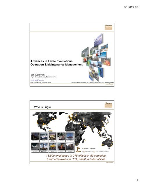
13,500 employees <strong>in</strong> 275 offices <strong>in</strong> 50 countries<br />
1,250 employees <strong>in</strong> USA, coast to coast offices<br />
www.fugro.com<br />
www.fugro.com<br />
01-May-12<br />
1
Date<br />
<strong>Operation</strong> & Ma<strong>in</strong>tenance Management<br />
This presentation will address:<br />
Modern data concern<strong>in</strong>g levees / <strong>in</strong>frastructure<br />
What sort of data (acquisition) is available<br />
How one can process the data for O&M …. and for what reason<br />
How one can retrieve processed data for O&M management<br />
How to keep O&M data/<strong>in</strong>formation up-to-date<br />
L<strong>in</strong>k with HEC-RAS<br />
Asset Management O&M<br />
REAL ® a modular concept<br />
Questions<br />
www.fugro.com<br />
Strength Module<br />
REAL ®<br />
<strong>Levee</strong> Vegetation<br />
Assessment<br />
REAL ®<br />
Quantitative<br />
Geotechnical<br />
Reliability<br />
REAL ®<br />
www.fugro.com<br />
01-May-12<br />
2
What are the flood protection levels <strong>in</strong> Holland?<br />
Chance P that the WSE related to the evaluated flood event will occur<br />
<strong>in</strong> a time span of n = 30 or n = 100 years<br />
100 %<br />
90 %<br />
P<br />
50 %<br />
30 %<br />
10 %<br />
0 %<br />
100 y<br />
30 y<br />
100 y<br />
30 y<br />
50 y flood 100 y flood<br />
200 y flood<br />
1 <br />
P 1<br />
1<br />
<br />
T <br />
100 y<br />
30 y<br />
500 y flood<br />
1000 y flood<br />
<strong>Levee</strong> evaluated for the “T flood” or “T flood protection level”<br />
n<br />
100 y<br />
30 y<br />
100 y<br />
30 y<br />
1.0 %<br />
0.3 %<br />
100 y<br />
30 y<br />
10,000 y flood<br />
www.fugro.com<br />
www.fugro.com<br />
01-May-12<br />
3
How we evolve(d)<br />
2D FEM<br />
3D FEM<br />
Where ‘most’ are<br />
Immersive visualization Solid State media<br />
Data access<br />
3D & GIS<br />
www.fugro.com<br />
www.fugro.com<br />
01-May-12<br />
4
Where we want to be<br />
3D FEM<br />
How to get<br />
3D FEM<br />
From here……<br />
solid-state drive<br />
Data access<br />
3D & GIS<br />
Data access<br />
3D & GIS<br />
…… to here<br />
Data access<br />
3D & GIS<br />
www.fugro.com<br />
www.fugro.com<br />
01-May-12<br />
5
REAL ® a Modular Concept<br />
Data Acquisition<br />
3D subsurface model<br />
age<strong>in</strong>g = more <strong>in</strong>fo → model improves<br />
Soil + <strong>Levee</strong> + Water<br />
GIS creates 2D <strong>in</strong>put files<br />
for standard Geotechnical<br />
Analyses<br />
Massive batch process<strong>in</strong>g<br />
of Standard Geotechnical<br />
Analyses<br />
Results presented <strong>in</strong> GIS<br />
& Risk Analyses *)<br />
*) Future development<br />
<strong>Levee</strong> <strong>Evaluations</strong> & High Degree of Automation Examples:<br />
Overtopp<strong>in</strong>g<br />
Incl. Rapid Draw Down<br />
Stability Waterside Slope<br />
Under Seepage<br />
Wave Overtopp<strong>in</strong>g<br />
Stability Landside Slope Erosion<br />
Through Seepage <strong>Levee</strong> Vegetation<br />
®<br />
www.fugro.com<br />
www.fugro.com<br />
01-May-12<br />
6
The REAL ® process All levee <strong>in</strong>foAutoCAD & ArcGISClient<br />
Example Sacramento River River Erosion Erosion Survey Survey<br />
www.fugro.com<br />
Click to Activate, right click for tools:<br />
this is an ord<strong>in</strong>ary PDF file ‘everyone can open & use Not an artist impression: this is data from a real project<br />
www.fugro.com<br />
01-May-12<br />
7
Example (Coastal) Erosion Survey<br />
Example (Coastal) Erosion Monitor<strong>in</strong>g 1 year timel<strong>in</strong>e<br />
Year 2010<br />
Year 2011<br />
Identify: locations erosion<br />
Identify: quantities / volumes (like: rip rap)<br />
Δ = (2011-2010): sedimentation = +<br />
erosion = -<br />
www.fugro.com<br />
www.fugro.com<br />
01-May-12<br />
8
Helicopter LiDAR Bathymetry<br />
Some possibilities process<strong>in</strong>g our data<br />
Not an artist impression: this is data from a real project<br />
www.fugro.com<br />
Not an artist impression: this is data from a real project<br />
www.fugro.com<br />
01-May-12<br />
9
Not an artist impression: this is data from a real project<br />
www.fugro.com<br />
Not an artist impression: this is data from a real project<br />
www.fugro.com<br />
01-May-12<br />
10
Section <strong>in</strong> Sacramento Valley<br />
3D Model ArcGIS <strong>Operation</strong>s & Ma<strong>in</strong>tenance<br />
Not artist impressions: this is data from a real project<br />
www.fugro.com<br />
www.fugro.com<br />
01-May-12<br />
11
Extract from 3D model: present to client / reviewers<br />
Discuss with client / reviewers; modify ….. If needed<br />
www.fugro.com<br />
www.fugro.com<br />
01-May-12<br />
12
Eng<strong>in</strong>eers’ estimate for analyses:<br />
Range Slope<br />
Instability Exit<br />
Range entry pip<strong>in</strong>g<br />
<strong>Levee</strong><br />
Crest<br />
Range Slope<br />
Instability Exit<br />
Eng<strong>in</strong>eers’ estimate for analyses:<br />
Range Slope<br />
Instability Exit<br />
Range entry pip<strong>in</strong>g<br />
<strong>Levee</strong><br />
Crest<br />
Range Slope<br />
Instability Exit<br />
<strong>Levee</strong><br />
Landside Toe<br />
www.fugro.com<br />
www.fugro.com<br />
01-May-12<br />
13
Agree with client / slice the model<br />
Batch process<strong>in</strong>g standard Geotech software<br />
1<br />
4<br />
3<br />
2<br />
1<br />
2<br />
3<br />
4<br />
Safety<br />
…. for 2D analyses if desired<br />
…or don’t slice and do (local) 3D FEM analyses<br />
AUTOMATED<br />
Standard Geotechnical Analyses<br />
Multi Water Surface Elevations<br />
Spac<strong>in</strong>g?<br />
100 ft …..10 ft ……… 10 <strong>in</strong>ch ………. 1 <strong>in</strong>ch<br />
®<br />
www.fugro.com<br />
www.fugro.com<br />
01-May-12<br />
14
Analysis Results <strong>in</strong>fo ArcGIS<br />
Somewhere <strong>in</strong> Sacramento Valley I & III<br />
Analyses every 20 ft – Cross Sections<br />
•Slope Stability Water side; 4 methods<br />
•Slope Stability Land side; 4 methods<br />
•Seepage or flux through levee<br />
•Vertical Exit Gradient ie as function land <strong>in</strong>wards distance out of levee toe<br />
Vertical exit gradient i e<br />
Light gray ie = 0<br />
Darker gray 0 < ie ≤ 0.2<br />
Yellow 0.2 < ie ≤ 0.4<br />
Orange 0.4 < ie ≤ 0.6<br />
Red 0.6 < ie ≤ 0.8<br />
Brick red ie > 0.8<br />
Somewhere Sacramanto Valley II<br />
Analyses every 15 ft – Cross Sections<br />
Multi Load<strong>in</strong>gs<br />
(WSEs, Flood Fight Equipment,….)<br />
Analyses every 10 or 1 ft <strong>in</strong> stead of per mile<br />
Store <strong>in</strong> Management Information System<br />
This is<br />
California Department of Water Resources<br />
Geotechnical <strong>Levee</strong> <strong>Evaluations</strong><br />
NEMDC-West I (2009)<br />
Variability Calc methods<br />
Analyses every 15 ft – Plan view<br />
•Land Side Slope Stability; 4 methods Plan view<br />
www.fugro.com<br />
www.fugro.com<br />
01-May-12<br />
15
NEMDC-West<br />
NEMDC-West<br />
Does not meet Pip<strong>in</strong>g Requirement - -<br />
Does not meet Pip<strong>in</strong>g Requirement -<br />
Meets Pip<strong>in</strong>g Requirement +/-<br />
Meets Pip<strong>in</strong>g Requirement + +<br />
NEMDC-West NEMDC-East<br />
NEMDC-West NEMDC-East<br />
Robla Creek<br />
®<br />
REAL method<br />
www.fugro.com<br />
10 year event<br />
Does not meet Slope Stability Requirement- -<br />
Does not Slope Stability Requirement -/+<br />
Meets Slope Stability Requirement +/-<br />
Meets Slope Stability Requirement + +<br />
Robla Creek<br />
®<br />
REAL method<br />
www.fugro.com<br />
01-May-12<br />
16
NEMDC-West<br />
Does not meet Pip<strong>in</strong>g Requirement - -<br />
Does not meet Pip<strong>in</strong>g Requirement -<br />
Meets Pip<strong>in</strong>g Requirement +/-<br />
Meets Pip<strong>in</strong>g Requirement + +<br />
NEMDC-West<br />
Does not meet Pip<strong>in</strong>g Requirement - -<br />
Does not meet Pip<strong>in</strong>g Requirement -<br />
Meets Pip<strong>in</strong>g Requirement +/-<br />
Meets Pip<strong>in</strong>g Requirement + +<br />
NEMDC-West NEMDC-East<br />
NEMDC-West NEMDC-East<br />
100 year event<br />
Does not meet Slope Stability Requirement- -<br />
Does not Slope Stability Requirement -/+<br />
Meets Slope Stability Requirement +/-<br />
Meets Slope Stability Requirement + +<br />
Robla Creek<br />
®<br />
REAL method<br />
www.fugro.com<br />
200 year event<br />
Does not meet Slope Stability Requirement- -<br />
Does not Slope Stability Requirement -/+<br />
Meets Slope Stability Requirement +/-<br />
Meets Slope Stability Requirement + +<br />
Robla Creek<br />
®<br />
REAL method<br />
www.fugro.com<br />
01-May-12<br />
17
Conceptual l<strong>in</strong>kage of HEC-RAS and REAL ®<br />
<strong>Levee</strong> Load<strong>in</strong>gs<br />
Analysis storms and return periods<br />
<strong>in</strong>volved <strong>in</strong> the<br />
development<br />
of HEC-RAS<br />
www.fugro.com<br />
Analysis<br />
Water Surface Elevations<br />
Return Periods for Various Locations<br />
www.fugro.com<br />
01-May-12<br />
18
<strong>Levee</strong> Load<strong>in</strong>gs – prior to f<strong>in</strong>al H&H<br />
Historical <strong>in</strong>formation:<br />
20y event: WSE ≈ Datum +20.0 [ft]<br />
50y event: WSE ≈ Datum +15.5 [ft]<br />
Physical Top of <strong>Levee</strong> ≈ Datum +27.0 [ft]<br />
Estimate 100y event ≈ Datum +21.0 [ft]<br />
<strong>Levee</strong> Load<strong>in</strong>gs after f<strong>in</strong>al H&H<br />
100y event estimate:<br />
WSE ≈ Datum +21 [ft]<br />
River<br />
<strong>Levee</strong><br />
Initially 21 ft ≈ 100y event<br />
In the end 21 ft ≈ 380y event<br />
www.fugro.com<br />
So; 21 ft was a save first estimate<br />
380<br />
www.fugro.com<br />
01-May-12<br />
19
All levee <strong>in</strong>fo ArcGIS<br />
Slope Stability Plan View<br />
Emergency Mgt<br />
Flood Fighter<br />
Classic: Traffic Lights per Reach<br />
Reach Selection: very time consum<strong>in</strong>g process<br />
Reach B<br />
Rapid Drawdown<br />
Landside Slope Stability<br />
Seepage / Exit Gradient<br />
Reach A<br />
Remedial works: Landside & Waterside<br />
<strong>in</strong> whole Reach<br />
Model <strong>in</strong> 3D pdf<br />
Slope Stab <strong>in</strong>fo pdf<br />
Analysis section (only one, maybe 2)<br />
Remedial Works Waterside Slope<br />
Remedial Works Landside Slope<br />
Remedial Works Field<br />
www.fugro.com<br />
www.fugro.com<br />
01-May-12<br />
20
What does REAL ® give…<br />
1 st :there is no reach selection: time & $ saver<br />
Reach B<br />
Reach B<br />
Rapid Drawdown<br />
Landside Slope Stability<br />
Rapid Drawdown<br />
Landside Slope Stability<br />
Seepage / Exit Gradient<br />
Remedial<br />
works<br />
Landside<br />
Reach A<br />
Reach A<br />
Okay<br />
Remedial<br />
works<br />
Landside<br />
&<br />
Waterside<br />
Analysis section (very closed spaced)<br />
How does REAL ® compare with classic results?<br />
1st :there is no reach selection: time & $ saver<br />
2nd :target remedial works far more accurate: time & $ saver<br />
www.fugro.com<br />
Faster<br />
Cost effective re-evaluations<br />
Systematically Consistent<br />
Investments become more cost effective<br />
Migration towards State of the Art<br />
www.fugro.com<br />
01-May-12<br />
21
<strong>Levee</strong> Vegetation Survey<br />
Can be done highly automated:<br />
Individual tree locations identified (x,y,z) <strong>in</strong>clud<strong>in</strong>g crown/canopy size<br />
computations<br />
Species ID<br />
Dist<strong>in</strong>guish healthy from dead or dy<strong>in</strong>g<br />
Size and distribution of gaps <strong>in</strong> the vegetation<br />
Prevail<strong>in</strong>g wisdom;<br />
“…..nowadays LiDAR provides more accurate tree heights than field<br />
measurements…..”<br />
Boat & Vehicle Borne Mapp<strong>in</strong>g<br />
Examples……<br />
Dynamic LiDAR<br />
(simultaneously with bathymetric survey)<br />
www.fugro.com<br />
www.fugro.com<br />
01-May-12<br />
22
Aerial Vegetation Mapp<strong>in</strong>g & Additional Analyses<br />
Aerial mapp<strong>in</strong>g<br />
(FLI-MAP & Color Infra Red)<br />
Tree location & height<br />
red •= dead / dy<strong>in</strong>g<br />
yellow • = healthy<br />
(data process<strong>in</strong>g tech available)<br />
Tree canopy Ø & species<br />
(data process<strong>in</strong>g tech available)<br />
<strong>Levee</strong> Vegetation & Additional Analyses / <strong>Evaluations</strong><br />
www.fugro.com<br />
www.fugro.com<br />
01-May-12<br />
23
L<strong>in</strong>ear & Non-L<strong>in</strong>ear Infrastructure / Asset Management<br />
Only the <strong>in</strong>fra is an Artists Impression,<br />
soil is real data<br />
Is REAL ® limited to levees only?<br />
Only the <strong>in</strong>fra is an Artists Impression,<br />
soil is real data<br />
www.fugro.com<br />
www.fugro.com<br />
01-May-12<br />
24
Port of New York already on same page 3D model<strong>in</strong>g<br />
Pictures above and quote below:<br />
Cavaliere et al, Geo-Strata, July-August, 2011, pp44-47.<br />
Quote<br />
As an agency, the Port Authority of New York and New Jersey (PA) is mov<strong>in</strong>g towards creat<strong>in</strong>g Build<strong>in</strong>g Information management (BIM) models for new facilities, as well as<br />
exist<strong>in</strong>g facilities undergo<strong>in</strong>g major modification. The creation of 3-D CAD strata models allows the geotechnical eng<strong>in</strong>eer to contribute to that effort. The strata models can be<br />
comb<strong>in</strong>ed with the BIM models be<strong>in</strong>g created by other professional discipl<strong>in</strong>es. By comb<strong>in</strong><strong>in</strong>g all these models, the PA can not only perform <strong>in</strong>terference checks, but also<br />
assess the impact of subsurface conditions on underground utilities and foundation locations.<br />
…<br />
Although <strong>in</strong>itiat<strong>in</strong>g the geotechnical database required considerable effort, once established, its population and ma<strong>in</strong>tenance has become a relatively simple and rout<strong>in</strong>e<br />
operation. With the automation of the field logs, what was once a tedious manual operation has become a much simpler QA/QC check. The geotechnical database has been a<br />
great <strong>in</strong>vestment for the Port Authority. It is generic and can be used with most design models. As the design profession transitions towards BIM, the PA fully expects to be able<br />
to provide subsurface <strong>in</strong>formation to make these models complete.<br />
Unquote<br />
Sp<strong>in</strong>-off: Probabilistic Module(s)<br />
Probabilistic? Why?<br />
USA will migrate to Risk Based Flood Insurance Rates<br />
Quantitative Risk or Reliability Assessments are needed (QRA)<br />
Systematic consistency is needed<br />
<strong>in</strong> order to compare different Flood Pla<strong>in</strong>s throughout the State/Nation<br />
The highly automated REAL ® workflow already allows us to process QRAs for all<br />
discussed failure modes through<br />
Monte Carlo simulations<br />
Taylor Series (First Order Second Moment + Reliability Index β method)<br />
analyses<br />
and of course Expert Op<strong>in</strong>ion Elicitation can always be <strong>in</strong>cluded, if desired<br />
…….<br />
www.fugro.com<br />
www.fugro.com<br />
01-May-12<br />
25
Summary<br />
The REAL ® method:<br />
• <strong>in</strong>corporates<br />
• geotechnical,<br />
• geospatial<br />
• geological and<br />
• vegetation<br />
characteristics <strong>in</strong> its assessments<br />
• allows for systematic, consistent, repeatable and objective evaluations at<br />
very closely spaced cross-section <strong>in</strong>tervals and various load<strong>in</strong>g conditions<br />
• allows to target and prioritize O&M (and remedial) works<br />
far more accurate than ‘per reach’ methods<br />
100 times faster than conventional work flows<br />
• provides decision makers supplemental objective <strong>in</strong>formation support<strong>in</strong>g<br />
• the distribution of limited means<br />
• transparent communication both <strong>in</strong>ternal as with the public<br />
• Allows to <strong>in</strong>troduce Geotechnical Failure Mechanisms <strong>in</strong> Probabilistic<br />
Analyses<br />
• Is compatible with LIMS and standard off-the-shelf software<br />
Thank You<br />
BWoldr<strong>in</strong>gh@Fugro.com<br />
Video: http://www.fugroconsultants.com/services/geotechnicalservices/sitecharacterization/real<br />
www.fugro.com<br />
www.fugro.com<br />
01-May-12<br />
26