Additional Documentation - Planning Applications
Additional Documentation - Planning Applications
Additional Documentation - Planning Applications
You also want an ePaper? Increase the reach of your titles
YUMPU automatically turns print PDFs into web optimized ePapers that Google loves.
New Manor Farm, Middle<br />
Winterslow, Wiltshire<br />
An archaeological desk based assessment<br />
for a proposed wind turbine development.<br />
MARK CORNEY BA (Hons) FSA and NIK MORRIS<br />
April 2011
NEW MANOR FARM, MIDDLE WINTERSLOW, WILTSHIRE: A DESK BASED<br />
ARCHAEOLOGICAL ASSESSMENT.<br />
Mark Corney and Nik Morris<br />
SUMMARY<br />
A desk based archaeological assessment of a proposed wind turbine site at New<br />
Manor Farm, Middle Winterslow, Wiltshire, NGR centre SU23193391. 28 records of<br />
Designated and Non-Designated Heritage Assets, including prehistoric funerary<br />
monuments, were identified within a 1 kilometre radius of the proposed site. It is<br />
concluded that there is a high probability of plough-levelled archaeology within the<br />
study area.<br />
1. INTRODUCTION<br />
1.1 This report sets out the results of a largely desk-based archaeology and cultural<br />
heritage assessment of a proposed wind turbine site at New Manor Farm, Middle<br />
Winterslow, Wiltshire centred on ST23193391 (Fig. 1). The study has been prepared<br />
for Aspire <strong>Planning</strong> Ltd.<br />
1.2 The study has been prepared in support of a proposed planning application to<br />
Salisbury District Council for the construction of a wind turbine and an associated<br />
cable trench. The study was undertaken by Mark Corney and Nik Morris during<br />
March and April 2011. The aim of the report is to provide an assessment of the<br />
known heritage assets that may contribute to the understanding of the historic<br />
environment of the proposed development site.<br />
1.3 The village of Middle Winterslow is located 3km to the north east of Salisbury.<br />
The study area covers a 1 kilometre radius centred on the proposed wind turbine<br />
development at NGR SU231339. The wind turbine and associated cable run are<br />
sited within a field of approximately 52ha. The field is under an arable regime and is<br />
bounded along the western and northern limits by a belt of mature trees; to the east<br />
by a hedge adjacent to a minor road leading from the A30 road to Middle Winterslow<br />
and to the south by a hedge. The field is overlooked from the south by a steep chalk<br />
escarpment (Figure 1). The field slopes gently from south east to north west and is
etween 90mOD and 115mOD. The underlying geology is chalk. The study area is<br />
rich in archaeological remains ranging from extensive prehistoric cemeteries and field<br />
systems, Romano-British activity, Anglo-Saxon burials and medieval settlement.<br />
Figure 1. Location of the proposed wind turbine and cable trench
2. METHODOLOGY<br />
2.1 The study consisted of a desk-based assessment, as defined by the Institute for<br />
Archaeologists Standards and Guidance, of the heritage assets that contribute to the<br />
historic environment of the application site and of a surrounding zone (radius 1km)<br />
intended to provide an immediate context.<br />
2.2 The scope of the study included designated heritage assets (world heritage sites,<br />
scheduled monuments, listed buildings, conservation areas, battlefield sites,<br />
registered parks and garden) and non-designated assets (archaeological sites and<br />
finds, historic buildings, other historic landscape features or other locally-designated<br />
features, or areas, of cultural heritage importance.<br />
2.3 The following data sources have been examined:<br />
• Historic maps and documents held at The Wiltshire Heritage Centre;<br />
• Archaeological, historic building or other heritage designation information held by<br />
the Wiltshire Historic Environment Record;<br />
• Archaeological, historic building and other heritage designation information,<br />
including air photographs, held by English Heritage in its National Monuments<br />
Record (NMR) at Swindon;<br />
• The on-line catalogue of air photographs held by The Unit For Landscape<br />
Modeling, University of Cambridge (examination of this resource was not possible<br />
due to closure of the Unit to the public);<br />
• Other published or unpublished information, and;<br />
• A site inspection carried out by Mark Corney and Nik Morris on 23 rd March 2011<br />
3. LEGISLATION AND GUIDANCE<br />
3.1 An assessment of the impact of wind energy installations on the historic<br />
environment is summarised in English Heritage 2005, ‘Wind Energy and the Historic<br />
Environment’. Relevant protection, guidance and policies relating to the protection,<br />
maintenance and enhancement of archaeological sites and other aspects of cultural<br />
heritage may be summarised as follows:
<strong>Planning</strong> Guidance for Archaeology and the Historic Environment<br />
3.2 General policy and guidance for the conservation of the historic environment<br />
under development control procedures are now contained in <strong>Planning</strong> Policy<br />
Statement 5: <strong>Planning</strong> for the Historic Environment (formerly <strong>Planning</strong> Policy<br />
Guidance notes 15 and 16), released in March 2010. Archaeological sites, buildings,<br />
parks and gardens, battlefields or other aspects of the historic environment that have<br />
significance because of their historic, archaeological, architectural or artistic interest<br />
are now considered heritage assets under a unified policy system. The relevant<br />
policies are listed below:<br />
Policy HE1: Heritage assets and climate change<br />
Policy HE2: Evidence base for plan-making<br />
Policy HE3: Regional and local planning approaches<br />
Policy HE4: Permitted development and Article 4 directions<br />
Policy HE5: Monitoring indicators<br />
Policy HE6: Information requirements for applications for consent affecting<br />
heritage assets<br />
Policy HE7: Policy principles guiding the determination of applications for consent<br />
relating to all heritage assets<br />
Policy HE8: <strong>Additional</strong> policy principle guiding the consideration of applications for<br />
consent relating to heritage assets that are not covered by Policy HE9<br />
Policy HE9: <strong>Additional</strong> policy principles guiding the consideration of applications<br />
for consent relating to designated heritage assets<br />
Policy HE10: <strong>Additional</strong> policy principles guiding the consideration of applications<br />
for development affecting the setting of a designated heritage asset<br />
Policy HE11: Enabling development<br />
Policy HE12: Policy principles guiding the recording of information relating to<br />
heritage assets<br />
Listed Buildings/Structures<br />
3.3 Buildings of national, regional, or local historical and architectural importance are<br />
protected by the <strong>Planning</strong> (Listed Buildings and Conservation Areas) Act, 1990.<br />
Buildings designated as ‘Listed’ are afforded protection from physical alteration or<br />
effects on their historical setting.
Local Authority Plan Policies<br />
3.4 Relevant saved policies for the management of archaeology and cultural heritage<br />
are set out in the Salisbury District Local Plan 2011.<br />
Policies CN20-CN23 seek to preserve features of archaeological interest and, in<br />
appropriate circumstances, are intended to exploit opportunities which may be<br />
presented for archaeological investigation or the safeguarding of important evidence<br />
which might otherwise be destroyed without record as a result of development. The<br />
Local <strong>Planning</strong> Authority is guided in its approach to archaeology by the provisions of<br />
<strong>Planning</strong> Policy Guidance Note 16: "Archaeology and <strong>Planning</strong>", and will seek the<br />
advice of the County Archaeologist. Prospective developers are encouraged to refer<br />
to this document and consult the County Archaeologist prior to the submission of any<br />
planning application. The County Archaeology Service is now able to provide<br />
information to prospective applicants on where there are areas of archaeological<br />
interest in the District. It should be noted that the allocations for employment,<br />
housing, infill or other developments do not obviate the need to follow procedures<br />
laid down in PPG16. Where the fabric or setting of known archaeological<br />
monuments, whether scheduled or not, would be adversely affected by permitted<br />
development, the Local <strong>Planning</strong> Authority may use its powers to control such works<br />
by an Article 4 Direction.<br />
When considering proposals which may affect archaeological sites, the Council will<br />
ensure that a procedure is followed which both protects the site and its setting and<br />
arrives at a reasonable and informed decision. The Local Plan area contains a wealth<br />
of archaeological features, many of which have not been investigated, or are as yet<br />
undiscovered. Where such remains are thought to exist either as a result of<br />
consultation with the County Archaeologist, or through research initiated by a<br />
prospective developer, there will be a requirement for site evaluation prior to the<br />
determining of any application. In many instances a site may accrue archaeological<br />
potential by its proximity to known archaeological monuments, its setting with the<br />
landscape, or by the recorded presence of archaeological artefacts from within the<br />
site. In such instances, where the site has a clear archaeological potential, but little<br />
recorded information, an evaluation, including where necessary excavation work,<br />
would need to be undertaken to establish the presence and extent of archaeological<br />
deposits and explore the site’s potential. This is usually a rapid and inexpensive<br />
operation involving ground survey and small-scale trial trenching, but it should be
carried out by a professionally qualified archaeological organisation or archaeologist.<br />
Evaluations are designed to help define the character and extent of any<br />
archaeological remains that exist in the area, and thus indicate the weight which<br />
ought to be attached to their preservation. In appropriate circumstances the<br />
evaluation can comprise a desk top study. Where the results of such a study show<br />
that there is no potential for finding any archaeological remains, no fieldwork will be<br />
necessary. There will be a presumption in favour of the physical preservation in situ<br />
of nationally important archaeological remains, whether scheduled or not. However,<br />
where the preservation of remains in situ is not justified, developers should be willing<br />
to enter into a voluntary agreement to undertake the satisfactory excavation and<br />
recording of remains including the publication of the results. In the event of<br />
developers not wishing to enter into such an agreement, planning permission, if<br />
granted, will be subject to a condition that the development should not proceed in the<br />
area of archaeological interest until required archaeological works have been<br />
implemented, as PPG16 recommends. Conditions may also be placed on<br />
developments to allow observation and recording during the early stages of<br />
development.<br />
Policy CN20<br />
Many historic and archaeological features do not have any form of statutory<br />
protection and are under threat from the various pressures of development,<br />
agriculture, forestry and tourism. For this reason, a number of Areas of Special<br />
Archaeological Significance have been defined in the Proposals Map. These areas of<br />
high archaeological interest are largely rural and some cover extensive tracts of<br />
countryside, and contain, for example, whole barrow groups, settlements and sub-<br />
surface features. Due to the richness of the District’s historic environment, the<br />
designation covers the majority of the plan area. The purpose of the Areas of Special<br />
Archaeological Significance is to preserve for posterity these areas of high<br />
archaeological interest and their definition is the means whereby a selective<br />
approach to preservation will be achieved, using existing legislation and the voluntary<br />
co-operation of landowners and farmers. The value of these areas lies in the<br />
preservation of a segment of ancient landscape of settlement form and the resultant<br />
cluster of associated features. Development proposals, including forestry schemes,<br />
which would adversely affect these ancient landscapes will generally not be allowed.
Policies CN21 & CN22<br />
The emphasis is placed on negotiations being held at an early stage so that<br />
integrated programmes of work can be agreed. This is particularly important in the<br />
historic settlements identified in CN23 as these areas have a wealth of known<br />
archaeological interest and a high potential for the discovery of further archaeological<br />
remains. Therefore, where development proposals come forward in these<br />
settlements, the Local <strong>Planning</strong> Authority will expect the archaeological implications<br />
of the development to be established prior to the determination of the application,<br />
and the opportunity for appropriate archaeological site investigations to be provided.<br />
Policy CN23<br />
Developers should make provision for investigating and protecting new sites as yet<br />
undiscovered. The County Archaeologist will continue to be informed of planning<br />
applications submitted within the District. The Local <strong>Planning</strong> Authority is aware of<br />
the potential for new sites to be discovered, and it is hoped that the policies of the<br />
Local Plan will minimise the late discovery of important archaeological remains once<br />
development is in progress.<br />
4. HISTORICAL DEVELOPMENT OF THE SITE<br />
4.1 Recorded in Domesday as Winterslei, Winterslow originally comprised three<br />
manors of which Middle Winterlsow was the smallest. The Domesday entry suggests<br />
that Middle Winterslow included 450-550 acres of ploughland, with a population of<br />
approximately 15-25 people and was held by Ulward, one of the King's thanes. There<br />
was also woodland 3 furlongs long and 1 furlong wide. The value of the holdings was<br />
20 shillings and four peasants ("rustici") also held land. In 1377 there were twelve<br />
poll-tax payers. In 1727 the Manor of Middle Winterslow was given to St John’s<br />
College, Oxford.<br />
4.2 Mapping evidence<br />
The earliest map consulted is the Andrews and Drury Map of Wiltshire dated 1773.<br />
This depicts the general layout of the road system and the location of New Manor<br />
Farm but not the individual field boundaries (Figure 2). The Tithe Map of 1841<br />
(Figure 3) indicates that the field of the proposed wind turbine location had been<br />
established by that date, was divided into three parcels and tenanted by Robert<br />
Haydon. The Apportionment suggests that it was under cultivation and gives the
three parcel names: the eastern parcel “Below the Hill” the second is also “Below the<br />
Hill” and the most westerly parcel as “Great Field”. An estate map of 1873 (based on<br />
an earlier map of 1824 and presumed lost) records the land as still belonging to St<br />
John’s College, Oxford and shows the field boundaries and surrounding buildings,<br />
including New Manor Farm and Lower Barn much as they appear today (Figure 4).<br />
The 1 st edition OS 25” to the mile plan of 1876 (Figure 5) shows the layout still visible<br />
today.<br />
Figure 2. Extract from Andrews and Dury Map of Wiltshire 1773<br />
Figure 3. Extract from Tithe Map of Winterslow 1841
Figure 4. Extract from Winterslow Estate belonging to St Johns College Oxford 1873<br />
Figure 5. Extract from Ordnance Survey 1:25” to the mile plan 1876
The mapping evidence demonstrates the proposed wind turbine location is within an<br />
area which has been under cultivation for at least 200 years and the surrounding<br />
boundaries and landscape has changed little since the early nineteenth century. An<br />
archaeological watching brief at Lower Barn Farm (Figure 6, site 20), on the eastern<br />
edge of application field, proved negative with no archaeological features or deposits<br />
noted (Phillips 2005).<br />
5. AIR PHOTOGRAPHS<br />
5.1 A total of 103 oblique air photographs and 43 vertical air photographs were<br />
examined at the National Monuments Record in Swindon; a further 5 oblique and 3<br />
vertical images held by The Unit for Landscape Modelling at Cambridge University<br />
were noted but not examined due the closure of the Unit to the public (full listing of<br />
images consulted are presented in Appendix 2).<br />
5.2 Numerous features of archaeological significance were noted on the air<br />
photographic cover examined and are plotted on Figure 6. Within the field subject to<br />
this application there is a short length of ditch of unknown date (Figure 6, site 16) and<br />
a plough-levelled feature possibly representing a former holloway (Figure 6, site 17).<br />
An extensive ploughed-out field system of prehistoric date covers an area in excess<br />
of 700ha to the north west of the application site (Figure 6, sites 4, 5); this is cut by a<br />
series of holloways of probable Medieval or later date (Figure 6, site 6). Between the<br />
field system and the application site, to the west of Pickpocket Firs, are a series of<br />
ring-ditches that coincide with the recorded positions of a plough-levelled barrow<br />
cemetery of Bronze Age date (Figure 6, site 2). To the south east of the application<br />
area are cropmarks of a linear ditch system integrated with a small, ditched, sub-<br />
rectangular enclosure of probable prehistoric date (Figure 6, site 22).<br />
6. HERITAGE ASSETS Figure 6, Table 1<br />
Designated assets<br />
6.1 There are no designated heritage assets within the application site boundary and<br />
one designated heritage asset within the study area. This comprises a number of<br />
Bronze Age barrows forming of the Winterslow Hut barrow cemetery located<br />
approximately 500m north of the application site boundary (Figure 6, site 1, Table 1).
TABLE 1. Designated Heritage Assets<br />
Number<br />
(Fig. 6)<br />
NGR (SU) Description Reference<br />
1 22883497 Winterslow Hut Bronze Age barrow cemetery. NMR text SAM26790.<br />
reads: Barrows forming part of a cemetery situated to the NMR Monument No. 223513<br />
northwest of the Pheasant Hotel. Nine of the barrows are HER SU23SW604,<br />
included within this scheduling. Two survive as substantial SU23SW605, SU23SW606,<br />
earthworks - the most northerly example is a bowl barrow SU23SW607, SU23SW608,<br />
23 metres in diameter with a maximum height of 0.8 SU23SW609, SU23SW676,<br />
metres. Traces of the barrow ditch also survive. The most SU23SW677, SU23SW678,<br />
southerly earthwork has a diameter of 15 metres and<br />
maximum height of 1.2 metres. Traces of a barrow ditch<br />
SU23SW679.<br />
also survive. Three other barrows survive as slight<br />
earthworks ranging from 20 metres to 30 metres in<br />
diameter. The sites of three more barrows are visible on<br />
aerial photographs. Wilts HER assigns individual records<br />
for each barrow (see right) and records 10 barrows in the<br />
group.<br />
Palmer 1984<br />
Non-designated assets<br />
6.2 A search of the Wiltshire Historic Environment Record (HER) returned a total of<br />
32 entries for the study area, two of which are within the application site field<br />
boundary (Figure 6, Table 2, sites 17 and 18). The English Heritage Pastscape<br />
record returned 33 results within the study area. The combined HER and Pastscape<br />
records and a concordance are presented in Table 2 (individual barrow entries for the<br />
large Bronze Age cemeteries have been amalgamated for ease of presentation). The<br />
overall date range of sites and findspots includes an extensive prehistoric landscape<br />
including field systems, barrow cemeteries and settlement sites; a Roman road from<br />
Winchester (Venta Belgarum) to Old Sarum (Sorviodunum) and stray Romano-British<br />
finds; possible Anglo-Saxon burials, finds of medieval date and post-medieval<br />
buildings.
Number<br />
(Fig. 6)<br />
TABLE 2. Non-designated Heritage Assets<br />
NGR (SU) Description Reference:<br />
(NMR = English Heritage<br />
‘Pastscape’. HER = Wiltshire<br />
2 22913428<br />
(centre)<br />
3 22223404-<br />
22403497<br />
4 22703461<br />
(centre)<br />
Plough levelled Bronze Age barrow cemetery comprising at<br />
least seven barrows known from antiquarian observations<br />
and air photography. Probably a southern extension of the<br />
Winterslow Hut cemetery (Record 1).<br />
Plough levelled linear feature. A ditch with traces of a bank<br />
on the east side. Possibly a later prehistoric land division.<br />
Plough levelled co-axial field system. Probably links to<br />
record no. 5.<br />
5 22333386 Plough levelled co-axial field system. Probably links to<br />
record no. 4.<br />
6 22363338-<br />
22003445<br />
Multiple holloways or tracks. Still extant as earthworks prior<br />
to World War II; now plough levelled. Probably post-<br />
Medieval track system.<br />
Historic Environment Record.)<br />
NMR223518 (only lists four<br />
barrows)<br />
HER SU23SW610,<br />
SU23SW611, SU23SW612,<br />
SU23SW613, SU23SW636,<br />
SU23SW637, SU23SW638.<br />
Palmer 1984.<br />
HER SU23SW655<br />
NMR223516<br />
HER SU23SW628<br />
Palmer 1984.<br />
NMR223512<br />
HER SU23SW654<br />
Palmer 1984<br />
HER SU23SW641,<br />
SU23SW691, SU23SW692,<br />
SU23SW693, SU23SW694.<br />
The latter 4 records are<br />
observations of multiple tracks<br />
recorded in a gas pipeline.<br />
7 22353330 Findspot. Romano-British fibula and decorated tweezers. HER SU23SW324<br />
8 225332 Findspot. Medieval casket key. HER SU23SW458<br />
9 22643364 New Manor Farmhouse. Early 19 th century. Listed Building Grade II 1987.<br />
Delisted March 1991.<br />
10 23073318 Roman road from Winchester (Venta Belgarum) to Old<br />
NMR527930<br />
HER SU23SW319<br />
(centre) Sarum (Sorviodunum).<br />
11 227331 Part of a plough levelled co-axial field system. On a<br />
common alignment with records 4 and 5.<br />
HER SU23SW631<br />
12 23133480 18 th century barn adjacent to the former Pheasant Inn. NMR527937<br />
13 23153480 Former Pheasant Inn or Winterslow Hut; early 18 th century<br />
house with later alterations.<br />
NMR527936<br />
14 234348 Findspot. Anglo-Saxon skeleton associated with a bronze NMR223544<br />
brooch and sword scabbard found in 1870.<br />
HER SU23SW401<br />
15 23203465 Findspot. Romano-British brooch. HER SU23SW323<br />
16 22983404- Length of undated ditch noted on NMR AP SU2234/7/129. Not recorded on HER or NMR<br />
23083408 On similar alignment to co-axial field system records 4 and<br />
5.<br />
17 23153390 Plough levelled linear feature visible on air photographs;<br />
possibly a trackway.<br />
HER SU23SW668<br />
18 23333347 Undated ditch observed in gas pipeline. HER SU23SW695<br />
19 238346 Undated plough levelled field system. Possibly of recent HER SU23SW665<br />
(centre) date.<br />
20 23503426 Lower Barn Farm. Barn dated to later 18 th century. An NMR527935<br />
archaeological watching brief in 2005 proved negative<br />
(Phillips 2005).<br />
(Phillips 2005)<br />
21 23533422 Lower Barn Farmhouse. Farm built circa 1800. NMR527934<br />
22 238337 Field system noted by Wilts HER. Examination of NMR AP’s HER SU23SW633<br />
has recorded a sub-rectangular enclosure attached to a<br />
linear ditch system in addition to traces of field system. The<br />
enclosure may be of later prehistoric date. NMR AP<br />
SU2333/4/475.<br />
Palmer 1984.<br />
23 23483329 Bronze Age barrow; ‘Cobhill Barrow’. NMR223519<br />
HER SU23SW618<br />
24 Unlocated<br />
SU23SW<br />
Findspot. Anglo-Saxon spearhead. NMR223542<br />
25 Unlocated<br />
SU23SW<br />
Findspot. Bronze Age socketed axehead. NMR970005<br />
26 Unlocated<br />
SU23SW<br />
Findspot. Bronze Age daggers and a razor. NMR970006<br />
27 Unlocated<br />
SU23SW<br />
Findspot. Hoard of Medieval coins of reign of King Stephen. NMR970008<br />
28 Unlocated<br />
SU23SW<br />
Findspot. Hoard of silver pennies dated 1553-1625. NMR970008 (bis)
7. SITE CONDITIONS<br />
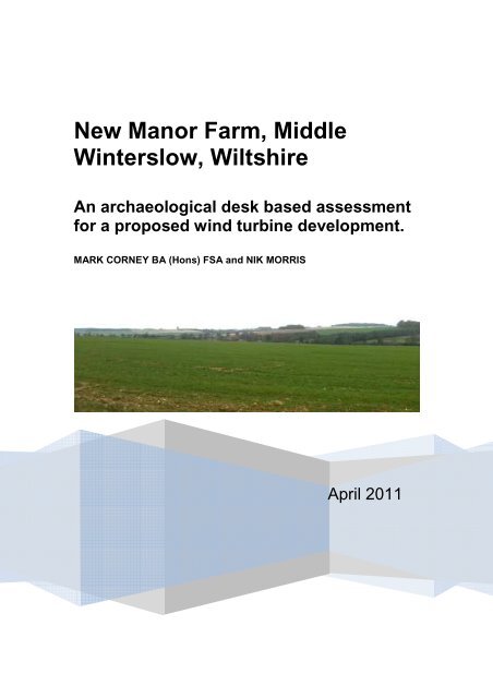
7.1 The site was inspected on 23 rd March 2011 and was under cultivation (Plate 1).<br />
The site is has been subject to prolonged cultivation and no surface features,<br />
earthworks or artefacts were noted.<br />
8. COMMENTS<br />
8.1 The application area contains no Scheduled Ancient Monuments, Listed<br />
Buildings or other statutorily protected heritage assets. Features of archaeological<br />
origin are present on air photographs within the application site; an undated length of<br />
ditch (site 16) is on a similar alignment to a prehistoric field system (sites 4 and 5)<br />
and a possible plough levelled trackway, probably of post-medieval date, is known<br />
(site 17). A short length of ditch, undated, was observed in a gas pipeline towards the<br />
southern end of the application area (site 18). The general paucity of features on the<br />
available air photographic cover may be the result of prolonged cultivation,<br />
suggested by the historic mapping, and the possibility of an accumulation of deeper<br />
colluvial deposits derived from the steep scarp to the south.<br />
8.2 There is a high potential for archaeological deposits within the study area. The<br />
presence of a ploughed-out Bronze Age barrow cemetery immediately to the north<br />
west of the application site and a ploughed-out field system, some 500m to the west,<br />
all point to the area being of considerable significance during the prehistoric period. It<br />
is concluded that further, possibly plough levelled, archaeology may reasonably be<br />
expected within the application area.<br />
Bibliography<br />
English Heritage, 2005 Wind Energy and the Historic Environment.<br />
Phillips B. 2005 Archaeological observation at Lower Barn, New Manor Farm<br />
2005 Report 2005.004 (unpublished)<br />
Palmer R. 1984 Danebury: an Iron Age Hillfort in Hampshire. An aerial<br />
photographic interpretation of its environs RCHME HMSO
Figure 6. All designated and non-designated heritage assets within the study area (see Table 1 and Table 2 for descriptions)
Appendix 1. Historic maps consulted.<br />
Andrews and Drury 1773 and 1810<br />
http://history.wiltshire.gov.uk/community/getcom.php?id=253 accessed 04/04/11<br />
Stockbridge Turnpike Road 1826<br />
451/73/27<br />
Tithe map of Winterslow (and apportionment) 1841<br />
TA/Winterslow<br />
Winterslow Estate belonging to St Johns College Oxford 1873<br />
1626/10<br />
Ordnance Survey 1 st edition 25”to the mile 1876
Appendix 2. Air photographs consulted.<br />
NMR Vertical photographs<br />
Sortie number Library<br />
number<br />
Frame<br />
number<br />
Centre point Date Film details (in inches) Film held<br />
by<br />
RAF/106G/UK/1656 443 3135 SU 238 336 11 JUL 1946 Black and White 8.25 x 7.5 MOD<br />
RAF/106G/UK/1656 443 3136 SU 233 337 11 JUL 1946 Black and White 8.25 x 7.5 MOD<br />
RAF/106G/UK/1656 443 3137 SU 228 338 11 JUL 1946 Black and White 8.25 x 7.5 MOD<br />
RAF/CPE/UK/1811 517 2276 SU 227 338 29 OCT 1946 Black and White 8.25 x 7.5 NMR<br />
RAF/CPE/UK/1811 517 2277 SU 235 338 29 OCT 1946 Black and White 8.25 x 7.5 NMR<br />
RAF/CPE/UK/1811 517 2278 SU 242 338 29 OCT 1946 Black and White 8.25 x 7.5 NMR<br />
RAF/CPE/UK/1811 517 4218 SU 237 326 29 OCT 1946 Black and White 8.25 x 7.5 NMR<br />
RAF/CPE/UK/1811 517 4219 SU 230 327 29 OCT 1946 Black and White 8.25 x 7.5 NMR<br />
RAF/CPE/UK/1811 517 4220 SU 223 327 29 OCT 1946 Black and White 8.25 x 7.5 NMR<br />
RAF/CPE/UK/1927 544 2100 SU 236 338 16 JAN 1947 Black and White 8.25 x 7.5 MOD<br />
RAF/CPE/UK/1927 544 2101 SU 226 337 16 JAN 1947 Black and White 8.25 x 7.5 MOD<br />
RAF/CPE/UK/1927 544 4007 SU 228 346 16 JAN 1947 Black and White 8.25 x 7.5 MOD<br />
RAF/CPE/UK/1927 544 4008 SU 237 344 16 JAN 1947 Black and White 8.25 x 7.5 MOD<br />
RAF/CPE/UK/1973 586 3403 SU 221 344 11 APR 1947 Black and White 8.25 x 7.5 NMR<br />
RAF/CPE/UK/1973 586 3404 SU 226 344 11 APR 1947 Black and White 8.25 x 7.5 NMR<br />
RAF/CPE/UK/1973 586 3405 SU 232 344 11 APR 1947 Black and White 8.25 x 7.5 NMR<br />
RAF/CPE/UK/1973 586 3406 SU 238 344 11 APR 1947 Black and White 8.25 x 7.5 NMR<br />
RAF/CPE/UK/2102 670 4060 SU 234 336 28 MAY 1947 Black and White 8.25 x 7.5 NMR<br />
RAF/CPE/UK/2102 670 4061 SU 229 340 28 MAY 1947 Black and White 8.25 x 7.5 NMR<br />
MAL/72073 6105 14 SU 230 352 10 AUG 1972 Black and White 9 x 9 NMR<br />
MAL/72073 6105 15 SU 226 349 10 AUG 1972 Black and White 9 x 9 NMR<br />
MAL/72073 6105 16 SU 222 346 10 AUG 1972 Black and White 9 x 9 NMR<br />
MAL/72073 6105 17 SU 218 344 10 AUG 1972 Black and White 9 x 9 NMR<br />
MAL/72073 6105 24 SU 220 335 10 AUG 1972 Black and White 9 x 9 NMR<br />
MAL/72073 6105 25 SU 224 338 10 AUG 1972 Black and White 9 x 9 NMR<br />
MAL/72073 6105 26 SU 228 341 10 AUG 1972 Black and White 9 x 9 NMR<br />
MAL/72073 6105 27 SU 232 344 10 AUG 1972 Black and White 9 x 9 NMR<br />
MAL/72073 6105 28 SU 236 346 10 AUG 1972 Black and White 9 x 9 NMR<br />
OS/69015 11122 182 SU 239 348 07 MAR 1969 Black and White 9 x 9 NMR<br />
OS/69015 11122 183 SU 240 342 07 MAR 1969 Black and White 9 x 9 NMR<br />
OS/69015 11122 184 SU 239 335 07 MAR 1969 Black and White 9 x 9 NMR<br />
OS/70069 11152 15 SU 238 335 03 MAY 1970 Black and White 9 x 9 NMR<br />
OS/70069 11152 16 SU 238 341 03 MAY 1970 Black and White 9 x 9 NMR<br />
OS/70069 11152 17 SU 238 347 03 MAY 1970 Black and White 9 x 9 NMR<br />
OS/70069 11152 38 SU 228 347 03 MAY 1970 Black and White 9 x 9 NMR<br />
OS/70069 11152 39 SU 228 341 03 MAY 1970 Black and White 9 x 9 NMR<br />
OS/70069 11152 40 SU 228 334 03 MAY 1970 Black and White 9 x 9 NMR<br />
OS/95627 14942 74 SU 238 331 20 JUL 1995 Black and White 9 x 9 NMR<br />
OS/95627 14942 75 SU 231 331 20 JUL 1995 Black and White 9 x 9 NMR<br />
OS/95627 14942 76 SU 224 331 20 JUL 1995 Black and White 9 x 9 NMR<br />
OS/95627 14942 113 SU 223 344 20 JUL 1995 Black and White 9 x 9 NMR<br />
OS/95627 14942 114 SU 230 344 20 JUL 1995 Black and White 9 x 9 NMR<br />
OS/95627 14942 115 SU 237 344 20 JUL 1995 Black and White 9 x 9 NMR<br />
Total sorties 9<br />
Total images 43
NMR Oblique photographs<br />
Photo Film and<br />
reference frame<br />
(NGR and number<br />
Index<br />
number)<br />
Date Film type Map Reference (6<br />
figure grid ref)<br />
SU2234/ 14 NMR18205 / 14 19 DEC 1998 Colour slide 35 mm SU 224346<br />
SU2234/ 15 NMR18205 / 15 19 DEC 1998 Colour slide 35 mm SU 224346<br />
SU2234/ 16 NMR26534 / 34 30 JAN 2010 Digital colour 35 mm SU 226347<br />
SU2234/ 17 NMR26534 / 35 30 JAN 2010 Digital colour 35 mm SU 228348<br />
SU2234/ 18 NMR26534 / 38 30 JAN 2010 Digital colour 35 mm SU 228349<br />
SU2234/ 19 NMR26534 / 39 30 JAN 2010 Digital colour 35 mm SU 228349<br />
SU2234/ 20 NMR26534 / 41 30 JAN 2010 Digital colour 35 mm SU 225347<br />
SU2234/ 21 NMR26534 / 42 30 JAN 2010 Digital colour 35 mm SU 224348<br />
SU2234/ 22 NMR26534 / 43 30 JAN 2010 Digital colour 35 mm SU 224347<br />
SU2234/ 23 NMR26534 / 44 30 JAN 2010 Digital colour 35 mm SU 224348<br />
SU 2235 / 2 CCC11752 / 1191 Unknown Black& white Unknown SU 226351<br />
SU 2235 / 4 NMR 8224 / 08 19 DEC 1998 Black& white 70mm,120,220 SU 229353<br />
SU 2235 / 7 NMR 8738 / 11 16 JAN 2000 Black& white 70mm,120,220 SU 229353<br />
SU 2235 / 8 NMR 8548 / 16 16 JAN 2000 Colour neg 35 mm SU 228353<br />
SU 2235 /<br />
17<br />
NMR26534 / 45 30 JAN 2010 Digital colour 35 mm SU 226350<br />
SU2235/ 18 NMR 6534 / 46 30 JAN 2010 Digital colour 35 mm SU 225350<br />
SU2235/ 19 NMR 6535 / 01 30 JAN 2010 Digital colour 35 mm SU 228353<br />
SU2235/ 21 NMR 6535 / 03 30 JAN 2010 Digital colour 35 mm SU 228353<br />
SU2235/ 22 NMR26535 / 04 30 JAN 2010 Digital colour 35 mm SU 228353<br />
SU2235/ 23 NMR26535 / 05 30 JAN 2010 Digital colour 35 mm SU 229353<br />
SU2235/ 24 NMR26535 / 06 30 JAN 2010 Digital colour 35 mm SU 229353<br />
SU2235/ 25 NMR26535 / 07 30 JAN 2010 Digital colour 35 mm SU 229353<br />
SU2235/ 26 NMR26535 / 08 30 JAN 2010 Digital colour 35 mm SU 228353<br />
SU2235/ 27 NMR26535 / 09 30 JAN 2010 Digital colour 35 mm SU 228353<br />
SU2235/ 28 NMR26535 / 10 30 JAN 2010 Digital colour 35 mm SU 229353<br />
SU2235/ 29 NMR26535 / 11 30 JAN 2010 Digital colour 35 mm SU 229352<br />
SU2235/ 39 NMR26535 / 33 30 JAN 2010 Digital colour 35 mm SU 225353<br />
SU2332 / 2 CCC11752 / 4856 Unknown Black& white Unknown SU 231329<br />
SU2332 / 4 CCC11752 /4841- Unknown<br />
4842<br />
Black& white Unknown SU 232325<br />
SU 2333 / 1 CCC11752 /4884- Unknown<br />
4890<br />
Black& white Unknown SU 236336<br />
SU 2333 / 2 CCC11752 /4873- Unknown<br />
4875<br />
Black& white Unknown SU 230331<br />
SU 2333 / 3 CCC11752 /4838- Unknown<br />
4840<br />
Black& white Unknown SU 237333<br />
SU 2333 / 4 NMR 485 / 470-<br />
476<br />
13 MAY 1973 Black& white 70mm,120,220 SU 237337<br />
SU 2334 / 1 CCC11752 / 2290 Unknown Black& white Unknown SU 231348<br />
SU 2334 / 2 CCC11752 / 2304 Unknown Black& white Unknown SU 230346<br />
SU 2334 / 3 CCC11752 / 4725 Unknown Black& white Unknown SU 234347<br />
SU 2334 / 4 CCC<br />
/ 4867 Unknown Black& white Unknown SU 237342<br />
SU 2334 / 5 CCC11752 / 4829 Unknown Black& white Unknown SU 232348<br />
SU 2334/ 6 CCC11752 /4820 Unknown Black& white Unknown SU 230348
SU 2334 / 7 CCC 1752 / 4827 Unknown Black& white Unknown SU 234348<br />
SU 2334 / 8 CCC 1752 / 4824 Unknown Black& white Unknown SU 235347<br />
SU2334 / 9 CCC11752 / 4826 Unknown Black& white Unknown SU 232348<br />
SU2334/ 10 CCC 1828 / 6381 1930 Black& white Unknown SU 232349<br />
SU2334/ 11 CCC 1757 / 7786 Unknown Black& white Unknown SU 233347<br />
SU2334/ 12 NMR 8738 / 15 16 JAN 2000 Black& white 70mm,120,220 SU 232349<br />
SU2334/ 13 NMR18738 / 16 16 JAN 2000 Black& white 70mm,120,220 SU 232349<br />
SU2334/ 14 NMR 8548 / 18 16 JAN 2000 Colour neg 35 mm SU 231349<br />
SU2334/ 15 NMR18548 / 19 16 JAN 2000 Colour neg 35 mm SU 232349<br />
SU2334/ 16 NMR 6534 / 36 30 JAN 2010 Digital colour 35 mm SU 231349<br />
SU2334/ 17 NMR 6534 / 37 30 JAN 2010 Digital colour 35 mm SU 231349<br />
SU2334/ 18 NMR 6534 / 40 30 JAN 2010 Digital colour 35 mm SU 231349<br />
SU 2335 / 3 CCC 1752 / 4825 Unknown Black& white Unknown SU 233351<br />
SU 2335 / 4 CCC 1757 / 7787 Unknown Black& white Unknown SU 238351<br />
SU2335/ 16 NMR 8224 / 10 19 DEC 1998 Black& white 70mm,120,220 SU 231350<br />
SU2335/ 17 NMR 8224 / 11 19 DEC 1998 Black& white 70mm,120,220 SU 231350<br />
SU2335/ 21 NMR 8205 / 12 19 DEC 1998 Colour slide 35 mm SU 231350<br />
SU2335/ 30 NMR 8738 / 12 16 JAN 2000 Black& white 70mm,120,220 SU 230353<br />
SU2335/ 33 NMR 8738 / 17 16 JAN 2000 Black& white 70mm,120,220 SU 230351<br />
SU2335/ 41 NMR18548 / 17 16 JAN 2000 Colour neg 35 mm SU 231354<br />
SU2335/ 42 NMR18548 / 23 16 JAN 2000 Colour neg 35 mm SU 231351<br />
SU2335/ 51 NMR 6535 / 14 30 JAN 2010 Digital colour 35 mm SU 230353<br />
SU2335/ 52 NMR 6535 / 15 30 JAN 2010 Digital colour 35 mm SU 230353<br />
SU2335/ 83 NMR 6536 / 01 30 JAN 2010 Digital colour 35 mm SU 238352<br />
SU2335/ 84 NMR26536 / 02 30 JAN 2010 Digital colour 35 mm SU 238351<br />
SU 2432 / 2 CCC11752 / 4898 Unknown<br />
4897<br />
Black& white Unknown SU 241329<br />
SU 2432 / 4 CCC11752 /<br />
4850-<br />
4853<br />
Unknown Black& white Unknown SU 240328<br />
SU 2433 / 1 CCC11752 / 4876 Unknown<br />
4877<br />
Black& white Unknown SU 240331<br />
SU 2433 / 2 CCC 1752 /<br />
4846-<br />
4849<br />
Unknown Black& white Unknown SU 244339<br />
SU 2433 / 3 NMR 968 / 243-<br />
245<br />
18 JUL 1976 Black& white 70mm,120,220 SU 245339<br />
SU 2434 / 1 CCC11752 / 4717 Unknown Black& white Unknown SU 244343<br />
SU 2434 / 3 CCC11752 /<br />
4868-<br />
4872<br />
Unknown Black& white Unknown SU 245344<br />
SU 2434 / 4 CCC11752 / 4866 Unknown Black& white Unknown SU 241346<br />
SU 2434 / 7 CCC11752<br />
/<br />
4833-<br />
4837<br />
Unknown Black& white Unknown SU 244342<br />
Total 103<br />
records
Air photographs held by CUCAP (currently unavailable for consultation)<br />
Vertical<br />
PHOTO ID CAMERA FILM TYPE DATE SUBJECT Scale NGRE NGRN ID<br />
RC8AS032 RC8 Black & White<br />
RC8AS033 RC8 Black & White<br />
RC8AS060 RC8 Black & White<br />
Oblique<br />
Tue, 5 Nov<br />
1974<br />
Tue, 5 Nov<br />
1974<br />
Tue, 5 Nov<br />
1974<br />
Porton Down, Boscombe Down E &<br />
Idmiston Down<br />
Porton Down, Boscombe Down E &<br />
Idmiston Down<br />
Porton Down, Boscombe Down E &<br />
Idmiston Down<br />
9000 21095 32975 28573<br />
9000 21738 33486 28574<br />
9000 23253 32494 28601<br />
PHOTO ID SUBJECT KM SQUARE NGRE NGRN DATE ID<br />
AWM10 Celtic fields, 1.25 miles NNW of Winterslow SU=41 22300 34000 Wed, 15 Jan 1969 89506<br />
AWM11 Celtic fields, 1.25 miles NNW of Winterslow SU=41 22300 34000 Wed, 15 Jan 1969 89507<br />
BWJ95 Celtic fields, Winterbourne Down, 2.25 miles ESE of Winterbourne SU=41 21000 33700 Fri, 23 Jan 1976 146888<br />
CFD74 Ancient Trackways, 2.25 miles NW of Winterslow SU=41 22100 33700 Wed, 25 Jan 1978 167787<br />
CFD75 Ancient Trackways, 2.25 miles NW of Winterslow SU=41 22100 33700 Wed, 25 Jan 1978 167788


