Belize
Belize
Belize

You also want an ePaper? Increase the reach of your titles
YUMPU automatically turns print PDFs into web optimized ePapers that Google loves.
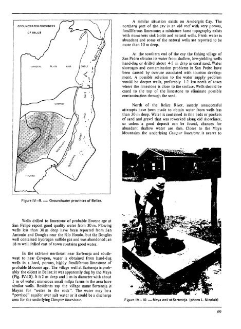
GnOUNDWATER PROVINCES<br />
OF BELIZE<br />
Figure IV-9. - Groundwater provinces of <strong>Belize</strong>.<br />
Wells drilled to limestone of probable Eocene age at<br />
San Felipe report good quality water from 30 m. Flowing<br />
wells less than 30 m deep have been reported from San<br />
Antonio and Douglas near the Rio Hondo, but the Douglas<br />
well contained hydrogen sulfide gas and was abandoned; an<br />
18 m well drilled east of town contains good water.<br />
In the extreme northeast near Sarteneja and southwest<br />
to near Cowpen, water is obtained from hand-dug<br />
wells in a hard, porous, highly fossiliferous limestone of<br />
probable Miocene age. The village well at Sarteneja is probably<br />
the oldest in <strong>Belize</strong>; it was apparently dug by the Maya<br />
(Fig. IV-IO). It is 2 m deep and I m in diameter with about<br />
I m of water; numerous small milpa farms in the area have<br />
similar wolls. Residents say the village name Sarteneja is<br />
Mayan for "water in the rock". The water may be a<br />
"perched" aquifer over salt water or it could be a discharge<br />
area for the underlYing CamplIr limestone.<br />
A similar situation exists on Ambergris Cay. The<br />
northern part of the cay is an old reef with very porous,<br />
fossiliferous limestone; a miniature karst topography exists<br />
with numerous sink holes and natural wells. Fresh water is<br />
abundant and some of the natural wells are reported to be<br />
more than 10m deep.<br />
At the southern end of the cay the fishing village of<br />
San Pedro obtains its water from shallow, low-yielding wells<br />
hand-dug or drilled about 4·5 m deep in coral sand. Water<br />
shortages and contamination problems in San Pedro have<br />
been caused by overuse associated with tourism development.<br />
A possible solution to the water supply problem<br />
would be deeper wells, preferably 1·2 km north of town<br />
where the limestone is close to the surface. Wells should be<br />
cased to the top of the limestone to eliminate pOSSible<br />
contamination through the sand.<br />
North of the <strong>Belize</strong> River, mostly unsuccessful<br />
attempts have been made to obtain water from wells less<br />
than 30 III deep. Water is contained in thin beds or pockets<br />
of sand and gravel that was reworked along old shorelines,<br />
so unless a good deposit can be found, chances for<br />
abundant shallow water are slim. Closer to the Maya<br />
Mountains the underlying CamplIr limestone is nearer to<br />
Figure IV-10. - Maya well at Sarteneja. (photo L. Nicolaltl<br />
69