River Carron Description & River Photos – A Short Report Eur Ing ...
River Carron Description & River Photos – A Short Report Eur Ing ...
River Carron Description & River Photos – A Short Report Eur Ing ...

Create successful ePaper yourself
Turn your PDF publications into a flip-book with our unique Google optimized e-Paper software.
Grangemouth 100MW Biomass Plant <strong>River</strong> <strong>Carron</strong> Fisheries Management Group<br />
Electricity Act 1989 Section 36 Consent Inquiry Water Pollution & Fishery Issues<br />
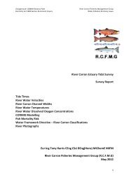
<strong>River</strong> <strong>Carron</strong> <strong>Description</strong> & <strong>River</strong> <strong>Photos</strong> <strong>–</strong> A <strong>Short</strong> <strong>Report</strong><br />
<strong>Eur</strong> <strong>Ing</strong> Tony Harris CEng CSci BEng(Hons) MIChemE MIFM<br />
<strong>River</strong> <strong>Carron</strong> Fisheries Management Group (R.C.F.M.G)<br />
May 2012<br />
1
Grangemouth 100MW Biomass Plant <strong>River</strong> <strong>Carron</strong> Fisheries Management Group<br />
Electricity Act 1989 Section 36 Consent Inquiry Water Pollution & Fishery Issues<br />
Frontispiece:<br />
Atlantic Salmon migrating upstream in the <strong>River</strong> <strong>Carron</strong> by leaping over Larbert Weir.<br />
Photograph ©John Girvan.<br />
1.0 Introduction<br />
1.1. This short report provides photographs of the <strong>River</strong> <strong>Carron</strong> at various locations along its length<br />
to give the reader a perspective on the current size and current water flow rates in the <strong>River</strong><br />
<strong>Carron</strong>, for comparison to the proposed Forth Energy Grangemouth Biomass Plant Blowdown<br />
Effluent flow rate of 0.93 m/second.<br />
1.2. The <strong>River</strong> <strong>Carron</strong> is a small spate river located in Central Scotland. The photographs and<br />
information included in this report reflect this. Each photograph is individually numbered with<br />
locations indicated on the OS Map in Section 5.<br />
1.3. A river catchment map is also included and shows the layout and the number of the reservoir in<br />
the upper catchment. These current reservoir impoundments and abstractions have a<br />
significant negative impact on the <strong>River</strong> <strong>Carron</strong> water flows. Currently, up to 75% of the total<br />
annual rainfall in the upper catchment is abstracted out of the system, with only 25% flow<br />
supplied for the rivers environment. The allowable abstraction rates and supplied minimum<br />
compensation flows are detailed in the SEPA CAR Licence No. CAR/L/1014292 for <strong>Carron</strong> Valley<br />
Water Treatment Works.<br />
1.4. The low river flows impose significant risk in terms of lack of dilution when polluting effluents<br />
enter the river channel.<br />
2
Grangemouth 100MW Biomass Plant <strong>River</strong> <strong>Carron</strong> Fisheries Management Group<br />
Electricity Act 1989 Section 36 Consent Inquiry Water Pollution & Fishery Issues<br />
2.0 <strong>River</strong> <strong>Carron</strong> <strong>Description</strong><br />
2.1. The <strong>River</strong> <strong>Carron</strong> rises in the uplands of <strong>Carron</strong> Valley in the Campsie Fells. The river flows for a<br />
short distance before being impounded by <strong>Carron</strong> Valley Reservoir which was built 1935 <strong>–</strong> 1938.<br />
The <strong>River</strong> <strong>Carron</strong> then re-emerges as a small reservoir compensation flow from the eastern<br />
slipway of <strong>Carron</strong> Valley Reservoir Dam at a rate of 9.1 Ml/day (= 0.1 m3/second) and flows in<br />
an easterly direction, for approximately 20 miles, through <strong>Carron</strong> Valley, <strong>Carron</strong> Glen, and the<br />
settlements of Denny and Larbert and Falkirk before entering the upper Firth of Forth at<br />
Grangemouth. The catchment has a total stream network length of about 75 miles.<br />
2.2. The <strong>River</strong> <strong>Carron</strong> drains an area of approximately 192 km2 before entering the Firth of Forth via<br />
the <strong>Carron</strong> Estuary at Grangemouth. The <strong>Carron</strong> catchment supports a mix of urban and rural<br />
land-use. Commercial conifer forests cover the upper reaches around the <strong>Carron</strong> Valley<br />
Reservoir while agriculture is the main land use along the middle reaches. Both the <strong>Carron</strong><br />
Valley and Loch Coulter reservoirs are significant water resources serving important functions in<br />
the supply of drinking water. In the lower reaches the land becomes more heavily urbanised<br />
with major road networks, towns and settlements which includes parts of Cumbernauld and<br />
Falkirk together with Denny, Bonnybridge and Larbert.<br />
2.3. The headwaters of the <strong>Carron</strong> are effectively compensation waters from a series of reservoirs<br />
which have been built on the system to harness water for the population of much of the<br />
eastern central belt of Scotland. There are 8 reservoirs in the catchment that affect runoff<br />
(namely <strong>Carron</strong> Valley Reservoir, Loch Coulter Reservoir, Earls Burn 1 Reservoir, Earls Burn 2<br />
Reservoir, Buckie Burn Reservoir, Faughlin Reservoir, Little Denny Reservoir and Drumbowie<br />
Reservoir). The largest of these is <strong>Carron</strong> Valley Reservoir.<br />
2.4. The SEPA CAR Licence No. CAR/L/1014292 (CARRON VALLEY WATER TREATMENT WORKS)<br />
states that Scottish Water have to maintain a minimum river flow of 41.8 million litres/day (0.48<br />
m3/second) at the Scottish Water Langhill <strong>River</strong> Gauging Weir, <strong>Carron</strong> Glen, located at OS grid<br />
reference NS 773 844. This flow requirement provides a minimum low flow to protect the<br />
rivers environment.<br />
The SEPA CAR licence states the maximum daily abstraction rate for <strong>Carron</strong> Valley WTW and<br />
Gartcarron WTW is 152.5 million litres/day (=1.76 m3/second) from the catchment. The licence<br />
also states the minimum flow in the river at Langhill Weir should be 41.8 million litres/day<br />
(=0.48 m3/second), this indicates that only one quarter of the catchments water is allowed into<br />
the river when reservoirs are below their full level (when no dams are over-topping).<br />
This is a significant problem for the river system as the reservoirs rarely overflow due to the<br />
high demand for potable water in the district. <strong>Carron</strong> Valley Reservoir was originally<br />
constructed 1935 <strong>–</strong> 1938 to provide water for Grangemouth Industry and the population of<br />
Falkirk Council which is now approximately 145,000 people, who use on average 160 litres of<br />
water per day. Grangemouth Industry is a very large consumer of water.<br />
The catchment runoff is increased to some degree by Sewage Plant treated effluent returns<br />
from the 4 Sewage Treatment Plants in the system (namely Denny Sewage Works <strong>–</strong> Denny,<br />
Bonnybridge Sewage Works - Roughmute, Dunswood Sewage Works - Cumbernauld and<br />
Dalderse Sewage Works - Falkirk.<br />
3
Grangemouth 100MW Biomass Plant <strong>River</strong> <strong>Carron</strong> Fisheries Management Group<br />
Electricity Act 1989 Section 36 Consent Inquiry Water Pollution & Fishery Issues<br />
2.5. Typical low summer flow in the <strong>River</strong> <strong>Carron</strong> (with 41.8 million litres/day (0.48 m3/second) at<br />
the Scottish Water Langhill <strong>River</strong> Gauging Weir) corresponds to a river level of 0.2m measured<br />
at the SEPA Headswood Gauging Station Weir.<br />
2.6. The <strong>River</strong> <strong>Carron</strong> is classified under the <strong>Eur</strong>opean Commission’s Water Framework Directive<br />
(WFD). The EC Water Framework Directive, which came into force on 22 December 2000,<br />
establishes a new, integrated approach to the protection, improvement and sustainable use of<br />
<strong>Eur</strong>ope’s rivers, lochs, estuaries, coastal waters and groundwater. Scottish Ministers have<br />
committed to implementing the Water Framework Directive.<br />
2.7. The <strong>River</strong> <strong>Carron</strong> catchment contains 14 baseline surface water bodies (a baseline waterbody<br />
has a catchment area greater than 10km2) including five heavily modified water bodies and<br />
three artificial water bodies (canals). This is stated in the SEPA <strong>River</strong> Basin Management Plan<br />
<strong>River</strong> <strong>Carron</strong> Profile 2009 (Ref: GCCIPC Inquiry Fisheries Documents <strong>–</strong> Volume 1 <strong>–</strong> Doc 20).<br />
<strong>River</strong> <strong>Carron</strong> catchment water bodies were classified by SEPA in 2009 as having either Poor,<br />
Moderate or Good Ecological Status. The classification scoring for each waterbody is made up<br />
of over 20 factors including the Fish Species and Fish Populations present. All classification<br />
scoring factors are listed in the SEPA 2009 Classification Spreadsheet which is available on the<br />
SEPA website. It contains the classification scores for all the <strong>River</strong> <strong>Carron</strong> catchments<br />
waterbodies. www.sepa.org.uk/water/river_basin_planning/area_advisory_groups/forth.aspx<br />
2.8. Under the EC Water Framework Directive all classified waterbodies within the <strong>River</strong> <strong>Carron</strong><br />
Catchment must achieve “Good Ecological Status” by at least 2027. This is stated in the SEPA<br />
<strong>River</strong> Basin Management Plan <strong>River</strong> <strong>Carron</strong> Profile 2009. (Ref: GCCIPC Inquiry Fisheries<br />
Documents <strong>–</strong> Volume 1 <strong>–</strong> Doc 20).<br />
2.9. Any industrial development which could derogate this <strong>River</strong> Basin Management Plan objective<br />
is unacceptable and contravenes the WFD objectives as stated in SEPA document - The Future<br />
for Scotland’s Waters, Guiding Principles on the Technical Requirements of the Water<br />
Framework Directive, May 2002. (Ref: GCCIPC Inquiry Fisheries Documents <strong>–</strong> Volume 1 <strong>–</strong> Doc<br />
19).<br />
2.10. The proposed Forth Energy Grangemouth Biomass Plant will significantly affect populations<br />
of migratory fish in the <strong>River</strong> <strong>Carron</strong> including <strong>River</strong> Lamprey, Atlantic Salmon and Sea Trout, all<br />
of which are confirmed species as stated in the Falkirk Area Biodiversity Action Plan 2011 <strong>–</strong><br />
2014 (FABAP) (Ref: GCCIPC Inquiry Fisheries Documents <strong>–</strong> Volume 1 <strong>–</strong> Doc 30).<br />
2.11. <strong>River</strong> Lamprey is a <strong>Eur</strong>opean Protected Fish Species and receives conservation status under<br />
Annexes II and V of the EU Habitats Directive Appendix III of the Bern Convention and is on the<br />
UKBAP Priority List (GCCIPC Inquiry Fisheries Documents <strong>–</strong> Volume 1 <strong>–</strong> Docs 31 & 47).<br />
The reduction in upstream adult and downstream juvenile fish migration survivability as a direct<br />
result of the biomass plant blowdown effluent discharge will negatively impact <strong>River</strong> <strong>Carron</strong> fish<br />
populations and this could cause a derogation in WFD classification, and will contravene the<br />
WFD objective of achieving “good ecological status” for many of the <strong>River</strong> <strong>Carron</strong> catchments<br />
water bodies. This environmental impact is unacceptable.<br />
4
Grangemouth 100MW Biomass Plant <strong>River</strong> <strong>Carron</strong> Fisheries Management Group<br />
Electricity Act 1989 Section 36 Consent Inquiry Water Pollution & Fishery Issues<br />
3.0 Catchment Map indicating Abstractions and Compensation Flows<br />
5
Grangemouth 100MW Biomass Plant <strong>River</strong> <strong>Carron</strong> Fisheries Management Group<br />
Electricity Act 1989 Section 36 Consent Inquiry Water Pollution & Fishery Issues<br />
4.0 OS Map indicating <strong>River</strong> <strong>Carron</strong> Photograph Locations<br />
6
Grangemouth 100MW Biomass Plant <strong>River</strong> <strong>Carron</strong> Fisheries Management Group<br />
Electricity Act 1989 Section 36 Consent Inquiry Water Pollution & Fishery Issues<br />
5.0 <strong>River</strong> <strong>Carron</strong> Photographs<br />
Photograph 1: <strong>Carron</strong> Valley Reservoir Slipway (re-emergence of the <strong>River</strong> <strong>Carron</strong>)<br />
Photograph 2: <strong>Carron</strong> Valley Reservoir typical water level <strong>–</strong> rarely overtops into river.<br />
7
Grangemouth 100MW Biomass Plant <strong>River</strong> <strong>Carron</strong> Fisheries Management Group<br />
Electricity Act 1989 Section 36 Consent Inquiry Water Pollution & Fishery Issues<br />
Photograph 3: <strong>Carron</strong> Valley Reservoir Slipway typical water flow (0.1 m3/second).<br />
Photograph 4: <strong>River</strong> <strong>Carron</strong> @ <strong>Carron</strong> Valley 500m downstream of dam<br />
8
Grangemouth 100MW Biomass Plant <strong>River</strong> <strong>Carron</strong> Fisheries Management Group<br />
Electricity Act 1989 Section 36 Consent Inquiry Water Pollution & Fishery Issues<br />
Photograph 5: <strong>River</strong> <strong>Carron</strong> Summer Flow (0.48 m3/second) at Langhill Weir <strong>River</strong> Gauging Station<br />
Photograph 6: <strong>River</strong> <strong>Carron</strong> (25/5/12) at Dales Bridge, Denny<br />
9
Grangemouth 100MW Biomass Plant <strong>River</strong> <strong>Carron</strong> Fisheries Management Group<br />
Electricity Act 1989 Section 36 Consent Inquiry Water Pollution & Fishery Issues<br />
Photograph 7: <strong>River</strong> <strong>Carron</strong> Typical Summer <strong>River</strong> Level of 0.2m (25/5/12) at SEPA Headswood<br />
<strong>River</strong> Level Gauging Station<br />
Photograph 8: <strong>River</strong> <strong>Carron</strong> Typical Summer Flow entering the tidal <strong>River</strong> <strong>Carron</strong> Estuary (25/5/12)<br />
at <strong>Carron</strong> Works Weir, Falkirk<br />
10
Grangemouth 100MW Biomass Plant <strong>River</strong> <strong>Carron</strong> Fisheries Management Group<br />
Electricity Act 1989 Section 36 Consent Inquiry Water Pollution & Fishery Issues<br />
Photograph 9: <strong>River</strong> <strong>Carron</strong> Tidal Estuary indicating Dalderse Sewage Treatment Works effluent<br />
discharge (25/5/12) plugging entire width of river channel<br />
Photograph 10: <strong>River</strong> <strong>Carron</strong> Typical Summer Freshwater Flow at Low Tide - Kerse Bridge,<br />
Grangemouth (25/5/12). The proposed biomass plant blowdown effluent discharge pipe location<br />
(Option 1) is 2.4km downstream from this bridge.<br />
11
Grangemouth 100MW Biomass Plant <strong>River</strong> <strong>Carron</strong> Fisheries Management Group<br />
Electricity Act 1989 Section 36 Consent Inquiry Water Pollution & Fishery Issues<br />
Photograph 11: <strong>River</strong> <strong>Carron</strong> Tidal Channel at Option 1 location for proposed biomass blowdown<br />
effluent discharge pipe location. Option 1 is 2.25km upstream of the Firth of Forth. Photo shows<br />
higher level mudflats to the left and the lower <strong>River</strong> <strong>Carron</strong> Channel to the right separated by a<br />
man-made Tailbank (breakwater on OS map),<br />
12
Grangemouth 100MW Biomass Plant <strong>River</strong> <strong>Carron</strong> Fisheries Management Group<br />
Electricity Act 1989 Section 36 Consent Inquiry Water Pollution & Fishery Issues<br />
Photograph 12: <strong>River</strong> <strong>Carron</strong> Tidal Channel at the Option 1 Effluent Discharge Location (on South<br />
bank adjacent to red navigation buoy). Note the size of the raised South bank which is exposed at<br />
all low tides . The applicant has stated the pipe will not be located in the centre of the channel to<br />
mitigate boat navigation issues. Locating the pipe as proposed along the south bank will not<br />
promote rapid mixing and dilution because there is no water at low tide on this exposed bank.<br />
13