
You also want an ePaper? Increase the reach of your titles
YUMPU automatically turns print PDFs into web optimized ePapers that Google loves.
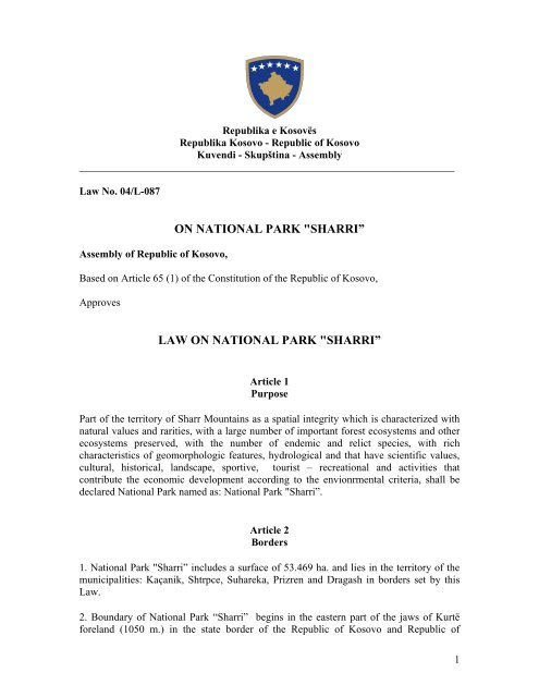
Republika e Kosovës<br />
Republika Kosovo - Republic of Kosovo<br />
Kuvendi - Skupština - Assembly<br />
_______________________________________________________________________<br />
Law No. 04/L-087<br />
Assembly of Republic of Kosovo,<br />
ON NATIONAL PARK "SHARRI”<br />
Based on Article 65 (1) of the Constitution of the Republic of Kosovo,<br />
Approves<br />
LAW ON NATIONAL PARK "SHARRI”<br />
Article 1<br />
Purpose<br />
Part of the territory of Sharr Mountains as a spatial integrity which is characterized with<br />
natural values and rarities, with a large number of important forest ecosystems and other<br />
ecosystems preserved, with the number of endemic and relict species, with rich<br />
characteristics of geomorphologic features, hydrological and that have scientific values,<br />
cultural, historical, landscape, sportive, tourist – recreational and activities that<br />
contribute the economic development according to the envionrmental criteria, shall be<br />
declared National Park named as: National Park "Sharri”.<br />
Article 2<br />
Borders<br />
1. National Park "Sharri” includes a surface of 53.469 ha. and lies in the territory of the<br />
municipalities: Kaçanik, Shtrpce, Suhareka, Prizren and Dragash in borders set by this<br />
Law.<br />
2. Boundary of National Park “Sharri” begins in the eastern part of the jaws of Kurtë<br />
foreland (1050 m.) in the state border of the Republic of Kosovo and Republic of<br />
1
Macedonia and continues westward and south-west along the state border by going<br />
beyond quotas, respectively highest Sharr mountains crown, the Luboten crown (2499<br />
m.), Castle (2314 m.), Meadow (2491 m.), Lake of Çuka (2604 m.), Bistra (2604 m.),<br />
Black Crown (2584 m ) Kobilicë (2526 m.), Vërtop (2555 m.), Kara Nikola (2106 m.),<br />
Bardhaleva (2334 m.); Tërpeznica (2610 m.); Qelepinë (2554 m.); Rudoka (2658 m.);<br />
Vraca e Madhe (2582 m.); until border point of there countries (Kësula e Priftit), Kosovo,<br />
Macedonia and Albania. From here the border continues in north-west direction until<br />
Kallabak quote (2174 m.), from where takes direction to the north, following the state<br />
border with Republic of Albania, through the peak Murga (2025 m.) cut the river of<br />
Restelica, then the river of Plava until the quote of 1702 m. in the Koritniku mountain.<br />
The border then turns to north-east direction, goes through Lugu i Keq and goes out in<br />
the forest road quote of 1343 m., following the road including in the Kodra e Eres, going<br />
through Rrasa near Ara e Bajraktarit through the quote of 1273 m., including in the hill<br />
Gollina until the quote of 1246 m. which belongs to the territory of Dragashi<br />
municipality. From here the border takes south-east direction until the hill of Kopriva<br />
(1493 m.) living out the out of the border the forest of Rronza. From here goes until the<br />
Bunari i Hamitages then takes the east direction going down the hill of Ahishte<br />
approximately one kilometer on the east side of the Buce village. Then the border takes<br />
the south direction to the Brinja living out of the border Brinja and Ara e Rexhes going in<br />
direction of Cestaku forest and going down until the road to Kerseci i Madh village going<br />
through the quote of 1407 m. always continuing the south-west direction including in<br />
almost all Koritnik mountain, until the Pjetri stream taking then the east direction through<br />
the Cula quote (1201 m.) going down until the water flow of Plava river to the other<br />
noname river. From here the border line follows the flow of Plava river until to some 250<br />
m. fare from the border with Albanija. Then from here the border takes the south<br />
direction almost in parallel with state border in the east side of the Orqushe village. The<br />
border goes always in south-south-east direction through the forest following the forest<br />
road which devides the Gosi forest with Maja e Zezë (1581 m.), going just near to<br />
Gllobocica village in the east side of it for about 700 metres fare. The line then follows<br />
the stream which goes through Rudce going down until the flow of Restelica river. From<br />
here the line always follows the river flow in the already south direction going through<br />
the quote of 1107 m. Then the border line takes east direction to reach the road that<br />
brings you to the Krusheva village. This line follows the road until the cemetery of<br />
Krushevo village, cutting again the river flow of Restelica and going up hill through<br />
quotes of 1390 m., then quote of Kolenica (1489 m.). From here the border line takes<br />
north direction taking in Jellaku forests. Then the line goes in the road to Restelica going<br />
nearby in the west of Resteliva village to the quote of 1426 m., from where the line takes<br />
west direction always taking in forest in the east side of Restelica going through the<br />
Kadiu bridge then the quote of 1644 m. After then the border starts to take south direction<br />
going left and right until the Copur stream. Afterwords the line turns to the south-west<br />
following the river to be connected with another back-street right side of the river. From<br />
here border line followes the line between private and public property in the south-east<br />
direction until the main road Restelica – border to Macedonia. The line follows the road<br />
until the village Restelica always between private and public property. From the road that<br />
line touch it in the south of the village, border line take the east direction following the<br />
Restelica river going up until the quote 1581 m. from where the border take north<br />
direction respectively north-west until the quote 1818 and another quote 1887 making<br />
2
half circul living out of the border peak of Kerstella of 1907 m. From here inside the<br />
border line is included higher mountain peak Ovcinec (2177 m.) than goin near the other<br />
peak Maja e Zezë (2063 m.). From here the line takes the west direction to the Zlipotok<br />
village going just below the willage houses. Following always west direction the border<br />
line touch the main road to the Zlipotok village in the quote 1414 m. respectively to the<br />
village cemetery. From this poin the line takes the north-east direction overtaking the<br />
cemetery taking in the mountain peak Popovica (1567 m.), than the other peak Bigor<br />
going in direction to forest Leska above Dikanca hidropowerplant until the Brodi river.<br />
From here the border line follows the Brodi river upstream until the village Brod where<br />
the line overtake the village going up to the Rudina slope until the quote 1483 m., than<br />
the border takes the east direction going through the river to bridge Sholla respectively to<br />
the junction of the Lleva and Dushkaja river streams. Afterwards border line follows the<br />
line of public property going through the quotes 1790 m., than the quote 1432 of the right<br />
stream of the Brodi river near the Brod village cemetery. Border line continues in<br />
irregular circul through quotes 2081 respectively 1680 m covering almost all Brod village<br />
living the village aout of the border. Further more the border line goes until the main road<br />
Dikance - Brod folloving it until Dikance village. After the border continues to take north<br />
direction respectively north-east passing near quote of Virje 1602 m., respectively 1598<br />
going near the Lleshtan village through Baçillishte, Shillovice until Radesha river to<br />
quote 1436 m. Ftom this quote the line takes the south-east direction through the<br />
Zagrejeci stream taking in very slope site of Zagrejeci after 1500 meters the line takes<br />
north-east direction going up to the Livaxha mountain near 1900 m. quote, under Guri i<br />
Shqiponjes after from here takes direction down to Srednica stream under the quote of<br />
1722 m. From here the border line in some 500 meters followes the riverbed going after<br />
again in dhe north direction through Bogdance mountains until the Guri i Marushan quote<br />
in the riverbed of Pllajniku. The border line continues to follow the north direction until<br />
Kroi Obcinove and quote 1572 m., near the Sumllar hill from where takes the north-east<br />
direction until the Ropuha stream in north-west to the Kuk village. Tha line takes over the<br />
river taking almost east direction passing the Shullani hill going down to river Reka e<br />
Shehit te Madh to quote of 1628 m. From here the line again takes the north-east<br />
direction passing the Guri i Torishtes and going down to river Reka e Shehit te Vogel.<br />
After the border takes north direction going left and right taking in places of Guri i<br />
Korbit, Guri i Grihes and Brezhda until Dridza slope, one kilometer on the south-east part<br />
of the Zaplluzha village. From these hill sites the line touch the quote of 1367 m., then<br />
the quote of 1680 m. in Ugar, the other quote of 1609 m. arriving to Qafa e Dhelpnes<br />
near the quote of 1625 m. From this quote back in the east border and down to the street<br />
to continue until ravine unnamed river Manastirca takes direction from where the south<br />
along the river to the other unnamed ravine. The boundary then climbs to the ravine<br />
towards south-east and the flats last quote Guri i Pishës (1192 m.) out of the quotas of<br />
Guri i Qelit (1669 m.). From here the boundary pull down to the valley in the east to the<br />
river Pubenica which follows in the north-east direction until izohipsa 1050 m. to the<br />
(Wide) Kosa e Gjerë (place of ravine discharge in River Pubenica) from where back on<br />
east through the quota in 1093 m. through quotas Brod (1048 m.). From this quote takes<br />
the lead limit of north-east, ascend to the back of Stërga e Kumançit and continues along<br />
the meadows of the Lubinja e Epërme to 1401 m. quotes Moreover boundary extends<br />
north-east through the Livadhet e Epërme quote (1430 m.) and down the valley to the<br />
quotas in 1107 m (Petreshnica River) to continue toward the north-east by cord attached<br />
3
to the ravine of Mares (1230 m. izohipse). From this point the boundary turns north-west<br />
and follows the line 1230 m. until the quote of 1227 m. from where it continues in the<br />
north-east to the Shpatijet e Gropes (1192 m.). The boundary then extends east through<br />
the quote (1195 m.) along the slope of Çuka until the stream of Mahalla e Epërme<br />
neighborhood of Katundi i Eperm (izohipsa 1300 m.) from where the north-east direction<br />
until sticky Llanishta (izohipse 1400 m.) to continue in the north-west of the Katundi i<br />
Epërm and continues in regional road Prizren-Shtërpcë on the slope of the Stërnjigarit<br />
(500 m. east of quotas Prisoj 1330 m.). From this point the boundary follows the road<br />
westward until, “Kthesa e Gjashte“, then continues through quotas Gabar (1195 m.),<br />
(1257 m.) (1056 m.) to the ravine of village Pllanjan down in terms of south-west,<br />
passing through quotas in 1084 m., 928 m. to 803 m. down in Lumbardh (550 m.) which<br />
quotes the follow up to 532 m. and passes through quotas 974 m. and 867 m. from where<br />
the cord comes down to the north-west ravine of Katërdhjetë Bunarët which includes<br />
within. From here take the boundary of the north-east direction, exceeds Lumëbardh,<br />
regional road, and climbs the rocks of Vertopit cord, including the eastern part of rocks,<br />
and get the south-eastern direction, passes through back of mountain Dullo, and after that<br />
grips the mouth of ravine of Vërbiçan, relates back to Tociv in izohipse of 900 meters.<br />
From here cord continues eastwards to quotas Maja (1567 m.), where back in the northeast<br />
and out of forest vegetation along the forest road to the village Novosele introdu-cing<br />
hillock within the border of the Bullecit meadows. The boundary then under the road<br />
down to 1500 m. izohipsa which attends to Kroni i Aliut (who is in the road forest), by<br />
inserting within the boundary Ujërat e Gropuara. Then the boundary continues along the<br />
road towards the north to the quotas in 1500 m. (Ravenj), from where the cord comes<br />
down to the Guri i Mullinit. From this point the boundary turns north-east and goes along<br />
the mountainous cord, quotas and 1052 m. to 1569 m. to the Meadows where Sula cord<br />
descends north-west to the ravine (east of Tepe location 1271 m.) to get up then cord<br />
toward the north-east to the border Shkrepi being stuck inside Ashta. The boundary then<br />
follows through izohipses 1700 m. to the neck of Shpati Padhe Bubrrec (1709 m.) located<br />
on the mouth of Rusenica. The border then goes down through mountain back in the<br />
north-west direction the Guri i Livadhit quote (1448 m.) and continues cord in the northeast<br />
to the entrance to the mouth of Rusenica (750 m.), where back in the south-east to<br />
continue then north-east along the forest vegetation (border mountain meadows) to<br />
quotas 830 m. (lower part of Lleshçica). From this quote izohipse boundary coincides<br />
with the 850 meters and follows it to 768 meters quotes (Kulla) including Llokma and<br />
Selimi Field. Then the boundary runs along the mouth of ravine and neck of Matoz to<br />
Përsllap (quota 1089 m.) from where the receiving direction of south-east and passes<br />
around the lower parts of the mouth (Klisura) and Guri i Përgjakur up the quotas in 1212<br />
m. From here the boundary turns north-east and follows izohipse of 1200 m. to Imer<br />
pump and continues through until the 1335 quote of Kroni i Mbretit. The boundary then<br />
descends cord mountainous Montenegro quotes King until 1068 m., from where they<br />
return to south-east and beyond the quota Tëbanat Bukoshi (1546 m.) and 1655 m. out of<br />
quotas Upper plain (1443 m.) always followed the natural boundary (ravine, valley and<br />
mountain ridge). From this quote towards the boundary continues south and south-east<br />
through the 1084 quota to the quota Çuka m (1216 m.), where back in the west and<br />
through the Vishevices peak (1230 m.) and to quota to Presllap Cross (1291 m.). The<br />
border then south-west down to the ravine Zashtica (1000 m.) and continues along ravine<br />
in the south-east direction to the shed ravine Vasil (lower part of the Guri i Vardishit)<br />
4
from where the return to south-west and climbs cord mountainous Llacei-shtes until<br />
quotas of Pisha e Vogel (1495 m.) to continue westward until Rudina quota (1536 m.).<br />
From this quote towards the boundary continues south along the mountainous cord and<br />
deadline Tumba (1382 m.) to be shed in River Tisi on Lepenc river (1119 m.) from where<br />
they return to south-east up of the Sevce village through quotas Gobelinc (1297 m.); Kuk<br />
(1251 m.); Çuka e Poshtme (1260 m.) until the quota of Guri i Prushit (1375 m.) from<br />
where the cord comes down to the river bridge the regional road Prizren-Shtërpcë. Then<br />
the boundary continues north-east along this road and through the Lower quotas Borja<br />
(1232 m.); Muzhnica River (1036 m.); quota (1086 m.); Penjarupa (1169 m.); Shkembi i<br />
Boçkës (1228 m.); Llazovi (Vlak) (1100 m.); Barojca, Glavas (1228 m.); White Water<br />
(1100 m.); Klisura River (1031 m.); Zmijaica of Drajkovc (1126 m.); Krividell on Firajë<br />
(1080 m.); Krena (904 m ); Great ravine on the Mahalla Elezeve (780 m.) to lower parts<br />
of Jasika on Mahala e Ceklareve (850 m.). From this point the boundary turns south-east<br />
up to 900 on Mahala e Elezëve, izohipses which follows the south up to 900 m quotas to<br />
continue cord mountain to mountain Shulan quota (1154 m.) across the brook cliff. Then<br />
the boundary turns south-east up to 941 m in quotes forest road which follows the path to<br />
regional Shtërpca-Doganaj - Glloboçica. Boundary further continues south along the<br />
regional road curves to the Kepi i Kurtës from where the south-west towards the mouth<br />
of the Kepi i Kurtës to be concluded at the starting point isohipses state in 1050 in<br />
Kosovo - Macedonia border.<br />
3. Boundary of the National Park “Sharri” is lineament in cartographic documentation,<br />
size of 1:25.000 and is integral part of this Law.<br />
4. Cartographic documentation with borders of National Park “Sharri” is stored in the<br />
Ministry of Environment and Spatial Planning and in the Kosovo Institute for Nature<br />
Protection.<br />
Article 3<br />
Protection Regimes<br />
1. In the National Park “Sharri” territory placed under the protective regime of areas:<br />
1.1. the first area - includes parts of the territory of the National park “Sharri”<br />
with exceptional natural features, with rare species, endangered plants and<br />
animals and types of habitats in the wild conditions of nature. This area bellongs<br />
to the regime of strict protection;<br />
1.2. the second area -active management includes parts of the territory of National<br />
park “Sharri”that is characterized by ecosystems, landscape values and other<br />
values where may be exercised ecotourism, traditional agriculture and activities<br />
that are not inconsistent with the purposes of defense;<br />
1.3. the third area - sustainable use, includes parts of the territory of National Park<br />
“Sharri” scheduled for: construction, reconstruction, protection of traditional and<br />
recreational facilities, tourism and the needs of inhabitants in the territory of<br />
5
National park as well as use of pasture and economic use of anture resources<br />
according to the Law on Protection of nature and in compliance with relevant<br />
laws and Spatial Plan of National Park the limited and selective use of natural<br />
resources;<br />
1.4. buffer zone - the space of fifty (50) meters from the border of National park<br />
“Sharri” that serves to prevent adverse impacts on National park.<br />
2. Determining of protection regimes shall be made by the National Park “Sharri” Spatial<br />
plan whiles the activities and actions shall be conducted according the Management plan<br />
of the National park and legislation in force.<br />
Article 4<br />
Administration<br />
Ministry of Environment and Spatial Planning with decision establishes the Directorate<br />
for Administration of National Park "Sharri" within three (3) months from the date of<br />
entry into force of this Law.<br />
Article 5<br />
Property rights and denationalization shall be regulated with special laws and are not<br />
object of this Law.<br />
Article 6<br />
Repeal<br />
On the day of entry into force of this Law shall cease to apply law on the National Park<br />
"Sharr Mountain" (OGSAPK" 11/86).<br />
Article 7<br />
Entry into force<br />
This Law enters into force fifteen (15) days after publication in the Official Gazette of the<br />
Republic of Kosovo.<br />
Law No. 04/L-087<br />
13 December 2012<br />
President of the Assembly of the Republic of Kosovo<br />
___________________________<br />
Jakup KRASNIQI<br />
6
Republika e Kosovës<br />
Republika Kosovo - Republic of Kosovo<br />
Kuvendi - Skupština - Assembly<br />
_______________________________________________________________________<br />
Law No. 04/L-087<br />
ANNEX I<br />
CARTOGRAPHIC PRESENTATION OF NATIONAL PARK “SHARRI”<br />
7