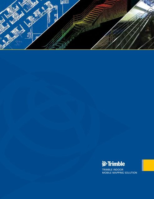
The Most Comprehensive Solution for Indoor Mapping ... - Trimble
The Most Comprehensive Solution for Indoor Mapping ... - Trimble
The Most Comprehensive Solution for Indoor Mapping ... - Trimble

You also want an ePaper? Increase the reach of your titles
YUMPU automatically turns print PDFs into web optimized ePapers that Google loves.
<strong>The</strong> <strong>Most</strong> <strong>Comprehensive</strong> <strong>Solution</strong> <strong>for</strong> <strong>Indoor</strong> <strong>Mapping</strong> Applications<br />
TRIMBLE INDOOR<br />
MOBILE MAPPING SOLUTION
TRIMBLE INDOOR MOBILE MAPPING SOLUTION (TIMMS):<br />
HIGH EFFICIENCY, MAXIMUM FLEXIBILITY, ALL-IN-ONE PACKAGE<br />
Documenting the condition of indoor structures is a necessary but<br />
often times daunting task. Generating detailed indoor models is<br />
critical <strong>for</strong> building life cycle maintenance and the data must be<br />
used by multiple audiences <strong>for</strong> a host of applications including<br />
space optimization, planning renovations, evaluating facility<br />
emergency planning and environmental per<strong>for</strong>mance monitoring<br />
or so called ‘green BIM’ initiatives. Generally, in order to collect<br />
the data <strong>for</strong> such applications the more complex a structure is,<br />
the longer the acquisition and processing time to generate usable<br />
data. This is due in part to the tools available <strong>for</strong> contractors,<br />
namely static LiDAR and spatial imaging systems. <strong>The</strong>se systems,<br />
while precise, require multiple setups and hours to process data in<br />
order to construct accurate representations of 3D interiors.<br />
What is needed is a seamless collection tool which offers precision,<br />
an intuitive workflow which collects 3D LiDAR and 360 spherical<br />
video simultaneously in real world coordinates, and the ability<br />
to create complex 3D models or simple 2D floor plans – all of<br />
which can be collected at walking speeds and presented in a web<br />
interface <strong>for</strong> rapid visualization and dissemination to a variety of<br />
users. <strong>The</strong>se capabilities are available with TIMMS, the industry’s<br />
first and only all-in-one solution <strong>for</strong> indoor mapping.<br />
THE CompLETE SoLuTIoN<br />
TIMMS is the optimal fusion of technologies <strong>for</strong> capturing spatial<br />
data <strong>for</strong> indoor and other GNSS denied areas of all sizes and<br />
locations. It provides both LiDAR and spherical video of a facility,<br />
enabling the creation of accurate, real-life representations of an<br />
interior space and all of its contents. <strong>The</strong> maps created are geolocated,<br />
meaning that the real world positions of each area of<br />
the building and its contents are known. Each pixel from the<br />
camera system and every point from the LiDAR have a latitude,<br />
longitude and elevation associated with it without the need of any<br />
external infrastructure to provide positioning in<strong>for</strong>mation – TIMMS<br />
is totally self contained. Utilizing inertial technology and powerful<br />
processing software, TIMMS can be initialized immediately and<br />
can per<strong>for</strong>m wide area mapping of a facility <strong>for</strong> extended periods<br />
of time. For the user, this means less time setting up equipment<br />
and more productivity, while ensuring consistent accuracy. Once<br />
the data is processed, the resulting spatial data can be rendered in<br />
a 360º panoramic viewer, allowing the user to be fully immersed in<br />
the interior space, able to zoom, pan and measure items of interest<br />
as desired.<br />
Because of its tremendous efficiency and speed, TIMMS is very<br />
effective even <strong>for</strong> facilities extending over several city blocks. This<br />
allows the user to obtain holistic 3D indoor geospatial views of all<br />
kinds of infrastructure including:<br />
• Plant and factory facilities<br />
• High-rise office, residential, and government buildings<br />
• Airports, train stations and other transportation facilities<br />
• Music halls, theatres, auditoriums and other public event<br />
spaces<br />
• Covered pedestrian concourses (above and below ground) with<br />
plat<strong>for</strong>ms, corridors, stair locations and ramps<br />
• Underground mines and tunnels<br />
TImmS DELIVErS A rEVoLuTIoN IN FACILITIES<br />
mANAGEmENT<br />
Until now, professionals involved in Building In<strong>for</strong>mation<br />
Modelling (BIM) had a choice: acquire quick but limited 2D data<br />
(floor plans) of interiors and interior structures, or acquire more<br />
detailed but also more time-consuming 3D LiDAR data. TIMMS<br />
eliminates this unnecessary compromise by doing both at the same<br />
time; all in a single pass, at low cost, with high accuracy.<br />
TIMMS offers multiple views of both data and images.<br />
2D Schematic - accurate floorplans are easily created using TIMMS 3D LiDAR: can quickly be generated from TIMMS data
COMPONENTS<br />
TIMMS integrates hardware and software required <strong>for</strong><br />
high accuracy, reliability, and ease-of-use. TIMMS can<br />
also be customized to suit your specific requirements;<br />
no matter what your inside mapping project requires,<br />
<strong>Trimble</strong> can integrate the right components to develop<br />
the perfect solution.<br />
MEP Projects:<br />
Clear Lidar imagery<br />
AEC Projects:<br />
3D Modeling<br />
2<br />
1<br />
A typical configuration includes:<br />
1. Inertial Measurement Unit (IMU): available in a variety of offerings to<br />
meet the needs of individual projects<br />
2. LiDAR: TIMMS can be customized with any LiDAR equipment to<br />
meet any requirement<br />
3. GNSS Antenna: a first position fix is obtained with <strong>Trimble</strong>’s BD960<br />
antenna<br />
4. <strong>Indoor</strong> Georeferenced Spherical Camera: Image data collected is<br />
360 degree and georeferenced<br />
8<br />
7<br />
3<br />
4<br />
CAD: can be created from the 3D data<br />
Law En<strong>for</strong>cement/Public Safety/ First Responders:<br />
Clear layouts <strong>for</strong> first responders<br />
5<br />
6<br />
Mining:<br />
Accurate measurements <strong>for</strong><br />
mine mapping and safety<br />
Survey:<br />
2D, 3D, Full Measurements, LiDAR,<br />
Modeling and 360º imagery<br />
5. Ruggedized Display: made to stand up to harsh environments<br />
6. Electronics Bay: An integrated computer management<br />
system (CMS) consists of a POS navigational system along with LiDAR<br />
computers with time tagging and data logging. Stores all data and<br />
includes removable hard drive <strong>for</strong> taking the data with you <strong>for</strong> processing<br />
7. Battery System: automatic power management ensures constant power<br />
as well as the ability to plug in the unit to a standard outlet to save power<br />
during down time<br />
8. Robust chassis and wheels: allows TIMMS to access hard to reach areas<br />
as well as stand up to harsh settings
WHy CHooSE TImmS?<br />
TIMMS is a high-efficiency, easy-to-use, end-to-end solution that<br />
provides tremendous flexibility in collecting, accessing, displaying,<br />
and analyzing 360º spherical imagery and LiDAR data. TIMMS is<br />
all you will ever need <strong>for</strong> producing end-user deliverables such as:<br />
floor plans, volumetric analysis, visualizations of the building interior<br />
from multiple perspectives and as-built data <strong>for</strong> planning / displaying<br />
modifications to interiors. No matter what the specific application,<br />
the benefits are numerous:<br />
• Efficient, high-accuracy data acquisition of georeferenced<br />
spherical imagery and LiDAR data<br />
• Lower data acquisition cost <strong>for</strong> as-builts<br />
• Eliminated data re-acquisition costs<br />
• Reduced infringement on operations: Map over 75,000 square<br />
feet in a single day<br />
• Full customization available, based on user requirements<br />
– optimize the standard sensor suite to fit your particular<br />
application<br />
• Flexible Pricing Model: Designed to allow customers to<br />
optimize their cost of ownership of TIMMS data.<br />
Options include:<br />
– Data-Only: <strong>Trimble</strong>, as a service partner, will collect,<br />
process, and deliver the facility data to you. This eliminates<br />
the cost of the system entirely and you pay only when you<br />
need the system <strong>for</strong> a specific job<br />
– Purchase: For those companies who collect facilities data<br />
frequently, outright purchase of the system is available with<br />
<strong>Trimble</strong> maintenance and technical support<br />
– Lease: For users who require the system <strong>for</strong> a fixed period<br />
of time<br />
By selecting the right plan <strong>for</strong> your needs, your cost<br />
of acquiring facilities data is optimized making TIMMS<br />
the only system capable of delivering a rapid payback of<br />
your investment.<br />
WHo CAN uSE TImmS?<br />
Spherical Video: create a complete global view of any indoor space<br />
Because TIMMS is a highly productive and reliable method <strong>for</strong><br />
mapping any interior structure, all facility stakeholders can utilize<br />
and benefit from the TIMMS data. Some of those who will benefit<br />
most include:<br />
ArCHITECTurAL, ENGINEErING AND CoNSTruCTIoN<br />
CoNTrACTorS (AEC)<br />
Architects, engineering consultants, and technicians can utilize TIMMS<br />
<strong>for</strong> producing georeferenced LiDAR and spherical video rapidly, which<br />
is critical <strong>for</strong> visualizing the job. <strong>The</strong> more comprehensive the data,<br />
the less re-work is required and jobs are completed on time and on<br />
budget.<br />
mECHANICAL, ELECTrICAL AND pLumbING (mEp)<br />
With TIMMS data of the entire facility, these professionals can add<br />
multiple layers of data from other devices such as static scanners to<br />
gain a comprehensive view of projects. Clash detection with existing<br />
building features and other types of analysis are facilitated cost<br />
effectively through TIMMS.<br />
LAW ENForCEmENT/pubLIC SAFETy/FIrST rESpoNDErS<br />
Detailed 360 degree imagery provides situational awareness giving<br />
personnel the total picture of an indoor environment. LiDAR data can<br />
be used <strong>for</strong> accurate measurement of interior features and both data<br />
types can be accessed through the internet, giving decision makers in<br />
multiple locations real time access to the same data. <strong>The</strong> data can be<br />
used <strong>for</strong> training and simulation purposes as well.<br />
mINING<br />
<strong>Mapping</strong> underground mine tunnels and chambers can greatly<br />
improve overall mine safety.<br />
oWNErS/FACILITy mANAGErS<br />
BIM-aided jobs can lead to short and long term operational savings.<br />
Not only is the cost of data acquisition with TIMMS a fraction of the<br />
cost of static scanners, keeping data on a facility current is facilitated.<br />
TIMMS provides<br />
the most accurate<br />
and thorough way of<br />
measuring interior<br />
distances.
TECHNICAL ADVANTAGES<br />
TIMMS offers significant technical advantages over<br />
other methods <strong>for</strong> indoor mapping:<br />
• Little or no LiDAR shadowing: being<br />
mobile allows TIMMS to move in and around<br />
structures. Static methods require multiple<br />
setups to capture the same level of data,<br />
increasing costs<br />
• Extended range of operations: no<br />
need <strong>for</strong> frequent stops to re-calibrate<br />
• Able to start mission anywhere…<br />
indoors or out, no need <strong>for</strong> GNSS. TIMMS<br />
is self contained utilizing industry leading<br />
inertial technology which provides reliable and<br />
repeatable high accuracy over long duration<br />
missions<br />
• Simple workflow: utilize POSPac MMS to<br />
derive the georeferenced point cloud of the<br />
structure in addition to the spherical video.<br />
Upload to <strong>Trimble</strong>’s Connected Community<br />
(TCC) anywhere in the world, where users can<br />
share, visualize and analyze the data quickly<br />
and efficiently using a standard web browser<br />
• Long battery life: offering extended<br />
range of operation<br />
• Extended modeling capabilities with<br />
any third party software which utilizes 2D or<br />
3D LiDAR data<br />
• Fully Customizable: another industry<br />
first – TIMMS can be adapted with custom<br />
hardware and software to meet your specific<br />
needs<br />
• Per<strong>for</strong>m wide area mapping with<br />
the ability to layer in multiple types of data<br />
(e.g. pipes, mechanical) using static scanners,<br />
providing a truly holistic model with multiple<br />
levels of detail<br />
Static Terrestrial Lasers Versus TIMMS:<br />
WORLDWIDE, WORLD-CLASS CUSTOMER SUPPORT<br />
Above: Image on the left illustrates the number of setup points <strong>for</strong> static scanners to collect a<br />
typical area. On the right, TIMMS trajectory illustrates ease of data collection in walking around<br />
objects to capture total views without shadowing effects.<br />
TIMMS Imagery via <strong>Trimble</strong> Connected Community (TCC):<br />
Above: <strong>Trimble</strong> Connected Community (TCC) data is viewed and manipulated online, anywhere in<br />
the world, making in<strong>for</strong>mation available to all.<br />
TIMMS and its entire workflow are supported by 24 hour, 7 day per week telephone emergency support, as well as full on-site<br />
consulting and training services. So whether you’re looking <strong>for</strong> assistance on using your system with a new sensor, or need some<br />
support with data post-processing, we are here to ensure that you get the most value out of your investment.
Applanix, a <strong>Trimble</strong> Company<br />
85 Leek Crescent Richmond Hill<br />
ON Canada L4B 3B3<br />
T 905.709.4600 F 905.709.6027<br />
indoor-mapping@trimble.com<br />
www.trimble.com<br />
© 2010, <strong>Trimble</strong> Navigation Limited. All rights reserved. <strong>Trimble</strong> and the Globe & Triangle Logo are trademarks of <strong>Trimble</strong> Navigation Limited, registered in the United States and in other countries. Applanix is registered in Canada and/or other countries<br />
and any use of such marks by <strong>Trimble</strong> Navigation Limited is under license. All other trademarks are the property of their respective owners. In<strong>for</strong>mation subject to change without notification. TID13277T-US Letter. (09/10) PN 022510-102