The Formation and Mechanics of the Great Telceker Earth Flow
The Formation and Mechanics of the Great Telceker Earth Flow
The Formation and Mechanics of the Great Telceker Earth Flow

You also want an ePaper? Increase the reach of your titles
YUMPU automatically turns print PDFs into web optimized ePapers that Google loves.
<strong>The</strong> <strong>Formation</strong> <strong>and</strong> Mechanisms <strong>of</strong> <strong>the</strong> <strong>Great</strong> Telçeker <strong>Earth</strong>flow<br />
Which Also Crept Noah’s Ark!, Mount Ararat, Eastern Turkey.<br />
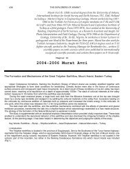
Name : MURAT AVCI<br />
Address : Saygınlar Sitesi, Blok A, No.93, Batıkent, Ankara,Turkey.<br />
e-mail : muratavci4@tnn.net <strong>and</strong>/or egitbilim@tnn.net<br />
Abstract<br />
Upper Cretaceous formations, flanking <strong>the</strong> Sou<strong>the</strong>rn Slopes <strong>of</strong> Mount Ararat are suitably<br />
stratified toge<strong>the</strong>r with appropriate lithologies to form ideal conditions for l<strong>and</strong>sliding. Climatic factors<br />
were also in <strong>the</strong> favour <strong>of</strong> continuous surface erosions <strong>and</strong> consequent rapid mass movements. As a<br />
direct result <strong>of</strong> <strong>the</strong>se conditions a 5 sq km valley has been carved down, reaching at its equilibrium at<br />
a depth <strong>of</strong> approximately 1000m. <strong>The</strong> stack <strong>of</strong> colluvial materials at <strong>the</strong> valley bottom measures 5-10<br />
metres from which <strong>the</strong> earthflow was derivated.<br />
During <strong>the</strong> rapid erosional phase, a large hard rock slab from <strong>the</strong> Miocene limestone unit at<br />
<strong>the</strong> top was brought down by a slump type l<strong>and</strong>slide <strong>and</strong> wedged in by splitting <strong>the</strong> colluvial materials<br />
on <strong>the</strong> valley floor. Excessive loading on <strong>the</strong> colluvials by continuous addition <strong>of</strong> materials built up<br />
pressure <strong>and</strong> increased <strong>the</strong> kinetic energy in <strong>the</strong> colluvials. At one point, when <strong>the</strong> stress was<br />
released, <strong>the</strong> 1.2 km long earthflow came into existence.<br />
<strong>The</strong> slab crept with <strong>the</strong> earthflow, <strong>and</strong> <strong>the</strong> earthflow mechanisms combined with <strong>the</strong> affects <strong>of</strong><br />
glaciation <strong>and</strong> glacial meltdown processes, transformed <strong>the</strong> slab into a shiplike feature which<br />
astonishingly resembled to a man made structure. <strong>The</strong> etiology <strong>of</strong> <strong>the</strong> formation <strong>of</strong> this Natural<br />
Monument is explained in detail.<br />
<strong>The</strong> study is supplemented with an analytical airphoto interpretation which provided vitally<br />
important data. <strong>The</strong>se data enabled to underst<strong>and</strong> <strong>the</strong> dynamical behavior <strong>of</strong> <strong>the</strong> earthflow <strong>and</strong> also<br />
disclosed <strong>the</strong> intriguing formation <strong>of</strong> <strong>the</strong> shiplike feature. At <strong>the</strong> planning stage, it has been helpful in<br />
determining <strong>the</strong> objectives <strong>and</strong> judging <strong>the</strong> validity <strong>of</strong> <strong>the</strong> study.<br />
Key Words: <strong>Earth</strong>flow – Slump – Shiplike l<strong>and</strong>form – Axial Displacement – Natural Monument-–<br />
Turkey<br />
1
I-Introduction.<br />
<strong>The</strong> Telçeker earthflow is located in <strong>the</strong> province <strong>of</strong> Dogubeyazit, 3km to <strong>the</strong> Southwest <strong>of</strong> <strong>the</strong> Turco-<br />
Iranian highway; reachable from <strong>the</strong> Telçeker village, which is approximately 300m East <strong>of</strong> Üzengili<br />
village, at <strong>the</strong> foot <strong>of</strong> Mount Ararat, one <strong>of</strong> <strong>the</strong> magnificent young volcanic mountains <strong>of</strong> Eastern<br />
Anatolia. However, <strong>the</strong> Telçeker earthflow is not located in <strong>the</strong> volcanic part <strong>of</strong> <strong>the</strong> mountain, but ra<strong>the</strong>r<br />
in <strong>the</strong> flanking Creataceous formations into which mount Ararat was intruded (Fig.1).<br />
Figure 1. Location map <strong>of</strong> <strong>the</strong> study area<br />
This study aims to describe <strong>the</strong> development <strong>and</strong> formation <strong>of</strong> <strong>the</strong> Telçeker earthflow which is a great<br />
earthflow when measured <strong>and</strong> compared with <strong>the</strong> o<strong>the</strong>r great l<strong>and</strong>slides in <strong>the</strong> world. However, it is not<br />
only worthy studying it because <strong>of</strong> its size but also for a special feature that it carries on its shoulders.<br />
This feature resembles to a ship <strong>and</strong> is assumed to be <strong>the</strong> Noah’s Ark, symbolizing a story mentioned<br />
in <strong>the</strong> world’s three major celestial religion books. For this reason, it has attracted both religious <strong>and</strong><br />
none religious pr<strong>of</strong>essionals who had visited <strong>the</strong> area <strong>and</strong> proposed views on this Natural Monument<br />
since <strong>the</strong> beginning <strong>of</strong> <strong>the</strong> 19th century. However, except confidential technical reports <strong>of</strong> MTA,<br />
Turkey, <strong>the</strong> first significant research around Mount Ararat was carried out by Blumental(1959). But <strong>the</strong><br />
area became more topical after <strong>the</strong> publication <strong>of</strong> an aerial photograph in a local weekly magazine<br />
(Life Magazine) in 1959, in Turkey which contained <strong>the</strong> great earthflow <strong>and</strong> <strong>the</strong> shiplike feature on it.<br />
2
<strong>The</strong> primary purpose <strong>of</strong> this study is to make a comprehensive analysis <strong>of</strong> Telçeker earthflow, a<br />
secondary aim is to clarify how <strong>the</strong> tantalizing shiplike feature was formed in <strong>the</strong> earthflow. This<br />
combination made for an intriguing <strong>and</strong> stimulating study.<br />
Yılmaz Güner (1986) carried out a detail study concentrating specifically on <strong>the</strong> shiplike Feature.<br />
Güner described <strong>the</strong> earthflow as a mudflow; his <strong>the</strong>sis on <strong>the</strong> formation <strong>of</strong> <strong>the</strong> feature was equally<br />
unpersuasive. However, he did at least silence <strong>the</strong> superstitious elements by defining <strong>the</strong> formation <strong>of</strong><br />
<strong>the</strong> feature as an erosional event. According to his analysis, <strong>the</strong> shiplike feature is a residiual hill, an<br />
outcropping <strong>of</strong> <strong>the</strong> ophiolitic bedrock at <strong>the</strong> bottom <strong>of</strong> <strong>the</strong> valley <strong>and</strong> that this residual hill was carved<br />
by <strong>the</strong> mudflow along its edges <strong>and</strong> consequently shaped it into its present form. Although Güner’s<br />
approach is a rational one, his technical diagnosis is not necessarily correct in defining <strong>the</strong> formation<br />
<strong>of</strong> <strong>the</strong> feature. It is however <strong>the</strong> premise <strong>of</strong> this article that <strong>the</strong> geomechanical processes that he has<br />
proposed are in fact not possible in this context. First <strong>of</strong> all, <strong>the</strong> l<strong>and</strong>slide type is an earthflow ra<strong>the</strong>r<br />
than a mudflow. This is definite, both from aerial photographs <strong>and</strong> from evidences on <strong>the</strong> ground.<br />
Secondly, <strong>the</strong> idea <strong>of</strong> a residual hill is not tenable in <strong>the</strong> light <strong>of</strong> <strong>the</strong> lithological characteristics <strong>of</strong> <strong>the</strong><br />
site <strong>and</strong> <strong>the</strong> type <strong>of</strong> progressive mass movement mechanics prevalent in <strong>the</strong> area. Additionally, <strong>the</strong><br />
feature is formed in a valley more than 1000m deep with no topographic anomalies. <strong>The</strong> rock types<br />
<strong>and</strong> <strong>the</strong>ir mode <strong>of</strong> stratification encourage instability when <strong>the</strong>re is enough water, ei<strong>the</strong>r from rain or<br />
from melting snow. Nor are <strong>the</strong>re volcanic dykes or monadnock types <strong>of</strong> l<strong>and</strong>form development in <strong>the</strong><br />
area. All <strong>of</strong> <strong>the</strong>se facts point to <strong>the</strong> unlikelyhood <strong>of</strong> a residual hill remaining in a regular <strong>and</strong> well<br />
stratified rock formation after a thous<strong>and</strong> metres <strong>of</strong> downcutting. Additionally, a small hill could not<br />
have survived intact against <strong>the</strong> power <strong>of</strong> a great earthflow such as this,moving like a river <strong>of</strong> rock <strong>and</strong><br />
sweeping everything before it.<br />
A close field check <strong>of</strong> <strong>the</strong> edges <strong>of</strong> <strong>the</strong> shiplike feature shows that it is not under <strong>the</strong> earthflow<br />
materials but ra<strong>the</strong>r overlies <strong>the</strong>m. For all <strong>the</strong>se reasons, it is clear that <strong>the</strong> feature was not a residual<br />
hill but was something floating on <strong>the</strong> earthflow.<br />
Aerial photographs provided vital information in underst<strong>and</strong>ing <strong>the</strong> development <strong>and</strong> formation <strong>of</strong> <strong>the</strong><br />
Telçeker earthflow with its shiplike feature. <strong>The</strong> key observation was <strong>the</strong> identification <strong>of</strong> <strong>the</strong> axial<br />
displacement between <strong>the</strong> feature’s long axis <strong>and</strong> <strong>the</strong> direction <strong>of</strong> <strong>the</strong> earthflow, leading to <strong>the</strong><br />
assumption that <strong>the</strong> feature was indeed an object floating on <strong>the</strong> earthflow ra<strong>the</strong>r than a fixed object<br />
protruding from <strong>the</strong> valley floor. This observation has been <strong>the</strong> criteria to decide in carrying out this<br />
study. <strong>The</strong> Telçeker earthflow itself has a good picture <strong>of</strong> a classical earthflow example, but <strong>the</strong><br />
formation <strong>of</strong> <strong>the</strong> shiplike feature gives it a special importance because it created this Natural<br />
Monument.<br />
II- Geological setting.<br />
<strong>The</strong>re are three main rock formations involved in <strong>the</strong> Telçeker earthflow. <strong>The</strong> oldest rock unit in <strong>the</strong><br />
area is <strong>the</strong> Upper Cretaceous ophiolites which outcrops in <strong>and</strong> around <strong>the</strong> valley floor. <strong>The</strong> ophiolites<br />
are highly altered serpentinite, purplish reddish limestones <strong>and</strong> conglomeratic s<strong>and</strong>stones. <strong>The</strong> unit<br />
bears a high clay content <strong>and</strong> because <strong>of</strong> this holds up <strong>the</strong> water seeping through <strong>the</strong> overlying<br />
pervious colluvial materials <strong>and</strong> thus creates <strong>the</strong> appropriate slide surface for <strong>the</strong> earthflow. <strong>The</strong><br />
ophiolites are overlayed by <strong>the</strong> greenish grey marl, s<strong>and</strong>stone, claystone <strong>and</strong> clayey limestone<br />
3
intercalated Eocene series. <strong>The</strong> harder layers are varied in thickness (maximum 50cm) <strong>and</strong> embrittled<br />
by faulting <strong>and</strong> folding. <strong>The</strong>y are easily removed <strong>and</strong> transported by external forces <strong>and</strong> thus provide<br />
<strong>the</strong> greater part <strong>of</strong> <strong>the</strong> earthflow materials. With its high clay content, this unit played an important role<br />
in <strong>the</strong> formation <strong>of</strong> <strong>the</strong> great earthflow by lubricating <strong>the</strong> colluvial materials when collaborated with<br />
water.<br />
<strong>The</strong> youngest <strong>and</strong> <strong>the</strong> highest rock unit is <strong>the</strong> 4-5m. Thick Miocene fossiliferous limestones overlying<br />
<strong>the</strong> easily removed s<strong>of</strong>t Eocene layers. This unit is horizontal or slightly tilted <strong>and</strong> broken into heavy<br />
blocks. This stratification creates a high degree <strong>of</strong> instability. Water seeps through <strong>the</strong> joints <strong>and</strong><br />
reaches <strong>the</strong> s<strong>of</strong>t, clayey Eocene layer, which <strong>the</strong>n causes <strong>the</strong> blocks to be moved down by slides, falls<br />
<strong>and</strong> slumps. Limestone blocks are <strong>the</strong> heaviest component <strong>of</strong> <strong>the</strong> colluvial deposit. <strong>The</strong> shiplike<br />
feature for example is a large block which detached from <strong>the</strong> sheer cliff <strong>of</strong> this unit by slumping.<br />
It is difficult to determine <strong>the</strong> interior lithology <strong>of</strong> <strong>the</strong> shiplike feature in <strong>the</strong> field, because during <strong>the</strong><br />
slumping <strong>and</strong> wedging process, it picket up many rock fragments from <strong>the</strong> colluvials. Enigün’s<br />
geophysical investigation (1988) did not yield significant information. Drilling at several strategic points<br />
would have allowed a clear look at <strong>the</strong> interior structure <strong>and</strong> material <strong>of</strong> <strong>the</strong> feature but this would be<br />
difficult <strong>and</strong> expensive. <strong>The</strong>re is a strong assumption that <strong>the</strong> shiplike feature is a block <strong>of</strong> layer from<br />
<strong>the</strong> Miocene limestone unit at <strong>the</strong> top as <strong>the</strong>re is no o<strong>the</strong>r thick <strong>and</strong> consolidated rock that could create<br />
such a l<strong>and</strong>form <strong>and</strong> withst<strong>and</strong> <strong>the</strong> hard erosive conditions prevailing in <strong>the</strong> area. On <strong>the</strong> o<strong>the</strong>r h<strong>and</strong>,<br />
from <strong>the</strong> engineering st<strong>and</strong>point, <strong>the</strong> important thing is <strong>the</strong> rigid rock slab which is <strong>the</strong> main factor to<br />
create a l<strong>and</strong>form such as this.<br />
<strong>The</strong> colluvial materials are loose Quaternary deposits derived from <strong>the</strong> surrounding rock units by<br />
means <strong>of</strong> different types <strong>of</strong> erosional processes <strong>and</strong> deposited at <strong>the</strong> valley floor up to a variable<br />
thickness <strong>of</strong> 5-10 metres. <strong>The</strong> great earthflow containing <strong>the</strong> shiplike feature is originated from this<br />
colluvials.<br />
Before <strong>the</strong> Telçeker earthflow took place, <strong>the</strong> whole area was covered by snow <strong>and</strong> <strong>the</strong>re was glacier<br />
formation until <strong>the</strong> late Quaternary. <strong>The</strong> higher areas such as <strong>the</strong> fossiliferous limestone at 2400m was<br />
covered by ice that did not melt even in warm seasons. Thus <strong>the</strong> shiplike l<strong>and</strong>form slumped down with<br />
glacier on its back. Repeated freez <strong>and</strong>-melt cycles during <strong>the</strong> seasons partially consolidated <strong>the</strong> loose<br />
colluvial materials by physical <strong>and</strong> chemical erosional processes <strong>and</strong> smoo<strong>the</strong>ned <strong>the</strong> topography <strong>of</strong><br />
<strong>the</strong> irregularly deposited colluvials in <strong>the</strong> basin. However, <strong>the</strong> topography <strong>of</strong> <strong>the</strong> younger earthflow is<br />
distinguishable from nonaffected areas by <strong>the</strong> anomalies created by sliding. Glacial l<strong>and</strong>forms such as<br />
glacier caves, cirque lakes <strong>and</strong> moraines are still visible in <strong>the</strong> area.<br />
III- Evolution <strong>of</strong> <strong>the</strong> Erosional Processes <strong>and</strong> <strong>Formation</strong> <strong>of</strong> <strong>the</strong> Telçeker <strong>Earth</strong>flow.<br />
A triangular valley is formed <strong>and</strong> enlarged by different erosional processes that work at <strong>the</strong> upper<br />
slopes <strong>and</strong> downcut at <strong>the</strong> only outlet <strong>of</strong> <strong>the</strong> triangle. While <strong>the</strong> valley was enlarging, <strong>the</strong> materials<br />
detached from <strong>the</strong> slopes were mainly accumulated in a thick colluvial layer on <strong>the</strong> valley floor ra<strong>the</strong>r<br />
than being transported away. <strong>The</strong>re are two reasons for this. First, <strong>the</strong>re is only one narrow outlet to<br />
<strong>the</strong> valley. Second, <strong>the</strong>re were frequent large l<strong>and</strong>slides because <strong>of</strong> climate, <strong>the</strong> rock types <strong>and</strong> <strong>the</strong>ir<br />
stratification.<br />
4
<strong>The</strong> valley covers approximately an area <strong>of</strong> about five square kilometres. When <strong>the</strong> process <strong>of</strong><br />
downcutting reached <strong>the</strong> ophiolitic formations at <strong>the</strong> bottom, <strong>the</strong> incision slowed down because <strong>the</strong><br />
material <strong>of</strong> this unit is impervious; <strong>the</strong> water ran over instead <strong>of</strong> cutting down. As a result, <strong>the</strong> valley<br />
pr<strong>of</strong>ile lowered <strong>and</strong> valley bottom levelled out. But while downcutting decreased, <strong>the</strong> backward erosion<br />
on <strong>the</strong> upper slopes continued resulting in more accumulation <strong>of</strong> material than was transported.<br />
Material stacked up for tens <strong>of</strong> metres above <strong>the</strong> impervious ophiolitic bedrock unit. As time passed,<br />
<strong>the</strong> erosional cycle continued in <strong>the</strong> valley. In connection with aggravating climatic variation, four levels<br />
<strong>of</strong> l<strong>and</strong>slides have developed in <strong>and</strong> around <strong>the</strong> crescent shaped valley root; <strong>the</strong> fourth <strong>of</strong> <strong>the</strong>se was<br />
<strong>the</strong> great earthflow bearing <strong>the</strong> shiplike l<strong>and</strong>form.<br />
<strong>The</strong> slides from <strong>the</strong> fossiliferous limestones unit at <strong>the</strong> top were mostly <strong>of</strong> <strong>the</strong> slumping type because<br />
<strong>of</strong> <strong>the</strong> hard, jointed limestone blocks overlying <strong>the</strong> s<strong>of</strong>t, easily crumbled Eocene unit. Once a limestone<br />
block detached from <strong>the</strong> sheer cliff, it would easily crush <strong>the</strong> s<strong>of</strong>ter lower unit <strong>and</strong> slide down along a<br />
rotational sliding surface without deforming <strong>the</strong> top hard layer, specifically, if <strong>the</strong> detached block is as<br />
large as at <strong>the</strong> dimensions <strong>of</strong> <strong>the</strong> shiplike feature measuring 150mx50mx4m. This is how <strong>the</strong> shiplike<br />
l<strong>and</strong>form was initially slid down as a large layer from <strong>the</strong> upper fossiliferous limestone formation <strong>and</strong><br />
crept downward until it became a part <strong>of</strong> <strong>the</strong> colluvial materials <strong>and</strong> stationed over <strong>the</strong> lower ophiolitic<br />
unit.<br />
Slumping is a common l<strong>and</strong>slide type in this kind <strong>of</strong> stratification in all over <strong>the</strong> world (i.e. compact,<br />
hard <strong>and</strong> pervious lithology above <strong>and</strong> s<strong>of</strong>t, impervious lithology below), provided that <strong>the</strong> water agent<br />
is available. In this way, <strong>the</strong> shiplike l<strong>and</strong>form detached <strong>and</strong> crept down until it became part <strong>of</strong> <strong>the</strong><br />
colluvial materials which accumulated in <strong>the</strong> cone shaped valley. <strong>The</strong> narrow end <strong>of</strong> <strong>the</strong> cone was <strong>the</strong><br />
only outlet to drain water from this small basin. As materials piled up in <strong>the</strong> upper sections <strong>of</strong> <strong>the</strong><br />
valley, a constant pressure is being supplied on to <strong>the</strong> colluvial materials which caused <strong>the</strong><br />
development <strong>of</strong> a kinetic energy. While <strong>the</strong> energy increased in <strong>the</strong> materials by constant loading, <strong>the</strong><br />
seeped water trough <strong>the</strong> colluvials, on <strong>the</strong> o<strong>the</strong>r h<strong>and</strong>, held by <strong>the</strong> ophiolitic bedrock, prepared <strong>the</strong><br />
needed sliding surface for <strong>the</strong> earthflow to happen. Preceding <strong>the</strong> great slide, <strong>the</strong> load at <strong>the</strong> upper<br />
mid valley was fed by several small slide tributaries from above which <strong>the</strong>y later joined at a central<br />
area <strong>and</strong> flowed down as one great slide creating <strong>the</strong> present Telçeker earthflow.<br />
<strong>The</strong> aerial photographs show clearly that <strong>the</strong> great Telçeker earthflow itself took place in two stages,<br />
separated by minutes or a few hours. <strong>The</strong> clear boundary line between <strong>the</strong> two flows is seen in figure<br />
2, at point S. Possibly, tremors from <strong>the</strong> first flow triggered <strong>the</strong> second which followed <strong>the</strong> same curve,<br />
sweeping material from <strong>the</strong> older slide in front <strong>of</strong> it, materials that might have been still well saturated<br />
with water. <strong>The</strong> flow ran 1.2 km past <strong>the</strong> only outlet <strong>of</strong> <strong>the</strong> basin. Two hundred metres before it<br />
stopped, <strong>the</strong> flow made a turn <strong>of</strong> almost 90 degrees to <strong>the</strong> East; exactly at <strong>the</strong> point where it crosses<br />
<strong>the</strong> Dogu Beyazit fault line. <strong>The</strong> fault was <strong>the</strong>re long before <strong>the</strong> earthflow, which simply adapted itself<br />
to <strong>the</strong> existing topography. Meanwhile, <strong>the</strong> shiplike feature was carried <strong>and</strong> shaped within <strong>the</strong> older<br />
section <strong>of</strong> <strong>the</strong> flow. Although <strong>the</strong> surface characteristics <strong>of</strong> <strong>the</strong> two flow stages are similar, <strong>the</strong>y are<br />
distinguishable by <strong>the</strong> slight difference in flow direction <strong>and</strong> <strong>the</strong> surface texture.<br />
It is interesting to note that all <strong>the</strong> smaller slide tributaries from different parts <strong>of</strong> <strong>the</strong> valley floor moved<br />
down at <strong>the</strong> same time though <strong>the</strong>y were distant from each o<strong>the</strong>r- suggests a regional triggering agent<br />
5
along <strong>the</strong> following lines: First, a period <strong>of</strong> heavy precipitation <strong>and</strong>/or excessive snow melt followed by<br />
an earthquake tremor (quite common in this region). This combination could have initiated all <strong>the</strong> initial<br />
flows <strong>and</strong> consequently <strong>the</strong> main (Telçeker) flow.<br />
Anyhow, <strong>the</strong> lithology <strong>and</strong> climate in <strong>the</strong> area are synchronous to produce varied examples <strong>of</strong><br />
l<strong>and</strong>slides. For example, an incomplete slumping can be observed in figure 2 PS, developed before<br />
<strong>and</strong> independent <strong>of</strong> Telçeker earthflow. <strong>The</strong> arrows indicate <strong>the</strong> circular trace <strong>of</strong> a slump-type l<strong>and</strong>slide<br />
which occurred in <strong>the</strong> homogeneous part <strong>of</strong> <strong>the</strong> ophiolites. <strong>The</strong> block in view was rotated at its circular<br />
sliding surface for several metres but left no apparent topographic anomaly. Because, it is clear that<br />
<strong>the</strong> sliding cycle <strong>of</strong> <strong>the</strong> slumping process was incomplete, probably because <strong>of</strong> some obstruction in <strong>the</strong><br />
foot area. While it stood at its position as a potential slump, <strong>the</strong> Telçeker earthflow material moved in<br />
<strong>and</strong> covered this foot area ( R ), creating a natural retaining wall which prevented fur<strong>the</strong>r slumping.<br />
IV- How <strong>The</strong> Shiplike Feature Was Formed<br />
Slumps are l<strong>and</strong>slide types which usually take place along a circular plane; <strong>the</strong> slid material is not<br />
transported far but is heaped at <strong>the</strong> root <strong>of</strong> <strong>the</strong> scarp. <strong>The</strong> circular sliding motion is somewhat similar to<br />
<strong>the</strong> motion <strong>of</strong> a human being trying to sit down while his back is against a wall. During this motion, <strong>the</strong><br />
body moves down while <strong>the</strong> legs are bent like a hinge to prevent loss <strong>of</strong> balance. During <strong>the</strong> sliding<br />
process, <strong>the</strong> underlying s<strong>of</strong>t unit (because <strong>of</strong> its homogeneity) is isotropically squeezed down,<br />
(representing <strong>the</strong> legs), it absorbs, <strong>and</strong> slows down <strong>the</strong> pressurising energy <strong>of</strong> <strong>the</strong> upper consolidated<br />
heavy unit (<strong>the</strong> body) which consequently prevents its unbalanced collapse <strong>and</strong> deformation. Similarly<br />
in slumps, if <strong>the</strong> top layer is a consolidated rock layer, it is usually not deformed after <strong>the</strong> slide has<br />
occurred. This is exactly what happened when a huge rock layer first detached <strong>and</strong> slid down from <strong>the</strong><br />
overlying fossiliferous limestone unit at <strong>the</strong> top.<strong>The</strong> shiplike feature is a piece <strong>of</strong> undeformed remnant<br />
<strong>of</strong> <strong>the</strong> hard limestone, brought down by a slump type l<strong>and</strong>slide.<br />
6
Figure 2. Aerial photograph <strong>of</strong> <strong>the</strong> great earthflow (Noah’s ark highlighted)<br />
D<br />
S<br />
B<br />
7<br />
R<br />
A<br />
PS<br />
C
However, <strong>the</strong> slab did not look as it does now until it went through several processes as follows: It<br />
apparently detached along an ellipsoidal weakness line concordant to <strong>the</strong> sheer cliff side (fig.3).<br />
Several o<strong>the</strong>r conditions contributed to <strong>the</strong> slump: <strong>the</strong> removal <strong>of</strong> <strong>the</strong> underlying unit by erosion, a<br />
period <strong>of</strong> heavy rain, snow or ice melt, seepage through <strong>the</strong> present joints <strong>and</strong>/or an earthquake<br />
tremor. After <strong>the</strong> slump took place, <strong>the</strong> slablike rock block slid down with <strong>the</strong> glacier at its back to <strong>the</strong><br />
valley floor <strong>and</strong> stuck in <strong>the</strong> thick colluvial deposits like a wedge; it may have received its first<br />
shipshape sculpturing during this wedging stage. It stabilized <strong>the</strong>re in <strong>the</strong> heavy colluvial materials with<br />
o<strong>the</strong>r smaller sized materials from <strong>the</strong> local rock formations.<br />
Figure 3. Geology <strong>and</strong> geomorphological evolution <strong>of</strong> <strong>the</strong> site (not to scale)<br />
<strong>The</strong> slab finished its rapid movement after <strong>the</strong> slumping, but it continued creeping slowly downward<br />
within <strong>the</strong> colluvials as it was a large <strong>and</strong> heavy block compare to its proximity <strong>and</strong> did not stop until<br />
<strong>the</strong> great earthflow took place. While it was slowly wedging down into <strong>the</strong> colluvials, <strong>the</strong> colluvial<br />
deposition continued behind it; after several hundred years, but before <strong>the</strong> earthflow took place, it was<br />
completely surrounded <strong>and</strong> became a part <strong>of</strong> <strong>the</strong> colluvial deposits on <strong>the</strong> valley floor.<br />
8
When <strong>the</strong> first part <strong>of</strong> <strong>the</strong> main earthflow started moving, <strong>the</strong> slab with <strong>the</strong> glacier at its back slid down<br />
like a large raft floating on a river. But this solid huge mass did not slide at <strong>the</strong> same rate as <strong>the</strong> o<strong>the</strong>r<br />
parts <strong>of</strong> <strong>the</strong> earthflow: it was a large piece relative to <strong>the</strong> o<strong>the</strong>r materials <strong>of</strong> <strong>the</strong> earthflow <strong>and</strong> thus<br />
moved at its own rate, somewhat more slowly. <strong>The</strong> slab floated on <strong>the</strong> earthflow as if on a liquid<br />
environment <strong>and</strong> even oscillated about at its transverse axis. Sometimes it pitched into <strong>the</strong> earthflow<br />
materials <strong>and</strong> levelled again. <strong>The</strong> jigsaw scars at <strong>the</strong> front <strong>of</strong> <strong>the</strong> feature were scraped by <strong>the</strong> rock<br />
blocks contained in <strong>the</strong> earthflow materials during this oscillating movements (fig. 4 J ).<strong>The</strong> slab did<br />
not slide for a great distance: it hit bottom from time to time <strong>and</strong> finally stopped when it grounded firmly<br />
at its present position as seen on <strong>the</strong> aerial photograph. It <strong>of</strong> course ended up at a higher level relative<br />
to <strong>the</strong> moving earthflow materials. On <strong>the</strong> aerial photograph <strong>the</strong>re is some printed information that is<br />
important support for <strong>the</strong> <strong>the</strong>ories put forward in this study: that <strong>the</strong> shiplike feature is not a stationary<br />
feature but a piece <strong>of</strong> <strong>the</strong> earthflow behaving in a special way. This printed information is <strong>the</strong><br />
diplacement between <strong>the</strong> feature’s long axis (fig. 2, A-B) <strong>and</strong> <strong>the</strong> earthflow’s flow direction axis (C-D).<br />
<strong>The</strong>re is 20 degrees <strong>of</strong> deviation in between <strong>the</strong>se two axes. <strong>The</strong> explanation for this deviation follows:<br />
<strong>The</strong> shiplike feature moved for a while with <strong>the</strong> earthflow <strong>and</strong> <strong>the</strong>n grounded (fig.3, see bottom);<br />
however <strong>the</strong> earthflow continued flowing, trying to carry <strong>the</strong> feature fur<strong>the</strong>r; but <strong>the</strong> feature was<br />
grounded <strong>and</strong> could only be pivoted a bit on its vertical axis; this action caused it to be displaced 20<br />
degrees from <strong>the</strong> earthflow flow direction.<br />
<strong>The</strong> identification <strong>of</strong> this axial displacement <strong>and</strong> related mechanisms were succeded because <strong>of</strong> <strong>the</strong><br />
three dimensional overview capability <strong>of</strong> airphoto interpretation techniques. In <strong>the</strong> case, this was not<br />
possible <strong>the</strong> nature <strong>of</strong> <strong>the</strong> shiplike feature <strong>and</strong> <strong>the</strong> detailed description <strong>of</strong> <strong>the</strong> Telçeker earthflow could<br />
not have been possible <strong>and</strong> this study would not be worth carrying out.<br />
It is difficult to estimate <strong>the</strong> detachment point <strong>of</strong> <strong>the</strong> slab as <strong>the</strong> limestone unit was retreating all <strong>the</strong><br />
time. However, at present, <strong>the</strong> slab is 2.5km. away from <strong>the</strong> scar. It slid from a height <strong>of</strong> 2500 metres<br />
<strong>and</strong> now rests at 1900metres. It may have been transported approximately 2km.after it was detached.<br />
In any event, it is certain that this feature is not a ship or any such manmade artefact, although<br />
behaved very much like a ship within <strong>the</strong> earthflow. For example, ei<strong>the</strong>r during <strong>the</strong> push by <strong>the</strong><br />
earthflow, <strong>and</strong> resistance by rocking, or oscillation at its transverse axis, <strong>the</strong> “backbone” <strong>of</strong> <strong>the</strong> “ship”<br />
was broken in several places (fig.4).<br />
9
Figure 4. Ground photograph <strong>of</strong> part <strong>of</strong> <strong>the</strong> earthflow <strong>and</strong> <strong>the</strong> feature<br />
J<br />
During both <strong>the</strong> creeping <strong>and</strong> <strong>the</strong> fixed stages <strong>of</strong> <strong>the</strong> feature, <strong>the</strong> earthflow materials flowed faster than<br />
<strong>the</strong> slab <strong>and</strong> carved it from left <strong>and</strong> right, somewhat shaping it into a shuttle like form. This is <strong>the</strong> same<br />
principal as s<strong>and</strong>bar development in a river, except that a s<strong>and</strong>bar is two dimensional, whereas <strong>the</strong><br />
shiplike feature is three dimensional (150mx50mx4m) which is why it is so deceptive.<br />
However, at <strong>the</strong> early stage, <strong>the</strong> processes which formed <strong>the</strong> slab into a perfect shiplike feature had<br />
not yet been completed. For example, in its present shape, both <strong>the</strong> center <strong>and</strong> <strong>the</strong> edges are raised<br />
as in a real ship with a lower area in between; this is how a ship would look if it were burried <strong>and</strong> <strong>the</strong>n<br />
emerged again. <strong>The</strong>re is a rational explanation for this shape. Remember that <strong>the</strong> slab had an ice cap<br />
when it moved down. We know that <strong>the</strong> edges were partially tilted up, both during its wedging into <strong>the</strong><br />
colluvials <strong>and</strong> also later by <strong>the</strong> pushing <strong>of</strong> <strong>the</strong> rapidly moving, heavy earthflow materials during <strong>the</strong><br />
main flow.<br />
However, <strong>the</strong> fine work <strong>of</strong> sculpturing <strong>of</strong> <strong>the</strong> slab (Fig. 5 a, b, c, d) happened during <strong>the</strong> glacier melt.<br />
When <strong>the</strong> earthflow was finished, <strong>the</strong> ice on <strong>the</strong> slab started melting both because <strong>the</strong> slab with <strong>the</strong><br />
glacier moved down to warmer level <strong>and</strong> also because <strong>the</strong> climate warmed up regionally. <strong>The</strong> l<strong>and</strong><br />
along <strong>the</strong> edges <strong>of</strong> <strong>the</strong> slab was more exposed due to its higher position <strong>and</strong> so <strong>the</strong> ice melted faster<br />
<strong>the</strong>re, <strong>the</strong> glacier retreated faster. Because <strong>of</strong> this, <strong>the</strong> slab edges were less exposed to water,<br />
dripping from <strong>the</strong> edge <strong>of</strong> <strong>the</strong> ice; this reduced <strong>the</strong> effect <strong>of</strong> dissolution, condensation <strong>and</strong> compaction<br />
along <strong>the</strong> edges <strong>of</strong> <strong>the</strong> slab <strong>and</strong> thus <strong>the</strong> edges remained high.<br />
<strong>The</strong> depression between <strong>the</strong> edges <strong>and</strong> <strong>the</strong> bulging centre <strong>of</strong> <strong>the</strong> formation came about because <strong>of</strong><br />
<strong>the</strong> effect <strong>of</strong> ice melting on <strong>the</strong> slab’s calcareous material. <strong>The</strong> melting did not start at <strong>the</strong> bottom<br />
centre <strong>of</strong> <strong>the</strong> glacier where it would have been cold, but ra<strong>the</strong>r at <strong>the</strong> upper surface <strong>and</strong> at its edges.<br />
After melting started, running water flowed over <strong>the</strong> glacier surface toward <strong>the</strong> edges where it joined<br />
with <strong>the</strong> water melting at <strong>the</strong> edge. <strong>The</strong> water <strong>the</strong>n ran from <strong>the</strong> ice edges under <strong>the</strong> lower surface <strong>of</strong><br />
<strong>the</strong> glacier <strong>and</strong> dripped on <strong>the</strong> slab between <strong>the</strong> edges <strong>and</strong> <strong>the</strong> centre <strong>of</strong> <strong>the</strong> slab.<br />
While <strong>the</strong> melting continued, <strong>the</strong> edge <strong>of</strong> <strong>the</strong> glacier retreated towards <strong>the</strong> centre <strong>and</strong> <strong>the</strong> drainage line<br />
around <strong>the</strong> glacier from dripping water also moved toward <strong>the</strong> centre. During this long, slow retreat,<br />
10
<strong>the</strong>se areas were diagenesed by physical <strong>and</strong> chemical dissolution, <strong>and</strong> by <strong>the</strong> process <strong>of</strong><br />
condensation <strong>and</strong> compaction. In this way, <strong>the</strong> areas between <strong>the</strong> centre <strong>and</strong> edges were worn down<br />
<strong>and</strong> subsided. Why <strong>the</strong>n <strong>the</strong> centre remained raised? <strong>The</strong>se slow processes might have taken<br />
hundred <strong>of</strong> years, continuing until <strong>the</strong> glacier became very small <strong>and</strong> thin, about <strong>the</strong> size <strong>of</strong> <strong>the</strong> current<br />
raised area. This small piece <strong>of</strong> ice would <strong>the</strong>n melt quickly <strong>and</strong> disappear in a short period <strong>of</strong> time:<br />
because <strong>of</strong> this, <strong>the</strong> centre was not exposed to water action long enough to be diagenesed like <strong>the</strong><br />
subsided sections <strong>and</strong> it thus remained higher.<br />
Figure 5. <strong>The</strong> cross sections showing <strong>the</strong> final sculpturing stages <strong>of</strong> <strong>the</strong> feature<br />
<strong>The</strong> outcome <strong>of</strong> all <strong>the</strong>se processes was <strong>the</strong> formation <strong>of</strong> this near perfect Natural Monument, this<br />
shiplike feature, or Noah’s Ark as it is commonly known.<br />
V-References:<br />
Blumental, M. M., 1959, Ağrı Volkanı ve Sedimanter çevresinin Dağları, İ. Ü. Fen Fak., Mec., S. B., pp.<br />
23.<br />
Enigün, H. M., 1988, Geophysical Investigation <strong>of</strong> Telçeker L<strong>and</strong>slide, Doğubeyazit, MTA, Technical<br />
Report No. 8543, Ankara.<br />
Güner Yılmaz, 1986, Is Noah’s Ark on Mount Ararat? Geomorphological Development <strong>of</strong> <strong>the</strong><br />
Doğubeyazit – Telçeker L<strong>and</strong>slide Which is Assumed to be related to Noah’s Ark, Bulletin <strong>of</strong><br />
Geomorphology, No.14, pp. 27-37, Ankara.<br />
Life Magazine, 1959, Noah’s Ark is on Mount Ararat, Vol. 1, No.6, pp.15-17, Istanbul.<br />
11