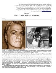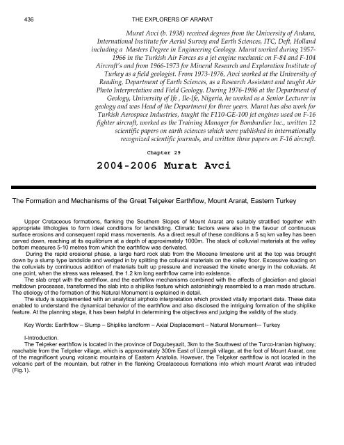
2004-2006 Murat Avci
Durupinar's Great Telçeker Earthflow Geologic Formation
Durupinar's Great Telçeker Earthflow Geologic Formation

Create successful ePaper yourself
Turn your PDF publications into a flip-book with our unique Google optimized e-Paper software.
436 THE EXPLORERS OF ARARAT<br />
<strong>Murat</strong> <strong>Avci</strong> (b. 1938) received degrees from the University of Ankara,<br />
International Institute for Aerial Survey and Earth Sciences, ITC, Deft, Holland<br />
including a Masters Degree in Engineering Geology. <strong>Murat</strong> worked during 1957-<br />
1966 in the Turkish Air Forces as a jet engine mechanic on F-84 and F-104<br />
Aircraft’s and from 1966-1973 for Mineral Research and Exploration Institute of<br />
Turkey as a field geologist. From 1973-1976, <strong>Avci</strong> worked at the University of<br />
Reading, Department of Earth Sciences, as a Research Assistant and taught Air<br />
Photo Interpretation and Field Geology. During 1976-1986 at the Department of<br />
Geology, University of Ife , Ile-Ife, Nigeria, he worked as a Senior Lecturer in<br />
geology and was Head of the Department for three years. <strong>Murat</strong> has also work for<br />
Turkish Aerospace Industries, taught the F110-GE-100 jet engines used on F-16<br />
fighter aircraft, worked as the Training Manager for Bombardier Inc., written 12<br />
scientific papers on earth sciences which were published in internationally<br />
recognized scientific journals, and written three papers on F-16 aircraft.<br />
Chapter 29<br />
<strong>2004</strong>-<strong>2006</strong> <strong>Murat</strong> <strong>Avci</strong><br />
The Formation and Mechanisms of the Great Telçeker Earthflow, Mount Ararat, Eastern Turkey<br />
Upper Cretaceous formations, flanking the Southern Slopes of Mount Ararat are suitably stratified together with<br />
appropriate lithologies to form ideal conditions for landsliding. Climatic factors were also in the favour of continuous<br />
surface erosions and consequent rapid mass movements. As a direct result of these conditions a 5 sq km valley has been<br />
carved down, reaching at its equilibrium at a depth of approximately 1000m. The stack of colluvial materials at the valley<br />
bottom measures 5-10 metres from which the earthflow was derivated.<br />
During the rapid erosional phase, a large hard rock slab from the Miocene limestone unit at the top was brought<br />
down by a slump type landslide and wedged in by splitting the colluvial materials on the valley floor. Excessive loading on<br />
the colluvials by continuous addition of materials built up pressure and increased the kinetic energy in the colluvials. At<br />
one point, when the stress was released, the 1.2 km long earthflow came into existence.<br />
The slab crept with the earthflow, and the earthflow mechanisms combined with the affects of glaciation and glacial<br />
meltdown processes, transformed the slab into a shiplike feature which astonishingly resembled to a man made structure.<br />
The etiology of the formation of this Natural Monument is explained in detail.<br />
The study is supplemented with an analytical airphoto interpretation which provided vitally important data. These data<br />
enabled to understand the dynamical behavior of the earthflow and also disclosed the intriguing formation of the shiplike<br />
feature. At the planning stage, it has been helpful in determining the objectives and judging the validity of the study.<br />
Key Words: Earthflow – Slump – Shiplike landform – Axial Displacement – Natural Monument-– Turkey<br />
I-Introduction.<br />
The Telçeker earthflow is located in the province of Dogubeyazit, 3km to the Southwest of the Turco-Iranian highway;<br />
reachable from the Telçeker village, which is approximately 300m East of Üzengili village, at the foot of Mount Ararat, one<br />
of the magnificent young volcanic mountains of Eastern Anatolia. However, the Telçeker earthflow is not located in the<br />
volcanic part of the mountain, but rather in the flanking Creataceous formations into which mount Ararat was intruded<br />
(Fig.1).
<strong>Murat</strong> <strong>Avci</strong> 437<br />
Figure 1. Location map of the study area<br />
This study aims to describe the development and formation of the Telçeker earthflow which is a great earthflow when<br />
measured and compared with the other great landslides in the world. However, it is not only worthy studying it because of<br />
its size but also for a special feature that it carries on its shoulders. This feature resembles to a ship and is assumed to be<br />
the Noah’s Ark, symbolizing a story mentioned in the world’s three major celestial religion books. For this reason, it has<br />
attracted both religious and none religious professionals who had visited the area and proposed views on this Natural<br />
Monument since the beginning of the 19th century. However, except confidential technical reports of MTA, Turkey, the<br />
first significant research around Mount Ararat was carried out by Blumental(1959). But the area became more topical after<br />
the publication of an aerial photograph in a local weekly magazine (Life Magazine) in 1959, in Turkey which contained the<br />
great earthflow and the shiplike feature on it.<br />
The primary purpose of this study is to make a comprehensive analysis of Telçeker earthflow, a secondary aim is to<br />
clarify how the tantalizing shiplike feature was formed in the earthflow. This combination made for an intriguing and<br />
stimulating study.<br />
Yılmaz Güner (1986) carried out a detail study concentrating specifically on the shiplike Feature. Güner described<br />
the earthflow as a mudflow; his thesis on the formation of the feature was equally unpersuasive. However, he did at least<br />
silence the superstitious elements by defining the formation of the feature as an erosional event. According to his<br />
analysis, the shiplike feature is a residiual hill, an outcropping of the ophiolitic bedrock at the bottom of the valley and that<br />
this residual hill was carved by the mudflow along its edges and consequently shaped it into its present form. Although<br />
Güner’s approach is a rational one, his technical diagnosis is not necessarily correct in defining the formation of the<br />
feature. It is however the premise of this article that the geomechanical processes that he has proposed are in fact not<br />
possible in this context. First of all, the landslide type is an earthflow rather than a mudflow. This is definite, both from<br />
aerial photographs and from evidences on the ground. Secondly, the idea of a residual hill is not tenable in the light of the<br />
lithological characteristics of the site and the type of progressive mass movement mechanics prevalent in the area.<br />
Additionally, the feature is formed in a valley more than 1000m deep with no topographic anomalies. The rock types and<br />
their mode of stratification encourage instability when there is enough water, either from rain or from melting snow. Nor<br />
are there volcanic dykes or monadnock types of landform development in the area. All of these facts point to the<br />
unlikelyhood of a residual hill remaining in a regular and well stratified rock formation after a thousand metres of<br />
downcutting. Additionally, a small hill could not have survived intact against the power of a great earthflow such as<br />
this,moving like a river of rock and sweeping everything before it.<br />
A close field check of the edges of the shiplike feature shows that it is not under the earthflow materials but rather<br />
overlies them. For all these reasons, it is clear that the feature was not a residual hill but was something floating on the<br />
earthflow.<br />
Aerial photographs provided vital information in understanding the development and formation of the Telçeker<br />
earthflow with its shiplike feature. The key observation was the identification of the axial displacement between the<br />
feature’s long axis and the direction of the earthflow, leading to the assumption that the feature was indeed an object
438 THE EXPLORERS OF ARARAT<br />
floating on the earthflow rather than a fixed object protruding from the valley floor. This observation has been the criteria<br />
to decide in carrying out this study. The Telçeker earthflow itself has a good picture of a classical earthflow example, but<br />
the formation of the shiplike feature gives it a special importance because it created this Natural Monument.<br />
II- Geological setting.<br />
There are three main rock formations involved in the Telçeker earthflow. The oldest rock unit in the area is the Upper<br />
Cretaceous ophiolites which outcrops in and around the valley floor. The ophiolites are highly altered serpentinite, purplish<br />
reddish limestones and conglomeratic sandstones. The unit bears a high clay content and because of this holds up the<br />
water seeping through the overlying pervious colluvial materials and thus creates the appropriate slide surface for the<br />
earthflow. The ophiolites are overlayed by the greenish grey marl, sandstone, claystone and clayey limestone intercalated<br />
Eocene series. The harder layers are varied in thickness (maximum 50cm) and embrittled by faulting and folding. They<br />
are easily removed and transported by external forces and thus provide the greater part of the earthflow materials. With its<br />
high clay content, this unit played an important role in the formation of the great earthflow by lubricating the colluvial<br />
materials when collaborated with water.<br />
The youngest and the highest rock unit is the 4-5m. Thick Miocene fossiliferous limestones overlying the easily<br />
removed soft Eocene layers. This unit is horizontal or slightly tilted and broken into heavy blocks. This stratification<br />
creates a high degree of instability. Water seeps through the joints and reaches the soft, clayey Eocene layer, which then<br />
causes the blocks to be moved down by slides, falls and slumps. Limestone blocks are the heaviest component of the<br />
colluvial deposit. The shiplike feature for example is a large block which detached from the sheer cliff of this unit by<br />
slumping.<br />
It is difficult to determine the interior lithology of the shiplike feature in the field, because during the slumping and<br />
wedging process, it picket up many rock fragments from the colluvials. Enigün’s geophysical investigation (1988) did not<br />
yield significant information. Drilling at several strategic points would have allowed a clear look at the interior structure and<br />
material of the feature but this would be difficult and expensive. There is a strong assumption that the shiplike feature is a<br />
block of layer from the Miocene limestone unit at the top as there is no other thick and consolidated rock that could create<br />
such a landform and withstand the hard erosive conditions prevailing in the area. On the other hand, from the engineering<br />
standpoint, the important thing is the rigid rock slab which is the main factor to create a landform such as this.<br />
The colluvial materials are loose Quaternary deposits derived from the surrounding rock units by means of different<br />
types of erosional processes and deposited at the valley floor up to a variable thickness of 5-10 metres. The great<br />
earthflow containing the shiplike feature is originated from this colluvials.<br />
Before the Telçeker earthflow took place, the whole area was covered by snow and there was glacier formation until<br />
the late Quaternary. The higher areas such as the fossiliferous limestone at 2400m was covered by ice that did not melt<br />
even in warm seasons. Thus the shiplike landform slumped down with glacier on its back. Repeated freez and-melt cycles<br />
during the seasons partially consolidated the loose colluvial materials by physical and chemical erosional processes and<br />
smoothened the topography of the irregularly deposited colluvials in the basin. However, the topography of the younger<br />
earthflow is distinguishable from nonaffected areas by the anomalies created by sliding. Glacial landforms such as glacier<br />
caves, cirque lakes and moraines are still visible in the area.<br />
III- Evolution of the Erosional Processes and Formation of the Telçeker Earthflow.<br />
A triangular valley is formed and enlarged by different erosional processes that work at the upper slopes and<br />
downcut at the only outlet of the triangle. While the valley was enlarging, the materials detached from the slopes were<br />
mainly accumulated in a thick colluvial layer on the valley floor rather than being transported away. There are two reasons<br />
for this. First, there is only one narrow outlet to the valley. Second, there were frequent large landslides because of<br />
climate, the rock types and their stratification.<br />
The valley covers approximately an area of about five square kilometres. When the process of downcutting reached<br />
the ophiolitic formations at the bottom, the incision slowed down because the material of this unit is impervious; the water<br />
ran over instead of cutting down. As a result, the valley profile lowered and valley bottom levelled out. But while<br />
downcutting decreased, the backward erosion on the upper slopes continued resulting in more accumulation of material<br />
than was transported. Material stacked up for tens of metres above the impervious ophiolitic bedrock unit. As time passed,<br />
the erosional cycle continued in the valley. In connection with aggravating climatic variation, four levels of landslides have<br />
developed in and around the crescent shaped valley root; the fourth of these was the great earthflow bearing the shiplike<br />
landform.<br />
The slides from the fossiliferous limestones unit at the top were mostly of the slumping type because of the hard,<br />
jointed limestone blocks overlying the soft, easily crumbled Eocene unit. Once a limestone block detached from the sheer<br />
cliff, it would easily crush the softer lower unit and slide down along a rotational sliding surface without deforming the top<br />
hard layer, specifically, if the detached block is as large as at the dimensions of the shiplike feature measuring<br />
150mx50mx4m. This is how the shiplike landform was initially slid down as a large layer from the upper fossiliferous<br />
limestone formation and crept downward until it became a part of the colluvial materials and stationed over the lower<br />
ophiolitic unit.<br />
Slumping is a common landslide type in this kind of stratification in all over the world (i.e. compact, hard and pervious<br />
lithology above and soft, impervious lithology below), provided that the water agent is available. In this way, the shiplike
<strong>Murat</strong> <strong>Avci</strong> 439<br />
landform detached and crept down until it became part of the colluvial materials which accumulated in the cone shaped<br />
valley. The narrow end of the cone was the only outlet to drain water from this small basin. As materials piled up in the<br />
upper sections of the valley, a constant pressure is being supplied on to the colluvial materials which caused the<br />
development of a kinetic energy. While the energy increased in the materials by constant loading, the seeped water<br />
trough the colluvials, on the other hand, held by the ophiolitic bedrock, prepared the needed sliding surface for the<br />
earthflow to happen. Preceding the great slide, the load at the upper mid valley was fed by several small slide tributaries<br />
from above which they later joined at a central area and flowed down as one great slide creating the present Telçeker<br />
earthflow.<br />
The aerial photographs show clearly that the great Telçeker earthflow itself took place in two stages, separated by<br />
minutes or a few hours. The clear boundary line between the two flows is seen in figure 2, at point S. Possibly, tremors<br />
from the first flow triggered the second which followed the same curve, sweeping material from the older slide in front of it,<br />
materials that might have been still well saturated with water. The flow ran 1.2 km past the only outlet of the basin. Two<br />
hundred metres before it stopped, the flow made a turn of almost 90 degrees to the East; exactly at the point where it<br />
crosses the Dogu Beyazit fault line. The fault was there long before the earthflow, which simply adapted itself to the<br />
existing topography. Meanwhile, the shiplike feature was carried and shaped within the older section of the flow. Although<br />
the surface characteristics of the two flow stages are similar, they are<br />
distinguishable by the slight difference in flow direction and the surface texture.<br />
It is interesting to note that all the smaller slide tributaries from different parts of the valley floor moved down at the<br />
same time though they were distant from each other- suggests a regional triggering agent along the following lines: First,<br />
a period of heavy precipitation and/or excessive snow melt followed by an earthquake tremor (quite common in this<br />
region). This combination could have initiated all the initial flows and consequently the main (Telçeker) flow.<br />
Anyhow, the lithology and climate in the area are synchronous to produce varied examples of landslides. For<br />
example, an incomplete slumping can be observed in figure 2 PS, developed before and independent of Telçeker<br />
earthflow. The arrows indicate the circular trace of a slump-type landslide which occurred in the homogeneous part of the<br />
ophiolites. The block in view was rotated at its circular sliding surface for several metres but left no apparent topographic<br />
anomaly. Because, it is clear that the sliding cycle of the slumping process was incomplete, probably because of some<br />
obstruction in the foot area. While it stood at its position as a potential slump, the Telçeker earthflow material moved in<br />
and covered this foot area ( R ), creating a natural retaining wall which prevented further slumping.<br />
IV- How The Shiplike Feature Was Formed<br />
Slumps are landslide types which usually take place along a circular plane; the slid material is not transported far but<br />
is heaped at the root of the scarp. The circular sliding motion is somewhat similar to the motion of a human being trying to<br />
sit down while his back is against a wall. During this motion, the body moves down while the legs are bent like a hinge to<br />
prevent loss of balance. During the sliding process, the underlying soft unit (because of its homogeneity) is isotropically<br />
squeezed down, (representing the legs), it absorbs, and slows down the pressurising energy of the upper consolidated<br />
heavy unit (the body) which consequently prevents its unbalanced collapse and deformation. Similarly in slumps, if the top<br />
layer is a consolidated rock layer, it is usually not deformed after the slide has occurred. This is exactly what happened<br />
when a huge rock layer first detached and slid down from the overlying fossiliferous limestone unit at the top.The shiplike<br />
feature is a piece of undeformed remnant of the hard limestone, brought down by a slump type landslide.
440 THE EXPLORERS OF ARARAT<br />
A<br />
C<br />
S<br />
D<br />
B<br />
R<br />
P<br />
Figure 2. Aerial photograph of the great earthflow (Noah’s ark highlighted)
<strong>Murat</strong> <strong>Avci</strong> 441<br />
However, the slab did not look as it does now until it went through several processes as follows: It apparently<br />
detached along an ellipsoidal weakness line concordant to the sheer cliff side (fig.3). Several other conditions contributed<br />
to the slump: the removal of the underlying unit by erosion, a period of heavy rain, snow or ice melt, seepage through the<br />
present joints and/or an earthquake tremor. After the slump took place, the slablike rock block slid down with the glacier at<br />
its back to the valley floor and stuck in the thick colluvial deposits like a wedge; it may have received its first shipshape<br />
sculpturing during this wedging stage. It stabilized there in the heavy colluvial materials with other smaller sized materials<br />
from the local rock formations.<br />
Figure 3. Geology and geomorphological evolution of the site (not to scale)<br />
The slab finished its rapid movement after the slumping, but it continued creeping slowly downward within the<br />
colluvials as it was a large and heavy block compare to its proximity and did not stop until the great earthflow took place.<br />
While it was slowly wedging down into the colluvials, the colluvial deposition continued behind it; after several hundred
442 THE EXPLORERS OF ARARAT<br />
years, but before the earthflow took place, it was completely surrounded and became a part of the colluvial deposits on<br />
the valley floor.<br />
When the first part of the main earthflow started moving, the slab with the glacier at its back slid down like a large raft<br />
floating on a river. But this solid huge mass did not slide at the same rate as the other parts of the earthflow: it was a large<br />
piece relative to the other materials of the earthflow and thus moved at its own rate, somewhat more slowly. The slab<br />
floated on the earthflow as if on a liquid environment and even oscillated about at its transverse axis. Sometimes it pitched<br />
into the earthflow materials and levelled again. The jigsaw scars at the front of the feature were scraped by the rock<br />
blocks contained in the earthflow materials during this oscillating movements (fig. 4 J ).The slab did not slide for a great<br />
distance: it hit bottom from time to time and finally stopped when it grounded firmly at its present position as seen on the<br />
aerial photograph. It of course ended up at a higher level relative to the moving earthflow materials. On the aerial<br />
photograph there is some printed information that is important support for the theories put forward in this study: that the<br />
shiplike feature is not a stationary feature but a piece of the earthflow behaving in a special way. This printed information<br />
is the diplacement between the feature’s long axis (fig. 2, A-B) and the earthflow’s flow direction axis (C-D).<br />
There is 20 degrees of deviation in between these two axes. The explanation for this deviation follows: The shiplike<br />
feature moved for a while with the earthflow and then grounded (fig.3, see bottom); however the earthflow continued<br />
flowing, trying to carry the feature further; but the feature was grounded and could only be pivoted a bit on its vertical axis;<br />
this action caused it to be displaced 20 degrees from the earthflow flow direction.<br />
The identification of this axial displacement and related mechanisms were succeded because of the three<br />
dimensional overview capability of airphoto interpretation techniques. In the case, this was not possible the nature of the<br />
shiplike feature and the detailed description of the Telçeker earthflow could not have been possible and this study would<br />
not be worth carrying out.<br />
It is difficult to estimate the detachment point of the slab as the limestone unit was retreating all the time. However, at<br />
present, the slab is 2.5km. away from the scar. It slid from a height of 2500 metres and now rests at 1900metres. It may<br />
have been transported approximately 2km.after it was detached. In any event, it is certain that this feature is not a ship or<br />
any such manmade artefact, although behaved very much like a ship within the earthflow. For example, either during the<br />
push by the earthflow, and resistance by rocking, or oscillation at its transverse axis, the “backbone” of the “ship” was<br />
broken in several places (fig.4).<br />
Figure 4. Ground photograph of part of the earthflow and the feature<br />
During both the creeping and the fixed stages of the feature, the earthflow materials flowed faster than the slab and<br />
carved it from left and right, somewhat shaping it into a shuttle like form. This is the same principal as sandbar<br />
development in a river, except that a sandbar is two dimensional, whereas the shiplike feature is three dimensional<br />
(150mx50mx4m) which is why it is so deceptive.<br />
However, at the early stage, the processes which formed the slab into a perfect shiplike feature had not yet been<br />
completed. For example, in its present shape, both the center and the edges are raised as in a real ship with a lower area<br />
in between; this is how a ship would look if it were burried and then emerged again. There is a rational explanation for this<br />
shape. Remember that the slab had an ice cap when it moved down. We know that the edges were partially tilted up, both
<strong>Murat</strong> <strong>Avci</strong> 443<br />
during its wedging into the colluvials and also later by the pushing of the rapidly moving, heavy earthflow materials during<br />
the main flow.<br />
However, the fine work of sculpturing of the slab (Fig. 5 a, b, c, d) happened during the glacier melt. When the<br />
earthflow was finished, the ice on the slab started melting both because the slab with the glacier moved down to warmer<br />
level and also because the climate warmed up regionally. The land along the edges of the slab was more exposed due to<br />
its higher position and so the ice melted faster there, the glacier retreated faster. Because of this, the slab edges were<br />
less exposed to water, dripping from the edge of the ice; this reduced the effect of dissolution, condensation and<br />
compaction along the edges of the slab and thus the edges remained high.<br />
The depression between the edges and the bulging centre of the formation came about because of the effect of ice<br />
melting on the slab’s calcareous material. The melting did not start at the bottom centre of the glacier where it would have<br />
been cold, but rather at the upper surface and at its edges. After melting started, running water flowed over the glacier<br />
surface toward the edges where it joined with the water melting at the edge. The water then ran from the ice edges under<br />
the lower surface of the glacier and dripped on the slab between the edges and the centre of the slab.<br />
While the melting continued, the edge of the glacier retreated towards the centre and the drainage line around the<br />
glacier from dripping water also moved toward the centre. During this long, slow retreat, these areas were diagenesed by<br />
physical and chemical dissolution, and by the process of condensation and compaction. In this way, the areas between<br />
the centre and edges were worn down and subsided. Why then the centre remained raised? These slow processes might<br />
have taken hundred of years, continuing until the glacier became very small and thin, about the size of the current raised<br />
area. This small piece of ice would then melt quickly and disappear in a short period of time: because of this, the centre<br />
was not exposed to water action long enough to be diagenesed like the subsided sections and it thus remained higher.<br />
Figure 5. The cross sections showing the final sculpturing stages of the feature<br />
The outcome of all these processes was the formation of this near perfect Natural Monument, this shiplike feature,<br />
or Noah’s Ark as it is commonly known.<br />
V-References:<br />
Blumental, M. M., 1959, Ağrı Volkanı ve Sedimanter çevresinin Dağları, İ. Ü. Fen Fak., Mec., S. B., pp. 23.<br />
Enigün, H. M., 1988, Geophysical Investigation of Telçeker Landslide, Doğubeyazit, MTA, Technical Report No.<br />
8543, Ankara.<br />
Güner Yılmaz, 1986, Is Noah’s Ark on Mount Ararat? Geomorphological Development of the Doğubeyazit – Telçeker<br />
Landslide Which is Assumed to be related to Noah’s Ark, Bulletin of Geomorphology, No.14, pp. 27-37, Ankara.<br />
Life Magazine, 1959, Noah’s Ark is on Mount Ararat, Vol. 1, No.6, pp.15-17, Istanbul.