

Rimutaka Forest Park brochure - Department of Conservation
Rimutaka Forest Park brochure - Department of Conservation
Rimutaka Forest Park brochure - Department of Conservation

You also want an ePaper? Increase the reach of your titles
YUMPU automatically turns print PDFs into web optimized ePapers that Google loves.
How to get to Catchpool Valley<br />
Catchpool Valley is a 45 minute<br />
drive from Wellington. The<br />
entrance to the park is on<br />
Coast Road, 12 km south <strong>of</strong><br />
Wainuiomata. The entrance<br />
gates at Coast Road close at<br />
dusk and reopen at 8 a.m.<br />
Please remember<br />
WELLINGTON<br />
COA ST ROA D<br />
Catchpool<br />
Turakirae Head<br />
WAINUIOMATA<br />
UPPER UPPER HUTT<br />
HUTT<br />
Palliser Bay<br />
Lake<br />
Wairarapa<br />
Dogs must be kept on a leash except in the Dog Exercise Area<br />
opposite the Catchpool Centre (see map).<br />
Dogs are not permitted at all in the Turere catchment kiwi zone<br />
or the Landcare Research area (see map).<br />
Vehicle access to the Orongorongo Valley is by permit only.<br />
Do not carry loaded fi rearms in Catchpool Valley.<br />
Shooting is prohibited in Catchpool Valley and the<br />
Orongorongo River bed.<br />
Fires are not permitted in Catchpool Valley.<br />
Please exercise extreme care with fi res in the Orongorongo<br />
Valley.<br />
Mountain bikes are not permitted on walking tracks.<br />
Rubbish bins are not provided. Please take rubbish with you<br />
when you leave.<br />
Take care visiting natural areas<br />
Check, Clean, Dry<br />
Stop the spread <strong>of</strong> didymo and other freshwater<br />
pests. Remember to Check, Clean, Dry all items<br />
before entering, and when moving between,<br />
waterways.<br />
Protect plants and Camp carefully<br />
animals<br />
Keep to the track<br />
Remove rubbish Respect our<br />
Bury toilet waste cultural heritage<br />
Keep streams and<br />
lakes clean<br />
Take care with fi res<br />
Toitu te whenua<br />
(Leave the land<br />
undisturbed)<br />
For your safety<br />
Communication<br />
There is no cell phone or radio communication in the Catchpool<br />
and Orongorongo valleys. A public phone is situated at the<br />
Catchpool Centre.<br />
Be prepared<br />
• Always take warm, waterpro<strong>of</strong> clothing, food and drink, even<br />
on short walks. Stout shoes or walking boots should be worn<br />
on tramping tracks.<br />
• Groups on overnight trips should always include experienced<br />
trampers.<br />
• Check the weather forecast—the weather in the forest park<br />
can change rapidly.<br />
• Always tell someone where you are going.<br />
• Maps are recommended for longer trips. Use NZTopo50,<br />
BQ32 Hutt Valley.<br />
• If the ford across Catchpool Valley Road is fl ooded, do not<br />
attempt to drive through it.<br />
• The Orongorongo River rises quickly. Do not attempt to cross<br />
swollen rivers or streams.<br />
If you think there is a safety hazard<br />
in a conservation area, call DOC<br />
HOTline or the nearest DOC o ce.<br />
Further information<br />
For further information please contact or visit:<br />
DOC Wellington Visitor Centre<br />
18–32 Manners St, P.O. Box 10-420, Wellington 6143<br />
Phone: 04 384 7770 E-mail: wellingtonvc@doc.govt.nz<br />
For further information about recreation activities and<br />
conservation visit: www.doc.govt.nz<br />
Cover: Catchpool Stream.<br />
Photo: Jeremy Rolfe<br />
Published by<br />
<strong>Department</strong> <strong>of</strong> <strong>Conservation</strong><br />
Kapiti Wellington Area<br />
P.O. Box 5086, Wellington 6145<br />
October 2011<br />
9 421005 172522<br />
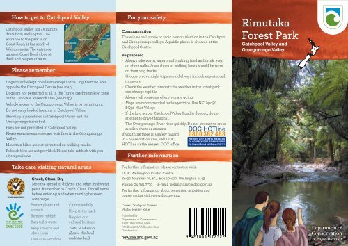
<strong>Rimutaka</strong><br />
<strong>Forest</strong> <strong>Park</strong><br />
Catchpool Valley and<br />
Orongorongo Valley
Catchpool Valley is the most popular<br />
entrance to <strong>Rimutaka</strong> <strong>Forest</strong> <strong>Park</strong>. Within<br />
Catchpool Valley are short walks suitable<br />
for all ages and fi tness levels. There’s also<br />
access through di erent bush types to<br />
longer tramps via the Orongorongo Valley.<br />
Catchpool Valley has a well-maintained<br />
campground which puts you within close<br />
reach <strong>of</strong> tracks, picnic sites and safe<br />
swimming spots in Catchpool and Grace’s<br />
streams. You can also hire your own DOC<br />
hut in the Orongorongo Valley.<br />
Beech forest dominates much <strong>of</strong> the park,<br />
joined by podocarps at lower altitudes.<br />
These These forests support hundreds <strong>of</strong> <strong>of</strong> indigenous<br />
plant species and provide habitat for a range<br />
<strong>of</strong> invertebrates, freshwater fi sh, reptiles and birds<br />
including reintroduced brown kiwi.<br />
Catchpool Centre<br />
The Catchpool Centre is available to hire for groups<br />
up to 50 people. With kitchen facilities, wood<br />
burning stove, a large function room and lawn area,<br />
it is ideal for corporate and social functions and<br />
education and community groups.<br />
For more information and to book, contact the<br />
DOC Wellington Visitor Centre on 04 384 7770,<br />
wellingtonvc@doc.govt.nz.<br />
Photo: DOC.<br />
Places to stay<br />
Camping<br />
The campground has toilets, showers and free gas barbecues.<br />
Food must be cooked on the barbecues provided provided or or with with liquid<br />
or gas operated stoves. Portable generators are are not not permitted.<br />
There’s also a camping spot on the Five Mile Loop (see map).<br />
For information on camping fees contact the Wellington Visitor<br />
Centre on 04 384 7770, wellingtonvc@doc.govt.nz or visit the<br />
DOC website: www.doc.govt.nz/.<br />
Booked huts<br />
A number <strong>of</strong> huts in the Orongorongo Valley are available for<br />
exclusive hire.<br />
They are all equipped with mattresses, water, heating, toilets<br />
and, except for Boar Inn, gas cookers and utensils.<br />
For information and to book, contact the DOC Wellington<br />
Visitor Centre on 04 384 7770,<br />
wellingtonvc@doc.govt.nz<br />
or visit http://booking.doc.govt.nz/.<br />
Turere Lodge<br />
Turere Lodge is a 32-bunk hut with four 8-bunk rooms, which<br />
can be individually hired, and a communal kitchen and living<br />
area. The whole building can be hired, making it ideal for school<br />
and scout groups, etc. Turere Lodge is an easy 2.5 hour walk from<br />
Catchpool Valley car park and does not require a river crossing.<br />
For information and to book, visit http://booking.doc.govt.nz/<br />
or contact the DOC Wellington Visitor Centre on 04 384 7770,<br />
wellingtonvc@doc.govt.nz.<br />
For hut warden volunteer opportunities at Turere Lodge, visit<br />
www.doc.govt.nz/getting-involved/volunteer-join-or-start-a-project/<br />
Photo: Lisa Paton<br />
Mountain biking and<br />
horse riding<br />
Mountain biking and horse<br />
riding riding are permitted in the<br />
logged areas in the south <strong>of</strong><br />
Catchpool Valley (see map).<br />
For information about access<br />
visit www.doc.govt.nz/.<br />
Photo: Matt Barnett<br />
Hunting<br />
DOC encourages recreational<br />
hunting in specifi ed areas.<br />
For information and hunting permits,<br />
contact the DOC Wellington Visitor<br />
Centre on 04 384 7770,<br />
wellingtonvc@doc.govt.nz<br />
Photo: Jeremy Rolfe<br />
Photo: Jeremy Rolfe
to<br />
Hine Road,<br />
Wainuiomata<br />
to<br />
WAINUIOMATA 6km<br />
Wainuiomata River<br />
NORTH<br />
Kiwi are gradually spreading<br />
beyond the dog exclusion exclusion zone.<br />
Please ensure all dogs are on<br />
leashes when when close to this area.<br />
McKerrow<br />
706m<br />
TURERE CATCHMENT KIWI ZONE<br />
McKerrow Stream<br />
COAST ROAD<br />
Whakanui Track<br />
Turere Stream<br />
Clay Ridge Track<br />
McKerrow Track<br />
Graces Stream<br />
Lake Wairarapa<br />
Papatahi Crossing<br />
Five Mile Loop T rack<br />
Catchpool Entrance<br />
Papatahi<br />
902m<br />
Papatahi Hut<br />
Haurangi Hut<br />
Turere<br />
Lodge<br />
Big Bend Track<br />
Catchpool Stream<br />
Middle Ridge Track<br />
Orongorongo Track<br />
Catchpool Stream<br />
Nga Taonga Nature Walk<br />
C atchpool Stre a m<br />
Catchpool Centre<br />
Jans Hut<br />
Catchpool<br />
Loop Walk<br />
Mt Matthews Track<br />
Boar Inn<br />
South<br />
Saddle<br />
Raukawa Lodge<br />
Butcher Track<br />
to coast and Turakirae Head<br />
Cattle Ridge Track<br />
Mt Matthews<br />
941m<br />
Mukamuka Route to Palliser Bay<br />
LANDCARE RESEARCH AREA<br />
Orongorongo River<br />
Ruamahanga River<br />
LEGEND<br />
Information<br />
Toilets<br />
Dog Exercise Area<br />
Horse Riding Area<br />
Mountain Bike Area<br />
Kiwi<br />
Lake Onoke<br />
Booked Hut<br />
Camping Area<br />
Telephone<br />
Lookout<br />
NO HUNTING<br />
NO DOGS<br />
Palliser Bay<br />
Short walk Tramping Track<br />
Walking track Route
Walking and tramping<br />
Times are for a family walking at a leisurely pace.<br />
Nga Taonga Nature Walk<br />
(1.3 km / 45 min one way)<br />
Information signs describe plant life <strong>of</strong> the forest. Begins in the<br />
clearing beside the Graces Stream footbridge. Ends at road, 5<br />
min from the Catchpool Centre.<br />
Catchpool Loop Walk<br />
(1.6 km / 30 min round trip)<br />
Begins just beyond the bridge across Catchpool Stream and<br />
leads upstream through nikau groves and mature podocarp/<br />
broadleaf forest to another bridge and the Orongorongo<br />
Track. The round trip is completed by returning down the<br />
Orongorongo Track.<br />
Five Mile Loop Walking Track<br />
(3.8 km / 1½ hr round trip)<br />
Passes through beech forest in the lower reaches <strong>of</strong> Graces<br />
Stream. The track climbs to Clay Forks at the junction with Clay<br />
Ridge Track, giving good views <strong>of</strong> the <strong>Rimutaka</strong> Range and the<br />
forest canopy.<br />
Track categories<br />
Tracks are categorised to help you choose the most<br />
appropriate for your level <strong>of</strong> fi tness and the skills and<br />
abilities <strong>of</strong> your party. You must be well prepared with<br />
suitable clothing and equipment for all weather and<br />
conditions. Safety is your responsibility.<br />
Short Walk: well formed, easy walking for up to an<br />
hour<br />
Walking Track: well formed easy walks from a few<br />
minutes to a day<br />
Easy Tramping Track: generally well formed for<br />
comfortable overnight tramping / hiking trips<br />
Tramping Track: mostly unformed but have track<br />
directional markers, poles or cairns<br />
Route: unformed, suitable only for people with<br />
high level backcountry skills and experience<br />
Middle Ridge Track<br />
(3.2 km / 1 hr return)<br />
Follows the ridge between Graces Stream and Catchpool<br />
Stream. Here, the vegetation consists <strong>of</strong> more drought-tolerant<br />
plants such as manuka. The track gives good views <strong>of</strong> the<br />
Catchpool Valley.<br />
Clay Ridge Track<br />
(6.3 km / 2½ hr to Mount McKerrow)<br />
From Clay Forks, this track ascends Clay Ridge to the east <strong>of</strong><br />
Graces Stream to the summit <strong>of</strong> Mount McKerrow (706 m).<br />
A round trip back to the Catchpool carpark is possible<br />
by returning via the McKerrow and Orongorongo tracks<br />
(14.6 km / 5 hr return).<br />
Orongorongo Walking Track<br />
(5.2 km / 2 hr to Turere Bridge)<br />
One <strong>of</strong> New Zealand’s most popular walks, leading to the<br />
Orongorongo River through di erent forest types. There are<br />
safe swimming holes at Turere Stream at the end <strong>of</strong> the track.<br />
Butcher Track and Cattle Ridge Track<br />
(12 km / 4 hr round trip)<br />
Begins about 10 minutes along the Orongorongo Track. A sti<br />
2 hour climb, through a range <strong>of</strong> forest types and shrubland,<br />
brings magnifi cent views <strong>of</strong> Wellington Harbour. From here<br />
Cattle Ridge heads north to join the Orongorongo Track near<br />
Turere Stream.<br />
Big Bend Track and Whakanui Track<br />
(18 km / 7 hr to Wainuiomata)<br />
Big Bend Track begins at Turere bridge and follows the<br />
Orongorongo River to Whakanui Creek. The Whakanui Track<br />
begins on the true right <strong>of</strong> Whakanui Creek and climbs to<br />
the ridge between Whakanui Creek and Turere Stream before<br />
descending to Hine Road / Sunny Grove in Wainuiomata. There<br />
are good views <strong>of</strong> the main <strong>Rimutaka</strong> Range from the higher<br />
parts <strong>of</strong> the track.<br />
McKerrow Track<br />
(13.3 km / 6 hr to Wainuiomata)<br />
McKerrow Track begins 10 minutes from the end<br />
<strong>of</strong> the Orongorongo Track. It climbs through<br />
podocarp / broadleaf / beech forest to Mount McKerrow (706 m),<br />
continues along McKerrow Ridge, then joins the Whakanui<br />
Track descent to Wainuiomata.<br />
Mount Matthews (10 hr return)<br />
Begins near the mouth <strong>of</strong> Matthews Stream and climbs<br />
steeply to the summit <strong>of</strong> Mount Matthews (941 m). The views<br />
are outstanding—Wellington Harbour, Wairarapa, the Tararua<br />
Range, and the Kaikoura Ranges.<br />
Mukamuka Valley (6 hr to Palliser Bay)<br />
The Mukamuka Valley is reached by following the<br />
the Mt Matthews track for approximately 1½ hours to the South<br />
Saddle track. This rough track sidles southwest, dropping from<br />
the saddle into the shrubby headwaters <strong>of</strong> Mukamuka Stream<br />
which leads to Palliser Bay.<br />
Papatahi Crossing (12 hr to Battery Stream)<br />
A crossing <strong>of</strong> the <strong>Rimutaka</strong> Range via Papatahi (902 m)<br />
from the mid-Orongorongo Valley at North Boulder Creek to<br />
the Wharepapa River and Battery Stream on the Wairarapa<br />
side <strong>of</strong> the park. It requires a very full day from the Catchpool<br />
carpark for a fi t party. Most parties are recommended to<br />
overnight at, or near, Papatahi Hut.<br />
Turakirae Head Scientifi c Reserve<br />
Turakirae Head is an area <strong>of</strong> international geological interest<br />
with its fi ve earthquake-raised beaches. Wildlife includes rare<br />
and threatetened bird and plant life and a colony <strong>of</strong> New Zealand<br />
fur seals. From the carpark it takes about 45 minutes to walk to<br />
Turakirae Head. The South Coast Track can be followed along<br />
spectacular coastline for approximately 10 km to Palliser Bay.<br />
Vehicles, dogs and fi res are not permitted in this area.<br />
Waaii<br />
CO<br />
errr<br />
Wainuiomata River<br />
COAST ROAD<br />
Access crosses private land.<br />
Please stay on marked track<br />
seal haulout<br />
Orongorongo River<br />
Oronnng<br />
B arneys Strm<br />
South Coast Track<br />
trrm<br />
RIMUTAKA<br />
FOREST PARK<br />
Barneys Whare<br />
(private)<br />
to<br />
Corner Creek<br />
(5km approx)<br />
TURAKIRAE HEAD<br />
SCIENTIFIC RESERVE<br />
Turakirae Head


