tidal hardwood swamps - Maryland Department of Natural Resources
tidal hardwood swamps - Maryland Department of Natural Resources
tidal hardwood swamps - Maryland Department of Natural Resources

Create successful ePaper yourself
Turn your PDF publications into a flip-book with our unique Google optimized e-Paper software.
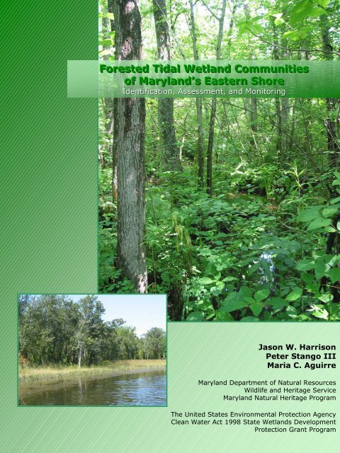
Forested Tidal Wetland Communities<br />
<strong>of</strong> <strong>Maryland</strong>’s Eastern Shore<br />
Identification, Assessment, and Monitoring<br />
Jason W. Harrison<br />
Peter Stango III<br />
Maria C. Aguirre<br />
<strong>Maryland</strong> <strong>Department</strong> <strong>of</strong> <strong>Natural</strong> <strong>Resources</strong><br />
Wildlife and Heritage Service<br />
<strong>Maryland</strong> <strong>Natural</strong> Heritage Program<br />
The United States Environmental Protection Agency<br />
Clean Water Act 1998 State Wetlands Development<br />
Protection Grant Program
FORESTED TIDAL WETLAND COMMUNITIES OF<br />
MARYLAND’S EASTERN SHORE:<br />
Identification, Assessment and Monitoring<br />
prepared by:<br />
Jason W. Harrison, Peter Stango III and Maria C. Aguirre<br />
<strong>Maryland</strong> <strong>Natural</strong> Heritage Program<br />
<strong>Maryland</strong> <strong>Department</strong> <strong>of</strong> <strong>Natural</strong> <strong>Resources</strong><br />
Annapolis, <strong>Maryland</strong><br />
March 2004<br />
prepared for:<br />
The United States Environmental Protection Agency Clean Water Act 1998<br />
State Wetlands Protection Development Grant Program<br />
[U.S. EPA Reference Wetland <strong>Natural</strong> Communities <strong>of</strong> <strong>Maryland</strong>’s Forested Tidal Wetlands Grant # CD-983592]
Citation:<br />
Harrison, J.W., P. Stango III, and M.C. Aguirre. 2004. Forested <strong>tidal</strong> wetland communities <strong>of</strong> <strong>Maryland</strong>’s Eastern<br />
Shore: identification, assessment, and monitoring. <strong>Maryland</strong> <strong>Department</strong> <strong>of</strong> <strong>Natural</strong> <strong>Resources</strong>, <strong>Natural</strong> Heritage<br />
Program, Annapolis, <strong>Maryland</strong>. Unpublished report submitted to the Environmental Protection Agency. 96 pp.
TABLE OF CONTENTS<br />
Acknowledgements ....................................................................................................................................... 2<br />
Introduction ................................................................................................................................................... 3<br />
Purpose......................................................................................................................................................... 5<br />
Methods......................................................................................................................................................... 5<br />
Landscape Analysis ......................................................................................................................... 5<br />
Spatial Distribution <strong>of</strong> Vegetation: Implications for Sampling Design .............................................. 6<br />
Field Surveys .................................................................................................................................. .6<br />
Data Compilation and Analysis ........................................................................................................ 9<br />
Results ........................................................................................................................................................ 11<br />
Discussion................................................................................................................................................... 12<br />
Tidal Hardwood Swamps – Community Descriptions……………………………………..………………..17<br />
Fraxinus pennsylvanica – Acer rubrum / Polygonum spp. Tidal Woodland (CEGL006165)………… …….19<br />
Fraxinus pr<strong>of</strong>unda – Nyssa biflora / Ilex verticillata / Polygonum arifolium Tidal Woodland (CEGL006287)<br />
.................................................................................................................................................................... 23<br />
Tidal Bald Cypress Forests/Woodlands – Community Descriptions…………………………… ………27<br />
Taxodium distichum – Nyssa biflora / Bignonia capreolata Tidal Forest (CEGL006850)…………………. 29<br />
Taxodium distichum / Carex hyalinolepis Tidal Woodland (CEGL006845)…………………………………. 33<br />
Tidal Loblolly Pine Woodlands – Community Descriptions…….…………………………………………37<br />
Pinus taeda – Morella cerifera / Spartina patens Tidal Woodland (CEGL006849) .................................... 39<br />
Reference Sites........................................................................................................................................... 43<br />
Upper Patuxent River.................................................................................................................................. 45<br />
Marshyhope Creek...................................................................................................................................... 49<br />
Pocomoke River.......................................................................................................................................... 53<br />
Hickory Point Cypress Swamp.................................................................................................................... 57<br />
Moneystump Swamp – Blackwater River ................................................................................................... 61<br />
Pictorial Overview…………………………………………………………………………………………….……..65<br />
Project Map…………………………………………………………………………………………………………..77<br />
Literature Cited………………………………………………………………………………………………………79<br />
Appendix 1: Sample Field Forms................................................................................................................ 85<br />
Appendix 2: Definitions <strong>of</strong> State and Federal Ranking ............................................................................... 89<br />
Appendix 3: List <strong>of</strong> Common and Scientific Names <strong>of</strong> Vascular Plants…….…………………………………93<br />
1
ACKNOWLEDGEMENTS<br />
We would like to express our appreciation to the following agencies, organizations, and people for their<br />
time and support: The United States Environmental Protection Agency for providing funding through the<br />
Clean Water Act’s 1998 State Wetlands Protection Development Grant Program; Gwen Brewer, Lynn<br />
Davidson, Rebecca Eanes, Chris Frye, Wesley Knapp, Holly Sepety, Scott Smith, and Glenn Therres, all<br />
with the <strong>Maryland</strong> <strong>Natural</strong> Heritage Program, Bill McAvoy and Pete Bowman with the Delaware <strong>Natural</strong><br />
Heritage Program, Gary Fleming and Phil Coulling with the Virginia <strong>Natural</strong> Heritage Program, Doug<br />
Samson with The Nature Conservancy for consultation, Rod Simmons with the <strong>Maryland</strong> Native Plant<br />
Society, Cel Petro with the Information Resource Center, and the many private landowners for permitting<br />
access to survey locations.<br />
The field work, data analyses, and report writing for this project was conducted by Peter Stango III, Maria<br />
Aguirre, and Jason W. Harrison. In addition, major portions <strong>of</strong> the Introduction and Methods sections <strong>of</strong><br />
the report have been modified and adapted from Harrison (2001) and Harrison and Stango (2003).<br />
2
INTRODUCTION<br />
In recent years, the practice <strong>of</strong> natural resource conservation through the protection <strong>of</strong> rare, threatened,<br />
and endangered species has come under fire by both the general public and the scientific community<br />
(Wilcove et al. 1996). These species have served as regulatory endpoint umbrellas, used to protect the<br />
larger systems that they inhabit. These procedures have led to the focus <strong>of</strong> conservation efforts onto<br />
majestic species like the Bald Eagle and charming species like the Spotted Owl (Harwell et al. 1990).<br />
These species have acted as representatives for their natural systems, but rare species usually do not<br />
play a major ecological role within these systems. Actually, the endpoints <strong>of</strong> conservation efforts should<br />
be the natural systems themselves (Harwell et al. 1990). Originally, these representatives served their<br />
systems well; it is difficult to induce the public to feel strongly about the conservation <strong>of</strong> ecologically<br />
important endpoints such as predatory mites (Pimentel and Edwards 1982) and other invertebrates<br />
(Wilson 1987), arbuscular mycorhizal fungi (Van der Heijden et al. 1998), or the nitrogen cycle (Barbour<br />
et al. 1987). But, land protection based on charismatic endangered animal species can create a great<br />
deal <strong>of</strong> public controversy (e.g. Spotted Owl conservation in the Pacific Northwest) and <strong>of</strong>ten leaves many<br />
questions unresolved (Williams 1996). What happens to land that is currently protected, because <strong>of</strong> the<br />
presence <strong>of</strong> a species, once that species recovers and is de-listed? What happens to the same type <strong>of</strong><br />
land if the species becomes extinct? Also, these conservation concepts can lead to the intentional<br />
degradation <strong>of</strong> private land in order to ensure that no endangered species move in and create a<br />
regulatory situation, such as in the case <strong>of</strong> the Red-cockaded Woodpecker in the Southeastern United<br />
States (Bean and Wilcove 1997, Bonnie 1997).<br />
The complications associated with species level conservation have given rise to a relatively new method<br />
in the protection <strong>of</strong> natural resources. Vegetation communities have been identified as generally<br />
appropriate units <strong>of</strong> biodiversity conservation, they are hierarchically above individual species but more<br />
manageable than larger landscape units such as watersheds or physiographic provinces (Thompson<br />
1996). The definition <strong>of</strong> vegetation communities used in this report closely follows that <strong>of</strong> Mueller-<br />
Dombois and Ellenberg (1974): communities are physiognomically uniform assemblages <strong>of</strong> plants which<br />
are ecologically related to each other and their physical environment, and predictably found under similar<br />
habitat conditions. The abiotic environment is not a component <strong>of</strong> the definition <strong>of</strong> vegetation<br />
communities; it is assumed that these conditions determine the combination <strong>of</strong> species within the concept<br />
(Thompson 1996). Often, the vegetation community descriptions are necessarily vague, recognizing that<br />
these associations intergrade at ecotones and that boundaries are artificial constructs necessary for<br />
conservation. Vegetation communities are merely empirical tools used for natural resource conservation,<br />
not an absolute representation <strong>of</strong> ecological truth (Thompson 1996).<br />
Historically, a debate has transpired as to whether vegetation actually consists <strong>of</strong> distinct communities or<br />
a continuum <strong>of</strong> overlapping species ranges (Grossman et al. 1994). Much <strong>of</strong> this discussion centered<br />
around the “supra-organism” view <strong>of</strong> F. E. Clements (1936) versus the “individualistic” view <strong>of</strong> H. Gleason<br />
(1926). A full treatise <strong>of</strong> this debate can be found in Whittaker (1962) and Mueller-Dombois and<br />
Ellenberg (1974). More recently, Austin and Smith (1989) have reevaluated this debate and emphasized<br />
that there is not actually a polar dichotomy between these two concepts, rather the frames <strong>of</strong> reference <strong>of</strong><br />
the observer are in conflict. Vegetation patterns are characterized by the link between individual species<br />
distribution patterns, their occurrence in landscape features, and the distribution <strong>of</strong> the landscape features<br />
(Grossman et al. 1994). Species can be individually distributed along gradients, uni-dimensional or<br />
complex, following any possible model (Austin 1987, Austin and Smith 1989). The pattern <strong>of</strong> distribution<br />
<strong>of</strong> the landscape features that control environmental factors constrains the pattern <strong>of</strong> species<br />
combinations, their distribution in the landscape, and their frequency (Grossman et al. 1994). Thus the<br />
views <strong>of</strong> community and continuum complement, rather than exclude each other (Westh<strong>of</strong>f and Van der<br />
Maarel 1978, Austin 1991).<br />
Vegetation communities are a tractable level <strong>of</strong> hierarchy for establishing preservation benchmarks<br />
because their conservation allows the protection <strong>of</strong> the overall trophic structure, which is essentially<br />
3
iodiversity (Harwell et al. 1990). Also, there are some legal provisions for protecting vegetation<br />
communities: Section 403 © <strong>of</strong> the Federal Water Pollution Control Act specifically calls for consideration<br />
<strong>of</strong> changes in species diversity (Harwell 1984b), and Section 301(h) <strong>of</strong> the Federal Water Pollution<br />
Control Act indirectly calls for maintenance <strong>of</strong> species diversity through its “balanced indigenous<br />
population” endpoint as interpreted by regulations and litigation (Harwell 1984a). Generally, high priority<br />
vegetation communities are habitat to high priority plant and animal species, protection <strong>of</strong> the community<br />
will protect these species (Keddy and Wisheu 1989; Noss 1987). Conservation using this “coarse-filter”<br />
approach has been documented for some taxa (Panzer and Schwartz 1998). Also, vegetation<br />
communities, with their associated biological, chemical, and physical processes, drive the biogeochemical<br />
processes <strong>of</strong> the earth (Naeem et al. 1994). Vegetation community based inventories give a better<br />
assessment <strong>of</strong> the status, distribution, and interrelatedness <strong>of</strong> vegetation types across the landscape as<br />
compared to the historically more prevalent methods <strong>of</strong> jurisdictionally based (ie. county or agency)<br />
inventory. Often, these types <strong>of</strong> inventory are limited to smaller geographic land units, lead to haphazard<br />
data collection, and conclude with improper understanding <strong>of</strong> community rarity.<br />
Unlike species, vegetation communities are not always self-evident on the landscape. A series <strong>of</strong> floristic<br />
data, collected across both geographic and temporal gradients, is <strong>of</strong>ten necessary for naming and<br />
understanding vegetation community types. This information must be expressed within the organizational<br />
framework <strong>of</strong> a community classification for the best utilization <strong>of</strong> the biological data. This classification is<br />
a way <strong>of</strong> collecting uniform hierarchical data that facilitates effective resource stewardship by ensuring<br />
compatibility and widespread use <strong>of</strong> the information by various individuals and agencies (Grossman et al.<br />
1994). The United States National Vegetation Classification System (USNVC; Grossman et al. 1998) is a<br />
current priority <strong>of</strong> NatureServe and the network <strong>of</strong> <strong>Natural</strong> Heritage Programs. This system is the product<br />
<strong>of</strong> a great body <strong>of</strong> earlier scientific work and over twenty years <strong>of</strong> data collection by these organizations.<br />
Classification is a critical ingredient in the recipe <strong>of</strong> conservation, it allows for the accurate identification<br />
and description <strong>of</strong> the full range <strong>of</strong> vegetation community types within the landscape. This along with<br />
information on rarity permits formation <strong>of</strong> proper protection priorities.<br />
Within the framework <strong>of</strong> the USNVC (Grossman et al. 1998) are hierarchically more finely divided<br />
classifications at the regional and state levels. This project contributes to the development <strong>of</strong> the<br />
<strong>Maryland</strong> natural community classification (Harrison 2004b) which is used for management within the<br />
state, comparison to other states, and fine tuning community alliances and associations <strong>of</strong> the USNVC<br />
(Grossman et al. 1998). In addition, development <strong>of</strong> the classification through a series <strong>of</strong> "special<br />
projects", intensely focusing on a small subset <strong>of</strong> community types, yields the required detailed<br />
description <strong>of</strong> community types as well as the identification and mapping <strong>of</strong> exemplary examples <strong>of</strong> these<br />
types as reference sites.<br />
With the exception to portions <strong>of</strong> Garrett and Worcester Counties, the entire land surface area <strong>of</strong><br />
<strong>Maryland</strong> lies within the Chesapeake Bay drainage basin. This is one <strong>of</strong> the largest and most productive<br />
estuaries in the United States (Lipson and Lipson 1997). All <strong>of</strong> the wetlands within the Chesapeake<br />
drainage are integral to the healthy function <strong>of</strong> the Bay. The phrase "Chesapeake Bay Drainage” is<br />
painted on the storm drains in Baltimore City and “The Bay Starts Here” stickers adorn the sinks <strong>of</strong> many<br />
public bathrooms. These statements are also true <strong>of</strong> the wetlands scattered throughout the state. In<br />
order to truly protect the Bay, the sources and buffers throughout its watershed must receive protection<br />
priority. In addition to their connection with the Chesapeake Bay, <strong>Maryland</strong>’s wetlands are critical habitat<br />
for numerous rare, threatened, and endangered plant and animal species and serve valuable ecosystem<br />
functions such as flood control, water filtration, and nutrient recycling (Tiner and Burke 1995).<br />
Fragmentation and development pressures are degrading <strong>Maryland</strong>’s wetland resources at an alarming<br />
rate. An estimated 1.2 million acres <strong>of</strong> wetlands occurred in <strong>Maryland</strong> before European settlement, but<br />
that number is now reduced to 600,000 acres (Tiner and Burke 1995). Of these 600,000 acres <strong>of</strong><br />
wetlands, approximately 57 percent are represented by palustrine wetlands and 42 percent are<br />
represented by estuarine wetlands (Tiner and Burke 1995). According to the Tiner and Finn (1986) study,<br />
4
a significant decline in palustrine (6%) and estuarine (8%) emergent wetland acreage occurred from 1955<br />
to 1978. Conversion <strong>of</strong> <strong>tidal</strong> wetlands to deepwater habitat, creation <strong>of</strong> saltwater and freshwater<br />
impoundments, ditching, and the overall lack <strong>of</strong> Federal and State wetland regulations during this period<br />
facilitated much <strong>of</strong> the acreage loss. This drastic loss has also accelerated the need for more qualitative<br />
information on the character and significance <strong>of</strong> these wetland resources. This information is necessary<br />
for setting protection priorities and initiating existing protection mechanisms. This study was restricted to<br />
all forested <strong>tidal</strong> wetlands on <strong>Maryland</strong>’s Eastern Shore, with the exception <strong>of</strong> <strong>tidal</strong> portions <strong>of</strong> the<br />
Potomac and Patuxent Rivers where exemplary stands where known to occur.<br />
One impediment to wetland protection and restoration efforts is the lack <strong>of</strong> adequate benchmarks against<br />
which to assess ecological integrity. The health <strong>of</strong> an ecosystem is difficult, if not impossible to assess<br />
without explicit knowledge <strong>of</strong> the target community. Objective measures <strong>of</strong> the impacts <strong>of</strong> anthropogenic<br />
disturbance on the complex and vast ecosystems <strong>of</strong> <strong>Maryland</strong>’s forested <strong>tidal</strong> wetlands present a<br />
daunting challenge. The measurement <strong>of</strong> these stresses, documentation <strong>of</strong> changes, and estimation <strong>of</strong><br />
geographic cover depends upon the identification <strong>of</strong> basic units <strong>of</strong> these wetlands, the component<br />
communities, which are some <strong>of</strong> the end products <strong>of</strong> this project.<br />
PURPOSE<br />
The purpose <strong>of</strong> this project was to classify and describe forested <strong>tidal</strong> wetlands on <strong>Maryland</strong>’s Eastern<br />
Shore in an effort to develop a more complete understanding <strong>of</strong> these communities. The classification<br />
generated by this study and presented in this report will be used to augment the ongoing <strong>Maryland</strong><br />
natural community classification (Harrison 2004b) and the USNVC (Grossman et al. 1998). With this<br />
classification, exemplary examples <strong>of</strong> each community type were identified and described as reference<br />
sites. The information gathered in this project will be used to complement other projects studying <strong>tidal</strong><br />
wetlands in the eastern United States.<br />
The information generated by this project will simplify the regulatory review <strong>of</strong> these <strong>tidal</strong> wetlands by<br />
providing the quantitative data necessary to objectively rank these communities as to their rarity and<br />
biological importance. The results <strong>of</strong> this study will be used to aid in the conservation <strong>of</strong> rare<br />
communities, to assist in current regulation, to support vegetation mapping projects and to interpret<br />
regional data at higher hierarchical levels. They will also be used by the US EPA cooperators to<br />
determine baseline levels <strong>of</strong> parameters within reference wetlands for long-term modeling and<br />
conservation.<br />
The end products <strong>of</strong> this project are: a detailed vegetation community classification and description and<br />
reference site descriptions for long term monitoring. These products will be utilized by the <strong>Maryland</strong><br />
<strong>Department</strong> <strong>of</strong> the Environment: Non-<strong>tidal</strong> Wetlands and Waterways Division, <strong>Maryland</strong> <strong>Department</strong> <strong>of</strong><br />
<strong>Natural</strong> <strong>Resources</strong>: Wildlife and Heritage Service, NatureServe, and traditional users <strong>of</strong> the <strong>Natural</strong><br />
Heritage’s Biological Conservation Database.<br />
METHODS<br />
Landscape Analysis<br />
In order to collect ecologically pertinent information, the intricate process <strong>of</strong> Landscape Analysis must<br />
supersede field surveys. The process starts with the development <strong>of</strong> a preliminary definition <strong>of</strong> the abiotic<br />
and biotic factors that contribute to the community structure <strong>of</strong> the system <strong>of</strong> study. Our definition <strong>of</strong><br />
forested <strong>tidal</strong> wetlands was primarily based on that defined within the literature. For the purposes <strong>of</strong> this<br />
study, forested <strong>tidal</strong> wetlands are broadly defined as diurnal to irregularly flooded palustrine or estuarine<br />
wetlands dominated by trees greater than 6m in height and greater than 5% in cover. Depending on<br />
canopy coverage different physiognomic classes are represented in this broad definition. Included are<br />
sparse woodland (5-25% cover), woodland (25-60% cover), and forested (60-100% cover) classes.<br />
5
Once a clear search image was established, the process <strong>of</strong> assembling a portfolio <strong>of</strong> potential sites<br />
occurred using the standard methodologies employed by The Nature Conservancy and the network <strong>of</strong><br />
state <strong>Natural</strong> Heritage Programs. The primary method <strong>of</strong> selecting sample sites was facilitated through<br />
the use <strong>of</strong> digital orthophotographic quadrangles coupled with National Wetland Inventory maps. At the<br />
completion <strong>of</strong> the Landscape Analysis phase <strong>of</strong> the project, 227 potential survey sites were identified. If<br />
required, owners <strong>of</strong> private land and managers <strong>of</strong> public land were contacted and site visits were<br />
approved. If required, proper plant collection permits for public and private land were obtained.<br />
Landscape analysis for this project occurred during the period from January 2003 to April 2003.<br />
Spatial Distribution <strong>of</strong> Vegetation: Implications for Sampling Design<br />
An effective and accurate vegetation classification requires sampling the full range <strong>of</strong> compositional<br />
heterogeneity, but the complex spatial nature <strong>of</strong> vegetation presents a number <strong>of</strong> problems when<br />
designing an optimal sampling scheme at the landscape scale (Grossman et al. 1994). Some<br />
characteristics <strong>of</strong> a good sampling approach are flexibility, replicability, and cost effectiveness; it attempts<br />
to characterize as many vegetation patterns possible with efficiency in mind (Grossman et al. 1994). Due<br />
to time, budgetary constraints, and large geographic area <strong>of</strong> <strong>Maryland</strong>'s Eastern Shore, it was implausible<br />
to use the methods <strong>of</strong> multiple random plot samples <strong>of</strong> a single vegetation type at one site or repeated<br />
sampling <strong>of</strong> single plots over time to capture the overall composition. Also, randomization procedures<br />
may actually be counterproductive to the intent <strong>of</strong> ecological surveys, especially where the occurrences <strong>of</strong><br />
natural patterns are known to be non-random (Gillison and Brewer 1985). In general, plant communities<br />
do not occur randomly on the landscape, they occur where the abiotic factors constrain the individual<br />
species that constitute the community. Although sampling theory emphasizes randomization in order to<br />
provide a probability structure for statistical analysis or to give credibility to statistical models, the recovery<br />
<strong>of</strong> vegetation patterns are not necessarily accomplished by standard statistical sampling procedures<br />
(Gillison and Brewer 1985).<br />
To compensate for these restrictions, an inherently subjective method <strong>of</strong> selecting sample locations was<br />
employed to capture the full floristic range, both among and within vegetation types. While the number <strong>of</strong><br />
samples within each vegetation type was proportional to its abundance across the entire landscape, types<br />
with greater within-type heterogeneity required more intensive sampling.<br />
Field Surveys<br />
Sampling was stratified such that vegetation types were sampled in approximate proportion to their<br />
representation on the landscape, and sampling occurred across the entire eastern shore region <strong>of</strong><br />
<strong>Maryland</strong>. Attempts were made to capture the full range <strong>of</strong> variation in local conditions, including<br />
hydrological regime, inundation frequency, salinity, soil drainage class, soil texture, and elevation. A<br />
random approach was used to the extent possible to aid in the selection <strong>of</strong> sites from the set <strong>of</strong> potential<br />
sites, but several factors contributed to the need for a primarily subjective and non-random approach to<br />
the actual location and configuration <strong>of</strong> sample plots. These include the need to place plots in<br />
homogeneous vegetation, the necessity to capture as much <strong>of</strong> the floral heterogeneity <strong>of</strong> a site as<br />
possible, the desire to ease future relocation, and the existence <strong>of</strong> restrictions on site access.<br />
The field work for this project occurred during the 2003 growing season and followed standard vegetation<br />
sampling protocols utilized by The Nature Conservancy and the network <strong>of</strong> state <strong>Natural</strong> Heritage<br />
Programs (Sneddon 1993). The sites identified in landscape analysis were visited and given an initial<br />
qualitative rank, which is a relative scale where “A” is excellent, “B” is good, “C” is marginal or fair, and “D”<br />
is poor. The ranking was based on four factors: Quality, Condition, Viability, and Defensibility. Only<br />
those sites receiving ranks A - C qualified for quantitative survey. Knowledge <strong>of</strong> the history <strong>of</strong> land<br />
management was also important for the initial ranking (Grossman et al. 1994). These surveys attempted<br />
to avoid ecotones and areas subjected to significant disturbance events.<br />
6
Site selection and plot layout placed plots in fairly homogeneous vegetation and avoided sites recently<br />
disturbed by human activities or natural events that may have resulted in atypical composition or<br />
structure. Plots were small enough to encompass homogeneous vegetation and uniform local conditions<br />
and large enough to capture the full range <strong>of</strong> within-community variation in species composition and<br />
vegetation structure.<br />
Vegetation Sampling<br />
At each survey site, project ecologists became familiar with the vegetation and potential vegetation<br />
communities. Then, one temporary survey plot was established in the most representative location for<br />
each potential community type at each site. The <strong>Natural</strong> Heritage Methodology utilizes 10 m X 10 m (100<br />
m 2 ) for herbaceous vegetation, 15 m X 15 m (225 m 2 ) for shrubland vegetation, and 20 m X 20 m (400<br />
m 2 ) for forest vegetation, as recommended by Mueller-Dombois and Ellenberg (1974). Botanical<br />
nomenclature follows that <strong>of</strong> Kartesz (1999).<br />
Each plot was surveyed for presence <strong>of</strong> all vascular plant species rooted in the plot and the percent<br />
ground cover was recorded for each species and then converted to the appropriate cover class (Table 1).<br />
Cover was estimated by a summation <strong>of</strong> vertical projections <strong>of</strong> the canopies <strong>of</strong> each individual <strong>of</strong> each<br />
species and recorded as a percentage, with a maximum value <strong>of</strong> 100. Any species not rooted within the<br />
survey plot, but included in the community were recorded and assigned a cover <strong>of</strong> zero. The total percent<br />
cover for each physiognomic strata was estimated and the dominants <strong>of</strong> each strata were recorded. Six<br />
classes were used to define the total vegetative cover for each stratum and are as follows: very sparse<br />
(0-5%), sparse (5-25%), very open (25-40%), open (40-60%), moderately dense (60-80%), and dense<br />
(80-100%).<br />
Table 1. Cover class scores used in field sampling and data analysis<br />
Estimated Percent Cover Cover Class Cover Class Midpoints (%)<br />
Trace 1 0.05<br />
< 1% 2 0.55<br />
1 – 2% 3 1.50<br />
2 – 5% 4 3.50<br />
5 – 10% 5 7.50<br />
10 – 25% 6 17.5<br />
25 – 50% 7 37.5<br />
50 – 75% 8 62.5<br />
75 – 100% 9 87.5<br />
Appendix 1 (<strong>Maryland</strong> NHP Community Survey, page 2) contains a sample field form used by the<br />
<strong>Maryland</strong> <strong>Natural</strong> Heritage Program to record vegetation sample plot data.<br />
Environmental Parameters<br />
At each vegetation sample plot, environmental data (Table 2) were recorded in the appropriate sections<br />
<strong>of</strong> the field forms (see Appendix 1). Topographic position was determined in the field using USGS 7.5<br />
minute quadrangle maps. Elevation measurements were obtained at the sample plot using the Magellan<br />
Meridian global positioning system (GPS) units and later verified utilizing Maptech® Terrain Navigator Pro<br />
(Version 6.02) mapping s<strong>of</strong>tware. Slope inclination and aspect were estimated visually in the field. Soil<br />
drainage class, soil moisture regime, slope, and slope shape were determined using scalar values.<br />
Assignment <strong>of</strong> hydrologic regime and determination <strong>of</strong> inundation frequency were based on site position<br />
relative to water sources, examination <strong>of</strong> soil surveys and National Wetlands Inventory maps, and on-site<br />
assessment. Salinity measurements were obtained from a BIO-MARINE® Aquafauna refractometer and<br />
averaged on-site after three readings. Finally, surface substrate cover was estimated visually such that<br />
all values sum to 100 %.<br />
7
Table 2. Environmental data reported for each vegetation sample plot.<br />
System Soil Moisture Regime Inundation Surface Substrate (% cover)<br />
A – terrestrial A – very xeric A – never Decaying wood<br />
B – palustrine B – xeric (moist for brief B – infrequently Bedrock<br />
C – estuarine time) C – regularly; for 24” diameter)<br />
D – marine C – somewhat xeric D – regularly; for >6 mos Stones (>10” round or >15” flattened)<br />
E – riverine (moist for short time) E – always submerged Cobbles (3-10”; rounded)<br />
D – submesic (moist by shallow water. Channery (thin;
Metadata<br />
The location <strong>of</strong> each community plot was measured in the field using Magellan Meridian global positioning<br />
system (GPS) units or subsequently determined from USGS 7.5 minute quadrangle maps and/or<br />
Maptech® Terrain Navigator Pro (Version 6.02) mapping s<strong>of</strong>tware. Each sample plot was assigned a<br />
alphanumeric identifier for database use. Dates <strong>of</strong> sampling, participants, county, physiographic region,<br />
and USGS 1:24,000 topographic map quadrangle were recorded. The size and configuration <strong>of</strong> each plot<br />
were noted and photo documentation typically consisted <strong>of</strong> at least digital photograph <strong>of</strong> the entire plot. A<br />
site sketch map and cross sectional map accompanied each field form (See Appendix 1; <strong>Maryland</strong> NHP<br />
Community Survey, page 1) indicating orientation <strong>of</strong> the plot, location <strong>of</strong> photo point(s), and distances and<br />
directions to any landmarks.<br />
Field surveys occurred in the time period from April 2003 to November 2003.<br />
Data Compilation and Analysis<br />
After the completion <strong>of</strong> field surveys, data were entered into a Micros<strong>of</strong>t Access database so subsequent<br />
operations could be organized and performed in an efficient manner. A table <strong>of</strong> environmental variables,<br />
plot codes, species, and cover values was exported from the database and transcribed to an Excel<br />
spreadsheet. To ensure consistency with the USNVC, botanical nomenclature follows that <strong>of</strong> Kartesz<br />
(1999). Cover class scores for each species was then entered for each vegetation sample plot. Error<br />
checking procedures included manual inspection for transcription errors, invalid formats, values, and<br />
species codes. After error checking was completed, archival data files and data forms were prepared.<br />
As necessary, environmental variables and site descriptors were calculated or derived and numerical<br />
indices derived from descriptive scalars (e.g. inundation). The Excel spreadsheet files were then<br />
converted to PC-ORD format (Version 4.25; McCune and Mefford 1999).<br />
Data analysis involved both classification and ordination techniques on the full data set. Then various<br />
further reductions were derived by separately removing weedy species, poor quality sites, and herbs.<br />
TWINSPAN (Hill 1979b) and Cluster Analysis within PC-ORD (Version 4.25; McCune and Mefford 1999)<br />
were used as tools for developing a classification <strong>of</strong> vegetation types. Both <strong>of</strong> these analyses were used<br />
because Two Way Indicator Species Analysis is a polythetic divisive classification model while Cluster<br />
Analysis is a polythetic agglomerative classification model. They determine classifications using different<br />
assumptions and mathematical algorithms (Gauch 1982, Jongman et al. 1995).<br />
Two-way indicator species analysis or TWINSPAN implemented in PC-ORD (Version 4.25; McCune and<br />
Mefford 1999) was performed on the entire untransformed data set. Default settings <strong>of</strong> minimum group<br />
size for division (5), maximum number <strong>of</strong> indicators for division (5), and maximum level <strong>of</strong> divisions (6)<br />
were selected. Pseudospecies cut levels selected were user defined and set to the nine cover class<br />
scores (Table 1) determined from cover estimations. Cluster analysis performed in PC-ORD (Version<br />
4.25; McCune and Mefford 1999) used the Lance-Williams Flexible-Beta linkage method (Lance and<br />
Williams 1967, 1968) with distance measure set to Sorensen (Bray-Curtis) (Bray and Curtis 1957) and<br />
beta (β) set to the default value <strong>of</strong> –0.25. Initial analyses involved clustering 76 vegetation sample plots<br />
using raw cover class scores. This procedure resulted in a dendrogram containing three primary clades<br />
that coarsely represented 1) <strong>tidal</strong> <strong>hardwood</strong> <strong>swamps</strong> dominated by Fraxinus spp. 2) <strong>tidal</strong><br />
forests/woodlands dominated by Taxodium distichum, and 3) <strong>tidal</strong> woodlands dominated by Pinus taeda.<br />
Plots representing each clade were then separated into data subsets and reclustered independently into<br />
compositionally similar vegetation types (associations).<br />
Vegetation types recognized using these classification statistics were refined through subsequent<br />
interpretation and comparison with other data. Compositional summary statistics (Table 3) for each type<br />
were then calculated using a customized Excel macro written in Visual Basic by Philip P. Coulling <strong>of</strong> the<br />
Virginia <strong>Natural</strong> Heritage Program. These statistics were used to guide the selection <strong>of</strong> diagnostic and<br />
nominal species for each type, with reference, where possible, to existing vegetation community types.<br />
This resulted in a meaningful classification <strong>of</strong> associations, which was cross-walked with existing<br />
9
vegetation community types in the USNVC using the Ecology Access Reporting Tool (Version 2.7;<br />
NatureServe 2002) and regional classifications from various states.<br />
Table 3. Compositional Summary Statistics (adapted from Fleming and Coulling 2001)<br />
Compositional Statistic Definition<br />
Frequency The number <strong>of</strong> samples in a group in which a species occurs<br />
Mean Cover Back-transformed cover class value corresponding to mean percent cover<br />
calculated from midpoint values <strong>of</strong> cover class ranges<br />
Relative Cover The arithmetic difference between mean cover (for a given group <strong>of</strong> samples) and<br />
total mean cover (for the entire dataset)(= Mean Cover – Total Mean Cover)<br />
Constancy The proportion <strong>of</strong> samples in a group in which a species occurs (= frequency /<br />
number <strong>of</strong> samples in a group x 100)<br />
Fidelity The degree to which a species is restricted to a group, expressed as the proportion<br />
<strong>of</strong> total frequency that frequency in a give group constitutes (= frequency / total<br />
frequency x 100)<br />
Indicator Value (IV) (= Constancy x Fidelity / 100)<br />
Indicator Value Adjusted by Cover, Scale (Adj IV [scaled]) (= Indicator Value x Mean Cover / 9)<br />
Indicator Value Adjusted by Cover, Unscaled (Adj IV [unscaled]) (= Indicator Value x 2 relative cover )<br />
Mean Species Richness The average number <strong>of</strong> species present per plot (S); only species rooted inside<br />
plot boundaries were included in this calculation<br />
Homoteneity The mean constancy <strong>of</strong> the S most constant species, expressed as a fraction;<br />
higher values for homoteneity indicate a greater uniformity in species composition<br />
among plots.<br />
Ordination techniques were used to identify the relationships <strong>of</strong> recognized vegetation types to one<br />
another and the environmental gradients along which they are distributed (Gauch 1982; Jongman et al.<br />
1995). These techniques were also used to validate the vegetation types determined with the<br />
classification models. Ordination was performed using the Detrended Correspondence Analysis (Hill<br />
1989a) and Non-metric Multidemsional Scaling (NMDS; Kruskal 1964) modules in PC-ORD (McCune and<br />
Mefford 1995).<br />
The objective algorithms <strong>of</strong> the analysis techniques within PC-ORD were the primary tool used to<br />
determine the vegetation classification (McCune and Mefford 1995). But, these analysis techniques <strong>of</strong>ten<br />
do not recognize compositional subtleties <strong>of</strong> similar communities. They <strong>of</strong>ten focus on presence or<br />
absence <strong>of</strong> certain species, which can be due to seasonal and conditional biases rather than true<br />
community shift. Therefore, a certain degree <strong>of</strong> subjective determination by highly trained project<br />
ecologists, with the consultation <strong>of</strong> regional ecologists, was utilized to fine-tune the classification.<br />
Detailed descriptions <strong>of</strong> each vegetation community type were prepared. They contain descriptions <strong>of</strong><br />
physiognomy and composition, the range <strong>of</strong> habitat conditions across which a type occurs, and spatial<br />
distribution. They also include the features that distinguish a type from similar types, nomenclatural<br />
synonymy, global and state conservation rank, lists <strong>of</strong> rare species, a discussion <strong>of</strong> characteristic species,<br />
and conservation and management concerns. Also, a list <strong>of</strong> high quality reference sites was created.<br />
These include detailed site descriptions and accurate digital maps created in Maptech® Terrain Navigator<br />
Pro (Version 6.02) and ArcView 3.2a.<br />
Data compilation and analysis occurred during the time period from December 2003 to March 2004.<br />
10
RESULTS<br />
Of the 227 sites initially identified as potential <strong>tidal</strong> forests to visit, 158 sites were visited and quantitative<br />
vegetation data was collected from 79 plots. Existing data from seven plots was combined with 79 plots<br />
for an analysis <strong>of</strong> 86 plots. The analysis <strong>of</strong> these data yielded five associations representing three<br />
forest/woodland alliances <strong>of</strong> the USNVC. Of the three alliances recognized, the Pinus taeda <strong>tidal</strong><br />
woodland alliance has been newly proposed to ensure proper placement within the hierarchy <strong>of</strong> the<br />
USNVC. Three <strong>of</strong> the five associations identified in <strong>Maryland</strong> are newly defined for the USNVC. These<br />
include the Taxodium distichum – Nyssa biflora / Bignonia capreolata Tidal Forest, Taxodium distichum /<br />
Carex hyalinolepis Tidal Woodland, and Pinus taeda / Morella cerifera / Spartina patens Tidal Woodland<br />
associations.<br />
Community Descriptions<br />
The interpretation <strong>of</strong> ecological statistics was used as a tool to clarify relationships <strong>of</strong> field observations.<br />
The classification <strong>of</strong> forested <strong>tidal</strong> wetland in <strong>Maryland</strong> ascertained five forest/woodland associations:<br />
Fraxinus pennsylvanica – Acer rubrum / Polygonum spp. Tidal Woodland (CEGL006165)<br />
Fraxinus pr<strong>of</strong>unda – Nyssa biflora / Ilex verticillata / Polygonum arifolium Tidal Woodland (CEGL006287)<br />
Taxodium distichum – Nyssa biflora / Bignonia capreolata Tidal Forest (CEGL006850)<br />
Taxodium distichum / Carex hyalinolepis Tidal Woodland (CEGL006845)<br />
Pinus taeda / Morella cerifera / Spartina patens Tidal Woodland (CEGL006849)<br />
The complete descriptions <strong>of</strong> these vegetation communities can be found in the Community Description<br />
section <strong>of</strong> this report.<br />
Reference Sites<br />
One site containing an exemplary example <strong>of</strong> each <strong>of</strong> the five vegetation types was identified, mapped,<br />
and described. The order <strong>of</strong> these sites in this report corresponds to the order in which its vegetation<br />
community is described. These sites are: Upper Patuxent River, Marshyhope Creek, Pocomoke River,<br />
Hickory Point Cypress Swamp, and Moneystump Swamp – Blackwater River. Although representative<br />
vegetation exists on <strong>Maryland</strong>’s eastern shore for the Fraxinus pennsylvanica – Acer rubrum / Polygonum<br />
spp. Tidal Woodland (CEGL006165) no eastern shore plots were selected as a reference site. Instead,<br />
the Upper Patuxent River on <strong>Maryland</strong>’s western shore was chosen as the best example <strong>of</strong> this<br />
vegetation. The full descriptions <strong>of</strong> these sites can be found in the Reference Site Description section <strong>of</strong><br />
this report.<br />
11
DISCUSSION<br />
Site Visits<br />
During the landscape analysis for this project, 227 potential sites were identified for assessment. The<br />
most productive method used to determine these sites was analyzing digital orthophotography in<br />
conjunction with National Wetlands Inventory maps. Several sites were also identified through<br />
consultation with regional ecologists and from de novo surveys. During the field surveys for this project,<br />
approximately 158 <strong>of</strong> the 227 potential sites were visited for assessment. Approximately 79 sites were<br />
not sampled due to heterogeneous vegetation, small size, degraded habitats, inaccurate NWI signatures,<br />
and time constraints. After a preliminary understanding <strong>of</strong> forested <strong>tidal</strong> community types on the Eastern<br />
Shore was established, the need to collect additional data in those types tapered. However, several<br />
weeks were spent collecting plot data from the Western Shore <strong>of</strong> <strong>Maryland</strong>. This proved to be extremely<br />
beneficial in understanding the statewide distribution <strong>of</strong> certain Fraxinus spp. dominated communities.<br />
After the preliminary classification was developed, sites were visited to check this classification and data<br />
was collected only in suspected new community types. As a rule <strong>of</strong> thumb, between five and ten<br />
vegetation sample plots for each community type are best for an accurate classification. Since this<br />
classification has five community types, the 86 plots are considered ample for their description.<br />
Classification<br />
This project yielded five forested associations found within <strong>tidal</strong> wetlands <strong>of</strong> <strong>Maryland</strong>’s Eastern Shore.<br />
This classification is a product <strong>of</strong> untangling statistical analyses and interpreting the landscape. These<br />
community types were determined by balancing the results <strong>of</strong> various classification and ordination<br />
techniques on several versions <strong>of</strong> collected data with the opinions <strong>of</strong> project ecologists, regional<br />
ecologists, and regional community classifications. One cannot solely utilize multivariate statistical<br />
methods and expect to determine an ecologically meaningful classification. These statistics are merely a<br />
tool, albeit an extremely powerful one, to assist in the understanding <strong>of</strong> ecological information. Often<br />
times, these tools cannot accurately examine subtle relationships between generally similar vegetation<br />
types and create groups based on the presence or absence <strong>of</strong> less ecologically meaningful species.<br />
Through subsequent analyses <strong>of</strong> these data, it was determined that all <strong>of</strong> the vegetation types are<br />
influenced by several abiotic factors. The dominant factors that determined the classification <strong>of</strong> these<br />
vegetation types are salinity, elevation, and frequency and duration <strong>of</strong> <strong>tidal</strong> flooding.<br />
Forested Wetland Conditions – Past and Present<br />
Many high quality examples <strong>of</strong> <strong>tidal</strong> forested wetlands were encountered on <strong>Maryland</strong>’s Eastern Shore.<br />
Despite these exceptional examples, several areas on the Eastern Shore suffer from significant abiotic<br />
and biotic threats. Many <strong>of</strong> these threats have led to qualitative changes in wetland function, structure,<br />
and composition. Agricultural run<strong>of</strong>f, coastal erosion, upland development, logging, and the spread <strong>of</strong><br />
invasive species such as Common reed (Phragmites australis) continue to place pressure on <strong>Maryland</strong>’s<br />
wetlands. Recently, there has been a sharp reduction in overall wetland acreage loss due to strong<br />
regulation <strong>of</strong> coastal wetland alterations through <strong>Maryland</strong>’s Tidal Wetlands Act and through Federal<br />
regulations (e.g., Section 404 program, Section 10 program) pursuant to the Federal Clean Water Act<br />
(Tiner and Burke 1995). Prior to these regulatory measures, most wetland loss was attributed to activities<br />
such as ditching, dredging, and impoundment construction. The effects <strong>of</strong> chronic, eustatic sea level rise<br />
in the Chesapeake Bay region has been well documented by many researchers. More recently, studies<br />
have centered around the estuarine marshes bordering Blackwater River in Dorchester County. Although<br />
chronic, eustatic sea level rise is thought to be the principal cause <strong>of</strong> wetland loss in certain areas,<br />
isostatic processes such as crustal plate elevation and local events such as subsidence resulting from<br />
groundwater withdrawal have also postulated to contribute to the phenomenon. Changes in vegetation<br />
structure and composition such as contemporary crown stress and tree mortality due to these suspected<br />
processes are apparent in this area and other parts <strong>of</strong> the Chesapeake Bay region. Such changes are<br />
believed to be an artifact <strong>of</strong> salinity gradients shifting upstream in estuarine <strong>tidal</strong> river systems. This<br />
phenomenon is visible along portions <strong>of</strong> the Blackwater River where fringing snags and stumps <strong>of</strong> Loblolly<br />
pine (Pinus taeda) border otherwise healthy forests. On the Potomac River, similar observations <strong>of</strong> this<br />
12
conversion to open woodlands and marsh in Ash (Fraxinus spp.) dominated <strong>tidal</strong> forests have also been<br />
noted (C. Lea, pers. comm.). Here, <strong>tidal</strong> forests dominated by Ash unusually contain a nearly<br />
monospecific herb dominance <strong>of</strong> Spatterdock or Broadleaf Pondlily (Nuphar lutea ssp. advena).<br />
Reduction in canopy cover will likely continue to accelerate the conversion <strong>of</strong> <strong>tidal</strong> forested habitats to<br />
open woodlands and marshes.<br />
By definition, forested <strong>tidal</strong> wetlands are defined as diurnal to irregularly flooded palustrine or estuarine<br />
wetlands dominated by trees greater than 6m in height. For purposes <strong>of</strong> this study we have concentrated<br />
on those wetlands containing 5% or greater canopy coverage representing three physiognomic classes;<br />
sparse woodland (5-25% cover), woodland (25-60% cover), and forest (60-100% cover). In <strong>Maryland</strong>,<br />
forested <strong>tidal</strong> wetlands have been estimated to occupy a total <strong>of</strong> 16,798 acres (McCormick 1982).<br />
McCormick (1982) further splits these communities into three main groups distinguished by the most<br />
dominant species; Bald cypress forests, Red maple/Ash forests, and Loblolly pine swamp forests.<br />
The first <strong>of</strong> these groups are Bald cypress forests, which cover approximately 4,000 acres in Worchester<br />
and Somerset Counties. This community is strongly associated with the Pocomoke River watershed,<br />
however small isolated occurrences are known from other locals throughout the coastal plain. Shreve<br />
(1910) mentions Bald cypress as common in the Pocomoke River, infrequent on the Wicomico River<br />
(Tonytank Creek), and known from portions <strong>of</strong> the western shore on Battle Creek (Calvert County) and<br />
near Marshall Hall (Charles County). The Pocomoke River supports the northern most significant extent<br />
<strong>of</strong> Bald cypress that undergoes lunar <strong>tidal</strong> inundation in the United States. During the early part <strong>of</strong> the<br />
eighteenth century, the cypress trees along the Pocomoke River supported a large and expanding shingle<br />
making industry. While this industry originally found its beginning in local housing construction, it quickly<br />
became a national supplier due to the high demand for this resilient wood, and by 1850 “hardly [any]<br />
decent-sized cypress [were] left standing in the whole swamp” (Dennis 1986). The devastation didn’t end<br />
there however because “shortly before the Civil War, the industry was revitalized” due to the discovery <strong>of</strong><br />
huge remnant cypress logs embedded within the peat a few feet from the surface (Dennis 1986). These<br />
logs were subsequently mined, scooped out and dragged to where they could be cut into manageable<br />
sections (Dennis 1986). Finally, by 1920 this industry became defunct due to the manufacturing <strong>of</strong><br />
cheaper redwood shingles from the west, however in 1930, a fire which “burned for eight months”<br />
destroyed any remaining fossilized cypress, “peat and embedded logs… leaving a watery waste <strong>of</strong><br />
blackened snags” (Dennis 1986). Since that time, this watershed is slowly returning to perhaps its<br />
original state. While still young, the Bald cypress is once again gracing the canopy with its magnificent<br />
arching limbs. Two distinct Bald cypress types were determined from this project and include the<br />
Taxodium distichum – Nyssa biflora / Bignonia capreolata Tidal Forest (CEGL006850) and the Taxodium<br />
distichum / Carex hyalinolepis Tidal Woodland (CEGL006845).<br />
The second <strong>of</strong> these community groups described by McCormick (1982) are <strong>tidal</strong> forests dominated by<br />
Red maple (Acer rubrum) and Ash (Fraxinus spp.). This group is considered the most extensive<br />
occupying approximately 11,391 acres <strong>of</strong> coastal plain wetlands. Data analyses from this project yielded<br />
two distinct types distinguished by either Green ash (Fraxinus pennsylvanica) or Pumpkin ash (Fraxinus<br />
pr<strong>of</strong>unda). Historically seen as a rarity perhaps due to difficulties in identification, Pumpkin ash was found<br />
to be dominant throughout the majority <strong>of</strong> coastal plain <strong>tidal</strong> forests. These wetlands typically contain<br />
species <strong>of</strong> more southern origin such as Sweetbay (Magnolia virginiana) and Swamp Blackgum (Nyssa<br />
biflora) and are at the northernmost limit <strong>of</strong> their distribution in <strong>Maryland</strong>. Interestingly, at first glance<br />
similarities in species composition and structure between the Pumpkin ash type and Bald cypress<br />
community is uncanny. Even others have commented that the only noticeable “aspect that differentiates<br />
a Bald Cypress floodplain wetland from a deciduous mixed <strong>hardwood</strong> floodplain wetland, is the presence<br />
<strong>of</strong> Bald Cypress itself” which simply assumes dominance in the canopy over the other associated tree<br />
species (McAvoy 1993). While the exact reasons for their remarkable similarity is uncertain, a couple <strong>of</strong><br />
possibilities could be; historically, Bald cypress was much more widespread and is now absent due to<br />
logging and lack <strong>of</strong> seed source, or that certain abiotic conditions have prevented Bald cypress from<br />
spreading into other river watersheds. Tidal forests dominated by Green ash and Red maple is<br />
13
considered a more northern type usually lacking the previously mentioned southern species. This type is<br />
at the southernmost limit <strong>of</strong> its distribution in <strong>Maryland</strong>. Aside from the dominant species, landscape<br />
position and soil composition <strong>of</strong> this type differed from the Pumpkin ash wetland type by apparent<br />
restriction to the uppermost portions <strong>of</strong> <strong>tidal</strong> rivers due to gradual elevation gradients and by soils<br />
containing considerable amounts <strong>of</strong> clay. The two types determined from the project are the Fraxinus<br />
pennsylvanica – Acer rubrum / Polygonum spp. Tidal Woodland (CEGL006165) and the Fraxinus<br />
pr<strong>of</strong>unda – Nyssa biflora / Ilex verticillata / Polygonum arifolium Tidal Woodland (CEGL006287).<br />
The third and final group is seen as resulting from “sea level [rise] and coastal subsidence on the<br />
Delmarva Peninsula” (Tiner 1995). The estuarine forested wetlands dominated by Loblolly pine covers<br />
1,253 acres, the majority <strong>of</strong> which (806 acres) are found in Dorchester County (McCormick 1982). This<br />
group is defined as being open and savanna like in composition and occurs where “low-lying pine<br />
flatwoods dominated by Loblolly pine are now subject to frequent <strong>tidal</strong> flooding with salt water” (Tiner<br />
1995). Eventually these hydrologic conditions encourage halophytes to move into the understory,<br />
advancing the salt marsh into the bordering Loblolly pine community. According to Tiner, this is “not a<br />
recent phenomena, since similar observations were reported in the early 1900s (Shreve 1910a)” (Tiner<br />
1995). Unfortunately, while Loblolly pine can withstand some flooding, long-term exposure during the<br />
growing season will eventually stress this species until its eventual demise. Tree mortality rates are<br />
extremely high within this community and dead trunks and stressed crowns are commonly seen within<br />
and in the surrounding areas. The Pinus taeda – Morella cerifera / Spartina patens Tidal Woodland<br />
(CEGL006849) is the single type described from this group.<br />
Conservation Implications<br />
Current conservation norms determine protection priorities based on species level information. Although<br />
the conservation <strong>of</strong> rare, threatened, and endangered species is a reasonable endpoint, <strong>of</strong>ten these<br />
species occur in highly fragmented and human dominated landscapes. These habitat conditions may not<br />
allow the persistence <strong>of</strong> these species. This type <strong>of</strong> conservation is substantively attempting to maintain<br />
biodiversity through protecting these occurrences as umbrella endpoints. However, the conservation <strong>of</strong><br />
biodiversity may be better served through the protection <strong>of</strong> rare and/or exemplary common examples <strong>of</strong><br />
vegetation communities. Vegetation communities can play a much broader role by linking habitat and<br />
process information to specific species requirements (WPC 1998). Potentially, the protection <strong>of</strong><br />
vegetation communities will protect the full range <strong>of</strong> heterogeneity on the landscape, and thus<br />
biodiversity. Communities can have longer term viability than rare, threatened, and endangered species.<br />
Generally, a large scale stochastic event must occur to alter the structure and composition <strong>of</strong> vegetation<br />
communities at a site, while smaller scale events could eliminate a species from that same site.<br />
Proper documentation and understanding <strong>of</strong> the biotic and abiotic factors that contribute to vegetation<br />
communities can lead to predictive ability <strong>of</strong> where these communities occur on the landscape, what<br />
species can be found within them, and what rarity and condition qualities exist. By creating a<br />
classification <strong>of</strong> <strong>Maryland</strong>’s forested <strong>tidal</strong> wetland communities, this project has assisted in these factors.<br />
The information obtained from this project will be used in planning and regulation by state agencies,<br />
federal agencies, municipalities, land trusts, and conservation groups concerned with protection <strong>of</strong><br />
ecological values in the following ways:<br />
1) Inventory information is used directly within the state’s regulatory framework. The Wildlife and<br />
Heritage Service, <strong>Maryland</strong> <strong>Department</strong> <strong>of</strong> <strong>Natural</strong> <strong>Resources</strong>, serves as a clearing house <strong>of</strong><br />
information on the status, location, and distribution <strong>of</strong> rare plant and animal species and<br />
exemplary natural communities in the state. The Wildlife and Heritage Service administers the<br />
state’s Threatened and Endangered Species Act, which requires the compliance <strong>of</strong> state<br />
agencies, private land developers in the protection <strong>of</strong> threatened and endangered species with<br />
the state via permitting for proposed activities affecting said species.<br />
14
The Wildlife and Heritage Service has long reviewed proposed activities <strong>of</strong> many state agencies,<br />
and is collaborating with the state’s Water <strong>Resources</strong> Administration to review wetland permit<br />
applications. Water <strong>Resources</strong>’ Water and Wetlands Program has adopted rules, which require<br />
that impacts on state-listed plant and animal species and exemplary natural communities tracked<br />
in the Biological Conservation Database (BCD) must be considered for all major and minor<br />
projects.<br />
2) Protection results through the dissemination <strong>of</strong> <strong>Natural</strong> Heritage information to traditional users<br />
<strong>of</strong> this data, including federal agencies, developers, consultants, private landowners,<br />
municipalities, and conservation groups. These groups request natural resource information in<br />
the early planning stages <strong>of</strong> local projects, and for longer term municipal zoning, development<br />
planning , and conservation priority setting.<br />
3) This inventory also complements Section 104(b)(3) projects undertaken by the Non<strong>tidal</strong><br />
Wetlands and Wetlands and Waterways Division in several ways. The Water <strong>Resources</strong> Division<br />
is currently developing a computerized database for accessing permitting information more<br />
efficiently. <strong>Natural</strong> Heritage information on unique wetland resources could be represented as a<br />
GIS data layer in this database. This would help create a better permit review context for<br />
applications received by the Service. Although this option is available, Wildlife and Heritage<br />
Service staff currently review wetlands permits and other applications and provide comments on<br />
the potential project impacts directly to the Non<strong>tidal</strong> Wetlands and Waterways Division. This data<br />
will also aid in the development <strong>of</strong> watershed management plans. Inventory must be completed<br />
as one <strong>of</strong> the first steps in plan development.<br />
4) The results from this project will be shared with the governments and conservation<br />
organizations <strong>of</strong> neighboring states with similar community types. This data will also be shared<br />
with NatureServe and The Nature Conservancy. The data will be compiled with the data from<br />
other states and analyzed with a regional perspective. This will increase the ability to recognize<br />
meaningful patterns and make classification decisions, which will in turn result in an improved<br />
context for making conservation and management decisions over a large and comprehensive<br />
landscape on the scale <strong>of</strong> natural community and species ranges (WPC 1998).<br />
5) The results <strong>of</strong> this project provide the necessary baseline data for long term monitoring for<br />
assessing the function <strong>of</strong> similar <strong>tidal</strong> wetlands by other wetland researchers. Reference<br />
wetlands are recommended as the best examples <strong>of</strong> each community type defined for continued<br />
research by EPA cooperators. This information will also be used to provide a critical reference by<br />
which to measure the success <strong>of</strong> mitigation efforts.<br />
15
TIDAL HARDWOOD SWAMPS<br />
Community Descriptions<br />
17
FRAXINUS PENNSYLVANICA – ACER RUBRUM / POLYGONUM SPP. TIDAL WOODLAND<br />
Green Ash – Red Maple / Smartweed Tidal Woodland<br />
GLOBAL ELEMENT CODE CEGL006165<br />
NATIONAL SYNONYM Equivalent to Acer rubrum - Fraxinus pennsylvanica / Polygonum spp.<br />
Woodland [CEGL006165] <strong>of</strong> the USNVC.<br />
Related in part to Fraxinus (pr<strong>of</strong>unda, pennsylvanica) – (Nyssa biflora) /<br />
Polygonum arifolium Woodland [CEGL006287] <strong>of</strong> the USNVC.<br />
TNC SYSTEM Terrestrial<br />
PHYSIOGNOMIC CLASS Woodland<br />
PHYSIOGNOMIC SUBCLASS Deciduous Woodland<br />
PHYSIOGNOMIC GROUP Cold-deciduous Woodland<br />
PHYSIOGNOMIC SUBGROUP <strong>Natural</strong>/Semi-natural<br />
FORMATION Tidal Cold-deciduous Woodland<br />
ALLIANCE Acer rubrum – Fraxinus pennsylvanica Tidal Woodland Alliance<br />
ECOLOGICAL SYSTEM Atlantic Coastal Plain Northern Tidal Wooded Swamp[CES203.282]<br />
ENVIRONMENTAL DESCRIPTION<br />
Tidal woodland <strong>of</strong> diurnally to irregularly flooded freshwater river systems on <strong>Maryland</strong>’s coastal<br />
plain. This community type is restricted to the uppermost portions <strong>of</strong> <strong>tidal</strong> rivers where <strong>tidal</strong><br />
influence is minimal due to gradual elevation gradients. Vegetation is best developed on larger<br />
river systems where tides occur over considerable distance. Salinity is typically less than 0.5 ppt<br />
due to the dilution <strong>of</strong> <strong>tidal</strong> inflow from sufficient upstream freshwater sources; however, spring<br />
high tides or low river discharge may result in pulses <strong>of</strong> higher salinity. Stands develop on low<br />
floodplains forming physiognomically distinct pockets, points and fringes varying in size from<br />
small patches to large (> 10 ha) stands. When compared to other forested <strong>tidal</strong> wetlands, this<br />
community type differs by occurring on slightly higher landscape positions containing firmer<br />
substrates. Hummock-and-hollow microtopographic features are still characteristic <strong>of</strong> these<br />
habitats although in some areas such features may be less pronounced. Soils are generally<br />
characterized as poorly drained slightly acidic <strong>tidal</strong> muck containing high amounts <strong>of</strong> silt and clay.<br />
VEGETATION DESCRIPTION<br />
Diverse and structurally complex <strong>tidal</strong> woodlands with open canopies dominated by Fraxinus<br />
pennsylvanica. Of the stands sampled, canopy (> 20 meters tall) coverage is generally less than<br />
20%, poorly developed, and may sometimes be entirely absent. A moderately diverse and dense<br />
subcanopy is dominated by Fraxinus pennsylvanica (25-75% cover) and to a lesser extent Acer<br />
rubrum (1-10% cover). Although inconsistent, species such as Ulmus americana, Carpinus<br />
caroliniana, and Salix nigra may also occur in the subcanopy. Depending on landscape position<br />
and proximity to habitats with different flooding regimes (i.e. Non-<strong>tidal</strong>), stands may occasionally<br />
contain a few individuals <strong>of</strong> Acer negundo and Platanus occidentalis. These woodlands typically<br />
have a relatively open shrub stratum that is variable in species richness. The most constant<br />
shrub species include Viburnum recognitum (2-5% cover), Rosa palustris (1-2% cover) and Ilex<br />
verticillata (1-2% cover). Other notable taxa include Lindera benzoin, Viburnum prunifolium,<br />
Cornus amomum,Alnus serrulata and saplings <strong>of</strong> Acer rubrum and Fraxinus pennsylvanica.<br />
Lianas and herbaceous vines are also common in multiple strata and can abound in light gaps<br />
and on stand edges. Vines common in these woodlands includes species such as<br />
Toxicodendron radicans, Smilax rotundifolia, Apios americana, Parthenocissus quinquefolia, and<br />
Mikania scandens. Species richness in the herbaceous layer is exceptionally high and can be<br />
attributed to microtopographic features (i.e. hummock-and-hollows), elevation and duration <strong>of</strong><br />
<strong>tidal</strong> flooding. Regularly flooded hollows primarily support flood-tolerant swamp species such as<br />
Polygonum sagittatum, Polygonum arifolium, Polygonum punctatum, Impatiens capensis, and<br />
Peltandra virginica. Species such as Viola cucullata, Cicuta maculata, Onoclea sensibilis, and<br />
Boehmeria cylindrica prefer establishment on slightly drier, elevated hummocks.<br />
19
SUMMARY STATISTICS<br />
Relative Basal Area: Fraxinus pennsylvanica (81.6% m 2 /ha), Acer rubrum (8.4% m 2 /ha)<br />
Range <strong>of</strong> species richness <strong>of</strong> 5 sample plots is 29-51 species • 400 m 2 .<br />
Mean species richness <strong>of</strong> 5 sample plots is 37 species • 400 m 2 .<br />
Homoteneity = 0.638<br />
DIAGNOSTIC SPECIES<br />
Fraxinus pennsylvanica<br />
MOST ABUNDANT SPECIES<br />
Stratum Species<br />
Tree Fraxinus pennsylvanica, Acer rubrum<br />
Shrub Viburnum recognitum, Ilex verticillata, Rosa palustris<br />
Vine Toxicodendron radicans, Smilax rotundifolia,<br />
Parthenocissus quinquefolia<br />
Herbaceous Polygonum arifolium, Polygonum sagittatum, Polygonum<br />
punctatum, Impatiens capensis, Peltandra virginica<br />
NOTEWORTHY SPECIES<br />
[none]<br />
DISTRIBUTION<br />
Fraxinus pennsylvanica – Acer rubrum / Polygonum spp. <strong>tidal</strong> woodlands<br />
are restricted to the upper portions <strong>of</strong> coastal plain rivers and tributaries.<br />
In <strong>Maryland</strong>, this community type is supported by data from five vegetation<br />
sample plots, which are located from the Gunpowder (Little Gunpowder<br />
Falls), Patuxent (Back Channel), and Choptank (Tuckahoe Creek) River<br />
drainages. The potential for additional occurrences in the Chesapeake<br />
Bay watershed is high.<br />
CONSERVATION RANK<br />
S2<br />
REFERENCE PLOTS (some plots may represent a single stand)<br />
GUNP001, Little Gunpowder Falls, Baltimore County (Zone 18 381334E, 4362059N)<br />
GUNP002, Little Gunpowder Falls, Baltimore County (Zone 18 381396E, 4362141N)<br />
PATU001, Patuxent River, Prince Georges County (Zone 18 351903E, 4298219N)<br />
TUCK001, Tuckahoe Creek, Talbot County (Zone 18 419685E, 4301228N)<br />
TUCK004, Tuckahoe Creek, Talbot County (Zone 18 419606E, 4301491N)<br />
COMMENTS<br />
Naming vegetation types in the U.S. National Vegetation Classification require we follow<br />
standardized guidelines adopted by NatureServe. Nominal species are chosen from the most<br />
characteristic, dominant, and diagnostic species within a group <strong>of</strong> vegetation sample plots. From<br />
this study, it was determined that <strong>tidal</strong> swamp dominated by Fraxinus pennsylvanica in <strong>Maryland</strong><br />
are conceptually equivalent to the Acer rubrum - Fraxinus pennsylvanica / Polygonum spp.<br />
woodland (CEGL006165) type in the USNVC. Although characteristic <strong>of</strong> this type, we determined<br />
Acer rubrum to be less important and Fraxinus pennsylvanica to be <strong>of</strong> higher diagnostic value.<br />
To emphasize the importance <strong>of</strong> Fraxinus pennsylvanica, we decided to place it first in the<br />
association name.<br />
According to the National Vegetation Classification System (NatureServe 2003), Acer rubrum -<br />
Fraxinus pennsylvanica / Polygonum spp. woodlands (CEGL006165) are confined to <strong>tidal</strong> rivers<br />
<strong>of</strong> Massachusetts, New York, and New Jersey. Results from this study in <strong>Maryland</strong> indicate that<br />
a range extension is warranted. In addition, this vegetation type is likely analogous to the more<br />
20
southern Fraxinus pr<strong>of</strong>unda – Nyssa biflora / Ilex verticillata / Polygonum arifolium <strong>tidal</strong> woodland<br />
vegetation (CEGL006287). This association is differentiated from Fraxinus pennsylvanica – Acer<br />
rubrum / Polygonum spp. <strong>tidal</strong> <strong>swamps</strong> by the presence <strong>of</strong> more southern species, such as<br />
Fraxinus pr<strong>of</strong>unda, Magnolia virginiana, Nyssa biflora, and occasionally Pinus taeda.<br />
REFERENCES<br />
Coulling, P. P. 2002. A preliminary classification <strong>of</strong> <strong>tidal</strong> marsh, shrub swamp, and <strong>hardwood</strong><br />
swamp vegetation and assorted non-<strong>tidal</strong>, chiefly non-maritime, herbaceous wetland communities<br />
<strong>of</strong> the Virginia coastal plain. <strong>Natural</strong> Heritage Tech. Rep. 02-18. Virginia Dept. <strong>of</strong> Conservation<br />
and Recreation, Division <strong>of</strong> <strong>Natural</strong> Heritage, Richmond, Virginia. Unpublished report. 30 pp.<br />
Grossman, D. H., D. Faber-Langendoen, A. S. Weakley, M. Anderson, P. Bourgeron, R.<br />
Crawford, K. Goodin, S. Landaal, K. Metzler, K. D. Patterson, M. Pyne, M. Reid, and L. Sneddon.<br />
1998. International classification <strong>of</strong> ecological communities: terrestrial vegetation <strong>of</strong> the United<br />
States. Volume I. The National Vegetation Classification System: development, status, and<br />
applications. The Nature Conservancy, Arlington, Virginia.<br />
Harrison, J. W., P. Stango III and M. Aguirre. 2003. Community field forms. Wildlife and Heritage<br />
Service, <strong>Maryland</strong> <strong>Department</strong> <strong>of</strong> <strong>Natural</strong> <strong>Resources</strong>, Annapolis, <strong>Maryland</strong>.<br />
<strong>Maryland</strong> <strong>Department</strong> <strong>of</strong> <strong>Natural</strong> <strong>Resources</strong>. 2003. Rare, Threatened, and Endangered Plants <strong>of</strong><br />
<strong>Maryland</strong>. Wildlife and Heritage Service, <strong>Maryland</strong> <strong>Department</strong> <strong>of</strong> <strong>Natural</strong> <strong>Resources</strong>, Annapolis,<br />
<strong>Maryland</strong>.<br />
NatureServe. 2002. International classification <strong>of</strong> ecological communities: terrestrial vegetation.<br />
<strong>Natural</strong> Heritage Central Databases. NatureServe, Arlington, Virginia.<br />
NatureServe. 2003. NatureServe Explorer: An online encyclopedia <strong>of</strong> life [web application].<br />
Version 1.8. NatureServe, Arlington, Virginia. Available http://www.natureserve.org/explorer.<br />
Tiner, R. W. and D. G. Burke. 1995. Wetlands <strong>of</strong> <strong>Maryland</strong>. U.S. Fish and Wildlife Service,<br />
Ecological Services, Region 5, Hadley, MA and <strong>Maryland</strong> <strong>Department</strong> <strong>of</strong> <strong>Natural</strong> <strong>Resources</strong>,<br />
Annapolis, MD. Cooperative publication.<br />
21
FRAXINUS PROFUNDA – NYSSA BIFLORA / ILEX VERTICILLATA / POLYGONUM ARIFOLIUM TIDAL WOODLAND<br />
Pumpkin Ash – Swamp Blackgum / Winterberry / Halberd-leaf Tearthumb Tidal Woodland<br />
GLOBAL ELEMENT CODE CEGL006287<br />
NATIONAL SYNONYM Equivalent to Fraxinus (pr<strong>of</strong>unda, pennsylvanica) – (Nyssa biflora) /<br />
Polygonum arifolium Woodland [CEGL006287] <strong>of</strong> the USNVC.<br />
Related in part to Acer rubrum - Fraxinus pennsylvanica /<br />
Polygonum spp. Woodland [CEGL006165] <strong>of</strong> the USNVC.<br />
TNC SYSTEM Terrestrial<br />
PHYSIOGNOMIC CLASS Woodland<br />
PHYSIOGNOMIC SUBCLASS Deciduous Woodland<br />
PHYSIOGNOMIC GROUP Cold-deciduous Woodland<br />
PHYSIOGNOMIC SUBGROUP <strong>Natural</strong>/Semi-natural<br />
FORMATION Tidal Cold-deciduous Woodland<br />
ALLIANCE Acer rubrum – Fraxinus pennsylvanica Tidal Woodland Alliance<br />
ECOLOGICAL SYSTEM Atlantic Coastal Plain Northern Tidal Wooded<br />
Swamp[CES203.282]<br />
ENVIRONMENTAL DESCRIPTION<br />
Tidal woodland characteristic <strong>of</strong> diurnally or irregularly flooded freshwater systems bordering the<br />
upper reaches <strong>of</strong> <strong>Maryland</strong>’s coastal plain rivers and tributaries. Salt concentrations <strong>of</strong> nearby<br />
waters are typically less than 0.5 ppt due to the dilution <strong>of</strong> <strong>tidal</strong> inflow from sufficient upstream<br />
freshwater sources; however, spring high tides or low river discharge may result in pulses <strong>of</strong><br />
higher salinity. Development and persistence <strong>of</strong> these habitats is apparently limited downstream<br />
by salinity gradients and upstream by the availability <strong>of</strong> sufficient sediment. Therefore, these<br />
habitats are primarily associated with the upper end <strong>of</strong> the freshwater portion <strong>of</strong> the salinity<br />
gradient. Typically, these woodlands form a physiognomically distinct zone on low floodplains<br />
between dry, gradually sloping uplands and <strong>tidal</strong> emergent vegetation. Stand size is variable<br />
ranging from small patches in to large (>40 hectares), linear stands. Pronounced hummock-andhollow<br />
microtopography is characteristic <strong>of</strong> this community type. Hollows are regularly inundated<br />
by <strong>tidal</strong> water, whereas hummocks are less frequently flooded thus supporting the establishment<br />
<strong>of</strong> trees and mesophytic herbs. Soils are poorly drained slightly acidic <strong>tidal</strong> muck consisting <strong>of</strong><br />
variable amounts <strong>of</strong> silt or fine sands mixed with partially decomposed organic matter.<br />
VEGETATION DESCRIPTION<br />
This vegetation type belongs to a group <strong>of</strong> structurally complex woodlands with open (25-50%<br />
cover) canopies and floristically diverse multiple lower strata. The canopy is dominated by<br />
Fraxinus pr<strong>of</strong>unda, (10-25% cover), Nyssa biflora (5-10% cover) and Acer rubrum (10-25%<br />
cover). Less frequent taxa may include Fraxinus pennsylvanica, Liquidambar styraciflua, Ulmus<br />
americana and Pinus taeda. Although not distinct, the subcanopy is <strong>of</strong>ten comprised <strong>of</strong> trees<br />
such as Fraxinus pr<strong>of</strong>unda, Acer rubrum, and tall shrubs <strong>of</strong> Magnolia virginiana. A dense and<br />
remarkably diverse shrub stratum just below the subcanopy consistently includes species such as<br />
Viburnum recognitum (5-10% cover) and Ilex verticillata (2-5% cover). Other notable taxa within<br />
this stratum include Lindera benzoin, Viburnum nudum, Cornus amomum, Rhododendron<br />
viscosum, Vaccinium corymbosum, Rosa palustris, Leucothoe racemosa, Clethra alnifolia and<br />
Amelanchier canadensis. Less frequent shrubs include Ilex opaca, Alnus serrulata, Viburnum<br />
prunifolium, Lyonia ligustrina, Morella cerifera (=Myrica cerifera), Photinia pyrifolia (=Aronia<br />
arbutifolia), Cephalanthus occidentalis, Carpinus caroliniana and Itea virginica. Lianas and<br />
herbaceous vines are common in multiple strata and include species such as Dioscorea villosa,<br />
Toxicodendron radicans, Smilax rotundifolia, and Parthenocissus quinquefolia. Other less<br />
abundant vines include Mikania scandens, Bignonia capreolata, Smilax laurifolia, Smilax walteri,<br />
Clematis virginiana, and Mitchella repens. In addition to these species, non-native species such<br />
as Clematis terniflora and Lonicera japonica can be locally abundant in light gaps and on stand<br />
edges bordering open marshes and rivers. High species richness in the herb layer can be<br />
23
contributed to flooding frequency and hummock-and-hollow microtopography. Regularly flooded<br />
hollows support many flood-tolerant swamp species such as Impatiens capensis, Peltandra<br />
virginica, Polygonum arifolium, Polygonum punctatum, Saururus cernuus, and sedges such as<br />
Carex crinita, Carex bromoides, and Carex stricta. In cases where <strong>tidal</strong> woodlands are<br />
transitional to open marshes, species such as Zizania aquatica, Leersia oryzoides, and Acorus<br />
calamus may intergrade. Elevated above normal high tides, hummocks provide habitat for Viola<br />
cucullata, Cinna arundinacea, Cicuta maculata, Pilea pumila, Boehmeria cylindrica, and ferns<br />
such as Osmunda regalis var. spectabilis, Osmunda cinnamomea, and Thelypteris palustris.<br />
SUMMARY STATISTICS<br />
Relative Basal Area: Fraxinus pr<strong>of</strong>unda (54.1% m 2 /ha), Nyssa biflora (23.2% m 2 /ha), Acer rubrum (15.5% m 2 /ha)<br />
Range <strong>of</strong> species richness <strong>of</strong> 23 sample plots is 34-54 species • 400 m 2 .<br />
Mean species richness <strong>of</strong> 23 sample plots is 43 species • 400 m 2 .<br />
Homoteneity = 0.733<br />
DIAGNOSTIC SPECIES<br />
[none]<br />
MOST ABUNDANT SPECIES<br />
Stratum Species<br />
Tree Fraxinus pr<strong>of</strong>unda, Nyssa biflora, Acer rubrum<br />
Shrub Viburnum recognitum, Ilex verticillata, Lindera benzoin,<br />
Rhododendron viscosum, Viburnum nudum<br />
Vine Toxicodendron radicans, Smilax rotundifolia, Dioscorea<br />
villosa<br />
Herbaceous Osmunda regalis var. spectabilis, Polygonum arifolium,<br />
Impatiens capensis, Peltandra virginica<br />
NOTEWORTHY SPECIES<br />
Rare or uncommon plant species that may or are known to occur within this community include<br />
Alnus maritima, Arundinaria gigantea, Carex lacustris, Carex hyalinolepis, Carex mitchelliana,<br />
Chamaecyparis thyoides, Fraxinus pr<strong>of</strong>unda, Lysimachia hybrida, Melanthium virginicum, Morella<br />
heterophylla (=Myrica heterophylla), Pilea fontana, Sphenopholis pensylvanica, and Smilax<br />
pseudochina.<br />
DISTRIBUTION<br />
Fraxinus pr<strong>of</strong>unda – Nyssa biflora / Ilex verticillata / Polygonum arifolium <strong>tidal</strong><br />
woodlands are distributed throughout the coastal plain <strong>of</strong> <strong>Maryland</strong>,<br />
Delaware and Virginia. In <strong>Maryland</strong>, this community is supported by data<br />
from 21 vegetation sample plots, which are located from the Nanticoke<br />
(Barren Creek, Chicone Creek, Marshyhope Creek), Pocomoke<br />
(Nassawango Creek), Chester, Choptank (Kings Creek, Tuckahoe Creek),<br />
and Wicomico River drainages. Two additional plots were sampled along<br />
the Nanticoke River (Broad Creek) in Delaware supporting this type. Smaller<br />
occurrences <strong>of</strong> this vegetation type were also documented from the Potomac<br />
(Mattawoman Creek, Piscataway Creek) and Patuxent River drainages on<br />
the western shore <strong>of</strong> the Chesapeake Bay (SEE COMMENTS).<br />
CONSERVATION RANK<br />
S4<br />
REFERENCE PLOTS (some plots may represent a single stand)<br />
• BARR001, Barren Creek, Wicomico County (Zone 18 432262E, 4256002N)<br />
• BARR002, Barren Creek, Wicomico County (Zone 18 431330E, 4256708N)<br />
• BARR005, Barren Creek, Wicomico County (Zone 18 431787E, 4256467N)<br />
24
• BARR006, Barren Creek, Wicomico County (Zone 18 431580E, 4256543N)<br />
• BARR007, Barren Creek, Wicomico County (Zone 18 432287E, 4255753N)<br />
• CC003, Chicone Creek, Dorchester County (Zone 18 428248E, 4263234N)<br />
• CC004, Chicone Creek, Dorchester County (Zone 18 428420E, 4262911N)<br />
• CHES001, Chester River, Kent County (Zone 18 424859E, 4345931N)<br />
• CHES002, Chester River, Kent County (Zone 18 424839E, 4345782N)<br />
• CHOP001, Choptank River, Caroline County (Zone 18 428137E, 4308613N)<br />
• CHOP002, Choptank River, Caroline County (Zone 18 428058E, 4810075N)<br />
• DORM001, Dorman Point, Sussex County, DE (Zone 18 440994E, 4269577N)<br />
• KC009, Kings Creek, Talbot County (Zone 18 414924E, 4294515N)<br />
• KC010, Kings Creek, Talbot County (Zone 18 415353E, 4294499N)<br />
• MARS001, Marshyhope Creek, Dorchester County (Zone 18 429235E, 4271981N)<br />
• MARS003, Marshyhope Creek, Dorchester County (Zone 18 429080E, 4272157N)<br />
• MARS004, Marshyhope Creek, Dorchester County (Zone 18 428705E, 4273345N)<br />
• MARS005, Marshyhope Creek, Dorchester County (Zone 18 429037E, 4276462N)<br />
• PHIL001, Phillips Landing, Sussex County, DE (Zone 18 442325E, 4269264N)<br />
• TUCK002, Tuckahoe Creek, Talbot County (Zone 18 417868E, 4304603N)<br />
• TUCK003, Tuckahoe Creek, Talbot County (Zone 18 418384E, 4303742N)<br />
• WICOM06, Wicomico River, Wicomico County (Zone 18 443071E, 4244020N)<br />
• WICOM07, Wicomico River, Wicomico County (Zone 18 444412E, 4244027N)<br />
COMMENTS<br />
Acer rubrum - Fraxinus pennsylvanica / Polygonum spp. Woodland (CEGL006165) is the<br />
northern analog <strong>of</strong> this association. This association is differentiated from <strong>tidal</strong> <strong>swamps</strong> to the<br />
north by the presence <strong>of</strong> species <strong>of</strong> southern affinity, including Magnolia virginiana, Nyssa biflora,<br />
and Pinus taeda. In addition, Fraxinus pennsylvanica was found to be an unimportant component<br />
<strong>of</strong> Fraxinus pr<strong>of</strong>unda – Nyssa biflora / Ilex verticillata / Polygonum arifolium <strong>tidal</strong> woodlands thus<br />
supporting the case that this association may be endemic to portions <strong>of</strong> the Chesapeake Bay<br />
Lowlands Ecoregion <strong>of</strong> <strong>Maryland</strong>, Virginia, and Delaware. Representative stands observed on<br />
the western shore <strong>of</strong> the Chesapeake Bay are generally smaller and not as extensive compared<br />
to those on the eastern shore indicating slight geomorphological differences. For example,<br />
stands bordering Piscataway Creek are protected by an extensive natural levee system creating<br />
backswamp conditions. Although these <strong>swamps</strong> are subject to diurnal flooding, the <strong>tidal</strong> range is<br />
likely constricted through openings in levees.<br />
REFERENCES<br />
Coulling, P. P. 2002. A preliminary classification <strong>of</strong> <strong>tidal</strong> marsh, shrub swamp, and <strong>hardwood</strong><br />
swamp vegetation and assorted non-<strong>tidal</strong>, chiefly non-maritime, herbaceous wetland communities<br />
<strong>of</strong> the Virginia coastal plain. <strong>Natural</strong> Heritage Tech. Rep. 02-18. Virginia Dept. <strong>of</strong> Conservation<br />
and Recreation, Division <strong>of</strong> <strong>Natural</strong> Heritage, Richmond, Virginia. Unpublished report. 30 pp.<br />
Grossman, D. H., D. Faber-Langendoen, A. S. Weakley, M. Anderson, P. Bourgeron, R.<br />
Crawford, K. Goodin, S. Landaal, K. Metzler, K. D. Patterson, M. Pyne, M. Reid, and L. Sneddon.<br />
1998. International classification <strong>of</strong> ecological communities: terrestrial vegetation <strong>of</strong> the United<br />
States. Volume I. The National Vegetation Classification System: development, status, and<br />
applications. The Nature Conservancy, Arlington, Virginia.<br />
Harrison, J. W., P. Stango III and M. Aguirre. 2003. Community field forms. Wildlife and Heritage<br />
Service, <strong>Maryland</strong> <strong>Department</strong> <strong>of</strong> <strong>Natural</strong> <strong>Resources</strong>, Annapolis, <strong>Maryland</strong>.<br />
<strong>Maryland</strong> <strong>Department</strong> <strong>of</strong> <strong>Natural</strong> <strong>Resources</strong>. 2003. Rare, Threatened, and Endangered Plants <strong>of</strong><br />
<strong>Maryland</strong>. Wildlife and Heritage Service, <strong>Maryland</strong> <strong>Department</strong> <strong>of</strong> <strong>Natural</strong> <strong>Resources</strong>, Annapolis,<br />
<strong>Maryland</strong>.<br />
25
NatureServe. 2003. NatureServe Explorer: An online encyclopedia <strong>of</strong> life [web application].<br />
Version 1.8. NatureServe, Arlington, Virginia. Available http://www.natureserve.org/explorer.<br />
Tiner, R. W. and D. G. Burke. 1995. Wetlands <strong>of</strong> <strong>Maryland</strong>. U.S. Fish and Wildlife Service,<br />
Ecological Services, Region 5, Hadley, MA and <strong>Maryland</strong> <strong>Department</strong> <strong>of</strong> <strong>Natural</strong> <strong>Resources</strong>,<br />
Annapolis, MD. Cooperative publication.<br />
26
TIDAL BALD CYPRESS FORESTS/WOODLANDS<br />
Community Descriptions<br />
27
TAXODIUM DISTICHUM – NYSSA BIFLORA / BIGNONIA CAPREOLATA TIDAL FOREST<br />
Bald Cypress – Swamp Blackgum / Cross-vine Tidal Forest<br />
GLOBAL ELEMENT CODE CEGL006850<br />
NATIONAL SYNONYM Related in part to Taxodium distichum - Nyssa biflora<br />
Chesapeake Bay Forest [CEGL006214] <strong>of</strong> the USNVC<br />
Related in part to Taxodium distichum Tidal Forest [Placeholder]<br />
[CEGL006059]<br />
Related in part to Pinus taeda - Nyssa biflora - Taxodium<br />
distichum / Morella cerifera / Osmunda regalis var. spectabilis<br />
Forest <strong>of</strong> the USNVC [CEGL004651]<br />
TNC SYSTEM Terrestrial<br />
PHYSIOGNOMIC CLASS Forest<br />
PHYSIOGNOMIC SUBCLASS Deciduous Forest<br />
PHYSIOGNOMIC GROUP Cold-deciduous Forest<br />
PHYSIOGNOMIC SUBGROUP <strong>Natural</strong>/Semi-natural<br />
FORMATION Tidal Cold-deciduous Forest<br />
ALLIANCE Taxodium distichum Tidal Forest Alliance<br />
ECOLOGICAL SYSTEM(S) Atlantic Coastal Plain Northern Tidal Wooded Swamp[CES203.282]<br />
Atlantic Coastal Plain Southern Tidal Wooded Swamp[CES203.240]<br />
ENVIRONMENTAL DESCRIPTION<br />
Tidal forests bordering mid to upper portions <strong>of</strong> the Pocomoke River and associated tributaries.<br />
Habitats are predominately freshwater (< 0.5 ppt) and subject to periodic inundation by diurnal or<br />
irregular lunar tides. Stands are best developed on low floodplains forming a corridor between<br />
open <strong>tidal</strong> marshes and non-<strong>tidal</strong> habitats further inland. On the Pocomoke River, this community<br />
type primarily forms a large (> 40 hectares) continuous fringing stand. Smaller stands typically<br />
form physiognomically distinct pockets and points along tributaries. Microtopographic features<br />
include pronounced hummock-and-hollows with numerous protruding cypress knees. Hollows<br />
are regularly inundated by <strong>tidal</strong> water, whereas hummocks are less frequently flooded thus<br />
supporting the establishment <strong>of</strong> trees and mesophytic herbs. Soils are poorly drained slightly<br />
acidic <strong>tidal</strong> muck consisting <strong>of</strong> variable amounts <strong>of</strong> silt, clay and fine sands mixed with root-rich<br />
peats.<br />
VEGETATION DESCRIPTION<br />
Structurally diverse <strong>tidal</strong> forests best characterized by moderately dense (60-80% cover) to dense<br />
(80-100% cover) overstory canopies comprised <strong>of</strong> Taxodium distichum and Nyssa biflora.<br />
Taxodium distichum is strongly diagnostic <strong>of</strong> this type frequently attaining high cover and<br />
constancy. The canopy may also include in variable proportions species such as Fraxinus<br />
pr<strong>of</strong>unda (10-25% cover), Acer rubrum (10-25% cover) and occasional individuals <strong>of</strong> Liquidambar<br />
styraciflua, Pinus taeda, and Chamaecyparis thyoides. Magnolia virginiana and Carpinus<br />
caroliniana are frequent in the understory as trees or tall shrubs. Shrub diversity is exceptionally<br />
high within this community and similar in composition and structure to Fraxinus spp. dominated<br />
<strong>tidal</strong> wetland types. The most constant species in the shrub stratum include Ilex verticillata, Ilex<br />
opaca, Clethra alnifolia, Rhododendron viscosum and Vaccinium corymbosum. Other notable<br />
taxa within this stratum include Viburnum recognitum, Rosa palustris, Leucothoe racemosa,<br />
Carpinus caroliniana, Lindera benzoin and Euonymus americana. Lianas and herbaceous vines<br />
are also common and can be locally abundant within multiple strata, especially along forested<br />
edges and in light gaps caused by windthrow or other disturbances. The most consistent taxa<br />
include Toxicodendron radicans, Smilax rotundifolia, Parthenocissus quinquefolia and Dioscorea<br />
villosa, while other less frequent taxa include Apios americana, Mikania scandens, Bignonia<br />
capreolata (SEE COMMENTS), Campsis radicans, Smilax laurifolia, Smilax walteri, Clematis<br />
virginiana and Vitis labrusca. Non-native vine species such as Lonicera japonica and Clematis<br />
terniflora were reported from many stands and tends to abound in light gaps and on stand edges<br />
29
ordering the water’s edge. An exceptionally diverse herb layer is characteristic <strong>of</strong> this type and<br />
can be contributed to several factors including; hummock-and-hollow microtopography, species<br />
recruitment from adjacent habitats, <strong>tidal</strong> frequency and duration. Regularly flooded hollows<br />
typically support flood-tolerant swamp species such as Impatiens capensis, Peltandra virginica,<br />
Polygonum arifolium, Iris versicolor and Saururus cernuus. Hummocks, which are slightly<br />
elevated above normal high tides, provide habitat for less flood tolerant species such as<br />
Arisaema triphyllum, Thalictrum polygamum, Viola cucullata, Cinna arundinacea, Cicuta<br />
maculata, Boehmeria cylindrica, Carex seorsa, Carex bromoides, Carex stricta and ferns such as<br />
Osmunda regalis var. spectabilis, Osmunda cinnamomea, Woodwardia areolata and Thelypteris<br />
palustris.<br />
SUMMARY STATISTICS<br />
Relative Basal Area: Nyssa biflora (37.7 m 2 /ha), Taxodium distichum (21.7% m 2 /ha), Fraxinus<br />
pr<strong>of</strong>unda (21.2% m 2 /ha), Acer rubrum (11.4% m 2 /ha)<br />
Range <strong>of</strong> species richness <strong>of</strong> 9 sample plots is 36-57 species • 400 m 2 .<br />
Mean species richness <strong>of</strong> 9 sample plots is 46 species • 400 m 2 .<br />
Homoteneity = 0.775<br />
DIAGNOSTIC SPECIES<br />
Taxodium distichum, Carpinus caroliniana, Carex seorsa, Bignonia capreolata<br />
MOST ABUNDANT SPECIES<br />
Stratum Species<br />
Tree Nyssa biflora, Taxodium distichum, Fraxinus pr<strong>of</strong>unda,<br />
Acer rubrum<br />
Shrub Ilex verticillata, Ilex opaca, Vaccinium corymbosum<br />
Vine Toxicodendron radicans, Smilax rotundifolia,<br />
Herbaceous Polygonum arifolium, Impatiens capensis, Thelypteris<br />
palustris<br />
NOTEWORTHY SPECIES<br />
State rare (S2 to S3.1) plant species that may or are known to occur within this community<br />
include Trillium pusillum (G2T3, S2), Fraxinus pr<strong>of</strong>unda, Smilax<br />
pseudochina, Chamaecyparis thyoides and Carex hyalinolepis.<br />
DISTRIBUTION<br />
In <strong>Maryland</strong>, Taxodium distichum – Nyssa biflora / Bignonia capreolata <strong>tidal</strong><br />
forests are supported by data from nine vegetation sample plots, which are<br />
located along the Pocomoke (Hickory Point, Dividing Creek and<br />
Nassawango Creek) River drainage. Although not sampled, similar<br />
vegetation may occur along Battle Creek, a tributary <strong>of</strong> the Patuxent River.<br />
CONSERVATION RANK<br />
S2<br />
30
REFERENCE PLOTS (Some plots may represent a single stand)<br />
• DIVI001, Dividing Creek, Worchester County (Zone 18 4525523E, 4215983N)<br />
• HICK001, Hickory Point, Worchester County (Zone 18 444816E, 4211895N)<br />
• HICK002, Hickory Point, Worchester County (Zone 18 444591E, 4211808N)<br />
• HICK003, Hickory Point, Worchester County (Zone 18 444306E, 4211469N)<br />
• NASS001, Nassawango Creek, Worchester County (Zone 18 460725E, 4225935N)<br />
• POCO001, Pocomoke River, Worchester County (Zone 18 462734E, 4223414N)<br />
• POCO002, Pocomoke River, Worchester County (Zone 18 456054E, 4218397N)<br />
• POCO003, Pocomoke River, Worchester County (Zone 18 457742E, 4219328N)<br />
• POCO004, Pocomoke River, Worchester County (Zone 18 460452E, 4221735N)<br />
COMMENTS<br />
Although low in cover and occurring in >50% <strong>of</strong> Taxodium distichum stands sampled, Bignonia<br />
capreolata was chosen as nominal based on high fidelity to this type. In <strong>Maryland</strong>, Bignonia<br />
capreolata has a limited distribution and is only known from the Pocomoke River drainage where<br />
it occurs in swamp habitats dominated by Taxodium distichum.<br />
The Pocomoke River and Battle Creek (Patuxent River) represent the natural northernmost limit<br />
<strong>of</strong> extensive bald cypress forests in <strong>Maryland</strong>. Reports <strong>of</strong> scattered bald cypress throughout<br />
<strong>Maryland</strong>’s coastal plain are frequent, thus supporting the case that this species was once more<br />
common in the Chesapeake Bay watershed. Present day bald cypress are believed to be<br />
descendants <strong>of</strong> trees that occupied the area following the retreat <strong>of</strong> Pleistocene glaciers<br />
approximately 5,000 to 15,000 years ago. Prehistoric fossilized records indicate that this species<br />
at one time found its way as far north as Maine and New Hampshire (Dennis 1986). In <strong>Maryland</strong>,<br />
bald cypress stumps have been recovered under the Patapsco River from Baltimore south along<br />
the western shore <strong>of</strong> the Chesapeake Bay (Dennis 1986). In 1905, Bibbins reported that the<br />
most extensive deposits appeared to be <strong>of</strong>fshore in the Chesapeake Bay near Bodkin Point and<br />
the mouth <strong>of</strong> the Patapsco River (Dennis 1986). Other areas that this species have been found<br />
include Washington D.C. and the Baltimore Harbor.<br />
The current distribution <strong>of</strong> bald cypress extends from the Chesapeake Bay Region southward<br />
through the coastal plain to southern Florida and west to south-central Texas; in the Mississippi<br />
Valley this species extends north from Louisiana to southeastern Missouri, southern Illinois, and<br />
southwest Indiana (Dennis 1986).<br />
REFERENCES<br />
Beaven, G. F., and H. J. Oosting. 1939. Pocomoke Swamp: A study <strong>of</strong> a cypress swamp on the<br />
eastern shore <strong>of</strong> <strong>Maryland</strong>. Bulletin <strong>of</strong> the Torrey Botanical Club 66:367-389.<br />
Dennis, J. V. 1986. The bald cypress in the Chesapeake Bay region. Atlantic <strong>Natural</strong>ist 36:5-9.<br />
Grossman, D. H., D. Faber-Langendoen, A. S. Weakley, M. Anderson, P. Bourgeron, R.<br />
Crawford, K. Goodin, S. Landaal, K. Metzler, K. D. Patterson, M. Pyne, M. Reid, and L. Sneddon.<br />
1998. International classification <strong>of</strong> ecological communities: terrestrial vegetation <strong>of</strong> the United<br />
States. Volume I. The National Vegetation Classification System: development, status, and<br />
applications. The Nature Conservancy, Arlington, Virginia.<br />
Harrison, J. W., P. Stango III and M. Aguirre. 2003. Community field forms. Wildlife and Heritage<br />
Service, <strong>Maryland</strong> <strong>Department</strong> <strong>of</strong> <strong>Natural</strong> <strong>Resources</strong>, Annapolis, <strong>Maryland</strong>.<br />
<strong>Maryland</strong> <strong>Department</strong> <strong>of</strong> <strong>Natural</strong> <strong>Resources</strong>. 2003. Rare, Threatened, and Endangered Plants <strong>of</strong><br />
<strong>Maryland</strong>. Wildlife and Heritage Service, <strong>Maryland</strong> <strong>Department</strong> <strong>of</strong> <strong>Natural</strong> <strong>Resources</strong>, Annapolis,<br />
<strong>Maryland</strong>.<br />
31
McAvoy, W., and K. Clancy. 1993. Characterization <strong>of</strong> Category I non-<strong>tidal</strong> wetland communities<br />
in Delaware: Bald cypress -Taxodium distichum (L.) Richard and Atlantic white cedar -<br />
Chamaecyparis thyoides (L.) BSP. Delaware <strong>Natural</strong> Heritage Inventory.<br />
NatureServe. 2002. International classification <strong>of</strong> ecological communities: terrestrial vegetation.<br />
<strong>Natural</strong> Heritage Central Databases. NatureServe, Arlington, Virginia.<br />
NatureServe. 2003. NatureServe Explorer: An online encyclopedia <strong>of</strong> life [web application].<br />
Version 1.8. NatureServe, Arlington, Virginia. Available http://www.natureserve.org/explorer.<br />
Tiner, R. W. and D. G. Burke. 1995. Wetlands <strong>of</strong> <strong>Maryland</strong>. U.S. Fish and Wildlife Service,<br />
Ecological Services, Region 5, Hadley, MA and <strong>Maryland</strong> <strong>Department</strong> <strong>of</strong> <strong>Natural</strong> <strong>Resources</strong>,<br />
Annapolis, MD. Cooperative publication.<br />
32
TAXODIUM DISTICHUM / CAREX HYALINOLEPIS TIDAL WOODLAND<br />
Bald cypress / Shoreline Sedge Tidal Woodland<br />
GLOBAL ELEMENT CODE CEGL006845<br />
NATIONAL SYNONYM Related in part to Taxodium distichum – Nyssa biflora / Bignonia<br />
capreolata Tidal Forest [CEGL006850]<br />
Related in part to Taxodium distichum / Typha angustifolia Woodland<br />
[CEGL004231] <strong>of</strong> the USNVC<br />
Related in part to Pinus taeda - Nyssa biflora - Taxodium distichum /<br />
Morella cerifera / Osmunda regalis var. spectabilis Forest [CEGL004651]<br />
<strong>of</strong> the USNVC<br />
TNC SYSTEM Terrestrial<br />
PHYSIOGNOMIC CLASS Woodland<br />
PHYSIOGNOMIC SUBCLASS Deciduous Woodland<br />
PHYSIOGNOMIC GROUP Cold-deciduous Woodland<br />
PHYSIOGNOMIC SUBGROUP <strong>Natural</strong>/Semi-natural<br />
FORMATION Tidal Cold-deciduous Woodland<br />
ALLIANCE Taxodium distichum Tidal Woodland Alliance<br />
ECOLOGICAL SYSTEM(S) Atlantic Coastal Plain Northern Tidal Wooded Swamp[CES203.282]<br />
Atlantic Coastal Plain Southern Tidal Wooded Swamp[CES203.240]<br />
ENVIRONMENTAL DESCRIPTION<br />
Small, discrete <strong>tidal</strong> woodlands bordering freshwater portions <strong>of</strong> the Pocomoke River near<br />
Hickory Point Cypress Swamp. Stands sampled are patchily distributed forming pockets and<br />
fringes along ecotones that are transitional to non-<strong>tidal</strong> habitats (i.e. Atlantic white cedar <strong>swamps</strong>)<br />
or uplands. Habitats are best developed on slightly elevated river floodplains frequent to diurnal<br />
or irregular lunar tides (SEE COMMENTS). Salinity <strong>of</strong> <strong>tidal</strong> waters is typically less than 0.5 ppt<br />
due to the dilution <strong>of</strong> <strong>tidal</strong> inflow from sufficient upstream freshwater sources; however, spring<br />
high tides or low river discharge may result in pulses <strong>of</strong> higher salinity. Substrates are firm,<br />
exhibiting moderate hummock-and-hollow microtopography with numerous cypress knees. Soils<br />
are characterized as poorly drained slightly acidic <strong>tidal</strong> muck containing sands and partially<br />
decomposed root-rich peats.<br />
VEGETATION DESCRIPTION<br />
Florisitically diverse <strong>tidal</strong> woodlands with open, mixed overstories dominated by Taxodium<br />
distichum (10-25% cover) and Nyssa biflora (5-10%). Canopy and subcanopy strata are not well<br />
developed attaining less than 20% and 50% cover respectively. Common associates include<br />
Acer rubrum (10-25% cover), Liquidambar styraciflua (5-10% cover), and Fraxinus pr<strong>of</strong>unda (2-<br />
5% cover). In addition, stands bordering extensive non-<strong>tidal</strong> <strong>swamps</strong> may include occasional<br />
individuals <strong>of</strong> Chamaecyparis thyoides. The shrub stratum is very diverse and variable in density.<br />
Shrubs <strong>of</strong> Morella cerifera (=Myrica cerifera 5-10% cover) and Clethra alnifolia (1-2% cover)<br />
represent the most constant species. Less frequent taxa include Ilex opaca, Ilex verticillata,<br />
Vaccinium corymbosum, Decodon verticillata, Viburnum nudum, Rhododendron viscosum, and<br />
tall shrubs <strong>of</strong> Magnolia virginiana (1-2% cover). Lianas and herbaceous vines are also common<br />
in multiple strata and include species such as Smilax rotundifolia, Smilax laurifolia,<br />
Toxicodendron radicans, Dioscorea villosa, Campsis radicans, Parthenocissus quinquefolia,<br />
Clematis virginiana, and Mikania scandens. The herbaceous layer is characterized by a nearly<br />
monospecific herb dominance <strong>of</strong> Carex hyalinolepis. In some stands, Carex hyalinolepis forms<br />
extensive dominance patches greater than 80% cover. Despite the high density <strong>of</strong> this<br />
rhizomatous sedge the herb layer is quite diverse. Low cover associates may include Carex<br />
bromoides, Carex stricta, Carex lupulina, Leersia oryzoides, Thelypteris palustris, Peltandra<br />
virginica, Polygonum arifolium, Woodwardia virginica, Boehmeria cylindrica and ferns <strong>of</strong><br />
Osmunda cinnamomea and Osmunda regalis. Non-native species such as Lonicera japonica<br />
and Microstegium vimineum were reported from some stands.<br />
33
SUMMARY STATISTICS<br />
Relative Basal Area: Nyssa biflora (51.3% m 2 /ha), Acer rubrum (17.0% m 2 /ha), Taxodium<br />
distichum (15.1% m 2 /ha), Liquidambar styraciflua (9.7% m 2 /ha), Fraxinus pr<strong>of</strong>unda (6.9% m 2 /ha)<br />
Range <strong>of</strong> species richness <strong>of</strong> 4 sample plots is 34-49 species • 400 m 2 .<br />
Mean species richness <strong>of</strong> 4 sample plots is 39 species • 400 m 2 .<br />
Homoteneity = 0.705<br />
DIAGNOSTIC SPECIES<br />
Taxodium distichum, Carex hyalinolepis<br />
MOST ABUNDANT SPECIES<br />
Stratum Species<br />
Tree Nyssa biflora, Acer rubrum, Liquidambar styraciflua,<br />
Taxodium distichum<br />
Shrub Morella cerifera (=Myrica cerifera), Clethra alnifolia<br />
Vine Toxicodendron radicans, Smilax rotundifolia<br />
Herbaceous Leersia oryzoides, Thelypteris palustris, Peltandra<br />
virginica, Polygonum arifolium, Osmunda cinnamomea<br />
NOTEWORTHY SPECIES<br />
Rare or uncommon plant species that may or are known to occur within this<br />
community include Alnus maritima, Carex hyalinolepis, Chamaecyparis<br />
thyoides, Fraxinus pr<strong>of</strong>unda, and Smilax pseudochina.<br />
DISTRIBUTION<br />
Taxodium distichum / Carex hyalinolepis <strong>tidal</strong> woodlands are distributed along<br />
the Pocomoke River near Hickory Point Cypress Swamp. This community type<br />
is supported by data from 4 vegetation sample plots. Similar woodlands have<br />
been reported from the James, North Landing, and Northwest Rivers in Virginia<br />
(SEE COMMENTS).<br />
CONSERVATION RANK<br />
S1<br />
REFERENCE PLOTS (Plots represent a single stand)<br />
• HICK009, Hickory Point, Worchester County (Zone 18 444176E, 4210987N)<br />
• HICK010, Hickory Point, Worchester County (Zone 18 444377E, 4210844N)<br />
• HICK017, Hickory Point, Worchester County (Zone 18 444069E, 4210892N)<br />
• HICK027, Hickory Point, Worchester County (Zone 18 443818E, 4210907N)<br />
COMMENTS<br />
Similar vegetation has been reported from the Northwest and North Landing Rivers in southeast<br />
Virginia and believed to occur in North Carolina (G. Fleming, pers. comm.). Although species<br />
composition is remarkably similar, these habitats are influenced by wind tides unlike stands in<br />
<strong>Maryland</strong>, which are strictly lunar <strong>tidal</strong>.<br />
REFERENCES<br />
Coulling, P. P. 2002. A preliminary classification <strong>of</strong> <strong>tidal</strong> marsh, shrub swamp, and <strong>hardwood</strong><br />
swamp vegetation and assorted non-<strong>tidal</strong>, chiefly non-maritime, herbaceous wetland communities<br />
<strong>of</strong> the Virginia coastal plain. <strong>Natural</strong> Heritage Tech. Rep. 02-18. Virginia Dept. <strong>of</strong> Conservation<br />
and Recreation, Division <strong>of</strong> <strong>Natural</strong> Heritage, Richmond, Virginia. Unpublished report. 30 pp.<br />
Grossman, D. H., D. Faber-Langendoen, A. S. Weakley, M. Anderson, P. Bourgeron, R.<br />
Crawford, K. Goodin, S. Landaal, K. Metzler, K. D. Patterson, M. Pyne, M. Reid, and L. Sneddon.<br />
34
1998. International classification <strong>of</strong> ecological communities: terrestrial vegetation <strong>of</strong> the United<br />
States. Volume I. The National Vegetation Classification System: development, status, and<br />
applications. The Nature Conservancy, Arlington, Virginia.<br />
Harrison, J. W., P. Stango III and M. Aguirre. 2003. Community field forms. Wildlife and Heritage<br />
Service, <strong>Maryland</strong> <strong>Department</strong> <strong>of</strong> <strong>Natural</strong> <strong>Resources</strong>, Annapolis, <strong>Maryland</strong>.<br />
<strong>Maryland</strong> <strong>Department</strong> <strong>of</strong> <strong>Natural</strong> <strong>Resources</strong>. 2003. Rare, Threatened, and Endangered Plants <strong>of</strong><br />
<strong>Maryland</strong>. Wildlife and Heritage Service, <strong>Maryland</strong> <strong>Department</strong> <strong>of</strong> <strong>Natural</strong> <strong>Resources</strong>, Annapolis,<br />
<strong>Maryland</strong>.<br />
McAvoy, W., B. Fahey, K. E. Clancy and E. F. Zuelke. 1993. Community field forms. <strong>Natural</strong><br />
Heritage Program, Delaware <strong>Department</strong> <strong>of</strong> <strong>Natural</strong> <strong>Resources</strong> and Environmental Control,<br />
Smyrna, Delaware.<br />
NatureServe. 2002. International classification <strong>of</strong> ecological communities: terrestrial vegetation.<br />
<strong>Natural</strong> Heritage Central Databases. NatureServe, Arlington, Virginia.<br />
NatureServe. 2003. NatureServe Explorer: An online encyclopedia <strong>of</strong> life [web application].<br />
Version 1.8. NatureServe, Arlington, Virginia. Available http://www.natureserve.org/explorer.<br />
Tiner, R. W. and D. G. Burke. 1995. Wetlands <strong>of</strong> <strong>Maryland</strong>. U.S. Fish and Wildlife Service,<br />
Ecological Services, Region 5, Hadley, MA and <strong>Maryland</strong> <strong>Department</strong> <strong>of</strong> <strong>Natural</strong> <strong>Resources</strong>,<br />
Annapolis, MD. Cooperative publication.<br />
35
TIDAL LOBLOLLY PINE WOODLANDS<br />
Community Descriptions<br />
37
PINUS TAEDA / MORELLA CERIFERA / SPARTINA PATENS TIDAL WOODLAND<br />
Loblolly Pine / Wax Myrtle / Saltmeadow Cordgrass Tidal Woodland<br />
GLOBAL ELEMENT CODE CEGL006849<br />
NATIONAL SYNONYM [none]<br />
TNC SYSTEM Terrestrial<br />
PHYSIOGNOMIC CLASS Woodland<br />
PHYSIOGNOMIC SUBCLASS Evergreen woodland<br />
PHYSIOGNOMIC GROUP Temperate or subpolar needle-leaved evergreen woodland<br />
PHYSIOGNOMIC SUBGROUP <strong>Natural</strong>/Semi-natural<br />
FORMATION Tidal temperate or subpolar needle-leaved evergreen woodland<br />
ALLIANCE Pinus taeda <strong>tidal</strong> woodland alliance [proposed]<br />
ECOLOGICAL SYSTEM(S) Atlantic Coastal Plain Northern Tidal Salt Marsh[CES203.519]<br />
ENVIRONMENTAL DESCRIPTION<br />
Small, fringing <strong>tidal</strong> woodlands characteristic <strong>of</strong> diurnal to irregularly flooded mesohaline (5.0-18.0<br />
ppt) systems. This community typically occurs along portions <strong>of</strong> <strong>tidal</strong> rivers and creeks, but may<br />
also occupy narrow ecotones between “high salt marshes” and adjacent uplands and islands in<br />
extensive non-riverine habitats. Frequency <strong>of</strong> <strong>tidal</strong> flooding is variable, <strong>of</strong>ten less than daily due<br />
to fluctuations in groundwater levels and landscape position. Substrates are firm relative to other<br />
<strong>tidal</strong> marsh communities and <strong>of</strong>ten lacking significant microtopographic features. Soils consist <strong>of</strong><br />
mixture <strong>of</strong> silt, fine sands and decomposed organic peat underlain by dark gray, black or<br />
greenish-gray silty clay to clayey fine sands, and carbonaceous clay.<br />
VEGETATION DESCRIPTION<br />
Species poor, structurally open <strong>tidal</strong> woodlands dominated by Pinus taeda (25-50% cover) <strong>of</strong>ten<br />
forming a monospecific overstory. The subcanopy is poorly developed and primarily dominated<br />
by Pinus taeda but may include occasional members <strong>of</strong> Juniperus virginiana, Acer rubrum,<br />
Diospyros virginiana, Quercus phellos, and Liquidambar styraciflua. These woodlands have a<br />
relatively open shrub stratum with Morella cerifera (5-10% cover) most frequent. Other<br />
characteristic species in the shrub stratum include Iva frutescens, Baccharis halimifolia, Ilex<br />
opaca, Prunus serotina, Acer rubrum, and Juniperus virginiana. Lianas and herbaceous vines<br />
are also common and can be locally abundant within multiple strata. Toxicodendron radicans (5-<br />
10% cover) is the predominant vine found within these woodlands and in some cases can form<br />
dense shrub-like thickets. Less frequent vines include Smilax rotundifolia, Smilax bona-nox,<br />
Mikania scandens, Campsis radicans and Parthenocissus quinquefolia. Indicative <strong>of</strong> brackish<br />
conditions, species diversity in the herbaceous layer is quite low and chiefly comprised <strong>of</strong><br />
halophytic vegetation. Most frequent and dominant <strong>of</strong> these include Spartina patens (25-50 %<br />
cover), Panicum virgatum (5-10%) and Distichlis spicata (5-10% cover). Other characteristic<br />
species include Solidago sempervirens, Chasmanthium laxum, Pluchea foetidus, Hydrocotyle<br />
verticillatus, Schoenoplectus americanus, Polygonum punctatum and Ptilimnium capillaceum.<br />
Non-native species such as Phragmites australis was reported to be abundant in some stands.<br />
SUMMARY STATISTICS<br />
Relative Basal Area: Pinus taeda (94.6% m 2 /ha)<br />
Range <strong>of</strong> species richness <strong>of</strong> 18 sample plots is 11-21 species • 400 m 2 .<br />
Mean species richness <strong>of</strong> 18 sample plots is 15 species • 400 m 2 .<br />
Homoteneity = 0.630<br />
39
DIAGNOSTIC SPECIES<br />
Pinus taeda, Panicum virgatum, Distichlis spicata, Spartina patens, Iva frutescens, Morella<br />
cerifera (=Myrica cerifera)<br />
MOST ABUNDANT SPECIES<br />
Stratum Species<br />
Tree Pinus taeda<br />
Shrub Morella cerifera (=Myrica cerifera), Iva frutescens<br />
Vine Toxicodendron radicans, Smilax rotundifolia<br />
Herbaceous Spartina patens, Distichlis spicata, Panicum virgatum<br />
NOTEWORTHY SPECIES<br />
Rare or uncommon plant species that may or are known to occur within this community include<br />
Smilax bona-nox and Eleocharis fallax.<br />
DISTRIBUTION<br />
Pinus taeda / Morella cerifera / Spartina patens <strong>tidal</strong> woodlands are<br />
common in mesohaline systems on <strong>Maryland</strong>’s coastal plain. This<br />
community type is supported by data from 18 vegetation sample<br />
plots, which are located on the Honga River, Blackwater River<br />
(Moneystump Swamp), Slaughter Creek (Taylor’s Island WMA),<br />
Broad Creek (Ellis Bay WMA) and lower Potomac River (Point<br />
Lookout State Park).<br />
CONSERVATION RANK<br />
S5<br />
REFERENCE PLOTS (some plots may represent a single stand)<br />
• ELLI001, Ellis Bay WMA, Wicomico Co. (Zone 18 423842E, 4238341N)<br />
• ELLI002, Ellis Bay WMA, Wicomico Co. (Zone 18 423875E, 4238410N)<br />
• HONGA03, Honga River, Dorchester Co. (Zone 18 400373E, 4239434N)<br />
• HONGA04, Honga River, Dorchester Co. (Zone 18 402591E, 4238706N)<br />
• LOOK001, Point Lookout State Park, St. Mary’s Co. (Zone 18 383577E, 4212778N)<br />
• LOOK002, Point Lookout State Park, St. Mary’s Co. (Zone 18 383530E, 4212717N)<br />
• MONI001, Monie Bay – Deal Island WMA, Somerset Co. (Zone 18 423624E, 4226549N)<br />
• MONI002, Monie Bay – Deal Island WMA, Somerset Co. (Zone 18 423694E, 4226648N)<br />
• STUM001, Moneystump Swamp – Blackwater NWR, Dorchester Co. (Zone 18 396323E, 4255718N)<br />
• STUM002, Moneystump Swamp – Blackwater NWR, Dorchester Co. (Zone 18 396543E, 4255775N)<br />
• STUM003, Moneystump Swamp – Blackwater NWR, Dorchester Co. (Zone 18 396723E, 4255903N)<br />
• STUM004, Moneystump Swamp – Blackwater NWR, Dorchester Co. (Zone 18 396900E, 4255446N)<br />
• STUM005, Moneystump Swamp – Blackwater NWR, Dorchester Co. (Zone 18 398902E, 4255865N)<br />
• TAYL001, Taylor’s Island WMA, Dorchester Co. (Zone 18 390672E, 4254552N)<br />
• TAYL002, Taylor’s Island WMA, Dorchester Co. (Zone 18 390561E, 4254255N)<br />
• TAYL003, Taylor’s Island WMA, Dorchester Co. (Zone 18 387963E, 4257130N)<br />
• TAYL004, Taylor’s Island WMA, Dorchester Co. (Zone 18 389966E, 4256391N)<br />
• TAYL005, Taylor’s Island WMA, Dorchester Co. (Zone 18 389391E, 4256565N)<br />
COMMENTS<br />
Although this community type is common in brackish marshes, some have postulated that they<br />
are generally short-lived. These communities are believed to be an artifact <strong>of</strong> sea level rise (3.9<br />
mm annually) and marsh subsidence or lack <strong>of</strong> critical vertical accretion, which subsequently<br />
allows for a higher frequency <strong>of</strong> <strong>tidal</strong> encroachment to the exposed, surrounding upland pine<br />
dominated communities. Due to the hydrologic shift within the subjugated landscape, the already<br />
established Pinus taeda stands are slowly being converted to regularly exposed marshland.<br />
Unfortunately, while the flood tolerance level <strong>of</strong> Pinus taeda is relatively high, signs <strong>of</strong> stress are<br />
becoming more apparent as frequency and length <strong>of</strong> <strong>tidal</strong> inundation increases in duration.<br />
Indicators <strong>of</strong> stress may include stunted growth, thinning crowns, and significant tree mortality.<br />
40
REFERENCES<br />
Flores, Conception. 2003. Evaluation <strong>of</strong> Vegetative Response to Fire Exclusion and Prescribed<br />
Fire Rotation on Blackwater National Wildlife Refuge and Fishing Bay Wildlife Management Area.<br />
Dissertation, University <strong>of</strong> <strong>Maryland</strong> Eastern Shore, <strong>Maryland</strong>.<br />
Grossman, D. H., D. Faber-Langendoen, A. S. Weakley, M. Anderson, P. Bourgeron, R.<br />
Crawford, K. Goodin, S. Landaal, K. Metzler, K. D. Patterson, M. Pyne, M. Reid, and L. Sneddon.<br />
1998. International classification <strong>of</strong> ecological communities: terrestrial vegetation <strong>of</strong> the United<br />
States. Volume I. The National Vegetation Classification System: development, status, and<br />
applications. The Nature Conservancy, Arlington, Virginia.<br />
Harrison, J. W., P. Stango III and M. Aguirre. 2003. Community field forms. Wildlife and Heritage<br />
Service, <strong>Maryland</strong> <strong>Department</strong> <strong>of</strong> <strong>Natural</strong> <strong>Resources</strong>, Annapolis, <strong>Maryland</strong>.<br />
<strong>Maryland</strong> <strong>Department</strong> <strong>of</strong> <strong>Natural</strong> <strong>Resources</strong>. 2003. Rare, Threatened, and Endangered Plants <strong>of</strong><br />
<strong>Maryland</strong>. Wildlife and Heritage Service, <strong>Maryland</strong> <strong>Department</strong> <strong>of</strong> <strong>Natural</strong> <strong>Resources</strong>, Annapolis,<br />
<strong>Maryland</strong>.<br />
NatureServe. 2002. International classification <strong>of</strong> ecological communities: terrestrial vegetation.<br />
<strong>Natural</strong> Heritage Central Databases. NatureServe, Arlington, Virginia.<br />
NatureServe. 2003. NatureServe Explorer: An online encyclopedia <strong>of</strong> life [web application].<br />
Version 1.8. NatureServe, Arlington, Virginia. Available http://www.natureserve.org/explorer.<br />
Tiner, R. W. and D. G. Burke. 1995. Wetlands <strong>of</strong> <strong>Maryland</strong>. U.S. Fish and Wildlife Service,<br />
Ecological Services, Region 5, Hadley, MA and <strong>Maryland</strong> <strong>Department</strong> <strong>of</strong> <strong>Natural</strong> <strong>Resources</strong>,<br />
Annapolis, MD. Cooperative publication.<br />
41
REFERENCE SITES<br />
43
Upper Patuxent River Prince Georges County, <strong>Maryland</strong><br />
USGS QUAD<br />
Bristol, MD<br />
PRIMARY REASON FOR SELECTION<br />
Upper Patuxent River contains a high quality occurrence and one <strong>of</strong> <strong>Maryland</strong>’s best examples <strong>of</strong><br />
the Fraxinus pennsylvanica - Acer rubrum / Polygonum spp. <strong>tidal</strong> woodland (CEGL006165).<br />
The term high quality occurrence is defined by four factors: 1) the site includes a very<br />
representative example <strong>of</strong> the vegetation type as defined in the <strong>Maryland</strong> Vegetation<br />
Classification, 2) the occurrence is in good to excellent condition -- the habitat supporting this<br />
community type is less degraded than other known occurrences --, 3) the occurrence has a good<br />
to excellent viability -- long term prospects for the continued existence <strong>of</strong> this occurrence are high<br />
-- and 4) the occurrence has good to excellent defensibility -- this occurrence can be protected<br />
from extrinsic human factors.<br />
SITE DESCRIPTION<br />
Upper Patuxent River contains a small (
anked S2, designating it as a rare community, with only 6 to 20 estimated occurrences in<br />
<strong>Maryland</strong>. This type may have few remaining acres in the state and is imperiled due to its rarity<br />
and vulnerability to become extirpated. This particular occurrence is part <strong>of</strong> a set <strong>of</strong> similar<br />
communities used to define and classify the community types for the <strong>Maryland</strong> Vegetation<br />
Classification, thus a type locality.<br />
This occurrence is very typical <strong>of</strong> that defined in the Vegetation Description for Fraxinus<br />
pennsylvanica – Acer rubrum / Polygonum ssp. <strong>tidal</strong> woodland (CEGL006165). See the<br />
Vegetation Description section <strong>of</strong> this report for a precise definition <strong>of</strong> this community.<br />
MANAGEMENT COMMENTS / MONITORING NEEDS<br />
Wetlands such as Fraxinus pennsylvanica – Acer rubrum / Polygonum ssp. <strong>tidal</strong> woodlands are<br />
susceptible to many direct and indirect threats. These threats account for significant qualitative<br />
and quantitative changes in wetland community structure, composition, and function. Tiner and<br />
Burke (1995) summarize the major causes <strong>of</strong> wetland loss and degradation in <strong>Maryland</strong> by the<br />
following: 1) Discharges <strong>of</strong> materials (e.g., pesticides, herbicides, other pollutants, nutrient<br />
loading from domestic sewage, urban run<strong>of</strong>f, agricultural run<strong>of</strong>f, and sediments from dredging and<br />
filling projects, agricultural lands, and other land development) into waters and wetlands, 2) Filling<br />
for dredged spoil and other spoil disposal, roads and highways, and commercial, residential, and<br />
industrial development, 3) Dredging and stream channelization for navigation channels, marinas,<br />
flood protection, coastal housing developments, and reservoir maintenance, 4) Construction <strong>of</strong><br />
dikes, dams, levees, and seawalls for flood control, shoreline protection, water supply, and<br />
irrigation, 5) Drainage for crop production, timber production, and mosquito control, 6) Alteration<br />
<strong>of</strong> wetland hydrology and disruption <strong>of</strong> natural river flows through diversion <strong>of</strong> fresh water for<br />
human uses (e.g., water supply, industry, and agriculture), 7) Flooding wetlands for creating<br />
ponds, waterfowl impoundments, reservoirs, and lakes, 8) Clearing <strong>of</strong> native vegetation and<br />
cultivation <strong>of</strong> agricultural crops, 9) Conversion <strong>of</strong> “natural” forested wetlands to pine silviculture<br />
plantations, 10) Sediment diversion by dams, deep channels, and other structures, and 11)<br />
Hydrologic alterations by canals, spoils banks, roads, and other structures. <strong>Natural</strong> threats such<br />
as droughts, subsidence/sea level rise, storm events, erosion, and mechanical damage by wildlife<br />
(e.g., Muskrats, Nutria) could also have severe impacts on forested wetlands systems.<br />
PROTECTION COMMENTS<br />
As part <strong>of</strong> the Patuxent River Park system, this reference site is managed by the <strong>Department</strong> <strong>of</strong><br />
Parks and Recreation. In addition, Fraxinus pennsylvanica – Acer rubrum / Polygonum ssp. <strong>tidal</strong><br />
woodlands found in the Upper portion <strong>of</strong> the Patuxent River occur entirely within the Chesapeake<br />
Bay Critical Area and are therefore subject to further protection regulations.<br />
OCCURRENCE RANK<br />
Supported by data from one vegetation sample plot (listed below), Fraxinus pennsylvanica – Acer<br />
rubrum / Polygonum ssp. <strong>tidal</strong> woodlands in the Upper portion <strong>of</strong> the Patuxent River rank as “A”<br />
or excellent, when compared to all other known <strong>Maryland</strong> examples <strong>of</strong> this community type. This<br />
community has also been located at three other sites in <strong>Maryland</strong>.<br />
MANAGED AREA NAME / TRACT OWNERSHIP<br />
Patuxent River Park, State <strong>of</strong> <strong>Maryland</strong>.<br />
BEST INFORMATION SOURCE<br />
<strong>Maryland</strong> <strong>Natural</strong> Heritage Program, <strong>Maryland</strong> <strong>Department</strong> <strong>of</strong> <strong>Natural</strong> <strong>Resources</strong><br />
UTM COORDINATES<br />
18 351904 E, 4298219 N (PATU001)<br />
Fraxinus pennsylvanica - Acer rubrum / Polygonum spp. <strong>tidal</strong> woodland community<br />
46
Upper Patuxent River<br />
Prince Georges County, <strong>Maryland</strong><br />
Bristol, MD USGS Quad<br />
PATU001 (18 351904 E, 4298219 N)- Precise coordinates for Fraxinus pennsylvanica - Acer rubrum /<br />
Polygonum spp. <strong>tidal</strong> woodland (CEGL006165) community at this site.<br />
47
Marshyhope Creek Dorchester County, <strong>Maryland</strong><br />
USGS QUAD<br />
Rhodesdale, MD<br />
PRIMARY REASON FOR SELECTION<br />
Marshyhope Creek contains high quality occurrences and one <strong>of</strong> <strong>Maryland</strong>’s best examples <strong>of</strong> the<br />
Fraxinus pr<strong>of</strong>unda - Nyssa biflora / Ilex verticillata / Polygonum arifolium Tidal Woodland<br />
(CEGL006287).<br />
The term high quality occurrence is defined by four factors: 1) the site includes a highly<br />
representative example <strong>of</strong> the vegetation type as defined in the <strong>Maryland</strong> Vegetation<br />
Classification, 2) the occurrence is in good to excellent condition -- the habitat supporting this<br />
community type is less degraded than other known occurrences --, 3) the occurrence has a good<br />
to excellent viability -- long term prospects for the continued existence <strong>of</strong> this occurrence are high<br />
-- and 4) the occurrence has good to excellent defensibility -- this occurrence can be protected<br />
from extrinsic human factors.<br />
SITE DESCRIPTION<br />
Marshyhope Creek contains a large occurrence (>40 hectares) <strong>of</strong> Fraxinus pr<strong>of</strong>unda - Nyssa<br />
biflora / Ilex verticillata / Polygonum arifolium <strong>tidal</strong> woodland community bordering the main<br />
channel <strong>of</strong> Marshyhope Creek. This site is located from just north <strong>of</strong> Harrison Ferry Bridge to just<br />
south <strong>of</strong> Mill Creek and includes the lower portion <strong>of</strong> Puckum Branch. Mean salinity at time <strong>of</strong><br />
study was 0.0 ppt. The Fraxinus pr<strong>of</strong>unda - Nyssa biflora / Ilex verticillata / Polygonum arifolium<br />
<strong>tidal</strong> woodland is expansive, <strong>of</strong>ten forming discontinuous linear tracts along the main channel <strong>of</strong><br />
Marshyhope Creek, from below the town <strong>of</strong> Federalsburg to the creek’s confluence with the<br />
Nanticoke River. This community type extends towards creek adjoining <strong>tidal</strong> herbaceous<br />
communities containing emergent species such as Pontederia cordata, Zizania aquatica,<br />
Impatiens capensis, and Nuphar lutea var. advena. Occasionally, <strong>tidal</strong> shrublands dominated by<br />
Alnus maritima occur along ecotones between <strong>tidal</strong> woodland and open marsh habitats. These<br />
shrublands are densely vegetated (<strong>of</strong>ten monotypic) and form a physiognomically distinct zone<br />
between woodland and marsh vegetation. At this site, the canopy structure is poorly developed<br />
contributing to a very diverse shrub and herbaceous layer. Hummock-and-hollow<br />
microtopography is also a contributing factor with species richness and is very pronounced at this<br />
site. Hollows consist <strong>of</strong> <strong>tidal</strong> muck and receive regular <strong>tidal</strong> inundation, while hummocks are<br />
elevated and may receive irregular flooding (less <strong>of</strong>ten than daily). Along Marshyhope Creek, this<br />
community type is bordered by and transitional to dry, sand ridges in the uplands that are<br />
comprised <strong>of</strong> oaks, pines, and hickories. Although natural sand ridge vegetation exists along<br />
Marshyhope Creek much <strong>of</strong> the surrounding land-use is agricultural or has been converted to<br />
pine plantations. Light residential development is sparse however, is more frequent along the<br />
creek near the city <strong>of</strong> Federalsburg.<br />
Within the Fraxinus pr<strong>of</strong>unda - Nyssa biflora / Ilex verticillata / Polygonum arifolium <strong>tidal</strong><br />
woodlands, invasive species such as Lonicera japonica and Clematis terniflora are minor<br />
components <strong>of</strong> the total vegetation composition.<br />
At least 12 plant species considered rare, threatened or endangered in <strong>Maryland</strong> are known to<br />
occur within the <strong>tidal</strong> regions <strong>of</strong> the Marshyhope Creek. Furthermore, this community occurrence<br />
falls entirely within the Chesapeake Bay Critical Area and is subject to additional protection<br />
regulations.<br />
49
COMMUNITY DESCRIPTION<br />
Marshyhope Creek was chosen as a reference site primarily because it is habitat to one <strong>of</strong> the<br />
best examples <strong>of</strong> Fraxinus pr<strong>of</strong>unda - Nyssa biflora / Ilex verticillata / Polygonum arifolium <strong>tidal</strong><br />
woodland (CEGL006287) community association known in <strong>Maryland</strong>. This wetland community<br />
type is ranked S4, designating it as a community apparently secure in <strong>Maryland</strong>. This<br />
designation indicates that more than 100 occurrences occur in the state; alternatively, fewer<br />
occurrences may occur but are <strong>of</strong> significant size. This community type is apparently secure<br />
under present conditions, although it may be restricted to only a portion <strong>of</strong> the state. This<br />
particular occurrence is part <strong>of</strong> a set <strong>of</strong> similar communities used to define and classify the<br />
community types for the <strong>Maryland</strong> Vegetation Classification, thus a type locality.<br />
This occurrence is very typical <strong>of</strong> that defined in the Vegetation Description for Fraxinus pr<strong>of</strong>unda<br />
- Nyssa biflora / Ilex verticillata / Polygonum arifolium <strong>tidal</strong> woodland (CEGL006287). See<br />
Vegetation Description section <strong>of</strong> this report for a precise definition <strong>of</strong> this community.<br />
MANAGEMENT COMMENTS / MONITORING NEEDS<br />
Wetlands such as Fraxinus pr<strong>of</strong>unda - Nyssa biflora / Ilex verticillata / Polygonum arifolium <strong>tidal</strong><br />
woodlands are susceptible to many direct and indirect threats. These threats account for<br />
significant qualitative and quantitative changes in wetland community structure, composition, and<br />
function. Tiner and Burke (1995) summarize the major causes <strong>of</strong> wetland loss and degradation in<br />
<strong>Maryland</strong> by the following: 1) Discharges <strong>of</strong> materials (e.g., pesticides, herbicides, other<br />
pollutants, nutrient loading from domestic sewage, urban run<strong>of</strong>f, agricultural run<strong>of</strong>f, and<br />
sediments from dredging and filling projects, agricultural lands, and other land development) into<br />
waters and wetlands, 2) Filling for dredged spoil and other spoil disposal, roads and highways,<br />
and commercial, residential, and industrial development, 3) Dredging and stream channelization<br />
for navigation channels, marinas, flood protection, coastal housing developments, and reservoir<br />
maintenance, 4) Construction <strong>of</strong> dikes, dams, levees, and seawalls for flood control, shoreline<br />
protection, water supply, and irrigation, 5) Drainage for crop production, timber production, and<br />
mosquito control, 6) Alteration <strong>of</strong> wetland hydrology and disruption <strong>of</strong> natural river flows through<br />
diversion <strong>of</strong> fresh water for human uses (e.g., water supply, industry, and agriculture), 7) Flooding<br />
wetlands for creating ponds, waterfowl impoundments, reservoirs, and lakes, 8) Clearing <strong>of</strong> native<br />
vegetation and cultivation <strong>of</strong> agricultural crops, 9) Conversion <strong>of</strong> “natural” forested wetlands to<br />
pine silviculture plantations, 10) Sediment diversion by dams, deep channels, and other<br />
structures, and 11) Hydrologic alterations by canals, spoils banks, roads, and other structures.<br />
<strong>Natural</strong> threats such as droughts, subsidence/sea level rise, storm events, erosion, and<br />
mechanical damage by wildlife (e.g., Muskrats, Nutria) could also have severe impacts on<br />
wetlands systems.<br />
Marshyhope Creek is a high quality system; however it is not immune to invasive species or other<br />
environmental disturbances. Exotic herbaceous vines such as Lonicera japonica and Clematis<br />
terniflora frequently occur in canopy gaps and along edges <strong>of</strong> <strong>tidal</strong> woodlands and may be locally<br />
abundant in areas. Additionally, along the lower portion <strong>of</strong> Marshyhope Creek, small dense<br />
colonies <strong>of</strong> Phragmites australis have established within the marsh. While Phragmites australis<br />
may be slightly less threatening to <strong>tidal</strong> woodlands than to the neighboring <strong>tidal</strong> shrublands and<br />
marshes, monitoring and control <strong>of</strong> this species and other exotics is highly recommended since<br />
they ultimately impact the quality <strong>of</strong> the system as a whole.<br />
PROTECTION COMMENTS<br />
Wetlands such as Fraxinus pr<strong>of</strong>unda - Nyssa biflora / Ilex verticillata / Polygonum arifolium <strong>tidal</strong><br />
woodlands bordering Marshyhope Creek occur entirely within the Chesapeake Bay Critical Area<br />
and therefore subject to particular protection regulations.<br />
50
OCCURRENCE RANK<br />
Supported by data from four vegetation sample plots (listed below), Fraxinus pr<strong>of</strong>unda - Nyssa<br />
biflora / Ilex verticillata / Polygonum arifolium <strong>tidal</strong> woodland community examples bordering the<br />
Marshyhope Creek rank as “A” or excellent, when compared to all other known <strong>Maryland</strong><br />
examples <strong>of</strong> this community type.<br />
MANAGED AREA NAME / TRACT OWNERSHIP<br />
The Nature Conservancy owns portions <strong>of</strong> this area.<br />
BEST INFORMATION SOURCE<br />
<strong>Maryland</strong> <strong>Natural</strong> Heritage Program, <strong>Maryland</strong> <strong>Department</strong> <strong>of</strong> <strong>Natural</strong> <strong>Resources</strong><br />
UTM COORDINATES<br />
18 429234 E, 4271980 N (MARS001)<br />
Fraxinus pr<strong>of</strong>unda - Nyssa biflora / Ilex verticillata / Polygonum arifolium <strong>tidal</strong> woodland<br />
community<br />
18 428923 E, 4272480 N (MARS003)<br />
Fraxinus pr<strong>of</strong>unda - Nyssa biflora / Ilex verticillata / Polygonum arifolium <strong>tidal</strong> woodland<br />
community<br />
18 428706 E, 4273345 N (MARS004)<br />
Fraxinus pr<strong>of</strong>unda - Nyssa biflora / Ilex verticillata / Polygonum arifolium <strong>tidal</strong> woodland<br />
community<br />
18 429037 E, 4276462 N (MARS005)<br />
Fraxinus pr<strong>of</strong>unda - Nyssa biflora / Ilex verticillata / Polygonum arifolium <strong>tidal</strong> woodland<br />
community<br />
51
Marshyhope Creek<br />
Dorchester County, <strong>Maryland</strong><br />
Rhodesdale, MD USGS Quad<br />
MARS003<br />
MARS005<br />
MARS004<br />
MARS001<br />
MARS001 (18 429234 E, 4271980 N UTM) - Precise coordinates for Fraxinus pr<strong>of</strong>unda - Nyssa biflora /<br />
Ilex verticillata - Viburnum recognitum / Polygonum arifolium <strong>tidal</strong> woodland (CEGL006287)<br />
community at this site.<br />
MARS003 (18 428923 E, 4272480 N UTM) - Precise coordinates for Fraxinus pr<strong>of</strong>unda - Nyssa biflora /<br />
Ilex verticillata - Viburnum recognitum / Polygonum arifolium <strong>tidal</strong> woodland (CEGL006287)<br />
community at this site.<br />
MARS004 (18 428706 E, 4273345 N UTM) - Precise coordinates for Fraxinus pr<strong>of</strong>unda - Nyssa biflora /<br />
Ilex verticillata - Viburnum recognitum / Polygonum arifolium <strong>tidal</strong> woodland (CEGL006287)<br />
community at this site.<br />
MARS005 (18 429037 E, 4276462 N UTM) - Precise coordinates for Fraxinus pr<strong>of</strong>unda - Nyssa biflora /<br />
Ilex verticillata - Viburnum recognitum / Polygonum arifolium <strong>tidal</strong> woodland (CEGL006287)<br />
community at this site.<br />
52
Pocomoke River Worcester and Somerset Counties, <strong>Maryland</strong><br />
USGS QUADS<br />
Snow Hill, MD<br />
Pocomoke City, MD<br />
PRIMARY REASON FOR SELECTION<br />
Pocomoke River contains high quality occurrences and one <strong>of</strong> <strong>Maryland</strong>’s best examples <strong>of</strong> the<br />
Taxodium distichum - Nyssa biflora / Bignonia capreolata <strong>tidal</strong> forest (CEGL006059).<br />
The term high quality occurrence is defined by four factors: 1) the site includes a very<br />
representative example <strong>of</strong> the vegetation type as defined in the <strong>Maryland</strong> Vegetation<br />
Classification, 2) the occurrence is in good to excellent condition -- the habitat supporting this<br />
community type is less degraded than other known occurrences, 3) the occurrence has a good to<br />
excellent viability -- long term prospects for the continued existence <strong>of</strong> this occurrence are high,<br />
and 4) the occurrence has good to excellent defensibility -- this occurrence can be protected from<br />
extrinsic human factors.<br />
SITE DESCRIPTION<br />
Pocomoke River contains an expansive occurrence (>40 hectares) <strong>of</strong> Taxodium distichum -<br />
Nyssa biflora / Bignonia capreolata <strong>tidal</strong> forest community along its main channel and tributaries.<br />
This site is located from the mouth <strong>of</strong> Nassawango Creek to just north <strong>of</strong> Milburn Landing. Mean<br />
salinity at time <strong>of</strong> study was 0.0 ppt. The Taxodium distichum - Nyssa biflora / Bignonia<br />
capreolata <strong>tidal</strong> forest community occurs along much <strong>of</strong> the Pocomoke River. The total length <strong>of</strong><br />
this occurrence spans from Porter’s Crossing Bridge southwest to Hickory Point Cypress Swamp,<br />
including tributaries for approximately 42 kilometers. This community type is bordered by a<br />
mixture <strong>of</strong> <strong>tidal</strong> and non-<strong>tidal</strong> communities that includes a variety <strong>of</strong> emergent vegetation types,<br />
<strong>tidal</strong> shrublands, <strong>tidal</strong> woodlands, Chamaecyparis thyoides <strong>swamps</strong>, and dry, upland sand ridges<br />
dominated by pines and oaks. The microtopography within this community is composed <strong>of</strong><br />
pronounced hummock-and-hollow formations with high concentrations <strong>of</strong> root material,<br />
woody/organic debris and cypress knees mixed throughout the mucky substrate. Canopy cover<br />
is closed due to the crown density <strong>of</strong> Taxodium distichum, however both shrub and herb layers<br />
are exceptionally diverse.<br />
Emergent vegetation throughout the freshwater portion <strong>of</strong> Pocomoke River includes narrow zones<br />
<strong>of</strong> Nuphar lutea ssp. advena and scattered patches <strong>of</strong> dense Zizania aquatica. Small, but dense<br />
<strong>tidal</strong> shrubland communities dominated by Alnus maritima are scattered throughout the lower<br />
portion <strong>of</strong> Nassawango Creek. While these shrublands are generally found along the <strong>tidal</strong><br />
forested community edge, Alnus maritima also has a tendency to form small dense island-like<br />
pockets surrounded by either open water or dense emergent vegetation such as Nuphar lutea<br />
ssp. advena.<br />
Dry, upland forests dominated by oaks and pine are found throughout the region and border most<br />
<strong>of</strong> the lowlands adjacent to Pocomoke River, including the <strong>tidal</strong> forests. The width <strong>of</strong> the<br />
transition zone between the pine forests and the <strong>tidal</strong> forests can vary from narrow to broad,<br />
depending on the rate <strong>of</strong> increase in elevation between the lowland and the upland. The<br />
transition zone may include tree species such as Chamaecyparis thyoides, Pinus taeda,<br />
Juniperus virginiana, Quercus spp., Liriodendron tulipifera and Betula nigra and typically includes<br />
a dense evergreen shrub layer composed <strong>of</strong> a few species that include Kalmia latifolia, Ilex glabra<br />
and Morella cerifera (=Myrica cerifera) (Beaven & Oosting 1939).<br />
Land-use in the surrounding uplands is primarily agricultural; the extensive <strong>tidal</strong> and upland<br />
forests serve as buffers between farmland and the Pocomoke River along most <strong>of</strong> its length.<br />
53
Clematis terniflora and Lonicera japonica are two invasive species common in the Pocomoke<br />
River watershed.<br />
At least seven species considered rare, threatened or endangered in <strong>Maryland</strong> are known to<br />
occur within the Taxodium distichum – Nyssa biflora / Bignonia capreolata <strong>tidal</strong> forest community<br />
at this site. As part <strong>of</strong> the Pocomoke State Forest system, this site is managed by the <strong>Maryland</strong><br />
<strong>Department</strong> <strong>of</strong> <strong>Natural</strong> <strong>Resources</strong>. In addition, the site falls within the Chesapeake Bay Critical<br />
Area and is therefore subject to additional protection regulations.<br />
COMMUNITY DESCRIPTION<br />
Pocomoke River was chosen as a reference site primarily because it is habitat to one <strong>of</strong> the best<br />
examples <strong>of</strong> the Taxodium distichum – Nyssa biflora / Bignonia capreolata <strong>tidal</strong> forest<br />
(CEGL006059) community association known in <strong>Maryland</strong>. This wetland community type is<br />
ranked S3, designating it as a rare to uncommon community, with the number <strong>of</strong> occurrences<br />
typically ranging from 21 to 100 in <strong>Maryland</strong> (alternatively, this community may have smaller<br />
occurrences <strong>of</strong> significant size) and may be susceptible to large-scale disturbances. This is a<br />
watch list community; however, the <strong>Natural</strong> Heritage Program is not actively tracking it. These<br />
particular occurrences are part <strong>of</strong> a set <strong>of</strong> similar communities used to define and classify the<br />
community types for the <strong>Maryland</strong> Vegetation Classification, thus type localities.<br />
This occurrence is very typical <strong>of</strong> that defined in the Vegetation Description for Taxodium<br />
distichum – Nyssa biflora / Bignonia capreolata <strong>tidal</strong> forest (CEGL006059). See the Vegetation<br />
Description section <strong>of</strong> this report for a precise definition <strong>of</strong> this community.<br />
MANAGEMENT COMMENTS / MONITORING NEEDS<br />
Wetlands such as Taxodium distichum – Nyssa biflora / Bignonia capreolata <strong>tidal</strong> forests are<br />
susceptible to many direct and indirect threats. These threats account for significant qualitative<br />
and quantitative changes in wetland community structure, composition, and function. Tiner and<br />
Burke (1995) summarize the major causes <strong>of</strong> wetland loss and degradation in <strong>Maryland</strong> by the<br />
following: 1) Discharges <strong>of</strong> materials (e.g., pesticides, herbicides, other pollutants, nutrient<br />
loading from domestic sewage, urban run<strong>of</strong>f, agricultural run<strong>of</strong>f, and sediments from dredging and<br />
filling projects, agricultural lands, and other land development) into waters and wetlands, 2) Filling<br />
for dredged spoil and other spoil disposal, roads and highways, and commercial, residential, and<br />
industrial development, 3)Dredging and stream channelization for navigation channels, marinas,<br />
flood protection, coastal housing developments, and reservoir maintenance, 4) Construction <strong>of</strong><br />
dikes, dams, levees, and seawalls for flood control, shoreline protection, water supply, and<br />
irrigation, 5) Drainage for crop production, timber production, and mosquito control, 6) Alteration<br />
<strong>of</strong> wetland hydrology and disruption <strong>of</strong> natural river flows through diversion <strong>of</strong> fresh water for<br />
human uses (e.g., water supply, industry, and agriculture), 7) Flooding wetlands for creating<br />
ponds, waterfowl impoundments, reservoirs, and lakes, 8) Clearing <strong>of</strong> native vegetation and<br />
cultivation <strong>of</strong> agricultural crops, 9) Conversion <strong>of</strong> “natural” forested wetlands to pine silviculture<br />
plantations, 10) Sediment diversion by dams, deep channels, and other structures, and 11)<br />
Hydrologic alterations by canals, spoils banks, roads, and other structures. <strong>Natural</strong> threats such<br />
as droughts, subsidence/sea level rise, storm events, erosion, and mechanical damage by wildlife<br />
(e.g., Muskrats, Nutria) could also have severe impacts on forested wetlands systems.<br />
Expansion <strong>of</strong> Clematis terniflora and Lonicera japonica may be <strong>of</strong> future concern to species<br />
diversity but is not presently an urgent threat. Continual monitoring <strong>of</strong> these species is<br />
recommended.<br />
PROTECTION COMMENTS<br />
As part <strong>of</strong> the Pocomoke State Forests, this site is managed by the <strong>Maryland</strong> <strong>Department</strong> <strong>of</strong><br />
<strong>Natural</strong> <strong>Resources</strong>. Taxodium distichum – Nyssa biflora / Bignonia capreolata <strong>tidal</strong> forests found<br />
54
in this portion <strong>of</strong> the Pocomoke River occur entirely within the Chesapeake Bay Critical Area and<br />
are therefore subject to additional protection regulations.<br />
OCCURRENCE RANK<br />
Supported by data from four vegetation sample plots (listed below), Taxodium distichum – Nyssa<br />
biflora / Bignonia capreolata <strong>tidal</strong> forest examples in this portion <strong>of</strong> the Pocomoke River rank as<br />
“A”, or excellent, when compared to all other known <strong>Maryland</strong> examples <strong>of</strong> this community type.<br />
MANAGED AREA NAME / TRACT OWNERSHIP<br />
Pocomoke State Forest, <strong>Maryland</strong> <strong>Department</strong> <strong>of</strong> <strong>Natural</strong> <strong>Resources</strong> / State <strong>of</strong> <strong>Maryland</strong><br />
BEST INFORMATION SOURCE<br />
<strong>Maryland</strong> <strong>Natural</strong> Heritage Program, <strong>Maryland</strong> <strong>Department</strong> <strong>of</strong> <strong>Natural</strong> <strong>Resources</strong><br />
UTM COORDINATES<br />
18 462734 E, 4223414 N (POCO001)<br />
Taxodium distichum - Nyssa biflora / Bignonia capreolata <strong>tidal</strong> forest community<br />
18 456540 E, 4218397 N (POCO002)<br />
Taxodium distichum - Nyssa biflora / Bignonia capreolata <strong>tidal</strong> forest community<br />
18 457742 E, 4219928 N (POCO003)<br />
Taxodium distichum - Nyssa biflora / Bignonia capreolata <strong>tidal</strong> forest community<br />
18 460452 E, 4221735 N (POCO004<br />
Taxodium distichum - Nyssa biflora / Bignonia capreolata <strong>tidal</strong> forest community<br />
55
Pocomoke River<br />
Worcester and Somerset Counties, <strong>Maryland</strong><br />
Snow Hill, MD USGS Quad<br />
Pocomoke City, MD USGS Quad<br />
POCO002<br />
POCO003<br />
POCO004<br />
POCO001<br />
POCO001 (18 462734 E, 4223414 N UTM) - Precise coordinates for Taxodium distichum - Nyssa biflora /<br />
Bignonia capreolata <strong>tidal</strong> forest (CEGL006059) community at this site.<br />
POCO002 (18 456540 E, 4218397 N UTM) - Precise coordinates for Taxodium distichum - Nyssa biflora /<br />
Bignonia capreolata <strong>tidal</strong> forest (CEGL006059) community at this site.<br />
POCO003 (18 457742 E, 4219928 N UTM) - Precise coordinates for Taxodium distichum - Nyssa biflora /<br />
Bignonia capreolata <strong>tidal</strong> forest (CEGL006059) community at this site.<br />
POCO004 (18 460452 E, 4221735 N UTM) - Precise coordinates for Taxodium distichum - Nyssa biflora /<br />
Bignonia capreolata <strong>tidal</strong> forest (CEGL006059) community at this site.<br />
56
Hickory Point Cypress Swamp Worcester County, <strong>Maryland</strong><br />
USGS QUAD<br />
Kingston, MD<br />
PRIMARY REASON FOR SELECTION<br />
Hickory Point Cypress Swamp contains high quality occurrences and some <strong>of</strong> <strong>Maryland</strong>’s best<br />
examples <strong>of</strong> the Taxodium distichum / Carex hyalinolepis Tidal Woodland (CEGL006845).<br />
The term high quality occurrence is defined by four factors: 1) the site includes a highly<br />
representative example <strong>of</strong> the vegetation types as defined in the <strong>Maryland</strong> Vegetation<br />
Classification, 2) the occurrences are in good to excellent condition -- the habitat supporting this<br />
community types is less degraded than other known occurrences --, 3) the occurrences have a<br />
good to excellent viability -- long term prospects for the continued existence <strong>of</strong> these occurrences<br />
are high -- and 4) the occurrences have good to excellent defensibility -- these occurrences can<br />
be protected from extrinsic human factors.<br />
SITE DESCRIPTION<br />
Bordering the Pocomoke River, the northern part <strong>of</strong> Hickory Point Cypress Swamp contain small<br />
(generally
COMMUNITY DESCRIPTION<br />
Hickory Point Cypress Swamp was chosen as a reference site primarily because it is habitat to<br />
one <strong>of</strong> the best examples <strong>of</strong> the Taxodium distichum / Carex hyalinolepis Tidal Woodland<br />
(CEGL006845) community association known in <strong>Maryland</strong>. This wetland community type is<br />
ranked S1, designating it as highly rare in <strong>Maryland</strong>. This community is critically imperiled<br />
because <strong>of</strong> extreme rarity (typically 5 or fewer estimated occurrences or very few acres in the<br />
state) or because some factor(s) make it especially vulnerable to extirpation. This particular<br />
occurrence is part <strong>of</strong> a set <strong>of</strong> similar communities used to define and classify the community types<br />
for the <strong>Maryland</strong> Vegetation Classification, thus type localities.<br />
This occurrence is very typical <strong>of</strong> that defined in the Vegetation Description for Taxodium<br />
distichum / Carex hyalinolepis Tidal Woodland (CEGL006845). See the Vegetation Description<br />
section <strong>of</strong> this report for a precise definition <strong>of</strong> this community.<br />
MANAGEMENT COMMENTS / MONITORING NEEDS<br />
Wetlands such as Taxodium distichum / Carex hyalinolepis <strong>tidal</strong> woodlands are susceptible to<br />
many direct and indirect threats. These threats account for significant qualitative and quantitative<br />
changes in wetland community structure, composition, and function. Tiner and Burke (1995)<br />
summarize the major causes <strong>of</strong> wetland loss and degradation in <strong>Maryland</strong> by the following: 1)<br />
Discharges <strong>of</strong> materials (e.g., pesticides, herbicides, other pollutants, nutrient loading from<br />
domestic sewage, urban run<strong>of</strong>f, agricultural run<strong>of</strong>f, and sediments from dredging and filling<br />
projects, agricultural lands, and other land development) into waters and wetlands, 2) Filling for<br />
dredged spoil and other spoil disposal, roads and highways, and commercial, residential, and<br />
industrial development, 3) Dredging and stream channelization for navigation channels, marinas,<br />
flood protection, coastal housing developments, and reservoir maintenance, 4) Construction <strong>of</strong><br />
dikes, dams, levees, and seawalls for flood control, shoreline protection, water supply, and<br />
irrigation, 5) Drainage for crop production, timber production, and mosquito control, 6) Alteration<br />
<strong>of</strong> wetland hydrology and disruption <strong>of</strong> natural river flows through diversion <strong>of</strong> fresh water for<br />
human uses (e.g., water supply, industry, and agriculture), 7) Flooding wetlands for creating<br />
ponds, waterfowl impoundments, reservoirs, and lakes, 8) Clearing <strong>of</strong> native vegetation and<br />
cultivation <strong>of</strong> agricultural crops, 9) Conversion <strong>of</strong> “natural” forested wetlands to pine silviculture<br />
plantations, 10) Sediment diversion by dams, deep channels, and other structures, and 11)<br />
Hydrologic alterations by canals, spoils banks, roads, and other structures. <strong>Natural</strong> threats such<br />
as droughts, subsidence/sea level rise, storm events, erosion, and mechanical damage by wildlife<br />
(e.g., Muskrats, Nutria) could also have severe impacts on forested wetland systems.<br />
Small patches <strong>of</strong> Phragmites australis have invaded lower portions <strong>of</strong> Hickory Point Cypress<br />
Swamp, typically adjacent to <strong>tidal</strong> herbaceous vegetation occurrences. Within the forested<br />
wetland communities, invasive species such as Lonicera japonica and Clematis terniflora are<br />
minor components <strong>of</strong> the total vegetation composition and occur more frequently along the edges<br />
<strong>of</strong> the forested communities and in canopy gaps.<br />
PROTECTION COMMENTS<br />
Wetlands such as Taxodium distichum / Carex hyalinolepis <strong>tidal</strong> woodlands found on Hickory<br />
Point Cypress Swamp occur entirely within the Chesapeake Bay Critical Area and therefore<br />
subject to particular protection regulations.<br />
OCCURRENCE RANK<br />
Supported by data from four vegetation sample plots (listed below), Taxodium distichum / Carex<br />
hyalinolepis <strong>tidal</strong> woodland community examples on Hickory Point Cypress Swamp rank as “A” or<br />
excellent, when compared to all other known <strong>Maryland</strong> examples <strong>of</strong> this community type.<br />
58
MANAGED AREA NAME / TRACT OWNERSHIP<br />
Hickory Point Cypress Swamp <strong>Natural</strong> Heritage Area, <strong>Maryland</strong> <strong>Department</strong> <strong>of</strong> <strong>Natural</strong><br />
<strong>Resources</strong> / State <strong>of</strong> <strong>Maryland</strong><br />
BEST INFORMATION SOURCE<br />
<strong>Maryland</strong> <strong>Natural</strong> Heritage Program, <strong>Maryland</strong> <strong>Department</strong> <strong>of</strong> <strong>Natural</strong> <strong>Resources</strong><br />
UTM COORDINATES<br />
18 444176 E, 4210987 N (HICK009)<br />
Taxodium distichum / Carex hyalinolepis <strong>tidal</strong> woodland community<br />
18 444377 E, 4210844 N (HICK010)<br />
Taxodium distichum / Carex hyalinolepis <strong>tidal</strong> woodland community<br />
18 444069 E, 4210892 N (HICK017)<br />
Taxodium distichum / Carex hyalinolepis <strong>tidal</strong> woodland community<br />
18 443818 E, 4210907 N (HICK027)<br />
Taxodium distichum / Carex hyalinolepis <strong>tidal</strong> woodland community<br />
59
Hickory Point Cypress Swamp<br />
Worcester County, <strong>Maryland</strong><br />
Kingston, MD USGS Quad<br />
HICK027<br />
HICK017<br />
HICK009<br />
HICK010<br />
HICK009 (18 444176 E, 4210987 N) - Approximate coordinates for Taxodium distichum / Carex<br />
hyalinolepis <strong>tidal</strong> woodland (CEGL006845) community at this site.<br />
HICK010 (18 444377 E, 4210844 N) - Approximate coordinates for Taxodium distichum / Carex<br />
hyalinolepis <strong>tidal</strong> woodland (CEGL006845) community at this site.<br />
HICK017 (18 444069 E, 4210892 N) - Approximate coordinates for Taxodium distichum / Carex<br />
hyalinolepis <strong>tidal</strong> woodland (CEGL006845) community at this site.<br />
HICK027 (18 444160 E, 4210245 N) - Exact coordinates for Taxodium distichum / Carex<br />
hyalinolepis <strong>tidal</strong> woodland (CEGL006845) community at this site.<br />
60
Moneystump Swamp – Blackwater River Dorchester County, <strong>Maryland</strong><br />
USGS QUAD<br />
Golden Hill, MD<br />
PRIMARY REASON FOR SELECTION<br />
Moneystump Swamp was chosen as a reference site because it contains high quality<br />
occurrences and one <strong>of</strong> <strong>Maryland</strong>’s best examples <strong>of</strong> the Pinus taeda / Morella cerifera / Spartina<br />
patens <strong>tidal</strong> woodlands (CEGL006849).<br />
The term high quality occurrence is defined by four factors: 1) the site includes a very<br />
representative example <strong>of</strong> the vegetation type as defined in the <strong>Maryland</strong> Vegetation<br />
Classification, 2) the occurrence is in good to excellent condition -- the habitat supporting this<br />
community type is less degraded than other known occurrences, 3) the occurrence has a good to<br />
excellent viability -- long term prospects for the continued existence <strong>of</strong> this occurrence are high,<br />
and 4) the occurrence has good to excellent defensibility -- this occurrence can be protected from<br />
extrinsic human factors.<br />
SITE DESCRIPTION<br />
Moneystump Swamp contains several stands <strong>of</strong> Pinus taeda / Morella cerifera / Spartina patens<br />
<strong>tidal</strong> woodland vegetation bordering brackish waters <strong>of</strong> the Blackwater River. These “fringing”<br />
stands are relatively small in size (generally
COMMUNITY DESCRIPTION<br />
Moneystump Swamp was chosen as a reference site primarily because it is habitat to one <strong>of</strong> the<br />
best examples <strong>of</strong> the Pinus taeda / Morella cerifera / Spartina patens <strong>tidal</strong> woodlands<br />
(CEGL006849) community association known in <strong>Maryland</strong>. This wetland community type is<br />
ranked S5, designating it as being demonstrably secure in <strong>Maryland</strong> under present conditions<br />
This occurrence is very typical <strong>of</strong> that defined in the Vegetation Description for Pinus taeda /<br />
Morella cerifera / Spartina patens <strong>tidal</strong> woodlands (CEGL006849). See the Vegetation<br />
Description section <strong>of</strong> this report for a precise definition <strong>of</strong> this community.<br />
MANAGEMENT COMMENTS / MONITORING NEEDS<br />
Wetlands such as Pinus taeda / Morella cerifera / Spartina patens <strong>tidal</strong> woodlands are susceptible<br />
to many direct and indirect threats. These threats account for significant qualitative and<br />
quantitative changes in wetland community structure, composition, and function. Tiner and Burke<br />
(1995) summarize the major causes <strong>of</strong> wetland loss and degradation in <strong>Maryland</strong> by the<br />
following: 1) Discharges <strong>of</strong> materials, 2) Filling for dredged spoil and other spoil disposal, roads<br />
and highways, and commercial, residential, and industrial development, 3)Dredging and stream<br />
channelization for navigation channels, marinas, flood protection, coastal housing developments,<br />
and reservoir maintenance, 4) Construction <strong>of</strong> dikes, dams, levees, and seawalls for flood control,<br />
shoreline protection, water supply, and irrigation, 5) Drainage for crop production, timber<br />
production, and mosquito control, 6) Alteration <strong>of</strong> wetland hydrology and disruption <strong>of</strong> natural river<br />
flows through diversion <strong>of</strong> fresh water for human uses, 7) Flooding wetlands for creating ponds,<br />
waterfowl impoundments, reservoirs, and lakes, 8) Clearing <strong>of</strong> native vegetation and cultivation <strong>of</strong><br />
agricultural crops, 9) Conversion <strong>of</strong> “natural” forested wetlands to pine silviculture plantations, 10)<br />
Sediment diversion by dams, deep channels, and other structures, and 11) Hydrologic alterations<br />
by canals, spoils banks, roads, and other structures. <strong>Natural</strong> threats such as droughts,<br />
subsidence/sea level rise, storm events, erosion, and mechanical damage by wildlife (e.g.,<br />
Muskrats, Nutria, Swans and geese) could also have severe impacts on wetlands systems.<br />
Marsh loses due to Nutria (Myocastor coypus) degradation pose a significant threat to the<br />
wetlands in this area, including the Pinus taeda / Morella cerifera / Spartina patens <strong>tidal</strong><br />
woodlands. As a response to this growing threat, the U.S. Fish and Wildlife Service have initiated<br />
a Nutria eradication program. Other disturbances such as marsh subsidence, chronic sea-level<br />
rise, sediment starvation, and saltwater intrusion are also threatening to the viability <strong>of</strong> this<br />
community and the surrounding landscape and therefore, further monitoring, research and<br />
implementation <strong>of</strong> corrective management is highly recommended. Invasion <strong>of</strong> Phragmites<br />
australis is a minor threat at this time; however monitoring and control <strong>of</strong> this species is highly<br />
recommended to prevent further spread. (SEE COMMENTS: Community Description)<br />
PROTECTION COMMENTS<br />
As part <strong>of</strong> Blackwater National Wildlife Refuge, Moneystump Swamp is under the jurisdiction <strong>of</strong><br />
the U.S. Fish and Wildlife Service. In addition, Pinus taeda / Morella cerifera / Spartina patens<br />
<strong>tidal</strong> woodlands found in Moneystump Swamp occur entirely within the Chesapeake Bay Critical<br />
Area and are subject to further protection regulations.<br />
OCCURRENCE RANK<br />
Represented by five vegetation sample plots (four are listed below), Pinus taeda / Morella cerifera<br />
/ Spartina patens <strong>tidal</strong> woodlands found in Moneystump Swamp rank as “A”, or excellent, when<br />
compared to all other known <strong>Maryland</strong> examples <strong>of</strong> these community types.<br />
MANAGED AREA NAME / TRACT OWNERSHIP<br />
Blackwater National Wildlife Refuge, United States Fish and Wildlife Service<br />
62
BEST INFORMATION SOURCE<br />
<strong>Maryland</strong> <strong>Natural</strong> Heritage Program, <strong>Maryland</strong> <strong>Department</strong> <strong>of</strong> <strong>Natural</strong> <strong>Resources</strong><br />
UTM Coordinates<br />
18 396324 E, 4255718 N (STUM001)<br />
Pinus taeda / Morella cerifera / Spartina patens <strong>tidal</strong> woodlands community<br />
18 396544 E, 4255775 N (STUM002)<br />
Pinus taeda / Morella cerifera / Spartina patens <strong>tidal</strong> woodlands community<br />
18 396723 E, 4255903 N (STUM003)<br />
Pinus taeda / Morella cerifera / Spartina patens <strong>tidal</strong> woodlands community<br />
18 396900 E, 4255446 N (STUM004)<br />
Pinus taeda / Morella cerifera / Spartina patens <strong>tidal</strong> woodlands community<br />
63
Blackwater River – Moneystump Swamp<br />
Dorchester County, <strong>Maryland</strong><br />
Golden Hill, MD USGS Quad<br />
STUM001 (18 396324 E, 4255718 N UTM)- Precise coordinates for Pinus taeda / Morella cerifera /<br />
Spartina patens <strong>tidal</strong> woodlands (CEGL006849) community at this site.<br />
STUM002 (18 396544 E, 4255775 N UTM)- Precise coordinates for Pinus taeda / Morella cerifera /<br />
Spartina patens <strong>tidal</strong> woodlands (CEGL006849) community at this site.<br />
STUM003 (18 396723 E, 4255903 N UTM)- Precise coordinates for Pinus taeda / Morella cerifera /<br />
Spartina patens <strong>tidal</strong> woodlands (CEGL006849) community at this site.<br />
STUM004 (18 396900 E, 4255446 N UTM)- Precise coordinates for Pinus taeda / Morella cerifera /<br />
Spartina patens <strong>tidal</strong> woodlands (CEGL006849) community at this site.<br />
64
PICTORIAL OVERVIEW<br />
65
Fraxinus pr<strong>of</strong>unda - Nyssa biflora / Ilex verticillata / Polygonum arifolium Tidal Woodland (CEGL006287)<br />
Marshyhope Creek, Dorchester County Photograph by: Peter Stango III<br />
Fraxinus pr<strong>of</strong>unda - Nyssa biflora / Ilex verticillata / Polygonum arifolium Tidal Woodland (CEGL006287)<br />
Marshyhope Creek, Dorchester County Photograph by: Peter Stango III<br />
66
Fraxinus pr<strong>of</strong>unda - Nyssa biflora / Ilex verticillata / Polygonum arifolium Tidal Woodland (CEGL006287)<br />
Barren Creek, Wicomico County Photograph by: Peter Stango III<br />
67
Fraxinus pr<strong>of</strong>unda - Nyssa biflora / Ilex verticillata / Polygonum arifolium Tidal Woodland (CEGL006287)<br />
Chicamacomico River, Dorchester County Photograph by: Peter Stango III<br />
68
Fraxinus pr<strong>of</strong>unda - Nyssa biflora / Ilex verticillata / Polygonum arifolium Tidal Woodland (CEGL006287)<br />
Choptank River, Caroline County Photograph by: Jason W. Harrison<br />
69
Fraxinus pr<strong>of</strong>unda - Nyssa biflora / Ilex verticillata / Polygonum arifolium Tidal Woodland (CEGL006287)<br />
Kings Creek, Talbot County Photograph by: Peter Stango III<br />
70
Fraxinus pennsylvanica - Acer rubrum / Polygonum spp. Tidal Woodland (CEGL006165)<br />
Tuckahoe Creek, Talbot County Photograph by: Peter Stango III<br />
Fraxinus pennsylvanica - Acer rubrum / Polygonum spp. Tidal Woodland (CEGL006165)<br />
Tuckahoe Creek, Talbot County Photograph by: Peter Stango III<br />
71
Taxodium distichum - Nyssa biflora / Bignonia capreolata Tidal Forest (CEGL006059)<br />
Pocomoke River, Worcester County Photograph by: Peter Stango III<br />
72
Taxodium distichum - Nyssa biflora / Bignonia capreolata Tidal Forest (CEGL006059)<br />
Pocomoke River, Worcester County Photograph by: Peter Stango III<br />
Taxodium distichum - Nyssa biflora / Bignonia capreolata Tidal Forest (CEGL006059)<br />
Pocomoke River, Worcester County Photograph by: Peter Stango III<br />
73
Taxodium distichum / Carex hyalinolepis Tidal Woodland (CEGL004845)<br />
Hickory Point, Worcester County Photograph by: Peter Stango III<br />
74
Taxodium distichum / Carex hyalinolepis Tidal Woodland (CEGL004845)<br />
Hickory Point, Worcester County Photograph by: Peter Stango III<br />
75
Pinus taeda / Morella cerifera / Spartina patens Tidal Woodland (CEGL006849)<br />
Moneystump Swamp, Dorchester County Photograph by: Peter Stango III<br />
Pinus taeda / Morella cerifera / Spartina patens Tidal Woodland (CEGL006849)<br />
Taylors Island, Dorchester County Photograph by: Peter Stango III<br />
76
Forested Tidal Wetlands <strong>of</strong> <strong>Maryland</strong>’s Coastal Plain<br />
2003 Plot Locations<br />
10 0 10 Kilometers<br />
5 0 5 10 miles<br />
# S # S<br />
S #S#S#<br />
DATA SOURCES:<br />
Base Map: USGS 7.5m NED, 1999, Rastor Digital Data<br />
Wetlands layer: National Wetlands Inventory (1979)<br />
Map produced by: <strong>Maryland</strong> <strong>Natural</strong><br />
Heritage Program, <strong>Maryland</strong><br />
<strong>Department</strong> <strong>of</strong> <strong>Natural</strong> <strong>Resources</strong><br />
# S<br />
#S#S<br />
#S#S<br />
#S #S<br />
# S<br />
#S<br />
#S#S#S#S#S<br />
#S#S<br />
#S<br />
#S#S#S#S<br />
# S # S<br />
# S # S # S # S<br />
# S # S<br />
S #<br />
# S # S<br />
#S#S<br />
#S #S<br />
#S # S<br />
#S#S #S<br />
#S<br />
#S#S#S#S#S#S#S<br />
#S<br />
#S<br />
#S#S<br />
#S#S<br />
#S#S#S#S#S<br />
#S #S#S<br />
#S#S<br />
#S#S#S#S#S#S#S<br />
#S<br />
#S#S<br />
#S #S<br />
#S<br />
Legend<br />
National Wetlands Inventory- <strong>tidal</strong> forested signatures<br />
Fraxinus pr<strong>of</strong>unda - Nyssa biflora / Ilex verticillata / Polygonum<br />
arifolium Tidal Woodland<br />
Fraxinus pennsylvanica - Acer rubrum / Polygonum spp. Tidal<br />
Woodland<br />
Taxodium distichum – Nyssa biflora / Bignonia capreolata Tidal<br />
Forest<br />
Taxodium distichum / Carex hyalinolepis Tidal Woodland<br />
Pinus taeda / Morella cerifera / Spartina patens Tidal Woodland<br />
#S#S
LITERATURE CITED<br />
Ahnert, Frank. 1960. Estuarine Meanders in the Chesapeake Bay Area. College Park, Md., Dept.<br />
<strong>of</strong> Geography, University <strong>of</strong> <strong>Maryland</strong>.<br />
Austin, M.P. 1987. Models for the analysis <strong>of</strong> species response to environmental gradients.<br />
Vegetation 69: 35-45.<br />
Austin, M.P. 1991. Vegetation Theory in Relation to Cost-efficient Surveys. pp. 17-22 In: C. R.<br />
Margules and M. P. Austin (editors). Nature conservation: Cost Effective Biological Surveys and<br />
Data Analysis. Commonwealth Scientific and Industrial Research Organization, Australia.<br />
Austin, M.P. And T. M. Smith. 1989. A Mew Model for the Continuum Concept. Vegetation 83:<br />
35-47.<br />
Barbour, M.G., J.H. Burk, and W.D. Pitts. 1987. Terrestrial Plant Ecology. The Benjamin /<br />
Cummings Publishing Company, Inc., Menlo Park, CA.<br />
Bean, M. J. and D. S. Wilcove. 1997. The Private - Land Problem. Conservation Biology 11 (1):<br />
1-2.<br />
Beaven, G.F., and H.J. Oosting. 1939. Pocomoke Swamp: A Study <strong>of</strong> a Cypress Swamp on the<br />
Eastern Shore <strong>of</strong> <strong>Maryland</strong>. Bulletin <strong>of</strong> the Torrey Botanical Club 66:367-389.<br />
Bonnie, R. 1997. Safe Harbor for the Red-Cockaded Woodpecker. Journal <strong>of</strong> Forestry April: 17-<br />
22.<br />
Bray, J.R. and J.T. Curtis. 1957. An Ordination <strong>of</strong> the Upland Forest Communities in Southern<br />
Wisconsin. Ecological Monographs 27: 325-349.<br />
Brown, Russell G. and M.L. Brown. 1972. Woody Plants <strong>of</strong> <strong>Maryland</strong>. Port City Press, Baltimore,<br />
MD. 347pp.<br />
Brown, Russell G. and M.L. Brown. 1984. Herbaceous Plants <strong>of</strong> <strong>Maryland</strong>. Port City Press,<br />
Baltimore, MD. 1127pp.<br />
Clements, F.E. 1936. Nature and structure <strong>of</strong> the climax. Journal <strong>of</strong> Ecology 24: 252-284.<br />
Coulling, P.P. 2002. A Preliminary Classification <strong>of</strong> Tidal Marsh, Shrub Swamp, and Hardwood<br />
Swamp Vegetation and Assorted Non-<strong>tidal</strong>, Chiefly Non-maritime, Herbaceous Wetland<br />
Communities <strong>of</strong> the Virginia Coastal Plain. <strong>Natural</strong> Heritage Tech. Rep. 02-18. Virginia Dept. <strong>of</strong><br />
Conservation and Recreation, Division <strong>of</strong> <strong>Natural</strong> Heritage, Richmond, VA. Unpublished report.<br />
30 pp.<br />
Cowardin L.M., V. Carter, F.C. Golet and E.T. LaRoe. 1979 Classification <strong>of</strong> Wetlands and<br />
Deepwater Habitats <strong>of</strong> the United States. U.S. Fish and Wildlife Service, Office <strong>of</strong> Biological<br />
Services. FWS/OBS-79/31. Washington DC.<br />
Dennis, J.V. 1986. The bald cypress in the Chesapeake Bay region. Atlantic <strong>Natural</strong>ist 36:5-9.<br />
Dill, N.H., A.O. Tucker, N.E. Seyfried and R.F.C. Naczi. 1987. Atlantic White Cedar on the<br />
Delmarva Peninsula. Pages 41-55 in: A. D. Laderman, editor. Atlantic White Cedar Wetlands.<br />
Westview Press, Boulder, CO. 401pp.<br />
79
Fernald, M.L. 1950. Gray’s Manual <strong>of</strong> Botany, A Handbook <strong>of</strong> the Flowering Plants and Ferns <strong>of</strong><br />
the Central and Northeastern United States and Adjacent Canada, Eighth Edition. American<br />
Book Company. 1632pp.<br />
Fleming, G.P. and P.P. Coulling. 2001. Ecological communities <strong>of</strong> George Washington and<br />
Jefferson National Forests, Virginia: preliminary classification and description <strong>of</strong> vegetation types.<br />
<strong>Natural</strong> Heritage Tech. Rep. 01-14. Virginia Dept. <strong>of</strong> Conservation and Recreation, Division <strong>of</strong><br />
<strong>Natural</strong> Heritage, Richmond. Unpublished report submitted to the USDA Forest Service. 372 pp.<br />
Flores, C. 2003. Evaluation <strong>of</strong> Vegetative Response to Fire Exclusion and Prescribed Fire<br />
Rotation on Blackwater National Wildlife Refuge and Fishing Bay Wildlife Management Area.<br />
Dissertation, University <strong>of</strong> <strong>Maryland</strong> Eastern Shore, <strong>Maryland</strong>.<br />
Frost C.C. 1987. Historical Overview <strong>of</strong> Atlantic White Cedar in the Carolinas. Pages 257-263 in:<br />
A.D. Laderman, editor. Atlantic White Cedar Wetlands. Westview Press, Boulder, CO. 401pp.<br />
Gauch, H.G., Jr. 1982. Multivariate Analysis in Community Ecology. Cambridge University<br />
Press, New York, NY.<br />
Gillison, A.N. and K.R. W. Brewer. 1985. The use <strong>of</strong> Gradient Directed Transects or Gradsects in<br />
<strong>Natural</strong> Resource Survey. Journal <strong>of</strong> Environmental Management 20:103-127.<br />
Gleason, H.A. 1926. The Individualistic Concept <strong>of</strong> the Plant Association. Bulletin <strong>of</strong> the Torrey<br />
Botanical Club 53: 1-20.<br />
Gleason, H.A. and A. Cronquist. 1991. Manual <strong>of</strong> Vascular Plants <strong>of</strong> Northeastern United States<br />
and Adjacent Canada, Second Edition. New York Botanical Garden, Bronx, NY.<br />
Grossman, D.H., D. Faber-Langendoen, A.S. Weakley, M. Anderson, P. Bourgeron, R. Crawford,<br />
K. Goodin, S. Landaal, K. Metzler, K.D. Patterson, M. Pyne, M. Reid, and L. Sneddon. 1998.<br />
International classification <strong>of</strong> ecological communities: terrestrial vegetation <strong>of</strong> the United States.<br />
Volume I. The National Vegetation Classification System: development, status, and applications.<br />
The Nature Conservancy, Arlington, Virginia.<br />
Grossman, D., K.L. Goodin, X. Li, D. Faber-Langendoen, M. Anderson, C. Swinehart, L.<br />
Sneddon, A. Weakley. 1994. Field Methods for Vegetation Mapping. Report To: United States<br />
<strong>Department</strong> <strong>of</strong> Interior, NBS / NPS Vegetation Mapping Program. The Nature Conservancy,<br />
Arlington, VA.<br />
Harrison, J.W. 2001. Herbaceous <strong>tidal</strong> wetland communities <strong>of</strong> <strong>Maryland</strong>’s Eastern Shore:<br />
identification, assessment and monitoring. Final Report. <strong>Maryland</strong> <strong>Department</strong> <strong>of</strong> <strong>Natural</strong><br />
<strong>Resources</strong>, Annapolis, <strong>Maryland</strong>. 114 pp.<br />
Harrison, J.W. and P. Stango III. 2003. Shrubland <strong>tidal</strong> wetland communities <strong>of</strong> <strong>Maryland</strong>’s<br />
Eastern Shore: identification, assessment, and monitoring. <strong>Maryland</strong> <strong>Department</strong> <strong>of</strong> <strong>Natural</strong><br />
<strong>Resources</strong>, <strong>Natural</strong> Heritage Program, Annapolis, MD. Unpublished report submitted to the<br />
Environmental Protection Agency. 118 pp.<br />
Harrison, J.W. 2004a. Classification <strong>of</strong> vegetation communities <strong>of</strong> <strong>Maryland</strong>: First iteration.<br />
NatureServe and <strong>Maryland</strong> <strong>Natural</strong> Heritage Program, Wildlife and Heritage Service, <strong>Maryland</strong><br />
<strong>Department</strong> <strong>of</strong> <strong>Natural</strong> <strong>Resources</strong>. Annapolis, MD.<br />
Harrison, J.W. 2004b. The <strong>Natural</strong> Communities <strong>of</strong> <strong>Maryland</strong>. Working Document. <strong>Maryland</strong><br />
<strong>Natural</strong> Heritage Program, Wildlife and Heritage Service, <strong>Maryland</strong> <strong>Department</strong> <strong>of</strong> <strong>Natural</strong><br />
<strong>Resources</strong>, Annapolis, MD.<br />
80
Harrison, J.W., P. Stango III and M.C. Aguirre. 2003. Community field forms. <strong>Maryland</strong> <strong>Natural</strong><br />
Heritage Program, Wildlife and Heritage Service, <strong>Maryland</strong> <strong>Department</strong> <strong>of</strong> <strong>Natural</strong> <strong>Resources</strong>,<br />
Annapolis, MD.<br />
Harwell, C.C. 1984a. Regulatory Framework <strong>of</strong> the Federal Water Pollution Control Act, Section<br />
301(h). ERC-29. Ecosystems Research Center, Cornell University, Ithaca, NY.<br />
Harwell, C.C. 1984b. Analysis <strong>of</strong> Federal Water Pollution Control Act, Section 403: Ocean<br />
Discharge Criteria. ERC-26. Ecosystems Research Center, Cornell University, Ithaca, NY.<br />
Harwell, M.A., C.C. Harwell, D.A. Weinstein, and J.R. Kelly. 1990. Characterizing Ecosystem<br />
Responses to Stress. pp. 91-115 In: Ecological Risks: Perspectives from Poland and the Unites<br />
States. National Academy Press.<br />
Hill, M.O. 1979a. DECORANA - A FORTRAN Program for Detrended Correspondence Analysis<br />
and Reciprocal Averaging. Ecology and Systematics, Cornell University, Ithaca, NY.<br />
Hill, M.O. 1979b. TWINSPAN- A FORTRAN Program for Arranging Multivariate Data in an<br />
Ordered Two-way Table by Classification <strong>of</strong> the Individuals and Attributes. Ecology and<br />
Systematics, Cornell University, Ithaca, NY.<br />
Jongman, R.H.G., C.J.F. ter Braak, and O. F. R. van Tongeren. 1995. Data Analysis in<br />
community and Landscape Ecology. Cambridge University Press, Cambridge UK.<br />
Kartesz, J.T. 1999. A Synonymized Checklist and Atlas with Biological Attributes for the Vascular<br />
Flora <strong>of</strong> the United States, Canada, and Greenland. First edition. in J. T. Kartesz and C. A.<br />
Meacham. Synthesis <strong>of</strong> the North American flora, Version 1.0. North Carolina Botanical Garden,<br />
University <strong>of</strong> North Carolina at Chapel Hill, North Carolina.<br />
Keddy, P.A. and I.C. Wisheu. 1989. Ecology, Biogeography, and Conservation <strong>of</strong> Coastal Plain<br />
Plants: Some General Principles from the Study <strong>of</strong> Nova Scotian Wetlands. Rhodora 91(865):<br />
72-94.<br />
Kent, M. and P. Coker. 1992. Vegetation Description and Analysis: A Practical Approach. John<br />
Wiley and Sons, Inc. New York, NY.<br />
Laderman, A.D. 1989. The Ecology <strong>of</strong> the Atlantic White Cedar Wetlands: A Community Pr<strong>of</strong>ile.<br />
USDI Fish and Wildlife Service. Biological Report 85(7.21). 114pp.<br />
Lance, G.N. and W.T. Williams. 1967. A General Theory <strong>of</strong> Classification Sorting Strategies. I.<br />
Hierarchical systems. Computer Journal 9: 373-380.<br />
Lance, G.N. and W.T. Williams. 1968. A General Theory <strong>of</strong> Classification Sorting Strategies. II.<br />
Hierarchical systems. Computer Journal 10: 271-277.<br />
<strong>Maryland</strong> <strong>Department</strong> <strong>of</strong> <strong>Natural</strong> <strong>Resources</strong>. 1996. Ecosystem - Based Management:<br />
Recommendations <strong>of</strong> the Ecosystem Council. <strong>Maryland</strong> <strong>Department</strong> <strong>of</strong> <strong>Natural</strong> <strong>Resources</strong>,<br />
Annapolis, MD.<br />
<strong>Maryland</strong> <strong>Department</strong> <strong>of</strong> <strong>Natural</strong> <strong>Resources</strong>. 2003. Rare, Threatened, and Endangered Plants <strong>of</strong><br />
<strong>Maryland</strong>. Wildlife and Heritage Service, <strong>Maryland</strong> <strong>Department</strong> <strong>of</strong> <strong>Natural</strong> <strong>Resources</strong>, Annapolis,<br />
MD.<br />
McAvoy, W., and K. Clancy. 1993. Characterization <strong>of</strong> Category I Non-<strong>tidal</strong> Wetland Communities<br />
in Delaware: Bald Cypress -Taxodium distichum (L.) Richard and Atlantic white cedar -<br />
Chamaecyparis thyoides (L.) BSP. Delaware <strong>Natural</strong> Heritage Program, Smyrna, DE.<br />
81
McCormick, J. and H.A. Somes, Jr. 1982. The Coastal Wetlands <strong>of</strong> <strong>Maryland</strong>. Prepared for<br />
<strong>Maryland</strong> <strong>Department</strong> <strong>of</strong> <strong>Natural</strong> <strong>Resources</strong>, Coastal Zone Management Program. Jack<br />
McCormick and Associates Inc., Chevy Chase, MD.<br />
McCune, B. and J.M. Grace. 2002. Analysis <strong>of</strong> Ecological Communities. MJM S<strong>of</strong>tware Design,<br />
Gleneden Beach, OR.<br />
McCune, B. and M.J. Mefford. 1999. Multivariate Analysis <strong>of</strong> Ecological Data. Version 4.25.<br />
MJM S<strong>of</strong>tware Design, Gleneden Beach, OR.<br />
Mueller-Bombois, D. and H. Ellenberg. 1974. Aims and Methods <strong>of</strong> Vegetation Ecology. John<br />
Wiley & Sons, New York, NY.<br />
Naeem, S., L.J. Thompson, S.P. Lawler, J.H. Lawton, and R.M. Woodfin. 1994. Declining<br />
Biodiversity Can Alter the Performance <strong>of</strong> Ecosystems. Nature 368: 734-737.<br />
NatureServe. 2002. International Classification <strong>of</strong> Ecological Communities: Terrestrial Vegetation.<br />
<strong>Natural</strong> Heritage Central Databases. NatureServe, Arlington, VA.<br />
NatureServe. 2003. NatureServe Explorer: An Online Encyclopedia <strong>of</strong> Life [web application].<br />
Version 1.8. NatureServe, Arlington, VA. Available http://www.natureserve.org/explorer.<br />
Noss, R.F. 1987. From Plant Communities to Landscapes in Conservation Inventories: A Look<br />
at The Nature Conservancy (USA). Biological Conservation 41: 11-37.<br />
Odum, William E., T.J. Smith III, J.K. Hoover and C.C. McIvor. 1984. The Ecology <strong>of</strong> Tidal<br />
Freshwater Marshes <strong>of</strong> the United States East Coast: A Community Pr<strong>of</strong>ile. U.S. Fish and Wildlife<br />
Service, Office <strong>of</strong> Biological Services. FWS/OBS-83/17. Washington DC.<br />
Panzer, R. And M.W. Schwartz. 1998. Effectiveness <strong>of</strong> a Vegetation - Based Approach to Insect<br />
Conservation. Conservation Biology 12 (3): 693-702.<br />
Pimentel, D., and C.A. Edwards. 1982. Pesticides and Ecosystems. BioScience 32 (7): 595-<br />
600.<br />
Radford, Albert E., H.E. Ahles and C.R. Bell. 1968 Manual <strong>of</strong> the Vascular Flora <strong>of</strong> the Carolinas.<br />
The University <strong>of</strong> North Carolina Press, Chapel Hill, NC. 1183pp.<br />
Reger, James P. and Emery T. Cleaves. 2003. Physiographic Map <strong>of</strong> <strong>Maryland</strong>. <strong>Maryland</strong><br />
Geological Survey and Towson University’s Center for Geographic Information Sciences,<br />
<strong>Department</strong> <strong>of</strong> <strong>Natural</strong> <strong>Resources</strong>, Annapolis, MD.<br />
Ricklefs, R.E. 1987. Community Diversity: Relative Roles <strong>of</strong> Local and Regional Processes.<br />
Science 235: 167-171.<br />
Schneider, Rebecca L. and R.R. Scharitz. 1988. Hydrochory and Regeneration in a Bald Cypress<br />
– Water Tupelo Swamp Forest. Ecology, 69(4): 1055-1063.<br />
Scott, J.M. and M. D. Jennings. 1998. Large - Area Mapping <strong>of</strong> Biodiversity. Annals <strong>of</strong> the<br />
Missouri Botanical Garden 85: 34-47.<br />
Shreve, F., M.A. Chrysler, F.H. Bodgett, and F.W. Besley. 1910. The Plant Life <strong>of</strong> <strong>Maryland</strong>. The<br />
Johns Hopkins Press, Baltimore, MD. Special Publications Vol. III. 533 pp.<br />
82
Simpson, Robert L., Ralph E. Good, Mary Allessio Leck and Dennis F. Whigham. 1983. The<br />
Ecology <strong>of</strong> Freshwater Tidal Wetlands. Bioscience 33:255-259.<br />
Sipple, William S. 1982. Tidal Wetlands <strong>of</strong> <strong>Maryland</strong>’s Eastern Shore and Coastal Bays. Severna<br />
Park, MD.<br />
Sneddon, L. (Editor) 1993. Field Form Instructions for the Description <strong>of</strong> Sites and Terrestrial,<br />
Palustrine, and Vegetated Estuarine Communities, Version 2. The Nature Conservancy Eastern<br />
Heritage Task Force, Boston, MA.<br />
Thompson, E. 1996. <strong>Natural</strong> Communities <strong>of</strong> Vermont Uplands and Wetlands. Vermont Nongame<br />
and <strong>Natural</strong> Heritage Program, Waterbury, VT.<br />
Tiner, R.W. and D.G. Burke. 1995. Wetlands <strong>of</strong> <strong>Maryland</strong>. U.S. Fish and Wildlife Service,<br />
Ecological Services, Region 5, Hadley, MA and <strong>Maryland</strong> <strong>Department</strong> <strong>of</strong> <strong>Natural</strong> <strong>Resources</strong>,<br />
Annapolis, MD. Cooperative publication.<br />
Van der Heijden, M.G.A., T. Foller, A. Wiemken, and I.R. Sanders. 1998. Different Arbuscular<br />
Mycorhizal Fungal Species are Potential Determinants <strong>of</strong> Plant Community Structure. Ecology 79<br />
(6): 2087-2091.<br />
Volkes, H.E. and J. Edwards, Jr. 1957 Geography and Geology <strong>of</strong> <strong>Maryland</strong>. <strong>Maryland</strong><br />
Geological Survey Bulletin 19, <strong>Maryland</strong> <strong>Department</strong> <strong>of</strong> <strong>Natural</strong> <strong>Resources</strong>, Annapolis, MD.<br />
Weakly, A.S., K.D. Patterson, S. Landaal, M. Pyne, “and others”. 1998. Terrestrial Vegetation <strong>of</strong><br />
the Southeastern United States (draft). The Nature Conservancy Southeast Regional Office,<br />
Chapel Hill, NC.<br />
Wells, O.O. 1986. Geographic Variation in Green Ash in the Southern Coastal Plain <strong>of</strong> the United<br />
States. Silvae Genetica 35(4): 165-169<br />
Westh<strong>of</strong>f, V. and E. Van der Maarel. 1978. The Braun-Blanquet approach. Chapter 20 In:<br />
Whittaker, R. H. (editor). Classification <strong>of</strong> Plant Communities. The Hague: Dr. W. Junk<br />
Publishers.<br />
Wharton, C.H., W.M. Kitchens, E.C. Pendleton, and T.W. Sipe. 1982 The Ecology <strong>of</strong> Bottomland<br />
Hardwood Swamps <strong>of</strong> the Southeast: A community Pr<strong>of</strong>ile. U.S. Fish and Wildlife Service, Office<br />
<strong>of</strong> Biological Services. FWS/OBS-81/37. Washington DC.<br />
Whittaker, R.H. 1962. Classification <strong>of</strong> <strong>Natural</strong> Communities. Botanical Review 28: 1-239.<br />
Whittaker, R.H. (editor). Classification <strong>of</strong> Plant Communities. The Hague: Dr. W. Junk<br />
Publishers.<br />
Wilcove, D.S., M.J. Bean, R. Bonnie, and M. McMillan. 1996. Rebuilding The Ark: Toward a<br />
More Effective Endangered Species Act for Private Land. Environmental Defense Fund,<br />
Washington, D.C.<br />
Williams, T. 1996. Finding Safe Harbor. Audubon January-February: 26-32.<br />
Wilson, E.O. 1987. The Little Things That Run the World (The Importance and Conservation <strong>of</strong><br />
Invertebrates). Conservation Biology 1 (4): 344-346.<br />
83
APPENDIX 1<br />
The following pages are sample field forms used by the <strong>Maryland</strong> <strong>Natural</strong> Heritage Program for<br />
collecting quantitative data on the survey <strong>of</strong> natural communities.<br />
85
Revision 6/2003<br />
MARYLAND NHP COMMUNITY SURVEY FORM<br />
Plot Code:<br />
I. Plot Location / Habitat<br />
Survey site Name:________________________________Site Name:_______________________________________Quad:_______________________<br />
Managed Area Name:_______________________________________________________________ State:________ County:_____________________<br />
Surveyor(s):_________________________________________________________________ Date:_______-______-______ Plot Size:________ sq. m<br />
Plot dimensions ____ by ____ m ; ____ m radius Land Owner:_____________________________________________ Phone #: (___)____-______<br />
General Site Information:<br />
Site Sketch Map Cross sectional sketch map<br />
(include plot numbers and boundaries <strong>of</strong> community occurrences if known)<br />
O bs. Pt.________ Latitude _______° ______’ ________” N Longitude ______° _______’ ________” W UTM: ___________ E | ___________N EOSize:_________________<br />
Community Name: (use as many descriptive words as possible. ie. acidic, barren, circumneutral, depression, glade…) -<br />
Description <strong>of</strong> Community:<br />
Disturbances/Threats: (Circle) Logging, clearing, erosion, livestock grazing, stream entrenchment, excessive deer browse, ditching, pine bark beetle, gypsy moth,<br />
exotic plants, nutria damage, fire<br />
Protection/Management Comments:____________________________________________________________________________________________________________<br />
Overall EO Rank: (A) (B) (C) (D) Comments:___________________________________________________________________________________________________<br />
System Soil Moisture Regime Avg. Organic Soil Text Unvegetated Surface Substrate (% cover) Soil Pr<strong>of</strong>ile Description<br />
A – terrestrial A- Extremely dry A- Muck Bedrock Horizon Depth(cm) Texture,Structure,Consistence<br />
B – palustrine B- Very dry B- Peat Large rocks (>10 cm)<br />
C – estuarine C- Dry Small rocks (.2-10 cm)<br />
D – marine D- Well drained Stoniness Sand (0.1-2 mm)<br />
E – riverine E- Somewhat moist A- Stonefree ( 1 cm)<br />
A – coastal plain (Upper) H- Wet D- Very stony (15-50%) Water<br />
B – coastal plain (Lower) I- Permanently inundated E- Exc. stony (50-90%) Other<br />
C – fall line J- Very wet F- Stone piles (>90%)<br />
D – piedmont K- Periodically inundated Min. Elevation _________ft. / _____ m<br />
E – blue ridge Max. Elevation _________ft. / _____ m<br />
F – ridge and valley Soil Drainage Class<br />
G – Appalachian plateau A- Rapidly drained Community Patch Size (circle one)<br />
B- Well drained Matrix Large Patch Small Patch Linear<br />
Topographic Position C- Mod. well drained Hydrological Regime Slope Environmental Comments: (homogeneity, etc.)<br />
A – Interfluve D- Somewhat poorly A- Semiperman. flooded A – 0-3% (level or nearly so)<br />
B – High Slope E- Poorly drained B- Seasonally flooded B – 3-8 (gentle/undulating)<br />
C – High Level F- Very poorly drained C- Saturated C – 8-16 (sloping/rolling)<br />
D – Midslope Avg. Mineral Soil Text D- Temporarily flooded D – 16-30 (moderately/hilly)<br />
E – Backslope A- Sand E- Intermittently flooded E – 30-65 (steep)<br />
F – Step in slope B- Loamy sand F- Permanently flooded F – 65-75 (very steep)<br />
G – Lowslope C- Loam G- Tidal Irreg. flooded G – 75-100 (extremely steep)<br />
H – Toeslope D- Sandy loam H- Tidal Reg. flooded H – hummock and hollow microtopography<br />
I – Low Level E- Silt loam I- Never inundated I – irregular craggy/bouldery microtopography<br />
J – Channel Wall F- Sandy clay loam<br />
K – Channel Bed G- Clay loam Salinity/Halinity Slope Aspect Slope Degrees<br />
L – Basin Floor H- Silty clay loam A – Saltwater F (flat) Var. _____________°<br />
M – Other I- Silt B – Brackish N NE<br />
J- Sandy clay C – Oligohaline E SE NWI signature<br />
K- Clay D – Freshwater S SW<br />
L- Silty clay _______ ppt
II. Vegetation Structure and Physiognomy<br />
Note: Circle the code <strong>of</strong> each stratum present in the plot. Record all herbaceous species and woody species less than 0.5m tall in the herb stratum. Record woody vines and<br />
epiphytic herbs in the appropriate tree or shrub stratum.<br />
Tree strata Shrub Herb Moss/<br />
Height (m) 0.5 – 6m aver. Height Lichen<br />
Cover 35 20 10 6 ____cm<br />
dense<br />
somewhat open<br />
open<br />
very open<br />
sparse<br />
very sparse<br />
Physiognomy<br />
100%<br />
80%<br />
60%<br />
40%<br />
25%<br />
5%<br />
0%<br />
35 – 80 20 – 80 10 – 80 6 – 80 S – 80 H – 80 M – 80<br />
35 – 60 20 – 60 10 – 60 6 – 60 S – 60 H – 60 M - 60<br />
35 – 40 20 – 40 10 – 40 6 – 40 S – 40 H – 40 M - 40<br />
35 – 25 20 – 25 10 – 25 S – 25 S – 25 H – 25 M – 25<br />
35 – 5 20 – 5 10 – 5 6 – 5 S – 5 H – 5 M – 5<br />
35 – 0 20 – 0 10 – 0 6 – 0 S – 0 H – 0 M – 0<br />
D DE<br />
ED E<br />
D DE<br />
ED E<br />
D DE<br />
ED E<br />
D DE<br />
ED E<br />
D DE<br />
ED E<br />
P F<br />
G ER<br />
M LIC<br />
LIV<br />
Visual<br />
Representation:<br />
35 – 60m<br />
Tree 20 – 35m<br />
10 –20m<br />
6 – 10m<br />
Shrub 0.5 – 6m<br />
Herb<br />
Moss<br />
(% cover)<br />
5 –25 25 – 40 40 – 60 60 – 80 80 – 100<br />
III. Species Composition and Cover Class by Stratum. Record species cover in the following cover classes: 1 = trace, 2 = a few (/= 2.5cm DBH in plot; record in 5cm classes in 40cm.<br />
Taxon C TC DBH Taxon C TC<br />
Species Richness N=
APPENDIX 2<br />
The following are definitions <strong>of</strong> the state and global rankings <strong>of</strong> rare species utilized in this report.<br />
Originally developed and instituted by The Nature Conservancy, an international conservation<br />
organization, the global and state ranking system is used by all 50 state <strong>Natural</strong> Heritage Programs and<br />
numerous Conservation Data Centers in other countries in this hemisphere. Because they are assigned<br />
based upon standard criteria, the ranks can be used to assess the range-wide status <strong>of</strong> a species as well<br />
as the status within portions <strong>of</strong> the species' range. The primary criterion used to define these ranks are<br />
the number <strong>of</strong> known distinct occurrences with consideration given to the total number <strong>of</strong> individuals at<br />
each locality. Additional factors considered include the current level <strong>of</strong> protection, the types and degree<br />
<strong>of</strong> threats, ecological vulnerability, and population trends. Global and state ranks are used in<br />
combination to set inventory, protection, and management priorities for species both at the state as well<br />
as regional level.<br />
GLOBAL RANK<br />
G1 Highly globally rare. Critically imperiled globally because <strong>of</strong> extreme rarity (typically 5 or fewer<br />
estimated occurrences or very few remaining individuals or acres) or because <strong>of</strong> some factor(s)<br />
making it especially vulnerable to extinction.<br />
G2 Globally rare. Imperiled globally because <strong>of</strong> rarity (typically 6 to 20 estimated occurrences or few<br />
remaining individuals or acres) or because <strong>of</strong> some factor(s) making it very vulnerable to<br />
extinction throughout its range.<br />
G3 Either very rare and local throughout its range or distributed locally (even abundantly at some <strong>of</strong><br />
its locations) in a restricted range (e.g., a single western state, a physiographic region in the<br />
East) or because <strong>of</strong> other factors making it vulnerable to extinction throughout its range; typically<br />
with 21 to 100 estimated occurrences.<br />
G4 Apparently secure globally, although it may be quite rare in parts <strong>of</strong> its range, especially at the<br />
periphery.<br />
G5 Demonstrably secure globally, although it may be quite rare in parts <strong>of</strong> its range, especially at<br />
the periphery.<br />
GH No known extant occurrences (i.e., formerly part <strong>of</strong> the established biota, with the expectation<br />
that it may be rediscovered).<br />
GU Possibly in peril range-wide, but its status is uncertain; more information is needed.<br />
GX Believed to be extinct throughout its range (e.g., passenger pigeon) with virtually no likelihood<br />
that it will be rediscovered.<br />
G? The species has not yet been ranked.<br />
_Q Species containing a "Q" in the rank indicates that the taxon is <strong>of</strong> questionable or uncertain<br />
taxonomic standing (i.e., some taxonomists regard it as a full species, while others treat it at an<br />
infraspecific level).<br />
_T Ranks containing a "T" indicate that the infraspecific taxon is being ranked differently than the<br />
full species.<br />
89
STATE RANK<br />
S1 Highly State rare. Critically imperiled in <strong>Maryland</strong> because <strong>of</strong> extreme rarity (typically 5 or fewer<br />
estimated occurrences or very few remaining individuals or acres in the State) or because <strong>of</strong><br />
some factor(s) making it especially vulnerable to extirpation. Species with this rank are actively<br />
tracked by the <strong>Natural</strong> Heritage Program.<br />
S2 State rare. Imperiled in <strong>Maryland</strong> because <strong>of</strong> rarity (typically 6 to 20 estimated occurrences or<br />
few remaining individuals or acres in the State) or because <strong>of</strong> some factor(s) making it<br />
vulnerable to becoming extirpated. Species with this rank are actively tracked by the <strong>Natural</strong><br />
Heritage Program.<br />
S3 Watch List. Rare to uncommon with the number <strong>of</strong> occurrences typically in the range <strong>of</strong> 21 to<br />
100 in <strong>Maryland</strong>. It may have fewer occurrences but with a large number <strong>of</strong> individuals in some<br />
populations, and it may be susceptible to large-scale disturbances. Species with this rank are<br />
not actively tracked by the <strong>Natural</strong> Heritage Program.<br />
S3.1 A "Watch List" species that is actively tracked by the <strong>Natural</strong> Heritage Program because <strong>of</strong> the<br />
global significance <strong>of</strong> <strong>Maryland</strong> occurrences. For instance, a G3 S3 species is globally rare to<br />
uncommon, and although it may not be currently threatened with extirpation in <strong>Maryland</strong>, its<br />
occurrences in <strong>Maryland</strong> may be critical to the long term security <strong>of</strong> the species. Therefore, its<br />
status in the State is being monitored.<br />
S4 Apparently secure in <strong>Maryland</strong> with typically more than 100 occurrences in the State or may<br />
have fewer occurrences if they contain large numbers <strong>of</strong> individuals. It is apparently secure<br />
under present conditions, although it may be restricted to only a portion <strong>of</strong> the State.<br />
S5 Demonstrably secure in <strong>Maryland</strong> under present conditions.<br />
SA Accidental or a vagrant in <strong>Maryland</strong>.<br />
SE Established, but not native to <strong>Maryland</strong>; it may be native elsewhere in North America.<br />
SH Historically known from <strong>Maryland</strong>, but not verified for an extended period (usually 20 or more<br />
years), with the expectation that it may be rediscovered.<br />
SP Potentially occurring in <strong>Maryland</strong> or likely to have occurred in <strong>Maryland</strong> (but without persuasive<br />
documentation).<br />
SR Reported from <strong>Maryland</strong>, but without persuasive documentation that would provide a basis for<br />
either accepting or rejecting the report (e.g., no voucher specimen exists).<br />
SRF Reported falsely (in error) from <strong>Maryland</strong>, and the error may persist in the literature.<br />
SU Possibly rare in <strong>Maryland</strong>, but <strong>of</strong> uncertain status for reasons including lack <strong>of</strong> historical records,<br />
low search effort, cryptic nature <strong>of</strong> the species, or concerns that the species may not be native to<br />
the State. Uncertainty spans a range <strong>of</strong> 4 or 5 ranks as defined above.<br />
SX Believed to be extirpated in <strong>Maryland</strong> with virtually no chance <strong>of</strong> rediscovery.<br />
S? The species has not yet been ranked.<br />
_B This species is a migrant and the rank refers only to the breeding status <strong>of</strong> the species. Such a<br />
migrant may have a different rarity rank for non-breeding populations.<br />
90
FEDERAL STATUS<br />
This is the status <strong>of</strong> a species as determined by the U.S. Fish and Wildlife Service's Office <strong>of</strong> Endangered<br />
Species, in accordance with the Endangered Species Act. Definitions for the following categories have<br />
been modified from 50 CRF 17.<br />
LE Taxa listed as endangered; in danger <strong>of</strong> extinction throughout all or a significant portion <strong>of</strong> their<br />
range.<br />
LT Taxa listed as threatened; likely to become endangered within the foreseeable future throughout<br />
all or a significant portion <strong>of</strong> their range.<br />
PE Taxa proposed to be listed as endangered.<br />
PT Taxa proposed to be listed as threatened.<br />
C Candidate taxa for listing for which the Service has on file enough substantial information on<br />
biological vulnerability and threat(s) to support proposals to list them as endangered or<br />
threatened.<br />
STATE STATUS<br />
This is the status <strong>of</strong> a species as determined by the <strong>Maryland</strong> <strong>Department</strong> <strong>of</strong> <strong>Natural</strong> <strong>Resources</strong>, in<br />
accordance with the Nongame and Endangered Species Conservation Act. Definitions for the following<br />
categories have been taken from Code <strong>of</strong> <strong>Maryland</strong> Regulations (COMAR) 08.03.08.<br />
E Endangered; a species whose continued existence as a viable component <strong>of</strong> the State's flora or<br />
fauna is determined to be in jeopardy.<br />
I In Need <strong>of</strong> Conservation; an animal species whose population is limited or declining in the State<br />
such that it may become threatened in the foreseeable future if current trends or conditions<br />
persist.<br />
T Threatened; a species <strong>of</strong> flora or fauna which appears likely, within the foreseeable future, to<br />
become endangered in the State.<br />
X Endangered Extirpated; a species that was once a viable component <strong>of</strong> the flora or fauna <strong>of</strong> the<br />
State, but for which no naturally occurring populations are known to exist in the State.<br />
* A qualifier denoting the species is listed in a limited geographic area only.<br />
91
APPENDIX 3<br />
The following is a list <strong>of</strong> all vascular plants referenced in forested <strong>tidal</strong> wetland communities in <strong>Maryland</strong>.<br />
Scientific and common names follow Kartesz (1999) with synonyms.<br />
Taxon Common Name Synonyms<br />
Acer negundo<br />
Acer rubrum<br />
Acorus calamus<br />
Alisma subcordatum<br />
Alisma triviale<br />
Alnus maritima<br />
Alnus serrulata<br />
Amaranthus cannabinus<br />
Amelanchier canadensis<br />
Apios americana<br />
Apocynum cannabinum<br />
Arisaema triphyllum<br />
Asimina triloba<br />
Asparagus <strong>of</strong>ficinalis<br />
Aster vimineus<br />
Atriplex prostrata<br />
Baccharis halimifolia<br />
Bidens aristosa<br />
Bidens coronata<br />
Bidens discoidea<br />
Bidens frondosa<br />
Bidens laevis<br />
Bignonia capreolata<br />
Boehmeria cylindrica<br />
Botrychium dissectum<br />
Calystegia sepium<br />
Campsis radicans<br />
Carex atlantica<br />
Carex bromoides<br />
Carex comosa<br />
Carex crinita<br />
Carex debilis<br />
Carex digitalis<br />
Carex folliculata<br />
Carex hormathodes<br />
Carex hyalinolepis<br />
Carex intumescens<br />
Carex longii<br />
Carex lupulina<br />
Carex lurida<br />
Carex seorsa<br />
Carex squarrosa<br />
Carex stipata<br />
Carex stricta<br />
Carex venusta<br />
Carpinus caroliniana<br />
Cephalanthus occidentalis<br />
Chamaecyparis thyoides<br />
Chasmanthium laxum<br />
Chelone glabra<br />
Chionanthus virginicus<br />
Cicuta maculata<br />
Cinna arundinacea<br />
Clematis terniflora<br />
Clematis virginiana<br />
Box-elder<br />
Red Maple<br />
Sweet Flag<br />
Common Water Plantain<br />
Northern Water Plantain<br />
Seaside Alder<br />
Smooth Alder<br />
Water-hemp<br />
Canada Serviceberry<br />
Groundnut<br />
Indian-hemp<br />
Jack-in-the-Pulpit<br />
Common Pawpaw<br />
Garden Asparagus<br />
Small White Aster<br />
Halberd-leaf Orach<br />
Groundsel-tree<br />
Tickseed-sunflower<br />
Tickseed<br />
Tickseed Sunflower<br />
Stick-tight<br />
Beggarticks<br />
Cross Vine<br />
False Nettle<br />
Cutleaf Grape-Fern<br />
Hedge Bindweed<br />
Trumpetvine<br />
Prickly Bog Sedge<br />
Brome-like Sedge<br />
Comosa Sedge<br />
Fringed Sedge<br />
White-edge Sedge<br />
Slender Wood Sedge<br />
Northern Long Sedge<br />
Necklace Sedge<br />
Shoreline Sedge<br />
Bladder Sedge<br />
Long's Sedge<br />
Hop Sedge<br />
Sallow Sedge<br />
Separated Sedge<br />
Spreading Sedge<br />
Crowded Sedge<br />
Tussock Sedge<br />
Pleasing Sedge<br />
Ironwood<br />
Buttonbush<br />
Atlantic White-cedar<br />
Slender Spikegrass<br />
White Turtlehead<br />
Fringe-tree<br />
Southern Poison-hemlock<br />
Stout Woodreed<br />
Sweet Autumn<br />
Virgin's-bower<br />
93<br />
Atriplex patula var. hastata<br />
Bidens polylepis<br />
Carex digitalis var. macropoda
Clethra alnifolia<br />
Commelina communis<br />
Commelina virginica<br />
Cornus amomum<br />
Cuscuta gronovii<br />
Cyperus odoratus<br />
Decodon verticillatus<br />
Dichanthelium acuminatum<br />
Dichanthelium acuminatum var. fasciculatum<br />
Dichanthelium clandestinum<br />
Dichanthelium dichotomum<br />
Dioscorea villosa<br />
Diospyros virginiana<br />
Distichlis spicata<br />
Dulichium arundinaceum<br />
Echinochloa walteri<br />
Eleocharis fallax<br />
Eleocharis palustris<br />
Elymus virginicus<br />
Erechtites hieracifolia<br />
Euonymus americanus<br />
Fraxinus pennsylvanica<br />
Fraxinus pr<strong>of</strong>unda<br />
Galium aparine<br />
Galium obtusum<br />
Galium tinctorium<br />
Galium trifidum<br />
Gaylussacia frondosa<br />
Glechoma hederacea<br />
Glyceria striata<br />
Hibiscus moscheutos<br />
Hydrocotyle verticillata<br />
Ilex glabra<br />
Ilex opaca<br />
Ilex verticillata<br />
Impatiens capensis<br />
Iris versicolor<br />
Itea virginica<br />
Iva frutescens<br />
Juncus coriaceus<br />
Juncus effusus<br />
Juncus roemerianus<br />
Juniperus virginiana<br />
Leersia oryzoides<br />
Lemna minor<br />
Leucothoe racemosa<br />
Ligustrum vulgare<br />
Lilium superbum<br />
Lindera benzoin<br />
Liquidambar styraciflua<br />
Liriodendron tulipifera<br />
Lobelia cardinalis<br />
Lonicera japonica<br />
Lycopus virginicus<br />
Lyonia ligustrina<br />
Lythrum lineare<br />
Magnolia virginiana<br />
Melanthium virginicum<br />
Microstegium vimineum<br />
Mikania scandens<br />
Mitchella repens<br />
Monotropa uniflora<br />
Coastal Sweet-pepperbush<br />
Swamp Dayflower<br />
Dayflower<br />
Silky Dogwood<br />
Dodder<br />
Fragrant Galingale<br />
Swamp-loosestrife<br />
Panicgrass<br />
Coastal Plain Witchgrass<br />
Deer-tongue Witchgrass<br />
Witchgrass<br />
Wild Yam<br />
Eastern Persimmon<br />
Saltgrass<br />
Threeway Sedge<br />
Stout Barnyard Grass<br />
Creeping Spikerush<br />
Marsh Spikerush<br />
Virginia Wild Rye<br />
Fireweed<br />
American Strawberry-bush<br />
Green Ash<br />
Pumpkin Ash<br />
Bedstraw<br />
Blunt-leaf Bedstraw<br />
Clayton's Bedstraw<br />
Small Bedstraw<br />
Dangleberry<br />
Ground Ivy<br />
Fowl Mannagrass<br />
Eastern Rose-mallow<br />
Whorled Pennywort<br />
Little Gallberry<br />
American Holly<br />
Winterberry<br />
Orange Jewelweed<br />
Blue Flag<br />
Virginia-willow<br />
Maritime Marsh-elder<br />
Tough Rush<br />
S<strong>of</strong>t Rush<br />
Black Needlerush<br />
Eastern Red-cedar<br />
Rice Cutgrass<br />
Lesser Duckweed<br />
Swamp Doghobble<br />
Privet<br />
Turk's Cap Lily<br />
Northern Spicebush<br />
Sweetgum<br />
Tuliptree<br />
Cardinal-flower<br />
Japanese Honeysuckle<br />
Virginia Water-horehound<br />
Fetterbush<br />
Saltmarsh Loosestrife<br />
Sweetbay<br />
Virginia bunchflower<br />
Japanese stilt grass<br />
Climbing Hempvine<br />
Partridgeberry<br />
Indian Pipe<br />
94<br />
Dichanthelium lanuginosum
Morella cerifera<br />
Nuphar lutea ssp. advena<br />
Nyssa biflora<br />
Onoclea sensibilis<br />
Osmunda cinnamomea<br />
Osmunda regalis var. spectabilis<br />
Oxypolis rigidior<br />
Packera aurea<br />
Panicum virgatum<br />
Parthenocissus quinquefolia<br />
Peltandra virginica<br />
Persea borbonia<br />
Phoradendron leucarpum<br />
Photinia pyrifolia<br />
Phragmites australis<br />
Physostegia virginiana<br />
Pilea pumila<br />
Pinus serotina<br />
Pinus taeda<br />
Platanthera clavellata<br />
Platanus occidentalis<br />
Pluchea foetida<br />
Pluchea odorata var. odorata<br />
Poa autumnalis<br />
Polygonum arifolium<br />
Polygonum hydropiperoides<br />
Polygonum punctatum<br />
Polygonum sagittatum<br />
Polygonum virginianum<br />
Pontederia cordata<br />
Prunus serotina<br />
Ptilimnium capillaceum<br />
Quercus alba<br />
Quercus falcata<br />
Quercus lyrata<br />
Quercus nigra<br />
Quercus palustris<br />
Quercus phellos<br />
Quercus rubra<br />
Ranunculus hispidus var. nitidus<br />
Rhododendron viscosum<br />
Rosa multiflora<br />
Rosa palustris<br />
Rubus argutus<br />
Rubus hispidus<br />
Rudbeckia laciniata<br />
Rumex verticillatus<br />
Sagittaria latifolia<br />
Salix nigra<br />
Sambucus nigra ssp. canadensis<br />
Samolus valerandi ssp. parviflorus<br />
Saururus cernuus<br />
Schoenoplectus americanus<br />
Schoenoplectus tabernaemontani<br />
Scirpus cyperinus<br />
Scutellaria lateriflora<br />
Setaria parviflora<br />
Sisyrinchium angustifolium<br />
Sium suave<br />
Smilax bona-nox<br />
Smilax glauca<br />
Smilax laurifolia<br />
Wax-myrtle<br />
Broadleaf Pondlily<br />
Swamp Blackgum<br />
Sensitive Fern<br />
Cinnamon Fern<br />
Royal Fern<br />
Common Water-dropwort<br />
Ragwort<br />
Switchgrass<br />
Virginia Creeper<br />
Green Arrow-arum<br />
Swampbay<br />
American Mistletoe<br />
Red Chokeberry<br />
Common Reed<br />
Obedient Plant<br />
Richweed<br />
Pond Pine<br />
Loblolly Pine<br />
Small Green Wood Orchid<br />
Sycamore<br />
Marsh-fleabane<br />
Salt-marsh Fleabane<br />
Bluegrass<br />
Halberd-leaf Tearthumb<br />
False Water-pepper<br />
Dotted Smartweed<br />
Arrow-leaved Tearthumb<br />
Virginia knotweed<br />
Pickerelweed<br />
Black Cherry<br />
Mock Bishopweed<br />
White Oak<br />
Southern Red Oak<br />
Overcup Oak<br />
Water Oak<br />
Pin Oak<br />
Willow Oak<br />
Northern Red Oak<br />
Bristly Buttercup<br />
Swamp Azalea<br />
Multiflora Rose<br />
Swamp Rose<br />
Southern Blackberry<br />
Bristly Dewberry<br />
Coneflower<br />
Swamp Dock<br />
Broadleaf Arrowhead<br />
Black Willow<br />
American Elder<br />
Water Pimpernel<br />
Lizard's-tail<br />
Chairmaker's Bulrush<br />
S<strong>of</strong>tstem Bulrush<br />
Woolgrass Bulrush<br />
Mad-dog Scullcap<br />
Yellow Foxtail Grass<br />
Pointed Blue-Eyed Grass<br />
Hemlock Water-Parsnip<br />
Fringed Greenbrier<br />
Whiteleaf Greenbrier<br />
Blaspheme-vine<br />
95<br />
Myrica cerifera<br />
Senecio aureus<br />
Phoradendron flavescens<br />
Pluchea purpurascens<br />
Tovara virginiana<br />
Ranunculus septentrionalis<br />
Sambucus canadensis<br />
Samolus parviflorus<br />
Setaria geniculata<br />
Sisyrinchium graminoides
Smilax pseudochina<br />
Smilax rotundifolia<br />
Smilax walteri<br />
Solidago rugosa<br />
Solidago sempervirens<br />
Sparganium eurycarpum<br />
Spartina alterniflora<br />
Spartina cynosuroides<br />
Spartina patens<br />
Sphenopholis pensylvanica<br />
Stellaria longifolia<br />
Symphyotrichum novi-belgii var. novi-belgii<br />
Symphyotrichum puniceum var. puniceum<br />
Symplocarpus foetidus<br />
Taxodium distichum<br />
Teucrium canadense<br />
Thalictrum pubescens<br />
Thelypteris palustris<br />
Toxicodendron radicans<br />
Triadenum virginicum<br />
Trillium pusillum var. virginianum<br />
Typha angustifolia<br />
Typha latifolia<br />
Ulmus americana<br />
Vaccinium corymbosum<br />
Veratrum viride<br />
Vernonia noveboracensis<br />
Veronica serpyllifolia<br />
Viburnum nudum<br />
Viburnum prunifolium<br />
Viburnum dentatum var. lucidum<br />
Viola cucullata<br />
Vitis aestivalis<br />
Vitis labrusca<br />
Woodwardia areolata<br />
Woodwardia virginica<br />
Zizania aquatica<br />
Long-Stalk Greenbrier<br />
Common Greenbrier<br />
Coral Greenbrier<br />
Wrinkleleaf Goldenrod<br />
Seaside Goldenrod<br />
Giant Bur-reed<br />
Saltmarsh Cordgrass<br />
Giant Cordgrass<br />
Saltmeadow Cordgrass<br />
Swamp oats<br />
Longleaf starwort<br />
New York Aster<br />
Purple-stem Aster<br />
Skunk Cabbage<br />
Bald-cypress<br />
Wild Germander<br />
Tall Meadow Rue<br />
Marsh Fern<br />
Poison-ivy<br />
Virginia Marsh St. John's-wort<br />
Small Marsh Trillium<br />
Narrowleaf Cattail<br />
Broadleaf Cattail<br />
American Elm<br />
Highbush Blueberry<br />
American False Hellebore<br />
New York Ironweed<br />
Water Speedwell<br />
Wild Raisin<br />
Smooth Black-haw<br />
Smooth Arrow-wood<br />
Marsh Blue Violet<br />
Summer Grape<br />
Wild Grape<br />
Netted Chainfern<br />
Virginia Chainfern<br />
Indian Wild Rice<br />
96<br />
Aster novi-belgii<br />
Aster puniceum<br />
Thalictrum polygamum<br />
Viburnum recognitum
State <strong>of</strong> <strong>Maryland</strong><br />
Robert L. Ehrlich, Jr., Governor<br />
Michael S. Steele, Lt. Governor<br />
<strong>Department</strong> <strong>of</strong> <strong>Natural</strong> <strong>Resources</strong><br />
C. Ronald Franks, Secretary<br />
W. P. Jensen, Deputy Secretary<br />
Paul Peditto, Director <strong>of</strong> the<br />
Wildlife & Heritage Service<br />
Wildlife & Heritage Service<br />
Tawes, State Office Building, E-1<br />
580 Taylor Avenue<br />
Annapolis, MD 21401<br />
410-260-8540<br />
FAX 410-260-8595<br />
TTY 410-260-8835<br />
http://www.dnr.state.md.us<br />
---is a publication<br />
<strong>of</strong> the <strong>Maryland</strong> Wildlife & Heritage Service.<br />
Compiled by Jason W. Harrison and Peter Stango III<br />
The facilities <strong>of</strong> the <strong>Department</strong> <strong>of</strong> <strong>Natural</strong> <strong>Resources</strong> are available to all without regards to race, color,<br />
religion, sex, sexual orientation, age, national origin, or physical or mental disability. This document is<br />
available in alternative format upon request from a qualified individual with a disability.