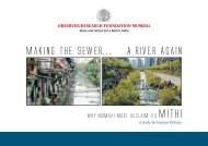
Brief reporting on Sonai River/Khal in ... - India Water Portal
Brief reporting on Sonai River/Khal in ... - India Water Portal
Brief reporting on Sonai River/Khal in ... - India Water Portal

You also want an ePaper? Increase the reach of your titles
YUMPU automatically turns print PDFs into web optimized ePapers that Google loves.
FOREWORD<br />
…………………………………<br />
…………………………………<br />
The present report is based <strong>on</strong> an ordered assimilati<strong>on</strong> of available <strong>in</strong>formati<strong>on</strong> and will serve as the<br />
foundati<strong>on</strong> for develop<strong>in</strong>g the strategy for urban envir<strong>on</strong>mental improvement and restorati<strong>on</strong> of<br />
Calcutta’s envir<strong>on</strong>ment and also for safeguard<strong>in</strong>g the city from future problems of ecological<br />
imbalance. By complet<strong>in</strong>g this phenomenal work Dr. Dhrubajyoti Ghosh, Co-ord<strong>in</strong>ator, Envir<strong>on</strong>mental<br />
Improvement Programme and his team, have d<strong>on</strong>e a commendable job and deserve appreciati<strong>on</strong>.<br />
I hope this humble effort will be of some assistance to the people of Calcutta, the ultimate decisi<strong>on</strong><br />
makers for shap<strong>in</strong>g their future envir<strong>on</strong>ment.<br />
15.3 WETLAND FORMATION AND DISTRIBUTION<br />
Asok Bhattacharya, M<strong>in</strong>ister-<strong>in</strong>-Charge, Department of<br />
Urban Development, Government of West<br />
Bengal – 5 June 1996<br />
The Calcutta Metropolitan Area <strong>in</strong> the lower Gangetic pla<strong>in</strong> is more or less flat. The pr<strong>in</strong>cipal dra<strong>in</strong>age<br />
l<strong>in</strong>e <strong>in</strong> the river Hugli. The river enters the Calcutta Metropolitan Area at Tribeni and leaves the regi<strong>on</strong><br />
at Uluberia. At Tribeni, the river Saraswati branches off to the west and the Jamuna to the east. The<br />
entire Calcutta Metropolitan Area is traversed by <strong>in</strong>numerable offshoots of the river Hugli. The north<br />
eastern part of the area comprises meander belts of the river form<strong>in</strong>g large arcuate waterbodies like the<br />
Mathura, the Kulia, the Maricha and the Baisar bils. The dra<strong>in</strong>age l<strong>in</strong>es <strong>in</strong> the area are highly<br />
sluggish. Am<strong>on</strong>g the present day channels, the Hugli, the Jamuna and the Sunti are the more important<br />
<strong>on</strong>es. Some of the palaeo-channels can be traced <strong>in</strong> the regi<strong>on</strong> by their highly aggraded beds. They<br />
<strong>in</strong>clude the Adi Ganga, the Gouri Ganga, the Kana Damodar, the S<strong>on</strong>ai Nadi and the Bidyadhari<br />
river. Land is naturally higher al<strong>on</strong>g both the banks of the exist<strong>in</strong>g palaeo-channels. Away from the<br />
levees land slopes down till it reaches another river and rises. The <strong>in</strong>terdistributary marshes are<br />
numerous. The wetlands here have been formed by natural and anthropogenic causes and are<br />
scattered all over the regi<strong>on</strong>. There are numerous small tanks of the size of less than 5000 sq. metres <strong>on</strong><br />
<strong>on</strong>e hand and large wetlands of more than 16,000 ha. <strong>on</strong> the other. Generally depths of the wetlands<br />
are never more than 3 metres and most are much shallower. Fluvial acti<strong>on</strong> has been the chief cause of<br />
creati<strong>on</strong> of the natural wetlands <strong>in</strong> this regi<strong>on</strong>. Man made water bodies found <strong>in</strong> the regi<strong>on</strong> are either<br />
for water supply or are borrow pits found al<strong>on</strong>g the highways, railways and <strong>in</strong> brick-fields. Small tanks<br />
less than 5000 sq. metres <strong>in</strong> area are mostly dug by man and they can be identified <strong>on</strong> a map by their<br />
comparatively regular boundaries. (from Page No. 164 – 165)