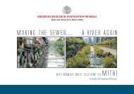
Brief reporting on Sonai River/Khal in ... - India Water Portal
Brief reporting on Sonai River/Khal in ... - India Water Portal
Brief reporting on Sonai River/Khal in ... - India Water Portal

Create successful ePaper yourself
Turn your PDF publications into a flip-book with our unique Google optimized e-Paper software.
11 SUSTAINING<br />
CALCUTTA<br />
PRESENT STATUS<br />
REPORT OF THE<br />
URBAN PEOPLES<br />
ENVIRONMENT<br />
E I P WORKING<br />
REPORT 5<br />
Envir<strong>on</strong>mental<br />
Improvement<br />
Programme for<br />
Calcutta<br />
A CMDA FACILITY<br />
CALCUTTA<br />
METROPOLITAN<br />
WATER AND<br />
SANITATION<br />
AUTHORITY<br />
12 Benefit for<br />
excavati<strong>on</strong> /<br />
restorati<strong>on</strong> of <strong>River</strong><br />
S<strong>on</strong>ai<br />
:<br />
It may be menti<strong>on</strong>ed here that the revival of <strong>River</strong> S<strong>on</strong>ai is<br />
essential to facilitate blocked dra<strong>in</strong>age system of the area and<br />
to <strong>in</strong>crease the availability of surface water to combat arsenic<br />
problem <strong>in</strong> dr<strong>in</strong>k<strong>in</strong>g water because major part of the river falls<br />
under the jurisdicti<strong>on</strong> of Barrackpore-II Block which is arsenic<br />
pr<strong>on</strong>e z<strong>on</strong>e as menti<strong>on</strong>ed <strong>in</strong> relevant Map of the Gazette of<br />
Public Health Eng<strong>in</strong>eer<strong>in</strong>g Department, Govt. of W.B., vide Sl.<br />
No. 51.<br />
15.3 WETLAND FORMATION AND DISTRIBUTION<br />
The Calcutta Metropolitan Area <strong>in</strong> the lower Gangetic pla<strong>in</strong> is<br />
more or less flat. The pr<strong>in</strong>cipal dra<strong>in</strong>age l<strong>in</strong>e <strong>in</strong> the river<br />
Hugli. The river enters the Calcutta Metropolitan Area at<br />
Tribeni and leaves the regi<strong>on</strong> at Uluberia. At Tribeni, the river<br />
Sartaswati branches off to the west and the Jamuna to the<br />
east. The entire Calcutta Metropolitan Area is traversed by<br />
<strong>in</strong>numerable offshoots of the river Hugli. The north eastern part<br />
of the area comprises meander belts of the river form<strong>in</strong>g large<br />
arcuate waterbodies like the Mathura, the Kulia, the Maricha<br />
and the Baisar bils. The dra<strong>in</strong>age l<strong>in</strong>es <strong>in</strong> the area are highly<br />
sluggish. Am<strong>on</strong>g the present day channels, the Hugli, the<br />
Jamuna and the Sunti are the more important <strong>on</strong>es. Some of<br />
the palaeo-channels can be traced <strong>in</strong> the regi<strong>on</strong> by their highly<br />
aggraded beds. They <strong>in</strong>clude the Adi Ganga, the Gouri Ganga,<br />
the Kana Damodar, the S<strong>on</strong>ai Nadi and the Bidyadhari<br />
river. Land is naturally higher al<strong>on</strong>g both the banks of the<br />
exist<strong>in</strong>g palaeo-channels. Away from the levees land slopes<br />
down till it reaches another river and rises. The<br />
:<br />
<strong>in</strong>terdistributary marshes are numerous. The wetlands here<br />
have been formed by natural and anthropogenic causes and are<br />
scattered all over the regi<strong>on</strong>. There are numerous small tanks<br />
of the size of less than 5000 sq. metres <strong>on</strong> <strong>on</strong>e hand and large<br />
wetlands of more than 16,000 ha. <strong>on</strong> the other. Generally<br />
depths of the wetlands are never more than 3 metres and most<br />
are much shallower. Fluvial acti<strong>on</strong> has been the chief cause of<br />
creati<strong>on</strong> of the natural wetlands <strong>in</strong> this regi<strong>on</strong>. Man made<br />
water bodies found <strong>in</strong> the regi<strong>on</strong> are either for water supply or<br />
are borrow pits found al<strong>on</strong>g the highways, railways and <strong>in</strong> brickfields.<br />
Small tanks less than 5000 sq. metres <strong>in</strong> area are mostly<br />
dug by man and they can be identified <strong>on</strong> a map by their<br />
comparatively regular boundaries.<br />
S<strong>on</strong>ai <strong>on</strong>ce restored to life may be a significant source of<br />
<strong>in</strong>come and livelihood for a vast number of fishermen, a useful<br />
sewage and detoxificati<strong>on</strong> of polluted water, a vital player <strong>in</strong><br />
ground water recharge and discharge, <strong>in</strong> ma<strong>in</strong>ta<strong>in</strong><strong>in</strong>g open<br />
space, and generat<strong>in</strong>g oxygen and recreati<strong>on</strong> facilities and also<br />
<strong>in</strong> develop<strong>in</strong>g ferry service and <strong>in</strong> fulfill<strong>in</strong>g irrigati<strong>on</strong> needs.