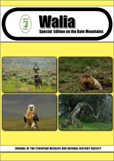
Walia Special Edition on the Bale Mountains (2011) - Zoologische ...
Walia Special Edition on the Bale Mountains (2011) - Zoologische ...
Walia Special Edition on the Bale Mountains (2011) - Zoologische ...

Create successful ePaper yourself
Turn your PDF publications into a flip-book with our unique Google optimized e-Paper software.
<str<strong>on</strong>g>Walia</str<strong>on</strong>g><br />
<str<strong>on</strong>g>Special</str<strong>on</strong>g> <str<strong>on</strong>g>Editi<strong>on</strong></str<strong>on</strong>g> <strong>on</strong> <strong>the</strong> <strong>Bale</strong> <strong>Mountains</strong><br />
Journal of thE Ethiopian WildlifE and natural hiStory SociEty
<str<strong>on</strong>g>Walia</str<strong>on</strong>g>-<str<strong>on</strong>g>Special</str<strong>on</strong>g> <str<strong>on</strong>g>Editi<strong>on</strong></str<strong>on</strong>g> <strong>on</strong> <strong>the</strong> <strong>Bale</strong> <strong>Mountains</strong><br />
Published <strong>2011</strong><br />
Edited by: Deborah Randall 1 , Sim<strong>on</strong> Thirgood 2 and Anouska Kinahan 3<br />
1 Frankfurt Zoological Society, Addis Ababa, Ethiopia. Email: deborah.a.randall@gmail.com<br />
2 Macaulay Land Use Research Institute, now <strong>the</strong> James Hutt<strong>on</strong> Institute, UK<br />
3 Frankfurt Zoological Society, <strong>Bale</strong> <strong>Mountains</strong> C<strong>on</strong>servati<strong>on</strong> Project, <strong>Bale</strong> <strong>Mountains</strong> Nati<strong>on</strong>al<br />
Park, Ethiopia. Email: anouskakinahan@fzs.org<br />
Acknowledgements:<br />
This publicati<strong>on</strong> was made possible with <strong>the</strong> financial assistance of <strong>the</strong> Frankfurt Zoological Society,<br />
<strong>the</strong> European Uni<strong>on</strong>, <strong>the</strong> Darwin Initiative Harenna Project and <strong>the</strong> Ethiopian Wolf C<strong>on</strong>servati<strong>on</strong><br />
Programme. The editors would like to extend a very big thank you to Zewditu Tessema, Head of<br />
Resource and Informati<strong>on</strong> Center from Ethiopian Wildlife and Natural History Society (EWNHS)<br />
for her endless patience, input, guidance and oversight of <strong>the</strong> final stages of <strong>the</strong> producti<strong>on</strong> of this<br />
<str<strong>on</strong>g>Special</str<strong>on</strong>g> <str<strong>on</strong>g>Editi<strong>on</strong></str<strong>on</strong>g> of <str<strong>on</strong>g>Walia</str<strong>on</strong>g>.<br />
Layout Design: Thomas Engida, tomnet_et@yahoo.com<br />
Cover Photos- © Delphin Ruché and Vincent Munier<br />
EWNHS Members of <strong>the</strong> Board of Management<br />
Dr. Theodros Atlabachew President<br />
Wzo. Azeb Girmai Vice-President<br />
Dr. Asferachew Abate Member<br />
Ato Yeneneh Teka Member<br />
Dr. Habtemariam Abate Member<br />
Wzo. Aster Tefera Member<br />
Dr. Mekuria Argaw Member<br />
Ato Mengistu W<strong>on</strong>dafrash N<strong>on</strong>-voting member<br />
Disclaimer: This document has been produced with <strong>the</strong> financial assistance of <strong>the</strong> European Uni<strong>on</strong>. The c<strong>on</strong>tents of this<br />
document are <strong>the</strong> sole resp<strong>on</strong>sibility of <strong>the</strong> Frankfurt Zoological Society and EWNHS and can under no circumstances<br />
be regarded as reflecting <strong>the</strong> positi<strong>on</strong> of <strong>the</strong> European Uni<strong>on</strong>.
This <str<strong>on</strong>g>Special</str<strong>on</strong>g> <str<strong>on</strong>g>Editi<strong>on</strong></str<strong>on</strong>g> of <str<strong>on</strong>g>Walia</str<strong>on</strong>g> is Dedicated to Sim<strong>on</strong> Thirgood<br />
1962-2009<br />
From a vantage point <strong>on</strong> <strong>the</strong> Morobawa plateau in <strong>the</strong> <strong>Bale</strong> <strong>Mountains</strong>, in <strong>the</strong> warm sunlight, Sim<strong>on</strong> and I<br />
sink down into a couple of tussocks of Festuca grass. The year was 2003 and we were looking around for<br />
potential sites for <strong>the</strong> project that we were tentatively calling <strong>the</strong> <strong>Bale</strong> Ecosystem Project. Having spent a few<br />
hours walking over <strong>the</strong> plateau, we settled in <strong>the</strong> warm grass and, deeply c<strong>on</strong>tent, our c<strong>on</strong>versati<strong>on</strong> roamed<br />
from <strong>the</strong> minutiae of <strong>the</strong> research questi<strong>on</strong>s to which we wanted answers to <strong>the</strong> intractability of barriers to<br />
c<strong>on</strong>servati<strong>on</strong> in Ethiopia to <strong>the</strong> allure of <strong>the</strong> <strong>Bale</strong> <strong>Mountains</strong>.<br />
Sim<strong>on</strong> Thirgood was an applied ecologist, born in Liberia in 1962 and brought up in Canada. His<br />
professi<strong>on</strong>al work was built <strong>on</strong> a solid scientific foundati<strong>on</strong> with a PhD from <strong>the</strong> University of Southampt<strong>on</strong><br />
<strong>on</strong> <strong>the</strong> behavioural ecology of fallow deer and post-doctoral work, based out of <strong>the</strong> University of Cambridge,<br />
<strong>on</strong> <strong>the</strong> mating system of black lechwe in Zambia. From 1992, <strong>the</strong> practical applicati<strong>on</strong> of ecology grew in<br />
his work, initially through <strong>the</strong> Joint Raptor Study which examined <strong>the</strong> interacti<strong>on</strong> between <strong>the</strong> management<br />
of moorlands in Scotland for driven grouse shooting and <strong>the</strong> c<strong>on</strong>servati<strong>on</strong> of birds of prey. This work<br />
culminated in his first book, Birds of Prey and Red Grouse which he co-authored with Steve Redpath. His<br />
interest in Ethiopia emerged through his relati<strong>on</strong>ship with Karen Laurens<strong>on</strong> and her work <strong>on</strong> diseases am<strong>on</strong>g<br />
wild carnivores and domestic dogs in <strong>the</strong> <strong>Bale</strong> <strong>Mountains</strong> - as a key to understanding <strong>the</strong> disease threats to<br />
Ethiopian wolves. Sim<strong>on</strong>’s interest and work in c<strong>on</strong>servati<strong>on</strong> culminated in his appointment, with Karen, as<br />
Programme Manager for <strong>the</strong> Frankfurt Zoological Society (FZS). Sim<strong>on</strong>, Karen and <strong>the</strong>ir young family were<br />
based in <strong>the</strong> Serengeti and he was resp<strong>on</strong>sible for projects in Tanzania and Zambia. Sim<strong>on</strong> also had significant<br />
input into FZS projects in Ethiopia and elsewhere in Africa. Following two years in <strong>the</strong> Serengeti, Sim<strong>on</strong><br />
was offered <strong>the</strong> positi<strong>on</strong> of Head of Ecology at <strong>the</strong> Macaulay Land Use Research Institute in Aberdeen. In<br />
recogniti<strong>on</strong> of his abilities as an applied ecologist, he became <strong>on</strong>e of <strong>the</strong> editors of <strong>the</strong> Journal of Applied<br />
Ecology and, at this point, he edited his sec<strong>on</strong>d book - People and Wildlife: C<strong>on</strong>flict or Co-existence (coedited<br />
with Rosie Woodroffe and Alan Rabinowitz).<br />
From 1995, when Sim<strong>on</strong> first visited Ethiopia, his commitment to <strong>the</strong> country and <strong>the</strong> c<strong>on</strong>servati<strong>on</strong><br />
of its unique biodiversity and ecosystems grew. Throughout his career, he recognised <strong>the</strong> value of investing<br />
time and energy in mentoring talented students and, as such, he supported or supervised three PhD Ethiopian<br />
students (Anagaw Atickem, Anteneh Shimelis and Ermias Admasu) as well as o<strong>the</strong>r post-graduate students<br />
from <strong>the</strong> Universities of Oxford and Addis Ababa. He was generous with his time and support of <strong>the</strong> students,<br />
working with <strong>the</strong>m through <strong>the</strong> questi<strong>on</strong>s <strong>the</strong>y were setting out to answer and he became a role model for<br />
many of <strong>the</strong>se young people. He was also excited by <strong>the</strong> potential to seek answers to research questi<strong>on</strong>s in<br />
Afroalpine ecosystems such as those in <strong>the</strong> <strong>Bale</strong> <strong>Mountains</strong> and any brief walk with him in <strong>the</strong> mountains<br />
always led to questi<strong>on</strong>s being asked and hypo<strong>the</strong>ses being proffered. He recognised <strong>the</strong> extraordinary value<br />
and allure of <strong>the</strong> <strong>Bale</strong> <strong>Mountains</strong> and, with Karen, ensured that it became a key site for FZS’s work in Africa.<br />
Sim<strong>on</strong>’s untimely death in August 2009, while working to set up a project, funded by <strong>the</strong> Darwin<br />
Initiative, to streng<strong>the</strong>n <strong>the</strong> community c<strong>on</strong>servati<strong>on</strong> work of <strong>the</strong> people in Guassa-Menz, means that his<br />
c<strong>on</strong>tributi<strong>on</strong> to science and c<strong>on</strong>servati<strong>on</strong> in Ethiopia will probably remain intangible, unmeasured. And yet<br />
his influence and legacy will be profound, primarily through <strong>the</strong> people to whom he reached out and touched<br />
with his energy, clarity of visi<strong>on</strong> and thought, and his acerbic but always accurate evaluati<strong>on</strong>s of <strong>the</strong>ir work.<br />
<str<strong>on</strong>g>Walia</str<strong>on</strong>g>-<str<strong>on</strong>g>Special</str<strong>on</strong>g> <str<strong>on</strong>g>Editi<strong>on</strong></str<strong>on</strong>g> <strong>on</strong> <strong>the</strong> <strong>Bale</strong> <strong>Mountains</strong> I
This <str<strong>on</strong>g>Special</str<strong>on</strong>g> <str<strong>on</strong>g>Editi<strong>on</strong></str<strong>on</strong>g> of <str<strong>on</strong>g>Walia</str<strong>on</strong>g> emerged out of those c<strong>on</strong>versati<strong>on</strong>s, back in 2003, in <strong>the</strong> l<strong>on</strong>g Festuca<br />
tussocks of <strong>the</strong> Morobawa plateau and o<strong>the</strong>rs, fuelled by single malt whisky, that we had aside <strong>the</strong> fire back<br />
at <strong>the</strong> base in Dinsho. Indeed, he died after <strong>on</strong>e such evening, some years after we had held those first<br />
discussi<strong>on</strong>s: <strong>on</strong> a wild night in <strong>the</strong> mountains that he loved, drinking single malt whisky from Scotland, and<br />
talking awhile with his old friend and colleague, Zelealem Tefera. Their c<strong>on</strong>versati<strong>on</strong> roamed, as ever, from<br />
<strong>the</strong> minutiae of research questi<strong>on</strong>s to <strong>the</strong> c<strong>on</strong>tinued intractability of barriers to c<strong>on</strong>servati<strong>on</strong> in Ethiopia and<br />
to <strong>the</strong> allure of Ethiopian mountains.<br />
It is fitting, <strong>the</strong>n, that this <str<strong>on</strong>g>Special</str<strong>on</strong>g> <str<strong>on</strong>g>Editi<strong>on</strong></str<strong>on</strong>g> of <str<strong>on</strong>g>Walia</str<strong>on</strong>g> is dedicated to Sim<strong>on</strong>.<br />
Stuart Williams<br />
Maputo, Mozambique<br />
<str<strong>on</strong>g>Walia</str<strong>on</strong>g>-<str<strong>on</strong>g>Special</str<strong>on</strong>g> <str<strong>on</strong>g>Editi<strong>on</strong></str<strong>on</strong>g> <strong>on</strong> <strong>the</strong> <strong>Bale</strong> <strong>Mountains</strong> II
Foreword<br />
The <strong>Bale</strong> <strong>Mountains</strong> are unique in Africa. They encompass Africa’s largest alpine plateau and c<strong>on</strong>tain <strong>the</strong><br />
largest populati<strong>on</strong>s of two of Africa’s least known and yet most charismatic species – <strong>the</strong> Ethiopian wolf and<br />
<strong>the</strong> mountain nyala. They also harbor an excepti<strong>on</strong>ally high number of o<strong>the</strong>r species endemic to Ethiopia<br />
and, in some cases, endemic to <strong>the</strong> <strong>Bale</strong> <strong>Mountains</strong> <strong>the</strong>mselves. For this <strong>the</strong>y are included in C<strong>on</strong>servati<strong>on</strong><br />
Internati<strong>on</strong>al’s Eastern Afrom<strong>on</strong>tane Biodiversity Hotspot and are designated <strong>on</strong>e of BirdLife Internati<strong>on</strong>al’s<br />
Important Bird Areas. Isolati<strong>on</strong> and rarity put <strong>the</strong>se endemic species at high risk of extincti<strong>on</strong> and, thus,<br />
in need of effective c<strong>on</strong>servati<strong>on</strong> strategies that are supported nati<strong>on</strong>ally and internati<strong>on</strong>ally. But not <strong>on</strong>ly<br />
does this area protect a significant porti<strong>on</strong> of Ethiopia’s and <strong>the</strong> world’s biodiversity, it also gives rise to key<br />
watersheds and natural resources that are <strong>the</strong> basis for local, nati<strong>on</strong>al and internati<strong>on</strong>al livelihoods. The more<br />
we learn about <strong>the</strong> range of goods and services provided by <strong>the</strong> <strong>Bale</strong> <strong>Mountains</strong>, <strong>the</strong> more vital our efforts<br />
become to ensure <strong>the</strong>ir c<strong>on</strong>servati<strong>on</strong> and sustainable management.<br />
At <strong>the</strong> heart of <strong>the</strong> <strong>Bale</strong> <strong>Mountains</strong> is <strong>the</strong> <strong>Bale</strong> <strong>Mountains</strong> Nati<strong>on</strong>al Park, <strong>on</strong>e of Ethiopia’s most<br />
important protected areas. The park was proclaimed after early scientific studies revealed <strong>the</strong> uniqueness of<br />
<strong>the</strong> <strong>Bale</strong> <strong>Mountains</strong>, thus eliciting <strong>the</strong> attenti<strong>on</strong> needed to drive greater c<strong>on</strong>servati<strong>on</strong> efforts. These research<br />
pi<strong>on</strong>eers – Herbet Mo<strong>on</strong>ey (1958-1959), Lesley Brown (1963 and 1965), Curtis Buer (1969-1971), and Chris<br />
Hillman (1980s-90s) – have been followed by many o<strong>the</strong>rs and our knowledge of <strong>the</strong> <strong>Bale</strong> <strong>Mountains</strong> has<br />
grown accordingly. Securing <strong>the</strong> future of <strong>the</strong> <strong>Bale</strong> <strong>Mountains</strong> Nati<strong>on</strong>al Park remains a top priority for <strong>the</strong><br />
Ethiopian Wildlife C<strong>on</strong>servati<strong>on</strong> Authority and, wherever possible, research should c<strong>on</strong>tinue to underpin<br />
c<strong>on</strong>servati<strong>on</strong> and management decisi<strong>on</strong>s.<br />
This <str<strong>on</strong>g>Special</str<strong>on</strong>g> <str<strong>on</strong>g>Editi<strong>on</strong></str<strong>on</strong>g> c<strong>on</strong>tains <strong>the</strong> work of recent Ethiopian and internati<strong>on</strong>al researchers and<br />
c<strong>on</strong>servati<strong>on</strong>ists, covering a range of ecological, sociological and management issues. It will be a great<br />
resource for future c<strong>on</strong>servati<strong>on</strong>ists, researchers and managers alike, and will raise internati<strong>on</strong>al awareness<br />
of <strong>the</strong> <strong>Bale</strong> <strong>Mountains</strong>, <strong>the</strong>ir ecological, social and ec<strong>on</strong>omic importance and <strong>the</strong> threats <strong>the</strong>y face. Many<br />
questi<strong>on</strong>s and challenges remain. It is my hope and belief that this <str<strong>on</strong>g>Special</str<strong>on</strong>g> <str<strong>on</strong>g>Editi<strong>on</strong></str<strong>on</strong>g> will draw <strong>the</strong> attenti<strong>on</strong> of<br />
o<strong>the</strong>r researchers and c<strong>on</strong>servati<strong>on</strong> practiti<strong>on</strong>ers so that, toge<strong>the</strong>r, we may better understand and manage <strong>the</strong><br />
<strong>Bale</strong> <strong>Mountains</strong> for future generati<strong>on</strong>s.<br />
Dr. Kifle Argaw,<br />
EWCA Director<br />
<str<strong>on</strong>g>Walia</str<strong>on</strong>g>-<str<strong>on</strong>g>Special</str<strong>on</strong>g> <str<strong>on</strong>g>Editi<strong>on</strong></str<strong>on</strong>g> <strong>on</strong> <strong>the</strong> <strong>Bale</strong> <strong>Mountains</strong> III
TABLE OF CONTENTS<br />
INTRODUCTION .......................................................................................................................................................... 1<br />
WILDLIFE<br />
MAMMALS OF THE BALE MOUNTAINS NATIONAL PARK, ETHIOPIA: COMPILED AND ANNOTATED<br />
CHECKLIST, ASEFA, A. ................................................................................................................................................ 3<br />
STRUCTURING OF THE BIRDS OF THE BALE MOUNTAINS NATIONAL PARK, SHIMELIS, A., BEKELE, A.,<br />
ASEFA, A., WILLIAMS, S., GOVE, A. AND THIRGOOD, S. ................................................................................... 15<br />
ETHIOPIAN WOLF MONITORING IN THE BALE MOUNTAINS FROM 2001-2004, RANDALL, D., TALLENTS,<br />
L., WILLIAMS, S. AND SILLERO-ZUBIRI, C.......................................................................................................... 28<br />
OBSERVATIONS ON THE STATUS OF THE MOUNTAIN NYALA: 2000-2005, MALCOLM, J. AND<br />
EVANGELISTA, P.H .................................................................................................................................................... 39<br />
POPULATION ESTIMATES AND DIET OF STARK’S HARE (LEPUS STARCKI PETTER, 1963) IN THE BALE<br />
MOUNTAINS NATIONAL PARK, ETHIOPIA MEKONNEN, T., BEKELE, A. AND MALCOM, J. ..................... 53<br />
ECOLOGY AND REPRODUCTIVE STRATEGY OF AN AFROALPINE SPECIALIST: ETHIOPIAN WOLVES IN<br />
THE BALE MOUNTAINS SILLERO-ZUBIRI, C., GOTTELLI, D., MARINO, J., RANDALL, D., TALLENTS, L.<br />
AND MACDONALD, D.W. ....................................................................................................................................... 61<br />
A PRELIMINARY ASSESSMENT OF THE BALE MONKEY (CERCOPITHECUS DJAMDJAMENSIS)<br />
POPULATION SIZE AND HABITAT USE IN THE HARENNA FOREST WAKJIRA, K., GASHAW, M. AND<br />
PINARD, M. .................................................................................................................................................................. 80<br />
AMPHIBIANS AND REPTILES RECORDED FROM THE BALE MOUNTAINS LARGAN, M AND SPAWLS, S.. 89<br />
CONSERVATION OF ETHIOPIAN AMPHIBIANS: A RACE AGAINST TIME MENGISTU, A.A., LOADER, S.,<br />
GETAHUN, A., SABER, S. AND NAGEL, P............................................................................................................... 92<br />
A SUMMARY OF THE CONSERVATION STATUS OF THE MOUNTAIN NYALA (TRAGELAPHUS BUxTONI)<br />
IN BALE MOUNTAINS NATIONAL PARK, MAMO, Y. AND PINARD, M. .......................................................... 94<br />
ECOLOGY AND VEGETATION<br />
MAPPING HIGH-ALTITUDE VEGETATION IN THE BALE MOUNTAINS, ETHIOPIA. TALLENTS, L.A. AND<br />
MACDONALD, D.W. ................................................................................................................................................. 97<br />
THE CHANGING FACE OF THE BALE MOUNTAINS NATIONAL PARK OVER 32 YEARS: A STUDY OF LAND<br />
COVER CHANGE. TESHOME, E., RANDALL, D. AND KINAHAN, A.A.............................................................. 118<br />
CHARACTERISTICS AND ORIGINS OF GLADES IN THE HARENNA FOREST, ETHIOPIA.CHIODI, G. AND<br />
PINARD, M.................................................................................................................................................................. 131
FACTORS AFFECTING FIRE ExTENT AND FREqUENCY IN THE BALE MOUNTAINS NATIONAL PARK.<br />
ABERA, K AND KINAHAN, A.A. ............................................................................................................................. 146<br />
THE STATUS OF THE ERICACEOUS VEGETATION ON THE SOUTHERN SLOPE OF THE BALE MOUNTAINS.<br />
ASSEFA, Y., WESCHE, K. AND FETENE, M............................................................................................................ 158<br />
BALE MOUNTAIN LAKES: ECOSYSTEMS UNDER PRESSURE OF GLOBAL CHANGE? EGGERMONT, H.,<br />
WONDAFRASH, M., VAN DAMME, K., LENS, L. AND UMER, M........................................................................ 171<br />
rESOurCE uSE<br />
DIRECT CONSUMPTIVE USE VALUE OF ECOSYSTEM GOODS AND SERVICES IN THE BALE MOUNTAINS<br />
ECO-REGION, ETHIOPIA. WATSON, C., MILNER-GULLAND, E.J., MOURATO, S ........................................... 181<br />
LIVESTOCK GRAZING IN BALE MOUNTAINS NATIONAL PARK, ETHIOPIA: PAST, PRESENT AND FUTURE.<br />
VIAL, F. MACDONALD, D.W. AND HAYDON, D. T................................................................................................ 197<br />
TRADITIONAL BEEKEEPING AND PATTERNS OF HOST TREE USE IN THE HARENNA FOREST, BALE<br />
MOUNTAINS NATIONAL PARK. LEFEVRE, B. AND PINARD, M. ..................................................................... 208<br />
VALUE CHAIN ANALYSIS FOR BAMBOO ORIGINATING FROM SHEDEM KEBELE, BALE ZONE. TESFAYE.<br />
A. A. .............................................................................................................................................................................. 213<br />
THE DISTRIBUTION, PROPERTIES AND USES OF MINERAL SPRINGS IN THE HARENNA FOREST. CHIODI,<br />
G. AND PINARD, M. .................................................................................................................................................. 225<br />
PrOTECTED ArEA mANAGEmENT<br />
GENERAL MANAGEMENT PLANNING FOR THE BALE MOUNTAINS NATIONAL PARK. NELSON, A...... 243<br />
PEOPLE IN NATIONAL PARKS – JOINT NATURAL RESOURCE MANAGEMENT IN BALE MOUNTAINS<br />
NATIONAL PARK – WHY IT MAKES SENSE TO WORK WITH LOCAL PEOPLE. TADESSE, D., WILLIAMS, S.,<br />
AND IRWIN, B. ........................................................................................................................................................... 257<br />
RISK OF DISEASE TRANSMISSION BETWEEN DOMESTIC LIVESTOCK AND WILD UNGULATE IN THE<br />
BALE MOUNTAINS NATIONAL PARK, ETHIOPIA. SHIFERAW, F. AND LAURENSON, M.K. ..................... 269<br />
TOURISM AND PROTECTED AREAS: TOURISM DEVELOPMENT IN THE BALE MOUNTAINS NATIONAL<br />
PARK. ADMASU, B. , ASEFA, A. AND KINAHAN, A.A. ........................................................................................ 282<br />
CAN CARBON CONTRIBUTE TO CONSERVATION FINANCING? A TECHNICAL AND ECONOMIC<br />
FEASIBILITY ANALYSIS OF REDD IN THE BALE MOUNTAINS NATIONAL PARK. KINAHAN, A.A. AND<br />
WATSON, C.................................................................................................................................................................. 295<br />
ENSURING THE LONG-TERM CONSERVATION OF ECOSYSTEMS: THE ROLE OF MONITORING<br />
DATABASES HOPCRAFT, G. .................................................................................................................................... 306
OThEr INFOrmATION<br />
BALE MOUNTAINS NATIONAL PARK PARTNERS .............................................................................................. 332<br />
ETHIOPIAN WILDLIFE & NATURAL HISTORY SOCIETY MEMBERSHIP REGISTRATION FORM............... 339
Introducti<strong>on</strong><br />
This <str<strong>on</strong>g>Special</str<strong>on</strong>g> <str<strong>on</strong>g>Editi<strong>on</strong></str<strong>on</strong>g> of <str<strong>on</strong>g>Walia</str<strong>on</strong>g> grew from a research and m<strong>on</strong>itoring symposium that was c<strong>on</strong>ceived by<br />
Stuart Williams of <strong>the</strong> Ethiopian Wolf C<strong>on</strong>servati<strong>on</strong> Programme and Alastair Nels<strong>on</strong> of Frankfurt Zoological<br />
Society back in 2004, when <strong>the</strong>y were both leading projects in <strong>the</strong> <strong>Bale</strong> <strong>Mountains</strong>. Their idea was to work<br />
out a vibrant research programme for <strong>the</strong> future by bringing toge<strong>the</strong>r all those research active at <strong>the</strong> time in<br />
<strong>the</strong> <strong>Bale</strong> <strong>Mountains</strong>, those interested in future work and those that had experience elsewhere in key subject<br />
areas. The symposium was hosted in <strong>the</strong> lodge at <strong>the</strong> <strong>Bale</strong> <strong>Mountains</strong> Nati<strong>on</strong>al Park (BMNP) headquarters<br />
in Dinsho in early 2005 and allowed nati<strong>on</strong>al and internati<strong>on</strong>al experts to present <strong>the</strong>ir work, discuss <strong>the</strong><br />
dynamics and status of this extraordinary and relatively unique ecosystem and make plans for <strong>the</strong> future. In<br />
<strong>the</strong>se respects, it was a landmark occasi<strong>on</strong> for <strong>the</strong> park.<br />
The symposium was important for o<strong>the</strong>r reas<strong>on</strong>s, not least because it provided <strong>the</strong> basis for developing<br />
an ecological m<strong>on</strong>itoring plan for <strong>the</strong> BMNP. The assembled expert group worked toge<strong>the</strong>r to identify <strong>the</strong><br />
priority ecosystem comp<strong>on</strong>ents of <strong>the</strong> <strong>Bale</strong> <strong>Mountains</strong> and thus <strong>the</strong> ecological systems and processes that<br />
should be <strong>the</strong> targeted for c<strong>on</strong>servati<strong>on</strong> acti<strong>on</strong>. They also articulated and ranked <strong>the</strong> threats facing those<br />
ecosystem comp<strong>on</strong>ents. Whilst subsequent iterati<strong>on</strong>s refined <strong>the</strong>se outputs, <strong>the</strong> symposium developed <strong>the</strong><br />
foundati<strong>on</strong> of <strong>the</strong> framework for c<strong>on</strong>serving and m<strong>on</strong>itoring this site of global importance and a key part of<br />
Ethiopia’s nati<strong>on</strong>al heritage.<br />
Those involved from <strong>the</strong> beginning will know that this <str<strong>on</strong>g>Special</str<strong>on</strong>g> <str<strong>on</strong>g>Editi<strong>on</strong></str<strong>on</strong>g> of <str<strong>on</strong>g>Walia</str<strong>on</strong>g> has had <strong>on</strong>e of <strong>the</strong><br />
l<strong>on</strong>gest gestati<strong>on</strong> periods of any known publicati<strong>on</strong>. Indeed, during this gestati<strong>on</strong>, two of <strong>the</strong> editors have<br />
created a little girl each, and <strong>the</strong> o<strong>the</strong>r editor’s two little girls have almost grown into teenagers! Sometime<br />
after <strong>the</strong> symposium, Sim<strong>on</strong> and Deborah revived <strong>the</strong> idea of this <str<strong>on</strong>g>Special</str<strong>on</strong>g> <str<strong>on</strong>g>Editi<strong>on</strong></str<strong>on</strong>g> and took <strong>on</strong> <strong>the</strong> <strong>on</strong>erous job<br />
of cajoling and bullying some recalcitrant authors to provide manuscripts. They also raised m<strong>on</strong>ey from key<br />
BMNP partners to ensure its publicati<strong>on</strong>. When Anouska joined FZS <strong>on</strong> <strong>the</strong> <strong>Bale</strong> <strong>Mountains</strong> C<strong>on</strong>servati<strong>on</strong><br />
Project (BMCP), she was co-opted to <strong>the</strong> editorial team and brought fresh enthusiasm to <strong>the</strong> endeavour.<br />
Toge<strong>the</strong>r <strong>the</strong>y were able to obtain additi<strong>on</strong>al c<strong>on</strong>tributi<strong>on</strong>s from authors who had not been at <strong>the</strong> original<br />
symposium, thus providing a more complete record of research in <strong>the</strong> <strong>Bale</strong> <strong>Mountains</strong>. The result is that this<br />
<str<strong>on</strong>g>Special</str<strong>on</strong>g> <str<strong>on</strong>g>Editi<strong>on</strong></str<strong>on</strong>g> pulls toge<strong>the</strong>r many aspects of research work carried out in <strong>the</strong> <strong>Bale</strong> <strong>Mountains</strong> between 1990<br />
and <strong>2011</strong>.<br />
Sim<strong>on</strong> provided much of <strong>the</strong> initial drive for <strong>the</strong> publicati<strong>on</strong> of this <str<strong>on</strong>g>Special</str<strong>on</strong>g> <str<strong>on</strong>g>Editi<strong>on</strong></str<strong>on</strong>g> and his untimely<br />
death in 2009 occurred <strong>on</strong> <strong>the</strong> brink of <strong>the</strong> final stage. This was a blow for <strong>the</strong> o<strong>the</strong>r editors and took some<br />
time to overcome. It is to <strong>the</strong>ir huge credit that <strong>the</strong>y did find renewed energy to ensure its completi<strong>on</strong>, <strong>the</strong>reby<br />
also providing a tribute to Sim<strong>on</strong> and his c<strong>on</strong>tributi<strong>on</strong> to <strong>the</strong> <strong>Bale</strong> <strong>Mountains</strong>. I would like to thank <strong>the</strong>m for<br />
<strong>the</strong>ir dogged and polite persistence.<br />
Perhaps partly because of its l<strong>on</strong>g gestati<strong>on</strong> period, <strong>the</strong> <str<strong>on</strong>g>Special</str<strong>on</strong>g> <str<strong>on</strong>g>Editi<strong>on</strong></str<strong>on</strong>g> of <str<strong>on</strong>g>Walia</str<strong>on</strong>g> provides a valuable<br />
assimilati<strong>on</strong> of <strong>the</strong> research carried out over <strong>the</strong> past two decades. It also lays out tools for <strong>the</strong> future<br />
management of <strong>the</strong> ecosystem. But many unanswered questi<strong>on</strong>s remain and <strong>the</strong> management challenges are<br />
becoming ever more complex and urgent. Thus, I hope that this publicati<strong>on</strong> encourages o<strong>the</strong>rs to build <strong>on</strong><br />
previous and <strong>on</strong>going work by c<strong>on</strong>tinuing to undertake management oriented research in <strong>the</strong> <strong>Bale</strong> <strong>Mountains</strong>.<br />
A list of priority research topics is available, first included in <strong>the</strong> 2007 General Management Plan (GMP) and<br />
now updated and maintained <strong>on</strong> <strong>the</strong> BMNP website (www.balemountains.org).<br />
Finally, this <str<strong>on</strong>g>Special</str<strong>on</strong>g> <str<strong>on</strong>g>Editi<strong>on</strong></str<strong>on</strong>g> is evidence of <strong>the</strong> range of individuals and organizati<strong>on</strong>s involved in<br />
research, m<strong>on</strong>itoring and management activities in <strong>the</strong> <strong>Bale</strong> <strong>Mountains</strong> and <strong>the</strong> partnerships that already exist.<br />
<str<strong>on</strong>g>Walia</str<strong>on</strong>g>-<str<strong>on</strong>g>Special</str<strong>on</strong>g> <str<strong>on</strong>g>Editi<strong>on</strong></str<strong>on</strong>g> <strong>on</strong> <strong>the</strong> <strong>Bale</strong> <strong>Mountains</strong> 1
These partnerships are essential for filling technical and resource gaps and collaborati<strong>on</strong>s should c<strong>on</strong>tinue to<br />
be promoted between <strong>the</strong> park, universities, nati<strong>on</strong>al and internati<strong>on</strong>al research instituti<strong>on</strong>s, government and<br />
NGOs. As envisi<strong>on</strong>ed at <strong>the</strong> outset of <strong>the</strong> 2005 research symposium, <strong>the</strong> result will be a str<strong>on</strong>g research and<br />
m<strong>on</strong>itoring programme that guides urgent management acti<strong>on</strong> to c<strong>on</strong>serve and sustainably manage <strong>the</strong> unique<br />
global heritage that is <strong>the</strong> <strong>Bale</strong> <strong>Mountains</strong>.<br />
Karen Laurens<strong>on</strong><br />
Programme Manager, Frankfurt Zoological Society<br />
<str<strong>on</strong>g>Walia</str<strong>on</strong>g>-<str<strong>on</strong>g>Special</str<strong>on</strong>g> <str<strong>on</strong>g>Editi<strong>on</strong></str<strong>on</strong>g> <strong>on</strong> <strong>the</strong> <strong>Bale</strong> <strong>Mountains</strong> 2
Mammals of <strong>the</strong> <strong>Bale</strong> <strong>Mountains</strong> Nati<strong>on</strong>al Park, Ethiopia: A Compiled and<br />
Annotated Checklist<br />
Addisu Asefa<br />
<strong>Bale</strong> <strong>Mountains</strong> Nati<strong>on</strong>al Park, PO Box 107, <strong>Bale</strong>, Goba, Ethiopia<br />
Email: adde_bird@yahoo.com<br />
Abstract<br />
Basic data <strong>on</strong> mammals of <strong>the</strong> <strong>Bale</strong> <strong>Mountains</strong> Nati<strong>on</strong>al Park (BMNP), including an updated species<br />
checklist, have not been systematically compiled and published since 1993. In this review paper I use<br />
published and unpublished data, as well as pers<strong>on</strong>al records made <strong>on</strong> an ad hoc basis, to provide an<br />
updated species checklist of mammals of <strong>the</strong> BMNP. At least 78 species of mammals, bel<strong>on</strong>ging to<br />
nine orders and 23 families of mammalian groups, are known to occur in <strong>the</strong> BMNP. Twenty (26%)<br />
of <strong>the</strong> total species reported here are endemic to Ethiopia representing 40% and 67% of <strong>the</strong> total<br />
mammal species and endemics, respectively, occurring in <strong>the</strong> Ethiopian highlands. Fur<strong>the</strong>r, at least<br />
five species are presumed to be c<strong>on</strong>fined to <strong>the</strong> <strong>Bale</strong> <strong>Mountains</strong> area while ano<strong>the</strong>r five species are<br />
locally endemic. The present trend of ecological degradati<strong>on</strong> in <strong>the</strong> <strong>Bale</strong> <strong>Mountains</strong> is a severe threat<br />
to <strong>the</strong> c<strong>on</strong>servati<strong>on</strong> of biodiversity overall, but particularly <strong>the</strong> survival of rare and range restricted<br />
species. Therefore, to ensure <strong>the</strong> l<strong>on</strong>g-term survival of species, <strong>the</strong> maintenance of mammal species<br />
diversity and <strong>the</strong> integrity and proper functi<strong>on</strong>ing of <strong>the</strong> <strong>Bale</strong> <strong>Mountains</strong> ecosystems, a thorough<br />
understanding of aspects of <strong>the</strong>ir ecology and <strong>the</strong> major factors threatening <strong>the</strong>ir persistence is<br />
crucial, as such data would help design appropriate c<strong>on</strong>servati<strong>on</strong> and management measures.<br />
Introducti<strong>on</strong><br />
Ethiopia’s geographical locati<strong>on</strong>, diverse ecosystems and various climatic c<strong>on</strong>diti<strong>on</strong>s have resulted<br />
in diversificati<strong>on</strong> of its flora and fauna (Yalden 1983). The country is <strong>on</strong>e of <strong>the</strong> top 25 biodiversity<br />
rich countries in <strong>the</strong> world (Woldemariam 2007). Much of <strong>the</strong> country’s wildlife diversity occurs<br />
in <strong>the</strong> highlands (Williams et al. 2004), which arise from <strong>the</strong> vast extent and isolati<strong>on</strong> of Ethiopian<br />
highlands within <strong>the</strong> Afro-tropical regi<strong>on</strong> (Yalden 1983). The <strong>Bale</strong> <strong>Mountains</strong> of south-eastern<br />
Ethiopia form <strong>the</strong> largest c<strong>on</strong>tinuous area above 3000 m a.s.l. in Africa, supporting <strong>the</strong> most extensive<br />
area of Afroalpine and sub-Afroalpine [Ericaceous] vegetati<strong>on</strong> <strong>on</strong> <strong>the</strong> c<strong>on</strong>tinent (Miehe and Miehe<br />
1994). The <strong>Bale</strong> <strong>Mountains</strong> have a distinct endemic flora and fauna, resulting from a combinati<strong>on</strong><br />
of large area, isolati<strong>on</strong> from <strong>the</strong> rest of Ethiopian highlands and climatic history (Yalden and Largen<br />
1992; Hillman 1988; Williams et al. 2004).<br />
<str<strong>on</strong>g>Walia</str<strong>on</strong>g>-<str<strong>on</strong>g>Special</str<strong>on</strong>g> <str<strong>on</strong>g>Editi<strong>on</strong></str<strong>on</strong>g> <strong>on</strong> <strong>the</strong> <strong>Bale</strong> <strong>Mountains</strong> 3
The <strong>Bale</strong> <strong>Mountains</strong> have <strong>the</strong> highest incidence of animal endemicity of any terrestrial habitat<br />
in <strong>the</strong> world, which, toge<strong>the</strong>r with 160 endemic species of flowering plants (Hillman 1988; NH<br />
2004; Williams et al. 2004), provided <strong>the</strong> main reas<strong>on</strong> for <strong>the</strong> establishment of <strong>the</strong> <strong>Bale</strong> <strong>Mountains</strong><br />
Nati<strong>on</strong>al Park (BMNP) in 1971 (Hillman 1986, 1988). Williams et al. (2004) described <strong>the</strong> BMNP<br />
as <strong>the</strong> single most important c<strong>on</strong>servati<strong>on</strong> area in <strong>the</strong> Ethiopian highlands. The Nati<strong>on</strong>al Park is<br />
part of C<strong>on</strong>servati<strong>on</strong> Internati<strong>on</strong>al’s Eastern Afrom<strong>on</strong>tane Biodiversity Hotspot Area (Williams<br />
et al. 2004), and is <strong>on</strong>e of <strong>the</strong> 69 Important Bird Areas (IBAs) designated in <strong>the</strong> country, harbouring<br />
about 280 bird species, of which six are endemic, seven are globally threatened and 44 (88% of<br />
<strong>the</strong> total in <strong>the</strong> country) are Afro-tropical highland biome species (EWNHS 2001; Asefa 2006-07).<br />
Fur<strong>the</strong>rmore, <strong>the</strong> importance of <strong>the</strong> hydrological services that <strong>the</strong> area provides to sou<strong>the</strong>astern<br />
Ethiopia and parts of Somalia have currently led <strong>the</strong> Nati<strong>on</strong>al Park to be internati<strong>on</strong>ally<br />
recognized as a globally important c<strong>on</strong>servati<strong>on</strong> area (BMNP 2007). Despite such great c<strong>on</strong>servati<strong>on</strong><br />
importance, <strong>the</strong> BMNP is exposed to severe human-induced threats from expanding settlement,<br />
agricultural and livestock grazing (Miehe and Miehe 1994; Stephens et al. 2001; NH 2004; Williams<br />
et al. 2004; OARBD 2007).<br />
In order to ensure <strong>the</strong> l<strong>on</strong>g-term survival of <strong>the</strong> rare, unique floral and faunal species and<br />
<strong>the</strong> proper ecosystem functi<strong>on</strong>ing of <strong>the</strong> area through effective and efficient management systems,<br />
four management programmes (Park Operati<strong>on</strong>s, Ecological Management, Tourism Development<br />
and Management, Community Outreach) are currently running in <strong>the</strong> Nati<strong>on</strong>al Park (OARBD 2007,<br />
Nels<strong>on</strong> this editi<strong>on</strong>). The purpose of <strong>the</strong> Ecological Management programme is to increase<br />
knowledge about ecological processes and species throughout <strong>the</strong> park so that <strong>the</strong>y can<br />
be properly managed (OARBD 2007; Kinahan 2010). This can be achieved through mitigati<strong>on</strong><br />
measures and collecti<strong>on</strong> of m<strong>on</strong>itoring data that is fed back into adaptive management (OARBD<br />
2007; Kinahan 2010). Thus, <strong>the</strong> availability of basic ecological informati<strong>on</strong> <strong>on</strong> <strong>the</strong> fauna and flora<br />
of <strong>the</strong> area, including updated species check lists, simple indexes of species diversity (e.g. species<br />
richness) and status of <strong>the</strong> different biota is am<strong>on</strong>g <strong>the</strong> data required to attain <strong>the</strong> programme’s<br />
purpose (OARBD 2007). In additi<strong>on</strong> to its importance for c<strong>on</strong>servati<strong>on</strong> planning, <strong>the</strong> availability of<br />
such basic ecological informati<strong>on</strong> <strong>on</strong> <strong>the</strong> biodiversity of <strong>the</strong> BMNP has o<strong>the</strong>r benefits; including (i)<br />
drawing nati<strong>on</strong>al and internati<strong>on</strong>al attenti<strong>on</strong> to <strong>the</strong> area; (ii) serving as baseline data for subsequent<br />
future detailed biological and ecological studies, and (iii) providing data with which to assess <strong>the</strong><br />
management effectiveness of <strong>the</strong> Nati<strong>on</strong>al Park (Su<strong>the</strong>rland 1996; OARBD 2007; Kinahan 2010).<br />
An updated species checklist of mammals of <strong>the</strong> Nati<strong>on</strong>al Park has not been systematically<br />
compiled and published since Hillman (1993) despite several additi<strong>on</strong>s of new species to <strong>the</strong> list<br />
<strong>the</strong>reafter (BMNP 2003; Asefa 2005). Even Hillman’s checklist by itself was incomplete, as <strong>the</strong>re<br />
were reports of some c<strong>on</strong>firmed species records in <strong>the</strong> area that were absent from his list (see BMNP<br />
1986; Hillman 1986; Yalden and Largen 1992; Hillman 1993). In this review paper, using published<br />
and unpublished data and pers<strong>on</strong>al records made <strong>on</strong> an ad hoc basis, I present an updated species<br />
checklist of mammals of <strong>the</strong> BMNP, where I have been working as a c<strong>on</strong>servati<strong>on</strong> biologist and park<br />
warden since 2002.<br />
<str<strong>on</strong>g>Walia</str<strong>on</strong>g>-<str<strong>on</strong>g>Special</str<strong>on</strong>g> <str<strong>on</strong>g>Editi<strong>on</strong></str<strong>on</strong>g> <strong>on</strong> <strong>the</strong> <strong>Bale</strong> <strong>Mountains</strong> 4
History and Physical Features of <strong>the</strong> Ethiopian Highlands<br />
The Ethiopian highlands were formed during <strong>the</strong> Oligocene and Miocene geological periods, between<br />
38 and 7 milli<strong>on</strong> years ago (Miehe and Miehe 1994), before <strong>the</strong> formati<strong>on</strong> of <strong>the</strong> Rift Valley that<br />
splits <strong>the</strong> highlands into two (Yalden and Largen 1992). The highlands have a lower limit of about<br />
1100 m a.s.l. and an area of 519 278 km2 (Williams et al. 2004). Ethiopia c<strong>on</strong>tains more than 80% of<br />
<strong>the</strong> highland massif above 3000m a.s.l. <strong>on</strong> <strong>the</strong> African c<strong>on</strong>tinent (Yalden 1983). The highlands (land<br />
above 1500 m a.s.l.) c<strong>on</strong>stitute around 43% of <strong>the</strong> country and are <strong>the</strong> most densely populated areas<br />
in <strong>the</strong> country, inhabited by 88% of Ethiopia’s human and 65% of its livestock populati<strong>on</strong> (Yalden<br />
1983; CSE 1997; EWNHS 2001). This has led to land degradati<strong>on</strong> through agriculture, overgrazing<br />
and soil erosi<strong>on</strong>, which are <strong>the</strong> most serious threats to <strong>the</strong> sustainability of <strong>the</strong>se biologically and<br />
ecologically important ecosystems (EWNHS 1996; Stephens et al. 2001; Williams et al. 2004).<br />
The <strong>Bale</strong> <strong>Mountains</strong> are situated in <strong>the</strong> sou<strong>the</strong>ast highlands of Ethiopia, geographically<br />
separated from <strong>the</strong> western and central highlands of <strong>the</strong> country by <strong>the</strong> Rift Valley. Located in <strong>the</strong><br />
centre of <strong>the</strong> <strong>Bale</strong> <strong>Mountains</strong>, <strong>the</strong> BMNP encompasses an area of 2200 km2 . The Nati<strong>on</strong>al Park<br />
c<strong>on</strong>tains a landscape ranging from 1500 m a.s.l. to 4377 m a.s.l. Five main vegetati<strong>on</strong> z<strong>on</strong>es are<br />
designated in this Nati<strong>on</strong>al Park: <strong>the</strong> nor<strong>the</strong>rn Grasslands (Gaysay valley), <strong>the</strong> nor<strong>the</strong>rn woodlands,<br />
ericaceous forest, <strong>the</strong> Afroalpine moorland and grassland and <strong>the</strong> Harenna Forest (Hillman 1986;<br />
Miehe and Miehe 1994; Asefa 2006-07).<br />
The BMNP area experiences two rainy seas<strong>on</strong>s: heavy rain and small rain. The heavy rain<br />
is from July to October, with <strong>the</strong> highest peak in <strong>the</strong> August and <strong>the</strong> small rain from March to June,<br />
with <strong>the</strong> highest peak in <strong>the</strong> April. The highest temperature recorded is 18.4oC in February and <strong>the</strong><br />
lowest is 1.4oC in January (Hillman 1986; Refera and Bekele 2002).<br />
Provisi<strong>on</strong>al Checklist and Endemic Species of <strong>the</strong> BMNP<br />
In this review paper, nomenclature mostly follows <strong>the</strong> names used by Hillman (1993). However,<br />
<strong>the</strong> materials referred by Hillman (1986), Yalden (1988) and Hillman (1993) to Crocidura fumosa<br />
from <strong>the</strong> <strong>Bale</strong> <strong>Mountains</strong> were found to be a mis-identificati<strong>on</strong> (Yalden and Largen 1992); thus,<br />
as used in this paper, <strong>the</strong> <strong>on</strong>e from <strong>the</strong> Harenna forest in <strong>the</strong> south side of those mountains is C.<br />
thalia, whereas that from <strong>the</strong> north side is C. glassi. Also, <strong>the</strong> material <strong>the</strong>se authors referred to as<br />
C. baileyi is in fact C. lucina (Yalden and Largen 1992). For <strong>the</strong> remainder of species, which were<br />
not menti<strong>on</strong>ed in Hillman’s (1993) list, names follow Kingd<strong>on</strong> (2004). Deviati<strong>on</strong>s from <strong>the</strong>se, when<br />
deemed necessary, are indicated where appropriate.<br />
In his pi<strong>on</strong>eer work of attempting to compile a checklist of mammals of <strong>the</strong> BMNP, Hillman<br />
(1986) listed <strong>the</strong> occurrence of 47 mammal species in <strong>the</strong> area. Six years later, he produced a revised<br />
checklist in which he listed 66 species (Hillman 1993). Thereafter, an updated checklist of mammals<br />
in <strong>the</strong> Nati<strong>on</strong>al Park has not been published. However, unpublished documents <strong>on</strong> mammals of <strong>the</strong><br />
BMNP suggest a total of 77 species in <strong>the</strong> park (Williams 2002; BMNP 2003).<br />
<str<strong>on</strong>g>Walia</str<strong>on</strong>g>-<str<strong>on</strong>g>Special</str<strong>on</strong>g> <str<strong>on</strong>g>Editi<strong>on</strong></str<strong>on</strong>g> <strong>on</strong> <strong>the</strong> <strong>Bale</strong> <strong>Mountains</strong> 5
Informati<strong>on</strong> gleaned from various sources, including <strong>the</strong> overall number and list of endemic<br />
species in <strong>the</strong> BMNP and <strong>the</strong> whole Ethiopian highlands (BMNP 1986; Hillman 1986; Yalden 1988;<br />
Yalden and Largen 1992; Hillman 1993; Sillero-Zubiri et al. 1995; BMNP 2003; Williams et al. 2004)<br />
are summarized <strong>on</strong> Table 1. At present, 78 species of mammals, including <strong>the</strong> endemic subspecies<br />
Menelick’s bushbuck (Tragelaphus scriptus menelicki), have been reported in <strong>the</strong> BMNP (Table 1;<br />
see <strong>the</strong> Appendix). These bel<strong>on</strong>g to nine orders and 23 mammalian families (Table 2). Twenty (26%)<br />
of <strong>the</strong> species reported here are endemic to Ethiopia (Table 1). Williams et al. (2004) indicated that<br />
193 species of mammal are known from <strong>the</strong> Ethiopian highlands, of which 31 are endemics. Thus,<br />
<strong>the</strong> mammal species of <strong>the</strong> BMNP c<strong>on</strong>stitute about 40% and 65% of <strong>the</strong> total mammal species and<br />
total number of endemics in <strong>the</strong> Ethiopian Highlands, respectively (Table 1). From <strong>the</strong>se figures<br />
it is possible to c<strong>on</strong>servatively state that for its size, <strong>the</strong> BMNP harbours a disproporti<strong>on</strong>ate total<br />
number of mammal species and endemic mammal species when compared to <strong>the</strong> whole Ethiopian<br />
Highlands.<br />
Table 1. Total number of mammal species and number of endemic mammal species in <strong>the</strong> BMNP and <strong>the</strong><br />
Ethiopian highlands overall.<br />
Attribute BMNP Ethiopian highlands<br />
% BMNP/Ethiopian<br />
highlands<br />
Total number of mammal<br />
species<br />
78 193 40<br />
Number of endemic<br />
mammal species<br />
20 31 65<br />
Percent endemic mammal<br />
species<br />
26a 16a a = Percent of endemics calculated as [(number of endemic species/overall species) x100].<br />
Table 2. Number of species in each mammalian family and order in <strong>the</strong> BMNP.<br />
Name of Order Name of Family<br />
No of species in<br />
<strong>the</strong> family<br />
% of species<br />
Order chiroptera Family Pteropidae 1 1<br />
Family Rhinolophidae 5 6<br />
Family Vespertili<strong>on</strong>idae 4 5<br />
Order Insectivora Family Soricidae 7 9<br />
Order Rodentia Family Sciuridae 1 1<br />
Family Gliridae 1 1<br />
Family Muridae 15 19<br />
Family Thry<strong>on</strong>omidae 1 1<br />
Family Rhizomyidae 2 3<br />
Family Histricidae 1 1<br />
Order Primates Family Lorisidae 1 1<br />
Family Cercopi<strong>the</strong>cidae 4 5<br />
Family Colobidae 1 1<br />
Order Carnivora Family Mustelidae 3 4<br />
<str<strong>on</strong>g>Walia</str<strong>on</strong>g>-<str<strong>on</strong>g>Special</str<strong>on</strong>g> <str<strong>on</strong>g>Editi<strong>on</strong></str<strong>on</strong>g> <strong>on</strong> <strong>the</strong> <strong>Bale</strong> <strong>Mountains</strong> 6
Name of Order Name of Family<br />
No of species in<br />
<strong>the</strong> family<br />
% of species<br />
Family Canidae 4 5<br />
Family Viverridae 7 9<br />
Family Hyaenidae 1 1<br />
Family Felidae 5 6<br />
Order Artiodactyla Family Suidae 3 4<br />
Family Bovidae 7 9<br />
Order Hyracoidae Family Procaviidae 2 3<br />
Order Lagomorpha Family Leporidae 1 1<br />
Order Tubulidentata Family Orycteropodidae 1 1<br />
Total Orders = 9 Total Families = 23 Total Species = 78 Total Percent = 100<br />
Several of <strong>the</strong> endemic mammal species of <strong>the</strong> BMNP are also locally or nearly locally<br />
endemic to <strong>the</strong> Nati<strong>on</strong>al Park itself. Five species of mammals are c<strong>on</strong>fined to <strong>the</strong> <strong>Bale</strong> mountains area;<br />
namely, Crocidura harenna, C. bottegoides, Megadendromus nikolausi, Tachyoryctes macrocephalus<br />
and Chlorocebus djamdjamensis. Five species have been reported from <strong>on</strong>ly a few localities outside<br />
<strong>the</strong> BMNP; namely Crocidura glassi, C. lucina, Arvicanthis blicki, Stenocephalemys albocaudata<br />
and Lophuromys melan<strong>on</strong>yx (Yalden 1988; Yalden and Largen 1992; see also <strong>the</strong> Appendix). Of<br />
<strong>the</strong> six mammal genera endemic to <strong>the</strong> Ethiopian highlands, two of <strong>the</strong>m, Megadendromus and<br />
Stenocephalemys, are found in <strong>the</strong> BMNP (Williams et al. 2004).<br />
The data presented here indicate that <strong>the</strong> mammal fauna of <strong>the</strong> BMNP is dominated by two<br />
groups of mammal species; namely, rodents and carnivores, composed of 21 (27%) and 20 (26%)<br />
species, respectively. Fifteen (75%) endemic species bel<strong>on</strong>g to two mammal groups; namely rodents<br />
(10 species) and shrews (5 species) (see <strong>the</strong> Appendix).<br />
Discussi<strong>on</strong><br />
This review paper c<strong>on</strong>vincingly dem<strong>on</strong>strates that <strong>the</strong> BMNP is <strong>on</strong>e of <strong>the</strong> most important mammal<br />
c<strong>on</strong>servati<strong>on</strong> area in <strong>the</strong> Ethiopian highlands, as indicated by <strong>the</strong> high number of total mammal<br />
species and high number of endemic species it c<strong>on</strong>tains. Yalden and Largen (1992) noted that <strong>the</strong><br />
endemic species of Ethiopia mostly bel<strong>on</strong>g to African groups and probably evolved within Ethiopia<br />
(ra<strong>the</strong>r than being relicts who have become extinct elsewhere). The species c<strong>on</strong>sidered to be locally<br />
endemic to <strong>the</strong> BMNP are also assumed to have evolved in <strong>the</strong> area. In additi<strong>on</strong> to its large size<br />
and separati<strong>on</strong> from <strong>the</strong> rest of Ethiopian highlands, <strong>the</strong> BMNP’s varying topography and diversity<br />
of habitats provided <strong>the</strong> c<strong>on</strong>diti<strong>on</strong>s necessary for evoluti<strong>on</strong> of distinct genus and species, and <strong>the</strong>n<br />
permitted <strong>the</strong>ir survival (Yalden and Largen 1992).<br />
In view of <strong>the</strong> speed with which important habitats of <strong>the</strong> Ethiopian highlands, including<br />
<strong>the</strong> <strong>Bale</strong> <strong>Mountains</strong>, are being destroyed by human modificati<strong>on</strong> and resource extracti<strong>on</strong>, <strong>the</strong> study<br />
and c<strong>on</strong>servati<strong>on</strong> of endemic species are matters of <strong>the</strong> greatest urgency (Yalden and Largen 1992;<br />
Stephens et al. 2001). Am<strong>on</strong>g <strong>the</strong> little known small mammals of <strong>the</strong> BMNP are several species of<br />
<str<strong>on</strong>g>Walia</str<strong>on</strong>g>-<str<strong>on</strong>g>Special</str<strong>on</strong>g> <str<strong>on</strong>g>Editi<strong>on</strong></str<strong>on</strong>g> <strong>on</strong> <strong>the</strong> <strong>Bale</strong> <strong>Mountains</strong> 7
shrews and rodents. For instance, of <strong>the</strong> seven shrew species known from <strong>the</strong> BMNP, five of <strong>the</strong>m<br />
are endemics (Yalden and Largen 1992; see also <strong>the</strong> Appendix). With <strong>the</strong> excepti<strong>on</strong> of C. thalia, all<br />
are <strong>on</strong>ly known from east of <strong>the</strong> Rift Valley and C. Harenna and C. bottegoides are <strong>on</strong>ly known from<br />
<strong>the</strong> Harenna forest in <strong>the</strong> sou<strong>the</strong>rn BMNP. Only a few records have been available for C. glassi and<br />
C. lucina from o<strong>the</strong>r localities (<strong>the</strong> former from ‘Gara Mulatta’ in Harar, and from Mt ‘Albasso’,<br />
Arsi; and <strong>the</strong> latter from Mt ‘Albasso’) outside <strong>the</strong> <strong>Bale</strong> Massif (Yalden and Largen 1992). Two<br />
o<strong>the</strong>r endemic rodent species, A. blicki and S. albocaudata, are also <strong>on</strong>ly known from ‘Chilalo’ Mts<br />
(=Arsi) outside <strong>the</strong> BMNP. The endemic L. melan<strong>on</strong>yx is <strong>on</strong>e of <strong>the</strong> most comm<strong>on</strong> rodents in <strong>the</strong><br />
<strong>Bale</strong> <strong>Mountains</strong>, but has <strong>on</strong>ly been recorded <strong>on</strong> single occasi<strong>on</strong> in <strong>the</strong> western highlands in Debre<br />
Sina (Yalden 1988; Yalden and Largen 1992; Sillerio-Zubiri et al. 1995). Given <strong>the</strong> current trend<br />
and irreversibility of habitat degradati<strong>on</strong> in <strong>the</strong> fragile ecosystems of <strong>the</strong> Ethiopian highlands, it<br />
is possible that a number of <strong>the</strong>se species could face local extincti<strong>on</strong> in unprotected areas outside<br />
<strong>the</strong> BMNP. This makes <strong>the</strong>ir c<strong>on</strong>servati<strong>on</strong> in <strong>the</strong> BMNP particularly important for <strong>the</strong> survival of<br />
species.<br />
Am<strong>on</strong>g <strong>the</strong> larger mammal species of <strong>the</strong> BMNP, five deserve special c<strong>on</strong>servati<strong>on</strong> attenti<strong>on</strong><br />
since <strong>the</strong>y are not <strong>on</strong>ly endemic and/or globally threatened, but are also important flagship species<br />
for <strong>the</strong> Ethiopian highlands. These include <strong>the</strong> endangered endemic <strong>Bale</strong> m<strong>on</strong>key (Chlorocebus<br />
djamdjamensis), Ethiopian wolf (Canis simensis) and mountain nyala (Tragelaphus buxt<strong>on</strong>i), as<br />
well as <strong>the</strong> endangered wild dog (Lyca<strong>on</strong> pictus) and <strong>the</strong> vulnerable li<strong>on</strong> (Pan<strong>the</strong>ra leo) (Dats<strong>on</strong><br />
2002; OARBD 2007).<br />
The <strong>Bale</strong> m<strong>on</strong>key is a medium-sized arboreal primate bel<strong>on</strong>ging to <strong>the</strong> family Cercopi<strong>the</strong>cidae.<br />
Until recently, it remained <strong>on</strong>e of <strong>the</strong> least known endemic mammals of Ethiopia (Mek<strong>on</strong>nen 2008;<br />
Wakjira et al. this editi<strong>on</strong>); even its tax<strong>on</strong>omic positi<strong>on</strong> is still debated. It was first described as a new<br />
species of Cercopi<strong>the</strong>cus djamdjamensis in 1902, from <strong>the</strong> Djam-Djam <strong>Mountains</strong>, a regi<strong>on</strong> found<br />
approximately 30 km west of Harenna Forest (Carpaneto and Gippoliti 1994). Based <strong>on</strong> new records<br />
in <strong>the</strong> <strong>Bale</strong> <strong>Mountains</strong>, Dandelot and Prévost (1972) re-described <strong>the</strong> <strong>Bale</strong> m<strong>on</strong>key and named it<br />
Cercopi<strong>the</strong>cus aethiops djamdjamensis as a distinct form of <strong>the</strong> vervet/grivet complex. The <strong>Bale</strong><br />
m<strong>on</strong>key is now classified as a distinct species as Chlorocebus djamdjamensis (Groves 2005; Grubb<br />
2006).<br />
Recent ecological studies <strong>on</strong> <strong>the</strong> <strong>Bale</strong> m<strong>on</strong>key in <strong>the</strong> Harenna forest of <strong>the</strong> sou<strong>the</strong>rn <strong>Bale</strong><br />
<strong>Mountains</strong> indicated that <strong>the</strong> area harbours a significant populati<strong>on</strong> of <strong>the</strong> species with an estimated<br />
1,437 individuals in <strong>the</strong> BMNP (Wakjira et al. this editi<strong>on</strong>) and 1,746 individuals in <strong>the</strong> forests<br />
adjacent to <strong>the</strong> park (Mek<strong>on</strong>nen 2008). However, its future survival in <strong>the</strong> Djam-Djam <strong>Mountains</strong> is<br />
in questi<strong>on</strong> as <strong>the</strong> area is substantially deforested (Carpaneto and Gippoliti 1994). <strong>Bale</strong> m<strong>on</strong>keys are<br />
known to be bamboo forest specialists, and that bamboo (Arundinaria alpina) c<strong>on</strong>tributed 76.7% of<br />
<strong>the</strong>ir overall diet, of which 73% was from young leaves (Mek<strong>on</strong>nen 2008; Wakjira et al. this editi<strong>on</strong>).<br />
These authors have remarked that <strong>the</strong> narrow ecological niche of <strong>the</strong> species may be a threat for <strong>the</strong><br />
species, particularly in <strong>the</strong> face of unsustainable bamboo harvesting by local people for commercial<br />
purposes. The <strong>Bale</strong> m<strong>on</strong>key is currently classified as an endangered species (Mek<strong>on</strong>nen 2008).<br />
With about 500 individuals remaining in seven small isolated populati<strong>on</strong>s, <strong>the</strong> Ethiopian<br />
<str<strong>on</strong>g>Walia</str<strong>on</strong>g>-<str<strong>on</strong>g>Special</str<strong>on</strong>g> <str<strong>on</strong>g>Editi<strong>on</strong></str<strong>on</strong>g> <strong>on</strong> <strong>the</strong> <strong>Bale</strong> <strong>Mountains</strong> 8
wolf is a rare canid endemic to <strong>the</strong> highlands of Ethiopia. Ethiopian wolves are solitary hunters,<br />
specialized <strong>on</strong> diurnal rodents that c<strong>on</strong>stitute about 96% of <strong>the</strong>ir diet (Sillero-Zubiri et al. this<br />
editi<strong>on</strong>). In c<strong>on</strong>trast to <strong>the</strong>ir solitary foraging behavior, wolves live in packs that defend exclusive<br />
pack territories. The Afroalpine area of <strong>the</strong> BMNP is home to over half <strong>the</strong> global populati<strong>on</strong> of<br />
wolves (Randall et al. this editi<strong>on</strong>). The major threats for <strong>the</strong> l<strong>on</strong>g-term survival of <strong>the</strong> Ethiopian<br />
wolf populati<strong>on</strong> in <strong>the</strong> BMNP and o<strong>the</strong>r parts of its range are: 1) canid-related diseases like canine<br />
distemper and rabies; 2) habitat loss and fragmentati<strong>on</strong>; 3) overgrazing by livestock, which affects<br />
its prey basis; 4) persecuti<strong>on</strong>; 5) hybridizati<strong>on</strong> with domestic dogs; and 6) traffic kills (Gottelli and<br />
Sillero-Zubiri 1992; Sillero-Zubiri and Macd<strong>on</strong>ald 1997; Williams 2002; Asefa 2008). The Ethiopian<br />
Wolf C<strong>on</strong>servati<strong>on</strong> Programme (EWCP), since its establishment in 1995, has been counteracting<br />
<strong>the</strong>se threats to <strong>the</strong> wolves through <strong>the</strong> implementati<strong>on</strong> of c<strong>on</strong>servati<strong>on</strong> activities, including regular<br />
wolf populati<strong>on</strong> m<strong>on</strong>itoring, educati<strong>on</strong>, vaccinati<strong>on</strong> of domestic dogs present in <strong>the</strong> wolf’s range and<br />
research activities.<br />
The mountain nyala is <strong>the</strong> last large ungulate to be discovered in Africa. The species is<br />
known to occur in six localities from <strong>the</strong> south-eastern highlands, in which <strong>the</strong> largest area of its<br />
habitat (about 75%) lies in <strong>the</strong> BMNP (Yalden and Largen 1992; Malcolm and Evangelista 2005;<br />
Malcolm and Evangelista this editi<strong>on</strong>). Four of <strong>the</strong> sites outside <strong>the</strong> BMNP are c<strong>on</strong>trolled hunting<br />
areas, while <strong>on</strong>e is a reserve. The nor<strong>the</strong>rn Juniper-Hagenia woodlands and Gaysay grasslands<br />
harbour <strong>the</strong> largest populati<strong>on</strong> of <strong>the</strong> mountain nyala (Tragelaphus buxt<strong>on</strong>i) with about 1000-1300<br />
individuals or approximately two-thirds of <strong>the</strong> global populati<strong>on</strong> (Refera and Bekele 2004; BMNP<br />
2007).<br />
The li<strong>on</strong> and <strong>the</strong> wild dog populati<strong>on</strong>s in <strong>the</strong> BMNP inhabit <strong>the</strong> sou<strong>the</strong>rn Harenna forest of<br />
<strong>the</strong> Nati<strong>on</strong>al Park, representing unique forest populati<strong>on</strong>s of <strong>the</strong>se savannah species (Dats<strong>on</strong> 2002).<br />
The <strong>Bale</strong> <strong>Mountains</strong> not <strong>on</strong>ly c<strong>on</strong>tain a high number of mammal species and endemic mammal<br />
species, but also harbour similar diversity of floral and o<strong>the</strong>r vertebrate species. About 1600, 300<br />
and 17 species of plant, bird and amphibian species, respectively, are known to occur in <strong>the</strong> area.<br />
Of <strong>the</strong>se, 160 of <strong>the</strong> plant species, 6 of <strong>the</strong> bird species and 11 of <strong>the</strong> amphibians are endemics (NH<br />
2004; Williams et al. 2004; Asefa 2006-07).<br />
C<strong>on</strong>clusi<strong>on</strong><br />
The BMNP c<strong>on</strong>tains a significant number of mammal species, many of which are endemic to <strong>the</strong><br />
country and some of which are locally or nearly locally endemic to <strong>the</strong> <strong>Bale</strong> <strong>Mountains</strong>. This implies<br />
that <strong>the</strong> BMNP is a very important c<strong>on</strong>servati<strong>on</strong> area in <strong>the</strong> Ethiopian highlands and is an area with<br />
immense benefits for species evoluti<strong>on</strong>ary processes. However, except in <strong>the</strong> case of <strong>the</strong> Ethiopian<br />
wolf, mountain nyala and rodent communities in <strong>the</strong> Afroalpine area, little informati<strong>on</strong> exists <strong>on</strong> <strong>the</strong><br />
ecological aspects of o<strong>the</strong>r mammal species. However, <strong>the</strong> present trend of ecological degradati<strong>on</strong><br />
in <strong>the</strong> area poses a severe threat to <strong>the</strong> survival of most of <strong>the</strong>se rare species (Stephens et al. 2001). It<br />
has even been said that‘‘if c<strong>on</strong>servati<strong>on</strong> efforts in <strong>the</strong> BMNP are not successful and people c<strong>on</strong>tinue<br />
to exploit <strong>the</strong> resources in an unsustainable way, more species of mammals would go extinct than<br />
<str<strong>on</strong>g>Walia</str<strong>on</strong>g>-<str<strong>on</strong>g>Special</str<strong>on</strong>g> <str<strong>on</strong>g>Editi<strong>on</strong></str<strong>on</strong>g> <strong>on</strong> <strong>the</strong> <strong>Bale</strong> <strong>Mountains</strong> 9
any area of equivalent size <strong>on</strong> <strong>the</strong> globe.’’ (Williams 2002; Professor J. Malcolm, Ethiopian Wolf<br />
C<strong>on</strong>servati<strong>on</strong> Programme field coordinator from 2005-2007, Pers. Comm.). Therefore, detailed<br />
ecological studies <strong>on</strong> <strong>the</strong> present distributi<strong>on</strong> and status of and major threats to mammals of <strong>the</strong> <strong>Bale</strong><br />
<strong>Mountains</strong> Nati<strong>on</strong>al Park should be made in order to develop and implement targeted management<br />
activities that would promote <strong>the</strong> l<strong>on</strong>g-term survival of rare species, maintain mammal diversity, and<br />
ensure <strong>the</strong> integrity and proper functi<strong>on</strong>ing of <strong>the</strong> <strong>Bale</strong> mountains ecosystem as a whole.<br />
Acknowledgements<br />
All <strong>the</strong> authors whose works were used in this review paper are duly acknowledged. The BMNP<br />
office also deserves special thanks for <strong>the</strong> permissi<strong>on</strong> given to use office documents.<br />
References<br />
Asefa, A. 2005. The Mountain Nyala as a Seed Dispersal Agent of Solanum marginatum L.<br />
(Solanaceae) in <strong>the</strong> <strong>Bale</strong> <strong>Mountains</strong> Nati<strong>on</strong>al Park, Ethiopia. Ethiopian Journal of Biological<br />
Sciences, 4(2):115-118.<br />
Asefa, A. 2006-07. Birds of <strong>Bale</strong> <strong>Mountains</strong> Nati<strong>on</strong>al Park, Sou<strong>the</strong>ast Ethiopia. <str<strong>on</strong>g>Walia</str<strong>on</strong>g>, 25: 22-33.<br />
Asefa, A. 2008. Mountain Nyala and Ethiopian Wolf Mortalities in <strong>the</strong> nor<strong>the</strong>rn side of <strong>Bale</strong><br />
<strong>Mountains</strong> Nati<strong>on</strong>al Park, Ethiopia. Ethiopian Journal of Biological Sciences, 7(2): 179-184.<br />
BMNP. 1986. Preliminary report <strong>on</strong> Harenna Forest expediti<strong>on</strong>. <strong>Bale</strong> <strong>Mountains</strong> Nati<strong>on</strong>al Park<br />
(BMNP), <strong>Bale</strong>-Dinsho, Ethiopia.<br />
BMNP 2003. Checklist of mammal species of <strong>the</strong> <strong>Bale</strong> <strong>Mountains</strong> Nati<strong>on</strong>al Park (BMNP), Office<br />
Document: <strong>Bale</strong> <strong>Mountains</strong> Nati<strong>on</strong>al Park, <strong>Bale</strong>-Dinsho, Ethiopia.<br />
Carpaneto, G.M. and Gippoliti, S. 1994. Primates of <strong>the</strong> Harenna Forest, Ethiopia. Primate<br />
C<strong>on</strong>servati<strong>on</strong>, 11: 12-14.<br />
CSE (C<strong>on</strong>servati<strong>on</strong> Strategy of Ethiopia). 1997. Federal Democratic Republic of Ethiopia –<br />
C<strong>on</strong>servati<strong>on</strong> Strategy., Vols. 1-3: Ethiopian Envir<strong>on</strong>mental Protecti<strong>on</strong> Authority, Addis<br />
Ababa, Ethiopia.<br />
Dats<strong>on</strong>, G. 2002. Survey of African Wild Dogs in <strong>the</strong> Harenna Forest, Ethiopia. BirdLife Internati<strong>on</strong>al,<br />
Cambridge, UK.<br />
EWNHS. 1996. Important Bird Areas of Ethiopia: a first inventory. Ethiopian Wildlife and Natural<br />
History Society, Addis Ababa, Ethiopia.<br />
EWNHS. 2001. Ethiopia. In: Important Bird Areas in Africa and associated islands: Priorities for<br />
biodiversity c<strong>on</strong>servati<strong>on</strong> (Fishpool, L.D.C and Evans, M.I. (eds.)). BirdLife Internati<strong>on</strong>al,<br />
Cambridge, UK.<br />
Gottelli, D and Sillero-Zubiri, C. 1992. The Ethiopian Wolf- an endangered endemic canid. Oryx,<br />
26: 205-214.<br />
Groves, C.P. 2005. Order Primates. In: Mammal Species of <strong>the</strong> World. A Tax<strong>on</strong>omic and Geographic<br />
Reference (Wils<strong>on</strong>, D.E. and Reeder, D.M., (eds.)). 3 rd ed. Johns Hopkins University Press,<br />
Baltimore.<br />
Grubb, P. 2006. Geospecies and superspecies in <strong>the</strong> African primate fauna. Primate C<strong>on</strong>servati<strong>on</strong>,<br />
20: 75-78.<br />
Hillman, J.C. 1986. <strong>Bale</strong> <strong>Mountains</strong> Nati<strong>on</strong>al Park Management Plan. Ethiopian wildlife<br />
c<strong>on</strong>servati<strong>on</strong> organizati<strong>on</strong>, Addis Ababa, Ethiopia<br />
Hillman, J.C. 1988. The <strong>Bale</strong> <strong>Mountains</strong> Nati<strong>on</strong>al Park area, sou<strong>the</strong>ast Ethiopia, and its management.<br />
Mountain Research and Development 8:253-258.<br />
<str<strong>on</strong>g>Walia</str<strong>on</strong>g>-<str<strong>on</strong>g>Special</str<strong>on</strong>g> <str<strong>on</strong>g>Editi<strong>on</strong></str<strong>on</strong>g> <strong>on</strong> <strong>the</strong> <strong>Bale</strong> <strong>Mountains</strong> 10
Hillman. J. C. 1993. Ethiopia: Compendium of Wildlife C<strong>on</strong>servati<strong>on</strong> Informati<strong>on</strong>. Vol. I: Ethiopian<br />
Wildlife c<strong>on</strong>servati<strong>on</strong> Organizati<strong>on</strong>, Addis Ababa, Ethiopia.<br />
Kinahan, A.A. 2010. BMNP Ecological M<strong>on</strong>itoring Program: Vol.1, An<br />
Introducti<strong>on</strong> to BMNP’s Ecological M<strong>on</strong>itoring Programme. <strong>Bale</strong> <strong>Mountains</strong> Nati<strong>on</strong>al Park<br />
(BMNP), <strong>Bale</strong>-Dinsho, Ethiopia.<br />
Kingd<strong>on</strong>, J. 2004. The Kingd<strong>on</strong> Pocket Guide to African Mammals. Princet<strong>on</strong> University Press,<br />
Princet<strong>on</strong>, New Jersey and A&C Black Publishers Ltd., L<strong>on</strong>d<strong>on</strong>.<br />
Malcolm, J. and Evangelista, P. 2005. The range and status of <strong>the</strong> Mountain Nyala. Redlands<br />
University, Redlands and Colorado State University, Fort Collins, USA.<br />
Mek<strong>on</strong>nen, A. 2008. Distributi<strong>on</strong> pattern, habitat preference and feeding ecology of <strong>the</strong> <strong>Bale</strong> m<strong>on</strong>key<br />
(Chlorocebus djamdjamensis) in <strong>the</strong> Odobullu Forest, Ethiopia. MSc Thesis: Addis Ababa<br />
University, Addis Ababa, Ethiopia.<br />
Miehe, G. and Miehe, S. 1994. Ericaceous forest and heath land in <strong>Bale</strong> <strong>Mountains</strong> of South Ethiopia,<br />
Ecology and Man‘s Impact. Traut Warnke Verlag, Hamburg, Germany.<br />
NH (The Nati<strong>on</strong>al Herbarium). 2004. Biodiversity assessment of <strong>the</strong> <strong>Bale</strong> <strong>Mountains</strong> Nati<strong>on</strong>al Park<br />
and surrounding areas. The Nati<strong>on</strong>al Herbarium of Addis Ababa University, Addis Ababa,<br />
Ethiopia.<br />
OARDB. 2007. <strong>Bale</strong> <strong>Mountains</strong> Nati<strong>on</strong>al Park General Management Plan. Oromia Agriculture and<br />
Rural Development Bureau, Oromia Nati<strong>on</strong>al Regi<strong>on</strong>al State, Ethiopia.<br />
Refera, B. and Bekele, A. 2002. Diurnal activity pattern of Mountain Nyala (Tragelaphus buxt<strong>on</strong>i)<br />
in <strong>Bale</strong> <strong>Mountains</strong> Nati<strong>on</strong>al Park, Ethiopia. Ethiopian Journal of Biological Sciences, 1(1):<br />
63-72.<br />
Refera, B. and Bekele, A. 2004. Populati<strong>on</strong> status and structure of Mountain Nyala in <strong>the</strong> BMNP,<br />
Ethiopia. African journal of Ecology, 42: 1-7.<br />
Sillero-Zubiri, C., Tattersall, C. and Macd<strong>on</strong>ald, D.W. 1995. <strong>Bale</strong> <strong>Mountains</strong> rodent<br />
communities and <strong>the</strong>ir relevance to <strong>the</strong> Ethiopian wolf (Canis simensis). African Journal of Ecology,<br />
33: 301-320.<br />
Sillero-Zubiri, C. and Macd<strong>on</strong>ald, D.W. 1997. The Ethiopian wolf – Status survey and c<strong>on</strong>servati<strong>on</strong><br />
acti<strong>on</strong> plan. IUCN, Gland, Switzerland.<br />
Stephens, P.A., D’sa, C.A., Sillero-Zubri, C. and Williams, N.L. 2001. Impact of livestock and<br />
settlement <strong>on</strong> <strong>the</strong> large mammalian wildlife of <strong>Bale</strong> <strong>Mountains</strong> Nati<strong>on</strong>al Park, Sou<strong>the</strong>rn<br />
Ethiopia. Biological C<strong>on</strong>servati<strong>on</strong>, 100: 307-322.<br />
Su<strong>the</strong>rland, J.W. 1996. Why census? In: Ecological census techniques: A hand book (Su<strong>the</strong>rland,<br />
J.W. (ed.)). Cambridge University Press, Cambridge, UK.<br />
Williams, S. 2002. <strong>Bale</strong> <strong>Mountains</strong>: a guidebook. EWCP, Addis Ababa, Ethiopia.<br />
Williams, S., Vivero Pol, J.L., Spawls, S., Shimelis, A. and Kelbessa, E. 2004. Ethiopian Highlands.<br />
In: Hotspots revisited (Mittermeier, R.A., Gill, P.R., Hoffmann, M., Pilgrim, J., Brooks,<br />
T., Mittermeier, C.G., Lamoreux, J. and Da F<strong>on</strong>seca, G.A.B. (eds.)). CEMEx Publisher,<br />
Washingt<strong>on</strong>.<br />
Woldemariam, T. 2007. The impact of landuse/landcover changes <strong>on</strong> biodiversity in Masha<br />
and Anderacha Woredas of Sheka Z<strong>on</strong>e, SNNP Regi<strong>on</strong>al State. In: Forests of Sheka:<br />
Multidisciplinary case studies <strong>on</strong> impacts of landuse/landcover changes, southwest Ethiopia<br />
(Fetene, M. (ed.)). MELCA Mahiber, Addis Ababa, Ethiopia.<br />
Yalden, D.W. 1983. The extent of high ground in Ethiopia compared to <strong>the</strong> rest of Africa. SINET:<br />
Ethiopian Journal of Sciences, 6: 256-285.<br />
Yalden, D.W. 1988. Small mammals of <strong>the</strong> <strong>Bale</strong> <strong>Mountains</strong>. African Journal of Ecology, 26: 281-294<br />
Yalden, D.W. and Largen, M.J. 1992. The endemic mammals of Ethiopia. Mammal Review, 22:<br />
115-150.<br />
<str<strong>on</strong>g>Walia</str<strong>on</strong>g>-<str<strong>on</strong>g>Special</str<strong>on</strong>g> <str<strong>on</strong>g>Editi<strong>on</strong></str<strong>on</strong>g> <strong>on</strong> <strong>the</strong> <strong>Bale</strong> <strong>Mountains</strong> 11
Appendix. Updated checklist of mammals of <strong>the</strong> BMNP. ** Endemic species.<br />
Scientific name Comm<strong>on</strong> name Sources*<br />
Order Chiroptera<br />
Family Pteropidae<br />
Rousettus angolensis Bocage’s Fruit Bat d<br />
Family Rhinolophidae<br />
Rhinolophus clivosus Geoffroy’s Horseshoe Bat d<br />
R. landeri Lander’s Horseshoe Bat d<br />
R. simulator Bush Horseshoe Bat d<br />
R. fumigatus Rüppell’s Horseshoe Bat d<br />
R. hildebrandtii Hildebrandt’s Horseshoe Bat d<br />
Family Vespertili<strong>on</strong>idae<br />
Pipistrellus nanus Banana Bat d<br />
Plecotus austriacus Grey L<strong>on</strong>g-eared Bat d<br />
Miniopterus inflatus Greater L<strong>on</strong>g-fingered Bat d<br />
Myotis scotti** Scott’s Hairy Bat d<br />
Order Insectivora<br />
Family Soricidae<br />
Crocidura glassi** c<br />
C. lucina** c<br />
C. bottegoides** d<br />
C. flavescens d<br />
C. harrena** d<br />
C. olivieri d<br />
C. thalia** c<br />
Order Rodentia<br />
Family Sciuridae<br />
Euxerus erythropus Stripped Ground squirrel ab<br />
Family Gliridae<br />
Graphiurus murinus African Doormouse d<br />
Family Muridae<br />
Arvicanthis blicki** Blick’s Grass Rat d<br />
A. dembeensis Grass Rat ae<br />
A. niloticus Lowland Grass Rat d<br />
Dendromus lovati Lovat’s Mouse d<br />
D. mystacalsis Banana Mounse d<br />
Lophuromys flavopunctatus** Harsh-furred Mouse d<br />
L. melan<strong>on</strong>yx** Black-clawed Mouse d<br />
Lophiomys imhausi Crested Rat d<br />
Megadendromus nikolausi** Nikolaus’ Rat d<br />
Mus mohamet** Mohamet’s Mouse d<br />
M. trit<strong>on</strong> d<br />
Otomus typus Swamp Rat d<br />
Praomys albipes** White-footed Rat abc<br />
Stenocephalemys albocaudata** White-tailed Rat d<br />
<str<strong>on</strong>g>Walia</str<strong>on</strong>g>-<str<strong>on</strong>g>Special</str<strong>on</strong>g> <str<strong>on</strong>g>Editi<strong>on</strong></str<strong>on</strong>g> <strong>on</strong> <strong>the</strong> <strong>Bale</strong> <strong>Mountains</strong> 12
Scientific name Comm<strong>on</strong> name Sources*<br />
S. griseicauda** Grey-tailed Rat d<br />
Family Thry<strong>on</strong>omidae<br />
Thry<strong>on</strong>omys swinderianus Marsh Cane-Rat d<br />
Family Rhizomyidae<br />
Tachyoryctes splendens Comm<strong>on</strong> Mole rat d<br />
T. macrocephalus** Giant Mole rat d<br />
Family Histricidae<br />
Hystrix cristata Crested Porcupine d<br />
Order Primates<br />
Family Lorisidae<br />
Galago senegalensis Senegal Galago d<br />
Family Cercopi<strong>the</strong>cidae<br />
Cercopi<strong>the</strong>cus aethiops Grivet M<strong>on</strong>key d<br />
C. Pygerythrus Vervet M<strong>on</strong>key d<br />
Chlorocebus djamdjamensis** <strong>Bale</strong> M<strong>on</strong>key e<br />
Papio anubis Olive Babo<strong>on</strong> d<br />
Family Colobidae<br />
Colobus guereza Guereza Colobus d<br />
Order Carnivora<br />
Family Mustelidae<br />
A<strong>on</strong>yx capensis African Clawless Otter e<br />
Ict<strong>on</strong>yx striatus Zorilla d<br />
Mellivora capensis H<strong>on</strong>ey Badger /Ratel d<br />
Family Canidae<br />
Lyca<strong>on</strong> pictus Wild Dog d<br />
Canis simensis** Ethiopian Wolf d<br />
C. aureus Golden Jackal d<br />
C. Mesomelas Black-backed Jackal e<br />
Family Viverridae<br />
Atilax paludinosus Marsh M<strong>on</strong>goose d<br />
Civettictis civetta African Civet d<br />
Genetta genetta Comm<strong>on</strong> Genet e<br />
G. abyssinica Ethiopian Genet e<br />
G. Tigrina Blotched Genet e<br />
Herpestes ichneum<strong>on</strong> Egyptian M<strong>on</strong>goose d<br />
Ichneumia albicauda White-tailed M<strong>on</strong>goose d<br />
Family Hyaenidae<br />
Crocuta crocuta Spotted Hyena d<br />
Family Felidae<br />
Felis silvestris Wild Cat d<br />
F. serval Serval d<br />
F. caracal Caracal d<br />
Pan<strong>the</strong>ra pardus Leopard d<br />
P. leo Li<strong>on</strong> d<br />
Order Artiodactyla<br />
<str<strong>on</strong>g>Walia</str<strong>on</strong>g>-<str<strong>on</strong>g>Special</str<strong>on</strong>g> <str<strong>on</strong>g>Editi<strong>on</strong></str<strong>on</strong>g> <strong>on</strong> <strong>the</strong> <strong>Bale</strong> <strong>Mountains</strong> 13
Scientific name Comm<strong>on</strong> name Sources*<br />
Family Suidae<br />
Hylochoerus meinertzhageni Giant Forest Hog d<br />
Potamochoerus larvatus Bushpig d<br />
Phacochoerus africanus Comm<strong>on</strong> Warthog d<br />
Family Bovidae<br />
Silvicapra grimmia Bush/Grey Duiker d<br />
Cephalophus natelensis Red Duiker d<br />
Oreotragus oreotragus Klipspringer d<br />
Redunca redunca Bohor Reedbuck d<br />
Tragelaphus buxt<strong>on</strong>i** Mountain Nyla d<br />
T. scriptus Comm<strong>on</strong> Bushbuck ae<br />
T. scriptus meneliki** Menelik’s Bushbuck d<br />
Order Hyracoidae<br />
Family Procaviidae<br />
Procavia habessinicia Ethiopian Rock Hyrax d<br />
Heterohyrax brucei Yellow-spotted Hyrax d<br />
Order Lagomorpha<br />
Family Leporidae<br />
Lepus starcki** Starck’s Hare d<br />
Order Tubulidentata<br />
Family Orycteropodidae<br />
Orycteropus afer Aardvark d<br />
Sources*: a = BMNP (1986); b = Yalden (1988); c = Yalden and Largen (1992); d = Hillman (1993);<br />
and e = BMNP (2003).<br />
<str<strong>on</strong>g>Walia</str<strong>on</strong>g>-<str<strong>on</strong>g>Special</str<strong>on</strong>g> <str<strong>on</strong>g>Editi<strong>on</strong></str<strong>on</strong>g> <strong>on</strong> <strong>the</strong> <strong>Bale</strong> <strong>Mountains</strong> 14
Structuring of <strong>the</strong> Birds of <strong>the</strong> <strong>Bale</strong> <strong>Mountains</strong> Nati<strong>on</strong>al Park<br />
Anteneh Shimelis 1 , Afework Bekele 1 , Addisu Asefa 2 , Stuart Williams 3 , Aar<strong>on</strong> Gove 4 and Sim<strong>on</strong><br />
Thirgood 5<br />
1 Addis Ababa University, Ethiopia<br />
2 <strong>Bale</strong> <strong>Mountains</strong> Nati<strong>on</strong>al Park, Ethiopia<br />
3 Ethiopian Wolf C<strong>on</strong>servati<strong>on</strong> Programme, Ethiopia<br />
4 University of Stockholm, Sweden<br />
5 Macaulay Institute & Aberdeen University, UK<br />
Abstract<br />
Using bill morphology and species specific dietary requirements, we classified 117 resident<br />
bird species of <strong>the</strong> <strong>Bale</strong> <strong>Mountains</strong> Nati<strong>on</strong>al Park. Five was <strong>the</strong> number of groups suggested by<br />
preliminary cluster analysis. This was fur<strong>the</strong>r c<strong>on</strong>firmed by results of Principal Comp<strong>on</strong>ent<br />
Analysis and Discreminant Functi<strong>on</strong> Analysis. A n<strong>on</strong>-parametric statistical test showed <strong>the</strong> majority<br />
of morphological and dietary attributes did have values that varied significantly across groups of<br />
species. To determine <strong>the</strong> relevance of this species grouping in determining <strong>the</strong> structuring of <strong>the</strong><br />
Nati<strong>on</strong>al Park’s resident bird community, data <strong>on</strong> species distributi<strong>on</strong> across habitat was evaluated.<br />
This showed that, except in <strong>on</strong>e instance, <strong>the</strong> distributi<strong>on</strong> of species across habitats followed<br />
significantly <strong>the</strong> determined group structure.<br />
Introducti<strong>on</strong><br />
As a community, a group of species collectively resp<strong>on</strong>d to envir<strong>on</strong>mental and ecological processes<br />
as a result of <strong>the</strong>ir historical and ecological similarities (MacArthur 1971; Whittaker 1975; Diam<strong>on</strong>d<br />
1975; Holmes et al. 1979; Wiens 1989; Keddy 1992; Weihir & Kedy 2001; Wils<strong>on</strong> 2001; Krebs<br />
2000; Simberloff and Dayan 1991). Understanding of <strong>the</strong> causes of such similarities and <strong>the</strong><br />
c<strong>on</strong>sequent group attributes is <strong>the</strong> central objective of both <strong>the</strong> <strong>the</strong>oretical and empirical aspects<br />
of community ecology. Any study in <strong>the</strong> field, starts by asking “what is a community of living<br />
organisms like when it is <strong>the</strong>re?” Standard community definiti<strong>on</strong>s stress <strong>on</strong> features that emerge<br />
c<strong>on</strong>sistently up<strong>on</strong> evaluati<strong>on</strong> (Wiens 1989). The co-occurrence of individuals of several species in<br />
time and space is <strong>on</strong>e principal characteristics of <strong>the</strong> definiti<strong>on</strong> (MacArthur 1971; Whittaker 1975;<br />
Diam<strong>on</strong>d 1975; Holmes et al. 1979; Wiens 1989; Weihir and Kedy 2001; Wils<strong>on</strong> 2001; Krebs 2000).<br />
This refers to partial or total distributi<strong>on</strong>al overlaps am<strong>on</strong>gst species pairs as resident occupants<br />
of a given area (Krebs 2000; Dunning et al. 1992). Ano<strong>the</strong>r very important feature attributed to<br />
communities is <strong>the</strong> interacti<strong>on</strong> of species entities. Interacti<strong>on</strong> in this sense refers to relati<strong>on</strong>ship of a<br />
group of species at parallel planes of resource utilizati<strong>on</strong> (Holmes et al. 1979; Richard et al. 1986;<br />
<str<strong>on</strong>g>Walia</str<strong>on</strong>g>-<str<strong>on</strong>g>Special</str<strong>on</strong>g> <str<strong>on</strong>g>Editi<strong>on</strong></str<strong>on</strong>g> <strong>on</strong> <strong>the</strong> <strong>Bale</strong> <strong>Mountains</strong> 15
Cornell and Lawt<strong>on</strong> 1992; Rice and Kr<strong>on</strong>lund 1997; Dunning et al. 1992; Levy 1987) emphasizing<br />
particularly <strong>on</strong> interspecific competiti<strong>on</strong>. Communities are also viewed as possessing a dynamic<br />
stability that tends toward an equilibrium compositi<strong>on</strong>. This compositi<strong>on</strong> may be repeatable or<br />
c<strong>on</strong>stant under similar envir<strong>on</strong>mental c<strong>on</strong>diti<strong>on</strong>s allowing recogniti<strong>on</strong> of community types. Last but<br />
not least, communities possess emergent properties in structure and functi<strong>on</strong>ing. All <strong>the</strong>se criteria<br />
imply a community may c<strong>on</strong>stitute two or more individuals of more than <strong>on</strong>e species. This definiti<strong>on</strong><br />
does not make any tax<strong>on</strong>omic restricti<strong>on</strong>s indicating that co-occurring species that are interacting<br />
as competitors for <strong>on</strong>e or more limiting resources form a community with predictable structural<br />
and functi<strong>on</strong>al attributes (Holmes et al. 1979; Wiens 1989; Dunning et al. 1992; Rice and Krolund<br />
1997). Within this general <strong>the</strong>oretical framework, empirical data both <strong>on</strong> morphology and ecology<br />
must be evaluated to determine groups of species that make up a community.<br />
In this paper we evaluated functi<strong>on</strong>al and morphological clustering of <strong>the</strong> resident avi-fauna<br />
assemblage in <strong>the</strong> <strong>Bale</strong> <strong>Mountains</strong> Nati<strong>on</strong>al Park (BMNP) which is <strong>the</strong> most important mammal<br />
and bird c<strong>on</strong>servati<strong>on</strong> area in Ethiopia. The objective was classifying <strong>the</strong> total bird species of <strong>the</strong><br />
site based <strong>on</strong> interspecific similarities in dietary preferences and bill shape (Keddy 1992). The<br />
resulting group membership was <strong>the</strong>n used to evaluate group differences in distributi<strong>on</strong> across<br />
habitat types in <strong>the</strong> moorland and m<strong>on</strong>tane forest landscapes. Resulting groups were not treated as<br />
complete communities mainly because species from o<strong>the</strong>r taxa may also qualify as members due to<br />
str<strong>on</strong>g interspecifc similarities in <strong>the</strong> exploitati<strong>on</strong> of <strong>the</strong> resource base (Wiens 1989). Instead each<br />
group is treated as an assemblage and <strong>the</strong> analysis and subsequent interpretati<strong>on</strong> was undertaken to<br />
dem<strong>on</strong>strate <strong>the</strong> usage of empirical data to test <strong>the</strong>ory in <strong>the</strong> field of community ecology illustrating<br />
all members of a single higher tax<strong>on</strong> may not qualify as comp<strong>on</strong>ents of a single community <strong>on</strong> <strong>the</strong><br />
ground. It is thus important to evaluate <strong>the</strong> data at hand perusing clearly defined group attributes to<br />
make scientifically sound inferences regarding species assemblage of a tax<strong>on</strong> which is <strong>the</strong> object of<br />
an investigati<strong>on</strong>.<br />
Traditi<strong>on</strong>ally an exhaustive list of species of a higher tax<strong>on</strong> in a given area is c<strong>on</strong>sidered<br />
as a species pool of co-occurring species form which subset assemblages of a community are built<br />
spatially and temporally (Diam<strong>on</strong>d 1975; Keddy and Weiher 2001; Cody 2001). But all member<br />
species of a pool may not posses similar traits that is a prerequisite for a set of species to interact<br />
(Diam<strong>on</strong>d 1975; MacArthur 1971; Keddy 1992). This premise may serve as a filter to structure<br />
a total list of co-occurring species in to groups of species with overlapping traits that make <strong>the</strong>m<br />
resp<strong>on</strong>d similarly to envir<strong>on</strong>mental c<strong>on</strong>straints and opportunities (Keddy 1992). This would give <strong>the</strong><br />
opportunity to evaluate if such structuring of a total species assemblage of a site in to communities<br />
may have repeated patterns in compositi<strong>on</strong> al<strong>on</strong>g gradients of relevant envir<strong>on</strong>mental attributes<br />
ultimately determining community boundaries in space (MacArthur 1971; Wils<strong>on</strong> 1974; Whittaker<br />
1975; Diam<strong>on</strong>d 1975; Holmes et al. 1979; Wiens 1989; Weihir and Kedy 2001; Wils<strong>on</strong> 2001; Krebs<br />
2000).<br />
The main research questi<strong>on</strong>s addressed in this paper are: 1) How is <strong>the</strong> total bird species<br />
list of <strong>the</strong> BMNP structured into communities based <strong>on</strong> key traits that determine interspecific<br />
<str<strong>on</strong>g>Walia</str<strong>on</strong>g>-<str<strong>on</strong>g>Special</str<strong>on</strong>g> <str<strong>on</strong>g>Editi<strong>on</strong></str<strong>on</strong>g> <strong>on</strong> <strong>the</strong> <strong>Bale</strong> <strong>Mountains</strong> 16
interacti<strong>on</strong>s? 2) Would such classificati<strong>on</strong> of species in to communities be reliably detectable in <strong>the</strong><br />
field? Fur<strong>the</strong>r questi<strong>on</strong>s are as follows: Can <strong>on</strong>e c<strong>on</strong>sider <strong>the</strong> whole bird assemblage of <strong>the</strong> BMNP<br />
as members of a single community or several communities? If <strong>the</strong> latter, what is <strong>the</strong> species pool<br />
of each community? Is <strong>the</strong>re intercommunity difference in compositi<strong>on</strong> across habitat types? Can<br />
such classificati<strong>on</strong> reflect <strong>the</strong> distributi<strong>on</strong> of resident birds across different habitat types within each<br />
ecosystem?<br />
Methods<br />
Study area<br />
The <strong>Bale</strong> <strong>Mountains</strong> Nati<strong>on</strong>al Park located at 6030’- 7o00’ N, 39030’- 39055 E is part of <strong>the</strong> South-<br />
Eastern highland massif in Ethiopia and c<strong>on</strong>tains <strong>the</strong> largest extent of Afro-alpine habitat in <strong>the</strong><br />
c<strong>on</strong>tinent (Sillero-Zubiri 1995). It encompasses an area of 2200 km2 with elevati<strong>on</strong> varying between<br />
1400 m to 4400 m a.s.l. (Hillman 1986). Topography within <strong>the</strong> BMNP can be divided in to three<br />
categories by elevati<strong>on</strong>-<strong>the</strong> nor<strong>the</strong>rn slopes between 3000 and 3800 m a.s.l.; <strong>the</strong> central plateau<br />
and peaks between 3800 and 4400 m a.s.l.; and <strong>the</strong> sou<strong>the</strong>rn escarpment from 1400-3800 m a.s.l.<br />
(Hillman 1988). Depending <strong>on</strong> slope, aspect and soil types, each of <strong>the</strong>se areas in <strong>the</strong> park has its<br />
own characteristic vegetati<strong>on</strong>. In <strong>the</strong> nor<strong>the</strong>rn slopes a mix of Juniperus/Hagenia/Hypericum where<br />
m<strong>on</strong>tane grassland and heath dominates near <strong>the</strong> tree line; sparse afro-alpine vegetati<strong>on</strong> at its center<br />
and; and <strong>the</strong> vegetati<strong>on</strong> in <strong>the</strong> sou<strong>the</strong>rn escarpment c<strong>on</strong>stitutes Erica/Hypericum/Hagenia/Aningeria<br />
and Podocarpus. A bimodal local climate with two wet seas<strong>on</strong>s that have heavy and small rains<br />
is characteristic to <strong>the</strong> site. The heavy rains occur from July to October, with <strong>the</strong> highest peak in<br />
August and <strong>the</strong> small rains from March to June, with a peak in April. Records show that this area<br />
experiences temperature extremities particularly in areas of <strong>the</strong> highest altitudes during <strong>the</strong> dry<br />
seas<strong>on</strong> and more or less <strong>the</strong> same pattern of warm during <strong>the</strong> wet seas<strong>on</strong>. The highest temperature is<br />
18.4 Co in February and <strong>the</strong> lowest is 1.4 o in January (Hillman 1986).<br />
Structuring of <strong>the</strong> avi-fauna of <strong>the</strong> BMNP<br />
Censuses c<strong>on</strong>ducted between November 2002 and October 2005 determined a total list of resident<br />
birds composed of 117 species in <strong>the</strong> Nati<strong>on</strong>al Park (NP). The range of species includes wetland<br />
birds to small passerines that inhabit forest and afro-alpine moorland habitats. As much as <strong>the</strong><br />
habitat preference of groups of species, <strong>the</strong>ir diet and related ecological and morphological features<br />
are diverse (Fry et al. 1992; Zimmerman et al. 1996; Sincliar and Ryan 2003). This suggests <strong>the</strong><br />
total bird assemblage of <strong>the</strong> NP may c<strong>on</strong>tain a group of species that may be assembled to form more<br />
than <strong>on</strong>e community. The possibility of such phenomena was explored by gleaning data from <strong>the</strong><br />
literature that helped to evaluate <strong>the</strong> potential of interspecifc interacti<strong>on</strong>s.<br />
Interacti<strong>on</strong> am<strong>on</strong>gst species is defined as <strong>the</strong> ability of each to affect <strong>the</strong> resource level<br />
that is available to <strong>on</strong>e or more of species that co-occur with it both in space and time (Daim<strong>on</strong>d<br />
1975; Rice and Kr<strong>on</strong>lund 1997). Resources for a species include food, breeding habitat and cover<br />
<str<strong>on</strong>g>Walia</str<strong>on</strong>g>-<str<strong>on</strong>g>Special</str<strong>on</strong>g> <str<strong>on</strong>g>Editi<strong>on</strong></str<strong>on</strong>g> <strong>on</strong> <strong>the</strong> <strong>Bale</strong> <strong>Mountains</strong> 17
from predators (Krebs 2001). Interspecifc interacti<strong>on</strong> within this c<strong>on</strong>text may refer to similarities in<br />
attributes related to foraging and habitat occupancy (Rice and Kr<strong>on</strong>lund 1997). We thus determined<br />
broad dietary requirement, bill shape and crude informati<strong>on</strong> <strong>on</strong> habitat choice that resulted from<br />
observati<strong>on</strong>s <strong>on</strong> <strong>the</strong> ground as measures of species grouping characteristics. The habitat occupancy<br />
data was generated mainly from <strong>the</strong> authors’ extensive observati<strong>on</strong> of <strong>the</strong> birds in <strong>the</strong> BMNP for<br />
more than half a decade and also from what is generally known in <strong>the</strong> literature.<br />
The data generati<strong>on</strong> involved numerical coding attributes that involved awarding a species<br />
a 1 if a given attribute under a category is applicable and a 0 if not. This data was subjected to a<br />
hierarchical cluster analysis that grouped species by measuring percent dissimilarity distance based<br />
<strong>on</strong> interspecific comparis<strong>on</strong> of attributes. This was fur<strong>the</strong>r followed by a classificati<strong>on</strong> analysis<br />
using Principal Comp<strong>on</strong>ent Analysis (PCA). This provided an idea of <strong>the</strong> number of distinct clusters<br />
of species each of which may be c<strong>on</strong>sidered partial or complete representati<strong>on</strong> of a community.<br />
Following this, group membership of species was predicted using K-means clustering. The resulting<br />
species group membership was used to c<strong>on</strong>strain species specific data <strong>on</strong> diet and bill morphology<br />
in a n<strong>on</strong>-parametric Kruskal-Wallis comparative test for statistically meaningful group differences.<br />
This was fur<strong>the</strong>r followed in a Discriminate Functi<strong>on</strong> Analysis (DFA) to depict species clustering<br />
<strong>on</strong> a two dimensi<strong>on</strong>al diet and morphological space. The relevance of this species grouping in <strong>the</strong><br />
structuring of <strong>the</strong> total bird species assemblage <strong>on</strong> <strong>the</strong> ground was evaluated using species specific<br />
habitat occupancy data collected by <strong>the</strong> authors during <strong>the</strong> specified study period within <strong>the</strong> BMNP.<br />
The meaningfulness of <strong>the</strong> habitat occupancy differences across groups was evaluated using a<br />
n<strong>on</strong>-parametric Kruskal-Wallis comparative test that was followed by a DFA. The analysis was<br />
c<strong>on</strong>ducted using PCORD and SPSS.<br />
Results<br />
The resident bird assemblage in <strong>the</strong> BMNP is composed of 117 species. Within this assemblage<br />
<strong>the</strong>re are varying degrees of differences am<strong>on</strong>gst species pairs with regard to tax<strong>on</strong>omic affinity<br />
and behavioral and morphological attributes suggesting <strong>the</strong> total list may be broken in to more<br />
than <strong>on</strong>e species groups that may have different collective resp<strong>on</strong>ses to variati<strong>on</strong>s in envir<strong>on</strong>mental<br />
attributes. Within this c<strong>on</strong>text, interspecific differences in bill morphology and dietary behavior<br />
were evaluated to determine different species clusters. Preliminary cluster analysis that measured<br />
<strong>the</strong> proporti<strong>on</strong> of dissimilarity in food habit and bill morphology am<strong>on</strong>gst species pairs suggested <strong>the</strong><br />
total bird list of <strong>the</strong> BMNP c<strong>on</strong>stituted 5 bird assemblages (Fig 1). Species clusters were determined<br />
at nodes where 75 % or more of differences in attributes evaluated was detected. Results of Principal<br />
Comp<strong>on</strong>ent Analysis showed, <strong>the</strong> NP’s birds formed clusters of species assemblages al<strong>on</strong>g foraging<br />
and morphological gradients. The first three comp<strong>on</strong>ents represented different gradients of food<br />
habit and bill morphology. The first axis explained 25.7 % of <strong>the</strong> variati<strong>on</strong> in <strong>the</strong> data set and it was<br />
mainly defined by flycatcher like bill morphology and foraging habits (Table 1).<br />
O<strong>the</strong>r important variables relative to this axis included diets that include fruits, ground<br />
invertebrates and seeds. In positi<strong>on</strong>ing species at <strong>the</strong> extreme negative hand of <strong>the</strong> axis insectivorous<br />
<str<strong>on</strong>g>Walia</str<strong>on</strong>g>-<str<strong>on</strong>g>Special</str<strong>on</strong>g> <str<strong>on</strong>g>Editi<strong>on</strong></str<strong>on</strong>g> <strong>on</strong> <strong>the</strong> <strong>Bale</strong> <strong>Mountains</strong> 18
feeding habit and <strong>the</strong> related bill morphology played <strong>the</strong> most important role. Positi<strong>on</strong>ing of species<br />
towards <strong>the</strong> right side of this axis was due to increases in seed and fruit eating habits. The sec<strong>on</strong>d<br />
axis that explained 14.4% of <strong>the</strong> variati<strong>on</strong> in <strong>the</strong> data set was mainly influenced by granivorous food<br />
habit and serin like bill morphology (Table 1). Dietary variables that included fruits, insects, ground<br />
invertebrates and bill shapes that allowed such dietary habits played important role in <strong>the</strong> ordinati<strong>on</strong><br />
of species al<strong>on</strong>g this axis. The cluster at <strong>the</strong> negative end of <strong>the</strong> axis was dominated by granivorous<br />
birds and towards its positive hand predatory attributes were more apparent (Table 1). Between <strong>the</strong>m<br />
<strong>the</strong>se two axes defined four species clusters of similar species. The third PCA axis mainly separated<br />
<strong>the</strong> large predatory birds that are normally known as raptors from <strong>the</strong> rest of <strong>the</strong> bird assemblage as<br />
it was defined by variables attributed to birds in such a group.<br />
The Park’s bird assemblage was divided into four distinct groups within <strong>the</strong> limits of <strong>the</strong><br />
space allowed by <strong>the</strong> attributes that dominated <strong>the</strong> first and <strong>the</strong> sec<strong>on</strong>d comp<strong>on</strong>ents and plotting <strong>the</strong><br />
first comp<strong>on</strong>ent with third added ano<strong>the</strong>r set of large predatory birds to what was already determined<br />
by <strong>the</strong> first comp<strong>on</strong>ent. This streng<strong>the</strong>ned fur<strong>the</strong>r <strong>the</strong> pattern of species grouping in to five clusters<br />
suggested by <strong>the</strong> earlier preliminary cluster analysis that grouped species according <strong>the</strong>ir proporti<strong>on</strong>al<br />
differences in dietary habit and bill morphology.<br />
<str<strong>on</strong>g>Walia</str<strong>on</strong>g>-<str<strong>on</strong>g>Special</str<strong>on</strong>g> <str<strong>on</strong>g>Editi<strong>on</strong></str<strong>on</strong>g> <strong>on</strong> <strong>the</strong> <strong>Bale</strong> <strong>Mountains</strong> 19
Abyssina<br />
Abyssini<br />
Abyssina<br />
African<br />
<strong>Bale</strong> Par<br />
Balck-ba<br />
Black-he<br />
Brow n-w o<br />
Cinnam<strong>on</strong><br />
Dusky Fl<br />
Foxy Cys<br />
Grey-bac<br />
Grey Woo<br />
Lesser<br />
M<strong>on</strong>tane-<br />
Nyanza S<br />
Paradize<br />
Rufous C<br />
Scaly-th<br />
Scaly-th<br />
Taw ny-fl<br />
White-ba<br />
White-ch<br />
White-ru<br />
Black-he<br />
Comm<strong>on</strong> B<br />
Greater<br />
Blue-hea<br />
Emerald<br />
Grey Cuc<br />
Klass's<br />
Puff-bac<br />
Red-ches<br />
Senegal<br />
Comm<strong>on</strong> F<br />
Grey-hea<br />
Tropical<br />
M<strong>on</strong>tane<br />
Banded B<br />
Red-fr<strong>on</strong><br />
Yellow -f<br />
Sharp's<br />
Silvery-<br />
M<strong>on</strong>tane<br />
coallare<br />
malachit<br />
Tacazze<br />
Yelow -be<br />
Abyssini<br />
African<br />
Baglaphe<br />
Black-he<br />
Brow n-ru<br />
Br<strong>on</strong>ze M<br />
Comm<strong>on</strong> W<br />
Pin-tail<br />
Streaky<br />
Sw ains<strong>on</strong><br />
Sw ee Wax<br />
Yellow -c<br />
Yellow -s<br />
Wattled<br />
Blue-spo<br />
Dusky Tu<br />
Lem<strong>on</strong> Do<br />
Olive Pi<br />
Red-eyed<br />
Tambouri<br />
White-co<br />
Black-w i<br />
Speckled<br />
White-ch<br />
Yelow -fr<br />
Narina T<br />
Slender-<br />
Abyssini<br />
Abyssini<br />
Rouget's<br />
L<strong>on</strong>g-bil<br />
Moorland<br />
Chestnut<br />
Hill cha<br />
Plain-ba<br />
Red-brae<br />
Crested<br />
Olive Th<br />
White-br<br />
fan-tail<br />
Thick-bi<br />
African<br />
Little G<br />
Yellow -b<br />
Blue-w in<br />
Black-he<br />
Grey Her<br />
Yellow -b<br />
Hadada<br />
Wattled<br />
Spot-bre<br />
Augur Bu<br />
Black Ki<br />
Lanner F<br />
Peregrin<br />
L<strong>on</strong>g-cre<br />
Mountain<br />
Taw ny Ea<br />
Black Go<br />
Red-ches<br />
Black Ea<br />
Martial<br />
Cape Eag<br />
Golden E<br />
Bearded<br />
Lappet-f<br />
Hooded V<br />
Ruppell'<br />
White-ba<br />
0<br />
100<br />
1.1E+01<br />
75<br />
bale birds<br />
Distance (Objective Functi<strong>on</strong>)<br />
2.1E+01<br />
Informati<strong>on</strong> Remaining (%)<br />
Figure 1. Species clustering <strong>on</strong> <strong>the</strong> basis of percent differences in food habits and bill morphology<br />
(numerical coding followed predicted species group membership that resulted from a latter<br />
K-means clustering)<br />
<str<strong>on</strong>g>Walia</str<strong>on</strong>g>-<str<strong>on</strong>g>Special</str<strong>on</strong>g> <str<strong>on</strong>g>Editi<strong>on</strong></str<strong>on</strong>g> <strong>on</strong> <strong>the</strong> <strong>Bale</strong> <strong>Mountains</strong> 20<br />
50<br />
1<br />
3.2E+01<br />
5<br />
25<br />
3<br />
2<br />
4<br />
4.2E+01<br />
0
Table 1. Comp<strong>on</strong>ent loadings of foraging habit and bill morphological attributes in <strong>the</strong> ordinati<strong>on</strong><br />
of <strong>the</strong> bird assemblage of <strong>the</strong> BMNP<br />
Category Attributes C1 C2 C3<br />
Food habits<br />
Insectivorous -0.81 0.19 0.05<br />
Frugivor -0.21 -0.26 -0.02<br />
Granivor -0.16 -0.72 -0.1<br />
Flower nectar -0.05 0.02 0.01<br />
Small passerines -0.05 0.08 -0.43<br />
Large passerines -0.01 0.05 -0.37<br />
Ground Invertebrates -0.17 -0.27 -0.04<br />
Aquatic food -0.03 -0.07 -0.01<br />
Small rodents -0.01 0.06 -0.48<br />
Hares and hyraxes -0.003 0.02 -0.18<br />
Carri<strong>on</strong> -0.02 0.004 -0.12<br />
Bill morphology<br />
Flycatcher -0.44 0.26 0.08<br />
Thrush -0.12 -0.23 -0.03<br />
Sunbird -0.05 0.02 0.01<br />
Shrike -0.13 0.06 -0.03<br />
Raptor -0.01 0.08 -0.62<br />
Crow -0.06 -0.02 -0.01<br />
Pige<strong>on</strong> -0.03 -0.18 -0.02<br />
Serin -0.08 -0.34 -0.04<br />
Parrot -0.02 -0.05 -0.01<br />
Duck -0.004 -0.03 -0.003<br />
Her<strong>on</strong> -0.01 -0.04 -0.01<br />
Ibis -0.01 -0.02 -0.003<br />
Wader -0.003 -0.001 -0.04<br />
Based <strong>on</strong> results of <strong>the</strong> cluster analysis and <strong>the</strong> PCA species-specific membership of each of<br />
<strong>the</strong> five assemblages was determined (Table 2). The first assemblage c<strong>on</strong>stituted 27 serins, weavers,<br />
a parrot, a love bird, a turaco, a mouse bird, doves, and pige<strong>on</strong>s species with ei<strong>the</strong>r or both of<br />
granivorous and fruit eating food habits. The Park’s sec<strong>on</strong>d bird assemblage is made of 11 wetland<br />
birds ranging from ducks and geese to egrets. Fourteen large and small passerines that mainly forage<br />
<strong>on</strong> a range of food items <strong>on</strong> <strong>the</strong> ground formed <strong>the</strong> third species assemblage. The fourth assemblage<br />
was made of exclusively <strong>the</strong> large predatory birds that are comm<strong>on</strong>ly known as raptors. Fortyseven<br />
species that are predominantly insectivorous made <strong>the</strong> species compositi<strong>on</strong> of <strong>the</strong> fifth bird<br />
assemblage and it included babblers, flycatchers, warblers, cuckoos, coucals, shrikes and sunbirds.<br />
The statistical meaningfulness <strong>the</strong>ses divisi<strong>on</strong>s was evaluated in Kruskal-Wallis test and discriminate<br />
functi<strong>on</strong> analysis. Group differences in dietary preferences were highly significant except for usage<br />
of flower nectar. Results of <strong>the</strong> DFA showed <strong>the</strong> assemblages determined were distinct clusters of<br />
birds that generally had significant group differences both in diet and bill morphology.<br />
<str<strong>on</strong>g>Walia</str<strong>on</strong>g>-<str<strong>on</strong>g>Special</str<strong>on</strong>g> <str<strong>on</strong>g>Editi<strong>on</strong></str<strong>on</strong>g> <strong>on</strong> <strong>the</strong> <strong>Bale</strong> <strong>Mountains</strong> 21
Table 2. List of species under each of <strong>the</strong> five clusters determined based <strong>on</strong> <strong>the</strong> proporti<strong>on</strong>al<br />
differences am<strong>on</strong>gst species pairs in food habit and bill morphology<br />
Assemblage 1 Assemblage 2 Assemblage 3 Assemblage 4 Assemblage 5<br />
Abyssinian Crims<strong>on</strong><br />
Wing<br />
African Black Duck<br />
Abyssinian Ground<br />
Thrush<br />
African Citril Black-headed Her<strong>on</strong> Abyssinian L<strong>on</strong>gclaw Bearded Vulture<br />
Baglaphect Weaver Blue-winged Goose<br />
Chestnut-napped<br />
Francolin<br />
Augur Buzzard Abyssinian Catbird<br />
Black Goshawk<br />
Abyssinian Slaty<br />
Flycatcher<br />
Abyssinian<br />
Woodpecker<br />
Black-headed Ciskin Grey Her<strong>on</strong> Hill Chat Black Eagle African Hill Babler<br />
Brown-rumped<br />
Seedeater<br />
Hadada Ibis L<strong>on</strong>g-billed Pipit Black Kite<br />
Black-winged Lovebird Little Grebe M<strong>on</strong>tane Nightjar Cape Eagle Owl<br />
<strong>Bale</strong> Parrisoma (name<br />
check)<br />
Black-backed<br />
Cisticola<br />
Blue-spotted Wood Dove M<strong>on</strong>tane Wagtail Moorland Francolin Golden Eagle Black-headed Batis<br />
Streaky Seedeater Spot-breasted Plover Olive Thrush Hooded Vulture<br />
Black-headed Forest<br />
Oriole<br />
Br<strong>on</strong>ze Mannikin Wattled Ibis Plain-backed Pipit Lanner Falc<strong>on</strong> Blue-headed Coucal<br />
Comm<strong>on</strong> Waxbill Yellow-billed duck Red-breasted Wheatear Lappet-faced Vulture<br />
Crested Lark Yellow-billed Egret Rouget’s Rail L<strong>on</strong>g-crested Eagle<br />
Brown-woodland<br />
Warbler<br />
Cinnam<strong>on</strong> Bracken<br />
Warbler<br />
Dusky Turtle Dove Fan-tailed Raven Martial Eagle Collared Sunbird<br />
Lem<strong>on</strong> Dove Thick-billed Raven Mountain Buzzard Comm<strong>on</strong> Bulbul<br />
Narina Trog<strong>on</strong><br />
Olive Pige<strong>on</strong><br />
White-browed Robin<br />
chat<br />
Peregrine Comm<strong>on</strong> Fiscal<br />
Red-chested<br />
Sparrowhawk<br />
Dusky Flycatcher<br />
Pin-tailed Whydah Ruppell’s Vulture Emerald cuckoo<br />
Red-eyed Dove Tawny Eagle Foxy cisticola<br />
Red-fr<strong>on</strong>ted Tinkerbird<br />
White-backed<br />
Vulture<br />
Greater H<strong>on</strong>eyguide<br />
Slender-billed Starling Grey Cuckooshrike<br />
Speckeled Mousebird<br />
Swee Waxbill<br />
Grey-backed<br />
Cameroptera<br />
Grey-headed Bush<br />
Shrike<br />
Swains<strong>on</strong>’s Sparrow Grey Woodpecker<br />
White-cheeked Turaco Klass Cuckoo<br />
White-collared Pige<strong>on</strong> Lesser H<strong>on</strong>eyguide<br />
Yellow-fr<strong>on</strong>ted<br />
Tinkerbird<br />
Malachite Sunbird<br />
Yellow-fr<strong>on</strong>ted Canary M<strong>on</strong>tane Whiteeye<br />
<str<strong>on</strong>g>Walia</str<strong>on</strong>g>-<str<strong>on</strong>g>Special</str<strong>on</strong>g> <str<strong>on</strong>g>Editi<strong>on</strong></str<strong>on</strong>g> <strong>on</strong> <strong>the</strong> <strong>Bale</strong> <strong>Mountains</strong> 22
Assemblage 1 Assemblage 2 Assemblage 3 Assemblage 4 Assemblage 5<br />
Yellow-fr<strong>on</strong>ted Parrot Nyanza Swift<br />
Yellow-shouldered<br />
Widowbird<br />
Discussi<strong>on</strong><br />
Puff-back Shrike<br />
Rufous Chatere<br />
Scaly-throated Babler<br />
Scaly-throated<br />
H<strong>on</strong>eyguide<br />
Senegal Coucal<br />
Sharps Starling<br />
Silvery-cheeked<br />
Hornbill<br />
Tacazze Sunbird<br />
Tawny-flanked Prinia<br />
Tropical Boubou<br />
White-backed Black<br />
Tit<br />
White-cheeked Bee<br />
Eater<br />
Yellow-bellied<br />
Sunbird<br />
Determinati<strong>on</strong> of communities based <strong>on</strong> empirically justifiable <strong>the</strong>oretical c<strong>on</strong>cepts has fundamental<br />
value both for advancement of ecological and c<strong>on</strong>servati<strong>on</strong> sciences. This is so because community<br />
attributes such as species richness are c<strong>on</strong>sidered to be collective attributes of a group of similar<br />
species that resp<strong>on</strong>d similarly to ecological processes operating at various spatial and temporal<br />
scales (MacArthur 1971; Whittaker 1975; Diam<strong>on</strong>d 1975; Holmes et al. 1979; Wiens 1989; Weihir<br />
and Kedy 2001; Wils<strong>on</strong> 2001; Krebs 2000). But measurement of such attributes of any group or<br />
tax<strong>on</strong> in a given landscape is a tricky c<strong>on</strong>cept. This requires <strong>on</strong>e to follow a procedure to identify a<br />
biological community with evident reflecti<strong>on</strong> of <strong>the</strong> <strong>the</strong>oretical premises that define such an entity<br />
as a naturally relevant phenomen<strong>on</strong>.<br />
Evaluati<strong>on</strong> of empirical data in community ecology begins by defining a species pool<br />
for a community under investigati<strong>on</strong>. For an assemblage of organisms such as birds, community<br />
ecologists ei<strong>the</strong>r use an exhaustive list of a given area of acceptable spatial scale as <strong>the</strong> species pool<br />
<strong>on</strong> which site based community evaluati<strong>on</strong>s are undertaken (Keddy 1992). This may result in a list<br />
that includes species pairs that may not qualify to be in <strong>the</strong> same community if <strong>the</strong> fundamental<br />
<strong>the</strong>oretical principles of community ecology were to be applied. A species pool may be defined at<br />
a regi<strong>on</strong>al or even c<strong>on</strong>tinental scale as far as valid historical relati<strong>on</strong>ships <strong>on</strong> which <strong>the</strong> c<strong>on</strong>cept of<br />
community ecology is based are established (Ceuto et al. 1999). This is in additi<strong>on</strong> to <strong>the</strong> applicati<strong>on</strong><br />
<str<strong>on</strong>g>Walia</str<strong>on</strong>g>-<str<strong>on</strong>g>Special</str<strong>on</strong>g> <str<strong>on</strong>g>Editi<strong>on</strong></str<strong>on</strong>g> <strong>on</strong> <strong>the</strong> <strong>Bale</strong> <strong>Mountains</strong> 23
of <strong>the</strong> fundamental proximate ecological principles that decide what collecti<strong>on</strong> of species c<strong>on</strong>stitutes<br />
a community. Such a step-wise process stops <strong>the</strong> scientist from stumbling in to <strong>the</strong> pitfall of<br />
assembling species whose treatment as members of <strong>on</strong>e single community may not be justifiable.<br />
Such a possibility must be treated with c<strong>on</strong>siderable cauti<strong>on</strong> since a whole assemblage of birds<br />
in a c<strong>on</strong>tinent or any o<strong>the</strong>r justifiably acceptable spatial scale may c<strong>on</strong>stitute members of several<br />
communities whose attributes such as species diversity may resp<strong>on</strong>d independently and differently<br />
to processes in a given area (Diam<strong>on</strong>d 1975; Wiens 1989; Krebs 2000; Weihir and Kedy 2001;<br />
Wils<strong>on</strong> 2001; Simberloff et al. 1992). It is thus essential to determine a total list of species for a<br />
community basing <strong>the</strong> arguments <strong>on</strong> <strong>the</strong> asserti<strong>on</strong>s of community ecology and <strong>the</strong> evoluti<strong>on</strong>ary<br />
premises that justify <strong>the</strong>m. Undertaking <strong>the</strong> task in such a manner determines <strong>the</strong> academic and<br />
applied value of <strong>the</strong> final outputs.<br />
The magnitude of <strong>the</strong> impact is highly dependent up <strong>on</strong> how well <strong>on</strong>e was able to define and<br />
describe a community of living organisms such as birds as a naturally distinct collecti<strong>on</strong> of species<br />
that coexist with emergent collective biological attributes that are results of <strong>the</strong>ir interlinked resp<strong>on</strong>ses<br />
to process variati<strong>on</strong>s at different spatial and temporal scales (Holmes et al. 1979). For a study of<br />
birds at <strong>the</strong> community scale a species pool that c<strong>on</strong>stitutes all birds in an area of any reas<strong>on</strong>able<br />
spatial scale may result in lumping species that may better be c<strong>on</strong>sidered members of different<br />
communities due to significant differences in resp<strong>on</strong>se to envir<strong>on</strong>mental processes (Simberloff et al.<br />
1992; Diam<strong>on</strong>d 1975; Wiens 1989; Keddy 1992; Weihir and Kedy 2001; Wils<strong>on</strong> 2001; Krebs 2000).<br />
Avoiding this requires a multivariate species ordinati<strong>on</strong> procedure that emphasizes <strong>on</strong> interspecific<br />
similarities or group differences to reflect <strong>the</strong> natural structuring of species in to subsets of a larger<br />
species assemblage of a given tax<strong>on</strong>. Ordinati<strong>on</strong> using attributes that reflect historical and ecological<br />
relatedness am<strong>on</strong>gst species results in a column of species group membership that can be used to<br />
evaluate for instance <strong>the</strong> community level distributi<strong>on</strong>al resp<strong>on</strong>se of species across habitat types.<br />
Achieving this requires us to measure and evaluate processes that interlink species to form a group<br />
naturally. This enables <strong>on</strong>e to predict species compositi<strong>on</strong> in space as functi<strong>on</strong> of deterministic factors<br />
such as historical factors that include biogeography (shared history that predetermines species cooccurrence);<br />
tax<strong>on</strong>omic or evoluti<strong>on</strong>ary history that determines species similarity/differences and<br />
proximate ecological causes that mainly emphasize <strong>on</strong> interspecifc similarity in resource exploitati<strong>on</strong><br />
and access; interspecific similarity in resp<strong>on</strong>se to predati<strong>on</strong>, disease; envir<strong>on</strong>mental factors such as<br />
wea<strong>the</strong>r and its c<strong>on</strong>sequences (Holmes et al. 1979; Keddy 1992; Dunning et al. 1992; Simberloff<br />
et al. 1992). Within such framework ecological studies start with <strong>the</strong> total species checklist of a<br />
spatial c<strong>on</strong>stituent proceeding with classificati<strong>on</strong> into subsets using morphological and ecological<br />
characteristics. The main objective is <strong>the</strong>n to be able to determine rules that enable <strong>on</strong>e to predict<br />
<strong>the</strong> subset clusters within a given spatial and temporal circumstance. This refers to determinati<strong>on</strong> of<br />
assembly rules through analysis of data sets that includes <strong>the</strong> species pool and species traits (Keddy<br />
1992; Rice and Kr<strong>on</strong>lund 1997).<br />
Functi<strong>on</strong>al relati<strong>on</strong>ship of species is inherent to measurement and evaluati<strong>on</strong> of community<br />
attributes (Peet 1974; Simberloff et al. 1992). In <strong>on</strong>e way or ano<strong>the</strong>r for two species to be members<br />
<str<strong>on</strong>g>Walia</str<strong>on</strong>g>-<str<strong>on</strong>g>Special</str<strong>on</strong>g> <str<strong>on</strong>g>Editi<strong>on</strong></str<strong>on</strong>g> <strong>on</strong> <strong>the</strong> <strong>Bale</strong> <strong>Mountains</strong> 24
of a community <strong>the</strong>re must be a premise of shared resource exploitati<strong>on</strong> (Simberloff et al. 1992;<br />
Rice and Kr<strong>on</strong>lund 1997). This excludes lumping a species that serves as a resource with ano<strong>the</strong>r<br />
that exploits in <strong>on</strong>e community or those that do not have any direct relati<strong>on</strong>ship at all. Within this<br />
c<strong>on</strong>text it is essential for <strong>the</strong> scientist to determine which group of species is naturally predisposed<br />
to form a community.<br />
Using multivariate ordinati<strong>on</strong> techniques various workers have determined groups of<br />
interrelated species based <strong>on</strong> evaluati<strong>on</strong> of ecological and morphological attributes (Holmes et al.<br />
1979; Shirley and Smith 2005; Askins and Philbrik 1987; Wils<strong>on</strong> 1974; Simberloff et al. 1992).<br />
Holmes et al. (1979) differentiated a set of 22 (<strong>the</strong> total bird list is 29 as per Richard et al. (1986)<br />
which apparently may mean <strong>the</strong> whole breeding bird assemblage of <strong>the</strong> site is made of <strong>on</strong>ly an<br />
insectivorous group) insectivorous bird species of <strong>the</strong> Hubbard Brooks of West Hampshire, USA<br />
in to 4 groups of foraging guilds. They determined a guild by limiting its definiti<strong>on</strong> to a group that<br />
c<strong>on</strong>tains species that exploit <strong>the</strong> same foraging resource in a similar manner. The authors showed<br />
that <strong>the</strong>se four groups were subcomp<strong>on</strong>ents of an insectivorous bird community of <strong>the</strong>ir study area.<br />
In some cases species classificati<strong>on</strong> was undertaken with clear intenti<strong>on</strong> of describing ecological<br />
guilds in a community focusing <strong>on</strong> <strong>the</strong>ir trophic boundaries (Teborgh et al. 1990; Wils<strong>on</strong> 1974). Data<br />
in Askin and Philbrick (1987), was analyzed for each group of species <strong>the</strong>y determined separately.<br />
But it must be noted that criteria that reflect proximate interspecifc interacti<strong>on</strong> may not explain <strong>the</strong><br />
observed structuring of a large set of species completely. In some case studies it was shown that<br />
l<strong>on</strong>g-term temporal scale patterns of structure, even at small spatial scale, can not be fully explained<br />
by interspecifc interacti<strong>on</strong> al<strong>on</strong>e (Richard et al. 1986). For larger bird assemblages particularly in<br />
some regi<strong>on</strong>s of <strong>the</strong> nor<strong>the</strong>rn hemisphere, additi<strong>on</strong>al attributes such as migratory status was used<br />
in classifying large sets of birds (Böhning-Gaese and Bauer 1995; Akins and Philbrick 1987). In<br />
some instances <strong>the</strong> nativity of species has been used as classificati<strong>on</strong> criteria (Mills et al. 1989).<br />
All <strong>the</strong>se studies tend to lump all species as parts of <strong>the</strong> same community even in situati<strong>on</strong>s where<br />
some actually are predators of a large proporti<strong>on</strong> of <strong>the</strong> species in <strong>the</strong> assemblage (a case in point<br />
is Böhning-Gaese and Bauer 1995; Askin and Philbrick 1987; We<strong>the</strong>red and Lawes 2005). It is<br />
<strong>the</strong> <strong>the</strong>oretical and empirical relevance of such a tendency that our current paper explored and<br />
improvised <strong>on</strong>.<br />
We examined <strong>the</strong> value of applicati<strong>on</strong> of <strong>the</strong> fundamental principles of community ecology<br />
to define highland bird communities in <strong>the</strong> <strong>Bale</strong> <strong>Mountains</strong> Nati<strong>on</strong>al Park of Ethiopia to test how<br />
well this may be reflected <strong>on</strong> <strong>the</strong> ground using bird census data. Since preparati<strong>on</strong> of a species total<br />
list at <strong>the</strong> c<strong>on</strong>tinental or regi<strong>on</strong>al scale (although this is most preferable) is impractical at this stage<br />
due to lack of species specific distributi<strong>on</strong>al data at some finer scale, we decided to use <strong>on</strong>ly <strong>the</strong><br />
NP’s total species list of resident birds for this purpose. Our analysis of attributes related to dietary<br />
preferences and bill morphology of <strong>the</strong> 117 resident bird assemblage of <strong>the</strong> BMNP dem<strong>on</strong>strated,<br />
species were significantly grouped in to five assemblages representing at least some proporti<strong>on</strong><br />
of a vertebrate community. We refrained from str<strong>on</strong>gly suggesting that each of this group is a<br />
complete community because <strong>the</strong>re are instances of easily observable holes in some of <strong>the</strong> groups.<br />
<str<strong>on</strong>g>Walia</str<strong>on</strong>g>-<str<strong>on</strong>g>Special</str<strong>on</strong>g> <str<strong>on</strong>g>Editi<strong>on</strong></str<strong>on</strong>g> <strong>on</strong> <strong>the</strong> <strong>Bale</strong> <strong>Mountains</strong> 25
The predators for example, directly interact with mammalian predators in <strong>the</strong> study area (Sillero-<br />
Zuburri 1995; Tallents 2007). Within a strict sense of <strong>the</strong> interacti<strong>on</strong> c<strong>on</strong>cept that emanates from<br />
overlap in resource exploitati<strong>on</strong> that results in a competitive envir<strong>on</strong>ment, raptors can justifiably be<br />
c<strong>on</strong>sidered as members of a predator community toge<strong>the</strong>r with Ethiopian wolves, jackals, leopards<br />
and o<strong>the</strong>r mammalian predators within <strong>the</strong> BMNP (Wiens 1989). Full descripti<strong>on</strong> and explanati<strong>on</strong><br />
of patterns for this community for example will never be complete without availability and usage<br />
of data <strong>on</strong> <strong>the</strong> o<strong>the</strong>r predators. We evaluated fur<strong>the</strong>r <strong>the</strong> relevance of this grouping in determining<br />
group differences in resp<strong>on</strong>se to habitat type or more importantly in reflecting group differences in<br />
habitat choice.<br />
C<strong>on</strong>straining species specific habitat distributi<strong>on</strong> with group membership determined based<br />
<strong>on</strong> diet and bill morphology resulted in significant intergroup distributi<strong>on</strong>al differences except in<br />
<strong>the</strong> case of occupancy of marshes within <strong>the</strong> interior of <strong>the</strong> Park’s forests. This species specific<br />
habitat distributi<strong>on</strong> was significantly classified in a DFA with <strong>the</strong> first functi<strong>on</strong> accounting for 59.2<br />
% of <strong>the</strong> variati<strong>on</strong> in <strong>the</strong> data set and <strong>the</strong> sec<strong>on</strong>d functi<strong>on</strong> explaining 27.2 % of group difference<br />
in species specific habitat choice. This clearly dem<strong>on</strong>strated <strong>the</strong> group structuring of <strong>the</strong> Park’s<br />
bird assemblage that resulted from similarities/differences in diet and bill morphology has clear<br />
impact <strong>on</strong> <strong>the</strong> collective distributi<strong>on</strong>al resp<strong>on</strong>se which was expressed as total occupancy of a habitat<br />
by a group. C<strong>on</strong>straining <strong>the</strong> collective habitat distributi<strong>on</strong> data with a group membership column<br />
that resulted from differences in diet and bill morphology to produce <strong>the</strong> group habitat distributi<strong>on</strong><br />
functi<strong>on</strong>s in <strong>the</strong> DFA clearly dem<strong>on</strong>strated <strong>the</strong> collective distributi<strong>on</strong>al patterns of structure were<br />
caused by historical and ecological processes.<br />
Acknowledgements<br />
This work was a result of research funded by Wildlife C<strong>on</strong>servati<strong>on</strong> Society, C<strong>on</strong>servati<strong>on</strong><br />
Internati<strong>on</strong>al, Peregrine Fund, Frankfurt Zoological Society, Darwin Initiative. BirdLife Internati<strong>on</strong>al<br />
and Ethiopian Wildlife and Natural History Society provided o<strong>the</strong>r support.<br />
References<br />
Askins, R. A., and Philbrik, M.J. 1987. Effect of changes in regi<strong>on</strong>al forest abundance <strong>on</strong> <strong>the</strong> decline<br />
and recovery of a forest bird community. Wills<strong>on</strong> Bulletin, 1: 7-21.<br />
Böhning-Gaese, K. and Bauer, Bauer, H. 1995. Changes in species abundance, distributi<strong>on</strong> and<br />
diversity in a central European bird community. C<strong>on</strong>servati<strong>on</strong> Biology, 10 (1): 175-187.<br />
Cornell, H.V and Lawt<strong>on</strong>, J.H. 1992. Species interacti<strong>on</strong>s, local and regi<strong>on</strong>al processes, and limits<br />
to <strong>the</strong> richness of ecological communities: a <strong>the</strong>oretical prospective. Journal of Animal<br />
Ecology, 16 (1): 1-12.<br />
Diam<strong>on</strong>d, J. M. 1975. Assembly of species communities. In Ecology and Evoluti<strong>on</strong> of Communities<br />
(Cody, M.L. and Diam<strong>on</strong>d, M.J (eds.)). Belknap Press.<br />
Dunning, J.B., Daniels<strong>on</strong>, B.J., and Pulliam, H.R. 1992. Ecological processes that affect populati<strong>on</strong>s<br />
in complex landscapes. Oikos, 65 (1): 169-175.<br />
Fry H, Keith S, and Urban E (1992) The Birds of Africa, Vol IV. Academic Press, L<strong>on</strong>d<strong>on</strong><br />
<str<strong>on</strong>g>Walia</str<strong>on</strong>g>-<str<strong>on</strong>g>Special</str<strong>on</strong>g> <str<strong>on</strong>g>Editi<strong>on</strong></str<strong>on</strong>g> <strong>on</strong> <strong>the</strong> <strong>Bale</strong> <strong>Mountains</strong> 26
Hillman, J.C. 1986. The <strong>Bale</strong> <strong>Mountains</strong> Nati<strong>on</strong>al Park, sou<strong>the</strong>ast Ethiopia, and its management.<br />
Mountain Research and Development, 8 (2): 253-258.<br />
Holmes, R.T., Sherry, T.W., and Sturges, F.W. 1979. Bird community dynamics in a temperate<br />
deciduous forest: L<strong>on</strong>g-term trends at Hubbard Brook. Ecological M<strong>on</strong>ographs, 56(3): 201-<br />
220.<br />
Keddy, P.A. 1992. Assembly and Resp<strong>on</strong>se Rules: Two goals for predictive community ecology.<br />
Journal of Vegetati<strong>on</strong> Science, 3(2): 157-164.<br />
Krebs, J.C. 2001. Ecology. Benjamin Cummings.<br />
Levy, D.J. 1987. Tropical wet forest tree fall gaps and distributi<strong>on</strong>s of understory birds and plants.<br />
Ecology, 69: 1076-1089.<br />
MacArthur, H.R. 1971. Patterns of terrestrial bird communities. In Avian Biology (Franer, D.S and<br />
King, J.R (eds.)). Academic Press.<br />
Mills, S.G, Dunning, J.B, Bates, M.J. 1989. Effects of urbanizati<strong>on</strong> <strong>on</strong> breeding bird community<br />
structure in south western desert habitats. C<strong>on</strong>dor, 91(2): 416-428.<br />
Peet, R.K. 1974. The measurement of species diversity. Annual Review of Ecology and Systematics,<br />
5:285-307.<br />
Rice, J.C. and Kr<strong>on</strong>lund, A. R. 1997. Community analysis and flatfish: diagnostic patterns, processes,<br />
and inference. Journal of Sea Research, 37: 301-320.<br />
Ricklefs, R.E. and Travis, J. 1980. A morphological approach to <strong>the</strong> study of avian community<br />
organizati<strong>on</strong>. Auk, 97: 321-338.<br />
Shirley, S. M. and Smith, J.N.M. 2005. Bird community structure across riparian buffer strips of<br />
varying width in a costal temperate forest. Biological C<strong>on</strong>servati<strong>on</strong>, 125: 475-489.<br />
Simberloff, D. and Dayan T. 1991. The guild c<strong>on</strong>cept and structure of ecological communities.<br />
Annual Review of Ecology and Systematics, 22: 115-143.<br />
Sillero-Zubiri, C. and Gotelli, D. 1995. Diet and feeding behavior of Ethiopian Wolves (Canis<br />
simensis). Journal of Mammalogy, 76 (2): 531-541.<br />
Sinclair, I. and Ryan, P. 2003. Birds of Africa: South of <strong>the</strong> Sahara. Cape Town, South Africa<br />
Tallents, L. 2007. Determinants of reproductive success in Ethiopian Wolf. PhD Thesis, University<br />
of Oxford<br />
Teborgh, J., Robins<strong>on</strong>, S. K., Parker, T.A., Munn, C. A., and Pierp<strong>on</strong>t, N.1990. Structure and<br />
organizati<strong>on</strong> of amaz<strong>on</strong>ian bird community. Ecological M<strong>on</strong>ographs, 60 (2): 213-238.<br />
Weiher, E. and Keddy, A.P. 2001. Assembly rules as general c<strong>on</strong>straints <strong>on</strong> community compositi<strong>on</strong>.<br />
In Ecological Assembly Rules: Perspectives, Advances, Retreats (Weiher, E. and Keddy, P.<br />
(eds.)). Cambridge University Press<br />
We<strong>the</strong>red, R. and Lawes, M.J. 2005. Nestedness of bird assemblages in fragmented Afro-m<strong>on</strong>tane<br />
forest: <strong>the</strong> effect of plantati<strong>on</strong> forestry in <strong>the</strong> matrix. Biological C<strong>on</strong>servati<strong>on</strong>, 123: 125-137.<br />
Whitaker, R. H. 1975. Communities and Ecosystems. Macmillan.<br />
Wiens, A.J. 1989. The Ecology of Bird Communities. Cambridge: Cambridge University Press.<br />
Wils<strong>on</strong>, M. F. 1974. Avian Community Organizati<strong>on</strong> and Habitat Structure. Ecology, 55: 1017-1029.<br />
Wils<strong>on</strong>, J.B. 2001. Assembly rules in plant ecology. In Ecological Assembly Rules: Perspectives,<br />
Advances, Retreats. (Weiher, E. and Keddy, P. (eds.)). Cambridge University Press.<br />
Zimmerman, D.A., Turner, D.A. and Pears<strong>on</strong>, D.J. 1996. Birds of Kenya and Nor<strong>the</strong>rn Tanzania.<br />
Croom Helm, L<strong>on</strong>d<strong>on</strong>.<br />
<str<strong>on</strong>g>Walia</str<strong>on</strong>g>-<str<strong>on</strong>g>Special</str<strong>on</strong>g> <str<strong>on</strong>g>Editi<strong>on</strong></str<strong>on</strong>g> <strong>on</strong> <strong>the</strong> <strong>Bale</strong> <strong>Mountains</strong> 27
Ethiopian Wolf M<strong>on</strong>itoring in <strong>the</strong> <strong>Bale</strong> <strong>Mountains</strong> from 2001-2004<br />
Deborah Randall 1,2,3* , Lucy Tallents 1,2 , Stuart Williams 1,2 and Claudio Sillero-Zubiri 1,2<br />
1 Ethiopian Wolf C<strong>on</strong>servati<strong>on</strong> Programme, PO Box 215, Robe, <strong>Bale</strong>, Ethiopia<br />
2 Wildlife C<strong>on</strong>servati<strong>on</strong> Research Unit, University of Oxford, The Recanati-Kaplan Centre, Tubney<br />
House, Tubney Ox13 5qL, U.K.<br />
3 Frankfurt Zoological Society - Ethiopia, PO Box 100003, Addis Ababa, Ethiopia<br />
*Email: deborah.a.randall@gmail.com<br />
Abstract<br />
The largest populati<strong>on</strong> of Ethiopian wolves, which exists in <strong>the</strong> <strong>Bale</strong> <strong>Mountains</strong>, has been m<strong>on</strong>itored<br />
almost c<strong>on</strong>tinuously by <strong>the</strong> Ethiopian Wolf C<strong>on</strong>servati<strong>on</strong> Programme since 1983. In <strong>the</strong> present<br />
paper, we outline wolf m<strong>on</strong>itoring activities in <strong>the</strong> <strong>Bale</strong> <strong>Mountains</strong> from 2001-2004 and provide<br />
an estimate of Ethiopian wolf populati<strong>on</strong> size for this period. We also discuss wolf m<strong>on</strong>itoring<br />
practices based <strong>on</strong> a review of <strong>the</strong> l<strong>on</strong>g-term objectives of <strong>the</strong> EWCP m<strong>on</strong>itoring programme.<br />
Between 2001 and 2004, as a resp<strong>on</strong>se to a rabies outbreak, m<strong>on</strong>itoring effort and spatial coverage<br />
increased substantially from previous years to include demographic and spatial data <strong>on</strong> 60 focal<br />
packs throughout <strong>the</strong> <strong>Bale</strong> massif and an estimated 300 to 350 adult and subadult wolves (> 1<br />
year old). We present an overview of <strong>the</strong> EWCP’s wolf m<strong>on</strong>itoring objectives, review m<strong>on</strong>itoring<br />
protocols and activities during this period and outline c<strong>on</strong>siderati<strong>on</strong>s for <strong>on</strong>going m<strong>on</strong>itoring in<br />
<strong>the</strong> <strong>Bale</strong> <strong>Mountains</strong>. EWCP embraces <strong>the</strong> following m<strong>on</strong>itoring objectives in <strong>Bale</strong>: (i) obtaining<br />
reliable, annual populati<strong>on</strong> estimates that enable <strong>the</strong> EWCP to m<strong>on</strong>itor populati<strong>on</strong> trends over time;<br />
(ii) ensuring comparable estimates of wolf abundance between study areas and years; (iii) collecting<br />
detailed data <strong>on</strong> focal packs, including size, compositi<strong>on</strong>, territory c<strong>on</strong>figurati<strong>on</strong>s, and breeding<br />
success; (iv) detecting disease epidemics quickly should <strong>the</strong>y occur, and (v) m<strong>on</strong>itoring changes in<br />
genetic diversity.<br />
Introducti<strong>on</strong><br />
The Ethiopian wolf (Canis simensis) is a rare canid endemic to <strong>the</strong> highlands of Ethiopia (Sillero-<br />
Zubiri et al. this editi<strong>on</strong>). They are listed as Endangered by <strong>the</strong> IUCN Red List (Sillero-Zubiri and<br />
Marino 2008) and restricted to <strong>on</strong>ly seven isolated mountain ranges in Ethiopia above 3,000 m<br />
a.s.l. (Marino 2003b). With a global populati<strong>on</strong> estimated at around 500 adult individuals, Ethiopian<br />
wolves are <strong>the</strong> rarest carnivore in Africa, and <strong>on</strong>e of <strong>the</strong> rarest in <strong>the</strong> world (Sillero-Zubiri and<br />
Marino 2004). Ethiopian wolves are a social species, living in packs of 2-17 individuals but, unlike<br />
o<strong>the</strong>r pack-living canids, individuals forage al<strong>on</strong>e for rodents (Sillero-Zubiri and Gottelli 1994,<br />
<str<strong>on</strong>g>Walia</str<strong>on</strong>g>-<str<strong>on</strong>g>Special</str<strong>on</strong>g> <str<strong>on</strong>g>Editi<strong>on</strong></str<strong>on</strong>g> <strong>on</strong> <strong>the</strong> <strong>Bale</strong> <strong>Mountains</strong> 28
1995a; Sillero-Zubiri et al. 2004, Sillero-Zubiri et al. this editi<strong>on</strong>). As a result of <strong>the</strong>ir specialized<br />
feeding habits, Ethiopian wolves are restricted to those m<strong>on</strong>tane areas where suitable habitat<br />
supports an abundance of <strong>the</strong>ir primary prey species - diurnal rodents of <strong>the</strong> Afroalpine ecosystem<br />
(Sillero-Zubiri and Gottelli 1995a). Ethiopian wolves are territorial with packs maintaining discrete<br />
territories that tessellate to occupy all available habitat. In high density wolf areas (> 1 wolf/km2 ),<br />
average pack size is six adults and yearlings and average territory size is 6 km2 (Sillero-Zubiri<br />
and Gottelli 1995b). Dispersing ‘floater’ females, comprising approximately 7% of <strong>the</strong> populati<strong>on</strong>,<br />
range solitarily over <strong>the</strong> territories of <strong>on</strong>e or more packs (Sillero-Zubiri et al. 1996).<br />
History of <strong>the</strong> Ethiopian Wolf M<strong>on</strong>itoring Programme in <strong>the</strong> <strong>Bale</strong> <strong>Mountains</strong><br />
The estimati<strong>on</strong> of populati<strong>on</strong> size and m<strong>on</strong>itoring of populati<strong>on</strong> trends is a critical part of <strong>the</strong><br />
c<strong>on</strong>servati<strong>on</strong> and management of endangered species and has been a fundamental activity of <strong>the</strong><br />
EWCP since its incepti<strong>on</strong>. The largest populati<strong>on</strong> of Ethiopian wolves is mostly found within <strong>the</strong><br />
2,200 km2 <strong>Bale</strong> <strong>Mountains</strong> Nati<strong>on</strong>al Park (BMNP) in south-eastern Ethiopia. Here <strong>the</strong> populati<strong>on</strong>,<br />
which has been m<strong>on</strong>itored almost c<strong>on</strong>tinuously since 1983, is subjectively subdivided into eight<br />
linked subpopulati<strong>on</strong>s, some of which are c<strong>on</strong>tinuous within <strong>the</strong> Afroalpine landscape (e.g. Sanetti,<br />
Chafa Delacha, Rafu, Tullu Deemtu and Central Peaks), o<strong>the</strong>rs being well-defined by <strong>the</strong> lava walls<br />
and rocky peaks that demarcate corridors between <strong>the</strong>m (e.g. Morebawa and Web Valley), and<br />
Gaysay Valley, which is more isolated m<strong>on</strong>tane grassland at <strong>the</strong> nor<strong>the</strong>rn end of BMNP (Fig. 1).<br />
Wolf ranges indicated<br />
<strong>Bale</strong><br />
<strong>Mountains</strong><br />
° Ethiopia<br />
Web Valley<br />
(10)<br />
Morebawa<br />
(17)<br />
0 ° N 10km<br />
39°30' 39°40' 39°50'<br />
#<br />
Central<br />
Peaks<br />
(9)<br />
Raffu<br />
(5)<br />
Gaysay Valley<br />
(1)<br />
Tullu<br />
Deemtu<br />
(2)<br />
Wolf habitat<br />
Park boundary<br />
Sanetti<br />
Plateau<br />
(9)<br />
Chafa<br />
Delacha<br />
(7)<br />
Figure 1. Wolf habitat in <strong>the</strong> <strong>Bale</strong> <strong>Mountains</strong> with eight study areas indicated. Numbers in brackets<br />
indicate <strong>the</strong> number of packs identified in each study area between 2001 and 2004.<br />
<str<strong>on</strong>g>Walia</str<strong>on</strong>g>-<str<strong>on</strong>g>Special</str<strong>on</strong>g> <str<strong>on</strong>g>Editi<strong>on</strong></str<strong>on</strong>g> <strong>on</strong> <strong>the</strong> <strong>Bale</strong> <strong>Mountains</strong> 29<br />
7°10'<br />
7°00'<br />
6°50'
Regular surveys of wolves were first undertaken in <strong>the</strong> early 1980s by <strong>the</strong> <strong>Bale</strong> <strong>Mountains</strong><br />
Research Project (Hillman 1986). From 1987 to 1992, CSZ undertook detailed research <strong>on</strong><br />
Ethiopian wolves in <strong>the</strong> <strong>Bale</strong> <strong>Mountains</strong> in four study areas; namely Web Valley, Sanetti<br />
Plateau, Tullu Deemtu and Gaysay Valley (Fig. 1, Sillero-Zubiri 1994). M<strong>on</strong>itoring of wolves<br />
in <strong>the</strong>se areas has been c<strong>on</strong>tinued since 1995 up to present by <strong>the</strong> Ethiopian Wolf C<strong>on</strong>servati<strong>on</strong><br />
Programme (EWCP) and, since 2001, <strong>the</strong> EWCP has expanded <strong>the</strong> m<strong>on</strong>itoring programme to<br />
include all wolf range in <strong>the</strong> <strong>Bale</strong> massif as well as <strong>the</strong> six o<strong>the</strong>r wolf populati<strong>on</strong>s in Ethiopia<br />
(Ash 2001). The history of <strong>the</strong> EWCP m<strong>on</strong>itoring programme in <strong>Bale</strong> is described in greater<br />
detail in Marino et al. (2006).<br />
M<strong>on</strong>itoring activities c<strong>on</strong>sist primarily of total counts in focal packs. The high densities that<br />
wolves attain in many areas, <strong>the</strong>ir diurnal habits, and c<strong>on</strong>spicuous coats render <strong>the</strong>m relatively<br />
easy to find and follow <strong>on</strong> foot or horseback in <strong>the</strong> open Afroalpine landscape. Packs are<br />
identified as groups of individuals with distinct compositi<strong>on</strong>s, maintaining discrete territories that<br />
have little overlap with adjoining territories, and using exclusive dens during <strong>the</strong> breeding seas<strong>on</strong>.<br />
New packs, whe<strong>the</strong>r newly formed by pack fissi<strong>on</strong> or previously undiscovered by <strong>the</strong> EWCP, are<br />
identified by <strong>the</strong> same criteria. Territory boundaries for individual packs are determined during focal<br />
follows of regular boundary patrols, identified as such by copious scent-marking and, often, active<br />
territorial defence by individual wolves and packs. Maps of territory boundaries are <strong>the</strong>n digitized<br />
in ArcView software (Envir<strong>on</strong>mental Systems Research Institute, Redlands, California, U.S.A.) by<br />
pooling GIS data collected in <strong>the</strong> field for each pack over a given time period (typically a single<br />
breeding seas<strong>on</strong>).<br />
Individual recogniti<strong>on</strong> during <strong>the</strong> early years of <strong>the</strong> m<strong>on</strong>itoring programme was<br />
assisted by ear-tags, radio-collars, and coat patterns (Sillero-Zubiri 1994; Sillero-Zubiri and<br />
Gottelli 1994, 1995b; Sillero-Zubiri 1996). From 1996 <strong>on</strong>wards individual recogniti<strong>on</strong> was<br />
more difficult due to <strong>the</strong> absence of artificial marks (previously ear-tagged animals died or<br />
disappeared and no new animals were marked until 2003) and, more recently, a larger number<br />
of focal packs under observati<strong>on</strong>. Populati<strong>on</strong> m<strong>on</strong>itoring has thus been based <strong>on</strong> complete<br />
enumerati<strong>on</strong> of animals in focal packs (i.e. records were kept of all wolves seen around <strong>the</strong><br />
den, or during social greetings and patrols, until no new individuals were observed). Sex and<br />
age classes have been assigned to wolves according to <strong>the</strong> following categories: adults (> 2<br />
years), sub-adults or yearlings (1-2 years), and pups (0-12 m<strong>on</strong>ths), male, female, unknown<br />
(unknown age and/or sex).<br />
In additi<strong>on</strong> to <strong>the</strong> c<strong>on</strong>tinuous m<strong>on</strong>itoring of focal packs, <strong>the</strong> EWCP c<strong>on</strong>ducts m<strong>on</strong>thly transect<br />
counts in <strong>the</strong> Sanetti Plateau (since 1985) and Web Valley (since 1989) (Marino et al. 2006). From<br />
<strong>the</strong>se, indices of abundance calculated from repeated transects have been used to analyze trends<br />
in <strong>the</strong>se two subpopulati<strong>on</strong>s areas. See Marino et al. (2006) for a more detailed descripti<strong>on</strong> of this<br />
method and <strong>the</strong> results it has produced.<br />
<str<strong>on</strong>g>Walia</str<strong>on</strong>g>-<str<strong>on</strong>g>Special</str<strong>on</strong>g> <str<strong>on</strong>g>Editi<strong>on</strong></str<strong>on</strong>g> <strong>on</strong> <strong>the</strong> <strong>Bale</strong> <strong>Mountains</strong> 30
M<strong>on</strong>itoring Activities <strong>the</strong> <strong>Bale</strong> <strong>Mountains</strong> from 2001-2004<br />
From 2001-2004, <strong>the</strong> effort and spatial coverage of <strong>the</strong> EWCP m<strong>on</strong>itoring programme in <strong>the</strong> <strong>Bale</strong><br />
<strong>Mountains</strong> increased substantially from previous years, largely in resp<strong>on</strong>se to a rabies outbreak and<br />
subsequent vaccinati<strong>on</strong> of wolves (Randall et al. 2004; Knobel et al. 2008). During this time, <strong>the</strong><br />
number of m<strong>on</strong>itoring pers<strong>on</strong>nel also increased from <strong>on</strong>ly two staff in 2001 and less than 100 pers<strong>on</strong><br />
days to nine staff in 2004 and over 1,000 pers<strong>on</strong> days expended in <strong>the</strong> field collecting a substantial<br />
amount of data <strong>on</strong> pack size, compositi<strong>on</strong>, and distributi<strong>on</strong> over a wider area (Fig. 2). M<strong>on</strong>itoring<br />
effort was unevenly distributed throughout <strong>the</strong> <strong>Bale</strong> massif with <strong>the</strong> most effort c<strong>on</strong>centrated in<br />
<strong>the</strong> Web Valley, Sanetti Plateau, and Morebawa areas in 2003 and 2004 (Fig. 1). During <strong>the</strong>se<br />
years m<strong>on</strong>itoring in <strong>the</strong> Web Valley was particularly high in resp<strong>on</strong>se to <strong>the</strong> rabies outbreak in that<br />
area (August 2003 to January 2004, Randall et al. 2004) and m<strong>on</strong>itoring in <strong>the</strong> Sanetti Plateau and<br />
Morebawa areas focused <strong>on</strong> assessing <strong>the</strong> survival of wolves captured and vaccinated during <strong>the</strong><br />
emergency vaccinati<strong>on</strong> programme (Knobel et al. 2008).<br />
Figure 2. M<strong>on</strong>itoring effort in eight study areas of <strong>the</strong> <strong>Bale</strong> <strong>Mountains</strong> from 2001 to 2004. Numbers<br />
above bars indicate <strong>the</strong> number of m<strong>on</strong>itoring pers<strong>on</strong>nel employed by <strong>the</strong> EWCP each year.<br />
The m<strong>on</strong>itoring methods used followed those described above for determinati<strong>on</strong> of<br />
pack boundaries and complete enumerati<strong>on</strong> of unmarked individuals in focal packs based <strong>on</strong><br />
sex and age assignment. However, a certain level of individual recogniti<strong>on</strong> was also possible<br />
following <strong>the</strong> vaccinati<strong>on</strong> interventi<strong>on</strong> in 2003 (Randall et al. 2004; Knobel et al. 2008) when<br />
unique combinati<strong>on</strong>s of colour-coded ear tags were put <strong>on</strong> a number of wolves in three study<br />
areas (Web Valley, Morebawa, and Sanetti Plateau).<br />
<str<strong>on</strong>g>Walia</str<strong>on</strong>g>-<str<strong>on</strong>g>Special</str<strong>on</strong>g> <str<strong>on</strong>g>Editi<strong>on</strong></str<strong>on</strong>g> <strong>on</strong> <strong>the</strong> <strong>Bale</strong> <strong>Mountains</strong> 31
Ethiopian Wolf Populati<strong>on</strong> Size in <strong>the</strong> <strong>Bale</strong> <strong>Mountains</strong> from 2001-2004<br />
Previous to this study, <strong>the</strong> most recent estimate of <strong>the</strong> total Ethiopian wolf populati<strong>on</strong> size in <strong>the</strong><br />
<strong>Bale</strong> <strong>Mountains</strong> was 250 individuals (Sillero-Zubiri et al. 2000). This estimate, made in 2000 at <strong>the</strong><br />
Ethiopian Wolf C<strong>on</strong>servati<strong>on</strong> Strategy Workshop held at <strong>the</strong> headquarters of <strong>the</strong> BMNP, was based<br />
<strong>on</strong> extrapolati<strong>on</strong> of known wolf densities in ‘optimal’, ‘good’, and ‘marginal’ habitat categories<br />
(sensu Gottelli and Sillero-Zubiri 1992; Sillero-Zubiri 1994; Marino 2003a) to <strong>the</strong> extent and types<br />
of habitat available in <strong>the</strong> <strong>Bale</strong> massif (Sillero-Zubiri et al. 2000). Habitat categories throughout<br />
wolf range were assigned <strong>on</strong> <strong>the</strong> basis of quantitative data showing correlati<strong>on</strong>s between rodent<br />
density, wolf abundance and vegetati<strong>on</strong> height, as described by Gottelli and Sillero-Zubiri (1992)<br />
and later applied by Marino (2003b) to estimate populati<strong>on</strong> sizes in o<strong>the</strong>r wolf ranges.<br />
From 2001-2004, a total of 60 packs were m<strong>on</strong>itored in <strong>the</strong> <strong>Bale</strong> <strong>Mountains</strong> with an estimated<br />
328 adult and subadult wolves (> 1 year) in eight study areas (Table 1). Twenty-three floater females<br />
were suspected based <strong>on</strong> ranging behaviour spanning more than <strong>on</strong>e pack territory. However, floater<br />
females are difficult to identify and m<strong>on</strong>itor without individual identificati<strong>on</strong>, <strong>the</strong>refore <strong>the</strong>ir number<br />
was estimated as 7% of <strong>the</strong> total populati<strong>on</strong> in each study area based <strong>on</strong> previous estimates of <strong>the</strong><br />
relative number of floaters in <strong>the</strong> populati<strong>on</strong> (Sillero-Zubiri et al. 1996).<br />
Wolf numbers in <strong>the</strong> Web Valley presented in Table 1 are estimated before <strong>the</strong> rabies<br />
outbreak in late 2003, which reduced <strong>the</strong> populati<strong>on</strong> from 68 adults and yearlings to approximately<br />
21 individuals in early 2004. Thus, <strong>the</strong>re were probably around 350 adult and subadult wolves<br />
in <strong>the</strong> <strong>Bale</strong> <strong>Mountains</strong> before <strong>the</strong> rabies outbreak in late 2003, and probably around 300 wolves<br />
immediately after <strong>the</strong> outbreak. Therefore, we c<strong>on</strong>clude that <strong>the</strong>re were approximately 300 to 350<br />
wolves in <strong>the</strong> <strong>Bale</strong> <strong>Mountains</strong> between 2001 and 2004 but, since a number of packs were probably<br />
not yet identified or m<strong>on</strong>itored, total populati<strong>on</strong> size is likely to have been larger than 350 wolves.<br />
Pups were excluded from our estimate of populati<strong>on</strong> size, ensuring comparability with previous<br />
estimates (Sillero-Zubiri and Gottelli 1995b; Marino et al. 2006).<br />
<str<strong>on</strong>g>Walia</str<strong>on</strong>g>-<str<strong>on</strong>g>Special</str<strong>on</strong>g> <str<strong>on</strong>g>Editi<strong>on</strong></str<strong>on</strong>g> <strong>on</strong> <strong>the</strong> <strong>Bale</strong> <strong>Mountains</strong> 32
Table 1. Packs m<strong>on</strong>itored in <strong>the</strong> <strong>Bale</strong> <strong>Mountains</strong> between 2001-04. ID’s refer to <strong>the</strong> territory locati<strong>on</strong><br />
in Figure 3.<br />
Study area ID Pack name Pack size Study area ID Pack name Pack size<br />
Web Valley ‡ 1 Alando 4 Sanetti 29 Badagasa 10<br />
2 Darkeena 9 30 Batu 8<br />
3 Doda 7 31 BBC 9<br />
4 Hybrid 2 32 Bilisa 6<br />
5 Kotera 10 33 Garba Guracha 11<br />
6 Megity 8 34 Lencha 6<br />
7 Mulamu 9 35 Nyala 6<br />
8 Sodota 2 36 quarry 6<br />
9 Tarrura 10 37 Sulula 5<br />
10 Wolla 2 Floaters 5<br />
Floaters 5 TOTAL 72<br />
TOTAL 68<br />
Central Peaks † 38 Buyamo 4<br />
Gaysay † 11 Gaysay 3 39 Dandy 6<br />
40 Kara 4<br />
41 Kurumesa 3<br />
Morebawa 12 Ariye 3 42 Lucky 5<br />
13 Burra 5 43 Saletti 3<br />
14 Chalaka 3 44 Shaya 7<br />
15 Chokisa 4 45 Wasama 5<br />
16 Duna 8 46 Worg<strong>on</strong>a 4<br />
17 ¥ Fotura 2 Floaters 3<br />
18 Fulbana 8 TOTAL 44<br />
19 Genale 6<br />
20 Gurati 6 Chafa Delacha † 52 Abala 8<br />
21 Haro Bachay 4 53 Agicho 6<br />
22 Huke 5 54 Bedessa 6<br />
23 Kumbuta 6 55 K<strong>on</strong>teh 8<br />
24 Leliso 5 56 Likita 3<br />
25 Osole 6 57 Shefa 8<br />
26 Rogicha 6 58 Shiwwa 4<br />
27 Waota 6 Floaters 3<br />
28 Weshema 3 TOTAL 46<br />
Floaters 6<br />
TOTAL 92 Tullu Deemtu 59 ¥ Tullu Deemtu 1 3<br />
60 ¥ Tullu Deemtu 2 2<br />
Raffu † 47 Chufo 3 TOTAL 5<br />
48 Dimma 2<br />
49 Kolela 6 Total packs 328<br />
50 Onburi 4 Total floaters 23<br />
51 Raffu 5<br />
Floaters 1 Grand Total 351<br />
TOTAL 21<br />
‡ Pack sizes determined from m<strong>on</strong>itoring during <strong>the</strong> 2002-2003 breeding seas<strong>on</strong> (ie. before <strong>the</strong> rabies outbreak in late 2003)<br />
Pack sizes determined from m<strong>on</strong>itoring during <strong>the</strong> 2003-2004 breeding seas<strong>on</strong>.<br />
† Pack sizes are estimated from fewer data collected between late 2003 and early 2005.<br />
¥ Territory boundaries in Fig. 3 are estimated as no spatial data were available.<br />
Figure 3 shows <strong>the</strong> distributi<strong>on</strong> of known packs in <strong>the</strong> <strong>Bale</strong> massif from 2001 to 2004.<br />
Territory boundaries are depicted for Web Valley packs during <strong>the</strong> 2002-2003 breeding seas<strong>on</strong> (i.e.<br />
before <strong>the</strong> rabies epidemic in late 2003) and for <strong>the</strong> Sanetti Plateau and Morebawa packs during <strong>the</strong><br />
<str<strong>on</strong>g>Walia</str<strong>on</strong>g>-<str<strong>on</strong>g>Special</str<strong>on</strong>g> <str<strong>on</strong>g>Editi<strong>on</strong></str<strong>on</strong>g> <strong>on</strong> <strong>the</strong> <strong>Bale</strong> <strong>Mountains</strong> 33
2003-2004 breeding seas<strong>on</strong> (after <strong>the</strong> vaccinati<strong>on</strong> interventi<strong>on</strong>). Territory boundaries for o<strong>the</strong>r packs<br />
are based <strong>on</strong> fewer data, due to lower m<strong>on</strong>itoring effort in those areas, collected between 2003 and<br />
early 2005.<br />
Wolf habitat<br />
Pack territory<br />
2<br />
Web Valley<br />
9<br />
7<br />
3<br />
5 6<br />
1<br />
4<br />
10<br />
7°00'<br />
13<br />
Morebawa<br />
24 20<br />
23<br />
21<br />
16<br />
27<br />
19<br />
28<br />
18<br />
25<br />
15 22<br />
17<br />
13<br />
26<br />
48<br />
8<br />
Central Peaks<br />
45<br />
43<br />
46<br />
39 44<br />
40<br />
38 41<br />
Raffu 47<br />
42 37<br />
49<br />
51<br />
30<br />
Sanetti<br />
Plateau<br />
35<br />
33 29<br />
12<br />
50<br />
Tullu Deemtu<br />
59<br />
31<br />
36<br />
34 32<br />
N°<br />
0 10km<br />
39°40'<br />
Chafa 53<br />
Delacha<br />
39°50'<br />
<str<strong>on</strong>g>Walia</str<strong>on</strong>g>-<str<strong>on</strong>g>Special</str<strong>on</strong>g> <str<strong>on</strong>g>Editi<strong>on</strong></str<strong>on</strong>g> <strong>on</strong> <strong>the</strong> <strong>Bale</strong> <strong>Mountains</strong> 34<br />
11<br />
Gaysay Valley<br />
60<br />
52<br />
55 54<br />
58<br />
57 56<br />
Figure 3. Territory boundaries of known wolf packs in <strong>the</strong> <strong>Bale</strong> <strong>Mountains</strong> from 2001-2004.<br />
Territories in <strong>the</strong> Web Valley (2002-2003 breeding seas<strong>on</strong>, i.e. before rabies), Sanetti Plateau (2003-<br />
2004 breeding seas<strong>on</strong>), and Morebawa (2003-2004 breeding seas<strong>on</strong>) were well known as m<strong>on</strong>itoring<br />
effort was high in <strong>the</strong>se areas. Territory boundaries in o<strong>the</strong>r areas were less well known as <strong>the</strong>y<br />
were based <strong>on</strong> fewer data collected between late 2003 and early 2005. Territories in white are <strong>on</strong>ly<br />
estimates of territory boundaries as no spatial data were available for <strong>the</strong>se packs. Numbers refer to<br />
<strong>the</strong> ID for each pack in Table 1.<br />
Objectives of <strong>the</strong> EWCP M<strong>on</strong>itoring Programme<br />
Based <strong>on</strong> c<strong>on</strong>sultati<strong>on</strong>s between field staff in <strong>the</strong> EWCP and o<strong>the</strong>r organisati<strong>on</strong>s working in <strong>the</strong> <strong>Bale</strong><br />
<strong>Mountains</strong> at this time, <strong>the</strong> objectives of <strong>the</strong> wolf m<strong>on</strong>itoring programme for <strong>Bale</strong> were laid out as<br />
follows:<br />
• To obtain baseline data <strong>on</strong> populati<strong>on</strong> size, density, abundance, and genetic diversity<br />
• To estimate populati<strong>on</strong> size annually and m<strong>on</strong>itor trends over time<br />
• To m<strong>on</strong>itor pack size, compositi<strong>on</strong>, territory c<strong>on</strong>figurati<strong>on</strong>s, and breeding success for a<br />
number of focal packs<br />
• To detect disease epidemics<br />
• To assess l<strong>on</strong>g-term changes in genetic diversity<br />
M<strong>on</strong>itoring Changes in Populati<strong>on</strong> Size<br />
The m<strong>on</strong>itoring programme’s primary aim is to quickly and reliably detect changes in populati<strong>on</strong><br />
size. Pack enumerati<strong>on</strong> has proven useful for m<strong>on</strong>itoring demographic changes in focal packs and
l<strong>on</strong>g-term study areas. However, total counts of focal packs are <strong>on</strong>ly useful for calculating absolute<br />
populati<strong>on</strong> size if all packs in <strong>the</strong> <strong>Bale</strong> massif are m<strong>on</strong>itored and pack demographics are reliably<br />
determined for each pack, both of which require a substantial investment of resources and are<br />
difficult (if not impossible) to achieve. The tremendous quantity and quality of m<strong>on</strong>itoring data<br />
collected by <strong>the</strong> EWCP <strong>on</strong> focal packs over many years has made it possible to follow meaningful<br />
trends in group size, pack territories and reproductive success. While variati<strong>on</strong> in m<strong>on</strong>itoring effort<br />
across packs, study sites, and years makes estimating total populati<strong>on</strong> size a challenge, extrapolati<strong>on</strong><br />
of <strong>the</strong>se data have provided a means of assessing populati<strong>on</strong> trends up to present.<br />
As a complementary approach, an index of abundance from <strong>the</strong> Web Valley and Sanetti<br />
Plateau transects has been applied successfully to estimate wolf trends in high density wolf areas<br />
(Marino et al. 2006). However, <strong>the</strong> index was deemed less accurate at estimating wolf abundance in<br />
low-density areas (Marino et al. 2006)<br />
M<strong>on</strong>itoring L<strong>on</strong>g-term Genetic Diversity<br />
Genetic diversity is deemed necessary for populati<strong>on</strong> persistence because it allows <strong>the</strong> evoluti<strong>on</strong>ary<br />
adaptability of populati<strong>on</strong>s to natural or human-induced envir<strong>on</strong>mental changes (Allendorf and<br />
Leary 1986; Gilpin and Soulé 1986; Lande and Barrowclough 1987) and counters <strong>the</strong> negative<br />
effects of inbreeding <strong>on</strong> fitness (Lande 1988; Falc<strong>on</strong>er 1989; Frankham 1995; Amos and Balmford<br />
2001). Thus, <strong>on</strong>e of <strong>the</strong> EWCP’s c<strong>on</strong>servati<strong>on</strong> goals is to maintain 90% of <strong>the</strong> species’ genetic<br />
variati<strong>on</strong> over 200 years - <strong>the</strong> recommended target for <strong>the</strong> genetic minimum viable populati<strong>on</strong><br />
(MVP) (Ralls and Ballou 1986; Soulé et al. 1986).<br />
From 2002 to 2005, a study was undertaken to examine <strong>the</strong> current level and distributi<strong>on</strong><br />
of genetic variati<strong>on</strong> in <strong>the</strong> <strong>Bale</strong> wolf populati<strong>on</strong> (Randall et al. 2010). A total of 156 Ethiopian<br />
wolves present in <strong>the</strong> populati<strong>on</strong> during this period were sampled and genotyped at 17 polymorphic<br />
microsatellite markers. Within subpopulati<strong>on</strong>s, allelic richness ranged from 4.2 to 4.3 (with 4 to 12<br />
alleles per locus) and expected heterozygosity (H ) ranged from 0.584 to 0.607. A similar analysis<br />
e<br />
of genetic variati<strong>on</strong> is currently being completed for o<strong>the</strong>r populati<strong>on</strong>s across <strong>the</strong> species’ range<br />
(Gottelli et al., unpublished data). These data provide a baseline from which changes in genetic<br />
diversity can be m<strong>on</strong>itored.<br />
Genetic methods can also be used for m<strong>on</strong>itoring populati<strong>on</strong> size and demography; and n<strong>on</strong>invasive<br />
genetic sampling is a particularly useful tool that can be applied to species that are ei<strong>the</strong>r<br />
too rare or elusive to observe, or where <strong>the</strong> threatened status of a populati<strong>on</strong> precludes or deters<br />
capture and handling of animals (Kohn and Wayne 1997).<br />
Indeed, individual identificati<strong>on</strong> of wolves using genetic methods has been possible in both<br />
<strong>the</strong> <strong>Bale</strong> populati<strong>on</strong> (Randall et al. 2007; Randall et al. 2010) and smaller populati<strong>on</strong>s in North<br />
Ethiopia (Asmyhr et al. unpublished data, Gottelli et al. unpublished data). However, low quality or<br />
quantity DNA obtained from faecal or hair samples are more pr<strong>on</strong>e to err<strong>on</strong>eous genotyping which<br />
have undesirable c<strong>on</strong>sequences for analyses using genetic data (for example, genotyping errors<br />
<str<strong>on</strong>g>Walia</str<strong>on</strong>g>-<str<strong>on</strong>g>Special</str<strong>on</strong>g> <str<strong>on</strong>g>Editi<strong>on</strong></str<strong>on</strong>g> <strong>on</strong> <strong>the</strong> <strong>Bale</strong> <strong>Mountains</strong> 35
lead to greatly inflated populati<strong>on</strong> estimates, Waits and Leberg 2000; Creel et al. 2003). Rigorous<br />
laboratory protocols can reduce <strong>the</strong> number of genotyping errors, such that <strong>the</strong>ir c<strong>on</strong>sequences for<br />
demographic and genetic m<strong>on</strong>itoring are sufficiently minimised. Randall (2006), determined that (i)<br />
faecal samples provide a useful source of DNA for n<strong>on</strong>invasive genetic studies in Ethiopian wolves,<br />
and (ii) three PCR replicati<strong>on</strong>s were sufficient to obtain reliable multilocus genotypes in this study<br />
if <strong>the</strong> DNA c<strong>on</strong>centrati<strong>on</strong>s in faecal extracts was sufficiently high. Thus a system of ‘extract sorting’<br />
(Morin et al. 2001) is recommended to substantially increase <strong>the</strong> reliability of <strong>the</strong> genotyping results<br />
while alleviating <strong>the</strong> need for excessive and costly PCR replicati<strong>on</strong>s. This means selecting a priori<br />
those samples with sufficient DNA to give reliable genotyping results with minimal replicati<strong>on</strong>s.<br />
One drawback of m<strong>on</strong>itoring populati<strong>on</strong> size and demography using genetic methods is <strong>the</strong> l<strong>on</strong>ger<br />
time required to process samples in <strong>the</strong> lab (particularly n<strong>on</strong>-invasive faecal samples) and, thus,<br />
obtain results.<br />
C<strong>on</strong>clusi<strong>on</strong>s<br />
From a c<strong>on</strong>servati<strong>on</strong> management perspective, <strong>the</strong> EWCP’s m<strong>on</strong>itoring programme for <strong>Bale</strong> has<br />
three main aims: (1) to obtain reliable, annual populati<strong>on</strong> estimates for <strong>the</strong> wolf populati<strong>on</strong> that<br />
includes all available wolf habitat in <strong>the</strong> <strong>Bale</strong> massif (including both low and high density areas), (2)<br />
to detect rapid, short-term declines caused by outbreaks of disease that might necessitate immediate<br />
interventi<strong>on</strong> or o<strong>the</strong>r management acti<strong>on</strong>, and (3) to detect slow declines (or increases) over <strong>the</strong> l<strong>on</strong>gterm,<br />
resulting from habitat modificati<strong>on</strong>/loss or o<strong>the</strong>r envir<strong>on</strong>mental and demographic factors. A<br />
fourth aim is to m<strong>on</strong>itor genetic diversity over time. Importantly, <strong>the</strong> future m<strong>on</strong>itoring programme<br />
should ensure comparability of populati<strong>on</strong> estimates with <strong>the</strong> existing l<strong>on</strong>g-term dataset.<br />
Given <strong>the</strong>se aims, EWCP has designed a m<strong>on</strong>itoring protocol for <strong>Bale</strong> that targets six focal<br />
packs in each of three core wolf areas (i.e. Web, Sanetti and Morebawa) to ensure early detecti<strong>on</strong><br />
of drastic declines and clinical signs of disease. Data collected includes detailed informati<strong>on</strong> <strong>on</strong><br />
pack size, structure, territorial boundaries, and breeding success for all focal packs. In additi<strong>on</strong>, <strong>the</strong><br />
m<strong>on</strong>itors collect data <strong>on</strong> a similar number of peripheral packs for each core study area. Elsewhere in<br />
<strong>the</strong> <strong>Bale</strong> massif, demographic and reproducti<strong>on</strong> data are collected opportunistically. N<strong>on</strong>-invasive<br />
genetic sampling could also provide a tool for m<strong>on</strong>itoring changes in wolf demography and genetic<br />
diversity throughout <strong>the</strong> species’ range, particularly where o<strong>the</strong>r census methods are not feasible.<br />
References<br />
Allendorf, F.W. and Leary, R.F. 1986. Heterozygosity and fitness in natural populati<strong>on</strong>s of animals.<br />
In C<strong>on</strong>servati<strong>on</strong> Biology: The Science of Scarcity and Diversity. (Soulé, M.E. (ed)) pp. 57-<br />
76. Sunderland, Massachusetts, Sinauer Associates.<br />
Amos, W. and Balmford, A. 2001. When does c<strong>on</strong>servati<strong>on</strong> genetics matter? Heredity, 87: 257-265.<br />
Ash, N.J. 2001. Expansi<strong>on</strong> of Ethiopian wolf c<strong>on</strong>servati<strong>on</strong> to nor<strong>the</strong>rn Ethiopia. Canid News 4 (2):<br />
Online<br />
<str<strong>on</strong>g>Walia</str<strong>on</strong>g>-<str<strong>on</strong>g>Special</str<strong>on</strong>g> <str<strong>on</strong>g>Editi<strong>on</strong></str<strong>on</strong>g> <strong>on</strong> <strong>the</strong> <strong>Bale</strong> <strong>Mountains</strong> 36
Creel, S., Sp<strong>on</strong>g, G., Sands, J.L., Rotella, J., Zeigle, J., Joe, L., Murphy, K.M. and Smith, D. 2003.<br />
Populati<strong>on</strong> size estimati<strong>on</strong> in Yellowst<strong>on</strong>e wolves with error-pr<strong>on</strong>e n<strong>on</strong>invasive microsatellite<br />
genotypes. Molecular Ecology, 12 (7): 2003-2009.<br />
Falc<strong>on</strong>er, D.S. 1989. Introducti<strong>on</strong> to Quantitative Genetics, 3rd ed. Harlow, L<strong>on</strong>gman.<br />
Frankham, R. 1995. C<strong>on</strong>servati<strong>on</strong> genetics. Annual Review of Genetics, 29: 305-327.<br />
Gilpin, M.E. and Soulé, M.E. 1986. Minimal viable populati<strong>on</strong>s: <strong>the</strong> processes of species extincti<strong>on</strong>s.<br />
In C<strong>on</strong>servati<strong>on</strong> Biology: The Science of Scarcity and Diversity. (Soulé, M.E. (ed)) pp. 13-<br />
34. Sunderland, MA, Sinauer Associates.<br />
Gottelli, D. and Sillero-Zubiri, C. 1992. The Ethiopian wolf - an endangered endemic canid. Oryx,<br />
26 (4): 205-214.<br />
Hillman, J.C. 1986. <strong>Bale</strong> <strong>Mountains</strong> Nati<strong>on</strong>al Park Management Plan. Addis Ababa, Ethiopia,<br />
Ethiopian Wildlife C<strong>on</strong>servati<strong>on</strong> Organisati<strong>on</strong><br />
Knobel, D., Fooks, A.R., Brookes, S., Randall, D.A., Williams, S.D., Argaw, K., Shiferaw, F.,<br />
Tallents, L.A. and Laurens<strong>on</strong>, M.K. 2008. Trapping and vaccinati<strong>on</strong> of endangered Ethiopian<br />
wolves to c<strong>on</strong>trol an outbreak of rabies. Journal of Applied Ecology, 45: 109-116.<br />
Kohn, M. and Wayne, R.K. 1997. Facts from feces revisited. Trends in Ecology & Evoluti<strong>on</strong>, 12:<br />
223-227.<br />
Lande, R. 1988. Genetics and demography in biological c<strong>on</strong>servati<strong>on</strong>. Science, 241: 1455-1460.<br />
Lande, R. and Barrowclough, C. 1987. Effective populati<strong>on</strong> size, genetic variati<strong>on</strong>, and <strong>the</strong>ir use in<br />
populati<strong>on</strong> management. In Viable Populati<strong>on</strong>s for C<strong>on</strong>servati<strong>on</strong>. (Soulé, M.E. (ed)) pp. 87-<br />
123. Cambridge, Cambridge University Press.<br />
Marino, J. 2003a. The spatial ecology of <strong>the</strong> Ethiopian wolf, Canis simensis. Department of Zoology.<br />
Oxford, UK, University of Oxford<br />
Marino, J. 2003b. Threatened Ethiopian wolves persist in small isolated Afroalpine enclaves. Oryx,<br />
37: 62-71.<br />
Marino, J., Sillero-Zubiri, C. and Macd<strong>on</strong>ald, D.W. 2006. Trends, dynamics and resilience of an<br />
Ethiopian wolf populati<strong>on</strong>. Animal C<strong>on</strong>servati<strong>on</strong>, 9: 49-58.<br />
Morin, P.A., Chambers, K.E., Boesch, C. and Vigilant, L. 2001. quantitative polymerase chain<br />
reacti<strong>on</strong> analysis of DNA from n<strong>on</strong>invasive samples for accurate microsatellite genotyping<br />
of wild chimpanzees (Pan troglodytes verus). Molecular Ecology, 10 (7): 1835-1844.<br />
Ralls, K. and Ballou, J.D. 1986. Captive breeding programs for populati<strong>on</strong>s with a small number of<br />
founders. Trends in Ecology and Evoluti<strong>on</strong>, 1: 19-22.<br />
Randall, D.A. 2006. Determinants of genetic variati<strong>on</strong> in <strong>the</strong> Ethiopian wolf, Canis simensis, PhD<br />
Thesis, University of Oxford<br />
Randall, D.A., Pollinger, J.P., Argaw, K., Macd<strong>on</strong>ald, D.W. and Wayne, R.K. 2010. Fine-scale genetic<br />
structure in Ethiopian wolves imposed by sociality, migrati<strong>on</strong> and populati<strong>on</strong> bottlenecks.<br />
C<strong>on</strong>servati<strong>on</strong> Genetics, 11: 89-101.<br />
Randall, D.A., Pollinger, J.P., Wayne, R.K., Tallents, L.A., Johns<strong>on</strong>, P.J. and Macd<strong>on</strong>ald, D.W. 2007.<br />
Inbreeding is reduced by female-biased dispersal and mating behavior in Ethiopian wolves.<br />
Behavioral Ecology, 18 (3): 579-589.<br />
Randall, D.A., Williams, S.D., Kuzmin, I.V., Rupprecht, C.E., Tallents, L.A., Tefera, Z., Argaw,<br />
K., Shiferaw, F., Knobel, D.L., Sillero-Zubiri, C. and Laurens<strong>on</strong>, M.K. 2004. Rabies in<br />
endangered Ethiopian wolves. Emerging Infectious Diseases, 10 (12): 2214-2217.<br />
Sillero-Zubiri, C. 1994. Behavioural ecology of <strong>the</strong> Ethiopian wolf, Canis simensis, DPhil <strong>the</strong>sis,<br />
University of Oxford:<br />
Sillero-Zubiri, C. 1996. Field immobilizati<strong>on</strong> of Ethiopian wolves (Canis simensis). Journal of<br />
Wildlife Diseases, 32 (1): 147-151.<br />
Sillero-Zubiri, C. and Gottelli, D. 1994. Canis simensis. Mammal species, 485: 1-6.<br />
<str<strong>on</strong>g>Walia</str<strong>on</strong>g>-<str<strong>on</strong>g>Special</str<strong>on</strong>g> <str<strong>on</strong>g>Editi<strong>on</strong></str<strong>on</strong>g> <strong>on</strong> <strong>the</strong> <strong>Bale</strong> <strong>Mountains</strong> 37
Sillero-Zubiri, C. and Gottelli, D. 1995a. Diet and feeding behavior of Ethiopian wolves (Canis<br />
simensis). Journal of Mammalogy, 76 (2): 531-541.<br />
Sillero-Zubiri, C. and Gottelli, D. 1995b. Spatial organizati<strong>on</strong> in <strong>the</strong> Ethiopian wolf Canis simensis:<br />
large packs and small stable home ranges. Journal of Zoology L<strong>on</strong>d<strong>on</strong>, 237 (1): 65-81.<br />
Sillero-Zubiri, C., Gottelli, D. and Macd<strong>on</strong>ald, D.W. 1996. Male philopatry, extra-pack copulati<strong>on</strong>s<br />
and inbreeding avoidance in Ethiopian wolves (Canis simensis). Behavioral Ecology and<br />
Sociobiology, 38 (5): 331-340.<br />
Sillero-Zubiri, C., Malcolm, J., Williams, S.D., Marino, J., Ashenafi, Z.T., Laurens<strong>on</strong>, M.K., Gottelli,<br />
D., Hood, A., Macd<strong>on</strong>ald, D.W., Wildt, D. and Ellis, S. 2000. Ethiopian Wolf C<strong>on</strong>servati<strong>on</strong><br />
Strategy Workshop. Dinsho, Ethiopia, IUCN/SSC Canid <str<strong>on</strong>g>Special</str<strong>on</strong>g>ist Group and C<strong>on</strong>servati<strong>on</strong><br />
Breeding <str<strong>on</strong>g>Special</str<strong>on</strong>g>ist Group<br />
Sillero-Zubiri, C. and Marino, J. 2004. Ethiopian wolf (Canis simensis). In Canids: Foxes, Wolves,<br />
Jackals and Dogs. Status Survey and C<strong>on</strong>servati<strong>on</strong> Acti<strong>on</strong> Plan. (C. Sillero-Zubiri, M.<br />
Hoffmann and D.W. Macd<strong>on</strong>ald,(Eds)) pp. 167-174. Gland, Switzerland and Cambridge,<br />
UK, IUCN/SSC Canid <str<strong>on</strong>g>Special</str<strong>on</strong>g>ist Group.<br />
Sillero-Zubiri, C. and Marino, J. 2008. Canis simensis. IUCN 2010. IUCN Red List of Threatened<br />
Species. Versi<strong>on</strong> 2010. www.iucnredlist.org<br />
Sillero-Zubiri, C., Marino, J., Gottelli, D. and Macd<strong>on</strong>ald, D.W. 2004. Afroalpine ecology, solitary<br />
foraging and intense sociality am<strong>on</strong>gst Ethiopian wolves. In Biology and C<strong>on</strong>servati<strong>on</strong><br />
of Canids. (D.W. Macd<strong>on</strong>ald and C. Sillero-Zubiri, (Eds)) pp. 311-323. Oxford, Oxford<br />
University Press.<br />
Soulé, M.E., Gilpin, M., C<strong>on</strong>way, W. and Foose, T. 1986. The millennium ark: how l<strong>on</strong>g a voyage,<br />
how many staterooms, how many passengers? Zoo Biology, 5: 101-113.<br />
Waits, J.L. and Leberg, P.L. 2000. Biases associated with populati<strong>on</strong> estimati<strong>on</strong> using molecular<br />
tagging. Animal C<strong>on</strong>servati<strong>on</strong>, 3: 191-199.<br />
<str<strong>on</strong>g>Walia</str<strong>on</strong>g>-<str<strong>on</strong>g>Special</str<strong>on</strong>g> <str<strong>on</strong>g>Editi<strong>on</strong></str<strong>on</strong>g> <strong>on</strong> <strong>the</strong> <strong>Bale</strong> <strong>Mountains</strong> 38
Observati<strong>on</strong>s <strong>on</strong> <strong>the</strong> Status of <strong>the</strong> Mountain Nyala: 2000-2005<br />
James Malcolm 1* and Paul H. Evangelista 2<br />
1 Department of Biology, University of Redlands, P.O. Box 3080, Redlands CA, 92373-0999, USA<br />
2 Natural Resource Ecology Laboratory, Colorado State University, Fort Collins<br />
CO 80523-1499, USA<br />
*Email: James_Malcolm@redlands.edu<br />
Abstract<br />
Between 2000 and 2003, we c<strong>on</strong>ducted a rapid assessment of <strong>the</strong> known range and status of <strong>the</strong><br />
mountain nyala (Tragelaphus buxt<strong>on</strong>i) supplemented with a thorough literature search of historic<br />
accounts and recent reports. The mountain nyala is known to inhabit three distinct mountain ranges<br />
in Ethiopia’s sou<strong>the</strong>rn highlands. These are <strong>the</strong> Ahmar, Arsi and <strong>Bale</strong> <strong>Mountains</strong>. For this report, we<br />
assessed two sites in <strong>the</strong> Ahmar <strong>Mountains</strong>, two sites in <strong>the</strong> Arsi <strong>Mountains</strong>, and three sites in <strong>the</strong> <strong>Bale</strong><br />
<strong>Mountains</strong>. Historical and recent reports were collected from all areas including known populati<strong>on</strong>s<br />
that were not visited (Arba Gugu, Woga Bulu, and sou<strong>the</strong>rn escarpment of <strong>the</strong> <strong>Bale</strong> <strong>Mountains</strong>). A<br />
world populati<strong>on</strong> in <strong>the</strong> range of 3,500-4,000 is likely, down from <strong>the</strong> last comprehensive survey<br />
results of between 7,000 and 8,000 (Brown 1969). Probably 80% of <strong>the</strong> world’s populati<strong>on</strong> survives<br />
in <strong>the</strong> <strong>Bale</strong> <strong>Mountains</strong> and c<strong>on</strong>tiguous Harenna Forest. Current c<strong>on</strong>servati<strong>on</strong> efforts employ multiple<br />
strategies with varying results. Mountain nyala populati<strong>on</strong>s found in <strong>the</strong> Galama <strong>Mountains</strong>, which<br />
are centrally situated within <strong>the</strong> Arsi range, are especially threatened. Unc<strong>on</strong>trolled burning,<br />
deforestati<strong>on</strong>, livestock grazing, cultivati<strong>on</strong> and illegal hunting have nearly resulted in <strong>the</strong> regi<strong>on</strong>al<br />
extincti<strong>on</strong> of <strong>the</strong> mountain nyala and o<strong>the</strong>r wildlife species <strong>on</strong> <strong>the</strong> Galama Ridge, Mt. Chilalo and Mt.<br />
Kaka. In c<strong>on</strong>trast, <strong>the</strong> mountain nyala populati<strong>on</strong> in <strong>the</strong> Gaysay Valley of <strong>Bale</strong> <strong>Mountains</strong> Nati<strong>on</strong>al<br />
Park is thriving, and density may exceed <strong>the</strong> capacity of <strong>the</strong> fragmented forests that remain. Fur<strong>the</strong>r<br />
m<strong>on</strong>itoring of known mountain nyala populati<strong>on</strong>s and determining <strong>the</strong> full extent of <strong>the</strong> mountain<br />
nyala’s range will be required to provide better total populati<strong>on</strong> estimates, establish effective<br />
management strategies, and achieve meaningful c<strong>on</strong>servati<strong>on</strong> of <strong>the</strong> species.<br />
Introducti<strong>on</strong><br />
The mountain nyala is a magnificent antelope restricted to a small part of sou<strong>the</strong>ast Ethiopia. In<br />
1969, Leslie Brown estimated a world populati<strong>on</strong> at 7,000-8000. It is close to 40 years since Brown<br />
made his surveys, and human encroachment has occurred throughout <strong>the</strong> species range. It is <strong>the</strong><br />
purpose of this paper to compile current informati<strong>on</strong> <strong>on</strong> <strong>the</strong> species and to assess its c<strong>on</strong>servati<strong>on</strong><br />
status.<br />
<str<strong>on</strong>g>Walia</str<strong>on</strong>g>-<str<strong>on</strong>g>Special</str<strong>on</strong>g> <str<strong>on</strong>g>Editi<strong>on</strong></str<strong>on</strong>g> <strong>on</strong> <strong>the</strong> <strong>Bale</strong> <strong>Mountains</strong> 39
The limited range of <strong>the</strong> mountain nyala was first recognized in <strong>the</strong> 1920s and 30s. In 1933,<br />
Osgood (Harper 1945) estimated that <strong>the</strong> world populati<strong>on</strong> could not number more than a few<br />
thousand and might be much lower. The mountain nyala was placed <strong>on</strong> <strong>the</strong> A list of endangered<br />
animals by Harper (1945). It has retained this status except for a brief period from 1969-1975<br />
following several reports by Leslie Brown that estimated <strong>the</strong> total populati<strong>on</strong> to be between 7,000<br />
and 8,000.The mountain nyala is currently listed as Endangered by <strong>the</strong> World C<strong>on</strong>servati<strong>on</strong> Uni<strong>on</strong><br />
due to reduced populati<strong>on</strong>s (A1) and c<strong>on</strong>tinued decline (C1) (IUCN 2003). The species is fully<br />
protected under Ethiopian law; however, sustainable management practices permit approximately<br />
30 older males to be legally harvested annually.<br />
The species is known to occur in seven regi<strong>on</strong>s, each with different populati<strong>on</strong> densities,<br />
habitat types, and human impact. From south to north, <strong>the</strong>se sites are: <strong>the</strong> <strong>Bale</strong> <strong>Mountains</strong>, <strong>the</strong><br />
Arsi <strong>Mountains</strong>, Munessa, Worga Bula, Arba Gugu, DinDin and Kuni -Muktar (Fig. 1). For this<br />
assessment, J. Malcolm c<strong>on</strong>ducted brief surveys of <strong>the</strong>se areas, except for Worga Bula and Arba<br />
Gugu and Kuni Muktar, between January and June 2002. The Galama <strong>Mountains</strong>, eastern slope of<br />
<strong>the</strong> <strong>Bale</strong> <strong>Mountains</strong>, and Kuni-Muktar were briefly surveyed by P. Evangelista between 2000 and<br />
2003. In additi<strong>on</strong>, we collected current and historical reports from all of <strong>the</strong> areas and c<strong>on</strong>ducted<br />
interviews with resource managers at federal and regi<strong>on</strong>al levels.<br />
The mountain nyala, although a large animal, is a difficult species to survey. It is largely<br />
nocturnal, preferring areas of dense vegetati<strong>on</strong> cover during <strong>the</strong> heat of <strong>the</strong> day. Several census<br />
methods have been tried, including transects (Stephens et al. 2001; EWCD censuses) and a Lincoln<br />
Index (Hillman 1986a). Although <strong>the</strong>se methods may provide rough estimates, <strong>the</strong>y could be<br />
improved with a better understanding of <strong>the</strong> species’ behavior and movement patterns. Refera<br />
and Bekele (2004) c<strong>on</strong>ducted direct counts in <strong>the</strong> Gaysay Valley of <strong>Bale</strong> <strong>Mountains</strong> Nati<strong>on</strong>al Park<br />
(BMNP). This method, however, is <strong>on</strong>ly useful in open areas and where <strong>the</strong> surveyed animals are<br />
c<strong>on</strong>diti<strong>on</strong>ed to daily human activities.<br />
We should note that <strong>the</strong>se surveys, as well as our own, are limited to areas where mountain<br />
nyala are known to occur. The <strong>Bale</strong> <strong>Mountains</strong>, for example, have never been adequately surveyed.<br />
Mountain nyala populati<strong>on</strong>s have been discovered <strong>on</strong> <strong>the</strong> eastern slopes as recently 2002 by <strong>the</strong><br />
Ethiopian Wildlife C<strong>on</strong>servati<strong>on</strong> Authority (previously Wildlife C<strong>on</strong>servati<strong>on</strong> Department). The<br />
sou<strong>the</strong>rn slopes, including <strong>the</strong> Harenna Forest, are currently being surveyed (A. Atickem pers<br />
comm). There is a good probability that o<strong>the</strong>r populati<strong>on</strong>s exist, and this will be discussed later in<br />
<strong>the</strong> paper.<br />
<str<strong>on</strong>g>Walia</str<strong>on</strong>g>-<str<strong>on</strong>g>Special</str<strong>on</strong>g> <str<strong>on</strong>g>Editi<strong>on</strong></str<strong>on</strong>g> <strong>on</strong> <strong>the</strong> <strong>Bale</strong> <strong>Mountains</strong> 40
The <strong>Bale</strong> <strong>Mountains</strong><br />
Figure 1. The known range of <strong>the</strong> mountain nyala<br />
The <strong>Bale</strong> <strong>Mountains</strong> cover a large expanse of Ethiopia’s sou<strong>the</strong>rn highlands with nearly 3,500 km2 of Afro-alpine and sub-alpine ecosystems. The Harenna Forest, part of a dense band of wet m<strong>on</strong>tane<br />
forest between 1,500 and 3,200 m, covers almost 5,000 km2 <strong>on</strong> <strong>the</strong> sou<strong>the</strong>rn and western slopes.<br />
Mountain nyala are known to occur in five partially disjunct populati<strong>on</strong>s but are also suspected to<br />
inhabit unexplored areas <strong>on</strong> <strong>the</strong> sou<strong>the</strong>rn slopes of <strong>the</strong> massif. In 1970, BMNP was created to protect<br />
mountain nyala and Ethiopian wolf populati<strong>on</strong>s and <strong>the</strong>ir critical habitats (Waltermire 1975). The<br />
park is centrally situated in <strong>the</strong> <strong>Bale</strong> <strong>Mountains</strong> and covers approximately 2,200 km2 (Fig. 1)<br />
The grasslands and shrublands of <strong>the</strong> Gaysay Valley (including those at <strong>the</strong> Park’s<br />
headquarters), in <strong>the</strong> nor<strong>the</strong>rn tip of BMNP, now support <strong>the</strong> highest density of mountain nyala and<br />
<strong>the</strong> best studied over <strong>the</strong> years. This area was not menti<strong>on</strong>ed by Brown (1969), and <strong>the</strong> species was<br />
rare in <strong>the</strong> area in <strong>the</strong> 1970s and early 1980s (T. Hundessa 2002 pers comm; J. Malcolm pers obs).<br />
The Gaysay Valley is situated near <strong>the</strong> park’s headquarters and has been regularly visited by tourists.<br />
As a result, wildlife and habitat in <strong>the</strong> area have been well protected over <strong>the</strong> years and mountain<br />
nyala populati<strong>on</strong>s grew rapidly. By 1987, it was possible to see herds of up to 500 mountain nyala<br />
<strong>on</strong> <strong>the</strong> Gaysay grasslands in <strong>the</strong> evening. Transect data from Gaysay, initiated by <strong>the</strong> park in 1985<br />
showed rates of 20-26 mountain nyala per kilometre of transect (Stephens et al. 2001). During <strong>the</strong><br />
change of government in 1991, civil unrest in <strong>the</strong> <strong>Bale</strong> regi<strong>on</strong> resulted in <strong>the</strong> illegal killing of many<br />
wildlife species and <strong>the</strong> movement of people into <strong>the</strong> park (Woldegebriel 1997). Some of <strong>the</strong>se areas<br />
have never been reclaimed by <strong>the</strong> park and <strong>the</strong> level of protecti<strong>on</strong> has been greatly reduced. Transects<br />
<str<strong>on</strong>g>Walia</str<strong>on</strong>g>-<str<strong>on</strong>g>Special</str<strong>on</strong>g> <str<strong>on</strong>g>Editi<strong>on</strong></str<strong>on</strong>g> <strong>on</strong> <strong>the</strong> <strong>Bale</strong> <strong>Mountains</strong> 41
c<strong>on</strong>ducted in <strong>the</strong> 1990s averaged four mountain nyala per kilometre (Stephens et al. 2001); however,<br />
in 2001 Refera and Bekele (2004) counted between 682 and 731 animals in four surveys in <strong>the</strong><br />
Gaysay Valley and adjacent BMNP headquarters. These numbers provide <strong>the</strong> best current estimates<br />
The Hanto hunting block lies just north of <strong>the</strong> park and still supports a number of mountain<br />
nyala. A census team from <strong>the</strong> EWCD estimated 375 mountain nyala within <strong>the</strong> hunting block in<br />
1998. The area was visited in 2002 and <strong>the</strong> number of mountain nyala appeared to be noticeably<br />
lower than <strong>the</strong> previous EWCD estimates (J. Malcolm pers obs). Despite a 5 km buffer between<br />
BMNP and <strong>the</strong> hunting block, it is likely that mountain nyala move between <strong>the</strong> two areas (A.<br />
Atickdem pers comm. 2007).<br />
An extensive East-West ridge that runs approximately 30 km east of Goba supports a large<br />
and stable populati<strong>on</strong> of mountain nyala. The nor<strong>the</strong>rn slopes of <strong>the</strong> ridge are moderately inhabited<br />
by people and livestock, while <strong>the</strong> sou<strong>the</strong>rn slopes have large tracts of intact forests. Mountain nyala<br />
are mostly found between 1,800 and 3,000 m, but are sometimes found as low as 1,600 m in acacia<br />
woodlands (P. Evangelista pers obs). Two c<strong>on</strong>tiguous hunting blocks (Odo Bulu/Besemena and<br />
Abasha/Demero) were established in 2002 and 2003 and have since been surveyed by <strong>the</strong> EWCD<br />
several times. Overall, <strong>the</strong> eastern ridge of <strong>the</strong> <strong>Bale</strong> <strong>Mountains</strong> may have over 600 km2 of mountain<br />
nyala habitat and a populati<strong>on</strong> of 1,500-2,000 is probable.<br />
Outside <strong>the</strong>se two main centres of populati<strong>on</strong> (Gaysay Valley and <strong>the</strong> eastern ridge), mountain<br />
nyala populati<strong>on</strong> densities are low or unknown elsewhere in <strong>the</strong> <strong>Bale</strong> <strong>Mountains</strong>. The species is still<br />
seen occasi<strong>on</strong>ally <strong>on</strong> <strong>the</strong> Sanetti Plateau, and <strong>the</strong> EWCD has reported mountain nyala in <strong>the</strong> high<br />
forests to <strong>the</strong> east of Sanetti in an area called Sheddem. In 2003, mountain nyala were reported from<br />
a new area just outside <strong>the</strong> extreme southwest corner of BMNP close to <strong>the</strong> town of Angetu. They<br />
were reported to be <strong>on</strong> steep bamboo slopes where <strong>the</strong>re were few cattle. A wildlife department<br />
expediti<strong>on</strong> counted three mountain nyala; however, <strong>the</strong> area has c<strong>on</strong>siderably dense vegetati<strong>on</strong> that<br />
would inhibit most survey methods. Local people report large numbers of mountain nyala west<br />
of Angetu, but this area has not yet been thoroughly explored or surveyed. Some mountain nyala<br />
remain in <strong>the</strong> western extensi<strong>on</strong> of <strong>the</strong> <strong>Bale</strong> <strong>Mountains</strong> south of <strong>the</strong> towns of Dodola and Adaba. The<br />
Ethiopian Forestry Department in cooperati<strong>on</strong> with German Technical Aid (GTZ) has established a<br />
horse trekking business in <strong>the</strong> area. The opportunity to see mountain nyala is an important incentive<br />
for tourists. A biologist was employed for three m<strong>on</strong>ths in 2001 to count <strong>the</strong> species (Abdumuriam<br />
2002 pers comm.). He estimated 50 mountain nyala, which seems reas<strong>on</strong>able <strong>on</strong> <strong>the</strong> basis of a visit<br />
made in January 2002 (J. Malcolm pers obs).<br />
Over most of <strong>the</strong>ir range in <strong>the</strong> <strong>Bale</strong> <strong>Mountains</strong>, mountain nyala have declined substantially<br />
since Brown’s surveys in <strong>the</strong> 1960s. For instance, Brown (1966) reported seeing 35 mountain nyala<br />
in a day in <strong>the</strong> woodlands and moorlands above Goba. Most of <strong>the</strong> trees in this area have now been<br />
cut, and mountain nyala are <strong>on</strong>ly rarely seen<br />
Transect counts across <strong>the</strong> Sanetti by car have dropped from <strong>on</strong>e mountain nyala per 12.5 km<br />
in <strong>the</strong> 1970s and early 1980s to <strong>on</strong>e per 50 km in <strong>the</strong> 1990s (with several years when <strong>the</strong> m<strong>on</strong>thly<br />
transects yielded no sightings; Stephens et al. 2001). Similar declines have been noticed over much<br />
<str<strong>on</strong>g>Walia</str<strong>on</strong>g>-<str<strong>on</strong>g>Special</str<strong>on</strong>g> <str<strong>on</strong>g>Editi<strong>on</strong></str<strong>on</strong>g> <strong>on</strong> <strong>the</strong> <strong>Bale</strong> <strong>Mountains</strong> 42
of <strong>the</strong> park’s interior, where human and livestock encroachment has become more prevalent. O<strong>the</strong>r<br />
than <strong>the</strong> populati<strong>on</strong>s that reside in <strong>the</strong> Gaysay Valley, <strong>the</strong> eastern ridge of <strong>the</strong> <strong>Bale</strong> Massif, and<br />
unexplored highlands of <strong>the</strong> Harenna Forest, it is possible that <strong>on</strong>ly 150 to 200 mountain nyala<br />
persist in o<strong>the</strong>r areas oft <strong>the</strong> BMNP. Summing <strong>the</strong> totals for <strong>the</strong> different parts of <strong>the</strong> <strong>Bale</strong> <strong>Mountains</strong>,<br />
a populati<strong>on</strong> of between 2,500 and 3,000 seems probable for <strong>the</strong> areas where mountain nyala are<br />
currently known to occur.<br />
Arsi <strong>Mountains</strong><br />
The Arsi <strong>Mountains</strong> are situated in <strong>the</strong> central highlands east of <strong>the</strong> Rift Valley (Fig. 1). Largely<br />
defined by <strong>the</strong> Galama Ridge and several isolated volcanic c<strong>on</strong>es, <strong>the</strong> highlands are mostly covered<br />
by giant heath and Afro-alpine ecosystems with small pockets of m<strong>on</strong>tane forest at lower elevati<strong>on</strong>s.<br />
The first record of mountain nyala came from this area (Lydekker 1910), and several early collecting<br />
and hunting expediti<strong>on</strong>s visited <strong>the</strong> Galama Ridge in <strong>the</strong> 1920s (Fuertes and Osgood 1936; Mayd<strong>on</strong><br />
1925; Sanford and LeGendre 1930). Leslie Brown visited <strong>the</strong> Arsi <strong>Mountains</strong> in 1966 finding<br />
mountain nyala throughout. He estimated <strong>the</strong> regi<strong>on</strong>al populati<strong>on</strong> to be about 700 despite <strong>the</strong> fact<br />
that almost all <strong>the</strong> flanking forests had disappeared. He stated that nyala “are now a scarce and<br />
beleaguered species existing in a fracti<strong>on</strong> of its previous habitat” (Brown 1966).<br />
In <strong>the</strong> 1970s and 1980s, The Arsi <strong>Mountains</strong> c<strong>on</strong>tained several open hunting blocks available<br />
to licensed professi<strong>on</strong>al hunters and <strong>the</strong>ir clients; mountain nyala were plentiful, and most of <strong>the</strong><br />
record trophy mountain nyala were taken from this area. All hunting was closed in Ethiopia between<br />
1993 and 1995. During this time, <strong>the</strong> Arsi <strong>Mountains</strong> were heavily exploited for wood and wildlife<br />
by <strong>the</strong> local people. Unc<strong>on</strong>trolled burning, cultivati<strong>on</strong>, livestock pressure, and poaching greatly<br />
reduced <strong>the</strong> regi<strong>on</strong>’s natural resources and disrupted ecosystem processes (Kubsa 1999; Evangelista<br />
2007). When c<strong>on</strong>trolled hunting blocks were established in 1995 under <strong>the</strong> new hunting system, <strong>the</strong><br />
Galama Ridge, Mt. Chilalo, and Mt Kaka had little remaining wildlife. Between 1996 and 1998,<br />
<strong>on</strong>ly seven mountain nyala were harvested from <strong>the</strong> Galama Ridge and Mt. Chilalo. The operator<br />
of <strong>the</strong> hunting c<strong>on</strong>cessi<strong>on</strong> voluntarily ceased all hunting activities, but c<strong>on</strong>tinued to pay fees and<br />
maintained guards in an effort to let <strong>the</strong> wildlife populati<strong>on</strong>s and habitat recover. In 2000 and 2001,<br />
P. Evangelista and a research team c<strong>on</strong>ducted a ten-week ecological assessment of <strong>the</strong> area. The<br />
team estimated that about 90% of <strong>the</strong> Galama Ridge had been burned in <strong>the</strong> previous seven years,<br />
and agriculture was observed as high as 3,410 m (P. Evangelista pers obs). Tentatively, <strong>the</strong> team<br />
c<strong>on</strong>cluded a total populati<strong>on</strong> of 125-150, with 80-100 al<strong>on</strong>g <strong>the</strong> Galama Ridge, 10-20 around Mt.<br />
Chilalo and 30-40 <strong>on</strong> Mt. Kaka. Kubsa to <strong>the</strong> west of Mt. Kaka was not included and may still<br />
harbor mountain nyala as it did in Leslie Brown’s time.<br />
Munessa is a district and town in <strong>the</strong> Arsi regi<strong>on</strong> that lies <strong>on</strong> <strong>the</strong> eastern slopes of <strong>the</strong> Rift<br />
Valley. A ridge of woodlands runs in a north-south orientati<strong>on</strong> to <strong>the</strong> east of <strong>the</strong> town of Munessa<br />
at an elevati<strong>on</strong> of about 2,400 m. The forest is situated between Lake Langano, which is as close as<br />
10 km to <strong>the</strong> west, and Mt. Kaka, about 25 km to <strong>the</strong> east. The forest <strong>on</strong>ce stretched for more than<br />
<str<strong>on</strong>g>Walia</str<strong>on</strong>g>-<str<strong>on</strong>g>Special</str<strong>on</strong>g> <str<strong>on</strong>g>Editi<strong>on</strong></str<strong>on</strong>g> <strong>on</strong> <strong>the</strong> <strong>Bale</strong> <strong>Mountains</strong> 43
60 km, extending south toward W<strong>on</strong>do Genet. C<strong>on</strong>tinuous tree felling over <strong>the</strong> past 40 years has<br />
reduced <strong>the</strong> forest coverage in <strong>the</strong> south, and <strong>the</strong> wooded area now extends about 40 km varying in<br />
width from 4 to 8 km. The area was first gazzetted as forest reserve in 1969. In 1987 it was named<br />
<strong>the</strong> Munessa Shashemane Integrated State Forestry Development and Utilizati<strong>on</strong> Project. Mounain<br />
nyala occur almost exclusively in <strong>the</strong> Munessa part of <strong>the</strong> project, which covers 111 km2 and ranges<br />
from 1,900 to 2,500 m in elevati<strong>on</strong>. Approximately 85 km2 are covered in Afro-m<strong>on</strong>tane forest with<br />
Podocarpus falcatus, Crot<strong>on</strong> macrostachyus and Schefflera abyssinca dominant. The remaining 26<br />
km2 are covered by a plantati<strong>on</strong> forest comprised mostly of Cupressus lusitanicus with some Pinus<br />
and Eucalyptus spp. Mountain nyala were not known to exist in Munessa when Brown did his<br />
surveys in <strong>the</strong> 1960s; however, <strong>the</strong>y appear to have flourished within <strong>the</strong> plantati<strong>on</strong>s. The plantati<strong>on</strong><br />
is intensively managed for timber and is also a c<strong>on</strong>trolled hunting block.<br />
In 2002, J. Malcolm visited <strong>the</strong> area and, working with two experienced trackers, c<strong>on</strong>ducted<br />
four searches for mountain nyala. Mountain nyala were seen during three of <strong>the</strong> four surveys, including<br />
a herd of 13 females with a single male and a herd of four females and two males. Droppings and<br />
footprints were comm<strong>on</strong>. The mountain nyala frequented <strong>the</strong> native forests and areas of regrowth<br />
following <strong>the</strong> harvest of Cupressus (J. Malcolm pers obs). During <strong>the</strong> trip, <strong>the</strong> entire area of <strong>the</strong><br />
forest was not surveyed, so <strong>the</strong> full range of mountain nyala within <strong>the</strong> natural forest and plantati<strong>on</strong><br />
was not determined. Mountain nyala have been able to flourish in this area largely because of <strong>the</strong><br />
absence of domestic livestock and farming. Because of <strong>the</strong> low elevati<strong>on</strong>s of Munessa, we can<br />
speculate that <strong>the</strong> species may have occupied large forested areas at lower elevati<strong>on</strong>s in <strong>the</strong> past.<br />
The forest administrati<strong>on</strong> encourages <strong>the</strong> c<strong>on</strong>servati<strong>on</strong> of mountain nyala and habitat through<br />
sustainable harvest strategies. They receive some direct compensati<strong>on</strong> from <strong>the</strong> hunting fees and<br />
employ several game scouts to work with hunters and tourists. Despite <strong>the</strong> guards and intensive<br />
management of Munessa, livestock grazing and poaching still occur. The 2002 visit coincided with<br />
an annual holiday for <strong>the</strong> Oromo people, traditi<strong>on</strong>ally celebrated by a group hunt. Twenty people<br />
from <strong>the</strong> plantati<strong>on</strong>’s workforce were mobilized in case of incursi<strong>on</strong>s, but <strong>the</strong> day passed quietly.<br />
However, <strong>the</strong> next morning two men were riding through <strong>the</strong> forest with spears, and <strong>the</strong> guard was<br />
sure that <strong>the</strong>y were after mountain nyala (Malcolm pers obs). Trophy hunting brings important<br />
revenues to <strong>the</strong> plantati<strong>on</strong> and local community, indicating <strong>the</strong> potential ec<strong>on</strong>omic value of wildlife<br />
resources. In additi<strong>on</strong>, Munessa is very close to <strong>the</strong> most popular resort destinati<strong>on</strong> for people living<br />
in Addis Ababa, namely Lake Langano. An expensive safari lodge (Bishangari) has recently been<br />
built <strong>on</strong> <strong>the</strong> Munessa side of <strong>the</strong> lake and fur<strong>the</strong>r utilizati<strong>on</strong> of wildlife resources, such as wildlife<br />
viewing and photo safaris, seem plausible.<br />
The EWCD estimated <strong>the</strong> mountain nyala populati<strong>on</strong> in Munessa using a transect method in<br />
1995 and 1999. Their figures were 95 and 81 animals, respectively. Based <strong>on</strong> <strong>the</strong> 2002 observati<strong>on</strong>s<br />
by J. Malcolm, <strong>the</strong> mountain nyala populati<strong>on</strong> is likely to have increased to 200 animals.<br />
<str<strong>on</strong>g>Walia</str<strong>on</strong>g>-<str<strong>on</strong>g>Special</str<strong>on</strong>g> <str<strong>on</strong>g>Editi<strong>on</strong></str<strong>on</strong>g> <strong>on</strong> <strong>the</strong> <strong>Bale</strong> <strong>Mountains</strong> 44
The Ahmar (Chercher) <strong>Mountains</strong><br />
The mountains flanking <strong>the</strong> east side of <strong>the</strong> Rift Valley subside above Arsi and re-emerge 50 km far<strong>the</strong>r<br />
north as a steep ridge rising to 3,000 m. This mountain range is known as <strong>the</strong> Ahmar or Chercher<br />
<strong>Mountains</strong>. A populati<strong>on</strong> of mountain nyala was reported for <strong>the</strong> first time in 2005 in an area called<br />
Worga Bula. Located east of <strong>the</strong> town of Ashmira and close to <strong>the</strong> larger town of Teferi Birhan, <strong>the</strong><br />
area is defined by steep-sided gorges and ranges from 1,800 to 2,800 m in elevati<strong>on</strong>. The forests are<br />
dominated by Juniperus procera, Podocarpus gracilior and Schefflera abyssinica; however, much<br />
of <strong>the</strong> area has been degraded by various land-use activities. In an effort to inhibit fur<strong>the</strong>r degradati<strong>on</strong><br />
of <strong>the</strong> landscape, <strong>the</strong>re was an immediate call for <strong>the</strong> establishment of a c<strong>on</strong>trolled hunting block that<br />
would encompass over 78 km2 . Preliminary surveys by <strong>the</strong> EWCD suggest that <strong>the</strong> mountain nyala<br />
populati<strong>on</strong> is at 150. Fur<strong>the</strong>r surveys and research are expected, and it is suspected that mountain<br />
nyala may migrate to and from Arba Gugu in resp<strong>on</strong>se to seas<strong>on</strong>al variability.<br />
To <strong>the</strong> north of Worga Bulu are two c<strong>on</strong>trolled hunting blocks called Arba Gugu and<br />
DinDin. Although <strong>the</strong> two blocks are relatively close to each o<strong>the</strong>r and similar in elevati<strong>on</strong>, <strong>the</strong>y are<br />
separated by a plateau and cultivated land at lower elevati<strong>on</strong>s (Malcolm pers obs). Arba Gugu covers<br />
approximately 225 km2 and ranges in elevati<strong>on</strong> from 2,000 to 3,600 m. In 2002, J. Malcolm talked to<br />
<strong>the</strong> professi<strong>on</strong>al hunter that held <strong>the</strong> c<strong>on</strong>cessi<strong>on</strong>. It was reported that mountain nyala mostly inhabit<br />
<strong>the</strong> steep, shrubland slopes as well as <strong>the</strong> mature m<strong>on</strong>tane forest above 2,800 m (D. Assimacopolus<br />
2002 pers comm). Because of <strong>the</strong> steep terrain, most of <strong>the</strong> remaining habitat is inaccessible to<br />
humans and livestock, and provides a sanctuary for <strong>the</strong> mountain nyala. Recent populati<strong>on</strong> estimates<br />
for Arba Gugu were unavailable for this study. In 1995, <strong>the</strong> EWCD estimated 445 mountain nyala<br />
and permitted an annual harvest quota of three for 1996. The mountain nyala populati<strong>on</strong>, as seen in<br />
o<strong>the</strong>r areas, appears to have increased since <strong>the</strong> early 1990s, and it is possible to see as many as 20<br />
animals in a day (D. Assimacopolus 2002 pers comm)<br />
The DinDin hunting block occupies about 25 km2 of <strong>the</strong> ridge and shares area porti<strong>on</strong> with<br />
a Forest Priority Area. Mountain nyala have been hunted in <strong>the</strong> regi<strong>on</strong> since at least <strong>the</strong> mid-1960s<br />
(S. Haile 2002 pers comm), but <strong>the</strong> locality was not menti<strong>on</strong>ed by Brown in his survey. Thomas<br />
Mattanovich (2002 pers comm), <strong>the</strong> professi<strong>on</strong>al hunter for <strong>the</strong> hunting block, has visited <strong>the</strong> area<br />
since <strong>the</strong> 1970s. He reports that <strong>the</strong> populati<strong>on</strong> declined in <strong>the</strong> era of <strong>the</strong> Derg (1974-1991) when<br />
laws regulating <strong>the</strong> use of wildlife and natural resources were largely ignored. Mountain nyala<br />
populati<strong>on</strong>s never recovered to <strong>the</strong> levels of <strong>the</strong> 1970s (T. Mattanovich 2002 pers comm). The<br />
EWCD hunting census groups have visited DinDin three times, <strong>on</strong>ce in 1995 and twice in 1999. The<br />
populati<strong>on</strong> estimate for 1995 was 100. The first group that visited in 1999 saw seven mountain nyala<br />
and estimated a populati<strong>on</strong> of 116. Later in <strong>the</strong> same year a biologist from <strong>the</strong> EWCD visited <strong>the</strong><br />
area but failed to see any mountain nyala and c<strong>on</strong>cluded <strong>the</strong> populati<strong>on</strong> was in decline. A review of<br />
2001 Landsat satellite images suggests that <strong>the</strong>re is probably less than 150 km2 of available habitat,<br />
including <strong>the</strong> high forests and <strong>the</strong> shrub covered slopes.<br />
During <strong>the</strong> time of our survey, <strong>the</strong>re appeared to be little human or livestock presence at<br />
<strong>the</strong> DinDin hunting block, nor was <strong>the</strong>re any apparent evidence of tree cutting in recent years (J.<br />
<str<strong>on</strong>g>Walia</str<strong>on</strong>g>-<str<strong>on</strong>g>Special</str<strong>on</strong>g> <str<strong>on</strong>g>Editi<strong>on</strong></str<strong>on</strong>g> <strong>on</strong> <strong>the</strong> <strong>Bale</strong> <strong>Mountains</strong> 45
Malcolm pers obs). This situati<strong>on</strong> exists because <strong>the</strong> c<strong>on</strong>cessi<strong>on</strong> holder retains a force of 12 game<br />
guards to protect <strong>the</strong> remaining habitat. Unc<strong>on</strong>trolled burning of vegetati<strong>on</strong> still occurs regularly at<br />
lower elevati<strong>on</strong>s, and it is presumed that low levels of poaching still occur. With <strong>the</strong> help of local<br />
scouts and a guide from <strong>the</strong> Hareghe Department of Natural Resources, we made four attempts<br />
(mornings and evenings) to locate mountain nyala. No mountain nyala were observed; however, we<br />
did find fresh tracks and scat (Malcolm 2002 pers obs). O<strong>the</strong>r scouts in our party reported seeing<br />
mountain nyala in <strong>the</strong> vicinity, citing a dozen locati<strong>on</strong>s where <strong>the</strong>y can be seen <strong>on</strong> a regular basis.<br />
The maximum potential populati<strong>on</strong> could be 150; however, 100 may be more reas<strong>on</strong>able (Malcolm<br />
pers obs).<br />
North of <strong>the</strong> Arba Gugu and DinDin hunting blocks, <strong>the</strong> Ahmar <strong>Mountains</strong> drop in elevati<strong>on</strong><br />
and curl eastward. The entire ridge used to be extensively wooded and supported two significant<br />
populati<strong>on</strong>s of mountain nyala: Asbe Teferi with Kuni-Muktar (recorded toge<strong>the</strong>r as Asbe Teferi<br />
by Brown in 1966) and, fur<strong>the</strong>r to <strong>the</strong> north, Gara Muletta. The species now <strong>on</strong>ly survives in Kuni-<br />
Muktar, which was designated a wildlife reserve in 1990. It is remarkable that <strong>the</strong> populati<strong>on</strong> of<br />
mountain nyala has persisted so l<strong>on</strong>g in this pocket of habitat. Ian Grimwood, <strong>the</strong> c<strong>on</strong>sultant head<br />
of Ethiopian Wildlife in 1963, c<strong>on</strong>sidered <strong>the</strong> populati<strong>on</strong> doomed at that time (Brown 1966). It is<br />
typical in this area that forage for livestock is cut by hand and carried back to <strong>the</strong> homestead. This<br />
reduces <strong>the</strong> disturbance to mountain nyala from livestock and o<strong>the</strong>r domestic animals.<br />
The Kuni-Muktar Wildlife Reserve c<strong>on</strong>sists of two small forested areas that lie above <strong>the</strong><br />
village of Kuni. The Muktar Forest lies east of <strong>the</strong> village and <strong>the</strong> Sobaly-Jelo Forest lies to <strong>the</strong> west.<br />
The two upper Afro-m<strong>on</strong>tane forests have elevati<strong>on</strong> ranges from 2,300 to 3,075 m and sustain <strong>the</strong><br />
nor<strong>the</strong>rnmost populati<strong>on</strong> of mountain nyala ever recorded. Collectively, <strong>the</strong> forests cover less than 25<br />
km2 . The forests have historically supported stable populati<strong>on</strong>s of mountain nyala despite <strong>the</strong>ir small<br />
area (Brown 1969a). By 1996, poaching, deforestati<strong>on</strong> and agricultural development had severely<br />
degraded <strong>the</strong> habitat, and reports indicated that <strong>the</strong> mountain nyala were no l<strong>on</strong>ger present (East<br />
1999). In 2001 and 2002, however, a team of biologists from <strong>the</strong> EWCD and Harerghe Department<br />
of Natural Resources c<strong>on</strong>ducted a survey of mountain nyala c<strong>on</strong>firming <strong>the</strong>ir persistence (Argaw<br />
et al. 2002; F. Kebede 2006 pers comm). They used survey questi<strong>on</strong>naires and counted mountain<br />
nyala in <strong>the</strong> evening when <strong>the</strong>y emerged from cover. For <strong>the</strong> first two surveys, <strong>the</strong>y c<strong>on</strong>centrated<br />
<strong>on</strong> Muktar Terara counting 25 and 28 mountain nyala, respectively. In <strong>the</strong> sec<strong>on</strong>d two surveys <strong>the</strong>y<br />
c<strong>on</strong>centrated in <strong>the</strong> Jelo area and counted 24 and 27 mountain nyala (Agnaw et al. 2002).<br />
In 2005, Kuni-Muktar was visited by P. Evangelista and associates from Colorado State<br />
University for a vegetati<strong>on</strong> and habitat assessment. The team not <strong>on</strong>ly reported mountain nyala<br />
persisting in <strong>the</strong> fragmented forests, but also found two ambitious efforts to restore native forests<br />
and critical habitat being facilitated by <strong>the</strong> Oromia regi<strong>on</strong>al authority. The first was a relocati<strong>on</strong><br />
program that moved approximately 30,000 people from <strong>the</strong> area between 2001 and 2004. The<br />
human populati<strong>on</strong> around Kuni is now estimated to be about 7,500 households (S. Muktar 2005 pers<br />
comm). The sec<strong>on</strong>d was a reforestati<strong>on</strong> program begun in 2004 when 77 ha of Juniperus procera<br />
were planted in <strong>the</strong> vacated agricultural fields <strong>on</strong> Muktar Terara, and 980 ha of Juniperus procera,<br />
<str<strong>on</strong>g>Walia</str<strong>on</strong>g>-<str<strong>on</strong>g>Special</str<strong>on</strong>g> <str<strong>on</strong>g>Editi<strong>on</strong></str<strong>on</strong>g> <strong>on</strong> <strong>the</strong> <strong>Bale</strong> <strong>Mountains</strong> 46
Casuarina equisetiflium lia, Hagenia abyssinica, Grevillea robusta and Olea africana were planted<br />
<strong>on</strong> Sobaly-Jelo Terara. Additi<strong>on</strong>al reforestati<strong>on</strong> efforts were planned for 2007 (K. Kabiso 2005 pers<br />
comm; M. Eshetu 2005 pers comm). Given <strong>the</strong>se efforts, it is possible that a populati<strong>on</strong> of 200<br />
mountain nyala persist in <strong>the</strong> Kuni-Muktar Wildlife Reserve with <strong>the</strong> potential to increase provided<br />
restorati<strong>on</strong> trends c<strong>on</strong>tinue.<br />
Historic and Potential Habitat<br />
At least <strong>on</strong>e mountain nyala populati<strong>on</strong> has been extirpated in <strong>the</strong> recent past. This populati<strong>on</strong><br />
occurred <strong>on</strong> Mt. Abaro and <strong>the</strong> neighboring forests around W<strong>on</strong>do Genet approximately 40 km east<br />
of Lake Awassa. Trophy specimens were shot in <strong>the</strong> 1950s (Ward 1975); however <strong>the</strong>re have been<br />
no reliable reports of mountain nyala after 1975. Guides at W<strong>on</strong>do Genet still promise to show<br />
visitors mountain nyala, but it is unlikely that <strong>the</strong>y still survive in <strong>the</strong> area. North of Kuni-Muktar,<br />
mountain nyala <strong>on</strong>ce were thought to occupy <strong>the</strong> Gara Muletta <strong>Mountains</strong>, but this populati<strong>on</strong> has<br />
not been adequately c<strong>on</strong>firmed. Leslie Brown (1966) visited <strong>the</strong> area and reported seeing <strong>on</strong>e spiralhorned<br />
antelope which could have been a mountain nyala or a greater kudu. An expediti<strong>on</strong> from<br />
<strong>the</strong> Ethiopian Wolf C<strong>on</strong>servati<strong>on</strong> Programme (EWCP) visited <strong>the</strong> area in 2001 for two weeks and<br />
c<strong>on</strong>cluded that no mountain nyala were present (EWCP report).<br />
There are persistent reports of o<strong>the</strong>r mountain nyala populati<strong>on</strong>s that may be worth<br />
investigating., Mountain nyala are reported to occur in Adola (Kebre Mengist), Agere Maryam and<br />
Sheik Hussein (90 km east of <strong>the</strong> <strong>Bale</strong> <strong>Mountains</strong>). Mountain nyala horns were reportedly found<br />
in <strong>the</strong> Adola area in <strong>the</strong> 1970s (Pohlstrand 2002 pers comm). Extensive forest still exists, but it is<br />
now densely populated with people and <strong>the</strong>re were no reports of mountain nyala (Malcolm pers<br />
obs). Agere Maryam is ano<strong>the</strong>r potential area for mountain nyala. The forested area is about 80 km<br />
southwest of Adola. Although <strong>the</strong> area is isolated from human activities, it is still unknown whe<strong>the</strong>r<br />
or not mountain nyala inhabit <strong>the</strong> forests. Pohlstrand (2002 pers comm) thought that mountain<br />
nyala might occur in <strong>the</strong> forests 15 km south of Sheik Hussein. Although we cannot present any<br />
c<strong>on</strong>clusive evidence <strong>on</strong> <strong>the</strong> mountain nyala populati<strong>on</strong>s in <strong>the</strong>se areas, we do recommend that <strong>the</strong><br />
areas be surveyed for mountain nyala in <strong>the</strong> immediate future.<br />
Summary of Known Mountain Nyala Populati<strong>on</strong>s<br />
It is difficult to census any wildlife species that prefers dense m<strong>on</strong>tane habitats and steep terrain.<br />
Regi<strong>on</strong>al populati<strong>on</strong> estimates are reported and compiled in Table 1. These numbers are highly<br />
tentative and are based <strong>on</strong> brief observati<strong>on</strong>s and sec<strong>on</strong>d-hand reports. We did not c<strong>on</strong>duct any<br />
systematic sampling, but our estimates take into c<strong>on</strong>siderati<strong>on</strong> available habitat and land-use<br />
activities. Fur<strong>the</strong>rmore, it is highly likely that mountain nyala exist bey<strong>on</strong>d <strong>the</strong> areas included in<br />
this report. The EWCD c<strong>on</strong>ducts regular surveys of <strong>the</strong> c<strong>on</strong>trolled hunting blocks, but <strong>the</strong> latest data<br />
were not available for this report. Based <strong>on</strong> <strong>the</strong> informati<strong>on</strong> we ga<strong>the</strong>red (mostly between 2000 and<br />
<str<strong>on</strong>g>Walia</str<strong>on</strong>g>-<str<strong>on</strong>g>Special</str<strong>on</strong>g> <str<strong>on</strong>g>Editi<strong>on</strong></str<strong>on</strong>g> <strong>on</strong> <strong>the</strong> <strong>Bale</strong> <strong>Mountains</strong> 47
2003), <strong>the</strong> total mountain nyala populati<strong>on</strong> for <strong>the</strong> areas surveyed would be approximately 3,680.<br />
This estimate is slightly higher than two o<strong>the</strong>r recent estimates by East (1999) and Sillero Zubiri<br />
(in press). These authors estimated about 2,000 but were not aware of <strong>the</strong> populati<strong>on</strong>s east of Goba<br />
around Odo Bulu or increasing populati<strong>on</strong> trends observed in protected areas. Despite <strong>the</strong> recovery<br />
of many regi<strong>on</strong>al populati<strong>on</strong>s and <strong>the</strong> possibility of additi<strong>on</strong>al undocumented populati<strong>on</strong>s, <strong>the</strong>re is<br />
little doubt that <strong>the</strong> species has gradually declined since Brown’s expediti<strong>on</strong>s in <strong>the</strong> 1960s and has<br />
struggled to rebound following <strong>the</strong> civil unrest between 1991 and 1995.<br />
Table 1. Regi<strong>on</strong>al estimates of mountain nyala populati<strong>on</strong> numbers.<br />
C<strong>on</strong>servati<strong>on</strong> Issues<br />
AREA NUMBER<br />
Kuni Muktar 200<br />
Din Din 100<br />
Arba Gugu 350<br />
Munessa 200<br />
Arsi 130<br />
<strong>Bale</strong> 2700<br />
TOTAL 3680<br />
Habitat requirements<br />
The mountain nyala has been c<strong>on</strong>sidered, most particularly by Brown (1969), an ecological specialist<br />
largely restricted to <strong>the</strong> heath and moorland z<strong>on</strong>es. Similar reports by early hunters also support<br />
Brown’s observati<strong>on</strong>s (Fuertes and Osgood 1936). However, we now know that mountain nyala<br />
prefer <strong>the</strong> dense cover and plant rich high m<strong>on</strong>tane forests. These forests provide protecti<strong>on</strong> from<br />
climatic extremes, c<strong>on</strong>cealment from predators and offer a diverse array of forage to maintain dietary<br />
requirements throughout <strong>the</strong> year. Generally, mountain nyala inhabit mesic habitats between 1,800<br />
and 3,500 m, but are often observed in <strong>the</strong> higher Afro-alpine and sometimes in <strong>the</strong> lower acacia<br />
woodlands. As habitat becomes fragmented and forage diminishes, mountain nyala are known to<br />
frequent agricultural lands at night, feeding <strong>on</strong> barley, beans and maize. Forest plantati<strong>on</strong>s may also<br />
prove to be important habitat, especially for cover and routes of travel. Although <strong>the</strong> mountain nyala<br />
is, with little doubt, a specialist species to Ethiopia’s highlands, <strong>the</strong> species is also adaptable and has<br />
a remarkable ability to survive in adverse envir<strong>on</strong>mental c<strong>on</strong>diti<strong>on</strong>s. This has been dem<strong>on</strong>strated<br />
in Kuni-Muktar, where <strong>the</strong> species was thought to be extinct in 1998 (East 1999); in <strong>the</strong> Galama<br />
<strong>Mountains</strong>, where <strong>the</strong> species has managed to persist despite widespread burning of <strong>the</strong> landscape,<br />
poaching and o<strong>the</strong>r human activities; and at Gaysay and BMNP headquarters, where <strong>the</strong>y share a small<br />
area of habitat with people and livestock from <strong>the</strong> town of Dinsho. Although <strong>the</strong>se circumstances<br />
still pose significant threats to local populati<strong>on</strong>s, <strong>the</strong> adaptive characteristics of <strong>the</strong> species give<br />
wildlife managers critical time to implement improved management and c<strong>on</strong>servati<strong>on</strong> strategies.<br />
<str<strong>on</strong>g>Walia</str<strong>on</strong>g>-<str<strong>on</strong>g>Special</str<strong>on</strong>g> <str<strong>on</strong>g>Editi<strong>on</strong></str<strong>on</strong>g> <strong>on</strong> <strong>the</strong> <strong>Bale</strong> <strong>Mountains</strong> 48
Threats<br />
Predictably, <strong>the</strong> main threats to <strong>the</strong> species come from humans; largely in <strong>the</strong> form of land-use<br />
practices that have resulted in degraded or loss of habitat over <strong>the</strong> last century. Much of <strong>the</strong> m<strong>on</strong>tane<br />
forest has been cut and has been replaced by agriculture. Deforestati<strong>on</strong> tends to be incremental.<br />
Over <strong>the</strong> last 30 years, <strong>the</strong> closed-canopy m<strong>on</strong>tane forest south of Goba has been slowly removed<br />
so that <strong>on</strong>ly a few large trees of scattered Hypericum remain (Malcolm pers obs). This is <strong>the</strong> area<br />
where Brown counted 30 mountain nyala in a day, but now <strong>the</strong>re are few signs of mountain nyala.<br />
Preliminary satellite analysis of <strong>the</strong> vegetati<strong>on</strong> in <strong>the</strong> <strong>Bale</strong> <strong>Mountains</strong> suggests about 10% reducti<strong>on</strong><br />
in mountain nyala habitat in <strong>the</strong> last 10 years (Malcolm pers obs), while even higher losses can be<br />
observed in <strong>the</strong> Galama <strong>Mountains</strong> (Evangelista et al. 2007).<br />
As agriculture expands to higher elevati<strong>on</strong>s, livestock grazing is pushed to sub-alpine and<br />
Afro-alpine ecosystems. To promote <strong>the</strong> growth of grasses and forbs, local people will burn <strong>the</strong><br />
m<strong>on</strong>tane shrubs and heathlands that provide vital <strong>the</strong>rmal cover for wildlife. As livestock populati<strong>on</strong>s<br />
move into mountain nyala habitat, <strong>the</strong>re is a decrease in available forage, increased interacti<strong>on</strong> with<br />
domestic dogs and greater opportunity for poaching. Chris Hillman (1987 pers comm) was <strong>the</strong> first<br />
to note that mountain nyala seem to avoid any area with cattle. Almost all of <strong>the</strong> extant mountain<br />
nyala populati<strong>on</strong>s occupy areas that have few cattle. This is especially evident in Munessa where <strong>the</strong><br />
species has c<strong>on</strong>gregated in an area of unusually low elevati<strong>on</strong> but <strong>on</strong>e which is kept clear of cattle<br />
by <strong>the</strong> foresters. Ano<strong>the</strong>r example can be found above Dodola, where mountain nyala occupy very<br />
steep slopes with cattle both above and below <strong>the</strong>m.<br />
Illegal hunting of mountain nyala seems to be limited in most areas where <strong>the</strong>y occur.<br />
Woldegabriel (1997) reported that two sets of horns <strong>on</strong> average were found around BMNP each<br />
year until <strong>the</strong> civil unrest began in 1991. Today, <strong>on</strong>ly a small area of BMNP (i.e. Dinsho, Gaysay<br />
Valley) is patrolled regularly. Evidence of poaching <strong>on</strong> Sanetti, <strong>the</strong> eastern escarpment of <strong>the</strong> <strong>Bale</strong><br />
<strong>Mountains</strong>, and Harenna Forest has been observed and documented in recent years (Evangelista<br />
pers obs; Evangelista et al. 2007). Perhaps <strong>the</strong> most effective deterrent to illegal hunting is <strong>the</strong><br />
establishment of c<strong>on</strong>trolled hunting blocks. Some professi<strong>on</strong>al hunters (but not all) maintain<br />
permanent camps in <strong>the</strong> c<strong>on</strong>cessi<strong>on</strong>s, employing guards and game scouts to patrol for illegal hunting<br />
and deforestati<strong>on</strong> activities. As local communities receive revenue and employment opportunities<br />
from <strong>the</strong> establishment of c<strong>on</strong>trolled hunting blocks, <strong>the</strong>y tend to become more proactive in<br />
c<strong>on</strong>serving wildlife and habitat. In a recent case, community members reported poachers within a<br />
c<strong>on</strong>trolled hunting block to local authorities resulting in <strong>the</strong> arrest of three individuals. With a staff<br />
of less than 30 up until recently, it has been impossible for <strong>the</strong> EWCA al<strong>on</strong>e to effectively enforce<br />
Ethiopia’s wildlife laws and regulati<strong>on</strong>s.<br />
There has been no record of disease or parasites affecting or regulating mountain nyala<br />
populati<strong>on</strong>s. However, bovids are known to be susceptible to a number of pathogens, and it is likely<br />
that mountain nyala are vulnerable to a number of diseases or parasites that can be transferred by<br />
o<strong>the</strong>r wildlife species or livestock. Several studies are currently being c<strong>on</strong>ducted.<br />
<str<strong>on</strong>g>Walia</str<strong>on</strong>g>-<str<strong>on</strong>g>Special</str<strong>on</strong>g> <str<strong>on</strong>g>Editi<strong>on</strong></str<strong>on</strong>g> <strong>on</strong> <strong>the</strong> <strong>Bale</strong> <strong>Mountains</strong> 49
Several predator species are known to prey <strong>on</strong> mountain nyala. Perhaps <strong>the</strong> most comm<strong>on</strong><br />
are <strong>the</strong> leopard (Pan<strong>the</strong>ra pardus) and hyena (Crocuta crocuta), which share much of <strong>the</strong> mountain<br />
nyala’s range. On <strong>the</strong> eastern and sou<strong>the</strong>rn slopes of <strong>the</strong> <strong>Bale</strong> <strong>Mountains</strong>, li<strong>on</strong>s (Pan<strong>the</strong>ra leo) are<br />
known to prey <strong>on</strong> mountain nyala and influence local movement and distributi<strong>on</strong> of herds (Evangelista<br />
pers obs). O<strong>the</strong>r incidents of predati<strong>on</strong> or killing of mountain nyala calves have involved jackals<br />
(Canis mesomelas), warthogs (Phacochoerus africanus), and domestic dogs (Gebre Kidan 1996)<br />
C<strong>on</strong>servati<strong>on</strong><br />
Effective c<strong>on</strong>servati<strong>on</strong> strategies for <strong>the</strong> mountain nyala are needed if <strong>the</strong> species is to survive.<br />
Although <strong>the</strong>re are many approaches to c<strong>on</strong>servati<strong>on</strong>, several key milest<strong>on</strong>es must be met before<br />
success can be achieved. The first is that policy and regulati<strong>on</strong>s regarding mountain nyala, habitat,<br />
and management must be clearly defined and enforced. New wildlife policy has been in development<br />
for nearly five years and urgently needs completi<strong>on</strong> and implementati<strong>on</strong>. Fur<strong>the</strong>rmore, legislati<strong>on</strong><br />
that addresses illegal hunting and habitat destructi<strong>on</strong> need to be formulated and enforced. This<br />
should coincide with restorati<strong>on</strong> efforts of critical habitat. Specifically, reforestati<strong>on</strong> programs (as<br />
seen in Kuni-Muktar) must be immediately implemented. Many of Ethiopia’s highland tree species<br />
are slow growing and may take as l<strong>on</strong>g as 30 to 60 years before providing adequate habitat. In<br />
particular need are DinDin, <strong>the</strong> Galama <strong>Mountains</strong> and BMNP headquarters.<br />
Perhaps <strong>the</strong> best approach to c<strong>on</strong>servati<strong>on</strong> is through sustainable management that includes<br />
ec<strong>on</strong>omic development and benefits to local communities. The Munessa Shashemane Integrated<br />
State Forestry Development and Utilizati<strong>on</strong> Project serves as a str<strong>on</strong>g working model of sustainable<br />
management. A limited number of mountain nyala are legally hunted each year providing important<br />
revenue to <strong>the</strong> company, federal and regi<strong>on</strong>al governments, and local communities. Likewise, timber<br />
is commercially harvested at a sustainable rate which allows a fixed annual off-take and time for replanting<br />
and tree growth. The system works because mountain nyala and habitat are: (1) intensively<br />
managed and m<strong>on</strong>itored, (2) protected from exploitati<strong>on</strong>, (3) recognized for <strong>the</strong>ir ec<strong>on</strong>omic benefits,<br />
and (4) harvested at sustainable levels.<br />
Legal hunting is seen as a quandary by some. If overseen and managed properly, it could<br />
provide <strong>on</strong>e of <strong>the</strong> most effective means of c<strong>on</strong>servati<strong>on</strong>. Professi<strong>on</strong>al hunters that have rights to<br />
c<strong>on</strong>trolled hunting blocks regularly employ game scouts and guards to protect wildlife populati<strong>on</strong>s<br />
and habitat. In DinDin, for example, <strong>the</strong> professi<strong>on</strong>al hunter employed 12 game scouts to keep <strong>the</strong><br />
area free of cattle and humans (despite <strong>the</strong> fact that he was not allowed to shoot any animals). In <strong>the</strong><br />
Soba hunting block by BMNP, <strong>the</strong> professi<strong>on</strong>al hunter had persuaded people to relocate from prime<br />
mountain nyala habitat. In Odu Bulu, <strong>the</strong> professi<strong>on</strong>al hunter developed a water-supply system to<br />
<strong>the</strong> town of Buko. Many people in <strong>the</strong> Arsi Regi<strong>on</strong> were unhappy when c<strong>on</strong>trolled hunting ceased,<br />
as it provided an important source of employment and revenue. At <strong>the</strong> same time, removing any<br />
animals from a species that numbers less than 4,000 is risky and wildlife managers must be vigilant<br />
in m<strong>on</strong>itoring populati<strong>on</strong>s and meeting management objectives. Today, about 1% of mountain nyala<br />
<str<strong>on</strong>g>Walia</str<strong>on</strong>g>-<str<strong>on</strong>g>Special</str<strong>on</strong>g> <str<strong>on</strong>g>Editi<strong>on</strong></str<strong>on</strong>g> <strong>on</strong> <strong>the</strong> <strong>Bale</strong> <strong>Mountains</strong> 50
populati<strong>on</strong>s within hunting blocks are allowed to be hunted. All hunting activities are under <strong>the</strong><br />
directi<strong>on</strong> of a licensed professi<strong>on</strong>al hunter, a game scout from EWCA, and an observer from <strong>the</strong><br />
Oromia regi<strong>on</strong>al authority.<br />
Since 1943, <strong>the</strong>re are no records of mountain nyala in captivity, although all <strong>the</strong> o<strong>the</strong>r spiralhorn<br />
antelope have been kept and bred in zoos. A genetically sustainable ex situ breeding program<br />
would be extremely expensive and has been opposed by <strong>the</strong> Ethiopian wildlife authorities. Modern<br />
cryogenic methods (frozen eggs and sperm) have not been tried. These methods are usually a last<br />
resort for imperiled wildlife. A proactive c<strong>on</strong>servati<strong>on</strong> strategy for <strong>the</strong> mountain nyala, however, can<br />
still insure <strong>the</strong> survival of <strong>the</strong> species.<br />
Acknowledgments<br />
We would like to thank all <strong>the</strong> members of <strong>the</strong> Ethiopian Wildlife C<strong>on</strong>servati<strong>on</strong> Authority for <strong>the</strong>ir<br />
openness and cooperati<strong>on</strong>. Fekadu Garedew and Mohammednur Jemal provided help in <strong>the</strong> <strong>Bale</strong><br />
<strong>Mountains</strong>. We are very grateful to Dr. R.D. Estes and Mrs. Jerry Mann for financial support. We<br />
would also like to thank <strong>the</strong> many people who helped with informati<strong>on</strong> ga<strong>the</strong>ring in <strong>the</strong> field; in<br />
particular, P. Swartzinski, A. Randell and N. Alley.<br />
References<br />
Argaw, K., Kebede, F., Tadesse, A. and Ereso, H. 2002. A progress report <strong>on</strong> <strong>the</strong> current situati<strong>on</strong><br />
of mountain nyala and Menelik’s bushbuck in <strong>the</strong> Kuni-Muktar Mountain Nyala Sanctuary<br />
Report to <strong>the</strong> Ethiopian Wildlife C<strong>on</strong>servati<strong>on</strong> Organizati<strong>on</strong>, Addis Ababa.<br />
Brown, L H. 1969. Observati<strong>on</strong>s <strong>on</strong> <strong>the</strong> status, habitat and behaviour of <strong>the</strong> mountain nyala<br />
Tragelaphus buxt<strong>on</strong>i in Ethiopia. Mammalia, 33: 545-597.<br />
Brown, L.H. 1966. A report <strong>on</strong> <strong>the</strong> Nati<strong>on</strong>al Geographic World Wildlife Fund expediti<strong>on</strong> to study <strong>the</strong><br />
mountain nyala (Tragelaphus buxt<strong>on</strong>i). Report to Nati<strong>on</strong>al Geographic Society.<br />
Brown, L.H. 1963. A report <strong>on</strong> <strong>the</strong> mountain nyala (Tragelaphus buxt<strong>on</strong>i), <strong>the</strong> Semien fox (Simenis<br />
simensis), and o<strong>the</strong>r animals in <strong>the</strong> Mendebo <strong>Mountains</strong>, <strong>Bale</strong> Province, Ethiopia<br />
Unpublished report.<br />
East, R. 1999. African Antelope Database 1998. IUCN/SSC Antelope <str<strong>on</strong>g>Special</str<strong>on</strong>g>ist Group. IUCN<br />
Gland Switzerland and Cambridge, UK.<br />
Evangelista, P., Swartzinski, P. and Waltermire, R. 2007. A profile of <strong>the</strong> mountain nyala<br />
(Tragelaphus buxt<strong>on</strong>i). African Indaba, 5(2). www.africanindaba@co.za<br />
Fuertes, L. A. and Osgood, W.H. 1936. Artist and naturalist in Ethiopia. Doubleday, Doran & Co.<br />
New York.<br />
Gebre Kidan, W. 1996. The status of <strong>the</strong> mountain nyala (Tragelaphus buxt<strong>on</strong>i) in <strong>Bale</strong> <strong>Mountains</strong><br />
Nati<strong>on</strong>al Park 1986-1994. <str<strong>on</strong>g>Walia</str<strong>on</strong>g>, 17: 27-37.<br />
Harper, 1945. Extinct and vanishing mammals of <strong>the</strong> Old World. <str<strong>on</strong>g>Special</str<strong>on</strong>g> Publicati<strong>on</strong> No. 12,<br />
American Committee for Internati<strong>on</strong>al Wild Life Protecti<strong>on</strong>, New York Zoological Park<br />
New York.<br />
Hillman, J.C. 1986. C<strong>on</strong>servati<strong>on</strong> in <strong>the</strong> <strong>Bale</strong> <strong>Mountains</strong> Nati<strong>on</strong>al Park, Ethiopia. Oryx, 20: 89-94.<br />
Hillman, J. C. 1986. <strong>Bale</strong> <strong>Mountains</strong> Nati<strong>on</strong>al Park. Management Plan. Ethiopian Wildlife<br />
C<strong>on</strong>servati<strong>on</strong> Organizati<strong>on</strong>, Addis Ababa<br />
<str<strong>on</strong>g>Walia</str<strong>on</strong>g>-<str<strong>on</strong>g>Special</str<strong>on</strong>g> <str<strong>on</strong>g>Editi<strong>on</strong></str<strong>on</strong>g> <strong>on</strong> <strong>the</strong> <strong>Bale</strong> <strong>Mountains</strong> 51
IUCN 2003. 2003 IUCN Red List of Threatened Species. www.redlist.org<br />
Kubsa, A.1999. Report: Need assessment and recommendati<strong>on</strong>s for active community involvement in<br />
<strong>the</strong> c<strong>on</strong>servati<strong>on</strong> of Galama C<strong>on</strong>trolled Hunting Area. Deutsche Gesellschaft fur Technische<br />
Zusammenarbeit (GTZ) GmbH.<br />
Lydekker, R. 1910. The spotted kudu. Nature, 84: 396-397.<br />
Mayd<strong>on</strong>, H.C. 1925. Simien, its heights and abysses. H.F. & G. Wi<strong>the</strong>rby, L<strong>on</strong>d<strong>on</strong>.<br />
Refera, B. and Bekele, A. 2004. Populati<strong>on</strong> status and structure of mountain nyala in <strong>the</strong> <strong>Bale</strong><br />
<strong>Mountains</strong> Nati<strong>on</strong>al Park, Ethiopia. African Journal of Ecology, 42: 1-15.<br />
Sanford, G. and Lege,ndre, S. 1930. In quest of <strong>the</strong> queen of Sheba’s antelope. Natural History,<br />
30:17-32 and 30: 161-176<br />
Stephens, P.A., dSa, C.A., Sillero-Zubiri, C. and Leader-Williams, N. 2001. Impact of livestock and<br />
settlement <strong>on</strong> <strong>the</strong> large mammalian wildlife of <strong>the</strong> <strong>Bale</strong> <strong>Mountains</strong> Nati<strong>on</strong>al Park, sou<strong>the</strong>rn<br />
Ethiopia. Biological C<strong>on</strong>servati<strong>on</strong>, 100: 307-322.<br />
Waltermire, R. 1975. A Nati<strong>on</strong>al Park in <strong>the</strong> <strong>Bale</strong> <strong>Mountains</strong>. <str<strong>on</strong>g>Walia</str<strong>on</strong>g>, 6: 20-23.<br />
Ward, R. 1975. Records of Big Game 16 th Edn. Rowland Ward Publicati<strong>on</strong>s, L<strong>on</strong>d<strong>on</strong>.<br />
<str<strong>on</strong>g>Walia</str<strong>on</strong>g>-<str<strong>on</strong>g>Special</str<strong>on</strong>g> <str<strong>on</strong>g>Editi<strong>on</strong></str<strong>on</strong>g> <strong>on</strong> <strong>the</strong> <strong>Bale</strong> <strong>Mountains</strong> 52
Populati<strong>on</strong> Estimates and Diet of Stark’s Hare (Lepus starcki Petter, 1963) in <strong>the</strong> <strong>Bale</strong><br />
<strong>Mountains</strong> Nati<strong>on</strong>al Park, Ethiopia<br />
Tariku Mek<strong>on</strong>nen 1* , Afework Bekele 1 and James Malcolm 2<br />
1 Department of Biology, Addis Ababa University, PO.Box 1176, Addis Ababa, Ethiopia.<br />
2 Department of Biology, University of Redlands, Redlands CA 92373, USA<br />
* Email: tmgutema@yahoo.com<br />
Abstract<br />
The populati<strong>on</strong> status and diet of Starck’s hare Lepus starcki Petter, 1963 was investigated in <strong>the</strong> <strong>Bale</strong><br />
<strong>Mountains</strong> Nati<strong>on</strong>al Park from June-September (wet seas<strong>on</strong>) and December-January (dry seas<strong>on</strong>)<br />
in 2006/2007. Populati<strong>on</strong> surveys were carried out using distance sampling. The ‘line intercept’<br />
method was used to estimate <strong>the</strong> coverage of vegetati<strong>on</strong> in <strong>the</strong> study area. Diet was identified by<br />
analyzing faecal pellets and direct observati<strong>on</strong>.<br />
The density of Starck’s hare was estimated to be 18.35 per km2 during <strong>the</strong> wet seas<strong>on</strong> (with<br />
95% c<strong>on</strong>fidence interval 12.47-26.99) and it was 13.33 per km2 (95% CI 9.17-19.39) during <strong>the</strong> dry<br />
seas<strong>on</strong>. The populati<strong>on</strong> in <strong>the</strong> study area was estimated to be 6300 during <strong>the</strong> wet seas<strong>on</strong> (95% CI<br />
4300-9200) and 4600 during <strong>the</strong> dry seas<strong>on</strong> (95% CI 3100-6600). More hares were detected from<br />
Sanetti Plateau and less from Web Valley (Kotera). Vegetati<strong>on</strong> coverage was high (65.21%) during<br />
<strong>the</strong> wet seas<strong>on</strong> and low (
The present study aims to address this informati<strong>on</strong> gap by providing current populati<strong>on</strong><br />
estimates and informati<strong>on</strong> <strong>on</strong> <strong>the</strong> diet of Starck’s hare in BMNP. This informati<strong>on</strong> will form <strong>the</strong><br />
base-line data relevant to fur<strong>the</strong>r studies and c<strong>on</strong>servati<strong>on</strong> of <strong>the</strong> species and <strong>the</strong> Ethiopian wolf.<br />
Study Area and Methods<br />
The study area<br />
This study was c<strong>on</strong>ducted at <strong>the</strong> <strong>Bale</strong> <strong>Mountains</strong> Nati<strong>on</strong>al Park (BMNP). The typical Afroalpine<br />
habitats in BMNP; namely Sanetti Plateau (3800-4050 m a.s.l.), Web Valley (3450-3550 m a.s.l.)<br />
and Tullu Deemtu (4000-4377 m a.s.l.) formed <strong>the</strong> main study areas. Details are provided in Sillero-<br />
Zubiri (1994).<br />
Distance sampling methods<br />
To estimate density we used distance sampling (Buckland et al. 1993). Ten 4 km l<strong>on</strong>g parallel<br />
transects were systematically placed over 40 km2 <strong>on</strong> each of <strong>the</strong> three study areas at an interval of<br />
1 km. The first transect was randomly taken, <strong>the</strong>n <strong>the</strong> o<strong>the</strong>rs were placed parallel at a distance of 1<br />
km. Transects were traversed <strong>on</strong> foot, each time a hare was seen <strong>the</strong> numbers of animals seen, <strong>the</strong><br />
sighting distance, bearing, habitat type, and wind level were recorded. The survey period was carried<br />
out at dusk and dawn. For data analysis, Distance versi<strong>on</strong> Beta 4.1 was used. The default detecti<strong>on</strong><br />
functi<strong>on</strong>, half normal with a cosine adjustment, was used. SPSS versi<strong>on</strong> 13.1 software was used.<br />
Data for <strong>the</strong> availability of vegetati<strong>on</strong> were obtained from 44 sample sites using line intercept<br />
method. At each sample site, coverage and frequency of individual plants were recorded and noted<br />
for each species touching <strong>the</strong> 15 m line intercept (Floyd and Anders<strong>on</strong> 1987; Su<strong>the</strong>rland 1996;<br />
Cummings and Smith 2001). Samples were systematically taken every 200 m interval from al<strong>on</strong>g<br />
transects randomly laid at different directi<strong>on</strong>s in <strong>the</strong> study area. Plant specimens were collected,<br />
pressed, dried and identified in <strong>the</strong> Nati<strong>on</strong>al Herbarium of Addis Ababa University.<br />
To find <strong>the</strong> mean percentage coverage of each species (MPCSp), <strong>the</strong> following formula was<br />
used:<br />
TCSp<br />
MPCSp = × 100<br />
L<br />
Where, TCSp = Total cover of <strong>the</strong> species, L= Length of line<br />
To find <strong>the</strong> mean percentage vegetati<strong>on</strong> coverage of <strong>the</strong> site (MPCS),<br />
MPCS<br />
TCS<br />
= × 100<br />
L<br />
Where, TCS = Total cover of <strong>the</strong> site, L = Length of line<br />
<str<strong>on</strong>g>Walia</str<strong>on</strong>g>-<str<strong>on</strong>g>Special</str<strong>on</strong>g> <str<strong>on</strong>g>Editi<strong>on</strong></str<strong>on</strong>g> <strong>on</strong> <strong>the</strong> <strong>Bale</strong> <strong>Mountains</strong> 54
To identify <strong>the</strong> types and proporti<strong>on</strong> of plant species used by L. starcki, a combinati<strong>on</strong> of<br />
faecal analysis and direct observati<strong>on</strong> was used. Fresh pellets of Starck’s hare were collected from<br />
sites of different vegetati<strong>on</strong> types during both seas<strong>on</strong>s. In each seas<strong>on</strong>, two pellets were collected<br />
from 25 independent dropping groups at a minimum of 200 m apart. Samples were preserved in<br />
70% ethanol and taken to <strong>the</strong> Department of Biology, Addis Ababa University, for fur<strong>the</strong>r analysis<br />
where <strong>the</strong>y were broken up, homogenized and <strong>the</strong>n washed independently with distilled water to<br />
remove fine particles for proper identificati<strong>on</strong> and air dried. Two slides were prepared for each<br />
sample (mixing thoroughly) and observed under <strong>the</strong> microscope to identify <strong>the</strong> plant fragments.<br />
All fragments found <strong>on</strong> <strong>the</strong> slides were identified as m<strong>on</strong>ocotyled<strong>on</strong>, dicotyled<strong>on</strong>, or unidentified.<br />
Relative occurrence was determined by dividing <strong>the</strong> number of microscopic views in which a given<br />
species occurred by <strong>the</strong> total number of views x 100 (Uresk 1978; Kat<strong>on</strong>a and Altbacker 2002).<br />
In additi<strong>on</strong>, direct observati<strong>on</strong> was also used to identify different species of grasses<br />
c<strong>on</strong>sumed by Starck’s hare. Four different types of habitats, where hares usually fed, were chosen<br />
for observati<strong>on</strong> from a hide. Using 8 x 42 binoculars, species of plant eaten were examined for 120<br />
hours (68 and 52 hrs during wet and dry seas<strong>on</strong>s, respectively). The plant species <strong>on</strong> <strong>the</strong> habitat was<br />
directly observed, before and after, to see <strong>the</strong> plant eaten by looking at bitten stems and leaves.<br />
Results<br />
A total of 389 and 267 Starck’s hares were recorded during wet and dry seas<strong>on</strong>s, respectively. The<br />
difference was statistically significant (X2 = 22.69, df =1, P< 0.001). The highest number was 185<br />
during <strong>the</strong> wet seas<strong>on</strong> in <strong>the</strong> Sanetti Plateau and <strong>the</strong> lowest was 61 during <strong>the</strong> dry seas<strong>on</strong> in Web<br />
Valley (Table 1). Once a hare was seen <strong>on</strong> a transect, o<strong>the</strong>rs were often observed. The number of<br />
sightings refers <strong>the</strong> number of times a first hare was seen and individuals is <strong>the</strong> total number seen.<br />
Table 1. Number of sightings and Starck’s hares recorded from each site during <strong>the</strong> two seas<strong>on</strong>s.<br />
Study site Seas<strong>on</strong> Number of sightings<br />
Sanetti<br />
Tullu Deemtu<br />
Web Valley<br />
(Kotera)<br />
Total<br />
Wet 59 185<br />
Dry 82 124<br />
Wet 52 109<br />
Dry 49 82<br />
Wet 70 95<br />
Dry 48 61<br />
Wet 181 389<br />
Dry 179 267<br />
Number of<br />
individuals<br />
The mean density of Starck’s hares in <strong>the</strong> study area was estimated to be 18.35 and 13.33/<br />
km 2 during wet and dry seas<strong>on</strong>s, respectively (Table 2). The highest density was obtained from<br />
Sanetti during <strong>the</strong> wet seas<strong>on</strong> (25.40/km 2 ) and <strong>the</strong> lowest at Web Valley during <strong>the</strong> dry seas<strong>on</strong> (8.51/<br />
km 2 ).<br />
<str<strong>on</strong>g>Walia</str<strong>on</strong>g>-<str<strong>on</strong>g>Special</str<strong>on</strong>g> <str<strong>on</strong>g>Editi<strong>on</strong></str<strong>on</strong>g> <strong>on</strong> <strong>the</strong> <strong>Bale</strong> <strong>Mountains</strong> 55
Table 2. Estimates of density and abundance of Starck’s hares for each site.<br />
Total<br />
Study sites Seas<strong>on</strong> Density<br />
Sanetti<br />
Tullu Deemtu<br />
Web Valley<br />
(Kotera)<br />
95% C<strong>on</strong>fidence<br />
interval (CI) Abundance 95% CI<br />
Wet 25.40 17.43-37.01 3400 2300-4900<br />
Dry 21.17 14.59-30.73 2800 1900-4100<br />
Wet 16.11 10.71-24.23 1400 1000-2200<br />
Dry 10.31 7.05-15.10 900 600-1300<br />
Wet 13.54 9.28-19.74 1600 1100-2400<br />
Dry 8.51 5.88-12.33 1000 700-1500<br />
Wet 18.35 12.47-26.99 6300 4300-9200<br />
Dry 13.33 9.17-19.39 4600 3100-6600<br />
The results of <strong>the</strong> line intercept vegetati<strong>on</strong> sampling from <strong>the</strong> Sanetti Plateau are given in<br />
Table 3. Twenty seven species were found in <strong>the</strong> wet seas<strong>on</strong> and 23 in <strong>the</strong> dry seas<strong>on</strong>. However,<br />
<strong>the</strong> proporti<strong>on</strong> of plant species changed dramatically between <strong>the</strong> seas<strong>on</strong>s (Table 3).The most<br />
abundant plant species in <strong>the</strong> study area were Festuca spp., Alchemilla abyssinica, Helichrysum<br />
spp. and Trifolium species. During <strong>the</strong> dry seas<strong>on</strong>, wetland plants were available for feeding. These<br />
include Carex m<strong>on</strong>ostachya, Ranunculus oreophytus, Haplocarpha rueppelli and Trifolium acaule.<br />
Although Festuca spp. and Alchemilla spp. decreased in coverage during <strong>the</strong> dry seas<strong>on</strong>, <strong>the</strong>ir<br />
relative abundance was high. The percentage of plant cover is relatively high during <strong>the</strong> wet seas<strong>on</strong><br />
(65.21%) and low (< 30%) during <strong>the</strong> dry seas<strong>on</strong>.<br />
Of <strong>the</strong> 27 plant species identified from <strong>the</strong> study area, Starck’s hares entirely fed <strong>on</strong> four<br />
species of m<strong>on</strong>ocotyled<strong>on</strong>s (grasses) during <strong>the</strong> wet seas<strong>on</strong>; Festuca spp., Koeleria capensis,<br />
Agrostis gracilifolia, and Carex m<strong>on</strong>ostachya (Table 4). During <strong>the</strong> dry seas<strong>on</strong>, a number of species<br />
of dicotyled<strong>on</strong>ous plants were also included in <strong>the</strong> diet, though <strong>the</strong> proporti<strong>on</strong> of m<strong>on</strong>ocotyled<strong>on</strong>s<br />
was still high (Table 4).<br />
<str<strong>on</strong>g>Walia</str<strong>on</strong>g>-<str<strong>on</strong>g>Special</str<strong>on</strong>g> <str<strong>on</strong>g>Editi<strong>on</strong></str<strong>on</strong>g> <strong>on</strong> <strong>the</strong> <strong>Bale</strong> <strong>Mountains</strong> 56
Table 3. Coverage of plant species identified from <strong>the</strong> study area using line intercept method from<br />
Sanetti Plateau.<br />
Species Family<br />
Coverage %<br />
Wet Dry<br />
Agrostis gracilifolia C.E. Hubbard Poaceae 0.2 0.8<br />
Alchemilla abyssinica Fress. Rosaceae 11.8 4.2<br />
A. haumanii Rothm. Rosaceae 1.2 1.6<br />
A. rothii Oliv. Rosaceae 5.3 1.12<br />
An<strong>the</strong>mis tigreensis A. Rich Asteraceae 0.72 0.53<br />
Arabis alpina L. Brassicaceae 0.21 0.11<br />
Artemisia spoerri Engl. Asteraceae 0.61 0.52<br />
Carex m<strong>on</strong>ostachya A. Rich Poaceae 0.3 0.43<br />
Cynoglossum lanceolatum Forsk. Boraginaceae 0.21 0.10<br />
Dianthoseris schimperi A. Rich Asteraceae 0.2 0.14<br />
Erica philippia Complex Ericaceae 0.42 0.41<br />
Euryops prostratus Nordenstam Asteraceae 0.37 00<br />
Festuca spp. Poaceae 15 6.33<br />
Haplocarpha rueppelli P. Beauv. Asteraceae 2.6 0.12<br />
Hebenstretia dentata L. Scrophulariaceae 0.2 0.17<br />
Helichrysum citrispinum Del. Asteraceae 2.6 00<br />
H. gofense. Cuf Asteraceae 8.8 5.25<br />
H. splendidum Lees. Asteraceae 5.9 1.22<br />
Koeleria capensis Nees Poaceae 0.51 0.31<br />
Lobelia rhynchopetalum Hemsl. Campanulaceae 0.2 0.23<br />
Ranuculus oreophytus Del. Ranunculaceae 0.23 0.81<br />
Rumex abyssinicus Jacq. Polyg<strong>on</strong>aceae 0.3 0.63<br />
Salvia nilotica Juss. Ex. Jacq Lamiaceae 0.34 00<br />
Satureja simensis (Benth.) Brif. Lamiaceae 0.11 00<br />
Senecio schultzii Hochst Asteraceae 0.9 0.32<br />
Thymus schimperi R<strong>on</strong>niger Lamiaceae 0.72 0.31<br />
Trifolium acaule A. Rich Papili<strong>on</strong>aceae 5.6 2.18<br />
Table 4. Relative frequency of occurrence of plants identified from 25 independent samples of<br />
droppings per sample (MN= m<strong>on</strong>ocotyled<strong>on</strong>, DC= dicotyled<strong>on</strong>, UN= unidentified).<br />
Independent Wet Dry<br />
droppings MN DC UN MN DC UN<br />
1 83.33 - 16.67 66.66 33.33 -<br />
2 100.00 - - 100.00 - -<br />
3 100.00 - - 71.43 14.29 14.29<br />
4 77.78 - 22.22 90.00 - 10.00<br />
5 91.67 - 8.33 87.50 12.50 -<br />
6 100.00 - - 42.85 28.57 28.57<br />
7 100.00 - - 83.33 16.67 -<br />
8 100.00 - - 84.62 7.69 7.69<br />
9 100.00 - - 75.00 25.00 -<br />
10 90.00 - 10.00 83.33 10.00 6.67<br />
11 100.00 - - 100.00 - -<br />
12 100.00 - - 71.43 14.29 14.29<br />
13 100.00 - - 77.78 11.11 11.11<br />
14 83.33 - 16.67 60.00 20.00 20.00<br />
15 100.00 - - 100.00 - -<br />
16 100.00 - - 72.72 9.09 18.18<br />
17 100.00 - - 90.00 10.00 -<br />
18 100.00 - - 100.00 - -<br />
19 100.00 - - 80.00 - 20.00<br />
20 87.50 - 12.50 70.66 12.67 16.67<br />
21 100.00 - - 80.00 10.00 10.00<br />
22 87.50 - 12.50 83.33 10.00 6.67<br />
23 100.00 - - 75.00 12.50 12.50<br />
24 100.00 - - 100.00 -<br />
25 100.00 - - 100.00 - -<br />
<str<strong>on</strong>g>Walia</str<strong>on</strong>g>-<str<strong>on</strong>g>Special</str<strong>on</strong>g> <str<strong>on</strong>g>Editi<strong>on</strong></str<strong>on</strong>g> <strong>on</strong> <strong>the</strong> <strong>Bale</strong> <strong>Mountains</strong> 57
Starck’s hares were highly selective for m<strong>on</strong>ocot plants with limited use of dicots during <strong>the</strong> dry<br />
seas<strong>on</strong> (Table 5).<br />
Table 5. Plant coverage and percentage dietary compositi<strong>on</strong> of starck’s hare from faecal analysis.<br />
Seas<strong>on</strong><br />
M<strong>on</strong>ocot (%)<br />
Plant coverage Diet<br />
Dicot (%)<br />
Plant coverage Diet<br />
Wet 16.01 95.88 49.2 00<br />
Dry 7.87 81.82 19.33 11.32<br />
Starck’s hares were mostly restricted to rocky grassland with low wind areas. However,<br />
during <strong>the</strong> dry seas<strong>on</strong> when grasslands dried out, most were observed feeding in wetland habitats<br />
(Table 6).<br />
Table 6. Number and percentage of Starck’s hares recorded from different types of habitats at<br />
different level of wind.<br />
Wet<br />
Dry<br />
Discussi<strong>on</strong><br />
Habitat type Wind level<br />
Rocky<br />
grassland<br />
Wetland O<strong>the</strong>rs Str<strong>on</strong>g Medium Low<br />
No. of<br />
individuals 278 42 69 45 125 219<br />
%<br />
No. of<br />
71.47 10.80 17.74 11.66 32.13 56.30<br />
individuals 95 112 60 54 71 142<br />
% 35.58 41.95 22.47 20.22 26.59 53.18<br />
IUCN (2006) listed Starck’s hare as a species of least c<strong>on</strong>cern. The results reported here c<strong>on</strong>firm<br />
that this endemic species is still locally abundant at least in <strong>the</strong> Afroalpine moorlands of <strong>the</strong> <strong>Bale</strong><br />
<strong>Mountains</strong>.<br />
The populati<strong>on</strong> densities reported here are broadly similar to those published by Sillero-Zubiri<br />
(1994), with estimates of 30, 20 and 17 per km2 for Sanetti, Tullu Deemtu and Kotera respectively<br />
versus 23.3, 13.2 and 11.0 per km2 for <strong>the</strong> same three areas in this study. The highest density of<br />
hares occurred <strong>on</strong> <strong>the</strong> Sanetti Plateau. This could be due to <strong>the</strong> lower levels of livestock and human<br />
disturbance compared to <strong>the</strong> Web Valley. The hares were most abundant in a rocky grassland habitat<br />
with scattered Erica for shelter and in small valleys where <strong>the</strong>y might be protected from cold and<br />
predators.<br />
During <strong>the</strong> dry seas<strong>on</strong> counts of hares declined. It is not clear is this is an artifact of sampling<br />
or a result of a die-off or dispersal of young animals.<br />
Total plant cover was higher in <strong>the</strong> wet than <strong>the</strong> dry seas<strong>on</strong>. In this study, <strong>the</strong> most abundant<br />
plant species during both seas<strong>on</strong>s were Festuca spp, Alchemilla abyssinica, Helichrysum gofense,<br />
H. citrispinum and Trifolium acaule. In both seas<strong>on</strong>s, Starck’s hare showed a str<strong>on</strong>g preference<br />
<str<strong>on</strong>g>Walia</str<strong>on</strong>g>-<str<strong>on</strong>g>Special</str<strong>on</strong>g> <str<strong>on</strong>g>Editi<strong>on</strong></str<strong>on</strong>g> <strong>on</strong> <strong>the</strong> <strong>Bale</strong> <strong>Mountains</strong> 58
for eating grass species. During <strong>the</strong> dry seas<strong>on</strong>, <strong>the</strong>y fed <strong>on</strong> a more diverse set of plants <strong>the</strong>n in <strong>the</strong><br />
wet seas<strong>on</strong>, despite <strong>the</strong> greater plant diversity in <strong>the</strong> wet seas<strong>on</strong>. This might be due to <strong>the</strong> relatively<br />
lower availability of grass in <strong>the</strong> dry seas<strong>on</strong>. Certain species such as Alchemilla spp were never eaten<br />
although abundant.<br />
From all <strong>the</strong> grass species identified fro <strong>the</strong> study area, Starck’s hares fed most frequently <strong>on</strong><br />
Festuca species. This was <strong>the</strong> most available soft grass species. Soft and green parts of <strong>the</strong> plants<br />
were <strong>the</strong> most preferred in both seas<strong>on</strong>s. Most literature describes hares as generalized herbivores,<br />
with a diet c<strong>on</strong>sisting primarily of grasses and shrubs but also bark, fruits, leaves and buds depending<br />
<strong>on</strong> habitat type (Hamolka 1987; Rao et al. 2002). However, in <strong>the</strong> present study, hares were observed<br />
feeding almost exclusively <strong>on</strong> grass with very limited herbs. The habitat of Starck’s hare similar to<br />
that recorded by Kingd<strong>on</strong> (1997).<br />
Acknowledgements<br />
We would like to acknowledge <strong>the</strong> Ethiopian Wolf C<strong>on</strong>servati<strong>on</strong> Program (EWCP) and Addis Ababa<br />
University for providing financial and material support.<br />
References<br />
Azzaroli-Pucetti, M. L., Corti, M., Scanzarii, A., Civitelli, M.V. and Cappana, E. 1996. Karyotypes of<br />
two endemic species of hares from Ethiopia. Lepus habessinicus and L. starki (Lagomorpha,<br />
Leporidae). A comparis<strong>on</strong> with L. europaeus. Mammalia, 60: 223-230.<br />
Buckland, S. T., Anders<strong>on</strong>, D., Burnham, K. P. and Laake, J. L. 1993. Distance Sampling: Estimating<br />
Abundance of Biological Populati<strong>on</strong>s. Chapman and Hall, L<strong>on</strong>d<strong>on</strong>, 316 pp.<br />
Cummings, J. and Smith, D. 2001. The Line Intercepts Method: A Tool for Introductory Plant<br />
Ecology Laboratories. Clems<strong>on</strong> University, Clems<strong>on</strong>.<br />
Dingerkus, S. K. and M<strong>on</strong>tgomery, W. I. 2001. The diet and land class affinities of <strong>the</strong> Irish hare<br />
(Lepus timidus hibernicus). Journal of Zoology L<strong>on</strong>d<strong>on</strong>, 253: 233-240.<br />
Floyd, D. A. and Anders<strong>on</strong>, J. E. (1987). A comparis<strong>on</strong> of <strong>the</strong> three methods for estimating plant<br />
cover. Journal of Ecology, 75: 221- 228.<br />
Flux, J. E. C. 1967. Hare Number and Diet in an Afroalpine Basin in New Zealand. Animal Ecology<br />
Divisi<strong>on</strong>, Lower Hutt, 33 pp.<br />
Hamolka, M. (1987). The diet of brown hare (Lepus europaeus) in central Bohemia. Folia Zooogica,<br />
36: 103-110.<br />
Hews<strong>on</strong>, R. and Hing, M. D. C. 1990. Characteristics of <strong>the</strong> home range of mountain hares Lepus<br />
timidus. Journal of Applied Zoology, 27: 651-661.<br />
Hillman, J. C. 1986. <strong>Bale</strong> <strong>Mountains</strong> Nati<strong>on</strong>al Park Management Plan. Ethiopian Wildlife<br />
C<strong>on</strong>servati<strong>on</strong> Organizati<strong>on</strong> (EWCO), Addis Ababa, 250 pp.<br />
IUCN (2006). 2006. Red list of Threatened species.
Gashaw, M. and Fetene, M. 1996. Plant Communities of Afroalpine Vegetati<strong>on</strong> of Sanetti Plateau,<br />
<strong>Bale</strong> <strong>Mountains</strong>, Ethiopia. SINET: Ethiopian Journal of Science, 19: 65-86.<br />
Morris, P. A. and Malcolm, J. R. 1977. The Simien fox in <strong>the</strong> <strong>Bale</strong> <strong>Mountains</strong>. Oryx, 14: 151-160.<br />
Rao, J. S., Ias<strong>on</strong>, G. R., Hulbert, I. A. and Racey, P. A. 2002. The effect of establishing native<br />
woodland <strong>on</strong> habitat selecti<strong>on</strong> and ranging of moorland mountain hares (Lepus timidus), a<br />
flexible forager. Journal of Zoology L<strong>on</strong>d<strong>on</strong>, 260: 1-9.<br />
Reichlin, T., Klansek, E. and Klaus, H. 2005. Diet selecti<strong>on</strong> by hares (Lepus europaeus) in arable<br />
land and its implicati<strong>on</strong>s for habitat management. European Journal of Wildlife Research,<br />
51: 137-295.<br />
Sillero-Zubiri, C. 1994. Behavioral ecology of <strong>the</strong> Ethiopian wolves (Canis simensis). PhD Thesis.<br />
University of Oxford, Oxford, 283 pp.<br />
Sillero-Zubiri, C., and Macd<strong>on</strong>ald, D. W. 1997. The Ethiopian Wolf: Status Survey and C<strong>on</strong>servati<strong>on</strong><br />
Acti<strong>on</strong> Plan. IUCN/SSC Canid specialist group, Cambridge, 123 pp.<br />
Su<strong>the</strong>rland, W. J. 1996. Ecological Census Techniques: A Hand Book. Cambridge University Press,<br />
L<strong>on</strong>d<strong>on</strong>, 336 pp.<br />
Uresk, D. (1978). Diet of <strong>the</strong> black-tailed hares in steppe vegetati<strong>on</strong>. Jounral of Range Management,31:<br />
439-432.<br />
Yalden, D. W. and Largen, M. J. (1992). The Endemic mammals of Ethiopia. Mammal Review, 22:<br />
115-150.<br />
<str<strong>on</strong>g>Walia</str<strong>on</strong>g>-<str<strong>on</strong>g>Special</str<strong>on</strong>g> <str<strong>on</strong>g>Editi<strong>on</strong></str<strong>on</strong>g> <strong>on</strong> <strong>the</strong> <strong>Bale</strong> <strong>Mountains</strong> 60
Ecology and Reproductive Strategy of an Afroalpine <str<strong>on</strong>g>Special</str<strong>on</strong>g>ist: Ethiopian Wolves in<br />
<strong>the</strong> <strong>Bale</strong> <strong>Mountains</strong><br />
Claudio Sillero-Zubiri 1* , Dada Gottelli 2 , Jorgelina Marino 1 , Deborah Randall 1,3 , Lucy Tallents 1 and<br />
David W. Macd<strong>on</strong>ald 1<br />
1 Wildlife C<strong>on</strong>servati<strong>on</strong> Research Unit, University of Oxford, Tubney House, Abingd<strong>on</strong> Road,<br />
Tubney Ox13 5qL, UK<br />
2 Institute of Zoology, Zoological Society of L<strong>on</strong>d<strong>on</strong>, Regent’s Park, L<strong>on</strong>d<strong>on</strong> NW1 4RY, UK<br />
3 Frankfurt Zoological Society, PO Box 100003, Addis Ababa, Ethiopia<br />
*Email: claudio.sillero@zoo.ox.ac.uk<br />
Abstract<br />
Ethiopian wolves Canis simensis are c<strong>on</strong>fined to seven ranges of Afroalpine habitats in Ethiopia,<br />
where <strong>the</strong>y combine c<strong>on</strong>spicuous sociability with specialised, solitary foraging for a narrow range<br />
of Afroalpine rodent species. A detailed field study in <strong>the</strong> <strong>Bale</strong> <strong>Mountains</strong> in 1988-1992 yielded<br />
informati<strong>on</strong> <strong>on</strong> <strong>the</strong> behavioural ecology of this rare carnivore, and was followed up by o<strong>the</strong>r field<br />
studies <strong>on</strong> populati<strong>on</strong> biology, ecological requirements and genetics. Here we present a review of<br />
<strong>the</strong> current state of knowledge of Ethiopian wolves’ biogeography, diet, foraging behaviour, spatial<br />
organizati<strong>on</strong>, territoriality, social structure, mating behaviour, reproductive biology dispersal,<br />
biogeography, and genetics. We c<strong>on</strong>clude with remarks <strong>on</strong> <strong>the</strong> cost <strong>the</strong> wolves’ specialisati<strong>on</strong> to <strong>the</strong><br />
Afroalpine ecosystem poses to <strong>the</strong>ir l<strong>on</strong>g-term c<strong>on</strong>servati<strong>on</strong>.<br />
Introducti<strong>on</strong><br />
At ca. 20 kg, <strong>the</strong> Ethiopian wolf Canis simensis differs from such typical, medium-sized canids as<br />
<strong>the</strong> coyote C. latrans in its unusually l<strong>on</strong>g legs and a l<strong>on</strong>g muzzle (Sillero-Zubiri and Gottelli 1994).<br />
Restricted to rodent-rich Afroalpine habitat within <strong>the</strong> Ethiopian highlands, its diurnal habits and<br />
distinctive coat render this species c<strong>on</strong>spicuous. A bright tawny rufous fur, with a characteristic<br />
pattern of white marks, a thick black and white bushy tail and broad, pointed ears result in a ra<strong>the</strong>r<br />
‘foxy’ appearance (Sillero-Zubiri and Marino 2004). This, and its reliance up<strong>on</strong> small prey, misled<br />
early European naturalists to name this species <strong>the</strong> Simien fox. Uncertainty over its tax<strong>on</strong>omy led<br />
to an array of alternative vernacular names, including <strong>the</strong> Simien jackal, Abyssinian wolf, ky kebero<br />
(Amharic for red jackal) and jedala faarda (Orominia for horse’s jackal).<br />
Unlike o<strong>the</strong>r medium- to large-sized canids, which typically are generalist predators and<br />
widely distributed (Macd<strong>on</strong>ald 1992). Ethiopian wolves combine c<strong>on</strong>spicuous sociability with<br />
specialised, solitary foraging for a narrow range of Afroalpine rodents. Today, <strong>the</strong>se wolves are<br />
c<strong>on</strong>fined to Afroalpine pockets in a handful of Ethiopian mountains, and total less than 600 individuals,<br />
<str<strong>on</strong>g>Walia</str<strong>on</strong>g>-<str<strong>on</strong>g>Special</str<strong>on</strong>g> <str<strong>on</strong>g>Editi<strong>on</strong></str<strong>on</strong>g> <strong>on</strong> <strong>the</strong> <strong>Bale</strong> <strong>Mountains</strong> 61
distributed in seven small and fragmented populati<strong>on</strong>s (Marino 2003a). One of at least nineteen<br />
species of mammals restricted to <strong>the</strong> Afroalpine grasslands and heathlands of Ethiopia (Yalden<br />
and Largen 1992), Ethiopian wolves evolved in <strong>the</strong> isolati<strong>on</strong> of this huge mountain massif, which<br />
comprises 80% of Africa’s land above 3000m a.s.l. (Yalden 1983; Malcolm and Ashenafi 1997).<br />
The dominant herbivores in <strong>the</strong>se high altitudes are rodents, particularly molerats (Rhyzomidae)<br />
and grass rats (Muridae), adapted to <strong>the</strong> extreme diurnal temperature fluctuati<strong>on</strong>s, and <strong>the</strong>se are<br />
<strong>the</strong> main prey of Ethiopian wolves (Sillero-Zubiri and Gottelli 1995a; Sillero-Zubiri et al. 1995a,<br />
1995b). As top predators of <strong>the</strong> Afroalpine ecosystem, Ethiopian wolves attain densities as high<br />
as 1.2 adult per km² in prime habitats (Sillero-Zubiri and Gottelli 1995b) and adult wolves have<br />
no known predators except man. Ir<strong>on</strong>ically, <strong>the</strong> specialisati<strong>on</strong> <strong>on</strong> Afroalpine rodents that was <strong>on</strong>ce<br />
<strong>the</strong> basis of <strong>the</strong> species’ success is now <strong>the</strong> force that c<strong>on</strong>strains Ethiopian wolves to a fragmented<br />
habitat (Yalden and Largen 1992; Marino 2003), and heightens <strong>the</strong> risk of local extincti<strong>on</strong>s in <strong>the</strong><br />
face of stochastic and anthropogenic factors (Sillero-Zubiri and Macd<strong>on</strong>ald 1997; Hayd<strong>on</strong> et al.<br />
2002, 2007).<br />
Study Area<br />
Field studies of Ethiopian wolves in <strong>the</strong> <strong>Bale</strong> <strong>Mountains</strong> began full-time in 1988, and still c<strong>on</strong>tinue,<br />
having expanded to o<strong>the</strong>r populati<strong>on</strong>s in Ethiopia since 1997. Most work has taken place in four study<br />
areas: Web Valley (3450 m a.s.l.), Sanetti Plateau (4000 m a.s.l.), Morebawa (3600-3800 m a.s.l.),<br />
and Tullu Deemtu (3800-4300 m a.s.l.) in <strong>the</strong> central massif of <strong>the</strong> <strong>Bale</strong> <strong>Mountains</strong> Nati<strong>on</strong>al Park<br />
of sou<strong>the</strong>rn Ethiopia (7°S, 42°E). This is <strong>the</strong> largest realm of Afroalpine habitat in Africa, spanning<br />
over 1,000 km² and harbouring over half of <strong>the</strong> global Ethiopian wolf populati<strong>on</strong> (Marino 2003a;<br />
Randall et al. this editi<strong>on</strong>). The first three study areas represent typical open-grassland Afroalpine<br />
habitat and sustain <strong>the</strong> highest wolf densities (ca. 1.2 wolf/km² in Web and Sanetti, ca. 0.9 wolf/km2 in Morebawa) (Gottelli and Sillero-Zubiri 1992; Sillero-Zubiri 1994; Tallents 2007). Tullu Deemtu<br />
is characterised by Helichrysum dwarf-scrub, also a comm<strong>on</strong> habitat type, which sustains a much<br />
lower wolf density (ca. 0.25 wolf/km²).<br />
The Solitary Wolf as <strong>the</strong> Top Predator of <strong>the</strong> Afroalpine Rodent Community<br />
Diet<br />
The diet of Ethiopian wolves was studied by scat analysis (689 droppings) and 946 hours of watching<br />
focal animals that yielded 811 attempts to kill prey, of which 361 corresp<strong>on</strong>ded to successful kills/<br />
feeds (Sillero-Zubiri and Gottelli 1995a). Rodents accounted for 96% of all prey occurrences in<br />
droppings and 97% by volume of undigested faecal material. Wolf prey included six rodent species,<br />
Stark’s hare Lepus starkii, cattle, birds, insects and undigested sedge leaves, Carex m<strong>on</strong>ostachya.<br />
Giant molerat Tachyoryctes macrocephalus – mean weight 618 g - was <strong>the</strong> main comp<strong>on</strong>ent in <strong>the</strong><br />
<str<strong>on</strong>g>Walia</str<strong>on</strong>g>-<str<strong>on</strong>g>Special</str<strong>on</strong>g> <str<strong>on</strong>g>Editi<strong>on</strong></str<strong>on</strong>g> <strong>on</strong> <strong>the</strong> <strong>Bale</strong> <strong>Mountains</strong> 62
overall diet (36% of total prey occurrences) and was present in 69% of all faecal samples, whereas<br />
diurnal rats Arvicanthis blicki, Lophuromys melan<strong>on</strong>yx and Otomys typus (respective mean weight<br />
126 g, 94 g and 100 g) toge<strong>the</strong>r accounted for 59% of occurrences and appeared in 78% of <strong>the</strong><br />
samples. These four species toge<strong>the</strong>r accounted for 86% of prey occurrences and no significant<br />
differences were found for <strong>the</strong>se main four prey items between m<strong>on</strong>ths or between dry and wet<br />
seas<strong>on</strong>s (Sillero-Zubiri and Gottelli 1995a).<br />
Direct observati<strong>on</strong>s indicated a higher incidence of large prey (hare, rock hyrax Procavia<br />
capensis capillosa, birds, lambs, and antelopes) than suggested by scat analysis. Of all feeding<br />
instances observed, 69% were grass rats while giant molerat kills accounted for 22% of all successful<br />
attempts. Giant molerats formed <strong>the</strong> bulk of <strong>the</strong> prey by weight (40%), while diurnal rats were sec<strong>on</strong>d<br />
(23%), although taken more often. Carri<strong>on</strong>, hares, hyraxes, and birds c<strong>on</strong>tributed <strong>the</strong> remaining<br />
36.5% of <strong>the</strong> total prey weight, of which 12% was scavenged from livestock carcasses.<br />
The diet was broadly similar at <strong>the</strong> three sites (Web Valley, Sanetti and Tullu Deemtu), with<br />
giant molerat as <strong>the</strong> single most important food item. In areas where this species is absent or rare it is<br />
often replaced by <strong>the</strong> comm<strong>on</strong> molerat Tachyoryctes splendens. For instance in <strong>the</strong> <strong>Bale</strong> Mountain’s<br />
Gaysay Valley, comm<strong>on</strong> molerats c<strong>on</strong>stituted 32 % of all animals eaten (Malcolm 1997), and in<br />
Menz, central Ethiopia, 31% of occurrences - 17% by volume - in <strong>the</strong> wolf diet (Ashenafi 2001).<br />
Analysis of faeces from wolf populati<strong>on</strong>s across <strong>the</strong> Ethiopian highlands c<strong>on</strong>firmed this dietary<br />
specializati<strong>on</strong>, amply dominated by diurnal rodents even where molerats were absent or rare and<br />
livestock abundant (Marino et al. 2010).<br />
Foraging behaviour<br />
During 946 hours of focal observati<strong>on</strong> away from dens, wolves spent 43% of <strong>the</strong>ir time foraging<br />
(Sillero-Zubiri and Gottelli 1995a). They foraged solitarily throughout <strong>the</strong> day, travelling widely at a<br />
walk or trot, covering large areas of <strong>the</strong>ir home range. Peaks of foraging activity were synchr<strong>on</strong>ised<br />
with <strong>the</strong> activity of diurnal rodents above <strong>the</strong> ground. The wolves used various hunting strategies:<br />
molerats were comm<strong>on</strong>ly stalked, while zigzag and hole-checks were aimed at grass rats. Although<br />
foraging wolves were mostly observed al<strong>on</strong>e, <strong>the</strong>ir daily hunting ranges overlapped c<strong>on</strong>siderably.<br />
Of 35 occasi<strong>on</strong>s in which more than <strong>on</strong>e wolf was present during kills involving rats, <strong>on</strong>ly 23%<br />
were within 10 m. In <strong>the</strong> remaining observati<strong>on</strong>s, wolves shared <strong>the</strong> same foraging area, but did not<br />
appear to interfere with each o<strong>the</strong>rs’ foraging attempts or prey captures. Occasi<strong>on</strong>ally small packs<br />
hunted hares, antelope calves, and sheep. In 12 of 20 attempts to catch hares, two to four wolves<br />
hunted simultaneously. In <strong>the</strong> nor<strong>the</strong>rn grasslands wolves have been observed in packs of three to<br />
four animals hunting reedbuck Redunca redunca (n = 3) and a mountain nyala calf Tragelaphus<br />
buxt<strong>on</strong>i (Sillero-Zubiri pers. obs.).<br />
Rodents and Ethiopian wolf distributi<strong>on</strong><br />
The role of <strong>the</strong> Afroalpine rodent community in limiting <strong>the</strong> distributi<strong>on</strong> of Ethiopian wolves was<br />
studied by looking at <strong>the</strong> relati<strong>on</strong>ship between wolf abundance and <strong>the</strong> species compositi<strong>on</strong>, relative<br />
<str<strong>on</strong>g>Walia</str<strong>on</strong>g>-<str<strong>on</strong>g>Special</str<strong>on</strong>g> <str<strong>on</strong>g>Editi<strong>on</strong></str<strong>on</strong>g> <strong>on</strong> <strong>the</strong> <strong>Bale</strong> <strong>Mountains</strong> 63
abundance and activity pattern of <strong>the</strong> rodent community in various habitats. Combined biomass of<br />
all diurnal rodents and hares in <strong>the</strong> Afroalpine grassland habitats was estimated at 24 kg/ha in Sanetti<br />
and 26 kg/ha in Web, with giant molerats c<strong>on</strong>tributing about <strong>on</strong>e third of this biomass (we assumed<br />
that an average molerat weighed 618 g (n = 11), and occurred at a biomass of 10-25 kg/ha, with<br />
patches of up to 55 kg/ha) (Sillero-Zubiri et al. 1995a, 1995b). Stark’s hares averaged 2,250 g (n =<br />
4), giving a projected biomass of 0.4-0.7 kg/ha. A more recent study by Tallents (2007) estimated<br />
lower prey biomass, with diurnal rodents represented by 9-12 kg/ha in <strong>the</strong> short pastures of <strong>the</strong> Web<br />
Valley (with a peak of 17.1 kg/ha), 4-7 kg/ha in <strong>the</strong> meadows of Sanetti and Morebawa, and <strong>the</strong><br />
uniform Helichrysum heaths of Tullu Deemtu harbouring ca. 1.5-2.5 kg/ha.<br />
Indices of giant molerat biomass for Helichrysum dwarf-scrub and Ericaceous belt were <strong>on</strong>ly<br />
1/5 and 1/150 respectively of those in Afroalpine grasslands (Sillero-Zubiri et al. 1995b). Positive<br />
correlati<strong>on</strong>s between wolf density and molerat abundance in four areas (Tullu Deemtu, Sanetti,<br />
Web and <strong>the</strong> Ericaceous belt) suggested that molerats were a vital determinant of wolf presence<br />
(Sillero-Zubiri et al. 1995b). Because <strong>the</strong>y are roughly six times <strong>the</strong> weight of any o<strong>the</strong>r rodent,<br />
hunting T. macrocephalus is likely to be c<strong>on</strong>siderably more efficient than hunting a smaller species.<br />
N<strong>on</strong>e<strong>the</strong>less, <strong>the</strong> positive correlati<strong>on</strong> between wolf abundance and an index of biomass of smaller<br />
rodents showed that <strong>the</strong> giant molerat was not <strong>the</strong> <strong>on</strong>ly determinant of wolf distributi<strong>on</strong>. The biomass<br />
index for grass rats (in kilograms per 100 transect snap-trap nights) was highest <strong>on</strong> Sanetti Plateau,<br />
followed, in order, by Web Valley, m<strong>on</strong>tane grasslands, <strong>the</strong> Ericaceous belt and Tullu Deemtu (Table<br />
1). A. blicki and L. melan<strong>on</strong>yx were <strong>the</strong> most numerous species in Afroalpine grasslands. Ethiopian<br />
wolf density, measured both from observati<strong>on</strong> and road counts, correlated positively with <strong>the</strong> total<br />
biomass index and <strong>the</strong> biomass index for diurnal species, but not for nocturnal species. Also a<br />
positive correlati<strong>on</strong> was detected between rodent burrows and wolf sign (droppings or diggings)<br />
al<strong>on</strong>g habitat assessment transects. A similar correlati<strong>on</strong> was found between wolf signs and <strong>the</strong><br />
average index of fresh giant molerat signs (Sillero-Zubiri et al. 1995a, 1995b).<br />
Large mammal densities in <strong>the</strong> Afroalpine grasslands are low and, in any case, <strong>the</strong>y might<br />
be largely unavailable to <strong>the</strong> wolves. Rodents were <strong>the</strong> most abundant, c<strong>on</strong>veniently-sized prey,<br />
and easiest to catch. Their availability was more predictable, insofar as <strong>the</strong>ir abundance was<br />
closely associated to different habitat types ((Sillero-Zubiri et al. 1995a, 1995b, Marino 2003b,<br />
Tallents 2007). The predictability of <strong>the</strong> rodent prey may be <strong>on</strong>e selective pressure favouring pack<br />
territoriality (Sillero-Zubiri 1994).<br />
<str<strong>on</strong>g>Walia</str<strong>on</strong>g>-<str<strong>on</strong>g>Special</str<strong>on</strong>g> <str<strong>on</strong>g>Editi<strong>on</strong></str<strong>on</strong>g> <strong>on</strong> <strong>the</strong> <strong>Bale</strong> <strong>Mountains</strong> 64
Table 1. Ethiopian wolf density (individuals/km²) and biomass index, weighted for sub-habitat<br />
area, for diurnal and nocturnal snap-trapped rodent prey. The biomass index represents <strong>the</strong> biomass<br />
(kg) c<strong>on</strong>tributed per 100 trap nights using data from all m<strong>on</strong>ths. Mean weights used as follows:<br />
Arvicanthis blicki: 126g; Lophuromys melan<strong>on</strong>yx: 94g; L. flavopunctatus: 49g; Stenocephalemys<br />
griseicauda: 101.5g; S. albocaudata: 129.5g; Otomys typus: 100g. Home ranges (km 2 ± SD) were<br />
estimated as average 100% minimum c<strong>on</strong>vex polyg<strong>on</strong>s of wolf packs in <strong>Bale</strong> between 1988-1991.<br />
Group size is <strong>the</strong> average number of adult and subadults (mean ± SE) in a pack.<br />
Web Sanetti M<strong>on</strong>tane Tullu Ericaceous<br />
Valley Plateau Grassland Deemtu Belt<br />
Biomass index:<br />
Diurnal rats 2.7 2.9 1.6 0.4 0.4<br />
Nocturnal rats 1.8 2.1 1.2 1.4 1.7<br />
TOTAL 4.4 5.0 2.8 1.8 2.1<br />
Ethiopian wolf density:<br />
Road counts 1.0 1.2 0.1 0.2 0.1<br />
Observati<strong>on</strong> 1.2 1.2 0.3 0.2 0.1<br />
Pack home ranges: 6.5 ± 2.1 5.5 ± 1.3 7.4 13.4 ± 2.0 -<br />
Group sizes: 6.7 ± 0.7 4.9 ± 0.3 4.5 ± 0.3 2.6 ± 0.4 -<br />
Wolf Packs Carve Out <strong>the</strong> Precious Suitable Habitat Available<br />
Pack home ranges and rodent biomass<br />
While <strong>the</strong> abundant rodent fauna characteristic of <strong>the</strong> Afroalpine habitat c<strong>on</strong>stitutes a very rich<br />
and predictable source of food, this habitat is very restricted in geographic distributi<strong>on</strong>. Between<br />
1988 and 1992 all areas supporting a substantial rodent biomass in <strong>Bale</strong> were occupied by resident<br />
wolf packs, organised into discrete groups that were spatially and temporally stable (Sillero-Zubiri<br />
and Gottelli 1995b). Groups were composed of 2 to 13 adults and subadults (> 1 year old) and <strong>the</strong><br />
average group size for all 14 known packs in Web and Sanetti was 5.9 ± 0.5 (mean ± SE), with Web<br />
packs significantly larger than Sanetti’s (Table 1). Tullu Deemtu packs were notably smaller and<br />
averaged 2.6 ± 0.4. Subsequent studies indicated similar group size values not differing between<br />
Web and Sanetti (Marino 2003b; Tallents 2007), although across a l<strong>on</strong>ger time period group size in<br />
ei<strong>the</strong>r areas was also affected directly or indirectly by disease (Marino 2003b).<br />
Home ranges of resident wolves overlapped almost completely with o<strong>the</strong>r pack members<br />
and entirely c<strong>on</strong>tained <strong>the</strong> home ranges of pups and juveniles (81 to 87 % intragroup annual home<br />
range overlap between adult-adult and adult-subadult dyads, n = 4 packs) (Sillero-Zubiri and Gottelli<br />
1995b). Home ranges of individual residents ranged between 2.0 - 15.0 km² (n = 92) and most of this<br />
variability was attributed to habitat type (Table 1). For instance, combined home ranges (i.e. pack<br />
home ranges estimated as minimum c<strong>on</strong>vex polyg<strong>on</strong>s) in Afroalpine grasslands averaged 6.5 km² ±<br />
<str<strong>on</strong>g>Walia</str<strong>on</strong>g>-<str<strong>on</strong>g>Special</str<strong>on</strong>g> <str<strong>on</strong>g>Editi<strong>on</strong></str<strong>on</strong>g> <strong>on</strong> <strong>the</strong> <strong>Bale</strong> <strong>Mountains</strong> 65
2.1 and 5.5 km² ± 1.3 in Web and Sanetti, respectively (n = 7 packs). In Helichrysum dwarf-scrub<br />
home ranges were twice as large, and explained by <strong>the</strong> different density of prey species (Table 1).<br />
On <strong>the</strong> o<strong>the</strong>r hand, <strong>the</strong> home ranges of three n<strong>on</strong>-resident females in Web overlapped widely with<br />
o<strong>the</strong>r packs and ranged from 8.5 - 18.7 km², <strong>the</strong>ir mean range being significantly larger than those of<br />
resident dominant females. These floater females disperse and occupy narrow ranges between pack<br />
ranges, awaiting a breeding opportunity (Sillero-Zubiri et al. 1996a).<br />
A follow up study added a populati<strong>on</strong> recovery period after <strong>the</strong> 1992 rabies epizootic and<br />
showed similar home range sizes overall, but <strong>the</strong> packs that survived attained significantly larger<br />
territories than before at high density, or than any new packs during <strong>the</strong> recovery (Marino 2003b).<br />
Tallents (2007) recorded similar results to those of Sillero-Zubiri and Gottelli (1995b) after a rabies<br />
outbreak in 2003, but with somewhat larger home ranges and greater variati<strong>on</strong>. Small ranges,<br />
particularly those recorded in <strong>the</strong> grasslands and herbaceous communities of Web and Sanetti, are<br />
a reflecti<strong>on</strong> of <strong>the</strong> great density of <strong>the</strong> food resources available in some Afroalpine habitats. The<br />
ranges observed are am<strong>on</strong>g <strong>the</strong> smallest, and density am<strong>on</strong>g <strong>the</strong> highest, reported for all eight Canis<br />
species (Sillero-Zubiri 1994). Established relati<strong>on</strong>ships between metabolic rate, body weight and<br />
size of home range in mammals would predict home ranges of 42 km², (Carb<strong>on</strong>e et al. 1999), nearly<br />
eight times <strong>the</strong> mean values observed in Web and Sanetti.<br />
Different factors drive <strong>the</strong> numbers of <strong>the</strong> different age-sex classes in a pack. Home range<br />
size is correlated with group size (Sillero-Zubiri and Gottelli 1995b; Marino 2003b) and <strong>the</strong> number<br />
of adult males (Tallents 2007) and territories were enlarged whenever a reducti<strong>on</strong> in group size in<br />
a neighbouring pack allowed it, which is indicative of an ‘expansi<strong>on</strong>ist strategy’ (sensu Kruuk and<br />
Macd<strong>on</strong>ald 1985). A sec<strong>on</strong>d adult female was more likely to be found in territories with a greater<br />
proporti<strong>on</strong> of <strong>the</strong> best molerat habitat, and more subadults were found in higher quality territories<br />
(i.e. with a greater prey density). The advantage of <strong>the</strong> expansi<strong>on</strong>ist strategy is apparent in <strong>the</strong><br />
greater areas of high-quality foraging habitat, and greater per capita prey density, in larger territories<br />
(Marino 2003b; Tallents 2007). Under intense competiti<strong>on</strong> for rodent-rich grasslands, pack group<br />
size may determine <strong>the</strong> outcome of territorial boundary clashes and <strong>the</strong> maintenance of a high quality<br />
range may be <strong>the</strong> greatest advantage of group-living (Sillero-Zubiri and Macd<strong>on</strong>ald 1998).<br />
Marking and territoriality<br />
Studies of scent-marking behaviour and inter-pack aggressi<strong>on</strong> in Ethiopian wolf packs provided<br />
additi<strong>on</strong>al evidence of territoriality (Sillero-Zubiri and Macd<strong>on</strong>ald 1998). Movements and activity<br />
at <strong>the</strong> periphery of ranges was characterised by ‘border patrols’ during which groups of pack<br />
members of both sexes trot and walk al<strong>on</strong>g <strong>the</strong> territory boundary. In 167 km of border patrols<br />
totalling 68 hours, 1,208 scent marks were deposited at an overall rate of 7.2/km. Raised-leg<br />
urinati<strong>on</strong>s were <strong>the</strong> most frequently deposited scent mark (4.7/km), followed by ground scratching<br />
(2.3/km). Defecati<strong>on</strong>s and squat urinati<strong>on</strong>s during border patrols were rare (0.23/km and 0.04/km<br />
respectively). Scent-marking rates were highest al<strong>on</strong>g or near territory boundaries (mean number of<br />
scent-marks deposited per kilometre significantly greater (F = 6.40, P = 0.012) during patrols<br />
(1,313)<br />
than at o<strong>the</strong>r times) where wolves vigorously over-marked neighbours’ scent-marks. Most direct<br />
<str<strong>on</strong>g>Walia</str<strong>on</strong>g>-<str<strong>on</strong>g>Special</str<strong>on</strong>g> <str<strong>on</strong>g>Editi<strong>on</strong></str<strong>on</strong>g> <strong>on</strong> <strong>the</strong> <strong>Bale</strong> <strong>Mountains</strong> 66
encounters between neighbouring wolves at territory borders were aggressive and involved repeated<br />
chases (102 out of 119 encounters) and <strong>the</strong> larger group was most likely to win (<strong>the</strong> larger group w<strong>on</strong><br />
in 77% of cases, whereas victorious and defeated groups were <strong>the</strong> same size in 15% of encounters).<br />
Ethiopian wolf packs in <strong>Bale</strong> occur at saturati<strong>on</strong> density, in a system of highly stable<br />
tessellated territories (Sillero-Zubiri and Gottelli 1995b). Frequent scent-marking, inter-pack<br />
encounters and aversi<strong>on</strong> to strangers’ marks probably c<strong>on</strong>strain each pack to its territory, while<br />
positive feedback keeps each territory boundary adequately marked. A fur<strong>the</strong>r functi<strong>on</strong> of scentmarking<br />
may be to indicate sexual and social status. Wolves in <strong>Bale</strong> are seas<strong>on</strong>al breeders and in any<br />
given year mating was synchr<strong>on</strong>ised to a period of <strong>on</strong>e to three weeks in <strong>the</strong> latter part of <strong>the</strong> rainy<br />
seas<strong>on</strong> (August-October), suggesting that a social mechanism triggered mating (Sillero-Zubiri et al.<br />
1998). Scent-marking might allow females to m<strong>on</strong>itor <strong>the</strong>ir reproductive c<strong>on</strong>diti<strong>on</strong> reciprocally and<br />
synchr<strong>on</strong>ise <strong>the</strong>ir oestrus. On <strong>the</strong> o<strong>the</strong>r hand, neighbouring packs’ males may ga<strong>the</strong>r informati<strong>on</strong> <strong>on</strong><br />
<strong>the</strong> receptivity of females. While border encounters occurred throughout <strong>the</strong> year, peak intrusi<strong>on</strong><br />
pressure coincided with <strong>the</strong> mating seas<strong>on</strong>. Fifty out of 169 observed encounters between wolves<br />
of neighbouring packs c<strong>on</strong>sisted of territorial intrusi<strong>on</strong>s by small groups of neighbouring males<br />
attracted by a receptive resident female. Highly seas<strong>on</strong>al mating may be c<strong>on</strong>nected to <strong>the</strong> occurrence<br />
of a philandering mating system in Ethiopian wolves (Sillero-Zubiri 1994; Sillero-Zubiri et al.<br />
1996a).<br />
Philopatry and <strong>the</strong> Risk of Inbreeding<br />
Dispersal and philopatry<br />
Lack of suitable habitat places a tight c<strong>on</strong>straint <strong>on</strong> dispersal in Ethiopian wolves. In <strong>Bale</strong> immigrati<strong>on</strong><br />
was rare, births and deaths predominated over transfers between packs, and all pack members were<br />
close kin. Relatedness values from microsatellite data were similar for adults (females R = 0.39,<br />
males R = 0.33) and subadults (R = 0.30) (Fig. 1), and approximate relatedness values expected<br />
am<strong>on</strong>g half-siblings in this populati<strong>on</strong> (Randall et al. 2007). With kin of opposite sex residing in<br />
<strong>the</strong> same group, natal philopatry provided <strong>the</strong> potential for inbreeding, in a situati<strong>on</strong> of severely<br />
limited dispersal opportunities (Sillero-Zubiri 1994). Although dispersal was rare, both behavioural<br />
observati<strong>on</strong>s and genetic evidence suggest that which occurs is sex biased (Sillero Zubiri et al.<br />
1996a; Randall et al. 2007). In Web and Sanetti, behavioural observati<strong>on</strong>s between 1988 and 1992<br />
suggested that 63% of females dispersed at, or shortly before, sexual maturity at two years, some<br />
becoming ‘floaters’ (Sillero-Zubiri et al. 1996a). Under stable demographic c<strong>on</strong>diti<strong>on</strong>s Ethiopian<br />
wolf males are philopatric (Randall et al. 2007), however short and l<strong>on</strong>g distance male dispersal has<br />
been observed following demographic disturbance due to disease outbreak (Marino 2003b). Pack<br />
fissi<strong>on</strong> and males seeking extra-pack sexually receptive females during <strong>the</strong> breeding seas<strong>on</strong> can also<br />
act as male dispersal into neighbouring territories (see below). The populati<strong>on</strong> sex-ratio of adults<br />
was biased toward males at 1.9:1 ± 0.07 (SE), with <strong>the</strong> mean pack sex-ratio of adults at 2.6:1 ± 0.2<br />
(Sillero-Zubiri and Gottelli 1995b).<br />
<str<strong>on</strong>g>Walia</str<strong>on</strong>g>-<str<strong>on</strong>g>Special</str<strong>on</strong>g> <str<strong>on</strong>g>Editi<strong>on</strong></str<strong>on</strong>g> <strong>on</strong> <strong>the</strong> <strong>Bale</strong> <strong>Mountains</strong> 67
Female breeding slots are <strong>the</strong> most coveted<br />
Adaptive explanati<strong>on</strong>s of sex-biased dispersal include avoidance of reproductive competiti<strong>on</strong> - for<br />
breeding status or resources - (Dobs<strong>on</strong> 1982) or of inbreeding (Harvey and Ralls 1986). In Ethiopian<br />
wolves observati<strong>on</strong>s of same-sex aggressi<strong>on</strong> prior to female dispersal support <strong>the</strong> competiti<strong>on</strong>for-breeding-status<br />
hypo<strong>the</strong>sis (Sillero-Zubiri 1994; Sillero-Zubiri and Macd<strong>on</strong>ald 1998), while<br />
inbreeding avoidance also plays a role (Randall et al. 2007). In <strong>Bale</strong>, <strong>on</strong>ly <strong>the</strong> dominant female in<br />
each pack typically breeds (Sillero-Zubiri et al. 1996a; Marino 2003b; Randall et al. 2007), indicating<br />
a high level of reproductive competiti<strong>on</strong>. Between 1988 and 1992 each breeding female was clearly<br />
dominant over her daughters, and, in all study packs with more than <strong>on</strong>e subordinate female <strong>the</strong><br />
lowest ranking female left <strong>the</strong> group at 18-28 m<strong>on</strong>ths-old (Sillero-Zubiri 1994). During this period 14<br />
subordinate females emigrated or disappeared from focal packs, whereas <strong>on</strong>ly four entered a different<br />
pack and two returned to <strong>the</strong>ir natal group, suggesting that approximately 57% of dispersing females<br />
ei<strong>the</strong>r died or failed to find residence in <strong>the</strong> study populati<strong>on</strong>. Of <strong>the</strong> 14 females known prior to<br />
dispersal, 10 settled as floaters next to <strong>the</strong>ir natal territory (Sillero-Zubiri et al. 1996a).<br />
Figure 1. Mean pairwise relatedness (± SE) for (a) individuals with known kinship, and (b)<br />
individuals with unknown kinship. Numbers above bars indicate (a) number of dyads or (b) number<br />
of packs from which mean values were calculated (from Randall et al. 2007).<br />
<str<strong>on</strong>g>Walia</str<strong>on</strong>g>-<str<strong>on</strong>g>Special</str<strong>on</strong>g> <str<strong>on</strong>g>Editi<strong>on</strong></str<strong>on</strong>g> <strong>on</strong> <strong>the</strong> <strong>Bale</strong> <strong>Mountains</strong> 68
No new packs were formed between 1998 and 1992 (Sillero-Zubiri and Gottelli 1995b)<br />
but an apparent attempt by a subordinate female to split a pack suggested that fissi<strong>on</strong> could be a<br />
mechanism for pack formati<strong>on</strong> (this ended when <strong>the</strong> subordinate’s litter succumbed, probably killed<br />
by <strong>the</strong> dominant female) (Sillero-Zubiri et al. 1996a). During this period female ascendancy to<br />
breeding status, ei<strong>the</strong>r by immigrati<strong>on</strong> or inheritance, <strong>on</strong>ly occurred after <strong>the</strong> death of a dominant<br />
and so <strong>the</strong> chances of a female ever securing a breeding positi<strong>on</strong> were low. Five out of 10 dominant<br />
females retained <strong>the</strong>ir breeding positi<strong>on</strong> throughout four years of observati<strong>on</strong>, whereas <strong>the</strong> remainder<br />
maintained that role until <strong>the</strong>y died. Breeding openings occurred at an average of 0.12 ± 0.09<br />
opportunities for a subordinate female per year per pack. During c<strong>on</strong>tests for a breeding positi<strong>on</strong>,<br />
resident females appeared to have an advantage over floaters (three breeding females were replaced<br />
by <strong>the</strong>ir daughters after <strong>the</strong>ir deaths).<br />
In late 1991 a rabies epidemic decimated <strong>the</strong> populati<strong>on</strong> in <strong>Bale</strong> and resulted in <strong>the</strong><br />
disintegrati<strong>on</strong> of three out of five packs in Web, causing <strong>the</strong> sudden opening of potential breeding<br />
opportunities (Sillero-Zubiri et al. 1996b; similar epidemics took place in 2003 and 2008, see<br />
Randall et al. 2004 and Johns<strong>on</strong> et al. 2009). Ra<strong>the</strong>r than forming smaller, new breeding units,<br />
<strong>the</strong> surviving packs maintained <strong>the</strong>ir social cohesi<strong>on</strong> and readjusted <strong>the</strong>ir territorial boundaries to<br />
occupy <strong>the</strong> habitat available (Marino 2003b). After a new epidemic in 2003, seven out of nine packs<br />
survived, and again packs remained cohesive and territory boundaries shifted (Tallents 2007). It<br />
took five years after <strong>the</strong> first die-off for new packs to start forming, in <strong>on</strong>e case by <strong>the</strong> fissi<strong>on</strong> of a<br />
large pack, and twice by <strong>the</strong> grouping of dispersing individuals, mostly from neighbouring packs.<br />
This suggested that <strong>the</strong> establishment of a new group depends not <strong>on</strong>ly <strong>on</strong> <strong>the</strong> availability of highquality<br />
habitat but also <strong>on</strong> <strong>the</strong> presence of sufficient number of helpers to defence <strong>the</strong> new territory<br />
from <strong>the</strong> ‘expansi<strong>on</strong>ist’ packs that survived (Marino 2003b). The populati<strong>on</strong> reducti<strong>on</strong> also opened<br />
breeding vacancies to subordinate females, but social factors delaying formati<strong>on</strong> of new breeding<br />
units maintained populati<strong>on</strong> growth low at low densities (Marino 2003b; Marino et al. 2006).<br />
Am<strong>on</strong>g Ethiopian wolves, inbreeding avoidance may be an additi<strong>on</strong>al adaptive advantage<br />
of female-biased dispersal and may underlie <strong>the</strong> observed mating behaviour. Male philopatry and<br />
<strong>the</strong> l<strong>on</strong>g tenure of breeding females increase <strong>the</strong> potential for incest within groups, which may be<br />
countered in part by female dispersal (Sillero-Zubiri et al. 2004). A detailed genetic study of Ethiopian<br />
wolves also found that although mean pairwise relatedness within packs (R = 0.39) was significantly<br />
greater than that estimated from random assignment of individuals to packs, breeding pairs were<br />
most often unrelated (Randall et al. 2007). This str<strong>on</strong>gly suggests that female-biased dispersal also<br />
reduces <strong>the</strong> number of incestuous matings in <strong>the</strong> populati<strong>on</strong>. However inbreeding is not entirely<br />
absent in <strong>the</strong> populati<strong>on</strong>. Kinship analysis showed that 11 of 15 (73%) of successful matings were<br />
between unrelated individuals (R = -0.26 to 0.22, P < 0.05). Four apparently incestuous matings<br />
resulted in 9 of 47 (19%) pups being potentially inbred (Randall et al. 2007). Given <strong>the</strong> potential<br />
negative c<strong>on</strong>sequences of inbreeding for <strong>the</strong> l<strong>on</strong>g-term genetic and demographic viability of <strong>the</strong><br />
populati<strong>on</strong>, inbreeding should be m<strong>on</strong>itored in this populati<strong>on</strong>, particularly in <strong>the</strong> face of fur<strong>the</strong>r<br />
habitat loss and/or disease outbreaks.<br />
<str<strong>on</strong>g>Walia</str<strong>on</strong>g>-<str<strong>on</strong>g>Special</str<strong>on</strong>g> <str<strong>on</strong>g>Editi<strong>on</strong></str<strong>on</strong>g> <strong>on</strong> <strong>the</strong> <strong>Bale</strong> <strong>Mountains</strong> 69
Extra pack copulati<strong>on</strong>s and multiple paternity<br />
During <strong>the</strong> short mating seas<strong>on</strong>, <strong>the</strong> dominant female exercises choice in accepting when and with<br />
which male she mates. Of 30 observed instances of mating that involved copulati<strong>on</strong> between 1988<br />
and 1992, <strong>on</strong>ly nine (30%) took place with males from <strong>the</strong> female’s pack, whereas <strong>the</strong> o<strong>the</strong>r 21<br />
(70%) involved males from o<strong>the</strong>r packs (Sillero-Zubiri et al. 1996a, Fig. 2). Within packs, females<br />
copulated <strong>on</strong>ly with <strong>the</strong> dominant male and rejected all mating attempts by lower ranking males<br />
(Sillero-Zubiri 1994; Sillero-Zubiri et al. 1996a). In c<strong>on</strong>trast, mate choice with regard to male status<br />
was not apparent when a female courted and mated with outside males. Microsatellite DNA analysis<br />
has c<strong>on</strong>firmed <strong>the</strong> occurrence of multiple-paternity in litters (Gottelli et al. 1994; Randall et al. 2007)<br />
and extra-pack paternity (EPP) accounted for 28% of all resolved paternities, occurring in 45% of<br />
litters (Randall et al. 2007). Multiple and extra-pack paternity suggest that extra-pack copulati<strong>on</strong>s<br />
(EPCs) are an important reproductive (or fitness) tactic for both male and possibly female wolves.<br />
Extra-pack and multiple-paternity may rival male philopatry and female-biased dispersal in<br />
importance as an outbreeding mechanism in a situati<strong>on</strong> where habitat c<strong>on</strong>straints impede dispersal.<br />
An alternative, but n<strong>on</strong>-exclusive, explanati<strong>on</strong> may be <strong>the</strong> preventi<strong>on</strong> of infanticide from neighbours<br />
(Wolff and Macd<strong>on</strong>ald 2004) who, in this competitive milieu, could benefit by killing <strong>the</strong> offspring<br />
of neighbouring packs.<br />
Percentage of observati<strong>on</strong>s<br />
100<br />
80<br />
60<br />
40<br />
20<br />
0<br />
alpha<br />
beta<br />
o<strong>the</strong>r<br />
Intra-pack males<br />
copulati<strong>on</strong>s (n=30)<br />
rejects (n=46)<br />
alpha<br />
beta<br />
o<strong>the</strong>r<br />
Extra-pack males<br />
Figure 2. Frequency with which Ethiopian wolf females were observed in sexual encounters with<br />
males from <strong>the</strong>ir packs or neighbouring packs.<br />
<str<strong>on</strong>g>Walia</str<strong>on</strong>g>-<str<strong>on</strong>g>Special</str<strong>on</strong>g> <str<strong>on</strong>g>Editi<strong>on</strong></str<strong>on</strong>g> <strong>on</strong> <strong>the</strong> <strong>Bale</strong> <strong>Mountains</strong> 70
Cooperative Breeding<br />
Role of helpers at <strong>the</strong> den<br />
Studies of wolf social behaviour c<strong>on</strong>ducted during 1988-1992 included detailed observati<strong>on</strong>s<br />
of behaviour at 20 dens where pups emerged. In those, all wolves helped to rear <strong>the</strong> litter of <strong>the</strong><br />
dominant female, guarding <strong>the</strong> den, chasing potential predators, and regurgitating or carrying rodent<br />
prey to feed <strong>the</strong> pups (Sillero-Zubiri 1994). Given <strong>the</strong> high degree of relatedness am<strong>on</strong>g group<br />
members (Randall et al. 2007), subordinate wolves may increase <strong>the</strong> indirect comp<strong>on</strong>ent of <strong>the</strong>ir<br />
inclusive fitness by acting as helpers or, if competiti<strong>on</strong> within <strong>the</strong> group is intense, subordinates<br />
may be induced to help as a ‘payment’ for remaining in <strong>the</strong> territory. Ethiopian wolf males tend to<br />
help throughout <strong>the</strong>ir lives and never disperse; <strong>the</strong> dominant male at least shared paternity, whereas<br />
subordinate males appear generally to have no probability of fa<strong>the</strong>ring <strong>the</strong> pups, never<strong>the</strong>less <strong>the</strong>y<br />
still help. Subordinate females help more intensely than do males for <strong>on</strong>e or two years before<br />
dispersing or inheriting <strong>the</strong> breeding positi<strong>on</strong>. The balance of costs and benefits to all participants<br />
in a cooperative breeding system have been widely debated (e.g., Solom<strong>on</strong> and French 1997). One<br />
aspect of <strong>the</strong> debate is whe<strong>the</strong>r groups c<strong>on</strong>taining many helpers deliver more food and care to <strong>the</strong><br />
young than do smaller groups.<br />
The development of <strong>the</strong> young wolves is divisible into three broad stages (Sillero-Zubiri<br />
1994). First, early denning (birth to four weeks) when <strong>the</strong> pups are c<strong>on</strong>fined to <strong>the</strong> den and are<br />
entirely dependent <strong>on</strong> milk. Sec<strong>on</strong>d, mixed nutriti<strong>on</strong>al dependency (week five to week 11) when<br />
milk is supplemented by solid foods such as rodents provisi<strong>on</strong>ed by all pack members until pups are<br />
completely weaned. And third, post-weaning dependency (week 12 to six m<strong>on</strong>ths) when <strong>the</strong> pups<br />
subsist almost entirely <strong>on</strong> solid foods supplied by breeders and n<strong>on</strong>-breeding helpers. Juveniles are<br />
c<strong>on</strong>sidered independent after six m<strong>on</strong>ths, when <strong>the</strong>y cease receiving appreciable quantities of food<br />
from adults. Juvenile become subadults and are ‘recruited’ at <strong>on</strong>e year of age.<br />
Although <strong>the</strong> mo<strong>the</strong>r and putative fa<strong>the</strong>r spend more time at <strong>the</strong> den <strong>on</strong> average than do<br />
o<strong>the</strong>r wolves, some n<strong>on</strong>-breeders spend more time at <strong>the</strong> den than do <strong>the</strong> breeders <strong>the</strong>mselves. The<br />
proporti<strong>on</strong> of time pups were left unattended declined significantly as <strong>the</strong> number of helpers in <strong>the</strong><br />
pack increased. Pack size may thus influence anti-predator behaviour, because baby-sitters were<br />
active in deterring and chasing potential predators. Unattended young might be taken by spotted<br />
hyaenas Crocuta crocuta, domestic dogs, h<strong>on</strong>ey badgers Melivora capensis and eagles Aquilla<br />
verreauxi, A.rapax. On <strong>the</strong> o<strong>the</strong>r hand, no evidence has been found that increases in pack size result<br />
in measurable increases in numbers of pups at any age.<br />
In <strong>the</strong> original 1982-1992 study observati<strong>on</strong>s were made of nine wolf packs during <strong>the</strong><br />
breeding seas<strong>on</strong> to quantify <strong>the</strong> amount of solid food provisi<strong>on</strong>ed to pups. N<strong>on</strong>-maternal food<br />
provisi<strong>on</strong>ing for 17 litters c<strong>on</strong>stituted 67% of feedings observed o<strong>the</strong>r than nursing. Independent of<br />
<strong>the</strong> number of d<strong>on</strong>ors, <strong>the</strong>re were significant differences in <strong>the</strong> rate of food c<strong>on</strong>tributi<strong>on</strong>s per hour<br />
by individuals of different breeding status, sex or age (F = 9.08, P < 0.0001; Table 2). Breeders<br />
(5,119)<br />
c<strong>on</strong>tributed significantly more food than did n<strong>on</strong>-breeders, and females more than males. Breeding<br />
<str<strong>on</strong>g>Walia</str<strong>on</strong>g>-<str<strong>on</strong>g>Special</str<strong>on</strong>g> <str<strong>on</strong>g>Editi<strong>on</strong></str<strong>on</strong>g> <strong>on</strong> <strong>the</strong> <strong>Bale</strong> <strong>Mountains</strong> 71
females c<strong>on</strong>tributed more than any o<strong>the</strong>r wolves, dominant males came sec<strong>on</strong>d, and n<strong>on</strong>-breeding<br />
males c<strong>on</strong>tributed <strong>on</strong> average <strong>the</strong> least food. When <strong>the</strong> net c<strong>on</strong>tributi<strong>on</strong> rate was c<strong>on</strong>sidered (i.e.<br />
food items c<strong>on</strong>tributed minus items eaten by <strong>the</strong> individual helper), breeding females were still <strong>the</strong><br />
most generous individuals, followed by subadult females, which c<strong>on</strong>tributed more than any o<strong>the</strong>r<br />
n<strong>on</strong>-breeder.<br />
Table 2. Individual c<strong>on</strong>tributi<strong>on</strong>s of Ethiopian wolves to cooperative pup-care in relati<strong>on</strong> to<br />
reproductive status, sex, and age during 2,115h of den observati<strong>on</strong>s. Values are mean ± SD. Sample<br />
size was 17 breeding males, 18 breeding females, 49 n<strong>on</strong>-breeding adult males, 11 n<strong>on</strong>-breeding<br />
adult females, 16 subadult males and 12 subadult females. Baby-sitting measured as <strong>the</strong> percentage<br />
of observati<strong>on</strong> time in which individuals of a given category were present within 200m of <strong>the</strong> den.<br />
Feeding measured in number of solid food items (i.e. whole rodents or regurgitati<strong>on</strong>s) c<strong>on</strong>tributed<br />
per hour.<br />
Breeders N<strong>on</strong>-breeders<br />
Behaviour/Age male Female males Females<br />
mean ± SD mean ± SD mean ± SD mean ± SD<br />
Babysitting<br />
Visits per hour:<br />
Adults 1.9 ± 0.6 2.6 ± 0.7 1.1 ± 0.7 1.3 ± 1.2<br />
Subadults 1.3 0.7 1.6 ± 1.1<br />
Percentage of time:<br />
Adults 17.3 ± 8.6 23.6 ± 11.4 11.4 ± 9.5 11.4 ± 9.5<br />
Subadults 8.6 ± 8.4 11.1 ± 8.8<br />
Grooming rate:<br />
Adults 0.04 ± 0.05 0.06 ± 0.06 0.02 ± 0.03 0.04 ± 0.08<br />
Subadults 0.03 ± 0.04 0.03 ± 0.05<br />
Food Provisi<strong>on</strong>ing<br />
Hourly total food c<strong>on</strong>tributi<strong>on</strong>:<br />
Adults 0.06 ± 0.05 0.12 ± 0.09 0.03 ± 0.03 0.04 ± 0.06<br />
Subadults 0.03 ± 0.03 0.06 ± 0.07<br />
Hourly net food c<strong>on</strong>tributi<strong>on</strong><br />
Adults 0.05 ± 0.04 0.10 ± 0.08 0.02 ± 0.03 0.04 ±0.04<br />
Subadults 0.02 ± 0.04 0.06 ± 0.04<br />
The predicti<strong>on</strong> of a positive correlati<strong>on</strong> between <strong>the</strong> total amount of food delivered to <strong>the</strong><br />
pups, and <strong>the</strong> number of n<strong>on</strong>-breeding helpers present was not supported in this study, since <strong>the</strong><br />
presence of helpers did not increase feeding frequency at <strong>the</strong> den (r = 0.18, n = 7, P > 0.05). However,<br />
s<br />
while <strong>the</strong> total food-provisi<strong>on</strong>ing rate did not increase significantly with <strong>the</strong> number of c<strong>on</strong>tributors<br />
to <strong>the</strong> den, <strong>the</strong> share c<strong>on</strong>tributed by n<strong>on</strong>-breeding helpers did do so. Food c<strong>on</strong>tributi<strong>on</strong>s by n<strong>on</strong>breeders<br />
were accompanied by reduced parental input in pup rearing - reducing food c<strong>on</strong>tributi<strong>on</strong>s<br />
by <strong>the</strong> dominant male (r = -0.63, n = 7, P > 0.05) and female (r = -0.85, n = 7, P < 0.05) - and hence<br />
s s<br />
a reducti<strong>on</strong> in energy expenditure by <strong>the</strong> breeding pair (Fig. 3).<br />
<str<strong>on</strong>g>Walia</str<strong>on</strong>g>-<str<strong>on</strong>g>Special</str<strong>on</strong>g> <str<strong>on</strong>g>Editi<strong>on</strong></str<strong>on</strong>g> <strong>on</strong> <strong>the</strong> <strong>Bale</strong> <strong>Mountains</strong> 72
Mean feeding rate (c<strong>on</strong>tributi<strong>on</strong>s/hour)<br />
0.4<br />
0.3<br />
0.2<br />
0.1<br />
0<br />
0 2 4 6 8 10<br />
Number of helpers<br />
dominant pair<br />
n<strong>on</strong>-breeders<br />
Figure 3. Rate of feeding pups (c<strong>on</strong>tributi<strong>on</strong> of solid foods per hour) by <strong>the</strong> dominant pair in<br />
relati<strong>on</strong> to <strong>the</strong> number of n<strong>on</strong>-breeder helpers.<br />
Pup survival<br />
Between <strong>on</strong>e and six pups emerged from each breeding den, and <strong>the</strong> observed average litter size for<br />
20 litters born between 1988 and 1991 was 4.1 ± SE 0.36. While <strong>the</strong>re was no significant difference<br />
in litter size between years (F = 1.10, P = 0.379), <strong>the</strong> presence of an additi<strong>on</strong>al nursing female<br />
(3,16)<br />
at <strong>the</strong> den was associated with smaller litter size (see Allo-suckling below). The number of pups<br />
emerging from <strong>the</strong> den was not significantly correlated with <strong>the</strong> number of adults and subadults at <strong>the</strong><br />
den (r = -0.26). The hypo<strong>the</strong>sis that <strong>the</strong> number of n<strong>on</strong>-breeding helpers enhances <strong>the</strong> reproductive<br />
s<br />
output of <strong>the</strong> group was not supported ei<strong>the</strong>r. Pups survival at emergence was not correlated with<br />
<strong>the</strong> number of n<strong>on</strong>-breeding helpers (r = -0.26, n = 20, P > 0.05), nor was survival at whelping (r =<br />
s s<br />
-0.28, n = 20, P > 0.05). Similarly, <strong>the</strong>re was no significant correlati<strong>on</strong> with survival at six m<strong>on</strong>ths,<br />
<strong>on</strong>e or two years and <strong>the</strong> number of n<strong>on</strong>-breeding helpers.<br />
Marino (2003b) looked at relati<strong>on</strong>ships between wolf group size and reproducti<strong>on</strong> or survival<br />
in a time series between 1988 and 2000 and c<strong>on</strong>firmed <strong>the</strong> absence of a simple, direct relati<strong>on</strong>ship<br />
between <strong>the</strong>m. Instead, wolf density within territories appears to be negatively correlated to <strong>the</strong><br />
number of pups emerging from <strong>the</strong> den and pup survival and <strong>the</strong> survival of adults at <strong>the</strong> populati<strong>on</strong><br />
level correlates with density. Intriguingly, Tallents (2007) studied a subset of packs and found<br />
litter size from emergence to 11 m<strong>on</strong>ths was correlated with <strong>the</strong> number of adult males in <strong>the</strong><br />
pack, potentially through <strong>the</strong>ir role in securing high quality territories. There may be o<strong>the</strong>r effects<br />
mediated by prey availability, with <strong>the</strong> impact of helpers possibly <strong>on</strong>ly being felt when times are<br />
hard. Between weaning and ten m<strong>on</strong>ths, juvenile survival was str<strong>on</strong>gly correlated with <strong>the</strong> extent<br />
of high quality foraging habitat, a pattern probably mediated through access to high prey densities<br />
for <strong>the</strong> provisi<strong>on</strong>ing adults and subadults, and also through <strong>the</strong> juveniles’ own foraging success as<br />
<str<strong>on</strong>g>Walia</str<strong>on</strong>g>-<str<strong>on</strong>g>Special</str<strong>on</strong>g> <str<strong>on</strong>g>Editi<strong>on</strong></str<strong>on</strong>g> <strong>on</strong> <strong>the</strong> <strong>Bale</strong> <strong>Mountains</strong> 73
<strong>the</strong>y moved towards independence. Additi<strong>on</strong>ally, juveniles aged 10-12 m<strong>on</strong>ths had lower survival<br />
in territories with a greater degree of overlap with neighbouring packs, indicating <strong>the</strong>y may be<br />
vulnerable to foraging competiti<strong>on</strong> and intraspecific aggressi<strong>on</strong>, particularly during <strong>the</strong> mating<br />
seas<strong>on</strong> when territorial incursi<strong>on</strong>s increase (Tallents 2007).<br />
Allo-suckling<br />
The most extreme manifestati<strong>on</strong> of cooperative care by Ethiopian wolves involves nursing <strong>the</strong><br />
offspring of <strong>the</strong> dominant female, or allo-suckling (Sillero-Zubiri 1994, Sillero-Zubiri et al. 2004).<br />
Of <strong>the</strong> 20 successful breeding attempts observed eight dens had a subordinate female acting as allosuckler.<br />
These females, two years-old females or older, often were closely related to <strong>the</strong> breeder and<br />
at least two showed signs of pregnancy. Allo-suckling obviously has <strong>the</strong> potential to c<strong>on</strong>fer benefits<br />
to infants, and reduce <strong>the</strong> mo<strong>the</strong>r’s energetic costs. For example pups with access to two lactating<br />
females were suckled significantly more often (0.43 ± 0.05 SE bouts per hour versus`0.26 ± 0.03;<br />
t = 2.78, df = 60, P = 0.007). Pups whose mo<strong>the</strong>r was assisted by an allo-suckler received a higher<br />
energetic input per capita until weaning (weeks 4 to 18) and enjoyed better survival than did those<br />
nursed by <strong>the</strong>ir mo<strong>the</strong>r al<strong>on</strong>e. Dominant females apparently benefit from allo-suckling by sharing<br />
<strong>the</strong> costs of lactati<strong>on</strong>, and thus lowering <strong>the</strong>ir per capita suckling frequency, without affecting a<br />
reducti<strong>on</strong> in <strong>the</strong> pups’ overall milk intake. For a more detailed treatment of energetic c<strong>on</strong>tributi<strong>on</strong>s<br />
of allo-suckling see Sillero-Zubiri et al. (2004).<br />
Although <strong>on</strong>e might expect up to double <strong>the</strong> average litter size of pups in those with two dens<br />
that was not <strong>the</strong> case; mean litter size <strong>on</strong> emergence from 12 dens with <strong>on</strong>ly <strong>on</strong>e nursing female was<br />
5.1 ± SE 0.35, significantly larger than that from eight dens with an allo-suckler, 2.6 ± SE 0.39 (t =<br />
4.88; df = 16; P = 0.0002). Tallents’ data (2007) supports <strong>the</strong>se results, with a lower proporti<strong>on</strong> of<br />
<strong>the</strong> litter surviving from three to eight m<strong>on</strong>ths in packs with more adult and subadult females. The<br />
presence of an allo-suckler was associated with distinct social unease in <strong>the</strong> pack and evident tensi<strong>on</strong><br />
between <strong>the</strong> dominant and subordinate females, suggesting that female aggressi<strong>on</strong> inside <strong>the</strong> den<br />
may have an influence <strong>on</strong> pup mortality prior to emergence (Sillero-Zubiri 1994).<br />
The foregoing results raise several interesting puzzles, which we hope <strong>the</strong> c<strong>on</strong>tinuing<br />
research of <strong>the</strong> Ethiopian Wolf C<strong>on</strong>servati<strong>on</strong> Programme will resolve. First, to <strong>the</strong> extent that <strong>the</strong><br />
allo-sucklers do indeed make a l<strong>on</strong>g-term c<strong>on</strong>tributi<strong>on</strong> to pup survival, this is initially disguised<br />
by <strong>the</strong> counter-intuitive earlier effect of litter reducti<strong>on</strong>. Although <strong>the</strong> helpers in general, and allosucklers<br />
in particular, appear to work assiduously for <strong>the</strong> well-being of <strong>the</strong> pups, and notwithstanding<br />
<strong>the</strong> ra<strong>the</strong>r large size of our data set, dem<strong>on</strong>strating any survival benefit is difficult at best. Perhaps<br />
such benefits are c<strong>on</strong>diti<strong>on</strong>al up<strong>on</strong> circumstances. One intriguing speculati<strong>on</strong> is that males nursed<br />
by two females do well: <strong>on</strong>e such male grew up to acquire <strong>the</strong> dominant male positi<strong>on</strong> in his pack,<br />
ano<strong>the</strong>r became dominant male in a pack with six adult males, and three survived a rabies epizootic<br />
in which nearly all o<strong>the</strong>r pack members perished (Sillero-Zubiri et al. 1996b). Additi<strong>on</strong>ally, <strong>the</strong><br />
benefit of <strong>the</strong> presence of an allo-suckler in a pack of Ethiopian wolves might be c<strong>on</strong>tingent <strong>on</strong><br />
<strong>the</strong> availability of prey. As suggested above, in a good year, unassisted females may not need help,<br />
but allo-suckler assistance might be important in harsh years. In a scenario where <strong>the</strong> chances of<br />
<str<strong>on</strong>g>Walia</str<strong>on</strong>g>-<str<strong>on</strong>g>Special</str<strong>on</strong>g> <str<strong>on</strong>g>Editi<strong>on</strong></str<strong>on</strong>g> <strong>on</strong> <strong>the</strong> <strong>Bale</strong> <strong>Mountains</strong> 74
successful dispersal are very low, c<strong>on</strong>centrating resources in fewer, fitter, individuals might raise<br />
<strong>the</strong>ir prospects of securing a dominant positi<strong>on</strong>, and eventually breeding status.<br />
Biogeography and Genetics: The Big Picture<br />
Phylogenetic analyses of mitoch<strong>on</strong>drial DNA indicate that <strong>the</strong> closest living relatives of Ethiopian<br />
wolves probably are <strong>the</strong> gray wolves Canis lupus and coyotes (Gottelli et al. 1994; Wayne and<br />
Gottelli 1997; Vilà et al. 1999) and <strong>the</strong> estimated coalescence for <strong>the</strong> species is of ≈ 102,602 years<br />
ago (Gottelli et al. 2004) - from a mean sequence divergence of ~ 1.0% and assuming a divergence<br />
rate of 10%/Myr for <strong>the</strong> canid c<strong>on</strong>trol regi<strong>on</strong> I as in Vilà et al. 1999). The history of <strong>the</strong> species thus<br />
appears to be relatively short. One evoluti<strong>on</strong>ary interpretati<strong>on</strong> is that <strong>the</strong> Ethiopian wolf is a relict<br />
form of a Pleistocene invasi<strong>on</strong> into East Africa of a gray wolf-like progenitor (Wayne et al. 2004),<br />
pre-adapted to <strong>the</strong> cold temperatures of <strong>the</strong> Ethiopian highlands. Fossils of gray wolf-like canids are<br />
known from Europe from <strong>the</strong> late Pleistocene, and land bridges into Nor<strong>the</strong>ast Africa existed when<br />
<strong>the</strong> climate was generally cooler and drier than present (Kingd<strong>on</strong> 1990). At <strong>the</strong> <strong>on</strong>set of <strong>the</strong> last<br />
glaciati<strong>on</strong>, approximately 100,000 years ago, <strong>the</strong> Afroalpine habitats in Ethiopia were vast allowing<br />
this pre-adapted canid to flourish; while competiti<strong>on</strong> with well-established tropical carnivores may<br />
have prevented it from advancing fur<strong>the</strong>r south into East Africa (Gottelli et al. 2004).<br />
The end of <strong>the</strong> Pleistocene roughly 12,000 years ago brought <strong>the</strong> most recent change in <strong>the</strong><br />
climate, and <strong>the</strong> extensive Ethiopian Afroalpine steppes shrunk to <strong>the</strong>ir present state, reducing <strong>the</strong><br />
habitat available to Ethiopian wolves by an order of magnitude (Gottelli and Sillero-Zubiri 1992;<br />
Gottelli et al. 2004). Microsatellite and mitoch<strong>on</strong>drial DNA suggest that small populati<strong>on</strong> sizes and<br />
multiple populati<strong>on</strong> bottlenecks may have characterised <strong>the</strong> recent evoluti<strong>on</strong> of Ethiopian wolves<br />
due to climatic effects <strong>on</strong> habitat availability (Gottelli et al. 2004) and disease outbreaks. Indeed,<br />
<strong>the</strong> Ethiopian wolf appears to have <strong>the</strong> most limited genetic variability at <strong>the</strong> populati<strong>on</strong> level of any<br />
extant canid (Gottelli et al. 1994, Wayne et al. 1997).<br />
Across <strong>the</strong> extant populati<strong>on</strong>s and within populati<strong>on</strong>s, mitoch<strong>on</strong>drial DNA and nuclear<br />
microsatellites revealed a str<strong>on</strong>g genetic structuring, indicating isolati<strong>on</strong> and lack of gene flow<br />
(Gottelli et al. 2004, Randall et al. 2010, Gottelli et al. unpublished data). The most parsim<strong>on</strong>ious<br />
genetic subdivisi<strong>on</strong>s across populati<strong>on</strong>s corresp<strong>on</strong>ded to three mountain areas: Wollo/NE Shoa,<br />
Simien/Mt. Guna/Mt. Choke, and Arsi/<strong>Bale</strong>, a pattern closely matching <strong>the</strong> geographical history of<br />
Afro-alpine fragmentati<strong>on</strong>. The highest genetic variability was found in <strong>the</strong> populati<strong>on</strong>s north of <strong>the</strong><br />
Rift valley (Gottelli et al. 2004, unpublished data). The Arsi <strong>Mountains</strong> populati<strong>on</strong>, represented in<br />
<strong>the</strong> study by current and historical genetic samples, also showed that haplotypes and alleles unique to<br />
this populati<strong>on</strong> have been lost over <strong>the</strong> last 100 years. There is also significant genetic structuring at<br />
<strong>the</strong> populati<strong>on</strong> level, both within packs and within subpopulati<strong>on</strong>s in <strong>the</strong> <strong>Bale</strong> <strong>Mountains</strong>, emerging<br />
as result of intense sociality, limited dispersal, and localized disease outbreaks causing populati<strong>on</strong><br />
bottlenecks (Randall et al. 2010). Given <strong>the</strong> current levels of genetic isolati<strong>on</strong> and small populati<strong>on</strong><br />
sizes <strong>the</strong> c<strong>on</strong>servati<strong>on</strong> and genetic management of <strong>the</strong>se populati<strong>on</strong>s is critical to preserve <strong>the</strong>m as<br />
<strong>the</strong> main reservoir of genetic variability in <strong>the</strong> species.<br />
<str<strong>on</strong>g>Walia</str<strong>on</strong>g>-<str<strong>on</strong>g>Special</str<strong>on</strong>g> <str<strong>on</strong>g>Editi<strong>on</strong></str<strong>on</strong>g> <strong>on</strong> <strong>the</strong> <strong>Bale</strong> <strong>Mountains</strong> 75
The Cost of <str<strong>on</strong>g>Special</str<strong>on</strong>g>isati<strong>on</strong>: A C<strong>on</strong>servati<strong>on</strong> Challenge<br />
The apparently sterile Afroalpine steppes of Ethiopia support a rodent biomass which is spatially<br />
and temporally predictable, and comparable to o<strong>the</strong>r rodent-rich habitats elsewhere in Africa, which<br />
may explain why <strong>the</strong> Ethiopian wolf is <strong>the</strong> <strong>on</strong>ly canid to specialize so completely <strong>on</strong> rodents (Sillero-<br />
Zubiri et al. 1995a). The rodents’ distributi<strong>on</strong> and diurnal activity also c<strong>on</strong>cur with Ethiopian wolves’<br />
diurnal and solitary foraging habits, and <strong>the</strong>ir c<strong>on</strong>finement to Afroalpine habitats over 3,000 m a.s.l..<br />
Global warming during <strong>the</strong> last 10,000 years progressively c<strong>on</strong>fined <strong>the</strong> Afroalpine ecosystem to<br />
<strong>the</strong> highest mountains, and today 60% of all Ethiopian land above 3,000 m has been c<strong>on</strong>verted to<br />
farmland (Marino 2003a).<br />
Ethiopian wolves face threats that arise from <strong>the</strong>ir isolati<strong>on</strong>, small size, and <strong>the</strong> increasing<br />
c<strong>on</strong>tact with humans and disease transmissi<strong>on</strong> from domestic dogs (Sillero-Zubiri and Marino<br />
2004). Transmissi<strong>on</strong> of rabies is <strong>the</strong> main threat for wolves in <strong>Bale</strong> populati<strong>on</strong> and can have serious<br />
c<strong>on</strong>sequences for small populati<strong>on</strong>s (Hayd<strong>on</strong> et al. 2002, 2006; Randall et al. 2004, 2006). Elsewhere<br />
habitat loss is ever increasing <strong>the</strong> risk of populati<strong>on</strong> extincti<strong>on</strong>s. Two small populati<strong>on</strong>s became<br />
extinct when suitable wolf range shrunk below 20 km² in recent years (Marino 2003a), but seven<br />
still survive in Afroalpine ranges across <strong>the</strong> country, with <strong>Bale</strong> <strong>the</strong> largest (Marino 2002a; Randall<br />
et al. this editi<strong>on</strong>). Aspects of <strong>the</strong> demography of wolves in <strong>Bale</strong>, particularly <strong>the</strong>ir high adult<br />
survivorship, also stress <strong>the</strong> resilience and stability of wolf populati<strong>on</strong>s (Marino 2003b; Marino<br />
et al 2006; Hayd<strong>on</strong> et al. 2002). Although <strong>the</strong>ir small, fragmented populati<strong>on</strong>s are a poor omen for<br />
Ethiopian wolves, <strong>the</strong>ir c<strong>on</strong>centrati<strong>on</strong> in a few clearly defined sites, <strong>the</strong>ir charisma and, we hope, a<br />
fair understanding of <strong>the</strong>ir biology, lend hope that with unwavering commitment from all c<strong>on</strong>cerned<br />
and adherence to a well-founded management plan (Sillero-Zubiri and Macd<strong>on</strong>ald 1997; Sillero-<br />
Zubiri et al. 2004) <strong>the</strong>y will survive. Protective measures require <strong>the</strong> c<strong>on</strong>solidati<strong>on</strong> of <strong>the</strong> General<br />
Management Plan for <strong>the</strong> <strong>Bale</strong> <strong>Mountains</strong> Nati<strong>on</strong>al Park (OARDB 2007) and o<strong>the</strong>r protected areas,<br />
and active efforts to m<strong>on</strong>itor and protect all remaining populati<strong>on</strong>s.<br />
Acknowledgements<br />
We thank <strong>the</strong> Ethiopian Wildlife C<strong>on</strong>servati<strong>on</strong> Authority and <strong>the</strong> <strong>Bale</strong> <strong>Mountains</strong> Nati<strong>on</strong>al Park<br />
for permissi<strong>on</strong> to undertake this research, and all <strong>the</strong> staff of <strong>the</strong> Ethiopian Wolf C<strong>on</strong>servati<strong>on</strong><br />
Programme (EWCP) who assisted collecting data in <strong>the</strong> last 20 years. EWCP is a partnership<br />
between <strong>the</strong> Oxford University’s WildCRU and <strong>the</strong> Ethiopian authorities under <strong>the</strong> auspices of <strong>the</strong><br />
IUCN/SSC Canid <str<strong>on</strong>g>Special</str<strong>on</strong>g>ist Group. We thank Born Free Foundati<strong>on</strong>, Frankfurt Zoological Society,<br />
Wildlife C<strong>on</strong>servati<strong>on</strong> Network, Wildlife C<strong>on</strong>servati<strong>on</strong> Society, Peoples’ Trust for Endangered<br />
Species and many o<strong>the</strong>rs for <strong>the</strong>ir financial support.<br />
<str<strong>on</strong>g>Walia</str<strong>on</strong>g>-<str<strong>on</strong>g>Special</str<strong>on</strong>g> <str<strong>on</strong>g>Editi<strong>on</strong></str<strong>on</strong>g> <strong>on</strong> <strong>the</strong> <strong>Bale</strong> <strong>Mountains</strong> 76
References<br />
Ashenafi, Z.T. 2001. Comm<strong>on</strong> property resource management of an Afroalpine habitat: supporting<br />
a populati<strong>on</strong> of <strong>the</strong> critically endangered Ethiopian wolf (Canis simensis). DPhil Thesis.<br />
Durrel Institute of C<strong>on</strong>servati<strong>on</strong> and Ecology. University of Kent, UK.<br />
Ashenafi, Z.T., T. Couls<strong>on</strong>, Sillero-Zubiri, C. andLeader-Williams, N. 2005. Behaviour and ecology<br />
of <strong>the</strong> Ethiopian wolf in a human-dominated landscape outside protected areas. Animal<br />
C<strong>on</strong>servati<strong>on</strong>, 8: 113-121.<br />
Carb<strong>on</strong>e, C., Mace, G.M., Roberts S.C., and Macd<strong>on</strong>ald, D.W. 1999. Energetic c<strong>on</strong>straints <strong>on</strong> <strong>the</strong><br />
diet of terrestrial carnivores. Nature, 402: 286-288<br />
Dobs<strong>on</strong>, F.S. 1982. Competiti<strong>on</strong> for males and predominant juvenile male dispersal in mammals.<br />
Animal Behaviour, 30: 1183-1192.<br />
Gottelli, D., and Sillero-Zubiri, C. 1992. The Ethiopian wolf - an endangered endemic canid. Oryx,<br />
26: 205-214.<br />
Gottelli, D., Sillero-Zubiri, C., Applebaum, G.D., Roy, M.S., Girman, D.J., Garcia-Moreno, J.,<br />
Ostranders, E.A. and Wayne, R.K. 1994. Molecular genetics of <strong>the</strong> most endangered canid:<br />
The Ethiopian wolf Canis simensis. Molecular Ecology, 3:301-312.<br />
Gottelli, D., Marino, J., Sillero-Zubiri, C. and Funk, S.M. 2004. The effect of <strong>the</strong> last glacial age<br />
<strong>on</strong> speciati<strong>on</strong> and populati<strong>on</strong> genetic structure of <strong>the</strong> endangered Ethiopian wolf (Canis<br />
simensis). Molecular Ecology, 13: 2275-2286.<br />
Harvey, P.H., and Ralls, K. 1986. Do animals avoid incest? Nature, 320: 575-576.<br />
Hayd<strong>on</strong>, D.T., Laurens<strong>on</strong>, M.K. and Sillero-Zubiri, C. 2002. Integrating epidemiology into<br />
populati<strong>on</strong> viability analysis: managing <strong>the</strong> risk posed by rabies and canine distemper to <strong>the</strong><br />
Ethiopian wolf. C<strong>on</strong>servati<strong>on</strong> Biology, 16: 1372-1385.<br />
Hayd<strong>on</strong>, D.T., Randall, D.A., Mat<strong>the</strong>ws, L., Knobel, D.L., Tallents, L.A., Gravenor, M.B., Williams,<br />
S.D., Pollinger, J.P., Cleveland, S., Woodhouse, M.E.L., Sillero-Zubiri, C., Marino, J.,<br />
Macd<strong>on</strong>ald, D.W. and Laurens<strong>on</strong>, M.K. 2006. Low-coverage vaccinati<strong>on</strong> strategies for <strong>the</strong><br />
c<strong>on</strong>servati<strong>on</strong> of endangered species. Nature, 443: 692-695.<br />
Johns<strong>on</strong>, N., Mansfield, K.L. Marst<strong>on</strong>, D.A., Wils<strong>on</strong>, C., Goddard, T., Selden, D., Hems<strong>on</strong>, G.,<br />
Edea, L., van Kesteren, F., Shiferaw, F., Stewart, A.E., Sillero-Zubiri, C., Fooks, A.R. 2010.<br />
A new outbreak of rabies in rare Ethiopian wolves (Canis simensis). Archives of Virology<br />
155: 1175–1177<br />
Kingd<strong>on</strong>, J. 1990. Island Africa. Collins, L<strong>on</strong>d<strong>on</strong>.<br />
Kruuk, H., and Macd<strong>on</strong>ald, D.W. 1985. Group territories of carnivores: empires and enclaves.<br />
Pp. 521-536 In Behavioral Ecology: Ecological C<strong>on</strong>sequences of Adaptive Behavior (R.M.<br />
Sibly and R.H. Smith, eds.). Blackwell Scientific Publicati<strong>on</strong>s, Oxford, UK.<br />
Malcolm, J. 1997. The diet of <strong>the</strong> Ethiopian wolf (Canis simensis Rüeppell) from a grassland area of<br />
<strong>the</strong> <strong>Bale</strong> <strong>Mountains</strong>, Ethiopia. African Journal of Ecology, 35: 162-164.<br />
Malcom, J.R. and Ashenafi, Z.T. 1997. C<strong>on</strong>servati<strong>on</strong> of Afroalpine habitats. Pages 61-63 In The<br />
Ethiopian Wolf Status Survey and C<strong>on</strong>servati<strong>on</strong> Acti<strong>on</strong> Plan. (Sillero Zubiri, C. and &<br />
Macd<strong>on</strong>ald, D.W. (Eds)). IUCN, Gland, Switzerland & Cambridge, UK.<br />
Marino, J. 2003a. Threatened Ethiopian wolves persist in small isolated Afroalpine enclaves. Oryx,<br />
37:62-71.<br />
Marino, J. 2003b. Spatial ecology of Ethiopian wolf evoluti<strong>on</strong>, populati<strong>on</strong> dynamics and territoriality.<br />
D.Phil. dissertati<strong>on</strong>. Oxford University, Oxford, UK.<br />
Marino, J., Sillero-Zubiri, C. and Macd<strong>on</strong>ald, D.W. 2006 Trends, dynamics and resilience of an<br />
Ethiopian wolf populati<strong>on</strong>. Animal C<strong>on</strong>servati<strong>on</strong>, 9: 49-58.<br />
Marino, J., R. Mitchell, and P.J. Johns<strong>on</strong>. 2010. Dietary specializati<strong>on</strong> and climatic-linked variati<strong>on</strong>s<br />
in extant populati<strong>on</strong>s of Ethiopian wolves. Journal of African Ecology, 48: 517-525<br />
<str<strong>on</strong>g>Walia</str<strong>on</strong>g>-<str<strong>on</strong>g>Special</str<strong>on</strong>g> <str<strong>on</strong>g>Editi<strong>on</strong></str<strong>on</strong>g> <strong>on</strong> <strong>the</strong> <strong>Bale</strong> <strong>Mountains</strong> 77
OARDB. 2007. <strong>Bale</strong> <strong>Mountains</strong> Nati<strong>on</strong>al Park General Management Plan. Oromia Agriculture and<br />
Rural Development Bureau, Oromia Nati<strong>on</strong>al Regi<strong>on</strong>al State, Ethiopia.<br />
Randall D.A. 2006. Determinants of genetic variati<strong>on</strong> in <strong>the</strong> Ethiopian wolf, Canis simensis. D.Phil.<br />
dissertati<strong>on</strong>, University of Oxford, UK.<br />
Randall, D.A., Williams, S.D., Kuzmin, I.V., Rupprecht, C.E., Tallents, L.A., Tefera, Z., Argaw,<br />
K., Shiferaw, F., Knobel, D.L., Sillero-Zubiri, C. and Laurens<strong>on</strong>, M.K. 2004. Rabies in<br />
endangered Ethiopian wolves. Emerging Infectious Diseases, 10 (12): 2214-2217.<br />
Randall, D.A., Marino, J., Hayd<strong>on</strong>, D.T., Sillero-Zubiri, C., Knobel, D.L., Tallents, L.A., Macd<strong>on</strong>ald,<br />
D.W., Laurens<strong>on</strong>, M.K. 2006. An integrated disease management strategy for <strong>the</strong> c<strong>on</strong>trol of<br />
rabies in Ethiopian wolves. Biological C<strong>on</strong>servati<strong>on</strong>, 131: 151-162.<br />
Randall, D.A., Pollinger, J.P., Wayne, R.K., Tallents, L.A., Johns<strong>on</strong>, P.J., and Macd<strong>on</strong>ald, D.W.<br />
2007. Inbreeding is reduced by female-biased dispersal and mating behavior in Ethiopian<br />
wolves. Behavioral Ecology, 18: 579-589.<br />
Randall, D.A., Pollinger, J.P., Argaw, K, Macd<strong>on</strong>ald, D.W., and Wayne, R.K. 2010. Fine scale genetic<br />
structure in Ethiopian wolves imposed by sociality and populati<strong>on</strong> bottlenecks. C<strong>on</strong>servati<strong>on</strong><br />
Genetics, 11: 89-102<br />
Sillero-Zubiri, C., and Gottelli. D.1994. Canis simensis. Mammalian Species, 1-6.<br />
Sillero-Zubiri, C., and Gottelli, D. 1995a. Diet and feeding behavior of Ethiopian wolves (Canis<br />
simensis). Journal of Mammalogy, 76:531-541.<br />
Sillero-Zubiri, C., and Gottelli, D. 1995b. Spatial organizati<strong>on</strong> in <strong>the</strong> Ethiopian wolf Canis simensis:<br />
Large packs and small stable home ranges. Journal of Zoology L<strong>on</strong>d<strong>on</strong>, 237:65-81.<br />
Sillero-Zubiri, C., Gottelli, D. and Macd<strong>on</strong>ald, D.W. 1996a. Male philopatry, extra-pack copulati<strong>on</strong>s<br />
and inbreeding avoidance in Ethiopian wolves (Canis simensis). Behavioral Ecology and<br />
Sociobiology, 38: 331-340.<br />
Sillero-Zubiri, C., Hoffmann, M. and. Macd<strong>on</strong>ald, D.W (Eds.). 2004. Canids: foxes, wolves, jackals<br />
and dogs: status survey and c<strong>on</strong>servati<strong>on</strong> acti<strong>on</strong> plan, sec<strong>on</strong>d editi<strong>on</strong>. IUCN Canid <str<strong>on</strong>g>Special</str<strong>on</strong>g>ist<br />
Group, Gland, Switzerland and Cambridge, UK.<br />
Sillero-Zubiri, C., Johns<strong>on</strong>, P.J. and Macd<strong>on</strong>ald, D.W. 1998. A hypo<strong>the</strong>sis for breeding synchr<strong>on</strong>y<br />
in Ethiopian wolves (Canis simensis). Journal of Mammalogy, 79: 853-858.<br />
Sillero-Zubiri, C., King, A.A. and Macd<strong>on</strong>ald, D.W. 1996b. Rabies and mortality in Ethiopian<br />
wolves (Canis simensis). Journal of Wildlife Diseases, 32: 80-86.<br />
Sillero-Zubiri, C., and Macd<strong>on</strong>ald, D.W. 1997. The Ethiopian wolf: status survey and c<strong>on</strong>servati<strong>on</strong><br />
acti<strong>on</strong> plan. IUCN, Gland, Switzerland and Cambridge, UK.<br />
Sillero-Zubiri, C., and Macd<strong>on</strong>ald. D.W. 1998. Scent-marking and territorial behaviour of Ethiopian<br />
wolves Canis simensis. Journal of Zoology L<strong>on</strong>d<strong>on</strong>, 245: 351-361.<br />
Sillero-Zubiri, C. and Marino, J. 2004. Ethiopian wolf (Canis simensis). Pp 167-174. In Canids:<br />
Foxes, Wolves, Jackals and Dogs: Status Survey and C<strong>on</strong>servati<strong>on</strong> Acti<strong>on</strong> Plan (Sillero-<br />
Zubiri, C., Hoffmann, M. and Macd<strong>on</strong>ald, D.W. (Eds.)). Sec<strong>on</strong>d editi<strong>on</strong>. IUCN Canid<br />
<str<strong>on</strong>g>Special</str<strong>on</strong>g>ist Group, Gland, Switzerland and Cambridge, UK.<br />
Sillero-Zubiri, C., Marino, J., Gottelli, D. and Macd<strong>on</strong>ald, D.W. 2004. Afroalpine ecology, solitary<br />
foraging and intense sociality am<strong>on</strong>gst Ethiopian wolves. In The Biology and C<strong>on</strong>servati<strong>on</strong> of<br />
Canids (Macd<strong>on</strong>ald, D.W., and Sillero-Zubiri, C. (Eds.)). Oxford University Press, Oxford.<br />
pp. 311-323<br />
Sillero-Zubiri, C., Tattersall, F.H. and Macd<strong>on</strong>ald, D.W. 1995a. <strong>Bale</strong> mountains rodent communities<br />
and <strong>the</strong>ir relevance to <strong>the</strong> Ethiopian wolf (Canis simensis). African Journal of Ecology, 33:<br />
301-320.<br />
Sillero-Zubiri, C., Tattersall, F.H. and Macd<strong>on</strong>ald, D.W. 1995b. Habitat selecti<strong>on</strong> and daily activity<br />
of giant molerats Tachyoryctes macrocephalus: Significance to <strong>the</strong> Ethiopian wolf Canis<br />
simensis in <strong>the</strong> Afroalpine ecosystem. Biological C<strong>on</strong>servati<strong>on</strong>, 72: 77-84.<br />
<str<strong>on</strong>g>Walia</str<strong>on</strong>g>-<str<strong>on</strong>g>Special</str<strong>on</strong>g> <str<strong>on</strong>g>Editi<strong>on</strong></str<strong>on</strong>g> <strong>on</strong> <strong>the</strong> <strong>Bale</strong> <strong>Mountains</strong> 78
Solom<strong>on</strong>, N. G., and French, J.A. Eds. 1997. Cooperative Breeding in Mammals. Cambridge<br />
University Press, Cambridge, UK.<br />
Tallents, L. A. 2007. Determinants of reproductive success in Ethiopian wolves. Oxford University,<br />
Oxford UK.<br />
Vila C, Amorim, I.A., and Le<strong>on</strong>ard, J.A. 1999 Mitoch<strong>on</strong>drial DNA phylogeography and populati<strong>on</strong><br />
history of <strong>the</strong> grey wolf, Canis lupus. Molecular Ecology, 8: 2089-2103.<br />
Wayne, R., Geffen, E and Vila, C. 2004. Populati<strong>on</strong> and c<strong>on</strong>servati<strong>on</strong> genetics of canids. In The<br />
biology and c<strong>on</strong>servati<strong>on</strong> of canids. (Macd<strong>on</strong>ald, D.W. and Sillero-Zubiri, C (Eds.)). Oxford<br />
University Press, Oxford, UK. Pp 55-84<br />
Wayne, R, and Gottelli, D. 1997. Systematics, populati<strong>on</strong> genetics and genetic management of<br />
<strong>the</strong> Ethiopian wolf. In The Ethiopian Wolf - Status Survey and C<strong>on</strong>servati<strong>on</strong> Acti<strong>on</strong> Plan.<br />
(Sillero-Zubiri, C and Macd<strong>on</strong>ald, D.W. (Eds.)) IUCN/SSC Canid <str<strong>on</strong>g>Special</str<strong>on</strong>g>ist Group. Gland,<br />
Switzerland and Cambridge, UK. Pp. 43-50.<br />
Wolff J.O and Macd<strong>on</strong>ald, D.W. 2004. Promiscuous females protect <strong>the</strong>ir offspring. Trends in<br />
Ecology and Evoluti<strong>on</strong>,19: 127-134.<br />
Yalden, D.W. 1983. The extent of high ground in Ethiopia compared to <strong>the</strong> rest of Africa. Sinet:<br />
Ethiopian Journal of Science, 6: 35-38.<br />
Yalden, D.W., and Largen, M.J. 1992. The endemic mammals of Ethiopia. Mammal Review, 22:<br />
115-150.<br />
<str<strong>on</strong>g>Walia</str<strong>on</strong>g>-<str<strong>on</strong>g>Special</str<strong>on</strong>g> <str<strong>on</strong>g>Editi<strong>on</strong></str<strong>on</strong>g> <strong>on</strong> <strong>the</strong> <strong>Bale</strong> <strong>Mountains</strong> 79
A Preliminary Assessment of <strong>the</strong> <strong>Bale</strong> M<strong>on</strong>key (Cercopi<strong>the</strong>cus djamdjamensis)<br />
Populati<strong>on</strong> Size and Habitat Use in <strong>the</strong> Harenna Forest<br />
Kumara Wakjira 1 , Menassie Gashaw 2 and Michelle Pinard 3*<br />
1 Ethiopian Wildlife C<strong>on</strong>servati<strong>on</strong> Authority, Addis Ababa, Ethiopia<br />
2 Darwin Project <strong>on</strong> Biodiversity M<strong>on</strong>itoring in <strong>the</strong> Harenna, BMNP, Ethiopia<br />
3 Institute for Biological and Envir<strong>on</strong>mental Science, University of Aberdeen, UK<br />
*Email: m.a.pinard@abdn.ac.uk<br />
Abstract<br />
Surveys were c<strong>on</strong>ducted in December 06-January 07 (dry seas<strong>on</strong>) and in August 07 (wet seas<strong>on</strong>) in<br />
<strong>the</strong> Harenna Forest to provide a preliminary estimate of populati<strong>on</strong> size and distributi<strong>on</strong> of <strong>the</strong> <strong>Bale</strong><br />
m<strong>on</strong>key. A total of 163 km of transects were surveyed in three habitats, bamboo forest, bamboomixed<br />
forest and n<strong>on</strong>-bamboo forest. A total of 204 m<strong>on</strong>keys were observed, in 31 groups over an<br />
altitudinal range of 2200-3400 m a.s.l. Group size ranged from 2-20 (median = 5) and was similar<br />
for <strong>the</strong> two survey periods. M<strong>on</strong>keys were found <strong>on</strong>ly in bamboo and mixed-bamboo forest. A<br />
mean density of 9.6 ind/km2 (SE=8.8) and overall abundance of 1437 individuals (SE=1315) were<br />
estimated. The high variability associated with <strong>the</strong>se estimates is a c<strong>on</strong>sequence of small sample<br />
size. Repeated sampling and increased sampling effort within <strong>the</strong> sites is needed to increase <strong>the</strong><br />
reliability of <strong>the</strong> populati<strong>on</strong> estimates.<br />
Introducti<strong>on</strong><br />
The <strong>Bale</strong> m<strong>on</strong>key (Cercopi<strong>the</strong>cus djamdjamensis; Fig. 1) is c<strong>on</strong>sidered by some to be endemic to<br />
Ethiopia (Kingd<strong>on</strong> 1997), but its tax<strong>on</strong>omy is uncertain, and <strong>the</strong> tax<strong>on</strong>omic level appropriate for<br />
determining endemics is subject to debate. Neumann (1902) described <strong>the</strong> <strong>Bale</strong> m<strong>on</strong>key as a new<br />
species, Cercopi<strong>the</strong>cus djamdjamensis, naming it after <strong>the</strong> ‘Djam-Djam’ mountain, south of Dodola.<br />
Dandelot and Prevost (1972, cited by Shimada et al. 2002) fur<strong>the</strong>r described <strong>the</strong> <strong>Bale</strong> m<strong>on</strong>key as<br />
Cercopi<strong>the</strong>cus aethiops djamdjamensis, being a distinct form within <strong>the</strong> vervet and grivet m<strong>on</strong>keys’<br />
complex; a tax<strong>on</strong>omic examinati<strong>on</strong> was made using specimens collected from localities west of<br />
Dodola.<br />
<str<strong>on</strong>g>Walia</str<strong>on</strong>g>-<str<strong>on</strong>g>Special</str<strong>on</strong>g> <str<strong>on</strong>g>Editi<strong>on</strong></str<strong>on</strong>g> <strong>on</strong> <strong>the</strong> <strong>Bale</strong> <strong>Mountains</strong> 80
Figure 1. The <strong>Bale</strong> m<strong>on</strong>key (Cercopi<strong>the</strong>cus djamdjamensis) taken by Sisay Taye (19/03/2007) in<br />
<strong>the</strong> Harenna Forest.<br />
A Harenna Forest expediti<strong>on</strong> in 1986 collected <strong>the</strong> specimen of <strong>Bale</strong> m<strong>on</strong>key but ra<strong>the</strong>r<br />
c<strong>on</strong>sidered it as Sykes m<strong>on</strong>key (Hillman 1986) - whose range is known to be in Somalia. In <strong>the</strong><br />
Harenna Forest, <strong>the</strong> <strong>Bale</strong> m<strong>on</strong>key was first recorded by Lernould (1988).<br />
According to historical informati<strong>on</strong>, <strong>the</strong> <strong>Bale</strong> m<strong>on</strong>key was originally distributed throughout<br />
<strong>the</strong> higher altitudes of <strong>the</strong> Ethiopian massifs (Kingd<strong>on</strong> 1997). But over time, <strong>the</strong>ir range was reduced<br />
due to loss of habitat and probably through hybridizati<strong>on</strong> with vervet or grivet m<strong>on</strong>keys (Kingd<strong>on</strong><br />
1997). Currently, <strong>Bale</strong> m<strong>on</strong>keys are thought to be restricted to <strong>the</strong> forest in south-east of <strong>the</strong> country<br />
(Kingd<strong>on</strong> 1997), but little informati<strong>on</strong> has been published about <strong>the</strong>m. Kingd<strong>on</strong> (1997) believes<br />
that <strong>the</strong> <strong>Bale</strong> m<strong>on</strong>key deserves recogniti<strong>on</strong> as an endangered species because of its restricted habitat.<br />
The m<strong>on</strong>key has been recorded in <strong>the</strong> Harenna over time but little is known of its populati<strong>on</strong> size or<br />
habitat associati<strong>on</strong>s.<br />
The aim of this study was to c<strong>on</strong>duct a preliminary assessment of <strong>the</strong> populati<strong>on</strong> in <strong>the</strong><br />
Harenna and to document <strong>the</strong> distributi<strong>on</strong> and habitat associati<strong>on</strong>s for <strong>the</strong> species. This survey<br />
provides baseline informati<strong>on</strong> <strong>on</strong> <strong>the</strong> abundance of <strong>the</strong> <strong>Bale</strong> m<strong>on</strong>key and a sampling protocol that<br />
can be used for guiding <strong>the</strong> design of an appropriate m<strong>on</strong>itoring and management strategy for <strong>the</strong><br />
species and its habitat.<br />
Methods<br />
Study site<br />
The study area is located in <strong>the</strong> Harenna Forest, in <strong>the</strong> sou<strong>the</strong>rn secti<strong>on</strong> of <strong>Bale</strong> <strong>Mountains</strong> Nati<strong>on</strong>al<br />
Park. Starting just below <strong>the</strong> escarpment, <strong>the</strong> study area includes <strong>the</strong> bamboo z<strong>on</strong>e (2700-3400<br />
m a.s.l), <strong>the</strong> bamboo-Schefflera-Hagenia z<strong>on</strong>e (2300-2700 m a.s.l), <strong>the</strong> Aningeria z<strong>on</strong>e (2000-<br />
2300 m a.s.l) and Crot<strong>on</strong>- Syzgium z<strong>on</strong>e (1600-2000 m a.s.l). The study area was located in two<br />
areas, Harenna Rira and Harenna Wegie, within <strong>the</strong> park boundary. The largest porti<strong>on</strong> of <strong>the</strong> study<br />
<str<strong>on</strong>g>Walia</str<strong>on</strong>g>-<str<strong>on</strong>g>Special</str<strong>on</strong>g> <str<strong>on</strong>g>Editi<strong>on</strong></str<strong>on</strong>g> <strong>on</strong> <strong>the</strong> <strong>Bale</strong> <strong>Mountains</strong> 81
site lies in <strong>the</strong> Harenna Rira, as it accounts for a larger coverage of bamboo z<strong>on</strong>e (Ali, pers<strong>on</strong>al<br />
communicati<strong>on</strong>, 2006).<br />
The first survey, December 06 to January 07, was held during <strong>the</strong> dry seas<strong>on</strong>, and <strong>the</strong> sec<strong>on</strong>d<br />
in August 2007, during <strong>the</strong> rainy seas<strong>on</strong>. Sampling was c<strong>on</strong>ducted during both <strong>the</strong> dry and wet<br />
seas<strong>on</strong>s in order to capture any variability in <strong>the</strong> populati<strong>on</strong> that may be related to envir<strong>on</strong>mental<br />
c<strong>on</strong>diti<strong>on</strong>s.<br />
A pilot study was made in October 2006 to record <strong>the</strong> presence or absence of <strong>the</strong> target<br />
species in <strong>the</strong> Harenna Forest and assess <strong>the</strong> feasibility of this work. The rec<strong>on</strong>naissance survey<br />
c<strong>on</strong>firmed <strong>the</strong> species presence and provided informati<strong>on</strong> <strong>on</strong> <strong>the</strong> geographical range of <strong>Bale</strong> M<strong>on</strong>key<br />
with recordings of <strong>the</strong> locati<strong>on</strong>s of previous <strong>Bale</strong> m<strong>on</strong>key sightings.<br />
Sampling design<br />
Within both blocks of <strong>the</strong> study area, <strong>the</strong> habitat was stratified into three survey stati<strong>on</strong>s: <strong>the</strong> bamboo<br />
forest, bamboo-mixed forest and <strong>the</strong> n<strong>on</strong>-bamboo forest (Table 1). These habitat types were selected<br />
following discussi<strong>on</strong>s with local informants during <strong>the</strong> rec<strong>on</strong>naissance visit.<br />
Table 1. Habitats sampled during <strong>the</strong> field seas<strong>on</strong>s, with sampling intensity. Each sample array had<br />
eight transects (700m l<strong>on</strong>g) separated by 100 m.<br />
Habitat December 06-March 07 August 07<br />
Bamboo Forest<br />
8 sample arrays<br />
44.8 km surveyed<br />
12 sample arrays<br />
49 km surveyed<br />
Bamboo-Mixed Forest<br />
4 sample arrays<br />
22.4 km surveyed<br />
6 sample arrays<br />
30 km surveyed<br />
N<strong>on</strong>-bamboo forest<br />
2 sample arrays<br />
17 km<br />
Not sampled<br />
The bamboo forest: this sampling area incorporated <strong>the</strong> escarpment area of Harenna Forest<br />
that fringes <strong>the</strong> ericaceous z<strong>on</strong>e (2800-3200 m a.s.l.). This regi<strong>on</strong> is predominantly characterized<br />
by Arundinaria alpine. Ten sample arrays were randomly established in <strong>the</strong> field stati<strong>on</strong> (5.6 km2 ).<br />
Each array was composed of eight line transects, 700 m l<strong>on</strong>g, separated by 100 m.<br />
The bamboo-mixed forest: this sampling area incorporated bamboo and o<strong>the</strong>r plant species<br />
(i.e., Schefflera, Hagenia, Dombeya ), and falls adjacent and at a similar altitude to <strong>the</strong> bamboo<br />
escarpment. Six sample arrays were randomly placed in <strong>the</strong> field stati<strong>on</strong> (3.36 km2 ).<br />
The n<strong>on</strong>-bamboo forest it refers to <strong>the</strong> area where bamboo vegetati<strong>on</strong> is entirely absent.<br />
It characteristically encompasses <strong>the</strong> lower elevati<strong>on</strong> of <strong>the</strong> study area (1773-2376 m a.s.l.).<br />
Erythrina, Crot<strong>on</strong>, Syzgium and Prunus are <strong>the</strong> comm<strong>on</strong>est trees in <strong>the</strong> z<strong>on</strong>e. This sample stati<strong>on</strong><br />
was systematically established in Yadot and Awo areas as <strong>the</strong>y were c<strong>on</strong>sidered representative of<br />
<strong>the</strong> habitat in <strong>the</strong> south and west, respectively. Less sampling effort was expended in this stati<strong>on</strong><br />
because preliminary research and local knowledge indicated that <strong>the</strong> <strong>Bale</strong> m<strong>on</strong>key was unlikely to<br />
occur in this habitat.<br />
<str<strong>on</strong>g>Walia</str<strong>on</strong>g>-<str<strong>on</strong>g>Special</str<strong>on</strong>g> <str<strong>on</strong>g>Editi<strong>on</strong></str<strong>on</strong>g> <strong>on</strong> <strong>the</strong> <strong>Bale</strong> <strong>Mountains</strong> 82
Survey method – Dec 06-Jan 07<br />
Line transects (Buckland et al. 2001; Ross and Reeve 2003) were established in sample arrays that<br />
were randomly predetermined <strong>on</strong> grid cells in a map of each field stati<strong>on</strong>. A minimum distance of<br />
1.5 km was used between two neighboring sample arrays; this distance was assumed to be sufficient<br />
to avoid double detecti<strong>on</strong>.<br />
A systematic set of parallel lines were randomly superimposed <strong>on</strong>to <strong>the</strong> survey area in <strong>the</strong><br />
bamboo and bamboo-mixed forest stati<strong>on</strong>s. Each sample array had eight straight parallel lines of<br />
0.7 km length for each. The parallel lines were spaced at 100 m intervals following <strong>the</strong> slope. An<br />
average speed of <strong>the</strong> surveyors was set to 1 - 1.5 km/h. In total, 128 lines covering a total of 89.6<br />
km in length were sampled in total.<br />
In <strong>the</strong> n<strong>on</strong>-bamboo forest, a single transect was surveyed al<strong>on</strong>g <strong>the</strong> road and established<br />
footpaths. An average speed of <strong>the</strong> surveyors was set to 3-5 km/h; <strong>the</strong> speed differed from that in<br />
<strong>the</strong> bamboo because of local c<strong>on</strong>diti<strong>on</strong>s. In sum, 18 km of transects were surveyed in this strata.<br />
The effective width of each sides of transects were surveyed. We recognize that <strong>the</strong> use of <strong>the</strong> road<br />
for establishing <strong>the</strong> sampling transect potentially introduces a bias, however, because this habitat<br />
was not a priority, we included it <strong>on</strong>ly to verify that <strong>the</strong> <strong>Bale</strong> m<strong>on</strong>key is not comm<strong>on</strong> in <strong>the</strong> habitat.<br />
The data that were recorded included: (1) time at which survey started; (2) time at which<br />
animals were located; (3) group size; (4) <strong>the</strong> locati<strong>on</strong> of animals, (5) physical substrate (e.g., ground,<br />
plant species) <strong>on</strong> which sighting made, (6) observer-animal (nearest) distance and angle relative to<br />
transect line (including height above <strong>the</strong> ground at which <strong>the</strong> animal was located), (7) activity of<br />
animals, (8) animal’s behavior in resp<strong>on</strong>se to observer, (9) envir<strong>on</strong>mental factors (cloud, rain, main<br />
rivers, dominant trees, anthropogenic informati<strong>on</strong>) and (10) time at which search ended. Binoculars,<br />
video and cameras were used to assist <strong>the</strong> assessment.<br />
Sec<strong>on</strong>d field survey - August 2007<br />
The survey in <strong>the</strong> bamboo forest and mixed bamboo forest was repeated in <strong>the</strong> previously sampled<br />
areas in August 2007. A few additi<strong>on</strong>al sample sites were established to increase sample size. No<br />
sampling was c<strong>on</strong>ducted in <strong>the</strong> n<strong>on</strong>-bamboo forest because no sign of <strong>the</strong> <strong>Bale</strong> m<strong>on</strong>key had been<br />
recorded during <strong>the</strong> previous survey.<br />
Some o<strong>the</strong>r modificati<strong>on</strong>s were made to survey method to increase <strong>the</strong> efficiency of sampling.<br />
Unlike <strong>the</strong> first period, <strong>the</strong> area sampled and distance between sampling lines were not fixed. Ra<strong>the</strong>r<br />
area and distance between lines was based <strong>on</strong> <strong>the</strong> nature of <strong>the</strong> habitat, specifically, accessibility and<br />
slope. A transect length for each sample site was set between 4-5 km. During this survey a total of<br />
eighteen sample sites were established, for a total length of 79 km, with an average sighting distance<br />
of 46 m within bamboo forest and 61 km within bamboo-mixed forest. O<strong>the</strong>rwise, data recording<br />
format and surveying techniques followed <strong>the</strong> previous approach.<br />
<str<strong>on</strong>g>Walia</str<strong>on</strong>g>-<str<strong>on</strong>g>Special</str<strong>on</strong>g> <str<strong>on</strong>g>Editi<strong>on</strong></str<strong>on</strong>g> <strong>on</strong> <strong>the</strong> <strong>Bale</strong> <strong>Mountains</strong> 83
Analysis<br />
Data were summarized by habitat and field period. N<strong>on</strong>-parametric analysis of variance was used<br />
to compare group sizes between habitats and field periods. A Spearman Rank Correlati<strong>on</strong> Analysis<br />
was used to examine <strong>the</strong> associati<strong>on</strong> between group size and altitude.<br />
The program DISTANCE v 2.0 (Laake et al. 1994) was used for estimating mean density and<br />
abundance for <strong>the</strong> data collected during <strong>the</strong> sec<strong>on</strong>d field seas<strong>on</strong>; this analysis was not c<strong>on</strong>ducted <strong>on</strong> <strong>the</strong><br />
data from <strong>the</strong> first field seas<strong>on</strong> as <strong>the</strong> number of observati<strong>on</strong>s was insufficient. ArcView 3.3 was used<br />
to produce a map of <strong>the</strong> distributi<strong>on</strong> of <strong>the</strong> sample sites, observati<strong>on</strong> records and settlement locati<strong>on</strong>s.<br />
Results<br />
Populati<strong>on</strong> size and attributes<br />
A total of 31 groups of m<strong>on</strong>keys were observed during <strong>the</strong> two field periods (Table 2). M<strong>on</strong>keys<br />
were always found in groups, with group size ranging from 2 to 20. Group size was skewed, with<br />
several observati<strong>on</strong>s of group sizes much larger than <strong>the</strong> median (5). The range and median group<br />
sizes overlapped between <strong>the</strong> bamboo and <strong>the</strong> mixed-bamboo forest for <strong>the</strong> two field periods.<br />
Table 2. Number of m<strong>on</strong>keys and group size recorded during <strong>the</strong> two field seas<strong>on</strong>s.<br />
Habitat December 06-March 07 August 07<br />
Bamboo Forest<br />
Bamboo-Mixed<br />
Forest<br />
N o n - b a m b o o<br />
forest<br />
Total 25 m<strong>on</strong>keys in 6 groups<br />
Median group size = 4.5 (min =<br />
2, max=6)<br />
Altitudinal range = 2431-3006<br />
Total 23 m<strong>on</strong>keys in 3 groups<br />
Median group size = 10 (min=2,<br />
max=11)<br />
Altitudinal range = 2365-3178<br />
No m<strong>on</strong>keys observed Not sampled<br />
Total 107 m<strong>on</strong>keys in 17 groups<br />
Median group size = 5 (min=2,<br />
max = 17)<br />
Altitudinal range = 2460-3099m<br />
Total 47 animals in 5 groups<br />
Median group size=10 (min=2,<br />
max=20)<br />
Altitudinal range=2315-3051<br />
The surveys were c<strong>on</strong>ducted between 7:00-11:30 and 14:00-17:30, when <strong>the</strong> encounter rate<br />
with m<strong>on</strong>keys was relatively high. It was not possible to differentiate males and females during <strong>the</strong><br />
observati<strong>on</strong>s; <strong>on</strong>ce spotted, <strong>the</strong> m<strong>on</strong>keys quickly flush into dense vegetati<strong>on</strong> that c<strong>on</strong>ceals <strong>the</strong>m.<br />
Using <strong>the</strong> 22 observati<strong>on</strong>s from <strong>the</strong> sec<strong>on</strong>d field seas<strong>on</strong>, <strong>the</strong> mean density of m<strong>on</strong>keys was<br />
estimated to be 9.6 individuals/km2 and abundance equal to 1437 individuals (Table 3). However,<br />
<strong>the</strong> low number of observati<strong>on</strong>s and <strong>the</strong> relatively high estimates of standard error to mean ratio<br />
suggest that <strong>the</strong>se figures should be c<strong>on</strong>sidered as very preliminary. The informati<strong>on</strong> ga<strong>the</strong>red<br />
during <strong>the</strong> sec<strong>on</strong>d survey increased <strong>the</strong> estimate of suitable habitat from 108 km 2 (based <strong>on</strong> <strong>the</strong> Dec<br />
06-Jan 07 data) to 149 km 2 (based <strong>on</strong> <strong>the</strong> Aug 07 data).<br />
<str<strong>on</strong>g>Walia</str<strong>on</strong>g>-<str<strong>on</strong>g>Special</str<strong>on</strong>g> <str<strong>on</strong>g>Editi<strong>on</strong></str<strong>on</strong>g> <strong>on</strong> <strong>the</strong> <strong>Bale</strong> <strong>Mountains</strong> 84
Table 3. Estimates of populati<strong>on</strong> density and abundance using DISTANCE.<br />
Parameters Dec 06 –Jan 07 Aug 07<br />
A=area occupied by <strong>Bale</strong> M<strong>on</strong>key 108 km 2 149 km 2<br />
L=total length sampled 89.6 km 79 km<br />
Density (ind/km 2 ) 8.18 9.64 (SE=8.8)<br />
Abundance 883 1437 (SE=1315)<br />
Mean cluster size 11.4 (SE =2.26)<br />
Mean cluster density 0.84 (SE =0.75)<br />
Habitat and feeding preferences<br />
M<strong>on</strong>keys were observed between 2200 m and 3400 m, in bamboo and bamboo mixed forest. Within<br />
<strong>the</strong>se two habitats, <strong>the</strong>re was no correlati<strong>on</strong> between <strong>the</strong> number of animals found per group and<br />
altitude (Spearman Rank Correlati<strong>on</strong>). No animals were observed in <strong>the</strong> n<strong>on</strong>-bamboo forest in <strong>the</strong><br />
dry seas<strong>on</strong>. Overall, 77% of <strong>the</strong> m<strong>on</strong>keys recorded were observed feeding <strong>on</strong> bamboo leaves, 9.1%<br />
perching <strong>on</strong> Schefflera, 7.6% foraging <strong>on</strong> <strong>the</strong> ground, 6.1% perching <strong>on</strong> Hagenia and Dombeya<br />
trees.<br />
Although m<strong>on</strong>keys were most frequently observed feeding <strong>on</strong> young bamboo leaves,<br />
additi<strong>on</strong>ally <strong>the</strong>y were seen to forage <strong>on</strong> o<strong>the</strong>r parts of <strong>the</strong> bamboo, such as shoots, rhizomes, roots<br />
and immature stem of <strong>the</strong> cane. According to local informants, <strong>Bale</strong> m<strong>on</strong>keys prefer to feed <strong>on</strong> <strong>the</strong><br />
regenerating roots and shoots over <strong>the</strong> leaves. Stems of immature bamboo that are fed <strong>on</strong> by <strong>the</strong><br />
m<strong>on</strong>keys seemed to ei<strong>the</strong>r dry up or experience stunt and malformed growth. In fact, encountering<br />
this type of bamboo was useful as a sign of <strong>the</strong> presence of <strong>the</strong> species. M<strong>on</strong>keys were seen feeding<br />
<strong>on</strong> o<strong>the</strong>r plant species, and local informants also listed several species that were comm<strong>on</strong>ly used as<br />
food by <strong>the</strong> m<strong>on</strong>key (Table 4).<br />
Table 4. Plants c<strong>on</strong>sumed by <strong>Bale</strong> m<strong>on</strong>key in <strong>the</strong> Harenna Forest, with note of part eaten and source<br />
of informati<strong>on</strong>. M<strong>on</strong>keys were also observed eating insects.<br />
Species Parts eaten<br />
Source of<br />
informati<strong>on</strong><br />
Allophyllus abyssinicus fruit Local people<br />
Anano (Vernacular name) stem Local people<br />
Arundinaria alpine leaf, rhizome Direct observati<strong>on</strong><br />
Galiniera coffeoides fruit Local people<br />
Harira (Vernacular name ) stem Local people<br />
Kalala (Vernacular name ) stem Local people<br />
Polycias fulva fruit Local people<br />
Rapanea melanocephalus fruit Local people<br />
Rubus steudnerii fruit Local people<br />
Schefflera abyssinica fruit Direct observati<strong>on</strong><br />
Shefflera volkensi fruit, leaf Direct observati<strong>on</strong><br />
Syzygium guineense fruit Local people<br />
<str<strong>on</strong>g>Walia</str<strong>on</strong>g>-<str<strong>on</strong>g>Special</str<strong>on</strong>g> <str<strong>on</strong>g>Editi<strong>on</strong></str<strong>on</strong>g> <strong>on</strong> <strong>the</strong> <strong>Bale</strong> <strong>Mountains</strong> 85
Discussi<strong>on</strong><br />
This preliminary assessment suggests that <strong>the</strong> Harenna Forest, in particular, <strong>the</strong> belt c<strong>on</strong>taining <strong>the</strong><br />
bamboo and mixed-bamboo forest, supports a populati<strong>on</strong> of <strong>Bale</strong> m<strong>on</strong>keys that is large enough to<br />
c<strong>on</strong>sistently be encountered. In <strong>the</strong> discussi<strong>on</strong> that follows, we will c<strong>on</strong>sider sampling issues and<br />
observati<strong>on</strong>s that maybe relevant for future efforts in m<strong>on</strong>itoring and management of <strong>the</strong> species<br />
and its habitat.<br />
Sampling strategies<br />
As discussed earlier, <strong>the</strong>re are major challenges associated with c<strong>on</strong>ducting field observati<strong>on</strong>s of<br />
<strong>the</strong> <strong>Bale</strong> m<strong>on</strong>key. High rainfall, thick fog, steep and undulating terrain, and thickness understory<br />
vegetati<strong>on</strong> characterize <strong>the</strong> area. On top of <strong>the</strong>se site c<strong>on</strong>diti<strong>on</strong>s, <strong>the</strong> shy nature of <strong>the</strong> species and<br />
its tendency to hide when disturbed make it a challenge to sample <strong>the</strong> species. One implicati<strong>on</strong> of<br />
<strong>the</strong>se challenges is that our estimates are probably c<strong>on</strong>servative and that total transect length needs<br />
to be relatively l<strong>on</strong>g to get density estimates with narrow c<strong>on</strong>fidence intervals.<br />
Our observati<strong>on</strong>s and those of <strong>the</strong> local people we spoke with suggest that <strong>the</strong> <strong>Bale</strong> m<strong>on</strong>key<br />
prefers <strong>the</strong> dense, inaccessible part of <strong>the</strong> forest. The m<strong>on</strong>keys have been seen to visit forest glades<br />
or clearings to forage <strong>on</strong> <strong>the</strong> ground materials (Authors, pers<strong>on</strong>al observati<strong>on</strong>s) but <strong>the</strong>se events are<br />
uncomm<strong>on</strong>. The results of this study document <strong>the</strong> associati<strong>on</strong> of <strong>the</strong> <strong>Bale</strong> m<strong>on</strong>key with <strong>the</strong> bamboo<br />
and mixed-bamboo forest. Sampling in <strong>the</strong> n<strong>on</strong>-bamboo forest was limited to <strong>on</strong>e roadside transect<br />
More sampling in this and o<strong>the</strong>r similar habitats in adjoining areas are needed to determine if <strong>the</strong><br />
distributi<strong>on</strong> of <strong>the</strong> <strong>Bale</strong> m<strong>on</strong>key is, indeed, restricted to <strong>the</strong> bamboo and mixed-bamboo forest.<br />
Although <strong>the</strong> climatic c<strong>on</strong>diti<strong>on</strong>s were different during our two survey periods, <strong>the</strong> mean<br />
encounter rate and group size were similar but our survey methods differed and sample sizes were<br />
small, precluding a statistical comparis<strong>on</strong>. The survey methods used during <strong>the</strong> first field seas<strong>on</strong><br />
were relatively rigid and laborious given <strong>the</strong> terrain occupied by <strong>the</strong> <strong>Bale</strong> m<strong>on</strong>key; <strong>the</strong> methods<br />
used in <strong>the</strong> sec<strong>on</strong>d seas<strong>on</strong> were more flexible, in that <strong>the</strong> distance between transects and length of<br />
transects was defined by <strong>the</strong> terrain and accessibility.<br />
Threats<br />
The expansi<strong>on</strong> of settlements toward <strong>the</strong> core habitats of <strong>the</strong> species raises c<strong>on</strong>cerns about <strong>the</strong><br />
protecti<strong>on</strong> of <strong>the</strong> species and its habitat. A remarkable c<strong>on</strong>centrati<strong>on</strong> of settlements was recorded<br />
around Herelle and Wgie-Gora. Settlements recorded near Bijamo, Haduqa and Asreda are seas<strong>on</strong>al,<br />
used by pastoralists during <strong>the</strong> dry seas<strong>on</strong>. It is unknown whe<strong>the</strong>r or not <strong>the</strong> m<strong>on</strong>keys are influenced<br />
by <strong>the</strong> presence of humans or livestock.<br />
In o<strong>the</strong>r regi<strong>on</strong>s, c<strong>on</strong>flicts have arisen between vervet m<strong>on</strong>keys and farmers because of <strong>the</strong>ir<br />
proclivity for crop raiding. Currently, no cultivati<strong>on</strong> is associated with <strong>the</strong> seas<strong>on</strong>al settlements <strong>on</strong><br />
<strong>the</strong> Herelle side that lie close to <strong>the</strong> bamboo forest. On <strong>the</strong> Wegie side, however, <strong>the</strong>re are large<br />
expanses of wheat and barley cultivati<strong>on</strong>. Local informants indicated that it is rare for <strong>the</strong> <strong>Bale</strong><br />
m<strong>on</strong>keys to enter <strong>the</strong> fields, <strong>the</strong>refore crop damage due to <strong>the</strong> m<strong>on</strong>keys is insignificant.<br />
<str<strong>on</strong>g>Walia</str<strong>on</strong>g>-<str<strong>on</strong>g>Special</str<strong>on</strong>g> <str<strong>on</strong>g>Editi<strong>on</strong></str<strong>on</strong>g> <strong>on</strong> <strong>the</strong> <strong>Bale</strong> <strong>Mountains</strong> 86
M<strong>on</strong>itoring and management priorities<br />
Our observati<strong>on</strong>s suggest that <strong>the</strong> current distributi<strong>on</strong> of <strong>the</strong> <strong>Bale</strong> M<strong>on</strong>key is closely associated<br />
with <strong>the</strong> bamboo and mixed-bamboo forest. This forest type occurs <strong>on</strong> very steep slopes that are<br />
dissected by steep ravines, making it very difficult for humans to access in an extensive way. Local<br />
people harvest bamboo as a subsistence crop but <strong>the</strong>re is also some commercial harvest around Rira<br />
(Tesfaye this editi<strong>on</strong>). One priority for m<strong>on</strong>itoring is <strong>the</strong>refore to assess <strong>the</strong> extent and quality of<br />
<strong>the</strong> bamboo and mixed-bamboo forest. Remotely sensed data may play an important role, given <strong>the</strong><br />
difficulty of access to <strong>the</strong>se habitats for field surveys or m<strong>on</strong>itoring. Management priorities may<br />
include <strong>the</strong> regulati<strong>on</strong> of <strong>the</strong> level of bamboo harvesting (Tesfaye this editi<strong>on</strong>), or at least restricting<br />
commercial activities within <strong>the</strong> park. The locati<strong>on</strong> of settlements and agricultural fields may also<br />
need to be c<strong>on</strong>sidered in terms of <strong>the</strong> implicati<strong>on</strong>s for <strong>the</strong> <strong>Bale</strong> m<strong>on</strong>key and its habitat.<br />
Finally, additi<strong>on</strong>al surveys in <strong>the</strong> locality are necessary to improve <strong>the</strong> estimate of <strong>the</strong><br />
populati<strong>on</strong> density and abundance. There are o<strong>the</strong>r stands of bamboo within <strong>Bale</strong> <strong>Mountains</strong><br />
Nati<strong>on</strong>al park and its surroundings where <strong>Bale</strong> m<strong>on</strong>keys have been recorded. Additi<strong>on</strong>al sampling<br />
in <strong>the</strong>se areas would be helpful for establishing a better understanding of <strong>the</strong> species distributi<strong>on</strong>.<br />
Acknowledgements<br />
The authors are grateful to <strong>the</strong> Oromia Bureau and <strong>the</strong> <strong>Bale</strong> <strong>Mountains</strong> Nati<strong>on</strong>al Park for permissi<strong>on</strong><br />
to work in <strong>the</strong> Harenna Forest. Mr Addisu Assefa provided helpful informati<strong>on</strong> about <strong>the</strong> m<strong>on</strong>key and<br />
<strong>the</strong> bamboo forest, as well as logistical support. The Frankfurt Zoological Society <strong>Bale</strong> <strong>Mountains</strong><br />
C<strong>on</strong>servati<strong>on</strong> Project, in particular, Deborah Randall and Alastair Nels<strong>on</strong>, also provided logistical<br />
support and encouragement to publish <strong>the</strong> manuscript. The field work was supported by Hussen<br />
Batu, Mohamed Batu and Aliyu. Wildlife C<strong>on</strong>servati<strong>on</strong> Department (now, <strong>the</strong> Ethiopian Wildlife<br />
C<strong>on</strong>servati<strong>on</strong> Authority) and <strong>the</strong> Darwin Initiative (DEFRA, UK) provided financial support. Mr.<br />
Fanuel Kebede helped with <strong>the</strong> survey and o<strong>the</strong>r aspects of <strong>the</strong> project. Two an<strong>on</strong>ymous reviewers<br />
and Deb Randall provided helpful comments <strong>on</strong> an earlier draft of <strong>the</strong> manuscript.<br />
References<br />
Buckland, S.T., Anders<strong>on</strong>, D. R., Burnham, K. P., Laake, J. L., Borchers, D. L. and Thomas, L. 2001.<br />
Introducti<strong>on</strong> Distance Sampling: Estimating Abundance of Biological Populati<strong>on</strong>s. Oxford:<br />
Oxford University Press.<br />
Dandelot, P. and Prevost, J. 1972. C<strong>on</strong>tributi<strong>on</strong> a l’etude des primates d’Ethiopie (Simiens).<br />
Mammalia, 36: 607-633.<br />
Ethiopian Wildlife and Natural History Society 1996. Important Bird Areas of Ethiopia, A First<br />
Inventory. A Technical Report held by EWNHS, Addis Ababa.<br />
Kingd<strong>on</strong>, J. 1997. The Kingd<strong>on</strong> Field Guide to African Mammals, Princet<strong>on</strong> University Press, New<br />
Jersey. 476 pp.<br />
Laake, J.L., Buckland, S.T., Anders<strong>on</strong>, D.R. and Burnham, K.P. 1994. DISTANCE User’s Guide. V<br />
2.0. Colorado State University, Fort Collins, Vol. 2.<br />
Lernould, J. 1988. Classificati<strong>on</strong> and geographical distributi<strong>on</strong> of guen<strong>on</strong>s: a review. In:. A Primate<br />
<str<strong>on</strong>g>Walia</str<strong>on</strong>g>-<str<strong>on</strong>g>Special</str<strong>on</strong>g> <str<strong>on</strong>g>Editi<strong>on</strong></str<strong>on</strong>g> <strong>on</strong> <strong>the</strong> <strong>Bale</strong> <strong>Mountains</strong> 87
Radiati<strong>on</strong>: Evoluti<strong>on</strong>ary Biology of <strong>the</strong> African Guen<strong>on</strong>s. (Gautier-Hi<strong>on</strong> A., Bourlière F.,<br />
Gautier J., Kingd<strong>on</strong> J. (Eds)) Cambridge University Press, New York: pp 54-78.<br />
Nati<strong>on</strong>al Research Council. 1981. Techniques for <strong>the</strong> Study of Primate Populati<strong>on</strong> Ecology. Nati<strong>on</strong>al<br />
Acadamy Press, Washingt<strong>on</strong>.<br />
Ross, C. and Reeve, N. 2003. Survey and census methods: populati<strong>on</strong> distributi<strong>on</strong> and density. In<br />
Field and Laboratory Methods in Primatology: A Practical Guide , (Joanna M. Setchell and<br />
Deborah J. Curtis (Eds)) pp. 90-107. Cambridge: University Press.<br />
Shimada, M.K., Terao, K. and Shotake, T. 2002. Mitoch<strong>on</strong>drial sequence diversity within a subspecies<br />
of savanna m<strong>on</strong>keys (Cercopi<strong>the</strong>cus aethiops) is similar to that between subspecies. Journal<br />
of Heredity, 93 (1): 9-18.<br />
<str<strong>on</strong>g>Walia</str<strong>on</strong>g>-<str<strong>on</strong>g>Special</str<strong>on</strong>g> <str<strong>on</strong>g>Editi<strong>on</strong></str<strong>on</strong>g> <strong>on</strong> <strong>the</strong> <strong>Bale</strong> <strong>Mountains</strong> 88
Amphibians and Reptiles Recorded from <strong>the</strong> <strong>Bale</strong> <strong>Mountains</strong><br />
Malcolm Largen 1 and Stephen Spawls 2 *<br />
1 5 Ash Grove, Formby, Liverpool L37 2DT, England; e-mail: ptychadena@aol.com<br />
2 7 Crostwick Lane, Spixworth, Norwich NR10 3PE, England; e-mail: stevespawls@hotmail.com<br />
Introducti<strong>on</strong><br />
It is not yet possible to compile a complete list of <strong>the</strong> amphibians and reptiles present in <strong>the</strong> <strong>Bale</strong><br />
<strong>Mountains</strong>; merely a few of those few species that have been recorded to date (Largen and Rasmussen<br />
1993; Largen 2001; Largen and Spawls 2006). There is c<strong>on</strong>siderable scope for fieldwork leading to<br />
new discoveries, particularly of still undescribed endemic taxa.<br />
It is already clear that <strong>the</strong> regi<strong>on</strong> is a significant centre of amphibian diversity, with <strong>the</strong> <strong>Bale</strong><br />
<strong>Mountains</strong> Nati<strong>on</strong>al Park providing an important refuge for at least 17 species. These include 48% of<br />
those that are endemic in Ethiopia and no fewer than five of <strong>the</strong> six endemic genera (Altiphrynoides,<br />
Spinophrynoides, <strong>Bale</strong>breviceps, Ericabatrachus, Paracassina).<br />
In c<strong>on</strong>trast, reptiles generally fare less well at high elevati<strong>on</strong>s. Only three Ethiopian<br />
snakes have yet been recorded at altitudes in excess of 2800 m, all of which are found in <strong>the</strong> <strong>Bale</strong><br />
<strong>Mountains</strong> (Psammophylax variabilis: 1900-3000 m, Duberria lutrix: 1800-3100 m, Pseudobood<strong>on</strong><br />
lemniscatus: 1750-3300 m).<br />
Our knowledge of <strong>Bale</strong> <strong>Mountains</strong> lizards is clearly inadequate and <strong>on</strong>e can c<strong>on</strong>fidently<br />
predict that <strong>the</strong>re must be many more m<strong>on</strong>tane and forest specialists, in additi<strong>on</strong> to <strong>the</strong> two endemic<br />
chamele<strong>on</strong>s already identified.<br />
There are, of course, many reas<strong>on</strong>s to c<strong>on</strong>serve <strong>the</strong> envir<strong>on</strong>ment in <strong>the</strong> <strong>Bale</strong> <strong>Mountains</strong><br />
Nati<strong>on</strong>al Park, with amphibians and reptiles being included am<strong>on</strong>g <strong>the</strong> numerous beneficiaries of good<br />
management practices. However, <strong>the</strong> two Endangered frogs (<strong>Bale</strong>breviceps and Ericabatrachus)<br />
perhaps deserve special menti<strong>on</strong>, because currently known from <strong>on</strong>ly two sites, most important of<br />
which is <strong>the</strong> narrow belt of Erica woodland lying just below <strong>the</strong> timber-line at 3200 m (12 km N<br />
of Katcha). This is such a restricted and obviously fragile biome that special measures may well be<br />
justified to ensure its c<strong>on</strong>tinued survival and that of its amphibian inhabitants. Also vitally important<br />
is fur<strong>the</strong>r fieldwork to provide essential data <strong>on</strong> <strong>the</strong> distributi<strong>on</strong>, abundance and general biology of<br />
<strong>the</strong>se enigmatic species.<br />
<str<strong>on</strong>g>Walia</str<strong>on</strong>g>-<str<strong>on</strong>g>Special</str<strong>on</strong>g> <str<strong>on</strong>g>Editi<strong>on</strong></str<strong>on</strong>g> <strong>on</strong> <strong>the</strong> <strong>Bale</strong> <strong>Mountains</strong> 89
Species and <strong>the</strong>ir Recorded Localities in <strong>the</strong> <strong>Bale</strong> <strong>Mountains</strong><br />
Amphibians<br />
Pipidae<br />
Xenopus clivii Near Shawe River.<br />
Buf<strong>on</strong>idae<br />
Bufo kerinyagae Dinshu area.<br />
**Altiphrynoides malcolmi Shifta Rock; Dinshu area; Urgana Valley; Garba Guracha; 6-20 km SE<br />
of Goba; 12 km N of Katcha.<br />
C<strong>on</strong>servati<strong>on</strong> status: Vulnerable (to loss of forest and ericaceous moorland habitat).<br />
*Spinophrynoides osgoodi Dinshu; 6-8 km SE of Goba; vicinity of Katcha; Shawe River; Channa.<br />
C<strong>on</strong>servati<strong>on</strong> status: Vulnerable (to loss of forest habitat).<br />
Microhylidae<br />
** <strong>Bale</strong>breviceps hillmani 12 km N of Katcha.<br />
C<strong>on</strong>servati<strong>on</strong> status: Endangered (by loss of restricted and fragile<br />
habitat).<br />
Ranidae<br />
Ptychadena anchietae Yadot River; S of Shisha River.\<br />
* Ptychadena cooperi Between Dodola and Adaba; Mt Gaysay; vicinity of Dinshu.<br />
* Ptychadena erlangeri Katcha; near Shawe River; Yadot River.<br />
** Ptychadena harenna Yadot River.<br />
C<strong>on</strong>servati<strong>on</strong> status: Data Deficient (since known <strong>on</strong>ly from <strong>the</strong> type<br />
specimens).<br />
* Ptychadena neumanni Between Dodola and Adaba; Mt Gaysay; vicinity of Dinshu; Little<br />
Batu; 17 km SE of Goba; vicinity of Katcha.<br />
** Ericabatrachus baleensis 12 km N of Katcha; Katcha.<br />
C<strong>on</strong>servati<strong>on</strong> status: Endangered (by loss of restricted forest habitat).<br />
Phrynobatrachus minutus Near Shawe River.<br />
Phrynobatrachus natalensis S of Shisha River.<br />
Hyperoliidae<br />
* Leptopelis gramineus Dinshu area; 7-20 km SE of Goba; Tag<strong>on</strong>a River; Little Batu; Katcha;<br />
near Shawe River.<br />
* Leptopelis ragazzii Near Dinshu; 6 km SE of Goba; vicinity of Katcha.<br />
C<strong>on</strong>servati<strong>on</strong> status: Vulnerable (to loss of forest habitat).<br />
* Paracassina kounhiensis Dinshu area; vicinity of Katcha; near Shawe River.<br />
* Afrixalus enseticola Katcha; near Shawe River.<br />
C<strong>on</strong>servati<strong>on</strong> status: Vulnerable (to loss of forest habitat).<br />
<str<strong>on</strong>g>Walia</str<strong>on</strong>g>-<str<strong>on</strong>g>Special</str<strong>on</strong>g> <str<strong>on</strong>g>Editi<strong>on</strong></str<strong>on</strong>g> <strong>on</strong> <strong>the</strong> <strong>Bale</strong> <strong>Mountains</strong> 90
Lizards<br />
Agamidae<br />
Acanthocercus atricollis Vicinity of Dodola and Adaba; S slope of Mt Gaysay; Dinshu.<br />
Chamaele<strong>on</strong>idae<br />
* Chamaeleo affinis Vicinity of Dinshu; Goba; SE of Goba.<br />
** Chamaeleo balebicornutus Katcha; near Shawe River.<br />
C<strong>on</strong>servati<strong>on</strong> status: Vulnerable (to loss of forest habitat).<br />
** Chamaeleo harennae 12 km N of Katcha; Rira; Katcha; Arbag<strong>on</strong>a.<br />
C<strong>on</strong>servati<strong>on</strong> status: Vulnerable (possibly to loss of forest habitat<br />
within its limited range, though <strong>the</strong> species extends above <strong>the</strong> timberline<br />
and Necas, 2004 found it thriving in farmland where few trees<br />
remain).<br />
Scincidae<br />
mabuya megalura W of Dinshu.<br />
Snakes<br />
Typhlopidae<br />
Typhlops lineolatus Yadot River; S of Shisha River.<br />
Colubridae<br />
Dasypeltis scabra S of Shisha River.<br />
Duberria lutrix Dinshu.<br />
* Lamprophis erlangeri Dodola.<br />
Psammophylax variabilis Near Dinshu.<br />
Pseudobood<strong>on</strong> lemniscatus Dodola; near Adaba; Shawe River.<br />
Viperidae<br />
* Bitis parviocula Dodola.<br />
C<strong>on</strong>servati<strong>on</strong> status: Vulnerable (to loss of forest habitat).<br />
* = Ethiopian endemic, ** = <strong>Bale</strong> <strong>Mountains</strong> endemic.<br />
References<br />
Largen, M.J. 2001. Catalogue of <strong>the</strong> amphibians of Ethiopia, including a key for <strong>the</strong>ir identificati<strong>on</strong>.<br />
Tropical Zoology, 14: 307-402.<br />
Largen, M.J. and Rasmussen, J.B. 1993. Catalogue of <strong>the</strong> snakes of Ethiopia (Reptilia Serpentes),<br />
including identificati<strong>on</strong> keys. Tropical Zoology, 6: 313-434.<br />
Largen, M.J. and Spawls, S. 2006. Lizards of Ethiopia (Reptilia Sauria): an annotated checklist,<br />
bibliography, gazetteer and identificati<strong>on</strong> key. Tropical Zoology, 19: 21-109.<br />
Necas, P. 2004. Chamaeleo (Trioceros) harennae fitchi (Reptilia: Sauria: Chamaele<strong>on</strong>idae), ein<br />
neues Chamäle<strong>on</strong> aus dem äthiopischen Hochland. Sauria, Berlin, 26 (1): 3-9.<br />
<str<strong>on</strong>g>Walia</str<strong>on</strong>g>-<str<strong>on</strong>g>Special</str<strong>on</strong>g> <str<strong>on</strong>g>Editi<strong>on</strong></str<strong>on</strong>g> <strong>on</strong> <strong>the</strong> <strong>Bale</strong> <strong>Mountains</strong> 91
C<strong>on</strong>servati<strong>on</strong> of Ethiopian Amphibians: A Race Against Time<br />
Abebe Ameha Mengistu 1 , Sim<strong>on</strong> Loader 1 , Abebe Getahun 2 , Samy Saber 3 and Peter Nagel 1<br />
1 University of Basel, Department of Envir<strong>on</strong>mental Sciences, Institute of Biogeography, Basel,<br />
Switzerland.<br />
2 Addis Ababa University, College of Natural Sciences, Department of Biology, Addis Ababa,<br />
Ethiopia.<br />
3 Al-Azhar University, Faculty of Science, Zoology Department, Assiut, Egypt.<br />
Abstract<br />
Ethiopia has a diverse amphibian fauna distributed across an array of habitats, which range from<br />
savanna, moist tropical forest to Afroalpine grasslands. Little is known about <strong>the</strong> tax<strong>on</strong>omy,<br />
evoluti<strong>on</strong>, populati<strong>on</strong> biology and c<strong>on</strong>servati<strong>on</strong> status of <strong>the</strong> different species. This lack of research<br />
can be attributed to, 1) <strong>the</strong> bad reputati<strong>on</strong> that many people had towards amphibians and reptiles,<br />
2) little or no commercial importance of <strong>the</strong>se animals in Ethiopia, and 3) <strong>the</strong> cryptic and nocturnal<br />
nature of <strong>the</strong> life of most of <strong>the</strong>se fauna. Therefore, it is not surprising that until recently, little<br />
coverage has been given to <strong>the</strong> study of amphibians by higher educati<strong>on</strong> and research instituti<strong>on</strong>s in<br />
<strong>the</strong> country.<br />
Degraded landscape in <strong>the</strong> Ethiopian Highlands Ptychadena sp. (Lake Ziway, Ethiopia)<br />
Currently 64 amphibian (26 endemic) species are recorded in Ethiopia, with a large proporti<strong>on</strong><br />
of this diversity found restricted to highland regi<strong>on</strong>s of <strong>the</strong> country. The Ethiopian Highlands are of<br />
particular importance as several endemic amphibian species with narrow distributi<strong>on</strong>s can be found<br />
in this regi<strong>on</strong>. For example, <strong>the</strong> <strong>Bale</strong> <strong>Mountains</strong>, part of <strong>the</strong> Ethiopian Highlands <strong>on</strong> <strong>the</strong> eastern side<br />
of <strong>the</strong> Rift Valley, c<strong>on</strong>tain remarkable diversity of species, many with highly restricted distributi<strong>on</strong>s.<br />
Two remarkable m<strong>on</strong>otypic genera of amphibians (<strong>Bale</strong>breviceps, and Ericabatrachus) are found<br />
<strong>on</strong>ly in <strong>Bale</strong> (Largen and Spawls this editi<strong>on</strong>). These species have narrow distributi<strong>on</strong>s restricted<br />
<str<strong>on</strong>g>Walia</str<strong>on</strong>g>-<str<strong>on</strong>g>Special</str<strong>on</strong>g> <str<strong>on</strong>g>Editi<strong>on</strong></str<strong>on</strong>g> <strong>on</strong> <strong>the</strong> <strong>Bale</strong> <strong>Mountains</strong> 92
to just two m<strong>on</strong>tane sites in Harenna Forest. For this reas<strong>on</strong>, <strong>the</strong>se species are of high c<strong>on</strong>servati<strong>on</strong><br />
priority. Recently, <strong>Bale</strong> has been subject to devastating levels of deforestati<strong>on</strong> (a ten-fold increase<br />
in deforestati<strong>on</strong> in <strong>the</strong> last ten years, Teshome et al. this editi<strong>on</strong>). Without immediate c<strong>on</strong>servati<strong>on</strong><br />
acti<strong>on</strong> <strong>the</strong>se species are likely to become threatened with extincti<strong>on</strong>. Fur<strong>the</strong>rmore, as is <strong>the</strong> case for<br />
amphibians worldwide, <strong>the</strong> survival of Ethiopian amphibians faces threat from climate change and<br />
a pathogenic fungal disease.<br />
One of <strong>the</strong> most comprehensive reference materials <strong>on</strong> Ethiopian amphibians has been <strong>the</strong><br />
catalogue compiled by M.J. Largen, who also collected several specimens from <strong>the</strong> field in <strong>the</strong><br />
1970s and 1980s (Largen and Spawls this editi<strong>on</strong>). However, despite his efforts, several questi<strong>on</strong>s<br />
<strong>on</strong> <strong>the</strong> tax<strong>on</strong>omy and biology of <strong>the</strong>se fauna remain unanswered. With several unexplored areas<br />
across Ethiopia, <strong>the</strong>re are a large number of habitats that require systematic surveying for better<br />
understanding of <strong>the</strong> natural history and c<strong>on</strong>servati<strong>on</strong> status of amphibian fauna. In additi<strong>on</strong> to<br />
internati<strong>on</strong>al experts c<strong>on</strong>ducting research in <strong>the</strong> area, intensive training and participati<strong>on</strong> of local<br />
researchers in <strong>the</strong> field will ultimately be most important to answer <strong>the</strong> many varied research questi<strong>on</strong>s.<br />
This will also facilitate acquaintance of <strong>the</strong> local community towards <strong>the</strong> value of amphibians in<br />
<strong>the</strong> envir<strong>on</strong>ment. Am<strong>on</strong>g o<strong>the</strong>r workers in this area, <strong>the</strong> authors of this paper are working <strong>on</strong> <strong>the</strong><br />
systematics, biogeography and c<strong>on</strong>servati<strong>on</strong> of Ethiopian amphibians, in particular of those in <strong>the</strong><br />
highlands. The future preservati<strong>on</strong> of Ethiopian amphibians will depend up<strong>on</strong> c<strong>on</strong>tinued research<br />
and appropriate applicati<strong>on</strong> of c<strong>on</strong>servati<strong>on</strong> opti<strong>on</strong>s, a race against time.<br />
We are interested in hearing about any observati<strong>on</strong>s or queries <strong>on</strong> amphibians in Ethiopia.<br />
Please c<strong>on</strong>tact us at: abbefish@yahoo.com. We are grateful to <strong>the</strong> Faculty of Science (Addis Ababa<br />
University) and <strong>the</strong> Ethiopian Wildlife C<strong>on</strong>servati<strong>on</strong> Authority for facilitating field works to our<br />
group.<br />
<str<strong>on</strong>g>Walia</str<strong>on</strong>g>-<str<strong>on</strong>g>Special</str<strong>on</strong>g> <str<strong>on</strong>g>Editi<strong>on</strong></str<strong>on</strong>g> <strong>on</strong> <strong>the</strong> <strong>Bale</strong> <strong>Mountains</strong> 93
A Summary of <strong>the</strong> C<strong>on</strong>servati<strong>on</strong> Status of <strong>the</strong> Mountain Nyala (Tragelaphus buxt<strong>on</strong>i)<br />
in <strong>Bale</strong> <strong>Mountains</strong> Nati<strong>on</strong>al Park<br />
Yosef Mamo 1 and Michelle Pinard 2 *<br />
1 Institute of Biological and Envir<strong>on</strong>mental Science, University of Aberdeen, UK<br />
2 Institute of Biological and Envir<strong>on</strong>mental Sciences, Cruickshank Building, 23 St Machar Drive,<br />
Aberdeen AB24 3UU, UK<br />
*Email: m.a.pinard@abdn.ac.uk<br />
Abstract<br />
This note presents an executive summary of <strong>the</strong> doctoral <strong>the</strong>sis c<strong>on</strong>ducted by Yosef Mamo that<br />
examined c<strong>on</strong>servati<strong>on</strong> issues for <strong>the</strong> mountain nyala in <strong>Bale</strong> <strong>Mountains</strong> Nati<strong>on</strong>al Park. The<br />
objectives of <strong>the</strong> <strong>the</strong>sis were as follows: to examine <strong>the</strong> populati<strong>on</strong> size and dynamics of <strong>the</strong> mountain<br />
nyala; to evaluate <strong>the</strong> relati<strong>on</strong>ships between <strong>the</strong> mountain nyala and its habitats in terms of use and<br />
preference; to study <strong>the</strong> effects of encroachment by local people and livestock <strong>on</strong> mountain nyala<br />
habitat availability and use; and, to determine <strong>the</strong> percepti<strong>on</strong>s of <strong>the</strong> local people in <strong>the</strong> vicinity of<br />
<strong>the</strong> park headquarters towards <strong>the</strong> c<strong>on</strong>servati<strong>on</strong> values of <strong>the</strong> park and <strong>the</strong> mountain nyala.<br />
Introducti<strong>on</strong><br />
The mountain nyala (Tragelaphus buxt<strong>on</strong>i), is a spiral-horned bovid, endemic to <strong>the</strong> Ethiopian<br />
highlands and endangered due to habitat loss and land degradati<strong>on</strong>. The resp<strong>on</strong>ses of a species<br />
to anthropogenic pressures can be complex, dependent up<strong>on</strong> life history characteristics, local<br />
envir<strong>on</strong>mental c<strong>on</strong>diti<strong>on</strong>s, and <strong>the</strong> specific attributes and impacts of <strong>the</strong> disturbance (Mace et al.<br />
2001). To help inform c<strong>on</strong>servati<strong>on</strong> decisi<strong>on</strong>s related to <strong>the</strong> mountain nyala, this study examined<br />
four questi<strong>on</strong>s: what is <strong>the</strong> current populati<strong>on</strong> size and how is it changing; how do mountain nyala<br />
relate to <strong>the</strong>ir habitat in terms of use and preference; how does encroachment of habitat by people<br />
and livestock affect habitat availability and use; and, what are <strong>the</strong> percepti<strong>on</strong>s of <strong>the</strong> local people<br />
living in and near mountain nyala habitat towards <strong>the</strong> c<strong>on</strong>servati<strong>on</strong> values of <strong>the</strong> park and how do<br />
<strong>the</strong>se vary am<strong>on</strong>g <strong>the</strong> settlements in <strong>the</strong> area.<br />
Populati<strong>on</strong> Size and Dynamics<br />
Distance sampling techniques and total count methods were employed to ga<strong>the</strong>r data <strong>on</strong> demographic<br />
parameters, movement and habitat. The study was undertaken between 2003-2005; previously<br />
collected data <strong>on</strong> demography of <strong>the</strong> species from <strong>the</strong> same area, mainly from1983-85 period, were<br />
<str<strong>on</strong>g>Walia</str<strong>on</strong>g>-<str<strong>on</strong>g>Special</str<strong>on</strong>g> <str<strong>on</strong>g>Editi<strong>on</strong></str<strong>on</strong>g> <strong>on</strong> <strong>the</strong> <strong>Bale</strong> <strong>Mountains</strong> 94
used for comparis<strong>on</strong>. The study revealed that <strong>the</strong> total populati<strong>on</strong> size of T. buxt<strong>on</strong>i in <strong>the</strong> study<br />
area varied between 887 and 965 (95% CI) antelope, representing a reducti<strong>on</strong> by about 48% from<br />
what was reported in 1980’s. However, due to c<strong>on</strong>tracti<strong>on</strong> of its habitat, <strong>the</strong> average densities of<br />
mountain nyala have shown an increase from what was reported in 1980s. The populati<strong>on</strong> structure<br />
c<strong>on</strong>sisted of 58% adults, 25% sub-adults, 9% juveniles and 5% calves, with a sex ratio of 2:1 (♀:♂).<br />
Significance differences in most parameters such as density, age-group compositi<strong>on</strong>, recruitment<br />
and sex ratios were observed between <strong>the</strong> populati<strong>on</strong> in <strong>the</strong> Dinsho sanctuary and that found in <strong>the</strong><br />
Gaysay/Adelay area. No c<strong>on</strong>clusive evidence was found to suggest that demographic characteristics<br />
of <strong>the</strong> species have made a significant c<strong>on</strong>tributi<strong>on</strong> <strong>on</strong> observed decline in populati<strong>on</strong> size since <strong>the</strong><br />
1980s, because many life history traits (e.g., age structure, and group size) were similar between<br />
1983-85 and 2003-05 periods.<br />
Habitat Comp<strong>on</strong>ents<br />
The general aim this research was to describe <strong>the</strong> basic comp<strong>on</strong>ents of <strong>the</strong> mountain nyala habitat<br />
and assess how mountain nyala relates to <strong>the</strong>m. The study area was divided into three parts, based<br />
<strong>on</strong> <strong>the</strong> dominant vegetati<strong>on</strong> and relative locati<strong>on</strong>. Random sampling in plots (100 m2 ) placed al<strong>on</strong>g<br />
transects was used, with 69 plots were Gaysay grassland, 71 in Adelay woodland and 31 in Dinsho<br />
woodland areas. The major parameters measured were: ground cover; incidence of browsing;<br />
vegetati<strong>on</strong> height; slope; altitude; canopy openness; visibility; and, tree density. Indices of habitat<br />
suitability and use were based <strong>on</strong> mountain nyala abundance and incidences of browsing. Gaysay<br />
grassland was found to be <strong>the</strong> most suitable while Dinsho woodland <strong>the</strong> least suitable habitat to<br />
mountain nyala. Seven types of vegetati<strong>on</strong> were identified in Gaysay grassland area with open<br />
grassland vegetati<strong>on</strong> covering <strong>the</strong> largest proporti<strong>on</strong> (58%). In Dinsho woodland, five vegetati<strong>on</strong><br />
groups were identified with Hygenia and Juniperus woodland covering <strong>the</strong> largest proporti<strong>on</strong> (68%).<br />
In Adelay woodland, Hygenia and Juniperus woodland covered <strong>the</strong> largest proporti<strong>on</strong> (65%). When<br />
all vegetati<strong>on</strong> types are pooled toge<strong>the</strong>r, levels of browsing decreased with increase in vegetati<strong>on</strong><br />
height and increased with increase in patch size. However, positive correlati<strong>on</strong>s were reported<br />
between levels of browsing and vegetati<strong>on</strong> height for Helichrisum species and while negative<br />
correlati<strong>on</strong>s were recorded for Artemesia and open grassland in terms of patch size. The study also<br />
revealed that greater availability of vegetati<strong>on</strong> does not necessarily result in higher use by mountain<br />
nyala.<br />
Interacti<strong>on</strong>s between Livestock and Mountain Nyala Habitat<br />
The main aim of this study was to assess how <strong>the</strong> presence of livestock and local people affect<br />
habitat availability, compositi<strong>on</strong> and structure to mountain nyala. Also, <strong>the</strong> research investigated<br />
how livestock use of <strong>the</strong> area affects mountain nyala habitat use and preference. Parameters such as<br />
presence and/or absence of both livestock and mountain nyala dung, levels of browsing, vegetati<strong>on</strong><br />
<str<strong>on</strong>g>Walia</str<strong>on</strong>g>-<str<strong>on</strong>g>Special</str<strong>on</strong>g> <str<strong>on</strong>g>Editi<strong>on</strong></str<strong>on</strong>g> <strong>on</strong> <strong>the</strong> <strong>Bale</strong> <strong>Mountains</strong> 95
heights, evidence of wood use by <strong>the</strong> local communities and tree crown damage were collected from<br />
171 randomly laid plots (each 100 m2 ). Additi<strong>on</strong>al 25 plots were used to measure spatial changes<br />
of vegetati<strong>on</strong> structure and cover across Gaysay grassland area. Livestock presence negatively<br />
affected vegetati<strong>on</strong> structure, compositi<strong>on</strong> and cover of <strong>the</strong> area. Livestock presence in <strong>the</strong> area<br />
was negatively correlated with most of <strong>the</strong> measured variables as well as, <strong>the</strong> presence of mountain<br />
nyala. The result revealed that settlements and agriculture expansi<strong>on</strong> activities have c<strong>on</strong>siderably<br />
reduced habitat availability and, in turn, affected populati<strong>on</strong> size of mountain nyala.<br />
Attitudes towards C<strong>on</strong>servati<strong>on</strong> and <strong>the</strong> Park<br />
The main aim this study was to examine <strong>the</strong> attitudes, and awareness of <strong>the</strong> local communities<br />
towards c<strong>on</strong>servati<strong>on</strong> values of BMNP, its flora and fauna with particular emphasis <strong>on</strong> mountain<br />
nyala. Specifically, <strong>the</strong> study investigated how attitudes vary with different groups of people<br />
involved in recent or l<strong>on</strong>g term settlements; people with different livelihood strategies and am<strong>on</strong>g<br />
people living at in different distances away from <strong>the</strong> park. questi<strong>on</strong>naires and interviews were<br />
directed to randomly selected households and key-informants in 7 villages located near <strong>the</strong> park.<br />
Out of <strong>the</strong> 136 people interviewed, about a quarter of resp<strong>on</strong>dents (26%) felt that <strong>the</strong>y benefited<br />
from while 55% felt that <strong>the</strong>y experienced c<strong>on</strong>flict by living near <strong>the</strong> park. The most important<br />
benefits identified were leasing of horses to tourists (62%), serving as tourist guide (44%), and use<br />
of park’s vehicles in time of emergency (38%). But a significant porti<strong>on</strong> (83%) of <strong>the</strong> resp<strong>on</strong>dents<br />
agreed that <strong>the</strong>re is lack of equity in benefit distributi<strong>on</strong>. The main c<strong>on</strong>flicts identified were fear<br />
of forceful relocati<strong>on</strong> (84%), livestock or grazing restricti<strong>on</strong>s (74%) and restricti<strong>on</strong> of firewood<br />
collecti<strong>on</strong> (54%). Perceived benefits and c<strong>on</strong>flicts were varied across livelihood strategy but not<br />
proximity to <strong>the</strong> park and durati<strong>on</strong> of settlement. The majority of resp<strong>on</strong>dents (66%) believe that<br />
<strong>the</strong>ir presence in <strong>the</strong> area does not c<strong>on</strong>tribute to habitat degradati<strong>on</strong>, an attitude more comm<strong>on</strong>ly held<br />
am<strong>on</strong>g recent (within 2 yr) settlers than l<strong>on</strong>g-term settlers (within 15 yr). The overall attitude of <strong>the</strong><br />
local people towards <strong>the</strong> park and mountain nyala is appeared to be positive since, for example, 80%<br />
of resp<strong>on</strong>dents would support <strong>the</strong> park’s c<strong>on</strong>servati<strong>on</strong> activities if given <strong>the</strong> chance, suggesting that<br />
<strong>the</strong>re is scope to enhance cooperati<strong>on</strong> and improve <strong>the</strong> prospects for c<strong>on</strong>servati<strong>on</strong> of <strong>the</strong> mountain<br />
nyala and its habitat.<br />
<str<strong>on</strong>g>Walia</str<strong>on</strong>g>-<str<strong>on</strong>g>Special</str<strong>on</strong>g> <str<strong>on</strong>g>Editi<strong>on</strong></str<strong>on</strong>g> <strong>on</strong> <strong>the</strong> <strong>Bale</strong> <strong>Mountains</strong> 96
Mapping High-Altitude Vegetati<strong>on</strong> in <strong>the</strong> <strong>Bale</strong> <strong>Mountains</strong>, Ethiopia<br />
Lucy A. Tallents* and David W. Macd<strong>on</strong>ald<br />
Wildlife C<strong>on</strong>servati<strong>on</strong> Research Unit, University of Oxford, Tubney House, Abingd<strong>on</strong> Road,<br />
Tubney, Abingd<strong>on</strong>, Ox<strong>on</strong>, Ox13 5qL, UK.<br />
*Email: lucy.tallents@linacre.ox<strong>on</strong>.org<br />
Abstract<br />
We used remotely-sensed multi-spectral imagery to develop a map of Afroalpine vegetati<strong>on</strong> in <strong>the</strong><br />
<strong>Bale</strong> <strong>Mountains</strong> in sou<strong>the</strong>rn Ethiopia. This is <strong>the</strong> largest and most intact area of Afroalpine vegetati<strong>on</strong><br />
over 3000 m a.s.l., and harbours many endemic flora and fauna, including several <strong>Bale</strong> endemics<br />
and <strong>the</strong> largest populati<strong>on</strong> of <strong>the</strong> rarest canid in <strong>the</strong> world, <strong>the</strong> Ethiopian wolf Canis simensis.<br />
We isolated 23 spectrally separable land cover classes using unsupervised classificati<strong>on</strong>.<br />
Quantitative vegetati<strong>on</strong> surveys provide descripti<strong>on</strong>s of each class. All classes for which sufficient<br />
ground-truthing data existed (n = 17) were statistically distinct in terms of substrate, species<br />
compositi<strong>on</strong>, height and/or vegetati<strong>on</strong> cover. The majority of classes identified discrete vegetati<strong>on</strong><br />
communities, while some represented <strong>the</strong> interface of different land cover types which occurred in<br />
<strong>the</strong> same pixel.<br />
The map provides a comprehensive baseline from which to m<strong>on</strong>itor <strong>the</strong> effects of<br />
anthropogenic activities and global warming <strong>on</strong> <strong>the</strong> extent and degradati<strong>on</strong> of alpine vegetati<strong>on</strong> in<br />
<strong>the</strong> <strong>Bale</strong> <strong>Mountains</strong>, and is a valuable tool for planning natural resource use management within <strong>the</strong><br />
<strong>Bale</strong> <strong>Mountains</strong> Nati<strong>on</strong>al Park. It also provides <strong>the</strong> c<strong>on</strong>text for research into <strong>the</strong> habitat preferences<br />
and ecology of <strong>the</strong> endemic wildlife which <strong>the</strong> park was established to protect.<br />
Introducti<strong>on</strong><br />
An understanding of <strong>the</strong> status and spatial distributi<strong>on</strong> of resources is a prerequisite for effective natural<br />
resource management and integral to <strong>the</strong> management of both exploited and pristine ecosystems.<br />
As well as enabling <strong>the</strong> m<strong>on</strong>itoring and assessment of flora, vegetati<strong>on</strong> maps are often <strong>the</strong> first step<br />
in mapping <strong>the</strong> distributi<strong>on</strong> of o<strong>the</strong>r taxa, and as such are vital tools in cataloguing and managing<br />
biodiversity. Such maps provide baseline data <strong>on</strong> <strong>the</strong> current abundance of endangered species and<br />
offer a framework within which to plan ecological research, investigate species interacti<strong>on</strong>s, and<br />
assess <strong>the</strong> resp<strong>on</strong>se of natural communities to global climate change.<br />
The <strong>Bale</strong> <strong>Mountains</strong> are a water catchment (Hillman 1986b) and c<strong>on</strong>servati<strong>on</strong> landscape<br />
(Mittermeier et al. 2005) of internati<strong>on</strong>al importance. Our aim was to map vegetati<strong>on</strong> in <strong>the</strong> Afroalpine<br />
z<strong>on</strong>e of <strong>the</strong> <strong>Bale</strong> <strong>Mountains</strong> at a finer spatial scale and broader extent than previously achieved.<br />
<str<strong>on</strong>g>Walia</str<strong>on</strong>g>-<str<strong>on</strong>g>Special</str<strong>on</strong>g> <str<strong>on</strong>g>Editi<strong>on</strong></str<strong>on</strong>g> <strong>on</strong> <strong>the</strong> <strong>Bale</strong> <strong>Mountains</strong> 97
Such a map is necessary to investigate fine-scale patterns of habitat selecti<strong>on</strong> and dependency of<br />
<strong>the</strong> endangered and endemic alpine species. It provides a baseline from which to m<strong>on</strong>itor <strong>the</strong> effect<br />
of anthropogenic activities <strong>on</strong> <strong>the</strong> alpine plant communities and informs decisi<strong>on</strong>-making by <strong>the</strong><br />
nati<strong>on</strong>al park authorities about how to minimise potentially adverse impacts <strong>on</strong> ecosystem services<br />
provided by <strong>the</strong> park.<br />
The <strong>Bale</strong> <strong>Mountains</strong> are in <strong>the</strong> sou<strong>the</strong>rn highlands of Ethiopia (06°41’N, 39°03’E and<br />
07°18’N, 40°00’E), and represent <strong>the</strong> largest area in Africa of Afroalpine vegetati<strong>on</strong> over 3000m<br />
(Yalden, 1983). The c<strong>on</strong>tiguous massif is 2067 km2 , or 17.5% of African land above 3000m, and is<br />
<strong>the</strong> most intact remnant of original highland vegetati<strong>on</strong> (Brooks et al. 2004). The massif comprises<br />
<strong>on</strong>e of C<strong>on</strong>servati<strong>on</strong> Internati<strong>on</strong>al’s Key Biodiversity Areas, included in <strong>the</strong>ir Eastern Afrom<strong>on</strong>tane<br />
hotspot (Brooks et al. 2004), and is listed as an Important Bird Area (IBA) by Birdlife Internati<strong>on</strong>al<br />
(Fishpool and Evans 2001). Many of <strong>the</strong> species endemic to Ethiopia are associated with <strong>the</strong> highaltitude<br />
moorland and grassland abundant in <strong>Bale</strong> (Yalden 1983). These nati<strong>on</strong>al endemics include<br />
19 species of mammal, three of which are found <strong>on</strong>ly in <strong>the</strong> <strong>Bale</strong> mountains (Asefa this editi<strong>on</strong>): <strong>the</strong><br />
giant molerat Tachyoryctes macrocephalus, unstriped grass rat Arvicanthis blicki and harsh-furred<br />
mouse Lophuromys melan<strong>on</strong>yx (Yalden and Largen 1992). The area is also a hotspot of endemicity<br />
for amphibians (Largen and Spawls this editi<strong>on</strong>) and birds (Shimelis et al this editi<strong>on</strong>), and supports<br />
a diverse raptor guild which exploits <strong>the</strong> abundant rodent fauna (Birdlife Internati<strong>on</strong>al 2005). The<br />
flora of <strong>the</strong> alpine z<strong>on</strong>e is equally notable, with no less than 163 highland endemics, 27 of which are<br />
restricted to <strong>Bale</strong> itself, including Alchemilla haumannii (Birdlife Internati<strong>on</strong>al 2006) and Euryops<br />
prostratus (Williams et al. 2004).<br />
The BMNP was created in 1969 with <strong>the</strong> purpose of protecting <strong>the</strong> endemic mountain nyala<br />
Tragelaphus buxt<strong>on</strong>i and Ethiopian wolf Canis simensis, and <strong>the</strong> alpine z<strong>on</strong>e and <strong>the</strong> tropical forest<br />
<strong>on</strong> <strong>the</strong> sou<strong>the</strong>rn slopes (Hillman 1986a). The park boundaries encompass 52% of <strong>the</strong> land above<br />
3000 m a.s.l., with most of <strong>the</strong> remainder in Somkero-Korduro, a spur to <strong>the</strong> west, and in Gaysay to<br />
<strong>the</strong> north. The area is characterised by high-altitude plateaux and wide valleys bounded by volcanic<br />
plugs, lava flows and <strong>the</strong> precipitous Harenna escarpment to <strong>the</strong> south (Miehe and Miehe 1994).<br />
The first map of vegetati<strong>on</strong> within and around <strong>the</strong> BMNP was published by Waltermire (1975,<br />
cited in Hillman 1986a), and most work has focussed <strong>on</strong> <strong>the</strong> m<strong>on</strong>tane forest and ericaceous belt (e.g.<br />
Miehe and Miehe 1993, 1994; Bussmann 1997, Hillman 1986a). These brief descripti<strong>on</strong>s of <strong>the</strong><br />
vegetati<strong>on</strong> are restricted to small areas at <strong>the</strong> top of altitudinal transects, and <strong>the</strong> initial maps were<br />
hand-drawn from field surveys and aerial photography <strong>on</strong> 1:50,000 base-maps (Ethiopian Mapping<br />
Agency). More detail is presented in <strong>the</strong> management plans of <strong>the</strong> BMNP (Hillman 1986a, Nels<strong>on</strong><br />
this editi<strong>on</strong>), which includes a map of five subdivisi<strong>on</strong>s of <strong>the</strong> park, based <strong>on</strong> altitude and dominant<br />
flora. This map was derived from ground-surveys, 1:50,000 base maps, Landsat imagery and EMA<br />
aerial photography from <strong>the</strong> late 1960s and early 1970s. Nine of <strong>the</strong> 16 vegetati<strong>on</strong> types described<br />
fall within <strong>the</strong> alpine grassland and moorland (subalpine) z<strong>on</strong>es. Although useful for broadscale<br />
management, <strong>the</strong>se few categories do not adequately represent <strong>the</strong> complexity of vegetati<strong>on</strong><br />
communities, or <strong>the</strong> diversity of <strong>the</strong> animal communities that inhabit <strong>the</strong>m. O<strong>the</strong>r published studies<br />
<str<strong>on</strong>g>Walia</str<strong>on</strong>g>-<str<strong>on</strong>g>Special</str<strong>on</strong>g> <str<strong>on</strong>g>Editi<strong>on</strong></str<strong>on</strong>g> <strong>on</strong> <strong>the</strong> <strong>Bale</strong> <strong>Mountains</strong> 98
of <strong>the</strong> alpine vegetati<strong>on</strong> have been with reference to suitable habitat for <strong>the</strong> Ethiopian wolf (Marino<br />
2003, Sillero-Zubiri et al. 1997) and maps have been limited in spatial resoluti<strong>on</strong> (Hillman 1986a) or<br />
extent (Marino 2003), both of which c<strong>on</strong>strain <strong>the</strong>ir use for more general research or management.<br />
In c<strong>on</strong>clusi<strong>on</strong>, <strong>the</strong> park currently lacks a detailed map of land cover throughout <strong>the</strong> alpine z<strong>on</strong>e, and<br />
this study aims to fill that gap.<br />
Methods<br />
To summarise our approach, we derived principal comp<strong>on</strong>ents of <strong>the</strong> Landsat spectral bands, and<br />
used <strong>the</strong>m as <strong>the</strong> input for an unsupervised classificati<strong>on</strong> to isolate spectrally unique land cover<br />
classes. We created a qualitative descripti<strong>on</strong> of each land cover class based <strong>on</strong> substantial groundtruthing<br />
data and expert knowledge of <strong>the</strong> area. We <strong>the</strong>n tested whe<strong>the</strong>r land cover classes were<br />
distinguishable from each o<strong>the</strong>r in terms of <strong>the</strong>ir substrate, plant cover and height, and species<br />
compositi<strong>on</strong>, using quantitative vegetati<strong>on</strong> survey data.<br />
Preparati<strong>on</strong> of <strong>the</strong> satellite imagery<br />
Variati<strong>on</strong>s in microclimate, substrate and drainage create a fine-scale mosaic of Afroalpine vegetati<strong>on</strong>,<br />
making it difficult to delineate large enough homogeneous patches as training sites for supervised<br />
classificati<strong>on</strong>. Inaccurate classificati<strong>on</strong>s can result, especially where mixed pixels represent a<br />
large extent of <strong>the</strong> image (Cingolani et al. 2004). Terrain complexity in mountainous regi<strong>on</strong>s can<br />
also impair supervised classificati<strong>on</strong> through <strong>the</strong> inclusi<strong>on</strong> of pixels with varying slope/aspect and<br />
<strong>the</strong>refore illuminati<strong>on</strong> in <strong>the</strong> same training sample (Townshend and Justice 1980). For <strong>the</strong>se reas<strong>on</strong>s,<br />
we chose unsupervised classificati<strong>on</strong> (Ma<strong>the</strong>r 1987) to map land cover, and determined <strong>the</strong> plant<br />
species compositi<strong>on</strong> and substrate of each class post-hoc. This exploits <strong>the</strong> full range of reflectance<br />
values, ensuring that all combinati<strong>on</strong>s of spectral characteristics are represented, and that classes are<br />
clearly distinguishable from each o<strong>the</strong>r (Lillesand et al. 2004).<br />
Erdas (v8.7, Leica Geosystems GIS & Mapping LLC) was used to manipulate and analyse<br />
remotely-sensed data. The Landsat 7 ETM+ image (NASA Landsat Program, 2005: path 167 row<br />
055, 28th Nov 2000) was downloaded from <strong>the</strong> Global Land Cover Facility (www.landcover.org).<br />
These free geotiffs c<strong>on</strong>tain all nine Landsat spectral bands. They are projected in UTM using <strong>the</strong><br />
WGS84 datum and reference ellipsoid, and orthorectified using nearest neighbour sampling (Tucker<br />
et al. 2004). The digital elevati<strong>on</strong> model (DEM) from <strong>the</strong> Shuttle Radar Topographic Missi<strong>on</strong><br />
(SRTM)’s 3 arc sec<strong>on</strong>d dataset (USGS 2006) was also downloaded from <strong>the</strong> GLCF in UTM WGS84.<br />
Ground-c<strong>on</strong>trol points were obtained using a Garmin 12 hand-held GPS (Garmin Ltd.)<br />
al<strong>on</strong>g readily-identifiable features such as rivers, lake edges, lava cliffs and roads. Alignment of <strong>the</strong><br />
Landsat image and ground data was slightly improved by a sub-pixel shift of 10m south and 20 m<br />
west applied to <strong>the</strong> Landsat image. Co-registrati<strong>on</strong> of <strong>the</strong> DEM was also improved by a linear shift<br />
of 180 m north.<br />
<str<strong>on</strong>g>Walia</str<strong>on</strong>g>-<str<strong>on</strong>g>Special</str<strong>on</strong>g> <str<strong>on</strong>g>Editi<strong>on</strong></str<strong>on</strong>g> <strong>on</strong> <strong>the</strong> <strong>Bale</strong> <strong>Mountains</strong> 99
A preliminary unsupervised classificati<strong>on</strong> of land above 2900m discriminated two classes of<br />
high-altitude vegetati<strong>on</strong>. Lower-altitude forest and agricultural land was assigned to a third class,<br />
which was <strong>the</strong>n masked (e.g. Lauver and Whistler 1993). The reducti<strong>on</strong> in spectral variability of <strong>the</strong><br />
image enhanced our ability to distinguish between <strong>the</strong> land cover types of interest.<br />
A principal comp<strong>on</strong>ents analysis (PCA) <strong>on</strong> <strong>the</strong> eight n<strong>on</strong>-panchromatic bands reduced<br />
dimensi<strong>on</strong>ality of <strong>the</strong> dataset by partiti<strong>on</strong>ing <strong>the</strong> majority of <strong>the</strong> spectral variati<strong>on</strong> into fewer bands.<br />
This allowed us to remove spectral anomalies such as haze and banding (Jensen 1996) which were<br />
separated into <strong>the</strong> last comp<strong>on</strong>ents and excluded from <strong>the</strong> classificati<strong>on</strong>.<br />
Unsupervised classificati<strong>on</strong><br />
We set <strong>the</strong> minimum number of classes as <strong>the</strong> number of habitat types that could be distinguished<br />
visually in false-colour composites by an observer familiar with <strong>the</strong> area. We examined exploratory<br />
classificati<strong>on</strong>s using 20 to 50 classes to assess <strong>the</strong> representati<strong>on</strong> of known land cover types and <strong>the</strong><br />
ability of <strong>the</strong> classificati<strong>on</strong> to distinguish between <strong>the</strong>m. We determined <strong>the</strong> appropriate number<br />
of classes by a combinati<strong>on</strong> of testing for statistical separati<strong>on</strong> of classes, and expert knowledge<br />
of <strong>the</strong> site. It is important to include expert knowledge in <strong>the</strong> classificati<strong>on</strong> process, particularly in<br />
topographically complex areas (Shrestha and Zinck 2001), to ensure that <strong>the</strong> map represents <strong>the</strong> fine<br />
distincti<strong>on</strong>s needed by end users, and isolates land cover types of particular research or management<br />
interest.<br />
Clusters were initialised al<strong>on</strong>g <strong>the</strong> principal axis, using <strong>the</strong> automatic scaling range opti<strong>on</strong>.<br />
The c<strong>on</strong>vergence threshold was set to 0.98, with 30 as <strong>the</strong> maximum number of iterati<strong>on</strong>s, and every<br />
cell in <strong>the</strong> grid used as input for <strong>the</strong> clustering algorithm (Leica Geosystems 2003).<br />
Our criteri<strong>on</strong> for class separati<strong>on</strong> was that ellipses plotted in full-dimensi<strong>on</strong>al feature space<br />
showed no overlap at 1.28 standard deviati<strong>on</strong>s (SD). This allowed for 20% of <strong>the</strong> pixels to lie in <strong>the</strong><br />
extremes bey<strong>on</strong>d <strong>the</strong> ellipse, potentially falling within <strong>the</strong> signature of ano<strong>the</strong>r class, but incorporating<br />
80% of <strong>the</strong> pixels in n<strong>on</strong>-overlapping space. Separati<strong>on</strong> of class means was assessed by Euclidean<br />
distance, and spectral relati<strong>on</strong>ships between classes were illustrated using a dendrogram, based <strong>on</strong><br />
complete linkage agglomerati<strong>on</strong> (Leica Geosystems 1991-2003).<br />
Vegetati<strong>on</strong> sampling<br />
Clustered stratified random sampling was used to survey vegetati<strong>on</strong> intensively within <strong>the</strong> areas of<br />
primary interest in <strong>the</strong> Afroalpine z<strong>on</strong>e: <strong>the</strong> Web Valley and Sanetti Plateau. Grid cells of 200 x<br />
200m were chosen at random, and five locati<strong>on</strong>s coordinates were generated random within each<br />
cell. See Tallents (2007) for fur<strong>the</strong>r detail <strong>on</strong> <strong>the</strong> sampling design. Data from 442 vegetati<strong>on</strong><br />
sampling locati<strong>on</strong>s and <strong>the</strong> central four points of 112 rodent trapping grids were included; 39 of <strong>the</strong><br />
latter were located outside <strong>the</strong> two sites of primary interest. Extensive surveys throughout o<strong>the</strong>r<br />
areas of <strong>the</strong> <strong>Bale</strong> <strong>Mountains</strong> resulted in qualitative descripti<strong>on</strong>s of <strong>the</strong> vegetati<strong>on</strong> at a fur<strong>the</strong>r 132<br />
random locati<strong>on</strong>s, ensuring that all land cover classes were represented in <strong>the</strong> ground-truthing data.<br />
<str<strong>on</strong>g>Walia</str<strong>on</strong>g>-<str<strong>on</strong>g>Special</str<strong>on</strong>g> <str<strong>on</strong>g>Editi<strong>on</strong></str<strong>on</strong>g> <strong>on</strong> <strong>the</strong> <strong>Bale</strong> <strong>Mountains</strong> 100
Observers located each point by GPS, and four subsamples (N/E/S/W) were taken at each<br />
locati<strong>on</strong>. Sampling density was equivalent to that <strong>on</strong> rodent trapping grids, with 5m between<br />
subsamples. For each plant species intersected by <strong>the</strong> sampling rod, observers recorded <strong>the</strong> maximum<br />
height, plant part (leaf, stem or flower) and colour (to indicate seas<strong>on</strong>al changes in nutriti<strong>on</strong>al<br />
quality). Substrate (earth, rock or water), date, time and observer were also recorded.<br />
Vegetati<strong>on</strong> was surveyed by observers without formal botanical expertise, limiting <strong>the</strong><br />
number of taxa which could be identified to species level. Surveys occurred in both wet and dry<br />
seas<strong>on</strong>s, so <strong>the</strong> flower structures necessary for identificati<strong>on</strong> of grasses and some herbaceous species<br />
were not always present. All grass-like plants were <strong>the</strong>refore split into two categories <strong>on</strong>ly: wetland<br />
sedges and grasses. Similarly, no attempt was made to distinguish between different mosses or<br />
lichens.<br />
Ground-truthing and statistical analysis<br />
The land cover type represented by each class was determined using qualitative habitat descripti<strong>on</strong>s,<br />
supplemented by visual examinati<strong>on</strong> of aerial photographs, false-colour composites, 199 groundtruthing<br />
photographs and familiarity with areas gained during field surveys between April 2003 and<br />
April 2005. To assess how related clusters of classes in <strong>the</strong> distance dendrogram differed from <strong>on</strong>e<br />
ano<strong>the</strong>r, pairwise statistical comparis<strong>on</strong>s were made at each node for which sufficient data existed.<br />
Differences in plant species compositi<strong>on</strong> and substrate were assessed using c<strong>on</strong>tingency tables.<br />
General Linear Models (GLMs) were used to test for differences in altitude, slope, aspect, and<br />
percent vegetati<strong>on</strong> cover, and mean sward height was also compared after accounting for species<br />
compositi<strong>on</strong> and altitude. Tests used all classes and all species for which enough data were available;<br />
sample sizes varied depending up<strong>on</strong> which classes were being compared.<br />
The combinati<strong>on</strong> of mountainous terrain, low sun elevati<strong>on</strong> (52.1 degrees) and sun azimuth<br />
(139.6 degrees) at <strong>the</strong> time of satellite image capture caused large differences in illuminati<strong>on</strong><br />
between sou<strong>the</strong>ast and northwest slopes. This meant that classes <strong>on</strong> steeply sloping ground may<br />
have differed from each o<strong>the</strong>r <strong>on</strong>ly in <strong>the</strong> degree of illuminati<strong>on</strong>, ra<strong>the</strong>r than in species compositi<strong>on</strong><br />
or density of vegetati<strong>on</strong>. Therefore we calculated <strong>the</strong> incidence angle of <strong>the</strong> sun’s rays to describe<br />
<strong>the</strong> relative illuminati<strong>on</strong> of each pixel, and test for differences in average illuminati<strong>on</strong> between<br />
classes. The following formula was taken from Dozier and Frew (1990):<br />
θ i = arccos(cosθ 0 *cosS + sinθ 0 *sinS*cos(Φ 0 − A))<br />
where θ = illuminati<strong>on</strong> angle, θ = solar elevati<strong>on</strong>, S = pixel slope, Φ = solar azimuth and A = pixel<br />
i 0 0<br />
aspect.<br />
We investigated seas<strong>on</strong>al changes in photosyn<strong>the</strong>tic activity by categorising plants into ‘alive’<br />
(flowering or green) or ‘dead/dormant’ (brown or yellow). This was hard to determine for some<br />
pubescent species such as Helichrysum sp.; <strong>the</strong> status of <strong>the</strong>se species was assigned as ‘unknown’<br />
unless <strong>the</strong>re was evidence of flowering.<br />
<str<strong>on</strong>g>Walia</str<strong>on</strong>g>-<str<strong>on</strong>g>Special</str<strong>on</strong>g> <str<strong>on</strong>g>Editi<strong>on</strong></str<strong>on</strong>g> <strong>on</strong> <strong>the</strong> <strong>Bale</strong> <strong>Mountains</strong> 101
We derived class descripti<strong>on</strong>s from <strong>the</strong> quantitative surveys of substrate, cover, vegetati<strong>on</strong><br />
height and plant species compositi<strong>on</strong>, supplemented by photos, qualitative descripti<strong>on</strong>s of vegetati<strong>on</strong><br />
structure, and familiarity with easily identifiable plant communities.<br />
Results<br />
Landsat PCA<br />
Principal comp<strong>on</strong>ents (PCs) <strong>on</strong>e to three captured over 95% of <strong>the</strong> variati<strong>on</strong> in <strong>the</strong> Landsat pixel<br />
values, Table 1; see Tallents (2007) for factor loadings. PC1 isolated <strong>the</strong> factors which most str<strong>on</strong>gly<br />
influenced reflectance in all wavelengths, c<strong>on</strong>trasting water bodies and densely vegetated land with<br />
highly reflective bare soil. It was positively correlated with illuminati<strong>on</strong> (r = 0.44), separating<br />
heavily shaded from sun-facing slopes. PC2 had high values in cool, damp areas with high plant<br />
productivity such as drainage lines, and was lower in <strong>the</strong> arid Tullu Deemtu rain shadow and welldrained<br />
lava slopes. PC3 correlated str<strong>on</strong>gly with altitude (r = -0.65), c<strong>on</strong>trasting <strong>the</strong> Helichrysumdominated<br />
high plateaux with <strong>the</strong> lower-altitude grassy valleys.<br />
Table 1. Eigenvalues and variability captured by <strong>the</strong> Landsat image principal comp<strong>on</strong>ents.<br />
PC Eigenvalue Cumulative %<br />
1 4.99 62.39<br />
2 1.47 80.79<br />
3 1.14 95.06<br />
4 0.27 98.39<br />
5 0.06 99.16<br />
6 0.04 99.65<br />
7 0.02 99.95<br />
8 < 0.01 100.00<br />
PC8 <strong>on</strong>ly described differences between <strong>the</strong> two highly correlated <strong>the</strong>rmal bands, and<br />
appeared as spatially random speckle, with some striping characteristic of <strong>the</strong> scanning path. PC7<br />
isolated speckle probably associated with <strong>the</strong> resampling undertaken during orthoregistrati<strong>on</strong>, and<br />
was discarded al<strong>on</strong>g with PC8. The remaining six PCS captured over 99% of <strong>the</strong> variability in <strong>the</strong><br />
data (Table 1), and formed <strong>the</strong> input for <strong>the</strong> classificati<strong>on</strong>. PCs 4 to 6 were retained despite <strong>the</strong>ir<br />
relatively low informati<strong>on</strong> c<strong>on</strong>tent because <strong>the</strong>y highlighted features of interest and it was expected<br />
that <strong>the</strong>y would allow discriminati<strong>on</strong> between broadly similar land cover classes. The fact that<br />
comp<strong>on</strong>ents have low eigenvalues can simply indicate that <strong>the</strong> variability <strong>the</strong>y encapsulate is very<br />
localized (Eastman and Fulk 1993), so <strong>the</strong>y can help to distinguish rare habitat types or those which<br />
are spectrally similar despite being floristically distinct (Townshend and Justice 1980).<br />
Classificati<strong>on</strong><br />
Several classificati<strong>on</strong>s fulfilled <strong>the</strong> criteri<strong>on</strong> of spectral separability based <strong>on</strong> n<strong>on</strong>-overlapping 80%<br />
ellipses. The <strong>on</strong>e with 23 classes (here labelled A to W) was chosen because it adequately represented<br />
<strong>the</strong> full range of land cover types, and clearly delineated habitats of interest, such as wetlands, grass<br />
versus herbaceous pasture, lava flows and high-altitude Helichrysum meadows, Figure 1.<br />
<str<strong>on</strong>g>Walia</str<strong>on</strong>g>-<str<strong>on</strong>g>Special</str<strong>on</strong>g> <str<strong>on</strong>g>Editi<strong>on</strong></str<strong>on</strong>g> <strong>on</strong> <strong>the</strong> <strong>Bale</strong> <strong>Mountains</strong> 102
Figure 1. Afroalpine vegetati<strong>on</strong> in <strong>the</strong> <strong>Bale</strong> <strong>Mountains</strong>. See legend for plant species abbreviati<strong>on</strong>s.<br />
<str<strong>on</strong>g>Walia</str<strong>on</strong>g>-<str<strong>on</strong>g>Special</str<strong>on</strong>g> <str<strong>on</strong>g>Editi<strong>on</strong></str<strong>on</strong>g> <strong>on</strong> <strong>the</strong> <strong>Bale</strong> <strong>Mountains</strong> 103
Where sufficient ground-truthing samples were available, class clustering in <strong>the</strong> distance<br />
dendrogram could be explained by <strong>the</strong> dominance of particular species, <strong>the</strong> degree of soil<br />
waterlogging, <strong>the</strong> coverage of rock/open water/vegetati<strong>on</strong>, vegetati<strong>on</strong> height, or topography (altitude/<br />
slope/illuminati<strong>on</strong>, Table 2).<br />
Table 2. Topographic characteristics and survey sample sizes of land cover classes.<br />
See Table 3 for class names.<br />
Vegetati<strong>on</strong> surveys<br />
Class<br />
Median altitude<br />
(m)<br />
Mean slope<br />
(°)<br />
Mean illuminati<strong>on</strong><br />
Cos(θ ) i<br />
Point<br />
samples<br />
A 3779 16.0 0.43 6<br />
B 3711 11.3 0.56 24<br />
C 3654 12.7 0.57 51<br />
D 3793 10.8 0.54 11<br />
E 3780 8.2 0.62 39<br />
F 3973 7.6 0.57 307<br />
G 4088 6.6 0.61 197<br />
H 4089 5.3 0.62 238<br />
I 4079 5.0 0.63 432<br />
J 4102 3.5 0.61 343<br />
K 3506 14.5 0.68 22<br />
L 3743 11.2 0.67 21<br />
M 3560 18.2 0.76 4<br />
N 3890 5.6 0.66 99<br />
O 3808 11.6 0.70 14<br />
P 3730 7.1 0.61 122<br />
q 3530 8.3 0.59 140<br />
R 3577 9.5 0.67 99<br />
S 3694 5.9 0.62 263<br />
T 3698 6.0 0.64 271<br />
U 3490 5.9 0.63 831<br />
V 3539 4.3 0.62 1148<br />
W 3444 12.7 0.68 70<br />
Total 4752<br />
We recorded 16,672 plants in 45 taxa, of which 82% were identified to species level and a fur<strong>the</strong>r<br />
7% to genus level. Unidentified plants comprised <strong>on</strong>ly 1.1% of <strong>the</strong> dataset, and <strong>the</strong> remainder were<br />
assigned to <strong>the</strong> broad classes of grasses, mosses and lichens.<br />
Seas<strong>on</strong>al differences were observed in <strong>the</strong> degree of open water (c<strong>on</strong>tingency table: Χ = 35.6,<br />
2<br />
p < 0.001, n = 4104), with more in <strong>the</strong> wet seas<strong>on</strong> (3.2% cover versus 0.7% in <strong>the</strong> dry seas<strong>on</strong>). No<br />
differences were found in <strong>the</strong> percent cover of earth or rock substrate between seas<strong>on</strong>s. A greater<br />
proporti<strong>on</strong> of <strong>the</strong> vegetati<strong>on</strong> was recorded as alive or actively growing in <strong>the</strong> wet seas<strong>on</strong> (76.9%<br />
versus 43.4% in <strong>the</strong> dry seas<strong>on</strong>, Χ = 395.5, p < 0.001, n = 3614).<br />
1<br />
Differences between land cover classes<br />
Most land cover classes could also be distinguished from <strong>the</strong>ir nearest neighbour using <strong>the</strong> quantitative<br />
survey data. Excepti<strong>on</strong>s were classes A, B and C from each o<strong>the</strong>r, classes K, L and M from each<br />
<str<strong>on</strong>g>Walia</str<strong>on</strong>g>-<str<strong>on</strong>g>Special</str<strong>on</strong>g> <str<strong>on</strong>g>Editi<strong>on</strong></str<strong>on</strong>g> <strong>on</strong> <strong>the</strong> <strong>Bale</strong> <strong>Mountains</strong> 104
o<strong>the</strong>r, and class N from O, because too few vegetati<strong>on</strong> samples were available for at least <strong>on</strong>e<br />
class within each combinati<strong>on</strong>, . Based <strong>on</strong> <strong>the</strong> entire dataset, significant differences were observed<br />
between habitats in <strong>the</strong> frequencies of <strong>the</strong> three substrates (Χ = 149.4, p < 0.001, n = 4104), and<br />
32<br />
<strong>the</strong> degree of vegetati<strong>on</strong> cover (Χ = 128.5, p < 0.001, n = 4104). Vegetati<strong>on</strong> height also differed<br />
16<br />
between habitats, after accounting for differences in species compositi<strong>on</strong> (Χ = 7020.8, p < 0.001,<br />
255<br />
n = 19,040). Different land cover classes dominated at different altitudes. Figure 2 illustrates<br />
<strong>the</strong> distance dendrogram created from <strong>the</strong> spectral characteristics of each class. In all pair-wise<br />
comparis<strong>on</strong>s between clusters for which adequate sample sizes (n > 40) were available, clusters<br />
differed significantly from each o<strong>the</strong>r in at least <strong>on</strong>e of <strong>the</strong> following characteristics: substrate, cover<br />
and height (Figure 3, Figure 4 and Figure 5 respectively), and species compositi<strong>on</strong> (Table 4).<br />
Table 3. Dominant and characteristic species of each land cover class.<br />
Abbreviati<strong>on</strong>s: AA - Alchemilla abyssinica, AH - A. haumanni, AP - A. pedata, AT - Artemisia<br />
afra, CC - Carduus camaecephalus, CM - Carex m<strong>on</strong>ostachya, EA - Eriger<strong>on</strong> alpinus, EP - Euryops<br />
prostratus, ER - Erica sp., GR - grasses, HC - Helichrysum citrispinum, HD - Hebenstretia dentata,<br />
HG - H. gofense, HR - Haplocarpha rueppellii, HS - H. splendidum, KF - Kniphofia foliosa, LI -<br />
lichens, LR - Lobelia rhynchopetalum, MO - mosses, PA - Plantago afra, RA - Ranunculus sp., SM<br />
- Salvia merjame, TM - Trifolium sp., TY - Thymus sp., US - Urtica simense.<br />
Classes Species (% occurrence)<br />
D & E: Lava flows HS (6.6), ER (1.5), EP (8.0), GR (25.5)<br />
F: Bare rock and Helichrysum HC (7.6), AH (2.7), AA (17.3), LR (0.6)<br />
G: Sparse Helichrysum HG (16.7), HC (7.6), HS (6.0), AA (17.3), LR (0.5)<br />
H: Dense Helichrysum HC (4.9), HS (14.3), AA (15.8), LR (1.0)<br />
I: Soliflucti<strong>on</strong> soil EP( 6.1), HG (6.3), AA (19.6), HC (4.4), HR (2.7)<br />
J: Mima mound AA (14.6), HC (3.4), RA (1.2), TM (2.9)<br />
K, L & M: Grazed Erica moorland GR (29.5), ER (9.8) TY (2.7)<br />
N & O: Helichrysum grassland GR (30.1), HS (6.3), HC (4.2), EP (7.3)<br />
P: Sedge swamp CM (4.0), RA (1.5), AA (14.7), HR (3.6)<br />
q: Mesa edge/wetland AT (13.2), AP (4.9), CM (1.8), HR (3.2), KF (3.5), CC (1.2)<br />
R: Bushy grassland AT (12.2), KF (4.4), AA (14.8), SM (3.4), AH (2.2)<br />
S: Rocky grassland AT (8.1), KF (2.0), HC (3.7)<br />
T: Rocky Helichrysum grassland GR (30.0), HS (2.4), HC (3.3), KF (1.5)<br />
U: Alchemilla pasture AA (23.6), AP (5.7), CC (1.3), SM (3.5)<br />
V: Grass pasture GR (31.0), AA (18.0), CC (1.6), SM (4.9)<br />
W: Drainage lines AP (12.6), CM (1.1), HR (4.0), RA (2.3)<br />
Land cover class descripti<strong>on</strong>s<br />
Each land cover class is described below, and <strong>the</strong>ir dominant and characteristic plant species are<br />
listed in Table 3. Figure 1 displays <strong>the</strong> map of land cover classes. Table 5 shows substrate and<br />
vegetati<strong>on</strong> height characteristic of each land cover class or cluster, and also lists <strong>the</strong> ratio of shrubs<br />
to ground cover to illustrate <strong>the</strong> vegetati<strong>on</strong> structure.<br />
A. Shaded arboreal hea<strong>the</strong>r slopes and lakes<br />
Class A has low reflectance in all bands, ei<strong>the</strong>r through low illuminati<strong>on</strong> (i.e. steep slopes facing<br />
north west), or through absorpti<strong>on</strong> of light by arboreal vegetati<strong>on</strong> and deep water bodies. It has <strong>the</strong><br />
sec<strong>on</strong>d highest mean slope (16°) and <strong>the</strong> lowest illuminati<strong>on</strong>, Table 2.<br />
<str<strong>on</strong>g>Walia</str<strong>on</strong>g>-<str<strong>on</strong>g>Special</str<strong>on</strong>g> <str<strong>on</strong>g>Editi<strong>on</strong></str<strong>on</strong>g> <strong>on</strong> <strong>the</strong> <strong>Bale</strong> <strong>Mountains</strong> 105
B. Rocky slopes with Alchemilla haumannii and hea<strong>the</strong>r<br />
Gentle slopes vegetated by Alchemilla haumannii and varying densities of Erica, with scattered<br />
rocks or scree.<br />
C. Grazed sparse hea<strong>the</strong>r slopes and short sedge swamps<br />
A mixed class, representing both clumped Erica and shallow wetlands with short sedges. Sample<br />
size was too low to accurately describe <strong>the</strong> plant species compositi<strong>on</strong>.<br />
D. Lava slopes: rock formati<strong>on</strong>s with interspersed hea<strong>the</strong>r<br />
Shaded slopes dominated by bare rock and boulders, with interstitial Erica. An example of this class<br />
is <strong>the</strong> spectacular lava formati<strong>on</strong>s at Rafu.<br />
E. Lava flows: boulders interspersed with shrubby grassland<br />
The flatter tops of <strong>the</strong> lava flows with a prep<strong>on</strong>derance of bare rock, although less so than class D<br />
(Table 5). Euryops prostratus is highly prevalent, with Erica and Helichrysum splendidum bushes<br />
scattered through sparse grassland.<br />
F. Bare rock and Helichrysum citrispinum/Alchemilla haumannii<br />
Vegetated mainly by A. haumannii and H. citrispinum (characteristic of rocky ground, (Hedberg<br />
1957)), or short H. splendidum, bare bedrock dominates <strong>the</strong> spectral signature. It has <strong>the</strong> highest<br />
proporti<strong>on</strong> of rock al<strong>on</strong>g with class T, <strong>the</strong> highest cover of A. haumannii and <strong>the</strong> sec<strong>on</strong>d highest<br />
cover of H. citrispinum after class G. The ground cover is dominated by A. abyssinica ra<strong>the</strong>r than<br />
grasses.<br />
G. Sparse mixed Helichrysum with Alchemilla abyssinica<br />
Helichrysum sp. dominate this class; it has by far <strong>the</strong> highest cover of Helichrysum gofense, and<br />
also <strong>the</strong> highest cover of H. citrispinum. Grass cover is low, and <strong>the</strong>re is more bare soil, pebbles<br />
and scattered small rocks and fewer expanses of bare rock than its closest relative, class F. As with<br />
classes I and J, soliflucti<strong>on</strong> (churning of <strong>the</strong> soil through diurnal freeze-thaw cycles) is likely to<br />
c<strong>on</strong>tribute to <strong>the</strong> low vegetati<strong>on</strong> cover at <strong>the</strong> high altitude characteristic of this class,<br />
Table 2.<br />
h. Dense Helichrysum splendidum with scattered giant lobelia<br />
Representing <strong>the</strong> high-altitude Helichrysum pastures characteristic of <strong>the</strong> <strong>Bale</strong> <strong>Mountains</strong> plateaux,<br />
this class has by far <strong>the</strong> highest density of H. splendidum, and <strong>the</strong> highest occurrence of giant lobelia<br />
Lobelia rhynchopetalum. It is <strong>the</strong> most widespread vegetati<strong>on</strong> type in <strong>the</strong> northwestern reaches of<br />
Sanetti, south of <strong>the</strong> Rafu lava flows. The uniform H. splendidum cover is interrupted by occasi<strong>on</strong>al<br />
lichen-covered rocks and Lobelia stands, and grasses dominate <strong>the</strong> ground cover.<br />
I. Sparse Helichrysum gofense/Euryops prostratus<br />
With very low cover dominated by creeping shrubs such as H. gofense and Euryops prostratus, this<br />
class has short vegetati<strong>on</strong> and large expanses of bare soil. It is part of <strong>the</strong> nival z<strong>on</strong>e (cold desert<br />
belt), found at a median altitude of 4079 m. Soliflucti<strong>on</strong> is likely to be a major cause of <strong>the</strong> low<br />
vegetati<strong>on</strong> cover in this class and its closest relative, class J. Fairly high densities of Haplocarpha<br />
rueppellii support this c<strong>on</strong>clusi<strong>on</strong>, as this species is often found <strong>on</strong> soliflucti<strong>on</strong> soil as well as<br />
favouring wetlands and stream edges (Hedberg 1957).<br />
<str<strong>on</strong>g>Walia</str<strong>on</strong>g>-<str<strong>on</strong>g>Special</str<strong>on</strong>g> <str<strong>on</strong>g>Editi<strong>on</strong></str<strong>on</strong>g> <strong>on</strong> <strong>the</strong> <strong>Bale</strong> <strong>Mountains</strong> 106
J. mima mounds and grazed mineral springs (horas)<br />
Characteristic of mima mounds occupied by high densities of giant molerats Tachyoryctes<br />
macrocephalus, this class has a very high proporti<strong>on</strong> of bare earth, with <strong>the</strong> lowest percentage cover<br />
and shortest vegetati<strong>on</strong>. It is found <strong>on</strong> <strong>the</strong> flattest ground (<br />
Table 2) and also has <strong>the</strong> narrowest range of slope values of all <strong>the</strong> classes. Trifolium sp. occur at<br />
high densities beneath <strong>the</strong> sparse grasses and A. abyssinica.<br />
K. Short hea<strong>the</strong>r and mixed shrubs<br />
Dense, short Erica bushes interspersed with A. haumannii and H. splendidum.<br />
L. Boulders and grazed hea<strong>the</strong>r<br />
Similar in plant species compositi<strong>on</strong> to class K, this class has <strong>the</strong> highest proporti<strong>on</strong> of rock substrate,<br />
in <strong>the</strong> form of boulders. It has <strong>the</strong> highest cover of Thymus sp., and scattered Artemisia afra bushes.<br />
M. Dense Erica <strong>on</strong> steep, sun-facing slopes<br />
This class is found <strong>on</strong> <strong>the</strong> steepest sun-facing slopes, and has <strong>the</strong> densest Erica of all classes except<br />
class A, for which too few representative samples are available for comparis<strong>on</strong>. There are too few<br />
vegetati<strong>on</strong> samples to give an accurate descripti<strong>on</strong> of its floral compositi<strong>on</strong>.<br />
N. Helichrysum splendidum grassland<br />
H. splendidum dominates <strong>the</strong> shrub layer, with interstitial and underlying short grass pasture, E.<br />
prostratus and H. gofense. H. splendidum is present at lower densities than class H, and at a density<br />
comparable to class G. Al<strong>on</strong>g with class O, this class has <strong>the</strong> highest vegetati<strong>on</strong> cover. This is <strong>the</strong><br />
most prevalent land cover class in <strong>the</strong> southwest and south centre of <strong>the</strong> massif in <strong>the</strong> rain shadow of<br />
Tullu Deemtu mountain. In its sou<strong>the</strong>rnmost reaches, close to <strong>the</strong> Harenna escarpment, short Erica<br />
bushes become more comm<strong>on</strong>.<br />
O. Rocky Helichrysum splendidum grassland with scattered hea<strong>the</strong>r<br />
With a similar plant species compositi<strong>on</strong> to class N, this class is found <strong>on</strong> sunnier slopes and<br />
c<strong>on</strong>tains more Erica intermingled with <strong>the</strong> H. splendidum. Its discrete distributi<strong>on</strong> and high <strong>the</strong>rmal<br />
reflectance probably result from a higher occurrence of boulders than found in class N.<br />
P. Sedge swamp<br />
Deep sedge swamps, springs and waterlogged soils with <strong>the</strong> sec<strong>on</strong>d greatest extent of open water.<br />
This class has <strong>the</strong> highest prevalence of Carex m<strong>on</strong>ostachya, and high occurrence of wetland species<br />
such as Haplocarpha rueppellii and Ranunculus sp.<br />
Q. Kniphofia wetlands, riverbanks and vegetated mesa edges<br />
This mixed class represents wet soils with dense shrubby vegetati<strong>on</strong>, including Kniphofia foliosa<br />
wet pastures, mesa edges covered by dense A. afra, L rhynchopetalum and few boulders, and mixed<br />
pasture/open water pixels al<strong>on</strong>g river banks. It has <strong>the</strong> greatest mean height, with high A. afra, K.<br />
foliosa and A. pedata cover.<br />
r. Artemisia/Kniphofia/Alchemilla haumannii grassland<br />
Dry bushy grasslands dominated by A. afra and K. foliosa, with a ground cover of A. abyssinica<br />
and grasses. Less rocky than classes S and T, with a higher level of illuminati<strong>on</strong> and <strong>the</strong> highest<br />
coverage of Hebenstretia dentata, which favours rocky and dry ground (Hedberg 1957).<br />
<str<strong>on</strong>g>Walia</str<strong>on</strong>g>-<str<strong>on</strong>g>Special</str<strong>on</strong>g> <str<strong>on</strong>g>Editi<strong>on</strong></str<strong>on</strong>g> <strong>on</strong> <strong>the</strong> <strong>Bale</strong> <strong>Mountains</strong> 107
S. Rocky H. citrispinum/Artemisia/Kniphofia grassland<br />
Rocky shrublands with tall, diverse vegetati<strong>on</strong>. The dominant shrub species is variously A.<br />
haumannii, K. foliosa, H. citrispinum, A. afra and H. splendidum. The ground cover is largely<br />
grasses, with little bare soil.<br />
T. Rocky Helichrysum grassland<br />
Distributed at similar altitudes to T, this class differs in having more bare soil and grass, and a higher<br />
frequency of Helichrysum species in <strong>the</strong> shrub layer. It is <strong>the</strong> dominant vegetati<strong>on</strong> in <strong>the</strong> plain to <strong>the</strong><br />
east of Morebawa hill, including Kerenza valley.<br />
u. Alchemilla abyssinica pasture<br />
Alchemilla abyssinica is present throughout <strong>the</strong> <strong>Bale</strong> <strong>Mountains</strong> alpine z<strong>on</strong>e, but is most prevalent<br />
in class U. The low density of grasses and additi<strong>on</strong>al presence of A. pedata mean that Alchemilla<br />
dominates <strong>the</strong> ground layer. Associated species are Carduus camaecephalus, Salvia merjame and<br />
Trifolium sp. This class has a low proporti<strong>on</strong> of rocks, and occasi<strong>on</strong>al K. foliosa and Helichrysum<br />
bushes.<br />
V. Grass pasture<br />
Representing <strong>the</strong> grass-dominated pastures found <strong>on</strong> low-lying flat ground, gentle slopes and mesa<br />
tops, this class is characteristic of <strong>the</strong> Web Valley. It has <strong>the</strong> highest occurrence of Salvia merjame<br />
and, like <strong>the</strong> Alchemilla pasture, is highly seas<strong>on</strong>al, desiccating through <strong>the</strong> dry seas<strong>on</strong> and exhibiting<br />
a flush of green growth as <strong>the</strong> rains begin.<br />
W. Alchemilla pedata drainage lines and swamp edges<br />
Class W has <strong>the</strong> highest proporti<strong>on</strong> of open water, and <strong>the</strong> highest cover of three taxa which prefer<br />
waterlogged soils: A. pedata, H. rueppelli and Ranunculus sp. The prevalence of Urtica simense<br />
may be associated with high grazing levels in <strong>the</strong>se seas<strong>on</strong>ally productive pastures.<br />
Table 4. Comparing plant species compositi<strong>on</strong> of clusters at each node. See Figure 2 for nodes and<br />
Table 3 for species abbreviati<strong>on</strong>s. Species in bold are significantly more abundant, species in italics<br />
are significantly less abundant than expected, i.e. standardised residuals (SR) >2 or
Node Clusters Species in 1st cluster<br />
16 P-V vs W AA AT AP HC hr LI rA uS<br />
17 P-T vs U-V<br />
AA AP Ah AT CC Cm EP GR hC hG hr hS LI<br />
mO PA SM KF TS<br />
18 P-q vs R-T AP AT CC Cm hr HS LI PA SM rA TS uS<br />
19 P vs q AT EP hC KF SM hG<br />
20 R vs S-T AA Ah EP HC HR<br />
21 S vs T AT EP<br />
22 U vs V AA Ah AP GR HD HG LI MO KF SM uS<br />
Table 5. Substrate and cover characteristics of <strong>the</strong> land cover classes. See Table 3 for class names<br />
Class % cover % rock % water Mean height (mm) Shrub : ground cover<br />
D & E 68.1 16.4 0 38 0.40<br />
F 77.9 14.5 1.1 50 0.23<br />
G 75.0 9.3 0 46 0.29<br />
H 82.9 10.8 0.5 59 0.28<br />
I 72.8 6.0 1.7 36 0.38<br />
J 59.0 4.3 2.7 32 0.15<br />
K, L & M 73.8 21.3 5.0 119 0.09<br />
N & O 83.8 13.6 0 46 0.33<br />
P 78.6 8.9 5.2 66 0.17<br />
q 80.6 4.3 2.2 146 0.13<br />
R 80.8 6.7 0 116 0.32<br />
S 82.9 12.8 0.1 85 0.41<br />
T 83.0 13.8 0.5 47 0.32<br />
U 79.8 2.8 0.6 47 0.17<br />
V 77.1 4.2 0.2 36 0.08<br />
W 63.2 0.7 15.7 50 0.05<br />
Table 6. Substrate and cover characteristics of <strong>the</strong> land cover classes. See Table 3 for class names<br />
Class % cover % rock % water Mean height (mm) Shrub : ground cover<br />
D & E 68.1 16.4 0 38 0.40<br />
F 77.9 14.5 1.1 50 0.23<br />
G 75.0 9.3 0 46 0.29<br />
H 82.9 10.8 0.5 59 0.28<br />
I 72.8 6.0 1.7 36 0.38<br />
J 59.0 4.3 2.7 32 0.15<br />
K, L & M 73.8 21.3 5.0 119 0.09<br />
N & O 83.8 13.6 0 46 0.33<br />
P 78.6 8.9 5.2 66 0.17<br />
q 80.6 4.3 2.2 146 0.13<br />
R 80.8 6.7 0 116 0.32<br />
S 82.9 12.8 0.1 85 0.41<br />
T 83.0 13.8 0.5 47 0.32<br />
U 79.8 2.8 0.6 47 0.17<br />
V 77.1 4.2 0.2 36 0.08<br />
W 63.2 0.7 15.7 50 0.05<br />
<str<strong>on</strong>g>Walia</str<strong>on</strong>g>-<str<strong>on</strong>g>Special</str<strong>on</strong>g> <str<strong>on</strong>g>Editi<strong>on</strong></str<strong>on</strong>g> <strong>on</strong> <strong>the</strong> <strong>Bale</strong> <strong>Mountains</strong> 109
A. Arboreal hea<strong>the</strong>r/lake<br />
B. Rocky hea<strong>the</strong>r/A. haumannii<br />
3<br />
C. Sparse Erica & short sedge<br />
4<br />
D. Erica-dominated lava slope<br />
7<br />
E. Lava flows/grassland<br />
2<br />
H. Dense H. splendidum<br />
6<br />
F. H. citrispinum/bare rock<br />
8<br />
9<br />
G. Sparse mixed Helichrysum<br />
5<br />
I. Sparse H. gofense & soil<br />
J. Mima mound<br />
10<br />
M. Sunny hea<strong>the</strong>r slopes<br />
1<br />
K. Short hea<strong>the</strong>r/shrubs<br />
13<br />
14<br />
L. Boulders/grazed hea<strong>the</strong>r<br />
12<br />
N. H. splendidum grassland<br />
15<br />
O. H. splendidum/hea<strong>the</strong>r<br />
W. Swamp edge/drainage line<br />
11<br />
P. Sedge swamp<br />
Q. Kniphofia swamp/mesa edge<br />
19<br />
16<br />
R. Artemisia/Kniphofia<br />
18<br />
S. Bushy grassland<br />
20<br />
21<br />
17<br />
T. Rocky Helichrysum grassland<br />
U. Alchemilla pasture<br />
22<br />
V. Grass pasture<br />
Figure 2. Dendrogram showing spectral relati<strong>on</strong>ships of <strong>the</strong> 23 land cover classes. Numbers beside nodes refer to statistical comparis<strong>on</strong>s of species<br />
compositi<strong>on</strong> detailed in Table 4.<br />
<str<strong>on</strong>g>Walia</str<strong>on</strong>g>-<str<strong>on</strong>g>Special</str<strong>on</strong>g> <str<strong>on</strong>g>Editi<strong>on</strong></str<strong>on</strong>g> <strong>on</strong> <strong>the</strong> <strong>Bale</strong> <strong>Mountains</strong> 110
A. Arboreal hea<strong>the</strong>r/lake<br />
-E 64.6<br />
+W 24.6<br />
B. Rocky hea<strong>the</strong>r/A. haumannii<br />
†<br />
C. Sparse Erica & short sedge<br />
†<br />
D. Erica-dominated lava slope<br />
+R 8.6<br />
+W 2.3<br />
E. Lava flows/grassland<br />
†<br />
+R 11.9<br />
-W 0.6<br />
***<br />
H. Dense H. splendidum<br />
NS<br />
F. H. citrispinum/bare rock<br />
NS<br />
+E 90.1<br />
-W 1.3<br />
G. Sparse mixed Helichrysum<br />
NS<br />
***<br />
I. Sparse H. gofense & soil<br />
-R 5.2<br />
+W 2.1<br />
J. Mima mound<br />
NS<br />
M. Sunny hea<strong>the</strong>r slopes<br />
***<br />
K. Short hea<strong>the</strong>r/shrubs<br />
†<br />
L. Boulders/grazed hea<strong>the</strong>r<br />
†<br />
+R 15.2<br />
NS<br />
N. H. splendidum grassland<br />
O. H. splendidum/hea<strong>the</strong>r<br />
†<br />
-R 0.7<br />
+W 15.7<br />
-R 5.8<br />
-W 1.1<br />
W. Swamp edge/drainage line<br />
P. Sedge swamp<br />
-R 6.5<br />
+W 3.7<br />
***<br />
Q. Kniphofia swamp/mesa edge<br />
NS<br />
-R 5.5<br />
+R 10.5<br />
R. Artemisia/Kniphofia<br />
+R 12.3<br />
-W 0.2<br />
***<br />
***<br />
S. Bushy grassland<br />
NS<br />
+R 5.6<br />
-W 0.6<br />
T. Rocky Helichrysum grassland<br />
NS<br />
***<br />
U. Alchemilla pasture<br />
-R 3.6<br />
V. Grass pasture<br />
NS<br />
Figure 3. Comparis<strong>on</strong>s of substrate between clusters and classes. Χ2: *** p < 0.001, NS = not significant, † too few samples. ‘+’ greater than expected<br />
(SR > 2), ‘-’ less than expected (SR < -2). E = earth, R = rock, W = water. Numbers indicate mean percent cover.<br />
<str<strong>on</strong>g>Walia</str<strong>on</strong>g>-<str<strong>on</strong>g>Special</str<strong>on</strong>g> <str<strong>on</strong>g>Editi<strong>on</strong></str<strong>on</strong>g> <strong>on</strong> <strong>the</strong> <strong>Bale</strong> <strong>Mountains</strong> 111
A. Arboreal hea<strong>the</strong>r/lake<br />
61.3<br />
B. Rocky hea<strong>the</strong>r/A. haumannii<br />
†<br />
C. Sparse Erica & short sedge<br />
†<br />
D. Erica-dominated lava slope<br />
68.1<br />
71.9<br />
E. Lava flows/grassland<br />
†<br />
82.9<br />
78.2<br />
**<br />
H. Dense H. splendidum<br />
78.7<br />
*<br />
F. H. citrispinum/bare rock<br />
76.6<br />
*<br />
72.4<br />
G. Sparse mixed Helichrysum<br />
NS<br />
I. Sparse H. gofense & soil<br />
72.8<br />
***<br />
66.7<br />
59.0<br />
J. Mima mound<br />
***<br />
M. Sunny hea<strong>the</strong>r slopes<br />
73.8<br />
***<br />
K. Short hea<strong>the</strong>r/shrubs<br />
†<br />
L. Boulders/grazed hea<strong>the</strong>r<br />
†<br />
N. H. splendidum grassland<br />
83.8<br />
*<br />
O. H. splendidum/hea<strong>the</strong>r<br />
†<br />
78.9<br />
W. Swamp edge/drainage line<br />
63.2<br />
NS<br />
P. Sedge swamp<br />
Q. Kniphofia swamp/mesa edge<br />
NS<br />
81.7<br />
R. Artemisia/Kniphofia<br />
NS<br />
**<br />
S. Bushy grassland<br />
NS<br />
79.3<br />
T. Rocky Helichrysum grassland<br />
NS<br />
79.8<br />
*<br />
U. Alchemilla pasture<br />
78.2<br />
V. Grass pasture<br />
77.1<br />
*<br />
Figure 4. Comparis<strong>on</strong>s of vegetati<strong>on</strong> cover between clusters and land cover classes. Χ2 : * p < 0.05, ** p < 0.01, *** p < 0.001, NS = not significant, †<br />
not enough samples. Numbers indicate mean percent cover.<br />
<str<strong>on</strong>g>Walia</str<strong>on</strong>g>-<str<strong>on</strong>g>Special</str<strong>on</strong>g> <str<strong>on</strong>g>Editi<strong>on</strong></str<strong>on</strong>g> <strong>on</strong> <strong>the</strong> <strong>Bale</strong> <strong>Mountains</strong> 112
A. Arboreal hea<strong>the</strong>r/lake<br />
82 ± 176<br />
B. Rocky hea<strong>the</strong>r/A. haumannii<br />
†<br />
C. Sparse Erica & short sedge<br />
†<br />
D. Erica-dominated lava slope<br />
26 ± 42<br />
34 ± 68<br />
E. Lava flows/grassland<br />
†<br />
49 ± 71<br />
40 ± 67<br />
***<br />
H. Dense H. splendidum<br />
41 ± 68<br />
***<br />
F. H. citrispinum/bare rock<br />
37 ± 66<br />
***<br />
32 ± 58<br />
G. Sparse mixed Helichrysum<br />
NS<br />
***<br />
I. Sparse H. gofense & soil<br />
26 ± 53<br />
23 ± 47<br />
J. Mima mound<br />
19 ± 38<br />
***<br />
M. Sunny hea<strong>the</strong>r slopes<br />
87 ± 145<br />
***<br />
K. Short hea<strong>the</strong>r/shrubs<br />
†<br />
L. Boulders/grazed hea<strong>the</strong>r<br />
†<br />
N. H. splendidum grassland<br />
39 ± 62<br />
**<br />
O. H. splendidum/hea<strong>the</strong>r<br />
†<br />
44 ± 92<br />
W. Swamp edge/drainage line<br />
42 ± 92<br />
NS<br />
P. Sedge swamp<br />
52 ± 113<br />
85 ± 159<br />
Q. Kniphofia swamp/mesa edge<br />
117 ± 188<br />
***<br />
94 ± 142<br />
69 ± 133<br />
R. Artemisia/Kniphofia<br />
70 ± 137<br />
61 ± 119<br />
***<br />
*<br />
S. Bushy grassland<br />
55 ± 113<br />
39 ± 77<br />
***<br />
31 ± 70<br />
T. Rocky Helichrysum grassland<br />
***<br />
37 ± 80<br />
***<br />
U. Alchemilla pasture<br />
32 ± 66<br />
V. Grass pasture<br />
28 ± 52<br />
***<br />
Figure 5. Comparis<strong>on</strong>s of vegetati<strong>on</strong> height between clusters and land cover classes. GLM: * p < 0.05, ** p < 0.01, *** p < 0.001, NS = not significant,<br />
† not enough samples. Numbers indicate mean height (including points which were bare earth) ±SD.<br />
<str<strong>on</strong>g>Walia</str<strong>on</strong>g>-<str<strong>on</strong>g>Special</str<strong>on</strong>g> <str<strong>on</strong>g>Editi<strong>on</strong></str<strong>on</strong>g> <strong>on</strong> <strong>the</strong> <strong>Bale</strong> <strong>Mountains</strong> 113
Discussi<strong>on</strong><br />
We easily detected biologically and statistically significant differences between all adequately<br />
sampled classes in <strong>the</strong>ir vegetati<strong>on</strong> height, cover, substrate and/or dominant plant species. The<br />
latter is of particular interest given that remote-sensing lends itself well to describing vegetati<strong>on</strong><br />
cover and structure, but is generally less sensitive for detecting differences in species compositi<strong>on</strong><br />
and diversity (Lewis 1998). Our findings illustrate that unsupervised classificati<strong>on</strong> of remotelysensed<br />
imagery is an effective way to create maps even for arid Afroalpine areas where vegetati<strong>on</strong> is<br />
generally short and sparse, and soil reflectance can dominate <strong>the</strong> image. The differences between <strong>the</strong><br />
spectral signatures of some classes may be determined mainly by soil characteristics or topography<br />
ra<strong>the</strong>r than by <strong>the</strong> actual herb layer (e.g. Dirnböck et al. 2003), particularly in <strong>the</strong> poorly vegetated<br />
nival z<strong>on</strong>e, but this was mirrored by diverging plant species compositi<strong>on</strong>. In effect <strong>the</strong> classificati<strong>on</strong><br />
process is distinguishing soil-vegetati<strong>on</strong> complexes, and may be detecting edaphic and microclimatic<br />
factors which in turn determine vegetati<strong>on</strong> communities.<br />
More sophisticated techniques exist to map vegetati<strong>on</strong> via classificati<strong>on</strong> of remotely-sensed<br />
imagery. These can incorporate elements such as supervised classificati<strong>on</strong> (Lillesand et al. 2004),<br />
topographic correcti<strong>on</strong> of irradiance values (Fahsi et al. 2000), and expert-based decisi<strong>on</strong> rules<br />
(Bolstad and Lillesand 1992) to enhance classificati<strong>on</strong> accuracy, which can <strong>the</strong>n be quantified using<br />
various statistical methods (Ma<strong>the</strong>r 1987). A tasselled cap transformati<strong>on</strong> might also be informative,<br />
as it purports to remove <strong>the</strong> effect of soil background (Lillesand et al. 2004), enabling more sensitive<br />
detecti<strong>on</strong> of differences in vegetati<strong>on</strong>. However, this could potentially erode useful informati<strong>on</strong><br />
given <strong>the</strong> str<strong>on</strong>g associati<strong>on</strong> between substrate and flora, and <strong>the</strong> sometimes weak vegetati<strong>on</strong><br />
signal. The basic approach presented here was adequate to build a map representing ecologicallymeaningful<br />
land cover classes. However, it could be refined by assessing to what degree <strong>the</strong>se<br />
spectral classes overlap with recognised plant communities, and incorporating this community-level<br />
data to increase <strong>the</strong> accuracy and ecological c<strong>on</strong>tent of <strong>the</strong> vegetati<strong>on</strong> map (e.g. Domaç and Süzen<br />
2006). Homogeneous areas of <strong>the</strong> classes identified here and c<strong>on</strong>firmed as botanical entities could<br />
provide training samples for supervised classificati<strong>on</strong> or a hybrid approach (Lillesand et al. 2004).<br />
Existing vegetati<strong>on</strong> maps can be approximated by our classificati<strong>on</strong>, although <strong>the</strong> former<br />
are usually coarser ei<strong>the</strong>r in spatial scale or vegetati<strong>on</strong> categories (e.g. Teshome et al. this editi<strong>on</strong>).<br />
For example, Marino (2003) mapped vegetati<strong>on</strong> from three study areas: Web Valley, around Tullu<br />
Deemtu peak and Central Sanetti. Her classes were created by clustering records of plant species<br />
into communities, mapping <strong>the</strong>se communities using <strong>the</strong> survey points as training samples for a<br />
supervised classificati<strong>on</strong>, and <strong>the</strong>n amalgamating communities which represented similar habitat<br />
quality in terms of rodent abundance. As such, her vegetati<strong>on</strong> communities are broader than those<br />
presented here, and most corresp<strong>on</strong>d directly with between <strong>on</strong>e and six of <strong>the</strong>se 23 land cover<br />
classes (Tallents 2007).<br />
In <strong>the</strong> nival z<strong>on</strong>e, corresp<strong>on</strong>ding to land cover class I and to a lesser extent to classes G<br />
and J, soil is mostly glacial moraine and vegetati<strong>on</strong> is sparse (Niemelä and Pellikka 2004). These<br />
large extents of bare soil can be caused by soliflucti<strong>on</strong>, or frost heaving, and are comm<strong>on</strong> above<br />
<str<strong>on</strong>g>Walia</str<strong>on</strong>g>-<str<strong>on</strong>g>Special</str<strong>on</strong>g> <str<strong>on</strong>g>Editi<strong>on</strong></str<strong>on</strong>g> <strong>on</strong> <strong>the</strong> <strong>Bale</strong> <strong>Mountains</strong> 114
elevati<strong>on</strong>s of 4100-4200 m a.s.l. in East African mountains (Hedberg 1964). Class J also represents<br />
<strong>the</strong> mima mounds which are <strong>the</strong> favoured habitat of giant molerats Tachyoryctes macrocephalus: <strong>the</strong><br />
predominance of bare soil indicates <strong>the</strong>ir role as ecosystem engineers, as <strong>the</strong>y eject soil from <strong>the</strong>ir<br />
burrow systems when excavating, and when plugging <strong>the</strong>ir burrows at night for <strong>the</strong>rmoregulati<strong>on</strong><br />
(Yalden 1975). They also graze and ga<strong>the</strong>r vegetati<strong>on</strong> for bedding around burrows, which fur<strong>the</strong>r<br />
denudes <strong>the</strong> landscape.<br />
Anthropogenic activities also modify <strong>the</strong> vegetati<strong>on</strong> of <strong>the</strong> Afroalpine z<strong>on</strong>e. A substantial<br />
human populati<strong>on</strong> lives within and around <strong>the</strong> boundaries of <strong>the</strong> BMNP (van de Veen 2004), and<br />
seas<strong>on</strong>al movements occur as livestock are herded into <strong>the</strong> highlands during <strong>the</strong> wet seas<strong>on</strong> (Stephens<br />
et al. 2001, Vial et al. this editi<strong>on</strong>). Ericaceous vegetati<strong>on</strong> is managed through burning to improve<br />
forage quality and reduce retreats for leopards Pan<strong>the</strong>ra pardus and spotted hyaena Crocuta crocuta.<br />
Classes K and L are probably kept short by a combinati<strong>on</strong> of grazing by livestock (Vial et al. this<br />
editi<strong>on</strong>) and burning (Abera and Kinahan this editi<strong>on</strong>). The occurrence of <strong>the</strong> denuded class J around<br />
<strong>the</strong> lower-altitude horas, or mineral springs (Chiodi and Pinard this editi<strong>on</strong>), could indicate that<br />
heavy livestock grazing pressure and soil poaching has reduced natural vegetati<strong>on</strong> cover.<br />
The map was initially designed to investigate habitat preferences of endemic and restricted<br />
range species, specifically <strong>the</strong> Ethiopian wolf Canis simensis and its rodent prey. Therefore<br />
emphasis was placed <strong>on</strong> describing <strong>the</strong> substrate, vegetati<strong>on</strong> growth form and dominant species<br />
within discrete land cover classes, ra<strong>the</strong>r than providing comprehensive species lists or assessing<br />
vegetati<strong>on</strong> community structure or clines. However, this comprehensive map of land cover within<br />
<strong>the</strong> Afroalpine z<strong>on</strong>e will be of great use as a tool to m<strong>on</strong>itor changes in <strong>the</strong> extent and degradati<strong>on</strong><br />
of alpine vegetati<strong>on</strong> within <strong>the</strong> <strong>Bale</strong> <strong>Mountains</strong> (Teshome et al. this editi<strong>on</strong>). Alpine and nival z<strong>on</strong>es<br />
have been identified as particularly vulnerable to climate change (e.g. Pauli et al. 2003), and this<br />
map will provide a baseline to m<strong>on</strong>itor vegetative resp<strong>on</strong>ses to global warming. It will also facilitate<br />
management of <strong>the</strong> BMNP through z<strong>on</strong>ati<strong>on</strong> of anthropogenic activities such as grazing and reedcutting<br />
based <strong>on</strong> <strong>the</strong> extent and vulnerability of each vegetati<strong>on</strong> type (Nels<strong>on</strong> this editi<strong>on</strong>). This<br />
map will provide a spatial framework within which <strong>the</strong> results of past surveys can be placed, and by<br />
which future m<strong>on</strong>itoring of <strong>the</strong> Afroalpine z<strong>on</strong>e can be planned.<br />
References<br />
Birdlife Internati<strong>on</strong>al 2005. BirdLife’s <strong>on</strong>line world bird database: <strong>the</strong> site for bird c<strong>on</strong>servati<strong>on</strong>,<br />
versi<strong>on</strong> 2.0. Birdlife Internati<strong>on</strong>al: Cambridge, UK.<br />
Birdlife Internati<strong>on</strong>al 2006. <strong>Bale</strong> <strong>Mountains</strong> Nati<strong>on</strong>al Park (Important Bird Areas of Ethiopia),<br />
http://www.birdlife.org/dataz<strong>on</strong>e/sites/index.html, accessed Feb 2007.<br />
Bolstad, P. V. and Lillesand, T. M. 1992. Rule-based classificati<strong>on</strong> models - flexible integrati<strong>on</strong><br />
of satellite imagery and <strong>the</strong>matic spatial data. Photogrammetric Engineering & Remote<br />
Sensing, 58: 965-971.<br />
Brooks, T., Hoffmann, M., Burgess, N., Plumptree, A., Williams, S., Gereau, R.E., Mittermeier,<br />
R.A. and Stuart, S. 2004. Eastern Afrom<strong>on</strong>tane. In: Hotspots Revisited (Mittermeier, R.A.,<br />
Gil, P.R., Hoffman, M., Pilgrim, J. Brooks, T., Miittermeier, C.G., Lamoreux, J. and Da<br />
F<strong>on</strong>seca, G.A.B. (eds)). CEMEx, Mexico City, Mexico.<br />
<str<strong>on</strong>g>Walia</str<strong>on</strong>g>-<str<strong>on</strong>g>Special</str<strong>on</strong>g> <str<strong>on</strong>g>Editi<strong>on</strong></str<strong>on</strong>g> <strong>on</strong> <strong>the</strong> <strong>Bale</strong> <strong>Mountains</strong> 115
Bussmann, R. W. 1997. The forest vegetati<strong>on</strong> of <strong>the</strong> Harenna escarpment (<strong>Bale</strong> province, Ethiopia)<br />
- syntax<strong>on</strong>omy and phytogeographical affinities. Phytocoenologia, 27: 1-23.<br />
Cingolani, A.M., Renis<strong>on</strong>, D., Zak, M.R. and Cabido, M.R. 2004. Mapping vegetati<strong>on</strong> in a<br />
heterogeneous mountain rangeland using Landsat data: an alternative method to define and<br />
classify land-cover units. Remote Sensing and Envir<strong>on</strong>ment, 92: 84-97.<br />
Dirnböck, T., Dullinger, S., Gottfried, M., Ginzler, C. and Grabherr, G. 2003. Mapping alpine<br />
vegetati<strong>on</strong> based <strong>on</strong> image analysis, topographic variables and Can<strong>on</strong>ical Corresp<strong>on</strong>dence<br />
Analysis. Applied Vegetati<strong>on</strong> Science, 6: 85-96.<br />
Domaç, A. and Süzen, M.L. 2006. Integrati<strong>on</strong> of envir<strong>on</strong>mental variables with satellite images in<br />
regi<strong>on</strong>al scale vegetati<strong>on</strong> classificati<strong>on</strong>. Internati<strong>on</strong>al Journal of Remote Sensing, 27: 1329-<br />
1350.<br />
Dozier, J. and Frew, J. 1990. Rapid calculati<strong>on</strong> of terrain parameters for radiati<strong>on</strong> modeling from<br />
digital elevati<strong>on</strong> data. IEEE Transacti<strong>on</strong>s <strong>on</strong> Geoscience and Remote Sensing, 28: 963-969.<br />
Eastman, J.R. and Fulk, M. 1993. L<strong>on</strong>g sequence time series evaluati<strong>on</strong> using standardized principal<br />
comp<strong>on</strong>ents. Photogrammetric Engineering & Remote Sensing 59: 991-996.<br />
Fashi, A., Tsegaye, T., Tadesse, W. and Coleman, T. 2000. Incorporati<strong>on</strong> of digital elevati<strong>on</strong> models<br />
with Landsat-TM data to improve land cover classificati<strong>on</strong> accuracy. Forest Ecological<br />
Management, 128: 57-64.<br />
Fishpool, L.D.C. and Evans, M.I. (Eds.) 2001. Important Bird Areas in Africa and Associated Islands:<br />
Priority Sites for C<strong>on</strong>servati<strong>on</strong>, BirdLife Internati<strong>on</strong>al & Pisces Publicati<strong>on</strong>s, Cambridge,<br />
England.<br />
Hedberg, O. 1957. Afroalpine Vascular Plants: A Tax<strong>on</strong>omic Revisi<strong>on</strong>, Lundequistska bokhandeln,<br />
Uppsala, Sweden.<br />
Hedberg, O. 1964. Features of Afroalpine plant ecology. Acta Phytogeographica Suecica, 49: 1-144.<br />
Hillman, J.C., 1986a <strong>Bale</strong> <strong>Mountains</strong> Nati<strong>on</strong>al Park Management Plan, Ethiopian Wildlife<br />
C<strong>on</strong>servati<strong>on</strong> Organisati<strong>on</strong>, Addis Ababa, Ethiopia.<br />
Hillman, J. C. 1986b. C<strong>on</strong>servati<strong>on</strong> in Ethiopia’s <strong>Bale</strong> <strong>Mountains</strong>. Endangered Species, Technical<br />
Bulletin Reprint, 3: 1-3.<br />
Jensen, J. R. 1996. Introductory Digital Image Processing: A Remote Sensing Perspective, Prentice-<br />
Hall, New Jersey, USA.<br />
Lauver, C.L. and Whistler, J.L. 1993. A hierarchical classificati<strong>on</strong> of Landsat TM imagery to identify<br />
natural grassland areas and rare species habitat. Photogrammetric Engineering & Remote<br />
Sensing , 59: 627-634.<br />
LEICA GEOSYSTEMS (1991-2003) Erdas Imagine 8.7 Online Manual, Leica Geosystems GIS &<br />
Mapping, LLC, Atlanta, Georgia, USA.<br />
LEICA GEOSYSTEMS (2003) Erdas Imagine Tour Guides, Leica Geosystems GIS & Mapping,<br />
LLC, Atlanta, Georgia, USA.<br />
Lewis, M. M. 1998. Numeric classificati<strong>on</strong> as an aid to spectral mapping of vegetati<strong>on</strong> communities.<br />
Plant Ecology, 136: 133-149.<br />
Lillesand, T. M., Kiefer, R. W. & Chipman, J. W. 2004. Remote Sensing and Image Interpretati<strong>on</strong>,<br />
John Wiley & S<strong>on</strong>s, Hoboken, USA.<br />
Marino, J. 2003. Spatial ecology of <strong>the</strong> Ethiopian wolf, Canis simensis. DPhil <strong>the</strong>sis. Wildlife<br />
C<strong>on</strong>servati<strong>on</strong> Research Unit, Zoology Department. University of Oxford, Oxford, England.<br />
Ma<strong>the</strong>r, P. M. 1987. Computer Processing of Remotely-Sensed Images: An Introducti<strong>on</strong>, John Wiley<br />
& S<strong>on</strong>s, Chichester, England.<br />
Miehe, G. and Miehe, S. 1993. On <strong>the</strong> physiognomic and floristic differentiati<strong>on</strong> of ericaceous<br />
vegetati<strong>on</strong> in <strong>the</strong> <strong>Bale</strong> <strong>Mountains</strong>, SE Ethiopia. Operati<strong>on</strong>al Botany, 121: 85-112.<br />
<str<strong>on</strong>g>Walia</str<strong>on</strong>g>-<str<strong>on</strong>g>Special</str<strong>on</strong>g> <str<strong>on</strong>g>Editi<strong>on</strong></str<strong>on</strong>g> <strong>on</strong> <strong>the</strong> <strong>Bale</strong> <strong>Mountains</strong> 116
Miehe, G. and Miehe, S. 1994. Ericaceous Forests and Heathlands in <strong>the</strong> <strong>Bale</strong> <strong>Mountains</strong><br />
of South Ethiopia: Ecology and Man’s Impact, Stiftung Walderhaltung in Afrika &<br />
Bundesforschungsanstalt fur Forst- und Holzwirtschaft, Hamburg, Germany.<br />
Mittermeier, R.A., Gil, P.R., Hoffman, M., Pilgrim, J. Brooks, T., Miittermeier, C.G., Lamoreux, J.<br />
and Da F<strong>on</strong>seca, G.A.B. 2005. Hotspots Revisited: Earth’s Biologically<br />
Richest and Most Endangered Terrestrial Ecoregi<strong>on</strong>s, C<strong>on</strong>servati<strong>on</strong> Internati<strong>on</strong>al, Washingt<strong>on</strong> DC,<br />
USA.<br />
NASA LANDSAT PROGRAM (2005) Landsat ETM+ scene L7CPF20001001_20001231_07,<br />
Orthorectified, USGS, Sioux Falls, 28th November 2000.<br />
Niemelä, T. and Pellikka, P. 2004. Z<strong>on</strong>ati<strong>on</strong> and characteristics of <strong>the</strong> vegetati<strong>on</strong> of Mt. Kenya. In:<br />
Taita Hills and Kenya, 2004: Seminar, Reports and Journal of a Field Excursi<strong>on</strong> to Kenya<br />
(Pellikka, P. Ylhäisi, J. and Clark, B.(eds)). University of Helsinki, Helsinki, Finland.<br />
Pauli, H., Gottfried, M. and Grabherr, G. 2003. Effects of climate change <strong>on</strong> <strong>the</strong> alpine and nival<br />
vegetati<strong>on</strong> of <strong>the</strong> Alps. Journal of Mountain Ecology, 7 (Suppl.): 9-12.<br />
Shrestha, D. P. and Zinck, A. 2001. Land use classificati<strong>on</strong> in mountainous areas: integrati<strong>on</strong> of image<br />
processing, digital elevati<strong>on</strong> data and field knowledge (applicati<strong>on</strong> to Nepal). Internati<strong>on</strong>al<br />
Journal of Applied Earth Observati<strong>on</strong> and Geoinformati<strong>on</strong>, 3: 78-85.<br />
Sillero-Zubiri, C. MacD<strong>on</strong>ald, D.W. and IUCN/SSC Canid <str<strong>on</strong>g>Special</str<strong>on</strong>g>ist Group 1997. The Ethiopian<br />
Wolf: Status Survey and C<strong>on</strong>servati<strong>on</strong> Acti<strong>on</strong> Plan. UCN, Gland, Switzerland.<br />
Stephens, P.A., D’sa, C. A., Sillerio-Zubiri, C. and Leader-Williams, N. 2001. Impact of livestock<br />
and settlement <strong>on</strong> <strong>the</strong> large mammalian wildlife of <strong>Bale</strong> <strong>Mountains</strong> Nati<strong>on</strong>al Park, sou<strong>the</strong>rn<br />
Ethiopia. Biological C<strong>on</strong>servati<strong>on</strong>, 100: 307-322.<br />
Tallents, L. A. 2007. Determinants of reproductive success in Ethiopian wolves. DPhil <strong>the</strong>sis.<br />
Wildlife C<strong>on</strong>servati<strong>on</strong> Research Unit, Zoology Department. University of Oxford, Oxford,<br />
England.<br />
Townshend, J. R. G. & Justice, C. O. 1980. Unsupervised classificati<strong>on</strong> of MSS Landsat data for<br />
mapping spatially complex vegetati<strong>on</strong>. Internati<strong>on</strong>al Journal of Remote Sensing, 1: 105-120.<br />
Tucker, C. J., Grant, D. M. and Dykstra, J. D. 2004. NASA’s global orthorectified Landsat data set.<br />
Photogrammetric Engineering & Remote Sensing, 70: 313-322.<br />
USGS 2006. Shuttle Radar Topography Missi<strong>on</strong>, 1 Arc Sec<strong>on</strong>d scene, Filled Finished Versi<strong>on</strong> 2.0,<br />
SRTM_ffB03_p167r055, Global Land Cover Facility, University of Maryland, College Park,<br />
Maryland, February 2000.<br />
Van De Veen, H. 2004. ‘Now we can live in harm<strong>on</strong>y with <strong>the</strong> park’: c<strong>on</strong>serving <strong>the</strong> <strong>Bale</strong> <strong>Mountains</strong> in<br />
Ethiopia. In: Tropical Forest Portfolio, Living Documents. DGIS-WWF, WWF Internati<strong>on</strong>al,<br />
Gland, Switzerland.<br />
Walermire, R. G. 1975. A nati<strong>on</strong>al park in <strong>the</strong> <strong>Bale</strong> <strong>Mountains</strong>. <str<strong>on</strong>g>Walia</str<strong>on</strong>g>, 6: 20-24.<br />
Williams, S.D., , Pol, J. L. V., Spawls, S., Shimelis, A. and Kelbessa, E. 2004. C<strong>on</strong>servati<strong>on</strong><br />
Internati<strong>on</strong>al’s ‘Hotspots Revisited’: Ethiopian highlands. CEMEx, Agrupación Sierra<br />
Madre.<br />
Yalden, D. W. 1975. Some observati<strong>on</strong>s <strong>on</strong> <strong>the</strong> giant molerat Tachyoryctes macrocephalus (Rüppell<br />
1842) (Mammalia: Rhizomyidae) of Ethiopia. M<strong>on</strong>itore Zoologico Italiano: Italian Journal<br />
of Zoology, NS Suppl 6: 275-303.<br />
Yalden, D. W. 1983. The extent of high ground in Ethiopia compared to <strong>the</strong> rest of Africa. Sinet:<br />
Ethiopian Journal of Science, 6: 35-38.<br />
Yalden, D. W. & Largen, M. J. 1992. The endemic mammals of Ethiopia. Mammal Review, 22:<br />
115-150.<br />
<str<strong>on</strong>g>Walia</str<strong>on</strong>g>-<str<strong>on</strong>g>Special</str<strong>on</strong>g> <str<strong>on</strong>g>Editi<strong>on</strong></str<strong>on</strong>g> <strong>on</strong> <strong>the</strong> <strong>Bale</strong> <strong>Mountains</strong> 117
The Changing Face of <strong>the</strong> <strong>Bale</strong> <strong>Mountains</strong> Nati<strong>on</strong>al Park over 32 years: A Study of<br />
Land Cover Change<br />
Eyob Teshome, Deborah Randall and Anouska Kinahan*<br />
Frankfurt Zoological Society, <strong>Bale</strong> <strong>Mountains</strong> C<strong>on</strong>servati<strong>on</strong> Project, PO Box 165, Robe, Ethiopia<br />
*Email: anouskakinahan@fzs.org<br />
Abstract<br />
The <strong>Bale</strong> <strong>Mountains</strong> Nati<strong>on</strong>al Park provides a number of important ecological and hydrological<br />
services locally, regi<strong>on</strong>ally, and globally. However, <strong>the</strong> park and its services are under immense<br />
pressure as a result of a rapidly increasing human populati<strong>on</strong> settling within and around its boundaries.<br />
It is well documented that human pressures can alter and transform land cover. Using GIS and<br />
remote sensing, this study examines and describes <strong>the</strong> changes in land cover throughout <strong>the</strong> park<br />
over a 32 year period, during which human populati<strong>on</strong> pressure is known to have increased over<br />
time. We analyzed satellite images from <strong>the</strong> years 1973, 2000 and 2005 in a Digital Image Processing<br />
system to produce a time series of land cover maps and used GIS to advance <strong>the</strong> analysis and to<br />
trace land cover and landscape dynamics during <strong>the</strong> study period. It was found that m<strong>on</strong>tane forest,<br />
which comprises more than 40% of <strong>the</strong> total area, was lost at an average annual rate of 3.74 km2 during <strong>the</strong> study period. Nearly 120 km2 of m<strong>on</strong>tane forest was lost during this period. C<strong>on</strong>versely,<br />
glades, clearings within m<strong>on</strong>tane forest, steadily increased in area at an average annual rate of 1.14<br />
km2 . Such dynamics were also observed in <strong>the</strong> Afroalpine where pasture lands are expanding very<br />
rapidly at a rate of 28 km2 per year, particularly between 2000 and 2005, at a cost of Erica, m<strong>on</strong>tane<br />
forest and woodland which in turn are shrinking at a rate of 13 km2 , 15 km2 and 1.77 km2 every year<br />
through out this period. Moreover, this study also found that <strong>the</strong> numbers of patches in all <strong>the</strong> land<br />
cover classes were increasing while average patch size decreased. This study shows that forest and<br />
woodlands are being transformed into grasslands across <strong>the</strong> study area as well as nearly all land<br />
cover classes undergoing fragmentati<strong>on</strong>. We suggest that such landscape transformati<strong>on</strong>s are as a<br />
result of increased human pressure in <strong>the</strong> park which appears to be accelerated in more recent times.<br />
Introducti<strong>on</strong><br />
Studying changes in land cover, such as cropland, forest, wetland, pasture, and land use, such as<br />
grazing, agriculture, urban development, logging, and mining is a central element to understanding<br />
local and global envir<strong>on</strong>mental changes and <strong>the</strong>ir driving forces (Meyer 1995). Understanding such<br />
dynamics can aid policy makers to give due attenti<strong>on</strong> and optimize <strong>the</strong>ir resource allocati<strong>on</strong> ei<strong>the</strong>r<br />
<strong>on</strong> <strong>the</strong> driver side through preventi<strong>on</strong> or impact side through mitigati<strong>on</strong>.<br />
Change detecti<strong>on</strong> is “…<strong>the</strong> process of identifying differences in <strong>the</strong> state of an object or<br />
phenomen<strong>on</strong> by observing it at different times” (Singh 1989). It is an important process in m<strong>on</strong>itoring<br />
<str<strong>on</strong>g>Walia</str<strong>on</strong>g>-<str<strong>on</strong>g>Special</str<strong>on</strong>g> <str<strong>on</strong>g>Editi<strong>on</strong></str<strong>on</strong>g> <strong>on</strong> <strong>the</strong> <strong>Bale</strong> <strong>Mountains</strong> 118
and managing natural resources and urban development because it provides quantitative analysis<br />
of <strong>the</strong> spatial distributi<strong>on</strong> of <strong>the</strong> populati<strong>on</strong> of interest (Chen 2002). Informati<strong>on</strong> about change is<br />
necessary for updating land cover maps and <strong>the</strong> management of natural resources which can be<br />
obtained by visiting sites <strong>on</strong> <strong>the</strong> ground and or extracting it from remotely sensed data (xiaomei<br />
and R<strong>on</strong>g qing 1999). In additi<strong>on</strong> to studying land cover change, examining land cover distributi<strong>on</strong><br />
particularly in reference to fragmentati<strong>on</strong> where habitats are transformed into smaller patches<br />
(Wilcove et al. 1986), c<strong>on</strong>text can be extremely useful in helping us identify <strong>the</strong> underlying forces<br />
driving such changes (Nagendra et al. 2004).<br />
Land cover change results from two important causes; natural and anthropogenic. Although<br />
natural events such as flood, fire, and drought may modify land cover globally, <strong>the</strong> principal cause of<br />
alterati<strong>on</strong> of land cover is human use, agriculture, over-grazing, forest harvesting and urbanizati<strong>on</strong><br />
(Meyer 2005, Vitosek et al. 1997). Currently, human induced modificati<strong>on</strong>s of land cover are<br />
advancing at a very high rate and greatly affect most of <strong>the</strong> earth’s surface (FAO 1983). Such changes<br />
can lead to, am<strong>on</strong>g o<strong>the</strong>r things, loss of biodiversity (Skole et al. 1994), soil erosi<strong>on</strong>, fluctuati<strong>on</strong> in<br />
wetlands (Detenbeck 1993) and reducti<strong>on</strong> in carb<strong>on</strong> storage (Kates et al. 1990). Therefore it is<br />
important to not <strong>on</strong>ly understand land cover changes but also <strong>the</strong> factors driving <strong>the</strong>se changes and,<br />
subsequently, <strong>the</strong> c<strong>on</strong>sequences of such changes (Ehrlich 1998).<br />
C<strong>on</strong>venti<strong>on</strong>al methods, which rely <strong>on</strong> field studies for m<strong>on</strong>itoring land cover change, are<br />
labor intensive, time c<strong>on</strong>suming and carried out relatively infrequently. Resulting land cover<br />
maps so<strong>on</strong> become outdated; particularly in a rapidly changing envir<strong>on</strong>ment, making it difficult<br />
to m<strong>on</strong>itor changes with such methods of surveying (Olorunfemi 1983). In recent years, satellite<br />
remote sensing techniques have been developed, which have proved to be of immense value for<br />
preparing accurate land use and land cover maps and m<strong>on</strong>itoring changes at regular intervals of time<br />
(Harries and Ventura 1995). For example, in inaccessible regi<strong>on</strong>s, this technique is perhaps <strong>the</strong> <strong>on</strong>ly<br />
method of obtaining <strong>the</strong> required data in a cost and time efficient manner. The use of remote sensing<br />
<strong>the</strong>n allows l<strong>on</strong>g term m<strong>on</strong>itoring of land cover and land use which is an important first step to<br />
understanding <strong>the</strong> processes that cause such changes and, thus, developing c<strong>on</strong>servati<strong>on</strong> strategies<br />
to address <strong>the</strong>m.<br />
The <strong>Bale</strong> <strong>Mountains</strong> Nati<strong>on</strong>al Park (BMNP) is <strong>the</strong> most important c<strong>on</strong>servati<strong>on</strong> area in<br />
Ethiopia. The internati<strong>on</strong>al, nati<strong>on</strong>al and regi<strong>on</strong>al values of <strong>the</strong> park are immense. The level at which<br />
this is true can be split into two broad categories: <strong>the</strong> extent to which human communities, both<br />
local and distant, are dependent <strong>on</strong> ecological processes within <strong>the</strong> <strong>Bale</strong> massif (Tadesse et al. this<br />
editi<strong>on</strong>), and <strong>the</strong> importance of <strong>the</strong> area for biodiversity c<strong>on</strong>servati<strong>on</strong> (Asefa this editi<strong>on</strong>). However,<br />
<strong>the</strong>re has been an increase in human habitati<strong>on</strong> within and outside <strong>the</strong> park over <strong>the</strong> last thirty<br />
years, which has accelerated particularly in <strong>the</strong> past 10 years. Populati<strong>on</strong> estimates in 2000 revealed<br />
1,217,864 people living in <strong>the</strong> <strong>Bale</strong> Z<strong>on</strong>e (EthioGIS 1999). From <strong>the</strong> observati<strong>on</strong>s we have made, it<br />
was noted that <strong>the</strong> people are making a living from farming, grazing and illegal logging, to name a<br />
few (see also Wats<strong>on</strong> et al. this editi<strong>on</strong>). Such activities increasingly place <strong>the</strong> natural resources and<br />
wildlife under immense pressure (OARDB 2007).<br />
<str<strong>on</strong>g>Walia</str<strong>on</strong>g>-<str<strong>on</strong>g>Special</str<strong>on</strong>g> <str<strong>on</strong>g>Editi<strong>on</strong></str<strong>on</strong>g> <strong>on</strong> <strong>the</strong> <strong>Bale</strong> <strong>Mountains</strong> 119
This study investigates land cover and land use changes in <strong>the</strong> BMNP, by examining temporal<br />
changes in vegetati<strong>on</strong> type with a known increase in populati<strong>on</strong> density. This study used a combinati<strong>on</strong><br />
of remote sensing and GIS. Specifically, we aim to describe land cover of <strong>the</strong> park at three points in<br />
time (1973, 2000 and 2005) and determine a time series of land cover changes in <strong>the</strong> study area within<br />
this 32 year period. We predicted that with an increase in human pressure we would find an accelerated<br />
increase in land cover change occurring throughout <strong>the</strong> period (Dompka 1996). As is typical of land<br />
c<strong>on</strong>versi<strong>on</strong> due to anthropogenic pressure and <strong>the</strong> increase in settlement and agricultural expansi<strong>on</strong><br />
in <strong>the</strong> park, we predicted that <strong>the</strong>re would be a reducti<strong>on</strong> in forest areas and an increase in grassland/<br />
shrubland habitats over <strong>the</strong> years. We fur<strong>the</strong>r predicted that associated with <strong>the</strong> land cover loss would<br />
be an overall increase in habitat fragmentati<strong>on</strong> throughout <strong>the</strong> study area.<br />
Method and Materials<br />
Study area<br />
The BMNP (39°28’ to 39°57’ l<strong>on</strong>gitude and 6°29’ to 7°10’ latitude) was established in 1970 by <strong>the</strong><br />
Ethiopian Wildlife C<strong>on</strong>servati<strong>on</strong> Organizati<strong>on</strong> (EWCO) and is approximately 2200 km2 . The park is<br />
located in <strong>the</strong> south west Ethiopian highlands in <strong>the</strong> <strong>Bale</strong> and West Arsi z<strong>on</strong>es of Oromiya regi<strong>on</strong>al<br />
state (Fig. 1). The elevati<strong>on</strong> ranges from 1400 m a.s.l. to 4377 m a.s.l. and includes <strong>the</strong> largest extent<br />
of Afroalpine (> 3000 m a.s.l.) <strong>on</strong> <strong>the</strong> c<strong>on</strong>tinent (Fig. 2). This remarkable elevati<strong>on</strong> gradient within<br />
<strong>the</strong> park results in huge variati<strong>on</strong> in temperature and rainfall, with higher temperatures but lower<br />
rainfall occurring at lower altitudes and vice versa in higher altitudes.<br />
1<br />
Figure 1 (left). Map showing locati<strong>on</strong> of <strong>the</strong> study area (hatched) and woredas in <strong>Bale</strong> Z<strong>on</strong>e (solid<br />
lines).<br />
Figure 2 (right). Map showing elevati<strong>on</strong> ranges occurring in <strong>the</strong> study area.<br />
<str<strong>on</strong>g>Walia</str<strong>on</strong>g>-<str<strong>on</strong>g>Special</str<strong>on</strong>g> <str<strong>on</strong>g>Editi<strong>on</strong></str<strong>on</strong>g> <strong>on</strong> <strong>the</strong> <strong>Bale</strong> <strong>Mountains</strong> 120<br />
2
The <strong>Bale</strong> <strong>Mountains</strong> Nati<strong>on</strong>al Park is part of C<strong>on</strong>servati<strong>on</strong> Internati<strong>on</strong>al’s Eastern<br />
Afrom<strong>on</strong>tane Biodiversity Hotspot and is <strong>on</strong> <strong>the</strong> tentative nominati<strong>on</strong> for World Heritage Site<br />
Listing. The park houses a number of rare and endemic species (Asefa this editi<strong>on</strong>), such as <strong>the</strong><br />
mountain nyala Tragelaphus buxt<strong>on</strong>i (Malcolm and Evangelista this editi<strong>on</strong>), <strong>the</strong> Ethiopian wolf<br />
Canis simensis (Randall et al. this editi<strong>on</strong>; Sillero-Zubiri et al. this editi<strong>on</strong>), <strong>the</strong> giant mole rat<br />
Tachyoryctes macrocephalus and <strong>the</strong> giant lobelia Lobelia rhynchopetalum.<br />
Generally, <strong>the</strong> study area is characterized by five distinct vegetati<strong>on</strong> z<strong>on</strong>es each of which<br />
harbor its own fauna and flora. The Gaysay valley grasslands are situated within a broad flat valley<br />
at an altitude of 2600-3000 m a.s.l. These grasslands, which are part of <strong>the</strong> nor<strong>the</strong>rn projecti<strong>on</strong> of <strong>the</strong><br />
BMNP boundary, are dominated by Artemisia afra, Ferula communis, Kniphofia foliosa, grasses and<br />
sedges, interspersed with wetlands (Hillman 1986; AAU 2004). The dry evergreen m<strong>on</strong>tane forest (or<br />
Gaysay woodland) is also at <strong>the</strong> nor<strong>the</strong>rn end of <strong>the</strong> park and situated 2600 and 3800 m a.s.l. The<br />
lower altitudes are dominated ei<strong>the</strong>r by Juniperus procera or Hagenia abyssinica with <strong>the</strong> two species<br />
sometimes co-dominating <strong>on</strong> slopes. O<strong>the</strong>r species that are not dominant but of significance include<br />
Hypericum revolutum, Myrsine melanophloeos, Erica arborea and Discopodium eremanthum. The<br />
higher altitudes dominated by Hypericum revolutum, Erica arborea between, and Helichrysum<br />
citrispinum and H. splendidum moorland (Hillman 1986; AAU 2004). The central massif of <strong>the</strong> park<br />
c<strong>on</strong>sists of an Afroalpine plateau between about 3200 and 4377 m a.s.l. The area between 3550 and<br />
4000 m a.s.l is covered by Erica shrub <strong>on</strong> ridges and Helichrysum moorland in <strong>the</strong> valleys (Assefa<br />
et al. this editi<strong>on</strong>). The highest plateau areas are characterized by H. citrispinum and H. splendidum<br />
while <strong>the</strong> endemic giant lobelia is scattered across <strong>the</strong> landscape. At lower altitudes (3200 – 3500<br />
m a.s.l.) such as in <strong>the</strong> Web Valley and Morebawa, <strong>the</strong> Afroalpine habitat is characterized by short,<br />
herbaceous plant communities dominated by Alchemilla (A. abyssinica, A. rothii, A. cyclophylla)<br />
pasture, Helichrysum (H. citrispinum, H. cyosum, H. gofense, H. splendidum) shrubs and Artemesia<br />
afra shrubs (Hillman 1986; Sillero-Zubiri 1994; AAU 2004). The Ericaceous belt, composed mainly<br />
of Erica arborea and E. trimera, is located between 3200-3800 m a.s.l. and forms an important<br />
vegetati<strong>on</strong> belt between <strong>the</strong> high altitude Afroalpine plateau and <strong>the</strong> lower Harenna forest (Assefa<br />
et al. this editi<strong>on</strong>). Both shrub and tree forms are present, as well as <strong>the</strong> remnants of ancient forests<br />
of giant heath (Erica arborea) in areas spared from excessive fire (Miehe and Miehe 1994). The<br />
Harenna moist m<strong>on</strong>tane forest, rising from 1450 to 3200 m a.s.l. within a distance of <strong>on</strong>ly 8 km, is <strong>on</strong>e<br />
of <strong>the</strong> most extensive and largely natural forests remaining in Ethiopia. It is subdivided into a number<br />
of altitudinal belts based <strong>on</strong> differences in tree species compositi<strong>on</strong> across <strong>the</strong> altitudinal gradient (Friis<br />
1986; Woldu et al. 1989).<br />
Satellite image acquisiti<strong>on</strong> and preparati<strong>on</strong><br />
We used three types of satellite images in <strong>the</strong> study; Landsat MSS, Landsat ETM+ and ASTER (see<br />
Table 1 for specificati<strong>on</strong>s). The Landsat images were acquired from <strong>the</strong> Global Land Cover Facility<br />
(GLCF; www.glcf.org) through <strong>the</strong>ir Earth Science Data Interface (ESDI), whereas <strong>the</strong> ASTER was<br />
downloaded from <strong>the</strong> USGS <strong>on</strong>line data provisi<strong>on</strong> interface (http://edc.usgs.gov/products/satellite/<br />
aster.html).<br />
<str<strong>on</strong>g>Walia</str<strong>on</strong>g>-<str<strong>on</strong>g>Special</str<strong>on</strong>g> <str<strong>on</strong>g>Editi<strong>on</strong></str<strong>on</strong>g> <strong>on</strong> <strong>the</strong> <strong>Bale</strong> <strong>Mountains</strong> 121
Table 1. Characteristics of satellite images used in this study<br />
Image type Date of acquisiti<strong>on</strong><br />
Spectral compositi<strong>on</strong><br />
(Number of Bands)<br />
Spatial resoluti<strong>on</strong><br />
Land Sat MSS 30/01/1973 4 58m<br />
Land Sat ETM+ 28/11/2000 8 30m<br />
Aster 19/12/2005 6 30m<br />
Prior to analyses <strong>the</strong> satellite images were preprocessed in order to enhance efficiency,<br />
harm<strong>on</strong>ize data and to reduce error (Jensen 1996). Firstly, <strong>the</strong> satellite images were stacked to<br />
produce a multispectral image from each of <strong>the</strong> panchromatic bands provided per image (see Table<br />
1). Single images did not necessarily cover <strong>the</strong> entire study area, so adjacent images were stacked<br />
independently and merged by mosaic operati<strong>on</strong>. Sec<strong>on</strong>dly, <strong>the</strong> satellite images were geo-rectified to<br />
reduce positi<strong>on</strong>al inaccuracies which stem from geometric instability of <strong>the</strong> satellites during <strong>the</strong> data<br />
acquisiti<strong>on</strong> (Jensen 1996). Both of <strong>the</strong> geo-rectificati<strong>on</strong> strategies were used here, <strong>the</strong>se were <strong>the</strong><br />
geometric registrati<strong>on</strong> strategy, where images are rectified with ground features, and <strong>the</strong> image to<br />
image registrati<strong>on</strong> strategy, where geometrically distorted images are corrected based <strong>on</strong> a reference<br />
image. The ASTER 2005 image was rectified by <strong>the</strong> geometric method, as it had better spatial<br />
resoluti<strong>on</strong> to check with ground features such as road and river intersecti<strong>on</strong>s and <strong>the</strong> Ground C<strong>on</strong>trol<br />
Point data collected from <strong>the</strong> field. All o<strong>the</strong>r images were rectified by image to image registrati<strong>on</strong><br />
using Aster 2005 as a reference.<br />
And lastly, due to <strong>the</strong> mountainous topography settings of <strong>the</strong> study area, images were<br />
distorted radiometrically (Hodgs<strong>on</strong> and Shelley 1994). As a result, images were corrected for<br />
<strong>the</strong>ir radiometric errors using Topographic Normalizati<strong>on</strong> Technique (Colby 1991). In additi<strong>on</strong> we<br />
transformed <strong>the</strong> Images by Principal Comp<strong>on</strong>ent Analysis (PCA) method in order to reduce <strong>the</strong><br />
dimensi<strong>on</strong>ality of <strong>the</strong> image (Jensen 1996). This produces a more visually interpretable image and<br />
assists <strong>the</strong> classificati<strong>on</strong>. Images were <strong>the</strong>n clipped using <strong>the</strong> park boundaries.<br />
Image classificati<strong>on</strong><br />
The following eight land cover types were investigated: shrubland-grassland-pasture (SHR-<br />
GL-PAS), open woodlands (OWL), Erica shrub (ESH), Erica forest and closed woodland (EF),<br />
pasture (PAS), Helichrysum (HEL), m<strong>on</strong>tane forest (MF) and glade (GLA). These classes were<br />
defined by unsupervised classificati<strong>on</strong> combined with local knowledge of <strong>the</strong> study area. Eight<br />
classes were selected as <strong>the</strong>se were easily distinguishable visually in <strong>the</strong> filed and when carrying<br />
out supervise classificati<strong>on</strong>s. We generated 900 random points distributed evenly across <strong>the</strong> study<br />
site. Field assistants sub-sampled <strong>the</strong>se locati<strong>on</strong>s based <strong>on</strong> accessibility, practicality, locality and<br />
logistical feasibility, resulting in 320 ground truthing points. This number of points is well above<br />
<strong>the</strong> recommended number for <strong>the</strong> Maximum Likelihood Classifier Technique, which is a minimum<br />
of 250 points for total study area, irrespective of <strong>the</strong> number of categories used (C<strong>on</strong>galt<strong>on</strong> 1991).<br />
Ground truthing points were located by hand-held GPS Garmin 12 and <strong>the</strong> vegetati<strong>on</strong><br />
type, altitude, slope and aspect were recorded. Photographs were also taken to provide a means of<br />
verifying c<strong>on</strong>sistency in <strong>the</strong> classificati<strong>on</strong> data collected by field assistants.<br />
<str<strong>on</strong>g>Walia</str<strong>on</strong>g>-<str<strong>on</strong>g>Special</str<strong>on</strong>g> <str<strong>on</strong>g>Editi<strong>on</strong></str<strong>on</strong>g> <strong>on</strong> <strong>the</strong> <strong>Bale</strong> <strong>Mountains</strong> 122
The ground-truthing points made up <strong>the</strong> training areas around which polyg<strong>on</strong>s for each<br />
classificati<strong>on</strong> were drawn. These training areas were <strong>the</strong>n used to define <strong>the</strong> digital signature used<br />
for <strong>the</strong> supervised classificati<strong>on</strong> (Hord 1982). The training process was repeated independently for<br />
each image mosaic.<br />
Supervised classificati<strong>on</strong>s of all images were carried out using <strong>the</strong> Maximum Likelihood<br />
Classifier Technique (Equati<strong>on</strong> 1) (Hord 1982) in ERDAS Imagine software versi<strong>on</strong> 8.6 (ERDAS<br />
1992). This method is <strong>the</strong> most preferred as it takes into account <strong>the</strong> most variables by using a<br />
covariance matrix (Hord 1982).<br />
Accuracy assessment<br />
Once images were classified by <strong>the</strong> supervised method <strong>the</strong>n a fur<strong>the</strong>r 320 random points were<br />
generated and data collected as above, in order to verify and assess <strong>the</strong> accuracy of <strong>the</strong> supervised<br />
classificati<strong>on</strong>. Accuracy was determined by superimposing <strong>the</strong> points <strong>on</strong> <strong>the</strong> classified image and<br />
obtaining <strong>the</strong> kappa coefficient, (which expresses <strong>the</strong> proporti<strong>on</strong> of reduced error as generated by<br />
<strong>the</strong> classificati<strong>on</strong> process compared with <strong>the</strong> error of a completely random classificati<strong>on</strong>, hence a<br />
value of <strong>on</strong>e indicates an accuracy of 100% or zero error) and <strong>the</strong> overall percentage accuracy, using<br />
ERDAS Imagine. Images were reclassified by altering <strong>the</strong> training areas, until <strong>the</strong> accuracy met <strong>the</strong><br />
minimum requirement of 85% as set by Anders<strong>on</strong> et al. (1990).<br />
Land cover change<br />
The three images were compared to detect land cover change in two phases, 1973-2000 and 2000-<br />
2005. Classified images were compared using <strong>the</strong> post classificati<strong>on</strong> image comparis<strong>on</strong> technique<br />
(Singh 1989) in ERDAS Imagine. This technique creates <strong>on</strong>e image based <strong>on</strong> <strong>the</strong> difference of <strong>the</strong><br />
two comparative images from each year, which provides a summary table of <strong>the</strong> overall changes per<br />
class; positive values denote an increase whereas negative values imply a decrease.<br />
Patchiness<br />
The patchiness of <strong>the</strong> land cover classes were also examined for each year. The number of patches<br />
in each class, <strong>the</strong>ir areas and perimeters were all determined for each classified image using Spatial<br />
statistical tools of <strong>the</strong> Geoprocessing tools sets in ArcGIS 9.1 software. Then, by comparing<br />
<strong>the</strong> number and average area of patches in each of <strong>the</strong> c<strong>on</strong>sidered years relative patchiness was<br />
determined.<br />
Results<br />
Classificati<strong>on</strong><br />
Figure 3 shows static land cover classes in <strong>the</strong> study area for 1973, 2000 and 2005 respectively.<br />
The maps clearly show persistent dominance of m<strong>on</strong>tane forest throughout <strong>the</strong> study periods<br />
which covers 39.2-44.6 % of <strong>the</strong> total area and is entirely found in <strong>the</strong> sou<strong>the</strong>rn part of <strong>the</strong> park. In<br />
<str<strong>on</strong>g>Walia</str<strong>on</strong>g>-<str<strong>on</strong>g>Special</str<strong>on</strong>g> <str<strong>on</strong>g>Editi<strong>on</strong></str<strong>on</strong>g> <strong>on</strong> <strong>the</strong> <strong>Bale</strong> <strong>Mountains</strong> 123
comparis<strong>on</strong> we see <strong>the</strong> rarest land cover class is glades, covering a mere 1-3% over <strong>the</strong> study period<br />
(Table 2). It is clear that distinct vegetati<strong>on</strong> z<strong>on</strong>ing occurs depending <strong>on</strong> altitudinal range (Fig. 3).<br />
In areas of higher elevati<strong>on</strong> <strong>the</strong> landscape is dominated by Afroalpine vegetati<strong>on</strong> c<strong>on</strong>taining pasture,<br />
shrubland–grassland, woodland and Erica, whereas <strong>the</strong> lower altitudinal belts are largely covered<br />
by tropical m<strong>on</strong>tane forest. A sharp cline in vegetati<strong>on</strong> types is observed down <strong>the</strong> steep escarpment<br />
throughout <strong>the</strong> central belt of <strong>the</strong> study area. Here shrubland cover becomes Erica forest which<br />
lower down becomes m<strong>on</strong>tane forest. This variability in land cover classes occurs within a distance<br />
of 10 km and from an altitude of 3200 m a.s.l. to 2000 m a.s.l.<br />
Figure 3. Maps showing <strong>the</strong> Land cover of <strong>the</strong> study area prepared by supervised classificati<strong>on</strong> for<br />
(A) 1973, (B) 2000 and (C) 2005<br />
SHR-GL-PAS<br />
PAS<br />
HEL<br />
ESH<br />
EF<br />
OWL<br />
MF<br />
GLA<br />
<str<strong>on</strong>g>Walia</str<strong>on</strong>g>-<str<strong>on</strong>g>Special</str<strong>on</strong>g> <str<strong>on</strong>g>Editi<strong>on</strong></str<strong>on</strong>g> <strong>on</strong> <strong>the</strong> <strong>Bale</strong> <strong>Mountains</strong> 124
Table 2. Table showing <strong>the</strong> area for each land cover class and its percentage coverage of total park<br />
area in each of <strong>the</strong> years examined.<br />
Land Area<br />
Cover (km 2 Percentag Area<br />
) e (km 2 Percentag Area<br />
) e (km 2 1973 2000 2005<br />
Percentag<br />
) e<br />
EF 265.65 11.89 239.33 10.71 208.94 9.35<br />
ESH 265.91 11.9 236.73 10.59 206.43 9.24<br />
GLA 23.69 1.06 45.57 2.04 68.88 3.08<br />
HEL 134.71 6.03 219.98 9.84 211.5 9.46<br />
MF 996.69 44.6 952.32 42.61 877.03 39.24<br />
OWL 97.54 4.36 53.6 2.4 47.6 2.13<br />
PAS 120.15 5.38 133.6 5.98 273.79 12.25<br />
SHR-GL-<br />
PAS<br />
330.56 14.79 353.79 15.83 340.74 15.24<br />
Accuracy assessment<br />
Results showed that accuracy varied depending <strong>on</strong> acquisiti<strong>on</strong> of date of <strong>the</strong> image, spatial resoluti<strong>on</strong><br />
and relative area of <strong>the</strong> land cover. Generally, we found that <strong>the</strong> accuracy increased <strong>the</strong> more recent <strong>the</strong><br />
image with an overall accuracy of 81%, 92% and 97% for <strong>the</strong> year 1973, 2000 and 2005 respectively<br />
because <strong>the</strong> ground truthing points collected in 2007 better represented <strong>the</strong> image closest in time. Of<br />
<strong>the</strong> land cover classes m<strong>on</strong>tane forest appeared to be <strong>the</strong> most accurately classified and woodlands<br />
<strong>the</strong> least (Table 3) mainly as a result of <strong>the</strong>ir respective spatial homogeneity. Moreover, <strong>the</strong> relatively<br />
lower accuracy for <strong>the</strong> forest in 1973 may be attributed to <strong>the</strong> effect of spatial resoluti<strong>on</strong> of <strong>the</strong><br />
images (Table 1).<br />
Table 3. Table showing <strong>the</strong> kappa coefficient and hence classificati<strong>on</strong> accuracy for each land cover<br />
class in each of <strong>the</strong> years studied.<br />
Land cover change<br />
Kappa Coefficient<br />
Land cover class Name 1973 2000 2005<br />
ESH 0.94 0.97 1<br />
HEL 0.64 1 0.91<br />
PAS 0.65 0.93 1<br />
OWL 0.43 0.85 0.69<br />
EF 0.75 0.85 1<br />
MF 0.99 1 1<br />
GLA 0.71 0.8 1<br />
SHR-GL-PAS 0.82 0.99 0.98<br />
Overall Kappa Coefficient 0.77 0.9 0.96<br />
Overall Classificati<strong>on</strong> Accuracy 0.82 0.92 0.97<br />
Results show that all land cover classes exhibited some degree of change over <strong>the</strong> study period<br />
(Table 4). Pasture changed <strong>the</strong> most (from 5.3% in 1973 to 12.2% in 2005), followed by Woodland<br />
<str<strong>on</strong>g>Walia</str<strong>on</strong>g>-<str<strong>on</strong>g>Special</str<strong>on</strong>g> <str<strong>on</strong>g>Editi<strong>on</strong></str<strong>on</strong>g> <strong>on</strong> <strong>the</strong> <strong>Bale</strong> <strong>Mountains</strong> 125
(from 4.3% in 1973 to 2.13% in 2005). Woodland, m<strong>on</strong>tane forest, Erica forest and Erica shrub all<br />
showed a decrease in total area whereas pasture and glade showed an increase (Table 4). We found<br />
that woodland declined by 51% from 1973 to 2005. However <strong>the</strong> largest change was recorded<br />
between 1973 and 2000 where 45 % was lost. The sec<strong>on</strong>d largest loss in total area was recorded for<br />
Erica forest which declined by 21% between 1973 and 2005. Similarly, we found m<strong>on</strong>tane forest<br />
area decrease by 12 % from 1973 to 2005. In c<strong>on</strong>trast, glades and pasture showed rapid expansi<strong>on</strong>.<br />
Glades increased by 190 % from 1973 to 2000, a gain of 45 km2, while pasture also increased by<br />
128% (153 km2 ). We fur<strong>the</strong>r found that <strong>the</strong> annual rate of change was faster for M<strong>on</strong>tane forest<br />
and pasture in <strong>the</strong> sec<strong>on</strong>d period. During this period, rate of land cover loss of <strong>the</strong> M<strong>on</strong>tane forest<br />
increased from 1.6 to 15 km2 /year whereas <strong>the</strong> pasture showed an increase in total area from 0.5<br />
to 28 km2 /year. Helichrysum ei<strong>the</strong>r increased or decreased in area depending <strong>on</strong> <strong>the</strong> phase, with an<br />
increase (63.3%) in area between 1973 and 2000 and a decrease (3.85%) between 2000 and 2005.<br />
Nearly 60% of <strong>the</strong> study area remained unchanged throughout <strong>the</strong> study period, of which 40% of <strong>the</strong><br />
unchanged habitat was m<strong>on</strong>tane forest and 7% Erica forest.<br />
Table 4. Change in each land cover class shown as total percentage change and annual area change<br />
over <strong>the</strong> study period (1973-2005)<br />
Land Cover<br />
Total Area<br />
Change<br />
(Km 2 )<br />
Rate of change<br />
1973 to 2000 2000 to 2005 1973 to 2005<br />
Total Area<br />
Change (%)<br />
Annual<br />
Change<br />
(Km 2 /Year)<br />
Total Area<br />
Change<br />
(Km 2 )<br />
Total Area<br />
Change (%)<br />
Annual<br />
Change<br />
(Km 2 /Year)<br />
Total Area<br />
Change<br />
<str<strong>on</strong>g>Walia</str<strong>on</strong>g>-<str<strong>on</strong>g>Special</str<strong>on</strong>g> <str<strong>on</strong>g>Editi<strong>on</strong></str<strong>on</strong>g> <strong>on</strong> <strong>the</strong> <strong>Bale</strong> <strong>Mountains</strong> 126<br />
(Km 2 )<br />
Total Area<br />
Change (%)<br />
Annual<br />
Change<br />
(Km 2 /Year)<br />
EF -26.32 -9.91 -0.97 -30.38 -12.69 -6.08 -56.71 -21.35 -1.77<br />
ESH -29.18 -10.97 -1.08 -30.3 -12.8 -6.06 -59.48 -22.37 -1.86<br />
GLA 21.88 92.36 0.81 23.31 51.15 4.66 45.19 190.76 1.41<br />
HEL 85.27 63.3 3.16 -8.48 -3.85 -1.7 76.79 57 2.4<br />
MF -44.38 -4.45 -1.64 -75.29 -7.91 -15.06 -119.67 -12.01 -3.74<br />
OWL -43.95 -45.06 -1.63 -6 -11.19 -1.2 -49.95 -51.21 -1.56<br />
PAS 13.45 11.19 0.5 140.19 104.93 28.04 153.64 127.87 4.8<br />
SHR-GL-<br />
PAS 23.23 7.03 0.86 -13.05 -3.69 -2.61 10.18 3.08 0.32<br />
Patchiness<br />
In general, <strong>the</strong> number of patches for all land cover classes increased throughout <strong>the</strong> study area over<br />
time, with a corresp<strong>on</strong>ding decrease in average patch size (Table 5). In c<strong>on</strong>trast however, although<br />
glade showed an increase in number of patches (8,158 to 19,327) and a decrease in average patch<br />
size (0.29 km2 to 0.24 km2 ) in <strong>the</strong> first period (1997 to 2000) in more recent times (2000 to 2005),<br />
this class showed a decrease in patch number and an increase in average patch size (to 10,127 and to<br />
0.68 km2 respectively). Pasture land also appears to be different to <strong>the</strong> o<strong>the</strong>r classes with a decrease<br />
in <strong>the</strong> first period (6.77 to 0.68) followed by an increase (to 0.74), in total area in <strong>the</strong> sec<strong>on</strong>d period,<br />
irrespective of <strong>the</strong> c<strong>on</strong>tinuous increase in number of patches (1,776, 19,745 and 37,218).
Table 5. Descripti<strong>on</strong> of patchiness of different land cover for each year<br />
Discussi<strong>on</strong><br />
No. of<br />
Land cover classesPatches<br />
1973 2000 2005<br />
Average<br />
Area per<br />
patch (km 2 )<br />
No. of<br />
Patches<br />
Average<br />
Area per<br />
patch (km 2 )<br />
No. of<br />
Patches<br />
Average<br />
Area per<br />
patch (km 2 )<br />
EF 5320 4.99 56566 0.42 75736 0.28<br />
ESH 2688 9.89 24000 0.99 42941 0.48<br />
GLA 8158 0.29 19327 0.24 10127 0.68<br />
HEL 4277 3.15 24649 0.89 48794 0.43<br />
MF 1288 77.38 20631 4.62 35491 2.47<br />
OWL 7129 1.37 16987 0.32 26277 0.18<br />
PAS 1776 6.77 19745 0.68 37218 0.74<br />
SHR-GL-<br />
PAS 8270 4 52237 0.68 77066 0.44<br />
The study of land cover and land use changes and patterns can provide important informati<strong>on</strong><br />
particularly in <strong>the</strong> field of c<strong>on</strong>servati<strong>on</strong> management, by helping to identify areas in need of attenti<strong>on</strong><br />
and <strong>the</strong>ir underlying threats (Nagandera et al. 2004; Niemie et al. 2004). The BMNP is an area of<br />
biological and hydrological importance and is undergoing significant land transformati<strong>on</strong> mainly<br />
due to human encroachment (OARDB 2007). However, prior to this study <strong>the</strong>re was no quantitative<br />
study of this change and <strong>the</strong>re was little or no informati<strong>on</strong> <strong>on</strong> historical and current land cover. This<br />
study aimed to identify and quantify historical and current land cover change and patterns across<br />
<strong>the</strong> study area spanning from 1973 to 2005 using GIS and remote sensing technologies. Our study<br />
c<strong>on</strong>firms that <strong>the</strong> BMNP is undergoing major land transformati<strong>on</strong> which appears to be accelerated<br />
during recent times, suggesting that increasing human populati<strong>on</strong> induced pressures may be <strong>the</strong><br />
underlying causes (Lambin and Geist 2001).<br />
Our results show that generally forest cover (m<strong>on</strong>tane forest, Erica forest, woodland) is<br />
decreasing while grassy classes such as pasture and glades are increasing (see Chiodi and Pinard this<br />
editi<strong>on</strong>). In <strong>the</strong> Afroalpine plateau, <strong>the</strong> dominant and prevailing trend of changes observed is largely<br />
due to this increase in pasture lands, most of which occurred in <strong>the</strong> sec<strong>on</strong>d time period (2000-2005).<br />
In c<strong>on</strong>trast, during <strong>the</strong> first period (1973 to 2000) most change occurring in <strong>the</strong> Afroalpine area<br />
can be attributed to <strong>the</strong> large decrease of open woodland (45%) and <strong>the</strong> expansi<strong>on</strong> of Helichrysum<br />
(63%). In <strong>the</strong> sou<strong>the</strong>rn secti<strong>on</strong> of <strong>the</strong> park, we observe a c<strong>on</strong>tinuous decline in forest cover (12%)<br />
with a corresp<strong>on</strong>ding increase in glades (190%).<br />
In Ethiopia during <strong>the</strong> Derg regime (1974-1991) any settlements in protected areas were<br />
forcefully removed and so <strong>the</strong>re were few if any people living in <strong>the</strong> <strong>Bale</strong> <strong>Mountains</strong> Nati<strong>on</strong>al Park.<br />
This is c<strong>on</strong>firmed by reports that in 1986 “human pressure is not too great” (Hillman 1986) Following<br />
<strong>the</strong> end of this regime, people slowly began moving back into <strong>the</strong> park to utilize resources. In 2007,<br />
<strong>the</strong> park had approximately 20,000 permanent settlers and it is estimated that with seas<strong>on</strong>al users<br />
this figure can be doubled (FZS unpublished data).<br />
<str<strong>on</strong>g>Walia</str<strong>on</strong>g>-<str<strong>on</strong>g>Special</str<strong>on</strong>g> <str<strong>on</strong>g>Editi<strong>on</strong></str<strong>on</strong>g> <strong>on</strong> <strong>the</strong> <strong>Bale</strong> <strong>Mountains</strong> 127
Currently most protecti<strong>on</strong> of resources through scout presence and patrolling occurs in <strong>the</strong><br />
nor<strong>the</strong>rn most area of <strong>the</strong> park (Gaysay), where much of <strong>the</strong> woodland is located (OARDB 2007).<br />
It is likely, <strong>the</strong>refore, that <strong>the</strong> decelerated loss of woodland is associated with this increase in park<br />
protecti<strong>on</strong>, perhaps lacking in earlier times. Fur<strong>the</strong>r it was noted that in 1986 while little human<br />
pressure occurred <strong>on</strong> <strong>the</strong> park resources, <strong>the</strong> excepti<strong>on</strong> was <strong>the</strong> nor<strong>the</strong>rn part of <strong>the</strong> park in <strong>the</strong><br />
Dinsho regi<strong>on</strong> (Hillman 1986).<br />
The transformati<strong>on</strong> of specific land cover types such as shrubland or forests into grasslands is<br />
widely recognized as a c<strong>on</strong>sequence of human induced pressure, particularly over-grazing, burning,<br />
tree cutting and associated deforestati<strong>on</strong> (Dompka 1996). Our study shows that as predicted we do<br />
indeed see a major transformati<strong>on</strong> of land with an overall reducti<strong>on</strong> of forests and woodlands while<br />
grasslands such as pasture land and glades are <strong>on</strong> <strong>the</strong> increase. Fur<strong>the</strong>rmore patch analyses show<br />
that nearly all land cover classes exhibit an increase in <strong>the</strong> number of patches over time, with a<br />
corresp<strong>on</strong>ding reducti<strong>on</strong> in total area and average patch size suggest increased habitat fragmentati<strong>on</strong><br />
occurring across <strong>the</strong> park (Laurence and Beirregaard 1997). Interestingly, however while pasture<br />
and glades also show an increase in <strong>the</strong> number of patches and total area, <strong>the</strong> average patch size<br />
decreased (similar to o<strong>the</strong>r classes) in <strong>the</strong> first period (1973-2000) but increased in <strong>the</strong> sec<strong>on</strong>d period<br />
(2000-2005). This increase in average patch size for <strong>the</strong>se classes may be an indicati<strong>on</strong> of <strong>the</strong><br />
merging of smaller patches as a result human activities such as over-grazing or forest and woodland<br />
clearing (Ambika et al. 2003).<br />
As <strong>the</strong> human populati<strong>on</strong> grows, demand for additi<strong>on</strong>al land will increase. We are <strong>the</strong>refore<br />
likely to observe expansi<strong>on</strong> of existing settlements or <strong>the</strong> development of new areas for human and<br />
agricultural activities unless a proper park management strategy is in place (see Nels<strong>on</strong> this editi<strong>on</strong>).<br />
Hence, <strong>the</strong> increased fragmentati<strong>on</strong> of pasture land and glades, as indicated by an increase in <strong>the</strong><br />
number and size of patches, may imply new development of land for human activities, whereas,<br />
increase in <strong>the</strong>ir total area implies expansi<strong>on</strong> of existing land. As a result we suggest that expansi<strong>on</strong><br />
of glades were largely at <strong>the</strong> expense of m<strong>on</strong>tane forest whereas <strong>the</strong> expansi<strong>on</strong> of pasture land is at<br />
<strong>the</strong> expense of vegetati<strong>on</strong> types such as Erica shrub, Erica forest, and grassland-shrub-pasture land<br />
and woodland.<br />
In c<strong>on</strong>clusi<strong>on</strong>, our study supports <strong>the</strong> noti<strong>on</strong> that <strong>the</strong>re is major land transformati<strong>on</strong> occurring<br />
in <strong>the</strong> park which has been accelerated more recently. Forests are decreasing at a rapid rate as are<br />
shrublands and woodlands but pasture land and glades are increasing. In additi<strong>on</strong>, <strong>the</strong> area is becoming<br />
increasingly fragmented, while such changes could be attributed to such factors as climate change,<br />
wild fires, or wild herbivore grazing, o<strong>the</strong>r data (settlement, livestock etc. FZS unpublished data)<br />
supports <strong>the</strong> idea that much of this transformati<strong>on</strong> is due to human induced activities and increasing<br />
human pressure (Duncan et al. 1999). We suggest that fur<strong>the</strong>r in depth studies are necessary in<br />
order to quantify <strong>the</strong> human induced threats <strong>on</strong> <strong>the</strong> ecosystem so that predictive and preventative<br />
models can be created. An increased understanding of landscape processes is also necessary in<br />
<strong>the</strong> area in order to examine <strong>the</strong> potential c<strong>on</strong>sequences of such transformati<strong>on</strong>s. This study can be<br />
used to assist park management to identify key areas currently under rapid transformati<strong>on</strong>, so that<br />
interventi<strong>on</strong> can occur to halt or slow down <strong>the</strong> present level of land change.<br />
<str<strong>on</strong>g>Walia</str<strong>on</strong>g>-<str<strong>on</strong>g>Special</str<strong>on</strong>g> <str<strong>on</strong>g>Editi<strong>on</strong></str<strong>on</strong>g> <strong>on</strong> <strong>the</strong> <strong>Bale</strong> <strong>Mountains</strong> 128
Acknowledgments<br />
This study was funded by <strong>the</strong> British Embassy bilateral fund and supported by <strong>the</strong> Frankfurt<br />
Zoological Society and <strong>the</strong> <strong>Bale</strong> <strong>Mountains</strong> Nati<strong>on</strong>al Park.<br />
References<br />
AAU. 2004. Biodiversity Assessment of <strong>the</strong> <strong>Bale</strong> <strong>Mountains</strong> Nati<strong>on</strong>al Park and Surrounding Areas.<br />
Unpublished report for <strong>the</strong> C<strong>on</strong>servati<strong>on</strong> and Sustainable Utilizati<strong>on</strong> of Medicinal Plants<br />
Project. Addis Ababa Herbarium, Addis Ababa University.<br />
Anders<strong>on</strong>, J.R., Hardy, E.E., Roach, J.T. and Witmer, R. E. 1976. A Land Use and Land Cover<br />
Classificati<strong>on</strong> System for Use with Remote Sensor Data. Geological Survey Professi<strong>on</strong>al<br />
paper No. 964, United States Government Printing Office. Washingt<strong>on</strong> D.C.<br />
Gautan, A.P., Webb, E.L., Shivakoti, G.P., and Zoebish, M.A. 2003. Land Use Dynamics and<br />
Landscape Change Pattern in Mountain Watershed in Nepal. GIS Development.net<br />
Chen, x. 2002. Using remote sensing and GIS to analyze land cover change and its impacts <strong>on</strong><br />
regi<strong>on</strong>al sustainable development. Internati<strong>on</strong>al Journal of Remote Sensing, 23(1): 107-124.<br />
Colby, J. D. 1991. Topographic Normalizati<strong>on</strong> in Rugged Terrain. Photogrammetric Engineering<br />
and Remote Sensing, 57 (5): 531 – 537.<br />
Detenbeck N., Johnst<strong>on</strong> C.A. and Niemi G. 1993. Wetland effects <strong>on</strong> lake water quality in <strong>the</strong><br />
Minneapolis/St. Paul metropolitan area. Landscape Ecology, 8: 39–61.<br />
Dompka, V. 1996. Human Populati<strong>on</strong>, Biodiversity and Protected Areas. Science and Policy Issues.<br />
Washingt<strong>on</strong> DC. American Associati<strong>on</strong> for Advancement of science.<br />
Duncan, B.W., Boyle, S., Breininger, D.R. and Schmalzer, P.A.1999. Coupling past management<br />
practice and historic landscape change <strong>on</strong> John F. Kennedy Space Center, Florida. Landscape<br />
Ecology, 37: 124-36<br />
Ehrlick P. 1998. The loss of Diversity: Cause and C<strong>on</strong>sequence. In: Biodiversity (Wils<strong>on</strong>, E.O.<br />
(ed.)). Washingt<strong>on</strong> DC.: Nati<strong>on</strong>al Academic Press.<br />
ERDAS, Inc. 1992. ERDAS Producti<strong>on</strong> Services Map State for Georgia DNR. M<strong>on</strong>itor, 4(1),<br />
ERDAS, Inc, Atlanta, GA.<br />
ESCAP, 1997. Guideline and Manual <strong>on</strong> Land Use Planning Practice in Watershed Management<br />
and Disaster Reducti<strong>on</strong>. United Nati<strong>on</strong>s Report.<br />
EthioGIS, 2002. A collecti<strong>on</strong> of various <strong>the</strong>matic maps compiled by Ministry of Agriculture and<br />
Rual development and Center for development and envir<strong>on</strong>ment, University of Bern.<br />
FAO, 1983 Guidelines for C<strong>on</strong>trol of Soil Degradati<strong>on</strong><br />
Friis, I.1986. Z<strong>on</strong>ati<strong>on</strong> of Forest Vegetati<strong>on</strong> <strong>on</strong> <strong>the</strong> south slopes of <strong>Bale</strong> <strong>Mountains</strong>, South Ethiopia,<br />
SINET: Ethiopian Journal of Science 9 (Suppl.): 29-44.<br />
Harries, P. M. and Ventura, S. J. 1995. The integrati<strong>on</strong> of geographic data with remotely sensed<br />
imagery to improve classificati<strong>on</strong> in an urban area. Photogrammetric Engineering and<br />
Remote Sensing, 61: 381-385.<br />
Hillman, J.C. The c<strong>on</strong>servati<strong>on</strong> of <strong>Bale</strong> <strong>Mountains</strong> Nati<strong>on</strong>al Park, Ethiopia. Oryx, 20: 91-74<br />
Hillman, J. C. 1986. <strong>Bale</strong> <strong>Mountains</strong> Nati<strong>on</strong>al Park, Management Plan. Ethiopian Wildlife<br />
C<strong>on</strong>servati<strong>on</strong> Organisati<strong>on</strong> AddisAbaba, Ethiopia.<br />
Hodgs<strong>on</strong>, M.E. and Shelley, S. 1994. Removing Topographic effects in Remote Sensing imagery.<br />
Erdas M<strong>on</strong>itor, 6.<br />
Jensen, J.R. 1996. Introductory Digital Image Processing: A Remote Sensing Perspective. 2d ed.<br />
Englewood Cliff, New Jersey: prentice Hall<br />
Kates, R.W., B.L. Turner II, and Clark, W.C. 1990. The Great Transformati<strong>on</strong>. In The Earth as<br />
Transformed by Human Acti<strong>on</strong>. (Turner, B.L. Clark, W.C. Kates, R.W., Richards, J.E.<br />
<str<strong>on</strong>g>Walia</str<strong>on</strong>g>-<str<strong>on</strong>g>Special</str<strong>on</strong>g> <str<strong>on</strong>g>Editi<strong>on</strong></str<strong>on</strong>g> <strong>on</strong> <strong>the</strong> <strong>Bale</strong> <strong>Mountains</strong> 129
Ma<strong>the</strong>ws, J.T. and. Meyer, W.B (eds)) pp1-17. Cambridge: Cambridge University Press.<br />
Laurence, W. F. and Beirregaard Jr. R. O. 1997. Tropical Forest Remnants: Ecology, Management<br />
and C<strong>on</strong>servati<strong>on</strong> of Fragmented Communities. University of Chicago Press.<br />
Meyer, W.B. 1995. Past and Present Land cover in USA. C<strong>on</strong>sequences, 24-33<br />
Miehe, S. and Miehe, G. 1994. Ericaceous Forests and Heathlands in <strong>the</strong> <strong>Bale</strong> <strong>Mountains</strong> of South<br />
Ethiopia. Stifung Walderhaltung, Hamburg.<br />
Nagendra, H., Munroe, D., and Southworth, J. 2004. Introducti<strong>on</strong> to <strong>the</strong> special issue. From pattern<br />
to process: Landscape fragmentati<strong>on</strong> and <strong>the</strong> analysis of land-use/land-cover change.<br />
Agriculture, Ecosystems and Envir<strong>on</strong>ment, 101: 111–115.<br />
Niemi et al. 2004. Evaluati<strong>on</strong> of Geographic, Geomorphic and Human Influences <strong>on</strong> Great Lakes<br />
Wetland Indicators: A Multi-Assemblage Approach. Center for Water and <strong>the</strong> Envir<strong>on</strong>ment,<br />
Natural Resources Research Institute, University of Minnesota, Duluth, 5013 Miller Trunk<br />
Highway, Duluth, MN, USA<br />
OARDB. 2007. <strong>Bale</strong> <strong>Mountains</strong> Nati<strong>on</strong>al Park General Management Plan. Oromia Agriculture and<br />
Rural Development Bureau, Oromia Nati<strong>on</strong>al Regi<strong>on</strong>al State, Ethiopia.<br />
Olorunfemi J.F. 1983. M<strong>on</strong>itoring Urban Land Use in Developed Countries: An Aerial Photographic<br />
Approach.<br />
Peijun, S., Peng, G., xiaobing, L., Jin, C., Ye, O., Yaozh<strong>on</strong>g, P. 2000. Methods and practices of<br />
LUCC research. Science press (in China),1-30.<br />
Skole D.L., Chomentowski W.H., Salas W.A. and Nobre A.D. 1994. Physical and human dimensi<strong>on</strong>s<br />
of deforestati<strong>on</strong> in Amaz<strong>on</strong>ia. BioScience, 44: 314–322.<br />
Sillero-Zubiri, C. 1994. Behavioural ecology of <strong>the</strong> Ethiopian wolf, Canis simensis. D.Phil.<br />
Dissertati<strong>on</strong>, DPhil <strong>the</strong>sis, University of Oxford<br />
Singh A, Coppin, P. and Bauer, M. 1996. Digital change detecti<strong>on</strong>in in forest ecosystems with remote<br />
sensing imagery. Remote Sensing Reviews, 13.<br />
Singh, A. 1989. Digital change detecti<strong>on</strong> techniques using remotely sensed data, Internati<strong>on</strong>al<br />
Journal of Remote Sensing, 10(6):989- 1003.<br />
Stuart Williams, 2002. <strong>Bale</strong> <strong>Mountains</strong>: A Guide Book. Ethiopian Wolf C<strong>on</strong>servati<strong>on</strong> Programme.<br />
Wilcove, D.S., McLellan, C.H. and Dobs<strong>on</strong>, A.P. 1986. Habitat fragmentati<strong>on</strong> in <strong>the</strong> temperate z<strong>on</strong>e.<br />
In: C<strong>on</strong>servati<strong>on</strong> Biology (Soul´e, M.E. (ed)) pp.237–56. Sunderland, MA: Sinauer.<br />
Woldu, Z., Feoli, E., and Nigatu, L. 1989. Partiti<strong>on</strong>ing an elevati<strong>on</strong> gradient of vegetati<strong>on</strong> from<br />
sou<strong>the</strong>astern Ethiopia by probabilistic methods. Vegetati<strong>on</strong>, 81: 189-198.<br />
Vitousek, P. H. 1997. Human dominati<strong>on</strong> of earth’s ecosystem. Science, 277: 494-499<br />
xiaomei Y, and R<strong>on</strong>g qing L.q.Y 1999. Change Detecti<strong>on</strong> Using a Remote Sensing Informati<strong>on</strong><br />
Model and its Applicati<strong>on</strong>. Earth Observati<strong>on</strong> center, NASDA, China.<br />
<str<strong>on</strong>g>Walia</str<strong>on</strong>g>-<str<strong>on</strong>g>Special</str<strong>on</strong>g> <str<strong>on</strong>g>Editi<strong>on</strong></str<strong>on</strong>g> <strong>on</strong> <strong>the</strong> <strong>Bale</strong> <strong>Mountains</strong> 130
Characteristics and Origins of Glades in <strong>the</strong> Harenna Forest, Ethiopia<br />
Giovanni Chiodi 1 and Michelle Pinard 1 *<br />
1 Institute of Biological and Envir<strong>on</strong>mental Sciences, University of Aberdeen, Aberdeen, UK<br />
*Email: m.a.pinard@abdn.ac.uk<br />
Abstract<br />
Soil, vegetati<strong>on</strong> and historical land use were investigated in nine glades (peri-forest grasslands)<br />
in <strong>the</strong> Harenna forest, Ethiopia. The aims of <strong>the</strong> study were to characterize <strong>the</strong> glades in terms of<br />
soil properties, vegetati<strong>on</strong> and land use, and to investigate <strong>the</strong>ir origins, with particular reference<br />
to possible anthropogenic versus natural origin. Three glades and three adjacent forest sites were<br />
studied at each of three altitudes (2300 m, 1850 m, 1750 m) al<strong>on</strong>g a soil toposequence. Relative<br />
to adjacent forest soils, soils in glades were distinct with lower pH, total exchangeable bases and<br />
base saturati<strong>on</strong>. Permanent grazing was associated with lower plant species richness and higher<br />
m<strong>on</strong>ocot biomass than seas<strong>on</strong>al grazing; dicot species richness in glades increased with altitude.<br />
Leaching, promoted by local topographic and drainage c<strong>on</strong>diti<strong>on</strong>s, and waterlogging are suggested<br />
as potentially important to <strong>the</strong> formati<strong>on</strong> of <strong>the</strong> glades, though some glades have characteristics<br />
c<strong>on</strong>sistent with an anthropogenic origin. The glades are important for both permanent and temporary<br />
settlers in <strong>the</strong> Harenna as grazing for livestock; <strong>the</strong>ir high social and c<strong>on</strong>servati<strong>on</strong> values could be<br />
compromised by intensive grazing and local expansi<strong>on</strong> of agricultural land.<br />
Introducti<strong>on</strong><br />
The Harenna forest of <strong>Bale</strong> <strong>Mountains</strong> Nati<strong>on</strong>al Park is unusual for many reas<strong>on</strong>s. It extends across<br />
a large altitudinal gradient, thus includes elfin, Erica forest, as well as tall rain forest and subtropical<br />
savanna. Scattered within <strong>the</strong> forest, but c<strong>on</strong>centrated in <strong>the</strong> western regi<strong>on</strong>, are areas of land that<br />
are dominated by herbaceous vegetati<strong>on</strong>. These distinct patches of grasslands, or forest glades,<br />
represent an important comp<strong>on</strong>ent of <strong>the</strong> Harenna, in that provide a grazing resource for native<br />
herbivores and local livestock, hunting grounds for predators such as li<strong>on</strong>, leopard and hyena, and<br />
habitat for endemic species such as <strong>the</strong> <strong>Bale</strong> shrew (Yalden 1988).<br />
Despite <strong>the</strong>ir ecological and social importance in <strong>Bale</strong>, little is known of <strong>the</strong>ir origins.<br />
Backeus (1992) provides a general review of literature related to peri-forest grasslands, and defined<br />
<strong>the</strong>m as areas dominated by n<strong>on</strong>-arboreal vegetati<strong>on</strong> that occur within forested regi<strong>on</strong>s. Both<br />
anthropogenic and natural factors can play a role in <strong>the</strong>ir origins, acting independently or toge<strong>the</strong>r.<br />
In <strong>the</strong> regi<strong>on</strong>, burning and forest c<strong>on</strong>versi<strong>on</strong> to agricultural and grazing land are potentially important<br />
anthropogenic factors. Natural factors such as geomorphology and soil nutrient status could also be<br />
important, as could flooding by oligotrophic waters (Chauvel et al. 1996; Backeus 1993).<br />
<str<strong>on</strong>g>Walia</str<strong>on</strong>g>-<str<strong>on</strong>g>Special</str<strong>on</strong>g> <str<strong>on</strong>g>Editi<strong>on</strong></str<strong>on</strong>g> <strong>on</strong> <strong>the</strong> <strong>Bale</strong> <strong>Mountains</strong> 131
The aim of this study was to examine <strong>the</strong> soil, vegetati<strong>on</strong> and land use history in glades<br />
across <strong>the</strong> altitudinal gradient present in <strong>the</strong> Harenna to characterize <strong>the</strong>m by examining <strong>the</strong>ir soil<br />
properties, and comparing <strong>the</strong>se with soils in adjacent forest areas to investigate <strong>the</strong>ir origins.<br />
Methods<br />
Study site<br />
The Harenna forest (approximately, 39’- 40’ E, 6’- 7’ N) is located in <strong>the</strong> sou<strong>the</strong>rn part of <strong>the</strong><br />
<strong>Bale</strong> <strong>Mountains</strong> Nati<strong>on</strong>al Park (BMNP). The forest develops <strong>on</strong> an initially steep, <strong>the</strong>n gradual<br />
escarpment from ~3800 m a.s.l. to ~1600 m a.s.l.; <strong>the</strong> pr<strong>on</strong>ounced altitudinal gradient creates a<br />
variety of forest ecotypes (Hillman 1988; Niatu et al. 1989; Woldu et al. 1989).<br />
Mean annual rainfall at <strong>the</strong> sou<strong>the</strong>rn end of <strong>the</strong> forest (Delo Mena, ~1500 m a.s.l.) is 987 mm<br />
(Tesfaye et al. 2002) and reaches a maximum of 1145 mm in Koromi (3850 m a.s.l.) (Hillman 1988).<br />
There are typically eight rainy m<strong>on</strong>ths (March-October) and four dry m<strong>on</strong>ths (November-February)<br />
in a given year. The soils are derived from volcanic parent material, originating from Mesozoic<br />
erupti<strong>on</strong>s of Trappean lava giving trachitic, basaltic and riolitic bedrocks, toge<strong>the</strong>r with tuffs and<br />
agglomerates (Nigatu et al. 1989).<br />
Sampling design<br />
The study area was divided in to three sampling strata, located at different positi<strong>on</strong>s <strong>on</strong> <strong>the</strong><br />
toposequence, reflecting both altitudinal variati<strong>on</strong> and variati<strong>on</strong> of positi<strong>on</strong> al<strong>on</strong>g <strong>the</strong> directi<strong>on</strong> of<br />
groundwater movement (Fig. 1; 2400 m a.s.l., 1850 m a.s.l., 1750 m a.s.l.; hereafter S-2400, S-1850,<br />
S-1750). The horiz<strong>on</strong>tal distance between S-2400 and S-1850 was about 6 km; <strong>the</strong> distance between<br />
S-1850 and S-1750 was about 8 km. Three forest glades with adjacent forested areas, were chosen in<br />
each strata, selecti<strong>on</strong> was based <strong>on</strong> accessibility (Table 1). Positi<strong>on</strong> and altitude of <strong>the</strong> glades were<br />
recorded using a GPS and an altimeter, respectively. Adjacent forest sites were chosen randomly at<br />
a distance between 50 m and 100 m from <strong>the</strong> edge of <strong>the</strong> glade. Fieldwork was undertaken during<br />
<strong>the</strong> rainy seas<strong>on</strong> between begin of July and end of August 2006.<br />
<str<strong>on</strong>g>Walia</str<strong>on</strong>g>-<str<strong>on</strong>g>Special</str<strong>on</strong>g> <str<strong>on</strong>g>Editi<strong>on</strong></str<strong>on</strong>g> <strong>on</strong> <strong>the</strong> <strong>Bale</strong> <strong>Mountains</strong> 132
Figure 1. Map with <strong>the</strong> approximate locati<strong>on</strong>s of <strong>the</strong> glades in <strong>the</strong> three strata sampled in <strong>the</strong> study.<br />
The outline of <strong>Bale</strong> <strong>Mountains</strong> Nati<strong>on</strong>al Park is shown, as are <strong>the</strong> main rivers and roads.<br />
In each glade except for <strong>on</strong>e, <strong>the</strong> vegetati<strong>on</strong> was sampled. In Harrawa, part way through <strong>the</strong><br />
field work, <strong>the</strong> site became inaccessible, due to rising river levels <strong>the</strong>refore <strong>on</strong>ly soil was sampled<br />
<strong>the</strong>re.<br />
Historical land uses were investigated through interviews with <strong>on</strong>e key informant from Rira<br />
and informati<strong>on</strong> provided was crosschecked through casual interviews with local inhabitants and<br />
validated through field observati<strong>on</strong>s.<br />
Soil profile descripti<strong>on</strong>, sampling and analyses<br />
In each glade, three soil pits were dug at a random locati<strong>on</strong> inside <strong>the</strong> glade at a distance >15 m<br />
from <strong>the</strong> edge of <strong>the</strong> glade and <strong>the</strong> profile of <strong>on</strong>e described according to Fitzpatrick (1977). Samples<br />
were taken from each pit at <strong>the</strong> depth intervals of 0cm-20 cm and 30 m - 50 cm for a total of three<br />
replicates for each depth interval at each site. The same procedure was applied to each forest site.<br />
Soil samples were air dried for at least <strong>on</strong>e week under a shelter <strong>the</strong>n sieved using a 2 mm soil sieve<br />
before being stored in sample bags and hence transported to <strong>the</strong> laboratory in Addis Ababa.<br />
Soil samples were analysed for pH, texture, organic carb<strong>on</strong>, total nitrogen, total exchangeable<br />
bases (sum of Na, K, Ca and Mg), base saturati<strong>on</strong>, cati<strong>on</strong> exchange capacity and electric c<strong>on</strong>ductivity;<br />
in all cases, standard methods were used (Black et al. 1965).<br />
Vegetati<strong>on</strong> data<br />
On each glade aboveground biomass was clipped in five randomly located 50 cm x 50 cm plots. Plants<br />
<str<strong>on</strong>g>Walia</str<strong>on</strong>g>-<str<strong>on</strong>g>Special</str<strong>on</strong>g> <str<strong>on</strong>g>Editi<strong>on</strong></str<strong>on</strong>g> <strong>on</strong> <strong>the</strong> <strong>Bale</strong> <strong>Mountains</strong> 133
from each plot were sorted into morpho-species and counted. Morpho-species were categorized into<br />
dicots and m<strong>on</strong>ocots and species richness by morpho-species was calculated for each site. Samples<br />
were pressed and air dried in <strong>the</strong> field for a maximum period of three weeks and <strong>the</strong>n transported to<br />
a facility for oven-drying (80°C, 24h). Dry weight of aboveground biomass was calculated for each<br />
morpho-species for each site.<br />
Data analysis<br />
Mean values with associated standard errors were calculated for each glade and forest site. Paired<br />
t-tests were c<strong>on</strong>ducted to compare soil properties in <strong>the</strong> glades and adjacent forest sites. Spearman<br />
rank correlati<strong>on</strong> analyses were used to determine associati<strong>on</strong>s between altitude and soil and<br />
vegetati<strong>on</strong> variables.<br />
Results<br />
General attributes<br />
The glades are variable in appearance, soil types, grazing regimes and history of land use (Fig. 2,<br />
Table 1). The glades in <strong>the</strong> upper stratum tended to be irregular in shape and topography, whereas<br />
those in <strong>the</strong> lower stratum tended to be bigger, flatter and more regular in shape. Grazing tended to<br />
be seas<strong>on</strong>al at higher altitudes and permanent at <strong>the</strong> lower altitudes. Land use history was variable<br />
within strata and across strata.<br />
The three glades in <strong>the</strong> uppermost stratum had similar land use histories. Before <strong>the</strong> Derg<br />
regime (approx. 30 y before present (hereafter, bp), <strong>the</strong> three glades were permanently inhabited<br />
and permanently grazed. Kella was <strong>the</strong> site of a former imperial governmental village more than<br />
70 y bp, but <strong>the</strong> village was gradually aband<strong>on</strong>ed before <strong>the</strong> rise of <strong>the</strong> Derg. Shifa and Arrawa<br />
supported smaller settlements. Only <strong>on</strong>e of <strong>the</strong> three glades is currently used for settlement, and<br />
this is seas<strong>on</strong>al use <strong>on</strong>ly. Currently all three glades are used seas<strong>on</strong>ally for grazing. Oral histories<br />
indicated that trees, shrubs and tall herbs have increased in abundance, <strong>the</strong> size of <strong>the</strong> glade has<br />
decreased and bio-turbati<strong>on</strong> has increased in importance over <strong>the</strong> past 30 y.<br />
Figure 2. Three of <strong>the</strong> forest glades in <strong>the</strong> Harenna sampled in this study.<br />
<str<strong>on</strong>g>Walia</str<strong>on</strong>g>-<str<strong>on</strong>g>Special</str<strong>on</strong>g> <str<strong>on</strong>g>Editi<strong>on</strong></str<strong>on</strong>g> <strong>on</strong> <strong>the</strong> <strong>Bale</strong> <strong>Mountains</strong> 134
Table 1. Main characteristics of <strong>the</strong> glades sampled during <strong>the</strong> study. Data derived from site observati<strong>on</strong>s, soil profile descripti<strong>on</strong>s and interviews.<br />
Stratum Name Altitude Grazing Regime Settlement Pattern Trend over past 30 y<br />
Currently Previously Currently Previously Size Vegetati<strong>on</strong> Type<br />
(m<br />
ASL)<br />
More trees, shrubs<br />
and herbs<br />
Decrease<br />
Few Families (BD)<br />
1 Shifa 2386 Seas<strong>on</strong>al Permanent (BD) N<strong>on</strong>e<br />
More trees, shrubs<br />
and herbs<br />
Arrawa 2390 Seas<strong>on</strong>al Permanent (BD) N<strong>on</strong>e Few Families (BD) Decrease<br />
More trees, shrubs<br />
and herbs<br />
Decrease<br />
Governmental<br />
Village (BC);<br />
Few families (BD)<br />
Seas<strong>on</strong>al<br />
Permanent (BD,<br />
BC)<br />
Kella 2398 Seas<strong>on</strong>al<br />
I n c o n c l u s i v e<br />
descripti<strong>on</strong><br />
2 Hatcho 1884 Seas<strong>on</strong>al Permanaent (BD) N<strong>on</strong>e Few Families (BD) Decrease<br />
Decrease Stable<br />
Few Families (BD);<br />
N<strong>on</strong>e (BR)<br />
One Family<br />
Permanent (BD);<br />
Seas<strong>on</strong>al (BR)<br />
Ordoba 1886 Permanent<br />
I n c o n c l u s i v e<br />
descripti<strong>on</strong><br />
Decrease<br />
N<strong>on</strong>e (C)<br />
Harrawa 1860 Seas<strong>on</strong>al N<strong>on</strong>e (C) N<strong>on</strong>e<br />
Increase Stable<br />
Village (BC)<br />
3 Ogate 1753 Permanent Permanent (BC) Village<br />
Increase Stable<br />
Village (BC)<br />
Addeye 1735 Permanent Permanent (BC) Village<br />
Increase NA<br />
Few<br />
Families NA<br />
Totani 1745 Permanent NA<br />
<str<strong>on</strong>g>Walia</str<strong>on</strong>g>-<str<strong>on</strong>g>Special</str<strong>on</strong>g> <str<strong>on</strong>g>Editi<strong>on</strong></str<strong>on</strong>g> <strong>on</strong> <strong>the</strong> <strong>Bale</strong> <strong>Mountains</strong> 135
The three glades in <strong>the</strong> middle stratum had more variable land use histories, with two of <strong>the</strong><br />
three previously supporting small settlements with permanent grazing. Currently, <strong>on</strong>ly <strong>on</strong>e of <strong>the</strong><br />
three glades is permanently grazed and associated with a settlement.<br />
The glades in <strong>the</strong> lowermost stratum have a l<strong>on</strong>ger history of permanent grazing and<br />
settlement than those at higher altitudes. We were unable to get historical data for Totani; this glade<br />
differs in appearance from Ogate and Addeye, in that it is located <strong>on</strong> a freely-drained hill with rocky<br />
outcrops ra<strong>the</strong>r than a flat, water-logged plain. While <strong>the</strong> vegetati<strong>on</strong> compositi<strong>on</strong> is thought to be<br />
relatively stable in <strong>the</strong> glades in this stratum, <strong>the</strong>y are thought to have increased in size over <strong>the</strong> past<br />
30 y.<br />
Soil properties<br />
In <strong>the</strong> glades, soil pH, total exchangeable bases and base saturati<strong>on</strong> were negatively correlated with<br />
altitude (in all cases with r > 0.8, p < 0.01) and positively correlated with <strong>on</strong>e ano<strong>the</strong>r (r > 0.9, p <<br />
0.001). These three properties, al<strong>on</strong>g with cati<strong>on</strong> exchange capacity, differentiated <strong>the</strong> glade soils<br />
from <strong>the</strong> adjacent forest soils (Table 2), being higher in all cases in <strong>the</strong> forest soils (paired t tests,<br />
p < 0.05). The o<strong>the</strong>r variables measured did not show an associati<strong>on</strong> with altitude, nor c<strong>on</strong>sistent<br />
differences in glade and forest soils.<br />
Soils at <strong>the</strong> higher altitudes tended to be free draining, both in <strong>the</strong> glades and <strong>the</strong> adjacent<br />
forests. At <strong>the</strong> lower altitudes, <strong>the</strong> glades tended to be waterlogged or poorly drained (Table 2); <strong>the</strong><br />
forest soils in S-1850 and S-1750 are freely drained. The soils in <strong>the</strong> glades at <strong>the</strong> higher altitudes<br />
were characterized by tunnelling, whereas at <strong>the</strong> lower altitudes tunnelling was absent. The soil<br />
profile data are presented in <strong>the</strong> Appendix.<br />
Vegetati<strong>on</strong><br />
Species richness measured as morpho-species increased with altitude (Table 3, r = 0.79, P = 0.02,<br />
N=8). The maximum value recorded was 15.2 morphospecies m-2 in Arrawa and <strong>the</strong> minimum in<br />
Totani (5.6 morphospecies m-2 ). The pattern was str<strong>on</strong>gly influenced by dicot species richness;<br />
m<strong>on</strong>ocot species richness appeared unrelated to altitude. These patterns hold even if <strong>on</strong>e examines<br />
<strong>the</strong> permanently grazed and seas<strong>on</strong>ally grazed glades independently.<br />
<str<strong>on</strong>g>Walia</str<strong>on</strong>g>-<str<strong>on</strong>g>Special</str<strong>on</strong>g> <str<strong>on</strong>g>Editi<strong>on</strong></str<strong>on</strong>g> <strong>on</strong> <strong>the</strong> <strong>Bale</strong> <strong>Mountains</strong> 136
Table 2. Soil Properties at two depths in each glade (G) and adjacent forest (F) site. Mean values with standard error noted paren<strong>the</strong>tically for 3 samples<br />
per depth, per site.<br />
m<br />
S a n d<br />
Total Exc.<br />
B a s e<br />
Stratum Site<br />
Type Depth pH<br />
Silt (%) Clay (%)<br />
CEC<br />
Total N Organic C C/N<br />
a.s.l.<br />
(%)<br />
Bases<br />
Saturati<strong>on</strong><br />
1 Shifa 2386 G 0 - 20 4.6(0.03) 69 (7.2) 26(6.1) 5(1.2) 3.71(0.86) 57.1(1.64) 6.67±1.33 0.96±0.07 11.6±0.16 12.3±0.67<br />
30-50 4.7(0.03) 75(4.0) 19(3.3) 5.7(0.7) 3.42(0.38) 51.7(0.74) 6.33±0.67 0.61±0.03 7.37±0.12 12.3±0.88<br />
C 0 – 20 6.2(0.15) 56(6.8) 31(4.4) 14(2.4) 20.3(4.23) 54.2(0.42) 37.3±7.88 0.65±0.06 6.68±0.28 10.7±0.67<br />
30-50 5.5(0.06) 58(4.7) 23(5.7) 20(2.7) 24.1(9.02) 44.7(5.13) 50.3±15.19 0.25±0.03 3.04±0.95 11.7±2.19<br />
Arrawa 2390 G 0 - 20 4.2(0.03) 38(4.8) 44(2.3) 18(2.7) 1.74(0.27) 38.3(1.73) 4.33±0.88 0.51±0.01 5.29±0.11 10.3±0.33<br />
30-50 4.5(0.07) 48(2.4) 35(2.7) 16(0.67 0.88(0.12) 33.7(0.90) 2.33±0.33 0.48±0.10 4.02±0.50 8.67±1.20<br />
C 0 - 20 5.4(0.10) 60(1.0) 31(1.0) 9.0(0.0) 18.6(3.16) 50.8(0.40) 36.5±5.50 0.67±0.06 6.42±0.49 10.0±0.00<br />
30-50 5.4(0.20) 57(8.0) 33(5.0) 10(3.0) 11.7(0.61) 45.9(1.90) 25.5±0.50 0.46±0.06 5.19±0.32 11.5±0.50<br />
Kella 2398 G 0 - 20 4.3(0.03) 42(1.3) 44(0.0) 14(1.3) 1.04±0.15 36.7(1.3) 3.00±0.58 0.50±0.02 4.91±0.12 10.0±0.00<br />
30-50 4.4(0.12) 44(2.9) 40(2.0) 16(1.8) 1.07±0.35 32.5(2.21) 3.33±0.88 0.43±0.03 3.91±0.18 9.33±0.33<br />
C 0 - 20 5.4(0.10) 60(1.0) 31(1.0) 9.0(0.0) 18.6±3.16 50.8(0.40) 36.5±5.50 0.67±0.06 6.42±0.49 10.0±0.00<br />
30-50 5.4(0.20) 57(8.0) 33(5.0) 10(3.0) 11.7±0.61 45.9(1.90) 25.5±0.50 0.46±0.06 5.19±0.32 11.5±0.50<br />
2 Hatcho 1884 G 0 - 20 4.4(0.03) 40(8.7) 43(4.4) 18(4.4) 1.32±0.35 38.7(1.05) 3.33±0.88 0.49±0.02 5.07±0.35 10.3±0.33<br />
30-50 4.5(0.03) 52(2.7) 32(3.5) 16(1.8) 0.95±0.14 35.9(0.44) 2.67±0.33 0.36±0.02 3.18±0.17 9.00±0.00<br />
C 0 - 20 5.1(0.19) 68(5.2) 24(5.0) 8.3(3.5) 11.5±3.64 45.3(3.1) 25.3±8.01 0.52±0.12 6.51±1.14 13.0±1.00<br />
30-50 4.9(0.28) 58(0.67) 29(0.67) 14(0.67) 4.68±3.76 41.2(1.6) 10.67±8.17 0.40±0.04 3.67±0.44 9.33±1.20<br />
Ordoba 1886 G 0 - 20 4.8(0.06) 54(1.3) 35(1.3) 11(0.00) 8.43±0.49 48.5(2.5) 17.3±0.67 0.95±0.08 11.0±1.09 11.7±0.33<br />
30-50 5.3(0.09) 65(3.1) 17(5.7) 18(2.7) 9.71±1.98 44.6(4.78) 22.7±6.01 0.38±0.10 4.49±0.72 12.33±1.20<br />
C 0 - 20 5.8(0.03) 54(7.9) 33(4.7) 14(3.3) 34.1±5.56 48.6(3.98) 69.0±5.86 0.57±0.06 6.12±0.98 11.0±1.53<br />
30-50 5.5(0.06) 42(3.3) 30(3.1) 28(0.67) 12.2±2.76 31.3(1.23) 38.7±7.42 0.26±0.02 2.33±0.10 9.00±0.58<br />
Harrawa 1860 G 0 - 20 4.8(0.06) 53(4.6) 33(4.7) 14(0.67) 8.20±2.14 44.7(0.98) 18.3±4.67 0.71±0.01 9.09±0.35 12.7±0.33<br />
30-50 5.5(0.09) 29(1.2) 22(2.3) 49(1.2) 10.1±0.91 34.4(1.53) 29.3±3.48 0.36±0.14 4.99±2.75 12.0±2.00<br />
C 0 - 20 6.0(0.03) 68(1.8) 23(0.67) 9.0(1.2) 44.1±2.94 50.0(1.30) 88.0±5.86 0.71±0.08 7.91±1.34 11.0±0.58<br />
30-50 6.3(0.06) 57(6.1) 29(3.5) 14(2.7) 22.7±2.71 46.1(2.88) 48.7±3.28 0.27±0.03 2.79±0.17 10.7±1.20<br />
3 Ogate 1753 G 0 - 20 5.4(0.24) 67(1.2) 27(0.67) 6.3(0.67) 13.0±0.86 38.9(9.26) 36.7±7.84 0.97±0.08 11.2±1.03 11.7±0.33<br />
30-50 5.9(0.09) 50(11.8) 18(2.3) 32(9.7) 16.8±4.78 50.3(5.78) 37.0±15.52 0.25±0.06 2.51±0.47 10.7±1.20<br />
C 0 - 20 7.1(0.37) 44(8.7) 36(3.1) 20(5.8) 38.6±6.19 49.7(3.10) 76.7±8.69 0.84±0.07 11.0±0.17 13.3±1.33<br />
30-50 7.4(0.41) 40(10.4) 31(0.67) 30(10.7) 31.6±8.17 47.4(1.03) 66.0±15.95 0.54±0.02 5.34±1.09 10.0±2.00<br />
Addeye 1735 G 0 - 20 5.5(0.06) 36(11.9) 41(5.9) 22(5.9) 18.8±2.20 45.9(1.46) 41.3±4.98 0.45±0.11 5.65±1.79 11.7±1.45<br />
30-50 6.1(0.23) 11(2.0) 23(2.4) 66(2.7) 34.6±1.00 57.7(1.16) 59.7±0.88 0.18±0.03 2.36±0.57 12.7±2.19<br />
C 0 - 20 6.5(0.51) 66(6.7) 9.0(3.2) 25(5.0) 31.6±2.18 46.5(1.07) 68.0±6.08 0.54±0.09 7.51±2.08 13.7±1.67<br />
30-50 6.8(0.47) 43(5.3) 41(0.67) 16(5.9) 23.8±0.79 42.1(2.33) 57.3±4.84 0.32±0.13 5.07±2.79 14.7±1.76<br />
Totani 1745 G 0 - 20 6.5(0.06) 35(3.1) 33(3.5) 32(6.4) 20.6±2.08 43.8(3.21) 47.0±3.51 0.40±0.06 5.00±0.10 13.3±2.40<br />
30-50 6.0(0.47) 44(12.7) 35(10) 20(4.8) 8.61±1.51 42.2(8.66) 22.7±7.62 0.28±0.05 3.26±0.77 11.3±1.20<br />
C 0 - 20 6.5(0.51) 66(6.7) 9.0(3.2) 25(5.0) 31.6±2.18 46.5(1.07) 68.0±6.08 0.54±0.09 7.51±2.08 13.7±1.67<br />
30-50 6.8(0.47) 43(5.3) 41(0.67) 16(5.9) 23.83±0.79 42.1(2.33) 57.33±4.84 0.32±0.13 5.07±2.79 14.67±1.76<br />
<str<strong>on</strong>g>Walia</str<strong>on</strong>g>-<str<strong>on</strong>g>Special</str<strong>on</strong>g> <str<strong>on</strong>g>Editi<strong>on</strong></str<strong>on</strong>g> <strong>on</strong> <strong>the</strong> <strong>Bale</strong> <strong>Mountains</strong> 137
Table 3. Mean values of species richness (n° of morphospecies/m2 ) and aboveground biomass (g/m2 ) estimated from five 50 cm x 50 cm plots per glade.<br />
Altitude G r a z i n g Species Richness Aboveground biomass<br />
Stratum Name<br />
Regime<br />
Total Dicot M<strong>on</strong>ocot Total Dicot M<strong>on</strong>ocot<br />
1 Shifa 2386 Seas<strong>on</strong>al 15.2 12 3.2 411 315 95.8<br />
Arrawa 2390 Seas<strong>on</strong>al 20 14.4 5.6 316 189 127<br />
Kella 2398 Seas<strong>on</strong>al 16.8 12 4.8 427 197 230<br />
2 Hatcho 1884 Seas<strong>on</strong>al 18.4 12.8 5.6 332 143 188<br />
Ordoba 1886 Permanent 12.8 5.6 7.2 565 55.8 509<br />
Harrawa 1860 Seas<strong>on</strong>al No data No data No data No data No data No data<br />
3 Ogate 1753 Permanent 11.2 3.2 8 436 133 303<br />
Addeye 1735 Permanent 9.6 2.4 7.2 385 8.4 376<br />
Totani 1745 Permanent 5.6 2.4 3.2 429 69.2 360<br />
<str<strong>on</strong>g>Walia</str<strong>on</strong>g>-<str<strong>on</strong>g>Special</str<strong>on</strong>g> <str<strong>on</strong>g>Editi<strong>on</strong></str<strong>on</strong>g> <strong>on</strong> <strong>the</strong> <strong>Bale</strong> <strong>Mountains</strong> 138
Total aboveground biomass ranged from 565 g m -2 in Ordoba (S-1850) to 316 g m -2 in<br />
Arrawa (S-2400), without an associati<strong>on</strong> with altitude or grazing regime, however dicot biomass<br />
was positively associated with altitude (0.79, P=0.2, N=8).<br />
Unfortunately, our experimental design does not allow us to separate <strong>the</strong> factors of grazing<br />
and altitude because all of <strong>the</strong> glades sampled at <strong>the</strong> lower altitudes were permanently grazed, and<br />
all of those sampled at higher altitudes were seas<strong>on</strong>ally grazed (Table 3). However, our results<br />
support <strong>the</strong> hypo<strong>the</strong>ses that species richness is greater under seas<strong>on</strong>al than under permanent grazing,<br />
and that m<strong>on</strong>ocot biomass is greater where grazing is permanent than where it is seas<strong>on</strong>al.<br />
Vegetati<strong>on</strong> and soil properties<br />
Plant species richness in <strong>the</strong> glades was negatively associated with pH, total exchangeable bases<br />
and base saturati<strong>on</strong>. Dicot aboveground biomass showed a similar pattern of associati<strong>on</strong>s, whereas<br />
total aboveground biomass and m<strong>on</strong>ocot biomass did not show any significant correlati<strong>on</strong>s with soil<br />
properties. M<strong>on</strong>ocot biomass (g m-2 ) was much greater in <strong>the</strong> glades with permanent grazing than<br />
those with seas<strong>on</strong>al grazing (permanent, mean = 160 (SE=30); seas<strong>on</strong>al , mean = 87 (SE=44)).<br />
Discussi<strong>on</strong><br />
The results from this study indicate that <strong>the</strong> soils found in glades are distinct from those in adjacent<br />
forests, being more acidic and having lower base saturati<strong>on</strong>. Some soil properties recorded in <strong>the</strong><br />
glades are c<strong>on</strong>sistent with a hypo<strong>the</strong>sis of an anthropogenic origin. For example, <strong>the</strong> dark organic<br />
coatings found deep in <strong>the</strong> soil profile in Arrawa could indicate historical burning and <strong>the</strong> removal of<br />
tree vegetati<strong>on</strong> <strong>on</strong> a freely drained terrain would enhance leaching and loss of cati<strong>on</strong>s. Alternately,<br />
historical grazing practices should have reduced water infiltrati<strong>on</strong> rates thus decreasing leaching of<br />
cati<strong>on</strong>s. Overall, <strong>the</strong> collective evidence suggests that <strong>the</strong> origins of <strong>the</strong> glades examined in this<br />
study are more related to natural biophysical factors than to anthropogenic factors.<br />
Leaching is <strong>the</strong> mobilizati<strong>on</strong> and transportati<strong>on</strong> of soluble soil particles, such as cati<strong>on</strong>s and<br />
clays, through vertical or lateral water movement through <strong>the</strong> soil. Intense leaching will impoverish<br />
<strong>the</strong> soil of exchangeable bases (TEB), particularly under acidic c<strong>on</strong>diti<strong>on</strong>s. Leaching can be<br />
promoted by local topography. Ei<strong>the</strong>r excessive drainage or waterlogging are likely to be important<br />
to <strong>the</strong> formati<strong>on</strong> of <strong>the</strong> glades in <strong>the</strong> Harenna.<br />
Glades originate <strong>on</strong> flatter topographic units than <strong>the</strong> adjacent forest and emerge as terrace<br />
formati<strong>on</strong> at higher altitudes. In this case, a low slope angle would (1) increase <strong>the</strong> intensity of<br />
vertical leaching and, importantly, (2) cut off <strong>the</strong> glades’ higher soil profile from lateral supplies of<br />
leachates from upper sites. Overall, this is likely to create heavily leached patches, in accordance<br />
with <strong>the</strong> results of this study. At lower altitudes, instead, <strong>the</strong> flat topography results in waterlogging,<br />
due to <strong>the</strong> more gentle overall slope. It is important to gain fur<strong>the</strong>r informati<strong>on</strong> about <strong>the</strong> nature<br />
and properties of <strong>the</strong> ground water, since this affects <strong>the</strong> vegetati<strong>on</strong> resp<strong>on</strong>se to poor drainage. The<br />
poorly drained glades studied showed more acidic and nutrient poor soils compared to adjacent<br />
<str<strong>on</strong>g>Walia</str<strong>on</strong>g>-<str<strong>on</strong>g>Special</str<strong>on</strong>g> <str<strong>on</strong>g>Editi<strong>on</strong></str<strong>on</strong>g> <strong>on</strong> <strong>the</strong> <strong>Bale</strong> <strong>Mountains</strong> 139
forest, and this indicates that <strong>the</strong>y are affected by oligotrophic waters. The difference in pH and<br />
nutrient status between glades and forest decreases with decreasing altitude. The water originating<br />
from high altitude is naturally oligotrophic and it progressively charges with cati<strong>on</strong>s downstream.<br />
Al<strong>on</strong>gside this simple model, we must c<strong>on</strong>sider in this case o<strong>the</strong>r mechanisms resulting in water<br />
oligotrophy, such as podzolizati<strong>on</strong> and drainage from acidic badrocks.<br />
In circumstance where SOM turnover rates are reduced, such as anaerobic c<strong>on</strong>diti<strong>on</strong> due to<br />
water logging, low temperature due to high altitude, extremely acidic parent materials or producti<strong>on</strong><br />
of low quality OM (such as litter from c<strong>on</strong>iferous trees, Erica spp., etc.), <strong>the</strong> net accumulati<strong>on</strong> of<br />
organic acids will lead to podzolizati<strong>on</strong> even in <strong>the</strong> tropics (FAO 2001). Hydromorphic podzols are<br />
caused by waterlogging and have predominant lateral spread, with groundwater enriched in OM<br />
travelling l<strong>on</strong>g distances (FAO 2001) and eventually emerges at lower altitudes or in depressi<strong>on</strong>s<br />
in <strong>the</strong> form of black rivers (such as <strong>the</strong> Rio Negro in S. America) and lakes. pH levels are a good<br />
indicati<strong>on</strong> of a cause for podzolizati<strong>on</strong>, favoured at pH5<br />
(Shoji et al. 1993).<br />
In <strong>the</strong> toposequence studied, looking at pH values, we could predict that podzolizati<strong>on</strong> would<br />
occur above S-1850 and ferralitizati<strong>on</strong> downstream. Evidence of ferralitizati<strong>on</strong> is found in <strong>the</strong> high<br />
chroma of <strong>the</strong> soil in <strong>the</strong> landscape surrounding Delo-Mena (South of <strong>the</strong> studied toposequence),<br />
indicating enrichment of sesquioxides in <strong>the</strong> topsoil. In accordance to what described by Chauvel<br />
et al. (1996) for <strong>the</strong> Rio Negro basin, if podzolizati<strong>on</strong> occurs at higher altitudes, it could generate a<br />
deep flow of organic acids and Al that would extend into <strong>the</strong> ferralitic z<strong>on</strong>e downstream; this flow<br />
will stop in <strong>the</strong> soil at saturati<strong>on</strong> or will emerge in depressi<strong>on</strong>s (black lakes) or streams (black rivers)<br />
at lower altitudes (Fig. 3).<br />
Figure 3. Sketch diagram (not in scale) summarizing <strong>the</strong> elements supporting <strong>the</strong> <strong>the</strong>ory of a deep<br />
“black water” flow, and integrating <strong>the</strong>m in a simplified model of <strong>the</strong> escarpment.<br />
<str<strong>on</strong>g>Walia</str<strong>on</strong>g>-<str<strong>on</strong>g>Special</str<strong>on</strong>g> <str<strong>on</strong>g>Editi<strong>on</strong></str<strong>on</strong>g> <strong>on</strong> <strong>the</strong> <strong>Bale</strong> <strong>Mountains</strong> 140
There might be some evidence for <strong>the</strong> existence of such stream in <strong>the</strong> studied secti<strong>on</strong><br />
of <strong>the</strong> Harenna escarpment. First, is <strong>the</strong> presence of a potential source of highly acidic litter at<br />
high altitudes, such as <strong>the</strong> Erica arborea forest belt (~3000 m a.s.l.), or of decaying roots from<br />
<strong>the</strong> grasslands in <strong>the</strong> plateau (~4000 m a.s.l.). Sec<strong>on</strong>d, is <strong>the</strong> report from local inhabitants of <strong>the</strong><br />
existence of a lake called locally “black lake” (haro gurratti) and of a river called “black river” (laga<br />
gurratti), although <strong>the</strong>ir positi<strong>on</strong> is unclear and it is not known if <strong>the</strong>y are so named for <strong>the</strong> colour<br />
of <strong>the</strong>ir waters of for o<strong>the</strong>r geographical of historical reas<strong>on</strong>s. Third, are <strong>the</strong> observed properties of<br />
<strong>the</strong> water springing from <strong>the</strong> Tabala Sof Omar hot spring, nearby to S-1850 (~1900 m a.s.l.). Here,<br />
<strong>the</strong>re is evident flocculati<strong>on</strong> of black material, phenomen<strong>on</strong> which might be analogue to <strong>the</strong> <strong>on</strong>e<br />
described by Chauvel et al. (1996) in reference to <strong>the</strong> “black mud” observed in <strong>the</strong> Rio Negro basin.<br />
The fourth is in <strong>the</strong> black coatings and stratificati<strong>on</strong> patterns found in <strong>the</strong> 2m soil profile in Arrawa<br />
(S1, 2390 m a.s.l.).<br />
Although <strong>the</strong> parent material in <strong>the</strong> Harenna forest is predominantly trachitic and basaltic,<br />
hence basic, several granitoids outcrops have been observed in areas of reduced vegetati<strong>on</strong>. Presence<br />
of acidic bedrock could certainly c<strong>on</strong>tribute locally to water oligotrophy and also explain <strong>the</strong><br />
occurrence of glades, or patches of reduced vegetati<strong>on</strong> density, <strong>on</strong> hills and slopes as it was found in<br />
Totani glade.<br />
Finally, <strong>the</strong>re is c<strong>on</strong>spicuous hydro<strong>the</strong>rmal activity in <strong>the</strong> Harenna forest, resulting in <strong>on</strong>e<br />
hot-spring and several mineral springs which properties vary greatly. More detailed knowledge <strong>on</strong><br />
<strong>the</strong> properties of this heterogeneous hydrological basin are needed in order to explain correctly how<br />
it affects vegetati<strong>on</strong>.<br />
Vegetati<strong>on</strong> in <strong>the</strong> glades varies with altitudinal positi<strong>on</strong> but also with grazing intensity.<br />
Permanent grazing affects species compositi<strong>on</strong> by reducing both <strong>the</strong> number of species and <strong>the</strong><br />
abundance of herbs, though local percepti<strong>on</strong>s are <strong>the</strong> process is reversible, at least in terracing<br />
glades (S-2300). The establishment of (traditi<strong>on</strong>al) permanent settlements with permanent grazing<br />
is favoured in poorly drained sites due to low abundance of fossorial mammals, where <strong>the</strong>re is less<br />
tunnelling and bioturbati<strong>on</strong>, resulting in less superficial mud.<br />
Human use of <strong>the</strong> glades has varied over <strong>the</strong> past century but <strong>the</strong> glades c<strong>on</strong>tinue to be<br />
an important grazing resource for permanent and temporary settlers in <strong>the</strong> forest. The spatial<br />
organizati<strong>on</strong> of settlements is clearly shaped by <strong>the</strong> landscape, with glades playing a central role as<br />
comm<strong>on</strong> grazing land.<br />
In <strong>the</strong> Harenna, <strong>the</strong>re is a network of settlements (such as Ogate, Addeye, Gabicho) established<br />
al<strong>on</strong>gside <strong>the</strong> archipelago of glades at lower altitudes, with <strong>the</strong> village/glade of Hawo and Angetu<br />
(SW) and Delo-Mena (SE) as important socio-ec<strong>on</strong>omic reference points. The strength of <strong>the</strong> social<br />
network represented am<strong>on</strong>gst <strong>the</strong> settlements is indicated by <strong>the</strong> presence of infrastructures (e.g.,<br />
suspended bridge) and regi<strong>on</strong>al markets.<br />
A similar network of settlements was reported to exist in glades at mid and higher altitudes in<br />
<strong>the</strong> Harenna before <strong>the</strong> villagizati<strong>on</strong> (30 y bp). Historical religious and communal infrastructures can<br />
be found in <strong>the</strong> vicinity, such as a circular st<strong>on</strong>e wall surrounding <strong>the</strong> Tabala Sof Omar hot-spring.<br />
<str<strong>on</strong>g>Walia</str<strong>on</strong>g>-<str<strong>on</strong>g>Special</str<strong>on</strong>g> <str<strong>on</strong>g>Editi<strong>on</strong></str<strong>on</strong>g> <strong>on</strong> <strong>the</strong> <strong>Bale</strong> <strong>Mountains</strong> 141
Religious and cultural values are fundamental to forest c<strong>on</strong>servati<strong>on</strong> in o<strong>the</strong>r parts of Ethiopia, and<br />
<strong>the</strong> findings in <strong>the</strong> Harenna suggest <strong>the</strong>re may be similar influences here.<br />
Acknowledgements<br />
This article is based <strong>on</strong> <strong>the</strong> BSc <strong>the</strong>sis at <strong>the</strong> University of Aberdeen “Origin of peri-forest grasslands<br />
in <strong>the</strong> Harenna forest, Ethiopia” written in 2006 by Giovanni Chiodi, under <strong>the</strong> supervisi<strong>on</strong> of Prof.<br />
David Robins<strong>on</strong>. Data were collected during <strong>the</strong> Twin Gardens Expediti<strong>on</strong> 2006, organized jointly<br />
with <strong>the</strong> Darwin Initiative m<strong>on</strong>itoring project in <strong>the</strong> Harenna forest and <strong>the</strong> BMNP, and endorsed<br />
by <strong>the</strong> University of Aberdeen, <strong>the</strong> Royal Geographical Society, <strong>the</strong> Gilchrist Educati<strong>on</strong>al Trust,<br />
<strong>the</strong> Mount Everest Foundati<strong>on</strong>, <strong>the</strong> Albert Reckitt Charitable Trust, <strong>the</strong> Frederick Soddy Trust, <strong>the</strong><br />
Gord<strong>on</strong> Foundati<strong>on</strong>, and <strong>the</strong> Duke of Edinburgh. Team members were Giovanni Chiodi, Brigid Le<br />
Fevre, Andrew Burns and Laura Evenstar, locally supported by Kemal Mohammed, Issa Mohammed,<br />
Aliji Balda, Mesfin and Quasim. Expediti<strong>on</strong> reports are available at <strong>the</strong> Royal Geographical Society,<br />
L<strong>on</strong>d<strong>on</strong>.<br />
References<br />
Backeus, I. 1992. Distributi<strong>on</strong> and vegetati<strong>on</strong> dynamics of humid savannas in Africa and Asia.<br />
Journal of Vegetati<strong>on</strong> Science, 3: 345-356<br />
Backeus, I. 1993. Ecot<strong>on</strong>e versus ecocline: vegetati<strong>on</strong> z<strong>on</strong>ati<strong>on</strong> and dynamics around a small<br />
reservoir in Tanzania. Journal of Biogeography, 20: 209-218<br />
Chauvel, A., Walker, I. and Lucas, Y. 1996. Sedimentati<strong>on</strong> and pedogenesis in a Central Amaz<strong>on</strong>ian<br />
black water basin. Biogeochemistry, 33: 77-95<br />
FAO, 2001. Lecture Notes <strong>on</strong> <strong>the</strong> Major Soils of <strong>the</strong> World. World Soils Resources Report No 94.<br />
FAO, Rome, Italy.<br />
Hillman, J. C. 1988. <strong>Bale</strong> <strong>Mountains</strong> Nati<strong>on</strong>al Park Management Plan. Ethiopian Wildlife<br />
C<strong>on</strong>servati<strong>on</strong> Organisati<strong>on</strong>, Addis Ababa, Ethiopia.<br />
Nigatu, L. and Tadesse, M. 1989. An Ecological Study of <strong>the</strong> Vegetati<strong>on</strong> of <strong>the</strong> Harenna Forest,<br />
<strong>Bale</strong>, Ethiopia. SINET, 12 (1):63-93<br />
Shoji, S., Nanzyo, M., and Dahlgren, R. A. 1993. Volcanic Ash Soils-Genesis, Properties and<br />
Utilizati<strong>on</strong>. Developments in Soil Science No 21. 288pp. Elsvier, Amsterdam, The<br />
Ne<strong>the</strong>rlands.<br />
USDA 1999. Soil Tax<strong>on</strong>omy- A Basic System of Soil Classificati<strong>on</strong> for Making and Interpreting Soil<br />
Surveys. 871pp. USDA, Washinght<strong>on</strong>, USA.<br />
Woldu, Z., Feoli, E. and Nigatu, L. 1989. Partiti<strong>on</strong>ing an elevati<strong>on</strong> gradient of vegetati<strong>on</strong> from<br />
sou<strong>the</strong>rn Ethiopia by probabilistic methods. Vegetati<strong>on</strong>, 81: 189-1.<br />
Yalden, D. W. 1988 Small mammals in <strong>the</strong> Harenna Forest, <strong>Bale</strong> <strong>Mountains</strong> Nati<strong>on</strong>al Park. Sinet:<br />
Ethiopian Journal of Science, 11(1): 41-53.<br />
<str<strong>on</strong>g>Walia</str<strong>on</strong>g>-<str<strong>on</strong>g>Special</str<strong>on</strong>g> <str<strong>on</strong>g>Editi<strong>on</strong></str<strong>on</strong>g> <strong>on</strong> <strong>the</strong> <strong>Bale</strong> <strong>Mountains</strong> 142
Appendix 1. Attributes for soil profiles at each of <strong>the</strong> nine study glades with paired adjacent forest.<br />
Shifa (altitude 2386 m)<br />
Site Depth Horiz<strong>on</strong> Boundary Colour Texture Structure Roots Water C<strong>on</strong>diti<strong>on</strong>s Drainage Notes<br />
Evident bioturbati<strong>on</strong> (tunneling)<br />
resulting in patches of different<br />
structure and drainage<br />
Crumb Occasi<strong>on</strong>al Dry Aerobic<br />
Sandy Clay<br />
Loam<br />
Glade 13 A Clear 10YR 4/3<br />
Aerobic<br />
Dry and Moist<br />
(patches)<br />
Rare<br />
Crumb and Massive<br />
(patches)<br />
>13 B 10YR 4/3 Sandy Clay<br />
4 O Clear<br />
10 At Diffuse 5YR 3/3<br />
Forest<br />
Crumb Abundant Dry Aerobic Bioturbati<strong>on</strong> (tunneling)<br />
Weakly<br />
Aerobic<br />
Weakly<br />
Aerobic<br />
Crumb Occasi<strong>on</strong>al Moist<br />
Silty Clay<br />
Loam<br />
Silty Clay<br />
Loam<br />
Silty Clay<br />
Loam<br />
35 Bt1 Diffuse 5YR 3/2<br />
Crumb Occasi<strong>on</strong>al Moist<br />
7.5YR<br />
3/2<br />
>35 Bt2<br />
Arrawa (altitude 2390 m)<br />
Water<br />
Site Depth Horiz<strong>on</strong> Boundary Colour Texture Structure Roots<br />
Drainage Notes<br />
C<strong>on</strong>diti<strong>on</strong>s<br />
Silty Clay<br />
Glade 13 At Clear 5YR 4/3<br />
Crumb Abundant Dry Aerobic Frequent tunneling<br />
Loam<br />
Crumb Frequent Moist Aerobic<br />
Silty Clay<br />
Loam<br />
7.5YR<br />
4/3<br />
77 Bt Clear<br />
Very frequent nodules and pellets in clayley<br />
matrix; evident stratificati<strong>on</strong>, thin layers of<br />
grey clay with thicker layers with very frequent<br />
nodules of various colour (black, yellow, red,<br />
purple) in both coating and secti<strong>on</strong>;<br />
Sandy Clay Crumb Rare Moist Weakly Aerobic<br />
10YR<br />
3/4<br />
>77 Bn<br />
Kella (altitude 2398 m)<br />
Drainage Notes<br />
Water<br />
C<strong>on</strong>diti<strong>on</strong>s<br />
Site Depth Horiz<strong>on</strong> Boundary Colour Texture Structure Roots<br />
Crumb Dominant Dry Aerobic<br />
Silty Clay<br />
Loam<br />
10YR<br />
4/4<br />
10 A Clear<br />
Glade<br />
Evident bioturbati<strong>on</strong><br />
(tunneling) resulting<br />
in patches of different<br />
structure and drainage<br />
Aerobic/Weakly<br />
Aerobic<br />
Dry/Moist<br />
Frequent up to<br />
35cm <strong>the</strong>n rare<br />
Crumb and Massive<br />
(patches)<br />
Sandy Clay<br />
Loam<br />
10YR<br />
4/3<br />
>10 Bt<br />
Crumb Dominant Dry Aerobic<br />
Silty Clay<br />
Loam<br />
7.5YR<br />
3/2<br />
Forest 5 A Clear<br />
Texture changes<br />
sensibly by adding<br />
water: sand becomes<br />
clay<br />
Silty Clay Crumb/Massive Abundant Dry Aerobic<br />
10YR<br />
4/3<br />
90 Bt1 Diffuse<br />
Sandy Clay Massive Rare Moist Weakly Aerobic<br />
10YR<br />
3/4<br />
>90 Bt2<br />
<str<strong>on</strong>g>Walia</str<strong>on</strong>g>-<str<strong>on</strong>g>Special</str<strong>on</strong>g> <str<strong>on</strong>g>Editi<strong>on</strong></str<strong>on</strong>g> <strong>on</strong> <strong>the</strong> <strong>Bale</strong> <strong>Mountains</strong> 143
Hatcho (altitude 1884 m)<br />
Site Depth Horiz<strong>on</strong> Boundary Colour Texture Structure Roots Water C<strong>on</strong>diti<strong>on</strong>s Drainage Notes<br />
Glade 19 O Clear 10R 2/1 Silty Loam Granular Dominat Moist Aerobic<br />
14 A Clear 10R 2/1 Silty Loam Granular Abundant Moist Aerobic<br />
20 B1 Clear 10R 2/1 Silty Loam Granular Rare Moist Very Weakly Aerobic Red mottling surrounding roots<br />
Abundant red mottling not<br />
>20 B2 10R 3/1 Sandy Clay Loam Massive Rare Wet Anaerobic<br />
exclusively surrounding roots<br />
Forest 13 O Abrupt 5YR 3/2 Loamy Sand Crumb Dominant Moist Aerobic<br />
24 A Clear 5YR 3/3 Sandy Clay Loam Granular Abundant Moist Weakly Aerobic<br />
20 Bw1 Sharp 7.5YR 3/2 Sandy Clay Granular Rare Moist Weakly Aerobic<br />
Nodules and pellets, black with<br />
shining secti<strong>on</strong><br />
Nodules and pellets, black with<br />
shining secti<strong>on</strong><br />
>20 Bw2 10YR 4/3 Sandy Clay Massive N<strong>on</strong>e Moist Anaerobic<br />
Ordoba (altitude 1886 m)<br />
Water<br />
Site Depth Horiz<strong>on</strong> Boundary Colour Texture Structure Roots<br />
Drainage Notes<br />
C<strong>on</strong>diti<strong>on</strong>s<br />
Glade 10 O Clear 5YR 2/2<br />
Silty Clay<br />
Loam<br />
Crumb Dominant Moist Weakly Aerobic<br />
30 A Diffuse 5YR 2/2<br />
Silty Clay<br />
Crumb Frequent Moist Weakly Aerobic<br />
Loam<br />
Present both red mottles and bluish areas<br />
>30 Bg/r<br />
10YR<br />
3/2<br />
Silty Clay Massive Rare Wet Anaerobic suggesting a combinati<strong>on</strong> of both seas<strong>on</strong>al and<br />
permanent waterlogging<br />
Silty Clay<br />
Loam<br />
Crumb Dominant Moist<br />
Silty Clay Crumb Frequent Moist<br />
10YR<br />
3/2<br />
10YR<br />
3/2<br />
10YR<br />
4/2<br />
Forest 3 O<br />
5 A<br />
Silty Clay Crumb Frequent Moist<br />
75 B1<br />
Silty Clay Massive N<strong>on</strong>e Dry Small black “st<strong>on</strong>es” present<br />
10YR<br />
4/3<br />
>75 Bw<br />
Harrawa (altitude 1860 m)<br />
Water<br />
Site Depth Horiz<strong>on</strong> Boundary Colour Texture Structure Roots<br />
Drainage Notes<br />
C<strong>on</strong>diti<strong>on</strong>s<br />
Glade<br />
10 O Clear<br />
10YR<br />
1/1<br />
Silty Clay Crumb Dominant Moist Weakly Aerobic<br />
24 A Tounged<br />
10YR<br />
Very Weakly<br />
3/2<br />
Silty Clay Crumb Frequent Moist<br />
Aerobic<br />
40 Bg1 Diffuse<br />
2.5YR<br />
Massive with<br />
4/3<br />
Sandy Clay Subangular Rare Moist Anaerobic Mottling<br />
aggregates<br />
>40 Bg/r<br />
10YR<br />
3/2<br />
Clay Rare Wet Anaerobic Mottling and bluish reduced areas<br />
Forest 3 L Clear 2YR 2/2<br />
Silty Clay<br />
Loam<br />
Crumb Dominant Moist Aerobic<br />
Sandy Clay Crumb Abundant Moist Aerobic<br />
10 O Clear 5Y3 3/2<br />
7.5YR<br />
3/2<br />
21 A Diffuse<br />
Moist Aerobic<br />
Very<br />
Frequent<br />
Crumb matrix<br />
with small<br />
aggregates<br />
(st<strong>on</strong>es?)<br />
Sandy Clay<br />
7.5YR<br />
4/2<br />
51 B1 Diffuse<br />
Moist Aerobic<br />
Frequent/<br />
Big<br />
Sandy Clay<br />
7.5YR<br />
3/2<br />
>51 B2<br />
<str<strong>on</strong>g>Walia</str<strong>on</strong>g>-<str<strong>on</strong>g>Special</str<strong>on</strong>g> <str<strong>on</strong>g>Editi<strong>on</strong></str<strong>on</strong>g> <strong>on</strong> <strong>the</strong> <strong>Bale</strong> <strong>Mountains</strong> 144
Ogate (altitude 1753 m)<br />
Water<br />
Site Depth Horiz<strong>on</strong> Boundary Colour Texture Structure Roots<br />
Drainage Notes<br />
C<strong>on</strong>diti<strong>on</strong>s<br />
10YR Silty Clay<br />
7 O Clear<br />
Crumb Dominant Dry Aerobic<br />
Glade<br />
2/1 Loam<br />
Silty Clay<br />
47 A Clear 5YR 2/2<br />
Crumb Frequent Moist Weakly Aerobic<br />
Loam<br />
Crumb<br />
10YR<br />
Red mottling; sand texture dissolves into clayey<br />
>47 Bg Clear<br />
Sandy Clay (but bigger Rare Wet Anaerobic<br />
4/2<br />
texture by adding water<br />
aggregates)<br />
Forest<br />
5 L<br />
15 A Clear 5YR 3/3 Silty Loam Crumb Aerobic Dry<br />
7.5YR<br />
70 B Clear<br />
Clay Loam Crumb Aerobic Dry<br />
4/2<br />
Addeye (altitude 1735 m)<br />
Drainage Notes<br />
Water<br />
C<strong>on</strong>diti<strong>on</strong>s<br />
Site Depth Horiz<strong>on</strong> Boundary Colour Texture Structure Roots<br />
Silty Clay Crumb Abundant Wet Anaerobic<br />
10YR<br />
3/1<br />
2.5YR<br />
4/2<br />
10 A Diffuse<br />
Glade<br />
Clay Massive Rare Wet Anaerobic<br />
47 Bg Diffuse<br />
Stratificati<strong>on</strong>s of bluish, orange, yellow layers;<br />
pale yellow porous st<strong>on</strong>es with red coating<br />
Str<strong>on</strong>gly<br />
Anaerobic<br />
Rare Waterlogged<br />
Massive<br />
matrix with<br />
small clay<br />
aggregates<br />
Clay<br />
2.5YR<br />
3/2<br />
>47 Br<br />
<str<strong>on</strong>g>Walia</str<strong>on</strong>g>-<str<strong>on</strong>g>Special</str<strong>on</strong>g> <str<strong>on</strong>g>Editi<strong>on</strong></str<strong>on</strong>g> <strong>on</strong> <strong>the</strong> <strong>Bale</strong> <strong>Mountains</strong> 145
Factors Affecting Fire Extent and Frequency in <strong>the</strong> <strong>Bale</strong> <strong>Mountains</strong> Nati<strong>on</strong>al Park<br />
Kashun Abera 1 and Anouska A. Kinahan 1 *<br />
1 FZS-BMCP, <strong>Bale</strong> <strong>Mountains</strong> Nati<strong>on</strong>al Park, PO BOx 165, Robe, <strong>Bale</strong>, Ethiopia<br />
*Email: anouskakinahan@fzs.org<br />
Abstract<br />
Although fires can have positive and negative effects <strong>on</strong> an ecosystem, unc<strong>on</strong>trolled repeated fires<br />
can devastate <strong>the</strong> envir<strong>on</strong>ment. There have been several large and damaging fires historically in <strong>the</strong><br />
<strong>Bale</strong> eco-regi<strong>on</strong> including inside <strong>the</strong> park, particularly in 2000 and again in 2008. For <strong>the</strong>se reas<strong>on</strong>s,<br />
<strong>the</strong> development of a fire management plan has been identified as a priority activity in <strong>the</strong> 2007<br />
BMNP General Management Plan. Before such a plan can be developed a detailed understanding of<br />
fire extent and frequency and factors influencing fires needs to be examined. This study showed that<br />
in more recent times fire occurrences are <strong>on</strong> <strong>the</strong> increase compared to <strong>the</strong> early 2000’s where large<br />
fires were typically followed by low fire years and that <strong>the</strong> highest incidences of fires occur in <strong>the</strong><br />
late dry seas<strong>on</strong>. Erica shrub was <strong>the</strong> <strong>on</strong>ly vegetati<strong>on</strong> type that appeared to be burnt preferentially,<br />
as were Chromic Luvisol soils. We found that while accessibility was <strong>the</strong> main influencing factor<br />
for <strong>the</strong> number of fires occurring, a combinati<strong>on</strong> of vegetati<strong>on</strong> type and accessibility and vegetati<strong>on</strong><br />
type and distance to settlements influenced <strong>the</strong> extent of fires. This study identified fire hotspots and<br />
provides informati<strong>on</strong> which will be useful toward <strong>the</strong> development of a fire management plan.<br />
Introducti<strong>on</strong><br />
Fires are known to have both advantages and disadvantages <strong>on</strong> ecological processes. If managed, a<br />
fire can help improve ecosystem functi<strong>on</strong>ing; c<strong>on</strong>versely unc<strong>on</strong>trolled fires can devastate, degrade<br />
and reduce <strong>the</strong> availability of natural resources (Giri and Shrestha 1999). The occurrence of wildfires<br />
not <strong>on</strong>ly influences <strong>the</strong> development of <strong>the</strong> plant community, but also c<strong>on</strong>tributes to <strong>the</strong> species<br />
compositi<strong>on</strong> of <strong>the</strong> ecosystem (Levine et al. 1999). Generally, a fire occurring in any ecosystem<br />
has <strong>the</strong> potential to cause disastrous social, ecological, and ec<strong>on</strong>omic impacts resulting in <strong>the</strong> loss<br />
or transformati<strong>on</strong> of habitat; which in turn affects biodiversity and triggers carb<strong>on</strong> dioxide release<br />
and global warming (Lymberopoulos et. al. 1996). Most of <strong>the</strong> present day forest loss globally is<br />
attributed to unc<strong>on</strong>trolled burning practices (IUCN 2000).<br />
Over a century ago, Ethiopia’s forests were estimated to cover 40% of <strong>the</strong> country, now<br />
however <strong>on</strong>ly 2.5% forest cover remains (MOA 2000). Wild fire and agriculture are thought to be<br />
two of <strong>the</strong> major causes of this forest loss (MOA 2000). According to <strong>the</strong> Global Fire M<strong>on</strong>itoring<br />
Center <strong>the</strong> number of fire occurrences in Ethiopia increased from 4 to 20 between <strong>the</strong> years 1990<br />
and 1993, increasing <strong>the</strong> total area of burnt forest from 1,072 to 3,159 ha. Seven years later in 2000,<br />
<str<strong>on</strong>g>Walia</str<strong>on</strong>g>-<str<strong>on</strong>g>Special</str<strong>on</strong>g> <str<strong>on</strong>g>Editi<strong>on</strong></str<strong>on</strong>g> <strong>on</strong> <strong>the</strong> <strong>Bale</strong> <strong>Mountains</strong> 146
<strong>the</strong> loss of natural forests due to fire was more than 95,000 ha. The 2000 fire incidence in <strong>the</strong> <strong>Bale</strong><br />
eco-regi<strong>on</strong> is <strong>on</strong>e of <strong>the</strong> worst fires in Ethiopia with extreme fires occurring also in <strong>the</strong> 2007/2008<br />
dry seas<strong>on</strong>. In 2008, a total of 12,825 ha of land were burnt in <strong>the</strong> <strong>Bale</strong> Eco-regi<strong>on</strong>, including 10,747<br />
ha of land burnt in <strong>the</strong> Nati<strong>on</strong>al Park (Belayneh et al. 2008).<br />
The <strong>Bale</strong> <strong>Mountains</strong> Nati<strong>on</strong>al Park (BMNP), which is <strong>on</strong>e of C<strong>on</strong>servati<strong>on</strong> Internati<strong>on</strong>al’s 34<br />
biodiversity hot spots, has been encountering both natural and man made fires throughout its history.<br />
However, in recent times <strong>the</strong> influence of man made fires has posed a serious threat to <strong>the</strong> park’s<br />
ecosystem, and particularly to <strong>the</strong> Erica forest and shrub land. Forest fires which are set by people to<br />
collect wild h<strong>on</strong>ey (LeFevre and Pinard this editi<strong>on</strong>) and prepare land for agriculture are particularly<br />
damaging to <strong>the</strong> Harenna forest of BMNP (GMP 2007). As a result, developing a fire management<br />
plan for <strong>the</strong> park has been identified as a priority activity in <strong>the</strong> GMP. In order to be able to do<br />
this a detailed fire assessment examining fire extent and frequency as well as factors which may<br />
influence <strong>the</strong> occurrence of fire needs to be undertaken. In this study we used remote sensing and<br />
GIS technologies, in particular Moderate Resoluti<strong>on</strong> Imaging Spectrometer (MODIS), to map <strong>the</strong><br />
extent and frequency of fires in <strong>the</strong> BMNP. Specifically, we examined if vegetati<strong>on</strong>, soil type, m<strong>on</strong>th,<br />
altitudinal belt, distance to roads and/or distance to settlements influence <strong>the</strong> occurrence of fires and<br />
area affected. It is aimed that <strong>the</strong>se findings will facilitate <strong>the</strong> development of a fire management<br />
plan for <strong>the</strong> park by identifying fire hot spots and influencing factors, <strong>the</strong>reby enabling relevant and<br />
effective mitigati<strong>on</strong> measures to be developed.<br />
Materials and Methods<br />
Data sources<br />
Moderate Resoluti<strong>on</strong> Imaging Spectrometer (MODIS) level 3 burned area products and a 2.5 m<br />
resoluti<strong>on</strong> SPOT Image acquired May 14th of 2008 were used for this study. In additi<strong>on</strong>, ground<br />
truthing fire data collected in <strong>the</strong> park were used to verify and calibrate <strong>the</strong> MODIS images. The<br />
MODIS MCD45A1 product was downloaded from NASA - MODIS Fire and Thermal Anomalies<br />
Project /University of Maryland/ website (http://modis-fire.gsfc.nasa.gov). The SPOT image was<br />
provided by Planet Acti<strong>on</strong>. Nine years of MODIS data (2000-2008) were used for this study as this<br />
was as far back as <strong>the</strong> appropriate images went for <strong>the</strong> study area. For a detailed descripti<strong>on</strong> <strong>on</strong> <strong>the</strong><br />
MODIS products used see Abera and Kinahan (2009).<br />
Image preparati<strong>on</strong><br />
A mosaic of <strong>the</strong> four scenes comprising <strong>the</strong> park in <strong>the</strong> SPOT image was created to form <strong>on</strong>e image.<br />
This image was geometrically and radiometrically corrected to remove topographic and atmospheric<br />
influences. The part of <strong>the</strong> image covering <strong>the</strong> park was extracted by masking <strong>the</strong> boundary of <strong>the</strong><br />
park. Erdas Imagine 9.1 and ArcGIS 9.2 softwares were used to undertake this data preparati<strong>on</strong><br />
process.<br />
<str<strong>on</strong>g>Walia</str<strong>on</strong>g>-<str<strong>on</strong>g>Special</str<strong>on</strong>g> <str<strong>on</strong>g>Editi<strong>on</strong></str<strong>on</strong>g> <strong>on</strong> <strong>the</strong> <strong>Bale</strong> <strong>Mountains</strong> 147
The MODIS MCD45A1 products came in Hierarchical data (.hdf) file formats and Sinusoidal<br />
projecti<strong>on</strong>, this file format is not suitable to work <strong>on</strong> ArcGIS and Erdas Imagine softwares. The<br />
Projecti<strong>on</strong> is also not compatible for our database projecti<strong>on</strong>. Hence <strong>the</strong> .hdf file was c<strong>on</strong>verted<br />
to geotiff (.tiff) file formats and <strong>the</strong> projecti<strong>on</strong> was reprojected to World Geological Survey 1984<br />
(WGS 84) datum and UTM Z<strong>on</strong>e 37N projecti<strong>on</strong> status using <strong>the</strong> MODIS reprojecti<strong>on</strong> tool. Then<br />
<strong>the</strong> subset for <strong>the</strong> area of <strong>the</strong> park was extracted from <strong>the</strong> MODIS image as we did for <strong>the</strong> SPOT<br />
image.<br />
Data analysis<br />
M<strong>on</strong>thly data collected from MODIS were merged to create each fire seas<strong>on</strong> so that <strong>the</strong>y could be<br />
analysed independently. A fire seas<strong>on</strong> was defined as October-December in year t, plus January-May<br />
in year t+1. In this study <strong>the</strong>refore we had a total of nine fire seas<strong>on</strong>s - 1999/2000 (incorporating<br />
Jan-May 2000 <strong>on</strong>ly), 2000/2001, 2001/2002 etc. up to 2007/2008. In order to validate MODIS<br />
images, images from 2008 were used al<strong>on</strong>g with <strong>the</strong> 2 m resoluti<strong>on</strong> SPOT image and field data<br />
collected in 2008. A total of 3097 GPS points of burnt areas in <strong>the</strong> park were taken between March<br />
and April 2008. The GPS points were taken following <strong>the</strong> perimeter of a burnt area. A polyg<strong>on</strong> of <strong>the</strong><br />
burnt areas from <strong>the</strong>se GPS points was <strong>the</strong>n generated using xTools Pro (vector data management<br />
extensi<strong>on</strong> to ArcGIS). Using <strong>the</strong>se polyg<strong>on</strong>s as signatures <strong>the</strong> Spot image was <strong>the</strong>n classified into<br />
burnt and n<strong>on</strong> burnt areas. Corresp<strong>on</strong>ding MODIS images were <strong>the</strong>n overlaid <strong>on</strong> <strong>the</strong> classified 2008<br />
image and visually assessed to ensure <strong>the</strong>y overlapped as well as using <strong>the</strong> MODIS quality assurance<br />
data to ensure reliability of fire detecti<strong>on</strong>.<br />
Fire frequency and extent<br />
The total number and extent of fires were calculated by counting <strong>the</strong> number of fire polyg<strong>on</strong>s in<br />
each of <strong>the</strong> MODIS fire seas<strong>on</strong>s and determining <strong>the</strong> total area of each polyg<strong>on</strong>, respectively. Each<br />
fire seas<strong>on</strong> was <strong>the</strong>n overlaid <strong>on</strong> different maps classifying vegetati<strong>on</strong> and soil type, altitudinal belt<br />
and distance buffers to roads and settlements and frequency and extent were calculated as described<br />
above. For vegetati<strong>on</strong>, a number of different vegetati<strong>on</strong> types could occur in <strong>on</strong>e polyg<strong>on</strong>, if this was<br />
<strong>the</strong> case <strong>on</strong>e fire would be c<strong>on</strong>sidered occurring in each of <strong>the</strong> vegetati<strong>on</strong> types, c<strong>on</strong>sequently each<br />
of <strong>the</strong> polyg<strong>on</strong>s <strong>the</strong>refore would also have a specific area burnt for each of those vegetati<strong>on</strong> types<br />
occurring in that polyg<strong>on</strong>. Unlike vegetati<strong>on</strong>, since <strong>the</strong> boundaries of o<strong>the</strong>r classes were generally<br />
easier to define, <strong>the</strong> dominant soil, altitudinal belt and buffer were used.<br />
When <strong>the</strong> data were normally distributed a repeated measures ANOVA was used to determine<br />
differences between each of <strong>the</strong> classes in ei<strong>the</strong>r frequency or extent. If data were not normally<br />
distributed a Freidman’s repeated measure analysis was carried out.<br />
A B<strong>on</strong>fer<strong>on</strong>i’s c<strong>on</strong>fidence interval procedure (Neu et al. 1974) was used to see if <strong>the</strong> frequency<br />
of fires occurring were in proporti<strong>on</strong> to <strong>the</strong> area available. This gives an indicati<strong>on</strong> if vegetati<strong>on</strong><br />
or soil types etc. were burnt more, less or as expected given <strong>the</strong>ir respective areas available. We<br />
<strong>the</strong>n assumed that those that were burnt more than expected were brunt preferentially over o<strong>the</strong>r<br />
vegetati<strong>on</strong>/soil/altitudinal types and those burnt less than expected were generally avoided.<br />
<str<strong>on</strong>g>Walia</str<strong>on</strong>g>-<str<strong>on</strong>g>Special</str<strong>on</strong>g> <str<strong>on</strong>g>Editi<strong>on</strong></str<strong>on</strong>g> <strong>on</strong> <strong>the</strong> <strong>Bale</strong> <strong>Mountains</strong> 148
Results<br />
Fire extent and frequency<br />
A total of 142 fire incidents were identified by MODIS Images between 1999/2000 and 2007/2008 fire<br />
seas<strong>on</strong>s, burning a cumulative total of 38,150 hectares (ha) of land in <strong>the</strong> park. The highest number<br />
of fires occurred in 2000/2001 with 30 fire incidents and 6,615 ha of park land burned, followed<br />
by 2007/2008 with 21 fires but covering 9,309 ha of land (Table 1). In 2002/2003 and 2003/2004,<br />
although <strong>the</strong> numbers of fires were <strong>the</strong> same <strong>the</strong> extent of fire was almost double in 2003/2004<br />
compared to 2002/2003; 6,129 and 3,913 ha was burnt respectively. Despite this, typically <strong>the</strong> extent<br />
of burnt area is positively correlated to <strong>the</strong> number of fires (r= 0.83, N=9.9; P
Factors Affecting Fire Frequency and Extent<br />
Vegetati<strong>on</strong><br />
Woodland (N=92), m<strong>on</strong>tane forest (N=63), Erica shrub (N=54) and shrub land (N=40) are <strong>the</strong><br />
main vegetati<strong>on</strong> types that were burnt <strong>the</strong> most frequently over <strong>the</strong> last nine years. However <strong>the</strong>se<br />
differences in fire frequency are not significant between <strong>the</strong> vegetati<strong>on</strong> types, except for woodland<br />
(F=33.76, N=8, P ><br />
GL < < < < < <<br />
GLA < < < < < < <<br />
HEL < < < < <<br />
MF < < < <<br />
SHL < < <<br />
WL<br />
Despite woodland having <strong>the</strong> most number of fires occurring over <strong>the</strong> past nine years it is m<strong>on</strong>tane<br />
forest followed by Erica shrub which have had <strong>the</strong> greatest area burnt though out <strong>the</strong> fire seas<strong>on</strong><br />
(13,075 ha and 8,125 ha respectively), which equates to 15.3% and 31.6% of <strong>the</strong>ir total area<br />
remaining in 2008. Interestingly, throughout <strong>the</strong> fire seas<strong>on</strong>s even though <strong>on</strong>ly 3,316 ha of grassland<br />
and 895 ha of glades were burnt this was 24% and 19% of <strong>the</strong>ir total area available in 2000; thus <strong>the</strong><br />
proporti<strong>on</strong> of grassland and glades burnt is higher than m<strong>on</strong>tane forest despite an overall larger area<br />
of m<strong>on</strong>tane forest being burnt. However, <strong>the</strong>se values should be treated with cauti<strong>on</strong> until fur<strong>the</strong>r<br />
detailed and more frequent land cover change analysis has been carried out as <strong>the</strong> total area available<br />
for woodland, grassland and Erica shrub have all increased from 2000-2008 as opposed to decreased<br />
as for all o<strong>the</strong>r vegetati<strong>on</strong> types.<br />
Statistical analysis shows that <strong>the</strong>re is a significant difference in <strong>the</strong> actual area burnt between<br />
<strong>the</strong> habitats (F1.8= 6.5, P
Soil type<br />
Over 50% of <strong>the</strong> total number and extent of fires since 1999/2000 occurred in Chromic Luvisols<br />
(N=72, 19,910 ha), with Pellic Vertisols being <strong>the</strong> sec<strong>on</strong>d most frequent soil type burnt (N=37,<br />
10,146 ha). There is a significant difference between <strong>the</strong> number of fires and <strong>the</strong> extent of fires<br />
occurring in <strong>the</strong> different soil types (χ2 = 50.28, df=8, P ><br />
Dystric Histisols < < < < < < <<br />
Eutric Cambisols < < < <<br />
Eutric Fluvisols < < < < < < < < < <<br />
Eutric Luvisols < < < < < < < <<br />
Eutric Nitisols < < <<br />
Orthic Luvisols < < < < < < < < < <<br />
Pellic Vertisols < ><br />
Altitudinal belts<br />
Most fires occurred within <strong>the</strong> 3500-4377 m a.s.l. altitudinal belt (39%, N=55), followed by<br />
altitudinal belts 1750-2249 m a.s.l. and 3200-3500 m a.s.l. (N=25). Statistical analysis shows that<br />
<strong>the</strong>re is a significance difference in <strong>the</strong> frequency of fires in <strong>the</strong> different altitudinal belts (F61,56=<br />
5.12; P
Distance to roads<br />
Fires occurred mainly in areas between 3-6 km and 6-9 km from roads. However, generally both<br />
extent and frequency of fire decreased with an increase in distance from roads. Statistical analysis<br />
shows that <strong>the</strong>re is a significant difference in <strong>the</strong> frequency of fires at different distance ranges from<br />
road networks (F51,48 = 3.2; P
Distance to settlements<br />
The frequency and extent of fires followed a normal distributi<strong>on</strong> with <strong>the</strong> fewest number of fires<br />
and smallest extent occurring at <strong>the</strong> closest and fur<strong>the</strong>st distance to settlements. Statistical analysis<br />
show that although <strong>the</strong>re is a difference between <strong>the</strong> frequency of fires at different distances (F41,40<br />
= 4.6; P
Discussi<strong>on</strong><br />
Although fire can have positive impacts <strong>on</strong> ecosystems, when unmanaged or overexploited it can<br />
have negative effects <strong>on</strong> <strong>the</strong> envir<strong>on</strong>ment such as increasing soil erosi<strong>on</strong> (Pardini et al. 2004) or<br />
altering species compositi<strong>on</strong> (Levine et. al. 1999) Ethiopia has lost 87.5% of its forest within <strong>the</strong><br />
past century, <strong>the</strong> majority of which is as a result of wild fire (MOA 2000). <strong>Bale</strong> <strong>Mountains</strong> Nati<strong>on</strong>al<br />
Park is a park which is frequently burnt, often to a great extent. This has led to identifying <strong>the</strong><br />
development of a fire management plan for <strong>the</strong> park as a key objective in <strong>the</strong> ecological management<br />
programme of <strong>the</strong> parks GMP (OARDB 2007). As a first step in developing this fire management<br />
plan, understanding factors influencing <strong>the</strong> occurrence of fire, and identifying fire hotspots within<br />
<strong>the</strong> park is important. This study applied GIS and Remote Sensing Technologies to map <strong>the</strong> extent<br />
and frequency and <strong>the</strong> possible influencing factors of fire in <strong>the</strong> park.<br />
Between 1999-2008 a total of 142 fires burning 38,150 ha occurred in <strong>the</strong> park. The general<br />
trend shows that large fires are generally succeeded by low fire incidence, however in more recent<br />
years it can be seen that <strong>the</strong> number of fires is increasing c<strong>on</strong>tinuously, with few seas<strong>on</strong>s where few<br />
fires occur preventing <strong>the</strong> area from recuperating. A c<strong>on</strong>tinuous pattern of burning with no chance<br />
for recovery and especially with <strong>the</strong> increased grazing (FZS unpublished data) can have detrimental<br />
effects <strong>on</strong> vegetati<strong>on</strong>. Dry seas<strong>on</strong>s (January-March) account for 63.3% of fires through out <strong>the</strong><br />
period, with highest number of fires and burned area occurring in March and January.<br />
The highest number of fires occurred in woodland, m<strong>on</strong>tane forest and Erica shrub,<br />
respectively, however a greater extent was burnt in m<strong>on</strong>tane forest and Erica shrub than in woodland<br />
habitat type. Interestingly despite <strong>the</strong> high number and large extent of fires occurring in woodland<br />
and m<strong>on</strong>tane forest, woodland vegetati<strong>on</strong> type is burnt as expected given its total area but lower<br />
than expected for m<strong>on</strong>tane forest. Erica shrub however has been burnt more than expected given<br />
its available area in <strong>the</strong> park. This suggests that people are showing a preference for burning Erica<br />
vegetati<strong>on</strong> type over o<strong>the</strong>r vegetati<strong>on</strong> types in <strong>the</strong> park and perhaps an avoidance of burning in<br />
m<strong>on</strong>tane forest. A recent study identified that a primary reas<strong>on</strong> for burning Erica was for <strong>the</strong> purpose<br />
of facilitating grazing (Belayneh and Yohanis 2008).<br />
Proporti<strong>on</strong>ally, woodland (125.7%) followed by Erica shrub (34.3%) and grassland (24.8%)<br />
have <strong>the</strong> total area burnt given <strong>the</strong>ir actual area available in 2000. Whereas this proporti<strong>on</strong> has<br />
changed to 26.5%, 31.1%, and 14.3% respectively, given <strong>the</strong>ir respective area in 2008. The drastic<br />
increase in <strong>the</strong> size of woodland (hence decrease in proporti<strong>on</strong> of burnt area) could be attributed to<br />
increasing trend of new clearings for agriculture in <strong>the</strong> m<strong>on</strong>tane forest.<br />
It is not surprising that Chromic Luvisols and Pellic vertisols are shown to be <strong>the</strong> dominant<br />
soil types burnt both in number and frequency, since <strong>the</strong>y are <strong>the</strong> dominant soil types for Erica<br />
shrub and m<strong>on</strong>tane forest, respectively. From <strong>the</strong>se it is <strong>on</strong>ly Chromic Luvisols that are shown<br />
to be generally burnt more than expected given <strong>the</strong>ir available area. Again c<strong>on</strong>firming a distinct<br />
preference for burning in areas where Erica shrub occurs.<br />
The highest attitudinal belt was shown to have <strong>the</strong> most and greatest extent of fires occurring<br />
(35001-4300 m a.s.l.). However, n<strong>on</strong>e of <strong>the</strong> altitudinal belts appeared to be burnt more frequently<br />
<str<strong>on</strong>g>Walia</str<strong>on</strong>g>-<str<strong>on</strong>g>Special</str<strong>on</strong>g> <str<strong>on</strong>g>Editi<strong>on</strong></str<strong>on</strong>g> <strong>on</strong> <strong>the</strong> <strong>Bale</strong> <strong>Mountains</strong> 154
than expected given <strong>the</strong>re available area. This suggests that altitude does not influence peoples’<br />
decisi<strong>on</strong>s to burn. However, examining distance to roads and distance to settlements independently,<br />
both appear to influence fire frequency but not extent, with a greater number of fires occurring closer<br />
to <strong>the</strong> roads compared to fur<strong>the</strong>r away. The frequency of fires occurring from distances to settlement<br />
follows a normal distributi<strong>on</strong> with fewer fires occurring close to settlements and at far distances<br />
from settlements. The greatest numbers of fires occurred between 3-9 km from settlements.<br />
In summary, our study found that peak fires occur in <strong>the</strong> latter half of <strong>the</strong> dry seas<strong>on</strong>, particularly<br />
<strong>the</strong> end of <strong>the</strong> seas<strong>on</strong>. With regard to vegetati<strong>on</strong> type, while o<strong>the</strong>r vegetati<strong>on</strong> types are being burnt as<br />
expected, <strong>on</strong>ly Erica shrub appears to be burnt preferentially. Although Chromic Luvisols are also<br />
burnt preferentially we propose that this is an indirect preference since this soil type is comm<strong>on</strong>ly<br />
associated with Erica shrub, we suggest it is ra<strong>the</strong>r vegetati<strong>on</strong> type ra<strong>the</strong>r <strong>the</strong>n soil which is selected<br />
for. Lastly, our study fur<strong>the</strong>r suggests that accessibility (close to roads) and distances far enough<br />
away from settlements not to cause damage to <strong>the</strong> settlements but not too far away, are key factors<br />
that influence fire occurrence. Taking all factors into account however, we found that accessibility<br />
was <strong>the</strong> main influencing factor for fire incidences but a mixture of vegetati<strong>on</strong> type and accessibility<br />
as well as vegetati<strong>on</strong> type and distance to settlements largely influence fire extent.<br />
Current park law enforcement occurs in <strong>the</strong> nor<strong>the</strong>rn Gaysay Valley part of <strong>the</strong> park <strong>on</strong>ly,<br />
where <strong>on</strong>ly a few fires have occurred in <strong>the</strong> past nine years (Fig. 4). In <strong>the</strong> recent past and presently,<br />
no law enforcement occurs in any o<strong>the</strong>r area in <strong>the</strong> park where fire hot spots occur (Fig. 4). Fire hot<br />
spots are those areas which have high frequency and large extent of fires and have faced repeated<br />
burning over <strong>the</strong> years. It is aimed that <strong>the</strong> informati<strong>on</strong> provided in this study will facilitate <strong>the</strong><br />
development of a fire management plan. This study suggests that while fires occur throughout <strong>the</strong><br />
park, scouts should be deployed in <strong>the</strong> fire hot spot areas (focusing in Erica habitats) from <strong>the</strong><br />
middle of <strong>the</strong> dry seas<strong>on</strong> (January) focusing <strong>on</strong> roads and o<strong>the</strong>r accessible avenues and areas around<br />
settlements. Fur<strong>the</strong>r it is clear that engaging <strong>the</strong> communities in and around <strong>the</strong> park will be integral<br />
in managing <strong>the</strong> occurrence of fire in <strong>the</strong> park.<br />
<str<strong>on</strong>g>Walia</str<strong>on</strong>g>-<str<strong>on</strong>g>Special</str<strong>on</strong>g> <str<strong>on</strong>g>Editi<strong>on</strong></str<strong>on</strong>g> <strong>on</strong> <strong>the</strong> <strong>Bale</strong> <strong>Mountains</strong> 155
Current boundary<br />
Proposed new Boundary<br />
Modis fire incidences (2000-<br />
2008)<br />
Current area patrolled<br />
Fire hot spots<br />
Figure 4. A map showing all fire instances over <strong>the</strong> past nine years in <strong>the</strong> BMNP and identifying fire<br />
hot spot areas.<br />
References<br />
Abera, K. and Kinahan, A.A. 2009. Factors Influencing Fire Frequency and Extent in <strong>the</strong> <strong>Bale</strong><br />
<strong>Mountains</strong> Nati<strong>on</strong>al Park. Technical Report, FZS/BMNP publicati<strong>on</strong>.<br />
Belayneh, A. and Yohanis, T. 2008. The Scope, Cause and C<strong>on</strong>sequence of <strong>the</strong> 2008 Extensive<br />
Forest Fire in <strong>the</strong> <strong>Bale</strong> <strong>Mountains</strong> Nati<strong>on</strong>al Park of Sou<strong>the</strong>rn Ethiopia. Technical Report.<br />
Erten, E., Gurgun,V., and Musaoglu, N. unpublished. Forest fire risk z<strong>on</strong>e mapping from Satellite<br />
Imagery and GIS (a case study <strong>on</strong> <strong>the</strong> Mediterranean regi<strong>on</strong>).<br />
GFMC 2000. Global Fire M<strong>on</strong>itoring Centre, <strong>the</strong> Ethiopian Fire Emergency between February and<br />
April 2000. (IFFN No. 22- April 2000, p. 2-8) Addis Ababa Ethiopia<br />
GFMC 2000. Global Fire M<strong>on</strong>itoring Centre, Fire Situati<strong>on</strong> in Ethiopia. (IFFN No. 25, July 2001,<br />
p. 7-12)<br />
Giri, C., and Shrestha, S. 1999. Forest fire mapping in Huay Kha Khaeng Wildlife Sanctuary,<br />
Thailand. UNEP, Envir<strong>on</strong>mental Assessment Program for Asia and <strong>the</strong> Pacific. Technical<br />
Paper.<br />
Giglio, L., van der Werf, G. R., Randers<strong>on</strong>, J. T., Collatz, G. J. and Kasibhatla, P. 2006. Global<br />
estimati<strong>on</strong> of burned areas using MODIS active fire observati<strong>on</strong>s. Atmospheric Chemistry<br />
and Physics, 6:957-974.<br />
Giglio, L. 2007. MODIS Collecti<strong>on</strong> for Active Fire Product User’s Guide, Versi<strong>on</strong> 2.3.<br />
IUCN 2000. Global Review of Forest Fires .Internati<strong>on</strong>al Uni<strong>on</strong> for <strong>the</strong> C<strong>on</strong>servati<strong>on</strong> of Nature,<br />
Switzerland.<br />
Laboda,T. and Csiszar.A. Estimating Burned Area from AVHRR & MODIS Validating Results and<br />
Sources of Errors. Report<br />
Lymberopoulos, N., Papadopoulos, C., Stefanakis, E., and Pantalos, N. and Lockwood, F. 1996. A<br />
GIS- Based Forest Fire Management Informati<strong>on</strong> System. Imperial College of Science and<br />
Medicine. Technical Report.<br />
<str<strong>on</strong>g>Walia</str<strong>on</strong>g>-<str<strong>on</strong>g>Special</str<strong>on</strong>g> <str<strong>on</strong>g>Editi<strong>on</strong></str<strong>on</strong>g> <strong>on</strong> <strong>the</strong> <strong>Bale</strong> <strong>Mountains</strong> 156
MOA 2000. Ethiopian Forest Status Report. Ministry of Agriculture, Addis Ababa Ethiopia.<br />
MOA 2000. Proceedings of <strong>the</strong> Ethiopian Round Table Workshop <strong>on</strong> Fire Management. Ministry of<br />
Agriculture, Addis Ababa, Ethiopia.<br />
Morisette, J. T., Giglio, L., Csiszar, I., and Justice, C. O. 2005a. Validati<strong>on</strong> of <strong>the</strong> MODIS Active fire<br />
products over Sou<strong>the</strong>rn Africa with ASTER data. Internati<strong>on</strong>al Journal of Remote Sensing,<br />
26:4239-4264<br />
Morisette, J. T., Giglio, L., Csiszar, I., Setzer, A., Schroeder, W., Mort<strong>on</strong>, D., and Justice, C. O.<br />
2005b. Validati<strong>on</strong> of MODIS active fire detecti<strong>on</strong> products derived from two Algorithms.<br />
Earth Interacti<strong>on</strong>s, 9:1-25<br />
Teshome, E. and Kinahan, A.A. 2008. The Changing Face of <strong>Bale</strong>: Land Cover Change in <strong>Bale</strong><br />
<strong>Mountains</strong> Nati<strong>on</strong>al Park . Technical Report, FZS/BMNP Publicati<strong>on</strong>.<br />
OARDB. 2007. <strong>Bale</strong> <strong>Mountains</strong> Nati<strong>on</strong>al Park General Management Plan. Oromia Agriculture and<br />
Rural Development Bureau, Oromia Nati<strong>on</strong>al Regi<strong>on</strong>al State, Ethiopia.<br />
Pardini, G., Gispert, M. and Dunjo, G. 2004. Relative influence of wildfire <strong>on</strong> soil properties and<br />
erosi<strong>on</strong> processes in different Mediterranean envir<strong>on</strong>ments in NE Spain. Science of <strong>the</strong> Total<br />
Envir<strong>on</strong>ment, 328: 237–246.<br />
Stroppiana, D., Gregoire, G.M. and Pereira, J.M.C. 2003. The use of SPOT vegetati<strong>on</strong> data in a<br />
classificati<strong>on</strong> tree approach for burnt area mapping in Australia Savannah. Internati<strong>on</strong>al<br />
Journal of Remote Sensing, 24: 2131-2151.<br />
<str<strong>on</strong>g>Walia</str<strong>on</strong>g>-<str<strong>on</strong>g>Special</str<strong>on</strong>g> <str<strong>on</strong>g>Editi<strong>on</strong></str<strong>on</strong>g> <strong>on</strong> <strong>the</strong> <strong>Bale</strong> <strong>Mountains</strong> 157
The Status of <strong>the</strong> Ericaceous Vegetati<strong>on</strong> <strong>on</strong> <strong>the</strong> Sou<strong>the</strong>rn Slope of <strong>the</strong> <strong>Bale</strong> <strong>Mountains</strong><br />
Yoseph Assefa 1* , Karsten Wesche 2 and Masresha Fetene 3<br />
*Email: yoseph1assefa@yahoo.com<br />
Abstract<br />
The <strong>Bale</strong> mountain range hosts several endemic species of flora and fauna, some of which are<br />
threatened with extincti<strong>on</strong>. The sou<strong>the</strong>rn slopes of this mountain range are known for <strong>the</strong> distinct<br />
altitudinal z<strong>on</strong>ati<strong>on</strong> of <strong>the</strong> Afrom<strong>on</strong>tane forests, and <strong>the</strong> most extensive Ericaceous vegetati<strong>on</strong> <strong>on</strong> <strong>the</strong><br />
c<strong>on</strong>tinent. This study <strong>on</strong> <strong>the</strong> distributi<strong>on</strong> and structure of Ericaceous vegetati<strong>on</strong> was c<strong>on</strong>ducted <strong>on</strong><br />
<strong>the</strong> sou<strong>the</strong>rn slopes of <strong>the</strong> <strong>Bale</strong> <strong>Mountains</strong>, at <strong>the</strong> Harenna escarpment. The Ericaceous vegetati<strong>on</strong><br />
north of Rira village was sampled systematically al<strong>on</strong>g an altitudinal gradient between 3000 m and<br />
4200 m. Thirteen community types were identified that are distributed in <strong>the</strong> lower, central, and<br />
upper subz<strong>on</strong>e of <strong>the</strong> Ericaceous vegetati<strong>on</strong>. Some of <strong>the</strong> communities occur in all subz<strong>on</strong>es, while<br />
o<strong>the</strong>rs are restricted to <strong>on</strong>e and/or two subz<strong>on</strong>es.<br />
Erica trimera is <strong>the</strong> <strong>on</strong>ly species that was distributed over <strong>the</strong> entire altitudinal range, while<br />
Erica arborea was absent from <strong>the</strong> lower subz<strong>on</strong>e. E. trimera showed a gradual transiti<strong>on</strong> in height<br />
and life-form al<strong>on</strong>g <strong>the</strong> altitudinal gradient. This might be related with increase in envir<strong>on</strong>mental<br />
stress at higher altitude. Schefflera volkensii is restricted to <strong>the</strong> lower subz<strong>on</strong>es. Hypericum<br />
revolutum, Myrsine melanophloeos and Discopodium penninervium are restricted to <strong>the</strong> lower and<br />
central subz<strong>on</strong>e of <strong>the</strong> Ericaceous vegetati<strong>on</strong>. An analysis of <strong>the</strong> populati<strong>on</strong> structure of woody<br />
species revealed that <strong>on</strong>ly Myrsine melanophloes showed a healthy distributi<strong>on</strong> (inverted “J“ shape<br />
distributi<strong>on</strong>). The o<strong>the</strong>r species exhibit abnormal size class distributi<strong>on</strong>s that may indicate a problem<br />
in reproducti<strong>on</strong> and/or recruitment.<br />
The Ericaceous belt of <strong>the</strong> <strong>Bale</strong> <strong>Mountains</strong> is seriously affected by progressively increasing<br />
impact of human activities. Cattle and horses exert heavy pressure <strong>on</strong> <strong>the</strong> vegetati<strong>on</strong>, especially at<br />
<strong>the</strong> lower altitudes. The Ericaceous shrubs are cut for fuel wood and are frequently burnt by <strong>the</strong><br />
local people for various reas<strong>on</strong>s. This has led to a reduced biodiversity in <strong>the</strong> regi<strong>on</strong> with possible<br />
c<strong>on</strong>sequences for o<strong>the</strong>r ecological services including water retenti<strong>on</strong> capacity. Supplementary fuel<br />
from forest plantati<strong>on</strong>s is urgently required to reduce pressure <strong>on</strong> <strong>the</strong> natural forest. Alternative<br />
income-generating activities need to be introduced to reduce <strong>the</strong> pressure <strong>on</strong> <strong>the</strong> natural vegetati<strong>on</strong>.<br />
Background and Introducti<strong>on</strong><br />
In tropical climates, diurnal variati<strong>on</strong>s of temperatures are much more pr<strong>on</strong>ounced than <strong>the</strong> seas<strong>on</strong>al<br />
changes. Hedberg (1951) characterized <strong>the</strong> Afroalpine envir<strong>on</strong>ment as “summer everyday and winter<br />
every night“, referring to <strong>the</strong> pr<strong>on</strong>ounced diurnal changes with frosts at night time, while differences<br />
<str<strong>on</strong>g>Walia</str<strong>on</strong>g>-<str<strong>on</strong>g>Special</str<strong>on</strong>g> <str<strong>on</strong>g>Editi<strong>on</strong></str<strong>on</strong>g> <strong>on</strong> <strong>the</strong> <strong>Bale</strong> <strong>Mountains</strong> 158
am<strong>on</strong>g seas<strong>on</strong>s are usually <strong>on</strong>ly a few °C. While <strong>the</strong>rmal seas<strong>on</strong>s are thus weakly pr<strong>on</strong>ounced, wet<br />
seas<strong>on</strong> are often clear because most tropical mountains lie outside <strong>the</strong> permanently moist tropics<br />
(Smith 1980; Rundel 1994).<br />
Soil temperatures of 5.9 - 7.3°C are often described to coincide with <strong>the</strong> treeline positi<strong>on</strong><br />
(Rundel 1994; Miehe and Miehe 1994); this goes back to an earlier proposal of a threshold at 7°C<br />
mean soil temperature (Walter and Medina 1969). There is a wide range of divergent opini<strong>on</strong>s <strong>on</strong><br />
<strong>the</strong> interacti<strong>on</strong>s between plant life form and microclimate. Koerner (1999, 2003) argues that <strong>the</strong> tree<br />
life-form is disadvantageous <strong>on</strong> high mountains because <strong>the</strong> vertical stature results in close coupling<br />
to <strong>the</strong> ambient climate and thus in more severe stress in <strong>the</strong> free air than near <strong>the</strong> ground. However,<br />
ecophysiological research <strong>on</strong> <strong>the</strong> giant rosette plant Lobelia rhynchopetalum, which builds tree-like<br />
life-forms in <strong>the</strong> <strong>Bale</strong> <strong>Mountains</strong>, showed that plants escape <strong>the</strong> pr<strong>on</strong>ounced diurnal fluctuati<strong>on</strong>s and<br />
<strong>the</strong> harsh envir<strong>on</strong>mental stress near <strong>the</strong> ground by having an arborescent habit (Masresha Fetene et<br />
al. 1998). A similar observati<strong>on</strong> has been made <strong>on</strong> Mt. Elg<strong>on</strong> (Wesche 2002), and this has also been<br />
noted by O. Hedberg decades ago: “When camping in <strong>the</strong> alpine belt an explorer so<strong>on</strong> discovers that<br />
it pays better to put a sheep skin below <strong>the</strong> sleeping bag than <strong>on</strong> top of it – <strong>the</strong> cold comes from <strong>the</strong><br />
surface of <strong>the</strong> ground” (p. 23, Hedberg 1964).<br />
Centuries of human land use have fundamentally altered tropical-alpine landscapes<br />
particularly in Africa (Miehe 2000). The lower Afroalpine belt has been severely affected by fires<br />
(Hedberg 1964), which are resp<strong>on</strong>sible for <strong>the</strong> patchy vegetati<strong>on</strong> structure (Wesche et al. 2000).<br />
Fires are mostly man-made, and caused a depressi<strong>on</strong> of <strong>the</strong> actual treeline in most mountain ranges<br />
(Miehe and Miehe 1994; Wesche et al. 2000).<br />
Regi<strong>on</strong>s above 3000 m a.s.l. including <strong>the</strong> treeline ecot<strong>on</strong>e in eastern Africa are characterized<br />
by Ericaceous vegetati<strong>on</strong> (Miehe and Miehe 1994), which comprises a number of taxa with small<br />
sclerophyllous leaves. The most prominent family is <strong>the</strong> Ericaceae, which is distributed throughout<br />
<strong>the</strong> world. The sub-family Ericoideae is restricted to Africa, <strong>the</strong> Mediterranean and nor<strong>the</strong>rn Europe<br />
(Beentje 1994); Erica itself is a macrogenus with a largely artificial tax<strong>on</strong>omy. The <strong>Bale</strong> <strong>Mountains</strong><br />
have <strong>the</strong> most extensive Ericaceous vegetati<strong>on</strong> in east Africa and <strong>the</strong> largest Afroalpine envir<strong>on</strong>ment<br />
of all (Hedberg 1986; Miehe and Miehe 1994). The mountains host a unique mixture of various<br />
biogeographical elements. Important endemic mammals in <strong>the</strong> area include <strong>the</strong> giant mole rat<br />
(Tachyoryctes macrocephalus), but also <strong>the</strong> endangered Ethiopian wolf (Canis simensis), which has<br />
its most important habitat <strong>the</strong>re (Sillero-Zubiri et al. 1995). The flora is still not completely known,<br />
but <strong>the</strong>re are a number of endemic and / or endangered species (Hedberg 1975; Miehe and Miehe<br />
1994).<br />
Although <strong>the</strong> Ericaceous vegetati<strong>on</strong> of <strong>the</strong> <strong>Bale</strong> <strong>Mountains</strong> is claimed to be relatively intact<br />
(Miehe and Miehe 1994) and more spatially extensive than in o<strong>the</strong>r regi<strong>on</strong>s of eastern Africa, it<br />
is frequently cleared by local communities to create new pastures and arable land. The growing<br />
c<strong>on</strong>cern for <strong>the</strong> destructi<strong>on</strong> of mountain ecosystems in general, and <strong>the</strong> importance of this particular<br />
mountain regi<strong>on</strong> as a refuge for <strong>the</strong> endemic fauna and flora (Brown 1973), calls for rapid acti<strong>on</strong> in<br />
c<strong>on</strong>servati<strong>on</strong> and management. This in turn requires baseline data <strong>on</strong> <strong>the</strong> ecology of <strong>the</strong> prominent<br />
<str<strong>on</strong>g>Walia</str<strong>on</strong>g>-<str<strong>on</strong>g>Special</str<strong>on</strong>g> <str<strong>on</strong>g>Editi<strong>on</strong></str<strong>on</strong>g> <strong>on</strong> <strong>the</strong> <strong>Bale</strong> <strong>Mountains</strong> 159
Ericaceous vegetati<strong>on</strong>. The present study attempts to provide a descripti<strong>on</strong> of plant communities and<br />
an analysis of <strong>the</strong> structure of woody species in Ericaceous vegetati<strong>on</strong> al<strong>on</strong>g <strong>the</strong> sou<strong>the</strong>rn slopes of<br />
<strong>the</strong> <strong>Bale</strong> <strong>Mountains</strong>.<br />
Descripti<strong>on</strong> of <strong>the</strong> Study Area<br />
Floristic background<br />
The botanical explorati<strong>on</strong> of <strong>the</strong> <strong>Bale</strong> <strong>Mountains</strong> started in 1906 by Neuman and Ellenbeck (cited in<br />
Miehe and Miehe 1994), followed by Smeds (1959), and Mo<strong>on</strong>ey (1963). In a series of publicati<strong>on</strong>s<br />
Hedberg (1951, 1964, 1975, 1986) made important analyses of <strong>the</strong> vegetati<strong>on</strong> and ecology of<br />
Afroalpine regi<strong>on</strong>s in Ethiopia. Weinert (1981), Weinert and Mazurek (1984) and Uhlig (1988)<br />
also published ecological studies <strong>on</strong> <strong>the</strong> vegetati<strong>on</strong> of <strong>the</strong> <strong>Bale</strong> <strong>Mountains</strong>. Research <strong>on</strong> <strong>the</strong> floristic<br />
compositi<strong>on</strong> and physiognomy of <strong>the</strong> m<strong>on</strong>tane vegetati<strong>on</strong> was c<strong>on</strong>ducted by Mesfin Tadesse (1986),<br />
Friis (1986), Lisanework Negatu and Mesfin Tadesse (1989), and Uhlig (1988, 1991). However,<br />
except for Hedberg (1986), Menassie Gashaw and Masresha Fetene (1996), and Miehe and Miehe<br />
(1994), most of <strong>the</strong>se studies were c<strong>on</strong>fined to <strong>the</strong> m<strong>on</strong>tane forest belt.<br />
Based <strong>on</strong> its physiognomy, Friis (1986) recognized <strong>the</strong> z<strong>on</strong>e between 3200 m and 3500 m<br />
as <strong>the</strong> uppermost forest z<strong>on</strong>e. This vegetati<strong>on</strong> z<strong>on</strong>e is relatively little disturbed by humans (Miehe<br />
and Miehe 1994). The main c<strong>on</strong>stituent of this z<strong>on</strong>e, Erica trimera, forms trees up to 15 m in<br />
height. The vegetati<strong>on</strong> differs c<strong>on</strong>siderably in physiognomy from that of higher elevati<strong>on</strong>s. Friis<br />
(1986) recognizes fire as <strong>the</strong> primary reas<strong>on</strong> for this physiognomic change, and altitude as a possible<br />
additi<strong>on</strong>al factor.<br />
More detailed data <strong>on</strong> <strong>the</strong> Ericaceous vegetati<strong>on</strong> of <strong>Bale</strong> were provided by Miehe and Miehe<br />
(1994), who compared and c<strong>on</strong>trasted <strong>the</strong>ir findings globally and regi<strong>on</strong>ally. The giant hea<strong>the</strong>rs <strong>on</strong><br />
<strong>the</strong> sou<strong>the</strong>rn slopes of <strong>the</strong> mountains harbor epiphytic communities that are crucial in buffering<br />
water deifiet between m<strong>on</strong>tane and Afroalpine vegetati<strong>on</strong>. These epiphytic mosses gradually release<br />
<strong>the</strong> absorbed moisture; it was estimated that up to 50,000 litters per ha are absorbed in ano<strong>the</strong>r east<br />
African cloud forest (Pocs 1976). The cryptograms also serve as bio-indicators of envir<strong>on</strong>mental<br />
c<strong>on</strong>diti<strong>on</strong>s.<br />
Geology and climate<br />
The study area is located at <strong>the</strong> sou<strong>the</strong>rn slope of <strong>the</strong> <strong>Bale</strong> <strong>Mountains</strong>, at <strong>the</strong> Harenna escarpment<br />
between 6°45′ and 7°N and 39°45′ and 39°40′ E. The rocks are of volcanic origin. They are<br />
predominantly trachytes but also include rhyolites, basalts and associated agglomerates and tuffs<br />
(Weinert and Mazurek 1984). Although detailed informati<strong>on</strong> about glaciati<strong>on</strong>s is still lacking, <strong>the</strong><br />
current land forms in <strong>the</strong> mountains appear to have resulted from tect<strong>on</strong>ic activity and glaciati<strong>on</strong>s. At<br />
least two glacial periods (18,000 BP and 2,000 BP) are documented from <strong>the</strong> mountains (B<strong>on</strong>nefille<br />
1993).<br />
<str<strong>on</strong>g>Walia</str<strong>on</strong>g>-<str<strong>on</strong>g>Special</str<strong>on</strong>g> <str<strong>on</strong>g>Editi<strong>on</strong></str<strong>on</strong>g> <strong>on</strong> <strong>the</strong> <strong>Bale</strong> <strong>Mountains</strong> 160
In c<strong>on</strong>trast to <strong>the</strong> nor<strong>the</strong>rn highlands, sou<strong>the</strong>rn Ethiopia is within <strong>the</strong> East African climatic<br />
domain, which is influenced during <strong>the</strong> larger part of <strong>the</strong> year by south-easterlies originating over<br />
<strong>the</strong> Indian Ocean. As in most Ethiopian highlands, <strong>the</strong> inter-tropical c<strong>on</strong>vergence z<strong>on</strong>e (ITCZ),<br />
plus altitudinal and topographic influences all affect <strong>the</strong> distributi<strong>on</strong> of <strong>the</strong> precipitati<strong>on</strong> in <strong>the</strong> <strong>Bale</strong><br />
<strong>Mountains</strong>. Annual rainfall ranges between 600-1500 (2000) mm depending <strong>on</strong> <strong>the</strong> relief and altitude<br />
Diurnal variability in temperature in <strong>the</strong> <strong>Bale</strong> <strong>Mountains</strong> is higher than its seas<strong>on</strong>al variati<strong>on</strong>.<br />
A minimum temperature of -15°C was recorded by Hillman (1986) <strong>on</strong> <strong>the</strong> Plateau (3850 m), while<br />
Miehe and Miehe (1994) recorded a night-time minimum temperature of -3°C in <strong>the</strong> sparsely<br />
vegetated areas of <strong>the</strong> Ericaceous belt. Soliflucti<strong>on</strong> is comm<strong>on</strong> in <strong>the</strong> Afroalpine belt and in <strong>the</strong><br />
upper parts of <strong>the</strong> Ericaceous vegetati<strong>on</strong>.<br />
There is evidence of early settlements in some valleys and plains. Thus, <strong>the</strong> area has probably<br />
been populated since ancient times, but human land use and barley producti<strong>on</strong> in <strong>the</strong> Ericaceous and<br />
Afroalpine belt has increased tremendously with <strong>the</strong> c<strong>on</strong>structi<strong>on</strong> of an-all-wea<strong>the</strong>r road traversing<br />
<strong>the</strong> plateau. However, <strong>the</strong> highlands of <strong>the</strong> <strong>Bale</strong> <strong>Mountains</strong> are still less densely populated than<br />
<strong>the</strong> Semien <strong>Mountains</strong> in northwestern Ethiopia (populati<strong>on</strong> densities are 23.4/km2 and 52.6/km2 ,<br />
respectively). Barley is cultivated in <strong>Bale</strong> 600-800 m lower than in Semien, and this is due to <strong>the</strong><br />
transhumant mode of living in <strong>the</strong> <strong>Bale</strong> <strong>Mountains</strong>.<br />
Vegetati<strong>on</strong> Sampling<br />
The current study covered vegetati<strong>on</strong> in <strong>the</strong> Ericaceous belt of <strong>the</strong> <strong>Bale</strong> <strong>Mountains</strong> al<strong>on</strong>g an altitudinal<br />
gradient ranging from 3000 to 4200 m. Transects were established in homogeneous patches of<br />
vegetati<strong>on</strong> (Mueller-Dombois and Ellenberg 1974). Plots of 15 x 15 m were sampled at intervals<br />
of 20 m lateral distance between <strong>the</strong> plots. For each plot, <strong>on</strong>e sub-plot of 2 x 2 m was surveyed<br />
for <strong>the</strong> herbaceous vegetati<strong>on</strong>. All vascular plants in each plot were recorded by estimating <strong>the</strong>ir<br />
cover-abundances using <strong>the</strong> 9-level scale of Braun Blanquet as modified by Van der Maarel (1979).<br />
The size class structure of all tree and shrub species was also assessed in each plot by recording<br />
<strong>the</strong> height and diameter at breast/stump height (DBH/DSH) of all stems > 2.5 cm were taken. For<br />
multi-stemmed trees, each stem was recorded as individual tree. Species were identified <strong>on</strong> site with<br />
<strong>the</strong> help of trained tax<strong>on</strong>omist and specimens s were collected for identificati<strong>on</strong> for using flora of<br />
Ethiopia. Seedlings (below 1.5 m) and saplings (above 1.5 meter but below 2 meter) of juvenile<br />
woody species were counted in a sub plot of 5 x 5 m in each quadrat; <strong>the</strong> total sample was thus 110<br />
plots and 110 sub plots.<br />
Data Analysis<br />
Vegetati<strong>on</strong> data were analyzed with <strong>the</strong> software package SYN-TAx 2000, using <strong>the</strong> hierarchical<br />
clustering by distance optimizati<strong>on</strong> (Podani 2000). The Soerensen similarity index was used as <strong>the</strong><br />
distance measure and <strong>the</strong> average linkage as <strong>the</strong> cluster algorithm. Species diversity was measured<br />
using <strong>the</strong> Shann<strong>on</strong>-Weaver index of diversity (Krebs 1989). As a proxy for <strong>the</strong> age structure of<br />
<str<strong>on</strong>g>Walia</str<strong>on</strong>g>-<str<strong>on</strong>g>Special</str<strong>on</strong>g> <str<strong>on</strong>g>Editi<strong>on</strong></str<strong>on</strong>g> <strong>on</strong> <strong>the</strong> <strong>Bale</strong> <strong>Mountains</strong> 161
<strong>the</strong> woody species, <strong>the</strong> DBH (diameter at breast height) and DSH (diameter at stump height =<br />
basal diameter) were used; measurements were classified into ten classes that range from seedling/<br />
saplings, which have DBH/DSH of less than 2.6 cm, to adults that have DBH/DSH of 42.5 cm and<br />
more (Lamperchet 1980).<br />
Results and Discussi<strong>on</strong>s<br />
Plant communities<br />
A total of 84 species of vascular plants were encountered, including eight trees and shrubs. The<br />
Ericaceous vegetati<strong>on</strong> was grouped into three altitudinal subz<strong>on</strong>es following previous works: Lower<br />
subz<strong>on</strong>e (3000-3400 m), Central subz<strong>on</strong>e (3400-3600 m), and <strong>the</strong> Upper subz<strong>on</strong>e (3600-4200 m,<br />
see also Hedberg 1951, Miehe and Miehe 1994). Thirteen community types were identified from<br />
<strong>the</strong> cluster analysis; cut levels were set at dissimilarity values between 0.3 and 0.7. Dissimilarity<br />
was calculated using <strong>the</strong> cover-abundance values of <strong>the</strong> 84 species. The communities were named<br />
according to <strong>the</strong> species with <strong>the</strong> highest cover-abundance. The distributi<strong>on</strong> of <strong>the</strong> communities<br />
varied in <strong>the</strong> lower (3000-3400 m), central (3400-3600 m), and upper (3600-4200 m) subz<strong>on</strong>es of<br />
<strong>the</strong> Ericaceous belt. Some communities occurred over <strong>the</strong> entire altitudinal range (3000-4200 m),<br />
while o<strong>the</strong>rs were restricted to certain subz<strong>on</strong>es. Overall plant diversity showed an inverse bell<br />
shaped pattern with altitude. The upper (Community type 10 in Table 1) and <strong>the</strong> lower (Community<br />
type 1 in Table 1) subz<strong>on</strong>e has shown <strong>the</strong> highest richness than <strong>the</strong> central <strong>on</strong>e. The complete list of<br />
communities and <strong>the</strong>ir respective distributi<strong>on</strong>, species richness, diversity and evenness in <strong>the</strong> three<br />
subz<strong>on</strong>es is given in Table 1.<br />
<str<strong>on</strong>g>Walia</str<strong>on</strong>g>-<str<strong>on</strong>g>Special</str<strong>on</strong>g> <str<strong>on</strong>g>Editi<strong>on</strong></str<strong>on</strong>g> <strong>on</strong> <strong>the</strong> <strong>Bale</strong> <strong>Mountains</strong> 162
Table 1. The distributi<strong>on</strong>, species richness, diversity index (H), and evenness of <strong>the</strong> thirteen community types in <strong>the</strong> lower, central and upper subz<strong>on</strong>es<br />
of <strong>the</strong> Ericaceous vegetati<strong>on</strong> (+ indicates presence and - is absence, numbers are maximum values).<br />
Pi<br />
ln<br />
Pi<br />
H ’ k<br />
= − ∑<br />
i = 1<br />
Distributi<strong>on</strong> Diversity<br />
LOWER CENTRAL UPPER<br />
Community types<br />
3000-3400 3400-3600 3600-4200 N Richness H Evenness<br />
1 Erica trimera-Hagenia abyssinica-Hypericum revolutum + + - 17 45 2.23 0.96<br />
2 Erica trimera-Polystichum sp.-Hypericum revolutum + + - 13 33 2.11 0.95<br />
3 Erica trimera-Hypericum revolutum-Alchemilla abyssinica + + - 13 32 2.36 0.97<br />
4 Erica trimera-Cynoglossum amplifolium-Discopodium penninervium - + - 8 31 2.43 0.99<br />
5 Schefflera volkensii-Erica trimera-Discopodium penninervium + - - 5 34 2.54 0.97<br />
6 Senecio fresenii-Alchemilla abyssinica-Cynoglossum amplifolium + + - 2 20 2.47 0.99<br />
7 Erica trimera-Luzula johnst<strong>on</strong>ii-Geranium arabicum + + - 9 37 1.89 0.94<br />
8 Lotus discolor-Polystichum sp.-Schefflera volkensii + - - 2 15 2.31 0.96<br />
9 Haplocarpha rueppellii-Alchemilla microbetula-Alchemilla pedata + + + 12 39 2.11 0.95<br />
10 Alchemilla fischeri-Luzula abyssinica-Cineraria abyssinica + + + 15 48 2.21 0.97<br />
11 Festuca richardii-Dryopteris inaequalis-Alchemilla haumanii - + + 3 20 2.42 0.97<br />
12 Alchemilla pedata-Asplenium aethiopicum-Alchemilla abyssinica - + - 9 35 2.29 0.97<br />
13 Satureja paradoxa-Asplenium aethiopicum-Geranium arabicum - - + 2 7 0.81 0.42<br />
<str<strong>on</strong>g>Walia</str<strong>on</strong>g>-<str<strong>on</strong>g>Special</str<strong>on</strong>g> <str<strong>on</strong>g>Editi<strong>on</strong></str<strong>on</strong>g> <strong>on</strong> <strong>the</strong> <strong>Bale</strong> <strong>Mountains</strong> 163
Successi<strong>on</strong>al trends<br />
Changes in <strong>the</strong> stand structure of <strong>the</strong> vegetati<strong>on</strong> caused by frequent fires are more apparent al<strong>on</strong>g<br />
<strong>the</strong> northwestern slopes of <strong>the</strong> <strong>Bale</strong> <strong>Mountains</strong> due to <strong>the</strong>ir proximity to towns (Masresha Fetene<br />
et al. 2005), but <strong>the</strong>re are also clear trends <strong>on</strong> <strong>the</strong> sou<strong>the</strong>rn slopes. Frequent fires and heavy grazing<br />
pressure have apparently induced transiti<strong>on</strong>s in <strong>the</strong> plant community compositi<strong>on</strong>: <strong>the</strong> usual sequence<br />
is from <strong>the</strong> Erica trimera-Helichrysum citrispinum community to <strong>the</strong> Euphorbia dumalis-Kniphofia<br />
foliosa community (Masresha Fetene et al. 2005) This successi<strong>on</strong>al series may be unique to <strong>the</strong> <strong>Bale</strong><br />
<strong>Mountains</strong> because comparably intense land use is not known for o<strong>the</strong>r Afroalpine regi<strong>on</strong>s of East<br />
Africa.<br />
Abundance of Ericaceous species<br />
In terms of frequency, seven (out of eight) tree/shrub species showed a clear variati<strong>on</strong> in abundance<br />
with altitude (see Table 2). The eighth species, Pittosporum viridiflorum, was recorded in <strong>on</strong>e plot<br />
<strong>on</strong>ly. Trends for Erica trimera and Hypericum revolutum resembled each o<strong>the</strong>r, except that H.<br />
revolutum was absent in <strong>the</strong> upper part of <strong>the</strong> Ericaceous belt.<br />
100%<br />
80%<br />
60%<br />
40%<br />
20%<br />
0%<br />
DP EA ET HA HR RM SV<br />
Upper part of<br />
Ericaceous<br />
vegetati<strong>on</strong><br />
Central part of<br />
Ericaceous<br />
vegetati<strong>on</strong><br />
Lower part of<br />
Ericaceous<br />
vegetati<strong>on</strong><br />
Figure 1. Frequency of <strong>the</strong> seven treeline species D. penninervium (DP), Erica arborea (EA), E.<br />
trimera (ET), H. abyssinica (HA), H. revolutum (HR) S. volkensii and R. melanophloes (RM) at<br />
upper, central, and lower part of <strong>the</strong> Ericaceous vegetati<strong>on</strong>.<br />
At <strong>the</strong> lower Ericaceous subz<strong>on</strong>e <strong>the</strong> frequency of E. trimera was lower than <strong>the</strong> o<strong>the</strong>r<br />
upper m<strong>on</strong>tane species because of <strong>the</strong> competitive strength of <strong>the</strong> o<strong>the</strong>r m<strong>on</strong>tane woodland species<br />
(Miehe and Miehe 1994). However, <strong>the</strong> hea<strong>the</strong>r is an important comp<strong>on</strong>ent of all three subz<strong>on</strong>es<br />
of <strong>the</strong> Ericaceous belt and no o<strong>the</strong>r species including E. arborea showed such a wide altitudinal<br />
distributi<strong>on</strong>. Erica arborea occurred in all three subz<strong>on</strong>es, but was not found lower than 3200 m,<br />
while M. melanophloeos. Hypericum revolutum and D. penninervium were c<strong>on</strong>stituents of both <strong>the</strong><br />
lower and central subz<strong>on</strong>e but not of <strong>the</strong> upper subz<strong>on</strong>e. Schefflera volkensii is restricted to <strong>the</strong> lower<br />
part of <strong>the</strong> Ericaceous belt.<br />
The average percent cover of E. trimera at <strong>the</strong> upper, lower and central subz<strong>on</strong>es of <strong>the</strong><br />
Ericaceous belt was 50, 55, and 45%, respectively. Hagenia abyssinica shows a bimodal distributi<strong>on</strong><br />
with an average cover-abundance of 30 and 20% in <strong>the</strong> lower and upper subz<strong>on</strong>es, respectively; but<br />
<str<strong>on</strong>g>Walia</str<strong>on</strong>g>-<str<strong>on</strong>g>Special</str<strong>on</strong>g> <str<strong>on</strong>g>Editi<strong>on</strong></str<strong>on</strong>g> <strong>on</strong> <strong>the</strong> <strong>Bale</strong> <strong>Mountains</strong> 164
it was absent from <strong>the</strong> central subz<strong>on</strong>e. Hypericum revolutum and Myrsine melanophloeos showed<br />
a similar distributi<strong>on</strong>. General density of tree species showed a similar trend as <strong>the</strong> frequency and<br />
cover. Hagenia abyssinica attained its highest density (i.e. no. of stems / ha) in <strong>the</strong> lower subz<strong>on</strong>e,<br />
while M. melanophloeos had its peak in <strong>the</strong> central subz<strong>on</strong>e.<br />
Table 2. Height, DBH , and total number of stems for five treeline species at <strong>the</strong> lower (1), central<br />
(2), and upper (3) subz<strong>on</strong>es of <strong>the</strong> Ericaceous belt in <strong>the</strong> Harenna escarpment, <strong>Bale</strong> <strong>Mountains</strong> (for<br />
DBH and height mean ± 1 standard deviati<strong>on</strong>).<br />
Species Subz<strong>on</strong>es DBH Height n (no. of stems)<br />
D. penninervum 1 2.23 ±1.90 119<br />
2 1.75 ±1.28<br />
3 -- -- -<br />
E. arborea 1 - 1.62 ±1.20 106<br />
2 4.04 1.12 ±0.80<br />
3 -- 0.95 -<br />
E. trimera 1 23.34 ± 7.44 10.19 ±2.20 255<br />
2 12.32 ±12.38 5.30 ±4.53<br />
3 10.00 ±8.20 2.08 ±1.98<br />
H. revolutum 1 26.75 ±8.83 13.60 ±3.37 96<br />
2 16.74 ±10.11 7.37 ±5.86<br />
3 -- --<br />
M. melanophloeos 1 25.02 ±9.49 16.50 ± 6.87 91<br />
2 14.34 ±7.81 8.96 ±6.60<br />
3 -- --<br />
Populati<strong>on</strong> structure of trees/shrubs<br />
The height of treeline species decreased with increasing altitude (Table 2). The most notable change<br />
was observed for E. trimera. The regressi<strong>on</strong> analysis showed a str<strong>on</strong>g inverse relati<strong>on</strong> between<br />
altitude and plant height (R2 = 0.60). This could be attributed to increase in <strong>the</strong> envir<strong>on</strong>mental struss<br />
such as decrease in temperature (8. Height=54.81-1.42E-0.2altitude).<br />
Although E. trimera is found in all three subz<strong>on</strong>es, it shows variati<strong>on</strong> al<strong>on</strong>g <strong>the</strong> altitudinal gradient.<br />
In <strong>the</strong> lower (Fig. 1a) and central (Fig. 1b) subz<strong>on</strong>es <strong>the</strong> size class 7 and 8 are not represented,<br />
while classes 4, 7, 8, 9 are absent in <strong>the</strong> upper subz<strong>on</strong>es. There might be various reas<strong>on</strong>s for <strong>the</strong>ir<br />
absence. A socio-ec<strong>on</strong>omic study in <strong>the</strong> area (IBC pers. comm.) has revealed that fuel wood is <strong>the</strong><br />
main source of energy for <strong>the</strong> local communities. Erica trimera and E. arborea are <strong>the</strong> third most<br />
preferred species <strong>on</strong>ly surpassed by M. melanophloeos and Schefflera volkensii. The small twigs of<br />
Erica are <strong>the</strong> most preferred species for cooking staple foods that require a medium but steady heat<br />
source. Logs are used for c<strong>on</strong>structing huts and fences around farm yards. In additi<strong>on</strong>, Erica spp. are<br />
also highly preferred species for cattle fodder, and c<strong>on</strong>structi<strong>on</strong> of bee hives.<br />
Hagenia abyssinica has a more or less ‘J’ shaped-distributi<strong>on</strong> in <strong>the</strong> lower subz<strong>on</strong>e. However,<br />
it was totally absent in <strong>the</strong> first, sec<strong>on</strong>d, fifth, seventh, eighth, and ninth diameter class (Fig. 1d).<br />
Those diameter classes are ec<strong>on</strong>omically needed both for logging and timber producti<strong>on</strong>. The species<br />
is known to be <strong>the</strong> preferred species for timber producti<strong>on</strong> due to its durability and resistance to<br />
<str<strong>on</strong>g>Walia</str<strong>on</strong>g>-<str<strong>on</strong>g>Special</str<strong>on</strong>g> <str<strong>on</strong>g>Editi<strong>on</strong></str<strong>on</strong>g> <strong>on</strong> <strong>the</strong> <strong>Bale</strong> <strong>Mountains</strong> 165
splitting. The higher DBH classes were found in inaccessible sites that are protected from anthropozoogenic<br />
impact. The absence of <strong>the</strong> first DBH class in <strong>the</strong> lower subz<strong>on</strong>e could be related to <strong>the</strong><br />
species’ reproductive biology, as seeds need light and warm soil for germinati<strong>on</strong> (Lange et al. 1997);<br />
grazing pressure may also have some impact. The relatively high incidence of class-1 in <strong>the</strong> upper<br />
subz<strong>on</strong>e (Fig. 1e), and H. abyssinica‘s complete absence from <strong>the</strong> central subz<strong>on</strong>e, indicates <strong>the</strong><br />
potential of <strong>the</strong> species to grow in higher altitudes than <strong>the</strong> current treeline (i.e. above 3600 m asl.).<br />
Hypericum revolutum shows an irregular size class distributi<strong>on</strong> in <strong>the</strong> lower subz<strong>on</strong>e (Fig.<br />
1f). In <strong>the</strong> central subz<strong>on</strong>e <strong>the</strong> higher diameter classes are completely absent (Fig. 1g). This species<br />
is preferentially used for c<strong>on</strong>structi<strong>on</strong> of pillars for traditi<strong>on</strong>al huts (because of its straight stem); its<br />
numerous branches make it ideal for c<strong>on</strong>structing walls. The species is not represented at all in <strong>the</strong><br />
upper subz<strong>on</strong>e.<br />
Myrsine melanophloeos shows an inverted ‘J- shaped distributi<strong>on</strong> (Fig. 1h and 1i). The density<br />
of <strong>the</strong> species decreases with increasing diameter indicating good regenerati<strong>on</strong> and reproducti<strong>on</strong>.<br />
The limited palatability of <strong>the</strong> species c<strong>on</strong>tributes to survival of saplings and explains <strong>the</strong> high<br />
density in <strong>the</strong> first DBH class. The absence of individuals in class 2, 7, 8 in <strong>the</strong> lower subz<strong>on</strong>e and<br />
3, 7, 8, 10 in <strong>the</strong> central z<strong>on</strong>e might indicate selective removal of individuals. Farmers prefer <strong>the</strong><br />
species for fire wood because it gives high heat, less smoke and a persistent flame.<br />
Schefflera volkensii shows an unhealthy size class distributi<strong>on</strong> being represented <strong>on</strong>ly in four<br />
DBH classes (3, 4, 6 and 10) in <strong>the</strong> lower subz<strong>on</strong>e (Fig. 1j). It is <strong>the</strong> sec<strong>on</strong>d most preferred species<br />
by <strong>the</strong> locals for fuel, because <strong>the</strong> wood burns slowly but persistently and is often used to maintain<br />
<strong>the</strong> fire over night. The absence of <strong>the</strong> species in <strong>the</strong> central and upper subz<strong>on</strong>e might be due to its<br />
altitudinal limit, i.e. due to some physiological c<strong>on</strong>straint.<br />
<str<strong>on</strong>g>Walia</str<strong>on</strong>g>-<str<strong>on</strong>g>Special</str<strong>on</strong>g> <str<strong>on</strong>g>Editi<strong>on</strong></str<strong>on</strong>g> <strong>on</strong> <strong>the</strong> <strong>Bale</strong> <strong>Mountains</strong> 166
Figure 2. Populati<strong>on</strong> structure of <strong>the</strong> dominant tree/shrub species in lower (left column), central<br />
(middle column) and upper subz<strong>on</strong>es (right column) of <strong>the</strong> Ericaceous vegetati<strong>on</strong>.( DBH classes: 1:<br />
The Ericaceous belt of <strong>the</strong> <strong>Bale</strong> <strong>Mountains</strong> is <strong>the</strong> z<strong>on</strong>e most seriously affected by progressively<br />
increasing human activities. Cattle and horses exert heavy pressure <strong>on</strong> <strong>the</strong> vegetati<strong>on</strong>, especially at<br />
<strong>the</strong> lower altitudes. The Ericaceous shrubs are cut for fuel wood and are frequently burnt by <strong>the</strong><br />
local people for various reas<strong>on</strong>s (Abera and Kinahan this editi<strong>on</strong>). This leads to destructi<strong>on</strong> of <strong>the</strong><br />
vegetati<strong>on</strong>, disappearance of <strong>the</strong> fauna and flora, and hence reducti<strong>on</strong> in <strong>the</strong> biodiversity of <strong>the</strong><br />
regi<strong>on</strong>. Moreover, <strong>the</strong> <strong>Bale</strong> <strong>Mountains</strong> are <strong>the</strong> water catchment area for eight major rivers and <strong>the</strong><br />
source of a large number of smaller streams; so possible c<strong>on</strong>sequences of changes in <strong>the</strong> water<br />
retenti<strong>on</strong> capacity might have far-reaching c<strong>on</strong>sequences.<br />
The woody species are <strong>the</strong> main sources of energy and c<strong>on</strong>structi<strong>on</strong> in <strong>the</strong> regi<strong>on</strong>. As fuel<br />
wood is c<strong>on</strong>sumed every day, supplementary fuel from plantati<strong>on</strong> forests is urgently required to<br />
reduce pressure <strong>on</strong> <strong>the</strong> natural forest. Unfortunately hardly any forests were planted in <strong>the</strong> regi<strong>on</strong><br />
so far.<br />
The number of unemployed people is steadily increasing, and cutting and removing trees is<br />
becoming more and more important as a job. Thus, alternative income-generating activities need<br />
to be introduced. Though local people have full access to <strong>the</strong> forest (<strong>the</strong>re is not much c<strong>on</strong>trol by<br />
governmental or nati<strong>on</strong>al park officials), <strong>the</strong>y have not developed an attitude of ownership. This<br />
would require changes in <strong>the</strong> existing forest and land use policy (Tadesse et al. this editi<strong>on</strong>). At<br />
present, farmers are complaining about <strong>the</strong> shortage of grazing land, and this resulted in unc<strong>on</strong>trolled<br />
expansi<strong>on</strong> of grazing into <strong>the</strong> lower subz<strong>on</strong>e of <strong>the</strong> Ericaceous belt.<br />
Effective c<strong>on</strong>servati<strong>on</strong> of this fragile ecosystem requires reliable data <strong>on</strong> <strong>the</strong> ecology of<br />
<strong>the</strong> habitats. More data are needed <strong>on</strong> <strong>the</strong> relative importance of abiotic c<strong>on</strong>diti<strong>on</strong>s (e.g. <strong>the</strong>rmal<br />
c<strong>on</strong>diti<strong>on</strong>s with respect to global change) and anthropo-zoogenic impact; studies <strong>on</strong> <strong>the</strong>se issues<br />
should include records <strong>on</strong> permanent plots. Creati<strong>on</strong> of awareness am<strong>on</strong>g <strong>the</strong> local populati<strong>on</strong>,<br />
plus <strong>the</strong>ir participati<strong>on</strong> in <strong>the</strong> management, and a clear commitment by <strong>the</strong> relevant parts of <strong>the</strong><br />
government are also essential (Tadesse et al. this editi<strong>on</strong>).<br />
Acknowledgements<br />
Financial support for <strong>the</strong> study from Volkswagen-Foundati<strong>on</strong>, and <strong>the</strong> Ministry for Internati<strong>on</strong>al<br />
Cooperati<strong>on</strong>, both Germany, are gratefully acknowledged. We thank <strong>the</strong> staff of <strong>the</strong> Nati<strong>on</strong>al<br />
Herbarium, Addis Ababa for <strong>the</strong>ir assistance in plant identificati<strong>on</strong>.<br />
References<br />
Beentje, H.J. 1994. Kenya Trees Shrubs and Lianas. Nati<strong>on</strong>al Museum of Kenya, Nairobi.<br />
B<strong>on</strong>nefille, R. 1993. Evidence for a cooler and drier climate in <strong>the</strong> Ethiopian Uplands, 1.5 Milli<strong>on</strong><br />
years ago. Nature, 303: 487-491.<br />
Brown, H., 1973. C<strong>on</strong>servati<strong>on</strong> for Survival: Ethiopia‘s Choice. Haile Selassie I University Press,<br />
Addis.<br />
<str<strong>on</strong>g>Walia</str<strong>on</strong>g>-<str<strong>on</strong>g>Special</str<strong>on</strong>g> <str<strong>on</strong>g>Editi<strong>on</strong></str<strong>on</strong>g> <strong>on</strong> <strong>the</strong> <strong>Bale</strong> <strong>Mountains</strong> 168
Fetene, M., Gashaw, M., Nauke, P. and Beck, E. 1998. Microclimate and ecophysiological<br />
significance of <strong>the</strong> tree-like life-form of Lobelia rhynchopetalum in an alpine envir<strong>on</strong>ment.<br />
Oecologia, 113: 332 - 340.<br />
Fetene, M., Assefa, Y., Gashaw, M., Woldu, Z. and Beck E. 2005. Diversity of afroalpine vegetati<strong>on</strong><br />
and ecology of treeline species in <strong>the</strong> <strong>Bale</strong> <strong>Mountains</strong>, Ethiopia, and <strong>the</strong> influence of fire. In<br />
Land Use Change and Mountain Biodiversity.(Koerner, C. and Spehn, E.M. (eds)), pp. 27-<br />
42. CRC Press, Boca Rat<strong>on</strong> FL, USA.<br />
Friis, I. 1986. Z<strong>on</strong>ati<strong>on</strong> of forest vegetati<strong>on</strong> <strong>on</strong> south slopes of <strong>Bale</strong> <strong>Mountains</strong>, South Ethiopia.<br />
Sinet: Ethiopian Journal of Science, 9: 29-44.<br />
Gashaw, M., and Fetene, M. 1996. Plant communities of <strong>the</strong> afroalpine vegetati<strong>on</strong> of Sanetti Plateau,<br />
<strong>Bale</strong> <strong>Mountains</strong>, Ethiopia. Sinet, Ethiopian Journal of Science, 19: 65-86.<br />
Hedberg, O. 1951. Vegetati<strong>on</strong> belts of <strong>the</strong> east African mountains. Svensk Botanisk Tidskrift, 451:<br />
140-204.<br />
Hedberg, O. 1964. Features of afro-alpine plant ecology. Acta Phytogeographica Suecica, 49: 1-144.<br />
Hedberg, O. 1975. Studies of adaptati<strong>on</strong> and speciati<strong>on</strong> in <strong>the</strong> Afroalpine flora of Ethiopia. Biossiera,<br />
24: 71-74.<br />
Hedberg, O. 1986. The Afroalpine flora of Ethiopia. Sinet. Ethiopian Journal of Science 9 (Suppl.):<br />
105-110.<br />
Hillman, J.C. 1986. <strong>Bale</strong> <strong>Mountains</strong> Nati<strong>on</strong>al Park. Management Plan. Wildlife C<strong>on</strong>servati<strong>on</strong><br />
Organizati<strong>on</strong>, Addis Ababa, Ethiopia.<br />
Krebs, C.J. 1989. Ecological Methodology. Harper and Row Corp., New York.<br />
Koerner, C. 1999. Alpine Plant Life. Springer, Berlin.<br />
Koerner, C. 2003. Alpine Plant Life, 2nd edn, Springer, Berlin.<br />
Lamperchet, H. 1989. Silviculture in tropics - tropical forest ecosystem and <strong>the</strong>ir tree species.<br />
Possiblities and methods for <strong>the</strong>ir l<strong>on</strong>g-term utilizati<strong>on</strong>. T2 Verlagsgesellschaft mbh,<br />
RoBdort, Germany.<br />
Lange, S., Bussmann, R. W. and Beck, E. 1997. Stand structure and regenerati<strong>on</strong> of <strong>the</strong> subalpine<br />
Hagenia abyssinica forests of Mt. Kenya. Botanica Acta, 110: 473-480.<br />
Miehe, S. and Miehe, G.1994. Ericaceous forests and heathlands in <strong>Bale</strong> <strong>Mountains</strong> of south<br />
Ethiopia. Ecology and man‘s impact. Traute Warnke Verlag, Hamburg.<br />
Miehe, G. 2000. Comparative high mountains research <strong>on</strong> <strong>the</strong> treeline ecot<strong>on</strong>e under human impact.<br />
Erdkunde, 54: 34-50.<br />
Mo<strong>on</strong>ey, H. 1963. An account of two journeys to <strong>the</strong> Arenna <strong>Mountains</strong> in <strong>Bale</strong> Province (Sou<strong>the</strong>ast<br />
Ethiopia), 1958 and 1959-60. Proceedings of <strong>the</strong> Linnean Society, 172: 127-147.<br />
Mueller-Dombois, D. and Ellenberg, H. 1974. Aims and Methods of Vegetati<strong>on</strong> Ecology. John Wiley<br />
and S<strong>on</strong>s, New York.<br />
Negatu, L. and Tadesse, M. 1989. An ecological study of <strong>the</strong> vegetati<strong>on</strong> of <strong>the</strong> Harenna Forest, <strong>Bale</strong>,<br />
Ethiopia. Sinet: Ethiopian Journal of Science, 12: 63-93.<br />
Pocs, T. 1976. The role of <strong>the</strong> epiphytic vegetati<strong>on</strong> in <strong>the</strong> water balance and humus producti<strong>on</strong> of <strong>the</strong><br />
rain forests of <strong>the</strong> Uluguru <strong>Mountains</strong>, East Africa. Boissiera, 24: 499-503.<br />
Podani, L., 2000. Syntax-2000: A new versi<strong>on</strong> for PC. Department of Plant Tax<strong>on</strong>omy and Ecology,<br />
Eotvos University, Budapest, Hungary.<br />
Rundel, P. W. 1994. Tropical Alpine Climates. In Tropical Alpine Envir<strong>on</strong>ments, (F. C. Meinzer, G.<br />
Goldstein, P. W. Rundel (Eds)), Pp.21-44. Cambridge University Press, Cambridge.<br />
Smeds, H. 1959. The Batu <strong>Mountains</strong> of <strong>the</strong> <strong>Bale</strong> Plateau, Ethiopia. The Alpine Journal, 64: 217-<br />
227.<br />
Smith, A. P. 1980. The paradox of plant height in Andean giant rosette species. Journal of Ecology,<br />
68: 63-73.<br />
<str<strong>on</strong>g>Walia</str<strong>on</strong>g>-<str<strong>on</strong>g>Special</str<strong>on</strong>g> <str<strong>on</strong>g>Editi<strong>on</strong></str<strong>on</strong>g> <strong>on</strong> <strong>the</strong> <strong>Bale</strong> <strong>Mountains</strong> 169
Sillero-Zubiri, C., Tattersall, F.H. and MacD<strong>on</strong>ald, D.W. 1995. <strong>Bale</strong> <strong>Mountains</strong> rodent communities<br />
and <strong>the</strong>ir relevance to <strong>the</strong> Ethiopian wolf (Canis simensis). African Journal of Ecology, 33:<br />
301-320.<br />
Tadesse, M. 1986. Some medical plants of sou<strong>the</strong>rn Shewa and south-western Ethiopia. Sinet:<br />
Ethiopian Journal of Science, 9 (suppl.): 143-167.<br />
Uhlig, S.K. 1988. Mountain forests and <strong>the</strong> upper tree limit <strong>on</strong> <strong>the</strong> sou<strong>the</strong>astern plateau of Ethiopia.<br />
Mountain Research and Development, 8: 227-234.<br />
Uhlig, S.K. and Uhlig, K. 1991. Studies <strong>on</strong> <strong>the</strong> altitudinal z<strong>on</strong>ati<strong>on</strong> of forests and alpine plants in <strong>the</strong><br />
central <strong>Bale</strong> <strong>Mountains</strong>, Ethiopia. Mountain Research and Development,11: 153-156.<br />
Van der Maarel, 1979. Transformati<strong>on</strong> of cover-abundance values in phytosociology and its effect<br />
<strong>on</strong> community similarity. Vegetati<strong>on</strong>, 39: 97-114.<br />
Walter, H. and Medina, E. 1969. Die Bodentemperatur als ausschlaggebender Faktor fuer die<br />
Gliederung der subalpinen und alpinen Stufe in den Anden Venezuelas Berichte der<br />
Deutschen Botanischen Gesellschaft, 82: 275-281.<br />
Weinert, E. 1981. Vegetati<strong>on</strong> in <strong>Bale</strong> <strong>Mountains</strong> near Goba S. Ethiopia. Wissenschaftliche Zeitschrift<br />
Universitaet Halle, 32: 41-67.<br />
Weinert, E. and Mazurek, A. 1984. Notes <strong>on</strong> vegetati<strong>on</strong> and soil in <strong>Bale</strong> province of Ethiopia. Feddes<br />
Repertorium, 95: 373-380.<br />
Wesche, K. 2002. The high-altitude envir<strong>on</strong>ment of Mt. Elg<strong>on</strong> (Uganda/ Kenya) – Climate, vegetati<strong>on</strong><br />
and <strong>the</strong> impact of fire. Ecotropical M<strong>on</strong>ographs, 2: 1-253.<br />
Wesche, K., Miehe, G. And Kaeppelli, M. 2000. The significance of fire for afroalpine Ericaceous<br />
vegetati<strong>on</strong>. Mountain Research and Development, 20: 340-347.<br />
Woldu, Z., Feoli, E. and Nigatu, L. 1989. Partiti<strong>on</strong>ing an elevati<strong>on</strong> gradient of vegetati<strong>on</strong> from<br />
Sou<strong>the</strong>astern Ethiopia by probabilistic methods. Vegetatio, 81: 189-198.<br />
<str<strong>on</strong>g>Walia</str<strong>on</strong>g>-<str<strong>on</strong>g>Special</str<strong>on</strong>g> <str<strong>on</strong>g>Editi<strong>on</strong></str<strong>on</strong>g> <strong>on</strong> <strong>the</strong> <strong>Bale</strong> <strong>Mountains</strong> 170
<strong>Bale</strong> Mountain Lakes: Ecosystems Under Pressure of Global Change?<br />
Hilde Eggerm<strong>on</strong>t 1,2 , Melaku W<strong>on</strong>dafrash 3 , Kay Van Damme 1 , Luc Lens 4 , and Mohammed Umer 5<br />
1 Limnology Unit, Ghent University, K.L. Ledeganckstraat 35, B-9000 Ghent, Belgium<br />
2 Royal Belgian Institute of Natural Sciences, Freshwater Biology, Vautierstraat, 1000 Brussel,<br />
Belgium<br />
3 Nati<strong>on</strong>al Herbarium of Addis Ababa University, P.O. Box 3434, Addis Ababa, Ethiopia<br />
4 Terrestrial Ecology Unit, Ghent University, K.L. Ledeganckstraat 35, B-9000 Ghent, Belgium<br />
5 Department of Earth Sciences, Addis Ababa University, P.O. Box 1176, Addis Ababa, Ethiopia<br />
Introducti<strong>on</strong><br />
In mountain regi<strong>on</strong>s, <strong>the</strong>re are few human settlements and little agricultural activity. These are cold<br />
envir<strong>on</strong>ments hostile to human occupati<strong>on</strong>, widely regarded as places where <strong>the</strong> air is clean, water<br />
is pure and ecosystems are pristine. Yet, nowadays, mountain regi<strong>on</strong>s are no l<strong>on</strong>ger untouched.<br />
Pollutants (e.g., acids, fly ash particles and persistent organics pollutants or POPs) from urban<br />
centers and from industrial activity far from <strong>the</strong> mountains <strong>the</strong>mselves are carried to such regi<strong>on</strong>s by<br />
<strong>the</strong> atmosphere and <strong>the</strong> c<strong>on</strong>centrati<strong>on</strong>s of pollutants can be enhanced by <strong>the</strong> mountain envir<strong>on</strong>ment<br />
itself causing damage to sensitive terrestrial and aquatic ecosystems (Fernandez et al. 2005). Now,<br />
climate change brings an added threat, especially as temperature is increasing more rapidly in<br />
mountain regi<strong>on</strong>s than in <strong>the</strong> lowlands (Diaz and Bradley 1997). In mountain lakes, global warming<br />
not <strong>on</strong>ly threatens biodiversity directly, for example by causing a reducti<strong>on</strong> in <strong>the</strong> habitats available<br />
for cold steno<strong>the</strong>rmic taxa, but also indirectly by modifying <strong>the</strong> behaviour of pollutants and in some<br />
cases by remobilising previously deposited pollutants. The hydrochemical characteristics, simple<br />
food webs and relatively low biodiversity of (remote) mountain lakes are believed to make <strong>the</strong>m<br />
excellent early-warning systems for global envir<strong>on</strong>mental change (e.g., Psenner and Schmidt 1992;<br />
Sommaruga-Wögrath et al. 1997; Skjelkvale and Wright 1998; Battarbee et al. 2002).<br />
Envir<strong>on</strong>mental change in many tropical alpine habitats remains poorly resolved due to an<br />
absence of proximate and sustained observati<strong>on</strong>s (Panizzo et al. 2007). In c<strong>on</strong>trast to l<strong>on</strong>g-term<br />
m<strong>on</strong>itoring records (including documentary evidence) from alpine regi<strong>on</strong>s in temperate latitudes<br />
(e.g., Psenner and Schmidt 1992; Koinig et al. 1998, 2002; Lotter and Bigler 2000; Battarbee<br />
et al. 2002), <strong>the</strong>re is a paucity of similar datasets in tropical alpine regi<strong>on</strong>s in Africa. As alpine<br />
envir<strong>on</strong>ments like <strong>the</strong> East African Highlands are hotspots of biodiversity and highly sensitive to<br />
climatic changes occurring <strong>on</strong> a global scale, high quality paleoenvir<strong>on</strong>mental records from African<br />
lakes are especially important (Umer et al. 2007; Russell et al. 2009; Tiercelin et al. 2008; Eggerm<strong>on</strong>t<br />
et al. 2010).<br />
The <strong>Bale</strong> <strong>Mountains</strong> of south-central Ethiopia form <strong>the</strong> largest c<strong>on</strong>tinuous area above 3000<br />
m in Africa, supporting <strong>the</strong> most extensive area of Afroalpine and subalpine Ericaceous vegetati<strong>on</strong><br />
<str<strong>on</strong>g>Walia</str<strong>on</strong>g>-<str<strong>on</strong>g>Special</str<strong>on</strong>g> <str<strong>on</strong>g>Editi<strong>on</strong></str<strong>on</strong>g> <strong>on</strong> <strong>the</strong> <strong>Bale</strong> <strong>Mountains</strong> 171
<strong>on</strong> <strong>the</strong> c<strong>on</strong>tinent (Miehe and Miehe 1994). They have a distinctive endemic fauna and flora resulting<br />
from <strong>the</strong>ir combinati<strong>on</strong> of area, isolati<strong>on</strong> and climatic history (Kingd<strong>on</strong> 1990). The sediments<br />
of some of <strong>the</strong> lakes in <strong>the</strong> area record provide an appropriate archive to assess how <strong>the</strong> aquatic<br />
biota has resp<strong>on</strong>ded to ecological changes over <strong>the</strong> past ~400 years. As such, paleo-ecological<br />
data from <strong>the</strong> <strong>Bale</strong> <strong>Mountains</strong> can c<strong>on</strong>tribute to our understanding of <strong>the</strong> ecosystem’s integrity and<br />
resilience to global change effects, and guide effective c<strong>on</strong>servati<strong>on</strong> practices. Previous research<br />
<strong>on</strong> <strong>the</strong> <strong>Bale</strong> Mountain lakes is very scarce. Löffler (1978) visited some 15 lakes and pools to obtain<br />
paleolimnological informati<strong>on</strong> and to learn about <strong>the</strong> zoogeographical relati<strong>on</strong>ships with <strong>the</strong> East<br />
African high mountain lakes (i.e. Mount Kenya, Mount Elg<strong>on</strong> and <strong>the</strong> Rwenzoris). Unfortunately,<br />
presented data are incomplete and tax<strong>on</strong>omic resoluti<strong>on</strong> is low (mostly up to genus level <strong>on</strong>ly).<br />
Moreover, geographic coordinates are lacking complicating m<strong>on</strong>itoring work in a regi<strong>on</strong> dotted<br />
with numerous waterbodies. Subsequent studies (Umer et al. 2007; Tiercelin et al. 2008) focused <strong>on</strong><br />
<strong>the</strong> Late Pleistocene and Holocene climate and vegetati<strong>on</strong> history, using a 16700-year record from<br />
Garba Guracha (3917 m a.s.l.). In <strong>the</strong>se studies, however, time resoluti<strong>on</strong> over <strong>the</strong> last centuries<br />
is low preventing assessment of recent trends of envir<strong>on</strong>mental change and associated ecosystem<br />
resp<strong>on</strong>se.<br />
In sum, given increased pressure <strong>on</strong> <strong>the</strong> <strong>Bale</strong> Mountain lakes, <strong>the</strong>re is an urgent need to (1)<br />
document <strong>the</strong> physical and chemical properties of <strong>the</strong>se (still relatively) undamaged lakes to assess<br />
<strong>the</strong>ir vulnerability to global change, (2) document <strong>the</strong> poorly known biodiversity of aquatic algae,<br />
insects and micro-crustacea in <strong>the</strong> unique setting of <strong>the</strong> <strong>Bale</strong> Mountain lakes and pools to have<br />
a baseline against which to compare future changes; and (3) document <strong>the</strong> resp<strong>on</strong>se of <strong>the</strong> <strong>Bale</strong><br />
Mountain’s aquatic biota to global change effects over <strong>the</strong> past ~400 years. A better understanding<br />
of aquatic ecosystem resilience to (future) envir<strong>on</strong>mental change is of wider benefit as changes<br />
in mountain lake ecosystems can forewarn impending change in areas far bey<strong>on</strong>d <strong>the</strong> mountains<br />
<strong>the</strong>mselves. Here, we will outline our project strategy, and present some preliminary field data.<br />
More data will become available shortly (particularly <strong>on</strong> <strong>the</strong> paleorecord and biological surveys),<br />
and will be presented as a series of peer-reviewed papers.<br />
Study Area<br />
The <strong>Bale</strong> Mountain massif, situated between 6°30’-7°20’ N and 39° -40°30’ E, c<strong>on</strong>sists of Miocene<br />
basalt and trachyte lavas overlying Mesozoic marine sediments (Mohr 1971; Gobena et al. 1996,<br />
1998). Boulder spreads and till ridges indicate <strong>the</strong> former presence of a 30 km² ice cap around <strong>the</strong><br />
4400 m peak of Tullu Dimtu, and valley glaciers <strong>on</strong> <strong>the</strong> north. Tullu Dimtu and Mt Batu (4340<br />
m), <strong>the</strong> highest peaks in sou<strong>the</strong>rn Ethiopia, rise above a high plateau, situated at altitudes of 4000<br />
to 4200 m and with an area of approximately 500 km². Until recently, <strong>the</strong> plateau was sparsely<br />
populated by humans, but vegetati<strong>on</strong> disturbance by cutting, burning and domestic stock grazing<br />
has increased in <strong>the</strong> last 30 years (Miehe and Miehe 1994). Air temperatures in <strong>the</strong> study area have<br />
a wide diurnal range but relatively slight seas<strong>on</strong>al variati<strong>on</strong> (Löffler 1978). Frost is a comm<strong>on</strong><br />
<str<strong>on</strong>g>Walia</str<strong>on</strong>g>-<str<strong>on</strong>g>Special</str<strong>on</strong>g> <str<strong>on</strong>g>Editi<strong>on</strong></str<strong>on</strong>g> <strong>on</strong> <strong>the</strong> <strong>Bale</strong> <strong>Mountains</strong> 172
occurrence above 4000 m. Rainfall is highly seas<strong>on</strong>al <strong>on</strong> <strong>the</strong> nor<strong>the</strong>rn slopes of <strong>the</strong> mountains, with<br />
most of <strong>the</strong> mean annual rainfall occurring between July and September. Annual precipitati<strong>on</strong> rises<br />
with altitude from 925 mm at Goba (2720 m) to 1086 mm at Chorchora (3500 m) and 1061 mm<br />
at Koromi (3850 m), but is markedly lower at <strong>the</strong> highest altitudes (852 mm at K<strong>on</strong>teh, 4050 m).<br />
Mean annual rainfall <strong>on</strong> <strong>the</strong> sou<strong>the</strong>rn slopes is less (848 mm at Rira, 3000 m) but is more evenly<br />
distributed through <strong>the</strong> year (Miehe and Miehe 1994; Umer et al. 2007). At present, no permanent<br />
snow can be discovered, but precipitati<strong>on</strong> in <strong>the</strong> form of hail may occur. The <strong>Bale</strong> <strong>Mountains</strong>, like<br />
o<strong>the</strong>r tropical mountains, exhibit discrete vegetati<strong>on</strong> belts distributed across <strong>the</strong> altitudinal gradient<br />
(Hedberg 1951, 1955; Friis 1986; Uhlig and Uhlig 1991; Miehe and Miehe 1994). Differences in<br />
rainfall seas<strong>on</strong>ality between <strong>the</strong> nor<strong>the</strong>rn and sou<strong>the</strong>rn slopes give rise to a corresp<strong>on</strong>ding difference<br />
in <strong>the</strong>ir vegetati<strong>on</strong> (for details, see Umer et al. 2007). According to Messerli et al. (1976), <strong>the</strong> <strong>Bale</strong><br />
<strong>Mountains</strong> represent <strong>the</strong> largest area in Ethiopia glaciated during <strong>the</strong> Pleistocene, occupying all of<br />
<strong>the</strong> plateau, with <strong>the</strong> snowline as low as 3600 to 3800 m.<br />
Material and Methods<br />
In January 2009 (dry seas<strong>on</strong>) and May 2010 (short wet seas<strong>on</strong>), we surveyed virtually all (12)<br />
permanent lakes situated between 3900 and 4200 m <strong>on</strong> <strong>the</strong> Sanetti Plateau. In order to maximize use<br />
of collected materials and field data in a variety of studies, lakes were explored following a fixed<br />
procedure, which includes:<br />
1. General characterizati<strong>on</strong> of topography and vegetati<strong>on</strong> in <strong>the</strong> drainage basin.<br />
2. Determinati<strong>on</strong> of lake bathymetry by depth measurements (i.e. GPS and echo-sounding)<br />
al<strong>on</strong>g cross-lake transects. We also mapped wet seas<strong>on</strong> and dry seas<strong>on</strong> shorelines as to<br />
estimate seas<strong>on</strong>al water loss.<br />
3. Recovery of c<strong>on</strong>tinuous depth profiles of temperature, c<strong>on</strong>ductivity (salinity), pH and oxygen<br />
at <strong>the</strong> principal sampling stati<strong>on</strong>, as to determine <strong>the</strong> stratificati<strong>on</strong> and thus temperature<br />
regime. Transparency was measured using a secchi desk.<br />
4. Collecti<strong>on</strong> of water samples in lakes and inflowing rivers to determine <strong>the</strong>ir general water<br />
chemistry including ani<strong>on</strong>s, cati<strong>on</strong>s, dissolved organic carb<strong>on</strong>, nutrients and pigment<br />
c<strong>on</strong>centrati<strong>on</strong> (for sampling and analysis protocols, see Eggerm<strong>on</strong>t et al. 2007)<br />
5. Collecti<strong>on</strong> of an intact surface-sediment samples for analysis of various climate-proxy<br />
indicators (fossil chir<strong>on</strong>omids, cladocera and ostracods; fossil diatoms; algal pigments;<br />
geochemistry; biomarkers and pollen) al<strong>on</strong>g envir<strong>on</strong>mental gradients<br />
6. Sampling of <strong>the</strong> modern (living) aquatic algae, insects and micro-crustacea in littoral,<br />
pelagic, benthic, epibenthic and epiphytic habitats.<br />
7. Recovery of a short sediment core (~50 cm) of recent sediments in Garba Guracha for a<br />
multi-proxy rec<strong>on</strong>structi<strong>on</strong> (i.e. rec<strong>on</strong>structi<strong>on</strong>s using various biological, geochemical and<br />
sedimentological indicators) of <strong>the</strong> ecological and limnological resp<strong>on</strong>se to climate change.<br />
<str<strong>on</strong>g>Walia</str<strong>on</strong>g>-<str<strong>on</strong>g>Special</str<strong>on</strong>g> <str<strong>on</strong>g>Editi<strong>on</strong></str<strong>on</strong>g> <strong>on</strong> <strong>the</strong> <strong>Bale</strong> <strong>Mountains</strong> 173
Preliminary Results<br />
All <strong>the</strong> lakes and p<strong>on</strong>ds are situated well above <strong>the</strong> timber line, which is marked by Hagenia-<br />
Hypercicum (2800 – 3200 m in <strong>the</strong> southwest, and 3300 – 3500 m in <strong>the</strong> nor<strong>the</strong>ast expositi<strong>on</strong>).<br />
On mountains north of <strong>the</strong> <strong>Bale</strong> range, such as Mt. Bada (4139 m), Mt. Abuye Meda (4305 m),<br />
Mt. Choke (4070 m), Mt. Guna (4231 m), Abuna Josef (4190 m) and <strong>the</strong> Semien range (4548<br />
m), lakes are ei<strong>the</strong>r absent (Semien) or do not occur at altitudes above <strong>the</strong> timberline. Although<br />
Garba Guracha, which is located in a side valley of <strong>the</strong> Tog<strong>on</strong>a River, is <strong>the</strong> <strong>on</strong>ly typical morainic<br />
lake under investigati<strong>on</strong>, <strong>the</strong>re is no doubt that almost all of <strong>the</strong> lake and p<strong>on</strong>d basins have been<br />
influenced, if not formed, by glacial activity. Many basins have been completely filled up or filled to<br />
such a degree that <strong>on</strong>ly very shallow and temporal water bodies remain.<br />
A summary of selected physical and chemical data <strong>on</strong> <strong>the</strong> study sites is presented in Table<br />
1. In brief, our <strong>Bale</strong> Mts study sites are located between 3917 and 4141 m elevati<strong>on</strong>. They are all<br />
permanent (i.e. <strong>the</strong>y also hold water during <strong>the</strong> dry seas<strong>on</strong>), and fairly shallow (average water depth<br />
of 29,1 cm during <strong>the</strong> dry seas<strong>on</strong> and 51,4 cm during <strong>the</strong> wet seas<strong>on</strong> ), except for Garba Guracha<br />
which is distinctly deeper (5,2 m during <strong>the</strong> dry seas<strong>on</strong>, and 6,0 m during <strong>the</strong> wet seas<strong>on</strong>). High<br />
water marks al<strong>on</strong>g <strong>the</strong> shoreline and GPS mapping of wet and dry seas<strong>on</strong> shorelines indicate that<br />
water level can vary c<strong>on</strong>siderably between seas<strong>on</strong>s (up to 1m), especially in <strong>the</strong> larger lakes like<br />
Garba Guracha and Hara Laki (called Hora Org<strong>on</strong>a by Löffler 1978). Water bodies look visibly very<br />
different during wet and dry seas<strong>on</strong>. More specifically, macrophytes are far less comm<strong>on</strong> and water<br />
transparency is c<strong>on</strong>siderably lower during <strong>the</strong> dry seas<strong>on</strong> (often with large amounts of suspended<br />
sediments). This is presumably due to <strong>the</strong> combinati<strong>on</strong> of wind-driven sediment disturbance during<br />
<strong>the</strong> dry seas<strong>on</strong>, and <strong>the</strong> higher number of waterfowl during that time increasing nutrient c<strong>on</strong>tent and<br />
algal productivity. Several chemical parameters (such as total phosphorus,<br />
<str<strong>on</strong>g>Walia</str<strong>on</strong>g>-<str<strong>on</strong>g>Special</str<strong>on</strong>g> <str<strong>on</strong>g>Editi<strong>on</strong></str<strong>on</strong>g> <strong>on</strong> <strong>the</strong> <strong>Bale</strong> <strong>Mountains</strong> 174
Table 1. List of <strong>the</strong> sampled waterbodies, with indicati<strong>on</strong> of some basic limnological and chemical parameters. Abbreviati<strong>on</strong>s include: LAT (latitude),<br />
LONG (l<strong>on</strong>gitude), ELEV (elevati<strong>on</strong>), 1 (dry seas<strong>on</strong> values), 2 (wet seas<strong>on</strong> values), K25 (specific c<strong>on</strong>ductance at 25°C), SWTemp (surface water<br />
temperature), SECCHI (secchi depth), TP (total phosphorus), TN (total nitrogen), Chla (Chlorophyl a), # Taxa (number of Cladocera taxa per lake found<br />
after quick scanning).<br />
max ph ph K25 K25<br />
N° Lake Name Locati<strong>on</strong> LONG LAT ELEV Depth (1) Depth (2) Depth (1) (2) (1) (2)<br />
N E m asl cm cm cm µS/cm µS/cm<br />
1 Kidney Lake Tog<strong>on</strong>a valley 06°51.107’ 39°52.411’ 4123 30.0 55.0 55.0 8.20 9.56 76.8 85.0<br />
2 Central Lake Tog<strong>on</strong>a valley 06°51.249’ 39°52.884’ 4121 40.0 70.0 80.0 7.95 8.10 57.5 43.0<br />
3 Hara Lucas Tog<strong>on</strong>a valley 06°51.498’ 39°53.054’ 4101 20.0 45.0 50.0 7.16 8.07 47.3 47.0<br />
4 Hara Lakota 1 (twin p<strong>on</strong>d 1) Tog<strong>on</strong>a valley 06°52.952’ 39°53.459’ 4031 30.0 45.0 50.0 7.09 7.84 34.1 26.0<br />
5 Hara Lakota 2 (twin p<strong>on</strong>d 2) Tog<strong>on</strong>a valley 06°53.060’ 39°53.532’ 4029 40.0 70.0 80.0 7.25 7.83 41.1 37.0<br />
6 Tog<strong>on</strong>a Lake Tog<strong>on</strong>a valley 06°53.095’ 39°53.720’ 3967 30.0 60.0 60.0 7.26 7.67 30.2 22.0<br />
7 Garba Guracha Tog<strong>on</strong>a valley 06°52.812’ 39°52.245’ 3917 520.0 600.0 620.0 7.57 7.53 63.0 58.0<br />
8 Koromi Lake Tog<strong>on</strong>a valley 06°53.561’ 39°54.458’ 3948 30.0 60.0 70.0 7.80 7.82 17.0 17.0<br />
9 Crane Lake Tog<strong>on</strong>a valley 06°51.285’ 39°53.580’ 4047 20.0 30.0 30.0 9.40 7.85 42.5 47.0<br />
10 Hara Laki Mireta valley 06°50.182’ 39°50.789’ 4099 20.0 50.0 120.0 8.73 7.70 2410.0 912.0<br />
11 Kuware Lake Mireta valley 06° 50.377’ 39°52.110’ 4141 40.0 55.0 80.0 7.98 8.23 131.0 128.0<br />
12 Dimtu Lake Mireta valley 06°49.787’ 39°51.552’ 4092 20.0 25.0 100.0 8.84 9.09 457.0 263.0<br />
<str<strong>on</strong>g>Walia</str<strong>on</strong>g>-<str<strong>on</strong>g>Special</str<strong>on</strong>g> <str<strong>on</strong>g>Editi<strong>on</strong></str<strong>on</strong>g> <strong>on</strong> <strong>the</strong> <strong>Bale</strong> <strong>Mountains</strong> 175
Table 1 c<strong>on</strong>tinued. List of <strong>the</strong> sampled waterbodies, with indicati<strong>on</strong> of some basic limnological and chemical parameters. Abbreviati<strong>on</strong>s include: LAT<br />
(latitude), LONG (l<strong>on</strong>gitude), ELEV (elevati<strong>on</strong>), 1 (dry seas<strong>on</strong> values), 2 (wet seas<strong>on</strong> values), K25 (specific c<strong>on</strong>ductance at 25°C), SWTemp (surface<br />
water temperature), SECCHI (secchi depth), TP (total phosphorus), TN (total nitrogen), Chla (Chlorophyl a), # Taxa (number of Cladocera taxa per<br />
lake found after quick scanning).<br />
SWTemp SWTemp O2 O2 SECChI SECChI<br />
Chla Chla<br />
N° Lake Name<br />
(1) (2) (1) (2) (1) (2) TP (1) TP (2) TN (1) TN (2) (1) (2)<br />
°C °C mg/L mg/L cm cm µg/L µg/L µg/L µg/L µg/l µg/l<br />
1 Kidney Lake 2.71 16.27 7.62 8.15 bottom bottom 93.53 83.06 1466.8 686.3 1.41 0.20<br />
2 Central Lake 11.71 7.39 8.01 7.11 20.0 bottom 92.60 20.10 1084.4 298.1 0.98 0.11<br />
3 Hara Lucas 2.60 7.21 6.94 7.04 bottom bottom 82.38 23.94 1430.4 429.7 1.23 0.27<br />
4 Hara Lakota 1 (twin p<strong>on</strong>d 1) 10.61 12.36 7.04 6.65 bottom bottom 131.93 19.48 1706.4 407.5 3.68 1.23<br />
5 Hara Lakota 2 (twin p<strong>on</strong>d 2) 11.90 11.85 8.44 7.11 20.0 bottom 68.44 22.24 1217.5 496.3 4.23 0.34<br />
6 Tog<strong>on</strong>a Lake 8.50 11.40 7.42 6.28 bottom bottom 52.34 9.04 906.4 263.3 n.a. 0.61<br />
7 Garba Guracha 9.87 14.35 5.56 7.21 350.0 350.0 43.98 28.99 474.9 486.6 6.11 1.83<br />
8 Koromi Lake 7.80 11.83 7.90 6.61 30.0 bottom 88.88 22.70 836.4 203.8 0.75 0.25<br />
9 Crane Lake 13.20 8.13 10.23 7.89 bottom bottom 209.98 68.32 1147.4 680.8 17.63 0.56<br />
10 Hara Laki 8.90 9.17 8.32 6.56 10.0 bottom 92.91 37.44 2275.2 1339.3 5.59 0.29<br />
11 Kuware Lake 5.40 13.13 7.00 7.81 10.0 45.0 108.40 102.39 1569.1 1052.3 5.55 0.34<br />
12 Dimtu Lake 6.56 9.86 8.08 9.57 5.0 bottom 174.36 77.83 2688.5 1561.2 0.55 0.25<br />
<str<strong>on</strong>g>Walia</str<strong>on</strong>g>-<str<strong>on</strong>g>Special</str<strong>on</strong>g> <str<strong>on</strong>g>Editi<strong>on</strong></str<strong>on</strong>g> <strong>on</strong> <strong>the</strong> <strong>Bale</strong> <strong>Mountains</strong> 176
total nitrogen, chlorophyll a, c<strong>on</strong>ductivity and pH) show c<strong>on</strong>siderable variati<strong>on</strong> between seas<strong>on</strong>s<br />
(i.e. <strong>the</strong>y are all distinctly lower during <strong>the</strong> wet seas<strong>on</strong> except for pH which is higher). The lakes<br />
are naturally eutropic (average TP of 103.3 µg/L in <strong>the</strong> dry seas<strong>on</strong> and 43.0 µg/L in <strong>the</strong> wet seas<strong>on</strong>;<br />
average TN of 1400.3 µg/L in <strong>the</strong> wet seas<strong>on</strong> and 658.8 µg/L in <strong>the</strong> dry seas<strong>on</strong>), and <strong>the</strong>y appear<br />
to be at <strong>the</strong> boundary between P and N limitati<strong>on</strong> (average mass TN/TP of 13.55 during <strong>the</strong> dry<br />
seas<strong>on</strong>, and 15.33 during <strong>the</strong> wet weas<strong>on</strong>; Guilford and Hecky 2000; Sterner 2008). Within <strong>the</strong><br />
area of investigati<strong>on</strong>, basalt (often olivine-basalt) is predominant and likely resp<strong>on</strong>sible for <strong>the</strong> low<br />
c<strong>on</strong>ductivity of most <strong>the</strong> lakes (surface-water c<strong>on</strong>ductivity ranging from 17 to 457 µS/cm in <strong>the</strong> dry<br />
seas<strong>on</strong>, and 17 to 263 µS/cm in <strong>the</strong> wet seas<strong>on</strong>). In at least <strong>on</strong>e case (Hara Laki), alkaline trachyte<br />
c<strong>on</strong>tributes to <strong>the</strong> c<strong>on</strong>siderably elevated c<strong>on</strong>ductivities (2410 µS/cm during <strong>the</strong> dry seas<strong>on</strong>, and<br />
912 µS/cm during <strong>the</strong> wet seas<strong>on</strong>). All lakes have a neutral to mildly basic pH (ranging from 7.09<br />
to 9.40 in <strong>the</strong> dry seas<strong>on</strong>, and 7.53 to 9.56 in <strong>the</strong> wet seas<strong>on</strong>), and well-oxygenated bottom waters.<br />
They can all be classified as c<strong>on</strong>tinuous warm polymictic (sensu Eggerm<strong>on</strong>t et al. 2007). Surfacewater<br />
temperatures at <strong>the</strong> time of sampling ranged from 2.6°C to 13.2°C during <strong>the</strong> dry seas<strong>on</strong>, and<br />
7.2 and 16.3°C during <strong>the</strong> wet seas<strong>on</strong>. Surface-water temperatures are highly dependent <strong>on</strong> <strong>the</strong> time<br />
of sampling, but for lakes visited at basically <strong>the</strong> same hour (Hara Lucas, Hara Lakota, Koromi<br />
Lake, Hara Laki, and Dimtu Lake), <strong>the</strong>y are always higher during <strong>the</strong> wet seas<strong>on</strong>. We also noticed<br />
nighttime freezing <strong>on</strong> several occasi<strong>on</strong>s. Based <strong>on</strong> <strong>the</strong> available data (more water chemistry data as<br />
well as vegetati<strong>on</strong> m<strong>on</strong>itoring data will become available shortly), we can already c<strong>on</strong>clude that <strong>the</strong><br />
<strong>Bale</strong> Mountain lakes have distinctly different properties during wet and dry seas<strong>on</strong>s (i.e. seas<strong>on</strong>al<br />
variati<strong>on</strong>s within <strong>on</strong>e lake are often as large as variati<strong>on</strong>s am<strong>on</strong>g lakes). The <strong>on</strong>ly excepti<strong>on</strong> is Garba<br />
Guracha, <strong>the</strong> <strong>on</strong>ly lake with a water depth exceeding 2m (<strong>the</strong> lake is hence more buffered against<br />
envir<strong>on</strong>mental fluctuati<strong>on</strong>s).<br />
Preliminary surveys of <strong>the</strong> plankt<strong>on</strong> by Löffler dem<strong>on</strong>strated a large similarity between<br />
lakes. He found that virtually no phytoplankt<strong>on</strong> or rotifers were present in any of <strong>the</strong> lakes and<br />
p<strong>on</strong>ds. He also noted that <strong>the</strong> zooplankt<strong>on</strong> was strikingly uniform and was comprised exclusively of<br />
paleartic species (like Daphnia obtusa, Arctodiaptomus (Rhabdiaptomus) n. sp., and Megacyclops<br />
viridis). The benthic Cladocera (mainly genera Macrothrix, Leydigia, Al<strong>on</strong>a, Al<strong>on</strong>ella, Chydorus),<br />
benthic copepods (with <strong>the</strong> excepti<strong>on</strong> of Paracyclops fimbratus) and ostracods, <strong>on</strong> <strong>the</strong> o<strong>the</strong>r hand,<br />
were found to bel<strong>on</strong>g to African subspecies/species or genera. In-depth study of <strong>the</strong> <strong>Bale</strong> Mountain<br />
Daphnia populati<strong>on</strong>s by Kotov and Taylor (2010), however, revealed misidentificati<strong>on</strong> and showed<br />
‘Daphnia obtusa’ to be an endemic obtusa-like species (called Daphnia izpodvala) whose closest<br />
affinity is to <strong>the</strong> North American Daphnia puleata. Moreover, since <strong>the</strong> o<strong>the</strong>r Cladocera species<br />
were not identified to <strong>the</strong> species level, zoogeographical interpretati<strong>on</strong>s made earlier (emphasizing<br />
<strong>the</strong> palearctic character of <strong>Bale</strong>’s plankt<strong>on</strong> and <strong>the</strong> c<strong>on</strong>tinuous distributi<strong>on</strong> of many of <strong>the</strong> species<br />
al<strong>on</strong>g <strong>the</strong> African mountain “backb<strong>on</strong>e”) may not be totally correct. Our biological analyses are<br />
still in progress, but a quick screening of a small selecti<strong>on</strong> of samples revealed at least 12 species<br />
with various biogeographical affinities (Al<strong>on</strong>a affinis, Al<strong>on</strong>a guttata, Al<strong>on</strong>a cf. rectangula, Al<strong>on</strong>a<br />
costata species complex, Al<strong>on</strong>a intermedia, Al<strong>on</strong>ella excisa, Chydorus sphaericus species complex,<br />
Chydorus parvus, Daphnia izpodvala, Leydigia sp., Macrothrix hirsuticornis species complex,<br />
<str<strong>on</strong>g>Walia</str<strong>on</strong>g>-<str<strong>on</strong>g>Special</str<strong>on</strong>g> <str<strong>on</strong>g>Editi<strong>on</strong></str<strong>on</strong>g> <strong>on</strong> <strong>the</strong> <strong>Bale</strong> <strong>Mountains</strong> 177
Simocephalus brehmi ). Unlike Löffler, we found <strong>the</strong> species compositi<strong>on</strong>, diversity and abundance<br />
to differ am<strong>on</strong>g sites (freshwater lakes with well-developed macrophyt beds were found to be <strong>the</strong><br />
most diverse) and seas<strong>on</strong>s (dry seas<strong>on</strong> typified by a lower species number and presence of resting<br />
eggs). Interestingly, <strong>the</strong> plankt<strong>on</strong> was found to exhibit very heavy pigmentati<strong>on</strong>, likely induced as<br />
an adaptati<strong>on</strong> to harmful uV-B waves.<br />
Basically all paleolimnological analyses <strong>on</strong> <strong>the</strong> Garba Guracha short cores are still <strong>on</strong>going.<br />
Results will become available shortly.<br />
Envir<strong>on</strong>mental Implicati<strong>on</strong>s<br />
<strong>Mountains</strong> provide life-sustaining water for most regi<strong>on</strong>s of <strong>the</strong> world. The critical functi<strong>on</strong> of<br />
mountains as seas<strong>on</strong>al of l<strong>on</strong>ger-term water storage implies that climatic and o<strong>the</strong>r envir<strong>on</strong>mental<br />
changes in <strong>the</strong> world’s mountains will have a large impact, not <strong>on</strong>ly <strong>on</strong> those immediate regi<strong>on</strong>s,<br />
but for a much greater area as well. In essence, mountain regi<strong>on</strong>s provide a discreet quantifiable<br />
domain where relatively small perturbati<strong>on</strong>s in global processes, can cascade down to produce large<br />
changes in most or all of <strong>the</strong> myriad interdependent mountain systems, from its hydrological cycle<br />
to its complex fauna and flora, and <strong>the</strong> people that depend <strong>on</strong> those resources. Since our study will<br />
throw light <strong>on</strong> aquatic ecosystem health and resilience of <strong>Bale</strong> Mountain lakes to global change<br />
effects, it will streng<strong>the</strong>n <strong>the</strong> capacity of researchers, park managers, o<strong>the</strong>r government agents and<br />
local people to protect native species and natural resources.<br />
In ec<strong>on</strong>omic terms, <strong>the</strong> <strong>Bale</strong> <strong>Mountains</strong> has <strong>the</strong> potential to attract large numbers of people<br />
in search of opportunities for recreati<strong>on</strong> and tourism (Admasu et al. this editi<strong>on</strong>). By guiding<br />
c<strong>on</strong>servati<strong>on</strong> practices and ecotourism, our study can help to maintain <strong>the</strong> regi<strong>on</strong>’s biodiversity,<br />
beauty and ec<strong>on</strong>omic value.<br />
Acknowledgements<br />
This research was sp<strong>on</strong>sored by <strong>the</strong> Fund for Scientific Research (Flanders, Belgium, project<br />
G0528.07), <strong>the</strong> Leopold III fund for Nature Explorati<strong>on</strong>, and <strong>the</strong> Belgian Science Policy Acti<strong>on</strong> 1.<br />
Fieldwork was c<strong>on</strong>ducted under Ethiopia Wildlife Authority permit. We thank all people involved<br />
in <strong>the</strong> fieldwork, in particular <strong>the</strong> staff from Frankfurt Zoological Society – <strong>Bale</strong> <strong>Mountains</strong><br />
C<strong>on</strong>servati<strong>on</strong> Project.<br />
References<br />
Battarbee R.W., Thomps<strong>on</strong>, R. Catalan, J. Grytnes J.A. and Birks, H.J.B. 2002. Climate variability<br />
and ecosystem dynamics of remote alpine and arctic lakes: <strong>the</strong> MOLAR Project. Journal of<br />
Paleolimnology, 28: 1-6.<br />
Diaz, H.F. and Bradley, R.S.1997. Temperature variati<strong>on</strong>s during <strong>the</strong> last century at high elevati<strong>on</strong><br />
sites. Climatic change, 36: 253-279.<br />
<str<strong>on</strong>g>Walia</str<strong>on</strong>g>-<str<strong>on</strong>g>Special</str<strong>on</strong>g> <str<strong>on</strong>g>Editi<strong>on</strong></str<strong>on</strong>g> <strong>on</strong> <strong>the</strong> <strong>Bale</strong> <strong>Mountains</strong> 178
Eggerm<strong>on</strong>t H., Russell, J.M.. Schettler, G Van Damme, K. Bessems, I. and Verschuren, D. 2007.<br />
Physical and chemical limnology of alpine lakes and pools in <strong>the</strong> Rwenzori <strong>Mountains</strong><br />
(Uganda-DR C<strong>on</strong>go). Hydrobiologia, 592: 151-173.<br />
Eggerm<strong>on</strong>t H., Verschuren, D. Audenaert, L. Lens, L. Russell, J. Klaassen, G. and Heiri, O. 2010.<br />
Limnological and ecological sensitivity of Rwenzori mountain lakes to climate warming, In<br />
Global Change Impacts <strong>on</strong> Mountain Lakes (H. Eggerm<strong>on</strong>t, M. Kernan, K. Martens (eds)).<br />
<str<strong>on</strong>g>Special</str<strong>on</strong>g> Issue, Hydrobiologia, 648: 123-142.<br />
Fernandez P., Carrera, G. and Grimalt, J.O. 2005. Persistent organic pollutants in remote freshwater<br />
lakes. Aquatic sciences, 67: 263-273.<br />
Friis I., 1996. Z<strong>on</strong>ati<strong>on</strong> of <strong>the</strong> forest vegetati<strong>on</strong> of <strong>the</strong> South Slope of <strong>Bale</strong> Mts, South Ethiopia.<br />
Sinet, an Ethiopian Journal of Science, 9: 29-44.<br />
Gobena, H., M. Belayneh, T. Kebede, D. Tesfaye and A. Abraham, 1996. Geology of <strong>the</strong> Dodola<br />
area. Memoir 10, Geological survey of Ethiopia, Addis Ababa.<br />
Gobena H., M. Belayneh, T. Kebede and S. Tesfaye, 1998. Mapsheet NB-37-7. Dodola, Scale 1/250<br />
000. Geological Survey of Ethiopia, Addis Ababa.<br />
Guilford S.J. and R.E. Hecky, 2000. Total nitrogen, total phosphorus and nutrient limitati<strong>on</strong> in lakes<br />
and oceans: is <strong>the</strong>re a comm<strong>on</strong> relati<strong>on</strong>ship? Limnology and Oceanography 45: 1213-1223.<br />
Hedberg O., 1951. Vegetati<strong>on</strong> belts of <strong>the</strong> East African mountains. Results of <strong>the</strong> Swedish East<br />
African expediti<strong>on</strong>. Svensk Botanisk Tidskrift, 45: 1-144.<br />
Hedberg O., 1955. Altitudinal z<strong>on</strong>ati<strong>on</strong> of <strong>the</strong> vegetati<strong>on</strong> <strong>on</strong> <strong>the</strong> East African mountains. Proceedings<br />
of <strong>the</strong> Linnean Society of L<strong>on</strong>d<strong>on</strong>, 165: 134-136.<br />
Kingd<strong>on</strong> J., 1990. Island Africa: The Evoluti<strong>on</strong> of Africa’s Rare Animal and Plants. Princet<strong>on</strong><br />
University Press, Princet<strong>on</strong>.<br />
Koinig K.A., R. Schmidt, S. Sommaruga-Wögrath, R. Tessadri and R. Psenner, 1998. Climate<br />
change as <strong>the</strong> primary cause for pH shifts in a high arctic lake. Water Air Soil Polluti<strong>on</strong>, 104:<br />
167–180.<br />
Koinig K.A., C. Kamenik, R. Schmidt, A. Augusti-Panareda, P. Appleby, A. Lami, M. Prazakova,<br />
N. Rose, O.A. Schnell, R. Tessardi, R. Thomps<strong>on</strong> and R. Psenner, 2002. Envir<strong>on</strong>mental<br />
changes in an alpine lake over <strong>the</strong> last two centuries-<strong>the</strong> influence of air temperature <strong>on</strong><br />
biological parameters. Journal of Paleolimnoly, 28:147–160.<br />
Löffler H., 1978. Limnology and paleolimnological data <strong>on</strong> <strong>the</strong> <strong>Bale</strong> Mountain lakes. Verh.<br />
Internati<strong>on</strong>al. Verein. Limnology, 20: 1131-1138.<br />
Lotter A.F. and C. Bigler, 2000. Do diatoms in <strong>the</strong> Swiss Alps reflect <strong>the</strong> length if ice-cover? Aquatic<br />
Sciences, 62:125–141.<br />
Miehe S and G. Miehe, 1994. Ericaceous Forest and Heatlands in <strong>the</strong> <strong>Bale</strong> <strong>Mountains</strong> of South<br />
Ethiopia. Ecology and Man’s Impact. T. Warnke Verlag, Hamburg.<br />
Mohr P.A., 1971. The Geology of Ethiopia. University Press, Addis Ababa.<br />
Panizzo, V.N., A.W. Mackay, I. Ssemmanda, R. Taylor, N. Rose and M.J. Leng, 2007. A 140-year<br />
record of recent changes in aquatic productivity in a remote, tropical alpine lake in <strong>the</strong><br />
Rwenzori <strong>Mountains</strong> Nati<strong>on</strong>al Park. Journal of Paleolimnology DOI 10.1007/s10933-007-<br />
9163-5.<br />
Psenner R and R. Schmidt, 1992. Climate-driven pH c<strong>on</strong>trol of remote alpine lakes and effects of<br />
acid depositi<strong>on</strong>. Nature, 356:781–783.<br />
Skjelkvale B.L. and R.F. Wright, 1998. Sensitivity to acid depositi<strong>on</strong> and global climate change.<br />
Ambio, 27: 280-286.<br />
Sommaruga-Wögrath S., K.A. Koinig, R. Schmidt, R. Sommaruga, R. Tessadri and R. Psenner,<br />
1997. Temperature effects <strong>on</strong> <strong>the</strong> acidity of remote alpine lakes. Nature, 386: 64-67.<br />
<str<strong>on</strong>g>Walia</str<strong>on</strong>g>-<str<strong>on</strong>g>Special</str<strong>on</strong>g> <str<strong>on</strong>g>Editi<strong>on</strong></str<strong>on</strong>g> <strong>on</strong> <strong>the</strong> <strong>Bale</strong> <strong>Mountains</strong> 179
Sterner, R.W., 2008. On <strong>the</strong> phosphorus limitati<strong>on</strong>. Paradigm for lakes. Internati<strong>on</strong>al Review<br />
Hydrobiology, 93: 433-445.<br />
Russell J., H. Eggerm<strong>on</strong>t, R. Taylor and D. Verschuren, 2009. Paleolimnological Records of<br />
Recent Glacial Recessi<strong>on</strong> in <strong>the</strong> Rwenzori <strong>Mountains</strong>, Uganda-D. R. C<strong>on</strong>go. Journal of<br />
Paleolimnology, 41: 253-271.<br />
Tiercelin J.J., E. Gibert, M. Umer, R. B<strong>on</strong>nefille, J.R. Disnar, A.M. Lézine, D. Hureau-Mazaudier,<br />
Y. Travi, D. Keravis and H.F. Lamb, 2008. High-resoluti<strong>on</strong> sedimentary record of <strong>the</strong> last<br />
deglaciati<strong>on</strong> from a high-altitude lake in Ethiopia. quaternary Science Reviews, 27: 449-<br />
467.<br />
Uhlig S.K. and Uhlig, K., 1991. Studies <strong>on</strong> <strong>the</strong> altitudinal z<strong>on</strong>ati<strong>on</strong> of forests and alpine plants in<br />
<strong>the</strong> central <strong>Bale</strong> <strong>Mountains</strong>, Ethiopia. Mountain Research and Development, 11: 153-156.<br />
Umer M., H. Lamb, R. B<strong>on</strong>nefille, A.M., Lézine, J.J. Tiercelin, E. Gibert, J.P. Cazet and J. Watrin,<br />
2007. Late Pleistocene and Holocene vegetati<strong>on</strong> history of <strong>the</strong> <strong>Bale</strong> <strong>Mountains</strong>, Ethiopia.<br />
quaternary Science Reviews, 26: 2229-2246.<br />
<str<strong>on</strong>g>Walia</str<strong>on</strong>g>-<str<strong>on</strong>g>Special</str<strong>on</strong>g> <str<strong>on</strong>g>Editi<strong>on</strong></str<strong>on</strong>g> <strong>on</strong> <strong>the</strong> <strong>Bale</strong> <strong>Mountains</strong> 180
Direct C<strong>on</strong>sumptive Use Value of Ecosystem Goods and Services in <strong>the</strong> <strong>Bale</strong><br />
<strong>Mountains</strong> Eco-regi<strong>on</strong>, Ethiopia<br />
Charlene Wats<strong>on</strong> 1* , E.J. Milner-Gulland 2 and Susana Mourato 1<br />
1 Department of Geography & Envir<strong>on</strong>ment, and Grantham Research Institute <strong>on</strong> Climate Change<br />
and <strong>the</strong> Envir<strong>on</strong>ment, L<strong>on</strong>d<strong>on</strong> School of Ec<strong>on</strong>omics and Political Science, Hought<strong>on</strong> Street, L<strong>on</strong>d<strong>on</strong>,<br />
WC2A 2AE, United Kingdom.<br />
2Centre for Envir<strong>on</strong>mental Policy, Divisi<strong>on</strong> of Biology, Imperial College L<strong>on</strong>d<strong>on</strong>,<br />
Silwood Park Campus, Buckhurst Road, Ascot, Berkshire, SL5 7PY, United Kingdom.<br />
*Email: c.wats<strong>on</strong>2@lse.ac.uk<br />
Abstract<br />
The <strong>Bale</strong> <strong>Mountains</strong> Eco-Regi<strong>on</strong> supports diverse ecosystem goods and services <strong>on</strong> which rural<br />
communities are highly dependent for <strong>the</strong>ir wellbeing. Envir<strong>on</strong>mental c<strong>on</strong>tributi<strong>on</strong>s to <strong>the</strong> household<br />
producti<strong>on</strong> of crops, livestock and forest products are not adequately represented in policy; hence<br />
<strong>the</strong> Eco-Regi<strong>on</strong> is being steadily degraded. We assess <strong>the</strong> ec<strong>on</strong>omic importance of ecosystem<br />
goods and services supporting agro-pastoral livelihoods. The direct c<strong>on</strong>sumptive use accruing to<br />
households annually is US$ 1157 from crop producti<strong>on</strong>, US$ 228 from livestock producti<strong>on</strong>, and<br />
US$ 407 from forest products. Household producti<strong>on</strong> decisi<strong>on</strong>s are opportunistic but also motivated<br />
by reaching a subsistence level of wellbeing. The mean annual direct c<strong>on</strong>sumptive use value is US$<br />
1791 irrespective of <strong>the</strong> household’s principal livelihood sources. Under current management, <strong>the</strong><br />
annual direct c<strong>on</strong>sumptive use value is US$ 366,439,518 across <strong>the</strong> Eco-Regi<strong>on</strong>’s rural populati<strong>on</strong>.<br />
This suggests that <strong>the</strong>se communities, heavily reliant <strong>on</strong> <strong>the</strong> envir<strong>on</strong>ment for <strong>the</strong>ir livelihoods,<br />
will be severely impacted by declining resource quality. The underlying ec<strong>on</strong>omic incentives and<br />
household dynamics of rural communities, in <strong>the</strong> c<strong>on</strong>text of local ecological c<strong>on</strong>diti<strong>on</strong>s, need to be<br />
c<strong>on</strong>sidered if c<strong>on</strong>servati<strong>on</strong> strategies are to be c<strong>on</strong>sistent with rural development goals.<br />
Introducti<strong>on</strong><br />
The rise in global populati<strong>on</strong> and wealth has not <strong>on</strong>ly increased <strong>the</strong> demand for ecosystem goods and<br />
services, but also necessitated that this demand is met from increasingly degraded ecosystems. In<br />
pursuit of higher levels of welfare, short-term demands are comm<strong>on</strong>ly met through <strong>the</strong> c<strong>on</strong>versi<strong>on</strong><br />
of natural ecosystems into human managed land-uses causing <strong>the</strong> loss of biodiversity. The loss of<br />
multiple comp<strong>on</strong>ents of biodiversity providing services fundamental to l<strong>on</strong>g-term human welfare, is<br />
predicted to exacerbate poverty levels and reduce food security globally (MA 2005). Thus, ecosystem<br />
c<strong>on</strong>servati<strong>on</strong> should be regarded as a tool to meet internati<strong>on</strong>al development goals.<br />
<str<strong>on</strong>g>Walia</str<strong>on</strong>g>-<str<strong>on</strong>g>Special</str<strong>on</strong>g> <str<strong>on</strong>g>Editi<strong>on</strong></str<strong>on</strong>g> <strong>on</strong> <strong>the</strong> <strong>Bale</strong> <strong>Mountains</strong> 181
Ecosystems are typically degraded and over exploited as a result of <strong>the</strong> comm<strong>on</strong> property<br />
characteristics of <strong>the</strong>ir goods and services (Hardin 1968). Despite being valuable assets and<br />
c<strong>on</strong>tributing to a country’s ec<strong>on</strong>omy, ecosystem benefits are not adequately represented in markets.<br />
This market failure now threatens global ec<strong>on</strong>omic performance and a sustainable level of human<br />
wellbeing (HM Treasury 2006). With many rural livelihoods heavily dependent <strong>on</strong> natural resources<br />
(Bishop 1999) and <strong>the</strong>refore vulnerable to changes in access regimes, natural resource policy and<br />
management strategies must adequately incorporate ecosystem values to avoid creating wealth<br />
inequity or c<strong>on</strong>flicts with poverty reducti<strong>on</strong> strategies (Vedeld et al. 2004; OECD 2006). The<br />
applicati<strong>on</strong> of ec<strong>on</strong>omic valuati<strong>on</strong> can assess dependence <strong>on</strong> ecosystem goods and services, drawing<br />
attenti<strong>on</strong> to <strong>the</strong> potential welfare losses of resource degradati<strong>on</strong>. It also leads to better informed,<br />
transparent resource management, with mechanisms to capture ec<strong>on</strong>omic values, provide incentives<br />
to c<strong>on</strong>serve <strong>the</strong> resource base, or compensate for livelihood opportunities forg<strong>on</strong>e.<br />
Livelihoods are <strong>the</strong> capabilities, assets and activities required for a means of living (Forsyth<br />
et al. 1998). In developing countries, rural livelihoods are largely agro-pastoral, complemented<br />
by natural product harvesting. The c<strong>on</strong>tributi<strong>on</strong> of ecosystem goods and services to livelihoods<br />
are numerous and diverse but <strong>the</strong> valuati<strong>on</strong> of envir<strong>on</strong>mental benefits is rare. Undertaken within<br />
a sustainable livelihood c<strong>on</strong>text, few existing studies have c<strong>on</strong>ducted ec<strong>on</strong>omic analysis of<br />
crops (Dovie et al. 2003), livestock (Sco<strong>on</strong>es 1990; Davies 2007), or <strong>the</strong>ir relative c<strong>on</strong>tributi<strong>on</strong>s<br />
(Shacklet<strong>on</strong> et al. 2001; Dovie et al. 2005). Motivated by <strong>the</strong> potentially substantial c<strong>on</strong>tributi<strong>on</strong><br />
of forest products to rural households (Neumann and Hirsch 2000; Vedeld et al. 2004), a number<br />
of studies have assessed this value. Potential forest incomes range from US$ 5 per hectare in <strong>the</strong><br />
Brazilian Amaz<strong>on</strong> to US$ 422 in <strong>the</strong> Peruvian Amaz<strong>on</strong> (Godoy and Lubowski 1992; Lampietti and<br />
Dix<strong>on</strong> 1995). O<strong>the</strong>r demand-led studies focus <strong>on</strong> specific goods; Mander et al. (2006) estimate <strong>the</strong><br />
marketed and n<strong>on</strong>-marketed value of medicinal plants in Ethiopia close to US$ 50,000,000. While<br />
forest product studies reporting possible per hectare values are of use in dem<strong>on</strong>strating ecosystem<br />
value and as precursors for adding value to forest products, studies focusing <strong>on</strong> derived ec<strong>on</strong>omic<br />
values are more directly applicable to decisi<strong>on</strong>-making as a starting point from which to assess <strong>the</strong><br />
relative reliance <strong>on</strong> livelihood sources. In rural South Africa, annual income deriving from agropastoralism<br />
and sec<strong>on</strong>dary woodland resources was found to be US$ 1660 per household with 27%<br />
from crops, 40% from livestock, and 34% from woodland resources including, fuelwood, grass,<br />
medicinal plants, c<strong>on</strong>structi<strong>on</strong> materials and edible plants (Dovie et al. 2005). A Tanzanian study<br />
finds similar c<strong>on</strong>tributi<strong>on</strong> from crops (26%) and livestock (53%), but a high c<strong>on</strong>tributi<strong>on</strong> from n<strong>on</strong>agricultural<br />
income that excludes forest products (21%) and a much lower overall household income<br />
of US$ 203 (Derc<strong>on</strong> 1998). A review undertaken by Vedeld et al. (2004) reports agriculture, including<br />
livestock, as generating 37% of income, forests 22%, and off-farm activities 38%, c<strong>on</strong>firming that<br />
crop producti<strong>on</strong>, agriculture and forest producti<strong>on</strong> are principal rural livelihood sources. However,<br />
<strong>the</strong> observed range in ec<strong>on</strong>omic value (US$ 1.3 to US$ 3,460) between 54 cases over 17 countries,<br />
illustrates <strong>the</strong> influence of <strong>the</strong> nati<strong>on</strong>al envir<strong>on</strong>ment and policy c<strong>on</strong>text <strong>on</strong> livelihood strategies.<br />
<str<strong>on</strong>g>Walia</str<strong>on</strong>g>-<str<strong>on</strong>g>Special</str<strong>on</strong>g> <str<strong>on</strong>g>Editi<strong>on</strong></str<strong>on</strong>g> <strong>on</strong> <strong>the</strong> <strong>Bale</strong> <strong>Mountains</strong> 182
As more literature seeks to explore <strong>the</strong> poverty and envir<strong>on</strong>ment link (Bucknall et al. 2000;<br />
IUCN 2005; Ash and Jenkins 2007), Ethiopia provides an interesting case study to assess <strong>the</strong> value<br />
of ecosystem goods and services accruing directly to rural populati<strong>on</strong>s, <strong>the</strong> direct c<strong>on</strong>sumptive<br />
use value. With a populati<strong>on</strong> of 75 milli<strong>on</strong> in 2007 (IMF 2007), 85% live in rural areas and 78%<br />
<strong>on</strong> less than US$ 2 per day (UNDP 2007). With <strong>the</strong> majority of Ethiopia’s 1,221,900 km2 land<br />
area falling into <strong>on</strong>e of two biodiversity hotspots (GEF 2006), <strong>the</strong> need to balance development<br />
and c<strong>on</strong>servati<strong>on</strong> goals is clear. Understanding <strong>the</strong> ec<strong>on</strong>omic incentives of natural resource use<br />
and underlying ec<strong>on</strong>omic dependence of rural households <strong>on</strong> ecosystem goods and services will<br />
prove crucial for c<strong>on</strong>servati<strong>on</strong> efforts, sustainable development and poverty reducti<strong>on</strong>. The <strong>on</strong>ly<br />
study exploring ec<strong>on</strong>omic dependence <strong>on</strong> forest resources in Ethiopia which we are aware of is<br />
Mamo et al. (2007), who assessed <strong>the</strong> intra-community ec<strong>on</strong>omic dependence <strong>on</strong> forest resources<br />
using income as a proxy for dependence. They found forest incomes c<strong>on</strong>tribute 39% of household<br />
income, agriculture, including livestock, c<strong>on</strong>tributes 40%, and forest income is most important for<br />
<strong>the</strong> poorest households. These findings reinforce <strong>the</strong> c<strong>on</strong>tenti<strong>on</strong> that degradati<strong>on</strong> of ecosystems will<br />
have negative welfare c<strong>on</strong>sequences and highlights <strong>the</strong> possibility that costs may not be evenly<br />
distributed. It does not, however, c<strong>on</strong>sider <strong>the</strong> inter-community differences in value derived from<br />
ecosystem goods and services. Here we use primary data from <strong>the</strong> <strong>Bale</strong> Mountain Eco-regi<strong>on</strong>,<br />
sou<strong>the</strong>rn Ethiopia, to assess <strong>the</strong> direct c<strong>on</strong>sumptive value of ecosystem goods and services deriving<br />
to rural communities, and to investigate differences between communities within <strong>the</strong> same policy<br />
and management c<strong>on</strong>text.<br />
Descripti<strong>on</strong> of Study Area<br />
Locati<strong>on</strong><br />
The <strong>Bale</strong> <strong>Mountains</strong> Eco-regi<strong>on</strong> forms part of <strong>the</strong> <strong>Bale</strong>-Arsi massif in <strong>the</strong> south-eastern Ethiopian<br />
Highlands. In <strong>the</strong> Oromia Regi<strong>on</strong>al State, it covers 22,176 km2 with a populati<strong>on</strong> estimated<br />
at 1,276,062 in 2001 (ABRDP 2004). There is large topographic variati<strong>on</strong> over <strong>the</strong> Eco-regi<strong>on</strong><br />
with a central afro-alpine plateau at 4000 m a.s.l. falling rapidly to <strong>the</strong> south, with moist tropical<br />
forest between 3700 and 1500 m a.s.l., and to <strong>the</strong> north of which habitats comprise of woodlands,<br />
grasslands and wetlands between 3000 and 3500 m a.s.l. C<strong>on</strong>taining <strong>the</strong> largest area of Afroalpine<br />
habitat <strong>on</strong> <strong>the</strong> c<strong>on</strong>tinent and <strong>the</strong> sec<strong>on</strong>d largest moist tropical forest in Ethiopia, <strong>the</strong> habitats of <strong>the</strong><br />
<strong>Bale</strong> <strong>Mountains</strong> host a number of rare and endemic species (Asefa this editi<strong>on</strong>). It bel<strong>on</strong>gs to <strong>on</strong>e of<br />
34 global biodiversity hotspots (Williams et al. 2005). The Eco-regi<strong>on</strong> also encompasses <strong>the</strong> <strong>Bale</strong><br />
<strong>Mountains</strong> Nati<strong>on</strong>al Park that, although established since 1971, has never been legally c<strong>on</strong>stituted<br />
and access is largely unregulated (see Tadesse et al. this editi<strong>on</strong>).<br />
Policy c<strong>on</strong>text<br />
Management of natural resources in <strong>the</strong> <strong>Bale</strong> <strong>Mountains</strong> has a history shared across wider Ethiopia.<br />
Until <strong>the</strong> 1990s, civil war and political instability sidelined natural resource c<strong>on</strong>servati<strong>on</strong> and<br />
<str<strong>on</strong>g>Walia</str<strong>on</strong>g>-<str<strong>on</strong>g>Special</str<strong>on</strong>g> <str<strong>on</strong>g>Editi<strong>on</strong></str<strong>on</strong>g> <strong>on</strong> <strong>the</strong> <strong>Bale</strong> <strong>Mountains</strong> 183
ecosystems were degraded through rebel force occupati<strong>on</strong> and return of displaced communities into<br />
neglected Nati<strong>on</strong>al Parks and sanctuaries. The end of political suppressi<strong>on</strong> initiated countrywide<br />
ec<strong>on</strong>omic reform focussed <strong>on</strong> poverty alleviati<strong>on</strong> through improved agricultural productivity<br />
(Abrar et al. 2004). Exacerbating <strong>the</strong> envir<strong>on</strong>mental impact of political instability, this agricultural<br />
development-led industrialisati<strong>on</strong> saw large-scale c<strong>on</strong>versi<strong>on</strong> of Ethiopia’s natural forests to<br />
agricultural land for small productivity gains (Pender and Gebremedhin 2006). The government<br />
ban <strong>on</strong> private ownership of land fur<strong>the</strong>r compounded effects with uncertainty of land tenure<br />
disincentivising a largely rural populati<strong>on</strong> to maintain ecosystem quality, and farmers to invest<br />
in productivity improvements decreasing land requirements. The <strong>Bale</strong> <strong>Mountains</strong> Eco-regi<strong>on</strong><br />
exemplifies this history, providing a substantial array of ecosystem goods and services, <strong>the</strong> ec<strong>on</strong>omic<br />
values of which have ei<strong>the</strong>r not been protected or not reflected in historical management decisi<strong>on</strong>s.<br />
This misallocati<strong>on</strong> of resources and a rising populati<strong>on</strong> has resulted in widespread exploitati<strong>on</strong>,<br />
with rural communities deforesting to procure land for crops and livestock grazing (BESMP 2006;<br />
OARDB 2007).<br />
Livelihoods<br />
Primarily agro-pastoral, <strong>the</strong> <strong>Bale</strong> <strong>Mountains</strong> communities are dependent <strong>on</strong> <strong>the</strong> ecosystem for <strong>the</strong>ir<br />
livelihoods. All household members are involved in crop cultivati<strong>on</strong> through distinct land plots or<br />
home gardens. Livestock rearing, <strong>the</strong> original subsistence system in <strong>Bale</strong>, serves a variety of purposes<br />
including meat and milk products, manure, draught power, transport and skins. Livestock are also<br />
important for social status, playing a role in marriage, dispute settlement and ritual performances<br />
(BMDC 2003). Households also engage in <strong>the</strong> harvesting of forest products including firewood,<br />
materials for c<strong>on</strong>structi<strong>on</strong>, and where local c<strong>on</strong>diti<strong>on</strong>s allow, forest h<strong>on</strong>ey and coffee. This study<br />
defines forest products as <strong>the</strong> array of natural products that can be harvested from natural areas and<br />
includes products that are not explicitly found in forested areas.<br />
Ec<strong>on</strong>omic value<br />
This study takes a utilitarian definiti<strong>on</strong> of value where preferences are held for different market and<br />
n<strong>on</strong>-market goods, and trade-offs made between goods in <strong>the</strong> pursuit of maximum wellbeing reveal<br />
<strong>the</strong> values held for each good (Freeman 2003). In a m<strong>on</strong>etary metric, this translates to <strong>the</strong> c<strong>on</strong>sumer’s<br />
willingness-to-pay for a particular benefit, or in some cases willingness-to-accept compensati<strong>on</strong><br />
for a loss. Under this anthropocentric approach, envir<strong>on</strong>mental values can be classified within <strong>the</strong><br />
framework of total ec<strong>on</strong>omic value (Pearce and Warford 1993) and within this framework <strong>the</strong> <strong>Bale</strong><br />
<strong>Mountains</strong> Eco-regi<strong>on</strong> provides many ecosystem goods and services (Table 1).<br />
These values extend to many beneficiaries in multiple forms and <strong>the</strong>re is no clear boundary<br />
for ec<strong>on</strong>omic valuati<strong>on</strong> in <strong>the</strong> <strong>Bale</strong> <strong>Mountains</strong> Eco-regi<strong>on</strong>. This study c<strong>on</strong>centrates <strong>on</strong> <strong>the</strong> annual<br />
direct c<strong>on</strong>sumptive use value derived by <strong>the</strong> local communities, recognising that o<strong>the</strong>r sources<br />
of value are likely to be c<strong>on</strong>siderable. Reliant <strong>on</strong> <strong>the</strong> ecosystem for <strong>the</strong>ir livelihoods, <strong>the</strong>se local<br />
communities will first experience <strong>the</strong> rising costs of ecosystem degradati<strong>on</strong> and are also those most<br />
heavily impacted by future policy change and management in <strong>the</strong> regi<strong>on</strong>.<br />
<str<strong>on</strong>g>Walia</str<strong>on</strong>g>-<str<strong>on</strong>g>Special</str<strong>on</strong>g> <str<strong>on</strong>g>Editi<strong>on</strong></str<strong>on</strong>g> <strong>on</strong> <strong>the</strong> <strong>Bale</strong> <strong>Mountains</strong> 184
Table 1. Ecosystem goods and services c<strong>on</strong>tributing to TEV in <strong>the</strong> <strong>Bale</strong> <strong>Mountains</strong> Eco-regi<strong>on</strong><br />
Methods<br />
Total Ec<strong>on</strong>omic Value<br />
use Values N<strong>on</strong>-use Values<br />
Direct use Indirect use Opti<strong>on</strong> For o<strong>the</strong>rs Existence<br />
Domestic Water<br />
Forest Products<br />
L i v e s t o c k<br />
Rangelands<br />
Medicinal Plants<br />
Cropland<br />
Ground water<br />
recharge<br />
Flood c<strong>on</strong>trol<br />
Drought c<strong>on</strong>trol<br />
C a r b o n<br />
Sequestrati<strong>on</strong><br />
Soil formati<strong>on</strong> &<br />
Maintenance<br />
Pharmaceuticals<br />
Genetic library<br />
Habitats<br />
Biodiversity<br />
Species<br />
Habitats<br />
T r a d i t i o n a l<br />
livelihoods<br />
Culture & heritage<br />
Preventi<strong>on</strong> of<br />
irreversible change<br />
Endemic species<br />
Habitat types &<br />
landscapes<br />
Ritual or spiritual<br />
c<strong>on</strong>necti<strong>on</strong>s<br />
Fuelwood collecti<strong>on</strong> Waste assimilati<strong>on</strong><br />
C o n s t r u c t i o n<br />
Materials<br />
H<strong>on</strong>ey Producti<strong>on</strong><br />
Water purificati<strong>on</strong><br />
Pest & Disease<br />
C<strong>on</strong>trol<br />
Coffee Producti<strong>on</strong> Pollinati<strong>on</strong><br />
Recreati<strong>on</strong> Storm protecti<strong>on</strong><br />
Tourism Shade<br />
Research<br />
Educati<strong>on</strong><br />
Wind shelter<br />
Market valuati<strong>on</strong><br />
The ec<strong>on</strong>omic value of <strong>the</strong> ecosystem c<strong>on</strong>tributi<strong>on</strong> to household producti<strong>on</strong> was quantified through<br />
market-value methods (OECD 2002). The use of market prices is widely acceptable and understood,<br />
producing a c<strong>on</strong>servative estimate of value due to <strong>the</strong> exclusi<strong>on</strong> of c<strong>on</strong>sumer surplus in market<br />
prices. Household produce in <strong>Bale</strong> is both c<strong>on</strong>sumed at home and sold, and all products are available<br />
in competitive, unrestricted markets. Prices are, <strong>the</strong>refore, assumed to be market driven and<br />
imperfecti<strong>on</strong>s minimal; prices reflect <strong>the</strong> full opportunity cost of producti<strong>on</strong> inputs (Bishop 1999).<br />
By accounting for human producti<strong>on</strong> inputs we can infer <strong>the</strong> value of <strong>the</strong> envir<strong>on</strong>mental input, or <strong>the</strong><br />
direct c<strong>on</strong>sumptive use value, accrued through <strong>the</strong> key livelihood sources.<br />
Crop produce is primarily c<strong>on</strong>sumed within <strong>the</strong> household with excess and cash crops sold<br />
locally. The <strong>Bale</strong> <strong>Mountains</strong> Ecosystem provides water, sunlight, pollinators, and wind shelter for<br />
crop growth and rich soils providing nutrients and regulating water flow. As land is state owned no<br />
capital costs are associated with its use, but market price of crop yields does include envir<strong>on</strong>mental<br />
and human inputs. Assessing <strong>the</strong> difference between <strong>the</strong> total value of crop yield and <strong>the</strong> costs of<br />
equipment, fertiliser, seeds and household labour, we can infer <strong>the</strong> value of <strong>the</strong> envir<strong>on</strong>mental input.<br />
The envir<strong>on</strong>ment also supports <strong>the</strong> health and reproducti<strong>on</strong> of household’s domestic livestock.<br />
In particular, through access to comm<strong>on</strong>ly owned grazing areas and rivers. Without data <strong>on</strong> <strong>the</strong><br />
grazing requirements of livestock a simple commercial approach is taken giving a lower bound<br />
estimate of <strong>the</strong> value c<strong>on</strong>ferred by ecosystem goods and services. Only <strong>the</strong> sale of live animals<br />
and home c<strong>on</strong>sumpti<strong>on</strong> is c<strong>on</strong>sidered. Sources of value such as draught power and transport are<br />
<str<strong>on</strong>g>Walia</str<strong>on</strong>g>-<str<strong>on</strong>g>Special</str<strong>on</strong>g> <str<strong>on</strong>g>Editi<strong>on</strong></str<strong>on</strong>g> <strong>on</strong> <strong>the</strong> <strong>Bale</strong> <strong>Mountains</strong> 185
excluded from <strong>the</strong> analysis. The market price of livestock includes costs of producti<strong>on</strong> including;<br />
household labour, equipment, additi<strong>on</strong>al feed and medicine. The private cost of livestock grazing<br />
<strong>on</strong> land is zero and <strong>the</strong> benefits of livestock accrue to owners each year until an animal declines in<br />
health and is c<strong>on</strong>sumed by <strong>the</strong> household, sold, or perishes through old age or wildlife predati<strong>on</strong>.<br />
Subtracting <strong>the</strong> costs of human inputs from <strong>the</strong> value of <strong>the</strong> marketed outputs, we can estimate a<br />
lower bound value of <strong>the</strong> envir<strong>on</strong>mental inputs of livestock producti<strong>on</strong>.<br />
Forest products are available as a result of <strong>the</strong> plant and animal diversity of <strong>the</strong> <strong>Bale</strong><br />
<strong>Mountains</strong> ecosystem and <strong>the</strong> services supporting <strong>the</strong>m. Capital input is primarily household labour<br />
to harvest products. The value from <strong>the</strong> envir<strong>on</strong>ment can be inferred from <strong>the</strong> current market value<br />
of <strong>the</strong> specific forest product ga<strong>the</strong>red minus <strong>the</strong> cost of labour inputs.<br />
Data collecti<strong>on</strong><br />
Research was undertaken in four villages (kebeles) over three districts (woredas), representing<br />
different altitudes and communities both inside and outside <strong>the</strong> <strong>Bale</strong> <strong>Mountains</strong> Nati<strong>on</strong>al Park<br />
(Fig. 1, Table 2). Data were collected through structured household questi<strong>on</strong>naires (de Vaus 2002)<br />
between April and July 2007 with households defined as ‘<strong>the</strong> people that normally eat and sleep<br />
under <strong>the</strong> same roof’ (Rowland and Gatward 2003). Annual crop yields, livestock sales, and <strong>the</strong><br />
harvested forest products, both commercially traded and c<strong>on</strong>sumed, were ga<strong>the</strong>red al<strong>on</strong>gside<br />
demographic data. Resp<strong>on</strong>dents were principally household heads, sought due to <strong>the</strong>ir envisaged<br />
knowledge about <strong>the</strong> household ec<strong>on</strong>omy, and resp<strong>on</strong>dents participated voluntarily with assurances<br />
of an<strong>on</strong>ymity. questi<strong>on</strong>naires and focus groups were verbally administered in Oromo by trained<br />
enumerators. Every third household was approached and <strong>the</strong> nearest neighbour substituted if<br />
occupants were absent or unwilling to participate. In total, 195 households (Table 1) completed <strong>the</strong><br />
questi<strong>on</strong>naire which was tailored to <strong>the</strong> study area through pre-pilot and pilot stages to add clarity,<br />
aid understanding, and reduce political and cultural sensitivities.<br />
<str<strong>on</strong>g>Walia</str<strong>on</strong>g>-<str<strong>on</strong>g>Special</str<strong>on</strong>g> <str<strong>on</strong>g>Editi<strong>on</strong></str<strong>on</strong>g> <strong>on</strong> <strong>the</strong> <strong>Bale</strong> <strong>Mountains</strong> 186
Figure 1. Map of <strong>the</strong> <strong>Bale</strong> <strong>Mountains</strong> Eco-regi<strong>on</strong> (shaded areas) showing survey sites (see Table 2),<br />
<strong>the</strong> polyg<strong>on</strong> denotes <strong>the</strong> Nati<strong>on</strong>al Park.<br />
Table 2. Survey Sites (refer to Figure 1)<br />
Kebele, Woreda masl♦ Populati<strong>on</strong> † Total number of<br />
households †<br />
Number of<br />
households<br />
Surveyed<br />
1 Chiri, Delo Mena 1389 8368 1389 45 3.2<br />
2 Rira, Goba 2902 1495 220 50 22.7<br />
3 Fassil, Goba 2885 1578 255 50 19.6<br />
4 Hora-Soba, Dinsho 3161 6056 760 50 6.6<br />
♦ masl=metres above sea level<br />
† Data from Rural and Woreda Development Offices in Hora Soba, Delo Mena and Goba<br />
Percentage of<br />
households<br />
sampled<br />
Complementary focus groups provided a qualitative understanding of resource-use and day-today<br />
c<strong>on</strong>cerns of <strong>the</strong> Eco-regi<strong>on</strong> populace. These explored <strong>the</strong> inputs of crop and livestock producti<strong>on</strong><br />
including labour, access to markets and employment opportunities. Market prices were collated from<br />
Goba market, <strong>the</strong> most accessible by all survey sites, and where values were not available, local<br />
market values or household selling prices were substituted. Data were analysed through descriptive<br />
statistics and univariate statistics, including ANOVA and ordinary least squares regressi<strong>on</strong>.<br />
<str<strong>on</strong>g>Walia</str<strong>on</strong>g>-<str<strong>on</strong>g>Special</str<strong>on</strong>g> <str<strong>on</strong>g>Editi<strong>on</strong></str<strong>on</strong>g> <strong>on</strong> <strong>the</strong> <strong>Bale</strong> <strong>Mountains</strong> 187
Results<br />
Socio-demographics<br />
The sample populati<strong>on</strong> (<strong>the</strong> total number of people reported as living within households, summed<br />
over all survey sites) was predominantly Oromo, <strong>the</strong> politically dominant ethnicity in <strong>the</strong> country.<br />
It was also young and un-schooled, with over 60% under <strong>the</strong> age of 18 and less than 50% having<br />
completed, or currently undertaking, any educati<strong>on</strong>. Average household size was 7.38 ± 0.25<br />
individuals. Focus groups revealed that rural job opportunities were extremely limited and, when<br />
available, male dominated with meagre wages. Crop and livestock management were <strong>the</strong> primary<br />
day-to-day activities with few households involved in trading or service provisi<strong>on</strong>. With minimal<br />
alternative wage earning opportunities, household labour inputs in crop producti<strong>on</strong>, livestock rearing<br />
and forest product harvesting were assumed negligible.<br />
Crop producti<strong>on</strong><br />
Crops were grown by 96% of households with Maize, tef (a robust cereal crop) and fruits dominating<br />
low altitude agriculture and barley and root crops dominating at higher altitudes. Seed inputs were<br />
low, or averted by collecti<strong>on</strong> from previous years; purchased seed varied between 0.33 and 25<br />
Ethiopian Birr (ETB) per kilogram (US$1 = ETB9.0745 at time of study). Fertiliser applicati<strong>on</strong><br />
was ei<strong>the</strong>r absent, minimal due to lack of finance, or manure based. The use of livestock manure<br />
was reported in two study kebeles and diamm<strong>on</strong>ium phosphate (costing 4 ETB/kg) use for barley<br />
crops reported rarely in a single kebele. Equipment costs were also minimal with livestock used for<br />
ploughing and farm tools made from forest products. High levels of precipitati<strong>on</strong> preclude <strong>the</strong> need<br />
for irrigati<strong>on</strong> schemes and 93% of households stated rain as <strong>the</strong> source of crop water. As <strong>the</strong> level<br />
of inputs to secure producti<strong>on</strong> is minimal, <strong>the</strong> direct c<strong>on</strong>sumptive use value deriving from crops is<br />
estimated as <strong>the</strong> market value of household crop yield. Mean household crop value was found to be<br />
10,507 ± 658 ETB per annum (median = 8,109). The range of crop values were large from 0 to over<br />
44,000 ETB and significant differences were found between study sites (Fig. 2a; F(3,181) = 7.78, p<br />
< 0.001).<br />
Livestock producti<strong>on</strong><br />
Cattle, horses, d<strong>on</strong>keys, mules, sheep and goats, were kept by 99% of households for destructive<br />
(skins, selling and meat), and n<strong>on</strong>-destructive (transport, ploughing, reproducti<strong>on</strong>, milk) purposes.<br />
Livestock inputs were minimal with medicinal costs c<strong>on</strong>strained to, at most, annual cattle<br />
vaccinati<strong>on</strong>s (0.30 ETB per animal) and ill livestock often slaughtered ra<strong>the</strong>r than treated. Additi<strong>on</strong>al<br />
feed provisi<strong>on</strong> was reported in 81% of livestock owning households but was largely a product or<br />
by-product of agriculture. Only oil-seed cake and salt were purchased at low cost (2.20 ETB and 0.8<br />
ETB per kg, respectively). Assessment of <strong>the</strong> marketed livestock products revealed a mean livestock<br />
value of 2,065 ± 148 ETB (median = 1,668) ranging from 0 to 9,020 ETB (Fig. 2b; F(3,180) = 2.45,<br />
p = 0.0652).<br />
<str<strong>on</strong>g>Walia</str<strong>on</strong>g>-<str<strong>on</strong>g>Special</str<strong>on</strong>g> <str<strong>on</strong>g>Editi<strong>on</strong></str<strong>on</strong>g> <strong>on</strong> <strong>the</strong> <strong>Bale</strong> <strong>Mountains</strong> 188
2(a) Crop Producti<strong>on</strong><br />
HH Crop Value<br />
16000<br />
14000<br />
12000<br />
10000<br />
8000<br />
6000<br />
4000<br />
2000<br />
0<br />
Chiri (n=45) Rira (n=46) Fassil (n=44) Hora Soba<br />
(n=50)<br />
2(b) Livestock Rearing<br />
HH Livestock Value<br />
4500<br />
4000<br />
3500<br />
3000<br />
2500<br />
2000<br />
1500<br />
1000<br />
500<br />
0<br />
Chiri (n=45) Rira (n=47) Fassil (n=48) Hora Soba<br />
(n=50)<br />
2(c) Forest Product Harvesting<br />
HH Forest Product Value<br />
10000<br />
9000<br />
8000<br />
7000<br />
6000<br />
5000<br />
4000<br />
3000<br />
2000<br />
1000<br />
0<br />
Chiri (n=45) Rira (n=50) Fassil (n=50) Hora Soba (n=50)<br />
Figure 2. Mean Household Direct C<strong>on</strong>sumptive Use Value (ETB) from (a) Crop Producti<strong>on</strong>, (b)<br />
Livestock Rearing, and (c) Forest Product Harvesting.<br />
Forest product harvesting<br />
Ga<strong>the</strong>ring of forest products was reported in all households. As <strong>the</strong> input to secure forest products<br />
was household labour, <strong>the</strong> cost of which is assumed negligible, direct c<strong>on</strong>sumptive use value equates<br />
to <strong>the</strong> market value of harvested forest products. The overall mean value of forest products is 3,696<br />
± 221 ETB (median = 2,680), ranging from 0 to 14,243 ETB with significant differences between<br />
study sites (Fig. 2c; F(3,190) = 94.50, p < 0.0001). The magnitude of value from discrete forest<br />
<str<strong>on</strong>g>Walia</str<strong>on</strong>g>-<str<strong>on</strong>g>Special</str<strong>on</strong>g> <str<strong>on</strong>g>Editi<strong>on</strong></str<strong>on</strong>g> <strong>on</strong> <strong>the</strong> <strong>Bale</strong> <strong>Mountains</strong> 189
products varies between sites. Chiri households to <strong>the</strong> south of <strong>the</strong> park derive mean value of over<br />
5,000 ETB from forest coffee and Rira households, within <strong>the</strong> park, over 1,400 ETB from h<strong>on</strong>ey.<br />
Despite differences in value, <strong>the</strong>re are similarities in forest product types. Firewood was <strong>the</strong> most<br />
frequently reported forest product with mean annual value just under 1,500 ETB per household.<br />
Reliance <strong>on</strong> principal livelihood types<br />
The direct c<strong>on</strong>sumptive use value for each household is measured as <strong>the</strong> aggregated value of crops,<br />
livestock, and forest products. Households with incomplete data for principal livelihood sources<br />
were removed from <strong>the</strong> analysis. Across survey sites, mean per annum value was 16,253 ± 738<br />
ETB (n = 176), with a median of 14,238 ETB. No significant differences were found between<br />
surveyed kebeles (F(3,172) = 1.09, p = 0.3550) despite significant differences between crop and<br />
forest product comp<strong>on</strong>ent values (Table 3, Fig. 3a and 3b). Ordinary least squares (OLS) regressi<strong>on</strong><br />
analysis revealed that this direct c<strong>on</strong>sumptive use value is positively correlated with <strong>the</strong> total number<br />
of people residing in <strong>the</strong> household (OLS = 643.65, p = 0.002; R2 = 0.055, F statistic = 10.16, n =<br />
176). Separate OLS revealed that survey site was a n<strong>on</strong>-significant determinant of household direct<br />
c<strong>on</strong>sumptive use value (OLS = -2712.45, p = 0.203; OLS = -3004.79, p = 0.161; OLS =<br />
Chiri Rira Hora Soba<br />
-396.14, p = 0.847; R2 = 0.019, F statistic = 1.09, n = 176).<br />
Table 3. Compositi<strong>on</strong> of Annual Household Direct C<strong>on</strong>sumptive Use (DCU)<br />
Value (ETB)<br />
S u r v e y<br />
Site<br />
n<br />
Proporti<strong>on</strong> of hh Value<br />
F o r e s t<br />
Crops Livestock<br />
Products<br />
household<br />
DCu Value<br />
(ETB)<br />
Overall 176 0.64 0.13 0.23 16253.01<br />
Chiri 43 0.39 0.10 0.52 15029.85<br />
Rira 42 0.59 0.18 0.23 14738.51<br />
Fassil 42 0.73 0.12 0.15 17743.30<br />
Hora Soba 49 0.80 0.12 0.08 17347.16<br />
<str<strong>on</strong>g>Walia</str<strong>on</strong>g>-<str<strong>on</strong>g>Special</str<strong>on</strong>g> <str<strong>on</strong>g>Editi<strong>on</strong></str<strong>on</strong>g> <strong>on</strong> <strong>the</strong> <strong>Bale</strong> <strong>Mountains</strong> 190
3(a) Mean Household Annual Direct C<strong>on</strong>sumptive Use Value<br />
Household DCU (ETB)<br />
25000<br />
20000<br />
15000<br />
10000<br />
5000<br />
0<br />
Chiri (n=43) Rira (n=42) Fassil (n=42) Hora Soba (n=49)<br />
3(b) Relative C<strong>on</strong>tributi<strong>on</strong> of Principal Livelihood Sources<br />
100%<br />
90%<br />
80%<br />
70%<br />
60%<br />
50%<br />
40%<br />
30%<br />
20%<br />
10%<br />
0%<br />
Chiri (n=43) Rira (n=42) Fassil (n=42) Hora Soba (n=49)<br />
Forest Products<br />
Livestock<br />
Figure 3. (a) Mean Annual Household Direct C<strong>on</strong>sumptive Use Value, and (b) Relative C<strong>on</strong>tributi<strong>on</strong><br />
of Principal Livelihood sources, by survey site (ETB).<br />
Aggregate direct c<strong>on</strong>sumptive use value<br />
C<strong>on</strong>verting household value to US$, <strong>the</strong> mean annual direct c<strong>on</strong>sumptive use value is US$287 ±<br />
16.16 per capita; a daily value of US$0.79 ± 0.04. Applying a populati<strong>on</strong> growth rate of 2.76% in<br />
2001/2-2005/6 (IMF 2007) and discounting <strong>the</strong> urban populati<strong>on</strong> for which assumpti<strong>on</strong>s about <strong>the</strong><br />
use of ecosystem goods and services cannot be made, <strong>the</strong> rural Eco-regi<strong>on</strong> populati<strong>on</strong> is estimated at<br />
1,277,131. Aggregating <strong>the</strong> per capita value, <strong>the</strong> direct c<strong>on</strong>sumptive use value for ecosystem goods<br />
and services across <strong>the</strong> <strong>Bale</strong> <strong>Mountains</strong> Eco-regi<strong>on</strong> populati<strong>on</strong> is US$366,439,518 per annum, a<br />
substantial c<strong>on</strong>tributi<strong>on</strong> to <strong>the</strong> local ec<strong>on</strong>omy (Table 4).<br />
Table 4. Mean Direct C<strong>on</strong>sumptive Use (DCU) Value (US$)<br />
Survey Site<br />
<str<strong>on</strong>g>Walia</str<strong>on</strong>g>-<str<strong>on</strong>g>Special</str<strong>on</strong>g> <str<strong>on</strong>g>Editi<strong>on</strong></str<strong>on</strong>g> <strong>on</strong> <strong>the</strong> <strong>Bale</strong> <strong>Mountains</strong> 191<br />
Crops<br />
Annual DCu Value (uS$) Daily DCu Value (uS$)<br />
per household per pers<strong>on</strong> per pers<strong>on</strong><br />
Overall 1791.06 286.92 0.79<br />
Chiri 1656.27 187.23 0.51<br />
Rira 1624.17 258.75 0.71<br />
Fassil 1955.29 337.13 0.92<br />
Hora Soba 1911.64 355.52 0.97
Discussi<strong>on</strong><br />
This study employed market value methods to estimate direct benefits accruing to rural communities<br />
of <strong>the</strong> <strong>Bale</strong> <strong>Mountains</strong> Eco-regi<strong>on</strong>. Using market prices a lower-limit estimate of <strong>the</strong> total value of<br />
envir<strong>on</strong>mental c<strong>on</strong>tributors to producti<strong>on</strong> are observed and c<strong>on</strong>sequentially, our value estimates<br />
are c<strong>on</strong>servative. This is beneficial in light of two key study limitati<strong>on</strong>s; <strong>the</strong> assumpti<strong>on</strong> that <strong>the</strong><br />
opportunity costs of labour are negligible and <strong>the</strong> omissi<strong>on</strong> of negative envir<strong>on</strong>mental externalities;<br />
<strong>the</strong> costs of envir<strong>on</strong>mental degradati<strong>on</strong> resulting from livelihood activities. Even with no employment<br />
prospects, an individual would have to fulfil no o<strong>the</strong>r useful household tasks to say that no output<br />
is forg<strong>on</strong>e in engaging in productive activity. However, with extremely limited job opportunities<br />
preventing an accurate measure of <strong>the</strong> minimum wage rate, <strong>the</strong> assumpti<strong>on</strong> that labour costs approach<br />
zero is justified. The omissi<strong>on</strong> of envir<strong>on</strong>mental externalities, in particular negative externalities,<br />
may mean that <strong>the</strong> direct c<strong>on</strong>sumptive value, though an underestimate from a private perspective,<br />
may be an overestimate from a social perspective. Negative externalities from crop cultivati<strong>on</strong> and<br />
livestock rearing are already observed in <strong>the</strong> <strong>Bale</strong> <strong>Mountains</strong> Eco-regi<strong>on</strong> as <strong>the</strong> destructi<strong>on</strong> of natural<br />
forest for arable and grazing land, with effects such as soil erosi<strong>on</strong>, changes in vegetati<strong>on</strong>, and<br />
<strong>the</strong> disappearance of wildlife (OARDB 2007). The harvest of forest products may also necessitate<br />
destructi<strong>on</strong> of natural areas and within <strong>the</strong> Nati<strong>on</strong>al Park commercial extracti<strong>on</strong> of bamboo poles and<br />
unregulated forest coffee extracti<strong>on</strong> affects natural habitats (pers<strong>on</strong>al observati<strong>on</strong>). The sustainability<br />
of <strong>the</strong>se principal livelihood strategies has implicati<strong>on</strong>s for future resource management. With <strong>the</strong><br />
Ethiopian government influencing <strong>the</strong> land use decisi<strong>on</strong>s of rural households through incentives,<br />
laws, infrastructure and instituti<strong>on</strong>al arrangements, this gap between private and social costs should<br />
be addressed. Despite limitati<strong>on</strong>s this study sufficiently allows <strong>the</strong> investigati<strong>on</strong> of present resource<br />
use from which we can infer <strong>the</strong> impact of declining benefits or restricti<strong>on</strong>s <strong>on</strong> use.<br />
Principal direct c<strong>on</strong>sumptive use values<br />
Envir<strong>on</strong>mental c<strong>on</strong>diti<strong>on</strong>s in <strong>the</strong> <strong>Bale</strong> <strong>Mountains</strong> are favourable for crop cultivati<strong>on</strong> with multiple<br />
crop types meeting household needs. The mean direct c<strong>on</strong>sumptive use value derived from crop<br />
producti<strong>on</strong> is US$1157 ± 73 and differs significantly between kebeles with those at higher altitudes<br />
deriving higher value. Topographic variability of <strong>the</strong> <strong>Bale</strong> <strong>Mountains</strong> Eco-regi<strong>on</strong> climatically<br />
c<strong>on</strong>strains <strong>the</strong> type of crops that can be grown by households with maize, tef and fruits grown<br />
at lower altitudes and, barley and root crops at higher altitudes. Government development and<br />
poverty alleviati<strong>on</strong> schemes c<strong>on</strong>tinue to promote agricultural intensificati<strong>on</strong> and recommendati<strong>on</strong>s<br />
focus <strong>on</strong> better soil management and <strong>the</strong> use of fertiliser and improved crop varieties (Pender and<br />
Gebremedhin 2006). While intensificati<strong>on</strong> might reduce <strong>the</strong> encroachment of cropland into natural<br />
landscapes, <strong>the</strong> negative l<strong>on</strong>g-term envir<strong>on</strong>mental impacts should be assessed before fully endorsed.<br />
Livestock rearing is a comm<strong>on</strong> livelihood strategy in <strong>the</strong> <strong>Bale</strong> <strong>Mountains</strong>. In c<strong>on</strong>trast to<br />
previous findings livestock were not reported as being used for insurance, investment or social capital.<br />
Household income from livestock sales amount to US$228 ± 16 annually, but with livestock value<br />
in o<strong>the</strong>r studies comprising 57% from draught power al<strong>on</strong>e (Sco<strong>on</strong>es 1990), and value derived year<strong>on</strong>-year<br />
from animal reproducti<strong>on</strong> and milk, this study underestimates <strong>the</strong> private direct use value<br />
<str<strong>on</strong>g>Walia</str<strong>on</strong>g>-<str<strong>on</strong>g>Special</str<strong>on</strong>g> <str<strong>on</strong>g>Editi<strong>on</strong></str<strong>on</strong>g> <strong>on</strong> <strong>the</strong> <strong>Bale</strong> <strong>Mountains</strong> 192
accruing to households. Although n<strong>on</strong>-significant, <strong>the</strong> differences in <strong>the</strong> direct c<strong>on</strong>sumptive use value<br />
of livestock observed between kebeles is hypo<strong>the</strong>sised to result from differences in grazing quality<br />
between survey sites ra<strong>the</strong>r than differing ec<strong>on</strong>omic incentives for livestock rearing. The implicati<strong>on</strong>s<br />
of this livestock valuati<strong>on</strong> are particularly important within <strong>the</strong> Nati<strong>on</strong>al Park where <strong>the</strong> l<strong>on</strong>g period<br />
of unrestricted access has resulted in livestock grazing within its boundaries. With new management<br />
plans to exclude livestock grazing in core Nati<strong>on</strong>al Park areas, this value estimati<strong>on</strong> can inform<br />
management with respect to minimum private welfare values that may be lost through exclusi<strong>on</strong>.<br />
All households engage in <strong>the</strong> harvesting of forest products with goods ga<strong>the</strong>red<br />
opportunistically dependent <strong>on</strong> local envir<strong>on</strong>mental c<strong>on</strong>diti<strong>on</strong>s. Forest coffee is <strong>on</strong>ly able to grow<br />
in <strong>the</strong> lower altitude, warmer forests surrounding Chiri and extensive h<strong>on</strong>ey producti<strong>on</strong> is found<br />
in Rira. The annual direct c<strong>on</strong>sumptive use value derived from marketed and n<strong>on</strong>-marketed forest<br />
products was US$ 407 ± 24 per household. This value is exclusive of medicinal plants and with<br />
annual Ethiopian household expenditure reportedly over US$50 (Mander et al. 2006) <strong>the</strong>ir inclusi<strong>on</strong><br />
may have c<strong>on</strong>siderably increased this value. A significant difference is found in direct c<strong>on</strong>sumptive<br />
use value of forest products between kebeles. Chiri derives a much greater value from forest products<br />
than o<strong>the</strong>r kebeles as a result of high forest coffee market value. Rira and Fassil also have higher<br />
forest product values than Hora Soba which is surrounded by grassland ra<strong>the</strong>r than forested land.<br />
These findings imply that proximity to forested areas and <strong>the</strong> local availability of products affect<br />
forest product dependency. They also draw attenti<strong>on</strong> to <strong>the</strong> high values of forest coffee and h<strong>on</strong>ey<br />
producti<strong>on</strong> and potential to add value to <strong>the</strong>se forest products. Forest coffee and h<strong>on</strong>ey already have<br />
established markets in <strong>the</strong> <strong>Bale</strong> <strong>Mountains</strong> Eco-regi<strong>on</strong> so <strong>the</strong> improvement of <strong>the</strong>se markets is not<br />
unfeasible; even small changes in post harvest handling could add value. This could reduce human<br />
pressure <strong>on</strong> natural areas by lowering resource extracti<strong>on</strong> and increase <strong>the</strong> income that households<br />
receive. If community-based organisati<strong>on</strong>s could be successfully established for forest products<br />
<strong>the</strong>re may also be potential for organic and fair-trade certificati<strong>on</strong>, creating a price premium to<br />
incentivise forest c<strong>on</strong>servati<strong>on</strong>.<br />
Aggregate household direct c<strong>on</strong>sumptive use value<br />
The aggregate direct c<strong>on</strong>sumptive use value provided by ecosystem goods and services annually<br />
is estimated to be US$1791 ± 81 per household. Over two-thirds of this value derives from crop<br />
producti<strong>on</strong> (64%), 13% from livestock producti<strong>on</strong> and 23% from forest product harvesting. This study<br />
reinforces <strong>the</strong> need for valuati<strong>on</strong> within <strong>the</strong> local envir<strong>on</strong>ment and management c<strong>on</strong>text. Comparis<strong>on</strong><br />
of relative values show that <strong>the</strong> <strong>Bale</strong> communities derive more value from crop producti<strong>on</strong> and less<br />
from livestock than Dovie et al. (2005) found in South Africa (27% and 40% respectively), but are<br />
c<strong>on</strong>sistent with a meta-analysis revealing household income from forest products at 22% of total<br />
income (Vedeld et al. 2004). The direct c<strong>on</strong>sumptive use value is also found to correlate positively<br />
with <strong>the</strong> number of people living within a household suggesting <strong>the</strong> availability of labour may factor<br />
in producti<strong>on</strong>, but this c<strong>on</strong>clusi<strong>on</strong> is drawn tentatively as <strong>the</strong> explorati<strong>on</strong> of household producti<strong>on</strong><br />
dynamics was not <strong>the</strong> research aim of this study. Envir<strong>on</strong>mental valuati<strong>on</strong> studies undertaken in rural<br />
areas will complement livelihood assessments and can highlight potential distributi<strong>on</strong>al impacts<br />
<str<strong>on</strong>g>Walia</str<strong>on</strong>g>-<str<strong>on</strong>g>Special</str<strong>on</strong>g> <str<strong>on</strong>g>Editi<strong>on</strong></str<strong>on</strong>g> <strong>on</strong> <strong>the</strong> <strong>Bale</strong> <strong>Mountains</strong> 193
of management decisi<strong>on</strong>s thus informing targeted development support <strong>on</strong> <strong>the</strong> basis of household<br />
attributes such as, educati<strong>on</strong>, skills, and social status.<br />
Despite local variati<strong>on</strong>s in direct use values from principal livelihood comp<strong>on</strong>ents, aggregate<br />
household value is found not to significantly differ between kebeles. These findings suggest a<br />
baseline level of goods and services are needed to sustain a certain level of wellbeing; a subsistence<br />
level. Derived from <strong>the</strong> three key comp<strong>on</strong>ents, crops, livestock and forest products, household<br />
producti<strong>on</strong> decisi<strong>on</strong>s are based <strong>on</strong> local envir<strong>on</strong>mental c<strong>on</strong>diti<strong>on</strong>s, as well as access to arable land.<br />
Where land is unsuitable for ploughing and crop growth, households may rely more heavily <strong>on</strong><br />
livestock producti<strong>on</strong>, or where access to grazing lands is limited, forest products can be relied up<strong>on</strong><br />
instead. Chiri exemplifies this, as <strong>the</strong> presence of forest coffee is such a substantial source of value<br />
that households rarely report any sec<strong>on</strong>dary work activities after agriculture, within which <strong>the</strong>y<br />
include <strong>the</strong> harvest of forest coffee, and so Chiri derives <strong>the</strong> lowest value from both livestock and<br />
crop producti<strong>on</strong>. The livelihood strategies of communities are a balance of <strong>the</strong> principal comp<strong>on</strong>ents<br />
of direct c<strong>on</strong>sumptive use value according to <strong>the</strong> availability of natural resources; <strong>the</strong> divergence of<br />
relative value is ecological ra<strong>the</strong>r than ec<strong>on</strong>omically based.<br />
In light of <strong>the</strong> significant lack of job opportunities in <strong>the</strong> <strong>Bale</strong> <strong>Mountains</strong> Eco-regi<strong>on</strong>, it<br />
is possible that <strong>the</strong> ec<strong>on</strong>omic value derived from <strong>the</strong> comp<strong>on</strong>ents assessed in this study represent<br />
<strong>the</strong> major income of <strong>the</strong> household. If this were <strong>the</strong> case, <strong>the</strong> c<strong>on</strong>sistency of <strong>the</strong> estimated direct<br />
c<strong>on</strong>sumptive use value over kebeles suggests that this is <strong>the</strong> ec<strong>on</strong>omic value required for a household<br />
to make ends meet. With <strong>the</strong> observed high rates of time preference found in Ethiopia due to lack<br />
of saving and investment opportunities (Pender and Walker 1990; Holden et al. 1998) this would<br />
be rati<strong>on</strong>al; <strong>the</strong>re are no incentives for households to produce more than required to cope from<br />
year-to-year. In keeping with our subsistence <strong>the</strong>ory, income from sold produce will be used for<br />
basic household expenses such as additi<strong>on</strong>al food, clothing, medical fees, school fees, household<br />
utensils, and transport fees, as well as for social obligati<strong>on</strong>s such as community c<strong>on</strong>tributi<strong>on</strong>s, tax<br />
and cerem<strong>on</strong>ial expenses. This annual income amounts to US$287 ± 16.16 per pers<strong>on</strong>, or a daily<br />
per capita value of US$0.79 ± 0.04. This is higher than <strong>the</strong> Ethiopia wide average GDP per capita<br />
value of US$114 (UNDP 2007) supporting <strong>the</strong> generalisati<strong>on</strong> that <strong>the</strong> <strong>Bale</strong> <strong>Mountains</strong> Eco-regi<strong>on</strong><br />
is a relatively ‘rich’ area relative to <strong>the</strong> rest of <strong>the</strong> country. While households rely <strong>on</strong> comp<strong>on</strong>ents of<br />
direct c<strong>on</strong>sumptive use value according to site specific resource endowments, <strong>the</strong> finding that mean<br />
household value does not vary significantly between survey sites allows us to c<strong>on</strong>fidently aggregate<br />
direct c<strong>on</strong>sumptive use value. The <strong>Bale</strong> <strong>Mountains</strong> Eco-regi<strong>on</strong> has an estimated populati<strong>on</strong> of<br />
1,277,131 rural dwellers. The annual flow of direct c<strong>on</strong>sumptive ecosystem goods and services is<br />
<strong>the</strong>refore, estimated at US$366,439,518. This is a substantial value and excludes o<strong>the</strong>r sources of<br />
value arising under <strong>the</strong> total ec<strong>on</strong>omic value framework. In resp<strong>on</strong>se to <strong>the</strong> c<strong>on</strong>tinued decline of<br />
managed agricultural land and natural areas, this assessment of ecosystem c<strong>on</strong>tributi<strong>on</strong> to ec<strong>on</strong>omic<br />
activity helps to justify <strong>the</strong> financial resources required to ensure that c<strong>on</strong>servati<strong>on</strong> targets are met.<br />
This household value can predict how changing resource access and management strategies will<br />
affect rural livelihoods and help determine <strong>the</strong> measures to be taken to meet both development and<br />
poverty reducti<strong>on</strong> goals.<br />
<str<strong>on</strong>g>Walia</str<strong>on</strong>g>-<str<strong>on</strong>g>Special</str<strong>on</strong>g> <str<strong>on</strong>g>Editi<strong>on</strong></str<strong>on</strong>g> <strong>on</strong> <strong>the</strong> <strong>Bale</strong> <strong>Mountains</strong> 194
Acknowledgements<br />
This study was made possible by <strong>the</strong> Oromia Regi<strong>on</strong>al Government and <strong>the</strong> <strong>Bale</strong> <strong>Mountains</strong> Nati<strong>on</strong>al<br />
Park authority, who granted fieldwork permissi<strong>on</strong>s. Gratitude is extended to <strong>the</strong> staff of Frankfurt<br />
Zoological Society (FZS) and <strong>the</strong> FARM-Africa/SOS-Sahel (FARM/SOS) partnership for <strong>the</strong>ir<br />
logistical support and advice. In particular Deborah Randall and Dereje Tadesse from FZS and Ben<br />
Irwin and Luluu from FARM/SOS. Much appreciati<strong>on</strong> to <strong>the</strong> translators and local liais<strong>on</strong> officers<br />
Girma, Mohammed, Bedri, Ahmed, Hassen and Kemer, as well as <strong>the</strong> <strong>Bale</strong> <strong>Mountains</strong> communities<br />
especially; Dinsho, Chiri, Rira, Fassil and Hora Soba for generosity with <strong>the</strong>ir time. Finally, thanks<br />
to <strong>the</strong> Ec<strong>on</strong>omic and Social Research Council that provided university fees and maintenance to<br />
enable this study.<br />
References<br />
Abrar, S., Morrissey, O. and Rayner, T. 2004. Aggregate Agricultural Supply Resp<strong>on</strong>se in Ethiopia:<br />
A Farm-Level Analysis. Journal of Internati<strong>on</strong>al Development, 16: 605-620.<br />
Arsi-<strong>Bale</strong> Rural Development Project. 2004. Atlas of <strong>Bale</strong> Z<strong>on</strong>e. Regi<strong>on</strong>al State of Oromia, Arsi<br />
<strong>Bale</strong> Rural Development Project, Ethiopia.<br />
Ash, N. and Jenkins, M. 2007. Biodiversity and Poverty Reducti<strong>on</strong>; The Importance of Biodiversity<br />
for Ecosystem Services. UNEP-WCMC, Cambridge, UK.<br />
Bishop, J.T. 1999. Valuing Forests: A Review of Methods and Applicati<strong>on</strong>s in Developing Countries.<br />
Internati<strong>on</strong>al Institute for Envir<strong>on</strong>ment and Development, L<strong>on</strong>d<strong>on</strong>.<br />
BMDC 2003. Sociology and Anthropology in <strong>the</strong> BMNP and Mena-Angetu Nati<strong>on</strong>al Forest Priority<br />
Area. DGIS-WWF Ethiopia Project Report.<br />
<strong>Bale</strong> Eco-Regi<strong>on</strong> Sustainable Management Programme 2006. <strong>Bale</strong> Eco-Regi<strong>on</strong> Sustainable<br />
Management Programme. FARM-Africa/SOS Sahel, Project document.<br />
Bucknall, J., Kraus, C. and Pillai, P. 2000. Poverty and <strong>the</strong> Envir<strong>on</strong>ment. The World Bank,<br />
Washingt<strong>on</strong>, D.C.<br />
Davies, J. 2007. Total Ec<strong>on</strong>omic Valuati<strong>on</strong> of Kenyan Pastoralism. The World Initiative for<br />
Sustainable Pastoralism, IUCN, Nairobi.<br />
Derc<strong>on</strong>, S. 1998. Wealth, risk and activity choice: cattle in western Tanzania. Journal of Development<br />
Ec<strong>on</strong>omics, 55: 1-42.<br />
Dovie, D.B.K., Witkowski, E.T.F. and Shacklet<strong>on</strong>, C.M. 2003. Direct-use value of smallholder crop<br />
producti<strong>on</strong> in a semi-arid rural south African village. Agricultural Systems, 76: 337-357.<br />
Dovie, D.B.K., Witkowski, E.T.F. and Shacklet<strong>on</strong>, C.M. 2005. M<strong>on</strong>etary valuati<strong>on</strong> of livelihoods<br />
for understanding <strong>the</strong> compositi<strong>on</strong> and complexity of rural households. Agriculture and<br />
Human Values, 22: 87-103.<br />
Forsyth, T., Leach, M. & Sco<strong>on</strong>es, I. 1998. Poverty and Envir<strong>on</strong>ment: Priorities for Research and<br />
Policy. UNDP Report, Bright<strong>on</strong>, UK.<br />
Freeman, A.M. 2003. The Measurement of Envir<strong>on</strong>mental and Resource Values: Theory and<br />
Methods. Resources for <strong>the</strong> future, Washingt<strong>on</strong>, DC.<br />
Global Envir<strong>on</strong>ment Facility 2006. Sustainable Development of <strong>the</strong> Protected Area System of<br />
Ethiopia. GEF Council Work Program Submissi<strong>on</strong>.<br />
Godoy, R. and Lubowski, R. 1992. Guidelines for <strong>the</strong> ec<strong>on</strong>omic valuati<strong>on</strong> of n<strong>on</strong> timber tropical<br />
forest products. Current Anthropology, 33: 423-433.<br />
Hardin, G. 1968. The Tragedy of <strong>the</strong> Comm<strong>on</strong>s. Science, 162, 1243-1248.<br />
H.M.Treasury 2006. Stern Review <strong>on</strong> <strong>the</strong> Ec<strong>on</strong>omics of Climate Change. [Online] Available from:<br />
<str<strong>on</strong>g>Walia</str<strong>on</strong>g>-<str<strong>on</strong>g>Special</str<strong>on</strong>g> <str<strong>on</strong>g>Editi<strong>on</strong></str<strong>on</strong>g> <strong>on</strong> <strong>the</strong> <strong>Bale</strong> <strong>Mountains</strong> 195
http://www.hm-treasury.gov.uk/independent_reviews/ stern_review_ec<strong>on</strong>omics_climate_<br />
change/stern_review_report.cfm [accessed 15th August 2007].<br />
Holden, S.T., Shiferaw, B. and Wik, M. 1998. Poverty, market imperfecti<strong>on</strong>s and time preferences:<br />
of relevance for envir<strong>on</strong>mental policy? Envir<strong>on</strong>mental and Development Ec<strong>on</strong>omics, 3:<br />
105-130.<br />
Internati<strong>on</strong>al M<strong>on</strong>etary Fund (2007) The Federal Democratic Republic of Ethiopia: Statistical<br />
Appendix. IMF, Country Report. Number: 07/245.<br />
IUCN 2005. Depend <strong>on</strong> Nature: Ecosystem Services supporting Human Livelihoods. IUCN, Gland,<br />
Switzerland.<br />
Lampietti, J.A. and Dix<strong>on</strong>, J.A. 1995. To See <strong>the</strong> Forest for <strong>the</strong> Trees: A Guide to N<strong>on</strong>-Timber Forest<br />
Benefits. The World Bank, Washingt<strong>on</strong>, USA. Envir<strong>on</strong>ment Department Papers Number:<br />
013.<br />
Mamo, G., Sjaastad, E. and Vedeld, P. 2007. Ec<strong>on</strong>omic dependence <strong>on</strong> forest resources: A case from<br />
Dendi District, Ethiopia. Forest Policy and Ec<strong>on</strong>omics, 9: 916-927.<br />
Mander, M., Emana, B., Asfaw, Z. and Badassa, B. 2006. Marketing of Medicinal Plants in Ethiopia:<br />
A survey of <strong>the</strong> trade in medicinal plants. Sustainable Use of Medicinal Plants Project Report.<br />
Institute of Biodiversity C<strong>on</strong>servati<strong>on</strong>, Addis Ababa.<br />
Millennium Ecosystem Assessment (MA) 2005. Ecosystem and Human Well-Being: Syn<strong>the</strong>sis. MA,<br />
Washingt<strong>on</strong>, D.C.<br />
Neumann, R.P. and Hirsch, E. 2000. Commercialisati<strong>on</strong> of N<strong>on</strong>-Timber Forest Products: Review<br />
and Analysis of Research. Centre for Internati<strong>on</strong>al Forestry Research, SMT, Ind<strong>on</strong>esia.<br />
OARDB. 2007. <strong>Bale</strong> <strong>Mountains</strong> Nati<strong>on</strong>al Park General Management Plan. Oromia Agriculture and<br />
Rural Development Bureau, Oromia Nati<strong>on</strong>al Regi<strong>on</strong>al State, Ethiopia.<br />
OECD 2002. A Handbook of Biodiversity Valuati<strong>on</strong>: A Guide for Policy Makers. OECD, Paris.<br />
OECD 2006. Cost-Benefit Analysis and <strong>the</strong> Envir<strong>on</strong>ment: Recent Developments. OECD, Paris.<br />
Pearce, D.W. and Warford, J.W. 1993. World Without End: Ec<strong>on</strong>omics, Envir<strong>on</strong>ment and Sustainable<br />
Development. Oxford, OUP.<br />
Pender, J.L. and Gebremedhin, B. (2006) Land Management, Crop Producti<strong>on</strong>, and Household Income<br />
in <strong>the</strong> Highlands of Tigray, Nor<strong>the</strong>rn Ethiopia: An Ec<strong>on</strong>ometric Analysis. In: Strategies for<br />
Sustainable Land Management in <strong>the</strong> East African Highlands (Pender, J.L., Place, F. & Ehui,<br />
S. (eds)), pp107-141. Internati<strong>on</strong>al Food Policy Research Institute, Washingt<strong>on</strong>, DC.<br />
Pender, J.L. and Walker, T.S. 1990. Experimental Measurement of Time Preference in Rural India.<br />
ICRISAT Progress Report Number: 97.<br />
Rowland, M. and Gatward, R. 2003. Annual Technical Report: 2001/2002. Department for Work<br />
and Pensi<strong>on</strong>s, L<strong>on</strong>d<strong>on</strong> Office of Nati<strong>on</strong>al Statistics. [Online] Available from: http://www.<br />
statistics.gov.uk/downloads/<strong>the</strong>me_social/FRS_Tech01-02.pdf [accessed 1st September<br />
2007].<br />
Shacklet<strong>on</strong>, C.M., Shacklet<strong>on</strong>, S.E. and Cousins, B. 2001. The role of land-based strategies in rural<br />
livelihoods: <strong>the</strong> c<strong>on</strong>tributi<strong>on</strong> of arable producti<strong>on</strong>, animal husbandry and natural resource<br />
harvesting in communal areas in South Africa. Development Sou<strong>the</strong>rn Africa, 18(5): 581-604.<br />
Sco<strong>on</strong>es, I.C. 1990. Livestock populati<strong>on</strong>s and <strong>the</strong> household ec<strong>on</strong>omy: a case study from sou<strong>the</strong>rn<br />
Zimbabwe. PhD <strong>the</strong>sis, University of L<strong>on</strong>d<strong>on</strong>.<br />
UNDP 2007. UNDP Human Development Reports [Online] Available from: http://hdrstats.undp.<br />
org/countries/data_sheets/cty_ds_ETH.html [accessed 19th November 2007]<br />
de Vaus, D.A. 2002. Surveys in Social Research. 5 th <str<strong>on</strong>g>Editi<strong>on</strong></str<strong>on</strong>g>. Allen & Unwin, Crow’s Nest, Australia.<br />
Vedeld, P., Angelsen, A., Sjaastad, E. and Berg, G.K. 2004. Counting <strong>on</strong> <strong>the</strong> envir<strong>on</strong>ment: Forest<br />
incomes and <strong>the</strong> rural poor. Envir<strong>on</strong>mental Ec<strong>on</strong>omics Series, [Online] Available from:<br />
http://www.eldis.org/static/DOC15122.htm [accessed 25th April 2007]<br />
Williams, S.D., Vivero Pol, J-L., Spawls, S., Shimelis and Kelbessa, A. 2005. Ethiopian Highlands.<br />
In: Hotspots Revisited (Mittermeier, R. (ed)). C<strong>on</strong>servati<strong>on</strong> Internati<strong>on</strong>al and Cemex.<br />
<str<strong>on</strong>g>Walia</str<strong>on</strong>g>-<str<strong>on</strong>g>Special</str<strong>on</strong>g> <str<strong>on</strong>g>Editi<strong>on</strong></str<strong>on</strong>g> <strong>on</strong> <strong>the</strong> <strong>Bale</strong> <strong>Mountains</strong> 196
Livestock Grazing in <strong>Bale</strong> <strong>Mountains</strong> Nati<strong>on</strong>al Park, Ethiopia: Past, Present and<br />
Future<br />
Flavie Vial 1,2,3* , David W. Macd<strong>on</strong>ald 2 and Daniel T. Hayd<strong>on</strong> 1<br />
1 Institute of Biodiversity, Animal Health & Comparative Medicine, University of Glasgow, Glasgow,<br />
G11 6qq, UK<br />
2 Wildlife C<strong>on</strong>servati<strong>on</strong> Research Unit, University of Oxford, Department of Zoology, Tubney<br />
House, Abingd<strong>on</strong> Road, Tubney, Abingd<strong>on</strong>, Ox13 5qL, UK<br />
3 Department of Infectious Disease Epidemiology, Imperial College L<strong>on</strong>d<strong>on</strong><br />
L<strong>on</strong>d<strong>on</strong>, W2 1PG<br />
*Email: f.vial@imperial.ac.uk<br />
Abstract<br />
All ecosystems are subject to changes, often arising from <strong>the</strong> cumulative stresses imposed by ever<br />
increasing human demands <strong>on</strong> ecosystem resources. Anticipating when <strong>the</strong> limits of acceptable<br />
change might be exceeded is a c<strong>on</strong>servati<strong>on</strong> imperative. In this review, we discuss <strong>the</strong> Oromo<br />
pastoralists’ land-use within <strong>the</strong> <strong>Bale</strong> <strong>Mountains</strong> Nati<strong>on</strong>al Park (BMNP) and how such “open access”<br />
utilisati<strong>on</strong> of <strong>the</strong> Afroalpine for livestock grazing may threaten <strong>the</strong> park’s c<strong>on</strong>servati<strong>on</strong> goals. We<br />
also present past and <strong>on</strong>going research aimed at quantifying <strong>the</strong> envir<strong>on</strong>mental impact of grazing<br />
<strong>on</strong> <strong>the</strong> functi<strong>on</strong>ing of <strong>the</strong> Afroalpine ecosystem, and highlight <strong>the</strong> future research priorities <strong>on</strong> this<br />
issue, as well as <strong>the</strong> need for <strong>the</strong> park to develop management tools to resp<strong>on</strong>d to this large-scale<br />
threat.<br />
The Past<br />
Pastoralism and land use in <strong>the</strong> <strong>Bale</strong> <strong>Mountains</strong>, Ethiopia: Past, present and threats<br />
Pastoralism is a significant socio-ec<strong>on</strong>omic sector in East Africa. Indigenous resource tenure systems<br />
have evolved to meet <strong>the</strong> c<strong>on</strong>straints of local, often difficult, envir<strong>on</strong>ments and to facilitate <strong>the</strong><br />
operati<strong>on</strong> of complex spatial and temporal land use patterns (Behnke et al. 1993). The communities<br />
in and around BMNP have traditi<strong>on</strong>ally herded cattle, sheep and goats sold for cash, bartered for<br />
commodities and generally kept as a saving investment. Traditi<strong>on</strong>ally, <strong>the</strong> transhumance system<br />
of Oromo pastoralists, known as <strong>the</strong> Godantu system, was a key feature of human use of <strong>the</strong> <strong>Bale</strong><br />
<strong>Mountains</strong> (see Chiodi and Pinard this editi<strong>on</strong>). They moved <strong>the</strong>ir livestock seas<strong>on</strong>ally in order to<br />
exploit areas away from <strong>the</strong>ir permanent settlement sites. Under <strong>the</strong> Godantu system, peak livestock<br />
numbers occurred in <strong>the</strong> Afroalpine (habitats >3,000m a.s.l.) in <strong>the</strong> wetter m<strong>on</strong>ths, from April to<br />
<str<strong>on</strong>g>Walia</str<strong>on</strong>g>-<str<strong>on</strong>g>Special</str<strong>on</strong>g> <str<strong>on</strong>g>Editi<strong>on</strong></str<strong>on</strong>g> <strong>on</strong> <strong>the</strong> <strong>Bale</strong> <strong>Mountains</strong> 197
August, when livestock were moved from lower pastures where agricultural crops were being grown<br />
(OARDB 2007). In <strong>the</strong> Harenna Forest, influxes of pastoralists from <strong>the</strong> surrounding lowland areas<br />
were reported for 3-4 m<strong>on</strong>ths in <strong>the</strong> dry seas<strong>on</strong> (December-March) (OARDB 2007). Livestock also<br />
entered <strong>the</strong> BMNP to access <strong>the</strong> natural mineral springs, or horas, that are found in various areas of<br />
<strong>the</strong> park and have high levels of sodium, potassium, calcium, manganese and zinc (Hillman 1986,<br />
Chiodi and Pinard this editi<strong>on</strong>).<br />
Human settlements inside BMNP have been increasing since <strong>the</strong> park was established in <strong>the</strong><br />
1970s. In 1986 <strong>the</strong> estimated human populati<strong>on</strong> was just 2500 and 10,500 head of livestock (Hillman<br />
1986) with three main areas inhabited: <strong>the</strong> Upper Web Valley, <strong>the</strong> western boundary, and <strong>the</strong> Harenna<br />
escarpment. Current estimates however place <strong>the</strong> number of people living in <strong>the</strong> park permanently<br />
and seas<strong>on</strong>ally at approximately 20,000 and 40,000 respectively, bringing with <strong>the</strong>m an estimated<br />
168,300 head of livestock (OARDB 2007). The populati<strong>on</strong> expansi<strong>on</strong> has brought a change to <strong>the</strong><br />
pattern and seas<strong>on</strong>ality of land use in BMNP. Today, fewer pastoralists still practice <strong>the</strong> Godantu<br />
system and <strong>the</strong> majority have settled down with <strong>the</strong>ir livestock. The number of permanent pastoralist<br />
settlements in <strong>the</strong> park now represents over 50% of <strong>the</strong> number of households both in <strong>the</strong> Afroalpine<br />
and <strong>the</strong> Harenna Forest (FZS unpublished data). The explosi<strong>on</strong> in livestock numbers is both a result<br />
of populati<strong>on</strong> expansi<strong>on</strong> within <strong>the</strong> park and of <strong>the</strong> immigrati<strong>on</strong> of pastoralist communities from<br />
<strong>the</strong> lowlands. This influx of livestock into <strong>the</strong> park is a direct result of poor land planning outside<br />
<strong>the</strong> park, where grazing land has been ploughed up, forcing livestock higher into <strong>the</strong> mountains and<br />
into <strong>the</strong> park to graze all year round. Such radical changes in land use patterns have been facilitated<br />
by <strong>the</strong> open access “property” regime (no user holds rights to <strong>the</strong> resource and nobody is excluded<br />
from it) <strong>the</strong> grazing land in BMNP falls under (see Tadesse et al. this editi<strong>on</strong>). The rule that governs<br />
resource utilisati<strong>on</strong> under open access is <strong>the</strong> rule of “first capture” (or first come first served rule)<br />
(Bromley 1997).<br />
A crucial questi<strong>on</strong> in <strong>Bale</strong> <strong>the</strong>refore is how to c<strong>on</strong>serve <strong>the</strong> natural resources and <strong>the</strong> biotic<br />
elements of <strong>the</strong> envir<strong>on</strong>ment in <strong>the</strong> face of intensified human use, given that <strong>the</strong> livelihoods of<br />
thousands of people depends up<strong>on</strong> <strong>the</strong>m. Sustainable management of <strong>the</strong> natural resources needs<br />
to be achieved. This paper and <strong>on</strong>going research specifically deals with <strong>the</strong> envir<strong>on</strong>mental impacts<br />
of grazing <strong>on</strong> <strong>the</strong> BMNP ecosystem and aims to quantify this impact <strong>on</strong> <strong>the</strong> resources (namely<br />
grassland pastures; Artemisia/Helychrisum shrublands and rodents) that may require protecting.<br />
Envir<strong>on</strong>mental Impacts of Grazing <strong>on</strong> Rangelands<br />
There has been much c<strong>on</strong>troversy c<strong>on</strong>cerning <strong>the</strong> effects of livestock grazing <strong>on</strong> biodiversity and<br />
functi<strong>on</strong>ing of native ecosystems (McNaught<strong>on</strong> 1979; Milchunas and Lauenroth 1993; Hiernaux<br />
1998). The impact of grazing animals can vary greatly across different ecosystems and can depend<br />
up<strong>on</strong> <strong>the</strong> resp<strong>on</strong>se variable used to assess <strong>the</strong> impact (Milchunas and Lauenroth 1993). Great attenti<strong>on</strong><br />
has been focused <strong>on</strong> <strong>the</strong> many effects that herbivores have <strong>on</strong> plant communities (Huntly 1991).<br />
Domestic livestock and wild grazers have been cohabiting in <strong>the</strong> highlands for centuries and <strong>the</strong>re is<br />
<str<strong>on</strong>g>Walia</str<strong>on</strong>g>-<str<strong>on</strong>g>Special</str<strong>on</strong>g> <str<strong>on</strong>g>Editi<strong>on</strong></str<strong>on</strong>g> <strong>on</strong> <strong>the</strong> <strong>Bale</strong> <strong>Mountains</strong> 198
evidence that low levels of grazing can be beneficial to vegetati<strong>on</strong> growth and can maintain higher<br />
vegetati<strong>on</strong> diversity (Harper 1969). For instance, although grazers can cause <strong>the</strong> local extincti<strong>on</strong> of<br />
those species <strong>on</strong> which <strong>the</strong>y preferentially feed, <strong>the</strong>reby reducing species diversity (Harper 1969;<br />
Waser and Price 1981), grazers can potentially increase species diversity by reducing <strong>the</strong> densities<br />
of competitively dominant keyst<strong>on</strong>e species where <strong>the</strong> reduced abundance of a superior competitor<br />
allows competitively inferior species to coexist (Harper 1969; Sams<strong>on</strong>, Philippi et al. 1992). With<br />
increasing livestock grazing intensity, a shift from shrubs and perennial grasses to annual grasses and<br />
forbs is frequently observed, and removal of perennial plants is usually associated with increased<br />
soil erosi<strong>on</strong> (Mwendera et al. 1997). Pasture land properties are also altered by livestock grazing<br />
since <strong>the</strong> reducti<strong>on</strong> of vegetati<strong>on</strong> cover below a critical level can increase <strong>the</strong> impact of raindrops,<br />
decrease soil organic matter and soil aggregrates, increase surface soil crusts and decrease water<br />
infiltrati<strong>on</strong> rates (Humphreys 1991).<br />
Exploitative competiti<strong>on</strong> between livestock and native ungulates and/or small mammals like<br />
rodents often takes place and increases if diets or habitats overlap (Steen et al. 2005). If competiti<strong>on</strong><br />
for habitat and food is important, and particularly if resources are limited, rodent populati<strong>on</strong> growth<br />
should decrease with increasing ungulate densities (Tokeshi 1999). Decreases in rodent populati<strong>on</strong>s<br />
have been attributed to reducti<strong>on</strong> in vegetati<strong>on</strong> cover (Grant et al. 1982; Keesing and Crawford 2001)<br />
resulting in an increased predati<strong>on</strong> risk (Flowerdew and Ellwood 2001) and decrease in suitable food<br />
resources (Steen et al. 2005). On <strong>the</strong> o<strong>the</strong>r hand, increases in rodent populati<strong>on</strong>s under moderate and<br />
light grazing regimes have been attributed to grazing-induced increased plant growth and prol<strong>on</strong>ged<br />
growing seas<strong>on</strong> (Rhodes and Sharrow 1990; J<strong>on</strong>es and L<strong>on</strong>gland 1999). Scattered observati<strong>on</strong>al<br />
evidence in <strong>the</strong> literature from salt deserts to high arctic ecosystems report both increases (J<strong>on</strong>es<br />
and L<strong>on</strong>gland 1999; Keesing and Crawford 2001) and decreases in <strong>the</strong> activity or abundance of<br />
rodents when subject to ungulate grazing (J<strong>on</strong>es and L<strong>on</strong>gland 1999; Weickert et al. 2001). In some<br />
instances, respective increases or decreases depended <strong>on</strong> <strong>the</strong> habitat type (Hanley and Page 1980;<br />
Hews<strong>on</strong> 1982) or rodent species involved (Hanley and Page 1980; J<strong>on</strong>es and L<strong>on</strong>gland 1999).<br />
As a result it is often difficult to predict accurately how grazers will affect species diversity<br />
in any given situati<strong>on</strong> (Huntly 1991) because in many systems <strong>the</strong> influence of grazers <strong>on</strong> species<br />
diversity depends largely <strong>on</strong> <strong>the</strong> density and activity of grazers (Harper 1969; Paine and Vadas 1969).<br />
This suggests that several mechanisms are operating within such systems and that an experimental<br />
approach bey<strong>on</strong>d a comparis<strong>on</strong> of ‘‘grazed versus ungrazed’’ is needed to test <strong>the</strong>se hypo<strong>the</strong>ses.<br />
Overgrazing in BMNP<br />
Overgrazing in Ethiopia is partly <strong>the</strong> result of <strong>the</strong> transiti<strong>on</strong> of transhumant and nomadic pastoralists<br />
to a sedentary lifestyle. This transiti<strong>on</strong> progressively took place at a time when <strong>the</strong> pastoralists had<br />
been prohibited for a l<strong>on</strong>g time from travelling large distances in search of forage as a result of<br />
ethnic c<strong>on</strong>flicts and <strong>the</strong> Derg government’s attempt to restrict <strong>the</strong> movement of <strong>the</strong> populati<strong>on</strong> within<br />
<strong>the</strong> country (Jacobs and Schloeder 2001). Many significant and widespread envir<strong>on</strong>mental changes<br />
<str<strong>on</strong>g>Walia</str<strong>on</strong>g>-<str<strong>on</strong>g>Special</str<strong>on</strong>g> <str<strong>on</strong>g>Editi<strong>on</strong></str<strong>on</strong>g> <strong>on</strong> <strong>the</strong> <strong>Bale</strong> <strong>Mountains</strong> 199
took place due to overgrazing, including shrub-land expansi<strong>on</strong>, an increase in undesirable woody<br />
species, soil erosi<strong>on</strong> and gullying, a decline in forage quality and quantity and species biodiversity<br />
(Jacobs and Schloeder 1993; Coppock 1994).<br />
The likely impacts of increasing settlement in BMNP can be anticipated by looking at <strong>the</strong><br />
envir<strong>on</strong>mental degradati<strong>on</strong> in similar protected areas that have been intensively exploited by humans.<br />
The Afroalpine habitat of <strong>the</strong> Simien <strong>Mountains</strong> Nati<strong>on</strong>al Park (SMNP), in <strong>the</strong> north of Ethiopia,<br />
offers an interesting insight into recent changes in mountain land use. With <strong>on</strong>e of <strong>the</strong> densest<br />
rural populati<strong>on</strong>s in Africa, <strong>the</strong> majority of habitat below <strong>the</strong> tree line (
wildlife, especially <strong>the</strong> mountain nyala and Ethiopian wolf. Nyala and o<strong>the</strong>r antelopes compete<br />
directly with livestock for food and nyala are absent from areas where livestock numbers are high<br />
(Brown 1969). The Afroalpine habitat of BMNP has a simple and visible trophic structure with<br />
Ethiopian wolves and a diverse assemblage of raptors feeding almost exclusively up<strong>on</strong> a guild<br />
of burrowing rodents, including 10 species endemic to Ethiopia (Sillero-Zubiri and Gottelli 1995;<br />
Sillero-Zubiri et al. 1995). The wolf’s diet is dominated by three rodent species endemic to <strong>Bale</strong>:<br />
<strong>the</strong> giant molerat, Tachyoryctes macrocephalus, Blick’s grass-rat, Arvicanthis blicki and <strong>the</strong> blackclawed<br />
brush-furred rat, Lophuromys melan<strong>on</strong>yx, (Sillero-Zubiri and Gottelli 1995). The rodents,<br />
in turn, feed exclusively <strong>on</strong> forbs and grasses (Clausnitzer et al. 2003). All three rodent species are<br />
diurnal and found at very high densities in <strong>the</strong> Afroalpine z<strong>on</strong>e of <strong>Bale</strong>, reaching biomass levels<br />
of 2,500-4,000 kg/km², rivalling that of large mammals <strong>on</strong> <strong>the</strong> Serengeti plains (Sillero-Zubiri et<br />
al. 1995). There is evidence to suggest that cattle compete with rodents (Delany 1972), possibly<br />
reducing <strong>the</strong> prey base of wolves and raptors in <strong>Bale</strong>. From a wildlife viewpoint, grazing is often a<br />
form of interference competiti<strong>on</strong> (Happold 1995).<br />
Historic and Recent Livestock Trends in <strong>the</strong> BMNP<br />
Current knowledge of <strong>the</strong> extent and impact of grazing, al<strong>on</strong>g with <strong>the</strong> quantificati<strong>on</strong> of <strong>the</strong> threats<br />
associated with it, is scarce and most management decisi<strong>on</strong>s have to be made with preliminary<br />
ra<strong>the</strong>r than detailed or expert knowledge. While several projects in <strong>the</strong> past have been involved in<br />
censusing livestock in BMNP, was <strong>on</strong>ly in <strong>the</strong> last few years that this project started to look at ways<br />
of quantifying <strong>the</strong> impact of livestock grazing <strong>on</strong> <strong>the</strong> vegetati<strong>on</strong> and rodents and modelling this<br />
impact <strong>on</strong> higher-trophic levels (Ethiopian wolves and raptors). Such informati<strong>on</strong> is important for<br />
determining what livestock carrying capacities are sustainable in <strong>the</strong> Afroalpine.<br />
The <strong>Bale</strong> <strong>Mountains</strong> Research Project (Hillman, 1986) carried out regular surveys of wildlife<br />
and livestock between 1983 and 1992 which were subsequently c<strong>on</strong>tinued by <strong>the</strong> Ethiopian Wolf<br />
C<strong>on</strong>servati<strong>on</strong> Programme (EWCP) from 1996 to present. EWCP m<strong>on</strong>itors every m<strong>on</strong>th livestock<br />
abundance via line transect counts in Sanetti and Web Valley. Animals and people in Sanetti are<br />
counted al<strong>on</strong>g <strong>the</strong> Goba-Rira road that traverses <strong>the</strong> plateau in an almost straight line for 31km<br />
and covers three different types of wolf habitat (marginal, good and optimal). Counts in Web are<br />
c<strong>on</strong>ducted al<strong>on</strong>g a specifically designed line-transect, a 20 km circuit that samples over 30 km2 of<br />
optimal wolf habitat.<br />
Marino and colleagues (2006) summarised <strong>the</strong> trends in livestock abundance in different<br />
areas of <strong>the</strong> park (Web Valley, Western/Eastern/Central Sanetti) between 1987 and 2000 using<br />
<strong>the</strong> EWCP transect data and Hillman’s data (1986). Livestock abundances increased c<strong>on</strong>sistently<br />
throughout <strong>the</strong> m<strong>on</strong>itoring period in all <strong>the</strong> study areas, with <strong>the</strong> excepti<strong>on</strong> of sheep and goats in<br />
Web Valley, with <strong>the</strong> highest densities of livestock recorded during <strong>the</strong> wet seas<strong>on</strong> (April-October).<br />
Highest livestock abundances were registered in <strong>the</strong> Web Valley, in optimal wolf habitat, where all<br />
livestock types were over four times more abundant than elsewhere. The livestock transect data<br />
<str<strong>on</strong>g>Walia</str<strong>on</strong>g>-<str<strong>on</strong>g>Special</str<strong>on</strong>g> <str<strong>on</strong>g>Editi<strong>on</strong></str<strong>on</strong>g> <strong>on</strong> <strong>the</strong> <strong>Bale</strong> <strong>Mountains</strong> 201
collected between 2001 and 2007 is currently being analysed and will provide <strong>the</strong> park with an<br />
interesting overview of <strong>the</strong> more recent trends in livestock numbers within BMNP.<br />
The Present<br />
Livestock grazing has now been recognized as <strong>the</strong> major stress <strong>on</strong> <strong>the</strong> key ecological attributes of<br />
<strong>the</strong> Afroalpine z<strong>on</strong>e, and is c<strong>on</strong>sidered an immediate priority in <strong>the</strong> Sustainable Natural Resource<br />
Management (SNRM) Programme in <strong>the</strong> recently ratified BMNP General Management Plan<br />
(OARDB 2007, Nels<strong>on</strong> this editi<strong>on</strong>). However, informati<strong>on</strong> is urgently required in order to initiate<br />
and implement such management activities, including quantifying levels, locati<strong>on</strong>s and impacts of<br />
livestock grazing. Specifically this project aims to determine <strong>the</strong> impact of livestock grazing <strong>on</strong><br />
Afroalpine vegetati<strong>on</strong> and rodent communities and how it may affect l<strong>on</strong>g-term c<strong>on</strong>servati<strong>on</strong> goals<br />
for <strong>the</strong> endangered Ethiopian wolves (see Sillero-Zubiri et al. this editi<strong>on</strong>; Randall et al. this editi<strong>on</strong>)<br />
and <strong>the</strong> park in general.<br />
This study comprises three main objectives:<br />
Objective 1: Understanding spatial and temporal patterns of livestock habitat use<br />
Livestock abundances have been estimated al<strong>on</strong>g 100 km of fixed line-transects throughout <strong>the</strong><br />
Afroalpine, for <strong>the</strong> period between July 2007 and June 2008. Livestock sightings (cattle, equids and<br />
shoats) al<strong>on</strong>g those transects were recorded and densities estimated for <strong>the</strong> different times of <strong>the</strong><br />
year using c<strong>on</strong>venti<strong>on</strong>al distance sampling methods (Fig. 1). Livestock movement during diurnal<br />
grazing will be investigated using GPS and GIS technologies in three sites (Upper Web, Morebawa<br />
and Sanetti) through <strong>the</strong> use of focal follows where <strong>on</strong>e animal (horse, cow or shoat) is followed by<br />
an observer and activity, locati<strong>on</strong> (with use of GPS), habitat and group size are recorded every 15<br />
minutes. Analyses will <strong>the</strong>n determine important factors associated with livestock habitat selecti<strong>on</strong><br />
such as elevati<strong>on</strong>, slope, distance to water, vegetati<strong>on</strong> type and distance to settlements. Ultimately, a<br />
spatio-temporal map of livestock numbers in <strong>the</strong> park corresp<strong>on</strong>ding to current vegetati<strong>on</strong> c<strong>on</strong>diti<strong>on</strong><br />
and forage distributi<strong>on</strong> will be produced which will assist with <strong>the</strong> threat m<strong>on</strong>itoring framework for<br />
<strong>the</strong> Afroalpine (as per <strong>the</strong> BMNP GMP).<br />
Objective 2: Examining relati<strong>on</strong>ships between grazing pressure, vegetati<strong>on</strong> biomass and<br />
rodent density and demography<br />
The relati<strong>on</strong>ship between grazing pressure, vegetati<strong>on</strong> biomass and rodents are being examined in<br />
two different ways: Firstly through <strong>the</strong> use of livestock exclosures and sec<strong>on</strong>dly through <strong>the</strong> use of<br />
<strong>the</strong> natural variability in grazing intensity in <strong>the</strong> park.<br />
Livestock exclosures will enable us to determine <strong>the</strong> recovery period of vegetati<strong>on</strong> biomass<br />
and structure, as well as rodent dynamics. Three livestock exclosures have been erected (50 x 50<br />
m) in <strong>the</strong> Upper Web Valley. Vegetati<strong>on</strong> and rodent surveys will be carried out in <strong>the</strong> exclosures<br />
<str<strong>on</strong>g>Walia</str<strong>on</strong>g>-<str<strong>on</strong>g>Special</str<strong>on</strong>g> <str<strong>on</strong>g>Editi<strong>on</strong></str<strong>on</strong>g> <strong>on</strong> <strong>the</strong> <strong>Bale</strong> <strong>Mountains</strong> 202
and c<strong>on</strong>trol sites (areas where livestock are not excluded) every six m<strong>on</strong>ths for <strong>the</strong> durati<strong>on</strong> of<br />
<strong>the</strong> project, after which <strong>the</strong> park will take over this. In additi<strong>on</strong> to <strong>the</strong> exclosures, vegetati<strong>on</strong> and<br />
rodents are currently being surveyed across 24 permanent sites in three broad vegetati<strong>on</strong> types<br />
of <strong>the</strong> Afroalpine (Alchemilla and Festuca pastures, Helichrysum and Artemisia shrublands, herbs<br />
and drainage lines) and will be compared to corresp<strong>on</strong>ding grazing pressure determined by dung<br />
counts. Data will <strong>the</strong>n be analysed to assess <strong>the</strong> relati<strong>on</strong>ship between grazing pressure and impacts<br />
<strong>on</strong> vegetati<strong>on</strong> and rodent dynamics.<br />
Objective 3: Broad-scale predictive modelling of <strong>the</strong> trophic interacti<strong>on</strong>s and dynamics<br />
between vegetati<strong>on</strong>/rodent and rodent/wolf/raptors<br />
The field data collecti<strong>on</strong> will be followed by <strong>the</strong> development of spatially explicit grazing and trophic<br />
models for <strong>the</strong> <strong>Bale</strong> ecosystem. Syn<strong>the</strong>sizing <strong>the</strong> generalized linear mixed models documenting <strong>the</strong><br />
relati<strong>on</strong>ships between landscape attributes, vegetati<strong>on</strong> biomass and rodent biomass, with <strong>the</strong> broadscale<br />
vegetati<strong>on</strong> biomass maps output from remote sensing will enable <strong>the</strong> estimati<strong>on</strong> of a coarse<br />
distributi<strong>on</strong> of rodent biomass in <strong>the</strong> study areas. Using results from past research c<strong>on</strong>ducted <strong>on</strong><br />
<strong>the</strong> rodent-wolf functi<strong>on</strong>al resp<strong>on</strong>se (Sillero-Zubiri et al. 1995a; Sillero-Zubiri et al. 1995; Tallents<br />
2007) <strong>the</strong> relati<strong>on</strong>ship between rodent density and wolf demographic variables, and <strong>the</strong> locati<strong>on</strong> of<br />
wolf pack territories throughout <strong>the</strong> Afroalpine will enable c<strong>on</strong>structi<strong>on</strong> of a model linking wolf<br />
populati<strong>on</strong> performance to <strong>the</strong> spatial distributi<strong>on</strong> of rodent biomass. Combining <strong>the</strong> interacti<strong>on</strong>s<br />
between vegetati<strong>on</strong> and rodents, and rodents and wolves, into a spatially explicit trophic model<br />
should allow us to partiti<strong>on</strong> vegetati<strong>on</strong> biomass into that required to sustain desired abundances of<br />
rodents and wolves, and that available for cattle grazing.<br />
The Future<br />
Envir<strong>on</strong>mental impacts of livestock grazing o<strong>the</strong>r than impacts <strong>on</strong> vegetati<strong>on</strong> and rodents, in both<br />
<strong>the</strong> Afroalpine and <strong>the</strong> Harenna Forest, require fur<strong>the</strong>r investigati<strong>on</strong>. Livestock grazing may also<br />
influence <strong>the</strong> hydrological systems in <strong>the</strong> BMNP by changing water flow and quality or <strong>the</strong> water<br />
retenti<strong>on</strong> properties of soil and vegetati<strong>on</strong>, especially in wetlands. M<strong>on</strong>itoring of <strong>the</strong> extent of bare<br />
ground and track formati<strong>on</strong> by livestock, using remote sensing (e.g. Teshome et al. this editi<strong>on</strong>),<br />
should be promoted, especially in horas and marshlands where livestock densities are high and<br />
trampling may have a detrimental impact <strong>on</strong> <strong>the</strong> soil and hydrology of <strong>the</strong>se fragile areas and <strong>the</strong><br />
communities <strong>the</strong>y support (Chiodi and Pinard this editi<strong>on</strong>). In <strong>the</strong> Harenna Forest, historical and<br />
current forest cover and land-use change, assessed and m<strong>on</strong>itored through remote sensing should<br />
be explored as more forest is cleared to create pastures for livestock (Teshome et al. this editi<strong>on</strong>).<br />
Livestock grazing should also be investigated in terms of ec<strong>on</strong>omics, if <strong>the</strong> park managers are to<br />
understand properly <strong>the</strong> social reas<strong>on</strong>s underlying <strong>the</strong> current patterns of land-use and possibly<br />
foresee future trends in <strong>the</strong> use of natural resources in and around <strong>the</strong> park (see for e.g. Wats<strong>on</strong> et<br />
al. this editi<strong>on</strong>).<br />
<str<strong>on</strong>g>Walia</str<strong>on</strong>g>-<str<strong>on</strong>g>Special</str<strong>on</strong>g> <str<strong>on</strong>g>Editi<strong>on</strong></str<strong>on</strong>g> <strong>on</strong> <strong>the</strong> <strong>Bale</strong> <strong>Mountains</strong> 203
C<strong>on</strong>clusi<strong>on</strong><br />
The increase in livestock grazing pressure experienced by BMNP is a result of both human populati<strong>on</strong><br />
expansi<strong>on</strong> in <strong>the</strong> regi<strong>on</strong> and <strong>the</strong> immigrati<strong>on</strong> of pastoralists and cattle from <strong>the</strong> lowlands where<br />
agriculture is expanding and grazing grounds are disappearing. Domestic livestock and wild grazers<br />
have been cohabiting in <strong>the</strong> highlands for centuries and <strong>the</strong>re is evidence that low levels of grazing<br />
can be beneficial to vegetati<strong>on</strong> growth and can maintain higher vegetati<strong>on</strong> diversity (Harper 1969).<br />
However, <strong>the</strong> park management is now c<strong>on</strong>cerned that <strong>the</strong> high densities of cattle in some areas,<br />
coupled with <strong>the</strong> shift from a seas<strong>on</strong>al use of pastures to permanent grazing, may severely degrade<br />
Figure 6: Livestock densities recorded from line transects in Morebawa (Lower Web Valley) (A),<br />
Sodota (Upper Web Valley) (B) and Sanetti (C) between July 2007 and June 2008. Sodota (B)<br />
harbours <strong>the</strong> highest densities of livestock during <strong>the</strong> wet seas<strong>on</strong> (July- 07 and June-08), with<br />
sheep and goats being <strong>the</strong> most numerous type of livestock kept. Seas<strong>on</strong>ality in livestock density is<br />
observed in Sodota (B) and to a lesser extent with cattle density in Morebawa (A). Sanetti remains<br />
a marginal grazing area for livestock.<br />
<str<strong>on</strong>g>Walia</str<strong>on</strong>g>-<str<strong>on</strong>g>Special</str<strong>on</strong>g> <str<strong>on</strong>g>Editi<strong>on</strong></str<strong>on</strong>g> <strong>on</strong> <strong>the</strong> <strong>Bale</strong> <strong>Mountains</strong> 204
several of <strong>the</strong> <strong>Bale</strong> ecosystem comp<strong>on</strong>ents, including <strong>the</strong> hydrological system and <strong>the</strong> stability of<br />
major trophic webs. Outputs from this Livestock Grazing Project will indicate areas within BMNP<br />
where vegetati<strong>on</strong> biomass is insufficient to maintain acceptable trophic functi<strong>on</strong>ing and areas<br />
where livestock grazing could c<strong>on</strong>tinue without detriment to key ecological attributes. This step<br />
is important for identifying <strong>the</strong> “c<strong>on</strong>diti<strong>on</strong> envelope” for vegetati<strong>on</strong> within which <strong>the</strong> Afroalpine<br />
ecosystem of <strong>Bale</strong> that may be more resilient to human-induced landscape change compared to less<br />
resilient vegetati<strong>on</strong> types. This in turn, can be used both adaptively to manage human activities and<br />
to sustain biodiversity (Salafsky et al. 2002).<br />
Acknowledgements<br />
We thank <strong>the</strong> Ethiopian Wildlife C<strong>on</strong>servati<strong>on</strong> Authority, Oromia government and <strong>Bale</strong> <strong>Mountains</strong><br />
Nati<strong>on</strong>al Park authorities for authorising permits allowing this research to take place and Frankfurt<br />
Zoological Society and <strong>the</strong> Ethiopian Wolf C<strong>on</strong>servati<strong>on</strong> Programme for providing logistical support<br />
in <strong>the</strong> field. Flavie Vial’s research is funded by WildCRU and grants from Frankfurt Zoological<br />
Society, Glasgow Natural History Society and <strong>the</strong> Wildlife C<strong>on</strong>servati<strong>on</strong> Society and is supported by<br />
<strong>the</strong> Royal Geographical Society (with The Institute of British Geographers) with a British Airways<br />
Travel Bursary.<br />
References<br />
Anley, Y., Bogale, A. Hale-Gabriel, A. 2007. Adopti<strong>on</strong> decisi<strong>on</strong> and use intensity of soil and<br />
water c<strong>on</strong>servati<strong>on</strong> measures by smallholder subsistence farmers in Dedo district, Western<br />
Ethiopia. Land Degradati<strong>on</strong> and Development, 18: 289–302.<br />
Behnke, R. H., Sco<strong>on</strong>es, I. and Kerven, C. 1993. Range Ecology at Disequilibrium: New Models<br />
of Natural Variability and Pastoral Adaptati<strong>on</strong> in African Savannas, L<strong>on</strong>d<strong>on</strong>, Overseas<br />
Development Institute.<br />
OARDB. 2007. <strong>Bale</strong> <strong>Mountains</strong> Nati<strong>on</strong>al Park General Management Plan. Oromia Agriculture and<br />
Rural Development Bureau, Oromia Nati<strong>on</strong>al Regi<strong>on</strong>al State, Ethiopia.<br />
Bromley, D. W. 1997. Property regimes in envir<strong>on</strong>mental ec<strong>on</strong>omics. In The Internati<strong>on</strong>al Yearbook of<br />
Envir<strong>on</strong>mental and Resource Ec<strong>on</strong>omics (Folmer, H. and Tietenberg, T. (eds.)). Cheltenham,<br />
UK and Lyme,US: Edward Elgar.<br />
Brown, L. 1969. Observati<strong>on</strong>s <strong>on</strong> <strong>the</strong> status, habitat and behavior of <strong>the</strong> mountain nyala Tragelaphus<br />
buxt<strong>on</strong>i in Ethiopia. Mammalia, 33.<br />
Busby, G. B. J., Busby, J. S. E., Grant, J., Hoolahan, R. A. and Marsden, C. D. 2006. The L<strong>on</strong>e Wolf<br />
Project Final Report: An expediti<strong>on</strong> to <strong>the</strong> Simien <strong>Mountains</strong>, 29th June to 12th September<br />
2005. Unpublished expediti<strong>on</strong> report.<br />
Clausnitzer, V., Churchfield, S. and Hutterer, R. 2003. Habitat occurence and feeding ecology of<br />
Crocidura m<strong>on</strong>tis and Lophuromys flavopunctatus <strong>on</strong> Mt. Elg<strong>on</strong>, Uganda. African Journal<br />
of Ecology, 41: 1-8.<br />
Coppock, D. L. 1994. The Borana Plateau of Sou<strong>the</strong>rn Ethiopia: Syn<strong>the</strong>sis of Pastoral Research,<br />
Development and Change 1980-1991. Addis Ababa, Ethiopia, Internati<strong>on</strong>al Livestock<br />
Center for Africa.<br />
Delany, M. J. 1972. The ecology of small rodents in tropical Africa. Mammal Review, 2: 1- 42<br />
<str<strong>on</strong>g>Walia</str<strong>on</strong>g>-<str<strong>on</strong>g>Special</str<strong>on</strong>g> <str<strong>on</strong>g>Editi<strong>on</strong></str<strong>on</strong>g> <strong>on</strong> <strong>the</strong> <strong>Bale</strong> <strong>Mountains</strong> 205
Esser, K., Vagen, T. G., Tilahun, Y. and Haile, M. 2002. Soil C<strong>on</strong>servati<strong>on</strong> in Tigray, Ethiopia.<br />
Noragric Report No. 5. Agricultural University of Norway, Norway, p. 21.<br />
Flowerdew, J. R. and Ellwood, S. A. 2001. Impacts of woodland deer <strong>on</strong> small mammal ecology.<br />
Forestry, 74: 277-287.<br />
Gebremeskel, K. and Pieterse, P. J. 2006. Impact of grazing around a watering point <strong>on</strong> soil status of<br />
a semi-arid rangeland in Ethiopia. African Journal of Ecology, 45: 72-79.<br />
Grant, W. E., Birney, E. C., French, N. R. and Swift, D. M. 1982. Structure and productivity of<br />
grassland small mammal communities related to grazing-induced changes in vegetative<br />
cover. Journal of Mammalogy, 63: 248-260.<br />
Haileslassie, A., Priess, J., Veldkamp, E., Teketay, D. and Lensschen, J. P. 2005. Assessment of<br />
soil nutrient depleti<strong>on</strong> and its spatial variability <strong>on</strong> smallholders’ mixed farming systems<br />
in Ethiopia using partial versus full nutrient balances. Agriculture, Ecosystems and<br />
Envir<strong>on</strong>ment, 108: 1-16.<br />
Hanley, T. A. and Page, J. L. 1980. Differential effects of livestock use <strong>on</strong> habitat structure and<br />
rodent populati<strong>on</strong>s in Great Basin communities. Californian Fish and Game, 68: 160-174.<br />
Happold, D. C. D. 1995. The interacti<strong>on</strong>s between humans and mammals in Africa in relati<strong>on</strong> to<br />
c<strong>on</strong>servati<strong>on</strong>: a review. Biodiversity and C<strong>on</strong>servati<strong>on</strong>, 4: 395-414.<br />
Harper, J. L. 1969. The roles of predati<strong>on</strong> in vegetati<strong>on</strong>al diversity. Brookhaven Symposium of<br />
Biology, 22: 48-62.<br />
Hews<strong>on</strong>, R. 1982. The effect up<strong>on</strong> field vole (Microtus agrestis) habitat <strong>on</strong> removing sheep from<br />
moorland in west Scotland. Journal of Zoology, 197: 304-307.<br />
Hiernaux, P. 1998. Effects of grazing <strong>on</strong> plant species compositi<strong>on</strong> and spatial distributi<strong>on</strong> in<br />
rangelands of <strong>the</strong> Sahel. Plant Ecology, 138: 191-202.<br />
Hillman, J. C. 1986. <strong>Bale</strong> <strong>Mountains</strong> Nati<strong>on</strong>al Park Management Plan. Ethiopian Wildlife<br />
C<strong>on</strong>servati<strong>on</strong> Organisati<strong>on</strong>, Addis Ababa, Ethiopia.<br />
Humphreys, L. R. 1991. Tropical Pasture Utilizati<strong>on</strong>, Cambridge, Cambridge University Press.<br />
Huntly, N. 1991. Herbivores and <strong>the</strong> dynamics of communities and ecosystems. Annual Review of<br />
Ecology and Systematics, 22: 477-503.<br />
Hurni, H. 1990. Degradati<strong>on</strong> and c<strong>on</strong>servati<strong>on</strong> of soil resources in <strong>the</strong> Ethiopian highlands. Mountain<br />
Research and Development, 8: 123-130.<br />
Jacobs, M. J. and Schloeder, C. A. 1993. Awash Nati<strong>on</strong>al Park Management Plan: 1993–1997.<br />
EWCO, Addis Ababa, Ethiopia.<br />
Jacobs, M. J. and Schloeder, C. A. 2001. Impacts of C<strong>on</strong>flict <strong>on</strong> Biodiversity and Protected Areas in<br />
Ethiopia, Washingt<strong>on</strong>, D.C, Biodiversity Support Program.<br />
J<strong>on</strong>es, A. L. and L<strong>on</strong>gland, W. S. 1999. Effects of cattle grazing <strong>on</strong> salt desert rodent communities.<br />
The American Midland Naturalist, 141: 1-11.<br />
Keesing, F. and Crawford, T. 2001. Impacts of density and large mammals <strong>on</strong> space use by <strong>the</strong><br />
pouched mouse (Saccostomus mearnsi) in central Kenya. Journal of Tropical Ecology, 17:<br />
465-472.<br />
McNaught<strong>on</strong>, S. J. 1979. Grazing as an optimizati<strong>on</strong> process: grass-ungulate relati<strong>on</strong>ships in <strong>the</strong><br />
Serengeti. American Naturalist, 113: 691-703.<br />
Milchunas, D. G. and Lauenroth, W. K. 1993. quantitative effects of grazing <strong>on</strong> vegetati<strong>on</strong> and soils<br />
over a global range of envir<strong>on</strong>ments. Ecological M<strong>on</strong>ographs, 63: 327-366.<br />
Mwendera, E. J. and Saleem, M. A. M. 1997. Hydrologic resp<strong>on</strong>se to cattle grazing in <strong>the</strong> Ethiopian<br />
highlands. Agriculture, Ecosystems and Envir<strong>on</strong>ment, 64: 33-41.<br />
Mwendera, E. J., Saleem, M. A. M. and Woldu, Z. 1997. Vegetati<strong>on</strong> resp<strong>on</strong>se to cattle grazing in <strong>the</strong><br />
Ethiopian highlands. Agriculture Ecosystems and Envir<strong>on</strong>ment, 64: 43-51.<br />
<str<strong>on</strong>g>Walia</str<strong>on</strong>g>-<str<strong>on</strong>g>Special</str<strong>on</strong>g> <str<strong>on</strong>g>Editi<strong>on</strong></str<strong>on</strong>g> <strong>on</strong> <strong>the</strong> <strong>Bale</strong> <strong>Mountains</strong> 206
Paine, R. T. and Vadas, R. L. 1969. The effect of grazing by sea urchins, Sr<strong>on</strong>gylocentrotus spp., <strong>on</strong><br />
benthic algal populati<strong>on</strong>s. Limnology and Oceanography, 14: 710-719.<br />
Rhodes, B. D. and Sharrow, S. H. 1990. Effects of grazing by sheep <strong>on</strong> <strong>the</strong> quantity and quality<br />
of forage available to big game in Oreg<strong>on</strong>’s coast range. Journal of Range Management,<br />
43:235-237.<br />
Salafsky, N., Margoluis, R., Redford, K. H. and Robins<strong>on</strong>, J. G. 2002. Improving <strong>the</strong> practice<br />
of c<strong>on</strong>servati<strong>on</strong>: a c<strong>on</strong>ceptual framework and research agenda for c<strong>on</strong>servati<strong>on</strong> science.<br />
C<strong>on</strong>servati<strong>on</strong> Biology, 16: 1469-1479.<br />
Sams<strong>on</strong>, D. A., Philippi, T. E. and Davids<strong>on</strong>, D. W. 1992. Granivory and competiti<strong>on</strong> as determinants<br />
of annual plant diversity in <strong>the</strong> Chihuahuan desert. Oikos, 65: 61-80.<br />
Sillero-Zuberi, C. and Macd<strong>on</strong>ald, D. 1997. The Ethiopian Wolf- Status Survey and C<strong>on</strong>servati<strong>on</strong><br />
Acti<strong>on</strong> Plan, Gland, Switzerland, IUCN Canid <str<strong>on</strong>g>Special</str<strong>on</strong>g>ist Group.<br />
Sillero-Zubiri, C. and Gottelli, D. 1995. Diet and feeding behavior of Ethiopian wolves (Canis<br />
simensis). Journal of Mammalogy, 76: 531-541.<br />
Sillero-Zubiri, C., Tattersall, F. H. and Macd<strong>on</strong>ald, D. W. 1995a. <strong>Bale</strong> <strong>Mountains</strong> rodent communities<br />
and <strong>the</strong>ir relevance to <strong>the</strong> Ethiopian wolf (Canis simensis). African Journal of Ecology, 33:<br />
301-320.<br />
Sillero-Zubiri, C., Tattersall, F. H. and Macd<strong>on</strong>ald, D. W. 1995b. Habitat selecti<strong>on</strong> and daily activity<br />
of giant molerats Tachyoryctes macrocephalus: significance to <strong>the</strong> Ethiopian wolf Canis<br />
simensis in <strong>the</strong> Afroalpine ecosystem. Biological C<strong>on</strong>servati<strong>on</strong>, 72: 77-84.<br />
Steen, H., Mysterud, A. and Austrheim, G. 2005. Sheep grazing and rodent populati<strong>on</strong>s: evidence of<br />
negative interacti<strong>on</strong>s from a landscape scale experiment. Oecologia, 143: 357-364.<br />
Stephens, P. A., d’Sa, C. A., Sillero-Zubiri, C. and Leader-Williams, N. 2001. Impact of livestock<br />
and settlement <strong>on</strong> <strong>the</strong> large mammalian wildlife of <strong>Bale</strong> <strong>Mountains</strong> Nati<strong>on</strong>al Park, sou<strong>the</strong>rn<br />
Ethiopia. Biological C<strong>on</strong>servati<strong>on</strong>, 100: 307-322.<br />
Tallents, L. 2007. Determinants of Reproductive Success in Ethiopian Wolves. DPhil <strong>the</strong>sis:<br />
University of Oxford, Oxford, England.<br />
Tokeshi, M. 1999. Species coexistence: Ecological and evoluti<strong>on</strong>ary perspectives, Oxford, Blackwell.<br />
Waser, N. M. and Price, M. V. 1981. Effects of grazing <strong>on</strong> diversity of annual plants in <strong>the</strong> S<strong>on</strong>oran<br />
desert. Oecologia, 50: 407-411.<br />
Weickert, C. C., Whittaker, J. C. and Feldhamer, G. A. 2001. Effects of enclosed large ungulates <strong>on</strong><br />
small mammals at land between <strong>the</strong> lakes, Kentucky. Canadian Field Naturalist, 115: 247-<br />
250.<br />
<str<strong>on</strong>g>Walia</str<strong>on</strong>g>-<str<strong>on</strong>g>Special</str<strong>on</strong>g> <str<strong>on</strong>g>Editi<strong>on</strong></str<strong>on</strong>g> <strong>on</strong> <strong>the</strong> <strong>Bale</strong> <strong>Mountains</strong> 207
Traditi<strong>on</strong>al Beekeeping and Patterns of Host Tree Use in <strong>the</strong> Harenna Forest, <strong>Bale</strong><br />
<strong>Mountains</strong> Nati<strong>on</strong>al Park<br />
Brigid Lefevre 1 and Michelle Pinard 2*<br />
1 School of Geosciences, University of Aberdeen, UK<br />
2 Institute for Biological and Envir<strong>on</strong>mental Sciences, University of Aberdeen, UK<br />
*Email: m.a.pinard@abdn.ac.uk<br />
Introducti<strong>on</strong><br />
Beekeeping has been practiced in <strong>the</strong> <strong>Bale</strong> regi<strong>on</strong> for at least eight generati<strong>on</strong>s but has been part<br />
of Ethiopian culture since approximately <strong>the</strong> 4th century, as evidenced in <strong>the</strong> hieroglyphs of <strong>the</strong><br />
Egyptians (Fichtl and Adi 1994). Throughout Africa, beekeeping is recognised as c<strong>on</strong>tributing to<br />
forest c<strong>on</strong>servati<strong>on</strong> as it relies <strong>on</strong> biological diversity for <strong>the</strong> provisi<strong>on</strong> of nectar sources and mature<br />
trees as structural supports for hanging hives. H<strong>on</strong>ey producti<strong>on</strong> is <strong>the</strong>refore an ecosystem service<br />
provided by forests that enhances <strong>the</strong> sustainability of forest c<strong>on</strong>servati<strong>on</strong> programmes. Hanging or<br />
suspended hives make up 99 percent of those found throughout Ethiopia; hives are hung or suspended<br />
primarily as protecti<strong>on</strong> against h<strong>on</strong>ey badgers, Mellivora capensis (Bradbear 2004). Household use<br />
and <strong>the</strong> producti<strong>on</strong> of Tej, a fermented h<strong>on</strong>ey wine c<strong>on</strong>sumed throughout Ethiopia, are identified as<br />
<strong>the</strong> key uses of h<strong>on</strong>ey in <strong>the</strong> country but export and wax for candles are also important additi<strong>on</strong>al<br />
sources of income (Adgaba 2002; Gebey 2002; Hartmann 2002; Bezabeh 2004).<br />
Bee management practices in <strong>the</strong> Harenna Forest are still closely linked to traditi<strong>on</strong>al<br />
methods although major social disrupti<strong>on</strong>s across <strong>the</strong> 20th century, including instituti<strong>on</strong>al change<br />
and populati<strong>on</strong> movements, have meant that <strong>the</strong> successi<strong>on</strong> of knowledge, generati<strong>on</strong>al and<br />
community ties may have been lost or diluted. An important questi<strong>on</strong> for park management is<br />
whe<strong>the</strong>r <strong>the</strong> c<strong>on</strong>temporary beekeeping practices form a secure platform up<strong>on</strong> which sustainable<br />
forest management can be achieved, or c<strong>on</strong>tinued.<br />
Methodology<br />
This project sought to explore <strong>the</strong> practice of beekeeping in <strong>the</strong> Harenna forest. The research<br />
endeavoured to integrate and highlight <strong>the</strong> importance of local, indigenous, traditi<strong>on</strong>al knowledge<br />
of beekeeping practices. Ethnographical techniques were employed to ga<strong>the</strong>r local knowledge of<br />
beekeeping and <strong>the</strong> trees used for hanging and c<strong>on</strong>structing hives. Fieldwork was carried out over<br />
a seven-week period as part of <strong>the</strong> Twin Gardens Expediti<strong>on</strong>, a broader project seeking to collect<br />
informati<strong>on</strong> useful for <strong>the</strong> management of <strong>the</strong> park.<br />
Four beekeepers from <strong>the</strong> Rira area of <strong>the</strong> Harenna forest acted as guides and informants.<br />
The researcher spent time with each informant, discussing <strong>the</strong>ir beekeeping practices and visiting<br />
<str<strong>on</strong>g>Walia</str<strong>on</strong>g>-<str<strong>on</strong>g>Special</str<strong>on</strong>g> <str<strong>on</strong>g>Editi<strong>on</strong></str<strong>on</strong>g> <strong>on</strong> <strong>the</strong> <strong>Bale</strong> <strong>Mountains</strong> 208
<strong>the</strong>ir hives. Hive and tree types were described using vernacular names and hive owner. At each of<br />
<strong>the</strong> hives visited, measurements were taken including: first branch height, height to hive, hive type,<br />
tree type, altitude and GPS coordinates.<br />
Results and Discussi<strong>on</strong><br />
Hive ownership<br />
The number of hives owned by each of <strong>the</strong> four beekeepers was between 33 and 130. The ownership<br />
of hives in <strong>the</strong> area is not dependent <strong>on</strong> ec<strong>on</strong>omic factors (Asefa unpublished report) but does have<br />
implicati<strong>on</strong>s for social standing. The fa<strong>the</strong>r of <strong>on</strong>e beekeeper, for example, is known throughout <strong>the</strong><br />
forest by <strong>the</strong> fact that he has more than 300 bee hives. While this study documents higher numbers,<br />
previous research determined <strong>the</strong> average number of hives owned by each household in <strong>the</strong> Harenna<br />
forest to be about 40 (Asefa unpublished report).<br />
Although hives are owned individually within ‘z<strong>on</strong>es’, in <strong>the</strong> peak seas<strong>on</strong> h<strong>on</strong>ey ga<strong>the</strong>ring<br />
is carried out communally. Groups of local men spend a couple of weeks in makeshift shelters in<br />
<strong>the</strong> forest, working toge<strong>the</strong>r to harvest all <strong>the</strong> h<strong>on</strong>ey as efficiently as possible. This is, in part, to<br />
prevent swarms of disturbed col<strong>on</strong>ies from attacking <strong>the</strong>ir neighbours for immediate food. ‘Z<strong>on</strong>es’<br />
are organised in a directi<strong>on</strong>al manner, extending to <strong>the</strong> North /South /East /West until <strong>the</strong> boundary<br />
of <strong>the</strong> neighbours’ hives, indicated by markings <strong>on</strong> <strong>the</strong> tree, is met. Z<strong>on</strong>es and trees are sometimes<br />
shared within <strong>the</strong> family, for example, between bro<strong>the</strong>rs or between fa<strong>the</strong>r and s<strong>on</strong>. They can also<br />
be inherited (Gebey 2002; Hartmann 2004).<br />
Hive c<strong>on</strong>structi<strong>on</strong> and tree selecti<strong>on</strong> for hanging hives<br />
The preferred tree used for c<strong>on</strong>structi<strong>on</strong> of beehives is determined by <strong>the</strong> durability of <strong>the</strong> timber,<br />
ease of producti<strong>on</strong>, availability and <strong>the</strong> attractiveness of <strong>the</strong> wood to bees. Between 10 and 20 hives<br />
can be made from a single tree. A total of 11 tree species as well as bamboo were observed in use<br />
for hive producti<strong>on</strong>. Large numbers of unused hives were in evidence. Large piles of old hives,<br />
removed for repair, as well as new hives were drying in <strong>the</strong> roofs of houses waiting to be covered.<br />
All <strong>the</strong> beekeepers expressed an intenti<strong>on</strong> to increase <strong>the</strong>ir hive numbers.<br />
The four informants in this study explained that trees selected for hanging hives were chosen<br />
primarily for <strong>the</strong>ir architecture. This is in c<strong>on</strong>trast to Fichtl and Adi (1994) and Asefa (unpublished<br />
report) who found that trees were chosen for <strong>the</strong>ir flowers. In both of <strong>the</strong>se previous studies, research<br />
methods involved interviews ra<strong>the</strong>r than field observati<strong>on</strong>; it may be that <strong>the</strong> different methodology<br />
is resp<strong>on</strong>sible for <strong>the</strong> divergent results. In this study, a sixteen tree species were reportedly used to<br />
hang beehives (Table 1).<br />
Tall trees with branch-free stems were preferred in <strong>the</strong> lower altitudes (1500 – 1800 m a.s.l.),<br />
low branches were <strong>on</strong> <strong>the</strong> whole uncomm<strong>on</strong> but where present were often removed. The main<br />
reas<strong>on</strong> for choosing such trees was that <strong>the</strong>ir architecture acted as a defence against h<strong>on</strong>ey badgers,<br />
which is a problem throughout East and sou<strong>the</strong>rn Africa (Gebey 2002). Metal plates were placed<br />
<str<strong>on</strong>g>Walia</str<strong>on</strong>g>-<str<strong>on</strong>g>Special</str<strong>on</strong>g> <str<strong>on</strong>g>Editi<strong>on</strong></str<strong>on</strong>g> <strong>on</strong> <strong>the</strong> <strong>Bale</strong> <strong>Mountains</strong> 209
at high points <strong>on</strong> <strong>the</strong> trees to prevent badgers climbing. Although <strong>the</strong> <strong>the</strong>ft of h<strong>on</strong>ey or hives by<br />
ano<strong>the</strong>r beekeeper is very rare and carries with it serious implicati<strong>on</strong>s for standing in <strong>the</strong> community,<br />
<strong>on</strong>e beekeeper stated that it is not uncomm<strong>on</strong> to keep some hives in ‘hidden’ trees for security.<br />
An active hive was observed in a dead tree and informants explained that trees are not<br />
chosen for <strong>the</strong>ir flowers as bees are c<strong>on</strong>sidered to fly over c<strong>on</strong>siderable distances to collect nectar<br />
and pollen. Informants inferred bees forage for flower rewards up to 20 km to because hives begin<br />
to produce h<strong>on</strong>ey even when <strong>the</strong> trees and o<strong>the</strong>r plants in <strong>the</strong>ir surrounding neighbourhood remain<br />
flowerless and <strong>the</strong> nearest floral resources are 20 km away.<br />
Table 1. Notes for several tree species identified as important by <strong>the</strong> beekeepers interviewed.<br />
HExO (Hagenia abyssinica, Rosaceae) was c<strong>on</strong>sidered by all four beekeepers <strong>the</strong> preferred<br />
wood for hive-making, as it is durable and <strong>the</strong> scent is attractive to bees. This is in line with<br />
<strong>the</strong> suggesti<strong>on</strong> that it is chosen for its flowers and provisi<strong>on</strong> of warmth. Wood from this<br />
species was <strong>the</strong> carried fur<strong>the</strong>st from where it grew for <strong>the</strong> purpose of producing hives; hexo<br />
hives were found c<strong>on</strong>siderably lower than <strong>the</strong> tree itself.<br />
SATTO (Erica arborea, Ericaceae family) is found from 2600m upwards and ‘is c<strong>on</strong>sidered<br />
to be both durable and attractive to bees as hives although not many hives are made from it<br />
due to its narrow trunk’. It does not usually exceed 10 metres in height (Fichtl & Adi 1994).<br />
The Harenna Forest is known for its ‘Erica forests’, this provides an incentive for tourism<br />
and scientific research in <strong>the</strong> area. The flowers of SATTO are abundant and produce large<br />
quantities of pink pollen and nectar.<br />
DANISA (Dombeya torrida, Sterculiaceae family) was not found below 2200 m but was<br />
abundant immediately above this point. N<strong>on</strong>e of <strong>the</strong> beekeepers had produced hives from its<br />
wood but, where found, <strong>the</strong>y almost always housed a hive, its straight, narrow trunk and neat<br />
canopy being particularly suitable.<br />
MAKKANISA (Crot<strong>on</strong> macrostachys, Euphorbiaceae family) was found below 2500 m<br />
although <strong>the</strong>y were less abundant in dense forest. It is transported c<strong>on</strong>siderable distances<br />
for beehives. Only <strong>on</strong>e of <strong>the</strong> beekeepers did not have active beehives made from this wood<br />
although he hung a number of hives in its branches.<br />
ABARA (Allophyllus abyssinica, Sapindaceae family), was found widely throughout <strong>the</strong> field<br />
area although often in isolati<strong>on</strong> from o<strong>the</strong>rs of <strong>the</strong> same type. All four beekeepers owned hives<br />
made from its wood and two kept hives in <strong>the</strong>ir bows.<br />
WALENA (Erithrina brucei, Fabaceae family), was found predominantly below 2300 m .<br />
Apart from <strong>on</strong>e participant, whose hives were at <strong>the</strong> highest altitudes, <strong>the</strong> beekeepers all used<br />
WALENA for producing hives. Of <strong>on</strong>e participant’s 68 hives, 28 were produced from <strong>the</strong><br />
wood of WALENA although n<strong>on</strong>e of <strong>the</strong> trees were found within his immediate forest area.<br />
Its l<strong>on</strong>g flowering seas<strong>on</strong> (from November to February) is beneficial for bees and <strong>the</strong> crushed<br />
seeds can be mixed with water and given as feed for <strong>the</strong> bees (Fichtl & Adi 1994).<br />
<str<strong>on</strong>g>Walia</str<strong>on</strong>g>-<str<strong>on</strong>g>Special</str<strong>on</strong>g> <str<strong>on</strong>g>Editi<strong>on</strong></str<strong>on</strong>g> <strong>on</strong> <strong>the</strong> <strong>Bale</strong> <strong>Mountains</strong> 210
HOROqqA (Bersama abyssinica, Melianthaceae family). No hives were found of its wood<br />
and <strong>on</strong>ly <strong>on</strong>e participant kept hives in its bow.<br />
GUDUBA (Aningeria adolfi-friederici, Sapotaceae family) Mature trees of Guduba used for<br />
hanging hives but <strong>on</strong>ly <strong>on</strong>e beekeeper had produced hives from its wood. This may be because<br />
<strong>the</strong> wood is hard to cut and work with.<br />
KORRIIBA (Polycias fulva, Araliaceae family) Exhibits a very distinctive structure of ‘whorls’<br />
(Fichtl & Adi 1994) emulated in <strong>the</strong> main branch structure which c<strong>on</strong>stitute <strong>the</strong> ‘babo<strong>on</strong>s seat’<br />
providing an ideal place for hives. Attractive to bee swarms (Fichtl & Adi 1994).<br />
DHADHATU (Milletia feruginea, Fabaceae family) H<strong>on</strong>eybees c<strong>on</strong>tinue to forage for nectar<br />
from this species even when leaves have fallen, <strong>the</strong>refore, <strong>the</strong> species is useful for streng<strong>the</strong>ning<br />
bee col<strong>on</strong>ies during dry periods.<br />
HARBU (Ficus sur, Moraceae family). The flowers are not visited by bees but <strong>the</strong> juice of <strong>the</strong><br />
ripe fruit is sucked by bees (Fichtl & Adi 1994). The species is widely used as a meeting place<br />
or resting place al<strong>on</strong>g traditi<strong>on</strong>al routes and is not historically cut.<br />
HADDAMA (Euphorbia abyssinica, Euphorbiaceae family). Three specimens of this tree<br />
were found all well in excess of <strong>the</strong> maximum 10m proposed by Fichtl and Adi (1994).<br />
Two, standing toge<strong>the</strong>r, were planted by <strong>the</strong> grandfa<strong>the</strong>r of <strong>on</strong>e of <strong>the</strong> beekeepers. One hive<br />
was found to be made from its wood. It can be helpful for streng<strong>the</strong>ning bee col<strong>on</strong>ies and<br />
maintaining brood rearing in <strong>the</strong> dry seas<strong>on</strong>. The yellow h<strong>on</strong>ey produced from its flowers is<br />
said to be pois<strong>on</strong>ous.<br />
H<strong>on</strong>ey ga<strong>the</strong>ring<br />
The main period for harvesting h<strong>on</strong>ey is at <strong>the</strong> end of <strong>the</strong> dry seas<strong>on</strong>s – late May to early July and in<br />
late November - although some beekeepers will collect h<strong>on</strong>ey from <strong>the</strong> remaining hives during <strong>the</strong><br />
early stages of <strong>the</strong> dry seas<strong>on</strong>. Although field work was carried out from <strong>the</strong> beginning of <strong>the</strong> rainy<br />
seas<strong>on</strong>, when little h<strong>on</strong>ey is usually produced, it was possible to witness <strong>the</strong> extracti<strong>on</strong> process <strong>on</strong> a<br />
number of occasi<strong>on</strong>s. The harvests were carried out using smoke from bound lichen to subdue <strong>the</strong><br />
bees. No protective clothing was worn and h<strong>on</strong>ey collectors comm<strong>on</strong>ly sustain many stings. Trees<br />
were scaled quickly using a single rope; a hardened lea<strong>the</strong>r bag is usually used to hold <strong>the</strong> h<strong>on</strong>ey.<br />
The comb was mashed into a c<strong>on</strong>tainer complete with comb-wax, pollen, propolis, larvae, bees<br />
and any o<strong>the</strong>r matter that was picked up with <strong>the</strong> h<strong>on</strong>ey. The larvae are given to children as sweets<br />
(Fichtl and Adi 1994). Although <strong>the</strong>re are many nutriti<strong>on</strong>al benefits to this way of harvesting it does<br />
result in a less marketable product, particularly as <strong>the</strong> beekeepers are not benefiting directly from<br />
bi-products such as wax, pollen and propolis (MoA 2003; Gebey 2002). Wax is not separated and is<br />
most comm<strong>on</strong>ly discarded although <strong>the</strong> wax from <strong>the</strong> h<strong>on</strong>ey sold to make Tej is sometimes exported<br />
<str<strong>on</strong>g>Walia</str<strong>on</strong>g>-<str<strong>on</strong>g>Special</str<strong>on</strong>g> <str<strong>on</strong>g>Editi<strong>on</strong></str<strong>on</strong>g> <strong>on</strong> <strong>the</strong> <strong>Bale</strong> <strong>Mountains</strong> 211
y <strong>the</strong> drink producers. Informants suggested that a lack of technology c<strong>on</strong>strained <strong>the</strong> separati<strong>on</strong><br />
of pollen, propolis and wax from <strong>the</strong> h<strong>on</strong>ey.<br />
C<strong>on</strong>clusi<strong>on</strong>s<br />
The indigenous populati<strong>on</strong> of <strong>the</strong> Harenna forest possesses extensive knowledge of tree species and<br />
<strong>the</strong>ir value for beekeeping as well as o<strong>the</strong>r purposes. Beekeeping practices are based <strong>on</strong> traditi<strong>on</strong>al<br />
approaches, although not always carried out in an ‘expert’ manner even within that framework<br />
(Fichtl and Adi 1994). The isolati<strong>on</strong> of <strong>the</strong> forest presents challenges to centralized approaches<br />
to park management. This research, as well as that of Fichtl and Adi (1994), Asefa (unpublished<br />
report) and Tesefaye et al. (2002) provides baseline informati<strong>on</strong> <strong>on</strong> forest use and practice that<br />
may be relevant to <strong>the</strong> development of collaborative natural resource management agreements (see<br />
Tadesse et al. this editi<strong>on</strong>).<br />
Acknowledgements<br />
This article is based <strong>on</strong> <strong>the</strong> BSc <strong>the</strong>sis at <strong>the</strong> University of Aberdeen written in 2006 by Brigid Lefevre.<br />
Data were collected during <strong>the</strong> Twin Gardens Expediti<strong>on</strong> 2006, organized jointly with a project <strong>on</strong><br />
biodiversity m<strong>on</strong>itoring project in <strong>the</strong> Harenna forest (funded by <strong>the</strong> Darwin Initiative), and funded<br />
by <strong>the</strong> University of Aberdeen, <strong>the</strong> Royal Geographical Society, <strong>the</strong> Gilchrist Educati<strong>on</strong>al Trust,<br />
<strong>the</strong> Mount Everest Foundati<strong>on</strong>, <strong>the</strong> Albert Reckitt Charitable Trust, <strong>the</strong> Frederick Soddy Trust, <strong>the</strong><br />
Gord<strong>on</strong> Foundati<strong>on</strong>, and <strong>the</strong> Duke of Edinburgh. Mr Addisu Asefa provided important guidance<br />
and access to an unpublished report <strong>on</strong> his own research in <strong>the</strong> Harenna c<strong>on</strong>ducted in 2006. David<br />
Burslem provided helpful comments an earlier draft of <strong>the</strong> manuscript.<br />
References<br />
Adgaba, N. 2002. Selling h<strong>on</strong>eybee col<strong>on</strong>ies as a source of income for subsistence beekeepers.<br />
Beekeeping & Development, 64: 2-3.<br />
Bezabeh, A. 2004. Spotlight <strong>on</strong> Ethiopia: Beekeeping in south-western Ethiopia. Bees for<br />
Development Journal, 73: 8-9.<br />
Bradbear, N. 1994. News around <strong>the</strong> world. Ethiopia. Beekeeping & Development, 30: 8-9.<br />
Fichtl, R. and Adi, A. 1994. H<strong>on</strong>eybee Flora of Ethiopia. Margraf Verlag.<br />
Gebey, T. 2002. Using beekeeping to achieve development in Ethiopia. In Bradbear et al<br />
Streng<strong>the</strong>ning Livelihoods. Exploring <strong>the</strong> Role of Beekeeping in Development. pp53-58.<br />
Bees for Development<br />
Gashaw, M. 2005. Protected Area System Plan, Streng<strong>the</strong>ning <strong>the</strong> C<strong>on</strong>servati<strong>on</strong> and Management<br />
of <strong>the</strong> Wildlife Protected Area System of Ethiopia. Report<br />
Hartmann, I. 2004. “No Tree, No Bee – No H<strong>on</strong>ey, No M<strong>on</strong>ey?”: The Management of Resources<br />
and <strong>the</strong> Marginalisati<strong>on</strong> in Beekeeping Societies of South West Ethiopia. Report.<br />
<str<strong>on</strong>g>Walia</str<strong>on</strong>g>-<str<strong>on</strong>g>Special</str<strong>on</strong>g> <str<strong>on</strong>g>Editi<strong>on</strong></str<strong>on</strong>g> <strong>on</strong> <strong>the</strong> <strong>Bale</strong> <strong>Mountains</strong> 212
Value Chain Analysis for Bamboo Originating from Shedem Kebele, <strong>Bale</strong> Z<strong>on</strong>e *<br />
Arsema Andargatchew Tesfaye<br />
<strong>Bale</strong> Eco-Regi<strong>on</strong> Sustainable Management Programme (BERSMP) of FARM-Africa and SOS<br />
Sahel Ethiopia<br />
Email: arsemaa@ethi<strong>on</strong>et.et<br />
Abstract<br />
Ethiopia has approximately 1 milli<strong>on</strong> ha of natural bamboo forest, which is about 7% of <strong>the</strong> world total<br />
and 67% of <strong>the</strong> African bamboo forest area. The <strong>Bale</strong> <strong>Mountains</strong> has <strong>the</strong> largest percentage (38.7%)<br />
of reported highland bamboo in Ethiopia. Local communities use bamboo mainly for c<strong>on</strong>structi<strong>on</strong>,<br />
fences, furniture and household utensils. Shedem is a kebele in <strong>the</strong> Goba woreda, <strong>Bale</strong> z<strong>on</strong>e where<br />
a large number of people are involved in bamboo culms extracti<strong>on</strong>. Due to c<strong>on</strong>cerns regarding <strong>the</strong><br />
current rate of extracti<strong>on</strong> and <strong>the</strong> potential importance of bamboo as a means of livelihood, value<br />
chain analysis was carried out in this kebele. Results show that communities in Shedem depend<br />
highly <strong>on</strong> bamboo as a source of income. On average 47% of <strong>the</strong> annual income is estimated to be<br />
derived from bamboo sale. It is estimated that 3,356,055–3,750,885 bamboo culms are c<strong>on</strong>sumed<br />
per year from Shedem which accounts for 1.18–1.3% of all bamboo resources in <strong>the</strong> kebele. This<br />
study suggests that despite additi<strong>on</strong>al utilisati<strong>on</strong> of bamboo in neighbouring kebeles, current harvest<br />
rates do not seem to be unsustainable. However, <strong>the</strong> harvesting method used, which often damages<br />
young shoots, has led to some c<strong>on</strong>cerns. Results indicated that <strong>the</strong>re are three independent chains for<br />
bamboo culms bought directly from harvesters: crafts people, intermediaries and locals purchasing<br />
for c<strong>on</strong>structi<strong>on</strong>. Craft producers were found to derive <strong>the</strong> largest income from bamboo (6.6 ETB/<br />
culm) followed by farmers/harvesters (1 ETB/culm). Value chain analyses revealed little or no<br />
communicati<strong>on</strong> am<strong>on</strong>g actors <strong>the</strong>reby reducing <strong>the</strong> efficacy of bamboo resource utilizati<strong>on</strong>.<br />
Introducti<strong>on</strong><br />
Bamboo is a heavily utilised natural resource in many parts of <strong>the</strong> world. Some of its uses include<br />
flooring, sheets, panelling, paper, and shoots being used as food in many Asian cuisines. In Ethiopia,<br />
except for a couple of newly established private enterprises, <strong>the</strong> use of bamboo is mainly for<br />
c<strong>on</strong>structi<strong>on</strong>, fencing and some rudimentary furniture and household utensils (Ensermu et al. 2000;<br />
Eastern Africa Bamboo Project 2007). Communities living in and around bamboo forests depend <strong>on</strong><br />
bamboo for multiple purposes ranging from household use to use as a cash crop. Therefore, bamboo<br />
plays a very important social, ec<strong>on</strong>omic and ecological role in Ethiopia (Ensermu et al. 2000).<br />
<str<strong>on</strong>g>Walia</str<strong>on</strong>g>-<str<strong>on</strong>g>Special</str<strong>on</strong>g> <str<strong>on</strong>g>Editi<strong>on</strong></str<strong>on</strong>g> <strong>on</strong> <strong>the</strong> <strong>Bale</strong> <strong>Mountains</strong> 213
Over 1500 bamboo species are found in <strong>the</strong> world, covering more than 14 milli<strong>on</strong> ha of land.<br />
Of <strong>the</strong>se species, Africa possesses about 43 occurring over an area of over 1.5 milli<strong>on</strong> ha (Kigomo<br />
1988). Ethiopia has two bamboo species: lowland bamboo, Oxytenan<strong>the</strong>ra abyssinica – comprising<br />
85% of <strong>the</strong> total bamboo forest in <strong>the</strong> country and highland bamboo, Yushania alpina (Ensermu et al.<br />
2000; Luso C<strong>on</strong>sult 1997). It is estimated that approximately 1 milli<strong>on</strong> ha of natural bamboo forest<br />
occurs in Ethiopia which is about 7% of <strong>the</strong> world’s total and 67% of total bamboo forest area in<br />
Africa (Luso 1997; Kassahun 2003).<br />
In a fully developed bamboo root system, which occurs within 3-7 years after seeding, new<br />
bamboo shoots are produced every rainy seas<strong>on</strong> and attain full height and diameter in about 3 m<strong>on</strong>ths<br />
(Kassahun 2003; KEFRI 2007). Bamboos get mature, str<strong>on</strong>g and ready for utilisati<strong>on</strong> after 3-4 years<br />
(Wimbush 1945; Kassahun 2003; KEFRI 2007). As mature culms grow older, <strong>the</strong>y deteriorate and<br />
eventually die and rot. The life of a bamboo plant is however sustained by <strong>the</strong> new shoots and culms<br />
(Ensermu et al. 2000). The removal of mature culms also ensures <strong>the</strong> vigour of <strong>the</strong> plant and allows<br />
for generati<strong>on</strong> of new shoots (KEFRI 2007). On <strong>the</strong> o<strong>the</strong>r hand, clear cutting depresses <strong>the</strong> rate of<br />
recovery of bamboo after cutting (Wimbush 1945 cited in Kigomo 1998).<br />
Value chain analysis examines <strong>the</strong> activities required in order to bring a product or service<br />
from c<strong>on</strong>cepti<strong>on</strong>, through various phases of producti<strong>on</strong>, delivery to final c<strong>on</strong>sumers and <strong>the</strong>ir disposal<br />
after use (Kaplinsky and Morris 2001; Stamm 2004). Therefore, identifying each activity involved<br />
in <strong>the</strong> chain and <strong>the</strong> associated cost of each of <strong>the</strong> activities are essential steps in value chain analysis<br />
(Pearce and Robins<strong>on</strong> 2007). This detailed work will enable us to identify both <strong>the</strong> positive aspects<br />
and <strong>the</strong> drawbacks of a system that is being used for a particular product.<br />
This research undertook value chain analysis of highland bamboo in <strong>the</strong> <strong>Bale</strong> <strong>Mountains</strong>.<br />
The <strong>Bale</strong> <strong>Mountains</strong> were selected since it is an area identified as possessing <strong>the</strong> largest natural<br />
stand of highland bamboo in Ethiopia, covering 38.7% of <strong>the</strong> total estimated highland bamboo<br />
area in <strong>the</strong> country (Ensermu et al. 2000). Within <strong>the</strong> mountains, Shedem kebele was selected after<br />
initial interviews were carried out at <strong>the</strong> bamboo market in Goba town, which revealed that a large<br />
percentage of <strong>the</strong> bamboo coming to <strong>the</strong> Goba market originates from Shedem kebele. Ultimately<br />
this study aims:<br />
• To identify bamboo utilisati<strong>on</strong> and demand in <strong>the</strong> area;<br />
• To carry out a value chain analysis identifying all stakeholders and <strong>the</strong>ir involvement in<br />
bamboo resource extracti<strong>on</strong> and utilisati<strong>on</strong>;<br />
• To determine <strong>the</strong> ec<strong>on</strong>omic value of bamboo to different stakeholders; and<br />
• To recommend strategies for improved management and sustainable utilisati<strong>on</strong> of<br />
bamboo in Shedem and <strong>the</strong> surrounding area.<br />
Methodology<br />
The <strong>Bale</strong> z<strong>on</strong>e is found in <strong>the</strong> south eastern part of Ethiopia within <strong>the</strong> Oromia regi<strong>on</strong>. The z<strong>on</strong>e has<br />
ten woredas including Goba. Shedem is <strong>on</strong>e of <strong>the</strong> 17 kebeles in Goba woreda. According to <strong>the</strong><br />
<str<strong>on</strong>g>Walia</str<strong>on</strong>g>-<str<strong>on</strong>g>Special</str<strong>on</strong>g> <str<strong>on</strong>g>Editi<strong>on</strong></str<strong>on</strong>g> <strong>on</strong> <strong>the</strong> <strong>Bale</strong> <strong>Mountains</strong> 214
data recorded by <strong>the</strong> Development Agent, <strong>the</strong> kebele covers an area of 47,237.7 ha of which 31,046<br />
ha is estimated to be covered by forest. Of <strong>the</strong> total forest area 14,272 ha (46%) is estimated to be<br />
bamboo forest by <strong>the</strong> <strong>Bale</strong> Eco-Regi<strong>on</strong> Sustainable Management Programme (BERSMP), through<br />
interpretati<strong>on</strong> of satellite images. The kebele has a total of 535 households with a total populati<strong>on</strong><br />
of 2,870.<br />
This study focused <strong>on</strong> <strong>the</strong> community bamboo harvesters and thus point of entry was selected<br />
to be <strong>the</strong> individual harvesters in Shedem. Fur<strong>the</strong>r links and functi<strong>on</strong>s were <strong>the</strong>n investigated by<br />
departing from <strong>the</strong> harvester’s respective positi<strong>on</strong>, moving up and down <strong>the</strong> chain as necessary.<br />
An effort was made to identify and incorporate all major chain actors in <strong>the</strong> sampling method.<br />
In total 74 chain actors were interviewed. Table 1 provides an overview of <strong>the</strong> respective positi<strong>on</strong> of<br />
actors in <strong>the</strong> chain and <strong>the</strong> various locati<strong>on</strong>s at which <strong>the</strong>y operate. In Shedem, purposive sampling<br />
was used to identify four settlement sites. Simple random sampling was <strong>the</strong>n used to identify five<br />
households in each of <strong>the</strong> settlement sites by using household list from <strong>the</strong> kebele’s Development<br />
Agent data. All available and willing intermediaries and producers identified were interviewed while<br />
c<strong>on</strong>sumers were randomly selected at <strong>the</strong> Goba and Robe bamboo markets.<br />
Compiling cities<br />
Bamboo area<br />
Kebele boundary<br />
(Shedem)<br />
Figure 1. Map of study site. Source: <strong>Bale</strong> Eco-Regi<strong>on</strong> Sustainable Management Programme of<br />
FARM-Africa and SOS Sahel Ethiopia<br />
Four semi-structured questi<strong>on</strong>naires were used during <strong>the</strong> study period. The first <strong>on</strong>e targets<br />
community members at Shedem who are involved in bamboo harvesting. The remaining three target<br />
<strong>the</strong> o<strong>the</strong>r chain actors (intermediaries, producers and c<strong>on</strong>sumers) within <strong>the</strong> value chain. To ensure<br />
<str<strong>on</strong>g>Walia</str<strong>on</strong>g>-<str<strong>on</strong>g>Special</str<strong>on</strong>g> <str<strong>on</strong>g>Editi<strong>on</strong></str<strong>on</strong>g> <strong>on</strong> <strong>the</strong> <strong>Bale</strong> <strong>Mountains</strong> 215
a more holistic and complete understanding of <strong>the</strong> sector, <strong>the</strong> questi<strong>on</strong>naire for <strong>the</strong> community<br />
members incorporated livelihood questi<strong>on</strong>s. By extracting both qualitative as well as quantitative<br />
data about <strong>the</strong> socio-ec<strong>on</strong>omic assets that chain participants held, a more accurate picture of <strong>the</strong><br />
c<strong>on</strong>straints as well as <strong>the</strong> strategy decisi<strong>on</strong> making process of chain participants could be drawn.<br />
qualitative analysis was also employed in order to try and assess <strong>the</strong> degree of strength (or weakness)<br />
in <strong>the</strong> relati<strong>on</strong>ships am<strong>on</strong>gst chain members.<br />
Table 7. Resp<strong>on</strong>dent categories<br />
Resp<strong>on</strong>dents: number of cases<br />
Locati<strong>on</strong><br />
Bamboo<br />
harvester<br />
Intermediary<br />
Producer<br />
(c<strong>on</strong>structi<strong>on</strong> +<br />
crafts<br />
C<strong>on</strong>sumer<br />
Private<br />
investor<br />
Addis Ababa - - - - - 2<br />
Dukem - - - - 1 -<br />
Goba 10 9 10 10 - -<br />
Robe - - 7 5 - -<br />
Shedem 20 - - - - -<br />
Total 74<br />
Results<br />
Bamboo utilisati<strong>on</strong><br />
Government<br />
programs<br />
In <strong>the</strong> Shedem kebele, it was observed that a range of items from small things like utensils to<br />
houses are made of bamboo. Interviews with community members revealed that most of <strong>the</strong> bamboo<br />
harvesting and selling is d<strong>on</strong>e by men except for some excepti<strong>on</strong>s where women and young girls are<br />
seen harvesting. After harvest, however, <strong>the</strong>re is some gender divisi<strong>on</strong> in household bamboo related<br />
activities – men usually build houses, fences, doors, beds, storages and beehives while women make<br />
utensils, shelves, fire sticks and air tube for fire making.<br />
The amount of bamboo harvested by <strong>the</strong> communities <strong>on</strong> average was found to be 615 culms<br />
per m<strong>on</strong>th per household. The number of people per household ranged from 2-15 with an average<br />
of six individuals. Harvesters occurred across all ages from 16-51, although <strong>on</strong> average people start<br />
harvesting in <strong>the</strong>ir twenties and do it well into <strong>the</strong>ir fifties or until <strong>the</strong>ir children take over.<br />
Through interviews, <strong>the</strong> different means of livelihood in Shedem were identified to include<br />
farming, livestock rearing, coffee harvesting from nearby kebeles, beekeeping both in Shedem<br />
and neighbouring kebeles, vegetable gardening, bamboo selling and renting of horses to bamboo<br />
harvesters. The average annual income of <strong>the</strong> interviewed households was 7747.00 (+/- 6398) ETB<br />
of which 3711.00 (+/-3338) ETB is derived from bamboo; i.e. <strong>on</strong> average 47% of household income.<br />
Interviewees estimated 85–95% of <strong>the</strong> households to be dependent <strong>on</strong> bamboo.<br />
<str<strong>on</strong>g>Walia</str<strong>on</strong>g>-<str<strong>on</strong>g>Special</str<strong>on</strong>g> <str<strong>on</strong>g>Editi<strong>on</strong></str<strong>on</strong>g> <strong>on</strong> <strong>the</strong> <strong>Bale</strong> <strong>Mountains</strong> 216
Am<strong>on</strong>gst <strong>the</strong> interviewees, 80% of people expressed c<strong>on</strong>cern regarding <strong>the</strong> sustainable<br />
harvesting of bamboo, below are <strong>the</strong> main reas<strong>on</strong>s resulting in this c<strong>on</strong>cern:<br />
1) Inefficient utilisati<strong>on</strong> of <strong>the</strong> resources: Only <strong>on</strong>e third of a culm is utilised when harvested<br />
for sale as per <strong>the</strong> demand in <strong>the</strong> cities, resulting in two thirds usually being left to rot in <strong>the</strong> forest.<br />
2) Damage to young culms: Current harvesting methods often damage young culms in<br />
attempts to harvest ripe <strong>on</strong>es; due to insufficient knowledge harvesters may harvest unripe culms,<br />
young shoots are often eaten by livestock and lastly, young boys showing off, often cut off young<br />
culms and leave <strong>the</strong>m to rot.<br />
Using 6,000 culms per ha for highland bamboo as indicated by Ensermu et al (2000) and<br />
47,237.7 ha of Shedem’s bamboo forest area estimated through satellite images, <strong>the</strong> total bamboo<br />
culms in Shedem is estimated to be 283,426,200 culms. As stated previously <strong>on</strong> average 615 culms<br />
are harvested per household per m<strong>on</strong>th and <strong>the</strong>re are 535 households in Shedem (Jemal Kayo,<br />
Development Agent of Shedem Kebele, pers. comm.). If we assume that 85–95% of households in<br />
Shedem harvest bamboo, <strong>the</strong>n <strong>the</strong> total annual bamboo harvested is between 3,356,055–3,750,885<br />
culms or 1.18–1.3 % of total resource available per year.<br />
It appears that <strong>the</strong>re is seas<strong>on</strong>al variati<strong>on</strong> in bamboo culm prices. During times of high<br />
bamboo resource abundance, sellers have reduced bargaining power hence intermediaries tend to<br />
have an advantage, and can obtain bamboo at lower than usual prices. However, when <strong>the</strong> resources<br />
become scarce in <strong>the</strong> market a higher price is set for <strong>the</strong> culms, thus giving sellers <strong>the</strong> advantage.<br />
Table 2 shows <strong>the</strong> seas<strong>on</strong>al variati<strong>on</strong> of resource abundance and selling price.<br />
Table 2. Seas<strong>on</strong>al fluctuati<strong>on</strong> of bamboo in Goba market<br />
M<strong>on</strong>ths<br />
Seas<strong>on</strong> / Activities in<br />
Shedem<br />
Availability of bamboo<br />
culms in Goba Market<br />
Price of culms<br />
January – March Harvest time Decreases Increases<br />
April – June Dry seas<strong>on</strong> Increases Decreases<br />
July – August<br />
July – October<br />
Sowing time<br />
Rainy Seas<strong>on</strong><br />
Decreases Increases<br />
Nov. – Dec. Dry seas<strong>on</strong> Increases Decreases<br />
Value chain analyses<br />
This study identified six major chain actors in <strong>the</strong> market. These are: harvesters, intermediaries,<br />
transporters, producers, c<strong>on</strong>sumers, and Government tax collectors.<br />
Bamboo harvesters<br />
A headcount of horses and d<strong>on</strong>keys was carried out to estimate <strong>the</strong> number of bamboo<br />
bundles coming to Goba. The number is estimated to be between 600-800 per market day, with<br />
market occurring <strong>on</strong> Wednesdays and Saturdays. However, people from Shedem claim it could go<br />
as high as 1000 per day during <strong>the</strong> dry seas<strong>on</strong> and a bit lower during harvest time. Each horse carries<br />
2 bundles of ei<strong>the</strong>r 48 thin culms or 24 medium culms. The thin part of <strong>the</strong> culm is what is mostly<br />
<str<strong>on</strong>g>Walia</str<strong>on</strong>g>-<str<strong>on</strong>g>Special</str<strong>on</strong>g> <str<strong>on</strong>g>Editi<strong>on</strong></str<strong>on</strong>g> <strong>on</strong> <strong>the</strong> <strong>Bale</strong> <strong>Mountains</strong> 217
available in <strong>the</strong> market because of its high demand. Taking <strong>the</strong> estimated ratio of 75:25 given by<br />
intermediaries, for <strong>the</strong> two sizes and assuming <strong>the</strong> medium and thin sized culms are obtained from<br />
<strong>the</strong> same bamboo culm, <strong>the</strong> amount of bamboo coming to Goba each market day is estimated to<br />
be between 21,600–28,800 culms (<strong>on</strong> average 201,600 culms/m<strong>on</strong>th). There is ano<strong>the</strong>r group of<br />
communities coming from a neighbouring kebele – Adaba Gefecha. They, however, represent few in<br />
number and <strong>on</strong>ly 20% of interviewees at <strong>the</strong> market site. Taking <strong>the</strong>se harvesters into c<strong>on</strong>siderati<strong>on</strong>,<br />
<strong>the</strong> total amount of bamboo coming from Shedem is 17,280–23,040 culms per market day. The<br />
average value of bamboo at this stage is 1 ETB/culm.<br />
Since harvesters transport <strong>the</strong> culms from a remote resource site to a town where people can<br />
buy and use <strong>the</strong>m <strong>the</strong>y are an integral part of <strong>the</strong> value chain. However, <strong>the</strong>y see <strong>the</strong>ir lack of skill<br />
as an obstacle to being able to add a higher ec<strong>on</strong>omic value to bamboo.<br />
Intermediaries<br />
Intermediaries are people who buy <strong>the</strong> culms from <strong>the</strong> Goba market and transport <strong>the</strong>m to larger<br />
nearby towns such as Robe, Agarfa, Gasera, Jara, and Ginir to sell <strong>the</strong>m at a higher price. In Robe <strong>the</strong><br />
average price per culm was 1.10 ETB but increased to 1.30 ETB in towns fur<strong>the</strong>r away. According<br />
to <strong>the</strong> intermediaries (n = 9) interviewed and <strong>the</strong> tax collector, <strong>the</strong>re are about 21 individuals coming<br />
from different towns around Goba acting as regular intermediaries.<br />
Interviews with intermediaries revealed that <strong>the</strong> average number of bamboo culms bought<br />
by this group ranges from 7947–9387 per pers<strong>on</strong> per m<strong>on</strong>th, hence taking <strong>the</strong>se 21 intermediaries,<br />
<strong>the</strong> amount of bamboo bought by <strong>the</strong>m is 166,887–197,127 culms per m<strong>on</strong>th. This shows that <strong>on</strong><br />
average 182,007 culms (90% of <strong>the</strong> total average that comes to Goba) are bought by intermediaries.<br />
All intermediaries interviewed acknowledged bamboo as a good source of income; however<br />
it was usually <strong>on</strong>ly a sec<strong>on</strong>dary activity for <strong>the</strong>m. The net profit reported ranged from 75 to 3200<br />
ETB per m<strong>on</strong>th (an average of 835 ETB/m<strong>on</strong>th). This translates to an average net profit of 0.083<br />
ETB/culm. The associated costs that have been identified are transport, tax, storage, loading and<br />
unloading. Intermediaries identify seas<strong>on</strong>al availability and poor quality culms as major problems.<br />
Transporters<br />
Those buying culms to be used in Goba and Robe use horse carriages. There are a number of carriage<br />
owners but five individuals are regular service providers and are well known am<strong>on</strong>g <strong>the</strong> intermediaries<br />
and c<strong>on</strong>sumers. In additi<strong>on</strong> to <strong>the</strong> transport services <strong>the</strong>y provide, <strong>the</strong>se fives are also c<strong>on</strong>sidered to be<br />
good at identifying <strong>the</strong> good bamboo culms both for individual buyers and intermediaries. They do<br />
up to eight rounds of transport per market day carrying up to 25 bundles each time and charge 1 ETB/<br />
bundle. Thus <strong>the</strong>y make up to 200 birr per market day <strong>on</strong> good days. Their expenses are about 10 birr<br />
per market day for carriage driver wages and upkeep of <strong>the</strong> horses. When <strong>the</strong>y assist intermediaries<br />
<strong>the</strong>y are paid additi<strong>on</strong>al m<strong>on</strong>ey (by negotiati<strong>on</strong>) besides <strong>the</strong> transport fee. Intermediaries moving<br />
bamboo fur<strong>the</strong>r away use Isuzu trucks for transporting <strong>the</strong> culms. The price depends <strong>on</strong> <strong>the</strong> distance<br />
travelled and ranges from 400–600 ETB per trip. Transporters c<strong>on</strong>firm that <strong>the</strong>ir business slows down<br />
seas<strong>on</strong>ally when bamboo resources reduce during harvest, sowing and rainy seas<strong>on</strong>s.<br />
<str<strong>on</strong>g>Walia</str<strong>on</strong>g>-<str<strong>on</strong>g>Special</str<strong>on</strong>g> <str<strong>on</strong>g>Editi<strong>on</strong></str<strong>on</strong>g> <strong>on</strong> <strong>the</strong> <strong>Bale</strong> <strong>Mountains</strong> 218
Producers<br />
As reported previously, bamboo is often used for c<strong>on</strong>structi<strong>on</strong>. In Goba, particularly, many people<br />
of all ages make a living out of c<strong>on</strong>structing fences, walls and floors out of bamboo. All producers<br />
interviewed (n = 7) said <strong>the</strong>y learned <strong>the</strong> technique from a family, friend or colleague. They charge<br />
<strong>on</strong> average about 15 ETB/meter for making walls (1 meter takes about 20 culms) and 4 ETB/meter<br />
for fences (1 meter takes about 7 culms). Their income ranges from 200–700 ETB /m<strong>on</strong>th depending<br />
<strong>on</strong> <strong>the</strong> amount of work <strong>the</strong>y do each m<strong>on</strong>th. Thus, at this producer level, <strong>the</strong> average value of <strong>on</strong>e<br />
culm is about 1.66 ETB.<br />
In additi<strong>on</strong> to c<strong>on</strong>structi<strong>on</strong>, bamboo is also used for craft producti<strong>on</strong>. In Goba market,<br />
individuals were found selling bamboo crafts and furniture. Although living in Goba and Robe<br />
towns, n<strong>on</strong>e of <strong>the</strong> craft producers interviewd (n = 10) originated from <strong>Bale</strong>. Out of <strong>the</strong>se, seven<br />
are based in Goba and use <strong>the</strong> bamboo coming from Shedem. They do not make furniture but make<br />
products such as baskets and beehives, as <strong>the</strong>y claim bamboo coming from Shedem is not suitable to<br />
make furniture. The remaining three, are based in Robe and work with a larger group that produces<br />
rudimentary furniture using bamboo originating from Rira. Members of <strong>the</strong>se groups say <strong>the</strong>y sell<br />
<strong>the</strong>ir products <strong>on</strong>ce a week during market day and that <strong>the</strong> income is just enough for <strong>the</strong>ir survival.<br />
The <strong>on</strong>ly process <strong>the</strong> Goba group carries out is splitting <strong>the</strong> bamboo into pieces using a sickle and<br />
weaving <strong>the</strong>m toge<strong>the</strong>r to make <strong>the</strong> products. For bamboo originating from Shedem, <strong>the</strong> most value<br />
is added at <strong>the</strong> producer’s stage. The average value of a culm at this stage is 6.6 ETB, accounting for<br />
85% of <strong>the</strong> total value in that chain. However, <strong>the</strong> number of products being produced is limited as<br />
<strong>the</strong> work is time intensive.<br />
Table 3. Crafts made in Goba<br />
C<strong>on</strong>sumers<br />
Type of product<br />
Time to make<br />
each product<br />
Approximate number of<br />
products made out of 6<br />
culms of bamboo<br />
Prices<br />
Basket for Injera 6-7 hours 3 13 ETB/piece<br />
Small<br />
table<br />
breakfast<br />
3 hours 5 4 ETB/piece<br />
Beehive 6 hours 3 15 ETB/piece<br />
Basket for cloths 6 hours 3 18 ETB/piece<br />
C<strong>on</strong>sumers are people who buy bamboo culms for c<strong>on</strong>structi<strong>on</strong> as well as <strong>the</strong> various crafts available<br />
in <strong>the</strong> market. Those interviewed (n = 15) stated that <strong>the</strong>re is a c<strong>on</strong>stant increase in <strong>the</strong> number of<br />
bamboo culms that are coming to <strong>the</strong> market mainly as a result of increase in demand. C<strong>on</strong>sumers<br />
have identified three main reas<strong>on</strong>s for an increase in demand for bamboo.<br />
1) O<strong>the</strong>r materials such as wood, cement, etc. are becoming more expensive and hence<br />
people are increasingly using bamboo as structural framework for <strong>the</strong>ir houses, fences, etc;<br />
2) Bamboo has a higher aes<strong>the</strong>tic value and can last for l<strong>on</strong>g years if processed properly<br />
using ripe culms – fences can stay up to 10 years and houses over 20 years; and<br />
<str<strong>on</strong>g>Walia</str<strong>on</strong>g>-<str<strong>on</strong>g>Special</str<strong>on</strong>g> <str<strong>on</strong>g>Editi<strong>on</strong></str<strong>on</strong>g> <strong>on</strong> <strong>the</strong> <strong>Bale</strong> <strong>Mountains</strong> 219
3) It is no l<strong>on</strong>ger customers from <strong>on</strong>ly Goba and Robe buying culms, more and more<br />
intermediaries are taking bamboo to neighbouring towns as more people become aware of <strong>the</strong> value<br />
of bamboo.<br />
The availability of culms in markets have increased in order to satisfy this demand increase<br />
in cities. Also greater community awareness of income derived from bamboo has made bamboo<br />
harvesting a more attractive livelihood opti<strong>on</strong>.<br />
C<strong>on</strong>sumers of products such as baskets and beehives are also increasing through time<br />
according to <strong>the</strong> producers. C<strong>on</strong>sumers to <strong>the</strong> most part, however, are not satisfied with <strong>the</strong> quality<br />
but buy <strong>the</strong> products because <strong>the</strong>y are cheaper than o<strong>the</strong>r wooden products.<br />
Tax Collectors<br />
According to <strong>the</strong> tax collector, tax collecti<strong>on</strong> procedures outlined herein started during <strong>the</strong> Derg<br />
regime. The Government collects 1 ETB per bundle (0.042 ETB/culm) and it is <strong>the</strong> buyer that pays<br />
<strong>the</strong> tax. On average, m<strong>on</strong>thly income of <strong>the</strong> Government from tax is 8,467.2 ETB. However, to<br />
reduce <strong>the</strong> tax, people have started placing more culms in a bundle – a bundle used to be made up<br />
of 12 culms but now it is made up of 24 culms. This is affecting <strong>the</strong> Government’s income and has<br />
become a c<strong>on</strong>cern that needs to be addressed.<br />
Figure 2. Final value chain map<br />
<str<strong>on</strong>g>Walia</str<strong>on</strong>g>-<str<strong>on</strong>g>Special</str<strong>on</strong>g> <str<strong>on</strong>g>Editi<strong>on</strong></str<strong>on</strong>g> <strong>on</strong> <strong>the</strong> <strong>Bale</strong> <strong>Mountains</strong> 220
The above figure shows <strong>the</strong> various chains that are identified am<strong>on</strong>g actors. Harvesters are linked to<br />
producers, intermediaries and direct c<strong>on</strong>sumers, whereas intermediaries are linked to producers and<br />
c<strong>on</strong>sumers. Thus, <strong>the</strong> solid arrows show <strong>the</strong> links between <strong>the</strong> chain actors. In additi<strong>on</strong>, <strong>the</strong> broken<br />
arrows show <strong>the</strong> percentage of bamboo value at each level of <strong>the</strong> respective chain.<br />
Discussi<strong>on</strong><br />
The use of bamboo in Shedem, as in most parts of Ethiopia where bamboo is used, ranges from<br />
household use to trading in order to generate income. Houses and fences in Shedem are made of<br />
bamboo as are beds, beehives, and grain storages. It was found that 85–95% of <strong>the</strong> community relies<br />
<strong>on</strong> bamboo business with an average of 47% of <strong>the</strong>ir income being derived from it. However, <strong>the</strong><br />
income deviati<strong>on</strong> from <strong>the</strong> mean is found to be high suggesting <strong>the</strong> ec<strong>on</strong>omic benefit derived from<br />
bamboo in Shedem is not similar across all community members. This needs attenti<strong>on</strong> as some<br />
marginalised households (elderly and female headed <strong>on</strong>es) might not be able to earn as much benefit.<br />
It is estimated that <strong>the</strong> total annual amount of bamboo harvested in Shedem is between<br />
3,356,055–3,750,885 culms; i.e. 1.18–1.3% of <strong>the</strong> total resource available per year. It is generally<br />
recommended to harvest <strong>on</strong>ly mature bamboo culms (3–4 years of age and up) and up to 70%<br />
of <strong>the</strong> culms <strong>on</strong> a given surface. Effective bamboo management involves systematic but selective<br />
cutting of mature culms, <strong>the</strong>reby harvesting a crop that is valuable (KEFRI 2007). This percentage<br />
of harvest in Shedem is quite low and sustainability is probably not a c<strong>on</strong>cern at this stage. However,<br />
<strong>the</strong> fact that young culms and shoots are damaged in <strong>the</strong> harvesting sites and that <strong>the</strong> majority of <strong>the</strong><br />
forest area is far and hard to access, suggests a higher harvest rate in <strong>the</strong> relatively accessible sites<br />
where <strong>the</strong> harvesting activities are currently c<strong>on</strong>centrated. It should also be noted that <strong>the</strong>re are o<strong>the</strong>r<br />
kebeles, including Adaba Gefecha, that boarder <strong>the</strong> bamboo forest. Hence, <strong>the</strong> rate of harvest is<br />
definitely more than what is stated above for Shedem households al<strong>on</strong>e. However, since <strong>the</strong> majority<br />
of <strong>the</strong> bamboo harvest is observed to be in Shedem kebele, this still does not cause alarm regarding<br />
unsustainable culm removal.<br />
In Shedem, large family sizes are seen which are generally attributed to <strong>the</strong> practice of<br />
polygamy. Both <strong>the</strong> large family size and large age range of harvesters call for cauti<strong>on</strong> as it could<br />
highly increase bamboo harvesting in <strong>the</strong> kebele with <strong>the</strong> increase in populati<strong>on</strong>. Fortunately, am<strong>on</strong>g<br />
<strong>the</strong> interviewees 80% were literate showing high potential for various training as part of development<br />
interventi<strong>on</strong>s.<br />
There is high demand for bamboo materials and furniture in Shedem, Goba and Robe. In<br />
Shedem people are keen to learn how to make such furniture for <strong>the</strong>ir own use whereas c<strong>on</strong>sumers<br />
in Goba and Robe have high demand for quality furniture and o<strong>the</strong>r crafts to be available in markets.<br />
The high demand shows that <strong>the</strong>re could be lucrative market for bamboo if more people are trained<br />
and current quality is improved, as well as ensuring sustainable practices.<br />
The value chain of bamboo originating from Shedem was found to be fairly simple.<br />
The chain actors are <strong>the</strong> farmers in Shedem who harvest bamboo for sale (value = 1ETB/culm),<br />
<str<strong>on</strong>g>Walia</str<strong>on</strong>g>-<str<strong>on</strong>g>Special</str<strong>on</strong>g> <str<strong>on</strong>g>Editi<strong>on</strong></str<strong>on</strong>g> <strong>on</strong> <strong>the</strong> <strong>Bale</strong> <strong>Mountains</strong> 221
intermediaries in Goba town who buy culms to sell in neighbouring towns (value = 1.1–1.3 ETB/<br />
culm), producers in Goba who make crafts (value = 6.6 ETB/culm), house c<strong>on</strong>structors (value =<br />
1.66 ETB/culm) who use <strong>the</strong> raw bamboo for house walls, floors and fences and c<strong>on</strong>sumers in Goba<br />
and <strong>the</strong> surrounding towns. As <strong>the</strong> value added <strong>on</strong> <strong>the</strong> bamboo increases, its ec<strong>on</strong>omic value also<br />
gets higher. The Government is <strong>on</strong>ly involved in tax collecti<strong>on</strong> and not much involvement is seen<br />
with o<strong>the</strong>r organisati<strong>on</strong>s except for <strong>the</strong> recently started BERSM Programme.<br />
Major problems identified in <strong>the</strong> value chain that need to be addressed are:<br />
(1) Lack of communicati<strong>on</strong> between chain actors - each work separately and try to maximise<br />
profit overlooking <strong>the</strong> quality which compromises future ec<strong>on</strong>omic as well as envir<strong>on</strong>mental benefits,<br />
maximise profit and work in a coordinated manner;<br />
Farmers work as an individuals ra<strong>the</strong>r than organised groups, <strong>the</strong> latter of which could give <strong>the</strong>m<br />
more bargaining power and would ensure a more equitable share of <strong>the</strong> benefits from bamboo<br />
resources am<strong>on</strong>g community members;<br />
(2) There is lack of skill both am<strong>on</strong>g harvesters and producers which c<strong>on</strong>tributes to improper<br />
harvesting methods, poor quality product and minimum value additi<strong>on</strong>; and<br />
(3) Government is not fully involved which has created <strong>the</strong> view that Government is <strong>the</strong>re<br />
<strong>on</strong>ly to collect m<strong>on</strong>ey and not to support those involved in bamboo businesses.<br />
C<strong>on</strong>clusi<strong>on</strong> and Recommendati<strong>on</strong>s<br />
There is great potential to streng<strong>the</strong>n bamboo value chains for sustainable utilisati<strong>on</strong> in Shedem and its<br />
surrounding kebele as a result of <strong>the</strong> availability of bamboo resources and <strong>the</strong> presence of BERSMP, o<strong>the</strong>r<br />
NGOs working in natural resources management as well as <strong>the</strong> newly formed <strong>Bale</strong> Forest Enterprise that<br />
can support <strong>the</strong> necessary processes for doing so. An increase in bamboo investment by <strong>the</strong> private sector<br />
is also encouraging. C<strong>on</strong>certed acti<strong>on</strong>s need to be taken that fully involve all potential chain actors and <strong>the</strong><br />
local government. A chain that is well developed with actors that communicate with each o<strong>the</strong>r for better<br />
products will result in a profitable and lasting business. And for this, <strong>the</strong> following recommendati<strong>on</strong>s are<br />
suggested:<br />
(1) It is essential to study <strong>the</strong> current exact size and c<strong>on</strong>diti<strong>on</strong> of bamboo resources in Shedem<br />
to fully understand <strong>the</strong> potential of <strong>the</strong> resource and establish sustainable harvest levels;<br />
(2) Establishment of bamboo plantati<strong>on</strong>s will ensure reducti<strong>on</strong> of pressure <strong>on</strong> <strong>the</strong> natural<br />
forest and increase availability of bamboo resources to support community livelihoods;<br />
(3) Appropriate training in, for example, bamboo propagati<strong>on</strong>, cultivati<strong>on</strong>, storage, crafts and<br />
furniture making will help ensure proper resource management and <strong>the</strong> sustainability of community<br />
livelihoods that depend <strong>on</strong> bamboo resources;<br />
(4) Organising farmers as a community group will enable <strong>the</strong>m to be fully and equitably<br />
involved in <strong>the</strong> value chain, improve <strong>the</strong> quality of products and earn <strong>the</strong>m more m<strong>on</strong>ey;<br />
(5) Support needs to be provided to communities to establish working partnership with<br />
private investors;<br />
<str<strong>on</strong>g>Walia</str<strong>on</strong>g>-<str<strong>on</strong>g>Special</str<strong>on</strong>g> <str<strong>on</strong>g>Editi<strong>on</strong></str<strong>on</strong>g> <strong>on</strong> <strong>the</strong> <strong>Bale</strong> <strong>Mountains</strong> 222
(6) BERSMP and all o<strong>the</strong>r stakeholders (Government and n<strong>on</strong> Government) need to be<br />
involved in studies to explore alternative bamboo products;<br />
(7) An informati<strong>on</strong> centre can provide <strong>the</strong> necessary informati<strong>on</strong> for chain actors in bamboo<br />
as well as o<strong>the</strong>r natural resource based products businesses;<br />
(8) Advocacy and marketing of bamboo products will help to improve c<strong>on</strong>sumer awareness<br />
of high quality bamboo products and increase demand; and<br />
(9) Lobbying for policy that supports <strong>the</strong> use of bamboo by community groups is required<br />
if communities are to take part in bamboo forest management as a part of livelihood improvement.<br />
Acknowledgements<br />
This study was carried out for <strong>the</strong> degree of Master of Business Administrati<strong>on</strong>, Addis Ababa<br />
University. The full document is available <strong>on</strong> <strong>the</strong> BERSMP website: http://www.pfmp-farmsos.org/<br />
Publicati<strong>on</strong>.html. I would like to thank Dr. Krishna Murthy, my advisor, for his support. I am most<br />
grateful to <strong>the</strong> community members of <strong>the</strong> Shedem kebele and to all <strong>the</strong> chain actors who provided<br />
c<strong>on</strong>structive informati<strong>on</strong>. I would also like to thank <strong>the</strong> <strong>Bale</strong> Eco-Regi<strong>on</strong> Sustainable Management<br />
Programme of FARM-Africa and SOS Sahel Ethiopia for sp<strong>on</strong>soring this study and its staff members<br />
for giving me <strong>the</strong>ir utmost cooperati<strong>on</strong>; especially Ato Sahelemariam Mezmur who worked with me<br />
throughout <strong>the</strong> field research period and was a great translator. Last but not least I would like to<br />
thank Ato Hailu Arega, natural resource team leader for <strong>the</strong> Goba Woreda Agriculture and Rural<br />
Development Office and Ato Jemal Kayo, development agent of Shedem kebele for <strong>the</strong>ir undivided<br />
attenti<strong>on</strong> and support during my field work in Shedem.<br />
References<br />
Ayre-Smith. 1963. The Use of Bamboo as a Cattle Feed; East Africa Agriculture and Forestry Journal<br />
29: 50-51.<br />
Chaoz<strong>on</strong>g, H. 1995. The changes in nutrient compositi<strong>on</strong> of bamboo shoots at different ages. In<br />
Research <strong>on</strong> Bamboos, Proceedings of <strong>the</strong> Internati<strong>on</strong>al Bamboo Workshop. (Rao, A.N.,<br />
Dhanarajan, G. and Santrym C.B. (eds)). The Chinese Academy of Forestry, China.Eastern<br />
Africa Bamboo Project. 2007. http://www.eabp.org.et<br />
EFAP. 1994. Ethiopian Forestry Acti<strong>on</strong> Program: Synopsis Report, Ministry of Natural Resources<br />
C<strong>on</strong>servati<strong>on</strong> and Development, Addis Ababa.<br />
Embaye, K. 2003. Ecological Aspects and Resource Management of Bamboo Forests in Ethiopia,<br />
Doctoral <strong>the</strong>sis, Swedish University of Agricultural Sciences, Uppsala.<br />
Ensermu, K., Bekele, T., Gebrehiowt, A. and Handera, G. 2000. The Socio-Ec<strong>on</strong>omic Case Study<br />
of <strong>the</strong> Bamboo Sector in Ethiopia: An Analysis of <strong>the</strong> Producti<strong>on</strong>-to-c<strong>on</strong>sumpti<strong>on</strong> system,<br />
Addis Ababa.<br />
Fanshawe, D. B. 1972. Bamboo Oxytenan<strong>the</strong>ra abyssinica – Its Ecology, silviculture and utilizati<strong>on</strong>,<br />
Kirkia 8(2): 157 – 166.<br />
Internati<strong>on</strong>al Institute of Rural Rec<strong>on</strong>structi<strong>on</strong> (IIRR), Faida Market Link Company and Royal<br />
Tropical Institute (2006). Chain Empowerment: Supporting African Farmers to Develop<br />
Markets, Nairobi.<br />
Kalecha, W. M. 1980. The Bamboo Potential of Ethiopia, Addis Ababa.<br />
<str<strong>on</strong>g>Walia</str<strong>on</strong>g>-<str<strong>on</strong>g>Special</str<strong>on</strong>g> <str<strong>on</strong>g>Editi<strong>on</strong></str<strong>on</strong>g> <strong>on</strong> <strong>the</strong> <strong>Bale</strong> <strong>Mountains</strong> 223
Kaplinsky, R. and Moris, M. 2001. A Handbook for Value Chain Research, IDRC<br />
Kenya Forestry Research Institute. 2007. Guidelines for Growing Bamboo, Nairobi.<br />
Kigomo, B. 1988. Distributi<strong>on</strong>, cultivati<strong>on</strong> and research status of bamboo in eastern Africa. KEFRI,<br />
Ecology Series (B) 8 (1-2): 5-13.<br />
Liese, W. 1985. Bamboo - Biology, Silvics, Properties and Utilizati<strong>on</strong>, GTZ, Eschborn, Germany.<br />
LUSO C<strong>on</strong>sult. 1997. Study <strong>on</strong> Sustainable Bamboo Management, Addis Ababa, Ethiopia.<br />
Ohrnberger, D. 1999. The Bamboos of <strong>the</strong> World. Elsevier, Amsterdam.<br />
Overseas Development Institute. 2006. The Business Side of Sustainable Forest Management: Small<br />
and Medium Forest Enterprise Development for Poverty Reducti<strong>on</strong> In: Natural Resource<br />
Perspectives #104.<br />
Pearce, J. A. and Robins<strong>on</strong>, B. R. 2007. Strategic Management Formulati<strong>on</strong>, Implementati<strong>on</strong> and<br />
C<strong>on</strong>trol, McGraw Hill Internati<strong>on</strong>al <str<strong>on</strong>g>Editi<strong>on</strong></str<strong>on</strong>g>, pp. 158 – 162.<br />
Stamm, A. 2004. Value Chains for Development Policy: Challenges for Trade Policy and <strong>the</strong><br />
Promoti<strong>on</strong> of Ec<strong>on</strong>omic Development, GTZ Report.<br />
Statz, J., Dede, P. and Adenew, B. 2007. Bamboo Marketing for <strong>the</strong> Eastern Africa Bamboo Project<br />
Kenya and Ethiopia, Technical Report for UNIDO, pp. 77-78.<br />
Suzuki, T. and Jacalne, M. V. 1986. Aboveground Biomass and <strong>the</strong> Growth of Bamboo Stands in <strong>the</strong><br />
Philippines. Japan Agricultural Research quarterly, 20(1): 85-91.<br />
Wimbush, S.H. 1947. The African Alpine Bamboo. The Empire Forestry Journal, 24(1):33-39.<br />
<str<strong>on</strong>g>Walia</str<strong>on</strong>g>-<str<strong>on</strong>g>Special</str<strong>on</strong>g> <str<strong>on</strong>g>Editi<strong>on</strong></str<strong>on</strong>g> <strong>on</strong> <strong>the</strong> <strong>Bale</strong> <strong>Mountains</strong> 224
The Distributi<strong>on</strong>, Properties and Uses of Mineral Springs in <strong>the</strong> Harenna Forest<br />
Giovanni Chiodi and Michelle Pinard*<br />
Institute of Biological and Envir<strong>on</strong>mental Sciences, University of Aberdeen, Cruickshank Building,<br />
23 St Machar Drive, Aberdeen, AB24 3UU, UK<br />
*Email: m.a.pinard@abdn.ac.uk<br />
Abstract<br />
The <strong>Bale</strong> <strong>Mountains</strong> Nati<strong>on</strong>al Park (BMNP) is inhabited by Oromo pastoralists, farmers<br />
and bee keepers, who use <strong>the</strong> mineral springs (horas) extensively in relati<strong>on</strong> to livestock husbandry.<br />
A survey was c<strong>on</strong>ducted in Nov-Dec 2007 to provide a preliminary account of <strong>the</strong> distributi<strong>on</strong>,<br />
properties and use of horas and hot-springs (tabalas) in <strong>the</strong> Harenna forest. A total of 47 horas and 3<br />
tabalas were identified. Tabalas are used occasi<strong>on</strong>ally for healing skin and stomach illnesses and for<br />
thanksgiving celebrati<strong>on</strong>s. Six horas were found to be particularly important for livestock. Horas are<br />
used as a salt supplement for livestock and, in combinati<strong>on</strong> with availability of grazing, are linked to<br />
<strong>the</strong> seas<strong>on</strong>al movement of people in <strong>the</strong> forest. The results of this survey indicate <strong>the</strong> importance of<br />
<strong>the</strong> historical dimensi<strong>on</strong> to current resource use patterns and <strong>the</strong> importance of engaging with local<br />
people to document and design relevant management initiatives.<br />
Introducti<strong>on</strong><br />
Mineral springs and hot-springs are comm<strong>on</strong> in <strong>the</strong> East African landscape, where <strong>the</strong>y are associated<br />
with tect<strong>on</strong>ic activity in <strong>the</strong> Great Rift Valley. In Ethiopia <strong>the</strong>ir waters are generally rich in sodium<br />
(Hillman 1988; Teklemariam et al. 1996; Demlie et al. 2007) and local pastoralists traditi<strong>on</strong>ally use<br />
<strong>the</strong>m to provide mineral nutrients to <strong>the</strong>ir livestock (Hillman 1988; Kabaija 1989). This practice<br />
occurs in <strong>the</strong> <strong>Bale</strong> <strong>Mountains</strong> Nati<strong>on</strong>al Park (BMNP), <strong>on</strong>e of <strong>the</strong> most important protected areas<br />
in Ethiopia. The BMNP is inhabited by Oromo pastoralists, farmers and bee keepers, who, in <strong>the</strong>ir<br />
livestock husbandry, make extensive use of <strong>the</strong> mineral springs (“horas” in <strong>the</strong> Oromo language)<br />
found within <strong>the</strong> park. Good quality horas, for example hora Worg<strong>on</strong>a <strong>on</strong> <strong>the</strong> Sanetti plateau in<br />
BMNP, are extremely valuable to traditi<strong>on</strong>al Oromo livelihoods and attract a large number of users<br />
every year. The horas have a large influence <strong>on</strong> <strong>the</strong> seas<strong>on</strong>al movement of people and livestock<br />
within <strong>the</strong> park and <strong>the</strong> sustainability of <strong>the</strong> practice has been questi<strong>on</strong>ed and remains a central issue<br />
for c<strong>on</strong>servati<strong>on</strong>.<br />
The park c<strong>on</strong>servati<strong>on</strong> strategy currently aims to achieve sustainable use of <strong>the</strong> natural<br />
resources through participative processes, without neglecting <strong>the</strong> cultural value of <strong>the</strong> landscape<br />
<str<strong>on</strong>g>Walia</str<strong>on</strong>g>-<str<strong>on</strong>g>Special</str<strong>on</strong>g> <str<strong>on</strong>g>Editi<strong>on</strong></str<strong>on</strong>g> <strong>on</strong> <strong>the</strong> <strong>Bale</strong> <strong>Mountains</strong> 225
comp<strong>on</strong>ents and <strong>the</strong> legitimacy, <strong>the</strong> stand-al<strong>on</strong>e value and <strong>the</strong> potential for sustainability of traditi<strong>on</strong>al<br />
subsistence practices. Never<strong>the</strong>less, current knowledge about distributi<strong>on</strong> of natural resources and<br />
<strong>the</strong>ir use in BMNP is limited (but see Wats<strong>on</strong> et al. this editi<strong>on</strong>), though knowledge should be used to<br />
inform decisi<strong>on</strong>s and processes such as <strong>the</strong> redemarcati<strong>on</strong> of <strong>the</strong> park’s boundary and z<strong>on</strong>ati<strong>on</strong> of <strong>the</strong><br />
BMNP into areas with different c<strong>on</strong>servati<strong>on</strong> status, as proposed in <strong>the</strong> new General Management<br />
Plan (OARDB 2007, Nels<strong>on</strong> this editi<strong>on</strong>).<br />
Documented knowledge about horas in BMNP is limited to those found in <strong>the</strong> Afroalpine<br />
area within <strong>the</strong> park. The Harenna forest has received relatively less attenti<strong>on</strong> from researchers over<br />
time. The forest covers almost half of <strong>the</strong> BMNP and merges to <strong>the</strong> southwest with <strong>the</strong> Mena Angetu<br />
Nati<strong>on</strong>al Forest Priority Area (MANFPA), a <strong>the</strong>atre of a lively socio-ec<strong>on</strong>omy based <strong>on</strong> <strong>the</strong> use of<br />
forest resources and agriculture. The coupling between <strong>the</strong> natural envir<strong>on</strong>ment and human society<br />
is, in many ways, deep and complex in <strong>the</strong> forest. The relati<strong>on</strong>ship is influenced by both <strong>the</strong> diversity<br />
of resources available to people in <strong>the</strong> forest and <strong>the</strong> relative aut<strong>on</strong>omy of <strong>the</strong> society. Many people<br />
living in <strong>the</strong> forest c<strong>on</strong>tinue to practice traditi<strong>on</strong>al livelihoods and <strong>the</strong>ir settlements are distant from<br />
markets and areas where <strong>the</strong> park’s activities are currently c<strong>on</strong>centrated.<br />
In 2006, <strong>the</strong> presence of a hot-spring (“tabala” in <strong>the</strong> Oromo language) in <strong>the</strong> Harenna forest<br />
was reported by Chiodi and LeFevre (2006). The hot-spring was well known to local people, but<br />
was a novel finding for documented geographical knowledge of <strong>the</strong> park. The finding indicates that<br />
<strong>the</strong>re is hydro<strong>the</strong>rmal activity in <strong>the</strong> forest and provides fur<strong>the</strong>r motivati<strong>on</strong> for a survey of horas.<br />
This survey provides a preliminary account of <strong>the</strong> distributi<strong>on</strong>, properties and use of both<br />
horas and tabalas in <strong>the</strong> Harenna forest. Due to lack of baseline data, <strong>the</strong> survey was exploratory<br />
and attempted to c<strong>on</strong>sider <strong>the</strong> horas from different perspectives, in order to examine <strong>the</strong>ir relevance<br />
and identify topics for fur<strong>the</strong>r and more specific research. In additi<strong>on</strong> to c<strong>on</strong>sidering horas as<br />
natural resources, as comp<strong>on</strong>ents of <strong>the</strong> hydrological system and as sites of cultural value, <strong>the</strong> work<br />
c<strong>on</strong>sidered <strong>the</strong>ir roles in wildlife and landscape ecology. For example, salt-licking by wildlife is<br />
often related to sodium deficiencies (Bechtold 1996; Matsubayashi et al. 2006; Mills and Milewski<br />
2007), hence it is possible that that horas, assumed to be sodium rich (Hillman 1988; Teklemariam<br />
et al. 1996; Demlie et al. 2007) would appeal to wildlife as much as to livestock. Also, <strong>the</strong> formati<strong>on</strong><br />
of glades in <strong>the</strong> forest may be due to localized water-logging by sodium-rich waters or by <strong>the</strong><br />
accumulati<strong>on</strong> of hydro<strong>the</strong>rmal clays (Chiodi and LeFevre 2006).<br />
The specific objectives of <strong>the</strong> study were as follows: to locate and map mineral springs<br />
and hot-springs in <strong>the</strong> forest; to describe <strong>the</strong>ir physical features and <strong>the</strong>ir envir<strong>on</strong>mental setting; to<br />
measure <strong>the</strong>ir main water properties (pH, electrical c<strong>on</strong>ductivity and temperature); to interview local<br />
informants <strong>on</strong> <strong>the</strong>ir history and use, and to interview local informants <strong>on</strong> <strong>the</strong>ir use by wildlife.<br />
Methods<br />
The survey was c<strong>on</strong>ducted towards <strong>the</strong> end of <strong>the</strong> rainy seas<strong>on</strong> (November-December 2007) and<br />
lasted for six weeks. The work plan involved an initial rapid survey to locate <strong>the</strong> sites and ga<strong>the</strong>r<br />
<str<strong>on</strong>g>Walia</str<strong>on</strong>g>-<str<strong>on</strong>g>Special</str<strong>on</strong>g> <str<strong>on</strong>g>Editi<strong>on</strong></str<strong>on</strong>g> <strong>on</strong> <strong>the</strong> <strong>Bale</strong> <strong>Mountains</strong> 226
preliminary data. From <strong>the</strong> preliminary data, a methodology was designed for collecting more<br />
detailed data in c<strong>on</strong>siderati<strong>on</strong> of <strong>the</strong> features and variability of <strong>the</strong> horas identified. The sec<strong>on</strong>d<br />
phase was dedicated to locating more sites, crosschecking <strong>the</strong> preliminary data and systematically<br />
collecting data from <strong>the</strong> horas that were accessible. The final week was spent crosschecking data<br />
and c<strong>on</strong>ducting focused discussi<strong>on</strong>s with local informants <strong>on</strong> migrati<strong>on</strong> patterns associated with <strong>the</strong><br />
use of <strong>the</strong> horas.<br />
The survey made extensive use of traditi<strong>on</strong>al knowledge in order to locate and characterize<br />
<strong>the</strong> sites. Sites were located through group discussi<strong>on</strong>s in <strong>the</strong> villages of Rira, Hawo, Haro Gurratti,<br />
Addeye, Gebicho and Maniate. The formati<strong>on</strong> of groups was sp<strong>on</strong>taneous in most cases, by ga<strong>the</strong>ring<br />
of villagers at <strong>the</strong> arrival of <strong>the</strong> research team. Hence groups for discussi<strong>on</strong>s varied in size (from<br />
three to more than 20 participants) and compositi<strong>on</strong>. Generally, <strong>on</strong>ly adult males participated but<br />
at least two age groups were always represented, 30-50 years olds (adult males directly involved in<br />
livestock husbandry) and >50 years old (elders, for a more traditi<strong>on</strong>al and historical perspective).<br />
The lists of horas and tabalas in each area (village) were cross-checked and updated throughout <strong>the</strong><br />
survey through interviews with <strong>the</strong> many locals encountered, a process that involved all <strong>the</strong> members<br />
of <strong>the</strong> research team. The compilati<strong>on</strong> of number, name and locati<strong>on</strong> of sites was a dynamic process;<br />
with this method, many new sites emerged that were not menti<strong>on</strong>ed during <strong>the</strong> initial discussi<strong>on</strong>s.<br />
On each site, GPS readings were taken and general features of <strong>the</strong> envir<strong>on</strong>ment were recorded;<br />
for example, if <strong>the</strong> spring was situated within forest or grassland and if <strong>the</strong> terrain was primarily soil<br />
or rock. Water was sampled with three replicati<strong>on</strong>s and tested in <strong>the</strong> field for pH (Elmetr<strong>on</strong> pH-tester<br />
TP-1), temperature and c<strong>on</strong>ductivity (Elmetr<strong>on</strong> cc-401). Additi<strong>on</strong>ally, <strong>the</strong> colour of <strong>the</strong> sediments<br />
was assessed with a Munsell colour chart, with <strong>the</strong> scope of investigating any characterizati<strong>on</strong> of<br />
springs depending <strong>on</strong> colour (hence main mineral c<strong>on</strong>tent). When present, <strong>the</strong> diameter of <strong>the</strong> gimba<br />
was measured, and plants species used for fencing and bidiru’ were recorded. A gimba or caba is a<br />
circular st<strong>on</strong>e fence surrounding <strong>the</strong> hora and a bidiru is a wooden channel created to hold water for<br />
<strong>the</strong> livestock to drink from. Both <strong>the</strong> gimba and bidiru are structures that protect <strong>the</strong> source from<br />
damage by livestock and protect <strong>the</strong> livestock from falling into <strong>the</strong> spring.<br />
Through guided discussi<strong>on</strong>, two or three local guides orally provided answers to a simple<br />
questi<strong>on</strong>naire <strong>on</strong> use, history and visitati<strong>on</strong> by wildlife. One of <strong>the</strong> guides was <strong>the</strong> permanent<br />
guide for <strong>the</strong> research team; he worked in rotati<strong>on</strong> and/or in additi<strong>on</strong> to <strong>on</strong>e or two guides from <strong>the</strong><br />
village nearest to <strong>the</strong> hora. All guides were adult males aged 30-50, except in Rira, where an elder<br />
participated. Due to <strong>the</strong> harsh terrain, it was generally not possible to employ elders for walks to <strong>the</strong><br />
sites.<br />
For a final crosschecking exercise and to ga<strong>the</strong>r informati<strong>on</strong> about seas<strong>on</strong>al migrati<strong>on</strong> patterns<br />
group discussi<strong>on</strong>s were arranged in <strong>the</strong> villages of Hawo, Haro Gurratti, Addeye and Gebicho.<br />
These discussi<strong>on</strong>s were l<strong>on</strong>ger and more structured than <strong>the</strong> <strong>on</strong>es used for locating <strong>the</strong> sites and were<br />
arranged with <strong>the</strong> help of local leaders, assembling groups (still very variable in size) with equal<br />
participati<strong>on</strong> of adults (30-50) and elders (over 50). Women did not take part in <strong>the</strong> discussi<strong>on</strong>s,<br />
despite our effort to encourage <strong>the</strong>m to participate.<br />
<str<strong>on</strong>g>Walia</str<strong>on</strong>g>-<str<strong>on</strong>g>Special</str<strong>on</strong>g> <str<strong>on</strong>g>Editi<strong>on</strong></str<strong>on</strong>g> <strong>on</strong> <strong>the</strong> <strong>Bale</strong> <strong>Mountains</strong> 227
Results and Discussi<strong>on</strong><br />
Numbers and distributi<strong>on</strong><br />
During <strong>the</strong> survey 47 horas and 3 tabalas were found in <strong>the</strong> forest. Due to time and logistical<br />
c<strong>on</strong>straints (i.e. damage to <strong>the</strong> GPS and illness of pack horses) 40 sites were fully documented,<br />
three were partially documented and seven (five horas and two tabalas) were impossible to reach.<br />
Summarizing, 42 horas were visited (Fig. 1), as was <strong>on</strong>e hot-spring (Tabala Sof Omar). Of <strong>the</strong><br />
mineral springs visited, two (Gamo Sof Omar and Haro Cerbo) were not associated with livestock<br />
husbandry but ra<strong>the</strong>r had social and religious functi<strong>on</strong>s. Fur<strong>the</strong>rmore, in Rira, several mineral springs<br />
were located close toge<strong>the</strong>r and, <strong>the</strong>refore, are c<strong>on</strong>sidered here as a single site. Two horas in Addeye<br />
were filled with sediments. Those factors reduce <strong>the</strong> number of recorded horas actively used to 27.<br />
Of those 27, six are important for livestock husbandry (hora Rasa, Dofo, Waticha, Dokke’, Habire’<br />
and Higan), while <strong>the</strong> rest are mostly unused. Never<strong>the</strong>less, informati<strong>on</strong> is provided <strong>on</strong> <strong>the</strong> unused<br />
horas as it may be useful for future ecological or historical research. A summary of <strong>the</strong> results is<br />
given in <strong>the</strong> Appendix (Table 1 and Table 2).<br />
Rira<br />
All <strong>the</strong> horas in Rira were found in a glade named “Hora Rasa” or “Rasa Hora”. This is a grassy<br />
valley where many springs are clustered toge<strong>the</strong>r. There are at least 12 horas, of which eight are<br />
active. The rest of <strong>the</strong> horas are currently filled with sediments but <strong>the</strong> gimba is still visible (Fig. 2),<br />
a sign that <strong>the</strong>y were used in <strong>the</strong> past. Near hora Hungullo, at least seven more unused horas were<br />
identified, so closely clustered that <strong>the</strong>y were not recorded individually. Horas in Hora Rasa are used<br />
by settlers of Rira during both wet and dry seas<strong>on</strong>, although more intensively during <strong>the</strong> latter due to<br />
reduced c<strong>on</strong>taminati<strong>on</strong> by rain water. The horas in <strong>the</strong> Sanetti plateau, in particular hora Worg<strong>on</strong>a,<br />
are c<strong>on</strong>sidered to be of better quality and are used preferentially.<br />
<str<strong>on</strong>g>Walia</str<strong>on</strong>g>-<str<strong>on</strong>g>Special</str<strong>on</strong>g> <str<strong>on</strong>g>Editi<strong>on</strong></str<strong>on</strong>g> <strong>on</strong> <strong>the</strong> <strong>Bale</strong> <strong>Mountains</strong> 228
Figure 1. Map of <strong>the</strong> sou<strong>the</strong>rn part of <strong>Bale</strong> <strong>Mountains</strong> Nati<strong>on</strong>al Park, showing <strong>the</strong> locati<strong>on</strong>s of <strong>the</strong><br />
mineral springs or horas visited and documented in this study.<br />
Figure 2. Hora Rasa. The gimba, circular st<strong>on</strong>e barricade, is used to protect <strong>the</strong> source of <strong>the</strong> spring<br />
from damage by livestock and to protect <strong>the</strong> livestock from falling into <strong>the</strong> spring.<br />
Ordoba<br />
In an area of dense forest south of Rira named Ordoba, previously inhabited and farmed, <strong>the</strong> <strong>on</strong>ly<br />
hot spring clearly situated within <strong>the</strong> boundaries of <strong>the</strong> BMNP is found: Tabala Sof Omar (Fig.<br />
3). The spring is found in a rocky and waterlogged patch of forest, <strong>the</strong> gimba measures 6 m in<br />
diameter and has a short drainage channel; <strong>the</strong> temperature of <strong>the</strong> water is about 34°C. The site is<br />
traditi<strong>on</strong>ally used for healing skin diseases, but is practically unused since <strong>the</strong> settlements in <strong>the</strong><br />
area were aband<strong>on</strong>ed. A small gorge (Gamo Sof Omar) with a stream with slightly mineralized<br />
<str<strong>on</strong>g>Walia</str<strong>on</strong>g>-<str<strong>on</strong>g>Special</str<strong>on</strong>g> <str<strong>on</strong>g>Editi<strong>on</strong></str<strong>on</strong>g> <strong>on</strong> <strong>the</strong> <strong>Bale</strong> <strong>Mountains</strong> 229
water is located close to <strong>the</strong> hot spring, as are two small caves in <strong>the</strong> cliff. The site is used for Muda,<br />
a thanksgiving celebrati<strong>on</strong> in which people ga<strong>the</strong>r toge<strong>the</strong>r all <strong>the</strong>ir possessi<strong>on</strong>s (livestock, h<strong>on</strong>ey,<br />
etc.) and give thanks to god for <strong>the</strong>m. The celebrati<strong>on</strong> usually occurs in places of particular natural<br />
beauty, history or with unusual properties. The hot spring is also visited by wildlife, probably as a<br />
clay-lick due to formati<strong>on</strong> of salt crusts <strong>on</strong> <strong>the</strong> cliffs. Finally, in Ordoba a small hora (hora Chakota)<br />
of good quality (2 mS of electrical c<strong>on</strong>ductivity) is found but it is used little.<br />
Figure 3. The <strong>on</strong>ly hot spring found within <strong>the</strong> park boundary, Tabala Sof Omar. The water in <strong>the</strong><br />
spring was traditi<strong>on</strong>ally used for healing skin diseases but is currently little used as <strong>the</strong> settlements<br />
in <strong>the</strong> Ordoba regi<strong>on</strong> were aband<strong>on</strong>ed.<br />
Hawo<br />
Am<strong>on</strong>g <strong>the</strong> nine horas found in Hawo (and Haro Gurratti), Dofo (Fig. 4a) and Waticha (Fig. 4b) are<br />
by far <strong>the</strong> most important and most intensively used. Their quality is highly valued and <strong>the</strong> sites are<br />
known and used by people living as far as Angetu and Adaba. Toge<strong>the</strong>r with hora Dokke’ in Addeye,<br />
<strong>the</strong>se horas rank as <strong>the</strong> best in <strong>the</strong> forest according to communities. Batu Tiqo, Batu Gudo and Guge<br />
are also used, but less intensively, while <strong>the</strong> o<strong>the</strong>r horas in <strong>the</strong> area are mostly unused.<br />
4(a) 4(b)<br />
Figure 4. Hora Dofo (a) and Hora Wachita (b) are two of <strong>the</strong> nine springs found in Hawo and are by<br />
far <strong>the</strong> most important and intensively used springs in <strong>the</strong> Harenna. They are c<strong>on</strong>sidered to be high<br />
value and are used from people living as far as Angetu and Adaba.<br />
<str<strong>on</strong>g>Walia</str<strong>on</strong>g>-<str<strong>on</strong>g>Special</str<strong>on</strong>g> <str<strong>on</strong>g>Editi<strong>on</strong></str<strong>on</strong>g> <strong>on</strong> <strong>the</strong> <strong>Bale</strong> <strong>Mountains</strong> 230
Addeye<br />
All <strong>the</strong> 11 horas in Addeye area have no gimba and are found in glades showing very little or no<br />
rockiness; this c<strong>on</strong>trasts with horas in o<strong>the</strong>r areas, in that <strong>the</strong>y generally have gimba and are found in<br />
rocky patches. Despite <strong>the</strong> abundance of horas in <strong>the</strong> area, <strong>on</strong>ly hora Dokke’ is used intensively. Two<br />
of <strong>the</strong> remaining horas (Riripha and Ataui) are filled with sediments and <strong>the</strong> rest are <strong>on</strong>ly rarely used.<br />
Haro Cerbo is used <strong>on</strong>ly as a supply of drinking water for humans and is not involved in livestock<br />
husbandry. Due to <strong>the</strong> relatively far distance of streams in Addeye, drinking water is taken from<br />
excavated wells nearby <strong>the</strong> main settlement, some of which, like Haro Cerbo, have mineral waters.<br />
Haro Cerbo use to be an important cultural site as a place of rituals and political assembly.<br />
Gebicho<br />
Five horas were found in Gebicho area, of which Habire’ is by far <strong>the</strong> most important. Of <strong>the</strong><br />
remaining, <strong>on</strong>ly Busoftu is used occasi<strong>on</strong>ally, while <strong>the</strong> o<strong>the</strong>rs are not used. Am<strong>on</strong>g <strong>the</strong>se, Haro<br />
and Lensho were previously <strong>the</strong> best horas of <strong>the</strong> forest and were lately destroyed by <strong>the</strong> Gabarra, a<br />
populati<strong>on</strong> hostile to <strong>the</strong> Oromo allegedly living in <strong>the</strong> forest before <strong>the</strong>ir arrival.<br />
Eastern forest<br />
The Eastern forest (east of <strong>the</strong> Goba to Dello Mena road) is <strong>on</strong>ly occupied during <strong>the</strong> dry seas<strong>on</strong> by<br />
settlers from Dello Mena. Five horas were found in this area, of which Higan, situated in <strong>the</strong> coffee<br />
area and visited by a large number of livestock every year, is <strong>the</strong> most important. Also found in <strong>the</strong><br />
coffee area is hora Sankate, which is more saline than Higan but less intensively used. The three<br />
horas named Alachera, situated in <strong>the</strong> south-east territory of Rira, are mostly unused and clearly<br />
visited by wildlife. In <strong>the</strong> past, <strong>the</strong>y were used by people living nearby Katcha.<br />
Unreached sites<br />
This survey identified, but failed to reach, five more horas in Shawe Dimtu and two tabalas in<br />
Angetu (used for healing purposes). It is <strong>the</strong>refore not clear <strong>the</strong> extent to which <strong>the</strong>se horas are<br />
valued and used by local pastoralists.<br />
Locati<strong>on</strong>s relative to <strong>the</strong> proposed BMNP z<strong>on</strong>ati<strong>on</strong><br />
The 2007 General Management Plan prescribes <strong>the</strong> z<strong>on</strong>ati<strong>on</strong> of <strong>the</strong> BMNP into a C<strong>on</strong>servati<strong>on</strong> Z<strong>on</strong>e<br />
(CZ) and a C<strong>on</strong>servati<strong>on</strong> and Sustainable Natural Resource Management Z<strong>on</strong>e (C&SNRMZ), <strong>the</strong><br />
first being subject to strict limitati<strong>on</strong>s in terms of settlements and human activities, while settlements<br />
and sustainable use of resources are allowed in <strong>the</strong> latter. Under this proposed scheme, thought as<br />
flexible in terms of exact boundaries, <strong>the</strong> Harenna forest is divided into two blocks: west of <strong>the</strong> Goba<br />
to Dello Mena road (C&SNRMZ) and east of <strong>the</strong> same road (CZ). Within <strong>the</strong> CZ access to cultural<br />
sites and horas following agreed routes is allowed.<br />
The results of <strong>the</strong> survey indicate that <strong>the</strong> proposed z<strong>on</strong>ati<strong>on</strong> is generally compatible with<br />
<strong>the</strong> distributi<strong>on</strong> and use of horas. Most of <strong>the</strong> important horas (five out of six) are located west of <strong>the</strong><br />
<str<strong>on</strong>g>Walia</str<strong>on</strong>g>-<str<strong>on</strong>g>Special</str<strong>on</strong>g> <str<strong>on</strong>g>Editi<strong>on</strong></str<strong>on</strong>g> <strong>on</strong> <strong>the</strong> <strong>Bale</strong> <strong>Mountains</strong> 231
Goba to Dello Mena road. The excepti<strong>on</strong>, hora Higan, is found within an area of <strong>the</strong> eastern forest<br />
widely used for coffee harvesting.<br />
Properties<br />
Measurements were taken at <strong>the</strong> end of <strong>the</strong> wet seas<strong>on</strong>, when <strong>the</strong> horas are c<strong>on</strong>taminated by<br />
freshwater. In order to be properly interpreted, <strong>the</strong> following values of pH and c<strong>on</strong>ductivity should<br />
be complemented by values obtained from sampling during <strong>the</strong> dry seas<strong>on</strong>, when c<strong>on</strong>taminati<strong>on</strong><br />
would be less.<br />
As expected, electrical c<strong>on</strong>ductivity (EC) emerged as a measure of <strong>the</strong> attractiveness of <strong>the</strong><br />
horas for livestock husbandry, with <strong>the</strong> most used horas being also <strong>the</strong> most saline. Hora Sankate<br />
and hora Chakota are excepti<strong>on</strong>s: <strong>the</strong> first is <strong>the</strong> most saline in this survey (3.2 mS), but its locati<strong>on</strong><br />
by <strong>the</strong> side of a river might limit its accessibility and usability; <strong>the</strong> sec<strong>on</strong>d is perceived to be infested<br />
by some kind of parasite, <strong>the</strong>refore it is little used despite its relatively high salinity (2.2 mS). All<br />
of <strong>the</strong> rarely used horas have diluted water with salinity levels below 1 mS. Am<strong>on</strong>g <strong>the</strong> most used<br />
horas, three have salinity between 1.5 mS and 2.0 mS (Abba Usman, Dofo and Waticha) and two<br />
have salinity between 2.0 mS and 2.5 mS (Higan and Dokke’). The salinity of hora Worg<strong>on</strong>a in<br />
<strong>the</strong> Sanetti plateau was also tested for comparis<strong>on</strong>, giving a reading of 6 mS. This c<strong>on</strong>firms <strong>the</strong><br />
excepti<strong>on</strong>al salinity of hora Worg<strong>on</strong>a and explains why it is c<strong>on</strong>sidered high quality by locals.<br />
The large majority (32) of <strong>the</strong> active horas have pH between 6 and 8; three horas have<br />
pH greater than 8 (Alachera), and three have pH lower than 4 (Bukure, Huluke and Ebicha). The<br />
pr<strong>on</strong>ounced variati<strong>on</strong> in pH, which identifies alkanine horas (pH > 8) and acidic horas (pH < 4),<br />
underlines heterogeneity of <strong>the</strong> hydrological system that should be investigated in detail. The horas<br />
in <strong>the</strong> forest could be used to study <strong>the</strong> properties of <strong>the</strong> different catchments, <strong>the</strong> relative water<br />
retenti<strong>on</strong> times and alterati<strong>on</strong> processes, as a functi<strong>on</strong> of variati<strong>on</strong> in geology, land-cover and landuse.<br />
The BMNP is situated within a formati<strong>on</strong> of alkaline basalts with granitic inclusi<strong>on</strong>s (GSE<br />
1972). Granitic rock outcrops were occasi<strong>on</strong>ally found in <strong>the</strong> BMNP during <strong>the</strong> survey which may<br />
be associated with <strong>the</strong> acidic springs and have implicati<strong>on</strong>s for <strong>the</strong> vegetati<strong>on</strong>.<br />
Use, property regime and access<br />
Horas are used as a source of mineral supplement for livestock (cattle, sheep and goats). Water from<br />
<strong>the</strong> horas is perceived to enhance fat, fertility and resistance to diseases. Particular types of clay,<br />
locally called “haya”, are also used as mineral supplements. Generally, horas are fenced to prevent<br />
<strong>the</strong> livestock c<strong>on</strong>taminating <strong>the</strong> source or falling into <strong>the</strong> well, at times several metres deep. On top<br />
of <strong>the</strong> circular st<strong>on</strong>e fence (gimba) a wooden fence is generally erected. The livestock attendant<br />
pours <strong>the</strong> water into an external wooden channel (bidiru’), where livestock are allowed to drink.<br />
C<strong>on</strong>structi<strong>on</strong> of <strong>the</strong> gimba may be limited by availability of st<strong>on</strong>es, as in hora Dokke’. There, cattle<br />
are kept away from <strong>the</strong> main source, at <strong>the</strong> center of <strong>the</strong> glade, by draining <strong>the</strong> water through a l<strong>on</strong>g<br />
drainage channel reaching <strong>the</strong> bidirus at <strong>the</strong> margin of <strong>the</strong> glade. In any case, <strong>the</strong> source must be<br />
looked after by c<strong>on</strong>stant cleaning and draining. Dry horas that are filled with sediments, like Ataui,<br />
can be occasi<strong>on</strong>ally used by excavating small wells that reach <strong>the</strong> shallow water table.<br />
<str<strong>on</strong>g>Walia</str<strong>on</strong>g>-<str<strong>on</strong>g>Special</str<strong>on</strong>g> <str<strong>on</strong>g>Editi<strong>on</strong></str<strong>on</strong>g> <strong>on</strong> <strong>the</strong> <strong>Bale</strong> <strong>Mountains</strong> 232
Tabalas are used for healing purposes, especially for curing skin diseases but also for<br />
expelling stomach parasites and for <strong>the</strong> flu.<br />
Horas in <strong>the</strong> park are de facto comm<strong>on</strong> property resources with open access, maintained by<br />
<strong>the</strong> communities that use <strong>the</strong>m most frequently, generally <strong>the</strong> village located closest to it. They are<br />
perceived as a gift of nature and every Oromo has <strong>the</strong> right to use <strong>the</strong>m, independent of his origin.<br />
Maintenance involves <strong>the</strong> c<strong>on</strong>structi<strong>on</strong> of fences, <strong>the</strong> cleaning of <strong>the</strong> source by removing excess<br />
mud, and <strong>the</strong> c<strong>on</strong>structi<strong>on</strong> of bidirus and drainage channels. Access points, such as small bridges<br />
must be maintained as well. Punishments are prescribed for users from <strong>the</strong> community that do not<br />
take part in <strong>the</strong> maintenance activities. However, most of <strong>the</strong> maintenance operati<strong>on</strong>s are fairly easy<br />
and c<strong>on</strong>ducted during use, without requiring specific agreements. This general maintenance is d<strong>on</strong>e<br />
by most users, regardless of associati<strong>on</strong> with <strong>the</strong> local community. In this sense, <strong>the</strong> more a hora is<br />
used, <strong>the</strong> more it is maintained, turning <strong>the</strong> open access of <strong>the</strong> resource into an advantage.<br />
On <strong>the</strong> o<strong>the</strong>r side, use of <strong>the</strong> hora is seldom limited to <strong>the</strong> use of <strong>the</strong> spring al<strong>on</strong>e but is<br />
coupled with <strong>the</strong> use of o<strong>the</strong>r forest resources such as grazing, h<strong>on</strong>ey and coffee. Therefore, while<br />
<strong>the</strong> use of <strong>the</strong> hora per se is recognized as an Oromo universal right, c<strong>on</strong>flicts might arise due to<br />
collateral activities involving o<strong>the</strong>r resources.<br />
Seas<strong>on</strong>al migrati<strong>on</strong><br />
Generally, livestock are brought to drink at <strong>the</strong> horas every three m<strong>on</strong>ths, and <strong>the</strong> length of <strong>the</strong> stay<br />
depends <strong>on</strong> <strong>the</strong> origin of <strong>the</strong> users, varying from a week to four m<strong>on</strong>ths in case of dry seas<strong>on</strong> migrants<br />
from o<strong>the</strong>r areas. Horas affect <strong>the</strong> seas<strong>on</strong>al migrati<strong>on</strong> patterns of <strong>the</strong> pastoralists, although scarcity<br />
of grazing ground during <strong>the</strong> dry seas<strong>on</strong> appears to be <strong>the</strong> main driver of movement. Five main<br />
patterns of seas<strong>on</strong>al movement emerged during <strong>the</strong> discussi<strong>on</strong>s which can be grouped as movements<br />
of outsiders and insiders.<br />
Four main routes were identified for outsiders from Angetu and Dello Mena: 1) to Addeye<br />
and hora Dokke’; 2) to Gebicho, hora Habire’; 3) to Hawo, hora Dofo and hora Waticha; and 4) to<br />
<strong>the</strong> eastern forest and, hora Higan (Sankate and Alachera).<br />
The main cause for seas<strong>on</strong>al migrati<strong>on</strong> of people from Angetu and Dello Mena into <strong>the</strong> forest<br />
is <strong>the</strong> exhausti<strong>on</strong> of <strong>the</strong> grazing grounds in <strong>the</strong> sou<strong>the</strong>rn areas outside <strong>the</strong> forest at <strong>the</strong> <strong>on</strong>set of <strong>the</strong><br />
dry seas<strong>on</strong>. Migrants move north into <strong>the</strong> forest seeking shade, grazing grounds and h<strong>on</strong>ey. The<br />
availability of horas is c<strong>on</strong>sidered sec<strong>on</strong>darily in <strong>the</strong> choice of <strong>the</strong> place to settle, or <strong>the</strong> horas are<br />
visited from more distant areas of <strong>the</strong> forest. Glades (“rasas” in <strong>the</strong> Oromo language) are abundant<br />
in <strong>the</strong> Harenna forest, but <strong>the</strong>ir productivity is limited or exhausted during <strong>the</strong> dry seas<strong>on</strong>, and <strong>the</strong><br />
grazing shifts from grasses to trees. As l<strong>on</strong>g as <strong>the</strong>y are productive, glades provide a buffer from<br />
forest degradati<strong>on</strong> by grazing, and places where glades are wide and abundant are preferentially<br />
chosen for settlements. Rasas and horas must be c<strong>on</strong>sidered in combinati<strong>on</strong> in order to understand<br />
<strong>the</strong> dynamics of seas<strong>on</strong>al migrati<strong>on</strong>s.<br />
Hora Dokke’ is particularly attractive due to <strong>the</strong> fine quality of its water but also because<br />
of its proximity to rasa Challicho, a wide glade capable of hosting a large number of families with<br />
<strong>the</strong>ir livestock. Addeye is appealing because of it is near hora Dokke’ as well as a number of large<br />
<str<strong>on</strong>g>Walia</str<strong>on</strong>g>-<str<strong>on</strong>g>Special</str<strong>on</strong>g> <str<strong>on</strong>g>Editi<strong>on</strong></str<strong>on</strong>g> <strong>on</strong> <strong>the</strong> <strong>Bale</strong> <strong>Mountains</strong> 233
glades. Similarly, Gebicho is not far from both hora Habire’ and hora Dokke’ and many large glades<br />
are found in <strong>the</strong> area.<br />
The area near hora Dofo and hora Waticha is subject to more intensive grazing pressure<br />
during <strong>the</strong> dry seas<strong>on</strong> and shows many peculiarities. In particular, glades are usually found <strong>on</strong> steep<br />
hills ra<strong>the</strong>r than <strong>on</strong> flat and waterlogged terrains and <strong>the</strong>y have unclear boundaries blurred with low<br />
density forest. This could be <strong>the</strong> result of prol<strong>on</strong>ged grazing pressure and formati<strong>on</strong> of artificial open<br />
spaces, or <strong>the</strong> underlying geology as <strong>the</strong> presence of acidic soils and <strong>the</strong> granite outcrops found <strong>on</strong><br />
such hills might suggest. The fame of <strong>the</strong> two horas could in this case be <strong>the</strong> main driving factor<br />
behind <strong>the</strong> col<strong>on</strong>izati<strong>on</strong> of <strong>the</strong> area from so many different places during <strong>the</strong> dry seas<strong>on</strong>.<br />
The sec<strong>on</strong>d main group of outsiders moving into <strong>the</strong> forest come from Adaba (West-Arsi) and<br />
travel to Hawo, hora Dofo and Waticha. Hora Dofo and hora Waticha are regularly used by people<br />
from <strong>the</strong> province of Adaba (West Arsi regi<strong>on</strong>), in particular from <strong>the</strong> villages of Wege and Gama.<br />
They are used both in <strong>the</strong> wet and dry seas<strong>on</strong>, with prol<strong>on</strong>ged permanence in <strong>the</strong> latter period. It is<br />
not clear what motivates <strong>the</strong> movement but it might be <strong>the</strong> scarcity of horas in <strong>the</strong>ir home villages.<br />
Three main routes were described for seas<strong>on</strong>al migrati<strong>on</strong> of insiders or people resident in <strong>the</strong><br />
forest: 1) from Rira to Sanetti, various horas and Worg<strong>on</strong>a in particular; 2) from Addeye to Hawo,<br />
hora Dofo and hora Waticha; and 3), from Haro Gurratti to Ordoba, with little use of hora Chakota.<br />
Despite <strong>the</strong> presence of many horas in Rira, <strong>the</strong> appeal of <strong>the</strong> high altitude horas, and<br />
Worg<strong>on</strong>a in particular, is without comparis<strong>on</strong>. Salinity measured in Worg<strong>on</strong>a during <strong>the</strong> survey<br />
gave readings of 6 mS, four times greater than <strong>the</strong> most saline hora in Hora Rasa. The use of high<br />
altitude horas is driven by more than <strong>on</strong>ly <strong>the</strong> high water quality, but is also a part of traditi<strong>on</strong>al<br />
transhumance patterns called ‘godantu’ which has cultural and spiritual relevance; use of <strong>the</strong> horas<br />
was until recently associated with religious inaugurati<strong>on</strong>s and rituals, dem<strong>on</strong>strating <strong>the</strong> cultural and<br />
spiritual significance of <strong>the</strong> practice.<br />
The seas<strong>on</strong>al migrati<strong>on</strong> from Addeye to Hawo is allegedly <strong>the</strong> result of c<strong>on</strong>flicts and excessive<br />
land exploitati<strong>on</strong> in Addeye during <strong>the</strong> dry seas<strong>on</strong>, due to <strong>the</strong> arrival of migrants from <strong>the</strong> south. The<br />
outsiders from Dello Mena establish <strong>the</strong>mselves near Addeye and, as a c<strong>on</strong>sequence of that, many<br />
villagers of Addeye prefer to move north, settling in proximity of <strong>the</strong> two horas. Outsiders are not<br />
seen positively in Addeye; <strong>the</strong>y are accused of degrading <strong>the</strong> forest by overgrazing trees and causing<br />
fires while collecting h<strong>on</strong>ey. This is <strong>the</strong> <strong>on</strong>ly case of c<strong>on</strong>flict reported, while in all o<strong>the</strong>r cases <strong>the</strong><br />
coming of outsiders is peacefully accepted.<br />
The exhausti<strong>on</strong> of <strong>the</strong> grazing grounds during <strong>the</strong> dry seas<strong>on</strong> is <strong>the</strong> cause of migrati<strong>on</strong> from<br />
Haro Gurratti to Ordoba, where some large glades are found at higher altitude where <strong>the</strong> exhausti<strong>on</strong><br />
is delayed. Once <strong>the</strong>se glades also become dry, grazing shifts to trees. Although hora Chakota is<br />
no less saline than <strong>the</strong> highly valued horas of Dofo and Waticha, it is little used due to suspected<br />
c<strong>on</strong>taminati<strong>on</strong> by some kind of parasite; that is, cattle are perceived to become ill after drinking its<br />
waters. People c<strong>on</strong>tinue to use Dofo and Waticha, which are not very far from Ordoba.<br />
<str<strong>on</strong>g>Walia</str<strong>on</strong>g>-<str<strong>on</strong>g>Special</str<strong>on</strong>g> <str<strong>on</strong>g>Editi<strong>on</strong></str<strong>on</strong>g> <strong>on</strong> <strong>the</strong> <strong>Bale</strong> <strong>Mountains</strong> 234
Cultural value and history<br />
The use of horas is more than an expressi<strong>on</strong> of Oromo culture but a c<strong>on</strong>stituent part of <strong>the</strong> traditi<strong>on</strong>al<br />
Oromo identity itself. According to some scholars, <strong>the</strong> name itself or Oromo (Horomo) shares <strong>the</strong><br />
etymological root with hora (Kassam and Megersa 1991).<br />
In discussi<strong>on</strong>s with informants during <strong>the</strong> study, elders tended to complain about <strong>the</strong> decline<br />
of Oromo traditi<strong>on</strong>s, including <strong>the</strong> reduced importance of livestock and horas in current livelihoods.<br />
They complained of <strong>the</strong> poor accessibility of some horas because of reduced levels of maintenance<br />
of <strong>the</strong> access points, and reported that <strong>the</strong> use of <strong>the</strong> hora was previously a part of religious rituals.<br />
An increased promoti<strong>on</strong> and acceptance of Islam and better educati<strong>on</strong> were reported as <strong>the</strong> main<br />
causes of <strong>the</strong> decline of Oromo original culture. On <strong>the</strong> o<strong>the</strong>r side, <strong>the</strong>re is evidence that <strong>the</strong> Muda<br />
thanksgiving celebrati<strong>on</strong> is still practiced in sites of particular natural beauty, like Gamo Sof Omar.<br />
Plastic bags c<strong>on</strong>taining incense, which is burned during <strong>the</strong> celebrati<strong>on</strong>, were found in holes in <strong>the</strong><br />
cliff and a pot was found in a crevasse in <strong>the</strong> wall.<br />
The traditi<strong>on</strong>al Oromo cultural and political system, comprising a democratic age-set<br />
political instituti<strong>on</strong> (Gada) and a hereditary religious instituti<strong>on</strong> (Qallu), has been almost entirely<br />
substituted during <strong>the</strong> last century by <strong>the</strong> Ethiopian political system from <strong>on</strong>e hand and by Islamism<br />
from <strong>the</strong> o<strong>the</strong>r (Levine, 1974), at least in <strong>Bale</strong>. The documented celebrati<strong>on</strong> of muda in Gamo Sof<br />
Omar indicates that in <strong>the</strong> people in <strong>the</strong> Harenna forest still value some aspects of traditi<strong>on</strong>al Oromo<br />
world views and practices.<br />
With <strong>the</strong>ir st<strong>on</strong>e gimbas of unknown age, most horas (and Tabala Sof Omar) can be classified<br />
as sites of cultural and historical value, if not as m<strong>on</strong>uments. Gimbas are told to be very old, <strong>the</strong>ir<br />
c<strong>on</strong>structi<strong>on</strong> being attributed to <strong>the</strong> “grandfa<strong>the</strong>rs” or even to “supernatural forces”.<br />
Historically, horas are closely associated with <strong>the</strong> tale of <strong>the</strong> Gabarra people, <strong>the</strong> legendary<br />
“giants” living in <strong>the</strong> forest prior to <strong>the</strong> Oromo. The story goes that during <strong>the</strong> war with <strong>the</strong> Oromo,<br />
<strong>the</strong> Gabarra destroyed many important Oromo horas to discourage <strong>the</strong>ir occupati<strong>on</strong> of <strong>the</strong> forest.<br />
The destructi<strong>on</strong> of <strong>the</strong> hora was d<strong>on</strong>e by closing <strong>the</strong> source with badessa wood or with st<strong>on</strong>es;<br />
numerous big logs are found in <strong>the</strong> earth of those sites allegedly destroyed (Lensho, Ataui, etc.).<br />
Hora Lensho and hora Haro, near Gebicho, were used <strong>the</strong> most at <strong>the</strong> time of <strong>the</strong> war with <strong>the</strong><br />
Gabarra, <strong>the</strong> Gabarra completely destroyed <strong>the</strong>m. People unsuccessfully attempted to recover <strong>the</strong><br />
sites and even asked <strong>the</strong> research team if modern technology could help in <strong>the</strong> task. The Gabarra<br />
people also built st<strong>on</strong>e burials in <strong>the</strong> forest (Chiodi 2008).<br />
There is a striking similarity between <strong>the</strong> name Gabarra, who destroyed horas and built<br />
burials in <strong>the</strong> Harenna forest, and Gabra, <strong>the</strong> camel pastoralists of <strong>the</strong> Kenyan-Ethiopian border.<br />
Starting from <strong>the</strong> 16th century, Oromo expanded in <strong>the</strong> Horn regi<strong>on</strong> assimilating <strong>the</strong> indigenous<br />
populati<strong>on</strong>s under <strong>the</strong>ir Gada political system (Marcus 2002). The Gabra camel pastoralists are <strong>on</strong>e<br />
of <strong>the</strong>se assimilated groups, currently sharing <strong>the</strong> territories of <strong>the</strong> Kenyan-Ethiopian border with<br />
<strong>the</strong> hegem<strong>on</strong>ic Borana Oromo.<br />
The Gabra speak a language including both Oromo and n<strong>on</strong>-Oromo words. They originate<br />
from <strong>the</strong> c<strong>on</strong>fluence of tribes bel<strong>on</strong>ging to different ethnicities (Borana, Orma, Waata, Somali,<br />
<str<strong>on</strong>g>Walia</str<strong>on</strong>g>-<str<strong>on</strong>g>Special</str<strong>on</strong>g> <str<strong>on</strong>g>Editi<strong>on</strong></str<strong>on</strong>g> <strong>on</strong> <strong>the</strong> <strong>Bale</strong> <strong>Mountains</strong> 235
Rendille, Samburu, and Elmolo) (Kassam 1996). This composite group developed a comm<strong>on</strong><br />
identity by sharing <strong>the</strong> exploitati<strong>on</strong> of <strong>the</strong> same ecological and ec<strong>on</strong>omic niche under <strong>the</strong> hegem<strong>on</strong>y<br />
of <strong>the</strong> Borana, who established in <strong>the</strong> area <strong>the</strong> “Borana peace” (naga Borana) in <strong>the</strong> 17th century<br />
(Ibid.).<br />
Even if a genealogical relati<strong>on</strong>ship between Gabarra and Gabra is possible, it is more likely<br />
that both names simply indicate Oromo o<strong>the</strong>rness. In fact, <strong>the</strong> name Gabra derives from <strong>the</strong> words<br />
gabaro or gebbar, used by Oromo to refer to those who are not of pure Oromo descent (Baxter et<br />
al. 1996). The etymology of <strong>the</strong> term derives from <strong>the</strong> word garba indicating bodies of standing<br />
water (Kassam 2006), in oppositi<strong>on</strong> to hora (mineral spring), from which pure Oromo (Horomo)<br />
originated (Ibid.).<br />
Ecology<br />
During <strong>the</strong> survey, some direct evidence of visitati<strong>on</strong> of <strong>the</strong> horas by wildlife was identified: warthogs,<br />
forest hogs and bushbucks were found at <strong>the</strong> majority of sites, a li<strong>on</strong> was hunting cattle and horses at<br />
hora Waticha and numerous tracks of warthogs and bushbucks were found at Gamo Sof Omar. The<br />
questi<strong>on</strong>naire gave similar results, where warthogs, bushbucks and forest hogs we described as <strong>the</strong><br />
most comm<strong>on</strong> visitors, attracting predators such as li<strong>on</strong>s and leopards. Informants also reported that<br />
mountain nyala visit many horas in <strong>the</strong> forest, as far south as <strong>the</strong> coffee area (hora Higan).<br />
While <strong>the</strong> use of salt licks by animals is widely reported, a specific use of mineral springs is<br />
apparently documented <strong>on</strong>ly for <strong>the</strong> North American moose and white-tailed deer (Betchtold 1996).<br />
The abundance of sodium in Ethiopian hydro<strong>the</strong>rmal waters, and in BMNP in particular (Hillman<br />
1988), could be an important resource for wildlife as documented for o<strong>the</strong>r cases of salt licking<br />
(Bechtold 1996; Matsubayashi et al. 2006; Mills and Milewski 2007). The phenomen<strong>on</strong> of saltlicking<br />
at <strong>the</strong> horas, or of preferential grazing in glades associated with horas, should be investigated<br />
and m<strong>on</strong>itored.<br />
Horas and glades appear to be str<strong>on</strong>gly associated in space: if Hora Rasa is c<strong>on</strong>sidered to be<br />
a single site, 25 out of <strong>the</strong> 32 sites surveyed were found in glades. Extreme rockiness and surface<br />
water was characteristic of <strong>the</strong> five sites in <strong>the</strong> forest, while in glades <strong>the</strong> degree of rockiness varied<br />
greatly. One possible explanati<strong>on</strong> for <strong>the</strong> associati<strong>on</strong> is that horas fill with sediment over time giving<br />
rise to glades, for example Riripha, Ataui, and <strong>the</strong> many dry horas in Hora Rasa.<br />
The hypo<strong>the</strong>sis derived from this research for <strong>the</strong> evoluti<strong>on</strong> of horas is as follows. Horas<br />
originate in rocky patches of <strong>the</strong> forest, where hydro<strong>the</strong>rmal water emerges through <strong>the</strong> cracked<br />
rocks. Hydro<strong>the</strong>rmal sediments associated with <strong>the</strong> stream tend to create a clay deposit <strong>on</strong> top of <strong>the</strong><br />
emerging rocks, progressively impeding <strong>the</strong> flow of water to <strong>the</strong> surface. Such clay deposits will be<br />
waterlogged to different extents and different depths.<br />
Waterlogging could be <strong>the</strong> main impediment to tree establishment in <strong>the</strong>se clay deposits,<br />
as it was suggested for o<strong>the</strong>r glades in Africa, with a similarly flat surface and sharp boundaries<br />
(Backeus 1992). Waterlogging impedes aerati<strong>on</strong> and creates acidic soil c<strong>on</strong>diti<strong>on</strong>s. In <strong>the</strong> case of<br />
sodium-rich envir<strong>on</strong>ments, waterlogging would also lower <strong>the</strong> levels of sodium toxicity for plants<br />
<str<strong>on</strong>g>Walia</str<strong>on</strong>g>-<str<strong>on</strong>g>Special</str<strong>on</strong>g> <str<strong>on</strong>g>Editi<strong>on</strong></str<strong>on</strong>g> <strong>on</strong> <strong>the</strong> <strong>Bale</strong> <strong>Mountains</strong> 236
(Barrett-Lennard 2003). Finally, prol<strong>on</strong>ged waterlogging of deposits of biotite and smectite, comm<strong>on</strong><br />
hydro<strong>the</strong>rmal clays in Ethiopia (Teklemariam et al. 1996), could lead to toxic c<strong>on</strong>centrati<strong>on</strong>s of Al3+ (FAO 2001).<br />
Never<strong>the</strong>less, not all <strong>the</strong> glades in <strong>the</strong> forest seemed to be associated with mineral waters.<br />
Water from artificial wells in Hawo and Addeye glade gave very small readings of c<strong>on</strong>ductivity<br />
(0.01 mS and 0.05 mS, respectively), excluding any associati<strong>on</strong> with mineral waters. Horas may not<br />
be important for <strong>the</strong> development of all types of glades in <strong>the</strong> Harenna forest.<br />
C<strong>on</strong>clusi<strong>on</strong>s<br />
This preliminary study of <strong>the</strong> horas and tabalas in <strong>the</strong> Harenna forest documents <strong>the</strong> social, cultural<br />
and ecological importance of <strong>the</strong> horas in <strong>the</strong> park. Current patterns of use are str<strong>on</strong>gly linked to<br />
seas<strong>on</strong>ality and <strong>the</strong> availability of grazing for livestock. Although <strong>the</strong> horas examined in this research<br />
clearly fall within <strong>the</strong> park boundaries, <strong>the</strong>y are viewed locally as comm<strong>on</strong> property resources and<br />
are, de facto, open access. The use of <strong>the</strong> horas by local people residing outside <strong>the</strong> park appears to<br />
influence <strong>the</strong> seas<strong>on</strong>al movements of <strong>the</strong> residents within <strong>the</strong> park but <strong>the</strong> c<strong>on</strong>flicts reported appear<br />
unrelated to <strong>the</strong> horas but related to o<strong>the</strong>r resources such as h<strong>on</strong>ey and grazing land. The sociocultural<br />
roles of <strong>the</strong> horas are changing as reliance <strong>on</strong> livestock herding declines and <strong>the</strong> affiliati<strong>on</strong><br />
with Islamic doctrines over traditi<strong>on</strong>al practices increases.<br />
Horas are an expressi<strong>on</strong> of traditi<strong>on</strong>al ecological knowledge and of <strong>the</strong> str<strong>on</strong>g coupling<br />
between natural and anthropogenic elements in <strong>the</strong> Harenna forest. Fur<strong>the</strong>r, <strong>the</strong>y reinforce <strong>the</strong><br />
importance of <strong>the</strong> historical dimensi<strong>on</strong> to current use and <strong>the</strong> importance of engaging with <strong>the</strong> local<br />
inhabitants to document and design relevant management initiatives.<br />
Acknowledgements<br />
Many people c<strong>on</strong>tributed to this work in various ways. Issa Hassan served as pers<strong>on</strong>nel and logistics<br />
supervisor, and Aliyi Balda “Abba Jamila” was <strong>the</strong> team’s permanent guide. Ayub Suliman and Abdi<br />
Mohammed were <strong>the</strong> interpreters and Hassan Aliyi, Taher Hussein, Kadir Gishu, and Gose B<strong>on</strong>neya<br />
served as guides. Husseni Batu, Mame Batu and Adam Hussein worked as <strong>the</strong> field cooks. We thank<br />
<strong>the</strong>m all for <strong>the</strong>ir c<strong>on</strong>tributi<strong>on</strong>s. Addisu Asefa and Mohammednur Jemal provided support throughout<br />
our work in <strong>the</strong> Harenna and we thank <strong>the</strong> Oromia Agriculture and Rural Development Bureau<br />
for permissi<strong>on</strong> to c<strong>on</strong>duct work in <strong>the</strong> park. The Frankfurt Zoological Society <strong>Bale</strong> <strong>Mountains</strong><br />
C<strong>on</strong>servati<strong>on</strong> Project provided important logistical support. J Hrdlicka c<strong>on</strong>structed <strong>the</strong> map for <strong>the</strong><br />
publicati<strong>on</strong>. The work was funded by <strong>the</strong> Darwin Initiative of <strong>the</strong> UK (14-009).<br />
<str<strong>on</strong>g>Walia</str<strong>on</strong>g>-<str<strong>on</strong>g>Special</str<strong>on</strong>g> <str<strong>on</strong>g>Editi<strong>on</strong></str<strong>on</strong>g> <strong>on</strong> <strong>the</strong> <strong>Bale</strong> <strong>Mountains</strong> 237
References<br />
Backeus, I. 1992. Distributi<strong>on</strong> and vegetati<strong>on</strong> dynamics of humid savannas in Africa and Asia.<br />
Journal of Vegetati<strong>on</strong> Science, 3: 345-356.<br />
Barrett-Lennard, E.G. 2003. The interacti<strong>on</strong> between waterlogging and salinity in higher plants:<br />
causes, c<strong>on</strong>sequences and implicati<strong>on</strong>s. Plant and Soil, 253: 35-54.<br />
Baxter, P.T.W., Hultin, J. and Triulzi A., Ed. 1996. Being and Becoming Oromo: Historical and<br />
Anthropological Enquiries. Nordiska Afrikainstitutet, Uppsala.<br />
Bechtold, J. 1996. Chemical characterizati<strong>on</strong> of natural mineral springs in Nor<strong>the</strong>rn British Columbia,<br />
Canada. Wildlife Society Bulletin, 24 (4): 649-654.<br />
Cerulli, E. 1969. Islam in East Africa. In Religi<strong>on</strong> in <strong>the</strong> Middle East. (A.J. Arberry, (ed)) pp. 349-<br />
369. Cambridge University Press, Cambridge.<br />
Chiodi, G. and Le Fevre, B. 2006. Twin Gardens Expediti<strong>on</strong> Final Report. Unpublished. University<br />
of Aberdeen, Aberdeen.<br />
Demlie, M., Wohnlich, S., Wisotzky, F., and Gizaw, B. 2007. Groundwater recharge, flow and<br />
hydrogeochemical evoluti<strong>on</strong> in a complex volcanic aquifer system, central Ethiopia.<br />
Hydrogeology Journal, 15: 1169–1181.<br />
FAO. 2001. Lecture Notes <strong>on</strong> <strong>the</strong> Major Soils of <strong>the</strong> World. World Soils Resources Report No 94.<br />
FAO, Rome.<br />
Geological Survey of Ethiopia. 1972. Geological Map of Ethiopia 1:2,000,000. Geological Survey<br />
of Ethiopia, Ministry of Mines, Addis Ababa.<br />
Grant, C. 2006. St<strong>on</strong>es, Slabs and Slate: The Origins and Symbolism of C<strong>on</strong>temporary Oromo Burial<br />
Practice and Grave Art. SIT Study Abroad Independent Study Project. SIT, Brattleboro,<br />
USA.<br />
Hillman, J.C. 1988. <strong>Bale</strong> <strong>Mountains</strong> Nati<strong>on</strong>al Park Management Plan. Ethiopian Wildlife<br />
C<strong>on</strong>servati<strong>on</strong> Organisati<strong>on</strong>, Addis Ababa.<br />
Jaenen, C.J. 1956. The Galla or Oromo of East Africa. Southwestern Journal of Anthropology, 12<br />
(2): 171-190.<br />
Kabaija, E. 1989. N<strong>on</strong>-c<strong>on</strong>venti<strong>on</strong>al indigenous mineral supplements used for cattle feeding in <strong>the</strong><br />
pastoral rangelands of Ethiopia. Tropical Animal Health and Producti<strong>on</strong>, 21: 256-262.<br />
Kassam, A. 2006. The people of <strong>the</strong> five ‘‘drums’’: Gabra ethnohistorical origins. Ethnohistory, 53<br />
(1): 173-193.<br />
Kassam, A. and Megersa, G. 1991. Ir<strong>on</strong> and beads: male and female symbols of creati<strong>on</strong>. A study of<br />
ornament am<strong>on</strong>g Booran Oromo (East Africa). In The Meaning of Things: Material Culture<br />
and Symbolic Expressi<strong>on</strong>. (Hodder, I. (ed)) pp. 23-31. Routledge, L<strong>on</strong>d<strong>on</strong> and New York.<br />
Levine, D.N. 1974. Greater Ethiopia: The Evoluti<strong>on</strong> of a Multiethnic Society. University of Chicago<br />
Press, Chicago.<br />
Matsubayashi H., Lagan P., Majalap N., Tangah J., Sukor J.R.A., and Kitayama K. 2007. Importance<br />
of natural licks for <strong>the</strong> mammals in Bornean inland tropical rain forests. Ecological Research,<br />
22: 742–748<br />
Marcus, H.G. 2002. A History of Ethiopia. University of California Press, Berkeley.<br />
Mills, A. and Milewski, A. 2007. Geophagy and nutrient supplementati<strong>on</strong> in <strong>the</strong> Ngor<strong>on</strong>goro<br />
C<strong>on</strong>servati<strong>on</strong> Area, Tanzania, with particular reference to selenium, cobalt and molybdenum.<br />
Journal of Zoology, 271: 110–118.<br />
OARDB. 2007. <strong>Bale</strong> <strong>Mountains</strong> Nati<strong>on</strong>al Park General Management Plan. Oromia Agriculture and<br />
Rural Development Bureau, Oromia Nati<strong>on</strong>al Regi<strong>on</strong>al State, Ethiopia.<br />
Teklemariam, M., Battaglia, S., Gianelli, G. and Ruggieri, G. 1996. Hydro<strong>the</strong>rmal alterati<strong>on</strong> in <strong>the</strong><br />
Aluto-Langano geo<strong>the</strong>rmal field, Ethiopia. Geo<strong>the</strong>rmics, 25 (6): 679-702.<br />
<str<strong>on</strong>g>Walia</str<strong>on</strong>g>-<str<strong>on</strong>g>Special</str<strong>on</strong>g> <str<strong>on</strong>g>Editi<strong>on</strong></str<strong>on</strong>g> <strong>on</strong> <strong>the</strong> <strong>Bale</strong> <strong>Mountains</strong> 238
Appendix<br />
ph Colour<br />
Salinity<br />
(mS)<br />
Table 1. Properties of <strong>the</strong> horas (1).<br />
Locality of access Name* Coordinates (Lat/L<strong>on</strong>g) Envir<strong>on</strong>ment** Temp<br />
(⁰C)<br />
N E<br />
1 RIRA ABBA USMAN 6⁰46’46” 39⁰42’27” Gr 14 1.575 7.4 5YR 3/1<br />
2 RIRA HUNGULLO 6⁰46’45” 39⁰42’27” Gr 15 0.921 7.7 5YR 3/1<br />
3 RIRA SHONA 6⁰46’43” 39⁰42’25” Gr - - - 5YR 3/2<br />
4 RIRA DIMTU 6⁰46’43” 39⁰42’24” Gr - - - 10YR 3/2<br />
5 RIRA GURRATTI 6⁰46’43” 39⁰42’24” Gr 23 0.094 7.8 10YR 4/1<br />
6 RIRA GIMBA 6⁰46’42” 39⁰42’24” Gr 14 0.114 7.6 10YR 3/1<br />
7 RIRA SORORO GUDDO 6⁰46’38” 39⁰42’23” Gr 15 0.674 7.2 10YR 2/1<br />
8 RIRA SORORO TIqO 6⁰46’38” 39⁰42’23” Gr 15 0.775 7.1 5YR 3/1<br />
9 RIRA HATCHO GURRATTI 6⁰46’36” 39⁰42’21” Gr 19 0.425 7.1 5YR 3/1<br />
10 RIRA HATCHO BORA 6⁰46’36” 39⁰42’21” Gr 18 0.395 7.1 10YR 3/1<br />
11 RIRA AL BUSHA 6⁰46’35” 39⁰42’21” G - - - 5YR 3/1<br />
12 RIRA WACHOO 6⁰46’35” 39⁰42’21” G - - - -<br />
13 HARO GURRATTI DOFO 6⁰43’50” 39⁰34’5” Fr 19 1.837 6.6 5Y 3/1<br />
14 HARO GURRATTI WATIChA 6⁰43’12” 39⁰33’40” Gr 24 1.776 6.1 2.5Y 2/0<br />
15 ORDOBA CHAKOTA 6⁰41’47” 39⁰39’19” Fr 26 2.174 6.9 2.5Y 2/0<br />
16 HARO GURRATTI BATU TIqO 6⁰41’39” 39⁰36’15” G 22 0.289 7.0 2.5Y 3/2<br />
17 HARO GURRATTI BATU GUDDO 6⁰41’34” 39⁰36’17” Gr 20 0.909 6.9 5Y 2/1<br />
18 ORDOBA GAMO SOF OMAR 6⁰41’30” 39⁰40’4 Fr 19 0.379 7.4 10YR 3/2<br />
19 ORDOBA TABALA SOF OMAR 6⁰41’30” 39⁰39’32” Fr 34 1.250 7.3 2.5Y 2/0<br />
20 SHISHA ALACHERA 2 6⁰41’7” 39⁰45’34” Gr 24 0.087 8.5 7.5YR 4/2<br />
21 SHISHA ALACHERA 6⁰41’7” 39⁰45’1” Gr 24 0.182 9.7 10YR 3/1<br />
22 SHISHA ALACHERA GUDDA 6⁰41’2” 39⁰45’3” Gr 23 0.226 9.8 5YR 3/1<br />
23 HARO GURRATTI GUGE 6⁰39’28” 39⁰36’54” G 19 0.170 6.9 2.5Y 2/0<br />
24 HAWO GURRATTI 6⁰39’21” 39⁰34’45” G 24 0.122 6.5 2.5Y 3/0<br />
25 HAWO BUKURE 6⁰38’18” 39⁰34’42” G 20 0.823 3.8 2.5Y 2/0<br />
<str<strong>on</strong>g>Walia</str<strong>on</strong>g>-<str<strong>on</strong>g>Special</str<strong>on</strong>g> <str<strong>on</strong>g>Editi<strong>on</strong></str<strong>on</strong>g> <strong>on</strong> <strong>the</strong> <strong>Bale</strong> <strong>Mountains</strong> 239
ph Colour<br />
Salinity<br />
(mS)<br />
Locality of access Name* Coordinates (Lat/L<strong>on</strong>g) Envir<strong>on</strong>ment** Temp<br />
(⁰C)<br />
N E<br />
26 ADDEYE HULLUKE 6⁰38’4” 39⁰39’50” G 0 0.000 3.1 10YR 2/2<br />
27 ADDEYE DIRRIBA 6⁰37’30” 39⁰37’13” G 17 0.215 6.3 10YR 3/1<br />
28 ADDEYE EBICHA 6⁰37’12” 39⁰37’12” G 21 0.187 3.9 10YR 2/1<br />
29 HAWO WOLANA 6⁰36’50” 39⁰34’22” G 23 0.393 6.8 7.5YR 3/0<br />
30 ADDEYE GELDO 6⁰36’34” 39⁰37’47” G 19 0.189 6.2 10YR 3/1<br />
31 HAWO GASAWA 6⁰36’21” 39⁰33’19” Fr 19 0.525 7.4 5Y 3/2<br />
32 ADDEYE HARO CERBO 6⁰36’5” 39⁰38’18” G 18 0.229 7.1 10YR 3/1<br />
33 ADDEYE SUKE 6⁰35’35” 39⁰40’17” G 18 0.123 6.1 5Y 3/1<br />
34 ADDEYE ORABA 6⁰34’57” 39⁰37’12” G 18 0.146 6.1 10YR 2/1<br />
35 ADDEYE RIRIPHA 6⁰34’48” 39⁰41’51” G 20 0.505 6.3 5YR 2/1<br />
36 ADDEYE ATAUI 6⁰34’26” 39⁰38’14” G 0 0.000 0.0 5YR 2/1<br />
37 ADDEYE DAMBALA 6⁰33’50” 39⁰37’58” G 25 0.098 6.9 5Y 3/1<br />
38 MANIATE hIGAN 6⁰31’22” 39⁰45’45” Gr 20 2.272 6.1 2.5Y 2/0<br />
39 ADDEYE DOKKE 6⁰31’13” 39⁰39’51” G 23 2.220 6.3 5Y 3/1<br />
40 MANIATE SANKATE 6⁰30’14” 39⁰45’26” Fr 20 3.207 6.2 2.5Y 2/0<br />
41 GEBICHO BUSOFTU - - Fr 0 0.000 6.4 5Y 3/1<br />
42 GEBICHO LENSHO - - G 0 0.000 6.5 10YR 2/2<br />
43 GEBICHO hABIrE - - Gr 0 0.000 7.9 5YR 2/1<br />
*Name: Italic - filled with sediments, Bold - particularly important sites<br />
**Envir<strong>on</strong>ment: G – Glade, F – Forest, r - very rocky<br />
<str<strong>on</strong>g>Walia</str<strong>on</strong>g>-<str<strong>on</strong>g>Special</str<strong>on</strong>g> <str<strong>on</strong>g>Editi<strong>on</strong></str<strong>on</strong>g> <strong>on</strong> <strong>the</strong> <strong>Bale</strong> <strong>Mountains</strong> 240
Villages using <strong>the</strong> hora<br />
Animals<br />
visiting <strong>the</strong><br />
hora***<br />
Fence* Bidiru* Destroyed by<br />
Gabarra**<br />
Table 2. Properties of <strong>the</strong> horas (2).<br />
Locality of Name Diameter of<br />
access<br />
gimba (m)<br />
1 Rira ABA USMAN 4.5 So, An He N N Rira<br />
2 Rira HUNGULLO 13.7 So, An He N N Rira<br />
3 Rira SHONA 7 (no fence) (no bidiru) N - Rira<br />
4 Rira DIMTU 4.6 (no fence) (no bidiru) N - Rira<br />
5 Rira GURRATTI 4.4 (no fence) (no bidiru) N - Rira<br />
6 Rira GIMBA 5.6 T, Gar He N N Rira<br />
7 Rira SORORO GUDDO 7.8 (no fence) He N N Rira<br />
8 Rira SORORO TIqO 4.9 (no fence) (no bidiru) N N Rira<br />
9 Rira HATCHO GURRATTI 6 (no fence) (no bidiru) N N Rira<br />
10 Rira HATCHO BORA 7.6 (no fence) He N N Rira<br />
11 Rira AL BUSHA 8 (no fence) (no bidiru) N N Rira<br />
12 Rira WACHOO (no gimba) (no fence) (no bidiru) N - Rira<br />
13 Haro Gurratti DOFO 14.7 Ha, Ar, Gag B N W, B, P Hawo<br />
14 Haro Gurratti WATIChA 16 Sa, Ha, B B Y N, W, B, P Hawo, Gama (Adaba)<br />
15 Ordoba CHAKOTA 4.6 (no fence) O, W, B N N, W, B, P Hawo<br />
16 Haro Gurratti BATU TIqO (no gimba) (no fence) B Y W, B Hawo, Wege (Adaba)<br />
17 Haro Gurratti BATU GUDDO 13.2 C, E, M (no bidiru) N W, B Hawo, Wege (Adaba)<br />
18 Ordoba GAMO SOF OMAR (no gimba) (no fence) (no bidiru) N Le, Li, N, W Haro Gurratti, Ordoba<br />
19 Ordoba TABALA SOF OMAR 6 (no fence) (no bidiru) N - Rira, Hawo<br />
20 Shisha ALACHERA 2 4.6 (no fence) (no bidiru) Y N, B Dello<br />
21 Shisha ALACHERA (no gimba) (no fence) (no bidiru) Y N, B Dello<br />
22 Shisha ALACHERA GUDDA 4.9 (no fence) (no bidiru) Y - Dello<br />
23 Haro Gurratti GUGE (no gimba) (no fence) (no bidiru) Y W Addeye, Hawo, Gebicho<br />
<str<strong>on</strong>g>Walia</str<strong>on</strong>g>-<str<strong>on</strong>g>Special</str<strong>on</strong>g> <str<strong>on</strong>g>Editi<strong>on</strong></str<strong>on</strong>g> <strong>on</strong> <strong>the</strong> <strong>Bale</strong> <strong>Mountains</strong> 241
Villages using <strong>the</strong> hora<br />
Animals<br />
visiting <strong>the</strong><br />
hora***<br />
Fence* Bidiru* Destroyed by<br />
Gabarra**<br />
Name Diameter of<br />
gimba (m)<br />
Locality of<br />
access<br />
24 Hawo GURRATTI (no gimba) (no fence) (no bidiru) Y W, B, P Hawo<br />
25 Hawo BUKURE (no gimba) (no fence) (no bidiru) Y W Hawo<br />
26 Addeye HULLUKE (no gimba) (no fence) (no bidiru) Y W, P Addeye<br />
27 Addeye DIRRIBA (no gimba) (no fence) (no bidiru) Y W, B, P Ebicha, Addeye, Hawo<br />
Ebicha, Odo Geldo,<br />
28 Addeye EBICHA (no gimba) (no fence) (no bidiru) Y W, B, P Addeye<br />
29 Hawo WOLANA (no gimba) (no fence) (no bidiru) Y W, B, P Hawo<br />
30 Addeye GELDO (no gimba) (no fence) (no bidiru) Y - Geldo, Addeye<br />
31 Hawo GASAWA (no gimba) (no fence) (no bidiru) N W Hawo, Gebicho<br />
32 Addeye HARO CERBO (no gimba) (no fence) (no bidiru) - Addeye<br />
33 Addeye SUKE (no gimba) (no fence) (no bidiru) Y W, B, P Addeye<br />
34 Addeye ORABA (no gimba) (no fence) (no bidiru) Y W, B, P, Li Addeye<br />
35 Addeye RIRIPHA (no gimba) (no fence) (no bidiru) Y W, B, P Addeye<br />
36 Addeye ATAUI (no gimba) (no fence) (no bidiru) Y - Addeye<br />
Li, Le, W, Addeye, Shawe, Malca<br />
37 Addeye DAMBALA (no gimba) (no fence) (no bidiru) Y<br />
H, B Arba<br />
Hawo, Maniate, Hirba,<br />
Burketu, Santikar,<br />
38 Maniate hIGAN 4.6 Sa, U O, W N B, N Wabaro, Chirri, Ong<strong>on</strong>a<br />
Addeye, Shawe, Soddu,<br />
39 Addeye DOKKE (no gimba) (no fence) (no bidiru) Y W, B, P, N Gebicho, Anole<br />
40 Maniate SANKATE 2 (no fence) O N B Dello<br />
41 Gebicho BUSOFTU 19x6 (no fence) Gu N W, B, P Gebicho<br />
42 Gebicho LENSHO (no gimba) (no fence) (no bidiru) Y W, B, P Gebicho, Hawo, Addeye<br />
43 Gebicho hABIrE 8.5 Ha, Sa, B O N W, B, P Gebicho, Kumbi<br />
*Plant species used: An-Ansha, Ar-Aradi, B-Badessa (Sysygium guineense), C-Cir<strong>on</strong>ta, E-Ebicha, Gag-Gagama, Gu-Guduba (Aningeria adolfi-federici), ha-Hadessa, he-Hexo<br />
(Hagenia abyssinica), m-Makkanisa (Crot<strong>on</strong> macrostachys), O-Oda, Sa-Sakarro, So-Soramba, T-Tulla, u-Ulaga, W-Walena (Erithrina brucei).<br />
**Destroyed by Gabarra: Y-yes, N-no<br />
***Animal species: N-nyala, B-bushbuck; P-pig, W-warthog, Li-li<strong>on</strong>, Le-leopard<br />
<str<strong>on</strong>g>Walia</str<strong>on</strong>g>-<str<strong>on</strong>g>Special</str<strong>on</strong>g> <str<strong>on</strong>g>Editi<strong>on</strong></str<strong>on</strong>g> <strong>on</strong> <strong>the</strong> <strong>Bale</strong> <strong>Mountains</strong> 242
General Management Planning for <strong>the</strong> <strong>Bale</strong> <strong>Mountains</strong> Nati<strong>on</strong>al Park<br />
Alastair Nels<strong>on</strong><br />
Frankfurt Zoological Society, PO Box 14935, Arusha, Tanzania<br />
Email: nels<strong>on</strong>.alastair@gmail.com<br />
Abstract<br />
The General Management Plan (GMP) for <strong>the</strong> <strong>Bale</strong> <strong>Mountains</strong> Nati<strong>on</strong>al Park (BMNP) lays out a<br />
visi<strong>on</strong> for <strong>the</strong> development and management of <strong>the</strong> park over <strong>the</strong> next 10 years, and outlines specific<br />
acti<strong>on</strong>s required to fulfil this visi<strong>on</strong> over <strong>the</strong> next three years. The GMP was developed using a<br />
logical framework approach and a variety of participatory processes, including (i) <strong>the</strong> Core Planning<br />
Team (CPT) directed <strong>the</strong> planning process and made key decisi<strong>on</strong>s; (ii) technical working groups<br />
composed of relevant nati<strong>on</strong>al and internati<strong>on</strong>al experts devised <strong>the</strong> main comp<strong>on</strong>ents and details of<br />
each of <strong>the</strong> management programmes; (iii) stakeholder planning workshops and direct discussi<strong>on</strong>s<br />
were c<strong>on</strong>ducted with individuals in private companies, NGOs, government at all levels, researchers,<br />
tourists and internati<strong>on</strong>al experts, and (iv) c<strong>on</strong>sultati<strong>on</strong> took place through key informant interviews<br />
in communities in and around BMNP. The planning process was built <strong>on</strong> previously summarised<br />
background informati<strong>on</strong> and a problems and issues analysis c<strong>on</strong>ducted by stakeholders. Less<strong>on</strong>s<br />
learned from <strong>the</strong> planning process and aspects of <strong>the</strong> way forward for successful implementati<strong>on</strong> of<br />
<strong>the</strong> GMP are discussed.<br />
Introducti<strong>on</strong><br />
With a total terrestrial land cover of 11.5%, protected areas are <strong>on</strong>e of <strong>the</strong> cornerst<strong>on</strong>es of <strong>the</strong><br />
world’s c<strong>on</strong>servati<strong>on</strong> efforts (WCMC 2007). Traditi<strong>on</strong>ally protected areas were established for<br />
wildlife and scenic protecti<strong>on</strong>, were run by central governments for visitors, tourists and ecologists<br />
and were managed in isolati<strong>on</strong> of neighbouring communities, o<strong>the</strong>r local stakeholders or nati<strong>on</strong>al<br />
sectors. However, over <strong>the</strong> last 25 years <strong>the</strong> scope of protected areas has changed dramatically to<br />
embrace ecological, cultural, and socio-ec<strong>on</strong>omic functi<strong>on</strong>s and <strong>the</strong>ir role in nati<strong>on</strong>al development<br />
and poverty alleviati<strong>on</strong> is increasingly recognized. The area of land under formal protecti<strong>on</strong> is an<br />
indicator for Millennium Development Goal 7 (ensuring envir<strong>on</strong>mental sustainability) under Target<br />
9 (integrate <strong>the</strong> principles of sustainable development into country policies and programmes and<br />
reverse <strong>the</strong> loss of envir<strong>on</strong>mental resources) and is fur<strong>the</strong>r encouraged under <strong>the</strong> widely endorsed<br />
C<strong>on</strong>venti<strong>on</strong> <strong>on</strong> Biological Diversity (Programme of Work <strong>on</strong> Protected Areas adopted at <strong>the</strong> Seventh<br />
C<strong>on</strong>ference of <strong>the</strong> Parties). The diversity of reas<strong>on</strong>s and users for which protected areas are now<br />
established and recognised is captured by <strong>the</strong> scope of <strong>the</strong> IUCN protected area management<br />
<str<strong>on</strong>g>Walia</str<strong>on</strong>g>-<str<strong>on</strong>g>Special</str<strong>on</strong>g> <str<strong>on</strong>g>Editi<strong>on</strong></str<strong>on</strong>g> <strong>on</strong> <strong>the</strong> <strong>Bale</strong> <strong>Mountains</strong> 243
categories (Bishop et al. 2004). Am<strong>on</strong>g <strong>the</strong> many purposes of <strong>the</strong> IUCN categories is to provide a<br />
framework for <strong>the</strong> development of a management plan tailored to nati<strong>on</strong>al and local circumstances.<br />
Managing protected areas in developing countries presents a number of challenges, particularly<br />
rec<strong>on</strong>ciling <strong>the</strong> c<strong>on</strong>servati<strong>on</strong> of biodiversity and ecosystem processes with <strong>the</strong> livelihoods of resource<br />
dependent communities. This is acutely so in Ethiopia, a country with significant challenges of<br />
c<strong>on</strong>serving globally unique biodiversity whilst lifting rural communities out of poverty. Rare and<br />
globally unique species and excepti<strong>on</strong>al levels of endemism are found in both <strong>the</strong> arid areas in <strong>the</strong><br />
Horn of Africa and also <strong>on</strong> <strong>the</strong> mesic highland plateau, of which <strong>the</strong> <strong>Bale</strong> <strong>Mountains</strong> are a part. This<br />
endemism has resulted in <strong>the</strong>se two eco-regi<strong>on</strong>s being within <strong>the</strong> 34 C<strong>on</strong>servati<strong>on</strong> Internati<strong>on</strong>al<br />
Biodiversity Hotspots (Williams et al. 2005). In additi<strong>on</strong> to <strong>the</strong> highland endemic biodiversity, 80%<br />
of Ethiopia’s total populati<strong>on</strong> of 73 milli<strong>on</strong> live in <strong>the</strong> highlands - <strong>the</strong> vast majority of whom are<br />
entirely dependent <strong>on</strong> natural resources. C<strong>on</strong>sequently, 97% of <strong>the</strong> original highland vegetati<strong>on</strong> has<br />
already been lost in recent decades as a result of encroaching agriculture, grazing and settlement<br />
by agro-pastoral communities. The last remnants of Ethiopia’s natural ecosystems, including many<br />
globally unique species, face an uncertain future, as do impoverished communities who rely <strong>on</strong> a<br />
secure natural resource base for <strong>the</strong>ir livelihoods and well being.<br />
The <strong>Bale</strong> <strong>Mountains</strong> Nati<strong>on</strong>al Park (BMNP) in south-eastern Ethiopia is <strong>the</strong> most important<br />
c<strong>on</strong>servati<strong>on</strong> area in Ethiopia (FDRE 2005) and is of excepti<strong>on</strong>al cultural and socio–ec<strong>on</strong>omic<br />
importance to permanent and seas<strong>on</strong>al residents and milli<strong>on</strong>s of lowland people in <strong>the</strong> south-east of<br />
Ethiopia and Somalia. The 2,200 km2 park c<strong>on</strong>tains <strong>the</strong> world’s largest expanse of Afroalpine and<br />
protects a significant part of Ethiopia’s sec<strong>on</strong>d largest moist tropical forest. Stretching from 4,377<br />
m a.s.l. down to 1,500 m a.s.l. <strong>the</strong> BMNP includes Afro-alpine moorland, wetlands, Juniper and<br />
Hagenia woodlands, Erica heath and a m<strong>on</strong>tane forest with cloud forest at 3,200 m a.s.l. down to<br />
dry high canopy forest with indigenous coffee at 1,500 m a.s.l.<br />
The <strong>Bale</strong> massif is a centre of endemism and <strong>the</strong> most important area for a number of threatened<br />
Ethiopian endemics of all taxa. It gives rise to major rivers of regi<strong>on</strong>al importance and has critical<br />
dry seas<strong>on</strong> water-holding capacity in <strong>the</strong> wetlands, lakes and forest. These hydrological services<br />
support approximately 12 milli<strong>on</strong> downstream users in south-eastern Ethiopia, central Somalia and<br />
parts of Kenya and <strong>the</strong> c<strong>on</strong>servati<strong>on</strong> of <strong>the</strong> hydrological system is a primary purpose of <strong>the</strong> BMNP.<br />
The park also plays a central role in protecting <strong>the</strong> livelihoods of local residents and neighbouring<br />
communities, particularly through n<strong>on</strong>-timber forest products (NTFPs), grazing and fuelwood (see<br />
Tesfaye this editi<strong>on</strong>; Wats<strong>on</strong> et al. this editi<strong>on</strong>). The mountains <strong>the</strong>mselves are of significant value<br />
within <strong>the</strong> local Oromo culture, having both cultural and spiritual sites, but also by virtue of being<br />
a living centre of <strong>the</strong> local culture and traditi<strong>on</strong>s (Chiodi and Pinard this editi<strong>on</strong>). These values,<br />
toge<strong>the</strong>r with its outstanding scenic value, combine to offer enormous tourism potential, which<br />
remains largely untapped (Admasu et al. this editi<strong>on</strong>).<br />
It was within this complex and critical c<strong>on</strong>text that <strong>the</strong> <strong>Bale</strong> <strong>Mountains</strong> Nati<strong>on</strong>al Park General<br />
Management Plan (GMP) was formulated (OARDB 2007). The plan seeks innovative soluti<strong>on</strong>s<br />
to rec<strong>on</strong>cile c<strong>on</strong>servati<strong>on</strong> of globally unique biodiversity with sustainable livelihoods of resourcedependent<br />
communities living within and adjacent to <strong>the</strong> nati<strong>on</strong>al park.<br />
<str<strong>on</strong>g>Walia</str<strong>on</strong>g>-<str<strong>on</strong>g>Special</str<strong>on</strong>g> <str<strong>on</strong>g>Editi<strong>on</strong></str<strong>on</strong>g> <strong>on</strong> <strong>the</strong> <strong>Bale</strong> <strong>Mountains</strong> 244
BMNP Management History<br />
Since its incepti<strong>on</strong>, <strong>the</strong> BMNP management authority has never stretched far bey<strong>on</strong>d <strong>the</strong> nor<strong>the</strong>rn<br />
parts of <strong>the</strong> park around <strong>the</strong> Gaysay Valley. Attempts to extend this area of influence in <strong>the</strong> late<br />
1980’s resulted in c<strong>on</strong>flicts with local communities that affect relati<strong>on</strong>ships to this day. In 1986 a<br />
General Management Plan (Hillman 1986) was developed, c<strong>on</strong>taining a thorough review of <strong>the</strong><br />
knowledge of <strong>the</strong> area and guidelines <strong>on</strong> how to meet management objectives. This plan was never<br />
implemented due to increasing civil strife as oppositi<strong>on</strong> to <strong>the</strong> Dergue government grew. Since<br />
1991, <strong>the</strong> effectiveness of protecti<strong>on</strong> and management in <strong>the</strong> area has declined dramatically. For <strong>the</strong><br />
last decade less than 10% of <strong>the</strong> park has been patrolled or m<strong>on</strong>itored by park management in any<br />
meaningful fashi<strong>on</strong>.<br />
The park’s unclear legal status, coupled with a lack of human and financial resources, political<br />
interest and technical knowledge has c<strong>on</strong>tributed to <strong>the</strong> decline in management effectiveness and<br />
c<strong>on</strong>sequent degradati<strong>on</strong> of <strong>the</strong> BMNP’s resources. As a result <strong>the</strong> BMNP has become an open access<br />
resource, with a burge<strong>on</strong>ing human populati<strong>on</strong> through immigrati<strong>on</strong> and rapid natural populati<strong>on</strong><br />
growth and c<strong>on</strong>sequent unsustainable use of <strong>the</strong> park’s natural resources (see also Tadesse et al. this<br />
editi<strong>on</strong>). As a result, <strong>the</strong> unique ecological and hydrological systems of <strong>the</strong> BMNP are seriously<br />
threatened.<br />
Park management al<strong>on</strong>e lacks <strong>the</strong> capacity to tackle <strong>the</strong>se threats, and although a number of<br />
d<strong>on</strong>or project interventi<strong>on</strong>s have attempted to halt <strong>the</strong> degradati<strong>on</strong>, <strong>the</strong>re was previously no logical<br />
approach or co-ordinati<strong>on</strong> to management strategies or interventi<strong>on</strong>s. Most interventi<strong>on</strong>s left no<br />
legacy; initiatives ceased <strong>on</strong>ce project funding ran out and <strong>the</strong> situati<strong>on</strong> <strong>on</strong> <strong>the</strong> ground has c<strong>on</strong>tinued<br />
to deteriorate. In resp<strong>on</strong>se, <strong>the</strong> Ethiopian management authorities and interested d<strong>on</strong>ors decided to<br />
partner in a coordinated c<strong>on</strong>servati<strong>on</strong> management planning process. Formulating a GMP for <strong>the</strong><br />
BMNP was prioritised to develop a strategy for <strong>the</strong> l<strong>on</strong>g-term management of <strong>the</strong> BMNP and to help<br />
partners identify <strong>the</strong>ir roles and resp<strong>on</strong>sibilities to secure <strong>the</strong> BMNP’s future.<br />
Functi<strong>on</strong> and Structure of <strong>the</strong> General Management Plan<br />
Protected Area GMP’s are essential tools for identifying management needs, formulating strategies<br />
for l<strong>on</strong>g-term management and setting priorities for resource allocati<strong>on</strong>. They also outline <strong>the</strong><br />
roles and resp<strong>on</strong>sibilities for implementing pers<strong>on</strong>nel, partners and o<strong>the</strong>r stakeholders, providing<br />
a framework for cooperati<strong>on</strong> and engagement towards comm<strong>on</strong> goals within an agreed strategy.<br />
When, as ever, resources are limited, GMPs allow managers to prioritise <strong>the</strong>ir needs and to allocate<br />
staff, funding, equipment and materials accordingly. They provide c<strong>on</strong>tinuity in management policy,<br />
particularly when staff members are transferred and partners change. Finally, <strong>the</strong>y operate as a<br />
public relati<strong>on</strong>s document, providing a means to explain <strong>the</strong> PA’s purpose, policies and objectives,<br />
and to solicit d<strong>on</strong>or funding by clearly laying out a shared visi<strong>on</strong>, management priorities and input<br />
requirements (Thomas and Middlet<strong>on</strong> 2003).<br />
Until recently, many GMPs adopted ten year planning horiz<strong>on</strong>s. Less<strong>on</strong>s learnt from<br />
<str<strong>on</strong>g>Walia</str<strong>on</strong>g>-<str<strong>on</strong>g>Special</str<strong>on</strong>g> <str<strong>on</strong>g>Editi<strong>on</strong></str<strong>on</strong>g> <strong>on</strong> <strong>the</strong> <strong>Bale</strong> <strong>Mountains</strong> 245
implementing this approach suggest that ten year acti<strong>on</strong>s often become redundant as <strong>the</strong> ecological,<br />
political and socio-ec<strong>on</strong>omic c<strong>on</strong>texts change. Now GMP planning processes ei<strong>the</strong>r opt for shorter<br />
(five year) planning horiz<strong>on</strong>s (Ezemvelo KZN Wildlife 2005, ZAWA 2004) or retain ten year strategic<br />
objectives but with shorter term (three year) rolling acti<strong>on</strong> plans (TANAPA 2005). The ten year-three<br />
year planning model was chosen for <strong>the</strong> BMNP planning process as it has been adopted successfully<br />
elsewhere in East Africa (TANAPA 2004, KWS 2006). In this model <strong>the</strong> objectives provide <strong>the</strong><br />
l<strong>on</strong>g-term visi<strong>on</strong> and strategy for management and development of <strong>the</strong> PA, tackling current and<br />
anticipated problems and threats. This framework determines what management activities and<br />
resource inputs are needed over a two to three year timeframe to achieve <strong>the</strong> objectives. Annual<br />
operati<strong>on</strong>s plans and budgets are <strong>the</strong>n developed from <strong>the</strong>se shorter term acti<strong>on</strong> plans for day-to-day<br />
management of <strong>the</strong> park. The GMP also functi<strong>on</strong>s as an umbrella for o<strong>the</strong>r more targeted plans (e.g.<br />
fire management plan, m<strong>on</strong>itoring plan, tourism development plan), <strong>the</strong>reby ensuring that all park<br />
developments c<strong>on</strong>tribute to <strong>the</strong> park’s overall management visi<strong>on</strong>.<br />
The BMNP Planning Process<br />
To maximize <strong>the</strong> BMNP GMP’s chances for successful implementati<strong>on</strong>, two planning principles<br />
were agreed to a priori by involved stakeholders. These were: i) participative planning and ii) <strong>the</strong><br />
logical framework approach. These were adopted to ensure that <strong>the</strong> GMP would obtain <strong>the</strong> necessary<br />
buy-in for implementati<strong>on</strong> and c<strong>on</strong>tain clearly laid out acti<strong>on</strong>s to address <strong>the</strong> major threats to <strong>the</strong><br />
park. Every effort was made to adhere to <strong>the</strong>se principles, which are described in more detail below,<br />
throughout <strong>the</strong> planning process.<br />
i. Participative planning: <strong>the</strong> plan was designed by stakeholders spanning BMNP<br />
managers, implementati<strong>on</strong> partners, local communities, local government, government ministries<br />
and departments, tourism operators, NGOs and civil society organisati<strong>on</strong>s with interests or local<br />
knowledge. Throughout <strong>the</strong> planning process, stakeholders were given <strong>the</strong> opportunity to discuss,<br />
debate, and ultimately agree <strong>on</strong> <strong>the</strong> issues and problems faced by <strong>the</strong> BMNP and <strong>the</strong> soluti<strong>on</strong>s to<br />
<strong>the</strong>se issues. C<strong>on</strong>sultati<strong>on</strong>s took place through key informant interviews in local communities (circa<br />
500 individuals), stakeholder planning workshops (93 experts from circa 43 instituti<strong>on</strong>s) and direct<br />
discussi<strong>on</strong>s with interested individuals, such as private companies, NGOs, government at all levels,<br />
as well as researchers and tourists.<br />
ii. Logical framework approach (LFA): The LFA provides an efficient, accountable and<br />
logical rati<strong>on</strong>ale for planning. The main feature of <strong>the</strong> LFA is <strong>the</strong> explicit and logical linkages<br />
established between <strong>the</strong> plan’s ten year management objectives and <strong>the</strong> management acti<strong>on</strong>s and<br />
activities established in <strong>the</strong> three year acti<strong>on</strong> plan. The ten year strategy focuses at <strong>the</strong> impact level,<br />
describing management objectives and management prescripti<strong>on</strong>s that toge<strong>the</strong>r seek to improve<br />
<strong>the</strong> c<strong>on</strong>servati<strong>on</strong> status of <strong>the</strong> BMNP’s excepti<strong>on</strong>al resource values and achieve <strong>the</strong> park purpose.<br />
The acti<strong>on</strong> plan focuses at <strong>the</strong> implementati<strong>on</strong> level, describing <strong>the</strong> management acti<strong>on</strong>s, which are<br />
broken down into specific activities, to be delivered in <strong>the</strong> short-term to c<strong>on</strong>tribute to <strong>the</strong> management<br />
objectives that will ultimately achieve <strong>the</strong> park purpose. The LFA ensure that <strong>the</strong> GMP can be<br />
<str<strong>on</strong>g>Walia</str<strong>on</strong>g>-<str<strong>on</strong>g>Special</str<strong>on</strong>g> <str<strong>on</strong>g>Editi<strong>on</strong></str<strong>on</strong>g> <strong>on</strong> <strong>the</strong> <strong>Bale</strong> <strong>Mountains</strong> 246
effectively and efficiently implemented, as well as easily m<strong>on</strong>itored and evaluated.<br />
The planning process, driven by <strong>the</strong> former Oromia Agriculture and Rural Development<br />
Bureau (OARDB) who at <strong>the</strong> time had management resp<strong>on</strong>sibility for <strong>the</strong> BMNP, in partnership<br />
with <strong>the</strong> Frankfurt Zoological Society (FZS) and <strong>the</strong> C<strong>on</strong>servati<strong>on</strong> and Sustainable Use of Medicinal<br />
Plants Project (CSMPP), commenced in December 2005 and was completed with <strong>the</strong> ratificati<strong>on</strong> of<br />
<strong>the</strong> GMP in March 2007. The process was facilitated by FZS toge<strong>the</strong>r with a Core Planning Team<br />
(CPT) that directed <strong>the</strong> planning process, decided <strong>on</strong> <strong>the</strong> GMP structure and guided <strong>the</strong> participati<strong>on</strong><br />
of o<strong>the</strong>r stakeholders. The CPT appointed Technical Working Groups and a planning facilitator to<br />
develop each of <strong>the</strong> five management programmes (see below). The CPT also commissi<strong>on</strong>ed a review<br />
of nati<strong>on</strong>al policies and legislati<strong>on</strong> to understand <strong>the</strong> c<strong>on</strong>text and ensure that <strong>the</strong> proposed acti<strong>on</strong>s<br />
fit within <strong>the</strong> policy envir<strong>on</strong>ment, and coordinated a separate task force <strong>on</strong> z<strong>on</strong>ing and resettlement.<br />
Core Planning Team:<br />
• Oromia Agriculture and Rural Development Bureau (Chair)<br />
• <strong>Bale</strong> <strong>Mountains</strong> Nati<strong>on</strong>al Park<br />
• Wildlife C<strong>on</strong>servati<strong>on</strong> Department (Ministry of Agriculture and Rural Development)<br />
• C<strong>on</strong>servati<strong>on</strong> and Sustainable Use of Medicinal Plants Project (Institute of Biodiversity C<strong>on</strong>servati<strong>on</strong>)<br />
• <strong>Bale</strong> <strong>Mountains</strong> C<strong>on</strong>servati<strong>on</strong> Project (Frankfurt Zoological Society)<br />
• <strong>Bale</strong> Eco-Regi<strong>on</strong> Sustainable Management Programme (Farm Africa/SOS Sahel).<br />
Excepti<strong>on</strong>al Resource Values (ERVs), Park Purpose and Management Principles<br />
Planning began by identifying <strong>the</strong> Excepti<strong>on</strong>al Resource Values (Table 1) that were <strong>the</strong>n used<br />
to formulate <strong>the</strong> primary park purpose (and supplementary purposes, see below). The ERVs are<br />
<strong>the</strong> biophysical features that are vital for maintaining <strong>the</strong> area’s functi<strong>on</strong>s and unique ecological<br />
character such that it provides outstanding benefits (social, ec<strong>on</strong>omic, aes<strong>the</strong>tic) to local, nati<strong>on</strong>al<br />
and internati<strong>on</strong>al stakeholders.<br />
Table 1. Excepti<strong>on</strong>al Resource Values in <strong>the</strong> <strong>Bale</strong> <strong>Mountains</strong> Nati<strong>on</strong>al Park<br />
Category Excepti<strong>on</strong>al Resource Value Rank<br />
Endemic, endangered and flagship species e.g. Mountain nyala, Ethiopian<br />
wolf, Giant lobelia, African wild dog<br />
1<br />
Afroalpine habitat 3<br />
Hydrological system of wetlands and rivers 4<br />
Natural Harenna Forest 5=<br />
Distinct altitudinal vegetati<strong>on</strong>al z<strong>on</strong>es e.g. Afroalpine, bamboo, Erica 5=<br />
Rodent community 7<br />
Migratory and endemic birds 10=<br />
Gaysay grasslands and antelope 10=<br />
Coffee and medicinal plants 15=<br />
<str<strong>on</strong>g>Walia</str<strong>on</strong>g>-<str<strong>on</strong>g>Special</str<strong>on</strong>g> <str<strong>on</strong>g>Editi<strong>on</strong></str<strong>on</strong>g> <strong>on</strong> <strong>the</strong> <strong>Bale</strong> <strong>Mountains</strong> 247
Category Excepti<strong>on</strong>al Resource Value Rank<br />
Scenic<br />
Social<br />
Cultural<br />
Mountain peaks, plateau and lava flows: Chorchora, Rafu 8=<br />
Alpine lakes and mountain streams 17=<br />
Harenna escarpment, including Gujerale 17=<br />
Water catchment (ec<strong>on</strong>omic value) 2<br />
Envir<strong>on</strong>mental goods and services such as NTFP, grass etc. 8=<br />
Coffee 15=<br />
Traditi<strong>on</strong>al pastoral transhumance system (Godantu) 10=<br />
Cultural sites (e.g. Abel Kassim, Gassuray, Alija) 10=<br />
Traditi<strong>on</strong>al ecological knowledge 14<br />
The ERVs provided <strong>the</strong> foundati<strong>on</strong> for jointly formulating <strong>the</strong> park’s purpose. They also<br />
helped to identify management issues and opportunities as well as management objectives and<br />
targets that are <strong>the</strong> basis of <strong>the</strong> five management programmes in <strong>the</strong> GMP.<br />
The BMNP purpose:<br />
To c<strong>on</strong>serve <strong>the</strong> ecological and hydrological systems of <strong>the</strong> <strong>Bale</strong> mountains, including <strong>the</strong> Afroalpine<br />
and m<strong>on</strong>tane forest habitats with <strong>the</strong>ir rare, diverse and endemic species, while c<strong>on</strong>tributing to <strong>the</strong><br />
social and ec<strong>on</strong>omic wellbeing of <strong>the</strong> present and future generati<strong>on</strong>s of people locally in Ethiopia<br />
and in <strong>the</strong> wider regi<strong>on</strong>.<br />
Supplementary and complementary purposes of <strong>the</strong> BMNP:<br />
• To become a showpiece for protected area management in Ethiopia, thus forging str<strong>on</strong>g political commitment<br />
and instituti<strong>on</strong>s from grassroots to Federal level<br />
• To work in partnership with <strong>the</strong> local communities to support both traditi<strong>on</strong>al and innovative resource-use<br />
practices of legitimate users to ensure <strong>the</strong> sustainable use of natural resources such as water, grass, h<strong>on</strong>ey<br />
and n<strong>on</strong>-timber forest products and livelihood security<br />
• To promote ecologically and culturally sensitive tourism so that tourism becomes a key driving force of <strong>the</strong><br />
local and nati<strong>on</strong>al ec<strong>on</strong>omy and provides equitable and sustainable benefits<br />
• To encourage and support ecological and sociological scientific research<br />
• To c<strong>on</strong>serve both current and future commercially important wild genetic diversity, such as medicinal plants<br />
or arabica coffee<br />
• To provide a link for people with <strong>the</strong>ir natural heritage as an envir<strong>on</strong>mental educati<strong>on</strong>al resource<br />
• To c<strong>on</strong>serve all sites of cultural and historical significance and stimulate <strong>the</strong> c<strong>on</strong>servati<strong>on</strong> of traditi<strong>on</strong>al<br />
ecological knowledge and cultural heritage<br />
A number of underlying principles fundamental to BMNP management were <strong>the</strong>n identified.<br />
The BMNP management principles:<br />
• C<strong>on</strong>servati<strong>on</strong> of <strong>the</strong> ERVs takes precedence in all acti<strong>on</strong>s<br />
• Partnerships with stakeholders, particularly park-associated communities, are a key comp<strong>on</strong>ent of GMP<br />
implementati<strong>on</strong><br />
• Envir<strong>on</strong>mental and socio-cultural impacts of developments and park users will be minimised<br />
• Management systems will be resp<strong>on</strong>sive and adaptive to changing circumstances and knowledge<br />
<str<strong>on</strong>g>Walia</str<strong>on</strong>g>-<str<strong>on</strong>g>Special</str<strong>on</strong>g> <str<strong>on</strong>g>Editi<strong>on</strong></str<strong>on</strong>g> <strong>on</strong> <strong>the</strong> <strong>Bale</strong> <strong>Mountains</strong> 248
Problems and Issues<br />
A problems and issues analysis was c<strong>on</strong>ducted to identify those factors threatening <strong>the</strong> ERVs and,<br />
ultimately, <strong>the</strong> park’s purpose. These were grouped into <strong>the</strong>mes which translated into management<br />
programmes (see below). Working groups were selected to tackle each of <strong>the</strong>se <strong>the</strong>mes by developing<br />
<strong>the</strong> strategies and acti<strong>on</strong>s in each of <strong>the</strong> five management programmes.<br />
BmNP problems and issues by <strong>the</strong>me:<br />
• Unsustainable human impacts<br />
• Lack of stakeholder participati<strong>on</strong>, community-park relati<strong>on</strong>s, livelihoods, benefit-sharing<br />
• Unclear policy, legislati<strong>on</strong> and instituti<strong>on</strong>al arrangements<br />
• Weak Park operati<strong>on</strong>s and capacity<br />
• Poor ecosystem management and lack of research<br />
• Tourism underdeveloped<br />
Proposed Z<strong>on</strong>ati<strong>on</strong><br />
The single most important cross-cutting issue for <strong>the</strong> BMNP was, and still is, <strong>the</strong> expansi<strong>on</strong> of<br />
human activities in and around <strong>the</strong> park, particularly <strong>the</strong> unsustainable use of natural resources and<br />
forest clearing for agriculture and settlement. To secure <strong>the</strong> l<strong>on</strong>g-term future of <strong>the</strong> BMNP, it is<br />
critical to strike a balance between human needs, natural resource use and <strong>the</strong> c<strong>on</strong>servati<strong>on</strong> of <strong>the</strong><br />
BMNP’s ERVs (see also Tadesse et al. this editi<strong>on</strong>).<br />
Thus, to immediately bring <strong>the</strong> expansi<strong>on</strong> of human settlement and <strong>the</strong> unsustainable and<br />
unmanaged use of natural resources under c<strong>on</strong>trol, a management z<strong>on</strong>ing scheme was developed.<br />
This provided a framework for securing <strong>the</strong> park and protecting its resources whilst allowing <strong>the</strong><br />
use of <strong>the</strong>se resources by communities and tourists. It was important to note that c<strong>on</strong>servati<strong>on</strong> of<br />
biodiversity and ecosystem processes would remain <strong>the</strong> primary management objective, irrespective<br />
of z<strong>on</strong>e. The two designated z<strong>on</strong>es with associated prescripti<strong>on</strong>s are described below:<br />
1. C<strong>on</strong>servati<strong>on</strong> Z<strong>on</strong>e (CZ): This z<strong>on</strong>e was to comprise just over 50% of <strong>the</strong> BMNP and<br />
was made up of areas with relatively little permanent settlement that are high in biodiversity and<br />
important for <strong>the</strong> c<strong>on</strong>servati<strong>on</strong> of <strong>the</strong> ecosystem’s Principal Ecosystem Comp<strong>on</strong>ents (PECs; see EM<br />
programme). No damaging use would be permitted, no settlement or cultivati<strong>on</strong> would be allowed<br />
and development would be strictly regulated and would need to meet with <strong>the</strong> BMNP’s envir<strong>on</strong>mental<br />
impact prescripti<strong>on</strong>s for energy and material use, aes<strong>the</strong>tics and waste disposal. Access by tourists<br />
and local people would be allowed to sites of natural, scenic or cultural significance.<br />
2. C<strong>on</strong>servati<strong>on</strong> and Sustainable Natural Resource Management Z<strong>on</strong>e (C&SNRMZ):<br />
At <strong>the</strong> time <strong>the</strong> GMP was developed, it was agreed by stakeholders that use of natural resources<br />
and settlement would be restricted to designated C<strong>on</strong>servati<strong>on</strong> & SNRM Z<strong>on</strong>es. Sustainable use<br />
of natural resources would be allowed under negotiated management agreements between rightful<br />
users and park management (see SNRM programme) within this z<strong>on</strong>e. Settlement, infrastructure<br />
development and cultivati<strong>on</strong> would <strong>on</strong>ly allowed within <strong>the</strong>se SNRM agreements and would need<br />
<str<strong>on</strong>g>Walia</str<strong>on</strong>g>-<str<strong>on</strong>g>Special</str<strong>on</strong>g> <str<strong>on</strong>g>Editi<strong>on</strong></str<strong>on</strong>g> <strong>on</strong> <strong>the</strong> <strong>Bale</strong> <strong>Mountains</strong> 249
to meet <strong>the</strong> BMNP’s envir<strong>on</strong>mental impact prescripti<strong>on</strong>s (but see Tadesse et al. this editi<strong>on</strong> for a<br />
discussi<strong>on</strong> of <strong>the</strong> current situati<strong>on</strong>).<br />
Overview of <strong>the</strong> BMNP General Management Plan<br />
The GMP is organised into five management programmes. Each management programme follows <strong>the</strong><br />
LFA and has an overall programme purpose, guiding principles, and ten year strategic management<br />
objectives to address <strong>the</strong> relevant problems and issues. A practical, management-orientated three<br />
year acti<strong>on</strong> plan accompanies each management programme and provides <strong>the</strong> detailed acti<strong>on</strong>s and<br />
activities by which <strong>the</strong> strategy will be achieved over <strong>the</strong> next three years. This acti<strong>on</strong> plan is designed<br />
to be regularly rolled forward every three years throughout <strong>the</strong> implementati<strong>on</strong> of <strong>the</strong> GMP, so that<br />
acti<strong>on</strong>s and activities are assessed and refreshed in <strong>the</strong> light of achievements and developments<br />
during <strong>the</strong> GMP implementati<strong>on</strong>. BMNP annual operati<strong>on</strong>s plans would <strong>the</strong>n be developed through<br />
close c<strong>on</strong>sultati<strong>on</strong> with <strong>the</strong> GMP and <strong>the</strong>se three year acti<strong>on</strong> plans. Based <strong>on</strong> best practice elsewhere<br />
in east Africa (TANAPA 2004, KWS 2006) <strong>the</strong> BMNP management departments would aim to<br />
mirror this management programme structure and thus primary resp<strong>on</strong>sibility for implementing<br />
each programme will be aligned with a given department. This allocati<strong>on</strong> of resp<strong>on</strong>sibility helps to<br />
build a sense of ownership and accountability for GMP implementati<strong>on</strong> am<strong>on</strong>g all park staff.<br />
Ecological Management (EM) Programme<br />
This programme is based <strong>on</strong> an ecological management and m<strong>on</strong>itoring approach adapted from<br />
current internati<strong>on</strong>al c<strong>on</strong>servati<strong>on</strong> planning methods and best practices (TNC CAP). Eight PECs<br />
which toge<strong>the</strong>r capture <strong>the</strong> unique biodiversity of <strong>the</strong> BMNP, and if c<strong>on</strong>served will secure <strong>the</strong> l<strong>on</strong>gterm<br />
health of <strong>the</strong> entire ecosystem, were identified by technical experts (Table 2).<br />
Table 2. Principal Ecosystem Comp<strong>on</strong>ents in <strong>the</strong> <strong>Bale</strong> <strong>Mountains</strong> Nati<strong>on</strong>al Park.<br />
Principal Ecosystem Comp<strong>on</strong>ents Level of Ecological Organisati<strong>on</strong><br />
1. Hydrological System System<br />
2. Harenna Forest<br />
3. Erica forest and shrub<br />
4. Gaysay grasslands<br />
5. Hagenia/Juniper woodland<br />
6. Afroalpine<br />
7. Mountain nyala<br />
8. Ethiopian wolf<br />
Community<br />
Species<br />
Threats to <strong>the</strong>se PECs were <strong>the</strong>n identified (and prioritised) and mitigati<strong>on</strong> strategies devised.<br />
Major cross-cutting threats arising from human populati<strong>on</strong> expansi<strong>on</strong> and unsustainable resource<br />
use are addressed in <strong>the</strong> SNRM programme. O<strong>the</strong>r prioritised threats are addressed in <strong>the</strong> EM<br />
programme. These include inter alia acti<strong>on</strong>s to reduce <strong>the</strong> threat of fire, particularly in forest areas<br />
and <strong>the</strong> Erica shrub, and acti<strong>on</strong>s to reduce <strong>the</strong> threat of disease to <strong>the</strong> Ethiopian wolf and mountain<br />
nyala. Research and m<strong>on</strong>itoring activities to assess <strong>the</strong> severity of low priority, or insufficiently<br />
<str<strong>on</strong>g>Walia</str<strong>on</strong>g>-<str<strong>on</strong>g>Special</str<strong>on</strong>g> <str<strong>on</strong>g>Editi<strong>on</strong></str<strong>on</strong>g> <strong>on</strong> <strong>the</strong> <strong>Bale</strong> <strong>Mountains</strong> 250
understood threats were also identified.<br />
This programme provides <strong>the</strong> framework for management orientated m<strong>on</strong>itoring and research<br />
of <strong>the</strong> PECs, <strong>the</strong>ir key ecological attributes and <strong>the</strong>ir threats - a crucial stage in adaptive management<br />
of <strong>the</strong> ecosystem. Informati<strong>on</strong> <strong>on</strong> <strong>the</strong> status of <strong>the</strong> PECs and <strong>the</strong>ir threats will be fed back to enable<br />
<strong>the</strong> design and implementati<strong>on</strong> of appropriate management acti<strong>on</strong>s in this and o<strong>the</strong>r programmes.<br />
The ecosystem m<strong>on</strong>itoring plan also identifies ecological indicators for m<strong>on</strong>itoring <strong>the</strong> achievement<br />
of <strong>the</strong> park purpose and is thus a key comp<strong>on</strong>ent of <strong>the</strong> overall m<strong>on</strong>itoring and evaluati<strong>on</strong> of GMP<br />
implementati<strong>on</strong>.<br />
Acti<strong>on</strong>s were also developed to address <strong>the</strong> paucity of data and limited understanding of<br />
ecosystem processes in <strong>the</strong> BMNP. A list of prioritised research questi<strong>on</strong>s was drawn up which<br />
would be promoted within <strong>the</strong> wider research community, both nati<strong>on</strong>ally and internati<strong>on</strong>ally, and<br />
facilitated by park management wherever possible. In additi<strong>on</strong>, thresholds of potential c<strong>on</strong>cern,<br />
which will trigger management acti<strong>on</strong> to maintain <strong>the</strong> desired state of each PEC, would be developed<br />
during <strong>the</strong> course of <strong>the</strong> three year acti<strong>on</strong> plan for PEC and threat m<strong>on</strong>itoring.<br />
Sustainable Natural Resource Management (SNRM) Programme<br />
Human settlement and cultivati<strong>on</strong> inside <strong>the</strong> BMNP has been increasing since <strong>the</strong> park was established<br />
in <strong>the</strong> 1970s and has reached unsustainable levels, with c<strong>on</strong>current rapid resource degradati<strong>on</strong>. At <strong>the</strong><br />
time of writing, <strong>the</strong> GMP aimed to reduce human settlement and cultivati<strong>on</strong> by restricting it to <strong>the</strong><br />
C&SNRMZ. This would be achieved by a suite of acti<strong>on</strong>s, including identifying rightful residents,<br />
restricting access of those with land rights elsewhere, using <strong>the</strong> land certificati<strong>on</strong>/registrati<strong>on</strong> scheme<br />
to encourage voluntary resettlement out of <strong>the</strong> park and renegotiating boundaries to reflect <strong>the</strong> current<br />
realities of rightful settlement and near-pristine areas available for protecti<strong>on</strong>. Negative impacts <strong>on</strong><br />
<strong>the</strong> ecosystem of remaining settlement and agriculture would be mitigated using restorati<strong>on</strong> where<br />
necessary in partnership with <strong>the</strong> EM programme. Similarly, land use planning both inside and<br />
outside <strong>the</strong> park would minimise <strong>the</strong> extent and envir<strong>on</strong>mental impact of different land use regimes<br />
<strong>on</strong> ecosystem health and functi<strong>on</strong>.<br />
Within <strong>the</strong> C&SNRMZ, <strong>the</strong> SNRM programme aimed to c<strong>on</strong>vert currently unsustainable<br />
natural resource use in <strong>the</strong> BMNP to sustainable levels through a participatory process whereby<br />
communities would enter into joint natural resource management agreements with park management.<br />
The process would be based <strong>on</strong> participatory forest management approaches used by Farm Africa/<br />
SOS Sahel in <strong>Bale</strong>, Borana and elsewhere in sou<strong>the</strong>rn Ethiopia, and by GTZ around Adaba-Dodola<br />
in <strong>Bale</strong>.<br />
SNRM agreements, facilitated and negotiated between park management and community<br />
resource management groups, would specify <strong>the</strong> type and amount of resource use and would lay<br />
out rights, roles and resp<strong>on</strong>sibilities as well as <strong>the</strong> methods for community m<strong>on</strong>itoring, regulati<strong>on</strong><br />
and resource protecti<strong>on</strong>. A key comp<strong>on</strong>ent of this programme was to build <strong>the</strong> capacity of both<br />
communities and park management to manage, regulate and m<strong>on</strong>itor <strong>the</strong>se agreements through<br />
training, experience sharing visits and a ‘learning by doing’ approach. The process of establishing<br />
<str<strong>on</strong>g>Walia</str<strong>on</strong>g>-<str<strong>on</strong>g>Special</str<strong>on</strong>g> <str<strong>on</strong>g>Editi<strong>on</strong></str<strong>on</strong>g> <strong>on</strong> <strong>the</strong> <strong>Bale</strong> <strong>Mountains</strong> 251
<strong>the</strong> agreements would form instituti<strong>on</strong>al bodies with community and park authority representati<strong>on</strong><br />
for l<strong>on</strong>g-term m<strong>on</strong>itoring and evaluati<strong>on</strong> of resource use. The process would also include local legal<br />
instituti<strong>on</strong>s to facilitate by-law establishment and ensure that <strong>the</strong> basis of <strong>the</strong>se is understood for<br />
effective enforcement. Thus <strong>the</strong> SNRM programme was designed to streng<strong>the</strong>n <strong>the</strong> local instituti<strong>on</strong>al<br />
and legal framework to support this approach.<br />
Since <strong>the</strong> ratificati<strong>on</strong> of <strong>the</strong> GMP, new federal regulati<strong>on</strong>s have been published that prohibit<br />
ei<strong>the</strong>r settlement or natural resource use in <strong>the</strong> BMNP and o<strong>the</strong>r Nati<strong>on</strong>al Parks in Ethiopia, rendering<br />
many of <strong>the</strong> acti<strong>on</strong>s in <strong>the</strong> SNRM programme unworkable. New strategies will need to be devised<br />
to deal with <strong>the</strong> threats to <strong>the</strong> park posed by settlement, agriculture and unsustainable resource use<br />
(Tadesse et al. this editi<strong>on</strong>).<br />
Tourism Provisi<strong>on</strong> and Management Programme<br />
This programme aims to develop and manage tourism in <strong>the</strong> BMNP in a culturally and envir<strong>on</strong>mentally<br />
friendly manner so that revenue generated through tourism c<strong>on</strong>tributes both to l<strong>on</strong>g-term c<strong>on</strong>servati<strong>on</strong><br />
management and to diversifying <strong>the</strong> livelihood opportunities of park-associated communities<br />
(see also Admasu et al. this editi<strong>on</strong>). Tourism is a growth area internati<strong>on</strong>ally and nati<strong>on</strong>ally and<br />
under this programme BMNP management would work with local communities and private sector<br />
tourism partners to provide a diverse visitor experience that takes advantage of <strong>the</strong> uniqueness of <strong>the</strong><br />
<strong>Bale</strong> <strong>Mountains</strong>. Tourism provisi<strong>on</strong> requires detailed and comprehensive planning, with technical<br />
expertise that is outwith <strong>the</strong> scope of this GMP. Thus, for instance, improved marketing would be<br />
carried out in collaborati<strong>on</strong> with o<strong>the</strong>r actors with similar goals. A tourist friendly envir<strong>on</strong>ment will<br />
be created through training and discussi<strong>on</strong> with park staff, tourism partners and local communities.<br />
In additi<strong>on</strong>, high quality interpretative centres were planned.<br />
The primary role of <strong>the</strong> BMNP in tourism management is to develop, m<strong>on</strong>itor and enforce<br />
policies and guidelines. Tourism services will be provided by <strong>the</strong> private sector or community<br />
groups, under agreement with park management. Prototype c<strong>on</strong>cessi<strong>on</strong> agreements and leasing<br />
procedures were being developed so that private investors could become <strong>the</strong> implementing partners<br />
in tourism provisi<strong>on</strong>, and to ensure that benefits accrue equitably to both <strong>the</strong> park and park-associated<br />
communities.<br />
The GMP outlined strategies to enable communities to participate and share benefits from<br />
BMNP tourism. This included acti<strong>on</strong>s to improve understanding of tourists and <strong>the</strong> tourism industry<br />
in communities prioritised for community tourism development so that <strong>the</strong>y would have <strong>the</strong> ability<br />
to participate in an informed and proactive manner. Community Tourism Development Committees<br />
(CTDC) were to be established in target communities and capacity built to establish governance,<br />
tourism management and benefit-sharing structures. It was hoped that <strong>the</strong> CTDCs would be able<br />
to adopt and implement realistic community tourism developments and attempt to obtain funding<br />
for <strong>the</strong>ir c<strong>on</strong>structi<strong>on</strong>. The BMNP would work with o<strong>the</strong>r actors in <strong>the</strong> ecosystem, nati<strong>on</strong>ally and<br />
internati<strong>on</strong>ally who have <strong>the</strong> technical knowledge to assist with community tourism.<br />
<str<strong>on</strong>g>Walia</str<strong>on</strong>g>-<str<strong>on</strong>g>Special</str<strong>on</strong>g> <str<strong>on</strong>g>Editi<strong>on</strong></str<strong>on</strong>g> <strong>on</strong> <strong>the</strong> <strong>Bale</strong> <strong>Mountains</strong> 252
Park Operati<strong>on</strong>s Programme<br />
This programme envisages a secure and efficiently run Nati<strong>on</strong>al Park, using an adaptive management<br />
system that is a working model for PA management throughout Africa and elsewhere. Resource<br />
protecti<strong>on</strong> is a key feature and this requires a number of initiatives. Park and z<strong>on</strong>e boundaries would<br />
be agreed with local communities and demarcated <strong>on</strong> <strong>the</strong> ground, after which <strong>the</strong> BMNP would be<br />
gazetted. Infrastructure development and sufficient equipment is required for effective management,<br />
particularly with <strong>the</strong> potential increase in staff. An efficient patrolling and scout deployment system<br />
would be designed and implemented to expand <strong>the</strong> sphere of management influence bey<strong>on</strong>d <strong>the</strong><br />
nor<strong>the</strong>rn corner of <strong>the</strong> BMNP.<br />
A priority was to implement administrati<strong>on</strong> and human resource management systems that<br />
are efficient and effective and that will lead to a motivated, appropriately trained and professi<strong>on</strong>al<br />
staff team. Park administrati<strong>on</strong> and financial systems would be modernised and streamlined, with<br />
acti<strong>on</strong>s designed to implement an adaptive planning system that would m<strong>on</strong>itor GMP implementati<strong>on</strong><br />
and <strong>the</strong> changing c<strong>on</strong>text and adapt accordingly. Finally, inadequate financing is a key obstacle for<br />
BMNP management and acti<strong>on</strong>s were drawn up that would improve understanding of <strong>the</strong> ec<strong>on</strong>omic<br />
and financial flows in <strong>the</strong> ecosystem and investigate innovative internal and external funding<br />
mechanisms so that a comprehensive business plan for <strong>the</strong> BMNP could be developed.<br />
Outreach Programme<br />
This programme is built <strong>on</strong> a strategy of effective partnerships that enhance dialogue and participatory<br />
management, streng<strong>the</strong>n <strong>the</strong> global image of <strong>the</strong> BMNP and facilitate livelihood development. It<br />
was designed to increase dialogue and <strong>the</strong> mutual flow of informati<strong>on</strong> between <strong>the</strong> park and relevant<br />
stakeholders by creating structures for dialogue at different levels. These include <strong>the</strong> formati<strong>on</strong> of<br />
a Management Board to oversee policy and BMNP management, (including GMP implementati<strong>on</strong>)<br />
and a Regi<strong>on</strong>al Steering Committee, including community representatives, to advise management<br />
and to coordinate with o<strong>the</strong>r governmental and n<strong>on</strong>-governmental actors in <strong>the</strong> area. These groups<br />
would create a sense of involvement and ownership in BMNP operati<strong>on</strong>s. Bey<strong>on</strong>d this, <strong>the</strong><br />
programme would use o<strong>the</strong>r opportunities to engage local, nati<strong>on</strong>al and internati<strong>on</strong>al stakeholders.<br />
These include listing <strong>the</strong> BMNP as a World Heritage Site, using diverse media to increase awareness<br />
and streng<strong>the</strong>ning and coordinating current envir<strong>on</strong>mental educati<strong>on</strong> programmes.<br />
The programme aims to generate a positive flow of benefits from <strong>the</strong> BMNP – including<br />
informati<strong>on</strong>, ideas, educati<strong>on</strong> opportunities, <strong>the</strong> facilitati<strong>on</strong> of development initiatives and, where<br />
possible, revenue. A key feature is facilitating livelihood development through partnerships, whilst<br />
reducing costs for park-resident and park-adjacent communities (<strong>on</strong>e of <strong>the</strong> main issues raised<br />
during stakeholder c<strong>on</strong>sultati<strong>on</strong>s).<br />
Less<strong>on</strong>s Learned and <strong>the</strong> Way Forward<br />
PA management planning is often criticised for not being inclusive, often leading to <strong>the</strong> plans not<br />
being properly implemented by <strong>the</strong> resp<strong>on</strong>sible staff or partners written into <strong>the</strong> plan. This typically<br />
<str<strong>on</strong>g>Walia</str<strong>on</strong>g>-<str<strong>on</strong>g>Special</str<strong>on</strong>g> <str<strong>on</strong>g>Editi<strong>on</strong></str<strong>on</strong>g> <strong>on</strong> <strong>the</strong> <strong>Bale</strong> <strong>Mountains</strong> 253
esults from a planning process that is expert or c<strong>on</strong>sultant driven. The BMNP planning process was<br />
designed to be participative with <strong>the</strong> goal that planning led easily into implementati<strong>on</strong>. Our approach<br />
at participati<strong>on</strong> had mixed success; it worked well with government and o<strong>the</strong>r NGO partners, who<br />
supported and endorsed <strong>the</strong> final product such that is was ratified within three days of submissi<strong>on</strong>.<br />
However, it has been criticised for not sufficiently or appropriately engaging with communities<br />
or addressing <strong>the</strong>ir needs and c<strong>on</strong>cerns regarding <strong>the</strong> management of <strong>the</strong> BMNP. Community<br />
participati<strong>on</strong> in <strong>the</strong> development of <strong>the</strong> plan could have been much str<strong>on</strong>ger had a clear process for<br />
engaging at <strong>the</strong> local level been developed from <strong>the</strong> outset.<br />
Even with wide-buy in and early ratificati<strong>on</strong>, implementati<strong>on</strong> was initially delayed by changes<br />
in <strong>the</strong> instituti<strong>on</strong>al framework central to <strong>the</strong> BMNP. Shortly after ratificati<strong>on</strong> <strong>the</strong> management<br />
authority for <strong>the</strong> BMNP was moved from <strong>the</strong> Regi<strong>on</strong>al government to <strong>the</strong> Federal government, and<br />
although both had been involved throughout <strong>the</strong> planning process, <strong>the</strong> change meant that <strong>the</strong> plan<br />
needed to be re-aligned with new policy and organisati<strong>on</strong>al priorities. This was compounded by<br />
simultaneous changes in senior staff within FZS, <strong>the</strong> main implementing NGO partner.<br />
Ano<strong>the</strong>r point worth noting is that not as much background data was required as expected<br />
to complete <strong>the</strong> GMP. Where informati<strong>on</strong> was lacking, acti<strong>on</strong>s were developed to fill knowledge<br />
gaps, ra<strong>the</strong>r than hold up <strong>the</strong> planning process. Fur<strong>the</strong>rmore, <strong>the</strong> adaptive nature of <strong>the</strong> plan with its<br />
ten year strategic visi<strong>on</strong> and three year rolling acti<strong>on</strong> plans allows for new or revised acti<strong>on</strong>s to be<br />
incorporated into management activities over time.<br />
The planning process also highlighted two o<strong>the</strong>r factors crucial to implementati<strong>on</strong>. First,<br />
successful management of <strong>the</strong> BMNP hinges <strong>on</strong> two key policy and legislative issues: i) formally<br />
and transparently gazetting <strong>the</strong> park, and ii) recognising and managing, in some way, <strong>the</strong> presence<br />
of <strong>the</strong> communities living within and using <strong>the</strong> park. Sec<strong>on</strong>dly, additi<strong>on</strong>al finances are needed for<br />
implementati<strong>on</strong>. The BMNP has always been under-resourced and hence <strong>the</strong> slow slide to poor<br />
management. Improved financing of <strong>the</strong> park will need to come from at least five sources:<br />
i) Increased government allocati<strong>on</strong> (justified by valuati<strong>on</strong> of <strong>the</strong> ecosystem goods and services:<br />
for example recent research suggests that <strong>the</strong> annual direct c<strong>on</strong>sumptive use of forest products<br />
in <strong>the</strong> <strong>Bale</strong> <strong>Mountains</strong> is $84 milli<strong>on</strong>). Never<strong>the</strong>less, it is unlikely that core budget allocati<strong>on</strong><br />
will ever be sufficient for proper management.<br />
ii) Increased revenue by making <strong>the</strong> park more attractive to tourism operators and tourists. This<br />
would need to be complemented by a system of revenue retenti<strong>on</strong>.<br />
iii) Payments for ecosystem services such as carb<strong>on</strong> sequestrati<strong>on</strong>, watershed protecti<strong>on</strong> and<br />
biodiversity/genetic c<strong>on</strong>servati<strong>on</strong> – additi<strong>on</strong>al studies and specialist technical expertise will<br />
be required to explore <strong>the</strong>se opportunities<br />
iv) Improved financial flows within <strong>the</strong> park through business planning (for example improving<br />
revenue collecti<strong>on</strong>, increasing efficiency of spending, and maximizing <strong>the</strong> quality of services<br />
being paid for).<br />
v) Securing external technical and financial assistance through partnerships with NGOs and<br />
third party d<strong>on</strong>ors.<br />
Partnerships are essential to ensure <strong>the</strong> sustainable and effective management of <strong>the</strong> BMNP<br />
<str<strong>on</strong>g>Walia</str<strong>on</strong>g>-<str<strong>on</strong>g>Special</str<strong>on</strong>g> <str<strong>on</strong>g>Editi<strong>on</strong></str<strong>on</strong>g> <strong>on</strong> <strong>the</strong> <strong>Bale</strong> <strong>Mountains</strong> 254
according to its core visi<strong>on</strong> and principles, including partnerships between government, civil society<br />
and community organisati<strong>on</strong>s. The government is resp<strong>on</strong>sible for <strong>the</strong> c<strong>on</strong>servati<strong>on</strong> management<br />
of <strong>the</strong> park, but, in additi<strong>on</strong> to financial c<strong>on</strong>straints, government lacks technical expertise in many<br />
required fields. Protected area management in any situati<strong>on</strong> is a complex undertaking, and within <strong>the</strong><br />
BMNP this is compounded by <strong>the</strong> presence of communities living within <strong>the</strong> park and <strong>the</strong> diverse<br />
instituti<strong>on</strong>s and authorities with overlapping resp<strong>on</strong>sibilities across <strong>the</strong> park and wider landscape.<br />
Partnerships are needed to access <strong>the</strong> diverse capacity required for successful management within<br />
such a complex c<strong>on</strong>text. The success of participatory forest management in a number of areas in<br />
Ethiopia has shown that community-government-NGO partnerships can work. In <strong>Bale</strong> success<br />
hinges <strong>on</strong> incorporating internati<strong>on</strong>al partners – both as d<strong>on</strong>or organisati<strong>on</strong>s over <strong>the</strong> l<strong>on</strong>g-term (it<br />
is likely that <strong>Bale</strong> will always need external funding, and its biodiversity and ecosystem service<br />
values are of internati<strong>on</strong>al significance), and as technical partners in <strong>the</strong> medium term, until <strong>the</strong><br />
capacity of nati<strong>on</strong>al civil society is built to play a similar role (i.e. identifying and bringing in new<br />
technical approaches, finding funding for new initiatives or funding gaps, and holding management<br />
authorities accountable for <strong>the</strong>ir acti<strong>on</strong>s).<br />
The General Management Plan for <strong>the</strong> <strong>Bale</strong> <strong>Mountains</strong> Nati<strong>on</strong>al Park provides a shared<br />
visi<strong>on</strong> and agreed acti<strong>on</strong>s for what needs to be d<strong>on</strong>e to secure <strong>the</strong> l<strong>on</strong>g-term future of <strong>the</strong> park. The<br />
challenge is now in moving from successful planning to effective and efficient implementati<strong>on</strong>. The<br />
keys to success in this process are five-fold: i) an appropriate instituti<strong>on</strong>al framework; ii) improved<br />
participati<strong>on</strong> in decisi<strong>on</strong>-making and management based <strong>on</strong> trust, dialogue and mutual learning; iii)<br />
securing <strong>the</strong> necessary finances and making sure <strong>the</strong>se are used efficiently and transparently; iii)<br />
ensuring that m<strong>on</strong>itoring and evaluati<strong>on</strong> take place with feedback to management, and iv) building<br />
true partnerships based <strong>on</strong> transparency and accountability.<br />
References<br />
Bishop, K, Dudley, N, Phillips, A. and Stolt<strong>on</strong>, S. 2004. Speaking a Comm<strong>on</strong> Language: The Uses<br />
and Performance of <strong>the</strong> IUCN System of Management Categories for Protected Areas.<br />
Report published by Cardiff University, IUCN – The World C<strong>on</strong>servati<strong>on</strong> Uni<strong>on</strong> and UNEP<br />
– World C<strong>on</strong>servati<strong>on</strong> M<strong>on</strong>itoring Centre.<br />
Brown, L.H. 1966. A Report <strong>on</strong> <strong>the</strong> Nati<strong>on</strong>al Geographic Society/World Wildlife Fund Expediti<strong>on</strong> to<br />
Study <strong>the</strong> Mountain Nyala Tragelaphus buxt<strong>on</strong>i. Nairobi. Mimeo, 118pp.<br />
Buer, C.E. 1969. Proposed <strong>Bale</strong> <strong>Mountains</strong> Nati<strong>on</strong>al Park; m<strong>on</strong>thly report: Dec 1969. WCO, Addis<br />
Ababa. Mimeo, 4pp.<br />
Buer, C.E. 1970. Proposed <strong>Bale</strong> <strong>Mountains</strong> Nati<strong>on</strong>al Park; m<strong>on</strong>thly reports (Jan – 5pp, Feb – 6pp,<br />
Mar – 3pp, Apr – 4pp, May – 4pp, Jun – 5pp). WCO, Addis Ababa. Mimeo.<br />
Buer, C. 1971. Report <strong>on</strong> a Survey of <strong>the</strong> <strong>Bale</strong> <strong>Mountains</strong> (1969 – 1971). Unpublished report,<br />
Wildlife C<strong>on</strong>servati<strong>on</strong> Organisati<strong>on</strong>, April 1971.<br />
Ethiopian Wildlife C<strong>on</strong>servati<strong>on</strong> Organisati<strong>on</strong> (EWCO). 1974. <strong>Bale</strong> <strong>Mountains</strong> Nati<strong>on</strong>al Park<br />
(boundary descripti<strong>on</strong>). EWCO, Addis Ababa.<br />
Ezemvelo KZN Wildlife. 2005. Integrated Management Plan: uKhahlamba Drakensberg Park<br />
World Heritage Site, South Africa. Ezemvelo KZN<br />
<str<strong>on</strong>g>Walia</str<strong>on</strong>g>-<str<strong>on</strong>g>Special</str<strong>on</strong>g> <str<strong>on</strong>g>Editi<strong>on</strong></str<strong>on</strong>g> <strong>on</strong> <strong>the</strong> <strong>Bale</strong> <strong>Mountains</strong> 255
Wildlife, Pietermaritzburg, South Africa, 79pp.<br />
Federal Democratic Republic of Ethiopia (FDRE). 2005. Sustainable Development of <strong>the</strong> Protected<br />
Area System of Ethiopia (SDPASE), UNDP/GEF Project Document, Addis Ababa.<br />
Hillman, J. C. 1986. <strong>Bale</strong> <strong>Mountains</strong> Nati<strong>on</strong>al Park Management Plan. Ethiopian Wilidlife<br />
C<strong>on</strong>servati<strong>on</strong> Organsiati<strong>on</strong>, Addis Ababa, Ethiopia.<br />
KWS. 2006. Kenya Wildlife Services Protected Areas Planning Framework: First Draft – For<br />
Planning. Internal Document – Planning Department, KWS, Nairobi, Kenya, 37pp.<br />
Oromia Agriculture and Rural Development Bureau (OARDB). 2007. <strong>Bale</strong> <strong>Mountains</strong> Nati<strong>on</strong>al<br />
Park General Management Plan 2007-17. OARDB, FZS and IBC-CSMPP compilati<strong>on</strong>,<br />
Addis Ababa.<br />
TANAPA. 2004. Strategic Planning Process Manual: For Developing and Reviewing Management<br />
Plans. Internal Document, Tanzania Nati<strong>on</strong>al Parks Internal , Arusha, Tanzania, 111pp.<br />
TANAPA. 2005. Serengeti Nati<strong>on</strong>al Park General Management Plan 2006-16. Tanzania Nati<strong>on</strong>al<br />
Parks, Arusha, Tanzania, 166pp.<br />
TANAPA. 2005. Mahale <strong>Mountains</strong> Nati<strong>on</strong>al Park General Management Plan 2006-16. Tanzania<br />
Nati<strong>on</strong>al Parks, Arusha, Tanzania, 132pp.<br />
Thomas, L. and Middlet<strong>on</strong>, J. 2003. Guidelines for Management Planning of Protected Areas.<br />
IUCN, Gland Switzerland, 79pp.<br />
TNC CAP. http://www.c<strong>on</strong>servati<strong>on</strong>gateway.org/topic/c<strong>on</strong>servati<strong>on</strong>-acti<strong>on</strong>-planning<br />
WCMC. 2007. World Database <strong>on</strong> Protected Areas (WDPA) 2007 web-download, UNEP-<br />
WCMC and IUCN World Commissi<strong>on</strong> <strong>on</strong> Protected Areas December 2007 please c<strong>on</strong>tact<br />
protectedareas@unep-wcmc.org for more informati<strong>on</strong>.<br />
Williams, SD, Vivero Pol, JL, Spawls, S. Shimeles, A. and Kelbessa, A. 2005. Ethiopian Highlands.<br />
In: Hotspots Revisited. (Mittermeier, R. (ed)) C<strong>on</strong>servati<strong>on</strong> Internati<strong>on</strong>al and Cemex.<br />
ZAWA. 2004. North Luangwa Nati<strong>on</strong>al Park General Management Plan. ZAWA, Lusaka, Zambia,<br />
116pp.<br />
<str<strong>on</strong>g>Walia</str<strong>on</strong>g>-<str<strong>on</strong>g>Special</str<strong>on</strong>g> <str<strong>on</strong>g>Editi<strong>on</strong></str<strong>on</strong>g> <strong>on</strong> <strong>the</strong> <strong>Bale</strong> <strong>Mountains</strong> 256
People in Nati<strong>on</strong>al Parks – Joint Natural Resource Management in <strong>Bale</strong> <strong>Mountains</strong><br />
Nati<strong>on</strong>al Park – Why it Makes Sense to Work with Local People<br />
Dereje Tadesse 1* , Stuart Williams 2 , and Ben Irwin 3<br />
1 Frankfurt Zoological Society, <strong>Bale</strong> <strong>Mountains</strong> C<strong>on</strong>servati<strong>on</strong> Project<br />
2 Ethiopian Wolf C<strong>on</strong>servati<strong>on</strong> Programme<br />
3 FARM-Africa – SOS Sahel, <strong>Bale</strong> EcoRegi<strong>on</strong> Sustainable Management Programme<br />
*Email: derejetadesse@fzs.org<br />
Abstract<br />
In Ethiopia, many protected areas have people living within <strong>the</strong>ir boundaries and just outside <strong>the</strong>ir<br />
limits, who use <strong>the</strong> resources of <strong>the</strong> protected area. Today, <strong>the</strong>re is a growing c<strong>on</strong>sensus that in<br />
order to successfully meet c<strong>on</strong>servati<strong>on</strong> objectives, in <strong>the</strong> majority of cases, those objectives need<br />
to be addressed al<strong>on</strong>gside, and in c<strong>on</strong>siderati<strong>on</strong> of, objectives of sustainable human development.<br />
Top down, externally imposed c<strong>on</strong>servati<strong>on</strong> schemes often entail huge social costs in areas where<br />
people are directly dependent <strong>on</strong> <strong>the</strong> natural resources of <strong>the</strong> proposed c<strong>on</strong>servati<strong>on</strong> area for <strong>the</strong>ir<br />
livelihoods.<br />
People living inside protected areas in Ethiopia have always existed in a c<strong>on</strong>text of uncertainty<br />
with regard to no legally recognized resource use-rights by <strong>the</strong> Nati<strong>on</strong>al Park authorities. It is this<br />
c<strong>on</strong>text of uncertainty, <strong>the</strong> n<strong>on</strong> recogniti<strong>on</strong> of people’s resource use rights, and <strong>the</strong> lack of Park law<br />
enforcement to limit resource use, that has led to de facto open access resource use, and c<strong>on</strong>sequent<br />
decreasing levels of any natural resource management resp<strong>on</strong>sibility from <strong>the</strong> local community<br />
side. Joint Natural Resource Management (JNRM) is a means of re-addressing <strong>the</strong>se issues and<br />
unravelling <strong>the</strong>se problems through recogniti<strong>on</strong> of rightful resource users, adopting sustainable<br />
natural resource management practices. And in so doing, c<strong>on</strong>ferring up<strong>on</strong> <strong>the</strong> legitimate local users<br />
appropriate rights, roles and resp<strong>on</strong>sibilities in natural resource management.<br />
This paper discusses <strong>the</strong> need for a change in views c<strong>on</strong>cerning people living in Nati<strong>on</strong>al<br />
Parks in Ethiopia, using <strong>the</strong> <strong>Bale</strong> <strong>Mountains</strong> Nati<strong>on</strong>al Park as an example. Reviewing <strong>the</strong> past<br />
and existing situati<strong>on</strong> in BMNP, <strong>the</strong> paper c<strong>on</strong>cludes that building a working partnership with<br />
local communities is of critical importance to <strong>the</strong> success of <strong>the</strong> c<strong>on</strong>servati<strong>on</strong> programme in <strong>Bale</strong><br />
<strong>Mountains</strong> Nati<strong>on</strong>al Park.<br />
Introducti<strong>on</strong><br />
The issue of people living inside protected areas has been a much debated subject within <strong>the</strong><br />
c<strong>on</strong>servati<strong>on</strong> sector. Recent history shows that <strong>the</strong>re were two fundamentally different schools of<br />
thought. There were those professi<strong>on</strong>als who see <strong>the</strong> People in Parks issue as unacceptable and an<br />
<str<strong>on</strong>g>Walia</str<strong>on</strong>g>-<str<strong>on</strong>g>Special</str<strong>on</strong>g> <str<strong>on</strong>g>Editi<strong>on</strong></str<strong>on</strong>g> <strong>on</strong> <strong>the</strong> <strong>Bale</strong> <strong>Mountains</strong> 257
unallowable threat to <strong>the</strong> protected area (Terborgh and Peres 2002). And <strong>the</strong>re are those who see <strong>the</strong><br />
issue as a management reality and, potentially, an opportunity (Borrini – Feyeraben 1999; Schmidt-<br />
Soltau and Brockingt<strong>on</strong> 2007; Schwartzman et al. 2000).<br />
In reality, many protected areas have people living within <strong>the</strong>ir boundaries and many more<br />
have large adjacent local populati<strong>on</strong>s just outside <strong>the</strong>ir limits, who use <strong>the</strong> resources of <strong>the</strong> protected<br />
area. This is certainly <strong>the</strong> case in Ethiopia. It is widely acknowledged that about 70% of Nati<strong>on</strong>al<br />
Parks in <strong>the</strong> tropics have people living within <strong>the</strong>m (van Schaik, et al. 2002). Today, <strong>the</strong>re is a growing<br />
c<strong>on</strong>sensus that in order to successfully meet c<strong>on</strong>servati<strong>on</strong> objectives, in <strong>the</strong> majority of cases those<br />
objectives need to be addressed al<strong>on</strong>gside, and in c<strong>on</strong>siderati<strong>on</strong> of, objectives of sustainable human<br />
development.<br />
This paper discusses <strong>the</strong> need to change views c<strong>on</strong>cerning people using and living in Nati<strong>on</strong>al<br />
Parks in Ethiopia, using <strong>the</strong> <strong>Bale</strong> <strong>Mountains</strong> Nati<strong>on</strong>al Park as an example. The <strong>Bale</strong> <strong>Mountains</strong><br />
Nati<strong>on</strong>al Park is potentially a useful case study in Ethiopia to start proactively managing <strong>the</strong> People<br />
in Parks and seas<strong>on</strong>al resource use issues.<br />
Threat or Opportunity – People in Parks<br />
In <strong>the</strong> <strong>Bale</strong> <strong>Mountains</strong> Nati<strong>on</strong>al Park (BMNP), populati<strong>on</strong>s of Oromo pastoralists have lived in <strong>the</strong><br />
designated Nati<strong>on</strong>al Park area1 for many years. Their early settlement and resource use areas predate<br />
Nati<strong>on</strong>al Park designati<strong>on</strong> in 1969. Such settlement areas include well established clustered<br />
villages such as Hawo, Gora, Darkina and Rira. Today <strong>the</strong>se villages are already instituted with <strong>the</strong><br />
lowest government administrative structure, known as <strong>the</strong> Kebele, and social infrastructure such as<br />
schools, clinics, etc.<br />
Today, 40 years after <strong>the</strong> <strong>Bale</strong> <strong>Mountains</strong> Nati<strong>on</strong>al Park was designated, an even greater<br />
number of people live inside <strong>the</strong> proposed Park area. A settlement survey c<strong>on</strong>ducted by BMNP in<br />
2006/7 estimated that more than 3000 households, with an average of 7 pers<strong>on</strong>s per household, now<br />
live permanently inside <strong>the</strong> Park boundaries (FZS unpublished data, see figure 1). This amounts to<br />
more than 21,000 people. With this increase in populati<strong>on</strong> has come a rapid land use and livelihood<br />
change. In <strong>the</strong> <strong>Bale</strong> area <strong>the</strong> traditi<strong>on</strong>al livelihood system was based around <strong>the</strong> main activities of<br />
livestock herding and beekeeping. In <strong>the</strong> present day, rural livelihoods primarily focus up<strong>on</strong> crop<br />
cultivati<strong>on</strong>, with livestock and natural products as sec<strong>on</strong>dary. O<strong>the</strong>r Park resource use includes<br />
bamboo harvesting, h<strong>on</strong>ey collecti<strong>on</strong>, wild forest coffee harvesting, medicinal plant collecti<strong>on</strong>,<br />
wood and timber use, and even crop agriculture. The Park area also has an increasing number of<br />
seas<strong>on</strong>al resource users.<br />
The number of people adjacent to <strong>the</strong> Park has also increased, which in turn creates more<br />
pressure <strong>on</strong> <strong>the</strong> natural resources within <strong>the</strong> Park. For example <strong>the</strong> Harenna forest and increasingly<br />
<strong>the</strong> Afroalpine Sanetti plateau are historically widely used for seas<strong>on</strong>al grazing. Traditi<strong>on</strong>ally <strong>the</strong><br />
Harenna forest was used for grazing during <strong>the</strong> three m<strong>on</strong>th dry seas<strong>on</strong> (January –March) by lowland<br />
1 The <strong>Bale</strong> <strong>Mountains</strong> Nati<strong>on</strong>al Park has never been legally gazetted.<br />
<str<strong>on</strong>g>Walia</str<strong>on</strong>g>-<str<strong>on</strong>g>Special</str<strong>on</strong>g> <str<strong>on</strong>g>Editi<strong>on</strong></str<strong>on</strong>g> <strong>on</strong> <strong>the</strong> <strong>Bale</strong> <strong>Mountains</strong> 258
pastoralists, as part of pastoral seas<strong>on</strong>al migrati<strong>on</strong> from <strong>the</strong> lowlands south of <strong>the</strong> <strong>Bale</strong> <strong>Mountains</strong>.<br />
The Harenna forest is ideal for such practices, in that it c<strong>on</strong>tains natural grassland glades in <strong>the</strong><br />
middle of <strong>the</strong> forest (Tadesse and Garedew 2002; Giovanni and Pinard this issue). Recent studies<br />
have shown that <strong>the</strong> number of people grazing livestock as well <strong>the</strong> number of m<strong>on</strong>ths <strong>the</strong> area is<br />
used for grazing in <strong>the</strong> Park has increased in <strong>the</strong> past 15 years (BMNP unpublished data). A survey<br />
c<strong>on</strong>ducted in 2009 revealed that 1072 and 2034 households seas<strong>on</strong>ally use <strong>the</strong> Afroalpine habitat<br />
and Harenna forest part of <strong>the</strong> nati<strong>on</strong>al Park, respectively, for livestock grazing (FZS unpublished<br />
data).<br />
Figure 1. BMNP with locati<strong>on</strong> of permanent settlements inside <strong>the</strong> Park<br />
<str<strong>on</strong>g>Walia</str<strong>on</strong>g>-<str<strong>on</strong>g>Special</str<strong>on</strong>g> <str<strong>on</strong>g>Editi<strong>on</strong></str<strong>on</strong>g> <strong>on</strong> <strong>the</strong> <strong>Bale</strong> <strong>Mountains</strong> 259
Reas<strong>on</strong>s for <strong>the</strong>se increases can be attributed to a number of factors, in particular populati<strong>on</strong><br />
growth and weakening of informal instituti<strong>on</strong>s have increased <strong>the</strong> tendency towards open access<br />
due to lack of clear directives by <strong>the</strong> nati<strong>on</strong>al Park authorities to regulate/formalize resource use.<br />
However, for a large part, most of <strong>the</strong>se changes can be attributed to changing land use practices.<br />
Land use change is particularly noticeable in <strong>the</strong> former grasslands and forests of <strong>the</strong> <strong>Bale</strong> plains2 outside <strong>the</strong> Nati<strong>on</strong>al Park (see also Teshome et al. this editi<strong>on</strong>). These areas have been c<strong>on</strong>verted<br />
to crop agricultural land, initially by <strong>the</strong> state, and now by <strong>the</strong> growing farming family. This trend<br />
has been accelerated by new rural land certificati<strong>on</strong>3 systems which <strong>on</strong>ly recognize individual<br />
crop agricultural land as certifiable. As a result historical use of <strong>the</strong> Park’s resources (e.g. seas<strong>on</strong>al<br />
grazing, forest coffee collecti<strong>on</strong>, beekeeping and o<strong>the</strong>r n<strong>on</strong>-timber product harvesting) has been<br />
replaced by extended grazing periods and a growing number of seas<strong>on</strong> users, placing <strong>the</strong> nati<strong>on</strong>al<br />
Park and surrounding forestlands under increasing pressure.<br />
Nati<strong>on</strong>al Park Management Challenges<br />
The increase in <strong>the</strong> number of people inhabiting and using <strong>the</strong> Park and hence an increase in <strong>the</strong> use<br />
of Park resources, are critically linked to multiple factors, as discussed above. While a number of<br />
<strong>the</strong>se factors may be bey<strong>on</strong>d <strong>the</strong> c<strong>on</strong>trol of <strong>the</strong> Nati<strong>on</strong>al Park authority, <strong>the</strong>re are however a number<br />
of key factors that directly lie within <strong>the</strong> resp<strong>on</strong>sibility of <strong>the</strong> Nati<strong>on</strong>al Park and/or c<strong>on</strong>servati<strong>on</strong><br />
management sector.<br />
The first factor is <strong>the</strong> historically unclear status and definiti<strong>on</strong>s of protected area policy and<br />
establishment in Ethiopia generally, and, in <strong>Bale</strong> specifically. For example, <strong>the</strong> <strong>Bale</strong> <strong>Mountains</strong><br />
Nati<strong>on</strong>al Park has never been legally gazetted. As a result, Park regulatory enforcement capacity, in<br />
terms of understanding c<strong>on</strong>servati<strong>on</strong> policy and operati<strong>on</strong>al mandate has always been weak.<br />
A sec<strong>on</strong>d related factor is Ethiopia’s socio-political history, characterized by frequent political<br />
and organizati<strong>on</strong>al change4 and thus policy change. Changes in c<strong>on</strong>servati<strong>on</strong> approaches, linked to<br />
political change, have also had significant impact <strong>on</strong> <strong>the</strong> effective operati<strong>on</strong> of protected areas.<br />
When <strong>the</strong> BMNP was designated in 1974, <strong>the</strong> new Derg government adopted str<strong>on</strong>g ‘protecti<strong>on</strong>ist’<br />
and exclusi<strong>on</strong> management systems5 . As far as <strong>the</strong> Park management rules were c<strong>on</strong>cerned, people<br />
were not allowed in <strong>the</strong> Park to live or to use Park natural resources. In reality <strong>the</strong>re were already<br />
four permanent settlements with all lowest level of government structure. In areas under effective<br />
nati<strong>on</strong>al Park management, c<strong>on</strong>stituting less than 5% of <strong>the</strong> total area, <strong>the</strong> exclusi<strong>on</strong> rules were<br />
emphatically enforced by armed Park guards in part of BMNP. This system of management has been<br />
argued to have been effective in achieving c<strong>on</strong>servati<strong>on</strong> goals, particularly increases in <strong>the</strong> number<br />
2 Vast flat plain areas to <strong>the</strong> north and west of <strong>the</strong> <strong>Bale</strong> Mountain massif<br />
3 Land Certificati<strong>on</strong> was introduced in Ethiopia in early 2000<br />
4 The Imperial Regime (pre. 1974)/ The Derg Regime (1974- 1991) / EPRDF (1991 <strong>on</strong>going)<br />
5 As was being advised to <strong>the</strong>m by external c<strong>on</strong>servati<strong>on</strong> advisors, in parallel with <strong>the</strong> trends elsewhere in <strong>the</strong><br />
world.<br />
<str<strong>on</strong>g>Walia</str<strong>on</strong>g>-<str<strong>on</strong>g>Special</str<strong>on</strong>g> <str<strong>on</strong>g>Editi<strong>on</strong></str<strong>on</strong>g> <strong>on</strong> <strong>the</strong> <strong>Bale</strong> <strong>Mountains</strong> 260
of wild animals (Stephens et al. 2000) 6 . However, <strong>the</strong> system fell apart with <strong>the</strong> collapse of <strong>the</strong> Derg<br />
government in 1991. The fall of Derg regime was followed by severe reprisals against protecti<strong>on</strong><br />
based c<strong>on</strong>servati<strong>on</strong>; local people killed local wildlife populati<strong>on</strong>s7 , destroyed infrastructure and<br />
threatened to burn Park property.<br />
Post-1991, <strong>the</strong> early protecti<strong>on</strong>ist enforcement efforts have been replaced by a period of<br />
ineffective management. This has, in turn, led to hand wringing, and wildlife and c<strong>on</strong>servati<strong>on</strong><br />
policy revisi<strong>on</strong> and instituti<strong>on</strong>al re-organizati<strong>on</strong>. Despite debates <strong>on</strong> <strong>the</strong> importance of c<strong>on</strong>servati<strong>on</strong>,<br />
biodiversity and species endemism, c<strong>on</strong>tinued c<strong>on</strong>straints8 to efficient and effective protected area<br />
systems have prevailed. The result has been a policy and c<strong>on</strong>servati<strong>on</strong> acti<strong>on</strong> vacuum, with little<br />
coordinated field level acti<strong>on</strong> taking place.<br />
Thirdly, is <strong>the</strong> c<strong>on</strong>servati<strong>on</strong> sector’s inability to change or adapt to <strong>the</strong> realities and challenges<br />
that face protected areas. And finally, over <strong>the</strong> past fifteen years <strong>the</strong> sector has been hampered<br />
by limited human and financial resources, poor leadership, and poor management capacity. These<br />
combined factors have limited <strong>the</strong> c<strong>on</strong>servati<strong>on</strong> sector’s ability to establish an effective protected<br />
area system in Ethiopia.<br />
As previously menti<strong>on</strong>ed, <strong>the</strong> situati<strong>on</strong> outside of <strong>the</strong> proposed Nati<strong>on</strong>al Park boundaries, in<br />
terms of land use, has also been <strong>on</strong>e of rapid change and populati<strong>on</strong> growth. As such, <strong>the</strong> pressures<br />
<strong>on</strong> <strong>the</strong> Park’s natural resources have been increased by an effectively open access land use situati<strong>on</strong><br />
across <strong>the</strong> whole <strong>Bale</strong> landscape. Open access meaning that, as a result of ineffective management<br />
since 1991, <strong>the</strong> residents of <strong>the</strong> nati<strong>on</strong>al Park have expanded <strong>the</strong>ir agricultural land, and Park<br />
neighboring people practiced unregulated seas<strong>on</strong>al livestock grazing and forest coffee management<br />
- more or less unabated and as <strong>the</strong>y please.<br />
Although <strong>the</strong>re is a general awareness of land use categories in <strong>Bale</strong>; <strong>the</strong> Nati<strong>on</strong>al Park,<br />
Regi<strong>on</strong>al Forest Priority Areas (forest reserves), local people have chanced expansi<strong>on</strong> of new land,<br />
and when that expansi<strong>on</strong> has g<strong>on</strong>e unchallenged. The nati<strong>on</strong>al Park residents c<strong>on</strong>tinued with sense<br />
of insecure land use rights, <strong>the</strong>y lack incentive to invest in regulated natural resource use and also<br />
lack power to exclude o<strong>the</strong>r from doing so. Although no studies have been carried out in a wider<br />
scale, it is generally thought that forest land and grazing land around <strong>the</strong> Nati<strong>on</strong>al Park has been<br />
c<strong>on</strong>verted to agricultural land due to lack of effective land administrati<strong>on</strong> and land management<br />
systems.<br />
6 For example, <strong>the</strong> mountain nyala populati<strong>on</strong> grew at rates of >20% per annum, both due to births and immigrati<strong>on</strong>,<br />
during this period.<br />
7 The Mountain Nyala populati<strong>on</strong>s around Dinsho, an Ethiopian Endemic, suffered significant losses.<br />
8 Repeated policy change, poor coordinati<strong>on</strong>, poor leadership and management capacity, instituti<strong>on</strong>al instability<br />
and reduced staffing and budget.<br />
<str<strong>on</strong>g>Walia</str<strong>on</strong>g>-<str<strong>on</strong>g>Special</str<strong>on</strong>g> <str<strong>on</strong>g>Editi<strong>on</strong></str<strong>on</strong>g> <strong>on</strong> <strong>the</strong> <strong>Bale</strong> <strong>Mountains</strong> 261
Working with Local People - Promoting and Planning for Joint Natural Resource<br />
Management in <strong>the</strong> <strong>Bale</strong> <strong>Mountains</strong> Nati<strong>on</strong>al Park<br />
The reality of protected areas in Ethiopia is that all designated areas are settled and or used by local<br />
communities. Because of <strong>the</strong> reluctance of <strong>the</strong> c<strong>on</strong>servati<strong>on</strong> sector to face up to <strong>the</strong> realities of<br />
protected areas in Ethiopia, <strong>the</strong> issue of People in Parks in Ethiopia has been, and remains uncertain.<br />
Currently, <strong>the</strong> policy coming out of <strong>the</strong> Ethiopian c<strong>on</strong>servati<strong>on</strong> sector is that people should not be<br />
allowed to live in and/or use resources in Nati<strong>on</strong>al Parks. As such, <strong>the</strong>y are adhering to <strong>the</strong> rule that<br />
a Nati<strong>on</strong>al Park should not have people living in or using <strong>the</strong> resources of <strong>the</strong> area (Ethiopia Wildlife<br />
Regulati<strong>on</strong> 2009). However, <strong>the</strong> reality is that <strong>the</strong> situati<strong>on</strong> remains quite different and very difficult,<br />
with local people claiming settlement and resource use rights, and local administrati<strong>on</strong>s and Park<br />
authorities unable and unsure of how to address <strong>the</strong> situati<strong>on</strong> of permanent and seas<strong>on</strong>al settlement<br />
inside Ethiopia’s Nati<strong>on</strong>al Parks. Thus, <strong>the</strong> soluti<strong>on</strong> of how to address <strong>the</strong> issue of People in Parks<br />
remained elusive.<br />
By <strong>the</strong> end of <strong>the</strong> 1990s <strong>the</strong> c<strong>on</strong>servati<strong>on</strong> status of <strong>the</strong> <strong>Bale</strong> <strong>Mountains</strong> Nati<strong>on</strong>al Park could be<br />
described as increasingly desperate, in terms of an inability to address settlement and unsustainable<br />
resource use. Particularly in <strong>the</strong> Afroalpine part of <strong>the</strong> Park, seas<strong>on</strong>al grazing land users do not<br />
take any management resp<strong>on</strong>sibility in turn. Fears of losing <strong>the</strong> Park’s unique biodiversity were<br />
highlighted by an outbreak of rabies in <strong>the</strong> Ethiopian wolf populati<strong>on</strong> in 2004 (Randall et al. 2004),<br />
which spread from domestic dogs reared by <strong>the</strong> seas<strong>on</strong>al grazing land users. The outbreak killed<br />
a significant number of <strong>the</strong> estimated remaining <strong>Bale</strong> Ethiopian wolf populati<strong>on</strong> of around 350<br />
(Randall et al. 2004; Randall et al. this editi<strong>on</strong>) and raised c<strong>on</strong>cerns about <strong>the</strong> future c<strong>on</strong>servati<strong>on</strong> of<br />
<strong>the</strong> populati<strong>on</strong> (Hayd<strong>on</strong> et al 2006). It was at this time a number of key actors began to discuss <strong>the</strong><br />
opti<strong>on</strong>s for improving <strong>the</strong> management of <strong>the</strong> <strong>Bale</strong> Nati<strong>on</strong>al Park, <strong>the</strong> need for urgent acti<strong>on</strong> and new<br />
ideas for dealing with <strong>the</strong> People and Parks issue.<br />
Worldwide Fund for Nature (WWF) was <strong>the</strong> first in resp<strong>on</strong>ding to <strong>the</strong> problem of BMNP in<br />
2001 which withdraw from <strong>the</strong> area shortly <strong>the</strong>reafter without substantially changing <strong>the</strong> situati<strong>on</strong><br />
<strong>on</strong> ground. However project outputs included different c<strong>on</strong>sultancy study reports, vehicles and<br />
training for <strong>the</strong> Park staff. After <strong>the</strong> withdrawal of WWF project from <strong>the</strong> area, <strong>the</strong> Ethiopian Wolf<br />
C<strong>on</strong>servati<strong>on</strong> Project (EWCP) 9 and Frankfurt Zoological Society (FZS) 10 , working with <strong>the</strong> Nati<strong>on</strong>al<br />
Park Authority, began to look at <strong>the</strong> opti<strong>on</strong>s for <strong>the</strong> improved management of <strong>Bale</strong> <strong>Mountains</strong><br />
Nati<strong>on</strong>al Park. In 2002, funded by <strong>the</strong> Belgium Technical Cooperati<strong>on</strong> (BTC), a c<strong>on</strong>sultant study<br />
produced a new Nati<strong>on</strong>al Park management strategy. The new strategy unfortunately failed to secure<br />
implementati<strong>on</strong> funding as <strong>the</strong> Belgium Government’s priorities changed. FZS did however pickup<br />
<strong>the</strong> Park technical support output of <strong>the</strong> strategy to be <strong>the</strong> basis of <strong>the</strong>ir <strong>on</strong>-going technical assistance<br />
support project to <strong>the</strong> <strong>Bale</strong> <strong>Mountains</strong> Nati<strong>on</strong>al Park.<br />
Shortly afterwards, in 2004, two natural resource management focused NGOs expressed an<br />
interest in providing support to <strong>the</strong> <strong>Bale</strong> <strong>Mountains</strong> regi<strong>on</strong>. FARM-Africa and SOS Sahel Ethiopia<br />
9 EWCP was established as a specialized wolf c<strong>on</strong>servati<strong>on</strong> programme in 1995.<br />
10 FZS started work in <strong>Bale</strong> in 2005. The organizati<strong>on</strong> provides technical and financial support and capacity<br />
building to <strong>the</strong> <strong>Bale</strong> <strong>Mountains</strong> Nati<strong>on</strong>al Park Authority.<br />
<str<strong>on</strong>g>Walia</str<strong>on</strong>g>-<str<strong>on</strong>g>Special</str<strong>on</strong>g> <str<strong>on</strong>g>Editi<strong>on</strong></str<strong>on</strong>g> <strong>on</strong> <strong>the</strong> <strong>Bale</strong> <strong>Mountains</strong> 262
have experience in <strong>the</strong> implementati<strong>on</strong> of participatory forest management (PFM) systems across<br />
different forest sites in Ethiopia11 . Working with <strong>the</strong> Oromiya Regi<strong>on</strong>al Government, EWCP and<br />
FZS, <strong>the</strong> result was <strong>the</strong> development of <strong>the</strong> <strong>Bale</strong> <strong>Mountains</strong> EcoRegi<strong>on</strong> Sustainable Management<br />
Programme (BERSMP). The BERSMP is designed to take an EcoRegi<strong>on</strong> approach to improve <strong>the</strong><br />
natural resource management and natural resource based livelihoods across <strong>the</strong> entire <strong>Bale</strong> massif<br />
area . Today BERSMP is working in partnership with <strong>the</strong> Oromia Forest Enterprise within <strong>the</strong><br />
BMNP buffer z<strong>on</strong>e to regulate resource use through <strong>the</strong> introducti<strong>on</strong> of participatory natural resource<br />
management (PNRM).<br />
In 2006 FZS, as part of its technical support to <strong>the</strong> Oromiya Government and <strong>Bale</strong> <strong>Mountains</strong><br />
Nati<strong>on</strong>al Park, led a participatory process of developing a new General Management Plan for <strong>the</strong><br />
<strong>Bale</strong> <strong>Mountains</strong> Nati<strong>on</strong>al Park (Nels<strong>on</strong> this editi<strong>on</strong>). After an initial series of c<strong>on</strong>sultative studies<br />
and workshops, five output working groups were set up and charged with developing specific<br />
output secti<strong>on</strong>s of <strong>the</strong> General Management Plan. The five output <strong>the</strong>mes were; Park Management;<br />
Ecological Research; Sustainable Natural Resource Management; Tourism, and Park Outreach. The<br />
BMNP-GMP (2007–2010) was ratified in early 2007 by <strong>the</strong> president of Oromia. C<strong>on</strong>sidering <strong>the</strong><br />
reality <strong>on</strong> <strong>the</strong> ground and to face <strong>the</strong> challenging task of people and resource use in <strong>the</strong> Nati<strong>on</strong>al<br />
Park, <strong>the</strong> Sustainable Natural Resource Management (SNRM) programme proposed legalized<br />
natural resource management and allowable limited settlement within certain areas of <strong>the</strong> <strong>Bale</strong><br />
Nati<strong>on</strong>al Park, albeit under strict rules and restricti<strong>on</strong>s. The purpose of <strong>the</strong> SNRM programme was<br />
to implement collaborative and adaptive management strategies that ensured <strong>the</strong> sustainable use<br />
of natural resources (BMNP - GMP 2007). The General Management Plan addressed <strong>the</strong> need for<br />
working with local people to sustain <strong>the</strong> natural resources and values of <strong>the</strong> BMNP. However this<br />
management regime is no l<strong>on</strong>ger in line with <strong>the</strong> new nati<strong>on</strong>al Park regulati<strong>on</strong>s proclaimed in 2009.<br />
Why It Makes Sense to Work with Local People<br />
As menti<strong>on</strong>ed above, people have lived inside <strong>the</strong> BMNP since its establishment, albeit insignificantly<br />
fewer numbers than <strong>the</strong>re are today. They have always existed in a c<strong>on</strong>text of uncertainty with<br />
regard to no legally recognized resource use-rights by <strong>the</strong> Nati<strong>on</strong>al Park management. It is this<br />
c<strong>on</strong>text of uncertainty (i.e. <strong>the</strong> n<strong>on</strong> recogniti<strong>on</strong> of people’s resource use rights, and <strong>the</strong> lack of Park<br />
law enforcement to prohibit n<strong>on</strong>-legitimate resource users) that has led to <strong>the</strong> de facto open access<br />
resource use, and c<strong>on</strong>sequent lack of share in any natural resource management resp<strong>on</strong>sibility from<br />
<strong>the</strong> local people. JNRM can be adopted to address <strong>the</strong>se issues and unravel <strong>the</strong>se problems by<br />
recognizing rightful resource users, adopting sustainable natural resource management practices<br />
and, in so doing, securing natural resource rights, roles, resp<strong>on</strong>sibilities and revenues for local<br />
people.<br />
C<strong>on</strong>venti<strong>on</strong>al fences and fines approaches to protected area management usually exclude<br />
human settlement and resource use within <strong>the</strong> boundaries of <strong>the</strong> protected area, at least in <strong>the</strong>ory.<br />
11 Informati<strong>on</strong> about <strong>the</strong> FARM-Africa – SOS Sahel Ethiopia Participatory Forest Management Programme<br />
can be found at <br />
<str<strong>on</strong>g>Walia</str<strong>on</strong>g>-<str<strong>on</strong>g>Special</str<strong>on</strong>g> <str<strong>on</strong>g>Editi<strong>on</strong></str<strong>on</strong>g> <strong>on</strong> <strong>the</strong> <strong>Bale</strong> <strong>Mountains</strong> 263
Today, <strong>the</strong>re is a paradigm change towards collaborative management of natural resources toge<strong>the</strong>r<br />
with <strong>the</strong> local community in <strong>the</strong> proximity of <strong>the</strong> protected area. This shift in approach is a move<br />
away from preservati<strong>on</strong> and exclusi<strong>on</strong>, towards inclusi<strong>on</strong> and sustainable use for c<strong>on</strong>servati<strong>on</strong>. Such<br />
a management system is also in line with <strong>the</strong> IUCN category II, nati<strong>on</strong>al Park, management in that<br />
<strong>the</strong> guideline recognizes sustainable use of resources within natural ecosystems and <strong>on</strong>e of <strong>the</strong><br />
management objectives of <strong>the</strong> IUCN category II is to take into account <strong>the</strong> needs of indigenous<br />
people, including subsitance resource use (IUCN 1994). More importantly nati<strong>on</strong>al names for<br />
protected area may also vary depending <strong>on</strong> <strong>the</strong> c<strong>on</strong>text and <strong>the</strong> fact that people are using <strong>the</strong> nati<strong>on</strong>al<br />
Park does not force a change in IUCN management category or nati<strong>on</strong>al naming c<strong>on</strong>venti<strong>on</strong>s.<br />
There have already been many successful attempts to integrate human and n<strong>on</strong>-human<br />
needs within c<strong>on</strong>servati<strong>on</strong> landscapes. For example, <strong>the</strong> philosophy of Nati<strong>on</strong>al Parks in many<br />
western European countries is based <strong>on</strong> mixing social and c<strong>on</strong>servati<strong>on</strong> values (Dudley et al. 1999).<br />
Balancing <strong>the</strong> dual aims of c<strong>on</strong>servati<strong>on</strong> and sustainable development led to <strong>the</strong> establishment of<br />
Category V and Category VI protected areas where <strong>the</strong> compatibility between traditi<strong>on</strong>al people’s<br />
rights, sustainable use and c<strong>on</strong>servati<strong>on</strong> are explicitly recognized (IUCN 1994). In areas where it has<br />
not (yet) become widespread practice, engaging local people in protected area management requires<br />
new skills and new attitudes am<strong>on</strong>gst both c<strong>on</strong>servati<strong>on</strong> practiti<strong>on</strong>ers and local communities.<br />
What is now needed in <strong>the</strong> BMNP are new approaches to c<strong>on</strong>servati<strong>on</strong>. The process of<br />
establishing new systems begins by building respect and trust between <strong>the</strong> Nati<strong>on</strong>al Park and local<br />
people. This process takes time but is in line with local level views and attitudes towards c<strong>on</strong>servati<strong>on</strong>.<br />
In 2006, FZS (supported by FARM-Africa - SOS Sahel BERSMP) carried out a rapid survey of<br />
community percepti<strong>on</strong>s and c<strong>on</strong>cerns about Nati<strong>on</strong>al Park management. Two highly significant<br />
results emerged; 72% of local people c<strong>on</strong>sulted supported <strong>the</strong> idea of improved management systems<br />
for <strong>the</strong> <strong>Bale</strong> Nati<strong>on</strong>al Park; and 86% of people c<strong>on</strong>sulted felt that communities must be involved<br />
in Park management (BMNP–GMP 2007). These figures indicate <strong>the</strong> high level of interest from<br />
local communities both in <strong>the</strong> sustainable management of BMNP and in <strong>the</strong> joint management of<br />
BMNP. In terms of seeking a mandate for proposed acti<strong>on</strong>s, <strong>the</strong> community c<strong>on</strong>sultati<strong>on</strong>s clearly<br />
show <strong>the</strong> way forward, and <strong>the</strong> opportunity of community involvement. To ignore such a mandate<br />
and opportunity, in <strong>the</strong> light of <strong>on</strong>-going c<strong>on</strong>flicts and tensi<strong>on</strong>s between Park and communities, will<br />
<strong>on</strong>ly take <strong>the</strong> problem bey<strong>on</strong>d turning point.<br />
C<strong>on</strong>versely, top down, externally imposed c<strong>on</strong>servati<strong>on</strong> schemes often entail huge social costs<br />
in areas where people are directly dependent <strong>on</strong> <strong>the</strong> natural resources of <strong>the</strong> proposed c<strong>on</strong>servati<strong>on</strong><br />
area for <strong>the</strong>ir livelihoods (Adams and Hutt<strong>on</strong> 2007). This is absolutely <strong>the</strong> case in Ethiopia. Much<br />
of <strong>the</strong> new c<strong>on</strong>servati<strong>on</strong> literature includes terms which imply a simultaneous interest in <strong>the</strong> welfare<br />
of people and nature – for example, collaborative natural resource management, joint natural<br />
resource management, co-management, etc. Each expresses particular assumpti<strong>on</strong>s and meanings.<br />
In general, such terms describe situati<strong>on</strong>s in which two or more stakeholders negotiate, define and<br />
guarantee am<strong>on</strong>gst <strong>the</strong>mselves, a fair system of sharing in <strong>the</strong> management functi<strong>on</strong>s, entitlements<br />
and resp<strong>on</strong>sibilities for a given territory, area, set of natural resources, (Borrini-Feyerabend et al.<br />
<str<strong>on</strong>g>Walia</str<strong>on</strong>g>-<str<strong>on</strong>g>Special</str<strong>on</strong>g> <str<strong>on</strong>g>Editi<strong>on</strong></str<strong>on</strong>g> <strong>on</strong> <strong>the</strong> <strong>Bale</strong> <strong>Mountains</strong> 264
2004) or c<strong>on</strong>servati<strong>on</strong> and livelihood target.<br />
In this paper joint natural resource management (JNRM) is used as a broad term to describe<br />
systems in which communities (resource user groups) and a state agency (<strong>Bale</strong> <strong>Mountains</strong> Nati<strong>on</strong>al<br />
Park Authority, in this case), work toge<strong>the</strong>r; to define rights of resource users, and ways of sharing<br />
management resp<strong>on</strong>sibilities. JNRM is thus a community - Government partnership that aims to<br />
achieve a set of mutually compatible c<strong>on</strong>servati<strong>on</strong> and livelihood targets.<br />
There are a number of steps and procedures that need to be followed during <strong>the</strong> development<br />
and establishment of JNRM systems, at any specific site. These steps have <strong>the</strong>ir own sequential phases<br />
or stages. They include preparing for <strong>the</strong> partnership phase, negotiati<strong>on</strong> phase and implementati<strong>on</strong><br />
phase, or <strong>the</strong> investigati<strong>on</strong>, negotiati<strong>on</strong>, and implementati<strong>on</strong> stages (Borrini-Feyerabend et al. 2004;<br />
FARM-Africa–SOS Sahel 2006).<br />
During <strong>the</strong> preparati<strong>on</strong> for <strong>the</strong> partnership or investigati<strong>on</strong> phase, baseline social and<br />
ecological data are ga<strong>the</strong>red with local communities using participatory learning and acti<strong>on</strong> (PLA)<br />
tools. Thus, natural resource management based communicati<strong>on</strong> is initiated between <strong>the</strong> community<br />
and Park authority. The purpose of <strong>the</strong> communicati<strong>on</strong> is to understand resource users (stakeholders)<br />
and uses (livelihoods) and government c<strong>on</strong>servati<strong>on</strong> targets and priorities. This mutual understanding<br />
is <strong>the</strong> basic foundati<strong>on</strong> <strong>on</strong> which to build JNRM.<br />
The negotiati<strong>on</strong> phase is <strong>the</strong> period when key issues are discussed and agreed. Rules and<br />
regulati<strong>on</strong>s are formulated and documented, and natural resource management plans agreed and<br />
signed. During <strong>the</strong> negotiati<strong>on</strong> phase <strong>the</strong> details of JNRM become both c<strong>on</strong>crete and tangible. All<br />
parties in <strong>the</strong> negotiati<strong>on</strong> have to find an agreement that answers different questi<strong>on</strong>s for each <strong>on</strong>e of<br />
<strong>the</strong> strategic objectives of sustainable natural resource management, while striving to achieve <strong>the</strong><br />
c<strong>on</strong>servati<strong>on</strong> and livelihood targets that underpin <strong>the</strong> purpose of <strong>the</strong> partnership.<br />
The implementati<strong>on</strong> phase is <strong>the</strong> time when <strong>the</strong> agreed natural resource management plans<br />
are put into practice and management resp<strong>on</strong>sibility is exercised by each stakeholder. A critical<br />
part of implementati<strong>on</strong> is learning from <strong>the</strong> experience of implementati<strong>on</strong> through m<strong>on</strong>itoring.<br />
Adjustment of natural resource management plans based <strong>on</strong> <strong>the</strong> informati<strong>on</strong> from m<strong>on</strong>itoring data<br />
enables <strong>the</strong> JNRM system to streng<strong>the</strong>n over time through joint learning – by – doing and adaptive<br />
management. It is this learning from participatory m<strong>on</strong>itoring that will help in <strong>the</strong> future <strong>the</strong> joint<br />
decisi<strong>on</strong> of ei<strong>the</strong>r to c<strong>on</strong>tinue with regulated resource use or find alternative soluti<strong>on</strong>s.<br />
The adopti<strong>on</strong> of JNRM systems in <strong>the</strong> <strong>Bale</strong> <strong>Mountains</strong> Nati<strong>on</strong>al Park is clearly a step<br />
forwards from <strong>the</strong> prevailing situati<strong>on</strong> of management dysfuncti<strong>on</strong> and c<strong>on</strong>flict. In particular, it is<br />
an alternative to some current arguments for de jure exclusi<strong>on</strong> of communities from <strong>the</strong> Park, whilst<br />
ignoring <strong>the</strong> de facto reality of communities living in and using <strong>the</strong> Park.<br />
However, JNRM should not be seen as a panacea for all <strong>the</strong> complex and interlinked<br />
problems and challenges faced in Park / People management: it does not provide a quick fix for<br />
sustainable natural resource management complexities, but ra<strong>the</strong>r provides a way of moving forward<br />
in dealing with those complexities. JNRM is also not guaranteed to work in all circumstances. If<br />
poorly implemented it is obviously more likely to fail. The chances of establishing success will be<br />
<str<strong>on</strong>g>Walia</str<strong>on</strong>g>-<str<strong>on</strong>g>Special</str<strong>on</strong>g> <str<strong>on</strong>g>Editi<strong>on</strong></str<strong>on</strong>g> <strong>on</strong> <strong>the</strong> <strong>Bale</strong> <strong>Mountains</strong> 265
enhanced, particularly in ecosystems that are fragile and pr<strong>on</strong>e to degradati<strong>on</strong>, if <strong>the</strong> framework of <strong>the</strong><br />
livelihoods and c<strong>on</strong>servati<strong>on</strong> targets are strictly adhered to. In this, projecti<strong>on</strong>s of populati<strong>on</strong> growth<br />
– with simultaneous increasing demands for resources and land – <strong>on</strong>ly add to <strong>the</strong> complexities.<br />
Basing JNRM <strong>on</strong> Indigenous Knowledge<br />
A key lost opportunity in <strong>Bale</strong> has been <strong>the</strong> near disappearance of customary resource use and<br />
management systems. For example, seas<strong>on</strong>al grazing in Harenna forest occurred for three m<strong>on</strong>ths<br />
as part of <strong>the</strong> customary Godantuu pastoralism system. The natural resource use of customary<br />
pastoralists was regulated by <strong>the</strong>ir traditi<strong>on</strong>al instituti<strong>on</strong>s (Abba Arda) and <strong>the</strong>re is an instituti<strong>on</strong>al<br />
memory within <strong>the</strong> community including rules like announcement of date of opening and closing<br />
for seas<strong>on</strong>al livestock grazing. Abba Arda regulates <strong>the</strong> use area and use patterns of grazing in<br />
order to avoid degradati<strong>on</strong> of particular areas, and to enable particular groups to c<strong>on</strong>trol <strong>the</strong>ir<br />
grazing territory (Tadesse and Gezahgn 2002). Through time, mainly because of <strong>the</strong> lack of formal<br />
instituti<strong>on</strong>al support, <strong>the</strong> customary instituti<strong>on</strong>s and management systems have all but disappeared.<br />
They have been replaced by <strong>the</strong> present day weak informal instituti<strong>on</strong>s, leading to free for all that<br />
now dominates <strong>the</strong> current seas<strong>on</strong>al grazing area. People now graze in <strong>the</strong> Harenna forest for l<strong>on</strong>ger<br />
periods and livestock move less. These practices are clearly having a negative impact <strong>on</strong> <strong>the</strong> structure<br />
and compositi<strong>on</strong> of grazing resources and forest vegetati<strong>on</strong> in <strong>the</strong> l<strong>on</strong>g-term. Reviving and using<br />
customary resource management systems represents a key opportunity to base new JNRM systems<br />
<strong>on</strong> <strong>the</strong> solid foundati<strong>on</strong>s of local indigenous knowledge (Boku and Irwin 2002).<br />
In <strong>Bale</strong> <strong>the</strong>re is <strong>the</strong> opportunity and need to work closely with <strong>the</strong> rightful resource users to<br />
streng<strong>the</strong>n <strong>the</strong>ir traditi<strong>on</strong>al system, to undertake participatory m<strong>on</strong>itoring to understand and manage<br />
<strong>the</strong> impacts of resource use, and to find management soluti<strong>on</strong>s from within <strong>the</strong> community.<br />
C<strong>on</strong>clusi<strong>on</strong>s and Recommendati<strong>on</strong>s<br />
The reality in <strong>the</strong> BMNP is that people live in and around <strong>the</strong> Park and that <strong>the</strong>se people use <strong>the</strong> natural<br />
resources from within <strong>the</strong> Park to support <strong>the</strong>ir livelihoods (see Wats<strong>on</strong> et al. this editi<strong>on</strong>). Currently<br />
<strong>the</strong>y do this both without regulati<strong>on</strong> by <strong>the</strong> Park Authorities, and also without taking management<br />
resp<strong>on</strong>sibility. In o<strong>the</strong>r words, <strong>the</strong> resources are used as de facto open access resources, and levels of<br />
resource mining and degradati<strong>on</strong> are increasing annually. In part, this can be attributed to <strong>the</strong> lack of<br />
a mechanism to undertake participatory management and m<strong>on</strong>itoring of <strong>the</strong> Park’s natural resource<br />
use. And, in part, this can be attributed to all <strong>the</strong> reas<strong>on</strong>s that protected area effectiveness in Ethiopia<br />
has been failing for <strong>the</strong> past 15 years.<br />
Building a good relati<strong>on</strong>ship and a working partnership with local communities is <strong>the</strong>refore<br />
of critical importance to <strong>the</strong> success of <strong>the</strong> c<strong>on</strong>servati<strong>on</strong> programme in <strong>Bale</strong> <strong>Mountains</strong> Nati<strong>on</strong>al<br />
Park. A key challenge is to find ways in which community needs can be better integrated with <strong>the</strong><br />
needs of wildlife, biodiversity and <strong>the</strong> wider envir<strong>on</strong>ment, to c<strong>on</strong>serve biodiversity and sustain<br />
ecosystem services. From this, we reflect and recommend <strong>the</strong> following:<br />
<str<strong>on</strong>g>Walia</str<strong>on</strong>g>-<str<strong>on</strong>g>Special</str<strong>on</strong>g> <str<strong>on</strong>g>Editi<strong>on</strong></str<strong>on</strong>g> <strong>on</strong> <strong>the</strong> <strong>Bale</strong> <strong>Mountains</strong> 266
• The redefiniti<strong>on</strong> of protected areas including z<strong>on</strong>ati<strong>on</strong> within <strong>the</strong> areas (cf ‘z<strong>on</strong>es of special<br />
use’ after Terborgh, 2002). The redefiniti<strong>on</strong> must be i) appropriate for <strong>the</strong> Ethiopia policy<br />
and regulatory c<strong>on</strong>text as well as realities <strong>on</strong> <strong>the</strong> ground, and ii) arrived at in a c<strong>on</strong>solatory,<br />
participatory way. It must not attempt to c<strong>on</strong>form to criteria that exist elsewhere (e.g., <strong>the</strong><br />
IUCN protected area categories provide management guidance but naming c<strong>on</strong>venti<strong>on</strong>s<br />
and regulati<strong>on</strong>s for Nati<strong>on</strong>al Parks should be country-specific) but must be functi<strong>on</strong>al for<br />
Ethiopia. It should be noted that different z<strong>on</strong>es within any <strong>on</strong>e area can be sub-categorized<br />
as well.<br />
• The process to achieve (and maintain) both c<strong>on</strong>servati<strong>on</strong> and livelihood targets within any<br />
given area demands trade-offs. There is no doubt that forcing people out of areas and abusing<br />
<strong>the</strong>ir rights does not work. Fur<strong>the</strong>r, allowing humans to use resources in an unmanaged way<br />
leads <strong>on</strong>ly to envir<strong>on</strong>mental collapse, as history has amply dem<strong>on</strong>strated. Agreeing <strong>on</strong> and<br />
implementing <strong>the</strong>se trade-offs is <strong>the</strong> key here.<br />
• For <strong>the</strong> BMNP – or any Protected Area in Ethiopia – to be effectively managed and for<br />
it to realize its c<strong>on</strong>servati<strong>on</strong> and livelihood goals, all partners will have to be adaptive. In<br />
order to be so, partners must be receptive to a dialogue that is based <strong>on</strong> mutual respect and<br />
understanding of all stakeholders interest. Partners will also have to incorporate <strong>the</strong> less<strong>on</strong>s<br />
that are being learnt, not <strong>on</strong>ly from within Ethiopia, but from elsewhere around <strong>the</strong> world.<br />
• As human populati<strong>on</strong>s and <strong>the</strong> demands <strong>on</strong> natural resource requirements grow, <strong>the</strong> joint<br />
management agreements made in <strong>Bale</strong> – and indeed elsewhere – will be severely challenged.<br />
They will <strong>on</strong>ly survive if every<strong>on</strong>e involved – local communities, local and regi<strong>on</strong>al<br />
authorities and federal organizati<strong>on</strong>s - stand toge<strong>the</strong>r without taking time. This is because<br />
we must also recognize that we as c<strong>on</strong>servati<strong>on</strong>ists work in a marginalized sector. Similarly,<br />
if <strong>the</strong> <strong>Bale</strong> <strong>Mountains</strong>, its people and its natural resources are to survive any future political<br />
hiatuses, <strong>the</strong>n every<strong>on</strong>e needs to be working toge<strong>the</strong>r towards a comm<strong>on</strong> goal.<br />
References<br />
Adams, William M.and Hutt<strong>on</strong>, J. 2007. People, parks and poverty: Political ecology and biodiversity<br />
c<strong>on</strong>servati<strong>on</strong>. C<strong>on</strong>servati<strong>on</strong> and Society, 5 (2): 147 – 183.<br />
<strong>Bale</strong> EcoRegi<strong>on</strong> Sustainable Management Programme. 2006. Oromiya Bureau of Agriculture and<br />
Rural Development, FARM-Africa – SOS Sahel, Addis Ababa, Ethiopia.<br />
Boku, T. and Irwin, B. 2002. Traditi<strong>on</strong>al Instituti<strong>on</strong>s, multiple stakeholders and modern perspectives<br />
in comm<strong>on</strong> property. Accompanying change within Borana pastoral systems. Report FARM-<br />
Africa – SOS Sahel, Addis Ababa, Ethiopia.<br />
Borrini- Feyerabend, G.M. 1999. Collaborative Management of Protected Areas. In: Partnership for<br />
Protecti<strong>on</strong>: New Strategies for Planning and Management of Protected Areas (Stolt<strong>on</strong>, S.<br />
and Dudley, N. (eds.)). Earthscan Publicati<strong>on</strong>s Limited: L<strong>on</strong>d<strong>on</strong>, UK.<br />
Borrini-Feyerabend, G. M., Pimbert, M. T., Farvar, Kothari, A. and Reard, Y. 2004. Sharing Power:<br />
Learning by doing in co-management of natural resources throughout <strong>the</strong> world. IIED and<br />
IUCN/CEESP/CMWG, Cenesta, Tehran.<br />
Dudley, N., Gujja, B., Jacks<strong>on</strong>, B., Jeanrenaud, J., Rosabel, P., Stolt<strong>on</strong>, S., and Wells, S. (1999).<br />
<str<strong>on</strong>g>Walia</str<strong>on</strong>g>-<str<strong>on</strong>g>Special</str<strong>on</strong>g> <str<strong>on</strong>g>Editi<strong>on</strong></str<strong>on</strong>g> <strong>on</strong> <strong>the</strong> <strong>Bale</strong> <strong>Mountains</strong> 267
Challenges for Protected Areas in <strong>the</strong> 21st Century. In: Partnership for Protecti<strong>on</strong>: new<br />
strategies for planning and management for protected areas. (Stolt<strong>on</strong>, S. and Dudley, N.<br />
(eds.)). Earthscan Publicati<strong>on</strong>s td, L<strong>on</strong>d<strong>on</strong>.<br />
FARM-Africa and SOS Sahel Ethiopia. 2007. The Key Steps in Establishing Participatory Forest<br />
Management: A field manual to guide practi<strong>on</strong>ers in Ethiopia. Best Practices series No. 1<br />
FARM-Africa. L<strong>on</strong>d<strong>on</strong>. UK.<br />
Hayd<strong>on</strong>, D.T., Randall, D.A., Mat<strong>the</strong>ws, L., Knobel, D.L., Tallents, L.A., Gravenor, M.B., Williams,<br />
S.D., Pollinger, J.P., Cleveland, S., Woodhouse, M.E.L., Sillero-Zubiri, C., Marino, J.,<br />
Macd<strong>on</strong>ald, D.W. and Laurens<strong>on</strong>, M.K. 2006. Low-coverage vaccinati<strong>on</strong> strategies for <strong>the</strong><br />
c<strong>on</strong>servati<strong>on</strong> of endangered species. Nature, 443:692-695.<br />
IUCN. 1994. Guidelines for Protected Area Management Categories. CNPPA with <strong>the</strong> Assistance<br />
of WCMC. IUCN, Gland Switzerland.<br />
Nagendra, H., S. Pareeth, R. Ghate 2006. People within parks—forest villages, land-cover change<br />
and landscape fragmentati<strong>on</strong> in <strong>the</strong> Tadoba Andhari Tiger Reserve, India. Applied Geography<br />
26: 96 – 112.<br />
OARDB. 2007. <strong>Bale</strong> <strong>Mountains</strong> Nati<strong>on</strong>al Park General Management Plan. Oromia Agriculture and<br />
Rural Development Bureau, Oromia Nati<strong>on</strong>al Regi<strong>on</strong>al State, Ethiopia.<br />
Randall, D.A., Williams, S.D., Kuzmin, I.V., Rupprecht, C.E., Tallents, L.A., Tefera, Z., Argaw,<br />
K., Shiferaw, F., Knobel, D.L., Sillero-Zubiri, C. and Laurens<strong>on</strong>, M.K. 2004. Rabies in<br />
endangered Ethiopian wolves. Emerging Infectious Diseases, 10 (12): 2214-2217.<br />
Schmidt-Soltau, K. and Bruckingt<strong>on</strong>, D. 2007. Protected areas and resettlement: What scope for<br />
voluntary relocati<strong>on</strong>? World Development, 35 (12): 2182 – 2201.<br />
Schwartzman, S., Moreria, A. and Nepstad, D. 2002. Rethinking tropical forest c<strong>on</strong>servati<strong>on</strong>: Perils<br />
in parks. C<strong>on</strong>servati<strong>on</strong> Biology, 14 (5): 1351 – 1357.<br />
Stephens, P.A., Candy, A., Sillero-Zubiri, C. and Leader-Williams, N. 2001. Impact of livestock<br />
and settlement <strong>on</strong> <strong>the</strong> large mammalian wildlife of <strong>Bale</strong> <strong>Mountains</strong> Nati<strong>on</strong>al Park, Sou<strong>the</strong>rn<br />
Ethiopia. Biological C<strong>on</strong>servati<strong>on</strong>, 100: 307 - 322.<br />
Tadesse, D. and Garedew, F. 2002. <strong>Bale</strong> <strong>Mountains</strong> Nati<strong>on</strong>al Park and Mena-Angetu Nati<strong>on</strong>al Forest<br />
Priority Areas Vegetati<strong>on</strong> Z<strong>on</strong>ing Study; Technical Report. DGIS-WWF Ethiopia Project.<br />
<strong>Bale</strong>, Ethiopia. (Unpublished).<br />
Tadesse, D. and Gezahgn, E. 2002. Participatory Rural Appraisal Study Report. Customary<br />
Resource Use in Mena-Angetu (Harenna) Forest and BMNP. DGIS-WWF Ethiopia Project.<br />
<strong>Bale</strong>, Ethiopia. (Unpublished)<br />
Terborgh, J. 2002a. Overcoming Impediments to C<strong>on</strong>servati<strong>on</strong>. In: Making Parks Work: strategies<br />
for preserving tropical nature (Terbergh, J. van Schaik, C., Davenport, L. and Rao, M.<br />
(eds.)). Island Press: Washingt<strong>on</strong>, DC.<br />
Terborgh, J. and Peres, C. 2002b. The Problem of People in Park. In: Making Parks Work: strategies<br />
for preserving tropical nature. (Terbergh, J. van Schaik, C., Davenport, L. and Rao, M.<br />
(eds.))Island Press: Washingt<strong>on</strong>, DC.<br />
van Schaik, C., Terborgh, J., Davenport, L., and Rao, M. 2002. Making Parks Work:<br />
past, present and future. In Making Parks Work: strategies for preserving tropical nature (Terbergh,<br />
J. van Schaik, C., Davenport, L. and Rao, M. (eds.)). Island Press: Washingt<strong>on</strong>, DC.<br />
<str<strong>on</strong>g>Walia</str<strong>on</strong>g>-<str<strong>on</strong>g>Special</str<strong>on</strong>g> <str<strong>on</strong>g>Editi<strong>on</strong></str<strong>on</strong>g> <strong>on</strong> <strong>the</strong> <strong>Bale</strong> <strong>Mountains</strong> 268
Risk of Disease Transmissi<strong>on</strong> Between Domestic Livestock and Wild Ungulates in<br />
<strong>the</strong> <strong>Bale</strong> <strong>Mountains</strong> Nati<strong>on</strong>al Park, Ethiopia<br />
Fekadu Shiferaw 1,2* and Karen Laurens<strong>on</strong> 3,4<br />
1 Ethiopian Wildlife C<strong>on</strong>servati<strong>on</strong> Authority, PO Box Addis Ababa, Ethiopian<br />
2 Nati<strong>on</strong>al Animal Health Research Centre, P.O. Box 15341, Addis Ababa, Ethiopian<br />
3 Royal (Dick) School of Veterinary Studies, University of Edinburgh, Easter Bush, Roslin, EH25<br />
9RG, UK<br />
4 Frankfurt Zoological Society, PO Box 14935, Arusha, Tanzania<br />
*Email: fdesta@yahoo.com<br />
Abstract<br />
Epidemiological and ecological studies were carried out in 1999-2000 to assess <strong>the</strong> potential for<br />
disease transmissi<strong>on</strong> between wild and domestic ungulates in <strong>the</strong> <strong>Bale</strong> <strong>Mountains</strong> Nati<strong>on</strong>al Park<br />
(BMNP), with a particular focus <strong>on</strong> <strong>the</strong> endangered mountain nyala. Serological analysis carried<br />
out of cattle, sheep and wildlife revealed that n<strong>on</strong>e had been clearly exposed to <strong>the</strong> major ungulate<br />
disease of rinderpeste, peste de petite ruminants and c<strong>on</strong>tagious bovine pleuropneum<strong>on</strong>ia and thus<br />
<strong>the</strong>se diseases appeared to be well c<strong>on</strong>trolled in livestock. However helminth infecti<strong>on</strong> was comm<strong>on</strong><br />
in both livestock and mountain nyala with nematode eggs found in 50% (n=300) of sheep and<br />
39% (n=94) of mountain nyala faeces. Prevalence of nematode eggs was significantly lower (18%,<br />
n=313) in cattle faeces than ei<strong>the</strong>r sheep or mountain nyala. Experimental transmissi<strong>on</strong> of infective<br />
larvae cultured from mountain nyala faeces to nematode-free sheep was successful and Haem<strong>on</strong>chus<br />
c<strong>on</strong>tortus, Trichostr<strong>on</strong>gylus columbriformes, and Oesophagostomum species were identified. There<br />
was c<strong>on</strong>siderable human-associated activity <strong>on</strong> <strong>the</strong> Gaysay grasslands of <strong>the</strong> BMNP from both<br />
grazing domestic livestock and traffic of livestock, people and vehicles. Overall, 5409 people, 5856<br />
livestock and 475 vehicles were estimated to cross <strong>the</strong> area each week, with foot traffic highest <strong>on</strong><br />
Tuesday market days. Eight percent of grazing ungulates in <strong>the</strong> area were observed to be mixed<br />
species groups, but wild species were found to avoid <strong>the</strong> road area are during daytime. At night<br />
time, <strong>the</strong> following wildlife densities were estimated from transects: mountain nyala (8.9 km-2 ),<br />
grey duiker (3.35 km-2 ), reedbuck (4.5 km-2 ) and warthogs (2.9 km-2 ). Overall, direct and indirect<br />
transmissi<strong>on</strong> of pathogens between domestic and wild ungulates is both possible and likely, but it<br />
is impossible to completely remove <strong>the</strong> risk of transmissi<strong>on</strong> given <strong>the</strong> co-existence of <strong>the</strong>se groups<br />
inside and outside <strong>the</strong> BMNP. Thus focusing disease c<strong>on</strong>trol efforts <strong>on</strong> domestic livestock is likely<br />
to be <strong>the</strong> most successful strategy overall to minimise this risk to endangered wild species such as<br />
mountain nyala, whilst law enforcement and land use planning will assist with minimizing c<strong>on</strong>tact<br />
and as well as human-wildlife c<strong>on</strong>flict.<br />
<str<strong>on</strong>g>Walia</str<strong>on</strong>g>-<str<strong>on</strong>g>Special</str<strong>on</strong>g> <str<strong>on</strong>g>Editi<strong>on</strong></str<strong>on</strong>g> <strong>on</strong> <strong>the</strong> <strong>Bale</strong> <strong>Mountains</strong> 269
Introducti<strong>on</strong><br />
Worldwide, <strong>the</strong> expansi<strong>on</strong> both in range and density of domestic livestock with <strong>the</strong>ir human owners,<br />
al<strong>on</strong>g with habitat loss and modificati<strong>on</strong>, has multiple and complex c<strong>on</strong>sequences for infectious<br />
disease transmissi<strong>on</strong> between wildlife and domestic hosts. From a wildlife perspective, disease<br />
outbreaks in larger populati<strong>on</strong>s, or <strong>the</strong> implementati<strong>on</strong> of disease c<strong>on</strong>trol measures which alter<br />
mortality rates in keyst<strong>on</strong>e species, can cause profound ecosystem perturbati<strong>on</strong>. For example, <strong>the</strong><br />
c<strong>on</strong>trol of rinderpest virus in its cattle reservoir around <strong>the</strong> Serengeti Ecosystem in Tanzania, and thus<br />
removal of spillover infecti<strong>on</strong>s in wildebeest and buffalo, has caused alterati<strong>on</strong>s in vegetati<strong>on</strong> and<br />
predator and prey dynamics, with substantial knock-<strong>on</strong> changes in prey and predator populati<strong>on</strong>s,<br />
vegetati<strong>on</strong> and fire (Mduma et al. 2001; Holdo et al. 2009)<br />
In small or endangered populati<strong>on</strong>s, disease can be an important factor c<strong>on</strong>tributing to species<br />
extincti<strong>on</strong> and generalist pathogens with reservoirs in domestic hosts, which can infect a wide range<br />
of species, pose <strong>the</strong> greatest threat to endangered species (Hayd<strong>on</strong> et al. 2002). Examples from<br />
Ethiopia include <strong>the</strong> multiple outbreaks and severe mortality due to rabies and canine distemper in<br />
<strong>the</strong> endangered Ethiopian wolf in <strong>the</strong> <strong>Bale</strong> <strong>Mountains</strong> Nati<strong>on</strong>al Park (Gord<strong>on</strong> 2010, Randall et al.<br />
2006). In <strong>the</strong> Mago Nati<strong>on</strong>al Park area, <strong>the</strong> generalist pathogen anthrax has been regularly reported,<br />
causing mortality in at least 21 wildlife species, including more than 2000 lesser kudus (Shiferaw et<br />
al. 2002), as well as mortality in Swayne’s hartebeest at Senkele sanctuary (Shiferaw unpub data).<br />
Moreover, even when <strong>the</strong> effects of pathogens are sublethal or reduce reproductive rates, effects<br />
that are comm<strong>on</strong> with helminth macroparasites, such effects at <strong>the</strong> individual level can interact with<br />
o<strong>the</strong>r factors such as climate or food availability. Such effects may <strong>the</strong>refore still have an impact<br />
<strong>on</strong> populati<strong>on</strong>s or ecosystem dynamics and thus implicati<strong>on</strong>s for <strong>the</strong> c<strong>on</strong>servati<strong>on</strong> of endangered<br />
species (McCallum et al. 1999).<br />
The mountain nyala (Tragelaphus buxt<strong>on</strong>i) is endemic to Ethiopia and restricted to <strong>the</strong> Arsi<br />
and <strong>Bale</strong> massifs to <strong>the</strong> east of <strong>the</strong> Rift Valley (Malcolm and Evangelista this editi<strong>on</strong>). The species is<br />
classified as endangered by IUCN, due to its small overall total populati<strong>on</strong> (<strong>Bale</strong> <strong>Mountains</strong>: around<br />
3700 animals: 95% CI: 2506 – 7135, Atickem et al. <strong>2011</strong>, with smaller populati<strong>on</strong>s elsewhere,<br />
Malcolm and Evangelista this editi<strong>on</strong>), combined with a decline in both range and populati<strong>on</strong><br />
size over recent decades. The <strong>Bale</strong> <strong>Mountains</strong> are <strong>the</strong> main str<strong>on</strong>ghold for <strong>the</strong> species and six<br />
subpopulati<strong>on</strong>s have been identified. Some 800-1500 animals primarily use <strong>the</strong> nor<strong>the</strong>rn woodlands<br />
and Gaysay grasslands of <strong>the</strong> Nati<strong>on</strong>al Park in grasslands whereas <strong>the</strong> o<strong>the</strong>r subpopulati<strong>on</strong>s occur<br />
in forests also used by livestock grazing (Mamo et al. 2008, Mamo and Pinard this editi<strong>on</strong>; BMNP<br />
2010). Even in <strong>the</strong> BMNP, <strong>the</strong> mountain nyala is not free from human or livestock influence, as<br />
encroachment into <strong>the</strong> park has regularly occurred and people, vehicles and livestock regularly<br />
transit <strong>the</strong> Gaysay grasslands <strong>on</strong> <strong>the</strong>ir way to Dinsho town. Moreover, <strong>the</strong> small Gaysay grassland<br />
(~ 40km2 ) and nor<strong>the</strong>rn woodlands in this nor<strong>the</strong>rn extensi<strong>on</strong> of <strong>the</strong> park have a ‘hard edge’ as <strong>the</strong>y<br />
are surrounded by human settlement <strong>on</strong> three sides.<br />
Mountain nyala may thus be directly disturbed by humans and <strong>the</strong>ir activities and are also<br />
at risk of disease transmissi<strong>on</strong> from generalist pathogens of livestock. This paper examines some<br />
<str<strong>on</strong>g>Walia</str<strong>on</strong>g>-<str<strong>on</strong>g>Special</str<strong>on</strong>g> <str<strong>on</strong>g>Editi<strong>on</strong></str<strong>on</strong>g> <strong>on</strong> <strong>the</strong> <strong>Bale</strong> <strong>Mountains</strong> 270
aspects of <strong>the</strong>se factors, including pathogen and species overlap, to try and assess <strong>the</strong> potential<br />
for disease transmissi<strong>on</strong> and disturbance of mountain nyala in <strong>the</strong> nor<strong>the</strong>rn secti<strong>on</strong> of <strong>the</strong> <strong>Bale</strong><br />
<strong>Mountains</strong> Nati<strong>on</strong>al Park.<br />
Methods<br />
Study area<br />
The study took place in and around <strong>the</strong> nor<strong>the</strong>rn secti<strong>on</strong> of <strong>Bale</strong> <strong>Mountains</strong> Nati<strong>on</strong>al Park, Oromia<br />
NRS in Ethiopia between 1999 and 2000. Mountain nyala are predominantly found in <strong>the</strong> woodlands<br />
of <strong>the</strong> nor<strong>the</strong>rn secti<strong>on</strong> of <strong>the</strong> park and surrounds where Juniper, Hagenia and Hypericum spp.<br />
predominate and also <strong>on</strong> <strong>the</strong> open Gaysay grasslands with broad valleys and swampy grassland.<br />
Parasitology<br />
Potential parasites of mountain nyala were identified through faecal analysis and from examining <strong>the</strong><br />
parasites of domestic livestock and <strong>the</strong>ir potential for transmissi<strong>on</strong>. Faecal samples were collected<br />
per rectum from cattle (313) and sheep (300) in Gojera, Soba, Gofingira, Karari and Dinsho kebeles<br />
and preserved in 10% formalin. In additi<strong>on</strong>, 94 fresh faecal samples were collected from mountain<br />
nyala ei<strong>the</strong>r in <strong>the</strong> Gaysay or park headquarters areas. The prevalence of parasites eggs and <strong>the</strong>ir<br />
density in faeces was <strong>the</strong>n estimated using <strong>the</strong> Modified McMaster Method as described by MAFF<br />
(1986). In additi<strong>on</strong>, ova culture was carried out by culturing moist faecal samples <strong>on</strong> a petridish at<br />
room temperature for 21 days. Infective larvae were <strong>the</strong>n recovered using <strong>the</strong> Baermann Technique<br />
and identified at <strong>the</strong> genus level at <strong>the</strong> genus level by <strong>the</strong> method described by Hansen et al. (1994),<br />
using 10x10 magnificati<strong>on</strong>.<br />
Sheep postmortem<br />
An experimental transmissi<strong>on</strong> was undertaken to test whe<strong>the</strong>r mountain nyala nematodes were<br />
infective to sheep and cattle. A six-m<strong>on</strong>th old sheep and a nine-m<strong>on</strong>th old calf were treated with<br />
albendazole (5mg/kg Exiptolr, Erfar Pharmaceuticals) to clear all existing nematode infecti<strong>on</strong>s and<br />
<strong>the</strong>n housed without access to grazing. After 10 days no helminth ova were observed in faeces and<br />
<strong>the</strong> two subjects were subsequently drenched twice with infective larvae derived from oviculture<br />
from mountain nyala. Larvae collected from <strong>the</strong> mountain nyala faeces were counted and an aliquot<br />
of 30,000 ml c<strong>on</strong>taining 450 larvae was drenched in <strong>the</strong> first administrati<strong>on</strong>. When no ova were<br />
detected in <strong>the</strong> faeces after 60 days, a sec<strong>on</strong>d infecti<strong>on</strong> was administered after 60 days of 5400 larvae<br />
in 30 ml. Faecal samples were examined from days 30-45 for <strong>the</strong> presence of nematode eggs, as<br />
above.<br />
Virology<br />
A total of 363 and 470 blood samples were taken from jugular vein of sheep and cattle respectively<br />
from Gojera, Soba, Gofingera, Karari, Dinsho and Kotera villages around <strong>the</strong> nor<strong>the</strong>rn Gaysay<br />
<str<strong>on</strong>g>Walia</str<strong>on</strong>g>-<str<strong>on</strong>g>Special</str<strong>on</strong>g> <str<strong>on</strong>g>Editi<strong>on</strong></str<strong>on</strong>g> <strong>on</strong> <strong>the</strong> <strong>Bale</strong> <strong>Mountains</strong> 271
grasslands of BMNP. Seven mountain nyala and two Menelik’s bushbuck (Tragelaphus scriptus<br />
menelikii) were chemically immobilised using etorphine and acepromazine (Immobil<strong>on</strong> – Novartis<br />
Animal Health, Herts., UK) in combinati<strong>on</strong> with xylazine (Rompun – Bayer) and reversed with<br />
antidotes diprenorphine (Reviv<strong>on</strong>ä C-Vet, Suffolk, UK) by darting from <strong>the</strong> air using a helicopter.<br />
Two warthogs (Phacoeherus aethiopicus) were sampled after net capture.<br />
Sheep and cattle samples were tested for antibodies to peste des petits ruminants (PPR) and<br />
rinderpest (RP) respectively, by competitive ELISA. Cattle samples were also tested for c<strong>on</strong>tagious<br />
bovine plueropneum<strong>on</strong>ia (CBBP) by CFT. All samples were tested at NAHRC and <strong>the</strong> recommended<br />
standard methodologies of CFT were followed (Campbell, 1953). Wildlife samples were all tested<br />
for rinderpest, with mountain nyala and bushbuck samples also tested for PPR and CBBP antibodies.<br />
Wildlife and livestock distributi<strong>on</strong> and disturbance in <strong>the</strong> Gaysay grasslands<br />
Observati<strong>on</strong>s were made from two vantage points <strong>on</strong> <strong>the</strong> Gaysay grasslands to sample potential<br />
overlap and thus disease transmissi<strong>on</strong>, between wildlife and livestock. One set of 17 observati<strong>on</strong>s<br />
periods were c<strong>on</strong>ducted from a small hillock at <strong>the</strong> west end of Gaysay area that had a visibility<br />
of 360°. Ano<strong>the</strong>r vantage point, Oufe, with 180° visibility, was chosen <strong>on</strong> <strong>the</strong> ridge <strong>on</strong> east side of<br />
Gaysay, al<strong>on</strong>g <strong>the</strong> Gofingera track and looking over <strong>the</strong> Aleba area in <strong>the</strong> east and north east part<br />
of <strong>the</strong> grasslands and five periods of observati<strong>on</strong>s carried out. Using a map, binoculars and a check<br />
sheet, <strong>the</strong> positi<strong>on</strong> of all animal groups that were visible within <strong>the</strong> park were recorded. The distance<br />
between groups was estimated from triangulati<strong>on</strong> <strong>on</strong> <strong>the</strong> map. Animals that were more than 50 m<br />
apart were assigned to separate groups.<br />
The number of vehicles, people and domestic animals using <strong>the</strong> transport routes through<br />
<strong>the</strong> Gaysay grasslands of <strong>the</strong> BMNP to Dinsho were estimated by observing traffic at <strong>the</strong> <strong>on</strong>ly<br />
two bridges (<strong>on</strong>e road, <strong>on</strong>e foot) over <strong>the</strong> Web River. Traffic counted during three hour blocks<br />
of 0630-0930, 0931-1230, 1231-1530, 1531-1830, with each block sampled for a complete day.<br />
Observati<strong>on</strong>s were carried out all days of <strong>the</strong> week, including n<strong>on</strong>-market days and market days<br />
(Tuesdays, principal weekly market in Dinsho, and Saturday, small Dinsho market). In total 29 n<strong>on</strong>market<br />
and 9 market days were sampled at <strong>the</strong> footbridge leading to <strong>the</strong> north and 25 n<strong>on</strong>-market<br />
and 8 market days sampled at <strong>the</strong> main road bridge, a total of 38 and 33 days respectively. The mean<br />
weekly total was estimated by summing <strong>the</strong> average number of traffic per relevant day of <strong>the</strong> week.<br />
Transects<br />
Transects were driven during <strong>the</strong> day and in <strong>the</strong> early evening al<strong>on</strong>g <strong>the</strong> main trunk road across<br />
across <strong>the</strong> Gaysay grasslands and <strong>the</strong> size and compositi<strong>on</strong> of all groups of wild and domestic<br />
animals within 300 m of <strong>the</strong> road were recorded. All animals within 50 m were c<strong>on</strong>sidered as <strong>on</strong>e<br />
group, but were recorded as a separate group if greater than 50 m to <strong>the</strong> nearest animal. A global<br />
positi<strong>on</strong>ing system (GPS) was used to record perpendicular road locati<strong>on</strong>. Perpendicular distance<br />
from <strong>the</strong> group of animals to <strong>the</strong> centre of <strong>the</strong> road, closest distance between animals within group<br />
and distance to next group from outermost animal in each group were estimated. Vegetati<strong>on</strong> was<br />
<str<strong>on</strong>g>Walia</str<strong>on</strong>g>-<str<strong>on</strong>g>Special</str<strong>on</strong>g> <str<strong>on</strong>g>Editi<strong>on</strong></str<strong>on</strong>g> <strong>on</strong> <strong>the</strong> <strong>Bale</strong> <strong>Mountains</strong> 272
ecorded as “point vegetati<strong>on</strong>” for <strong>the</strong> exact positi<strong>on</strong> of animal and “area vegetati<strong>on</strong>” for <strong>the</strong> area<br />
around animals (group) with a radius of 50 m. Four types of vegetati<strong>on</strong> were recorded (a) farmland,<br />
with a vegetati<strong>on</strong> height of 0-20 cm, taken as open density (b) grassland with a height of 20-50 cm<br />
taken as low density (c) bush with height of 50-100 cm taken as medium density and (d) woodland,<br />
>100 cm height as high density. Density estimates were obtained from night transects, using line<br />
transect analysis (DISTANCE 4.0). Comparis<strong>on</strong>s of sightings distributi<strong>on</strong>s were analysed using<br />
Splus.<br />
Results<br />
Parasitology<br />
Nematode eggs were detected in <strong>the</strong> faeces of cattle (n=300) and sheep (n= 313) with a prevalence<br />
of 18% and 50% respectively. The lower prevalence of nematode eggs in cattle faeces <strong>the</strong> ei<strong>the</strong>r sheep (χ2 =69.1, p
Virology<br />
All 363 sheep serum samples were negative for peste des petites ruminants antibodies. Just 3.2%<br />
(n=470) of cattle serum samples were seropositive for c<strong>on</strong>tagious bovine pleuropneum<strong>on</strong>ia (CBBP),<br />
but are not likely to represent real exposure to infecti<strong>on</strong> as outbreaks of this disease spread rapidly,<br />
with case morbidity rates approaching 90% and case mortality rates as high as 50% (Blood et al.<br />
1983). Thus outbreaks of CBBP are unlikely to be undetected, all titres were very low and although<br />
vaccinati<strong>on</strong> had not occurred in <strong>the</strong> area for over 8 years, <strong>the</strong>se could represent residual titres postvaccinati<strong>on</strong>.<br />
Similarly, 10.2% (n=470) of cattle sampled were seropositive to rinderpest antibodies,<br />
and probably arose form vaccinati<strong>on</strong> of <strong>the</strong> older cattle sampled, that last occurred 8 years previously<br />
before widespread vaccinati<strong>on</strong> campaigns ceased. All wild animals tested for rinderpest, pest des<br />
petites ruminants and c<strong>on</strong>tagious bovinepleuropneum<strong>on</strong>ia antibodies were negative.<br />
Wildlife and livestock distributi<strong>on</strong> and disturbance in <strong>the</strong> Gaysay grasslands<br />
Potential direct c<strong>on</strong>tact - Livestock were observed inside <strong>the</strong> park boundary during <strong>the</strong> sampling<br />
period in 1999-2000, but were generally within 1km of <strong>the</strong> boundary. During 17 observati<strong>on</strong> periods<br />
at <strong>the</strong> western Gaysay vantage point, a total of 275 ungulate sightings were noted, with 222 sightings<br />
of domestic livestock, 48 sightings of wild ungulates and 5 sightings of mixed domestic/wild<br />
ungulate groups, all but <strong>on</strong>e of which involved cattle (Table 1). Of <strong>the</strong> 48 wildlife-<strong>on</strong>ly sightings, 43<br />
were of single species and three sightings were of groups of ei<strong>the</strong>r mountain nyala and warthogs or<br />
mountain nyala and reedbucks within 50m of each o<strong>the</strong>r. During <strong>the</strong> 5 observati<strong>on</strong> periods at Oufe,<br />
2 mixed domestic/wild ungulate groups were observed out of <strong>the</strong> 51 animal or group sightings, both<br />
of which involved a warthog.<br />
<str<strong>on</strong>g>Walia</str<strong>on</strong>g>-<str<strong>on</strong>g>Special</str<strong>on</strong>g> <str<strong>on</strong>g>Editi<strong>on</strong></str<strong>on</strong>g> <strong>on</strong> <strong>the</strong> <strong>Bale</strong> <strong>Mountains</strong> 274
Table 1: Compositi<strong>on</strong> of 326 ungulate groups observed from two vantage points <strong>on</strong> <strong>the</strong> Gaysay<br />
grasslands, BMNP in 1999-2000. C=Cattle, T=Transport (Horses, d<strong>on</strong>keys, mules) S/G= Sheep<br />
or Goats, MN= Mountain Nyala, WH= warthog, RB= reedbuck. Mixed species group are listed<br />
by species compositi<strong>on</strong> e.g. C-MN = Cattle and Mountain Nyala. Groups in light shade represent<br />
wildlife-<strong>on</strong>ly groups and those in dark shade represent domestic livestock/wildlife groupings<br />
Species<br />
Observati<strong>on</strong> point A<br />
(n=17 observati<strong>on</strong> periods)<br />
Observati<strong>on</strong> point B (Oufe)<br />
(n=5 observati<strong>on</strong> periods)<br />
<str<strong>on</strong>g>Walia</str<strong>on</strong>g>-<str<strong>on</strong>g>Special</str<strong>on</strong>g> <str<strong>on</strong>g>Editi<strong>on</strong></str<strong>on</strong>g> <strong>on</strong> <strong>the</strong> <strong>Bale</strong> <strong>Mountains</strong> 275<br />
Total<br />
Cattle 48% 15.7% 42.9%<br />
Transport 13.5% 13.7% 13.5%<br />
Sheep/ Goats 1.5% 0 1.2%<br />
Mountain nyala 2.5% 39.2% 8.3%<br />
Warthog 4.4% 6 3.9% 4.3%<br />
Reedbuck 9.5% 5.9% 8.9%<br />
C-T 9.8% 3.9% 8.9%<br />
C-S 5.8% 0 4.9%<br />
C-MN 0.4% 0 0.3%<br />
C-WH 0.7% 0 0.6%<br />
C-RB 0.4% 0 0.3%<br />
T-WH 0 2.0% 0.3%<br />
MN-WH 0.4% 2.0% 0.6%<br />
MN-RB 0.7% 11.8% 2.5%<br />
C-S-T 2.2% 0 1.8%<br />
C-T-WH 0 2.0% 0.3%<br />
C-RB-WH 0.4% 0 0.3%<br />
Total Groups<br />
sighted<br />
275 51 3<br />
Overall, seven (2.1%, n=326) of ungulate sightings observati<strong>on</strong>s <strong>on</strong> <strong>the</strong> Gaysay grasslands in<br />
nor<strong>the</strong>rn BMNP in 1999-2000, were of mixed ‘groups’ of wildlife and domestic livestock species,<br />
that is where wildlife and domestic livestock were observed within 50m of each o<strong>the</strong>r. In all but <strong>on</strong>e<br />
of <strong>the</strong>se mixed ‘groups’, cattle were <strong>the</strong> domestic species, and sheep and goats were observed in<br />
<strong>on</strong>ly 8% of sightings. In additi<strong>on</strong>, although wildlife did not often intermingle with livestock, overlap<br />
of grazing areas did occur and groups were frequently within 200m of each o<strong>the</strong>r. In additi<strong>on</strong>,<br />
livestock and wildlife grazing groups were observed to use <strong>the</strong> same areas, but at different times of<br />
day, seas<strong>on</strong> or <strong>on</strong> subsequent days.<br />
Disturbance - The number of people <strong>on</strong> foot and livestock crossing <strong>the</strong> park, going to or from<br />
Dinsho, varied with <strong>the</strong> day of <strong>the</strong> week, depending <strong>on</strong> whe<strong>the</strong>r it was a market (Tuesday, principal<br />
market in Dinsho; Saturday, small market) or n<strong>on</strong>-market day (Table 2). On Tuesday market days an<br />
average of 2744 people and 2633 livestock crossed <strong>the</strong> park, whereas <strong>on</strong> Saturday this average was<br />
771 people and 788 livestock and <strong>on</strong> n<strong>on</strong>-market days 379 people and 464 livestock crossed <strong>the</strong> park.<br />
Thus foot traffic was around 7 times greater <strong>on</strong> Tuesdays than n<strong>on</strong>-market days and livestock traffic<br />
around 5.7 times greater. Overall, 5410 people, 5856 livestock and 475 vehicles were estimated to<br />
cross <strong>the</strong> BMNP Gaysay grassland each week, with twice as much foot traffic over <strong>the</strong> main road<br />
bridge as from <strong>the</strong> more footbridge leading from <strong>the</strong> area to <strong>the</strong> north of <strong>the</strong> park.
Table 2. Average daily volume of livestock and people traffic crossing <strong>the</strong> Gaysay grasslands of <strong>the</strong><br />
BMNP in 1999-2000, taking into account market (Tuesday and Saturday) and o<strong>the</strong>r days.<br />
People<br />
Days Main Road Footbridge Daily total Days/week Weekly total<br />
Tuesdays 1882.6 861 2743.6 1 2743.6<br />
Saturdays 379 392 771 1 771<br />
O<strong>the</strong>r days 239.9 139 378.9 5 1894.5<br />
Weekly total 3461.1 1948 7 5409.1<br />
Livestock<br />
Days Main Road Footbridge Daily total Days/week Weekly total<br />
Tuesdays 1946.9 686 2632.9 1 2632.9<br />
Saturdays 464 324 788 1 788<br />
O<strong>the</strong>r days 341 146 487 5 2435<br />
Weekly total 4115.9 1740 7 5855.9<br />
Use also varied with time of day with usage lowest early in <strong>the</strong> morning and peaking later<br />
in <strong>the</strong> morning or early afterno<strong>on</strong> <strong>on</strong> most days but with peaks in late morning and late afterno<strong>on</strong><br />
<strong>on</strong> <strong>the</strong> principal market day Tuesday. On average, 67.7 vehicles crossed <strong>the</strong> Gaysay grasslands each<br />
day, with use highest late in <strong>the</strong> afterno<strong>on</strong> after Tuesday markets (Fig. 1).<br />
Mean # vehicles per hour<br />
10<br />
8<br />
6<br />
4<br />
2<br />
0<br />
0631-<br />
0930<br />
0931-<br />
1230<br />
1231-<br />
1530<br />
Time Period<br />
1531-<br />
1830<br />
Tuesday<br />
Saturday<br />
O<strong>the</strong>r day<br />
Figure 1. Mean number of vehicles per hour using <strong>the</strong> Web Bridge <strong>on</strong> <strong>the</strong> trunk road over <strong>the</strong><br />
Gaysay grasslands of BMNP, in 1999-2000.<br />
Resp<strong>on</strong>se of wildlife to main road - Day and night transects were driven al<strong>on</strong>g <strong>the</strong> road to assess how<br />
activities al<strong>on</strong>g <strong>the</strong> road might affect <strong>the</strong> distributi<strong>on</strong> of wild ungulates and, where possible, assess<br />
wildlife densities <strong>on</strong> <strong>the</strong> Gaysay grasslands. Mean sighting distance from <strong>the</strong> road was greater for<br />
all species in <strong>the</strong> daytime than at night (Table 3 Mountain nyala (p
Table 3. Distance from road at which ungulate species were observed <strong>on</strong> <strong>the</strong> Gaysay grassland<br />
during night and daytime transects.<br />
Species<br />
Mean (SE) distance from road (m)<br />
Day Night<br />
Mountain Nyala 156 (29) 66 (3)<br />
Reedbuck 212 (30) 52 (2)<br />
Warthog 179 (75) 18 (2)<br />
All species combined 141 (4.2) 50 (1.4)<br />
As <strong>the</strong>se wild ungulates showed a clear aversi<strong>on</strong> to <strong>the</strong> road during <strong>the</strong> daytime, <strong>the</strong><br />
assumpti<strong>on</strong>s of <strong>the</strong> distance sampling analytical technique were violated and it could not be used for<br />
density estimati<strong>on</strong>. However, as aversi<strong>on</strong> to <strong>the</strong> road were less extreme at night, with n<strong>on</strong>e exhibited<br />
by warthog, night sightings, from <strong>the</strong> 17 transects and 595 ungulate group sightings could be used<br />
to estimate ungulate densities.<br />
Mountain nyala were estimated to occur at a density of 8.9 km-2 (95% CI 4.3-18.3), grey<br />
duiker at 3.35 km-2 (1.3-8.3), reedbuck at 4.5 km-2 (2.25-13.3) and warthogs at 2.9 km-2 (0.8 - 10.2),<br />
but <strong>the</strong>re were insufficient sightings to estimate bushbuck density. Average group size were 4.0 for<br />
mountain nyala, 1.25 for grey duiker, 1.9 for Bohor reedbuck, 1.3 for warthogs and 2.4 bushbuck.<br />
Using a figure of 51.4 km2 of available habitat, this estimates 458 mountain nyala for Gaysay/<br />
Gassury, within a range of 222-940.<br />
Discussi<strong>on</strong> and C<strong>on</strong>clusi<strong>on</strong><br />
This study examined some aspects of pathogen transmissi<strong>on</strong> between domestic animals and<br />
livestock in <strong>the</strong> <strong>Bale</strong> <strong>Mountains</strong> of Ethiopia and dem<strong>on</strong>strated for <strong>the</strong> first time that mountain nyalasheep<br />
helminths transmissi<strong>on</strong> can occur. Overall, it has shown that transmissi<strong>on</strong> of disease between<br />
domestic and wild species is both possible and likely in <strong>the</strong> <strong>Bale</strong> <strong>Mountains</strong> in Ethiopia for a number<br />
of reas<strong>on</strong>s. First, both domestic sheep and cattle in <strong>the</strong> area can carry high parasite loads. All pastures<br />
used by domestic animals will <strong>the</strong>refore have high parasite infestati<strong>on</strong>s from domestic stock and are<br />
potential sources of helminth infecti<strong>on</strong> for wild species.<br />
Sec<strong>on</strong>d, <strong>the</strong> experimental transmissi<strong>on</strong> of nematodes (H. c<strong>on</strong>tortus, T. colubriformis and<br />
Oesophagostomum spp.) to sheep from mountain nyala in this study dem<strong>on</strong>strates <strong>the</strong> potential for<br />
cross transmissi<strong>on</strong> of helminths am<strong>on</strong>gst wildlife and domestic species. Similar transmissi<strong>on</strong> has<br />
been recorded between antelopes and sheep (e.g. Prest<strong>on</strong> et al. 1979, from Thoms<strong>on</strong>’s gazelles)<br />
and str<strong>on</strong>gylate species in Antilopinae are generally c<strong>on</strong>sidered to be capable of infecting sheep<br />
and goats. Fewer parasites species may be capable of maintaining infecti<strong>on</strong>s in cattle, perhaps due<br />
to differences in immune resp<strong>on</strong>se development. O<strong>the</strong>r research suggests that such shared parasites<br />
generally impact more <strong>on</strong> wild species where communal grazing occurs, where antelopes have<br />
acquired predominantly ovine helminth species from domestic ruminant reservoirs (Dunn 1968).<br />
<str<strong>on</strong>g>Walia</str<strong>on</strong>g>-<str<strong>on</strong>g>Special</str<strong>on</strong>g> <str<strong>on</strong>g>Editi<strong>on</strong></str<strong>on</strong>g> <strong>on</strong> <strong>the</strong> <strong>Bale</strong> <strong>Mountains</strong> 277
Moreover, whereas domestic animals may be treated with an<strong>the</strong>lminthics to c<strong>on</strong>trol parasite burdens<br />
and <strong>the</strong>ir effect, wild species may be affected by increased loads. It is however impossible from this<br />
preliminary work, to draw fur<strong>the</strong>r c<strong>on</strong>clusi<strong>on</strong>s <strong>on</strong> <strong>the</strong> (bi)directi<strong>on</strong>ality of parasite transmissi<strong>on</strong>,<br />
which species might be involved, or which species might be most affected in and around <strong>the</strong> BMNP.<br />
Never<strong>the</strong>less this result is valuable in dem<strong>on</strong>strating that such transmissi<strong>on</strong> could present a real ra<strong>the</strong>r<br />
than purely hypo<strong>the</strong>tical risk. Moreover, whilst mountain nyala are predominantly browsers, <strong>the</strong>y<br />
do feed <strong>on</strong> grass, particularly in <strong>the</strong> early wet seas<strong>on</strong> at exactly <strong>the</strong> time when helminth larvae may<br />
emerge after a period of dormancy. and although widespread mortality is very unlikely, sublethal<br />
effects of helmin<strong>the</strong>s can have effects at both individual and populati<strong>on</strong> level and thus should be<br />
c<strong>on</strong>sidered in <strong>the</strong> future.<br />
Third, this study has dem<strong>on</strong>strated that c<strong>on</strong>tact between wildlife and domestic animals<br />
<strong>on</strong> <strong>the</strong> Gaysay grassland was and is both possible and probable. However, <strong>the</strong> risk of disease<br />
transmissi<strong>on</strong> between <strong>the</strong>se groups varies with both host and pathogen ecology, particularly by <strong>the</strong><br />
degree of separati<strong>on</strong> of <strong>the</strong> two groups of host. The general avoidance behaviour of <strong>the</strong> two groups<br />
of hosts is an important factor that will lower <strong>the</strong> chance of direct pathogen transmissi<strong>on</strong>. Wild<br />
and domestic species did appear generally to avoid each o<strong>the</strong>r and rarely grazed sympatrically.<br />
However, some mixed species groups were observed and <strong>the</strong> same land was used by <strong>the</strong> groups<br />
at different times. Pathogen species and <strong>the</strong> mode of transmissi<strong>on</strong> also affects <strong>the</strong> risk of disease<br />
transmissi<strong>on</strong>; pathogens with indirect transmissi<strong>on</strong> routes through <strong>the</strong> envir<strong>on</strong>ment, wind, fomites<br />
or vectors, or with intermediate stages such as helminths, are much more likely to be transmitted that<br />
those requiring direct c<strong>on</strong>tact. In any scenario, an outbreak of an aerosolly transmitted and highly<br />
pathogenic agent, such as CBPP would pose a grave risk to susceptible wildlife species. Fortunately<br />
in recent years, extensive vaccinati<strong>on</strong> campaigns in domestic livestock have c<strong>on</strong>trolled many of <strong>the</strong><br />
most devastating viral infecti<strong>on</strong>s, for example rinderpest is now thought to have been eradicated,<br />
thus reducing <strong>the</strong> likelihood of such an event.<br />
There is also evidence from this study that human activities disturb wild ungulates in this<br />
area. A huge number of livestock and people cross <strong>the</strong> Gaysay grasslands <strong>on</strong> a weekly basis. Wild<br />
ungulates clearly kept away from <strong>the</strong> road to avoid this disturbance, thus <strong>the</strong> c<strong>on</strong>tinual increase in<br />
people and livestock traffic in <strong>the</strong> park is of c<strong>on</strong>cern from a disturbance perspectives and well as<br />
increasing <strong>the</strong> potential for disease transmissi<strong>on</strong>. The number of people and livestock using <strong>the</strong><br />
main bridge has apparently already increased since <strong>the</strong> mid 1980s, when Hillman (1986) recorded<br />
an average of 1676 people and 1531 livestock crossing this bridge <strong>on</strong> market days, compared to<br />
1882 people (12% increase) people and 1946 livestock (27% increase) in 1999-2000. It is possible<br />
that transit rates have increased even more in <strong>the</strong> decade since this study was carried out and <strong>the</strong><br />
near completi<strong>on</strong> of upgrade and asphalting of <strong>the</strong> major trunk road through <strong>the</strong> Gaysay grasslands is<br />
likely to increase vehicle traffic in <strong>the</strong> fur<strong>the</strong>r.<br />
<str<strong>on</strong>g>Walia</str<strong>on</strong>g>-<str<strong>on</strong>g>Special</str<strong>on</strong>g> <str<strong>on</strong>g>Editi<strong>on</strong></str<strong>on</strong>g> <strong>on</strong> <strong>the</strong> <strong>Bale</strong> <strong>Mountains</strong> 278
Transmissi<strong>on</strong> risk<br />
Clearly, disease transmissi<strong>on</strong> between wild and domestic stock will be minimised if domestic stock<br />
do not encroach <strong>the</strong> park and this is <strong>the</strong> primary management measure that must be adopted from<br />
a disease c<strong>on</strong>trol perspective. Indeed, since this study took place, law enforcement efforts and<br />
cooperati<strong>on</strong> between local communities in <strong>the</strong> Gaysay area and park authorities have increased and<br />
thus by 2010, domestic stock were <strong>on</strong>ly rarely found grazing inside <strong>the</strong> park in this area, although<br />
large numbers still transit, particularly <strong>on</strong> market days. The decrease is grazing <strong>on</strong> <strong>the</strong> Gaysay<br />
grasslands will have reduced <strong>the</strong> probability of disease transmissi<strong>on</strong> in <strong>the</strong> high wildlife density of<br />
Gaysay.<br />
Never<strong>the</strong>less, a number of factors mean that c<strong>on</strong>tact and transmissi<strong>on</strong> risk can now never<br />
be completely removed in <strong>the</strong> <strong>Bale</strong> <strong>Mountains</strong>. First, as this study has shown livestock still traffic<br />
through <strong>the</strong> park in <strong>the</strong> Gaysay area and this has increased since <strong>the</strong> 1980s. Sec<strong>on</strong>d, despite a<br />
decrease in wildlife grazing inside <strong>the</strong> Gaysay area, <strong>the</strong> last decade has seen a significant increase<br />
in livestock numbers in o<strong>the</strong>r areas of <strong>the</strong> BMNP, such as <strong>the</strong> Web Valley (Vial <strong>2011</strong>) or Harenna<br />
forest (BMNP unpublished data), where mountain nyala, warthog or o<strong>the</strong>r wild ungulates are also<br />
recorded, at varying densities. Third, <strong>the</strong>re is a high density of humans and <strong>the</strong>ir livestock in <strong>the</strong><br />
area immediately around <strong>the</strong> park and both wildlife and livestock co-exist in many of <strong>the</strong> woodland<br />
or forest areas around <strong>the</strong> nor<strong>the</strong>rn park extensi<strong>on</strong> ei<strong>the</strong>r in comm<strong>on</strong> land, hunting c<strong>on</strong>cessi<strong>on</strong>s or<br />
in new participatory forest management areas. Fourth, even where laws are respected and enforced,<br />
livestock graze right up to <strong>the</strong> park boundary, resulting in a hard edge and close wildlife-livestock<br />
proximity. Some pathogens, particularly viruses, such as foot and mouth disease, are transmitted by<br />
fomites or aerosol and thus can spread without direct c<strong>on</strong>tact and over l<strong>on</strong>g distances. Finally, wild<br />
ungulates also often leave <strong>the</strong> park area where <strong>the</strong>re is a hard edge at night, as we frequently saw<br />
mountain nyala and warthog in particular leaving <strong>the</strong> park at Dinsho after nightfall. Mountain nyala<br />
are also known to eat farmers’ crops in this area. Thus overall, even if all laws are respected and<br />
<strong>the</strong>re is no grazing of domestic animals inside BMNP, <strong>the</strong> co-existence of wildlife and livestock in<br />
<strong>the</strong> <strong>Bale</strong> <strong>Mountains</strong> will persist.<br />
Management recommendati<strong>on</strong>s<br />
Overall, although we have dem<strong>on</strong>strated <strong>the</strong> potential for ungulate disease transmissi<strong>on</strong> in <strong>the</strong> <strong>Bale</strong><br />
<strong>Mountains</strong>, we c<strong>on</strong>sider <strong>the</strong> current probability of a major outbreak, with significant wildlife mortality,<br />
to be relatively low. The current major diseases of livestock, which have high pathogenicity, are<br />
generally c<strong>on</strong>trolled in livestock in this area of Ethiopia. Never<strong>the</strong>less all efforts should be made to<br />
minimise <strong>the</strong> chance of a major outbreak occurring and we recommend <strong>the</strong> following.<br />
Effort should be focused <strong>on</strong> improving disease c<strong>on</strong>trol and surveillance in domestic animals,<br />
through nati<strong>on</strong>al or internati<strong>on</strong>al schemes. Thus <strong>the</strong> diseases posing <strong>the</strong> highest risk to wildlife should<br />
be c<strong>on</strong>trolled in <strong>the</strong>ir domestic hosts and if outbreaks did occur in livestock, <strong>the</strong>se can be quickly<br />
detected and c<strong>on</strong>trol measures put in place. This will require l<strong>on</strong>g term human and instituti<strong>on</strong>al<br />
capacity building and fostering links with nati<strong>on</strong>al and internati<strong>on</strong>al organisati<strong>on</strong>s.<br />
<str<strong>on</strong>g>Walia</str<strong>on</strong>g>-<str<strong>on</strong>g>Special</str<strong>on</strong>g> <str<strong>on</strong>g>Editi<strong>on</strong></str<strong>on</strong>g> <strong>on</strong> <strong>the</strong> <strong>Bale</strong> <strong>Mountains</strong> 279
The separati<strong>on</strong> of domestic and wild ungulates should be maintained wherever possible. This<br />
will also minimise grazing competiti<strong>on</strong> between <strong>the</strong>se groups. In <strong>the</strong> BMNP, this will primarily be<br />
enacted through law enforcement, but if seas<strong>on</strong>al grazing is allowed in some areas of <strong>the</strong> park under<br />
management agreements, key habitat areas for wild ungulates should be excluded from grazing<br />
agreements. Outside <strong>the</strong> park, in hunting c<strong>on</strong>cessi<strong>on</strong>s, forest priority areas, participatory forest<br />
management areas, or even kebele land, potential disease transmissi<strong>on</strong> to and from wildlife should<br />
be used as a factor in landuse planning and livestock owners should be encouraged to designate<br />
domestic animal grazing grounds in areas least used by wildlife. Good land use planning might also<br />
help to minimise c<strong>on</strong>flict from crop destructi<strong>on</strong> by wildlife.<br />
C<strong>on</strong>tingency disease c<strong>on</strong>trol tools and plans for outbreaks of ungulate disease, in particular,<br />
in mountain nyala should be developed. As no mountain nyala are held in captivity, it will be<br />
challenging to develop vaccine or treatment c<strong>on</strong>trol tools for <strong>the</strong> future, but this should be c<strong>on</strong>sidered<br />
in l<strong>on</strong>g term plans. The feasibility of o<strong>the</strong>r methods of c<strong>on</strong>trol c<strong>on</strong>sidered, although financially and<br />
logistically realistic opti<strong>on</strong>s are likely to be rare.<br />
Mountain nyala occur in six subpopulati<strong>on</strong>s and c<strong>on</strong>servati<strong>on</strong> efforts must be increased in<br />
all subpopulati<strong>on</strong>s across <strong>the</strong> species range and particularly those that are not c<strong>on</strong>tiguous with <strong>the</strong><br />
BMNP populati<strong>on</strong>. Thus if a catastrophic event occurred, metapopulati<strong>on</strong> management could allow<br />
for reintroducti<strong>on</strong>s between subpopulati<strong>on</strong>s.<br />
Acknowledgements<br />
The authors thank <strong>the</strong> Wellcome Trust for financing <strong>the</strong> study and MSc for Fekadu Shiferaw and<br />
<strong>the</strong> Institute of Zoology for offering an MSc placement. Wildlife sampling was c<strong>on</strong>ducted with <strong>the</strong><br />
technical and financial assistance of Dr. Richard Kock of <strong>the</strong> Pan African Rinderpest C<strong>on</strong>trol PACE,<br />
OAU_IBAR. Technician Dinku Degu kindly assisted with <strong>the</strong> collecti<strong>on</strong> of <strong>the</strong> livestock samples.<br />
The work was c<strong>on</strong>ducted with <strong>the</strong> permissi<strong>on</strong> and assistance of <strong>the</strong> Ethiopian Wildlife C<strong>on</strong>servati<strong>on</strong><br />
Organizati<strong>on</strong> and <strong>the</strong> Ethiopian Nati<strong>on</strong>al Animal Health Research Centre, <strong>the</strong> University of<br />
Edinburgh and <strong>the</strong> <strong>Bale</strong> <strong>Mountains</strong> Nati<strong>on</strong>al Park. We are grateful for Scott Newey for carrying out<br />
<strong>the</strong> distance sampling analysis.<br />
References<br />
Anders<strong>on</strong>, R.M and May, R.M. 1991. Infectious Diseases of Humans: Dynamics and C<strong>on</strong>trol<br />
Oxford: Oxford University Press.<br />
Atickem, A., Loe, L.E., Langangen, Ø., Rueness, E.K., Bekele, A. and Stenseth N.C. <strong>2011</strong>. Estimating<br />
populati<strong>on</strong> size and habitat suitability for mountain nyala in areas with different protecti<strong>on</strong><br />
status. Animal C<strong>on</strong>servati<strong>on</strong>, Early view DOI: 10.1111/j.1469-1795.<strong>2011</strong>.00437<br />
Blood, D. C., Radostitis, O.M and Henders<strong>on</strong>, J.A. 1983. Veterinary Medicine. A Textbook of <strong>the</strong><br />
Diseases of Cattle, Pigs, Goats and Horses, pp 692-696.<br />
Campbell, A.D. and Turner, A.W. 1953. Studies <strong>on</strong> c<strong>on</strong>tagious bovine pleuropnum<strong>on</strong>ia of cattle. IV.<br />
An improved complement fixati<strong>on</strong> test. Australian Vetinary Journal. 29:154-163.<br />
<str<strong>on</strong>g>Walia</str<strong>on</strong>g>-<str<strong>on</strong>g>Special</str<strong>on</strong>g> <str<strong>on</strong>g>Editi<strong>on</strong></str<strong>on</strong>g> <strong>on</strong> <strong>the</strong> <strong>Bale</strong> <strong>Mountains</strong> 280
Dunn, A.M. 1968. The wild ruminant as a reservoir host of helminth infecti<strong>on</strong>. Symposium of <strong>the</strong><br />
Zoological Society of L<strong>on</strong>d<strong>on</strong>, 24: 221-248.<br />
Dunn, A.M. 1978. Veterinary helminthology, 2 nd editi<strong>on</strong> Butler & Tanner Ltd Frome & L<strong>on</strong>d<strong>on</strong>, pp<br />
19-144<br />
Hansen, J and Perry, B (1994) A hand book. The Epidemiology, Diagnosis and C<strong>on</strong>trol of Helminth<br />
Parasites of Ruminants, ILRAD, Nairobi, Kenya, pp 5-113. Zoological Society, pp 12-81<br />
Hayd<strong>on</strong>, D.T., Cleaveland, S. Taylor, L. and Laurens<strong>on</strong>, M.K. 2002. Identifying reservoirs of infecti<strong>on</strong>:<br />
A c<strong>on</strong>ceptual and practical challenge. Emerging Infectious Diseases. 8:1468-1473.<br />
Hillman, J.C (1986). <strong>Bale</strong> <strong>Mountains</strong> Nati<strong>on</strong>al Park Management Plan, Ethiopian Wildlife<br />
C<strong>on</strong>servati<strong>on</strong> organizati<strong>on</strong>, Addis Ababa, Ethiopia.<br />
Holdo, R.M., Holt, R.D. and Fryxell, J.M. 2009. Grazers, browsers, and fire influence <strong>the</strong> extent and<br />
spatial pattern of tree cover in <strong>the</strong> Serengeti. Ecological Applicati<strong>on</strong>s, 19: 95-109.<br />
Jessup, D.A., Boyce, W.M and Clarke, R.K. 1991. Diseases shared by wild, exotic and domestic<br />
sheep. In: Wildlife Producti<strong>on</strong>: C<strong>on</strong>servati<strong>on</strong> and Sustainable Development. (Renecker, L.A.<br />
and Huds<strong>on</strong>, R.J. (eds)). pp 438-445. Fairbanks: University of Alaska.<br />
Laurens<strong>on</strong> M. K. 1995. Does interspecific competiti<strong>on</strong> play a role in <strong>the</strong> populati<strong>on</strong> dynamics of<br />
cheetahs? In; Serengeti II, Research, Magement and C<strong>on</strong>servati<strong>on</strong> of an Ecosystem. (Sinclair<br />
A.R.E and Arcese, P.(eds)). pp. 385-399. University of Chicago Press.<br />
Mamo, Y., Pinard, M.A. and Bekele, A. 2010. Demography and dynamics of mountain nyala<br />
Tragelaphus buxt<strong>on</strong>i in <strong>the</strong> <strong>Bale</strong> <strong>Mountains</strong> Nati<strong>on</strong>al Park, Ethiopia. Current Zoology, 56:<br />
660-669.<br />
Mduma, S., Sinclair A.R.E. and Hillborn, R. 1999. Food regulates <strong>the</strong> Serengeti wildebeest : a 40<br />
year old record. Journal of Animal Ecology, 68: 1101-1122<br />
Plowright, W. 1982. The effects of rinderpest and rinderpest c<strong>on</strong>trol <strong>on</strong> wildlife in Africa: Symposia<br />
of Zoological Society of L<strong>on</strong>d<strong>on</strong>, 50: 1-28.<br />
Prest<strong>on</strong>, J.M., Karstad, L., Woodford, M.H. and All<strong>on</strong>by, E.W 1979. Experimental transmissi<strong>on</strong><br />
of gastrointestinal nematodes between sheep (Ovis aris) and Thoms<strong>on</strong>’s gazelles (Gazella<br />
thoms<strong>on</strong>i). Journal of Wildlife Diseases, 15: 399-404<br />
Randall D.A., Marino, J., Hayd<strong>on</strong>, D., Knobel, D.L., Tallents, L.A., Sillero-Zubiri, C.Macd<strong>on</strong>ald,<br />
D.W., and Laurens<strong>on</strong>, M.K. 2006. Impact of disease <strong>on</strong> endangered species: rabies and <strong>the</strong><br />
Ethiopian wolf. Biological C<strong>on</strong>servati<strong>on</strong>,131: 151-162<br />
Shiferaw, F., Abdictho, S., Gopilo, A and Laurens<strong>on</strong>, M.K 2002. Anthrax Outbreak in Mago Nati<strong>on</strong>al<br />
Park, Sou<strong>the</strong>rn Ethiopia, Veterinary Record, pp18-22.<br />
Vial, F., Macd<strong>on</strong>ald D.W, and Hayd<strong>on</strong>, D.T. <strong>2011</strong> Limits to exploitati<strong>on</strong>: dynamic food web models<br />
predict <strong>the</strong> impact of livestock grazing <strong>on</strong> Ethiopian wolves Canis simensis and <strong>the</strong>ir prey.<br />
Journal of Applied Ecology, Early view doi: 10.1111/j.1365-2664.2010.01943.<br />
<str<strong>on</strong>g>Walia</str<strong>on</strong>g>-<str<strong>on</strong>g>Special</str<strong>on</strong>g> <str<strong>on</strong>g>Editi<strong>on</strong></str<strong>on</strong>g> <strong>on</strong> <strong>the</strong> <strong>Bale</strong> <strong>Mountains</strong> 281
Tourism and Protected Areas: Tourism Development in <strong>the</strong> <strong>Bale</strong> <strong>Mountains</strong> Nati<strong>on</strong>al<br />
Park<br />
Biniyam Admasu 1 , Addisu Asefa 2 and Anouska A. Kinahan 1*<br />
1 Frankfurt Zoological Society, <strong>Bale</strong> <strong>Mountains</strong> C<strong>on</strong>servati<strong>on</strong> Project, PO Box 165, Robe, Ethiopia<br />
2 <strong>Bale</strong> <strong>Mountains</strong> Nati<strong>on</strong>al Park, PO Box 107, Goba, Ethiopia<br />
*Email: anouskakinahan@fzs.org<br />
Abstract<br />
Tourism is <strong>on</strong>e of <strong>the</strong> fastest growing industries globally and is a very important industry providing<br />
over 50% of <strong>the</strong> GDP in 49 of <strong>the</strong> least developed countries and many local benefits such as<br />
employment and improved infrastructure. As <strong>the</strong> demand for appreciative, experience and learning<br />
tourism increases, and with increasing awareness of social injustices and envir<strong>on</strong>mental protecti<strong>on</strong>,<br />
more people are looking towards low impact tourism and/or community-based tourism development<br />
initiatives. The Ethiopian government is increasingly placing eco-tourism development <strong>on</strong> <strong>the</strong><br />
nati<strong>on</strong>al agenda. Since <strong>the</strong> <strong>Bale</strong> <strong>Mountains</strong> Nati<strong>on</strong>al Park (BMNP) is <strong>on</strong>e of <strong>the</strong> most important<br />
protected areas in <strong>the</strong> country, BMNP is likely to be a key player in realising <strong>the</strong>se initiatives. BMNP’s<br />
unique natural heritage and outstanding beauty and diverse attracti<strong>on</strong>s have great tourism potential.<br />
However, <strong>the</strong> presence of some critical challenges and c<strong>on</strong>straints, such as poor accessibility, poor<br />
infrastructure and lack of marketing and available funds, all currently inhibit BMNP from fulfilling<br />
its tourism potential. Despite this, with <strong>the</strong> development of a new General Management Plan,<br />
strategies for developing new partnerships and better funding and marketing will be positive steps<br />
towards realising BMNP’s envir<strong>on</strong>mental and cultural tourism value.<br />
Introducti<strong>on</strong><br />
A tourist is defined as ‘any pers<strong>on</strong> visiting a country o<strong>the</strong>r than that which is his/her usual place of<br />
residence, for any reas<strong>on</strong> o<strong>the</strong>r than following an occupati<strong>on</strong> remunerated from within <strong>the</strong> country<br />
visited’ (United Nati<strong>on</strong>s 1963). Today, tourism is <strong>on</strong>e of <strong>the</strong> fastest growing industries globally<br />
(Telfer 2006). This increase in global tourism can be attributed to a number of factors. Advances<br />
in health care mean that people live l<strong>on</strong>ger and hence <strong>the</strong> proporti<strong>on</strong> of <strong>the</strong> global populati<strong>on</strong> able<br />
to travel is larger. Fur<strong>the</strong>rmore, a general increase in income, particularly in developed countries,<br />
affords people <strong>the</strong> opportunity to travel more than before and access to informati<strong>on</strong> technology and<br />
increasing travel opti<strong>on</strong>s are fur<strong>the</strong>r factors encouraging people to travel more widely and frequently<br />
(Eagles et al. 2002).<br />
Domestic tourism accounts for 80% of all tourism activity (Neto 2002). Internati<strong>on</strong>al tourism<br />
<str<strong>on</strong>g>Walia</str<strong>on</strong>g>-<str<strong>on</strong>g>Special</str<strong>on</strong>g> <str<strong>on</strong>g>Editi<strong>on</strong></str<strong>on</strong>g> <strong>on</strong> <strong>the</strong> <strong>Bale</strong> <strong>Mountains</strong> 282
however c<strong>on</strong>tinues to rise and in 1999 it became <strong>the</strong> industry that had <strong>the</strong> highest value of export goods<br />
and services worldwide, exceeding that of o<strong>the</strong>r industries such as automotive products, chemicals,<br />
and computer and office equipment (WTO 2001). In 49 of <strong>the</strong> least developed countries, tourism<br />
accounts for more than 50% of <strong>the</strong> GDP. In 1989 Africa had 13.8 milli<strong>on</strong> arrivals and US$4.5 billi<strong>on</strong><br />
receipts; in 1998 this increased to 24.9 milli<strong>on</strong> arrivals and US$9.6 billi<strong>on</strong> receipts (WTO 2001).<br />
Tourism can also generate local tax revenues, open new foreign exchange markets and diversify<br />
local ec<strong>on</strong>omies through employment and <strong>the</strong> creati<strong>on</strong> of small business opportunities (Eagles et<br />
al. 2002). As a result, tourism development is usually accompanied by improved infrastructure,<br />
telecommunicati<strong>on</strong>s and o<strong>the</strong>r public utilities which can lead to improved living c<strong>on</strong>diti<strong>on</strong>s for local<br />
people (Neto 2002). Fur<strong>the</strong>r, in developing countries it is <strong>on</strong>e of <strong>the</strong> few sectors that often provide<br />
employment opportunities for women and unskilled workers, thus c<strong>on</strong>tributing to <strong>the</strong> empowerment<br />
of women and poverty alleviati<strong>on</strong> (Neto 2002). Incurring all <strong>the</strong>se benefits, however, depends <strong>on</strong> <strong>the</strong><br />
levels of tourism which, in turn, can depend <strong>on</strong> a number of factors.<br />
Countries to visit can vary in popularity according to tastes, political instability, natural<br />
disasters and, importantly, <strong>the</strong> extent of tourism is largely dependant <strong>on</strong> global ec<strong>on</strong>omic stability.<br />
This can make it a volatile industry and, thus, high risk for countries whose ec<strong>on</strong>omy places a high<br />
dependency <strong>on</strong> <strong>the</strong> tourist industry. N<strong>on</strong>e<strong>the</strong>less, tourism is often identified as <strong>the</strong> most promising<br />
industry for <strong>the</strong> ec<strong>on</strong>omic development of less developed countries (Eagles et al. 2002).<br />
Tourism in Protected Areas<br />
Eco-tourism is fast becoming a popular form of tourism world-wide. As <strong>the</strong> average global literacy<br />
and educati<strong>on</strong> levels rise so does <strong>the</strong> demand for appreciative (nature or cultural), experience and<br />
learning tourism (Eagles et. al. 2002). In additi<strong>on</strong>, <strong>the</strong>re is growing c<strong>on</strong>cern about social injustices<br />
and envir<strong>on</strong>mental protecti<strong>on</strong> and tourists are becoming more aware of <strong>the</strong> necessity for low impact<br />
and culturally/envir<strong>on</strong>mentally sensitive tourism and often want to support local c<strong>on</strong>servati<strong>on</strong> or<br />
community development initiatives (Eagles et. al. 2002).<br />
Eco-tourism can be defined as “……a sustainable form of natural resource-based tourism<br />
that focuses primarily <strong>on</strong> experiencing and learning about nature; and which is ethically managed<br />
to be low-impact, n<strong>on</strong>-c<strong>on</strong>sumptive, and locally oriented (c<strong>on</strong>trol, benefits, and scale). It typically<br />
occurs in natural areas and should c<strong>on</strong>tribute to <strong>the</strong> c<strong>on</strong>servati<strong>on</strong> or preservati<strong>on</strong> of such areas”<br />
(Fennell 1999). This definiti<strong>on</strong> of eco-tourism suggests that protected areas can be key players in<br />
developing this industry. In <strong>the</strong> IUCN categories of Protected Areas, tourism and recreati<strong>on</strong> are<br />
likely to be key management objectives in all categories except 1a (strict nature reserve). In Costa<br />
Rica for example, more than 25% of <strong>the</strong> country is covered by nati<strong>on</strong>al parks, wildlife refuges<br />
and biological reserves and in 1999 <strong>the</strong> country had 1.03 milli<strong>on</strong> tourists of which 66% visited a<br />
protected area. With tourist receipts for <strong>the</strong> country currently reaching above US$1billi<strong>on</strong>, nati<strong>on</strong>al<br />
parks are now a critical comp<strong>on</strong>ent of its eco-tourism industry (Brown 2001).<br />
Eco-tourism can also play an important role in <strong>the</strong> c<strong>on</strong>servati<strong>on</strong> of protected areas by, for<br />
<str<strong>on</strong>g>Walia</str<strong>on</strong>g>-<str<strong>on</strong>g>Special</str<strong>on</strong>g> <str<strong>on</strong>g>Editi<strong>on</strong></str<strong>on</strong>g> <strong>on</strong> <strong>the</strong> <strong>Bale</strong> <strong>Mountains</strong> 283
example, increasing funding for protected area management (Boo 1992). Gorilla tourism was so<br />
profitable in Rwanda <strong>the</strong> income generated helped fund c<strong>on</strong>servati<strong>on</strong> activities for a number of<br />
protected areas in <strong>the</strong> country (Lindberg 1998). Increasing livelihood and business opportunities<br />
of local communities inhabiting tourism destinati<strong>on</strong> areas can be an incentive for <strong>the</strong>m to protect<br />
<strong>the</strong>ir envir<strong>on</strong>mental resources and, coupled with envir<strong>on</strong>mental educati<strong>on</strong>, can advocate changes in<br />
c<strong>on</strong>servati<strong>on</strong> attitudes and behaviours (Sharpley 2006). However, despite <strong>the</strong>se and o<strong>the</strong>r benefits,<br />
eco-tourism can also have negative impacts <strong>on</strong> <strong>the</strong> ecosystem including envir<strong>on</strong>mental degradati<strong>on</strong><br />
and polluti<strong>on</strong> and/or changes in social, cultural and custom habits of <strong>the</strong> community (Musa 2006).<br />
Tourism in Ethiopia<br />
Currently Ethiopia is known for its tourist value from a cultural and historical perspective, with<br />
most tourists visiting <strong>the</strong> ancient churches and cultural sites in <strong>the</strong> north of <strong>the</strong> country. However,<br />
<strong>the</strong> tourism sector is still largely underdeveloped and underexploited compared to its African<br />
counterparts. In fact Ethiopia still remains am<strong>on</strong>g <strong>the</strong> lowest tourism beneficiaries in Africa,<br />
receiving <strong>on</strong>ly 0.58% of <strong>the</strong> c<strong>on</strong>tinent’s tourist arrivals in 2003 (Ethiopian Ministry of Culture<br />
and Tourism 2006). Despite this, Ethiopia has seen an increasing influx of tourists over <strong>the</strong> years<br />
with <strong>the</strong> country’s tourism receipts reaching ETB 1.2 billi<strong>on</strong> and c<strong>on</strong>tributing to 17% of its export<br />
revenues in 2005. This represents 108% growth from 2000 and 18% growth from 2004 (Ethiopian<br />
Ministry of Culture and Tourism 2006, OARDB 2007), making it <strong>the</strong> third biggest foreign currency<br />
earning industry in Ethiopia. According to <strong>the</strong> Ethiopian Ministry of Culture and Tourism (2006),<br />
this increase in tourism in <strong>the</strong> country is as a result of peace and stability and <strong>the</strong> various attempts <strong>the</strong><br />
country has made to change its negative image. In <strong>the</strong> Ethiopian Governments Plan for Accelerated<br />
and Sustained Development to End Poverty (PASDEP), tourism development has been prioritised.<br />
Fur<strong>the</strong>r, <strong>the</strong> Nati<strong>on</strong>al Biodiversity Strategy and Acti<strong>on</strong> Plan (NBSAP 2004) indicates that Ethiopia<br />
has a large potential for tourism revenue generati<strong>on</strong> from most protected areas (Ethiopian Tourism<br />
Commissi<strong>on</strong> 2002; Muramira and Wood 2003). In fact <strong>the</strong> federal Ethiopian Wildlife C<strong>on</strong>servati<strong>on</strong><br />
Authority (EWCA) has recently been moved and is now housed under <strong>the</strong> Ministry of Culture and<br />
Tourism (MoCT) dem<strong>on</strong>strating Ethiopia’s new recogniti<strong>on</strong> of <strong>the</strong> role protected areas can play in<br />
developing eco-tourism.<br />
Ethiopia is a country with huge scope to develop its eco-tourism industry. The country<br />
houses nine nati<strong>on</strong>al parks, 12 wildlife reserves and two wildlife sanctuaries. These protected areas<br />
encompass <strong>the</strong> largest expanse of Afroalpine <strong>on</strong> <strong>the</strong> c<strong>on</strong>tinent as well as remnant areas of rare m<strong>on</strong>tane<br />
forest, while also providing spectacular scenic values in <strong>the</strong> highlands and harbouring many unique<br />
and endemic species. The Simien <strong>Mountains</strong> Nati<strong>on</strong>al Park (SMNP) is <strong>the</strong> <strong>on</strong>ly UNESCO natural<br />
World Heritage Site in Ethiopia and <strong>the</strong> <strong>Bale</strong> <strong>Mountains</strong> Nati<strong>on</strong>al Park (BMNP) has recently been<br />
included <strong>on</strong> <strong>the</strong> WHS tentative list. SMNP has approximately 7,000 internati<strong>on</strong>al tourists a year<br />
and generates ETB 1.5 milli<strong>on</strong> per annum (SMNP GMP 2010), in c<strong>on</strong>trast to o<strong>the</strong>r protected areas<br />
in <strong>the</strong> country, including <strong>the</strong> <strong>Bale</strong> <strong>Mountains</strong> Nati<strong>on</strong>al Park, where eco-tourism remains largely<br />
underdeveloped.<br />
<str<strong>on</strong>g>Walia</str<strong>on</strong>g>-<str<strong>on</strong>g>Special</str<strong>on</strong>g> <str<strong>on</strong>g>Editi<strong>on</strong></str<strong>on</strong>g> <strong>on</strong> <strong>the</strong> <strong>Bale</strong> <strong>Mountains</strong> 284
Tourism in <strong>the</strong> <strong>Bale</strong> <strong>Mountains</strong> Nati<strong>on</strong>al Park<br />
The <strong>Bale</strong> <strong>Mountains</strong> Nati<strong>on</strong>al Park is located 440 km south of Addis Ababa or approximately an<br />
eight hour drive. The <strong>Bale</strong> <strong>Mountains</strong>, with BMNP at its heart, are a unique natural heritage with<br />
outstanding beauty, diverse attracti<strong>on</strong>s and great tourism potential. Despite its wildlife, trekking,<br />
scenic and o<strong>the</strong>r attracti<strong>on</strong>s, lack of tourism infrastructure, planning and marketing currently inhibit<br />
BMNP from fulfilling its tourism potential. In 2004, scheduled domestic flights into Goba were<br />
stopped, making <strong>the</strong> <strong>on</strong>ly access to <strong>the</strong> park by road (which is poor quality), using private or hired<br />
vehicles or local buses. Fur<strong>the</strong>r, <strong>the</strong>re is <strong>on</strong>ly <strong>on</strong>e lodge in <strong>the</strong> entire park, located at <strong>the</strong> headquarters,<br />
which is poorly equipped and maintained. There is no hot water or functi<strong>on</strong>al showers and despite<br />
a kitchen being available <strong>the</strong>re are no cooking facilities, tourists must bring <strong>the</strong>ir own stoves and<br />
cooking equipment. Although <strong>the</strong>re are designated camp sites for those who come to <strong>the</strong> park to<br />
trek, <strong>the</strong>se are sites <strong>on</strong>ly with no facilities and tourists must bring all <strong>the</strong>ir own camping and cooking<br />
equipment, making it difficult for those who travel from Addis by public transport. It is assumed as a<br />
result of this poor accessibility and poor infrastructure, tourist numbers are far less than its potential.<br />
Business Planning - A Market and Customer Analysis<br />
In 2010, as part of <strong>the</strong> BMNP Business Plan development, a detailed analysis was carried out <strong>on</strong><br />
<strong>the</strong> market and customer trends in tourism to BMNP as well as a detailed financial and benefit<br />
assessment. Below summarises <strong>the</strong>se findings but fur<strong>the</strong>r details can be found in <strong>the</strong> BMNP BP<br />
2010.<br />
Figure 1 shows <strong>the</strong> nati<strong>on</strong>alities and <strong>the</strong>ir residence of tourists coming to <strong>the</strong> BMNP over<br />
<strong>the</strong> past 3 years. It can be seen that <strong>the</strong> highest percentage of visitors are internati<strong>on</strong>al tourists living<br />
abroad, followed by internati<strong>on</strong>al visitors residing in Ethiopia, with <strong>the</strong> proporti<strong>on</strong> of Ethiopians<br />
visiting being <strong>the</strong> sec<strong>on</strong>d lowest compared to Ethiopians living abroad. Figure 1 shows that while<br />
<strong>the</strong> proporti<strong>on</strong> of internati<strong>on</strong>al tourists in <strong>on</strong> <strong>the</strong> increase, both <strong>the</strong> percentage of foreigners living in<br />
Ethiopia and Ethiopian nati<strong>on</strong>als coming to <strong>the</strong> park are decreasing. Data shows that <strong>the</strong> majority<br />
of visitors to <strong>the</strong> park are from Europe (76%) followed by Africa (20%), Americas (8%) and <strong>the</strong><br />
remaining coming from Australia, Middle east and Asia (3%, 3% and
90.00%<br />
80.00%<br />
70.00%<br />
60.00%<br />
50.00%<br />
40.00%<br />
30.00%<br />
20.00%<br />
10.00%<br />
0.00%<br />
Internati<strong>on</strong>al Internati<strong>on</strong>al Internati<strong>on</strong>al Local Local Internati<strong>on</strong>al Local Local<br />
2007 2008 2009<br />
Figure 1. Graph showing <strong>the</strong> percentage of tourists and <strong>the</strong>ir origin coming to BMNP over <strong>the</strong> past<br />
3 years.<br />
Historical trends show that although still relatively low, <strong>the</strong> numbers of tourists coming to BMNP<br />
annually is steadily increasing (OARDB 2007, BMNP unpublished data). Currently <strong>the</strong>re are about<br />
80 (10 regular) Addis based tour operators bringing visitors to <strong>Bale</strong> and <strong>the</strong> survey revealed that<br />
most tourists receive <strong>the</strong>ir informati<strong>on</strong> about <strong>Bale</strong> from ei<strong>the</strong>r <strong>the</strong> internet or travel books such as<br />
<strong>the</strong> rough guide or l<strong>on</strong>ely planet.<br />
In 2009, a sec<strong>on</strong>d survey was carried out <strong>on</strong> tourists in Dodola engaging in a trekking holiday.<br />
This survey asked if <strong>the</strong>y had heard about BMNP, would <strong>the</strong>y like to visit and if so what is stopping<br />
<strong>the</strong>m. Results showed that 100% of resp<strong>on</strong>dents had heard of BMNP, 92% said <strong>the</strong>y would like to<br />
visit BMNP and of <strong>the</strong>se 50% had already been to or intended to go to BMNP after Dodola, 33%<br />
stated that <strong>the</strong>y did not have enough time, and 8% said that nothing was stopping <strong>the</strong>m (a fur<strong>the</strong>r 8%<br />
had no answer). These results suggest that linking up with Dodola trekking may be a good market<br />
to tap into and that <strong>on</strong>ce <strong>the</strong> road from Addis Ababa is fully tarred (and if flights return), <strong>the</strong>n due<br />
to <strong>the</strong> drastically decreased time to get to BMNP, it is likely more visitors will come. A survey also<br />
revealed that tourists c<strong>on</strong>sidered <strong>the</strong> current entrance fee of $5 per 48 hours between too little to fair<br />
and most would be willing to pay twice that ($10) and some even up to $30 (FZS unpublished data).<br />
A financial analysis<br />
Figure 2 shows <strong>the</strong> availability of funds from all sources (government and external) for each park<br />
management programme over <strong>the</strong> past 5 years. It can be seen that out of all of <strong>the</strong> programmes,<br />
tourism has received <strong>the</strong> lowest (3%) funds. A historic analysis (BMNP BP 2010) shows that over<br />
<str<strong>on</strong>g>Walia</str<strong>on</strong>g>-<str<strong>on</strong>g>Special</str<strong>on</strong>g> <str<strong>on</strong>g>Editi<strong>on</strong></str<strong>on</strong>g> <strong>on</strong> <strong>the</strong> <strong>Bale</strong> <strong>Mountains</strong> 286
<strong>the</strong> past 5 years tourism activities have received no funds from <strong>the</strong> government but from external<br />
sources <strong>on</strong>ly, namely <strong>the</strong> BMNP l<strong>on</strong>gstanding partners, - <strong>the</strong> Frankfurt Zoological Society and <strong>the</strong><br />
Ethiopian Wolf C<strong>on</strong>servati<strong>on</strong> Programme.<br />
Figure 2. Pie chart showing <strong>the</strong> % allocati<strong>on</strong> of funds to each of <strong>the</strong> management programmes over<br />
<strong>the</strong> past 5 years.<br />
In 2008, revenue generated from tourism entrance fees (ETB 157,168) almost equalled <strong>the</strong><br />
park budget allocated by <strong>the</strong> government, excluding salary costs (ETB 165,010). Given that it is<br />
assumed that <strong>the</strong> park is failing to capture at least 50% of gate fees and that <strong>the</strong>re are limited records<br />
for bed nights and o<strong>the</strong>r fee charging services at <strong>the</strong> Dinsho lodge, it is likely that excluding park<br />
staff salaries, current revenue generated from tourism to <strong>the</strong> park exceeds that of <strong>the</strong> budget provided<br />
by <strong>the</strong> government over <strong>the</strong> past five years. An activity-based costing for <strong>the</strong> implementati<strong>on</strong> of <strong>the</strong><br />
tourism provisi<strong>on</strong> and management programme has shown that a total amount of ETB 3,750,889<br />
or ETB 2,302,312 are required for <strong>the</strong> optimal and critical 5 year implementati<strong>on</strong> plan of this<br />
programme, or <strong>on</strong> average ETB 750,178 and ETB 460,462 per year, respectively (Table 1). Gap<br />
analyses show that even under <strong>the</strong> new much improved federal Ethiopian Wildlife C<strong>on</strong>servati<strong>on</strong><br />
Authority budget, a large gap will still remain between <strong>the</strong> funds required and funds available for<br />
implementing <strong>the</strong> tourism provisi<strong>on</strong> and management programme of <strong>the</strong> BMNP GMP.<br />
<str<strong>on</strong>g>Walia</str<strong>on</strong>g>-<str<strong>on</strong>g>Special</str<strong>on</strong>g> <str<strong>on</strong>g>Editi<strong>on</strong></str<strong>on</strong>g> <strong>on</strong> <strong>the</strong> <strong>Bale</strong> <strong>Mountains</strong> 287
Table 1. Five year optimal and critical funds required for implementing <strong>the</strong> Tourism Provisi<strong>on</strong> and<br />
Management Programme of <strong>the</strong> BMNP GMP.<br />
Activity Y1 Y2 Y3 Y4 Y5 Y1 Y2 Y3 Y4 Y5<br />
Objective 1: Diverse and ecologically and culturally sensitive tourism provisi<strong>on</strong> developed in BMNP in partnership with local communities, <strong>the</strong> private sector and government<br />
1.1: A str<strong>on</strong>g image for Ethiopia and <strong>the</strong> <strong>Bale</strong><br />
<strong>Mountains</strong> Nati<strong>on</strong>al Park built <strong>on</strong> <strong>the</strong> global<br />
tourism market through <strong>the</strong> development and<br />
implementati<strong>on</strong> of a BMNP marketing plan<br />
1.2: A detailed strategic tourism provisi<strong>on</strong><br />
development plan for BMNP drawn up,<br />
100,000 10,000 10,000 10,000 10,000 100,000 7,000 7,000 7,000 7,000<br />
implemented and regularly updated<br />
1.3: A tourism -friendly envir<strong>on</strong>ment in and<br />
around <strong>the</strong> <strong>Bale</strong> <strong>Mountains</strong> developed and<br />
200,000 100,000 0 0 0 200,000 50,000 0 0 0<br />
maintained 430,000 1,027,500 30,250 33,275 36,603 205,000 416,500 18,150 19,965 21,962<br />
Sub total 730,000 1,137,500 40,250 43,275 46,603 505,000 473,500 25,150 26,965 28,962<br />
Objective 2: Efficient, effective and resp<strong>on</strong>sive tourism management systems that provide and enhanced visitor experience<br />
2.1: BMNP tourism department has <strong>the</strong> capacity<br />
to deliver and manage an excepti<strong>on</strong>al tourism<br />
experience<br />
2.2: Tourism provisi<strong>on</strong> m<strong>on</strong>itored, evaluated and<br />
appropriate acti<strong>on</strong>s to mitigate negative impacts<br />
10,000 11,000 12,100 13,310 14,641 5,000 5,500 6,050 6,655 7,321<br />
or enhance provisi<strong>on</strong>, developed 34,000 4,700 5,420 41,162 6,928 34,000 4,700 5,420 41,162 6,928<br />
Sub total 44,000 15,700 17,520 54,472 21,569 39,000 10,200 11,470 47,817 14,249<br />
Objective 3: Community participati<strong>on</strong> and benefit sharing opportunties in BMNP tourism developed and established as core part of <strong>the</strong> BMNP tourism service provis<strong>on</strong> and<br />
management<br />
3.1: Tourism, with its potential and pitfalls,<br />
understood by local communities<br />
3.2: Community Tourism Development<br />
Committees established and managing tourism in<br />
50,000 20,000<br />
partnership with BMNP 500,000 500,000 350,000 150,000 50,000 400,000 400,000 200,000 80,000 20,000<br />
Sub total 500,000 550,000 350,000 150,000 50,000 400,000 420,000 200,000 80,000 20,000<br />
Total 1,274,000 1,703,200 407,770 247,747 118,172 944,000 903,700 236,620 154,782 63,210<br />
Tourism Provisi<strong>on</strong> and Management 5-year Activity Plan<br />
In 2007, a General Management Plan was developed for <strong>the</strong> BMNP (OARDB 2007; Nels<strong>on</strong> this<br />
editi<strong>on</strong>). In this, tourism provisi<strong>on</strong> and management was identified as <strong>on</strong>e of five management<br />
programmes and a 3-year activity plan was developed. In 2010, this activity plan was reviewed<br />
and adapted and a new five year activity plan was identified. Below summarises <strong>the</strong> main activities<br />
carried out to date in this programme and some of <strong>the</strong> main activities, costs and major investments<br />
needed for this programme over <strong>the</strong> next five years.<br />
The main objectives of this programme as identified in <strong>the</strong> BMNP GMP are:<br />
• Diverse and ecologically and culturally sensitive tourism provisi<strong>on</strong> developed in BMNP in<br />
partnership with local communities, <strong>the</strong> private sector and government<br />
• Efficient, effective and resp<strong>on</strong>sive tourism management systems that provide and enhance visitor<br />
experience<br />
• Community participati<strong>on</strong> and benefit sharing opportunities in BMNP tourism developed and<br />
established as a core part of <strong>the</strong> BMNP tourism service provisi<strong>on</strong> and management<br />
Although <strong>the</strong> park does not receive government budget for <strong>the</strong> development or implementati<strong>on</strong><br />
of this programme it does however have <strong>on</strong>e tourism expert and small ad hoc funding for <strong>the</strong><br />
maintenance of <strong>the</strong> lodge (<strong>the</strong> <strong>on</strong>ly accommodati<strong>on</strong> available to tourists in <strong>the</strong> entire park). Apart from<br />
<strong>the</strong> lodge and <strong>the</strong> recepti<strong>on</strong> area in <strong>the</strong> headquarters <strong>the</strong>re is no o<strong>the</strong>r tourist infrastructure available<br />
in <strong>the</strong> park. Implementati<strong>on</strong> of this programme is underway, however, funded predominately by <strong>the</strong><br />
Frankfurt Zoological Society (FZS) who has also provided a nati<strong>on</strong>al tourism technical advisor to<br />
<str<strong>on</strong>g>Walia</str<strong>on</strong>g>-<str<strong>on</strong>g>Special</str<strong>on</strong>g> <str<strong>on</strong>g>Editi<strong>on</strong></str<strong>on</strong>g> <strong>on</strong> <strong>the</strong> <strong>Bale</strong> <strong>Mountains</strong> 288
assist with implementati<strong>on</strong> of <strong>the</strong> tourism programme. In additi<strong>on</strong> new partnerships have been and<br />
c<strong>on</strong>tinue to be formed with <strong>the</strong> Farm Africa/SOS Sahel <strong>Bale</strong> Eco-regi<strong>on</strong> Sustainable Management<br />
Project, TESFA and ESTA in helping BMNP to develop its tourism potential and to increase benefits<br />
to communities through tourism.<br />
Objective 1: Diverse and ecologically and culturally sensitive tourism provisi<strong>on</strong> developed in<br />
BMNP in partnership with local communities, <strong>the</strong> private sector and government<br />
Background: To date, a corporate image for <strong>the</strong> BMNP has been developed using <strong>on</strong>e of its flagship<br />
species, <strong>the</strong> Mountain nyala, which is used <strong>on</strong> all materials, signs and publicati<strong>on</strong>s c<strong>on</strong>cerned with<br />
<strong>the</strong> BMNP. Plans for a new interpretati<strong>on</strong> centre are underway but <strong>the</strong> building design still needs to<br />
be agreed. A tourism expert has been sec<strong>on</strong>ded to identify <strong>the</strong> tourism products and service potential<br />
of <strong>the</strong> BMNP. Partnerships developed with ESTA has resulted in investment brokers promoting<br />
BMNP as a potential site to private lodge investors. Training has been provided to <strong>the</strong> Nyala<br />
Guides Associati<strong>on</strong> in basic tourism service provisi<strong>on</strong> and in flora and fauna identificati<strong>on</strong>. Plans<br />
are underway to develop a number of community associati<strong>on</strong>s such as cooking associati<strong>on</strong>s and a<br />
woman’s local craft and curios associati<strong>on</strong>.<br />
Activities and Resources Required: The main activity needed to achieve this objective is to<br />
develop a tourism strategic and marketing plan. An internati<strong>on</strong>al c<strong>on</strong>sultant tourism development<br />
expert should be hired to develop this. This plan will also aid in developing niche based tourism.<br />
O<strong>the</strong>r large investments needed for this programme are to produce interpretative materials for <strong>the</strong><br />
interpretati<strong>on</strong> centre to be built under <strong>the</strong> GMPs outreach programme, and to increase tourism<br />
infrastructure by placing basic facilities at campsites throughout <strong>the</strong> park and building some basic<br />
mountain huts. Lastly, fur<strong>the</strong>r training as needed will be provided to <strong>the</strong> service providers. Optimal<br />
and critical funding needed to achieve <strong>the</strong>se activities over <strong>the</strong> five years have been identified as<br />
ETB 1,997,628 and ETB 1,059,577, respectively.<br />
Objective 2: Efficient, effective and resp<strong>on</strong>sive tourism management systems that provide and<br />
enhanced visitor experience, devised and maintained<br />
Background: Up until recently few to no records of tourists visiting <strong>the</strong> BMNP were available<br />
apart from receipts. A visitor registrati<strong>on</strong> book has been implemented al<strong>on</strong>g with trip evaluati<strong>on</strong><br />
questi<strong>on</strong>naires. Some customer care training has been provided to BMNP staff working in tourism<br />
and park regulati<strong>on</strong>s have been drawn up for tourists. A private c<strong>on</strong>cessi<strong>on</strong> agreement has been<br />
developed for <strong>the</strong> privatizati<strong>on</strong> of Dinsho Lodge. A tourism database has been developed whereby<br />
data from tourist records and visitor feedback questi<strong>on</strong>naires can be stored and analyzed.<br />
<str<strong>on</strong>g>Walia</str<strong>on</strong>g>-<str<strong>on</strong>g>Special</str<strong>on</strong>g> <str<strong>on</strong>g>Editi<strong>on</strong></str<strong>on</strong>g> <strong>on</strong> <strong>the</strong> <strong>Bale</strong> <strong>Mountains</strong> 289
Activities and Resources Required: In additi<strong>on</strong> to <strong>the</strong> questi<strong>on</strong>naires, pers<strong>on</strong>al interviews with<br />
tourists assessing <strong>the</strong>ir experience should be c<strong>on</strong>ducted twice a year. Fur<strong>the</strong>r c<strong>on</strong>cessi<strong>on</strong> and lease<br />
agreements and opportunities need to be identified and disseminated am<strong>on</strong>g stakeholders and private<br />
individuals. Most of <strong>the</strong> resources needed to achieve this objective will come from external expertise<br />
needed for o<strong>the</strong>r objectives such as a tourism development c<strong>on</strong>sultant. Given that <strong>the</strong> costs for <strong>the</strong>se<br />
experts have been taken into account in o<strong>the</strong>r programmes <strong>the</strong> optimal and critical funding needed<br />
to achieve <strong>the</strong>se activities (excluding c<strong>on</strong>sulting fees) over <strong>the</strong> next five years have been identified<br />
as ETB 153,261 and ETB 122,736, respectively.<br />
Objective 3: Community participati<strong>on</strong> and benefit sharing opportunities in BMNP tourism<br />
developed and established as core part of <strong>the</strong> BMNP tourism service provisi<strong>on</strong> and management<br />
Background: To date few activities associated with this objective have been carried out apart from<br />
training and some equipment provisi<strong>on</strong> to local service providers.<br />
Activities and Resources Required: Training as per a need assessment is to be provided to <strong>the</strong><br />
communities in recognising potential opportunities that may be obtained from tourism in <strong>the</strong> area,<br />
as well as training in tourism awareness and service provisi<strong>on</strong>. The potential for community-park<br />
partnerships in c<strong>on</strong>cessi<strong>on</strong> and business opportunities needs to be examined and implemented<br />
accordingly. This objective would need to sec<strong>on</strong>d an expert in community tourism to help develop<br />
a strategic plan and to implement <strong>the</strong> plan in order to achieve this objective. Optimal and critical<br />
funding needed to achieve <strong>the</strong>se activities over <strong>the</strong> five years have been identified as ETB 1,600,000<br />
and ETB 1,120,000, respectively.<br />
The top five investments needed for <strong>the</strong> tourism programme have been identified as:<br />
i) Develop a tourism and marketing plan<br />
ii) Establish campsite facilities<br />
iii) Establish mountain huts<br />
iv) Develop materials for <strong>the</strong> interpretative center<br />
v) Develop avi-tourism.<br />
A Benefit Analysis<br />
Tourism in <strong>the</strong> park is a significant c<strong>on</strong>tributor to poverty alleviati<strong>on</strong> with three community<br />
associati<strong>on</strong>s – guides, horse lenders and porters – providing services to tourists when <strong>the</strong>y come to<br />
<strong>the</strong> park as well as ad hoc temporary employment to o<strong>the</strong>r community members such as cooks. It is<br />
estimated that <strong>the</strong> income for guides and horse assistants is approximately ETB 258,300 per annum<br />
(Öbf 2009). Many local businesses also benefit from tourists coming to <strong>the</strong> BMNP such as coffee<br />
shops, restaurants, and local hotels.<br />
<str<strong>on</strong>g>Walia</str<strong>on</strong>g>-<str<strong>on</strong>g>Special</str<strong>on</strong>g> <str<strong>on</strong>g>Editi<strong>on</strong></str<strong>on</strong>g> <strong>on</strong> <strong>the</strong> <strong>Bale</strong> <strong>Mountains</strong> 290
An increase in tourism investment into <strong>the</strong> park would mean a greater demand for local staff<br />
and service provisi<strong>on</strong> by communities. Increasing <strong>the</strong> number of lodges would directly increase<br />
benefits through employment as well as temporary benefits ranging from local building c<strong>on</strong>tractors<br />
to catering suppliers for example. Tourism could open up o<strong>the</strong>r opportunities for community small<br />
business development such as community managed tourism facilities and selling goods such as<br />
curios and souvenirs. The following secti<strong>on</strong> describes some of <strong>the</strong> financial strategies proposed in<br />
<strong>the</strong> BMNP Business Plan to improve benefits both to <strong>the</strong> park and <strong>the</strong> surrounding communities as<br />
a result of tourism.<br />
Financial Strategies<br />
Income derived from tourism in <strong>the</strong> BMNP is well below that of its potential and <strong>the</strong>re are many<br />
strategies that could be developed with which to increase revenue from recreati<strong>on</strong>al services and<br />
to be more cost effective. Currently <strong>the</strong> BMNP is tapping into <strong>the</strong> low end poor service provisi<strong>on</strong><br />
market. There is <strong>on</strong>ly <strong>on</strong>e lodge, which is poorly equipped, where tourists can stay with o<strong>the</strong>r opti<strong>on</strong>s<br />
being designated campsites with no facilities. Income is derived from park entrance fees and lodge<br />
fees which include bed nights and miscellaneous services such as payments for sauna and kitchen<br />
usage. In additi<strong>on</strong> to increased income from gate fees, tourism is a great opportunity whereby n<strong>on</strong>c<strong>on</strong>sumptive<br />
benefits to communities can be improved. The BMNP Business Plan identifies some<br />
strategies whereby income to <strong>the</strong> park from gate fees and tourism can be increased and benefits to<br />
<strong>the</strong> communities improved.<br />
Attaching a community levy <strong>on</strong> park entrance fees<br />
Community levies are <strong>on</strong>e-off fees or taxes paid by tourists <strong>on</strong> top of <strong>the</strong>ir park entrance fees which<br />
go directly into a Community Development Fund (CDF). In South Africa nearly all parks apply a<br />
mandatory community levy <strong>on</strong> top of park entrance fees. Typically this fee is between US$5-10. In<br />
KZN, community levies from tourism raise about US$750,000 p.a., which is distributed to different<br />
CDFs by local boards (Buckley and Sommer 2001). These funds are <strong>the</strong>n used for different things<br />
decided by <strong>the</strong> communities, such as schools or in <strong>on</strong>e instance <strong>the</strong> local communities used <strong>the</strong>ir<br />
m<strong>on</strong>ey to purchase a c<strong>on</strong>cessi<strong>on</strong> to build a lodge in <strong>the</strong> Imfolozi Game Reserve, KZN South Africa.<br />
A recent survey carried out with randomly selected tourists visiting <strong>the</strong> BMNP in January<br />
2009 showed that 78% of tourists questi<strong>on</strong>ed said <strong>the</strong>y would pay a voluntary community levy if<br />
<strong>the</strong> opti<strong>on</strong> was available. Their willingness to pay ranged from US$5-$50, with <strong>the</strong> majority willing<br />
to pay a <strong>on</strong>e-off US$5 community levy. This is in line with levies charged by South African Parks.<br />
Given current tourist numbers to BMNP (1500 p.a.) and assuming 78% of tourists would opt to<br />
purchase a voluntary levy at ETB 50, this scheme has <strong>the</strong> potential to generate up to almost ETB<br />
5,000,000 over <strong>the</strong> next five years. However, this number also has great potential to increase if<br />
tourism numbers increase as expected (due to tourism development initiatives currently <strong>on</strong> going in<br />
<strong>the</strong> park) or should <strong>the</strong> levy become mandatory in <strong>the</strong> future.<br />
<str<strong>on</strong>g>Walia</str<strong>on</strong>g>-<str<strong>on</strong>g>Special</str<strong>on</strong>g> <str<strong>on</strong>g>Editi<strong>on</strong></str<strong>on</strong>g> <strong>on</strong> <strong>the</strong> <strong>Bale</strong> <strong>Mountains</strong> 291
Promoting community associati<strong>on</strong> trading schemes<br />
Promoting community associati<strong>on</strong> trading schemes whereby associati<strong>on</strong>s are set up by <strong>the</strong><br />
communities to sell tourism informati<strong>on</strong> such as trekking maps and curios such as BMNP t-shirts<br />
and caps to tourists could be an ideal way in which community benefits (particular for marginalised<br />
groups) from <strong>the</strong> park are fur<strong>the</strong>r enhanced. By facilitating producti<strong>on</strong> and providing premises to<br />
<strong>the</strong>se local associati<strong>on</strong>s, <strong>the</strong> park could generate funds through c<strong>on</strong>cessi<strong>on</strong> fees. Although it is clear<br />
income generated to <strong>the</strong> park from this scheme would be low, <strong>the</strong> community benefits derived from<br />
such a scheme (particularly for marginalised groups) and <strong>the</strong> cost savings and benefits in marketing<br />
and PR for <strong>the</strong> park are unquesti<strong>on</strong>able.<br />
Developing niche based tourism<br />
The development of specialist tourism such as avi-tourism and/or mountain bike tourism has great<br />
potential in <strong>the</strong> BMNP. Community benefits would be enhanced through training and hence creating<br />
opportunities for specialist guides from <strong>the</strong> communities, developing small business opportunities<br />
(for example mountain bike repair or bike hiring) and o<strong>the</strong>r benefits associated with increases in<br />
tourist numbers. The park would benefit from <strong>the</strong> income generated from park entrance fees and<br />
o<strong>the</strong>r associated fees as well as promoting <strong>the</strong> park through niche based tourism markets. A number<br />
of enquires to date have been made regarding specialist birding and mountain biking opportunities.<br />
Entry fees diversificati<strong>on</strong> and more effective collecti<strong>on</strong><br />
It is thought that a large amount (up to 50%) of income potential is lost every year in gate fees, due<br />
to inadequate staffing. This is largely attributed to <strong>the</strong> inadequate number and locati<strong>on</strong> of gate fee<br />
collectors at park entrance points. It is suggested that in additi<strong>on</strong> to <strong>the</strong> park Hq, gate fees should<br />
also be collected at Angesu check point. Similarly while <strong>the</strong>re is <strong>on</strong>e gate fee collector located at<br />
<strong>the</strong> HQ presently, this is insufficient and a sec<strong>on</strong>d <strong>on</strong>e is necessary to be able to man <strong>the</strong> gate for <strong>the</strong><br />
required times needed to capture all revenue. Thus, this strategy proposes employing an additi<strong>on</strong>al<br />
three gate fee collectors resulting in a total of four full time gate fee collectors at <strong>the</strong> park.<br />
Taking current very low (and underestimated) number of tourists, current entrance fees and<br />
<strong>the</strong> salary costs of four gate fee collectors, it can be seen that such a strategy would be highly<br />
profitable and in fact would exceed government budget allocati<strong>on</strong>s (excluding salaries) received<br />
in 2008. Hence annual income from entrance fees could provide a very significant part of <strong>the</strong> park<br />
budget for management programmes with even relatively few tourists; i.e. less than 1000 visiting<br />
<strong>the</strong> park p.a.<br />
Privitisati<strong>on</strong> of dinsho lodge and o<strong>the</strong>r lodge c<strong>on</strong>cessi<strong>on</strong>s<br />
Dinsho lodge is <strong>the</strong> <strong>on</strong>ly lodge currently available in <strong>the</strong> park. It is currently owned and managed<br />
by <strong>the</strong> park authorities. This means that valuable human and financial resources are being spent <strong>on</strong><br />
running <strong>the</strong> lodge which has shown to be a n<strong>on</strong> profitable activity for <strong>the</strong> park. Managing <strong>the</strong> lodge<br />
uses up 13% of <strong>the</strong> park’s staffing availability, approximately 19% of <strong>the</strong> parks total budget and runs<br />
<str<strong>on</strong>g>Walia</str<strong>on</strong>g>-<str<strong>on</strong>g>Special</str<strong>on</strong>g> <str<strong>on</strong>g>Editi<strong>on</strong></str<strong>on</strong>g> <strong>on</strong> <strong>the</strong> <strong>Bale</strong> <strong>Mountains</strong> 292
at a loss of approximately ETB 10,000 per year. Despite this, tourists still complain heavily about<br />
<strong>the</strong> poor quality of service provisi<strong>on</strong>.<br />
It is evident, <strong>the</strong>refore, that this is not an effective or efficient use of <strong>the</strong> park’s available<br />
resources. This strategy proposes privatising <strong>the</strong> lodge, <strong>the</strong>reby allowing for <strong>the</strong> more effective<br />
reallocati<strong>on</strong> of human (such as scouts being used for resource protecti<strong>on</strong> not guarding <strong>the</strong> lodge) and<br />
financial resources while also generating a small income through c<strong>on</strong>cessi<strong>on</strong> fees.<br />
C<strong>on</strong>clusi<strong>on</strong><br />
It is clear that tourism development, in particular eco-tourism development, in Ethiopia is an important<br />
agenda <strong>on</strong> nati<strong>on</strong>al development strategies. Placing <strong>the</strong> federal Ethiopian Wildlife C<strong>on</strong>servati<strong>on</strong><br />
Authority under <strong>the</strong> MoCT emphasises <strong>the</strong> countries recogniti<strong>on</strong> of <strong>the</strong> key role protected areas can<br />
have in nati<strong>on</strong>al tourism strategies. The BMNP, as <strong>on</strong>e of <strong>the</strong> most important protected areas in <strong>the</strong><br />
country, has a key part in increasing eco-tourism in Ethiopia. Although currently severely under<br />
developed, eco-tourism in BMNP has a bright future. With <strong>the</strong> development of <strong>the</strong> BMNP General<br />
Management Plan and Business Plan, it is <strong>the</strong> goal that tourism be developed in <strong>the</strong> park providing<br />
ec<strong>on</strong>omic benefits both to government and communities as well as providing funds for <strong>the</strong> protecti<strong>on</strong><br />
of <strong>the</strong> park’s resources, while at <strong>the</strong> same time having a low negative envir<strong>on</strong>mental and cultural<br />
impact. However, it is imperative that for <strong>the</strong> success of <strong>the</strong>se tourism initiatives, careful planning<br />
and risk assessments are carried out and that all stakeholders from government to community levels<br />
are involved in <strong>the</strong> planning and implementing process.<br />
Although much work is still needed, <strong>the</strong> creati<strong>on</strong> of partnerships between <strong>the</strong> BMNP and<br />
o<strong>the</strong>r instituti<strong>on</strong>s, <strong>the</strong> nominati<strong>on</strong> of BMNP as a world heritage site and <strong>the</strong> new website (www.<br />
balemountains.org) are all critical steps in helping <strong>Bale</strong> realize its true tourism potential.<br />
Acknowledgements<br />
We would like to thank <strong>the</strong> BMNP management office for <strong>the</strong> tourism data used.<br />
References<br />
Asefa, A. 2006-07. Birds of <strong>Bale</strong> <strong>Mountains</strong> Nati<strong>on</strong>al Park, Sou<strong>the</strong>ast Ethiopia. <str<strong>on</strong>g>Walia</str<strong>on</strong>g>, 25: 22-33<br />
Boo, E. 1992. The Ecotourism Boom. WHN Technical Paper 2, Washingt<strong>on</strong> DC: WWF.<br />
Brown, C.R. 2001. Visitor Use Fees in Protected Area: Syn<strong>the</strong>sis of <strong>the</strong> North American, Costa Rican<br />
and Belizean Experience. The Nature C<strong>on</strong>servancy Report Series Number 2.<br />
Buckley, R. and Sommer, M. 2001. Tourism and Protected Areas: Partnerships in Principle and<br />
Practice. CRC for Sustainable Tourism Pty Ltd. and Tourism Council Australia, Sydney,<br />
Australia.<br />
Eagles, P., McCool, F.J., Stephen F., Haynes, L and Christopher D.A. 2002. Sustainable Tourism in<br />
Protected Areas: Guidelines for Planning and Management. IUCN Gland, Switzerland and<br />
Cambridge, UK. xv 183pp.<br />
Ethiopian Ministry of Culture and Tourism. 2006. Tourism statistics bulletin (2003-2005), No 8.<br />
<str<strong>on</strong>g>Walia</str<strong>on</strong>g>-<str<strong>on</strong>g>Special</str<strong>on</strong>g> <str<strong>on</strong>g>Editi<strong>on</strong></str<strong>on</strong>g> <strong>on</strong> <strong>the</strong> <strong>Bale</strong> <strong>Mountains</strong> 293
Federal Democratic Republic of Ethiopia, Ministry of Culture and Tourism: Addis Ababa.<br />
EWNHS (Ethiopian Wildlife and Natural History Society).1996. Important Bird Areas of Ethiopia:<br />
A First Inventory. EWNHS: Addis Ababa.<br />
Fennell, D. 1999. Ecotourism: An Introducti<strong>on</strong>. L<strong>on</strong>d<strong>on</strong>: Routledge.<br />
Lindberg, K. 1998. Ec<strong>on</strong>omic Aspects of Ecotourism. In Ecotourism: A Guide for Planners and<br />
Managers Volume 2. (Lindberg, K., Wood, M E. and Engeldrum, D. (eds.)). The Ecotourism<br />
Society, Benningt<strong>on</strong>, Verm<strong>on</strong>t, USA<br />
Musa, G. 2006. The importance of health as a factor in achieving sustainability in a high altitude<br />
destinati<strong>on</strong> of a less developed country: a case study of Sagarmatha Nati<strong>on</strong>al Park, Nepal.<br />
In: Nature-based tourism in peripheral areas- development or disaster? (Hall, C.M. and<br />
Boyd, S. (eds.)), pp 105-132.Viva books Pvt. Ltd.: New Delhi, India.<br />
Neto, F. 2002. Sustainable Tourism, Envir<strong>on</strong>mental Protecti<strong>on</strong> and Natural Resource Management:<br />
Paradise <strong>on</strong> Earth? Internati<strong>on</strong>al Colloquium <strong>on</strong> Regi<strong>on</strong>al Governance and Sustainable<br />
Development in Tourism-driven Ec<strong>on</strong>omies, Cancun, Mexico, 20-22 February 2002<br />
OARDB. 2007. <strong>Bale</strong> <strong>Mountains</strong> Nati<strong>on</strong>al Park General Management Plan. Oromia Agriculture and<br />
Rural Development Bureau, Oromia Nati<strong>on</strong>al Regi<strong>on</strong>al State, Ethiopia.<br />
Sharpley, R. 2006. Tourism: A vehicle for development? In Tourism and development: C<strong>on</strong>cepts<br />
and issues. (Sharpley, R. and Telfer, D.J. (eds.)). pp 11-34 Viva books Private Limited: New<br />
Delhi, India..<br />
Telfer, D.J. 2006. The evoluti<strong>on</strong> of tourism and development <strong>the</strong>ory. In: Tourism and development:<br />
C<strong>on</strong>cepts and issues. (Sharpley, R. and Telfer, D.J. (eds.)). pp 35-78. Viva books Private<br />
Limited: New Delhi, India.<br />
United Nati<strong>on</strong>s (UN). 1963. Recommendati<strong>on</strong>s <strong>on</strong> internati<strong>on</strong>al travel and tourism. UN: Geneva,<br />
Switzerland.<br />
Williams, S. 2002. <strong>Bale</strong> <strong>Mountains</strong>: a Guidebook. EWCP: Addis Ababa, Ethiopia.<br />
WTO. 2001. Tourism Market Trends - 2001 <str<strong>on</strong>g>Editi<strong>on</strong></str<strong>on</strong>g>, World Overview & Tourism Topics, WTO,<br />
Madrid, 2001.<br />
<str<strong>on</strong>g>Walia</str<strong>on</strong>g>-<str<strong>on</strong>g>Special</str<strong>on</strong>g> <str<strong>on</strong>g>Editi<strong>on</strong></str<strong>on</strong>g> <strong>on</strong> <strong>the</strong> <strong>Bale</strong> <strong>Mountains</strong> 294
Can Carb<strong>on</strong> C<strong>on</strong>tribute to C<strong>on</strong>servati<strong>on</strong> Financing? A Technical and Ec<strong>on</strong>omic<br />
Feasibility Analysis of REDD in <strong>the</strong> <strong>Bale</strong> <strong>Mountains</strong> Nati<strong>on</strong>al Park<br />
Anouska A. Kinahan 1* and Charlene Wats<strong>on</strong> 2<br />
1 FZS-BMCP, <strong>Bale</strong> <strong>Mountains</strong> Nati<strong>on</strong>al Park, PO BOx 165, Robe, <strong>Bale</strong>, Ethiopia<br />
2 Department of Geography & Envir<strong>on</strong>ment, and Grantham Research Institute <strong>on</strong> Climate Change<br />
and <strong>the</strong> Envir<strong>on</strong>ment, L<strong>on</strong>d<strong>on</strong> School of Ec<strong>on</strong>omics and Political Science, Hought<strong>on</strong> Street, L<strong>on</strong>d<strong>on</strong>,<br />
WC2A 2AE, United Kingdom<br />
*Email: anouskakinahan@fzs.org<br />
Abstract<br />
As <strong>the</strong> costs for c<strong>on</strong>servati<strong>on</strong> increase <strong>the</strong>re is a corresp<strong>on</strong>ding decrease in <strong>the</strong> funds available. This<br />
has meant that many protected areas need to examine opti<strong>on</strong>s for generating income for sustainable<br />
financing. Increasingly payment for ecosystem services and markets are becoming a popular <strong>the</strong>me<br />
for protected area managers to start examining. Within <strong>the</strong>se markets, carb<strong>on</strong> is am<strong>on</strong>g <strong>the</strong> most<br />
developed. REDD projects generate carb<strong>on</strong> credits by averting carb<strong>on</strong> dioxide (CO ) emissi<strong>on</strong>s into<br />
2<br />
<strong>the</strong> atmosphere through <strong>the</strong> reducti<strong>on</strong> or preventi<strong>on</strong> of deforestati<strong>on</strong> and degradati<strong>on</strong> that o<strong>the</strong>rwise<br />
would occur in <strong>the</strong> absence of such a project, making REDD initiatives directly in line with<br />
c<strong>on</strong>servati<strong>on</strong> objectives. There are many technical issues surrounding <strong>the</strong> implementati<strong>on</strong> of REDD<br />
in Nati<strong>on</strong>al Parks for example additi<strong>on</strong>ality and leakage. This study shows that in fact technically<br />
and ec<strong>on</strong>omically, REDD is a feasible opti<strong>on</strong> for <strong>the</strong> <strong>Bale</strong> <strong>Mountains</strong> Nati<strong>on</strong>al Park. It shows how<br />
it can address all <strong>the</strong> relevant technical issues and has <strong>the</strong> potential to generate sufficient funds to<br />
meet <strong>the</strong> optimal and critical costs of GMP implementati<strong>on</strong> while also taking into account revenue<br />
sharing with relevant stakeholders including <strong>the</strong> communities.<br />
Introducti<strong>on</strong><br />
Protected area financing<br />
Over <strong>the</strong> years Protected Area (PA) financing has become a key c<strong>on</strong>cern in global biodiversity and<br />
c<strong>on</strong>servati<strong>on</strong> debates. The 5th IUCN World Parks C<strong>on</strong>gress (2003), <strong>the</strong> 7th Meeting of <strong>the</strong> C<strong>on</strong>venti<strong>on</strong><br />
<strong>on</strong> Biological Diversity (COP7)(2004), and an internati<strong>on</strong>al meeting <strong>on</strong> biodiversity science and<br />
governance, hosted by UNESCO and <strong>the</strong> government of France (2005), all identified <strong>the</strong> lack of<br />
funding as a primary obstacle in achieving c<strong>on</strong>servati<strong>on</strong> goals. Fur<strong>the</strong>r, <strong>the</strong> decline and lack of<br />
financing in developing countries greatly limits <strong>the</strong> actual, or potential, c<strong>on</strong>tributi<strong>on</strong> that PAs make<br />
to poverty reducti<strong>on</strong> and sustainable development (Emert<strong>on</strong> et al. 2006), not least traditi<strong>on</strong>al goals of<br />
<str<strong>on</strong>g>Walia</str<strong>on</strong>g>-<str<strong>on</strong>g>Special</str<strong>on</strong>g> <str<strong>on</strong>g>Editi<strong>on</strong></str<strong>on</strong>g> <strong>on</strong> <strong>the</strong> <strong>Bale</strong> <strong>Mountains</strong> 295
c<strong>on</strong>servati<strong>on</strong> and sustainable use of natural resources (Scherl, et al. 2004) Currently, approximately<br />
12% of <strong>the</strong> global land surface is protected (Emert<strong>on</strong> et al. 2006). This is a huge increase in PAs<br />
over <strong>the</strong> past four decades, with 2.4 milli<strong>on</strong> km2 being protected in 1962 and 20 milli<strong>on</strong> km2 in 2004<br />
(Emert<strong>on</strong> et al. 2006). Both internati<strong>on</strong>al and domestic funding has struggled to keep up with this<br />
increase in PAs and <strong>the</strong> relative global investment in biodiversity c<strong>on</strong>servati<strong>on</strong> has declined.<br />
Moore et al. (2004) found that $364/km2 and $574/km2 is needed for <strong>the</strong> effective management<br />
of Afro-m<strong>on</strong>tane forest and Alpine moorland respectively. In 2004 <strong>the</strong> Ethiopian government was<br />
providing approximately $30,000 including salaries ($8500 excluding) resulting in $13/km2 and $4/<br />
km2 respectively for park management to <strong>the</strong> <strong>Bale</strong> <strong>Mountains</strong> Nati<strong>on</strong>al Park (BMNP). In 2008 this<br />
increased to a total of approximately $50,000 including salaries ($18,000 excluding) resulting in $23/<br />
km2 and $8/km2 respectively for park management. In 2009, <strong>the</strong> newly established federal Ethiopian<br />
Wildlife C<strong>on</strong>servati<strong>on</strong> Authority (EWCA) took over <strong>the</strong> management of <strong>the</strong> park, and although it<br />
is thought that approximately ETB 1,000,000 (approximately $77,000) excluding salaries will be<br />
provided to <strong>the</strong> park for its management, equating to approximately $35/km2 , this is still below <strong>the</strong><br />
recommended amount. A detailed gap analysis was carried out for <strong>the</strong> BMNP (Kinahan 2010), and<br />
revealed that even with new improved government funds <strong>the</strong>re still remains a large gap between<br />
<strong>the</strong> funds needed and <strong>the</strong> funds available, with an 84% and 77% funding gap between optimal and<br />
critical requirements respectively or a 54% and 34% (optimal and critical) taking current external<br />
funds into account as well.<br />
In order to try and reduce <strong>the</strong>se gaps PA managers globally, including <strong>the</strong> BMNP, are now<br />
developing Business and Financial Management Plans. The emergence of markets and payments<br />
for ecosystem services is becoming an increasingly important potential financial strategy for PAs<br />
worldwide.<br />
Payment for ecosystem services and carb<strong>on</strong> trading<br />
Payments for ecosystem services (PES) are market mechanisms that can help finance c<strong>on</strong>servati<strong>on</strong><br />
efforts. They also have <strong>the</strong> potential to deliver socio-ec<strong>on</strong>omic co-benefits. They are voluntary<br />
schemes where well-defined ecosystem services are ‘bought’ from a ‘provider’ who secures <strong>the</strong><br />
supply of <strong>the</strong> ecosystem service such as clean water, soil protecti<strong>on</strong>, or carb<strong>on</strong> storage. PES are<br />
becoming an increasingly popular strategy to examine as a means of meeting c<strong>on</strong>servati<strong>on</strong> financing<br />
needs. Within <strong>the</strong>se, <strong>the</strong> carb<strong>on</strong> markets are unequivocally <strong>the</strong> most advanced and most investigated.<br />
Carb<strong>on</strong> markets use baseline-and-credit schemes whereby credits are generated by ei<strong>the</strong>r<br />
sequestering additi<strong>on</strong>al amounts of greenhouse gases from <strong>the</strong> atmosphere or by preventing <strong>the</strong>ir<br />
release into <strong>the</strong> atmosphere compared to a reference, or business-as-usual scenario. One potential<br />
way to achieve this that is directly in line with c<strong>on</strong>servati<strong>on</strong> management acti<strong>on</strong>s is through avoided<br />
deforestati<strong>on</strong> projects or REDD projects (Reduced Emissi<strong>on</strong>s from Deforestati<strong>on</strong> and Degradati<strong>on</strong>).<br />
REDD projects generate carb<strong>on</strong> credits by averting carb<strong>on</strong> dioxide (CO ) emissi<strong>on</strong>s into <strong>the</strong><br />
2<br />
atmosphere through <strong>the</strong> reducti<strong>on</strong> or preventi<strong>on</strong> of deforestati<strong>on</strong> and degradati<strong>on</strong> that o<strong>the</strong>rwise<br />
would occur in <strong>the</strong> absence of such a project. REDD is a means to realise <strong>the</strong> financial value for<br />
<strong>the</strong> carb<strong>on</strong> stored in forests particularly for developing countries where <strong>the</strong> majority of intact forest<br />
<str<strong>on</strong>g>Walia</str<strong>on</strong>g>-<str<strong>on</strong>g>Special</str<strong>on</strong>g> <str<strong>on</strong>g>Editi<strong>on</strong></str<strong>on</strong>g> <strong>on</strong> <strong>the</strong> <strong>Bale</strong> <strong>Mountains</strong> 296
emains. The more recently coined REDD+ goes bey<strong>on</strong>d deforestati<strong>on</strong> and forest degradati<strong>on</strong>, and<br />
includes <strong>the</strong> role of c<strong>on</strong>servati<strong>on</strong>, sustainable management of forests and enhancement of forest<br />
carb<strong>on</strong> stocks, which brings new and significant opportunities to PAs worldwide and in particular to<br />
PAs in developing countries where c<strong>on</strong>servati<strong>on</strong> funding is usually very low.<br />
Forest carb<strong>on</strong> is present in five main carb<strong>on</strong> pools; living above ground biomass (AGB),<br />
living below ground biomass, dead organic matter as wood, dead organic matter as litter and soil<br />
organic matter (IPCC 2003). AGB plays a significant role in <strong>the</strong> carb<strong>on</strong> cycle, acting as a carb<strong>on</strong><br />
sink (through photosyn<strong>the</strong>sis) and as a source (through deforestati<strong>on</strong> and decompositi<strong>on</strong>; FAO<br />
2003). AGB in <strong>the</strong> form of; leaves, twigs, branches, main bole and <strong>the</strong> bark of trees, accounts for<br />
<strong>the</strong> greatest fracti<strong>on</strong> of total living biomass in a forest (Brown 1997; FAO 2003). With biomass<br />
composed of 50% carb<strong>on</strong> (Brown 1997) and deforestati<strong>on</strong> accounting for close to <strong>on</strong>e-fifth of global<br />
carb<strong>on</strong> emissi<strong>on</strong>s (IPCC 2007), avoiding deforestati<strong>on</strong> presents significant global greenhouse gas<br />
emissi<strong>on</strong>s abatement potential.<br />
Although REDD projects are not eligible for compliance (regulated) markets, such as those<br />
of <strong>the</strong> Kyoto Protocol, <strong>the</strong>y are eligible for trading in n<strong>on</strong>-compliance, so-called voluntary carb<strong>on</strong><br />
markets (VCM). This study examined <strong>the</strong> feasibility of a REDD/REDD+ carb<strong>on</strong> project in <strong>the</strong><br />
BMNP as a means of securing c<strong>on</strong>servati<strong>on</strong> financing while also providing community benefits. In<br />
this paper we present a REDD model whereby all <strong>the</strong> needs of a catholic approach to c<strong>on</strong>servati<strong>on</strong><br />
are c<strong>on</strong>sidered: financing, climate change mitigati<strong>on</strong>, envir<strong>on</strong>mental protecti<strong>on</strong>, poverty reducti<strong>on</strong><br />
and sustainable development as well as addressing <strong>the</strong> many market and technical c<strong>on</strong>cerns of<br />
avoided deforestati<strong>on</strong> projects such as additi<strong>on</strong>ality and leakage. Here we present our baseline/<br />
reference scenarios as well as overall project technical c<strong>on</strong>siderati<strong>on</strong>s. From herein we use <strong>the</strong> term<br />
REDD to infer both REDD and REDD+.<br />
The Harenna forest<br />
The Harenna Forest is <strong>the</strong> sec<strong>on</strong>d largest moist tropical forest in Ethiopia, 87,737 hectares (ha) of<br />
which falls within <strong>the</strong> current park boundary. Five altitudinal belts (extending between 3500 m to 1500<br />
m above sea level) are recognised in <strong>the</strong> forest, each defined by differences in vegetati<strong>on</strong> structure.<br />
Approximately 10,000 people are currently living in <strong>the</strong> forest and are clearing forest for settlements<br />
and agriculture (FZS 2007 unpublished data). Thousands more people depend <strong>on</strong> <strong>the</strong> forest resources<br />
for <strong>the</strong>ir livelihoods through coffee harvesting, h<strong>on</strong>ey producti<strong>on</strong>, fuel and livestock grazing. Such<br />
activities have resulted in a rate of deforestati<strong>on</strong> of 160 ha per annum between 1973 and 2000, which<br />
has increased in recent times (2000-2005) to a current loss of 1505 ha per annum (Teshome and<br />
Kinahan 2008; Teshome et al. this editi<strong>on</strong>). The principal drivers and agents of deforestati<strong>on</strong> in <strong>the</strong><br />
Harenna forest have been identified as human settlement and agricultural expansi<strong>on</strong>. In additi<strong>on</strong>,<br />
firewood for fuel is extracted by local people (Wats<strong>on</strong> et al. this editi<strong>on</strong>) as well as commercial<br />
loggers and forest destroyed to access bamboo harvesting (Tesfaye this editi<strong>on</strong>). Less so, but still<br />
important, <strong>the</strong> forest is impacted by fire (Abera and Kinahan this editi<strong>on</strong>) and overgrazing from<br />
livestock (Vial et al. this editi<strong>on</strong>). Deforestati<strong>on</strong> c<strong>on</strong>tributes to global warming by releasing CO into 2<br />
<strong>the</strong> atmosphere through <strong>the</strong> removal of above ground biomass and loss of soil carb<strong>on</strong>.<br />
<str<strong>on</strong>g>Walia</str<strong>on</strong>g>-<str<strong>on</strong>g>Special</str<strong>on</strong>g> <str<strong>on</strong>g>Editi<strong>on</strong></str<strong>on</strong>g> <strong>on</strong> <strong>the</strong> <strong>Bale</strong> <strong>Mountains</strong> 297
Technical Feasibility Analysis<br />
Additi<strong>on</strong>ality<br />
To generate emissi<strong>on</strong>s reducti<strong>on</strong>s, carb<strong>on</strong> projects must meet <strong>the</strong> requirement of additi<strong>on</strong>ality; carb<strong>on</strong><br />
savings must be shown to result from project activities specifically and would not have happened<br />
in its absence. A land cover study has shown that between 1973-2000 <strong>the</strong> rate of deforestati<strong>on</strong><br />
in <strong>the</strong> Harenna forest was 160 ha per year, this deforestati<strong>on</strong> rate increased to 1505 ha per year<br />
between 2000-2005 (Teshome and Kinahan 2008). Our reference scenario clearly shows that rates<br />
of deforestati<strong>on</strong> are high and are increasing at an alarming rate. Should current rates and trends<br />
of deforestati<strong>on</strong> c<strong>on</strong>tinue it is likely that <strong>the</strong> forest within <strong>the</strong> park boundaries will be destroyed<br />
in about 70 years. In additi<strong>on</strong> a historic funding analysis of <strong>the</strong> park (Kinahan 2010) shows that<br />
over <strong>the</strong> past five years funding for effective BMNP management has been significantly lower <strong>the</strong>n<br />
<strong>the</strong> funds required with little increase in <strong>the</strong> funds available over <strong>the</strong> years. Thus, this project can<br />
dem<strong>on</strong>strate that in <strong>the</strong> absence of a REDD initiative, although c<strong>on</strong>serving <strong>the</strong> forest and <strong>the</strong> Park,<br />
as well as protecting resources for community livelihoods, would remain a key priority, <strong>the</strong> rate of<br />
deforestati<strong>on</strong> is likely to c<strong>on</strong>tinue to increase due to increases in drivers of deforestati<strong>on</strong> and lack of<br />
funds to c<strong>on</strong>serve <strong>the</strong> forest.<br />
Although o<strong>the</strong>r income-generating initiatives are also included in <strong>the</strong> parks Business and<br />
Financial Management Plan, such as developing eco-tourism and community revenue schemes,<br />
<strong>the</strong> income generated would be significantly lower than that obtained through carb<strong>on</strong> financing<br />
(Kinahan 2010). However, it should be noted that carb<strong>on</strong> financing would not prevent <strong>the</strong> c<strong>on</strong>current<br />
implementati<strong>on</strong> of <strong>the</strong>se schemes if capacity and resources became available.<br />
Leakage<br />
Leakage effects are <strong>the</strong> result of shifting <strong>the</strong> threat of deforestati<strong>on</strong> to ano<strong>the</strong>r geographical area<br />
(Sohngen and Brown, 2004). Thus, leakage may result in fewer, or no, actual emissi<strong>on</strong> reducti<strong>on</strong>s<br />
being generated by <strong>the</strong> project activities. In order to avoid leakage in REDD projects it is necessary<br />
to acknowledge and address <strong>the</strong> original drivers of deforestati<strong>on</strong> (see Chomitz et al. 2007; Tomich et<br />
al. 2005). Our study has identified anthropogenic factors as <strong>the</strong> key drivers of deforestati<strong>on</strong>, thus we<br />
aim to tackle <strong>the</strong> underlying causes through integrati<strong>on</strong>, participati<strong>on</strong> and sustainable development<br />
ra<strong>the</strong>r <strong>the</strong>n total preventi<strong>on</strong> without regard for livelihoods, <strong>the</strong>reby reducing potential leakage.<br />
We aim to reduce current rates deforestati<strong>on</strong> by merging <strong>the</strong> BMNP REDD project with<br />
Oromia Forest and Wildlife’s (OFWE) REDD project in forest areas in <strong>Bale</strong> outside <strong>the</strong> Nati<strong>on</strong>al<br />
Park to create a large, approximately 700,000 ha, project area. In doing so, <strong>the</strong> project will<br />
implement a wide range of strategies over <strong>the</strong> large area, in line with regi<strong>on</strong>al and federal policies,<br />
to ensure leakage is minimized and <strong>the</strong> carb<strong>on</strong> stores are protected. Mitigati<strong>on</strong> strategies will include<br />
total resource protecti<strong>on</strong> and c<strong>on</strong>servati<strong>on</strong> in areas such as <strong>the</strong> park, livelihood enhancement,<br />
participatory forest management, alternative fuel sources, sustainable natural resource management,<br />
possible reforestati<strong>on</strong> and promoting land certificati<strong>on</strong> and registrati<strong>on</strong>, for communities outside <strong>the</strong><br />
protected area.<br />
<str<strong>on</strong>g>Walia</str<strong>on</strong>g>-<str<strong>on</strong>g>Special</str<strong>on</strong>g> <str<strong>on</strong>g>Editi<strong>on</strong></str<strong>on</strong>g> <strong>on</strong> <strong>the</strong> <strong>Bale</strong> <strong>Mountains</strong> 298
Benefits<br />
The implementati<strong>on</strong> of such a project, in particular an integrated project with <strong>the</strong> greater <strong>Bale</strong><br />
regi<strong>on</strong>, has <strong>the</strong> potential to really address <strong>the</strong> numerous issues associated with PAs and takes a very<br />
catholic approach to c<strong>on</strong>servati<strong>on</strong>: it integrates issues of c<strong>on</strong>servati<strong>on</strong>, development, wider policies<br />
and social objectives. This project would bring about a number of envir<strong>on</strong>mental, socio-ec<strong>on</strong>omic,<br />
capacity and global benefits, which are necessary requirements for any REDD project.<br />
Envir<strong>on</strong>mental<br />
Preventing current rates of deforestati<strong>on</strong> would significantly reduce carb<strong>on</strong> emissi<strong>on</strong>s into <strong>the</strong><br />
atmosphere, <strong>the</strong>reby helping to mitigate global climate change. Added benefits include <strong>the</strong> protecti<strong>on</strong><br />
of unique biodiversity, watersheds, reducti<strong>on</strong> of soil erosi<strong>on</strong>, and enhancement of resources such as<br />
wild coffee, bamboo and h<strong>on</strong>ey at <strong>the</strong> local level.<br />
Socio-ec<strong>on</strong>omic<br />
This project would directly lead to ec<strong>on</strong>omic improvement of surrounding communities by<br />
providing financial incentives for <strong>the</strong> sustainable use of <strong>the</strong> forest, through community-EWCA-<br />
OFWE finance sharing schemes. In additi<strong>on</strong>, by also diversifying livelihoods and sustainable use<br />
of <strong>the</strong> forest, <strong>the</strong> project can fur<strong>the</strong>r incentivise <strong>the</strong> protecti<strong>on</strong> of <strong>the</strong> forest. We also aim to employ<br />
community scouts to assist in <strong>the</strong> protecti<strong>on</strong> and m<strong>on</strong>itoring of resources. Hence, local benefits<br />
include sustainable use of resources, developing alternative livelihoods, government-community<br />
participatory c<strong>on</strong>servati<strong>on</strong>, c<strong>on</strong>tributing to poverty alleviati<strong>on</strong> and building instituti<strong>on</strong>al capacity.<br />
All of which have been integral in discussi<strong>on</strong>s regarding PA financing.<br />
Capacity<br />
This project will also build knowledge at grassroots, local, academic and local and nati<strong>on</strong>al<br />
government level. It will provide training for new business initiatives such as alternative fuel<br />
producti<strong>on</strong> as well as carb<strong>on</strong> and climate change research and m<strong>on</strong>itoring capacity. Through exhibits<br />
and an interpretative center at <strong>the</strong> park, <strong>the</strong> project will also increase local and global awareness of<br />
climate change issues.<br />
Global<br />
The project has <strong>the</strong> potential to provide a strategic replicable framework for o<strong>the</strong>r PAs in <strong>the</strong> country<br />
as well as globally, whereby less<strong>on</strong>s learnt will be disseminated. And finally, as a REDD model for<br />
o<strong>the</strong>r Nati<strong>on</strong>al Parks, this project would increase awareness and provide a template of less<strong>on</strong>s learned<br />
for placing carb<strong>on</strong> c<strong>on</strong>servati<strong>on</strong> and financing <strong>on</strong> global protected area c<strong>on</strong>servati<strong>on</strong> agendas.<br />
Ec<strong>on</strong>omic Feasibility Assessment<br />
Despite being able to address <strong>the</strong> majority of key issues associated with forestry carb<strong>on</strong>, <strong>the</strong><br />
<str<strong>on</strong>g>Walia</str<strong>on</strong>g>-<str<strong>on</strong>g>Special</str<strong>on</strong>g> <str<strong>on</strong>g>Editi<strong>on</strong></str<strong>on</strong>g> <strong>on</strong> <strong>the</strong> <strong>Bale</strong> <strong>Mountains</strong> 299
fundamental factor determining its progress and implementati<strong>on</strong> is <strong>the</strong> ec<strong>on</strong>omic feasibility of <strong>the</strong><br />
project. From <strong>the</strong> parks perspective, <strong>the</strong> project will be feasible if it can generate enough income<br />
to cover <strong>the</strong> costs of forest c<strong>on</strong>servati<strong>on</strong> while also providing some community benefits. Ideally<br />
however, <strong>the</strong> project will generate enough income to meet <strong>the</strong> basic funding requirements while also<br />
generating a profit that can be used to fund o<strong>the</strong>r park management areas.<br />
Carb<strong>on</strong> c<strong>on</strong>tent calculati<strong>on</strong><br />
Carb<strong>on</strong> c<strong>on</strong>tent was estimated from biomass calculati<strong>on</strong>s (Brown 1997; Brown and Lugo 1992;<br />
Hariah et al. 2001), (see Wats<strong>on</strong> et al. 2008 for a detailed descripti<strong>on</strong>).Once above ground biomass<br />
was determined, carb<strong>on</strong> c<strong>on</strong>tent was calculated by assuming that <strong>the</strong> carb<strong>on</strong> c<strong>on</strong>centrati<strong>on</strong> of<br />
biomass varies minimally between trees and tree comp<strong>on</strong>ents and that 50% of biomass is carb<strong>on</strong><br />
(FAO, 2003). On carb<strong>on</strong> markets, carb<strong>on</strong> emissi<strong>on</strong> reducti<strong>on</strong>s are traded in units of carb<strong>on</strong> dioxide<br />
equivalents. Therefore, to translate carb<strong>on</strong> stock into CO we multiplied <strong>the</strong> t<strong>on</strong>nes of carb<strong>on</strong> per<br />
2<br />
hectare by <strong>the</strong> ratio of <strong>the</strong> molecular weight of carb<strong>on</strong> dioxide to that of carb<strong>on</strong> (i.e. 44/12) giving<br />
tCO /ha. 2<br />
Teshome et al. (this editi<strong>on</strong>) showed that <strong>the</strong> rate of deforestati<strong>on</strong> in <strong>the</strong> Harenna forest was<br />
1505 ha between 2000-2005 Although, this scenario will change as <strong>the</strong> new boundary of <strong>the</strong> park<br />
is agreed between stakeholders, more recent data is analysed and from anticipated standardisati<strong>on</strong><br />
of REDD methodologies in <strong>the</strong> near future, we used this rate as our basis for our project feasibility<br />
assessment. Taking this rate of deforestati<strong>on</strong> and <strong>the</strong> above carb<strong>on</strong> c<strong>on</strong>tent calculati<strong>on</strong>s each year<br />
1,147,813 tCO are emitted from <strong>the</strong> Harenna forest within <strong>the</strong> park boundary.<br />
2<br />
Financial feasibility<br />
The financial feasibility of this project for <strong>the</strong> park was calculated using different models comprised<br />
of different percentages of avoided deforestati<strong>on</strong>, assuming 1505 ha was 100%. For example 5%<br />
avoided deforestati<strong>on</strong> would imply that 75 ha of forest were prevented from being deforested per<br />
year. Each avoided deforestati<strong>on</strong> scenario was <strong>the</strong>n modelled with three different prices per t<strong>on</strong> of<br />
carb<strong>on</strong>, $4, $6, and $20. The average price for carb<strong>on</strong> credits generated from Avoided Deforestati<strong>on</strong><br />
in 2008 was $6.3 per tCO e, ranging from $4 -$28 per tCO e (2009 Carb<strong>on</strong> Market Finance),<br />
2 2<br />
however, this price per tCO e has dramatically decreased in 2010 (Ecosystem Market Place 2010).<br />
2<br />
A detailed costing of forest c<strong>on</strong>servati<strong>on</strong> and project development were carried out in Kinahan<br />
(2009, 2010). The minimum costs needed to be covered by <strong>the</strong> project were project transacti<strong>on</strong><br />
costs taking into account 30% buffer costs, enforcement, m<strong>on</strong>itoring and community and livelihood<br />
development costs. Once <strong>the</strong>se costs were met <strong>on</strong>ly <strong>the</strong>n was <strong>the</strong> remaining income modelled for<br />
revenue sharing. For <strong>the</strong> purpose of this analysis we modelled an equal tri-party revenue share<br />
(EWCA, OFWE and communities). However it should be noted that this is hypo<strong>the</strong>tical <strong>on</strong>ly and in<br />
reality, <strong>the</strong> details of how such revenue is to be shared has not yet been finalised.<br />
Figure 1 shows that excluding revenue sharing, <strong>the</strong> park must avoid approximately 12%<br />
deforestati<strong>on</strong> at $4 per tCO 7% at $6 per tCO or any amount at $20 per tCO in order to breakeven<br />
2, 2 2<br />
<str<strong>on</strong>g>Walia</str<strong>on</strong>g>-<str<strong>on</strong>g>Special</str<strong>on</strong>g> <str<strong>on</strong>g>Editi<strong>on</strong></str<strong>on</strong>g> <strong>on</strong> <strong>the</strong> <strong>Bale</strong> <strong>Mountains</strong> 300
or meet <strong>the</strong> minimum costs necessary for project implementati<strong>on</strong>.<br />
Annual Income (USD$)<br />
2,000,000<br />
1,800,000<br />
1,600,000<br />
1,400,000<br />
1,200,000<br />
1,000,000<br />
800,000<br />
600,000<br />
400,000<br />
200,000<br />
0<br />
$4 $6 $20 COST<br />
Breakeven Point $6<br />
Breakeven Point $4<br />
75 151 226 301 376<br />
Area c<strong>on</strong>served per year (ha)<br />
Figure 1. Figure showing <strong>the</strong> total area of forest need to be c<strong>on</strong>served per annum<br />
depending <strong>on</strong> price received per t<strong>on</strong> of carb<strong>on</strong>, in order for <strong>the</strong> park to break even financially<br />
(including 10% discount rate and 30% buffer costs)<br />
A financial forecast over <strong>the</strong> project lifespan was also carried out. Here we assumed a 20 year<br />
project lifespan. Typically if <strong>the</strong> forecast shows negative equity or a decrease in profits over <strong>the</strong> years<br />
<strong>the</strong>n it is usually deemed an unfeasible business opportunity. However in <strong>the</strong> case of carb<strong>on</strong> REDD<br />
projects, payment is usually periodically and so income is not typically received <strong>on</strong> an annual basis.<br />
Thus, in this instance it made more sense to examine <strong>the</strong> cumulative total. Keeping in mind that<br />
<strong>the</strong> main aim of this REDD project is to meet <strong>the</strong> costs of forest c<strong>on</strong>servati<strong>on</strong> while also providing<br />
income from revenue sharing, our forecast model showed that to achieve <strong>the</strong>se objectives over<br />
<strong>the</strong> 20 year project life span, a minimum of 25%, 15% and less than 5% of avoided deforestati<strong>on</strong><br />
would be necessary per year at $4, $6 and $20 per t<strong>on</strong> of carb<strong>on</strong> dioxide respectively. Modelling<br />
<strong>the</strong> different scenarios shows that at 15% avoided deforestati<strong>on</strong> (226 ha per year) receiving $20 per<br />
tCO , would result in a cumulative profit (i.e. <strong>on</strong>ce costs have been met over project lifetime) for<br />
2<br />
<strong>the</strong> BMNP and <strong>the</strong> o<strong>the</strong>r stakeholders of over $6 milli<strong>on</strong> each (Table 1) or 25% AD at $6 per tCO2, resulting in ETB 2.2m profit per stakeholder Taking into account <strong>the</strong> funds for forest protecti<strong>on</strong><br />
and <strong>the</strong> profit to <strong>the</strong> park following revenue sharing, both <strong>the</strong>se scenarios (15%/$20 and 25%/$6)<br />
could actually meet <strong>the</strong> annual funding requirements of optimal and critical GMP implementati<strong>on</strong><br />
respectively, as costed in <strong>the</strong> BMNP Business Plan (Kinahan 2010).<br />
Market analysis and competitive advantage<br />
In 2008, <strong>the</strong> voluntary carb<strong>on</strong> market almost doubled from 2007 with $705 milli<strong>on</strong> worth of GHG<br />
<str<strong>on</strong>g>Walia</str<strong>on</strong>g>-<str<strong>on</strong>g>Special</str<strong>on</strong>g> <str<strong>on</strong>g>Editi<strong>on</strong></str<strong>on</strong>g> <strong>on</strong> <strong>the</strong> <strong>Bale</strong> <strong>Mountains</strong> 301
eing traded, but <strong>the</strong>n showed a 26% decrease between 2008 and 2009 (Ecosystem Market Place<br />
2010). Forestry and Landuse projects comprised approximately 11% of <strong>the</strong> voluntary market, of<br />
<strong>the</strong>se, Asia and US dominated <strong>the</strong> market with Africa <strong>on</strong>ly comprising
Table 1. Financial forecast for 20 year REDD project lifespan including 10% discount rate <strong>on</strong> dollar value, 10% inflati<strong>on</strong> for operati<strong>on</strong>al costs at <strong>the</strong><br />
minimum scenario whereby cost of forest c<strong>on</strong>servati<strong>on</strong> can be met and c<strong>on</strong>sidering a 30% buffer cost at 15% avoided deforestati<strong>on</strong> at $20 per t<strong>on</strong><br />
CO . Net profit revenue sharing was c<strong>on</strong>sidered to be split equally between <strong>the</strong> 3 stakeholders.<br />
2<br />
Mitigati<strong>on</strong> and M<strong>on</strong>itoring Project<br />
Sales<br />
Expenses<br />
Total income to<br />
15% AD @<br />
Total<br />
Total costs<br />
BMNP<br />
$20 per t<strong>on</strong> Transacti<strong>on</strong><br />
Operati<strong>on</strong>al Profit before 66% revenue (trans+op Net BMNP (operati<strong>on</strong>al<br />
Year CO2 costs Gross Profit Enforcement M<strong>on</strong>itoring Livelihood costs revenue share share cost +rev share) Profit costs +profit)<br />
1 2,408,301 214,922 2,193,379 62,000 7000 7000 76,000 2,117,379 1,411,586 1,702,508 705,793 781,793<br />
2 2,189,365 2,189,365 68,200 7,700 7,700 83,600 2,105,765 1,403,843 1,487,443 701,922 785,522<br />
3 1,990,331 1,990,331 75,020 8,470 8,470 91,960 1,898,371 1,265,581 1,357,541 632,790 724,750<br />
4 1,809,392 1,809,392 82,522 9,317 9,317 101,156 1,708,236 1,138,824 1,239,980 569,412 670,568<br />
5 1,644,902 1,644,902 90,774 10,249 10,249 111,272 1,533,630 1,022,420 1,133,692 511,210 622,482<br />
6 1,495,365 1,495,365 99,852 11,274 11,274 122,399 1,372,967 915,311 1,037,710 457,656 580,054<br />
7 1,359,423 1,359,423 109,837 12,401 12,401 134,639 1,224,784 816,523 951,162 408,261 542,900<br />
8 1,235,839 1,235,839 120,820 13,641 13,641 148,102 1,087,737 725,158 873,260 362,579 510,681<br />
9 1,123,490 1,123,490 132,903 15,005 15,005 162,913 960,577 640,385 803,298 320,192 483,105<br />
10 1,021,355 1,021,355 146,193 16,506 16,506 179,204 842,151 561,434 740,638 280,717 459,921<br />
11 928,504 928,504 160,812 18,156 18,156 197,124 731,380 487,587 684,711 243,793 440,918<br />
12 844,095 844,095 176,893 19,972 19,972 216,837 627,258 418,172 635,009 209,086 425,923<br />
13 767,359 767,359 194,583 21,969 21,969 238,521 528,838 352,559 591,079 176,279 414,800<br />
14 697,599 697,599 214,041 24,166 24,166 262,373 435,226 290,151 552,524 145,075 407,448<br />
15 634,181 634,181 235,445 26,582 26,582 288,610 345,571 230,381 518,991 115,190 403,800<br />
16 576,528 576,528 258,989 29,241 29,241 317,471 259,057 172,705 490,176 86,352 403,823<br />
17 524,116 524,116 284,888 32,165 32,165 349,218 174,899 116,599 465,817 58,300 407,517<br />
18 476,470 476,470 313,377 35,381 35,381 384,140 92,330 61,553 445,693 30,777 414,916<br />
19 433,154 433,154 344,715 38,919 38,919 422,554 10,600 7,067 429,621 3,533 426,087<br />
20 393,776 393,776 379,186 42,811 42,811 464,809 -71,033 -47,355 417,454 -23,678 441,132<br />
Culmative total 4,352,900 17,985,724 11,990,483 16,558,305 5,995,241 10,348,141<br />
<str<strong>on</strong>g>Walia</str<strong>on</strong>g>-<str<strong>on</strong>g>Special</str<strong>on</strong>g> <str<strong>on</strong>g>Editi<strong>on</strong></str<strong>on</strong>g> <strong>on</strong> <strong>the</strong> <strong>Bale</strong> <strong>Mountains</strong> 303
C<strong>on</strong>clusi<strong>on</strong><br />
Feasibility analyses show that a BMNP REDD project is both technically and financial feasible.<br />
It has been dem<strong>on</strong>strated that this project can deal with <strong>the</strong> many potential technical c<strong>on</strong>cerns<br />
surrounding Protected Areas and carb<strong>on</strong> financing specifically, such as additi<strong>on</strong>ality, leakage and<br />
community benefits. The ec<strong>on</strong>omic analyses also shows that not <strong>on</strong>ly has such a project <strong>the</strong> ability<br />
to meet <strong>the</strong> costs needed to c<strong>on</strong>serve <strong>the</strong> forest but also has <strong>the</strong> potential to generate significant funds<br />
for o<strong>the</strong>r park management programmes and even has <strong>the</strong> potential to generate optimal and critical<br />
funding requirements for GMP implementati<strong>on</strong> depending <strong>on</strong> <strong>the</strong> scenario, as well as being able to<br />
generate substantial revenue share. Lastly, a market assessment has shown that historically <strong>the</strong>re<br />
is an increasing market for REDD projects (albeit a sudden decrease in <strong>the</strong> previous year) and an<br />
integrated park and Eco-regi<strong>on</strong> REDD project would be highly competitive both in <strong>the</strong> market place<br />
and for pricing. As a result of <strong>the</strong> overwhelming positive potential outcomes from <strong>the</strong>se analyses,<br />
EWCA and OFWE are now under serous discussi<strong>on</strong>s with support from FZS and FA/SOS <strong>on</strong> how<br />
to fur<strong>the</strong>r develop and implement such an integrated REDD project.<br />
References<br />
Brown, S. 1997. Estimating biomass and biomass change of tropical forests, a primer. FAO Forestry<br />
paper 134, FAO, Rome<br />
Brown, S. and Lugo, A.E. 1992. Aboveground biomass estimates for tropical moist forests of <strong>the</strong><br />
Brazilian Amaz<strong>on</strong>. Interciencia, 17: 8-18<br />
Chomitz, K.M., Buys, P., De Luca, G., Thomas, T.S., and Wertz-Kanounnikoff, S. 2007. At<br />
Loggerheads? Agricultural Expansi<strong>on</strong>, Poverty Reducti<strong>on</strong>, and Envir<strong>on</strong>ment in <strong>the</strong> Tropics.<br />
Washingt<strong>on</strong> DC, World Bank<br />
Emert<strong>on</strong>, L., Bishop, J. and Thomas, L. 2006. Sustainable Financing of Protected Areas: A global<br />
review of challenges and opti<strong>on</strong>s. IUCN, Gland, Switzerland and Cambridge, UK.<br />
FAO 2003. Wood Volume and Woody Biomass: Review of FRA 2000 Estimates. FAO Forestry<br />
Resources Assessment Programme, working paper: 68. Rome, FAO<br />
Hairiah, K., Sitompul, S.M., van Noordwijk, M. and Palm, C. 2001. Methods for Sampling<br />
Carb<strong>on</strong>Stocks Above and Below Ground. ASB Lecture Series Note 4B, Bogor, Ind<strong>on</strong>esia,<br />
Internati<strong>on</strong>alCenter for Research in Agroforestry (ICRAF)<br />
IPCC 2007. Climate Change 2007: The Physical Science Basis. C<strong>on</strong>tributi<strong>on</strong> of Working Group<br />
I to <strong>the</strong> Fourth Assessment Report of <strong>the</strong> Intergovernmental Panel <strong>on</strong> Climate Change<br />
(Solom<strong>on</strong>, S.,D. qin,M. Manning, Z. Chen, M. Marquis, K.B.M.Tignor and H.L. Miller<br />
(eds.)). Cambridge UniversityPress, Cambridge, United Kingdom and New York, NY, USA,<br />
996pp<br />
IPCC 2003. Good Practice Guidance for Land Use, Land Use Change and Forestry. The<br />
Intergovernmental Panel <strong>on</strong> Climate Change Nati<strong>on</strong>al Greenhouse Gas Inventories<br />
Programme. Kanagawa, Japan<br />
Kinahan, A.A. 2009. A Carb<strong>on</strong> Financing Business Strategy for <strong>the</strong> <strong>Bale</strong> <strong>Mountains</strong> Nati<strong>on</strong>al Park.<br />
Technical Report, FZS/BMNP Publicati<strong>on</strong>.<br />
Kinahan A.A. <strong>2011</strong>. A strategic 5 year Business and Financial Management Plan for <strong>the</strong> <strong>Bale</strong><br />
<strong>Mountains</strong> Nati<strong>on</strong>al Park. FZS/BMNP publicati<strong>on</strong>.<br />
Moore, J., Balmford, A., Allnut, T., Burgess, N.D. 2004. Integrating costs into c<strong>on</strong>servati<strong>on</strong> planning<br />
<str<strong>on</strong>g>Walia</str<strong>on</strong>g>-<str<strong>on</strong>g>Special</str<strong>on</strong>g> <str<strong>on</strong>g>Editi<strong>on</strong></str<strong>on</strong>g> <strong>on</strong> <strong>the</strong> <strong>Bale</strong> <strong>Mountains</strong> 304
across Africa. Biological C<strong>on</strong>servati<strong>on</strong>, 117: 343–350<br />
Scherl, L.M., Wils<strong>on</strong>, A., Wild, R., Blockhus, J., Franks, P., McNeely, J. and McShane, T.O. 2004.<br />
Can Protected Areas C<strong>on</strong>tribute to Poverty Reducti<strong>on</strong>? Opportunities and Limitati<strong>on</strong>s.<br />
IUCN: Gland, Switzerland and Cambridge, UK.<br />
Sohngen, B. and Brown, S. 2004. Measuring leakage from carb<strong>on</strong> projects in open ec<strong>on</strong>omies:<br />
A stop timber harvesting project in Bolivia as a case study. Canadian Journal of Forestry<br />
Research, 34: 669-674<br />
Teshome, E., and Kinahan, A.A., 2008. The Changing Face of <strong>the</strong> <strong>Bale</strong> <strong>Mountains</strong> Nati<strong>on</strong>al Park<br />
over 32 years: A study <strong>on</strong> land cover change. Technical Report. FZS/BMNP Publicati<strong>on</strong>.<br />
Tomich, T.P., Cattaneo, A., Chater, S., Geist, H.J., Gockowski, J., Kaimowitz, D., Lambin, E.,Lewis,<br />
J., Ndoye, O., Palm, C., Stolle, F., Sunderlin, W.D., Valentim, J.F., Noordwijk, M.V., and<br />
Vosti, S.A. 2005. Balancing Agricultural Development and Envir<strong>on</strong>mental Objectives:<br />
Assessing Tradeoffs in <strong>the</strong> Humid Tropics. In: Slash-and-Burn Agriculture: The Search for<br />
Alternatives. (Palm, C., Vosti, S.A., Sanchez, P., and Ericksen, P.J. (eds)) pp. 415-440. New<br />
York, Colombia University Press.<br />
Wats<strong>on</strong>, C, Zeleke, S and Kinahan A.A. 2008. Baseline studies <strong>on</strong> carb<strong>on</strong> storage and its ec<strong>on</strong>omic<br />
potential in <strong>the</strong> Harenna Forest <strong>Bale</strong> <strong>Mountains</strong> Nati<strong>on</strong>al Park. Technical Report, FZS/<br />
BMNP Publicati<strong>on</strong>.<br />
<str<strong>on</strong>g>Walia</str<strong>on</strong>g>-<str<strong>on</strong>g>Special</str<strong>on</strong>g> <str<strong>on</strong>g>Editi<strong>on</strong></str<strong>on</strong>g> <strong>on</strong> <strong>the</strong> <strong>Bale</strong> <strong>Mountains</strong> 305
Ensuring <strong>the</strong> L<strong>on</strong>g-term C<strong>on</strong>servati<strong>on</strong> of Ecosystems: The Role of M<strong>on</strong>itoring<br />
Databases<br />
Grant Hopcraft<br />
Serengeti GIS and Database Center, Frankfurt Zoological Society, Box 14935, Arusha, Tanzania.<br />
Email: granthopcraft@fzs.org<br />
Abstract<br />
Compiling and using informati<strong>on</strong> about protected areas is critical to l<strong>on</strong>g-term c<strong>on</strong>servati<strong>on</strong><br />
management. Informati<strong>on</strong> provides instituti<strong>on</strong>al memory, which enables protected areas to critically<br />
investigate processes and answer management questi<strong>on</strong>s independently. Fur<strong>the</strong>rmore, routine<br />
collecti<strong>on</strong> of informati<strong>on</strong> about a protected area highlights priorities and facilitates <strong>the</strong> wise use<br />
of resources. In additi<strong>on</strong>, informati<strong>on</strong> collected by protected areas c<strong>on</strong>tributes to understanding<br />
regi<strong>on</strong>al processes and ultimately supports c<strong>on</strong>servati<strong>on</strong> efforts in <strong>the</strong> political arena by providing a<br />
factual backb<strong>on</strong>e <strong>on</strong> which asserti<strong>on</strong>s and decisi<strong>on</strong>s are made. Ideally, a m<strong>on</strong>itoring program for a<br />
protected area should reflect <strong>the</strong> objectives established in <strong>the</strong> General Management Plan (which also<br />
documents <strong>the</strong> threats <strong>the</strong> protected area faces). Data can be expensive and tedious to collect; it is<br />
important to carefully balance <strong>the</strong> costs and effort involved in collecting data against its relevance.<br />
Forming links to o<strong>the</strong>r databases avoids <strong>the</strong> expense of duplicati<strong>on</strong> and streng<strong>the</strong>ns <strong>the</strong> database’s<br />
utility through informati<strong>on</strong> sharing. Fur<strong>the</strong>rmore, devising ways to include historical data makes<br />
new databases immediately useful and additi<strong>on</strong>ally streng<strong>the</strong>ns a database. Cataloguing data sources<br />
(i.e. metadata) is excepti<strong>on</strong>ally important, as it can save time with editing and can provide indices<br />
of data quality. Maintaining links with <strong>the</strong> original source of <strong>the</strong> data also facilitates l<strong>on</strong>g-term<br />
collaborati<strong>on</strong>s with o<strong>the</strong>r instituti<strong>on</strong>s. The Internet provides <strong>the</strong> largest resource of freely available<br />
data and is fundamental for acquiring useful informati<strong>on</strong> for park management. Maintaining <strong>the</strong><br />
flow of informati<strong>on</strong> between field staff, managers and d<strong>on</strong>ors is important since it boosts morale,<br />
provides solidarity, and assists in raising additi<strong>on</strong>al funds. There is a tendency for over ambitious<br />
projects to become unmanageable and lead to failure. For a database to work it must start very<br />
simply and develop with <strong>the</strong> protected area, growing to fill <strong>the</strong> niche as it is required.<br />
What is a Database?<br />
The word “data” generally compels peoples’ eyes to glaze with images of l<strong>on</strong>g strings of numbers<br />
and statistics, but this should not be <strong>the</strong> case. Data is simply informati<strong>on</strong> and a database is <strong>on</strong>ly a<br />
way of storing and managing that informati<strong>on</strong>. A computerized database enables normal people to<br />
retrieve and analyze informati<strong>on</strong> with powers of recall that are usually reserved for geniuses. In a<br />
nutshell, a database enables a user to quickly and efficiently query large and often cumbersome data<br />
<str<strong>on</strong>g>Walia</str<strong>on</strong>g>-<str<strong>on</strong>g>Special</str<strong>on</strong>g> <str<strong>on</strong>g>Editi<strong>on</strong></str<strong>on</strong>g> <strong>on</strong> <strong>the</strong> <strong>Bale</strong> <strong>Mountains</strong> 306
sets, extract relevant bits of informati<strong>on</strong>, and generate reports.<br />
In <strong>the</strong> case of nati<strong>on</strong>al parks, data may be as simple as <strong>the</strong> size of <strong>the</strong> park, or <strong>the</strong> number<br />
of visitors coming to <strong>the</strong> park. The informati<strong>on</strong> can become as complex as needed. For example,<br />
a park warden may want to analyze <strong>the</strong> relati<strong>on</strong>ship between <strong>the</strong> financial support <strong>the</strong> park’s<br />
community outreach program provides villages and number of people violating park regulati<strong>on</strong>s.<br />
Providing <strong>the</strong> data were collected and entered properly, a database would make this analysis easy<br />
and straightforward, and would provide a powerful tool for assessing <strong>the</strong> effectiveness of community<br />
outreach program. Fur<strong>the</strong>rmore, depending <strong>on</strong> <strong>the</strong> design of a database, reporting and routine<br />
summaries can be totally automated.<br />
There are many database software programs available <strong>on</strong> <strong>the</strong> market today that vary in price,<br />
efficiency, and user-friendliness. The most comm<strong>on</strong> <strong>on</strong>e for small databases is Microsoft Access,<br />
which is readily available. There are several larger commercial databases that are more complex<br />
but also more powerful such as Microsoft SqL, FoxPro, DB2, Oracle, Ingres, and PostgreSqL.<br />
MySqL is a free database that can be downloaded from <strong>the</strong> Internet. It is a very powerful system<br />
which is widely used, making it an attractive database for low budget organizati<strong>on</strong>s.<br />
Why M<strong>on</strong>itor?<br />
Collecting informati<strong>on</strong> can at times be l<strong>on</strong>g and tedious, so what benefits are gained by m<strong>on</strong>itoring?<br />
In actual fact <strong>the</strong>re are many. The collecti<strong>on</strong> of data, especially over a l<strong>on</strong>g time, gives a park what’s<br />
called instituti<strong>on</strong>al memory. In o<strong>the</strong>r words, it provides a source of knowledge that will l<strong>on</strong>g outlast<br />
any of <strong>the</strong> rangers, managers, or researchers. Many ecological processes occur <strong>on</strong> scales that are<br />
well bey<strong>on</strong>d human lifetimes (Sinclair et al. 2000; Sinclair et al. 2007) and cataloguing <strong>the</strong> state of<br />
an ecosystem over l<strong>on</strong>g periods of time enables us to understand <strong>the</strong>se dynamics. A database allows<br />
us to recall <strong>the</strong>se occurrences and learn from <strong>the</strong>se events, even though we pers<strong>on</strong>ally may never<br />
have experienced <strong>the</strong>m. Therefore, we are building <strong>on</strong> our knowledge over time, ra<strong>the</strong>r than forcing<br />
each generati<strong>on</strong> to re-learn it.<br />
Managers in protected areas are c<strong>on</strong>stantly presented with choices. Where should we place<br />
tourist lodges? Which villages should we support this year? Are we being efficient in catching<br />
poachers? Experience allows managers to make good choices, but often a manager is forced to<br />
make a decisi<strong>on</strong> <strong>on</strong> something with which <strong>the</strong>y have little or no experience. In o<strong>the</strong>r words, <strong>the</strong>y are<br />
forced to guess, and in some cases <strong>the</strong>y have <strong>the</strong> luxury of making an educated guess (Walters 1986).<br />
For park management, <strong>the</strong>re are no clear answers to most questi<strong>on</strong>s, however we can learn from<br />
our previous choices provided we have documented <strong>the</strong>m. For instance, a recent article analyzing<br />
<strong>the</strong> anti-poaching effort in <strong>the</strong> Serengeti Nati<strong>on</strong>al Park in Tanzania for <strong>the</strong> last 40 years shows that<br />
small increases in <strong>the</strong> number of rangers patrolling resulted in disproporti<strong>on</strong>ately more poachers<br />
being caught than you would expect (Hilborn et al. 2006). This tells us about <strong>the</strong> efficiency of antipoaching<br />
patrols and provides useful informati<strong>on</strong> as to where to c<strong>on</strong>centrate resources. Having<br />
access to informati<strong>on</strong> means that managers can answer questi<strong>on</strong>s with greater c<strong>on</strong>fidence.<br />
<str<strong>on</strong>g>Walia</str<strong>on</strong>g>-<str<strong>on</strong>g>Special</str<strong>on</strong>g> <str<strong>on</strong>g>Editi<strong>on</strong></str<strong>on</strong>g> <strong>on</strong> <strong>the</strong> <strong>Bale</strong> <strong>Mountains</strong> 307
Unfortunately, financial resources for nati<strong>on</strong>al parks are limited. There is rarely enough m<strong>on</strong>ey<br />
to do everything, so we are forced to prioritize our activities. In general, we prioritize activities based<br />
<strong>on</strong> threats and benefits <strong>the</strong>y pose, or how critical <strong>the</strong>y are to c<strong>on</strong>servati<strong>on</strong>. By collecting informati<strong>on</strong><br />
about <strong>the</strong> park, we can prioritize activities more easily and use limited financial resources<br />
wisely. For example, <strong>the</strong>re are plans to re-introduce black rhino into <strong>the</strong> Serengeti Ecosystem but<br />
<strong>the</strong> questi<strong>on</strong> remains as to where to release <strong>the</strong>m? Ideally a rhino reintroducti<strong>on</strong> program aims<br />
to maximize <strong>the</strong> chances of successfully establishing a breeding populati<strong>on</strong> while minimizing <strong>the</strong><br />
risk of having animals poached. Researchers were able to answer this questi<strong>on</strong> by using historic<br />
data sets without having to waste resources <strong>on</strong> a trial and error approach. Analyzing <strong>the</strong> historic<br />
rhino distributi<strong>on</strong>s from <strong>the</strong> 1970’s researchers created a habitat suitability model. Current data <strong>on</strong><br />
poaching pressure was mapped for <strong>the</strong> entire ecosystem and overlaid with <strong>the</strong> habitat suitability<br />
model, enabling researchers to pin-point potential reintroducti<strong>on</strong> areas that were both safe and good<br />
rhino habitat (Metzger et al. 2007). By collecting informati<strong>on</strong> we are able to prioritize park activities<br />
better which means using limited financial resources with greater efficiency.<br />
Globally our protected areas are coming under increasing pressure. Although we are busy<br />
exploring <strong>the</strong> outer limits of our solar system, <strong>the</strong> ir<strong>on</strong>y is that we barely know what’s happening<br />
<strong>on</strong> our own planet. We know as much about our ecosystems as a 6 year old would know about<br />
an engine of a vehicle: we know that <strong>the</strong> brakes slow us down, <strong>the</strong> accelerators speed us up, that<br />
driving too fast is little scary, and when we hit potholes it goes bump. But we know precious little<br />
about internal combusti<strong>on</strong>, torque, gears, and crankshafts. We like to think of protected areas as<br />
beautiful places where we can see wildlife and get away from <strong>the</strong> hustle and bustle, but in <strong>the</strong> big<br />
picture nati<strong>on</strong>al parks serve as baselines from which we can measure our ecological footprint. The<br />
collecti<strong>on</strong> of informati<strong>on</strong> from nati<strong>on</strong>al parks shows us what is happening in areas of our world<br />
where we have little impact (Sinclair et al. 2000; Sinclair et al. 2002). More to <strong>the</strong> point, <strong>the</strong>y<br />
show us what we are doing to <strong>the</strong> rest of <strong>the</strong> world and how things would look in our absence.<br />
Fur<strong>the</strong>rmore, by combining knowledge from many different ecosystems we start to understand our<br />
how planet’s engine works.<br />
C<strong>on</strong>servati<strong>on</strong> is politics. It’s a bitter pill for most hard-line naturalists to swallow, but <strong>the</strong> two<br />
are inextricably linked. How many nati<strong>on</strong>al parks operate in complete isolati<strong>on</strong> from governments<br />
and <strong>the</strong> people living around it? The answer is n<strong>on</strong>e. In some cases, surrounding communities<br />
view nati<strong>on</strong>al parks as a burden and a source of crop raiding and problem animals, while in o<strong>the</strong>r<br />
cases communities view <strong>the</strong>m as beneficial by supplying clean water and business opportunities.<br />
As c<strong>on</strong>servati<strong>on</strong>ists we are committed to keeping nati<strong>on</strong>al parks intact as well as providing useful<br />
social services, but when push comes to shove, how can we show this? The answer is that we need<br />
informati<strong>on</strong> to prove it, which means we need to collect <strong>the</strong> informati<strong>on</strong>. Informati<strong>on</strong> leads to<br />
knowledge, and knowledge is power which translates to political swing, and with political swing<br />
parks are protected. For example, perhaps <strong>the</strong> most influential document about <strong>the</strong> Serengeti was<br />
<strong>on</strong>e of <strong>the</strong> very first biological surveys of <strong>the</strong> ecosystem by W. H. Pearsall in 1956 which lead to <strong>the</strong><br />
re-alignment of <strong>the</strong> park boundaries to include virtually <strong>the</strong> entire extent of <strong>the</strong> wildebeest migrati<strong>on</strong><br />
and as a result <strong>the</strong> c<strong>on</strong>servati<strong>on</strong> of <strong>the</strong> ecosystem (Pearsall 1959).<br />
<str<strong>on</strong>g>Walia</str<strong>on</strong>g>-<str<strong>on</strong>g>Special</str<strong>on</strong>g> <str<strong>on</strong>g>Editi<strong>on</strong></str<strong>on</strong>g> <strong>on</strong> <strong>the</strong> <strong>Bale</strong> <strong>Mountains</strong> 308
What to M<strong>on</strong>itor?<br />
The questi<strong>on</strong> of what to m<strong>on</strong>itor is very subjective and will differ between protected areas. For<br />
instance, a park such as <strong>the</strong> <strong>Bale</strong> <strong>Mountains</strong> Nati<strong>on</strong>al Park that is surrounded by cultivati<strong>on</strong> may<br />
want to m<strong>on</strong>itor land-use changes <strong>on</strong> <strong>the</strong> park’s perimeter. This may not be an issue for parks that<br />
are remote with little human presence, like <strong>the</strong> Tatshenshini Nati<strong>on</strong>al Park in nor<strong>the</strong>rn Canada.<br />
The m<strong>on</strong>itoring program for a park should reflect <strong>the</strong> major management c<strong>on</strong>cerns and threats,<br />
which are ideally laid out in a park’s General Management Plan. Obviously this requires some<br />
insight into <strong>the</strong> ecology of <strong>the</strong> park, as well as foresight as to what <strong>the</strong> major threats are likely<br />
to become in <strong>the</strong> future. In any case, having a clear set of questi<strong>on</strong>s that reflect <strong>the</strong> management<br />
c<strong>on</strong>cerns for <strong>the</strong> park is imperative. Knowing <strong>the</strong> questi<strong>on</strong>s means you can collect <strong>the</strong> relevant<br />
informati<strong>on</strong> to answer <strong>the</strong>m.<br />
What Types of Data to Collect?<br />
Data are like d<strong>on</strong>uts – <strong>the</strong>y come in all different shapes and flavours. Data do not necessarily<br />
have to be numbers; <strong>the</strong>y could be words, pictures, or map locati<strong>on</strong>s. A statement such as “This<br />
is <strong>the</strong> most boring paper I have ever read” is data. To be precise, this is called descriptive data.<br />
Descriptive data is informati<strong>on</strong> that is c<strong>on</strong>tained in a statement or sentence (an alpha-numeric string)<br />
and explains <strong>the</strong> state of something. A noun, such as a name and post box, could be c<strong>on</strong>sidered<br />
descriptive data. If an editor wanted an overview of this article using descriptive data <strong>the</strong>y would be<br />
forced to read through every<strong>on</strong>e’s views and comments, which could take a l<strong>on</strong>g time. However, if<br />
an editor was really interested <strong>the</strong>y could ask <strong>the</strong> readers a simple questi<strong>on</strong>: “Is this <strong>the</strong> most boring<br />
paper you have ever read?” There are two possible outcomes to this questi<strong>on</strong>: you could answer<br />
yes or no. This is called binomial data. Binomial data are informati<strong>on</strong> that can be c<strong>on</strong>tained by<br />
<strong>on</strong>e of two terms such as yes or no, 1 or 0, high or low. Perhaps <strong>the</strong> editor is not satisfied with this<br />
informati<strong>on</strong>, because it gives no indicati<strong>on</strong> as to <strong>the</strong> c<strong>on</strong>tent of this paper. The questi<strong>on</strong> could be rephrased<br />
to “What term best describes <strong>the</strong> c<strong>on</strong>tent of this paper: Scientific, Artistic, Historic, Legal,<br />
or Sheer Drivel”. Now <strong>the</strong>re are 5 possible outcomes. This is called categorical data. Categorical<br />
data are informati<strong>on</strong> that can be clustered into similar groups like “blue, green, yellow and red” or a<br />
date like June 15, 2005. In some cases your categorical data could be ranked such as “very boring,<br />
mildly boring, OK, mildly entertaining, and excepti<strong>on</strong>ally entertaining” or with a numbering system<br />
like 1, 2, 3, 4, and 5. Now imagine a situati<strong>on</strong> where <strong>the</strong> editor wants to know how many people<br />
actually read this paper. By surveying <strong>the</strong> potential readers <strong>the</strong> editor may find <strong>on</strong>e pers<strong>on</strong> read <strong>the</strong><br />
entire paper as opposed to 354,762 people. This would tell <strong>the</strong>m something about its value. This<br />
is called integer data. Integer data are generally whole number counts. In o<strong>the</strong>r words, we could<br />
not count 74.8 people, as having a valid opini<strong>on</strong> from 0.8 of a pers<strong>on</strong> is impossible. However, an<br />
average could end with a decimal place. For instance, <strong>on</strong> average 74.8 percent of <strong>the</strong> readers think<br />
this paragraph is l<strong>on</strong>g enough. This is c<strong>on</strong>tinuous data. C<strong>on</strong>tinuous data are data that carry decimal<br />
places and can be measured to infinitesimally precise values.<br />
<str<strong>on</strong>g>Walia</str<strong>on</strong>g>-<str<strong>on</strong>g>Special</str<strong>on</strong>g> <str<strong>on</strong>g>Editi<strong>on</strong></str<strong>on</strong>g> <strong>on</strong> <strong>the</strong> <strong>Bale</strong> <strong>Mountains</strong> 309
A lot of data we collect in protected areas has a spatial reference. For instance we could count<br />
<strong>the</strong> number of Ethiopian wolf pups at a den that has a specific locati<strong>on</strong>. This is called geographic<br />
data since it describes an event occurring at an explicit positi<strong>on</strong> <strong>on</strong> <strong>the</strong> earth’s surface. Essentially,<br />
geographical data are any informati<strong>on</strong> that can be assigned a unique x and Y coordinate. Geographic<br />
data can be complicated as <strong>the</strong>re are many different descripti<strong>on</strong>s of <strong>the</strong> earths surface (projecti<strong>on</strong>s<br />
and datums), however if you are collecting geographic data choose <strong>on</strong>e system and stick with it.<br />
Latitudes and l<strong>on</strong>gitudes measured in degrees, minutes, and decimals are <strong>the</strong> most universal metric<br />
and can be c<strong>on</strong>verted to any o<strong>the</strong>r projecti<strong>on</strong> easily. Most protected areas use this system. If you are<br />
interested in knowing more about geographic data a good overview is compiled in <strong>the</strong> lecture notes<br />
posted <strong>on</strong> <strong>the</strong> Geographer’s Craft website through <strong>the</strong> University of Colorado (http://www.colorado.<br />
edu/geography/gcraft/c<strong>on</strong>tents.html).<br />
Knowing <strong>the</strong> different types of data is important because as data becomes more detailed it<br />
also becomes increasingly more complicated and expensive to collect (Figure 1). This raises <strong>the</strong><br />
questi<strong>on</strong>, how do you know at which scale to collect your data?<br />
Which Scale to Collect Data?<br />
Knowing <strong>the</strong> appropriate level of detail to collect data can be troublesome. Data can be infinitely<br />
precise and as researchers and managers we can be naively drawn to its allure, a bit like a dizzy moth<br />
to a light bulb, but it’s a dangerous game.<br />
To illustrate this point, <strong>the</strong> Serengeti Ecological M<strong>on</strong>itoring Program (which is part of <strong>the</strong><br />
Serengeti Nati<strong>on</strong>al Park General Management Plan) depends <strong>on</strong> understanding <strong>the</strong> relati<strong>on</strong>ship<br />
between fires and changes in <strong>the</strong> vegetati<strong>on</strong> communities. Using l<strong>on</strong>g-term data <strong>on</strong> wildebeest<br />
numbers, fire events and photo points, researchers where able to re-create <strong>the</strong> complex dynamics<br />
of Acacia forest regenerati<strong>on</strong> (Dublin et al. 1990). The data required were elephant and wildebeest<br />
censuses c<strong>on</strong>ducted <strong>on</strong>ce every 2 to 5 years for about 40 years, estimates of percent of <strong>the</strong> area<br />
burnt each year, and a collecti<strong>on</strong> of photos taken from <strong>the</strong> same points every 10 years (roughly).<br />
Now imagine a similar situati<strong>on</strong> where <strong>the</strong> same data were measured at a finer scale: wildebeest<br />
were counted 10 times a year for 40 years (400 censuses), fires were measured every m<strong>on</strong>th for 40<br />
years (480 times), and diameter at breast height for 10,000 trees was measured every year. The<br />
resulting amount of data would be vast, <strong>the</strong> effort involved in collecting and editing <strong>the</strong> data would<br />
be immense, and <strong>the</strong> motivati<strong>on</strong> required in order to analyze such a data set would be heroic. In fact,<br />
chances are that if <strong>the</strong> data are too complex <strong>the</strong>y will never get used. And if we did analyze it, we<br />
would probably find very similar results to <strong>the</strong> very simple data collected.<br />
Under <strong>the</strong> first data collecti<strong>on</strong> scheme we would be collecting less detailed data, in a broader<br />
area, <strong>on</strong> a l<strong>on</strong>ger time schedule, and with much less effort. The sec<strong>on</strong>d scheme, however, would<br />
provide very detailed data, in a very localized geographic area, <strong>on</strong> a very short time schedule, and<br />
with a huge amount of effort. Therefore, scale can operate both spatially from localized effects to<br />
regi<strong>on</strong>al effects, as well as temporally from frequent measures to rare measures. We can think about<br />
<str<strong>on</strong>g>Walia</str<strong>on</strong>g>-<str<strong>on</strong>g>Special</str<strong>on</strong>g> <str<strong>on</strong>g>Editi<strong>on</strong></str<strong>on</strong>g> <strong>on</strong> <strong>the</strong> <strong>Bale</strong> <strong>Mountains</strong> 310
scale as a balance where <strong>on</strong>e side represents intensive, expensive, and highly detailed data while <strong>the</strong><br />
o<strong>the</strong>r side has cheap, superficial, broad data. Choosing <strong>the</strong> appropriate level of scale is a matter of<br />
balancing how much effort you can afford to invest against <strong>the</strong> level of detail you require to answer<br />
<strong>the</strong> questi<strong>on</strong> (Fig. 1). In general <strong>the</strong> finer <strong>the</strong> scale, <strong>the</strong> more time c<strong>on</strong>suming and expensive <strong>the</strong><br />
m<strong>on</strong>itoring is going to be. And remember that over-ambitious projects tend to fail. It’s <strong>the</strong> simple<br />
<strong>on</strong>es that work.<br />
Figure 1. The data balance. Your data collecti<strong>on</strong> method should balance <strong>the</strong> limitati<strong>on</strong>s faced by<br />
time, effort, m<strong>on</strong>ey and resources against <strong>the</strong> level of detail required to answer <strong>the</strong> questi<strong>on</strong>. If<br />
you are unsure, <strong>the</strong>n always start with cheapest and lowest effort opti<strong>on</strong>.<br />
Finally, it is important not to lose yourself in details when collecting data. Think about what<br />
is really necessary and what is realistic in terms of time, effort and m<strong>on</strong>ey. C<strong>on</strong>versely, you do not<br />
want to run <strong>the</strong> risk of losing <strong>the</strong> intricacies and mechanisms of a potentially important result by<br />
collecting data that is too broad.<br />
What is Every<strong>on</strong>e Else Collecting?<br />
The most important aspect to remember when designing databases is to not let yourself be<br />
overwhelmed by <strong>the</strong> potentially daunting task. Most c<strong>on</strong>servati<strong>on</strong>ists have very basic knowledge<br />
about databases and <strong>the</strong>refore it makes sense to keep it as simple as possible. For example, <strong>the</strong><br />
Serengeti Database is simply a collecti<strong>on</strong> of folders that are organized by subject (you can do this<br />
even in Windows Explorer) (Fig. 2). The name of each folder is brief descripti<strong>on</strong> of what it c<strong>on</strong>tains.<br />
Each folder starts with a metadata file which describes in detail <strong>the</strong> data, <strong>the</strong>ir origin, and a c<strong>on</strong>tact<br />
pers<strong>on</strong> (see discussi<strong>on</strong> <strong>on</strong> metadata in <strong>the</strong> following secti<strong>on</strong>). The data within <strong>the</strong> folders are stored<br />
as Excel or Access spreadsheets, photos, GIS layers, satellite images, PDFs of papers, GPS points,<br />
etc. This is by far <strong>the</strong> easiest way to organize <strong>the</strong> data for a protected area and in many cases it is<br />
perfectly sufficient for an overview. It is also incredibly easy to manage and navigate.<br />
<str<strong>on</strong>g>Walia</str<strong>on</strong>g>-<str<strong>on</strong>g>Special</str<strong>on</strong>g> <str<strong>on</strong>g>Editi<strong>on</strong></str<strong>on</strong>g> <strong>on</strong> <strong>the</strong> <strong>Bale</strong> <strong>Mountains</strong> 311
Figure 2. The Serengeti Database is organized in a simple folder structure that allows users<br />
to quickly navigate to <strong>the</strong> data <strong>the</strong>y are interested in. A folder structure like this makes data<br />
management very easy.<br />
In some cases, a fully relati<strong>on</strong>al database maybe required, such as <strong>the</strong> Ranger Based<br />
M<strong>on</strong>itoring Program for <strong>the</strong> Serengeti which is designed in Access or <strong>the</strong> Tanzania Wildlife Census<br />
Database designed in mySqL. A relati<strong>on</strong>al database allows a user to enter raw data, analyze and<br />
query it, as well as generate automated reports.<br />
Before you start designing a database, it is worth looking to see what o<strong>the</strong>r people are<br />
collecting. Remember that it took humans several milli<strong>on</strong> years to invent <strong>the</strong> wheel so <strong>the</strong>re really<br />
is no sense in trying to re-invent it. The same can be said for databases. There are many databases<br />
being used in African c<strong>on</strong>servati<strong>on</strong>, and it is possible that you may be able to borrow <strong>on</strong>e and modify<br />
an existing <strong>on</strong>e to suit your own needs. The Serengeti Ranger Based M<strong>on</strong>itoring Program database<br />
was modified from a database designed by TRAFFIC m<strong>on</strong>itoring <strong>the</strong> illegal trade in ivory. Looking<br />
<str<strong>on</strong>g>Walia</str<strong>on</strong>g>-<str<strong>on</strong>g>Special</str<strong>on</strong>g> <str<strong>on</strong>g>Editi<strong>on</strong></str<strong>on</strong>g> <strong>on</strong> <strong>the</strong> <strong>Bale</strong> <strong>Mountains</strong> 312
through existing databases not <strong>on</strong>ly provides ideas about what data to collect, it also gives you ideas<br />
about how to collect it, and in fact whe<strong>the</strong>r it is even worth collecting in <strong>the</strong> first place. Fur<strong>the</strong>rmore,<br />
you can save yourself a lot of time by linking databases. In o<strong>the</strong>r words, if some<strong>on</strong>e else is collecting<br />
data that you also require, you can integrate <strong>the</strong>ir database (with <strong>the</strong>ir permissi<strong>on</strong> obviously) into your<br />
database and save yourself <strong>the</strong> time required to re-measure everything. Fur<strong>the</strong>rmore, if many people<br />
are collecting similar informati<strong>on</strong> it <strong>on</strong>ly adds to <strong>the</strong> power of knowledge and makes comparis<strong>on</strong>s<br />
much easier. Some databases that you may want to have a look at are listed in Appendix 1.<br />
Historical Data<br />
Data can come from very different sources, and sometimes <strong>on</strong>e has to be imaginative in order<br />
to collect it. In fact informati<strong>on</strong> is being collected every day through quite routine procedures.<br />
Journals, logbooks, bills, receipts, waivers, visitor books, photos, field notes, ledgers, all provide<br />
informati<strong>on</strong> of different sorts. In some cases this informati<strong>on</strong> was collected l<strong>on</strong>g before computers<br />
came into existence. Accessing this historic informati<strong>on</strong> and importing it into a database can give<br />
you huge insights into l<strong>on</strong>g-term trends.<br />
Photos have proven to be incredibly useful for retrieving old data. Take, for example, <strong>the</strong><br />
case of l<strong>on</strong>g-term vegetati<strong>on</strong> m<strong>on</strong>itoring in <strong>the</strong> Serengeti. The word “Serengeti” immediately evokes<br />
images of far-reaching endless plains, which is exactly what <strong>the</strong> word means in Maasai, however<br />
over two-thirds of <strong>the</strong> park is woodland. Understanding <strong>the</strong> processes of how <strong>the</strong>se woodlands<br />
persist with fires and elephants became a critical questi<strong>on</strong>, especially as elephants were blamed<br />
for <strong>the</strong> destructi<strong>on</strong> of large extents of woodland in <strong>the</strong> 1970’s. Clearly <strong>the</strong> first step was to look at<br />
how <strong>the</strong> woodlands had changed over time, but recreating historic vegetati<strong>on</strong> patterns was virtually<br />
impossible. Professor T<strong>on</strong>y Sinclair decided <strong>the</strong> <strong>on</strong>ly way to do this was to search through stacks<br />
of old hunting journals and books written by people who visited <strong>the</strong> area before it was a park, such<br />
as Martin and Osa Johns<strong>on</strong>. Sinclair and his collaborators were able to relocate <strong>the</strong> exact locati<strong>on</strong>s<br />
where several of <strong>the</strong>se old photographs were taken based <strong>on</strong> distinctive features in <strong>the</strong> landscape.<br />
By measuring <strong>the</strong> density of trees from <strong>the</strong>se vantage points over sequential years, <strong>the</strong>y were able<br />
to determine that <strong>the</strong> Serengeti woodlands fluctuate <strong>on</strong> roughly a 90 year cycle, and that elephants<br />
and fires toge<strong>the</strong>r c<strong>on</strong>trol <strong>the</strong> density of trees, and not elephants al<strong>on</strong>e (Fig. 3) (Dublin et al. 1990).<br />
<str<strong>on</strong>g>Walia</str<strong>on</strong>g>-<str<strong>on</strong>g>Special</str<strong>on</strong>g> <str<strong>on</strong>g>Editi<strong>on</strong></str<strong>on</strong>g> <strong>on</strong> <strong>the</strong> <strong>Bale</strong> <strong>Mountains</strong> 313
Figure 3. Escapement values for Acacia gerardii for different height classes during three different<br />
scenarios of elephant density and fire prevalence (reproduced from (Dublin et al. 1990))<br />
Professor Craig Packer did a similar trick using tourist pictures of li<strong>on</strong>s in <strong>the</strong> Ngor<strong>on</strong>goro<br />
Crater. A li<strong>on</strong>’s whisker spot pattern is a bit like a human fingerprint in that it is unique between<br />
individuals and it does not change over time. With an article in Nati<strong>on</strong>al Geographic, Packer<br />
solicited <strong>the</strong> support of park visitors and compiled an astounding collecti<strong>on</strong> of historic li<strong>on</strong> photos<br />
from <strong>the</strong> Crater. From this collecti<strong>on</strong> he was able to identify individual li<strong>on</strong>s and recreate lineages,<br />
populati<strong>on</strong> estimates, and trends over time based solely <strong>on</strong> tourist photos (Fig. 4) (Packer et al.<br />
1991).<br />
Figure 4. Populati<strong>on</strong> size and compositi<strong>on</strong> of Ngor<strong>on</strong>goro Crater li<strong>on</strong>s recreated from historic<br />
photos (reproduced from (Packer et al. 1991))<br />
<str<strong>on</strong>g>Walia</str<strong>on</strong>g>-<str<strong>on</strong>g>Special</str<strong>on</strong>g> <str<strong>on</strong>g>Editi<strong>on</strong></str<strong>on</strong>g> <strong>on</strong> <strong>the</strong> <strong>Bale</strong> <strong>Mountains</strong> 314
The moral of <strong>the</strong>se stories are that we shouldn’t throw <strong>the</strong> baby out with <strong>the</strong> bath water when<br />
we start collecting informati<strong>on</strong>. Good databases find a way to include historic data, and build <strong>on</strong><br />
previous knowledge. Sometimes with a bit of investment, quantifying old descriptive data can give<br />
a database a huge head-start.<br />
Metadata<br />
Metadata is data about data, which may initially strike you as totally absurd. Metadata provides<br />
informati<strong>on</strong> about <strong>the</strong> data’s accuracy, its shortcomings, or even who to c<strong>on</strong>tact regarding it. If<br />
we use data blindly, we run <strong>the</strong> risk of making decisi<strong>on</strong>s based <strong>on</strong> very sketchy grounds and with<br />
unknown assumpti<strong>on</strong>s. Using data without metadata is a bit like taking medicati<strong>on</strong> without reading<br />
<strong>the</strong> label <strong>on</strong> <strong>the</strong> bottle: it can be exciting at first but more often than not it <strong>on</strong>ly leads to more<br />
problems.<br />
Each data set should have its own metadata file associated with it, even as a simple text<br />
document stored in <strong>the</strong> same folder as <strong>the</strong> data <strong>on</strong> your computer. Some things that could be included<br />
in metadata files are: (1) <strong>the</strong> source of <strong>the</strong> data; (2) a c<strong>on</strong>tact pers<strong>on</strong> or organizati<strong>on</strong>; (3) how <strong>the</strong><br />
was data collected; (4) a descripti<strong>on</strong> of <strong>the</strong> data; (5) date that it was acquired; (6) date that it was<br />
last modified; (7) who modified it last; (8) why was it modified; (9) possible sources of error; (10)<br />
improvement suggesti<strong>on</strong>s; (11) missing data; (12) who has used <strong>the</strong> data; (13) c<strong>on</strong>tacts for people<br />
who have used <strong>the</strong> data (i.e. collaborators); (14) associated files or databases; and (15) for GIS layers<br />
always remember to provide which datum and projecti<strong>on</strong> <strong>the</strong> layers are stored in. See Appendix 2<br />
for a text based metadata file. The Serengeti Database has a copy of this metadata file associated<br />
with every data folder.<br />
Data for Geographical Informati<strong>on</strong> Systems (GIS)<br />
Modern computing has revoluti<strong>on</strong>ized mapping and turned it into a tool that n<strong>on</strong>-professi<strong>on</strong>als can<br />
use. GIS enables users to overlay different types of spatial data and analyze it for relati<strong>on</strong>ships with<br />
<strong>the</strong> simple click of a butt<strong>on</strong>. For instance, overlaying <strong>the</strong> locati<strong>on</strong>s where animals have been seen<br />
with vegetati<strong>on</strong> patterns gives us indicators of habitat selecti<strong>on</strong>. Seas<strong>on</strong>al movements of migrants<br />
can be analyzed based <strong>on</strong> rainfall isoclines generated by spatial interpolati<strong>on</strong>. Satellite images of<br />
fire scars can be compared <strong>on</strong> a yearly basis to identify areas that are repeatedly burnt. A free and<br />
very simple GIS tool for park managers called TerraLook is offered through <strong>the</strong> Protected Areas<br />
Archive hosted by NASA. In additi<strong>on</strong> <strong>the</strong>y will provide Aster images for <strong>the</strong> area you are interested<br />
in, as part of <strong>the</strong>ir free service (see Appendix 3).<br />
Building a GIS database is very similar to building a house. The foundati<strong>on</strong>s c<strong>on</strong>sist of<br />
routinely used informati<strong>on</strong> layers, called base layers. Layers such as hydrology, geology, soils,<br />
c<strong>on</strong>tours, vegetati<strong>on</strong>, boundaries, roads, and infrastructure are all base layers. By adding new layers<br />
such as fire scars, poaching events, or Ethiopian wolf observati<strong>on</strong>s <strong>on</strong> top of this framework you<br />
<str<strong>on</strong>g>Walia</str<strong>on</strong>g>-<str<strong>on</strong>g>Special</str<strong>on</strong>g> <str<strong>on</strong>g>Editi<strong>on</strong></str<strong>on</strong>g> <strong>on</strong> <strong>the</strong> <strong>Bale</strong> <strong>Mountains</strong> 315
uild up your GIS database. Clearly <strong>the</strong> shape of GIS database depends <strong>on</strong> <strong>the</strong> requirements of<br />
<strong>the</strong> park. For instance, a nati<strong>on</strong>al park may be interested in m<strong>on</strong>itoring changes in land use in<br />
<strong>the</strong> surrounding areas, which can be visualized by importing informati<strong>on</strong> from a remote sensing<br />
platform such as LandSat or Aster. This may not be a c<strong>on</strong>cern for o<strong>the</strong>r parks, where m<strong>on</strong>itoring<br />
disease events and epidemics may be a larger c<strong>on</strong>cern.<br />
There are many different sources of GIS informati<strong>on</strong> that can be used for building your base<br />
layers. Digitizing c<strong>on</strong>tours and hydrology from existing published topographical maps is labour<br />
intensive, especially for large areas, but in some cases may be <strong>the</strong> <strong>on</strong>ly opti<strong>on</strong>. Remember that<br />
<strong>the</strong> data is as <strong>on</strong>ly good as its source – <strong>the</strong> data from a digitized 1:50,000 topographical map will<br />
not give <strong>the</strong> same accuracy as <strong>the</strong> data from a 1:1000 map. Alternatively, some base layers can<br />
be downloaded free of charge from <strong>the</strong> internet. For instance, c<strong>on</strong>tours can be generated from <strong>the</strong><br />
Shuttle Radar Topology Missi<strong>on</strong> (SRTM), ra<strong>the</strong>r than digitizing <strong>the</strong>m all from topographical maps. A<br />
coarse resoluti<strong>on</strong> vegetati<strong>on</strong> map for Africa can be downloaded free of charge from <strong>the</strong> Global Land<br />
Cover Facility. Google Earth allows you view satellite images of <strong>the</strong> earth for free as does NASA’s<br />
WorldWind program. The FAO offers data <strong>on</strong> rivers, geomorphology, agriculture, vegetati<strong>on</strong>, roads,<br />
villages and general infrastructure at <strong>the</strong>ir AfriCover website. In additi<strong>on</strong>, <strong>the</strong> FAO also offer a<br />
Soils and Terrain (SOTER) layer for <strong>the</strong> entire African c<strong>on</strong>tinent. The MODIS platform offers daily<br />
informati<strong>on</strong> <strong>on</strong> active fires across Africa, and will even send you an email with <strong>the</strong> locati<strong>on</strong> of fires<br />
in your area. For a list of useful websites and sources of spatial data see Appendix 3.<br />
Editing and maintaining base layers is very important, but can be excepti<strong>on</strong>ally time<br />
c<strong>on</strong>suming. In some cases simply having <strong>the</strong> base layer may not be sufficient and you may find<br />
you want to classify it fur<strong>the</strong>r based <strong>on</strong> some criteria. For instance, <strong>the</strong> Serengeti Database required<br />
classifying all rivers into ephemeral, seas<strong>on</strong>al and permanent ra<strong>the</strong>r than just leaving <strong>the</strong>m as rivers<br />
as this was not informative enough. Remember when you are editing layers that it is imperative to<br />
maintain sequential versi<strong>on</strong>s of <strong>the</strong> data as you proceed. Overwriting <strong>the</strong> previous versi<strong>on</strong>s can be<br />
disastrous. What happens if you suddenly discover that your edits are wr<strong>on</strong>g? Having a previous<br />
versi<strong>on</strong> will save you a lot of time, heartache and gray hairs.<br />
Collecting Data: Ranger Based M<strong>on</strong>itoring Systems<br />
If you really want to understand an area, <strong>the</strong>re is nothing better than exploring it <strong>on</strong> foot. The people<br />
who understand an ecosystem <strong>the</strong> best are <strong>the</strong> <strong>on</strong>es who look under <strong>the</strong> st<strong>on</strong>es, climb <strong>the</strong> hills, and<br />
interact with <strong>the</strong> communities and cultures living around it. Generally, <strong>the</strong>se are also <strong>the</strong> people who<br />
are fully aware of <strong>the</strong> threats a protected area faces. However, <strong>the</strong> reality is that <strong>on</strong>ly a select few are<br />
privileged enough to be able to do this. For <strong>the</strong> most part, managers are transferred out of <strong>the</strong> field<br />
to office positi<strong>on</strong>s where <strong>the</strong>y are forced to make decisi<strong>on</strong>s remotely.<br />
Keeping managers in touch with events in <strong>the</strong> field allows <strong>the</strong>m to react quickly and with<br />
certainty. Having a stream of informati<strong>on</strong> coming in from field rangers literally means that head<br />
knows what <strong>the</strong> eyes are seeing, and <strong>the</strong> park operates in a cohesive and coordinated manner. A<br />
<str<strong>on</strong>g>Walia</str<strong>on</strong>g>-<str<strong>on</strong>g>Special</str<strong>on</strong>g> <str<strong>on</strong>g>Editi<strong>on</strong></str<strong>on</strong>g> <strong>on</strong> <strong>the</strong> <strong>Bale</strong> <strong>Mountains</strong> 316
anger based m<strong>on</strong>itoring system is a structured system of cataloguing important events that rangers<br />
are seeing in <strong>the</strong> field. There are a number of ways of collecting this informati<strong>on</strong>. CyberTracker<br />
offers a very nifty ic<strong>on</strong> driven palm pilot that rangers simply record what <strong>the</strong>y see as <strong>the</strong>y proceed<br />
<strong>on</strong> patrol. Garmin also offers a GPS-radio combinati<strong>on</strong> (called <strong>the</strong> Rino) that allows rangers to<br />
report events to a radio c<strong>on</strong>trol room, which automatically records <strong>the</strong> GPS locati<strong>on</strong> and time of <strong>the</strong><br />
observati<strong>on</strong>. Both <strong>the</strong>se opti<strong>on</strong>s are fairly expensive and for <strong>the</strong> 800USD that <strong>the</strong>se units typically<br />
cost you can buy an astounding number of pencils and patrol forms. Beware of falling into <strong>the</strong><br />
techno-trap.<br />
In <strong>the</strong> Serengeti, rangers collect informati<strong>on</strong> <strong>on</strong> daily patrol forms. Each patrol is issued a<br />
GPS unit with extra rechargeable batteries and a set of maps (<strong>the</strong> Garmin 72 is <strong>the</strong> easiest-to-use<br />
and most affordable GPS unit). The patrol form is printed in a carb<strong>on</strong>-copy booklet with tear-out<br />
triplicate sheets so that a copy of <strong>the</strong> patrol form can submitted as part of <strong>the</strong> m<strong>on</strong>thly reports from<br />
<strong>the</strong> ranger post. The most comm<strong>on</strong> events are recorded with a check, which means that <strong>the</strong> data are<br />
simple to collect but fairly crude – <strong>the</strong>y <strong>on</strong>ly indicate presence or absence. Important data, such as<br />
informati<strong>on</strong> about poachers’ camps, are collected as categorical and c<strong>on</strong>tinuous fields, and <strong>the</strong>refore<br />
provide more detail. The park is divided into a series of grids identified with an alpha-numeric<br />
and <strong>the</strong> patrol identifies which grids <strong>the</strong>y searched each day (e.g. A3, B3 and B4). This is an easy<br />
back-up system in case GPS’s fail or batteries die. In additi<strong>on</strong>, detailed informati<strong>on</strong> is also collected<br />
during an interview with arrested poachers. This informati<strong>on</strong> is designed to provide insights into<br />
why people poach in <strong>the</strong> park. The informati<strong>on</strong> suggests that poaching is a means of making m<strong>on</strong>ey<br />
especially for young men living near <strong>the</strong> park as <strong>the</strong>re are few alternative opti<strong>on</strong>s (Loibooki et al.<br />
2002). Appendix 4 has a sample ranger patrol form and poacher interview form.<br />
Interviews are notoriously messy data, which begs <strong>the</strong> questi<strong>on</strong> of data verificati<strong>on</strong>. A<br />
poacher could simply lie all <strong>the</strong> way through an interview and provide you with false informati<strong>on</strong>.<br />
One simple trick while c<strong>on</strong>ducting interviews is to ask <strong>the</strong> same questi<strong>on</strong> twice but in slightly<br />
different c<strong>on</strong>texts. For example, when a poacher is arrested with animal carcasses <strong>the</strong> rangers<br />
count <strong>the</strong> carcasses of each species. During <strong>the</strong> interview a few hours later, <strong>the</strong> poacher is asked<br />
how many carcasses <strong>the</strong>y had. Any discrepancy gives you a crude indicator of <strong>the</strong> data’s accuracy.<br />
Asking questi<strong>on</strong>s to which you already know <strong>the</strong> answer provides some indicati<strong>on</strong> of <strong>the</strong> informant’s<br />
reliability.<br />
Maintaining <strong>the</strong> Flow of Data<br />
A ranger based m<strong>on</strong>itoring system provides <strong>the</strong> structure for collecting data, but <strong>the</strong>re is no point in<br />
amassing it if it is not going to be used. The flow of informati<strong>on</strong> is just as important as collecting it.<br />
In fact, <strong>the</strong> informati<strong>on</strong> stream should be thought of as a busy multi-lane super highway.<br />
Informati<strong>on</strong> coming in from <strong>the</strong> field rangers should be analyzed and reported to <strong>the</strong><br />
managers, but it should not end <strong>the</strong>re. For a field patrol to see reports with maps, trends, and names<br />
of outstanding rangers provides a flattering sense of recogniti<strong>on</strong> and a huge moral boost. And<br />
<str<strong>on</strong>g>Walia</str<strong>on</strong>g>-<str<strong>on</strong>g>Special</str<strong>on</strong>g> <str<strong>on</strong>g>Editi<strong>on</strong></str<strong>on</strong>g> <strong>on</strong> <strong>the</strong> <strong>Bale</strong> <strong>Mountains</strong> 317
<strong>the</strong> flattery doesn’t end <strong>the</strong>re: d<strong>on</strong>ors go weak in <strong>the</strong> knees to see progress reports with interesting<br />
analyses and <strong>the</strong>ir logos pasted <strong>on</strong> it. Showing acti<strong>on</strong>s and promising developments of m<strong>on</strong>ey well<br />
spent is <strong>the</strong> easiest way into a benefactor’s pockets. Reporting also provides an important feedback<br />
loop; measuring, analyzing, making a decisi<strong>on</strong>, taking acti<strong>on</strong>, and re-measuring. Feedback loops<br />
are also a good way of cleaning your data. If you are c<strong>on</strong>stantly using your data and querying it, you<br />
will be verifying it as you proceed.<br />
Establishing reporting schedules and outlines greatly assists in kick starting a database into<br />
acti<strong>on</strong>. For instance, having a simple <strong>on</strong>e page m<strong>on</strong>thly report from <strong>the</strong> ecology department means<br />
that by <strong>the</strong> end of each m<strong>on</strong>th <strong>the</strong> rainfall data must be entered. A more detailed quarterly report<br />
ensures that trends are analyzed, summary statistics are calculated, and activities are prioritized.<br />
In <strong>the</strong> annual report, threats are highlighted based <strong>on</strong> <strong>the</strong> informati<strong>on</strong> collected, future acti<strong>on</strong>s are<br />
recommended, and a budget is proposed. Insisting <strong>on</strong> reports has <strong>the</strong> added benefit that people learn<br />
how to maintain <strong>the</strong> data and have <strong>the</strong> opportunity to review <strong>the</strong>ir work.<br />
Sometimes people lose interest in collecting or summarizing data, especially if it is tedious.<br />
Often <strong>the</strong> best incentives are individual recogniti<strong>on</strong> for outstanding work. Every<strong>on</strong>e enjoys praise<br />
particularly when <strong>the</strong>y have g<strong>on</strong>e an extra mile. And chances are, people will be willing to go<br />
<strong>the</strong> extra mile again if <strong>the</strong>ir efforts have been recognized. Small useful gifts such as rechargeable<br />
torches, lea<strong>the</strong>rmans, <strong>the</strong>rmos flasks, or solar panels for top rangers provide a sense of pride and<br />
achievement. It also builds commitment and a feeling of reciprocity.<br />
Here are some simple ideas that get informati<strong>on</strong> flowing: (1) Compile a searchable list of<br />
publicati<strong>on</strong>s in a reference managing software package (such as EndNote or Reference Manager)<br />
that pertain to <strong>the</strong> park. Put it <strong>on</strong>to a CD al<strong>on</strong>g with <strong>the</strong> digital copies of <strong>the</strong> articles, books, progress<br />
reports, and gray literature for distributi<strong>on</strong>. This is <strong>the</strong> easiest way to provide people with informati<strong>on</strong>.<br />
(2) Compile GIS base layer informati<strong>on</strong> <strong>on</strong> a CD for distributi<strong>on</strong> to collaborators. The CD can be<br />
distributed for free, or in exchange for additi<strong>on</strong>al informati<strong>on</strong>. Trading is a great way of increasing<br />
your data pool. (3) Design a website with c<strong>on</strong>tacts of collaborators, sources of informati<strong>on</strong>, free<br />
downloads, training materials and d<strong>on</strong>or sites (for example look at www.serengetidata.org).<br />
C<strong>on</strong>clusi<strong>on</strong><br />
Designing and implementing a database can be a daunting task, however <strong>the</strong> best databases are <strong>the</strong><br />
<strong>on</strong>es that have <strong>the</strong> capacity to grow. Clearly, compiling a large comprehensive database is far too<br />
much for any <strong>on</strong>e pers<strong>on</strong> to do and <strong>the</strong>refore collaborati<strong>on</strong> is imperative. Starting simply with <strong>the</strong><br />
c<strong>on</strong>tacts of collaborators and stakeholders is probably <strong>the</strong> best launching point. Data swapping,<br />
linking databases, and historical data (particularly in <strong>the</strong> form of photos and field notes) can be an<br />
excellent way to add to a database with minimal effort, and it also encourages support and awareness.<br />
The database should grow to fill its requirements, and should be closely linked to <strong>the</strong> threats facing<br />
<strong>the</strong> park, as well as its objectives outlined in <strong>the</strong> General Management Plan. Collecting additi<strong>on</strong>al<br />
data should be determined primarily by <strong>the</strong> level of detail required to answer <strong>the</strong> questi<strong>on</strong>s, <strong>the</strong><br />
<str<strong>on</strong>g>Walia</str<strong>on</strong>g>-<str<strong>on</strong>g>Special</str<strong>on</strong>g> <str<strong>on</strong>g>Editi<strong>on</strong></str<strong>on</strong>g> <strong>on</strong> <strong>the</strong> <strong>Bale</strong> <strong>Mountains</strong> 318
spatial and temporal extent of <strong>the</strong> processes you want to measure, and <strong>the</strong> time, effort, and resources<br />
that can be dedicated to collect <strong>the</strong> data. Informati<strong>on</strong> that is used <strong>on</strong> routine basis, such as base GIS<br />
layers and published literature should be made easily accessible <strong>on</strong> CDs or downloadable over <strong>the</strong><br />
Internet as it encourages people to work in <strong>the</strong> park and to c<strong>on</strong>tribute to <strong>the</strong> data pool. Reporting is<br />
an imperative and often overlooked comp<strong>on</strong>ent of a database because it promotes communicati<strong>on</strong><br />
between departments through feedback loops. Good reporting also provides motivati<strong>on</strong> to c<strong>on</strong>tinue<br />
collecting data and by using <strong>the</strong> data it is c<strong>on</strong>stantly getting checked and cleaned. Compiling data<br />
most importantly provides sound scientific principles to understanding ecosystems processes,<br />
prioritizing future activities for a park, and ensuring <strong>the</strong> l<strong>on</strong>g-term c<strong>on</strong>servati<strong>on</strong> of protected areas.<br />
References<br />
Dublin, H. T., Sinclair, A. R. E. and McGlade, J.1990. Elephants and fire as causes of multiple stable<br />
states in <strong>the</strong> Serengeti-Mara Tanzania woodlands. Journal of Animal Ecology, 59:1147-1164.<br />
Hilborn, R., Arcese, P., Borner, M., Hando, J., Hopcraft, G., Loibooki, M., Mduma, S., and A. R. E.<br />
Sinclair. 2006. Effective enforcement in a c<strong>on</strong>servati<strong>on</strong> area. Science, 34:1266.<br />
Loibooki, M., Hofer, H. Campbell, K. L. I. and East, M. L.2002. Bushmeat hunting by communities<br />
adjacent to <strong>the</strong> Serengeti Nati<strong>on</strong>al Park, Tanzania: <strong>the</strong> importance of livestock ownership<br />
and alternative sources of protein and income. Envir<strong>on</strong>mental C<strong>on</strong>servati<strong>on</strong>, 29:391-398.<br />
Metzger, K. L., Sinclair, A. R. E., Campbell, K. L. I. Hilborn, R.. Hopcraft, J. G. C ., Mduma, S. A.<br />
R. and Reich, R. M.2007. Using historical data to establish baselines for c<strong>on</strong>servati<strong>on</strong>: The<br />
black rhinoceros (Diceros bicornis) of <strong>the</strong> Serengeti as a case study. Biological C<strong>on</strong>servati<strong>on</strong>:<br />
139:358-374.<br />
Packer, C., Pusey, A. E., Rowley, H., Gilbert, D. A., Martens<strong>on</strong>, J., and Obrien, S. J. 1991. Case<br />
Study of a Populati<strong>on</strong> Bottleneck Li<strong>on</strong>s of <strong>the</strong> Ngor<strong>on</strong>goro Crater Tanzania. C<strong>on</strong>servati<strong>on</strong><br />
Biology, 5:219-230.<br />
Pearsall, W. H. 1959. Report <strong>on</strong> an ecological survey of <strong>the</strong> Serengeti. Oryx, 4:71-136.<br />
Sinclair, A. R. E., Ludwig, D. and Clark, C. W. 2000. C<strong>on</strong>servati<strong>on</strong> in <strong>the</strong> real world. Science,<br />
289:1875-1875.<br />
Sinclair, A. R. E., Mduma, S. A. R. and Arcese, P. 2002. Protected areas as biodiversity benchmarks<br />
for human impact: agriculture and <strong>the</strong> Serengeti avifauna. Proceedings of <strong>the</strong> Royal Society<br />
of L<strong>on</strong>d<strong>on</strong> Series B-Biological Sciences, 269:2401-2405.<br />
Sinclair, A. R. E., Mduma, S. A. R., Hopcraft, J. G. C.. Fryxell, J. M., Hilborn, R. A. Y. and Thirgood,<br />
S. 2007. L<strong>on</strong>g-Term Ecosystem Dynamics in <strong>the</strong> Serengeti: Less<strong>on</strong>s for C<strong>on</strong>servati<strong>on</strong>.<br />
C<strong>on</strong>servati<strong>on</strong> Biology, 21:580-590.<br />
Walters, C. J. 1986. Adaptive Management of Renewable Resources. New York, Macmillan.<br />
<str<strong>on</strong>g>Walia</str<strong>on</strong>g>-<str<strong>on</strong>g>Special</str<strong>on</strong>g> <str<strong>on</strong>g>Editi<strong>on</strong></str<strong>on</strong>g> <strong>on</strong> <strong>the</strong> <strong>Bale</strong> <strong>Mountains</strong> 319
Appendix 1: Some existing databases used in African C<strong>on</strong>servati<strong>on</strong><br />
management Informati<strong>on</strong> System (mIST)<br />
Descripti<strong>on</strong>: A spatial Management Informati<strong>on</strong> System (MIST) that provides park managers with<br />
up-to-date informati<strong>on</strong> for <strong>the</strong>ir planning, decisi<strong>on</strong>-making and evaluati<strong>on</strong>. It is designed to facilitate<br />
<strong>the</strong> horiz<strong>on</strong>tal informati<strong>on</strong> flow, data integrity and use of meta-data. It was developed by GTZ for<br />
<strong>the</strong> Ugandan Wildlife Authority. For more informati<strong>on</strong>: http://www.uwa.or.ug/IS.htm<br />
Serengeti ranger Based m<strong>on</strong>itoring Program<br />
Descripti<strong>on</strong>: An Access database that catalogues <strong>the</strong> spatial locati<strong>on</strong> of events witnessed by field<br />
rangers <strong>on</strong> a daily basis. Events include <strong>the</strong> locati<strong>on</strong>s of poacher camps, rare and endangered species,<br />
disease and carcass reports, snare-lines and weap<strong>on</strong>s c<strong>on</strong>fiscated, poacher and trespasser arrests.<br />
The raw data is collected using GPS and standardized patrol forms. Automated reports are designed<br />
to give managers a quick over view of illegal events occurring in <strong>the</strong> park <strong>on</strong> a m<strong>on</strong>thly basis. For<br />
more informati<strong>on</strong>: http://www.serengetidata.org<br />
Survey Informati<strong>on</strong> System at TAWIrI (SISTA)<br />
Descripti<strong>on</strong>: A mySqL database designed for wildlife census data for all Tanzanian protected areas.<br />
The database allows a user to enter data, <strong>the</strong>n estimates wildlife populati<strong>on</strong>s by species and by area,<br />
as well as generating reports and maps for <strong>the</strong> census. For more informati<strong>on</strong>: http://www.tawiri.org<br />
Grumeti reserves Database<br />
Descripti<strong>on</strong>: An Access database designed to house informati<strong>on</strong> <strong>on</strong> poaching events, poacher<br />
interviews, photo library, court cases, and aspects of ecological m<strong>on</strong>itoring. It is a pencil-paperand-GPS<br />
driven data collecti<strong>on</strong> scheme that is designed to have informati<strong>on</strong> flow from foot<br />
patrols to managers and back. For more informati<strong>on</strong>: http://www.grumetireserves.com/ or info@<br />
grumetireserves.com/<br />
World Species List – Ethiopia<br />
Descripti<strong>on</strong>: A taxa database for all plants, animals and microbes recorded for Ethiopia. This website<br />
automatically searches o<strong>the</strong>r many existing databases by country or regi<strong>on</strong> and produces <strong>the</strong> results.<br />
It is a very useful site for getting compiling records and distributi<strong>on</strong>s. For more informati<strong>on</strong>: http://<br />
species.enviroweb.org/countries/oooet.html<br />
M<strong>on</strong>itoring <strong>the</strong> Illegal Killing of Elephants (MIKE)<br />
Descripti<strong>on</strong>: A CITES database designed to collect informati<strong>on</strong> <strong>on</strong> <strong>the</strong> illegal killing of elephants<br />
across Africa and to measure <strong>the</strong>se trends over time. MIKE also aims to determine <strong>the</strong> factors<br />
causing or associated with such changes. Data is collected from field patrol units, is processed at<br />
nati<strong>on</strong>al levels and submitted into an internati<strong>on</strong>al database. For more informati<strong>on</strong>: http://www.<br />
cites.org/eng/prog/MIKE/index.shtml<br />
<str<strong>on</strong>g>Walia</str<strong>on</strong>g>-<str<strong>on</strong>g>Special</str<strong>on</strong>g> <str<strong>on</strong>g>Editi<strong>on</strong></str<strong>on</strong>g> <strong>on</strong> <strong>the</strong> <strong>Bale</strong> <strong>Mountains</strong> 320
IUCN Red Listed Species<br />
Descripti<strong>on</strong>: The IUCN Red List of Threatened Species provides tax<strong>on</strong>omic, c<strong>on</strong>servati<strong>on</strong> status<br />
and distributi<strong>on</strong> informati<strong>on</strong> <strong>on</strong> taxa that have been globally identified as being in risk of extincti<strong>on</strong>.<br />
For more informati<strong>on</strong>: http://www.redlist.org/<br />
IUCN African Elephant Database<br />
Descripti<strong>on</strong>: The African Elephant Database (AED) aims to m<strong>on</strong>itor and report <strong>the</strong> c<strong>on</strong>tinentwide<br />
status of elephant populati<strong>on</strong>s. It is a collaborative effort between c<strong>on</strong>servati<strong>on</strong> agencies<br />
and researchers in <strong>the</strong> 37 states that make up <strong>the</strong> present range of <strong>the</strong> African elephant. For more<br />
informati<strong>on</strong>: http://www.iucn.org/afesg/aed/<br />
African Mammals Databank<br />
Descripti<strong>on</strong>: The African Mammals Databank is a GIS-based databank <strong>on</strong> <strong>the</strong> distributi<strong>on</strong> and<br />
c<strong>on</strong>servati<strong>on</strong> of all <strong>the</strong> big and medium-sized mammals over <strong>the</strong> whole African c<strong>on</strong>tinent. It<br />
was designed to collect, store, organize and pre-analyze data for distributi<strong>on</strong> to instituti<strong>on</strong>s and<br />
individuals worldwide. Its scope is to provide nati<strong>on</strong>al and internati<strong>on</strong>al authorities, organizati<strong>on</strong>s,<br />
and projects with a set of baseline data to be used in <strong>the</strong> analysis and implementati<strong>on</strong> of c<strong>on</strong>servati<strong>on</strong><br />
and management acti<strong>on</strong>s in Africa. For more informati<strong>on</strong>: http://www.gisbau.uniroma1.it/amd.php<br />
World Bird Database (BirdLife Internati<strong>on</strong>al)<br />
Descripti<strong>on</strong>: This is a fully relati<strong>on</strong>al database that covers sites, species and Endemic Bird Areas<br />
around <strong>the</strong> world. The database architecture provides some 120 tables covering in excess of 1,400<br />
data fields. Data are being added c<strong>on</strong>tinually, and certain tables already hold in excess of 250,000<br />
records. It is designed to provide informati<strong>on</strong> and management tools for analyses and reports <strong>on</strong> <strong>the</strong><br />
breadth of its scientific knowledge. For more informati<strong>on</strong>: http://www.birdlife.org/dataz<strong>on</strong>e/<br />
CyberTracker<br />
Descripti<strong>on</strong>: CyberTracker software enables field workers to create <strong>the</strong>ir own data entry template,<br />
or screen sequence, and use it <strong>on</strong> a Windows Mobile PocketPC or PalmOS handheld computer<br />
c<strong>on</strong>nected with a GPS to ga<strong>the</strong>r and map an unlimited amount of data. It is ic<strong>on</strong> driven, which means<br />
field data can be collected by n<strong>on</strong>-literate users. For more informati<strong>on</strong>: http://www.cybertracker.<br />
co.za<br />
Tanzania Bird Atlas<br />
Descripti<strong>on</strong>: A database designed to house informati<strong>on</strong> <strong>on</strong> distributi<strong>on</strong>s, breeding status and<br />
populati<strong>on</strong>s trends of all birds in Tanzania. The database relies <strong>on</strong> volunteers sending in <strong>the</strong>ir<br />
observati<strong>on</strong>s to a central locati<strong>on</strong>. For more informati<strong>on</strong>: http://tanzaniabirdatlas.com<br />
<str<strong>on</strong>g>Walia</str<strong>on</strong>g>-<str<strong>on</strong>g>Special</str<strong>on</strong>g> <str<strong>on</strong>g>Editi<strong>on</strong></str<strong>on</strong>g> <strong>on</strong> <strong>the</strong> <strong>Bale</strong> <strong>Mountains</strong> 321
Community Based Organizati<strong>on</strong>s Database<br />
Descripti<strong>on</strong>: This database designed by <strong>the</strong> African C<strong>on</strong>servati<strong>on</strong> Center gives details of over 100<br />
community based organizati<strong>on</strong>s already involved in managing natural resources with details of <strong>the</strong>ir<br />
activities and how to c<strong>on</strong>tact <strong>the</strong>m. For more informati<strong>on</strong>: http://www.c<strong>on</strong>servati<strong>on</strong>africa.org/<br />
World Database <strong>on</strong> Protected Areas<br />
Descripti<strong>on</strong>: The World Database <strong>on</strong> Protected Areas (WDPA) provides <strong>the</strong> most comprehensive<br />
dataset <strong>on</strong> protected areas worldwide and is managed by UNEP-WCMC in partnership with <strong>the</strong><br />
IUCN World Commissi<strong>on</strong> <strong>on</strong> Protected Areas (WCPA) and <strong>the</strong> World Database <strong>on</strong> Protected<br />
Areas C<strong>on</strong>sortium. The WDPA is a fully relati<strong>on</strong>al database c<strong>on</strong>taining informati<strong>on</strong> <strong>on</strong> <strong>the</strong> status,<br />
envir<strong>on</strong>ment and management of individual protected areas. The WDPA allows you to search<br />
protected areas data by site name, country, and internati<strong>on</strong>al program or c<strong>on</strong>venti<strong>on</strong>. For more<br />
informati<strong>on</strong>: http://sea.unep-wcmc.org/wdbpa/<br />
<str<strong>on</strong>g>Walia</str<strong>on</strong>g>-<str<strong>on</strong>g>Special</str<strong>on</strong>g> <str<strong>on</strong>g>Editi<strong>on</strong></str<strong>on</strong>g> <strong>on</strong> <strong>the</strong> <strong>Bale</strong> <strong>Mountains</strong> 322
Appendix 2: Metadata form<br />
A digital copy of this form can be kept with each data file, and updated with new versi<strong>on</strong>s of <strong>the</strong> data.<br />
Name of File:<br />
Source of Data (institute):<br />
Pers<strong>on</strong> to c<strong>on</strong>tact:<br />
How was data collected:<br />
Descripti<strong>on</strong> of data:<br />
Projecti<strong>on</strong>:<br />
Datum:<br />
Date Acquired:<br />
Modificati<strong>on</strong>s:<br />
Descripti<strong>on</strong> of<br />
Modificati<strong>on</strong><br />
1.<br />
2.<br />
3.<br />
Date<br />
Modified<br />
Data missing:<br />
Who has used data:<br />
C<strong>on</strong>tact of people who have used data:<br />
Associated files and databases:<br />
By Whom Reas<strong>on</strong><br />
Sources of<br />
Error<br />
Improvement<br />
Suggesti<strong>on</strong>s<br />
<str<strong>on</strong>g>Walia</str<strong>on</strong>g>-<str<strong>on</strong>g>Special</str<strong>on</strong>g> <str<strong>on</strong>g>Editi<strong>on</strong></str<strong>on</strong>g> <strong>on</strong> <strong>the</strong> <strong>Bale</strong> <strong>Mountains</strong> 323
Appendix 3: Sources of (a) GIS base layer data, (b) useful tools, and (c)<br />
useful websites available <strong>on</strong> <strong>the</strong> internet<br />
GIS Data<br />
Shuttle radar Topology missi<strong>on</strong> (SrTm)<br />
Descripti<strong>on</strong>: The objective of this project is to produce digital topographic data for all land areas<br />
between 60° north and 56° south latitude, with data points located every 30 meters. The absolute<br />
vertical accuracy of <strong>the</strong> elevati<strong>on</strong> data is 16 meters at 90% c<strong>on</strong>fidence. This data can be used to<br />
generate c<strong>on</strong>tours and 3D models for large areas very quickly and efficiently. For more informati<strong>on</strong>:<br />
http://srtm.usgs.gov/index.html<br />
AfriCover<br />
Descripti<strong>on</strong>: FAO Africover has produced a digital georeferenced database <strong>on</strong> land cover (based <strong>on</strong><br />
Landsat data, scale 1:200,000). It also c<strong>on</strong>tains several additi<strong>on</strong>al layers such as roads, water bodies,<br />
cities/towns, etc. Access to <strong>the</strong> public domain data set is provided for n<strong>on</strong>-commercial purposes free<br />
of charge. For more informati<strong>on</strong>: http://www.africover.org/<br />
MODIS Active Web Fire Mapper<br />
Descripti<strong>on</strong>: Displays and easily downloads active fires for areas you specify <strong>on</strong> a daily basis. You<br />
can also register <strong>on</strong> <strong>the</strong> website and have <strong>the</strong> locati<strong>on</strong>s of fires sent to you via email everyday. or more<br />
informati<strong>on</strong>: http://maps.geog.umd.edu/<br />
SOTER (Soils and Terrain maps for Africa)<br />
Descripti<strong>on</strong>: Soil and Terrain Resources Informati<strong>on</strong> from <strong>the</strong> FAO provides informati<strong>on</strong> <strong>on</strong> all<br />
aspects of soils. They also provide global and c<strong>on</strong>tinental models to simulate food producti<strong>on</strong><br />
potentials, climatic change, river flow simulati<strong>on</strong>, livestock distributi<strong>on</strong>, research priorities, land<br />
c<strong>on</strong>straint and general land management advice. They provide harm<strong>on</strong>ized norms for soil mapping,<br />
soil classificati<strong>on</strong>, soil analysis and interpretati<strong>on</strong> of soil resources informati<strong>on</strong>. For more informati<strong>on</strong>:<br />
http://www.fao.org/ag/agl/agll/soter.stm<br />
Global Land Cover Facility<br />
Descripti<strong>on</strong>: The Global Land Cover Facility develops and distributes remotely sensed satellite data<br />
and products c<strong>on</strong>cerned with land cover from <strong>the</strong> local to global scales. They distribute MODIS,<br />
LandSat, and Aster images as well as offering data <strong>on</strong> CDs. For more informati<strong>on</strong>: http://glcf.umiacs.<br />
umd.edu<br />
Africa Remote Sensing Data Bank<br />
Descripti<strong>on</strong>: The Africa Remote Sensing Data Bank has informati<strong>on</strong> <strong>on</strong> wea<strong>the</strong>r data, topographic<br />
<str<strong>on</strong>g>Walia</str<strong>on</strong>g>-<str<strong>on</strong>g>Special</str<strong>on</strong>g> <str<strong>on</strong>g>Editi<strong>on</strong></str<strong>on</strong>g> <strong>on</strong> <strong>the</strong> <strong>Bale</strong> <strong>Mountains</strong> 324
and climate data, AVHRR NDVI data, digital maps, and GIS shape files. The African Remote<br />
Sensing Data Bank was set up by ICIPE Insect Informatics Unit to capture and archive climatic and<br />
envir<strong>on</strong>mental data. The data are generated from ground observati<strong>on</strong> or remote sensing sources<br />
and find applicati<strong>on</strong> in various disciplines, including modeling and simulati<strong>on</strong>, ecosystem analysis,<br />
geostatistics, natural resource management and agricultural planning. For more informati<strong>on</strong>: http://<br />
informatics.icipe.org/databank/<br />
Sou<strong>the</strong>rn Africa Development Center (SADC) Natural Resources Database<br />
Descripti<strong>on</strong>: The SADC Regi<strong>on</strong>al Remote Sensing Unit’s Geospatial Data Clearinghouse is a<br />
searchable catalog, based <strong>on</strong> metadata, for geospatial data <strong>on</strong> <strong>the</strong> SADC regi<strong>on</strong>. The project aims to<br />
make metadata and spatial data accessible to <strong>the</strong> community in accordance with policies determined<br />
within <strong>the</strong> instituti<strong>on</strong>al framework and to <strong>the</strong> technical standards agreed. One of <strong>the</strong>ir services are to<br />
process and supply satellite imagery freely to users in SADC countries. For more informati<strong>on</strong>: http://<br />
www.sadc-fanr.org.zw/rrsu/clrnghse/<br />
Protected Areas Archive<br />
Descripti<strong>on</strong>: The Protected Area Archive (PAA) makes satellite images easily available by bundling<br />
image collecti<strong>on</strong>s of areas of interest (often, but not always, Protected Areas) with a simple and<br />
intuitive tool to utilize <strong>the</strong> data called TerraLook. No knowledge of remote sensing or image<br />
processing is assumed. The data are free, and no high-speed Internet c<strong>on</strong>necti<strong>on</strong> is required. While<br />
designed largely for biodiversity and c<strong>on</strong>servati<strong>on</strong> managers, <strong>the</strong> PAA is of use in a wide variety of<br />
disciplines including development planners (esp. in developing countries), educati<strong>on</strong>, urban studies,<br />
disaster planners and resp<strong>on</strong>se, and o<strong>the</strong>rs. For more informati<strong>on</strong>: http://asterweb.jpl.nasa.gov/paa.<br />
asp<br />
Tropical Rain Forest Informati<strong>on</strong> Center<br />
Descripti<strong>on</strong>: The Tropical Rain Forest Informati<strong>on</strong> Center is a NASA Earth Science Informati<strong>on</strong><br />
Partner (ESIP). Their missi<strong>on</strong> is to provide NASA data, products and informati<strong>on</strong> services to <strong>the</strong><br />
science, resource management, and policy and educati<strong>on</strong> communities. This includes Landsat and<br />
o<strong>the</strong>r high resoluti<strong>on</strong> satellite remote sensing data as well as digital deforestati<strong>on</strong> maps and databases<br />
to a range of users through web-based Geographic Informati<strong>on</strong> Systems. They also provide scientific<br />
informati<strong>on</strong> <strong>on</strong> <strong>the</strong> current state of <strong>the</strong> world’s tropical forests, and value-added expert services. For<br />
more informati<strong>on</strong>: http://www.trfic.msu.edu/<br />
useful tools<br />
Google Earth<br />
Descripti<strong>on</strong>: Google Earth is a free viewing package that combines satellite imagery, maps, and<br />
Google’s powerful search engines to allow you to explore geographic informati<strong>on</strong> from around <strong>the</strong><br />
<str<strong>on</strong>g>Walia</str<strong>on</strong>g>-<str<strong>on</strong>g>Special</str<strong>on</strong>g> <str<strong>on</strong>g>Editi<strong>on</strong></str<strong>on</strong>g> <strong>on</strong> <strong>the</strong> <strong>Bale</strong> <strong>Mountains</strong> 325
world. It is a very useful package for quick views of landscapes, and also has <strong>the</strong> capacity to export<br />
images and overlay GPS informati<strong>on</strong>. For more informati<strong>on</strong>: http://earth.google.com/<br />
World Wind<br />
Descripti<strong>on</strong>: World Wind is a NASA software package that lets you zoom from satellite altitude<br />
into any place <strong>on</strong> Earth. It uses Landsat satellite imagery and Shuttle Radar Topography Missi<strong>on</strong><br />
data, to give allow you to view <strong>the</strong> earth’s terrain in 3D. It is very similar to Google Earth. For more<br />
informati<strong>on</strong>: http://worldwind.arc.nasa.gov/<br />
Geographic Resources Analysis Support System (GRASS)<br />
Descripti<strong>on</strong>: Comm<strong>on</strong>ly referred to as GRASS, this is a free Geographic Informati<strong>on</strong> System (GIS)<br />
used for geospatial data management and analysis, image processing, graphics/maps producti<strong>on</strong>,<br />
spatial modeling, and visualizati<strong>on</strong>. GRASS is currently used in academic and commercial settings<br />
around <strong>the</strong> world, as well as by many governmental agencies and envir<strong>on</strong>mental c<strong>on</strong>sulting<br />
companies. For more informati<strong>on</strong>: http://grass.itc.it/<br />
ESRI C<strong>on</strong>servati<strong>on</strong> Program (ArcView Product D<strong>on</strong>ati<strong>on</strong>s)<br />
Descripti<strong>on</strong>: The ESRI C<strong>on</strong>servati<strong>on</strong> Program is <strong>the</strong> n<strong>on</strong>-profit support arm of <strong>the</strong> Envir<strong>on</strong>mental<br />
Systems Research Institute (ESRI). Their aim is to create and develop spatial analysis, computer<br />
mapping and geographic informati<strong>on</strong> systems (GIS) capability am<strong>on</strong>g thousands of n<strong>on</strong>-profit<br />
organizati<strong>on</strong>s and individual projects of all sizes and types worldwide by d<strong>on</strong>ating computer<br />
technology and training for groups just beginning to work <strong>on</strong> geographic problems, as well as cutting<br />
edge of c<strong>on</strong>servati<strong>on</strong> biology and spatial sciences for advanced groups. For more informati<strong>on</strong>: http://<br />
www.c<strong>on</strong>servati<strong>on</strong>gis.org/<br />
ESrI Extensi<strong>on</strong>s<br />
Descripti<strong>on</strong>: Envir<strong>on</strong>mental Systems Research Institute (ESRI) posts useful extensi<strong>on</strong>s and tools<br />
for all <strong>the</strong>ir programs including ArcView for free <strong>on</strong> <strong>the</strong> internet. These tools are simple add-ins,<br />
that automate many routine tasks you may need to do while working with GIS layers. For more<br />
informati<strong>on</strong>: www.esri.com/downloads<br />
useful Websites<br />
http://www.npoc.nl/EN-versi<strong>on</strong>/index.html<br />
This website provides informati<strong>on</strong> about satellites, satellite data, availability of imagery, applicati<strong>on</strong>s<br />
in remote sensing and exchange of data. It also serves as a nati<strong>on</strong>al point of c<strong>on</strong>tact for spatial<br />
data. They provide assistance with <strong>the</strong> selecti<strong>on</strong> of data, informati<strong>on</strong> about satellite data and <strong>the</strong>ir<br />
applicati<strong>on</strong>s, as well as derived satellite image products.<br />
<str<strong>on</strong>g>Walia</str<strong>on</strong>g>-<str<strong>on</strong>g>Special</str<strong>on</strong>g> <str<strong>on</strong>g>Editi<strong>on</strong></str<strong>on</strong>g> <strong>on</strong> <strong>the</strong> <strong>Bale</strong> <strong>Mountains</strong> 326
http://www.mentorsoftwareinc.com<br />
Mentor is a software company that sells referencing and c<strong>on</strong>versi<strong>on</strong> software including Tralaine,<br />
which c<strong>on</strong>verts between projecti<strong>on</strong>s and coordinate systems. They also have free extensi<strong>on</strong>s and<br />
programs for things like projecting TIFF images (GeoTIFFExaminer).<br />
http://software.geocomm.com/coorc<strong>on</strong>v/<br />
This is <strong>the</strong> GeoCommunity homepage for coordinating and sharing software, data, questi<strong>on</strong>s, and all<br />
types of issues relating to spatial data.<br />
http://www.gsdi.org/<br />
The GSDI Associati<strong>on</strong> is an inclusive organizati<strong>on</strong> of agencies, firms, and individuals from around<br />
<strong>the</strong> world. The purpose of <strong>the</strong> organizati<strong>on</strong> is to promote internati<strong>on</strong>al cooperati<strong>on</strong> and collaborati<strong>on</strong><br />
in support of local, nati<strong>on</strong>al and internati<strong>on</strong>al spatial data infrastructure developments that will<br />
allow nati<strong>on</strong>s to better address social, ec<strong>on</strong>omic, and envir<strong>on</strong>mental issues of pressing importance.<br />
They also have grants, discussi<strong>on</strong> groups, c<strong>on</strong>ferences which makes this site a good place to source<br />
informati<strong>on</strong> and c<strong>on</strong>tacts.<br />
<str<strong>on</strong>g>Walia</str<strong>on</strong>g>-<str<strong>on</strong>g>Special</str<strong>on</strong>g> <str<strong>on</strong>g>Editi<strong>on</strong></str<strong>on</strong>g> <strong>on</strong> <strong>the</strong> <strong>Bale</strong> <strong>Mountains</strong> 327
Appendix 4: Sample Patrol Form and Arrest Forms<br />
SERENGETI NATIONAL PARK<br />
DAILY PATROL REPORT<br />
Serial Number DPR<br />
Ranger Post Start Date End Date Km Foot Patrol<br />
Z<strong>on</strong>e Start Time End Time Km Vehicle Patrol<br />
Grids Searched Start GPS S End GPS S Vehicle Reg.<br />
Prepared by: E E<br />
Name Date Signature PARTICIPANTS<br />
POACHERS<br />
Poachers Seen<br />
Poachers Arrested<br />
Poachers Escaped<br />
SUMMARY OF POACHED<br />
ANIMALS<br />
Wildebeest<br />
Zebra<br />
T/ Gazelle<br />
G/ Gazelle<br />
Impala<br />
Topi<br />
K<strong>on</strong>g<strong>on</strong>i<br />
Buffalo<br />
Eland<br />
Warthog<br />
Hippo<br />
Elephant<br />
Reed Buck<br />
Water Buck<br />
Bush Buck<br />
Giraffe<br />
Klipspringer<br />
Dikdik<br />
Duiker<br />
Oribi<br />
Ostrich<br />
Hyena<br />
Jackal<br />
Li<strong>on</strong><br />
Leopard<br />
O<strong>the</strong>r<br />
SIGNS OF ILLEGAL ACTIVITY<br />
Snares (#)<br />
Footprints (# people)<br />
Pit Traps (#)<br />
Fish Traps / Hooks (#)<br />
Signs of Grazing Y N<br />
Lumbering Y N<br />
Firewood Y N<br />
Poles Y N<br />
Mining Y N<br />
CONFISCATED WEAPONS &<br />
EQUIPMENT<br />
Snares<br />
Bows<br />
Arrows<br />
Spears<br />
Guns<br />
Ammuniti<strong>on</strong><br />
Knives<br />
Pangas<br />
Axes<br />
Rope<br />
Fish Nets / Hooks<br />
Vehicles<br />
Bicycles<br />
D<strong>on</strong>keys<br />
Dogs<br />
OTHER OFFENDERS<br />
Offence<br />
Number Seen<br />
Number Arrested<br />
Number Escaped<br />
1 5<br />
2 6<br />
3 7<br />
4 8<br />
OFFENDERS ARRESTED<br />
Name Offense<br />
<str<strong>on</strong>g>Walia</str<strong>on</strong>g>-<str<strong>on</strong>g>Special</str<strong>on</strong>g> <str<strong>on</strong>g>Editi<strong>on</strong></str<strong>on</strong>g> <strong>on</strong> <strong>the</strong> <strong>Bale</strong> <strong>Mountains</strong> 328<br />
1<br />
2<br />
3<br />
4<br />
5<br />
6<br />
7<br />
8<br />
GRAZERS<br />
Grazers Seen<br />
Grazers Arrested<br />
Grazers Escaped<br />
Cattle<br />
Sheep / Goats<br />
D<strong>on</strong>keys<br />
Dogs<br />
POACHER CAMP<br />
GPS (S) GPS (E)<br />
1 Active Aband<strong>on</strong>ed Aband<strong>on</strong>ed Aband<strong>on</strong>ed<br />
0-1 m<strong>on</strong>th 1-6 m<strong>on</strong>ths 6+ m<strong>on</strong>ths<br />
2 Active Aband<strong>on</strong>ed Aband<strong>on</strong>ed Aband<strong>on</strong>ed<br />
0-1 m<strong>on</strong>th 1-6 m<strong>on</strong>ths 6+ m<strong>on</strong>th<br />
3 Active Aband<strong>on</strong>ed Aband<strong>on</strong>ed Aband<strong>on</strong>ed<br />
0-1 m<strong>on</strong>th 1-6 m<strong>on</strong>ths 6+ m<strong>on</strong>th<br />
ENDANGERED SPECIES Rhino Roan Wilddog<br />
GPS S<br />
E Total Number Adult Sub-Ad Juv<br />
C<strong>on</strong>diti<strong>on</strong>: Good Fair Poor Male<br />
Observati<strong>on</strong>: Direct Tracks Feces Carcass Female<br />
ADDITIONAL COMMENTS<br />
DISEASE / CARCASSES<br />
Species No.<br />
GPS (S)<br />
GPS (E)<br />
C<strong>on</strong>diti<strong>on</strong>: Good Fair Poor<br />
Adult Sub-Ad. Juv.<br />
Male<br />
Female<br />
Species No.<br />
GPS (S)<br />
GPS (E)<br />
C<strong>on</strong>diti<strong>on</strong>: Good Fair Poor<br />
Adult Sub-Ad. Juv.<br />
Male<br />
Female
Individual Arrest Form Index No.<br />
Locati<strong>on</strong> Nati<strong>on</strong>al Park<br />
Date Number of Patrol Form<br />
Name of Patrol leader / rank __________________________________________<br />
Name of “poacher” Age___Occupati<strong>on</strong>________________________Maleo Female o<br />
Number of: Wives/husband children dependants Number in household<br />
Village Ward District<br />
GPS S:<br />
E:<br />
How were <strong>the</strong>y captured þ<br />
by vehicle o or <strong>on</strong> foot o<br />
o Open area<br />
o In bush<br />
o In thick bush<br />
o In riverine vegetati<strong>on</strong><br />
o in a camp<br />
o near a camp<br />
o no camp<br />
Elsewhere<br />
how were <strong>the</strong>y seen:<br />
What is he/she getting or doing þ<br />
Wildlife o H<strong>on</strong>ey o Grazing livestock o<br />
Birds o Fuelwood o Timber o<br />
Fish o Medicine o Building poles o<br />
Ritual o Mining o Thatch grass o<br />
Water o O<strong>the</strong>rs<br />
Wildlife / Trees species or type (Number)<br />
Type and number of weap<strong>on</strong>s:<br />
Where do you get your weap<strong>on</strong>s o make <strong>the</strong>m yourself<br />
o purchase (how much )<br />
o borrowed<br />
(where from )<br />
Why are you entering <strong>the</strong> park (hunting, fishing, cutting trees, mining, carrying, o<strong>the</strong>rs)<br />
I hunting / fishing / cutting trees / or a porter, for what reas<strong>on</strong>:<br />
Food o M<strong>on</strong>ey o Trade o Traditi<strong>on</strong> o o<strong>the</strong>rs:<br />
If m<strong>on</strong>ey, for what reas<strong>on</strong> (taxes, c<strong>on</strong>tributi<strong>on</strong>s, debt, medicine, clo<strong>the</strong>s, poverty, )<br />
If for trade, where are you selling (village, district, elsewhere )<br />
If for food, why do you have a problem with food<br />
Numbers of Livestock, (are <strong>the</strong>y your own or do <strong>the</strong>y bel<strong>on</strong>g to <strong>the</strong> household):<br />
cattle goats sheep chicken / ducks d<strong>on</strong>keys o<strong>the</strong>rs<br />
How many years have you been in <strong>the</strong> village Farm or Field (yes / no / acres)<br />
How many days have you been in <strong>the</strong> park How many people came with you<br />
What would you need to stop you entering <strong>the</strong> park<br />
Have any park officials visited your village (if so who)<br />
Are you aware of <strong>the</strong> laws relating to hunting / tree cutting (if yes what do you think of <strong>the</strong>m)<br />
Police: IR number<br />
Court: CC / EC number<br />
or fine was paid (yes / no / how much)<br />
<str<strong>on</strong>g>Walia</str<strong>on</strong>g>-<str<strong>on</strong>g>Special</str<strong>on</strong>g> <str<strong>on</strong>g>Editi<strong>on</strong></str<strong>on</strong>g> <strong>on</strong> <strong>the</strong> <strong>Bale</strong> <strong>Mountains</strong> 329
Sample arreSt Form Form No.<br />
post Nati<strong>on</strong>al park<br />
Date time arrested<br />
patrol leader title<br />
POACHER’S DETAILS<br />
Name__________________________________ Age______ Occupati<strong>on</strong>________________<br />
Sex: □ male □ female<br />
Marital Status________________ No. of children________ No. of dependants___________<br />
Size of household __________<br />
Village_____________________ Ward_________________ District___________________<br />
Regi<strong>on</strong>____________________<br />
ARRESTING DETAILS<br />
Locati<strong>on</strong> of Arrest: GPS ________________________________<br />
Name of Area:_____________________________<br />
Method of Arrest: □ by car □ <strong>on</strong> foot □ tracking □ ambush<br />
Estimated Chasing Time: ______________<br />
Descripti<strong>on</strong> of Area of Arrest: □ plains □ open wood land □ close wood land □ riverine<br />
□ at camp □ near camp □ no camp □ o<strong>the</strong>rs: ______________<br />
Methods of Detecti<strong>on</strong>: □ direct observati<strong>on</strong> □ informants □ foot prints □ smoke □ gunshot<br />
□ torch □ traps □use of vultures □ dogs/d<strong>on</strong>keys<br />
Methods of Poaching: □ traps (snares, pitfalls,…) □ use of guns □ use of spear & arrows<br />
Reas<strong>on</strong>s for Entering <strong>the</strong> Park: □ poaching for animals □ poaching for birds □ fishing □ worship<br />
□ fetching water □ h<strong>on</strong>ey ga<strong>the</strong>ring □ firewood collecti<strong>on</strong><br />
□ medicine □ mining □ grazing □ lumbering □ building poles<br />
□ o<strong>the</strong>rs: ________________________________<br />
Species caught with: animals: _______________ No: ____ ; ________________ No:_____;<br />
animals: _______________ No:___; ________________ No:_______;<br />
birds: No: _______ fish: No:_______ trees: No:__________<br />
Species admitted : animals: _______________ No: _______; ________________ No:_________ ;<br />
animals: _______________ No:_______; ________________ No:________;<br />
birds: No: ________ fish: No:________ trees: No:_________<br />
Species looking for: ___________________ ___________________ ___________________<br />
___________________<br />
Type of weap<strong>on</strong>s: _____________ No:___ ____________ No:___ __________ No:___<br />
Where Weap<strong>on</strong> comes from: □ bought (where: ______________ price: _______ ) □ self made<br />
□ borrow<br />
Purpose of Poaching: □ subsistence □ commercial □ religious reas<strong>on</strong>s □ o<strong>the</strong>rs _____________<br />
<str<strong>on</strong>g>Walia</str<strong>on</strong>g>-<str<strong>on</strong>g>Special</str<strong>on</strong>g> <str<strong>on</strong>g>Editi<strong>on</strong></str<strong>on</strong>g> <strong>on</strong> <strong>the</strong> <strong>Bale</strong> <strong>Mountains</strong> 330
If for Commercial Market: □ in your village □ ano<strong>the</strong>r village in your district □ outside <strong>the</strong> district<br />
If for Subsistence: why is food in shortage: ____________________________________________________<br />
________<br />
Durati<strong>on</strong> of Stay in <strong>the</strong> park: ______________ No. in <strong>the</strong> group:_______________<br />
Do you know park laws & regulati<strong>on</strong>s: □ no □ yes<br />
Have you ever been compounded or charged: □ no □ yes (how often: ______________)<br />
Locati<strong>on</strong> of <strong>the</strong> Camps:______________________________<br />
Routes of Entering <strong>the</strong> Park: _____________________________<br />
Ec<strong>on</strong>omic positi<strong>on</strong>: □ goats: ____ □ sheep:____ □ cattle: ____ □ d<strong>on</strong>keys: ____ □ chicken: ____ □<br />
o<strong>the</strong>rs:___________<br />
How many years have you been living in <strong>the</strong> village : _________<br />
How many acres of land do you own: _____________<br />
OFFICIAL USE ONLY:<br />
How many time has pers<strong>on</strong> been arrested: _______<br />
Police IR No: _______________ ______________ _____________<br />
Case No: ________<br />
Witnesses names: _______________________ _________________________ ___________________<br />
_______________<br />
<str<strong>on</strong>g>Walia</str<strong>on</strong>g>-<str<strong>on</strong>g>Special</str<strong>on</strong>g> <str<strong>on</strong>g>Editi<strong>on</strong></str<strong>on</strong>g> <strong>on</strong> <strong>the</strong> <strong>Bale</strong> <strong>Mountains</strong> 331
BALE MOUNTAINS NATIONAL PARK PARTNERS<br />
Ethiopian Wildlife C<strong>on</strong>servati<strong>on</strong><br />
Authority (EWCA)<br />
The Ethiopian Wildlife C<strong>on</strong>servati<strong>on</strong> Authority (EWCA) is a governmental organizati<strong>on</strong> mandated<br />
to ensure <strong>the</strong> development, c<strong>on</strong>servati<strong>on</strong> and sustainable utilizati<strong>on</strong> of Ethiopia’s wildlife resources.<br />
Like o<strong>the</strong>r governmental instituti<strong>on</strong>s in Ethiopia, EWCA carried out a study using two kinds of<br />
performance management tools; a Business Process Reenginering (BPR) process and a Balanced<br />
Score Card (BSC). It is from this study that EWCA emerged as an authority with a new arrangement<br />
transferring it from under <strong>the</strong> Ministry of Agriculture and Rural Development (MoARD) to under<br />
<strong>the</strong> Ministry of Culture and Tourism (MoCT). Three years <strong>on</strong>, EWCA toge<strong>the</strong>r with <strong>the</strong> MoCT has<br />
now revised its BPR and BSC documents.<br />
EWCA’s Visi<strong>on</strong><br />
To be <strong>on</strong>e of <strong>the</strong> top five best African countries in 2020 as a wildlife tourism destinati<strong>on</strong>.<br />
EWCA’s Missi<strong>on</strong> Statements<br />
i) To sustainably develop and c<strong>on</strong>serve Ethiopian wildlife resources, scientifically through<br />
active participati<strong>on</strong> of community and o<strong>the</strong>r stakeholders<br />
ii) To bring ecological, ec<strong>on</strong>omic and social benefits to Ethiopians, as well as <strong>the</strong> global<br />
community and pass to <strong>the</strong> next generati<strong>on</strong> as a heritage.<br />
EWCA’s three main strategic <strong>the</strong>mes (ST) and expected results (R) are-:<br />
1) ST: Wildlife c<strong>on</strong>servati<strong>on</strong> and development<br />
R: Beautiful and attractive PAs.<br />
2) ST: Active participati<strong>on</strong> and benefit sharing of <strong>the</strong> community<br />
R: Community partnership increased<br />
3) ST: Wildlife market development and sustainable Utilizati<strong>on</strong>.<br />
R: Market share and revenue increased<br />
A number of objectives under <strong>the</strong> strategic <strong>the</strong>mes were developed to assist in meeting <strong>the</strong>se results.<br />
EWCA’s Objectives<br />
• Increase customer satisfacti<strong>on</strong><br />
• Increase <strong>the</strong> benefit sharing of PAs to <strong>the</strong> local community<br />
• Build a good image of <strong>the</strong> country<br />
• Increase tourist satisfacti<strong>on</strong><br />
• Improve effective resource utilizati<strong>on</strong><br />
• Maximize budget sources<br />
• Increase revenue generated from wildlife utilizati<strong>on</strong>.<br />
• Reduce illegal activities inside and outside of protected areas<br />
<str<strong>on</strong>g>Walia</str<strong>on</strong>g>-<str<strong>on</strong>g>Special</str<strong>on</strong>g> <str<strong>on</strong>g>Editi<strong>on</strong></str<strong>on</strong>g> <strong>on</strong> <strong>the</strong> <strong>Bale</strong> <strong>Mountains</strong> 332
• Improve research work <strong>on</strong> wildlife<br />
• Rehabilitate and restore degraded areas of protected areas<br />
• Maximize infrastructure in <strong>the</strong> protected areas.<br />
• Improve community awareness and skills<br />
• Enhance community and stake holder participati<strong>on</strong><br />
• Establish and promote wildlife market oriented mechanisms<br />
• Improve <strong>the</strong> service delivery system<br />
• Establish a database of wildlife<br />
• Improve mainstreaming of cross cutting issues (Gender, youth) in EWCA<br />
• Streng<strong>the</strong>n m<strong>on</strong>itoring, feedback and evaluati<strong>on</strong> systems<br />
• Benchmark from best practice.<br />
• Improve <strong>the</strong> knowledge, skills and change <strong>the</strong> attitude of leaders and experts<br />
• Improve capacity for informati<strong>on</strong> communicati<strong>on</strong> and o<strong>the</strong>r modern technology<br />
Specific key objectives pertinent to <strong>the</strong> BMNP include <strong>the</strong> re-demarcati<strong>on</strong> and gazettement of<br />
<strong>the</strong> park by 2012; rehabilitati<strong>on</strong> of degraded areas, reducti<strong>on</strong> of human-wildlife c<strong>on</strong>flict and to<br />
increase <strong>the</strong> populati<strong>on</strong>s of endemic and endangered wildlife species.<br />
Ethiopian Wildlife and Natural<br />
History Society<br />
Establishment:<br />
• Established in 1966 as Social Club<br />
• Emperor Haile Silassie used to be <strong>the</strong> first Patr<strong>on</strong><br />
• Evolved into a full-fledged Local C<strong>on</strong>servati<strong>on</strong> Organizati<strong>on</strong> in early nineties<br />
• One of <strong>the</strong> oldest n<strong>on</strong>-governmental organizati<strong>on</strong>s in Ethiopia<br />
• Operates at nati<strong>on</strong>al level (not regi<strong>on</strong>-specific)<br />
• A membership-based Society<br />
• Used to be registered under Ministry of Justice<br />
• Re-registered by <strong>the</strong> Agency for Charities and Associati<strong>on</strong>s as ETHIOPIAN RESIDENTS<br />
CHARITY<br />
Focus Areas:<br />
• Awareness creati<strong>on</strong>/boosting<br />
• Educati<strong>on</strong> <strong>on</strong> Protecti<strong>on</strong> of Envir<strong>on</strong>ment<br />
• Producti<strong>on</strong> and disseminati<strong>on</strong> of promoti<strong>on</strong>al publicati<strong>on</strong>s<br />
• C<strong>on</strong>servati<strong>on</strong> of biodiversity – Threatened species<br />
• Research and disseminati<strong>on</strong> of results<br />
• Rehabilitati<strong>on</strong> of degraded areas<br />
• M<strong>on</strong>itoring of wetland habitats – Waterfowl Census<br />
• M<strong>on</strong>itoring of Key Biodiversity Sites – Important Bird Areas (IBAs)<br />
• Local Community Engagements in C<strong>on</strong>servati<strong>on</strong> - SSGs<br />
• Recently embarked <strong>on</strong> Eco-tourism<br />
• Center of excellence for Ornithology<br />
<str<strong>on</strong>g>Walia</str<strong>on</strong>g>-<str<strong>on</strong>g>Special</str<strong>on</strong>g> <str<strong>on</strong>g>Editi<strong>on</strong></str<strong>on</strong>g> <strong>on</strong> <strong>the</strong> <strong>Bale</strong> <strong>Mountains</strong> 333
Governance and Employees<br />
• General Assembly – All members<br />
• Office Bearers of <strong>the</strong> General Assembly (3)<br />
• Board of Management (7) – Volunteers<br />
• Secretariat to run <strong>the</strong> day-to-day activities<br />
• Executive Director<br />
• O<strong>the</strong>r salaried employees (22)<br />
• Structure of Employees<br />
• Sex ratio: 4 Females and 19 males<br />
• High level professi<strong>on</strong>als (BSc, BA, MSc) – 11<br />
• Medium level professi<strong>on</strong>als (Diploma) – 4<br />
• N<strong>on</strong>-professi<strong>on</strong>als (< 12th grade ) – 8<br />
Partnerships<br />
• BirdLife Partner in Ethiopia<br />
• One of <strong>the</strong> 12 full partners of BirdLife Internati<strong>on</strong>al in Africa<br />
• Member of Eastern Africa Envir<strong>on</strong>mental Network (EAEN)<br />
• Member of Horn of Africa Regi<strong>on</strong>al Envir<strong>on</strong>mental Network (HoA-REN)<br />
• Member of Central Rift Valley Working Group<br />
• Member of <strong>the</strong> Middle East –North Africa Migratory Birds Flyway Working Group<br />
• Works closely with relevant Government Instituti<strong>on</strong>s<br />
• Works in close collaborati<strong>on</strong> with all like-minded c<strong>on</strong>servati<strong>on</strong> n<strong>on</strong>-state actors<br />
Assets<br />
• Reputable image within <strong>the</strong> public domain<br />
• Dedicated staff members - work under high pressures and harsh c<strong>on</strong>diti<strong>on</strong>s<br />
• Guided by a Strategic Plan developed and updated every five years<br />
• Operati<strong>on</strong>al Manuals and working documents in place<br />
– Financial Manual<br />
– Administrati<strong>on</strong> manual<br />
– Membership Policy and Strategy<br />
• Preparati<strong>on</strong> of o<strong>the</strong>r operati<strong>on</strong>al documents is underway<br />
– Membership Acti<strong>on</strong> Plan<br />
– Communicati<strong>on</strong> Policy<br />
– Advocacy Policy<br />
– Fundraising policy<br />
• Resource Centre in place with best collecti<strong>on</strong>s <strong>on</strong> ornithology and biodiversity<br />
c<strong>on</strong>servati<strong>on</strong><br />
• <str<strong>on</strong>g>Special</str<strong>on</strong>g>ized in project development and management<br />
• Capable of implementing regi<strong>on</strong>al projects that involve multi-stakeholders<br />
• A hub for avifauna of Ethiopia<br />
• Has experience in Envir<strong>on</strong>mental Educati<strong>on</strong> and producti<strong>on</strong> of Envir<strong>on</strong>ment-related<br />
promoti<strong>on</strong>al publicati<strong>on</strong>s<br />
• Flexibility to assume different resp<strong>on</strong>sibilities is <strong>the</strong> unique feature of <strong>the</strong> Society<br />
Major Challenges<br />
• Lack of Appropriate Office Premises<br />
• Funding for sustaining core staff members and activities of <strong>the</strong> Society<br />
<str<strong>on</strong>g>Walia</str<strong>on</strong>g>-<str<strong>on</strong>g>Special</str<strong>on</strong>g> <str<strong>on</strong>g>Editi<strong>on</strong></str<strong>on</strong>g> <strong>on</strong> <strong>the</strong> <strong>Bale</strong> <strong>Mountains</strong> 334
• Development Partners (d<strong>on</strong>ors) are not usually comfortable to pay for overhead costs<br />
• Experienced Staff turnover (leave <strong>the</strong> Society for better opportunities)<br />
Active Projects<br />
• Forests for Food: <strong>the</strong> Debre Birhan Land Restorati<strong>on</strong> and Food Security Project<br />
• Community - Based Wetland Management for Sustainable Livelihoods and Biodiversity<br />
C<strong>on</strong>servati<strong>on</strong><br />
• Abijata-Shalla Lakes Nati<strong>on</strong>al Park Site Support Group (SSG) Project<br />
• The Ethiopian Sustainable Tourism Alliance (ESTA) Project<br />
• Trees for cities project<br />
• Saving <strong>the</strong> Threatened Endemic Birds of Sou<strong>the</strong>rn Ethiopia: Birdfair Project<br />
Frankfurt Zoological Society<br />
Frankfurt Zoological Society (FZS) is a German NGO that supports more than 80 c<strong>on</strong>servati<strong>on</strong><br />
projects worldwide. For <strong>the</strong> last 150 years, FZS has been working to protect <strong>the</strong> diversity of species<br />
and ecosystems in partnership with and for people. FZS works in Africa, South America, South<br />
East Asia and Europe. In Ethiopia FZS currently has two Afro-Alpine projects; <strong>the</strong> <strong>Bale</strong> <strong>Mountains</strong><br />
C<strong>on</strong>servati<strong>on</strong> Project (FZS-BMCP) and <strong>the</strong> Afro-Alpine Ecosystem C<strong>on</strong>servati<strong>on</strong> Project (FZS-<br />
AECP).<br />
FZS-BMCP was set up in 2005, to provide park support to <strong>the</strong> BMNP in all aspects of <strong>the</strong> park<br />
management - from eco-tourism development, outreach, sustainable natural resource use, park<br />
operati<strong>on</strong>s and ecological management. In March 2007 a 10-year General Management Plan for<br />
<strong>the</strong> park was ratified by <strong>the</strong> president of <strong>the</strong> Oromia regi<strong>on</strong>. FZS-BMCP is currently working in<br />
partnership with <strong>the</strong> BMNP and o<strong>the</strong>r authorities towards implementing this GMP.<br />
FZS-BMCP’s goals are: (i) to see <strong>the</strong> BMNP gazetted and listed as a natural world heritage site; (ii)<br />
to ensure all <strong>the</strong> tools are in place enabling <strong>the</strong> efficient management of <strong>the</strong> park; and (iii) to ensure<br />
<strong>the</strong> l<strong>on</strong>g term c<strong>on</strong>servati<strong>on</strong> of <strong>the</strong> unique biodiversity and beauty of <strong>the</strong> park, while also addressing<br />
<strong>the</strong> needs of communities.<br />
FZS-BMCP is financially support by <strong>the</strong> EU Afro-m<strong>on</strong>tane C<strong>on</strong>servati<strong>on</strong> Project 2009-2013<br />
To find out more about FZS-BMCP and o<strong>the</strong>r FZS projects visit www.fzs.org<br />
<str<strong>on</strong>g>Walia</str<strong>on</strong>g>-<str<strong>on</strong>g>Special</str<strong>on</strong>g> <str<strong>on</strong>g>Editi<strong>on</strong></str<strong>on</strong>g> <strong>on</strong> <strong>the</strong> <strong>Bale</strong> <strong>Mountains</strong> 335
Ethiopian Wolf C<strong>on</strong>servati<strong>on</strong> Project<br />
The overall goal of <strong>the</strong> Ethiopian Wolf C<strong>on</strong>servati<strong>on</strong> Programme (EWCP) is <strong>the</strong> c<strong>on</strong>servati<strong>on</strong> of<br />
<strong>the</strong> Ethiopian wolf and its Afroalpine habitat, while ensuring <strong>the</strong> social and ec<strong>on</strong>omic well being of<br />
local communities. The Ethiopian wolf is <strong>the</strong> rarest canid in <strong>the</strong> world. The most pressing threats<br />
to wolves are: (i) loss and fragmentati<strong>on</strong> of <strong>the</strong> Afroalpine habitat to high-altitude subsistence<br />
agriculture and overgrazing; road c<strong>on</strong>structi<strong>on</strong> and sheep farming; (ii) diseases - particularly rabies,<br />
transmitted by domestic dogs, which decimated populati<strong>on</strong>s in 1991 and 2003 and subsequent years;<br />
(iii) c<strong>on</strong>flicts with humans - pois<strong>on</strong>ing and persecuti<strong>on</strong> in reprisal for livestock losses as well as road<br />
kills; and (iv) hybridisati<strong>on</strong> with domestic dogs.<br />
We promote sustainable soluti<strong>on</strong>s for <strong>the</strong> c<strong>on</strong>servati<strong>on</strong> of Ethiopian wolves by understanding,<br />
predicting and addressing particular aspects of <strong>the</strong> most serious threats affecting <strong>the</strong>ir populati<strong>on</strong>s-<br />
threats that ultimately enhance <strong>the</strong> inherent vulnerability of <strong>the</strong>se small and isolated populati<strong>on</strong>s, all<br />
at risk of genetic loss and inbreeding, and <strong>the</strong> negative effects of demographic and envir<strong>on</strong>mental<br />
stochasticity. Our working strategy is centered <strong>on</strong> <strong>the</strong> following objectives:<br />
• To assess, address and counteract threats to <strong>the</strong> survival of Ethiopian wolves.<br />
• To secure <strong>the</strong> c<strong>on</strong>servati<strong>on</strong> of Afroalpine biodiversity and ecological processes.<br />
• To streng<strong>the</strong>n Ethiopia’s envir<strong>on</strong>mental sector, particularly biodiversity c<strong>on</strong>servati<strong>on</strong>.<br />
For more informati<strong>on</strong> about Ethiopian wolves and <strong>the</strong> project http://www.ethiopianwolf.org<br />
Biodiversity M<strong>on</strong>itoring in <strong>the</strong> Forest Ecosystems of <strong>Bale</strong><br />
<strong>Mountains</strong> Nati<strong>on</strong>al Park, Ethiopia (University of Aberdeen, funded by<br />
<strong>the</strong> Darwin Initiative)<br />
This project aimed to streng<strong>the</strong>n <strong>the</strong> capacity of researchers, government agents, and local people<br />
to c<strong>on</strong>serve native forest species of plants and animals in BMNP by developing and implementing<br />
a biodiversity m<strong>on</strong>itoring programme, focused primarily <strong>on</strong> <strong>the</strong> forest ecosystems. The project<br />
developed protocols for m<strong>on</strong>itoring forest structure and functi<strong>on</strong> and forest bird communities.<br />
The project collected baseline data and c<strong>on</strong>tributed to a database to serve <strong>the</strong> c<strong>on</strong>tinuati<strong>on</strong> of <strong>the</strong><br />
m<strong>on</strong>itoring programme. O<strong>the</strong>r outputs included publicati<strong>on</strong>s <strong>on</strong> <strong>the</strong> status of <strong>the</strong> Harenna forest,<br />
a review of <strong>the</strong> traditi<strong>on</strong>al management practices found in <strong>the</strong> forest and booklets, posters and<br />
pamphlets to disseminate less<strong>on</strong>s learned from <strong>the</strong> project. The University of Aberdeen, <strong>the</strong><br />
main UK-based implementing agency, worked with park staff and FZS to develop and implement<br />
m<strong>on</strong>itoring protocols in <strong>the</strong> Harenna. The project started in September 2005 and ended in December<br />
2008.<br />
More details can be found <strong>on</strong> our project website www.abdn.ac.uk/bale<br />
<str<strong>on</strong>g>Walia</str<strong>on</strong>g>-<str<strong>on</strong>g>Special</str<strong>on</strong>g> <str<strong>on</strong>g>Editi<strong>on</strong></str<strong>on</strong>g> <strong>on</strong> <strong>the</strong> <strong>Bale</strong> <strong>Mountains</strong> 336
Sustainable Development of <strong>the</strong> Protected Area<br />
System of Ethiopia (SDPASE)<br />
The SDPASE was created in resp<strong>on</strong>se to <strong>the</strong> bad state of <strong>the</strong> protected area system of Ethiopia,<br />
especially in <strong>the</strong> 1990s and early 2000s. In resp<strong>on</strong>se, <strong>the</strong> Government of Ethiopia has formed new<br />
policies and passed new legislati<strong>on</strong>. In 2007 a new Authority under <strong>the</strong> Ministry of Culture and<br />
Tourism, <strong>the</strong> Ethiopian Wildlife C<strong>on</strong>servati<strong>on</strong> Authority (EWCA), was created. EWCA implements<br />
<strong>the</strong> SDPASE-project”, commissi<strong>on</strong>ed by <strong>the</strong> Ethiopian Government and <strong>the</strong> United Nati<strong>on</strong>s<br />
Development Programme. The funding comes from <strong>the</strong> Global Envir<strong>on</strong>ment Facility. GIZ IS is <strong>the</strong><br />
implementing partner for <strong>the</strong> first four–year phase of <strong>the</strong> project.<br />
The project aims at effectively safeguarding Ethiopia’s biodiversity, ecosystems and ecological<br />
processes from human-induced pressures. It promotes a sustainable Protected Area System that<br />
c<strong>on</strong>tributes significantly to ec<strong>on</strong>omic development, both locally and nati<strong>on</strong>ally. The project<br />
mainstreams <strong>the</strong> Protected Areas within <strong>the</strong> development c<strong>on</strong>text in Ethiopia. It streng<strong>the</strong>ns<br />
instituti<strong>on</strong>al capacity, increases <strong>the</strong> cost efficiency and secures sustainable financing for <strong>the</strong> country’s<br />
Protected Area System.<br />
The project develops <strong>the</strong> capacity of stakeholders within <strong>the</strong> Protected Area System of Ethiopia.<br />
This system shall c<strong>on</strong>tribute significantly to <strong>the</strong> achievement of <strong>the</strong> goals of <strong>the</strong> Growth and<br />
Transformati<strong>on</strong> Plan, and meet <strong>the</strong> Millennium Development Goals.<br />
The project has been instrumental in training up to now around 600 federal and regi<strong>on</strong>al parks staff,<br />
it is advising EWCA <strong>on</strong> <strong>the</strong> implementati<strong>on</strong> of its programmes, and it is supporting <strong>the</strong> parks and<br />
EWCA with material and o<strong>the</strong>r forms of support.<br />
BMNP Collaborating Instituti<strong>on</strong>s<br />
Addis Ababa University, Ethiopia<br />
Farm Africa/SOS Sahel, Ethiopia<br />
Ghent University, Belgium<br />
Imperial College L<strong>on</strong>d<strong>on</strong>, UK<br />
Jimma University, Ethiopia<br />
Macaulay Institute &Aberdeen University, UK<br />
Mada Walabu University, Ethiopia<br />
MELCA Mahiber, Ethiopia<br />
Nati<strong>on</strong>al Herbarium of Addis Ababa, Ethiopia<br />
Oromia Forest and Wildlife Enterprises (OFWE), Ethiopia<br />
Nati<strong>on</strong>al Soil Laboratory, Ethiopia<br />
University of Basel, Swi<strong>the</strong>rland<br />
University of Glasgow, UK<br />
University of Pretoria, South Africa<br />
University of Cape Town, South Africa<br />
Wildlife C<strong>on</strong>servati<strong>on</strong> Research Unit, University of Oxford, UK<br />
W<strong>on</strong>do Genet College of Forestry and Natural Resources, Ethiopia<br />
<str<strong>on</strong>g>Walia</str<strong>on</strong>g>-<str<strong>on</strong>g>Special</str<strong>on</strong>g> <str<strong>on</strong>g>Editi<strong>on</strong></str<strong>on</strong>g> <strong>on</strong> <strong>the</strong> <strong>Bale</strong> <strong>Mountains</strong> 337
ETHIOPIAN WILDLIFE & NATURAL HISTORY SOCIETY<br />
Working for C<strong>on</strong>servati<strong>on</strong> and Sustainable Development.<br />
P. O. Box 13303, Addis Ababa, Ethiopia<br />
Tel. 251- (0)116 636792/511737; Fax 251- (0)116 186879<br />
E-mail: ewnhs.ble@ethi<strong>on</strong>et.et, Website: www.ewnhs.org.et<br />
BECOME A MEMBER OF EWNHS<br />
As BirdLife’s Partner in Ethiopia, EWNHS shares and is striving to meet <strong>the</strong> four core c<strong>on</strong>servati<strong>on</strong><br />
objectives of BirdLife Internati<strong>on</strong>al Partnership: Saving species, protecting sites, c<strong>on</strong>serving<br />
habitats and empowering and improving <strong>the</strong> livelihoods people.<br />
Never in <strong>the</strong> history of <strong>the</strong> human race have <strong>the</strong>re been so many people and <strong>the</strong> demand for natural<br />
resources been so high. As a c<strong>on</strong>sequence, <strong>the</strong> need for <strong>the</strong> wise and sustainable utilizati<strong>on</strong> of <strong>the</strong><br />
envir<strong>on</strong>ment is urgent. To ensure that <strong>the</strong> envir<strong>on</strong>ment maintains its capacity to support not <strong>on</strong>ly us,<br />
but our future generati<strong>on</strong>s as well, will require a c<strong>on</strong>certed effort from all.<br />
Mo<strong>the</strong>r Nature needs your assistance. Add your voice to <strong>the</strong> c<strong>on</strong>servati<strong>on</strong> of Ethiopian nature. A<br />
little help from you can help save species, sites and habitats and improve livelihoods of site adjacent<br />
impoverished people. YOU CAN REALLY MAKE A DIFFERENCE BY ACTING NOW<br />
AND ADDING YOur VOICE! By joining <strong>the</strong> Society as a member, you can c<strong>on</strong>tribute towards<br />
c<strong>on</strong>servati<strong>on</strong> of Ethiopia’s biodiversity and envir<strong>on</strong>ment, while at <strong>the</strong> same time receiving great<br />
benefits. As a member, you will have <strong>the</strong> h<strong>on</strong>or to promote <strong>the</strong> objectives of <strong>the</strong> Society, sensitize<br />
friends and all your c<strong>on</strong>tacts about <strong>the</strong> threats to biodiversity, natural resources and <strong>the</strong> envir<strong>on</strong>ment of<br />
Ethiopia, and assist in fund-raising and establishing c<strong>on</strong>tact with relevant c<strong>on</strong>servati<strong>on</strong> collaborators.<br />
By unity and harm<strong>on</strong>y, we can make a splendid difference!<br />
C<strong>on</strong>tact us through our addresses capti<strong>on</strong>ed for more details <strong>on</strong> how to become a member. Annual<br />
membership fees or d<strong>on</strong>atati<strong>on</strong> can be paid through <strong>the</strong> following bank account.<br />
Ethiopian Wildlife and Natural History Society, Commercial Bank of Ethiopia, Andinet Branch<br />
Account Number: 1858/ 0171812282000<br />
Swift Code: CBETETAA<br />
Addis Ababa, Ethiopia<br />
<str<strong>on</strong>g>Walia</str<strong>on</strong>g>-<str<strong>on</strong>g>Special</str<strong>on</strong>g> <str<strong>on</strong>g>Editi<strong>on</strong></str<strong>on</strong>g> <strong>on</strong> <strong>the</strong> <strong>Bale</strong> <strong>Mountains</strong> 338
I. Pers<strong>on</strong>al details<br />
Ethiopian Wildlife & Natural History Society<br />
Membership Registrati<strong>on</strong> Form<br />
1. Dr/ Mr/Mrs/Ms: ________ 2. Full Name:_____________________________________<br />
3. Sex (M/F) : ____________ 4. Date of Birth (dd-mm-yy)*: _______________<br />
5. Place of Birth*:___________ 6. Nati<strong>on</strong>ality: ___________________<br />
7. Qualificati<strong>on</strong> (Dip, BA, MA, BSc, MSc, etc.): ______________________<br />
8. Field of Study: _______________________________________<br />
9. Occupati<strong>on</strong>: _________________________________________<br />
10. Organizati<strong>on</strong>: ________________________________________<br />
11. Positi<strong>on</strong>: ______________________________<br />
II. C<strong>on</strong>tact Address<br />
12. Country: __________________________ 13. State: ______________________<br />
14. City/Town: _________________________ 15. Subcity: ___________________<br />
16. Kebelle: ___________________________ 17. H. No*: ____________________<br />
18. P. O. Box: _________________________ 19. Tel (Office): ________________<br />
20. Tel (Home): ________________________ 21. Mobile: ___________________<br />
22. Fax: ______________________________<br />
24. Website: ___________________________<br />
* Opti<strong>on</strong>al<br />
23. E-Mail: ___________________<br />
III. membership Category<br />
Please tick <strong>the</strong> membership category that most suits you:<br />
Membership Category Subscripti<strong>on</strong> Fee<br />
1. Ordinary Member Birr 60.00<br />
2. Family Member (Ethiopians) Birr 125.00<br />
3. Elementary School Students (Grades 1-6) Birr 5.00<br />
4. Sec<strong>on</strong>dary School Students (Grades 7-12) Birr 10.00<br />
5. Colleges and University Students Birr 15.00<br />
6. Nature/Wildlife Clubs, Schools & CBOs Birr 45.00<br />
7. Instituti<strong>on</strong>s (NGOs, GOs, Colleges and Universities) Birr 100.00<br />
8. Corporate members (profit making organizati<strong>on</strong>s) Birr 500.00<br />
9. Supporting Members (Resident Expatriates and<br />
Ethiopians by Birth) US$ 20.00<br />
10. Life Members (Resident Ethiopians) Birr 1500.00<br />
11. Life Members (Resident Expatriates) Birr 2500.00<br />
<str<strong>on</strong>g>Walia</str<strong>on</strong>g>-<str<strong>on</strong>g>Special</str<strong>on</strong>g> <str<strong>on</strong>g>Editi<strong>on</strong></str<strong>on</strong>g> <strong>on</strong> <strong>the</strong> <strong>Bale</strong> <strong>Mountains</strong> 339
IV. For membership Categories No. 6-8 <strong>on</strong>ly:<br />
I, <strong>the</strong> undersigned, c<strong>on</strong>firm my Instituti<strong>on</strong>’s interest and commitment to be a member of <strong>the</strong> Ethiopian Wildlife<br />
and Natural History Society and pledge to fulfill <strong>the</strong> membership requirements, including <strong>the</strong> payment of <strong>the</strong><br />
annual membership fee.<br />
________________________________<br />
Membership authorized by<br />
Positi<strong>on</strong> _______________________ Signature ___________________<br />
V. Mode of Payment for all Membership Categories<br />
I wish to pay:<br />
1. by cash <strong>on</strong> <strong>the</strong> date of <strong>the</strong> General Annual Meetings<br />
2. directly at <strong>the</strong> EWNHS Office<br />
3. by cash to a collector assigned by EWNHS<br />
4. as bank transfer to a dedicated bank account of EWNHS<br />
5. as postal m<strong>on</strong>ey order<br />
Date of Applicati<strong>on</strong>: _____________________ Signature: ____________________________<br />
(For Membership Categories o<strong>the</strong>r than 6, 7 and 8)<br />
E-mail: ewnhs.ble@ethi<strong>on</strong>et.et<br />
P. O. Box 13303, Addis Ababa, Ethiopia).<br />
Tel. 251- (0)116 636792/511737; Fax 251- (0)116 186879<br />
E-mail: ewnhs.ble@ethi<strong>on</strong>et.et, Website: www.ewnhs.org.e<br />
<str<strong>on</strong>g>Walia</str<strong>on</strong>g>-<str<strong>on</strong>g>Special</str<strong>on</strong>g> <str<strong>on</strong>g>Editi<strong>on</strong></str<strong>on</strong>g> <strong>on</strong> <strong>the</strong> <strong>Bale</strong> <strong>Mountains</strong> 340
Publicati<strong>on</strong> Financially Supported by