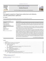
The Huguang maar lake—a high-resolution record of ...
The Huguang maar lake—a high-resolution record of ...
The Huguang maar lake—a high-resolution record of ...

Create successful ePaper yourself
Turn your PDF publications into a flip-book with our unique Google optimized e-Paper software.
Abstract<br />
Quaternary International 122 (2004) 85–107<br />
<strong>The</strong> <strong>Huguang</strong> <strong>maar</strong> <strong>lake—a</strong> <strong>high</strong>-<strong>resolution</strong> <strong>record</strong> <strong>of</strong><br />
palaeoenvironmental and palaeoclimatic changes over the last<br />
78,000 years from South China<br />
Jens Mingram a, *, Georg Schettler a , Norbert Nowaczyk a , Xiangjun Luo b,c ,<br />
Houyuan Lu b , Jiaqi Liu b ,J.org F.W. Negendank a<br />
a GeoForschungsZentrum (GFZ), Section 3.3, Telegrafenberg, Potsdam D-14473, Germany<br />
b Institute <strong>of</strong> Geology and Geophysics, Chinese Academy <strong>of</strong> Sciences, P.O. Box 9825, Beijing 100029, PR China<br />
c VTT, 102-1687 West Broadway, Vancouver, Canada V6J 1X2<br />
A series <strong>of</strong> seven piston cores from the <strong>Huguang</strong> <strong>maar</strong> lake situated near the South China Sea coastline provides insight into<br />
regional palaeoenvironmental and palaeoclimatic changes in southern China over the last 78,000 years. <strong>The</strong> data set comprises a<br />
<strong>high</strong>-<strong>resolution</strong> <strong>record</strong> <strong>of</strong> magnetic susceptibility, dry density and water content, total organic carbon and inorganic carbon, total<br />
nitrogen, biogenicsilica (BSiO2), and palynological results. <strong>The</strong> time scale was developed by AMS 14 C dating <strong>of</strong> 17 terrestrial plant<br />
macro-fossils. During the Last Glacial the <strong>Huguang</strong> <strong>record</strong> is characterised by an alternation <strong>of</strong> more temperate and humid periods<br />
(from 78 to 58 and 48 to 40.5 ka BP) and periods with predominance <strong>of</strong> grassland vegetation and possibly lowered lake level (from 58<br />
to 48 and ca 40.5 to 15 ka BP). <strong>The</strong> <strong>Huguang</strong> data have been compared to regional marine and terrestrial <strong>record</strong>s in order to discuss<br />
variability <strong>of</strong> the South-East Asian monsoon system. For most <strong>of</strong> the Last Glacial period the <strong>Huguang</strong> proxies do not exhibit<br />
marked millennial-scale variability as known from some long SE Asian and many North Atlantic <strong>record</strong>s. This picture changes at<br />
about 15 cal ka BP when the <strong>Huguang</strong> and Greenland <strong>record</strong>s appear to correlate well. A short climatic reversal which is assumed to<br />
reflect a Younger Dryas-type event is well <strong>record</strong>ed in the <strong>Huguang</strong> <strong>record</strong>. During the Holocene the <strong>Huguang</strong> multi-proxy data<br />
show a much <strong>high</strong>er variability than during the Last Glacial stage probably reflecting, at least for the early mid-Holocene,<br />
fluctuations in monsoon activity. However, the last 4000 years <strong>of</strong> the sediment <strong>record</strong> are clearly influenced by enhanced human<br />
activity and thus difficult to interpret in terms <strong>of</strong> palaeoclimate change.<br />
r 2004 Elsevier Ltd and INQUA. All rights reserved.<br />
1. Introduction<br />
Investigations <strong>of</strong> Chinese loess sequences (summarised<br />
in Liu and Ding, 1998), Tibetan ice cores<br />
(Thompson et al., 1997), and speleothems (Wang et al.,<br />
2001) provided <strong>high</strong>-<strong>resolution</strong> information on palaeoclimatic<br />
changes for the Last Glacial cycle in South-East<br />
Asia. Recent detailed sedimentological, geochemical,<br />
and palynological investigations <strong>of</strong> marine cores from<br />
the South China Sea (Sun and Li, 1999; Wang et al.,<br />
1999a) allow comparison <strong>of</strong> marine and terrestrial<br />
<strong>record</strong>s in the region. However, on a regional scale<br />
there are only a few lake <strong>record</strong>s reaching far back into<br />
the Last Glacial (Tsukada, 1967; Hodell et al., 1999;<br />
Penny, 2001), and the even longer <strong>record</strong> from the<br />
*Corresponding author. Fax: +49-331-288-1302.<br />
E-mail address: ojemi@gfz-potsdam.de (J. Mingram).<br />
ARTICLE IN PRESS<br />
1040-6182/$ - see front matter r 2004 Elsevier Ltd and INQUA. All rights reserved.<br />
doi:10.1016/j.quaint.2004.02.001<br />
Tianyang <strong>maar</strong> lake has some major sedimentary gaps<br />
(Zheng and Lei, 1999). This paper presents data from a<br />
continuous lacustrine <strong>record</strong> reaching back to 78,000<br />
years BP obtained from a small volcanic lake on the<br />
Leizhou Peninsula, 4 km from the modern South China<br />
coastline.<br />
2. Location and setting<br />
<strong>The</strong> <strong>Huguang</strong> <strong>maar</strong> lake (21 9 0 N, 110 17 0 E, Fig. 1) is<br />
situated in a zone with seasonal climate, dominated by<br />
the East Asian summer monsoon, but also within reach<br />
<strong>of</strong> northern cold waves during winter which originate<br />
from the Siberian anti-cyclone (Domr.os and Peng,<br />
1988). It is influenced by both the Asian SW and SE<br />
summer monsoon and receives precipitation from the
86<br />
pre-summer position <strong>of</strong> the monsoon rainbelt in South<br />
China (Zhang and Crowley, 1989) as well as from<br />
tropical typhoons that come mostly from ESE and have<br />
their maximum in August/September (Yoshino, 1984).<br />
Spring time dust plumes from the Chinese mainland<br />
occasionally reach the South China Sea coast (Cao et al.,<br />
2003). For the last 45 years the mean annual temperature<br />
for Zhanjiang (15 km from the <strong>Huguang</strong> <strong>maar</strong> lake)<br />
has been 23.1 C; the mean annual precipitation is<br />
1440 mm. <strong>The</strong> <strong>Huguang</strong> <strong>maar</strong> site now belongs to a zone<br />
<strong>of</strong> tropical grassland which is assumed to be the result <strong>of</strong><br />
human impact (Sun et al., 1999). <strong>The</strong> natural vegetation<br />
is that <strong>of</strong> a tropical semi-evergreen seasonal rain forest<br />
(Zheng and Lei, 1999).<br />
<strong>The</strong> <strong>Huguang</strong> <strong>maar</strong> lake belongs to the Lei Qiong<br />
Volcanic Field near the eastern coastline <strong>of</strong> the Leizhou<br />
Peninsula (Fig. 1). <strong>The</strong> Lei Qiong Volcanic Field<br />
comprises 66 volcanic cones and 39 craters (some <strong>of</strong><br />
them are below present sea level) <strong>of</strong> different origin. It<br />
has been active since 34 Ma (Huang et al., 1993). <strong>The</strong><br />
main volcanic activity was from 1.8 to 0.4 Ma (Ho et al.,<br />
2000). <strong>The</strong> bi-lobate <strong>Huguang</strong> <strong>maar</strong> (Fig. 2) is<br />
surrounded by a <strong>high</strong> tephra wall (<strong>high</strong>est elevation is<br />
87.6 m a.s.l.) with a steep inner and ca 10 outer slope<br />
and is underlain by a basalt sheet and Quaternary<br />
marine sands, silts, and clays <strong>of</strong> the Zhanjiang shallow<br />
marine Formation. An 80 m deep drill hole outside the<br />
ARTICLE IN PRESS<br />
J. Mingram et al. / Quaternary International 122 (2004) 85–107<br />
Fig. 1. Main SE Asian meteorological features (after Porter and An, 1995; Xiao et al., 1997b; Aragu!as-Aragu!as et al., 1998), marine 100 m—isobath<br />
line, position <strong>of</strong> the <strong>Huguang</strong> <strong>maar</strong> lake and some other regional, long palaeoenvironmental <strong>record</strong>s (B+K=Lake Biwa and Kurota Lowland;<br />
GL=Guliya ice cap; HL=Hulu cave; JT=Jih Tan lacustrine section; QH=lake Qilu Hu; TY=Tianyang lake; YB=Yuanbao section <strong>of</strong> the<br />
Western Loess Plateau; 17940, 17950, 17961=marine cores from the South China Sea; see text for references).<br />
crater rim yielded 2 m <strong>of</strong> soil, 15 m <strong>of</strong> pyroclastics, 5 m<br />
basalt and 60 m <strong>of</strong> silty clay belonging to the Zhanjiang<br />
Formation. For the basalt K/Ar ages between 0.4 and<br />
0.127 Ma are reported (Fong, 1992). <strong>The</strong> elevation<br />
above sea level is 23 m and the maximum water depth<br />
<strong>of</strong> the lake is 20 m; it was artificially lowered by 3 m in<br />
1963. <strong>The</strong> lake surface area is 2.25 km 2 , and the<br />
catchment area (3.2 km 2 ) comprises only the inner<br />
slopes <strong>of</strong> the crater rim. <strong>The</strong> lake has no surface inflow<br />
or outflow. Hydrochemical data <strong>of</strong> Lake <strong>Huguang</strong><br />
(Table 1) demonstrate its low salinity which implies a<br />
<strong>high</strong> ratio <strong>of</strong> direct precipitation onto the lake surface<br />
and the inflow <strong>of</strong> mineralised ground water. Primary<br />
production <strong>of</strong> the lake is likely limited through the<br />
availability <strong>of</strong> soluble reactive phosphorus (SRP).<br />
Sulphate may partially originate from anthropogenic<br />
pollution. At present substantial chemical precipitation<br />
<strong>of</strong> autochthonous calcite is unlikely from the obtained<br />
low Ca concentration. <strong>The</strong> DIC and dissolved Ca<br />
inventory <strong>of</strong> the lake cannot originate from the<br />
chemical dissolution <strong>of</strong> CaCO3. Instead, Lake <strong>Huguang</strong><br />
reflects silicate weathering in its catchment, and is<br />
characterised through the hydrochemical fingerprints<br />
<strong>of</strong> the related weathering solutions that get drained into<br />
the lake. <strong>The</strong> hydrochemistry <strong>of</strong> the lake may be<br />
influenced to a minor extent by influx <strong>of</strong> sea spray<br />
aerosols.
3. Materials and methods<br />
In March 1997 seven cores were recovered from three<br />
coring sites in the western <strong>Huguang</strong> lake basin (Fig. 2)<br />
with the Usinger piston corer. From each <strong>of</strong> the two<br />
main localities three overlapping cores have been raised<br />
(A, B, C at 13 m water depth and D, E, F at 20 m water<br />
depth), and the longest core (HUG-F) reached 57.8 m<br />
below the lake bottom. All cores were stored at 4 C<br />
during the field campaign and transport. In the<br />
laboratory, the cores were extruded and split parallel<br />
to their vertical axis. Measurement <strong>of</strong> the volume<br />
specific magnetic susceptibility (k) was performed with<br />
ARTICLE IN PRESS<br />
Fig. 2. <strong>The</strong> <strong>Huguang</strong> <strong>maar</strong> lake: (a) geographical position, (b) isobath map and coring sites, (c) coring sites with sediment pr<strong>of</strong>iles, lithozones and<br />
maximum core depths, (d) an example for inter-core correlation with <strong>high</strong>-<strong>resolution</strong> magnetic susceptibility data.<br />
Table 1<br />
Surface water composition <strong>of</strong> Lake <strong>Huguang</strong> (October 10, 2001)<br />
Cations a<br />
Anions b<br />
Na +<br />
(mg/l)<br />
K +<br />
(mg/l)<br />
Ca 2+<br />
(mg/l)<br />
Mg 2+<br />
(mg/l)<br />
Fe 2+<br />
(mg/l)<br />
Mn 2+<br />
(mg/l)<br />
Sr 2+<br />
(mg/l)<br />
Ba 2+<br />
(mg/l)<br />
5.8 2.3 6.1 6.1 0.006 0.001 0.047 0.004 1.12<br />
F<br />
(mg/l)<br />
Cl<br />
(mg/l)<br />
J. Mingram et al. / Quaternary International 122 (2004) 85–107 87<br />
NO3<br />
(mg/l)<br />
SO4 2<br />
(mg/l)<br />
DIC<br />
(mg/l)<br />
Nutrients Si<br />
(mg/l)<br />
SRP<br />
(mg/l)<br />
0.15 7.7 0.7 9.6 8.3 0.5 o0.01 1.13<br />
Total cations<br />
(mequ/l)<br />
Total Anions<br />
(mequ/l)<br />
a Membrane filtered sample aliquots (0.45 mm) stabilised by adding <strong>of</strong> nitric acid (Merck, Suprapur), measurements by ICP-AES.<br />
b DIC (total dissolved inorganic carbon) measured by IR-spectrometry, Si by ICP-AES, other components determined by isocratic ion-exchange<br />
chromatography, DIC is completely considered as HCO3 for the calculation <strong>of</strong> the anion sum.<br />
a Bartington Instruments s surface scanning sensor<br />
MS2E/1, fitted to an automaticlogger system. Downcore<br />
<strong>resolution</strong> <strong>of</strong> magnetic susceptibility data used for<br />
this study is 2.5 mm.<br />
Water content and dry density (weight <strong>of</strong> dry material<br />
per volume <strong>of</strong> fresh sediment) were estimated from<br />
continuous 1 cm samples from two composite sections.<br />
Volumetricsamples were freeze-dried at 0.25 mbar for 2<br />
days. <strong>The</strong> water content is calculated as the weight <strong>of</strong><br />
water to the total wet weight (H(akansson and Jansson,<br />
1983). <strong>The</strong> dry density (weight <strong>of</strong> dry material to<br />
original wet volume) was estimated using the volume<br />
<strong>of</strong> contiguous 1 cm thick core slices.
88<br />
All geochemical data were obtained from core HUG-<br />
C at 10 cm <strong>resolution</strong>. Total carbon (TC) and total<br />
nitrogen (TN) were analysed after burning sample<br />
aliquots in an oxygen gas flow at 1350 C, using infrared<br />
and heat conductivity detection, respectively (device:<br />
LECO, CNS 2000). Inorganiccarbon (IC) was determined<br />
coulometrically (Str.ohlein procedure) after the<br />
release <strong>of</strong> CO 2 by hot phosphoricacid (1:1). Total<br />
organic carbon (TOC) was calculated as the difference<br />
between TC and IC. Biogenicsilica (BSiO2) was<br />
selectively dissolved by leaching with 2 M Na2CO3<br />
solution for 5 h at 90 C and determined by flow<br />
injection spectrometry (FIAS) using a methodology<br />
which follows an application <strong>of</strong> the ‘‘Mo-blue’’ method<br />
proposed by Schweizer et al. (1993). Before leaching<br />
with soda solution, the organicmatter was destroyed by<br />
wet oxidation using H2O2 (30%), IC and inorganicbound<br />
P were removed by treatment with hot HCl<br />
(10%) for 5 min. <strong>The</strong> analytical reliability is in the order<br />
<strong>of</strong> 71 percent by weight (wt%) SiO2. However, there is<br />
a small amount <strong>of</strong> silicate-bound Si which is also<br />
released by leaching with soda solution. This portion<br />
depends on the mineralogical composition <strong>of</strong> the<br />
individual sediment samples. For the <strong>Huguang</strong> <strong>maar</strong><br />
lake sediments the leaching <strong>of</strong> silicate-bound Si mainly<br />
depends on the content <strong>of</strong> pumice tuff particles and was<br />
found to vary between 0.5 and 1 wt% SiO2.<br />
<strong>The</strong> amount <strong>of</strong> allochthonous siliciclastic material<br />
was estimated by subtracting biogenic silica, carbonate<br />
(as siderite) and organicmaterial from the overall dry<br />
mass. <strong>The</strong> amount <strong>of</strong> organicmaterial was determined<br />
using estimated TOC values and the elemental composition<br />
<strong>of</strong> dry substances (after H(akansson and Jansson,<br />
1983) for algae (lithozones 1, 2, 3, 5, and 6) and humus<br />
(lithozones 4 and 7). Mean total sediment accumulation<br />
rates (SARs) were estimated based on sedimentation<br />
rate interpolations between AMS- 14 C dates. Pollen<br />
analyses were performed at 1 m intervals by sampling<br />
1 cm sediment slices <strong>of</strong> the B/C cores composite section.<br />
Pollen samples were treated with HCl (10%), KOH<br />
(15%), and HF (48%), followed by acetolysis using a<br />
mixture <strong>of</strong> H2SO4 (96%) and acetic acid anhydride (1:9).<br />
An average <strong>of</strong> 836 pollen grains was counted in each<br />
sample. <strong>The</strong> pollen sum for percentage calculations<br />
excludes aquatic pollen and fern spores. Percentages <strong>of</strong><br />
aquatics and spores are calculated from the total pollen<br />
and spores sum, Pediastrum is given in total numbers<br />
<strong>of</strong> counted remains. To trace large-scale vegetational<br />
changes the biomisation <strong>of</strong> modern surface pollen<br />
samples from China after Yu et al. (1998) has been<br />
applied.<br />
A representative set <strong>of</strong> 10 cm long petrographic thin<br />
sections <strong>of</strong> each lithozone were prepared according to<br />
the freeze-drying method described by Merkt (1971).<br />
Different microscopic techniques were used for thin<br />
section investigations, including visible light microscopy<br />
ARTICLE IN PRESS<br />
J. Mingram et al. / Quaternary International 122 (2004) 85–107<br />
(bright field and polarisation), fluorescence microscopy<br />
(using a Carl Zeiss ‘‘Jenalumar’’ microscope and mostly<br />
blue light excitation), and SEM-techniques (using a Carl<br />
Zeiss DSM 962).<br />
3.1. Lithology and correlations<br />
<strong>The</strong> lake sediments from <strong>Huguang</strong> <strong>maar</strong> are macroscopically<br />
homogeneous, greenish-black, <strong>high</strong>ly organic<br />
gyttja with occasional indistinct, dm-scale layering due<br />
to slight colour differences caused by different carbonate<br />
contents as shown by thin section investigation. In the<br />
lower part <strong>of</strong> the pr<strong>of</strong>ile two sections <strong>of</strong> mm- to cm-thick<br />
brownish layers with numerous reworked woody, barklike<br />
remains are intercalated (Fig. 3).<br />
From core sequences B+C and D+F composite<br />
pr<strong>of</strong>iles (Fig. 2) have been constructed through correlation<br />
<strong>of</strong> 2.5 mm <strong>resolution</strong> magnetic susceptibility curves.<br />
Both composite pr<strong>of</strong>iles in turn have been correlated<br />
using both the magnetic susceptibility <strong>record</strong> and the<br />
continuous 1 cm water content data (Fig. 3). <strong>The</strong><br />
two main <strong>record</strong>s D/F and B/C are correlatable down<br />
to 39.52 and 23.67 m, respectively. Between 41.47 m and<br />
the basal pumice breccia in core F there are several small<br />
tephra layers with thicknesses ranging from sub-mm<br />
single grain layers up to 1.8 cm. <strong>The</strong>se tephra layers have<br />
not been found in the other cores, so this part should be<br />
older than the B/C section. However, the ages obtained<br />
by extrapolation <strong>of</strong> sedimentation rates are older for the<br />
bottom <strong>of</strong> the B/C section than for the D/F section, so<br />
the correlation <strong>of</strong> the lowermost part between the<br />
different drill sites is still somewhat questionable. <strong>The</strong><br />
coarse-grained basal breccia from core F probably<br />
represents a slump originating from the steep southern<br />
crater rim.<br />
Based on the detailed multi-proxy data set eight<br />
lithozones have been distinguished (LZ 1–8, Table 2).<br />
4. Chronology<br />
<strong>The</strong> chronostratigraphy <strong>of</strong> the mostly unlaminated<br />
sediment <strong>record</strong> is based on 23 AMS- 14 C dates by the<br />
‘‘Leibniz-Labor f.ur Altersbestimmung und Isotopenforschung’’<br />
in Kiel, Germany (Table 3). Samples for 14 C<br />
dating were picked out from different cores. <strong>The</strong> precise<br />
correlation between the individual cores by means <strong>of</strong><br />
magnetic susceptibility and water content data allowed<br />
establishment <strong>of</strong> a common time scale back to 58 ka BP<br />
for both the B/C and D/F composite pr<strong>of</strong>iles (Fig. 4).<br />
Discrepancies appear only for the part below the oldest<br />
reliable 14 C-ages where linear extrapolation yielded ages<br />
for the base <strong>of</strong> the B/C and D/F pr<strong>of</strong>iles <strong>of</strong> 78.5 and<br />
67.5 ka BP, respectively.<br />
All 14 C dates yielding ages until 24.2 cal ka BP were<br />
calibrated according to CALIB 4.0 (Stuiver et al.,
ARTICLE IN PRESS<br />
J. Mingram et al. / Quaternary International 122 (2004) 85–107 89<br />
Fig. 3. Lithology and intra-lake correlation <strong>of</strong> the two composite sections D/F and B/C.
90<br />
Table 2<br />
Lithozones <strong>of</strong> the <strong>Huguang</strong> <strong>maar</strong> sediment <strong>record</strong><br />
1998a). For the radiocarbon age <strong>of</strong> 12,620 years which is<br />
at a broad 14 C-plateau between 15.3 and 14.4 cal ka BP<br />
we chose the calibrated age <strong>of</strong> 14,580 years as the most<br />
reliable one after comparing calculated sedimentation<br />
rates with all possible ages. Ages older than 24.2 cal ka<br />
BP were converted using the magnetic calibration <strong>of</strong><br />
the radiocarbon time scale (with varying oceanic<br />
circulation) from Laj et al. (1996). Since radiocarbon<br />
age calibration beyond 24 ka is still in discussion,<br />
alternative data might be used (e.g. Voelker et al.,<br />
1998). <strong>The</strong> effect for the <strong>Huguang</strong> chronology would be<br />
a shift towards ca 2000 years older calibrated ages at ca<br />
40 ka BP.<br />
Calibration <strong>of</strong> radiocarbon ages was chosen to enable<br />
comparison with other regional long <strong>record</strong>s, namely<br />
marine <strong>record</strong>s from the South China Sea (Wang et al.,<br />
1999a) and the long ice-core <strong>record</strong> from Guliya, Tibet<br />
(Thompson et al., 1997). Marine <strong>record</strong>s <strong>of</strong> the South<br />
China Sea from Wang et al. (1999a) with ages<br />
>11.6 cal ka BP were tuned to the GISP2 <strong>record</strong> (which<br />
was layer-counted to about 55,000 years BP with an<br />
counting error <strong>of</strong> 2% back to 39.852 years BP, Meese<br />
et al., 1994, 1997), and the ice-core <strong>record</strong> from Guliya<br />
was fitted via its methane curve to the GISP2 methane<br />
<strong>record</strong> for the past 110 ka (Thompson et al., 1997).<br />
5. Sediment data and their palaeoenvironmental<br />
significance<br />
5.1. Physical data<br />
5.1.1. Dry density and water content<br />
Dry density generally is a proxy for the amount <strong>of</strong><br />
minerogenicparticles, as the density <strong>of</strong> organicsubstances<br />
is lower than those <strong>of</strong> mineral grains. Dry<br />
ARTICLE IN PRESS<br />
Zone Max. depth in section Description (with terminology after Troels-Smith, 1955; Aaby and Berglund, 1986)<br />
B/C D/F G<br />
J. Mingram et al. / Quaternary International 122 (2004) 85–107<br />
1 4.41 5.23 3.73 Homogeneous algal gyttja with <strong>high</strong> sedimentation rate, <strong>high</strong>-frequency changes <strong>of</strong> dry<br />
density, water content, and magnetic susceptibility with <strong>high</strong> amplitudes [Ld3 Lso1 Lc+]<br />
2 8.95 10.70 8.30 Homogeneous algal gyttja with lower sedimentation rate, large carbonate peaks on a<br />
generally low IC level [Ld3 Lso1 Lc+]<br />
3 18.51 29.17 11.94 Homogeneous algal gyttja with <strong>high</strong> values <strong>of</strong> dry density, low values <strong>of</strong> magnetic<br />
susceptibility and moderate changes <strong>of</strong> IC on a generally <strong>high</strong> level [Ld3 Lso1 Lc+]<br />
4 20.53 32.43 Homogeneous algal gyttja with intercalations <strong>of</strong> numerous brownish layers with<br />
reworked bark-like plant remains (woody peat) and <strong>high</strong> TOC/N ratio [Ld3 Tl1 Lso+]<br />
5 23.33 39.52 Homogeneous algal gyttja, resembles lithozone 3, but with <strong>high</strong>er amounts <strong>of</strong> biogenic<br />
silica and <strong>high</strong>er values <strong>of</strong> magnetic susceptibility [Ld3 Lso1 Lc+]<br />
6 28.00 41.65 Algal gyttja similar to that <strong>of</strong> lithozone 4, but with numerous carbonate peaks and some<br />
varve-like laminae with layered enrichments <strong>of</strong> diatoms [Ld2 Tl1 Lso1 Lc+]<br />
7 29.25 45.46 Algal gyttja with very <strong>high</strong> amounts <strong>of</strong> biogenic silica, some scattered bark-like plant<br />
remains and (in section F) partly laminated [Ld2 Lso2 Tl+]<br />
8 57.83 19.56 Coarse lithoclastic breccia [Gmaj4]<br />
density curves might be used to identify periods <strong>of</strong><br />
increased soil erosion due to reduced vegetation cover in<br />
the drainage area <strong>of</strong>ten related to colder and/or drier<br />
climate (e.g. Brauer et al., 2000). For the <strong>Huguang</strong><br />
<strong>record</strong> both water content and dry density data are<br />
regarded as valuable indicators for the overall relation<br />
between organic(mainly algae, plus terrestrial <strong>high</strong>er<br />
plant remains especially in LZ 4 and 6) and minerogenic<br />
(mainly allochthonous siliciclastic detritus, precipitated<br />
carbonate) components.<br />
Dry density and water contents <strong>of</strong> the <strong>Huguang</strong><br />
pr<strong>of</strong>iles show a significant negative correlation (pr<strong>of</strong>ile<br />
B/C: r ¼ 0:83 for n ¼ 2600; pr<strong>of</strong>ile D/F: r ¼ 0:68 for<br />
n ¼ 3500). For core correlation and environmental<br />
interpretation water content data were preferentially<br />
used because measurements are more precise due to<br />
inherent errors <strong>of</strong> volumetricsampling which was<br />
necessary for dry density determination.<br />
5.1.2. Magnetic susceptibility<br />
Magnetic susceptibility <strong>of</strong> lake sediments is controlled<br />
by the concentration and the grain size distribution <strong>of</strong><br />
ferromagneticminerals. It provides a valuable tool for<br />
precise correlation <strong>of</strong> sediment <strong>record</strong>s (Thompson et al.,<br />
1975; Verosub and Roberts, 1995; Nowaczyk, 2001).<br />
Palaeoenvironmental interpretations are rather complex<br />
because the grain size distribution <strong>of</strong> ferromagnetic<br />
minerals is controlled by a variety <strong>of</strong> factors. <strong>The</strong>se are,<br />
e.g., changes in the source rocks due to morphological<br />
changes in the catchment (e.g. erosion), pedogenic<br />
processes (Maher, 1998; Lu, 2000), and in situ dissolution<br />
and authigenesis <strong>of</strong> magneticcarriers (Berner, 1980;<br />
Snowball, 1993; Williamson et al., 1998).<br />
<strong>The</strong> <strong>Huguang</strong> magnetic susceptibility <strong>record</strong> shows<br />
large variations in amplitude and frequency, with<br />
extremely low values in lithozones with large amounts
Table 3<br />
AMS- 14 C ages measured in <strong>Huguang</strong> cores<br />
Lab-Nr. Material Total sediment depth in d 13 C(%) Age (residue)<br />
( 14 C years BP)<br />
A B C D E F G<br />
a b b a a b<br />
Error range<br />
(one s)<br />
Age<br />
(cal. years BP)<br />
KIA 8085 Bulk 0.50<br />
20.6570.10 455+25/ 25 523–500 515<br />
KIA 8086 Bulk 1.20 0.99 1.18 1.32 1.45<br />
a b<br />
19.1670.16 550 +20/ 20 618–611; 552–534 545<br />
KIA 8087 Bulk 1.80 1.66 1.83 2.00 2.11 2.06 1.62 21.4470.12 1225 +25/ 25 1.225–1.212; 1.177–1.167; 1.161–1.121; 1.111–1.085 1175<br />
KIA 8090 Leaf 3.05 2.90 3.07 3.38 3.51 3.37 2.72 26.6870.10 2.295 +25/ 25 2.348–2.325; 2.322–2.314; 2.218–2.213 2.338<br />
KIA 5589 Leaf 4.50 4.34 4.60 5.15 5.28 5.20 3.65 36.5170.27 3.520 +60/ 60 3.865–3.717; 3.711–3.701 3.830<br />
KIA 8091 Leaf 6.33 6.20 6.38 7.07 Gap 6.96 5.6 32.5170.13 7.535 +35/ 35 8.389–8.333; 8.227–8.223 8.366<br />
KIA 8832 Leaf 6.88 6.71 6.94 7.36 7.29 7.20 5.8 35.3370.12 (7.670 +100/ 100) 8.587–8.574; 8.543–8.377 (8415)<br />
KIA 8833 Leaf 7.06 6.89 7.11 7.75 7.64 7.55 5.93 38.5870.09 (7.880 +230/ 220) 9.000–8.477; 8.472–8.455 (8636)<br />
KIA 8092 Leaf 8.27 8.07 8.30 9.32 9.17 9.13 7.12 31.1770.08 11.055 +55/ 55 13.146–12.983 13.019<br />
KIA 8093 Leaf 9.02 8.80 9.02 10.56 10.45 10.33 8.19 30.9370.07 12.620 +70/ 60 15.490–15.192; 14.789–14.340 14.580<br />
KIA 8834 Leaf 10.31 10.10 10.23 13.18 13.04 12.84<br />
b<br />
31.4270.16 14.750 +100/ 90 17.927–17.377 17.652<br />
KIA 5590 Leaf 11.66 11.37 11.60 15.73 15.49 15.10<br />
b<br />
28.9770.36 17.790 +100/ 100 21.439–20.811 21.150<br />
KIA 8094 Leaf 14.42 14.05 14.28 19.70 19.24 18.70<br />
b<br />
29.7170.28 23.740 +140/ 140 Out <strong>of</strong> range <strong>of</strong> 14 C calibration 27.140 c<br />
KIA 5591 Leaf 16.03 15.66 15.81 22.80 22.63 21.90<br />
b<br />
30.2670.09 28.320 +380/ 360 Out <strong>of</strong> range <strong>of</strong> 14 C calibration 31.720 c<br />
KIA 8095 Leaf 18.04 17.60 17.82<br />
a<br />
27.97 27.17<br />
b<br />
27.5070.15 33.250 +300/ 290 Out <strong>of</strong> range <strong>of</strong> 14 C calibration 36.100 c<br />
KIA 5592 Leaf 19.5 19.03 19.26<br />
a<br />
30.76 29.91<br />
b<br />
31.6370.08 41.650 +1190/ 1030 Out <strong>of</strong> range <strong>of</strong> 14 C calibration 43.150 c<br />
KIA 8096 Leaf 20.04 19.60 19.83<br />
a<br />
32.29 31.33<br />
b<br />
30.9970.09 44.230 +690/ 640 Out <strong>of</strong> range <strong>of</strong> 14 C calibration 44.930 c<br />
KIA 8088 Leaf 22.86 22.34 22.71<br />
a<br />
39.29 37.60<br />
a<br />
30.0670.08 56.030 +5530/ 3240 Out <strong>of</strong> range <strong>of</strong> 14 C calibration (56.030)<br />
KIA 8089 Seed 22.86 22.34 22.71<br />
a<br />
39.29 37.60<br />
a<br />
23.6170.08 55.000 +3420/ 2390 Out <strong>of</strong> range <strong>of</strong> 14 C calibration 55.000<br />
KIA 5593 Leaf 25.13 31.6270.20 > 48.300 Out <strong>of</strong> range <strong>of</strong> 14 C method<br />
KIA 5594 Seed 25.35 27.7070.16 > 51.680 Out <strong>of</strong> range <strong>of</strong> 14 C method<br />
KIA 5595 Leaf 29.06 32.5370.17 > 44.260 Out <strong>of</strong> range <strong>of</strong> 14 C method<br />
KIA 5596 Leaf 29.17 32.4470.08 > 49.680 Out <strong>of</strong> range <strong>of</strong> 14 C method<br />
Note: Conversion into calendar ages between 0 and 24,200 cal BP with CALIB 4.0 (Stuiver and Reimer, 1993; Stuiver et al., 1998a), calibrated ages were used as given by the Kiel Laboratory and, in<br />
case <strong>of</strong> ambiguity, after considering most plausible sedimentation rates. Older 14 C ages back to 45 ka were calibrated using the model <strong>of</strong> Laj et al. (1996, see text for discussion). 2s cal age ranges<br />
were calculated using CALIB version 4.4 (Stuiver et al., 1998a, b; executable program at http://radiocarbon.pa.qub.ac.uk/calib/calib.html).<br />
Bold=AMS- 14 C sample picked out from this core, correlated to other cores with <strong>high</strong>-<strong>resolution</strong> magnetic susceptibility or water content logs. All samples were separated from 1 cm sediment slices,<br />
except for sample KIA 8096 (10 cm sediment slice).<br />
Italic, in brackets=data not used for the age model (KIA 8085: no correlation possible due to lack <strong>of</strong> <strong>high</strong>-<strong>resolution</strong> physical data; KIA 8832, 8833: too less material, may result in too young ages,<br />
P.M. Grootes (pers. comm.); KIA 8088: same sample depth as KIA 8089, but less material and larger error range; KIA 5593–5596: out <strong>of</strong> range <strong>of</strong> the radiocarbon dating method.)<br />
a No core.<br />
b No correlation possible.<br />
c Calibrated after Laj et al. (1996).<br />
J. Mingram et al. / Quaternary International 122 (2004) 85–107 91<br />
ARTICLE IN PRESS
92<br />
<strong>of</strong> plant macro-remains, <strong>high</strong> values in lithozones<br />
with <strong>high</strong>er autochthonous productivity and low values<br />
during the upper part <strong>of</strong> the Last Glacial stage (Fig. 5).<br />
For the present study the magnetic susceptibility curve<br />
mainly was applied for <strong>high</strong>-<strong>resolution</strong> core correlation.<br />
Detailed rock-magneticand palaeomagneticinvestigations<br />
are subjects <strong>of</strong> complementary studies (Yancheva,<br />
2003).<br />
5.2. Geochemical and mineralogical data<br />
5.2.1. Total organic carbon and total nitrogen<br />
TOC generally sums up organiccomponents from<br />
different sources. <strong>The</strong>se are (1) the allochthonous input<br />
(mainly terrestrial plant residues supplied by surface<br />
run<strong>of</strong>f and wind) and the autochthonous production<br />
(bacteria, macro-phytes, phytoplankton, and zooplankton).<br />
Thus further information about the sources <strong>of</strong><br />
organicmatter, e.g., through the ratio <strong>of</strong> TOC and TN is<br />
required. This is possible for organicrich sediments like<br />
the ones from Lake <strong>Huguang</strong> because the amount <strong>of</strong><br />
inorganic nitrogen is considered to be negligible in such<br />
environments (Meyers, 1997).<br />
TOC/TN ratios between 4 and 10 are usually<br />
described as indicative for non-vascular aquatic plants<br />
due to their elevated protein content, whilst vascular<br />
plants have TOC/TN ratios <strong>of</strong> 20 and more (Meyers and<br />
ARTICLE IN PRESS<br />
J. Mingram et al. / Quaternary International 122 (2004) 85–107<br />
Fig. 4. Age–depth plot for composite sections B/C and D/F (see Section 4 for discussion). Individual dates are shown with error bars. Maximum ages<br />
<strong>of</strong> sections B/C and D/F were estimated by linear extrapolation (dotted line) <strong>of</strong> sedimentation rates between the last two dated points in both<br />
sections.<br />
Ishiwatari, 1993). But this general picture seems to be<br />
valid only under conditions without limitations <strong>of</strong> the<br />
available nitrogen. With increasing N deficiency <strong>high</strong>er<br />
TOC/TN ratios have been reported (Talbot and Lærdal,<br />
2000). Another exception which calls for caution is<br />
that TOC/TN ratios up to 36 are reported for the green<br />
algae Botryococcus (Huang et al., 1999), which has<br />
been microscopically identified in the <strong>Huguang</strong> sediments.<br />
However, there are no changes in the TOC/TN<br />
ratio which could be related to varying amounts <strong>of</strong><br />
Botryococcus.<br />
TOC/TN ratios at <strong>Huguang</strong> vary between 9 and 20<br />
(except for peat layers) and show a long-term trend <strong>of</strong><br />
slightly increasing values downcore. Exceptional <strong>high</strong><br />
values reaching up to about 70 in single peaks occurring<br />
in lithozones 6 and 4 reflect the deposition <strong>of</strong> reworked<br />
woody peat layers. More details on the chemistry <strong>of</strong><br />
organicmatter (e.g. Hydrogen Index, d 13 C <strong>of</strong> TOC,<br />
biomarkers) are given in Fuhrmann et al. (2003).<br />
5.2.2. Biogenic silica<br />
Many plant and animal species can contribute to the<br />
biogenic silica contents <strong>of</strong> sediments. For lake sediments<br />
the most common source <strong>of</strong> BSiO2 are diatoms (Wetzel,<br />
1975). This is confirmed for Lake <strong>Huguang</strong> by thin<br />
section analyses which, besides abundant diatom frustules,<br />
revealed also the occurrence <strong>of</strong> small amounts <strong>of</strong>
ARTICLE IN PRESS<br />
J. Mingram et al. / Quaternary International 122 (2004) 85–107 93<br />
Fig. 5. <strong>Huguang</strong> <strong>maar</strong> lithozones, physical and chemical sediment data vs. depth.
94<br />
siliceous cysts. Other siliceous organic remains such as<br />
sponge spicules or phytoliths have not been observed in<br />
significant amounts in thin sections. Except for the<br />
uppermost part <strong>of</strong> LZ 1 where corroded diatoms were<br />
found, thin section and SEM observations did not<br />
indicate dissolution <strong>of</strong> diatoms. Diatom assemblages are<br />
dominated by Aulacoseira throughout large parts <strong>of</strong> the<br />
<strong>Huguang</strong> <strong>record</strong>. Aulacoseira is reported as the dominant<br />
diatom species in waters with <strong>high</strong> silica concentrations<br />
(Kilham, 1971), and particularly in young<br />
volcanic areas the easily weathered tuffs supply large<br />
amounts <strong>of</strong> dissolved silica as known from East African<br />
lakes (Jones and Bowser, 1978).<br />
<strong>The</strong> total concentration <strong>of</strong> BSiO2 in the <strong>Huguang</strong><br />
sediments varies between 5 wt% for LZ 1–4, to about<br />
10 wt% for LZ 5 and 20 wt% for LZ 7. Throughout<br />
lithozones 1, 2, and 3 the content <strong>of</strong> BSiO2 is positively<br />
correlated with TOC and also the TOC/TN ratio.<br />
During periods with <strong>high</strong> input <strong>of</strong> woody material<br />
(mainly LZ 4 and 6) BSiO2 and TOC are anti-correlated.<br />
Nevertheless, LZ 6 is the only lithozone where pure<br />
diatomaceous laminae occur (intercalated within carbonaceous<br />
and woody peat layers).<br />
5.2.3. Inorganic carbon<br />
<strong>The</strong> only carbonate mineral detectable in the <strong>Huguang</strong><br />
sediments by means <strong>of</strong> X-ray diffraction and<br />
SEM-EDS analyses is siderite. IC fluctuates close to zero<br />
and peaks up to 2% which corresponds to 19.3 wt% <strong>of</strong><br />
siderite. Primary siderite from iron-meromictic lakes,<br />
especially from tropical or subtropical climates, has<br />
been frequently reported from the Eocene (e.g. Lake<br />
Tubutulik, Dickinson, 1988; Eckfeld and Messel <strong>maar</strong><br />
lakes, Bahrig, 1989; Mingram, 1998) and the Holocene<br />
(Lake Kivu, Degens and St<strong>of</strong>fers, 1976; Lake Nyos,<br />
Bernard and Symonds, 1989). All these lakes, as well as<br />
the <strong>Huguang</strong> <strong>maar</strong>, are surrounded by maficvolcanic<br />
rocks and deeply weathered red soils with a <strong>high</strong> Fe/Ca<br />
ratio, which is, among other factors such as <strong>high</strong> pCO2 ;<br />
reducing conditions and low dissolved sulphur (Bernard<br />
and Symonds, 1989), essential for siderite formation<br />
(Kelts and Hs.u, 1978).<br />
Thin section observations revealed that there are no<br />
detrital carbonates in the <strong>Huguang</strong> <strong>maar</strong> sediments. <strong>The</strong><br />
uppermost 1.5 m <strong>of</strong> sediments show very small anhedral<br />
siderite crystals <strong>of</strong> 5–10 mm partly forming patches up to<br />
25 mm in diameter. Downcore, throughout all lithozones,<br />
idiomorphic, rhombohedral crystals or twin<br />
crystals ranging in size from 10 to 100 mm with<br />
occasional step-like surfaces typical for precipitated<br />
carbonates (Otsuki and Wetzel, 1974; Kelts and Hs.u,<br />
1978) and dissolution features prevail (Fig. 6). <strong>The</strong>y<br />
closely resemble siderite aggregates from Lake Nyos<br />
sediments as shown by Bernard and Symonds (1989).<br />
For the <strong>Huguang</strong> lithozones, except LZ 4 and 6 (the<br />
lithozones with enrichments <strong>of</strong> woody peat) IC is<br />
ARTICLE IN PRESS<br />
J. Mingram et al. / Quaternary International 122 (2004) 85–107<br />
negatively correlated with TOC (Fig. 5), and with the<br />
exception <strong>of</strong> LZ 6 there is almost no siderite in<br />
sediments containing more than 10 wt% <strong>of</strong> TOC. This<br />
indicates dissolution processes and confirms observations<br />
from Minnesota lakes (US, Dean, 1999) where<br />
carbonate is absent when TOC values rise over 12%.<br />
Changing lake levels might have an additional<br />
influence on the precipitation <strong>of</strong> carbonates as they<br />
alter the relative mixing depth <strong>of</strong> the water column and<br />
thus the relation between epilimnion and hypolimnion<br />
in stratified lakes. In thermally stratified lakes, Fe 2+ is<br />
accumulated in the water <strong>of</strong> relatively low pH below the<br />
thermocline. Under such conditions precipitation <strong>of</strong><br />
FeCO3 in the water column depends on the diffusive and<br />
advective exchange between the deep and surface water.<br />
Siderite precipitation within the water column can<br />
therefore be strongly influenced through fluctuations<br />
<strong>of</strong> the thermocline as it has been proposed for<br />
manganosiderites from Lake Kivu (East Africa, Degens<br />
and St<strong>of</strong>fers, 1976).<br />
5.3. Pollen data<br />
<strong>The</strong> natural vegetation <strong>of</strong> the <strong>Huguang</strong> <strong>maar</strong> area is<br />
tropical semi-evergreen seasonal rain forest (Zheng and<br />
Lei, 1999). <strong>The</strong>re are only small relicts <strong>of</strong> the original<br />
flora left due to intense agriculture in the region. <strong>The</strong><br />
recent vegetation is dominated by open forests and<br />
subtropical grasslands, and by the heliophytic fern<br />
Dicranopteris linearis and Pinus massoniana (Sun et al.,<br />
1999; Zheng and Lei, 1999) which is in accordance with<br />
the uppermost pollen sample from 64 cm sediment<br />
depth. Reconstructions <strong>of</strong> Pleistocene and Holocene<br />
terrestrial and marine pollen <strong>record</strong>s <strong>of</strong> this region were<br />
based on comparison with present vegetation along<br />
altitudinal gradients from the nearby Hainan island,<br />
Indochina, and Indonesia (Sun and Li, 1999; Zheng and<br />
Lei, 1999).<br />
Major environmental and climatic changes at the<br />
<strong>Huguang</strong> <strong>maar</strong> site are documented by the occurrence<br />
and abundance <strong>of</strong> moisture-sensitive taxa. Increased<br />
amounts <strong>of</strong> pollen from cold- and drought-tolerant nonarboreal<br />
(e.g. Artemisia and Gramineae), and certain<br />
arboreal taxa (e.g. Ilex) are indicative for reduced<br />
summer monsoon intensity. Conversely, increased<br />
amounts <strong>of</strong> tropical arboreal pollen are indicative for<br />
<strong>high</strong>er temperatures and/or precipitation. Indicators for<br />
<strong>high</strong>er precipitation from the <strong>Huguang</strong> <strong>maar</strong> pollen<br />
spectra are Dacrydium and Altingia, which occur in<br />
modern tropical lower montane forests <strong>of</strong> Hainan island<br />
(>800 m, Zheng and Lei, 1999) and Indonesia (1400–<br />
1800 m, van der Kaars and Dam, 1995). On Hainan<br />
island, annual precipitation in montane forest areas<br />
reaches 2500 mm (for comparison: Zhanjiang station<br />
near the <strong>Huguang</strong> <strong>maar</strong> lake, mean annual precipitation<br />
is 1500 mm, mean annual temperature is 23.3 C), but
the mean annual temperature between 14 C and 19 C<br />
there is about 4 C lower than recently at the <strong>Huguang</strong><br />
<strong>maar</strong> site (Zheng and Lei, 1999).<br />
Varying amounts <strong>of</strong> pollen from <strong>high</strong>er aquaticplants<br />
(Typha and Myriophyllum,) and <strong>of</strong> the green algae<br />
Pediastrum may reflect changes in the trophic state <strong>of</strong><br />
the lake. Higher amounts <strong>of</strong> them are <strong>of</strong>ten used as<br />
indicators for lowered lake levels and/or increased<br />
eutrophication (Mai, 1995; Huber, 1996; Goslar et al.,<br />
1999).<br />
<strong>The</strong> rather low-<strong>resolution</strong> preliminary pollen sampling<br />
only allows a broad zonation. Nevertheless, the<br />
main shifts in pollen associations correspond well with<br />
the <strong>Huguang</strong> lithozones (Fig. 7).<br />
ARTICLE IN PRESS<br />
J. Mingram et al. / Quaternary International 122 (2004) 85–107 95<br />
Fig. 6. Algal gyttja with siderite from <strong>Huguang</strong> <strong>maar</strong> lake. (a) SEM picture and EDX-spectrum <strong>of</strong> a siderite crystal (ca 70 35 mm) with step-like<br />
growth surfaces, and diatoms (Aulacoseira sp.) from LZ 2. (b) Thin section (partly polarised light) from LZ 3 with several siderite crystals.<br />
6. Discussion<br />
6.1. Palaeoenvironmental and palaeoclimatic<br />
implications<br />
Since a complex pattern <strong>of</strong> interacting palaeoclimatic<br />
and palaeoenvironmental factors (SW-Monsoon, SE-<br />
Monsoon and its typhoons, cold surges and dust from<br />
the Winter Monsoon, sea level changes, etc.) have likely<br />
influenced the <strong>Huguang</strong> <strong>maar</strong> it is difficult to establish<br />
sediment proxies explaining individual climatic parameters.<br />
Nevertheless, the applied multi-proxy approach<br />
allows presenting a consistent picture <strong>of</strong> the palaeoenvironmental<br />
development in the <strong>Huguang</strong> <strong>maar</strong> lake
Fig. 7. Pollen percentage diagram <strong>of</strong> section HUG B/C vs. age. AP and NAP were calculated from the total pollen sum, excluding aquatic pollen and fern spores. Pteridophytes were calculated from<br />
the sum <strong>of</strong> pollen and spores. Pediastrum is shown as absolute numbers <strong>of</strong> counted remains in pollen samples.<br />
96<br />
J. Mingram et al. / Quaternary International 122 (2004) 85–107<br />
ARTICLE IN PRESS
area. <strong>The</strong> lake underwent seven major stages well<br />
expressed in the following lithozones.<br />
6.1.1. Lithozone 7 (ca 78.5–73.5 ka BP)<br />
<strong>The</strong> flux <strong>of</strong> allochthonous minerogenic material into<br />
the lake was, compared to the <strong>Huguang</strong> average, low in<br />
this lithozone (Figs. 5 and 8). It was a period <strong>of</strong> <strong>high</strong><br />
autochthonous productivity (23 wt% BSiO2) and favourable<br />
preservation conditions for organic matter<br />
(14 wt% TOC). <strong>The</strong> constant and relatively <strong>high</strong> level <strong>of</strong><br />
TOC/TN (Figs. 5 and 8) implies a large influx <strong>of</strong><br />
terrestrial plant debris which is confirmed by the <strong>high</strong><br />
abundance <strong>of</strong> woody plant remains. <strong>The</strong> pollen <strong>record</strong><br />
(Fig. 7) with <strong>high</strong> values <strong>of</strong> the tropical pollen and<br />
moisture-sensitive taxa such as Dacrydium and Altingia<br />
implies humid and temperate conditions. Rhizorphora<br />
pollen (Mangroves), only occurring in LZ 6 and 7,<br />
confirms warm and humid conditions. <strong>The</strong> low amount<br />
<strong>of</strong> siderite might be explained by dissolution processes<br />
ARTICLE IN PRESS<br />
J. Mingram et al. / Quaternary International 122 (2004) 85–107 97<br />
due to a <strong>high</strong> lake level and large amounts <strong>of</strong> metabolisable<br />
organicmatter.<br />
6.1.2. Lithozone 6 (ca 73.5–58 ka BP)<br />
LZ 6 is characterised by large fluctuations <strong>of</strong> all<br />
physical and chemical parameters (Fig. 5), but they are<br />
not related to major palaeoclimatic fluctuations as they<br />
originate from the specific deposition pattern <strong>of</strong> intercalated<br />
layers <strong>of</strong> reworked woody peat. <strong>The</strong> pollen<br />
<strong>record</strong>, with slightly decreasing percentages <strong>of</strong> moisturesensitive<br />
taxa, shows a weak trend towards less humid<br />
conditions. Temperate and Fagaceous forest elements<br />
reach their maximum observed values. <strong>The</strong> allochthonous<br />
minerogenicflux remains at a relatively low level,<br />
and the lake’s productivity is <strong>high</strong>. Marked IC-peaks<br />
result from individual laminae with large (50–100 mm)<br />
siderite crystals which are partly rounded probably due<br />
to dissolution. Although a diageneticorigin <strong>of</strong> siderite<br />
crystals cannot be totally excluded, these layers are, as<br />
Fig. 8. SAR, flux rates <strong>of</strong> selected parameters and percentage <strong>of</strong> allochthonous siliciclastic detritus in section HUG-C. Shaded lithozones with <strong>high</strong>er<br />
allochthonous flux rates (LZ 1, 3, and 5). Some abrupt changes in the flux <strong>record</strong>s (e.g. at about 4 and 37 ka BP) are due to apparent changes <strong>of</strong><br />
sedimentation rates at dating points and should be much smoother in reality.
98<br />
the layers <strong>of</strong> woody peat fragments, interpreted as<br />
reworked littoral sediments. Such reworking processes<br />
might indicate slight lake-level lowering which, because<br />
<strong>of</strong> the special morphological conditions in the northwestern<br />
part <strong>of</strong> the catchment, resulted in the formation<br />
<strong>of</strong> a large swampy littoral zone. Substantial release <strong>of</strong><br />
nutrients (mainly SRP and nitrate) due to the aerobic<br />
mineralisation <strong>of</strong> organicdeposits in extended shallow<br />
parts <strong>of</strong> the lake basin may explain the intense diatom<br />
blooms (mainly Asterionella) in this sediment section.<br />
6.1.3. Lithozone 5 (58–48 ka BP)<br />
LZ 5 represents a <strong>high</strong>ly productive period with low<br />
input <strong>of</strong> terrestrial plant remains, but increased amounts<br />
<strong>of</strong> detrital siliciclastic matter (see Figs. 5 and 8). Higher<br />
percentages <strong>of</strong> non-arboreal pollen (NAP) and reduced<br />
amounts <strong>of</strong> tropical elements imply a remarkable change<br />
towards less humid and cooler conditions (Fig. 7). <strong>The</strong><br />
increased detrital flux as well as NAP values suggests<br />
<strong>high</strong>er erosion rates. From this, a change to drier<br />
conditions and a fall in lake-level might be suggested. In<br />
consequence, the shallow water area in the north-eastern<br />
part <strong>of</strong> the lake would have dried up. Such a scenario is<br />
confirmed by the absence <strong>of</strong> woody peat fragments in<br />
this lithozone. It is further assumed that the <strong>high</strong>er<br />
amount <strong>of</strong> siderite is a result <strong>of</strong> reduced dissolution<br />
rates.<br />
6.1.4. Lithozone 4 (48–40.5 ka BP)<br />
This period shows features comparable to LZ 6 for<br />
nearly all data sets except the less pronounced <strong>high</strong>frequency<br />
changes that are caused by thinner layers <strong>of</strong><br />
woody peat. A re-appearance <strong>of</strong> some tropical vegetation<br />
elements such as Hamamelidaceae and Elaeocarpus<br />
and a decrease in Gramineae pollen percentages is an<br />
indication for wetter and warmer conditions than during<br />
LZ 5. In consequence <strong>of</strong> more humid conditions a lakelevel<br />
rise might be expected. Indeed, the increase in<br />
woody peat matter points to an enlarged shallow water<br />
zone which has formed again as during LZ 6 in the<br />
north-eastern part <strong>of</strong> the lake. <strong>The</strong> very low siderite<br />
contents might be explained by enhanced dissolution<br />
processes related to <strong>high</strong> TOC concentrations.<br />
6.1.5. Lithozone 3 (40.5–15 cal ka BP)<br />
LZ 3 is a long and stable period characterised by<br />
enhanced siliciclastic flux rates (Fig. 8). <strong>The</strong> vegetation<br />
underwent a major shift at the LZ 4/LZ 3 transition.<br />
High NAP values (mainly Gramineae and Artemisia)<br />
reaching 50–60% <strong>of</strong> the total pollen sum in combination<br />
with an increase in Pinus and the drought-tolerant Ilex<br />
as well as <strong>high</strong>er aquaticplants and Pediastrum are<br />
characteristic. Tropical and moisture-sensitive elements<br />
decrease sharply and are partly replaced by temperate<br />
broad-leaved elements (Carpinus, Ulmus, and Fagus).<br />
<strong>The</strong>se changes clearly indicate a drier and cooler climate<br />
ARTICLE IN PRESS<br />
J. Mingram et al. / Quaternary International 122 (2004) 85–107<br />
than during the preceding zones. Nevertheless, from the<br />
relatively <strong>high</strong> amounts <strong>of</strong> Fagus which is indicative for<br />
the absence <strong>of</strong> summer dryness (Mai, 1995) and a mean<br />
temperature <strong>of</strong> the coldest month <strong>of</strong> 2–6 C in southern<br />
China (Jian et al., 1975; Kong et al., 1992—cited in Yu<br />
et al., 1998) it can be assumed that the summer monsoon<br />
still must have been active, even if probably less intense.<br />
<strong>The</strong> abundant Pediastrum (Fig. 7) might reflect<br />
eutrophication <strong>of</strong> the lake (Huber, 1996; Goslar et al.,<br />
1999) induced by <strong>high</strong>er nutrient fluxes through<br />
increased erosion rates. High siderite contents again<br />
are related to lower rates <strong>of</strong> siderite dissolution due to<br />
low TOC contents.<br />
6.1.6. Lithozone 2 (15–4 cal ka BP)<br />
At the transition from LZ 3 to 2 increasing TOC<br />
contents are accompanied by generally decreased dry<br />
density and detrital siliciclastic fluxes. IC values exhibit<br />
a clear change from fluctuations at a <strong>high</strong> base level in<br />
LZ 3 towards a picture with single IC peaks at a nearly<br />
zero base level in LZ 2. At the same time arboreal to<br />
non-arboreal pollen ratios (AP/NAP) and the amount<br />
<strong>of</strong> tropical seasonal forest elements rise (Figs. 7 and 10),<br />
whereas the amounts <strong>of</strong> aquatics and Pediastrum<br />
decrease. In combination these proxies indicate lower<br />
erosion rates, a <strong>high</strong>er lake level and an increasingly<br />
denser forested catchment. <strong>The</strong>se environmental<br />
changes are likely triggered by a warmer and moister<br />
climate.<br />
In the lower part <strong>of</strong> LZ 2 (Fig. 5, 770–820 cm in<br />
section C) a short but remarkable reversal <strong>of</strong> most<br />
proxies occurs. Lower TOC values, increased allochthonous<br />
minerogenicamounts and <strong>high</strong>er siderite contents<br />
indicate a short phase <strong>of</strong> climatic deterioration.<br />
After this reversal, in the second part <strong>of</strong> LZ 2,<br />
temperate forest elements decrease and tropical forest<br />
elements such as Ficus, Elaeocarpus, and Aporosa<br />
increase. Although the NAP pollen contents are still at<br />
a <strong>high</strong> level, Artemisia values fall substantially (Fig. 7).<br />
A second phase <strong>of</strong> climatic deterioration is indicated by<br />
two siderite peaks and lower TOC contents between 7<br />
and 5 cal ka BP.<br />
A noticeable change from low to <strong>high</strong> values <strong>of</strong><br />
magnetic susceptibility occurs at about 7 cal ka BP, but it<br />
is unclear if this change is related to a <strong>high</strong>er primary<br />
supply <strong>of</strong> magnetic carriers or to changing diagenetic<br />
conditions.<br />
6.1.7. Lithozone 1 (4 cal ka BP–recent)<br />
<strong>The</strong> uppermost lithozone is characterised by upwards<br />
decreasing amounts <strong>of</strong> organic constituents (BSiO2,<br />
TOC). Water content and dry density data exhibit<br />
<strong>high</strong>er variability (Figs. 3 and 9), and increased soil<br />
erosion is reflected by an enhanced siliciclastic influx<br />
(Fig. 8). In the pollen spectrum, fern spores, Palmae<br />
and Pinus increase, all <strong>of</strong> which are indicative for
Fig. 9. Comparison <strong>of</strong> lake sediment data from <strong>Huguang</strong> <strong>maar</strong> lake, a sea surface salinity <strong>record</strong> from the northern South China Sea (SCS Salinity; Wang et al., 1999a) and ice-core d 18 O data from<br />
the Guliya ice cap (Thompson et al., 1997) and Greenland (Grootes and Stuiver, 1997; numbers refer to Dansgaard–Oeschger interstadials, GS-1=Greenland Stadial 1 after Bj.orck et al., 1998). MIS<br />
boundaries are after Martinson et al. (1987).<br />
J. Mingram et al. / Quaternary International 122 (2004) 85–107 99<br />
ARTICLE IN PRESS
100<br />
anthropogenicdeforestation and spreading <strong>of</strong> secondary<br />
forest elements. Together, these observations imply<br />
that deposition, in particular, in the upper part <strong>of</strong><br />
this lithozone is increasingly controlled by human<br />
activities.<br />
6.2. Correlation with East Asian terrestrial and marine<br />
<strong>record</strong>s<br />
On a regional scale a multiplicity <strong>of</strong> palaeomonsoon<br />
<strong>record</strong>s from terrestrial (lake and bog sediments, loess,<br />
ice cores, speleothems) and marine archives extending<br />
back into the Last Glacial exist. <strong>The</strong> <strong>Huguang</strong> <strong>maar</strong> lake<br />
<strong>record</strong> has the advantage, as in general typical for lakes<br />
(Farrera et al., 1999), <strong>of</strong> providing a continuous<br />
sequence with suitable material for 14 C age determination.<br />
Moreover, it provides a variety <strong>of</strong> different<br />
physical, chemical, and biological proxies which describe<br />
regional palaeoenvironmental changes. Since<br />
these proxies cannot be interpreted in terms <strong>of</strong> specific<br />
climatic parameters (as temperature or precipitation) it<br />
is somewhat difficult to correlate them to other<br />
important terrestrial archives like loess, speleothems or<br />
ice cores, were this interpretation has <strong>of</strong>ten been done.<br />
Especially for the Chinese loess region the significance <strong>of</strong><br />
commonly used monsoon proxies as, e.g. grain size for<br />
winter monsoon strength and magneticsusceptibility for<br />
summer monsoon intensity as well as the question <strong>of</strong><br />
continuous or discontinuous loess sedimentation are still<br />
under discussion (Jahn et al., 2001; Singhvi et al., 2001),<br />
which complicates their comparison with other archives.<br />
However, despite difficulties caused by uncertainties<br />
<strong>of</strong> time scales and interpretation <strong>of</strong> proxies, the<br />
importance <strong>of</strong> regional correlation should be seen in a<br />
possible differentiation <strong>of</strong> local and regional palaeoenvironmental<br />
and palaeoclimatic changes.<br />
6.2.1. <strong>The</strong> Last Glacial stage<br />
In general, the <strong>Huguang</strong> <strong>record</strong> does not exhibit<br />
dramatic millennial-scale oscillations as known from the<br />
Greenland ice cores (Fig. 9). Instead there are rather<br />
long periods with apparently stable palaeoenvironments,<br />
with time switches which <strong>of</strong>ten coincide with<br />
regional climatic changes and transitions between<br />
marine isotope stages (MIS).<br />
6.2.1.1. Period from 78 to 73 ka BP (LZ 7). This period<br />
corresponds to the uppermost part <strong>of</strong> MIS 5a. <strong>The</strong><br />
humid and warm conditions inferred from the <strong>Huguang</strong><br />
sediments at this time mirror the known picture from<br />
other regional long terrestrial (Thompson et al., 1997;<br />
Xiao et al., 1997a, b; Chen et al., 1999) and marine<br />
(Heusser and Morley, 1997; Pelejero et al., 1999; Wang<br />
et al., 1999a) <strong>record</strong>s which indicate increased summer<br />
monsoon intensity and reduced winter monsoon<br />
strength for the whole MIS 5a.<br />
ARTICLE IN PRESS<br />
J. Mingram et al. / Quaternary International 122 (2004) 85–107<br />
6.2.1.2. Period from 73 to 58 ka BP (LZ 6). <strong>The</strong> onset<br />
<strong>of</strong> this period is set at the LZ 7/LZ 6 boundary which<br />
correlates with the transition between MIS 5a and MIS<br />
4 (74 ka after Martinson et al., 1987).<br />
At the onset <strong>of</strong> MIS 4, a marked climatic change is<br />
seen in <strong>record</strong>s from the Chinese Loess Plateau (Porter<br />
and An, 1995; Chen et al., 1997) as well as in the Guliya<br />
ice-core d 18 O data (Thompson et al., 1997) and in<br />
<strong>record</strong>s <strong>of</strong> biogenic silica and aeolian quartz flux from<br />
Lake Biwa, Japan, (Xiao et al., 1997a, b, 1999). At the<br />
<strong>Huguang</strong> site this transition was less pronounced, and<br />
the entire period between 58 and 73 ka BP (corresponding<br />
to MIS 4) appears still warm and humid in the<br />
<strong>Huguang</strong> sediments (Fig. 7). <strong>The</strong> same has been<br />
reported from Lake Tianyang, situated 70 km to the<br />
South <strong>of</strong> the <strong>Huguang</strong> <strong>maar</strong> (Zheng and Lei, 1999). A<br />
tropical climate with <strong>high</strong> run<strong>of</strong>f from the continent to<br />
the Sunda shelf has also been inferred from increased<br />
clay percentages <strong>of</strong> Core 17961 from the southern South<br />
China Sea (Wang et al., 1999a), suggesting a similar<br />
climatic development <strong>of</strong> the northern and southern part<br />
<strong>of</strong> the South China Sea at this time.<br />
6.2.1.3. Period from 58 to 48 ka BP (LZ 5). <strong>The</strong><br />
beginning <strong>of</strong> this period at the boundary between<br />
lithozones 6 and 5 corresponds to the transition between<br />
MIS 4 and MIS 3 (59 ka after Martinson et al., 1987).<br />
From the <strong>Huguang</strong> data it is inferred that this period<br />
was colder and drier than before. This is in agreement to<br />
grain size data from the Western Loess Plateau<br />
indicating an intensification <strong>of</strong> the winter monsoon<br />
after palaeosol 8 at 57 ka (Chen et al., 1997). Higher<br />
aeolian dust fluxes in the north-western Pacific (Hovan<br />
et al., 1991) and Lake Biwa (Xiao et al., 1997b) further<br />
support these interpretations (Fig. 10).<br />
Pollen investigations from a lake <strong>record</strong> in Taiwan<br />
(Tsukada, 1967) have suggested that the period between<br />
60 and 50 ka BP to be the coldest during the whole Last<br />
Glacial.<br />
In contrast, the oxygen isotope <strong>record</strong> from the<br />
Guliya ice core is believed to reflect <strong>high</strong>er temperatures<br />
for this time (isotopically heavier ice, Thompson et al.,<br />
1997). Also oxygen isotope data from the Hulu Cave<br />
stalagmites document a change towards a <strong>high</strong>er<br />
summer to winter monsoon ratio at about 60 ka (Wang<br />
et al., 2001). Interestingly, the observed shifts in proxy<br />
data occurred in all <strong>record</strong>s, within dating uncertainties,<br />
at about the same time. It is not yet understood if these<br />
contradicting proxy signals are due to regional variability<br />
or problems in proxy data interpretation.<br />
6.2.1.4. Period from 48 to 40.5 ka BP (LZ 4). This time<br />
interval (LZ 4) is interpreted as more humid and warmer<br />
from the <strong>Huguang</strong> data. Similar findings have been<br />
made in many other South-East Asian sites: for Lake<br />
Biwa increased fluvial quartz flux rates (Xiao et al.,
1999) and low aeolian activity are reported (Fig. 10),<br />
aeolian transport in the Northwest Pacific was reduced<br />
(Hovan et al., 1991), soil formation started on the Loess<br />
Plateau (lower boundary <strong>of</strong> the soil complex L1SS1 at<br />
about 50 ka; Guo et al., 1996). A temperate climate<br />
between 50 and 41 ka in SW China has been reconstructed<br />
from sediments <strong>of</strong> Lake Qilu Hu (Hodell et al.,<br />
1999) and lakes in Taiwan indicate that more humid<br />
and warm conditions prevailed between 48 and 40 ka<br />
(Tsukada, 1967).<br />
6.2.1.5. Period from 40.5 to 15 cal ka BP (LZ 3). This<br />
period began with a marked shift to cooler and drier<br />
conditions with a spread <strong>of</strong> open grasslands at Lake<br />
<strong>Huguang</strong>. At about the same time climatic deterioration<br />
has been reported from Lake Qilu Hu in SW China<br />
(Hodell et al., 1999), lakes on Taiwan (Tsukada, 1967)<br />
and the Kurota Lowland and lake Mikata at Honshu<br />
(Takahara and Kitagawa, 2000; Nakagawa et al., 2002).<br />
At the Tianyang lake site (70 km south <strong>of</strong> <strong>Huguang</strong>)<br />
the change to open grassland vegetation occurred about<br />
11 ka later at 29 ka BP (Zheng and Lei, 1999) whereas<br />
ARTICLE IN PRESS<br />
J. Mingram et al. / Quaternary International 122 (2004) 85–107 101<br />
Fig. 10. Comparison <strong>of</strong> <strong>Huguang</strong> <strong>maar</strong> pollen data with eolian vs. fluvial quartz flux (EQF/FQF) from Lake Biwa (Xiao et al., 1999) and eolian dust<br />
flux from the north-western Pacific (Hovan et al., 1991). Tropical seasonal forest and tropical rain forest are as defined by Yu et al. (1998).<br />
for an intramontane basin <strong>of</strong> West-Java a drier and<br />
cooler climate has been reported between 47 and 20 ka<br />
(van der Kaars and Dam, 1995). It is unclear if<br />
chronological problems or regional variations are<br />
responsible for these discrepancies in timing.<br />
<strong>The</strong> presented proxies from the <strong>Huguang</strong> <strong>record</strong><br />
indicate a relative environmental stability for the period<br />
between ca 40 and 15 ka. Such an environmental<br />
stability during the Last Glacial has also been found<br />
in pollen <strong>record</strong>s from lakes in central Taiwan (Tsukada,<br />
1967) and north-east Thailand (Penny, 2001). In<br />
contrast, other regional <strong>record</strong>s, e.g. a pollen <strong>record</strong><br />
from the northern slope <strong>of</strong> the South China Sea (Sun<br />
and Li, 1999) and the d 18 O data from the Hulu Cave<br />
speleothem (which are interpreted to reflect the summer/<br />
winter precipitation ratio; Wang et al., 2001) show<br />
millennial-scale fluctuations during the Last Glacial. In<br />
case <strong>of</strong> the marine pollen <strong>record</strong> this might be influenced<br />
by different transport mechanisms <strong>of</strong> pollen taxa and<br />
further complicated by sea level changes which strongly<br />
affected the currents <strong>of</strong> the South China Sea (Sun and<br />
Li, 1999; Sun et al., 1999; Wang et al., 1999a; Sun et al.,
102<br />
2000). Thus <strong>high</strong>er values <strong>of</strong> tropical and subtropical<br />
pollen taxa during the Last Glacial than during the<br />
Holocene in the northern South China Sea (core 17940)<br />
have been addressed to ‘‘taphonomicrather than<br />
ecological changes’’ (Sun and Li, 1999). <strong>The</strong> <strong>Huguang</strong><br />
pollen <strong>record</strong> <strong>of</strong> LZ 3 is assumed to represent the zonal<br />
vegetation, but it should be stressed that its <strong>resolution</strong><br />
(ca 1 sample/3000 years between 15 and 40.5 ka) is much<br />
too low to resolve fine details.<br />
<strong>The</strong> palaeoclimatic interpretation <strong>of</strong> the Hulu Cave<br />
oxygen isotope <strong>record</strong> (Wang et al., 2001) implies<br />
substantial palaeohydrological variability on a millennial<br />
scale during the Last Glacial. <strong>The</strong> detailed (ca 1<br />
sample/14 years) <strong>Huguang</strong> water content data does<br />
show a small-scale variability during this period,<br />
however, with much lower amplitudes than during the<br />
Holocene. <strong>The</strong> question remains whether the smallamplitude<br />
variability seen in the <strong>Huguang</strong> water content<br />
data <strong>of</strong> this period could be related to the palaeomonsoon<br />
variability as it has been deduced from the Hulu<br />
Cave d 18 O <strong>record</strong> (Wang et al., 2001). Obviously, there<br />
is no clear correlation between the two <strong>record</strong>s except<br />
for the Late Glacial (Fig. 11). <strong>The</strong> reason for this lack in<br />
correlation could be either dating uncertainties in both<br />
<strong>record</strong>s (for the 40–15 ka period <strong>Huguang</strong> 14 C data have<br />
estimated error ranges up to ca 2000 years, Table 2; for<br />
ARTICLE IN PRESS<br />
J. Mingram et al. / Quaternary International 122 (2004) 85–107<br />
the Hulu Cave stalagmite MSD 230 Th ages error ranges<br />
between 763 and 7900 years are given for the same<br />
period, Wang et al., 2001) or proxy data interpretation.<br />
<strong>The</strong> <strong>Huguang</strong> lake system should have reacted more<br />
sensitively to effective moisture (precipitation–evapotranspiration)<br />
rather than singly to precipitation or<br />
temperature. During periods with lower temperature as<br />
the Last Glacial, the effect <strong>of</strong> lower precipitation should<br />
be at least partly compensated by decreased evaporation<br />
(Qin and Yu, 1998), whereas under more temperate<br />
conditions precipitation changes could have a larger<br />
impact on the moisture balance. However, the Hulu<br />
Cave d 18 O <strong>record</strong> depends on the regional pattern <strong>of</strong><br />
stable isotope composition <strong>of</strong> precipitation which is<br />
largely influenced by the relative strength and position<br />
<strong>of</strong> the interplaying weather systems <strong>of</strong> the East Asian<br />
Monsoon, e.g. the polar frontal zones, the Intertropical<br />
Convergence Zone, the N-Pacific <strong>high</strong> and the Siberian<br />
<strong>high</strong> (Yoshino, 1978; Aragu!as-Aragu!as et al., 1998).<br />
Hence, shifts in the palaeomonsoon could have influenced<br />
climatic parameters in a regionally different way<br />
and differing proxy signals might be expected.<br />
6.2.2. <strong>The</strong> lateglacial period (Termination I)<br />
Whereas both the transition between MIS 3 and MIS<br />
2 (24 ka after Martinson et al., 1987) and the Last<br />
Fig. 11. High-<strong>resolution</strong> water content data from <strong>Huguang</strong> composite sections D/F and B/C and their comparison with stable oxygen isotope data <strong>of</strong><br />
Hulu Cave stalagmites PD and MSD (Wang et al., 2001). YD=Younger Dryas-like event.
Glacial Maximum (LGM) do not find a significant<br />
reflection in the <strong>Huguang</strong> data there is a clear signal at<br />
about 15 cal ka BP. Increase <strong>of</strong> TOC, enhanced water<br />
contents, reduced dry density and an increase in pollen<br />
<strong>of</strong> tropical seasonal forest elements at about 15 cal ka BP<br />
indicate lowered siliciclastic influx at the <strong>Huguang</strong> <strong>maar</strong><br />
and a general climatic amelioration. <strong>The</strong>se changes<br />
suggest a summer monsoon strengthening at about<br />
15 cal ka BP which coincides with a major sea-level rise<br />
as reported between 14.6 and 14.3 cal ka from the Sunda<br />
shelf (Hanebuth et al., 2000).<br />
<strong>The</strong> reversal <strong>of</strong> many proxies in the <strong>Huguang</strong> <strong>record</strong>s<br />
between about 13 and 11.5 ka indicating a short cold<br />
and dry period correlate well with a negative fluctuation<br />
<strong>of</strong> the Guliya ice-core d 18 O <strong>record</strong> (interpreted as<br />
decreased temperature, Thompson et al., 1997) and the<br />
d 18 O <strong>record</strong> <strong>of</strong> Hulu Cave stalagmites (Fig. 11;<br />
interpreted as lower summer monsoon intensity, Wang<br />
et al., 2001). At the same time a short climate oscillation<br />
has been also found in pollen data from the desert–loess<br />
transition belt <strong>of</strong> central China (Zhou et al., 1996) and in<br />
d 18 O and sea surface salinity data from the South China<br />
Sea (Wang et al., 1999a). <strong>The</strong> coincidence <strong>of</strong> all these<br />
events with the negative excursion in stable oxygen<br />
isotopes in the Greenland ice cores (Fig. 9) give cause<br />
for the assumption <strong>of</strong> a Younger Dryas-like event in<br />
South-East Asia. This supports close climatic links<br />
between the North Atlanticregion and the East Asian<br />
monsoon system during the last glacial–interglacial<br />
transition as suggested by several authors from different<br />
proxy data (Kudrass et al., 1991; Porter and An, 1995;<br />
Guo et al., 1996; Zhou et al., 1999).<br />
6.2.3. <strong>The</strong> Holocene<br />
<strong>The</strong> Holocene sediments <strong>of</strong> the <strong>Huguang</strong> <strong>record</strong> are<br />
characterised by a <strong>high</strong> variability <strong>of</strong> proxies. During the<br />
early Holocene (ca 11.5–7 cal ka BP) a <strong>high</strong> lake level<br />
(wet climate) and a <strong>high</strong> lake productivity is indicated<br />
(Fig. 9) accompanied by a strong increase in tropical<br />
pollen taxa (Figs. 7 and 10). This coincides with an East<br />
Asian summer monsoon maximum <strong>record</strong>ed in d 18 O<br />
and clay contents <strong>record</strong>s from the South China Sea<br />
(Wang et al., 1999a, b) the Guliya ice cap d 18 O-<strong>record</strong><br />
(Thompson et al., 1997), and pollen- and lake-level data<br />
from the Chinese mainland (Fang, 1991; Jarvis, 1993)<br />
and Taiwan (Huang et al., 1997).<br />
Two distinct siderite peaks in the <strong>Huguang</strong> <strong>record</strong><br />
between 5 and 7 cal ka BP might indicate short periods<br />
with lower precipitation (lower monsoon activity) and<br />
correlate with two positive spikes in the palaeosalinity<br />
<strong>record</strong> from the northern South China Sea (Fig. 8,<br />
Wang et al., 1999a). A longer lasting shift towards<br />
cooler and/or drier conditions at about 7 cal ka BP is<br />
inferred from lighter oxygen isotope values <strong>of</strong> the<br />
Guliya ice cap (Thompson et al., 1997). <strong>The</strong>re might<br />
be a link <strong>of</strong> these changes <strong>of</strong> the SE Asian monsoon<br />
ARTICLE IN PRESS<br />
J. Mingram et al. / Quaternary International 122 (2004) 85–107 103<br />
system to El Nin˜o-Southern Oscillation (ENSO) activities<br />
for which between 5 and 7 cal ka BP a shift towards<br />
<strong>high</strong>er variability has been observed from circum-Pacific<br />
sediment <strong>record</strong>s (Rodbell et al., 1999; Shulmeister,<br />
1999) and modelling (Liu et al., 2000).<br />
Proxy data variability <strong>of</strong> the last ca 4 ka at <strong>Huguang</strong><br />
might be influenced by distinctly <strong>high</strong>er sedimentation<br />
rates. <strong>The</strong> reason for these proxy variations could be a<br />
slightly drier climate with a <strong>high</strong>er interannual variability.<br />
Links between SE China and ENSO variability<br />
has been proven through historical and instrumental<br />
climate data (Wollesen et al., 1999; Diaz et al., 2001).<br />
Increasing aridity has been inferred for SW China,<br />
where Jarvis (1993) observed the greatest abundance <strong>of</strong><br />
sclerophyllous plants <strong>of</strong> the last 11,000 years between<br />
4 ka and 1 ka BP, and Sun et al. (1986) concluded from<br />
their pollen data the establishment <strong>of</strong> the strongly<br />
seasonal rainfall at 4 ka BP.<br />
However, climate interpretation <strong>of</strong> the <strong>Huguang</strong><br />
proxy data for the last 4 ka is not straightforward<br />
because enhanced amounts <strong>of</strong> NAP, fern spores and<br />
Pinus, a typical element <strong>of</strong> the secondary vegetation in<br />
South China coastlands (Sun et al., 1999), suggest the<br />
onset <strong>of</strong> increased human activity at about 4 cal ka BP<br />
(Fig. 7). <strong>The</strong>se findings are in agreement with many<br />
other reports <strong>of</strong> early human activity. In central Taiwan<br />
settlers from mainland China intensified their agricultural<br />
activities around 4000 14 C years BP (Tsukada,<br />
1967), and in the Hanjiang delta the onset <strong>of</strong> human<br />
impact was found at about 2–3000 14 C years BP (Zheng,<br />
1990; Zheng and Li, 2000). <strong>The</strong> origin <strong>of</strong> these socioeconomic<br />
activities might be the spreading <strong>of</strong> the<br />
Yangtse river culture with rice cultivation and domestic<br />
animal keeping over coastal South China to Vietnam<br />
and northern Thailand starting around 3000 years BC<br />
(Bellwood and Barnes, 1993).<br />
7. Conclusions<br />
<strong>The</strong> <strong>Huguang</strong> multi-proxy data indicate more stable<br />
environment and climate conditions during the Last<br />
Glacial period and especially between ca 40 and<br />
15 cal ka BP compared to a larger Holocene variability.<br />
<strong>The</strong>se observations are in contrast to the picture known<br />
from the North Atlantic <strong>record</strong>s and Greenland ice<br />
cores with a rather stable Holocene and strong<br />
millennial-scale fluctuations during glacial times but<br />
agree with other SE Asian palaeoclimatic <strong>record</strong>s<br />
recovered from loess (Chen et al., 1997; Fang et al.,<br />
1999) and lakes (Tsukada, 1967; Penny, 2001). On the<br />
other hand, the Hulu Cave <strong>record</strong> (Wang et al., 2001)<br />
and marine cores from the South China Sea (Sun and Li,<br />
1999; Wang et al., 1999a) show distinct millennial-scale<br />
fluctuations during the Last Glacial closely resembling<br />
the Greenland ice-core data. <strong>The</strong>se differences might be
104<br />
addressed to different sensitivities or interpretation<br />
difficulties <strong>of</strong> proxies from various palaeoclimatic<br />
archives. Nevertheless, it is still considered that the SE<br />
Asian Monsoon System during the <strong>high</strong> Glacial was<br />
more decoupled from the North Atlantic than during<br />
the Late Glacial. A clear change in the link <strong>of</strong> both<br />
climate regimes occurred at 15 cal ka BP when the<br />
<strong>Huguang</strong> proxies exhibit good correlation with Greenland<br />
ice-core and sea-level data.<br />
<strong>The</strong> different Holocene variabilities might be due to<br />
the fact that for SE Asia mainly changes in precipitation<br />
are <strong>record</strong>ed whereas isotopes in Greenland ice cores are<br />
regarded as temperature proxy. Moreover, on a global<br />
scale there is growing evidence for a <strong>high</strong>er climatic<br />
variability during the Holocene (e.g. Gasse and Van<br />
Campo, 1994; Bond et al., 1997; Rodbell et al., 1999;<br />
Arz et al., 2001) than previously thought. <strong>The</strong> assumption<br />
that links between North Atlanticand SE Asian<br />
climate regimes have changed in time, probably in<br />
connection with glacial–interglacial shifts, necessitates<br />
further investigation and confirmation. <strong>The</strong> main task in<br />
this respect will be to provide more <strong>record</strong>s with precise<br />
chronologies to establish firm regional correlations and<br />
global teleconnections.<br />
Acknowledgements<br />
We thank D. Berger, M. K.ohler, M. Ramrath, R.<br />
Scheuss, A. H<strong>of</strong>mann and M. Hauf for their enthusiasm<br />
during the drilling campaign. We owe special thanks to<br />
M. Dziggel and A. Hendrich for drawing Figs.1, 2 and<br />
4. <strong>The</strong> manuscript was significantly improved by the<br />
critical review <strong>of</strong> M.R. Talbot and an anonymous<br />
reviewer. We are also particularly grateful to A. Brauer<br />
and S. Prasad for constructive comments and corrections.<br />
<strong>The</strong> Max-Planck-Gesellschaft zur F.orderung<br />
der Wissenschaften e.V. is gratefully acknowledged<br />
for providing a half-year grant for Huoyuan Lu. <strong>The</strong><br />
<strong>Huguang</strong> <strong>maar</strong> coring campaign was entirely financed<br />
by the GeoForschungsZentrum Potsdam, Germany.<br />
References<br />
Aaby, B., Berglund, B.E., 1986. Characterization <strong>of</strong> peat and lake<br />
deposits. In: Berglund, B.E. (Ed.), Handbook <strong>of</strong> Holocene<br />
Palaeoecology and Palaeohydrology. Wiley, Chichester, pp. 869.<br />
Aragu!as-Aragu!as, L., Froehlich, K., Rozanski, K., 1998. Stable<br />
isotope composition <strong>of</strong> precipitation over southeast Asia. Journal<br />
<strong>of</strong> Geophysical Research 103, 28721–28742.<br />
Arz, H.W., Gerhardt, S., P.atzold, J., R.ohl, U., 2001. Millennial-scale<br />
changes <strong>of</strong> surface- and deep-water flow in the western tropical<br />
Atlanticlinked to Northern Hemisphere <strong>high</strong>-latitude climate<br />
during the Holocene. Geology 29 (3), 239–242.<br />
Bahrig, B., 1989. Stable isotope composition <strong>of</strong> siderite as an indicator<br />
<strong>of</strong> the paleoenvironmental history <strong>of</strong> oil shale lakes. Palaeogeography,<br />
Palaeoclimatology, Palaeoecology 70, 139–151.<br />
ARTICLE IN PRESS<br />
J. Mingram et al. / Quaternary International 122 (2004) 85–107<br />
Bellwood, P., Barnes, G., 1993. Stone age farmers in southern and<br />
eastern Asia. In: Burenhult, G. (Ed.), <strong>The</strong> Illustrated History<br />
<strong>of</strong> Humankind 2: People <strong>of</strong> the Stone Age. Harper-Collins,<br />
New York, pp. 123–144.<br />
Bernard, A., Symonds, R.B., 1989. <strong>The</strong> significance <strong>of</strong> siderite in the<br />
sediments from Lake Nyos, Cameroon. Journal <strong>of</strong> Volcanology<br />
and Geothermal Research 39, 187–194.<br />
Berner, R.A., 1980. Early Diagenesis—a <strong>The</strong>oretical Approach.<br />
Princeton University Press, Oxford, p. 241.<br />
Bj.orck, S., Walker, M.J.C., Cwynar, L.C., Johnsen, S., Knudsen,<br />
K.-L., Lowe, J.J., Wohlfarth, B., Members, I., 1998. An event<br />
stratigraphy for the Last Termination in the North Atlanticregion<br />
based on the Greenland ice-core <strong>record</strong>: a proposal by the intimate<br />
group. Journal <strong>of</strong> Quaternary Science 13, 283–292.<br />
Bond, G., Showers, W., Cheseby, M., Lotti, R., Almasi, P.,<br />
deMenocal, P., Priore, P., Cullen, H., Hajdas, I., Bonani, G.,<br />
1997. A pervasive millennial-scale cycle in North Atlantic Holocene<br />
and glacial climates. Science 278, 1257–1266.<br />
Brauer, A., Mingram, J., Brandt, U., G.unter, C., Schettler, G., Wulf,<br />
S., Zolitschka, B., Negendank, J.F.W., 2000. Abrupt environmental<br />
oscillations during the Early Weichselian <strong>record</strong>ed at Lago<br />
Grande di Monticchio, southern Italy. Quaternary International<br />
73/74, 79–90.<br />
Cao, J., Lee, S., Zheng, X., Ho, K., Zhang, X., Guo, H., Chow, J.C.,<br />
Wang, H., 2003. Characterization <strong>of</strong> dust storms to Hong Kong in<br />
April 1998. Water, Air, and Soil Pollution 3 (2), 213–229.<br />
Chen, F.H., Bloemendal, J., Wang, J.M., Li, J.J., Oldfield, F., 1997.<br />
High-<strong>resolution</strong> multi-proxy climate <strong>record</strong>s from Chinese loess:<br />
evidence for rapid climatic changes over the last 75 kyr. Palaeogeography,<br />
Palaeoclimatology, Palaeoecology 130, 323–335.<br />
Chen, J., An, Z., Head, J., 1999. Variation <strong>of</strong> Rb/Sr ratios in the loess–<br />
paleosol sequences <strong>of</strong> central China during the last 130,000 years<br />
and their implications for monsoon paleoclimatology. Quaternary<br />
Research 51, 215–219.<br />
Dean, W.E., 1999. <strong>The</strong> carbon cycle and biogeochemical dynamics in<br />
lake sediments. Journal <strong>of</strong> Paleolimnology 21, 375–393.<br />
Degens, E.T., St<strong>of</strong>fers, P., 1976. Stratified waters as a key to the past.<br />
Nature 263, 22–27.<br />
Diaz, H.F., Hoerling, M.P., Eischeid, J.K., 2001. ENSO variability,<br />
teleconnections and climate change. International Journal <strong>of</strong><br />
Climatology 21 (15), 1845–1862.<br />
Dickinson, K.A., 1988. Paleolimnology <strong>of</strong> Lake Tubutulik, an ironmeromictic<br />
Eocene Lake, eastern Seward Peninsula, Alaska.<br />
Sedimentary Geology 54, 303–320.<br />
Domr.os, M., Peng, G., 1988. <strong>The</strong> Climate <strong>of</strong> China. Springer, Berlin,<br />
p. 361.<br />
Fang, J.Q., 1991. Lake evolution during the past 30,000 years in China<br />
and its implications for environmental changes. Quaternary<br />
Research 36, 37–60.<br />
Fang, X.-M., Ono, Y., Fukusawa, H., Pan, B.-T., Li, J.-J., Guan,<br />
D.-H., Oi, K., Tsukamoto, S., Torii, M., Mishima, T., 1999. Asian<br />
summer monsoon instability during the past 60,000 years: magnetic<br />
susceptibility and pedogenic evidence from the western Chinese<br />
Loess Plateau. Earth and Planetary Science Letters 168, 219–232.<br />
Farrera, I., Harrison, S.P., Prentice, I.C., Ramstein, G., Guiot, J.,<br />
Bartlein, P.J., Bonnefille, R., Bush, M., Cramer, W., von.<br />
Grafenstein, U., Holmgren, K., Hooghiemstra, H., Hope, G.,<br />
Jolly, D., Lauritzen, S.-E., Ono, Y., Pinot, S., Stute, M., Yu, G.,<br />
1999. Tropical climates at the Last Glacial Maximum: a new<br />
synthesis <strong>of</strong> terrestrial palaeoclimate data. I. Vegetation, lake-levels<br />
and geochemistry. Climate Dynamics 15, 823–856.<br />
Fong, G.R., 1992. Cenozoicbasalts in southern China and their<br />
relationship with tectonic environment. Journal <strong>of</strong> Zhongshan<br />
University 27, 93–103 (in Chinese, with English abstract).<br />
Fuhrmann, A., Mingram, J., L.ucke, A., Lu, H., Horsfield, B., Liu, J.,<br />
Negendank, J.F.W., Schleser, G.H., Wilkes, H., 2003. Organic
matter compositional variations and their implications for environmental<br />
and climatic change in sediments from Lake <strong>Huguang</strong><br />
Maar (<strong>Huguang</strong>yan), South China during the last 68 ka. Organic<br />
Geochemistry 34, 1497–1515.<br />
Gasse, F., Van Campo, E., 1994. Abrupt post-glacial climate events in<br />
West Asia and North Africa monsoon domains. Earth and<br />
Planetary Science Letters 126, 435–456.<br />
Goslar, T., Ralska-Jasiewiczowa, M., van Geel, B., Ł)acka, B.,<br />
Szeroczy!nska, K., Chr!ost, L., Walanus, A., 1999. Anthropogenic<br />
changes in the sediment composition <strong>of</strong> Lake Go!sci)a’z (central<br />
Poland), during the last 330 yrs. Journal <strong>of</strong> Paleolimnology 22,<br />
171–185.<br />
Grootes, P.M., Stuiver, M., 1997. Oxygen 18/16 variability in<br />
Greenland snow and ice with 10 3 to 10 5 -year time <strong>resolution</strong>.<br />
Journal <strong>of</strong> Geophysical Research 102 (C12), 26455–26470.<br />
Guo, Z., Liu, T., Guiot, J., Wu, N., L.u, H., Han, J., Liu, J., Gu, Z.,<br />
1996. High frequency pulses <strong>of</strong> East Asian monsoon climate in the<br />
last two glaciations: link with the North Atlantic. Climate<br />
Dynamics 12, 701–709.<br />
H(akansson, K., Jansson, M., 1983. Principles <strong>of</strong> Lake Sedimentology.<br />
Springer, Berlin, p. 316.<br />
Hanebuth, T., Stattegger, K., Grootes, P.M., 2000. Rapid flooding<br />
<strong>of</strong> the Sunda shelf: a late-glacial sea-level <strong>record</strong>. Science 288,<br />
1033–1035.<br />
Heusser, L., Morley, J., 1997. Monsoon fluctuations over the past<br />
350 kyr: <strong>high</strong>-<strong>resolution</strong> evidence from northeast Asia/Northwest<br />
Pacific climate proxies (marine pollen and radiolarians). Quaternary<br />
Science Reviews 16, 565–581.<br />
Ho, K.S., Chen, J.C., Juang, W.S., 2000. Geochronology and<br />
geochemistry <strong>of</strong> late Cenozoic basalts from the Leiqiong area,<br />
southern China. Journal <strong>of</strong> Asian Earth Sciences 18, 307–324.<br />
Hodell, D.A., Brenner, M., Kanfoush, S.L., Curtis, J.H., Stoner, J.,<br />
Song, X., Wu, Y., Whitmore, T.J., 1999. Paleoclimate <strong>of</strong> southwestern<br />
China for the past 50,000 yr inferred from lake sediment<br />
<strong>record</strong>s. Quaternary Research 52, 369–380.<br />
Hovan, S.A., Rea, D.K., Pisias, N.G., 1991. Late Pleistocene<br />
continental climate and oceanic variability <strong>record</strong>ed in Northwest<br />
Pacific sediments. Paleoceanography 6 (3), 349–370.<br />
Huang, Z.G., Chai, F.X., Han, Z.Y., Chen, J.H., Zhong, Y.Q., Lin,<br />
X.D., 1993. <strong>The</strong> Quaternary Lei-Qiong Volcanic Field. Science<br />
Press, Beijing, p. 281 (in Chinese, with English abstract).<br />
Huang, C.-Y., Liew, P.-M., Zhao, M., Chang, T.-C., Kuo, C.-M.,<br />
Chen, M.-T., Wang, C.-H., Zheng, L.-F., 1997. Deep sea and lake<br />
<strong>record</strong>s <strong>of</strong> the Southeast Asian paleomonsoons for the last 25<br />
thousand years. Earth and Planetary Science Letters 146, 59–72.<br />
Huang, Y., Street-Perrott, F.A., Perrott, R.A., Metzger, P., Eglinton,<br />
G., 1999. Glacial–interglacial environmental changes inferred from<br />
molecular and compound-specific d 13 C analyses <strong>of</strong> sediments from<br />
Sacred Lake, Mt. Kenya. Geochimica et Cosmochimica Acta 63,<br />
1383–1404.<br />
Huber, J.-K., 1996. A postglacial pollen and nonsiliceous algae <strong>record</strong><br />
from Gegoka Lake, Lake County, Minnesota. Journal <strong>of</strong><br />
Paleolimnology 16, 23–35.<br />
Jahn, B.-M., Gallet, S., Han, J., 2001. Geochemistry <strong>of</strong> the Xining,<br />
Xifeng and Jixian sections, Loess Plateau <strong>of</strong> China: eolian dust<br />
provenance and paleosol evolution during the last 140 ka. Chemical<br />
Geology 178, 71–94.<br />
Jarvis, D.I., 1993. Pollen evidence <strong>of</strong> changing Holocene monsoon climate<br />
in Sichuan Province, China. Quaternary Research 39, 325–337.<br />
Jian, Z.P., Ying, J.S., Ma, C.G., Li, Y.R., Zhang, Z.S., Min, T.L.,<br />
1975. Geographical distributions <strong>of</strong> Fagus forest in Fanjingshan<br />
Guizhou Province. Journal <strong>of</strong> Botany and Taxonomy 13, 5–18<br />
(in Chinese).<br />
Jones, B.F., Bowser, C.J., 1978. <strong>The</strong> mineralogy and related chemistry<br />
<strong>of</strong> lake sediments. In: Lerman, A. (Ed.), Lakes. Springer, New<br />
York, Heidelberg, Berlin, pp. 363.<br />
ARTICLE IN PRESS<br />
J. Mingram et al. / Quaternary International 122 (2004) 85–107 105<br />
Kelts, K., Hs.u, K.J., 1978. Freshwater carbonate sedimentation. In:<br />
Lerman, A. (Ed.), Lakes. Springer, New York, Heidelberg, Berlin,<br />
pp. 295–323.<br />
Kilham, P., 1971. A hypothesis concerning silica and freshwater<br />
planktonicdiatoms. Limnology and Oceanography 16, 10–18.<br />
Kong, Z.C., Du, N.Q., Xu, Q.H., Tong, G.B., 1992. Paleoclimatic<br />
fluctuations reflected in flora <strong>of</strong> Holocene megathermal in the<br />
northern part <strong>of</strong> China. In: Shi, Y.F., Kong, Z.C. (Eds.), <strong>The</strong><br />
Climates and Environments <strong>of</strong> Holocene Megathermal in China.<br />
Ocean Press, Beijing, pp. 48–65 (in Chinese).<br />
Kudrass, H.R., Erlenkeuser, H., Vollbrecht, R., Weiss, W., 1991.<br />
Global nature <strong>of</strong> the Younger Dryas cooling event inferred<br />
from oxygen isotope data from the Sulu Sea cores. Nature 349,<br />
406–409.<br />
Laj, C., Mazaud, A., Duplessy, J.-C., 1996. Geomagneticintensity and<br />
14 C abundance in the atmosphere and ocean during the past 50 kyr.<br />
Geophysical Research Letters 23, 2045–2048.<br />
Liu, T., Ding, Z., 1998. Chinese loess and the paleomonsoon. Annual<br />
Review <strong>of</strong> Earth and Planetary Sciences 26, 111–145.<br />
Liu, Z., Kutzbach, J., Wu, L., 2000. Modeling climate shift <strong>of</strong> El Nino<br />
variability in the Holocene. Geophysical Research Letters 27 (15),<br />
2265–2268.<br />
Lu, S., 2000. Lithological factors affecting magnetic susceptibility<br />
<strong>of</strong> subtropical soils, Zhejiang Province, China. Catena 40 (4),<br />
359–373.<br />
Maher, B.A., 1998. Magneticproperties <strong>of</strong> modern soils and<br />
Quaternary loessic paleosols: paleoclimatic implications. Palaeogeography,<br />
Palaeoclimatology, Palaeoecology 137, 25–54.<br />
Mai, D.H., 1995. Terti.are Vegetationsgeschichte Europas. Gustav<br />
Fischer Verlag, Jena, Stuttgart, New York, p. 691.<br />
Martinson, D.G., Pisias, N.G., Hays, J.D., Imbrie, J., Moore, T.C.,<br />
Shackleton, N.J., 1987. Age dating and the orbital theory <strong>of</strong> the ice<br />
ages: development <strong>of</strong> a <strong>high</strong>-<strong>resolution</strong> 0–300,000-year chronostratigraphy.<br />
Quaternary Research 27, 1–29.<br />
Meese, D.A., Gow, A.J., Grootes, P., Mayewski, P.A., Ram, M.,<br />
Stuiver, M., Taylor, K.C., Waddington, E.D., Zielinski, G.A.,<br />
1994. <strong>The</strong> accumulation <strong>record</strong> from the GISP2 core as an<br />
indicator <strong>of</strong> climate change throughout the Holocene. Science<br />
266, 1680–1682.<br />
Meese, D.A., Gow, A.J., Alley, R.B., Zielinski, G.A., Grootes, P.M.,<br />
Ram, M., Taylor, K.C., Mayewski, P.A., Bolzan, J.F., 1997. <strong>The</strong><br />
Greenland Ice Sheet Project 2 depth-age scale: methods and results.<br />
Journal <strong>of</strong> Geophysical Research 102 (C12), 26411–26423.<br />
Merkt, J., 1971. Zuverl.assige Ausz.ahlungen von Jahresschichten in<br />
Seesedimenten mit Hilfe von GroXd.unnschliffen. Archiv f.ur<br />
Hydrobiologie 69, 145–154.<br />
Meyers, P.A., 1997. Organic geochemical proxies <strong>of</strong> palaeogeographic,<br />
paleolimnologic and palaeoclimatic processes. Organic Geochemistry<br />
27, 213–250.<br />
Meyers, P.A., Ishiwatari, R., 1993. Lacustrine organic geochemistry—<br />
an overview <strong>of</strong> indicators <strong>of</strong> organic matter sources and diagenesis<br />
in lake sediments. OrganicGeochemistry 20, 867–900.<br />
Mingram, J., 1998. Laminated Eocene <strong>maar</strong>-lake sediments from<br />
Eckfeld (Eifel region, Germany) and their short-term periodicities.<br />
Palaeogeography, Palaeoclimatology, Palaeoecology 140, 289–305.<br />
Nakagawa, T., Tarasov, P.E., Nishida, K., Gotanda, K., Yasuda, Y.,<br />
2002. Quantitative pollen-based climate reconstruction in central<br />
Japan: application to surface and late Quaternary spectra.<br />
Quaternary Science Reviews 21 (18–19), 2099–2113.<br />
Nowaczyk, N.R., 2001. Logging <strong>of</strong> magnetic susceptibility. In: Last,<br />
W.M., Smol, J.P. (Eds.), Tracking Environmental Change Using<br />
Lake Sediments: Physical and Chemical Techniques, Vol. 1.<br />
Kluwer Academic Publishers, Dordrecht, pp. 155–170.<br />
Otsuki, A., Wetzel, R.G., 1974. Calcium and total alkalinity budgets<br />
and calcium carbonate precipitation <strong>of</strong> a small hardwater lake.<br />
Archiv f.ur Hydrobiologie 73, 14–30.
106<br />
Pelejero, C., Grimalt, J.O., Sarnthein, M., Wang, L., Flores, J.-A.,<br />
1999. Molecular biomarker <strong>record</strong> <strong>of</strong> sea surface temperature and<br />
climatic change in the South China Sea during the last 140,000<br />
years. Marine Geology 156, 109–121.<br />
Penny, D., 2001. A 40,000 year palynological <strong>record</strong> from north-east<br />
Thailand; implications for biogeography and palaeo-environmental<br />
reconstruction. Palaeogeography, Palaeoclimatology, Palaeoecology<br />
171, 97–128.<br />
Porter, S.C., An, Z., 1995. Correlation between climate events in the<br />
North Atlanticand China during the last glaciation. Nature 375,<br />
305–308.<br />
Qin, B., Yu, G., 1998. Implications <strong>of</strong> lake level variations at 6 ka<br />
and 18 ka in mainland Asia. Global and Planetary Change 18,<br />
59–72.<br />
Rodbell, D.T., Seltzer, G.O., Anderson, D.M., Abbott, M.B., Enfield,<br />
D.B., Newman, J.H., 1999. A 15,000-year <strong>record</strong> <strong>of</strong> El Nin˜o-driven<br />
alluviation in southwestern Ecuador. Science 283, 516–520.<br />
Schweizer, B., Fan, S., M.uller, H., 1993. Techniken f.ur die<br />
FlieXinjektionsanalyse in der UV/Vis-Spektroskopie, Bd. II, Perkin<br />
Elmer Druckschrift B2303.31D.<br />
Shulmeister, J., 1999. Australasian evidence for mid-Holocene climatic<br />
change implies precessional control <strong>of</strong> Walker Circulation in the<br />
Pacific. Quaternary International 57/58, 81–91.<br />
Singhvi, A.K., Bluszcz, A., Bateman, M.D., Rao, M.S., 2001.<br />
Luminescence dating <strong>of</strong> loess–paleosol sequences and coversands:<br />
methodological aspects and palaeoclimatic implications. Earth<br />
Science Reviews 54, 193–211.<br />
Snowball, I., 1993. Mineral magneticproperties <strong>of</strong> Holocene lake<br />
sediments and soils from the Karsa valley, Lappland, Sweden, and<br />
their relevance to palaeoenvironmental reconstruction. Terra Nova<br />
5, 258–270.<br />
Stuiver, M., Reimer, P.J., 1993. Extended 14 C database and revised<br />
CALIB radiocarbon calibration program. Radiocarbon 35,<br />
215–230.<br />
Stuiver, M., Reimer, P.J., Bard, E., Beck, J.W., Burr, G.S., Hughen,<br />
K.A., Kromer, B., Mc Cormac, G., Van der Plicht, J., Spurk, M.,<br />
1998a. Intcal 98 radiocarbon age calibration, 24,000–0 cal BP.<br />
Radiocarbon 40, 1041–1083.<br />
Stuiver, M., Reimer, P.J., Braziunas, T.F., 1998b. High-precision<br />
radiocarbon age calibration for terrestrial and marine samples.<br />
Radiocarbon 40, 1127–1151.<br />
Sun, X.J., Wu, Y.S., Qiao, Y.L., Walker, D., 1986. Late Pleistocene—<br />
early Holocene vegetation history at Kunming, Yunnan Province,<br />
southwest China. Journal <strong>of</strong> Biogeography 13, 441–476.<br />
Sun, X., Li, X., 1999. A pollen <strong>record</strong> <strong>of</strong> the last 37 ka in deep sea core<br />
17940 from the northern slope <strong>of</strong> the South China Sea. Marine<br />
Geology 156, 227–244.<br />
Sun, X., Li, X., Beug, H.-J., 1999. Pollen distribution in hemipelagic<br />
surface sediments <strong>of</strong> the South China Sea and its relation to<br />
modern vegetation distribution. Marine Geology 156, 211–226.<br />
Sun, X., Li, X., Luo, Y., Chen, X., 2000. <strong>The</strong> vegetation and climate at<br />
the last glaciation on the emerged continental shelf <strong>of</strong> the South<br />
China Sea. Palaeogeography, Palaeoclimatology, Palaeoecology<br />
160, 301–316.<br />
Takahara, H., Kitagawa, H., 2000. Vegetation and climate history<br />
since the last interglacial in Kurota Lowland, western<br />
Japan. Palaeogeography, Palaeoclimatology, Palaeoecology 155,<br />
123–134.<br />
Talbot, M.R., Lærdal, T., 2000. <strong>The</strong> Late Pleistocene—Holocene<br />
palaeolimnology <strong>of</strong> Lake Victoria, East Africa, based upon<br />
elemental and isotopicanalyses <strong>of</strong> sedimentary organicmatter.<br />
Journal <strong>of</strong> Paleolimnology 23 (2), 141–164.<br />
Thompson, L.G., Yao, T., Davis, M.E., Henderson, K.A., Mosley-<br />
Thompson, E., Lin, P.-N., Beer, J., Synal, H.-A., Cole-Dai, J.,<br />
Bolzan, J.F., 1997. Tropical climate instability: the Last Glacial<br />
cycle from a Qinghai–Tibetan ice core. Science 276, 1821–1825.<br />
ARTICLE IN PRESS<br />
J. Mingram et al. / Quaternary International 122 (2004) 85–107<br />
Thompson, R., Battarbee, R.W., O’Sullivan, P.E., Oldfield, F., 1975.<br />
Magnetic susceptibility <strong>of</strong> lake sediments. Limnology and Oceanography<br />
20, 687–698.<br />
Troels-Smith, J., 1955. Karakterisering af lose jordater (Characterization<br />
<strong>of</strong> unconsolidated sediments). Danmarks Geologiske Undersogelse,<br />
2.Rekke, IV, 1–73.<br />
Tsukada, M., 1967. Vegetation in subtropical Formosa during the<br />
Pleistocene glaciations and the Holocene. Palaeogeography,<br />
Palaeoclimatology, Palaeoecology 3, 49–64.<br />
van der Kaars, W.A., Dam, M.A.C., 1995. A 135,000-year <strong>record</strong> <strong>of</strong><br />
vegetational and climatic change from the Bandung area, West-<br />
Java, Indonesia. Palaeogeography, Palaeoclimatology, Palaeoecology<br />
117, 55–72.<br />
Verosub, K.L., Roberts, A.P., 1995. Environmental magnetism: past,<br />
present, and future. Journal <strong>of</strong> Geophysical Research 100 (No. B2),<br />
2175–2192.<br />
Voelker, A.H.L., Sarnthein, M., Grootes, P.M., Erlenkeuser, H., Laj,<br />
C., Mazaud, A., Nadeau, M.-J., Schleicher, M., 1998. Correlation<br />
<strong>of</strong> marine 14 C ages from the NordicSeas with the GISP2 isotope<br />
<strong>record</strong>: implications for 14 C calibration beyond 25 ka BP. Radiocarbon<br />
40, 517–534.<br />
Wang, L., Sarnthein, M., Erlenkeuser, H., Grimalt, J., Grootes, P.,<br />
Heilig, S., Ivanova, E., Kienast, M., Pelejero, C., Pflaumann, U.,<br />
1999a. East Asian monsoon climate during the Late Pleistocene:<br />
<strong>high</strong>-<strong>resolution</strong> sediment <strong>record</strong>s from the South China Sea.<br />
Marine Geology 156, 245–284.<br />
Wang, L., Sarnthein, M., Erlenkeuser, H., Grootes, P.M., Grimalt,<br />
J.O., Pelejero, C., Linck, G., 1999b. Holocene variations in Asian<br />
monsoon moisture: a bidecadal sediment <strong>record</strong> from the South<br />
China Sea. Geophysical Research Letters 26, 2889–2892.<br />
Wang, Y.J., Cheng, H., Edwards, R.L., An, Z.S., Wu, J.Y., Shen,<br />
C.-C., Dorale, J.A., 2001. A <strong>high</strong>-<strong>resolution</strong> absolute-dated Late<br />
Pleistocene monsoon <strong>record</strong> from Hulu Cave, China. Science 294,<br />
2345–2348.<br />
Wetzel, G., 1975. Limnology. W.B. Saunders, Philadelphia, London,<br />
Toronto, 743pp.<br />
Williamson, D., Jelinowska, A., Kissel, C., Tucholka, P., Gibert, E.,<br />
Gasse, F., Massault, M., Taieb, M., Van Campo, E., Wieckowski,<br />
K., 1998. Mineral-magnetic proxies <strong>of</strong> erosion/oxidation cycles in<br />
tropical <strong>maar</strong>-lake sediments (Lake Tritrivakely, Madagascar):<br />
paleoenvironmental implications. Earth and Planetary Science<br />
Letters 155, 205–219.<br />
Wollesen, D., King, L., Jiang, L., Chen, T., 1999. Potentielle<br />
Steuergr.ossen f.ur das Klima Ostchinas (Sea surface temperature,<br />
southern oscillation, El Niño, Sonnenaktivit.at)—Analysezeitraum<br />
von 1470 bis 1990. Erdkunde 53, 108–118.<br />
Xiao, J., Inouchi, Y., Kumai, H., Yoshikawa, S., Kondo, Y., Liu, T.,<br />
An, Z., 1997a. Biogenic silica <strong>record</strong> in Lake Biwa <strong>of</strong> central Japan<br />
over the past 145,000 years. Quaternary Research 47, 277–283.<br />
Xiao, J., Inouchi, Y., Kumai, H., Yoshikawa, S., Kondo, Y., Liu, T.,<br />
An, Z., 1997b. Eolian quartz flux to Lake Biwa, central Japan, over<br />
the past 145,000 years. Quaternary Research 48, 48–57.<br />
Xiao, J.L., An, Z.S., Liu, T.S., Inouchi, Y., Kumai, H., Yoshikawa, S.,<br />
Kondo, Y., 1999. East Asian monsoon variation during the<br />
last 130,000 years: evidence from the loess plateau <strong>of</strong> central<br />
China and Lake Biwa <strong>of</strong> Japan. Quaternary Science Reviews 18,<br />
147–157.<br />
Yancheva, G., 2003. Analyse der Remanenztr.ager und Rekonstruktion<br />
der geomagnetischen Pal.aos.akularvariation S.udostasiens—Magnetostratigraphische<br />
Bearbeitung von Sedimentkernen aus dem<br />
s.udostchinesischen <strong>Huguang</strong> Maar. Unpublished Doctoral Dissertation,<br />
University <strong>of</strong> Potsdam, Germany, 83pp.<br />
Yoshino, M.M., 1978. Regionality <strong>of</strong> climatic change in monsoon<br />
Asia. In: Takahashi, K., Yoshino, M.M. (Eds.), Climatic<br />
Change and Food Production. University <strong>of</strong> Tokyo Press, Tokyo,<br />
pp. 331–342.
Yoshino, M.M., 1984. Climate and agriculture on the Hainan Island,<br />
South China: a preliminary study. Geographical Review <strong>of</strong> Japan<br />
57 (Ser. B), 166–182.<br />
Yu, G., Prentice, I.C., Harrison, S.P., Sun, X., 1998. Pollen-based<br />
biome reconstructions for China at 0 and 6000 years. Journal <strong>of</strong><br />
Biogeography 25, 1055–1069.<br />
Zhang, J., Crowley, T.J., 1989. Historical climate <strong>record</strong>s in china<br />
and reconstruction <strong>of</strong> past climates. Journal <strong>of</strong> Climate 2,<br />
833–849.<br />
Zheng, Z., 1990. Holocene pollen analysis and environmental research<br />
in the Chaoshan Plain. TropicOceanology 9, 31–38.<br />
Zheng, Z., Lei, Z.-Q., 1999. A 400,000 year <strong>record</strong> <strong>of</strong> vegetational and<br />
climatic changes from a volcanic basin, Leizhou Peninsula,<br />
ARTICLE IN PRESS<br />
J. Mingram et al. / Quaternary International 122 (2004) 85–107 107<br />
southern China. Palaeogeography, Palaeoclimatology, Palaeoecology<br />
145, 339–362.<br />
Zheng, Z., Li, Q., 2000. Vegetation, climate, and sea level in the past<br />
55,000 years, Hanjiang Delta, Southeastern China. Quaternary<br />
Research 53, 330–340.<br />
Zhou, W., Donahue, D.J., Porter, S.C., Jull, T.A., Li, X., Stuiver, M.,<br />
An, Z., Matsumoto, E., Dong, G., 1996. Variability <strong>of</strong> monsoon<br />
climate in East Asia at the end <strong>of</strong> the Last Glaciation. Quaternary<br />
Research 46, 219–229.<br />
Zhou, W., Head, M.J., Lu, X., An, Z., Jull, A.J.T., Donahue, D., 1999.<br />
Teleconnection <strong>of</strong> climatic events between East Asia and polar,<br />
<strong>high</strong> latitude areas during the last deglaciation. Palaeogeography,<br />
Palaeoclimatology, Palaeoecology 152, 163–172.