

Scientific Theme: Advanced Modeling and Observing Systems
Scientific Theme: Advanced Modeling and Observing Systems
Scientific Theme: Advanced Modeling and Observing Systems

You also want an ePaper? Increase the reach of your titles
YUMPU automatically turns print PDFs into web optimized ePapers that Google loves.
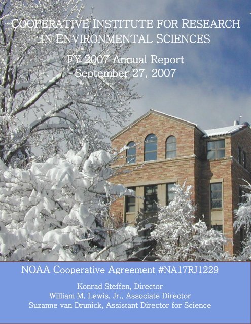
COOPERATIVE INSTITUTE FOR RESEARCH<br />
IN ENVIRONMENTAL SCIENCES<br />
FY 2007 Annual Report<br />
September 27, 2007<br />
NOAA Cooperative Agreement #NA17RJ1229<br />
Konrad Steffen, Director<br />
William M. Lewis, Jr., Associate Director<br />
Suzanne van Drunick, Assistant Director for Science
Cover photo by Paul Sperry
Table of Contents<br />
Letter from the Director ............................................................................................................................... iii<br />
Executive Summary <strong>and</strong> Research Highlights .............................................................................................. 1<br />
CIRES in 2006-2007 ..................................................................................................................................... 6<br />
Administration <strong>and</strong> Funding ..................................................................................................................... 6<br />
Contributions to NOAA‘s Strategic Vision ............................................................................................ 11<br />
Creating a Dynamic Research Environment ........................................................................................... 13<br />
<strong>Theme</strong> Reports ............................................................................................................................................ 19<br />
<strong>Scientific</strong> <strong>Theme</strong>: ADVANCED MODELING AND OBSERVING SYSTEMS .................................. 19<br />
<strong>Scientific</strong> <strong>Theme</strong>: CLIMATE SYSTEM VARIABILITY...................................................................... 44<br />
<strong>Scientific</strong> <strong>Theme</strong>: GEODYNAMICS ..................................................................................................... 68<br />
<strong>Scientific</strong> <strong>Theme</strong>: PLANETARY METABOLISM ................................................................................ 84<br />
<strong>Scientific</strong> <strong>Theme</strong>: REGIONAL PROCESSES ....................................................................................... 88<br />
Complementary Research ......................................................................................................................... 103<br />
Faculty Fellows Research ..................................................................................................................... 103<br />
Education <strong>and</strong> Outreach Program ......................................................................................................... 129<br />
CIRES‘ <strong>Scientific</strong> Centers .................................................................................................................... 131<br />
Innovative Research Program ............................................................................................................... 141<br />
CIRES Visiting Fellows ....................................................................................................................... 153<br />
Appendices................................................................................................................................................ 157<br />
Governance <strong>and</strong> Management .............................................................................................................. 157<br />
Student Diversity Programs .................................................................................................................. 161<br />
Personnel Demographics ...................................................................................................................... 162<br />
Publications from Calendar Year 2006 ................................................................................................. 163<br />
Refereed Publications Published during Calendar Year 2006 ......................................................... 163<br />
Non-Refereed Publications Published during Calendar Year 2006 ................................................. 188<br />
Refereed Journals in which CIRES Scientists Published in 2006 .................................................... 197<br />
Honors <strong>and</strong> Awards: Calendar Year 2006 ............................................................................................ 199<br />
Service: Calendar Year 2006 ................................................................................................................ 203<br />
Acronyms <strong>and</strong> Abbreviations ............................................................................................................... 207<br />
i
Director’s Welcome<br />
Letter from the Director<br />
We had another exiting year with numerous accomplishments, awards,<br />
recognitions of our faculty, researchers, <strong>and</strong> staff – too numerous to mention in<br />
detail here. Congratulations to all of CIRES. Research highlights are mentioned<br />
in detail in the Executive Summary of this report, <strong>and</strong> again, they were so<br />
numerous that it was hard to choose which to feature in the Summary.<br />
We completed our University Program Review, a recurring event every seven<br />
years. I am proud to announce that we received high grades in the review process<br />
<strong>and</strong> CIRES was recognized as an important asset for the University of Colorado<br />
at Boulder (University). CIRES is a large <strong>and</strong> complex organization, which<br />
interacts in a variety of ways with academic departments <strong>and</strong> institutes at the<br />
University, as well as the many relevant NOAA laboratories <strong>and</strong> centers, located<br />
in the David Skaggs Research Center in Boulder. Despite this complexity, CIRES<br />
is working well <strong>and</strong> we are succeeding in meeting our missions <strong>and</strong> goals.<br />
The Members‘ Council organized the second CIRES ―Rendezvous Symposium‖ in spring. This highly successful<br />
endeavor was devoted to a full day of science presentations <strong>and</strong> discussions across all disciplines, engaging over 300<br />
scientists, students, <strong>and</strong> staff. We have institutionalized the ―Rendezvous Symposium‖ as an annual event.<br />
CIRES continues to be the world leader in environmental sciences, as we are committed to identifying <strong>and</strong> pursuing<br />
innovative research in earth system science, <strong>and</strong> to fostering public awareness of this research. Our research budget<br />
continues to grow <strong>and</strong> has reached over $47 M, including the faculty support from the University for our CIRES<br />
faculty lines, supporting a total of 580 employees, graduate <strong>and</strong> undergraduate students. We have published over<br />
880 papers in peer-reviewed science journals, participated in a number of news conferences, U.S. Congressional<br />
briefings, <strong>and</strong> outreach activities. The outcome <strong>and</strong> findings of our research is important in forming policies that are<br />
crucial for future generations.<br />
We welcome one new CIRES tenure-track faculty researcher, Dr. Baylor Fox-Kemper, assistant professor in the<br />
Department of Atmospheric <strong>and</strong> Oceanic Sciences with expertise in experimental ocean modeling. In addition, the<br />
University authorized CIRES to search for a new director for our Center for the Study of Earth from Space,<br />
following the retirement of Professor Alex Goetz, <strong>and</strong> for a new director for our Center for Science <strong>and</strong> Technology<br />
Policy Research. With these new Graduate School faculty lines, CIRES will increase its faculty to a total of<br />
nineteen.<br />
We also welcome our new Assistant Director for Science, Dr. Suzanne van Drunick who comes to us from the<br />
National Research Council in Washington, DC, where she was a Senior Program Officer for studies on<br />
environmental science <strong>and</strong> toxicology. Suzanne is already engaged in a number of activities, including this new<br />
CIRES annual report.<br />
The annual report is a collaborative effort of a number of people in CIRES – researchers as well as administrative<br />
staff – <strong>and</strong> they all deserve credit for what you will find on the following pages. In particular, I would like to<br />
acknowledge the effort of Assistant Director Dr. Suzanne van Drunick who was instrumental in coordinating this<br />
effort. Enjoy your reading!<br />
iii
Executive Summary <strong>and</strong> Research Highlights<br />
Executive Summary <strong>and</strong> Research Highlights<br />
Since 1967, the Cooperative Institute for Research in Environmental Sciences (CIRES) has provided a dynamic<br />
setting for teaching <strong>and</strong> collaborative, interdisciplinary research in environmental sciences. CIRES is an organized<br />
research institute of the University of Colorado at Boulder (University), <strong>and</strong> is based on a cooperative agreement<br />
(Agreement) between the University <strong>and</strong> the National Oceanic <strong>and</strong> Atmospheric Administration (NOAA). CIRES‘<br />
collaborative research is organized <strong>and</strong> aligned with NOAA‘s research by six scientific themes identified in the<br />
Agreement. These themes include advanced modeling <strong>and</strong> observing systems, climate system variability,<br />
geodynamics, planetary metabolism, regional processes, <strong>and</strong> integrating activities. Select research highlights from<br />
each of the scientific themes are presented below.<br />
From July 30, 2006 to July 1, 2007 (FY07), CIRES supported 182 Research Scientists, 208 Associate Scientists, 18<br />
Visiting Scientists, 14 postdoctoral researchers, 32 administrative staff, 80 graduate students, <strong>and</strong> 44 undergraduate<br />
students. In total, CIRES supported approximately 580 scientists, administrative staff, <strong>and</strong> students with an overall<br />
extramural research budget of $44,400,000, an increase of almost 3.5% compared to FY06. Including University<br />
faculty support, the total budget is almost $47,600,000, of which NOAA funds accounted for approximately<br />
$23,500,000 (49%).<br />
CIRES received approval for one new faculty line <strong>and</strong> two reappointments for positions vacated by a retirement <strong>and</strong><br />
departure of a CIRES faculty member. A new tenure-track faculty researcher, Dr. Baylor Fox-Kemper, was hired as<br />
an assistant professor in the Department of Atmospheric <strong>and</strong> Oceanic Sciences. Fox-Kemper‘s area of expertise is<br />
experimental modeling of oceanic eddies <strong>and</strong> ocean heat transport. Faculty searches are underway for a new director<br />
for the Center for Science <strong>and</strong> Technology Policy Research <strong>and</strong> a new director for the Center for the Study of Earth<br />
from Space. CIRES also hired a new Assistant Director for Science in December 2006. A part-time science news<br />
writer position was created to help convey CIRES‘ research findings to the news media <strong>and</strong> public. Communication<br />
of CIRES‘ mission <strong>and</strong> activities was further enhanced by the creation <strong>and</strong> broad dissemination of a new CIRES<br />
brochure.<br />
In July 2006, the CIRES-NOAA FY 2007 <strong>and</strong> FY 2008 <strong>Scientific</strong> Workplan (Workplan) was completed <strong>and</strong><br />
implemented. The Workplan describes collaborative research that integrates scientific projects conducted by CIRES<br />
under each of the six scientific themes. The Workplan accounts for Task III research of the Agreement, however, it<br />
integrates several scientific objectives of earth system science. These objectives are the drivers of the Workplan,<br />
which identifies goals <strong>and</strong> approaches for each objective, <strong>and</strong> incorporates milestones <strong>and</strong> impacts for each project.<br />
The new Workplan closely resembles the previous version, which NOAA <strong>and</strong> the Department of Commerce<br />
approved as a scientific roadmap with increased clarity <strong>and</strong> accountability.<br />
The University‘s Program Review Panel (PRP) released its final report for CIRES in February 2007. The final<br />
report was based on a review of three separate reports. Those were (1) the CIRES Self-Study, which was prepared<br />
by a ten-member team comprised of the CIRES Associate Director, CIRES Fellows, Research Associates, graduate<br />
students, <strong>and</strong> administrative staff; (2) the report by the Internal Review Committee, which was comprised of non-<br />
CIRES faculty <strong>and</strong> graduate students; <strong>and</strong> (3) the report by the External Review Committee, which was comprised<br />
of two distinguished academics not affiliated with the University. The findings of the PRP final report included<br />
praise for the very high quality of the faculty engaged in CIRES, high degree of productivity among the Fellows,<br />
<strong>and</strong> effectiveness of administrative staff. CIRES‘ leadership was concluded to be very strong. The connections<br />
between CIRES <strong>and</strong> NOAA‘s Earth System Research Laboratory (ESRL) <strong>and</strong> other research organizations were<br />
credited with enhancing <strong>and</strong> strengthening CIRES research.<br />
CIRES‘ Education <strong>and</strong> Outreach (E/O) program continued to strengthen the link between education <strong>and</strong> research<br />
related to science, technology, <strong>and</strong> math for the purpose of increasing public underst<strong>and</strong>ing of issues related to earth<br />
system science. To celebrate the launch of the International Polar Year, E/O organized a community-wide event, Ice<br />
Fest, which included a wide variety of activities focused on the cryosphere, polar research, <strong>and</strong> climate studies.<br />
In addition, another exciting CIRES FY07 highlight was the announcement of a new CIRES-NOAA Exchange<br />
Fellowship Program. Guidelines are being developed to enable CIRES <strong>and</strong> ESRL researchers to exchange laboratory<br />
<strong>and</strong> field research roles.<br />
1
Executive Summary <strong>and</strong> Research Highlights<br />
Research Highlights <strong>and</strong> Accomplishments from CIRES-NOAA Partnership by <strong>Scientific</strong> <strong>Theme</strong><br />
<strong>Advanced</strong> <strong>Modeling</strong> <strong>and</strong> <strong>Observing</strong> <strong>Systems</strong><br />
This theme includes the optimization of modeling <strong>and</strong> observing systems for disciplines such as atmospheric<br />
chemistry, physical atmospheric <strong>and</strong> oceanic processes, cryospheric processes, space weather, non-linear systems<br />
applications, data centers, <strong>and</strong> data management. Research ranges from local to regional <strong>and</strong> global scales.<br />
Quantitative characterization of the response of the cavity ring-down single-particle aerosol instrument was<br />
performed. The completed instrument, containing improvements over the 2005 prototype, was successfully<br />
deployed aboard NOAA R/V Ronald H. Brown for the TexAQS 2006/GoMACCS field campaign from<br />
August to mid-September in the western Gulf of Mexico/Houston Ship Channel region; aerosol samples<br />
were collected.<br />
Two lidars were deployed during the 2006 Texas Air Quality Study to measure ozone <strong>and</strong> aerosol profiles.<br />
The TOPAZ airborne lidar, aboard a NOAA Twin Otter airplane, flew 22 missions during which it mapped<br />
out the three-dimensional distribution of ozone <strong>and</strong> aerosols over eastern Texas <strong>and</strong> the Gulf of Mexico.<br />
The OPAL ship-based lidar, aboard the NOAA R/V Ronald H. Brown, measured profiles of ozone <strong>and</strong><br />
aerosol backscatter. Recent improvements to ship-based <strong>and</strong> aircraft-based lidar systems include more<br />
accurate photodetectors, a simpler optical receiver, <strong>and</strong> new aerosol data processing methods.<br />
A ship-based remote sensing lidar to measure wind <strong>and</strong> turbulence profiles was developed by making<br />
improvements to NOAA‘s High Resolution Doppler Lidar.<br />
A new ozone sensor for ship-based measurements of ozone flux was developed. The sensor system was<br />
deployed on the R/V Ronald H. Brown in the TexAQS field program in later summer 2006.<br />
During the Texas Air Quality Study, the TOPAZ airborne ozone lidar, <strong>and</strong> the ship-based ozone <strong>and</strong><br />
Doppler lidars, collected data for comparison with model computations of ozone formation, transport, <strong>and</strong><br />
mixing processes, to investigate the ability of models to represent important boundary layer parameters.<br />
Diurnal sampling <strong>and</strong> inter-satellite bias corrections were applied to the High-resolution Radiation Sounder<br />
satellite radiances.<br />
Enhancements to the Gridpoint Statistical Interpolation (GSI) code were incorporated to improve use of<br />
surface weather observations (METARs), <strong>and</strong> GSD-developed procedures were introduced into GSI to<br />
incorporate three-dimensional, high-frequency National Weather Service WSR-88D radar data in the<br />
initialization of cloud <strong>and</strong> precipitation hydrometeors.<br />
The Real-Time Verification System was re-designed by enhancing the functionality of the database, webinterface,<br />
<strong>and</strong> real-time processing modules of the system to support verification of aviation parameters,<br />
such as icing, turbulence, <strong>and</strong> convective weather.<br />
New verification techniques were developed for evaluating the accuracy of convective echo tops, high<br />
resolution automated convective probabilistic forecasts, <strong>and</strong> ceiling <strong>and</strong> visibility forecast lead times.<br />
Results from statistical evaluations of turbulence <strong>and</strong> convective weather forecasts were summarized in<br />
written reports.<br />
The GOES X-ray instrument was calibrated with selected solar observations <strong>and</strong> 2005 rocket underflight<br />
data.<br />
A fully operational version of the Coronal Mass Ejection (CME) Locator was developed based on whitelight<br />
corona observations from the NASA STEREO mission. EUV dimming properties (intensity, solar<br />
location, <strong>and</strong> mass) were compared with associated CME properties as observed by the Extreme Ultraviolet<br />
Imaging Telescope.<br />
A ten-year study of the stability of the CUCF‘s reference UVB broadb<strong>and</strong> radiometers <strong>and</strong> 50+ network<br />
UVB radiometers was published.<br />
Climate System Variability<br />
Climate variability affects all natural systems <strong>and</strong> human activities. Climate directly influences agriculture, water<br />
quality, <strong>and</strong> human health. Underst<strong>and</strong>ing <strong>and</strong> potentially predicting climate change is critical to the public interest,<br />
as well as to a broad array of decision makers within federal <strong>and</strong> state government, industry, resources management,<br />
<strong>and</strong> hazard mitigation.<br />
A newly updated ozone-profile database was assessed for trends <strong>and</strong> changes in trends, <strong>and</strong> validated<br />
against ozone products derived from remote <strong>and</strong> in situ measuring systems such as satellites <strong>and</strong> ozone<br />
sounding.<br />
2
Executive Summary <strong>and</strong> Research Highlights<br />
The global impacts of the ENSO-related <strong>and</strong> ENSO-unrelated tropical sea surface temperature (SST) trends<br />
over the last 50 years were assessed using the NCAR/CAM3 <strong>and</strong> the NCEP/GFS atmospheric general<br />
circulation models (GCM), with particular emphasis on the impacts on precipitation trends over the<br />
Americas, western Africa, <strong>and</strong> Europe. Both GCMs indicate substantial precipitation trend responses in<br />
these regions to the tropical SST trends, which are generally in excellent mutual agreement, <strong>and</strong> with the<br />
observed precipitation trends. Both the ENSO-related <strong>and</strong> the ENSO-unrelated portions of the tropical SST<br />
trends are found to be important in this regard.<br />
The possibility of abrupt climate change over North America in the next several decades triggered by<br />
continued warming of the Indian Ocean was assessed. These runs suggest that the continued tropical ocean<br />
warming will gradually modify the atmospheric jet streams to the point where the ability of the jet streams<br />
to channel atmospheric disturbances along the upper tropospheric waveguide will undergo a relatively<br />
sudden shift sometime in the next century. This will cause relatively rapid shifts in the climates of North<br />
America <strong>and</strong> Europe.<br />
The impacts of coupled air-sea interactions, decadal ocean dynamics, l<strong>and</strong>-surface feedbacks, <strong>and</strong> l<strong>and</strong>-use<br />
changes on decadal atmospheric variability were assessed. It was concluded that the North Atlantic <strong>and</strong><br />
European climate response to Indian Ocean warming might be considerably greater than hitherto judged<br />
from analyses of atmospheric model experiments alone.<br />
The Gulf of Mexico Atmospheric Composition <strong>and</strong> Climate Study was planned, <strong>and</strong> executed between July<br />
1 <strong>and</strong> October 15, 2006, throughout Texas <strong>and</strong> the northwestern Gulf of Mexico. Three NOAA/ESRL <strong>and</strong><br />
CIRES‘ platforms were deployed: a NOAA WP-3 aircraft, a NOAA Twin Otter, <strong>and</strong> the NOAA/ESRL R/V<br />
Ronald H. Brown. This intensive field study provided significant new information that is required to afford<br />
a better underst<strong>and</strong>ing of the sources, <strong>and</strong> atmospheric processes responsible for the formation <strong>and</strong><br />
distribution, of ozone <strong>and</strong> aerosols in the atmosphere <strong>and</strong> the influence that these species have on the<br />
radiative forcing of climate regionally <strong>and</strong> globally, as well as their impact on human health <strong>and</strong> regional<br />
haze.<br />
Fire, fossil fuel, <strong>and</strong> ocean carbon modules were implemented with the ensemble Kalman filter system,<br />
commonly referred to as CarbonTracker: http://www.esrl.noaa.gov/gmd/ccgg/carbontracker.<br />
Two new tall-tower sites were established as part of the NOAA/GMD North America Carbon <strong>Observing</strong><br />
System (Carbon America) during FY07: One near Boulder, CO, <strong>and</strong> the other near West Branch, IA.<br />
Continuous in-situ CO2/CO mixing ratios <strong>and</strong> regular air samples are being used as part of the Carbon<br />
Tracker system mentioned above.<br />
A temperature/humidity/GPS system to augment current trace-gas vertical-profile measurements was<br />
developed <strong>and</strong> field-tested, allowing for automated measurements of the ambient temperature <strong>and</strong><br />
humidity, <strong>and</strong> the position <strong>and</strong> altitude of each sample, in a vertical profile. The system was installed at five<br />
sites in the NOAA/GMD Carbon America aircraft network.<br />
A new index for assessing changes in the atmospheric burden of ozone-depleting gases was made available<br />
from the NOAA website. The Ozone Depleting Gas Index provides a summary of progress being made in<br />
the global effort to reduce the atmospheric burden of ozone-depleting gases.<br />
The representation of physical processes <strong>and</strong> the Madden-Julian Oscillation in the NCEP Global<br />
Forecasting System was investigated <strong>and</strong> improved by studying fourteen coupled general circulation<br />
models (CGCMs) used in the Intergovernmental Panel on Climate Change Fourth Assessment Report<br />
(IPCC AR4). The results show that all current state-of-the-art CGCMs have significant problems in<br />
simulating tropical intra-seasonal variability.<br />
A study examining the double-ITCZ problem in CGCMs participating in the IPCC AR4 was completed.<br />
The results show that most of these CGCMs have a double-ITCZ problem.<br />
Images of 401 glacier photographs were posted online.<br />
A major paper was published in Journal of Geophysical Research synthesizing a variety of atmospheric<br />
<strong>and</strong> oceanic data to examine the large-scale energy budget of the Arctic. The seasonal cycles of vertically<br />
integrated atmospheric energy storage <strong>and</strong> the convergence of energy transport from ERA-40, as evaluated<br />
for the polar cap, compare well with realizations from the NCEP/NCAR reanalysis over the period 1979-<br />
2001.<br />
Development of seasonal forecast guidance tools for the U.S., based on the predictability of tropical SSTs<br />
several seasons in advance, <strong>and</strong> training these tools on the atmospheric responses to different types of<br />
anomalous tropical SSTs in large new sets of seasonal integrations made with the NCAR, GFDL, <strong>and</strong><br />
NCEP GCMs, continued. Results indicate that, compared to the forecast tool currently being used in real-<br />
3
Executive Summary <strong>and</strong> Research Highlights<br />
time experimental seasonal forecasts, the new forecast tool has the potential to make improved forecasts of<br />
U.S. seasonal precipitation <strong>and</strong> surface temperature.<br />
Geodynamics<br />
The goal of geodynamics is to characterize the internal processes of the planet, including the properties of the coremantle<br />
boundary, convection within the Earth‘s mantle, <strong>and</strong> the effects of convection on the surface of the planet.<br />
A global spherical-harmonic degree-720 model of the Earth‘s crustal magnetic field was created from a<br />
joint inversion of all available marine magnetic, aeromagnetic, <strong>and</strong> CHAMP satellite magnetic<br />
measurements. This model is the first step in the development of an Enhanced Magnetic Model needed for<br />
improved navigation by ships, aircraft, <strong>and</strong> near-Earth orbiting spacecraft.<br />
Bathymetric-topographic digital elevation models sufficient for tsunami propagation, run up <strong>and</strong> inundation<br />
prediction for 19 priority regions, defined by the U.S. tsunami community, were produced. This project is a<br />
priority for NOAA, has been presented to Congressional staffers, <strong>and</strong> featured on the NOAA website.<br />
Public access to the tsunami inundation DEMs has been provided at the ―NGDC Tsunami Inundation<br />
Gridding Project‖ website (http://www.ngdc.noaa.gov/mgg/inundation/). On this site, visitors may<br />
download completed DEMs, with corresponding metadata <strong>and</strong> documentation.<br />
Planetary Metabolism<br />
Planetary metabolism is the complex web of biochemical <strong>and</strong> ecological processes <strong>and</strong> their interaction with the<br />
lithosphere, atmosphere <strong>and</strong> hydrosphere. Both natural <strong>and</strong> anthropogenic disturbances drive the structure <strong>and</strong><br />
dynamics of natural systems, <strong>and</strong> a thorough underst<strong>and</strong>ing of these complex processes is essential to protect the<br />
biosphere from adverse effects due to pollution, destruction of natural l<strong>and</strong>scapes, <strong>and</strong> inadvertent alteration of<br />
climate.<br />
Annual estimates of national <strong>and</strong> global gas flaring for the years 1995 through 2006 using low-light<br />
imaging data acquired by the Defense Meteorological Satellite Program (DMSP) spacecraft have been<br />
developed. In 2006, the gas flaring estimate of 168 billion cubic meters represented 27% of the natural gas<br />
consumption by the United States, with a potential market value of $69 billion. Global gas flaring adds<br />
more than 84 million metric tons of carbon to the atmosphere each year.<br />
A global poverty map with 30-arc second resolution, using a derived poverty index calculated by dividing<br />
population count by the brightness of satellite-observed nighttime lighting for the DMSP spacecraft, has<br />
been developed. The total estimate of the numbers of individuals living in poverty is 2.3 billion, slightly<br />
under the World Development Indicators‘ estimate of 2.6 billion. This significant work demonstrates a new<br />
technique for determining global poverty rates.<br />
Regional Processes<br />
Many of the research endeavors within CIRES <strong>and</strong> NOAA have a regional focus because they address a particular<br />
confluence of geography, demographics, or weather <strong>and</strong> climatic regimes. The effect of climate variability is often<br />
regionally focused, thus influencing very specific populations, economic systems, <strong>and</strong> ecosystems.<br />
A twelve-year (1993-2004) global oceanic data set of near-surface humidity has been developed using<br />
SSM/I <strong>and</strong> SSM/T-2 satellite sensors, <strong>and</strong> a seven-year (1999-2005) data set of both near-surface humidity<br />
<strong>and</strong> temperature has been developed combining AMSU-A <strong>and</strong> SSM/I satellite sensors.<br />
Daily ozone profile measurements at Trinidad Head, CA <strong>and</strong> Boulder, CO were performed during the<br />
intensive Measurements of Ozone over North America study in August 2006. The purpose was to<br />
determine the role of various sources to the tropospheric ozone budget over North America. A key finding<br />
of this intensive campaign was the important contribution to the upper tropospheric (6-11 km) ozone<br />
budget from lightning-produced nitrogen oxides.<br />
Research conducted by CIRES staff on data sets collected onboard the NOAA R/V Ronald H. Brown<br />
during the 2004 New Engl<strong>and</strong> Air Quality Study has resulted in several successful research publications in<br />
peer-reviewed journals.<br />
Measurements obtained from the NOAA P-3 aircraft in the summer of 2004 during the International<br />
Consortium for Atmospheric Research on Transport <strong>and</strong> Transformation study have been used to examine<br />
the transport of pollutants from the United States over the Atlantic Ocean.<br />
The relative-humidity dependence of aerosol light extinction for surrogate atmospheric aerosol using cavity<br />
ring-down aerosol extinction spectroscopy was studied. Findings suggest that neglecting the water uptake<br />
4
Executive Summary <strong>and</strong> Research Highlights<br />
by the organic fraction of atmospheric particles could lead to significant underestimation of the cooling at<br />
the Earth‘s surface due to light scattering by aerosol.<br />
Integrating Activities<br />
CIRES engages in a wide range of integrating activities in research, education, <strong>and</strong> outreach that encompass each of<br />
the Institute‘s research themes <strong>and</strong> contribute to the overall mission of the Institute, University, <strong>and</strong> NOAA. The<br />
primary focus is on five overlapping categories that include (1) K-16 Interdisciplinary Education <strong>and</strong> Outreach, (2)<br />
Graduate <strong>and</strong> Post-Graduate Education, (3) <strong>Scientific</strong> Assessments, (4) Interdisciplinary Research, <strong>and</strong> (5) Science<br />
<strong>and</strong> Technology Policy Research.<br />
The final preparation of the World Meteorological Organization/United Nations Environment Programme<br />
2006 scientific state-of-underst<strong>and</strong>ing assessment of the ozone layer for the Montreal Protocol was<br />
completed. CIRES scientists participated as coauthors, contributors, reviewers, <strong>and</strong> coordinating editor for<br />
the report.<br />
The many forces that impact water dem<strong>and</strong> in a major Denver suburb, Aurora, with infrastructure<br />
requirements over the next ten years in excess of $1 billion, were investigated. How the recent drought,<br />
climate variables, demographics, pricing, irrigation technology, in-home water meters, <strong>and</strong> other variables<br />
affect dem<strong>and</strong> were studied. A number of papers about water dem<strong>and</strong> in the Denver area <strong>and</strong> a review<br />
paper on factors influencing residential water dem<strong>and</strong> were published. Additionally, multiple presentations<br />
directed to these topics were delivered in Colorado <strong>and</strong> Arizona. A new website ―Water Dem<strong>and</strong> <strong>and</strong><br />
Conservation‖ was created: http://wwa.colorado.edu/resources/water_dem<strong>and</strong>_<strong>and</strong>_conservation/.<br />
Analysis of paleoclimatological streamflow reconstructions, future streamflow projections from models <strong>and</strong><br />
other sources, <strong>and</strong> native streamflow reconstructions were synthesized to improve underst<strong>and</strong>ing of stream<br />
flows. A workshop held to assist the U.S. Bureau of Reclamation in assessing the state of climate change<br />
science in its Colorado River planning studies, led to the preparation of a peer-reviewed report, which may<br />
become an appendix in Reclamation‘s ongoing Environmental Impact Statement for the ―shortage sharing‖<br />
<strong>and</strong> combined operation of Lake Powell <strong>and</strong> Lake Mead. This is the first report of its kind by Reclamation<br />
anywhere in the U.S.<br />
5
CIRES in 2006-2007: Administration <strong>and</strong> Funding<br />
CIRES in 2006-2007<br />
Administration <strong>and</strong> Funding<br />
The Cooperative Institute for Research in Environmental Sciences (CIRES) is a joint institute established in 1967<br />
between the University of Colorado <strong>and</strong> the National Oceanic <strong>and</strong> Atmospheric Administration (NOAA). The<br />
purpose of CIRES is to maintain an interdisciplinary environment for research on the geosphere, biosphere,<br />
atmosphere, hydrosphere <strong>and</strong> cryosphere. CIRES conducts basic research in support of NOAA‘s goals for<br />
application of environmental science to advance the public welfare. CIRES strengthens the scientific foundation<br />
upon which NOAA‘s many services depend. CIRES‘ connections with NOAA‘s Office of Oceanic <strong>and</strong> Atmospheric<br />
Research <strong>and</strong> sister Cooperative Institutes also provide an avenue for coordinated studies on a scale that could not be<br />
addressed by university research units on their own.<br />
Vision <strong>and</strong> Mission<br />
As a world leader in Environmental Sciences, CIRES is committed to identifying <strong>and</strong> pursuing<br />
innovative research in Earth System Science <strong>and</strong> fostering public awareness of these<br />
processes to ensure a sustainable future environment. CIRES is dedicated to fundamental <strong>and</strong><br />
interdisciplinary research targeted at all aspects of Earth System Science <strong>and</strong> to communicating<br />
these findings to the global scientific community, to decision makers, <strong>and</strong> to the public.<br />
CIRES‘ direction is provided through its Council of Fellows, its executive committee, <strong>and</strong> committees working on<br />
focused objectives such as maintaining excellence in computing facilities (Figure 1). Interdisciplinary science at<br />
CIRES is fostered through centers that cross traditional boundaries, <strong>and</strong> these include the Center for the Study of<br />
Earth from Space (CSES), the Center for Limnology, the National Snow <strong>and</strong> Ice Data Center (NSIDC), the Center<br />
for Science <strong>and</strong> Technology Policy Research (CSTPR), <strong>and</strong> the Climate Diagnostics Center (CDC). CIRES‘ campus<br />
affiliation provides NOAA labs <strong>and</strong> centers a breadth of connections in 11 university departments <strong>and</strong> programs<br />
(Figure 2). Communication is facilitated through a members‘ council, scientific retreats, research symposiums,<br />
regular town meetings, <strong>and</strong> outreach. Career progression <strong>and</strong> excellence are promoted through a career track <strong>and</strong> an<br />
outst<strong>and</strong>ing employee recognition program. A vibrant academic <strong>and</strong> research environment is fostered through a<br />
graduate research fellowship program, a visiting faculty <strong>and</strong> postdoctoral program, an innovative research program,<br />
<strong>and</strong> a distinguished lecture series. <strong>Advanced</strong> research tools are provided through an instrument design group,<br />
machine shop, glassblowing, numerical climate models, <strong>and</strong> access to remote sensing <strong>and</strong> analytical instrumentation.<br />
Figure 1. Organization of CIRES.<br />
6
Chemical Sciences<br />
Division (CSD)<br />
CIRES in 2006-2007: Administration <strong>and</strong> Funding<br />
NOAA LABORATORIES AND CENTERS<br />
NOAA EARTH SYSTEM RESEARCH LABORATORY (ESRL)<br />
Cryospheric<br />
<strong>and</strong> Polar<br />
Processes<br />
Environmental<br />
Observations, <strong>Modeling</strong><br />
<strong>and</strong> Forecasting<br />
Center for<br />
Limnology<br />
Aerospace<br />
Engineering<br />
Sciences<br />
Ecology <strong>and</strong><br />
Evolutionary<br />
Biology<br />
Molecular, Cellular<br />
<strong>and</strong> Developmental<br />
Biology<br />
Global Monitoring<br />
Division (GMD)<br />
National Geophysical<br />
Data Center (NGDC)<br />
NOAA CENTERS<br />
7<br />
Global <strong>Systems</strong><br />
Division (GSD)<br />
Space Environment<br />
Center (SEC)<br />
CIRES DIVISIONS<br />
Environmental<br />
Biology<br />
Solid Earth<br />
Sciences<br />
CIRES INTERDISCIPLINARY CENTERS<br />
Center for Science<br />
<strong>and</strong> Technology<br />
Policy Research<br />
(CSTPR)<br />
Center for the<br />
Study of Earth<br />
from Space<br />
(CSES)<br />
National Snow<br />
<strong>and</strong> Ice<br />
Data Center<br />
(NSIDC)<br />
Physical Sciences<br />
Division (PSD)<br />
Environmental<br />
Chemistry<br />
Weather <strong>and</strong><br />
Climate Dynamics<br />
UNIVERSITY DEPARTMENTS AND PROGRAMS<br />
Atmospheric<br />
<strong>and</strong> Ocean<br />
Sciences<br />
Electrical<br />
<strong>and</strong> Computer<br />
Engineering<br />
Physics<br />
Chemistry<br />
<strong>and</strong><br />
Biochemistry<br />
Geological<br />
Sciences<br />
Environmental<br />
Studies<br />
Program<br />
Climate<br />
Diagnostics<br />
Center (CDC)<br />
Civil, Environmental<br />
<strong>and</strong> Architectural<br />
Engineering<br />
Geography<br />
Figure 2. CIRES’ divisions, centers, <strong>and</strong> affiliated departments <strong>and</strong> programs; NOAA laboratories <strong>and</strong> centers.
CIRES in 2006-2007: Administration <strong>and</strong> Funding<br />
In recent years, CIRES has maintained modest <strong>and</strong> steady growth (Figure 3). The largest increment of CIRES‘<br />
funding (49%) is provided by the Agreement with NOAA, of which expenditures have increased slightly faster than<br />
inflation over the past five years. The Agreement provides a financial foundation to help support CIRES faculty <strong>and</strong><br />
research scientists in their active pursuit of funding from outside federal <strong>and</strong> non-federal contracts <strong>and</strong> grants. Their<br />
continued, collective success in obtaining external research awards has also regularly increased at a rate that slightly<br />
exceeds the rate of inflation. The University‘s monetary contribution to CIRES primarily covers faculty salaries, <strong>and</strong><br />
varies slightly due to year-over-year changes in the CIRES-affiliated University faculty roster.<br />
$25,000,000<br />
$20,000,000<br />
$15,000,000<br />
$10,000,000<br />
$5,000,000<br />
$0<br />
$19,416,537<br />
$20,486,086<br />
$17,806,124 $18,850,849 $19,269,133<br />
02-03 03-04 04-05 05-06 06-07<br />
Figure 3. CIRES expenditures 2003 – 2007. Continued growth over five years in University-sponsored funding,<br />
individual federal <strong>and</strong> non-federal contracts <strong>and</strong> grants, <strong>and</strong> NOAA Cooperative Agreement research support.<br />
8<br />
$21,989,557 $22,521,519 $23,432,561<br />
$20,440,477<br />
$2,485,604 $2,931,451 $3,107,435 $3,095,989 $3,175,951<br />
$20,979,787<br />
U. of Colo. Contracts/Grants Cooperative Agreement
CIRES in 2006-2007: Administration <strong>and</strong> Funding<br />
Agreement expenditures by task for FY07 are shown in Figure 4. Task I expenditures include CIRES administration<br />
<strong>and</strong> internal scientific programs such as the Visiting Fellows program. Task II provides partial funding for the<br />
National Snow <strong>and</strong> Ice Data Center, the largest of CIRES‘ five interdisciplinary scientific centers. Task III funds<br />
CIRES‘ collaboration with NOAA‘s Earth System Research Laboratory, National Geophysical Data Center, <strong>and</strong><br />
Space Environment Center. Task IV was created to serve as an efficient administrative mechanism for directing<br />
NOAA research grants <strong>and</strong> awards, which would otherwise be st<strong>and</strong>-alone grants <strong>and</strong> awards outside the<br />
Agreement, to University researchers in fields allied with CIRES‘ mission. Water in the West is a CIRES‘ program<br />
to provide water research <strong>and</strong> decision support to policy makers throughout the western U.S.<br />
Task III (83%)<br />
$19,398,479<br />
Figure 4. Cooperative Agreement expenses by task for FY07.<br />
The largest share (43%) of Task I supports CIRES administration, primarily salaries <strong>and</strong> benefits for the<br />
administrative staff (Figure 5). The Visiting Fellows program receives the second largest share (31%) of Task I<br />
expenditures <strong>and</strong> is supported by other funding as well. Task I also provides partial support of CIRES‘ Education<br />
<strong>and</strong> Outreach program, other research, <strong>and</strong> the physical plant facilities.<br />
9<br />
Task IV (1%)<br />
$218,298<br />
Water in the West (2%)<br />
$473,729<br />
Task I (13%)<br />
$3,161,461<br />
Task II (1%)<br />
$198,599
Other Research Support<br />
10%<br />
Outreach<br />
10%<br />
Visiting Fellows<br />
31%<br />
CIRES in 2006-2007: Administration <strong>and</strong> Funding<br />
Figure 5. CIRES Task I base fund expenditures for FY07.<br />
Task I funding is supplemented by CIRES‘ portion of the University‘s indirect cost recovery (ICR), which is<br />
distributed annually to academic units as a proportion of indirect costs funded through University researchers‘ grants<br />
<strong>and</strong> awards (Figure 6).<br />
Other Research Support<br />
19%<br />
Outreach<br />
6%<br />
Student Support<br />
5%<br />
Visiting Fellows<br />
10%<br />
Facilities<br />
9%<br />
Figure 6. CIRES Task I base fund plus ICR return expenditures for FY07.<br />
10<br />
Facilities<br />
6%<br />
Administration<br />
43%<br />
Administration<br />
51%
CIRES in 2006-2007: Contributions to NOAA’s Strategic Vision<br />
Contributions to NOAA’s Strategic Vision<br />
Cross-cutting, interdisciplinary research priorities within CIRES complement NOAA‘s current Five-Year Research<br />
Plan priorities, which aim to enhance the underst<strong>and</strong>ing <strong>and</strong> prediction the of Earth‘s environment. The Five-Year<br />
Research Plan reflects NOAA‘s response to some of the nation‘s most challenging environmental needs, as<br />
identified in the 20-Year Research Vision, <strong>and</strong> supports the four mission goal areas identified in the NOAA<br />
Strategic Plan – Ecosystems, Climate, Weather <strong>and</strong> Water, <strong>and</strong> Commerce <strong>and</strong> Transportation. The following are<br />
examples of CIRES research that supports NOAA‘s mission goals.<br />
Ecosystem Mission Goal: Protect, restore, <strong>and</strong><br />
manage the use of coastal <strong>and</strong> ocean resources<br />
through ecosystem based management.<br />
CIRES contributes to the ecosystem mission goal through<br />
observations <strong>and</strong> research on habitat, ecosystems, <strong>and</strong><br />
extreme events. Toward this goal, CIRES is a valuable<br />
contributor to research on ocean temperature <strong>and</strong> climate.<br />
CIRES researchers are diagnosing impacts of changes in<br />
tropical sea surface temperature over the last 50 years, <strong>and</strong><br />
determining sensitivity to past <strong>and</strong> future temperature<br />
changes in different parts of the tropical oceans. Using a<br />
satellite retrieval method recently developed by ESRL<br />
researchers, CIRES is creating a multi-year global oceanic data set of near-surface temperatures <strong>and</strong> humidity.<br />
Crossing disciplines, CIRES is evaluating data on ocean warming to assess the possibility of abrupt climate change<br />
over North America, <strong>and</strong> using global chemistry/dynamics models to examine the effect of future ship traffic in the<br />
Arctic northern passages on Arctic pollution.<br />
Ecosystem management includes the assessment of potential hazards based on the collection <strong>and</strong> interpretation of<br />
environmental data. CIRES is developing a U.S. Tsunami Hazard Assessment that will describe tsunami sources <strong>and</strong><br />
estimate tsunami frequency based on historical <strong>and</strong> geological tsunami data.<br />
Climate Mission Goal: Underst<strong>and</strong> climate variability<br />
<strong>and</strong> change to enhance society’s ability to plan <strong>and</strong><br />
respond.<br />
CIRES is a respected leader in areas of climate science research<br />
relevant to NOAA‘s climate mission goal. Researchers at CIRES<br />
have contributed substantially towards climate observations,<br />
analysis, <strong>and</strong> predictions; climate forcing; <strong>and</strong> climate effects on<br />
ecosystems across various spatial <strong>and</strong> temporal scales. Basic<br />
research at CIRES has advanced our underst<strong>and</strong>ing of observed<br />
long-term climate variations <strong>and</strong> recent unexpected changes,<br />
especially in the polar regions. Spatially, CIRES‘ vast research<br />
spans from the sea surface, l<strong>and</strong>, <strong>and</strong> ice to the lower <strong>and</strong> upper<br />
atmospheres <strong>and</strong> space environment.<br />
CIRES develops methods <strong>and</strong> processes for integrating multiple<br />
types of climate research data, <strong>and</strong> making the data more<br />
streamlined <strong>and</strong> accessible to facilitate interoperability within the scientific community for the purpose of<br />
knowledge extraction, data quality control <strong>and</strong> validation, <strong>and</strong> trend detection. Tools are also being created for the<br />
public <strong>and</strong> policy makers to increase access to climate science information <strong>and</strong> forecast products.<br />
11
CIRES in 2006-2007: Contributions to NOAA’s Strategic Vision<br />
Weather <strong>and</strong> Water Mission Goal: Serve society’s needs for weather <strong>and</strong> water information.<br />
CIRES contributes to NOAA‘s mission to provide essential<br />
information on weather, which critically influences regional<br />
air quality, through its research on new approaches <strong>and</strong><br />
instrumentation to conduct atmospheric observations. CIRES<br />
researchers analyze pollutant ozone <strong>and</strong> fine particles, <strong>and</strong><br />
their intercontinental transport, to better underst<strong>and</strong> how they<br />
affect overall air quality <strong>and</strong> its impacts on public health.<br />
CIRES participates in the Texas <strong>and</strong> New Engl<strong>and</strong> Air Quality<br />
Studies <strong>and</strong> undertakes research that contributes to enhanced<br />
regional air quality prediction <strong>and</strong> to improved regional-scale<br />
weather forecasts, including forecasts of severe weather<br />
events.<br />
CIRES contributes to the need for state-of-the-art information<br />
on water through its investigations on novel approaches for<br />
streamflow reconstructions <strong>and</strong> future streamflow projections.<br />
Efforts are also ongoing to provide support activities for the National Integrated Drought Information System <strong>and</strong> to<br />
provide input to the Climate Prediction Center to assist in the planning of water operations during droughts, as well<br />
as to develop guidelines for estimating the economic costs of drought in Western states.<br />
Commerce <strong>and</strong> Transportation Mission Goal: Support the nation’s commerce with information for<br />
safe, efficient, <strong>and</strong> environmentally sound transportation.<br />
CIRES contributes to the transportation goal primarily in relation to aviation. Enhancing database <strong>and</strong> web-interface<br />
functionality <strong>and</strong> improving real-time processing modules supports verification of aviation parameters, such as<br />
icing, turbulence, <strong>and</strong> convective weather. These new tools <strong>and</strong> verification approaches provide information about<br />
the quality of aviation forecasts to aviation decision makers.<br />
12
CIRES in 2006-2007: Creating a Dynamic Research Environment<br />
Creating a Dynamic Research Environment<br />
CIRES has created a number of programs <strong>and</strong> initiatives to stimulate interdisciplinary collaborations between<br />
CIRES, NOAA <strong>and</strong> University Departments. The following paragraphs summarize our main programs. Detailed<br />
descriptions <strong>and</strong> specific research outcomes can be found in the Complementary Research section of this report.<br />
CIRES’ Outst<strong>and</strong>ing Performance Awards Program<br />
The CIRES Awards Committee, comprised of CIRES‘ Members‘ Council representatives, annually reviews the<br />
nominations <strong>and</strong> recommends awards for outst<strong>and</strong>ing professional achievement. Five awards of $2,000 each were<br />
given this year, three in the science <strong>and</strong> engineering category <strong>and</strong> two in the service category. The awards were<br />
presented to each individual or research team at the CIRES‘ Members‘ Council Rendezvous symposium (see below).<br />
This year, CIRES recognized Joost de Gouw (CSD), David Stone <strong>and</strong> Kelvin Fedrick (SEC), <strong>and</strong> Jonathan Kofler<br />
(GMD) for outst<strong>and</strong>ing performance in Science <strong>and</strong> Engineering, <strong>and</strong> Allaina Howard (NSIDC), <strong>and</strong> John Maurer<br />
(NSIDC) for outst<strong>and</strong>ing achievements in Service.<br />
In 2006, NOAA presented its 2006 Bronze Award to NOAA employees for demonstrating the usefulness of<br />
unmanned aircraft systems in accomplishing NOAA‘s mission, including operational <strong>and</strong> research goals. Several<br />
CIRES members were integral members of this stellar team, <strong>and</strong> in April 2007, CIRES presented them each with<br />
plaques recognizing their contributions. These CIRES members are Dale Hurst (GMD), Fred Moore (GMD),<br />
Geoffrey Dutton (GMD) David Nance (GMD), Brian Vasel (GMD), Marian Klein (formerly PSD) Vladimir<br />
Leuski (formerly PSD), <strong>and</strong> Eric Ray (CSD).<br />
Visiting Fellows Program<br />
CIRES annually conducts a competitive Visiting Fellows program that promotes collaborative research at the<br />
forefront of scientific knowledge. One-year fellowships are made to Ph.D. scholars <strong>and</strong> university faculty planning<br />
sabbatical leave to continue their education in research positions that may foster interdisciplinary training <strong>and</strong><br />
exposure to scientific assessments <strong>and</strong> policy research. Since 1967, CIRES has awarded more than 220 Visiting <strong>and</strong><br />
Sabbatical Fellowships. Recipients have included previous CIRES Director, Susan Avery, <strong>and</strong> current Director,<br />
Konrad Steffen. Selections are based in part on the likelihood of stimulating academic interactions <strong>and</strong> the degree to<br />
which both parties will benefit from the exchange of new ideas. To further this goal, the competition is open to<br />
scientists from all countries, <strong>and</strong> priority is given to c<strong>and</strong>idates with research experience at institutions outside the<br />
Boulder scientific community.<br />
Fellowships are offered to scientists with research interests in the following areas:<br />
Physics, chemistry, <strong>and</strong> dynamics of the Earth system (atmosphere, biosphere, hydrosphere, lithosphere,<br />
cryosphere)<br />
Global <strong>and</strong> regional environmental change<br />
Climate system monitoring, diagnostics, <strong>and</strong> modeling<br />
Remote sensing <strong>and</strong> in situ measurement techniques for the Earth system<br />
Interdisciplinary research themes<br />
Graduate Research Fellowship Program<br />
CIRES has long supported a Graduate Research Fellowship program to promote student scholarship <strong>and</strong> research<br />
excellence. The program embraces a dual approach by (1) attracting the outst<strong>and</strong>ing students at the outset of their<br />
graduate careers, <strong>and</strong> (2) enabling current students to place a greater emphasis on completing <strong>and</strong> publishing their<br />
research results. Support ranges from a summer stipend to tuition, stipend <strong>and</strong> partial health insurance for one year<br />
(12 months). Fellowships are restricted to Ph.D. students advised by a CIRES Fellow or any prospective or current<br />
graduate student who might be advised by a CIRES Fellow. Evaluations by a committee of CIRES Fellows are<br />
based on the c<strong>and</strong>idate‘s University application, accomplishments, <strong>and</strong> the likelihood of their contribution to<br />
environmental science. Independence, passion for science, <strong>and</strong> ability to communicate are also considered. This<br />
year, CIRES awarded fellowships to seven students, five of whom were new recruits, to explore topics ranging from<br />
climate change <strong>and</strong> the mass balance of the Greenl<strong>and</strong> ice sheet to natural carbon storage in ecosystems <strong>and</strong> the role<br />
of organic haze in the early Earth‘s atmosphere.<br />
13
CIRES in 2006-2007: Creating a Dynamic Research Environment<br />
Innovative Research Program (IRP)<br />
The purpose of the CIRES-wide competitive Innovative Research<br />
Program is to stimulate a creative research environment within CIRES <strong>and</strong><br />
encourage synergy between<br />
disciplines <strong>and</strong> research colleagues.<br />
The program encourages novel,<br />
unconventional <strong>and</strong>/or fundamental<br />
research that may quickly provide<br />
concept viability or rule out further<br />
consideration. Activities are not<br />
tightly restricted <strong>and</strong> can range from<br />
instrument development, lab testing,<br />
<strong>and</strong> field observations to model<br />
advancement. Funded projects are<br />
inventive, often opportunistic, <strong>and</strong><br />
do not necessarily have an<br />
immediate practical application or<br />
guarantee of success. Each year, an interdisciplinary team selects the award<br />
recipients, <strong>and</strong> the results of their research are presented the following year at a<br />
poster reception. The winners of the ninth annual Innovative Research Program<br />
competition include projects to improve hurricane forecasting <strong>and</strong> explore the<br />
use of bacteria in cleaning up <strong>and</strong> converting toxins found in crude oil <strong>and</strong> tar.<br />
Education <strong>and</strong> Outreach (EO)<br />
The CIRES‘ Education <strong>and</strong> Outreach program provides science education opportunities for educators, students <strong>and</strong><br />
scientists. Their work emphasizes scientific inquiry, links with current research, <strong>and</strong> underst<strong>and</strong>ing of foundational<br />
concepts in geoscience. Examples of programs for educators include Earthworks, a week-long Earth System Science<br />
retreat for science teachers, <strong>and</strong> the Northeast Front Range Math <strong>and</strong> Science Partnership summer institutes.<br />
Programs designed for students include the National Ocean Sciences Bowl <strong>and</strong> the EVE-MESA high school course<br />
for English Language Learners. Programs supporting scientists include the Resources for Scientists in Partnerships<br />
with Education (ReSciPE) workshops <strong>and</strong> collaboration with scientists preparing geoscience research proposals to<br />
include educational components. While EO does work across the breadth of CIRES research topics, the group has<br />
developed a suite of work in climate sciences, including video products <strong>and</strong> mechanisms to help climate scientists<br />
communicate about their research to the public.<br />
Western Water Assessment (WWA)<br />
The Western Water Assessment is CIRES‘ signature integrating<br />
activity that involves personnel from the Climate Diagnostics<br />
Center, the Center for Science <strong>and</strong> Technology Policy Research,<br />
the Center for Limnology, the National Climatic Data Center, the<br />
Natural Resources Law Center, the Institute for Behavioral<br />
Studies, <strong>and</strong> the Institute for Arctic <strong>and</strong> Alpine Research. Its<br />
mission is to identify <strong>and</strong> characterize regional vulnerabilities to<br />
climate variability <strong>and</strong> change <strong>and</strong> to develop information,<br />
products <strong>and</strong><br />
processes to<br />
assist waterresource<br />
decision<br />
makers throughout the Intermountain West. WWA is responsive to<br />
NOAA‘s mission, strategic goals, <strong>and</strong> cross-cutting priorities, as<br />
well as other congressional NOAA m<strong>and</strong>ates, including the U.S.<br />
Global Change Research Act <strong>and</strong> the Climate Change Strategic<br />
Program. WWA is funded by the NOAA Office of Global<br />
Programs as part of their Regional Integrated Sciences <strong>and</strong><br />
Assessments program.<br />
14
CIRES in 2006-2007: Creating a Dynamic Research Environment<br />
Rendezvous! CIRES’ Members’ Council Symposium<br />
The CIRES‘ Members‘ Council held its second annual research<br />
symposium on April 10, 2007. Mirroring the purpose of the old west‘s<br />
gathering of tribes, traders <strong>and</strong> settlers for an exchange of goods,<br />
information <strong>and</strong> good will, the meeting was dubbed ―Rendezvous.‖<br />
This one-day symposium featured presentations by Director Konrad<br />
Steffen, the six associate directors, the directors of the Center for<br />
Science <strong>and</strong> Technology Policy Research <strong>and</strong> the Education Outreach<br />
Program, <strong>and</strong> brief introductions by the presenters of approximately 80<br />
posters. CIRES took<br />
advantage of the occasion<br />
to honor the winners of<br />
the 2007 Outst<strong>and</strong>ing<br />
Performance Awards. Two poster sessions <strong>and</strong> a luncheon rounded out<br />
the successful day. CIRES was pleased to host not only its own<br />
members, but also several visitors from the University <strong>and</strong> NOAA.<br />
Organized by the Members‘ Council, this symposium continued the<br />
tradition that began last year of bringing together CIRES members,<br />
Fellows, <strong>and</strong> students to highlight the depth <strong>and</strong> breadth of science <strong>and</strong><br />
to foster scientific exchange in a stimulating setting.<br />
Distinguished Lecture Series<br />
CIRES promotes global perspectives by sponsoring notable speakers whose work crosses disciplinary boundaries.<br />
The Distinguished Lecture Series features outst<strong>and</strong>ing scientists, science policy makers, <strong>and</strong> science journalists who<br />
take imaginative positions on environmental issues <strong>and</strong> can establish enduring connections after their departure.<br />
John M. “Mike” Wallace, Joint Institute for the Study of<br />
the Atmosphere <strong>and</strong> Ocean, University of Washington,<br />
Seattle<br />
―Year-to-year Variability <strong>and</strong> Long-term Trends in the<br />
Circulation over High Latitudes‖<br />
Prasad Gogineni, Center for Remote Sensing of Ice<br />
Sheets, University of Kansas, Lawrence<br />
―Synthetic Aperture Radar Imaging of Ice-bed Interface<br />
<strong>and</strong> Radar Sounding of Fast-Flowing Glaciers‖<br />
Stefan Hastenrath, Department of Atmospheric <strong>and</strong><br />
Oceanic Sciences, University of Wisconsin-Madison<br />
―Variations of East African Climate, Glaciers <strong>and</strong> Lakes<br />
over the Past Two Centuries‖<br />
Am<strong>and</strong>a Lynch, School of Geography <strong>and</strong> Environmental<br />
Science, Monash University, Australia<br />
―A Factorial Analysis of Storm Surge Flooding in Barrow,<br />
Alaska: An Adaptation Study‖<br />
15
CIRES in 2006-2007: Creating a Dynamic Research Environment<br />
Symposia <strong>and</strong> Conferences<br />
Listed below are events sponsored, organized, or hosted by CIRES.<br />
Northeast Front Range Math/Science Partnership: Earth & Space Science (7/06)<br />
Director‘s town meetings (7/06, 8/06, 9/06)<br />
ESRL Dedication (8/06)<br />
Northeast Front Range Math/Science Partnership: Algebra in Middle Level Mathematics Teaching (9/06,<br />
10/06, 11/06)<br />
Public Lecture by Astronaut Harrison ―Jack‖ Schmitt (9/06)<br />
Innovative Research Program poster session (9/06)<br />
Panel Discussion on An Inconvenient Truth: Assessing the Science <strong>and</strong> Policy Implications (9/06)<br />
Water, Drought <strong>and</strong> Wyoming‘s Climate (10/06)<br />
Climate Change <strong>and</strong> Variability in the San Juan Mountains (10/06)<br />
Climate Diagnostics <strong>and</strong> Prediction workshop (10/06).<br />
Climate Change for Water Resource Managers workshop (11/06)<br />
ReSciPE Inquiry workshop at University of Colorado (11/06)<br />
ReSciPE Inquiry workshop at Colorado Science convention (11/06)<br />
Energy Initiative symposium (10/06)<br />
NSIDC 30th Anniversary seminar (10/06)<br />
Sierra Nevada workshop (10/06)<br />
Consortium of Resonance <strong>and</strong> Rayleigh Lidars meeting (11/06)<br />
Visiting <strong>and</strong> Graduate Fellowships poster session (11/06)<br />
The Climate <strong>and</strong> Cryosphere <strong>Scientific</strong> Steering Group meeting (12/06)<br />
North American Carbon Program Investigators meeting (1/07)<br />
Joint Canada/Mexico/USA Carbon Program Planning meeting (1/07)<br />
Climate <strong>and</strong> Tourism Workshop: Identifying links between climate variability <strong>and</strong> change <strong>and</strong> tourism<br />
industries on the Colorado Plateau (01/07)<br />
National Ocean Science Bowl Regional Competition: Mountain Mariner Challenge (2/07)<br />
Climate Change Activities at CU, Climate Change Network brown bag lunch (2/07)<br />
North American Volcanic <strong>and</strong> intrusive rock DATabase (NAVDAT) meeting (3/07)<br />
Ice Fest, Celebrating the Launch of IPY (3/07)<br />
Boulder Labs Diversity Council meeting: Building Tomorrow‘s Workplace in 2007 (3/07)<br />
The Web <strong>and</strong> the West: Comparing Two Frontiers (3/07)<br />
NOAA Coastal Services Project Design <strong>and</strong> Evaluation workshop (3/07)<br />
CIRES‘ Members‘ Council Rendezvous Science symposium (4/07)<br />
National Seasonal Assessment Workshop for Wildfire Potential in the Western States <strong>and</strong> Alaska (04/07)<br />
ReSciPE Inquiry workshop at Challenger Learning Center, Maine (11/06)<br />
Introduction to Inorganic Isotope Ratio Mass Spectrometry (6/07)<br />
Earthworks workshop for Secondary Science Teachers (6/07)<br />
Northeast Front Range Math/Science Partnership: Integrating Earth & Space Science with Physical Science<br />
(6/07)<br />
Presentations by Other Guest Speakers<br />
Frank Laird Fighting Evolution, Controlling Education: Controversy over Intelligent Design (9/06)<br />
Jana Milford Dealing with Uncertainty in Regulatory Applications of Air Quality Models (9/06)<br />
Sarah Krakoff Climate Change, Morality <strong>and</strong> Law (10/06)<br />
Carl Koval CU’s New Energy Initiative (10/06)<br />
Michael Zimmerman Outline of an Integral Ecology (11/06)<br />
Juan Bautista Bengoetxea Science <strong>and</strong> Technology Studies in Spain (11/06)<br />
Lisa Keränen Public <strong>and</strong> Technical Argument in Science-Based Controversies (12/06)<br />
Katinka Waelbers Philosophy of Science, Technology & Society: Master program at the University of<br />
Twente (1/07)<br />
Paul Komor Meeting Colorado's Future Electricity Needs: One Question, Many Answers (1/07)<br />
16
CIRES in 2006-2007: Creating a Dynamic Research Environment<br />
Brad Udall All Institute Seminar - Western Water Management at a Tipping Point: Recent Activities of the<br />
CIRES’ Western Water Assessment (2/07)<br />
Juan Lucena What the Field of Engineering Studies has to Contribute to CSTPR (2/07)<br />
Juan Lucena Engaging Engineers in Policymaking: From Problem Solvers to Problem Definers (2/07)<br />
Martin Hoerling Past Peak Water in the West (2/07)<br />
Björn-Ola Linnér Who Gets What, How <strong>and</strong> When: Historical Responsibility & Emissions Trade in Climate<br />
Policy (2/07)<br />
Jennifer Kuzma Emerging Technologies & the Environment: Case Studies for Science & Technology<br />
Policy (3/07)<br />
Jennifer Kuzma Oversight for Nanotechnology: No Small Matter (3/07)<br />
Mark Squillace The Future of Federal Wetl<strong>and</strong>s Regulation (3/07)<br />
Krister Andersson Decentralized Governance & Environmental Change (4/07)<br />
Wayne Ambler How Should We Introduce Engineering Undergraduates to STS <strong>and</strong> Policy Issues? (4/07)<br />
17
CIRES in 2006-2007: Creating a Dynamic Research Environment<br />
18
<strong>Theme</strong> report: <strong>Advanced</strong> <strong>Modeling</strong> <strong>and</strong> <strong>Observing</strong> <strong>Systems</strong><br />
<strong>Theme</strong> Reports<br />
<strong>Scientific</strong> <strong>Theme</strong>: ADVANCED MODELING AND OBSERVING SYSTEMS<br />
AMOS-01: Instrumentation Design, Prototyping <strong>and</strong> Analysis<br />
CSD01: Instrumentation for Atmospheric Observation <strong>and</strong> Analysis<br />
CET01: Remote Hydrologic Sensing<br />
PSD08: Sensor <strong>and</strong> Technique Development<br />
AMOS-02: Data Management, Projects <strong>and</strong> Infrastructure <strong>Systems</strong><br />
NGDC01: Geospatial Technology for Global Integrated <strong>Observing</strong> <strong>and</strong> Data<br />
Management <strong>Systems</strong><br />
NGDC02: Marine Geophysics Data Stewardship<br />
SEC03: Information Technology <strong>and</strong> Data <strong>Systems</strong><br />
SEC04: Space Environment Data Algorithm <strong>and</strong> Product Development<br />
AMOS-03: Prediction, Model Development <strong>and</strong> Evaluation<br />
CSD02: Chemical Transport Model Research<br />
PSD09: Environmental Monitoring <strong>and</strong> Prediction<br />
GSD01: Regional Numerical Weather Prediction<br />
GSD03: Verification Techniques for the Evaluation of Aviation Weather Forecasts<br />
NGDC03: Space Weather<br />
SEC01: Solar Disturbances in the Geospace Environment<br />
SEC02: <strong>Modeling</strong> the Upper Atmosphere<br />
AMOS-04: <strong>Observing</strong> Facilities, Campaigns <strong>and</strong> Networks<br />
GMD01: Central Ultraviolet Calibration Facility<br />
GMD02: Surface Radiation Network<br />
AMOS-01: Instrumentation Design, Prototyping <strong>and</strong> Analysis<br />
CSD01: Instrumentation for Atmospheric Observation <strong>and</strong> Analysis<br />
GOALS:<br />
Design <strong>and</strong> evaluate new approaches <strong>and</strong> instrumentation to make atmospheric observations of hard-to-measure<br />
species that are important players in the chemistry of the troposphere <strong>and</strong> stratosphere.<br />
MILESTONE CSD01.1:<br />
Report airborne observations of gas-phase ammonia (NH3) that were made aboard the NOAA<br />
WP-3D by a newly chemical ionization mass spectrometry (CIMS) technique during the New<br />
Engl<strong>and</strong> Air Quality Study–Intercontinental Transport <strong>and</strong> Chemical Transformation (NEAQS–<br />
ITCT).<br />
ACCOMPLISHMENTS FOR CSD01.1:<br />
Ammonia (NH3) is the dominant gas-phase base in the troposphere. As a consequence, NH3 abundance influences<br />
aerosol nucleation <strong>and</strong> composition <strong>and</strong> affects regional air quality, atmospheric visibility, <strong>and</strong> acid deposition<br />
patterns. Major sources of NH3 in the troposphere include biomass burning <strong>and</strong> anthropogenic emissions from<br />
livestock waste, large-scale application of fertilizer, <strong>and</strong> automobile emissions. Despite its importance, there are few<br />
observations of NH3 above the planetary boundary layer. Some of the earliest were by filter or denuder techniques<br />
that required sampling times (>15 min) that are not well suited to aircraft traveling at speeds of 100 m s -1 or greater.<br />
NH3 mixing ratios in concentrated plumes from biomass burning sources have been reported at greater than 10 partsper-billion<br />
by volume (ppbv). However, NH3 mixing ratios as low as 0.1 ppbv have been hypothesized to influence<br />
important atmospheric processes, such as new particle formation. To further underst<strong>and</strong> the distribution of NH3<br />
throughout the atmosphere, its role in atmospheric processes such as aerosol formation, <strong>and</strong> the impact of<br />
19
<strong>Theme</strong> report: <strong>Advanced</strong> <strong>Modeling</strong> <strong>and</strong> <strong>Observing</strong> <strong>Systems</strong><br />
anthropogenic <strong>and</strong> agricultural NH3 sources on regional air quality, fast-time resolution, sub-ppbv airborne<br />
observations are needed.<br />
To address this need, a Chemical Ionization Mass Spectrometer (CIMS) instrument for measuring NH3 from an<br />
airborne platform was developed. The newly developed technique utilized a protonated acetone dimer detection<br />
scheme to selectively <strong>and</strong> sensitively measure NH3 aboard the NOAA WP-3D aircraft during the New Engl<strong>and</strong> Air<br />
Quality Study – Intercontinental Transport <strong>and</strong> Chemical Transformation (NEAQS–ITCT) field campaign. The<br />
average sensitivity determined from in-flight st<strong>and</strong>ard addition calibrations ranged from 2.6 to 5 ion counts per<br />
second (Hz)/parts-per-trillion by volume (pptv) for 1 MHz of reagent ion <strong>and</strong> could be adjusted by varying the flow<br />
tube residence time. The average 1-σ variation in sensitivity for a given flight was 20%-25%. A heated/thermostated<br />
PFA Teflon inlet was used for sampling ambient air. The instrument time response was determined in-flight from<br />
the NH3 signal decay after removal of a st<strong>and</strong>ard addition calibration. The 2 e-folding signal decay time for all<br />
calibration curves analyzed ranged from 4 sec to 10 sec <strong>and</strong> on average was 5 sec. This suggested the instrument<br />
time response was on the order of 5 sec. The background signal was determined routinely in-flight by scrubbing<br />
NH3 from the ambient sample <strong>and</strong> ranged from 0.5 to 1.3 ppbv. For a 5-sec measurement, the uncertainty in an<br />
individual background measurement varied from 20 to 60 pptv. The difference in consecutive background<br />
measurements ranged from 50 pptv to 100 pptv. Total uncertainty for the 5-sec data was estimated at no worse than<br />
± (30% + 125 pptv), though for certain individual flights, it was less. The accuracy <strong>and</strong> precision of the airborne<br />
instrument was similar to previous ground instruments. However, the time response of the airborne instrument was<br />
faster <strong>and</strong> it was more sensitive than these instruments, primarily due to improvements in the ion transmission, inlet<br />
construction, <strong>and</strong> cleaner mass spectra due to use of a collisional dissociation chamber.<br />
The 5-sec data obtained during NEAQS–ITCT enabled the observation of NH3 from a variety of sources including<br />
biomass burning plumes, urban areas, <strong>and</strong> an agricultural source. NH3 enhancements of 1 to 5 ppbv were observed<br />
on many flights in biomass burning plumes 8-10 days old with no enhancement observed in aged (~14 days old)<br />
biomass burning plumes. In the biomass burning plumes, NH3 was well correlated with carbon monoxide (CO), a<br />
biomass burning tracer, with slopes ranging from 0.007 to 0.015 ppbv. During the 25 July flight, enhancements in<br />
NH3 mixing ratios were coincident with enhancements in CO, the sum of nitrogen oxide (NO) <strong>and</strong> nitrogen dioxide<br />
(NO2), <strong>and</strong> sulfur dioxide (SO2) mixing ratios downwind of New York City. NH3 mixing ratios ranged from 0.4 to 1<br />
ppbv in the New York City emission plume <strong>and</strong> were
<strong>Theme</strong> report: <strong>Advanced</strong> <strong>Modeling</strong> <strong>and</strong> <strong>Observing</strong> <strong>Systems</strong><br />
statistical analysis of ethene observations between the two years. It was found that ethene was on average 40% lower<br />
in 2006 than in 2000. Even though the meteorology was also very different between the two years, it was concluded<br />
that the difference was more likely due to a reduction in ethene emissions, because (1) other trace gases did not<br />
show a decrease between 2000 <strong>and</strong> 2006, <strong>and</strong> (2) formaldehyde, an atmospheric oxidation product of ethene,<br />
showed a similar 40% decrease.<br />
The other issue that analyses have focused on is a quantification of ethene emission sources. By integrating across<br />
the width of an industrial plume, <strong>and</strong> by taking the wind speed <strong>and</strong> direction into account, the emission flux can be<br />
estimated assuming a homogeneous distribution across the height of the boundary layer. This method of estimating<br />
emissions was compared to results from a solar occultation flux (SOF) measurement operated by Chalmers<br />
University (Gothenburg, Sweden) onboard a mobile laboratory. The SOF measurement determines column ethene<br />
using absorption of solar IR radiation, <strong>and</strong> thus provides a completely independent estimate of the ethene fluxes in<br />
the Houston area. The results from the two methods generally agreed within a factor of 2 without systematic biases.<br />
A comparison of the results with flux estimates represented in an emissions database revealed that the actual fluxes<br />
are 10-40 times higher than those used in the modeling. This is very important information for air-quality managers<br />
in Texas to take into account in their efforts to underst<strong>and</strong> <strong>and</strong> model ozone formation in the area.<br />
The results of this work have been presented at two workshops in Austin, Texas, to colleagues involved in the study,<br />
officials from the Texas Commission on Environmental Quality (TCEQ) <strong>and</strong> other interested parties. A publication<br />
about this work is in preparation for the Journal of Geophysical Research.<br />
MILESTONE CSD01.3:<br />
(i) Characterize quantitatively the response of the cavity ring-down single particle aerosol<br />
instrument, <strong>and</strong> plan use of it on actual air-flows brought into the laboratory. (ii) Deploy the<br />
organic aerosol collector on the NOAA R/V Ronald H. Brown <strong>and</strong> use suitable mass spectrometry<br />
to analyze the samples.<br />
ACCOMPLISHMENTS FOR CSD01.3:<br />
(i) The development of a cavity ring-down instrument to measure the albedos <strong>and</strong> optical sizes of individual aerosol<br />
particles was completed, <strong>and</strong> characterization of the instrument performance was carried out. During the instrument<br />
characterization, it was determined that obtaining the particle extinction, which is necessary for the albedo<br />
measurement, by measuring the depletion in the cavity laser intensity, provides a more robust measurement than the<br />
ring-down method. The depletion method provided less spread in the measured albedo values for a collection of<br />
particles of known sizes <strong>and</strong> optical properties than those derived from the ring-down time measurements. The<br />
depletion method also avoids some technical difficulties associated with operating the instrument in the cavity ringdown<br />
mode. The instrument operating in the depletion mode is able to optically size the diameters of laboratorygenerated<br />
particles to within 50 nm. Currently, the instrument can measure the albedo <strong>and</strong> size of particles down to<br />
diameters of around 300 nm <strong>and</strong> an upper size limit above a micron in diameter. Changes in albedo of greater than<br />
10-15% were observable using partially absorbing dyed laboratory particles. Final modifications are being made to<br />
the instrument to provide a higher vacuum necessary for the introduction of particles from ambient air into the<br />
instrument. Currently, a manuscript is in preparation that describes the instrument <strong>and</strong> its capabilities. Plans are<br />
being made for field measurements in the near future.<br />
(ii) After evaluation of the performance of the prototype aerosol speciation instrument during the fall of 2005, a<br />
field-deployable instrument incorporating several additional improvements was constructed during the winter <strong>and</strong><br />
spring of 2006. The completed instrument was successfully deployed aboard NOAA R/V Ronald H. Brown for the<br />
TexAQS 2006/GoMACCS field campaign from August to mid-September in the western Gulf of Mexico/Houston<br />
Ship Channel region. Proton-transfer-reaction chemical ionization mass spectra of thermally-desorbed aerosol<br />
samples showed significant variations in the composition of the organic fraction of atmospheric aerosol on hourlyto-daily<br />
timescales. Data from the field campaign were reduced during fall 2006-winter 2007. First-look results were<br />
presented at a mass spectrometry conference in January 2007. Laboratory studies to assist with underst<strong>and</strong>ing the<br />
data acquired during the field campaign <strong>and</strong> to characterize further the performance of the instrument were begun<br />
during spring 2007 <strong>and</strong> are continuing. A manuscript describing the instrument <strong>and</strong> its performance is in<br />
preparation.<br />
21
<strong>Theme</strong> report: <strong>Advanced</strong> <strong>Modeling</strong> <strong>and</strong> <strong>Observing</strong> <strong>Systems</strong><br />
Time series of several masses observed by the AOS-PTR-ITMS during its initial deployment aboard R/V Ronald H.<br />
Brown during the summer 2006 TexAQS/GoMACSS campaign.<br />
MILESTONE CSD01.4:<br />
Develop ship-based <strong>and</strong> aircraft-based lidar systems to measure ozone <strong>and</strong> aerosol profiles.<br />
ACCOMPLISHMENTS FOR CSD01.4:<br />
Two lidars were deployed during the 2006 Texas Air Quality Study (TexAQS II) to measure ozone <strong>and</strong> aerosol<br />
profiles. The TOPAZ airborne ozone-profiling lidar was built the previous year <strong>and</strong> saw its first deployment at<br />
TexAQS II. TOPAZ is a compact <strong>and</strong> lightweight airborne ozone lidar based on an innovative, all solid-state,<br />
wavelength-tunable UV laser transmitter. During TexAQS II, TOPAZ flew 22 missions totaling approximately 120<br />
hours aboard a NOAA Twin Otter airplane during which it mapped out the three-dimensional distribution of ozone<br />
<strong>and</strong> aerosols over eastern Texas <strong>and</strong> the Gulf of Mexico. In addition to ozone mixing ratio <strong>and</strong> aerosol backscatter<br />
profiles, TOPAZ also provided highly resolved information on the spatial distribution of mixed layer height. First<br />
22
<strong>Theme</strong> report: <strong>Advanced</strong> <strong>Modeling</strong> <strong>and</strong> <strong>Observing</strong> <strong>Systems</strong><br />
results show that the data gathered with TOPAZ will be crucial to address important science questions regarding the<br />
local buildup <strong>and</strong> regional transport of ozone in eastern Texas.<br />
During TexAQS II, the OPAL lidar measured profiles of ozone <strong>and</strong> aerosol backscatter from aboard the NOAA R/V<br />
Ronald H. Brown. Recent lidar improvements included more accurate photodetectors, a simpler optical receiver, <strong>and</strong><br />
new aerosol data processing methods. In addition to ozone concentration, derived profiles include total uncalibrated<br />
backscatter, calibrated aerosol backscatter <strong>and</strong> aerosol extinction at 355 nm. Other products are cloud heights, <strong>and</strong><br />
aerosol layer heights (e.g. mixed-layer <strong>and</strong> residual layer heights) which are important for underst<strong>and</strong>ing pollution<br />
concentrations. The ozone profiles will be used to help explain the daily evolution of tropospheric ozone, especially<br />
to better define which situations develop into high ozone events. The aerosol data will be used for studies of aerosol<br />
hygroscopic growth factor, f(RH) (relating scattering at high relative humidity to that at low relative humidity) <strong>and</strong><br />
visibility, evaluation of air quality model predictions of aerosol, closure studies on aerosol optical <strong>and</strong> microphysical<br />
properties, <strong>and</strong> case studies of horizontal transport <strong>and</strong> vertical mixing.<br />
MILESTONE CSD01.5:<br />
Develop a ship-based remote sensing lidar to measure wind <strong>and</strong> turbulence profiles.<br />
ACCOMPLISHMENTS FOR CSD01.5:<br />
Underst<strong>and</strong>ing boundary layer dynamics, including mixed-layer heights, mean wind profiles, <strong>and</strong> mixing strength,<br />
are important for estimating pollutant concentration <strong>and</strong> transport in air quality studies. In order to make<br />
measurements of such atmospheric dynamics, NOAA‘s High Resolution Doppler Lidar (HRDL) has been updated in<br />
the following ways: The main laser has been updated to run at a higher output power by integrating new pump<br />
diodes, new optical systems to couple pump light into the laser cavity, <strong>and</strong> an improved thermal control system for<br />
the laser crystal itself. The motion compensation <strong>and</strong> scanning system has also been updated to incorporate<br />
automatically zenith stare files into a 15-minute scan pattern. Such zenith stare data provide new profiles of vertical<br />
velocity <strong>and</strong> vertical velocity variance (i.e. vertical mixing) that are used, along with horizontal mean winds derived<br />
from other scans, to underst<strong>and</strong> pollutant dispersion, mixing, <strong>and</strong> concentration. In addition, scientists have created<br />
new processing algorithms that enabled the wind <strong>and</strong> mixing profiles to be automatically generated <strong>and</strong> posted to<br />
ship-based <strong>and</strong> l<strong>and</strong>-based servers once every 15 minutes, thus allowing researchers near-real-time access to<br />
information about wind <strong>and</strong> mixing conditions for contextual <strong>and</strong> forecasting applications.<br />
Existing <strong>and</strong> forthcoming information derived from this data set include:<br />
• Profiles of horizontal mean wind speed <strong>and</strong> direction<br />
• Profiles of relative aerosol strength <strong>and</strong> aerosol layering<br />
• Vertical winds <strong>and</strong> profiles of vertical mixing/turbulence statistics<br />
• Horizontal (near surface) mixing/turbulence statistics<br />
• Aerosol <strong>and</strong> mixed layer (i.e., boundary layer) heights<br />
• Profiles of wind speed <strong>and</strong> directional shear<br />
• Boundary layer dynamic features: rolls, surface streaks, thunderstorm outflows, etc,<br />
• Ship/oil-platform plume detection.<br />
23
CET01: Remote Hydrologic Sensing<br />
<strong>Theme</strong> report: <strong>Advanced</strong> <strong>Modeling</strong> <strong>and</strong> <strong>Observing</strong> <strong>Systems</strong><br />
GOALS:<br />
Develop microwave remote sensing capabilities to facilitate NOAA measurements of key hydrological variables.<br />
MILESTONE CET01.1:<br />
Develop a new microwave sensing capability to enable NOAA measurements of soil moisture<br />
<strong>and</strong>/or snow water equivalent.<br />
24
<strong>Theme</strong> report: <strong>Advanced</strong> <strong>Modeling</strong> <strong>and</strong> <strong>Observing</strong> <strong>Systems</strong><br />
ACCOMPLISHMENTS FOR CET01.1:<br />
During FY2007, the CET operated the PSR/CXI soil<br />
moisture (SM) imaging radiometer as part of the DoE Cloud<br />
<strong>and</strong> LAnd Surface Interaction Campaign (CLASIC). The<br />
mission took place during June in Oklahoma, <strong>and</strong> resulted<br />
in eight successful mapping sorties during which the PSR<br />
mapped SM within the topmost 5 cm over a region of size<br />
~255 x 190 km with ~1.5 km resolution. Mapping occurred<br />
during the wettest month of June in Oklahoma history, thus<br />
providing unique conditions under which to test C-b<strong>and</strong> SM<br />
mapping capabilities under near-saturation. For the first<br />
time a self-contained algorithm was demonstrated for<br />
retrieval of SM with geo-registered overlap product<br />
delivered consistently within 24 hours of imaging <strong>and</strong><br />
estimated accuracy of ~5-10%, depending on vegetation<br />
overburden. The mission included the first-ever use of<br />
airborne SM mapping technology to assist in real-time flood<br />
risk assessment over deluged areas of central Texas.<br />
MILESTONE CET01.2:<br />
Develop an improved version of the DOTLRT radiative transfer model with radiance assimilation<br />
capabilities.<br />
ACCOMPLISHMENTS FOR CET01.2:<br />
The DOTLRT radiative transfer model was improved in two major capacities<br />
during FY2007: 1) a fast Henyey-Greenstein Mie lookup library was created<br />
to improve execution speed, <strong>and</strong> 2) a fully-polarimetric surface emission<br />
model based on WindSat satellite data <strong>and</strong> the OSU two-scale radiative<br />
transfer model was developed. These models have been delivered to the<br />
NOAA-NASA-DoD Joint Center for Satellite Data Assimilation, <strong>and</strong> are<br />
expected to be used with the JCSDA Community Radiative Transfer Model<br />
(CRTM). In addition, the DOTLRT Jacobian capabilities were incorporated<br />
within a precipitation-locking all-weather radiance assimilation algorithm to<br />
demonstrate for the first time all-weather microwave-radiance assimilation<br />
over precipitation. Results of running the locking algorithm over first frames<br />
of data indicate reasonable convergence of the radiance innovation field. The<br />
locking algorithm is being applied to the simulation of the short-term QPF<br />
performance of a geostationary microwave sounder.<br />
MILESTONE CET01.3:<br />
Demonstrate the potential for geostationary microwave imaging of precipitation using simulation<br />
experiments.<br />
ACCOMPLISHMENTS FOR CET01.3:<br />
Precise system simulations of the GEostationary Microwave (GEM) imager/sounder <strong>and</strong> the GeoSTAR synthetic<br />
thinned-aperture imaging radiometer have been studied within the context of the NOAA Geostationary Microwave<br />
Pathway study. The simulations use extensive 6-km MM5 simulations of Hurricane Bonnie at l<strong>and</strong>fall, <strong>and</strong> include<br />
five-phase precipitation microphysics <strong>and</strong> full scattering-based Jacobian calculations. The data illustrate – more<br />
accurately than any other simulation to date – what will be observed from the future GEM <strong>and</strong> GeoSTAR sensors.<br />
The results of the study have been presented at the World Meteorological Organization‘s IGeoLab series of<br />
workshops.<br />
25
<strong>Theme</strong> report: <strong>Advanced</strong> <strong>Modeling</strong> <strong>and</strong> <strong>Observing</strong> <strong>Systems</strong><br />
PSD08: Sensor <strong>and</strong> Technique Development<br />
GOALS:<br />
Design, develop, enhance <strong>and</strong> evaluate remote <strong>and</strong> in situ sensing systems for use from surface <strong>and</strong> other platforms<br />
of opportunity in order to measure critical atmospheric, surface, <strong>and</strong> oceanic parameters.<br />
MILESTONE PSD08.1:<br />
Continue construction of a roving calibration st<strong>and</strong>ard for ship flux measurements.<br />
ACCOMPLISHMENTS FOR PSD08.1:<br />
Considerable progress was made on developing the portable flux st<strong>and</strong>ard <strong>and</strong> implementing ship <strong>and</strong> buoy intercomparisons<br />
for quality assurance.<br />
Production of the roving flux st<strong>and</strong>ard is nearly complete. Researchers have upgraded one of the existing ESRL flux<br />
systems to create the portable st<strong>and</strong>ard (i.e., rather than build an entire new system from scratch). The upgrade<br />
features: 1) conversion from a network cabled sensors to wireless transmission <strong>and</strong> 2) improved radiative flux <strong>and</strong><br />
navigational measurements.<br />
Dr. Frank Bradley of CSIRO Canberra, Australia visited ESRL for a month in the spring of 2006 to work on the flux<br />
measurement h<strong>and</strong>book. Considerable progress was made <strong>and</strong> a draft was circulated among coauthors. The<br />
h<strong>and</strong>book has now been published as a NOAA Technical Memor<strong>and</strong>um<br />
(ftp://ftp.etl.noaa.gov/user/cfairall/wcrp_wgsf/flux_h<strong>and</strong>book/).<br />
A mostly complete prototype system was assembled <strong>and</strong> exhibited at the INMARTECH Symposium (Woods Hole<br />
Oceanographic Institution) in October 2006. A presentation was also made (―The NOAA Portable Seagoing Air-Sea<br />
Flux St<strong>and</strong>ard,‖ C.W. Fairall, S. Pezoa, L. Bariteau, <strong>and</strong> D.E. Wolfe). A complete seatainer-based system has now<br />
been assembled <strong>and</strong> is undergoing testing in Boulder.<br />
MILESTONE PSD08.2:<br />
Field test fast ozone sensor on Houston A/Q field program for ship-based ozone flux<br />
measurements.<br />
ACCOMPLISHMENTS FOR PSD08.2:<br />
A new ozone sensor was been built at INSTAAR (Detlev Helmig is leading the project). The system was deployed<br />
on the R/V Ronald H. Brown in the TexAQS field program in later summer 2006.<br />
AMOS-02: Data Management, Projects <strong>and</strong> Infrastructure <strong>Systems</strong><br />
NGDC01: Geospatial Technology for Global Integrated <strong>Observing</strong> <strong>and</strong> Data Management<br />
<strong>Systems</strong><br />
GOALS:<br />
Develop methods <strong>and</strong> processes for integrating multiple types of observations (e.g., gridded satellite products, <strong>and</strong><br />
in-situ measurements) using new Geographic Information System (GIS) data management <strong>and</strong> access tools; develop<br />
methods <strong>and</strong> processes for partnering with scientists to facilitate interoperability by producing metadata for<br />
scientific observations that are compliant with national FGDC (Federal Geographic Data Committee) <strong>and</strong><br />
international ISO (International St<strong>and</strong>ards Organization) st<strong>and</strong>ards; <strong>and</strong> create tools that allow the mining of vast<br />
environmental archives for the purpose of knowledge extraction, data quality control <strong>and</strong> trend detection.<br />
MILESTONE NGDC01.1:<br />
Increase access to environmental observations from Internet applications (Internet Mapping,<br />
Google Earth, etc.) using Open Geospatial Consortium st<strong>and</strong>ards <strong>and</strong> spatial databases.<br />
26
<strong>Theme</strong> report: <strong>Advanced</strong> <strong>Modeling</strong> <strong>and</strong> <strong>Observing</strong> <strong>Systems</strong><br />
ACCOMPLISHMENTS FOR NGDC01.1:<br />
NGDC is serving information about NOAA <strong>Observing</strong> <strong>Systems</strong> using the Open Geospatial Consortium Web Map<br />
Service. Between July 2006 <strong>and</strong> June 2007, the number of requests served grew by a factor of ten, to roughly 60,000<br />
requests/month. These data are also being served to Google Earth using static <strong>and</strong> dynamic KML.<br />
MILESTONE NGDC01.2:<br />
Integrate satellite granule metadata into spatial databases <strong>and</strong> Geographic Information <strong>Systems</strong>.<br />
ACCOMPLISHMENTS FOR NGDC01.2:<br />
During the last year, NGDC created tools for calculating <strong>and</strong> ingesting metadata for gridded NOAA Sea Surface<br />
Temperature data at three resolutions (14, 50, <strong>and</strong> 100 km) <strong>and</strong> tools for integrating NOAA satellite observations<br />
with in-situ observations. The second system involves roughly 1,000,000-point SST observations/day that are<br />
ingested into a spatial database <strong>and</strong> served on the web with a number of GIS tools.<br />
NGDC02: Marine Geophysics Data Stewardship<br />
GOALS:<br />
Contribute to a streamlined, more fully automated, accessible, <strong>and</strong> web-based management <strong>and</strong> stewardship process<br />
for Marine Geophysical data in support of seafloor research at CIRES <strong>and</strong> throughout the environmental science<br />
community.<br />
MILESTONE NGDC02.1:<br />
Add a generic set of Federal Geographic Data Committee (FGDC)–compliant metadata files for<br />
each survey in the Multibeam Bathymetric Data Base (MBBDB) at<br />
http://map.ngdc.noaa.gov/website/mgg/multibeam/viewer.htm, thereby improving the<br />
infrastructure for search <strong>and</strong> access of these data.<br />
ACCOMPLISHMENTS FOR NGDC02.1:<br />
FGDC compliant metadata files have been generated for most surveys in the NGDC MultiBeam Bathymetric Data<br />
Base (MBBDB). Users can access these metadata files directly from the search page or, if the data are downloaded,<br />
the metadata file is packaged automatically in the compressed delivery file. The MBBDB System is accessed<br />
through the web page: http://map.ngdc.noaa.gov/website/mgg/multibeam/viewer.htm.<br />
MILESTONE NGDC02.2:<br />
Search, target, <strong>and</strong> acquire multibeam data from the larger, worldwide oceanographic community.<br />
ACCOMPLISHMENTS FOR NGDC02.2:<br />
Researchers retrieved multibeam sonar survey data from various institutions. Data are assessed for quality, archived<br />
for long-term storage, <strong>and</strong> disseminated to the public through NGDC‘s MultiBeam Bathymetric Data Base<br />
(MBBDB).<br />
Lamont Doherty Earth Observatory 26<br />
University of New Hampshire CCOM 7<br />
University of South Florida 5<br />
Woods Hole Oceanographic Institution 3<br />
Scripps Institution of Oceanography 1<br />
U.S. Naval Oceanographic Office 15<br />
NOAA National Marine Fisheries Service 8<br />
NOAA Pacific Marine Environmental Laboratory 3<br />
Germany (Bundesamt fur Seeschiffahrt und Hydrographie 11<br />
Russia (University of Rhode Isl<strong>and</strong> edited) 2<br />
TOTAL 81<br />
Surveys received <strong>and</strong> placed on line between July 1, 2006 <strong>and</strong> June 30, 2007 by contributing institutions.<br />
27
<strong>Theme</strong> report: <strong>Advanced</strong> <strong>Modeling</strong> <strong>and</strong> <strong>Observing</strong> <strong>Systems</strong><br />
MILESTONE NGDC02.3:<br />
Implement an effective on-line, web-based data submission interface for multibeam bathymetry<br />
by which even a casual user will be able to submit data into the Multibeam Bathymetric Data<br />
Base (MBDDB).<br />
ACCOMPLISHMENTS FOR NGDC02.3:<br />
An online data submittal protocol <strong>and</strong> active web-link was developed<br />
(http://www.ngdc.noaa.gov/mgg/bathymetry/multibeam/MB_access.html) for user contributions of multibeam sonar<br />
data to the MBBDB. The system sends automated email notices after the metadata form is completed <strong>and</strong> then again<br />
after the data have been uploaded. This product has been used in test mode for most of the calendar year but went<br />
live on the MBBDB website in June. It has been used for external submission fewer than 10 times. Evaluation of<br />
ease of use, effectiveness, <strong>and</strong> desirability by clientele <strong>and</strong> colleagues will have to follow more extensive usage.<br />
SEC03: Information Technology <strong>and</strong> Data <strong>Systems</strong><br />
GOALS:<br />
Determine the necessary research data systems <strong>and</strong> infrastructure required to implement successfully the empirical<br />
<strong>and</strong> physical scientific models of the space environment such as those envisioned in SEC01 <strong>and</strong> SEC02 with fast <strong>and</strong><br />
efficient access to appropriate data sources.<br />
MILESTONE SEC03.1:<br />
Realign SEC data processing systems for better security <strong>and</strong> reliability. Identify <strong>and</strong> partition off<br />
National Critical <strong>Systems</strong> (NCS) from the rest of the IT infrastructure.<br />
ACCOMPLISHMENTS FOR SEC03.1:<br />
Project suspended indefinitely due to funding <strong>and</strong> priority changes.<br />
MILESTONE SEC03.2:<br />
Complete the phase-I migration of older <strong>and</strong> non-supported computing platforms to newer<br />
platforms. Complete <strong>and</strong> deploy SEC programmatic data subscription service. Complete <strong>and</strong><br />
deploy next generation SEC status monitor <strong>and</strong> develop a project plan for integrating existing<br />
applications to the new status monitor. Complete the next version of the data bridge server <strong>and</strong><br />
clients, in order to provide aggregate <strong>and</strong> atomic domain-name based data-retrieval, <strong>and</strong> autoswitching<br />
between main <strong>and</strong> warehouse data stores.<br />
ACCOMPLISHMENTS FOR SEC03.2:<br />
Phase-I completed, with first version of next generation SEC status monitor. Big Brother software used by the<br />
National Weather Service was used to anchor the new status monitor system, which now monitors all NCS systems<br />
for process health, network availability <strong>and</strong> up time. The Data Subscription Service project <strong>and</strong> next version of data<br />
bridge server <strong>and</strong> client projects were put on hold, <strong>and</strong> formally removed for the Phase-I effort.<br />
MILESTONE SEC03.3:<br />
Develop <strong>and</strong> deploy a secure <strong>and</strong> reliable data ingest, storage, processing <strong>and</strong> dissemination<br />
system for space weather data streams. Revise several existing applications to reduce<br />
complexity <strong>and</strong> increase reliability by integrating them with the new SEC shared services.<br />
ACCOMPLISHMENTS FOR SEC03.3:<br />
Development, testing <strong>and</strong> documentation for operational deployment of the NOAA/Boulder (TMO) Magnetometer<br />
Data Processor were completed. This process replaces an unreliable legacy system, <strong>and</strong> takes better advantage of<br />
new SEC shared services. Additionally, DMS to SWDS data set mapping were completed in an effort to migrate<br />
further from older DMS data storage system. Lastly, software utilities were developed to extract <strong>and</strong> transport daily<br />
GOES files from SWDS, <strong>and</strong> to identify data discrepancies. These utilities help to automate a largely manual <strong>and</strong><br />
error prone set of processes.<br />
28
<strong>Theme</strong> report: <strong>Advanced</strong> <strong>Modeling</strong> <strong>and</strong> <strong>Observing</strong> <strong>Systems</strong><br />
MILESTONE SEC03.4:<br />
Complete development of the GOES-N ground data systems IT infrastructure needed for postlaunch<br />
test. Provide analysis <strong>and</strong> technical support to algorithm development, instrument<br />
checkout <strong>and</strong> data verification.<br />
ACCOMPLISHMENTS FOR SEC03.4:<br />
Implementation of MRS&S clients, Network Data Bridges, Telemetry Archivers, SEM & SXI Preprocessors <strong>and</strong><br />
prototype framework for Level-1 image processing was completed in time for a post-launch test. Several<br />
improvements to the preprocessors were made in response to analysis of early post-launch test products. Finally,<br />
replay capabilities were implemented, allowing scientists to replay telemetry through enhanced processing<br />
algorithms, as they further developed their models.<br />
SEC04: Space Environment Data Algorithm <strong>and</strong> Product Development<br />
GOALS:<br />
Explore new techniques for analyzing <strong>and</strong> modeling GOES space environment data, <strong>and</strong> develop <strong>and</strong> validate new<br />
algorithms <strong>and</strong> products.<br />
MILESTONE SEC04.1:<br />
Assemble proxy data sets for the GOES-R instruments.<br />
ACCOMPLISHMENTS FOR SEC04.1:<br />
Proxy data for some of the GOES-R instruments have been created. The SEISS, MAG <strong>and</strong> XRS data sets are<br />
complete. Since there have been difficulties with the GOES-13 SXI <strong>and</strong> EUVS instruments, those data sets have not<br />
been collected. However, the use of other satellite data sets is being considered. Also, work is being done to make<br />
the GOES-13 data sets suitable for operational use as well as for test data sets for GOES-R.<br />
AMOS-03: Prediction, Model Development <strong>and</strong> Evaluation<br />
CSD02: Chemical Transport Model Research<br />
GOALS:<br />
Undertake research that contributes to the ability to forecast regional air quality <strong>and</strong> improves the underst<strong>and</strong>ing of<br />
the budget of ozone in the upper troposphere.<br />
MILESTONE CSD02.1:<br />
Use the forecast capabilities of current chemical transport models for the planning of the<br />
deployment of the R/V Ronald H. Brown, the WP-3, <strong>and</strong> other aircraft during the 2006 Texas Air<br />
Quality Study /Gulf of Mexico Atmospheric Composition <strong>and</strong> Climate Study experiment.<br />
ACCOMPLISHMENTS FOR CSD02.1:<br />
During the 2006 Texas Air Quality Study/Gulf of Mexico Atmospheric Composition <strong>and</strong> Climate Study experiment<br />
(TexAQS/GoMACCS), the FLEXPART particle dispersion model was run in forecast mode to provide pollutant<br />
tracer forecasts to guide the WP-3D aircraft <strong>and</strong> the R/V Ronald H. Brown into pollution plumes. The model was<br />
updated four times per day <strong>and</strong> utilized the 1×1 degree resolution windfields of NOAA NCEP‘s Global Forecast<br />
System model to yield five-day forecasts of CO, SO2 <strong>and</strong> NOx emissions from all North American anthropogenic<br />
sources. Special Houston-region tracers were also provided at higher resolution. In addition, a biomass-burning<br />
tracer, emitted from fire hotspots <strong>and</strong> sensed in near-real-time by MODIS, was calculated four times per day. The<br />
forecasts were made available to the mission planners in two on-line formats<br />
(http://www.esrl.noaa.gov/csd/metproducts/flexpart/index.html). The first format consisted of static GIF images of<br />
the tracers at various altitudes, with fixed map projections to provide a quick overview of the plume evolution over<br />
the following five days. The second, more useful format allowed the user to access an interactive web page <strong>and</strong><br />
create custom images <strong>and</strong> image loops of the various tracers for any location <strong>and</strong> any altitude. This forecast package<br />
provided accurate, timely, <strong>and</strong> easily accessible pollution-plume forecasts for the full duration of the<br />
29
<strong>Theme</strong> report: <strong>Advanced</strong> <strong>Modeling</strong> <strong>and</strong> <strong>Observing</strong> <strong>Systems</strong><br />
TexAQS/GoMACCS experiment, <strong>and</strong> can be easily modified to provide forecasts for future NOAA/CIRES field<br />
studies.<br />
MILESTONE CSD02.2:<br />
Gather remote-sensing observations during the 2006 Texas field study to investigate the<br />
capability of models to represent important boundary layer parameters.<br />
ACCOMPLISHMENTS FOR CSD02.2:<br />
Optical remote sensors were employed to gather information on ozone, aerosol, winds, turbulence <strong>and</strong> mixing<br />
during a six-week period in August <strong>and</strong> September as part of the Texas study. The TOPAZ airborne ozone lidar<br />
characterized ozone <strong>and</strong> aerosol distributions in the Houston <strong>and</strong> Dallas areas on 20 days during the period; data<br />
were obtained during approximately 70 flight hours. From the lidar measurements, boundary-layer backgroundozone<br />
concentrations, mixing-layer depths over different l<strong>and</strong> surfaces <strong>and</strong> water, <strong>and</strong> ozone flux in plumes<br />
downwind of Houston <strong>and</strong> Dallas were computed. Data from flights along the east Texas border were used to<br />
estimate ozone imported into Texas from Louisiana <strong>and</strong> its effect on pollution levels. Initial analysis indicates no<br />
obvious correlation between mixing-layer depths <strong>and</strong> ozone concentrations. Estimates of flux showed that the ozone<br />
exported from the Dallas-Fort Worth area was about one-third that observed downwind of Houston.<br />
During the same period, ozone <strong>and</strong> Doppler lidars were operated continuously from the R/V Ronald H. Brown in the<br />
Gulf of Mexico, Galveston Bay, <strong>and</strong> the Houston ship channel. The Doppler lidar provided high resolution profiles<br />
of horizontal wind speed <strong>and</strong> direction <strong>and</strong> vertical velocity speed <strong>and</strong> variance. From the vertical wind<br />
measurements, estimates of mixing strength <strong>and</strong> mixing-layer depth were computed <strong>and</strong> compared with in situ<br />
chemical <strong>and</strong> aerosol measurements on the ship as well as with the lidar-measured vertical profiles of ozone. Results<br />
indicate that several events characterized by downward mixing of upper-level aerosol were observed. Additionally,<br />
while in the ship channel, the lidar observed strong nocturnal low-level jet events that were associated with an<br />
observed absence of elevated pollution levels on subsequent days. The composite lidar observational set from the<br />
three instruments provide excellent data for comparison with model computations of ozone formation, transport, <strong>and</strong><br />
mixing processes in the southeastern Texas region.<br />
PSD09: Environmental Monitoring <strong>and</strong> Prediction<br />
GOALS:<br />
Improve numerical model performance through development of new data streams that directly impact forecast<br />
ability <strong>and</strong> through focused observational campaigns supporting geophysical process studies.<br />
MILESTONE PSD09.1:<br />
Develop inter-satellite bias correction <strong>and</strong> apply both diurnal sampling <strong>and</strong> inter-satellite bias<br />
corrections to the High-Resolution Radiation Sounder (HIRS) satellite radiances. Determine the<br />
impact these corrections have on the radiances by comparing with HIRS simulated radiances<br />
from the GFDL climate model.<br />
ACCOMPLISHMENTS FOR PSD09.1:<br />
Corrections to the HIRS/2 satellite observations were developed to eliminate sampling errors due to orbital drift,<br />
diurnal differences between satellites, <strong>and</strong> instrument bias inherent to each satellite. Climate model simulations of<br />
HIRS observations were used to predict <strong>and</strong> correct the local time drift of HIRS observations for all of the satellites.<br />
Diurnal differences between satellite observations were corrected to have all ascending orbits to a 1930 LST<br />
observation, <strong>and</strong> all descending orbits were corrected to a 0730 LST observation time. Inter-satellite biases due to<br />
instrument bias for HIRS brightness temperatures for channels 2 through 12 were corrected to NOAA-10 HIRS<br />
observations. A final set of corrected HIRS clear-sky brightness temperature data has been compiled over a 26-year<br />
period (1979-2004) <strong>and</strong> is now being used to compare trends in clear-sky greenhouse gas trapping in climate model<br />
simulations. Other studies planned for these data include comparing trends between climate model OLR <strong>and</strong> HIRSderived<br />
OLR <strong>and</strong> spatial trends in CO2.<br />
30
GSD01: Numerical Weather Prediction<br />
<strong>Theme</strong> report: <strong>Advanced</strong> <strong>Modeling</strong> <strong>and</strong> <strong>Observing</strong> <strong>Systems</strong><br />
GOAL:<br />
Design <strong>and</strong> evaluate new approaches for improving regional-scale numerical weather forecasts, including forecasts<br />
of severe weather events.<br />
MILESTONE GSD01.1:<br />
Begin one-hour cycling of initial version of the North American Rapid Refresh using GSI <strong>and</strong> the<br />
chosen configuration of the WRF model.<br />
ACCOMPLISHMENTS FOR GSD01.1:<br />
The current Rapid Update Cycle model <strong>and</strong> assimilation system, covering the coterminous United States <strong>and</strong><br />
adjacent areas of Canada, Mexico <strong>and</strong> the Pacific <strong>and</strong> Atlantic Oceans as well as the Gulf of Mexico <strong>and</strong> a portion of<br />
the Caribbean Sea (see figure below), is scheduled to be replaced by the so-called ―Rapid Refresh‖ in 2009. The<br />
purpose of the Rapid Refresh is the same as the RUC, to provide a ―situation awareness‖ framework for forecasters<br />
by providing very frequently updated analyses <strong>and</strong> very short-range numerical model forecasts. The figure also<br />
shows the domain of the Rapid Refresh, which is about 2.6 times larger than the RUC domain <strong>and</strong> covers nearly all<br />
of North America, including mainl<strong>and</strong> Alaska, as well as most of the Caribbean Sea.<br />
31<br />
In addition to the larger domain, the hydrostatic<br />
hybrid-isentropic coordinate RUC model will be<br />
replaced by a version of the WRF model, <strong>and</strong> the<br />
present RUC 3dVAR analysis scheme will be<br />
replaced by the Gridpoint Statistical Interpolation<br />
(GSI) 3dVAR analysis scheme, which is under<br />
continued development by NCEP <strong>and</strong> NASA<br />
Goddard.<br />
Work toward a cycling prototype Rapid Refresh<br />
(RR) was an important focus of activity during the<br />
2006-2007 period, particularly after the completion<br />
of the RR Core Test in August. Due to a severalmonth<br />
delay in availability of ESRL‘s new<br />
supercomputer, <strong>and</strong> the need for ongoing testing of<br />
important upgrades to the Rapid Update Cycle,<br />
researchers had to make some compromises to the<br />
scope of the efforts toward the Rapid Refresh to<br />
accommodate the available computing resources.<br />
This was done initially by instituting twelve-hour<br />
cycling of the WRF-ARW using GSI on the<br />
CONUS RR Core-Test domain, slightly smaller<br />
than the present operational RUC CONUS domain shown in the figure. However, the version of GSI used in this<br />
cycling has been without RUC enhancements to GSI, which are considered desirable for effective hourly cycling,<br />
including special treatment of surface observations to spread surface information vertically when the one-hour<br />
forecast background has an identifiable surface-based mixed layer. In order to begin to get experience running on<br />
the whole North American RR domain with GSI <strong>and</strong> WRF, a run covering this whole domain was set up with 13-km<br />
grid spacing on ESRL‘s older computer, <strong>and</strong> cycling was once per twelve hours. This has been running for several<br />
months now. Although results have been acceptable, they are far inferior to those that could be achieved using onehour<br />
cycling. Once the new computer became available in early 2007, continued problems with its file system,<br />
which were revealed by the GSI code when it attempted to write to multiple nodes in parallel, slowed progress<br />
further while those problems were diagnosed <strong>and</strong> fixed. Although the pieces are now mostly in place for one-hour<br />
cycling over the full RR domain, this cycling had not yet begun as of June 2007.<br />
A further requirement for running a WRF-based Rapid-Refresh one-hour cycle is to have a capability for digital<br />
filter initialization in the WRF model. This is necessary to reduce fast-mode noise in the one-hour WRF forecast<br />
used as background by the GSI 3dVAR analysis. However, the developers of WRF did not explicitly provide for
<strong>Theme</strong> report: <strong>Advanced</strong> <strong>Modeling</strong> <strong>and</strong> <strong>Observing</strong> <strong>Systems</strong><br />
running the model backwards in time, as is required for the DFI, so considerable development effort has been<br />
necessary. Such a capability was, in fact, developed in 2005 for WRF v2.1. Work to extend this capability to WRF<br />
v2.2 has turned out to be decidedly nontrivial, but it is progressing.<br />
MILESTONE GSD01.2:<br />
Incorporate enhancements to Gridpoint Statistical Interpolation (GSI) code to improve use of<br />
surface weather observations (METARs) <strong>and</strong> introduce GSD-developed procedures into GSI to<br />
incorporate three-dimensional, high-frequency National Weather Service WSR-88D radar data in<br />
the initialization of cloud <strong>and</strong> precipitation hydrometeors.<br />
ACCOMPLISHMENTS FOR GSD01.2:<br />
Work on GSI at GSD was begun in 2005. After some very basic code adjustments, work started to concentrate on<br />
features important for RR applications, particularly those required for one-hour cycling <strong>and</strong> assimilation of<br />
hydrometeors. (GSI has heretofore been used only with models cycling every six hours <strong>and</strong> without assimilation of<br />
hydrometeor information.) The two most important of these features are usage of surface observations, including<br />
ceiling height <strong>and</strong> present weather, <strong>and</strong> analysis of hydrometeors.<br />
One of the strengths of the present Rapid Update Cycle (RUC) is the h<strong>and</strong>ling of surface data in the RUC analysis.<br />
The difference between the surface observation of virtual potential temperature, water-vapor mixing ratio <strong>and</strong><br />
horizontal wind components <strong>and</strong> the one-hour background forecast of these quantities is spread vertically through<br />
the mixed-layer (but only if there is such a mixed-layer) in the one-hour background forecast by generating ―pseudoobservations‖<br />
within the mixed-layer, but not above. For the time being, a different approach is taken in the GSI,<br />
using anisotropic background error covariance information in an adaptive way. The premise is to apply the PBL<br />
depth of the background forecast as computed in the present RUC <strong>and</strong> use this to constrain the scale of vertical<br />
correlation in the background error. This approach is combined with a model for anisotropic background error<br />
developed <strong>and</strong> implemented in GSI by NCEP. The present code employs the background virtual potential<br />
temperature when computing the vertical correlation of background error. Present work is directed toward<br />
introduction <strong>and</strong> intense testing of this approach in the real-time one-hour RR cycle soon to begin on the new ESRL<br />
supercomputer (see Milestone GSD01.1).<br />
The existing operational RUC cloud analysis is done outside the variational framework of the RUC 3dVAR. It uses<br />
NESDIS cloud products (cloud top pressure <strong>and</strong> temperature) <strong>and</strong> METARs to decide the location of cloud top <strong>and</strong><br />
clear area <strong>and</strong> then adds a thin layer of cloud under the cloud top <strong>and</strong> clears the column above cloud top. (The whole<br />
column is cleared of hydrometeors if the column is identified as being clear by the RUC cloud analysis.)<br />
Versions of GSI released by NCEP have yet to incorporate any cloud analysis procedures. Therefore, an enhanced<br />
version of the existing RUC cloud-analysis procedure within the GSI software framework was incorporated, but as<br />
with RUC, outside the variational parts of the code. A systematic approach toward introducing the RUC cloud<br />
analysis into GSI has been pursued, including a) building onto the GSI framework to accommodate the cloud<br />
analysis, b) ingesting cloud observations, c) building the cloud analysis driver, <strong>and</strong> d) incorporating RUC cloud<br />
analysis into GSI. All the programming work has been finished including parallelization of the cloud-analysis code.<br />
Preliminary results show successful performance. The code will be further tested in the real time RR cycle.<br />
A new procedure for assimilation of three-dimensional high-frequency National Weather Service WSR-88D radar<br />
data is being tested in real-time RUC cycles at GSD. Briefly summarized, this procedure uses the 1-km Q2 Mosaic<br />
radar-reflectivity product developed at the National Severe Storms Lab of NOAA, plus some additional quality<br />
control, to identify volumes of the atmosphere having radar reflectivity due to hydrometeors. In areas where radar<br />
data are absent, lightning is used to identify volumes likely to possess hydrometeors. The procedure also identifies<br />
areas where the one-hour background forecast has hydrometeors that do not exist in reality. In order to render the<br />
initial mass <strong>and</strong> momentum fields more consistent with these implied hydrometeor fields, the diabatic digital filter<br />
initialization is employed. After the initial adiabatic backward stage of the DFI, there follows the diabatic forward<br />
step. During this forward step, the potential temperature tendencies from the microphysics <strong>and</strong> convection<br />
parameterization schemes are replaced by tendencies specified based on the mixing ratios of the hydrometeors. In<br />
this way an initial divergent component of the wind field is introduced that has some measure of consistency with<br />
the hydrometeor fields <strong>and</strong> allows a much improved forecast of precipitation through the first three to six hours of<br />
the model forecast. Introduction of this procedure into the RR cycling later this year is planned, once a version of<br />
32
<strong>Theme</strong> report: <strong>Advanced</strong> <strong>Modeling</strong> <strong>and</strong> <strong>Observing</strong> <strong>Systems</strong><br />
WRF with a diabatic digital filter initialization is developed. This will thus be implemented, at least initially, outside<br />
the GSI framework.<br />
GSD03: Verification Techniques for the Evaluation of Aviation Weather Forecasts<br />
GOAL:<br />
Design <strong>and</strong> evaluate new verification approaches <strong>and</strong> tools that will provide information about the quality of<br />
aviation forecasts <strong>and</strong> their value to aviation decision makers.<br />
MILESTONE GSD03.1:<br />
Participate in the redesign of the Real-Time Verification System (RTVS) by enhancing the<br />
functionality of the database, web-interface, <strong>and</strong> real-time processing modules of the system to<br />
support verification of aviation parameters, such as icing, turbulence, <strong>and</strong> convective weather.<br />
ACCOMPLISHMENTS FOR GSD03.1:<br />
Upgrades to the turbulence <strong>and</strong> icing verification modules were added to the RTVS operations, <strong>and</strong> researchers<br />
participated in the development of the conceptual design for the reengineered RTVS.<br />
MILESTONE GSD03.2:<br />
Investigate <strong>and</strong> develop new verification techniques for evaluating the accuracy of convective<br />
echo tops, high resolution automated convective probabilistic forecasts, <strong>and</strong> ceiling <strong>and</strong> visibility<br />
forecast lead times.<br />
ACCOMPLISHMENTS FOR GSD03.2:<br />
A Terminal Aerodrome Forecast (TAF) lead-time metric <strong>and</strong> a prototype web interface for access to the TAF leadtime<br />
metric statistics <strong>and</strong> diagnostic analysis capabilities were developed. These capabilities were demonstrated to<br />
NWS HQ staff.<br />
The capability to evaluate convective echo top forecasts was added to the RTVS. Statistics are being used this<br />
season to evaluate forecast accuracy.<br />
An ―audit trail‖ verification capability was developed within RTVS to track the forecast quality of operationally<br />
significant convective weather forecasts.<br />
A user-based verification technique for evaluating convective forecasts was developed. This technique incorporates<br />
strategic decision points, operational flight sectors, <strong>and</strong> high-impact weather events.<br />
MILESTONE GSD03.3:<br />
Summarize results from statistical evaluations of turbulence <strong>and</strong> convective weather forecasts in<br />
written reports.<br />
ACCOMPLISHMENTS FOR GSD03.3:<br />
The statistical generation, analysis of results, <strong>and</strong> writing of the following reports were developed:<br />
Forecast Icing Product (FIP) Calibration study<br />
Graphical Turbulence Guidance version 2 supplemental report<br />
Monthly summary report for the Collaborative Convective Forecast Product.<br />
Analysis of results for the National Ceiling <strong>and</strong> Visibility Analysis product was also completed.<br />
NGDC03: Space Weather<br />
GOAL:<br />
Assess the current state of the space environment from the surface of the sun to the upper atmosphere; use datadriven<br />
physical models to construct a realistic <strong>and</strong> authoritative gridded database of the space environment; <strong>and</strong><br />
place that description into its long-term climatological perspective.<br />
33
<strong>Theme</strong> report: <strong>Advanced</strong> <strong>Modeling</strong> <strong>and</strong> <strong>Observing</strong> <strong>Systems</strong><br />
MILESTONE NGDC03.1:<br />
Develop space weather climatological products using the Space Weather Analysis database.<br />
ACCOMPLISHMENTS FOR NGDC03.1:<br />
CIRES personnel working with scientists from within the NGDC space environment have completed <strong>and</strong> delivered a<br />
fifteen-year, near-Earth, space climatology to the Air <strong>and</strong> Space Natural Environment Program Office at the USAF<br />
Combat Climatology Center (AFCCC) in Ashville, NC. The objective of the Space Weather Analysis (SWA) was to<br />
generate a long-term space weather representation using physically consistent data-driven space weather models.<br />
The SWA project has created a consistent <strong>and</strong> integrated historical record of the near-Earth environment by coupling<br />
observational data from space environment monitoring systems archived at NGDC with data-driven, physically<br />
based numerical models. The resulting product is an enhanced look at the space environment on consistent grids,<br />
time resolution, coordinate systems <strong>and</strong> containing key fields allowing a user to incorporate quickly <strong>and</strong> easily the<br />
impact of near-Earth space climate in environmentally sensitive models.<br />
In order to generate this fifteen-year climatology, several well recognized models of the near-Earth space<br />
environment were computationally linked <strong>and</strong> run self-consistently. The Assimilative Model of Ionospheric<br />
Electrodynamics (AMIE) [Richmond et al., J. Geophys. Res., 1988] was used to calculate ionospheric conductances,<br />
high-latitude electric fields <strong>and</strong> other ionospheric parameters of interest. Electric potential patterns created by AMIE<br />
were then used as drivers in a Simple Inner Magnetosphere Model (SIMM) [T. Garner, Thesis, Rice Univ, 2000] to<br />
describe the dynamic magnetosphere. Coupling <strong>and</strong> feedback between the ionosphere <strong>and</strong> the background<br />
thermosphere were provided by the Global Ionosphere-Thermosphere Model (GITM) [Ridley et al, J. Geophys.<br />
Res., 2005]. These three models, each of which has a well-established legacy in space research, when selfconsistently<br />
coupled provide realistic space weather climatology of interest to the operational <strong>and</strong> research<br />
communities. An example of the SWA output is provided in the figure below.<br />
Prior to the SWA program, there were no long-term climate archives available for the space weather environment.<br />
Military planners use this SWA database to specify long-term climate changes that can potentially impact military<br />
operations. NOAA personnel, for their part, are using this multi-year space weather climatology database for<br />
scientific/research applications. SWA also provides the foundation for future space weather research by providing a<br />
means for scientists to assimilate model output in advanced modeling techniques.<br />
MILESTONE NGDC03.2:<br />
Publish project results via web <strong>and</strong> integrate them with ongoing research projects.<br />
ACCOMPLISHMENTS FOR NGDC03.2:<br />
The SWA database has been made available through the web via the NOAA Space Physics Interactive Data<br />
Resource (SPIDR). The results of the SWA project have been presented at recent international meetings, including<br />
the Fall ‗06 AGU <strong>and</strong> the annual Space Weather Workshop. The model output is now available to the scientific<br />
community for use with ongoing research projects. A typical visual output of the database is a specification of the<br />
34
<strong>Theme</strong> report: <strong>Advanced</strong> <strong>Modeling</strong> <strong>and</strong> <strong>Observing</strong> <strong>Systems</strong><br />
high-latitude electric potential pattern, as shown in the figure at<br />
left. Comparisons to actual spacecraft measurements of electric<br />
fields <strong>and</strong> other parameters can be easily done for specific times<br />
within the data set history. A one-year comparison of the SIMM<br />
model to climatology <strong>and</strong> spacecraft measurement was recently<br />
completed, <strong>and</strong> the results of this comparison are now being<br />
prepared for publication.<br />
The SWA products can be viewed through SPIDR at<br />
http://www.spidr.ngdc.noaa.gov.<br />
MILESTONE NGDC03.3:<br />
Develop the Virtual Radiation Belt Observatory. Convert the real-time ionosonde network to a<br />
single architecture to better support operations.<br />
ACCOMPLISHMENTS FOR NGDC03.3:<br />
Several Virtual Observatories (VOs) have recently been formed to assemble <strong>and</strong> normalize disparate databases <strong>and</strong><br />
to facilitate scientific research by providing st<strong>and</strong>ardized analysis tools. CIRES personnel within NGDC have<br />
contributed to the development of the Virtual Radiation Belt Observatory (ViRBO) as an interactive resource for<br />
researchers to access relevant data sets <strong>and</strong> model output. ViRBO also provides a mechanism for communication<br />
35
<strong>Theme</strong> report: <strong>Advanced</strong> <strong>Modeling</strong> <strong>and</strong> <strong>Observing</strong> <strong>Systems</strong><br />
<strong>and</strong> planning among researchers in the field of radiation belt modeling. Data made available through ViRBO is<br />
archived <strong>and</strong> managed by NGDC. Funding for ViRBO is provided by NASA <strong>and</strong> the tools under development<br />
within this VO are planned for implementation at other NASA virtual observatories.<br />
We have converted the real-time ionosonde network to a single<br />
architecture known as MIRRION, the Mirrored Ionosonde database.<br />
MIRRION supports Space Weather Operations at the Space<br />
Environment Center (SEC) <strong>and</strong> at the Air Force Weather Agency<br />
(AFWA). MIRRION ingests data when it becomes available by the<br />
data provider <strong>and</strong> is quickly processed <strong>and</strong> made available to<br />
modeling operations. One example of an operational model<br />
supported by MIRRION is the Global Atmosphere Ionosphere<br />
Model (GAIM), which is run at the SEC in Boulder.<br />
VIRBO can be viewed through the VIRBO website at<br />
http://virbo.org/<br />
SEC01: Solar Disturbances in the Geospace Environment<br />
GOAL:<br />
Improve the prediction of traveling solar disturbances that impact the geospace environment. Such disturbances,<br />
which are associated with both coronal holes <strong>and</strong> coronal mass ejections (CMEs) from the Sun, can cause<br />
substantial geomagnetic effects leading to the crippling of satellites, disruption of radio communications, <strong>and</strong><br />
damage to electric power grids.<br />
MILESTONE SEC01.1:<br />
Calibrate GOES X-ray Instrument: Use selected solar observations <strong>and</strong> 2005 rocket underflight<br />
data.<br />
ACCOMPLISHMENTS FOR SEC01.1:<br />
The Solar X-ray Imager (SXI) <strong>and</strong> disk-integrated X-ray Sensor (XRS) instruments currently flying are undergoing<br />
a sounding rocket ―underflight‖ calibration with the Avalanche X-ray Spectrometer (AXS), which made solar<br />
observations simultaneously with the GOES instruments. An example SXI image is shown below. The AXS<br />
measurements provide the reference or ―solar truth‖ that will be compared to the response functions of the GOES<br />
instruments. CIRES scientists have developed a forward model that takes the AXS spectrum <strong>and</strong> accounts for each<br />
element of the SXI instrument, including the pre-filter,<br />
mirror, <strong>and</strong> analysis filter. The results from this forward<br />
model have been compared to the observed SXI total<br />
intensity, <strong>and</strong> a similar forward model comparison has<br />
been done for the XRS instrument. The results match<br />
the XRS measurements well but show a discrepancy for<br />
SXI <strong>and</strong> they are currently working to resolve this<br />
discrepancy. Once that is complete, noise,<br />
contaminating signals, <strong>and</strong> secondary effects like<br />
vignetting will be investigated. Along with this effort,<br />
researchers will parameterize instrument models <strong>and</strong><br />
adjust those parameters to obtain the best fit to the<br />
observations. Applying these models will improve<br />
knowledge of SXI <strong>and</strong> XRS instrument response <strong>and</strong><br />
the improved measurements will be beneficial to space<br />
weather forecasting.<br />
36
<strong>Theme</strong> report: <strong>Advanced</strong> <strong>Modeling</strong> <strong>and</strong> <strong>Observing</strong> <strong>Systems</strong><br />
MILESTONE SEC01.2:<br />
Global Solar Wind Predictions: Improve the SEC predictions system based on the Wang-<br />
Sheeley-Arge source-surface model, as coupled into a 3-D MHD propagation model, through<br />
advanced post-processing of input data.<br />
ACCOMPLISHMENTS FOR SEC01.2:<br />
The following accomplishments were achieved: (1) improved line-saturation correction for Mount Wilson<br />
Observatory magnetograms (2) a generic automated version of the Wang-Sheeley-Arge (WSA) model for<br />
distribution (3) a method to create synoptic maps from Mount Wilson Observatory magnetograms, <strong>and</strong> (4)<br />
automated verification program to check output of WSA code when distributed to other systems. The Mount Wilson<br />
<strong>and</strong> Wilcox Solar Observatories are now able to be run with the WSA model, which is now working at the<br />
Community Coordinated <strong>Modeling</strong> Center (CCMC) at NASA/GSFC. The improved WSA model was provided to<br />
the Center for Integrated Space Weather <strong>Modeling</strong> (CISM) at Boston University for validation studies. Finally, the<br />
daily running of coupled WSA-ENLIL model at NOAA/SEC was automated.<br />
Predicted solar wind velocity at Earth.<br />
MILESTONE SEC01.3:<br />
Coronal Mass Ejection (CME) Locator: Develop <strong>and</strong> implement a fully operational version of the<br />
CME Locator based on white-light corona observations from the NASA STEREO mission.<br />
ACCOMPLISHMENTS FOR SEC01.3:<br />
The aim of this project is to develop, test, <strong>and</strong> implement methods <strong>and</strong> forecast tools for the analysis of data from the<br />
NASA/STEREO spacecraft mission, which was launched on Oct 26, 2006. The primary tool is a geometric<br />
localization technique developed by Pizzo <strong>and</strong> Biesecker [2004] for determining in near-real-time the position,<br />
shape, <strong>and</strong> speed of coronal mass ejections (CMEs) using STEREO coronagraph observations. CIRES researchers<br />
have tested the ability of the geometric localization technique to estimate the speed, acceleration, <strong>and</strong> direction of<br />
propagation of simulated CMEs. Thus far, the results are very encouraging.<br />
MILESTONE SEC01.4:<br />
EIT (Extreme ultraviolet Imaging Telescope) waves <strong>and</strong> dimmings: Compare EUV dimming<br />
properties (intensity, solar location, <strong>and</strong> mass) with associated CME properties.<br />
ACCOMPLISHMENTS FOR SEC01.4:<br />
Coronal dimmings are a phenomenon frequently associated with CMEs (coronal mass ejections). Below are shown<br />
two examples of dimming events, the left one in the center of the solar disk <strong>and</strong> the right one on the solar limb.<br />
Dimmings can vary in size, shape <strong>and</strong> intensity, with observations suggesting a relationship between the mass loss<br />
from the dimming region <strong>and</strong> the mass contained within the CME. Researchers are conducting a statistical analysis<br />
of CME-associated dimming regions observed with the EIT (Extreme ultraviolet Imaging Telescope) on board the<br />
SOHO (Solar <strong>and</strong> Heliospheric Observatory) spacecraft. In this analysis, researchers first determine the relative<br />
dimming of each event compared to a pre-event image <strong>and</strong> then determine the area <strong>and</strong> intensity of each dimming.<br />
This has been done for more than 100 events <strong>and</strong> the statistics now exist to determine some general characteristics of<br />
37
<strong>Theme</strong> report: <strong>Advanced</strong> <strong>Modeling</strong> <strong>and</strong> <strong>Observing</strong> <strong>Systems</strong><br />
dimming events. For example, it was discovered that the average duration of a dimming event is 7.4 ± 4.0 hours.<br />
This duration can be divided into a depletion time of two to three hours <strong>and</strong> a recovery time of four to five hours.<br />
These results have been included in a paper that was submitted to the Astrophysical Journal. This analysis is now<br />
being extended to CME-related characteristics. The results from this study continue to provide insight into CME<br />
origins <strong>and</strong> may help improve predictions of CME-related parameters.<br />
SEC02: <strong>Modeling</strong> the Upper Atmosphere<br />
38<br />
Two examples of dimming events, the<br />
left one in the center of the solar disk<br />
<strong>and</strong> the right one on the solar limb.<br />
GOAL:<br />
Underst<strong>and</strong> responses of the upper atmosphere to solar, magnetospheric, <strong>and</strong> lower atmosphere forcing, <strong>and</strong> the<br />
coupling between the neighboring regions. Since many of the space weather effects occur in the ionosphere <strong>and</strong><br />
neutral upper atmosphere, it is important to develop an underst<strong>and</strong>ing of the system to the point where accurate<br />
specification <strong>and</strong> forecasts can be achieved.<br />
MILESTONE SEC02.1:<br />
Include the upper atmosphere physical processes into the Integrated Dynamics through Earth’s<br />
Atmosphere (IDEA) model, <strong>and</strong> establish the structure to integrate the ionosphere-plasmasphereelectrodynamics<br />
(IPE) module.<br />
ACCOMPLISHMENTS FOR SEC02.1:<br />
The coupled general circulation model (GCM) of Integrated Dynamics through Earth‘s Atmosphere (IDEA) consists<br />
of two interacting models (Figure 1): the Whole Atmosphere Model (WAM) <strong>and</strong> the Global Ionosphere-<br />
Plasmasphere (GIP) model. The Whole<br />
Atmosphere Model is a GCM for the neutral<br />
atmosphere built on an existing operational<br />
Global Forecast System (GFS) model used by<br />
the U.S. National Weather Service (NWS) for<br />
medium-range weather prediction.<br />
To create WAM, the spectral dynamical core<br />
of the GFS code has been extended to 150<br />
layers with the top pressure level near a<br />
nominal altitude of about 600 km <strong>and</strong> the layer<br />
thickness approaching a quarter scale height in<br />
the stratosphere <strong>and</strong> above. The experimental<br />
version of the model is typically run at a<br />
relatively moderate spectral resolution T62<br />
(roughly 1.8×1.8 degrees in latitudelongitude),<br />
but the horizontal resolution <strong>and</strong><br />
vertical spacing may be easily changed if<br />
necessary.<br />
Figure 1. A schematic of the coupled general circulation model of<br />
Integrated Dynamics through Earth’s Atmosphere.
<strong>Theme</strong> report: <strong>Advanced</strong> <strong>Modeling</strong> <strong>and</strong> <strong>Observing</strong> <strong>Systems</strong><br />
The vertical extension of the model domain has required the incorporation of additional physical processes <strong>and</strong><br />
substantial changes in the dynamical core <strong>and</strong> in its interface with the model physics. As is well known in upperatmospheric<br />
modeling, temporal <strong>and</strong> spatial variations of specific heat along air parcel trajectories have to be<br />
explicitly accounted for in the energy equation to represent correctly the effects of a highly variable thermospheric<br />
composition. These variations are commonly not accounted for in lower-atmospheric GCMs, <strong>and</strong> instead rely on the<br />
approximation of ―virtual temperature‖ <strong>and</strong> assume that the composition deviations from the uniform ―dry air,‖<br />
primarily caused by the presence of water vapor, are small. A new spectral model formulation has been developed<br />
<strong>and</strong> implemented in the GFS, using specific enthalpy cpT, where cp is specific heat at constant pressure <strong>and</strong> T is<br />
temperature, as a prognostic variable instead of the traditional virtual temperature.<br />
Molecular dissipative processes such as viscosity, heat conduction, <strong>and</strong> diffusion become so fast in the upper<br />
thermosphere that they can no longer be treated within the st<strong>and</strong>ard vertical-column interface. Horizontal molecular<br />
transport of momentum, heat, <strong>and</strong> constituents along pressure surfaces have been incorporated into the model as<br />
well. This physical dissipation eliminates the need for excessive numerical damping commonly used to stabilize<br />
numerical models in vertically extended domains. Additional physical processes incorporated in the extended model<br />
domain include UV <strong>and</strong> EUV radiative heating, infrared radiative cooling with the breakdown of local<br />
thermodynamic equilibrium, <strong>and</strong> non-orographic gravity waves. In the normal fully-coupled configuration ion drag,<br />
Joule <strong>and</strong> particle heating are calculated self-consistently within GIP. In a st<strong>and</strong>-alone WAM, these processes can be<br />
parameterized using an empirical ionosphere model.<br />
Global Ionosphere Plasmasphere (GIP) model <strong>and</strong> electrodynamics. The plasma processes required in IDEA are<br />
provided by the Global Ionosphere<br />
Plasmasphere (GIP) module, which includes<br />
a self-consistent global electrodynamic<br />
solver. GIP was developed by extracting the<br />
plasma processes embedded in the Coupled<br />
Thermosphere Ionosphere Plasmasphere<br />
electrodynamics (CTIPe) model. In earlier<br />
versions of CTIPe, the Earth‘s magnetic<br />
field was assumed to be a tilted dipole. In<br />
reality, however, the low-latitude<br />
geomagnetic field departs from the dipole<br />
equator by more than ten degrees over the<br />
Atlantic Ocean <strong>and</strong> Africa. Furthermore,<br />
ionospheric dynamo electric fields depend<br />
on the strength of the magnetic field, since<br />
the wind-driven currents depend on the<br />
field-line integration of the ionospheric<br />
conductivity <strong>and</strong> neutral wind.<br />
Figure 2. Wavelet amplitude spectrum of zonal wavenumber 2<br />
oscillation in the WAM zonal wind at 20 S <strong>and</strong> 110 km altitude as a<br />
function of period <strong>and</strong> day number in March <strong>and</strong> April.<br />
GIP now explicitly includes the International Geomagnetic Reference Field (IGRF), an accurate representation of<br />
the Earth‘s magnetic field, in order to introduce true longitude dependence. The global ionospheric dynamics <strong>and</strong><br />
energetics are solved in the magnetic APEX coordinate system. GIP receives the neutral atmosphere fields from<br />
WAM, computes the Joule heating, ion-drag, <strong>and</strong> auroral particle heating <strong>and</strong> passes these parameters back to<br />
WAM. The neutral <strong>and</strong> plasma domains are completely self-consistent <strong>and</strong> interactive.<br />
Self-consistent coupling between the WAM <strong>and</strong> GIP is completed by solving the global electrodynamics <strong>and</strong> by<br />
feeding the electric fields back into GIP. The electric fields are computed using a global potential solver in the same<br />
APEX coordinate system. The electrodynamics module receives the dynamics from WAM <strong>and</strong> the field-aligned<br />
conductivities from GIP, computes the electric fields, <strong>and</strong> provides the information back to both modules. The<br />
resultant ionospheric dynamo electric fields reflect the forcing from the lower atmosphere <strong>and</strong> realistic ionospheric<br />
structure through the use of the IGRF.<br />
Early results from WAM provide the first confirmation that the model is capable of realistically reproducing the<br />
dynamics <strong>and</strong> variability in the upper atmosphere, <strong>and</strong> that terrestrial weather features can affect the thermosphere-<br />
39
<strong>Theme</strong> report: <strong>Advanced</strong> <strong>Modeling</strong> <strong>and</strong> <strong>Observing</strong> <strong>Systems</strong><br />
ionosphere system. The characteristic periodicities of planetary normal modes of about two, five, eleven <strong>and</strong> sixteen<br />
days seen in the ionospheric observations are clearly present in the WAM middle <strong>and</strong> upper atmosphere.<br />
MILESTONE SEC02.2:<br />
Exp<strong>and</strong> the input data network for the US-TEC data assimilation scheme to include Canadian<br />
stations.<br />
ACCOMPLISHMENTS FOR SEC02.2:<br />
The Space Environment Center (SEC) <strong>and</strong> CIRES recently transitioned to a new regional data assimilation product<br />
designed to specify the vertical <strong>and</strong> slant total electron content (TEC) over the contiguous United States (CONUS)<br />
in real-time (see Figure 1, right). The model is based on<br />
a Kalman filter <strong>and</strong> ingests ground-based, dual<br />
frequency, GPS receiver measurements from various<br />
networks. The product was developed in collaboration<br />
between the National Geodetic Survey (NGS), the<br />
National Geophysical Data Center (NGDC), <strong>and</strong> the<br />
Global <strong>Systems</strong> Division (GSD) within ESRL.<br />
Earlier versions of the product relied solely on the<br />
stations that were available in real-time from the<br />
network of ground-based, dual-frequency, GPS<br />
receivers operated by the U.S. Coast Guard for the<br />
National Differential GPS Service (NDGPS). The<br />
NDGPS system has twin GPS receivers currently<br />
operating at approximately 80 stations across the<br />
CONUS, which are streamed into SEC via NGDC.<br />
These data are also part of the Continuously Operating<br />
Reference Station (CORS) network, which comprise approximately 1000 stations that are used by NGS for geodetic<br />
application. To improve the accuracy of the U.S.-TEC product, two new real-time networks have been added to the<br />
data stream. The first is the GPS receiver network operated by GSD, for the GPS-MET project, which is designed to<br />
characterize water vapor over the CONUS in real-time. These same GPS stations can also be used for space weather<br />
applications <strong>and</strong> serve to fill areas of sparse data coverage in the NDGPS Coast Guard network. A third GPS<br />
network has also been added to the U.S.-TEC ingest data stream from the International GNSS Service (IGS). The<br />
IGS stations include stations in Canada, which improves the accuracy of the product towards the northern boarders<br />
of the CONUS.<br />
An illustration of the data coverage available within a<br />
given 15-minute interval from the three networks is<br />
shown in Figure 2 (left). The points are color-coded,<br />
indicating the line-of-sight TEC value along each<br />
raypath, between every CORS, GPS-Met, or IGS<br />
station <strong>and</strong> all the GPS satellites in view at the time.<br />
The values are determined by the calibrated phase<br />
differences. The key to the color values is shown in<br />
the color bar in TEC units (1 TEC unit=1016<br />
electrons m -2 ). The plot displays the intersection<br />
points where the set of raypaths intersect a<br />
hypothetical shell located at an altitude of 375 km.<br />
All of the signal path intersection points within a 15minute<br />
interval are shown. Signal paths for stations in<br />
coastal Alaska <strong>and</strong> Central America, as well as the<br />
continental United States, can be seen. This plot<br />
covers a time interval during the peak of the<br />
geomagnetic storm of October 29, 2003. The<br />
anomalously high TEC values due to the storm are<br />
visible over Central American, the southern regions of the U.S., <strong>and</strong> adjacent areas.<br />
40
<strong>Theme</strong> report: <strong>Advanced</strong> <strong>Modeling</strong> <strong>and</strong> <strong>Observing</strong> <strong>Systems</strong><br />
With the inclusion of the additional data sources, the estimates of accuracy of the vertical TEC over the CONUS is<br />
now estimated to be 1.7 TEC units. The product can be used to improve single-frequency GPS positioning, <strong>and</strong><br />
provide information for more rapid integer ambiguity resolution for dual-frequency decimeter- <strong>and</strong> centimeteraccuracy<br />
positioning. Real-time maps can be found at http://www.sec.noaa.gov/ustec.<br />
AMOS-04: <strong>Observing</strong> Facilities, Campaigns <strong>and</strong> Networks<br />
GMD01: Central Ultraviolet Calibration Facility<br />
GOAL:<br />
Provide a central facility for the calibration <strong>and</strong> characterization of solar ultraviolet broadb<strong>and</strong> <strong>and</strong> spectral<br />
measurement systems to improve the long-term stability <strong>and</strong> comparison of measurements across national <strong>and</strong><br />
international networks.<br />
MILESTONE GMD01.1:<br />
Analyze <strong>and</strong> publish a ten-year study of the stability of the CUCF’s reference UVB broadb<strong>and</strong><br />
radiometers <strong>and</strong> 50+ network UVB radiometers. This includes analysis of multi-year spectral<br />
response <strong>and</strong> cosine response measurements.<br />
ACCOMPLISHMENTS FOR GMD01.1:<br />
A more extensive study of the erythema <strong>and</strong> instrumental calibration factors was performed this year. This study<br />
was part of a larger project with colleagues from Colorado State University (J. Hicke <strong>and</strong> J. Slusser) to analyze the<br />
long-term behavior of the broadb<strong>and</strong> radiometers of the USDA UV monitoring network as a function of site <strong>and</strong><br />
season. Last years‘ study of the ―absolute‖ response revealed that, on average, the radiometers have changed by<br />
approximately 1.8% from 1997 to 2005. Note that ―absolute‖ response is a misnomer <strong>and</strong> represents a signal using<br />
NIST traceable lamps where the spectral response of the radiometer is not taken into account. Erythema calibration<br />
factors for the CUCF YES reference triad at Table Mountain Test Facility (TMTF) were calculated from 1999-2005.<br />
There were approximately 100 full- or half-clear days per year. Because of down time or quality issues of either the<br />
U111 spectroradiometer or the broadb<strong>and</strong> reference radiometers, there were approximately 35 calibration days per<br />
year. The erythema calibration factors at a solar zenith angle for 40 <strong>and</strong> 300 DU were plotted for 1999 to 2005, <strong>and</strong><br />
a linear regression was applied. The linear regression showed no statistically significant slope. The erythema<br />
calibration factor at a solar zenith angle of 64 was plotted from 1999 to 2005 <strong>and</strong> showed no statistically significant<br />
slope. A solar zenith angle of 64 was chosen because the direct measurements could be used with no modeled ozone<br />
correction because the erythema calibration factor‘s dependence on total ozone is minimized at this angle.<br />
Uncertainties have not been defined for calibration of broadb<strong>and</strong> radiometers. It was determined that a minimum<br />
uncertainty in solar irradiance from a precision spectroradiometer is approximately ±5% for two st<strong>and</strong>ard deviations<br />
(G. Bernhard et al. [2002]). This number for the U111 spectroradiometer is optimistic, e.g., dirty diffusers over the<br />
years have given 0-5% errors. Transferring the calibration from the U111 to the reference triad adds additional<br />
uncertainty. A minimum uncertainty for the calibration of the triad is estimated to be ±10%. An oral paper was<br />
presented at the SPIE Conference for Remote Sensing of Clouds in the Atmosphere, in Stockholm, Sweden.<br />
MILESTONE GMD01.2:<br />
Publish a paper on a suite of filter radiometers involved in the June 2003 Spectroradiometer<br />
Intercomparison at Table Mountain, Colorado.<br />
ACCOMPLISHMENTS FOR GMD01.2:<br />
The CUCF conducts UV spectroradiometer intercomparison campaigns on an as-needed basis depending on UV<br />
instrumentation improvements <strong>and</strong> new instrumentation designs to validate the changes <strong>and</strong> compare between<br />
existing instrumentation. Ten UV spectroradometers participated in the Fifth UV Spectroradiometer Intercomparison<br />
at the Table Mountain Test Facility (TMTF), 8 km north of Boulder. Five of the participating<br />
instruments were scanning spectroradimeters; one was a spectrograph measuring all wavelengths simultaneously,<br />
<strong>and</strong> four were filter radiometers. The scanning spectroradiometers <strong>and</strong> spectrograph had nominal b<strong>and</strong>passes of 0.1<br />
to 0.8 nm; therefore, to compare the data among these instruments, a routine from rivmSHIC was used to<br />
st<strong>and</strong>ardize the solar irradiance measurements. The rivmSHIC routine de-convolves the spectral solar irradiance<br />
using high-resolution extraterrestrial flux <strong>and</strong> re-convolves the spectral solar irradiance to a common 1-nm<br />
41
<strong>Theme</strong> report: <strong>Advanced</strong> <strong>Modeling</strong> <strong>and</strong> <strong>Observing</strong> <strong>Systems</strong><br />
triangular slit function. This method was compared to previous years that used a simple method of convolving with a<br />
common slit function. In addition, this year the reference spectrum was determined from a routine from Gardiner et<br />
al. [1997]. Although the routine is arduous, it has the advantage of providing an unbiased st<strong>and</strong>ard procedure for<br />
determining the reference spectrum. A draft of the spectroradiometer paper has been prepared. A comparison of the<br />
solar irradiance from the filter radiometers is presented in a second forthcoming paper.<br />
MILESTONE GMD01.3:<br />
Update UV-MFRSR calibration data files from 1997 to 2005 for CUCF horizontal scale<br />
corrections, NIST vertical scale corrections, <strong>and</strong> out-of-b<strong>and</strong> corrections.<br />
ACCOMPLISHMENTS FOR GMD01.3:<br />
Previously, the CUCF determined that the UV-MFRSR channels 3-6 were in poor agreement with the U111<br />
spectroradiometer. These channels changed from Gallium Phosphide (GaP) photodetectors to Silicon (Si) to<br />
accommodate the failure of the GaP photodetectors in the field. Work indicated that the problem was primarily that<br />
the Si photodetectors were allowing out-of-b<strong>and</strong> light from the NIST traceable halogen-tungsten lamps to contribute<br />
to the calibration signal, which resulted in an inaccurate calibration.<br />
Studies showed that the contribution of out-of-b<strong>and</strong> light to the signal depended on several factors. First, it depended<br />
on the channel, with the 317-nm channel typically being the most affected, i.e., average of 22.1%. Secondly, it<br />
depended on the instrument, where each instrument was different but grouped in about four different patterns, i.e.,<br />
for the 317-nm channel the out-of-b<strong>and</strong> light ranged from 37.7% to 6.6%. Lastly, the signal depended on the lamp<br />
that was used <strong>and</strong> likely due to the different color temperatures of the lamps, i.e., approximately 0-5% difference<br />
between lamps at 317-nm.<br />
All 47 UV-MFRSR radiometers were characterized for out-of-b<strong>and</strong> light. The last two radiometers came through the<br />
CUCF in December 2006. There were 193 UV-MFRSR calibration files corrected for out-of-b<strong>and</strong> light since 2001.<br />
The UV-MFRSR calibration files were also corrected for the 1-2% NIST adjustment to the lamp irradiance scale <strong>and</strong><br />
the 4-5% adjustment to the CUCF irradiance scale last year. In November 2006, 300+ corrected calibration files<br />
were sent to the USDA to replace the old files in their system. The USDA UV monitoring programs have updated<br />
the UV solar irradiance from their instruments, using the corrected calibration files. The corrected data are now<br />
available on their website including a web page to describe the corrections to the calibration files.<br />
GMD02: Surface Radiation Network<br />
GOAL:<br />
Collect long-term research-quality up-welling <strong>and</strong> down-welling broadb<strong>and</strong> solar <strong>and</strong> infrared radiation data at<br />
seven U.S. sites. Collect long-term, broadb<strong>and</strong> ultraviolet radiation data to evaluate variations in the erythemal<br />
doses. Collect long-term, spectral filter data to measure column aerosol optical depth <strong>and</strong> cloud optical depth.<br />
Collect cloud cover data to assess the effect of clouds on the surface radiation budget.<br />
MILESTONE GMD02.1:<br />
Analyze 10-year plus aerosol optical depth record of SURFRAD sites <strong>and</strong> publish the results.<br />
ACCOMPLISHMENTS FOR GMD02.1:<br />
Results from a recent decadal study of aerosol optical depth (AOD) over the U.S. reveal a general nationwide<br />
decrease, but also geographic differences. These new data from NOAA‘s SURFRAD surface radiation budget<br />
network show high AOD in summer <strong>and</strong> low AOD in winter. The western stations have the lowest AOD <strong>and</strong> the<br />
eastern stations have the highest. Western stations also show a secondary springtime maximum caused by Asian<br />
dust. The abundance of aerosols in the east <strong>and</strong> their relatively small size is attributed to organic emissions, high<br />
humidity, <strong>and</strong> the predisposition for stagnant air in summer. These characteristics agree with previously published<br />
results, however, national <strong>and</strong> station decadal AOD tendencies show interesting features that may have climate<br />
change implications.<br />
Nationally, 500nm AOD decreased from 1997 through 2006 by about 0.02, which is similar to recent results<br />
reported for the oceans. However, not all U.S. stations share this tendency. Results show that aerosols are decreasing<br />
42
<strong>Theme</strong> report: <strong>Advanced</strong> <strong>Modeling</strong> <strong>and</strong> <strong>Observing</strong> <strong>Systems</strong><br />
in the eastern U.S. However, in the west a decrease is only observed at Desert Rock, NV <strong>and</strong> Fort Peck, MT. A very<br />
slight increase over the past decade occurred in Boulder, CO, which is likely caused by an upsurge in wildfires from<br />
2000 through 2006. When the four years with the most abundant wildfires are removed, decadal tendencies at<br />
Boulder <strong>and</strong> Fort Peck are steady. If climate change is causing drier conditions in the western U.S., then higher than<br />
normal numbers of forest fires are likely to occur, <strong>and</strong> the observed AOD increase should be considered part of the<br />
background. In that case, the additional blockage of sunlight by direct <strong>and</strong> indirect effects of the fire-induced<br />
aerosols would act to offset the warming attributed to increasing greenhouse gases. If the increasing trend in western<br />
wildfires does not continue, then the recent AOD increase in the intermountain western U.S. can be considered<br />
temporary, <strong>and</strong> western AOD should be expected to remain steady, as suggested by the observed tendencies of the<br />
low-fire years. The only way to answer these <strong>and</strong> other questions related to aerosols <strong>and</strong> climate is to continue to<br />
build AOD times series into future decades so that tendencies can be determined with more certainty.<br />
MILESTONE GMD02.2:<br />
Analyze the 10-year plus SURFRAD data record of irradiance for trends in the context of the<br />
current global dimming/brightening issue <strong>and</strong> publish results.<br />
ACCOMPLISHMENTS FOR GMD02.2:<br />
Preparatory to the analysis of the SURFRAD data for long-term changes in irradiance, an analysis of a SURFRADlike<br />
data set from the Oklahoma/Kansas ARM site was performed. Looking at the trends in the annual-averaged data<br />
between 1993 <strong>and</strong> 2003, there were no statistically significant trends in the data. There were upward tendencies in<br />
total horizontal irradiance, direct beam irradiance, <strong>and</strong> even in the diffuse irradiance, however, the statistical<br />
uncertainty was much too large to claim a trend. The seven SURFRAD sites will be examined for the total record<br />
length to determine whether taken together theses sites corroborate what is now just a tendency at one site.<br />
Separation of the data into seasons indicated that summer showed the largest upward tendency with the other<br />
seasons flat. Again, this is not statistically significant.<br />
43
<strong>Theme</strong> report: Climate System Variability<br />
<strong>Scientific</strong> <strong>Theme</strong>: CLIMATE SYSTEM VARIABILITY<br />
CSV-01: Detection of Climate Modes, Trends <strong>and</strong> Variability<br />
GMD03: Climate Trend Analysis<br />
PSD04: Decadal Climate <strong>and</strong> Global Change Research<br />
NGDC04: Paleoclimatology—Underst<strong>and</strong>ing Decadal- to Millennial-Scale Climate<br />
Variability<br />
CSV-02: Mechanism <strong>and</strong> Forcings of Climate Variability<br />
CSD03: Chemistry, Radiative Forcing, <strong>and</strong> Climate<br />
PSD01: <strong>Modeling</strong> of Seasonal to Interannual Variability<br />
PSD02: Underst<strong>and</strong>ing <strong>and</strong> Predicting Subseasonal Variations <strong>and</strong> their<br />
Implications for Longer-Term Climate Variability<br />
GMD04: Climate Forcing<br />
CSV-03: Stratospheric Ozone Depletion<br />
CSD04: Tropospheric <strong>and</strong> Stratospheric Transport <strong>and</strong> Chemical Transformation<br />
GMD05: Ozone Depletion<br />
CSV-04: Climate Dynamics<br />
CSD06: Turbulent Meteorological Motions<br />
PSD03: Empirical <strong>and</strong> Process Studies<br />
PSD06: Climate Dynamics<br />
PSD15: Surface Processes<br />
CSV-05: Climate Research Database Development<br />
NSIDC01: Digitizing Analog Cryospheric Data under the Climate Database<br />
Modernization Program<br />
NSIDC02: Observations for SEARCH–Data Integration for Arctic Reanalysis <strong>and</strong><br />
Change Detection<br />
NSIDC03: World Data Center for Glaciology, Boulder–Current Programs<br />
CSV-06: Regional Climate <strong>Systems</strong><br />
PSD10: Cloud <strong>and</strong> Aerosol Processes<br />
CSV-07: Climate Services<br />
PSD05: Experimental Regional Climate Services<br />
PSD07: Experimental Climate Data <strong>and</strong> Web Services<br />
CSV-01: Detection of Climate Modes, Trends <strong>and</strong> Variability<br />
GMD03: Climate Trend Analysis<br />
GOAL:<br />
Interpret operational data (ozone column, ozone profile, aerosol extinction, broadb<strong>and</strong> spectral radiation, <strong>and</strong> other<br />
environmental parameters) collected by NOAA ground-based <strong>and</strong> NCAR aircraft-based instruments. Assess data for<br />
long-term quality. Evaluate stability <strong>and</strong> inter-annual variability in the ground-based <strong>and</strong> aircraft-based data sets.<br />
Provide scientific community with information relevant to climate research <strong>and</strong> evaluate usefulness of data for<br />
validation of other independent measurements, including satellite observations.<br />
MILESTONE GMD03.1:<br />
Assess newly updated ozone-profile database for trends <strong>and</strong> changes in trends <strong>and</strong> validate it<br />
against ozone products derived from remote <strong>and</strong> in situ measuring systems such as satellites <strong>and</strong><br />
ozone-sounding.<br />
44
<strong>Theme</strong> report: Climate System Variability<br />
ACCOMPLISHMENTS FOR GMD03.1:<br />
This work evaluated the quality of tropospheric ozone information derived from the ground-based Dobson <strong>and</strong><br />
Brewer measurements. A newly developed Umkehr ozone-profile retrieval algorithm allowed separation of the<br />
tropospheric ozone measurement into two or three layers. The Umkehr-retrieved tropospheric ozone data were<br />
validated through comparisons with co-incident ozonesonde measurements of high vertical resolution. The analysis<br />
concentrated on the short-term <strong>and</strong> long-term tropospheric ozone variability detected by co-incident <strong>and</strong> co-located<br />
Dobson <strong>and</strong> Brewer data, along with ozone profiles from ozonesondes available from Boulder, CO, <strong>and</strong> Hilo, HI.<br />
Analyses suggest that the Dobson Umkehr technique is capable of monitoring short-term variability in tropospheric<br />
ozone. It can explain about 50% of the variability measured by ozonesondes. It was found that the one-day coincident<br />
data have higher correlation coefficients than the two-day window for Boulder, but not for Mauna Loa. In<br />
addition, correlation coefficients calculated for co-incident Umkehr <strong>and</strong> ozonesonde data were found to be relatively<br />
large (40-60%) <strong>and</strong> statistically significant in the troposphere, although the highest correlation (70%) was found in<br />
the lower stratosphere. Ozonesonde data smoothed with the corresponding Umkehr Averaging Kernel function<br />
showed larger correlation coefficients (up to 80%) as compared to comparisons using layer-integrated ozonesonde<br />
data. Based on correlation analysis, Dobson Umkehr data can capture tropospheric ozone variability. The Umkehr<br />
method is capable of measuring long-term changes in tropospheric ozone [Petropvalovskikh et al., AGU, 2006].<br />
Correlation between co-incidental sonde <strong>and</strong> Dobson ozone measurements (in excess of a<br />
priori) as function of Umkehr layer (~5 km wide) for (right) MLO station record during 1985-<br />
2005, <strong>and</strong> (left) Boulder station records during 1985-2005 time period. Black lines represent<br />
results for layer-integrated ozonesonde data, red lines show results for Umkehr smoothed<br />
ozonesonde data.<br />
MILESTONE GMD03.2:<br />
Optimize <strong>and</strong> validate algorithm for ozone column retrievals from photo-actinic flux hyper-spectral<br />
measurements on board an aircraft under a variety of atmospheric conditions. Provide data to<br />
OMI/AURA satellite validation campaigns.<br />
ACCOMPLISHMENTS FOR GMD03.2:<br />
This research is in support of Aura satellite validation activities. The solar radiation measurement instrumentation<br />
was developed by the National Center for Atmospheric Research group (R. Shetter) <strong>and</strong> deployed on the NASA<br />
WB-57 <strong>and</strong> DC-8 aircraft platforms in several Aura Validation Experiment (AVE) campaigns. These instruments<br />
are CCD-based Actinic Flux Spectroradiometers (CAFS) to determine the down- <strong>and</strong> up-welling UV <strong>and</strong> visible<br />
actinic flux as a function of wavelength. The Ozone Monitoring Instrument (OMI) total ozone columns <strong>and</strong><br />
Microwave Limb Sounder (MLS) integrated ozone profiles were validated in the tropical region. The CR-AVE<br />
campaign base in Costa Rica took place in January <strong>and</strong> February of 2006. The CAFS observations were taken<br />
aboard the NASA WB-57 flights co-incident with the OMI ozone observation (~10,900 data points). The average<br />
difference between OMI DOAS (Differential Optical Absorption Spectroscopy) <strong>and</strong> CAFS total ozone column<br />
estimates was -5.4 DU with a st<strong>and</strong>ard deviation of 5.2 DU. The average difference between OMI TOMS (Total<br />
Ozone Mapping Spectrometer) <strong>and</strong> CAFS total ozone column estimates was -4.2 DU with a st<strong>and</strong>ard deviation of<br />
4.1. Comparisons of the OMI <strong>and</strong> the CAFS total ozone residuals suggest dependence on the total ozone column in<br />
both versions of the OMI retrieved data. These differences are well within the validation requirements of ±2% for<br />
45
<strong>Theme</strong> report: Climate System Variability<br />
the OMI total ozone column data product. Analysis of CR-AVE comparisons found no significant differences<br />
between the MLS <strong>and</strong> CAFS integrated ozone columns at flight altitudes between 17 <strong>and</strong> 20 km (or above the 100mb<br />
pressure level). The st<strong>and</strong>ard deviation for the matched data was 1.5%. At flight altitudes between 15 <strong>and</strong> 17 km<br />
(or 146- <strong>and</strong> 100-mb atmospheric pressure, respectively) the average bias was less than 1% with less than 1%<br />
st<strong>and</strong>ard deviation. The analysis of the matched data at altitudes below 15 km (or below 146-mb pressure level)<br />
indicated less than 1% bias between the MLS <strong>and</strong> CAFS ozone columns. The analysis of the data over the entire<br />
range of altitude between 13 <strong>and</strong> 19 km shows that the agreement between the two systems is within 3% (two<br />
st<strong>and</strong>ard deviation level). The above results help to assure the quality of the tropospheric ozone column derived as a<br />
difference between the OMI total ozone column <strong>and</strong> the MLS integrated stratospheric ozone column.<br />
PSD04 Decadal Climate <strong>and</strong> Global Change Research<br />
GOAL:<br />
(i) Improve underst<strong>and</strong>ing of long-term climate variations through analysis of observations <strong>and</strong> hierarchies of GCM<br />
experiments. (ii) Seek dynamical explanations of oceanic variability <strong>and</strong> changes through observational analyses<br />
<strong>and</strong> GCM experiments. (iii) Provide attribution for long-term regional climate changes.<br />
MILESTONE PSD04.1:<br />
Diagnose impacts of ENSO-related <strong>and</strong> non-ENSO related tropical SST changes over the last 50<br />
years.<br />
ACCOMPLISHMENTS FOR PSD04.1:<br />
CIRES researchers have applied a pattern-based filtering technique developed by Penl<strong>and</strong> <strong>and</strong> Matrosova [J. Clim.,<br />
2006] to partition the ENSO-related <strong>and</strong> ENSO-unrelated portions of tropical SST anomaly fields on a month-bymonth<br />
basis throughout the 135-yr (1871-2005) historical climate record. They have also assessed the global<br />
impacts of the ENSO-related <strong>and</strong> ENSO-unrelated tropical SST trends over the last 50 years using the<br />
NCAR/CAM3 <strong>and</strong> the NCEP/GFS atmospheric general circulation models, with particular emphasis on the impacts<br />
on precipitation trends over the Americas, western Africa, <strong>and</strong> Europe. Both GCMs indicate substantial precipitation<br />
trend responses in these regions to the tropical SST trends that are generally in excellent mutual agreement <strong>and</strong> with<br />
the observed precipitation trends.<br />
Both the ENSO-related <strong>and</strong> the ENSO-unrelated portions of the tropical SST trends are found to be important in this<br />
regard. Specifically, the ENSO-unrelated SST trends account for most of the precipitation trends in areas bordering<br />
the Atlantic Ocean, whereas the ENSO-related SST trends account for most of the North American precipitation<br />
trends. It is interesting that the observed moistening trend over the eastern U.S. has generally not been captured by<br />
coupled climate model simulations of the 20th century. If its attribution to the ENSO-related SST trends suggested<br />
by this study is correct, then the failure of the coupled models may be partly due to their general tendency to<br />
misrepresent ENSO variability, <strong>and</strong> therefore likely also the ENSO-related tropical SST trends <strong>and</strong> their global<br />
impacts.<br />
MILESTONE PSD04.2:<br />
Assess possibility of abrupt climate change over North America in the next several decades<br />
triggered by continued warming of the Indian Ocean.<br />
ACCOMPLISHMENTS FOR PSD04.2:<br />
The tropical oceans have warmed significantly over the last half-century, especially in the already warm Indian <strong>and</strong><br />
western Pacific basins. An extensive set of atmospheric GCM integrations were performed with a prescribed<br />
continuation of this warming trend. These runs suggest that the continued tropical ocean warming will gradually<br />
modify the atmospheric jet streams to the point where the ability of the jet streams to channel atmospheric<br />
disturbances along the upper tropospheric waveguide will undergo a relatively sudden shift sometime in the next<br />
century. This will cause relatively rapid shifts in the climates of North America <strong>and</strong> Europe.<br />
MILESTONE PSD04.3:<br />
Assess impacts of coupled air-sea interactions, decadal ocean dynamics, l<strong>and</strong>-surface<br />
feedbacks, <strong>and</strong> l<strong>and</strong>-use changes on decadal atmospheric variability.<br />
46
<strong>Theme</strong> report: Climate System Variability<br />
ACCOMPLISHMENTS FOR PSD04.3:<br />
The coupled ocean-atmosphere response to Indian Ocean warmth was studied. It was shown with atmospheric<br />
models that Indian Ocean warmth forces a positive polarity phase of the North Atlantic Oscillation (NAO),<br />
confirming results of previous studies. Coupled model experiments showed that this NAO response forces a local<br />
air-sea feedback over the North Atlantic Ocean, which intensifies the NAO response. This enhancement is realized<br />
through a positive feedback between the NAO atmospheric circulation anomaly <strong>and</strong> a tripolar North Atlantic SST<br />
pattern, consistent with other studies on North Atlantic air-sea interactions. It was concluded that the North Atlantic<br />
<strong>and</strong> European climate response to Indian Ocean warming may be considerably greater than hitherto judged from<br />
analyses of atmospheric model experiments alone.<br />
NGDC04: Paleoclimatology—Underst<strong>and</strong>ing Decadal- to Millennial-Scale Climate Variability<br />
GOAL:<br />
Improve our underst<strong>and</strong>ing of observed long-term climate variations through compilation <strong>and</strong> analysis of data from<br />
the pre-instrumental record <strong>and</strong> provide access to both data <strong>and</strong> information from the paleoclimatic record.<br />
MILESTONE NGDC04.1:<br />
Create a fire-history portal on the FRAMES (Fire Research <strong>and</strong> Management System) website.<br />
ACCOMPLISHMENTS FOR NGDC04.1:<br />
The goal of the Fire Research <strong>and</strong> Management System (FRAMES) program, which is supported by the U.S. Forest<br />
Service <strong>and</strong> the U.S. Geological Survey‘s National Biological Information Infrastructure Program, in cooperation<br />
with the College of Natural Resources at the University of Idaho, is to facilitate the exchange of information <strong>and</strong><br />
transfer of technology among wild-l<strong>and</strong> fire researchers, l<strong>and</strong> managers, <strong>and</strong> other stakeholders. To this end, they are<br />
hosting a web portal that is organized into several functional Subject Areas, <strong>and</strong> CIRES-NOAA personnel have<br />
taken over the role of content managers for the Fire-History Subject Area. Fire-history data are increasingly seen as<br />
critical information for contemporary management of public l<strong>and</strong>s by providing opportunities for underst<strong>and</strong>ing the<br />
range of variability in fire frequency, severity, extent, <strong>and</strong> spatial complexity, as well as the role of fire in<br />
ecosystems <strong>and</strong> the feedbacks that link fire, climate, vegetation, <strong>and</strong> management decisions. Fire-history data<br />
provide managers with models of long-term ecosystem behavior with which to assess degree <strong>and</strong> nature of departure<br />
in current conditions, <strong>and</strong> direction <strong>and</strong> justification for ecological restoration efforts, fuels treatments, <strong>and</strong> other<br />
resource management projects. CIRES-NOAA personnel have created <strong>and</strong> maintained the portlets <strong>and</strong> web pages for<br />
the FRAMES Fire History Subject Area, <strong>and</strong> in particular have made data from the International Multiproxy<br />
Paleofire Database, which is an archive of fire history data derived from natural proxies that is housed at NOAA‘s<br />
Paleoclimatology Branch <strong>and</strong> maintained by CIRES-NOAA personnel, available via text- <strong>and</strong> geographical-based<br />
searches through the portal.<br />
MILESTONE NGDC04.2:<br />
Implement protocols that provide paleoclimate metadata to remote crawlers <strong>and</strong> harvesters,<br />
including the PAGES <strong>and</strong> FRAMES portals.<br />
ACCOMPLISHMENTS FOR NGDC04.2:<br />
In an effort to improve data accessibility <strong>and</strong> ease of data browsing, the Paleoclimatology branch put the metadata<br />
from data sets into a database. Collections of metadata XML were then produced from the database <strong>and</strong> those XML<br />
files were then transformed into HTML web pages using XSLT code. An XSLT conversion was run on the XML<br />
metadata records to produce data index pages for each proxy type with Title, Principal Investigators <strong>and</strong> Location<br />
listed for each data set. The page has column headers that may be sorted for easier browsing. The XSLT also<br />
produced an HTML page for every study in the collection, which are linked from the index listing page. One major<br />
benefit of having individual web pages for each data set is that a web browser search engine text search on a data set<br />
title, PI or core name will now turn up those individual studies from the data collection that previously required<br />
visitors to be on the NOAA Paleoclimatology website to search for those sites. It opens up this data to the whole<br />
world of Google-style searching without users having to know the web address first. The data set description HTML<br />
pages also serve as the data description pages when users <strong>and</strong> partners such as FRAMES (Fire Research And<br />
Management Exchange System) <strong>and</strong> PAGES (Past Global Changes) use the OAI-PMH metadata search tool to find<br />
data sets.<br />
47
<strong>Theme</strong> report: Climate System Variability<br />
MILESTONE NGDC04.3:<br />
Implement harvesting <strong>and</strong> indexing of paleoclimate data to make data sets from remote servers<br />
<strong>and</strong> remote databases available from the NOAA Paleoclimatogy website.<br />
ACCOMPLISHMENTS FOR NGDC04.3:<br />
CIRES scientists implemented the Open Archive Initiative Protocol for Metadata Harvesting (OAI-PMH) in order to<br />
harvest paleoclimate metadata from other sources. They then harvested more than 54,000 metadata files from<br />
Pangaea/World Data Center for Marine Environmental Sciences, a major repository for marine sediment data. These<br />
metadata files are now indexed at the NOAA Paleoclimatology website as a special set, which allows visitors to the<br />
NOAA Paleoclimatology website to search for any combination of Pangaea <strong>and</strong> WDC-Paleoclimatology data by<br />
using the searching capabilities described in Milestone NGDC04.2. This implementation gives users a one-stop shop<br />
for paleoclimate data; rather than visiting multiple websites to search for paleoclimate data, users can visit the<br />
NOAA Paleoclimatology website <strong>and</strong> make one search for all data. Since only metadata are harvested, users are<br />
linked to the original provider‘s website to obtain the current updated copy of the data itself.<br />
CIRES researchers have also contributed to the National Integrated Drought Information System (NIDIS), the U.S.<br />
portal for drought information. By integrating information from many websites <strong>and</strong> agencies, this portal will provide<br />
the public with another one-stop shop for accurate, timely <strong>and</strong> integrated information on drought conditions at the<br />
relevant spatial scale to facilitate proactive decisions aimed at minimizing the economic, social <strong>and</strong> ecosystem losses<br />
associated with drought. CIRES scientists led the selection process for the portal software for this project <strong>and</strong><br />
evaluated different portal software, interviewed user groups <strong>and</strong> conducted surveys, <strong>and</strong> wrote a report to the NIDIS<br />
Program Manager. The recommended software, BEA AquaLogic, has been purchased <strong>and</strong> the portal will be live in<br />
late 2007.<br />
CSV-02: Mechanism <strong>and</strong> Forcings of Climate Variability<br />
CSD03: Chemistry, Radiative Forcing, <strong>and</strong> Climate<br />
GOAL:<br />
(i) Observe <strong>and</strong> model the radiative forcing due to stratospheric ozone changes <strong>and</strong> tropospheric radiatively active<br />
gases. (ii) Carry out upper-troposphere airborne experiments <strong>and</strong> diagnostic analyses that characterize the<br />
dynamical <strong>and</strong> chemical processes that influence the radiative balance in the global atmosphere. (iii) Quantify the<br />
chemical <strong>and</strong> optical properties that determine the lifetimes, abundances, <strong>and</strong> trends of greenhouse gases. (iv) Use<br />
passive cloud observations to develop techniques that can be used to estimate cloud properties.<br />
MILESTONE CSD03.1:<br />
Plan <strong>and</strong> execute the Gulf of Mexico Air Quality <strong>and</strong> Climate Change Study (GoMACCS) field<br />
study.<br />
ACCOMPLISHMENTS FOR CSD03.1:<br />
In 2006, NOAA/ESRL <strong>and</strong> CIRES led a major multi-institutional intensive field program that focused on<br />
investigating important scientific questions that are common to both climate <strong>and</strong> air quality. The NOAA/ESRL <strong>and</strong><br />
CIRES components of the program are the Texas Air Quality Study (TexAQS) <strong>and</strong> the Gulf of Mexico Atmospheric<br />
Composition <strong>and</strong> Climate Study (GoMACCS). This intensive field study provided significant new information that<br />
is required to afford a better underst<strong>and</strong>ing of the sources, <strong>and</strong> atmospheric processes responsible for the formation<br />
<strong>and</strong> distribution, of ozone <strong>and</strong> aerosols in the atmosphere <strong>and</strong> the influence that these species have on the radiative<br />
forcing of climate regionally <strong>and</strong> globally, as well as their impact on human health <strong>and</strong> regional haze. The study was<br />
carried out between July 1 <strong>and</strong> October 15, 2006, throughout Texas <strong>and</strong> the northwestern Gulf of Mexico. Three<br />
NOAA platforms were deployed: a NOAA WP-3 aircraft, a NOAA Twin Otter, <strong>and</strong> the NOAA R/V Ronald H.<br />
Brown. All objectives of this portion of the study were met.<br />
GoMACCS was the NOAA/ESRL <strong>and</strong> CIRES climate change component of this field program, <strong>and</strong> characterized<br />
marine/continental chemical <strong>and</strong> meteorological processes over Texas <strong>and</strong> the Gulf of Mexico in order to improve<br />
the simulation of the radiative forcing of climate change by lower-atmosphere ozone <strong>and</strong> aerosols. In addition to<br />
48
<strong>Theme</strong> report: Climate System Variability<br />
clear-sky radiative effects, GoMACCS investigated the influence of aerosols on cloud properties <strong>and</strong> the role of<br />
clouds in chemical transformation. The measurements addressed the following specific areas of research:<br />
1) Emission of aerosols <strong>and</strong> greenhouse gases from large point sources (electric power generating units –<br />
EGUs);<br />
2) Composition of the aerosol <strong>and</strong> gaseous (aerosol precursor) components in exhaust of commercial marine<br />
vessels;<br />
3) Chemical processing of aerosols after emission from sources;<br />
4) Variation of water uptake by aerosols (f(RH) effect) with chemical processing time;<br />
5) Determination of mass-based emission factors of black carbon <strong>and</strong> sulfur dioxide from commercial<br />
shipping;<br />
6) Influence of African dust transport on the aerosol environment of Texas <strong>and</strong> the Gulf of Mexico.<br />
MILESTONE CSD03.2:<br />
Use global chemistry/dynamics models to examine the effect of future ship traffic in the Arctic<br />
northern passages on Arctic pollution, particularly in regard to the role of black carbon.<br />
ACCOMPLISHMENTS FOR CSD03.2:<br />
Sea ice is expected to recede substantially in the Arctic during the 21st century as a result of projected climate<br />
change. This could lead to considerable changes in global shipping patterns in the decades ahead. The opening of<br />
viable shipping routes through the northern passages will generate new environmental problems in the Arctic. The<br />
emissions of chemical compounds by ship engines are expected to enhance the atmospheric concentration of photooxidants<br />
in this region.<br />
CIRES scientists have used a coupled ocean-atmosphere model <strong>and</strong> a global chemical-transport model of the<br />
atmosphere to quantify the potential changes in the surface ozone level in response to future ship traffic in the<br />
Arctic. They have calculated that, during the summer months, surface ozone concentrations in the Arctic could be<br />
enhanced by a factor two to three in the decades ahead as a consequence of ship operations. Projected ozone<br />
concentrations of 40-60 ppbv from July to September in some areas in the Arctic are comparable to summer time<br />
values currently observed at many locations of the industrialized regions in the Northern Hemisphere.<br />
Particles such as black carbon are also emitted by ship engines. Simulations have been performed that show that<br />
these new emissions of black carbon could lead to significant increases in the amount of black carbon in the Arctic<br />
atmosphere, <strong>and</strong> in the deposition of black carbon on ice, as shown in the figures below. Over the next months,<br />
scientists will continue this study in order to evaluate the possible impact of the increase in the deposition of black<br />
carbon on ice <strong>and</strong> snow on the albedo in the Arctic areas.<br />
49
<strong>Theme</strong> report: Climate System Variability<br />
Surface ozone observed at the station of Barrow (71.2 N; 156.4 W) in Alaska (dots) from May to September 1997.<br />
The background ozone mixing ratios calculated for current chemical emissions <strong>and</strong> for ECMWF meteorological<br />
fields during the same period are shown by the full line. Ozone mixing ratios derived when Arctic ships emissions<br />
are taken into account, are shown by the dashed line.<br />
Distribution of surface black carbon in the Arctic (a) in ppbv when no ships are present in the Arctic, <strong>and</strong> increase<br />
(in ppbv) in black carbon concentration resulting from ships. Surface deposition of black carbon (in μg/m2/day)<br />
when no ships are considered, <strong>and</strong> increase in the surface deposition resulting from ships.<br />
50
<strong>Theme</strong> report: Climate System Variability<br />
MILESTONE CSD03.3:<br />
Underst<strong>and</strong> the processes that maintain the observed fall-off in tropical methane profiles between<br />
12 km <strong>and</strong> the tropopause. Underst<strong>and</strong> how these processes affect the corresponding profiles of<br />
ozone <strong>and</strong> water.<br />
ACCOMPLISHMENTS FOR CSD03.3:<br />
The tropical upper troposphere <strong>and</strong> lower stratosphere is an important region for climate <strong>and</strong> global change. Deep<br />
convection <strong>and</strong> transport associated with intense tropical storms have a significant impact on the chemical<br />
composition of this region. Related to this topic researchers have done an analysis on AIRS <strong>and</strong> MLS satellite water<br />
vapor <strong>and</strong> cloud property data from 2002-06 in all the ocean regions around the world where tropical cyclones occur<br />
[Ray <strong>and</strong> Rosenlof, 2007]. They gathered tropical cyclone positions <strong>and</strong> intensities from the Joint Typhoon Warning<br />
Center <strong>and</strong> the Hurricane Research Center best-track data sets for the different ocean basins. For each year <strong>and</strong><br />
ocean basin region, they compiled average water vapor <strong>and</strong> cloud properties in the upper troposphere during both<br />
intense (category 3 or larger) <strong>and</strong> ―weak‖ (category 2 or lower) tropical cyclones.<br />
The primary results from this analysis are that (1) tropical cyclones of all intensities are effective at hydrating <strong>and</strong><br />
increasing the cloudiness of the upper troposphere <strong>and</strong> (2) tropical cyclones may be an important contributor to the<br />
global tropical water vapor budget of the upper troposphere. AIRS water vapor mixing ratios <strong>and</strong> NCEP wind fields<br />
at the 173 hPa pressure level averaged over all the intense tropical storms in the western Pacific are shown below<br />
(left figure). Some interesting features include the location of the peak region of elevated water vapor to the east of<br />
the eye of the storms <strong>and</strong> the region of elevated water vapor advected to the southwest by the upper level<br />
anticyclonic flow around the storms. Average differences from the monthly mean of AIRS cloud fraction for the<br />
western Pacific region during intense tropical cylones are shown below (right figure). Cloudiness increases near the<br />
cyclone <strong>and</strong> there is a compensating region of lower cloudiness on average to the west of the cyclones. Overall, the<br />
net cloudiness in the entire region around the cyclones increases by a few percent.<br />
PSD01: <strong>Modeling</strong> of Seasonal to Interannual Variability<br />
GOAL:<br />
Underst<strong>and</strong> how much predictability, especially outside the tropics, exists on seasonal-to-interannual timescales<br />
beyond that associated with linear ENSO signals, <strong>and</strong> what additional useful predictive information can be<br />
extracted by making large ensembles of nonlinear General Circulation Model (GCM) integrations.<br />
MILESTONE PSD01.1:<br />
Determine sensitivity to past <strong>and</strong> future SST changes in different parts of the tropical oceans.<br />
ACCOMPLISHMENTS FOR PSD01.1:<br />
A study highlighting the sensitivity of global warming to the pattern of tropical ocean warming was published. The<br />
current generations of climate models are in substantial disagreement as to the projected patterns of sea surface<br />
51
<strong>Theme</strong> report: Climate System Variability<br />
temperatures (SSTs) in the tropics over the next several decades. CIRES scientists showed that the spatial patterns of<br />
tropical ocean temperature trends have a strong influence on global mean temperature <strong>and</strong> precipitation trends <strong>and</strong><br />
on global mean radiative forcing. They identified the SST patterns with the greatest influence on the global mean<br />
climate <strong>and</strong> found very different, <strong>and</strong> often opposing, sensitivities to SST changes in the tropical Indian <strong>and</strong> West<br />
Pacific Oceans. This work stresses the need to reduce climate-model biases in these sensitive regions, as they not<br />
only affect the regional climates of the nearby densely populated continents, but also have a disproportionately large<br />
effect on the global climate.<br />
MILESTONE PSD01.2:<br />
Document <strong>and</strong> diagnose the causes of skewed seasonal precipitation distributions in<br />
observations <strong>and</strong> models.<br />
ACCOMPLISHMENTS FOR PSD01.2:<br />
CIRES scientists have continued to investigate precipitation around the globe in satellite, reanalysis, <strong>and</strong> GCM data<br />
sets. They have found that the 500-mb mean vertical velocity at a given location can be used to explain many of the<br />
features of the shape of the seasonal-mean precipitation distribution at that location. Accounting for vertical-velocity<br />
variability <strong>and</strong> moisture provides a complete theory for the shape <strong>and</strong> movements of precipitation distributions.<br />
MILESTONE PSD01.3:<br />
Continue 20th century re-analysis efforts in collaboration with NCEP, NCAR, NCDC, ECMWF, U.<br />
of East Anglia, Environment Canada, ETH-Zurich, <strong>and</strong> the UK Hadley Centre.<br />
ACCOMPLISHMENTS FOR PSD01.3:<br />
Climate variability <strong>and</strong> global change studies are increasingly focused on underst<strong>and</strong>ing <strong>and</strong> predicting regional<br />
changes of daily weather statistics. Assessing the evidence for such variations over the last hundred years <strong>and</strong><br />
evaluating the quality of models making predictions for the next hundred requires a subdaily (as opposed to monthly<br />
or longer-term average) tropospheric circulation data set. The only data set available for the early 20th century<br />
consists of error-ridden, h<strong>and</strong>-drawn analyses of the mean sea-level pressure field over the Northern Hemisphere.<br />
Modern data assimilation systems have the potential to improve upon these maps, but prior to 1948, few digitized<br />
upper-air sounding observations are available for such a ―reanalysis.‖ CIRES scientists have investigated the<br />
possibility that the quantity of newly recovered surface-pressure observations is sufficient to generate useful reanalyses<br />
of at least the lower-tropospheric circulation back to 1900. Surprisingly, they have found that with an<br />
Ensemble Kalman Filter that blends an ensemble of six-hour numerical weather prediction model forecasts with the<br />
available observations, one can produce high-quality reanalyses of even the upper troposphere using only surface<br />
pressure observations. For the beginning of the 20th century, the errors of such upper-air circulation maps over the<br />
Northern Hemisphere in winter would be comparable to the two- to three-day errors of modern weather forecasts.<br />
Under this project, the Ensemble Filter <strong>and</strong> newly gathered surface-pressure observations are being used to produce<br />
the first-ever reanalysis data set for the period 1892-2007. This will nearly double the record of six-hourly<br />
tropospheric gridded fields from 60 years to 116, spanning a period for which no gridded upper-air analyses are<br />
currently available. These tropospheric circulation fields will also be the first to have objective uncertainty estimates<br />
for every variable. Initial results from the reanalysis fields spanning the period 1918-1949 are very encouraging.<br />
PSD02: Underst<strong>and</strong>ing <strong>and</strong> Predicting Sub-seasonal Variations <strong>and</strong> their Implications for<br />
Longer-Term Climate Variability<br />
GOAL:<br />
Investigate the variability <strong>and</strong> predictability of weekly averages of the atmospheric circulation through modeling<br />
<strong>and</strong> diagnosis of the observed statistics, <strong>and</strong> also through detailed analysis of numerical weather forecast ensembles<br />
for Week Two.<br />
MILESTONE PSD02.1:<br />
Investigate the variability <strong>and</strong> predictability of extra-tropical sub-seasonal variations in all seasons<br />
of the year using a linear empirical-dynamical model that includes both tropical <strong>and</strong> stratospheric<br />
influences. Assess the predictability from deterministic as well as probabilistic perspectives,<br />
particularly in regard to the case-by-case <strong>and</strong> regime-dependent variations of predictability.<br />
52
<strong>Theme</strong> report: Climate System Variability<br />
ACCOMPLISHMENTS FOR PSD02.1:<br />
The relative impacts of tropical diabatic heating <strong>and</strong> stratospheric circulation anomalies on wintertime extra-tropical<br />
tropospheric variability have been investigated in a linear inverse model (LIM) derived from the observed zero-lag<br />
<strong>and</strong> five-day lag covariances of seven-day running-mean departures from the annual cycle. Analysis of interactions<br />
among the LIM‘s variables shows that tropical diabatic heating greatly enhances persistent variability over most of<br />
the Northern Hemisphere, whereas stratospheric effects are largely confined to the polar region. Over the North<br />
Atlantic, both effects are important, although some of the stratospheric influence is ultimately traceable to tropical<br />
forcing. In general, the tropically forced anomalies extend through the depth of the troposphere <strong>and</strong> into the<br />
stratosphere, whereas stratospherically generated anomalies tend to be largest at the surface <strong>and</strong> relatively weak at<br />
mid-tropospheric levels. Overall, tropical influences are generally found to be larger than stratospheric influences on<br />
extra-tropical tropospheric variability, <strong>and</strong> to have a pronounced impact on the persistent, <strong>and</strong> therefore the<br />
potentially predictable, portion of that variability<br />
MILESTONE PSD02.2:<br />
Develop an empirical-dynamical coupled atmosphere-ocean model of tropical subseasonal<br />
variations.<br />
ACCOMPLISHMENTS FOR PSD02.2:<br />
The impacts of air-sea coupling on the predictability of weekly variations of tropical SST <strong>and</strong> atmospheric<br />
circulation <strong>and</strong> diabatic heating have been investigated in a coupled linear inverse model (C-LIM). The C-LIM<br />
accurately reproduces the observed power spectra of both SST <strong>and</strong> the atmospheric variables. It is found that<br />
coupling SST to the atmosphere has a pronounced impact on interannual variability but only a minor effect on<br />
intraseasonal variability, acting to slightly lengthen propagation <strong>and</strong> persistence timescales.<br />
MILESTONE PSD02.3:<br />
Investigate tropical intra-seasonal variability using ocean OGCMs, with emphasis on the impact of<br />
multiple MJO events on the ocean.<br />
ACCOMPLISHMENTS FOR PSD02.3:<br />
Effects of atmospheric intra-seasonal oscillations (ISOs) on the Indian Ocean zonal dipole mode (IOZDM) were<br />
investigated by analyzing available observations <strong>and</strong> a suite of solutions to an ocean general circulation model,<br />
namely, the Hybrid Coordinate Ocean Model (HYCOM). Data <strong>and</strong> model solutions for the period 1991-2000 were<br />
analyzed, a period that includes two strong IOZDM events, during 1994 <strong>and</strong> 1997, <strong>and</strong> a weak one, in 1991. Both<br />
the data analysis <strong>and</strong> model results suggest that atmospheric ISOs played a significant role in causing irregularity of<br />
the two strong IOZDM events <strong>and</strong> the premature termination of the weak one.<br />
GMD04: Climate Forcing<br />
GOAL:<br />
(i) Greenhouse gases: Conduct research to underst<strong>and</strong> better the interactions of the atmosphere with the l<strong>and</strong> <strong>and</strong><br />
ocean. (ii) Aerosols: Characterize the means, variabilities, <strong>and</strong> trends of climate-forcing properties for different<br />
types of aerosols, <strong>and</strong> underst<strong>and</strong> the factors that control these properties. (iii) Radiation: Research into broadb<strong>and</strong><br />
irradiance to improve benchmarks for climatic processes.<br />
MILESTONE GMD04.1:<br />
Merge mesoscale model B-RAMS with global transport model TM5.<br />
ACCOMPLISHMENTS FOR GMD04.1:<br />
Work has begun on merging these two models. Custom boundary conditions have been created with TM5 for use<br />
with B-RAMS. The B-RAMS team is currently implementing these parameters within their model.<br />
MILESTONE GMD04.2:<br />
Begin measurements of Radon-222 at two tower sites in the continental U.S.<br />
53
<strong>Theme</strong> report: Climate System Variability<br />
ACCOMPLISHMENTS FOR GMD04.2:<br />
Two Radon-222 sensors, collecting data at half-hourly resolution, have been installed at the NOAA/GMD tall-tower<br />
at Moody, TX, (site-code, WKT) <strong>and</strong> at the DOE ARM Southern Great Plains site (site-code, SGP).<br />
MILESTONE GMD04.3:<br />
Implement following carbon flux emissions models for use within GMD Ensemble Kalman Filter<br />
Carbon Data Assimilation System: Fire, fossil fuel <strong>and</strong> ocean carbon.<br />
ACCOMPLISHMENTS FOR GMD04.3:<br />
Fire, fossil fuel <strong>and</strong> ocean carbon modules were implemented with the ensemble Kalman filter system (commonly<br />
referred to as CarbonTracker. http://www.esrl.noaa.gov/gmd/ccgg/carbontracker). This website contains detailed<br />
output of national <strong>and</strong> global carbon fluxes, <strong>and</strong> the atmospheric CO2 concentrations consistent with those fluxes, as<br />
produced by the model. There are also general <strong>and</strong> detailed explanations of the modeling system. This<br />
documentation <strong>and</strong> all the model outputs are available for public download.<br />
MILESTONE GMD04.4:<br />
Implement full description of 14 CO2 (radio-carbon) within TM5 global transport model, for<br />
simulation of North American <strong>and</strong> global 14 CO2 measurements.<br />
ACCOMPLISHMENTS FOR GMD04.4:<br />
A full description of 14 CO2 (radiocarbon) has been implemented with the global model TM5. The model has been<br />
tested against 14 CO2 observations in both North America <strong>and</strong> Siberia, <strong>and</strong> has performed very well.<br />
MILESTONE GMD04.5:<br />
Establish two new tall-tower sites in the NOAA/GMD North American Carbon <strong>Observing</strong> System<br />
(Carbon America).<br />
ACCOMPLISHMENTS FOR GMD04.5:<br />
Two new tall-tower sites were established during FY07, one near Boulder, CO, using a 300-m tall NOAA research<br />
tower <strong>and</strong> the other near West Branch, IA using a privately owned >400-m television transmission tower.<br />
Continuous in-situ Carbon Dioxide/Carbon Monoxide mixing ratios <strong>and</strong> regular air samples (analyzed in Boulder<br />
for up to 40 atmospheric trace gas species) are publicly available <strong>and</strong> are being used as part of the CarbonTracker<br />
system mentioned above.<br />
MILESTONE GMD04.6:<br />
Complete development of automated quality control algorithms.<br />
ACCOMPLISHMENTS FOR GMD04.6:<br />
Work is ongoing, but continued funding restrictions are delaying completion of these automated algorithms.<br />
MILESTONE GMD04.7:<br />
Develop <strong>and</strong> field test a temperature/humidity/GPS system to augment current trace gas vertical<br />
profile measurements in the NOAA/GMD Carbon America aircraft network (allowing for<br />
automated measurements of the ambient temperature <strong>and</strong> humidity <strong>and</strong> the position <strong>and</strong> altitude<br />
of each sample in a vertical profile); <strong>and</strong> install systems at five sites.<br />
ACCOMPLISHMENTS FOR GMD04.7:<br />
The current system has been installed <strong>and</strong> is operating at five sites in the NOAA/ESRL/GMD Carbon America<br />
aircraft network. GPS position/height data <strong>and</strong> ambient temperature, pressure, humidity data are part of the auxiliary<br />
data stream for these aircraft-based trace-gas measurements.<br />
MILESTONE GMD04.8:<br />
Field test new automated carbon dioxide analyzer systems aboard the small-aircraft platforms<br />
used in the NOAA/GMD Carbon America aircraft network.<br />
54
<strong>Theme</strong> report: Climate System Variability<br />
ACCOMPLISHMENTS FOR GMD04.8:<br />
This system has been field tested aboard the locally based aircraft used for sampling near Carr, CO, <strong>and</strong> was<br />
successfully operated aboard a Purdue University research aircraft around <strong>and</strong> over Iowa as part of a<br />
NOAA/CIRES/Purdue collaboration during the Mid-Continent Intensive (MCI) project (part of the North American<br />
Carbon Program) during the early summer 2007. Data <strong>and</strong> results from the MCI experiment will be used in a<br />
significant portion of a graduate thesis project at Purdue University <strong>and</strong> is available to the MCI collaboration in<br />
conjunction with all data collected as part of this field campaign.<br />
MILESTONE GMD04.9:<br />
Establish two new overseas sampling sites in the long-term NOAA/GMD Cooperative Global<br />
Atmospheric Sampling Network.<br />
ACCOMPLISHMENTS FOR GMD04.9:<br />
Two new overseas sampling sites were established in Mexico during FY07. The air samples from these sites will be<br />
analyzed <strong>and</strong> the data made available as part of the long-term NOAA/ESRL/GMD Cooperative Global Atmospheric<br />
Sampling Network.<br />
MILESTONE GMD04.10:<br />
Modify an existing spectro-radiometer as well as develop algorithms for the instrument to<br />
measure wavelength-dependent aerosol optical properties throughout the shortwave spectrum.<br />
ACCOMPLISHMENTS FOR GMD04.10:<br />
Modification of an existing spectro-radiometer, as well as development of algorithms for the instrument to measure<br />
wavelength-dependent aerosol optical properties throughout the shortwave spectrum, will be continued.<br />
Algorithm development for the retrieval of high spectral resolution aerosol properties has progressed through<br />
modeling of the sensitivity of the wavelength-dependence of aerosol properties for different aerosol types.<br />
Correlations with commonly observed wavelengths provide the information contained in portions of the spectrum<br />
that are not typically available from routine measurements. This information provides guidance for the deployment<br />
<strong>and</strong> processing of data from spectral instruments in the future. Data obtained from spectro-radiometer shows<br />
features that are not evident in routine measurements at limited wavelengths. A sensitivity analysis using a radiative<br />
transfer model is used to show the variability in aerosol properties that may produce these features. This analysis<br />
shows the utility of spectral measurements in the field on a routine basis. These results will be presented at the<br />
CIRES‘ Innovative Research Program Poster Session <strong>and</strong>, if accepted, at the Fall 2007 AGU Meeting. A manuscript<br />
is in progress.<br />
MILESTONE GMD04.11:<br />
Deploy a counter-flow virtual impactor (CVI) to two locations. The first location is in the United<br />
Kingdom downstream of an urban environment. The second deployment is onboard an aircraft.<br />
ACCOMPLISHMENTS FOR GMD04.11:<br />
A CVI was successfully employed at Holme Moss in the United Kingdom in November 2006. The site was very<br />
polluted as indicated by the amount of absorbing aerosol. Data analysis is on-going, but preliminary results show a<br />
distinct difference in the fractional soot content of interstitial <strong>and</strong> cloud drop residuals, with the interstitial fractional<br />
soot content being about a factor of ten higher than that of cloud drop residuals. Initial results from this project will<br />
be presented at the AAAR conference in Reno, NV, at the end of September 2007.<br />
A CVI was also deployed on the Battelle G-1 in June 2007 to investigate differences in aerosol properties within <strong>and</strong><br />
outside of clouds. Again, data analysis is on-going. Preliminary findings show that the chemistry of the cloud drop<br />
residuals (as indicated by the sulfate-to-organic-aerosol-mass ratio) was quite different from that of the ambient<br />
aerosol. Ambient aerosol particles tended to contain more organics than sulfates, while cloud drop residuals showed<br />
the opposite tendency <strong>and</strong> were dominated by sulfate material. Preliminary results from this project will be<br />
presented at the AGU conference in San Francisco, CA in early December 2007.<br />
55
<strong>Theme</strong> report: Climate System Variability<br />
CSV-03: Stratospheric Ozone Depletion<br />
CSD04: Tropospheric <strong>and</strong> Stratospheric Transport <strong>and</strong> Chemical Transformation<br />
GOAL:<br />
(i) Improve theoretical capabilities to predict the natural <strong>and</strong> human influences on the stratospheric ozone layer. (ii)<br />
Characterize the photochemical reactions relating to the human-induced loss of ozone in the stratosphere. (iii)<br />
Carry out in-situ studies of the photochemical <strong>and</strong> dynamical processes that influence the stratospheric ozone layer.<br />
MILESTONE CSD04.1:<br />
Underst<strong>and</strong> transport processes associated with the sub-tropical jet stream, both by analysis of<br />
airborne <strong>and</strong> dropsonde data <strong>and</strong> by high-resolution modeling.<br />
ACCOMPLISHMENTS FOR CSD04.1:<br />
The transport of air between regions of the atmosphere (troposphere <strong>and</strong> stratosphere) <strong>and</strong> across latitude regions<br />
affects atmospheric composition <strong>and</strong> is thereby important to many processes involved in climate <strong>and</strong> stratospheric<br />
ozone depletion. CIRES research has shown that there is clear evidence from high-altitude aircraft observations<br />
(WB57F) in the tropical upper troposphere <strong>and</strong> lower stratosphere that air exchanges across the subtropical jet<br />
stream, between this region <strong>and</strong> the mid-latitude lower stratosphere, situated poleward [Tuck et al., 2003, 2004;<br />
Richard et al., 2006]. The research confirms that atmospheric abundances are affected significantly by the exchange<br />
processes. For example, observations of methane (a key short-lived climate gas) show depletion from tropospheric<br />
values between 12- <strong>and</strong> 16-km altitude in the tropical upper troposphere. These conclusions have been reinforced by<br />
work directly on the subtropical jet stream, using the NOAA Gulfstream 4 aircraft. The turbulent structure in the<br />
winds <strong>and</strong> tracers shows that the exchange is scale invariant, anisotropic <strong>and</strong> substantial [Ray et al., 2006; Lovejoy<br />
et al., 2007].<br />
GMD05: Ozone Depletion<br />
GOAL:<br />
(i) Stratospheric Ozone Measurements: Measure ozone declines during the past two decades at northern<br />
hemispheric midlatitudes <strong>and</strong> the tropics <strong>and</strong> to characterize dramatic ozone depletions over Antarctica. (ii) Ozone-<br />
Depleting Gases: Conduct research in the troposphere, stratosphere, oceans, polar snowpack, <strong>and</strong> terrestrial<br />
ecosystems in an effort to underst<strong>and</strong> <strong>and</strong> predict the atmospheric behavior of these gases. (iii) Stratospheric<br />
Aerosols: Conduct experiments <strong>and</strong> measurements on aerosols to determine their impacts on solar insolation. (iv)<br />
Stratospheric Water Vapor: Conduct measurements to determine the change in water vapor <strong>and</strong> its coupling with<br />
aerosols.<br />
MILESTONE GMD05.1:<br />
Measure ozone-depleting nitrous oxide (N2O) in the planetary boundary layer (PBL) of the<br />
Amazon basin during a month-long aircraft-based campaign scheduled for October 2006.<br />
Estimate the large-scale natural emissions of N2O from this region of very high primary<br />
productivity.<br />
ACCOMPLISHMENTS FOR GMD05.1:<br />
This milestone became a future objective when the Amazon project was delayed one year due to the extra time<br />
needed to obtain approval from the Brazilian government. The project is now tentatively scheduled to begin in<br />
October 2007.<br />
MILESTONE GMD05.2:<br />
A new index for assessing the changes in the atmospheric burden of ozone-depleting gases will<br />
be introduced. This Ozone Depleting Gas Index will be derived from the atmospheric<br />
measurements of ozone-depleting gases that are regularly conducted at NOAA in collaboration<br />
with CIRES personnel.<br />
56
<strong>Theme</strong> report: Climate System Variability<br />
ACCOMPLISHMENTS FOR GMD05.2:<br />
Measurements of atmospheric concentrations of ozone-depleting gases continued during the July 2006-June 2007<br />
period. Several accomplishments <strong>and</strong> products derived from these measurements:<br />
In late 2006, the Ozone Depleting Gas Index was first introduced <strong>and</strong> posted on the NOAA website. This index<br />
allows a summary of progress being made in the global effort to reduce the atmospheric burden of ozone-depleting<br />
gases. Subsequently, measurement data were updated in early 2007 that extended the index through the end of 2006.<br />
MILESTONE GMD05.3:<br />
Utilize aircraft <strong>and</strong> stratospheric balloon platforms to measure several ODSs (N2O, CFC-11,<br />
CFC-12) in the troposphere <strong>and</strong> stratosphere. These data will be used to validate measurements<br />
by space-borne instrumentation aboard the Aura satellite.<br />
ACCOMPLISHMENTS FOR GMD05.3:<br />
Nitrous oxide (N2O) was measured in situ aboard the Unmanned Aircraft System (UAS) Altair by an automated gas<br />
chromatograph during the October 2006 NASA-USDA Forest Service Fire Mission. Vertical profiles of N2O were<br />
obtained between the middle troposphere <strong>and</strong> lower stratosphere during numerous spiral ascent/descent maneuvers<br />
of the aircraft. These (<strong>and</strong> other) vertical profile data obtained during the mission have been compared to the vertical<br />
profiles retrieved from near-coincident soundings of the Microwave Limb Sounder (MLS) <strong>and</strong> Tropospheric<br />
Emission Spectrometer (TES) aboard the NASA Aura satellite. A stratospheric balloon platform was not available<br />
for CIRES/NOAA instruments during this report period.<br />
CSD06 : Turbulent Meteorological Motions<br />
CSV-04: Climate Dynamics<br />
GOAL:<br />
Underst<strong>and</strong> the mechanisms <strong>and</strong> effects by which turbulence influences atmospheric chemistry, composition,<br />
radiation, <strong>and</strong> transport on all scales, from that of molecular diffusion to that of the globe, some nine orders of<br />
magnitude.<br />
MILESTONE CSD06.1:<br />
Continue efforts to link, via high-resolution observations, the macroscopic theory of scale<br />
invariance with molecular-scale non-equilibrium statistical mechanics; examine the implications<br />
for the definition of atmospheric temperature in the horizontal with aircraft data <strong>and</strong> in the vertical<br />
with dropsonde data.<br />
ACCOMPLISHMENTS FOR CSD06.1:<br />
The work has reached the stage of presentable syntheses, which either have been published this year, are in press or<br />
have been submitted. The case has been established that the molecular dynamics of the population of air molecules<br />
in an anisotropic environment leads to the emergence of vorticity on very short time <strong>and</strong> space scales, picoseconds<br />
<strong>and</strong> nanometers. In turn, this generation of vorticity on very small scales has implications for radiative transfer <strong>and</strong><br />
for atmospheric chemistry; turbulent dynamics, radiation <strong>and</strong> chemistry are coupled at the molecular level, in a way<br />
that is not compatible with the widely used assumption of local thermodynamic equilibrium. Atmospheric<br />
temperature is not proportional to the width of a Maxwell-Boltzmann distribution of molecular speeds – there is an<br />
overpopulation of translationally hot air molecules, largely but not wholly maintained by photo-fragments from<br />
ozone photo-dissociation.<br />
PSD03: Empirical <strong>and</strong> Process Studies<br />
GOAL:<br />
Improve underst<strong>and</strong>ing of basic physical processes that contribute to climate variability across a broad spectrum of<br />
scales, with emphasis on (i) moist atmospheric convection, (ii) radiative transfer in cloudy areas, <strong>and</strong> (iii) air-sea<br />
interaction.<br />
57
<strong>Theme</strong> report: Climate System Variability<br />
MILESTONE PSD03.1:<br />
Continue improving the representation of physical processes <strong>and</strong> the Madden-Julian Oscillation<br />
(MJO) in the NCEP Global Forecasting System (GFS).<br />
ACCOMPLISHMENTS FOR PSD03.1:<br />
To put the MJO errors of the NCEP/GFS in context, a comprehensive study of the fidelity of the MJO in fourteen<br />
coupled general circulation models (GCMs) participating in the Intergovernmental Panel on Climate Change (IPCC)<br />
Fourth Assessment Report (AR4) was conducted. Eight years of daily precipitation from each model‘s 20th-century<br />
climate simulation were analyzed <strong>and</strong> compared with daily satellite-retrieved precipitation. Space-time spectral<br />
analysis was used to obtain the variance <strong>and</strong> phase speed of the dominant convectively coupled equatorial waves.<br />
The results show that all current state-of-the-art GCMs have significant problems in simulating tropical intraseasonal<br />
variability. The total intra-seasonal (2-128 day) variance of precipitation is too weak in most of the models.<br />
About half of the models have signals of convectively coupled equatorial waves. However, their variances are<br />
generally too weak. The MJO variance approaches the observed value in only two of the fourteen models, <strong>and</strong> is less<br />
than half of the observed value in the other twelve models. Moreover, the MJO variance in thirteen of the fourteen<br />
models does not come from a pronounced spectral peak, but rather from part of an over-reddened spectrum, which<br />
in turn is associated with too strong persistence of equatorial precipitation. The two models that arguably do best at<br />
simulating the MJO are the only ones having convective closures/triggers linked to moisture convergence.<br />
MILESTONE PSD03.2:<br />
Diagnose the physical mechanisms behind the tropical biases in current GCMs, such as double-<br />
ITCZ, ENSO, <strong>and</strong> MJO.<br />
ACCOMPLISHMENTS FOR PSD03.2:<br />
A study examining the double-ITCZ problem in the coupled general circulation models (CGCMs) participating in<br />
the IPCC‘s Fourth Assessment Report (AR4) was completed. Twentieth century climate simulations of 22 IPCC<br />
AR4 CGCMs were analyzed, together with the available ―AMIP‖ (i.e., prescribed SST) runs from 12 of them. To<br />
underst<strong>and</strong> the physical mechanisms contributing to the double-ITCZ problem, the main ocean-atmosphere<br />
feedbacks, including the zonal sea surface temperature (SST) gradient−trade wind feedback (or Bjerknes feedback),<br />
the SST−surface latent heat flux (LHF) feedback, <strong>and</strong> the SST−surface shortwave flux (SWF) feedback, were<br />
studied in detail. The results show that most of these CGCMs have a double-ITCZ problem, which is characterized<br />
by excessive off-equatorial <strong>and</strong> insufficient equatorial precipitation over much of the tropics. The excessive offequatorial<br />
precipitation causes overly strong trade winds, excessive LHF <strong>and</strong> insufficient SWF, leading to<br />
significant cold SST bias in much of the tropical oceans. Most of the models also simulate insufficient latitudinal<br />
asymmetry in precipitation <strong>and</strong> SST over the eastern Pacific <strong>and</strong> Atlantic Oceans. The ―AMIP‖ runs also produce<br />
excessive precipitation over much of the tropics, which also lead to overly strong trade winds, excessive LHF <strong>and</strong><br />
insufficient SWF. This suggests that the excessive tropical precipitation is an intrinsic error of the atmospheric<br />
component of the coupled models, <strong>and</strong> that the insufficient equatorial Pacific precipitation in the coupled models is<br />
due to errors in ocean-atmosphere feedbacks. These feedback errors are of three types: (1) excessive Bjerknes<br />
feedback, which is caused by excessive sensitivity of precipitation to SST <strong>and</strong> overly strong time-mean surface<br />
winds; (2) overly positive SST-LHF feedback, which is caused by excessive sensitivity of surface air humidity to<br />
SST; <strong>and</strong> (3) insufficient SST-SWF feedback, which is caused by insufficient sensitivity of cloud amount to<br />
precipitation. Off the equator over the eastern Pacific stratus region, most of the models produce insufficient stratus-<br />
SST feedback associated with insufficient sensitivity of stratus cloud amount to SST, which may contribute to the<br />
insufficient latitudinal asymmetry of SST in their coupled runs. These results suggest that the double-ITCZ problem<br />
in CGCMs may be alleviated by reducing the excessive tropical precipitation <strong>and</strong> the above-feedback-relevant errors<br />
in the atmospheric models.<br />
MILESTONE PSD03.3:<br />
Investigate improved methods of representing subgrid-scale variability in clouds <strong>and</strong> radiative<br />
transfer in weather <strong>and</strong> climate models, conceptually as a series of sub-columns within a GCM's<br />
large-scale column. Explore connections with more traditional single-column parameterizations as<br />
well as "super-parameterizations" being developed by other researchers.<br />
58
<strong>Theme</strong> report: Climate System Variability<br />
ACCOMPLISHMENTS FOR PSD03.3:<br />
A new method for representing subgrid-scale cloud structure in which each model column is decomposed into a set<br />
of sub-columns has been introduced into the Geophysical Fluid Dynamics Laboratory‘s global atmospheric model<br />
AM2. Each sub-column in the decomposition is homogeneous, but the ensemble reproduces the initial profiles of<br />
cloud properties, including cloud fraction, internal variability (if any) in cloud condensate, <strong>and</strong> arbitrary overlap<br />
assumptions that describe vertical correlations. These sub-columns are used in radiation <strong>and</strong> diagnostic calculations<br />
<strong>and</strong> have allowed the introduction of more realistic overlap assumptions.<br />
MILESTONE PSD03.4:<br />
Assess stochastic influences on climate variability <strong>and</strong> predictability, through (a) linear <strong>and</strong><br />
nonlinear inverse modeling, <strong>and</strong> (b) development <strong>and</strong> implementation of stochastic<br />
parameterizations in weather <strong>and</strong> climate models.<br />
ACCOMPLISHMENTS FOR PSD03.4:<br />
A study of the impacts of state-dependent stochastic heat fluxes on daily-to-decadal-scale extra-tropical SST<br />
variability was completed. The classic view of extra-tropical air-sea interaction assumes that the surface heat flux<br />
can be simply parameterized as noise associated with atmospheric variability plus a linear temperature relaxation<br />
rate. This study suggests, however, that rapid fluctuations in the relaxation rate, expected for example from the<br />
gustiness of the surface winds, cannot be ignored. Such fluctuations are in general not independent of the SST<br />
anomalies themselves. Accounting for the SST-dependence can affect both the persistence <strong>and</strong> the likelihood of<br />
high-amplitude SST anomalies. To test this hypothesis, daily observations at several Ocean Weather Stations<br />
(OWSs) were examined. Significant skewness <strong>and</strong> kurtosis of the SST probability distributions were found,<br />
consistent with the SST-dependence of the amplitude of the noisy fluxes. The analysis shows that the SSTdependent<br />
noise increases the persistence, predictability, <strong>and</strong> variance of extra-tropical SST anomalies. The effect is<br />
strongest on annual <strong>and</strong> longer time scales <strong>and</strong> may, therefore, be important for underst<strong>and</strong>ing <strong>and</strong> modeling interannual<br />
<strong>and</strong> inter-decadal SST <strong>and</strong> related climate variations.<br />
PSD06: Climate Dynamics<br />
GOAL:<br />
Conduct research to improve underst<strong>and</strong>ing of (i) tropical Pacific Ocean dynamical processes related to the subseasonal<br />
atmospheric variability, (ii) the dynamics <strong>and</strong> the microphysics of precipitating cloud systems, <strong>and</strong> (iii)<br />
atmospheric circulation, convection, <strong>and</strong> moisture <strong>and</strong> heat budgets associated with the El Niño phenomenon.<br />
MILESTONE PSD06.1:<br />
Retrieve the vertical profile of raindrop size distributions from 50-MHz, 920-MHz, <strong>and</strong> 2835-MHz<br />
profiling radar observations collected during the Tropical Western Pacific–International Cloud<br />
Experiment (TWP-ICE) conducted in Darwin, Australia, in January-February 2006. The profilerretrieved<br />
raindrop size distributions <strong>and</strong> their estimated uncertainties will be used to quantify the<br />
error characteristics of differential reflectivity measurements from simultaneous C-b<strong>and</strong><br />
polarimetric scanning radar observations made over the profiler site.<br />
ACCOMPLISHMENTS FOR PSD06.1:<br />
Wind profiler data collected during the Tropical Western Pacific–International Cloud Experiment (TWP-ICE)<br />
conducted in Darwin, Australia, were used to estimate the vertical air motion <strong>and</strong> the raindrop-size distribution<br />
(DSD) from near the surface to just under the freezing level. The retrieved DSDs were compared with a rainshaft<br />
microphysics model, <strong>and</strong> the inter-comparison verified that the dynamical evolution of the DSD with altitude during<br />
stratiform rain can be quantified by a stochastic advection-coalescence-breakup equation. Also, the profiler-retrieved<br />
DSDs were compared with simultaneous polarimetric C-b<strong>and</strong> scanning-radar observations made over the profiler<br />
site <strong>and</strong> the analysis indicated that the measurement errors from both radars were less than the statistical errors of<br />
estimating the median drop diameter <strong>and</strong> rainrate using polarimetric power-law regressions.<br />
MILESTONE PSD06.2:<br />
Analyze multi-frequency profiler observations <strong>and</strong> multi-frequency polarimetric scanning radar<br />
observations collected during the Front Range Pilot Study in Colorado to determine the error<br />
59
<strong>Theme</strong> report: Climate System Variability<br />
characteristics of Quantitative Precipitation Estimates (QPEs). The use of normalized raindrop<br />
size distributions will be investigated as a means of describing the profiling <strong>and</strong> scanning radar<br />
retrieved raindrop size distributions.<br />
ACCOMPLISHMENTS FOR PSD06.2:<br />
Surface disdrometer, multi-frequency profiler, <strong>and</strong> multi-frequency polarimetric scanning radar observations from<br />
the Front Range Pilot Study were analyzed to quantify the temporal <strong>and</strong> spatial variability of the normalized<br />
raindrop size distribution parameters retrieved by the three types of instruments. These parameters are used in<br />
Quantitative Precipitation Estimates (QPEs) <strong>and</strong> are inputs into numerical weather forecast models. Dr. Anthony<br />
Illingworth from Reading University, United Kingdom, spent three months of his sabbatical at CIRES/ESRL<br />
working on this problem. Two conference presentations were made on this topic <strong>and</strong> a peer-reviewed manuscript<br />
will be submitted in September 2007. Also, analysis of the multi-frequency profiler observations during the North<br />
American Monsoon Experiment (NAME) revealed differences in the vertical structure of reflectivity during<br />
stratiform rain between the ground-based profiler <strong>and</strong> the satellite-based NASA Tropical Rainfall Measuring<br />
Mission (TRMM) precipitation radar indicating a possible bias in the satellite retrieval algorithm.<br />
MILESTONE PSD06.3:<br />
Investigate the effect of coupled vs. decoupled lower-tropospheric flow over the East Pacific Cold<br />
Tongue on equatorially trapped waves over the East Pacific.<br />
ACCOMPLISHMENTS FOR PSD06.3:<br />
Previous work [Hartten <strong>and</strong> Datulayta, 2004] had shown that decoupled lower-tropospheric flow over the Galapagos<br />
occurred with SST24°C. In an attempt to identify periods when<br />
SSTs were inside that 23-24°C range, CIRES scientists examined 1994 to 2003 SST data from six near-equatorial<br />
TAO buoys along 95°W <strong>and</strong> 110°W. Our results showed that SSTs between 23ºC <strong>and</strong> 24ºC were less frequent at the<br />
2°N buoys, during strong El Niño periods, <strong>and</strong> in the middle of cold (July to October) <strong>and</strong> warm (February to May)<br />
seasons.<br />
PSD15: Surface Processes<br />
GOAL:<br />
Develop <strong>and</strong>/or improve physical representations of atmosphere-surface interactions.<br />
MILESTONE PSD15.1:<br />
Examine the role of artificial correlation in data analysis of turbulent Pr<strong>and</strong>tl number.<br />
ACCOMPLISHMENTS FOR PSD15.1:<br />
Measurements of atmospheric turbulence made during the Surface Heat Budget of the Arctic Ocean Experiment<br />
(SHEBA) have been used to examine the behavior of the turbulent Pr<strong>and</strong>tl number, Prt, in the stable atmospheric<br />
boundary layer (SBL) over the Arctic pack ice. It is found that Prt increases with increasing stability if Prt is plotted<br />
versus gradient Richardson number, Ri; but at the same time, Prt decreases with increasing stability if Prt is plotted<br />
versus flux Richardson number, Rf, or versus z/L. This paradoxical behavior derives from the fact that plots of Prt<br />
versus Ri (as well as versus Rf <strong>and</strong> z/L) have built-in correlation (or self-correlation) because of the shared<br />
variables. For independent estimates of how Prt behaves in the SBL, Prt is plotted against the bulk Richardson<br />
number; such plots have no built-in correlation. These plots show that, on the average, Prt decreases with increasing<br />
stability <strong>and</strong> Prt
<strong>Theme</strong> report: Climate System Variability<br />
of the critical factors for explaining the very high levels of nitric oxide [NO] found in past field experiments at the<br />
South Pole. The use of a tethered balloon profiling wind, temperature, NO, <strong>and</strong> ozone provided for a detailed<br />
interpretation of sodar data for the period December 12-30, 2003. For the same period, sonic anemometer 2-m<br />
turbulence measurements, averaged to 0.5 h, linked surface processes to the evolution of the boundary layer in<br />
response to changing radiative balance <strong>and</strong> synoptic weather changes. A mixing-layer detection method was<br />
developed <strong>and</strong> applied to half-hour average sodar amplitude profiles for the period November 23 – December 30,<br />
2003. These data also allowed for testing of simple diagnostic equations for the mixing-layer depth as well as<br />
estimates of vertical diffusion rates under stable conditions, the latter being important for the effective depth of the<br />
mixing layer vis-à-vis the nonlinear NO chemistry postulated from earlier analyses. With the extended sampling<br />
period, two sub-seasonal regimes were examined: (1) a late-December period, with the full suite of supporting<br />
measurements, where the earlier results that shallow mixing layers associated with light winds <strong>and</strong> strong surface<br />
stability can be among the dominant factors leading to high NO levels, were repeated <strong>and</strong> (2) a late-November<br />
period that revealed additional complexities with very high NO concentrations appearing at times in concert with<br />
higher winds, weaker surface stability, <strong>and</strong> deeper mixing layers. The latter results are only consistent with a more<br />
complicated picture of how NO can build to very high levels that involves invoking the previously expressed<br />
dependence of elevated NO levels on nonlinear NOx (NOx = NO+NO2) chemistry, greater fluxes of NOx from the<br />
snowpack than previously observed at the South Pole, <strong>and</strong> the potential for enhanced NOx accumulation effects<br />
involving air parcels draining off the high plateau. The results of ANTCI from 2003 thus argue for more complete<br />
future observations of boundary layer conditions over the high Antarctic Plateau <strong>and</strong> determination of the spatial <strong>and</strong><br />
temporal variability of snow nitrate concentrations over the high plateau <strong>and</strong> their relation to NO recycling <strong>and</strong> the<br />
snow accumulation/ablation/erosion cycle.<br />
MILESTONE PSD15.3:<br />
Install an "HMT Mesonet" to enhance surface observations in the American River Basin to try to<br />
trace the radar <strong>and</strong> free-air meteorology to what actually happens on the ground surface <strong>and</strong> gets<br />
into the streams. This will include more snow measurements <strong>and</strong> surface precipitation<br />
measurements <strong>and</strong> some soil <strong>and</strong> radiation measurements.<br />
ACCOMPLISHMENTS FOR PSD15.3:<br />
The maritime mountain ranges of western North America span a wide range of elevations <strong>and</strong> are extremely<br />
sensitive to flooding from warm, winter storms, primarily because rain falls at higher elevations <strong>and</strong> over a much<br />
greater fraction of a basin‘s contributing area than during a typical storm. Accurate predictions of this rain-snow line<br />
are crucial to hydrologic forecasting. This study examines how remotely sensed atmospheric snow levels measured<br />
upstream of a mountain range (specifically, the brightb<strong>and</strong> measured above radar wind profilers) can be used to<br />
portray accurately the altitude of the surface transition from snow to rain along the mountain‘s windward slopes,<br />
focusing on measurements in the Sierra Nevada, California, from 2001-2005. Snow accumulation varies with<br />
respect to surface temperature, diurnal cycles in solar radiation, <strong>and</strong> fluctuations in the free-tropospheric melting<br />
level. At 1.5°C, 50% of precipitation events fall as rain <strong>and</strong> 50% as snow, <strong>and</strong> on average, 50% of measured<br />
precipitation contributes to increases in SWE. Between 2.5 <strong>and</strong> 3°C, snow is equally likely to melt or accumulate,<br />
with most cases resulting in no change to SWE. Qualitatively, brightb<strong>and</strong> heights (BBHs) detected by 915-MHz<br />
profiling radars up to 300 km away from the American River study basin agree well with surface-melting patterns.<br />
Quantitatively, this agreement can be improved by adjusting the melting elevation based on the spatial location of<br />
the profiler relative to the basin: BBHs decrease with increasing latitude <strong>and</strong> decreasing distance to the windward<br />
slope of the Sierra Nevada. Because of diurnal heating <strong>and</strong> cooling by radiation at the mountain surface, BBHs<br />
should also be adjusted to higher surface elevations near midday <strong>and</strong> lower elevations near midnight.<br />
MILESTONE PSD15.4:<br />
Compare soil moisture measurements with river gage height <strong>and</strong> precipitation events in the<br />
Russian River Basin of Northern California. Investigate how the correlation between precipitation<br />
<strong>and</strong> river flow changes after the soil has reached field capacity.<br />
ACCOMPLISHMENTS FOR PSD15.4:<br />
An analysis of soil moisture <strong>and</strong> river gauge data taken in the Russian River Basin of Northern California has been<br />
completed. One notable case analyzed occurred during December 2005 in the basin. All of the soil moisture stations<br />
located in the basin at Healdsburg, Rio Nido, <strong>and</strong> Cazadero showed that the soil was extremely dry in early<br />
December. Stream flows were at or below seasonal norms. Large-scale synoptic weather systems began bringing<br />
61
<strong>Theme</strong> report: Climate System Variability<br />
significant amounts of precipitation into the region shortly after December 15. These storms began the process of<br />
slowly saturating the soil, <strong>and</strong> flows in the Russian River <strong>and</strong> the Austin Creek tributary began rising slowly. Each<br />
subsequent precipitation event brought the soils up to field capacity, which occurred just before Christmas Day. At<br />
that time, the soil could no longer absorb water, <strong>and</strong> all the precipitation falling into the basin quickly made its way<br />
into the basin‘s streams <strong>and</strong> rivers. A major synoptic-scale cyclone began making its way into the Coastal<br />
Mountains around December 29. On December 31, the Russian River crested near 25 ft at Healdsburg, nearly six ft<br />
above flood stage. Later that day, the River crested at 43 feet at Guerneville, twelve ft over flood stage. Major<br />
portions of the town of Guerneville were flooded <strong>and</strong> California Highway 116 was closed by the event.<br />
CSV-05: Climate Research Database Development<br />
NSIDC01: Digitizing Analog Cryospheric Data under the Climate Database Modernization<br />
Program<br />
GOAL:<br />
Scan <strong>and</strong> make available on-line data from NSIDC’s analogue collections so that it is more easily located, browsed,<br />
<strong>and</strong> obtained by users.<br />
MILESTONE NSIDC01.1:<br />
Complete metadata entry for the several thous<strong>and</strong> scanned images now at NSIDC, <strong>and</strong> post the<br />
images on-line.<br />
ACCOMPLISHMENTS FOR NSIDC01.1:<br />
A total of 401 glacier photographs were added to the Online Glacier Photograph Database. In addition, a new<br />
Climate Database Modernization Project task, Discovery <strong>and</strong> Access of Historical Literature of the IPYs (DAHLI),<br />
digitized 52 books <strong>and</strong> approximately 1300 IGY glacier photographs.<br />
NSIDC02: Observations for SEARCH–Data Integration for Arctic Reanalysis <strong>and</strong> Change<br />
Detection<br />
GOAL:<br />
"Unaami," the changes in the Arctic that are the subject of the Study of Environmental Arctic Change (SEARCH)<br />
program, became apparent to researchers in the context of long-term <strong>and</strong> pan-Arctic observations. This work aims<br />
to assess what data are relevant to SEARCH reanalysis <strong>and</strong> change-detection activities, collect these data from a<br />
wide variety of sources, <strong>and</strong> facilitate the SEARCH research community's access to the data. Another key element<br />
of the effort is to assess the Arctic performance of existing atmospheric reanalyses, with the aim of identifying<br />
shortcomings that will need to be addressed in developing a dedicated Arctic System Reanalysis (ASR). Note that<br />
this work is funded through Task III, rather than Task II.<br />
MILESTONE NSIDC02.1:<br />
Report on the Indicator work in appropriate venues, <strong>and</strong> to provide data management support to<br />
the NOAA SEARCH program. (Due to funding cuts, data development efforts under this project<br />
will be in maintenance-mode in July 2006 - July 2007. It is hoped that funding will resume in<br />
FY2008.)<br />
ACCOMPLISHMENTS FOR NSIDC02.1:<br />
A presentation on the Cryospheric Climate Indicators Website <strong>and</strong> time series was given at the International<br />
Glaciological Society meeting: A joint NSIDC/NCAR data-management proposal for the Arctic <strong>Observing</strong> Network<br />
was funded by NSF. This will provide data management for some NOAA SEARCH activities.<br />
MILESTONE NSIDC02.2:<br />
Finalize ongoing assessments of the Arctic performance of the ERA-40 reanalysis. As<br />
assessments of precipitation <strong>and</strong> surface temperature are nearly complete, efforts will thus focus<br />
on other important aspects of the Arctic climate system, including its large-scale heat budget. In<br />
62
<strong>Theme</strong> report: Climate System Variability<br />
addition, output from the new JRA-25 reanalysis (from the Japan Meteorological Agency) will be<br />
examined.<br />
ACCOMPLISHMENTS FOR NSIDC02.2:<br />
A major paper was published in the Journal of Geophysical Research synthesizing a variety of atmospheric <strong>and</strong><br />
oceanic data to examine the large-scale energy budget of the Arctic. Assessment of the atmospheric budget relies<br />
primarily on the ERA-40 reanalysis. The seasonal cycles of vertically integrated atmospheric energy storage <strong>and</strong> the<br />
convergence of energy transport from ERA-40, as evaluated for the polar cap (defined by the 70°N latitude circle),<br />
in general, compare well with realizations from the NCEP/NCAR reanalysis over the period 1979-2001. However,<br />
inaccuracies in the radiation budget at the top of the atmosphere, as compared with satellite data, <strong>and</strong> the net surface<br />
flux contribute to large energy-budget residuals in ERA-40. The seasonal cycle of atmospheric energy storage is<br />
strongly modulated by the net surface flux, which is also the primary driver of seasonal changes in heat storage<br />
within the Arctic Ocean. Averaged for an Arctic Ocean domain, the July net surface flux from ERA-40 of -100 Wm -<br />
2 (i.e., into the ocean), associated with sea-ice melt <strong>and</strong> oceanic sensible heat gain, exceeds the atmospheric energy<br />
transport convergence of 91 Wm -2 . During winter, oceanic sensible heat loss <strong>and</strong> sea ice growth yield an upward<br />
surface flux of 50-60 Wm -2 , complemented with an atmospheric energy convergence of 80-90 Wm -2 to provide a net<br />
radiation loss to space of 175-180 Wm -2 .<br />
MILESTONE NSIDC02.3:<br />
Complete inter-comparisons among the Arctic performance of different l<strong>and</strong> surface packages,<br />
<strong>and</strong> identify shortcomings that will need to be addressed for the ASR.<br />
ACCOMPLISHMENTS FOR NSIDC02.3:<br />
A paper was published in the Journal of Geophysical Research comparing the performance of five l<strong>and</strong>-surface<br />
models (CHASM, Noah, CLM, VIC, ECMWF) in the simulation of hydrological processes across the terrestrial<br />
Arctic drainage system for the period 1980-2001. The models represent a wide range of model physics, particularly<br />
with respect to high-latitude processes, <strong>and</strong> are forced with surface meteorology derived from the ERA-40<br />
reanalysis. Models offer great potential for enlightenment regarding large-scale hydrology in this poorly observed<br />
region; thus, the objective is to assess the ability of the models to capture various aspects of Pan-Arctic hydrology as<br />
well as identify those features that contain the largest uncertainty. Results reveal up to a 30% difference in annual<br />
partitioning of precipitation between evaporation <strong>and</strong> runoff with major Arctic watersheds such as the Lena.<br />
Capturing the correct base-flow of the large rivers is a consistent problem. The model hydrographs are often out of<br />
phase, peaking too early in comparison to observations. However, allowing for a large uptake in soil moisture as<br />
well as moisture movement during frozen periods alleviates this discrepancy. A negative correlation exists between<br />
models <strong>and</strong> observations for annual runoff time series over the Yenesi basin, apparently due mostly to<br />
inconsistencies in the input data. Compared to station data, all models produce similar errors in snow-water<br />
equivalent; yet they differ widely in their snow regimes in terms of snowfall quantity, estimated snow depths, <strong>and</strong><br />
most importantly, sublimation rates. Additionally, model albedo is consistently higher than observations in the<br />
presence of snow. No single model is the best or worst performing when compared to a range of observations.<br />
NSIDC03: World Data Center for Glaciology, Boulder–Current Programs<br />
GOAL:<br />
Improve underst<strong>and</strong>ing of recent <strong>and</strong> unexpected changes in polar regions, including lower sea-level atmospheric<br />
pressure, increased air temperature over most of the Arctic, lower temperatures over eastern North America <strong>and</strong><br />
Greenl<strong>and</strong>, reduced sea ice cover, thawing permafrost, <strong>and</strong> changes in precipitation patterns.<br />
MILESTONE NSIDC03.1:<br />
Maintain <strong>and</strong> update <strong>and</strong> existing research data sets (e.g., the Online Glacier Photo Collection).<br />
Publish new data sets such as the NIC Ice Chart collection. Improve access to existing data sets,<br />
provide data via new access methods (e.g. Geospatial One Stop) <strong>and</strong> formats (e.g., more data<br />
sets in GeoTIFF <strong>and</strong> GIS formats).<br />
ACCOMPLISHMENTS FOR NSIDC03.1:<br />
In 2006, CIRES scientists built momentum toward the goal of making data sets available in geospatial formats <strong>and</strong><br />
exposing these data to new user communities. Accomplishments in this area included making the Online Glacier<br />
63
<strong>Theme</strong> report: Climate System Variability<br />
Photograph Database, permafrost maps, global ice <strong>and</strong> snow extent, <strong>and</strong> the Sea Ice Index available in Google Earth<br />
KML files, <strong>and</strong> daily snow extent from a NOAA operational product available in GeoTIFF format. Hundreds of<br />
glacier photographs were added to the Online Glacier Photograph Database. The most significant data release was<br />
release of the National Ice Center Arctic Sea Ice Charts <strong>and</strong> Climatologies in Gridded Format data set.<br />
MILESTONE NSIDC03.2:<br />
Make research information available through the NSIDC Information Center, acquire <strong>and</strong> catalog<br />
cryospheric materials in the NSIDC library, <strong>and</strong> maintain NSIDC’s analog data sets.<br />
ACCOMPLISHMENTS FOR NSIDC03.2:<br />
The NSIDC Information Center provided research assistance <strong>and</strong> document delivery to more than 120 users during<br />
FY07. During the same time frame, 361 books, reprints, <strong>and</strong> other media were added to the Center‘s collection as<br />
purchases <strong>and</strong> from donated materials. Users borrowed 218 items from the collection <strong>and</strong> accessed another 268<br />
items in-house. The Climate Database Modernization Project (CDMP) digitization project continued to scan the<br />
historic glacier photograph collection adding hundreds of photographs to the online database. Thirty seven field<br />
expedition notebooks were also digitized <strong>and</strong> will be made available online next fiscal year. One historic film was<br />
preserved, digitized, <strong>and</strong> shown to a local audience in collaboration with the University of Colorado‘s International<br />
Film Series. This film included footage of Boulder area glaciers from 1938 – 1942 <strong>and</strong> drew the IFS‘s largest<br />
audience of the season.<br />
MILESTONE NSIDC03.3:<br />
As resources allow, play a lead role in data management for the SEARCH program (NOAA <strong>and</strong><br />
NSF) <strong>and</strong> for NOAA's IPY activities, <strong>and</strong> accelerate production of climate data records from NPP<br />
<strong>and</strong> NPOESS missions, with a focus on sea ice.<br />
ACCOMPLISHMENTS FOR NSIDC03.3:<br />
As reported above for NSIDC03.1, CIRES scientists worked to make data sets available in geospatial formats <strong>and</strong><br />
exposing data to new user communities. Some Sea Ice Index images are now used in the Arctic Research Mapping<br />
Application (http://www.armap.org/home.aspx) as well.<br />
The NOAA liaison <strong>and</strong> other NSIDC staff served on a Study of Environmental Arctic Change (SEARCH) data<br />
management advisory panel, <strong>and</strong> responded to action items from NOAA headquarters regarding NOAA‘s IPY data<br />
legacy. Work began on a sea ice CDR joint with the Danish Meteorological Institution.<br />
A newly released data set from 216 Russian stations fills gaps in the historical precipitation record needed for<br />
applications including reanalysis validation <strong>and</strong> climate change studies. Documentation includes a section describing<br />
the relationship between this data set <strong>and</strong> other commonly used precipitation data sets. This is an important addition<br />
because the number <strong>and</strong> variety of sometimes overlapping precipitation data sets often make it difficult to use them<br />
for climate studies. The NOAA Arctic Research Program funded this effort as a contribution to the interagency<br />
SEARCH program.<br />
PSD10: Cloud <strong>and</strong> Aerosol Processes<br />
CSV-06: Regional Climate <strong>Systems</strong><br />
GOAL:<br />
Make observations of clouds, aerosols, <strong>and</strong> water vapor over a variety of ice, l<strong>and</strong>, <strong>and</strong> sea surfaces using a multisensor,<br />
multi-platform approach to improve retrieval techniques useful for satellite-validation studies.<br />
MILESTONE PSD10.1:<br />
Participate in VOCALS research cruises in October 2006; deploy cloud radar, radiometer, <strong>and</strong><br />
flux systems to measure key surface marine boundary layer parameters, low cloud<br />
macrophysical, microphysical, <strong>and</strong> radiative properties.<br />
64
<strong>Theme</strong> report: Climate System Variability<br />
ACCOMPLISHMENTS FOR PSD10.1:<br />
The systems were deployed on the NOAA R/V Ronald H. Brown for three weeks in October 2006. All systems<br />
obtained data on the cruise. Data products are available at the PSD ftp site for this project<br />
(ftp://ftp.etl.noaa.gov/et6/archive/STRATUS_2006/RHB).<br />
MILESTONE PSD10.2:<br />
Complete deployment of ground-based cloud, aerosol, radiative, <strong>and</strong> surface meteorological<br />
instruments in Canada for SEARCH Arctic observations with an emphasis on regions with strong<br />
connections to the Arctic oscillation.<br />
ACCOMPLISHMENTS FOR PSD10.2:<br />
A suite of atmospheric observation equipment has been deployed at the SEARCH research site in Eureka, Canada,<br />
which is located in the high Arctic at 80°N. These systems include a cloud radar, a high spectral-resolution lidar, a<br />
spectral infrared interferometer, <strong>and</strong> a microwave radiometer. A high data-recovery rate (>85%) has been<br />
accomplished for each instrument <strong>and</strong> data are available at the PSD ftp site: ftp://ftp.etl.noaa.gov/et6/search. In<br />
addition, preliminary work has started towards an additional deployment of a flux tower system to Eureka in the<br />
year 2007.<br />
MILESTONE PSD10.3:<br />
Participate in AMMA research cruises in June-July 2006; deploy cloud radar, radiometer, <strong>and</strong> flux<br />
systems to measure key surface marine boundary layer parameters, low cloud macrophysical,<br />
microphysical, <strong>and</strong> radiative properties.<br />
ACCOMPLISHMENTS FOR PSD10.3:<br />
The systems were deployed on the NOAA R/V Ronald H. Brown for four weeks in May 2007. All systems obtained<br />
data on the cruise. Data products are available at the ETL ftp site for this project<br />
(ftp://ftp.etl.noaa.gov/et6/archive/AMMA_2007/RHB).<br />
CSV-07: Climate Services<br />
PSD05: Experimental Regional Climate Services<br />
GOAL:<br />
Couple enhanced observations <strong>and</strong> research in regions of strong climate variability <strong>and</strong> societal impact with<br />
analysis of past data <strong>and</strong> improved modeling. Determine factors influencing the occurrence of extreme events.<br />
Improve the diagnosis, modeling, <strong>and</strong> prediction of the regional consequences of climate change <strong>and</strong> variability on<br />
timescales of days to decades on hydrological variables of relevance to society.<br />
MILESTONE PSD05.1:<br />
Monitor daily, seasonal, <strong>and</strong> longer-term precipitation variability over the western U.S. Complete<br />
alternate classification of U.S. climate divisions based on coherent regional precipitation<br />
variability. Downscale NCEP Week Two ensemble forecasts for Colorado water resource<br />
managers.<br />
ACCOMPLISHMENTS FOR PSD05.1:<br />
The first version of alternate climate division analysis has been released.<br />
A regional web page of Week Two forecasts produced for Colorado River management has been<br />
developed. Training documents/Users Guide for Water Managers are in preparation. Work-in-progress<br />
reports were presented at AMS <strong>and</strong> CPASW meetings.<br />
MILESTONE PSD05.2:<br />
Continue developing seasonal forecast guidance tools for the U.S. based on the predictability of<br />
tropical SSTs several seasons in advance, training these tools on the atmospheric responses to<br />
different types of anomalous tropical SSTs in large new sets of seasonal integrations made with<br />
the NCAR, GFDL, <strong>and</strong> NCEP GCMs.<br />
65
<strong>Theme</strong> report: Climate System Variability<br />
ACCOMPLISHMENTS FOR PSD05.2:<br />
An upgraded seasonal forecast tool using the ensemble of AMIP-type simulations of four new AGCMs is being<br />
developed. Preliminary hindcast experiments indicated that, compared to the forecast tool currently being used in<br />
real-time experimental seasonal forecasts, the new forecast tool has the potential of making improved forecasts of<br />
U.S. seasonal precipitation <strong>and</strong> surface temperature.<br />
MILESTONE PSD05.3:<br />
Conduct studies of recent climate change in the hydroclimatology of the western U.S., partly<br />
resulting from changes in tropical teleconnections, with emphasis on changes in stream flow <strong>and</strong><br />
watershed health.<br />
ACCOMPLISHMENTS FOR PSD05.3:<br />
CIRES scientists collaborated with U.S. Bureau of Reclamation <strong>and</strong> U.S. Geological Survey researchers in studying<br />
the potential for use of existing seasonal forecast products <strong>and</strong>/or remote teleconnections for stream-flow<br />
temperature/ecosystem <strong>and</strong> reservoir management in California.<br />
MILESTONE PSD05.4:<br />
Continue programmatic development <strong>and</strong> impact assessments of climate, weather, <strong>and</strong> water<br />
services, especially in conjunction with the newly established National Integrated Drought<br />
Information Service (NIDIS).<br />
ACCOMPLISHMENTS FOR PSD05.4:<br />
There was coordination with, <strong>and</strong> major contributions to, the NIDIS Implementation Plan.<br />
PSD07: Experimental Climate Data <strong>and</strong> Web Services<br />
GOAL:<br />
Improve public access to climate information <strong>and</strong> forecast products to facilitate research, to inform public planning<br />
<strong>and</strong> policy decisions, <strong>and</strong> to assist any interested parties impacted by climate.<br />
MILESTONE PSD07.1:<br />
Continue updating the extensive, publicly accessible climate data holdings on the CDC/PSD<br />
website. Develop <strong>and</strong> install on local platforms netCDF versions of the ECMWF ERA-40 <strong>and</strong><br />
other reanalysis data sets of the global <strong>and</strong> North American atmospheric circulation. Acquire new<br />
precipitation <strong>and</strong> soil moisture data sets.<br />
ACCOMPLISHMENTS FOR PSD07.1:<br />
New data sets:<br />
NOAA Merged Air L<strong>and</strong> <strong>and</strong> SST Anomalies<br />
Updated data sets:<br />
Climatic Research Unit at the University of East Anglia<br />
Temperature anomalies (CRUTEM3, HADCRUT3 <strong>and</strong> HADCRUT3V)<br />
Goddard Institute for Space Studies (GISS) surface temperature analysis<br />
Kaplan SST<br />
NASA Global Precipitation Climatology Project (GPCP)<br />
NCEP Global Ocean Data Assimilation System<br />
NCEP Marine<br />
NCEP-NCAR Reanalysis 1<br />
NCEP-DOE AMIP-II Reanalysis (AKA Reanalysis 2)<br />
NCEP Pacific Ocean Experiment<br />
NOAA Climate Prediction Center (CPC) Merged Analysis of Precipitation (CMAP)<br />
NOAA CPC Soil Moisture<br />
NOAA Extended Reconstructed SST<br />
NOAA Interpolated OLR<br />
66
NOAA Operation Model<br />
NOAA Optimally Interpolated SST<br />
<strong>Theme</strong> report: Climate System Variability<br />
MILESTONE PSD07.2:<br />
Finish ingesting a new data set, NCEP's North American Regional Reanalysis (NARR), which is<br />
much higher in resolution (vertically as well as horizontally) than any of CDC's previous data sets,<br />
in a CF-compliant NetCDF format.<br />
ACCOMPLISHMENTS FOR PSD07.2:<br />
The NARR data set was extended through the end of 2006. It is an ongoing data set for NCEP, so ―finishing‖ it is<br />
not good terminology. Further updates are planned on a space-available basis. The Lambert Conformal Conic<br />
projection has proven to be an additional complication, but the CF metadata st<strong>and</strong>ard has provisions for h<strong>and</strong>ling it.<br />
MILESTONE PSD07.3:<br />
Continue developing <strong>and</strong> maintaining the CIRES/NOAA website dedicated to real-time<br />
predictions of tropical convection variations associated with the MJO <strong>and</strong> their remote impacts.<br />
Display various experimental <strong>and</strong> operational ensemble predictions in a uniform format to enable<br />
inter-comparisons <strong>and</strong> skill evaluation.<br />
ACCOMPLISHMENTS FOR PSD07.3:<br />
The goal of the MJO experimental prediction project is to access <strong>and</strong> compare MJO forecasts, <strong>and</strong> to analyze the<br />
effects of MJO events on tropical <strong>and</strong> mid-latitude weather forecasts. An article describing the project‘s<br />
accomplishments was published in the Bulletin of the American Meteorological Society in April 2006. The project<br />
website (http://www.www.cdc.noaa.gov/MJO/) continues to be maintained <strong>and</strong> developed.<br />
67
<strong>Scientific</strong> <strong>Theme</strong>: Geodynamics<br />
<strong>Scientific</strong> <strong>Theme</strong>: GEODYNAMICS<br />
GEO-01: Geophysical Data <strong>Systems</strong><br />
NGDC05: Instrumentation Design, Prototyping <strong>and</strong> Analysis<br />
GOAL:<br />
Improve integration <strong>and</strong> modeling of geophysical data, further research into core-mantle processes, improve<br />
representation of magnetic fields at or near the Earth's surface, improve models of tsunami-threatened coastal<br />
regions, <strong>and</strong> improve underst<strong>and</strong>ing of past hazardous events <strong>and</strong> potential future impacts.<br />
MILESTONE NGDC05.1:<br />
Produce a global spherical-harmonic degree-720 model of the Earth's crustal magnetic field from<br />
a joint inversion of all available marine magnetic, aeromagnetic, <strong>and</strong> CHAMP satellite magnetic<br />
measurements.<br />
ACCOMPLISHMENTS FOR NGDC05.1:<br />
The study of geomagnetism is one of<br />
the oldest of the geophysical sciences,<br />
tracing back to before the publication of<br />
William Gilbert‘s De Magnete in the<br />
year 1600. A convenient way for<br />
modern scientists to represent the<br />
geomagnetic field is to exp<strong>and</strong> the<br />
scalar magnetic potential into spherical<br />
harmonic functions that can then be<br />
evaluated at any desired location to<br />
provide the magnetic field vector<br />
direction <strong>and</strong> strength. The magnetic<br />
field as measured at or near the surface<br />
of the Earth is a composite of the main<br />
(internal) magnetic field, the crustal<br />
magnetic field, <strong>and</strong> the magnetic field<br />
from external sources. Of these, the<br />
main field comprises approximately<br />
90% of the signal <strong>and</strong> is represented<br />
through global magnetic field models<br />
such as the International Geomagnetic<br />
Reference Field (IGRF) <strong>and</strong> World<br />
Magnetic Model (WMM). The timevarying<br />
external <strong>and</strong> spatially varying<br />
crustal magnetic fields are the primary<br />
sources of uncertainty in navigation<br />
applications of the geomagnetic field.<br />
The NGDC-720 model is a new highresolution<br />
crustal field model that<br />
extends previous main field models<br />
Degree-720 spherical harmonic model of the Earth’s magnetic field,<br />
vertical field (Z) component at geoid height.<br />
from a spherical harmonic degree 16 to 720 corresponding to a waveb<strong>and</strong> improvement of 2500 km to 56 km. The<br />
degree-720 cut-off corresponds to an angular wavelength of 30 arc-minutes, providing a 15-arc-minute model<br />
resolution. The degree-720 magnetic model is the first step in the development of an Enhanced Magnetic Model<br />
needed for improved navigation by ships, aircraft, <strong>and</strong> near-Earth orbiting spacecraft. These higher-resolution<br />
models are also important for natural-resource exploration of natural gas, petroleum, <strong>and</strong> minerals. Finally, the<br />
improved model has application in scientific investigations focused on underst<strong>and</strong>ing the physics of changes in the<br />
terrestrial magnetic field.<br />
68
<strong>Scientific</strong> <strong>Theme</strong>: Geodynamics<br />
This research also directly supported the International Association of Geomagnetism <strong>and</strong> Aeronomy World Digital<br />
Magnetic Anomaly Map Project (IAGA/WDMAM) <strong>and</strong> studies of crustal magnetism contributing to geodynamic<br />
models of the lithosphere, geologic mapping, <strong>and</strong> natural resource exploration. Inferences from crustal magnetic<br />
field maps, such as the WDMAM, interpreted in conjunction with other information, can help delineate geologic<br />
provinces, locate impact structures, dikes, faults, <strong>and</strong> other geologic entities that have a magnetic contrast with their<br />
surroundings. The Magnetic Anomaly Map of the World, based on the NGDC-720 model, will be published in July<br />
2007 by UNESCO <strong>and</strong> the Commission for the Geological Map of the World.<br />
Products include:<br />
The Extended Magnetic Field Model (EMM-06), including software <strong>and</strong> the main field, secular variation,<br />
NGDC-720-V1 crustal field, magnetospheric field, <strong>and</strong> induced field is now available via on-line access<br />
(http://www.ngdc.noaa.gov/seg/EMM/).<br />
C<strong>and</strong>idate model for the World Digital Magnetic Anomaly Map Project<br />
(http://geomag.org/models/wdmam.html).<br />
MILESTONE NGDC05.2:<br />
Produce a climatological model of the equatorial electrojet by analyzing CHAMP, Ørsted, <strong>and</strong><br />
SAC-C satellite magnetic data.<br />
ACCOMPLISHMENTS FOR NGDC05.2:<br />
69<br />
The Earth‘s equatorial ionosphere is a<br />
region of complex electrodynamics<br />
resulting from solar-driven pondermotive<br />
forces <strong>and</strong> ionospheric<br />
conductivity gradients. Underst<strong>and</strong>ing<br />
the physics of these interactions is<br />
important for specifying the<br />
morphology of currents flowing in<br />
the upper atmosphere <strong>and</strong> for<br />
predicting the occurrence of<br />
ionospheric scintillation that can have<br />
a deleterious effect on communications.<br />
Recent satellite missions have<br />
provided measurements of the<br />
geomagnetic field with unprecedented<br />
accuracy <strong>and</strong> resolution,<br />
which are now used to infer the<br />
electrodynamics of the equatorial<br />
ionosphere. Deviations from the main<br />
geomagnetic results are used to<br />
model height-integrated current<br />
densities within the ionosphere from<br />
which local electric fields <strong>and</strong> plasma<br />
motions can be inferred.<br />
CIRES scientists working at NGDC developed the Equatorial ElectroJet Model (EEJM1) climatological model using<br />
high-quality magnetic measurements from recent satellite missions. The EEJM1 is composed of three models of the<br />
equatorial electrojet that were constructed based on six years of satellite magnetic measurements from each of the<br />
CHAMP, Ørsted, <strong>and</strong> SAC-C satellites. The models are based on data that comprise half of a solar cycle (from solar<br />
maximum to solar minimum). The Equatorial Electrojet Model—coefficients <strong>and</strong> driver program—is available<br />
online at http://www.earthref.org <strong>and</strong> at http://models.geomag.us/EEJ.html.<br />
MILESTONE NGDC05.3:<br />
Produce the 2006/2007 CIRES/NGDC scientific geomagnetic field model, accounting for recent<br />
changes of the Earth's magnetic field.
<strong>Scientific</strong> <strong>Theme</strong>: Geodynamics<br />
ACCOMPLISHMENTS FOR NGDC05.3:<br />
The two primary reference models for magnetic navigation <strong>and</strong> pointing are<br />
the World Magnetic Model <strong>and</strong> the International Geomagnetic Reference<br />
Field. The CIRES geomagnetism team is strongly involved in producing <strong>and</strong><br />
supporting both of these models. This requires a detailed monitoring of the<br />
time variations of the geomagnetic field. These time variations are captured<br />
in scientific main field models, which are updated every year.<br />
CIRES scientists working at NGDC produce <strong>and</strong> support a main magnetic<br />
field model called POtsdam Magnetic Model of the Earth (POMME), in<br />
collaboration with the CHAMP satellite team at GeoForschungsZentrum<br />
Potsdam. The time variations of the geomagnetic field, as measured by the<br />
CHAMP satellite from 2000.5 to 2007.5, are represented as a second degree<br />
Taylor series expansion in time around the model epoch 2004.0. The first<br />
time derivative (secular variation) <strong>and</strong> the second time derivative (secular<br />
acceleration) are displayed in the figure to the right. With this Taylor series<br />
expansion, the geomagnetic field can be predicted forward in time for<br />
periods up to a few years. Further details <strong>and</strong> images can be found at<br />
http://geomag.org/models/pomme4.html.<br />
Secular variation (top) <strong>and</strong> secular acceleration (bottom)<br />
of the geomagnetic field as given by POMME-4 model<br />
MILESTONE NGDC05.4:<br />
Produce bathymetric-topographic digital elevation models sufficient for tsunami propagation, run<br />
up <strong>and</strong> inundation prediction for 19 priority regions, defined by the U.S. tsunami community.<br />
ACCOMPLISHMENTS FOR NGDC05.4:<br />
CIRES researchers developed 21 high-resolution digital elevation models (DEMs) for select tsunami-threatened<br />
U.S. coastal regions. These combined bathymetric–topographic DEMs are used to support tsunami forecasting <strong>and</strong><br />
modeling efforts at the NOAA Center for Tsunami Research, Pacific Marine Environmental Laboratory (PMEL).<br />
The DEMs are part of the tsunami forecast system SIFT (Short-term Inundation Forecasting for Tsunamis) currently<br />
being developed by PMEL for the NOAA Tsunami Warning Centers, <strong>and</strong> are used in the MOST (Method of<br />
Splitting Tsunami) model developed by PMEL to simulate tsunami generation, propagation, <strong>and</strong> inundation.<br />
Bathymetric, topographic, <strong>and</strong> shoreline data used in DEM compilation are obtained from various sources, including<br />
NGDC, NOAA‘s National Ocean Service (NOS), the U.S. Geological Survey (USGS), the U.S. Army Corps of<br />
Engineers (USACE), the Federal Emergency Management Agency (FEMA), <strong>and</strong> other federal, state, <strong>and</strong> local<br />
government agencies, academic institutions, <strong>and</strong> private companies. DEMs are referenced to the vertical tidal datum<br />
of Mean High Water (MHW) <strong>and</strong> horizontal datum of World Geodetic System 1984 (WGS84). Geographic cell<br />
sizes for the DEMs range from 1/3 arc-second (~10 meters) to 3 arc-seconds (~90 meters). This project is a priority<br />
for NOAA; it has been presented to Congressional staffers, <strong>and</strong> featured on the NOAA website.<br />
Perspective view of the 1 arc-second Puerto Rico DEM. Elevations range from -6612 meters (purple) to 1330<br />
meters (dark red).<br />
70
<strong>Scientific</strong> <strong>Theme</strong>: Geodynamics<br />
MILESTONE NGDC05.5:<br />
Provide community with web access to bathymetric-topographic grids developed for tsunami<br />
prediction as st<strong>and</strong>ard products, with documentation of procedures, analysis, quality control <strong>and</strong><br />
quality assessment of data.<br />
ACCOMPLISHMENTS FOR NGDC05.5:<br />
CIRES scientists at NGDC developed the ―NGDC Tsunami Inundation Gridding Project‖ website<br />
(http://www.ngdc.noaa.gov/mgg/inundation/) for public access of tsunami inundation DEMs. On this site, visitors<br />
may download completed DEMs, with corresponding metadata <strong>and</strong> documentation. The site also identifies coastal<br />
communities for which bathymetric–topographic DEMs are planned to be built in the future.<br />
CIRES scientists at NGDC also developed an ArcIMS ―DEM Discovery Portal‖ map service<br />
(http://map.ngdc.noaa.gov/website/mgg/dem/viewer.htm) for spatially locating DEMs from NGDC <strong>and</strong> other<br />
sources. The portal provides information on the DEMs (source, cell size, datums, units, etc.), shaded-relief images,<br />
<strong>and</strong> links to websites where they may be downloaded. Currently indexed DEMs, from NOAA <strong>and</strong> USGS, range<br />
from 5 arc-minutes (ETOPO5 Global Relief) to 2 meters (Crater Lake Bathymetry).<br />
Image of the ArcIMS ―DEM Discovery Portal‖ map service<br />
for spatially locating DEMs from NGDC <strong>and</strong> other sources.<br />
71
<strong>Scientific</strong> <strong>Theme</strong>: Geodynamics<br />
MILESTONE NGDC05.6:<br />
Produce a U.S. Tsunami Hazard Assessment which will describe tsunami sources <strong>and</strong> estimate<br />
tsunami frequency based on historical <strong>and</strong> geological tsunami data.<br />
ACCOMPLISHMENTS FOR NGDC05.6:<br />
CIRES researchers at NGDC conducted a tsunami hazard assessment for U.S. states <strong>and</strong> territories, which has been<br />
documented in a draft NOAA report ―U.S. States <strong>and</strong> Territories National Tsunami Hazard Assessment, 2006:<br />
Historical Record <strong>and</strong> Sources for Waves.‖ This document awaits NOAA approval for publication. Tsunamis are<br />
infrequent high impact events that can cause a considerable number of fatalities, inflict major damage, <strong>and</strong> cause<br />
significant economic loss to large sections of the U.S. coastlines. Since the beginning of the 20th century, tsunami<br />
events have caused more than 800 deaths <strong>and</strong> over $200 million in damage to the U.S. coastal states <strong>and</strong> territories.<br />
Approximately 53% of the U.S. population now live in coastal communities <strong>and</strong> are at risk for impacts from a<br />
destructive tsunami. As this trend continues, the risk of more deaths <strong>and</strong> damage will continue to climb.<br />
Map showing total number of tsunami events <strong>and</strong> total number of events causing runup heights<br />
from 0.01 meter to greater than 3.0 meters for U.S. states <strong>and</strong> territories in the Pacific Ocean.<br />
Region Hazard based on Hazard based on Hazard based on<br />
runups<br />
frequency<br />
deaths<br />
Atlantic Coast Very low to low Very low None<br />
Gulf Coast None to very low Non to very low None<br />
Caribbean High High Very high or severe<br />
West Coast High High High<br />
Alaska Very high or severe Very high Very high or severe<br />
Hawaii Very high or severe Very high Very high or severs<br />
Western Pacific Moderate High Low to moderate<br />
Qualitative Tsunami Hazard Assessment based on NGDC databases.<br />
72
<strong>Scientific</strong> <strong>Theme</strong>: Integrating Activities<br />
<strong>Scientific</strong> <strong>Theme</strong>: INTEGRATING ACTIVITIES<br />
IA-01: Science <strong>and</strong> Society<br />
CSD10: <strong>Scientific</strong> Assessments for Decision Makers<br />
Policy01: Science Policy Lecture Series<br />
IA-02: Western Water Assessment<br />
WWA01: <strong>Scientific</strong> Assessments<br />
WWA02: Climate Products<br />
WWA03: Climate <strong>and</strong> Water Affairs<br />
WWA04: Management<br />
IA-03: Resource Development for Educators <strong>and</strong> Decision Makers<br />
Policy02: Outreach to Decision Makers through the Internet<br />
Policy03: Outreach to Decision Makers through Newsletters<br />
IA-01: Science <strong>and</strong> Society<br />
CSD10: <strong>Scientific</strong> Assessments for Decision Makers<br />
GOAL:<br />
Plan, lead, prepare, <strong>and</strong> disseminate assessments for the decision making communities associated with ozone-layer<br />
depletion, greenhouse warming, <strong>and</strong> regional air quality.<br />
MILESTONE CSD10.1<br />
Serve as authors, reviewers, <strong>and</strong> coordinating editor to accomplish the final preparation <strong>and</strong><br />
printing of the World Meteorological Organization/United Nations Environment Programme 2006<br />
scientific state-of-underst<strong>and</strong>ing assessment of the ozone layer for the U.N. Montreal Protocol.<br />
ACCOMPLISHMENTS FOR CSD10.1<br />
The 2006 international state-of-underst<strong>and</strong>ing report on the science of<br />
the ozone layer was completed in December 2006 <strong>and</strong> printed in April<br />
2007, a major milestone in the work of the <strong>Scientific</strong> Assessment Panel<br />
of the U.N. Montreal Protocol on Substances that Deplete the Ozone<br />
Layer. The report (―<strong>Scientific</strong> Assessment of Ozone Depletion: 2006‖)<br />
is the sixth in a series of periodic assessments that are prepared for the<br />
United Nations Montreal Protocol. The report will be distributed to the<br />
more than 190 nations (including the United States) that are parties to<br />
the Montreal Protocol, who use it as the scientific basis for their<br />
discussions regarding protection of the ozone layer.<br />
The 2006 report, approximately 500 pages in length, describes past <strong>and</strong><br />
expected future levels of ozone-depleting substances, past <strong>and</strong> expected<br />
future behavior of the ozone layer in polar regions <strong>and</strong> throughout the<br />
globe, implications for ultraviolet radiation at the Earth‘s surface,<br />
short-lived ozone-depleting substances, <strong>and</strong> interrelationships between<br />
climate <strong>and</strong> ozone depletion.<br />
The 2006 report updates findings of the previous report in 2002 <strong>and</strong> builds upon the foundation of knowledge forged<br />
in earlier reports in 1988, 1991, 1994, <strong>and</strong> 1998. This regular series is the output product of updated knowledge on<br />
this topic. Each of the reports is prepared by hundreds of scientists worldwide who participate as authors,<br />
contributors, <strong>and</strong> reviewers.<br />
73
<strong>Scientific</strong> <strong>Theme</strong>: Integrating Activities<br />
The ozone assessment is an important component of NOAA‘s Climate Goal. Scientists in CIRES, the Chemical<br />
Sciences Division, the Global Monitoring Division, <strong>and</strong> elsewhere in NOAA have played prominent roles in<br />
leading, authoring, <strong>and</strong> reviewing the 2006 ozone assessment. Roles of CIRES scientists in the 2006 report included<br />
participation as coauthors, contributors, reviewers, <strong>and</strong> coordinating editor for the report.<br />
POLICY01: Science Policy Lecture CIRES<br />
GOAL:<br />
Provide useful information that will help improve the relationship between societal needs <strong>and</strong> science <strong>and</strong><br />
technology policies.<br />
MILESTONE POLICY01.1<br />
Edit a book that will include chapters based on each science advisor's talk in the series<br />
supplemented by chapters written by other science policy experts. Continue the planning process<br />
for the second science policy lecture series, which likely will focus on a series of debates on<br />
science policy <strong>and</strong> energy-related topics.<br />
ACCOMPLISHMENTS FOR POLICY01.1<br />
Researchers at the Center for Science <strong>and</strong> Technology Policy Research have completed 10 chapters of the book<br />
based on their Presidential Science Advisor lecture series. The book includes chapters written by all seven of the<br />
participating science advisors – Donald Hornig, Edward David, Frank Press, George Keyworth, John Gibbons, Neal<br />
Lane, <strong>and</strong> John Marburger – as well as four chapters by other science <strong>and</strong> policy scholars. The completed<br />
manuscript is expected to be sent to the prospective publisher by the end of summer 2007 with an anticipated<br />
publication date sometime in 2008. Planning for the second lecture series has been put on hold but it is hoped that<br />
the process will resume in the coming year.<br />
WWA01: <strong>Scientific</strong> Assessments<br />
IA-02: Western Water Assessment<br />
GOAL:<br />
Identify <strong>and</strong> characterize regional vulnerabilities to climate variability <strong>and</strong> change for use by Intermountain waterresource<br />
decision makers.<br />
MILESTONE WWA01.1:<br />
Front Range water needs to 2040. Colorado’s Front Range is one of the most rapidly growing<br />
areas in the West. This on-going model-based study (SPRAT – South Platt Regional Assessment<br />
Tool) will investigate the region’s ability to meet new water needs through proposed projects,<br />
conservation, <strong>and</strong> groundwater. How a varying climate might affect these future needs <strong>and</strong><br />
projects will also be studied.<br />
.<br />
ACCOMPLISHMENTS FOR WWA01.1:<br />
The SPRAT workgroup continued efforts to incorporate climate change into the SPRAT modeling framework.<br />
These efforts included meeting with user groups such as Denver Water to discuss the use of SPRAT to develop a<br />
better underst<strong>and</strong>ing of the potential effects of climate change on their water rights portfolio. In addition to this<br />
work, a team member will be presenting the SPRAT model <strong>and</strong> output at the 2007 South Platte Forum.<br />
MILESTONE WWA01.2:<br />
Front Range large water providers’ vulnerabilities <strong>and</strong> climate products needs. This on-going task<br />
will inform future assessment <strong>and</strong> climate products of the Western Water Assessment through<br />
studying six large water providers in the Front Range of Colorado.<br />
74
<strong>Scientific</strong> <strong>Theme</strong>: Integrating Activities<br />
ACCOMPLISHMENTS FOR WWA01.2:<br />
In the last year, interviews with Denver, Northern Colorado Water Conservancy District (NCWCD), <strong>and</strong><br />
Westminster were held. Interviews with the other three cities are currently being scheduled. Information gathered<br />
during these interviews is being added to a report describing the annual <strong>and</strong> long-term decision processes <strong>and</strong> uses<br />
<strong>and</strong> needs for climate information by these cities. This information will be useful for other WWA researchers who<br />
need background information about these cities. Three articles have been outlined that will be submitted for<br />
publication with conclusions from all six cities. These articles are intended for three audiences: water managers,<br />
climate information providers, <strong>and</strong> the Water Resources Research journal. These articles will examine ways that<br />
Front Range water managers use climate information, ways that they could use information that they do not<br />
currently use, the reasons that some information is more useful than other information, <strong>and</strong> how climate information<br />
can be presented to make it more useful.<br />
MILESTONE WWA01.3:<br />
Current <strong>and</strong> Future Water Dem<strong>and</strong> at a Major Front Range City. This task will investigate the<br />
many forces that impact water dem<strong>and</strong> at a major Denver suburb, Aurora, with infrastructure<br />
requirements over the next ten years in excess of $1B. A literature review on water dem<strong>and</strong> will<br />
be created. How the recent drought, climate variables, demographics, pricing, irrigation<br />
technology, in-home water meters <strong>and</strong> other variables affect dem<strong>and</strong> will also be studied.<br />
.<br />
ACCOMPLISHMENTS FOR WWA01.3:<br />
A website, as well as several papers <strong>and</strong> presentations about water dem<strong>and</strong> in Aurora, CO, were produced.<br />
Web Related: Created new Water Dem<strong>and</strong> <strong>and</strong> Conservation site:<br />
http://wwa.colorado.edu/resources/water_dem<strong>and</strong>_<strong>and</strong>_conservation/.<br />
Publications/White Papers:<br />
Residential Water Dem<strong>and</strong> Management in Aurora: Lessons from the Drought Crisis, Colorado Water.<br />
Factors Influencing Residential Water Dem<strong>and</strong>: A Review of the Literature. White Paper.<br />
Presentations<br />
Managing Residential Water Dem<strong>and</strong>: Lessons from Aurora. Presented as part of the Center for Science<br />
<strong>and</strong> Technology Policy Research (CSTPR) seminar series., March 13, 2007,<br />
Behavioral <strong>and</strong> Econometric Lessons from Urban Water Dem<strong>and</strong> under Extreme Drought: Focus on<br />
Aurora, Colorado. Department of Agricultural <strong>and</strong> Resource Economics & Department of Economics U.S.<br />
Forest Service Rocky Mountain Research Station Spring 2007 Seminar Series. February 16, 2007.<br />
MILESTONE WWA01.4:<br />
Colorado Meteorological Station Data long-term trends. In conjunction with the Colorado State<br />
Climatologist’s office, evaluate all suitable stations in Colorado for long-term precipitation <strong>and</strong><br />
temperature trends.<br />
ACCOMPLISHMENTS FOR WWA01.4:<br />
A preliminary assessment of long-term precipitation <strong>and</strong> temperature trends has been completed. These results have<br />
been presented at several venues, including the Water Availability Task Force <strong>and</strong> the WWA Climate Change<br />
Conference held in Golden, in December of 2006.<br />
MILESTONE WWA01.5:<br />
IPCC AR4 Model Suitability for Colorado. Investigate value of recent AR4 model run data for use<br />
by Denver Water <strong>and</strong> others.<br />
ACCOMPLISHMENTS FOR WWA01.5:<br />
This project was put on hold during FY07, but work is now in progress.<br />
MILESTONE WWA01.6:<br />
Streamflow Variability. In parallel with ongoing NSF effort, we will investigate apparent tendencies<br />
for Western rivers to show increasing variability <strong>and</strong> synchroneity.<br />
75
.<br />
<strong>Scientific</strong> <strong>Theme</strong>: Integrating Activities<br />
ACCOMPLISHMENTS FOR WWA01.6:<br />
This project is on temporarily on hold until the faculty research position is filled.<br />
MILESTONE WWA01.7:<br />
Colorado River Flow Yield Study. Synthesize lessons from paleo streamflow reconstructions,<br />
future streamflow projections from models <strong>and</strong> other sources, <strong>and</strong> native streamflow<br />
reconstructions.<br />
.<br />
ACCOMPLISHMENTS FOR WWA01.7:<br />
Note: Milestones 7, 8, <strong>and</strong> 9 were combined into a single project done for the U.S. Bureau of Reclamation.<br />
WWA hosted a kick-off meeting with the Bureau personnel in November of 2006 in Boulder to form a Climate<br />
Technical Work Group to assist bureau members with assessing the state of the climate change science in its<br />
Colorado River planning studies. This meeting was attended by approximately 25 people from Reclamation‘s Lower<br />
Colorado River office (Boulder City, NV), Upper Colorado River Office (Salt Lake City), National Center for<br />
Atmospheric Research, <strong>and</strong> consultants.<br />
A six-member ―climate technical work group‖ was created after the kickoff meeting. During the spring of 2007, the<br />
group drafted ―Review of Science <strong>and</strong> Methods for Incorporating Climate Change Information into Reclamation‘s<br />
Colorado River Basin Planning Studies.‖ The report was peer-reviewed during the summer. It is slated for release by<br />
Reclamation this fall; it may become an appendix in Reclamation‘s ongoing Environmental Impact Statement for the<br />
―shortage sharing‖ <strong>and</strong> combined operation of Lake Powell <strong>and</strong> Lake Mead. This is the first report of its kind by<br />
Reclamation anywhere in the U.S.<br />
MILESTONE WWA01.8:<br />
Colorado River Drought Analysis. Build upon the 1995 Severe <strong>and</strong> Sustained Drought Study by<br />
updating analysis including lessons learned from the 1999 – 2004 drought.<br />
ACCOMPLISHMENTS FOR WWA01.8:<br />
See text above; milestones WWA01.7, WWA01.8, <strong>and</strong> WWA01.9 were combined into a single project done for<br />
Reclamation.<br />
MILESTONE WWA01.9:<br />
Colorado River Climate Change Analysis. Utilize USBR CRSS Model to investigate vulnerability<br />
of basin to changes in inflows based on IPCC AR4 model runs.<br />
ACCOMPLISHMENTS FOR WWA01.9:<br />
See text above; milestones WWA01.7, WWA01.8, <strong>and</strong> WWA01.9 were combined into a single project done for<br />
Reclamation.<br />
MILESTONE WWA01.10:<br />
Estimating the impacts of complex climatic events: The economic costs of drought in Colorado,<br />
Nebraska <strong>and</strong> New Mexico. In addition to developing impact assessment methodologies, this<br />
study will develop guidelines for impacts reporting at the state <strong>and</strong> local levels. This effort<br />
supplements a SARP funded proposal <strong>and</strong> will be a joint effort with the National Drought<br />
Mitigation Center.<br />
ACCOMPLISHMENTS FOR WWA01.10:<br />
The project PIs have produced an assessment of the following methods.<br />
(1) PIs identified the sectors/subsectors within each state that have been affected by drought within the past 10<br />
years in Nebraska. This forms a prototype for similar reports from Colorado <strong>and</strong> New Mexico, the other<br />
states involved in the project.<br />
76
<strong>Scientific</strong> <strong>Theme</strong>: Integrating Activities<br />
(2) The PIs have begun to develop a protocol for reporting drought impacts.<br />
(3) Project PIs are also working on organizing a drought workshop (with a specific component aimed at<br />
economic impacts assessments of drought) in partnership with the State of Colorado Office of Water<br />
Conservation & Drought Planning.<br />
WWA02: Climate Products<br />
GOAL:<br />
Develop information, products <strong>and</strong> processes to assist water resource decision makers throughout the<br />
Intermountain West.<br />
MILESTONE WWA02.1<br />
Nonparametric streamflow reconstructions. This task will investigate an entirely new way of<br />
reconstructing streamflows using a statistical technique not previously used by<br />
dendrochronologists. Jointly funded by US Bureau of Reclamation, Boulder City, NV Office.<br />
ACCOMPLISHMENTS FOR WWA02.1:<br />
Due to problems with reprogramming funding for this activity, this effort was delayed. Background work by the<br />
consultant, Hydrosphere, was performed. This work will be completed this year.<br />
MILESTONE WWA02.2:<br />
Streamflow Reconstructions for Water Managers in Gunnison Basin for EIS. Using a novel<br />
combination of historic gage data, <strong>and</strong> tree-ring data, create new streamflow reconstructions.<br />
ACCOMPLISHMENTS FOR WWA02.2:<br />
Due to a lawsuit involving the ongoing Environmental Impact Statement, work was temporarily halted. However,<br />
work has now been completed on comparing the current method of using stream flows (ISM) with our proposed<br />
method based on a nonparametric nearest neighbor (―knn‖) algorithm.<br />
A report documenting the advantages of the knn method has been prepared for the U.S. Bureau of Reclamation <strong>and</strong><br />
the water managers in the Gunnison Basin <strong>and</strong> is online here: http://animas.colorado.edu/~nowakkc/EIS.html. Work<br />
will now proceed on the paleoclimatology portion of the project.<br />
MILESTONE WWA02.3:<br />
Monthly Intermountain Climate Summary. Climate information is widely scattered on the web <strong>and</strong><br />
other locations. Water managers <strong>and</strong> other climate sensitive sectors have requested a single<br />
monthly summary of climate information including precipitation, temperature, snow water<br />
equivalent, long-lead temperature <strong>and</strong> precipitation outlooks, reservoir levels <strong>and</strong> streamflow<br />
forecasts.<br />
ACCOMPLISHMENTS FOR WWA02.3:<br />
Released about eight times per year, Intermountain West Climate Summary provides updated climate <strong>and</strong> water<br />
supply information catered to municipal water providers. See:<br />
http://wwa.colorado.edu/products/forecasts_<strong>and</strong>_outlooks/intermountain_west_climate_summary/.<br />
MILESTONE WWA02.4:<br />
Web-based seasonal guidance for Water Managers, Climate Prediction Center. Improve ability of<br />
federal, state, <strong>and</strong> local water managers to plan water operations during drought. Provide input to<br />
CPC seasonal outlooks.<br />
ACCOMPLISHMENTS FOR WWA02.4:<br />
Assistance in the creation of CPC‘s seasonal forecasts has been provided. A key element of this assistance is the<br />
regular creation of ―experimental seasonal guidance,‖ a statistically created forecast specific to the Four-Corners<br />
77
<strong>Scientific</strong> <strong>Theme</strong>: Integrating Activities<br />
region of the U.S. Forecasts are at http://www.cdc.noaa.gov/people/klaus.wolter/SWcasts/index.html. Note: This<br />
information is also presented to the Drought Task Force, <strong>and</strong> that activity is covered under another milestone.<br />
MILESTONE WWA02.5:<br />
National Integrated Drought Information System. As necessary, WWA will provide support<br />
activities for NIDIS implementation efforts.<br />
ACCOMPLISHMENTS FOR WWA02.5:<br />
WWA researchers were instrumental in the shaping of the National Integrated Drought Information System<br />
(NIDIS), including playing a major role in writing the NIDIS overview document organized by the Western<br />
Governors‘ Association. (http://www.westgov.org/wga/publicat/nidis.pdf). This effort with WGA also led to WWA<br />
involvement in the most recent WGA water report on sustainability<br />
(http://www.westgov.org/wga/publicat/Water06.pdf). In 2006-2007, WWA researchers assisted with the creation of<br />
the NOAA NIDIS implementation plan <strong>and</strong> with discussions about NIDIS pilot projects. A presentation was<br />
delivered at the NIDIS Implementation Plan workshop held in September of 2006.<br />
MILESTONE WWA02.6:<br />
Gr<strong>and</strong> Canyon Adaptive Management. Develop forecasts of late-summer storms <strong>and</strong> associated<br />
sediment input into the Gr<strong>and</strong> Canyon to support multi-stakeholder adaptive management<br />
experiments aimed at sustaining ecological, cultural <strong>and</strong> recreational activities. This work is in<br />
collaboration with the Gr<strong>and</strong> Canyon Monitoring <strong>and</strong> Research Center.<br />
ACCOMPLISHMENTS FOR WWA02.6:<br />
This project is continuing to produce experimental climate information on late-summer inputs of sediment into the<br />
Colorado River at Gr<strong>and</strong> Canyon. This input is now the most important source of sediment into the Gr<strong>and</strong> Canyon<br />
for adaptive management of cultural resources <strong>and</strong> endangered species in the Canyon. PIs<br />
have also been involved in meetings <strong>and</strong> presentations with the Adaptive Management Working Group<br />
(representatives from states, tribes, recreation, <strong>and</strong> energy NGOs within the basin) to inform the reassessment of the<br />
Environmental Impacts Statement <strong>and</strong> management plans over the next five years.<br />
MILESTONE WWA02.7:<br />
Dendrohydrological Website. Exp<strong>and</strong> <strong>and</strong> redesign existing website on tree-ring streamflow<br />
reconstructions for Colorado, to encompass reconstructions across the western U.S. Allow water<br />
managers to utilize streamflow sequences vastly in excess of the historical gage record to better<br />
plan for climate variability <strong>and</strong> change. Jointly funded by the NCDC Paleoclimatology Branch.<br />
ACCOMPLISHMENTS FOR WWA02.7:<br />
WWA currently maintains two websites devoted to paleo-reconstructions of stream flow:<br />
http://www.ncdc.noaa.gov/paleo/streamflow/<br />
http://wwa.colorado.edu/resources/paleo/<br />
During the last year, both were updated, but the WWA site received the most work. A key addition to the WWA site<br />
was a series of pages on the Colorado River:<br />
http://wwa.colorado.edu/resources/paleo/lees/<br />
The substantial web material on the dendrohydrological workshops is discussed elsewhere in this report.<br />
MILESTONE WWA02.8:<br />
Lee Ferry Reconstructions website. This site will provide information on the new Woodhouse,<br />
Gray, Meko tree-ring reconstruction of Colorado River streamflow, <strong>and</strong> a comparison with other<br />
reconstructions of the same gage.<br />
ACCOMPLISHMENTS FOR WWA02.8:<br />
See previous milestone.<br />
78
<strong>Scientific</strong> <strong>Theme</strong>: Integrating Activities<br />
MILESTONE WWA02.9:<br />
Colorado River Climate, Management, Law <strong>and</strong> Policy website. Enhance <strong>and</strong> update existing site<br />
on matters of interest to Colorado River water managers. Add discussion of useful existing<br />
climate products <strong>and</strong> new climate product needs by water managers.<br />
ACCOMPLISHMENTS FOR WWA02.9:<br />
This website was updated <strong>and</strong> is located here: http://wwa.colorado.edu/resources/colorado_river/.<br />
MILESTONE WWA02.10:<br />
Colorado River Climate Primer. Summarize climate of the basin in one document.<br />
ACCOMPLISHMENTS FOR WWA02.10:<br />
This document, ―Colorado River Climate Primer,‖ is under production. It was held up because it is a joint effort with<br />
another NOAA project, <strong>and</strong> that study was not funded due to the federal budget problems in FY 07.<br />
WWA03: Climate <strong>and</strong> Water Affairs<br />
GOAL:<br />
Increase decision makers’ level of knowledge about climate science so they can become better consumers <strong>and</strong><br />
dem<strong>and</strong>ers of climate products <strong>and</strong> assessments, <strong>and</strong> help WWA set its research agenda.<br />
MILESTONE WWA03.1:<br />
Dendrohydrological Workshops. Increasing interest by water managers in tree-ring<br />
reconstructions of streamflow has led to dem<strong>and</strong> for a h<strong>and</strong>s-on workshop on how the<br />
reconstructions are generated <strong>and</strong> assessed. Goal is to provide managers with the tools to better<br />
interpret <strong>and</strong> apply the reconstructions to planning.<br />
ACCOMPLISHMENTS FOR WWA03.1:<br />
Workshops in Tucson (November 1, 2006) <strong>and</strong> Durango (May 31, 2007) were organized <strong>and</strong> conducted by WWA.<br />
Full information on these workshops can be obtained at http://wwa.colorado.edu/resources/paleo/workshops.html.<br />
This site includes the PowerPoint files from the presentations.<br />
MILESTONE WWA03.2:<br />
Dendrohydrological Capacity Building. Researchers in Wyoming have expressed interest in<br />
learning technical details about streamflow reconstructions. This workshop will provide these<br />
researchers with capacity to begin streamflow reconstructions<br />
ACCOMPLISHMENTS FOR WWA03.2:<br />
A one-day workshop was conducted to provide background <strong>and</strong> training on dendrochronological techniques to<br />
representatives of the civil engineering department at the University of Wyoming <strong>and</strong> of the Wyoming Water<br />
Development Commission. The training session was an important step toward the establishment of a tree-ring<br />
laboratory <strong>and</strong> active research program in reconstructing stream flows at the University of Wyoming.<br />
MILESTONE WWA03.3:<br />
Climate Change for Water Resource Managers Workshop. In conjunction with local consulting<br />
firm which is working on a NOAA CPO grant to study climate change with a local water provider<br />
(Stratus), sponsor a workshop on climate change for water managers. Invitees will include<br />
Colorado <strong>and</strong> Wyoming managers.<br />
ACCOMPLISHMENTS FOR WWA03.3:<br />
This workshop was delayed because Stratus <strong>and</strong> its subcontractor, Hydrosphere, encountered difficulties in<br />
completing their work products. These work products are a key element of the planned workshop. It will be held in<br />
79
<strong>Scientific</strong> <strong>Theme</strong>: Integrating Activities<br />
fall 2007 in Boulder, likely in October. WWA held a workshop on November 17, 2006 in Golden, Colorado, with<br />
water managers from approximately 20 agencies to discuss climate change impacts on water resources.<br />
MILESTONE WWA03.4:<br />
Forecast Verification Workshop. In order to gauge forecast quality, users must know the accuracy<br />
<strong>and</strong> skill of seasonal forecasts. This workshop will introduce water managers to the basics of<br />
forecast verification statistics. Invitees will include Colorado <strong>and</strong> Wyoming managers.<br />
ACCOMPLISHMENTS FOR WWA03.4:<br />
This workshop has been delayed until the fall or winter of 2007/2008.<br />
MILESTONE WWA03.5:<br />
Climate <strong>and</strong> Tourism Workshop. Tourism <strong>and</strong> recreation in the West are a large part of the<br />
economy <strong>and</strong> are strongly linked to climate. This workshop will result in an applied research <strong>and</strong><br />
services agenda.<br />
ACCOMPLISHMENTS FOR WWA03.5:<br />
This workshop was held January 23-24, 2007 at NCAR in Boulder. Approximately 25 people attended. A workshop<br />
summary has been accepted for publication in BAMS. Information on the workshop is here:<br />
http://wwa.colorado.edu/outreach/climatetourworkshop.html.<br />
MILESTONE WWA03.6:<br />
Water Availability Task Force. Provide technical support for Governor’s drought task force as<br />
needed.<br />
ACCOMPLISHMENTS FOR WWA03.6:<br />
The WWA team regularly attends the Water Availability Task Force meetings, which occur about ten times per<br />
year. The team supplies the task force with ―experimental guidance‖ (located at<br />
http://www.cdc.noaa.gov/people/klaus.wolter/SWcasts/ <strong>and</strong> responds to climate-related information requests from<br />
the task force.<br />
MILESTONE WWA03.7:<br />
Law School Climate Change Workshop. Co-sponsor a large event at the CU Law School on<br />
climate change for attorneys <strong>and</strong> other decision makers.<br />
ACCOMPLISHMENTS FOR WWA03.7:<br />
27th Annual NRLC Summer Conference: Climate Change <strong>and</strong> the Future of the American West: Exploring the<br />
Legal <strong>and</strong> Policy Dimensions. WWA assisted as a co-sponsor for the CU Law School Workshop on climate change<br />
for attorneys <strong>and</strong> other decision makers.<br />
http://www.colorado.edu/law/centers/nrlc/summerconference/2006/index.htm.<br />
MILESTONE WWA03.8:<br />
Speakers for Interested Organizations <strong>and</strong> Public Events. From time to time, WWA is invited to<br />
speak on the interaction of climate <strong>and</strong> water at public events or to various organizations.<br />
ACCOMPLISHMENTS FOR WWA03.8:<br />
Many workshops, meetings <strong>and</strong> presentations were conducted to facilitate information sharing <strong>and</strong> interaction<br />
between scientists <strong>and</strong> local stakeholders about water dem<strong>and</strong>s <strong>and</strong> climate change.<br />
Selected Workshops, Meetings & Presentations<br />
National Association of Clean Water Agencies. Future Water Quality Challenges <strong>and</strong> the Role of Reuse.<br />
Seattle, WA. July 20, 2006.<br />
―WWA Activities‖ poster. NIDIS Planning Meeting. Longmont, CO. September 21-22, 2006.<br />
80
<strong>Scientific</strong> <strong>Theme</strong>: Integrating Activities<br />
Future Water Policy in the Western U.S.: The Colorado River. American Meteorological Society Policy<br />
Briefing. Washington, DC. September 25, 2006.<br />
High Country Citizens‘ Alliance. The Changing Climate of Climate Change. Crested Butte, CO. September<br />
28, 2006.<br />
Aspen ―Canary Project‖ Workshop: WWA team members attended workshop <strong>and</strong> served as a climate<br />
information source for Workshop organizers <strong>and</strong> affiliates. Aspen, CO. October 5, 2006.<br />
Water, Drought <strong>and</strong> Wyoming‘s Climate: WWA co-sponsored an all day workshop hosted by the<br />
University of Wyoming <strong>and</strong> others dedicated to underst<strong>and</strong>ing how climate variability <strong>and</strong> change impacts<br />
Wyoming‘s water resources. URL: http://www.uwyo.edu/enr/WyomingWater.asp. University of Wyoming,<br />
Laramie, WY. October 5, 2006. Workshop Report:<br />
http://www.uwyo.edu/enr/WaterClimateConfFall2006/WaterDroughtWyomingClimateWorkshopFinalRepo<br />
rtNov2006.pdf<br />
Climate Change <strong>and</strong> Variability in the San Juan Mountains. WWA co-sponsored a workshop to facilitate<br />
information sharing <strong>and</strong> interaction between scientists <strong>and</strong> local stakeholders regarding the implications<br />
<strong>and</strong> potential impacts of climate variability <strong>and</strong> change in the San Juan Mountain region. Durango, CO.<br />
October 11-13, 2006. http://www.mountainstudies.org/<br />
South Platte Forum. Presented forecast for the upcoming winter season. Longmont, CO. October 26, 2006.<br />
Climate Diagnostics <strong>and</strong> Prediction Workshop (CDPW). Boulder, CO. October 26, 2006.<br />
Climate Support Collaboration with Bureau of Reclamation: In response to the five-year 1999-2004<br />
drought, Reclamation began an Environmental Impact Statement (EIS) in 2005 to determine how to operate<br />
Lakes Mead <strong>and</strong> Powell in a coordinated fashion, <strong>and</strong> to establish objective criteria for declaring <strong>and</strong><br />
implementing shortages on the Colorado River. WWA sponsored a large kick-off meeting with<br />
approximately 30 individuals. Boulder, CO. November 7, 2006.<br />
Workshop for Resource Managers: Congreso Internacional de los Servicios Ecosistemicos en los<br />
Neotropics. ―Paleohydrologic records of streamflow: Research to applications.‖ Universidad Austral de<br />
Chile, Valdivia, Chile, November 13-17, 2006.<br />
Western States Water Council: ―What‘s a RISA anyway? Irvine, CA. November 15, 2006.<br />
Climate Change for Water Resource Managers Workshop. WWA held a meeting to discuss climate change<br />
impacts on water resources. Invitees included Colorado <strong>and</strong> Wyoming managers, Golden, CO. November<br />
17, 2006.<br />
National Wildlife Federation Tribal L<strong>and</strong>s Conference. Climate Threats to the Colorado River. Yuma, AZ.<br />
December 5, 2006.<br />
Upper Colorado River Commission. Climate Change Predictions <strong>and</strong> Impacts on Colorado River Water<br />
Supplies. Las Vegas, NV. December 13, 2006.<br />
Climate <strong>and</strong> Tourism Workshop: Identifying links between climate variability <strong>and</strong> change <strong>and</strong> tourism<br />
industries on the Colorado Plateau. Boulder, CO, January 23-24, 2007.<br />
National Seasonal Assessment Workshop (NSAW) for Wildfire Potential in the Western States <strong>and</strong> Alaska.<br />
Boulder, CO. April 24, 2007.<br />
Integration of WWA Activities with the ―Climate <strong>and</strong> Management of the Colorado River‖ project, funded<br />
separately by NOAA under the Human Dimensions (SARP or ―Sectors‖) initiative. This project entails a<br />
variety of interactions between WWA personnel <strong>and</strong> Colorado River stakeholder at relevant meetings (e.g.,<br />
the annual meeting of the Colorado River Water Users Association). Collaboration resulted in five<br />
presentations throughout the year.<br />
Front Range Residential Water Dem<strong>and</strong>: Collaboration resulted in three presentations throughout the year.<br />
WWA04: Management<br />
GOAL:<br />
Provide overall guidance to project as well as day-to-day management.<br />
MILESTONE WWA04.1:<br />
General Management Activities. Hold biweekly team meetings. Prepare Annual budget. Interact<br />
with RISA Program managers. Interact with CIRES <strong>and</strong> NOAA administrative staff. Establish<br />
strategic activities.<br />
81
<strong>Scientific</strong> <strong>Theme</strong>: Integrating Activities<br />
ACCOMPLISHMENTS FOR WWA04.1:<br />
General management activities were preformed. The WWA budget <strong>and</strong> statement of work are the products of this<br />
activity, <strong>and</strong> were submitted to NOAA in June 2007.<br />
MILESTONE WWA04.2:<br />
Western Water Assessment Website. Provide a portal into all Western Water activities for<br />
researchers, water providers <strong>and</strong> the public.<br />
ACCOMPLISHMENTS FOR WWA04.2:<br />
The Western Water Assessment website is located at http://wwa.colorado.edu. During the year, a new interface that<br />
features our current activities was added. The interface includes ―Water <strong>and</strong> Climate in the News,‖ ―Upcoming<br />
Events,‖ <strong>and</strong> ―Recent WWA Activities.‖ Significant content during the year was added to the following sections:<br />
http://wwa.colorado.edu/about/homepages/udall/<br />
http://wwa.colorado.edu/resources/colorado_river/<br />
http://wwa.colorado.edu/resources/western_water_law/<br />
http://wwa.colorado.edu/resources/paleo/<br />
A major redesign in 2007-2008 with a more user-centric focus is planned.<br />
MILESTONE WWA04.3:<br />
Inform NOAA about Climate Services Needs. An important part of the WWA mission is to keep<br />
NOAA NWS <strong>and</strong> OAR informed of new <strong>and</strong> evolving user needs, existing product limitations, <strong>and</strong><br />
general lessons from the water management community.<br />
ACCOMPLISHMENTS FOR WWA04.3:<br />
WWA provides input to the NWS on a variety of fronts:<br />
1) Participation in regular teleconferences with CPC to assist with seasonal forecasting;<br />
2) Contribution to the creation of Drought Monitor;<br />
3) Regular interaction with NWS Regional Climate Focal Points <strong>and</strong> attendance at events sponsored by NWS;<br />
4) Collaboration with NWS Colorado River Basin Forecast Center to improve volumetric forecasts <strong>and</strong><br />
communication thereof;<br />
5) Attendance at the NWS Climate Services Division-sponsored annual event, ―Climate Prediction<br />
Applications Science Workshop.‖<br />
IA-03: Resource Development for Educators <strong>and</strong> Decision Makers<br />
Policy02: Outreach to Decision Makers through the Internet<br />
GOAL:<br />
Provide useful information that will help improve the relationship between societal needs <strong>and</strong> science <strong>and</strong><br />
technology policies.<br />
MILESTONE Policy02.1:<br />
Completely revamp the widely read science policy weblog, Prometheus, to make it more userfriendly,<br />
as well as continue to maintain <strong>and</strong> upgrade the Center's website as a whole.<br />
ACCOMPLISHMENTS FOR Policy02.1:<br />
Researchers at the Center for Science <strong>and</strong> Technology Policy continue to add content to their website to keep it<br />
timely <strong>and</strong> informative but have had to delay substantial expansion <strong>and</strong> upgrading for the time being, because they<br />
currently do not have a webmaster. One significant addition this year was a new page describing books authored by<br />
Center personnel.<br />
Policy03: Outreach to Decision Makers through Newsletters<br />
82
<strong>Scientific</strong> <strong>Theme</strong>: Integrating Activities<br />
GOAL:<br />
Provide useful information that will help improve the relationship between societal needs <strong>and</strong> science <strong>and</strong><br />
technology policies.<br />
MILESTONE Policy03.1:<br />
Continue to improve content of newsletter to make it of greater interest to the science <strong>and</strong><br />
technology policy community <strong>and</strong> decision makers. Increase the number of subscribers <strong>and</strong><br />
distribute the newsletter more widely. Add a bimonthly science-policy briefing email that is sent to<br />
hundreds of science policy decision makers in Washington, D.C. <strong>and</strong> elsewhere, highlighting<br />
Center activities. Continue to exp<strong>and</strong> <strong>and</strong> upgrade this effort in the 2006-2007 time period.<br />
ACCOMPLISHMENTS FOR Policy03.1:<br />
Policy Center personnel continue to strive to make the quarterly newsletter of interest to the science <strong>and</strong> technology<br />
policy community by soliciting contributions from experts in the field on highly topical subjects. They have<br />
increased the subscription rate by 8% since last year. The science-policy briefing mailing list has grown from more<br />
than 2,000 to almost 3,500 science-policy decision makers around the world, <strong>and</strong> the center continues to receive<br />
positive feedback about the briefing.<br />
83
<strong>Scientific</strong> <strong>Theme</strong>: Planetary Metabolism<br />
<strong>Scientific</strong> <strong>Theme</strong>: PLANETARY METABOLISM<br />
PM-01: Biosphere-Atmosphere Interactions<br />
CSD07: Biosphere-Atmosphere Exchange<br />
PM-02: Response of Natural <strong>Systems</strong> to Perturbations<br />
NGDC07: Anthropogenic Remote Sensing<br />
CSD07: Biosphere-Atmosphere Exchange<br />
PM-01: Biosphere-Atmosphere Interactions<br />
GOAL:<br />
Gain an improved underst<strong>and</strong>ing of the role that the exchange of gases between the surface <strong>and</strong> the atmosphere<br />
plays in shaping regional climate <strong>and</strong> air quality.<br />
MILESTONE CSD07.1:<br />
Determine the impact of the 2004 forest fires in Alaska <strong>and</strong> western Canada on the atmosphere<br />
over North America.<br />
ACCOMPLISHMENTS FOR CSD07.1:<br />
During aircraft measurements in 2004 over the northeastern United States, large forest fires were burning in Alaska<br />
<strong>and</strong> western Canada, <strong>and</strong> the emissions were regularly observed over eastern Canada <strong>and</strong> the northeastern U.S.<br />
Using measurements of acetonitrile (CH3CN), a unique tracer for forest-fire emissions, CIRES scientists were able<br />
to detect the emissions <strong>and</strong> compare the observations to the output from the Lagrangian transport model Flexpart. In<br />
general, Flexpart reproduced the observations very well, in particular when the emissions were released in the model<br />
not at the surface but at an altitude of several kilometers, indicating the importance of pyro-convection.<br />
The measurement results were used to estimate the contribution of forest-fire emissions to the carbon monoxide<br />
(CO) observed over the northeastern U.S. Using acetonitrile as a tracer for forest-fire emissions <strong>and</strong> chloroform as a<br />
tracer for urban emissions, scientists were able to separate the contribution of these sources to CO. Averaged over<br />
the study period, forest-fire CO contributed 30% <strong>and</strong> urban CO 70% of the enhancements over the continental CO<br />
background: Urban CO dominated in the boundary layer, whereas in the free troposphere the contributions from<br />
urban <strong>and</strong> forest fire CO were about equal. The observations in the boundary layer were consistent with those made<br />
from the R/V Ronald H. Brown in the Gulf of Maine. The source attribution was compared with the output from the<br />
Flexpart model. In general, there was a good qualitative agreement between urban CO in the measurements <strong>and</strong> the<br />
model. However, the model over-predicted the observed urban CO, indicating that emissions inventories for this<br />
trace gas may be too high as observed by others. The agreement between measured <strong>and</strong> modeled forest-fire CO was<br />
also quite good; in this case, the model reproduced the measurements quantitatively, indicating that emissions from<br />
forest fires are accurately represented in the inventories. This study allows us to estimate the total emissions of CO<br />
due to forest fires in Alaska <strong>and</strong> western Canada as 22 Tg during the measurement period in 2004, in quite good<br />
agreement with a previous study that used satellite data for CO <strong>and</strong> an inverse-model estimate of the emission<br />
sources.<br />
PM-02: Response of Natural <strong>Systems</strong> to Perturbations<br />
NGDC07: Anthropogenic Remote Sensing<br />
GOAL:<br />
Provide spatial <strong>and</strong> temporal depictions of human activities based on satellite detection <strong>and</strong> mapping of population<br />
centers, fires, gas flares, <strong>and</strong> heavily lit fishing boats.<br />
MILESTONE NGDC07.1:<br />
Produce the first global ~1 kilometer map of the density of constructed impervious surface areas.<br />
84
<strong>Scientific</strong> <strong>Theme</strong>: Planetary Metabolism<br />
ACCOMPLISHMENTS NGDC07.1:<br />
Although exact numbers are elusive, there is a general consensus that in the past 30 years the world‘s population has<br />
had the highest absolute increase in human history. Additionally, it is agreed that more <strong>and</strong> more of the world<br />
population will live in urbanized areas, leading to increases in impervious surfaces world wide. Increases in<br />
impervious surface area (ISA) have a widespread impact on the environment. The effects range from altering<br />
hydrology <strong>and</strong> temperature to impact on the carbon cycle. To underst<strong>and</strong> these changes, ISA around the globe must<br />
first be mapped. To this end, a global map of ISA has been created <strong>and</strong> made available to the public. Three data sets<br />
were used in the process: Nighttime Lights from the Defense Meteorological Satellite Program (DMSP) Operational<br />
Linescan System (OLS); population counts from L<strong>and</strong>scan (2004); <strong>and</strong> aerial photographs collected along urban to<br />
rural development transects for 13 major cities in the United States. All the data were converted to 1 km-equal area<br />
grids. Gridded point counts were performed on a 1-km aerial photo tile (matching a 1-km grid cell in the other two<br />
data sets) to estimate the percentage of ISA in each tile. Linear regression was then used to develop a model for<br />
estimating percentage of ISA based on the Nighttime Lights <strong>and</strong> population. The global map of ISA can be used for<br />
studies in a variety of fields including hydrological modeling, analyzing terrestrial carbon dynamics, <strong>and</strong> urban<br />
growth modeling.<br />
MILESTONE NGDC07.2:<br />
Develop near-real-time global nighttime lights mosaic processing <strong>and</strong> access system<br />
ACCOMPLISHMENTS NGDC07.2:<br />
CIRES personnel in collaboration with NOAA scientists have implemented a prototype, near real-time visible <strong>and</strong><br />
thermal global mosaic generation <strong>and</strong> online access system using nighttime data from the Operational Linescan<br />
System (OLS) sensor on the Defense Meteorological Satellite Program (DMSP) spacecraft. The real-time mosaic<br />
products are now available to authorized users of the DMSP nighttime lights product for assessment <strong>and</strong> comment<br />
via web mapping service (WMS) <strong>and</strong> Web Coverage Service (WCS). Further testing <strong>and</strong> product refinement are<br />
expected as users become familiar with the product <strong>and</strong> develop Earth-imagery analysis capabilities based on the<br />
availability of these mosaics. Real-time imagery using the DMSP Nighttime Lights has immediate application in<br />
natural-disaster mitigation, homel<strong>and</strong> security applications, <strong>and</strong> military operations.<br />
Near-real time global nighttime lights mosaic.<br />
MILESTONE NGDC07.3:<br />
Develop time series of national gas flaring volume estimates extending from 1992 through 2005.<br />
ACCOMPLISHMENTS NGDC07.3:<br />
CIRES scientists have assisted NOAA in the development of annual estimates of national <strong>and</strong> global gas flaring for<br />
the years 1995 through 2006 using low-light imaging data acquired by the Defense Meteorological Satellite Program<br />
(DMSP) spacecraft. These gas flaring estimates are based on a calibration procedure developed using known<br />
national gas flaring volumes <strong>and</strong> data from individual gas flares. Using the Earth-imagery data from DMSP, NOAA<br />
85
<strong>Scientific</strong> <strong>Theme</strong>: Planetary Metabolism<br />
has shown that the global gas flaring volume has remained largely stable over the past twelve years <strong>and</strong> in the range<br />
of 150 to 170 billion cubic meters (BCM) per year. In 2006, the gas flaring estimate of 168 BCM represented 27%<br />
of the natural gas consumption by the United States with a potential market value of $69 billion. Another factor to<br />
consider is that the global gas flaring adds more than 84 million metric tons of carbon to the atmosphere each year.<br />
Capture <strong>and</strong> effective use of the flared gas is an obvious c<strong>and</strong>idate in efforts to reduce global carbon emissions.<br />
Global gas-flare imagery <strong>and</strong> estimates of flaring by country:<br />
http://www.ngdc.noaa.gov/dmsp/interest/gas_flares.html.<br />
86
<strong>Scientific</strong> <strong>Theme</strong>: Planetary Metabolism<br />
Time series of national gas flaring volume estimates extending from 1992 through 2005.<br />
MILESTONE NGDC07.4:<br />
Develop the first global map of poverty rates derived from satellite data.<br />
ACCOMPLISHMENTS NGDC07.4:<br />
CIRES has assisted NOAA in developing a global poverty map that has been produced at 30-arc second resolution<br />
using a derived poverty index calculated by dividing population count (L<strong>and</strong>Scan 2004) by the brightness of<br />
satellite-observed nighttime lighting for the Defense Meteorological Satellite Program (DMSP) spacecraft. Inputs to<br />
the L<strong>and</strong>Scan product include satellite-derived l<strong>and</strong> cover <strong>and</strong> topography, plus human settlement outlines derived<br />
from high-resolution imagery. The poverty estimates have been calibrated using national-level poverty data from the<br />
World Development Indicators (WDI) 2006 edition. The total estimate of the numbers of individuals living in<br />
poverty is 2.3 billion, slightly under the WDI estimate of 2.6 billion. This significant work demonstrates a new<br />
technique for determining global poverty rates. It is expected that this technique will become increasingly more<br />
accurate as new reference data for calibration of poverty estimates become available <strong>and</strong> as improvements are made<br />
in the satellite observation of human activities related to economic activity <strong>and</strong> technology access.<br />
http://www.ngdc.noaa.gov/dmsp/download_poverty.html.<br />
Develop the first global map of poverty rates derived from satellite data.<br />
87
<strong>Scientific</strong> <strong>Theme</strong>: Regional Processes<br />
<strong>Scientific</strong> <strong>Theme</strong>: REGIONAL PROCESSES<br />
RP-01: Regional Hydrologic Cycles in Weather <strong>and</strong> Climate<br />
PSD11: Water Cycle<br />
RP-02: Surface/Atmosphere Exchange<br />
PSD12: Air-Sea Interaction<br />
RP-03: Regional Air Quality<br />
CSD08: Regional Air Quality<br />
GMD06: Baseline Air Quality<br />
GSD02: Regional Air Quality Prediction<br />
PSD13: Air Quality<br />
RP-04: Intercontinental Transport <strong>and</strong> Chemical Transformation<br />
CSD05: Tropospheric <strong>and</strong> Stratospheric Transport <strong>and</strong> Chemical Transformation<br />
RP-05 Aerosol Chemistry <strong>and</strong> Climate Implications<br />
CSD09: Aerosol Formation, Chemical Composition, <strong>and</strong> Radiative Properties<br />
PSD11: Water Cycle<br />
RP-01: Regional Hydrologic Cycles in Weather <strong>and</strong> Climate<br />
GOAL:<br />
Improve weather <strong>and</strong> climate predictions through an increased knowledge of regional <strong>and</strong> global water cycle<br />
processes.<br />
MILESTONE PSD11.1:<br />
Plan <strong>and</strong> execute the 2007 HMT-West (Hydrometeorology Testbed) field campaign in the<br />
northern California American River basin, located in the Sierra Nevada Mountains west of Lake<br />
Tahoe <strong>and</strong> east of Sacramento. This effort will involve deployment of several instrument systems<br />
utilized in HMT-West 2006 deployment in the American River Basin that will yield critical new<br />
underst<strong>and</strong>ing of orographic influences on airflow <strong>and</strong> precipitation growth over the Sierra<br />
Nevada mountains as well as streamflow response. CIRES investigators will be key participants<br />
<strong>and</strong> contributors to this activity.<br />
ACCOMPLISHMENTS FOR PSD11.1:<br />
The second year of full-scale field operations for HMT in the American River Basin (HMT-West 2007) was<br />
conducted from November 30, 2006 to March 22, 2007. The winter was drier than normal in the area, <strong>and</strong> only<br />
seven intensive operating periods (IOPs) were conducted, compared to fourteen in the previous wetter-than-normal<br />
winter. Not surprisingly, streamflow was also much reduced during HMT-West 2007 compared to HMT-West 2006.<br />
However, two of the seven IOPs were very large storms; one dropped nine inches of rainfall (IOP 5) <strong>and</strong> the other<br />
dropped three feet of snow at Blue Canyon (IOP 7). Concentrated arrays of unattended instruments, including wind<br />
profilers, S-b<strong>and</strong> precipitation profilers, various disdrometers, conventional <strong>and</strong> experimental precipitation <strong>and</strong> snow<br />
gauges, soil moisture sensors, stream level gauges, <strong>and</strong> surface meteorological stations monitored atmospheric <strong>and</strong><br />
hydrologic conditions continuously for the entire four months. These observations were augmented during IOPs by<br />
manned operations of the NSSL SMART-R gap-filling Doppler radar <strong>and</strong> serial radiosonde launches by local<br />
students managed by ESRL PSD. Supplemental rawinsondes were released from Reno on three of the seven IOP‘s.<br />
Unfortunately, staffing limitations at Oakl<strong>and</strong> allowed supplemental rawinsonde releases during part of only one<br />
IOP. Experimental, high-resolution (3 km) numerical weather-prediction models were run daily by ESRL GSD <strong>and</strong><br />
produced probabilistic forecasts of various precipitation amounts in the Basin. Forecasts, crew deployments, <strong>and</strong><br />
storm debriefings were discussed on daily conference calls among the NWS, ESRL, <strong>and</strong> NSSL participants of<br />
HMT-West 2007.<br />
88
<strong>Scientific</strong> <strong>Theme</strong>: Regional Processes<br />
MILESTONE PSD11.2:<br />
Develop <strong>and</strong> test an attenuation-based method to retrieve vertical profiles of rainfall rate from<br />
vertically pointing Ka-b<strong>and</strong> radars.<br />
ACCOMPLISHMENTS FOR PSD11.2:<br />
A method to retrieve vertical profiles of rain rates was developed for application with the ARM vertically pointing<br />
Ka-b<strong>and</strong> radars. Unlike traditional radar approaches, this method is based on reflectivity vertical gradient<br />
measurements <strong>and</strong> utilizes a linear relation between rain rate <strong>and</strong> the attenuation coefficient. Applications of the<br />
method to a number of rain events observed at the ARM instrumented sites indicated its robustness for rain rates<br />
greater than about 4 mm/h.<br />
PSD12: Air-Sea Interaction<br />
RP-02: Surface/Atmosphere Exchange<br />
GOAL:<br />
Perform cutting-edge micrometeorological <strong>and</strong> climatological research over the open ocean aboard research<br />
vessels, sea-based towers, <strong>and</strong> buoys.<br />
MILESTONE PSD12.1:<br />
Process Eastern Pacific Investigations of Climate (EPIC) <strong>and</strong> the North American Monsoon<br />
Experiment (NAME) data sets, provide a detailed analysis of these air-sea interaction data<br />
products, <strong>and</strong> make the final data set publicly available. Deployment on new excursions within the<br />
EPIC STRATUS region is imminent, as is a cruise in African Monsoon Multidisciplinary Analyses<br />
(AMMA) region.<br />
ACCOMPLISHMENTS FOR PSD12.1:<br />
CIRES scientists participated in STRATUS 2006 <strong>and</strong> AMMA 2007 cruises. Data from 25 cruises are now on the<br />
ESRL/PSD archive (ftp://ftp.etl.noaa.gov/et6/archive).<br />
MILESTONE PSD12.2:<br />
Parameterization of sea spray will continue as part of the NOAA hurricane studies.<br />
ACCOMPLISHMENTS FOR PSD12.2:<br />
The sea-spray parameterization work was re-invigorated with a grant from the Joint Hurricane Testbed (JHT). A<br />
new version was developed that uses inputs for kinetic energy lost to wave breaking, friction velocity, wave height,<br />
<strong>and</strong> wave period. This version was tuned to the University of Miami MM5 coupled ocean-atmosphere-wave model<br />
<strong>and</strong> UM has done some preliminary hurricane simulations. CIRES scientists are now collaborating with the<br />
University of Rhode Isl<strong>and</strong> on a similar approach using the GFDL wave model planned for the HWRF. A new<br />
version of the sea-spray parameterization was developed. This model uses inputs for kinetic energy lost to wave<br />
breaking, friction velocity, wave height, <strong>and</strong> wave period.<br />
MILESTONE PSD12.3:<br />
Further quantify the air-sea transfer of gases <strong>and</strong> use a detailed physical analysis of data<br />
obtained from the Post-GasEx surface processes experiments to evaluate <strong>and</strong> improve gastransfer<br />
parameterizations. Participate in the 2006 TexAQS Air Quality Study in Houston <strong>and</strong><br />
deploy a ship-based system for ozone flux measurements.<br />
ACCOMPLISHMENTS FOR PSD12.3:<br />
Work continued with parameterizations for CO2, ozone <strong>and</strong> DMS. Ozone data from the TexAQS <strong>and</strong> STRATUS<br />
2006 cruises will be used to evaluate the ozone parameterization.<br />
MILESTONE PSD12.4:<br />
Develop a robust ship-based system for routine ship-based CO2 flux measurements that will be<br />
integrated into the existing ESRL-PSD ship-based turbulent flux measurement system.<br />
89
<strong>Scientific</strong> <strong>Theme</strong>: Regional Processes<br />
ACCOMPLISHMENTS FOR PSD12.4:<br />
This project involves the repackaging of fast CO2 sensors to permit continuous, unattended deployment on the<br />
NOAA R/V Ronald H. Brown. The goal is to obtain an extensive database of CO2 flux <strong>and</strong> transfer velocity for a<br />
variety of verification <strong>and</strong> parameterization development objectives. The project has been underway for about a<br />
year. A system has been designed, sensors acquired, <strong>and</strong> tested at the pier at Duck, NC. The system was field tested<br />
on a Norwegian ship in the summer of 2006. The data are presently being evaluated. An improved version of the<br />
sensor will be deployed on the GOMECC cruise in July 2007.<br />
MILESTONE PSD12.5:<br />
Create a multi-year global oceanic data set of near-surface temperature <strong>and</strong> humidity using a<br />
multi-sensor satellite retrieval method recently developed at the ESRL Physical Sciences<br />
Division.<br />
ACCOMPLISHMENTS FOR PSD12.5:<br />
A 12-year (1993-2004) global oceanic data set of near-surface humidity has been developed using SSM/I <strong>and</strong><br />
SSM/T-2 satellite sensors, <strong>and</strong> a 7-year (1999-2005) data set of both near-surface humidity <strong>and</strong> temperature has<br />
been developed combining AMSU-A <strong>and</strong> SSM/I satellite sensors. Updated regression coefficients using an<br />
enhanced training data set generally provide less bias than the previous version <strong>and</strong> particularly improve the Qa<br />
retrievals exceeding 16 g/kg. A stability correction was introduced to the humidity retrieval to repair wet biases in<br />
the summertime North Pacific observations that often exceeded 3 g/kg. Multi-year comparison with I-COADS<br />
indicates a smaller bias <strong>and</strong> rms difference when compared with existing single-sensor SSM/I retrieval methods.<br />
Ultimately, improvements in these Ta <strong>and</strong> Qa products will help improve retrievals of latent <strong>and</strong> sensible heat fluxes<br />
derived from air-sea bulk turbulent flux models. Heat fluxes derived using these products <strong>and</strong> the COARE version 3<br />
bulk model are currently being conducted. Products include:<br />
A 12-year near-surface humidity data set of daily mean 1-degree data derived from SSM/I <strong>and</strong> SSM/T-2<br />
observations<br />
A 7-year near-surface humidity <strong>and</strong> temperature data set of daily mean 1-degree data from AMSU-A <strong>and</strong><br />
SSM/I observations.<br />
0.5 degree/3-hourly grid data are currently available for 1999 but will be extended to the same time periods<br />
as the 1 degree/daily averaged data given above.<br />
MILESTONE PSD12.6:<br />
Study <strong>and</strong> parameterization of stable boundary-layers as part of the NOAA/NSF Polar Programs.<br />
ACCOMPLISHMENTS FOR PSD12.6:<br />
Structure of the stable boundary layer (SBL) in the Arctic has been examined based on measurements made during<br />
the Surface Heat Budget of the Arctic Ocean experiment (SHEBA). Turbulent <strong>and</strong> mean meteorological data<br />
collected at five levels on a 20-m tower over the Arctic pack ice during eleven months of measurements cover a<br />
wide range of stability conditions, from the weakly unstable regime to very stable stratification. According to<br />
SHEBA data, stratification <strong>and</strong> the Earth‘s rotation control the SBL over a flat rough surface. Traditional Monin-<br />
Obukhov similarity theory works well in the weakly stable regime. As stability increases, the near-surface<br />
turbulence is affected by the turning effects of the Coriolis force (the turbulent Ekman layer). In this regime, the<br />
surface layer, where the turbulence is continuous, may be very shallow (less than 5 m). Turbulent transfer near the<br />
―critical Richardson number‖ is characterized by small but still significant heat flux <strong>and</strong> negligible stress. The<br />
supercritical stable regime where the bulk Richardson number exceeds a critical value 0.2 is associated with<br />
collapsed turbulence <strong>and</strong> the strong influence of the Earth‘s rotation, even near the surface. The comprehensive data<br />
set collected during SHEBA allows study of the profile stability functions of momentum (nondimensional gradient<br />
of wind-speed), sensible heat (non-dimensional gradient of temperature), <strong>and</strong> derivative quantities such as the<br />
turbulent Pr<strong>and</strong>tl number <strong>and</strong> the gradient Richardson number in detail, including the very stable case.<br />
New parameterizations for the profile stability functions in stable conditions are proposed to describe the SHEBA<br />
data; these cover the entire range of the stability parameter z/L from neutral to very stable conditions, where L is the<br />
Obukhov length <strong>and</strong> z is the measurement height. In the limit of very strong stability, stability functions of<br />
momentum follows the ―1/3‖ dependence in the very stable regime (in log-log coordinates), whereas stability<br />
functions of sensible heat flux initially increases with increasing z/L, reaches a maximum at about z/L=10, <strong>and</strong> then<br />
tends to level off with increasing z/L<br />
90
CSD08: Regional Air Quality<br />
<strong>Scientific</strong> <strong>Theme</strong>: Regional Processes<br />
RP-03: Regional Air Quality<br />
GOAL:<br />
Carry out laboratory measurements, atmospheric observations, <strong>and</strong> diagnostic analyses that characterize the<br />
chemical <strong>and</strong> meteorological processes involved in the formation of pollutant ozone <strong>and</strong> fine particles. Undertake<br />
research that contributes to the enhancement of air quality prediction <strong>and</strong> forecasting capabilities.<br />
MILESTONE CSD08.1:<br />
Plan <strong>and</strong> execute the 2006 Texas Air Quality Study (TexAQS) field study.<br />
ACCOMPLISHMENTS FOR CSD08.1:<br />
In 2006, NOAA/ESRL <strong>and</strong> CIRES led a major multi-institutional intensive field program that focused on<br />
investigating important scientific questions that are common to both climate <strong>and</strong> air quality. The NOAA/ESRL <strong>and</strong><br />
CIRES components of the program are the Texas Air Quality Study (TexAQS) <strong>and</strong> the Gulf of Mexico Atmospheric<br />
Composition <strong>and</strong> Climate Study (GoMACCS). This intensive field study provided significant new information that<br />
is required to afford a better underst<strong>and</strong>ing of the sources <strong>and</strong> atmospheric processes responsible for the formation<br />
<strong>and</strong> distribution of ozone <strong>and</strong> aerosols in the atmosphere <strong>and</strong> the influence that these species have on the radiative<br />
forcing of climate regionally <strong>and</strong> globally, as well as their impact on human health <strong>and</strong> regional haze. The study was<br />
carried out between July 1 <strong>and</strong> October 15, 2006, throughout Texas <strong>and</strong> the northwestern Gulf of Mexico. Three<br />
NOAA/ESRL <strong>and</strong> CIRES‘ platforms were deployed: a NOAA WP-3 aircraft, a NOAA Twin Otter, <strong>and</strong> the<br />
NOAA/ESRL R/V Ronald H. Brown. All objectives of this portion of the study were met.<br />
TexAQS 2006 was the NOAA/ESRL <strong>and</strong> CIRES air quality component of this field experiment. This field<br />
campaign investigated the sources <strong>and</strong> processes that are responsible for photochemical pollution <strong>and</strong> regional haze<br />
during the summertime in Texas. The focus of the study was the transport of ozone <strong>and</strong> ozone precursors within the<br />
state <strong>and</strong> the impact of the long-range transport of ozone or its precursors into the state. In this regard, special<br />
attention was paid to nighttime chemistry <strong>and</strong> transport. The study also investigated how the various urban,<br />
industrial <strong>and</strong> natural sources of aerosols <strong>and</strong> aerosol precursors within the state, <strong>and</strong> the transport of aerosols from<br />
outside the state, contribute to the regional haze that is observed in the state.<br />
The research carried out during the TexAQS/GoMACCS 2006 field campaign was organized around the following<br />
five research areas, each with an associated overarching science question.<br />
Emissions verification <strong>and</strong> assessment – How well do current inventories represent actual emissions for<br />
cities, point sources, ships, <strong>and</strong> vegetation?<br />
Transport <strong>and</strong> mixing – What are the relative amounts of pollution imported to Texas <strong>and</strong> exported from<br />
the continental boundary layer to the marine boundary layer <strong>and</strong> the free troposphere?<br />
Chemical transformation – How do gaseous <strong>and</strong> aerosol emissions evolve chemically <strong>and</strong> physically as<br />
they are transported away from the source regions to the remote atmosphere?<br />
Aerosol properties <strong>and</strong> radiative effects – What are the chemical, physical, <strong>and</strong> optical properties of the<br />
aerosol in this region, <strong>and</strong> how do these properties affect regional haze <strong>and</strong> aerosol direct <strong>and</strong> indirect<br />
radiative forcing of climate?<br />
Forecast models – What is the current skill of air-quality forecast models on local, regional <strong>and</strong> global<br />
scales, <strong>and</strong> what improvements can be made to enhance the accuracy <strong>and</strong> extend the periods of these<br />
forecasts?<br />
Initial policy-relevant findings from this study that were obtained by NOAA/ESRL <strong>and</strong> CIRES scientists have been<br />
incorporated into a Rapid Science Synthesis Report that is posted on the web. Initial scientific findings from the<br />
study were presented at a workshop that was held in Austin from May 29 to June 1, 2007. NOAA/ESRL <strong>and</strong> CIRES<br />
scientists at this workshop presented seventy posters <strong>and</strong> oral presentations. The results of this portion of the study<br />
will also be reported at the Fall Meeting of the AGU in December 2007.<br />
91
<strong>Scientific</strong> <strong>Theme</strong>: Regional Processes<br />
MILESTONE CSD08.2:<br />
Evaluate sulfur dioxide emissions from power plants sampled during the New Engl<strong>and</strong> Air Quality<br />
Study campaign using new ultraviolet spectroscopy methods.<br />
ACCOMPLISHMENTS FOR CSD08.2:<br />
Sulfur dioxide (SO2) emissions are regulated under the National Ambient Air Quality St<strong>and</strong>ards (NAAQS) as<br />
criteria pollutants due to their role in the formation of acid rain. However, SO2 also contributes to other atmospheric<br />
chemistry processes such as the formation of sulfur-containing particles that play a critical role in climate change.<br />
The main emitter of SO2 in the United States is power plants, which account for 67% of the SO2 released into the<br />
atmosphere. Accurate measurements of SO2 from power points are therefore critical in order to underst<strong>and</strong> their<br />
impacts on regional air quality.<br />
Therefore, a near-ultraviolet (UV) spectrometer was deployed during the New Engl<strong>and</strong> Air Quality Study 2004<br />
(NEAQS2K4) aboard the NOAA WP-3D aircraft to measure SO2 emissions from point sources. Using the<br />
differential optical absorption spectroscopy (DOAS) method, SO2 <strong>and</strong> oxygen dimer (O4) differential slant-column<br />
densities are retrieved from the UV spectra. The SO2 differential slant-column densities are used to identify point<br />
source plumes. In a novel approach, the O4 differential slant-column densities are used to calculate an air mass<br />
factor (AMF) or path-length enhancement of photons through the atmosphere. The AMF is used to convert the SO2<br />
differential slant-column densities into SO2 differential vertical-column densities. From the SO2 differential verticalcolumn<br />
densities, SO2 emission fluxes from point sources sampled during NEAQS2K4 are calculated. The measured<br />
SO2 emission fluxes are compared to the reported SO2 emission fluxes from the point sources. The results show<br />
good agreement between the measured <strong>and</strong> the reported point sources of SO2 emission fluxes.<br />
MILESTONE CSD08.3:<br />
Gather data during the 2006 Texas Air Quality study to investigate the role of meteorological<br />
processes in transport <strong>and</strong> mixing of pollutant species in the nighttime stable boundary layer<br />
(SBL).<br />
ACCOMPLISHMENTS FOR CSD08.3:<br />
The NOAA ship-based Doppler lidar was used to investigate the structure of the nighttime boundary layer over the<br />
Gulf of Mexico, corresponding to a marine boundary layer, <strong>and</strong> close to shore near Houston <strong>and</strong> Galveston, where<br />
the environment was more indicative of a terrestrial boundary layer. In the Gulf, CIRES researchers found that<br />
Doppler lidar-derived mixing heights <strong>and</strong> flux-tower surface heat flux measurements showed little to no indication<br />
of a diurnal cycle. Closer to shore, in places like Barbour‘s Cut <strong>and</strong> the Houston Ship Channel, they observed<br />
frequent nocturnal low-level jets that were always followed by low-ozone days (as measured in those locations).<br />
Depending on background levels <strong>and</strong> other atmospheric conditions, nights with low-wind speeds (i.e., without<br />
nocturnal low-level jets) were more likely to be followed by high ozone days. At the Galveston Bay <strong>and</strong> ship<br />
channel locations, strong diurnal cycle characteristics in lidar-derived mixing layer heights were also observed, with<br />
nighttime mixing heights as low as 150 meters during low-level jets, <strong>and</strong> up to 500 meters during nights with lowwind<br />
speed profiles.<br />
MILESTONE CSD08.4:<br />
Contribute to the 2006 TexAQS/GoMACCS Air Quality Study in the Houston, TX, vicinity by<br />
deploying several lidars on an aircraft <strong>and</strong> a research ship.<br />
ACCOMPLISHMENTS FOR CSD08.4:<br />
An airborne ozone lidar <strong>and</strong> two shipborne lidars (a Doppler wind lidar <strong>and</strong> another ozone <strong>and</strong> aerosol profiling<br />
lidar) were successfully deployed during the 2006 Texas Air Quality Study (TexAQS II). These three remotesensing<br />
systems produced extensive, multi-dimensional data sets of wind speed, wind direction, atmospheric<br />
turbulence, ozone concentration, aerosol backscatter <strong>and</strong> extinction, <strong>and</strong> mixed-layer height. Results obtained from<br />
the analysis of these data sets will be key in addressing several important science questions regarding local buildup<br />
<strong>and</strong> regional transport of pollutants in eastern Texas. The analysis of the lidar data sets is ongoing, but several<br />
important findings have already emerged <strong>and</strong> these results have been presented at the TexAQS II Principal Findings<br />
Data Analysis Workshop in Austin, TX, at the end of May 2007.<br />
92
<strong>Scientific</strong> <strong>Theme</strong>: Regional Processes<br />
The airborne lidar measurements were used to provide mesoscale estimates of background ozone under different<br />
synoptic flow regimes. Background ozone levels were significantly higher when air advected into eastern Texas was<br />
continental rather than marine in origin. The highest observed ozone background value was 86 ppb (which is above<br />
the 8-hour NAAQS ozone st<strong>and</strong>ard) <strong>and</strong> occurred after several days of continuous easterly flow conditions. In order<br />
to quantify the export of pollutants from strong localized sources to surrounding rural areas, airborne ozone lidar<br />
data from flight transects downwind of Houston <strong>and</strong> Dallas were used to compute the horizontal flux of ozone<br />
produced by these two metropolitan areas. The ozone flux produced by the Houston metro area over an 8-hour<br />
period is equivalent to a 10-ppb increase in ozone over an approximately 10,000 square-mile area, assuming a 2-kmdeep<br />
boundary layer. The ozone flux for the Dallas metro area was about a factor of 2-3 smaller than that observed<br />
for Houston. Other applications of the airborne lidar data include the investigation of the correlation between<br />
boundary layer depth <strong>and</strong> ozone concentration downwind of source regions, the relationship between wind speed<br />
<strong>and</strong> above-background ozone concentrations, <strong>and</strong> the enhancement of mixing height associated with the urban heat<br />
isl<strong>and</strong> effect. Data from the ship-borne Doppler lidar were utilized to characterize the l<strong>and</strong> sea breeze circulation,<br />
low-level jets, <strong>and</strong> vertical mixing, all important meteorological processes that contribute to pollution buildup or<br />
depletion in the Houston area. In particular, vertical wind velocity data from the Doppler lidar provided information<br />
on the temporal evolution <strong>and</strong> spatial distribution of mixed-layer height over the Gulf of Mexico <strong>and</strong> Galveston Bay.<br />
It was found that near the shore, mixing heights can vary greatly, from ~150 meters in the presence of a nocturnal<br />
low-level jet, to 2 km when offshore flow advects a deep well-mixed boundary layer over the water.<br />
MILESTONE CSD08.5:<br />
Measure the absorption cross sections for formyl (HCO) radicals to high accuracy for use in<br />
future laboratory studies of aldehyde (RCHO) photochemistry.<br />
ACCOMPLISHMENTS FOR CSD08.5:<br />
Absorption cross sections for HCO were determined at 295 K using pulsed laser photolysis combined with cavity<br />
ring-down spectroscopy. Formyl radicals (HCO) were produced from the reaction of atomic chlorine, generated by<br />
photolysis of Cl2 at 335 nm, with formaldehyde. The concentration of HCO was calibrated using two independent<br />
photochemical methods. The peak cross<br />
section of the P(8) line was determined to<br />
be (1.98 ± 0.36) × 10 -18 cm 2 , <strong>and</strong> the<br />
intensity of the entire b<strong>and</strong> was<br />
normalized to this line. The results from<br />
this work will be used in future studies of<br />
the aldehyde UV photolysis.<br />
93<br />
Comparison of reported HCO absorption<br />
cross-section data available in the<br />
literature to that measured in this work.<br />
The solid line is the spectrum of HCO<br />
measured in this work normalized to the<br />
average P(8) cross section of (1.98 ±<br />
0.36) × 10 -18 cm 2 .<br />
MILESTONE CSD08.6:<br />
Measurement of vertical profiles in NO3, N2O5, <strong>and</strong> related compounds within <strong>and</strong> above the<br />
shallow, nocturnal boundary layer.<br />
ACCOMPLISHMENTS FOR CSD08.6:<br />
Vertical profiles of the nocturnal nitrogen oxides, NO3 <strong>and</strong> N2O5, <strong>and</strong> related trace gases, aerosols <strong>and</strong> meteorology,<br />
have been measured within <strong>and</strong> above the shallow nocturnal boundary layer in four recent field campaigns. These<br />
include the 2004 New Engl<strong>and</strong> Air Quality Study (NEAQS 04) <strong>and</strong> the 2006 Texas Air Quality Study (TexAQS<br />
2006), during which these profiles were measured from the NOAA P-3 aircraft, <strong>and</strong> two studies at Erie, CO (30 km<br />
west of Boulder <strong>and</strong> 50 km north of Denver) in 2004 <strong>and</strong> 2007, during which profiles were measured from a<br />
movable carriage on a 300-m tower. There are currently two publications from this work. Results from the Erie 2004
<strong>Scientific</strong> <strong>Theme</strong>: Regional Processes<br />
study appeared in Atmospheric Chemistry <strong>and</strong> Physics in January 2007, <strong>and</strong> results from NEAQS 2004 are currently<br />
in press in the Journal of Geophysical Research. Results from TexAQS 2006 <strong>and</strong> Erie 2007 are anticipated in the<br />
coming year.<br />
The figure below shows an example of a vertical profile from the TexAQS 2006 study. The left graph is NO3 <strong>and</strong><br />
N2O5 along the bottom axis <strong>and</strong> potential temperature along the top axis against altitude on the vertical axis. The<br />
structure in the potential temperature profiles shows the low-level stratification of the nighttime atmosphere, with<br />
distinct regions of stability near 200 <strong>and</strong> 600 m. Associated with each feature is a nitrogen oxide plume. The two<br />
right graphs show the formation rate of NO3, P(NO3), the lifetime of NO3 <strong>and</strong> N2O5, or their concentrations divided<br />
by their formation rate, <strong>and</strong> the partitioning among nitrogen oxides, F(NOx), a measure of the amount of NOx<br />
present as NO3 <strong>and</strong> N2O5. The two<br />
nitrogen oxide plumes are less than<br />
100 m in depth, <strong>and</strong> have distinctly<br />
different chemistry, as measured by<br />
their lifetimes <strong>and</strong> partitioning.<br />
Because this chemistry is an<br />
important factor in determining the<br />
atmospheric residence time of emitted<br />
NOx pollution <strong>and</strong> the nocturnal loss<br />
rates for O3 pollution, <strong>and</strong> because it<br />
varies on small spatial scales at night,<br />
detailed studies of the vertical<br />
distributions of these compounds are<br />
critical to underst<strong>and</strong>ing their role in<br />
chemical transformations of pollutants<br />
<strong>and</strong> regional air quality.<br />
MILESTONE CSD08.7:<br />
Measure the rate coefficient for the reaction of hydroxyl radical with acetaldehyde, CH3C(O)H,<br />
over the range of temperatures common to the troposphere <strong>and</strong> lower stratosphere to better<br />
elucidate the role of oxygenated hydrocarbons in radical (HOx) <strong>and</strong> ozone production.<br />
ACCOMPLISHMENTS FOR CSD08.7:<br />
CIRES researchers measured the rate coefficient for the reaction of hydroxyl radical with acetaldehyde, CH3C(O)H,<br />
over the range of temperatures common to the troposphere <strong>and</strong> lower stratosphere (between 204 <strong>and</strong> 373 K) to better<br />
elucidate the role of oxygenated hydrocarbons in radical (HOx) <strong>and</strong> ozone production. This research provided rate<br />
coefficient data for the accurate determination of the atmospheric loss of acetaldehyde by reaction with the OH<br />
radical. Knowledge of atmospheric lifetimes <strong>and</strong> chemical destruction pathways for acetaldehyde (an oxygenated<br />
hydrocarbon) is important for characterizing climate-chemistry coupling.<br />
The temperature dependence of the rate coefficients for the reaction of OH with CH3CHO was measured using<br />
pulsed laser photolytic production of OH coupled with its detection via laser-induced fluorescence. Acetaldehyde<br />
was purified <strong>and</strong> its concentrations were measured using three methods: FTIR spectroscopy, UV absorption at 184.9<br />
nm <strong>and</strong> gas flow rates. The rate coefficients for the title reaction between 204 <strong>and</strong> 373 K are reported in the<br />
Arrhenius format: (5.32±0.74)×10 -12 exp[(314±37)/T], which gives k1(298 K) = (1.52±0.15)×10 -11 , in units of cm 3<br />
molecule -1 s -1 . The rate coefficients for the reaction of OH(v = 1) with CH3CHO between 204 <strong>and</strong> 296 K were<br />
determined <strong>and</strong> is expressed in the Arrhenius format: (3.5±1.4)×10 -12 exp[(500 ± 90)/T], which gives a value of<br />
(1.9±0.6)×10 -11 cm 3 molecule -1 s -1 at 298 K. The obtained results are compared with previous data. Atmospheric<br />
implications of the data are discussed.<br />
94
k 1(T) (10 -11 cm 3 molecule -1 s -1 )<br />
400 333 286 250 222 200 K<br />
10<br />
7<br />
9<br />
8<br />
7<br />
6<br />
5<br />
4<br />
3<br />
2<br />
1<br />
2.5<br />
3.0<br />
3.5 4.0<br />
1000/T (K -1 )<br />
<strong>Scientific</strong> <strong>Theme</strong>: Regional Processes<br />
4.5<br />
6<br />
5<br />
4<br />
3<br />
2<br />
5.0<br />
Right. Comparison of k1(T) from various previous<br />
studies. The solid line is the unweighted fit of the<br />
data of Sivakumaran <strong>and</strong> Crowley <strong>and</strong> of the<br />
present measurements to an Arrhenius expression.<br />
The dashed lines represent the upper <strong>and</strong> lower<br />
bounds of k1(T) at the 95% confidence level.<br />
GMD06: Baseline Air Quality<br />
1<br />
9<br />
8<br />
7<br />
k 10(T) (10 -11 cm 3 molecule -1 s -1 )<br />
k 1 , 10 -11 cm 3 molecule -1 s -1<br />
Left. Arrhenius plots for k1(T) (circles) <strong>and</strong> k10(T)<br />
(squares) from the present study. The individual k1(T)<br />
<strong>and</strong> k10(T) were obtained from linear least squares<br />
analysis of all <strong>and</strong> D-D0, respectively, vs. [CH3CHO] at<br />
each temperature. Error bars include precision <strong>and</strong><br />
estimated systematic errors at the 95% confidence level.<br />
95<br />
1000 500 400 333 285 250 222 200 K<br />
1<br />
4<br />
3<br />
2<br />
9<br />
8<br />
7<br />
1.0<br />
1.5<br />
This work<br />
Taylor et al. (2006)<br />
Sivakumaran <strong>and</strong> Crowley (2003)<br />
Dobe et al. (1989)<br />
Michael et al. (1985)<br />
Semmes et al. (1985)<br />
Atkinson <strong>and</strong> Pitts (1978)<br />
2.0<br />
2.5 3.0 3.5<br />
1000/T (K -1 )<br />
GOAL:<br />
Study intercontinental transport events to improve our underst<strong>and</strong>ing of their importance in affecting overall air<br />
quality <strong>and</strong> its impacts on public health.<br />
MILESTONE GMD06.1:<br />
Carry out daily ozone profile measurements at Trinidad Head, CA <strong>and</strong> Boulder, CO during the<br />
intensive Measurements of Ozone over North America (MONA) study in August 2006.<br />
ACCOMPLISHMENTS FOR GMD06.1:<br />
During August 2006, near daily ozonesondes were launched from fourteen sites in North America stretching from<br />
Barbados <strong>and</strong> Mexico City in the south to southern Canada in the north <strong>and</strong> from the Pacific to the Atlantic coasts.<br />
The purpose was to determine the role of various sources to the tropospheric ozone budget over North America.<br />
Over 400 ozone <strong>and</strong> meteorological vertical profiles were obtained during the month, including the daily soundings<br />
from Trinidad Head, CA <strong>and</strong> Boulder, CO. A key finding of this intensive campaign was the important contribution<br />
to the upper tropospheric (6-11 km) ozone budget from lightning-produced nitrogen oxides [Cooper et al., 2007].<br />
This enhancement is collocated with the summertime upper tropospheric anticyclone centered over the southeastern<br />
U.S. Convection associated with the North American summer monsoon located at the westernmost edge of the<br />
anticyclone is the primary source of the lightning-produced nitrogen oxides. Ozone in the upper troposphere over the<br />
Southeast U.S. was nearly twice the amount seen in air entering the west coast of the U.S.<br />
4.0<br />
4.5<br />
5.0
<strong>Scientific</strong> <strong>Theme</strong>: Regional Processes<br />
MILESTONE GMD06.2:<br />
As part of the Department of Energy Atmospheric Radiation Measurement Program, deploy a<br />
mobile measurement facility to the Murg Valley in Heselbach, Germany. The instrument package<br />
measures aerosol radiative, hygroscopic <strong>and</strong> cloud-forming properties.<br />
ACCOMPLISHMENTS FOR GMD06.2:<br />
The Aerosol <strong>Observing</strong> System was deployed to the Murg Valley in Germany in March of 2007. All instruments<br />
have operated well, <strong>and</strong> data have been archived in both the NOAA ESRL archive <strong>and</strong> the Department of Energy<br />
Atmospheric Radiation Program archive (http://www.arm.gov). Despite being a rural region, the aerosol of the Black<br />
Forest region in Germany is relatively polluted with a high concentration of absorbing aerosol. In August 2007, a<br />
comparison of the NOAA aerosol scattering coefficient as a function of relative humidity will take place with the<br />
instruments from the Paul Scherrer Institute of Switzerl<strong>and</strong>. The next deployment of this system will be to the Tai<br />
Lake Region south of Shanghai, China.<br />
GSD02: Regional Air Quality Prediction<br />
GOAL:<br />
Design <strong>and</strong> evaluate new approaches for improving air-quality prediction.<br />
MILESTONE GSD02.1:<br />
In collaboration with national <strong>and</strong> international scientists, implement generalized tools such as the<br />
Kinetic PreProcessor (KPP) into the next version of the fully coupled Weather Research <strong>and</strong><br />
Forecasting Chemistry (WRF/Chem) model.<br />
ACCOMPLISHMENTS FOR GSD02.1:<br />
In collaboration with the Max Planck Institute in Mainz, Germany, KPP was included in WRF/Chem in July 2006. It<br />
was improved further in May <strong>and</strong> June of 2007. KPP is now a part of WRFV2.2/Chem, which was officially<br />
released in March of 2007. Tutorial notes where prepared for WRF/Chem. These can be found on the web at<br />
http://ruc.fsl.noaa.gov/wrf/WG11/2007_wrf_wksp.htm.<br />
MILESTONE GSD02.2:<br />
Perform real-time weather/air-quality forecasts with WRF/Chem during the Houston 2006 field<br />
experiment.<br />
ACCOMPLISHMENTS FOR GSD02.2:<br />
WRF/Chem was run in real-time to support the Texas 2006 Air Quality Field experiment. Results were presented in<br />
real-time at the Houston field operations center during August <strong>and</strong> September. Model results will be used to prepare<br />
publications <strong>and</strong> evaluate the model in comparison to other models as well as observations.<br />
PSD13: Air Quality<br />
GOAL:<br />
Gather <strong>and</strong> analyze atmospheric observations to characterize meteorological processes that contribute to highpollution<br />
episodes. Compare these measurements with air-quality forecasting model predictions to assess <strong>and</strong><br />
improve research model performance.<br />
MILESTONE PSD13.1:<br />
CIRES investigators will participate in the second Texas Air Quality Experiment (TexAQS-II) by<br />
leading the deployment of six integrated wind profiling observing systems <strong>and</strong> two flux towers.<br />
The field study will occur in Aug <strong>and</strong> Sep of 2006.<br />
96
<strong>Scientific</strong> <strong>Theme</strong>: Regional Processes<br />
ACCOMPLISHMENTS FOR PSD13.1:<br />
CIRES investigator Allen White led the<br />
design of the enhanced wind profiler<br />
network for the 2006 Texas Air Quality<br />
Study (TexAQS-II). NOAA contributed<br />
eight wind profilers <strong>and</strong> Sonoma<br />
Technology contributed two. The<br />
network was designed specifically to<br />
address air pollution transport in East<br />
Texas as well as interstate pollution<br />
transport. The data from the wind<br />
profilers were incorporated into the<br />
NOAA wind profiler trajectory tool,<br />
which was available in near-real time<br />
for the Texas Air Quality Study<br />
(collaboration with CIRES investigators<br />
Christoph Senff, Irina Djalalova, <strong>and</strong><br />
Dave White). The trajectory tool was<br />
used in mission planning of the various<br />
aircraft during the study. In postexperiment<br />
analysis, the tool will be<br />
used to better underst<strong>and</strong> transport pathways during high pollution episodes. Products include TexAQS-II wind<br />
profiler data archive web browser at http://www.etl.noaa.gov/et7/data/archive/UneditedNonActive/ <strong>and</strong> TexAQS-II<br />
interactive wind profiler trajectory tool at http://www.etl.noaa.gov/programs/2006/texaqs/traj/<br />
MILESTONE PSD13.2:<br />
CIRES investigators will help collect wind profiler, air/sea fluxes, ozone fluxes, <strong>and</strong> rawinsonde<br />
data onboard the NOAA R/V Ronald H. Brown during the TexAQS-II field study.<br />
ACCOMPLISHMENTS FOR PSD13.2:<br />
The systems were deployed on the NOAA R/V Ronald H. Brown for five weeks in July <strong>and</strong> August 2006 as part of<br />
the TexAQS project. All systems obtained data on the cruise. Data products are available at the PSD ftp site for this<br />
project ftp://ftp.etl.noaa.gov/et6/archive/TexAQS_2006/RHB.<br />
MILESTONE PSD13.3:<br />
Use data sets collected during TexAQS-II to develop specific results for the Rapid Science<br />
Synthesis Team. These findings will assist the state of Texas in development of their state<br />
implementation plans.<br />
ACCOMPLISHMENTS FOR PSD13.3:<br />
Several CIRES scientists in PSD <strong>and</strong> CSD contributed to the Rapid Science Synthesis Team Report, which was<br />
delivered to the Texas Commission on Environmental Quality soon after the 2006 Texas Air Quality Study field<br />
campaign ended. The preliminary report is available at http://www.tceq.state.tx.us/assets/public/implementation<br />
/air/am/workshop/2006101213/RSST_Preliminary_Findings_Report_20061031.pdf.<br />
MILESTONE PSD13.4:<br />
Publish analysis of measurements of air-sea fluxes <strong>and</strong> gas transfer in the New Engl<strong>and</strong><br />
experiment on the R/V Ronald H. Brown in August 2004.<br />
ACCOMPLISHMENTS FOR PSD13.4:<br />
Research conducted by CIRES staff on data sets collected onboard the NOAA R/V Ronald H. Brown during the<br />
2004 New Engl<strong>and</strong> Air Quality Study has culminated in several successful research publications in peer-reviewed<br />
journals.<br />
97
<strong>Scientific</strong> <strong>Theme</strong>: Regional Processes<br />
RP-04: Intercontinental Transport <strong>and</strong> Chemical Transformation<br />
CSD05: Tropospheric <strong>and</strong> Stratospheric Transport <strong>and</strong> Chemical Transformation<br />
GOAL:<br />
Carry out modeling studies <strong>and</strong> airborne <strong>and</strong> surface measurements of chemical species in order to elucidate the<br />
processes involved in the intercontinental transport of photochemical pollution.<br />
MILESTONE CSD05.1:<br />
Use measurements from a fully instrumented NOAA P-3 aircraft to accurately <strong>and</strong> precisely<br />
characterize the chemistry of plumes of pollutants from urban areas as they are transported over<br />
the North Atlantic Ocean. Use recently developed fast-response instruments that measure both<br />
emitted trace gases (NO, CO, <strong>and</strong> others) <strong>and</strong> secondary products (HNO3, O3, <strong>and</strong> others)<br />
formed from chemical reactions that occurred in that atmosphere.<br />
ACCOMPLISHMENTS FOR CSD05.1:<br />
Measurements obtained from the NOAA P-3 aircraft in the summer of 2004 during the International Consortium for<br />
Atmospheric Research on Transport <strong>and</strong> Transformation (ICARTT) study have been used to examine the transport<br />
of pollutants from the United States over the Atlantic Ocean. A large number of studies have been performed,<br />
examples are highlighted below. The measurements have been used to test the ability of global chemical transport<br />
models to represent the sources, chemistry, <strong>and</strong> export of pollutants from North America to the free troposphere.<br />
The research shows a large U.S. anthropogenic contribution to global tropospheric ozone, which is an important<br />
greenhouse gas. The measurements have also been compared with those obtained by international collaborators<br />
across the Atlantic Ocean with the goal of improving the underst<strong>and</strong>ing of the mechanisms of pollutant transport<br />
from North America to Europe. Transport of air masses below 3-km altitude in the lower free troposphere was found<br />
to enhance ozone <strong>and</strong> is responsible for most pollution events observed at a remote site located in the Azores.<br />
Additionally, aircraft measurements obtained from Europe have been compared with those obtained from the P-3 to<br />
demonstrate a successful Lagrangian experiment by sampling air masses multiple times during transit across the<br />
North Atlantic Ocean. Lastly, the chemistry <strong>and</strong> transport of pollution plumes that occur during the first couple of<br />
days of transport were studied extensively by sampling plumes multiple times up to 1000 km downwind from east<br />
coast urban areas. These studies showed that stable stratification over the ocean often confines pollution to layers<br />
between 160 m <strong>and</strong> 1.5 km altitude, where the air did not interact with the surface. Consequently, the nitric acid<br />
abundance was considerably higher than previously observed over the continent, since the plumes were decoupled<br />
from the surface where nitric acid is rapidly removed. This is important because high levels of nitric acid that<br />
survive in the atmosphere for days will slowly photolyze to produce NOx, which allows for continuing ozone<br />
production.<br />
RP-05: Aerosol Chemistry <strong>and</strong> Climate Implications<br />
CSD09: Aerosol Formation, Chemical Composition, <strong>and</strong> Radiative Properties<br />
GOAL:<br />
Carry out airborne <strong>and</strong> ground-based experiments that characterize the chemical composition of radiatively<br />
important aerosols in the upper troposphere <strong>and</strong> at the Earth's surface.<br />
MILESTONE CSD09.1:<br />
Use field data from the NOAA R/V Ronald H. Brown in combination with laboratory experiments<br />
to assess the effect of the molecular speciation of organic aerosols in their effectiveness as cloud<br />
condensation nuclei.<br />
ACCOMPLISHMENTS FOR CSD09.1:<br />
Data on the composition of the organic fraction of atmospheric aerosol were acquired aboard NOAA R/V Ronald H.<br />
Brown during the TexAQS/GoMACCS field campaign in August <strong>and</strong> September 2006. The mass spectra showed<br />
significant variations in the composition of the organic fraction of atmospheric aerosol on hourly to daily timescales.<br />
Data reduction was performed during fall 2006 to winter 2007, <strong>and</strong> instrument characterization experiments are<br />
98
<strong>Scientific</strong> <strong>Theme</strong>: Regional Processes<br />
ongoing. Laboratory experiments are planned to examine the composition of secondary organic aerosol <strong>and</strong> its<br />
relation to aerosol hygroscopicity.<br />
MILESTONE CSD09.2:<br />
Plan for <strong>and</strong> participate in the Gulf of Mexico Atmospheric Composition <strong>and</strong> Climate Study in<br />
August/September 2006, specifically investigating the role of urban aerosol in cloud microphysics<br />
<strong>and</strong> cloud evolution in Houston.<br />
ACCOMPLISHMENTS FOR CSD09.2:<br />
During the summer of 2006, an airborne study of aerosol-cloud interactions was undertaken through a partnership<br />
between NOAA, the California Institute of Technology, the Center for Interdisciplinary Remotely-Piloted Aircraft<br />
Studies (CIRPAS), <strong>and</strong> various university collaborators. The primary objectives of this study were to:<br />
1. Study the regional-scale aerosol chemical, optical, <strong>and</strong> radiative properties in Texas/Gulf of Mexico;<br />
2. Acquire an extensive data set on aerosol, cloud <strong>and</strong> radiation interactions to evaluate models that predict<br />
cloud drop number concentration, cloud evolution, <strong>and</strong> cloud radiative properties;<br />
3. Provide sub-orbital support <strong>and</strong> validation for satellite remote sensing of aerosol <strong>and</strong> aerosol-cloud<br />
interactions.<br />
The CIRPAS Twin Otter, the primary platform for this study, was instrumented with a suite of aerosol samplers,<br />
cloud probes, <strong>and</strong> radiation measurements. It performed 22 flights between August 21 <strong>and</strong> September 15. Fourteen<br />
of these focused on aerosol-cloud-radiation interactions. All 22 flights yielded valuable measurements of aerosol<br />
composition <strong>and</strong> optical properties from a range of Houston-area sources (urban aerosol, petrochemical plants,<br />
power plants, etc.) as well as aerosol transported to the region (Saharan dust <strong>and</strong> forest fires).<br />
To date (with much of the analysis still in progress) a number of interesting results are emerging:<br />
1. CIRES/CSD boundary layer model appears to capture successfully the main statistical properties of the<br />
cloud macroscale (cloud fraction <strong>and</strong> cloud size) <strong>and</strong> microphysical fields (liquid water <strong>and</strong> drop<br />
concentration).<br />
2. Observed aerosol effects on cloud microphysics show that in the polluted air in Houston, a relatively small<br />
fraction of the aerosol accumulation mode is activated. This is in contrast to cleaner air where activated<br />
fractions are higher. The model simulations capture this low activated fraction reasonably well.<br />
3. Clouds are significant sources of organic aerosol (oxalate).<br />
MILESTONE CSD09.3:<br />
Study the relative humidity dependence of aerosol light extinction for surrogate atmospheric<br />
aerosol using cavity ring-down aerosol extinction spectroscopy.<br />
ACCOMPLISHMENTS FOR CSD09.3:<br />
This laboratory research helps determine improved parameterization for the relative humidity dependence of aerosol<br />
light extinction for atmospheric aerosol <strong>and</strong> accuracy of radiative forcing calculations. The relative humidity<br />
dependence of aerosol light extinction (fσ(ep)(80%RH, Dry)) at 532 nm for non-absorbing surrogate atmospheric<br />
aerosols was measured to determine the influence of particle size, composition (inorganic vs. organic), <strong>and</strong> mixing<br />
state (internal vs. external) on aerosol light scattering. Results for mixtures of NaCl <strong>and</strong> (NH4)2SO4 with a few<br />
dicarboxylic acids are included. For atmospheric conditions, the variability in the RH dependence of aerosol light<br />
scattering (fσ(sp)(RH, Dry)) is most sensitive to aerosol composition <strong>and</strong> size. The influence of the mixing state on<br />
fσ(sp)(RH, Dry) is small. These laboratory results imply that fσ(sp)(RH, Dry) can be reasonably estimated from the<br />
aerosol size distribution <strong>and</strong> composition (inorganic/organic) using the mass-weighted average of fσ(sp)(RH, Dry) for<br />
the individual components.<br />
This study also used laboratory-generated particles to examine the connection between aerosol light extinction,<br />
chemical composition, <strong>and</strong> hygroscopicity for particles composed of internal mixtures of ammonium sulfate <strong>and</strong><br />
water-soluble organic compounds. The extinction coefficient (σep) at 532 nm was measured for size-selected<br />
particles at
<strong>Scientific</strong> <strong>Theme</strong>: Regional Processes<br />
sugars, dicarboxylic acids <strong>and</strong> complex mixtures of water-soluble organic compounds. Finally, fRHext(80% RH,<br />
dry) was found to vary linearly with the organic/inorganic content, allowing for simple incorporation of organic<br />
properties into atmospheric models. Investigators derived a generalization of fRHext(80% RH, dry) = 2.90 –<br />
0.015(wt% organic species) for a particle size distribution with a dry mean optical diameter of 0.35 μm. This<br />
parameterization for ammonium sulfate/water-soluble organic aerosol is applicable to the fine particle mode fraction<br />
of atmospheric aerosol. Information necessary to incorporate the variation in the size distribution is also included.<br />
This suggests that neglecting the water uptake by the organic fraction of atmospheric particles could lead to<br />
significant underestimation of the cooling at the Earth‘s surface due to light scattering by aerosol.<br />
Right. Measured fRHext(80% RH, dry) for<br />
ammonium sulfate mixed with adipic acid<br />
(solid squares), DL-malic acid (crosses),<br />
glucose (open triangles), levoglucosan (open<br />
circles) <strong>and</strong> mannitol (open square). The top<br />
dashed line is the best fit to the sugar data (all<br />
open symbols) <strong>and</strong> the middle dashed line is<br />
the best fit to the dicarboxylic acid data. The<br />
solid black line models the case where water<br />
uptake is dictated only by ammonium sulfate<br />
(labeled ―Linear Fit w/ fRH(org) = 1‖).<br />
100<br />
Left. Variation of fσ(ep)(80% RH, Dry) with dry<br />
effective optical diameter for λ = 532 nm.<br />
Shown are 100% NaCl (solid circle), 50 wt%<br />
NaCl <strong>and</strong> 50 wt% organic mixture A (open<br />
circle), 100% (NH4)2SO4 (solid square), 50<br />
wt% (NH4)2SO4 <strong>and</strong> 50 wt% organic mixture B<br />
(open square), 100% organic mixture A (+),<br />
<strong>and</strong> 100% organic mixture B (×).<br />
MILESTONE CSD09.4:<br />
Measure particle nucleation <strong>and</strong> particle growth rates in laboratory experiments following the gasphase<br />
oxidation of biogenic monoterpene compounds by O3 <strong>and</strong> the OH radical.<br />
ACCOMPLISHMENTS FOR CSD09.4:<br />
Measurements of particle nucleation following the gas-phase oxidation of α pinene <strong>and</strong> β pinene were measured.<br />
Particle nucleation following the ozonolysis <strong>and</strong> O3 plus OH initiated monoterpene oxidation was measured in a 70<br />
L Teflon bag reactor over the temperature range 278 K to 320 K. Particle concentration temporal profiles were<br />
measured for a range of initial monoterpene <strong>and</strong> ozone concentrations using ultra-fine condensation particle
<strong>Scientific</strong> <strong>Theme</strong>: Regional Processes<br />
counters. Profiles were interpreted using a coupled gas-phase chemistry <strong>and</strong> kinetic multi-component nucleation<br />
model to determine the molar yield of the nucleating species in the ozonolysis experiments to be 1×10 -5 <strong>and</strong> 0.009,<br />
for α pinene <strong>and</strong> β pinene, respectively. OH initiated oxidation was found to increase the nucleator yield for α<br />
pinene, by approximately a factor of three, but not for β pinene. The molar yield of condensable reaction products<br />
(vapor pressure < 20 ppt at 296 K) was determined to be 0.06 for both α pinene <strong>and</strong> β pinene <strong>and</strong> was independent<br />
of the oxidation source. Particle growth, which is determined by the condensable reaction products, was nearly<br />
temperature independent. Atmospheric box model calculations of nucleation <strong>and</strong> particle growth for α <strong>and</strong> β pinene<br />
oxidation under typical tropospheric conditions are presented <strong>and</strong> show (1) nucleation can be significant under<br />
favorable conditions, (2) nucleation is dominated by OH-initiated oxidation, <strong>and</strong> (3) the partitioning of the<br />
condensable monoterpene oxidation products makes a significant contribution to the growth of atmospheric aerosol<br />
<strong>and</strong> is capable of explaining the observed particle growth rates commonly observed in remote forests.<br />
101
<strong>Scientific</strong> <strong>Theme</strong>: Regional Processes<br />
102
Global Snow Cover Mapping<br />
Richard Armstrong<br />
Funding: NASA Earth Science<br />
Complementary Research: Faculty Fellows Research<br />
Complementary Research<br />
Faculty Fellows Research<br />
Objective <strong>and</strong> Background<br />
Generate a climate data record for Northern Hemisphere snow cover <strong>and</strong> analyze statistical<br />
significance of long-term trends. Optimize the combination of passive microwave <strong>and</strong><br />
visible satellite remote sensing data.<br />
The extent <strong>and</strong> variability of seasonal snow cover are important parameters in climate <strong>and</strong><br />
hydrologic systems due to effects on energy <strong>and</strong> moisture budgets. Northern Hemisphere snow cover extent,<br />
comprising about 98% of global seasonal snow cover, is the largest single spatial component of the cryosphere, with<br />
a mean maximum extent of 47 million square kilometers (nearly 50% of the l<strong>and</strong> surface area). Since 1966, much<br />
important information on Northern Hemisphere snow extent has been provided by the NOAA weekly snow charts,<br />
derived from visible-b<strong>and</strong> polar orbiting <strong>and</strong> geo-stationary satellite imagery. Since 1978, satellite passive<br />
microwave sensors (SMMR <strong>and</strong> SSM/I) have provided an independent source for snow monitoring. Trend analysis<br />
on the passive microwave record is complicated by the change in sensors from SMMR to the SSM/I in 1987 <strong>and</strong> by<br />
the short overlap period.<br />
Northern Hemisphere<br />
snow-covered area departures<br />
from monthly means<br />
derived from visible <strong>and</strong><br />
passive microwave satellite<br />
data for the period<br />
1966-2006. The visible<br />
data show a statistically<br />
significant decrease in<br />
snow cover of -1.3% per<br />
decade while the microwave<br />
indicate a decrease<br />
of -0.7% per decade<br />
although not significant at<br />
the 90% level.<br />
Accomplishment<br />
To derive a temporally consistent map of snow cover from the two microwave sensors, we evaluate brightness<br />
temperatures at fixed Earth targets with a range of physical characteristics. Individual targets were chosen for<br />
temporal <strong>and</strong> spatial stability <strong>and</strong> together include a range of brightness temperatures representing the cold through<br />
warm end of the emission range. Cold targets include oceans <strong>and</strong> ice sheets, while warm targets include tropical<br />
forests <strong>and</strong> mid-latitude deserts. The SMMR <strong>and</strong> SSM/I brightness temperatures are adjusted using the regression<br />
coefficients derived from the comparison of the two data sets. The adjusted data are then applied to the microwave<br />
snow retrieval algorithms, <strong>and</strong> a time series of monthly st<strong>and</strong>ardized anomalies for the Northern Hemisphere for the<br />
period 1978 to 2006 is generated. Respective trend lines are calculated along with autocorrelation, trend estimates<br />
<strong>and</strong> the number of years of data required to detect a real trend of a calculated magnitude. Both positive <strong>and</strong> negative<br />
statistically significant trends are detected, depending on region <strong>and</strong> time of year. Regional trend analysis of both<br />
visible <strong>and</strong> microwave snow cover data have been compared with gridded temperature anomalies from the NASA<br />
GISS Surface Temperature Analysis data. The western United States is one of the largest regions of the Northern<br />
Hemisphere showing a statistically significant decrease in snow cover during the past three decades. In addition, we<br />
have developed an optimal approach to snow cover mapping, which involves the synergy of both microwave <strong>and</strong><br />
visible sensor data. CIRES collaborators on this project include Mary Jo Brodzik, Matthew Savoie <strong>and</strong> Betsy<br />
Weatherhead.<br />
103
Complementary Research: Faculty Fellows Research<br />
The Dynamics of the Residual Layer Determined from High-Resolution<br />
In Situ Observations during CASES-99<br />
Ben Balsley<br />
We are currently examining a number of new results derived from high-resolution in situ<br />
studies of the residual layer (RL) obtained during the CASES lower atmospheric campaign<br />
in eastern Kansas in October, 1999. These studies typically used data gathered by the<br />
CIRES-developed Tethered Lifting System, which consists of a state-of-the-art kite or an<br />
aerodynamic balloon that has high-resolution instruments suspended well below from the<br />
tether.<br />
The RL lies between the stable boundary layer (the lowest region of the nighttime atmosphere that is tightly coupled<br />
to the Earth‘s surface) <strong>and</strong> the steep temperature gradient that defines the bottom of the free atmosphere. Although<br />
the RL is a poorly studied region owing to its inaccessibility, it is important for studying the turbulent transport into<br />
the free atmosphere of pollutants generated at ground levels.<br />
Our results show that the RL is not—as has been generally portrayed in the literature—a passive, quiescent remnant<br />
of the previous afternoon‘s convective boundary layer. Rather it is a complex, rapidly changing, <strong>and</strong> dynamic arena<br />
harboring regions of intense turbulent variations with extremely sharp gradients. Our current studies show that RL<br />
turbulence: (1) is always present, (2) can exceed stable boundary turbulence levels by an order of magnitude, (3) can<br />
range in intensity over more than three orders of magnitude, (4) is generated locally on scales of a few tens of meters<br />
or less by velocity shears, <strong>and</strong> (5) can be entrained into the underlying stable boundary layer, particularly when the<br />
RL turbulence is intense <strong>and</strong> the stratification between the RL <strong>and</strong> stable boundary layer is relatively weak.<br />
The figure at right shows a set of eight ascents<br />
<strong>and</strong> descents, plus a curve of the median value<br />
of all eight flights, which portrays the<br />
percentage of RL heights having critical<br />
Richardson number values (Ri ≤ 0.25) as a<br />
function of the analyzed vertical-scale size.<br />
Both axes are plotted using logarithmic scales<br />
in order to show details over a wide range of<br />
scale sizes <strong>and</strong> percentages. The fundamental<br />
conclusion that can be drawn from this result<br />
is that, while there are reasonable variations in<br />
the flight-to-flight results as shown by the<br />
various curves, the RL is clearly dynamically<br />
unstable only on scales smaller than a few tens<br />
of meters. The significance of this result is that<br />
the current computer models employed to<br />
examine turbulence generation <strong>and</strong> the<br />
concomitant dynamics in the stable boundary<br />
layer do not have sufficient resolution to<br />
examine such small-scale instabilities.<br />
The causal mechanisms for the generation of these small-scale instabilities is currently under study. A list of likely<br />
mechanisms could reasonably include turbulence generation by atmospheric gravity waves, frontal passages, <strong>and</strong> a<br />
variety of local orographic features.<br />
104
Complementary Research: Faculty Fellows Research<br />
Twentieth Century Sea Ice in the Eurasian Arctic from Russian Data Sources<br />
Roger G. Barry<br />
Funding: NASA: Cryospheric Sciences<br />
The primary objective of this work is to fill gaps in the Arctic sea ice data record by<br />
extending the record back <strong>and</strong> forward in time. A secondary objective is to provide summary<br />
statistics, <strong>and</strong> to assess the evidence for climate change in the Russian Arctic over the period<br />
1930s-2005. The 1930-40s saw significant high latitude warming <strong>and</strong> therefore it is<br />
important to document accompanying changes in ice conditions for comparison with those<br />
of summers since 1990.<br />
Two significant sources of historical sea ice charting data in digital form are the WMO Global Digital Sea Ice Data<br />
Bank <strong>and</strong> the Environmental Working Group Sea Ice Atlas. The sea ice atlas includes Arctic-wide U.S. National Ice<br />
Center seven-day sea ice charts, 1972-1994, <strong>and</strong> Russian Arctic ten-day sea ice charts, 1950-1992.<br />
Sea ice charts for 1933–49 based on aerial reconnaissance, <strong>and</strong> recent data for 1993-2005, have been digitized at the<br />
Arctic <strong>and</strong> Antarctic Research Institute (AARI), St. Petersburg, Russia, <strong>and</strong> can be viewed using an interactive<br />
browser at http://www.aari.nw.ru/gdsidb/sea_ice/real_sigrid/view.html<br />
We have acquired digitized historical ice charts of the Eurasian Arctic from the AARI for the periods 1933-1992 <strong>and</strong><br />
1997-2006. We also have ice index data for the periods 1924-1933 <strong>and</strong> 1993-1996, creating an observational ice<br />
record that spans over 80 years. From ice chart data, we have located the ice edge where possible in every chart <strong>and</strong><br />
calculated seasonal ice<br />
extent anomalies for the<br />
marginal seas of the eastern<br />
Arctic. These results (Figure,<br />
left) indicate that although<br />
there was also a retreat in<br />
autumn (annual minimum)<br />
sea ice extent in the early<br />
part of the 20 th century, there<br />
was no apparent retreat in<br />
springtime (annual maximum).<br />
In recent years<br />
however, there has been a<br />
year-round retreat of eastern<br />
Arctic sea ice extent.<br />
105<br />
We are currently examining<br />
historical meteorological<br />
station data <strong>and</strong> atmospheric<br />
indices (such as the AO) to<br />
seek correlations between<br />
Arctic climate <strong>and</strong> the<br />
observed variability in sea<br />
ice. We are also comparing<br />
the AARI ice chart dataset<br />
with other digital sea ice<br />
data with the aim of<br />
producing an optimized<br />
dataset of Arctic sea ice.
Complementary Research: Faculty Fellows Research<br />
Predicted Changes in Forcing of Net Precipitation in the Polar Regions<br />
during the 21st Century<br />
John Cassano<br />
Funding: National Science Foundation Office of Polar Programs<br />
One avenue of current research in the Cassano Polar Climate <strong>and</strong> Meteorology group at the<br />
University of Colorado is the attribution of the forcing for projected changes in polar net<br />
precipitation over the next century. Net precipitation is a key climate parameter as it<br />
determines atmospheric mass input to ice sheets <strong>and</strong> glaciers, which then affects global sea<br />
level. In the Arctic, net precipitation over the large Arctic watersheds alters the input of<br />
freshwater to the Arctic Ocean via discharge from these rivers. Changes in freshwater input<br />
to the Arctic Ocean can then change sea ice processes <strong>and</strong> alter regional to global oceanic circulations.<br />
This research has utilized output from 15 global climate system models (GCSMs) that were run in support of the<br />
Intergovernmental Panel on Climate Change Fourth Assessment Report. The ability of each model to accurately<br />
simulate the synoptic climatology of the Arctic <strong>and</strong> Antarctic was evaluated using a method based on selforganizing<br />
maps. Based on this analysis we found that only four (Arctic) or five (Antarctic) of the 15 GCSMs were<br />
able to accurately simulate the synoptic climatology of the polar regions at the end of the 20 th century.<br />
Arctic annual net precipitation change components [total<br />
change (net), thermodynamic change (thermodyn), dynamic<br />
change (dyn), <strong>and</strong> dynamic change acting on thermodynamic<br />
change (both)] (mm/yr) from the 4-model ensemble for 2046-<br />
2055 vs 1991-2000. Note that the color scale differs in each<br />
panel.<br />
106<br />
This reduced set of GCSMs was further<br />
analyzed to evaluate changes in net<br />
precipitation from the end of the 20 th century<br />
to the end of the 21 st century. In both polar<br />
regions, the subset of GCSMs indicates an<br />
increase of approximately 20% in net<br />
precipitation over the next century. The<br />
largest rate of change of net precipitation is<br />
predicted to occur during the first half of the<br />
21 st century, with smaller increases occurring<br />
during the second half of the century. The<br />
changes in net precipitation are not uniform<br />
across the polar regions, <strong>and</strong> show significant<br />
spatial variability (see figure, left).<br />
The final portion of this project estimated the<br />
relative contribution of changes in circulation<br />
(via changes in the synoptic climatology) <strong>and</strong><br />
thermodynamics to the projected changes in<br />
net precipitation. While the synoptic<br />
climatology of both regions is projected to<br />
become increasingly dominated by cyclonic<br />
weather patterns, the largest contribution to<br />
the projected changes in net precipitation was<br />
through thermodynamic processes. Over the<br />
Antarctic ice sheet over 90% of the projected<br />
change in net precipitation during the 21 st<br />
century was found to be due to thermodynamic<br />
processes, while in the Arctic nearly<br />
80% of the change in net precipitation was<br />
associated with changes in thermodynamics<br />
(Figure, left).
L<strong>and</strong> Surface Hydrology <strong>and</strong> Global Climate<br />
Tom Chase<br />
Complementary Research: Faculty Fellows Research<br />
In recent climate sensitivity experiments with the Community Climate System Model<br />
(CCSM 3.0) we found that the Community L<strong>and</strong> Model (CLM 3.0) simulates mean global<br />
evapo-transpiration with low contributions from transpiration (15%), <strong>and</strong> high<br />
contributions from soil <strong>and</strong> canopy evaporation (47% <strong>and</strong> 38%). This evapo-transpiration<br />
partitioning is inconsistent with the average of other l<strong>and</strong>-surface models used in GCMs.<br />
To underst<strong>and</strong> the high soil <strong>and</strong> canopy evaporation, <strong>and</strong> the low transpiration observed in<br />
the CLM 3.0, we compared select individual components of the l<strong>and</strong>-surface<br />
parameterizations of the Simple Biosphere Model (SiB 2.0) against the equivalent<br />
parameterizations used in CLM 3.0. We also compared alternative parameterizations from literature that simulated<br />
the same processes that control transpiration, canopy <strong>and</strong> soil evaporation, <strong>and</strong> soil hydrology in both models. The<br />
behavior of the CLM 3.0, SiB 2.0 <strong>and</strong> alternative parameterizations were assessed with each other through idealized<br />
off-line simulations performed over a range of soil moisture, radiation <strong>and</strong> atmospheric conditions. We used the<br />
findings of these investigations to develop new parameterizations for CLM 3.0 that would reproduce the functional<br />
dynamics of l<strong>and</strong>-surface processes found in SiB 2.0 <strong>and</strong> other alternative l<strong>and</strong> surface parameterizations. We<br />
performed global climate sensitivity experiments with the new l<strong>and</strong>-surface parameterizations to assess how the new<br />
SiB 2.0-consistent CLM l<strong>and</strong> surface parameterizations impact the surface energy balance, hydrology <strong>and</strong><br />
atmospheric fluxes in CLM 3.0, <strong>and</strong> the larger scale climate modeled in CCSM 3.0. The new parameterizations<br />
enable CLM to simulate evapo-transpiration partitioning consistently with the multi-model average of other l<strong>and</strong><br />
surface models used in GCMs as evaluated by Dirmeyer et al. [2005]. The changes in surface fluxes also resulted in<br />
a number of improvements in the simulation of precipitation <strong>and</strong> near surface air temperature in CCSM 3.0,<br />
although substantial biases remain. The improvements in evapo-transpiration partition however, do provide a<br />
substantially more robust framework for performing l<strong>and</strong> cover change experiments in CLM <strong>and</strong> CCSM than the<br />
existing CLM 3.0 parameterizations. Temperature maps of climate anomalies associated with the changed l<strong>and</strong><br />
surface hydrology are shown below. A major result is that correcting the l<strong>and</strong> surface hydrology resulted in an<br />
annually, globally averaged change in near-surface temperature of 0.55 degrees, or approximately the observed<br />
change in surface temperature over the last century. This is an indication that climate change cannot be adequately<br />
simulated without a reasonable hydrologic cycle ― something which remains elusive.<br />
Changes in near surface temperature due to changes in l<strong>and</strong>-surface hydrology.<br />
Left panel: Dec., Jan., Feb. average. Right panel: Jun., Jul., Aug. average.<br />
Note that errors in l<strong>and</strong> surface hydrology were responsible for<br />
larger climate changes than observed in recent years.<br />
107
Complementary Research: Faculty Fellows Research<br />
Lidar Remote Sensing <strong>and</strong> Laser Spectroscopy for Atmospheric Sciences<br />
Xinzhao Chu<br />
Funding: NSF Aeronomy, MRI, <strong>and</strong> CEDAR Programs<br />
To advance our underst<strong>and</strong>ing <strong>and</strong> knowledge of global atmosphere composition,<br />
temperature, <strong>and</strong> dynamics, as well as climate change issues, it is essential to develop new<br />
generation lidar remote sensing instruments so that we can acquire crucial atmosphere data<br />
globally to improve atmospheric models <strong>and</strong> theories. The major efforts of the Chu Research<br />
Group in the last 12 months were spent on the revolution of lidar technology, <strong>and</strong> two<br />
milestones were reached.<br />
First, a Major Research Instrumentation (MRI) proposal led by Dr. Xinzhao Chu for developing a mobile Feresonance/Rayleigh/Mie<br />
Doppler lidar received all excellent reviews <strong>and</strong> was funded by the National Science<br />
Foundation MRI program in August 2007. This MRI lidar integrates the state-of-the-art technologies of lasers, novel<br />
laser spectroscopy, advanced electro-optics, <strong>and</strong> sensors into a single system to produce a powerful <strong>and</strong> robust tool<br />
with unmatched measurement capability throughout the middle <strong>and</strong> upper atmosphere. The chirp-free <strong>and</strong> ditherfree<br />
frequency locking <strong>and</strong> saturation-free Fe layer resonance result in a bias-free estimate of winds <strong>and</strong><br />
temperatures, which is revolutionary for resonance Doppler lidar.<br />
Second, a Consortium of Resonance <strong>and</strong> Rayleigh Lidars (CRRL) was funded by the National Science Foundation<br />
in August 2006, <strong>and</strong> Dr. Xinzhao Chu began to establish a national lidar Consortium Technology Center at CIRES,<br />
aiming to consolidate lidar expertise <strong>and</strong> advance the middle- <strong>and</strong> upper-atmosphere lidar technology to meet new<br />
science challenges. During the 2006-2007 winter break, Dr. Chu <strong>and</strong> her team conducted research on novel Dopplerfree<br />
spectroscopy <strong>and</strong> created new ideas of achieving accurate pulsed-laser frequency calibration for lidar, which<br />
significantly contributed to the MRI proposal. The MRI lidar will be developed for the science community <strong>and</strong><br />
become part of the CRRL.<br />
In addition, Dr. Xinzhao Chu received the Faculty Early Career Development (CAREER) award from the National<br />
Science Foundation in April 2007 <strong>and</strong> is leading her team to study global middle-atmosphere thermal <strong>and</strong> dynamic<br />
structures using lidar, satellite data, <strong>and</strong> atmospheric models.<br />
The Chu Research Group recruited one research scientist (Dr. Wentao Huang), three Ph.D. students, one master‘s<br />
student, <strong>and</strong> one undergraduate student in the last 16 months. Though the team is still very young, they continue to<br />
make good progress. They established a lidar <strong>and</strong> laser laboratory at CIRES, <strong>and</strong> established a lidar observatory (T-<br />
2) at NOAA‘s Table Mountain facility in collaboration with Dr. Mike Hardesty (CIRES-NOAA/ESRL) <strong>and</strong> his<br />
team. Dr. Chu brought a lidar container from Rothera, Antarctica to CU, <strong>and</strong> it is now residing beside T-2 <strong>and</strong> will<br />
host the MRI lidar transmitter for future mobile deployment.<br />
The LabView-software-based servo loop <strong>and</strong> real-time<br />
signal inquiry/processing that the team is developing, if<br />
successful, will significantly improve CRRL lidar frequency<br />
accuracy <strong>and</strong> stability. Traditionally, lidar system<br />
parameters were not recorded routinely, which put the<br />
measurement accuracy into question. The new computerbased<br />
system will enable automatic control, measurement,<br />
<strong>and</strong> recording of lidar parameters to improve accuracy <strong>and</strong><br />
stability.<br />
With the lidar data collected from Antarctic <strong>and</strong> equatorial<br />
regions, the Chu Research Group did scientific<br />
investigations on stratospheric gravity waves, polar<br />
stratospheric clouds, polar mesospheric clouds, <strong>and</strong> middle<br />
atmosphere temperatures. The interesting results obtained<br />
from these studies further motivated the team to develop the<br />
best lidar instruments, make global observations to collect<br />
more data, <strong>and</strong> conduct further investigations on global<br />
atmosphere composition, thermal structure, <strong>and</strong> dynamics.<br />
108<br />
CU mobile lidar container (front) <strong>and</strong> lidar<br />
observatory (back) at NOAA Table Mountain.<br />
The container will host the MRI lidar<br />
transmitter.
Complementary Research: Faculty Fellows Research<br />
Analysis of the Poor Catalytic Performance of Pentachlorophenol Hydroxylase<br />
Shelley D. Copley<br />
Funding: DOD Army Research Office<br />
Pentachlorophenol (PCP) is a highly toxic pesticide that was first introduced into the<br />
environment in 1936. Biodegradation of PCP is challenging because it uncouples oxidative<br />
phosphorylation <strong>and</strong> alters membrane fluidity. Despite its toxicity <strong>and</strong> recent introduction<br />
into the environment, PCP can be completely degraded by Sphingobium chlorophenolicum,<br />
several strains of which have been isolated from PCP-contaminated soil. Although the<br />
ability of S. chlorophenolicum to mineralize PCP is remarkable, the inefficiency of the<br />
metabolic pathway has limited the potential for its use in bioremediation.<br />
S. chlorophenolicum appears to have assembled a<br />
new pathway for degradation of PCP by recruiting<br />
previously existing enzymes from at least two other<br />
metabolic pathways (Figure 1, right). None of these<br />
enzymes functions very well. TCHQ dehalogenase<br />
(PcpC), the enzyme that removes two chlorines from<br />
the aromatic ring, is particularly critical, as<br />
dioxygenases that cleave hydroquinones are unable to<br />
cleave substrates with multiple electron-withdrawing<br />
chlorine substituents.<br />
TCHQ dehalogenase is subject to severe inhibition by<br />
its aromatic substrates (TCHQ <strong>and</strong> TriCHQ) (Figure<br />
2, below). This is very unusual; typically, the rate of<br />
an enzymatic reaction increases with substrate<br />
concentration until the enzyme is saturated. We<br />
investigated the mechanism of this substrate<br />
inhibition. The enzyme actually dehalogenates the<br />
substrate at a respectable rate–about 25 s -1 . However,<br />
the dehalogenation reaction leaves the enzyme in an<br />
altered form, with a glutathione covalently attached<br />
to a cysteine at the active site. This glutathione must<br />
be removed by reaction with a second molecule of<br />
glutathione to regenerate the free enzyme. When the<br />
Cl<br />
Cl<br />
aromatic substrate binds prematurely to the active site, this reaction cannot take place <strong>and</strong> the enzyme is trapped in a<br />
non-reactive state. Higher concentrations of substrate lead to more <strong>and</strong> more sequestration of the enzyme in the<br />
inactive state. These results help us to underst<strong>and</strong> both why the current enzyme is a poor catalyst, <strong>and</strong> the aspects of<br />
enzyme performance that need to be manipulated to evolve a better enzyme.<br />
V ( M/s)<br />
0.8<br />
0.7<br />
0.6<br />
0.5<br />
0.4<br />
0.3<br />
0.2<br />
0.1<br />
0<br />
0 20 40 60 80 100<br />
[TriCHQ] ( M)<br />
109<br />
OH<br />
Cl<br />
PCP<br />
Cl<br />
Cl<br />
PcpB<br />
NADPH,<br />
O 2<br />
Cl<br />
Cl<br />
PcpD<br />
Cl<br />
O<br />
OH<br />
Cl<br />
Cl<br />
O<br />
TCBQ<br />
NADPH<br />
Cl Cl<br />
OH<br />
TCHQ<br />
PcpC OH PcpC<br />
Cl Cl<br />
2 GSH<br />
Cl Cl<br />
2 GSH<br />
Cl H<br />
OH<br />
TriCHQ<br />
H<br />
PcpA<br />
OH<br />
OH<br />
DCHQ<br />
O 2<br />
Cl<br />
OH<br />
Cl Cl<br />
H H O<br />
O OH O<br />
OH<br />
Cl O Cl<br />
or<br />
H H<br />
OH<br />
Figure 1. Pathway for degradation of PCP in S.<br />
chlorophenolicum ATCC 39723. PcpB, PCP hydroxylase;<br />
PcpD, TCBQ reductase; PcpC, TCHQ dehalogenase;<br />
PcpA, DCHQ dioxygenase (PcpA); GSH, glutathione.<br />
Figure 2. Inhibition of TCHQ dehalogenase by its<br />
substrate.<br />
H
Complementary Research: Faculty Fellows Research<br />
Temporal Variability in Airborne Microbial Populations<br />
Noah Fierer<br />
Funding: A.W. Mellon Foundation, NSF<br />
Bacteria <strong>and</strong> fungi are ubiquitous in the atmosphere <strong>and</strong> represent a large proportion of total<br />
airborne particulates. Atmospheric transport is a key mode of microbial dispersal <strong>and</strong> the<br />
transmission of airborne plant <strong>and</strong> animal pathogens can have significant impacts on<br />
ecosystems, human health, <strong>and</strong> agricultural productivity. Despite their importance, there<br />
have been very few studies describing the full extent of bacterial <strong>and</strong> fungal diversity in the<br />
atmosphere. We used a cultivation-independent molecular approach to identify the bacteria<br />
<strong>and</strong> fungi present in air samples collected from a single site in Boulder, Colorado. We<br />
documented shifts in the types of bacteria <strong>and</strong> fungi found in air from the site over an eight-day period to assess the<br />
temporal variability associated with the diversity of airborne microbes <strong>and</strong> the climatic factors driving this<br />
variability.<br />
We found that the air samples were dominated by potentially allergenic fungi <strong>and</strong> a diverse array of bacteria,<br />
including specific types of bacteria that are commonly found in air samples collected from across the globe.<br />
Bacterial:fungal ratios varied by two orders of magnitude over the sampling period, <strong>and</strong> we observed large shifts in<br />
the diversity of bacteria present in the air samples collected on different dates. We observed more phylogenetic<br />
similarity between bacteria collected from geographically distant sites than between bacteria collected from the<br />
same site on different days. These results suggest that outdoor air may harbor similar types of bacteria regardless of<br />
location, <strong>and</strong> that the short-term temporal variability in airborne bacterial assemblages can be very large. We are<br />
currently exp<strong>and</strong>ing on this work to further underst<strong>and</strong> how airborne microorganisms vary across space <strong>and</strong> time so<br />
we can better predict disease outbreaks (including allergenic asthma) triggered by airborne bacteria <strong>and</strong> fungi.<br />
Figure 1. Air sampling equipment on site in northeastern<br />
Colorado.<br />
110<br />
Figure 2. The taxonomic composition of the<br />
biological aerosols sampled from Boulder, CO on<br />
five dates.
Complementary Research: Faculty Fellows Research<br />
Tectonics of Foundering Lithosphere, Sierra Nevada, California<br />
Craig H. Jones<br />
Funding: EarthScope Program <strong>and</strong> Continental Dynamics Program<br />
In contrast with ocean tectonics, continental tectonics are diffuse <strong>and</strong> occur in places <strong>and</strong><br />
with styles not easily anticipated from plate kinematics. One potential cause is the<br />
antibuoyant mantle lithosphere under continents <strong>and</strong> the potential that it could detach <strong>and</strong><br />
sink into the mantle. The Sierra Nevada of California might overlie lithosphere that<br />
foundered in the past 10 million years; Dr. Jones <strong>and</strong> colleagues at two other universities<br />
are conducting a new seismological experiment to underst<strong>and</strong> the dynamics of this process.<br />
CIRES student Heidi Reeg <strong>and</strong> CIRES alum<br />
Hersh Gilbert complete installing the last<br />
SNEP seismometer, January 2007<br />
theory. Recognizing that the Sierra overlies freshly removed<br />
lithosphere provides the chance to underst<strong>and</strong> this process from<br />
observations. Previously, Dr. Jones <strong>and</strong> his colleagues<br />
(including CIRES Fellow G. Lang Farmer) had proposed that<br />
the foundering of sub-Sierran lithosphere had led to<br />
widespread uplift of the Sierra <strong>and</strong> western Great Basin,<br />
extensional faulting in the western Great Basin, contraction<br />
across the California Coast Ranges, <strong>and</strong> a shift in Pacific-North<br />
America plate motion from the western towards the eastern<br />
side of the Sierra (figure at right, bottom panel). Work by Jones<br />
<strong>and</strong> CIRES Fellow Peter Molnar had shown that the descent of<br />
this lithosphere was consistent with Rayleigh-Taylor<br />
instabilities <strong>and</strong> laboratory experiments on rock rheology<br />
provided that high-stress limits on power law rheologies were<br />
honored, indicating that such high-stress limits on rock strength<br />
are probably real. The constraint of the new experiment on the<br />
base of the descending body is critical in providing bounds on<br />
descent of this kind of material. Furthermore, the unusual<br />
geometry of the descending body, not predicted by experiments<br />
to date, poses new challenges for underst<strong>and</strong>ing this process<br />
<strong>and</strong> suggests unforeseen factors at play.<br />
Accomplishments<br />
The present Earthscope grant represents the very first deployment<br />
of the FlexArray facility being constructed by IRIS PASSCAL as<br />
part of the U.S. Array component of the NSF ~$200M MRE<br />
(Major Research Equipment) EarthScope program. In our second<br />
year, we moved most of our network of over fifty field stations to<br />
cover the northern Sierra Nevada. Four CU students, as well as<br />
hosted IRIS interns from Georgia Tech <strong>and</strong> Princeton, have gained<br />
considerable field experience. Some early results were summarized<br />
in a May 2007 issue of Eos. The associated <strong>and</strong> newly awarded<br />
Continental Dynamics grant supports four CU faculty (including<br />
three CIRES Fellows) <strong>and</strong> financed a workshop of both projects‘<br />
PIs <strong>and</strong> some outside scientists in the Sierra in the fall of 2006.<br />
Significance<br />
The removal of mantle lithosphere has long been proposed as a<br />
means of driving enigmatic deformation in continents, but<br />
hypotheses for the impacts of such an event were largely based on<br />
111<br />
Competing explanations in the Sierra: localized<br />
lithospheric foundering with minimal<br />
implications (center) <strong>and</strong> widespread foundering<br />
with widespread consequences (bottom).
Nitrogen Fixation in Lakes<br />
William M. Lewis, Jr.<br />
Complementary Research: Faculty Fellows Research<br />
All lakes contain phytoplankton, a diverse community of unicellular algae that are able to live<br />
suspended in the water column because of their very low sinking rates. Phytoplankton are not<br />
visible individually because they grow as unicells or small colonies with a median size of<br />
approximately 100 μm. In lakes that receive small amounts of plant nutrients – phosphorous<br />
(P) <strong>and</strong> nitrogen (N) – phytoplankton are collectively invisible. Where plant nutrients are<br />
abundant, phytoplankton pigments bring visible color to the water. At high concentrations of P<br />
<strong>and</strong> N, phytoplankton become so abundant that they cause a very strong green color <strong>and</strong> reduce<br />
transparency in a lake. Strong growth (―blooms‖) of algae are responsible for many undesirable<br />
changes in lakes, including anoxia in deep water, formation of scums, production of toxic substances or taste <strong>and</strong> odor,<br />
<strong>and</strong> interference with filtration processes used by water-treatment plants.<br />
Lakes containing high concentrations of anthropogenic P often show depletion of inorganic N because the human<br />
sources have a much higher ratio of P:N than natural sources. Under these conditions, N-fixing algae often become<br />
dominant. While other algae are held back by a lack of inorganic N, the N fixers convert N2 (which is biologically<br />
inert) to NH 4+ , which allows their continued growth. N-fixing algae are potent scum formers <strong>and</strong> sources of toxins.<br />
Blue-green algae are in fact cyanobacteria, which separates them from the other algae in phytoplankton, which are<br />
eukaryotic (non-microbial). The N fixers have growing filaments containing one or more specialized cells (heterocysts)<br />
that are specialized for N fixation. Within the heterocyst, photosystem II does not function, <strong>and</strong> no oxygen is released.<br />
Therefore, the anoxic conditions necessary for N fixation are available inside the heterocyst.<br />
Aphanizomenon, showing the N-fixation cell<br />
(heterocyst, center).<br />
for most of the cells in the water column, <strong>and</strong> its ability to store reductant<br />
during brief exposure to light near the surface for later N fixation at night<br />
or when the cell is located beyond the reach of downwelling irradiance.<br />
Bradburn‘s research suggests that forced mixing might be quite effective<br />
in controlling Aphanizomenon. The effect of forced mixing would be to<br />
cause Aphanizomenon to exhaust its stored reductant at a pace faster than<br />
the reductant could be restored by exposure to strong light.<br />
Mark has a position with NOAA‘s Cooperative Institute for Limnology<br />
<strong>and</strong> Ecosystem Research program (CILER) that we hope will be the first<br />
step toward his participation in NOAA‘s very active <strong>and</strong> important<br />
program on nuisance algal species, which plague not only freshwater<br />
lakes but also estuaries throughout the world.<br />
One particularly potent N fixer in Colorado <strong>and</strong> throughout the<br />
west is Aphanizomenon, which forms blooms in many local lakes,<br />
such as Cherry Creek Reservoir, <strong>and</strong> national lakes, such as Upper<br />
Klamath Lake, Oregon. It has not been clear why Aphanizomenon<br />
is more successful than some other genera of N fixers. Research<br />
led by Mark Bradburn, CIRES graduate student, has provided<br />
recent insight into the success of Aphanizomenon. Using an<br />
acetylene reduction method to measure N fixation rates, Bradburn<br />
conducted experiments leading to the construction of lightresponse<br />
curves for Aphanizomenon <strong>and</strong>, uniquely to his work,<br />
experiments with neon dark fixation. Mark showed that<br />
Aphanizomenon is extraordinarily efficient at using weak sources<br />
of light in fixing N, <strong>and</strong> that it has a remarkable capability to<br />
conduct fixation in the absence of light. The secret to<br />
Aphanizomenon’s success is its ability to fix N in water that is<br />
thickly crowded with algal cells, thus providing only weak light<br />
112<br />
Nitrogen Fixation (nmol N 10 -6 heterocysts hr -1 )<br />
90<br />
80<br />
70<br />
60<br />
50<br />
40<br />
30<br />
20<br />
10<br />
0<br />
Pelican Pond<br />
31-Aug<br />
0 200 400 600 800 1000 1200<br />
Light (umol m -2 s -1 )
Complementary Research: Faculty Fellows Research<br />
Emergence of the Maritime Continent <strong>and</strong> the Demise of Permanent El Niño?<br />
Peter Molnar<br />
Description<br />
Peter Molnar devoted a part of his research effort in 2006 to underst<strong>and</strong>ing how the<br />
development of Indonesia might have transformed the climate from a permanent El Niño<br />
state before 3-4 Ma to its present state dominated by ENSO (El Niño-Southern Oscillation).<br />
Katherine Dayem, a graduate student at the University of Colorado; David Noone, CIRES<br />
Fellow; <strong>and</strong> Molnar examined the distribution of rainfall over Indonesia <strong>and</strong> over the Warm<br />
Pool of the western Pacific using the TRMM satellite. The motivation was that isl<strong>and</strong>s in the<br />
Indonesian region emerged during the past 3-4 million years.<br />
Accomplishments<br />
Dayem et al. [2007] found that rain falls heavily on the isl<strong>and</strong>s (Figure 1). The strength of the Walker circulation<br />
correlates with rainfall over the isl<strong>and</strong>s of Indonesia, but not with rainfall over the western Warm Pool, <strong>and</strong><br />
negatively with rainfall over the whole Warm Pool (Figure 2)<br />
Significance<br />
This suggests that the permanent Pre-Ice-Age El Niño state may owe its existence to the emergence of the isl<strong>and</strong>s in<br />
the Maritime Continent.<br />
Figure 1 (right). Average TRMM precipitation<br />
rate (mm/day) for December 1997 to November<br />
2005. Contours of elevation at 0, 1000, <strong>and</strong> 2000<br />
m are shown in thick white lines. The area of the<br />
warm pool is shown by the solid red box, <strong>and</strong> the<br />
area of the western warm pool is west of the<br />
dashed red line.<br />
113<br />
Figure 2 (left). Linear regression coefficients between<br />
precipitation of over Maritime Continent <strong>and</strong> zonal wind<br />
shear (m/s)/(mm/day) (a measure of strength of the<br />
Walker Circulation). Regression coefficients are shown<br />
with colors. Contours of t (from outer contour to inner<br />
contour) represent 90%, 95%, <strong>and</strong> 99% confidence.<br />
Black (white) contours indicate positive (negative)<br />
correlations.
Complementary Research: Faculty Fellows Research<br />
Carbon Sequestration in a Front Range Forest<br />
Russell K. Monson<br />
Funding: DOE, NSF<br />
For the past nine years, we have been monitoring the exchange of carbon dioxide from the<br />
top of a 27-meter tower at the Niwot Ridge AmeriFlux site near the C-1 NOAA site. Our<br />
aims are to underst<strong>and</strong> the principal controls over, <strong>and</strong> magnitude of, the exchange of CO2<br />
from the trees <strong>and</strong> soils of the ecosystem, <strong>and</strong> their response to interannual climate variation.<br />
Our site is one of over 200 worldwide that functions in an integrated network known as<br />
Fluxnet. The purpose of Fluxnet is to provide fundamental insight <strong>and</strong> data to modelers<br />
using regional <strong>and</strong> global carbon budgets, particularly in response to future climate change.<br />
We have particularly focused on the question of how this mountain forest ecosystem<br />
responds to an acceleration of the onset of spring. In this forest, the transition from winter to spring has occurred 2-3<br />
weeks earlier, on average, over the past five decades, compared to earlier decades. This acceleration is a systematic<br />
component of climate change in the Colorado Front Range, <strong>and</strong> is expected to continue in the face of future<br />
warming trends.<br />
Niwot Ridge AmeriFlux Site. Rocky Mountains, Colorado, USA,<br />
Subalpine forest. Lodgepole pine, subalpine fir, Engelmann spruce.<br />
3050 m elevation.<br />
114<br />
We have used a combination of direct<br />
observations using our tower flux systems<br />
<strong>and</strong> data assimilation into an ecosystem<br />
process model known as the Simple<br />
Photosynthesis <strong>and</strong> Evapotranspiration<br />
(SIPNET) model to evaluate component<br />
processes of the observed CO2 fluxes. The<br />
results reveal a striking sensitivity of the<br />
local carbon cycle to snow depth <strong>and</strong> the<br />
timing of spring snowmelt. Unlike many<br />
temperate- <strong>and</strong> northern-latitude forests that<br />
appear to respond to earlier spring warming<br />
through increased annual CO2 uptake, the<br />
Niwot Ridge forest responds to earlier<br />
spring warming through decreased annual<br />
CO2 uptake. This is due to a high sensitivity<br />
of the photosynthesis processes of this<br />
forest to reduced soil water supply in the<br />
face of earlier snowmelt <strong>and</strong> lower spring<br />
snow depth, <strong>and</strong> to the acceleration of high<br />
rates of soil respiration as the snow pack<br />
recedes earlier in the summer. Thus, in the<br />
face of earlier spring warming, the forest<br />
takes less CO2 out of the atmosphere<br />
through photosynthesis, <strong>and</strong> adds more CO2<br />
to the atmosphere through respiration.<br />
These results have led to a better<br />
underst<strong>and</strong>ing of an important feedback<br />
between climate warming <strong>and</strong> the forest<br />
carbon cycle in mountain forests of the<br />
western U.S.
Complementary Research: Faculty Fellows Research<br />
Satellite Observations of Present-Day Sea-Level Change<br />
R. Steven Nerem<br />
Observations of long-term sea-level change can provide important corroboration of<br />
climate variations predicted by models <strong>and</strong> can help us prepare for the socioeconomic<br />
impacts of sea-level change. The TOPEX/Poseidon <strong>and</strong> Jason satellites have observed a<br />
mean rate of sea-level rise of 3.5 mm/year since 1993 (figure below, left). Current efforts<br />
focus on determining the causes of this change <strong>and</strong> relating the satellite record of sea-level<br />
change to the longer-term record from tide gauges.<br />
50<br />
40<br />
30<br />
20<br />
10<br />
0<br />
-10<br />
1994 1996 1998 2000 2002 2004 2006<br />
Accomplishments<br />
Much has been learned over the past year<br />
regarding the contributions to the observed<br />
record of sea-level change from satellites. Of the observed 3.5<br />
mm/year global averaged sea-level rise, approximately a third is now<br />
thought to be due to the warming of the oceans (thermal expansion), a<br />
third due to the melting of ice in mountain glaciers (~1 mm/year), <strong>and</strong><br />
the rest due to other exchanges of freshwater with the continents<br />
including ice melt from Greenl<strong>and</strong> <strong>and</strong> Antarctica. The total rise is<br />
significantly greater than has been observed over the last 75 years<br />
from tide gauges (~1.8 mm/year).<br />
Recently, a new technique has been developed that allows the direct measurement of the continental water<br />
contributions from space. The GRACE satellite mission has precisely measured temporal variations in the Earth‘s<br />
gravitational field since 2002. As the melting of ice in mountain glaciers <strong>and</strong> ice sheets, in addition to other runoff, adds<br />
water mass to the oceans, GRACE has demonstrated the ability to directly measure this change in mass. GRACE can<br />
also determine the relative contributions of different areas on the continents. At seasonal frequencies, GRACE ocean<br />
mass estimates have been shown to compare quite well with estimates from satellite altimetry corrected for thermal<br />
expansion using shipboard measurements (figure below, right). The seasonal variations in ocean water mass are due to<br />
the seasonal exchange of water with the continents, <strong>and</strong> thus GRACE<br />
measurements are expected to make their greatest impact on studies of<br />
the global water cycle. However, eventually GRACE should help<br />
unravel the differences we have seen between the altimetry <strong>and</strong> the<br />
ocean temperature measurements, as in theory these are due to changes<br />
in global ocean mass.<br />
Significance<br />
Satellite altimeter <strong>and</strong> gravity measurements had a significant role in<br />
the formulation of the last IPCC climate assessment. Satellite altimetry<br />
has conclusively shown that sea-level rise has been higher over the<br />
last 15 years as compared to the last century, however this could still<br />
represent decadal variability in the Earth system, <strong>and</strong> any further<br />
conclusions will have to await a longer time-series of measurements.<br />
The record from the GRACE mission, while too short to detect climate<br />
signals, has demonstrated the ability to measure changes in the mass<br />
of the oceans <strong>and</strong> the mass of the polar ice sheets. Thus, as this time<br />
series becomes longer, it is expected that satellite gravity missions will<br />
play an equally important role to satellite altimetry in diagnosing the<br />
magnitude of sea-level change <strong>and</strong> its causes.<br />
Global mean sea-level variability <strong>and</strong> its components. Total sea level (upper panel), the steric component of sea<br />
level (middle panel), <strong>and</strong> ocean mass variability (bottom panel). Black lines show the observed estimates from the<br />
satellite altimeter, Argo floats, <strong>and</strong> GRACE, respectively. Gray lines show the inferred estimates, computed by<br />
adding or subtracting the other two observation estimates as given by equation (1). Error bars represent r<strong>and</strong>om<br />
errors on the observed estimates. [Willis, Chambers, <strong>and</strong> Nerem, 2007].<br />
115
Complementary Research: Faculty Fellows Research<br />
Assessing Continental Hydrology with Water Isotope Measurements from Space<br />
David Noone<br />
In collaboration with the NASA Jet Propulsion Laboratory<br />
Observations of the HDO to H2O isotope ratio (expressed as δD) from the Tropospheric<br />
Emission Spectrometer on board NASA‘s Aura spacecraft is a valuable new resource for<br />
investigating the atmospheric hydrologic cycle. The isotopic composition of water vapor<br />
gives insight to the processes active in some regions because different processes have<br />
different isotopic signatures. For instance, lighter isotopes preferentially evaporate <strong>and</strong><br />
heavier isotopes preferentially condense, which allows the observations to be used to<br />
determine the recycling efficiency (the relationship between evaporation <strong>and</strong> precipitation). Further, the isotopic<br />
composition of evaporation over the ocean reflects the thermal properties during evaporation, while that of<br />
evapotranspiration reflects the isotopic composition of previous precipitation. This contrast allows the observations<br />
to be used to partition the source of tropospheric water into that originating from the ocean <strong>and</strong> that from continents.<br />
Accomplishments<br />
We have established which processes control the atmospheric water vapor over three tropical continental regions:<br />
the Amazon, Southeast Asian monsoon region <strong>and</strong> northern Australia. Over the Amazon, the transport pathways for<br />
water with high <strong>and</strong> low isotope values are found with five-day back trajectories (figure below, top). During the wet<br />
season, there are two characteristically different regimes: 1) moisture originates over the Atlantic, <strong>and</strong> moves inl<strong>and</strong><br />
with continual condensation, <strong>and</strong> 2) moisture originates off the Venezuelan coast or over the continent itself <strong>and</strong><br />
undergoes strong convective precipitation before arriving over the Amazon. Only the first of these is widely<br />
acknowledged in the literature. During the Amazon dry<br />
season it is again the second of these regimes, which<br />
dominates, <strong>and</strong> again shows the value of isotopes in<br />
allowing assessment of not only the conditions that<br />
control the precipitation but also those that control the<br />
evapotranspiration of the region (figure right, bottom).<br />
Although often considered climatologically similar, the<br />
wet season monsoon over Southeast Asia is found to<br />
have different combinations of moisture sources.<br />
Specifically, the isotopes suggest a stronger influence<br />
of advection from nearby oceanic regions, <strong>and</strong> that the<br />
high elevation Tibetan plateau supplies dry air via<br />
subsidence. The role of subsidence is also found to be a<br />
pronounced source of dry air over northern Australia<br />
during the dry season, while in that region this is<br />
balanced by strong local convection, which supplies<br />
water from the boundary layer. While many previous<br />
studies have focused on the importance of precipitation<br />
in hydrological analysis, an important outcome of this<br />
work is that it is also important to consider the fate of<br />
dry air <strong>and</strong> the local evaporation regime to establish a<br />
complete view of the hydrologic balance.<br />
Figure shows the difference in conditions with most (blue) <strong>and</strong> least (red) depleted isotopic composition. (Top)<br />
Location of air parcels five days before they arrive in a box defining the Amazon region. The most depleted isotope<br />
observations (blue) are associated with strong local condensation, while least depleted vapor (red) has more direct<br />
history from the oceanic source. (Bottom) Frequency distribution of δD isotope values for the wet (blue) <strong>and</strong> dry<br />
(red) season over the Amazon. Solid lines show the values over the Amazon box, <strong>and</strong> dashed lines show the<br />
distribution in the source region. In the wet season condensation shifts the distribution toward more depleted values,<br />
while in the dry season local evapotranspiration injects new water vapor with a less depleted δD value of around -<br />
140 per mil.<br />
116
Complementary Research: Faculty Fellows Research<br />
Workshop on Climate Change <strong>and</strong> Disaster Losses: Underst<strong>and</strong>ing <strong>and</strong> Attributing<br />
Trends <strong>and</strong> Projections, Summary Report<br />
R. A. Pielke, Jr.<br />
Funding: NSF<br />
In May 2006, Roger Pielke, Jr. <strong>and</strong> Peter Höppe of the Geo Risks Research Department of<br />
Munich organized a workshop on the assessment of factors leading to increasing loss trends<br />
due to natural disasters. The workshop was timely, especially given the apparent lack of<br />
consensus on the role of climate change in disaster loss trends. The workshop brought<br />
together a diverse group of international experts in the fields of climatology <strong>and</strong> disaster<br />
research. The workshop was sponsored by Munich Re, U.S. National Science Foundation,<br />
Tyndall Center for Climate Change Research, <strong>and</strong> the GKSS Research Center.<br />
The general questions answered at this workshop were:<br />
What factors account for increasing costs of weather-related disasters in recent decades?<br />
What are the implications of these underst<strong>and</strong>ings, for both research <strong>and</strong> policy?<br />
A short brochure, which includes the 20 consensus <strong>and</strong> unanimous statements of the workshop participants, is<br />
available at<br />
http://sciencepolicy.colorado.edu/sparc/research/projects/extreme_events/munich_workshop/ccdl_workshop_brochure.pdf<br />
The full workshop report is available at:<br />
http://sciencepolicy.colorado.edu/sparc/research/projects/extreme_events/munich_workshop/workshop_report.html.<br />
The growing global toll of disasters, according to data collected by Munich Re Group.<br />
Source: Munich Re Group (2005).<br />
117
Complementary Research: Faculty Fellows Research<br />
Underst<strong>and</strong>ing the Spatio-Temporal Variability of the North American Monsoon: Implications<br />
to Water Resources Management in the Southwestern U.S.<br />
Balaji Rajagopalan<br />
Funding: National Oceanic <strong>and</strong> Atmospheric Administration<br />
A significant part of the streamflow in the southwestern U.S. occurs during summer due to<br />
North American Summer Monsoon (NASM) precipitation (up to 50% of annual<br />
precipitation occurs during summer). Although the NASM is not a strong phenomenon,<br />
unlike its Indian <strong>and</strong> Asian counterpart, its impact on water resources management <strong>and</strong><br />
planning activities is unquestionable. Therefore, underst<strong>and</strong>ing the spatio-temporal<br />
variability of summer precipitation <strong>and</strong> the associated hydrologic cycle is crucial for<br />
developing effective water management strategies. To this end, this interdisciplinary research effort will broadly<br />
involve: (a) Diagnosis: underst<strong>and</strong>ing the spatio-temporal <strong>and</strong> interannual variability of the summer precipitation,<br />
temperature <strong>and</strong> streamflows (b) Prediction: developing improved methods for ensemble hydrologic prediction that<br />
incorporates the climate variability information, <strong>and</strong> (c) Water Management: incorporate all of this in a Decision<br />
Support System (DSS) for water management with application to the Pecos River Basin.<br />
Accomplishments<br />
Streamflow Analysis - We investigated the spatial-temporal variability of the North American monsoon (NAM)<br />
rainfall in the previous years. These results were published in the special North American Monsoon issue of the<br />
Journal of Climate [Grantz et al., 2007] <strong>and</strong> received media coverage. This research was followed up with a similar<br />
analysis of streamflows in New Mexico <strong>and</strong> Arizona during winter, spring <strong>and</strong> summer. Streamflow stations were<br />
grouped into north (snowmelt dominated), central (early snowmelt <strong>and</strong> rain dominated), or south (summer rainfall<br />
dominated) regions based on streamflow climatology <strong>and</strong> peak flow month. The winter/spring streamflow exhibited<br />
a significant increasing trend, likely driven by enhanced ENSO activity in recent decades. Both the magnitude <strong>and</strong><br />
timing of early summer streamflows showed a significant relationship with antecedent winter/spring precipitation in<br />
the NAM region, with increased precipitation favoring a weaker <strong>and</strong> later streamflow cycle, <strong>and</strong> vice-versa. Because<br />
summer streamflows in the northern region are significantly impacted by the antecedent spring runoff, a simple<br />
approach was applied to remove this influence. The hypothesis proposed in the precipitation chapter was tested <strong>and</strong><br />
validated with streamflow variability. Results for the southern region monsoon streamflow supported the hypothesis<br />
more than the northern region streamflow. The results for the northern regions streamflow are mainly due to the<br />
effect of spring snowmelt extending into the summer months in the northern region. While NAM precipitation has<br />
been widely analyzed, only one known study has been conducted on the NAM streamflow. This research is unique<br />
in that it analyzed streamflow using observational data (rather than models) <strong>and</strong> it focused on the more variable<br />
region of New Mexico <strong>and</strong> Arizona (rather than Mexico). In addition, the technique of grouping stations based on<br />
peak flow month provided important insight to the relative importance of monsoon runoff in each region. This<br />
grouping technique could be useful in other streamflow studies (monsoon or<br />
otherwise) in the region. That the streamflow results corroborate those of the<br />
precipitation analysis strengthens the conclusions of both analyses.<br />
Seasonal Streamflow Forecast: A modeling framework to provide ensemble<br />
forecasts of streamflows during the irrigation season on the Pecos River Basin,<br />
using large-scale l<strong>and</strong>-ocean-atmosphere variables, was developed. Because<br />
water management in the region operates under the dry monsoon assumption,<br />
the framework‘s high forecast skill, particularly for wet years, has important<br />
implications for capitalizing on this ―extra‖ water.<br />
Water Management Application: Irrigation season streamflow forecasts on the<br />
Pecos River were coupled with the Pecos River Basin water operations model to<br />
demonstrate that using large-scale <strong>and</strong> local-scale climate information to predict<br />
the NAM can have significant positive impacts on water management.<br />
Pecos River Basin. Water is stored in the upper two reservoirs <strong>and</strong> released to<br />
meet the Irrigation dem<strong>and</strong> in Carlsbad by the lower two reservoirs.<br />
118
The Arctic's Shrinking Sea Ice Cover<br />
Complementary Research: Faculty Fellows Research<br />
Mark C. Serreze<br />
with Julienne C. Stroeve, Walt Meier, Theodore Scambos, Andrew P.<br />
Barrett<br />
Funding: NASA <strong>and</strong> NSF<br />
Of the many environmental changes observed in the Arctic, the most visually striking is the<br />
rapid shrinking of its floating sea ice cover. Based on satellite data through 2006,<br />
September sea ice extent (the region of the Arctic Ocean with a fractional sea ice cover of<br />
at least 15%) has declined at a rate of over 9% per decade. As of the end of August 2007,<br />
sea ice extent had already set a new all-time low in the satellite record, with at least another two weeks of summer<br />
melt to go. Strong evidence for a role of increased atmospheric greenhouse gases (the greenhouse effect) comes<br />
from global climate models participating in the Intergovernmental Panel on Climate Change Fourth Assessment<br />
Report (IPCC-AR4). Essentially all of these models depict sea ice loss over the period of available records. The<br />
modeled trends, however, are smaller than those that are actually observed.<br />
Time series of Arctic sea ice extent from the IPCC-AR4<br />
models (1900-2100) <strong>and</strong> observations (1953-2006). The<br />
solid back line is the average from 13 different models.<br />
Shading encloses the ±1 st<strong>and</strong>ard deviation of the different<br />
simulations. The observed time series is represented by the<br />
thick red line.<br />
119<br />
Why is the sea ice cover shrinking more rapidly<br />
compared to model projections? When will we see<br />
an ice-free Arctic Ocean in summer? Answering<br />
these questions has been a central focus of our<br />
research group over the past year. There is little<br />
doubt that natural processes have served to ―boost‖<br />
the observed downward trend. Changes in the<br />
circulation of the atmosphere have helped to flush<br />
some of the Arctic‘s store of thicker sea ice into the<br />
North Atlantic. This has left the Arctic with thinner<br />
ice that can be more easily melted out in summer.<br />
There have been changes in the transport of ocean<br />
heat. For example, there is evidence that<br />
increasingly warm pulses of water have entered the<br />
Arctic Ocean from the Atlantic. Changes in cloud<br />
cover also appear to have played a role. However,<br />
after considering these issues, the emerging<br />
conclusion is that as a group, the IPCC-AR4<br />
models are too conservative regarding their<br />
response to the greenhouse effect. Completely<br />
losing the summer ice cover by the year 2030 now<br />
seems like a realistic scenario.<br />
What will be the impacts of sea ice loss? Some models suggest that we may see effects on atmospheric circulation<br />
<strong>and</strong> precipitation extending into middle latitudes. That the ice loss is already having impacts on the Arctic itself is<br />
clear. Climate models tell us that the rise in surface air temperature over the Arctic Ocean will be larger than in<br />
lower latitudes. This so-called Arctic amplification is directly tied to loss of the sea-ice cover, as with less ice, there<br />
will be strong transfers of heat from the ocean to the atmosphere during the cold season [Serreze et al., 2007a].<br />
Observations show that Arctic amplification has arrived, most apparent in the autumn, <strong>and</strong> ahead of schedule. It<br />
seems that the Arctic is on the fast track of change.
Complementary Research: Faculty Fellows Research<br />
Rio Gr<strong>and</strong>e Rift GPS Tectonics Project Underway<br />
Anne Sheehan<br />
Funding: NSF (project initiated with 2001 CIRES IRP seed grant)<br />
Twenty-two high precision GPS monuments, with two more in progress, have been installed<br />
<strong>and</strong> instrumented throughout Colorado <strong>and</strong> New Mexico as part of an NSF-funded project to<br />
measure the crustal deformation of the Rio Gr<strong>and</strong>e Rift.<br />
Accomplishments<br />
The purpose of this NSF-sponsored study is to precisely measure the ground movement <strong>and</strong><br />
earthquake potential of the Rio Gr<strong>and</strong>e Rift in Colorado <strong>and</strong> New Mexico. Using state-of-the-art Global Positioning<br />
System instruments at 24 sites in Colorado <strong>and</strong> New Mexico, we will track the rift‘s movement in millimeters during<br />
most of the next five years. This study will provide modern satellite geodetic estimates of the active tectonics of<br />
Colorado <strong>and</strong> New Mexico. The Rio Gr<strong>and</strong>e Rift formed between 35 <strong>and</strong> 29 million years ago when the crust began<br />
to spread apart, triggering volcanism in the region. The Rio Gr<strong>and</strong>e Rift extends hundreds of miles from Colorado‘s<br />
central Rocky Mountains to Mexico, <strong>and</strong> geologists have estimated it spreads apart up to five millimeters each year.<br />
However, the margin of error in these estimates can be nearly as much as the estimates themselves. A better<br />
underst<strong>and</strong>ing of the variable character of the rift could help us underst<strong>and</strong> how <strong>and</strong> why tectonic plates undergo<br />
stretching, as well as the earthquake <strong>and</strong> volcanic hazards within rift zones. The project is part of NSF‘s EarthScope<br />
initiative, a NSF MRE project. Earthscope is funded by NSF <strong>and</strong> conducted in partnership with the U.S. Geological<br />
Survey <strong>and</strong> NASA to study North American geologic evolution, earthquakes <strong>and</strong> volcanic activity.<br />
Education <strong>and</strong> Outreach<br />
Anne Sheehan teamed with the CU Science Explorers program to develop a hazards curriculum. This curriculum<br />
was taught to nearly 1800 middle school aged children at 17 different locations throughout the state of Colorado.<br />
Over 350 Colorado middle school teachers were trained on the hazards curriculum, <strong>and</strong> they were given materials to<br />
take back to their classrooms to reach even more students.<br />
Mark McCaffrey from the CIRES‘ Education <strong>and</strong> Outreach program developed a one-page FAQ h<strong>and</strong>out on the Rio<br />
Gr<strong>and</strong>e Rift experiment. This FAQ was adopted by the Earthscope national office <strong>and</strong> is being widely distributed<br />
throughout the country. This FAQ has also been distributed at all of the CU Science Explorers workshops, to large<br />
geology classes at the University of Colorado, <strong>and</strong> to the public.<br />
CU graduate student Monica Guerra at Putney GPS station near<br />
Silverton, Colorado, May 2007. Putney station is run with<br />
assistance from the Center for Snow <strong>and</strong> Avalanche Studies.<br />
120
Complementary Research: Faculty Fellows Research<br />
CIRES Aerosol Studies Have Led to Important Applications to Problems in World Health<br />
Robert E. Sievers<br />
(with Steve Cape, Chad Braun, Jessica Burger, David McAdams, Jessica<br />
Best, Akiko Komura <strong>and</strong> Nicolette Wolters)<br />
Funding: Aktiv-Dry L.L.C.<br />
Studies of atmospheric aerosols by the Sievers group led to new methods of synthesizing<br />
aerosol microparticles. This methodology for processing was patented in 1996 <strong>and</strong> has been<br />
applied subsequently by several pharmaceutical companies <strong>and</strong> vaccine scientists. The<br />
process consists of stabilizing microparticles of vaccines <strong>and</strong> pharmaceuticals then drying<br />
<strong>and</strong> micronizing them.<br />
Accomplishments<br />
Aerosol scientists, physicians, immunologists, formulation experts, engineers, device designers, <strong>and</strong> others are<br />
working together to make a stable, inhalable vaccine to reduce deaths from measles (now ca. 1,000 per day).<br />
Because of its expertise in aerosol science, CIRES has been invited to play a leadership role in an international<br />
collaboration to develop an inhalable powder of live attenuated measles vaccine to be manufactured by the Serum<br />
Institute of India (SII). Development through Phase I human trials is being funded by a grant from Aktiv-Dry LLC<br />
as part of the Gr<strong>and</strong> Challenges in Global Health initiative. The inhalable vaccine is being developed specifically for<br />
the developing world, with due consideration given to thermal stability, cost, ease of needle-free administration, <strong>and</strong><br />
shipping volume <strong>and</strong> weight. Methods: Vaccine was supplied by SII (Pune, India). C<strong>and</strong>idate live <strong>and</strong> placebo<br />
formulations were dried from aqueous suspension to inhalable powder using the CIRES-patented process Carbon<br />
Dioxide Assisted Nebulization with a Bubble Dryer ® (CAN-BD). Powder characterization included live-vaccine<br />
virus activity, moisture content, powder particle aerodynamic diameter after dispersal. An inexpensive active drypowder<br />
inhaler is also under development; two patent applications have been filed by CIRES scientists, Bob Sievers,<br />
Steve Cape <strong>and</strong> Jessica Best. Results: Formulation with myo-inositol, gelatin, <strong>and</strong> L-arginine as the major<br />
constituents <strong>and</strong> CAN-BD drying yielded amorphous powders with 75%±16% retained activity (95% confidence<br />
interval), thermal stability that passed the WHO 7-day 37°C test, low moisture content of only 0.7 to 1.2%, <strong>and</strong> a<br />
mass-median aerodynamic diameter of 3 µm. Conclusions: The SII measles vaccine can be processed at 50°C into<br />
an inhalable dry powder with the<br />
CAN-BD process, with activity<br />
retention through processing<br />
similar to present commercial<br />
lyophilization, <strong>and</strong> short-term<br />
stability, meeting WHO<br />
requirements. If proven safe <strong>and</strong><br />
effective, <strong>and</strong> introduced<br />
successfully into developing<br />
countries, WHO expects the<br />
dem<strong>and</strong> for this inhaled aerosol<br />
vaccine to be 300,000,000 doses<br />
per year, <strong>and</strong> save many<br />
thous<strong>and</strong>s of lives.<br />
121<br />
Photo of new Dry Powder<br />
Inhaler (DPI) to deliver aerosols<br />
of vaccines to 1 to 5-year-old<br />
children.
Complementary Research: Faculty Fellows Research<br />
Greenl<strong>and</strong> Ice Sheet Moulins – The Link to Increased Ice Velocity<br />
Konrad Steffen<br />
With Russell Huff, Alberto Behar 1 , <strong>and</strong> graduate students<br />
Funding: NASA Cryospheric Sciences<br />
1 Collaboration: NASA Jet Propulsion Laboratory, Pasadena, CA<br />
Purpose <strong>and</strong> Objectives<br />
Underst<strong>and</strong>ing the flow of water through the body of a glacier or ice sheet is important because<br />
the spatial distribution of water <strong>and</strong> the rate of infiltration to the glacier bottom is one control<br />
on water storage <strong>and</strong> pressure, glacier sliding <strong>and</strong> surging. According to the prevailing<br />
hypothesis, this water flow takes place in a network of tubular conduits.<br />
The prevailing view of englacial water flow through tubular conduits is supported by observations of caves on the<br />
margins of glaciers <strong>and</strong> explorations into moulins (a vertical shaft in a glacier). Whether such features are unique to<br />
the margin <strong>and</strong> to moulins is unclear. We carried out two field expeditions along the margin of the Greenl<strong>and</strong> ice<br />
sheet in summer 2006 <strong>and</strong> 2007 to measure the volume of<br />
moulins using a rotating laser scanner <strong>and</strong> video equipment.<br />
Further, we lowered an instrument package into the ice sheet<br />
along a 500-m long string measuring environmental<br />
parameters with HD video recording.<br />
Moulin on the Greenl<strong>and</strong> ice sheet along the<br />
western slope of the Greenl<strong>and</strong> ice sheet. There are<br />
45 moulin in an 10 km x 10 km are in the lower<br />
ablation region of the ice sheet, <strong>and</strong> they each<br />
drain approximately 4.5 10 6 m 3 water during one<br />
melt season.<br />
Accomplishment<br />
The surface velocity of the Greenl<strong>and</strong> ice sheet varies<br />
significantly on both seasonal <strong>and</strong> shorter time-scales.<br />
Seasonal variations reflect the penetration of supraglacial<br />
water to the glacier bed through significant thicknesses of<br />
cold ice. There, velocity fluctuations were recorded with our<br />
GPS network (eight permanent Trimble stations) which has<br />
been operational in this region since 1995. Shorter-term<br />
events are associated with periods of rapidly increasing water<br />
inputs to the subglacial drainage system. Early-season shortterm<br />
events immediately follow the establishment of a<br />
drainage connection between glacier surface <strong>and</strong> glacier bed,<br />
<strong>and</strong> coincide with the onset of subglacial outflow at the<br />
terminus. A mid-season short-term event occurred as surface<br />
melting resumed following cold weather, <strong>and</strong> may have been<br />
facilitated by partial closure of subglacial channels during<br />
this cold period. There is a close association between the<br />
timing <strong>and</strong> spatial distribution of horizontal <strong>and</strong> vertical<br />
velocity anomalies, the temporal pattern of surface water<br />
input to the glacier, <strong>and</strong> the formation, seasonal evolution,<br />
<strong>and</strong> distribution of subglacial drainage pathways. These<br />
factors presumably control the occurrence of high-waterpressure<br />
events <strong>and</strong> water storage at the glacier bed. The<br />
observed coupling between surface water inputs <strong>and</strong> glacier<br />
velocity may allow predominantly cold polythermal glaciers<br />
to respond rapidly to climate-induced changes in surface<br />
melting.<br />
122
Laboratory Studies of Clouds <strong>and</strong> Aerosols<br />
Margaret A Tolbert<br />
Funding:<br />
Figure 2. Schematic of cavity ring<br />
down set up (top), with observed<br />
signals from an empty cell compared<br />
to a cell containing aerosols (middle),<br />
<strong>and</strong> the CRD equation to determine<br />
extinction (bottom).<br />
Complementary Research: Faculty Fellows Research<br />
Cirrus clouds, composed of water ice, cover up to 30% of the Earth‘s surface at any time<br />
<strong>and</strong> subvisible cirrus are almost always present in parts of the tropics. Depending on<br />
meteorological conditions, the appearance of cirrus clouds ranges from wide sheets 100 to<br />
1000 km in length from the outflow of cumulonimbus anvils, to wispy filaments from jet<br />
stream-induced wind shear, to a subvisible cloud layer near the tropical tropopause. A<br />
photograph of cirrus clouds is shown in Figure 1. Cirrus <strong>and</strong> subvisible cirrus clouds play an important role in the<br />
climate system as well as in controlling the amount of water getting into the stratosphere. The clouds are usually<br />
optically thin in the visible, allowing most, but not all, sunlight to reach the Earth‘s surface. In contrast, the outgoing<br />
infrared radiation is efficiently absorbed by cirrus ice particles. While the net effect of cirrus clouds on climate is<br />
usually a warming at the surface, the microphysical properties of the clouds dictate the overall climatic impact. The<br />
microphysical properties in turn depend on the nucleation mechanism of ice in the<br />
atmosphere. Laboratory studies in the Tolbert research group are examining<br />
heterogeneous ice nucleation on a wide range of possible atmospheric aerosols<br />
including organics, minerals, sulfates <strong>and</strong> combinations of these species.<br />
In addition to clouds, research in the Tolbert group is focused on atmospheric<br />
aerosols. Atmospheric particles are a complex mixture of inorganic <strong>and</strong> organic<br />
compounds. Upon exposure to increasing relative humidity (RH), the particles can<br />
grow through water uptake. This hygroscopic growth affects the optical properties<br />
of the particles. This in turns influences how the aerosols contribute to visibility<br />
0.1% CH4/N2 mixture is shown in Figure 3. Here it can be seen that large<br />
organic molecules are produced in the particles that form via photolysis.<br />
In addition to relevance for Titan, it has been suggested that a similar<br />
haze layer may have formed on the early Earth. Ongoing research in the<br />
Tolbert group is probing the chemistry, properties <strong>and</strong> implications for<br />
such a haze on Earth at a time when life was just emerging.<br />
degradation <strong>and</strong> climate change. The Tolbert group, in collaboration with<br />
NOAA, is using cavity ring down (CRD) spectroscopy to determine the<br />
dependence of optical changes due to hygroscopic growth as a function of<br />
chemical composition of the particles. Figure 2 shows a schematic<br />
diagram of the CRD system that is currently in use. The system measures<br />
aerosol extinction, , of particles based on the decay times, , of laser<br />
light within the cavity in the presence <strong>and</strong> absence of particles.<br />
Experiments are probing the aerosol extinction for a wide range of<br />
chemical compositions, focusing on the effects of organics <strong>and</strong> mixed<br />
organic/inorganic particles.<br />
The Tolbert research group is also examining aerosols on Saturn‘s moon,<br />
Titan. One of Titan‘s most captivating features is the thick organic haze<br />
layer surrounding the moon, believed to be formed from photochemistry<br />
high in the CH4/N2 atmosphere. We are performing laboratory studies<br />
using a deuterium lamp to initiate particle production in simulated Titan<br />
atmospheres from UV photolysis. Using a novel analysis technique, the<br />
Aerosol Mass Spectrometer, we study the chemical composition, size,<br />
<strong>and</strong> shape of the particles<br />
produced as a function of<br />
initial trace gas composition.<br />
An example of the aerosol<br />
mass spectrometer data we<br />
obtain from photolysis of a<br />
123<br />
Figure 1. Cirrus clouds over<br />
Boulder, photo by Mark Zondlo.<br />
Figure 3. Aerosol mass spectrum for<br />
particles formed in 0.1% CH4 in N..
Complementary Research: Faculty Fellows Research<br />
<strong>Modeling</strong> the Geomorphology <strong>and</strong> Archaeology of River Valleys<br />
Greg Tucker<br />
Funding: UK English Heritage, Netherl<strong>and</strong>s NWO, ARO, NSF<br />
Throughout human history, river valleys have provided access to water, transport, <strong>and</strong><br />
fertile fields. As a result, river valleys often contain valuable archaeological records, as well<br />
as records of past environments. However, interpreting the alluvial ―tape recorder‖ can be<br />
quite challenging. The dynamic nature of river systems <strong>and</strong> their sensitivity to climatic<br />
change often combine to produce complex, three-dimensional patterns in the stratigraphy<br />
beneath valley systems. To interpret these patterns correctly requires a quantitative<br />
underst<strong>and</strong>ing of the geomorphic processes that shape riverine environments. To address<br />
this challenge, our research team – led by postdoctoral associate Quintijn Clevis (now at Royal Dutch Shell)<br />
together with colleagues in the U.S. <strong>and</strong> Britain – set out to create a process-based, quasi-three-dimensional model<br />
that simulates the dynamic evolution of a river <strong>and</strong> its deposits. We have used this model to develop insight into how<br />
Holocene climate variations are scribed in alluvial river deposits, <strong>and</strong> how knowledge of geomorphic history can aid<br />
in mapping <strong>and</strong> recovering archaeological remains.<br />
Accomplishments<br />
A variety of processes contribute to shaping a me<strong>and</strong>ering river valley <strong>and</strong> its deposits. Episodic floods can deposit<br />
fine sediment across a floodplain. Under the right conditions, these deposits can grow quite thick, burying the<br />
remains of campsites, settlements, <strong>and</strong> other archaeological materials. On the other h<strong>and</strong>, as the channel me<strong>and</strong>ers<br />
back <strong>and</strong> forth across its valley, bank erosion can recycle substantial volumes of sediment, <strong>and</strong> in so doing destroy<br />
or disrupt buried archaeology. Meanwhile, the growth of point bars adds new sediment to the floodplain. In addition<br />
to the constant deposition <strong>and</strong> recycling of sediment as a river sweeps horizontally across a valley, the channel may<br />
also experience episodes of rapid aggradation or incision due to climatic, tectonic, or anthropogenic forcing. In order<br />
to capture the essence of these processes in a simulation model, the CHILD l<strong>and</strong>scape evolution model was<br />
augmented with several novel capabilities: a dynamic re-meshing<br />
system that tracks the passage of a me<strong>and</strong>ering channel as it<br />
winds its way across a floodplain, a stratigraphy module to<br />
compute <strong>and</strong> store deposits <strong>and</strong> their properties, <strong>and</strong> a very<br />
simple archaeological model that allows one to experiment with<br />
different hypotheses about human settlement behavior in a<br />
floodplain environment. Using this modeling system, one can<br />
explore alternative scenarios for floodplain evolution <strong>and</strong><br />
archaeological site formation on 10,000-year time scales. For<br />
example, the figure below shows cross-sections <strong>and</strong> a cut-away<br />
view of floodplain deposits formed under a sequence of climatedriven<br />
cut-fill cycles, based on reconstructed Holocene elevation<br />
trends for Pomme de Terre River in Missouri. One of the findings<br />
to come out of this work is that both the visibility <strong>and</strong> degree of<br />
preservation of valley archaeology depend strongly <strong>and</strong><br />
systematically on Holocene geomorphic history. Terraces<br />
generated during periods of alternating incision <strong>and</strong> stability<br />
provide good archaeological visibility but limited preservation,<br />
particularly in narrow valleys. Conversely, steady aggradation<br />
leads to excellent visibility but poor preservation. An intriguing<br />
application of this model lies in testing alternative sampling<br />
schemes for geochronology <strong>and</strong> archaeological recovery.<br />
(Above) Cut-away view showing a simulated floodplain surface (channel in blue, floodplain in green) with buried<br />
archaeological sites (red-blue colors, with red indicating high artifact density) <strong>and</strong> channel deposits (orange).<br />
(Middle)Transverse valley cross sections colored according to sediment age (blue=oldest, red=youngest). (Bottom)<br />
Valley cross-sections colored according to the percentage of channel s<strong>and</strong> (left) <strong>and</strong> the density of archaeological<br />
remains (right).<br />
124
Complementary Research: Faculty Fellows Research<br />
Photoprocessing of Organic Acids in the Earth's Atmosphere<br />
Veronica Vaida<br />
Funding: NSF<br />
The Vaida group studies sunlight initiated chemistry of significance to climate. In the Earth‘s<br />
atmosphere, rapid oxidation of biogenic <strong>and</strong> anthropogenic emissions produces organic<br />
(acids, alcohols) <strong>and</strong> inorganic (HNO3, H2SO4) hydrophilic compounds which are key<br />
ingredients in aerosol formation <strong>and</strong> subsequent cloud nucleation which significantly<br />
influence climate. Solar photons perform effective photo-reduction of atmospheric targets.<br />
The Vaida group studies sunlight-initiated chemical reactions proceeding in the ground<br />
electronic state by excitation of a vibrational overtone state by visible red light in aqueous<br />
environments. This chemistry affects aerosol processing <strong>and</strong> nucleation.<br />
Aerosols are globally distributed suspensions of small particles in air <strong>and</strong> known to influence climate through<br />
reflection of solar radiation <strong>and</strong> nucleating clouds. Organics partition to the water-air interface <strong>and</strong> have a profound<br />
effect on climate <strong>and</strong> chemistry in the atmosphere. Organics emitted from sources such as biomass burning create a<br />
coating on the sea surface <strong>and</strong> on aerosols.<br />
Accomplishments<br />
The stability, partitioning, oxidative processing, <strong>and</strong> permeability of these organic films have been investigated in<br />
the Vaida lab. The results of these studies are used to explain recent field results, which show that the surfaces of<br />
collected aerosols are dominated by long-chain fatty acids.<br />
125
Time-Variable Gravity from GRACE<br />
Complementary Research: Faculty Fellows Research<br />
John Wahr, Isabella Velicogna, Sean Swenson, <strong>and</strong> Bryan Killett<br />
Funding: NASA, JPL, NSF<br />
NASA, in partnership with the German Space Agency DLR, launched the twin GRACE<br />
(Gravity Recovery <strong>and</strong> Climate Experiment) satellites in March 2002. This ~10-year<br />
GRACE mission is mapping the Earth‘s gravity field to spectacular accuracy every month.<br />
Time-variations in gravity can be found by removing the temporal mean field from these<br />
monthly maps. Since it is mass that causes gravity, this time-variability can be used to<br />
estimate month-to-month changes in the Earth‘s mass distribution. GRACE can recover<br />
signals at scales of about 300 km <strong>and</strong> larger.<br />
Accomplishments<br />
We have been using these data to look at a number of geophysical signals, particularly those that involve the storage<br />
of water (including snow <strong>and</strong> ice) on continents <strong>and</strong> in the polar ice sheets.<br />
For example, because of its large effective footprint <strong>and</strong> its<br />
sensitivity to mass, GRACE offers the best available method for<br />
measuring the total mass balance of the polar ice sheets. The<br />
figure at left shows monthly GRACE results for the mass<br />
variability of Greenl<strong>and</strong> <strong>and</strong> the West Antarctic Ice Sheet,<br />
between April 2002 <strong>and</strong> December 2006. The best fitting trends,<br />
shown as the dashed lines, are -233±40 km 3 /yr of ice for<br />
Greenl<strong>and</strong> <strong>and</strong> -99±20 km 3 /yr of ice for West Antarctica. The<br />
Greenl<strong>and</strong> mass loss appears to have accelerated sharply starting<br />
in spring, 2004.<br />
For other l<strong>and</strong> areas, the GRACE mass results provide the sum of<br />
water on the surface, in the soil, <strong>and</strong> beneath the soil layers, <strong>and</strong><br />
so can be used to assess l<strong>and</strong> surface water storage models. Before GRACE, there was no practical way of<br />
measuring total water storage at regional- to global-scales. The figure below shows monthly water storage variations<br />
for the Mississippi <strong>and</strong> Colorado River basins, <strong>and</strong> compares the results with output from the GLDAS/Noah l<strong>and</strong><br />
surface model [Rodell et al., 2004]. The error bars on the GRACE results represent 68.3% confidence limits. Note<br />
that the errors are larger for the Colorado, reflecting the fact that the Colorado basin is smaller than the Mississippi<br />
basin. The agreement between GRACE <strong>and</strong> GLDAS/Noah is excellent for the Mississippi, showing that the<br />
GLDAS/Noah model does a superb job of predicting water storage variations there. For the Colorado, the seasonal<br />
phases are in good agreement, but the model tends to under-predict the amplitudes.<br />
126
Complementary Research: Faculty Fellows Research<br />
Ecological Resilience: Disturbance Interactions <strong>and</strong> Regeneration in a Subalpine Forest<br />
Carol Wessman with Kendra Morliengo-Bredlau<br />
Funding: CU, EEB, CIRES, John Marr Memorial Ecology Fund<br />
Non-equilibrium ecology suggests that the structure, composition, <strong>and</strong> dynamics of<br />
ecosystems are contingent on disturbance <strong>and</strong> management legacies. However, field<br />
observations do not yet provide compelling evidence for relationships described by some of<br />
the core concepts in non-equilibrium theory, such as the historical contingency of<br />
successional pathways.<br />
This study focuses on mechanisms known to be important drivers of forest regeneration at<br />
l<strong>and</strong>scape (e.g., recent disturbance history, fire severity, disturbance pattern) <strong>and</strong> local (e.g.,<br />
biotic competition, microenvironment) scales. Our study site in Colorado‘s Routt National Forest recently experienced<br />
a series of catastrophic disturbances: a large blowdown in 1997, salvage-logging in 1999-2000, <strong>and</strong> a large fire in 2002<br />
(figure below). We are examining subalpine forest regeneration, using a combination of field observations, remote<br />
sensing, <strong>and</strong> geospatial analysis to determine whether compound disturbances increase l<strong>and</strong>scape heterogeneity by<br />
creating conditions that vary widely in their ability to support <strong>and</strong> maintain conifer regeneration.<br />
Accomplishments<br />
While the initial effects of the 2002 fire tended to ―erase‖ the<br />
impact of previous disturbances on soil properties <strong>and</strong><br />
nitrogen cycling, vegetation surveys four years after the fire<br />
suggest that pre-fire disturbances have a pronounced<br />
influence on understory establishment <strong>and</strong> conifer<br />
regeneration rates. Areas with multiple disturbances show<br />
significantly wider extremes between minimum <strong>and</strong><br />
maximum diurnal surface soil temperatures throughout the<br />
growing season. Continued research will follow regeneration<br />
trends <strong>and</strong> soil biogeochemistry to further establish if postfire<br />
ecosystem dynamics are qualitatively or quantitatively<br />
different because of pre-fire disturbance histories.<br />
Burned (Mean ± SE)<br />
Veg Cover (%) 2006 52.2 ± 3.3<br />
a<br />
Intact Blowdown Salvage<br />
Logged<br />
20.5 ± 2.3 c 39.5 ± 2.8 b<br />
Veg Cover (%) 2003 3.6 ± 0.75 a 0.0 ± 0.0 b 0.0 ± 0.0 b<br />
Seedling density 2006<br />
(trees / 10 m 2 )<br />
Seedling density 2003<br />
(trees / 10 m 2 )<br />
Unburned (Mean ± SE)<br />
0.85 ±<br />
0.46 a<br />
56.9 ±<br />
37.65 a<br />
0.03 ± 0.03 b<br />
0.0 ± 0.00 b<br />
0.03 ± 0.01 b<br />
127<br />
0.0 ± 0.00 b<br />
Vegetation Cover (%) 46 ± 3.6 b 70 ± 6.1 a 22 ± 4.3 c<br />
Seedling density<br />
(trees/ 10 m 2 )<br />
7.9 ± 3.6 c<br />
3.7 ± 1.5 c<br />
2.9 ± 1.6 c<br />
(Above) Surface soil temperature (4 cm<br />
depth) vs. Lost Dog Snotel data indicates<br />
that multiply disturbed areas may retain<br />
snow longer in the spring, but experience<br />
larger temperature swings once snow<br />
free.<br />
(Left) Four years following the Hinman<br />
fire, vegetation cover varied significantly<br />
among areas with different disturbance<br />
histories. Seedling establishment was<br />
significantly lower in multiply-disturbed<br />
areas. In comparison, prior to the burn<br />
(data from 2001), vegetation cover in<br />
blowdown areas was significantly higher<br />
than in salvage-logged areas, but was not<br />
significantly greater than the cover in<br />
control areas.
Complementary Research: Faculty Fellows Research<br />
128
Complementary Research: Education <strong>and</strong> Outreach<br />
Education <strong>and</strong> Outreach Program<br />
Description<br />
The CIRES‘ Education <strong>and</strong> Outreach group extends the expertise of CIRES to serve the needs of our education<br />
partners. Our work emphasizes scientific inquiry, links with current research, <strong>and</strong> underst<strong>and</strong>ing of foundational<br />
concepts in geoscience.<br />
Selected Accomplishments<br />
The Extreme Ultraviolet Variability Experiment (EVE) <strong>and</strong> the Math, Engineering <strong>and</strong> Science Achievement<br />
(MESA) Program: ―What do I need to do to be a scientist like you?‖ This question was asked of CIRES-NOAA<br />
scientist Dr. Eduardo Araujo-Pradere during an innovative new course for Spanish-speaking high school students<br />
developed for MESA by CIRES‘ EO. The MESA program prepares students to pursue undergraduate degrees in<br />
science <strong>and</strong> other math-based disciplines, with a focus on students from groups under-represented in those fields.<br />
Teacher Maria Murillo of Skyline H.S. introduced concepts in space weather, solar<br />
science, physics, mathematics, <strong>and</strong> computer technology. As part of their course-work,<br />
students built equipment to monitor disturbances in the ionosphere due to solar events,<br />
shared their data through the Stanford SOLAR project, participated in field trips <strong>and</strong><br />
gave final presentations in English. The course will continue to be offered as an elective<br />
course at Skyline H.S. <strong>and</strong> is now being piloted in an after-school context. The course<br />
was funded through NASA as part of the LASP EVE satellite instrument project,<br />
scheduled to launch on the Solar Dynamics Observatory (SDO) mission in 2008.<br />
An EVE-MESA student with the antenna used<br />
to monitor sudden ionospheric disturbances.<br />
Earthworks: Earth System Science for Secondary Science Teachers: The tenth annual CIRES Earthworks workshop<br />
for secondary science teachers served twenty-six educators from fifteen states. Earthworks 2007 participants<br />
designed <strong>and</strong> conducted field-based studies in limnology, hydrology, ecology, soil<br />
science, geology <strong>and</strong> solar science. In 2007, Ms. Barney Peterson, a long-time<br />
participant of the Earthworks workshop, was named the Washington State winner of<br />
the Presidential Award for Excellence in Mathematics <strong>and</strong> Science Teaching. This<br />
award is the nation‘s highest honor given to educators in the fields of mathematics <strong>and</strong><br />
science. Ms. Peterson writes, ―Prior to my participation in Earthworks, my focus for<br />
student investigations was pretty much life science. Exposure to earth system science<br />
through Earthworks has encouraged <strong>and</strong> enabled me to develop a more rounded<br />
program. Students spend more time inquiring into the health of local wetl<strong>and</strong>s from<br />
the bottom up <strong>and</strong> the top down (bedrock to topsoil <strong>and</strong> clouds to puddles)…By<br />
looking into the whole system, students (<strong>and</strong> parents, <strong>and</strong> teacher) get a better<br />
underst<strong>and</strong>ing of how it all works together.‖ For more information about the<br />
Earthworks workshop series, see http://cires.colorado.edu/education/k12/earthworks<br />
The Earthworks 2007 hydrology team demonstrates their study protocols.<br />
Northeast Front Range Math <strong>and</strong> Science Partnership: Teachers from five local school districts attended an institute<br />
on Earth <strong>and</strong> space science led by outreach scientist S<strong>and</strong>ra Laursen. The 21 teachers engaged in inquiry-based<br />
activities, lab work, field trips, <strong>and</strong> discussions during the intensive two-week session. During four summer <strong>and</strong> fall<br />
follow-up sessions, teachers completed additional field <strong>and</strong> class work <strong>and</strong><br />
conducted ―lesson study‖ projects on their own classroom practice <strong>and</strong> student<br />
learning. The institute is offered by a Math/Science Partnership funded by the<br />
Colorado Department of Education. Project results have been disseminated at the<br />
Colorado Science Convention <strong>and</strong> included in a national study of 25 exemplary<br />
teacher professional development programs by the Council of Chief State School<br />
Science Officers.<br />
Teacher Dave Title (Niwot HS) generates surface currents in a shoebox-sized<br />
ocean model.<br />
129
Complementary Research: Education <strong>and</strong> Outreach<br />
National Ocean Sciences Bowl (NOSB): The 2007 NOSB ―Mountain Mariner‖ regional competition was a great<br />
success. Team B from Poudre High School won the competition but the team was unable to attend the National<br />
finals. Therefore, runner-up Smoky Hill High School represented the Mountain Mariners in the National<br />
competition <strong>and</strong> placed fifth. The CIRES-based regional competition has historically been the most l<strong>and</strong>-locked <strong>and</strong><br />
one of the largest of the twenty-five regional competition sites. We draw students <strong>and</strong> families to the CU campus<br />
from all over Colorado <strong>and</strong> from the surrounding states. Scientists <strong>and</strong> staff from CIRES <strong>and</strong> NOAA volunteer to<br />
make the event enjoyable <strong>and</strong> challenging for some of the most accomplished students in the region. For more on<br />
the Mountain Mariner NOSB competition, see http://cires.colorado.edu/education/k12/nosb/about.html.<br />
Resources for Scientists in Partnerships with Education (ReSciPE): ReSciPE is an NSF-funded project designed to<br />
assist scientists who are engaged with K-12 education. The project includes professional development workshops for<br />
scientists about how to work effectively within K-12 education, makes digital resources available, provides<br />
consultation help <strong>and</strong> includes a research study to identify how best to support scientists in these endeavors. While<br />
workshops continued to be offered, including a CIRES‘ workshop attended by CIRES, NOAA, <strong>and</strong> NSIDC<br />
scientists among others, this year‘s efforts focused on completing the evaluation <strong>and</strong> research study. First findings<br />
from this study were presented in two talks at AGU in December 2006 <strong>and</strong> are being prepared for publication in the<br />
Journal of Geoscience Education. To learn more see<br />
http://cires.colorado.edu/education/k12/rescipe/<br />
Ice Fest: Celebrating the Launch of the International Polar Year: In May 2007, CIRES hosted a series of events<br />
called Ice Fest to celebrate the launch of the International Polar Year. Ice Fest included a wide variety of activities<br />
on the themes of ice <strong>and</strong> snow, polar research <strong>and</strong> climate studies, including science <strong>and</strong> art talks, films,<br />
presentations <strong>and</strong> family activities. Highlights included presentations by National Geographic photographer James<br />
Balog <strong>and</strong> Antarctic photographer Rosemarie Keough of their spectacular images of polar regions, a keynote talk by<br />
Astronaut Don Pettit comparing <strong>and</strong> contrasting experiences on the International Space Station <strong>and</strong> in Antarctica,<br />
<strong>and</strong> a talk by Boulder filmmaker Michael Brown. Other events included a live video conference with the NOAA<br />
Barrow Station, numerous presentations by world renowned polar experts, a presentation on the climate crisis by 14year-old<br />
climate activist Alex Budd, <strong>and</strong> a panel discussion by climate <strong>and</strong> energy experts. For a more complete<br />
description, see http://cires.colorado.edu/events/icefest/.<br />
Welcome to IceFest by CU Chancellor Bud Peterson <strong>and</strong> David Skaggs.<br />
Impact<br />
The work we do extends the expertise of the institute into the community to meet real needs. We help scientists<br />
increase their professional contributions through the development of science-literate citizens <strong>and</strong> students. Through<br />
these contributions, scientists reap the benefits of increased skills, enjoyment, <strong>and</strong> satisfaction in their profession.<br />
For more information on these or other Outreach activities, see http://cires.colorado.edu/~k12.<br />
130
Center for the Study of Earth from Space<br />
Complementary Research: CIRES <strong>Scientific</strong> Centers<br />
CIRES’ <strong>Scientific</strong> Centers<br />
CSES was founded in 1985 to provide a focus for the development <strong>and</strong> application of modern remote sensing<br />
techniques used in the research of all aspects of earth sciences at the University of Colorado. Although<br />
measurements from space are emphasized, aircraft <strong>and</strong> field measurements are integral to any remote sensing<br />
project.<br />
Within CSES, the aim is to work on all scales of problems extending from technique development in small test sites<br />
to underst<strong>and</strong>ing pattern <strong>and</strong> process on a regional <strong>and</strong> global scale. Data from the available electromagnetic<br />
spectrum, extending from the UV to the microwave region, are used. CSES facilities were developed with generous<br />
support from the W.M. Keck Foundation <strong>and</strong> matching funds from the University. The laboratories are dedicated to<br />
both research <strong>and</strong> teaching. CSES has four faculty associates <strong>and</strong> they support about 12 graduate students from<br />
Geography, Geology, Atmospheric <strong>and</strong> Ocean Sciences, Environmental Biology, <strong>and</strong> Engineering<br />
Remote Sensing Research<br />
The primary areas of study at CSES include Arctic climatology, ecology, geology, hyperspectral imaging,<br />
hydrology, paleoclimate, <strong>and</strong> remote sensing. A long-term goal of CSES research is to investigate problems in<br />
global geoscience, in particular questions of global change, through use of satellite observations. At present, the<br />
emphasis is on underst<strong>and</strong>ing the l<strong>and</strong> <strong>and</strong> l<strong>and</strong>-atmosphere interactions <strong>and</strong> the cryosphere. Some of the topics<br />
include biochemical cycles involving vegetation, soils, hydrology <strong>and</strong> water budgets, <strong>and</strong> human-induced change.<br />
Predictive models are being developed that incorporate inputs derived from satellite remote sensing data, <strong>and</strong> make<br />
it feasible to address global-scale questions.<br />
Greenl<strong>and</strong> melt extent derived from passive microwave satellite date for 2005,<br />
which was the largest melt year for the ice sheet during the 1979 – 2005 time period.<br />
The minimum melt extent is shown in pink color (1991).<br />
131
Complementary Research: CIRES <strong>Scientific</strong> Centers<br />
Accomplishments<br />
Ecology<br />
Work during the past year on carbon sequestration in Southwestern rangel<strong>and</strong>s demonstrates that dryl<strong>and</strong> regions are<br />
changing mosaics of woody plant classes whose trends through time are logistically difficult to track with traditional<br />
ground-based techniques. Fieldwork linked to remote sensing imagery offers the capability to monitor <strong>and</strong> track<br />
changes in aboveground carbon pools over large dryl<strong>and</strong> regions <strong>and</strong> at frequent intervals.<br />
Polar Climate<br />
Evidence of a temperature regulation mechanism at high latitudes related to sea-surface temperatures was found,<br />
which might explain the lower rate of observed Arctic warming than predicted by climate models. Researchers also<br />
found a strong feedback from biosphere albedo in a simple model of the Earth‘s climate system. Finally, observed<br />
trends in reanalysis products were compared with previous claims of tropospheric warming causing some of the rise<br />
in tropopause height in the same data <strong>and</strong> showed that no warming existed in the data.<br />
Climate <strong>Modeling</strong><br />
Researchers published a simple, nonlinear climate model study called a Dynamical Area Fraction Model (DAFM),<br />
which laid the basic theoretical framework for developing simple nonlinear coupled-dynamic models. Two<br />
subsequent experiments with this revised model suggested the domination of negative feedback from the hydrologic<br />
cycle on the climate regulation: the active hydrological cycle greatly reduced the global climate temperature, despite<br />
powerful positive hydrological feedbacks like the ice-albedo <strong>and</strong> hydrological greenhouse feedbacks. These results<br />
contrast with anthropogenic explanations of climate change that rely heavily on assumptions of positive feedbacks<br />
from the hydrological cycle.<br />
Education <strong>and</strong> Student Opportunities<br />
Remote sensing is not a discipline in itself, but rather a major, evolving tool applicable to studies of the Earth<br />
involving the atmosphere, biosphere, hydrosphere, cryosphere, <strong>and</strong> the solid earth. CSES acts as a focus for<br />
research, campus-wide, in the use of remote sensing for global geosciences studies. So far, master‘s <strong>and</strong> Ph.D.<br />
c<strong>and</strong>idates from the departments of Anthropology, Geography, Geological Sciences, Electrical Engineering,<br />
Ecology <strong>and</strong> Evolutionary Biology <strong>and</strong> the Interdepartmental Geophysics Program have carried out thesis research<br />
in CSES.<br />
CSES Facilities<br />
The CSES facilities include approximately 8000 square feet of lab <strong>and</strong> office space, which was completely<br />
refurbished in 1994 with support from the W. M. Keck Foundation of Los Angeles, CA. CSES occupies the second<br />
floor, South <strong>and</strong> West wings of the Ekeley Science building in the heart of the University campus. CSES also<br />
contains a 24-seat classroom for teaching, including 10 Windows workstations.<br />
Future of CSES<br />
Professor Alex<strong>and</strong>er F.H. Goetz, director of CSES retired in 2006. CIRES completed a faculty search for a new<br />
director. Negotiations for the new director are almost complete, <strong>and</strong> it is envisioned that this faculty line <strong>and</strong> the<br />
director of CSES position will be filled in summer 2008.<br />
132
Complementary Research: CIRES <strong>Scientific</strong> Centers<br />
Center for Science <strong>and</strong> Technology Policy Research<br />
Description<br />
Since 2001, the Center for Science <strong>and</strong> Technology Policy Research has contributed to both the CIRES goal of<br />
―promoting science in service to society‖ <strong>and</strong> to the University‘s vision of establishing research <strong>and</strong> outreach across<br />
traditional academic boundaries. The vision of the Center is to serve as a resource for science <strong>and</strong> technology<br />
decision makers <strong>and</strong> those providing the education of future decision makers. Its mission is to improve how science<br />
<strong>and</strong> technology policies address societal needs, including research, education <strong>and</strong> service. The Center fulfills these<br />
objectives through activities within the following four ―Strategic Intents‖:<br />
Help guide the University in educating the next generation of science <strong>and</strong> technology policy decision<br />
makers.<br />
Help make the nation‘s science portfolios more responsive to societal needs. Example areas include climate<br />
<strong>and</strong> global change, disasters, nanotechnology, biotechnology, <strong>and</strong> renewable/sustainable energy.<br />
Provide various means for people with differing perspectives to discuss research <strong>and</strong> practice related to<br />
science in its broader societal context.<br />
Build a sustainable, diverse <strong>and</strong> productive institution at the University.<br />
Accomplishments FY 07<br />
The Graduate Certificate in Science <strong>and</strong> Technology Policy, a rigorous<br />
educational program to prepare students pursuing graduate degrees for careers at<br />
the interface of science, technology, <strong>and</strong> decision making, is completing its third<br />
year. Fifteen students are currently enrolled in the certificate program. They<br />
come from a variety of University departments <strong>and</strong> institutes including<br />
Atmospheric <strong>and</strong> Oceanic Science, Computer Science, Geography, Journalism,<br />
Environmental Studies, CIRES, JILA (a joint institute of the University <strong>and</strong> the<br />
National Institute of St<strong>and</strong>ards <strong>and</strong> Technology), <strong>and</strong> Engineering (Aerospace,<br />
Civil, Chemical, <strong>and</strong> Mechanical). Fourteen graduate students have already<br />
completed the program.<br />
The Center‘s five-year NSF-sponsored project, Science Policy Assessment <strong>and</strong><br />
Research on Climate (SPARC), recently published reports from the following<br />
four SPARC workshops:<br />
2006 Workshop on Climate Change <strong>and</strong> Disaster Losses:<br />
Underst<strong>and</strong>ing <strong>and</strong> Attributing Trends <strong>and</strong> Projections<br />
2006 Workshop on Multiple Stressors on Central Arizona Water<br />
Resources<br />
2005 Workshop on Climate Science Policy: Lessons from the RISAs<br />
2005 Decision Support <strong>and</strong> Carbon Cycle Science: Practical Strategies to Reconciling the Supply of <strong>and</strong><br />
Dem<strong>and</strong> for Carbon Cycle Science<br />
The workshop reports are available online at<br />
http://sciencepolicy.colorado.edu/admin/announcement_info.html?header=sparc&footer=sparc&event_id=1223.<br />
This year, SPARC researchers made 33 presentations, published 14 articles, <strong>and</strong> submitted an additional 10 articles.<br />
CIRES Visiting Fellow Lisa Dilling (with NCAR‘s Susi Moser) has a<br />
new edited volume from Cambridge University Press titled ―Creating a<br />
Climate For Change: Communicating Climate Change <strong>and</strong> Facilitating<br />
Social Change.‖<br />
Roger Pielke, Jr. has a new book out from Cambridge University Press<br />
titled ―The Honest Broker: Making Sense of Science in Policy <strong>and</strong><br />
Politics.‖<br />
Roger Pielke, Jr. was awarded the Eduard Brückner Prize for<br />
outst<strong>and</strong>ing achievement in interdisciplinary climate science. Center<br />
graduate student Shali Mohleji was one of seven students awarded the<br />
133
Complementary Research: CIRES <strong>Scientific</strong> Centers<br />
highly competitive CIRES Graduate Research Fellowship for the 2007-08 academic year.<br />
Products<br />
Center staff <strong>and</strong> students produced 22 peer-reviewed <strong>and</strong> non-peer-reviewed publications, <strong>and</strong> gave 41 presentations<br />
at academic conferences <strong>and</strong> other events. The Center also hosted 21 talks by affiliates <strong>and</strong> visitors. Other Center<br />
outreach efforts include a quarterly newsletter, a briefing that is sent to over 2,000 decision makers in Washington,<br />
DC <strong>and</strong> elsewhere, an extensive website, <strong>and</strong> a well-regarded science policy weblog that is ranked in the top .02% of<br />
all weblogs by Technorati, a well-recognized authority on weblogs.<br />
Impacts<br />
In January 2006, Center Director Roger Pielke, Jr., testified before the U.S. House of Representatives Government<br />
Reform Committee about ―Political Interference in the Work of Government Climate Change Scientists.‖ In May<br />
2006, he testified before the U.S. House of Representatives Committee on Science <strong>and</strong> Technology about the<br />
findings of the fourth assessment report of the IPCC, Working Group III. Center staff were quoted or referred to<br />
numerous times by media including Nature, Science, Christian Science Monitor, Le Monde, Chronicle of Higher<br />
Education, National Review, Philadelphia Inquirer, Associated Press, New York Times, LA Times, San Francisco<br />
Chronicle, <strong>Scientific</strong> American, Boston Globe, <strong>and</strong> numerous local <strong>and</strong> regional publications.<br />
During the summer of 2006, a Center graduate student interned for the second year with the Office of Management<br />
<strong>and</strong> Budget <strong>and</strong> another interned for the U.S. State Department in London. Center alumni are working as staff<br />
members for the U.S. House of Representatives Committee on Science in Washington, DC, for reinsurance<br />
companies, <strong>and</strong> as postdoctoral researchers.<br />
134
National Snow <strong>and</strong> Ice Data Center<br />
Complementary Research: CIRES <strong>Scientific</strong> Centers<br />
Description<br />
The National Snow <strong>and</strong> Ice Data Center (NSIDC) supports research into our world‘s frozen realms: the snow, ice,<br />
glacier, frozen ground, <strong>and</strong> climate interactions that make up Earth‘s cryosphere. <strong>Scientific</strong> data, whether taken in<br />
the field or relayed from satellites orbiting Earth, form the foundation for the scientific research that informs the<br />
world about our planet <strong>and</strong> our climate systems.<br />
NSIDC manages <strong>and</strong> distributes scientific data, creates tools for data access, supports data users, performs scientific<br />
research, <strong>and</strong> educates the public about the cryosphere. NSIDC has led the field of cryospheric data management<br />
since 1976.<br />
Accomplishments<br />
In 2006, we added 35 new data sets to our online data offerings. We also continued to manage <strong>and</strong> disseminate the<br />
more than 500 data sets we offer through the NSIDC web pages, responding to requests from more than 46,000<br />
users <strong>and</strong> providing them with 5 million data files containing 6.4 TB of data. In addition, we continued to develop<br />
our participation <strong>and</strong> interests in International Polar Year data management through the IPY Data <strong>and</strong> Information<br />
Service.<br />
Our researchers <strong>and</strong> service personnel delivered dozens of presentations to audiences around the world, <strong>and</strong> our<br />
scientists spread word of our research through CNN, National Public Radio, the New York Times, British<br />
Broadcasting Corporation, <strong>and</strong> dozens of other major media outlets. Our scientists also helped inform decision<br />
makers through appearances at Congressional briefings in Washington, DC.<br />
Research at NSIDC includes activities related to the cryosphere:<br />
Ice sheets <strong>and</strong> glaciers: Glacier <strong>and</strong> ice sheet mass balance is an important <strong>and</strong> potentially variable contributor<br />
to sea-level rise. NSIDC scientists developed a new map of Antarctica <strong>and</strong> have been documenting the rates of<br />
movements of glaciers in critical parts of the Antarctic <strong>and</strong> Greenl<strong>and</strong> ice sheets.<br />
Sea ice: Sea ice is important both as an input to global climate models, <strong>and</strong> as an indicator of climate change.<br />
The Sea Ice Index, developed by NSIDC to meet a need for tracking changes in the ice as they occur, has<br />
indicated declines in Arctic sea ice extent <strong>and</strong> area during recent years.<br />
Permafrost <strong>and</strong> frozen ground: Changes in the extent of permafrost <strong>and</strong> frozen ground are an indicator of<br />
climate change <strong>and</strong> have an impact on native communities, terrestrial ecology, <strong>and</strong> the infrastructure of northern<br />
l<strong>and</strong>s. The carbon tied up in permafrost <strong>and</strong> frozen ground could affect the global carbon balance. Scientists at<br />
NSIDC are integrating in situ data with numerical models to<br />
refine predictions of frozen ground extent.<br />
Snow cover <strong>and</strong> snow hydrology: Changes in the freshwater<br />
contribution to the northern seas are affecting the dynamics of<br />
ocean circulation. NSIDC‘s scientists are working with a<br />
variety of widely distributed data, in conjunction with<br />
synthesis <strong>and</strong> modeling approaches, to underst<strong>and</strong> Arctic<br />
hydrology issues.<br />
Climate change in the cryosphere: Scientists working with<br />
near real-time monitoring of snow, sea ice, <strong>and</strong> vegetation<br />
under the Study of Environmental Arctic Change program are<br />
making progress toward documenting that change by using<br />
approaches such as the Sea Ice Index noted above.<br />
The Arctic winter sea ice extent fell to a record low in March 2006,<br />
indicated by the solid off-white color. The pink line indicates the<br />
1979-2000 mean sea ice extent in winter.<br />
135
Complementary Research: CIRES <strong>Scientific</strong> Centers<br />
Impacts of changes on Arctic peoples: The impacts of changes on Arctic<br />
peoples are being recognized <strong>and</strong> incorporated into research projects. An<br />
NSIDC scientist has been living in a community in northeast Canada,<br />
documenting the observations of <strong>and</strong> impacts on the local people.<br />
The research activities <strong>and</strong> publications of NSIDC scientists are presented<br />
in the NSIDC Annual Report (http://nsidc.org/pubs/annual).<br />
Impacts<br />
Researchers using NSIDC data products are assessing <strong>and</strong> monitoring<br />
changes in the cryosphere that may have profound effects on society.<br />
In particular, NSIDC scientists continue to help explain the importance of<br />
studying sea ice, snow, permafrost, glaciers, ice shelves, <strong>and</strong> other frozen<br />
aspects of our world, both through lectures, interviews with journalists,<br />
educational presentations, <strong>and</strong> helping provide online content.<br />
Of note in 2006 was the impact of a new website, the Arctic Sea Ice News<br />
2006 blog. NSIDC scientists <strong>and</strong> staff developed the blog to provide<br />
journalists <strong>and</strong> the public with up-to-the-moment updates on Arctic sea ice through the melt season. The site<br />
received between 18,000 <strong>and</strong> 20,000 hits in a single day after ABC News Online linked to the site from an article<br />
featuring NSIDC scientist Mark Serreze <strong>and</strong> his work on the sea ice minimum. By comparison, the most popular<br />
content on the NSIDC website typically receives approximately 700 hits per day.<br />
Products<br />
NOAA at NSIDC <strong>and</strong> the World Data Center (WDC) for Glaciology, Boulder<br />
The NOAA project at NSIDC operates in cooperation with the NOAA National Geophysical Data Center <strong>and</strong><br />
Arctic Research Office to extend the NOAA National Data Center catalog of cryospheric data <strong>and</strong> information<br />
products, with an emphasis on in situ data, data rescue, <strong>and</strong> data sets from operational communities.<br />
The Distributed Active Archive Center (DAAC)<br />
The NSIDC DAAC provides access to NASA‘s Earth <strong>Observing</strong> System satellite data, ancillary in situ<br />
measurements, baseline data, model results, <strong>and</strong> algorithms relating to cryospheric <strong>and</strong> polar processes. The<br />
DAAC is an integral part of the multiagency-funded efforts at NSIDC to provide snow <strong>and</strong> ice data, information<br />
management services, <strong>and</strong> user support.<br />
The Arctic System Science (ARCSS) Data Coordination Center (ADCC)<br />
NSF has funded the ADCC at NSIDC to house data from Office of Polar Programs (OPP) Arctic System funded<br />
investigators, <strong>and</strong> to provide tools for investigators both submitting <strong>and</strong> looking for data.<br />
Antarctic Glaciological Data Center (AGDC)<br />
The NSF OPP funds AGDC to archive <strong>and</strong> distribute glaciological <strong>and</strong> cryospheric-system data obtained by the<br />
U.S. Antarctic Program. AGDC facilitates data exchange <strong>and</strong> preservation of both new <strong>and</strong> historic data sets.<br />
U.S. Antarctic Data Coordination Center (USADCC)<br />
NSF OPP funds USADCC to improve access to U.S. funded Antarctic scientific data by creating descriptions of<br />
these data <strong>and</strong> entering them into the Antarctic Master Directory, a node of the Global Change Master<br />
Directory. The Antarctic Master Directory is a web-based, searchable directory of thous<strong>and</strong>s of data<br />
descriptions submitted by scientists from over twenty countries.<br />
The Frozen Ground Data Center (FGDC)<br />
The FGDC is a collaborative effort between the World Data Center for Glaciology, Boulder <strong>and</strong> the<br />
International Arctic Research Center. FGDC works internationally to collect <strong>and</strong> distribute data gathered over<br />
many decades that are critical for environmental change detection <strong>and</strong> impact assessment.<br />
Global L<strong>and</strong> Ice Measurements from Space (GLIMS)<br />
GLIMS, a cooperative project with the U.S. Geological Survey, is designed to monitor the world‘s glaciers<br />
primarily using data from the ASTER instrument aboard the Terra spacecraft launched in 1999. More than<br />
56,000 glaciers are now entered in the GLIMS database.<br />
136<br />
Alaska’s Malaspina Glacier is so<br />
expansive it can only be seen in its<br />
entirety from space. The glacier<br />
outline from the GLIMS database is<br />
indicated in red <strong>and</strong> displayed in<br />
Google Earth.
Center for Limnology<br />
Complementary Research: CIRES <strong>Scientific</strong> Centers<br />
Accomplishments<br />
During 2006, the Center for Limnology continued its long-term commitment to the study of nitrogen<br />
biogeochemistry. Graduate student Mark Bradburn produced final results on an extensive study of nitrogen fixation<br />
in Aphanizomenon, a nuisance alga in the western U.S. His novel findings, which include a strong response to weak<br />
light for nitrogen fixation in Aphanizomenon as well as a striking ability to store reductant for use in the dark, show<br />
why Aphanizomenon is often dominant over other fixers <strong>and</strong> suggests how Aphanizomenon might be controlled.<br />
Research on nitrogen limitation in Colorado reservoirs<br />
led the Center to publish a new approach to a serious<br />
<strong>and</strong> persistent problem in the management of lake<br />
eutrophication (nutrient enrichment). Cherry Creek<br />
Reservoir was used as a case study. The Colorado<br />
legislature has allowed the Cherry Creek Basin<br />
Authority to charge entrance fees to the Cherry Creek<br />
Park to be used in controlling phosphorus for<br />
suppression of algal growth, which is sufficient at times<br />
to cause fish mortality <strong>and</strong> unpleasant scums. The<br />
Authority has invested millions of dollars in<br />
phosphorus control, but without any notable effect on<br />
algal populations. This sequence is common throughout<br />
the. It is based on a misunderst<strong>and</strong>ing of the science<br />
related to ecological stoichiometry of algae. In lakes<br />
that are polluted with nutrients, algae grow to very high<br />
Gr<strong>and</strong> Lake, Colorado.<br />
abundances, at which point inorganic nitrogen often is<br />
exhausted by algal dem<strong>and</strong>, whereas inorganic phosphorus<br />
persists. Under these conditions, the nitrogen-fixing cyanobacteria take over the algal populations because of<br />
their ability to convert N2 to ammonium; other kinds of algae cannot make this conversion. Lake managers are<br />
urged to control phosphorus in order to suppress algal growth, but do not realize that suppression of algal growth by<br />
control of phosphorus limitation cannot begin until sufficient phosphorus is removed from the system to induce<br />
phosphorus rather than nitrogen limitation. While the manager expects incremental progress, no progress is possible<br />
until photosynthesis limitation is induced. Managers <strong>and</strong> entities providing funding often are frustrated by this<br />
misunderst<strong>and</strong>ing. The Limnology Center has presented a new methodology, based on ecological stoichiometry that<br />
will allow managers to project the amount of phosphorus that must be removed before any beneficial results are<br />
expected. Managers must then determine in advance, before spending very large amounts of money, whether this<br />
amount of phosphorus can be removed or not.<br />
Also during 2006, graduate student James Anthony completed the<br />
data collection phases of his work on the release of phosphorus <strong>and</strong><br />
nitrogen from lake sediments. Sediments contain large stores of<br />
nitrogen <strong>and</strong> phosphorus, but the availability of this nitrogen <strong>and</strong><br />
phosphorus to algae during the growing season has not been<br />
quantified. Anthony created a turbulence generator (―turbulator‖) that<br />
is capable of controlling boundary-layer conditions for the sedimentwater<br />
interface over experimental cores on a replicate basis.<br />
Extensive work with this system has given some new insight into the<br />
regulation of exchange at the boundary layer. The most surprising<br />
result is that boundary-layer turbulence has no great effect on<br />
exchange within the range that can be expected for lake sediments<br />
beyond the breakwater. Also surprising <strong>and</strong> unexpected was a drastic<br />
increase in phosphorus <strong>and</strong> nitrogen release from sediments beyond a<br />
critical temperature that is near the maximum annual temperature.<br />
This finding makes an unexpected but potentially significant<br />
137<br />
Turbulator: A device for control of<br />
boundary-layer turbulence in cores.<br />
connection to climate change, in that an increase in mean lake temperature of as little as 2°C could quadruple the<br />
nutrient efflux from lake sediments, thus producing a change in the nutrient regime.
Complementary Research: CIRES <strong>Scientific</strong> Centers<br />
The Limnology Center during 2006 also was heavily involved in preparing portions of a new Encyclopedia of Inl<strong>and</strong><br />
Waters, which is intended to be a l<strong>and</strong>mark reference reflecting the combined expertise of international specialists<br />
on lakes, streams, <strong>and</strong> wetl<strong>and</strong>s. The Encyclopedia is due for release in 2008. Also during 2006, the Center for<br />
Limnology served as the administrative center for International Society for Limnology.<br />
During 2006, the Limnology Center continued its long-term biogeochemical investigations of the South Platte River,<br />
especially focusing on nitrogen <strong>and</strong> oxygen metabolism. A new twist for 2006 was the discovery of substantial<br />
amounts of nitrogen ebullition, not reported previously in rivers (probably because ebullition is generally assumed to<br />
be methane). Rates <strong>and</strong> mechanisms of ebullition were studied during 2006 <strong>and</strong> are being published during 2007.<br />
The discovery of ebullition will necessitate changes in the mass-balance analysis of nitrogen in rivers.<br />
138<br />
Evidence of a thermal response for<br />
nutrient release from lake sediments.
Climate Diagnostics Center<br />
Complementary Research: CIRES <strong>Scientific</strong> Centers<br />
Description<br />
The Climate Diagnostics Center (CDC) provides a research focus in CIRES for efforts to advance underst<strong>and</strong>ing <strong>and</strong><br />
predictions of the climate system <strong>and</strong> its component processes. CDC activities involve a coordinated program of<br />
observational, diagnostic <strong>and</strong> modeling studies aimed at significantly advancing underst<strong>and</strong>ing <strong>and</strong> predictions of<br />
climate variability. Research disciplines include, but are not limited to, atmospheric sciences, oceanography, remote<br />
sensing, numerical computational methods, computer sciences, data management, <strong>and</strong> complex systems analysis.<br />
The development of more skillful <strong>and</strong> useful climate predictions requires an integration of these disciplines so that<br />
advances in the underst<strong>and</strong>ing of processes governing climate variability can be applied to improve models <strong>and</strong><br />
methods used for climate predictions.<br />
Accomplishments<br />
In the 2006 calendar year, 36 peer-review publications were produced covering a broad range of climate-related<br />
topics. <strong>Scientific</strong> input was provided into numerous national <strong>and</strong> international programs including:<br />
1) Provided leadership in the international Global Climate <strong>Observing</strong> System Surface Pressure Working Group to<br />
promote the development of long-term high-quality analyses of atmospheric surface pressure.<br />
2) Started production of a 100-year global climate reanalysis based on ensemble data assimilation techniques that<br />
can produce high-quality products even with the sparse pre-radiosonde era observations. These efforts will<br />
extend our ability to quantify climate variability, provide uncertainty estimates for climate detection, <strong>and</strong> aid<br />
attribution efforts to inform policy decisions.<br />
3) Supported NOAA <strong>and</strong> RISAs in experimental climate services through research to improve the delivery of the<br />
regional climate data, products <strong>and</strong> services needed to enhance public <strong>and</strong> private sector decision making <strong>and</strong><br />
reduce climate-related risks.<br />
4) Implemented a seasonal forecast guidance tool for surface temperature <strong>and</strong> precipitation over North America,<br />
which is a blend of dynamical <strong>and</strong> empirical methods, derived from the dynamical climate simulation data from<br />
an ensemble of four atmospheric general circulation models forced by known, monthly sea surface temperature<br />
fluctuations between 1950-1999.<br />
5) Contributed to <strong>and</strong> serving on numerous WMO, national, AMS <strong>and</strong> AGU climate research panels <strong>and</strong> journal<br />
editorial boards, as well NASA, NSF, <strong>and</strong> DOE advisory <strong>and</strong> review panels.<br />
6) Developed new <strong>and</strong> improved existing climate prediction capabilities through enhanced underst<strong>and</strong>ing of<br />
dynamical processes <strong>and</strong> predictability of the principal interacting components of the climate system on time<br />
scales of weeks to millennia, using a combination of observational <strong>and</strong> modeling approaches.<br />
7) Led an international effort to improve monitoring of ENSO conditions through the development of a nextgeneration<br />
Multivariate ENSO Index.<br />
8) Developed empirical projections of future Colorado River flows from IPCC AR4 climate models for use in risk<br />
management assessments<br />
Impacts<br />
Water managers in the seven Colorado River Basin states cannot adequately plan for a future of increased climate<br />
variability <strong>and</strong> change unless they can anticipate how future climate will affect streamflows in the Colorado River.<br />
Statistical techniques were used to transform IPCC AR4 climate model projections into Colorado River flows at<br />
Lees Ferry 9 (Figure 1). Results indicate a significant risk for dramatic reductions in flows in the coming decades.<br />
139
Complementary Research: CIRES <strong>Scientific</strong> Centers<br />
Figure 1. The 1895-2050 Lees Ferry annual streamflow (left) derived from the AR4 simulations of PDSI (right)<br />
using a downscaling formula that relates observed Lees Ferry flow to observed PDSI during the 20th Century. The<br />
dark red curve denotes the 42-run average, <strong>and</strong> the cloud describes the 10%- 90% range of individual simulations.<br />
Products<br />
A unique capability was developed to produce high-quality daily reanalyses for the troposphere from surface<br />
pressure observations alone using a data assimilation system based on the ―Ensemble Filter‖ (Figure 2). The<br />
combination of recently improved surface observational records together with this data assimilation method provides<br />
an exciting new opportunity to extend the reanalyses back in time, perhaps providing for the first time a reanalysis<br />
data set of a century or longer.<br />
Figure 2. The 500 hPa height analysis of 27 December 1947 06GMT from the Ensemble Filter data assimilation<br />
system using only surface pressure observations (left) <strong>and</strong> from the experimental NCEP T254 analysis using all<br />
available surface <strong>and</strong> upper air observations (right). An Air Weather Service map drawn in near-real time is also<br />
shown (middle). Colored arrows illustrate the same features in all three maps.<br />
140
Complementary Research: Innovative Research Program<br />
Innovative Research Program<br />
Possibility of Abrupt Climate Change in the Next Few Decades<br />
Investigator: Prashant D. Sardeshmukh (CIRES/NOAA ESRL)<br />
Objective. We propose to perform several 100-year integrations of two global atmospheric general circulation<br />
models (GCMs) with prescribed ocean sea surface temperatures (SSTs) in the tropics <strong>and</strong> with coupling to a simple<br />
mixed-layer ocean model elsewhere. The prescribed tropical SST fields will incorporate a hypothesized continuation<br />
of the warming trend observed over the past 50 years, including the continued warming of the tropical Indian,<br />
western Pacific, <strong>and</strong> Atlantic oceans. For reasons explained below, we suspect that the global climate system is close<br />
to a ―tipping point‖ with regard to the continued warming of especially the Indian Ocean. We believe that our GCM<br />
experiments, conducted with two different GCMs to generate confidence in the results, will provide a clear<br />
assessment of the likelihood of this tipping point being crossed in the next several decades, with potentially dramatic<br />
consequences for the climates of North America, Asia, <strong>and</strong> the Arctic.<br />
Background. There is growing evidence that much of the global <strong>and</strong> regional climate changes over the next century<br />
associated with anthropogenic forcing will be mediated, or at least be strongly influenced, by tropical SST changes.<br />
The tropical oceans have already warmed substantially over the last 50 years (see figure below). Recently we<br />
demonstrated that this warming is outside the range of natural ENSO SST variability at almost all tropical locations.<br />
The warming of the Indian, western Pacific, <strong>and</strong> south Atlantic Oceans is especially significant in this regard. At<br />
present, it is not clear to what degree this warming is associated with anthropogenic forcing or with natural decadal<br />
<strong>and</strong> longer term variations of the climate system. The answer to this question has a large bearing on how this<br />
warming pattern will evolve over the next several decades <strong>and</strong> what its worldwide impacts will be. Most climate<br />
models involved in the IPCC Fourth Assessment of projected climate changes misrepresent important aspects of<br />
tropical climate dynamics, including ENSO, the long-term oceanic subsurface controls on ENSO, <strong>and</strong> the oceanic<br />
―dipole‖ dynamics of the Indian <strong>and</strong> Atlantic Oceans. These deficiencies greatly limit our confidence in their ability<br />
to predict the future evolution of the warming pattern. This is unfortunate because there is growing evidence that<br />
regional climate changes around the globe will be highly sensitive to the precise pattern of the tropical SST<br />
warming. This sensitivity arises mainly from the generally opposite global circulation responses to deep atmospheric<br />
convective heat sources over the west Pacific <strong>and</strong> Indian Oceans.<br />
Observed warming of the Tropical Sea Surface Temperatures 1951-2000.<br />
Importance. The opposite sensitivity of many aspects of the global climate to strong tropical Indian <strong>and</strong> west Pacific<br />
SST warming (strong enough that it leads to enhanced deep atmospheric convection in both basins) raises the<br />
possibility of a climatic ―tipping point.‖ The Indian Ocean warming has thus far not been strong enough to enhance<br />
the deep convection there, but if it continues, then at some point it will certainly trigger atmospheric deep<br />
convection <strong>and</strong> rapidly force an opposite global response to that already being forced by the west Pacific warming<br />
(which, among other effects, has been implicated in the extended four-year 1998-2002 drought over the<br />
Southwestern United States). This rapid change will be felt most dramatically in the Pacific-North American (PNA)<br />
sector, but also in the high Arctic latitudes. We believe this to be a serious possibility, <strong>and</strong> would like to assess it<br />
quantitatively in a realistic modeling environment.<br />
141
Complementary Research: Innovative Research Program<br />
Innovative. Given our current poor underst<strong>and</strong>ing of the precise causes of the warming trend shown in Figure 1, <strong>and</strong><br />
also the inadequacies of current fully coupled atmosphere-ocean climate models in predicting its future evolution,<br />
we will take a completely different approach to assess the likelihood <strong>and</strong> impact of ―awakening the sleeping Indian<br />
Ocean giant‖: We will force state-of-the-art global atmospheric GCMs with prescribed evolving sea surface<br />
temperatures, simply assuming that the pattern of the tropical SST warming observed over the past several decades<br />
will also continue for the next several decades. This assumption might seem unrealistic to some, but may in fact not<br />
be so, considering that the amplification of the warming in Figure 1 has been quite coherent over the past 50 years<br />
(not shown). There is also no better alternative at present.<br />
Interdisciplinary. The possibility of a ―tipping-point‖ being crossed by the triggering of enhanced atmospheric deep<br />
convection over the Indian Ocean has enormous implications not only for the climates of the nearby densely<br />
populated Asian continent but also through planetary Rossby wave dispersion, the climates of remote North<br />
America, the Arctic <strong>and</strong> even parts of Europe. Through its associated surface temperature <strong>and</strong> precipitation changes,<br />
it will influence drought <strong>and</strong> energy <strong>and</strong> water resources management in these areas, the future evolution of the<br />
Asian ―brown cloud‖ through more efficient precipitation scavenging, <strong>and</strong> perhaps even the melting of the<br />
Greenl<strong>and</strong> ice sheet.<br />
Research Plan. We will run two different state-of-the-art atmospheric GCMs, the NCAR/CAM3 <strong>and</strong> the<br />
NCEP/GFS model, with prescribed SSTs in the tropics <strong>and</strong> with coupling to a simple slab mixed-layer ocean model<br />
elsewhere. The prescribed tropical SST fields will be climatology plus the trend pattern of Figure 1, whose<br />
amplitude will be increased linearly at its past 50-yr rate over the next 100 years. We will also make control 100-yr<br />
runs with the tropical SST fields fixed at climatology. Both of the GCMs to be run are already available to us inhouse<br />
<strong>and</strong> we have extensive experience with their use. Computing needs will be met using the ESRL high<br />
performance computing <strong>and</strong> storage at the ESRL/GSD high performance computing facility.<br />
Expected Outcome <strong>and</strong> Impact. Our focus in the warming trend runs will be on the point in time at which the Indian<br />
Ocean warming triggers significantly enhanced local deep atmospheric convection <strong>and</strong> affects the global climate.<br />
We will document the differences between the simulated global climates before <strong>and</strong> after this triggering, <strong>and</strong> assess<br />
their implications for climate change mitigation <strong>and</strong> adaptation strategies around the globe.<br />
142
Complementary Research: Innovative Research Program<br />
Highly Resolved Wavelength Dependencies of Aerosol Optical Properties in the Shortwave<br />
Spectrum<br />
Investigators: Allison McComiskey (CIRES/NOAA ESRL), Thomas H. Painter (CIRES/NSIDC),<br />
Paul Ricchiazzi (ICESS/UCSB)<br />
Objective. The objective is to measure the wavelength dependence of aerosol optical properties at high spectral<br />
resolution across the solar spectrum. Quantification of these properties is necessary for modeling the impact of<br />
aerosols on climate. However, direct, high-spectral resolution measurements of these properties have never been<br />
made. These measurements require instrumentation that can determine the angular distribution of sky radiance at<br />
high angular resolution (1 Hz will facilitate a quantum step forward in the field of aerosol characterization.<br />
Innovative <strong>and</strong> Interdisciplinary. The use of this instrument is novel for atmospheric characterization <strong>and</strong> the novel<br />
configuration proposed here, to scan the atmosphere, is an outgrowth of our published experience using the ASD-FR<br />
to analyze the sky radiance data at a high-latitude site. Most instruments developed for observation of downwelling<br />
atmospheric radiation are limited in either their spectral or angular resolution. This will be the first such instrument<br />
designed for combined, very high spectral <strong>and</strong> angular resolution, which provides the leverage to simultaneously<br />
retrieve the pertinent aerosol properties at high accuracy throughout the shortwave spectrum. This project also<br />
143
Complementary Research: Innovative Research Program<br />
brings together researchers from different disciplines. The ASG was originally designed as a downlooking<br />
instrument for observations of surface reflectance properties. With the use of methods from the atmospheric<br />
sciences, the instrument can be applied to a very different <strong>and</strong> important problem in aerosol <strong>and</strong> climate science.<br />
Research Plan. Radiometric retrievals of atmospheric aerosol properties require observations under cloudless<br />
conditions. In most cases, aerosol characteristics remain constant throughout a given day, though rapid changes are<br />
also possible when dictated by variations in meteorology <strong>and</strong> source strength. In order to incorporate as much of this<br />
variability as possible in our measurements, deployments will be made on clear sky days as often as possible<br />
throughout the year. Full sky-radiance scan will consist of measurements obtained at approximately 100 scattering<br />
angles, either in the principal plane, or at constant zenith viewing angle. This large number of sky-radiance samples<br />
will allow for the identification <strong>and</strong> removal of views contaminated by sub-visual cirrus clouds <strong>and</strong> to correct for<br />
angular pointing errors.<br />
The robot will be programmed to produce up to 10 sky-radiance scans per hour, which is about an order of<br />
magnitude greater than the typical sample rate from AERONET. The availability of several scans per hour will help<br />
differentiate the effects of natural aerosol variation from noise introduced by scene conditions (e.g., sub-visual<br />
cirrus). St<strong>and</strong>ard data products available from the AERONET Cimel sunphotometers are produced from<br />
measurements with less angular resolution (Figure 1b). These observations will provide detailed information on<br />
aerosol properties at spectral <strong>and</strong> temporal scales that are not available with current instruments.<br />
The retrieval of aerosol properties is sensitive to situational variables, such as aerosol amount, the surface albedo,<br />
atmospheric pressure, <strong>and</strong> the presence of sub-visual cirrus cloud. In order to constrain these variables, we will make<br />
measurement near the Boulder Baseline Surface Radiation Network (BSRN) site. Continuous measurements at the<br />
site include solar downwelling global, direct, <strong>and</strong> diffuse radiation at the surface at the top of a 300-m tower as well<br />
as solar upwelling global radiation at the top of the tower at 1- to 3-minute resolution. Good estimates of aerosol<br />
optical depth will greatly reduce the need for precise absolute calibration of the ASD-FR. The BSRN direct <strong>and</strong><br />
diffuse radiation observations will also be used to test closure by comparing modeled <strong>and</strong> observed radiation with<br />
the aerosol properties retrieved from the ASG.<br />
Expected Outcome <strong>and</strong> Impact. These measurements will represent an unprecedented data set of spectrally resolved<br />
aerosol properties <strong>and</strong> a proven concept for dramatically more accurate <strong>and</strong> comprehensive measurements of these<br />
properties. This novel data set will include wavelength dependence of the asymmetry parameter <strong>and</strong> single<br />
scattering albedo across the entire shortwave spectrum for a variety of aerosol types. <strong>Modeling</strong> studies that attempt<br />
to calculate the radiative impacts of aerosol on climate have had to use a ―best guess‖ at the dependence. This<br />
information in itself will have a significant impact on the uncertainties associated with modeling the impact of<br />
aerosols on climate. Finally, we will be able to assess the requirements for developing a robust <strong>and</strong> autonomous<br />
instrument using the ASD <strong>and</strong> goniometer configuration for continuous operation in the field.<br />
Figure 1 (a, left) The Automated Spectro-Goniometer (ASG) deployed for measurements of directional reflectance<br />
of snow. (b, right) Cimel almucantar (diamonds) <strong>and</strong> principal plane (squares) observations of radiance at 676 nm<br />
obtained at the ARM program Southern Great Plain facility on 29 May 2003. These data were used as part of a<br />
study to test for closure between in-situ <strong>and</strong> remotely sensed aerosol retrievals [Ricchiazzi et al., 2006].<br />
144
Complementary Research: Innovative Research Program<br />
Is the Ground Drying up in South Platte?<br />
Investigators: Balaji Rajagopalan (CIRES, University of Colorado) <strong>and</strong> Harihar Rajaram<br />
(Department of Civil, Environmental <strong>and</strong> Architectural Engineering, University of Colorado)<br />
Background <strong>and</strong> Objective. The South Platte Basin is home to a population of about 3 million. Despite substantial<br />
urban <strong>and</strong> suburban growth, there are more than a million acres of irrigated l<strong>and</strong> in the basin. Water management in<br />
the South Platte Basin is complicated by the complex interactions between surface <strong>and</strong> groundwater, <strong>and</strong> the steep<br />
gradients in hydroclimatology between the mountainous regions, the Denver metropolitan area <strong>and</strong> Eastern<br />
Colorado. The sustained groundwater flow of about 515 acre ft/year (Figure 1) into the South Platte River helps to<br />
maintain in-stream flows for sustaining riparian ecosystems <strong>and</strong> water quality. However, continuous declines of<br />
groundwater levels in portions of the basin (Figure 2) have led to considerable difficulties in maintaining in-stream<br />
flows, requiring flow augmentation from reservoirs. During the severe drought that impacted the region in 2002,<br />
water managers faced substantial difficulties in providing water to agricultural users (from groundwater sources)<br />
while maintaining in-stream flows. This led to the recognition of a new objective in groundwater management – i.e.<br />
maintaining groundwater levels not just from a resource st<strong>and</strong>point, but also in the context of sustaining the riparian<br />
ecosystem. While this region is no stranger to dry periods, the recent dry spell coupled with increasing population,<br />
economic growth <strong>and</strong> l<strong>and</strong>-use change is placing significant stress on the groundwater resources. Despite the<br />
important role of groundwater in the basin, there are virtually no efforts to underst<strong>and</strong> long-term behavior of the<br />
groundwater system within the context of climate variations.<br />
Year-to-year variability of hydroclimate in the Western U.S. has been linked to large-scale climate features in the<br />
Pacific Ocean, in particular El Niño Southern Oscillation (ENSO) <strong>and</strong> Pacific Decadal Oscillation (PDO). Hoerling<br />
<strong>and</strong> Kumar [2003] use climate model simulations to present tantalizing evidence that the recent long dry spell could<br />
be a result of cooler than normal tropical Eastern Pacific <strong>and</strong> warmer than normal tropical Western Pacific (a La<br />
Niña pattern) <strong>and</strong> Indian Oceans. This long break from the El Niño-active period of 1980s <strong>and</strong> 1990s could be a<br />
strong factor for the dry spell. Which then raises the questions: Why now? Is climate change responsible in any<br />
way? Adding to these woes are recent indications [Regonda et al., 2005] that the annual cycle in precipitation is<br />
shifting early in the Western U.S., perhaps caused by global climate change. In particular, the spring warmth is<br />
tending to occur early with decreased winter snowpack. This implies reduced inflow into the rivers, as a majority of<br />
them is driven by snowmelt <strong>and</strong> groundwater recharge. Given the high stakes, the key questions are:<br />
1. What does the future hold, especially under global change <strong>and</strong> interannual variability?<br />
2. With climate fluctuations <strong>and</strong> change <strong>and</strong> l<strong>and</strong>-use changes, will S. Platte groundwater dry up?<br />
3. Even if declines in groundwater levels are not as drastic as implied by 2., will they decline to where the<br />
groundwater inflows that sustain in-stream flows are severely reduced?<br />
Insights into these research questions will have significant impacts on current water resources management <strong>and</strong> on<br />
the future socio-economic development of the Western U.S.<br />
Research Plan. Although there are several decision support systems such as the CDSS (Colorado Decision Support<br />
System) <strong>and</strong> SPMAP (South Platte Mapping <strong>and</strong> Analysis Program) that aid the State Engineer‘s office <strong>and</strong> Water<br />
Resources Agencies in managing the basin, few efforts have been made to incorporate long-term climate change<br />
scenarios into these systems. Our objective in this project is to evaluate the response of groundwater levels in the<br />
basin to long-term climate change. We plan to do the following:<br />
1. Compile<br />
i. the space <strong>and</strong> time data of groundwater levels from the basin. This will be obtained from the State<br />
water resources office.<br />
ii. long records of precipitation (P) <strong>and</strong> temperature (T) from the basin from http://www.ncdc.noaa.gov/<br />
iii. climate change scenarios for the basin from the recent IPCC (Inter-governmental Panel on Climate<br />
Change) projections from several climate models runs by different modeling groups around the<br />
world <strong>and</strong> available at (http://ipcc-ddc.cru.uea.ac.uk/asres/sres_climate/sres_home_climate.html)<br />
2. Develop <strong>and</strong> test a stochastic P <strong>and</strong> T generator for the basin.<br />
3. Test <strong>and</strong> refine a well-established groundwater flow model for the basin (e.g. from the State Engineer‘s<br />
office) to ensure that the representation of surface-groundwater interaction <strong>and</strong> coupling of groundwater to<br />
recharge are adequate for capturing future scenarios (e.g. where hydraulic disconnection between the<br />
aquifer <strong>and</strong> stream may occur).<br />
145
Complementary Research: Innovative Research Program<br />
4. Couple the hydroclimate scenarios with the refined basin-scale groundwater flow model to generate longterm<br />
predictions of groundwater response <strong>and</strong> its impacts on sustainable water resource availability <strong>and</strong> instream<br />
flows in the South Platte.<br />
5. Extend the overall modeling framework of 2, 3, <strong>and</strong> 4 to generate groundwater response scenarios to the<br />
combined influence of projected climate change <strong>and</strong> l<strong>and</strong> use changes. This will lead to improved<br />
underst<strong>and</strong>ing of effective strategies for optimal l<strong>and</strong> use planning under changing climate.<br />
Interdisciplinary. The proposed research, which focuses on groundwater <strong>and</strong> its interaction with surface water, will<br />
provide an excellent complement to surface water studies of the Western U.S. hydroclimatology under the Western<br />
Water Assessment (WWA) research program of CIRES/CDC/NOAA. We expect results from this effort to lead into<br />
a larger comprehensive proposal to funding agencies such as NSF, or DOE.<br />
Innovative. The proposal aims to underst<strong>and</strong> the robustness of groundwater levels in the South Platte basin under<br />
climate change, climate variability <strong>and</strong> l<strong>and</strong> use change scenarios. This will be achieved by coupling a hydroclimate<br />
generator to a basin-scale groundwater model. Furthermore, physical mechanisms governing the spatio-temporal<br />
variability of groundwater levels will be teased out from this framework. These two aspects of the proposal are<br />
unique <strong>and</strong> have never been attempted before. Another unique aspect of this work derives from the application of<br />
basin-scale three-dimensional groundwater flow models over decadal time scales – tremendous advances in<br />
computational technology over the last 2-3 years have made it feasible to run these models involving ~106-7<br />
computational nodes, over long durations on high-end desktop workstations. We will use a state-of-the-art 64-bit<br />
AMD workstation equipped with 16GB of RAM for this purpose.<br />
Figure 2 (right). Water table declines in the<br />
South Platte Alluvial Aquifer during 1945-<br />
1985. Source for Figures 1 <strong>and</strong> 2:<br />
Groundwater Atlas of the United States.<br />
146<br />
Figure 1 (left). Water Balance of the South Platte<br />
Alluvial Aquifer showing the groundwater contribution<br />
to streamflow
Complementary Research: Innovative Research Program<br />
VOC Production by Soil Microorganisms: Linking Microbial Ecology <strong>and</strong> Atmospheric<br />
Chemistry<br />
Investigators: Noah Fierer (CIRES, University of Colorado), Russ Monson (CIRES, University of<br />
Colorado)<br />
Objectives. The goal of this study is to characterize the types<br />
<strong>and</strong> quantities of volatile organic carbon compounds (VOCs)<br />
produced by soil microorganisms. We will determine if<br />
microbial VOC (mVOC) production is a potentially important<br />
source of atmospheric VOCs <strong>and</strong> if VOC analysis holds<br />
promise as a tool for the rapid assessment of soil microbial<br />
community composition.<br />
Background <strong>and</strong> Importance. The flux of VOCs from<br />
terrestrial sources to the atmosphere has an important impact on<br />
atmospheric chemistry at local, regional, <strong>and</strong> global scales<br />
[Monson <strong>and</strong> Holl<strong>and</strong>, 2001]. For this reason, many studies<br />
have focused on the production of VOCs by plants, assuming<br />
that plants are the largest terrestrial source of biogenic VOCs. Surprisingly, only a h<strong>and</strong>ful of studies have looked at<br />
the production of VOCs by soil microbes, despite a number of lines of evidence suggesting that, like plants,<br />
microbes may also be an important terrestrial source. We know that bacterial <strong>and</strong> fungal isolates grown in the<br />
laboratory can produce large quantities of VOCs <strong>and</strong> a diverse array of individual compounds, including alcohols,<br />
aldehydes, amines, methylated halogens, terpenoids, <strong>and</strong> volatile fatty acids. We also know that soil microbes are<br />
the dominant decomposers in terrestrial systems, converting organic C substrates to volatile forms of carbon. While<br />
CO2 is assumed to be the major product of microbial decomposition in aerobic soils, appreciable amounts of VOCs<br />
may also be released from soil during decomposition. Even if mVOC production is a small fraction of microbial<br />
CO2 production, mVOC production may represent a major pathway by which carbon is moved from terrestrial to<br />
atmospheric pools. At this point, the paucity of relevant data means that we can only speculate on the magnitude of<br />
mVOC production from soil.<br />
In addition to the likely biogeochemical importance of soil mVOC production, we expect that VOC analyses will<br />
provide a unique method for the assessment of microbial community structure. Although factors other than<br />
microbial community composition are likely to influence the VOC ―fingerprint‖ of a given soil, we expect a strong<br />
correlation between microbial community composition <strong>and</strong> VOC production. We know that the production of<br />
certain VOCs is associated with specific microbial groups in soil <strong>and</strong> we know that mVOC production can mediate<br />
microbial interactions in soil with some mVOCs acting as ―infochemicals‖ capable of stimulating or inhibiting the<br />
growth of specific microbial populations. Since the composition of soil microbial communities has an important<br />
influence on ecosystem dynamics, a rapid technique for assessing broad differences in microbial communities would<br />
be very valuable. Soil VOC analysis holds promise as an alternative to the expensive <strong>and</strong> time consuming methods<br />
currently used to assess microbial community structure.<br />
VOC production by soil microbes is likely to have an important influence on terrestrial carbon dynamics,<br />
atmospheric chemistry, <strong>and</strong> soil ecology.<br />
Innovative. We are proposing that mVOC production may be more important than previously recognized. As the<br />
first study to comprehensively examine mVOC production in soil, this work may open up a new field of scientific<br />
inquiry. Furthermore, if we can show that VOC analysis provides insight into soil microbial community structure,<br />
this work may lead to the development of new methodological approaches to study complex microbial communities.<br />
Interdisciplinary. The proposed project is a collaboration between a microbial ecologist (Fierer) <strong>and</strong> an ecosystem<br />
ecologist (Monson), using analytical techniques developed by atmospheric chemists. We expect that our findings<br />
will be of interest to researchers in a wide range of disciplines, including atmospheric chemistry, ecosystem ecology,<br />
microbiology, <strong>and</strong> soil science.<br />
147
Complementary Research: Innovative Research Program<br />
Research Plan. We will collect organic <strong>and</strong> mineral soils from a range of sites across the United States. We will<br />
focus on sites within the NSF-funded Long-Term Ecological Research network so that follow-up studies will be<br />
possible <strong>and</strong> NSF funds can accessed. The goal is to collect a diverse array of soil types (30-50 soils) so we can<br />
examine correlations between mVOC production <strong>and</strong> soil/site characteristics. After an equilibration period, root-free<br />
soils will be incubated in gas-tight containers for 24-48 h with headspace samples analyzed for VOCs using protontransfer-reaction<br />
mass spectrometry (PTR-MS). Headspace samples will also be analyzed for CO2 concentrations<br />
with an infrared gas analyzer so we can compare net CO2 <strong>and</strong> net VOC production rates. We will collect relevant<br />
site information <strong>and</strong> measure basic soil physico-chemical characteristics for each soil. In addition, we will use the<br />
quantitative PCR approach described in Fierer et al. [2005] to quantify the abundances of bacterial <strong>and</strong> fungal<br />
groups in each soil sample. By analyzing a relatively large number of samples, we can determine if VOC<br />
―fingerprints‖ (the types <strong>and</strong> quantities of VOCs released) are unique to each soil type <strong>and</strong> we can assess<br />
relationships between specific soil characteristics <strong>and</strong> mVOC production. We will use multivariate statistical<br />
methods (non-metric multi-dimensional scaling <strong>and</strong> ANOSIM procedures, [Fierer <strong>and</strong> Jackson, 2006]) to look for<br />
correlations between VOC fingerprints <strong>and</strong> soil/site characteristics.<br />
Once the cross-site study has established linkages between microbial VOC production <strong>and</strong> soil/site characteristics<br />
we will test our hypothesis that VOC production is strongly correlated with microbial community composition. By<br />
simply screening the collected soils, we cannot distinguish the effects of microbial community composition from<br />
other factors (soil organic carbon characteristics, texture, <strong>and</strong> nutrient status) that may also influence mVOC<br />
production. To determine the strength of the relationship between community composition <strong>and</strong> mVOC fingerprints,<br />
we will experimentally manipulate the microbial communities in five soils that have distinct VOC fingerprints by<br />
autoclaving each soil <strong>and</strong> re-introducing microbes with five different soil inocula, one from each of the five soil<br />
types. After an equilibration period, VOC production will be measured using the techniques described above. If<br />
VOC fingerprints correspond to microbial community composition, we should observe a strong effect of inoculum<br />
on VOC fingerprints from a given soil type. If VOC production is unrelated to microbial community composition,<br />
but is instead driven by intrinsic abiotic soil properties, we will see no apparent inoculum effect. The linkages<br />
between microbial community composition <strong>and</strong> VOC fingerprints will be further examined by adding known<br />
organic substrates (e.g. cellulose, proteins, sugars) to each of the five soils <strong>and</strong> measuring VOC production over<br />
time. If substrate characteristics are less important than community composition in controlling mVOC production,<br />
soils receiving the same substrate should yield distinct VOC fingerprints.<br />
Expected outcome <strong>and</strong> impact. This work is just the first step towards underst<strong>and</strong>ing microbial VOC production <strong>and</strong><br />
its consequences. This work will allow us to parameterize the relative importance of soil VOC production <strong>and</strong> assess<br />
how VOC production varies across a wide range of soil types. We expect that the proposed work will yield valuable<br />
data sets than can be leveraged to obtain extramural funding in the future. If we find that microbial VOC production<br />
is an important source of VOCs, more detailed experiments <strong>and</strong> field studies will follow. If we find that VOC<br />
analysis can be used to infer microbial community composition, this work may to lead to the development of new<br />
methods for rapidly assessing soil biological characteristics.<br />
148
Complementary Research: Innovative Research Program<br />
Sunlight Initiated Chemistry by Low Energy Vibrational Overtone Excitation of Oxidized<br />
Organics in the Atmosphere<br />
Investigators: V. Vaida (CIRES, University of Colorado), R. Skodje (Department of Chemistry<br />
<strong>and</strong> Biochemistry, University of Colorado)<br />
Objectives. In a collaboration between experiment (Prof. V. Vaida) <strong>and</strong> theory (Prof. R. Skodje), we propose to<br />
investigate a new paradigm for sunlight-initiated chemical reactions occurring by low energy by excitation of<br />
vibrational overtones in the ground electronic state. The target for this study is oxidized atmospheric organics (acids,<br />
alcohols). An important objective of this work is to investigate the role of water in catalyzing environmental<br />
photoreactions. The contribution of such chemistry to photochemical processing of atmospheric aerosols, Arctic ice<br />
<strong>and</strong> other environmental media will be investigated with expertise available in CIRES.<br />
Background <strong>and</strong> Importance. The incoming beam of<br />
photons from the Sun approximates the emission of a black<br />
body at about 5800K with a maximum flux in the red. The<br />
vast majority of photochemical reactions known in the<br />
atmosphere involve a molecule‘s excited electronic states at<br />
sufficiently high energy to rupture covalent bonds. This<br />
process requires UV wavelengths >400nm. Some of us have<br />
shown that photochemical reactions can occur in the ground<br />
electronic state by absorption of radiation by vibrational<br />
overtone transitions. The cross sections for such transitions<br />
near chemical thresholds are very low, yet in the Earth‘s<br />
atmosphere, excitation is effected near the solar<br />
wavelengths maxima. Visible light, obviously abundant in the solar spectrum, is sufficiently energetic to excite high<br />
overtone states of chromophores such as the hydroxyl-group (OH). If the overtone transition is sufficiently intense,<br />
<strong>and</strong> if the vibrational energy is effectively transferred to the reaction coordinate, vibrational overtone absorption<br />
may provide an important new mechanism for atmospheric chemistry. Previous studies by Vaida <strong>and</strong> coworkers<br />
suggest that vibrational overtone absorption likely plays a role in a number of atmospheric reactions.<br />
This work is important in establishing the fundamental foundations for a new paradigm for processing organics in<br />
the atmosphere by sunlight. Environmental circumstances where such chemistry could be important are<br />
photochemical processing of atmospheric aerosols on ice, especially Arctic ice, where observations suggest<br />
additional mechanisms are needed to explain sunrise-promoted emissions from snowpacks.<br />
149<br />
Innovative.<br />
A new paradigm is proposed for<br />
photochemistry in the atmosphere by solar<br />
pumping of vibrational overtone transitions of<br />
the ground electronic state. For organic acids<br />
<strong>and</strong> alcohols under investigation, the excitedstate<br />
photochemistry normally considered is<br />
irrelevant since the electronic states absorb in<br />
the UV at wavelengths filtered by stratospheric<br />
ozone.<br />
An interesting possibility is the lowering of the<br />
transition states for reaction by water. If this<br />
investigation determines the viability of such<br />
water-catalyzed reactions, water becomes an<br />
important environmental catalyst for<br />
processing of oxidized organics not previously<br />
considered.
Complementary Research: Innovative Research Program<br />
Interdisciplinary. This study requires a synergistic approach based in chemical theory, laboratory experiments <strong>and</strong><br />
atmospheric science. We described in the initial stage the collaboration between theory <strong>and</strong> experiment. Once the<br />
results are available, expertise with atmospheric aerosols, field observations regarding sunrise emissions from Arctic<br />
ice <strong>and</strong> atmospheric modeling are necessary <strong>and</strong> available in CIRES.<br />
Research Plan. This study chooses for illustration the molecule methane-diol, CH2(OH)2 <strong>and</strong> its hydrated form<br />
CH2(OH)2·H2O.<br />
CH2(OH)2 + hv → CH2O + H2O (A)<br />
CH2(OH)2·H2O + hv → CH2O + 2H2O (B)<br />
The dehydration reaction will be used as prototype reactions to study the vibrational overtone absorption<br />
mechanism. We already computed the reaction paths for A <strong>and</strong> B. A very interesting result was obtained. While the<br />
barrier to reaction was approximately 45 kcal/mol for reaction A, the reaction of the van der Waals complex (B)<br />
takes place with a barrier of only approximately 29 kcal/mol suggesting the possibility of catalysis of reaction (A)<br />
by water. The main focus of the theoretical research is the dynamics <strong>and</strong> kinetics of the vibrational overtone<br />
absorption-induced chemical reactions using the method of direct dynamics.<br />
The experimental work will involve two related studies:<br />
A spectroscopic study of the vibrational spectrum of this molecule never before obtained. A Fourier-<br />
Transform spectrometer available in the Vaida group will be used to obtain the mid IR spectrum. A newly<br />
developed cavity-ring-down spectrometer will allow the investigation of high OH vibrational overtones,<br />
which are at the barrier for reaction.<br />
Light initiated reactions of the organic acids <strong>and</strong> alcohols will be investigated to obtain the fundamental<br />
data base needed as input to chemical atmospheric models.<br />
Expected Outcome <strong>and</strong> Impact. The goal of this inquiry is to acquire a valid theoretical description confirmed by<br />
experiment of how water-catalyzed photochemical reactions occur. The outcome will be to introduce in atmospheric<br />
models new classes of photo-processing reactions relevant to atmospheric aerosols, ices <strong>and</strong> other water-air<br />
environmental interfaces.<br />
150
Complementary Research: Innovative Research Program<br />
Can Phytoplankton Change SST <strong>and</strong> Upper-Ocean Circulation?<br />
Investigators: Toshiaki Shinoda (CIRES, University of Colorado), Weiqing Han (Department of<br />
Atmospheric <strong>and</strong> Oceanic Sciences, University of Colorado)<br />
Background <strong>and</strong> Importance. It is well known that the turbidity of upper ocean water is primarily determined by<br />
phytoplankton distribution. Hence, the phytoplankton pigment concentration in the upper ocean significantly affects<br />
the mixed-layer absorption <strong>and</strong> penetration of solar radiation. Given that solar radiation is the largest component of<br />
surface heat fluxes that determine the sea surface <strong>and</strong> upper-ocean temperature in tropical oceans, variation of<br />
phytoplankton distribution can directly influence sea surface temperature (SST) <strong>and</strong> upper-ocean thermal structure.<br />
As a result, upper-ocean circulation can also be altered due to its sensitivity to the thermal structure. In most stateof-the-art<br />
ocean general circulation models (OGCM), however, turbidity of water is parameterized by a constant<br />
water type, <strong>and</strong> therefore spatial <strong>and</strong> temporal variations of phytoplankton are neglected.<br />
The proposed research aims to underst<strong>and</strong> the role played by phytoplankton in causing variabilities of SST <strong>and</strong><br />
upper-ocean circulation in the tropical Pacific <strong>and</strong> Indian Oceans. The approach for this project is to perform OGCM<br />
experiments by including <strong>and</strong> excluding phytoplankton concentration, which can be inferred from chlorophyll-a<br />
(chl-a) concentration of satellite-derived ocean color data. The penetrative component of solar radiation (Qpenet)<br />
will be calculated from the ocean color data using a solar transmission parameterization based on chlorophyll<br />
concentration. To help test the sensitivity of penetrative radiation to vertical resolution, a 1-D mixed-layer model<br />
will also be used. Completion of the proposed research is expected to improve the simulation of SST <strong>and</strong> upper-<br />
ocean circulation by advancing the parameterization of penetrative radiation in OGCMs, <strong>and</strong> ultimately improve<br />
climate model simulations <strong>and</strong> predictions.<br />
Innovative. While the satellite-derived ocean color data have been widely used to examine the upper-ocean<br />
biological processes, their effects on SST <strong>and</strong> upper ocean circulation are not emphasized. The proposed research is<br />
unique <strong>and</strong> innovative in that it will qualify <strong>and</strong> quantify the impact of spatial <strong>and</strong> temporal variations of<br />
phytoplankton pigment concentration on upper ocean physical processes, <strong>and</strong> thus will build a foundation for<br />
underst<strong>and</strong>ing the physical-biological interactions <strong>and</strong> their impact on climate variability.<br />
Objectives. Specific objectives of the proposed research are:<br />
To determine the extent to which variability of SSTs <strong>and</strong> currents in ocean models are improved by the new<br />
penetrative solar radiation calculation from the satellite-derived ocean color data.<br />
To quantify the impact of space <strong>and</strong> time variations of penetrative solar radiation on upper-ocean<br />
variabilities ranging from diurnal to seasonal time scales.<br />
Research Plan. A parameterization of solar transmission based on the upper-ocean chl-a concentration along with<br />
remotely sensed ocean color data will be used to calculate Qpenet in ocean model experiments. Net irradiance<br />
profiles are expressed as a sum of two exponential terms. We will use Moderate-Resolution Spectroradiameter<br />
(MODIS) products that include the chl-a concentration data from recent satellite measurements (Aqua <strong>and</strong> Terra).<br />
Solar radiation at the surface will be obtained from the new satellite-based Earth‘s radiation budget (ERB) 3-hourly<br />
data.<br />
The OGCM is the HYbrid-Coordinate Ocean Model (HYCOM). The fine-resolution global HYCOM will be<br />
operational for the Navy <strong>and</strong> the regional HYCOM (U.S. east <strong>and</strong> west coast) will be operational at NCEP with both<br />
scheduled for operational deployment around 2006-2007. The OGCM will be first integrated for the six-year period<br />
from February 2000 to 2005 after the high quality ocean color data are obtained. The model will be then forced with<br />
same-surface fluxes but with penetrative solar radiation calculated based on a constant water type in space <strong>and</strong> time.<br />
The difference between the two experiments estimates the impact of the use of satellite-derived ocean color data on<br />
upper-ocean variability. The model SST from these experiments will be compared with a variety of SST data (e.g.,<br />
TRMM Microwave Imager SST) to determine to what extent the simulation of upper-ocean variability is improved<br />
by the use of satellite-derived ocean color data. We will further conduct a number of model experiments in order to<br />
isolate the effect of Qpenet variations on different time scales using low-pass filtered chl-a. 1-D mixed-layer model<br />
experiments will also be conducted in order to determine how the vertical resolution of the model affects the impact<br />
of Qpenet. 1-D model results with OGCM experiments also isolate the impact on only vertical processes. A<br />
151
Complementary Research: Innovative Research Program<br />
particular emphasis in 1-D model experiments is given to the diurnal cycle of SST. The spatial variation of the<br />
amplitude of the diurnal cycle in each experiment will be described.<br />
Expected Outcome <strong>and</strong> Impact. Completion of the proposed research will lead to better solar transmission<br />
parameterization in ocean models <strong>and</strong> identify its impact on the upper-ocean variability. Thus, it will help climate<br />
model development <strong>and</strong> improvement. In addition, the proposed study is considered a ―jump start‖ for further model<br />
diagnoses of climate variability. A variety of climate variability in the tropical Indian <strong>and</strong> Pacific Oceans can be<br />
diagnosed from the ocean model output. For instance, the Indian Ocean dipole variability in recent years can be<br />
investigated. In addition, a coupled ecosystem model, which can examine physical/biological feedback processes,<br />
could be developed in future projects as extension of the proposed research.<br />
152<br />
Phytoplankton bloom in the South<br />
Atlantic (February 15, 2006) seen from<br />
space. NASA image courtesy Jeff<br />
Schmaltz, MODIS L<strong>and</strong> Rapid Response<br />
Team at NASA GSFC.
Complementary Research: CIRES Fellowships<br />
CIRES Visiting Fellows<br />
CIRES annually budgets approximately $500,000 to conduct a competitive visiting fellowship program that<br />
promotes collaborative research at the forefront of evolving scientific paradigms. One-year fellowships are made to<br />
Ph.D. scholars <strong>and</strong> university faculty planning sabbatical leave. Post-doctoral fellowships are supported for two<br />
years – the first year by CIRES <strong>and</strong> the second year by the sponsoring research group. Selections are based in part<br />
on the likelihood of stimulating academic interactions <strong>and</strong> the degree to which both parties will benefit from the<br />
exchange of new ideas. To further this goal, priority is given to c<strong>and</strong>idates with research experience at institutions<br />
outside the Boulder scientific community. A Research <strong>and</strong> Education Fellowship is specifically funded for work in<br />
the area of education <strong>and</strong> outreach. The program is open to scientists from all countries, <strong>and</strong> appointments can begin<br />
at any time during the year. Visiting Fellows at CIRES last year are listed below. Further information can be found<br />
at http://cires.colorado.edu/visfell/vf.html. Approximately six fellowships are offered to scientists with research<br />
interests in the areas of:<br />
Physics, chemistry, <strong>and</strong> dynamics of the Earth system (atmosphere, biosphere, hydrosphere, lithosphere)<br />
Global <strong>and</strong> regional environmental change<br />
Climate system monitoring, diagnostics, <strong>and</strong> modeling<br />
Remote sensing <strong>and</strong> in-situ measurement techniques for the Earth system<br />
Interdisciplinary research themes<br />
Following are the visiting fellows supported during the period covered by this report. Details of their research <strong>and</strong><br />
the many resulting publications <strong>and</strong> presentations can be found in the appendices.<br />
Post-Doctoral <strong>and</strong> Sabbatical Fellows<br />
NAME AFFILIATION MENTOR PROJECT TITLE<br />
Roya<br />
Bahreini<br />
CSD F. Fehsenfeld Chemical composition of aerosols<br />
Thian Yew<br />
Gan<br />
Shari<br />
Gearheard<br />
Geography &<br />
Civil<br />
Engineering<br />
NSIDC<br />
Neil Glasser NSIDC<br />
R. Barry<br />
B. Rajagopalan<br />
R. Barry<br />
153<br />
Seasonal teleconnection between North<br />
American monsoon <strong>and</strong> SMMR-SSM/I<br />
EASE-GRID Snow Water Equivalent<br />
Data, <strong>and</strong> possible detection of climate<br />
change impact on North America‘s<br />
snowpack<br />
Bridging perspectives of change:<br />
Linking Inuit <strong>and</strong> scientific approaches<br />
to underst<strong>and</strong>ing Arctic environmental<br />
change<br />
R. Barry The structure <strong>and</strong> stability of Antarctic<br />
Peninsula ice shelves
Steven<br />
Leavitt<br />
Sarah<br />
Tessendorf<br />
Kevin<br />
Vranes<br />
Cameron<br />
Wobus<br />
Complementary Research: CIRES Fellowships<br />
Geography T. Chase Tree rings <strong>and</strong> carbon isotope<br />
composition: Indicators of southwestern<br />
U.S. drought <strong>and</strong> changing water-useefficiency<br />
CSD G. Feingold Aerosol impacts on cloud microphysics<br />
in simulated deep convective clouds<br />
Policy Center R. Pielke Examining decision making under<br />
uncertainty for climate change <strong>and</strong><br />
severe storms, water resource<br />
management <strong>and</strong> earthquake mitigation<br />
Geology G. Tucker<br />
P. Molnar<br />
154<br />
A study of the links between climate <strong>and</strong><br />
surface processes, focusing on erosion<br />
processes in river systems draining the<br />
eastern Colorado Front Range<br />
Research <strong>and</strong> Education Fellow<br />
NAME AFFILIATION MENTOR PROJECT TITLE<br />
Ryan Outreach S. Buhr Documentary film making: celebrating<br />
Vachon<br />
polar science, environments, climates<br />
<strong>and</strong> societies in conjunction with the<br />
International Polar Year, <strong>and</strong><br />
underst<strong>and</strong>ing processes controlling<br />
patterns of stable isotopes of<br />
precipitation
Complementary Research: CIRES Fellowships<br />
CIRES Graduate Research Fellows<br />
CIRES has long supported a competitive Graduate Research Fellowship program to (1) attract outst<strong>and</strong>ing students<br />
at the outset of their graduate careers, <strong>and</strong> (2) enable current students to place a greater emphasis on completing <strong>and</strong><br />
publishing their research results. Support ranges from a summer stipend to tuition, stipend <strong>and</strong> partial health<br />
insurance for one year (12 months). Fellowships are restricted to Ph.D. students advised by a CIRES Fellow or any<br />
prospective or current graduate student who might be advised by a CIRES Fellow. Evaluations by a committee of<br />
CIRES Fellows are based on the c<strong>and</strong>idate‘s University application, accomplishments, <strong>and</strong> the likelihood of their<br />
contribution to environmental science. Independence, passion for science, <strong>and</strong> the ability to communicate are also<br />
considered. This year, CIRES awarded fellowships to seven students, five of whom were new recruits, to explore<br />
topics ranging from climate change <strong>and</strong> the mass balance of the Greenl<strong>and</strong> ice sheet to natural carbon storage in<br />
ecosystems <strong>and</strong> the role of organic haze in the early Earth‘s atmosphere.<br />
Br<strong>and</strong>on Michael Connelly<br />
From: Macalester College, B.A., Chemistry <strong>and</strong> History<br />
Department: Chemistry <strong>and</strong> Biochemistry<br />
Faculty Sponsor: Margaret Tolbert<br />
Research Area: Uptake of organics by thin sulfuric acid/ammonium sulfate films: The kinetics of<br />
acid-catalyzed secondary organic formation<br />
Scott Gregory<br />
From: Florida Atlantic University, B.S., Ocean Engineering; M.S., Ocean Engineering specializing<br />
in acoustics<br />
Department: Atmospheric <strong>and</strong> Oceanic Sciences (ATOC)<br />
Faculty Sponsor: David Noone<br />
Research Area: Tropical/high-latitude climate linkages with El Niño Southern Oscillation (ENSO)<br />
signals in Antarctic ice cores<br />
Eileen McKim<br />
From: University of Colorado at Boulder, B.A., Distributed Studies Earth <strong>Systems</strong> Science; M.A.,<br />
Geography/Climatology<br />
Department: Geography<br />
Faculty Sponsor: Roger Barry<br />
Research Area: Analyses of hydrological processes <strong>and</strong> interactions with the climate system-with<br />
goals of providing scientific assessment of global change in climate <strong>and</strong> the environment<br />
Lin Liu<br />
Wuhan University, Hubei, P.R. China, B.S., Geophysics<br />
Department: Physics<br />
Faculty Sponsor: John Wahr<br />
Research Areas: The use of Interferometric Synthetic Aperture Radar (InSAR) <strong>and</strong> its applications<br />
in geophysics <strong>and</strong> geology; Space Geodesy; <strong>and</strong> Physics of the Earth’s core<br />
Mark Seefeldt<br />
Florida State University/ University of Wisconsin at Madison, B.S., Meteorology/ M.S.,<br />
Atmospheric Science<br />
Department: Atmospheric <strong>and</strong> Oceanic Sciences (ATOC)<br />
Faculty Sponsor: John Cassano<br />
Research Area: An analysis of the Ross Ice Shelf air stream based on observational <strong>and</strong> numerical<br />
modeling studies<br />
155
Complementary Research: CIRES Fellowships<br />
156
CIRES’ Leadership<br />
Konrad Steffen: Director<br />
William M. Lewis, Jr.: Associate Director<br />
Jon Rush: Associate Director for Administration<br />
Suzanne van Drunick: Assistant Director for Science<br />
Appendices: Governance <strong>and</strong> Management<br />
Appendices<br />
Governance <strong>and</strong> Management<br />
Divisions:<br />
Cryospheric <strong>and</strong> Polar Processes: Roger Barry, Associate Director<br />
Environmental Biology: Carol Wessman, Associate Director<br />
Environmental Chemistry: Fred Fehsenfeld, Associate Director<br />
Environmental Observations, <strong>Modeling</strong> <strong>and</strong> Forecasting: Michael Hardesty, Associate Director<br />
Solid Earth Sciences: John Wahr, Acting Associate Director (Associate Director Roger Bilham is on sabbatical)<br />
Weather <strong>and</strong> Climate Dynamics: R<strong>and</strong>all Dole, Associate Director<br />
Fellows Committees<br />
Council of Fellows<br />
CIRES‘ Council of Fellows constitutes the ―Board of Directors‖ <strong>and</strong> chief governing body of CIRES. It is<br />
comprised of individuals with an outst<strong>and</strong>ing record of achievement <strong>and</strong> ability in diverse areas of environmental<br />
sciences. They are primarily university faculty, senior research scientists or government scientists who form the core<br />
leadership of the institute. Their responsibilities are to (1) provide leadership at all levels in environmental science,<br />
(2) maintain an active scientific research/education program, (3) support the CIRES infrastructure through indirect<br />
cost recovery <strong>and</strong> in-kind contributions, (4) participate in CIRES management, <strong>and</strong> (5) contribute interdisciplinary<br />
expertise <strong>and</strong> participate in collaborative work. As a group, they personify the concept of collaboration that is the<br />
founding principle of the NOAA Cooperative Institutes Program. Ex-officio individuals include representatives of<br />
the Members‘ Council <strong>and</strong> CIRES administration. Fellows meetings are held monthly during the academic year.<br />
The Council of Fellows met eight times during FY06-07: August 31, 2006; September 14, 2006; October 19, 2006;<br />
November 16, 2006; January 25th, 2007; February 22, 2007; March 22, 2007; <strong>and</strong> April 19, 2007.<br />
Richard Armstrong (Senior Research Scientists, National Snow <strong>and</strong> Ice Data Center)<br />
Susan K. Avery (Vice Chancellor for Research <strong>and</strong> Dean of the Graduate School; Professor, Electrical <strong>and</strong><br />
Computer Engineering)<br />
Ben B. Balsley (Research Professor, Electrical <strong>and</strong> Computer Engineering)<br />
Roger G. Barry* (Director, NSIDC; Professor of Geography)<br />
Roger Bilham (Professor of Geological Sciences)<br />
John Cassano* (Assistant Professor of Atmospheric <strong>and</strong> Oceanic Sciences)<br />
Thomas N. Chase* (Assistant Professor of Geography)<br />
Xinzhao Chu* (Assistant Professor of Aerospace Engineering)<br />
Shelley D. Copley* (Professor of Molecular, Cellular <strong>and</strong> Developmental Biology)<br />
R<strong>and</strong>all M. Dole (Director, Climate Diagnostics Center)<br />
David Fahey (Research Physicist, Chemical Sciences Division)<br />
Christopher W. Fairall (Supervisory Physicist, Physical Science Division)<br />
G. Lang Farmer (Professor of Geological Sciences)<br />
Fred C. Fehsenfeld (Senior Scientist, Chemical Sciences Division)<br />
Graham Feingold (Scientist, Physical Science Division)<br />
Noah Fierer* (Assistant Professor, Ecology <strong>and</strong> Evolutionary Biology Department)<br />
Timothy J. Fuller-Rowell (Senior Research Scientist, CIRES/Space Environment Center)<br />
Vijay K. Gupta* (Professor of Civil, Environmental <strong>and</strong> Architectural Engineering)<br />
R. Michael Hardesty (Chief, Atmospheric Lidar Division, Chemical Science Division)<br />
157
Appendices: Governance <strong>and</strong> Management<br />
José-Luis Jiménez* (Assistant Professor of Chemistry <strong>and</strong> Biochemistry)<br />
Craig Jones (Associate Professor of Geological Sciences)<br />
William M. Lewis, Jr.* (Director, Center for Limnology; Professor of Ecology <strong>and</strong> Evolutionary Biology)<br />
Peter H. Molnar* (Professor of Geological Sciences)<br />
Russell K. Monson (Professor of Ecology <strong>and</strong> Evolutionary Biology)<br />
William D. Neff (Director, NOAA/ESRL Physical Science Division)<br />
Steven Nerem (Professor of Aerospace Engineering)<br />
David Noone* (Assistant Professor of Atmospheric <strong>and</strong> Oceanic Sciences)<br />
Roger Pielke, Jr.* (Director, Center for Science <strong>and</strong> Technology Policy Research; Professor of Environmental<br />
Studies Program)<br />
Balaji Rajagopalan (Assistant Professor of Civil, Environmental <strong>and</strong> Architectural Engineering)<br />
Prashant Sardeshmukh (Senior Research Scientist, Assistant Director of Climate Diagnostics Center)<br />
Mark Serreze (Research Professor of Geography, Senior Research Scientist, National Snow <strong>and</strong> Ice Data Center)<br />
Anne F. Sheehan* (Professor of Geological Sciences)<br />
Robert E. Sievers* (Professor of Chemistry <strong>and</strong> Biochemistry)<br />
Susan Solomon (Senior Scientist, Chemical Sciences Division)<br />
Konrad Steffen* (Professor of Geography, Director of CIRES)<br />
Margaret A. Tolbert* (Professor of Chemistry <strong>and</strong> Biochemistry)<br />
Greg Tucker* (Assistant Professor of Geological Sciences)<br />
Veronica Vaida (Professor of Chemistry <strong>and</strong> Biochemistry)<br />
John M. Wahr (Professor of Physics)<br />
Carol A. Wessman* (Professor of Ecology <strong>and</strong> Evolutionary Biology)<br />
* = rostered in CIRES/Graduate School<br />
Emeritus Fellows<br />
John Birks – Professor of Chemistry <strong>and</strong> Biochemistry<br />
Alex Goetz – Professor of Geological Sciences<br />
Carl Kisslinger – Professor of Geological Sciences<br />
George Reid – Senior Scientist, NOAA CRD<br />
Hartmut Spetzler – Professor of Geological Sciences<br />
Doug Robertson – NOAA/NOS/NGS<br />
158<br />
CIRES Affiliates<br />
Henry Diaz – NOAA Climate Diagnostics Center<br />
Ray Fall – Professor of Chemistry <strong>and</strong> Biochemistry<br />
Ray E. Habermann – National Geophysical Data Center<br />
Pieter Tans – NOAA/ESRL Global Monitoring Division<br />
Executive Committee<br />
The Executive Committee assists <strong>and</strong> advises the Director in matters regarding day-to-day management of the<br />
institute <strong>and</strong> makes important decisions <strong>and</strong> policies affecting CIRES. Members of the Executive Committee include<br />
the Associate Directors of the six administrative units for CIRES, two Fellows elected at-large for a two-year term,<br />
renewable for one term, <strong>and</strong> two voting members that are the Members‘ Council representatives. The Assistant<br />
Director for Science, the Associate Director for Administration <strong>and</strong> the Senior Finance Officer are ex officio<br />
members of the committee.<br />
Career Track Committee<br />
This committee is charged with consideration of all nominations for promotion within the CIRES career tracks of<br />
Research Scientist, Associate Scientist <strong>and</strong> Administrative Associate. Nominations are made once yearly, <strong>and</strong> the<br />
committee's recommendations are forwarded to the director for consideration <strong>and</strong> action. A special committee,<br />
organized in early 2005, reviewed <strong>and</strong> revised the career track descriptions, <strong>and</strong> clarified the promotion process.<br />
Computing Advisory Committee<br />
The purpose of the CIRES‘ Computing Advisory Committee (CAC) is to provide expert counsel <strong>and</strong><br />
recommendations on technical issues, user support, resource allocations <strong>and</strong> the establishment of computing policies.<br />
That advice is available to anyone in CIRES; however, the primary CAC advisees are the Director <strong>and</strong> Council of<br />
Fellows <strong>and</strong> the CIRES‘ Computing Facility (CCF) Manager. CIRES staff or the CCF manager submits questions,<br />
issues, <strong>and</strong> recommendations through CAC members, or via a Web suggestion page to the CAC chairperson for<br />
committee consideration. CAC also serves as the last resort mediator of disputes between users <strong>and</strong> the CCF. The<br />
CAC membership includes people with the diverse expertise that is required to underst<strong>and</strong> <strong>and</strong> contribute to the<br />
CIRES computing decision-making process, as well as people representing the user groups that are supported by the
Appendices: Governance <strong>and</strong> Management<br />
CIRES‘ Computing Facility. The Director of CIRES appoints the Chair of the committee as well as one other Fellow.<br />
Additional members are nominated <strong>and</strong> selected by the CAC. All members serve a three-year term.<br />
Distinguished Lectureship Series<br />
This lecture series was created to bring outst<strong>and</strong>ing scientists <strong>and</strong> innovative thinkers who have given serious<br />
consideration to environmental <strong>and</strong> Earth system science issues. Coordinators are given the task of putting together<br />
this program <strong>and</strong> hosting the scientists‘ visit.<br />
External Awards Committee<br />
This group identifies <strong>and</strong> prepares nominations of CIRES employees for awards offered by the university,<br />
professional societies, Federal agencies, national academies, <strong>and</strong> other organizations.<br />
Fellows Appointment/Reappointment Committee<br />
All CIRES Fellows are subject to periodic review. First-term Fellows are reviewed after two years, <strong>and</strong> continuingterm<br />
Fellows generally every five years thereafter. This committee considers the package of reappointment<br />
submitted by the Fellow, which includes a cover letter outlining reasons for continuing as a Fellow <strong>and</strong> a curriculum<br />
vita. The committee prepares its recommendations, which are submitted to the full Council of Fellows for<br />
consideration <strong>and</strong> final vote. This committee is also charged with considering the identification <strong>and</strong> nomination<br />
packages of possible new Fellows within the community of scientists at the University of Colorado <strong>and</strong> NOAA.<br />
Nominations for new Fellows are considered once yearly.<br />
Graduate Research Fellowship Committee<br />
Approximately five graduate research fellowships are awarded to CIRES-affiliated graduate students each year<br />
through a CIRES competition. This group serves as the review <strong>and</strong> selection committee for these fellowships.<br />
Innovative Research Program Committee<br />
This program is designed to stimulate a creative research environment within CIRES <strong>and</strong> encourage synergy<br />
between disciplines <strong>and</strong> research colleagues. The intent is to provide an uncomplicated mechanism for supporting<br />
small research efforts that can quickly provide concept viability. The number of awards each year depends upon the<br />
funds available <strong>and</strong> funds requested, but averages about six.<br />
New Fellows Committee<br />
This committee is charged with considering the identification <strong>and</strong> nomination packages of possible new Fellows<br />
within the community of scientists at the University of Colorado <strong>and</strong> NOAA. Nominations for new Fellows are<br />
considered once yearly.<br />
Space Committee<br />
A continuing problem for CIRES is the limited office <strong>and</strong> laboratory space for employees. This committee provides<br />
advice on the best use <strong>and</strong> distribution of existing space, provides ideas on improvement of space through<br />
renovation, <strong>and</strong> develops options for planning future space.<br />
Visiting Fellows Committee<br />
This committee is responsible for the review of all applications for CIRES Visiting Fellowships. In the process of<br />
this review, the committee makes the decision regarding those best qualified for a fellowship in any given year, <strong>and</strong><br />
submits that slate to the Fellows Council for final discussion <strong>and</strong> selection.<br />
Bridge Funding <strong>and</strong> Sabbatical Leave Committee<br />
This committee is charged with developing guidelines, procedures <strong>and</strong> selection criteria for a program through<br />
which CIRES Research Scientists may apply for bridge funding for support between funded projects, <strong>and</strong> sabbatical<br />
leave to promote interactions with other research groups, to advance their professional development <strong>and</strong> build new<br />
collaborations.<br />
Special Committees<br />
Additional special committees are appointed as needed by the Director. These include Faculty Search committees,<br />
the CU Program Review Committee, <strong>and</strong> others. They are created as a need arises, exist to accomplish a specific<br />
task, <strong>and</strong> are then disb<strong>and</strong>ed.<br />
159
Appendices: Governance <strong>and</strong> Management<br />
Members’ Council<br />
The CIRES‘ Members' Council (CMC) was created in 1997 to act as an information <strong>and</strong> policy conduit between<br />
CIRES‘ leadership <strong>and</strong> the Institute members (Associate Scientists, Research Scientists, <strong>and</strong> Administrative<br />
Associates). To accomplish this in the most effective manner, the CIRES membership was divided geographically<br />
into six groups of approximately equal size. Each group is represented by two people, preferably from two different<br />
classifications in the CIRES Career Track. From this Council of twelve, two representatives to the CIRES Fellows‘<br />
Council <strong>and</strong> Executive Committee are elected (one PRA representative <strong>and</strong> one RA representative). The two<br />
representatives to the Fellows‘ Council/Executive Committee serve as the liaison between the Fellows<br />
Council/Executive Committee <strong>and</strong> the Members‘ Council. The Members‘ Council, which meets monthly, then<br />
serves as a direct line of communication to the Member population at large. During the period of this report, CMC<br />
organized the second all-institute Rendezvous science day, administered the ongoing Outst<strong>and</strong>ing Performance<br />
Awards, <strong>and</strong> took over the Adopt-A-Highway program. Additionally, CMC made a significant change in the format<br />
of the monthly meetings when, following the suggestion of a CIRES member, they became open meetings. CMC<br />
now encourages members to attend monthly meetings, communication has improved, <strong>and</strong> important issues have<br />
been discussed. Since meetings are held sequentially at our three main locations, this has allowed all interested<br />
members of the far-flung locations to attend more easily at least every third meeting. Subsequently, CMC has also<br />
invited special visitors, like representatives from CU benefits, to attend meetings <strong>and</strong> respond to questions <strong>and</strong><br />
concerns about issues important to CIRES members. These issues have then been presented to the Executive<br />
Committee <strong>and</strong> Fellows Council by the CMC representatives. This has encouraged continuing communication<br />
throughout the institute on a constant basis, not just at yearly meetings.<br />
160
Appendices: Student Diversity Programs<br />
Student Diversity Programs<br />
Significant Opportunities in Atmospheric Research <strong>and</strong> Science Program (SOARS)<br />
SOARS is a model learning community <strong>and</strong> mentoring program for promoting racial <strong>and</strong> gender equity in the<br />
atmospheric <strong>and</strong> related sciences. Created by <strong>and</strong> administered through the National Center for Atmospheric<br />
Research, CIRES has formed a partnership with NCAR to participate in this highly regarded program while<br />
providing NCAR with a wider range of disciplines in which to place students. It is a multi-summer, four-year<br />
undergraduate <strong>and</strong> graduate program for students majoring in an atmospheric science or a related field such as<br />
biology, chemistry, computer science, earth science, engineering, environmental science, mathematics, meteorology,<br />
oceanography, physics, or social science. Program information can be found at http://www.ucar.edu/soars/.<br />
Name Affiliation Research Mentor Project Title<br />
Karen Diaz<br />
CIRES Holger Vomel Background Measurements in Ozonsondes: re<br />
current estimates correct?<br />
Douglas Gavin CIRES<br />
NOAA/ESRL/<br />
PSD<br />
Miriam Garcia<br />
CIRES/<br />
Geological<br />
Sciences<br />
Leslie Hartten<br />
Roger Bilham<br />
CIRES/<br />
NSIDC<br />
Francine Coloma<br />
Nancy I. Rivera Rivera CIRES Lesley Smith<br />
Undergraduate Research Opportunities Program (UROP)<br />
The Undergraduate Research Opportunities Program (UROP) was designed to create research partnerships between<br />
faculty <strong>and</strong> undergraduate students. Research in this context is interpreted as any scholarly or creative activity<br />
ranging from traditional scientific experimentation to the creation of new artistic works. UROP awards stipends<br />
<strong>and</strong>/or expense allowances to students who undertake an investigative or creative project in collaboration with a<br />
faculty member. Although projects are normally designed around some aspect of the faculty sponsor‘s research, they<br />
may also develop from original ideas of the student, which are endorsed by a faculty sponsor. Whether the context is<br />
scholarly or artistic, UROP projects call for significant input on the part of the faculty sponsor. Program information<br />
can be found at http://www.colorado.edu/Research/UROP/.<br />
161<br />
Characteristics of SSTs between 23°C <strong>and</strong> 24°C<br />
West of the Galapagos Isl<strong>and</strong>s<br />
<strong>Modeling</strong> Vertical Deformation Associated with the<br />
1931 Mach Earthquake, Pakistan<br />
Meteorological Conditions of Extreme Dust events<br />
in the Chihuahuan Desert region of the United States<br />
<strong>and</strong> Mexico<br />
Name Affiliation Research Mentor Project Title<br />
D<strong>and</strong>avati, Nikhil CIRES Fierer, Noah Comparison of Microbial Enzyme Activities Across a<br />
L<strong>and</strong>-Use Gradient<br />
Seminara, Nicki CIRES Docherty, Ken Analysis of Organic Aerosol Elemental Composition<br />
using a Time of Flight Aerosol Mass Spectromet<br />
Fairchild, Sara CIRES Tucker, Greg River Adjustment to Climate Change: Case study from<br />
the Colorado Front Range
CIRES Personnel breakdown 2006-2007<br />
Category<br />
Appendices: Publications<br />
Personnel Demographics<br />
Total<br />
CIRES<br />
Personnel<br />
162<br />
CIRES Personnel Supported by NOAA<br />
Funding<br />
TOTAL B.S. M.S. Ph.D.<br />
Research Scientist 182 97 97<br />
Visiting Scientist 18 9 9<br />
Postdoctoral Fellow 14 4 4<br />
Associate Scientist 208 114 50 61 3<br />
Administrative 32 21 17 2 2<br />
TOTAL greater than 50% NOAA support 245 67 63 115<br />
Undergraduate Students 44 17<br />
Graduate Students 80 23 21 2<br />
Received less than 50 NOAA support 43 8 2 33<br />
TOTAL 578<br />
Count by OAR Division<br />
CSD 73<br />
PSD 62<br />
GSD 20<br />
GMD 46<br />
TOTAL OAR 201<br />
NESDIS/NGDC 33<br />
NWS/SEC 27<br />
TOTAL NOAA 261<br />
Obtained NOAA employment within the last year 3
Appendices: Publications<br />
Publications from Calendar Year 2006<br />
CIRES scientists <strong>and</strong> faculty published 889 peer-reviewed <strong>and</strong> 177 non-peer-reviewed papers during the preceding<br />
calendar year 1 . The table below tabulates publications by affiliation of first author <strong>and</strong> their peer-review status. The<br />
publication count is only one measure of CIRES‘ impact. Additional information on how CIRES research is<br />
extending the boundaries of scientific knowledge is summarized in the Executive Summary, <strong>and</strong> is also provided in<br />
detail throughout this report .<br />
* Included in peer-reviewed publications<br />
CIRES Lead Author<br />
2001 2002 2003 2004 2005 2006 2007 2008<br />
Peer-<br />
Reviewed<br />
164 112 177 165 188 388<br />
Non-Peer-<br />
Reviewed<br />
* * 100 100 161 80<br />
NOAA Lead Author<br />
2001 2002 2003 2004 2005 2006 2007 2008<br />
Peer-<br />
Reviewed<br />
43 60 31 56 20 121<br />
Non-Peer-<br />
Reviewed<br />
* * 10 43 10 7<br />
Other Lead Author<br />
2001 2002 2003 2004 2005 2006 2007 2008<br />
Peer-<br />
Reviewed<br />
127 110 183 134 145 380<br />
Non-Peer-<br />
Reviewed<br />
* * 24 55 38 90<br />
Refereed Publications Published during Calendar Year 2006<br />
Akmaev R.A., 2006. Does the moon also have a tidal effect on Earth‘s atmosphere? <strong>Scientific</strong> American, 295: no.5,<br />
p.108.<br />
Akmaev, R.A., V.I. Fomichev, X Zhu, 2006. Impact of middle-atmospheric composition changes on greenhouse<br />
cooling in the upper atmosphere. J. Atmos. Sol.-Terr. Phys., 68 (17): p.1879.<br />
Aldener, M., S.S. Brown, H. Stark, E.J. Williams, B.M. Lerner, W.C. Kuster, P.D. Goldan, P.K. Quinn, T.S. Bates,<br />
F.C. Fehsenfeld, A.R. Ravishankara., 2006. Reactivity <strong>and</strong> loss mechanisms of NO3 <strong>and</strong> N2O5 in a polluted<br />
marine environment: Results from in situ measurements during New Engl<strong>and</strong> Air Quality Study 2002. J.<br />
Geophys. Res.-Atmos., 111 (D23): Art. No. D23S73.<br />
Alex<strong>and</strong>er, M., J. Yin, G. Branstator, A. Capotondi, C. Cassou, R. Cullather, Y.O. Kwon, J. Norris, J. Scott, I.<br />
Wainer, 2006. Extratropical atmosphere-ocean variability in CCSM3. J. Clim., 19 (11): p.2496.<br />
Alpert, P., D. Niyogi, R.A. Pielke Sr., J.L. Eastman, Y.K. Xue, S. Raman, 2006. Evidence for carbon dioxide <strong>and</strong><br />
moisture interactions from the leaf cell up to global scales: Perspective on human-caused climate change.<br />
Glob. Planet. Change, 54: http://dx.doi.org/10.1016/j.gloplacha.<br />
Alpert, P., D. Niyogi, R.A. Pielke, J.L. Eastman, Y.K. Xue, S. Raman, 2006. Evidence for carbon dioxide <strong>and</strong><br />
moisture interactions from the leaf cell up to global scales: Perspective on human-caused climate change.<br />
Glob. Planet. Change, 54 (2-Jan): p.202.<br />
Anastasio, C., B.M. Matthew, 2006. A chemical probe technique for the determination of reactive halogen species in<br />
aqueous solution: Part 2 – Chloride solutions <strong>and</strong> mixed bromide/chloride solutions. Atmos. Chem. Phys., 6:<br />
p.2439.<br />
Andersen, S.B., E.C. Weatherhead, A. Stevermer, J. Austin, C. Bruhl, E.L. Fleming, J. de Gr<strong>and</strong>pre, V. Grewe, I.<br />
Isaksen, G. Pitari, R.W. Portmann, B. Rognerud, J.E. Rosenfield, S. Smyshlyaev, T. Nagashima, G.J.M.<br />
1 The large increase in the number of publications in 2006 compared with previous years is in part due to the procedure of downloading the<br />
journal information from ISI. It was assumed that all ISI downloaded journals were peer-reviewed. Otherwise, the field was defined by the<br />
author.<br />
163
Appendices: Publications<br />
Velders, D.K. Weisenstein, J. Xia, 2006. Comparison of recent modeled <strong>and</strong> observed trends in total column<br />
ozone. J. Geophys. Res.-Atmos., 111 (D2): Art. No. D02303.<br />
Anderson, D., A. Anghel, E. Araujo, V. Eccles, C. Valladares, C. Lin, 2006. Theoretically modeling the lowlatitude,<br />
ionospheric response to large geomagnetic storms. Radio Sci., 41 (5): Art. No. RS5S04.<br />
Anderson, D., A. Anghel, J.L. Chau, K. Yumoto, 2006. Global, low-latitude, vertical ExB drift velocities inferred<br />
from daytime magnetometer observations. Space Wea., 4 (8): Art. No. S08003.<br />
Anderson, R.S., P. Molnar, M.A. Kessler, 2006. Features of glacial valley profiles simply explained. J. Geophys.<br />
Res.-Earth Surf., 111 (F1): Art. No. F01004.<br />
Andreas, E.L., K.J. Claffey, R.E. Jordan, C.W. Fairall, P.S. Guest, P.O.G. Persson, A.A. Grachev, 2006. Evaluations<br />
of the von Karman constant in the atmospheric surface layer. J. Fluid Mech., 559: p.117.<br />
Andrews, E, P.J. Sheridan, M. Fiebig, A. McComiskey, J.A. Ogren, P. Arnott, D. Covert, R. Elleman, R. Gasparini,<br />
D. Collins, H. Jonsson, B. Schmid, J. Wang, 2006. Comparison of methods for deriving aerosol asymmetry<br />
parameter. J. Geophys. Res.-Atmos., 111 (D5): Art. No. D05S04.<br />
Angevine, W.M., J. Hare, C.W. Fairall, D.E. Wolfe, R.J. Hill, A. Brewer, A.B. White, 2006. Structure <strong>and</strong> formation<br />
of the highly stable boundary layer over the Gulf of Maine. J. Geophys. Res. - Atmos, 111: doi:<br />
10.1029/2006JD007465.<br />
Angevine, W.M., M. Tjernstrom, M. Zagar, 2006. <strong>Modeling</strong> of the coastal boundary layer <strong>and</strong> pollutant transport in<br />
New Engl<strong>and</strong>. J. Appl. Meteorol. Climatol., 45 (1): p.137.<br />
Araujo-Pradere, E.A., T.J. Fuller-Rowell, P.S.J. Spencer, C.F. Minter, 2006. Differential validation of the USTEC<br />
model. Radio Sci.: doi: 10.1029/2006RS003459.<br />
Araujo-Pradere, E.A., T.J. Fuller-Rowell, P.S.J. Spencer, 2006. Consistent features of TEC changes during<br />
ionospheric storms. J. Atmos. Sol.-Terr. Phys., 68 (16): p.1834.<br />
Aschw<strong>and</strong>e, M.J., L.F. Burlaga, M.L. Kaiser, C.K. Ng, D.V. Reames, M.J. Reiner, T.I. Gombosi, N. Lugaz, W.<br />
Manchester, I.I. Roussev, T.H. Zurbuchen, C.J. Farugia, A.B. Galvin, M.A. Lee, J.A. Linker, Z. Mikic, P.<br />
Riley, D. Alex<strong>and</strong>er, A.W. S<strong>and</strong>man, J.W. Cook, R.A. Howard, D. Odstrcil, V.J. Pizzo, J. Kota, P.C. Liewer,<br />
J.G. Luhmann, B. Inhester, R.W. Schwenn, S.K. Solanki, V.M. Vasyliunas, T. Wiegelmann, L. Blush, P.<br />
Bochsler, I.H. Cairns, P.A. Robinson, V. Bothmer, K. Keckemety, A. Llebaria, M. Maksimovic, M. Scholer,<br />
R.F. Wimmer-Schweingruber, 2006. Theoretical modeling for the STEREO mission. Space Sci. Rev.: doi:<br />
10.1007/s11214-006-9027-8.<br />
Baer, F., H.J. Wang, J.J. Tribbia, A. Fournier, 2006. Climate modeling with spectral elements. Mon. Wea. Rev., 134<br />
(12): p.3610.<br />
Bales, R.C., N.P. Molotch, T.H. Painter, M.D. Dettinger, R. Rice, J. Dozier, 2006. Mountain hydrology of the<br />
western United States. Water Resour. Res., 42 (8): Art. No. W08432.<br />
Balsley, B.B., R.G. Frehlich, M.L. Jensen, Y. Meillier, 2006. High-resolution in situ profiling through the stable<br />
boundary layer: Examination of the SBL top in terms of minimum shear, maximum stratification, <strong>and</strong><br />
turbulence decrease. J. Atmos. Sci., 63 (4): p.1291.<br />
Banta, R., L. Mahrt, D. Vickers, J. Sun, B.B. Balsley, Y.L. Pichugina, E. Williams, 2006. Structure of the lightwind,<br />
very stable boundary layer on nights with weak low-level jets. J. Atmos. Sci., 64: p.1-23.<br />
Banta, R.M., Y.L. Pichugina, W.A. Brewer, 2006. Turbulent velocity-variance profiles in the stable boundary layer<br />
generated by a nocturnal low-level jet. J. Atmos. Sci., 63 (11): p.2700.<br />
Bao, J.W., S.A. Michelson, P.J.; Neiman, F.M. Ralph, J.M. Wilczak, 2006. Interpretation of enhanced integrated<br />
water vapor b<strong>and</strong>s associated with extratropical cyclones: Their formation <strong>and</strong> connection to tropical<br />
moisture. Mon. Wea. Rev., 134 (4): p.1063.<br />
Barry, R.G., 2006. The status of research on glaciers <strong>and</strong> global glacier recession: A review. Prog. Phys. Geogr., 30<br />
(3): p.285.<br />
Barsugli, J.J., S.I. Shin, P.D. Sardeshmukh, 2006. Sensitivity of global warming to the pattern of tropical ocean<br />
warming. Clim. Dyn., 27 (5): p.483.<br />
Bates, T.S., T.L. Anderson, T. Baynard, T. Bond, O. Boucher, G. Carmichael, A. Clarke, C. Erlick, H. Guo, L.<br />
Horowitz, S. Howell, S. Kulkarni, H. Maring, A. McComiskey, A. Middlebrook, K. Noone, C.D. O'Dowd, J.<br />
Ogren, J. Penner, P.K. Quinn, A.R. Ravishankara, D.L. Savoie, S.E. Schwartz, Y. Shinozuka, Y. Tang, R.J.<br />
Weber, Y. Wu, 2006. Aerosol direct radiative effects over the northwest Atlantic, northwest Pacific, <strong>and</strong><br />
North Indian Oceans: Estimates based on in-situ chemical <strong>and</strong> optical measurements <strong>and</strong> chemical transport<br />
modeling. Atmos. Chem. Phys., 6: p.1657.<br />
Baynard, T., R.M. Garl<strong>and</strong>, A.R. Ravishankara, M.A. Tolbert, E.R. Lovejoy, 2006. Key factors influencing the<br />
relative humidity dependence of aerosol light scattering. Geophys. Res. Lett., 33 (6): Art. No. L06813.<br />
164
Appendices: Publications<br />
Beaver, M.R., M.J. Elrod, R.M. Garl<strong>and</strong>, M.A. Tolbert, 2006. Ice nucleation in sulfuric acid/organic aerosols:<br />
implications for cirrus cloud formation. Atmos. Chem. Phys., 6: p.3231.<br />
Becker, T.W., S. Chevrot, V. Schulte-Pelkum, D.K. Blackman, 2006. Statistical properties of seismic anisotropy<br />
predicted by upper mantle geodynamic models. J. Geophys. Res.-Solid Earth, 111 (B8): doi:<br />
10.1029/2005JB004095. Art. No. B08309.<br />
Becker, T.W., V. Schulte-Pelkum, D.K. Blackman, J.B. Kellogg, R.J. O'Connell, 2006. Mantle flow under the<br />
western United States from shear wave splitting. Earth Planet. Sci. Lett., 247 (4-Mar): p.235.<br />
Beirle, S., N. Spichtinger, A. Stohl, K.L. Cummins, T. Turner, D. Boccippio, O.R. Cooper, M. Wenig, M.<br />
Grzegorski, U. Platt, T. Wagner, 2006. Estimating the NOx produced by lightning from GOME <strong>and</strong> NLDN<br />
data: a case study in the Gulf of Mexico. Atmos. Chem. Phys., 6: p.1075.<br />
Bendick, R., S. McClusky, R. Bilham, L. Asfaw, S. Klemperer, 2006. Distributed Nubia-Somalia relative motion<br />
<strong>and</strong> dike intrusion in the Main Ethiopian Rift. Geophys. J. Int., 165 (1): p.303.<br />
Benjamin, D., J. Wahr, R.D. Ray, G.D. Egbert, S.D. Desai, 2006. Constraints on mantle anelasticity from geodetic<br />
observations, <strong>and</strong> implications for the J(2) anomaly. Geophys. J. Int., 165 (1): p.3-16.<br />
Bianco L., B. Tomassetti, E. Coppola, A. Fracassi, M. Verdecchia, G. Visconti, 2006. Thermally driven circulation<br />
in a region of complex topography: Comparison of wind-profiling radar measurements <strong>and</strong> MM5 numerical<br />
predictions. Annales Geophysicae, 24: p.1537.<br />
Bilham, R, 2006. Geophysics - Dangerous tectonics, fragile buildings, <strong>and</strong> tough decisions. Science, 311 (5769):<br />
p.1873.<br />
Bilham, R., 2006. Harry Fielding Reid medal citation for Nicholas Ambrasey. Seismol. Res. Lett., 77 (4): p.487.<br />
Bilham, R., 2006. Citation Harry Fielding Reid Medal to N.N. Ambraseys, Seism. Res. Lett., 77(5): p.599.<br />
Bilham, R., 2006. Harry Fielding Reid medal citation for Nicholas Ambraseys. Seismol. Res. Lett., 77 (5): p.606.<br />
Bilham, R., 2006. Comment on ―Interpreting the style of faulting <strong>and</strong> paleoseismicity associated with the 1897<br />
Shillong, northeast India, earthquake‖ by C.P. Rajendran et al. Tectonics, 25 (2): Art. No. TC2001.<br />
Bindlish, R., T.J. Jackson, A.J. Gasiewski, M. Klein, E.G. Njoku, 2006. Soil moisture mapping <strong>and</strong> AMSR-E<br />
validation using the PSR in SMEX02. Remote Sens. Environ., 103 (2): p.127.<br />
Blomquist, B.W., C.W. Fairall, B.J. Huebert, D.J. Kieber, G.R. Westby, 2006. DMS sea-air transfer velocity: Direct<br />
measurements by eddy covariance <strong>and</strong> parameterization based on the NOAA/COARE gas transfer model.<br />
Geophys. Res. Lett., 33 (7): Art. No. L07601.<br />
Boulter, J.E., D.J. Cziczo, A.M. Middlebrook, D.S. Thomson, D.M. Murphy, 2006. Design <strong>and</strong> performance of a<br />
pumped counterflow virtual impactor. Aerosol Sci. Technol., 40 (11): p.969.<br />
Bousquet, P., P. Ciais, J.B. Miller, E.J. Dlugokencky, D.A. Hauglustaine, C. Prigent, G.R. Van der Werf, P. Peylin,<br />
E.G. Brunke, C. Carouge, R.L. Langenfelds, J. Lathiere, F. Papa, M. Ramonet, M. Schmidt, L.P. Steele, S.C.<br />
Tyler, J. White, 2006. Contribution of anthropogenic <strong>and</strong> natural sources to atmospheric methane variability.<br />
Nature, 443 (7110): p.439.<br />
Box, J.E., D.H. Bromwich, B.A. Veenhuis, L.S. Bai, J.C. Stroeve, J.C. Rogers, K. Steffen, T. Haran, S.H. Wang,<br />
2006. Greenl<strong>and</strong> ice sheet surface mass balance variability (1988-2004) from calibrated polar MM5 output. J.<br />
Clim., 19 (12): p.2783.<br />
Bradley, R.S., M. Vuille, H.F. Diaz, W. Vergara, 2006. Threats to water supplies in the tropical Andes. Science, 312<br />
(5781): p.1755.<br />
Brasseur, G.P., M. Schultz, C. Granier, M. Saunois, T. Diehl, M. Botzet, E. Roeckner, S. Walters, 2006. Impact of<br />
climate change on the future chemical composition of the global troposphere. J. Clim., 19 (16): p.3932.<br />
Brioude, J., J.P. Cammas, O.R. Cooper, 2006. Stratosphere-troposphere exchange in a summertime extratropical<br />
low: Analysis. Atmos. Chem. Phys., 6: p.2337.<br />
Brown, J., I. Simmonds, D. Noone, 2006. <strong>Modeling</strong> δO -18 in tropical precipitation <strong>and</strong> the surface ocean for presentday<br />
climate. J. Geophys. Res.-Atmos., 111 (D5): Art. No. D05105.<br />
Brown, S.S., J.A. Neuman, T.B. Ryerson, M. Trainer, W.P. Dube, J.S. Holloway, C. Warneke, J.A. de Gouw, S.G.<br />
Donnelly, E. Atlas, B. Matthew, A.M. Middlebrook, R. Peltier, R.J. Weber, A. Stohl, J.F. Meagher, F.C.<br />
Fehsenfeld, A.R. Ravishankara, 2006. Nocturnal odd-oxygen budget <strong>and</strong> its implications for ozone loss in the<br />
lower troposphere. Geophys. Res. Lett., 33 (8): Art. No. L08801.<br />
Brown, S.S., T.B. Ryerson, A.G. Wollny, C.A. Brock, R. Peltier, A.P. Sullivan, R.J. Weber, W.P. Dube, M. Trainer,<br />
J.F. Meagher, F.C. Fehsenfeld, A.R. Ravishankara, 2006. Variability in nocturnal nitrogen oxide processing<br />
<strong>and</strong> its role in regional air quality. Science, 311 (5757): p.67.<br />
Bruinsma, S., J.M. Forbes, R.S. Nerem, X.L. Zhang, 2006. Thermosphere density response to the 20-21 November<br />
2003 solar <strong>and</strong> geomagnetic storms from CHAMP <strong>and</strong> GRACE accelerometer data. J. Geophys. Res-Space<br />
Phys., 111 (A6): Art. No. A06303.<br />
165
Appendices: Publications<br />
Capotondi, A., A.Wittenberg, S. Masina, 2006. Spatial <strong>and</strong> temporal structure of Tropical Pacific interannual<br />
variability in 20th century coupled simulations. Ocean Model., 15: p.274.<br />
Cappa, C.D., J.D. Smith, B.M. Messer, R.C. Cohen, R.J. Saykally, 2006. The electronic structure of the hydrated<br />
proton: a comparative X-ray absorption study of aqueous HCl <strong>and</strong> NaCl solutions. J. Phys. Chem. B, 110:<br />
p.1166.<br />
Cappa, C.D., J.D. Smith, B.M. Messer, R.C. Cohen, R.J. Saykally, 2006. Effects of cations on the hydrogen bond<br />
network of liquid water: New results from X-ray absorption spectroscopy of liquid microjets. J. Phys. Chem.<br />
B, 110: p.5301.<br />
Carrera, P., J.H. Churnside, G. Boyra, V. Marques, C. Scalabrin, A. Uriarte, 2006. Comparison of airborne lidar<br />
with echosounders: a case study in the coastal Atlantic waters of southern Europe. ICES J. Mar. Sci., 63 (9):<br />
p.1736.<br />
Cassano, E.N., A.H. Lynch, J.J. Cassano, M.R. Koslow, 2006. Classification of synoptic patterns in the western<br />
Arctic associated with extreme events at Barrow, Alaska, USA. Clim. Res., 30 (2): p.83.<br />
Cassano, J.J., P. Uotila, A. Lynch, 2006. Changes in synoptic weather patterns in the polar regions in the twentieth<br />
<strong>and</strong> twenty-first centuries, Part 1: Arctic. Int. J. Climatol., 26 (8): p.1027.<br />
Catania, G.A., H. Conway, C.F. Raymond, T.A. Scambos, 2006. Evidence for floatation or near floatation in the<br />
mouth of Kamb Ice Stream, West Antarctica, prior to stagnation. J. Geophys. Res.-Earth Surf., 111 (F1): Art.<br />
No. F01005.<br />
Catania, G.A., T.A. Scambos, H. Conway, C.F. Raymond, 2006. Sequential stagnation of Kamb Ice Stream, West<br />
Antarctica. Geophys. Res. Lett., 33 (14): Art. No. 14502.<br />
Cavalieri, D.J., T. Markus, D.K. Hall, A. Gasiewski, M. Klein, A. Ivanoff, 2006. Assessment of EOS Aqua AMSR-<br />
E Arctic sea ice concentrations using L<strong>and</strong>sat 7 <strong>and</strong> airborne microwave imagery. IEEE Trans. Geosci. Rem.<br />
Sens., 44: p.3057.<br />
Champagnac, J.D., B. Delacou, P. Tricart, C. Sue, M. Burkhard, C. Allanic, 2006. Regional brittle extension in<br />
Quaternary sediments of Lanslebourg (Haute-Maurienne valley, Western Alps). Bull. Soc. Geol. Fr., 177 (4):<br />
p.215.<br />
Champagnac, J.D., C. Sue, B. Delacou, P. Tricart, C. Allanic, M. Burkhard, 2006. Miocene lateral extrusion in the<br />
inner western Alps revealed by dynamic fault analysis. Tectonics, 25 (3): Art. No. TC3014.<br />
Ch<strong>and</strong>, T.R.K., K.V. Badarinath, V.K. Prasad, M.S.R. Murthy, C.D. Elvidge, B.T. Tuttle, 2006. Monitoring forest<br />
fires over the Indian region using Defense Meteorological Satellite Program-Operational Linescan System<br />
nighttime satellite data. Remote Sens. Environ., 103 (2): p.165.<br />
Charnotskii, M.I., I.M. Fuks, K.A. Naugol'nykh, A.V. Smirnov, D. Di Iorio, I.B. Esipov, 2006. An experimental test<br />
of the dual-frequency method for monitoring transverse currents. Acoust. Phys., 52 (2): p.222.<br />
Chase, T.N., K. Wolter, R.A. Pielke Sr., I. Rasool, 2006. Was the 2003 European summer heat wave unusual in a<br />
global context? Geophys. Res. Lett., 33: doi: 10.1029/2006GL027470.<br />
Chen, B.Z., J.M. Chen, P.P. Tans, L. Huang, 2006. Simulating dynamics of δC -13 of CO2 in the planetary boundary<br />
layer over a boreal forest region: covariation between surface fluxes <strong>and</strong> atmospheric mixing. Tellus Ser. B,<br />
58 (5): p.537.<br />
Chhak, K.C., A.M. Moore, R.F. Milliff, G. Branstator, W.R. Holl<strong>and</strong>, M. Fisher, 2006. Stochastic forcing of the<br />
North Atlantic wind-driven ocean circulation. Part I: A diagnostic analysis of the ocean response to stochastic<br />
forcing. J. Phys. Oceanogr., 36 (3): p.300.<br />
Chhak, K.C., A.M. Moore, R.F. Milliff, G. Branstator, W.R. Holl<strong>and</strong>, M. Fisher, 2006. Stochastic forcing of the<br />
North Atlantic wind-driven ocean circulation. Part II: An analysis of the dynamical ocean response using<br />
generalized stability theory. J. Phys. Oceanogr., 36 (3): p.316.<br />
Chshyolkova, T., A.H. Manson, C.E. Meek, S.K. Avery, D. Thorsen, J.W. MacDougall, W. Hocking, Y. Murayama,<br />
K. Igarashi, 2006. Planetary wave coupling processes in the middle atmosphere (30-90 km): A study<br />
involving MetO <strong>and</strong> MFR data. J. Atmos. Sol.-Terr. Phys., 68 (5-Mar): p.353.<br />
Chu, X.Z., P.J. Espy, G.J. Nott, J.C. Diettrich, C.S. Gardner, 2006. Polar mesospheric clouds observed by an iron<br />
Boltzmann lidar at Rothera (67.5°S, 68.0°W), Antarctica from 2002 to 2005: Properties <strong>and</strong> implications. J.<br />
Geophys. Res.-Atmos., 111 (D20): Art. No. D20213.<br />
Chudinova, S.M., O.W. Frauenfeld, R.G. Barry, T.J. Zhang, V.A. Sorokovikov, 2006. Relationship between air <strong>and</strong><br />
soil temperature trends <strong>and</strong> periodicities in the permafrost regions of Russia. J. Geophys. Res.-Earth Surf.,<br />
111 (F2): Art. No. F02008.<br />
Churnside, J.H., J.J. Wilson, 2006. Power spectrum <strong>and</strong> fractal dimension of laser backscattering from the ocean. J.<br />
Opt. Soc. Am. A-Opt. Image Sci. Vis., 23 (11): p.2829.<br />
166
Appendices: Publications<br />
Cimini, D., T.J. Hewison, L. Martin, 2006. Comparison of brightness temperatures observed from ground-based<br />
microwave radiometers during TUC. Meteorol. Z., 15 (1): p.19.<br />
Cimini, D., T.J. Hewison, L. Martin, J. Guldner, C. Gaffard, F.S. Marzano, 2006. Temperature <strong>and</strong> humidity profile<br />
retrievals from ground-based microwave radiometers during TUC. Meteorol. Z., 15 (1): p.45.<br />
Clark, M., A.G. Slater, A.P. Barrett, L.E. Hay, G.J. McCabe, B. Rajagopalan, G. Leavesley, 2006. Assimilation of<br />
snow covered area information into hydrologic <strong>and</strong> l<strong>and</strong>-surface models. Adv. Water Resources, 29: p.1209.<br />
Clark, M.P., A.G. Slater, 2006. Probabilistic quantitative precipitation estimation in complex terrain. J.<br />
Hydrometeorol., 7 (1): 33: p.3-22.<br />
Clark, M.P., J.A. Vrugt, 2006. Unraveling uncertainties in hydrologic model calibration: Addressing the problem of<br />
compensatory parameters. Geophys. Res. Lett., 33 (6): Art. No. L06406.<br />
Clevis, Q., G.E.Tucker, S.T. Lancaster, A. Desitter, N. Gasparini, G. Lock, 2006. A simple algorithm for the<br />
mapping of TIN data onto a static grid: Applied to the stratigraphic simulation of river me<strong>and</strong>er deposits.<br />
Computers <strong>and</strong> Geosciences, 32: p.749.<br />
Clevis, Q., G.E. Tucker, G. Lock, S.T. Lancaster, N. Gasparini, A. Desitter, R.L. Brass, 2006. Geoarchaeological<br />
simulation of me<strong>and</strong>ering river deposits <strong>and</strong> settlement distributions: A three-dimensional approach.<br />
Geoarchaeology, 21 (8): p.843.<br />
Collins, W.D., V. Ramaswamy, M.D. Schwarzkopf, Y. Sun, R.W. Portmann, Q. Fu, S.E.B. Casanova, J.L. Dufresne,<br />
D.W. Fillmore, P.M.D. Forster, V.Y. Galin, L.K. Gohar, W.J. Ingram, D.P. Kratz, M.P. Lefebvre, J. Li, P.<br />
Marquet, V. Oinas, Y. Tsushima, T. Uchiyama, W.Y. Zhong, 2006. Radiative forcing by well-mixed<br />
greenhouse gases: Estimates from climate models in the Intergovernmental Panel on Climate Change (IPCC)<br />
Fourth Assessment Report (AR4). J. Geophys. Res.-Atmos., 111 (D14): Art. No. D14317.<br />
Compo, G.P., J.S. Whitaker, P.D. Sardeshmukh, 2006. Feasibility of a 100-year reanalysis using only surface<br />
pressure data. Bull. Amer. Meteorol. Soc., 87 (2): p.175.<br />
Cooper, O.R., A. Stohl, M. Trainer, A.M. Thompson, J.C. Witte, S.J. Oltmans, G. Morris, K.E. Pickering, J.H.<br />
Crawford, G. Chen, R.C. Cohen, T.H. Bertram, P. Wooldridge, A. Perring, W.H. Brune, J. Merrill, J.L.<br />
Moody, D. Tarasick, P. Nedelec, G. Forbes, M.J. Newchurch, F.J. Schmidlin, B.J. Johnson, S. Turquety, S.L.<br />
Baughcum, X. Ren, F.C. Fehsenfeld, J.F. Meagher, N. Spichtinger, C.C. Brown, S.A. McKeen, I.S.<br />
McDermid, T. Leblanc, 2006. Large upper tropospheric ozone enhancements above midlatitude North<br />
America during summer: In situ evidence from the IONS <strong>and</strong> MOZAIC ozone measurement network. J.<br />
Geophys. Res.-Atmos., 111 (D24): Art. No. D24S05.<br />
Corti, T., B.P. Luo, Q. Fu, H. Vomel, T. Peter, 2006. The impact of cirrus clouds on tropical troposphere-tostratosphere<br />
transport. Atmos. Chem. Phys., 6: p.2539.<br />
Cowie, P.A., M. Attal, G.E. Tucker, A.C. Whittaker, M. Naylor, A. Ganas, G.P. Roberts, 2006. Investigating the<br />
surface process response to fault interaction <strong>and</strong> linkage using a numerical modelling approach. Basin Res.,<br />
18 (3): p.231.<br />
Crevoisier, C., M. Gloor, E. Gloaguen, L.W. Horowitz, J.L. Sarmiento, C. Sweeney, P.P. Tans, 2006. A direct<br />
carbon budgeting approach to infer carbon sources <strong>and</strong> sinks. Design <strong>and</strong> synthetic application to complement<br />
the NACP observation network. Tellus Ser. B-Chem. Phys. Meteorol., 58 (5): p.366.<br />
Cronin, G., W.M. Lewis, M.A. Schiehser, 2006. Influence of freshwater macrophytes on the littoral ecosystem<br />
structure <strong>and</strong> function of a young Colorado reservoir. Aquat. Bot., 85 (1): p.37.<br />
Cronin, M.F., N.A. Bond, C.W. Fairall, R.A. Weller, 2006. Surface cloud forcing in the East Pacific stratus<br />
deck/cold tongue/ITCZ complex. J. Clim., 19 (3): p.392.<br />
Cronin, M.F., C.W. Fairall, M.J. McPhaden, 2006. An assessment of buoy-derived <strong>and</strong> numerical weather prediction<br />
surface heat fluxes in the tropical Pacific. J. Geophys. Res.-Oceans, 111 (C6): Art. No. C06038.<br />
Cubison, M.J., M.R. Alfarra, J. Allan, K.N. Bower, H. Coe, G.B. McFiggans, J.D. Whitehead, P.I. Williams, Q.<br />
Zhang, J.L. Jiménez, J. Hopkins, J. Lee, 2006. The characterisation of pollution aerosol in a changing<br />
photochemical environment. Atmos. Chem. Phys., 6: p.5573.<br />
Cullen, N.J., T. Molg, G. Kaser, K. Hussein, K. Steffen, D.R. Hardy, 2006. Kilimanjaro Glaciers: Recent areal<br />
extent from satellite data <strong>and</strong> new interpretation of observed 20th century retreat rates. Geophys. Res. Lett., 33<br />
(16): Art. No. L16502.<br />
Cullen, N.J., K. Steffen, P.D. Blanken, 2006. Nonstationarity of Turbulent Heat Fluxes at Summit, Greenl<strong>and</strong>.<br />
Bound.-Layer Meteor., DOI 10.1007/s10546-006-9112-2.<br />
Curtius, J., E.R. Lovejoy, K.D. Froyd, 2006. Atmospheric ion-induced aerosol nucleation. Space Sci. Rev., 125 (4-<br />
Jan): p.159.<br />
167
Appendices: Publications<br />
Cziczo, D.J., D.S. Thomson, T.L. Thompson, P.J. DeMott, D.M. Murphy, 2006. Particle analysis by laser mass<br />
spectrometry (PALMS) studies of ice nuclei <strong>and</strong> other low number density particles. Int. J. Mass Spectrom.,<br />
258 (3-Jan): p.21.<br />
Dai, M., T.E. Arbetter, W.N. Meier, 2006. Data assimilation of sea-ice motion vectors: Sensitivity to the<br />
parameterization of sea-ice strength. Annals of Glaciology, 44: p.357.<br />
Daniel, J.S., R.W. Portmann, H.L. Miller, S. Solomon, A.O. Langford, C.S. Eubank, R. Schofield, D.D. Turner,<br />
M.D. Shupe, 2006. Cloud property estimates from zenith spectral measurements of scattered sunlight between<br />
0.9 <strong>and</strong> 1.7 mu m. J. Geophys. Res.-Atmos., 111 (D16): Art. No. D16208.<br />
Darby, L.S., K.J. Allwine, R.M. Banta, 2006. Nocturnal low-level jet in a mountain basin complex. Part II:<br />
Transport <strong>and</strong> diffusion of tracer under stable conditions. J. Appl. Meteorol. Climatol., 45 (5): p.740.<br />
Darby, L.S., G.S. Poulos, 2006. The evolution of lee-wave-rotor activity in the lee of Pikes Peak under the influence<br />
of a cold frontal passage: Implications for aircraft safety. Mon. Weather Rev., 134 (10): p.2857.<br />
Davey, C.A., R.A. Pielke, K.P. Gallo, 2006. Differences between near-surface equivalent temperature <strong>and</strong><br />
temperature trends for the Eastern United States - Equivalent temperature as an alternative measure of heat<br />
content. Glob. Planet. Change, 54 (2-Jan): p.19.<br />
de Gouw, J.A., C. Warneke, A. Stohl, A.G. Wollny, C.A. Brock, O.R. Cooper, J.S. Holloway, M. Trainer, F.C.<br />
Fehsenfeld, E.L. Atlas, S.G. Donnelly, V. Stroud, A. Lueb, 2006. Volatile organic compounds composition of<br />
merged <strong>and</strong> aged forest fire plumes from Alaska <strong>and</strong> western Canada. J. Geophys. Res.-Atmos., 111 (D10):<br />
Art. No. D10303.<br />
de Koning, C.A., J.T. Gosling, R.M. Skoug, J.T. Steinberg, 2006. Widths of suprathermal pitch-angle distributions<br />
during solar electron bursts: ACE observations. J. Geophys. Res., 111: 10.1029/2005JA011326.<br />
DeCarlo, P.F., J.R. Kimmel, A. Trimborn, M.J. Northway, J.T. Jayne, A.C. Aiken, M. Gonin, K. Fuhrer, T. Horvath,<br />
K.S. Docherty, D.R. Worsnop, J.L. Jiménez, 2006. Field-deployable, high-resolution, time-of-flight aerosol<br />
mass spectrometer. Anal. Chem., 78 (24): p.8281.<br />
del Rio, C.M.R., 2006. Changes in understory composition following catastrophic windthrow <strong>and</strong> salvage logging in<br />
a subalpine forest ecosystem. Can. J. For. Res.-Rev. Can. Rech., 36 (11): p.2943.<br />
Desai, A.R., K.J. Davis, C.J. Senff, S. Ismail, E.V. Browell, D.R. Stauffer, B.P. Reen, 2006. A case study on the<br />
effects of heterogeneous soil moisture on mesoscale boundary-layer structure in the Southern Great Plains,<br />
USA Part I: Simple prognostic model. Bound.-Layer Meteor., 119 (2): p.195.<br />
Deser, C., A. Capotondi, R. Saravanan, A.S. Phillips, 2006. Tropical Pacific <strong>and</strong> Atlantic climate variability in<br />
CCSM3. J. Clim., 19 (11): p.2451.<br />
Detman, T., M. Smith, C.D. Dryer, C.N. Fry, C.N. Arge, V. Pizzo, 2006. A hybrid heliospheric modeling system:<br />
Background solar wind. J. Geophys. Res-Space Phys., 111 (A7): Art. No. A07102.<br />
Diettrich, J.C., G.J. Nott, P.J. Espy, X.Z. Chu, D. Riggin, 2006. Statistics of sporadic iron layers <strong>and</strong> relation to<br />
atmospheric dynamics. J. Atmos. Sol.-Terr. Phys., 68 (1): p.102.<br />
Donaldson, D.J., V. Vaida, 2006. The influence of organic films at the air-aqueous boundary on atmospheric<br />
processes. Chem. Rev., 106 (4): p.1445.<br />
Douglas, E.M., D. Niyogi, S. Frolking, J.B. Yeluripati, R. A. Pielke Sr., N. Niyogi, C.J. Vörösmarty, U.C. Mohanty,<br />
2006. Changes in moisture <strong>and</strong> energy fluxes due to agricultural l<strong>and</strong> use <strong>and</strong> irrigation in the Indian<br />
Monsoon Belt. Geophys. Res. Lett., 33: doi: 10.1029/2006GL026550.<br />
Douglas, E.M., D. Niyogi, S. Frolking, J.B. Yeluripati, R.A. Pielke, N. Niyogi, C.J. Vorosmarty, U.C. Mohanty,<br />
2006. Changes in moisture <strong>and</strong> energy fluxes due to agricultural l<strong>and</strong> use <strong>and</strong> irrigation in the Indian<br />
Monsoon Belt. Geophys. Res. Lett., 33 (14): Art. No. L14403.<br />
Drobot, S., J. Maslanik, U.C. Herzfeld, C. Fowler, W.L. Wu, 2006. Uncertainty in temperature <strong>and</strong> precipitation<br />
datasets over terrestrial regions of the Western Arctic. Earth Interact., 10: Art. No. 23.<br />
Drobot, S.D., J.A. Maslanik, C. Fowler, 2006. A long-range forecast of Arctic summer sea-ice minimum extent.<br />
Geophys. Res. Lett., 33 (10): Art. No. L10501.<br />
Dube, W.P., S.S. Brown, H.D. Osthoff, M.R. Nunley, S.J. Ciciora, M.W. Paris, R.J. McLaughlin, A.R.<br />
Ravishankara, 2006. Aircraft instrument for simultaneous, in situ measurement of NO3 <strong>and</strong> N2O5 via pulsed<br />
cavity ring-down spectroscopy. Rev. Sci. Instrum., 77 (3): Art. No. 34101.<br />
Duck, T.J., B.J. Firanski, D.B. Millet, A.H. Goldstein, J. Allan, R. Hozinger, D.R. Worsnop, A.B. White, A. Stohl,<br />
C.S. Dickinson, A.V. Donkelaar, 2006. Transport of forest fire emissions from Alaska <strong>and</strong> the Yukon<br />
Territory to Nova Scotia during Summer 2004. J. Geophys. Res. - Atmos, vol.112. D10544, DOI;<br />
10.1092/2006Jd007716.<br />
Dunlea, E.J., S.C. Herndon, D.D. Nelson, R.M. Volkamer, B.K. Lamb, E.J. Allwine, M. Grutter, C.R.R. Villegas, C.<br />
Marquez, S. Blanco, B. Cardenas, C.E. Kolb, L.T. Molina, M.J. Molina, 2006. Technical note: Evaluation of<br />
168
Appendices: Publications<br />
st<strong>and</strong>ard ultraviolet absorption ozone monitors in a polluted urban environment. Atmos. Chem. Phys., 6:<br />
p.3163.<br />
Dutton, E.G., D.W. Nelson, R.S. Stone, D. Longenecker, G. Carbaugh, J.M. Harris, J. Wendell, 2006. Decadal<br />
variations in surface solar irradiance as observed in a globally remote network. J. Geophys. Res.-Atmos., 111<br />
(D19): Art. No. D19101.<br />
Eakins, B.W., J. E. Robinson, 2006. Submarine geology of Hana Ridge <strong>and</strong> Haleakala Volcano‘s northeast flank,<br />
Maui. J. Volcanol. Geothermal Res., 151: p.229.<br />
Edwards, D.P., G. Petron, P.C. Novelli, L.K. Emmons, J.C. Gille, J.R. Drummond, 2006. Southern Hemisphere<br />
carbon monoxide interannual variability observed by Terra/Measurement of Pollution in the Troposphere<br />
(MOPITT). J. Geophys. Res.-Atmos., 111 (D16): Art. No. D16303.<br />
Eisele, F.L., E.R. Lovejoy, E. Kosciuch, K.F. Moore, R.L. Mauldin, J.N. Smith, P.H. McMurry, K. Iida, 2006.<br />
Negative atmospheric ions <strong>and</strong> their potential role in ion-induced nucleation. J. Geophys. Res.-Atmos., 111<br />
(D4): Art. No. D04305.<br />
Engl<strong>and</strong>, S.L., S. Maus, T.J. Immel, S.B. Mende, 2006. Longitudinal variation of the E-region electric fields caused<br />
by atmospheric tides. Geophys. Res. Lett., 33 (21): Art. No. L21105.<br />
Fairall, C.W., L. Bariteau, A.A. Grachev, R.J. Hill, D.E. Wolfe, W.A. Brewer, S.C. Tucker, J.E. Hare, W.M.<br />
Angevine, 2006. Turbulent bulk transfer coefficients <strong>and</strong> ozone deposition velocity in the International<br />
Consortium for Atmospheric Research into Transport <strong>and</strong> Transformation. J. Geophys. Res.-Atmos., 111<br />
(D23): Art. No. D23S20.<br />
Fall R., D.B. Kearns, T. Nguyen, 2006. A defined medium to investigate sliding motility in a Bacillus subtilis<br />
flagella-less mutant. BMC Microbiol., 6 (MAR 17): Art. No.31.<br />
Farmer, G.L., K. Licht, R.J. Swope, J. Andrews, 2006. Isotopic constraints on the provenance of fine-grained<br />
sediment in LGM tills from the Ross Embayment, Antarctica. Earth Planet. Sci. Lett., 249 (2-Jan): p.90.<br />
Fast, J.D., W.I. Gustafson, R.C. Easter, R.A. Zaveri, J.C. Barnard, E.G. Chapman, G.A. Grell, S.E. Peckham, 2006.<br />
Evolution of ozone, particulates, <strong>and</strong> aerosol direct radiative forcing in the vicinity of Houston using a fully<br />
coupled meteorology-chemistry-aerosol model. J. Geophys. Res.-Atmos., 111 (D21): Art. No. D21305.<br />
Fehsenfeld, F.C., G. Ancellet, T.S. Bates, A.H. Goldstein, R.M. Hardesty, R. Honrath, K.S. Law, A.C. Lewis, R.<br />
Leaitch, S. McKeen, J. Meagher, D.D. Parrish, A.A.P. Pszenny, P.B. Russell, H. Schlager, J. Seinfeld, R.<br />
Talbot, R. Zbinden, 2006. International Consortium for Atmospheric Research on Transport <strong>and</strong><br />
Transformation (ICARTT): North America to Europe – Overview of the 2004 summer field study. J.<br />
Geophys. Res.-Atmos., 111 (D23): Art. No. D23S01.<br />
Feierabend, K.J., D.K. Havey, S.S. Brown, V. Vaida, 2006. Experimental absolute intensities of the 4 9 <strong>and</strong> 5 9 O-<br />
H stretching overtones of H2SO4. Chem. Phys. Lett., 420: p.438.<br />
Feierabend, K.J., D.K. Havey, M.E. Varner, J.F. Stanton, V. Vaida, 2006. A comparison of experimental <strong>and</strong><br />
calculated spectra of HNO3 in the near-infrared using Fourier transform infrared spectroscopy <strong>and</strong> vibrational<br />
perturbation theory. J. Chem. Phys., 124 (12): Art. No. 124323.<br />
Feingold, G., R. Furrer, P. Pilewskie, L.A. Remer, Q.L. Min, H. Jonsson, 2006. Aerosol indirect effect studies at<br />
Southern Great Plains during the May 2003 Intensive Operations Period. J. Geophys. Res.-Atmos., 111 (D5):<br />
Art. No. D05S14.<br />
Feldl, N., R. Bilham, 2006. Great Himalayan earthquakes <strong>and</strong> the Tibetan plateau. Nature, 444 (7116): p.165.<br />
Ferrare, R., G. Feingold, S. Ghan, J. Ogren, B. Schmid, S.E. Schwartz, P. Sheridan, 2006. Preface to special section:<br />
Atmospheric Radiation Measurement Program May 2003 Intensive Operations Period examining aerosol<br />
properties <strong>and</strong> radiative influences. J. Geophys. Res.-Atmos., 111 (D5): Art. No. D05S01.<br />
Ferrare, R., D. Turner, M. Clayton, B. Schmid, J. Redemann, D. Covert, R. Elleman, J. Ogren, E. Andrews, J.E.M.<br />
Goldsmith, H. Jonsson, 2006. Evaluation of daytime measurements of aerosols <strong>and</strong> water vapor made by an<br />
operational Raman lidar over the Southern Great Plains. J. Geophys. Res.-Atmos., 111 (D5): Art. No.<br />
D05S08.<br />
Ferretti, D.F., J.B. Miller, J.W.C. White, K.R. Lassey, D.C. Lowe, D.M. Etheridge, 2006. Stable isotopes provide<br />
revised global limits of aerobic methane emissions from plants. Atmos. Chem. Phys. Disc., 6: p.5867.<br />
Fiebig, M., J.A. Ogren, 2006. Retrieval <strong>and</strong> climatology of the aerosol asymmetry parameter in the NOAA aerosol<br />
monitoring network. J. Geophys. Res.-Atmos., 111 (D21): Art. No. D21204.<br />
Fierer, N., B.P. Colman, J.P. Schimel, R.B. Jackson, 2006. Predicting the temperature dependence of microbial<br />
respiration in soil: A continental-scale analysis. Glob. Biogeochem. Cycle, 20 (3): Art. No. GB3026.<br />
Fierer, N., R.B. Jackson, 2006. The diversity <strong>and</strong> biogeography of soil bacterial communities. Proc. Natl. Acad. Sci.<br />
U. S. A., 103 (3): p.626.<br />
169
Appendices: Publications<br />
Finzi, A.C., D.J.P. Moore, E.H. DeLucia, J. Lichter, K.S. Hofmockel, R.B. Jackson, H.-S. Kim, R. Matamala, H.R.<br />
McCarthy, R. Oren, J.S. Pippen, W.H. Schlesinger, 2006. Progressive nitrogen limitation of ecosystem<br />
processed under elevated CO2 in a warm-temperate forest. Ecology, 87: p.15.<br />
Fioletov, V.E., D.W. Tarasick, I. Petropavlovskikh, 2006. Estimating ozone variability <strong>and</strong> instrument uncertainties<br />
from SBUV (/2), ozonesonde, Umkehr, <strong>and</strong> SAGE II measurements: Short-term variations. J. Geophys. Res.-<br />
Atmos., 111 (D2): Art. No. D02305.<br />
Fiore, A.M., L.W. Horowitz, E.J. Dlugokencky, J.J. West, 2006. Impact of meteorology <strong>and</strong> emissions on methane<br />
trends, 1990-2004. Geophys. Res. Lett., 33 (12): Art. No. L12809.<br />
Flad, J.E., S.S. Brown, J.B. Burkholder, H. Stark, A.R. Ravishankara, 2006. Absorption cross sections for à 2 A<br />
(0,9 0 2 1<br />
,0) A (0,0 ,0) b<strong>and</strong> of the HCO radical. Phys. Chem. Chem. Phys., 8 (31): p.3636.<br />
Forsyth, R.J., V. Bothmer, C. Cid, N.U. Crooker, T.S. Horbury, K. Kecskemety, B. Klecker, J.A. Linker, D.<br />
Odstrcil, M.J. Reiner, I.G. Richarson, J. Rodriguez-Pacheco, J.M. Schmidt, R.F. Wimmer-Schweingruber,<br />
2006. ICMEs in the inner heliosphere: Origin, evolution <strong>and</strong> propagation effects. Space Sci. Rev., 123: p.383.<br />
Foster, J., R. Kelly, A. Rango, R. Armstrong, E.F. Erbe, C. Pooley, W.P. Wergin, 2006. Use of low-temperature<br />
scanning electron microscopy to compare <strong>and</strong> characterize three classes of snow cover. Scanning, 28 (4):<br />
p.191.<br />
Frank, W.M., P.E. Roundy, 2006. The role of tropical waves in tropical cyclogenesis. Mon. Wea. Rev., 134 (9):<br />
p.2397.<br />
Frehlich, R., 2006. Adaptive data assimilation including the effect of spatial variations in observation error. Q. J. R.<br />
Meteorol. Soc., 132 (617): p.1225.<br />
Frehlich, R., Y. Meillier, M.L. Jensen, B. Balsley, R. Sharman, 2006. Measurements of boundary layer profiles in an<br />
urban environment. J. Appl. Meteorol. Climatol., 45 (6): p.821.<br />
Fritz, D.E., G.L. Farmer, E.P. Verplanck, 2006. Application of Sr isotopes in secondary silicate minerals to<br />
paleogroundwater hydrology: An example from K-metasomatized rocks in the western U.S. Chem. Geol.,<br />
235: p.276.<br />
Frost, G.J., S.A. McKeen, M. Trainer, T.B. Ryerson, J.A. Neuman, J.M. Roberts, A. Swanson, J.S. Holloway, D.T.<br />
Sueper, T. Fortin, D.D. Parrish, F.C. Fehsenfeld, F. Flocke, S.E. Peckham, G.A. Grell, D. Kowal, J.<br />
Cartwright, N. Auerbach, T. Habermann, 2006. Effects of changing power plant NOx emissions on ozone in<br />
the eastern United States: Proof of concept. J. Geophys. Res.-Atmos., 111 (D12): Art. No. D12306.<br />
Fuks, I.M., 2006. Diffraction corrections to fields specularly reflected by a smooth 2-D surface. IEEE Trans.<br />
Antennas Propag., 54 (10): p.2703.<br />
Fuks, I.M., M.I. Charnotskii, 2006. Statistics of specular points at a r<strong>and</strong>omly rough surface. J. Opt. Soc. Am. A-Opt.<br />
Image Sci. Vis., 23 (1): p.73.<br />
Fuller-Rowell, T., E. Araujo-Pradere, C. Minter, M. Codrescu, P. Spencer, D. Robertson, A.R. Jacobson, 2006. US-<br />
TEC: A new data assimilation product from the Space Environment Center characterizing the ionospheric<br />
total electron content using real-time GPS data. Radio Sci., 41 (6): doi: 10.1029/2005RS003393 Art. No.<br />
RS6003.<br />
Fuller-Rowell, T.J, M.V. Codrescu, C.F. Minter, D. Strickl<strong>and</strong>, 2006. Application of thermospheric general<br />
circulation models for space weather operations. Adv. Space Res., 37 (2): p.401.<br />
Gaffard, C., L. Bianco, V. Klaus, M. Matabuena, 2006. Evaluation of moments calculated from wind profiler<br />
spectra: A comparison between five different processing techniques. Meteorologische Zeitschrift, 15: p.73.<br />
Gallar, C., C.A. Brock, J.L. Jiménez, C. Simons, 2006. A variable supersaturation condensation particle sizer.<br />
Aerosol Sci. Technol., 40 (6): p.431.<br />
Gamblin, B., O.B. Toon, M.A. Tolbert, Y. Kondo, N. Takegawa, H. Irie, M. Koike, J.O. Ballenthin, D.E. Hunton,<br />
T.M. Miller, A.A. Viggiano, B.E. Anderson, M. Avery, G.W. Sachse, J.R. Podolske, K. Guenther, C.<br />
Sorenson, M.J. Mahoney, 2006. Nitric acid condensation on ice: 1. Non-HNO3 constituent of NOY<br />
condensing cirrus particles on upper tropospheric. J. Geophys. Res.-Atmos., 111 (D21): Art. No. D21203.<br />
Gao, R.S., D.W. Fahey, P.J. Popp, T.P. Marcy, R.L. Herman, E.M. Weinstock, J.B. Smith, D.S. Sayres, J.V.<br />
Pittman, K.H. Rosenlof, T.L. Thompson, P.T. Bui, D.G. Baumgardner, B.E. Anderson, G. Kok, A.J.<br />
Weinheimer, 2006. Measurements of relative humidity in a persistent contrail. Atmos. Environ., 40 (9):<br />
p.1590.<br />
Garl<strong>and</strong>, R.M., M.J. Elrod, K. Kincaid, M.R. Beaver, J.L. Jiménez, M.A. Tolbert, 2006. Acid-catalyzed reactions of<br />
hexanal on sulfuric acid particles: Identification of reaction products. Atmos. Environ., 40 (35): p.6863.<br />
170
Appendices: Publications<br />
Garrett, T.J., L. Avey, P.I. Palmer, A. Stohl, J.A. Neuman, C.A. Brock, T.B. Ryerson, J.S. Holloway, 2006.<br />
Quantifying wet scavenging processes in aircraft observations of nitric acid <strong>and</strong> cloud condensation nuclei. J.<br />
Geophys. Res.-Atmos., 111 (D23): Art. No. D23S51.<br />
Garzione, C.N., P. Molnar, J.C. Libarkin, B.J. MacFadden, 2006. Rapid late Miocene rise of the Bolivian Altiplano:<br />
Evidence for removal of mantle lithosphere. Earth Planet. Sci. Lett., 241 (4-Mar): p.543.<br />
Gasparini, R., D.R. Collins, E. Andrews, P.J. Sheridan, J.A.Ogren, J.G.Hudson, 2006. Comparison of humidity<br />
dependent optical properties <strong>and</strong> CCN spectra derived using size-resolved hygroscopicity with direct<br />
measurements made at the ARM Southern Great Plains site. J. Geophys. Res.-Atmos, 111:<br />
doi:10.1029/2005JD006092.<br />
Gasparini, R., D.R. Collins, E. Andrews, P.J. Sheridan, J.A. Ogren, J.G. Hudson, 2006. Coupling aerosol size<br />
distributions <strong>and</strong> size-resolved hygroscopicity to predict humidity-dependent optical properties <strong>and</strong> cloud<br />
condensation nuclei spectra. J. Geophys. Res.-Atmos., 111 (D5): Art. No. D05S13.<br />
Gearheard, S., W. Matumeak, I. Angutikjuak, J. Maslanik, H.P. Huntington, J. Leavitt, D.M. Kagak, G. Tigullarak,<br />
R.G. Barry, 2006. ―It's not that simple‖: A collaborative comparison of sea ice environments, their uses,<br />
observed changes, <strong>and</strong> adaptations in Barrow, Alaska, USA, <strong>and</strong> Clyde River, Nunavut, Canada. Ambio, 35<br />
(4): p.204.<br />
Gero, A.F., A.J. Pitman, G.T. Narisma, C. Jacobson, <strong>and</strong> R.A. Pielke Sr., 2006. The impact of l<strong>and</strong> cover change on<br />
storms in the Sydney Basin. Glob. Planet. Change, 54: p.57.<br />
Gero, A.F., A.J. Pitman, G.T. Narisma, C. Jacobson, R.A. Pielke., 2006. The impact of l<strong>and</strong> cover change on storms<br />
in the Sydney Basin, Australia. Glob. Planet. Change, 54: p.57.<br />
Gierczak, T., J.B. Burkholder, A.R. Ravishankara, 2006. Rate coefficients for the reaction of OH with OClO<br />
between 242 <strong>and</strong> 392 K. Int. J. Chem. Kinet., 38 (4): p.234.<br />
Gilman, J.B., H. Tervahattu, V. Vaida, 2006. Interfacial properties of mixed films of long-chain organics at the airwater<br />
interface. Atmos. Environ., 40 (34): p.6606.<br />
Gilman, J.B., V. Vaida, 2006. Permeability of acetic acid through organic films at the air-aqueous interface. J. Phys.<br />
Chem. A, 110 (24): p.7581.<br />
Gnanadesikan, A., K.W. Dixon, S.M. Griffies, V. Balaji, M. Barreiro, J.A. Beesley, W.F. Cooke, T.L. Delworth, R.<br />
Gerdes, M.J. Harrison, I.M. Held, W.J. Hurlin, H.C. Lee, Z. Liang, G. Nong, R.C. Pacanowski, A. Rosati, J.<br />
Russell, B.L. Samuels, Q. Song, M.J. Spelman, R.J. Stouffer, C.O. Sweeney, G. Vecchi, M. Winton, A.T.<br />
Wittenberg, F. Zeng, R. Zhang, J.P. Dunne, 2006. GFDL‘s CM2 global coupled climate models. Part II: The<br />
baseline ocean simulation. J. Clim., 19 (5): p.675.<br />
Goddard, L., A. Kumar, M.P. Hoerling, A.G. Barnston, 2006. Diagnosis of anomalous winter temperatures over the<br />
eastern United States during the 2002/03 El Niño. J. Clim., 19 (21): p.5624.<br />
Godin, O.A., 2006. Anomalous transparency of water-air interface for low-frequency sound. Phys. Rev. Lett., 97<br />
(16): Art. No. 164301.<br />
Godin, O.A., 2006. Recovering the acoustic Green's function from ambient noise cross correlation in an<br />
inhomogeneous moving medium. Phys. Rev. Lett., 97 (5): Art. No. 54301.<br />
Godin, O.A., 2006. Calculation of amplitudes of acoustic normal modes from the reciprocity principle. J. Acoust.<br />
Soc. Am., 119 (4): p.2096.<br />
Godin, O.A., V.U. Zavorotny, A.G. Voronovich, V.V. Goncharov, 2006. Refraction of sound in a horizontally<br />
inhomogeneous, time-dependent ocean. IEEE J. Ocean. Eng., 31 (2): p.384.<br />
Goedecke, G.H., D.K. Wilson, V.E. Ostashev, 2006. Quasi-wavelet models of turbulent temperature fluctuations.<br />
Bound.-Layer Meteor., 120 (1): p. 1-23.<br />
Golubiewski, N.E., 2006. Urbanization increases grassl<strong>and</strong> carbon pools: Effects of l<strong>and</strong>scaping in Colorado‘s Front<br />
Range. Ecol. Appl., 16 (2): p.555.<br />
Granier, C., U. Niemeier, J.H. Jungclaus, L. Emmons, P. Hess, J.F. Lamarque, S. Walters, G.P. Brasseur, 2006.<br />
Ozone pollution from future ship traffic in the Arctic northern passages. Geophys. Res. Lett., 33 (13): Art. No.<br />
L13807.<br />
Gratz, J., E. Noble, 2006. Lighting safety <strong>and</strong> large stadiums. Bull. Amer. Meteorol. Soc., 87 (9): p.1187.<br />
Green, R.O., T.H. Painter, D.A. Roberts, J. Dozier, 2006. Measuring the expressed abundance of the three phases of<br />
water with an imaging spectrometer over melting snow. Water Resour. Res., 42 (10): Art. No. W10402.<br />
Göötz, B., D.B. Popović, D.E. David, J. Michl, P. Swiderek, 2006. Depth <strong>and</strong> angular profiles of inelastic low<br />
energy electron scattering in condensed molecular samples. J. Phys. Chem. B, (110): p. 5480.<br />
Hall, N.M.J., G.N. Kiladis, C.D. Thorncroft, 2006. Three-dimensional structure <strong>and</strong> dynamics of African easterly<br />
waves. Part II: Dynamical modes. J. Atmos. Sci., 63 (9): p.2231.<br />
171
Appendices: Publications<br />
Hallar, A.G., A.W. Strawa, B. Schmid, E. Andrews, J. Ogren, P. Sheridan, R. Ferrare, D. Covert, R. Elleman, H.<br />
Jonsson, K. Bokarius, A. Luu, 2006. ARM Aerosol Intensive Operating Period: Comparison of aerosol<br />
scattering during coordinated flights. J. Geophys. Res. - Atmos, 111: doi10.1029/2005JD006250.<br />
Hamill, T.M., J.S. Whitaker, 2006. Probabilistic quantitative precipitation forecasts based on reforecast analogs:<br />
Theory <strong>and</strong> application. Mon. Weather Rev., 134 (11): p.3209.<br />
Hamill, T.M., J.S. Whitaker, S.L. Mullen, 2006. Reforecasts – An important dataset for improving weather<br />
predictions. Bull. Amer. Meteorol. Soc., 87 (1): p.33.<br />
Han, W.Q., W.T. Liu, J.L. Lin, 2006. Impact of atmospheric submonthly oscillations on sea surface temperature of<br />
the tropical Indian Ocean. Geophys. Res. Lett., 33 (3): Art. No. L03609.<br />
Han, W.Q., T. Shinoda, L.L. Fu, J.P. McCreary, 2006. Impact of atmospheric intraseasonal oscillations on the Indian<br />
Ocean dipole during the 1990s. J. Phys. Oceanogr., 36 (4): p.670.<br />
Hansen, J.A., C. Penl<strong>and</strong>, 2006. Efficient approximate techniques for integrating stochastic differential equations.<br />
Mon. Weather Rev., 134 (10): p.3006.<br />
Havey, D.K., K.J. Feierabend, K. Takahashi, R.T. Skodje, V. Vaida, 2006. Experimental <strong>and</strong> theoretical<br />
investigation of vibrational overtones of glycolic acid <strong>and</strong> its hydrogen bonding interactions with water. J.<br />
Phys. Chem. A, 110 (20): p.6439.<br />
Hay, L.E., M.P. Clark, M. Pagowski, G.H. Leavesley, W.J. Gutowski, 2006. One-way coupling of an atmospheric<br />
<strong>and</strong> a hydrologic model in Colorado. J. Hydrometeorol., 7 (4): p.569.<br />
Hay, L.E., G.H. Leavesley, M.P. Clark, S.L. Markstrom, R.J. Viger, M. Umemoto, 2006. Step wise, multiple<br />
objective calibration of a hydrologic model for a snowmelt dominated basin. J. Am. Water Resour. Assoc., 42<br />
(4): p.877.<br />
Heald, C.L., D.J. Jacob, S. Turquety, R.C. Hudman, R.J. Weber, A.P. Sullivan, R.E. Peltier, E.L. Atlas, J.A. de<br />
Gouw, C. Warneke, J.S. Holloway, J.A. Neuman, F.M. Flocke, J.H. Seinfeld, 2006. Concentrations <strong>and</strong><br />
sources of organic carbon aerosols in the free troposphere over North America. J. Geophys. - Atmospheres,<br />
111, D23S47: doi: 10.1029/2006JD007705.<br />
Herzfeld, U.C., J.E. Box, K. Steffen, H. Mayer, N.Caine, M. Losleben, 2006. A case study on the influence of snow<br />
<strong>and</strong> ice surface roughness on melt energy. Zeitschrift für Gletscherkunde und Glazialgeology (issue 39 is<br />
nominally a 2004 issue <strong>and</strong> was published in 2006), 39: 11.<br />
Herzfeld, U.C., S. Drobot, W. Wu, C. Fowler, J. Maslanik, 2006. Spatio-temporal climate model validation – Case<br />
studies for MM5 over northwestern Canada <strong>and</strong> Alaska. Earth Interactions, Special Issue``Western Arctic<br />
Linkage Experiment -- WALE", 10.<br />
Herzfeld, U.C., J.A. Maslanik, M. Sturm, 2006. Geostatistical characterization of snow-depth structures on sea ice<br />
near Point Barrow, Alaska – A contribution to the AMSR-Ice03 field validation campaign. IEEE Trans.<br />
Geosci. Remote Sensing, 44 (11): p.3038.<br />
Hewison, T.J., D. Cimini, L. Martin, C. Gaffard, J. Nash, 2006. Validating clear air absorption models using groundbased<br />
microwave radiometers <strong>and</strong> vice-versa. Meteorol. Z., 15 (1): p.27.<br />
Hiemstra, C.A., G.E. Liston, R.A. Pielke Sr., D.L. Birkenheuer, S.C. Albers, 2006. Comparing Local Analysis <strong>and</strong><br />
Prediction <strong>Systems</strong> (LAPS) assimilations with independent observations. Weather <strong>and</strong> Forecasting, 21:<br />
p.1024.<br />
Higgins, W., D. Ahijevych, J. Amador, A. Barros, E.H. Berbery, E. Caetano, R. Carbone, P. Ciesielski, R. Cifelli,<br />
M. Cortez-Vazquez, A. Douglas, M. Douglas, G. Emmanuel, C. Fairall, D. Gochis, D. Gutzler, T. Jackson, R.<br />
Johnson, C. King, T. Lang, M.I. Lee, D. Lettenmaier, R. Lobato, V. Magana, J. Meiten, K. Mo, S. Nesbitt, F.<br />
Ocampo-Torres, E. Pytlak, P. Rogers, S. Rutledge, J. Schemm, S. Schubert, A. White, C. Williams, A. Wood,<br />
R. Zamora, C.D. Zhang, 2006. The NAME 2004 field campaign <strong>and</strong> modelling strategy. Bull. Amer.<br />
Meteorol. Soc., 87 (1): p.79.<br />
Hill, R.J., 2006. Opportunities for use of exact statistical equations. J. Turbul., 7 (43): 11: p.1-13.<br />
Hirsch, A.I., A.M. Michalak, L.M. Bruhwiler, W. Peters, E.J. Dlugokencky, P.P. Tans, 2006. Inverse modeling<br />
estimates of the global nitrous oxide surface flux from 1998-2001. Glob. Biogeochem. Cycle, 20 (1): Art. No.<br />
GB1008.<br />
Hoerling, M.P., T. Xu, G. Bates, A. Kumar, B. Jha, 2006. Warm oceans raise l<strong>and</strong> temperatures. EOS, 87: p.189.<br />
Hoerling, M., J. Hurrell, J. Eischeid, A. Phillips, 2006. Detection <strong>and</strong> attribution of twentieth-century northern <strong>and</strong><br />
southern African rainfall change. J. Clim., 19 (16): p.3989.<br />
Hofmann, D.J., J.H. Butler, E.J. Dlugokencky, J.W. Elkins, K. Masarie, S.A. Montzka, P. Tans, 2006. The role of<br />
carbon dioxide in climate forcing from 1979 to 2004: Introduction of the Annual Greenhouse Gas Index.<br />
Tellus Ser. B-Chem. Phys. Meteorol., 58 (5): p.614.<br />
172
Appendices: Publications<br />
Holl<strong>and</strong>, M.M., J. Finnis, M.C. Serreze, 2006. Simulated Arctic Ocean freshwater budgets in the twentieth <strong>and</strong><br />
twenty-first centuries. J. Clim., 19 (23): p.6221.<br />
Houweling, S., T. Rockmann, I. Aben, F. Keppler, M. Krol, J.F. Meirink, E.J. Dlugokencky, C. Frankenberg, 2006.<br />
Atmospheric constraints on global emissions of methane from plants. Geophys. Res. Lett., 33 (15): Art. No.<br />
L15821.<br />
Hughes, R.F., S.R. Archer, G.P. Asner, C.A. Wessman, C. McMurtry, J. Nelson, R.J. Ansley, 2006. Changes in<br />
aboveground primary production <strong>and</strong> carbon <strong>and</strong> nitrogen pools accompanying woody plant encroachment in<br />
a temperate savanna. Glob. Change Biol., 12 (9): p.1733.<br />
Hunt, A.G., 2006. Comment on ―Fractal approach to hydraulic properties in unsaturated porous media‖, by Y.F. Xu,<br />
Ping Dong [Chaos, Solitons, <strong>and</strong> Fractals, 19 (2004) 327-337]. Chaos Solitons Fractals, 28 (1): p.278.<br />
Hunt, A.G., G.E. Grant, V.K. Gupta, 2006. Spatio-temporal scaling of channels in braided streams. J. Hydrol., 322:<br />
p.192.<br />
Hunter, A.B., S. Laursen, E. Seymour, 2006. Becoming a scientist: The role of undergraduate research in students‘<br />
cognitive, personal <strong>and</strong> professional development. Science Education, 91: p.36.<br />
Hurst, D.F., J.C. Lin, P.A. Romashkin, B.C. Daube, C. Gerbig, D.M. Matross, S.C. Wofsy, B.D. Hall, J.W. Elkins,<br />
2006. Continuing global significance of emissions of Montreal Protocol-restricted halocarbons in the United<br />
States <strong>and</strong> Canada. J. Geophys. Res.-Atmos., 111 (D15): Art. No. D15302.<br />
Jackson, D.L., G.A. Wick, J.J. Bates, 2006. Near-surface retrieval of air temperature <strong>and</strong> specific humidity using<br />
multisensor microwave satellite observations. J. Geophys. Res.-Atmos., 111 (D10): Art. No. D10306.<br />
Jacobson, A.R., M. Festa-Bianchet, A. Provenzale, A. von Hardenberg, B. Bassano, 2006. Comment on Lima &<br />
Berryman (2006): The Alpine ibex revisited. Clim. Res., 32 (2): p.137.<br />
Jiang, H.L., G. Feingold, 2006. Effect of aerosol on warm convective clouds: Aerosol-cloud-surface flux feedbacks<br />
in a new coupled large eddy model. J. Geophys. Res.-Atmos., 111 (D1): Art. No. D01202.<br />
Jiang, H.L., H.W. Xue, A. Teller, G. Feingold, Z. Levin, 2006. Aerosol effects on the lifetime of shallow cumulus.<br />
Geophys. Res. Lett., 33 (14): Art. No. L14806.<br />
Johnson, J.T., A.J. Gasiewski, B. Guner, G.A. Hampson, S.W. Ellingson, R. Krishnamachari, N. Niamsuwan, E.<br />
McIntyre, M. Klein, V.Y. Leuski, 2006. Airborne radio-frequency interference studies at C-b<strong>and</strong> using a<br />
digital receiver. IEEE Trans. Geosci. Remote Sensing, 44 (7): p.1974.<br />
Jones, R.M., 2006. Minimum <strong>and</strong> maximum propagation frequencies for internal gravity waves. J. Geophys. Res.-<br />
Atmos., 111 (D6): Art. No. D06109.<br />
Joughin, I., J.L. Bamber, T. Scambos, S. Tulaczyk, M. Fahnestock, D.R. MacAyeal, 2006. Integrating satellite<br />
observations with modelling: basal shear stress of the Filcher-Ronne ice streams, Antarctica. Philos. Trans. R.<br />
Soc. A-Math. Phys. Eng. Sci., 364 (1844): p.1795.<br />
Kalus, V., L. Bianco, C. Gaffard, M. Matabuena, T. Hewison, 2006. Combining UHF radar wind profiler <strong>and</strong><br />
microwave radiometer for the estimation of atmospheric humidity profiles. Meteorologische Zeitschrift, 15:<br />
p.876.<br />
Karimpour, M. H., L. Farmer, C. Ashouri, S. Saadat, Major, 2006. Trace element <strong>and</strong> REE geochemistry of Paleo-<br />
Tethys collision-related granitoids from Mashad, Iran. J. of Sciences, Islamic Republic of Iran, 145: p.17.<br />
Kaushal, S.S., W.H. Lewis, J.H. McCutchan, 2006. L<strong>and</strong> use change <strong>and</strong> nitrogen enrichment of a Rocky Mountain<br />
watershed. Ecol. Appl., 16 (1): p.299.<br />
Kazil, J., E.R. Lovejoy, M.C. Barth, K. O‘Brien, 2006. Aerosol nucleation over oceans <strong>and</strong> the role of galactic<br />
cosmic rays. Atmos. Chem. Phys., 6: p.4905.<br />
Khromova, T.E., G.B. Osipova, D.G. Tsvetkov, M.B. Dyurgerov, R.G. Barry, 2006. Changes in glacier extent in the<br />
eastern Pamir, Central Asia, determined from historical data <strong>and</strong> ASTER imagery. Remote Sens. Environ.,<br />
102 (2-Jan): p.24.<br />
Kiladis, G.N., B.E. Mapes, 2006. Convective life cycles <strong>and</strong> scale interactions in tropical waves. Dyn. Atmos.<br />
Oceans, 42 (4-Jan).<br />
Kiladis, G.N., C.D. Thorncroft, N.M.J. Hall, 2006. Three-dimensional structure <strong>and</strong> dynamics of African easterly<br />
waves. Part I: Observations. J. Atmos. Sci., 63 (9): p.2212.<br />
Kim, C.H., S.M. Kreidenweis, G. Feingold, K.G. Anlauf, W.R. Leaitch, 2006. Measurement <strong>and</strong> interpretation of<br />
cloud effects on the concentrations of hydrogen peroxide <strong>and</strong> organoperoxides over Ontario, Canada. Atmos.<br />
Res., 81 (2): p.140.<br />
Kim, J., S.C. Yoon, A. Jefferson, S.W. Kim, 2006. Aerosol hygroscopic properties during Asian dust, pollution, <strong>and</strong><br />
biomass burning episodes at Gosan, Korea in April 2001. Atmos. Environ., 40 (8): p.1550.<br />
173
Appendices: Publications<br />
Kim, J., S.C. Yoon, S.W. Kim, F. Brechtel, A. Jefferson, E.G. Dutton, K.N. Bower, S. Cliff, J.J. Schauer, 2006.<br />
Chemical apportionment of shortwave direct aerosol radiative forcing at the Gosan super-site, Korea during<br />
ACE-Asia. Atmos. Environ., 40 (35): p.6718.<br />
Kim, S.W., A. Heckel, S.A. McKeen, G.J. Frost, E.Y. Hsie, M.K. Trainer, A. Richter, J.P. Burrows, S.E. Peckham,<br />
G.A. Grell, 2006. Satellite-observed U.S. power plant NOx emission reductions <strong>and</strong> their impact on air<br />
quality. Geophys. Res. Lett., 33 (22): Art. No. L22812.<br />
Kim, S.W., S.U. Park, D. Pino, J.V.G. de Arellano, 2006. Parameterization of entrainment in a sheared convective<br />
boundary layer using a first-order jump model. Bound.-Layer Meteor., 120 (3): p.455.<br />
Kingsmill, D.E., P.J. Neiman, F.M. Ralph, A.B. White, 2006. Synoptic <strong>and</strong> topographic variability of northern<br />
California precipitation characteristics in l<strong>and</strong>falling winter storms observed during CALJET. Mon. Wea.<br />
Rev., 134 (8): p.2072.<br />
Kita, K., Y. Morino, Y. Kondo, Y. Komazaki, N. Takegawa, Y. Miyazaki, J. Hirokawa, S. Tanaka, T.L. Thompson,<br />
R.S. Gao, D.W. Fahey, 2006. A chemical ionization mass spectrometer for ground-based measurements of<br />
nitric acid. J. Atmos. Ocean. Technol., 23 (8): p.1104.<br />
Klemperer, W., V. Vaida, 2006. Molecular complexes in close <strong>and</strong> far away. Proc. Natl. Acad. Sci. U. S. A., 103<br />
(28): p.10584.<br />
Koehler, K.A., S.M. Kreidenweis, P.J. DeMott, A.J. Prenni, C.M. Carrico, B. Ervens, G. Feingold, 2006. Water<br />
activity <strong>and</strong> activation diameters from hygroscopicity data - Part II: Application to organic species. Atmos.<br />
Chem. Phys., 6: p.795.<br />
Kokhanovsky, A.A., V.V. Rozanov, T. Nauss, C. Reudenbach, J.S. Daniel, H.L. Miller, J.P. Burrows, 2006. The<br />
semianalytical cloud retrieval algorithm for SCIAMACHY - I. The validation. Atmos. Chem. Phys., 6:<br />
p.1905.<br />
Koyama, T., T. Vukicevic, M. Sengupta, T. Vonderhaar, A.S. Jones, 2006. Analysis of information content of<br />
infrared radiances in cloudy conditions. Mon. Wea. Rev., 134: p.3657.<br />
Kucharik, C.J., C.C. Barford, M. El Maayar, S.C. Wofsy, R.K. Monson, D.D. Baldocchi, 2006. A multiyear<br />
evaluation of a Dynamic Global Vegetation Model at three AmeriFlux forest sites: Vegetation structure,<br />
phenology, soil temperature, <strong>and</strong> CO2 <strong>and</strong> H2O vapor exchange. Ecological Modelling, 196: p. 1-31.<br />
Kumar, K.K., B. Rajagopalan, M. Hoerling, G. Bates, M. Cane, 2006. Unraveling the mystery of Indian monsoon<br />
failure during El Niño. Science, 314 (5796): p.115.<br />
Lack, D.A., E.R. Lovejoy, T. Baynard, A. Pettersson, A.R. Ravishankara, 2006. Aerosol absorption measurement<br />
using photoacoustic spectroscopy: Sensitivity, calibration, <strong>and</strong> uncertainty developments. Aerosol Sci.<br />
Technol., 40 (9): p.697.<br />
Lane, T.P., R.D. Sharman, R.G. Frehlich, J.M. Brown, 2006. Numerical simulations of the wake of Kauai. J. Appl.<br />
Meteorol. Climatol., 45 (9): p.1313.<br />
Lau, E.M., S.K. Avery, J.P. Avery, D. Janches, S.E. Palo, R. Schafer, N.A. Makarov, 2006. Statistical<br />
characterization of the meteor trail distribution at the South Pole as seen by a VHF interferometric meteor<br />
radar. Radio Sci., 41 (4): Art. No. RS4007.<br />
Lau, E. M., S.K. Avery, J.P. Avery, S.E. Palo, N.A Makarov, 2006. Tidal analysis of meridional winds at the South<br />
Pole using VHF interferometric meteor radar. J. Geophys. Res.-Atmos., 111 (D16): Art. No. D16108.<br />
Laursen, S., 2006. Getting unstuck: Strategies for escaping the science st<strong>and</strong>ards straitjacket. Astronomy Education<br />
Review, 5: p.162.<br />
Lawrence, D. M., A.G. Slater, 2006. Reply to comment by C.R. Burn <strong>and</strong> F.E. Nelson on ―A projection of nearsurface<br />
permafrost degradation during the 21st century‖. Geophys. Res. Lett., 33 (21): Art. No. L21504.<br />
Laštovička, J., R.A. Akmaev, G. Beig, J. Bremer, J.T. Emmert, 2006. Global change in the upper atmosphere.<br />
Science, 314: p.1253.<br />
Lee, J. L., W.C. Lee, A.E. MacDonald, 2006. Estimating vertical velocity <strong>and</strong> radial flow from Doppler radar<br />
observations of tropical cyclones. Q. J. R. Meteorol. Soc., 132 (614): p.125.<br />
Lee, Y. S., D.R. Collins, R.J. Li, K.P. Bowman, G. Feingold, 2006. Expected impact of an aged biomass burning<br />
aerosol on cloud condensation nuclei <strong>and</strong> cloud droplet concentrations. J. Geophys. Res.-Atmos., 111 (D22):<br />
Art. No. D22204.<br />
Lelieveld, J., C.A.M. Brenninkmeijer, P. Joeckel, I.S.A. Isaksen, M.C. Krol, J.E. Mak, E. Dlugokencky, S.A.<br />
Montzka, P.C. Novelli, W. Peters, P.P. Tans, 2006. New Directions: Watching over tropospheric hydroxyl<br />
(OH). Atmos. Environ., 40 (29): p.5741.<br />
Lesur, V., S. Maus, 2006. A global lithospheric magnetic field model with reduced noise level in the Polar Regions.<br />
Geophys. Res. Lett., 33 (13): Art. No. L13304.<br />
174
Appendices: Publications<br />
Li, S., G.T. Bates, 2006. Influence of Atlantic multi-decadal oscillation on the winter climate of east China. Adv.<br />
Atmos. Sci., 24: p.126.<br />
Li, S. L., M.P. Hoerling, S.L. Peng, 2006. Coupled ocean-atmosphere response to Indian Ocean warmth. Geophys.<br />
Res. Lett., 33 (7): Art. No. L07713.<br />
Li, S. L., M.P. Hoerling, S.L. Peng, K.M. Weickmann, 2006. The annular response to tropical Pacific SST forcing.<br />
J. Clim., 19 (9): p.1802.<br />
Liebmann, B., D. Allured, 2006. Daily precipitation grids for South America - Reply. Bull. Amer. Meteorol. Soc., 87<br />
(8): 10.1175/BAMS-87-8-1096.<br />
Lin, J. C., T. Matsui, R.A. Pielke, C. Kummerow, 2006. Effects of biomass-burning-derived aerosols on<br />
precipitation <strong>and</strong> clouds in the Amazon Basin: a satellite-based empirical study. J. Geophys. Res.-Atmos., 111<br />
(D19): Art. No. D19204.<br />
Lin, J. L., G.N. Kiladis, B.E. Mapes, K.M. Weickmann, K.R. Sperber, W .Lin, M.C. Wheeler, S.D. Schubert, A. Del<br />
Genio, L.J. Donner, S. Emori, J.F. Gueremy, F. Hourdin, P.J. Rasch, E. Roeckner, J.F. Scinocca, 2006.<br />
Tropical intraseasonal variability in 14 IPCC AR4 climate models. Part I: Convective signals. J. Clim., 19<br />
(12): p.2665.<br />
Ling, F., T.J. Zhang, 2006. Sensitivity of ground thermal regime <strong>and</strong> surface energy fluxes to tundra snow density in<br />
northern Alaska. Cold Reg. Sci. Tech., 44 (2): p.121.<br />
Luhr, H., S. Maus, 2006. Direct observation of the F region dynamo currents <strong>and</strong> the spatial structure of the EEJ by<br />
CHAMP. Geophys. Res. Lett., 33 (24): Art. No. L24102.<br />
Lumpe, J., R. Bevilacqua, C. R<strong>and</strong>all, G. Nedoluha, K. Hoppel, J. Russell, V.L. Harvey, C. Schiller, B. Sen, G.<br />
Taha, G. Toon, H. Vomel, 2006. Validation of Polar Ozone <strong>and</strong> Aerosol Measurement (POAM) III version 4<br />
stratospheric water vapor. J. Geophys. Res.-Atmos., 111 (D11): Art. No. D11301.<br />
Lundquist, J. D. A.L. Flint, 2006. Onset of snowmelt <strong>and</strong> streamflow in 2004 in the western United States: How<br />
shading may affect spring streamflow timing in a warmer world. J. Hydrometeorol., 7 (6): p.1199.<br />
Luthcke, S.B., H.J. Zwally, W. Abdalati, D.D. Rowl<strong>and</strong>s, R.D. Ray, R.S. Nerem, F.G. Lemoine, J.J. McCarthy, D.S.<br />
Chinn, 2006. Recent Greenl<strong>and</strong> ice mass loss by drainage system from satellite gravity observations. Science,<br />
314 (5803): p.1286.<br />
Lyakhov, A.N., Y.I. Zetser, T. Fuller-Rowell, 2006. Possible consequences of the displacement of magnetic poles on<br />
the structure <strong>and</strong> dynamics of the Earth's upper atmosphere. Dokl. Earth Sci., 409 (6): p.978.<br />
Lynch, A., P. Uotila, J.J. Cassano, 2006. Changes in synoptic weather patterns in the polar regions in the twentieth<br />
<strong>and</strong> twenty-first centuries, part 2: Antarctic. Int. J. Climatol., 26 (9): p.1181.<br />
Machol, J.L., T. Ayers, K.T. Schwenz, K.W. Koenig, R.M. Hardesty, C.J. Senff, M.A. Krainak, J.B. Abshire, H.E.<br />
Bravo, S.P. S<strong>and</strong>berg, 2006. Preliminary measurements with an automated compact differential absorption<br />
lidar for the profiling of water vapor (vol 43, pg 3110, 2004). Appl. Optics, 45 (15): p.3544.<br />
Mahmood, R., R.A. Pielke, K.G. Hubbard, 2006. L<strong>and</strong> use/l<strong>and</strong> cover change <strong>and</strong> its impacts on climate. Glob.<br />
Planet. Change, 54 (2-Jan): VIIVII.<br />
Manoj, C., A. Kuvshinov, S. Maus, H. Luhr, 2006. Ocean circulation generated magnetic signals. Earth Planets<br />
Space, 58 (4): p.429.<br />
Manoj, C., H. Luhr, S. Maus, N. Nagarajan, 2006. Evidence for short spatial correlation lengths of the noontime<br />
equatorial electrojet inferred from a comparison of satellite <strong>and</strong> ground magnetic data. J. Geophys. Res-Space<br />
Phys., 111 (A11): Art. No. A11312.<br />
Mantilla, R., V.K. Gupta, O.J. Mesa, 2006. Role of coupled flow dynamics <strong>and</strong> real network structures on Hortonian<br />
scaling of peak flows. J. Hydrol., 322: p.155.<br />
Mapes, B., S. Tulich, J. Lin, P. Zuidema, 2006. The mesoscale convection life cycle: Building block or prototype for<br />
large-scale tropical waves? Dyn. Atmos. Oceans, 42.<br />
Marcolli, C., M.R. Canagaratna, D.R. Worsnop, R. Bahreini, J.A. de Gouw, C. Warneke, P.D. Goldan, W.C. Kuster,<br />
E.J. Williams, B.M. Lerner, J.M. Roberts, J.F. Meagher, F.C. Fehsenfeld, M. Marchewka, S.B. Bertman,<br />
A.M. Middlebrook, 2006. Cluster analysis of the organic peaks in bulk mass spectra obtained during the 2002<br />
New Engl<strong>and</strong> air quality study with an Aerodyne aerosol mass spectrometer. Atmos. Chem. Phys., 6: p.5649.<br />
Markus, T., D.J. Cavalieri, A.J. Gasiewski, M. Klein, J.A. Maslanik, D.C. Powell, B.B. Stankov, J.C. Stroeve, M.<br />
Sturm, 2006. Microwave signatures of snow on sea ice: Observations. IEEE Trans. Geosci. Remote Sensing,<br />
44 (11): p.3081.<br />
Marr, L.C., K. Dzepina, J.L. Jiménez, F. Reisen, H.L. Bethel, J. Arey, J.S. Gaffney, N.A. Marley, L.T. Molina, M.J.<br />
Molina, 2006. Sources <strong>and</strong> transformations of particle-bound polycyclic aromatic hydrocarbons in Mexico<br />
City. Atmos. Chem. Phys., 6: p.1733.<br />
175
Appendices: Publications<br />
Marschke, R., S. Laursen, J. Nielsen, P. Rankin, 2006. Demographic inertia revisited: An immodest proposal to<br />
achieve equitable gender representation in higher education. J. Higher Educ., 78: p.11.<br />
Martin, R.V., C.E. Sioris, K. Chance, T.B. Ryerson, T.H. Bertram, P.J. Wooldridge, R.C. Cohen, J.A. Neuman, A.<br />
Swanson, F.M. Flocke, 2006. Evaluation of space-based constraints on global nitrogen oxide emissions with<br />
regional aircraft measurements over <strong>and</strong> downwind of eastern North America. J. Geophys. Res.-Atmos., 111<br />
(D15): Art. No. D15308.<br />
Martynenko, S.I., S.F. Clifford, 2006. On the electrical coupling between the troposphere <strong>and</strong> the mesosphere. Int. J.<br />
Geomag. Aeronomy, Vol. 6, GI 2007: doi: 10.1029/2005GI000094.<br />
Mashburn, C.D., E.K. Frinak, M.A. Tolbert, 2006. Heterogeneous uptake of nitric acid on Na-montmorillonite clay<br />
as a function of relative humidity. J. Geophys. Res.-Atmos., 111 (D15): Art. No. D15213.<br />
Maslanik, J.A., M. Sturm, M.B. Rivas, A.J. Gasiewski, J.E. Heinrichs, U.C. Herzfeld, J. Holmgren, M. Klein, T.<br />
Markus, D.K. Perovich, J.G. Sonntag, J.C. Stroeve, K. Tape, 2006. Spatial variability of barrow-area shorefast<br />
sea ice <strong>and</strong> its relationships to passive microwave emissivity. IEEE Trans. Geosci. Remote Sensing, 44<br />
(11): p.3021.<br />
Massoli, P., M. Maturilli, R. Neuber, 2006. Climatology of Arctic polar stratospheric clouds as measured by lidar in<br />
Ny-Alesund, Spitsbergen (79°N, 12°E). J. Geophys. Res.-Atmos., 111 (D9): Art. No. D09206.<br />
Massom R., A. Worby, V. Lytle, T. Markus, I. Allison, T. Scambos, H. Enomoto, K. Tateyama, T. Haran, J.<br />
Comiso, A. Pfaffling, T. Tamura, A. Muto, P. Kanagaratnam, B. Giles, N. Young, G. Hyl<strong>and</strong>, E. Key, 2006.<br />
ARISE (Antarctic Remote Ice Sensing Experiment) in the East 2003: Validation of satellite-derived sea-ice<br />
data products. Annals of Glaciology, 44: 44A012.<br />
Matrosov, S.Y., R. Cifelli, P.C. Kennedy, S.W. Nesbitt, S.A. Rutledge, V.N. Bringi, B.E. Martner, 2006. A<br />
comparative study of rainfall retrievals based on specific differential phase shifts at X- <strong>and</strong> S-b<strong>and</strong> radar<br />
frequencies. J. Atmos. Ocean. Technol. 23 (7): p.952.<br />
Matrosov, S.Y., P.T. May, M.D. Shupe, 2006. Rainfall profiling using atmospheric radiation measurement program<br />
vertically pointing 8-mm wavelength radars. J. Atmos. Ocean. Technol., 23 (11): p.1478.<br />
Matross, D.M., A. Andrews, M. Pathmathevan, C. Gerbig, J.C. Lin, S.C. Wofsy, B.C. Daube, E.W. Gottlieb, V.Y.<br />
Chow, J.T. Lee, C.L. Zhao, P.S. Bakwin, J.W. Munger, D.Y. Hollinger, 2006. Estimating regional carbon<br />
exchange in New Engl<strong>and</strong> <strong>and</strong> Quebec by combining atmospheric, ground-based <strong>and</strong> satellite data. Tellus<br />
Ser. B-Chem. Phys. Meteorol., 58 (5): p.344.<br />
Matsui, T., <strong>and</strong> R.A. Pielke Sr., 2006. Measurement-based estimation of the spatial gradient of aerosol radiative<br />
forcing. Geophys. Res. Lett., 33: doi: 10.1029/2006GL025974.<br />
Matsui, T; H. Masunaga, S.M. Kreidenweis, R.A. Pielke, W.K. Tao, M. Chin, Y.J. Kaufman, 2006. Satellite-based<br />
assessment of marine low cloud variability associated with aerosol, atmospheric stability, <strong>and</strong> the diurnal<br />
cycle. J. Geophys. Res.-Atmos., 111 (D17): Art. No. D17204.<br />
Matthew, B.M., C. Anastasio, 2006. A chemical probe technique for the determination of reactive halogen species in<br />
aqueous solution: Part 1 - bromide solutions. Atmos. Chem. Phys., 6: p.2423.<br />
Maus, S., H. Luhr, 2006. A gravity-driven electric current in the Earth‘s ionosphere identified in CHAMP satellite<br />
magnetic measurements. Geophys. Res. Lett., 33 (2): Art. No. L02812.<br />
Maus, S., H. Luhr, M. Purucker, 2006. Simulation of the high-degree lithospheric field recovery for the Swarm<br />
constellation of satellites. Earth Planets Space, 58 (4): p.397.<br />
Maus, S., M. Rother, K. Hemant, C. Stolle, H. Luhr, A. Kuvshinov, N. Olsen, 2006. Earth‘s lithospheric magnetic<br />
field determined to spherical harmonic degree 90 from CHAMP satellite measurements. Geophys. J. Int., 164<br />
(2): p.319.<br />
Maus, S., M. Rother, C. Stolle, W. Mai, S. Choi, H. Luhr, D. Cooke, C. Roth, 2006. Third generation of the Potsdam<br />
Magnetic Model of the Earth (POMME). Geochem. Geophys. Geosyst., 7: Art. No. Q07008.<br />
McCabe, D.C., B. Rajakumar, P. Marshall, I.W.M. Smith, A.R. Ravishankara, 2006. The relaxation of OH (ν=1) <strong>and</strong><br />
OD (ν=1) by H2O <strong>and</strong> D2O at temperatures from 251 to 390 K. Phys. Chem. Chem. Phys., 8 (39): p. 4563.<br />
McCabe, D.C., I.W.M. Smith, B. Rajakumar, A.R. Ravishankara, 2006: Rate coefficients for the relaxation of OH<br />
(ν=1) by O2 at temperatures from 204-371 K <strong>and</strong> by N2O from 243-372 K. Chem. Phys. Lett., 421: p.111.<br />
McComiskey, A., P. Ricchiazzi, C. Gautier, D. Lubin, 2006. Assessment of a three dimensional model for<br />
atmospheric radiative transfer over heterogeneous l<strong>and</strong> cover. Geophys. Res. Lett., 33 (10): Art. No. L10813.<br />
McCutchan, J.H., W.M. Lewis, 2006. Groundwater flux <strong>and</strong> open-channel estimation of stream metabolism:<br />
Response to Hall <strong>and</strong> Tank. Limnol. Oceanogr. Meth., 4: p.213.<br />
McFiggans, G., P. Artaxo, U. Baltensperger, H. Coe, M.C. Facchini, G. Feingold, S. Fuzzi, M. Gysel, A. Laaksonen,<br />
U. Lohmann, T.F. Mentel, D.M. Murphy, C.D. O‘Dowd, J.R. Snider, E. Weingartner, 2006. The effect of<br />
physical <strong>and</strong> chemical aerosol properties on warm cloud droplet activation. Atmos. Chem. Phys., 6: p.2593.<br />
176
Appendices: Publications<br />
Mcguire, A.D., J.E. Walsh <strong>and</strong> ... U.C.Herzfeld ... (Wale Project Participants), 2006. The Western Arctic Linkage<br />
Experiment (WALE): Overview <strong>and</strong> Synthesis. Earth Interactions, Special Issue ―Western Arctic Linkage<br />
Experiment -- WALE", 10.<br />
McKenzie, R., G. Bodeker, G. Scott, J. Slusser, K. Lantzc, 2006. Geographical differences in erythemally-weighted<br />
UV measured at mid-latitude USDA sites. Photochem. Photobiol. Sci., 5 (3): p.343.<br />
Meier, W.N., <strong>and</strong> M. Dai, 2006. High-resolution sea ice motions from AMSR-E imagery. Annals of Glaciology, 44:<br />
p.352.<br />
Meier, W.N., J. Stroeve, <strong>and</strong> F. Fetterer, 2006. Whither Arctic sea ice? A clear signal of decline regionally,<br />
seasonally, <strong>and</strong> extending beyond the satellite record. Annals of Glaciology. p. 46.<br />
Meier, W.N., J. Stroeve, <strong>and</strong> S. Gearheard, 2006. Bridging perspectives from remote sensing <strong>and</strong> Inuit communities<br />
on changes in the sea ice cover in the Baffin Bay region. Annals of Glaciology, 44: p.433.<br />
Methven, J., S.R. Arnold, A. Stohl, M.J. Evans, M. Avery, K. Law, A.C. Lewis, P.S. Monks, D.D. Parrish, C.E.<br />
Reeves, H. Schlager, E. Atlas, D.R. Blake, H. Coe, J. Crosier, F.M. Flocke, J.S. Holloway, J.R. Hopkins, J.<br />
McQuaid, R. Purvis, B. Rappengluck, H.B. Singh, N.M. Watson, L.K. Whalley, P.I. Williams, 2006.<br />
Establishing Lagrangian connections between observations within air masses crossing the Atlantic during the<br />
International Consortium for Atmospheric Research on Transport <strong>and</strong> Transformation experiment. J.<br />
Geophys. Res.-Atmos., 111 (D23): Art. No. D23S62.<br />
Meure, C.M., D. Etheridge, C Trudinger, P. Steele, R Langenfelds, T. van Ommen, A. Smith, J. Elkins, 2006. Law<br />
Dome CO2, CH4 <strong>and</strong> N2O ice core records extended to 2000 years BP. Geophys. Res. Lett., 33 (14): Art. No.<br />
L14810.<br />
Michalsky, J.J., G.P. Anderson, J. Barnard, J. Delamere, C. Gueymard, S. Kato, P. Kiedron, A. McComiskey, P.<br />
Ricchiazzi, 2006. Shortwave radiative closure studies for clear skies during the atmospheric radiation<br />
measurement 2003 aerosol intensive observation period. J. Geophys. Res.-Atmos., 111 (D14): Art. No.<br />
D14S90.<br />
Mikaloff, A., S.E. Fletcher, N. Gruber, A.R. Jacobson, <strong>and</strong> 10 others, 2006. Inverse estimates of anthropogenic CO2<br />
uptake, transport, <strong>and</strong> storage by the ocean. Glob. Biogeochem. Cycles, 20: doi: 10.1029/2005GB002530.<br />
Miller, A.J., A.R. Cai, G. Tiao, D.J. Wuebbles, L.E. Flynn, S.K. Yang, E.C. Weatherhead, V. Fioletov, I.<br />
Petropavlovskikh, X.L. Meng, S. Guillas, R.M. Nagatani, G.C. Reinsel, 2006. Examination of ozonesonde<br />
data for trends <strong>and</strong> trend changes incorporating solar <strong>and</strong> Arctic oscillation signals. J. Geophys. Res.-Atmos.,<br />
111 (D13): Art. No. D13305.<br />
Miller, C.A., G. Hidy, J. Hales, C.E. Kolb, A.S. Werner, B. Haneke, D. Parrish, H.C. Frey, L. Rojas-Bracho, M.<br />
Deslauriers, B. Pennell, J.D. Mobley, 2006. Air emission inventories in North America: A critical assessment.<br />
J. Air Waste Manage. Assoc., 56 (8): p.1115.<br />
Millet, D.B., A.H. Goldstein, R. Holzinger, B.J. Williams, J.D. Allan, J.L. Jiménez, D.R. Worsnop, J.M. Roberts,<br />
A.B. White, R.C. Hudman, I.T. Bertschi, A. Stohl, 2006. Chemical characteristics of North American surface<br />
layer outflow: Insights from Chebogue Point, Nova Scotia. J. Geophys. Res.-Atmos., 111 (D23): Art. No.<br />
D23S53.<br />
Miloshevich, L.M., H. Vomel, D.N. Whiteman, B.M. Lesht, F.J. Schmidlin, F. Russo, 2006. Absolute accuracy of<br />
water vapor measurements from six operational radiosonde types launched during AWEX-G <strong>and</strong> implications<br />
for AIRS validation. J. Geophys. Res.-Atmos., 111 (D9): Art. No. D09S10.<br />
Minter, C.F., D.S. Robertson, P.S.J. Spencer, A. R. Jacobson, T.J. Fuller-Rowell, R. Moses, D.M. Susczynsky, <strong>and</strong><br />
E.A. Araujo-Pradere, 2006. A comparison of MAGIC <strong>and</strong> FORTE ionospheric measurements. Radio Sci., 42:<br />
doi: 10.1029/2006RS003460.<br />
Mitrovica, J.X., J. Wahr, I. Matsuyama, A. Paulson, M.E. Tamisiea, 2006. Reanalysis of ancient eclipse, astronomic<br />
<strong>and</strong> geodetic data: A possible route to resolving the enigma of global sea-level rise. Earth Planet. Sci. Lett.,<br />
243 (4-Mar): p.390.<br />
Molnar, P., R.S. Anderson, G. Kier, J. Rose, 2006. Relationships among probability distributions of stream<br />
discharges in floods, climate, bed load transport, <strong>and</strong> river incision. J. Geophys. Res.-Earth Surf., 111 (F2):<br />
Art. No. F02001.<br />
Molnar, P., G.A. Houseman, P.C. Engl<strong>and</strong>, 2006. Earth science-palaeo-altimetry of Tibet. Nature, 444 (7117): p.E4.<br />
Molotch, N.P., R.C. Bales, 2006. Comparison of ground-based <strong>and</strong> airborne snow surface albedo parameterizations<br />
in an alpine watershed: Impact on snowpack mass balance. Water Resour. Res., 42 (5): Art. No. W05410.<br />
Molotch, N.P., R.C. Bales, 2006. SNOTEL representativeness in the Rio Gr<strong>and</strong>e headwaters on the basis of<br />
physiographics <strong>and</strong> remotely sensed snow cover persistence. Hydrol. Process., 20 (4): p.723.<br />
177
Appendices: Publications<br />
Monsalve, G., A. Sheehan, V. Schulte-Pelkum, S. Rajaure, M.R. P<strong>and</strong>ey, F. Wu., 2006. Seismicity <strong>and</strong> onedimensional<br />
velocity structure of the Himalayan collision zone: Earthquakes in the crust <strong>and</strong> upper mantle. J.<br />
Geophys. Res.-Solid Earth, 111 (B10): doi:10.1029/2005JB004062Art. No. B10301.<br />
Monson, R.K., S.P. Burns, M.W. Williams, A.C, Delany, M. Weintraub, D.A. Lipson, 2006. The contribution of<br />
beneath-snow soil respiration to total ecosystem respiration in a high-elevation, subalpine forest. Glob.<br />
Biogeochem. Cycle, 20 (3): Art. No. GB3030.<br />
Monson, R.K., D.L. Lipson, S.P. Burns, A.A. Turnipseed, A.C. Delany, M.W. Williams, S.K. Schmidt, 2006.<br />
Winter forest soil respiration controlled by climate <strong>and</strong> microbial community composition. Nature,<br />
439(7077): p.711.<br />
Monson, R.K., T.N. Rosenstiel, T.A. Forbis, D.A. Lipson, C.H. Jaeger, 2006. Nitrogen <strong>and</strong> carbon storage in alpine<br />
plants. Integr. Comp. Biol., 46 (1): p.35.<br />
Montgomery, M. T., M. E. Nicholls, T. A. Cram, <strong>and</strong> A.B. Saunders, 2006. A vortical hot tower route to tropical<br />
cyclogenesis. J. Atmos. Sci., 63: p.355.<br />
Moore, A.M., J. Zavala-Garay, Y.M. Tang, R. Kleeman, A.T. Weaver, J. Vialard, K. Sahami, D.L.T. Anderson, M.<br />
Fisher, 2006. Optimal forcing patterns for coupled models of ENSO. J. Clim., 19 (18): p.4683.<br />
Moore, D.J.P., S. Aref, R.M. Ho, J.S. Pippen, J.G. Hamilton, <strong>and</strong> E.H. DeLucia, 2006. Annual basal area increment<br />
<strong>and</strong> growth duration of Pinus taeda in response to eight years of free-air carbon dioxide enrichment. Global<br />
Change Biology, 12: p.1367.<br />
Morrill, C., J.T. Overpeck, J.E. Cole, K.B. Liu, C. Shen, <strong>and</strong> L. Tang, 2006. Holocene variations in the Asian<br />
monsoon inferred from the geochemistry of lake sediments in central Tibet. Quaternary Research, 65: p.232.<br />
Morris, G.A., S. Hersey, A.M. Thompson, S. Pawson, J.E. Nielsen, P.R. Colarco, W.W. McMillan, A. Stohl, S.<br />
Turquety, J. Warner, B.J. Johnson, T.L. Kucsera, D.E. Larko, S.J. Oltmans, J.C. Witte, 2006. Alaskan <strong>and</strong><br />
Canadian forest fires exacerbate ozone pollution over Houston, Texas, on 19 <strong>and</strong> 20 July 2004. J. Geophys.<br />
Res.-Atmos., 111 (D24): Art. No. D24S03.<br />
Murphey, H.V., R.M. Wakimoto, C. Flamant, D.E. Kingsmill, 2006. Dryline on 19 June 2002 during IHOP. Part I:<br />
Airborne Doppler <strong>and</strong> LEANDRE II analyses of the thin line structure <strong>and</strong> convection initiation. Mon. Wea.<br />
Rev., 134 (1): p.406.<br />
Murphy, D.J., J.M. Forbes, R.L. Walterscheid, M.E. Hagan, S.K. Avery, T. Aso, G.J. Fraser, D.C. Fritts, M.J. Jarvis,<br />
A.J. McDonald, D.M. Riggin, M. Tsutsumi, R.A. Vincent, 2006. A climatology of tides in the Antarctic<br />
mesosphere <strong>and</strong> lower thermosphere. J. Geophys. Res.-Atmos., 111 (D23): Art. No. D23104.<br />
Murphy, D.M., D.J. Cziczo, K.D. Froyd, P.K. Hudson, B.M. Matthew, A.M. Middlebrook, R.E. Peltier, A. Sullivan,<br />
D.S. Thomson, R.J. Weber, 2006. Single-particle mass spectrometry of tropospheric aerosol particles. J.<br />
Geophys. Res.-Atmos., 111 (D23): Art. No. D23S32.<br />
Murphy, D.M., P.K. Hudson, D.S. Thomson, P.J. Sheridan, J.C. Wilson, 2006. Observations of mercury-containing<br />
aerosols. Environ. Sci. Technol., 40 (10): p.3163.<br />
Neiman, P.J., F.M. Ralph, A.B. White, D.D. Parrish, J.S. Holloway, D.L. Bartels, 2006. A multiwinter analysis of<br />
channeled flow through a prominent gap along the northern California coast during CALJET <strong>and</strong> PACJET.<br />
Mon. Wea. Rev., 134 (7): p.1815.<br />
Nerem, R.S., E. Leuliette, A. Cazenave, 2006. Present-day sea-level change: A review. C. R. Geosci., 338 (14-15):<br />
p.1077.<br />
Neuman, J.A., D.D. Parrish, M. Trainer, T.B. Ryerson, J.S. Holloway, J.B. Nowak, A. Swanson, F. Flocke, J.M.<br />
Roberts, S.S. Brown, H. Stark, R. Sommariva, A. Stohl, R. Peltier, R. Weber, A.G. Wollny, D.T. Sueper, G.<br />
Hubler, F.C. Fehsenfeld, 2006. Reactive nitrogen transport <strong>and</strong> photochemistry in urban plumes over the<br />
North Atlantic Ocean. J. Geophys. Res.-Atmos., 111 (D23): Art. No. D23S54.<br />
Neumann, D., B. Rajagopalan <strong>and</strong> E. Zagona, 2006. A decision support system to manage summer stream<br />
temperatures for water quality improvement in the Truckee River near Reno, NV. J. Amer. Water Resources<br />
Assoc., 42 (5): p.1275.<br />
Niemeier, U., C. Granier, L. Kornblueh, S. Walters, G.P. Brasseur, 2006. Global impact of road traffic on<br />
atmospheric chemical composition <strong>and</strong> on ozone climate forcing. J. Geophys. Res.-Atmos., 111 (D9): Art. No.<br />
D09301.<br />
Nolin, A.W., E.A. Hall-McKim, 2006. Frequency modes of monsoon precipitation in Arizona <strong>and</strong> New Mexico.<br />
Mon. Weather Rev., 134 (12): p.3774.<br />
Nowak, J.B., L.G. Huey, A.G. Russell, D. Tian, J.A. Neuman, D. Orsini, S.J. Sjostedt, A.P. Sullivan, D.J. Tanner,<br />
R.J. Weber, A. Nenes, E. Edgerton, F.C. Fehsenfeld, 2006. Analysis of urban gas phase ammonia<br />
measurements from the 2002 Atlanta Aerosol Nucleation <strong>and</strong> Real-Time Characterization Experiment<br />
(ANARChE). J. Geophys. Res.-Atmos., 111 (D17): Art. No. D17308.<br />
178
Appendices: Publications<br />
Olsen, N., R. Haagmans, T.J. Sabaka, A. Kuvshinov, S Maus, M.E. Purucker, M. Rother, V. Lesur, M. M<strong>and</strong>ea,<br />
2006. The Swarm End-to-End mission simulator study: A demonstration of separating the various<br />
contributions to Earth‘s magnetic field using synthetic data. Earth Planets Space, 58 (4): p.359.<br />
Oltmans, S.J., A.S. Lefohn, J.M. Harris, I. Galbally, H.E. Scheel, G. Bodeker, E. Brunke, H. Claude, D. Tarasick,<br />
B.J. Johnson, P. Simmonds, D. Shadwick, K. Anlauf, K. Hayden, F. Schmidlin, T. Fujimoto, K. Akagi, C.<br />
Meyer, S. Nichol, J. Davies, A. Redondas, E. Cuevas, 2006. Long-term changes in tropospheric ozone.<br />
Atmos. Environ., 40 (17): p.3156.<br />
Osthoff, H.D., S.S. Brown, T.B. Ryerson, T.J. Fortin, B.M. Lerner, E.J. Williams, A. Pettersson, T. Baynard, W.P.<br />
Dube, S.J. Ciciora, A.R. Ravishankara, 2006. Measurement of atmospheric NO2 by pulsed cavity ring-down<br />
spectroscopy. J. Geophys. Res.-Atmos., 111 (D12): Art. No. D12305.<br />
Osthoff, H.D., R. Sommariva, T. Baynard, A. Pettersson, E.J. Williams, B.M. Lerner, J.M. Roberts, H. Stark, P.D.<br />
Goldan, W.C. Kuster, T.S. Bates, D. Coffman, A.R. Ravishankara, S.S. Brown, 2006. Observation of daytime<br />
N2O5 in the marine boundary layer during New Engl<strong>and</strong> Air Quality Study – Intercontinental Transport <strong>and</strong><br />
Chemical Transformation 2004. J. Geophys. Res.-Atmos., 111 (D23): Art. No. D23S14.<br />
Owen, R.C., O.R. Cooper, A. Stohl, R.E. Honrath, 2006. An analysis of the mechanisms of North American<br />
pollutant transport to the central North Atlantic lower free troposphere. J. Geophys. Res.-Atmos., 111 (D23):<br />
Art. No. D23S58.<br />
Paci, I., J.C. Johnson, X. Chen, G. Rana, D. Popović, D.E. David, A.J. Nozik, M.A. Ratner, J. Michl, 2006. Singlet<br />
fission for dye-sensitized solar cells: Can a suitable sensitizer be found? J. Amer. Chem. Soc., 128: 16546.<br />
Pagowski, M., 2006: An iterative solution of flux-profile relationships in the surface layer for regional model<br />
applications. Atmos. Environ., 40 (35): p.6892.<br />
Pagowski, M., G.A. Grell, 2006. Ensemble-based ozone forecasts: Skill <strong>and</strong> economic value. J. Geophys. Res.-<br />
Atmos., 111 (D23): Art. No. D23S30.<br />
Pagowski, M; G.A. Grell, D. Devenyi, S.E. Peckham, S.A. McKeen, W. Gong, L. Delle Monache, J.N. McHenry, J.<br />
McQueen, P. Lee, 2006. Application of dynamic linear regression to improve the skill of ensemble-based<br />
deterministic ozone forecasts. Atmos. Environ., 40 (18): p.3240.<br />
Pahlow, M., G, Feingold, A. Jefferson, E. Andrews, J.A. Ogren, J. Wang, Y.N. Lee, R.A. Ferrare, D.D. Turner,<br />
2006. Comparison between lidar <strong>and</strong> nephelometer measurements of aerosol hygroscopicity at the Southern<br />
Great Plains Atmospheric Radiation Measurement site. J. Geophys. Res.-Atmos., 111 (D5): Art. No. D05S15.<br />
Pahlow, M., D. Muller, M. Tesche, H. Eichler, G. Feingold, W.L. Eberhard, Y.F. Cheng, 2006. Retrieval of aerosol<br />
properties from combined multiwavelength lidar <strong>and</strong> sunphotometer measurements. Appl. Optics, 45 (28):<br />
p.7429.<br />
Parish, T.R., J.J. Cassano, M.W. Seefeldt, 2006. Characteristics of the Ross Ice Shelf air stream as depicted in<br />
Antarctic Mesoscale Prediction System simulations. J. Geophys. Res.-Atmos., 111 (D12): Art. No. D12109.<br />
Park, S.S., M.A. Alex<strong>and</strong>er, C. Deser, 2006. The impact of cloud radiative feedback, remote ENSO forcing, <strong>and</strong><br />
entrainment on the persistence of North Pacific sea surface temperature anomalies. J. Clim., 19 (23): p.6243.<br />
Parsons, M.A. <strong>and</strong> R.G. Barry, 2006. Interdisciplinary data management in support of the International Polar Year,<br />
Eos, Trans. AGU, 87: p.295.<br />
Parsons, M.A. et al., 2006, International Polar Year Data Management Workshop, 3-4 March 2006, Cambridge, UK.<br />
Glaciological Data, 33: p.1-49.<br />
Pechtl, S., E.R. Lovejoy, J.B. Burkholder, R. von Glasow, 2006. <strong>Modeling</strong> the possible role of iodine oxides in<br />
atmospheric new particle formation. Atmos. Chem. Phys., 6: p.505.<br />
Peltier, R.E., A. P. Sullivan, R. J. Weber, C. A. Brock, A. G. Wollny, J. S. Holloway, J. A. de Gouw, C. Warneke,<br />
2006. Fine aerosol bulk composition measured on WP-3D research aircraft in vicinity of the Northeastern<br />
United States - results from NEAQS. Atmos. Chem. Phys. Disc., 7: p.3073.<br />
Penalba, O., A. Beltrán, <strong>and</strong> C.D. Messina, 2006. Monthly rainfall in Central-Eastern Argentina <strong>and</strong> ENSO. Revista<br />
Brasileira de Agrometeorología, 13: p.49.<br />
Peng, S.L., W.A. Robinson, S.L. Li, M.A. Alex<strong>and</strong>er, 2006. Effects of Ekman transport on the NAO response to a<br />
tropical Atlantic SST anomaly. J. Clim., 19 (19): p.4803.<br />
Penl<strong>and</strong>, C., L. Matrosova, 2006. Studies of El Niño <strong>and</strong> interdecadal variability in tropical sea surface temperatures<br />
using a nonnormal filter. J. Clim., 19 (22): p.5796.<br />
Pfister, G.G., L.K. Emmons, P.G. Hess, R. Honrath, J.F. Lamarque, M.V. Martin, R.C. Owen, M.A. Avery, E.V.<br />
Browell, J.S. Holloway, P. Nedelec, R. Purvis, T.B. Ryerson, G.W. Sachse, H. Schlager, 2006. Ozone<br />
production from the 2004 North American boreal fires. J. Geophys. Res.-Atmos., 111 (D24): Art. No.<br />
D24S07.<br />
179
Appendices: Publications<br />
Pielke Sr., R.A., D. Stokowski, J. W. Wang, T. Vukicevic, G. Leoncini, T. Matsui, C. Castro, D. Niyogi, C.M.<br />
Kishtawal, A. Biazar, K. Doty, R.T. McNider, U. Nair, W.K. Tao, 2006. Satellite-based model<br />
parameterization of diabatic heating. EOS, Vol 88, No. 8. p. 96-97.<br />
Pielke Sr., R.A., J. Adegoke, A. Beltran-Przekurat, C.A. Hiemstra, J. Lin, U.S. Nair, D. Niyogi, T.E. Nobis, 2006.<br />
Impacts of regional l<strong>and</strong> use <strong>and</strong> l<strong>and</strong> cover on rainfall: An overview. Hydrol. Sci. J., IAHS Publ. 308.<br />
Pielke Sr., R.A., T. Matsui, G. Leoncini, T. Nobis, U. Nair, E. Lu, J. Eastman, S. Kumar, C. Peters-Lidard, Y. Tian,<br />
R. Walko, 2006. A new paradigm for parameterizations in numerical weather prediction <strong>and</strong> other<br />
atmospheric models. National Weather Digest, 30: p.93.<br />
Pielke, Jr., R. A., 2006. Disasters, Death, <strong>and</strong> Destruction: Making Sense of Recent Calamities. Oceanography, 19:<br />
p.138.<br />
Pielke, Jr., R. A., C.W. L<strong>and</strong>sea, M. Mayfield, J. Laver, R. Pasch, 2006. Reply to Hurricanes <strong>and</strong> global warming<br />
potential linkages <strong>and</strong> consequences. Bull. Amer. Meteorol. Soc., 87: p.628.<br />
Pielke, R.A., Sr., K. Wolter, O. Bliss, N. Doesken, B. McNoldy, 2006. The July 2005 Denver heat wave: How<br />
unusual was it? National Weather Digest, 31 (July 2007) (23): Art. No. L23709.<br />
Pielke, R., C. L<strong>and</strong>sea, M. Mayfield, J. Laver, R. Pasch, 2006. Reply to ―Hurricanes <strong>and</strong> global warming – Potential<br />
linkages <strong>and</strong> consequences.‖ Bull. Amer. Meteorol. Soc., 87 (5): p.628.<br />
Pielke, R.A., 2006. Kicking the carbon habit: Global warming <strong>and</strong> the case for renewable <strong>and</strong> nuclear energy.<br />
Nature, 443 (7113): p.753.<br />
Pielke, R.A., 2006. Attribution of disaster losses (vol 310, pg 1615, 2005). Science, 311 (5760): p.470.<br />
Pincus, R., R. Hemler, S.A. Klein, 2006. Using stochastically generated subcolumns to represent cloud structure in a<br />
large-scale model. Mon. Wea. Rev., 134 (12): p.3644.<br />
Pino, D., J. Vila-Guerau de Arellano, S. W. Kim, 2006. Representing sheared convective boundary layer by zeroth-<br />
<strong>and</strong> first-order jump mixed layer models: large-eddy simulation verification. J. Appl. Meteorol. <strong>and</strong> Clim., 45:<br />
10.1175/JAM23961.<br />
Popp, P.J., T.P. Marcy, E.J. Jensen, B. Karcher, D.W. Fahey, R.S. Gao, T.L. Thompson, K.H. Rosenlof, E.C.<br />
Richard, R.L. Herman, E.M. Weinstock, J.B. Smith, R.D. May, H. Vomel, J.C. Wilson, A.J. Heymsfield, M.J.<br />
Mahoney, A.M. Thompson, 2006. The observation of nitric acid-containing particles in the tropical lower<br />
stratosphere. Atmos. Chem. Phys., 6: p.601.<br />
Poveda, G., P.R. Waylen, R.S. Pulwarty, 2006. Annual <strong>and</strong> inter-annual variability of the present climate in northern<br />
South America <strong>and</strong> southern Mesoamerica. Paleogeogr. Paleoclimatol. Paleoecol., 234 (1): p.33.<br />
Powell, D.C., T. Markus, D.J. Cavalieri, A.J. Gasiewski, M. Klein, J.A. Maslanik, J.C. Stroeve, M. Sturm, 2006.<br />
Microwave signatures of snow on sea ice: <strong>Modeling</strong>. IEEE Trans. Geosci. Remote Sensing, 44 (11): p.3091.<br />
Prairie, J., B. Rajagopalan, T. Fulp, E. Zagona, 2006. Modified K-NN model for stochastic streamflow simulation. J.<br />
Hydro. Eng., 11 (4): p.371.<br />
Quan, X.W., M.P. Hoerling, J.S. Whitaker, G.T. Bates <strong>and</strong> T. Xu, 2006. Diagnosing sources of U.S. seasonal<br />
forecast skill. J. Climate, 19: p.3279.<br />
Quinn, P.K., T.S. Bates, D. Coffman, T.B. Onasch, D. Worsnop, T. Baynard, J.A. de Gouw, P.D. Goldan, W.C.<br />
Kuster, E. Williams, J.M. Roberts, B. Lerner, A. Stohl, A. Pettersson, E.R. Lovejoy, 2006. Impacts of sources<br />
<strong>and</strong> aging on submicrometer aerosol properties in the marine boundary layer across the Gulf of Maine. J.<br />
Geophys. Res.-Atmos., 111 (D23): Art. No. D23S36.<br />
Rajakumar, B., R.W. Portmann, J.B. Burkholder, A.R. Ravishankara, 2006. Rate coefficients for the reactions of OH<br />
with CF3CH2CH3 (HFC-263fb), CF3CHFCH2F (HFC-245eb), <strong>and</strong> CHF2CHFCHF2 (HFC-245ea) between 238<br />
<strong>and</strong> 375 K. J. Phys. Chem. A, 110 (21): p.6724.<br />
Ralph, F.M., P.J. Neiman, G.A. Wick, S.I. Gutman, M.D. Dettinger, D.R. Cayan, A.B. White, 2006. Flooding on<br />
California‘s Russian River: Role of atmospheric rivers. Geophys. Res. Lett., 33 (13): Art. No. L13801.<br />
R<strong>and</strong>el, W.J., F.Wu, H. Vomel, G.E. Nedoluha, P. Forster, 2006. Decreases in stratospheric water vapor after 2001:<br />
Links to changes in the tropical tropopause <strong>and</strong> the Brewer-Dobson circulation. J. Geophys. Res.-Atmos., 111<br />
(D12): Art. No. D12312.<br />
Rau, F., J.S. Kargel, B.H. Raup, 2006. The GLIMS glacier inventory of the Antarctic Peninsula. Earth Observer, 18:<br />
p.99.<br />
Ray, D.K., U.S. Nair, R.O. Lawton, R.M. Welch, <strong>and</strong> R.A. Pielke Sr., 2006. Impact of l<strong>and</strong> use on Costa Rican<br />
tropical montane cloud forests: Sensitivity of orographic cloud formation to deforestation in the plains. J.<br />
Geophys. Res, 111: doi: 10.1029/2005JD006096.<br />
Ray, E., K. Rosenlof, 2006. Hydration of the upper troposphere by tropical cyclones. J. Geophys. Res.–Atmos.:<br />
2006JD008009.<br />
180
Appendices: Publications<br />
Regonda, S.K., B. Rajagopalan, M. Clark, 2006. A new method to produce categorical streamflow forecasts. Water<br />
Resour. Res., 42 (9): Art. No. W09501.<br />
Regonda, S.K., B. Rajagopalan, M. Clark, E. Zagona, 2006. A multimodel ensemble forecast framework:<br />
Application to spring seasonal flows in the Gunnison River Basin. Water Resour. Res., 42 (9): Art. No.<br />
W09404.<br />
Reinard, A., M. Andrews, 2006. Comparison of CME characteristics for SEP <strong>and</strong> non-SEP related events. Adv.<br />
Space Res., 38: p.480.<br />
Rex, M., R.J. Salawitch, H. Deckelmann, P. von der Gathen, N.R.P. Harris, M.P. Chipperfield, B. Naujokat, E.<br />
Reimer, M. Allaart, S.B. Andersen, R. Bevilacqua, G.O. Braathen, H. Claude, J. Davies, H. De Backer, H.<br />
Dier, V. Dorokhov, H. Fast, M. Gerding, S. Godin-Beekmann, K. Hoppel, B. Johnson, E. Kyro, Z. Litynska,<br />
D. Moore, H. Nakane, M.C. Parrondo, A.D. Risley, P. Skrivankova, R. Stubi, P. Viatte, V. Yushkov, C.<br />
Zerefos, 2006. Arctic winter 2005: Implications for stratospheric ozone loss <strong>and</strong> climate change. Geophys.<br />
Res. Lett., 33 (23): Art. No. L23808.<br />
Richard, E.C., A.F. Tuck, K.C. Aikin, K.K. Kelly, R.L. Herman, R.F. Troy, S.J. Hovde, K.H. Rosenlof, T.L.<br />
Thompson, E.A. Ray, 2006. High-resolution airborne profiles of CH4, O3, <strong>and</strong> water vapor near tropical<br />
Central America in late January to early February 2004. J. Geophys. Res.-Atmos., 111 (D13): Art. No.<br />
D13304.<br />
Riffault, V., T. Gierczak, J.B. Burkholder, A.R. Ravishankara, 2006. Quantum yields for OH production in the<br />
photodissociation of HNO3 at 248 <strong>and</strong> 308 nm <strong>and</strong> H2O2 at 308 <strong>and</strong> 320 nm. Phys. Chem. Chem. Phys., 8 (9):<br />
p.1079.<br />
Riley, P., J.A. Linker, Z. Mikic, D. Odstrcil, 2006. <strong>Modeling</strong> interplanetary coronal mass ejections. Adv. Space Res.,<br />
38(3): P.535.<br />
Rinke, A., K. Dethloff, J.J. Cassano, J.H. Christensen, J.A. Curry, P. Du, E. Girard, J.E. Haugen, D. Jacob, C.G.<br />
Jones, M. Koltzow, R. Laprise, A.H. Lynch, S. Pfeifer, M.C. Serreze, M.J. Shaw, M. Tjernstrom, K. Wyser,<br />
M. Zagar, 2006. Evaluation of an ensemble of Arctic regional climate models: Spatiotemporal fields during<br />
the SHEBA year (vol 26, pg 459, 2006). Clim. Dyn., 27 (4): p.433.<br />
Rivas, M.B., J.A. Maslanik, J.G. Sonntag, P. Axelrad, 2006. Sea ice roughness from airborne LIDAR profiles. IEEE<br />
Trans. Geosci. Remote Sensing, 44 (11): p.3032.<br />
Roberts, J.M., M. Marchewka, S.B. Bertman, P. Goldan, W. Kuster, J. de Gouw, C. Warneke, E. Williams, B.<br />
Lerner, P. Murphy, E. Apel, F.C. Fehsenfeld, 2006. Analysis of the isoprene chemistry observed during the<br />
New Engl<strong>and</strong> Air Quality Study (NEAQS) 2002 intensive experiment. J. Geophys. Res.-Atmos., 111 (D23):<br />
Art. No. D23S12.<br />
Robinson, J.E., B.W. Eakins, 2006. Calculated volumes of individual shield volcanoes at the young end of the<br />
Hawaiian Ridge. J. Volcanol. Geotherm. Res., 151: p.309.<br />
Rontu, N., V. Vaida, 2006. Vibrational spectroscopy of perfluoroproplonic acid in the region between 1000 <strong>and</strong><br />
11000 cm (-1). J. Mol. Spectrosc., 237 (1): p.19.<br />
Roundy, P.E., G.N. Kiladis, 2006. Observed relationships between oceanic kelvin waves <strong>and</strong> atmospheric forcing. J.<br />
Clim., 19 (20): p.5253.<br />
Ryan, S., E.J. Dlugokencky, P.P. Tans, M.E. Trudeau, 2006. Ryan, S., E.J. Dlugokencky, P.P. Tans, M.E. Trudeau.<br />
Geophys. Res. Lett., 33: L12301.<br />
Ryan, S., E.J. Dlugokencky, P.P. Tans, M.E. Trudeau, 2006. Mauna Loa volcano is not a methane source:<br />
Implications for Mars. Geophys. Res. Lett., 33 (12): Art. No. L12301.<br />
Sacks, W.J., D.S. Schimel, R.K. Monson, B.H. Braswell, 2006. Model-data synthesis of diurnal <strong>and</strong> seasonal CO2<br />
fluxes at Niwot Ridge, Colorado. Global Change Biology, 12(2): p.240.<br />
Salcedo, D., T.B. Onasch, K. Dzepina, M.R. Canagaratna, Q. Zhang, J.A. Huffman, P.F. DeCarlo, J.T. Jayne, P.<br />
Mortimer, D.R. Worsnop, C.E. Kolb, K.S. Johnson, B. Zuberi, L.C. Marr, R. Volkamer, L.T. Molina, M.J.<br />
Molina, B. Cardenas, R.M. Bernabe, C. Marquez, J.S. Gaffney, N.A. Marley, A. Laskin, V. Shutthan<strong>and</strong>an,<br />
Y. Xie, W. Brune, R. Lesher, T. Shirley, J.L. Jiménez, 2006. Characterization of ambient aerosols in Mexico<br />
City during the MCMA-2003 campaign with Aerosol Mass Spectrometry: Results from the CENICA<br />
Supersite. Atmos. Chem. Phys., 6: p.925.<br />
San Martini, F.M., E.J. Dunlea, M. Grutter, T.B. Onasch, J.T. Jayne, M.R. Canagaratna, D.R. Worsnop, C.E. Kolb,<br />
J.H. Shorter, S.C. Herndon, M.S. Zahniser, J.M. Ortega, G.J. Mcrae, L.T. Molina, M.J. Molina, 2006.<br />
Implementation of a Markov Chain Monte Carlo method to inorganic aerosol modeling of observations from<br />
the MCMA-2003 campaign - Part I: Model description <strong>and</strong> application to the La Merced site. Atmos. Chem.<br />
Phys., 6: p.4867.<br />
181
Appendices: Publications<br />
San Martini, F.M., E.J. Dunlea, R. Volkamer, T.B. Onasch, J.T. Jayne, M.R. Canagaratna, D.R. Worsnop, C.E.<br />
Kolb, J.H. Shorter, S.C. Herndon, M.S. Zahniser, D. Salcedo, K. Dzepina, K; J.L. Jiménez, J.M. Ortega, K.S.<br />
Johnson, G.J. McRae, L.T. Molina, M.J. Molina, 2006. Implementation of a Markov Chain Monte Carlo<br />
method to inorganic aerosol modeling of observations from the MCMA-2003 campaign - Part II: Model<br />
application to the CENICA, Pedregal <strong>and</strong> Santa Ana sites. Atmos. Chem. Phys., 6: p.4889.<br />
Satyabala, S.P., R. Bilham, 2006. Surface deformation <strong>and</strong> subsurface slip of the 28 March 1999 Mw=6.4 west<br />
Himalayan Chamoli earthquake from InSAR analysis. Geophys. Res. Lett., 33 (23): Art. No. L23305.<br />
Schaepman-Strub, G., M.E. Schaepman, T.H. Painter, S. Dangel, J.V. Martonchik, 2006. Reflectance quantities in<br />
optical remote sensing-definitions <strong>and</strong> case studies. Remote Sens. Environ., 103 (1): p.27.<br />
Schmidt, G.A., R. Ruedy, J.E. Hansen, I. Aleinov, N. Bell, M. Bauer, S. Bauer, B. Cairns, V. Canuto, Y. Cheng, A.<br />
Del Genio, G. Faluvegi, A.D. Friend, T.M. Hall, Y. Hu, M. Kelley, N.Y. Kiang, D. Koch, A.A. Lacis, J.<br />
Lerner, K.K. Lo, R.L. Miller, L. Nazarenko, V. Oinas, J. Perlwitz, J. Perlwitz, D. Rind, A. Romanou, G.L.<br />
Russell, Mki. Sato, D.T. Shindell, P.H. Stone, S. Sun, N. Tausnev, D. Thresher, M.S. Yao, 2006. Present day<br />
atmospheric simulations using GISS ModelE: Comparison to in-situ, satellite <strong>and</strong> reanalysis data. J. Climate,<br />
19: p.153.<br />
Schofield, R., P.V. Johnston, A. Thomas, K. Kreher, B.J. Connor, S. Wood, D. Shooter, M.P. Chipperfield, A.<br />
Richter, R. von Glasow, C.D. Rodgers, 2006. Tropospheric <strong>and</strong> stratospheric BrO columns over Arrival<br />
Heights, Antarctica, 2002. J. Geophys. Res.-Atmos., 111 (D22): Art. No. D22310.<br />
Schwarz, J.P., R.S. Gao, D.W. Fahey, D.S. Thomson, L.A. Watts, J.C. Wilson, J.M. Reeves, M. Darbeheshti, D.G.<br />
Baumgardner, G.L. Kok, S.H. Chung, M Schulz, J. Hendricks, A. Lauer, B. Karcher, J.G. Slowik, K.H.<br />
Rosenlof, T.L. Thompson, A.O. Langford, M. Loewenstein, K.C. Aikin, 2006. Single-particle measurements<br />
of midlatitude black carbon <strong>and</strong> light-scattering aerosols from the boundary layer to the lower stratosphere. J.<br />
Geophys. Res.-Atmos., 111 (D16): Art. No. D16207.<br />
Schwing, F.B., N.A. Bond, S.J. Bograd, T. Mitchell, M.A. Alex<strong>and</strong>er, N. Mantua, 2006. Delayed coastal upwelling<br />
along the U.S. West Coast in 2005: A historical perspective. Geophys. Res. Lett., 33 (22): Art. No. L22S01.<br />
Scott-Denton, L.E., T.N. Rosenstiel, R.K. Monson.2006, Differential controls by climate <strong>and</strong> substrate over the<br />
heterotrophic <strong>and</strong> rhizospheric components of soil respiration. Glob. Change Bio., 12(2): p.205.<br />
Serreze, M.C, <strong>and</strong> J.A. Francis, 2006. The Arctic on the fast track of change. Weather, 61(3): p.65.<br />
Serreze, M.C., A.P. Barrett, A.G. Slater, R.A. Woodgate, K. Aagaard, R.B. Lammers, M. Steele, R. Moritz, M.<br />
Meredith, C.M. Lee, 2006. The large-scale freshwater cycle of the Arctic. J. Geophys. Res.-Oceans, 111<br />
(C11): Art. No. C11010.<br />
Serreze, M.C., J.A. Francis, 2006. The Arctic amplification debate. Clim. Change, 76 (4-Mar): p.241.<br />
Shannon, R.D., R.X. Fischer, 2006. Empirical electronic polarizabilities in oxides, hydroxides, oxyfluorides, <strong>and</strong><br />
oxychlorides. Phys. Rev. B, 73 (23): Art. No. 235111.<br />
Sharma, S., E. Andrews, L.A. Barrie, J.A. Ogren, D. Lavoue, 2006. Variations <strong>and</strong> sources of the equivalent black<br />
carbon in the high Arctic revealed by long-term observations at Alert <strong>and</strong> Barrow: 1989-2003. J. Geophys.<br />
Res.-Atmos., 111 (D14): Art. No. D14208.<br />
Shilling, J.E., B.M. Connelly, M.A. Tolbert, 2006. Uptake of small oxygenated organic molecules onto ammonium<br />
nitrate under upper tropospheric conditions. J. Phys. Chem. A, 110 (21): p.6687.<br />
Shilling, J.E., T.J. Fortin, M.A. Tolbert, 2006. Depositional ice nucleation on crystalline organic <strong>and</strong> inorganic<br />
solids. J. Geophys. Res.-Atmos., 111 (D12): Art. No. D12204.<br />
Shilling, J.E., M.A. Tolbert, O.B. Toon, E.J. Jensen, B.J. Murray, A.K. Bertram, 2006. Measurements of the vapor<br />
pressure of cubic ice <strong>and</strong> their implications for atmospheric ice clouds. Geophys. Res. Lett., 33 (17): Art. No.<br />
L17801.<br />
Shin, S.I., P.D. Sardeshmukh, R.S. Webb, R.J. Oglesby, J.J. Barsugli, 2006. Underst<strong>and</strong>ing the mid-Holocene<br />
climate. J. Clim., 19 (12): p.2801.<br />
Shindell, D.T., G. Faluvegi, D.S. Stevenson, M.C. Krol, L.K. Emmons, J.F. Lamarque, G. Petron, F.J. Dentener, K.<br />
Ellingsen, M.G. Schultz, O. Wild, M. Amann, C.S. Atherton, D.J. Bergmann, I. Bey, T. Butler, J. Cofala,<br />
W.J. Collins, R.G. Derwent, R.M. Doherty, J. Drevet, H.J. Eskes, A.M. Fiore, M. Gauss, D.A. Hauglustaine,<br />
L.W. Horowitz, I.S.A. Isaksen, M.G. Lawrence, V. Montanaro, J.F. Muller, G. Pitari, M.J. Prather, J.A. Pyle,<br />
S. Rast, J.M. Rodriguez, M.G. S<strong>and</strong>erson, N.H. Savage, S.E. Strahan, K. Sudo, S. Szopa, N. Unger, T.P.C.<br />
van Noije, G. Zeng, 2006. Multimodel simulations of carbon monoxide: Comparison with observations <strong>and</strong><br />
projected near-future changes. J. Geophys. Res.-Atmos., 111 (D19): Art. No. D19306.<br />
Shupe, M.D., S.Y. Matrosov, T. Uttal, 2006. Arctic mixed-phase cloud properties derived from surface-based<br />
sensors at SHEBA. J. Atmos. Sci., 63 (2): p.697.<br />
182
Appendices: Publications<br />
Sierau, B., D.S. Covert, D.J. Coffman, P.K. Quinn, T.S. Bates, 2006. Aerosol optical properties during the 2004<br />
New Engl<strong>and</strong> Air Quality Study - Intercontinental Transport <strong>and</strong> Chemical Transformation: Gulf of Maine<br />
surface measurements - Regional <strong>and</strong> case studies. J. Geophys. Res.-Atmos., 111 (D23): Art. No. D23S37.<br />
Slater, A.G., M.P. Clark, 2006. Snow data assimilation via an ensemble Kalman filter. J. Hydrometeorol., 7 (3):<br />
p.478.<br />
Smith, B.E., C.F. Raymond, T. Scambos, 2006. Anisotropic texture of ice sheet surfaces. J. Geophys. Res.-Earth<br />
Surf., 111 (F1): Art. No. F01019.<br />
Smith, J.D., C.D. Cappa, W.S. Drisdell, K.R. Wilson, R.C. Cohen, R. J. Saykally, 2006. Probing the local structure<br />
of liquid water by X-ray absorption spectroscopy. J. Phys. Chem. B, 110: p.20038.<br />
Smith, J.D., C.D. Cappa, W.S. Drisdell, K.R. Wilson, R.C. Cohen, R.J. Saykally, 2006. Raman thermometry<br />
measurements of free evaporation from liquid water droplets. J. Amer. Chem. Soc., 128: p.12892.<br />
Smith, L.K., M.A. Voytek, J.K. Bohlke, J.W. Harvey, 2006. Denitrification in nitrate-rich streams: Application of<br />
N2:Ar <strong>and</strong> 15 N-tracer methods in intact cores. Ecol. Appl., 16 (6): p.2191.<br />
Solomon, A., 2006. Impact of latent heat release on polar climate. Geophys. Res. Lett., 33 (7): Art. No. L07716.<br />
Solomon, A., I. Wainer, 2006. Pacific tropical-extratropical thermocline water mass exchanges in the NCAR<br />
coupled climate system model v.3. Ocean Model., 15 (4-Mar): p.218.<br />
Solomon, A., D.X. Zhang, 2006. Pacific subtropical cell variability in coupled climate model simulations of the late<br />
19th-20th century. Ocean Model., 15 (4-Mar): p.236.<br />
Sommariva, R., M.J. Pilling, W.J. Bloss, D.E. Heard, J.D. Lee, Z.L. Fleming, P.S. Monks, J.M.C. Plane, A. Saiz-<br />
Lopez, S.M. Ball, M. Bitter, R.L. Jones, N. Brough, S.A. Penkett, J.R. Hopkins, A.C. Lewis, K.A. Read,<br />
2006. Night-time radical chemistry during the NAMBLEX campaign. Atmos. Chem. Phys. Disc., 6: p.7715.<br />
Sorooshian, A., V. Varutbangkul, F.J. Brechtel, B. Ervens, G. Feingold, R. Bahreini, S.M. Murphy, J.S. Holloway,<br />
E.L. Atlas, G. Buzorius, H. Jonsson, R.C. Flagan, J.H. Seinfeld, 2006. Oxalic acid in clear <strong>and</strong> cloudy<br />
atmospheres: Analysis of data from International Consortium for Atmospheric Research on Transport <strong>and</strong><br />
Transformation 2004. J. Geophys. Res.-Atmos., 111 (D23): Art. No. D23S45.<br />
Stark, H., B.M. Lerner, R. Schmitt, R. Jakoubek, E.J. Williams, T.B. Ryerson, D.D. Parrish, F.C. Fehsenfeld, 2006.<br />
Atmospheric in-situ measurement of nitrate radical (NO3) photolysis rates using spectral <strong>and</strong> filter<br />
radiometry. J. Geophys. Res.–Atmos., 10.1029/2006JD007578.<br />
Stensrud, D.J., N. Yussouf, M.E. Baldwin, J.T. McQueen, J. Du, B.B. Zhou, B. Ferrier, G. Manikin, F.M. Ralph,<br />
J.M. Wilczak, A.B. White, I. Djlalova, J.W. Bao, R.J. Zamora, S.G. Benjamin, P.A. Miller, T.L. Smith, T.<br />
Smirnova, M.F. Barth, 2006. The New Engl<strong>and</strong> high-resolution temperature program. Bull. Amer. Meteorol.<br />
Soc., 87 (4): p.491.<br />
Stohl, A., E. Andrews, J.F. Burkhart, C. Forster, A. Herber, S.W. Hoch, D. Kowal, C. Lunder, T. Mefford, J.A.<br />
Ogren, S. Sharma, N. Spichtinger, K. Stebel, R. Stone, J. Strom, K. Torseth, C. Wehrli, K.E. Yttri, 2006. Pan-<br />
Arctic enhancements of light absorbing aerosol concentrations due to North American boreal forest fires<br />
during summer 2004. J. Geophys. Res.-Atmos., 111 (D22): Art. No. D22214.<br />
Straub, K.H., G.N. Kiladis, P.E. Ciesielski, 2006. The role of equatorial waves in the onset of the South China Sea<br />
summer monsoon <strong>and</strong> the demise of El Niño during 1998. Dyn. Atmos. Oceans, 42 (4-Jan): p.216.<br />
Strawa, A.W., R. Elleman, A.G. Hallar, D. Covert, K. Ricci, R. Provencal, T.W. Owano, H.H. Jonsson, B. Schmid,<br />
A.P. Luu, K. Bokarius, E. Andrews, 2006. Comparison of in situ aerosol extinction <strong>and</strong> scattering coefficient<br />
measurements made during the Aerosol Intensive Operating Period. J. Geophys. Res.-Atmos., 111 (D5): Art.<br />
No. D05S03.<br />
Stroeve, J.C., T. Markus, W.N. Meier, 2006. Recent changes in the Arctic melt season. Annals of Glaciology, 44:<br />
p.367.<br />
Stroeve, J.C., J.E. Box, T. Haran, 2006. Evaluation of the MODIS (MOD10A1) daily snow albedo product over the<br />
Greenl<strong>and</strong> ice sheet. Remote Sens. Environ., 105 (2): p.155.<br />
Stroeve, J.C., T. Markus, J.A. Maslanik, D.J. Cavalieri, A.J. Gasiewski, J.E. Heinrichs, J. Holmgren, D.K. Perovich,<br />
M. Sturm, 2006. Impact of surface roughness on AMSR-E sea ice products. IEEE Trans. Geosci. Remote<br />
Sensing, 44 (11): p.3103.<br />
Sturm, M., J.A. Maslanik, D.K. Perovich, J.C. Stroeve, J. Richter-Menge, T. Markus, J. Holmgren, J.F. Heinrichs,<br />
K. Tape, 2006. Snow depth <strong>and</strong> ice thickness measurements from the Beaufort <strong>and</strong> Chukchi seas collected<br />
during the AMSR-Ice03 campaign. IEEE Trans. Geosci. Remote Sensing, 44 (11): p.3009.<br />
Sullivan, A.P., R.E. Peltier, C.A. Brock, J.A. de Gouw, J.S. Holloway, C. Warneke, A.G. Wollny, R.J. Weber, 2006.<br />
Airborne measurements of carbonaceous aerosol soluble in water over northeastern United States: Method<br />
development <strong>and</strong> an investigation into water-soluble organic carbon sources. J. Geophys. Res.-Atmos., 111<br />
(D23): Art. No. D23S46.<br />
183
Appendices: Publications<br />
Sun, D.Z., T. Zhang, 2006. A regulatory effect of ENSO on the time-mean thermal stratification of the equatorial<br />
upper ocean. Geophys. Res. Lett., 33 (7): Art. No. L07710.<br />
Sun, D.Z., T. Zhang, C. Covey, S.A. Klein, W.D. Collins, J.J. Hack, J.T. Kiehl, G.A. Meehl, I.M. Held, M. Suarez,<br />
2006. Radiative <strong>and</strong> dynamical feedbacks over the equatorial cold tongue: Results from nine atmospheric<br />
GCMs. J. Clim., 19 (16): p.4059.<br />
Sun, S., R. Bleck, 2006. Multi-century simulations with the coupled GISS-HYCOM climate model: control<br />
experiments. Clim Dyn., 26: p.407.<br />
Sun, S., R. Bleck, 2006. Geographic distribution of the diapycnal component of thermohaline circulations in coupled<br />
climate models. Ocean Modelling, 15: p.177.<br />
Sun, Y., S. Solomon, A.G. Dai, R.W. Portmann, 2006. How often does it rain? J. Clim., 19 (6): p.916.<br />
Sura, P., M. Newman, M.A. Alex<strong>and</strong>er, 2006. Daily to decadal sea surface temperature variability driven by statedependent<br />
stochastic heat fluxes. J. Phys. Oceanogr., 36 (10): p.1940.<br />
Sutton, C., T.M. Hamill, T.T. Warner, 2006. Will perturbing soil moisture improve warm-season ensemble<br />
forecasts? A proof of concept. Mon. Wea. Rev., 134 (11): p.3174.<br />
Sutton, E.K., J.M. Forbes, R.S. Nerem, T.N. Woods, 2006. Neutral density response to the solar flares of October<br />
<strong>and</strong> November, 2003. Geophys. Res. Lett., 33 (22): Art. No. L22101.<br />
Swann, A., A.H. Sobel, S.E. Yuter, G.N. Kiladis, 2006. Observed radar reflectivity in convectively coupled Kelvin<br />
<strong>and</strong> mixed Rossby-gravity waves. Geophys. Res. Lett., 33 (10): Art. No. L10804.<br />
Swenson, S., J. Wahr, 2006. Estimating large-scale precipitation minus evapotranspiration from GRACE satellite<br />
gravity measurements. J. Hydrometeorol., 7 (2): p.252.<br />
Swenson, S., J. Wahr, 2006. Post-processing removal of correlated errors in GRACE data. Geophys. Res. Lett., 33<br />
(8): Art. No. L08402.<br />
Swenson, S., P.J.F. Yeh, J. Wahr, J. Famiglietti, 2006. A comparison of terrestrial water storage variations from<br />
GRACE with in situ measurements from Illinois. Geophys. Res. Lett., 33 (16): Art. No. L16401.<br />
Swenson, S.C., P.C.D. Milly, 2006. Climate model biases in seasonality of continental water storage revealed by<br />
satellite gravimetry. Water Resour. Res., 42 (3): Art. No. W03201.<br />
Takegawa, N., T. Miyakawa, Y. Kondo, J.L. Jiménez, Q. Zhang, D.R. Worsnop, M. Fukuda, 2006. Seasonal <strong>and</strong><br />
diurnal variations of submicron organic aerosol in Tokyo observed using the Aerodyne aerosol mass<br />
spectrometer. J. Geophys. Res.-Atmos., 111 (D11): Art. No. D11206.<br />
Talukdar, R.K., E.E. Loukhovitskaya, O.B. Popovicheva, A.R. Ravishankara, 2006. Uptake of HNO3 on hexane <strong>and</strong><br />
aviation kerosene soots. J. Phys. Chem. A, 110 (31): p.9643.<br />
Tanner, D., D. Helmig, J. Hueber, P. Goldan, 2006. Gas chromatography system for the automated, unattended, <strong>and</strong><br />
cryogen-free monitoring of C2 to C6 non-methane hydrocarbons in the remote troposphere. J. Chromatogr. A,<br />
1111 (1): p.76.<br />
Tedesco, M., E.J. Kim, D. Cline, T. Graf, T. Koike, R. Armstrong, M.J. Brodzik, J. Hardy, 2006. Comparison of<br />
local scale measured <strong>and</strong> modelled brightness temperatures <strong>and</strong> snow parameters from the CLPX 2003 by<br />
means of a dense medium radiative transfer theory model. Hydrol. Process., 20 (4): p.657.<br />
Tenningen, E., J.H. Churnside, A. Slotte, J.J. Wilson, 2006. Lidar target-strength measurements on Northeast<br />
Atlantic mackerel (Scomber scombrus). ICES J. Mar. Sci., 63 (4): p.677.<br />
Tervahattu, H., K.J. Kupiainen, M. Raisanen, T. Makela, R. Hillamo, 2006. Generation of urban road dust from antiskid<br />
<strong>and</strong> asphalt concrete aggregates. J. Hazard. Mater., 132 (1): p.39.<br />
Tie, X.X., S. Ch<strong>and</strong>ra, J.R. Ziemke, C. Granier, <strong>and</strong> G. Brasseur, 2006. Satellite measurements if tropospheric O3<br />
<strong>and</strong> NO2 columns in Eastern <strong>and</strong> Southeastern Asia: Comparison with a global model. J. Atmos. Chem., 56:<br />
10.1007/s10874-006-9045-7.<br />
Tie, X.X., G.P. Brasseur, C.S. Zhao, C. Granier, S. Massie, Y. Qin, P.C. Wang, G.L. Wang, P.C. Yang, A. Richter,<br />
2006. Chemical characterization of air pollution in Eastern China <strong>and</strong> the Eastern United States. Atmos.<br />
Environ., 40 (14): p.2606.<br />
Trainer, M.G., A.A. Pavlov, H.L. DeWitt, J.L. Jiménez, C.P. McKay, O.B. Toon, M.A. Tolbert, 2006. Organic haze<br />
on Titan <strong>and</strong> the early Earth. Proc. Natl. Acad. Sci. U. S. A., 103 (48): p.18035.<br />
Trudeau, M.E., P. Chen, G.D. Garcia, L.W. Hollberg, P.P. Tans, 2006. Stable isotopic analysis of atmospheric<br />
methane by infrared spectroscopy by use of diode laser difference-frequency generation. Appl. Optics, 45<br />
(17): p.4136.<br />
Tsurutani B. T., et al., 2006. Extreme solar EUV flares <strong>and</strong> ICMEs <strong>and</strong> resultant extreme ionospheric effects:<br />
Comparison of the Halloween 2003 <strong>and</strong> the Bastille Day events. Radio Sci., 41: doi: 10.1029/2005RS003331.<br />
Tucker, G.E., L. Arnold, R.L. Bras, H. Flores, E. Istanbulluoglu, P. Solyom, 2006. Headwater channel dynamics in<br />
semiarid rangel<strong>and</strong>s, Colorado high plains, USA. Geol. Soc. Am. Bull., 118 (8-Jul): p.959.<br />
184
Appendices: Publications<br />
Turnbull, J.C., J.B. Miller, S.J. Lehman, P.P. Tans, R.J. Sparks, J. Southon, 2006. Comparison of (CO2)-C -14 , CO,<br />
<strong>and</strong> SF6 as tracers for recently added fossil fuel CO2 in the atmosphere <strong>and</strong> implications for biological CO2<br />
exchange. Geophys. Res. Lett., 33 (1): Art. No. L01817.<br />
Vecherin, S.N., V.E. Ostashev, G.H. Goedecke, D.K. Wilson, A.G. Voronovich, 2006. Time-dependent stochastic<br />
inversion in acoustic travel-time tomography of the atmosphere. J. Acoust. Soc. Am., 119 (5): p.2579.<br />
Velicogna, I., J. Wahr, 2006. Acceleration of Greenl<strong>and</strong> ice mass loss in spring 2004. Nature, 443 (7109): p.329.<br />
Velicogna, I., J. Wahr, 2006. Measurements of time-variable gravity show mass loss in Antarctica. Science, 311<br />
(5768): p.1754.<br />
Vera, C., G. Silvestri, B. Liebmann, P. Gonzalez, 2006. Climate change scenarios for seasonal precipitation in South<br />
America from IPCC-AR4 models. Geophys. Res. Lett., 33 (13): Art. No. L13707.<br />
Voigt, C., H. Schlager, H. Ziereis, B. Karcher, B.P. Luo, C. Schiller, M. Kramer, P.J. Popp, H. Irie, Y. Kondo, 2006.<br />
Nitric acid in cirrus clouds. Geophys. Res. Lett., 33 (5): Art. No. L05803.<br />
Volkamer, R., J.L. Jiménez, F. San Martini, K. Dzepina, Q. Zhang, D. Salcedo, L.T. Molina, D.R. Worsnop, M.J.<br />
Molina, 2006. Secondary organic aerosol formation from anthropogenic air pollution: Rapid <strong>and</strong> higher than<br />
expected. Geophys. Res. Lett., 33 (17): Art. No. L17811.<br />
Voronovich, A.G., V.E. Ostashev, 2006. Low-frequency sound scattering by internal waves in the ocean. J. Acoust.<br />
Soc. Am., 119 (3): p.1406.<br />
Voronovich, A.G., V.E. Ostashev, 2006. Mean field of a low-frequency sound wave propagating in a fluctuating<br />
ocean. J. Acoust. Soc. Am., 119 (4): p.2101.<br />
Wahr, J., S. Swenson, I. Velicogna, 2006. Accuracy of GRACE mass estimates. Geophys. Res. Lett., 33 (6): Art. No.<br />
L06401.<br />
Wahr, J.M., M.T. Zuber, D.E. Smith, J.I. Lunine, 2006. Tides on Europa, <strong>and</strong> the thickness of Europa‘s icy shell. J.<br />
Geophys. Res.-Planets, 111 (E12): Art. No. E12005.<br />
Walden, V.P., W.L. Roth, R.S. Stone, B. Halter, 2006. Radiometric validation of the Atmospheric Infrared Sounder<br />
over the Antarctic Plateau. J. Geophys. Res.-Atmos., 111 (D9): Art. No. D09S03.<br />
Waliser, D., K. Weickmann, R. Dole, S. Schubert, O. Alves, C. Jones, M. Newman, H.L. Pan, A. Roubicek, S. Saha,<br />
C. Smith, H. van den Dool, F. Vitart, M. Wheeler, J. Whitaker, 2006. The experimental MJO prediction<br />
project. Bull. Amer. Meteorol. Soc., 87 (4): p.425.<br />
Walker, J.D., T.D. Bowers, R.A. Black, A.F. Glazner, L.G. Farmer, R.W.A. Carlson, 2006. Geochemical database<br />
for western North American volcanic <strong>and</strong> intrusive rocks (NAVDAT). Geological Society of America, 397<br />
(Special Paper): p.31.<br />
Wallace, K., R. Bilham, F. Blume, V.K. Gaur, V. Gahalaut, 2006. Geodetic constraints on the Bhuj 2001 earthquake<br />
<strong>and</strong> surface deformation in the Kachchh Rift Basin. Geophys. Res. Lett., 33 (10): Art. No. L10301.<br />
Wang, J., D. Collins, D. Covert, R. Elleman, R.A. Ferrare, R. Gasparini, H. Jonsson, J. Ogren, P. Sheridan, S.C.<br />
Tsay, 2006. Temporal variation of aerosol properties at a rural continental site <strong>and</strong> study of aerosol evolution<br />
through growth law analysis. J. Geophys. Res.-Atmos., 111 (D18): Art. No. D18203.<br />
Warneke, C., J.A. de Gouw, A. Stohl, O.R. Cooper, P.D. Goldan, W.C. Kuster, J.S. Holloway, E.J. Williams, B.M.<br />
Lerner, S.A. McKeen, M. Trainer, F.C. Fehsenfeld, E.L. Atlas, S.G. Donnelly, V. Stroud, A. Lueb, S. Kato,<br />
2006. Biomass burning <strong>and</strong> anthropogenic sources of CO over New Engl<strong>and</strong> in the summer 2004. J.<br />
Geophys. Res.-Atmos., 111 (D23): Art. No. D23S15.<br />
Weatherhead, E.C., S.B. Andersen, 2006. The search for signs of recovery of the ozone layer. Nature, 441 (7089):<br />
p.39.<br />
Wei, M.Z., Z. Toth, R. Wobus, Y.J. Zhu, C.H. Bishop, X.G. Wang, 2006. Ensemble transform Kalman filter-based<br />
ensemble perturbations in an operational global prediction system at NCEP. Tellus Ser. A-Dyn. Meteorol.<br />
Oceanol., 58 (1): p.28.<br />
Weinstock, E.M., J.B. Smith, D. Sayres, J.R. Spackman, J.V. Pittman, N. Allen, J. Demusz, M. Greenberg, M.<br />
Rivero, L. Solomon, J.G. Anderson, 2006. Measurements of the total water content of cirrus clouds. Part I:<br />
Instrument details <strong>and</strong> calibration. J. Atmos. Ocean. Technol., 23 (11): p.1397.<br />
Whitaker, J.S., T.M. Hamill, 2006. Ensemble data assimilation without perturbed observations. (vol. 130, pg 1313,<br />
2002). Mon. Wea. Rev., 134 (6): p.1722.<br />
Whitaker, J.S., X. Wei, F. Vitart, 2006. Improving week-2 forecasts with multimodel reforecast ensembles. Mon.<br />
Wea. Rev., 134 (8): p.2279.<br />
White, A.B., C.J. Senff, A.N. Keane, L.S. Darby, I.V. Djalalova, D.C. Ruffieux, D.E. White, B.J. Williams, A.H.<br />
Goldstein, 2006. A wind profiler trajectory tool for air quality transport applications. J. Geophys. Res.-<br />
Atmos., 111 (D23): Art. No. D23S23.<br />
185
Appendices: Publications<br />
White, J.D., N.A. Scott, A.I. Hirsch, S.W. Running, 2006. 3-PG productivity modeling of regenerating Amazon<br />
forests: Climate sensitivity <strong>and</strong> comparison with MODIS-derived NPP. Earth Interact., 10: Art. No. 8.<br />
Whiteman, D.N., F. Russo, B. Demoz, L.M. Miloshevich, I. Veselovskii, S. Hannon, Z. Wang, H. Vomel, F.<br />
Schmidlin, B. Lesht, P.J. Moore, A.S. Beebe, A. Gambacorta, C. Barnet, 2006. Analysis of Raman lidar <strong>and</strong><br />
radiosonde measurements from the AWEX-G field campaign <strong>and</strong> its relation to Aqua validation. J. Geophys.<br />
Res.-Atmos., 111 (D9): Art. No. D09S09.<br />
Wiedinmyer, C., X.X. Tie, A. Guenther, R. Neilson, C. Granier, 2006. Future changes in biogenic isoprene<br />
emissions: How might they affect regional <strong>and</strong> global atmospheric chemistry? Earth Interact., 10: Art. No.3.<br />
Wilczak, J., S. McKeen, I. Djalalova, G. Grell, S. Peckham, W. Gong, V. Bouchet, R. Moffet, J. McHenry, J.<br />
McQueen, P. Lee, Y. Tang, G.R. Carmichael, 2006. Bias-corrected ensemble <strong>and</strong> probabilistic forecasts of<br />
surface ozone over eastern North America during the summer of 2004. J. Geophys. Res.-Atmos., 111 (D23):<br />
Art. No. D23S28.<br />
Williams, B.J., A.H. Goldstein, D.B. Millet, R. Holzinger, N.M. Kreisberg, S.V. Hering, J.D. Allan, D.R. Worsnop,<br />
J.L. Jiménez, <strong>and</strong> A.B. White, 2006. Chemical speciation of organic aerosol during ICARTT 2004: Results<br />
from in-situ measurements. J. Geophys. Res. - Atmos, 112.<br />
Williams, E.J., F.C. Fehsenfeld, B.T. Jobson, W.C. Kuster, P.D. Goldan, J. Stutz, W.A. McCleanny, 2006.<br />
Comparison of ultraviolet absorbance, chemiluminescence, <strong>and</strong> DOAS instruments for ambient ozone<br />
monitoring. Environ. Sci. Technol., 40 (18):p.5755.<br />
Wilmouth, D.M., R.M. Stimpfle, J.G. Anderson, J.W. Elkins, D.F. Hurst, R.J. Salawitch, L.R. Lait, 2006. Evolution<br />
of inorganic chlorine partitioning in the Arctic polar vortex. J. Geophys. Res.-Atmos., 111 (D16): Art. No.<br />
D16308.<br />
Wilson, D.K., S.L. Collier, V.E. Ostashev, D.F. Aldridge, N.P. Symons, D.H. Marlin, 2006. Time-domain modeling<br />
of the acoustic impedance of porous surfaces. Acustica - Acta Acustica, 92: p.965.<br />
Wilson, K.L., J.W. Birks, 2006. Mechanism <strong>and</strong> elimination of a water vapor interference in the measurement of<br />
ozone by UV absorbance. Environ. Sci. Technol., 40 (20): p.6361.<br />
Wobus, C.W., B.T. Crosby, K.X. Whipple, 2006. Hanging valleys in fluvial systems: Controls on occurrence <strong>and</strong><br />
implications for l<strong>and</strong>scape evolution. J. Geophys. Res.-Earth Surf., 111 (F2): Art. No. F02017.<br />
Wobus, C.W., G.E. Tucker, R.S. Anderson, 2006. Self-formed bedrock channels (vol. 33, art no L18408, 2006).<br />
Geophys. Res. Lett., 33 (20): Art. No. L20402: p.27.<br />
Wobus, C.W., G.E. Tucker, R.S Anderson, 2006. Self-formed bedrock channels. Geophys. Res. Lett., 33 (18): Art.<br />
No. L18408.<br />
Wobus, C.W., K.W. Whipple, K.V. Hodges, 2006. Neotectonics of the central Nepalese Himalaya: Constraints from<br />
geomorphology, detrital Ar-40/Ar-39 thermochronology, <strong>and</strong> thermal modeling. Tectonics, 25 (4): Art. No.<br />
TC4011.<br />
Wolfe, D., C. Fairall, M. Ratterree, W.A. Brewer, J. Intrieri, C. Senff, B. McCarty, S. Tucker, D. Law, A. White,<br />
<strong>and</strong> D. White, 2006. Shipboard multi-sensor wind profiles from NEAQS 2004: Radar wind profiler, high<br />
resolution Doppler lidar, GPS rawindsonde. J. Geophys. Res., 112. D10S15, doi:10.1029/2006JD007344.<br />
Worden, J.; K.Bowman, D. Noone, R. Beer, S. Clough, A. Eldering, B. Fisher, A. Goldman, M. Gunson, R.<br />
Herman, S.S. Kulawik, M. Lampel, M. Luo, G. Osterman, C. Rinsl<strong>and</strong>, C. Rodgers, S. S<strong>and</strong>er, M. Shephard,<br />
H. Worden, 2006. Tropospheric emission spectrometer observations of the tropospheric HDO/H2O ratio:<br />
Estimation approach <strong>and</strong> characterization. J. Geophys. Res.-Atmos., 111 (D16): Art. No. D16309.<br />
Wuttke, S., G. Seckmeyer, G. Bernhard, J. Ehramjian, R. McKenzie, P. Johnston, M. O'Neill, 2006. New<br />
spectroradiometers complying with the NDSC st<strong>and</strong>ards. J. Atmos. Ocean. Technol., 23 (2): p.241.<br />
Xue, H.W., G. Feingold, 2006. Large-eddy simulations of trade wind cumuli: Investigation of aerosol indirect<br />
effects. J. Atmos. Sci., 63 (6): p.1605.<br />
Yang, E.S., D.M. Cunnold, R.J. Salawitch, M.P. McCormick, J. Russell, J.M. Zawodny, S. Oltmans, M.J.<br />
Newchurch, 2006. Attribution of recovery in lower-stratospheric ozone. J. Geophys. Res.-Atmos., 111 (D17):<br />
Art. No. D17309.<br />
Yang, W.Z., D. Huang, B. Tan, J.C. Stroeve, N.V. Shabanov, Y. Knyazikhin, R.R. Nemani, R.B. Myneni, 2006.<br />
Analysis of leaf area index <strong>and</strong> fraction of PAR absorbed by vegetation products from the terra MODIS<br />
sensor: 2000-2005. IEEE Trans. Geosci. Remote Sensing, 44 (7): p.1829.<br />
Yeh, P.J.F., S.C. Swenson, J.S. Famiglietti, M. Rodell, 2006. Remote sensing of groundwater storage changes in<br />
Illinois using the Gravity Recovery <strong>and</strong> Climate Experiment (GRACE). Water Resour. Res., 42 (12): Art. No.<br />
W12203.<br />
186
Appendices: Publications<br />
Yoon, S.C., S.W. Kim, J. Kim, B.J. Sohn, A. Jefferson, S.J. Choi, D.H. Cha, D.K. Lee, T.L. Anderson, S.J. Doherty,<br />
R.J. Weber, 2006. Enhanced water vapor in Asian dust layer: Entrainment processes <strong>and</strong> implication for<br />
aerosol optical properties. Atmos. Environ., 40 (13): p.2409.<br />
Yoshida, Y., Y.H. Wang, C. Shim, D. Cunnold, D.R. Blake, G.S. Dutton, 2006. Inverse modeling of the global<br />
methyl chloride sources. J. Geophys. Res.-Atmos., 111 (D16): Art. No. D16307.<br />
Yu, H., Y.J. Kaufman, M. Chin, G. Feingold, L.A. Remer, T.L. Anderson, Y. Balkanski, N. Bellouin, O. Boucher,<br />
S. Christopher, P. DeCola, R. Kahn, D. Koch, N. Loeb, M.S. Reddy, M. Schulz, T. Takemura, M. Zhou,<br />
2006. A review of measurement-based assessments of the aerosol direct radiative effect <strong>and</strong> forcing. Atmos.<br />
Chem. Phys., 6: p.613.<br />
Yuter, S.E., D.E. Kingsmill, L.B. Nance, M. Loffler-Mang, 2006. Observations of precipitation size <strong>and</strong> fall speed<br />
characteristics within coexisting rain <strong>and</strong> wet snow. J. Appl. Meteorol. Climatol., 45 (10): p.1450.<br />
Zabotin, N.A., J.W. Wright, G.A. Zhbankov, 2006. NeXtYZ: Three-dimensional electron density inversion for<br />
dynasonde ionograms. Radio Sci., 41 (6): Art. No. RS6S32.<br />
Zhang, G.J., H.J. Wang, 2006. Toward mitigating the double ITCZ problem in NCAR CCSM3. Geophys. Res. Lett.,<br />
33 (6): Art. No. L06709.<br />
Zhang, T., D.Z. Sun, 2006. Response of water vapor <strong>and</strong> clouds to El Niño warming in three National Center for<br />
Atmospheric Research atmospheric models. J. Geophys. Res.-Atmos., 111 (D17): D17103, doi:10.1029/<br />
2005JD006700.Art. No. D17103.<br />
Zhao, C.L., P.P. Tans, 2006. Estimating uncertainty of the WMO mole fraction scale for carbon dioxide in air. J.<br />
Geophys. Res.-Atmos., 111 (D8): Art. No. D08S09.<br />
Zhou, L.X., J.W.C. White, T.J. Conway, H. Mukai, K. MacClune, X.C. Zhang, Y.P. Wen, J.L. Li., 2006. Long-term<br />
record of atmospheric CO2 <strong>and</strong> stable isotopic ratios at Waliguan Observatory: Seasonally averaged 1991-<br />
2002 source/sink signals, <strong>and</strong> a comparison of 1998-2002 record to the 11 selected sites in the northern<br />
hemisphere. Glob. Biogeochem. Cycle, 20 (2): Art. No. GB2001.<br />
Zhou, M.Y., X.B. Zeng, M. Brunke, Z.H. Zhang, C. Fairall, 2006. An analysis of statistical characteristics of stratus<br />
<strong>and</strong> stratocumulus over eastern Pacific. Geophys. Res. Lett., 33 (2): Art. No. L02807.<br />
Zhu, L., A. Nenes, P.H. Wine, J.M. Nicovich, 2006. Effects of aqueous organosulfur chemistry on particulate<br />
methanesulfonate to non-sea salt sulfate ratios in the marine atmosphere. J. Geophys. Res.-Atmos., 111 (D5):<br />
Art. No. D05316.<br />
Zilitinkevich, S.S., J.C.R. Hunt, I.N. Esau, A.A. Grachev, D.P. Lalas, E. Akylas, M. Tombrou, C.W. Fairall, H.J.S.<br />
Fern<strong>and</strong>o, A.A. Baklanov, S.M. Joffre, 2006. The influence of large convective eddies on the surface-layer<br />
turbulence. Q. J. R. Meteorol. Soc., 132 (618): p.1423.<br />
Zobrist, B., C. Marcolli, T. Koop, B.P. Luo, D.M. Murphy, U. Lohmann, A.A. Zardini, U.K. Krieger, T. Corti, D.J.<br />
Cziczo, S. Fueglistaler, P.K. Hudson, D.S. Thomson, T. Peter, 2006. Oxalic acid as a heterogeneous ice<br />
nucleus in the upper troposphere <strong>and</strong> its indirect aerosol effect. Atmos. Chem. Phys., 6: p.3115.<br />
Zuidema, P., B. Mapes, J.L. Lin, C. Fairall, G. Wick, 2006. The interaction of clouds <strong>and</strong> dry air in the Eastern<br />
tropical Pacific. J. Clim., 19 (18): p.4531.<br />
187
Appendices: Publications<br />
Non-Refereed Publications Published during Calendar Year 2006<br />
Books<br />
Brekhovskikh, L.M., <strong>and</strong> O.A. Godin, 2006. Acoustics of Inhomogeneous Media. 1: Fundamentals of sound<br />
reflection <strong>and</strong> propagation theory. Nauka (Moscow, Russia): p. 440.<br />
Burger, H.R., A.F. Sheehan, <strong>and</strong> C.H. Jones, 2006. Introduction to Applied Geophysics: Exploring the Shallow<br />
Subsurface. W. W. Norton Publishers: p. 554.<br />
Cotton, W.R. <strong>and</strong> R.A. Pielke Sr., 2006. Human Impacts on Weather <strong>and</strong> Climate. Cambridge University Press: p.<br />
330.<br />
Godin, O.A., <strong>and</strong> D.R. Palmer (eds.), 2006. History of Russian Underwater Acoustics. World <strong>Scientific</strong> (Singapore):<br />
p. 850.<br />
Lynch, A.H, <strong>and</strong> J.J. Cassano, 2006. Applied Atmospheric Dynamics. J. Wiley <strong>and</strong> Sons, West Sussex: p. 280.<br />
Lyons, W.B., K. Alverson, D. Barber, J. Bellingham, Callaghan, T., L. Cooper, M. Edwards, S. Gearheard, M.<br />
McCammon, J. Morison, S. Palo, A. Proshutinsky, L.O. Reiersen, V. Romanovsky, P. Schlosser, J.C.<br />
Stroeve, C. Tweedie, J. Walsh, 2006. Toward an Integrated Arctic <strong>Observing</strong> Network. National Academies<br />
of Science: p. 200.<br />
Moser, S.C <strong>and</strong> L. Dilling, eds., 2006. Creating a Climate for Change: Communicating Climate Change <strong>and</strong><br />
Facilitating Social Change. Cambridge University Press: p. 576.<br />
Renfrow, S. (ed), 2006. NASA: Supporting Earth System Science 2006. NASA: p. 56.<br />
Shaw, M., <strong>and</strong> J.J. Cassano, 2006. Applied Atmospheric Dynamics: Review Question Solutions. J. Wiley <strong>and</strong> Sons,<br />
West Sussex, available as electronic document from publisher: p. 110.<br />
Book Chapters<br />
Bais, A., D. Lubin, 2006.Ultraviolet Radiation: Past, Present <strong>and</strong> Future. <strong>Scientific</strong> Assessment of O3 Depletion:<br />
2006. WMO, Ozone Research <strong>and</strong> Monitoring Project.<br />
Barry, R.G., 2006. Klimaticheskoyoe znachenie snega i l'da. (Climatological significance of snow <strong>and</strong> ice).<br />
Sovremennye global'nye izmenneniya prirodnoi sredy (Modern Global Changes in the Natural Environment).<br />
R. N. Klige, Nauchny Mir, Moscow: p. 482-89.<br />
Bilham, R.., 2006. Moving Mountains. Himalaya. R.C. Blum, E. Stone <strong>and</strong> B. Coburn, National Geographic<br />
Society: p. 132-137.<br />
Clark, M., D. Slater, T. Painter, W. Meier, J. Stroeve, A. Barrett, B. Raup, <strong>and</strong> M. Serreze, 2006. <strong>Scientific</strong> <strong>and</strong><br />
Societal Uses of Remotely Sensed Snow <strong>and</strong> Ice Information. Research <strong>and</strong> Economic Applications of<br />
Remote Sensing Data Products. U. Aswathanarayana (India) & R. Balaji (USA), American Geophysical<br />
Union.<br />
Crane, R.L., L. Pedersen-Gallegos, S.L. Laursen, E.Seymour, R. Donohue, 2006. Schema Disjunction Among<br />
Undergraduate Women in Computer Science. Encyclopedia of Gender <strong>and</strong> Information Technology. E.M.<br />
Trauth, Idea Group Reference: p. 1087-1091.<br />
Cunnold, D.M., C. Clerbaux, J. Anderson, P. Bernath, A. Engel, P.J. Fraser, E. Mahieu, A.C. Manning, J. Miller,<br />
S.A. Montzka, R. Prinn, S. Reimann, C.P. Rinsl<strong>and</strong>, P. Simmonds, D. Verdonik, D. Wuebbles, <strong>and</strong> Y.<br />
Yokouchi, 2006. Long-lived Compounds. The 2006 UNEP/WMO <strong>Scientific</strong> Assessment of Ozone Depletion.<br />
Dilling, L., 2006: Introduction. Creating a Climate for Change: Communicating Climate Change - Facilitating<br />
Social Change. Cambridge University Press: p. 1.<br />
Dilling, L., 2006: Toward the Social Tipping Point: Creating a Climate for Change. Creating a Climate for Change:<br />
Communicating Climate Change - Facilitating Social Change. Cambridge University Press; P. 491.<br />
Dilling, L. <strong>and</strong> B. Farhar, 2006: Making it Easy: Establishing Energy Efficiency <strong>and</strong> Renewable Energy as Routine<br />
Best Practice. Creating a Climate for Change: Communicating Climate Change—Facilitating Social Change.<br />
Cambridge University Press: P. 359.<br />
Grell, G.A., 2006. Coupled Weather Chemistry <strong>Modeling</strong>. Large-Scale Disasters: Prediction, Control, Mitigation.<br />
Cambridge University Press.<br />
Laursen, S., A.B. Hunter, E. Seymour, T. DeAntoni, K. DeWelde, H. Thiry, 2006. Undergraduate Research: Not<br />
Just for Science Majors Any More. H<strong>and</strong>book of College Science Teaching. National Science Teachers<br />
Association: p. 55-66.<br />
Lawrence, P.J., <strong>and</strong> T.N. Chase, 2006. Climate Impacts. Our Earth’s Changing L<strong>and</strong>: An Encyclopedia of L<strong>and</strong>-use<br />
<strong>and</strong> L<strong>and</strong>-cover Change. Greenwood Press: p. 115-124.<br />
188
Appendices: Publications<br />
Maus, S., 2006. CHAMP Magnetic Mission. Encyclopedia of Geomagnetism <strong>and</strong> Paleomagnetism. Kluwer<br />
Academic Publishers.<br />
Maus, S., 2006. Electromagnetic Ocean Effects. Encyclopedia of Geomagnetism <strong>and</strong> Paleomagnetism. Kluwer<br />
Academic Publishers.<br />
Pielke, Jr., R.A., 2006. When Scientists Politicize Science. Regulation, spring: p. 28-34.<br />
Serreze, M.C., A.P. Barrett <strong>and</strong> A.G. Slater, 2006: Variability <strong>and</strong> Change in the Atmospheric Branch of the Arctic<br />
Hydrologic Cycle. Accomplishments of the Arctic <strong>and</strong> Subarctic Ocean Fluxes (ASOF) Programme.<br />
Sun, D. Z., 2006. The Role of ENSO in Regulating its Background State. Advances in Nonlinear Dynamics in<br />
Geosciences. Springer Publishers.<br />
Wessman, C.A. <strong>and</strong> C.A. Bateson, 2006. Building Up with a Top-down Approach: The Role of Remote Sensing in<br />
Deciphering Functional <strong>and</strong> Structural Diversity. Scaling <strong>and</strong> Uncertainty Analysis in Ecology: Methods <strong>and</strong><br />
Applications. Springer Publishers: p. 147-164.<br />
Wobus, C.W., K.X. Whipple, E. Kirby, N.P. Snyder, J. Johnson, K. Spyropolou, B. Crosby, <strong>and</strong> D. Sheehan, 2006.<br />
Tectonics from Topography: Procedures, Promise <strong>and</strong> Pitfalls. GSA Special Penrose publication on<br />
Tectonics, Climate <strong>and</strong> L<strong>and</strong>scape Evolution. Geological Society of America: p. 55-74.<br />
Series<br />
Robinson, J.E., B.W. Eakins, T. Kanamatsu, J. Naka, E. Takahashi, K. Satake, J.R. Smith, D.A. Clahue, <strong>and</strong> H.<br />
Yokose, 2006. JAMSTEC Multibeam Surveys <strong>and</strong> Submersible Dives around the Hawaiian Isl<strong>and</strong>s: A<br />
Collaborative Japan–USA Exploration of Hawaii‘s Deep Seafloor. Data Series 171, U.S. Geological Survey,<br />
CD-ROM.<br />
Report/Note/Memo/Brochure<br />
Alvord, C., J. Lowrey, A. Ray, <strong>and</strong> E. McKim, 2006. Intermountain West Climate Summary, 7 Issues: p. 100.<br />
Bao, Jian-Wen, S. A. Michelson, O. Persson, L. Bianco, I. Djalalova, D. E. White, <strong>and</strong> J. M. Wilczak, 2006. NOAA<br />
Contributions to the Central California Ozone Study <strong>and</strong> Ongoing Meteorological Monitoring. Draft Final<br />
Report prepared for San Joaquin Valleywide Air Pollution Study Agency, California Air Resources Board: p.<br />
310.<br />
Barry, R.G., 2006. A Review of World Glacier Trends, in CO2 Science. Center for the Study of Carbon Dioxide <strong>and</strong><br />
Global Change.<br />
Campbell, W. C., R. J. Hill <strong>and</strong> D. C. Welsh, 2006. NOAA/K Radar Data from the RICO 2005 Experiment:<br />
Description <strong>and</strong> Visualizations. NOAA Technical Memor<strong>and</strong>um, OAR PSD-310: p. 25.<br />
Casey, K. L., N. Connor, J. Lillibridge, L. Miller, R. Stumpf, <strong>and</strong> F. Fetterer, 2006. Satellite Contributions to the<br />
Ocean <strong>Observing</strong> System for Climate. NOAA Office of Climate Observations Annual Report.<br />
Dilling, L., R. Mitchell, D. Fairman, M. Lahsen, S. Mohser, A. Patt, C. Potter, C. Rice, S. VanDeveer, 2006. How<br />
Can We Improve the Usefulness of Carbon Science for Decision-making, The First State of the Carbon Cycle<br />
Report (SOCCR): The North American Carbon Budget <strong>and</strong> Implications for the Global Carbon Cycle:<br />
Chapter 5.<br />
Fetterer, F., 2006. A Selection of Documentation Related To National Ice Center Sea Ice Charts in Digital Format.<br />
NSIDC Special Report: p. 13.<br />
Fozzard, R., T. Habermann, 2006. NOAA Metadata ITAT Report, 2nd Quarter 2006: p.8.<br />
Husted, L.E., 2006. SHEBA Upper Ocean CTD <strong>and</strong> Thermal Microstructure, Western Arctic Ocean. ARCSS151.<br />
Husted, L.E., 2006. Coring Data from Drained Thaw-Lake Basins of the Arctic Coastal Plain, Alaska. ARCSS143.<br />
Husted, L.E., 2006. MODIS Mosaic of Antarctica (MOA) Image Map. NSIDC-0280.<br />
Husted, L.E., 2006. Compilation of Antarctic Radar Data, Siple Coast, 2000-2002. NSIDC-0274.<br />
Husted, L.E., 2006. GPS <strong>and</strong> GPR Data: Characteristics of Snow Megadunes <strong>and</strong> Their Potential Effect on Ice Core<br />
Interpretation. NSIDC-0282.<br />
Husted, L.E., 2006. Firn Air Chemistry Observations from Siple Dome, 1996, <strong>and</strong> the South Pole, 2001. NSIDC-<br />
0290.<br />
Husted, L.E., 2006. North Pole Environmental Observatory Aerial CTD Survey. ARCSS088.<br />
Husted, L.E., 2006. Subglacial Topography: Airborne Geophysical Survey of the Amundsen Sea Embayment,<br />
Antarctica. NSIDC-0292.<br />
Husted, L.E., 2006. Reduced-Resolution QuickBird Imagery <strong>and</strong> Related GIS Layers for Barrow, Alaska, USA.<br />
ARCSS305.<br />
Husted, L.E., 2006. Cloud-Radiation Feedback: Boundary Layer Cloud Microphysical Properties <strong>and</strong> Processes.<br />
ARCSS140.<br />
189
Appendices: Publications<br />
Husted, L.E., 2006. Time Series of Active Layer Thickness in the Russian Arctic, 1915-1990. ARCSS160.<br />
Husted, L.E., 2006. Model Output of Active Layer Depth in the Arctic Drainage Basin, 1979-2001. ARCSS158.<br />
Husted, L.E., 2006. High-Resolution QuickBird Imagery <strong>and</strong> Related GIS Layers for Barrow, Alaska, USA.<br />
ARCSS304.<br />
Husted, L.E., 2006. Antarctic Data Management at the National Snow <strong>and</strong> Ice Data Center. AGDC 2006 Brochure.<br />
Husted, L.E., 2006. Atmospheric Nitrate Isotopic Analysis at Amundsen-Scott South Pole Station, A Twenty-Five<br />
Year Record. NSIDC-0281.<br />
Husted, L.E., 2006. North Pole Environmental Observatory (NPEO) Oceanographic Mooring Data, 2001-2002.<br />
ARCSS156.<br />
Husted, L.E., 2006. AWS Data: Characteristics of Snow Megadunes <strong>and</strong> Their Potential Effect on Ice Core<br />
Interpretation. NSIDC-0283.<br />
Husted, L.E., 2006. SMEX02 L<strong>and</strong> Surface Information: Soils Database. NSIDC-0278.<br />
Husted, L.E., 2006. SHEBA Ocean Turbulence Mast Data Archive. ARCSS142.<br />
Husted, L.E., 2006. Resource Allocation <strong>and</strong> Allometry of Plant Growth at Selected Sites in the Arctic: 2003-2005<br />
Growing Seasons. ARCSS164.<br />
Husted, L.E., 2006. North Pole Environmental Observatory PMEL/CRREL 2000-2003 Ice Temperature <strong>and</strong> Mass<br />
Balance Buoy Data. ARCSS128.<br />
Husted, L.E., 2006 Predicting Productivity: Managing L<strong>and</strong> from Space. NASA: Supporting Earth System Science<br />
2006: p.20.<br />
Hutto, L., R. Weller, J. Lord, J. Smith, P. Bouchard, C. Fairall, S. Pezoa, L. Bariteau, J. Lundquist, V. Ghate, R.<br />
Castro, C. Cisternas, 2006. Stratus Ocean Reference Station (20˚S, 85˚W), Mooring Recovery <strong>and</strong><br />
Deployment Cruise R/V Ronald H. Brown cruise 05-05. WHOI Technical Reports: p.142.<br />
Jamiyansharav, K., D. Ojima, <strong>and</strong> R.A. Pielke Sr., 2006. Exposure characteristics of the Mongolian weather<br />
stations. Atmospheric Science Paper No. 779, Colorado State University: p. 75.<br />
Jordan, J., D. Costa, J. Churnside, 2006. 915 MHz Wind Profiling RASS Radar during Test Emma: p. 24.<br />
Jordan, J., J. Churnside, D. Costa, 2006. RASS Progress Report: p. 21.<br />
Kay, M.P., J.K. Henderson, <strong>and</strong> J.L. Mahoney, 2006. Quality Assessment Report. GTG Version 1.0 Proposed<br />
Threshold Changes for Aviation Digital Data Service Displays: p.11.<br />
Kay, M.P., J.K. Henderson, S.A. Krieger, J.L. Mahoney, L.D. Holl<strong>and</strong>, <strong>and</strong> B.G. Brown, 2006. Quality Assessment<br />
Report - Graphical Turbulence Guidance (GTG) Version 2.3: p. 58.<br />
Kay, M.P., S.A. Madine, <strong>and</strong> J.L. Mahoney, 2006: Quality Assessment Report - National Convective Hazard<br />
Detection Product.<br />
King, A.W., L. Dilling, G.P. Zimmerman, D.F. Fairman, R.A. Houghton, G. Marl<strong>and</strong>, A.Z. Rose, T.J. Wilbanks,<br />
2006. The First State of the Carbon Cycle Report (SOCCR). The North American Carbon Budget <strong>and</strong><br />
Implications for the Global Carbon Cycle: Executive Summary.<br />
King, A.W., L. Dilling, G.P. Zimmerman, D.F. Fairman, R.A. Houghton, G. Marl<strong>and</strong>, A.Z. Rose, T.J. Wilbanks,<br />
2006. What Is the Carbon Cycle <strong>and</strong> Why Care. The First State of the Carbon Cycle Report (SOCCR): The<br />
North American Carbon Budget <strong>and</strong> Implications for the Global Carbon Cycle: Chapter 1.<br />
Kingsmill, D.E., B.E. Martner, D.P. Jorgensen, <strong>and</strong> J.A. McGinley, 2006. HMT NOAA Hydrometeorology Testbed<br />
Science <strong>and</strong> Experiment Plan. NOAA/ESR.<br />
Klein, R., D.S. Kenney, J. Lowrey, <strong>and</strong> C. Goemans, 2006. Factors influencing residential water dem<strong>and</strong>: A review<br />
of the literature: p. 44.<br />
http://wwa.colorado.edu/resources/water_dem<strong>and</strong>_<strong>and</strong>_conservation/literature_review_version_1_12_07.pdf.<br />
Lemke, P., J. Ren, R.B. Alley, I. Allison, J. Carrasco, G. Flato, Y. Fujii, G. Kaser, P. Mote, R.H. Thomas, <strong>and</strong> T.<br />
Zhang, 2006. Observations: Changes in Snow, Ice, <strong>and</strong> Frozen Ground. IPCC Working Group 1 Fourth<br />
Assessment Report.<br />
Lowrey, J.L., A.J. Ray, E. McKim, C. Alvord, 2006. Intermountain West Climate Summary: p. 100.<br />
Lynds, S., 2006. Earthworks Interview Project - A Preliminary Assessment (CIRES Outreach Internal Report): p. 17<br />
Lynds, S., S. Buhr, 2006. DLESE Data Services Workshop Digital Library for Earth System Education, Evaluation<br />
Report: p. 53.<br />
Maus, S., G. Hulot, G. Egbert, <strong>and</strong> T. Sabaka, 2006. Report on the Workshop ―Global models <strong>and</strong> data assimilation<br />
strategies”. Proceedings of the First Swarm International Science Meeting, ESA WPP-261: p. 2.<br />
McCaffrey, M., P. Tuddenham, T. Bishop, S. Lynds, 2006. The Integrated Collaborative Education Online Strategic<br />
Planning Workshop: p.100. http://www.coexploration.org/ipy/.<br />
McCaffrey, M., S. Lynds, 2006. Poles Together: Coordinating International Polar Year (IPY) Outreach <strong>and</strong><br />
Education. Summary Report: p. 45.<br />
190
Appendices: Publications<br />
Miller, J.B. (Ed.), 2006. 13th WMO/IAEA Meeting of Experts on Carbon Dioxide Concentration <strong>and</strong> Related<br />
Measurement Techniques. World Meteorological Organization, Global Atmosphere Watch, 168: p. 217.<br />
Neuman, J.A., 2006. Efficient Pollution Transport Affects Remote Regions. ICARTT Fact Sheet, 5: p. 2.<br />
Pielke Sr. R.A., 2006. The Partnership of Weather <strong>and</strong> Air Quality - An Essay. Atmospheric Science Paper No. 770,<br />
Colorado State University: p. 44.<br />
Pielke Sr., R.A., G. Leoncini, T. Matsui, D. Stokowski, J.-W. Wang, T. Vukicevic, C.L. Castro, D. Niyogi, C.M.<br />
Kishtawal, A. Biazar, K. Doty, R.T. McNider, U. Nair, <strong>and</strong> W.-K. Tao, 2006: Development of generalized<br />
parameterization of diabatic heating for use in weather <strong>and</strong> climate models. Atmospheric Science Paper No.<br />
776, Colorado State University: p. 15.<br />
Restrepo, P., B. Martner, et. al., 2006. NOAA/USGS Debris-Flow Project Year-1 Report. NOAA Office of<br />
Hydrologic Development: p.37.<br />
Richter-Menge, J., J. Overl<strong>and</strong>, A. Proshutinsky, V. Romanovsky, L. Bengtsson, L. Brigham, M. Dyurgerov, J.C.<br />
Gascard, S. Gerl<strong>and</strong>, R. Graversen, C. Haas, M. Karcher, P. Kuhry, J. Maslanik, H. Melling, W. Maslowski,<br />
J. Morison, D. Perovich, R. Przybylak, V. Rachold, I. Rigor, A. Shiklomanov, J. Stroeve, D. Walker, <strong>and</strong> J.<br />
Walsh, 2006. State of the Arctic Report. NOAA OAR Special Report. NOAA/OAR/PME: p. 36.<br />
Seseske, S.A., M.P. Kay, S. Madine, J.E. Hart, J.L. Mahoney, <strong>and</strong> B. Brown, 2006. Quality Assessment Report:<br />
National Convective Weather Forecast 2 (NCWF-2): p. 28.<br />
Seseske, S.A., M.P. Kay, S. Madine, J.E. Hart, J.L. Mahoney, <strong>and</strong> B. Brown, 2006. NOAA Technical Memor<strong>and</strong>um<br />
OAR GSD-33. Quality Assessment Report: National Convective Weather Forecast 2 (NCWF-2): p. 23.<br />
Smirnov, A.V., S.F. Clifford, J. Burdette, 2006. The effect of the group velocity of Bragg scatters in ocean radar<br />
backscatter. NAWCADPAX Technical Memor<strong>and</strong>um, Vol. 16: 1.<br />
Squillace, M., S. Krakoff, D. Kenney, J. Hanna, E. Plaut, S. Grayson, <strong>and</strong> C. Alvord, 2006. Native Communities <strong>and</strong><br />
Climate Change: Legal <strong>and</strong> Policy Approaches to Protect Tribal Legal Rights. Natural Resource Law Center<br />
publication: p. 76.<br />
Taylor, L.A., B.W. Eakins, K.S. Carignan, R.R. Warnken, D.C. Schoolcraft <strong>and</strong> G.F. Sharman, 2006. Digital<br />
Elevation Model for Cape Hatteras, North Carolina: Procedures, Data Sources <strong>and</strong> Analysis: p. 18.<br />
Taylor, L.A., B.W. Eakins, K.S. Carignan, R.R. Warnken, D.C. Schoolcraft <strong>and</strong> G.F. Sharman, 2006. Digital<br />
Elevation Model for Port San Luis, California: Procedures, Data Sources <strong>and</strong> Analysis: p. 25.<br />
Taylor, L.A., B.W. Eakins, K.S. Carignan, R.R. Warnken, D.C. Schoolcraft, T. Sazonova, <strong>and</strong> G.F. Sharman, 2006.<br />
Digital Elevation Model for Dutch Harbor, Alaska: Procedures, Data Sources <strong>and</strong> Analysis: p. 27.<br />
Taylor, L.A., B.W. Eakins, K.S. Carignan, R.R. Warnken, T. Sazonova, D.C. Schoolcraft, <strong>and</strong> G.F. Sharman, 2006.<br />
Digital Elevation Model for Savannah, Georgia: Procedures, Data Sources <strong>and</strong> Analysis: p. 32.<br />
Taylor, L.A., B.W. Eakins, K.S. Carignan, R.R. Warnken, T. Sazonova, D.C. Schoolcraft, <strong>and</strong> G.F. Sharman, 2006.<br />
Digital Elevation Models for S<strong>and</strong> Point, Alaska: Procedures, Data Sources <strong>and</strong> Analysis: p.28.<br />
Taylor, L.A., B.W. Eakins, R.R. Warnken, K.S. Carignan, G.F. Sharman, <strong>and</strong> P. W. Sloss, 2006. Digital Elevation<br />
Models for San Juan <strong>and</strong> Mayaguez, Puerto Rico: Procedures, Data Sources <strong>and</strong> Analysis: p. 35.<br />
Taylor, L.A., B.W. Eakins, R.R. Warnken, K.S. Carignan, G.F. Sharman, D.C. Schoolcraft, <strong>and</strong> P. W. Sloss, 2006.<br />
Digital Elevation Models for Myrtle Beach, South Carolina: Procedures, Data Sources <strong>and</strong> Analysis: p. 20.<br />
Udall, B., 2006. The Water Report: Water Rights, Water Quality & Water Solutions in the West. Global Warming,<br />
The Hydrologic Cycle, <strong>and</strong> Water Management, 28: p. 8.<br />
Weil, J.C., 2006. An Update on ―Urbanizing‖ the ADAPT/LODI <strong>Modeling</strong> System. Interim Report to the Lawrence<br />
Livermore National Laboratory: p. 18.<br />
Weil, J.C., 2006. Outdoor Airborne Dispersion Model White Paper. Interim Report to the Lawrence Livermore<br />
National Laboratory: p. 18.<br />
Wolfe, D. E., V. Ghate, <strong>and</strong> L. Bariteau, 2006. 2006 WHOI/NOAA Stratus2006 - Field Program on the NOAA<br />
Research Vessel Ronald H. Brown - Results from the PSD Cloud <strong>and</strong> Flux Group <strong>and</strong> University of Miami<br />
Measurements. PSD3 archive.<br />
Wu, W., S. Drobot, J. Maslanik, U.C. Herzfeld, A. Lynch, 2006. Comparative Analysis of the Western Arctic<br />
Surface Climate with <strong>Modeling</strong> <strong>and</strong> Observations. Earth Interactions, Special Issue``Western Arctic Linkage<br />
Experiment -- WALE": p. 34.<br />
Newspaper/Magazine Article/Press Release<br />
Beitler, J. A., 2006. Data more powerful than hurricanes. NASA: Supporting Earth <strong>Systems</strong> Science 2006: p. 60.<br />
Beitler, J. A., 2006. Seeing climate through the lives of plants. NASA: Supporting Earth <strong>Systems</strong> Science 2006: p.<br />
60.<br />
Beitler, J. A., 2006. Nature‘s contribution. NASA: Supporting Earth <strong>Systems</strong> Science 2006: p. 60.<br />
191
Appendices: Publications<br />
Bilham R., S. Hough, 2006. Future earthquakes on the Indian Continent: Inevitable hazard, preventable risk. South<br />
Asia Magazine, 12 (April-June 2006): 11. p.1-9.<br />
McCaffrey, M. S., 2006. The 125 Year Legacy of the International Polar Year. The Office of Science &<br />
Technology’s (OST) Publication on S&T Policy.<br />
Naranjo, L., 2006. On the trail of global pollution drift. NASA: Supporting Earth System Science 2006: p. 56.<br />
Naranjo, L., 2006. Cloud to cloud: Forecasting storm severity with lightning. NASA: Supporting Earth System<br />
Science 2006: p. 56.<br />
Naranjo, L., 2006. Gridding the risks of natural disasters. NASA: Supporting Earth System Science 2006: p. 56.<br />
Renfrow, S., 2006. Arctic Shrinks as Temperatures Rise. The Earth Observer Newsletter, volume 18, issue 6: p. 2.<br />
Scott, M., 2006. Beating the Heat in the World's Big Cities. NASA Earth Observatory.<br />
Scott, M., 2006. Monitoring Great Lakes Ice from Space. NASA DAAC Yearbook.<br />
Scott, M., 2006. Earth's Big Heat Bucket. NASA Earth Observatory.<br />
Conference Preprints/Proceedings/Extended Abstracts<br />
Alvarez, R.J., J.L. Machol, R.D. Marchbanks, A.M. Weickmann, D.C. Law, C.J. Senff, S.P. S<strong>and</strong>berg, <strong>and</strong> W.A.<br />
Brewer, 2006. First tests of the TOPAZ lidar for airborne measurements of tropospheric ozone <strong>and</strong> aerosol<br />
backscatter. 7th International Symposium on Tropospheric Profiling: Needs <strong>and</strong> Technologies.<br />
Anderson, D., A. Anghel, J. Chau, K. Yumoto, A. Bhattacharyya <strong>and</strong> S. Alex, 2006. Daytime, low latitude, vertical<br />
ExB drift velocities, inferred from ground-based magnetometer observations in the Peruvian, Philippine <strong>and</strong><br />
Indian longitude sectors under quiet <strong>and</strong> disturbed conditions. International Living With a Star Workshop: p.<br />
389-394.<br />
Andreas, E.L, C.W. Fairall, A.A. Grachev, P.S. Guest, R.E. Jordan, <strong>and</strong> P.O.G. Persson, 2006. Turbulent surface<br />
flux measurements over Ssnow-covered sea ice. AGU Fall Meeting.<br />
Angevine, W. A., J. Hare, C. Fairall, D. Wolfe, <strong>and</strong> C. Senff, 2006. Structure <strong>and</strong> formation of the highly stable<br />
marine boundary layer over the Gulf of Maine. 7th International Symposium on Tropospheric Profiling:<br />
Needs <strong>and</strong> Technologies.<br />
Arakelyan A., S. Clifford (numerous co-authors), 2006. Polarimetric, combined, short pulse scatterometerradiometer<br />
system at 15GHz for platform <strong>and</strong> vessel application. SPIE 2007 Defense <strong>and</strong> Security.<br />
Bao, J.W. <strong>and</strong> S.A. Michelson, 2006. A method to illustrate <strong>and</strong> measure the relative sensitivity of RCMs to<br />
uncertainties in the physics parameterizations <strong>and</strong> the large-scale forcing. Symposium on Connections<br />
between Mesoscale Processes <strong>and</strong> Climate Variability.<br />
Bauer, R., T. Scambos, G. Scharfen, C. Judy, <strong>and</strong> L. Husted, 2006. Antarctic data management support at the<br />
National Snow <strong>and</strong> Ice Data Center. Thirteenth Annual WAIS Workshop.<br />
Bauer, R., L. Husted, T. Scambos, J. Bohl<strong>and</strong>er, T. Haran, C. Judy, G. Scharfen, 2006. Antarctic data management<br />
at the National Snow <strong>and</strong> Ice Data Center: Web-based geospatial tools for Antarctic discovery <strong>and</strong> analysis.<br />
AGU Fall Meeting, Abstract C21C-1186.<br />
Bedard Jr., A. J., 2006. The Infrasound Network (ISNet) as a 88D adjunct tornado detection tool: A perspective after<br />
operations since the spring of 2003. Proceedings 7th International Symposium on Tropospheric Profiling:<br />
Needs <strong>and</strong> Technologies.<br />
Bedard, A.J., R. T. Nishiyama, <strong>and</strong> P. Stauffer, 2006. Potential of infrasonic observing systems for monitoring<br />
mountain-induced turbulence. International Symposium on Tropospheric Profiling: Needs <strong>and</strong> Technologies.<br />
Benjamin, S., D. Devenyi, T. Smirnova, S. Weyg<strong>and</strong>t, J. M. Brown, S. Peckham, K. Brundage, T. L. Smith, G.<br />
Grell, <strong>and</strong> T. Schlatter, 2006. From the 13km RUC to the Rapid Refresh. 12th Conference on Aviation Range<br />
<strong>and</strong> Aerospace Meteorology: paper 9.1, p. 3.<br />
Brewer, W.A., Tucker, S., Post, M.J., Machol, J., Intrieri, J., McCarty, B., S<strong>and</strong>berg, S., Hardesty, R.M., 2006.<br />
Characterizing boundary layer winds <strong>and</strong> turbulence using ship-based coherent doppler lidar measurements.<br />
7th International Symposium on Tropospheric Profiling: Needs <strong>and</strong> Technologies.<br />
Brocko, V.R., P.K. Dunbar, 2006. Developing a tsunami deposit database. AGU Fall Meeting.<br />
Chapman, M.B., A. Holmes, C.A. Wolff, 2006. Verification of aviation icing algorithms for the Second Alliance<br />
Icing Research Study. 12th Aviation, Range <strong>and</strong> Aerospace Meteorology Conference (2006 AMS Annual<br />
meeting).<br />
Chapman, M.B., <strong>and</strong> A. Holmes, 2006. The statistical verification of NASA LaRC GOES derived cloud products<br />
with respect to in-flight aircraft icing. 2006 IEEE International Geoscience <strong>and</strong> Remote Sensing Symposium.<br />
Chapman, M.B., B.G. Brown, <strong>and</strong> A. Takacs, 2006. An evaluation of the impacts of grid resolution on the<br />
verification of aviation weather forecasts. 2006 Joint Conference Probability <strong>and</strong> Statistics/ Aviation, Range,<br />
<strong>and</strong> Aerospace Meteorology Conference (2006 AMS Annual).<br />
192
Appendices: Publications<br />
Chernogor, L., S. Clifford, S. Panasenko, V. Rozumenko, 2006. MF radar studies of wave disturbances in the<br />
mesosphere. 36th COSPAR <strong>Scientific</strong> Assembly, C2.2-0083-06.<br />
Cimini, D., E.R. Westwater, A.J. Gasiewski, M. Klein, V. Leuski, V. Mattioli, S. Dowlatshahi, J. Liljegren, 2006.<br />
Ground-based millimeter- <strong>and</strong> submillimeter-wave observations of the Arctic atmosphere. 2006 IEEE<br />
MicroRad Proceedings 9th Specialist Meeting on Microwave Radiometry <strong>and</strong> Remote Sensing Applications:<br />
p. 247-251.<br />
Cimini,D., E. R. Westwater, A. J. Gasiewski, M. Klein, V. Leuski, <strong>and</strong> J.C. Liljegren, 2006. Millimeter <strong>and</strong><br />
submillimeter wave observations of low vapor <strong>and</strong> liquid water amounts in the Arctic winter. Proc.of the<br />
16th. ARM Science Team Meeting.<br />
Collier S. L, V. E. Ostashev, <strong>and</strong> D. K. Wilson, 2006. Maximum likelihood estimation of the angle of arrival for an<br />
acoustic wave propagating in atmospheric turbulence. 2006 Meeting of the Military Sensing Symposia<br />
(MSS), Specialty Group on Battlefield Acoustic <strong>and</strong> Seismic Sensing, Magnetic <strong>and</strong> Electric Field Sensors.<br />
Collier S.L., V.E. Ostashev, <strong>and</strong> D.K. Wilson, 2006. Angle-of-arrival estimator for waves propagating in<br />
atmospheric turbulence. 12th Intern. Symp. on Long Range Sound Propagation.<br />
Collier S.L., V.E. Ostashev, <strong>and</strong> D.K. Wilson, 2006. Effect of longitudinal coherence on angle-of-arrival estimation<br />
in atmospheric turbulence. 151st Meeting Acoustical Society of America.<br />
Compo, G.P., J.S. Whitaker, <strong>and</strong> P.D. Sardeshmukh, 2006. Ensemble Kalman filter analysis, <strong>and</strong> its application to<br />
reanalysis using only surface-pressure observations. ECMWF/GEO Workshop on Atmospheric Reanalysis: p.<br />
105-106.<br />
Duerr, R. <strong>and</strong> A. Howard, 2006. Discovery <strong>and</strong> access of historic literature from the IPYs (DAHLI): Rescuing<br />
records <strong>and</strong> publications of early IPY ventures. Polar Libraries Colloquy.<br />
Duerr, R., Mark A. Parsons, <strong>and</strong> Ron Weaver, 2006. A new approach to preservation metadata for scientific data -<br />
A real world example. IGARSS: 10.1109/IGARSS.2006.83.<br />
Dunbar, P.K, Stroker, K.J, Brocko, R, 2006. WDC/National Geophysical Data Center 2004 Indian Ocean Tsunami<br />
Data. AGU Fall Meeting.<br />
Eberhard, W. L., C. Senff, R. Marchbanks, J. George, <strong>and</strong> B. McCarty, 2006. Aerosol extinction using a lidar slant<br />
path method sans calibration control. 7th International Symposium on Tropospheric Profiling: Needs <strong>and</strong><br />
Technologies, 3.D.5: p. 4-22.<br />
Eberhard, W., A. Brewer, R. Wayson, R. Marchbanks, B. McCarty, A. Weickmann, G. Fleming, 2006. Lidar<br />
method to measure soot emission rates from aircraft jet engines. 7th International Aerosol Conference.<br />
Eberhard, W., Wayson, R., Brewer, W.A., Marchbanks, R., McCarty, B., Fleming, G., 2006. Lidar method to<br />
measure soot emission rates from aircraft jet engines. AAAR.<br />
Etringer, A, T Zhang, L Lu, K Schaefer, S Denning, 2006. Impacts of soil freeze/thaw dynamics on the North<br />
American carbon cycle. AGU Fall Meeting.<br />
Fedrizzi, M., Tim Fuller-Rowell, N. Maruyama, E. Araujo, A. Anghel, D. Anderson , C. Minter,, 2006. Physical<br />
interpretation of the thermosphere-ionosphere response to the April 2002 magnetic storm. AGU Fall Meeting.<br />
Frauenfeld, OW, T Zhang, H Teng, AJ Etringer, 2006. Projections of the 21st century freezing/thawing index in the<br />
northern hemisphere. AGU Fall Meeting.<br />
Frehlich, R. G., 2006. SABLE R&D needs, capabilities, <strong>and</strong> opportunities. International workshop on Stable<br />
Boundary Layers (SABLE), Invited Talk.<br />
Frehlich, R., R. Sharman, Y. Meillier, M. L. Jensen, <strong>and</strong> B. Balsley, 2006. Profiles of winds <strong>and</strong> turbulence from a<br />
coherent Doppler lidar <strong>and</strong> the tethered lifting system. International Symposium on Tropospheric Profiling.<br />
Godin, O. A., 2006. L.M. Brekhovskikh <strong>and</strong> the theory of wave propagation in layered media. Calculation of mode<br />
amplitudes from the reciprocity principle. 11th L. M. Brekhovskikh‘s Conference on Ocean Acoustics: p. 64-<br />
69.<br />
Huang, W., P.E. James, L. Alexei <strong>and</strong> D.D. Dana, 2006. Shock compression spectroscopy with high time <strong>and</strong> space<br />
resolution. Shock Compression of Condensed Matter-2005: p. 1265-1270.<br />
Petropavlovskikh, R. Shetter, L. Froidevaux, P.K. Bhartia, M. Kroon, T. Beck, 2006. CAFS partial ozone column<br />
data for in-flight validation of the AURA ozone products. EGU Spring meeting.<br />
Petropavlovskikh, S. Oltmans, P. Disterhoft, K. Lantz, P. Kiedron, 2006. The short-term <strong>and</strong> long-term tropospheric<br />
ozone variability available from zenith sky measurements. AGU Fall Meeting.<br />
Jorgensen, D., D. Kingsmill, <strong>and</strong> B. Martner, 2006. Precipitation estimation by radar over complex terrain. 5th Intl.<br />
Conf. on Mesoscale Meteorology <strong>and</strong> Typhoon.<br />
Kay, M.P., J.L. Mahoney, <strong>and</strong> J.E. Hart, 2006. An analysis of CCFP forecast performance for the 2005 Convective<br />
Season. 12th Conference on Aviation <strong>and</strong> Range Meteorology.<br />
193
Appendices: Publications<br />
Khalsa, S.J.S., <strong>and</strong> W.N. Meier, 2006. Near-real-time global ice concentration from spaceborne passive microwave<br />
sensors. IEEE Oceans '06.<br />
Kim, S. W., S. A. McKeen, E.-Y. Hsie, M. K. Trainer, G. J. Frost, G. A. Grell, <strong>and</strong> S. E. Peckham, 2006. The<br />
influence of PBL parameterizations on the distributions of chemical species in a mesoscale chemical transport<br />
model. American Meteorological Society 17th Symposium on Boundary Layers.<br />
Lantz, K., P. Disterhoft, C. Wilson, G. Janson, B. Durham, J. Slusser, 2006. Long term evaluation of the calibration<br />
of YES UVB-1 broadb<strong>and</strong> radiometers of the Central UV Calibration Facility <strong>and</strong> the suite of UV<br />
radiometers in the USDA UV monitoring network. SPIE, Remote Sensing of Clouds <strong>and</strong> the Atmosphere, XI,<br />
6362: 63620X-63628X.<br />
Lehtinen R., Gottas D., Jordan J., White A., 2006. Improving wind profiler data recovery in non-uniform<br />
precipitation using a modified consensus algorithm. 7th International Symposium on Tropospheric Profiling.<br />
Leon, A, M. Holm, 2006. AMSR-E Products <strong>and</strong> NASAs AMSR-E validation data at the NSIDC DAAC. American<br />
Geophysical Union Fall Meeting.<br />
Lesur, V., <strong>and</strong> S. Maus, 2006. A global lithospheric magnetic field model with reduced noise level in the polar<br />
regions. Proceedings of the First Swarm International Science Meeting.<br />
Lundquist, J.D., P.J. Neiman, B. Martner, A.B. White, D.J. Gottas, <strong>and</strong> F.M. Ralph, 2006. Rain versus snow in the<br />
Sierra Nevada: Comparing free-air observations of the melting level with surface measurements. 12th Conf.<br />
on Mountain Meteorology, Amer. Meteor. Soc.<br />
Lühr, H., S. Maus, C. Stolle, H. Liu <strong>and</strong> M. Rother, 2006. Recent achievements in characterizing the magnetosphere,<br />
ionosphere <strong>and</strong> thermosphere. Proceedings of the First Swarm International Science Meeting.<br />
Madine, S., M.P. Kay, <strong>and</strong> J.L. Mahoney, 2006. Comparing the FAA cloud top height product <strong>and</strong> the<br />
NESDIS/CIMMS cloud top pressure product in oceanic regions. Preprints, 12th Conference on Aviation <strong>and</strong><br />
Range Meteorology, Atlanta, GA, Amer. Met. Soc.<br />
Matrosov, S.Y., B.E. Martner, <strong>and</strong> K.A. Clark, 2006. Dual-polarization X-b<strong>and</strong> radar measurements of rainfall<br />
parameters in different climate regimes. IGARSS-2006 Symposium.<br />
Maus, S., <strong>and</strong> H. Lühr, 2006. A global gravity-driven electric current system identified in CHAMP satellite<br />
magnetic measurements. Proceedings of the First Swarm International Science Meeting.<br />
Maus, S., G. Hulot, G. Egbert, <strong>and</strong> T. Sabaka, 2006. Report on the Workshop ―Global models <strong>and</strong> data assimilation<br />
strategies”. Proceedings of the First Swarm International Science Meeting.<br />
Maus, S., M. Rother, <strong>and</strong> H. Lühr, 2006. Field models from CHAMP data: the main field model POMME-3 <strong>and</strong> the<br />
lithospheric field model MF4. Proceedings of the First Swarm International Science Meeting.<br />
Meillier, Y., R. G. Frehlich, M. L. Jensen, <strong>and</strong> B.B. Balsley, 2006. Unique high-resolution measurements of wind,<br />
temperature, <strong>and</strong> turbulence for wind energy research. University of Colorado <strong>and</strong> National Renewable<br />
Energy Laboratory Research Symposium.<br />
Nance, L., L. Bernardet, M. Demirtas, A. Loughe, 2006: A look at the performance of WRF quantitative<br />
precipitation forecasts. Second International Symposium on Quantitative Precipitation Forecasting <strong>and</strong><br />
Hydrology.<br />
Nance, L., L. Bernardet, T. Smirnova, S. Benjamin, J. Brown, M. Demirtas, <strong>and</strong> A. Loughe, 2006. WRF<br />
development testbed center core tests. WRF Workshop.<br />
Nicholls, M. E., <strong>and</strong> M. T. Montgomery, 2006. The effect of mid-level moistening on tropical cyclogensis. 27th<br />
Conference on Hurricanes <strong>and</strong> Tropical Meteorology.<br />
Ostashev, V.E., D.K. Wilson, <strong>and</strong> G.H. Goedecke, 2006. Intermittent scalar QW model <strong>and</strong> sound propagation<br />
through intermittent turbulence. 12th Intern. Symp. on Long Range Sound Propagation.<br />
Ostashev, V.E., S.L. Collier, <strong>and</strong> D.K. Wilson, 2006. Transverse-longitudinal coherence function of a sound wave<br />
propagating in a turbulent atmosphere. InterNoise2006.<br />
Ostashev, V.E., S.L. Collier, <strong>and</strong> D.K. Wilson, 2006. The coherence function of a sound field propagating in a<br />
turbulent atmosphere. 151st Meeting Acoustical Society of America.<br />
Ostashev, V.E., S.N. Vecherin, D.K. Wilson, A. Ziemann, M. Barth, <strong>and</strong> K. Arnold, 2006. Acoustic travel-time<br />
tomography of temperature <strong>and</strong> wind velocity fields in the atmosphere. Fourth Joint Meeting Acoustical<br />
Society of America <strong>and</strong> Acoustical Society of Japan.<br />
Ostashev V.E., S.N. Vecherin, D.K. Wilson, <strong>and</strong> S.L. Collier, 2006. Correlation functions of temperature <strong>and</strong><br />
velocity fluctuations in a turbulent atmosphere. 151st Meeting Acoustical Society of America.<br />
Persson, P. Ola G., <strong>and</strong> R. Stone, 2006. Evidence of forcing of Arctic regional climates by mesoscale processes.<br />
Symposium on Connections between Mesoscale Processes <strong>and</strong> Climate Variability.<br />
194
Appendices: Publications<br />
Petropavlovskikh, I., R. Shetter, S. Hall, K. Ullmann, M. Kroon, R. McPeters, G. Labow, 2006. Combining CAFS<br />
stratospheric ozone with lidar measurements for the OMI total ozone validation. CRAVE Science Team<br />
Meeting.<br />
Petropavlovskikh, I., R. Shetter, S. Hall, P.K. Bhartia, 2006. CAFS ozone data for validation of AURA products.<br />
AURA Science Team Meeting.<br />
Raup, B., S.J.S. Khalsa, R. Armstrong, C. Helm, R.G. Barry, 2006. GLIMS: Status <strong>and</strong> Asian activity. Asia CLiC<br />
(Climate <strong>and</strong> the Cryosphere).<br />
Raup, B., S.J.S. Khalsa, R. Armstrong, 2006. Creating improved ASTER DEMs over glacierized terrain. American<br />
Geophysical Union.<br />
Renfrow, S., 2006. Using blogs to create <strong>and</strong> manage media buzz. American Geophysical Union Fall Conference.<br />
Restrepo, P., <strong>and</strong> colleagues, including B. Martner, 2006. The joint NOAA, NWS <strong>and</strong> USGS debris flow warning<br />
systems. 22nd Intl. Conf. on Interactive Information Processing <strong>Systems</strong> for Meteorology, Oceanography,<br />
<strong>and</strong> Hydrology, Amer. Meteor. Soc.<br />
Safran, J., Elvidge, C.E., Sutton, P., Tuttle, B.T., 2006. Potential for global mapping of development via a NightSat<br />
mission. Association of American Geographers Annual Meeting.<br />
Scambos, T., L. Husted, <strong>and</strong> K. Pharris, 2006. Antarctic peninsula climate variability: Observations, models, <strong>and</strong><br />
plans for IPY research. http://nsidc.org/news/events/IPY_APCV/IPY-APCV_booklet.pdf<br />
Schafer, R., K. S. Gage, G. N. Kiladis, <strong>and</strong> S. K. Avery, 2006. Wind profiler measurements over the central<br />
equatorial Pacific. International Symposium on Tropospheric Profiling: Needs <strong>and</strong> Technologies (ISTP).<br />
Schafer, R., S. K. Avery, K. S. Gage, <strong>and</strong> G. N. Kiladis, 2006. Seventeen years of wind profiler observations over<br />
the central equatorial Pacific. CIRES Member‘s Council Symposium.<br />
Schafer, R., S. K. Avery, K. S. Gage, <strong>and</strong> G. N. Kiladis, 2006. Seventeen years of wind profiler observations over<br />
the central equatorial Pacific. NOAA PSD Science Day.<br />
Senff, C. J., R. M. Banta, R. M. Hardesty, W. A. Brewer, R. J. Alvarez, S. P. S<strong>and</strong>berg, S. C. Tucker, J. M. Intrieri,<br />
L. S. Darby, A. B. White, J. M. Wilczak, <strong>and</strong> I. V. Djalalova, 2006. Vertical structure <strong>and</strong> transport of ozone<br />
over the northeastern United States: Lidar observations <strong>and</strong> comparisons with air quality forecast models. 7th<br />
International Symposium on Tropospheric Profiling: Needs <strong>and</strong> Technologies.<br />
Seseske, S.A. <strong>and</strong> J.E. Hart, 2006. Collaborative Convective Forecast Product (CCFP) issuance analysis. American<br />
Meteorology Society, Joint Session of Aviation, Range <strong>and</strong> Aerospace Meteorology/Probability <strong>and</strong><br />
Statistics.<br />
Shinoda, T, 2006. Interannual variability of surface heat fluxes <strong>and</strong> upper ocean under stratus cloud decks in the<br />
southeast Pacific. 27th Conference on Hurricane <strong>and</strong> Tropical Meteorology.<br />
Shuman, C.A., M.A. Fahnestock, T.A. Scambos, M. Albert, R. Bauer, V.P. Suchdeo, 2006. Antarctic megadunes<br />
characteristics from ICESat elevation data. European Geosciences Union 2006 Geophysical Research<br />
Abstracts, 8: 08686.<br />
Sievers, R.E., S. P. Cape, B. P. Quinn, J. A. Searles, J. A. Best, J. L. Burger, D. H. McAdams, <strong>and</strong> L. G. Rebits,<br />
2006. Stabilization, nebulization, <strong>and</strong> near-ambient temperature drying of measles vaccine, IgG antibody, TB<br />
antibiotics, <strong>and</strong> Zanamivir. Proceedings of the Respiratory Drug Delivery, Book 2: p. 401-404.<br />
Sievers, R.E., B.P. Quinn, S.P. Cape, J.A. Searles, C. S. Braun, P. Bhagwat, L.G. Rebits, D.H. McAdams, J.L.<br />
Burger, J.A. Best, L. Lindsay, M. T. Hern<strong>and</strong>ez, T. Iacovangelo, D. Kristensen, D. Chen, 2006. Near-critical<br />
fluid micronization of stabilized vaccines, antibiotics, <strong>and</strong> anti-virals. Eighth Conference on Supercritical<br />
Fluids <strong>and</strong> Their Applications, Ischia: p. 407-412.<br />
Symons N.P., D.F. Aldridge, D.K. Wilson, D.H. Marlin, S.L. Collier, <strong>and</strong> V.E. Ostashev, 2006. Finite-difference<br />
simulation of atmospheric acoustic sound through a complex meteorological background over a<br />
topographically complex surface. Euronoise.<br />
Szoke, E.J., R.S. Coll<strong>and</strong>er, B.D. Jamison, T.L. Smith, T.W. Schlatter, S. Benjamin, <strong>and</strong> W.R. Moninger, 2006. An<br />
evaluation of TAMDAR soundings in severe storm forecasting. 23rd Conference on Severe Local Storms:<br />
Paper 8.1, p. 6.<br />
Tucker, S.C., A Brewer, M.J. Post, A.M. Weickmann, C.J. Senff <strong>and</strong> R.M. Hardesty, 2006. Doppler lidar<br />
measurements of wind <strong>and</strong> velocity turbulence profiles in the Mount Washington Valley, October 2003. 7th<br />
International Symposium on Tropospheric Profiling: Needs <strong>and</strong> Technologies.<br />
Tuttle, B.T., C.E. Elvidge, J. Safran, K. Baugh, R. Nemani, C. Milesi, P. Sutton, 2006. Spatial mapping of<br />
impervious surfaces associated with urban development. Association of American Geographers Annual<br />
Meeting.<br />
195
Appendices: Publications<br />
Vecherin S. N., V. E. Ostashev, G.H. Goedecke, D. K. Wilson, A. Ziemann, M. Barth, <strong>and</strong> K. Arnold, 2006.<br />
Reconstruction of turbulent fields in acoustic tomography experiments. 12th Intern. Symp. on Long Range<br />
Sound Propagation.<br />
Voronovich A.G., <strong>and</strong> V. E. Ostashev, 2006. Vertical coherence of low-frequency sound waves propagating through<br />
a fluctuating ocean. Fourth Joint Meeting Acoustical Society of America <strong>and</strong> Acoustical Society of Japan.<br />
Weil, J.C., E.G. Patton, <strong>and</strong> P.P. Sullivan, 2006. Lagrangian modeling of dispersion in the stable boundary layer.<br />
AMS 17th Symposium on Boundary Layers <strong>and</strong> Turbulence, on CDROM.<br />
Westwater, E.R., D. Cimini, V. Mattioli, A. J. Gasiewski, M. Klein, V. Leuski , <strong>and</strong> J. C. Liljegren, 2006. The 2004<br />
North Slope of Alaska Arctic Winter Radiometric Experiment: Overview <strong>and</strong> recent results. Proc. of the 16th.<br />
ARM Science Team Meeting.<br />
Westwater, E.R., D. Cimini, V. Mattioli, A.J Gasiewski, M. Klein, V. Leuski, J. Liljegren, 2006. The 2004 North<br />
Slope of Alaska Arctic winter radiometric experiment: Overview <strong>and</strong> highlights. 2006 IEEE MicroRad<br />
Proceedings 9th Specialist Meeting on Microwave Radiometry <strong>and</strong> Remote Sensing Applications: p. 77-81.<br />
White, A., C. Senff, A. Keane, D. Ruffieux, <strong>and</strong> S. McDonnel, 2006. A wind profiler trajectory tool for air-quality<br />
transport applications. 14th Joint Conference on the Applications of Air Pollution Meteorology with the Air<br />
<strong>and</strong> Waste Management Association, CD.<br />
White, A., C. Senff, L. Darby, A. Keane, I. Djalalova, D. White, D. Ruffieux, <strong>and</strong> S. McDonnel, 2006. A new windprofiler<br />
prajectory pool for weather <strong>and</strong> air quality. 7th International Symposium on Tropospheric Profiling:<br />
Needs <strong>and</strong> Technologies.<br />
Wilson D.K., G.H. Goedecke, <strong>and</strong> V.E. Ostashev, 2006. Quasi-wavelet formulations of turbulence with<br />
intermittency <strong>and</strong> correlated properties. AMS Symposium on Boundary Layers <strong>and</strong> Turbulence.<br />
Wilson D.K., R. Bey-Hern<strong>and</strong>ez, <strong>and</strong> V.E. Ostashev, 2006. Statistical characterization of sound-wave scattering in<br />
urban environments. 12th Intern. Symp. on Long Range Sound Propagation.<br />
Wilson D.K., R. Bey-Hern<strong>and</strong>ez, <strong>and</strong> V.E. Ostashev, 2006. Models for fading <strong>and</strong> coherence of sound in urban<br />
environments. Fourth Joint Meeting Acoustical Society of America <strong>and</strong> Acoustical Society of Japan.<br />
Zavorotny V. U., A.J.Gasiewski, R.J.Zamora, E.M. McIntyre, V.Y. Leuski, V.G. Irisov, 2006. Stationary L-b<strong>and</strong><br />
radiometry for seasonal measurements of soil moisture. Proceedings of IGARSS06.<br />
Zhang T, R.G. Barry, L Hinzman, O.W. Frauenfeld, D. Gilichinsky, A. Etringer, J. McCreight, 2006. Observed<br />
evidence of permafrost degradation <strong>and</strong> its potential environmental impacts in Siberia. AGU Fall Meeting.<br />
196
Appendices: Publications<br />
Refereed Journals in which CIRES Scientists Published in 2006<br />
Acoustical Physics<br />
Acoustical Society of America, Journal of the<br />
Acustica-Acta Acustica<br />
Advances in Atmospheric Sciences<br />
Advances in Space Research<br />
Advances in Water Resources<br />
Aerosol Science <strong>and</strong> Technology<br />
Air <strong>and</strong> Waste Management Association, Journal of the<br />
Ambio<br />
American Chemical Society, Journal of the<br />
American Water Resources Association, Journal of the<br />
Analytical Chemistry<br />
Annales Geophysicae<br />
Annals of Glaciology<br />
Applied Meteorology <strong>and</strong> Climatology, Journal of<br />
Applied Optics<br />
Aquatic Botany<br />
Astronomy Education Review<br />
Atmospheric <strong>and</strong> Solar-Terrestrial Physics, Journal of<br />
Atmospheric <strong>and</strong> Oceanic Technology, Journal of<br />
Atmospheric Chemistry <strong>and</strong> Physics<br />
Atmospheric Chemistry <strong>and</strong> Physics Discussions<br />
Atmospheric Environment<br />
Atmospheric Research, Journal of<br />
Atmospheric Sciences, Journal of<br />
Basin Research<br />
BioMed Central Microbiology<br />
Boundary-Layer Meteorology<br />
Bulletin de la Société Géologique de France<br />
Bulletin of the American Meteorological Society<br />
Comptes Rendus Geosciences<br />
Canadian Journal of Forest Research<br />
Chaos, Solitons, & Fractals<br />
Chemical Reviews.<br />
Chromatography, Journal of<br />
Climate Change, Journal of<br />
Climate Dynamics<br />
Climate Research<br />
Climate, Journal of<br />
Cold Regions Science <strong>and</strong> Technology<br />
Computers <strong>and</strong> Geoscience<br />
Doklady Earth Sciences<br />
Dynamics of Atmospheres <strong>and</strong> Oceans<br />
Earth <strong>and</strong> Planetary Sciences Letters<br />
Earth Interactions<br />
Earth Observer<br />
Earth Planets <strong>and</strong> Space<br />
Ecological Applications<br />
Ecological Modelling<br />
Ecology<br />
Environmental Science <strong>and</strong> Technology<br />
EOS Transactions of the AGU<br />
Fluid Mechanics, Journal of<br />
Geoarchaeology<br />
197<br />
Geochemistry, Geophysics <strong>and</strong> Geosystems<br />
Geological Society of America Bulletin<br />
Geological Society of America, Journal of the<br />
Geophysical Journal International<br />
Geophysical Monograph Series<br />
Geophysical Research Letters<br />
Geophysical Research, Journal of<br />
Geophysics, Journal of<br />
Geoscience Education, Journal of<br />
Glaciological Data<br />
Global <strong>and</strong> Planetary Change<br />
Global Biogeochemical Cycles<br />
Global Change Biology<br />
Global Planetary Change<br />
Hazardous Materials, Journal of<br />
Higher Education, Journal of<br />
Hydrologic Engineering, Journal of<br />
Hydrological Processes<br />
Hydrological Sciences, Journal of<br />
Hydrology, Journal of<br />
Hydrometeorology, Journal of<br />
ICES Journal of Marine Sciences<br />
IEEE Journal of Oceanic Engineering<br />
IEEE Transactions on Antennas <strong>and</strong> Propagation<br />
IEEE Transactions in Geoscience <strong>and</strong> Remote Sensing<br />
Integrative <strong>and</strong> Comparative Biology<br />
International Journal of Chemical Kinetics<br />
International Journal of Climatology<br />
International Journal of Geomagnetism <strong>and</strong> Aeronomy<br />
International Journal of Mass Spectrometry<br />
Journal of Sciences of the Islamic Republic of Iran<br />
Limnology<strong>and</strong> Oceanography: Methods<br />
Meteorologische Zeitschrift<br />
Molecular Spectroscopy, Journal of<br />
Monthly Weather Review<br />
NASA XXX<br />
National Weather Digest<br />
Nature<br />
Ocean Modelling<br />
Oceanography<br />
Optical Society of America, Journal of the<br />
Paleogeography Paleoclimatology Paleoecology<br />
Philosophical Transactions of the Royal Society<br />
Photochemistry <strong>and</strong> Photobiology<br />
Physical Chemistry Chemical Physics<br />
Physics Review<br />
Physics Review Letters<br />
Physical Chemistry, Journal of<br />
Physical Oceanography, Journal of<br />
Proceedings of the National Acadamies of Science<br />
Progress in Physical Geography<br />
Quaternary Journal of the Royal Meteorological Soc.<br />
Quaternary Research<br />
Radio Science
Remote Sensing of the Environment<br />
Review of <strong>Scientific</strong> Instrument<br />
Revista Brasileira de Agrometeorologia<br />
Scanning<br />
Science<br />
Science Education<br />
<strong>Scientific</strong> American<br />
Seismological Research Letters<br />
Space Science Reviews<br />
Space Weather<br />
Tectonics<br />
Tellus<br />
Turbulence, Journal of<br />
Volcanology <strong>and</strong> Geothermal Research, Journal of<br />
Water Resources Research<br />
Weather<br />
Weather <strong>and</strong> Forecasting, Journal of<br />
Zeitschrift für Gletscherkunde und Glaziogeology<br />
Appendices: Publications<br />
198
Appendices: Honors <strong>and</strong> Awards<br />
Honors <strong>and</strong> Awards: Calendar Year 2006<br />
CIRES/NOAA Bronze Medal<br />
In 2006, NOAA presented its 2006 Bronze Award to NOAA employees for demonstrating the usefulness of<br />
unmanned aircraft systems in accomplishing NOAA's mission, including operational <strong>and</strong> research goals. Several<br />
CIRES members were integral members of this stellar team, <strong>and</strong> in April 2007, CIRES presented them each with<br />
plaques recognizing their contributions. These CIRES members are Dale Hurst (GMD), Fred Moore (GMD),<br />
Geoffrey Dutton (GMD) David Nance (GMD), Brian Vasel (GMD), Marian Klein (formerly PSD) Vladimir<br />
Leuski (formerly PSD), Eric Ray (CSD<br />
Akmaev, Rashid<br />
Career track promotion to Senior Research Scientist.<br />
Bauer, Robert<br />
Antarctic Service Medal of the United States National Science Foundation<br />
Barry, Roger<br />
2006 Goldthwait Polar Medal Byrd Polar Research Center, Ohio State University<br />
Atmospheric Science Librarians International (ASLI) Choice Award for 2005 The Arctic Climate System: by M C<br />
Serreze <strong>and</strong> R G Barry, Cambridge University Press.<br />
Zayed International Prize for the Environment Second Prize to Contributors to the Millennium Ecosystem<br />
Assessment<br />
NASA Group Achievement Award EOSDIS Data Centers Customer Support Team<br />
Cape, Stephen<br />
2006 Kalpana Chawla Outst<strong>and</strong>ing Recent Graduate Award CU-Boulder Alumni Association<br />
Cassano, Elizabeth<br />
Career track promotion to Associate Scientist III.<br />
Chu, Xinzhao<br />
Director, Technology Center for the Consortium of Resonance <strong>and</strong> Rayleigh Lidars, National Science Foundation<br />
Clifford, Steven<br />
Member, National Academy of Engineering<br />
Fellow, of the Acoustical Society of America<br />
Fellow, of the Optical Society of America<br />
Senior Member, of the IEEE<br />
Meritorious Presidential Rank Award winner.<br />
Coloma, Francine<br />
NASA Group Achievement Award to EOSDIS Data Centers Customer Support Team.<br />
Certificate of Appreciation, UNAVCO's Research Experience in Solid Earth Sciences for Students (RESESS)<br />
program<br />
Cooper, Owen<br />
Career track promotion to Research Scientist III<br />
Dempsey, Karen<br />
Outst<strong>and</strong>ing Department Liaison University of CO Colorado Combined Campaign<br />
Disterhoft, Patrick<br />
EPA Stratospheric Ozone Protection Award<br />
199
Dubé, William<br />
CIRES Outst<strong>and</strong>ing Performance Award CIRES<br />
Duerr, Ruth<br />
Hubert Wenger award Polar Libraries Colloquy<br />
Appendices: Honors <strong>and</strong> Awards<br />
Frauenfeld, Oliver<br />
Association of American Geographers 2006 John Russell Mather Paper of the Year Award, awarded by the Climate<br />
Specialty Group of the Association of American Geographers (for Frauenfeld, O. W., R. E. Davis, <strong>and</strong> M. E.<br />
Mann, 2005: A Distinctly Interdecadal Signal of Pacific Ocean-Atmosphere Interaction. J. Climate, 18(11),<br />
1709–1718)<br />
Board of Directors (Secretary) United States Permafrost Association<br />
Golden, Joseph<br />
The Thunderbird Award Weather Modification Association Award given occasionally for sustained contributions to<br />
the advancement of weather modifications science <strong>and</strong> technology, second-highest award from the Association.<br />
Gupta, Vijay<br />
Member, International Advisory Board J. Hydrologic Eng. ASCE<br />
Member, IIHR Advisory board University of Iowa<br />
Hartman, Michael<br />
CIRES Outst<strong>and</strong>ing Performance Award<br />
NASA Group Achievement Award for the EOSDIS Data Centers Customer Support Team's exceptional customer<br />
service to a diverse community of Earth system science data users.<br />
Hartten, Leslie<br />
Significant Opportunities in Atmospheric Research <strong>and</strong> Science (SOARS) acknowledges 5 years of service as a<br />
SOARS Science Mentor.<br />
Howard, Allaina<br />
SRMA Board Member, Society of Rocky Mountain Archivists Program Coordinator<br />
Frank B. Sessa Continuing Professional Education Scholarship Beta Phi Mu<br />
Hurst, Dale<br />
NOAA Oceanic <strong>and</strong> Atmospheric Research Outst<strong>and</strong>ing <strong>Scientific</strong> Paper of 2005 NOAA OAR<br />
Husted, Lindsay<br />
NASA Group Achievement Award to Earth <strong>Observing</strong> System Data <strong>and</strong> Information System (EOSDIS) Data<br />
Centers<br />
Klein, Roberta<br />
CIRES Outst<strong>and</strong>ing Service Award CIRES<br />
Korn, David<br />
NASA GSFC Customer Service Award<br />
Leon, Am<strong>and</strong>a<br />
NASA Group Achievement Award for the EOSDIS Data Centers Customer Service Support Team<br />
Maslanik, James<br />
Lead editor for Journal of Geophysical Research<br />
Massoli, Paola<br />
Boulder Lab Postdoc Symposium award DOC-Boulder Laboratories<br />
200
Appendices: Honors <strong>and</strong> Awards<br />
Maurer, John<br />
"Art in Science | Science in Art" juried exhibition selection University of Colorado<br />
Career track Promotion to Associate Scientist III<br />
McAllister, Molly<br />
NASA Group Achievement Award to the EOSDIS Data Centers Customer Support Team<br />
Meier, Walter<br />
Science <strong>and</strong> Engineering Visualization Challenge NSF <strong>and</strong> AAAS Honorable Mention award in the Non-Interactive<br />
Media category for the NASA <strong>Scientific</strong> Visualization Studio "Tour of the Cryosphere" animation DVD.<br />
Morrill, Carrie<br />
Elected Councilor for Paleoclimatology American Quaternary Association<br />
Nacu-Schmidt, Ami<br />
CIRES Outst<strong>and</strong>ing Performance/Service Award<br />
Naranjo, Laura<br />
NASA Group Achievement Award to EOSDIS Data Centers Customer Support Team<br />
Nerem, Steven<br />
2006 Geodesy Section Award American Geophysical Union<br />
Neuman, Jonathan<br />
Career track Promotion to Research Scientist III<br />
Nowak, John<br />
Career track promotion to CIRES Research Scientist II.<br />
AOC Safety Medallion NOAA Aircraft Operations in Tampa, FL<br />
Parsons, Mark<br />
Career track promotion to Senior Associate Scientist<br />
Co-Chairmanship IPY Data Policy <strong>and</strong> Management Subcommittee ICSU/WMO Joint Committee for IPY<br />
Member National Research Council (NRC) Committee on Archiving Environmental <strong>and</strong> Geospatial Data at<br />
National Acadamy of Science<br />
Pendergrass, Linda<br />
CIRES Outst<strong>and</strong>ing Performance Award<br />
Pielke Jr., Roger<br />
Eduard Brueckner Prize for Outst<strong>and</strong>ing Achievement in interdisciplinary Climate Research<br />
Pincus, Robert<br />
Career track promotion to Research Scientist III<br />
Ray, Eric<br />
UARS Science Team NASA Group Achievement Award<br />
Savoie, Matthew<br />
NASA Group Achievement Award for exceptional customer service to a diverse community of Earth system science<br />
data users.<br />
Scambos, Theodore<br />
Career track promotion to Senior Research Scientist<br />
Keynote speaker Gordon Research Conference: Polar Marine Science<br />
201
Appendices: Honors <strong>and</strong> Awards<br />
Scott, Michon<br />
People's Voice Winner for Education 10th Annual Webby Awards For http://earthobservatory.nasa.gov<br />
2006 Gallery: Brilliant Display Nature For http://earthobservatory.nasa.gov<br />
Website of the Week Voice of America For http://earthobservatory.nasa.gov<br />
Internet Guide Selection Britannica Online For http://www.strangescience.net<br />
NASA Group Award Goddard Space Flight Center for EOSDIS Data Centers Customer Support Team<br />
Shah, Anju<br />
NASA Group Achievement Award - EOSDIS Data Centers Customer Support Team<br />
Sheehan, Anne<br />
Incorporated Research Institutions for Seismology/Seismological Society of America (IRIS/SSA), Distinguished<br />
Lecturer<br />
Kansas State University Women in Engineering <strong>and</strong> Science Program, Distinguished Lecturer<br />
CU Faculty Fellowship<br />
Emerging Leaders Program Fellow University of Colorado, Office of the President<br />
Sheffield, Elizabeth<br />
NASA Customer Service award NASA/GSFC received certificate for helping NASA achieve an excellent customer<br />
service rating.<br />
Shupe, Matthew<br />
Career track promotion to Associate Scientist III<br />
Simons, Craig<br />
CIRES Outst<strong>and</strong>ing Performance Award CIRES<br />
Smirnova, Tatiana<br />
Outst<strong>and</strong>ing <strong>Scientific</strong> Paper NOAA Award for the research paper:<br />
"An Hourly Assimilation-Forecast Cycle, THe RUC", published in Monthly Weather Review, v.132, pp. 495-518,<br />
2004.<br />
Solomon, Amy<br />
Associate Editor Journal of Geophyscial Research-Atmospheres AGU<br />
Thornberry, Troy<br />
Career track promotion to Research Scientist II.<br />
Vaida, Veronica<br />
Sigma Xi Distinguished Lecturer 2007-2008<br />
Veale, Anthony<br />
NASA Group Achievement Award to the members of EOSDIS Data Centers Customer Support Team.<br />
Vukicevic, Tomislava<br />
Fulbright International Scholar Fulbright foundation<br />
Wahr, John<br />
2006 Recipient of The Charles A.Whitten Medal of the American Geophysical Union Awarded at the Fall Meeting<br />
of the AGU<br />
Williams, Christopher<br />
CIRES Outst<strong>and</strong>ing Performance Award CIRES<br />
202
Appendices: Service<br />
Service: Calendar Year 2006<br />
CIRES members serve the scientific communities within the University of Colorado <strong>and</strong> NOAA, <strong>and</strong> beyond<br />
through participation in professional societies; organization of meetings <strong>and</strong> special sessions at conferences; review<br />
of journal publications <strong>and</strong> proposals from funding agencies, <strong>and</strong> service on editorial boards for major journals <strong>and</strong><br />
committees. Following is a selected list of such memberships <strong>and</strong> activities, reflecting CIRES employees‘ service<br />
<strong>and</strong> dedication to their diverse fields of expertise. It is impossible to list all the organizations which benefit from<br />
CIRES‘ involvement, but we have tried to include an overview here. For the sake of brevity, service to CIRES, the<br />
University of Colorado, <strong>and</strong> NOAA are not included as the aim is to illustrate the global reach of CIRES expertise<br />
<strong>and</strong> contributions. Also omitted is the considerable list of services CIRES members contribute to the greater<br />
Boulder/Denver community.<br />
Professional Memberships<br />
Acoustical Society of America<br />
Alex<strong>and</strong>er von Humboldt Association of America<br />
American Association for the Advancement of Science<br />
American Association of Geographers<br />
American Association of Pharmaceutical Scientists<br />
American Chemical Society<br />
American Indian Science <strong>and</strong> Engineering Society<br />
American Meteorological Society<br />
American Soceity for Information Science & Technology<br />
American Society for Limnology <strong>and</strong> Oceanography<br />
American Society of Mass Spectrometry<br />
American Society for Quality<br />
American Society of Parasitologists<br />
American Water Resources Association<br />
American Water Works Association<br />
American Geophysical Union<br />
Association for Computing Machinery<br />
Boulder Writers' Alliance<br />
China Society of Glaciology <strong>and</strong> Geocryology<br />
Climate <strong>and</strong> Weather of the Sun-Earth System<br />
Colorado Association of Science Teachers<br />
Colorado Water Congress<br />
Computer Professionals for Social Responsibility<br />
Deutsche Gesellschaft fuer Polarforschung<br />
Deutsche Physikalische Gesellschaft<br />
EcoHealth<br />
Ecological Society of America<br />
European Geophysical Society<br />
European Geophysical Union<br />
Geological Society of America<br />
Geoscience Education & Public Outreach Network<br />
Human Factors <strong>and</strong> Ergonomics Society<br />
Institute of Electrical <strong>and</strong> Electronics Engineers<br />
Intergovernmental Panel on Climate Change<br />
International Association for Geomagnetism <strong>and</strong> Aeronomy<br />
International Association for Mathematical Physics<br />
International Association for Mathematical Geology<br />
International Facilities Management Association<br />
International Glaciological Society<br />
International Society on General Relativity <strong>and</strong> Gravitation<br />
Morris K. Udall Foundation<br />
National Association of Science Writers<br />
203
Appendices: Service<br />
National Center for Science Education<br />
National Marine Educators Association<br />
Permafrost Young Researchers Network<br />
Rocky Mountain Climate Organization<br />
Science Communications <strong>and</strong> Marine Public Information Network<br />
Society for Advancement of Chicanos <strong>and</strong> Native Americans in Science<br />
Society of American Archivists<br />
Society of Research Administrators<br />
Society of Rocky Mountain Archivists<br />
Tsunami Society<br />
Urban <strong>and</strong> Regional Informations <strong>Systems</strong> Association<br />
U.S. Permafrost Association<br />
World Meteorological Organization<br />
Editorial Service<br />
Arctic, Antarctic <strong>and</strong> Alpine Research<br />
Climate Research<br />
Cold Regions Science <strong>and</strong> Technology<br />
Express Letters of the Journal of the Acoustical Society of America<br />
Journal of Applied Meteorology<br />
Journal of Atmospheric Chemistry<br />
Journal of Geophysical Research<br />
Journal of Glaciology <strong>and</strong> Geocryology<br />
Journal of the Counstical Society of America<br />
Journal of Volcanology <strong>and</strong> Geothermal Research<br />
Mathematical Geology<br />
World Meteorological Organization/Global Atmosphere Watch Report<br />
Organizer/Convenor<br />
1 st Asian Conference on Permafrost, Lanzhou, China: Special session: Climate <strong>and</strong> Environmental Controls of the<br />
Cryosphere<br />
1 st Asian Conference on Permafrost, Lanzhou, China: Special session: Permafrost Hydrology<br />
10 th Symposium on Integrated <strong>Observing</strong> <strong>and</strong> Assimilation <strong>Systems</strong> for Atmosphere, Oceans <strong>and</strong> L<strong>and</strong> Surface<br />
AGU Special session: International Polar Year<br />
AGU: Special session: Climatological Variations in the Upper Atmosphere <strong>and</strong> Ionosphere<br />
AGU: Special session: Creating Usable Science in the 21 st Century: Strategies for more effectively connecting<br />
science to societyal needs<br />
AGU: Special session: Outst<strong>and</strong>ing Issues in Seasonal to Interannual Climate Prediction<br />
AGU: Special session: Toward High-resolution Greenhouse Gas Emission Inventories for Fossil Fuel Combustion<br />
AGU: Western Pacific Geophysics Meeting, Beijing, China: Special session on Tropical Air-Sea Interaction<br />
American Meteorological Society Middle Atmosphere Conference<br />
Association of American Geographers: Special session: L<strong>and</strong> Cover/L<strong>and</strong> Use Change I <strong>and</strong> II<br />
European Geophysical Union session on education <strong>and</strong> outreach<br />
International Polar Year IceFest<br />
Virtual Globes Conference<br />
WCRP/Global Climate <strong>Observing</strong> System Surface Pressure<br />
Review Papers <strong>and</strong> Proposals for:<br />
Acoustical Society of America, Journal of the<br />
Advances in Space Research<br />
American Water Resources Association, Journal of the<br />
Annals of Glaciology<br />
Applied Meteorology, Journal of<br />
Applied Meteorology <strong>and</strong> Climatology, Journal of<br />
Arctic, Antarctic, <strong>and</strong> Alpine Research<br />
204
Appendices: Service<br />
Army Office of <strong>Scientific</strong> Research<br />
Astrophysics <strong>and</strong> Space Sciences<br />
Atmospheric Chemistry, Journal of<br />
Atmospheric Chemistry <strong>and</strong> Physics<br />
Atmospheric Environment<br />
Atmospheric Sciences, Journal of<br />
Atmospheric <strong>and</strong> Solar-Terrestrial Physics, Journal of<br />
Boundary-Layer Meteorology<br />
Bulletin of the American Meteorological Society<br />
Canadian Journal of Fisheries <strong>and</strong> Aquatic Sciences<br />
Canadian Journal of Zoology<br />
Chemical Geology<br />
China Society of Glaciology <strong>and</strong> Geocryology Journal<br />
Chinese Academy of Sciences Journal<br />
Climate Dynamics<br />
Climate Research<br />
Climate, Journal of<br />
Cold Regions Science <strong>and</strong> Technology<br />
Computational Acoustics, Journal of<br />
Department of Commerce<br />
Environmental Chemistry<br />
Environmental <strong>Modeling</strong> <strong>and</strong> Software<br />
Environmental Science <strong>and</strong> Policy<br />
Environmental Science & Technology<br />
Geophysical Research Letters<br />
Geophysical Research, Journal of<br />
Global <strong>and</strong> Planetary Change<br />
Hydrometeorology, Journal of<br />
IEEE Transactions on Geoscience <strong>and</strong> Remote Sensing<br />
International Journal of Climatology<br />
International Journal of Parasitology<br />
Limnology <strong>and</strong> Oceanography<br />
Marine Ecology Progress Series<br />
Marine <strong>and</strong> Freshwater Research<br />
Mass Spectrometry, Journal of<br />
Meteorologische Zeitschrift<br />
Monthly Weather Review<br />
NASA<br />
Natural Sciences <strong>and</strong> Engineering Research Council of Canada<br />
Nature<br />
Netherl<strong>and</strong>s Organisation for <strong>Scientific</strong> Research (Dutch Research Council)<br />
NOAA<br />
North American Benthological Society, Journal of the<br />
NSF<br />
Ocean <strong>Modeling</strong><br />
Oceanography, Tokyo, Journal ofOecologia<br />
Paleoclimatology<br />
Physical Chemistry, Journal of<br />
Physical Oceanography, Journal of<br />
Polar Geography<br />
Proceedings of the Royal Society (London)<br />
Quarterly Journal of Mechanics <strong>and</strong> Applied Mathematics<br />
Quarterly Journal of the Royal Meteorological Society<br />
Quaternary Research<br />
Quaternary Science Reviews<br />
Radio Science<br />
205
Remote Sensing of the Environment<br />
Royal Meteorological Society<br />
Tellus<br />
Wave Motion<br />
Weather <strong>and</strong> Forecasting<br />
Appendices: Service<br />
206
Appendices: Acronyms<br />
Acronyms <strong>and</strong> Abbreviations<br />
A/Q Air Quality<br />
AAAR American Association for Aerosol Research<br />
AARI Arctic <strong>and</strong> Antarctic Research Institute<br />
ADCC ARCSS Data Coordination Center<br />
AFCCC Air Force Combat Climatology Center<br />
AFWA Air Force Weather Agency<br />
AGCM Atmospheric Global Circulation Model<br />
AGDC Antarctic Glaciological Data Center<br />
AGU American Geophysical Union<br />
AIRS <strong>Advanced</strong> Infra Red Sounder<br />
AMF Air Mass Factor<br />
AMIE Assimilative Mapping of Ionospheric Electrodynamics<br />
AMIP Atmospheric Model Intercomparison Project<br />
AMMA African Monsoon Multidisciplinary Analysis<br />
AMOS <strong>Advanced</strong> <strong>Modeling</strong> <strong>and</strong> <strong>Observing</strong> <strong>Systems</strong> (CIRES scientific theme)<br />
AMS American Meteorological Society<br />
AMSU Satellite microwave sensor<br />
ANOSIM Analysis Of Similarities<br />
ANTCI Antarctic Tropospheric Chemistry Investigation<br />
AOD Aerosol Optical Depth<br />
AOS Aerosol Observation System<br />
APEX Geomagnetic field coordinate system<br />
ArcIMS Arc Internet Map Server<br />
ARCSS Arctic System Science<br />
ARM Atmospheric Radiation Measurement<br />
ARW <strong>Advanced</strong> Research WRF<br />
ASCE American Society of Civil Engineers<br />
ASD Analytical Spectral Devices<br />
ASD-FR Analytical Spectral Devices Field Spectroradiometer<br />
ASG Automated Spectro-Goniometer<br />
ASR Arctic System Reanalysis<br />
ASLI Atmospheric Sciences Librarians International<br />
ATOC Atmospheric <strong>and</strong> Oceanic Sciences (CU academic department)<br />
AVE Aircraft Validation Experiments<br />
AXS Avalanche X-ray Spectrometer<br />
BBH Brightb<strong>and</strong> Height<br />
BCM Billion Cubic Meters<br />
B-RAMS Brazilian-Regional Atmospheric <strong>Modeling</strong> System<br />
BSRN Baseline Surface Radiation Network<br />
CAC Computing Advisory Committee<br />
CAFS CCD-based Actinic Flux Spectroradiometers<br />
CAM Community Atmosphere Model<br />
CAN-BD Carbon Dioxide-Assisted Nebulization with a Bubble Dryer®<br />
CASES Cooperative Atmosphere-Surface Exchange Study-99<br />
CCD Comparative Climate Data<br />
CCF CIRES Computing Facility<br />
CCMC Community Coordinated <strong>Modeling</strong> Center<br />
CCSM Community Climate System Model<br />
CDC Climate Diagnostics Center<br />
CDMP Climate Database Modernization Project<br />
CDPW Climate Diagnostics <strong>and</strong> Prediction Workshop<br />
CDR Climate Data Record<br />
CDSS Colorado Decision Support System<br />
CEDAR Coupling, Energetics, <strong>and</strong> Dynamics of Atmospheric Regions<br />
207
Appendices: Acronyms<br />
CET Center for Environmental Technology (CU Center)<br />
CGCM Coupled Global Circulation Model<br />
CHAMP CHAllenging Minisatellite Payload<br />
CHASM Chameleon Surface Model<br />
CHILD Channel-Hillslope Integrated L<strong>and</strong>scape Development model<br />
CILER Cooperative Institute for Limnology <strong>and</strong> Ecosystem Research<br />
CIMS Chemical Ionization Mass Spectrometry<br />
CIRES Cooperative Institute for Research in Environmental Sciences<br />
CIRPAS Center for Interdisciplinary Remotely-Piloted Aircraft Studies<br />
CISM Solar wind model<br />
CLASIC Cloud <strong>and</strong> LAnd Surface Interaction Campaign<br />
CliC Climate <strong>and</strong> Cryosphere<br />
C-LIM Coupled empirical-dynamical Linear Inverse Model<br />
CLM Community L<strong>and</strong> Model<br />
CMAP CPC Merged Analysis of Precipitation<br />
CMCC Community Coordinated <strong>Modeling</strong> Center<br />
CME Coronal Mass Ejection<br />
CO Carbon Monoxide<br />
CO2<br />
Carbon Dioxide<br />
COARE Coupled Ocean-Atmosphere Response Experiment<br />
CONUS Continental United States<br />
CORS Continuously Operating Reference Stations<br />
CPASW Climate Prediction Applications Science Workshop<br />
CPC Climate Prediction Center<br />
CPC Condensation Particle Counter<br />
CPO Climate Program Office<br />
CPP Cryospheric <strong>and</strong> Polar Processes<br />
CR-AVE Costa Rica Aura Validation Experiment<br />
CRD Cavity Ring-Down Spectroscopy<br />
CRRL Consortium of Resonance <strong>and</strong> Rayleigh Lidars<br />
CRSS Colorado River Simulation System<br />
CRTM Community Radiative Transfer Model<br />
CSD Chemical Sciences Division (ESRL)<br />
CSES Center for the Study of Earth from Space<br />
CSIRO Australian Commonwealth <strong>Scientific</strong> <strong>and</strong> Research Organization<br />
CSPHOT Cimel SunPHOTometer<br />
CSTPR Center for Science <strong>and</strong> Technology Policy Research<br />
CSU Colorado State University<br />
CSV Climate System Variability (CIRES scientific theme)<br />
CTC Consortium Technology Center<br />
CTIPe Coupled-Thermosphere-Ionosphere-Plasmasphere-electrodyamics<br />
CU University of Colorado<br />
CUCF Central UV Calibration Center<br />
CVI Counterflow Virtual Impactor<br />
DAAC Distributed Active Archive Center<br />
DAFM Dynamical Area Fraction Model<br />
DAHLI Discovery <strong>and</strong> Access of Historical Literature of the IPYs<br />
DEM Digital Elevation Model<br />
DFI Digital Filter Initialization<br />
DLESE Digital Library for Earth System Education<br />
DLR German Space Agency<br />
DMS Dimethyl-Sulfide<br />
DMSP Defense Meteorological Satellite Program<br />
DOAS Differential Optical Absorption Spectroscopy<br />
DOC Department of Commerce<br />
DOD Department of Defense<br />
208
Appendices: Acronyms<br />
DOE Department of Energy<br />
DOTLRT Discrete Ordinate Tangent Linear Radiative Transfer<br />
DPI Dry Powder Inhaler<br />
DSD Drop Size Distribution<br />
DU Dobson Units<br />
EASE-GRID Equal-Area Scalable Earth grid<br />
EB Environmental Biology (CIRES Division)<br />
EBIO Ecology <strong>and</strong> Evolutionary Biology (University Department)<br />
EC Environmental Chemistry (CIRES Division)<br />
EC European Commission<br />
ECMWF European Center for Medium Range Weather Forecasts<br />
EEJM1 Equatorial Electrojet Model<br />
EIS Environmental Impact Statement<br />
EIT Extreme Ultraviolet Imaging Telescope<br />
EMM-06 Extended Magnetic Field Model<br />
ENLIL A time-dependent 3D MHD solar wind model of the heliosphere<br />
ENSO El Niño/Southern Oscillation<br />
EO Education <strong>and</strong> Outreach<br />
EOMF Environmental Observations, <strong>Modeling</strong> <strong>and</strong> Forecasting (CIRES Division)<br />
EOSDIS Earth <strong>Observing</strong> System Data <strong>and</strong> Information System<br />
EPIC Eastern Pacific Investigations of Climate<br />
ERA-40 ECMWF Re-Analysis<br />
ERB Earth‘s Radiation Budget<br />
ESRL Earth <strong>Systems</strong> Research Laboratory<br />
ETH Eidgenössische Technische Hochschule (Swiss Federal Institute of Technology)<br />
EUVS Extreme Ultraviolet Spectrometer<br />
EVE-MESA Extreme ultraviolet Variability Experiment – Mathematics, Engineering, Science, Achievement<br />
FEMA Federal Emergency Management Agency<br />
FGDC Frozen Ground Data Center<br />
FIP Forecast Icing Product<br />
FLEXPART Lagrangian particle dispersion model<br />
FRAMES Fire Research And Management Exchange System<br />
FTE Full Time Equivalent<br />
FTIR Fourier Transform Infrared (spectroscopy)<br />
FTP File Transfer Protocol<br />
FY Fiscal Year<br />
GAIM Global Assimilation of Ionospheric Measurements<br />
GaP Gallium Phosphide<br />
GCM Global Circulation Model<br />
GCOS Global Climate <strong>Observing</strong> System<br />
GCSM Global Climate System Model<br />
GDSIDB Global Digital Sea Ice Data Bank<br />
GEM GEostationary Microwave imager/sounder<br />
GEO Geodynamics (CIRES scientific theme)<br />
GFDL Geophysical Fluid Dynamics Laboratory<br />
GFS Global Forecast System<br />
GIF Graphics Interchange Format<br />
GIP Global Ionosphere Plasmasphere<br />
GIS Geographic Information System<br />
GISS Goddard Institute for Space Studies<br />
GITM Global Ionosphere-Thermosphere Model<br />
GLDAS Global L<strong>and</strong> Data Assimilation <strong>Systems</strong><br />
GLIMS Global L<strong>and</strong> Ice Measurements from Space<br />
GLOBEC Global Ocean Ecosystem Dynamics<br />
GMD Global Monitoring Division<br />
GNSS Global Navigation Satellite <strong>Systems</strong><br />
209
Appendices: Acronyms<br />
GOES Geostationary Operational Environmental Satellite<br />
GoMACCS Gulf of Mexico Atmospheric Composition <strong>and</strong> Climate Study<br />
GOMECC Gulf of Mexico <strong>and</strong> East Coast Carbon Cruise<br />
GPCP Global Precipitation Climatology Project<br />
GPS Global Positioning System<br />
GPS-MET Ground-based GPS Meteorology<br />
GRACE Gravity Recovery <strong>and</strong> Climate Experiment<br />
GSD Global <strong>Systems</strong> Division (ESRL)<br />
GSFC Goddard Space Flight Center<br />
GSI Gridpoint Statistical Interpolation<br />
HCO Formyl radicals<br />
HD High Definition<br />
HIRS High-Resolution Infrared Radiation Sounder<br />
HMT Hydrometeorological Testbed<br />
HIRS High-resolution Radiation Sounder<br />
HRDL High Resolution Doppler Lidar<br />
HWRF Hurricane Weather Research <strong>and</strong> Forecasting<br />
HYCOM Hybrid Coordinate Ocean Model<br />
IA Integrating Activities (CIRES scientific theme)<br />
IAGA International Association of Geomagnetism <strong>and</strong> Aeronomy<br />
IARC International Arctic Research Center<br />
ICARTT Int‘l Consortium for Atmospheric Research on Transport <strong>and</strong> Transformation<br />
I-COADS International Comprehensive Ocean-Atmosphere Data Set<br />
ICR Indirect Cost Recovery<br />
ICSU International Council for Science<br />
IDEA Integrated Dynamics through Earth‘s Atmosphere<br />
IEEE Institute of Electrical <strong>and</strong> Electronics Engineers<br />
IGRF International Geomagnetic Reference Field<br />
IGS International GNSS Service<br />
INMARTECH International Marine Technician<br />
INSTAAR Institute of Arctic <strong>and</strong> Alpine Research<br />
IOP Intensive Observation Period<br />
IOZDM Indian Ocean Zonal Dipole Model<br />
IPCC Intergovernmental Panel on Climate Change<br />
IPE Ionosphere-Plasmasphere-Electrodynamics<br />
IPY International Polar Year<br />
IPYDIS IPY Data <strong>and</strong> Information Service<br />
IR Infrared<br />
IRIS Incorporated Research Institutions for Seismology<br />
IRP Innovative Research Program<br />
ISA Impervious Surface Area<br />
ISM index sequential method<br />
ISO International St<strong>and</strong>ards Organization<br />
IT Information Technology<br />
ITCT Intercontinental Transport <strong>and</strong> Chemical Transformation<br />
ITCZ Intertropical Convergence Zone<br />
JCSDA Joint Center for Satellite Data Assimilation<br />
JHT Joint Hurricane Testbed<br />
KML Keyhole Markup Language<br />
KPP Kinetic PreProcessor<br />
LASP Laboratory for Atmospheric <strong>and</strong> Space Physics<br />
LHF Latent Heat Flux<br />
LIM Linear Inverse Model<br />
LPAS Laser-Photo-Acoustic Spectroscopy<br />
LST Local St<strong>and</strong>ard Time<br />
MAG Magnetometer (NEAR data set)<br />
210
Appendices: Acronyms<br />
MBBDB MultiBeam Bathymetric Data Base<br />
MCI Mid-Continent Intensive<br />
MEI Multivariate ENSO Index<br />
METAR A format for reporting weather information (from French)<br />
MFRSR Multi-Filter Rotating Shadowb<strong>and</strong> Radiometer<br />
MHD Magnetohydrodynamic<br />
MHW Mean High Water<br />
MIRRION Mirrored Ionosonde database<br />
MJO Madden-Julian Oscillation<br />
MLO Moana Loa Obervatory<br />
MLS Microwave Limb Sounder<br />
MODIS Moderate Resolution Imaging Spectroradiometer<br />
MONA Measurements of Ozone over North America<br />
MOST Method of Splitting Tsunami<br />
MRE Major Research Equipment grant<br />
MRI Major Research Instrumentation grant<br />
MRS&S MDL (Multi-Use Data Link) Receive System <strong>and</strong> Server<br />
mVOC Microbial Volatile Organic Compounds<br />
N2O Nitrous Oxide<br />
NAAQS National Ambient Air Quality St<strong>and</strong>ards<br />
NACP North American Carbon Program<br />
NAM North American Monsoon<br />
NAME North American Monsoon Experiment<br />
NAO North Atlantic Oscillation<br />
NARR North American Regional Reanalysis<br />
NASA National Aeronautics <strong>and</strong> Space Administration<br />
NASM North America Summer Monsoon<br />
NAVDAT North American Volcanic <strong>and</strong> intrusive ignious rock DATabase<br />
NCAR National Center for Atmospheric Research<br />
NCDC National Climatic Data Center<br />
NCEP National Centers for Environmental Prediction<br />
NCS National Critical <strong>Systems</strong><br />
NDGPS National Differential GPS Service<br />
NEAQS New Engl<strong>and</strong> Air Quality Study<br />
NEAQS2k4 New Engl<strong>and</strong> Air Quality Study 2004<br />
NESDIS National Environmental Satellite, Data, <strong>and</strong> Information Service<br />
netCDF network Common Data Form<br />
NGDC National Geophysical Data Center<br />
NGO Non-Governmental Organizations<br />
NGS National Geodetic Survey<br />
NH3<br />
Ammonia<br />
NIC National Ice Center<br />
NIDIS National Integrated Drought Information System<br />
NIST National Institute of St<strong>and</strong>ards <strong>and</strong> Technology<br />
NO Nitrogen Oxide<br />
NOAA National Oceanic <strong>and</strong> Atmospheric Administration<br />
Noah L<strong>and</strong> surface model:<br />
N: National Centers for Environmental Prediction (NCEP)<br />
O: Oregon State University (Dept of Atmospheric Sciences)<br />
A: Air Force (both AFWA <strong>and</strong> AFRL - formerly AFGL, PL)<br />
H: Hydrologic Research Lab - NWS (now Office of Hydrologic Dev -- OHD)<br />
NOS National Ocean Service<br />
NOSB National Ocean Sciences Bowl<br />
NOx Nitrogen oxides<br />
NRLC Natural Resources Law Center<br />
NSAW National Seasonal Assessment Workshop<br />
211
NSF National Science Foundation<br />
NSIDC National Snow <strong>and</strong> Ice Data Center<br />
NSSL National Severe Storms Laboratory<br />
NWS National Weather Service<br />
O3<br />
Ozone<br />
Appendices: Acronyms<br />
OAI Open Architectural Initiative<br />
OAR Oceanic <strong>and</strong> Atmospheric Research<br />
ODS Ozone Depleting Substances<br />
OGCM Oceanic General Circulation Model<br />
OLR Outgoing Longwave Radiation<br />
OLS Operational Linescan System<br />
OMB Office of Management <strong>and</strong> Budget<br />
OMI Ozone Monitoring Instrument<br />
OPAL Ozone Profiling Atmospheric Lidar<br />
OSU Ohio State University<br />
OWS Ocean Weather Station<br />
PAGES Past Global Changes<br />
PASSCAL Program for the Array Seismic Studies of the Continental Lithosphere<br />
PBL Planetary Boundary Layer<br />
PCP Pentachlorophenol<br />
PCR Polymerase Chain Reaction<br />
PDO Pacific Decadal Oscillation<br />
PFA Perfluoroalkoxy (Teflon tubing)<br />
PM Planetary Metabolism (CIRES scientific theme)<br />
PMEL Pacific Marine Environment Laboratory<br />
PMH Protocol for Metadata Harvesting<br />
PNA Pacific-North America<br />
POMME Geomagnetic field model<br />
PRP Program Review Panel<br />
Prt Pr<strong>and</strong>tl Number<br />
PSD Physical Sciences Division (ESRL)<br />
PSR Polar Scanning Radiometer<br />
PTR-MS Proton-Transfer-Reaction Mass Spectrometry<br />
PTR-ITMS Proton-Transfer-Reaction Ion Transfer Mass Spectrometry<br />
QPE Quantitative Precipitation Estimate<br />
QPF Quantitative Precipitation Forecast<br />
R/V Research Vessel<br />
ReSciPE Resources for Scientists in Partnerships with Education<br />
RH Relative Humidity<br />
RISA Regional Integrated Sciences <strong>and</strong> Assessments<br />
rivmSHIC Software to improve comparability of data sets obtained with different spectral instruments<br />
RL Residual Layer<br />
RP Regional Processes (CIRES scientific theme)<br />
RR Rapid Refresh<br />
RTVS Real-Time Verification System<br />
RUC Rapid Update Cycle<br />
SAC-C Satelite de Aplicanciones Cientificas-C<br />
SARP Sector Applications Research Program<br />
SBL Stable Boundary Layer<br />
SDO Solar Dynamics Observatory<br />
SEARCH Study of Environmental Arctic Change<br />
SEC Space Environment Center<br />
SEISS Space Environment In-Situ Suite<br />
SEM Space Environment Monitor<br />
SEMS Scanning Electrical Mobility Sizer<br />
SES Solid Earth Sciences (CIRES Division)<br />
212
Appendices: Acronyms<br />
SHEBA Surface Heat Budget of the Arctic Ocean<br />
Si Silicon<br />
SiB Simple Biosphere Model<br />
SIFT Short-term Inundation Forecasting for Tsunamis<br />
SII Serum Institute of India<br />
SIMM Simple Inner Magnetosphere Model<br />
SIPNET Simple Photosynthesis <strong>and</strong> Evapotranspiration<br />
SM Soil Moisture<br />
SMART-R Shared Mobile Atmospheric Research <strong>and</strong> Teaching Radar<br />
SMMR Scanning Multichannel Microwave Radiometer<br />
SNEP Sierra Nevada Ecosystem Project<br />
SO2<br />
Sulfur Dioxide<br />
SOARS Significant Opportunities in Atmospheric Research <strong>and</strong> Science<br />
SOF Solar Occultation Flux<br />
SOHO Solar <strong>and</strong> Heliospheric Observatory<br />
SOLAR Solar activity On-Line Activity Resources<br />
SOM Self-Organizing Maps<br />
SPARC Science Policy Assessment <strong>and</strong> Research on Climate<br />
SPIDR Space Physics Interactive Data Resource<br />
SPIE International Society for Optical Engineering<br />
SPMAP South Platte Mapping <strong>and</strong> Analysis Program<br />
SPRAT South Platte Regional Assessment Tool<br />
SSM/I Special Sensor Microwave/Imager<br />
SST Sea Surface Temperature<br />
STEREO Solar Terrestrial Relations Observatory<br />
STRATUS Surface mooring component of the CLIVAR Long Term Evolution <strong>and</strong> Coupling of the<br />
Boundary Layers in the Stratus Deck Regions study<br />
SURFRAD Surface Radiation<br />
SWA Space Weather Analysis<br />
SWDS Space Weather Data Stores<br />
SWE Snow Water Equivalent<br />
SWF Shortwave Flux<br />
SXI Solar X-ray Imager<br />
TAF Terminal Aerodrome Forecast<br />
TAO Tropical Atmosphere Ocean<br />
TCHQ Tetrachlorohydroquinone<br />
TEC Total Electron Content<br />
TECQ Texas Commission on Environmental Quality<br />
TES Tropospheric Emission Spectrometer<br />
TexAQS Texas Air Quality Study<br />
TLS Tethered Lifting System<br />
TM5 Transport Model<br />
TMO Table Mountain Observatory<br />
TMTF Table Mountain Test Facility<br />
TOMS Total Ozone Mapping Spectrometer<br />
TOPAZ Tunable Optical Profiler for Aerosol <strong>and</strong> oZone<br />
TOPEX Ocean Topography Experiment<br />
TRMM Tropical Rainfall Measurement Mission<br />
TWP-ICE Tropical Western Pacific-International Cloud Experiment<br />
UAS Unmanned Aircraft System<br />
UNAVCO University NAVSTAR Consortium<br />
UNESCO United Nations Educational, <strong>Scientific</strong> <strong>and</strong> Cultural Organization<br />
UROP Undergraduate Research Opportunities Program (CU)<br />
USADCC U.S. Antarctic Data Coordination Center<br />
USAF U.S. Air Force<br />
USBR U.S. Bureau of Reclamation<br />
213
Appendices: Acronyms<br />
USDA U.S. Department of Agriculture<br />
USGS United States Geological Survey<br />
UV Ultraviolet<br />
UVB Ultraviolet Broadb<strong>and</strong><br />
VIC Variable Infiltration Capacity (VIC) Macroscale Hydrologic Model<br />
ViRBO Virtual Radiation Belt Observatory<br />
VO Virtual Observatory<br />
VOC Volatile Organic Carbon<br />
VOCALS VAMOS Ocean Cloud Atmospheric L<strong>and</strong> Study<br />
WAM Whole Atmosphere Model<br />
WCD Weather <strong>and</strong> Climate Dynamics (CIRES Division)<br />
WCS Web Coverage Service<br />
WDC World Data Center<br />
WDI World Development Indicators<br />
WDMAM World Digital Magnetic Anomaly Map project<br />
WGA Western Governors‘ Association<br />
WGS World Geodetic System<br />
WHO World Health Organization<br />
WMM World Magnetic Model<br />
WMO World Meteorological Organization<br />
WMS Web Mapping Service<br />
WRF Weather Research <strong>and</strong> Forecasting<br />
WRF/Chem Weather Research <strong>and</strong> Forecasting/Chemistry<br />
WSA Wang-Sheeley-Arge<br />
WSR-88D Weather Surveillance Radar 88 Doppler<br />
WWA Western Water Assessment<br />
XRS X-Ray Sensor<br />
XSLT Extensible Stylesheet Language Transformations<br />
YES Yankee Environmental System<br />
214


