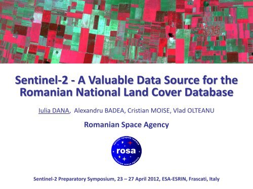
Sentinel-2 - A Valuable Data Source for the Romanian National ...
Sentinel-2 - A Valuable Data Source for the Romanian National ...
Sentinel-2 - A Valuable Data Source for the Romanian National ...

Create successful ePaper yourself
Turn your PDF publications into a flip-book with our unique Google optimized e-Paper software.
<strong>Sentinel</strong>-2 - A <strong>Valuable</strong> <strong>Data</strong> <strong>Source</strong> <strong>for</strong> <strong>the</strong><br />
<strong>Romanian</strong> <strong>National</strong> Land Cover <strong>Data</strong>base<br />
Iulia DANA, Alexandru BADEA, Cristian MOISE, Vlad OLTEANU<br />
<strong>Romanian</strong> Space Agency<br />
<strong>Sentinel</strong>-2 Preparatory Symposium, 23 – 27 April 2012, ESA-ESRIN, Frascati, Italy
GMES - Global Monitoring <strong>for</strong> Environment and Security<br />
Land Marine Atmosphere<br />
Climate change Emergency Security
(Past and) Current projects using Earth Observation data<br />
Land monitoring<br />
Land cover<br />
LCCS (Land Cover Classification System)<br />
CLC (Corine Land Cover)<br />
MUTER (Applications and Services <strong>for</strong> Land Use Monitoring Using Geospatial<br />
<strong>Data</strong> and Technologies)<br />
Agriculture<br />
MARS (Monitoring of Agriculture with Remote Sensing)<br />
IACS-LPIS and CwRS (Integrated Administration and Control System - Land Parcel<br />
Identification System in Romania and Control with Remote Sensing)<br />
SIAT (Integrated System of Early Warning, Monitoring and Drought Risk Analysis)<br />
METAGRO (Assessment of <strong>the</strong> Balance of Metals in <strong>Romanian</strong> Agro-systems )<br />
SIRIUS (Sustainable Irrigation Water Management and River-basin Governance)
(Past and) Current projects using Earth Observation data<br />
Land monitoring<br />
Environment<br />
IMAGIS (Complex system <strong>for</strong> <strong>the</strong> application of <strong>the</strong> RS techniques <strong>for</strong><br />
environmental quality monitoring and <strong>Romanian</strong> ICZM implementation support )<br />
GEOLAND2 (Supporting <strong>the</strong> Monitoring, Protection and Sustainable<br />
Management of our Environment)<br />
Emergency response<br />
RISCASAT (Development of New Satellite-Derived Products Adapted to Users'<br />
Requirements <strong>for</strong> Hydro-Meteorological Risk Management)<br />
SIGUR (Satellite Based Emergency Response Services)<br />
SAFER (GMES Emergency Response service) – Point of Contact<br />
UN-SPIDER RSO (United Nations Plat<strong>for</strong>m <strong>for</strong> Space-based In<strong>for</strong>mation <strong>for</strong><br />
Disaster Management and Emergency Response – Regional Support Office)
LCCS – Land Cover Classification System – in Romania<br />
LCCS 2000 – Landsat ETM LCCS 2003 - Landsat TM LCCS 2007 – SPOT 5 HRG<br />
"Land Cover / Land Use Inventory<br />
by Remote Sensing <strong>for</strong> <strong>the</strong> Agricultural<br />
Re<strong>for</strong>m" – UN-FAO ↓<br />
compatible with Corine Land Cover<br />
"Hybrid Method <strong>for</strong> Thematic Update of <strong>the</strong> Land<br />
Use Inventory by Remote Sensing / GIS Technology,<br />
Support <strong>for</strong> <strong>the</strong> Implementation of <strong>the</strong> European<br />
Agriculture and Environment Programmes" - PNCDI
Objectives:<br />
LCCS – Land Cover Classification System – in Romania<br />
production of land cover maps <strong>for</strong> <strong>the</strong> entire country (total mapped area: 238,380 sq.<br />
km), as well as detailed land use/land cover maps <strong>for</strong> a few areas of particular interest<br />
production of a comprehensive database included also in<strong>for</strong>mation on soil types and<br />
land degradation (erosion)<br />
Input data:<br />
Products:<br />
Results:<br />
Landsat ETM+ (2000), Landsat TM (2003) - update, SPOT HRG (2006-2007) - update<br />
additional data: topographical maps, <strong>the</strong>matic maps, in-situ data, HR and VHR data<br />
730 maps (map scale 1 : 50,000) – based on Landsat data<br />
provided <strong>the</strong> Ministry of Agriculture with an objective and accurate database<br />
streng<strong>the</strong>ned <strong>the</strong> capacity of <strong>the</strong> national remote sensing experts on land cover/land<br />
use mapping by satellite remote sensing and GIS technologies<br />
Credits: LCCS07 project (ROSA, ICPA, IGAR, INCDIF-ISPIF, GEOSYSTEMS ROMANIA, TRADSYM)
LCCS – Land Cover Classification System – in Romania<br />
Mosaic of Landsat ETM+ images acquired in 2000
LCCS – Land Cover Classification System – in Romania<br />
Dynamics of <strong>the</strong> landscape
LCCS – Land Cover Classification System – in Romania<br />
Dynamics of <strong>the</strong> landscape
LCCS – Land Cover Classification System – in Romania<br />
Dynamics of <strong>the</strong> landscape
LCCS – Land Cover Classification System – in Romania<br />
Dynamics of <strong>the</strong> landscape: 1990-2000<br />
Land cover is (according to FAO):<br />
one of <strong>the</strong> most important elements <strong>for</strong> description and study of <strong>the</strong> environment<br />
<strong>the</strong> easiest detectable indicator of human interventions on <strong>the</strong> land<br />
a critical parameter <strong>for</strong> environmental databases<br />
changing quickly over time<br />
<strong>the</strong> basic geographic feature that environmental applications can use as reference
LCCS – Land Cover Classification System – in Romania<br />
Examples of LCCS maps (1)
LCCS – Land Cover Classification System – in Romania<br />
Examples of LCCS maps (2)
LCCS – Land Cover Classification System – in Romania<br />
Examples of LCCS maps (3)
LCCS – Land Cover Classification System – in Romania<br />
Statistics based on <strong>the</strong> three LCCS datasets (development of ma<strong>the</strong>matical models <strong>for</strong> <strong>the</strong><br />
study of landscape dynamics) – test area: Valea Lovistei<br />
DATASET LCCS 2000 LCCS 2003 LCCS 2007<br />
Count: 13730 polygons 15268 polygons 37973 polygons<br />
Minimum: > 0,01 sq km > 0,01 sq km > 0,01 sq km<br />
Maximum: 3520.7 sq km 3173,9 sq km 5369.6 sq km<br />
Sum: 41906.9 sq km 41906.9 sq km 41906.9 sq km<br />
Mean: 3 sq km 2,7 sq km 1.1 sq km<br />
Number of classes 52 49 56<br />
Credits: LCCS07 project (ROSA, ICPA, IGAR, INCDIF-ISPIF, GEOSYSTEMS ROMANIA, TRADSYM)
Land monitoring: SIAT<br />
Objective: building an Integrated System of Early Warning, Monitoring and Drought Risk<br />
Analysis <strong>for</strong> Romania.<br />
Results: fine scale (calibrated and validated) regional climate model, algorithms <strong>for</strong> HR and<br />
VHR data processing, numeric simulation products (last 30 years), data post-processing <strong>for</strong><br />
impact model validation, numeric simulation products (next 60 years), feedback simulations<br />
<strong>for</strong> impact models on climate change, <strong>for</strong>ecasts (precipitation and temperature) 32 days in<br />
advance (with a frequency of 12 hours). Simulations were per<strong>for</strong>med <strong>for</strong> 2007 (one of <strong>the</strong><br />
most droughty years on <strong>the</strong> past 50 years) and 2008.<br />
Validation: satellite data, meteorological and climate data, in-situ measurements.<br />
Input data: AVHRR (NOAA), MODIS (TERRA), MERIS (ENVISAT), SPOT VEGETATION.<br />
Products based on MERIS data: LAI, fCover, fAPAR (Fraction of active photosyn<strong>the</strong>tic<br />
absorbed radiation) and on AATSR data: surface albedo, net radiation, land surface<br />
temperature, evaporative fraction, actual evaporation on daily base.<br />
Credits: SIAT project (ROSA, METEO, INCDIF-ISPIF, GEOSYSTEMS ROMANIA, USAMV)
Land monitoring: SIAT
Test area Ocnele Mari<br />
Drought index (light tones: dry areas)<br />
Input data: Landsat ETM+, July 2007<br />
Land monitoring: SIAT<br />
© Google Earth<br />
Credits: Doctoral <strong>the</strong>sis : "Vegetation Monitoring Using Multi-temporal Radar and Optical Satellite Imagery in <strong>the</strong> Context of Land Degradation<br />
in Ocnele Mari", Violeta Domnica Poenaru (ROSA)
Land monitoring: METAGRO<br />
Investigated methods: principal component analysis, analysis based on <strong>the</strong> normalized<br />
differential vegetation index (NDVI), multi-temporal analysis of <strong>the</strong> spectral signature in <strong>the</strong><br />
near infrared band toge<strong>the</strong>r with histogram interactive stretching <strong>for</strong> image enhancement,<br />
unsupervised classification, and spectral band arithmetic like subtraction and/or rationing.<br />
Ground truth data: 50 samples were collected in <strong>the</strong> field in order to determine <strong>the</strong><br />
concentration of lead, zinc, cadmium, and copper.<br />
Pilot case study: Copsa Mica (industrial town that represented <strong>for</strong> many years one of <strong>the</strong><br />
most polluted regions in Europe. Air, water, soil and vegetation were highly contaminated<br />
with heavy metals such as lead, cadmium, zinc and copper. In <strong>the</strong> last two years, <strong>the</strong><br />
polluting factories stopped <strong>the</strong>ir activity, leading to decreasing levels of contamination).<br />
Satellite imagery: multi-temporal series of Landsat data (2007 and 2011) and SPOT.<br />
Project's web page: http://www.metagro.cesec.ro/<br />
Credits: METAGRO project (UB, ICPA, USAMV, IMNR, ROSA)
Land monitoring: METAGRO<br />
Test area Copsa Mica, Tarnava hydrographic basin (background image: Landsat ETM+)
Land monitoring: METAGRO<br />
Identification of polluted areas using Principal Component Analysis (PCA) – SPOT data<br />
Regional analysis (hydrographic basin-level)<br />
Credits: METAGRO project (UB, ICPA, USAMV, IMNR, ROSA)
Spatial distribution of field samples<br />
Local analysis: Copsa Mica<br />
Background image: Landsat ETM+<br />
Credits: METAGRO project (UB, ICPA, USAMV, IMNR, ROSA)<br />
Land monitoring: METAGRO
Land monitoring: METAGRO<br />
NDVI mean values and mean values of <strong>the</strong> spectral response in <strong>the</strong> near-infrared band<br />
computed based on <strong>the</strong> Landsat TM multi-temporal series <strong>for</strong> each Copsa Mica field sample<br />
Credits: METAGRO project (UB, ICPA, USAMV, IMNR, ROSA)
Land monitoring: METAGRO<br />
Analysis of <strong>the</strong> contamination level <strong>for</strong> Copsa Mica (darker tones indicate higher<br />
contamination level) – Landsat TM images acquired on July 2009 (up) and June 2011 (down)
Land monitoring: METAGRO<br />
The limitations of this research study are given by <strong>the</strong> spatial and spectral resolution of <strong>the</strong><br />
images that play a decisive role in obtaining accurate results. Moreover, <strong>the</strong> integration of<br />
ground truth data within <strong>the</strong> processing chain would improve <strong>the</strong> accuracy of <strong>the</strong> results.<br />
In most of <strong>the</strong> cases, <strong>the</strong> results show that <strong>the</strong> discrimination of <strong>the</strong> polluted agricultural<br />
fields (as a unique class) was very difficult, almost impossible. The spectral signature of <strong>the</strong><br />
contaminated elements should be determined in advance using auxiliary data in order to<br />
avoid confusion with <strong>the</strong> spectral response of similar classes. Also, <strong>the</strong> validation of <strong>the</strong><br />
multi-spectral analysis is mandatory to be per<strong>for</strong>med on <strong>the</strong> samples collected in <strong>the</strong> field.<br />
Future research plans involve <strong>the</strong> use of <strong>Sentinel</strong>-2 data and/or remote sensing hyper-<br />
spectral data acquired in narrower, more sensitive spectral bands that are recommended <strong>for</strong><br />
<strong>the</strong> identification and monitoring of heavy metal contamination in agricultural fields.<br />
Credits: METAGRO project (UB, ICPA, USAMV, IMNR, ROSA)
Land monitoring: SIRIUS (GMES service)<br />
SIRIUS is developing efficient water resource management services in support of food<br />
production in water-scarce environments. It addresses water governance and management<br />
in accordance with <strong>the</strong> vision of bridging and integrating sustainable development and<br />
economic competitiveness.<br />
Expected results: NDVI and LAI maps (integrating meteorological data: temperature and<br />
precipitation), maps detailing irrigation water requirements in different areas and crop water<br />
consumption estimates.<br />
Pilot case studies (that represent a sample of <strong>the</strong> wide range of conditions found in <strong>the</strong><br />
world): Spain, Italy, Romania, Turkey, Egypt, Mexico, Brazil, and India.<br />
Satellite imagery: Landsat (archived data), FORMOSAT (planned acquisitions) ← ESA's <strong>Data</strong><br />
Warehouse <strong>for</strong> GMES projects.<br />
Credits: SIRIUS FP7 project
Land monitoring: SIRIUS (GMES service)<br />
Example of NDVI plot <strong>for</strong> corn (April – October 2010)
Emergency response: RISCASAT, SIGUR, SAFER, UN-SPIDER<br />
Overview of floods in Romania: more than 1,000,000 hectares of floodplain, more than<br />
900,000 people living in areas with high risk of flooding, more than 88,000 households<br />
could be flooded at any time in average, 8 people lose <strong>the</strong>ir lives annually<br />
Siret, 2005<br />
at least 15 people have been killed<br />
more than 12,000 people have been<br />
evacuated from <strong>the</strong>ir homes<br />
Siret, Prut, 2008<br />
thousands of people were evacuated<br />
at least 4 people died<br />
Danube, 2006<br />
more than 4,700 people had to be evacuated (3,000 in Rast village)<br />
600 buildings were flooded (115 collapsed)<br />
more than 40,000 hectares covered by flooding<br />
Siret, Danube 2010<br />
numerous people were reported dead<br />
hundreds of hectares of farmland were flooded
Emergency response: RISCASAT, SIGUR, SAFER, UN-SPIDER<br />
Work flow <strong>for</strong> <strong>the</strong> generation of value-added products<br />
Satellite data<br />
Assessment of <strong>the</strong><br />
affected areas <strong>for</strong><br />
each land cover class<br />
Integration of land use /<br />
land cover in<strong>for</strong>mation<br />
(method developed by<br />
ROSA / CRUTA since 2005)<br />
Reprojection into<br />
<strong>the</strong> national grid<br />
Creation of flood<br />
<strong>the</strong>matic maps in<br />
a GIS environment<br />
Integration of GIS layers<br />
(boundaries of administrative<br />
units, places, geographical<br />
names, roads, rivers, etc.)<br />
Check of <strong>the</strong> topology rules<br />
Extraction of <strong>the</strong><br />
water mask<br />
Manually → visual<br />
photo interpretation<br />
Semi-automatically<br />
→ image classification<br />
and visual check<br />
Processing of <strong>the</strong><br />
water mask<br />
Integration of elevation<br />
data (DEMs, contour lines,<br />
geomorphological maps)<br />
Elimination of artefacts<br />
inherent to automatic<br />
image processing
Emergency response: RISCASAT, SIGUR, SAFER, UN-SPIDER<br />
Editing of <strong>the</strong> automatically derived water mask produced by <strong>the</strong> service<br />
Results: flood maps published on <strong>the</strong> website of <strong>the</strong> <strong>Romanian</strong> Space Agency in less than<br />
24 hours since <strong>the</strong> reception of satellite imagery or satellite-based products (water masks).<br />
Permanent water<br />
bodies (lakes)<br />
Local processing team<br />
Be<strong>for</strong>e editing<br />
ER product delivered by<br />
<strong>the</strong> service provider<br />
After editing
Emergency response: RISCASAT, SIGUR, SAFER, UN-SPIDER<br />
Example of flood maps (1)
Emergency response: RISCASAT, SIGUR, SAFER, UN-SPIDER<br />
Example of flood maps (2)
Emergency response: RISCASAT, SIGUR, SAFER, UN-SPIDER<br />
Example of flood maps (3)
Emergency response: RISCASAT, SIGUR, SAFER, UN-SPIDER<br />
Satellite remote sensing data and its derived products (space-based maps) are essential<br />
components in <strong>the</strong> management of emergency situations.<br />
The integration of ancillary data improves <strong>the</strong> quality and content of <strong>the</strong> disaster crisis<br />
maps offering <strong>the</strong> guarantee of <strong>the</strong> in situ collected basic in<strong>for</strong>mation.<br />
The water mask derived by automatic means should be checked. For example, <strong>the</strong><br />
geometric effects (especially shadow) of <strong>the</strong> radar images may be misinterpreted as<br />
flooded areas. The knowledge of <strong>the</strong> studied area is vital.<br />
The generated products are more accurate if 3D in<strong>for</strong>mation (DEMs, contour lines,<br />
geomorphological maps) is integrated in <strong>the</strong> processing chain, <strong>for</strong> mask editing. Also,<br />
accurate and updated land use/land cover databases are important <strong>for</strong> <strong>the</strong> assessment of<br />
<strong>the</strong> flooded areas.<br />
From <strong>the</strong> user's point of view:<br />
satellite data should be received as fast as possible<br />
both temporal and spatial resolution are critical, but (at least) in <strong>the</strong> first phases of<br />
<strong>the</strong> crisis situation temporal resolution is more important than spatial resolution
Land monitoring<br />
Future projects using Earth Observation data<br />
Agriculture<br />
FARMSTAR (Integrated Precision Farming Advisory System <strong>for</strong> Irrigated<br />
Perimeters based on Geospatial Technologies)<br />
objectives: use of satellite observations <strong>for</strong> crop monitoring and sustainable<br />
irrigation water management and farming solutions<br />
EO data: optical data (Landsat, SPOT, FORMOSAT, <strong>Sentinel</strong>-2)<br />
advantages on using <strong>Sentinel</strong>-2 data (compared with Landsat and SPOT): larger<br />
number of spectral bands (13: visible, near infrared, short wave infrared),<br />
improved atmospheric corrections, shorter revisiting time (2 ÷ 3 / 5 days),<br />
wider ground swath (290 km), adequate spatial resolution (10/20 m)<br />
expected outcome: application development to build <strong>the</strong> foundation <strong>for</strong> a<br />
Precision Agriculture Service (as a GMES downstream project)<br />
funding within <strong>National</strong> Plan <strong>for</strong> Research, Development and Innovation
Future projects using Earth Observation data<br />
Emergency response<br />
GEODIM (Plat<strong>for</strong>m <strong>for</strong> GeoIn<strong>for</strong>mation in Support of Disaster Management)<br />
objectives: development of a downstream emergency response service <strong>for</strong><br />
contributing to current disaster and risk management approach based on EO<br />
data; identification and adaptation of <strong>the</strong> existing processing flow charts <strong>for</strong><br />
each disaster type; development of new algorithms <strong>for</strong> an improved accuracy<br />
of <strong>the</strong> generated value-added products<br />
EO data: optical and radar satellite imagery (including <strong>Sentinel</strong>-1/2)<br />
advantages on using <strong>Sentinel</strong>-2 data: shorter revisiting time, optimal spatial<br />
resolution <strong>for</strong> damage assessment, wider ground swath<br />
expected outcome: <strong>the</strong> GMES downstream service will enable better future<br />
solutions on environment and security policy by providing decision makers<br />
with better, more complete, consistent, timely and reliable in<strong>for</strong>mation<br />
funding within <strong>National</strong> Plan <strong>for</strong> Research, Development and Innovation
Projects to support advanced analysis and fusion<br />
of Earth Observation data <strong>for</strong> GMES applications<br />
GeoINF (Prototype <strong>for</strong> an interactive<br />
system <strong>for</strong> finding geospatial<br />
in<strong>for</strong>mation) - is aimed to support<br />
research in <strong>the</strong> EO field by developing a<br />
prototype <strong>for</strong> an interactive geo-<br />
in<strong>for</strong>mation retrieval system. Basically,<br />
it is an interactive map, that may serve<br />
<strong>the</strong> particular needs of its users.<br />
Objectives: developing a search engine<br />
<strong>for</strong> data obtained from satellite images<br />
and maps and building a web portal<br />
that would ease <strong>the</strong> citizens’ access to<br />
in<strong>for</strong>mation from several sources.<br />
GeoINF<br />
© ASRC
Projects to support advanced analysis and fusion<br />
of Earth Observation data <strong>for</strong> GMES applications<br />
RoKEO (<strong>Romanian</strong> Knowledge-Centered Earth Observation) - ESA KEO system that would<br />
fully integrate in <strong>the</strong> ESA SSE. ROKEO also aims at upgrading <strong>the</strong> existing infrastructure with<br />
new algorithms, processors, and web services. New functionalities: it will create an EO<br />
reference data set <strong>for</strong> Romania; it will elaborate new algorithms that would provide EO<br />
images extraction; it will develop new methods to enrich EO images with o<strong>the</strong>r exogenous<br />
data, aiming at a new generation of KIM (ESA PECS project).<br />
RoKEO<br />
© ASRC
Projects to support advanced analysis and fusion<br />
of Earth Observation data <strong>for</strong> GMES applications<br />
New methods <strong>for</strong> image understanding:<br />
semantic classes extraction based on <strong>the</strong> spatial relationships between objects<br />
short time Fourier Trans<strong>for</strong>m based image descriptors<br />
automatic annotation of targets in satellite data using high-level semantic concepts<br />
"Progress in Spatial Analysis and Fusion of Remote Sensing Satellite <strong>Data</strong> <strong>for</strong> Generating<br />
High-Level Semantic Geo-in<strong>for</strong>mation in Support of GMES Applications" – Anca Popescu (1) ,<br />
Corina Vaduva (1) , Dragos Bratasanu (2) , Ion Nedelcu (2) , Mihai Datcu (3)<br />
(1) - University Politehnica Bucharest<br />
(2) - <strong>Romanian</strong> Space Agency<br />
(3) - German Aerospace Centre<br />
"Interactive Spectral Band Discovery <strong>for</strong> Exploratory Visual Analysis of Satellite Images" –<br />
Dragos Bratasanu (1) , Ion Nedelcu (1) , Mihai Datcu (2) , IEEE Journal of Selected Topics in<br />
Applied Earth Observations and Remote Sensing<br />
(1) - <strong>Romanian</strong> Space Agency<br />
(2) - German Aerospace Centre
Image modeling <strong>for</strong> in<strong>for</strong>mation mining<br />
Semantic classes extraction based on <strong>the</strong> spatial relationships between objects:<br />
pixel-level representations: labels <strong>for</strong> individual pixels computed in terms of spectral, texture, geometry<br />
and segmentation cluster features<br />
region-level representations: land cover labels <strong>for</strong> groups of pixels obtained through object segmentation<br />
patch-level representations: interactions of different regions computed in terms of <strong>the</strong>ir spatial relations<br />
Spectral reasoning Spatial reasoning<br />
Pixel-level labels Region-level labels<br />
Patch-level labels<br />
Credits: RoKEO & GeoINF (UPB, ROSA, DLR): "Progress in Spatial Analysis and Fusion of Remote Sensing Satellite <strong>Data</strong> <strong>for</strong> Generating High-<br />
Level Semantic Geo-in<strong>for</strong>mation in Support of GMES Applications", Anca Popescu, Corina Vaduva, Dragos Bratasanu, Ion Nedelcu, Mihai Datcu
Image modeling <strong>for</strong> in<strong>for</strong>mation mining: spatial relationships<br />
Landsat 7 ETM+<br />
CORINE LAND COVER<br />
Credits: RoKEO & GeoINF (UPB, ROSA, DLR): "Progress in Spatial Analysis and Fusion of Remote Sensing Satellite <strong>Data</strong> <strong>for</strong> Generating High-<br />
Level Semantic Geo-in<strong>for</strong>mation in Support of GMES Applications", Anca Popescu, Corina Vaduva, Dragos Bratasanu, Ion Nedelcu, Mihai Datcu
Image modeling <strong>for</strong> in<strong>for</strong>mation mining: spatial relationships<br />
Credits: RoKEO & GeoINF (UPB, ROSA, DLR): "Progress in Spatial Analysis and Fusion of Remote Sensing Satellite <strong>Data</strong> <strong>for</strong> Generating High-<br />
Level Semantic Geo-in<strong>for</strong>mation in Support of GMES Applications", Anca Popescu, Corina Vaduva, Dragos Bratasanu, Ion Nedelcu, Mihai Datcu
Multiple sensors - multiple applications capabilities<br />
IKONOS LANDSAT<br />
QUICKBIRD SPOT<br />
TERRASAR-X GEOEYE<br />
Credits: RoKEO & GeoINF (UPB, ROSA, DLR): "Progress in Spatial Analysis and Fusion of Remote Sensing Satellite <strong>Data</strong> <strong>for</strong> Generating High-<br />
Level Semantic Geo-in<strong>for</strong>mation in Support of GMES Applications", Anca Popescu, Corina Vaduva, Dragos Bratasanu, Ion Nedelcu, Mihai Datcu
Future potential <strong>Sentinel</strong>-2 data use:<br />
Conclusions<br />
land monitoring applications and services (land cover, agriculture, <strong>for</strong>estry)<br />
emergency response applications and services (GMES downstream service)<br />
synergy with o<strong>the</strong>r types of EO data (<strong>for</strong> example: SAR)<br />
validation of results using in-situ measurements<br />
Benefits in using <strong>Sentinel</strong>-2 data <strong>for</strong> <strong>the</strong> <strong>for</strong>eseen applications/services:<br />
enhanced continuity of Landsat and SPOT type data<br />
larger number of spectral bands (improved results on atmospheric correction)<br />
optimal spatial resolution and swath width, shorter revisiting time<br />
Requirements <strong>for</strong> <strong>Sentinel</strong>-2 data:<br />
easy and free access to data, fast delivery of requested (ordered) data<br />
Advanced analysis of Earth Observation data <strong>for</strong> GMES applications:<br />
new patch-based analysis method is very suitable <strong>for</strong> <strong>the</strong> rapid mapping needs of GMES<br />
extraction of semantic rules successfully serves automated cartography methods
Thank you very much <strong>for</strong> your attention!