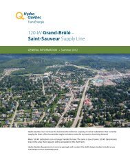
General Information bulletin – Spring-summer 2011 - Hydro-Québec
General Information bulletin – Spring-summer 2011 - Hydro-Québec
General Information bulletin – Spring-summer 2011 - Hydro-Québec

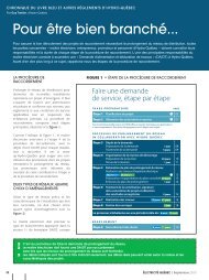
Create successful ePaper yourself
Turn your PDF publications into a flip-book with our unique Google optimized e-Paper software.
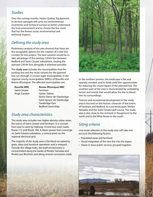
Studies<br />
Over the coming months, <strong>Hydro</strong>-<strong>Québec</strong> Équipement<br />
et services partagés will carry out environmental<br />
inventories and technical surveys to better understand<br />
the host environment and to choose the line route<br />
that has the fewest social, environmental and<br />
technical impacts.<br />
Defining the study area<br />
Preliminary analysis of the area showed that there are<br />
few acceptable options for the creation of a new line<br />
corridor for this project. The best solution would be to<br />
take advantage of the existing 120-kV line between<br />
Bedford and Saint-Césaire substations, routing the<br />
planned 230-kV line alongside it wherever possible.<br />
The study area includes the municipalities that the<br />
existing line and the route variants for the planned<br />
line run through. It crosses eight municipalities in the<br />
regional county municipalities (MRCs) of Rouville and<br />
Brome-Missisquoi. The affected municipalities are:<br />
Rouville mRC Brome-missisquoi mRC<br />
Saint-Césaire Farnham<br />
Ange-Gardien Sainte-Sabine<br />
Notre-Dame-de-Stanbridge<br />
Saint-Ignace-de-Stanbridge<br />
Stanbridge East<br />
Bedford (township)<br />
Study area characteristics<br />
The study area includes two higher-density urban areas,<br />
the towns of Saint-Césaire and Farnham. It is crossed<br />
from east to west by Highway 10 and two main roads,<br />
Route 112 and Route 104. A dozen power lines converge<br />
on Saint-Césaire substation, a central point on the<br />
regional electrical grid.<br />
The majority of the study area is farmland occupied by<br />
grain, dairy and livestock operations and a vineyard.<br />
Outside the village hubs, the built environment is<br />
concentrated along the banks of Rivière Yamaska and<br />
Rivière aux Brochets and along several concession roads.<br />
In the northern portion, the landscape is flat and<br />
sparsely wooded, and its fields yield few opportunities<br />
for reducing the visual impact of the planned line. The<br />
southern part of the area is characterized by undulating<br />
terrain and woods that would allow the line to blend<br />
into its surroundings.<br />
Tourism and recreational development in the study<br />
area is focused on the historic character of the towns<br />
of Farnham and Bedford, its rural landscapes, Rivière<br />
Yamaska and the Saint-Césaire golf course. The study<br />
area is also close to the orchards in Rougemont to the<br />
north and to the Wine Route to the south.<br />
Siting criteria<br />
Line route selection in the study area will take into<br />
account the following factors:<br />
• Populated areas and farmland<br />
• Visual integration of the new line into the region<br />
• Desire to have public services grouped together