7 - Tom Green County Government
7 - Tom Green County Government
7 - Tom Green County Government

You also want an ePaper? Increase the reach of your titles
YUMPU automatically turns print PDFs into web optimized ePapers that Google loves.
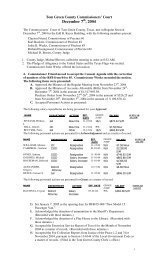
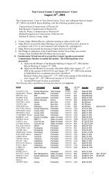
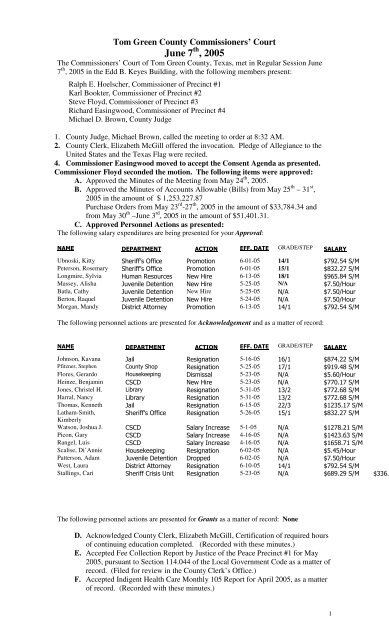
<strong>Tom</strong> <strong>Green</strong> <strong>County</strong> Commissioners’ Court<br />
June 7 th , 2005<br />
The Commissioners’ Court of <strong>Tom</strong> <strong>Green</strong> <strong>County</strong>, Texas, met in Regular Session June<br />
7 th , 2005 in the Edd B. Keyes Building, with the following members present:<br />
Ralph E. Hoelscher, Commissioner of Precinct #1<br />
Karl Bookter, Commissioner of Precinct #2<br />
Steve Floyd, Commissioner of Precinct #3<br />
Richard Easingwood, Commissioner of Precinct #4<br />
Michael D. Brown, <strong>County</strong> Judge<br />
1. <strong>County</strong> Judge, Michael Brown, called the meeting to order at 8:32 AM.<br />
2. <strong>County</strong> Clerk, Elizabeth McGill offered the invocation. Pledge of Allegiance to the<br />
United States and the Texas Flag were recited.<br />
4. Commissioner Easingwood moved to accept the Consent Agenda as presented.<br />
Commissioner Floyd seconded the motion. The following items were approved:<br />
A. Approved the Minutes of the Meeting from May 24 th , 2005.<br />
B. Approved the Minutes of Accounts Allowable (Bills) from May 25 th – 31 st ,<br />
2005 in the amount of $ 1,253,227.87<br />
Purchase Orders from May 23 rd -27 th , 2005 in the amount of $33,784.34 and<br />
from May 30 th –June 3 rd , 2005 in the amount of $51,401.31.<br />
C. Approved Personnel Actions as presented:<br />
The following salary expenditures are being presented for your Approval:<br />
GRADE/STEP<br />
Ubnoski, Kitty 6-01-05 14/1<br />
Peterson, Rosemary 6-01-05 15/1<br />
Longmire, Sylvia ! 6-13-05 18/1 "<br />
Massey, Alisha #$ %& ! 5-25-05 N/A '<br />
Batla, Cathy #$ %& New Hire 5-25-05 ( '<br />
Berton, Raquel #$ %& ! 5-24-05 ( '<br />
Morgan, Mandy & ( ) 6-13-05 * *<br />
The following personnel actions are presented for Acknowledgement and as a matter of record:<br />
GRADE/STEP<br />
Johnson, Kavana # % + 5-16-05 *"*<br />
Pfitzner, Stephen , ) - + 5-25-05 * * *<br />
Flores, Gerardo . - + & % 5-23-05 ( "'<br />
Heinze, Benjamin , ,& ! 5-23-05 ( '*<br />
Jones, Christel H. /0 ) + 5-31-05 * "<br />
Harral, Nancy /0 ) + 5-31-05 * "<br />
Thomas, Kenneth # % + 6-15-05 * *<br />
Latham-Smith,<br />
+ 5-26-05 * *<br />
Kimberly<br />
Watson, Joshua J. , ,& %)1 5-1-05 ( * *<br />
Picon, Gary , ,& %)1 4-16-05 ( * "<br />
Rangel, Luis , ,& %)1 4-16-05 ( *" *<br />
Scalise, Di’Annie . - + + 6-02-05 (<br />
Patterson, Adam #$ %& & --2 6-02-05 ( '<br />
West, Laura & ( ) + 6-10-05 * *<br />
Stallings, Cari , 3 + 5-23-05 ( " "<br />
The following personnel actions are presented for Grants as a matter of record: None<br />
D. Acknowledged <strong>County</strong> Clerk, Elizabeth McGill, Certification of required hours<br />
of continuing education completed. (Recorded with these minutes.)<br />
E. Accepted Fee Collection Report by Justice of the Peace Precinct #1 for May<br />
2005, pursuant to Section 114.044 of the Local <strong>Government</strong> Code as a matter of<br />
record. (Filed for review in the <strong>County</strong> Clerk’s Office.)<br />
F. Accepted Indigent Health Care Monthly 105 Report for April 2005, as a matter<br />
of record. (Recorded with these minutes.)<br />
1
G. Approved request of Assistant <strong>County</strong> Attorney, Daniel Edwards, to attend the<br />
National Institute on the Prosecution of Domestic Violence to be held in Las<br />
Vegas, Nevada July 12-15, 2005.<br />
H. Accepted sale of city tax foreclosure property being Lot 12 and 12-A, Block 23,<br />
Forest Park Addition, Suit # TAX89-0082-B to Juan J. and Rosa M. Carrillo in<br />
the amount of $6,550.00.<br />
I. Accepted Annual Road Report by each Precinct Commissioner pursuant to<br />
Transportation Code, Section 251.005, as a matter of record. (Recorded with<br />
these minutes.)<br />
J. Approved Amendment to Cooperative Agreement between Texas Office of the<br />
Attorney General and <strong>Tom</strong> <strong>Green</strong> <strong>County</strong> for State Case Registry and Local<br />
Customer Service. (Recorded with these minutes.)<br />
All voted in favor of the motion.<br />
5. Commissioner Bookter moved to accept Lot 1, Jarratt Road Subdivision with<br />
an optional minimum of 5.52 acres or maximum 6.75 acres with a plat<br />
reference added to the minutes at the time of filing. Commissioner Floyd<br />
seconded the motion and all voted in favor. (Recorded with these Minutes.)<br />
5a. No action was taken regarding issues relating to the clean up and assistance<br />
requested by local property owners from the recent storm damage. Commissioner<br />
Bookter informed the Court that his Road and Bridge Crew were assessing the<br />
damage and would be making a recommendation on how to proceed with<br />
assistance.<br />
6. Terry Reeves, Director of the Roy K. Robb Post Adjudication Juvenile Facility,<br />
presented his monthly report to the Court. There were 2 successful graduations<br />
last week and a new resident was accepted this week, maintaining a total of 12<br />
residents with 20 staff members. Comal <strong>County</strong> and Midland <strong>County</strong> will<br />
possibly be sending some residents to the facility. No action was taken.<br />
7. Judge Brown moved to “deny” the request to waive penalty and interest<br />
payment for TGCAD Account # 55-64125-0236-000-00 due to the reasons<br />
stated are not grounds that can be considered. Commissioner Floyd<br />
seconded the motion and all voted in favor.<br />
8. No action taken at this time regarding the Hemphill Wells Building as a possible<br />
Library location. Commissioner Bookter explained a brief history of the<br />
expansion project. Discussion for the project has been ongoing since 1999 with<br />
projected cost increasing steadily.<br />
9. Commissioner Easingwood moved to approve the closing of the north part of<br />
Pugh Park in Christoval on Sunday July 3 rd , 2005 for the annual fire works<br />
display organized by the Christoval Chamber of Commerce. Commissioner<br />
Floyd seconded the motion and all voted in favor.<br />
10. Commissioner Easingwood moved to approve providing green or black paint<br />
(color to be selected by Commissioner Easingwood) for the light poles at the<br />
Library and the cost of other beautification projects for <strong>County</strong> areas<br />
associated with the “Day of Caring” on Saturday July 30 th , as part of the<br />
United Way of the Concho Valley’s Kickoff. Commissioner Floyd seconded<br />
the motion and all voted in favor.<br />
11. Commissioner Hoelscher moved to accept the Report identifying <strong>County</strong><br />
Maintained Roads as a matter of record with the modification that <strong>Green</strong><br />
Road is a paved road in Precinct #2. Judge Brown seconded the motion.<br />
Judge Brown, Commissioners Hoelscher, Bookter and Floyd voted in favor<br />
of the motion. Commissioner Easingwood voted in opposition to the motion.<br />
The motion passed 4 to 1.<br />
12. There was a discussion on cost, various locations that would be the most cost<br />
effective, and mileage to access the facility regarding a new parks/sign building.<br />
Judge Brown appointed Commissioners Hoelscher and Bookter to explore<br />
2
the options and make a recommendation to the Court regarding the Park<br />
Building. No other action was taken.<br />
13. Commissioner Easingwood moved to enter into an Interlocal Agreement for<br />
cooperation between <strong>Tom</strong> <strong>Green</strong> <strong>County</strong> and the City of San Angelo, allowing<br />
<strong>Tom</strong> <strong>Green</strong> <strong>County</strong> Employees covered by the county’s health plan to use the<br />
Employee’s Clinic operated by the City of San Angelo. Commissioner<br />
Easingwood rescinded his motion so it could be addressed at the Joint session<br />
of the City Council and <strong>County</strong> Commissioners.<br />
14. Judge Brown moved to adopt a resolution to apply for TCDP Colonia Fund<br />
assistance and designate the <strong>County</strong> Judge as the authorized representative<br />
in all matters pertaining to the application, including execution of related<br />
service provider agreements with Millersview-Doole Water Supply<br />
Corporation as the Service Provider. Commissioner Floyd seconded the<br />
motion and all voted in favor. (Recorded with these Minutes).<br />
15. Judge Brown moved that the recommendation of the Space Allocation<br />
Committee’s to move the mailroom to the Courthouse basement be approved<br />
to make that space available for the Security Officers and that the other two<br />
recommendations regarding the Auditor and <strong>County</strong> Attorney’s Domestic<br />
Violence Unit be discussed during the Budget Hearings because of the<br />
associated cost. Commissioner Easingwood seconded the motion and all<br />
voted in favor.<br />
16. The only issues discussed relating to the <strong>Tom</strong> <strong>Green</strong> <strong>County</strong> Subdivision<br />
and Manufactured Home Rental Community Development Regulations was the<br />
intent of the City Council regarding maintenance of roads within the ETJ. No<br />
action was taken.<br />
17. Line item transfers were postponed for the afternoon session.<br />
18. Future Agenda Items Discussed:<br />
1. Consider report from committee regarding the jail.<br />
2. Consider request for waiver on 15 acres in Block 279 Mason Perry<br />
Subdivision.<br />
19. Announcements:<br />
1. The next regular Commissioners’ Court meeting will be Tuesday June<br />
14 th , 2005.<br />
2. Budget Sessions will begin June 8 th , 2005.<br />
3. City/<strong>County</strong> Auction to be held June 25 th , 2005.<br />
20. Judge Brown recessed the meeting at 10:32 AM.<br />
21. Judge Brown reconvened the meeting at 1:40 PM at the San Angelo<br />
Convention Center with all Court members present. The Commissioners’<br />
Court and the San Angelo City Council are in a Joint Session for<br />
consideration of some Interlocal agreement areas of consideration<br />
1. No action taken on Joint <strong>County</strong>-City insurance proposal.<br />
2. Craig Kinney presented a power point presentation of possibilities of<br />
the projected designs and usage for the Hemphill-Wells Building.<br />
Presenters and speakers spoke in favor of the proposed library location<br />
and the potential for raising the funding. Parking and accessibility to<br />
the building was discussed. Rod Brigman of the Downtown<br />
Association, expressed support from the Downtown group.<br />
Recommendations were made to consider further exploration of the<br />
discussion on possible solutions to utilizing the Hemphill-Wells<br />
Building until mid September. Judge Brown expressed concern over<br />
the time frame of the Library expansion with discussions and fund<br />
raisers started in 1999 with projected cost of $800,000.00 and the<br />
proposed Keyes Building renovation is now at $2,000,000.00. The<br />
3
projected cost of the Hemphill Wells Building would be approximately<br />
$8,000,000.00 to $10,000,000.00. Mayor Lown recessed the<br />
meeting for a short break at 3:00 PM. Mayor Lown and Judge<br />
Brown reconvened the joint session at 3:21 PM.<br />
Judge Brown moved to authorize the extension of the feasibility<br />
study until the beginning of fiscal year 2006 which will begin<br />
October 1, 2005. Commissioner Easingwood seconded the motion.<br />
Discussion and Comments:<br />
Commissioner Bookter expressed skepticism because of the length of<br />
time and the history of completion.<br />
Commissioner Hoelscher notated that there seemed to be more interest<br />
in donations to the Hemphill Wells Building than to the Keyes<br />
Building. He suggested the possibility of creating an endowment fund<br />
that could be used for maintenance.<br />
Commissioner Floyd commented that there seemed to be more<br />
enthusiasm toward the Hemphill Wells Building and would like to<br />
explore the possibilities.<br />
Commissioner Easingwood expressed his concerns that the<br />
maintenance cost could create too great a burden on the taxpayers<br />
because it would be adding another building to maintain.<br />
The motion passed unanimously by the Court.<br />
3. Judge Brown moved to enter into an Interlocal Agreement<br />
for cooperation between <strong>Tom</strong> <strong>Green</strong> <strong>County</strong> and the City of San<br />
Angelo, allowing <strong>Tom</strong> <strong>Green</strong> <strong>County</strong> Employees covered by the<br />
county’s health plan to use the Employee’s Clinic operated by the<br />
City of San Angelo. Judge Brown also moved to authorize a line item<br />
transfer as follows:<br />
Fund: General Fund<br />
Budget Budget<br />
Department Account Increase Decrease<br />
009 Non-Departmental 0202 Health Benefits 40,000.00<br />
192 Contingency 0601 Reserves 40,000.00<br />
Commissioner Easingwood seconded the motion and all voted in favor.<br />
Commissioner Floyd expressed the Courts thanks to Mark Barta of the City and Archie<br />
Kounce, RISK Manager at the <strong>County</strong>, for working together on the details of this<br />
Interlocal agreement that will enable savings for both entities.<br />
4. There was no Action taken regarding any other issues of common interest<br />
to San Angelo and <strong>Tom</strong> <strong>Green</strong> <strong>County</strong> at this time.<br />
22. Judge Brown adjourned the Commissioners’ Court at 3:35 PM.<br />
As per HB 2931, Section 4:<br />
I, Elizabeth McGill, <strong>County</strong> Clerk of <strong>Tom</strong> <strong>Green</strong> <strong>County</strong>, Texas do hereby attest<br />
that this is an accurate accounting of the proceedings of the Commissioners’ Court<br />
Meeting that met in Regular Session on June 7 th , 2005.<br />
I hereby set my hand and seal to this record June 14 th , 2005.<br />
__________________________________<br />
Elizabeth McGill, <strong>County</strong> Clerk and<br />
Ex-officio Clerk of the Commissioners’ Court<br />
4
Mr. Micheal Brown, <strong>County</strong> Judge<br />
<strong>Tom</strong> <strong>Green</strong> <strong>County</strong><br />
112 W. Beauregard<br />
San Angelo, Tx 76903<br />
The City of<br />
San Angelo, Texas<br />
P.o. Box 1751 • Zip 76902<br />
May 18,2005<br />
RE: Sale of Tax Foreclosure Property(s) - Lot 12 and 12-A, Block 23, Forest Park<br />
Addition, Suit No.: TAX89-0082-B.<br />
Dear Sirs:<br />
The above referenced property{s) was auctioned in a Sheriff's Sale in March, 2005 with<br />
no offers received. Subsequently, the property(s) was struck off to the City ofSan<br />
Angelo as Trustee for itself and the other taxing entities.<br />
The Forest Park Property is vacant lots. Lot size is 50' x 140' and is located at 2301<br />
Forest Park Street.<br />
The City has received an offer from Juan J. and Rosa M. Carrillo in the amount of<br />
$ 6,550.00 for purchase ofthis property.<br />
The City Council has approved the sale ofthe property(s). This matter is now being<br />
forwarded to you for your approval on your next agenda. Attached is each Resolution for<br />
your signature. Please forward a copy ofthe signed Resolutions.<br />
Listed below is a breakdown ofthe amounts owed.<br />
Lot 12 and 12-A. Block 23, Forest Park Addition<br />
Taxes $ 7,536.00<br />
District Clerk 136.00<br />
Sheriff Fees 100.00<br />
Attorney Fees 314.00<br />
Lien 9.00<br />
City Admin 350.00<br />
$ 8,445.00<br />
VOl. 81 PG. 489
If you have any questions or require additional infonnation, feel free to contact me at<br />
(915)657-4212.<br />
Sincerely,<br />
Sheila Carver<br />
Property Management Tech<br />
City ofSan Angelo<br />
VDL 8i PG. 490
TOM GREEN COUNTY ANNUAL ROAD REPORT 2005<br />
TXDOT# NAME Pet. Bogin at: Ends at: 32AU..WEA 51 BIT. 10 NAT ...,... SURF. CONOtTION Rebuilt& Paved<br />
AA 1309 PHINNEY ROAD 1 LIPAN CREEK RD BLEDSOE RD 1.000 20' GOOD<br />
AA 2100 RAINEY ROAD US 67 North CATTLE GUARD 0.581 20' GOOD<br />
AA 5026 RAY ROAD aka NORTH RAY ROAD 1 FM 1929 CONCHO CO. LINE on CR 1884 0.335 1.100 20' GOOD<br />
AA 2610 REBECCA TRAIL 1 DALE LN ROBERT 0.190 20' GOOD<br />
AA 5084 RIVERWOOD DRIVE 1 FM 388 DEAD END 1.300 30' GOOD<br />
ROAD'G' 1 MULLINS CROSSING ROAD CALICHE PIT 0.600 GOOD<br />
AA 2103 ROBERT DRIVE DUSTIN LN REBECCATR 0.286 20' GOOD<br />
AA 5087? ROCKWOOD ROAD RIVERWOOD RD BLACKWOOD 0.800 30' GOOD f"'<br />
0')<br />
AA 2135 RUMSEY LOOP TENNYSON RD FM 1692 1.534 20' GOOD<br />
-d'I<br />
AA 2604 SAGE HEN CIRCLE 1 SYKES CR (ALGERITA ACRES) CULDESAC 0.011 20' GOOD<br />
c::;p<br />
AA 2603 SAGEBRUSH CIRCLE 1 SYKES CR (ALGERITA ACRES) CULDESAC 0.010 20' GOOD a..<br />
AA 2138 SAMANTHA ROAD 1 DUCKWORTH DEAD END 0.246 20' GQOD<br />
?"4<br />
AA 2116 SCHNEIDER ROAD 1 FM 1929 PVTRD 1.163 20' GOOD QO<br />
AA 2132 SIERRA TRAIL 1 US 271 PVTRD 1.664 20' GOOD Part in 1997<br />
AA 2107 SMITH ROAD 1 DOUGLAS LOOP MULLlNSRD 0.935 18' GOOD<br />
AA 2608 SOCHA LOOP CITY FARM RD SURFACE 1.528 GOOD<br />
AA2608 SOCHA LOOP 1 SURFACE CITY FARM RD 0.089 20' GOOD<br />
AA 2613 STEADMAN ROAD 1 CHANDLER RD DEAD END/PVT RD 0.121 20' GOOD 814/1991<br />
AA 2112 SWITZER ROAD ARRRD ARR. RD 2.439 20' GOOD<br />
AA 2607 SYKES CIRCLE HOHMANN RD HOHMANNRD 0.839 20' GOOD<br />
AA 2133 TENNYSON ROAD 1 COKE CO LINE FM 1692 0.600 5.322 20' GOOD<br />
AA2104 THOMPSON ROAD HWY 67 N across ATaS Dead End 0.521 20' GOOD 2118/1999<br />
ASD-Annual Road Report per 2"'· "j Trans. Code.ex 4 61612005<br />
) ,)<br />
--'<br />
c::;J<br />
;;:;.
TOM GREEN COUNIY ANNUAL ROAD REPORT 2005<br />
TXDOT# NAME Pel Begin at: Endaa!: 32ALLWEA. 11 BIT. 10 NAT R-
') ) ')<br />
TOM GREEN COUNIY ANNUAL ROAD REPORT 2005<br />
TXOOT# NAME Pel. Begln.l: Ends at: 3ZAllWEA. 51 BIT. 10 NAT R.o.w SURF. CONOmON Rebuilt& Paved<br />
AA 2002 OLSAK ROAD 2 FM765 FM 388 1.987 20' GOOD Dec-93<br />
AA 2050 OLSAK ROADS 2 OLSAK RD FM 366 0.751 20' GOOD Dec-93<br />
AA2703 OXLEY ROAD 2 ROBERTSRD HWY67 0.968 20' GOOD Jul-69<br />
AA 2007 PENNY LANE 2 HAWK RD FM2334 3.052 21' GOOD<br />
AA 1309<br />
AA 1709<br />
AA 1303<br />
AA 1312<br />
AA 1618<br />
AA 1617<br />
PETITE LANE 2 HAWK AVE. GATES - DEAD END 0.267 20' GOOD Jul-96<br />
PHINNEY ROAD<br />
PLAIN VIEW DRIVE<br />
POWELL LANE<br />
POWELL LANE<br />
RATLIFF ROAD -SOUTH<br />
RATLIFF ROAD - WEST<br />
2<br />
2<br />
2<br />
2<br />
2<br />
2<br />
FM765<br />
WILDE RD<br />
ROBERTS RD<br />
ENGLERTRD<br />
W. RATLIFF RD<br />
US 277<br />
LIPAN CREEK ROAD<br />
WILDE RD<br />
ENGLERTRD<br />
FM765<br />
<strong>County</strong> Club Rd<br />
S. RATLIFF RD<br />
AA 1105 REECE ROAD 2 Gate 1Dead End US 277 1.162 20' GOOD Jan-65<br />
AA 1207 RIPPLE ROAD 2 US 67 HOLIK RD 5.046 20' GOOD<br />
AA 1202 ROBBIE JONES ROAD 2 US67 CALICHE Rd. 5.232 20' GOOD Jul-98<br />
AA 1202 ROBBIE JONES ROAD 2 end of PAVED GATE 0.706 24' GOOD<br />
AA 1301 ROBERTS ROAD 2 DEAD END PAVED OXLEY ROAD 0.342 24' GOOD<br />
AA 1301 ROBERTS ROAD 2 CALICHE OXLEY ROAD US87 3.960 20' GOOD OCT 1991 (2 MI.)<br />
AA 1629 SANDERS ROAD 2 CONCHO CO. POWELLLN 2.187 24' GOOD<br />
AA1311 SCHREIVER ROAD 2 FM 765 CALICHE 0.448 20' GOOD Apr-90<br />
AA 1311 SCHREIVER ROAD 2 CALICHE ENGLERT RD 0.553 24' GOOD<br />
ASO-Annual Road Report per 251.005 Trans. Code.ex 9 6/6/2005<br />
3.000<br />
0.842<br />
1.951<br />
1.006<br />
1.726<br />
1.096<br />
20'<br />
20'<br />
20'<br />
20'<br />
20'<br />
20'<br />
GOOD<br />
GOOD<br />
GOOD<br />
GOOD<br />
GOOD<br />
GOOD<br />
Nov-65<br />
Sep-69<br />
Sep-91<br />
Jul-69<br />
TOM GREEN COUNIY ANNUAL ROAD REPORT 2005<br />
nDOT' NAIIE Pcl. BegIn at: Ends at: 32 AU. II'OEA. • , liT. IDNAT R.o-W SURF . CQNDtTKlN Rebuilt& Paved<br />
AA 2427 GALVESTON STREET 3 S 87 FRONTRD 8THST 0.135 20' GOOD<br />
AA2545 GARDENIA AVENUE 3 VIOLET TULIP ST 0.496 20' GOOD<br />
AA2543 GLADIOLA AVENUE 3 VIOLET TULiPST 0.481 20' GOOD<br />
AA2592 GLASGOW ROAD 3 EDINBURGH RD FM2288 0.073 20' GOOD<br />
AA2442 GLASS ROAD 3 US87N W GRAPE CREEK 1.535 20' GOOD<br />
AA2442<br />
AA2566<br />
AA 2219<br />
AA2446<br />
AA2440<br />
AA2514<br />
AA 2316<br />
GLASS ROAD<br />
GOODLAND LOOP<br />
GRAPE CREEK CEMETERY RD<br />
GRAPE CREEK ROAD<br />
GRAPE CREEK ROAD, NORTH<br />
GRAPE CREEK ROAD, WEST<br />
GRAPEVINE ROAD<br />
GRASTON ROAD<br />
3<br />
3<br />
3<br />
3<br />
3<br />
3<br />
3<br />
3<br />
W. GRAPE CREEK<br />
GRAPE CRK RD<br />
GRAPE CREEK N<br />
WALNUT GROVE RD<br />
GRAPECRKRD<br />
CEMETERY<br />
S. A. City Limits US 87 BY BALD EAGLE CREEK<br />
U S 87 N OVERPASS MARCH ROAD<br />
ANGELO STREET IN CARLSBAD GRAPE CRK RD, NORTH<br />
CONCORD LOOP WRENRD<br />
OLD STER. HWY PVTRD<br />
AA2553 HACKBERRY LANE 3 CONCHO DR MONT PARK DR 0.192 20' GOOD<br />
AA2305 HALL LANE 3 FM2034 SURFACE 1.509 20' GOOD<br />
AA2305 HALL LANE 3 SURFACE PVTRD 1.502 20' GOOD<br />
AA2325 HANSON STREET 3 SPRING AVE PVTRD 0.112 20' GOOD<br />
AA2510 HARVEST DRIVE 3 OATLAND DR WHEATLAND DR 0.359 24' GOOD<br />
AA2420 HOUSTON STREET 3 DEAD END US 87 FRONTAGE 0.472 20' GOOD<br />
AA2563 INDIAN CREEK ROAD 3 WALNUT GROVE DEAD END 0.571 20' GOOD<br />
ASD-Annual Road Report per 251.005 Trans. Code.ex 17<br />
) ) )<br />
2.550<br />
0.848<br />
0.190<br />
4.989<br />
4.497<br />
5.300<br />
0.276<br />
1.290<br />
20'<br />
20'<br />
12'<br />
20'<br />
26'<br />
20'<br />
20'<br />
20'<br />
GOOD<br />
GOOD<br />
GOOD<br />
GOOD<br />
GOOD<br />
GOOD<br />
GOOD<br />
GOOD<br />
61612005<br />
0')<br />
,.....<br />
1.0<br />
c::i<br />
0<br />
.,....<br />
ao<br />
--'<br />
c::J<br />
=
TOM GREEN COUNIY ANNUAL ROAD REPORT 2005<br />
TXOOTtI NAIiIE P
') ) )<br />
TOM GREEN COUNIY ANNUAL ROAD REPORT 2005<br />
TXDOT# NAME Pet. Begin ill: Ends ill: UAUWEA. 51 BIT. 10 NAT R-O-W SURf. CONDITION Rebuilt& Paved<br />
1# ROADS PER peT. TOTAL PER PCT<br />
95 PCT.1 31.495 106.417 0.000 137.912<br />
237 PCT3 25.912 182.241 0.000 208.153 c.o<br />
c:'\l<br />
332 TOTAL 59.709 292.138 0.000 346.065 if)<br />
101 PCT.2 61.409 149.164 4.867215.440<br />
71 PCT.4 0.455 80.676 0.000 81.131 ......<br />
00<br />
172 TOTAL 62.565 227.360 4.937 296.571<br />
--'<br />
TOTAL # OF TGC ROADS 504 642.636 TOTAL MILES OF COUNTY ROAD c:::I<br />
::<br />
ASO-Annual Road Report per 251.005 Trans. Code.ex 24 61612005<br />
c:J<br />
0
TXOOH'<br />
M 2223<br />
M 5029<br />
M 2317<br />
M 2210<br />
M 2307<br />
M 2447<br />
CULVERT LOCATIONS<br />
CARLSBAD LOOP RD<br />
GRAPE CREEK ROAD<br />
GRAPE CREEK ROAD<br />
OLD STERLING CITY HWY<br />
POST OAK DRIVE<br />
SWAIN LANE<br />
WILD CAT DRIVE<br />
WREN ROAD<br />
Pet.<br />
3<br />
3<br />
3<br />
3<br />
3<br />
3<br />
3<br />
3<br />
CONO<br />
GOOD<br />
GOOD<br />
GOOD<br />
GOOD<br />
GOOD<br />
GOOD<br />
GOOD<br />
GOOD<br />
TOM GR£EN COUNTY<br />
CULVERTS<br />
CULVERT SIZES<br />
27' X 33' X 6'5" WITH 5 BOXES<br />
19' LX 38' W X 4'H WITH 4 40" METAL CULVERTS<br />
17' X 23' X 13'<br />
4'X45'X4'; 53'X63'Xl0'(4 BOX); 16'X51'4'; 10'X4TXT; TX4TXS'; 6'X51'XS'; 6'X46'XS'; S3'X43'X6'(4 BOX)<br />
81' X 2S' WITH 5' X 3' BOX CULVERT<br />
70' X 22'<br />
14'LX30WX3H WITH 4 - 3X3 BOXES CULVERT SIZE S'LX61'WX3'H WITH 2 CONCRETE CULVERTS<br />
28'X33'XS'S" WITH 3 BOXES<br />
ROAOBEGINS<br />
US 87 N<br />
U, S 87 OVERPASS<br />
IN WATER VALLEY<br />
GRASTON RD<br />
N, VALLEY RD<br />
OLD STER. HWY<br />
MARCH RD<br />
ROAOENDS<br />
US 87N<br />
N GRAPE CRK &W GRAPE CRK RD<br />
TXOAKRD<br />
DEAD END<br />
CONCHORD<br />
BALLARD RD<br />
F/Adm ServicesIROADS/Annual Road Report-Culverts 3<br />
) ,) )<br />
6/212005<br />
f'<br />
C\l<br />
if':)<br />
......<br />
QO<br />
--'<br />
c:::><br />
:;::...
) ') )<br />
TOM GREEN COUNTY<br />
Bridges by Precinct<br />
AA 2223 CARLSBAD LOOP ROAD 3 GOOD US 87 N US87 N<br />
GRAPE CREEK ROAD 3 GOOD<br />
AA 2220 OLD STERLING CITY HWY 3 GOOD SURFACE FM2288<br />
AA 5029 OLD STERLING CITY HWY 3 GOOD IN WATER VALLEY<br />
CONCRETE<br />
180' X 32' X 2S'<br />
44'L X 24'W X 13'H<br />
SO'X20' X 9'<br />
276' X 28' X 12'H<br />
F/Adm Services/ROADS/Annual Road Report-Bridges 6/212005<br />
oc<br />
C\t<br />
lr.)<br />
ci<br />
c....<br />
"P"""I<br />
00<br />
-'<br />
CJ<br />
::
TXDOT# CROSSINGS LOCATIONS<br />
AA 2433 BUCK HOLLOW LOOP<br />
AA 2223 CARLSBAD LOOP ROAD<br />
MARCH ROAD<br />
AA 2317 POST OAK DRIVE<br />
AA 2210 SWAIN LANE<br />
AA 2443 WALNUT GROVE ROAD<br />
WEST TURNER ROAD<br />
AA 2508 WHEATLAND DRIVE<br />
Pet.<br />
3<br />
3<br />
3<br />
3<br />
3<br />
3<br />
3<br />
3<br />
CONDo<br />
GOOD<br />
GOOD<br />
GOOD<br />
GOOD<br />
GOOD<br />
GOOD<br />
GOOD<br />
GOOD<br />
80' X 20' WITH 2 3'TINHORNES<br />
160' X 28' WITH 2 2' METAL TINHORNES<br />
98' X 20'<br />
61' X 26'<br />
70' X 22' WITH 3 30" METAL CULVERTS<br />
150' X 24' WITH 3'X24'X20" BOX CULVERT<br />
122' X 12' WITH 2 2' TIN HORNS<br />
(6) 2' METAL CULVERTS (68'LONG)<br />
TOM EiR£EN COUNTY<br />
ANNUAL ROAD<br />
CROSSINGS REPORT<br />
CROSSINGS ROAD BEGINS<br />
DEER RUN RD<br />
US87N<br />
GRASTON RD<br />
N, VALLEY RD<br />
SURFACE<br />
TURNERRD<br />
GRAPE CRK RD<br />
ROAD ENOS<br />
CALICHE<br />
US87N<br />
TXOAKRD<br />
DEAD END<br />
MARCHRD<br />
CATILEGUARD<br />
OATLANDDR<br />
61212005 4<br />
) ) )<br />
en<br />
C\P<br />
tn<br />
c:J<br />
a..<br />
-'I""'t<br />
(X)<br />
....,j<br />
c::J<br />
:::
TOM EiR£EN COUNTY<br />
CULVERTS<br />
TXDOTII CULVERT LOCATIONS PC!. CONO CULVERT SIZES ROAD BEGINS RDAOENDS<br />
AA 2706 1ST STREET, Christoval 4 GOOD 33' X 20" rd. can (1) LEWIS ST FORD ST,<br />
AA 2705 2ND STREET, Christoval 4 GOOD 55' X 24" STEEL CAN MCKEE ST. HOLLANDST<br />
AA 1513 3RD STREET, Christoval 4 GOOD 37' X 20" RD. CAN HOLLANDST FM2084<br />
AA 1510 STH STREET 4 GOOD 30' X 20" RD CAN ANSON ST Dead End - Gate<br />
AA 1508 8TH STREET 4 GOOD 24' X 30" rd. can (1) ANSON ST FORDST<br />
AA 1101 ALLEN LANE 4 GOOD 40' x 36" rd. can US277 CALICHE<br />
AA 1507 CARTER STREET 4 GOOD 30' X 24" rd. can 3RDST 5THST<br />
AA 1712 DUNCAN ROAD 4 GOOD (2) 42'XZ4" Round HWY67 GATE<br />
AA 1502 FORD STREET 4 GOOD 30'X36" rd.; 40' x 24" rd. steel can LOOP 110 FENCE<br />
FOSTER PARK 4 GOOD 125' X 1S' X 7'<br />
FOSTER PARK<br />
AA 1630 HARKEY ROAD<br />
AA 1527 HILLTOP ROAD<br />
AA 2227 HOBBS ROAD<br />
4<br />
4<br />
4<br />
4<br />
GOOD (1)20' X 36" rd. can; (3)4O"X15" concrete<br />
GOOD 200' x 30'<br />
GOOD 2- 30'X24" rd. cans<br />
GOOD 30' X 12" Oval Can<br />
FM 2084<br />
KENLEY RD/RIVER ROAD<br />
US67<br />
US67<br />
Schlicher Co.<br />
CALICHE/PAVING ENDS<br />
JAMESON ROAD<br />
FM853<br />
,LQ<br />
,cr,<br />
LO<br />
AA 2225 JAMESON ROAD 4 GOOD (2)42' X 36" rd cans US 277 FENCE/GATE<br />
AA 1519 JOHN CURRY ROAD<br />
AA 1524 KENLEY ROAD<br />
4<br />
4<br />
GOOD (2) 40' X 24" rd. cans<br />
GOOD 30' X 16" rd can<br />
HILLTOP RDIRIVER ROAD CALICHE/PAVING ENDS ci<br />
0<br />
KNICKERBOCKER RDICHANNE<br />
AA 1210 KNICKERBOCKER ROAD<br />
4<br />
4<br />
GOOD 11' X 19 CONCRETE 13' 6"<br />
GOOD Check book, there are 10 Culverts of various sizes<br />
FM 584<br />
KNICKERBOCKER RD<br />
FM 2335<br />
TWIN LAKES LN .......<br />
AA 1425 LAGOON LANE 4 GOOD 51' X 20" rd. can LP 110 end main!. rQO<br />
AA 1501 MCKEE STREET 4 GOOD (2) 32'X24"; (1) 53X32"; (1) 3O'X12" - all round cans US 277 KENLEY RD<br />
AA 1529 MINERAL WELLS ROAD<br />
AA 1413 PAISANO LANE<br />
4<br />
4<br />
GOOD (2)10'x2'concrete; (3)21'x20"concrete; (1)43'x5' rd can<br />
GOOD 30' X 20" RD CAN<br />
KNICKERBOCKER RD<br />
FM 2335<br />
main!. Ends<br />
dead end<br />
....i<br />
c:::::I<br />
:::<br />
AA 1421 PECAN LANE 4 GOOD 30' X 36" rd. can RIVERRD RIVERRD<br />
AA 1526 POND ROAD 4 GOOD 31' X 24" rd can FM 2084 FM2084<br />
AA 1408 PUGH PARK ROAD 4 GOOD 30' X 24" rd. can KINLEY & HILLTOP DEAD END AT FENCE<br />
AA 1525 RIVER ROAD 4 GOOD 30' X 12" rd Steel can FM 2335 gate<br />
AA 1418 SPRING CREEK LANE 4 GOOD (2)40' X 24" rd cans SPRING CRK LN end main!.<br />
AA 1417 SPRING VALLEY LANE 4 GOOD (2)40' X 20" rd cans fm 2335 end main!.<br />
AA 1409 TORRES ROAD 4 GOOD 33' X 12" rd can US 67 GATE<br />
AA 1540 WEST BRYANT LANE 4 GOOD 33' X 12" rd can KNICKERBOCKER RD dead end<br />
AA 1414 WHITE TAIL LANE 4 GOOD (2)30' X 20" rd cans FITZGERALD DR. end main!.<br />
AA 1536 WILMA LANE 4 GOOD (2)40' X 24" rd cans<br />
F/Adm Services/ROADS/Annual Road Report-Culverts 4<br />
) ,) )<br />
6/212005
) ) )<br />
AA 1513 3RD STREET, Christoval<br />
KNICKERBOCKER RD/CHANNEL<br />
AA 1529 MINERAL WELLS ROAD<br />
AA 1523 MOORE ROAD<br />
4<br />
4<br />
4<br />
4<br />
GOOD<br />
GOOD<br />
GOOD<br />
GOOD<br />
TOM GREEN COUNTY<br />
Bridges by Precinct<br />
HOLLAND ST<br />
US277<br />
US 277<br />
FM 2084<br />
KENLEY RD<br />
gate<br />
CONCRETE<br />
CONCRETE<br />
30' X 20' X 10'<br />
45' X 26 X 13' 6"<br />
135'x21'x32"<br />
25' X 12' X 12"<br />
F/Adm Services/ROADS/Annual Road Report-Bridges 6/2/2005<br />
to<br />
CI')<br />
U')<br />
d<br />
0<br />
,....<br />
ao<br />
--'<br />
c=)<br />
:::
) ) )<br />
TOM SKEEN COUNTY<br />
ANNUAL ROAD<br />
CROSSINGS REPORT<br />
TXDOT# CROSSINGS LOCATIONS Pet CONDo CROSSINGS ROAD BEGINS ROAD ENDS<br />
AA 1505 LEWIS STREET 4 GOOD 200' X 20' 1STRD 6TH STREET<br />
AA 1501 MCKEE STREET 4 GOOD (2) 150' x 20' LP 110 end maint<br />
AA 1416 NORTHCROSS LANE 4 GOOD (2)100' x 20' DOVE CRK LN W. SPRING CRK LN<br />
AA 1413 PAISANO LANE 4 GOOD (2)1 SO' X 20' KNICKERBOCKER RD maint. Ends<br />
AA 1421 PECAN LANE 4 GOOD 1SO' X 20' FM2335 dead end<br />
AA 1526 POND ROAD 4 GOOD 1S0' X 20'; 200' X 20' RIVERRD RIVER RD<br />
AA 1406 PUGH PARK ROAD 4 GOOD 100'X20'; (2)SO'X20'; 150'X20' FM 2084 FM 2084<br />
AA 1525 RIVER ROAD 4 GOOD (3)1OO'X20' KINLEY & HILLTOP DEAD END AT FENCE<br />
AA 1520 RUDDSTREET 4 GOOD 150' x 24' FM 2084 LOOP 110<br />
AA 1418 SPRING CREEK LANE 4 GOOD (3)1oo'X20'; 2S0' X 20'(eans) FM 2335 gate<br />
AA 1409 TORRES ROAD 4 GOOD (2)150' X 20' fm 2335 end maint<br />
AA 1426 TWIN LAKES LANE 4 GOOD (S)1S0'X20'; (3)200'X20'; (1)2S0'X2Q' LAGOON LANE end main!.<br />
AA 1414 WHITE TAIL LANE 4 GOOD (3)150' X 20' KNICKERBOCKER RD dead end<br />
61212005 6<br />
QO<br />
CQ<br />
If:)<br />
......<br />
00
--------------------------------"'--<br />
STATE OF TEXAS §<br />
§<br />
COUNTY OF TRAVIS §<br />
1. PURPOSE<br />
Amendment One<br />
Cooperative Agreement<br />
Between<br />
The Office Of The Attorney General<br />
Of The State Of Texas<br />
and<br />
<strong>Tom</strong> <strong>Green</strong> <strong>County</strong>, Texas<br />
Contract No. 04·COl64<br />
The Office of the Attorney General of Texas ("OAG") and <strong>Tom</strong> <strong>Green</strong> <strong>County</strong> Texas, ("<strong>County</strong>")<br />
do hereby agree to amend their original Agreement, as executed initially effective September 1,<br />
2003 in order to: extend the contract period for State Case Registry and Local Customer Service<br />
through August 31,2006 ; conform the Contract to reflect that after TXCSES STRADUS integration<br />
OAG will no longer utilize ICD 021 and all updates to OAG Systems (unless agreed to otherwise<br />
by the OAG Contract Manager) must be by direct data entry; to change the time period for providing<br />
new order information; and to clarify the entry of State Case Registry data elements.<br />
2. AMENDMENT TO EXTEND THE CONTRACT PERIOD FOR LOCAL CUSTOMER<br />
SERVICE AND STATE CASE REGISTRY<br />
Effective on the date of the later signature hereto, Section 2 of the Contract is amended to change<br />
the date of termination to August 31, 2006.<br />
3. AMENDMENT TO CONFORM THE CONTRACT TO REFLECT THAT AFTER<br />
TXCSES STRADUS INTEGRATION OAG WILL NO LONGER UTILIZE ICD 021 AND<br />
ALL UPDATES TO OAG SYSTEMS (UNLESS AGREED TO OTHERWISE BY THE<br />
OAG CONTRACT MANAGER) MUST BE BY DIRECT DATA ENTRY<br />
3.1. Effective on the date that data related to Registry Only Cases in the Texas State<br />
Disbursement Unit vendor's database is received and accepted by the OAG so that TXCSES<br />
may then process the Registry Only Cases (currently projected to be February 6, 2006) Sections<br />
4.1.1.3.2 and 5.1.1.3.2 are deleted.<br />
Extension Amendment 0511 3/05 Page 1 of 3<br />
VOL. 81 PG. 539
3.2. Effective on the date that data related to Registry Only Cases in the Texas State<br />
Disbursement Unit vendor's database is received and accepted by the OAG so that TXCSES<br />
may then process the Registry Only Cases (currently projected to be February 6, 2006) Section<br />
4.1.1.5 of the Contract is revised to read as follows (additions are in italics; deletions are in<br />
strikethrough):<br />
Whether the <strong>County</strong> retains Shoald the Coanty not desiJe to letain their legacy case<br />
management system or if data synchronization with the OAG Systems is not feasible the<br />
<strong>County</strong> shall enter all case/member information directly onto the designated OAG<br />
System. unless agreed to otherwise in writing by the OAG Contract manager.<br />
3.3. Effective on the date that data related to Registry Only Cases in the Texas State<br />
Disbursement Unit vendor's database is received and accepted by the OAG so that TXCSES<br />
may then process the Registry Only Cases (currently projected to be February 6, 2006) Section<br />
5.1.1.5 of the Contract is revised to read as follows (additions are in italics; deletions are in<br />
strikethrough):<br />
Whether the <strong>County</strong> retains Should the <strong>County</strong> not desire to letain their legacy case<br />
management system or if data synchronization with the OAG Systems is not feasible the<br />
<strong>County</strong> shall enter all case/member information directly onto the designated OAG<br />
System, unless agreed to otherwise in writing by the OAG Contract Manager.<br />
3.4. Effective on the date of the later signature hereto, Section 4.2.2.1 is revised to read as<br />
follows (deletions are in strikethrough):<br />
OAG shall monitor <strong>County</strong> STRADUS Local Customer Service activities (direct data<br />
entry or electronic file) and summarize for monthly reimbursement amounts.<br />
3.5. Effective on the date of the later signature hereto, Section 4.2.3.1, Second Sentence is<br />
amended by replacing the acronym "STRADUS" with the words "OAG Systems".<br />
3.6. Effective on the date that data related to Registry Only Cases in the Texas State<br />
Disbursement Unit vendor's database is received and accepted by the OAG so that TXCSES<br />
may then process the Registry Only Cases (currently projected to be February 6,2006) Section<br />
5.2.8 of the Contract is revised to read as follows (additions are in italics; deletions are in<br />
strikethrough) :<br />
<strong>County</strong> shall provide new and updated order information via eiectIonic file in ICD021<br />
fonllat {10i1l the county automated system Ot pet{oun the by data entry directly onto OAG<br />
Systems, unless agreed to otherwise in writing by the OAG Contract Manager.....",,"<br />
3.7. Effective on the date that data related to Registry Only Cases in the Texas State<br />
Disbursement Unit vendor's database is received and accepted by the OAG so that TXCSES<br />
may then process the Registry Only Cases (currently projected to be February 6,2006) Section<br />
5.2.9 is deleted.<br />
Extension Amendment 05113/05 Page 2 of 3<br />
VOL 81 PG. Q40
) ROADS MAINTAINEL ) TOM GREEN COUNTY<br />
TXDOTtI ROAD NAME PCT. ROAD BEGINS AT: ROAD ENDS AT:<br />
32 ALl<br />
WEATHER 51 BITUMIN 10 NAT R'()"w SURF. PAVED REBUILT MAINTENANCE INFORMATION<br />
AA 2448 DILLY ROAD 3 WREN RD US87N 1.087 20' <strong>County</strong> Maintained<br />
AA 2438 DOE RUN ROAD 3 DEER VAL DR TURNERRD 0.785 20' Accepted for Main!. 1211011984<br />
AA 1100 DOOR KEY ROAD 2 Rd End US2n 14.438 24' <strong>County</strong> Maintained<br />
AA 2519 DOSS LANE 3 GRAPE CRK RD PVTRD 0.355 20' <strong>County</strong> Maintained<br />
AA 2106 DOUGLAS LOOP US 67 N US 67 N 5.300 20' 41BI99 ·PART <strong>County</strong> Maintained<br />
AA 1427 DOVE CREEK LANE EAST 4 TWIN LAKES LN TWIN LAKES LN 1.868 48' 20' Jun·92 <strong>County</strong> Maintained<br />
AA 1419<br />
AA 1424<br />
DOVE CREEK LANE WEST<br />
DOVE CREEK ROAD SOUTH<br />
AA 2136 DUCKWORTH ROAD<br />
AA 1103 DUFF ROAD<br />
AA 1712 DUNCAN ROAD<br />
AA 2400 DUNHAM ROAD<br />
AA2102 DUSTIN LANE<br />
4<br />
4<br />
4<br />
4<br />
3<br />
SPRING CRK LN<br />
fm 2335<br />
US 67 N<br />
US2n<br />
HWY67<br />
US87N<br />
HOFFMAN RD<br />
fm 2335<br />
locked gate<br />
DEAD END<br />
1 ST CATILE GUARD<br />
GATE<br />
PVTRD<br />
ROBERT<br />
1.929<br />
0.967<br />
1.434<br />
5.000<br />
2.226<br />
0.136<br />
0.452<br />
50'<br />
50'<br />
67'<br />
40'<br />
20'<br />
20'<br />
20'<br />
20'<br />
20'<br />
20'<br />
20'<br />
May·B9<br />
SeJ)-B?<br />
Dec·SB<br />
Mar·9?<br />
)<br />
<strong>County</strong> Maintained<br />
<strong>County</strong> Maintained<br />
<strong>County</strong> Maintained<br />
<strong>County</strong> Maintained<br />
<strong>County</strong> Maintained<br />
<strong>County</strong> Maintained<br />
<strong>County</strong> Maintained<br />
AA 2452 EAGLE LANE 3 MTNEBO RD CARIBOUTR 0.243 20' Accepted for Main!. 4121180<br />
AA 2313 EARNEST AVENUE 3 WILDCAT DR MAIN ST 0.153 20' <strong>County</strong> Maintained<br />
AA 1531 EAST BRYANT LANE 4 S. US 67 S. BRYANT CIR 0.329 50' 20' <strong>County</strong> Maintained<br />
AA 2591 EDINBURGH ROAD 3 DEAD END DEAD END 1.601 20' Accepted 12·17·90 with stipulalions<br />
EMERGENCY EXIT OFF TURNER 3 W TURNERRD LOCKED GATE 0.996 18' <strong>County</strong> Maintained<br />
EMMIT LANE 3 GLASS ROAD CULDISAC 0.400 24' NEW SUBDIVISION Accepted for Main!. 91811999<br />
AA2019 ENGLERT ROAD 2 WHITFIELD RD PAVED 3.378 24' <strong>County</strong> Maintained<br />
ADMIN. SERVICES/ROADS/RMBTGC05 9 6f712005<br />
-CI<br />
il.Q<br />
m<br />
ci<br />
0<br />
....-4<br />
QO<br />
-'<br />
c::::!<br />
=
ROADS MAINTAINED BY TOM GREEN COUNTY<br />
32 ALL<br />
TXDOT. ROAD NAME PCT. ROAD BEGINS AT: ROAD ENDS AT: WEATHER 51 BITUMIN 10 NAT R.ooW SURF. PAVED REBUILT MAINTENANCE INFORMATION<br />
AA 2019 ENGLERT ROAD 2 CALICHE POWELL AVE 0.591 20' <strong>County</strong> Maintained<br />
AA 2511 EVERGREEN LANE 3 GRAPECRKRD PVTRD 0.572 20' <strong>County</strong> Maintained<br />
AA 1706 FAIRVIEW ROAD 2 GASPLANTRD LooP378 0.515 20' Sep-85 <strong>County</strong> Maintained<br />
AA 1701 FAIRVIEW SCHOOL ROAD 2 SCHWARTZRD FAIRVIEW SCHOOL RD 2.115 20' Sep-95 <strong>County</strong> Maintained<br />
AA 1703 FAIRVIEW SCHOOL ROAD 2 GASPLANTRD US Loop 306 3.257 20' Sep-85 <strong>County</strong> Maintained<br />
AA 2455<br />
AA 2439<br />
AA1537<br />
FALCON LANE<br />
FAWN DRIVE<br />
FITZGERALD DR.<br />
3<br />
3<br />
4<br />
DEAD END<br />
DOERUN RD<br />
WEST BRYANT LANE<br />
N. GRAPE CRK RD<br />
DEAD END<br />
DEAD END<br />
0.489<br />
1.001<br />
0.614 50'<br />
20'<br />
20'<br />
20'<br />
Accepted for Main!. 412]180<br />
Accepted for Main!. 12/] 0/1984<br />
<strong>County</strong> Maintained<br />
AA 2624 FIVEASH ROAD 2 PHINNEY RD CONCHO CO. 1.186 24' <strong>County</strong> Maintained ci<br />
c.....<br />
AA 2441<br />
AA 2306<br />
AA 1502<br />
AA 1810<br />
FLOYD LANE<br />
FM 2034<br />
FORD STREET<br />
FORT MCAVITI ROAD<br />
3<br />
3<br />
4<br />
2<br />
US87 N<br />
STATE MA. END<br />
LOOP 110<br />
Concho CO.<br />
PVTRD<br />
STERLING CO. LN<br />
FENCE<br />
PAVED<br />
0.794<br />
0.781<br />
0.655<br />
8.494<br />
20'<br />
20'<br />
20'<br />
24'<br />
'04-6.494 mi; 2 mi Aug, 2004;<br />
<strong>County</strong> Maintained<br />
<strong>County</strong> Maintained<br />
<strong>County</strong> Maintained<br />
<strong>County</strong> Maintained<br />
AA 1810 FORT MCAVITI ROAD 2 CALICHE US 87 5.746 22' 311/1996 3 mi <strong>County</strong> Maintained<br />
AA 2414 FORT WORTH STREET 3 PVTRD US87 N FRONT 0.700 20' <strong>County</strong> Maintained<br />
FOSTER PARK LOOP 4 FM 2335 FM 2335 0.513 20' Mar-85 <strong>County</strong> Maintained<br />
AA 1411 FRANCO LANE 4 FM 2335 TORRESRD 0.880 40' 24' 2002 <strong>County</strong> Maintained<br />
AA 2507 FRONT STREET 3 GRAPE CRK RD DEAD END 0.181 20' <strong>County</strong> Maintained<br />
AA 2574 FRUITLAND FARM ROAD 3 FM 2105 S. A City Limits 0.759 22' <strong>County</strong> Maintained<br />
AA 2122 FUCHS ROAD FM 1692 SURFACE 1.433 20' <strong>County</strong> Maintained<br />
ADMIN. SERVICESIROADS/RMBTGC05 10<br />
) ) )<br />
61712005<br />
c:"r.)<br />
Uj<br />
l1.)<br />
.......<br />
QO<br />
--'<br />
c::><br />
::0
TXDOTJII ROAD NAME PCT. ROAD BEGINS AT: ROAD ENDS AT:<br />
ROADS MAINTAINED BY TOM GREEN COUNTY<br />
32 ALL<br />
WEATHER 51 BITUMIN 10 NAT R.o-W SURF. PAVED REBUILT MAINTENANCE INFORMATION<br />
AA2316 GRASTON ROAD 3 OLD STER. HWY PVTRD 1.290 20' <strong>County</strong> Maintained<br />
AA 5035 GRAY RD 2 FM 765 GESCH RD 1.033 24' <strong>County</strong> Maintained<br />
AA 1209<br />
GREEN ROAD<br />
AA 1633 GUINN RD<br />
2<br />
4<br />
DEAD END<br />
FM 2335<br />
WALLING PECAN RD<br />
IRION COUNTY LINE<br />
1.650<br />
7.734 70'<br />
24'<br />
20'<br />
p·" .. d<br />
MAR 2000 - 2.3 mi.<br />
<strong>County</strong> Maintained<br />
<strong>County</strong> Maintained<br />
AA 2553 HACKBERRY LANE 3 CONCHO DR MONT PARK DR 0.192 20' <strong>County</strong> Maintained<br />
AA 2305<br />
AA 2305<br />
AA 2325<br />
AA 1630<br />
AA2139<br />
AA 1631<br />
AA 251 0<br />
AA2117<br />
HALL LANE<br />
HALL LANE<br />
HANSON STREET<br />
HARKEY ROAD<br />
HARRIETT ROAD<br />
HARRIS LANE 4<br />
HARVEST DRIVE<br />
HAVLAK ROAD<br />
3<br />
3<br />
3<br />
4<br />
FM2034<br />
SURFACE<br />
SPRING AVE<br />
FM 2084<br />
US 67 N<br />
FM 2084<br />
3 OATLANDDR<br />
FM 1929<br />
SURFACE<br />
PVTRD<br />
PVTRD<br />
Schlicher Co.<br />
FM 1692<br />
Schlicher Co.<br />
WHEATLAND DR<br />
1.502<br />
0.112<br />
locked gate 0.883<br />
1.509<br />
0.726 50'<br />
2.731<br />
0.656 50'<br />
20'<br />
20'<br />
20'<br />
20' Aug-01<br />
24'<br />
0.359 24'<br />
20' Aug·01<br />
20'<br />
<strong>County</strong> Maintained<br />
<strong>County</strong> Maintained<br />
<strong>County</strong> Maintained<br />
<strong>County</strong> Maintained<br />
<strong>County</strong> Maintained<br />
<strong>County</strong> Maintained<br />
<strong>County</strong> Maintained<br />
<strong>County</strong> Maintained<br />
AA lBll HAWK AVENUE 2 FM388 HOLlKRD 10.216 20' <strong>County</strong> Maintained<br />
AA SlOB HEAD OF THE RIVER ROAD 4 US 277 CATTLEGUARDIGATE 0.700 45' 20' Dec-9B <strong>County</strong> Maintained<br />
AA 1422 HECKAMAN ROAD 4 fm 2335 1ST gate 0.218 60' 24' <strong>County</strong> Maintained<br />
AA2129 HEINZE ROAD RUNNELS CO. KLATTENHOFF 2.044 20' 5/9/2000 <strong>County</strong> Maintained<br />
AA 2113 HELWIG ROAD FM 1692 FM 380 4.800 20' <strong>County</strong> Maintained<br />
AA 1527 HILLTOP ROAD 4 KENLEY RDlRIVER ROAD DEAD END AT FENCE 1.101 30' 20' 7/1/1967, .236 paved October 2 <strong>County</strong> Maintained<br />
AA2605 HILLVIEW CIRCLE SYKESCR DEAD END 0.134 20' <strong>County</strong> Maintained<br />
ADMIN. SERVICES/ROADS/RMBTGC05 12 6f712005<br />
,) ) )<br />
m<br />
il.)<br />
It:)<br />
c.!:i<br />
0<br />
.,.-4<br />
00<br />
-'<br />
c:><br />
=
') ')<br />
ROADS MAINTAINEL ) TOM GREEN COUNTY<br />
32 ALl<br />
TXDOT. ROAD NAME PCT. ROAD BEGINS AT: ROAD ENDS AT: WEATHER 51 BITUMIN 10 NAT R.()-W SURF. PAVED REBUILT MAINTENANCE INFORMATION<br />
AA 2227 HOBBS ROAD 4 US 67 JAMESON ROAD 0.805 75' 20' May-95 <strong>County</strong> Maintained<br />
AA 2010 HOELSCHER ROAO 2 JARRETTRD FM765 0.708 20' Jul-89 <strong>County</strong> Maintained<br />
AA2101 HOFFMAN ROAD RAINEYRD DUSTIN LN 0.534 20' <strong>County</strong> Maintained<br />
AA 2003 HOHMANN ROAD FM388 FM 380 1.625 20' <strong>County</strong> Maintained<br />
AA1208 HOLIK ROAD 2 CROOKRD FM 1223 3.255 20' <strong>County</strong> Maintained<br />
AA 2143 HOLIMAN LANE FM380 PVTRD 0.591 12' <strong>County</strong> Maintained<br />
AA2127 HOLLAND ROAD TENNYSON RD KLA TTENHOFF 1.036 18' <strong>County</strong> Maintained<br />
AA 1503 HOLLAND STREET 4 DENNYST LP 110 0.480 20' <strong>County</strong> Maintained c:.o<br />
AA2600 HOMESTEAD CIRCLE FM388 LOOP 308 0.600 20' <strong>County</strong> Maintained If:><br />
1.0<br />
AA 5090 HOOPER LANE RUMSEY LOOP GATE 0.641 20' <strong>County</strong> Maintained<br />
AA 2420 HOUSTON STREET 3 DEAD END US 87 FRONTAGE 0.472 20' <strong>County</strong> Maintained<br />
AA 2120 HUDSON ROAD RR FUCH 2.272 18' <strong>County</strong> Maintained ,.....<br />
00<br />
AA 2120 HUDSON ROAD 1 US 67 RR 0.288 18' <strong>County</strong> Maintained<br />
AA 2563 INDIAN CREEK ROAD 3 WALNUT GROVE DEAD END 0.571 20' <strong>County</strong> Maintained<br />
INDIAN CREEK WEST AKA-W.<br />
INDIAN CREEK RD 3 WALNUT GROVE GLASS RD 0.800 24' NEW SUBDIVISION 10110/2000<br />
AA2584 IRVINDALE ROAD 3 CACTUS LN DEAD ENDIPVT RD 0.105 18' <strong>County</strong> Maintained<br />
AA 1506 JACKSON STREET 4 5TH ST (CHRISTOVAL) 8THST 0.206 20' <strong>County</strong> Maintained<br />
AA 2225 JAMESON ROAD 4 US67 FM853 4.782 45' 20' May·95 <strong>County</strong> Maintained<br />
AA 2008 JARRETT ROAD 2 FM2334 FM765 4.156 20' Jul-89 <strong>County</strong> Maintained<br />
ADMIN. SERVICES/ROADS/RMBTGC05 13 61712005
TXDOTtI ROAD NAME PCT. ROAD BEGINS AT: ROAD ENDS AT:<br />
ROADS MAINTAINED BY TOM GREEN COUNTY<br />
32ALL<br />
WEATHER 51 BITUMIN 10 NAT R.Q-W SURF. PAVED REBUILT MAINTENANCE INFORMATION<br />
AA 1519 JOHN CURRY ROAD 4 US 277 FENCE/GATE 1.148 50' 20' Aug-95 10/17/1988<br />
AA 5039 JOINER DRIVE 2 TYLER TERRACE LAURA DRIVE 0.252 20' <strong>County</strong> Mainlained<br />
JONES ROAD 2 US HWY 87 ROBERTS ROAD 1.000 20' Apr-96 <strong>County</strong> Mainlained<br />
AA 1420 JUNIPER LANE 4 DOVE CRK LN W. locked gate 0.184 45' 20' Jun-92 <strong>County</strong> Mainlained<br />
AA2123 KEISLING ROAD FUCHS FM 1692 1.015 20' <strong>County</strong> Mainlained<br />
AA 2114 KELLERMEIER ROAD HELWIG FM 1692 0.248 20' <strong>County</strong> Maintained<br />
AA 2114<br />
AA 1524<br />
AA 1524<br />
AA 2501<br />
AA 2593<br />
AA 2126<br />
AA 1210<br />
AA 1628<br />
KELLERMEIER ROAD<br />
KENLEY ROAD<br />
KENLEY ROAD<br />
KILDEE TRAIL<br />
KILT ROAD<br />
KLATTENHOFF ROAD<br />
KNICKERBOCKER ROAD<br />
KOTRLA ROAD<br />
4<br />
4<br />
3<br />
HELWIG<br />
HILL TOP RD/RIVER ROAD<br />
CALICHE/PAVING ENDS<br />
GRAPE CRK RD<br />
3 LOCH NESS RD<br />
4<br />
2<br />
FM 1692<br />
FM 584<br />
POWELL LN<br />
FM 1692<br />
CALICHE/PAVING ENDS<br />
CA TTLEGUARD/GATE<br />
POSSUM HOLLOW<br />
TARTAN RD<br />
TENNYSON RD<br />
FM 2335<br />
0.780<br />
0.455<br />
Concho Co. 1.706<br />
0.785<br />
0.505<br />
0.278<br />
6.055<br />
10.003<br />
0.096<br />
60' 20'<br />
24'<br />
20'<br />
20'<br />
20'<br />
90' 21'<br />
May-89<br />
24'Cal. May-90<br />
<strong>County</strong> Mainlained<br />
<strong>County</strong> Mainlained<br />
<strong>County</strong> Mainlained<br />
Accepled for Main!. 4121/80<br />
Accepled 12-17-90 willi stipulations<br />
<strong>County</strong> Mainlained<br />
<strong>County</strong> Mainlained<br />
<strong>County</strong> Mainlalned<br />
AA 2137 KRISTINA ROAD DUCKWORTH DEAD END 0.439 20' <strong>County</strong> Mainlained<br />
AA 5018 KRUPALA ROAD 2 DEBUS RD LOOP 306 1.556 20' Mar-93 <strong>County</strong> Mainlained<br />
AA 1425 LAGOON LANE 4 KNICKERBOCKER RD TWIN LAKES LN 0.863 50' 20' <strong>County</strong> Mainlained<br />
AA 2211 LANDERS ROAD 3 SWAIN LANE DEAD END 1.549 20' <strong>County</strong> Mainlained<br />
AA 2532 LARKSPUR AVENUE 3 CANNAST VERBENAST 0.351 20' <strong>County</strong> Mainlained<br />
AA 5041 LAURA DRIVE 2 JOINER DR FM 388 0.326 20' <strong>County</strong> Mainlained<br />
ADMIN. SERVICES/ROADS/RMBTGC05 14 6nt2005<br />
) )<br />
"<br />
l'l1j<br />
l1j<br />
) ROADS MAINTAINEL, ), TOM GREEN COUNTY<br />
TXDOTIII ROAD NAME PCT. ROAD BEGINS AT: ROAD ENDS AT:<br />
32 ALL<br />
WEATHER 51 alTUIIIIN 10 NAT R'()·W SURF. PAVED REBUILT MAINTENANCE INFORMATION<br />
AA 2562 LEDBETIER ROAD 3 BALLARDRD DEAD END 0.175 20' <strong>County</strong> Maintained<br />
AA 1302 LEE LANE 2 ROBERTS RD ENGLERTRD 1.000 0.930 24' <strong>County</strong> Maintained<br />
AA 2128 LEE ROAD KLATIENHOFF HEINZE 2.007 18' <strong>County</strong> Maintained<br />
AA 2006 LEHR ROAD or LEHER ROAD 2 BEANRD HAWKRD 1.030 20' Jan·94 <strong>County</strong> Maintained<br />
AA 1605 LEWIS STREET 4 lSTRD 6TH STREET 0.398 20' <strong>County</strong> Maintained<br />
AA 2640 LILAC AVENUE 3 TULIP ST VIOLETST 0.152 20' <strong>County</strong> Maintained<br />
AA 1211 LINE ROAD 2 DEAD END FM584 0.733 24' <strong>County</strong> Maintained<br />
AA 1627 LIPAN CREEK [CENTER LINE DIVIDES PCT 1 & 21<br />
AA 1627 LIPAN CREEK (CENTER LINE DIVIDES PCT 1 &21<br />
AA 1627 LIPAN CREEK [CENTER LINE DIVIDES PCT 1 &<br />
AA 1627 LIPAN CREEK [CENTER LINE DIVIDES PCT 1 &<br />
AA 2412 LLANO STREET<br />
AA 2589 LOCH LOMOND<br />
AA 2597 LOCH LOMOND COURT<br />
AA 2590 LOCH NESS ROAD<br />
1 &2 FM 1692<br />
1&2 PAVED<br />
2&1 FM 1692<br />
2&1<br />
3<br />
3<br />
3<br />
3<br />
PAVED<br />
15TH ST<br />
FM 2288<br />
LOCH LOMOND<br />
LOCH LOMOND<br />
END OF PAVING<br />
Concho Co.<br />
END OF PAVING<br />
Concho Co.<br />
US 87 N FRONT<br />
EDINBURGH RD<br />
DEAD END<br />
EDINBURGH RD<br />
0.679<br />
0.679<br />
1.030<br />
1.030<br />
0.463<br />
1.243<br />
0.066<br />
0.825<br />
20'P/18'C<br />
24'Cal Sep.85<br />
20'P/18'C<br />
24'Cal Sep-85<br />
20'<br />
20'<br />
18'<br />
20'<br />
)<br />
<strong>County</strong> Maintained<br />
<strong>County</strong> Maintained<br />
<strong>County</strong> Maintained<br />
<strong>County</strong> Maintained<br />
<strong>County</strong> Maintained<br />
Ac
TXDOT II ROAD NAME<br />
AA 1301 ROBERTS ROAD<br />
AA 1301 ROBERTS ROAD<br />
AA 5087 ROCKWOOD ROAD<br />
AA 2444 ROLLIN ACRES ROAD<br />
AA 2539 ROSE STREET<br />
AA 1520 RUDD STREET<br />
AA 2135 RUMSEY LOOP<br />
AA 2203 RUNION ROAD<br />
AA 2585 RUSK ROAD<br />
AA 2214 RUST ROAD<br />
AA 2702 RUST ROAD<br />
')<br />
AA 5097 S. COPPER MOUNTAIN CIR<br />
AA 2604 SAGE HEN CIRCLE<br />
AA 2575 SAGE ROAD<br />
M 2603 SAGEBRUSH CIRCLE<br />
AA 2138 SAMANTHA ROAD<br />
AA 2425 SAN ANTONIO STREET<br />
AA 2319 SAND OAK ROAD<br />
AA 2319 SAND OAK ROAD<br />
AA 1629 SANDERS ROAD<br />
ADMIN. SERVICESIROADSIRMBTGC05<br />
R.OADS MAINTAINE.<br />
PCT. ROAD BEGINS AT: ROAD ENDS AT:<br />
2 DEAD END PAVED OXLEY ROAD<br />
2 CALICHE OXLEY ROAD USS7<br />
BLACKWOOD RIVERWOOD<br />
3 MARCHRD PVTRD<br />
3 FM 2288 LILAC ST.<br />
4 FM 2084 LOOP 110<br />
TENNYSON RD FM 1692<br />
3 RED CK RD Dead End<br />
3 CACTUS LN DEAD END/PV RD<br />
3 N. VALLEYRD REDCREEKRD<br />
3 REDCREEKRD FM 2105<br />
3 GRAPECRKRD Locked Gate<br />
SYKES CR (ALGER ITA ACRES) CULDESAC<br />
3 GRAPECRKRD PEPPER LN<br />
SYKES CR (ALGERITA ACRES) CULDESAC<br />
DUCKWORTH DEAD END<br />
3 S87 FRONT RD 8THST<br />
3 TX OAK RD SURFACE<br />
3 SURFACE LOCKED GATE<br />
2 CONCHO CO. POWELLLN<br />
), TOM GREEN COUNTY<br />
21<br />
32 ALL<br />
WEATHER 51 BITUMIN 10NAT R'()"W<br />
0.342<br />
0.141<br />
0.237<br />
2.187<br />
3.960<br />
0.800<br />
0.925<br />
0.537<br />
0.149<br />
1.534<br />
3.432<br />
2.419<br />
1.210<br />
0.333<br />
0.071<br />
0.480<br />
0.070<br />
0.248<br />
0.192<br />
0.320<br />
SURF. PAVED REBUILT<br />
24'<br />
20' OCT 1991 (2 MI.)<br />
30'<br />
20'<br />
20'<br />
20'<br />
20'<br />
20'<br />
18'<br />
20'<br />
20'<br />
20'<br />
20'<br />
30'<br />
20'<br />
20'<br />
20'<br />
20'<br />
15'<br />
24'<br />
')<br />
MAINTENANCE INFORMAl1ON<br />
<strong>County</strong> Maintained<br />
<strong>County</strong> Maintained<br />
Accepted fur Main!. 111011996<br />
<strong>County</strong> Maintained<br />
<strong>County</strong> Maintained<br />
Accepted for Main!. 511511940<br />
Accepted for Main!. 51911988<br />
<strong>County</strong> Maintained<br />
<strong>County</strong> Maintained<br />
<strong>County</strong> Maintained<br />
<strong>County</strong> Maintained<br />
<strong>County</strong> Maintained<br />
<strong>County</strong> Maintained<br />
<strong>County</strong> Maintained<br />
<strong>County</strong> Maintained<br />
<strong>County</strong> Maintained<br />
<strong>County</strong> Maintained<br />
<strong>County</strong> Maintained<br />
<strong>County</strong> Maintained<br />
<strong>County</strong> Maintained<br />
617/2005<br />
'II!"j'C<br />
CO<br />
it':)<br />
ci<br />
e<br />
..,.-4<br />
ao<br />
-'<br />
c:::I<br />
::::0
)<br />
)<br />
ROADS MAINTAINED BY TOM GREEN COUNTY<br />
32 All<br />
TXDOT. ROAD NAME PCT. ROAD BEGINS AT: ROAD ENDS AT: WEATHER 51 BITUMIN 10NAT R.Q.W SURF. PAVED REBUILT MAINTENANCE INFORMATION<br />
AA 1600 SPILLWAY ROAD 2 spillway FM584 2.595 20' <strong>County</strong> Maintained<br />
AA 2303 SPRING AVENUE 3 WILD CAT DR FM 2034 2.465 20' & 12' <strong>County</strong> Maintained<br />
AA 1613 SPRING CREEK 2 SPILLWAYRD S. A. City Limits 0.274 20' <strong>County</strong> Maintained<br />
AA 1418 SPRING CREEK LANE 4 FM 2335 gate 2.398 50' 20' May'89 <strong>County</strong> Maintained<br />
AA 1417 SPRING VALLEY LANE 4 SPRING CRK LN end maint. 0.260 49' 20' May-89 <strong>County</strong> Maintained<br />
AA 5020 ST ANTHONY ROAD 2 FM765 MAlNT ENDS 0.388 20' Feb. 1994 <strong>County</strong> Maintained
TXDOT. ROADNAIoIE PCT. ROAD BEGINS AT: ROAD ENDS AT:<br />
ROADS MAINTAINED BY TOM GREEN COUNTY<br />
32 ALL<br />
WEATHER 51 BITUMIN 1GNAT R.Q·W SURF. PAVED REBUILT MAINTENANCE INFORMATION<br />
AA 2104 THOMPSON ROAD 1 HWY 67 N across AT&S Dead End 0.527 20' 2118/1999 <strong>County</strong> Maintained<br />
AA 2516 TOKAY STREET 3 CONCORD LOOP MUSTANG AVE 0.178 20' <strong>County</strong> Maintained<br />
AA 2524 TOMAHAWK LANE 3 GRAPECRKRD DEAD END 0.180 16' <strong>County</strong> Maintained<br />
AA 1409 TORRES ROAD 4 fm 2335 end main!. 1.074 66' 20' <strong>County</strong> Maintained<br />
AA 2009<br />
AA 2611<br />
AA 2538<br />
TREECE ROAD<br />
TUCKER ROAD<br />
TULIP STREET<br />
AA 2430 TURKEY RUN ROAD<br />
AA 2300 TURNER ROAD<br />
AA 2300<br />
TURNER ROAD<br />
TURNER ROAD, WEST<br />
AA 1423 TWEEDY ROAD<br />
2<br />
3<br />
3<br />
3<br />
3<br />
3<br />
4<br />
JARRETIRD<br />
KLATIENHOFF<br />
VIOLET<br />
CARLSBAD LOOP<br />
BURMARD<br />
SURFACE<br />
TURNERRD<br />
HECKAMANRD<br />
US 87<br />
PVTRD<br />
FM 2288<br />
DEAD END<br />
SURFACE<br />
0.594<br />
locked gate past the Emergency 2.427<br />
CATILEGUARD SO. ,,,,,,,T..,,.,R4<br />
CATTLEGUARDIRIDGE RD (PVT)<br />
1.900<br />
2.217<br />
0.712<br />
0.960<br />
2.676<br />
0.506 24'<br />
20'<br />
18'<br />
20'<br />
20'<br />
20'<br />
20'<br />
20'<br />
April ,2004<br />
<strong>County</strong> Maintained<br />
<strong>County</strong> Maintained<br />
<strong>County</strong> Maintained<br />
Accepted SI1611983<br />
Accepted 6115/1940<br />
<strong>County</strong> Maintained<br />
<strong>County</strong> Maintained<br />
<strong>County</strong> Maintained<br />
AA 1426 TWIN LAKES LANE 4 LAGOON LANE end main!. 5.259 60' 20' Apr '89 <strong>County</strong> Maintained<br />
AA 5036 TYLER LN (TERRACE?) 2 MAINTENDS FM388 0.492 22' <strong>County</strong> Maintained<br />
AA 5023 ULMER ROAD DOUGLAS LOOP MAINTENDS 0.663 20' <strong>County</strong> Maintained<br />
AA 1400 UNTERMEYER ROAD 2 CROOKRD ends maint. 0.845 <strong>County</strong> Maintained<br />
AA 2568 UTE PASS 3 GRAPECRKRD US87N 0.774 20' <strong>County</strong> Maintained<br />
AA 2526 VERBENA STREET 3 SUNFLOWER AVE DAHLIAST 0.349 20' <strong>County</strong> Maintained<br />
AA 2014 VERIBEST PARK ROAD VERIBESTRD VERIBEST PARK 2.700 20' <strong>County</strong> Maintained<br />
AA 2012 VERIBEST ROAD MULLINS RD FM380 3.530 20' <strong>County</strong> Maintained<br />
ADMIN. SERVICES/ROADSIRMBTGC05 24<br />
)<br />
)<br />
)<br />
61712005<br />
f'-<br />
CoO<br />
U)<br />
ci<br />
a...<br />
.,....,<br />
QO<br />
--'<br />
c:::><br />
::0
RESOLUTION<br />
A RESOLUTION OF TOM GREEN COUNTY, TEXAS, AUTHORIZING THE SUBMISSION OF A<br />
TEXAS COMMUNITY DEVELOPMENT PROGRAM APPLICATION TO THE OFFICE OF RURAL<br />
COMMUNITY AFFAIRS FOR THE COLONIA CONSTRUCTION FUND; AND AUTHORIZING THE<br />
COUNTY JUDGE TO ACT AS THE EXECUTIVE OFFICER AND AUTHORIZED<br />
REPRESENTATIVE IN ALL MAnERS PERTAINING TO THE PARTICIPATION IN THE TEXAS<br />
COMMUNITY DEVELOPMENT PROGRAM.<br />
WHEREAS, the <strong>County</strong> includes areas that meet the federal definition of "colonia area;"<br />
WHEREAS, conditions are present in many of these areas that represent a potential threat to the<br />
public health and safety;<br />
WHEREAS, it is necessary and in the best interests of the <strong>County</strong> to apply for Colonia Fund<br />
assistance through the Texas Community Development Program;<br />
NOW, THEREFORE, BE IT RESOLVED:<br />
Section 1. That a Texas Community Development Program application is hereby<br />
authorized to be filed with the Office of Rural Community Affairs for funding<br />
consideration under the Colonia Construction Fund;<br />
Section 2. That the application be for up to $500,000 of grant funds to carry out project<br />
administration, engineering, and first-time water facilities construction in the<br />
Mereta community and OSSF replacement in the Grape Creek community.<br />
Section 3. That matching funds for this project shall be provided by the Millersview<br />
Doole Water Supply Corporation by resolution of its board.<br />
Section 4. That the <strong>County</strong> Judge is designated as the Chief Executive Officer and<br />
Authorized Representative to act in all matters in connection with this<br />
application and participation in the Texas Community Development<br />
Program;<br />
Section 5. That the <strong>County</strong> Judge is authorized to enter into an agreement with the<br />
Millersview-Doole WSC that requires the WSC to own and operate the water<br />
system improvements and to offer service to the households connected to<br />
the improvements.<br />
PASSED AND APPROVED ON THE 7 th day of June, 2005.<br />
81 PG. 570
INTERLOCAL AGREEMENT BETWEEN<br />
CITY OF SAN ANGELO AND TOM GREEN COUNTY<br />
FOR USE OF THE CITY OF SAN ANGELO HEALTH CLINIC<br />
This Interlocal Agreement is entered into, pursuant to the Interlocal Cooperation Act, Texas<br />
<strong>Government</strong> Code Section 791.000 et. seq., by and between <strong>Tom</strong> <strong>Green</strong> <strong>County</strong>, (hereinafter the<br />
"<strong>County</strong>") and the City ofSan Angelo, Texas, a Texas home rule municipal corporation situated in<br />
<strong>Tom</strong> <strong>Green</strong> <strong>County</strong>, Texas, (the "City").<br />
WITNESSETH<br />
WHEREAS, the City operates a health clinic for the benefit of its employees and to reduce<br />
costs associated with employee health care; and<br />
WHEREAS, the <strong>County</strong> desires to join with the City in such health clinic and to extend<br />
services to county employees and their dependents; and<br />
WHEREAS, the City and <strong>County</strong> (collectively the "Parties"), have determined that it would<br />
be in the best interest ofboth parties for the City and <strong>County</strong> to share the health clinic services and<br />
expenses; and<br />
WHEREAS, this Agreement provides for the <strong>County</strong> to utilize the City health clinic<br />
("Health Clinic") and share in the expenses associated with such Health Clinic;<br />
NOW THEREFORE, IN CONSIDERATION OF THE MUTUAL PROMISES AND<br />
BENEFITS SET FORTH BELOW, THE PARTIES AGREE AS FOLLOWS:<br />
ARTICLE 1: PURPOSE.<br />
The purpose of this Agreement is to set forth the terms and conditions agreed upon by the<br />
Parties in order for the City to provide use ofthe Health Clinic to the <strong>County</strong> in consideration ofthe<br />
<strong>County</strong> paying expenses associated with such use.<br />
ARTICLE 2: TERM.<br />
The term of this Agreement shall commence on the date of execution by an authorized<br />
representative of both parties and shall continue in full force and effect for two (2) years. This<br />
Agreement shall end upon termination by either party in accordance with the termination provisions<br />
contained herein.<br />
ARTICLE 3: OBLIGATIONS OF COUNTY.<br />
The <strong>County</strong> agrees to:<br />
VOl. 81 PG. 572-;4
1. a. Reimburse City for all costs associated with hiring an additional physician's<br />
assistant, a nurse and a wellness person for the Health Clinic. Costs shall include<br />
salary and benefits. Benefits shall include only those benefits provided to other City<br />
employees hired during the normal course of business. Additionally, <strong>County</strong> shall<br />
reimburse City for the costs associated with contracting with a physician to supervise<br />
the additional physician's assistant. Approximate salary and benefits for employees<br />
and costs associated with the supervising physician for the first year are set forth in<br />
Attachment A for illustration purposes only. Final costs, while not to exceed these<br />
projections, will be determined when employees are hired.<br />
b. Reimburse City within 30 days ofreceipt ofinvoice in accordance with the Prompt<br />
Payment Act.<br />
2. Provide City with list of eligible employees and dependents. Such list shall be<br />
updated each month and provided to the City by the 15 th of each month.<br />
3. Pay City a flat rate of $7,500.00 per annum for use of the Health Clinic. Such<br />
payment shall defray the cost to City ofadministering the Health Clinic for <strong>County</strong><br />
along with other costs ofoperations.<br />
ARTICLE 4: OBLIGATIONS OF CITY.<br />
The City agrees:<br />
1. To provide the premises and personnel for the Health Clinic.<br />
2. To provide all necessary supplies, equipment and insurance.<br />
3. That personnel providing medical services for Health Clinic shall be licensed by the State of<br />
Texas and in good standing.<br />
4. To provide medical services during normal working business days, Monday through Friday,<br />
of each calendar week, exclusive of City holidays. City shall not be obligated to provide<br />
medical services on days when the City's administrative operations are closed due to an<br />
emergency.<br />
5. To maintain all files, records and documentation regarding each patient in accordance with<br />
the applicable laws, including the Health Insurance Portability and Accountability Act of<br />
1996 (HIPAA).<br />
ARTICLE 5: NO JOINT ENTERPRISE.<br />
This Agreement is not intended to create a joint enterprise. By entering this Agreement, the<br />
Parties are undertaking a governmental function or service the purpose ofwhich is to further the<br />
June 3, 2005 2<br />
Y:\WPWIN\Agreements\lnterlocaI\<strong>Tom</strong> <strong>Green</strong>\SA Health Clinic MW clean.doc; MW/jh<br />
VOL 8i PG. 572-/?
Attachment A<br />
The supervisory physician shall receive compensation from the City of$1 ,200.00 per month for the<br />
oversight of the Physician Assistant as provided for within this Agreement.<br />
Physician Assistant salary $65,000.00<br />
FICA (1.45%) 942.50<br />
Social Security (6.2%) 4,030.00<br />
Retirement (16.49%) 10,718.50<br />
Health 3.100.20<br />
Dental 145.92<br />
Life 30.00<br />
Workers' Compensation 955.50<br />
Nurse $25500.00<br />
FICA (1.45%) 369.75<br />
Social Security (6.2%) 1,581.00<br />
Retirement (16.49%) 4,204.95<br />
Health 3.100.20<br />
Dental 145.92<br />
Life 30.00<br />
Workers' Compensation 374.85<br />
Wellness Person $15,000 a year with no benefits<br />
June 2, 2005<br />
VOl. 81 PG. 572 ... G