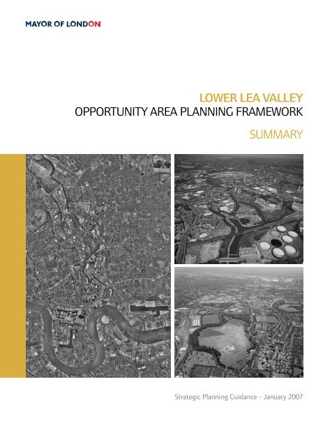
lower lea valley opportunity area planning ... - london.gov.uk
lower lea valley opportunity area planning ... - london.gov.uk
lower lea valley opportunity area planning ... - london.gov.uk

Create successful ePaper yourself
Turn your PDF publications into a flip-book with our unique Google optimized e-Paper software.
LOWER LEA VALLEY<br />
OPPORTUNITY AREA PLANNING FRAMEWORK<br />
SUMMARY<br />
Strategic Planning Guidance - January 2007
LOWER LEA VALLEY<br />
OPPORTUNITY AREA<br />
PLANNING FRAMEWORK<br />
Strategic Planning Guidance - January 2007<br />
SUMMARY
ii | OPPORTUNITY AREA PLANNING FRAMEWORK - SUMMARY<br />
LOWER LEA VALLEY<br />
Boundaries (Source: EDAW)
INTRODUCTION<br />
The Lower Lea Valley (LLV) is one of the<br />
largest regeneration projects in Britain. The<br />
decision to bid for the 2012 Olympic and<br />
Paralympic Games focussed attention on what<br />
could be achieved in the LLV, and highlighted<br />
the need to identify the optimum scale of<br />
change across the <strong>valley</strong>.<br />
The Lower Lea Valley is currently characterised<br />
by large <strong>area</strong>s of derelict industrial land and<br />
poor housing. Much of the land is fragmented,<br />
polluted and divided by waterways, overhead<br />
pylons, roads and railways. The key aim<br />
of the Lower Lea Valley Opportunity Area<br />
Planning Framework (LLV OAPF) is to build<br />
on the <strong>area</strong>’s unique network of waterways<br />
and islands to attract new investment and<br />
opportunities.<br />
The key <strong>opportunity</strong> for transformation in the<br />
LLV is provided through the managed re<strong>lea</strong>se<br />
of industrial land and ensuring that new<br />
development is sustainable and built to the<br />
highest environmental and design standards.<br />
The LLV OAPF takes London Plan policies as<br />
a starting point and concludes that up to a<br />
maximum of 173 hectares of existing industrial<br />
land in the LLV could be re<strong>lea</strong>sed between<br />
2005 and 2016. Maximising the use of this<br />
land and the industrial land that is retained<br />
indicates that the LLV would have the capacity<br />
to deliver between 30,000 and 40,000 new<br />
homes (with at <strong>lea</strong>st 44% as family housing),<br />
50,000 new jobs and between 30,000 and<br />
60,000 volunteer opportunities arising from<br />
hosting the Olympic and Paralympic Games.<br />
OPPORTUNITY AREA PLANNING FRAMEWORK - SUMMARY |<br />
The LLV OAPF is Mayoral Strategic Planning<br />
Guidance. It is one element of the regeneration<br />
strategy for the Lower Lea Valley, and is<br />
a material <strong>planning</strong> consideration for the<br />
LLV Boroughs, the LTGDC and the ODA.<br />
The LLV OAPF presents a shared vision<br />
of comprehensive social, economic and<br />
environmental change in the Valley for all who<br />
live, work and visit there now and in the future.<br />
The overall vision is:<br />
To transform the LLV to become a vibrant,<br />
high quality and sustainable mixed use city<br />
district, that is fully integrated into the<br />
urban fabric of London and is set within<br />
an unrivalled landscape that contains<br />
new high quality parkland and a unique<br />
network of waterways.<br />
The LLV OAPF sets out a balanced and<br />
comprehensive picture of land use change<br />
and development in the LLV, based on fifteen<br />
sub-<strong>area</strong>s. The LLV OAPF highlights the<br />
potential for land use change and sets out a<br />
series of key strategic and local interventions<br />
that would be required to achieve Valley-wide<br />
objectives and create mixed and balanced<br />
sustainable communities. Certain sub-<strong>area</strong>s<br />
require further master<strong>planning</strong> or <strong>planning</strong><br />
and development briefs to indicate how<br />
the strategic development proposals could<br />
be delivered at a local level. Development<br />
proposals will be expected to demonstrate<br />
consistency with the sub-<strong>area</strong> guidelines and<br />
contribute, as appropriate, to strategic and<br />
local interventions.<br />
LOWER LEA VALLEY
| OPPORTUNITY AREA PLANNING FRAMEWORK - SUMMARY<br />
The hosting of the 2012 Games, as well as<br />
delivering a legacy of sporting facilities,<br />
housing and commercial space, will remove<br />
major tracts of polluted land. The Games will<br />
remove outmoded infrastructure and provide<br />
a major portion of the overall infrastructure<br />
for the regenerated <strong>valley</strong>, including c<strong>lea</strong>ner<br />
and extended watercourses, riverside parks,<br />
and a network of connections into and across<br />
the Valley. Strategic and local organisations,<br />
working in partnership with the private sector,<br />
will need to build on these interventions<br />
and deliver additional new infrastructure,<br />
facilities and services in the LLV, including<br />
social infrastructure and transport projects,<br />
to support the level of household and<br />
employment growth projected and to ensure<br />
that the LLV is actively integrated with its<br />
surrounding communities.<br />
LOWER LEA VALLEY
OPPORTUNITY AREA PLANNING FRAMEWORK - SUMMARY |<br />
VISION AND<br />
DEVELOPMENT PRINCIPLES<br />
The vision for the LLV is built up of seven<br />
core themes and underpinned by a series of<br />
strategic development principles to guide<br />
future development and change in the LLV.<br />
Landowners, developers, funding and delivery<br />
agencies, and local and strategic stakeholders,<br />
will be expected to demonstrate that these<br />
development principles are reflected in<br />
LDFs, masterplans, development briefs and<br />
proposals, and stakeholder strategies and<br />
investment programmes.<br />
A. A WATER CITY<br />
Green space and water space will play a vital<br />
role in the future development of the LLV.<br />
In order that new development, particularly<br />
residential development, is sustainable and<br />
attractive, the network of existing open spaces<br />
must be expanded to provide high quality<br />
resources that are fully accessible to people<br />
that want to use it. Whilst the Lee Valley<br />
Regional Park has an extensive catchment<br />
<strong>area</strong> which extends throughout the majority<br />
of the study <strong>area</strong>, the southern portion of<br />
the Valley currently suffers from more limited<br />
accessibility and there is significant deficiency<br />
in access to open space for sites along the<br />
centre of the Valley <strong>area</strong>.<br />
The Vision for a ‘Water City’ should be<br />
delivered through the creation of a new<br />
open space network structured around the<br />
waterway system; ecological enhancement<br />
and re-naturalisation of this waterway system;<br />
reinstatement and extension of the waterway<br />
system; greater use of the waterways, for<br />
living, transportation, and recreation; and,<br />
by ensuring that flood risk is appropriately<br />
assessed, mitigated and managed as an<br />
integral component of future development.<br />
The improvement and extension of the<br />
waterways in the LLV will play a crucial role<br />
in upgrading and transforming the physical<br />
environment in the Valley. In parallel, the<br />
development of a new Lower Lea Valley Park<br />
system will not only satisfy the requirements<br />
of London Plan and Borough policy for<br />
adequate provision of green space to new<br />
and existing development, but will also create<br />
a city scale park and open space network of<br />
international significance and quality.<br />
Development Principles for a Water City<br />
A . Development proposals in the LLV<br />
should seek to realise the potential<br />
of the waterways and open spaces to<br />
create amazing places.<br />
A . Opportunities to upgrade the<br />
waterways that do not compromise<br />
the flood defence role, transport<br />
potential, landscape character and<br />
ecological value of the river corridor<br />
and associated floodplain of the LLV<br />
should be supported.<br />
A . Development proposals in the LLV<br />
should help establish a Green Grid for<br />
the Lee Valley.<br />
LOWER LEA VALLEY
| OPPORTUNITY AREA PLANNING FRAMEWORK - SUMMARY<br />
LOWER LEA VALLEY<br />
Water Strategy (Source: EDAW)
A . Development proposals in the LLV<br />
should protect and improve existing<br />
<strong>area</strong>s of open space or, where<br />
proposals are brought forward that<br />
impact upon existing open space,<br />
ensure that re-provision of any space<br />
is achieved to equal or greater quality,<br />
dimensions and accessibility.<br />
A . Metropolitan Open Land (MOL)<br />
will continue to be protected from<br />
inappropriate development.<br />
A6. Environmental and sustainable<br />
features should be included within<br />
developments in the LLV.<br />
A7. Development proposals in the LLV<br />
should seek to protect and enhance<br />
wildlife, biodiversity and ecological<br />
asset and character.<br />
B. THRIVING CENTRES<br />
The LLV OAPF proposes substantial numbers<br />
of new homes across the Valley in a series of<br />
connected neighbourhoods, all of which would<br />
have access to a range of social infrastructure.<br />
Accessible town, district and local<br />
neighbourhood centres are required to support<br />
these neighbourhoods and provide access to<br />
jobs, shops, schools, healthcare, open spaces<br />
and recreation, general community facilities<br />
and emergency services.<br />
New centres should be developed in accessible<br />
locations, close to transport interchanges, and<br />
will provide services and amenities for both<br />
new and existing communities, linking these<br />
together to become ‘Places of Exchange’. This<br />
concept of ‘Places of Exchange’ builds on the<br />
OPPORTUNITY AREA PLANNING FRAMEWORK - SUMMARY |<br />
notion of developing clusters of community<br />
facilities, where flexible space and shared<br />
facilities can be provided to meet demand<br />
and the needs of service providers. It is likely<br />
that one key service or facility will provide<br />
the ‘anchor’ around which complementary<br />
retail, leisure, education, health and other<br />
community facilities will cluster.<br />
The OAPF proposes that new community<br />
infrastructure should be focused in the<br />
following centres<br />
- Stratford (major/metropolitan centre);<br />
- West Ham (new district centre);<br />
- Canning Town (district centre);<br />
- Chrisp Street (district centre);<br />
- Bromley-by-Bow (enhanced local centre);<br />
- Newham Thameside (part of a new<br />
district centre at Silvertown Quays); and<br />
- Hackney Wick (new local centre).<br />
The GLA, LDA, ODA, LTGDC, four LLV<br />
Boroughs and social infrastructure service<br />
providers and funders will need to ensure that<br />
the necessary social infrastructure is provided<br />
in tandem with growth through the Valley.<br />
To ensure that land is made available for this<br />
purpose the maximum scenario of required<br />
land for social-infrastructure facilities should<br />
be identified and safeguarded from other<br />
forms of development.<br />
This safeguarding should be subject to regular<br />
review as development of the Valley progresses<br />
and if population trends prove different from<br />
those modelled as part of the LLV RS process<br />
the land can be re<strong>lea</strong>sed for other purposes.<br />
In the short term this land should be used for<br />
temporary open space provision.<br />
LOWER LEA VALLEY
6 | OPPORTUNITY AREA PLANNING FRAMEWORK - SUMMARY<br />
LOWER LEA VALLEY<br />
Green Space (Source: EDAW)
The development of Places of Exchange<br />
should be further supported by improved<br />
transport infrastructure and the development<br />
of a network of routes and connections across<br />
the Valley and between neighbourhoods.<br />
Development Principles for Thriving Centres<br />
B . Development proposals in the LLV<br />
should seek to provide and support<br />
a mix of uses in key activity nodes<br />
(‘Places of Exchange’) such as<br />
metropolitan, major, district and local<br />
centres to provide a range of facilities<br />
and services in accessible locations.<br />
B . Development proposals in the<br />
LLV should provide for a range of<br />
educational facilities and pre-school<br />
nursery childcare to accommodate the<br />
growing population of the <strong>area</strong>.<br />
B . Development proposals in the LLV<br />
should provide for a range of health<br />
facilities to address the needs of<br />
the new residential community and<br />
enable health providers to provide new<br />
modern services.<br />
B . Development proposals in the LLV<br />
should promote a mix of town centre<br />
uses in a hierarchy of centres to<br />
maintain vitality and viability.<br />
B . Development proposals in the LLV<br />
should seek to protect and develop<br />
the character and identity of existing<br />
centres.<br />
B6. The delivery of social infrastructure<br />
should ensure that appropriate<br />
facilities and services are brought<br />
forward in tandem with housing<br />
development.<br />
OPPORTUNITY AREA PLANNING FRAMEWORK - SUMMARY | 7<br />
C. NEIGHBOURHOODS AND<br />
COMMUNITIES<br />
The LLV OAPF seeks to ensure the creation of<br />
new sustainable residential communities with a<br />
range of types and tenures that are accessible<br />
to the whole community. New housing<br />
should help to link existing communities<br />
and transport nodes. Privately owned and<br />
affordable housing should be integrated within<br />
housing schemes and all housing should have<br />
good access to a wide range of social and<br />
community facilities.<br />
Development capacity analysis in the LLV RS<br />
has demonstrated the potential for between<br />
30,000 and 40,000 new homes in the LLV in<br />
the context of London Plan Policy on housing<br />
densities and the achievement of other<br />
regeneration objectives.<br />
New housing schemes should seek to meet the<br />
London Plan target of 50% affordable housing<br />
and be benchmarked against the Mayor’s 70%<br />
rented/30% intermediate tenure split within<br />
this type, informed by regional and local<br />
Housing Needs Surveys (Policy 3A.7).<br />
The LLV is home to a diverse population. It<br />
is vital that the needs of individuals, families<br />
and communities are met and that at <strong>lea</strong>st<br />
44% of all new housing is provided as family<br />
accommodation , depending on densities,<br />
flood risk, proximity to existing or proposed<br />
social infrastructure, and proximity to existing<br />
or proposed parks and open spaces.<br />
LOWER LEA VALLEY
| OPPORTUNITY AREA PLANNING FRAMEWORK - SUMMARY<br />
LOWER LEA VALLEY<br />
Housing (Source: EDAW)
Development Principles for<br />
Neighbourhoods and Communities<br />
C . Development proposals in the LLV<br />
should seek to meet and exceed the<br />
00 LLV Housing target of 6,000 new<br />
homes by 0 6, within the context<br />
of development capacity analysis<br />
demonstrated by the LLV RS.<br />
C . Development proposals in the LLV<br />
should promote sufficient provision of<br />
affordable housing across the LLV <strong>area</strong>.<br />
C . Development proposals in the LLV<br />
should promote a suitable range of<br />
residential accommodation with a<br />
mix of dwelling types and maximise<br />
opportunities for family housing.<br />
C . Development proposals in the LLV<br />
should concentrate housing in <strong>area</strong>s of<br />
high public transport accessibility.<br />
C . Housing Development proposals in<br />
the LLV should meet high quality<br />
design, accessibility and sustainability<br />
standards.<br />
C6. Development proposals in the LLV<br />
should promote community safety<br />
in partnership working with key<br />
stakeholders.<br />
OPPORTUNITY AREA PLANNING FRAMEWORK - SUMMARY |<br />
D. THE WORKING VALLEY<br />
The LLV OAPF seeks to ensure that the Valley<br />
will continue to play an important role in<br />
London’s economy, but recognises that the<br />
physical nature of activity, in terms of land<br />
use and the range of businesses, will undergo<br />
significant transformation over coming years.<br />
The OAPF suggests that the LLV has the<br />
potential to re<strong>lea</strong>se up to a maximum of 173<br />
hectares of industrial land from 2005 to 2016<br />
for other land uses.<br />
The geography of potential industrial land<br />
re<strong>lea</strong>se maintains a concentration of industrial<br />
activities in a ‘corridor’ along the centre of the<br />
Valley. Within this corridor there are a series<br />
of key concentrations, sub-sector clusters and<br />
strategic transport connections, as follows:<br />
- Seven Strategic Employment Locations (SEL),<br />
and a series of smaller Locally Significant<br />
Industrial Sites (LSIS);<br />
- Seven statutorily safeguarded wharves;<br />
- Five clusters of specialised industrial activity;<br />
and<br />
- Several industrial uses with ‘fixed’ physical<br />
infrastructure including two major rail<br />
depots, rail and water freight facilities, and<br />
gas, electricity and water utilities.<br />
Other than small scale support uses to serve<br />
the needs of people working in industrial <strong>area</strong>s,<br />
development of non industrial uses within<br />
SELs will be resisted. Development of nonindustrial<br />
uses within LSSs should be resisted,<br />
and the more efficient use of sites through<br />
intensification and rationalisation of activities<br />
should be promoted. At a local level, industrial<br />
LOWER LEA VALLEY
0 | OPPORTUNITY AREA PLANNING FRAMEWORK - SUMMARY<br />
LOWER LEA VALLEY<br />
Industrial Land Distribution (Source: EDAW)
and employment development should be<br />
retained and intensified in locations that are in<br />
close proximity to road, rail and water systems<br />
to take advantage of good connectivity.<br />
The OAPF has identified a number of other<br />
industrial <strong>area</strong>s that have the potential to<br />
accommodate a proportion of non-industrial<br />
use whilst still maintaining existing industrial<br />
capacity, or are new industrial <strong>area</strong>s where<br />
other uses could be accommodated as long<br />
as industrial use is the primary use. Sites that<br />
contain operational industrial functions that<br />
are important to the performance of London’s<br />
economy, that require a location close to the<br />
central business <strong>area</strong>s of the City of London or<br />
Canary Wharf, and that cannot be relocated to<br />
suitable alternative sites, should be retained<br />
within the Valley.<br />
Development Principles for the Working<br />
Valley<br />
D . Development proposals in the LLV<br />
should retain Strategic and Local<br />
Significant Employment Sites and<br />
manage the transition of industrial land<br />
through re<strong>lea</strong>se and intensification<br />
in accordance with the geography of<br />
industry set out in the OAPF.<br />
D . Development in the LLV should<br />
safeguard and intensify activity in<br />
Strategic Employment Locations. (SELs)<br />
D . Locally Significant Industrial Sites<br />
(LSISs) outside of the SEL framework<br />
should be protected for industrial use.<br />
D . In the other industrial <strong>area</strong>s <strong>planning</strong><br />
authorities should continue to protect<br />
industrial capacity but should look to<br />
OPPORTUNITY AREA PLANNING FRAMEWORK - SUMMARY |<br />
satisfactorily introduce additional uses<br />
and activities.<br />
D . Development proposals in the<br />
LLV should encourage a mix of<br />
employment uses.<br />
D6. Development proposals in the LLV<br />
should seek to promote office and<br />
appropriate employment generating<br />
development as mixed-use activities,<br />
principally located within designated<br />
centres.<br />
D7. Development proposals in the LLV<br />
should promote the development<br />
of specialist industries, creative<br />
industries, entertainment and tourismrelated<br />
uses.<br />
D . Development proposals in the LLV<br />
should promote environmental<br />
industries.<br />
D . Development proposals in the LLV<br />
should improve wealth creation<br />
and provide opportunities for all to<br />
participate in the local and wider<br />
economy.<br />
E. A CONNECTED VALLEY<br />
Improving connectivity in the LLV is essential<br />
to facilitating development and enhancing<br />
the sustainability of existing and future<br />
communities. The aim is to achieve a series<br />
of transport hubs or nodes, including<br />
those that currently exist at Canning Town,<br />
Bromley-By-Bow, West Ham and Stratford,<br />
incorporating several forms of mainly public<br />
transport. Proposed improvements to the local<br />
movement network will address the issues of<br />
LOWER LEA VALLEY
| OPPORTUNITY AREA PLANNING FRAMEWORK - SUMMARY<br />
LOWER LEA VALLEY<br />
Illustrative Local Movement Network (Source: EDAW)
local severance and inhospitable routes which<br />
currently reinforce the fragmented character<br />
of LLV. The LLV local movement network will<br />
link open spaces and other amenities with<br />
surrounding communities.<br />
In line with London Plan Policies 3C.1 and<br />
3C.2, the highest densities of development<br />
should be located where public transport<br />
capacity is high and capacity is or will be<br />
sufficient in order to maximise the use of<br />
public transport and enhance access to local<br />
facilities and services.<br />
The public transport improvements that<br />
are already committed to 2016 including<br />
those necessary to facilitate the Olympic<br />
and Paralympic Games will be sufficient<br />
to accommodate the additional demands<br />
imposed by the rate of population growth<br />
that is predicted for the LLV to 2016.<br />
A possible new north-south spine road<br />
through the Valley, improved bus services<br />
and enhanced local accessibility to public<br />
transport connections will be fundamental to<br />
enabling an uplift in development capacity,<br />
in particular through the centre of the Valley.<br />
Other strategic transport measures may be<br />
required beyond 2016, and further work will<br />
be required to assess this and explain how this<br />
will be addressed.<br />
Development Principles for a Connected<br />
Valley<br />
E . Development proposals in the LLV<br />
should contribute should help reduce<br />
physical severances across the LLV.<br />
E . Development proposals in the LLV will<br />
need to contribute towards improving<br />
the accessibility and capacity of the<br />
LLV public transport network.<br />
OPPORTUNITY AREA PLANNING FRAMEWORK - SUMMARY |<br />
E . Development proposals in the LLV<br />
should improve the network of road<br />
links, public transport links and cycle/<br />
pedestrian networks running eastwest<br />
and north-south through the<br />
Valley without compromising the value<br />
of the river and associated corridor.<br />
E . Existing walking and cycling routes<br />
should be enhanced by development<br />
proposals in the LLV and additional<br />
links provided as part of an<br />
environmentally sustainable network.<br />
E . Development proposals in the LLV<br />
should employ a restraint-based car<br />
parking strategy.<br />
E6. Development proposals in the LLV<br />
should seek to maximise the use of rail<br />
and water transport for freight and<br />
other related purposes.<br />
F. A SUSTAINABLE AND ENDURING<br />
LEGACY<br />
Development proposals in the LLV should<br />
adhere to principles of sustainability in the built<br />
environment, particularly in terms of: access for<br />
all; waste management; water conservation and<br />
recycling; use of ecologically sensitive materials<br />
and design; efficient use of energy and<br />
resources; drainage; and consideration of flood<br />
risk and management. The regeneration of the<br />
Valley should aim to promote best practice in<br />
environmental protection.<br />
A Strategic Flood Risk Assessment (SFRA)<br />
has been undertaken as part of the LLV RS.<br />
Individual development proposals brought<br />
forward in the LLV will need to demonstrate<br />
consistency with this approach to ensure<br />
that people and property are not put at<br />
LOWER LEA VALLEY
| OPPORTUNITY AREA PLANNING FRAMEWORK - SUMMARY<br />
LOWER LEA VALLEY<br />
Engineering (Source: EDAW)
unacceptable flood risk and flood defence<br />
standards are not put at risk.<br />
The opportunities to establish a sustainable<br />
future for the Valley in relation to energy,<br />
waste and water usage will need to be<br />
capitalised upon, in particular in association<br />
with the Olympic and Legacy development.<br />
Achieving the development potential of the<br />
LLV will depend on sufficient capacity in<br />
utilities networks, which presents a significant<br />
<strong>opportunity</strong> for alternative solutions at<br />
a strategic scale such as CHP/CCHP and<br />
renewable energy sources. The management<br />
of waste arising from the LLV provides the<br />
<strong>opportunity</strong> to develop ‘models’ of sustainable<br />
waste management that could influence<br />
the approach across a wider <strong>area</strong> including<br />
considering the use of waste for generation of<br />
power, in accordance with London Plan policy.<br />
Development Principles for a Sustainable<br />
and Enduring Legacy<br />
F . Development proposals in the LLV<br />
should identify and employ best<br />
practice mechanisms to enhance the<br />
remediation of contaminated sites<br />
and bring land in the LLV back into<br />
beneficial use.<br />
F Development proposals in the LLV<br />
flood plain will need to be supported<br />
by detailed hydrologic and hydraulic<br />
assessments of the potential flooding<br />
effects, and mitigation proposals.<br />
OPPORTUNITY AREA PLANNING FRAMEWORK - SUMMARY |<br />
F . Specific <strong>area</strong>s that are at ‘Actual<br />
Risk’ of flooding will require physical<br />
interventions in order for residential<br />
uses (especially family housing) to be<br />
acceptable.<br />
F . Development proposals in the LLV<br />
should promote sustainable urban<br />
drainage systems as one of the<br />
techniques for managing long-term<br />
flood risk.<br />
F . Development proposals in the LLV<br />
should protect and improve water<br />
quality and associated wildlife habitat.<br />
F6. Development proposals in the LLV<br />
should support the Mayor’s Energy<br />
Strategy and the objectives of reducing<br />
carbon dioxide emissions, improving<br />
energy efficiency and increasing the<br />
proportion of energy uses generated<br />
from renewable sources.<br />
F7. Development proposals in the LLV<br />
should seek to implement the Mayor’s<br />
Air Quality Strategy and achieve<br />
reductions in pollutant emissions.<br />
F . Development proposals in the LLV<br />
should promote an efficient approach<br />
to the management of waste and<br />
safeguard existing facilities unless<br />
appropriate compensatory provision is<br />
identified (London Plan policy A. ).<br />
F . Development proposals in the LLV<br />
should promote an efficient approach<br />
to the use of waste as a resource<br />
for energy generation using new<br />
and emerging advanced conversion<br />
technologies for waste.<br />
LOWER LEA VALLEY
6 | OPPORTUNITY AREA PLANNING FRAMEWORK - SUMMARY<br />
LOWER LEA VALLEY<br />
Local Planning Frameworks (Source: EDAW)
F 0. Development proposals in the LLV<br />
should achieve an exemplary level of<br />
water efficiency.<br />
F . Development proposals in the LLV<br />
should seek to implement the Mayor’s<br />
Ambient Noise Strategy and achieve<br />
reductions in noise.<br />
F . Planning for a sophisticated<br />
communications infrastructure should<br />
be an integral part of the design<br />
solution in the LLV.<br />
F . Masterplans and development<br />
proposals in the LLV should be<br />
designed with sensitivity to its unique<br />
local environment, in particular its<br />
landscape character, environmental<br />
assets, and historic buildings and<br />
places.<br />
F . The London Plan ( 00 ) principles<br />
of ‘design for a compact city’ and<br />
‘sustainable design and construction,’<br />
should be pursued in the LLV, with<br />
maximum use of site potential whilst<br />
not compromising the principles of<br />
sustainable development.<br />
F . Development Proposals should<br />
anticipate and ensure that<br />
suitable longer term management<br />
arrangements are put in place when<br />
new infrastructure is provided.<br />
OPPORTUNITY AREA PLANNING FRAMEWORK - SUMMARY | 7<br />
G. REAPING THE BENEFITS OF THE<br />
OLYMPIC INVESTMENT<br />
The LLV OAPF recognises that the<br />
regeneration and development of the LLV<br />
will take place over a considerable timescale,<br />
stretching beyond the Games itself. Therefore<br />
it is critically important that additional<br />
physical development and investment in social<br />
infrastructure is appropriately planned and<br />
phased in order to maximise integration and<br />
synergy. After years of disinvestment and<br />
limited aspiration, the momentum of positive<br />
change and profile raising must be sustained.<br />
In order to progress the delivery of the LLV RS<br />
and subsequent masterplans and development<br />
frameworks, partnership working between key<br />
stakeholder and delivery organisations will be<br />
essential. Such bodies include land owners, Local<br />
Authorities; the GLA, LDA, Olympic Delivery<br />
Authority (ODA) and TfL; the London Thames<br />
Gateway Urban Development Corporation<br />
(LTGDC); local regeneration partnerships;<br />
and other local organisations with specialist<br />
stakeholder knowledge of the LLV, such as<br />
the Lee Valley Regional Park Authority, British<br />
Waterways, English Heritage, the Environment<br />
Agency and the Gateway to London (the subregional<br />
Inward Investment Agency).<br />
The complexity, financial implications and<br />
scale of change envisaged will require<br />
detailed and wide ranging cross-agency<br />
business <strong>planning</strong> in order to re<strong>lea</strong>se land,<br />
secure funding, moderate supply and provide<br />
infrastructure at appropriate times. In some<br />
cases elements of this infrastructure, or its<br />
cost, can be provided by developers through<br />
established mechanisms such as Section 106<br />
Legal Agreements.<br />
LOWER LEA VALLEY
| OPPORTUNITY AREA PLANNING FRAMEWORK - SUMMARY<br />
All forms of new development in the LLV<br />
will be required to provide a reasonable<br />
contribution towards environmental upgrades,<br />
social and community provision, infrastructure<br />
provision and improvements to the local<br />
movement infrastructure through Section 106<br />
Legal Agreements.<br />
Major developments in ten identified <strong>area</strong>s<br />
should include a Local Planning Framework<br />
to identify infrastructure requirements<br />
and how these will be met (see Local<br />
Planning Frameworks map and Delivery and<br />
Implementation Section)<br />
Development Principles for Reaping the<br />
Benefits of the Olympic Investment<br />
G . Partnership working will be required to<br />
deliver the regeneration of the LLV.<br />
G . Development in the LLV will apply a<br />
phased approach to regeneration.<br />
G . Development Proposals in the LLV<br />
should consider the synergy and<br />
appropriateness of development in<br />
respect of the Olympic Investment and<br />
its Legacy as well as fully integrate<br />
with the Olympic Park Development.<br />
G . Development proposals in the LLV<br />
should contribute towards a pooled<br />
system of s. 06 <strong>planning</strong> obligations.<br />
G . Development proposals in the LLV<br />
should identify their physical, social<br />
and community Infrastructure<br />
requirements and demonstrate how<br />
that provision will be delivered.<br />
LOWER LEA VALLEY
OPPORTUNITY AREA PLANNING FRAMEWORK - SUMMARY |<br />
BOROUGH OPPORTUNITIES AND<br />
LAND USE SCENARIOS<br />
LONDON BOROUGH OF HACKNEY<br />
Context<br />
LB Hackney makes up 6% of the LLV<br />
Opportunity Area with 79 hectares. It has the<br />
highest proportion of green space (40% of<br />
its LLV <strong>area</strong>). The LLV RS proposes re<strong>lea</strong>se of<br />
approximately 30% (10ha) of industrial land in<br />
LBH, most of which is allocated to new green<br />
space, based on the land use proposals in the<br />
Olympic and Legacy Planning Permissions<br />
(2004 O&LPP).<br />
Vision & Opportunity<br />
Based on strategic assumptions of industrial<br />
land re<strong>lea</strong>se in the LLV, Hackney Wick has<br />
the potential capacity to deliver between 350<br />
- 360 new homes.<br />
The 2004 O&LPP proposed up to 52,666<br />
m2 industrial floor space (Classes B1b, c,<br />
B2 and B8) and 51,757 m2 office space<br />
(B1a) in Hackney. In addition to the 2004<br />
O&LPP outputs further development around<br />
Hackney Wick Station could provide up to<br />
3,600 m2 office space and 4,000 m2 of retail<br />
space (Class A1 and A3) in the form of a new<br />
neighbourhood centre.<br />
The 2004 O&LPP included commitments to<br />
increase the <strong>area</strong> of open space in the eastern<br />
part of the sub-<strong>area</strong>, through re-alignment of<br />
Waterden Road to the west, and inclusion of<br />
the <strong>area</strong> to the east of the new road alignment<br />
into a new park; and reconfigure the existing<br />
open space at Arena Fields reducing its size,<br />
but providing effective links to new open<br />
space in the east of the sub-<strong>area</strong>.<br />
Development proposals within each sub-<strong>area</strong><br />
will be expected to provide an appropriate<br />
and reasonable contribution towards the cost<br />
of delivering identified strategic and local<br />
interventions. The 2004 O&LPP included a<br />
strategic intervention to retain the Olympic<br />
Arena for Legacy sporting and recreation use<br />
(approximately 4,500 to 5,000 m2). Further<br />
development at Hackney Wick should include,<br />
or contribute towards a small scale community<br />
space, and investigate the potential for a new<br />
Water Safety Centre.<br />
Sub-<strong>area</strong> development potential<br />
LB Hackney has one sub-<strong>area</strong> within the LLV<br />
Opportunity <strong>area</strong> and shares one sub-<strong>area</strong><br />
with LB Newham and LB Waltham Forest:<br />
3. Lee River Park (part)<br />
5. Hackney Wick<br />
The extent of land use change in this sub<strong>area</strong><br />
is based on the 2004 O&LPP. There is<br />
some potential for land use change around<br />
Hackney Wick Station to create a new centre<br />
of activity for the wider <strong>area</strong>, capitalising<br />
upon investment to enhance the capacity of<br />
Hackney Wick station as part of the 2012<br />
Olympic proposals.<br />
During the Games this <strong>area</strong> will play host to<br />
a number of sports arenas, along part of the<br />
Olympic concourse on the far eastern side<br />
LOWER LEA VALLEY
0 | OPPORTUNITY AREA PLANNING FRAMEWORK - SUMMARY<br />
LOWER LEA VALLEY
of the sub-<strong>area</strong>. Legacy redevelopment will<br />
consolidate the industrial <strong>area</strong> to the east of<br />
the Lee Navigation reinforcing the existing<br />
Strategic Employment Location. The boundary<br />
of the Hackney Wick SEL has been ratified<br />
through the East London SRDF process. The<br />
cluster of specialised industrial activity at<br />
Hackney Wick for printing, food, and creative/<br />
cultural should be protected and promoted by<br />
the GLA, ODA, LDA and the Boroughs.<br />
Most of the western part of LB Hackney<br />
within the LLV Opportunity <strong>area</strong> lies within<br />
PPS25 Flood Zone 3. This <strong>area</strong> is not<br />
currently adequately protected by defences<br />
against a flood event of this magnitude.<br />
New development in the western part of the<br />
sub-<strong>area</strong> would therefore require appropriate<br />
mitigation measures to be provided.<br />
Priorities include:<br />
- Upgraded access to Hackney Wick Station;<br />
- New and improved links over the Lee<br />
Navigation, especially between the station<br />
and the new Lea River Park;<br />
- Improvements to the Waterden Road<br />
environment;<br />
- Improved accessibility through the<br />
provision of North-south links from<br />
Hackney Wick to Hackney Marshes;<br />
- Improved connections and provision of<br />
safer routes in residential zones;<br />
- Uniting neighbourhoods by improving<br />
connectivity between <strong>area</strong>s of recent and<br />
earlier housing;<br />
OPPORTUNITY AREA PLANNING FRAMEWORK - SUMMARY |<br />
- A strategy for current and future vehicle<br />
movements and access, particularly for heavy<br />
goods vehicles, in the <strong>area</strong>; and,<br />
- New and improved links to Victoria Park.<br />
Local Planning Frameworks<br />
A Local Planning Framework, including<br />
a masterplan, a phasing schedule and<br />
an investment strategy, worked up in a<br />
partnership between the landowners,<br />
developers, GLA, LDA, LTGDC and relevant<br />
LLV Borough(s) (in particular the London<br />
Borough of Hackney), would usefully indicate<br />
how the strategic development proposals for<br />
the <strong>area</strong> around Hackney Wick Station can<br />
be delivered at a local level (see the Local<br />
Planning Frameworks map).<br />
LONDON BOROUGH OF NEWHAM<br />
Context<br />
LB Newham makes up approximately 60% of<br />
the LLV Opportunity Area, with 738 hectares.<br />
Residential and industrial uses each make up<br />
around a third of this <strong>area</strong>, with 10% in green<br />
space. The LLV RS proposes re<strong>lea</strong>se of up to<br />
53% of Newham’s industrial base in the LLV,<br />
most of which is allocated for new housing<br />
development and significant increases in green<br />
space. The combined development of Stratford<br />
City and the 2012 Games will introduce a<br />
new retail and office core, and legacy sports<br />
facilities.<br />
Vision & Opportunity<br />
Based on strategic assumptions of industrial<br />
land re<strong>lea</strong>se to 2016 Newham has the potential<br />
capacity to deliver a total of between 24,000-<br />
30,500 new homes. 4,440 of these could be<br />
delivered as part of Stratford City, 8,107 as<br />
part of the 2004 O&LPP. A further 9,750 units<br />
LOWER LEA VALLEY
| OPPORTUNITY AREA PLANNING FRAMEWORK - SUMMARY<br />
could be delivered in the borough through<br />
development in new residential <strong>area</strong>s, 6,350<br />
through mixed use development and 2,000<br />
from intensification of existing residential<br />
<strong>area</strong>s (primarily estate renewal projects such at<br />
Canning Town) – where in accordance with local<br />
and strategic policy. .<br />
The Stratford City permission will create a major<br />
new retail and office district to the north of<br />
the existing Stratford Town Centre (in Sub-<strong>area</strong><br />
6), with outline <strong>planning</strong> permission already<br />
granted for 465,000 m2 of B1(a) office space<br />
and 140,000 m2 of retail space. The 2004<br />
O&LPP provided for up to 29,114 m2 of B1<br />
(a) office space, 17,655 m2 industrial floor<br />
space (Classes B1b, c, B2 and B8), 7,704 m2 of<br />
retail space and 200 m2 leisure and community<br />
space. In addition to the Stratford City and<br />
O&LPP outputs further development in the<br />
LB Newham part of the LLV Opportunity <strong>area</strong><br />
could provide up to 53,300 m2 office space and<br />
35,150 m2 of retail space (Class A1 and A3).<br />
Sub-<strong>area</strong> development potential<br />
LB Newham has six sub-<strong>area</strong>s within the LLV<br />
Opportunity <strong>area</strong> and shares one sub-<strong>area</strong><br />
with LB Tower Hamlets, one with LB Hackney<br />
and one jointly with LB Hackney and LB<br />
Waltham Forest:<br />
3. Lee River Park (part)<br />
4. Wider Stratford City (part)<br />
6. Stratford<br />
7. Fish Island and Marshgate <strong>area</strong> (part)<br />
9. Three Mills<br />
10. West Ham<br />
11. Cody Road<br />
13. Canning Town<br />
15. Newham Thameside West<br />
LOWER LEA VALLEY<br />
The boundary of the LLV (Part), Marshgate<br />
Lane and British Gas Site SELs should be<br />
ratified through the East London SRDF<br />
process. The majority of Thameside West<br />
south of North Woolwich Road is currently an<br />
SEL and the OAPF proposes that any changes<br />
to this boundary should retain a significant<br />
quantum of industrial land, focused on the<br />
safeguarded wharves and riverside so as to<br />
maintain a consistent industrial geography.<br />
The cluster of creative/cultural activity at<br />
Three Mills/Sugar House Lane, the strategic<br />
industrial transport site at Bow East and the<br />
strategic Safeguarded Wharves at Thames<br />
Wharf, Peruvian Wharf, Manhattan Wharf,<br />
Sunshine Wharf, Priors and Mayer Parry<br />
Wharves should continue to be protected and<br />
promoted by the GLA and the Borough.<br />
The 2004 O&LPP and Stratford City<br />
permissions included commitments to:<br />
- Retention of the Olympic Aquatics Centre<br />
as a sport and leisure facility;<br />
- A ‘Community Campus’, containing<br />
secondary and primary schools, with<br />
playing fields, as well as a ‘health hub’ or<br />
One Stop Primary Care Centre (OSPCC);<br />
- A school (15,204 m2); and a medium scale<br />
community space in the Fish Island and<br />
Marshgate Lane Sub-<strong>area</strong>;<br />
- Additional co-located social/community<br />
facilities;<br />
- New open space provision in Wider<br />
Stratford City Sub-<strong>area</strong> contiguous with,<br />
and part of, the major park <strong>area</strong> in Lee<br />
River Park;
- New sports pitches on the Temple Mill<br />
Lane Recreation Ground;<br />
- 3ha open space provision in the western<br />
corner of the Stratford sub-<strong>area</strong> as part of<br />
a green link over a new land bridge across<br />
the Great Eastern Line Railway;<br />
- Upgrades to the Greenway; and<br />
- A range of connective green spaces and<br />
amenity spaces.<br />
Development proposals within each sub-<strong>area</strong><br />
will be expected to provide an appropriate<br />
and reasonable contribution towards the cost<br />
of delivering identified strategic and local<br />
interventions. Further development in the LB<br />
Newham part of the LLV Opportunity <strong>area</strong><br />
should include, or contribute towards:<br />
- A 3 GP walk-in health centre in the wider<br />
Stratford City sub-<strong>area</strong>;<br />
- A new 4 FE primary school, a 4 GP walk-in<br />
health centre and an associated large scale<br />
community space in the Stratford sub-<strong>area</strong>;<br />
- A 3 FE primary school, a 2 GP walk-in health<br />
centre, and a local medium scale community<br />
space associated with the school and health<br />
centre in the Three Mills sub-<strong>area</strong>;<br />
- A community facilities cluster at West Ham<br />
Station, incorporating a 2 FE primary school,<br />
a 6 FE secondary school, a 5 GP Primary Care<br />
Health Centre, religious provision and a large<br />
multi-purpose community centre.<br />
- A large scale social infrastructure cluster<br />
in Canning Town including 10 GP OSPCC<br />
OPPORTUNITY AREA PLANNING FRAMEWORK - SUMMARY |<br />
Health Centre, a 2 FE primary school, and<br />
a very large multi-use community space;<br />
- A large scale social infrastructure cluster (or<br />
two distinct clusters) in Newham Thameside,<br />
providing a full service model 6 FE secondary<br />
school that will be the key anchor facility<br />
to enable co-location of other community<br />
facilities, a 2 FE primary school, a 4 FE primary<br />
school, a 3 GP Walk-in Health centre, and, a<br />
medium scale multi-use community space;<br />
- The fourth major park <strong>area</strong> of the LLV open<br />
space network, the Greater Three Mills park<br />
space, focussed around the industrial legacy<br />
of the LLV and including the existing open<br />
spaces at Three Mills Green and Mill Meads;<br />
- Retention of the Bow Gas Holders as part<br />
of the Greater Three Mills park space and<br />
complemented by additional open space<br />
on adjoining sites;<br />
- Part of the fifth major LLV park space<br />
(Bow Creek cross river park); and<br />
- A large new open space (2.5ha) at the<br />
Limmo site.<br />
Local Planning Frameworks<br />
Local Planning Frameworks, including<br />
masterplans, phasing schedules and investment<br />
strategies, worked up in partnership with<br />
landowners, developers, the GLA, LDA, LTGDC<br />
and LB Newham, would usefully indicate<br />
how the strategic development proposals for<br />
Stratford Town Centre, Stratford High Street/<br />
Rick Roberts Way, Three Mills, West Ham,<br />
Canning Town and North Woolwich Road can<br />
be delivered at a local level (see Local Planning<br />
Frameworks map).<br />
LOWER LEA VALLEY
| OPPORTUNITY AREA PLANNING FRAMEWORK - SUMMARY<br />
LOWER LEA VALLEY
OPPORTUNITY AREA PLANNING FRAMEWORK - SUMMARY |<br />
LOWER LEA VALLEY
6 | OPPORTUNITY AREA PLANNING FRAMEWORK - SUMMARY<br />
LOWER LEA VALLEY
LONDON BOROUGH OF TOWER HAMLETS<br />
Context<br />
LB Tower Hamlets makes up approximately<br />
22% of the LLV Opportunity Area, with 273ha.<br />
Almost half is existing residential <strong>area</strong>, with<br />
38% industrial. LB Tower Hamlets has the<br />
lowest proportion of green space (3%) in<br />
the LLV. The LLV RS proposes re<strong>lea</strong>se of up<br />
to 37% of Tower Hamlets’ industrial base in<br />
the LLV, most of which is allocated for new<br />
housing development.<br />
Vision & Opportunity<br />
Based on strategic assumptions of industrial<br />
land re<strong>lea</strong>se to 2016, Tower Hamlets has<br />
the potential capacity to deliver a total of<br />
between 7,560 and 8,340 new homes. Of<br />
these, 919 would have been delivered as part<br />
of the 2004 O&LPP, a further 3,500 units<br />
could be delivered in the borough through<br />
development in new residential <strong>area</strong>s, 1,700<br />
through mixed use development and 2,000<br />
from intensification of existing residential<br />
<strong>area</strong>s (including estates renewal) where in<br />
accordance with local and strategic policy.<br />
The 2004 O&LPP provided for up to<br />
approximately 11,350 m2 of B1 (a) office<br />
space, 5,847 m2 industrial floor space (Classes<br />
B1b, c, B2 and B8), 900 m2 of retail space.<br />
Sub-<strong>area</strong> development potential<br />
LB Tower Hamlets has three sub-<strong>area</strong>s within<br />
the LLV Opportunity <strong>area</strong> and shares one sub<strong>area</strong><br />
with LB Newham:<br />
7. Fish Island and Marshgate <strong>area</strong> (part)<br />
8. Bromley by Bow<br />
12. Poplar Riverside<br />
14. Blackwall and Leamouth<br />
OPPORTUNITY AREA PLANNING FRAMEWORK - SUMMARY | 7<br />
The boundaries of the LLV (Part), Marshgate<br />
Lane and the suggested Empson Street SELs<br />
have been ratified through the East London<br />
SRDF process. The cluster of specialised<br />
food industrial activity at Fish Island and the<br />
strategic Safeguarded Wharf at Orchard Wharf<br />
should continue to be protected and promoted<br />
by the GLA and the Borough.<br />
Development proposals within each sub-<strong>area</strong><br />
will be expected to provide an appropriate<br />
and reasonable contribution towards the cost<br />
of delivering identified strategic and local<br />
interventions. Development in the LB Tower<br />
Hamlets part of the LLV Opportunity <strong>area</strong><br />
should include, or contribute towards:<br />
- A large scale social infrastructure cluster,<br />
preferably near to Bromley by Bow station,<br />
including: a 2 FE primary school, a 6 FE<br />
secondary school, 10 GP OSPCC health centre,<br />
and associated large scale community space;<br />
- A medium scale social infrastructure cluster<br />
to serve the needs of new and existing<br />
residential <strong>area</strong>s in the Poplar Riverside<br />
Sub-<strong>area</strong>, to include a new 2 FE primary<br />
school, a 2 GP surgery, and a medium scale<br />
co-located community space;<br />
- A medium scale stand alone multi-use<br />
community facility in the Blackwall and<br />
Leamouth Sub-<strong>area</strong>;<br />
- Part of the southern portion of the fifth<br />
major park space in the LLV open space<br />
network, a new Bow Creek cross river open<br />
space, to provide a significant open space<br />
<strong>area</strong> for potential adjoining new housing and<br />
the neighbouring Aberfeldy Estate; and<br />
LOWER LEA VALLEY
| OPPORTUNITY AREA PLANNING FRAMEWORK - SUMMARY<br />
LOWER LEA VALLEY
- Part of the sixth major park <strong>area</strong> in the<br />
potential LLV open space network – the<br />
Leamouth Park space – which links the LLV<br />
open space network to the River Thames.<br />
Local Planning Frameworks<br />
Local Planning Frameworks, including<br />
masterplans schedules and investment strategies,<br />
worked up in partnership with landowners,<br />
developers, the GLA, LDA, LTGDC and LB<br />
Tower Hamlets, would usefully indicate how the<br />
strategic development proposals for Fish Island<br />
North, Bromley by Bow, Poplar Riverside and<br />
Leamouth can be delivered at a local level (see<br />
Local Planning Frameworks map).<br />
The focus of local master<strong>planning</strong> in Bromley<br />
by Bow should define further the precise<br />
scope and scale of potential land use change,<br />
including the ability to reconfigure existing<br />
land uses and introduce appropriate new uses.<br />
The initial focus for local master<strong>planning</strong> in<br />
Poplar Riverside should consider the measures<br />
required to facilitate the re<strong>lea</strong>se of utilities<br />
land at Leven Road for open space and<br />
associated development. An initial priority in<br />
the <strong>area</strong> around the Leamouth Peninsula and<br />
Orchard Place is to update previous analysis<br />
and consider emerging major development<br />
proposals that are coming forward in light of<br />
the OAPF and established <strong>planning</strong> policy.<br />
LONDON BOROUGH OF WALTHAM FOREST<br />
Context<br />
LB Waltham Forest makes up approximately<br />
10% of the LLV Opportunity Area, with 128ha.<br />
No significant reallocation of land is proposed<br />
in LBWF.<br />
OPPORTUNITY AREA PLANNING FRAMEWORK - SUMMARY |<br />
Vision & Opportunity<br />
Based on the levels of recent development in<br />
this part of Waltham Forest there is limited<br />
scope for further industrial land re<strong>lea</strong>se<br />
to 2016. New development capacity is<br />
limited and will principally be through the<br />
intensification of existing residential <strong>area</strong>s.<br />
In terms of improving accessibility, a number<br />
of opportunities exist, including: improving<br />
the Leyton tube station; providing a new<br />
station at Lea Bridge; re-instating the Hall<br />
Farm Curve (to the north of the Valley)<br />
thus enabling a Metro service to link the<br />
strategic centres of Chingford, Walthamstow,<br />
Lea Bridge, Temple Mills and Stratford;<br />
and, increased services between Stansted<br />
and Stratford from December 2005, while<br />
improved public transport and better<br />
pedestrian and cycle links could do much to<br />
address current accessibility problems.<br />
Sub-<strong>area</strong> development potential<br />
LB Waltham Forest has two sub-<strong>area</strong>s within<br />
the LLV Opportunity <strong>area</strong> and shares one sub<strong>area</strong><br />
with LB Hackney and LB Newham:<br />
1. Leyton<br />
2. New Spitalfields<br />
3. Lee River Park (part)<br />
The boundary of the Lea Bridge Gateway SEL<br />
should be retained. The cluster of specialised<br />
industrial activity at Spitalfields for food<br />
wholesale should be protected and promoted<br />
by the GLA and the Boroughs.<br />
LOWER LEA VALLEY
0 | OPPORTUNITY AREA PLANNING FRAMEWORK - SUMMARY<br />
Development proposals within each sub-<strong>area</strong><br />
will be expected to provide an appropriate<br />
and reasonable contribution towards the cost<br />
of delivering identified strategic and local<br />
interventions. Development in the LB Tower<br />
Hamlets part of the LLV Opportunity <strong>area</strong><br />
should include, or contribute towards:<br />
- A two GP local surgery to support<br />
the existing and potential residential<br />
development in the Leyton Sub-<strong>area</strong>;<br />
- The consolidation of a series of disparate<br />
open spaces to form the most northern of<br />
the six major park spaces within the LLV<br />
open space network;<br />
- The second major park space in the proposed<br />
LLV open space network, the Lee River Park,<br />
as the largest contiguous <strong>area</strong> of open space<br />
within the study <strong>area</strong> and to provide a mix<br />
of high quality sports facilities, a diverse mix<br />
of new ecological habitats, and a stunning<br />
new landscape with a network of accessible<br />
spaces for more passive recreation.<br />
DELIVERY AND IMPLEMENTATION<br />
The successful delivery of the overall vision for<br />
the <strong>valley</strong> and the creation of truly sustainable<br />
communities will require significant<br />
coordination, plan making, monitoring and<br />
management. Public and private sectors will<br />
need to work together. The public sector<br />
organisations in the LLV are committed to<br />
working together and will intervene where<br />
necessary, in particular to provide <strong>planning</strong><br />
guidance, assemble sites for development,<br />
ensure infrastructure is provided, and<br />
coordinate delivery and funding.<br />
LOWER LEA VALLEY<br />
The overall strategic management of<br />
regeneration in the LLV is provided by the<br />
Lower Lea Valley Management Group, chaired<br />
by the London Thames Gateway Development<br />
Corporation. The establishment of the LTGDC<br />
provides a key vehicle to facilitate and provide<br />
such strategic coordination. The Olympic Delivery<br />
Authority will provide strategic coordination for<br />
that part of the Valley under its remit.<br />
The public authorities are concerned to ensure<br />
that the funding and delivery of affordable<br />
housing and social infrastructure such as<br />
schools and health facilities is supported<br />
by the appropriate use of section 106<br />
agreements. The LTGDC is developing a formal<br />
strategy setting out how it will achieve this.<br />
Development Principle G5 (above) establishes<br />
the need for coordination in terms of provision<br />
of infrastructure. Developers and landowners<br />
should work in partnership with the boroughs,<br />
the GLA, the LDA, the LTGDC and other<br />
public bodies to identify, plan and help deliver<br />
the infrastructure necessary to achieve the<br />
sustainable regeneration of the LLV, and in<br />
the ten <strong>area</strong>s identified in the Local Planning<br />
Frameworks Map to demonstrate how the<br />
planned implementation of their proposals<br />
will contribute to regeneration and the<br />
development of necessary infrastructure, in<br />
compliance with London Plan policy 3A.5,<br />
and in accordance with the Panel Report of<br />
the Examination into the London Plan First<br />
Alterations.