
Create successful ePaper yourself
Turn your PDF publications into a flip-book with our unique Google optimized e-Paper software.
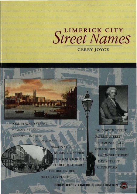
LORD EDWARD STREET<br />
MICHAEL STREET<br />
CORNWALLIS STREET<br />
CABBAGE MARKET<br />
^ LIMERICK CITY<br />
<strong>Street</strong> <strong>Names</strong><br />
NELSON STREET<br />
BARRINGTONS PIER<br />
| BLACK STICK ROAD<br />
POOR HOUSE ROAD<br />
FREDRICK STREET<br />
WELLESLEY PLACE<br />
GERRY JOYCE<br />
BRUNSWICK STREET<br />
PATRICK STREET<br />
RICHMOND PLACE<br />
COLLOONEY STREET<br />
O'CONNELL STREET<br />
DAVIS STREET<br />
CLYDE ROAD<br />
PUBLISHED BY LIMERICK CORPORATION<br />
m
Privatelabel reviewed<br />
• • • • • • i<br />
* • • • • <<br />
*mm>$$^^<br />
NOT :T0 BE .REMOVED UNDER<br />
ANY CIRCUMSTANCES<br />
• O • • • • • • • •<br />
00 " 5 A » io<br />
• •••••••<br />
33
Have you ever wondered who the streets of<br />
our city are named after? Did you know that<br />
almost one hundred and twenty of our streets<br />
and lanes underwent a change of name at<br />
various times in the past? Or that a staggering<br />
three hundred and fifty or so have been<br />
demolished in the course of various<br />
developments.<br />
When you consider that most of those old<br />
streets and lanes were once inhabited, it is<br />
important to be able to locate them. The<br />
history of both the properties on them and<br />
the people who lived in them demand it of<br />
us.<br />
If a city's past is part of its soul, this book is<br />
important; it preserves the memory of old<br />
street names and, looking beyond to the<br />
origins of the names, puts faces on places.<br />
A copy of Christopher Colles Map (referred at page 8<br />
of this publication) is inserted inside the back cover<br />
Dusl jaekel designed l>y COPPER REED studio, Limeriek
LIMERICK CITY<br />
STREET NAMES
LIMERICK CITY<br />
STREET NAMES<br />
Researched, compiled and edited by<br />
Gerry Joyce<br />
Published by<br />
<strong>Limerick</strong> Corporation
Published by<br />
LIMERICK CORPORATION, 1995<br />
ISBN 0 905700 07 4<br />
Design and Orgination<br />
COPPER REED STUDIO<br />
Printed by<br />
LEADER PRINT<br />
© LIMERICK CORPORATION
CONTENTS<br />
Foreword: Mr. Jack Higgins, <strong>City</strong> Manager. 1<br />
Acknowledgements 3<br />
Introduction 5<br />
I. Origin of <strong>Street</strong> <strong>Names</strong> 15<br />
II. <strong>Street</strong>s and Lanes in <strong>Limerick</strong> that 57<br />
have undergone name changes<br />
III. <strong>Street</strong>s and Lanes in <strong>Limerick</strong> that have 65<br />
vanished due to demolition/development<br />
Sources and References 81<br />
Appendix 1 83<br />
G. Mac Spealain: Notes on Place <strong>Names</strong><br />
in the <strong>City</strong> and Liberties of <strong>Limerick</strong><br />
Appendix 2 119<br />
English to Irish Translations<br />
of <strong>Limerick</strong> <strong>City</strong> <strong>Street</strong> and Estate <strong>Names</strong>
FOREWORD<br />
The Standing Conference of Local and Regional Authorities of<br />
Europe in their publication on "The European Urban Charter"<br />
states:<br />
"A city must also strike a balance between modern development<br />
and retention of the historic heritage; integrate the new without<br />
destroying the old; support the principle of sustainable<br />
development. A town without its past is like a man without<br />
memory. People leave traces of their lives and their work and their<br />
personal history in cities, in the form of neighbourhoods,<br />
buildings, trees, churches and libraries. They constitute the<br />
collective legacy of the past, enabling people to feel a sense of<br />
continuity in their contemporary lives and prepare for the future."<br />
There is a danger that with large scale urban renewal, part of the<br />
memory can be lost. New streets, estates and buildings can take on<br />
new names which have little to do with the <strong>City</strong>'s past. In the<br />
context of the above, I believe that the publication of this book is<br />
very timely. It is crammed with information on the origin of the<br />
names of our city streets. While some of the names are obvious<br />
like O' Connell and Sarsfield <strong>Street</strong>s, others such as Catherine and<br />
1 '
Ellen <strong>Street</strong>s are not. The names on our streets commemorate those<br />
who have been involved, over the years, in the building of the <strong>City</strong><br />
that we know today. <strong>Street</strong>s also bear die name of dignitaries who<br />
the city fathers, over our long history, deemed worthy of honour. It<br />
is interesting, in this context, to know that over a hundred of our<br />
streets and lanes underwent a change of name at various times in<br />
the past. The book holds the names of many streets and lanes which<br />
have since been demolished to make way for new developments.<br />
Over time diere is a danger diat the memory of these names will be<br />
lost. It would be a pity if these names are replaced widi names that<br />
have little to do with the history, culture or sense of place which was<br />
associated with the old names.<br />
The publication of this book should provide a source of inspiration<br />
for developers in naming new estates. It is hoped tliat this will<br />
contribute to the sense of continuity and belonging which is so<br />
important to the inhabitants of <strong>Limerick</strong>.<br />
<strong>Limerick</strong> Corporation is delighted to be associated with the<br />
publication of diis book and congratulates Mr. Gerry Joyce for die<br />
painstaking research which has gone into its publication. His book<br />
is a most worthwhile contribution to <strong>Limerick</strong>s historical self<br />
awareness and his work will certainly assist in the carrying of<br />
<strong>Limerick</strong>s past into the future.<br />
Jack Higgins,<br />
<strong>Limerick</strong> <strong>City</strong> Manager.<br />
March 1995.<br />
2
ACKNOWLEDGEMENTS<br />
This book seeks to bring together what historical information the<br />
author could assemble on the streets and lanes of <strong>Limerick</strong> <strong>City</strong>.<br />
The naming of the streets, the name changes and die location of<br />
streets which have entirely disappeared have all been studied. The<br />
research, carried out over a number of years, could not have been<br />
accomplished without die help of a great many people. I am happy<br />
to acknowledge my debt of gratitude to the following:<br />
Kevin Hannon, historian; Denis Leonard, <strong>Limerick</strong> Civic Trust; and<br />
my <strong>Limerick</strong> Corporation Colleagues: Celie O'Rahilly, Larry Walsh,<br />
Michael T. Donnellon, Marie Cantillon, Geraldine O'Regan, Fergus<br />
Quinlivan, Brian Toner and especially Teresa Corbett and Teresa<br />
Pearse.<br />
I would also like to thank Michael J. Ryan for his advice, expertise<br />
and major input to the photographic reproductions in this<br />
publication, and Dr. Chris O'Mahoney, Regional Archivist for proof<br />
reading and correcting die text and generally advising me on correct<br />
procedures.<br />
I would particularly like to thank die <strong>City</strong> Manager, Jack Higgins<br />
and the Assistant Town Clerk, Flan O'Neill for their support and<br />
encouragement, for allowing me to consult <strong>Limerick</strong> Corporation<br />
records and for the use of facilities when required.<br />
While the information in this book is as accurate and<br />
comprehensive as possible, it is inevitable that a book like this will<br />
invite new information or corrections from people widi special<br />
knowledge of some parts of our city. Such information will be<br />
welcomed by the author at <strong>City</strong> Hall for inclusion in any future<br />
revision of the book.<br />
Gerry Joyce,<br />
March 1995.<br />
3
BUILDINGS<br />
ST MUNCHNS CHURCH<br />
! ST MARYS CATHEDRAL<br />
; ST MICHAELS GRAVEYARD<br />
ST JOHNS CHURCH<br />
BISHOPS LADY HOUSE<br />
UNDERCROFT<br />
BOURKES HOUSE<br />
FANNINGS HOUSE<br />
MEDIEVAL DWELLINGS<br />
LfraeRfck<br />
-ISLAND GATE<br />
engUsbtocon<br />
MUNGRET<br />
GATE<br />
_ DCMMCAN<br />
ABBEY<br />
100 150rr<br />
— KNOWN LINE OF CITY WALL<br />
#. PRESUMED LINE OF CITY WALL<br />
-- LINE OF INNER TOWN WALL<br />
Updated map showing line of Town Wall, originally published in Archaeology Ireland (Vol.2 NoA).<br />
Research and excavation by Celie O'Rahilly, Archaeologist, <strong>Limerick</strong> Corporation. Drawn by Claire Lane and John<br />
Murnane.<br />
4
INTRODUCTION<br />
"The distinguishing feature of a town was the possession of a wall.<br />
The town wall was not just a defensive feature, it was a status<br />
symbol and a clear demarcation of where the countryside ended<br />
and the town began. More particularly it was an architectural<br />
assertion of the independence of the townspeople, a celebration of<br />
their wealth and industry and a statement of their freedom from<br />
the summary justice of die manorial Lords, to whom their country<br />
cousins might find themselves subjected on occasion". So writes<br />
John Bradley in an article in Archaeology Ireland (Vol 5 No. 3).<br />
The walls naturally had to have controlled gates to allow entrance<br />
to and exit from the town and John Bradley also writes "The<br />
gatehouses permitted control over individuals entering and leaving<br />
the town, but the primary function of a gatehouse was as a customs<br />
post as every medieval town was in effect a separate economy.<br />
Tolls had to be paid on all commodities brought into the town for<br />
sale. The monies so collected were meant to be expended on<br />
public works, on the repair and maintenance of the town wall<br />
(murage) and on building bridges and repairing the streets."<br />
With the gradual construction of the Town walls in the 13th to<br />
15 th Centuries, <strong>Limerick</strong> became an enclosed town, with its own<br />
charter, taxes, tolls, and administered by its own Corporation.<br />
Maurice Lenihan in his History of <strong>Limerick</strong> states that there were<br />
seventeen gates in the <strong>Limerick</strong> Town Walls, twelve in the<br />
Englishtown and five in the Irishtown. In the Englishtown were<br />
Thomond Gate, Thomond Bridge Gate, Island Gate, Litde Island<br />
Gate, Bonfield's or Abbey Gate, Gaol Lane Gate, Hemlin or Fish<br />
Gate, Baal's Bridge North Gate, Creagh Gate, Quay Gate, Bow<br />
Lane Gate, and New Gate. In the Irishtown were East Water<br />
Gate, St. John's Gate, Mungret Gate, West Water Gate and Baal's<br />
Bridge South Gate.<br />
The gates at Baal's Bridge connected the English and Irish Towns<br />
and three others connected to the surrounding countryside.<br />
5
Thomond Gate in the Englishtown connected <strong>Limerick</strong> to Ennis,<br />
Killaloe (including the old route via Killaloe to Dublin), Broadford<br />
and other areas north and west of the Shannon River. In the<br />
Irishtown, St. John's Gate connected to the routes to the south and<br />
east and Mungret Gate to the south-west.<br />
Speeds Map of limerick (<strong>Limerick</strong> Museum)<br />
Within the walls, numerous houses were constructed, and the<br />
existence of these houses and the access to them necessitated streets<br />
and lanes. The design network of these streets and lanes usually<br />
conformed to the standard of the day, and while it is probable that<br />
the streets and lanes had names in the 12th and 13th centuries, it<br />
is in the Civil Survey of 1654 that the first written account of street<br />
names appears, although a map of circa 1575 defines John<br />
<strong>Street</strong>/Broad <strong>Street</strong> as "the way to the Hye Town" (English Town),<br />
the Irish Town being called the "Base Town".<br />
Ernest H. Bennis, in his publication Reminiscences of Old <strong>Limerick</strong><br />
writes "In studying the history of <strong>Limerick</strong> we will notice that the<br />
effect of various invasions was to divide the city into two separate<br />
6
towns. Thus when the Anglo-Normans took possession of original<br />
<strong>Limerick</strong>, which was built on an island round which the Abbey<br />
River made an important moat, they drove the native Irish across<br />
the Abbey River, and the Island became known as the<br />
"Englishtown". Among the many changes which show how<br />
completely the Anglo-Normans endeavoured to eradicate all that<br />
was Irish was the altering of the names of the lanes in the<br />
Englishtown to such English names as Rosemary Lane, Stag Lane,<br />
Prison Lane, Red Lion Lane, Churchyard Lane, and Gridiron<br />
Lane."<br />
View of Castle <strong>Street</strong> from Old Tbomond Bridge<br />
The principal street in the English Town, which was located North<br />
of Baal's Bridge had, according to the Civil Survey, the name High<br />
<strong>Street</strong> and this has been identified as the present Nicholas <strong>Street</strong><br />
and Mary <strong>Street</strong>. Other roads in the English Town mentioned in<br />
the Civil Survey were Jenkins/Mill Lane which connected Mary<br />
<strong>Street</strong> to the centre of George's Quay and which does not now<br />
exist, Creagh Lane which still exists, Hall Yard Lane (now Creagh<br />
Lane Little), Kea Lane (subsequently Quay Lane and now Bridge<br />
<strong>Street</strong>), Emllins/Hemlin Lane (now Fish Lane), Town Hall Lane<br />
(now Gaol Lane), Bonfield Lane (now Meat Market Lane),<br />
Munkes Lane (now Exchange <strong>Street</strong>) and finally Thomond <strong>Street</strong><br />
(now Castle <strong>Street</strong>).<br />
In the Irish Town, which was located south of Baal's Bridge, we<br />
7 '
find the names High <strong>Street</strong>, Mungret Lane, Broad Lane and<br />
Mungret <strong>Street</strong>. The High <strong>Street</strong> has been identified as the present<br />
Broad <strong>Street</strong> and John <strong>Street</strong>. Mungret Lane still remains, Broad<br />
Lane became Hatters Lane (which no longer exists) off John <strong>Street</strong><br />
and Mungret <strong>Street</strong>, of course, led to Mungret Gate and is still<br />
known as such.<br />
Maurice Lenihan states that around the year 1700, there was a<br />
street in the English Town known as the Great <strong>Street</strong> (now Mary<br />
<strong>Street</strong> and Nicholas <strong>Street</strong>) which bisected the old town and from<br />
which ran a number of lanes. The streets in the Irish Town he<br />
named Mungret <strong>Street</strong>, Palmerstown <strong>Street</strong>, with Broad <strong>Street</strong> and<br />
John <strong>Street</strong> connecting the English Town to St. John's Church.<br />
Around the middle of the 18th Century, the Old <strong>City</strong> was ready to<br />
expand and in 1731 the Mardike (now Maradyke) area near West<br />
Watergate was leased to one John Vincent by the then<br />
Corporation. The Maradyke consisted of areas which we now<br />
know as Charlotte's Quay, Arthur's Quay, Bank Place, Patrick<br />
<strong>Street</strong>, Rudand <strong>Street</strong>, Michael <strong>Street</strong> and a portion of Ellen <strong>Street</strong>.<br />
The lease was re-executed in 175 8 to allow for the building of a<br />
new Custom House.<br />
In 1747, one Mary Sexton was leased property known as Creagh's<br />
Garden, on which the Granary now stands, and other recitals in<br />
old Corporation leases indicate that a number of plots existed<br />
between die old <strong>City</strong> Walls at West Watergate and die above lands<br />
leased to John Vincent.<br />
Also around that time, <strong>Limerick</strong>-born Edmund Sexton Pery, who<br />
was a member of Parliament for <strong>Limerick</strong> <strong>City</strong> and who owned a<br />
substantial portion of land located south of the Irish Town<br />
between the River Shannon and what is now Roxboro Road,<br />
proposed die development of his lands with a grid of streets which<br />
was subsequently called Newtown Pery. The map showing these<br />
proposals was prepared by Christopher Colles, Architect, but die<br />
recitals in subsequent Pery leases referred to blocks laid out by<br />
Davis Ducart (Daviso de Arcort), a talented continental<br />
Architect/Engineer, who also designed die Custom House.<br />
8
When the Colles Map is related to present day detail you will find<br />
that it compares favourably with the present street layout except<br />
that there are not as many street blocks on this map. An<br />
interesting feature of Colles Map is the proposal to locate a small<br />
Church in the centre of the road at the present O'Connell <strong>Street</strong> -<br />
Bedford Row junction. This Church was to be called St. George's<br />
Church, and the leases granted by Edmund Sexton Pery at that<br />
time, made allowance for the location of the Church by<br />
chamfering the corners of the four blocks at this junction. Another<br />
interesting feature on this map is that the present Sarsfield <strong>Street</strong><br />
was proposed to be named Thomas <strong>Street</strong>.<br />
Extract from Lease of 1796 showing the proposed site of St. George's Church.<br />
(The Dundas Estate)<br />
In 1760 the demolition of the Town Walls began and just prior to<br />
that, new roads were laid linking St. John's Gate to Pennywell Road<br />
and Thomond Gate to Parteen, the latter avoiding the longer route<br />
by Mayorstone.<br />
Great interest was expressed by the citizens in all these proposed<br />
developments, because the developments were outside the <strong>City</strong><br />
Walls and consequently were not liable to city taxes. By the year<br />
1760, the <strong>City</strong> had ceased to be a fortress and the levelling of the<br />
old city walls had commenced. Six years later saw the demolition<br />
of West Watergate and its adjoining walls. This whole area was<br />
soon filled in and new streets and houses were built on what had<br />
9
once been the muddy foreshores and low lying fields.<br />
The Maradyke and the slobland surrounding it were enclosed by<br />
the following quays: Maradyke in 1765 and Assembly around<br />
1770. (These two quays are now known as Charlotte's Quay.)<br />
Custom House Quay was constructed around 1770 and Arthur's<br />
Quay in 1773. A new bridge linking the English Town to die<br />
quays was constructed in 1761 and this was replaced by the present<br />
Mathew Bridge in 1846. A new street (now Patrick <strong>Street</strong> and<br />
Rutland <strong>Street</strong>) was constructed and this connected the old <strong>City</strong> to<br />
the Newtown Pery development and thus the street network<br />
evolved.<br />
A new square (John's Square) was constructed near St. John's<br />
Church in 1751. In an article published in The Journal of<br />
<strong>Limerick</strong> Field Club in 1909 James Frost writes "Some time after<br />
the last siege and surrender of <strong>Limerick</strong>, that part of the town wall<br />
which extended from St.John's Gate towards the west was<br />
demolished and a wide space left unoccupied on the west side of<br />
St. John's Church. Upon this ground, it was proposed, in the year<br />
1751, to build houses in the form of a square. The originator of<br />
the scheme was John Purdon, a member of the family of Tinerana<br />
near Killaloe. Mr. Purdon associated with himself Edmund<br />
Sexton Pery, afterwards Viscount Pery, who was lord of the soil, the<br />
Rev. Henry Smyth, William Monsell of Tervoe and the Rev.<br />
William Cecil Pery. It was arranged between them that a house<br />
should be built for each of the three last-named, and that five other<br />
houses should be erected at the joint expense of Purdon and Pery".<br />
This square was connected in 1755 by a new road (now Gerald<br />
Griffin <strong>Street</strong>) to the old road which had always existed between<br />
Mungret Gate and the Ballinacurra Turnpike or Toll Road,<br />
intersecting at what is now the Roches <strong>Street</strong>/Parnell <strong>Street</strong><br />
junction. This old road is now High <strong>Street</strong>, Wickham <strong>Street</strong>,<br />
Parnell <strong>Street</strong>, Boherbuoy, Lord Edward <strong>Street</strong> to Punch's Cross<br />
and out the Ballinacurra Road to its intersection with South<br />
Circular Road. The old leases recite that a Turnpike House or Toll<br />
House existed at or near this intersection.<br />
An examination of the old leases granted by Edmund Sexton Pery<br />
10
indicates that the first developments were along by the river and<br />
the above-mentioned Turnpike Road between High <strong>Street</strong> and<br />
Edward <strong>Street</strong> and nearer the old city walls, and some of the areas<br />
around the present O'Connell <strong>Street</strong> were not developed until<br />
about 25 years later near the end of the 18th Century. The overall<br />
Newtown Pery development was completed around 1830.<br />
Maurice Lenihan in his History of <strong>Limerick</strong> states:<br />
"Few streets of <strong>Limerick</strong>(new) had particular names before the year<br />
1786, in which year Sir Christopher Knight, Mayor, made many<br />
useful regulations for the city. In his mayoralty, the city was paved<br />
and lighted with globe lamps, flagged the footways, caused the<br />
ancient projecting windows, pent houses and signs to be taken<br />
down, most of the streets to be named and boarded labels fixed<br />
with the name of the street at each corner. The following are the<br />
dates of some of the names of the streets:<br />
William <strong>Street</strong>, N. end, July 1st, 1789 On Stone.<br />
William <strong>Street</strong>, S. end, June 2nd, 1789 On Stone.<br />
Crosbie Row, 1791.<br />
Cornwallis <strong>Street</strong>, August 7, 1799 (called from Lord Cornwallis).<br />
George's <strong>Street</strong>, 1770 (from King George).<br />
Denmark <strong>Street</strong>, 1770.<br />
Ellen <strong>Street</strong>, 1805. On Stone, (from Miss Ellen Arthur).<br />
Francis <strong>Street</strong>, no date (Mr. Francis Arthur).<br />
Thomas <strong>Street</strong>, no date.<br />
Nelson <strong>Street</strong>, 1804 (Lord Nelson).<br />
Kelly's Lane, no date.<br />
Stephen's Alley, no date.<br />
Barrack Alley, no date.<br />
Bedford Row, no date (Duke of Bedford).<br />
Sexton <strong>Street</strong>, 1797.<br />
Patrick <strong>Street</strong>, 1780 (Mr. Patrick Arthur).<br />
In July and August, 1811, new Board Labels with the names of the<br />
streets, were put up through the entire of the new town by order of<br />
the Commissioners."<br />
Newly named streets in <strong>Limerick</strong> at that time were named after<br />
local families, Lord Lieutenants of Ireland, famous people, royalty,<br />
11
local features, etc.. Patrick <strong>Street</strong>, Ellen <strong>Street</strong>, Francis <strong>Street</strong> and<br />
Arthur's Quay were called after members of the distinguished<br />
<strong>Limerick</strong> family, the Arthurs, who took an active part in the<br />
development of the city, and people with the name Arthur held the<br />
office of Mayor of <strong>Limerick</strong> on fifty seven occasions. Richmond,<br />
Rutland, and Mulgrave <strong>Street</strong>s and Bedford Row were called after<br />
Lord Lieutenants, as was Wellesley Bridge after the Marquis of<br />
Wellesley, and Cornwallis <strong>Street</strong> after Lord Cornwallis.<br />
Arthur's Quay C.1920<br />
There is evidence that streets were named after the Pery family, and<br />
when one looks at the list of the following Pery family names, it is<br />
obvious that some of these names were adopted: Edmund Sexton<br />
Pery, Viscount Glentworth, Edmund Henry Pery, William Cecil<br />
Tennyson Pery, and Henry Hartstonge Pery.<br />
Lanes and alleys were usually called after the owners of the land<br />
who built small houses and then collected rents from the tenants<br />
of these houses. This was not an absolute rule as lanes were also<br />
called after local features (Milk Market Bow), origin of inhabitants<br />
(Kerry Bow), people (Father Davy's Lane, Madame Parry's Lane<br />
etc.), occupations (Glueyard Lane, Bell Tavern Lane etc.) and<br />
perhaps for other now unknown reasons.<br />
Since early this century and up to around the year 1980 <strong>Limerick</strong><br />
12
Corporation called most of their streets and housing estates after<br />
certain famous people, past mayors, local dignitaries, Irish and<br />
local patriots, etc., and details of these are included in the<br />
following section of this book.<br />
In the recent past, housing estates and the roads in these estates<br />
have been named by the developers of the estates. Most of the<br />
names do not have any historical significance, but reflect the names<br />
of adjacent old houses, townlands, trees, flowers, rivers etc., and<br />
some names may even have been selected for their supposed<br />
attractiveness in marketing the development.<br />
<strong>Limerick</strong> Corporation has now adopted a policy that in all new<br />
planning permissions for housing development, a condition is<br />
inserted requiring " that within two months of the commencement<br />
of the erection of houses, the developer submit to the Planning<br />
Authority a proper road naming scheme and house numbering<br />
scheme and have such road naming and house numbering scheme<br />
agreed in writing by the Planning Authority and that agreed nameplates<br />
be erected at all road junctions in the development within<br />
three months of the occupation of the dwellings adjoining same."<br />
However, it is recommended in future, that all developers would<br />
be written to in respect of any new planning applications, pointing<br />
out that the naming of the developments will require to be<br />
approved by the Corporation and the proposed naming schemes<br />
should be submitted with planning applications so that the matter<br />
can receive early attention and approval by the Corporation.<br />
In this respect <strong>Limerick</strong> Corporation has set up a sub-committee<br />
of An Griipa Stiurtha which has undertaken the task of preparing<br />
a list of suitable names and place names for use by developers so as<br />
to provide a ready choice of names that would reflect the cultural<br />
importance of place names in our heritage for a number of areas of<br />
the <strong>City</strong>.<br />
• • • •<br />
13
mini \
I. ORIGIN OF STREET NAMES<br />
Listed below is the greater proportion of <strong>Limerick</strong> <strong>City</strong><br />
streets and the probable origin of their names.<br />
Some of the streets take their name from local features, areas,<br />
townlands, estates, etc., and where applicable details of these<br />
can be found in Appendix 1.<br />
Ahern's Row, named after James Ahem, an adjoining<br />
property owner.<br />
Albert Place, named after Prince Albert, the husband of<br />
Queen Victoria.<br />
Alphonsus Avenue (now Quin <strong>Street</strong>) was named after<br />
the nearby St. Alphonsus Church. It is interesting to<br />
note that a small avenue at the side of the Church is now<br />
named St. Alphonsus Avenue.<br />
Anne <strong>Street</strong>: There is some speculation about the origin<br />
of the name of this street, and the fact that it links<br />
Thomas <strong>Street</strong> (reputedly named after a member of the<br />
Unthank Family) and Roches <strong>Street</strong> (named after the<br />
Roche family) seems to indicate a link with a member of<br />
one of these families. However, Griffith's valuation<br />
(circa 1850) shows the name Anne Rankins as the owner<br />
of five houses in this street and this is probably the origin<br />
of the name.<br />
Arthur's Quay, named after the Arthur Family who<br />
constructed the Quay.<br />
Assembly Mall (now part of Charlotte's Quay) was<br />
named after the Assembly House or Theatre that fronted<br />
on to it.<br />
15
Assumpta Park, named after our Lady of the<br />
Assumption.<br />
Athlunkard (See Appendix 1)<br />
Augustinian Lane (formerly Augustinian Chapel Place),<br />
named because of its proximity to the Augustinian<br />
Church.<br />
Baal's (Ball's) Bridge connected the English Town to the<br />
Irish Town and in Irish was referred to as Droichead<br />
Maol Luimnigh - The Bald Bridge of <strong>Limerick</strong>. The<br />
word bald suggests that, originally, the bridge was<br />
without parapets. (See also Appendix 1).<br />
The old bridge was reputed to be owned by the Earl of<br />
Shannon, whose family name was Boyle. Hence the<br />
bridge could very well have been called "Boyle's Bridge",<br />
corrupted later to "Baal's Bridge" or "Ball's Bridge".<br />
Also in the early 19th Century there was much<br />
uninformed speculation that such bridges were called<br />
after Baal, a Pagan God, but the name most frequently<br />
used is Ball's Bridge.<br />
Old Baal's Bridge<br />
Baker Place, in front of the Dominican Church was<br />
named after Richard Baker, the builder of the houses in<br />
Baker Place. Taits clock, located in the centre of Baker<br />
16
Place, was erected in honour of Alderman Peter Tait,<br />
owner of the Army Clothing Factory, who was Mayor of<br />
<strong>Limerick</strong> in 1866, 1867 and 1868. (photo: page 20)<br />
Ballinacurra (See Appendix 1)<br />
Ballyclough (See Appendix 1)<br />
Ballygrennan (See Appendix 1)<br />
Ballynanty (See Appendix 1)<br />
Ballysimon (See Appendix 1)<br />
Banemore (See Appendix 1)<br />
Bank Place, named from the fact that the Bank of<br />
<strong>Limerick</strong> (Monsells Bank) was located at No. 6 Bank<br />
Place. This bank was established in 1789 and after a<br />
number of partnership changes, finally failed in 1820.<br />
Barrington <strong>Street</strong>, Pier and Bank are called after the<br />
famous <strong>Limerick</strong> Barrington Family. They had houses<br />
in Barrington <strong>Street</strong> and two of them were involved in<br />
the adjoining Pery Square Tontine Company. The Pier<br />
and Bank were constructed by the Barrington Family,<br />
who also constructed three dwelling-houses, 'Old<br />
Church', 'Shannon View' and 'Tivoli', near the Pier.<br />
The family are best remembered for the founding of<br />
Barrington's Hospital in 1829.<br />
Barrack Hill, named from its proximity to the military<br />
(now Sarsfield) barracks.<br />
Bell Tavern Lane is reputed to be named after an<br />
eighteenth century tavern which stood at the corner of<br />
this lane.<br />
Bedford Row, named after John Russell, Duke of<br />
Bedford, who was appointed Lord Lieutenant of<br />
17
Ireland from 1757 to 1761. He was re-appointed in<br />
1806.<br />
Bishop's Quay, The, was named because of its location<br />
between the Church of Ireland Bishop's House in Henry<br />
<strong>Street</strong> and the River.<br />
Bishop <strong>Street</strong> (formerly Pump Lane), named after<br />
Edward Thomas O'Dwyer (1842-1917), who was<br />
Bishop of <strong>Limerick</strong> from 1886 to 1917. He was made<br />
a Freeman of <strong>Limerick</strong> in 1916.<br />
Blackboy Road. According to Maurice Lenihan this<br />
name derives from the sign of the "Black Boy" which<br />
gave its name to a once celebrated public house, and to<br />
a very old Turnpike which led on to the great highway<br />
between <strong>Limerick</strong> and Tipperary. (see also Appendix 1)<br />
Bloodmill Road (formerly Old Singland Road).<br />
Singland Mill was taken over in the 1880's by the<br />
Dublin and Wicklow Manure Co. They processed blood<br />
from the bacon factories and produced fertiliser, hence<br />
the name of the road.<br />
Boherbuoy, Boherbee and Boherglas are mentioned in<br />
some old Pery leases. Boherbee (or Bothair Bui), which<br />
means yellow road and still exists as Boherbuoy, between<br />
Parnell <strong>Street</strong> and Lord Edward <strong>Street</strong>, was apparently<br />
known as such because of the yellow clay under the road,<br />
or perhaps from the yellow gorse which grew beside the<br />
road. On the other hand, however, there is no<br />
explanation for the word Boherglas (Green Road) except<br />
to speculate that it was a passage which ran originally<br />
through fields or open green areas. In the leases, this<br />
name described the present South Circular Road, and at<br />
the other end of the <strong>City</strong>, the present Lanes known as<br />
Little Ellen <strong>Street</strong>, Todd's Bow, Little William <strong>Street</strong> and<br />
Augustinian Lane. The latter four streets together<br />
possibly formed an old passage connecting St. Michael's<br />
Protestant Church and Graveyard in West Watergate to<br />
18
Pery's Lands, prior to the construction of Newtown Pery.<br />
Boreen na Tobar was obviously a small road leading to a<br />
well. This well still exists.<br />
Bourke Avenue, named after Dan Bourke who was<br />
Mayor of <strong>Limerick</strong> from 1936 to 1941.<br />
Bow Lane is now known as St. Augustine Place, and was<br />
named after the bow or arched walk which crossed to the<br />
Cathedral. It also led to Bow Lane Gate.<br />
Bowman <strong>Street</strong> (now Westland Row). Two people<br />
named Bowman were Sheriffs of <strong>Limerick</strong>. Daniel in<br />
1684 and Abraham in 1693. However, this street is<br />
probably named after Daniel, who was an extensive<br />
landowner, having property in the parishes of St.<br />
Michael, St. Nicholas and in the South Liberties of<br />
<strong>Limerick</strong>. The townland of Ballinacurra (Bowman) is<br />
also named after him.<br />
Brennan's Row, named after John R. Brennan, a<br />
property owner in the area.<br />
Bridge <strong>Street</strong> (formerly Quay Lane), probably because it<br />
connected the then new (Mathew) bridge to the centre<br />
of the Englishtown.<br />
Broad <strong>Street</strong>. This name goes back to at least the middle<br />
of the 18th Century and the street was probably so<br />
named because it was a wide thoroughfare through the<br />
old city.<br />
Brown's Quay took its name from the owner of the<br />
adjacent brewery, and is still known locally as "The<br />
Brewery".<br />
Brunswick <strong>Street</strong> (now Sarsfield <strong>Street</strong>) was named after<br />
the British Royal Family at that time. After the death of<br />
Queen Anne (a Stuart) in 1714 the crown passed by Act<br />
19
of Settlement to George the First, who was Elector of<br />
Hanover. When he ascended to the throne he was<br />
styled "King of Great Britain, France and Ireland, Duke<br />
of Brunswick - Luneburg and Defender of the Faith".<br />
Byrne Avenue, named after Robert J. Byrne of Town<br />
Wall Cottage, who was shot in April, 1919 when an<br />
attempt was being made to rescue him from British<br />
custody.<br />
Cabbage Market. This area was used as a vegetable<br />
• ~r Sir Peter Tail<br />
market tor many years.<br />
Caledonian Place (Square). Caledonia was the old<br />
name for Scotland, and Sir Peter Tait, the owner of the<br />
adjacent factory was Scottish born. This is probably the<br />
connection. He was Mayor of <strong>Limerick</strong> from 1866 to<br />
1868.<br />
Canon Breen Park, named after Michael Canon Breen,<br />
P.P., V.F., Parish Priest of St. Munchin's Parish, and<br />
former President of St. Munchin's Diocesan College,<br />
who died in 1979. It was officially opened in 1981 by<br />
the then Mayor, <strong>Council</strong>lor Clem Casey.<br />
Canters Range (Row), named after William Canter, a >*» Cflre "'<br />
property owner in the area. It is possible that Canter<br />
was related to the Barrington family.<br />
Carew Park, named after John Carew who was Mayor of<br />
<strong>Limerick</strong> in 1960.<br />
Carey's Road, named after Joseph Carey, a 19th century<br />
<strong>Limerick</strong> doctor, who was noted for his charitable work<br />
for the poor of <strong>Limerick</strong> <strong>City</strong>.<br />
Carr <strong>Street</strong>, named after the Carr family, one of whom<br />
was Mayor of <strong>Limerick</strong> in 1771.<br />
Casement Avenue, named after Roger Casement (1864-<br />
20<br />
Roger Casement<br />
(The National Library of Ireland)
1916) an Irish Patriot who was found guilty by the<br />
English of High Treason and was hanged in Pentonville<br />
Prison.<br />
Cash's (later Cashel's) Lane. The reason for this name is<br />
not apparent, but as it was part of the New Road laid<br />
around 1760, the name probably has local connections.<br />
This name also appears in Colles map.<br />
Castle <strong>Street</strong>, from its proximity to King John's Castle.<br />
Castletroy (See Appendix 1)<br />
Cathal Brugha Road, named after Cathal Brugha (1874-<br />
1922) who was Minister of Defence in the Provisional<br />
Government and who was shot during the Civil War.<br />
Cathedral Place was formerly known as Nicholas <strong>Street</strong><br />
and Rampers Road. That part of it near St. John's<br />
Cathedral probably took its name from Nicholas Mahon<br />
who was a property owner and developer in that area and<br />
Newtown Mahon (located between Upper William<br />
<strong>Street</strong> and Mulgrave <strong>Street</strong>) also took its name from him.<br />
Rampers Road, which was located near New Town<br />
Mahon, was probably named because it led to the old<br />
ramparts located near John's Gate. It was subsequently<br />
but briefly known as Chapel <strong>Street</strong> and the reason for the<br />
present naming of the street is obvious from its<br />
proximity to St. John's Cathedral.<br />
Catherine <strong>Street</strong> is reputed to be named after Catherine<br />
Unthank, a member of a prominent <strong>Limerick</strong> merchant<br />
family. There is no documentary evidence to support<br />
this but it seems unusual that a street running from<br />
William <strong>Street</strong> to Hartstonge <strong>Street</strong>, through the<br />
Newtown Pery development, was not named after one of<br />
the Pery family.<br />
Causeway, The, (now Longpavement Road). The<br />
dictionary description of a causeway is "a raised road<br />
21/
across low or wet ground". Up to the beginning of the<br />
17th Century, a boat was necessary to travel from<br />
<strong>Limerick</strong> to Parteen. The <strong>City</strong> of <strong>Limerick</strong> in 1635<br />
constructed this road or causeway, together with a<br />
bridge. This small bridge still spans the Avondoun river,<br />
just beyond the city boundary at Longpavement, and is<br />
known as Quinpool Bridge. (See also Longpavement in<br />
Appendix 1)<br />
Cecil <strong>Street</strong> is named after the Right Rev. William Cecil<br />
Pery, Bishop of <strong>Limerick</strong>. He was a brother of Edmund<br />
Sexton Pery. (photo: page 21)<br />
Chapel <strong>Street</strong> (Lane), because it connected William<br />
<strong>Street</strong> to St. Michael's Church. Some confusion exists<br />
concerning the change of name from Chapel Lane to<br />
Chapel <strong>Street</strong>. The 1872 and 1900 Ordnance Survey<br />
Sheets describe it as Chapel Lane and the 1938<br />
Ordnance Survey Sheet describes it as Chapel <strong>Street</strong>.<br />
The 1872 Ordnance Survey Sheet describes the present<br />
Cathedral Place as Chapel <strong>Street</strong>. Griffith's valuation of<br />
1850 also lists a Chapel Lane located in the Abbey, but<br />
this could refer to the present St. Mary's Place.<br />
Queen Sophia Charlotte<br />
(The National Gallery of Ireland)<br />
Charles <strong>Street</strong> (now St. Gerard <strong>Street</strong>), probably named Andrew cherry<br />
after Charles Dodgson Hoare, who early in the (The National Gallery of Ireland)<br />
nineteenth century owned a large amount of adjacent<br />
property.<br />
Charlotte's Quay (formerly Russell's Quay), is probably<br />
named after Queen Sophia Charlotte, wife of King<br />
George 111 (see George's Quay). It is also possible that<br />
it is named after her granddaughter, Princess Charlotte<br />
of Wales, who died suddenly in 1817, and the then <strong>City</strong><br />
<strong>Council</strong> sent a message of sympathy to her husband<br />
Prince Leopold of Saxecoburgh, who later became King<br />
of the Belgians, (photo: page 55)<br />
HBiPiP^pPI<br />
B^.-*W<br />
hi '•<br />
HH "**&>• M<br />
^Sfci 1MSRMBUK& •• •-.• •'•'' « •<br />
Cherry Place (also known as Crosbie Row) takes its Enkine auders<br />
name from the actor, playwright and song writer Andrew<br />
22<br />
:
Cherry, who wrote the song The Dear Little Shamrock.<br />
Cherry was born in Quay Lane (now Bridge <strong>Street</strong>) in<br />
1762 and died in Monmonth, Wales in 1812.<br />
Childers Road was officially opened in 1978 and was<br />
named after Erskine Childers (1905-1974), the fourth<br />
President of Ireland, who died in office.<br />
Church <strong>Street</strong> (near John's Square) because of its<br />
proximity to St. John's Church.<br />
Clancy's Strand, named after George Clancy who was<br />
Mayor of <strong>Limerick</strong> in 1921, and who died in office when<br />
he was shot by British Auxiliaries on the 7th March,<br />
1921 during the War of Independence.<br />
Clanmaurice Avenue. The Marquis of Lansdowne<br />
Estate Map for this area indicates that the land on which<br />
this avenue is constructed was originally known as<br />
Clanmaurice field and this name was obviously retained.<br />
Clare <strong>Street</strong> was constructed on the lands of Mona<br />
Muckey, by Henry O'Sullivan, a tobacco merchant, and<br />
he named it after the infamous John Fitzgibbon, 1st Earl<br />
of Clare, and Lord Chancellor of Ireland.<br />
Clarina (See Appendix 1)<br />
Claughaun (See Appendix 1)<br />
Clarke Avenue, named after Thomas Clarke (1857-<br />
1916), one of the seven signatories of the 1916<br />
Proclamation and who was executed in Kilmainham Jail.<br />
He was made a Freeman of <strong>Limerick</strong> in 1889. His<br />
<strong>Limerick</strong> born wife Kathleen was the first woman to<br />
become Lord Mayor of Dublin, and she was also made a<br />
Freeman of <strong>Limerick</strong> in 1918.<br />
Cliona Park. Cliona was the Queen of the Munster<br />
Fairies and is mentioned in Brian Merriman's work<br />
"Cuirt an Mhedin Olche".<br />
23 /
Clonconnane (See Appendix 1)<br />
Clonlong (See Appendix 1)<br />
Clontarf Place (formerly Wellesley Place) is probably<br />
named after the famous Battle of Clontarf.<br />
Cloone (See Appendix 1)<br />
Cogan <strong>Street</strong>, named after Edward Cogan, a sugar<br />
importer and one of the original property owners in the<br />
area.<br />
Colbert Avenue and Park, named after Con Colbert<br />
(1888-1916) a Commander in the 1916 Rising, who<br />
was executed in Kilmainham Jail. He was a native of<br />
Athea, Co. <strong>Limerick</strong>.<br />
Colivet Drive, named after Michael P. Colivet (1884 -<br />
1955) who was a Colonel in the <strong>Limerick</strong> <strong>City</strong> Regiment<br />
of the Irish Volunteers. He was an Alderman with<br />
<strong>Limerick</strong> Corporation for many years, a member of Dail<br />
Eireann from 1918 to 1923, and was Minister for<br />
Finance in the Republican Government.<br />
College Avenue (Moyross), so named because of its<br />
proximity to the nearby Regional Technical College.<br />
Collins Avenue, so named after Michael Collins (1890-<br />
1922) Chairman of the Provisional Government formed<br />
to implement the Anglo Irish Treaty of 1921. After the<br />
outbreak of Civil War in 1922, he became Commanderin-Chief<br />
of the Government forces. He was killed in an<br />
ambush at Beal na Blath, County Cork.<br />
Collooney <strong>Street</strong> (now Wolfe Tone <strong>Street</strong>) was named<br />
after a military engagement near Collooney, Co. Sligo in<br />
1798, during which the <strong>Limerick</strong> militia fought under<br />
the command of Colonel Vereker.<br />
24<br />
Con Colbert<br />
(The National Library of Ireland)<br />
Michael Collins<br />
Frances Condelt
Condell Road, named after Frances Condell, who was<br />
Mayor of <strong>Limerick</strong> in 1962 and 1963.<br />
Connolly Avenue, named after James Connolly (1868-<br />
1916), one of the seven signatories of the 1916<br />
Proclamation and who was executed in Kilmainham Jail<br />
Coolraine (See Appendix 1)<br />
Corbally (See Appendix 1)<br />
Corkanree (See Appendix 1)<br />
Cornmarket Row was called after the adjacent<br />
Cornmarket, which was the original name of the present<br />
Milk Market.<br />
Cornwallis <strong>Street</strong> (now Gerald Griffin <strong>Street</strong>) was<br />
named after Charles Lord Cornwallis, who was Lord<br />
Lieutenant of Ireland in 1798. During the American<br />
War of Independence, Cornwallis' surrender to George<br />
Washington at Yorktown in 1781 virtually ended that<br />
war, with victory for the Americans.<br />
Cosgrave Park, named after William T. Cosgrave (1880-<br />
1965) the first President of the Executive <strong>Council</strong> of the<br />
Irish Free State. It was officially opened in 1977 by his<br />
son, the then Taoiseach, Liam T. Cosgrave.<br />
Courtbrack (See Appendix 1)<br />
Courthouse Lane (off Bridge <strong>Street</strong>) was named because<br />
of its proximity to the <strong>City</strong> Courthouse, which was first<br />
built there in 1640. The present building was erected<br />
in 1763 and in 1840 was the setting of the trial when<br />
John Scanlan was convicted for the murder of Ellen<br />
Hanley, who was later immortalised as the Colleen<br />
Bawn.<br />
25
Craeval Park receives its name from the little road just<br />
north of the site - Craeval Bohereen - which is derived<br />
from the Irish word craobh, meaning a branch.<br />
Creagh Avenue, named after Fr. John Creagh C.S.S.R.<br />
Creagh Lane, which led to Creagh Gate, was named<br />
after a prominent <strong>Limerick</strong> family who, it is reputed,<br />
helped to drive the Danes out of <strong>Limerick</strong>. For<br />
centuries, they were leaders in the development and<br />
administration of the <strong>City</strong>, the office of Mayor having<br />
been filled thirty one times by a "Creagh".<br />
Cregan Avenue, named after journalist Con Cregan who<br />
was First Secretary of the Volunteers in <strong>Limerick</strong> in<br />
1913. He was editor of the <strong>Limerick</strong> Leader for many<br />
years.<br />
Crescent Avenue. Obviously named because of its<br />
proximity to the adjacent Crescent.<br />
Crescent, The, (formerly Richmond Place) named<br />
because of the shape of the terraced buildings on both<br />
sides.<br />
Crosbie Row (also now known as Cherry Place), was<br />
named after the distinguished <strong>Limerick</strong> Clergyman,<br />
Dean Crosbie.<br />
Cross Road (Thomondgate), probably because it joined<br />
High Road with the New Road.<br />
Cruise's <strong>Street</strong>, named after Cruise's Hotel, on whose<br />
site part of the street is located. Cruise's Hotel was<br />
established in 1791 and remained for 200 years.<br />
Curragour (See Appendix 1)<br />
Dalgaish Park, named after the tribe who originated in<br />
County Clare.<br />
26
Daly Avenue, named after Edward Daly (1881-1916)<br />
who was born in Fredrick (now O'Curry) <strong>Street</strong>. He<br />
commanded the Four Courts Garrison during the 1916<br />
uprising and was executed in Kilmainham Jail.<br />
Cruises Hotel<br />
Danagher Crescent, named after John Danagher, who<br />
was Mayor of <strong>Limerick</strong> in 1964.<br />
Davis <strong>Street</strong> (formerly Queen <strong>Street</strong>), named after<br />
Thomas Davis (1818-1845), an Irish Poet and Patriot<br />
and one of the founders of the Young Ireland<br />
Movement.<br />
Davitt <strong>Street</strong>, named after Michael Davitt (1846-1906),<br />
a Fenian and founder of the Irish National Land League.<br />
He was made a Freeman of <strong>Limerick</strong> in 1884.<br />
Denmark <strong>Street</strong>. The origin of this street name is not<br />
documented, but Maurice Lenihan in his History of<br />
<strong>Limerick</strong> states that the street was named in 1770. A<br />
number of suggestions have been put forward, one being<br />
that it was named because of our ancient connections<br />
with that country. These connections are apparent by<br />
the names of former landmarks or streets in the city:<br />
27
Lax (as in Weir) is Danish for salmon, and the former<br />
Quay Lane, (now Bridge <strong>Street</strong> since the construction of<br />
Mathew Bridge) was described in some deeds as Kay<br />
Lane, Kay being the Danish word describing a principal<br />
street leading to the river or sea.<br />
Another suggestion is that a Dane owned the corner<br />
house known as Denmark House, and thus the street<br />
became locally known as Denmark <strong>Street</strong>, and this was<br />
later adopted as the official name of the street.<br />
The 1788 Directory of <strong>Limerick</strong> compiled by Richard<br />
Lucas shows that Patrick and Francis Arthur were timber<br />
merchants in Denmark <strong>Street</strong>, and they may have had<br />
some business connections with Denmark.<br />
DeValera Park, which was officially opened in 1977, is<br />
named after Eamon DeValera (1882-1975) former<br />
Taoiseach and President of Ireland, who was born in<br />
New York <strong>City</strong>, but was reared in Bruree, Co. <strong>Limerick</strong>.<br />
He was made a Freeman of <strong>Limerick</strong> in 1918.<br />
DeVere Court, named after Sir Aubrey DeVere (1788-<br />
1846), a poet, who lived at Curragh Chase, Adare,<br />
County <strong>Limerick</strong>.<br />
Dixon's Lane (now part of Hyde Road), named after the<br />
notable businessman, Sam Dixon, who was a Sheriff of<br />
<strong>Limerick</strong> in 1844.<br />
Dock Road is obviously named because of its proximity<br />
to the <strong>Limerick</strong> Docks.<br />
Dogherty Lane, probably named after Thomas<br />
Dogherty who owned the first house in this lane.<br />
Dominick <strong>Street</strong> is named after the Dominicans, who<br />
in 1815 were granted a lease of their present property<br />
from the Earl of <strong>Limerick</strong>.<br />
Eamonn DeValera<br />
(The National Library of Ireland)<br />
Thomas Donneiian<br />
Donnellan's Buildings, named after Thomas Donneiian,<br />
who was Mayor of <strong>Limerick</strong> in 1908 and 1909. His son Patrick Donneiian<br />
28
Patrick Donnellan was subsequently Mayor of <strong>Limerick</strong><br />
in 1930, 1931 and 1932.<br />
Downey <strong>Street</strong>, named after Michael Downey who was<br />
killed at the Fairgreen by Crown forces after attending<br />
the funeral of Henry Clancy who had also been shot by<br />
Crown forces.<br />
Ellen <strong>Street</strong>, named after Ellen Arthur, a member of the<br />
famous <strong>Limerick</strong> family.<br />
Emmet Place, named after Robert Emmet, the Irish<br />
Patriot who was born in Dublin in 1778 and was<br />
executed in 1803.<br />
Ennis Road. Old <strong>Limerick</strong> pictures name this road as<br />
Lansdowne Road, obviously after The Marquis of<br />
Lansdowne, who was the principal property owner in the<br />
area. Its present name derives from the fact that after<br />
the construction of the Wellesley (now Sarsfield) Bridge,<br />
this road became the main thoroughfare from <strong>Limerick</strong><br />
to Ennis.<br />
Erson's Lane (connecting Anne <strong>Street</strong> and Catherine<br />
<strong>Street</strong>), named after William Erson, a corn merchant in<br />
Anne <strong>Street</strong>.<br />
Exchange <strong>Street</strong> (formerly Exchange Lane) gets its name<br />
from the Old Exchange building which has now been<br />
incorporated into St. Mary's Cathedral grounds. The<br />
Exchange was originally built as a <strong>City</strong> Hall and the<br />
Corporation held their meetings there over a period of<br />
two hundred years. The facade of this building can still<br />
be seen fronting Nicholas <strong>Street</strong>, (photo: page 30)<br />
Farranshone (See Appendix 1)<br />
Fish Lane because it led to Fish Gate, and also to the<br />
Fish House which was located near the Gate.<br />
29
Fitzgerald Place is named after Lord Edward Fitzgerald<br />
(1763-1798) 5th son of the 1st Duke of Leinster and<br />
twentieth Earl of Kildare. He was Commander-in-<br />
Chief of the Army of the United Irishmen. Lord<br />
Edward <strong>Street</strong> is also named after him.<br />
Flankerhouse (See Appendix 1)<br />
The Exchange<br />
Flood <strong>Street</strong>, named after Joseph Mary Flood, a popular<br />
District Justice and local Historian, who was made a<br />
Freeman of <strong>Limerick</strong> in 1948.<br />
Fox's Bow (formerly William <strong>Street</strong> Bow) took its name<br />
from Fox's Hotel, which extended over the lane to form<br />
a Bow.<br />
Francis <strong>Street</strong>, named after Francis Arthur, a member of<br />
the famous <strong>Limerick</strong> family. He built the houses on this<br />
street around 1796.<br />
Joseph Mary Flood<br />
Frederick <strong>Street</strong> (now O'Curry <strong>Street</strong>) was named after<br />
either Henry Frederick Pery or Frederick, Prince of<br />
Wales and father of George III. It is most likely the latter,<br />
. r j • L C L n King George III<br />
as the names of streets named in honour ol the Pery n^ National Galleryof Ireland)<br />
30
Family were never subsequently changed.<br />
Funeral Road. This was a small boreen off Lower Park<br />
Road and was so named because the funerals of people<br />
who lived to the north of this road travelled to St.<br />
Patrick's Church via Corbally Road, and the funerals of<br />
people who lived to the south of this road travelled to St.<br />
Patrick's Church via Park Bridge and Park Road.<br />
Galvone (See Appendix 1)<br />
Gaol Lane (formerly Town Hall Lane) was probably<br />
named because of its proximity to the Tholsel, which<br />
was first of all the Town Hall and subsequently was<br />
converted to a gaol.<br />
Garryglass (See Appendix 1)<br />
Garryowen (See Appendix 1)<br />
George's Quay (known locally as Barrington's Mall), is<br />
named after King George III. It has been said that the<br />
Abbey River separated husband and wife - King George<br />
III and Queen Charlotte giving the names George's<br />
Quay and Charlotte's Quay, (photo: page 32)<br />
George's <strong>Street</strong> (now O'Connell <strong>Street</strong>) was, according<br />
to Maurice Lenihan, named after King George III.<br />
Gerald Griffin <strong>Street</strong> (formerly Cornwallis <strong>Street</strong>),<br />
named after the dramatist, novelist and poet Gerald<br />
Griffin (1803-1840) who was born in Bow Lane (now<br />
St. Augustine Place). He entered the Christian Brothers<br />
in 1838 and taught in the North Monastery, Cork, until<br />
his death.<br />
Glasgow Park, named after Frank Glasgow who was<br />
elected Mayor of <strong>Limerick</strong> in December, 1961 to replace<br />
Donogh B. O'Malley, T.D., who resigned in the middle<br />
of his term of office on being appointed a Government<br />
Minister.<br />
31
Glenagross Park receives its name from the Glen just<br />
north of the site, Gleann na gCros (Glen of the Crosses)<br />
listed in the descriptions of the boundaries of the<br />
Diocese of <strong>Limerick</strong> in the twelfth century.<br />
t3,K<br />
SI'*" HI mm I<br />
WtWmWwl<br />
W*W*MW^Jp£<br />
nie'i't* (i<br />
k|»Ayfl<br />
George's Quay, C.1930<br />
HBu<br />
BjnfF~j<br />
p ;,r r^iM<br />
.-^rfii-AS:^:-:<br />
Glentworth <strong>Street</strong>, named after the Right Reverend<br />
William Cecil Pery, Bishop of <strong>Limerick</strong>, who was created<br />
Baron Glentworth of Mallow in 1790.<br />
Glue Yard Lane, named from its proximity to an old<br />
glue yard, which it is said, was located on or near the site<br />
of the Old Meat Market, in the St. Francis Abbey area.<br />
Grattan <strong>Street</strong>, named after a member of the Irish<br />
parliament Henry Grattan (1746-1820), during whose<br />
term in office, the British Parliament agreed not to pass<br />
laws which were binding in Ireland. As a result, the<br />
Irish Parliament, which sat between 1782 and 1800 was<br />
known as Grattan's Parliament.<br />
Griffith Avenue, named after Arthur Griffith (1871-<br />
1922) a journalist and politician, who was President of<br />
Dail Eireann from 10th January, 1922 until his death on<br />
Henry Grattan<br />
(The National Caller)' of Ireland)<br />
Arthur Griffith<br />
the 12th August, 1922. He was the first Irish Leader to (The National Gallery of Ireland)<br />
32
e buried as a Head of State.<br />
Hammond's Quay, which around the year 1780, was<br />
located where Sarsfield <strong>Street</strong> met the River Shannon. It<br />
was named after John Dowdall Hammmond who was<br />
leased land adjacent to this spot by Edmund Sexton Pery,<br />
and who probably imported goods through this quay.<br />
Hartstonge <strong>Street</strong>, named after the Hartstonge family<br />
who resided in this street. A member of the family, Sir<br />
Henry Hartstonge was M. P. for County <strong>Limerick</strong> from<br />
1776 to 1789. (See Sir Harrys Mall)<br />
Harvey's Quay, named after an adjoining lease holder,<br />
Reuben Harvey who constructed portion of the Quay.<br />
The remaining portion was constructed by James Fisher,<br />
and it was originally known as Fisher's Quay.<br />
Hennessy Avenue, named after Rev. Fr. Hennessy<br />
O.S.A., a member of the Irish Volunteers.<br />
Henry <strong>Street</strong>, named after Edmund Henry Pery the first<br />
Earl of <strong>Limerick</strong>, who had a house in this street. This<br />
house is now occupied by the Hibernian Insurance<br />
Company.<br />
High <strong>Street</strong>. It is said that every <strong>City</strong> and Town has its<br />
high street, and <strong>Limerick</strong>'s High <strong>Street</strong> forms part of one<br />
of the oldest roads out of the old city, connecting it to<br />
the sixth century monastic village of Mungret.<br />
Hill's Quay, which around the year 1780, was located<br />
where Cecil <strong>Street</strong> met the River Shannon. It was<br />
probably named after Launcelot Hill, who was a timber<br />
merchant in Newtown Pery around that time, and who<br />
probably imported his timber through that quay. Hill<br />
was married to a daughter of William Cecil Pery.<br />
33
Hogan Avenue was named after Michael Hogan (1832-<br />
1899) the Bard of Thomond, whose most famous work<br />
was the Lays and Legends of Thomond. (photo: page 33)<br />
Honan's Quay was constructed by Martin Honan, a<br />
prominent <strong>Limerick</strong> corn merchant who was elected the<br />
first Mayor of the reformed Corporation in 1842 and<br />
was again Mayor in 1843. His father Matthew Honan<br />
was the first merchant to export corn from the <strong>City</strong>.<br />
Martin lived in Quinsborough House, Parteen, and was<br />
married to a sister of Sir Peter Tait. A small portion of<br />
this quay was briefly called Hammond's Quay around<br />
the year 1780. (photo: page 33)<br />
Hore's <strong>Street</strong> (now New <strong>Street</strong>). This name appears in<br />
the 1840 O.S. sheet and in Griffiths valuation, but there<br />
is no evidence to indicate its origin. It has possibly some<br />
connection with the Rev. Edward Newenham Hoare<br />
who was responsible for the building of Trinity Church<br />
in Catherine <strong>Street</strong> in 1834.<br />
Howley's Quay, named after the Howley family who<br />
were not granted the original Lease, but whose name<br />
appears in subsequent title documents.<br />
Hyde Road and Avenue, named after Douglas Hyde<br />
(1860-1949) the first President of Ireland under the<br />
Constitution of 1937. A scholar, he was unanimously<br />
selected as President by all political parties. He was<br />
made a Freeman of <strong>Limerick</strong> in 1909, when he was<br />
President of the Gaelic League, (photo: page 33)<br />
Hymies Boreen is said to have been named after a<br />
resident of the Boreen.<br />
Island Road, so named because it was the road to the<br />
Island Gate and also to the King's Island.<br />
Sean Keating<br />
(National Self Portrait Collection,<br />
University of <strong>Limerick</strong>)<br />
John F. Kennedy<br />
James' <strong>Street</strong> (off Pery <strong>Street</strong>), named after James Myles, MicbaeiKeyes<br />
one of the property owners in the area.<br />
34
Jesuit Lane, located at the rear of the Jesuit Church.<br />
John's Square, named because of its proximity to St.<br />
John's Church.<br />
John's <strong>Street</strong> was one of the original streets in the<br />
Irishtown and was probably named because it led to St.<br />
John's Church.<br />
Keane <strong>Street</strong>, named after Lieut. Thomas Keane, a<br />
Patriot who was executed by Firing Squad in 1921.<br />
Keating <strong>Street</strong>, named after the artist, Sean Keating<br />
(1889-1977) who was made a Freeman of the <strong>City</strong> in<br />
1948. He was President of the R.H.A. from 1949 to<br />
1962.<br />
Kennedy Park, named after John F. Kennedy, the<br />
American President, of Wexford and <strong>Limerick</strong> descent,<br />
who was assassinated in 1963 and who had visited<br />
<strong>Limerick</strong> earlier that year, at which time he was made a<br />
Freeman of <strong>Limerick</strong>.<br />
Kenyon Avenue, named after Father John Kenyon, a<br />
Young Ireland Leader, who was born in No. 5 Old<br />
Thomondgate.<br />
Keyes' (Keays) Row, named after Robert Keays a<br />
property owner in the area.<br />
Keyes Park, named after Michael Keyes, former Minister<br />
for Local Government and Mayor of <strong>Limerick</strong> in 1928<br />
and 1929. His son, Christopher Keyes was subsequently<br />
Mayor of <strong>Limerick</strong> in 1957.<br />
Kickham Avenue, named after the Fenian, Charles<br />
Kickham (1828-1882), who wrote the novel<br />
Knocknagow and the song Slievenamon.<br />
Killalee (See Appendix 1)<br />
35
Killeely (See Appendix 1)<br />
Kincora Park, named after King Brian Boru's Palace,<br />
which was located north of Killaloe.<br />
Knockalisheen Road, named after a nearby townland in<br />
County Clare.<br />
Lady's Lane. It is said that when the Dominicans<br />
relocated to Baker Place in 1815, the then Corporation<br />
objected to the parading of the statue of Our Lady<br />
through the main streets of the <strong>City</strong>. To overcome this,<br />
the statue was taken to the new church through this lane<br />
and it is known since then as Lady's Lane.<br />
Lansdowne Park was named after William Petty (1737 -<br />
1805) the 2nd Earl of Shelburne and 1st Marquis of<br />
Lansdowne (photo: page 35) who owned a substantial<br />
portion of the land located north of the Shannon and<br />
between the Shannon River and Thomondgate. He was<br />
a direct descendant of William Petty, the Surveyor<br />
General, who prepared the Civil Survey of 1654 and<br />
who was granted these lands for services performed in<br />
the Down Survey.<br />
Lee Estate, named after Monsignor P.J. Lee, P.P., V.G.,<br />
retired Parish Priest of St. Mary's Parish and former Vicar<br />
General of the Diocese of <strong>Limerick</strong>. The Estate was<br />
opened in 1981 by <strong>Council</strong>lor Clem Casey, Mayor of<br />
<strong>Limerick</strong>, and Monsignor Lee attended the opening.<br />
Lenihan Avenue, named after Maurice Lenihan (1811-<br />
1895), the famous Historian of <strong>Limerick</strong> who was<br />
Mayor of <strong>Limerick</strong> in 1884.<br />
Liddy <strong>Street</strong> (Henry <strong>Street</strong> Extension), named after the<br />
late Joseph P. (Rory) Liddy, who was Mayor of <strong>Limerick</strong><br />
in 1958 and 1970.<br />
Lock Quay (formerly Wilson's Quay) was constructed in<br />
36<br />
Monsignor PJ. Lee<br />
IIUEBIG.K;<br />
:r~^:~"-r<br />
1CAT-3:CE LEN1HAS, »»•<br />
Title Page of Maurice Leniban's<br />
History of <strong>Limerick</strong><br />
Joseph P. (Rory) Liddy
1765 and was probably named because of its proximity<br />
to the canal lock at its exit to the Abbey River, or because<br />
of its proximity to Lock Mills.<br />
Long Can owes its name to Joseph Lancaster, a London<br />
born Quaker, who established a non-sectarian school<br />
there around 1806. The name is a corruption of the<br />
word Lancastrian (Lancan).<br />
Longpavement (See Appendix 1)<br />
Lord Edward <strong>Street</strong> is named after Lord Edward<br />
Fitzgerald (1763-1798) 5th son of the 1st Duke of<br />
Leinster and 20th Earl of Kildare. (photo: page 30) He<br />
was Commander-in-Chief of the Army of the United<br />
Irishmen. Fitzgerald Place is also named after him.<br />
Loughlin's Lane was probably named after Patrick<br />
Loughlin who owned a number of houses in this lane.<br />
Lyons' Quay (now Howley's and part of Harvey's Quay).<br />
This name appears in an 1827 map of <strong>Limerick</strong> and<br />
probably has a connection with the Lyons of Croom,<br />
who were millers around that time and who may have<br />
imported grain through this quay.<br />
McDermott Avenue, named after Sean McDermott<br />
(1884-1916), one of the seven signatories of the 1916<br />
Proclamation and who was executed in Kilmainham<br />
Jail.<br />
McDonagh Avenue, named after Thomas McDonagh<br />
(1878-1916), one of the seven signatories of the 1916<br />
Proclamation and who was executed in Kilmainham Jail.<br />
Mc Namara's Terrace (formerly Mc Namara's Place) was<br />
named after Joseph Patrick McNamara, the original<br />
property owner and builder of the houses in the terrace.<br />
Mallow <strong>Street</strong> is named after the Right Rev. William<br />
37
Cecil Pery (1721 - 1794), who having been consecrated<br />
Bishop of Killala in 1781, and Bishop of <strong>Limerick</strong> in<br />
1784, was created Baron Glen two rth of Mallow in<br />
1790. (photo: page 21)<br />
Marian Avenue, Marian Place and Marian Drive are<br />
named after the Marian Year of 1954.<br />
Markievicz Drive is named after Countess Constance<br />
Markievicz (1868-1927), a revolutionary who was<br />
sentenced to death after the 1916 Rising, but whose<br />
sentence was commuted to life imprisonment. Released<br />
in 1917, she became, in 1918, the first woman to be<br />
elected to the British Parliament. She was Minister of<br />
Labour of the First Dail Eireann.<br />
Market Alley, because of its location adjacent to the<br />
former New Town Meat Market.<br />
Mary <strong>Street</strong>, named from its proximity to St. Marys<br />
Cathedral.<br />
Mathew Bridge, which was opened in June 1846, is<br />
named in honour of the Rev. Theobald Mathew (1790-<br />
1856) the Apostle of Temperance.<br />
Mayorstone, named after a stone which according to<br />
Maurice Lenihan was placed in 1638 near the cross of<br />
Killeely outside Thomond Gate on the old road to Ennis<br />
to define the limit of the Town boundary. The name of<br />
the Mayor of the time (James Fitz-James Whyte) was<br />
inscribed on it.<br />
Meade's Quay (now incorporated into the present<br />
Steamboat Quay) was named after Christopher Meade,<br />
the proprietor of a ferry established in 1811, connecting<br />
Newtown Pery to the North Strand (now O'Callaghan<br />
Strand) prior to the construction of Sarsfield Bridge.<br />
Countess Constance Markievicz<br />
(The National Library of Ireland)<br />
Rev. Theobald Mathew<br />
Meagher Avenue, named after the Young Irelander nomas Francis Meagber<br />
38
Thomas Francis Meagher (1822-1867), who was a close<br />
friend of William Smith O'Brien and John Mitchell.<br />
Meat Market Lane, probably from its proximity to an<br />
old meat market, located in the St. Francis Abbey area.<br />
Merchants Quay. It was in this area that the merchants<br />
of the Old Town congregated to await the arrival of the<br />
ships before the construction of Arthur's and Honan's<br />
Quays. The Old Custom House was located in this area<br />
before it burnt down in 1747.<br />
Merriman Place (Plas Merriman), named after Brian<br />
Merriman (1740-1805) the East Clare Poet, who wrote<br />
the work "Cuirt an Mhean Oidhche". He died in Old<br />
Clare <strong>Street</strong>, having lived there for a number of years.<br />
Michael <strong>Street</strong>, named from its proximity to the former<br />
site of old St. Michael's Church. The graveyard which<br />
was adjacent to this church still exists.<br />
Military Road(circa 1910)<br />
Military Road. This was the former name of O'Connell<br />
Avenue, from the Crescent to the present Model School,<br />
and probably got its name because it linked Newtown<br />
Pery to the new Military Barracks (now Sarsfield<br />
Barracks).<br />
39
Mill Lane, takes its name from the adjacent New Town<br />
Pery corn mill, located where Estuary House and St.<br />
Munchin's House now stand.<br />
Mill Road (Corbally), so named because it led from the<br />
main road to Corbally Mill, which was located near the<br />
River Shannon at the end of this road.<br />
Mitchell <strong>Street</strong>, named after the Young Ireland Leader,<br />
John Mitchell<br />
Moylish (See Appendix 1)<br />
Mount Kennett was named after an area which was not<br />
adjacent to it, but which, according to an old Pery estate<br />
map, was located between Windmill <strong>Street</strong> and O'Curry<br />
<strong>Street</strong>.<br />
Mulgrave <strong>Street</strong>, named after Constantine Phipps, Earl<br />
of Mulgrave who was Lord Lieutenant of Ireland from<br />
1835 to 1839, and who visited <strong>Limerick</strong> in 1835 to open<br />
the new Wellesley (now Sarsfield) Bridge.<br />
Mungret <strong>Street</strong>, so named because it led to Mungret<br />
Gate, which connected the old city, via the Pilgrims<br />
Road, to Mungret, where tliere was a Monastery. This<br />
Monastery was at one time a famous centre of learning,<br />
and it is said that St. Nessan, having been ordained by St.<br />
Patrick, founded this Monastery.<br />
Murnane's Lane and Row named after Rev. Michael<br />
Murnane who originally owned these houses.<br />
Myles' <strong>Street</strong>, named after James Myles, a property<br />
owner in the area.<br />
Naughton's Lane, named after Jeremiah Naughton who<br />
owned most of the houses in the lane.<br />
Nelson <strong>Street</strong> (now Parnell <strong>Street</strong>), named after Admiral<br />
40
Nelson. St. Lelia <strong>Street</strong> was also called Nelson <strong>Street</strong>.<br />
Newenham <strong>Street</strong> was probably named after Robert<br />
O'Callaghan Newenham, a member of a prominent<br />
<strong>Limerick</strong> family, who in 1804 was leased lands in that<br />
area by Edmund Sexton Pery.<br />
Newgate Lane takes its name from the reputed adjacent<br />
location of New Gate, one of the gates of the old <strong>City</strong>.<br />
New Road (Pennywell). This was a new road which was<br />
constructed shortly after the demolition of the city walls<br />
and connected John <strong>Street</strong> to the village of Pennywell.<br />
New <strong>Street</strong> (formerly Hore's <strong>Street</strong>). When the road<br />
(now O'Connell Avenue) connecting the centre of<br />
Newtown Pery to the Ballinacurra Turnpike Road<br />
intersected with this Turnpike road at Punch's Cross, a<br />
"new street" was constructed connecting this point to the<br />
South Circular Road; hence the present name.<br />
Newtown Mahon, named after Nicholas Mahon, an<br />
extensive property owner in that area.<br />
Nicholas <strong>Street</strong> was named after the long vanished<br />
medieval Parish Church of St. Nicholas, which was<br />
located near this street. The street is also described in<br />
some old maps as Maine <strong>Street</strong>.<br />
Nolan's Cottages, named after William M. Nolan who<br />
was Mayor of <strong>Limerick</strong> in 1895 and 1896, and who<br />
subsequently served as Town Clerk for thirty seven<br />
years.<br />
Nunnery <strong>Street</strong> (now Convent <strong>Street</strong>) was named<br />
because it connected Nicholas <strong>Street</strong> to St. Mary's<br />
Convent.<br />
O'Callaghan's Strand and O'Callaghan Avenue are<br />
named after Michael O'Callaghan, who was Mayor of<br />
41
<strong>Limerick</strong> in 1920 and who was shot by British<br />
Auxiliaries on the 7th March, 1921 during the War of<br />
Independence.<br />
O'Connell <strong>Street</strong> (formerly George's <strong>Street</strong>) and<br />
O'Connell Avenue (formerly Military Road) were<br />
named after Daniel O'Connell (1775-1847), who in<br />
1829, after the Catholic Emancipation Bill had been<br />
signed by King George IV, became the first Catholic to<br />
sit in the British House of Commons since the<br />
Reformation. Because he had initiated and led this<br />
campaign he became known as "The Liberator". It is<br />
interesting to note that the O'Connell Monument in the<br />
Crescent was unveiled in 1857, some sixty years before<br />
the change of street name.<br />
O'Curry <strong>Street</strong> (formerly Frederick <strong>Street</strong>), named after<br />
the scholar Eugene O'Curry (1798-1862) who was<br />
employed as a time keeper during the construction of the<br />
Wellesley (now Sarsfield) Bridge. He subsequently<br />
worked in St. Joseph's Hospital, and with the Ordnance<br />
Survey as a place name officer.<br />
9<br />
I hit 11 cuirnnc a<br />
S e o_s Aim U r ©jo n-rt c AQA<br />
Ojl/cuy n« h-6"iReann<br />
A OunmAR B ui jeAO la 5AUAIB sarv AI-C seo<br />
7u U* oe fTl«RCA [9 2i<br />
Commemorative plaque to Joseph O'Donogbue<br />
* -~ i—r r<br />
O'Donoghue Avenue, named after Joseph<br />
42<br />
Daniel O'Connell<br />
(The National Gallery of Ireland)<br />
Eugene O'Curry
O'Donoghue, who was shot by British Auxiliaries on the<br />
7th March, 1921, the same night as the two murdered<br />
Mayors, George Clancy and Michael O'Callaghan.<br />
O'Dwyer Bridge, named after Edward Thomas<br />
O'Dwyer (1842-1917) who was Bishop of <strong>Limerick</strong><br />
from 1886 to 1917. (photo: page 18) This bridge was<br />
opened in 1931 and replaced Old Park Bridge.<br />
O'Higgins Drive, named after Kevin C. O'Higgins,<br />
(1892-1927) who, when Minster for Justice in the Irish<br />
Free State Government, set up the Garda Siochana.<br />
Old Courthouse Lane, named from its proximity to an<br />
old Court house, which was located in this area.<br />
Old Tbomond Bridge<br />
(from a painting in <strong>City</strong> Hall by an unknown artist)<br />
Old Thomond Bridge was built around 1210 and had<br />
fourteen arches. A drawbridge was erected at the seventh<br />
arch, as was a gate which was called Thomond Gate.<br />
This bridge was very narrow and was replaced by the<br />
present Thomond Bridge in 1838.<br />
Old Windmill Road (also known as Tanyard Lane) was<br />
named after Mahon's Windmill which was located in the<br />
vicinity of St. John's Pavilion.<br />
43
O'Malley Park, named after Donough O'Malley (1921-<br />
1968), who was Mayor of <strong>Limerick</strong> in 1961 and<br />
Minister for Education when free secondary education<br />
was introduced.<br />
O'Neill's Quay (now The Bishop's Quay). It appears<br />
that quays were sometimes named after the merchants<br />
who imported through them, and the records around<br />
1840 indicate that a Francis O'Neill of Henry <strong>Street</strong> was<br />
a corn, coal and West Indian merchant.<br />
O'SuIlivan's Place, named after Henry O'SuIlivan, a<br />
tobacco merchant who carried out a lot of the<br />
development work in this area, including the building of<br />
Clare <strong>Street</strong> (then called New Clare <strong>Street</strong>).<br />
Parade, The, was a military parade ground between<br />
King John's Castle and Nicholas <strong>Street</strong>.<br />
Park (See Appendix 1)<br />
Parnell <strong>Street</strong> (formerly Nelson <strong>Street</strong>) is named after<br />
Charles Stewart Parnell (1846-1891) who has been<br />
described as one of the greatest leaders Ireland ever had.<br />
He was the first President of the National Land League<br />
and as a member of Parliament made the British people<br />
conscious of Ireland's claim to self government. He was<br />
made a Freeman of <strong>Limerick</strong> in 1880.<br />
Patrick <strong>Street</strong>, named after Patrick Arthur a member of<br />
the famous <strong>Limerick</strong> family.<br />
Pearse Avenue, named after Patrick Pearse (1879-1916),<br />
one of the seven signatories of the 1916 Proclamation<br />
and who was executed in Kilmainham Jail.<br />
Peggy Tuohy's Boreen (in Reboge), named after the lady<br />
who lived at the end of the road.<br />
Donough O'Malley<br />
Charles Stewart Parnell<br />
(The National Gallery of Ireland)<br />
Patrick Pearse<br />
Pennywell takes its name from the famous well located (The National Library of Ireland)<br />
44
in the Parish of St. Patrick. This well was located at the<br />
south western corner of what is now the Musgrave<br />
premises on Park Road.<br />
Pery <strong>Street</strong> and Pery Square, named after Edmund<br />
Sexton Pery, who was born in <strong>Limerick</strong> in 1719 and died<br />
in London in 1806. He became a member of<br />
Parliament for <strong>Limerick</strong> in 1761 and was Speaker in the<br />
Irish House of Commons from 1771 to 1785. He was<br />
raised to the Peerage in 1785 with the title of Lord Pery.<br />
He owned a large amount of property in South Priors<br />
Land, and encouraged citizens and others to take leases<br />
of his lands for development purposes and thus the new<br />
city called Newtown Pery evolved, (see Sexton <strong>Street</strong>)<br />
Peters Cell (See Appendix 1).<br />
Phayer's Lane, named after William Phayer, a coach<br />
builder who owned all the houses in this lane.<br />
Post Office Lane, named because of its proximity to the<br />
General Post Office.<br />
Pike's Bow, named after James Martin Pike, a prosperous<br />
corn merchant, who had his store and residence inside<br />
this Bow.<br />
Pineview Gardens receives its name from the fine view<br />
of the wooded Clare Hills which form a notable feature<br />
of the landscape to the north of the site.<br />
Playhouse Lane (now Little Gerald Griffin <strong>Street</strong>),<br />
named after the Theatre or Playhouse that used to exist<br />
at its junction with Lower Gerald Griffin <strong>Street</strong>.<br />
Pump Lane (now Bishop <strong>Street</strong>) was so named because<br />
of the water pump on a plot of ground adjacent to the<br />
lane. This pump supplied water to part of the English<br />
Town and was located where the front garden of No. 3,<br />
St. Peter <strong>Street</strong> now exists.<br />
45
Punch's Row, named after the Punch family who were<br />
property owners in the area.<br />
Quay Lane (now Bridge <strong>Street</strong>), because it led to Quay<br />
Gate.<br />
Quarry Road, so named because it led to the quarry in<br />
Thomondgate.<br />
Queen <strong>Street</strong> (now Davis <strong>Street</strong>), named after Queen<br />
Victoria.<br />
Quimper (pronounced Campere) Square, named after<br />
our twin city in Brittany, France. The cities were<br />
twinned in 1981.<br />
Quin <strong>Street</strong> (formerly Alphonsus Avenue), named after<br />
the O'Gorman Quin family, who contributed greatly<br />
towards the construction of the Redemptorist Church<br />
Tower. A member of that family, Sir Stephen Quin was<br />
Mayor of <strong>Limerick</strong> in 1916 and 1917.<br />
Quinlan <strong>Street</strong>, located between the Crescent and<br />
O'Connell Avenue is one of the shortest main streets in<br />
Ireland, having a length at its centre of eighty five feet,<br />
one side of the street being longer than the other. It was<br />
named after Thomas Quinlan, who constructed two<br />
houses facing this street, known as numbers 1 and 2<br />
Quinlan <strong>Street</strong> According to the old leases, it was<br />
originally part of George's (now O'Connell) <strong>Street</strong>.<br />
Quins Cottages were possibly named after Sir Stephen<br />
Quin, who was Mayor of <strong>Limerick</strong> in 1916 and 1917.<br />
However, this could be disputed as the foundation stone<br />
was laid in 1913 by the then Mayor, Philip O'Donovan.<br />
Quinn's Lane, named after Fr. Quinn, a former Parish<br />
Priest of St. John's.<br />
Raheen (See Appendix 1)<br />
46
Rathbane (See Appendix 1)<br />
Reboge or Rhebogue (See Appendix 1)<br />
Reeves' Path (now Upper Mallow <strong>Street</strong>). Before the<br />
present street was constructed there was in its place a<br />
twelve foot wide passage connecting Mallow <strong>Street</strong>/Pery<br />
Square to Boherbuoy and this ran along the side of<br />
property owned by an Edward Reeves.<br />
Reidy Court and Park named after James (Mossy) Reidy,<br />
who was Mayor of <strong>Limerick</strong> in 1944.<br />
Revington Park is called after Thomas Revington the<br />
original landowner in that area, whose family owned a<br />
large drapers shop in <strong>Limerick</strong> in the 19th Century.<br />
Eden Terrace was also constructed by him. Revington<br />
built and lived in Ardhu House, now part of the<br />
<strong>Limerick</strong> Ryan Hotel.<br />
Richmond <strong>Street</strong> (now St. Joseph's <strong>Street</strong>) and<br />
Richmond Place (now The Crescent) were named after<br />
Charles Lennox, 4th Duke of Richmond, who was<br />
appointed Lord Lieutenant of Ireland in 1807.<br />
River Lane connected Meat Market Lane to the Abbey<br />
River.<br />
Robert <strong>Street</strong> is probably named after Robert Baker who<br />
owned a number of houses in the area.<br />
Roche's <strong>Street</strong> is named after the Roche brothers, who<br />
were bankers and merchants and who assisted and<br />
supported Edmund Sexton Pery in his development of<br />
Newtown Pery.<br />
Roden <strong>Street</strong> and Roden Lane (now Barrack Hill) were<br />
possibly named because they were adjacent to the now<br />
demolished Roden House, which was located at the rear<br />
of the present red brick Technical Institute in O'Connell<br />
47
Avenue. It is an unusual name and it is also possible that<br />
it could have some connection with Robert Jocely<br />
(1756-1820), 2nd Earl of Roden, who was Auditor<br />
General of the Irish Exchequer.<br />
Rosary Road (now part of Lower Park road). It is said<br />
that when funerals from Park travelled this stretch of<br />
road, they slowed down to recite the rosary.<br />
Rosbrien (See Appendix 1)<br />
Rose's Avenue, named after Major R. De Ros Rose, who<br />
used to live in the adjacent Ardhu House, now part of<br />
the <strong>Limerick</strong> Ryan Hotel.<br />
Rossa Avenue and Rossa Villas, named after Jeremiah<br />
O'Donovan Rossa (1831-1915) a Fenian, over whose<br />
grave Patrick Pearse made his famous oration in 1915.<br />
Roxborough (See Appendix 1)<br />
Russell's (now Charlotte's) Quay was probably named<br />
after the Russell family who were a <strong>Limerick</strong> milling<br />
family and who contributed to the building of the quays<br />
in <strong>Limerick</strong>.<br />
Rutland <strong>Street</strong>, named after Charles Manners, 4th Duke<br />
of Rutland, who was appointed Lord Lieutenant of<br />
Ireland in 1784 and who visited <strong>Limerick</strong> in 1785. He<br />
died in office in 1786.<br />
Sarsfield <strong>Street</strong>, Bridge and Avenue named after General<br />
Patrick Sarsfield, the Earl of Lucan, and Commander of<br />
the forces who defended <strong>Limerick</strong> against General<br />
Ginkel in 1691. He was one of the signatories of the<br />
subsequent Treaty of <strong>Limerick</strong>.<br />
Sayer's Lane (now Marion Drive), named after Arthur<br />
Sayer, a property owner in the area.<br />
48<br />
Jeremiah O'Donovan Rossa<br />
(The National Library of Ireland)<br />
Duke oj Rutland<br />
(The National Gallery of Ireland)<br />
Patrick Sarsfield<br />
(The National Gallery of Ireland)
School House Lane, so named because it led to the rear<br />
gate of the adjacent school, which was located in<br />
Richmond (now St. Joseph) <strong>Street</strong>.<br />
Sean Heuston Place, named after Sean Heuston (1891-<br />
1916) one of the Leaders executed in 1916. He was a<br />
Dublin man who was employed by the G.S.&.W.<br />
Railway in <strong>Limerick</strong>, when he founded the <strong>Limerick</strong><br />
Branch of Fianna Eireann (Boy Scouts) in 1909.<br />
Sexton <strong>Street</strong> was named in 1797 after Edmund Sexton<br />
Pery. (See Pery <strong>Street</strong>)<br />
Sexton <strong>Street</strong> North, after Edmund Sexton Pery, (see<br />
Pery <strong>Street</strong>) who owned all the land to the north of this<br />
<strong>Street</strong>.<br />
Shanabooly (See Appendix 1)<br />
Shannamore Park. It appears that the developer, when<br />
naming this housing estate, combined portions of the<br />
names of two adjoining townlands, Shanabooly and<br />
Ballynantymore.<br />
Shannon <strong>Street</strong>. It is difficult to determine if this street<br />
was named after the Shannon family or because it linked<br />
the centre of the new town to the river Shannon. In the<br />
absence of any leases in this area to the Shannon family,<br />
it probably is the river connection.<br />
Sheep <strong>Street</strong>, probably from its proximity to an old meat<br />
market, in the St. Francis Alley area.<br />
Shelbourne Road did not get its name until early in this<br />
century. The former Shelbourne Road commenced at<br />
Stonetown Terrace (off O'Callaghan Strand) and was the<br />
entrance road to Shelbourne House (now part of Ard<br />
Scoil Ri's) making its way through what is now<br />
Clanmaurice Avenue. The name itself derives from the<br />
original landowner in the area, William Petty who was<br />
2nd Earl of Shelburne and 1st Marquis of Lansdowne<br />
(see also Lansdowne Park).<br />
49
Singland (See Appendix 1)<br />
Sir Harry's Mall was named after Sir Henry (Harry)<br />
Hartstonge around the year 1760. Sir Henry (who was<br />
married to Lucy Pery, a sister of Edmund Sexton Pery)<br />
built the Mall after reclaiming the Foreshore. He lived<br />
in the corner house close to Baal's Bridge. It has also<br />
been called the Sandmall, because sand dredged from the<br />
river was deposited in piles along the Mall.<br />
Smith-O'Brien Avenue, named after William Smith-<br />
O'Brien M.P. for County <strong>Limerick</strong> from 1837 to 1849.<br />
He was one of the Leaders of the Young Ireland<br />
Movement.<br />
South Circular Road, described in Pery leases as<br />
Boherglas. It is not a true circular road and it is difficult<br />
to establish why it was so named.<br />
Spaight's Quay (now Mount Kennett). Francis Spaight<br />
is described in an 1840 publication as being a merchant<br />
and ship owner, and at the time probably used this quay.<br />
This publication states that Francis Spaight also had a<br />
business in Honan's Quay, and part of that quay was<br />
briefly known also as Spaight's Quay.<br />
Spellacy's Square, named after the original property<br />
owner Thomas Spellacy.<br />
Spittal-Land or The Spital, (See Appendix 1).<br />
Spokane Walk, named after our sister city in<br />
Washington State in Western U.S.A.<br />
St. Lawrence Park was probably named because part of<br />
it is located in the old legal parish of St. Lawrence. Its<br />
proximity to Mount St. Lawrence Cemetery may also<br />
have contributed to its name.<br />
Stable Lanes were generally provided as a rear access to<br />
50
dwellinghouses, particularly in Newtown Pery. Judith<br />
Hill in her book, The Building of <strong>Limerick</strong>, writes "Many<br />
Leases mention stables, coach houses and offices that lay<br />
at the back of the house, which was the place where<br />
servants worked and entered".<br />
The census of 1901 mentions two stable lanes as having<br />
occupants, one in Parnell <strong>Street</strong> and one in St. Francis<br />
Abbey, and one must presume that at the turn of die<br />
century, the majority of stable lanes did not have<br />
habitable dwellings.<br />
St. Alphonsus <strong>Street</strong> and Avenue were obviously named<br />
after the founder of the Redemptorist Congregation,<br />
whose church and monastery is located nearby. St.<br />
Alphonsus <strong>Street</strong> was formerly called Clyde Road/<strong>Street</strong>,<br />
because an early leaseholder and occupier of a major<br />
portion of this street was the Clyde Shipping Company.<br />
St. Augustine Place (formerly Bow Lane), named after<br />
the Augustinian Monastery which was located nearby.<br />
St. Gerard <strong>Street</strong> (formerly Charles <strong>Street</strong>) was probably<br />
named because of its proximity to the Redemptorist<br />
Church, where there is an altar to St. Gerard Majella<br />
who was a member of the Redemptorist Order.<br />
St. Joseph <strong>Street</strong> (formerly Richmond <strong>Street</strong>), so named<br />
because of its proximity to St. Joseph's Church.<br />
St. Lelia <strong>Street</strong> (formerly Nelson <strong>Street</strong>). St. Lelia was<br />
reputed to be the sister of St. Munchin, the Patron Saint<br />
of <strong>Limerick</strong>.<br />
St. Mary's Park, located in St. Mary's Parish had its<br />
streets named after Munchin, Brendan, Oliver Plunkett,<br />
Columkille, Senan and Ita, all Irish Saints.<br />
Stenson Park, named after Charles Stenson, a former<br />
<strong>City</strong> Engineer with <strong>Limerick</strong> Corporation.<br />
51
Steam Boat Quay, so named because it was where the<br />
Steam Boats docked.<br />
Steam Boat Quay, C.1910<br />
Summerville Avenue (formerly Harvey's Avenue) takes<br />
its name from the adjacent Summerville House (now a<br />
convent owned by the Sisters of Mercy), which was built<br />
by Joseph Massey Harvey.<br />
Synge Drive, named after the playwright John<br />
Millington Synge (1871-1909).<br />
Talbot Avenue, named after Matt Talbot (1856-1925) a<br />
Dublin man who was declared by the Catholic Church<br />
to be a "servant of God", and subsequently given the<br />
title "Venerable".<br />
Tanyard Lane (now Old Windmill <strong>Street</strong>), named after<br />
the adjacent Tanyard owned by the O'Callaghan family.<br />
Theatre Lane (off lower Glentworth <strong>Street</strong>), named<br />
because of its proximity to the old Theatre Royal, in<br />
Henry <strong>Street</strong>. The Theatre was destroyed by fire in 1922.<br />
Thomas <strong>Street</strong> is reputed to be named after Thomas<br />
52
Unthank, who was a prominent <strong>Limerick</strong> <strong>City</strong> merchant<br />
but there is no documentary evidence to support this.<br />
A <strong>Limerick</strong> Leader article of 1926 states that it was<br />
named after Sir Thomas Drummond but this cannot be<br />
so as the street is named on an 1823 map of the Pery<br />
Estate and Sir Thomas Drummond did not take office as<br />
an Undersecretary until 1835.<br />
A point to consider is that a Thomas Orde was Chief<br />
Secretary during the time that Edmund Sexton Pery was<br />
speaker in the House of Commons. Perhaps there is a<br />
connection here, particularly as the adjacent Wickham<br />
<strong>Street</strong> was named after William Wickham another Chief<br />
Secretary.<br />
The name Thomas <strong>Street</strong> appears in the map prepared<br />
by Christopher Colles in the mid 18th Century although<br />
at that time it was located where Sarsfield <strong>Street</strong> now<br />
exists. This seems to indicate that the name Thomas was<br />
even then being considered for one of the streets of<br />
Newtown Pery.<br />
Thomondgate (See Appendix 1)<br />
Todd's Bow (formerly Todd's Row) took its name from<br />
Todd's premises which extended over the lane to form a<br />
Bow.<br />
Vereker Gardens, named after an old <strong>Limerick</strong> family,<br />
several of whom represented <strong>Limerick</strong> <strong>City</strong> in the House<br />
of Commons. Colonel Charles Vereker was a member<br />
of this family.<br />
Vize's Court, named after the Vize family, who owned<br />
the surrounding property.<br />
Wellesley Bridge (now Sarsfield Bridge) and Wellesley<br />
Place (now Clontarf Place) were named after Richard,<br />
Marquis of Wellesley (a brother of the Duke of<br />
Wellington), who was Lord Lieutenant of Ireland in<br />
1823 when the Act for the building of the Bridge was<br />
passed. It was officially opened in 1835 by the then<br />
Lord Lieutenant, the Earl of Mulgrave.<br />
53
Westland Row (formerly Bowman <strong>Street</strong>). According to<br />
the Book of Postings and Sale of the Forfeited Estates in<br />
Ireland in 1702-1703, a William Westland purchased an<br />
Estate in that period. It is thought that Westland Row<br />
in Dublin is named after him, and it is possible that,<br />
through family connections or for some other reason,<br />
this name was also introduced to <strong>Limerick</strong>.<br />
White Wine Lane in Watergate was probably so named<br />
because of its proximity to the original Milk Market,<br />
milk being commonly known as the wine of the poor.<br />
Wickham <strong>Street</strong> was probably named after the Right<br />
Honourable William Wickham, who was Secretary of<br />
State (Chief Secretary) for Ireland from 1802 to 1804.<br />
William <strong>Street</strong> is reputed to be named after one of the<br />
King Williams and if so would be one of the few royal<br />
names retained in <strong>Limerick</strong> as a city street. However the<br />
dates of the reigns of these Kings do not support this<br />
theory as William III died in 1702, and William IV did<br />
not come to the Throne until 1830, and Maurice<br />
Lenihan in his History of <strong>Limerick</strong> states that the street<br />
was named in 1789. In view of the fact that it was a<br />
principal street in the New Town Pery development, it is<br />
more likely to have been named after William Cecil Pery. wuiian Butter Yeats<br />
Windmill <strong>Street</strong> is named after the old windmill which<br />
was erected at the side of that street by Launcelot Hill.<br />
Wolfe Tone <strong>Street</strong> (formerly Collooney <strong>Street</strong>) is named<br />
after the Irish Patriot Theobald Wolfe Tone (1763-1798)<br />
who was a founder member of the United Irishmen.<br />
Yeats Avenue is named after William Butler Yeats (1865-<br />
1939) the Irish Poet and Dramatist, who was awarded<br />
the Nobel Prize for literature in 1923.<br />
54<br />
Theobald Wolfe Tone<br />
(The National Gallery of Ireland)<br />
(The National Gallon 1 of Ireland)
It is interesting to note that <strong>Limerick</strong>, unlike other cities,<br />
did not give any prominence to the names Victoria and<br />
Albert (after Queen Victoria and her husband Prince<br />
Albert). Queen <strong>Street</strong> (now Davis <strong>Street</strong>) was obviously<br />
named in honour of Queen Victoria, but the only other<br />
references to their Monarchy are contained in Victoria<br />
Terrace and Albert Place, both located on the South<br />
Circular Road.<br />
Charlotte's Quay, C.1900<br />
• • • •<br />
55
II. STREETS AND LANES THAT<br />
HAVE UNDERGONE NAME CHANGES<br />
There have been a number of street name changes since the beginning of the century or<br />
since the latter half of the last century. Some of these replaced names of English origin<br />
with names of Irish origin or of famous Irish people, others were the changing of old local<br />
names to suit present circumstances or locations.<br />
Present Name<br />
Abbey Court Row<br />
Augustinian Lane<br />
Back Davis <strong>Street</strong><br />
Back Lane<br />
Barrack Hill<br />
Barrington's Pier<br />
Bishop's Quay, (The)<br />
Bishop <strong>Street</strong><br />
Bondfield Lane<br />
(offMeat Market Lane)<br />
Brennan's Row<br />
Cabbage Market<br />
Canter's Range<br />
Carey's Road (part)<br />
Carroll's Row<br />
Former Name(s)<br />
Post Office Lane<br />
also Office Lane<br />
Augustinian Chapel Place<br />
Back Queen <strong>Street</strong>, also Quarry Lane<br />
and possibly Myles' Lane.<br />
Back High <strong>Street</strong>, also Foundry Square<br />
Roden Lane<br />
Barrington's Quay<br />
O'Neill's Quay<br />
Pump Lane (part)<br />
Castle Lane<br />
New John <strong>Street</strong><br />
John's <strong>Street</strong> Litde, also Bushell's Lane<br />
Chapel Lane (part)<br />
Henry <strong>Street</strong> South<br />
Carroll's Lane<br />
57
Castle <strong>Street</strong><br />
Castleview Avenue<br />
Cathedral Place<br />
Catherine Place<br />
Catherine <strong>Street</strong> Little<br />
Charlottes Quay<br />
Charlotte's Quay<br />
(near Ball's Bridge)<br />
Chapel <strong>Street</strong><br />
Church <strong>Street</strong><br />
Clancy's Strand<br />
Clare <strong>Street</strong><br />
Clontarf Lane<br />
Clontarf Place<br />
Convent <strong>Street</strong><br />
Courtbrack Avenue<br />
Cratloe Road<br />
(near Hassett's Cross)<br />
Creagh Lane, Little<br />
Crescent, The<br />
Crosley Row<br />
Thomond <strong>Street</strong><br />
O'Halloran's Lane<br />
Nicholas <strong>Street</strong> (part), Rampers Road (part)<br />
& Chapel <strong>Street</strong><br />
Upper Catherine <strong>Street</strong> and was part of the<br />
original Catherine <strong>Street</strong><br />
Catherine <strong>Street</strong> Lower<br />
Russell's Quay<br />
Assembly Mall<br />
Chapel Lane<br />
Munchin's <strong>Street</strong><br />
North Strand (part), also Strand Road and<br />
before that, Poor House Road.<br />
New Clare <strong>Street</strong><br />
Wellesley Lane,<br />
also Dowling's Lane.<br />
Wellesley Place<br />
Nunnery <strong>Street</strong><br />
Richmond Avenue<br />
Black Stick Road<br />
Hall Yard Lane<br />
Davis <strong>Street</strong> Queen <strong>Street</strong><br />
58<br />
Richmond Place, also George's Crescent<br />
Crossby Row, also Windmill
Dock Road (part)<br />
Dominick <strong>Street</strong>, Old<br />
Ellen <strong>Street</strong>, Little<br />
Ennis Road<br />
Exchange <strong>Street</strong><br />
Fairgreen<br />
Flag Lane (Off Broad <strong>Street</strong>)<br />
Flag Lane (Abbey Area)<br />
Fox's Bow<br />
Gaol Lane<br />
Garryowen Road<br />
Gerald Griffin <strong>Street</strong><br />
(Upper and Lower)<br />
Gerald Griffin <strong>Street</strong> (Little)<br />
Grattan <strong>Street</strong> (part)<br />
Grattan <strong>Street</strong> (part)<br />
Harvey's Quay<br />
Henry <strong>Street</strong> (Upper)<br />
High <strong>Street</strong><br />
Honan's Quay (part)<br />
Howley's Quay<br />
Mungret New Road, also Ashbourne Road<br />
Dominick <strong>Street</strong>, also Barrack <strong>Street</strong>,<br />
also Hawke <strong>Street</strong><br />
Market Alley (part)<br />
Lansdowne Road<br />
Exchange Lane, also Munkes Lane<br />
Gallowsgreen<br />
Hogg's Lane, also Dowd's Lane<br />
Courthouse Lane (part)<br />
William <strong>Street</strong> Bow<br />
Town Hall Lane, also Gaol Lane Bow,<br />
also Tholsel Lane<br />
The Spital<br />
Cornwallis <strong>Street</strong><br />
Playhouse Lane<br />
Market House Lane<br />
Millers Row<br />
Lyons' Quay (part)<br />
Wellesley Place<br />
Mungret <strong>Street</strong> (part)<br />
Spaight's Quay<br />
Lyons' Quay (part)<br />
59
Hyde Road<br />
(between railway<br />
station and Carey's Road)<br />
Dickson's Lane<br />
Island Road The Island, also Island Lane<br />
Joynt's Lane<br />
Little Catherine <strong>Street</strong><br />
Little Creagh Lane<br />
Little Ellen <strong>Street</strong><br />
Litde Gerald Griffin <strong>Street</strong><br />
Little Glentworth <strong>Street</strong><br />
Litde O'Curry <strong>Street</strong><br />
Lock Quay<br />
Long Lane<br />
Longpavement<br />
Lourigan's Lane<br />
(offHartstonge <strong>Street</strong>)<br />
Lower Park Road (part of)<br />
Maddens Lane<br />
(off Edward <strong>Street</strong>)<br />
Mallow <strong>Street</strong> Upper<br />
Marian Drive<br />
McNamara's Terrace<br />
Meat Market Lane<br />
60<br />
Blackmoore Lane<br />
Lower Catherine St.<br />
Hall Yard Lane<br />
Pillars Lane<br />
Playhouse Lane<br />
Upper Glentworth St. (part),<br />
also Baker's Range<br />
Litde Frederick St<br />
Wilson's Quay<br />
Gaol Lane<br />
Causeway<br />
Lonergans Lane, also Newenham Lane<br />
Rosary Road<br />
Myles' Lane,<br />
also Roches Lane<br />
Reeves' Path<br />
Sayer's Lane (Road),<br />
also Wallers Well<br />
McNamara's Place<br />
Bonfield's Lane, also Market Lane
Moore's Lane<br />
Mount Kennett<br />
North Circular Road<br />
O'Callaghan's Strand<br />
O'Connell Avenue (part)<br />
O'Connell <strong>Street</strong><br />
O'Curry <strong>Street</strong><br />
O'Donoghue Avenue<br />
O'Dwyer Bridge<br />
O'Halloran's Lane<br />
Old Dominick <strong>Street</strong><br />
Old Francis <strong>Street</strong><br />
Old Thomas <strong>Street</strong><br />
Old Thomondgate<br />
Old Windmill Road<br />
Parnell <strong>Street</strong><br />
Park Road<br />
Pennywell<br />
People's Park (part)<br />
Ryan's Lane<br />
Spaight's Quay, also Russell's Quay<br />
Circular Road<br />
North Strand (part)<br />
Military Road (includes Military Walk which<br />
was a side path attached to Military Road)<br />
Georges <strong>Street</strong><br />
Frederick <strong>Street</strong><br />
Wilmount Lane,<br />
also Wilmot's Lane<br />
Park Bridge (location changed)<br />
Crow Lane<br />
Dominick <strong>Street</strong>,<br />
also Barrack <strong>Street</strong><br />
Infirmary Lane<br />
Thomas <strong>Street</strong><br />
Lower Thomondgate<br />
Tanyard Lane<br />
Nelson <strong>Street</strong>, also Boherbuoy.<br />
(St.Lelia <strong>Street</strong> was also known as<br />
Nelson <strong>Street</strong>)<br />
Pennywell Lane<br />
Pennywell <strong>Street</strong><br />
Pery Square<br />
61
Potato Market<br />
Prospect Hill<br />
Punch's Row<br />
Quin <strong>Street</strong><br />
Quinlan <strong>Street</strong><br />
River Lane<br />
Rossa Avenue<br />
St. Alphonsus <strong>Street</strong><br />
St. Alphonsus Avenue<br />
St. Augustine Place<br />
St. Francis Place<br />
St. Gerard <strong>Street</strong><br />
St. Joseph <strong>Street</strong><br />
St. Lelia <strong>Street</strong><br />
Sarsfield Bridge<br />
Sarsfield <strong>Street</strong><br />
Sexton <strong>Street</strong> North<br />
(near Hassett's Cross)<br />
South Circular Road<br />
Steam Boat Quay (part)<br />
Stonetown Terrace<br />
Summerville Avenue<br />
62<br />
New Quay<br />
Prospect Row<br />
Cattle Market Lane<br />
Alphonsus Avenue<br />
Georges <strong>Street</strong> (part)<br />
Market Lane<br />
Congress Avenue<br />
Clyde Road/<strong>Street</strong><br />
St. Alphonsus Place<br />
Bow Lane<br />
Pump Lane (part)<br />
Charles <strong>Street</strong><br />
Richmond <strong>Street</strong><br />
Nelson <strong>Street</strong> (Pamell <strong>Street</strong> was<br />
also known as Nelson <strong>Street</strong>)<br />
Wellesley Bridge<br />
Brunswick <strong>Street</strong><br />
Black Stick Road<br />
Boherglas<br />
Meade's Quay, also Kelly's Quay,<br />
also Kiggell's Quay.<br />
Shelbourne Road (part)<br />
Harvey's Avenue
Thomond Bridge<br />
Todd's Bow<br />
Upper Henry <strong>Street</strong><br />
Upper Mallow <strong>Street</strong><br />
Verdant Place (part)<br />
Vize's Court<br />
Westland Row<br />
Wickham <strong>Street</strong><br />
Wolfe Tone <strong>Street</strong><br />
Thomondgate Bridge<br />
Anglam's Bow<br />
Wellesley Place<br />
Reeves' Path<br />
Franklin's Quay<br />
Punches Lane<br />
Bowman <strong>Street</strong> and also<br />
Westland Terrace<br />
Nelson <strong>Street</strong> (part)<br />
Collooney <strong>Street</strong> and<br />
briefly Wesdand <strong>Street</strong><br />
• • •
III. STREETS OR LANES THAT HAVE<br />
VANISHED DUE TO DEMOLITION/DEVELOPMENT<br />
Name<br />
Abbey Court Row<br />
(old cul de sac)<br />
Alley Lane and<br />
Alley Lane Little<br />
Andersons Court<br />
Andrew's Gardens<br />
Arthur's View Lane,<br />
also Arthur's Mews<br />
Asylum Place<br />
Back Lane<br />
Ball Alley Lane<br />
Ball Alley Lane<br />
Ball Alley Place<br />
Barrack Lane<br />
Barrack Lane<br />
Barrett's Lane<br />
Barry's Lane (Bow)<br />
Batchelor's Walk<br />
(also Nailers Lane)<br />
Bear Lane<br />
(Bear Tavern Lane)<br />
Bens Lane<br />
Approximate Location<br />
Newgate Lane<br />
Watergate Area<br />
Carey's Road Area<br />
Castleview Gardens<br />
Francis <strong>Street</strong><br />
Mulgrave <strong>Street</strong><br />
Vize's Court<br />
Garryowen<br />
Edward <strong>Street</strong><br />
Edward <strong>Street</strong><br />
New Road, Thomondgate<br />
Barrack Hill<br />
Nicholas <strong>Street</strong><br />
Boherbuoy<br />
St. Mary's Cathedral grounds<br />
Broad <strong>Street</strong><br />
Thomondgate<br />
65
Benson's Lane<br />
Bieyrey (Birkrey)<br />
(Carey's) Lane<br />
Billy Whites Lane<br />
Black Bull Lane<br />
Black Horse Lane<br />
(Lavin's Bow)<br />
Bold s Lane<br />
Blind Bow<br />
Bolster's Lane<br />
Boody (Boudy's) Lane<br />
Bourke's Lane<br />
Bow, The<br />
Bowdies Lane<br />
Bowles' Lane<br />
Bowles' Place<br />
Brewery Lane<br />
Brewery Lane<br />
Brien's (O'Brien's)<br />
Lane(Bow)<br />
Broad Lane (Smith <strong>Street</strong>)<br />
Broad (also Hatter's) Lane<br />
Browne's Lane<br />
(Upper and Lower)<br />
Buckley's Lane (also York !<br />
also Henney's Lane)<br />
66<br />
Mungret <strong>Street</strong><br />
John's <strong>Street</strong><br />
John's <strong>Street</strong><br />
Mungret <strong>Street</strong><br />
Old Francis <strong>Street</strong><br />
Broad <strong>Street</strong><br />
Old Francis <strong>Street</strong><br />
John's <strong>Street</strong><br />
Roches <strong>Street</strong><br />
Old Clare <strong>Street</strong><br />
Mungret <strong>Street</strong><br />
St. John's Hospital<br />
Johnsgate Area<br />
Boherbuoy<br />
Cathedral Place<br />
Nicholas <strong>Street</strong><br />
Broad <strong>Street</strong><br />
Opposite Bishops Palace<br />
Old Francis <strong>Street</strong><br />
Edward <strong>Street</strong><br />
:, Pennywell
Bumphy's (Bumpy) Lane<br />
Bunicle, The<br />
Bushel's Lane<br />
Bushy (Bushel's) Lane<br />
Cahil's (also Donnelly's) Lane<br />
Campbell's Bow<br />
Carey's Lane<br />
Carey's (Bieyrey)<br />
(Birkrey) Lane<br />
Carney's (Kearney's Lane)<br />
Carr's Lane<br />
Cassidy's Lane<br />
Cassidy's Lane<br />
Cattle Market Lane<br />
Change (Exchange) Lane<br />
Church Yard<br />
(also Michael's) Lane<br />
Clancy's Lane<br />
Clampet's Bow<br />
Clampet's Lane<br />
Clampritt's Row<br />
Clohessy's Lane<br />
Clune's Lane<br />
Court House Lane<br />
Abbey Area<br />
Watergate Area<br />
Old Francis <strong>Street</strong><br />
Gerald Griffin <strong>Street</strong><br />
Carey's Road Area<br />
Broad <strong>Street</strong><br />
Carey's Road Area<br />
John's <strong>Street</strong><br />
Careys Road Area<br />
Broad <strong>Street</strong><br />
Garryowen Road<br />
Pennywell<br />
Carr <strong>Street</strong><br />
Garryowen Road<br />
Watergate Area<br />
John's <strong>Street</strong><br />
John's <strong>Street</strong><br />
Broad <strong>Street</strong><br />
Old Francis <strong>Street</strong><br />
Broad <strong>Street</strong><br />
Near St. Munchin's R.C. Church<br />
Abbey Area
Coady's Bow<br />
Connell's (also Moloney's) Lane<br />
Conway's Bow<br />
Crosbie Bow<br />
Crow Lane<br />
Cunningham's Lane<br />
Curragower Avenue<br />
Curry's (also Lavin's) Bow<br />
Curry's Lane and Court<br />
Curry (Curragh, Currow) Lane<br />
Cussen's Place<br />
Custom House Place<br />
Dillon's Lane<br />
Dixon's Lane<br />
Dodgson <strong>Street</strong><br />
Doherty's Lane<br />
Doughtery's Lane<br />
Dolly Hayes' Lane<br />
Donoghue's Lane<br />
Downes' Lane (Brewery)<br />
Donnelly's (also Cahil's) Lane<br />
Duggan's Lane<br />
Duggan's Row<br />
68<br />
Abbey Ward<br />
Old Francis <strong>Street</strong><br />
Castle Ward<br />
Crosbie Row<br />
Near St. Munchin's R.C. Church<br />
Glentworth Ward<br />
In <strong>City</strong> Hall Car Park<br />
Old Francis <strong>Street</strong><br />
Carey's Road Area<br />
Johnsgate Area<br />
Nicholas street<br />
Francis <strong>Street</strong><br />
Irishtown<br />
Part of Railway Station<br />
Upper Henry <strong>Street</strong><br />
Canon Breen Park<br />
John's <strong>Street</strong><br />
Irishtown<br />
Irishtown<br />
Johnsgate Area<br />
Carey's Road Area<br />
Parnell <strong>Street</strong><br />
Parnell <strong>Street</strong>
Dwyer's Lane<br />
Emly <strong>Street</strong><br />
Exchange (Change) Lane<br />
Factory Lane<br />
Farrell's Lane<br />
Father Davy's Lane<br />
Fitzgerald's Lane<br />
Flag Lane<br />
Flag Lane<br />
Fogarty's Lane<br />
Fogarty's Range<br />
Forker's Lane<br />
Funeral Road<br />
Gallows Hill<br />
GammeU's Court<br />
Garvey's Lane<br />
Garvey's Range<br />
Gibson's Lane<br />
Gloster's Lane<br />
Glover's (also Small's) Lane<br />
Glover's Lane<br />
Goat's Lane<br />
Irishtown<br />
Abbey Area<br />
Garryowen Road<br />
Johnsgate Area<br />
Abbey Ward<br />
Mulgrave <strong>Street</strong><br />
Near Market's Field<br />
Opposite Bishop's Palace<br />
Parnell St. to Dominick St.<br />
John <strong>Street</strong><br />
Theatre Lane<br />
John's <strong>Street</strong><br />
Old Park Road<br />
. St. Lawrence's Park<br />
Lr. Gerald Griffin St.<br />
Johnsgate Area<br />
Johnsgate Area<br />
Rear of Nicholas <strong>Street</strong><br />
Clare <strong>Street</strong>/Lelia Place<br />
Carey's Road Area<br />
John's <strong>Street</strong><br />
Garryowen Road<br />
69
Goggin's Lane<br />
Goggin's Lane<br />
Goonan's Lane<br />
Gorman's Lane<br />
Gosson Lane<br />
Grace's Lane<br />
Grid Iron Lane<br />
Griffith's Row<br />
Guinea Lane<br />
Hackett's Lane<br />
Haines Lane<br />
Hall's Bow<br />
Hall's (also Lidia's<br />
or Liddy's) Lane<br />
Halpin's Lane<br />
Hammond's Lane<br />
Hannon's Bow<br />
Hassett's Bow (Lane)<br />
Hastings Lane and Bow<br />
Hatter's (also Broad) Lane<br />
Heany's Lane<br />
Hello Lane<br />
Hennessy's<br />
(also Young's) Lane<br />
70<br />
John's <strong>Street</strong><br />
Near St. Munchins R. C. Church<br />
Mungret <strong>Street</strong><br />
Parnell <strong>Street</strong><br />
not known<br />
Near St.Munchin's R.C. Church.<br />
St. Mary's Cathedral grounds<br />
Dominick <strong>Street</strong><br />
Broad <strong>Street</strong><br />
William <strong>Street</strong><br />
Cathedral Place<br />
Irishtown<br />
Edward <strong>Street</strong><br />
Castle Ward<br />
Broad <strong>Street</strong><br />
John's <strong>Street</strong><br />
Nicholas <strong>Street</strong><br />
Crosbie Row<br />
Old Francis <strong>Street</strong><br />
Pennywell<br />
Glentworth Ward<br />
Carey's Road Area
Henney's Lane (also<br />
Buckleys Lane and York <strong>Street</strong>)<br />
Henry Place<br />
Hewlett's Lane<br />
Hill's Lane<br />
Hinck's (also Hunt's) Lane<br />
Howley's Lane<br />
Humphries (Humphru's) Lane<br />
Hunt's (also Hinck's) Lane<br />
Jack the Lad's Lane<br />
Johnson's Court<br />
Johnstons Lane<br />
Jones' Place (Lane)<br />
Josses (also Unthank) Lane<br />
Karwick (Kerwick's)<br />
Lane (Bow)<br />
Kearney's (Carney's) Lane<br />
Keating's Lane<br />
Kelly's Row<br />
Kelly's Lane<br />
Kemmy's Court<br />
Kerry Bow<br />
Kings (also McAllister's) Lane<br />
Pennywell<br />
Boherbuoy<br />
John's <strong>Street</strong><br />
Johnsgate Area<br />
Old Francis <strong>Street</strong><br />
Watergate Area<br />
Watergate Area<br />
Old Francis <strong>Street</strong><br />
Edward <strong>Street</strong><br />
Carey's Road Area<br />
Watergate Area<br />
Watergate Area<br />
Watergate Area<br />
Lr. Gerald Griffin St.<br />
Carey's Road Area<br />
Parnell <strong>Street</strong><br />
Vize's Court<br />
Nicholas <strong>Street</strong><br />
Garryowen<br />
Old Francis <strong>Street</strong><br />
Boherbuoy<br />
71
Labour Lane<br />
Lavin's (also Curry) Bow,<br />
also Black Horse Lane<br />
Lee's Lane<br />
Lidia's or Liddy's<br />
(also Hall's) Lane<br />
Lillis's Lane<br />
Lime Kiln Lane<br />
Loughlin's Lane<br />
Love Lane<br />
Lynch's (also Sargeant's) Lane<br />
McAllister's (also King's) Lane<br />
McArdle's Lane<br />
Madame Parry's Lane<br />
Magdalene Lane (Row)<br />
Margaret Place<br />
Maradyke<br />
Market House Lane<br />
(now part ofGrattan St.)<br />
Mass Lane<br />
Meenahen's Lane<br />
Meeting House Lane<br />
Merrott's Lane<br />
Michael's (also Churchyard)<br />
Lane<br />
72<br />
not known<br />
Old Francis <strong>Street</strong><br />
Carey's Road Area<br />
Edward <strong>Street</strong><br />
Watergate Area<br />
Carey's Road Area<br />
Canon Breen Park<br />
St.Mary's Convent Grounds<br />
John's <strong>Street</strong><br />
Boherbuoy<br />
Carey's Road Area<br />
Old Francis <strong>Street</strong><br />
Good Shepherd Convent Grounds<br />
Watergate Area<br />
Watergate Area<br />
Johnsgate Area<br />
Cathedral Place<br />
John's <strong>Street</strong><br />
Nicholas <strong>Street</strong><br />
Nicholas <strong>Street</strong><br />
Watergate Area
Milk Market<br />
(also Wilkinson's) Bow<br />
Milk Market Place (Bow)<br />
Mill Lane<br />
Miller's Row<br />
(now part of Grattan <strong>Street</strong>)<br />
Moloney's (also<br />
Connell's)Lane<br />
Monaghan Lane<br />
Moore's Alley (Lane)<br />
Mulcahy's Alley<br />
Mullowney's Lane<br />
Murnane's Lane<br />
Murnane's Lane<br />
Myles' (also<br />
Squeezegut) Lane<br />
Nailers Lane<br />
(also Batchelors Walk)<br />
Narrow Lane<br />
Newfoundland<br />
New Walk<br />
Nook, The<br />
Noonan's Lane<br />
Norris' (also Sullivan's) Lane<br />
Nunan's Lane<br />
Watergate Area<br />
Watergate Area<br />
Mary <strong>Street</strong> to George's Quay<br />
Johnsgate Area<br />
Old Francis <strong>Street</strong><br />
St. John's Parish<br />
Johnsgate Area<br />
Lower Gerald Griffin St.<br />
John's <strong>Street</strong><br />
Dominick <strong>Street</strong><br />
High Road, Thomondgate<br />
Parnell <strong>Street</strong><br />
St. Mary's Cathedral grounds<br />
Market Ward<br />
Bishop <strong>Street</strong>/Island Rd.<br />
Abbey Ward<br />
Carey's Road Area<br />
King's Island<br />
Broad <strong>Street</strong><br />
Watergate Area<br />
73
O'Brien's (Brien's)<br />
Lane (Bow)<br />
Broad <strong>Street</strong><br />
O'Donovan's Lane Johnsgate Area<br />
Office (Post Office)Lane (Part) Rear Nicholas <strong>Street</strong><br />
Osborne Lane Lower Gerald Griffin St.<br />
Palmerston<br />
Paddy's Hedge<br />
Pigott's (Picket's,<br />
Picquet's) Lane<br />
(Post) Office Lane (Part)<br />
Pike Lane<br />
Pinchin's Lane<br />
Pouleen<br />
Power's Lane<br />
Prospect Row<br />
Pump Lane<br />
Punch's Lane<br />
Punch's Lane<br />
Purcell's Lane<br />
Quarry Boreen<br />
Quins Lane<br />
Red Lion Lane<br />
Repeal Alley<br />
74<br />
Old Francis <strong>Street</strong><br />
Canal to Richmond Park<br />
Boherbuoy<br />
Rear Nicholas <strong>Street</strong><br />
Pike's Bow<br />
John's <strong>Street</strong><br />
Old Clare <strong>Street</strong><br />
Wickham <strong>Street</strong><br />
Boherbuoy<br />
Carey's Road Area<br />
Carey's Road Area<br />
Watergate Area<br />
Old Windmill Road<br />
Carey's Road Area<br />
Parnell <strong>Street</strong><br />
The Parade<br />
Johnsgate Area
Richardson's<br />
(Richison's) Lane<br />
Roche's Mews<br />
Rope Walk<br />
Roseberry Place (Lane)<br />
Rosemary Place<br />
Ryan's Bow<br />
Ryan's Lane<br />
Ryan's Lane<br />
Ryder's Bow<br />
Sam Dickson's Lane<br />
Scabby Lane<br />
Scott's Lane<br />
Sergeant's (also<br />
Lynch's) Lane<br />
Seward's Lane<br />
Seymour's Lane (Row)<br />
Shamble Lane<br />
Shambles Lane<br />
Shambley Lane<br />
Sheehan's Lane<br />
Sheehy's Lane<br />
Sheehy's Lane<br />
Slaughter House Lane<br />
Carey's Road Area<br />
Roches <strong>Street</strong><br />
Johnsgate Area<br />
Watergate Area<br />
Watergate Area<br />
Mary <strong>Street</strong><br />
Davis <strong>Street</strong><br />
Watergate Area<br />
Nicholas <strong>Street</strong><br />
Irishtown<br />
Johnsgate Area<br />
Broad <strong>Street</strong><br />
John's <strong>Street</strong><br />
Johnsgate Area<br />
Johnsgate Area<br />
John's <strong>Street</strong><br />
Mary <strong>Street</strong><br />
Broad <strong>Street</strong><br />
Cathedral Place<br />
Broad <strong>Street</strong><br />
Cathedral Place<br />
Abbey Area
Small's (also Glover's) Lane<br />
Smith's Row<br />
Smith <strong>Street</strong> (also Broad Lane)<br />
Spanish Castle Lane<br />
Sparlin's (Sparklins) Lane<br />
Squeezegut (also Myles') Lane<br />
Stable Lane<br />
Stable Lane<br />
Stag Lane<br />
Stoakes' Lane<br />
Storey's Lane<br />
Sugan Lane<br />
Sullivan's (also Norris') Lane<br />
Sweeps Lane<br />
Synan's Lane<br />
Taylor's Row<br />
Taylor <strong>Street</strong><br />
Thomas Court<br />
Thomond Place<br />
Townwall Lane<br />
Tyrrel's Lane<br />
Unthank (also Josse's) Lane<br />
76<br />
Carey's Road Area<br />
Nicholas <strong>Street</strong><br />
Opposite Bishop's Palace<br />
John's <strong>Street</strong><br />
Carey's Road Area<br />
Parnell <strong>Street</strong><br />
Parnell <strong>Street</strong><br />
St. Francis Abbey.<br />
Nicholas <strong>Street</strong><br />
Lord Edward <strong>Street</strong><br />
Old Francis <strong>Street</strong><br />
Near St. Patrick's Church<br />
Broad <strong>Street</strong><br />
Watergate Area<br />
Broad <strong>Street</strong><br />
Little Gerald Griffin <strong>Street</strong><br />
Upper Cecil <strong>Street</strong><br />
Summer <strong>Street</strong><br />
Browne's Quay<br />
Johnsgate Area<br />
New Road, Thomondgate<br />
Mungret <strong>Street</strong>
Vbkes' Lane<br />
Vokes' Lane<br />
Walshes Lane<br />
Walshes Lane<br />
West Watergate<br />
Whites Bow<br />
White's Lane<br />
White Horse Lane<br />
White Wine Lane<br />
Wilkinson's (also<br />
Milk Market) Bow<br />
William's Lane<br />
William Carr's Lane<br />
York <strong>Street</strong> (also Buckley's<br />
Lane, also Henney's Lane)<br />
Young's (also Henessys) Lane<br />
John's <strong>Street</strong><br />
St. Mary's Convent<br />
Carey's Road Area<br />
John's <strong>Street</strong><br />
Watergate Area<br />
Parnell <strong>Street</strong><br />
Parnell St. to Dominick St.<br />
The Parade<br />
Watergate Area<br />
Watergate Area<br />
Gerald Griffin <strong>Street</strong><br />
Watergate Area<br />
Pennywell<br />
Carey's Road Area<br />
77
STREET NAME PLATES OF LIMERICK CITY - OLD AND NEW<br />
MALLOW ST.<br />
sn.mhA.sh e>MlA<br />
SRAID TOMAIS<br />
THOMAS ST.<br />
sn. SAJI nioclAs<br />
NICHOLAS ST.<br />
; siiisaiB s-Ss BKSSHH<br />
ceaRnos eom<br />
I KM I II I II<br />
f£j ?:l I I<br />
R. Ul COHAILl<br />
iO'CONNELL ST.
BOUNDARY POSTS<br />
Boundary posts have been used to identify the various county borough boundaries<br />
of <strong>Limerick</strong> <strong>City</strong> down through the years. Many old boundary posts remain in<br />
their original placements.<br />
'<br />
Y~ '• '<br />
|<br />
MHSHHH<br />
H* + i-a ;<br />
ESaaBaSlBca .".-<br />
P Boric,<br />
Up to the year 1833 the<br />
Corporation of <strong>Limerick</strong> had<br />
become increasingly corrupt<br />
and this was hampering the<br />
prosperity of the city. A<br />
commission of Inquiry was held<br />
in <strong>Limerick</strong> from 26th.<br />
September, 1833 to 11th.<br />
October of that year to<br />
investigate this corruption.<br />
Finally, on the 10th. August,<br />
1841, a proclamation was issued<br />
by the Lord Lieutenant in<br />
which <strong>Limerick</strong> <strong>City</strong> was declared within the operation of<br />
the Municipal Corporations (Ireland) Act 1840 and a new<br />
boundary for the <strong>City</strong> was defined which separated it from<br />
the Liberties of <strong>Limerick</strong>. This stone was one of those<br />
defining that boundary.<br />
••MU,.!.,.'!.!! ••—^<br />
COUNTY BOROUGH<br />
OF<br />
LIMERICK<br />
> l yjLi!!-
Ill
SOURCES AND REFERENCES<br />
Bennis, E.H., Reminiscences of Old <strong>Limerick</strong>, Tralee, 3rd. ed., 1951.<br />
Boylan, H., A Dictionary of Irish Biography, Dublin, 1988.<br />
Bradley J., 'Recent Research in <strong>Limerick</strong> <strong>City</strong>', in Archaeology Ireland, 5 (1991)<br />
no.3, pp25-28.<br />
Burke, Sir Bernard, Burkes Peerage, various editions.<br />
Earl of <strong>Limerick</strong>'s Rental Books and other Deeds.<br />
Griffith, R., Primary Valuation of <strong>Limerick</strong> <strong>City</strong>, Dublin, 1850.<br />
Hickey, D.J., & Doherty, J.E., A Chronology of Irish History since 1500, Dublin,<br />
1980.<br />
Hill, J., The Building of <strong>Limerick</strong>, Cork, 1991.<br />
Index of Census Returns for <strong>Limerick</strong> <strong>City</strong>, 1901 and 1911.<br />
Lenihan, M., <strong>Limerick</strong>, its History and Antiquities, <strong>Limerick</strong>, 1866.<br />
<strong>Limerick</strong> Trade and <strong>Street</strong> Directories (1769, 1788, 1824, 1840, 1856, 1870,<br />
1891, 1913, 1928).<br />
Mc Carthy, Col. J.M., ed., <strong>Limerick</strong>s Fighting Story, Tralee, (1947).<br />
Marrinan, S., 'An Additional List of <strong>Limerick</strong> Shop Signs', in North Munster<br />
Antiquarian Journal, 25 (1983) 58-62.<br />
O' Donovan, J., Ordnance Survey Name Books and Letters, typescript copy in<br />
<strong>Limerick</strong> <strong>City</strong> Library.<br />
O'Keefe, R, & Simington, T, Irish Stone Bridges.<br />
O' Rahilly, C, 'Recent Research in <strong>Limerick</strong> <strong>City</strong>', in Archaeology Ireland, 2 (1988)<br />
140-144.<br />
Ordnance Survey Sheets (1840, 1870, 1900, 1938, 1976).<br />
Simington, R.C., ed., The Civil Survey of <strong>Limerick</strong>, 1654-56, Dublin, 1938.<br />
The Old <strong>Limerick</strong> Journal(1979- ).<br />
• • • •<br />
81
APPENDIX 1<br />
NOTES ON PLACE-NAMES IN THE CITY AND<br />
LIBERTIES OF LIMERICK<br />
by Gearoid Mac Spealain, M.A. (F.G.Spencer).<br />
The spelling of place-names in these notes is that of Ordnance Survey<br />
Maps, except in the case ofCarnarry, where the spelling (Cahernarry)<br />
on the O.S. maps is at variance with historical fact.<br />
I am under a deep debt of gratitude to Fr. Michael Moloney, P.P., St.<br />
Patrick's, for a considerable amount of help in the preparation of this<br />
paper, and to Ristedrd Foghludha, D.Litt. Celt., Dublin, for an<br />
expert's valuable advice and generous encouragement.<br />
Abbreviated References:<br />
BBL: Black Book of <strong>Limerick</strong>, ed. MacCaffrey.<br />
Cen.: Census taken in the year 1659, given in Dr. Begley's<br />
Diocese of <strong>Limerick</strong>, Vol. II, pp. 239, 345.<br />
CGG: Cogadh Gaedhal re Gallaibh, ed. Todd.<br />
Crom.: Cromwellian Confiscation, given in Begley, Vol. II, p.<br />
516.<br />
CS: Civil Survey of Co. <strong>Limerick</strong> (1654-1656), ed.<br />
Symington.<br />
FE: Log-ainmneacha, ag Risteard O Foghludha ("Fiachra<br />
Flilgeach").<br />
FM: Annals of the Four Masters, ed. O'Donovan.<br />
KJ: Inquisition of the year 1615, concerning lands granted<br />
to the mayor and citizens of <strong>Limerick</strong> in the reign of<br />
King John, given in Lenihan, p. 138, and in Begley,<br />
Vol. I, appendix C, p. 419.<br />
Libs: Indenture of Perambulation, year 1609; given in<br />
Lenihan, p. 135. It gives the extent of the County of<br />
the <strong>City</strong> of <strong>Limerick</strong>.<br />
On.: Onomasticon Goedelicum, Dr. Edmund Hogan, S.J.<br />
SB: Seanchas Burcach, appendix AA, and<br />
83
SSB: Seanchas Sil Bhriain, appendix D, to<br />
CT: Caithreim Thoirdhealbhaigh, ed. Standish H.<br />
OGrady, Irish Texts' Society.<br />
TL: Tripartite Life of St. Patrick, ed. Stokes.<br />
Westropp: Castles, Churches, Forts: Volumes of the Proceedings of<br />
the Royal Irish Academy.<br />
"White: List of Churches of the Diocese of <strong>Limerick</strong>, Frs. James<br />
and Jasper White (c. 1660),given in Lenihan, p. 557,<br />
and copied in Begley, Vol. I, appendix G, p. 444.<br />
Wbulfe: Sloinnte Gaedhal is Gall (Irish <strong>Names</strong> and Surnames),<br />
Fr. Patrick Wbulfe.<br />
(Other abbreviations will present no difficulties.)<br />
Abbey River preserves, in its present English name, the memory of<br />
the thirteenth century Franciscan Abbey which stood on its north<br />
bank, just outside die old wall of English town. The Gaelic name<br />
was An Ghabhal Bheag, the little branch (of the Shannon). CS<br />
gives Park as "mearing on trie west with a branch of the River<br />
Shannon called Gowlebegg."<br />
Ahabeg: Joyce gives An Fhaidiche Bheag, the little green, but<br />
quotes no authority. Aghbegge is found in Libs., and<br />
Carrigaghabeg is one of, the mearings of Cunnihee in CS, p. 469.<br />
If Joyce were right the Carrig would have been Carraig na Faithche<br />
Bige, and the unaspirated F would surely have appeared in the<br />
Englished name. Achadh Beag, little field, is probably the best<br />
interpretation.<br />
Annacotty: Joyce, On. and FE agree in giving this as Ath na Coite,<br />
which Joyce translates "the ford of the little boat." In Crom. it is<br />
written Anghacotta.<br />
Ashfort: A d. of the same mearings as this is given in CS. as<br />
Annagh Rostie, a name which appears frequendy in Elizabethan<br />
and later documents. Lenihan, p. 384, speaks of "the red bog of<br />
84
Anaherrosta, distant about two miles from Loughmore." The<br />
correct Irish name will be found in SSB, p. 179-Eanach an<br />
Roistigh, Roche's marshy land.<br />
Athlunkard: This district, though in Co. Clare, is included here as<br />
a city street takes its name from it — Sraid Ath an Longphuirt, the<br />
st. of the camp ford. The ancient ford crossed the Shannon at, or<br />
near, the place where Athlunkard Bridge was erected about 120<br />
years ago. It is believed by Mr. Henry Morris to have been<br />
identical with Ath Coille, one of the three great fords of Ireland :<br />
Bk. of Ballymote-Ath Cliath, Ath Luain, Ath Caille. See Fr.<br />
Hogan's notes on Ath Caille in On., p. 54, and Fr. M. Moloney's<br />
paper, " The Parish of St. Patrick " in this Journal, Vol. I, No. 3,<br />
p. 102. Joyce, in remarking that the place might be more<br />
appropriately called nowadays Athlongford, was unaware that this<br />
form occurs in CS : "The Eelwear of Callaghbeolane, mearing on<br />
the west with the R. Shannon and the lands of Longford in ye Co.<br />
of Clare, on the South and west with the lands of Corbally." For<br />
Callaghbeolane see Park.<br />
Ballinacurra: This name is found variously in 17th cent, records<br />
as Belancurry, Bealincurry, Bellnacorrie, etc., from which we may<br />
conclude that the first part was Beat Atha. An Inquisition of<br />
Henry VIII (Lenihan, p. 90) gives us the second part "one<br />
ploughland named Ballynagalleagh (otherwise Farrannagallagh,<br />
now Rosbrien, q.v.) in the south of the Curry, property, of St.<br />
Peter's, a chapel of Keiloine in OBryen's country." Curry is An<br />
Currach, the marshland (adjoining the Catholic Institute Athletic<br />
Grounds). Thus we get the full name, Beal Ath an Curraigh. The<br />
bridge over Ballinacurra River probably marks the site of this old<br />
ford, which so many pilgrims from the city crossed in mediaeval<br />
times on their way to Mungret.<br />
Ball's Bridge (<strong>Limerick</strong>): Lenihan, p. 475, states "In Irish it is<br />
called Droichead Maol Luimnigh." CS has "The Bald Bridge of<br />
<strong>Limerick</strong>;" while White calls it, in English, the Bald Bridge, and<br />
85
in Latin, Pons Calvus. The word maol, bald, suggests that the<br />
bridge was, at one time, without parapets.<br />
Chancery Inquis., 8, of year 1576 shows Lenihan was right: John<br />
Galwey of Kinsale held "the Tye Bridge (or Tide Br.), alias<br />
Drohedmoyle."<br />
Ballybrennan: This is the Bali I brenain of the 1201 list of lands<br />
owned by the monks of Monaster (Sweetman), and the<br />
Ballyvrenane of CS Baile Uf Bhraonain, OBrennan's land.<br />
Ballyclough: There are two tls. of this name in the South Liberties<br />
and both are given in Cromwellian records as Ballynecloghy —<br />
Baile na Cloiche, the place of the castle. This Irish form occurs in<br />
SSB, p. 185, in reference to Ballyclogh, south of Rosbrien. There<br />
is proof of the former existence of a castle in each case.<br />
Ballycummin: BBL, p. 7., has "Balycomdyn in tenemento de<br />
Mungret"; Villa Comdyn on p. 88. The same gives Ballicumin on<br />
p. 165; while Cen, has Ballicomen. FE gives Baile Cuimin, but<br />
this is rather doubtful. Our earliest references - hence, probably<br />
best — are those in BBL, and here the -dyn ending is almost<br />
certainly a misreading of -ayn, from the Irish -ain (see at<br />
Ballyduane) — Balycomayn : Baile Ui Chomain, from the surname<br />
Commons, Comane, sometimes, by "translation," Hurley.<br />
Ballyduane: Baile Ui Dhubhain - takes its name from an old<br />
Gaelic family associated with the locality for many centuries. BBL,<br />
p. 155: "ODewayn qui tenuit villam Dewayn (and Ydowain)<br />
occidentali parte Mungaret." The form Ballydoban is found in<br />
BBL, p. 11; and from this On. deduces the Gaelic name as given<br />
above.<br />
Ballygrennan: Ballingrenane in Cen.; Ballingrenane and<br />
Ballygrenane in CS; Ballygranane in Crom. The fact that there are<br />
two separate references to Ballingrenane may point to Baile an<br />
Ghrianain as the original name.<br />
86
Ballykeefe appears as Ballycoy in CS, Ballykee on Down Sur. Map,<br />
Ballyquy in KJ, and Ballyquoy in a 1641 document. Baile Ui<br />
Chaoimh, O'Keeflfe's place, is possible, but Baile 'ic (Mhic) Aoidh<br />
— angl. MacCoy in Co. <strong>Limerick</strong> — is, perhaps, die most likely<br />
explanation.<br />
Ballymacashel: From BBL, p. 155, we learn that "OMolcassell<br />
tenet villain Ymolcassil in occidentali et boriali parte ibi<br />
"(Mungret);" which gives us Baile Ui Mhaolchaisil, the name also<br />
of a d. in Co. Clare. Fr. Woulfe gives " Maolchaisil as "the name<br />
of a Thomond family who were seated originally at<br />
Ballymulcashel, near Sixmilebridge, Co. Clare." He adds "In the<br />
neighbourhood of Kilmallock die angl. form was changed about<br />
eighty years ago by the local registrar to Mountcashel, and so it<br />
remains to the present day." Significandy, our townland appears in<br />
CS, 370, etc., as Ballimullcasshell, as in Clare.<br />
Ballynagowan: Baile na nGabhann. die townland of die smiths<br />
(Joyce). This is obviously a guess from the modern name.<br />
Ballyngowne (and similar forms) is the name in all old records (CS,<br />
491, etc.), suggesting Baile an Ghabhann, die land of die smith;<br />
or, more probably, Baile an Ghabhainn, the place of the sheep-fold.<br />
Ballynantymore (Beg): KJ has Bally Inaghten More (Begg), while<br />
in CS we find Ballynaghten More (Begg) having the same mearings<br />
as Ballynanty in die North Liberties has to-day. The correct Gaelic<br />
form, then, is Baile Ui Neachtain Mor (Beag), ONeachtain's land.<br />
Ballynoe: An Baile Nua (ODonovan).<br />
Ballyogartha: CS, p. 470, has Ballogarine for this; on the Down<br />
Survey Map it is — ogarhin, and in Crom. — ogarhine. These<br />
references suggest the form Baile O gCarraidhin. The name may<br />
have changed to Baile Ui Fhogartaigh by reason of die fact diat the<br />
latter- was a well-known surname in the locality, while O<br />
Carraidhfn was comparatively rare (angl. Carr; sometimes Carey).<br />
87
Ballysheedy: This is mentioned frequently, in local records,<br />
generally as Ballysyada, i.e. Baile Shioda, the land, probably, of a<br />
branch of die MacNamaras with whom Sioda was a favourite<br />
Christian-name.<br />
Ballysimon is written Bealasymon in Libs.: Bellasimon in Cen.;<br />
and Bella Symon in CS. These suggest tlie Gaelic form B^al Atxi<br />
Siomoinn, which is found in SB, p. 161, and is also given by FE.<br />
Ballyvarra: FE gives Baile Ui Mheadhra, OMara's land, but this<br />
seems incorrect. Libs, refers to die place thrice as Ballybarrie, while<br />
CS calls it Ballybarry and Ballyvarry and mentions David Barry of<br />
Cloonkeene, Jean Barry of Ballygey and others of die name Barry<br />
in the same locality. SB, p. 161, gives it as Baile Ui Bharra, a<br />
doubtful Gaelicised version of the Anglo-Norman surname de<br />
Barra (O Barra is not given by Woulfe). Very probably the correct<br />
form is Baile Ui Bheargha, the land of the OBearghas (angl. Barry),<br />
an old <strong>Limerick</strong> family who were anciendy lords of Iveross, in the<br />
barony of Kenry<br />
"OBeargha of die fair mansion obtained<br />
The cantred of Ui Rosa of rich course."<br />
(6 hUidhrin).<br />
Dr. Begley believed the family name to be obsolete, but Fr. Woulfe<br />
had no doubt" that many of the Barrys of East <strong>Limerick</strong> are of this<br />
race and not of Anglo-Norman origin."<br />
Ballyvollane is written Ballybeolan, Ballyweolane, in CS; and<br />
Ballybollane in Cen. This last, taken with the present name,<br />
suggests Baile an Bhollain, from Bollan, a hollow in a rock.<br />
Westropp, Casdes, 85, confounds this name with Beal Ath an<br />
Mhuilinn (Milltown).<br />
Banemore: An Ban M6r, the great meadow. Curiously enough,<br />
this place coincides with Bane Roe of CS, 484, etc. - i.e. An Bin<br />
88
Ruadh, the red meadow. An interesting change.<br />
Barnakyle is found in CS as Bearna Keyll, Bearna Coiyle; and in<br />
Cen. as Barnacoyle. SSB, p. 178, gives the Irish name An Bhearna<br />
Chuill; and die dative occurs in Filidhe na Maighe, No. 72 : "[An<br />
tAthair Sean 0 hEidhin] a chomhuigh 'san mBearnain Choill."<br />
Joyes gives it correctly and translates, hazel gap.<br />
Baunacloka: Father Moloney believes diis to be the castle green,<br />
or enclosure, mentioned at Mungret in BBL, p. 155 : "usque ad<br />
Bilycomyde et usque at campum de Clochdown." Campum de<br />
Cloch (Donn) - Ban na Cloiche.<br />
Biddyford: A d. which agrees in mearings with this is called, in<br />
CS, Ballyna Mantrogh : Baile na mBaintreabhach, the widows'<br />
land.<br />
Blackboy (<strong>Limerick</strong>) : Surely An Bealach Buidhe, the yellow road.<br />
The turnpike, from which arose the name Black Boy Pike, will be<br />
found mentioned in Lenihan, p. 335 (year 1741).<br />
Boherbuoy is another yellow road in the city : An B6thar Buidhe<br />
- part of the Pilgrims' Road to Mungret in the Middle Ages.<br />
Bohereen: An Boithrin is marked on the Department of<br />
Education Gaelic map of Ireland.<br />
Bunlicky: Bun Lice. I have found no early references to the d.<br />
under this name. In CS, 480, the place is merely a part of Temple<br />
Mungret.<br />
Caheranardrish: Cathair an Ard-Ruis. There is a similar placename<br />
- Cill an Ard-Ruis - in County Cork.<br />
Caherdavin: KJ has Caherdavy; CS, Caherdavyne and<br />
Caherdavine. From these it is impossible to say, with any degree<br />
89
of certainty, what the Irish name was. Eoluidhe an Phuist has<br />
Cathair Daibhin, but this seems merely the present pronunciation<br />
in Gaelic dress.<br />
Cahervally appears in a variety of rather similar forms in old<br />
records. BBL (years 1302 and 1418), Catherbaghlach and<br />
Caherbathelaich; Libs., Cather Ivaghellie; CS, Caherivahally;<br />
Cen-., Caher Ivalley; White, Cahirivahalla. From these we may<br />
infer Cathair Uf Bhachlaigh. Begley, I. p. 248, follows ODonovan<br />
(O.S.L.) in giving it as "Cathair UiBhachalla, the fort of the<br />
OBoughills." (0 Bachlaigh, Bockley, Buckley-Woulfe).<br />
Camheen is mentioned in Libs. : "the Bog of Campine"; and "the<br />
hedge called Legancampyne." An Caimthin (al. Caimpfn), the<br />
litde camp.<br />
Carnarry: This has been identified with die Carn Fheardhaigh of<br />
old Gaelic works, TL, CGG, &c. SB gives it among the lands of<br />
the Castleconnell Bourkes. The name is sometimes written<br />
Cahernarry (see O. Survey maps), but this seems to be a<br />
comparatively recent error. BBL (1418) — Carnarry; Libs. —<br />
Carnarrie.<br />
On the summit of Carnarry hill are the remains of a large heap of<br />
stones, evidendy a vestige of the ancient carn raised over the grave<br />
of Fearadhach.<br />
Carrigmartin: In CS, Carrigg Martine and in Crom.,<br />
Carrigmarteene, is Carraig Miirtin, Martins rock.<br />
Carrigparson appears as Carrigaperson in CS, and as<br />
Carrigpherson in Cen. Carraig an Phearsan is given by Joyce and<br />
translated "the rock of die parish priest."<br />
Carrowkeel: An Cheathramha Chaol, die narrow quarter (Joyce).<br />
Castlemungret: This and Mungret Castle are both found in CS -<br />
90
Caislean Mungairit. A document of 1617 speaks of "one casde in<br />
Casde Mungret." The castle is shown on the Down Survey map;<br />
and ODonovan reports "the ruins of a small castle called Castle<br />
Mungret."<br />
Casdetroy is a misleading version of the old name, which is given<br />
in Libs, and CS as Callagh Itroye, and in Crom. as "Callaghitroy<br />
alias Casdetroy." Whether the caladh was a ferry or a riverside<br />
meadow is uncertain, but that its owner was a Troy tliere can be no<br />
doubt, and from the refs. given here it seems he was a Gael, not<br />
an Anglo-Norman de Treo. The Irish name angl. Troy was 0<br />
Troighthigh, which was, and still is, well-known in and around<br />
<strong>Limerick</strong>. Therefore, we may conclude that the correct name for<br />
the place is Caladh Ui Throighthigh. Eoluidhe an Phuist has<br />
Calatha Ui Threo, but there is no evidence that such a Gaelic<br />
surname ever existed. BBL, p. 27, mentions a Troy of <strong>Limerick</strong> in<br />
the year 1200 and the Clanwilliam Bourkes had a Troy tenant in<br />
Casdetroy district at an early date. The castle of the modern name<br />
can still be seen in die townland. According to Lewis it was<br />
"erected by Dermot OBrien in the reign of Henry VIII."<br />
Clanwilliam Barony: the territory in East <strong>Limerick</strong> granted by<br />
King John to Wm. de Burgo, from whose descendants it takes its<br />
present name, Clann Uilliam. Earlier Aos Tri Maighe or Aos<br />
Gr&ne, anciently the patrimony of the Ui Conaing, whose chief<br />
seat was at Caislean 0 gConaing, now Casdeconnell. These were<br />
dispossessed by the OBriens, who in turn had to give way to die<br />
Bourkes.<br />
Clarina: BBL (1250), Clarani; CS, Clare Einy. The Irish name,<br />
Oar Aidhne is given by FE and on the Dept. of Education Gaelic<br />
map of Ireland. CS speaks of "the ffoorde of Clare Iny"; very<br />
probably the clar (plank bridge) crossed the stream at the same<br />
spot, which was, no doubt, the site of die present bridge.<br />
Claughaun: An Clochan. See Killalee.<br />
91
Clino: That this is An Cladh Nua, die new earthwork — probably<br />
a portion of the old city's fortifications - is borne out by a reference<br />
in a Corp. Lease of 1665 to "the ditch called Clino." See<br />
Monaclinoe.<br />
Cloghacloka would be a nearer approach to the original name if<br />
written Cloghacoka. The second 1 is a comparatively recent<br />
intruder, probably due to analogy with Baunacloka which is<br />
nearby. In Crom. the name is Cloghcoky; in CS, Cloghcokie,<br />
encokie, -acoka. That the place-name derives from a person name<br />
Coke is clear from an entry in BBL, p. 156 (Mungret): "De<br />
Galfrido Coke de Dubcarrigg alias Clogh Coke." The Irish form<br />
Cloch an Chogtha is found in SSB, p. 178, but it will be probably<br />
more correct if written Cloch an Chocaigh. Dubhcharraig was<br />
evidendy die name of the place before the stranger built his casde<br />
there.<br />
Cloughkeating: Two references will suffice to establish this name.<br />
The first is from BBL, p. 156 : "De Ricardo Ketyng de villa<br />
Ketyng" (Mungret). The second is from SSB, p. 179, which calls<br />
the d. Cloch an Cheitinnigh, Keating's Castle. The casde is shown<br />
on the Down Sur. Map.<br />
Clonconane: It is written Cluonkannane in CS, and Cluoncanane<br />
in Cen. From these it seems possible that the name derives from<br />
die surname " Ceannain, which, according to FE, gives name to<br />
Ballycannon, a Clare tl. in the same district. If so, it is Cluain Uf<br />
Cheannain. KJ gives Cahernefinellic (Cathair na Finne-lice, the<br />
caher of the white stone ?) as an alias for Clonecannon.<br />
ODonovan gives the Irish name as Cluain Chonain, which, while<br />
possible, is obviously a mere guess.<br />
Clondrinagh: An Chluain Draighneach, the meadow full of sloe<br />
bushes. Cluondrinagh in CS; Clonedrynagh in KJ.<br />
Clonlong is Cluain an Longaigh, Long's meadow-land. In CS it is<br />
92
written Cluonanlonga; while in Crom. we find : "Clownelong,-<br />
Old Proprietor, Robert Long, merchant." A person of the same<br />
name held other property in and around the city at the time of the<br />
CS. There is a Baile an Longaigh (Ballinlongig) in the par. of<br />
Dromcolliher.<br />
Clonmacken: The name appears thus in Crom. CS. mentions<br />
"The Crumpane (creek) of Cluonmackyne." Joyce gives Cluain<br />
Meacan, and Frost gives the same for Cloonmackan in Clare. (See<br />
Dinneen for meacan, a wild root plant).<br />
Clooncunna: Cluain Connaidh, meadow of firewood (Joyce).<br />
Cloone: An Chluain, was the ancient name of the district<br />
immediately outside the east wall of Irishtown, in the direction of<br />
the present Good Shepherd Convent (CS, p. 489). One of the<br />
towers on the wall overlooking this land was called Tiir na Cluana.<br />
In 1421, according to local annals, " the town wall was completed<br />
from Na Clouna Tower to St. John's Gate." The place-name was<br />
still in use in 1747 when Cloone and Monamucky were sold by the<br />
Corporation to Peter Sargent (Lenihan). See Gallows Green.<br />
Clyduff: An Cladh Dubh, the black earthwork (Joyce).<br />
Conigar: Coinigear, a place of rabbits. In the south-east of the<br />
county, the same word, or rather its variant Coinicear, has been<br />
angl. Nicker. The former appears in CS as Cnockeare, and both<br />
in Cen. as Knockare.<br />
Coolishal: An Chiiil fseal, the low-lying corner (On., from<br />
ODaly's "Tribes of Ireland.").<br />
Coolraine is a common place-name — Ciiil Rathain, nook of ferns<br />
(Joyce). Seventeenth cent, records show that this tl, was then<br />
known as Fearann-na-nGabhann : CS, Fearrannigoune; KJ,<br />
"Farrangown or Smithsland."<br />
93
Coolyhenan: This is listed among the Bourke lands in SB, p. 161,<br />
as Ciiil Ui Sheighionnain, O'S s corner.<br />
Coonagh (North Liberties): Cuanach, a place indented with inlets,<br />
as Coonagh undoubtedly was before Eugene OCurry and his gang<br />
of labourers built the bank there. Cf. "Fiodh na gCuan, alias an<br />
Chreatalach" in the Bk. of Lismore-the wood of the harbours, or<br />
Cradoe Woods, which overlook Coonagh. CS refers to "the<br />
Crympane of Cuonigh" — Crompan Chuanaigh, Coonagh creek.<br />
This d. is to be distinguished from Coonagh Barony, which is Ui<br />
Cuanach, the name of an ancient Leinster sept.<br />
Corbally: An Corrbhaile. The Irish form will be found in SSB for<br />
the d. of this name in Pubblebrian Barony. Corbally, <strong>Limerick</strong>,<br />
may owe its name, the odd d., to the fact that it stretches away<br />
from its neighbours into the bend of the Shannon.<br />
Corkanree is referred to in Nicholas Arthur's will (1533) as "Mora<br />
Regis," while a Corp. Lease of 1670 speaks of "Corkanree, called<br />
by die name of the King's Corkis." Hence, Corcach an Riogh, not<br />
Corcach Fhraoigh, die name given to New <strong>Street</strong> P.O. in Eoluidhe<br />
an Phuist.<br />
Courtbrack: An Chiiirt Bhreac, the speckled mansion or casde.<br />
An old alias is given as Bealus, but what this is I cannot say, unless<br />
it be a clerk's error or misprint for Dealus, a common version of<br />
Duibh-Lios, black fort, which is the name of two ds. in Co.<br />
<strong>Limerick</strong>, disguised as Deelish. The castle of the name is<br />
mentioned in Desmond Roll (1583) : "Veter Castell spect., voc.<br />
Courtebrack, juxt. Civit. Lim," i.e., the old castle called C. near<br />
the <strong>City</strong> of <strong>Limerick</strong>. See Addenda.<br />
Crabb's-Land: See Addenda below.<br />
Crossagalla: This was once a part of Fearann na Manach, or<br />
Monks-land, originally the property of the House of St. Mary near<br />
94
Ball's Bridge. It may owe its name, Crosa Geala, white crosses, to<br />
the ancient custom of marking church lands by crosses erected at<br />
die boundaries.<br />
Cunnihee: Joyce informs us that the word caithne, arbutus, was<br />
pronounced cuinche in Clare and other places, giving name to<br />
Quin, which is Cuinche in FM; angl. Quinchy in Carlyle's<br />
Topographical Diet, and Quinhie in Down Survey. Our<br />
Cunnihee, which is given as Counchye in CS is evidently the same<br />
word, Cuinche. However, cf. Conna, Cork, and Conaghy,<br />
Kilkenny, both given by FE as "Conchaidh, pron. Conaithe."<br />
Curragh: An Currach, die marsh, moor.<br />
Curraghgower (<strong>Limerick</strong>): This is referred to in BBL, pp. 26-29,<br />
as Coradoguir and Corduere, and on p. 50 as Corach Dower,<br />
pointing to Cora Dhobhair, water weir. CS has Curragowre and<br />
Garrigour. The latter may represent Carraig Dhobhair; and there<br />
is further evidence tliat the name was assumed to refer to the rock,<br />
in KJ, which speaks of "the two mills called the King's Mills under<br />
one roof in the west part of the city walls betwixt the said city weir<br />
and the rock called Corrogower upon the R. Shannon, near the<br />
King's Casde of <strong>Limerick</strong>." The confusion between carraig and<br />
cora in place-names is not unusual. Cf. Carrick-on-Shannon : in<br />
Irish, Cora (Cara) Droma Ruisc: known c. 1300 as<br />
Carrickdromroosk.<br />
Derrybeg: An Doire Beag, the litde oak-grove.<br />
Derrygalvin (parish and old church): From CS, Deny I gallvane,<br />
and White, Derigealavain, we deduce Doire Ui Ghealbhain,<br />
Galvan's grove (ODonovan). The old graveyard in Ballysimon<br />
marks the site of the early church, called Deregalvayn in BBL<br />
(1418). An Ogealvayn was tenant in Mungret Manor, 1336<br />
(BBL).<br />
95
Derryknockane: SSB, p. 178, has "Soilchearnan ar a bhfuil<br />
Caislean Doire an Chnocain." Arthur MSS. (Lenihan, p. 86)<br />
inform us that, in Henry VIII's time, Edmond Sexton "was a<br />
mayne help with the citizens of <strong>Limerick</strong> to taking the casde of<br />
Derryknockane from the rebels." The castle is marked, on the<br />
Down Survey Map.<br />
Donoghmore: An Domhnach Mor, or, as TL has it, Domhnach<br />
Mor Maighe Aine, the great church of the plain of Ainy. The<br />
word Domhnach is said to apply only to a church founded by St.<br />
Patrick. The Aposde's connection with our Donoghmore is too<br />
well known to be retold here. An Domhnach Mor is given among<br />
the lands of Bourke of Casdeconnell in SB, p. 161.<br />
Dooradoyle: All early references to this tl. spell die name with an<br />
initial T: 1641 - Tower o Deale; CS - Towredeyle; Cen. -<br />
Tooradyle; White - "Tura Deil or Blind Man's Tower." If this<br />
explanation be correct, the name is Tur an Daill. In this Journal,<br />
Vol. I, No. 3, P. 118, a reference will be found to Torrodile;<br />
possibly from Tor, a variant of Tur; possibly, also, from Turradh, a<br />
crypt or underground recess. Mr. Grene Barry suggested Tuar an<br />
Dail, the tribe's ploughed-land, as the most likely name. He was<br />
probably right in substituting tuar, which also means a bleachgreen,<br />
for Tur, a tower. The latter and its variant, tor, occur rarely<br />
in place-names., while tuar is verv common, especially in the<br />
southern counties. In Co. <strong>Limerick</strong>, to select but a few names, we<br />
have Tuar na Fola, Tuar an Liagain, An Tuairin, Tuairin na Greine,<br />
Tuairin Domhnaill and Na Tuartha Dubha. Dail in this<br />
connection, however, seems rather doubtful, while Daill seems<br />
probable from the references given above. In short, the form Tuar<br />
an Daill, the blind man's bleach-green, may be taken as a fairly<br />
reasonable hypothesis. The change from initial T to D probably<br />
arose from eclipsis, e.g., i dTuar an Daill, in Tooradoyle.<br />
Drombanny: Early references give the name thus. The local<br />
pronunciation is Drom Bainne. In 1598 Mac Annaidh held the<br />
96
castle of Drombanny.<br />
Dromdarrig: An Drom Dearg, the red ridge — the d on which<br />
Mungret College stands.<br />
Dromroe: An Drom Ruadh, the red ridge. Written Droum Roe in<br />
CS,.58.and Drumroe on Down Sur. Map.<br />
Edwardstown: See Addenda below.<br />
Farranshone: Fearann Seoin, John's land. It is included in KJ in<br />
die list of ds. in North Liberties granted to die citizens in King<br />
John's time. From this it is probable that the Seon of the placename<br />
is the English monarch. Nicholas Arthur's will (1533)<br />
mentions a ploughland "vulgarly called John's Land," outside<br />
Thomondgate. An old alias was Caislean Blathach (or Blath),<br />
Casdeblake. Lenihan wrongly surmised that Caislean Blath might<br />
be Beagh Castle. Begley I, p. 148, states: "The castle has long since<br />
disappeared, but the site is still pointed out."<br />
Flankerhouse is purely English and derives from a fortified<br />
outpost. The area corresponds with diat of the d. given in CS, p<br />
484, as Gortne Monylogh, the meaning of which is not clear.<br />
(Written Gortne Mone Neylagh in CS..491).<br />
Foyle, evidendy Faill, a cliff, is included, on the Down Survey Map<br />
and in CS, in Ballyvarra, which meets Grange on the R. Mulcair.<br />
Friarstown: Baile na mBrathar. CS has Ballyna Mrahir, and White,<br />
"Friarstown, commonly called Ballynabrahir." Here was an old<br />
Franciscan monastery, the ruined church of which can still be seen.<br />
An Elizabethan Inquisition informs us that "Gerald Baluff fitz<br />
Philip, a rebel, held the house of St. Francis of Ballynabrahrair in<br />
Twoh-Oreyn in the par. of Cahervally." See Begley, I, P. 357.<br />
Gallows Green: The pictorial map of the city inset in the Down<br />
97
Survey map of S. Liberties shows the Gallows about the site of the<br />
present Good Shepherd Convent, in the district called Cloone<br />
(CS, p. 489). Roxtown Terrace now lies between the convent and<br />
St. John's Hospital. A Corp. Lease of 1748 mentions "S.Cloone,<br />
otherwise Roxtown," and a Lease of 1696, "Cloone or Old<br />
Gallows Green" (die site of the Gallows having by tliat time been<br />
changed). The present Gallows Green and Fair Green Hill appear<br />
in CS, p. 482, as Faithche na gCnocan, the green of the hillocks,<br />
mentioned in CGG as Cnocain Saingil, the hillocks of Singland.<br />
Lenihan quotes from local MS. Annals that in 1673 the gallows<br />
was ordered to be removed "to its accustomed place on<br />
Farranacrogh" ; while Farranacroghy appears in a Corp. Lease of<br />
1691 as "part and parcel of the Spittle Lands." Thus we have the<br />
three Gaelic names: (1) An Chluain for the district in which the<br />
old gallows stood; (2) Faithche na gCnocan for that to which the<br />
gallows was removed in the middle of the 17th cent.; and (3)<br />
Fearann na Croiche as die equivalent of the name Gallows Green.<br />
Galvone: is An Ghall-mhoin, the "mora anglicana" of Nich.<br />
Arthur's will and die "English Moor" of Corp. Leases.<br />
Garraun: An Garran, the grove.<br />
Garraunykee: Among the lands owned by Bourke of<br />
Casdeconnell, according to SB, is a d. which Westropp and Fr.<br />
Hogan of On. read as Garran, Uf Chiabhaidh from an<br />
examination of the MS. in TOD. This is doubtless our<br />
Garraunykee. O'Grady, however, who edited the MS. (Appendix<br />
AA to Caithreim Thoirdhealbhaigh), read the same, or expanded it<br />
from a contraction, as Garain Ui Chiabhain. This was probably an<br />
error; and, indeed, O'Grady gives the last three letters of the name<br />
in italics to indicate a doubtful reading. Garran Ikie is mentioned<br />
in Libs, and other old documents.<br />
Garryglass: An Garrdha Glas, the green garden.<br />
98
Garrymore: An Garrdha Mor.<br />
Garryowen is Garrdha Eoin; not Owen's Garden, as Joyce and<br />
others have it, but rather St. John's Garden, the garth or precinct<br />
of St. John's old church, which occupied the site of die present<br />
Protestant church. Cen. of 1659 gives it accurately as St. John's<br />
Acre. In CS, p. 488, Croghto and the extramural gardens of St.<br />
John's correspond to our Garryowen. When the latter name first<br />
came into use is uncertain, but evidently not much earlier than the<br />
beginning of last century. There is a reference of 1809 to<br />
"Crotagh, or Garryowen", and a Corp. Lease of 1823 gives<br />
Garryowen as part of Crotagh, i.e., the Croghto of CS. Whether<br />
the old name was Crotach or Crochta one cannot say with<br />
certainty. The former, meaning hump-backed district, describes<br />
the place fairly aptly; but most old references point to the latter,<br />
which has the same meaning as the English word "croft" from<br />
which it derives.<br />
Gouldavoher, the V-shaped patch between the Patrick's Well and<br />
Mungret roads, is Gabhal Da Bhothar, the fork of the two roads.<br />
Grange: "The Gransagh" in Libs. — is An Ghrainseach, the grange,<br />
granary, farm.<br />
Greenhills is Cnoc na Buaile Glaise, the hill of the green "booley"<br />
or milking-field-evidendy contracted, sometimes to Cnoc na<br />
Buaile, and sometimes to An Bhuaile Ghlas. CS, which gives the<br />
mearings clearly, calls the place Cnocknebouily glassie, and later<br />
informs us that "Kilpeacon mears on the north with Cnocke-neboullyglassie."<br />
BBL, p. 158, has Cnoknabualy, and the 1584 regrant<br />
of lands to O'Brien of Carrigogunnel gives Bowliglass. SSB,<br />
p. 178, gives us the Irish name as above: "an taobh is neasa do Chill<br />
Becain do Chnoc na Buaile Glaise."<br />
Groody River: In BBL, p. 103 we read "ab ampne Gruden usque<br />
ad vadum Fielim" (see Killalee). Similar forms from the Irish<br />
99
genitive are found in CS: "River of Grudin" and "pass of Growdin"<br />
(now Groody Bridge on the Dublin road). The nominative is<br />
found in many references, e.g., "the brook of Gruda" in CS. The<br />
dative appears in one of OBruadair's poems, I, p. 74: "Is gnath<br />
cruca 'san nGriidain is baidhte brie" (it is unusual to bait a hook<br />
for trout along the Groody). So, we have: An Ghriida - Abha na<br />
Griidan — Insan nGriidain.<br />
Illaunaroan: Oilean na Ron, the island of the seals.<br />
Inchmore: An Inse Mhor, the great river-meadow. Written<br />
Inchymore in CS, p. 474.<br />
Island-Duane — Oilean Ui Dhubhain — takes its name from the<br />
same family as does Ballyduane. Early references include Ilan I<br />
vowane of CS (in which the scribe made a bold effort to represent<br />
the Irish aspirated d), and Islandoan of Crom.<br />
Keyanna is given by Joyce (no authority quoted) as Caodhanna,<br />
the plural of Caodh, a morass. The singular is found in Bunkey<br />
(Bun Caoidh). a d. a short distance east of the south Liberties'<br />
boundary, in the direction of Newport.<br />
Kilbane: See Addenda below.<br />
Kilallee: We are indebted to Fr. Moloney for a very probable<br />
explanation of the origin of this name. In his paper on St. Patrick's<br />
Parish (reference given above) he writes: "The mearings of<br />
Singland given in two old documents enable us to venture a guess<br />
at the identity of the patron of Kilalee. An Elizabethan deed<br />
(quoted in Westropp's paper on <strong>Limerick</strong> Churches), conveying<br />
the townland from the Cathedral Chapter, names one boundary as<br />
'Aghkillfellin or Cloghanenemagarte.' No <strong>Limerick</strong>man will fail to<br />
identify Claughaun .... It is the stretch of low ground where the<br />
Dublin road crosses the present borough boundary to Clare <strong>Street</strong>.<br />
A Corp. lease of 1676 speaks of the 'Pool of water called<br />
100
Cloghanvarr lying at the bottom of the hill in the road going to<br />
Newcastle.' Beneath the modern road, near where Pennywell<br />
enters Clare <strong>Street</strong>, a bridge connects the swamps on either side,<br />
but in an earlier day there was need for the ford of stepping stones<br />
that gave An Clochan its memorable name. Killalee adjoins An<br />
Clochan and the causeway was also the 'church ford' - the<br />
Aghkillfellin of the 1597 deed. The doc. gives us the initial F of<br />
the saint's name, an F ignored in pronunciation and consequently<br />
omitted in spelling. A doc. 400 years earlier, and never hitherto<br />
examined, confirms the spelling and cites the boundary as 'the ford<br />
of Fielim.' Very probably we have here the church of St. Feilimidh<br />
whom the Genealogiae Sanctorum and Dal Cais pedigree agree in<br />
describing as a pious lady of the line of Cairtheann. According to<br />
the pedigree she was sister of Dioma who vanquished the<br />
Connachtmen at Carnarry and saved Thom. from re-conquest.<br />
Her nephew, Ferdomnach-Dioma's son-gave the island of Inis<br />
Ibton to Mainchin of Luimneach and Mainchin bestowed on<br />
Ferdomnach the blessing of honour and of chieftaincy, and hence<br />
he exercised supremacy over the Dal Cais' (BK. of Lecan, 436a)."<br />
This points to Cill Fheidhlimidh as the name we need. The<br />
references to "Fielim's ford" and to the Aghkillfellin, taken with<br />
such forms as Killilin, found in local documents, however, incline<br />
one rather to the form Cill Fheidhlim; and Feidhlim is a wellknown<br />
variant of the same Christian-name. It is interesting to<br />
note that a place in Kerry called Cill Fheidhlim is angl. Kilfelin,<br />
the final m of the Irish becoming n in English.<br />
Kilkeely: Here we again refer to Fr. Moloney's notes - this Journal,<br />
1936, Vol. I, No. 1, p. 39 : -<br />
" This church is described in that 17th cent, compilation, White's<br />
List of Churches, as 'the par. ch. of Killiele, whose patron is Lelia,<br />
Virgin, and sister of St. Munchin, as it is said, whose festival is<br />
celebrated on August 11th.' Among the Dalcassian Saints in the<br />
Genealogiae Regum et Sanctorum Hiberniae (Archivium<br />
Hibernicum, vol. 6) there appears Liadhain, daughter of<br />
Diarmuid, and her feast-day is given as August 11th. Diarmuid,<br />
101
according to the Genealogy, was grandson to that Cairtheann<br />
whom St. Patrick baptised at Singland: like St. Munchin, Liadhain<br />
is descended from Cas, but the saints are not represented as brother<br />
and sister.<br />
The BBL gives the oldest extant list of <strong>Limerick</strong> Churches, a list<br />
compiled, soon after 1200. In that list (MacCaffrey's ed., p. 26)<br />
where we should expect to find Killeely, we find Kelliedun. A<br />
recent inspection of the original MS. (now in Maynooth Coll.<br />
Library) shows that Killiedini is a possible reading. It may fairly be<br />
inferred, then, that St. Lelia of Killeely is Liadhain of the Dal<br />
gCais."<br />
So, our tl., which takes its name from the ancient ch., now<br />
completely gone, is evidendy Cill Liadhaine.<br />
Killonan is Cill Lonan, the church probably of that same Lonan<br />
Mac Eire who "made a feast for Patrick on Mullach Cae to the<br />
south of Carn Fhearadhaigh" (TL), and who "dwelt to the east of<br />
Singland" (Westropp's <strong>Limerick</strong> Churches). The Irish form is<br />
given in SB, p. 161, as Cill Lonain, and in FE as above.<br />
Kilmurry: The ancient church from which this place took its<br />
name was known to the scribes of BBL as Kilmuchorog. In<br />
Sweetman's Taxation (1302-1306) it is found as Kylmohorok and<br />
Kilmehurroc. Fr. Moloney believes its first patron to have been the<br />
Munster saint, Mochuarog, mentioned in Kenney, Sources, p. 218,<br />
and in this he is supported by On., which gives the place-name as<br />
Cill Mochuar6g. The later name, Kilmurry, evidently came into<br />
use after the church had been dedicated to St. Mary Magdalen<br />
(c.1400?). The earliest reference to it under its new name occurs in<br />
BBL (year 1418): "Kilmohurk alias Kilmurry." A similar name,<br />
Cill Mochorog, is found at Delgany, where an inscribed stone gives<br />
the name Mochorog.<br />
Kilrush: Cill Ruis. BBL, p. 168 "Killrois ultra Shannon in<br />
comitatu Thomoniae."<br />
102
King's Island (<strong>Limerick</strong>) has been identified with Inis Sibhtonn<br />
(Ibhtonn) of Bk. of Lecan and CGG; Inis Sipont of Mac Firbis's<br />
Genealogies; Inis Ubhdain of FM; and Inis an Ghaill Duibh of<br />
Annals of Ulster. In OBruadair's poems, III, 148, it is mentioned<br />
under yet another name: "Timchioll innill innsi Sionna" (round<br />
the battery placed on King's island). The king who first claimed it<br />
as his own was die English King John.<br />
Knock, in the North Liberties, is found in seventeenth century<br />
documents as Ardnagalleagh and Cnockardnagalleagh, and in one<br />
case, KJ, as the former alias the latter. Many place-names ending<br />
in — nagalleach were the property of ancient nunneries: na<br />
gCailleach, of die nuns. There is no evidence, however, that this<br />
place was either die site or the property of a nunnery. For this<br />
reason, the name may be taken as Ard na gCoileach, the height of<br />
die grouse or woodcock. A hill close by is known as Woodcock<br />
Hill.<br />
Knockananty: Knockanenanty of Crom. and Knockaunenantea of<br />
CS point to Cnocan na Neanta, hillock of die netdes.<br />
Knockea has been identified by Dr. Begley and others with.<br />
Mullach Cae, Cae's height, of TL, which states "He (St. Patrick)<br />
went to Uf Fidhgheinte and Lonin mac Eire made a feast for<br />
Patrick on Mullach Cae to the soudi of Cam Fheardhaigh." Here<br />
is was that die Apostle met the youdi Nessan for whom he founded<br />
die church of Mungret.<br />
Mr. J. Grene Barry in Journal of N.M.A.S., Vol. 1, No. 4, p. 215,<br />
wrote "On a plateau of nearly two acres in extent on the top of<br />
Knockea hill there are very extensive remains of forts and fortifications.<br />
The Lios (Mullain) is situated in a hollow in the centre. It<br />
has two ramparts and a deep fosse, and the inner circle is fifty yards<br />
in diameter. The other ancient foundations cover the east and<br />
south sides, and on the highest point to the west are the remains of<br />
a cairn. The view from the summit is far-reaching. I know of no<br />
hill in North-East <strong>Limerick</strong> with such extensive remains of old fortifications."<br />
See Edwardstown.<br />
103
Knocknagaul (old ch. and par., now in par. of Mungret) is Cnoc<br />
na nGall, the hill of the foreigners. SSB. p. 178, refers to<br />
"Soilchearnan ar a bhfuil Caislean Doire an Chnocain agus<br />
teampall Cnuic na nGall."<br />
Lax Weir, a name of Danish origin, meaning salmon weir, must<br />
have been known in Irish as Cora na mBradan, as the old ruined<br />
Weir Castle is given on Ordnance Survey maps as<br />
Cashlanenacorran - Caislean na Corann.<br />
Lemonfield is a corruption of the Irish Leim an Fhiadh, the deer's<br />
leap. CS gives Lym Ineagh and shows clearly by the mearings that<br />
this coincided with the present Lemonfield. Added to this,<br />
Encumbered Estates (1851) has "Leamanagh or Lemonfield."<br />
Loymeney was among the lands re-granted to O'Brien of<br />
Carrigogunnel in 1584, and Libs, deed of 1609 places Lyme Ineigh<br />
within the bounds of the County of the <strong>City</strong>. The Gaelic name<br />
given above can be verified by reference to SSB, p. 178.<br />
Liberties: FE gives Saoirse an Chinn Tuaidh de Chathair<br />
Luimnigh for North Liberties of <strong>Limerick</strong>. Mrs. Stopford Green,<br />
however, on the authority of OGrady, Catalogue of MSS. in the<br />
Bri. Museum, has the following interesting note on P. 308 of her<br />
"Making of Ireland and Its Undoing":-<br />
"From such examples of sanctuary [on church estates] all lands that<br />
gave shelter or protection presendy took the name of termon lands,<br />
as, for instance, the liberties of the city of <strong>Limerick</strong>." So,<br />
Tearmann Chatbair Luimnigh.<br />
Liccadoone, in BBL. p. 155, Leakdown, and in 1600 (Lenihan, p.<br />
124) Liccadowne, is Lie (dative of Leac) an Diiin (O'Donovan).<br />
The old castle is marked here on the Down Sur. Map. In 1581 a<br />
pardon was granted to Wm. Hurley of "Lickadowne"; and<br />
OReilly, "Memorials," p. 55, states that Dermot OHurley,<br />
Archbishop of Cashel, martyred 1585, was born at Lycadoon."<br />
104
<strong>Limerick</strong>: Luimneach had an old alias, Ros Da Saileach, the<br />
promontory of the two sally-trees. Faithche Luimnigh (the green<br />
of <strong>Limerick</strong>), mentioned in FM and Annals of Ulster, is equated by<br />
Fr. Hogan, On., with "the Fair Green of Garryowen." Keating<br />
states that Fairche Luimnigh, the diocese, "extended from Lodain<br />
(Ludden) to Loch Guir and to Lathach Mhor, west of Aine, and to<br />
Ard Padraig towards the south, to Bealach Fheabhradh (Ballyhoura<br />
Mts.). Tulach Leis and F&l towards the west, to Tairbeart and<br />
Cuinche in Thomond, to Crosa Shliabh Uidhe an Righ (Cradoe<br />
Hills) and to Dub-abhainn (R.Blackwater)."<br />
Luimnigh is the usual genitive, but Luimnighe, the form now<br />
favoured locally, will be found in Keating and in OBruadair's<br />
poems, III, 142 : "do ghabhail Luimnighe i gcondae Luimnighe."<br />
The Mainistir Dhonnchadha Chairbrigh of Annals of Innisfallen,<br />
which was Monastery Woghtro (An Mhainistir Uachtarach) to<br />
Peyton in 1586, is the old Dominician Monastery, the ruins of<br />
which can still be seen in the grounds of St. Mary's Convent.<br />
Lisnagry is given by FE as Lios na Groighe — the fort of the steeds.<br />
Lissananlta: Joyce gives "Lios an Alta, the fort of the height"<br />
which is probably correct.<br />
Longpavement will be found in FE and on the Dept. of Education<br />
Gaelic map of Ireland as Moin na mBrathar, due to the fact that<br />
the roadway leads through the historic bog of that name. The first<br />
causeway here was made earlv in the seventeenth century by the<br />
then mayor, to save the citizens from the exorbitant demands of an<br />
avaricious Scot, who held a monopoly of the ferry between King's<br />
Island and Parteen. The event is recorded as follows in Davis's MS.<br />
Annals (year 1634). :<br />
".... Twas this year done,<br />
And so the man away with his patent ran;<br />
The disappointment operated so<br />
he died by the way - no more of him I know!"<br />
105
Joyce's note on the name Parteen is interesting (Vol. II, p. 226)<br />
In the east part of Co. Clare, port is pronounced as if written pairt,<br />
and this pronunciation is reflected in the name of some places on<br />
the Shannon, from <strong>Limerick</strong> to Killaloe, which are now called<br />
Parteen (Pairtin), a diminutive form signifying little landingplace."<br />
See Monabraher.<br />
Loughmore — An Loch Mor — needs no word of explanation for<br />
those who know the spot and its disappearing lake. This was a<br />
favourite place of muster with the <strong>Limerick</strong> Volunteers of Grattan's<br />
days. Here also, lived Seamus 6 Dalaigh (one of the "Maigue<br />
Poets"), whose grave at Mungret is marked by a tomb-stone<br />
bearing an inscription in Gaelic verse.<br />
Lurriga is the name of three tls. in the county, one in the South<br />
Liberties, near Mungret. The Irish word is Lorga, a shin, common<br />
in place-names in the sense of "a long low ridge, or a long stripe of<br />
land" (Joyce).<br />
Milltown, near Ballysimon, is found in old records as follows:<br />
Lbs., Bealaghenvolyne; Cen., Bellanullen; Crom., Bellavolin; CS,<br />
Bellagh Ivullin. One surmises Beal Atha an Mhuilinn, the<br />
approach to the Mill ford; and this is proved correct by reference<br />
to SB, p. 161.<br />
Monabraher; in CS Monamrahir, is the Moin na mBrathar, friars'<br />
bog, of FM, 1510 A.D. It was the property of the <strong>Limerick</strong><br />
Dominicans up to the time of the suppression of the monasteries;<br />
hence the name. A Corp. Lease of 1747 records the letting of<br />
Monabrahir to John Wight, and Lenihan, at the year 1820, notes<br />
the sale of same to Daniel Gabbot for £7,000. The old bog figured<br />
prominently in local history on several occasions. See<br />
Longpavement.<br />
Monaclinoe, the townland round Clino, q.v. In CS it is referred<br />
to as "Mone-an-chley-noe, mearing on the south with Fearran na<br />
106
Mannagh": M6in an Chlaidh Nua, the bog of the new earthwork.<br />
Monaleen: Moin an Lin, the bog of the flax. This name does not<br />
appear in old records, but a townland called Lissleane (Lios Lin) is<br />
placed here by CS, Down Sur. Map, and Crom.<br />
Monanucky: Moin na Muice, the pigs bog. On the Ord. Survey<br />
maps it appears as Monamuck (Moin na Muc), but the form given<br />
above is that which has always been used locally. Lenihan quotes<br />
it thus from a Corp. Lease of 1701. Cf. Lisnamuck in Croagh<br />
parish; generally Lisnamucky in old documents.<br />
Moneteen: An Mointin, the little bog (Joyce).<br />
Mountshannon, the tl. on which the notorious John Fitzgibbon,<br />
Earl of Clare, had his residence, has the mearings of Ballyngeile in<br />
CS, p. 462 — Ballingeile of Cen. Evidently Baile an Ghaill the<br />
foreigner's (Englishman's) land.<br />
Moylish: Magh Lis, the fort, field (Joyce).<br />
Mulkear River: This will be found in FE as an Mhaoilcear, and on<br />
the Ed. Dept's Gaelic map as An Mhaoilceir. Correctly, however,<br />
it formerly had a final -n. See Keating's History, Vol. Ill, p. 304,<br />
where An Mhaoilcearn is given as one of the limits of the see of<br />
<strong>Limerick</strong>. The name is explained by Dr. Dinneen (Vol IV, p. 378)<br />
as "the r. Mulkern, which rises in the Keeper Mts. and flows into<br />
the Shannon at Castle Troy, midway between <strong>Limerick</strong> and<br />
Casdeconnell."<br />
Called Mulkerne in CS and Crom, and Mulkern in Cambrensis<br />
Eversus.<br />
Mungret: The form Mungairit, which is now generally accepted,<br />
has the sanction of antiquity (TL, FM, &c). Other variants,<br />
however, appear in ancient Gaelic Works. Among these "Cathair<br />
Dheochain Neasain, .i. Cell Mungairide" of Keating may hold a<br />
107
clue to the origin of the name : Mong ghairid, the short swamp or<br />
morass, which apdy describes the land between Mungret and the<br />
Shannon.<br />
Filidhe na Maighe, No. 73 : "An tAthair Sean 0 hEidhin .i. sagart<br />
parroiste Mhongairit."<br />
Newcasde, given as An Caislean Nua in SB,P 160, still holds the<br />
ruin of the Roches' castle from which the name derives. Called<br />
Castlenoo in 1583. See Westropp's "Casdes," p.87.<br />
Newgarden: All 17th cent, documents agree in giving this as<br />
Garrynoe (Garrienoe) - An Garrdha Nua.<br />
Newtown, Ballynoe in CS , is An Baile Nua.<br />
Newtownpery (in city) may have been known to the Maigue Poets<br />
and their comtenporaries as Baile Nua Luimigh, but I have found<br />
no reference to this name. The land on which Edmund Sexton<br />
Pery planned his New Town in the late 18th cent, was previously<br />
known as prior's land , Fearann an Phriora - the Farran Iphriory of<br />
CS. Up to the suppression of the monasteries this land, together<br />
with another parcel, called Prior's Land North, extending along the<br />
river from Farranshone to Killeely, was the property of the Priors<br />
of the House of St. Mary, near Ball's Bridge. As a reward for<br />
valuable services, it was granted by Henry VIII to Edmund Sexton,<br />
the ancestor of Pery and of the Earls of <strong>Limerick</strong>, who, up to recent<br />
years, drew an enormous revenue from the property. The name<br />
Priorsland, is still to be found in official records (Census lists, &c).<br />
Oatland's: See Addenda below.<br />
Park is given in Crom. as Park Calleboolane. Fr. Moloney writes<br />
"Caladh Bullain (remembered, and so pronounced, by Park<br />
fishermen) is that part of Corbally about the house named<br />
Lanahrone." There are many references in old documents to the<br />
eelweir of Callaghbeolane (see Athlunkard). The word bullan<br />
108
(bollan) occurs in several place-names throughout Ireland. There<br />
is a place called Bullaun in Nantinan parish in our own county<br />
explained by Joyce as "a well in a rock." Pairc Chaladh Bullain is<br />
apparently the full name of our Park - usually contracted to An<br />
Phairc.<br />
It is interesting, to note (as Fr. Moloney informs me) that<br />
Carabullawn is the traditional pronunciation given emphatically<br />
by Park fishermen, who take it to mean the rock of the bulls. A<br />
legal document of 1841 refers to it as "Coolbolane near<br />
Athlunkard Bridge," and later speaks of "the weir and fisheries of<br />
Coolbolane, an old weir above St. Thomas' Island."<br />
Parkroe: An Phairc Ruadh, the red field.<br />
Peafield does not appear in old documents as a separate d. The<br />
name however, occurs in other counties as a translation of Gort na<br />
Pise.<br />
Peter's Cell (<strong>Limerick</strong>) represents the Irish Ceall Peadair, St. Peter's<br />
church. The nunnery and church were erected in 1171 by<br />
Domhnall Mor 0 Briain, last King of <strong>Limerick</strong>, for Canonesses of<br />
St. Augustine, whose mother house was at Killone (Cill Eoin), near<br />
Ennis. Peyton, in 1586, wrote : "Monaster ne Callowe Duff<br />
(Mainistir na gCailleach nDubh), near the walls of <strong>Limerick</strong> and<br />
in the parish of Temple Moyry (Teampall Muire, St. Mary's<br />
Cathedral), otherwise called Lady's Parish, in the city, with its<br />
gardens, orchards and buildings, was held by Murrogho<br />
McDermodo IBryan, Baron of Inchequeyne in Thomond." This<br />
refers, without doubt, to St. Peter's, though Dr. Begley took it to<br />
be a separate establishment, probably because of the OBrien<br />
ownership, Peter's Cell having passed at the suppression to<br />
Edmund Sexton. The fact is that the nunnery and its lands were<br />
soon successfully claimed from Sexton by the then Baron of<br />
Inchiquin as part of the property of the Killone house.<br />
The following quotation from CS (1654) is interesting:<br />
"Proprietor, Lord Baron of Inchiquyne. Three garden plots<br />
109
joyning together, with the Ruynes of an old Chappie commonly<br />
called Peters cell now in the occupation of Thomas Bardett,<br />
whereon the said Thomas lately built two houses — adjoining to the<br />
towne wall on the east, on the north with the Dominican Abbey,<br />
on die south with the Chancellor's Garden, and on the west with<br />
Aid. Thos. Arthur's Garden." See Rosbrien, also the journal, p.<br />
94,n. 49.<br />
Priorsland N. and S. Fearann and Phrfora. See Newtownpery<br />
above.<br />
Prospect (near Castleconnell): A modern name for a modern<br />
townland.<br />
Pubblebrian Barony: This is pardy the territory referred to in<br />
Anglo-Norman documents as Esclon and Escluan. Granted by<br />
King John to Wm. de Burgo, who retained the old Gaelic name, it<br />
was taken over, in the beginning of the fifteenth cent, by Brian<br />
Dubh O Briain, who came to reside at Carrigogunnel. After that<br />
time the barony became known as Pobal Bhriain, Brian's folk. The<br />
Irish form will be found in FM and in that valuable OBrien<br />
document, SSB, p. 178, &c. Pubble OBrien, a natural change,<br />
occurs in the Elizabethan regrant of lands to OBrien of<br />
Carrigogunnel (1584), and from this form is repeated in some later<br />
records. The corresponding, Gaelic form, Pobal Uf Briain is that<br />
given by FE.<br />
Raheen: An Raithin, the litde rath.<br />
Rathbane: An Rath Bhan<br />
Rathmale: An Rath Mhaol. Cf. Maelra (Maol-Rath) in Oola<br />
parish. Maol (bald) here suggests that the fort lacked some usually<br />
prominent feature, e.g., castellation (see note on Ball's Bridge).<br />
Radiurd: There are several old variants of this name. ODonovan<br />
110
writes: "on the hill of Rath tSiuird, half a mile north-west of the<br />
old church of Donoughmore near <strong>Limerick</strong>." The same form is<br />
found in FM and in the volumes of the Ossianic Society. Rath<br />
Arda Siiird occurs in Bk. of Ballymote and Bk of Lecan. Rath<br />
Siiird, built by Caicher, is mentioned in Bk. of Lecan. And Fr.<br />
Hogan (On.) discovered Rath Sioghbhard in a MS. fragment in<br />
T.C.D. Joyce states that the name was Rath tSiiird in his time, but<br />
was known to trie Annalists at Rath Arda Siiird, adding "the rath<br />
of the height of sord, whatever sord may mean." Evidendy he had<br />
not met the word sord, given by Dinneen as a field or sward (but<br />
generally accepted as meaning, a spring well), which is found in die<br />
name of Swords, Co. Dublin - Sord Cholmcille. It is possible that<br />
Rath Arda Siiird may have become simplified in course of time to<br />
Rath an tSiiird. But the name more probably derives from a Norse<br />
personal name-Siiird, Sioghbhard. Non-Gaelic references to the<br />
name include Rathsyward (BBL), Rathwyrd (KJ), Rathiuird<br />
(White). The last represents the traditional local pronunciation<br />
fairly accurately, and, for that reason alone, one feels inclined to the<br />
form Rath tSiuird. See Addenda below.<br />
Rich-Hill seems from the Down Survey map to have been then but<br />
a part of Ballynagowan. It may, however, be the Knockroe (An<br />
Cnoc Ruadh) of CS, which appears in Libs, as Cnockanrewe<br />
(Cnocan Ruadh). For the change from Red, to Rich Hill, cf. the<br />
placename in Coshlea, Red Chair - Rich Chair, from Red Shard,<br />
originally the celebrated Bearna Dhearg.<br />
Rivers: See Addenda below.<br />
Rootiagh and Routagh, two tls. in the neighbourhood of<br />
Lemonfield, are variants of the same common place-name,<br />
Ruaidhteach, a coarse moor.<br />
Rosbrien: This was known in mediaeval times as Fearann na<br />
gCailleach, Nun's land, being then the property of the nun's of<br />
Peters Cell in the city. At the suppression of the religious houses<br />
111
in Henry VIII's time Fearann na gCailleach passed to OBrien,<br />
Baron of Inchiquin, thereafter becoming known as Ros Uf Bhriain,<br />
OBrien's wooded land. The old name, however, died slowly. A<br />
document of die 39tli year of Elizabeth speaks of "die town of<br />
Farrinegallagh, parcel of die possessions belonging to the Cell of St.<br />
Peter near the city of <strong>Limerick</strong>." Farrennagallagh appears in<br />
Cromwellian documents; but White's List of Churches gives<br />
"Fearan na Guillagh, now called Ross Brien.". See Peter's Cell.<br />
Roxborough: This is given as Baile an Roistigh, Roche's townland,<br />
by FE, who informs me: "Do reir mo thuairime do b'e an tAthair<br />
Padraig de Bhulbh a diug dom an Ghaedhilg sin, i gc6mhradh."<br />
And Fr. Woulfe, quoted several times in this paper, had a very<br />
good knowledge of the county. The Roche connection widi the<br />
parish of Cahervally, in which Roxborough is situated, is wellknown.<br />
Dominic Roche, ennobled by James II, took as one of his<br />
tides Viscount Cahervahalla. The same family gave name to<br />
Rochestown, Ballinroche and Eanach an Roistigh (now Ashfort),<br />
all in Co. <strong>Limerick</strong>. At the Cromwellian confiscation Roxborough<br />
(together with the other Roche lands) was granted to Hollow<br />
(Sword-)Blades Company, and from diem was purchased in die<br />
reign of Queen Anne by Colonel Thomas Vereker, who built there<br />
Roxborough House. Fr. Moloney ingeniously suggests that<br />
Vereker may have taken the name for his residence from Baile na<br />
Cloiche (Ballyclough) which it adjoins: Baile na Cloice-<br />
Stonestown (a common alias for Baile na Cloiche) — Rockstown —<br />
Roxborough. But it may have been thus : B. an Roistigh —<br />
Rochestown - Rochesboro' - Rocksboro' - Roxboro'; and Roche<br />
is from Norm, de la Roche, Lat. de Rupe, of the Rock.<br />
Scart, a common place-name in Munster, occurs twice in die<br />
South Liberties. Many single-word names, such as Scart, Park,<br />
Cool. &c, are but the remnants of fuller older names. Scart, near<br />
Carnarry. is given in CS as Scarth Ballynvallisha, in Crom. as<br />
Scartballyvallish, and in 1703 as Scartballyvalissa. From these we<br />
infer Scairt Bhaile an Bhailisigh, the thicket on Wallis's land.<br />
112
Scart, south of Ballyvarra, is given in CS and other records as Scart<br />
Irea - probably Scairt an Fhraoigh, heathery thicket.<br />
Shannabooley — in CS Shannavooly — is An tSeana-Bhuaile, the<br />
old milking-place.<br />
Shannon River: An tSionna, An tSionann and An tSionainn are<br />
all found in the nominative case in Gaelic works. The dative is<br />
Sionainn; the genitive generally na Sionna. Father Hogan (On.)<br />
states that he met the genitive Sionainne only in one case (an<br />
ancient Gaelic tale). To this we may add another case — "ciumhais<br />
na Sionainne" : "An Mangaire Siigach," Filidhe na Maighe, p. 128.<br />
Singland is a place-name of which many fantastic interpretations<br />
have been offered, from the san-aingeal (different angel) of TL to<br />
Mr. Grene Barry's Sean-ghall (old foreigner - St. Patrick). In<br />
several ancient Gaelic works — FM, Bks. of Lismore and Ballymote,<br />
Leabhar Breac, CGG, &c. - it will be found as Saingeal, which is<br />
a variant of caingeal, from the Latin cancellus, a chancel: a suitable<br />
name for the site of the old church of Singland. In TL we read :<br />
"Cairtheann mac Bloid, ancestor of Clann Toirdhealbhaigh (Dal<br />
gCais), believed in the Lord and Patrick baptised him at Saingeal."<br />
Skeacreggaun: Sceach (early sciach) an Chreagain, the white-thorn<br />
of the little rock, or of the rocky place.<br />
Sluggary: An Slogaire, the swallow-hole or quagmire. It is a fairly<br />
common place-name, and is the name of several rivers in Ireland,<br />
e.g., Gully River, Leitrim.<br />
Spital-Land is a shortened form of Hospital-land. This place is<br />
sometimes called Spittle in old docs. "Most Spitdes," says Joyce,<br />
"mark the sites of hospitals of some kind; some, no doubt, leper<br />
hospitals." In CS we read: "Proprietor - The Corp. of Lymericke,<br />
to the use of the Leapers and Lazars of the Cittie of Lymericke:<br />
Spitde-land, half a ploughland, mearing on the north with the<br />
113
yellow quarrie, on the east with ye highway leading from<br />
Lymericke southwards to Gort Ne Monylagh, on the south with<br />
Gortnemonylagh and Cluonanlanga, on the west with Prior's land.<br />
It was held from the said Corp., when there were Leapers, at<br />
fifteene shillings per annum." The next entry in the same<br />
document gives "the pasture called Rieskinespideall" (hospital<br />
moor), mearing on all sides with Spital-land, "which incloseth the<br />
said pasture." All Spitdes are in Irish Spideal, a contraction of<br />
Ospideal. Our place-name, then, is Fearann an Spid&l.<br />
Sreelane: An Sraoillan, the slippery place. The name occurs in<br />
other places: cf. "dubhloch an tSraoilleain," Co. Cork.<br />
Thomondgate is Geata Thuadhmhumhan, or Geata<br />
Thuadhmhan, as given bv FE. CT has Droichead Tuamhan for<br />
Thomond Bridge: and OBruadair, Iarla Tuadhmhumhan for the<br />
Earl of Thomond. Thomondgate, of course, takes its name from<br />
the old town gate of that name, a castellated stone structure,<br />
which, up to the middle of the eighteenth cent., stood close to<br />
King John's Castle.<br />
Thornfield approximates the position of Carhow In Crahin and<br />
Shannavoy in CS and on the Down Survey map. Ceathramha an<br />
Churraichfn (syncopated to C'raichin) and Seana-mhagh — the<br />
marshy quarter, and the old plain.<br />
Toberyquin: Tobar Ui Chuinn, OQuin's well (Joyce).<br />
Tooreen: An Tuairin in SB, p. 160.<br />
Towlerton is written Towloghten and Towloghtin in CS,<br />
suggesting, Tamhlachtain, a place-name which is found in other<br />
parts of die country, and which On. gives on the authority of Bks.<br />
of Leinster, Ballymote and Lecan. It is the dative of Tamhlacht,<br />
used as a nominative, and meaning a plague burial place, a place<br />
where people who died of an epidemic were buried. Joyce, writing<br />
114
of the word Tamhlacht, says "It is of pagan origin, and, so far as I<br />
know, is not applied to a Christian cemetery except by adoption,<br />
like all other pagan terms." Fr. Dinneen gives Tamhlacht, gen.-a,<br />
but omits Tamhlacht (-ain), gen.-an (first a short); just as he<br />
overlooks Drom, -an, so common in placenames, while he gives<br />
the usual Drom (druim), droma, a ridge.<br />
Whitehall: A modern name for a new townland. In the<br />
Cromwellian Surveys, Coolyhenan, Cunnihee and Tooreen meet<br />
at the Groody.<br />
Woodstown: This was not a townland in 1655, as the CS and<br />
Down Sur. Map show Garraunykee adjoining Grange here.<br />
Doubdess the "wood" in the name derived from Garran Uf<br />
Chiabhaidh ; and die placename may actually be a translation of<br />
the Irish Baile an Gharrain. (Cf. Ballingarrane or-grane in Lower<br />
Connello). Lewis gives Woods-town as "the residence of Major<br />
Gough."<br />
ADDENDA:<br />
Courtbrack: The surmise that the Bealus alias might really be<br />
Dealus, from the Irish Duibhlios, seems correct. Pat. Rolls, 1624,<br />
informs us that Sir W. Parsons held "Dewlishe or Beallancor<br />
Casde" (i.e., Ballinacurra). CS mentions no castle at Courtbrack,<br />
but at Beallnacorrie it reports: "a broken castle and a mill-seat on<br />
the brook Corkanrye, late estate of T. Arthur "See Westropps<br />
Casdes," P. 151, where are quoted old references to the castle of<br />
Delishe or Dwylish, in the neighbourhood of <strong>Limerick</strong> <strong>City</strong>.<br />
Crabb's-land: CS, p. 481, has a townland called Rahin tempane<br />
grouped with Monaclinoe and mearing on the east with<br />
Twolaghtin (Towlerton). Rath an Tiompain, therefore, seems a<br />
reasonable equation for Crabb's-land. See Dinneen for tiompan,<br />
which occurs in place-names elsewhere.<br />
115
Edwardstown: This coincides with part of Lissmolanebeg of CS,<br />
p.83 : Lismullan on Down Sur. map: Lismullaghaunbeg in 1701<br />
(Lenihan, 301). In Encumbered Estates (1851) we find:<br />
"Lismullane, otherwise Edwardstown". The beg was doubtless<br />
added to the name to distinguish from the other Lismullane, still<br />
so-called, in Clanwilliam. Usually interpreted as Lios Mullain, the<br />
fort of the hillock, which aptly fits the geography. The name is<br />
given, however, as Lios Mothlain Beag in SB, and this may be<br />
taken as correct, especially as Lios Mothlain is given again in the<br />
same document for the present Lismullane. Despite different<br />
ownership, Westropp took both these names as applying, to<br />
Lismullane. See note on Knockea.<br />
Kilbane: This townland is not given in CS or on the Down Sur.<br />
Map, where the land is included in the townland of Newcasde,<br />
with which Ballysimon meared on the north. Neither does the<br />
name appear in any of our old lists of churches. Westropp,<br />
however, includes it among his "Ancient Churches" (P. 365), for<br />
the reason that there are here a "Killeen and the well of St. Mary<br />
Magdalen." Perhaps, then, Cill Bhan.<br />
Oadands: In CS and on Down Survey Map this was merely a part<br />
of Cahervally. I have found no likely Irish equivalent. Perhaps,<br />
Gort an Choirce.<br />
Prospect: Evolved from portions of Newgarden and Ballyvollane,<br />
and named from the Massey residence built there.<br />
Reboge: The references are as follows: 1590, "the castle of<br />
Rebogge (Reibogg, Reibieg); KJ, Rebouge (in Lenihan); Renbough<br />
(in Begley); 1663, Rebucke; CS, Reboge; Crom., Rebog. A<br />
difficult problem. Two Irish words immediately suggest<br />
themselves for the first part of the name : Rae and Reidh, words<br />
frequently confused, both to be found in Dinneen. In four of the<br />
references above the second part of the name is given a short sound<br />
- such as bog. Perhaps Rae Bog, soft playing - or duelling-field;<br />
116
or Reidh Bog, soft moorland plain. Rebog, in Arthur Mss. B.M.;<br />
cf. Lenihan 367.<br />
Rathurd: Other references: - Rath Arda Siiird, built by En mac<br />
Oige (Keating, II, 98); same, built by Caicher (Bk. of Leinster).<br />
Lewis : "the ruined casde of Rathsiward." Westropp ("Forts,"<br />
XXXIII, C, 2): " The Norse name Siward was affixed [to the name<br />
RatJi Arda] in pre-Norman times - the rath barely traceable near<br />
the curious round castle of Rathurd — FM attribute it to one of<br />
Heber's chiefs in B.C. 1700."<br />
Rivers: A late name for a late division, evolved mostly from<br />
Castletroy, but die portion east of die Mulkear perhaps coinciding<br />
with Cluonclieffe (Cluain Cliabh?) of CS. Fitzgerald ("History of<br />
<strong>Limerick</strong>") more than once speaks of "MacKeogh of Clonkeen,<br />
now called Rivers, within three miles of <strong>Limerick</strong>, who lived in a<br />
fortified castle called Castle Troy on the Shannon." He, a minister<br />
in this barony, could hardly have been confusing this place widi the<br />
other Clonkeen (old church and parish further east in<br />
Clanwilliam). It is quite possible, however, that he, or others<br />
before him, misunderstood die old Cluonclieff to be Cloon — or<br />
Clon-keen; and a glance at the CS, p. 462, where Mahon<br />
McKeogh of Cluone Clieffe is given as the proprietor of<br />
Cloneclieffe and Ballyweylane, shows this to be almost certain.<br />
Hence Cluain Chaoin must be ruled out in favour of Cluain<br />
Cliabh (cf. Drom Cliabh, Drumcliffe, Co. Sligo).<br />
Singland: Anciently a seat of the Ui Conaing, chiefs of Aes Greine.<br />
O hUidhrin, wrote : -<br />
" Fuair Aes Greine an ghlanfhuinn<br />
ghil O Conaing criche Saingil."<br />
(O Conaing of the territory of "Singland" obtained Aes Gr&ne of<br />
the clean bright land). See Clanwilliam.<br />
117
Reboge Meadows: Roughly coincides with Curraghnaveoraoge of<br />
CS, p. 480. Very likely, Currach na bhFear Og, the marsh of the<br />
youths - perhaps a place for pastimes. Currach na bhFearog, the<br />
marsh, moor, of the squirrels is improbable. The identity of C.<br />
with the Curraghbirrin of BBL has been suggested in this Journal,<br />
(1938), 105.<br />
The above article first appeared in the North Munster Antiquarian Journal in 1942<br />
and has been reproduced here by the kind permission of the Thomond Archaeological<br />
Society.<br />
118<br />
• • • •
APPENDIX 2<br />
ENGLISH TO IRISH TRANSLATIONS<br />
OF LIMERICK CITY STREET AND ESTATE NAMES<br />
Abbey Avenue<br />
Abbeyvale<br />
Abbeylock<br />
Adelaide <strong>Street</strong><br />
Ahern's Row<br />
Aisling Drive<br />
Anglers Walk<br />
Anne <strong>Street</strong><br />
Argyle<br />
Arthur's Quay<br />
Arthur's Quay Park<br />
Ashbourne Avenue<br />
Ashbourne Park<br />
Ashbrook Crescent<br />
Ashbrook Estate<br />
Ashbrook Gardens<br />
Ashbrook Grove<br />
Ashbrook Lawn<br />
Ashbrook Park<br />
Ash Avenue<br />
Ascaill na Mainistreach<br />
Gleann na Mainistreach<br />
Comhla na Mainistreach<br />
Sraid Adelaide<br />
Rae Ui Eichiairn<br />
Ceide na hAislinge<br />
Siiilan na nlascairf<br />
Sraid Anna<br />
Oirear Gael<br />
Ce Artiiir<br />
Pairc Che" Artiiir<br />
Ascaill Ashbourne<br />
Pairc Ashbourne<br />
Corran Shruthan na Fuinseoige<br />
Eastat Shruthan na Fuinseoige<br />
Gairdini Shruthan na Fuinseoige<br />
Garran Shruthan na Fuinseoige<br />
Plasog Shruthan na Fuinseoige<br />
Pairc Shruthan na Fuinseoige<br />
Ascaill na Fuinseoige<br />
119
Aspen Gardens<br />
Assumpta Park<br />
Aster Court<br />
Athlunkard <strong>Street</strong><br />
Augustinian Place<br />
Augustinian Lane<br />
Avondale Court<br />
Avondale Drive<br />
Baker Place<br />
Ballinacurra<br />
Ballinacurra Close<br />
Ballinacurra Gardens<br />
Ballinacurra Road<br />
Ballyclough Avenue<br />
Ballygrennan Road<br />
Ballynanty Avenue<br />
Ballynanty Road<br />
Ballynantymore<br />
Ballysimon Court<br />
Ballysimon Crescent<br />
Ballysimon Road<br />
Bank Place<br />
Barrack Hill<br />
120<br />
Gairdini an Chrainn Chreathaigh<br />
Pairc Assumpta<br />
Cuirt na nAstar<br />
Sraid Atha Longfoirt<br />
Plas San Aghuistin<br />
Lana San Aghuistin<br />
Cuirt Avondale<br />
Ceide Avondale<br />
Plas an Bhaic^araigh<br />
Beal Atha na Cora<br />
Clos Bhe"al Atha na Cora<br />
Gairdini Bheal Atha na Cora<br />
Bothar Bheal Atha na Cora<br />
Ascaill Bhaile na Cloiche<br />
Bothar Bhaile Ui Dhroighneain<br />
Ascaill Bhaile Ui Neachtain<br />
Bothar Bhaile Ui Neachtain<br />
Baile Ui Neachtain Mor<br />
Ciiirt Bheal Atha Siomoin<br />
Corran Bh^al Atha Siomoin<br />
Bothar Bh^al Atha Siom6in<br />
Plas an Bhainc<br />
Cnoc na Beairice
Barrack <strong>Street</strong><br />
Barrington <strong>Street</strong><br />
Bawnmore Road<br />
Bedford Row<br />
Beechgrove Avenue<br />
Beechwood Drive<br />
Belfield Court<br />
Belfield Crescent<br />
Bellefield Gardens<br />
Bellefield Grove<br />
Bellefield Park<br />
Bellevue Gardens<br />
Bengal Terrace<br />
Bishop's Quay<br />
Bishop <strong>Street</strong><br />
Blackboy Road<br />
Boreen A Tobair<br />
Boherbuoy<br />
Bourke Avenue<br />
Bowman <strong>Street</strong><br />
Bracken Crescent<br />
Bracken Gardens<br />
Brennan's Row<br />
Brewery, The<br />
Sraid na Beairice<br />
Sraid an Bhearanaigh<br />
Bothar an Bhain Mhoir<br />
Rae Bedford<br />
Ascaill Dhoire Fea<br />
Ceide Dhoire Fea<br />
Cuirt Belfield<br />
Corran Belfield<br />
Gairdini Bellefield<br />
Garran Bellefield<br />
Pairc Bellefield<br />
Gairdini an Radhairc Aoibhinn<br />
Ardan Bengal<br />
Ce an Easpaig<br />
Sraid an Easpaig<br />
An Bealach Buf<br />
Boithrfn an Tobair<br />
An Bothar Bui<br />
Ascaill de Burca<br />
Sraid Bowman<br />
Corran na Raithni<br />
Gairdini na Raithni<br />
Rae Ui Bhraonain<br />
An Ghriidlann<br />
121
Brian Merriman Place<br />
Bridge <strong>Street</strong><br />
Bridgewater Court<br />
Broad <strong>Street</strong><br />
Brookhaven<br />
Brookville Avenue<br />
Brookville Gardens<br />
Brown's Quay<br />
Butterfield<br />
Byrne Avenue<br />
Cabbage Market<br />
Caledonian Place<br />
Canal Bank<br />
Canal Harbour<br />
Canon Breen Park<br />
Canter's Row<br />
Carey's Road<br />
Carr <strong>Street</strong><br />
Carriage Court<br />
Casement Avenue<br />
Cashel's Lane<br />
Castle Court<br />
Castle Oaks View<br />
122<br />
Plas Bhriain Merriman<br />
Sraid an Droichid<br />
Cuirt an Droicheaduisce<br />
An tSraid Leathan<br />
Cuan an tSruthain<br />
Ascaill Brookville<br />
Gairdinf Brookville<br />
Ce an Bhriinaigh<br />
Gort an Ime<br />
Ascaill Ui Bhroin<br />
Margadh an Chabaiste<br />
Plas na hAlban<br />
Bruach na Canala<br />
Cuan na Canala<br />
Pairc an Chanonach O Braoin<br />
Rae Canter<br />
Bothar Ui Chiara<br />
Sraid Ui Charra<br />
Cuirt an Charraiste<br />
Ascaill Mhic Easmainn<br />
Lana Ui Mhaolchaisil<br />
Ciiirt an Chaisleain<br />
Radharc Dharacha an Chaisleain
Casde Park<br />
Casde <strong>Street</strong><br />
Castletroy View<br />
Castleview Avenue<br />
Castleview Gardens<br />
Cathedral Court<br />
Cathedral Place<br />
Catherine Place<br />
Catherine <strong>Street</strong><br />
Cecil <strong>Street</strong> Lower<br />
Cecil <strong>Street</strong> Upper<br />
Cedar Court<br />
Chapel Lane<br />
Chapel <strong>Street</strong><br />
Charlottes Quay<br />
Cherry Place<br />
Cherrydale Court<br />
Chesterfield Grove<br />
Chestnut Court<br />
Childers Road<br />
Church <strong>Street</strong><br />
Clancy's Lane<br />
Clancy's Strand<br />
Clanmorris Avenue<br />
Pairc an Chaisleain<br />
Sraid an Chaisleain<br />
Radharc Chaladh an Treoigh<br />
Ascaill Radharc an Chaisleain<br />
Gairdini Radharc an Chaisleain<br />
Ciiirt na hArdeaglaise<br />
Plas na hArdeaglaise<br />
Plas Chaitriona<br />
Sraid Chaitriona<br />
Sraid Sisil Iocht.<br />
Sraid Sisil Uacht.<br />
Ciiirt an Cheadrais<br />
Lana an tSeipeil<br />
Sraid an tSeipeil<br />
Ce" Charlotte<br />
Plas Cherry<br />
Ciiirt Ghleanntan an tSilin<br />
Garran Chesterfield<br />
Ciiirt an Chastain<br />
Bothar Childers<br />
Sraid an Teampaill<br />
Lana Mhic Fhlanncha<br />
Tra Mhic Fhlanncha<br />
Ascaill Chlann Mhuiris<br />
123
Clanmorris Gardens<br />
Clansfort Avenue<br />
Clare <strong>Street</strong><br />
Clareview Avenue<br />
Clarina Avenue<br />
Clarke Avenue<br />
Claughaun Avenue<br />
Claughaun Court<br />
Claughaun Fort<br />
Clifton Close<br />
Clifton Mews<br />
Cliona Park<br />
Clonard Terrace<br />
Clonconnane Road<br />
Clontarf Place<br />
Clover Court<br />
Clyde Hill Mews<br />
Colbert Avenue<br />
Colbert Court<br />
Colbert Park<br />
Colivet Drive<br />
College Avenue<br />
College Gate<br />
College Park<br />
124<br />
Gairdini Chlann Mhuiris<br />
Ascaill Clansfort<br />
Sraid an Chlair<br />
Ascaill Radharc an Chlair<br />
Ascaill Chlar Aidhne<br />
Ascaill Ui Chle'irigh<br />
Ascaill Chlochain<br />
Ciiirt Chlochain<br />
Dun Chlochain<br />
Clos Clifton<br />
Eachlann Clifton<br />
Pairc Chliona<br />
Ardan Chluain Ioraird<br />
Bothar Chluain Chanain<br />
Plas Chluain Tarbh<br />
Ciiirt na Seimre<br />
Eachlann Chnoc Chluaidh<br />
Ascaill Cholbaird<br />
Ciiirt Cholbaird<br />
Pairc Cholbaird<br />
Ceide Cholibhet<br />
Ascaill an Cholaiste<br />
Geata an Cholaiste<br />
Pairc an Cholaiste
Collins Avenue<br />
Collins Cottages<br />
Condell Road<br />
Connolly Avenue<br />
Convent <strong>Street</strong><br />
Coolraine Estate<br />
Coleraine Heights<br />
Coogan <strong>Street</strong><br />
Corbally Road<br />
Corkanree<br />
Cornmarket Row<br />
Corrib Drive<br />
Cosgrave Park<br />
Country View<br />
Courthouse Lane<br />
Cradoe Road<br />
Creagh Avenue<br />
Creagh Lane<br />
Creagh Place<br />
Crecora Avenue<br />
Cregan Avenue<br />
Crescent Avenue<br />
Crescent, The<br />
Crosbie Row<br />
Ascaill Ui Choileain<br />
Iostain Ui Choileain<br />
Bothar Condell<br />
Ascaill Ui Chonghaile<br />
Sraid an Chlochair<br />
Eastat Chuil Raithni<br />
Arda Chuil Raithni<br />
Sraid Ui Chuagain<br />
Bothar an Chorrbhaile<br />
Corcach an Ri<br />
Rae an Mhargaidh Arbhair<br />
Ceide na Coiribe<br />
Pairc Mhic Oscair<br />
Radharc na Tuaithe<br />
Lana Thigh na Cuirte<br />
Bothar na Creatalai<br />
Ascaill Ui Chraobhaigh<br />
Lana Ui Chraobhaigh<br />
Plas Ui Chraobhaigh<br />
Ascaill Chraobh Chomhartha<br />
Ascaill Ui Chriagain<br />
Ascaill an Chorrain<br />
An Corran<br />
Rae an Chrosanaigh<br />
125
Cross Road<br />
Cruises <strong>Street</strong><br />
Crossagalla<br />
Curragour<br />
Curry Lane<br />
Dalgaish Park<br />
Daly Avenue<br />
Danesfort<br />
Davis <strong>Street</strong><br />
Davitt <strong>Street</strong><br />
De Vere Court<br />
Deer Court<br />
Denmark <strong>Street</strong><br />
Denmark <strong>Street</strong> Upper<br />
Devon Close<br />
Dock Road<br />
Dominick <strong>Street</strong><br />
Donnellans Buildings<br />
Donoghmore Crescent<br />
Dooneen Road<br />
Downey Avenue<br />
Downey <strong>Street</strong><br />
Dublin Road<br />
126<br />
An B6thar Treasna<br />
Sraid an Chriiisigh<br />
Na Crosa Geala<br />
Cora Gabhar<br />
Lana an Churraigh<br />
Pairc Dhail gCais<br />
Ascaill Ui Dhalaigh<br />
Dun na Lochlannach<br />
Sraid Dhaibhis<br />
Sraid an Daibheidigh<br />
Cuirt De Vere<br />
Cuirt an Fhia<br />
Sraid na Danmhairge<br />
Sraid na Danmhairge Uacht.<br />
Clos Devon<br />
Bothar an Doga<br />
Sraid San Doiminic<br />
Tithe Uf Dhomhnallain<br />
Corran Dhomhnach Mor<br />
Bothar an Diiinin<br />
Ascaill Ui Mhaoldomhnaigh<br />
Sraid Ui Mhaoldomhnaigh<br />
Bothar Bhaile Atha Cliath
East Singland Road<br />
Eden Court<br />
Ellen <strong>Street</strong><br />
Elm Park<br />
Elm Place<br />
Emly <strong>Street</strong><br />
Emmet Place<br />
Ennis Road<br />
Exchange <strong>Street</strong><br />
Fairgreen<br />
Fairgreen Road<br />
Fairview Avenue<br />
Farranshone<br />
Farranshone Road<br />
Fatima Avenue<br />
Fernhill<br />
Fish Lane<br />
Fitzgerald Place<br />
Flankerhouse<br />
Flood <strong>Street</strong><br />
Fortmary Park<br />
Foxes Bow<br />
Francis <strong>Street</strong><br />
Slf Shaingil Thoir<br />
Cuirt Eidfn<br />
Sraid Eilin<br />
Pairc an Leamhain<br />
Plas an Leamhain<br />
Sraid Imligh<br />
Plas Emmet<br />
Bothar na hlnse<br />
Sraid an Bhiirsa<br />
Faiche an Aonaigh<br />
An Bothar Glas<br />
Ascaill Radharc an Aonaigh<br />
Fearann Seoin<br />
B6thar Fhearann Seoin<br />
Ascaill Fatima<br />
Cnoc na Raithnf<br />
Lana an Eisc<br />
Plas an Ghearaltaigh<br />
Gort na Moinbhiolach<br />
Sraid Uf Mhaoltuile<br />
Pairc Fortmary<br />
Bogha an Bhoscaigh<br />
Sraid Phroinsdis<br />
127
Galtee Drive<br />
Galvone Road<br />
Gaol Lane<br />
Garryglass Avenue<br />
Garryglass Court<br />
Garryowen Road<br />
George's Quay<br />
Georgian Village<br />
Gerald Griffin <strong>Street</strong> Upper<br />
Gerald Griffin <strong>Street</strong> Lower<br />
Glasgow Park<br />
Glenagross Park<br />
Glenmore Avenue<br />
Glentworth <strong>Street</strong><br />
Glentworth <strong>Street</strong> Lower<br />
Glenview Avenue<br />
Glenview Drive<br />
Glenview Gardens<br />
Glue Yard Lane<br />
Granville Park<br />
Grattan Court<br />
Grattan <strong>Street</strong><br />
Greenfields<br />
Greenhills<br />
128<br />
Ceide na nGaibhlte<br />
Bothar na Gallmh6na<br />
Lana na Carcrach<br />
Ascaill an Gharrai Ghlais<br />
Ciiirt an Gharrai Ghlais<br />
Bothar Gharrai Eoin<br />
Ce" Sheoirse<br />
An Baile Seoirseach<br />
Sraid Ghearoid Ui Griofa Uacht.<br />
Sraid Ghearoid Ui Griofa locht.<br />
Pairc Mhic Giolla Losgaidh<br />
Pairc Ghleann na gCros<br />
Ascaill an Ghleanna Mhoir<br />
Sraid Glentworth<br />
Sraid Glentworth locht.<br />
Ascaill Radharc an Ghleanna<br />
Ceide Radharc an Ghleanna<br />
Gairdini Radharc an Ghleanna<br />
An Gliuchlos<br />
Pairc Granville<br />
Ciiirt Grattan<br />
Sraid Grattan<br />
Na Pairceanna Glasa<br />
Cnoc na Buaile Glaise
Greenhill Road<br />
Greenmount Avenue<br />
Greenpark Avenue<br />
Greenpark Close<br />
Greenpark Gardens<br />
Greenpark View<br />
Grennan's Villas<br />
Greystones<br />
Griffith Avenue<br />
Gurteen Gardens<br />
Hartigan Villas<br />
Hartstonge Place<br />
Hartstonge <strong>Street</strong> Lower<br />
Hartstonge <strong>Street</strong><br />
Harvey's Quay<br />
Hawthorn Court<br />
Hazeldene<br />
Hennessy Avenue<br />
Henry <strong>Street</strong><br />
Henry <strong>Street</strong> Mews<br />
Herbert Grove<br />
Hermitage<br />
Heron Court<br />
Bothar an Chnoic Ghlais<br />
Ascaill na Graige<br />
Ascaill na Pairce Glaise<br />
Clos na Pairce Glaise<br />
Gairdini na Pairce Glaise<br />
Radharc na Pairce Glaise<br />
Bailtinf Ui Dhroighneain<br />
Na Clocha Liatha<br />
Ascaill Ui Ghrfofa<br />
Na Goirtfnf<br />
Bailtini Ui Artagain<br />
Plis Hartstonge<br />
Sraid Hartstonge Iocht.<br />
Sraid Hartstonge<br />
Ce" Harvey<br />
Cuirt na Sceiche<br />
Gleanntan na gColl<br />
Ascaill Ui Aonghasa<br />
Sraid Anrai<br />
Eachlann Sraid Anrai<br />
Garran Herbert<br />
An Dithreabh<br />
Cuirt na gCorr Rdisc
High Road<br />
High <strong>Street</strong><br />
Highfield<br />
Hillcroft<br />
Hill View<br />
Hillcrest Drive<br />
Hillcrest Park<br />
Hillsboro<br />
Hilltop<br />
Honan's Quay<br />
Hogan Avenue<br />
Howley's Quay<br />
Hyde Avenue<br />
Hyde Road<br />
Iona Drive<br />
Island Road<br />
James <strong>Street</strong><br />
Janemount Court<br />
Janemount Park<br />
Janesboro<br />
Jesuit Lane<br />
John Carew Park<br />
Johns Gate Village<br />
130<br />
An Bothar Ard<br />
An tSraid Ard<br />
An Gort Ard<br />
Croit an Chnoic<br />
Radharc an Chnoic<br />
Ceide an MhuUaigh<br />
Pairc an MhuUaigh<br />
Baile an Chnoic<br />
An Mullach<br />
Ce Uf Eoghanain<br />
Ascaill Uf Ogain<br />
Ce Ui Uallaigh<br />
AscaiU de hide<br />
Bothar de hide<br />
Ceide Oilean I<br />
Bothar an Oileain<br />
Sraid She"amais<br />
Ciiirt Janemount<br />
Pairc Janemount<br />
Baile Shin^ad<br />
Lana losanaigh<br />
Pairc Sheain Carew<br />
Sraidbhaile Gheata Eoin
John's Square<br />
John's <strong>Street</strong><br />
Keane <strong>Street</strong><br />
Keating <strong>Street</strong><br />
Keeffe's Lane<br />
Kennedy Park<br />
Kenyon Avenue<br />
Keyes Park<br />
Keyes Row<br />
Kickham Avenue<br />
Kilbrannish Drive<br />
Killalee<br />
Killeely Road<br />
Kilmallock Road<br />
Kilmurry Avenue<br />
Kilmurry Court<br />
Kilmurry Road<br />
Kincora Park<br />
Knockalisheen Avenue<br />
Knockalisheen Road<br />
Kyleglass<br />
Lady's Lane<br />
Lanahrone Avenue<br />
Cearn6g Eoin<br />
Sraid Eoin<br />
Sraid Uf Chatham<br />
Sraid Cheitinn<br />
Lana Uf Chaoimh<br />
Pairc Uf Chinneide<br />
Ascaill Mhic Choinin<br />
Pairc Mhic Aoidh<br />
Rae Mhic Aoidh<br />
Ascaill Kickham<br />
Ceide Chill Bhreadinaigh<br />
Cill Fheilim<br />
Bothar Chill Liaile<br />
Bothar Chill Mocheallog<br />
Ascaill Chill Mhuire<br />
Cuirt Chill Mhuire<br />
Bothar Chill Mhuire<br />
Pairc Chinn Chora<br />
Ascaill Chnoc an Lisfn<br />
Bothar Chnoc an Lisfn<br />
An Choill Ghlas<br />
Lana Mhuire<br />
Ascaill Oilean na Ron<br />
131
Lansdowne Gardens<br />
Lansdowne Park<br />
Lansdowne Terrace<br />
Larch Court<br />
Larkin Drive<br />
Laurel Hill Avenue<br />
Lawn Way<br />
Lee Estate<br />
Lenihan Avenue<br />
Liddy <strong>Street</strong><br />
Lifford Avenue<br />
Liffbrd Gardens<br />
Lifford Park<br />
Lilac Court<br />
Linden Court<br />
Lissadell Drive<br />
Little Catherine <strong>Street</strong><br />
Litde Ellen <strong>Street</strong><br />
Little Gerald Griffin <strong>Street</strong><br />
Litde Glentworth <strong>Street</strong><br />
Little St. Gerard <strong>Street</strong><br />
Little William <strong>Street</strong><br />
Lock Quay<br />
Long Can<br />
132<br />
Gairdfnf Lansdowne<br />
Pairc Lansdowne<br />
Ardan Lansdowne<br />
Cuirt na Lear6ige<br />
Ceide Ui Lorcain<br />
Ascaill Chnoc na Labhras<br />
Bealach na Plasoige<br />
Eastat Ui Laoi<br />
Ascaill Ui Luineachain<br />
Sraid Ui Lideadha<br />
Ascaill Leifir<br />
Gairdini Leifir<br />
Pairc Leifir<br />
Cuirt Liachorcra<br />
Cuirt an Chrainn Teile<br />
Ceide Lios an Daill<br />
Sraid Bheag Chaitriona<br />
Sraid Bheag Eilin<br />
Sraid Bheag Ghearoid Ui Ghriofa<br />
Sraid Bheag Glentworth<br />
Sraid Bheag San Gear6id<br />
Sraid Bheag Liam<br />
Ce na Comhla<br />
Sraid Scoil Lancaster
Long Lane<br />
Long Pavement<br />
Lord Edward Court<br />
Lord Edward <strong>Street</strong><br />
Loughlin's Avenue<br />
Lower Park<br />
Lynwood Park<br />
Lyradane Avenue<br />
Maigue Way<br />
Mallow <strong>Street</strong><br />
Mallow <strong>Street</strong> Lower<br />
Mallow <strong>Street</strong> Upper<br />
Maple Court<br />
Marian Avenue<br />
Marian Drive<br />
Marian Place<br />
Markievicz Drive<br />
Mary <strong>Street</strong><br />
Mayorstone<br />
Mayorstone Park<br />
McDermott Avenue<br />
McDonagh Avenue<br />
McNamara's Terrace<br />
An Lina Fada<br />
An Cosan Fada<br />
Ciiirt an Tiarna Eadbhaird<br />
Sraid an Tiarna fiadbhaird<br />
Ascaill Ui Lochlainn<br />
An Phairc lochtarach<br />
Pairc Lynwood<br />
Ascaill Ladhradain<br />
Bealach na Maighe<br />
Sraid Mhala<br />
Sraid Mhala focht.<br />
Sraid Mhala Uacht.<br />
Ciiirt na Mailpe<br />
Ascaill Mhuire<br />
Ceide Mhuire<br />
Plas Mhuire<br />
Celde Markievicz<br />
Sraid Mhuire<br />
Cloch an Mhaoir<br />
Pairc Chloch an Mhaoir<br />
Ascaill Mhic Dhiarmada<br />
Ascaill Mhic Dhonncha<br />
Ardan Mhic Conmara<br />
133
Meadowbrook<br />
Meadowlands Avenue<br />
Meadowlands Close<br />
Meadowlands Drive<br />
Meagher Avenue<br />
Median's Bow<br />
Meelick Road<br />
Merchants Quay<br />
Merval Crescent<br />
Merval Drive<br />
Merval Park<br />
Michael <strong>Street</strong><br />
Mill Lane<br />
Mill Road<br />
Mitchell <strong>Street</strong><br />
Monabraher<br />
Monabraher Road<br />
Monaclino<br />
Mass Lane<br />
Mount Gerard Court<br />
Mount Kennett<br />
Mount Kennett Place<br />
Mount Pleasant Avenue<br />
Mount Richmond Close<br />
134<br />
Sruthan na Cluana<br />
Ascaill Fhearainn na Cluana<br />
Clos Fhearainn na Cluana<br />
Ceide Fhearainn na Cluana<br />
Ascaill Ui Mheachair<br />
Bogha Ui Mhiochain<br />
B6thar Mhi'lic<br />
Ce" na gCeannaithe<br />
Corran Merval<br />
Ceide Merval<br />
Pairc Merval<br />
Sraid Mhichil<br />
Lana An Mhuilinn<br />
Bothar an Mhuilinn<br />
Sraid an Mhiste"iligh<br />
Moin na mBrathar<br />
Bothar Mh6in na mBrathar<br />
Moin an Chlaf Nua<br />
Lana an Aifrinn<br />
Ciiirt Chnocan San Gearoid<br />
Moin Cinit<br />
Plas Mhoin Cinit<br />
Ascaill Ard Aoibhinn<br />
Clos Chnoc Richmond
Mount Richmond Court<br />
Mountain View<br />
Moylish<br />
Moylish Avenue<br />
Moylish Crescent<br />
Moylish Road<br />
Moyross<br />
Mulgrave <strong>Street</strong><br />
Mungret Court<br />
Mungret <strong>Street</strong><br />
Murnane's Lane<br />
Murnane's Row<br />
Myle's <strong>Street</strong><br />
Naughton's Lane<br />
New Road<br />
New <strong>Street</strong><br />
New Westfields<br />
Newenham <strong>Street</strong><br />
Newgate Lane<br />
Newtown Mahon<br />
North Circular Road<br />
North Claughaun Road<br />
Norwood Park<br />
Ciiirt Chnoc Richmond<br />
Radharc an tSle'ibhe<br />
Maoilis<br />
Ascaill Mhaoilis<br />
Corran Mhaoilis<br />
Bothar Mhaoilis<br />
Maigh Rois<br />
Sraid Mulgrave<br />
Ciiirt Mhungairit<br />
Sraid Mhungairit<br />
Lana Ui Mhurnain<br />
Rae Ui Mhurnain<br />
Sraid Mhflis<br />
Lana Ui Neachtain<br />
An Bothar Nua<br />
An tSraid Nua<br />
Goirt an Iarthair Nua<br />
Sraid Newenham<br />
Lana an Gheata Nua<br />
Baile Nua Ui Mhathuna<br />
An Cuarbh6thar Thuaidh<br />
Bothar Chlochain Thuaidh<br />
Pairc Norwood<br />
135
O'Callaghan Avenue<br />
O'Callaghan's Strand<br />
O'Connell Avenue<br />
O'Connell Mews<br />
O'Connell <strong>Street</strong><br />
O'Curry Place<br />
O'Curry <strong>Street</strong><br />
O'Curry <strong>Street</strong> Little<br />
O'Donoghue Avenue<br />
O'Dwyer Villas<br />
O'Hallorans Lane<br />
O'Malley Park<br />
O'Mara Avenue<br />
Oakdale Court<br />
Oakdale Drive<br />
Oakview Drive<br />
Oisin Drive<br />
Old Church<br />
Old Clare <strong>Street</strong><br />
Old Dominick <strong>Street</strong><br />
Old Park Road<br />
Old St. Francis <strong>Street</strong><br />
Old Thomondgate<br />
Old Windmill Road<br />
136<br />
Ascaill Ui Cheallachain<br />
Tra Ui Cheallachain<br />
Ascaill Uf Chonaill<br />
Eachlann Uf Chonaill<br />
Sraid Uf Chonaill<br />
Plas Uf Chomhraf<br />
Sraid Uf Chomhraf<br />
Sraid Bheag Uf Chomhraf<br />
Ascaill Uf Dhonnchu<br />
Bailtfnf Uf Dhuibhir<br />
Lana Uf Allmhurain<br />
Pairc Ui Mhaille<br />
Ascaill Uf Mheara<br />
Ciiirt an Ghleanntan Dara<br />
Ceide an Ghleanntan Dara<br />
Ceide Radharc an Dara<br />
Ceide Oisin<br />
An tSeanchill<br />
Seansraid an Chlair<br />
Seansraid San Doiminic<br />
Seanbhotliar na Pairce<br />
Seansraid San Proinsias<br />
Seangheata Thuamhan<br />
Sean-Bh6thar an Mhuilinn<br />
Ghaoithe
Oliver Plunkett <strong>Street</strong><br />
Omega Avenue<br />
Palm Court<br />
Parade, The<br />
Park Gardens<br />
Park Road<br />
Parkview Drive<br />
Parnell <strong>Street</strong><br />
Path, The<br />
Patrick <strong>Street</strong><br />
Pearse Avenue<br />
Pennywell Road<br />
Pennywell Upper<br />
Pery Court<br />
Pery Square<br />
Pery <strong>Street</strong><br />
Peter's Cell<br />
Pike Avenue<br />
Plassey Avenue<br />
Plassey Walk<br />
Post Office Lane<br />
Presentation Court<br />
Presentation Place<br />
Sraid Oilibh&r Pluinceid<br />
Ascaill Omega<br />
Cuirt na Pailme<br />
An Pharaid<br />
Gairdfni na Pairce<br />
Bothar na Pairce<br />
Ceide Radharc na Pairce<br />
Sraid Parnell<br />
An Cosan<br />
Sraid Phadraig<br />
Ascaill an Phiarsaigh<br />
Bothar Thobar na Pingine<br />
Tobair na Pingine Uacht.<br />
Cuirt Pery<br />
Cearnog Pery<br />
Sraid Pery<br />
Cillm Pheadair<br />
Ascaill an Phice<br />
Ascaill Plassey<br />
Siiilan Plassey<br />
Lana Oifig an Phoist<br />
Cuirt na Toirbhirte<br />
Plas na Toirbhirte
Priory Park<br />
Prospect Hill<br />
Quarry Road<br />
Quimper Square<br />
Quin <strong>Street</strong><br />
Quinlan <strong>Street</strong><br />
Quins Cottages<br />
Quinn's Lane<br />
Raheen Square<br />
Rathbane Court<br />
Rathbane Road<br />
Reeves Path<br />
Reidy Court<br />
Reidy Park<br />
Revington Circle<br />
Revington Park<br />
Rhebogue Avenue<br />
Reboge Lower<br />
Reboge Meadows<br />
Reboge Upper<br />
Richmond Park<br />
River Lane<br />
Robert <strong>Street</strong><br />
138<br />
Fearann an Phrfora<br />
Cnoc an Radhairc<br />
Bothar an Choireil<br />
Cearnog Kemper<br />
Sraid Uf Chuinn<br />
Sraid Uf Chaoinlain<br />
Tigfnf Uf Chuinn<br />
Lana Uf Chuinn<br />
Cearn6g an Riithfn<br />
Ciiirt an Ratha Bhain<br />
Bothar an Ratha Bhain<br />
Cosan Uf Rfmhea<br />
Ciiirt an Riadaigh<br />
Pairc an Riadaigh<br />
Ciorcal Revington<br />
Pairc Revington<br />
Ascaill na Reaboige<br />
An R&b6g focht.<br />
Cluainte na Reaboige<br />
An Reab6g Uacht.<br />
Pairc Richmond<br />
Lana na hAbhann<br />
Sraid Roibeaird
Roches Lane<br />
Roches Row<br />
Roches <strong>Street</strong><br />
Rock Place<br />
Rockspring Court<br />
Rockspring Gardens<br />
Roden <strong>Street</strong><br />
Rosbrien Road<br />
Rose Avenue<br />
Rose Court<br />
Rosehill<br />
Rosendale Gardens<br />
Rose's Avenue<br />
Roseview Drive<br />
Roseville Gardens<br />
Rossa Avenue<br />
Rossa Villas<br />
Rosturra Crescent<br />
Roundwood Estate<br />
Rowan Court<br />
Roxboro Avenue<br />
Roxboro Road<br />
Rushdale Drive<br />
Rutland <strong>Street</strong><br />
Lana an Roistigh<br />
Rae an Roistigh<br />
Sraid an Roistigh<br />
Plas na Carraige<br />
Ciiirt Thobar na Carraige<br />
Gairdini Thobar na Carraige<br />
Sraid Roden<br />
Bothar Ros Ui Bhriain<br />
Ascaill na Ros<br />
Ciiirt na Ros<br />
Cnoc na Ros<br />
Gairdini Ghleanntan na Ros<br />
Ascaill Rose<br />
Ceide Radharc na Ros<br />
Gairdini Bhailtfn na Ros<br />
Ascaill Ui Dhonnabhain Rosa<br />
Bailtini Ui Dhonnabhain Rosa<br />
Corrin Ros Dora<br />
Eastat an Tochair<br />
Ciiirt an Chaorthainn<br />
Ascaill Bhaile an R6istigh<br />
B6thar Bhaile an R6istigh<br />
C&de an Ghleanntan Luachra<br />
Sraid Rutland<br />
139
Salvia Court<br />
Sarsfield Avenue<br />
Sarsfield Court<br />
Sarsfield Gardens<br />
Sarsfield <strong>Street</strong><br />
Schoolhouse Lane<br />
Sean Heuston Place<br />
Seven Oaks<br />
Sexton <strong>Street</strong><br />
Sexton <strong>Street</strong> North<br />
Shanabooly Avenue<br />
Shanabooly Road<br />
Shannamore Park<br />
Shannon Drive<br />
Shannon <strong>Street</strong><br />
Shannon <strong>Street</strong> Lower<br />
Shannonville<br />
Sheep <strong>Street</strong><br />
Shelbourne Avenue<br />
Shelbourne Court<br />
Shelbourne Gardens<br />
Shelbourne Park<br />
Shelbourne Road<br />
Shelbourne Road Lower<br />
140<br />
Ciiirt Sailbhia<br />
Ascaill an tSairs^alaigh<br />
Ciiirt an tSairse"alaigh<br />
Gairdini an tSairsealaigh<br />
Sraid an tSairsealaigh<br />
Lana an Tf Scoile<br />
Plas Sheain Heuston<br />
Na Seacht Daracha<br />
Sraid Ui Sheasnain<br />
Sraid Ui Sheasnain Thuaidh<br />
Ascaill na Seanbhuaile<br />
Bothar na Seanbhuaile<br />
Pairc Shannamore<br />
Ceide na Sionainne<br />
Sraid na Sionainne<br />
Sraid na Sionainne locht.<br />
Bailtin na Sionainne<br />
Sraid na gCaorach<br />
Ascaill Shiol Bhroin<br />
Ciiirt Shiol Bhroin<br />
Gairdini Shiol Bhroin<br />
Pairc Shiol Bhroin<br />
Bothar Shiol Bhroin<br />
Bothar Shiol Bhroin locht.
Silverbrook<br />
Singland Avenue<br />
Singland Court<br />
Singland Crescent<br />
Singland Drive<br />
Singland Gardens<br />
Singland Meadows<br />
Singland Road<br />
Sir Harrys Mall<br />
Smith O'Brien Avenue<br />
Smyth's Row<br />
South Circular Road<br />
South Claughaun Road<br />
Southville Gardens<br />
Spellacy's Square<br />
Spital Land<br />
Spokane Walk<br />
St. Alphonsus Avenue<br />
St. Alphonsus <strong>Street</strong><br />
St. Alphonsus Place<br />
St. Brendan <strong>Street</strong><br />
St. Bridget's Avenue<br />
St. Columcille <strong>Street</strong><br />
An Sruthan Geal<br />
Ascaill Shaingil<br />
Cuirt Shaingil<br />
Corran Shaingil<br />
Ceide Shaingil<br />
Gairdinf Shaingil<br />
Cluainte Shaingil<br />
Bothar Shaingil<br />
Meal Sior Anraf<br />
Ascaill Mhic an Ghabhann<br />
6 Briain<br />
Rae Mhic Gabhainn<br />
An Cuarbhothar Theas<br />
Bothar Chlochain Theas<br />
Gairdini an Bhailtin Theas<br />
Cearnog Uf Spealafosa<br />
Fearann an Spideil<br />
Siiilan Spokane<br />
Ascaill San Aifonsas<br />
Sraid San Aifonsas<br />
Plas San Aifonsas<br />
Sraid Bhreandain<br />
Ascaill Bhride<br />
Sraid Cholmcille<br />
141
St. Francis Place<br />
St. Gerard <strong>Street</strong><br />
St. Ita <strong>Street</strong><br />
St. James Court<br />
St. James Mews<br />
St. John's Avenue<br />
St. Joseph <strong>Street</strong><br />
St. Joseph's Place<br />
St. Jude's Avenue<br />
St. Jude's Park<br />
St. Lawrence Park<br />
St. Lelia Place<br />
St. Lelia <strong>Street</strong><br />
St. Mary's Place<br />
St. Michael's Court<br />
St. Munchins <strong>Street</strong><br />
St. Nicholas <strong>Street</strong><br />
St. Patrick's Court<br />
St. Patrick's Avenue<br />
St. Patrick's Road<br />
St. Peter <strong>Street</strong><br />
St. Senan <strong>Street</strong><br />
Star Court<br />
Stenson Park<br />
142<br />
Plas San Proinsias<br />
Sraid San Gear6id<br />
Sraid Ide<br />
Ciiirt San Se"amas<br />
Eachlann San S^amas<br />
Ascaill Eoin<br />
Sraid Sheosaimh<br />
Plas Sheosaimh<br />
Ascaill San Iiid<br />
Pairc San Iiid<br />
Pairc Labhrais<br />
Plas Liaile<br />
Sraid Liaile<br />
Plas Mhuire<br />
Ciiirt Mhichil<br />
Sraid Mhainchin<br />
Sraid San Nioclas<br />
Ciiirt Phadraig<br />
Ascaill Phadraig<br />
Bothar Phadraig<br />
Sraid San Peadar<br />
Sraid Sheanain<br />
Ciiirt na Realta<br />
Pairc Stenson
Stoney Meadows<br />
Strandville Gardens<br />
Summer <strong>Street</strong><br />
Summerville Avenue<br />
Summerville Gardens<br />
Sunny Heights<br />
Sunnyside Court<br />
Sunville Court<br />
Sunville<br />
Swallow Drive<br />
Sycamore Avenue<br />
Sycamore Court<br />
Synge Drive<br />
Talbot Avenue<br />
Tanyard Lane<br />
Tara Court<br />
Taylor <strong>Street</strong><br />
Theatre Lane<br />
The Cloisters<br />
The Dormers<br />
The Elms<br />
The Gardens<br />
The Oaks<br />
Cluainte na gCloch<br />
Gairdini Bhailtin na Tra<br />
Sraid Ui Shomachain<br />
Ascaill Summerville<br />
Gairdini Summerville<br />
Arda na Greine<br />
Ciiirt Thaobh na Greine<br />
Ciiirt Bhailtin na Greine<br />
Bailtin na Greine<br />
Ceide na bhFainleoga<br />
Ascaill an tSeiceamair<br />
Ciiirt an tSeiceamair<br />
Ce*ide Synge<br />
Ascaill Thalboid<br />
Lana an Tonniiis<br />
Ciiirt na Teamhrach<br />
Sraid an Tailliiiraigh<br />
Lana na hAmharclainne<br />
Na Clabhstrai<br />
Na Suanliosanna<br />
Na Leamhain<br />
Na Gairdini<br />
Na Daracha
The Park<br />
Thomas <strong>Street</strong><br />
Thomond Row<br />
Thomondgate<br />
Thornville Estate<br />
Trelawne Court<br />
Todd's Bow<br />
Upper Carey's Road<br />
Upper Clare <strong>Street</strong><br />
Vale Avenue<br />
Valley View<br />
Verdant Place<br />
Vereker Gardens<br />
Verona Esplanade<br />
Verona Park<br />
Vizes Court<br />
Waterville<br />
Walnut Court<br />
Wellfield<br />
Well Road<br />
Westfield Park<br />
Westfields<br />
144<br />
An Phairc<br />
Sraid Thomas<br />
Rae Thuamhan<br />
Geata Thuamhan<br />
Eastat Bhailtfn na Sceiche<br />
Cuirt Trelawne<br />
Bogha Todd<br />
Bothar Ui Chiara Uacht.<br />
Sraid an Chlair Uacht.<br />
Ascaill an Ghleanntdin<br />
Radharc an Ghleanna<br />
Plas Verdant<br />
Gairdinf Vereker<br />
Ascaill Verona<br />
Pairc Verona<br />
Cuirt Vizes<br />
An Teach Uisce<br />
Cuirt an Ghallchn6<br />
Gort an Tobair<br />
B6thar an Tobair<br />
Pairc na bPairceanna Thiar<br />
Na Pairceanna Thiar
Westland Row<br />
West Singland Road<br />
White Cross Gardens<br />
Wickham <strong>Street</strong><br />
William <strong>Street</strong><br />
William <strong>Street</strong> Little<br />
William <strong>Street</strong> Upper<br />
William's Lane<br />
Willmount Estate<br />
Willow Court<br />
Windmill <strong>Street</strong><br />
Windsor Court<br />
Windsor Drive<br />
Wolfe Tone <strong>Street</strong><br />
Woodlawn Park<br />
Woodview Close<br />
Rae an Iarthair<br />
Slf Shaingil Thiar<br />
Gairdinf na Croise Baine<br />
Sraid Wickham<br />
Sraid Liam<br />
Sraid Bheag Liam<br />
Sraid Liam Uacht<br />
Land Liam<br />
Eastat Willmount<br />
Ciiirt na Saileach<br />
Sraid an Mhuilinn Ghaoithe<br />
Ciiirt Windsor<br />
Ceide Windsor<br />
Sraid Wolfe Tone<br />
Pairc Phlasog na Coille<br />
Clos Radharc na Coille<br />
Yeats Avenue Ascaill Yeats<br />
Other <strong>Names</strong>:<br />
Alms House<br />
Bishop's Palace<br />
Casde Barracks<br />
<strong>City</strong> Courdiouse<br />
Tigh Almsan<br />
Palas an Easpaig<br />
Dun an Chaisleain<br />
Teach Ciiirte na Cathrach<br />
145
<strong>City</strong> Hall<br />
County Courthouse<br />
Island Bank<br />
Kings Island<br />
King John's Castle<br />
Milk Market, The<br />
Potato Market<br />
St. John's Cathedral<br />
St. Mary's Cathedral<br />
The Exchange<br />
Toll House<br />
Villier's Alms Houses<br />
The Irish forms of the names of<br />
streets, etc. have been provided by<br />
<strong>Council</strong>lor Frank Prendergast,<br />
Chairman of the Steering Group for<br />
the Promotion of Irish in <strong>Limerick</strong><br />
Corporation. In accordance with<br />
official circulars (see <strong>Street</strong>names:<br />
Guidelines, 1992, published by An<br />
Coimisiiin Logainmneacha) advice<br />
on the Irish forms was requested and<br />
received from the Placenames<br />
Branch of The Ordnance Survey.<br />
Responsibility for the forms used in<br />
both languages rests with <strong>Limerick</strong><br />
Corporation.<br />
146<br />
• •<br />
Aras na Cathrach<br />
Teach Cdirte an Chontae<br />
Port an Oileain<br />
Oiledn an Ri<br />
Caislean Luimnigh<br />
Margadh an Bhainne<br />
Margadh na bPrataf<br />
Ardeaglais Eoin<br />
Ardeaglais Mhuire<br />
An Malartan<br />
Teach Dola<br />
Tithe Almsan Villiers<br />
Is e" an Comhairleoir Proinsias de<br />
Priondargast, Cathaoirleach an<br />
Ghrupa Stiiirtha faoin nGaeilge i<br />
mBardas Luimnigh, a sholdthraigh<br />
foirmeacha Gaeilge ainmneacha<br />
srdide, etc. De reir na gciorcldn<br />
oifigiiila (feach Srdidainmneacha:<br />
Treoirlinte, 1992, a d'fhoilsigh an<br />
Coimisiiin Logainmneacha) iarradh<br />
comhairle agus fuarathas 6 Bhrainse<br />
Logainmneacha na Suirbhtireachta<br />
Ordandis.<br />
Is i Bardas Luimnigh atdfreagrach<br />
sna foirmeacha sa dd theanga.
As an official with <strong>Limerick</strong><br />
Corporation for the past 30 years,<br />
Gerry Joyce has, for the greater<br />
number of those years, been deeply<br />
involved in the tracing of title to city<br />
properties. Professional awareness of<br />
the ever-changing streetscape of this<br />
city and a keen interest in its history<br />
made him admirably suited to the<br />
task of investigating the origins of the<br />
street names, documenting their<br />
changes and preserving their<br />
memory.
CORNWALLIS STREET<br />
MICHAEL STREET<br />
CABBAGE MARKET<br />
NELSON STREET<br />
BARRINGTONS PIER<br />
CLYDE ROAD<br />
BRUNSWICK STREET<br />
PATRICK STREET<br />
RICHMOND PLACE<br />
COLLOONEY STREET<br />
O'CONNELL STREET<br />
DAVIS STREET<br />
LORD EDWARD STREET<br />
BLACK STICK ROAD<br />
POOR HOUSE ROAD<br />
FREDRICK STREET<br />
WELLESLEY PLACE<br />
***-<br />
P