Public reports pack PDF 8 MB - Meetings, agendas, and minutes ...
Public reports pack PDF 8 MB - Meetings, agendas, and minutes ...
Public reports pack PDF 8 MB - Meetings, agendas, and minutes ...

You also want an ePaper? Increase the reach of your titles
YUMPU automatically turns print PDFs into web optimized ePapers that Google loves.
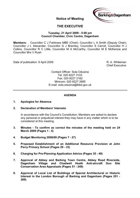
Notice of Meeting<br />
THE EXECUTIVE<br />
Tuesday, 21 April 2009 - 5:00 pm<br />
Council Chamber, Civic Centre, Dagenham<br />
Members: Councillor C J Fairbrass <strong>MB</strong>E (Chair); Councillor L A Smith (Deputy Chair);<br />
Councillor J L Alex<strong>and</strong>er, Councillor G J Bramley, Councillor S Carroll, Councillor H J<br />
Collins, Councillor R C Little, Councillor M A McCarthy, Councillor M E McKenzie <strong>and</strong><br />
Councillor Mrs V Rush<br />
Date of publication: 9 April 2009 R. A. Whiteman<br />
Chief Executive<br />
1. Apologies for Absence<br />
2. Declaration of Members' Interests<br />
Contact Officer: Sola Odusina<br />
Tel. 020 8227 3103<br />
Fax: 020 8227 2162<br />
Minicom: 020 8227 2685<br />
E-mail: sola.odusina@lbbd.gov.uk<br />
AGENDA<br />
In accordance with the Council’s Constitution, Members are asked to declare<br />
any personal or prejudicial interest they may have in any matter which is to be<br />
considered at this meeting.<br />
3. Minutes - To confirm as correct the <strong>minutes</strong> of the meeting held on 24<br />
March 2009 (Pages 1 - 5)<br />
4. Budget Monitoring 2008/09 (Pages 7 - 27)<br />
5. Proposed Establishment of an Additional Resource Provision at John<br />
Perry Primary School (Pages 29 - 33)<br />
6. Charging for Pre-Planning Application Advice (Pages 35 - 49)<br />
7. Approval of Abbey <strong>and</strong> Barking Town Centre, Abbey Road Riverside,<br />
Dagenham Village <strong>and</strong> Chadwell Heath Anti-aircraft Gun Site<br />
Conservation Area Appraisals (Pages 51 - 249)<br />
8. Approval of Local List of Buildings of Special Architectural or Historic<br />
Interest in the London Borough of Barking <strong>and</strong> Dagenham (Pages 251 -<br />
269)
9. Local Development Framework - Core Strategy, Borough-wide<br />
Development Policies, Site Specific Allocations <strong>and</strong> Joint Waste<br />
Development Plan Documents (Pages 271 - 284)<br />
The appendix to this report has been circulated separately as Supplementary 1<br />
10. Any other public items which the Chair decides are urgent<br />
11. To consider whether it would be appropriate to pass a resolution to<br />
exclude the public <strong>and</strong> press from the remainder of the meeting due to<br />
the nature of the business to be transacted.<br />
Private Business<br />
The public <strong>and</strong> press have a legal right to attend Council meetings such as the<br />
Executive, except where business is confidential or certain other sensitive<br />
information is to be discussed. The list below shows why items are in the<br />
private part of the agenda, with reference to the relevant legislation (the<br />
relevant paragraph of Part 1 of Schedule 12A of the Local Government Act<br />
1972 as amended).<br />
12. Barking & Dagenham Local Housing Company (to follow)<br />
13. One Barking <strong>and</strong> Dagenham ICT Themes (to follow)<br />
14. Any other confidential or exempt items which the Chair decides are<br />
urgent
THE EXECUTIVE<br />
Tuesday, 24 March 2009<br />
(5:00 - 6:10 pm)<br />
Present: Councillor C J Fairbrass <strong>MB</strong>E (Chair), Councillor L A Smith (Deputy<br />
Chair), Councillor J L Alex<strong>and</strong>er, Councillor G J Bramley, Councillor M A McCarthy<br />
<strong>and</strong> Councillor Mrs V Rush<br />
Apologies: Councillor S Carroll, Councillor H J Collins, Councillor R C Little <strong>and</strong><br />
Councillor M E McKenzie<br />
157. Declaration of Members' Interests<br />
None declared.<br />
158. Minutes - 10 March 2009<br />
Agreed.<br />
159. Barking <strong>and</strong> Dagenham Community Strategy<br />
Received a report from the Corporate Director of Resources concerning the<br />
Community Strategy which sets out a new vision for the Barking <strong>and</strong> Dagenham<br />
Local Strategic Partnership - Working together for a better borough <strong>and</strong> 6 new<br />
Community Priorities comprising: Safe; Clean; Fair <strong>and</strong> Respectful; Healthy;<br />
Prosperous; Inspired <strong>and</strong> Successful.<br />
The Community Strategy is a 10 year plan bringing all partnership activity into one<br />
place.<br />
Agreed, in order to assist the Council to achieve all of its Community Priorities to<br />
recommend the Community Plan to the Assembly for adoption.<br />
160. Council Plan Update 2009-10 Incorporating the Medium Term Financial<br />
Strategy (MTFS) 2009-10 to 2011-12<br />
Received a report from the Corporate Director of Resources concerning the<br />
Council Plan which is an update on a previous report agreed by Minute 88<br />
2008/09, setting out the Council’s vision, values <strong>and</strong> priorities, <strong>and</strong> links in with the<br />
Community Strategy. The Council Plan runs from 2008-2010, <strong>and</strong> incorporates<br />
the MTFS which sets out the financial strategy for delivering the Council’s<br />
Priorities.<br />
Agreed, in order to assist the Council to achieve all of its Community Priorities to<br />
recommend the Council Plan Update <strong>and</strong> MTFS to the Assembly for adoption.<br />
161. Gascoigne Estate Regeneration<br />
AGENDA ITEM 3<br />
Received a report from the Corporate Director of Resources concerning proposals<br />
for the comprehensive regeneration of the Gascoigne Estate. This includes broad<br />
Page 1
development principles <strong>and</strong> an over-arching phasing strategy that will guide the<br />
future regeneration of the estate together with a programme for the master<br />
planning of phase 1 <strong>and</strong> the production of detailed proposals for Phase 1a <strong>and</strong> the<br />
Kingsbridge site, in addition to serving of Initial <strong>and</strong> Final Demolition notices to<br />
secure tenants in Phase 1 <strong>and</strong> 2.<br />
Agreed, in order to assist the Council to achieve its Community Priorities of,<br />
‘Regenerating the Local Economy,’ ‘Raising General Pride in the Borough,’ ‘Better<br />
Education <strong>and</strong> Learning For All’ <strong>and</strong> ‘Improving Health, Housing <strong>and</strong> Social Care’<br />
to approve, subject to funding:<br />
(i) The overarching Phasing Strategy for the Gascoigne Estate <strong>and</strong> the<br />
detailed Phasing Strategy for Phase 1;<br />
(ii) The outline programme for the master planning of Phase 1 <strong>and</strong> the detailed<br />
design stages for Phase 1A <strong>and</strong> the Kingsbridge site;<br />
(iii) Commencement of decant <strong>and</strong> buybacks for Phase 1A <strong>and</strong> buy-backs in<br />
Phase 1B;<br />
(iv) The serving of Initial Demolition Notices on all secure tenants within Phases<br />
1 <strong>and</strong> 2 in order to suspend the requirement for the Council to complete<br />
right to buy applications for as long as the Notices remain in force;<br />
(v) Authority to serve Final Demolition Notices on all secure tenants within<br />
Phase 1 <strong>and</strong> 2 once the proposed demolition dates are known, in order to<br />
render all existing right to buy applications ineffective <strong>and</strong> prevent any<br />
further right to buy applications being made;<br />
(vi) The demolition of properties in Phase 1A <strong>and</strong> the Kingsbridge site once<br />
vacant possession has been secured; <strong>and</strong><br />
(vii) The Gascoigne Estate Consultation <strong>and</strong> Engagement Strategy;<br />
Thanked the Head of Regeneration <strong>and</strong> Economic Development <strong>and</strong> his staff for<br />
their work in bringing about a long held ambition for residents.<br />
162. Barking Riverside First Primary School<br />
Received a report from the Corporate Director of Children’s Services concerning<br />
proposals to establish a new primary school at Barking Riverside.<br />
Agreed, in order to assist the Council to achieve its Community Priority of ‘Better<br />
Education <strong>and</strong> Learning For All’ to:<br />
(i) working with the Diocese of Chelmsford to make an application to the<br />
Secretary of State for Children, Schools <strong>and</strong> Families to establish a first<br />
school at Barking Riverside to be a voluntary controlled school, subject to a<br />
consultation process;<br />
(ii) the procurement route in conjunction with Barking Riverside Ltd (BRL) on<br />
the terms set out in paragraph (15.1-15.3) of the report <strong>and</strong> authorise the<br />
Corporate Director of Children’s Services on the advice of the Legal Partner<br />
Page 2
to enter into an agreement with BRL as set out in paragraph 15.4 of the<br />
report;<br />
(iii) set aside £10.5m from the grant secured from the DCSF to pay the<br />
Council’s contribution for the design <strong>and</strong> construction of the primary school;<br />
<strong>and</strong><br />
(iv) consider naming the new school ‘George Carey School’ subject to the<br />
agreement of the Diocese of Chelmsford <strong>and</strong> George Carey.<br />
163. Dagenham Heathway <strong>Public</strong> Realm - Greening Measures <strong>and</strong> Highway<br />
Modifications<br />
In response to Member <strong>and</strong> public concerns regarding works carried out at the<br />
Dagenham Heathway shopping parade, received a report from the Corporate<br />
Director’s of Resources <strong>and</strong> Customer Services proposing improvement work to<br />
enhance the area.<br />
Agreed, in order to assist the Council to achieve its Community Priorities of,<br />
‘Regenerating the Local Economy’, ‘Raising General Pride in the Borough’ <strong>and</strong><br />
‘Putting Our Customers First’ to:<br />
(i) The range of works for improvement to the Heathway as described in<br />
section 3 of the report;<br />
(ii) funding of the agreed works from the Highways Investment Programme<br />
2009/10 to the value of £200,000 as set out in Section 4 of the report;<br />
(iii) delegate authority to the Corporate Director of Resources, in consultation<br />
with the Lead Member for Regeneration, to approve the final selection of<br />
materials; <strong>and</strong><br />
(iv) delegate authority to the Corporate Director of Customer Services to review<br />
the consultation arrangements as set out in the report.<br />
Thanked the Head of Environmental <strong>and</strong> Enforcement Services <strong>and</strong> his staff for all<br />
their hard work.<br />
164. Budget Monitoring 2008/09<br />
Received a report from the Corporate Director of Resources providing an update<br />
on the Council’s revenue <strong>and</strong> capital position for the period April to January of the<br />
2008/09 financial year.<br />
The position for revenue expenditure indicates that current budget pressures<br />
amount to £2.5million. The largest pressure continues to remain within the<br />
Children’s Services department (£3million) <strong>and</strong> Regeneration Services (87k) which<br />
are offset by projected under spends in Resources (400k) <strong>and</strong> Customer Services<br />
(£242k).<br />
Agreed, in order to assist the Council to achieve all of its Community Priorities <strong>and</strong><br />
as a matter of good financial practice, to:<br />
Page 3
(i) note the current position of the Council’s revenue <strong>and</strong> capital budget as at<br />
31 January 2009;<br />
(ii) note that where pressures <strong>and</strong> targets exist, Directors continue to identify<br />
<strong>and</strong> implement the necessary action plans to alleviate these budget<br />
pressures to ensure that the necessary balanced budget for the Council is<br />
achieved by year end;<br />
(iii) note the position <strong>and</strong> projected out-turn for the Housing Revenue account;<br />
<strong>and</strong><br />
(iv) the re-profiling of individual capital schemes as identified in Appendix D of<br />
the report.<br />
165. Barking Market Charges<br />
Received a report from the Corporate Director of Children’s Services<br />
recommending the appropriate level of charges for traders pitches 2009/10.<br />
Agreed, in order to assist the Council to achieve all of its Community Priorities <strong>and</strong><br />
as a matter of good financial practice, to the charges for 2009/10 as set out below,<br />
to be effective from 1 April 2009.<br />
(i) Charges in four ‘b<strong>and</strong>s’, the rates in £ per foot of frontage reducing with<br />
distance from the ‘East Street’ market area. As shown in the plan attached<br />
to the report.<br />
(ii) Zone A B C D<br />
Tues/ Thurs. 3.05 2.50 2.00 1.50<br />
Saturday 4.12 3.00 2.50 2.00<br />
Where Zone ‘A’ rates are the same as the existing rates in neighbouring East<br />
Street.<br />
166. # Professional Services Contract - Term Contract 2008/2011<br />
Received a report from the Corporate Director of Resources concerning proposals<br />
to enter into a new contract for Professional Property Services.<br />
Agreed, in order to assist the Council to achieve its Community Priorities of<br />
‘Regenerating the Local Economy’ <strong>and</strong> ‘Raising General Pride in the Borough’ to<br />
the appointment of Lambert Smith Hampton contractors for the provision of<br />
Professional Property Services.<br />
(# The Appendix to this report was contained in the private section of the agenda<br />
by virtue of paragraph 3 of Part 1 of Schedule 12A of the Local Government Act<br />
1972.)<br />
Page 4
167. * Free School Meals Pilot Project<br />
Received a report from the Corporate Director of Children’s Services regarding<br />
proposals to submit a full bid to run a pilot to make free school meals available to<br />
all primary school pupils within the borough.<br />
Agreed, in order to assist the Council to achieve its Community Priorities of<br />
‘Improving Health, Housing <strong>and</strong> Social Care’ <strong>and</strong> ‘Better Education <strong>and</strong> Learning<br />
For All’,<br />
(i) To submit the full bid on the 27 March. The Chief Executive of the Primary<br />
Care Trust <strong>and</strong> the Corporate Director of Children’s Services are required to<br />
sign-off the bid before submission;<br />
(ii) In principle to fund up to a maximum 2009/10 requirement of £500k from<br />
corporate balances/reserves;<br />
(iii) That if the bid is successful to include the relevant revenue support into the<br />
Council’s Medium Term Financial Strategy for 2010/11 <strong>and</strong> 2011/12; <strong>and</strong><br />
(iv) to note that to fund £300k for the Youth Access card from capital will be met<br />
from within the current ICT provision in the capital programme.<br />
(* The Chair agreed that this item could be considered as a matter of urgency<br />
under the provisions of Section 100B (4) (b) of the Local Government Act 1972 in<br />
order to prevent the delay of the bid.)<br />
Page 5
This page is intentionally left blank<br />
Page 6
THE EXECUTIVE<br />
21 APRIL 2009<br />
REPORT OF THE CORPORATE DIRECTOR OF RESOURCES<br />
Title: Budget Monitoring Report February 2008/2009 For Decision<br />
Summary:<br />
The report updates the Executive on the Council’s revenue <strong>and</strong> capital position for the<br />
period April to February of the 2008/09 financial year.<br />
The current forecast across the Council in respect of its revenue budget has identified<br />
projected in-year pressures amounting to £2.8million. The areas of pressure are currently<br />
within the Children’s Services (£3.4million) <strong>and</strong> Regeneration Services (£318k) which are<br />
offset by projected underspends in Resources (£400k), Adults & Community Services<br />
(70k) <strong>and</strong> Customer Services (£489k).<br />
The largest pressure continues to remain within the Children’s Services department, where<br />
significant budget pressures exist from Looked after Children Placements <strong>and</strong> in meeting<br />
the Councils’ Leaving Care responsibilities. In order to deliver a balanced budget by the<br />
year end, an action plan was agreed at the Executive meeting on the 14 th October 2008<br />
requiring in-year savings to be achieved across all service departments <strong>and</strong> a provision of<br />
£2m from Corporate contingencies <strong>and</strong> balances.<br />
All departments have been addressing both their own pressures <strong>and</strong> the approved action<br />
plans in order to achieve their necessary targets by the year end. The outcomes <strong>and</strong><br />
progress of these action plans have been monitored <strong>and</strong> reported to both the Resource<br />
Monitoring panels <strong>and</strong> the Executive through the regular budget monitoring meetings <strong>and</strong><br />
<strong>reports</strong>. Whilst these action plans have reduced the estimated overspend from its peak of<br />
£7.4m in June 2008, it is now considered extremely unlikely that the Council will achieve a<br />
balanced budget position for 2008/09. The current projection is that there will be a net<br />
overspend of approximately £780k, <strong>and</strong> officers will continue to monitor this position as the<br />
Council finalises its accounts for 2008/09 which will be reported to the Executive in June.<br />
For the Housing Revenue Account the forecast is that the year end working balance will be<br />
£4.1m compared to the working budget projection of £3.5million.<br />
In regard to the Capital programme, the current working budget is £88.7million with a<br />
projected spend of £85.3m. Directors are continuing to review the delivery of individual<br />
capital schemes to ensure maximum spend is achieved by the year end.<br />
Wards Affected: This is a regular budget monitoring report of the Council’s resource<br />
position <strong>and</strong> applies to all wards.<br />
Recommendations<br />
The Executive is asked to:<br />
1. note the current position of the Council’s revenue <strong>and</strong> capital budget as at 28<br />
February 2009 (Appendix A <strong>and</strong> C <strong>and</strong> Sections 3 <strong>and</strong> 5 of the report);<br />
Page 7<br />
AGENDA ITEM 4
2. note that where pressures <strong>and</strong> targets exist, Directors continue to identify <strong>and</strong><br />
implement the necessary action plans to alleviate these budget pressures (section 3<br />
of the report);<br />
3. note the position <strong>and</strong> projected out-turn for the Housing Revenue Account (Appendix<br />
B <strong>and</strong> Section 4 of the report);<br />
4. agree the budget approval of the capital scheme as identified in Appendix D.<br />
Reason<br />
As a matter of good financial practice, the Executive should be regularly updated with the<br />
position on the Council’s budget.<br />
Implications:<br />
Financial:<br />
The overall revenue budget for February 2009 is indicating budget pressures totalling<br />
£2.8m. Where pressures <strong>and</strong> targets exist Directors are required to identify <strong>and</strong> implement<br />
the necessary action plans to alleviate these pressures. The working capital programme is<br />
now reported at £88.7million with a projected spend of £85.3m (96% of the budget).<br />
Legal:<br />
There are no legal implications regarding this report.<br />
Risk Management:<br />
The risk to the Council is that budgets are overspent <strong>and</strong> that this reduces the Council’s<br />
overall resource position. Where there is an indication that a budget may overspend by the<br />
year end the relevant Director will be required to review the Departmental budget position<br />
to achieve a balanced position by the year end. This may involve the need to produce a<br />
formal action plan to ensure delivery of this position for approval <strong>and</strong> monitoring by the<br />
Resource Monitoring Panel <strong>and</strong> the Executive.<br />
Similarly, if there are underspends this may mean a lower level of service or capital<br />
investment not being fully delivered. Specific procedures <strong>and</strong> sanctions are in place<br />
through the Resource Monitoring Panels, Capital Programme Management Office<br />
(CPMO), Corporate Management Team <strong>and</strong> the Executive.<br />
Social Inclusion <strong>and</strong> Diversity:<br />
As this report does not concern a new or revised policy there are no specific adverse<br />
impacts insofar as this report is concerned.<br />
Crime <strong>and</strong> Disorder:<br />
There are no specific implications insofar as this report is concerned.<br />
Options Appraisal:<br />
There are no specific implications insofar as this report is concerned.<br />
Contact Officer<br />
Joe Chesterton<br />
Lee Russell<br />
Title:<br />
Divisional Director -<br />
Corporate Finance<br />
Group Manager -<br />
Resources & Budgeting<br />
Page 8<br />
Contact Details:<br />
Tel:020 8227 2932<br />
E-mail: joe.chesterton@lbbd.gov.uk<br />
Tel: 020 8227 2966<br />
E-mail: lee.russell@lbbd.gov.uk
1. Introduction <strong>and</strong> Background<br />
1.1 It is important that the Council regularly monitors its revenue <strong>and</strong> capital budgets to<br />
ensure good financial management. It is now practise within the Council for this<br />
monitoring to occur on a regular monthly basis, which helps members to be<br />
constantly updated on the Council’s overall financial position <strong>and</strong> to enable the<br />
Executive to make relevant decisions as necessary on the direction of both the<br />
revenue <strong>and</strong> capital budgets.<br />
1.2 The report is based upon the core information contained in the Oracle general<br />
ledger system supplemented by detailed examinations of budgets between the<br />
budget holders <strong>and</strong> the relevant Finance teams to take account of commitments<br />
<strong>and</strong> projected end of year positions. In addition, for capital monitoring there is the<br />
extensive work carried out by the Capital Programme Management Office (CPMO).<br />
1.3 The monthly Resource Monitoring Panels, chaired by the lead member for finance,<br />
<strong>and</strong> attended by Directors <strong>and</strong> Heads of Service, monitors the detail of individual<br />
departments’ revenue <strong>and</strong> capital budgets alongside relevant performance data <strong>and</strong><br />
this also enhances <strong>and</strong> forms the basis of this report.<br />
2. Current Position<br />
2.1 Overview for Revenue Budget<br />
2.1.1 The current forecast across the Council in respect of its revenue budget has<br />
identified the following position:<br />
February<br />
Department/Service<br />
Position<br />
£’000<br />
Adult & Community Services (70)<br />
Children’s Services 3,421<br />
Customer Services (489)<br />
Regeneration 318<br />
Resources (400)<br />
Departmental Position 2,780<br />
Use of Corporate Contingencies <strong>and</strong> Balances (2,000)<br />
Forecasted Outturn 780<br />
The largest pressure is within the Children’s Services department where significant<br />
budget pressures exist from Looked after Children Placements, <strong>and</strong> in meeting the<br />
Councils’ Leaving Care responsibilities. On the basis of existing commitments <strong>and</strong><br />
projections to the end of the financial year, the forecast overspend in this area is<br />
£3.6million.<br />
2.1.2 In order to deliver a Council balanced budget by the year end, an action plan was<br />
agreed at the Executive meeting on the 14 th October requiring in-year savings to be<br />
achieved across all service departments as well as a provision for a contribution of<br />
£2m from Corporate contingencies <strong>and</strong> balances.<br />
Page 9
2.1.3 Details of each department’s current financial position are provided in Section 3 of<br />
this report. In those areas where budget pressures have been highlighted, continual<br />
work is being undertaken by Corporate Directors <strong>and</strong> their management teams to<br />
ensure their targeted outturn is produced for the year end. To this end, Corporate<br />
Directors are delivering action plans to address <strong>and</strong> rectify these pressure areas<br />
<strong>and</strong> these plans will be actively monitored by the various Resource Monitoring<br />
Panels through the final phase of the financial year.<br />
3. Service Position<br />
3.1 General<br />
3.1.1 Details of each Department’s current financial position <strong>and</strong> the work being undertaken<br />
by Corporate Directors <strong>and</strong> their management teams, to ensure a balanced budget is<br />
produced for the year end, are provided in this section of the report.<br />
3.2 Adult <strong>and</strong> Community Services Department<br />
3.2.1 The Adult <strong>and</strong> Community Services budget position at the end of February is<br />
projecting a small underspend of £70k for the year. This represents a £70k<br />
reduction from January <strong>and</strong> a more significant reduction of £900k from its peak<br />
earlier in the year. The overall reduction is as a result of the variety of Management<br />
actions that are being undertaken within the department.<br />
There continues to be significant issues <strong>and</strong> pressures facing the Department at this<br />
time particularly in relation to the Learning Disability Service <strong>and</strong> Transitions’<br />
arrangements from Children’s Services (i.e. when clients turn age 18 they become<br />
the responsibility of the Adults Division). However, the Executive is reminded that<br />
the Department <strong>and</strong> its Management Team have a track record of dealing with<br />
issues <strong>and</strong> pressures throughout the year to deliver the required budget.<br />
The department’s 2008/09 budget reflects a total of £3.35million of savings which<br />
includes the outst<strong>and</strong>ing £900k of savings from last years Older Persons<br />
Modernisation Programme in the Home Support Service.<br />
3.2.2 Following the Executive decision in October which required an in-year contribution to<br />
support the Looked after Children Placements pressure, the department is now<br />
targeted to underspend by £600k in 2008/09.<br />
Whilst the Corporate Director <strong>and</strong> the management team have implemented several<br />
actions to ensure the targeted budget is achieved for the year end, it is now<br />
considered unlikely that the department will be able to fully achieve this target.<br />
The action plans the department have implemented to improve/reduce its financial<br />
position have included reductions in the use of agency staff, overtime <strong>and</strong> vacancy<br />
management, tighter dem<strong>and</strong> management of care budgets <strong>and</strong> exploration of<br />
partnering opportunities.<br />
3.2.3 Adult Care Services<br />
This service area primarily relates to Older Persons Residential <strong>and</strong> Home support<br />
provided by the councils remaining in-house services. It also includes the<br />
Passenger Transport Service. Budget pressures are being experienced mainly due<br />
to the dem<strong>and</strong>s for Home care, delays in the opening of Lake-Rise/ Kallar Lodge<br />
<strong>and</strong> also some pressures within the Passenger Transport Service.<br />
Page 10
A variety of Management actions are being undertaken within the division to ensure<br />
the targeted budget is achieved for the year end.<br />
3.2.4 Adult Commissioning Services<br />
This service area represents the Social Work <strong>and</strong> Care Management budgets in the<br />
department, together with services commissioned from the Independent <strong>and</strong> Private<br />
Sector. Service areas include Older Persons, Physical Disability, Learning Disability<br />
(LD) <strong>and</strong> Mental Health. The net budget for the area is £44million <strong>and</strong> is by far the<br />
largest area (70%) in cash terms in the department. The department has set itself<br />
some challenging targets in this area particularly around procurement <strong>and</strong><br />
commissioning gains/savings. Interface issues with the local Hospitals <strong>and</strong> the PCT<br />
regarding Delayed Transfers of Care are acute in this area, <strong>and</strong> are carefully<br />
managed. The Executive will recall pressures in previous years’ regarding external<br />
care <strong>pack</strong>ages in this area that led to a review of the FACS eligibility criteria. It is<br />
envisaged that robust monitoring <strong>and</strong> gate-keeping will again be required in this<br />
area to contain dem<strong>and</strong> within budgets in 2008/09.<br />
Pressures are being experienced in the Transitions from Children’s area due to the<br />
increasing number of Children with Care Packages/arrangements who are turning<br />
age 18. Also, in common with other Boroughs <strong>and</strong> nationally, LD budgets are also<br />
experiencing dem<strong>and</strong> for more services.<br />
3.2.5 Community Safety <strong>and</strong> Preventive Services<br />
This service area includes CCTV, Community Safety & Parks Police, Substance<br />
Misuse, Neighbourhood Management <strong>and</strong> the Youth Offending Team. The total net<br />
budgets are in the region of £4million for this area. No significant pressures are<br />
being experienced in the Community Safety area at present.<br />
3.2.6 Community Services <strong>and</strong> Libraries<br />
This service area covers Heritage <strong>and</strong> Libraries, the Lifelong Learning Centre,<br />
Community Development <strong>and</strong> Halls, Community Cohesion <strong>and</strong> Equalities <strong>and</strong><br />
Diversity. Net budgets are in the region of £7.7million <strong>and</strong> currently the budgets in<br />
this area are cost neutral.<br />
3.2.7 Other Services, Central Budgets, Recharges, <strong>and</strong> Government Grants<br />
The Adult <strong>and</strong> Community Services Department receive government grants, <strong>and</strong><br />
incur recharges for departmental <strong>and</strong> divisional support. All grants will be used in<br />
support of existing service areas. Central budgets <strong>and</strong> recharges within the<br />
department are on target.<br />
3.3 Children’s Services Department<br />
3.3.1 There has been an increase of £400k in the forecasted overspend for Children’s<br />
Services from the January position i.e. the department is now projecting an overspend<br />
of £3.4million. Previous forecasts had made provision for joint funding contributions<br />
from the Primary Care Trust (PCT) to support existing health-related activities in<br />
Children’s Services similar to previous years support. Unfortunately the PCT has not<br />
been in a position to provide the level of support anticipated in 2008/09 <strong>and</strong> therefore<br />
the forecasted position has been adjusted to reflect this reduction.<br />
Page 11
The main departmental pressure arises from the ongoing budget pressure in relation<br />
to Looked after Children Placements <strong>and</strong> in meeting the Councils’ Leaving Care<br />
responsibilities, which have continued from 2007/08 into 2008/09. On the basis of<br />
existing commitments, <strong>and</strong> assessing the future profile for looked after children, the<br />
forecast is for an overspend in this area of £3.6million which includes associated legal<br />
costs. This position has reduced over the past few months, highlighting that strategies<br />
are working (more in-house foster care capacity, invest to save successes) <strong>and</strong> the<br />
quarterly model unravelling complexities <strong>and</strong> resolving process issues are improving<br />
the forecast.<br />
3.3.2 As previously reported to the Executive, the pressures from Looked after Children<br />
Placements cannot be fully mitigated in 2008/09, <strong>and</strong> as a result the Executive agreed<br />
at its meeting on the 14 th October an action plan requiring in-year savings to be<br />
achieved across all service departments <strong>and</strong> a provision for a contribution from<br />
Corporate contingencies <strong>and</strong> balances. The Children’s department is targeted to<br />
contribute £600k to the Looked after Children Placements pressure in 2008/09.<br />
As a result of this in-year savings target, elsewhere within Children’s Services<br />
spending is now planned to underspend by £200k thereby totalling an overall<br />
departmental overspend of £3.4million. As mentioned in paragraph 3.3.1 the loss of<br />
income from the PCT has meant that the department is unlikely to be able to<br />
achieve this £600k contribution.<br />
The other risks of not achieving the current reported forecast outturn include: further<br />
variations in the position on looked after children <strong>and</strong> leaving care; further pressures<br />
from passenger transport beyond those reported in October 2008; further variations<br />
arising from legal services costs <strong>and</strong> the exhaustion of further opportunities for flexible<br />
use of grants.<br />
A number of other pressures do exist within the department including the costs<br />
taken transport <strong>and</strong> variations arising from legal services costs. Management<br />
actions to deliver both the targeted underspend <strong>and</strong> these pressures include<br />
maximising grant funding, vacancy management, reviewing internal spend targets<br />
<strong>and</strong> pursuing third party income.<br />
3.3.3 Schools<br />
The carry-forward revenue balances for schools for 2008/09 were £6m. All schools<br />
with balances have been asked to demonstrate why they are holding balances, with<br />
the Scheme for Financing Schools allowing for clawback where schools have no<br />
plans for balances in excess of DCSF thresholds, which are 8% for primary <strong>and</strong><br />
special schools <strong>and</strong> 5% for secondary schools. All schools with deficits are required<br />
to have a recovery plan.<br />
There is expected to be an underspend in the retained element of the Dedicated<br />
Schools Grant (DSG) for 2008/09. DSG may only be spent on prescribed activities<br />
set out in regulation by the DCSF which include: devolved budgets for schools,<br />
special needs support for individual pupils, pupils out of school, early years<br />
educational provision, admissions, catering <strong>and</strong> some other specific elements. Any<br />
underspend in the retained element would be required to be carried forward into<br />
2009/10 <strong>and</strong> spent on DSG activities.<br />
Page 12
3.3.4 Quality <strong>and</strong> School Improvement<br />
The Quality <strong>and</strong> School Improvement is reporting an underspend of £100k due to<br />
further flexible use of grants. The division will maximise the use of St<strong>and</strong>ards Funds<br />
<strong>and</strong> some elements of the Area Based Grants to assist with the departmental financial<br />
position.<br />
3.3.5 Shared Services <strong>and</strong> Engagement<br />
Much of the work of the Shared Services <strong>and</strong> Engagement division is either funded<br />
from SureStart Grant or from the Dedicated Schools Grant (DSG), with only around<br />
£1million funded from the General Fund. This division has some savings targets to<br />
deliver, as well as absorbing some of the Integrated Family Services work. There<br />
are not anticipated to be any major variances at this stage.<br />
3.3.6 Safeguarding <strong>and</strong> Rights<br />
The main budget issue for the Safeguarding & Rights service is that of the cost of<br />
Looked after Children placements <strong>and</strong> Leaving Care costs. On the basis of existing<br />
commitments the current forecast is for an overspend on these budgets of<br />
£3.6million which includes associated legal costs.<br />
The contributing factors for this projected overspend include:<br />
• Reducing numbers of in-house foster carers;<br />
• Significant improvements in the education of looked after children;<br />
• Increasing statutory responsibilities for young people leaving care between the<br />
ages of 18 <strong>and</strong> 21;<br />
• Growing numbers of children continuing to attract payments for Special<br />
Guardianship <strong>and</strong> Adoption allowances;<br />
• Growth in the overall numbers of children in the borough;<br />
• Lower capacity in Children’s Social Care;<br />
• Increased complexity of cases referred to Safeguarding & Rights;<br />
• Respite Care <strong>pack</strong>ages for disabled children;<br />
• Policy change in moving to approved numbers for foster care placements.<br />
While the above factors may represent the main direct impacts, the context within<br />
which these services are operating will have an influence on the financial performance.<br />
For instance,<br />
• The Children <strong>and</strong> Young People’s Bill (Care Matters) sets out the expectations on<br />
the Authority in meeting its corporate parenting responsibilities;<br />
• The high number of children in need cases open to children’s social care <strong>and</strong> the<br />
historical absence of effective universal preventative services to allow Children’s<br />
Social Care to concentrate on those children who are subject to a child protection<br />
plan <strong>and</strong> children in care;<br />
• Expectations to improve performance from previous inspections (i.e. not placing<br />
children over foster carers’ approved numbers); the Joint Area Review <strong>and</strong> the<br />
Corporate Performance Assessment in relation to the education of looked after<br />
children;<br />
• The associated financial issues for transport costs, legal costs, contact <strong>and</strong> children<br />
with no recourse to public funds.<br />
The current overspend position has reduced over the past few months, highlighting<br />
that strategies are working (more in-house foster care capacity, invest to save<br />
successes) <strong>and</strong> the quarterly model unravelling complexities <strong>and</strong> resolving process<br />
issues are improving the forecast.<br />
Page 13
3.3.7 Children’s Policy Trust <strong>and</strong> Commissioning<br />
At present, there are concerns about cost pressures being experienced by the catering<br />
service, whose costs are predominantly charged to the Dedicated Schools Grant. The<br />
division includes the Youth Service, Policy & Performance <strong>and</strong> Services to Schools,<br />
which are reporting an overall balanced budget.<br />
3.3.8 Other<br />
Most of the costs here are for capital charges, on-going pension costs, central<br />
recharges <strong>and</strong> the costs of the Director of Children’s Services. Any savings in this<br />
area will be used to contribute to the departmental financial position.<br />
3.4 Customer Services Department<br />
3.4.1 The current forecast for the department is highlighting an underspend of £489k which<br />
represents a further inprovement from the £247k underspend reported in January.<br />
As a result of the Executive decision in October requiring an in-year contribution to<br />
support the Looked after Children Placements pressure, the department is now<br />
targeted to underspend by £600k in 2008/09. The Corporate Director <strong>and</strong> the<br />
management team have implemented several actions to ensure the targeted budget is<br />
achieved for the year end. These include holding vacant posts, reducing agency<br />
spend, implementing changes in the Private Sector leasing service, examining<br />
alternative funding arrangements in fleet management <strong>and</strong> securing additional income.<br />
3.4.2 Environmental <strong>and</strong> Enforcement Services<br />
The Environmental <strong>and</strong> Enforcement Service is now highlighting an overall underspend<br />
of £12k due to the ongoing delivery of the management teams action plan, in<br />
particularly reducing agency costs <strong>and</strong> capitalising vehicle purchase costs. During the<br />
year there have been overspends for fuel <strong>and</strong> contract hire particularly within the<br />
Refuse Collection, Highway Maintenance <strong>and</strong> Grounds Maintenance services. Other<br />
pressures include increased employee costs <strong>and</strong> reduction in income e.g. refuse<br />
services. There have however been general underspends within other areas of the<br />
service as well as increased parking income which has helped to mitigate some of<br />
these overspends. The division’s financial/operational resources are continually being<br />
stretched due to the need to employ temporary staff to cover vacant posts which is<br />
required to maintain high quality front line services. Whilst these pressures have<br />
continued throughout the year, management’s proactive approach <strong>and</strong> corrective<br />
actions have, <strong>and</strong> should assist in containing these pressures as much as possible.<br />
3.4.3 General Housing<br />
The current review of the General Housing budget is indicating an overspend of<br />
£254k, mainly in the Housing Advice <strong>and</strong> Temporary Accommodation service due to<br />
greater use of temporary accommodations properties than originally estimated. The<br />
February position has however improved from January following the detailed<br />
financial review conducted on PSL’s which has improved the voids position in this<br />
area thus increasing income to the Council<br />
The Council has a statutory duty to provide Temporary Accommodation to vulnerable<br />
clients <strong>and</strong> by it’s nature, the service is vulnerable to fluctuating costs that are<br />
associated with a dem<strong>and</strong> led service.<br />
Page 14
A Government initiative to reduce the use of Temporary Accommodation by 2010 is<br />
embedded in the Departments Homelessness Strategy, although this is contingent on<br />
socio-economic factors that are outside the control of the Council.<br />
3.4.4 Customer Strategy<br />
This service is now projecting a small underspend position of £45k for 2008/09 within<br />
its employee budgets.<br />
3.4.5 Barking & Dagenham Direct<br />
The Service is currently projecting an underspend of £686k. This forecast reflects the<br />
savings required to relieve current budget pressures from other areas of the Council<br />
<strong>and</strong> include the recalculation of the projected expenditure on bad debt provision,<br />
renegotiation of agency contracts <strong>and</strong> necessary recharges to non-General fund<br />
services.<br />
3.5 Regeneration Department<br />
3.5.1 The February position is forecasting an overspend of £318k which is an increase of<br />
£231k on the January position. This increase has been primarily due to a further loss of<br />
transaction fees with the non-sale of the Frizl<strong>and</strong>s Allotments (£112k), loss of building<br />
control income due to market changes (£67k) <strong>and</strong> additional potential employment<br />
settlement costs (£25k). As a result of the Executive decision in October requiring an inyear<br />
contribution to support the Looked after Children Placements pressure, the<br />
department was targeted to underspend by £300K. Whilst the management team have<br />
implemented several actions to ensure the targeted budget is achieved for the year end,<br />
it is now considered unlikely that the department will be able to fully achieve this target.<br />
The management actions implemented have specifically included holding vacant posts<br />
<strong>and</strong> tighter controls on expenditure. In previous <strong>reports</strong> it had been estimated that the<br />
service would receive £300k from the establishment of the Local Housing Company,<br />
however this venture will not now be completed by the end of the financial year <strong>and</strong> as a<br />
result this income has now been excluded from the 2008/09 projections.<br />
The main cost pressures arising throughout the year have related to reductions in<br />
income (e.g. Commercial property, transaction fees, LSC, L<strong>and</strong> charges) <strong>and</strong><br />
increased employee <strong>and</strong> premises costs. These pressures have in the main been<br />
able to be offset by savings arising from staff vacancies, additional service income<br />
<strong>and</strong> tight controls on other budget areas.<br />
3.5.2 Directorate <strong>and</strong> PPP<br />
The current projection is for an underspend of £92k mainly from holding vacant posts in<br />
order to assist with the departmental financial position.<br />
3.5.3 Housing Strategy & Property<br />
The main pressure for this division relates to potential delays, or removal of sites, in<br />
the delivery of the l<strong>and</strong> disposal programme which will result in a loss of budgeted<br />
income in respect of transaction fees. Other pressures include the loss of commercial<br />
rental income due to the economic slowdown <strong>and</strong> changes in Government regulations<br />
on payments for NNDR on empty properties. The current projection indicates an<br />
overspend of £715k.<br />
Page 15
3.5.4 Spatial Regeneration<br />
The current projection is for an underspend of £279k, mainly due to savings arising<br />
from vacancies <strong>and</strong> the deferral of recruitment to several posts. The main cost<br />
pressure in this area is on income generation in the Local L<strong>and</strong> Charge service<br />
(£375k) as a result of the slow down in the housing market.<br />
3.5.5 Leisure, Arts <strong>and</strong> Olympics<br />
The current projection is for a small overspend of £23k. Potential service issues in<br />
the near future include:<br />
• Introduction of free swimming for under 18’s in partnership with PCT;<br />
• Broadway Theatre – potential financial risk to the council in relation to<br />
finalisation of access <strong>and</strong> usage arrangements for Barking College.<br />
3.5.6 Skills, Learning & Enterprise<br />
The current projection is for an underspend of £84k.<br />
The main financial pressure in the division relates to a shortfall of income in relation<br />
to LSC funding <strong>and</strong> other unbudgeted operational costs. These costs are being offset<br />
by utilisation of grant income <strong>and</strong> benefits of partnering opportunities.<br />
3.5.7 Asset Strategy & Capital Delivery<br />
The current projection is for an overspend of £35k mainly due to reduced income in<br />
parking <strong>and</strong> l<strong>and</strong> management <strong>and</strong> increased operating costs in public<br />
conveniences. These costs are being partly off-set through staff vacancies. Ongoing<br />
service issues include the delivery of the Capital Programme Unit which involves<br />
the drawing together of significant numbers of staff <strong>and</strong> budgets from across the<br />
council to create a re-shaped structure to delivery both a more effective service <strong>and</strong><br />
significant savings. Value for Money will form an integrated part of the process of<br />
creating the new function.<br />
3.6 Resources Department<br />
3.6.1 The department is currently forecasting an underspend of £400k, which reflects the<br />
departments revised underspend target which has arisen as a result of the<br />
Executive decision in October requiring all departments to support the Looked after<br />
Children Placements pressure. The Department continues to have some minor<br />
budget pressures in specific service areas such as the maintenance costs of the<br />
Civic buildings, however the management team continues to identify alternative<br />
funding sources to alleviate these pressures.<br />
The Corporate Director <strong>and</strong> the management team have implemented several<br />
actions to ensure the targeted budget is achieved for the year end. These include<br />
curtailing the use of agency staff, holding back posts for recruitment <strong>and</strong> tight<br />
control <strong>and</strong> prioritisation of spend such as supplies <strong>and</strong> services.<br />
Overall the Department is confident that it will achieve its targeted budget by the<br />
end of the financial year through disciplined <strong>and</strong> robust financial management<br />
combined with timely <strong>and</strong> effective management decisions.<br />
Page 16
3.6.2 Policy, Performance, Partnerships & Communications<br />
The main pressures currently identified within the division relate to reduced levels of<br />
income in relation to the cessation of St<strong>and</strong>ards Fund grant for the Corporate Web<br />
Team (£31k) <strong>and</strong> a reduction in the amount of income received for filming at<br />
locations within the Borough (£18K). The majority of this shortfall can be funded<br />
from existing budgets as there are currently a number of vacant posts.<br />
3.6.3 Legal & Democratic Services<br />
The current projection is for a small overspend in this area due to additional<br />
employee <strong>and</strong> maintenance costs in public buildings.<br />
3.6.4 Corporate & Strategic Finance<br />
There are currently a significant number of vacant posts within the division for which<br />
a number of agency staff have been approved to ensure that the service continues<br />
to deliver its statutory functions. A major recruitment process took place during<br />
2008 to fill a number of these positions, however a number of these posts were<br />
unable to be filled owing to the lack of suitable c<strong>and</strong>idates. The division is currently<br />
undergoing a review which will include how to attract suitable applicants into the<br />
organisation. In the meantime the division has to rely on the use of agency staff<br />
which may result in a pressure on its budgets. Managers have implemented tight<br />
controls on hours worked by agency staff <strong>and</strong> will continue to monitor the staff<br />
levels in order to ensure that costs are contained within existing budgets.<br />
3.6.5 ICT & e-Government<br />
The division currently has a number of vacant posts, several of which are at a<br />
senior level <strong>and</strong> are unlikely to be filled in the current financial year. In addition,<br />
supplies <strong>and</strong> services expenditure is under review <strong>and</strong> this is likely to produce a<br />
further curtailment in expenditure. As a result of these measures the division’s<br />
budget is now projected to under spend by the end of the financial year which will<br />
contribute to the department’s revised budget target.<br />
3.6.6 Human Resources<br />
There are currently no immediate issues within these budgets <strong>and</strong> it is projected<br />
that the division will breakeven by the end of the financial year.<br />
3.6.7 Interest on Balances<br />
A proportion of the Council’s investments continues to be managed by two external<br />
investment managers, <strong>and</strong> the Council’s Treasury Management Strategy has once<br />
again set stretching targets for these managers in 2008/09 which are being closely<br />
monitored by the Corporate Finance Division.<br />
An element of these investments may require the use of investment instruments<br />
such as gilts to be used which require tactical trades to be undertaken. Inevitably<br />
there are risks <strong>and</strong> rewards with the use of such investment instruments, <strong>and</strong> whilst<br />
the Council needs to continue to review the manager’s performance it also needs to<br />
be aware that these potential risks/rewards do exist.<br />
The position of interest on balances is also affected during the year by both<br />
performance <strong>and</strong> actual spend on the Capital Programme <strong>and</strong> the delivery of the<br />
Council’s disposals programme. Any positive position arising in these areas may<br />
allow Council balances to increase, however, at the same time any weakening of<br />
this position may lead to reductions in investment income.<br />
Page 17
During the first 8 months of the year, interest rates on lending increased<br />
dramatically, <strong>and</strong> this is likely to result in the achievement of higher than expected<br />
investment income for 2008/09 for both externally managed investments <strong>and</strong> inhouse<br />
funds. However over recent months interest rates have dramatically reduced<br />
which is likely to have an impact for 2009/10. Any additional investment income<br />
arising in 2008/09 will be used to support the 2008/09 outturn.<br />
3.6.8 Corporate Management<br />
There are currently no immediate issues identified within this budget, <strong>and</strong> at this<br />
stage it is projected that a small underspend may arise by the end of the financial<br />
year which will be used to support the overall departmental budget.<br />
4. Housing Revenue Account (HRA)<br />
4.1 The Housing Revenue Account balance at the end of 2008/09 is now projected to<br />
be £4.1million compared to the estimated closing balance of £3.5million.<br />
The original projection included both a budgeted in-year reduction of £255k <strong>and</strong> an<br />
adjustment of £572k to reflect the final audited 2007/08 Housing Benefits limitation<br />
claim which resulted in additional income to the HRA as a result of a technical<br />
review of this area.<br />
Projected HRA Working Balance<br />
Description £000<br />
Opening Working Balance – 1 st April 2008 3,235<br />
Audit adjustment to 2007/08 Housing Benefit Limitation 572<br />
Projected Deficit Budget set in year (255)<br />
Estimated Working Balance – 31 st March 2009 3,552<br />
Projected In-Year Surplus / (Deficit) 2008/09 578<br />
Forecasted Working Balance – 31 st March 2009 4,130<br />
4.2 The income due from HRA tenants in respect of Housing Rents <strong>and</strong> service charges<br />
are currently forecast to overachieve by £370k. This additional income is due to<br />
higher rental income as a result of lower than budgeted Right to Buy (RTB) sales in<br />
2008/09 <strong>and</strong> the transfer from reserves from the proportion of the 53rd week’s rent<br />
relating to 2008/09 financial year.<br />
4.3 Supervision <strong>and</strong> management costs are projected to overspend by £906k due to<br />
increased energy costs of £256k, increased grounds maintenance <strong>and</strong> running<br />
costs of £550k (including increased estate management costs). Proactive budget<br />
management has helped to identify potential budget pressures earlier <strong>and</strong> will be<br />
used to enable budget holders/service managers to take corrective actions to help<br />
contain these pressures within existing resources.<br />
4.4 The 2008/09 Housing Benefits Limitation has been recalculated to assess the<br />
benefit in 2008/09 <strong>and</strong> an increase in HRA balances is expected of £1.2 million.<br />
Page 18
4.5 A review of the item 8 interest calculation has identified additional income to the<br />
HRA of £121k in 2008/09 based on the current year’s average interest rates.<br />
4.6 RTB sales were estimated to be 200 in 2008/09 which would generate capital<br />
receipts of £17.6million. The current projection for RTB sales has reduced<br />
significantly in light of the economic downturn faced by consumers to 52 sales. This<br />
is estimated to generate capital receipts of £4.1million, equalling a projected<br />
shortfall in capital receipts of £13.5million. The revised projection will impact on the<br />
available capital receipts to the Council for investment in capital projects, reducing<br />
the retained capital receipts.<br />
Full details of the HRA position are shown in Appendix B.<br />
5. Capital Programme<br />
5.1 As at the end of February, the working budget on the capital programme was<br />
£88.7m against an original budget of £65m. Since the original budget was set, the<br />
programme has been updated for approved roll-overs from 2007/08 <strong>and</strong> a number<br />
of new schemes for 2008/09.<br />
These new schemes fall into two categories:<br />
(a) Provisional schemes from the 2008/09 budget report that have now been<br />
successfully appraised by the Capital Programme Monitoring Office (CPMO);<br />
(b) Schemes which have attracted additional external funding, <strong>and</strong> whose<br />
budgets have been increased accordingly.<br />
Full details of the 2008/09 capital programme are shown in Appendix C.<br />
5.2 This report is also requesting a budget increase of £56K for the 2009/10 programme<br />
in relation to the costs of demolishing the properties known as 16-18 <strong>and</strong> 20<br />
Cambridge Road, <strong>and</strong> this is detailed in Appendix D.<br />
5.3 Actual spend in 2008/09, as at the end of February, was £67m, which is 76% of the<br />
working budget once re-profiling has been taken into account. It is vitally important<br />
that projects <strong>and</strong> budgets are subject to robust scrutiny to ensure that timetables<br />
<strong>and</strong> milestones can be adhered to, <strong>and</strong> that budgets are realistic.<br />
5.4 The completion of capital projects on time <strong>and</strong> on budget not only supports the<br />
Council’s drive to excellence through its Use of Resources score, but will also<br />
ensure that the benefits arising from our capital projects are realised for the<br />
community as a whole.<br />
6. Consultees<br />
6.1 The members <strong>and</strong> officers consulted on this report are:<br />
Councillor Bramley, Lead Member Resources<br />
Corporate Management Team<br />
Group Managers – Corporate Finance<br />
Capital Programme Management Office (CPMO)<br />
Background Papers Used in the Preparation of the Report:<br />
• Oracle <strong>and</strong> CPMO <strong>reports</strong><br />
Page 19
This page is intentionally left blank<br />
Page 20
SERVICES<br />
Original<br />
Budget<br />
Working<br />
Budget<br />
Year to Date<br />
Budget<br />
Actual to<br />
Date<br />
Year to Date<br />
Variance -<br />
over/(under)<br />
Forecast<br />
Outturn<br />
Projected<br />
Variance -<br />
over/(under)<br />
£'000 £'000 £'000 £'000 £'000 £'000 £'000<br />
Adult & Community Services<br />
Adult Care Services 5,463 7,047 10,655 10,655 0 7,047 0<br />
Adult Commissioning Services 45,038 45,131 41,608 41,788 180 45,316 185<br />
Community Safety & Preventative Services 3,913 4,093 3,500 3,315 (185) 3,893 (200)<br />
Community Services, Heritage & Libraries 7,499 7,810 6,545 6,495 (50) 7,755 (55)<br />
Other Services 643 (614) 655 655 0 (614) 0<br />
62,556 63,467 62,963 62,908 (55) 63,397 (70)<br />
Children’s Services<br />
Schools 123,673 132,836 121,766 107,267 (14,499) 132,836 0<br />
Quality & School Improvement 14,026 13,533 12,406 17,054 4,648 13,433 (100)<br />
Shared Services & Engagement 3,018 3,187 2,922 2,788 (134) 3,187 0<br />
Safeguarding & Rights Services 30,885 30,952 28,372 31,649 3,277 34,573 3,621<br />
Children’s Policy & Trust Commissioning 3,525 3,428 3,096 2,522 (574) 3,428 0<br />
Other Services 6,902 7,121 6,528 5,590 (938) 7,021 (100)<br />
182,029 191,057 175,090 166,870 (8,220) 194,478 3,421<br />
Customer Services<br />
Environment & Enforcement 21,714 22,011 21,415 21,967 552 21,999 (12)<br />
Barking & Dagenham Direct 4,139 4,283 3,798 3,382 (416) 3,597 (686)<br />
Customer Services Strategy (75) 71 59 56 (3) 26 (45)<br />
Housing Services 673 681 1,996 2,351 355 935 254<br />
26,450 27,046 27,268 27,756 488 26,557 (489)<br />
Regeneration Department<br />
Asset Strategy & Capital Delivery 306 529 2,670 2,587 (83) 564 35<br />
Spatial Regeneration 4,297 4,371 4,741 5,280 539 4,092 (279)<br />
Skills, Learning & Enterprise 1,700 2,106 4,810 4,792 (18) 2,022 (84)<br />
Leisure, Arts & Olympics 6,704 7,036 6,460 6,525 65 7,059 23<br />
Housing Strategy Services (1,051) (1,167) (784) (36) 748 (452) 715<br />
Directorate, Policy & Strategic Services (31) (27) (23) (208) (185) (119) (92)<br />
11,925 12,848 17,874 18,940 1,066 13,166 318<br />
Resources<br />
BUDGET MONITORING REPORT - FEBRUARY 2009<br />
2008/09<br />
APPENDIX A<br />
Chief Executive 35 37 34 27 (7) 37 0<br />
Director of Resources & Business Support 130 427 322 208 (114) 207 (220)<br />
Corporate Finance (296) 39 24 107 83 39 0<br />
Human Resources 51 286 262 678 416 286 0<br />
ICT & eGovernment<br />
Partnerships, Policy, Performance &<br />
304 465 426 442 16 185 (280)<br />
Communications 627 445 428 555 127 445 0<br />
Legal & Democratic Services 818 1,105 1,015 2,105 1,090 1,225 120<br />
Corporate Management 4,986 4,799 4,399 4,199 (200) 4,779 (20)<br />
General Finance (15,668) (27,423) (17,079) (18,903) (1,824) (27,423) 0<br />
(9,013) (19,820) (10,169) (10,582) (413) (20,220) (400)<br />
Contingency 1,200 549 0 0 0 549 0<br />
Levies 7,182 7,182 5,436 5,436 0 7,182 0<br />
TOTAL 282,329 282,329 278,462 271,328 (7,134) 285,109 2,780<br />
Less Use of Corporate Contingencies <strong>and</strong> Balances (2,000)<br />
Projected Overspend 780<br />
Page 21
This page is intentionally left blank<br />
Page 22
APPENDIX B<br />
HOUSING REVENUE ACCOUNT - BUDGET MONITORING SUMMARY<br />
Month February 2009<br />
Original Revised Budget Actual Forecast Variance<br />
Budget Budget Feb-09 Feb-09<br />
Housing Revenue Account £'000 £'000 £'000 £'000 £'000 £'000<br />
NET RENT OF DWELLINGS (73,317) (73,317) (66,267) (66,174) (73,479) (162)<br />
OTHER RENTS (2,593) (2,593) (2,344) (1,538) (2,553) 40<br />
OTHER CHARGES (5,542) (5,542) (5,009) (6,470) (5,790) (248)<br />
TOTAL INCOME (81,452) (81,452) (73,620) (74,182) (81,822) (370)<br />
REPAIRS AND MAINTENANCE 21,754 21,754 20,941 20,445 21,859 105<br />
SUPERVISION & MANAGEMENT 25,549 25,549 24,420 24,822 26,455 906<br />
RENT, RATES AND OTHER CHARGES 379 379 347 463 472 93<br />
NEGATIVE HRA SUBSIDY PAYABLE 17,046 17,046 17,052 17,052 17,055 9<br />
HOUSING BENEFIT LIMITATION 4,611 4,611 0 0 3,411 (1,200)<br />
DEPRECIATION & IMPAIRMENT OF FIXED ASSETS 19,963 19,963 18,299 18,299 19,963 0<br />
CAPITAL EXPENDITURE FUNDED FROM REVENUE 255 255 0 0 255 0<br />
HRA SHARE OF CORPORATE & DEMOCRATIC CORE (CDC)<br />
792 792 726 726 792 0<br />
COSTS<br />
Page 23<br />
TOTAL EXPENDITURE 90,349 90,349 81,785 81,807 90,262 (87)<br />
INTEREST EARNED (1,660) (1,660) (1,522) (1,522) (1,781) (121)<br />
NET COST OF SERVICE 7,237 7,237 6,643 6,103 6,659 (578)<br />
NET ADDITIONAL AMOUNT REQUIRED BY STATUTE TO BE<br />
DEBITED (OR CREDITED) TO THE HRA (6,982) (6,982) (6,400) (6,400) (6,982) 0<br />
MOVEMENT IN WORKING BALANCE 255 255 243 (297) (323) (578)<br />
2007/08 AUDIT ADJUSTMENT - HOUSING BENEFIT<br />
LIMITATION 0 (572) (572) (572) (572) 0<br />
WORKING BALANCE B/F (2,819) (3,235) (3,235) 0<br />
WORKING BALANCE C/F (2,564) (3,552) (4,130) (578)
This page is intentionally left blank<br />
Page 24
APPENDIX C<br />
CAPITAL PROGRAMME 2008/2009<br />
SUMMARY OF EXPENDITURE - FEBRUARY 2009<br />
Original Revised Actual Percentage Projected Projected Projected<br />
Budget (1) Budget to date Spend to Outturn Outturn Outturn<br />
Date against Variation<br />
Revised against<br />
Budget Original<br />
Budget<br />
Department £'000 £'000 £'000 % £'000 £'000 £'000<br />
35 (1,353)<br />
63% 2,308<br />
1,422<br />
2,273<br />
Adult & Community Services 3,661<br />
(286) 9,121<br />
80% 14,103<br />
11,509<br />
14,389<br />
Children's Services 4,982<br />
(19) 9,484<br />
82% 15,167<br />
12,446<br />
15,186<br />
Customer Services 5,683<br />
Page 25<br />
(3,190) 3,847<br />
73% 50,854<br />
39,583<br />
54,044<br />
Regeneration 47,007<br />
40 (863)<br />
73% 2,812<br />
2,028<br />
2,772<br />
Resources 3,675<br />
(3,420) 20,236<br />
76% 85,244<br />
66,988<br />
88,664<br />
Total for Department Schemes 65,008<br />
Accountable Body Schemes<br />
0 0<br />
- -<br />
-<br />
-<br />
Regeneration -<br />
0 0<br />
- -<br />
-<br />
-<br />
-<br />
Total for Accountable Body<br />
Schemes<br />
(3,420) 20,236<br />
76% 85,244<br />
66,988<br />
88,664<br />
Total for all Schemes 65,008<br />
Note<br />
(1) Excludes provisional schemes approved at Executive 19th February subject to achieving 'four green lights' from CPMO appraisal
This page is intentionally left blank<br />
Page 26
CAPITAL PROGRAMME 2008-09 ONWARDS<br />
REPROFILING OF SCHEMES<br />
The following scheme is submitted for inclusion into the 2009/10 Capital<br />
programme.<br />
REGENERATION<br />
Demolition of 16-18 <strong>and</strong> 20 Cambridge Road<br />
APPENDIX D<br />
There is an urgent need to demolish the properties known as 16-18 <strong>and</strong> 20<br />
Cambridge Road in order to avoid further incidences of unauthorised<br />
occupation of these properties <strong>and</strong> the associated costs that are arising.<br />
The cost of these works will be funded from the Council’s internal capital <strong>and</strong><br />
borrowing resources.<br />
2009/10 Total<br />
£’000 £’000<br />
Current Profile 0 0<br />
Proposed Profile 56 56<br />
Page 27
This page is intentionally left blank<br />
Page 28
THE EXECUTIVE<br />
21 APRIL 2009<br />
REPORT OF THE CORPORATE DIRECTOR OF CHILDREN’S SERVICES<br />
Title: Proposed Establishment of an Additional Resource<br />
Provision at John Perry Primary School<br />
Summary:<br />
For Decision<br />
This report presents a proposal for John Perry Primary School to establish an additional<br />
resource provision (ARP) for pupils with statements of Special Educational Needs for<br />
children with complex needs (from the start of the Autumn Term 2009). Many children with<br />
significant complex social communication needs are described as being on the autistic<br />
spectrum.<br />
This proposal has been initiated for the following main reasons:<br />
1 The lack of suitable, specialist places within Trinity Special School for pupils of<br />
reception age with autism.<br />
2 The national inclusion debate to include pupils in mainstream settings where<br />
possible.<br />
3 The value for money provided by additional resourced provisions, as opposed, for<br />
instance, to costly out-of-borough placements.<br />
4 Statutory guidance specifies that parental preference for mainstream school must<br />
be agreed unless placement would adversely affect the education of other children.<br />
Further benefits include:<br />
5 The provision of on-site specialists.<br />
6 Improved access to specialist staff.<br />
Wards Affected: All Wards<br />
Recommendation(s)<br />
AGENDA ITEM 5<br />
The Executive is asked to agree to the establishment of an additional resource provision at<br />
John Perry Primary School for children with statements of Special Educational Needs who<br />
have a diagnosis of autism.<br />
Reason(s)<br />
To assist the Council to achieve its Community Priorities of ‘Better Education <strong>and</strong> Learning<br />
for All’ <strong>and</strong> ‘Promoting Equal Opportunities <strong>and</strong> Celebrating Diversity.’<br />
Page 29
Implications:<br />
Financial:<br />
The initial cost of providing the ARP (set up as a pilot project in September 2008) was<br />
£141,500. This provided funding for a specialist teacher <strong>and</strong> three teaching assistants,<br />
together with training <strong>and</strong> resources <strong>and</strong> also for some building works to provide access to<br />
toilets for both staff <strong>and</strong> pupils in the ARP. This was funded from the Dedicated Schools<br />
Grant <strong>and</strong> also the schools devolved formula capital. The proposal was approved in<br />
principle by the schools’ forum on 25 April 2008. The base was planned to operate initially<br />
as a pilot project from September 2008 with a view to it being established as a fully<br />
operational permanent base for September 2009.<br />
Funding in the future will form part of the devolved budget share for the schools from the<br />
Dedicated schools Grant.<br />
Legal<br />
The proposals have been established in accordance with S.19 of the Education <strong>and</strong><br />
Inspections Act 2006 – a prescribed alteration to a maintained school – <strong>and</strong> the required<br />
procedural <strong>and</strong> consultation requirements have been followed for implementation in the<br />
Autumn term 2009.<br />
The alteration is in accordance with the statutory framework of inclusion of children with<br />
special educational needs (SEN) into mainstream school. The proposal complies with the<br />
SEN Code of Practice. An LEA must ensure (i) the promotion of high st<strong>and</strong>ards, (ii) fair<br />
access <strong>and</strong> inclusion for all children in educational opportunities <strong>and</strong> (iii) promotion of the<br />
fulfillment by every child of their educational potential. Schools <strong>and</strong> local authority’s have<br />
specific duties under education <strong>and</strong> disability law to ensure that pupils with SENs are<br />
identified, assessed <strong>and</strong> provided for <strong>and</strong> that they are not discriminated against because<br />
they have a special need. The establishment of this provision will assist the authority in<br />
complying with the above provisions.<br />
Risk Management:<br />
The number of children identified as autistic is increasing. We are in line nationally with<br />
this increased number. All Local Authorities are reporting significant pressure to meet the<br />
needs of this increased number of children with complex needs. We believe all children<br />
in our Local Authority should be able to access the appropriate educational provision that<br />
meets their needs. In order to ensure this is a reality we are looking at ways to exp<strong>and</strong> our<br />
additional resourced provisions.<br />
Further, placing children with the most challenging needs in non-specialist mainstream<br />
settings can have an adverse effect on the education of those <strong>and</strong> other children.<br />
Social Inclusion <strong>and</strong> Diversity:<br />
In accordance with the Race Relations (Amendment) Act 2000, the Council has introduced<br />
a Policy Proofing process to assess the impacts of all new <strong>and</strong> revised policies in terms of<br />
race equality, gender, disability, sexuality, faith, age <strong>and</strong> community cohesion.<br />
This proposal would assist the council in ensuring that pupils with complex autism have<br />
access to the specialist provision they need. Without a suitable additional provision these<br />
children would not make the progress they should <strong>and</strong> some would be at risk of exclusion<br />
from their mainstream provision,<br />
Page 30
Crime <strong>and</strong> Disorder:<br />
No specific implications.<br />
Options Appraisal:<br />
On choosing which school would best provide the SEN unit, the options considered for the<br />
establishment of an Additional Resource Provision were:<br />
1. Schools that had already developed a high level of expertise in special educational<br />
needs for children with autism.<br />
2. Schools that had indicated some enthusiasm for taking on an Additional Resourced<br />
Provision.<br />
3. Schools that have accommodation potential for an Additional Resourced Provision.<br />
4. Schools that did not already have an Additional Resource Provision.<br />
Contact Officer:<br />
Mike Freeman<br />
1 Introduction <strong>and</strong> Background<br />
Title:<br />
Group Manager School<br />
Estate<br />
Contact Details:<br />
Tel: 020 8227 3492<br />
Fax: 020 8227 3148<br />
E-mail: mike.freeman@lbbd.gov.uk<br />
1.1 The exp<strong>and</strong>ing population in Barking & Dagenham <strong>and</strong> the growing numbers of<br />
children identified with learning difficulties <strong>and</strong> disabilities require an increase in<br />
specialist provision. Forecasts show a further 200 special school places will be<br />
needed by 2016 for children with profound <strong>and</strong> multiple special educational needs<br />
in line with high levels of population growth <strong>and</strong> oversubscribed current provision. A<br />
further 122 additional resourced places will be required to enable children to be<br />
included in a mainstream setting<br />
1.2 The growing school population in Barking & Dagenham has therefore placed<br />
considerable strains on schools. Provision for pupils with significant learning needs<br />
is currently made through one large special school, Trinity School, <strong>and</strong> also at<br />
Additional Resourced Provisions (ARPs) attached to schools. As a result of<br />
population growth, the Local Authority is struggling to place a number of children<br />
who have significant <strong>and</strong> challenging special educational learning needs.<br />
1.3 Based on information available from the early years <strong>and</strong> health teams, it is clear<br />
that additional specialist mainstream provision will be required to enable children to<br />
access a mainstream place.<br />
2 Current Position<br />
2.1 The Borough currently has no specialist Autistic Spectrum Disorder provision in<br />
ARPs at any primary school.<br />
2.2 There are two secondary ARPs which provide for autism.<br />
2.3 It is proposed to establish a unit provision at John Perry <strong>and</strong>, as part of future<br />
developments, to establish further primary units to meet the needs of a range of<br />
children with complex SEN needs.<br />
Page 31
2.4 A draft SEN Provision development plan has been completed <strong>and</strong> will be circulated<br />
to the schools forum in the summer term 2009.<br />
3 The Proposal<br />
3.1 The pilot project set up at the school in September 2008 should be formally<br />
established as a permanent ongoing additionally resourced provision.<br />
3.2 The John Perry ARP would be staffed by an experienced specialist teacher<br />
supported by two additionally trained learning support assistants<br />
3.3 The local authority will provide specialist training in order to develop the ARP as a<br />
centre of excellence.<br />
3.4 The aim is to ensure that sufficiently specialist education places are available to be<br />
able to provide for all of our children <strong>and</strong> young people within local Barking &<br />
Dagenham settings.<br />
4 Finance<br />
4.1 Funding has been agreed for the teaching staff at a ratio of one specialist teacher<br />
<strong>and</strong> three learning support assistants per six pupils. The unit will cater for 6 children<br />
age 5-11 with complex <strong>and</strong> challenging autism. This is based on six pupils, at a<br />
base cost of £20,000 per pupil.<br />
4.2 The initial cost of providing for the ARP from September 2008 was approximately<br />
£141,500. This provided for a specialist teacher <strong>and</strong> three learning support<br />
assistants together with the building works necessary in order for an office to be<br />
converted into a classroom <strong>and</strong> alterations made for access to the corridor <strong>and</strong> the<br />
toilets. New furnishings have been purchased including the appropriate type of<br />
workstations. This also includes costs in respect of preparing <strong>and</strong> decorating the<br />
converted classroom. The level of the unit cost of resource provided compares<br />
favourably with the cost of external provision which can be significantly more.<br />
4.3 This project is being funded from the Dedicated Schools Grant with the funding<br />
delegated to the school for local management with capital coming from devolved<br />
formula capital.<br />
5 Consultation<br />
5.1 Consultation regarding the ARP at John Perry School has taken place <strong>and</strong> includes<br />
discussion at Governing Body meetings held on 20 May 2008 <strong>and</strong> 17 June 2008<br />
<strong>and</strong> the Schools Forum meeting held on 25 June 2008. A letter was sent to<br />
Parents, Carers, Guardians <strong>and</strong> Pupils of John Perry Primary School on 25 March<br />
2009.<br />
5.2 A Notice was published in the Barking & Dagenham Post on 25 March 2009. The<br />
notice period will end after six weeks from the date of publication. This will be on 5<br />
May 2009. Further, the notice will be on display on the school notice-board <strong>and</strong> at<br />
the main public library in Barking.<br />
Page 32
6 Conclusion<br />
6.1 The provision of the ARP addresses inclusion <strong>and</strong> the needs of children with special<br />
educational needs. The proposed new ARP will allow the Local Authority to meet<br />
the needs of some young people who at present would have to be placed outborough.<br />
The development of this unit also responds to parental pressure for local<br />
special schools <strong>and</strong> ARP places where currently dem<strong>and</strong> exceeds local capacity.<br />
6.2 The present proposal will enable the Council to fulfil its statutory obligations to this<br />
group of children with significant complex autism. It will be a cost-effective<br />
alternative to potential out-of-borough placements.<br />
7 Consultees<br />
7.1 The following were consulted in the preparation of this report:<br />
Councillor Jeanne Alex<strong>and</strong>er, Lead Member - Children’s Services<br />
Yinka Owa, Legal Partner – Procurement, Contracts <strong>and</strong> Property<br />
Melanie Field, Legal Partner for Safeguarding <strong>and</strong> Partnerships<br />
Joe Chesterton, Divisional Director Corporate Finance<br />
David Tully, Group Manager, Children’s Finance (Interim)<br />
David Rosenthal, Principal Inspector<br />
Ann Jones, Group Manager, SEN & Inclusion<br />
Jonathan Butler, Senior Education Officer (Monitoring & Inclusion)<br />
Bal Gill, Strategic Manager – Admissions<br />
Ryan Edwards, Corporate Communications Officer<br />
Simone Mills, Internal Communications Officer<br />
Background Papers Used in the Preparation of the Report:<br />
1. Legislation which allows this – Education <strong>and</strong> Inspections Act 2006<br />
2. SEN Code of Practice 2001<br />
Page 33
This page is intentionally left blank<br />
Page 34
THE EXECUTIVE<br />
21 APRIL 2009<br />
REPORT OF THE CORPORATE DIRECTOR OF RESOURCES<br />
Title: Charging for pre application planning advice<br />
Summary:<br />
For Decision<br />
The purpose of this report is to consider introducing a system of charging for the advice<br />
given to applicants prior to the submission of a planning application.<br />
The report outlines the legislation under which charges can be made for pre-application<br />
advice. Pre-application advice is a discretionary service that is provided by local planning<br />
authorities but has financial implications upon the authority both in resource <strong>and</strong> monetary<br />
terms.<br />
Members approval is sought to undertake pre-application charging, set the charges,<br />
consult with users of the service <strong>and</strong> develop the procedures.<br />
Wards Affected: All<br />
Recommendation(s)<br />
The Executive is asked to agree:<br />
The approval of the principle of pre-application charging, following consultation with<br />
users of the service on the basis of the following charges exclusive of VAT effective<br />
from 1 June 2009.<br />
Pre-application Planning Advice<br />
a) Category A –Major Scale Development - £1,500 – Follow up meetings £750.<br />
100 + residential units<br />
Non residential applications with a floorspace of over 5,000m2<br />
Changes of use over 5,000m2<br />
Development of a site over 0.5 hectare or over<br />
b) Category B – Large Scale Development - £750 – Follow up meetings £375<br />
10-99 residential units<br />
Non residential applications with a floorspace 1,000m2 - 4,999m2<br />
Changes of use 1,000m2 – 4999m2<br />
Development of sites up to 0.49 hectare<br />
Developments requiring an environmental impact assessment or traffic impact<br />
assessment<br />
Page 35<br />
AGENDA ITEM 6
Reason(s)<br />
c) Category C – Medium Scale Development - £400 – Follow up meetings £200.<br />
2-9 residential units<br />
Non residential applications or changes of use with a floorspace of 100m2-<br />
999m2<br />
d) Category D – Small Scale Development - £150<br />
Advertisement unrelated to the premises on which they are displayed<br />
New Telecoms installation<br />
Flat conversions<br />
Single new houses<br />
Change of use within shopping parades <strong>and</strong> other retail areas<br />
There will be no charge for pre application planning advice on householder<br />
applications, or other minor developments such as small changes of use (excluding<br />
those in Category A above) shop fronts, small commercial floorspace extensions or<br />
enforcement cases.<br />
These charges will not apply to applications submitted by the Local Authority as<br />
effectively we would be charging ourselves.<br />
The proposed charges for advice will enable current ad hoc advice system to be<br />
formalised. It will provide more consistent <strong>and</strong> documented advice for developers, who in<br />
turn will have more certainty in the preparation <strong>and</strong> submission of planning applications.<br />
This will lead to less wasted time <strong>and</strong> expense <strong>and</strong> also constitute an improvement to the<br />
service in line with best value practices.<br />
Implications:<br />
Financial:<br />
The Local Government Act 2003 allows local planning authorities to charge for<br />
discretionary services in order to recover costs. Pre application advice is seen as<br />
discretionary <strong>and</strong> many Authorities make a charge for specific types <strong>and</strong> scale of<br />
applications. There is currently a financial implication in levels of officer time currently<br />
expended in providing this advice free of charge. These costs involve direct costs as well<br />
as overheads <strong>and</strong> additional associated costs. As a result we intend to charge for a<br />
service which currently is given to developers free with no additional costs involved.<br />
It is not known at this stage the income that would be generated from the introduction of<br />
charging, especially in the current property market. The charge would be likely to deter a<br />
number of speculative developers freeing up officer time for other projects.<br />
The proposed charges are designed to recover the majority of the costs of providing the<br />
service. Appendix 2 shows the proposed hourly rates <strong>and</strong> estimated hours for the staff<br />
involved for Development categories A <strong>and</strong> C.<br />
Page 36
The volume of activity in any one year will depend on the state of the market <strong>and</strong><br />
developer desire to engage with the planning authority prior to submission of an<br />
application. At this stage it is not possible to estimate the dem<strong>and</strong> for this service <strong>and</strong> so<br />
calculate an overall income target. Once the scheme has been in operation for a period of<br />
time the activity levels can be forecast <strong>and</strong> a income budget target be included.<br />
Legal:<br />
Amendment of the Town <strong>and</strong> Country Planning Act by the Planning <strong>and</strong> Compulsory<br />
Purchase Act 2004 gives a Local Authority clear power to make charges relating to<br />
anything conducive to or incidental to the functions of planning.<br />
The current case law states that there is no duty of care for negligent advice, however this<br />
was prior to the introduction of the power to charge regime. It would therefore be prudent<br />
to set a clear disclaimer to advice being given that it is free of liability. Irrespective of civil<br />
liability, incorrect advice could form a complaint to the Local Government Ombudsman.<br />
For the above reasons it is recommended that appropriate insurance cover is established<br />
for the provision of a formalised pre-application advice service.<br />
Risk Management:<br />
No specific implications<br />
Social Inclusion <strong>and</strong> Diversity:<br />
These charges, in the main, relate to larger scale development submitted by professional<br />
agents. To them these charges are not new as many other Boroughs have adopted this<br />
practice. Householder developments for extensions to include additional accommodation<br />
for growing families are not subject to charge <strong>and</strong> this advice will be given free as now.<br />
These charges will not fall upon individual residents who might be discouraged from<br />
seeking advice were we to charge a general levy.<br />
Crime <strong>and</strong> Disorder:<br />
No specific implications<br />
Options Appraisal:<br />
Not applicable<br />
Contact Officer:<br />
Tim Lewis<br />
1. Introduction <strong>and</strong> Background<br />
Title:<br />
Development & Building<br />
Control Manager<br />
Contact Details:<br />
Tel: 020 8227 3706<br />
Fax: 020 8227 3916<br />
E-mail: tim.lewis@lbbd.gov.uk)<br />
1.1 Despite the introduction of a st<strong>and</strong>ardised set of planning application forms <strong>and</strong><br />
st<strong>and</strong>ard application validation criteria to assist with the submission of planning<br />
applications, approx 45% of all applications submitted are invalid on receipt. As a<br />
result a lot of officer time is spent chasing additional information in order to validate<br />
the submission. Where an applicant has sought pre application advice this level of<br />
invalidity drops dramatically. As a result from a purely administrative point of view<br />
pre application discussion will allow applications to be dealt with more effectively<br />
<strong>and</strong> efficiently.<br />
Page 37
1.2 Coupled with this the recent planning peer review identified the lack of documented<br />
pre application advice as a potential problem in providing clear <strong>and</strong> consistent<br />
advice on similar schemes. They suggested a formalised scheme that could be<br />
controlled <strong>and</strong> audited. However the provision of pre-application advice, particularly<br />
on significant <strong>and</strong> major schemes can be time consuming <strong>and</strong> involve a complex<br />
assessment. In view of this <strong>and</strong> taking into account the increased number of<br />
requests for pre-application advice <strong>and</strong> meetings, some Councils have found it<br />
necessary to introduce fees. The charges aid the continuation of this discretionary<br />
service which is promoted at national government level as well as local, often at an<br />
enhanced level, <strong>and</strong> ensure that the cost of providing advice does not fall as a<br />
general cost to council tax payers.<br />
2. Current Position<br />
2.1 Among the Councils that have started to charge for pre-application advice in<br />
London are Barnet, Bexley, Brent Camden, Enfield, Hammersmith <strong>and</strong> Fulham,<br />
Havering, Merton, Newham, Redbridge <strong>and</strong> Westminster. The charging structure for<br />
each authority operates in a slightly different manner. For example, some have<br />
formalised pre-application advice with forms to complete, some make preapplication<br />
meetings compulsory, whilst some restrict the charge to major<br />
applications whilst others charge a small fee (£20) to respond to a pre-application<br />
enquiry by letter or to meet a householder on site.<br />
2.2 The level of pre-application advice also differs. Whereas some local authority<br />
planners merely meet developers <strong>and</strong> provide impromptu advice, others prepare a<br />
file of relevant information before the meeting, which could include, for example,<br />
Highways Engineers advice <strong>and</strong> then produce a written record on the advice given<br />
at the meeting.<br />
2.3 The Development Control Section at present speak to developers by telephone or<br />
by exchange of e-mails <strong>and</strong> letters. Alternatively developers will call at the planning<br />
reception desk for verbal advice. For larger more complex proposals developers<br />
will usually make appointments. However there are a substantial number of quite<br />
complex applications which are submitted cold with no prior contact of any sort.<br />
3. Issues<br />
3.1 Charging powers<br />
3.1.1 The Planning <strong>and</strong> Compulsory Purchase Act 2004 changed the situation further <strong>and</strong><br />
extended the powers to charge fees for local planning authority activities. Under<br />
this Act the power to charge is no longer tied to planning applications. Fees can<br />
become chargeable in respect of any function of the Local Planning Authority (LPA),<br />
or anything else done by them that relates to such a function. Secondly, the new<br />
provisions allow for fees <strong>and</strong> charges to be levied for “…the performance by the<br />
LPA of any function they have”. This means that it is not confined to functions<br />
conferred by planning legislation. It is significant that the Act refers not only to<br />
“fees” but also of “charges”, allowing the regulations to make use of an alternative<br />
approach to charging which is not dependent on a fixed fee level.<br />
3.1.2 The ODPM (now the Department for Communities <strong>and</strong> Local Government (CLG))<br />
commissioned a report from consultant Ove Arup on the issue of fees <strong>and</strong> charges.<br />
Ove Arup reported that “Regulation might allow a LPA, in relation to a particularly<br />
complex application, to charge for their full costs of h<strong>and</strong>ling <strong>and</strong> determining it; or<br />
to establish their own costing regime for providing pre-application advice. It would<br />
Page 38
also, for example, allow the government to authorise local authorities to levy a<br />
charge in respect of their costs in negotiating a s106 obligation, or a highways<br />
agreement.” The Ove Arup report concluded that there was a reasonable case for<br />
introducing charges for pre-application discussions ‘of a substantive nature’. The<br />
consultants noted that: “Such discussions are primarily to the benefit of the<br />
applicant <strong>and</strong> indeed may help to minimise subsequent time taken to process an<br />
application.”<br />
3.1.3 There are currently no national rules on the level of charges but the income raised<br />
must not exceed the cost of providing the service.<br />
3.2 The benefits or charging<br />
3.2.1 The benefits to the planning applicant (these also relate to the wider benefits of<br />
obtaining pre-applications) include:<br />
• The opportunity to better underst<strong>and</strong> the way in which an application will be<br />
judged against the policies in the Unitary Development Plan <strong>and</strong> emerging<br />
Local Development Framework <strong>and</strong> other material considerations;<br />
• Identification of the need for specialist input on issues such as transportation<br />
& traffic, noise <strong>and</strong> disturbance, trees or l<strong>and</strong>scape, contaminated or<br />
unstable l<strong>and</strong> <strong>and</strong> any other regulatory requirements;<br />
• The opportunity to develop <strong>and</strong> modify a proposal to make it potentially more<br />
acceptable to the Council <strong>and</strong> help to ensure a smoother <strong>and</strong> quicker<br />
passage through the development control process;<br />
• A reduction in the time spent by professional advisors in working up a<br />
proposal;<br />
• Saving the applicant the costs of finalising an application <strong>and</strong> paying a fee<br />
where a proposal is unacceptable to the Council; <strong>and</strong><br />
• Ensuring an application is complete <strong>and</strong> comprehensive <strong>and</strong> to a satisfactory<br />
st<strong>and</strong>ard, avoiding rejection at the validation stage or early refusal of<br />
permission because of inadequate or insufficient information.<br />
3.2.2 The benefits to the Council include:<br />
• Recovers some of the cost of a currently, largely, free discretionary service;<br />
• To raise the st<strong>and</strong>ard of the planning service to meet published good practice<br />
<strong>and</strong> customer expectations<br />
• Addressing the balance between work load/resources with a large amount of<br />
officer time spent on dealing with requests for pre-application advice;<br />
• The need to improve the quality of submissions <strong>and</strong> encourage potential<br />
applicants to take responsibility <strong>and</strong> present well thought out proposals;<br />
• To improve management, service delivery <strong>and</strong> meet service st<strong>and</strong>ards;<br />
• A mechanism to address budgetary pressures;<br />
Page 39
3.2.3 This represents an opportunity to improve our customer service, reduce avoidable<br />
contact <strong>and</strong> improve efficiency. It should be noted that since the introduction of the<br />
st<strong>and</strong>ard government application form the incidence of invalid application<br />
submission has risen sharply within 2008 some 435 applications were submitted<br />
which were invalid because a required piece of information was missing. This is<br />
despite validation information being widely available. This is nearly 50% of all<br />
submissions <strong>and</strong> a great deal of officer <strong>and</strong> applicant time is spent producing <strong>and</strong><br />
submitted additional required information. Formalised pre application discussions<br />
would give information early in the process about the information required for each<br />
application. This would be a great financial benefit to the applicants <strong>and</strong> actually<br />
reduce the running time of the application. Also as applications get more<br />
complicated more are being refused. In many cases this could be avoided if pre<br />
application advice is sought <strong>and</strong> problems identified <strong>and</strong> negotiated prior to<br />
submission. Again this saves officers from dealing with repeat applications <strong>and</strong><br />
saves the applicants the financial burden of time lost <strong>and</strong> the cost of resubmission.<br />
This formal process will also be of benefit in the negation of Planning Performance<br />
agreements in which both the Council <strong>and</strong> the developer enter into an agreement<br />
which sets out how <strong>and</strong> when the application will be determined. These have the<br />
benefits of improving council’s performance targets <strong>and</strong> are popular with developers<br />
as they give certainty around timing which aids financial planning.<br />
3.3 The disadvantages of charging<br />
3.3.1 The disadvantages to the applicant include:<br />
• The cost ;<br />
• The advice would not ‘guarantee’ the final decision on submission of a<br />
planning application.<br />
3.3.2 The disadvantages to the Council include:<br />
• Increased bureaucracy connected with receiving <strong>and</strong> recording payments;<br />
• May dissuade some applicants from seeking pre-application advice;<br />
• Could discourage speculative applications in a down turning property market;<br />
• Artificially raised expectations on the part of the applicant <strong>and</strong> agents;<br />
• Constructive pre-application advice will depend on the input from internal<br />
consultations the quality <strong>and</strong> timeliness of such will depend on their<br />
workloads <strong>and</strong> resources;<br />
• Potential disputes over the level of charging <strong>and</strong> the time spent in resolving<br />
these;<br />
• A formalised process runs the risk of duplication of technical effort <strong>and</strong><br />
generating unrealistic expectations of certainty;<br />
• Complaints where advice is overruled, subsequently, by committee or by<br />
senior officers;<br />
• Potential perception of ‘done deals’ on application decisions.<br />
Page 40
3.4 Fees & Service<br />
3.4.1 A consultation exercise was carried out by the Development Control Group with a<br />
number of other authorities who charge for the service to gain an underst<strong>and</strong>ing of<br />
the advantages <strong>and</strong> disadvantages of charging for pre-application advice.<br />
3.4.2 It was found that, on the whole, the charging for the service has been viewed as a<br />
positive experience. Developers expectations are raised when they pay, however<br />
with necessary guidance given prior to the meeting of what the authority can deliver<br />
<strong>and</strong> suitable protocols for officers, it is considered that the overall benefits to<br />
officers, developers <strong>and</strong> members of the public with the resulting (improved)<br />
outcome of built development, that charging is beneficial.<br />
3.4.3 As part of this exercise the cost of the service to be provided must be set. In order<br />
to set these levels a short cost analysis was done <strong>and</strong> also a survey was<br />
undertaken to find out what other Local Authorities charge <strong>and</strong> what you get for your<br />
money. The results of this survey are attached as ‘Appendix 1’. As a guiding<br />
principle the charges made should not exceed the cost of providing the service. For<br />
the purposes of this report we have assumed that the pre application function will<br />
comprise<br />
• Initial contact with Team Leader or Senior Officer<br />
• Receipt of formal request for advice, together with required documents <strong>and</strong><br />
cheque<br />
• Meeting Arranged with planning officer <strong>and</strong> other relevant Council officers<br />
• Meeting at Council offices or on site<br />
• Preparation of <strong>minutes</strong><br />
• Preparation of formal response letter<br />
• Review by Team Leader<br />
• Dispatch<br />
3.4.4 In general terms we can assume that the larger the development the more time will<br />
be expended <strong>and</strong> an increased level of officer expertise will be required. It will also<br />
be the case that the larger applications are more likely to involve officers from other<br />
disciplines such as Policy, Highways <strong>and</strong> Climate Change all of whom will have to<br />
contribute to the formal response. Given that we know the hourly rate of officers<br />
plus the on costs involved, we can work out what the pre application service will<br />
cost. An exercise was done in respect of proposed Category A & C Development.<br />
This shows that the cost of a Category A development is £1,645.50 without VAT<br />
whilst for a Category C development is approximately £504.54 without VAT, (see<br />
Appendix 2). Given that in some cases there will be more work involved <strong>and</strong> there is<br />
also a small amount in respect of the financial h<strong>and</strong>ling of the cheques it is<br />
considered that the top <strong>and</strong> bottom level of charges reflect the cost of the work<br />
involved. In respect of Category B development it is considered that a fee of half<br />
Category A is acceptable as, in general, development of Category A size will involve<br />
more than twice the work of Category B. Officer costs are taken as a median for the<br />
level of officer likely to be involved.<br />
Page 41
3.4.5 As it can be seen we are actually slightly undercharging for the actual costs of the<br />
work. It is considered that this makes better sense in a falling development market.<br />
To set them higher would be a disincentive to use the service <strong>and</strong> these figures can<br />
always be reviewed <strong>and</strong> raised if the market improves. It will also be noted that our<br />
fees are substantially lower than some neighbouring Boroughs. For example<br />
Havering’s Major Development fee of £1,292 equates to a development size in our<br />
scheme of Large Scale Category B £750. Newham charge £3000 for a Major<br />
Category A scheme which equates to our Category A of £1,500. All the remainder<br />
of their fee scale is twice as mush as proposed in this report<br />
3.4.6 These charges will also apply to applications for which the London Thames<br />
Gateway Development Corporation is the Planning Authority (LTGDC). These<br />
applications represent a large proportion of the major developments received, <strong>and</strong><br />
therefore are potentially the highest fee earners, but we are not the decision makers<br />
on these applications. The LTGDC do not charge for pre application discussions<br />
<strong>and</strong> it would appear that they have no plans to do so in the foreseeable future. As a<br />
result there is a possibility that developers may bypass this Authority <strong>and</strong> go straight<br />
to the LTGDC officers for advice. However as it is our officers who undertake the<br />
consultations draft the planning <strong>reports</strong> for the LTGDC it is Local Authority Officers<br />
who are generally the first point of contact. Both the London Borough of Newham<br />
<strong>and</strong> the London Borough of Havering make no exceptions to LTGDC applications<br />
on pre application charges.<br />
3.4.7 With regard to Category D this figure reflects that a considerable amount of work<br />
can be done in advance of the application. For example flat conversion floorspace<br />
must be calculated <strong>and</strong> in respect of hot food uses, parades must be surveyed <strong>and</strong><br />
measured. However, it is not considered practical that the pre application fee should<br />
be in excess of the application fee itself. If this were the case then there would be<br />
little incentive to use the service. Consequently this figure is set lower at £150 <strong>and</strong><br />
will not in most instances recoup the cost of the service.<br />
4. Consultees<br />
4.1 The following were consulted in the preparation of this report:<br />
Councillors McCarthy, Fairbrass, Denyer & Inder Singh<br />
J. Grint Head of Regeneration & Economic Development<br />
A. Anderson Regeneration & Housing Futures<br />
Y. Owa Legal Partner<br />
V. Cooling – Corporate Communications<br />
D. Robbins – Corporate Procurement<br />
M. Warden – Human Resources<br />
W. Murphy – Corp[orate Director of Resources<br />
G. Swindle – Head of Strategy & Performance<br />
S. Lees – Director Strategy & Asset Management<br />
S. Silverwood – Group manager Asset Management<br />
C. Beever Group Manager Property Services<br />
A. Butler – Group manger Area Regeneration<br />
M. Freeman – Group manager Schools Estate<br />
C. Pryor – Head of Family Services<br />
D. Woods – Director of customer services<br />
S. Clarke - Director of Housing services<br />
K. Jones – Proj Director LHC<br />
A. Bristow – Director Adult & Comm. Services<br />
H. Wills Head of Community Services<br />
Page 42
G. Rogers - Head of Community Safety<br />
P. Hogan – Head of Leisure, Arts & Olympics<br />
Background Papers Used in the Preparation of the Report:<br />
The Local Government Act 2003<br />
Oracle figures to calculate on costs.<br />
Page 43
Appendix 1<br />
Pre application Charges Comparison<br />
Ashford ( VAT inc)<br />
Level 1 £59.20 – Written advice on all planning applications apart<br />
from Level 2&3<br />
Level 2 £118.40 – All minor applications<br />
Level 3 £296.10 – All major application.<br />
Barnet ( VAT inc )<br />
Cat ‘A’ 25 or more residential/2,000m2 - £2,935<br />
Cat ‘B’ 10 – 24 res/1,000-2,000m2 over 0.5h - £1,468<br />
Cat ‘C’ 2-9 res / 100 – 999m2 floorspace & Change of Use - £646<br />
Bexley (VAT inc )<br />
Cat A Major 10 plus residential/ residential site over 0.5 h/ 1000 plus<br />
comm. Floorspace/Comm site over 1h - £1,977.<br />
Cat B Minor 1-9 residential/Comm floorspace & change of use 100 –<br />
999m2/Advert hoardings/ telecoms- £655<br />
Cat C no charge<br />
Bracknell ( VAT exc )<br />
Additional meetings charged at hourly rate<br />
Head of service - £147 ph<br />
Team leader/ Sen off - £129 ph<br />
Planning Off - £101ph<br />
Householder - £20 ( exceptions for applications for disabled persons)<br />
Residential – 1-5 homes – £205.53<br />
6-10 homes - £293.62<br />
11-50 homes - £489.36<br />
50 plus homes - £978.72 (all plus officer recharge rate @<br />
£73.40)<br />
Commercial & Ch of Use - 1-1,000m2 - £244.69<br />
1001-10,000m2 - £489.36<br />
Over 10,000m2 £978.72 (all plus officer recharge rate @<br />
£73.40<br />
Brent (VAT inc)<br />
Major Applications £1,500<br />
No other pre app fees<br />
Page 44
Enfield ( VAT inc)<br />
Cat A Residential 25 plus /development over 2000m2 - £2,585 –<br />
Follow up meeting £1,290 - Follow up meeting £700<br />
Cat B Residential 10- 24 units / development 1000 – 20000m2 /<br />
Sites over 0.5h – £1,410 -<br />
Complex EIAS/ complex Listed buildings, heritage or conservation<br />
matters / Significant transport infrastructure.<br />
Hammersmith & Fulham<br />
Minor Scale Residential 1-5 units /Flat conversions up to 5 units / Comm<br />
floorspace / change of use 100 – 499m2 / variation hours of<br />
use / Advert hoardings <strong>and</strong> general adverts /Proposals for<br />
extensions req. specialists advice. Alts to Listed buildings /<br />
telecoms - £525<br />
Medium Scale Residential 6-9 units /Flat conversions 6-9 units / Comm<br />
floorspace 500-999m2 / change of use 500-999m2 - £1,050<br />
Major/Complex Developments as defined by CLG plus Change of Use<br />
1000m2 <strong>and</strong> over / Thames side developments / Pubs<br />
restaurants casino <strong>and</strong> nightclub applications / schemes<br />
requiring an EIA or TIA - £2,100<br />
Havering (VAT inc)<br />
Major/Complex As defined by DCLG / Large complex change of use or<br />
development proposals / EIA / Entertainment uses / telecoms<br />
(Not including Prior approvals) - £1,292<br />
Minor schemes As defined by DCLG - £646<br />
Hounslow (VAT exc)<br />
Follow up meetings charged at hourly rate<br />
Sect Head / Director £196<br />
Managers £108<br />
Team Leaders £88<br />
Planners £69<br />
All written responses on smaller scale development charged<br />
a flat rate fee of £21<br />
Cat 1 Major (A) Residential 25 plus / Comm. or other developments .<br />
2,000m2 plus / EIA schemes / One off strategic schemes -<br />
£2,000<br />
Cat 2 major (B) Residential 10-24 / Comm. or other developments 1,000 –<br />
1,999m2 /Complex listed building / Complex Departure -<br />
£1,500<br />
Page 45
Cat 3 Medium Residential 1-9 / Comm. or other developments 0-999m2 /<br />
Advert hoardings / telecoms - £750<br />
Lambeth ( VAT inc)<br />
Major Applications £1,450<br />
No other pre app fees<br />
Medway (VAT exc )<br />
Major applications only<br />
Hourly rate for officer time – Asst Director - £100<br />
Head of Service - £85<br />
Group Manager / Principal - £75<br />
Senior Planner - £65<br />
EHO’s/ Highways Off etc - £60<br />
Planners - £50<br />
Merton (VAT exc)<br />
Major/Complex £936 initial charge<br />
Minor £470 initial charge<br />
Additional meetings charged for officer time<br />
Head of service £250 ph<br />
Team leader £170 ph<br />
Senior planner £80<br />
Planner £60<br />
Newham (VAT inc)<br />
Cat A Medium Up to 9 residential units / Flat Conversions / Comm<br />
floorspace <strong>and</strong> Change of Use 100-999m2 / adverts<br />
/Extension requiring specialist conservation or design advice /<br />
New telecoms – £750 – Follow up meeting on single issue -<br />
£375<br />
Cat B Major 10 – 99 residential Units / 1000 – 4999m2 Comm floorspace /<br />
Sites up to 0.49h / Change of Use over 1000m2 / EIAS / Pub<br />
restaurant <strong>and</strong> club applications / Thameside & Dockl<strong>and</strong>s -<br />
£1500 – Follow up meeting on single issue - £750<br />
Cat D Large Major !00 plus residential / 50000 plus comm. Floorspace <strong>and</strong><br />
Change of Use / Sites over 0.5h - £3000 – Follow up meeting<br />
on single issue - £1500<br />
Richmond (VAT exc)<br />
Cat 1 – Major 25 or more residential dwellings / Floorspace 2000m2 or<br />
more - £2,530<br />
Cat 2 - Major 10 - 24 residential dwellings / Floorspace 1000 – 1999m2 /<br />
Complex change of Use / EIA applications / Complex Listed<br />
buildings telecoms for more than 10 sites - £1,380<br />
Page 46
Cat 3 – Medium 1-9 residential dwellings / Floorspace 100 - 999m2 / Change<br />
of Use 100 – 999m2 / telecoms / Advert Hoardings - £632.50<br />
Waltham Forest (VAT inc)<br />
Significant regen app By negotiation<br />
Significant major Residential 25-99 units / 2000m2 plus comm. floorspace /<br />
large scale mixed - £2,300<br />
Major residential 10-24 units / 1000 – 2000m2 comm floorspace /<br />
site area 0.5h or more - £1,150<br />
Minor Residential 6-9 units / 100 – 999m2 comm floorspace or<br />
change of Use - £575<br />
Other residential 1-5 units / telecoms conversions to more than two<br />
units - £288<br />
Westminster (VAT exc )<br />
Cat 1 – Medium 5-9 residential / 500 – 999 m2 floorspace £1,250 & £625.<br />
follow up meeting<br />
Cat 2 – Major 10-99 residential / 1,000 – 9,999 m2 flsp £2,500<br />
& £1,250 Follow up meeting<br />
Cat 3 – Large / Strategic £2,500 for initial scoping meeting<br />
& further charge by agreement with officer time at cost.<br />
Wycombe (VAT inc)<br />
Level 1 Written advice<br />
district / town wide impact £322<br />
Level 2 Written advice<br />
neighbourhood impact £322<br />
Level 3 Written advice<br />
street impact<br />
(excludes householder) £138<br />
Officer Meeting<br />
Levels 1&2 £759<br />
Additional Charges<br />
Post decision amendments £50 (minor , other & householder)<br />
Planning history £50<br />
Consent required? £50<br />
Page 47
Appendix 2<br />
Cost for Category C Development<br />
Tasks Officer Hours<br />
Hourly<br />
Cost<br />
(£)<br />
Cost<br />
for<br />
this<br />
task<br />
Initial telephone contact<br />
with Team Leader TL 0.25 55.64 13.91<br />
Documents received, file<br />
made up, logged on to<br />
system, cheque cashed<br />
<strong>and</strong> passed on to Case<br />
Officer AD 0.5 39.29 19.64<br />
CO contacts developer<br />
<strong>and</strong> meeting arranged CO 0.25 48.46 12.11<br />
Review of plans <strong>and</strong> any<br />
previous advice given.<br />
Consultations as<br />
necessary. Site visit CO 2.0 48.46 96.92<br />
Meeting with CO plus 1 CO 1.25 48.46 60.58<br />
equivalent officer Other 1.25 48.46 60.58<br />
Preparation of <strong>minutes</strong><br />
Preparation of pre-app<br />
CO 1.0 48.46 48.46<br />
letter<br />
Review of letter by Team<br />
CO 1.5 48.46 72.69<br />
Leader<br />
Revision/completion of<br />
TL 0.75 55.64 41.73<br />
pre-app letter<br />
Completion of file<br />
(including final initial<br />
CO 0.5 48.46 24.23<br />
meeting <strong>minutes</strong>)<br />
Dispatch <strong>and</strong> logging off<br />
CO 0.5 48.46 24.23<br />
system (admin) AD 0.75 39.29 29.46<br />
Total 10.5 504.54<br />
Page 48
Cost For Category A Development<br />
Tasks Officer Hours<br />
Hourly<br />
Cost<br />
(£)<br />
Cost for<br />
this<br />
task<br />
Initial telephone<br />
contact with GM GM 0.5 62.81 31.40<br />
Documents received,<br />
file made up, logged<br />
on to system, cheque<br />
cashed <strong>and</strong> passed on<br />
to Case Officer AD 0.75 39.29 29.47<br />
CO contacts<br />
developer, <strong>and</strong> other<br />
officers - meeting<br />
arranged CO 1.00 55.64 55.64<br />
Review of plans <strong>and</strong><br />
any previous advice<br />
given. Consultations<br />
<strong>and</strong> initial views as<br />
necessary. Site visit CO 4.0 55.64 222.56<br />
Meeting with<br />
CO<br />
Team Leader<br />
Highways officer<br />
Policy officer<br />
Sustainability officer<br />
Environmental Health<br />
officer<br />
Access off<br />
CO<br />
TL<br />
SP<br />
SP<br />
SP<br />
SP<br />
SP<br />
2.5<br />
2.5<br />
2.5<br />
2.5<br />
2.5<br />
2.5<br />
2.5<br />
55.64<br />
55.64<br />
55.64<br />
59.22<br />
59.22<br />
55.64<br />
55.64<br />
139.10<br />
139.10<br />
139.10<br />
148.05<br />
148.05<br />
139.10<br />
139.10<br />
Preparation of <strong>minutes</strong> CO 1.0 55.64 55.64<br />
Preparation of pre-app<br />
letter CO 2.0 55.64 111.28<br />
Review of letter by GM GM 1.0 62.81 62.81<br />
Revision/completion of<br />
pre-app letter CO 0.5 55.64 27.82<br />
Completion of file<br />
(including final initial<br />
meeting <strong>minutes</strong>) CO 0.5 55.64 27.82<br />
Dispatch <strong>and</strong> logging<br />
off system (admin) AD 0.75 39.29 29.46<br />
Total 29.5 1,645.50<br />
Page 49
This page is intentionally left blank<br />
Page 50
THE EXECUTIVE<br />
21 APRIL 2009<br />
REPORT OF THE CORPORATE DIRECTOR OF REGENERATION<br />
Title: Approval of Abbey <strong>and</strong> Barking Town Centre Conservation Area<br />
Appraisal <strong>and</strong> Review of Conservation Area Boundary, Abbey Road<br />
Riverside Conservation Area Appraisal, Chadwell Heath Anti –aircraft<br />
Gun Site Conservation Area Appraisal <strong>and</strong> Dagenham Village<br />
Conservation Area Appraisal.<br />
Summary<br />
For Decision<br />
In line with the Planning (Listed Buildings <strong>and</strong> Conservation Areas) Act 1990 conservation<br />
area appraisals have been prepared for the four conservation areas in the borough. These<br />
are Abbey <strong>and</strong> Barking Town Centre Conservation Area, Abbey Road Riverside<br />
Conservation Area, Chadwell Heath Anti-aircraft Gun Site Conservation Area, <strong>and</strong><br />
Dagenham Village Conservation Area. The appraisals contain a detailed character analysis<br />
followed by management proposals which focus on maintaining or enhancing their special<br />
historic <strong>and</strong> architectural interest. The appraisals are attached as Appendices A- D.<br />
18 November Executive approved the draft Abbey <strong>and</strong> Barking Town Centre Conservation<br />
Area <strong>and</strong> draft Abbey Road Riverside Conservation Area Appraisals for consultation. The<br />
Executive approved draft Chadwell Heath Anti-aircraft Gun Site <strong>and</strong> draft Dagenham Village<br />
Conservation Area Appraisals for consultation on 22 May 2007. The comments received<br />
during these consultations have been addressed <strong>and</strong> the documents revised accordingly. A<br />
summary of the comments <strong>and</strong> how the documents have been changed is in Appendix E.<br />
The Abbey <strong>and</strong> Barking Town Centre Conservation Area Appraisal includes the proposal to<br />
extend the conservation area. English Heritage <strong>and</strong> Design for London support the<br />
extension. The London Thames Gateway Urban Development Corporation (LTGDC) have<br />
expressed concern about the extent of the area to be included in the Linton Road/Station<br />
Parade area however having considered their comments, officers recommend, in line with<br />
advice from English Heritage <strong>and</strong> Design for London that the area should remain as<br />
proposed at the November Executive. A map showing the conservation area boundary is in<br />
Appendix F. This report is for the conservation area appraisals to be formally adopted by the<br />
Council.<br />
Wards Affected: Abbey <strong>and</strong> Gascoigne<br />
Recommendation<br />
AGENDA ITEM 7<br />
The Executive is recommended to approve the Abbey <strong>and</strong> Barking Town Centre<br />
Conservation Area Appraisal, Abbey Road Riverside Conservation Area Appraisal, Chadwell<br />
Heath Anti-aircraft Gun Site Conservation Area Appraisal, <strong>and</strong> Dagenham Village<br />
Conservation Area Appraisal.<br />
Reason(s)<br />
To assist the Council to achieve its Community Priorities of ‘Better Education <strong>and</strong> Learning<br />
for all’ ‘Raising General Pride in the Borough’ <strong>and</strong> ‘Regenerating the Local Economy’.<br />
Page 51
Implications<br />
Financial:<br />
The financial resources for producing the conservation area appraisals can be met from<br />
within the existing Sustainable Development Budget. The Management Proposals set out in<br />
the appraisals have no direct capital or revenue implications for the Council. Where<br />
conservation or improvements to sites on developments within the conservation areas are<br />
considered necessary this may affect sale values <strong>and</strong>/or S106 income. Owners of historic<br />
buildings will be encouraged to seek Historic Building Repair Grant to assist with the cost of<br />
eligible repair work.<br />
Legal:<br />
Sections 69(1)<strong>and</strong>(2) <strong>and</strong> Sections 71 <strong>and</strong> 72 of the Planning (Listed Buildings <strong>and</strong><br />
Conservation Areas) Act 1990 impose a number of duties on local authorities with regard to<br />
conservation areas:<br />
• To review the overall extent of designation <strong>and</strong> if appropriate designate additional<br />
areas<br />
• From time to time, to draw up <strong>and</strong> publish proposals for the preservation <strong>and</strong><br />
enhancement of conservation areas <strong>and</strong> to consult the local community about these<br />
proposals<br />
• In exercising their planning powers to pay special attention to the desirability of<br />
preserving or enhancing the character or appearance of conservation areas<br />
Consequently the Council has prepared Conservation Area Appraisals for each of its<br />
conservation areas in line with these responsibilities.<br />
Within conservation areas, Conservation Area Consent is required from the local authority<br />
for certain types of work in a conservation area <strong>and</strong> failure to obtain this can lead to<br />
enforcement action.<br />
Risk Management:<br />
The main risk of not producing the appraisals is that the conservation areas could decline in<br />
quality. This is especially important at this time of major change <strong>and</strong> development. There is<br />
no risk identified in the Council approving the recommendations of this Executive Report.<br />
The regeneration agenda has been considered <strong>and</strong> the boundary review <strong>and</strong> appraisals are<br />
intended to inform not hinder beneficial development. The London Thames Gateway<br />
Development Corporation are concerned about the extension to the Abbey <strong>and</strong> Barking<br />
Town Centre Conservation Area <strong>and</strong> its impact on the development of the area covered by<br />
the emerging Barking Station Masterplan. However officers consider, in line with the views of<br />
English Heritage <strong>and</strong> Design for London that the Conservation Area warrants extending in<br />
this area. Doing so should not hinder the regeneration of the Station <strong>and</strong> surrounding area<br />
but it will help ensure that resultant development proposals maintain or enhance the<br />
character or appearance of this part of the Conservation Area.<br />
Social Inclusion <strong>and</strong> Diversity:<br />
Conservation Areas play a key role in preserving or enhancing an area’s heritage assets.<br />
Therefore they can help maintain <strong>and</strong> enhance local identity <strong>and</strong> foster civic pride amongst<br />
the whole community.<br />
Crime <strong>and</strong> Disorder:<br />
Section 17 of the Crime <strong>and</strong> Disorder Act 1998 places a responsibility on local authorities to<br />
consider the crime <strong>and</strong> disorder implications of any proposals. A conservation area that is<br />
Page 52
well cared for can contribute to the local identity of an area <strong>and</strong> encourage a sense of pride<br />
in the local environment <strong>and</strong> therefore may reduce acts of v<strong>and</strong>alism.<br />
Options Appraisal<br />
There are three options to consider:<br />
1. Not prepare conservation area appraisals. This report outlines the reasons for<br />
preparing conservation area appraisals. Without them it will not be possible to put in<br />
place measures to maintain or enhance their special character, <strong>and</strong> therefore<br />
important local heritage assets <strong>and</strong> their settings may be damaged or lost<br />
unnecessarily which will harm local identity <strong>and</strong> civic pride.<br />
2. Prepare conservation area appraisals, but no extension to the Abbey <strong>and</strong> Barking<br />
Town Centre Conservation Area. The proposal to extend this conservation area is<br />
considered necessary to more adequately protect those areas <strong>and</strong> buildings of<br />
special historic <strong>and</strong> architectural interest within Barking Town Centre.<br />
3. Prepare the four appraisals <strong>and</strong> propose to extend Abbey <strong>and</strong> Barking Town Centre<br />
Conservation Area. This is the preferred option for the reasons given in this report.<br />
Contact Officer Title: Contact Details<br />
Daniel Pope Group Manager Development Tel: 020 8227 3929<br />
Planning<br />
Fax: 020 8227 5326<br />
Minicom: 020 8227 3034<br />
E-mail Daniel.pope@lbbd.gov.uk<br />
1. Introduction <strong>and</strong> Background<br />
1.1 The Community Strategy under the priority ‘Better Education <strong>and</strong> Learning for all’<br />
aims to raise general pride in the borough by celebrating the historical <strong>and</strong> cultural<br />
richness of Barking <strong>and</strong> Dagenham. Under the priority ‘Regenerating the Local<br />
Economy’ the Community Strategy aims to create an environmentally distinctive<br />
area with high st<strong>and</strong>ards of design <strong>and</strong> architecture that are well maintained <strong>and</strong><br />
looked after. These conservation area appraisals are an important tool in ensuring<br />
that the character <strong>and</strong> appearance of areas <strong>and</strong> buildings of special historic <strong>and</strong><br />
architectural interest is preserved or enhanced.<br />
1.2 The Planning (Listed Buildings <strong>and</strong> Conservation Areas) Act 1990 Act defines<br />
conservation as: 1<br />
‘an area of special architectural or historic interest the character or appearance of<br />
which it is desirable to preserve or enhance’.<br />
There are 4 conservation areas in Barking <strong>and</strong> Dagenham.<br />
1.3 The Act imposes a number of duties on local authorities with regard to conservation<br />
areas:<br />
• To review the overall extent of designation <strong>and</strong> if appropriate designate<br />
additional areas 2<br />
1 Section 69 (1) of the Planning (Listed Buildings <strong>and</strong> Conservation Areas) Act 1990<br />
2 Section 69 (2) of the Planning (Listed Buildings <strong>and</strong> Conservation Areas) Act 1990<br />
Page 53
• From time to time, to draw up <strong>and</strong> publish proposals for the preservation <strong>and</strong><br />
enhancement of conservation areas <strong>and</strong> to consult the local community about<br />
these proposals 3<br />
• In exercising their planning powers to pay special attention to the desirability of<br />
preserving or enhancing the character or appearance of conservation areas 4<br />
1.4 Consequently the Council has prepared Conservation Area Appraisals for each of<br />
its conservation areas in line with these responsibilities.<br />
1.5 Conservation Area Appraisals have a number of benefits in particular they are<br />
important in guiding the form <strong>and</strong> content of new development in partnership with<br />
the Local Development Framework <strong>and</strong> as educational <strong>and</strong> informative documents<br />
for the community. It is important in this respect to recognise that change is<br />
inevitable in most conservation areas, the challenge is to manage change in ways<br />
that maintain <strong>and</strong> if possible reinforce an area’s special qualities, <strong>and</strong> this is the key<br />
role of the appraisal.<br />
1.6 Therefore the aim of these Conservation Area appraisals is to preserve or enhance<br />
their character or appearance <strong>and</strong> to provide a basis for making sustainable<br />
decisions about their future through the development of management proposals.<br />
1.7 The format <strong>and</strong> content of these Conservation Area Appraisals follows the guidance<br />
provided by English Heritage in their publication:<br />
‘Guidance on the conservation areas appraisals’ published in February 2006.<br />
2 Policy Context<br />
2.1 These Conservation Appraisals provide a firm basis on which applications for future<br />
development will be assessed within or impacting on the Abbey <strong>and</strong> Barking Town<br />
Centre Conservation Area, Abbey Road Riverside Conservation Area, Chadwell<br />
Heath Anti-aircraft Gun Site Conservation Area, <strong>and</strong> Dagenham Village<br />
Conservation Area <strong>and</strong> therefore must be read in conjunction with Barking <strong>and</strong><br />
Dagenham’s Local Development Framework.<br />
2.2 Policy CP2 in the pre-submission Core Strategy identifies that although the borough<br />
has a rich history relatively few heritage assets remain, <strong>and</strong> for that particular care<br />
will be taken to:<br />
• Protect <strong>and</strong> wherever possible enhance the borough’s historic environment<br />
• Promote underst<strong>and</strong>ing of <strong>and</strong> respect for our local context<br />
• Reinforce local distinctiveness<br />
• Require development proposals <strong>and</strong> regeneration initiatives to be of a high<br />
quality that respects <strong>and</strong> reflects the borough’s historic context <strong>and</strong> assets.<br />
2.3 It emphasises that the borough’s heritage assets will be used as an integral part of<br />
the borough’s regeneration, <strong>and</strong> because today’s developments will be tomorrow’s<br />
heritage to use them in the bid to secure the highest st<strong>and</strong>ards of new design <strong>and</strong><br />
architecture.<br />
3 Section 71 of the Planning (Listed Buildings <strong>and</strong> Conservation Areas) Act 1990<br />
4 Section 72 of the Planning (Listed Buildings <strong>and</strong> Conservation Areas) Act 1990<br />
Page 54
2.4 More detail on the implementation of CP2 is provided in the Council’s borough-wide<br />
pre-submission borough wide development policies. Policy BP2 covers<br />
Conservation Areas <strong>and</strong> Listed Buildings, <strong>and</strong> BP3 Archaeology. BP2 emphasises<br />
that the Council will provide up to date character appraisals <strong>and</strong> management<br />
proposals for the Borough’s four conservation areas for the reasons already given<br />
as proposed in this report.<br />
2.5 The Council is preparing a dedicated Action Plan for Barking Town Centre to guide<br />
the significant regeneration opportunities in this key part of the Thames Gateway<br />
over the next 10-15 years. At the same time Barking Town Centre is also home to a<br />
significant proportion of the borough’s heritage, <strong>and</strong> for this reason contains two of<br />
the borough’s four conservation areas. This heritage provides a rich context for<br />
these regeneration opportunities <strong>and</strong> the Conservation Area Appraisals will be very<br />
important in providing advice on how new developments can harness this potential<br />
<strong>and</strong> contribute to preserving or enhancing the character of these conservation<br />
areas. The London Thames Gateway Development Corporation (LTGDC) are<br />
responsible for determining major applications on Barking Town Centre <strong>and</strong><br />
therefore the appraisal will also be a key tool for them. However they have objected<br />
to the extension of the Abbey Road Riverside Conservation Area, <strong>and</strong> this is<br />
covered later in this report.<br />
2.6 The Barking Town Centre Area Action Plan Preferred Options Report includes a<br />
policy (BTC18) on Conservation Areas <strong>and</strong> Listed Buildings. This stresses that the<br />
Council will review the two conservation areas within the town centre <strong>and</strong><br />
encourage developers to use the areas heritage assets to upgrade existing<br />
buildings within the conservation areas <strong>and</strong> use them as positive regeneration<br />
elements of their schemes.<br />
3 Content of the Appraisals<br />
3.1 The appraisals begin by introducing the purpose of a Conservation Area Appraisal,<br />
then identify their special historic interest, a detailed character <strong>and</strong> spatial analysis<br />
then follows before management proposals for maintaining <strong>and</strong> enhancing the<br />
character or appearance of the areas are presented.<br />
Abbey <strong>and</strong> Barking Town Centre Conservation Area Appraisal<br />
3.2 This appraisal proposes to extend the Abbey <strong>and</strong> Barking Town Centre<br />
Conservation Area. The character appraisal looks at the other parts of the town<br />
centre to be included. The proposal is to extend the boundary to encompass all of<br />
the frontage buildings along East Street <strong>and</strong> Station Parade up to its junction with<br />
Cambridge Road, along with the Town Hall <strong>and</strong> Broadway Theatre <strong>and</strong> parts of<br />
Linton <strong>and</strong> Ripple Road. This will create a more cohesive <strong>and</strong> rational designation<br />
that more adequately protects the special historic <strong>and</strong> architectural interest <strong>and</strong><br />
character of the town centre. The appraisal lists the properties in the Proposed<br />
Conservation Area Extension <strong>and</strong> also identifies the numerous buildings <strong>and</strong> sites<br />
which make a neutral or negative contribution to the area <strong>and</strong> which offer potential<br />
for beneficial change <strong>and</strong> high quality new development that respect their context<br />
<strong>and</strong> enhance Barking Town Centre. This extension means that parts of proposed<br />
developments at London Road, Barking Station <strong>and</strong> the Lintons will come within the<br />
conservation area. However this should be seen as an opportunity for, rather than a<br />
Page 55
threat to, these regeneration proposals <strong>and</strong> will not affect development potential.<br />
Therefore new development will need to respect the area’s rich heritage <strong>and</strong><br />
maintain or enhance the area’s special character <strong>and</strong> therefore be influenced in<br />
their design <strong>and</strong> layout by the area’s historic form <strong>and</strong> architecture. This appraisal is<br />
attached as Appendix A of this report.<br />
Abbey Road Riverside Conservation Area Appraisal<br />
3.3 The Abbey Road Riverside Conservation Area is located on the River Roding. The<br />
reason for the designation was that English Heritage considered there were a<br />
number of buildings that together were worthy of protection <strong>and</strong> that were of great<br />
historical importance to the former role of Barking as a leading fishing port. The<br />
Malthouse <strong>and</strong> the Granary are the remaining historic buildings in the conservation<br />
area <strong>and</strong> are associated with the fishing <strong>and</strong> brewing industries with Barking being a<br />
leading fishing port in the 19 th century. The London Thames Gateway Development<br />
Corporation are bringing forward ideas to develop the riverside as a Cultural<br />
Industries Quarter (CIQ) as part of the Roding Valley Framework. The proposals<br />
aim to protect <strong>and</strong> enhance the site’s heritage, provide new accommodation for<br />
local artists <strong>and</strong> small creative industries, new public spaces, community facilities, a<br />
mix of housing, <strong>and</strong> access to the waterfront. The Malthouse is already in use <strong>and</strong><br />
bringing the Granary back into use is part of the next phase of development. The<br />
conservation area appraisal will help make informed decisions about the<br />
development of the area <strong>and</strong> help ensure the proposals maintain or enhance the<br />
special character of the conservation area. The appraisal is attached as Appendix B<br />
of this report.<br />
Chadwell Heath Anti-aircraft Gun Site Conservation Area Appraisal<br />
3.4 The Chadwell Heath Anti-aircraft Gun Site comprises of the World War II gun<br />
implacements <strong>and</strong> associated structures, ancillary buildings at the former entrance<br />
<strong>and</strong> route of the access road. The gun site is located just off Whalebone Lane<br />
North. The boundary closely follows the palisade fence around the conservation<br />
area. The site lies within the Brett Lafarge quarry. The main issues are protecting<br />
the site as it is prone to v<strong>and</strong>alism, <strong>and</strong> considering the long- term use of the gun<br />
site in the context of the restoration of the area post-quarrying. The appraisal is<br />
attached as Appendix C of this report.<br />
Dagenham Village Conservation Area Appraisal<br />
3.5 The Dagenham Village Conservation Area is a small conservation area centred on<br />
the Dagenham parish church. It aims to protect what survives of Dagenham Village<br />
following the demolition of most of the buildings in the 1970s. The main issue is<br />
ensuring that new development preserves or enhance the character or appearance<br />
of the conservation area, <strong>and</strong> that existing buildings are brought back into a<br />
beneficial use. The appraisal is attached as Appendix D of this report.<br />
4 Consultation<br />
4.1 Consultation on the Chadwell Heath Anti-aircraft Gun Site <strong>and</strong> Dagenham Village<br />
Conservation Area Appraisals was carried out from 12 June 2007 to 31July 2007.<br />
This involved meeting at Marks Gate with the Agenda 21 Group, <strong>and</strong> Friends of<br />
ZE1, <strong>and</strong> the Dagenham Village Partnership to explain the purpose of the<br />
appraisals. A summary of the comments received is in Appendix E.<br />
Page 56
4.2 Consultation on Abbey <strong>and</strong> Barking Town Centre <strong>and</strong> Abbey Road Riverside<br />
Conservation Area Appraisals was carried out from 12 January to 6 March 2009.<br />
This was a targeted consultation focused on those specific groups <strong>and</strong><br />
organisations that have an interest in the historic environment <strong>and</strong> the design <strong>and</strong><br />
development of Barking Town Centre. The groups included English Heritage,<br />
Design for London, Commission for Architecture <strong>and</strong> the Built Environment (CABE),<br />
London Thames Gateway Development (LTGDC), Atkins, <strong>and</strong> Grimshaws (the<br />
consultants preparing the Barking Station Masterplan Supplementary Planning<br />
Document) <strong>and</strong> local groups such as the Barking <strong>and</strong> District Historical Society,<br />
Creekmouth Preservation Society, the Faith Forum, the Church Commission,<br />
Centre for Independent Living, Barking <strong>and</strong> Dagenham Access Group, <strong>and</strong><br />
Chadwell Heath Historical Society.<br />
4.3 In addition the London Thames Gateway Development Corporation have objected<br />
to the extension of the Abbey <strong>and</strong> Barking Town Centre Conservation Area to<br />
include 1-27 Station Parade, The Barking Tap/Buzz Wine Bar, 2 Linton Road,<br />
Crown House, <strong>and</strong> Badawa House 26 Linton Road. In their opinion the Linton<br />
Road area should not be included as it is considered the buildings with the<br />
exception of the Baptist Tabernacle are not worthy of inclusion in the conservation<br />
area. This is because of the unsympathetic alterations to the shops on Station<br />
Parade <strong>and</strong> Badawa House <strong>and</strong> Crown House detracting from the conservation<br />
area. The LTGDC query the date of origins of the public house considering it was<br />
built later than stated in the appraisal. However staff consider that the extension is<br />
warranted in this part of the Conservation Area. The Barking Tabernacle <strong>and</strong><br />
Barking Tap are both locally listed buildings, <strong>and</strong> some of the shops along Station<br />
Parade are among the oldest in the town centre <strong>and</strong> retain many original features.<br />
The original part of the public house is shown on early maps of the town centre. It is<br />
evident that it has been extended since which may have led to the question over the<br />
date. Crown House is identified as a negative contributor in the appraisal. The view<br />
to extend the conservation area <strong>and</strong> include the Linton Road/Station Parade area is<br />
supported by English Heritage <strong>and</strong> Design for London. Extending the Conservation<br />
Area in this part of the Town Centre should not hinder the regeneration of the<br />
Station <strong>and</strong> surrounding area but it will help ensure that resultant development<br />
proposals enhance its character or appearance.<br />
4.4 The feedback received during these two separate consultations is provided in<br />
Appendix E. The feedback received has been without exception informative. None<br />
of the feedback received has resulted in a change to the boundary of the<br />
Conservation Areas as originally proposed in the draft Appraisals. However the<br />
Chadwell Heath Gun Site <strong>and</strong> Dagenham Village Appraisals have been reformatted<br />
so all four appraisals have the same layout. Otherwise the changes made to the<br />
appraisals have involved improving their presentation, providing more detail on<br />
archaeology, <strong>and</strong> in the case of the Abbey Road Conservation Area Appraisal<br />
refining it so it is more future proof by focusing more on the qualities of the<br />
Conservation Area which development proposals must respond.<br />
5 Consultees<br />
The following were consulted in the preparation of this report<br />
Lead Councillors:<br />
Page 57
Councillor Little Lead Member for Culture<br />
Councillor McCarthy Lead Member for Regeneration)<br />
Ward Councillors:<br />
Abbey Ward,<br />
Councillors Alex<strong>and</strong>er,<br />
Councillor Bramley,<br />
Councillor Fani<br />
Gascoigne Ward,<br />
Councillors Flint,<br />
Councillor McKenzie <strong>and</strong><br />
Councillor Rush<br />
Director / Head of Service<br />
Jeremy Grint, Head of Regeneration <strong>and</strong> Economic Development<br />
Departmental Head of Finance<br />
Alex Anderson, Group Manager Finance Regeneration<br />
Legal Services<br />
Yinka Owa, Legal Partner Property Contracts <strong>and</strong> Procurement<br />
Corporate Communications<br />
Vivienne Cooling Group Manager Marketing <strong>and</strong> Communication<br />
Corporate Procurement (for Contract issues)<br />
David Robins Group Manager Corporate Procurement<br />
Relevant HR Link Officer (for staffing issues)<br />
Michelle Warden<br />
Resources Dept<br />
Bill Murphy Corporate Director of Resources<br />
Sue Lees Divisional Director Asset Management <strong>and</strong> Capital Delivery<br />
Stephen Silverwood interim Group Manager Asset Management<br />
Colin Beever Group Manager Property Services<br />
Tim Lewis Valuation <strong>and</strong> Development Manager<br />
Stephen Knell Access Officer<br />
Andy Butler Group Manager Area Regeneration<br />
David Harley Regeneration Manager<br />
Kelly Green Senior Professional Regeneration<br />
Kelly Moore Senior Professional Regeneration<br />
Tammy Adams Team Leader Planning Policy <strong>and</strong> Strategy<br />
David Higham Group Manager Transport <strong>and</strong> Traffic<br />
Timothy Martin Team Leader Policy <strong>and</strong> Network Development<br />
Dave Mansfield Development <strong>and</strong> Control Manager<br />
Jennie Coombs, Project Manager<br />
Hugo Wuyts, Regeneration Officer<br />
Children’s Services<br />
Page 58
Mike Freeman Group Manager Schools Estate<br />
Christine Pryor Head of Integrated Family Services<br />
Customer Services<br />
David Woods Corporate Director of Customer Services<br />
Stephen Clarke Divisional Director of Housing Services<br />
James Goddard Group Manager housing Strategy<br />
Ken Jones Programme Director Local Housing Company<br />
Adult & Community Services<br />
Ann Bristow Corporate Director of Adult <strong>and</strong> Community Services<br />
Heather Wills Head of Community Cohesion <strong>and</strong> Equalities<br />
Glynis Rogers Head of Community Safety <strong>and</strong> Neighbourhood Services<br />
Paul Hogan Head of Leisure <strong>and</strong> Arts<br />
David Theakston Group Manager Parks <strong>and</strong> Commissioning<br />
Philip Baldwin Group Manager Community Development<br />
Judith Etherton Group Manager Heritage Services<br />
Mark Watson Heritage Officer<br />
External<br />
Andrew Hargreaves <strong>and</strong> David Divers (English Heritage)<br />
Background Papers Used in the Preparation of the Report<br />
• Executive Report Consultation Draft Abbey <strong>and</strong> Barking Town Centre<br />
Conservation Area Appraisal <strong>and</strong> Review of Conservation Area Boundary, <strong>and</strong><br />
Consultation Draft Abbey Road Riverside Conservation Area Appraisal,<br />
November 2008<br />
• Executive Report Conservation Area Appraisals <strong>and</strong> Management Plans:<br />
Dagenham Village, Chadwell Heath Anti-aircraft Gun Site, Abbey Riverside <strong>and</strong><br />
Borough-wide Locally Listed Buildings or Buildings of Merit 22 May 2007<br />
• Executive Report Draft Local List of Buildings of Special Architectural or Historic<br />
Interest in the London Borough of Barking <strong>and</strong> Dagenham, November 2008<br />
• Barking Town Centre Area Action Plan Preferred Options Report (consultation<br />
draft 2008)<br />
• Conservation Principles policies <strong>and</strong> guidance for the sustainable management<br />
of the historic environment English Heritage April 2008<br />
• Pre-submission Core Strategy <strong>and</strong> Borough Wide Development Policies<br />
• Executive Report Abbey <strong>and</strong> Barking Town Centre Conservation Area, 27<br />
March 2007<br />
• Design for London Heritage Scoping Study on Abbey <strong>and</strong> Barking Town Centre<br />
(draft), November 2007<br />
• Guidance on conservation area appraisals by English Heritage 2006<br />
• Guidance on the management of conservation areas by English Heritage 2006<br />
• LBBD Heritage Strategy 2002<br />
• LBBD Unitary Development Plan 1995<br />
• Planning Policy Guidance Note 15 (PPG15): Planning <strong>and</strong> the historic<br />
environment published 14 September 1994<br />
Planning (Listed Buildings <strong>and</strong> Conservation Areas) Act 1990, Sections 69, 70,<br />
71, 72, <strong>and</strong> 74.<br />
Appendices<br />
Page 59
Appendix A- Abbey <strong>and</strong> Barking Town Centre Conservation Area Appraisal<br />
Appendix B- Abbey Riverside Conservation Area Appraisal<br />
Appendix C- Chadwell Heath Anti-aircraft Gun Site Conservation Area<br />
Appraisal<br />
Appendix D- Dagenham Village Conservation Area Appraisal<br />
Appendix E- Summary of Comments Received from the Consultation<br />
Appendix F - Abbey <strong>and</strong> Barking Town Centre Conservation area boundary<br />
Page 60
Appendix A<br />
Abbey <strong>and</strong> Barking Town Centre<br />
Conservation Area Appraisal<br />
Figure 1 of the Curfew Tower <strong>and</strong> St Margaret’s Church in the Abbey <strong>and</strong> Barking Town<br />
Centre Conservation Area (source: the writer)<br />
Regeneration <strong>and</strong> Economic Development,<br />
London Borough of Barking <strong>and</strong> Dagenham,<br />
April 2009<br />
Page 61
1 Introduction<br />
1.1 The Purpose of a Conservation Area Character Appraisal<br />
Historic areas are now extensively recognised for the contribution they<br />
make to our cultural inheritance, economic well being <strong>and</strong> quality of life.<br />
Conservation areas are a means of preserving or enhancing such areas.<br />
The Act defines a conservation area as: 1<br />
‘an area of special architectural or historic interest the character or<br />
appearance of which it is desirable to preserve or enhance’.<br />
There are four conservation areas in Barking <strong>and</strong> Dagenham. This<br />
conservation area appraisal is focused on the Abbey <strong>and</strong> Barking Town<br />
Centre Conservation Area. The Abbey <strong>and</strong> Barking Town Centre<br />
Conservation Area was originally designated on the 8th October 1975, as<br />
the Barking Abbey Grounds <strong>and</strong> Town Quay Conservation Area. It was<br />
extended <strong>and</strong> renamed as the Abbey <strong>and</strong> Barking Town Centre<br />
Conservation Area on the 26th May 1992. This was designated on 12<br />
June 1995.<br />
The Act imposes a number of duties on local authorities with regard to<br />
conservation areas:<br />
To review the overall extent of designation <strong>and</strong> if appropriate<br />
designate additional areas 2<br />
From time to time, to draw up <strong>and</strong> publish proposals for the<br />
preservation <strong>and</strong> enhancement of conservation areas <strong>and</strong> to consult<br />
the local community about these proposals 3<br />
In exercising their planning powers to pay special attention to the<br />
desirability of preserving or enhancing the character or appearance<br />
of conservation areas 4<br />
Consequently the Council is currently preparing conservation area<br />
appraisals for each of its conservation areas in line with these<br />
responsibilities.<br />
Conservation area appraisals have a number of benefits in particular they<br />
are important in guiding the form <strong>and</strong> content of new development in<br />
partnership with the Development Plan <strong>and</strong> as educational <strong>and</strong> informative<br />
1 Section 69 (1) of the Planning (Listed Buildings <strong>and</strong> Conservation Areas) Act 1990<br />
2 Section 69 (2) of the Planning (Listed Buildings <strong>and</strong> Conservation Areas) Act 1990<br />
3 Section 71 of the Planning (Listed Buildings <strong>and</strong> Conservation Areas) Act 1990<br />
4 Section 72 of the Planning (Listed Buildings <strong>and</strong> Conservation Areas) Act 1990<br />
Page 62<br />
2
documents for the community. It is important in this respect to recognise<br />
that change is inevitable in most conservation areas, the challenge is to<br />
manage change in ways that maintain <strong>and</strong> if possible reinforce an area’s<br />
special qualities, <strong>and</strong> this is the key role of the appraisal.<br />
Therefore the aim of this conservation area appraisal is to preserve <strong>and</strong><br />
enhance the character of the Abbey <strong>and</strong> Barking Town Centre<br />
Conservation Area <strong>and</strong> to provide a basis for making sustainable<br />
decisions about its future through the development of management<br />
proposals.<br />
The format <strong>and</strong> content of this conservation area appraisal follows the<br />
guidance provided by English Heritage in their publication:<br />
‘Guidance on conservation area appraisals’ published in February 2006.<br />
1.2 Policy Context<br />
This Conservation Area Appraisal provides a firm basis on which<br />
applications for future development will be assessed within the Abbey <strong>and</strong><br />
Barking Town Centre Conservation Area, <strong>and</strong> therefore must be read in<br />
conjunction with Barking <strong>and</strong> Dagenham’s Local Development Framework.<br />
Policy CP2 in the pre-submission Core Strategy identifies that although<br />
the borough has a rich history relatively few heritage assets remain, <strong>and</strong><br />
for that reason particular care will be taken to:<br />
Protect <strong>and</strong> wherever possible enhance the borough’s historic<br />
environment<br />
Promote underst<strong>and</strong>ing of <strong>and</strong> respect for our local context<br />
Reinforce local distinctiveness<br />
Require development proposals <strong>and</strong> regeneration initiatives to be of<br />
a high quality that respects <strong>and</strong> reflects the borough’s historic<br />
context <strong>and</strong> assets.<br />
It emphasises that the borough’s heritage assets will be used as an<br />
integral part of the borough’s regeneration, <strong>and</strong> because today’s<br />
developments will be tomorrow’s heritage to use them in the bid to secure<br />
the highest st<strong>and</strong>ards of new design <strong>and</strong> architecture.<br />
More detail on the implementation of CP2 is provided in the Council’s Pre-<br />
Submission Borough Wide Development Policies. Policy BP2 covers<br />
Conservation Areas <strong>and</strong> Listed Buildings, <strong>and</strong> BP3 Archaeology. BP2<br />
emphasises that the Council will provide up to date character appraisals<br />
<strong>and</strong> management proposals for each of the Borough’s four conservation<br />
areas for the reasons already given.<br />
Page 63<br />
3
The appraisal has been adopted by the Council <strong>and</strong> will be reviewed every<br />
five years in line with advice from English Heritage.<br />
The Council is preparing a dedicated Action Plan for Barking Town Centre<br />
to guide the significant regeneration opportunities in this key part of the<br />
Thames Gateway over the next 10-15 years. At the same time Barking<br />
Town Centre is also home to a significant proportion of the borough’s<br />
heritage, <strong>and</strong> for this reason contains two of the borough’s four<br />
conservation areas. This heritage provides a rich context for these<br />
regeneration opportunities <strong>and</strong> the Conservation Area Appraisal will be<br />
very important in providing advice on how new developments can harness<br />
this potential <strong>and</strong> contribute to preserving or enhancing the character of<br />
these conservation areas. The London Thames Gateway Development<br />
Corporation (LTGDC) are responsible for determining major applications<br />
on Barking Town Centre <strong>and</strong> therefore the appraisal will be key tool for<br />
them to inform their decisions.<br />
The Barking Town Centre Area Action Plan Preferred Options Report<br />
includes a policy (BTC18) on Conservation Areas <strong>and</strong> Listed Buildings.<br />
This stresses that the Council will review the two conservation areas within<br />
the town centre <strong>and</strong> encourage developers to use the areas heritage<br />
assets to upgrade existing buildings within the conservation areas <strong>and</strong> use<br />
them as positive regeneration elements of their schemes.<br />
1.3 Definition (or Summary) of Special Interest<br />
The conservation area comprises three identifiable zones East Street,<br />
Station Parade, <strong>and</strong> Ripple Road (the main shopping streets in Barking),<br />
Abbey Green (a rectangular open space in the town centre) the site of<br />
what was Barking Abbey, <strong>and</strong> the Town Quay (together the most<br />
historically significant part of the town). These areas are explored in more<br />
detail in the appraisal section. Elements of the historic past remain <strong>and</strong> the<br />
layout of the existing town evidences this. However much of the historic<br />
fabric has been lost <strong>and</strong> the history is only uncovered with some research.<br />
It is important therefore to value, protect, preserve <strong>and</strong> enhance what<br />
remains. The key characteristics to be preserved <strong>and</strong> enhanced are listed<br />
below:<br />
Saxon origins- there is evidence of early settlement at Barking as<br />
The River Roding was one of the few navigable rivers along the<br />
Thames<br />
Site of Barking Abbey- the Abbey was built in 666 AD, sacked <strong>and</strong><br />
pillaged in 870 AD by marauding Danes, <strong>and</strong> rebuilt in 970 AD by<br />
‘Edgar the Peaceful’. The Manor of Barking was the oldest estate in<br />
Page 64<br />
4
Essex <strong>and</strong> remained viable until the arrival of the railways 5 . It had<br />
extensive l<strong>and</strong> <strong>and</strong> property far beyond Barking. It was dissolved<br />
<strong>and</strong> demolished by 1541. The Abbey was the Headquarters of<br />
William the Conqueror in 1066 who stayed at there whilst the Tower<br />
of London was being built. The Abbey along with the Town Quay<br />
was of significant importance to the development of the town.<br />
Curfew Tower or Fire Bell Gate (also known as The Abbey Gate)-<br />
the tower was built in1370 <strong>and</strong> was thought to be the principle of<br />
two gateways to the Abbey <strong>and</strong> is the only part of the Abbey still<br />
st<strong>and</strong>ing. A third gate was created as a misinterpretation of a<br />
phrase in a 16th century document. The tower has the Chapel of<br />
the Holy Rood in the upper storey. The Rood is a stone<br />
representation of the crucifixion (usually made in wood there are<br />
only four or five stone ones in the country <strong>and</strong> as such is part of a<br />
crucifixion group 6 ) <strong>and</strong> was the object of pilgrimage from late<br />
medieval times.<br />
Parish Church of St Margaret’s- the oldest part of the church is the<br />
chancel built in the early 1200s. The tower was built over a period<br />
of time in three stages ranging from the Norman times with much of<br />
it rebuilt in the 1800s in a Gothic style. The church has mainly 15th<br />
Century additions. The church evolved from the Abbey, is in a<br />
prominent location on Abbey Green, <strong>and</strong> associated with local<br />
families depicted by various monuments <strong>and</strong> gravestones for<br />
example Captain Cook married at St. Margaret’s in 1762. George<br />
Jack created artwork for the church (George Jack was a leading<br />
craftsman with the Morris Company) 7 .<br />
Town Quay- a wharf of some kind existed on the River Roding near<br />
to the Abbey since its formation. It was part of the l<strong>and</strong> owned by<br />
the Abbey until its dissolution. The Town Quay enabled provisions<br />
for the Abbey, corn <strong>and</strong> meal for the local mills to be distributed,<br />
<strong>and</strong> contributed to the growing trade of the town. The Town Quay<br />
or Mill Pool as it is sometimes called represented the highest<br />
navigable point of the River Roding. In the late medieval period<br />
there were three separate wharves at the quay, one for the abbess,<br />
one for the leper hospital at Ilford <strong>and</strong> one for townspeople of<br />
Barking. The river was dredged <strong>and</strong> widened in the early 18th<br />
century <strong>and</strong> this made the whole Roding a major transport route. It<br />
was still used as late as the 1960s. It was also the site of the<br />
Manbridge, a narrow causeway across the Roding that linked<br />
Barking with East Ham. This was the only l<strong>and</strong> route across to<br />
London in Barking until the early 1800s. The water mill was owned<br />
5<br />
LBBD Archives http://www.lbbd.gov.uk/4-heritage/archive-photo-ga/photo-gallerymenu.cfm?id=331139E5-1422-C1AB-D39D5B065FAA7A2F<br />
6<br />
Saunders, O.E, (1932) A History of English Art: in the Middle Ages Oxford: Clarendon Press<br />
page 37<br />
7<br />
St Margaret’s Church 1991 Look at St Margaret’s Barking red leaflet from the church<br />
Page 65<br />
5
y the Abbey. The laws of the manor would have prevented people<br />
establishing their own mills in the Barking <strong>and</strong> Dagenham area<br />
without special permission <strong>and</strong> would have meant that the majority<br />
of Barkings residents would have been forced to visit the manor<br />
premises 8 .<br />
The Short Blue Fleet- the Short Blue of the Hewett family in Barking<br />
was the largest fishing fleet in Engl<strong>and</strong> during the 19th Century. It<br />
was based on the River Roding. The introduction of ‘fleeting’ by<br />
Samuel Hewett, which enabled fishing vessels to stay at sea for<br />
longer periods, with the daily catch being transported back to shore<br />
in fast cutters, <strong>and</strong> the use of ice to preserve fish, made Barking<br />
one of the most important fishing ports in Engl<strong>and</strong>.<br />
Buildings of particular architectural or historic interest- there are five<br />
Listed Buildings within the conservation area<br />
o One Grade I Listed Building - the Parish Church of St<br />
Margaret<br />
o One Grade II* Listed Building - The Fire Bell Gate or Curfew<br />
Tower<br />
o Three Grade II Listed Buildings<br />
The Magistrates Court<br />
The remains of Barking Abbey <strong>and</strong> old churchyard<br />
walls.<br />
The Old Granary built in 1870 <strong>and</strong> the last surviving<br />
building of the watermill that stood in this location 9<br />
(see Appendix 3).<br />
Locally listed buildings- in addition there are eleven locally listed<br />
buildings within the conservation area (nine in the original area <strong>and</strong><br />
two in the extension). These are:<br />
o 2a <strong>and</strong> 4a East Street (Cash Converters <strong>and</strong> Former<br />
Burton’s building)<br />
o 2 <strong>and</strong> 4 North Street, Barking (The Bull <strong>Public</strong> House)<br />
o Nos. 33-35 East Street (Fawley House no. 33 Sense<br />
International no. 35 vacant)<br />
o No. 41 East Street (McDonalds)<br />
o No. 6 Ripple Road (Police Station)<br />
o No. 2 Ripple Road (JD Sports);<br />
o the Baptist Tabernacle on Linton Road<br />
o Barking Town Hall (1 Town Square also including Broadway<br />
Theatre)<br />
o 1-11 East Street (HMJ Nail & Beauty to Beauty Queens<br />
Cosmetics)<br />
8 Clifford, T. <strong>and</strong> Hope Lockwood, H. (2002) Mr Frogley’s Barking a first selection London: London<br />
Borough of Barking <strong>and</strong> Dagenham page 102.<br />
9 LBBD Archives http://www.barking-dagenham.gov.uk/4-heritage/archive-photo-ga/photo-gallerymenu.cfm?id=33113A72-1422-C1AB-D38DFEFAF9556D0B<br />
Page 66<br />
6
o 13-27 East Street (Barking Café to H.T Pawnbrokers)<br />
o 54-66 East Street (Stead <strong>and</strong> Simpson to Game Station)<br />
These do not meet the criteria for statutory listing but do have local<br />
significance due (variously) to their architectural importance <strong>and</strong> or<br />
historic association, <strong>and</strong> are considered worthy of protection (see<br />
Appendix 3).<br />
The site of old Barking Market <strong>and</strong> Market House- they were<br />
located in the area infront of the Curfew Tower, built 1567-8 <strong>and</strong><br />
demolished 1923. The building was an Elizabethan wooden court<br />
house, with a jail, stocks, a school house <strong>and</strong> market.<br />
The former Burton’s building (2a <strong>and</strong> 4a East Street) <strong>and</strong> the Bull<br />
public house- the Burton’s building is typical of the firms house style<br />
<strong>and</strong> a design for one of their better class of store, together with The<br />
Bull opposite, it forms a good corner building at the junction of East<br />
Street <strong>and</strong> the Broadway.<br />
No.s 33- 35 East Street (no. 33 Sense International to no. 35<br />
vacant)- this is the oldest secular building (non-religious) remaining<br />
in Barking, formerly Fawley House owned <strong>and</strong> lived in by the<br />
Hewett family 10 , owners of the Short Blue (<strong>and</strong> still a local<br />
l<strong>and</strong>owner). The pilasters <strong>and</strong> corbels dividing shop fronts extend<br />
either side to neighbouring properties.<br />
Barking Magistrates Court- originally the town hall <strong>and</strong> library, this<br />
is a l<strong>and</strong>mark building on East Street of Flemish Renaissance style<br />
located opposite Fawley House <strong>and</strong> No.41 East Street (Mcdonalds<br />
see below). Together these buildings form a major part of East<br />
Street.<br />
No. 41 East Street (Mcdonalds)-a highly decorative late<br />
Victorian/Edwardian building opposite the Magistrates Court<br />
Barking Police Station <strong>and</strong> adjacent building (no. 2 <strong>and</strong> 6 Ripple<br />
Road)- these are two Edwardian buildings adjacent to one another<br />
with original features which together form the main frontage to the<br />
first part of Ripple Road.<br />
The Three Lamps- these lamps were the focus for Union <strong>Meetings</strong><br />
<strong>and</strong> the Suffragettes. They were originally located more centrally in<br />
the Broadway but are now located next to the Curfew Tower. It is<br />
difficult to stress how important the lamps were to Barking in the<br />
19th century <strong>and</strong> later. Almost all big events took place around<br />
them for example the foundation of unions, meetings of dissenters<br />
<strong>and</strong> the salvation army, suffragettes etc.<br />
London Bridge granite blocks- there are large square blocks of<br />
granite placed as features in various places on Abbey Green. They<br />
10 Frogley’s first selection page 111<br />
Page 67<br />
7
formed part of London Bridge opened by William IV in 1831 <strong>and</strong><br />
demolished in 1968.<br />
The Barking Abbey Ancient Monument Site- parts of Abbey Green<br />
<strong>and</strong> the remains of Barking Abbey are designated a Scheduled<br />
Ancient Monument.<br />
Archaeology- the conservation area is within an Area of<br />
Archaeological Significance reflecting the historic core of Barking<br />
<strong>and</strong> its environs where important archaeological remains relating to<br />
the town’s development should be anticipated.<br />
Positive features- the positive features of the conservation area<br />
including the area within the proposed boundary extension are the<br />
Town Quay area with the river aspect <strong>and</strong> historical association,<br />
Barking Town Hall as a l<strong>and</strong>mark building, <strong>and</strong> potentially the area<br />
by the b<strong>and</strong>st<strong>and</strong> as a popular meeting point.<br />
Figure 2 reconstruction of Barking Abbey in 1500 by Sir Charles Nicholson in<br />
1932 (source: Clifford, T. (1992) Barking <strong>and</strong> Dagenham Buildings Past <strong>and</strong><br />
Present London: London Borough of Barking <strong>and</strong> Dagenham page 2 <strong>and</strong> LBBD<br />
website)<br />
Page 68<br />
8
2 Assessing Special Interest<br />
2.1 Location <strong>and</strong> Setting<br />
The London Borough of Barking <strong>and</strong> Dagenham (LBBD) is located on the<br />
north bank of the Thames to the east of the City of London. The borough<br />
is divided into three geographical areas, Flood Plain Alluvium, the River<br />
Terrace Gravels, <strong>and</strong> the London Clay. There are three terraces of<br />
gravels. The two older ones (formerly known as the Boyn Hill <strong>and</strong> Taplow<br />
Terraces) in the north <strong>and</strong> a younger one previously called the Flood Plain<br />
Terrace covering the centre. They were laid down by the River Thames<br />
<strong>and</strong> River Roding at various stages during the last inter-glacial <strong>and</strong> into the<br />
post- glacial. The capping of gravel covering the clay at Marks Gate is the<br />
highest point in the borough at about forty five metres above sea level.<br />
Barking is the main settlement located in the south west of the borough it<br />
is bounded to the west by the River Roding, two kilometres from the River<br />
Thames <strong>and</strong> the railway to the east. The centre of the town is<br />
predominantly retail with the surrounding areas as predominantly<br />
residential comprising of Victorian <strong>and</strong> Edwardian terraces <strong>and</strong> post war<br />
housing estates. It is the more central <strong>and</strong> historic parts of the town that<br />
are designated The Abbey <strong>and</strong> Barking Town Centre Conservation Area.<br />
Page 69<br />
9
Figure 3 Chapman <strong>and</strong> Andre map of 1777 depicts the once rural nature of the<br />
area (source: Clifford Barking <strong>and</strong> Dagenham Buildings page 31)<br />
2.2 Context<br />
Barking Town Centre has an interesting <strong>and</strong> dynamic profile. Whilst it is at<br />
the heart of East London, is a major transport centre <strong>minutes</strong> from the City<br />
<strong>and</strong> is pivotal to the wider regeneration of Thames Gateway <strong>and</strong> the policy<br />
aspirations of the London Thames Gateway Development Corporation, it<br />
<strong>and</strong> the surrounding area have high levels of urban deprivation, increasing<br />
needs from a diverse community <strong>and</strong> a lack of quality affordable housing.<br />
The current population of the wider Barking Town Centre area is about<br />
23,000. This is expected to increase significantly in the next few years as<br />
the area forms part of the London Riverside Opportunity Area <strong>and</strong> has<br />
therefore been identified as providing a significant opportunity for<br />
intensification, particularly in terms of housing growth.<br />
To attract people who want to live <strong>and</strong> work here, Barking Town Centre<br />
<strong>and</strong> the wider area is undergoing managed change aimed at facilitating a<br />
high quality economic, social <strong>and</strong> environmental regeneration. Aspirations<br />
include a renewed public realm, a quality riverside environment <strong>and</strong><br />
improved public transport facilities, which in turn will be a catalyst for<br />
diversifying the choice in housing type <strong>and</strong> tenure, retail facilities <strong>and</strong><br />
employment opportunities.<br />
In the context of the large scale development <strong>and</strong> change taking place in<br />
Barking Town Centre, the conservation area (<strong>and</strong> the historic assets within<br />
it) are a positive asset which can inform regeneration proposals <strong>and</strong> be<br />
enhanced in the process.<br />
2.3 Conservation Area Extension<br />
The current boundary of the conservation area was drawn tightly <strong>and</strong> has<br />
gaps in it where some buildings have been left out. It is considered that<br />
the current boundary inadequately protects the historic parts of the town<br />
centre. The boundary of the conservation area has been extended<br />
therefore to include the wider setting of the conservation area <strong>and</strong><br />
encompass all the buildings of historic <strong>and</strong> architectural interest that also<br />
logically read as part of the commercial character <strong>and</strong> appearance of<br />
Barking Town Centre. This includes all of the frontage buildings along<br />
East Street, <strong>and</strong> Station Parade up to the junction with Cambridge Road.<br />
The conservation area extension also encompasses the Baptist<br />
Tabernacle on Linton Road <strong>and</strong> the important l<strong>and</strong>mark buildings of<br />
Barking Town Hall <strong>and</strong> Broadway Theatre <strong>and</strong> part of Ripple Road. This<br />
appraisal identifies buildings that can be described as negative, neutral or<br />
Page 70<br />
10
positive contributors to the conservation area <strong>and</strong> where there may be<br />
opportunities to enhance the conservation area. A complete list of all the<br />
properties included in the original <strong>and</strong> extended conservation area is<br />
included in the Appendix 7.<br />
Figure 4 showing extended boundary of Abbey <strong>and</strong> Barking Town Centre<br />
Conservation Area (existing in purple, extension in red) (source: the writer)<br />
2.4 General Character <strong>and</strong> Plan Form<br />
Barking’s physical character derives from its relationship with the River<br />
Roding a navigable tributary of the Thames which served to bring the<br />
settlement into existence <strong>and</strong> determined the pattern of development on<br />
the river bank <strong>and</strong> along routes leading from the river to neighbouring<br />
settlements. The town was once more compact <strong>and</strong> centred on the area in<br />
front of the Curfew Tower where the market place was with activity<br />
focussed on the Abbey <strong>and</strong> the Town Quay. The town is now more<br />
dispersed with the centre now considered to be focussed on the station<br />
area. The conservation area is predominantly linear as it includes East<br />
Page 71<br />
11
Street which is an ancient route that would have led to the Abbey from the<br />
east.<br />
Figure 5 map of Barking in 1653 showing the market place infront of Abbey Gate<br />
or the Curfew Tower <strong>and</strong> East Street leading to it (source: Tames, R. (2002)<br />
Barking Past London: Historical <strong>Public</strong>ations Ltd page 35)<br />
2.5 L<strong>and</strong>scape Setting<br />
Barking has a riverside setting although the main part of the town is now<br />
away from the waterfront. There are distant views from the Mill Pool to<br />
Shooters Hill to the south east, <strong>and</strong> Canary Wharf to the west. The<br />
conservation area has a flat topography however its l<strong>and</strong>scape character<br />
varies from the open expanses of the Town Quay <strong>and</strong> Abbey Green which<br />
are punctuated by historic <strong>and</strong> more modern individual buildings to the far<br />
more dense <strong>and</strong> compact character of the commercial parts of the<br />
conservation area which begins abruptly where East Street meets the<br />
Broadway <strong>and</strong> is dominated by hard l<strong>and</strong>scaping with little greenery. St<br />
Page 72<br />
12
Margaret’s Church <strong>and</strong> the adjacent Curfew Tower are the main local<br />
l<strong>and</strong>marks <strong>and</strong> can be seen from various locations within the vicinity.<br />
Page 73<br />
13
3 Historic Development <strong>and</strong> Archaeology<br />
3.1 Origins <strong>and</strong> Historic Development<br />
The history of the Barking area can be traced back to Prehistoric times.<br />
Evidence of settlements in the area from the Bronze Age, Iron Age <strong>and</strong><br />
Roman Periods have been found.<br />
Barking is one of the earliest Saxon settlements in Essex. The settlement<br />
was established on habitable ground near to the River Roding, a tributary<br />
of the Thames, which was to influence the growth, prosperity <strong>and</strong> structure<br />
of the town over the centuries.<br />
It was the presence of water <strong>and</strong> good arable l<strong>and</strong> that led to the<br />
establishment of Barking Abbey in 666 A.D. adjacent to the River Roding.<br />
There is thought to have been a wharf near to the Abbey since its<br />
foundation 11 . The Abbey was to dominate the development of Barking for<br />
many centuries.<br />
The new monastery dedicated to St Mary was quickly endowed by the<br />
Christian East Saxon princes with l<strong>and</strong> <strong>and</strong> property, most of which was to<br />
become the Manor of Barking.<br />
It was in Norman times that the area rose to greater prominence. In 1066,<br />
William the Conquerer moved his headquarters to Barking Abbey, while<br />
the Tower of London was being built. The Manor of Barking was the<br />
largest <strong>and</strong> most valuable of the Abbey’s properties.<br />
The earliest reference to a market in Barking comes from the reign of<br />
Henry II between 1175 <strong>and</strong> 1179 12 . It was probably held in l<strong>and</strong>s around<br />
the Abbey. Between 1567-8 the Elizabethan Market House was built<br />
adjacent to the Curfew Tower 13 had a Justice Chamber on the first floor, a<br />
school room in the garret, with the ground floor occupied by the corn<br />
market <strong>and</strong> the lower part open arcade for the weekly market. The town<br />
water pump <strong>and</strong> stocks were in the open space outside 14<br />
The demise of the Abbey came in the 16th Century with the reformation of<br />
Henry VIII. It was demolished in 1541. Much of the stone was shipped<br />
down the Thames for the building of the Kings new house at Dartford, <strong>and</strong><br />
the roof lead shipped upstream to repair the roof of Greenwich Palace. All<br />
11 LBBD Archives http://www.barking-dagenham.gov.uk/4-heritage/archive-photo-ga/photo-gallerymenu.cfm?id=3311265D-1422-C1AB-D3F2EA3EAA155F7F<br />
12 Tames Barking Past page 28<br />
13 Clifford Barking <strong>and</strong> Dagenham Buildings page 36<br />
14 Clifford, T. <strong>and</strong> Hope Lockwood, H. (2003) More of Mr Frogley’s Barking a second selection London:<br />
London Borough of Barking <strong>and</strong> Dagenham pages 118 <strong>and</strong>119<br />
Page 74<br />
14
that remains of the Abbey is the Curfew Tower <strong>and</strong> some of the masonry<br />
that was reused to build the church 15 .<br />
The wharf was maintained as manorial property until the dissolution. After<br />
the dissolution the Manor of Barking was sold by the Crown to Sir Thomas<br />
Fanshawe. In time the ownership descended to the Local Authority 16 . The<br />
market place was conveyed to the crown <strong>and</strong> in 1616 was passed in trust<br />
to the Parish of Barking. The market on Saturday’s declined <strong>and</strong> lapsed in<br />
the 18th Century.<br />
Of the remaining twelve gr<strong>and</strong> manors in the area, most were demolished<br />
in the 19th <strong>and</strong> 20th centuries but remain as place names such as<br />
Westbury, Porters <strong>and</strong> Parsloes. Valence House <strong>and</strong> Eastbury Manor<br />
House however remain.<br />
From the 14th Century until the second half of the 19th Century the major<br />
industry at Barking was fishing, supplying the London market as well as<br />
local needs. Industries <strong>and</strong> services to support the fishing fleet soon<br />
located near to the Quay <strong>and</strong> provided much of the employment for the<br />
local area in the 17th <strong>and</strong> 18th Centuries. Samuel Hewett’s introduction of<br />
the commercial use of ice to preserve the fish was the first time it had<br />
been used to preserve items other than luxuries 17 .<br />
Figure 6 depicting the activity <strong>and</strong> buildings at the Town Quay in 1832 with St<br />
Margaret’s in the background (source: Tames Barking Past page 59)<br />
15 LBBD Archives http://www.lbbd.gov.uk/4-heritage/archive-photo-ga/photo-gallerymenu.cfm?id=33113BAA-1422-C1AB-D3B4CE643104EED1<br />
16 LBBD Archives http://www.barking-dagenham.gov.uk/4-heritage/archive-photo-ga/photo-gallerymenu.cfm?id=3311265D-1422-C1AB-D3F2EA3EAA155F7F.<br />
17 Frogley’s Barking a first selection pages 84 <strong>and</strong> 85).<br />
Page 75<br />
15
3.2 Development in the 19th <strong>and</strong> 20th Centuries<br />
By the middle of the 19th Century Barking had grown to be a considerable<br />
market town with a thriving fishing industry. The town <strong>and</strong> road layout was<br />
still very much focussed on the Abbey with the Curfew Tower on Barking<br />
Broadway as the main north south street leading via Heath Street to the<br />
Town Quay, <strong>and</strong> East Street the main east-west street.<br />
By the late 19 th century the fishing industry in Barking had begun to<br />
decline as the railways provided the rapid transport of fish from the east<br />
coast ports, (which were nearer to the North Sea fishing grounds), to<br />
London. The Stratford to Tilbury railway line via Barking opened in 1854<br />
<strong>and</strong> was soon followed by the development of Barking New Town to the<br />
east of the Station. The Great Eastern Railway was extended to Yarmouth<br />
in 1867 <strong>and</strong> to Grimsby by the Great Northern. From the 1850s then there<br />
was a steady movement of fishermen to Grimsby <strong>and</strong> after 1865 most of<br />
the fishing fleet was transferred to Yarmouth <strong>and</strong> Gorleston 18 .<br />
Access to the river was an important consideration for many of the<br />
industries that established in Barking on the back of the market <strong>and</strong> fishing<br />
industries. By the mid 19th century, the nature of industry was changing to<br />
include chemical industries <strong>and</strong> brewing. By 1906 there were at least<br />
twenty factories concentrated around the river adjacent to the Old Town of<br />
Barking, at least half of which were producing chemicals as diverse as<br />
soap making <strong>and</strong> tar distilleries, to artificial fertiliser <strong>and</strong> sulphuric acid<br />
manufacturers.<br />
The Stratford to Tilbury railway line via Barking opened in 1854 <strong>and</strong> was<br />
soon followed by the development of Barking New Town to the east of the<br />
Station, comprised mainly of terraced, bay windowed houses, built with<br />
commuters in mind. In 1863 there were sixteen trains a day between<br />
London <strong>and</strong> Southend stopping at Barking, <strong>and</strong> there was still a choice of<br />
two daily carriers to London. Barking Station was rebuilt in 1889, enlarged<br />
in 1908 when the line was electrified, <strong>and</strong> was completely reconstructed,<br />
much as we see it today, between 1958 <strong>and</strong> 1961 19 .<br />
The advent of the railway <strong>and</strong> the construction of the station, pulled the<br />
focus of the town away from Town Quay, which has steadily declined in<br />
the 20th Century as local heavy industry in the area contracted with the<br />
opening of cheaper global markets.<br />
The market outside the Curfew Tower was briefly revived in the 19th<br />
Century before the Market House was demolished <strong>and</strong> the market finally<br />
18 Frogley’s first selection page 88<br />
19 Clifford Barking <strong>and</strong> Dagenham Buildings page 32<br />
Page 76<br />
16
closed in 1937. A revived Barking market opened in the1990’s for three<br />
days a week in East Street <strong>and</strong> Ripple Road. This has grown in size <strong>and</strong><br />
popularity since the mid 1990’s <strong>and</strong> has helped the economy of the town.<br />
The basic structure of the town remained fairly intact until the 20th<br />
Century. Between 1921-1932 the London County Council constructed<br />
25,000 homes known as the Becontree Estate as part of the national<br />
housing scheme Homes Fit for Heroes after the Great War (1914-1918). It<br />
was a low density suburban estate <strong>and</strong> is the largest council housing<br />
estate in the world 20 . Although the Becontree is not within the town centre<br />
area the significant <strong>and</strong> sudden increase in population had an impact on<br />
Barking Town Centre as it increased the number of shoppers as the<br />
Barking part of the Becontree Estate was built with very few shops. This<br />
was reflected in the Second World War during rationing when Barking<br />
townspeople wanted estate residents banned from shopping in Central<br />
Barking shops.<br />
However, it was during the post second war period that Barking Town<br />
Centre experienced most change, with the construction of the Town Hall<br />
<strong>and</strong> Assembly Hall (now the Broadway Theatre) the demolition of slum<br />
houses <strong>and</strong> factories on the area now known as Abbey Green, the<br />
construction of new estates in the 1970’s to provide decent homes in<br />
Hart’s Lane, the Linton’s <strong>and</strong> the Gascoigne <strong>and</strong> the construction of new<br />
roads such as the A406, the northern relief road, St Paul’s <strong>and</strong> Abbey<br />
Road to ease traffic congestion <strong>and</strong> improve traffic flow.<br />
The retail heart of the town centre was redeveloped too with the rebuilding<br />
of the lower part of the east side of East Street in the 1970’s <strong>and</strong><br />
the construction of Abbey Retail Park opposite the Abbey Grounds, on the<br />
east bank of the Roding in the late 1980’s. The 1990’s saw more changes<br />
with the development of the Vicarage Field shopping centre on the site of<br />
the old football ground, construction of the Tesco superstore <strong>and</strong> hotels on<br />
former industrial l<strong>and</strong> on the west bank of the Roding, <strong>and</strong> the<br />
pedestrianisation of East Street <strong>and</strong> Ripple Road.<br />
20 LBBD Archives http://www.barking-dagenham.gov.uk/4-heritage/becontree/becontree-menu.html<br />
Page 77<br />
17
Figure 7 map of Barking about 1880 showing the old town focussed on the river<br />
<strong>and</strong> the Abbey, <strong>and</strong> the new town that was developing around the station<br />
(source: Frogley’s first selection page 160)<br />
Figure 8 East Street about 1925 showing the cohesive nature of the street at that<br />
time. The Bull is on the left <strong>and</strong> the Magistrates Court is on the right towards the<br />
centre of the picture (source: Frogley’s first selection page 70)<br />
Page 78<br />
18
3.3 Archaeology<br />
Parts of Abbey Green <strong>and</strong> the ruins of the Abbey is a Scheduled Ancient<br />
Monument <strong>and</strong> the conservation area lies within an Area of Archaeological<br />
Significance. Archaeological investigations in the area have found<br />
important remains relating to the towns development <strong>and</strong> future<br />
development proposals should consider the potential affect they may have<br />
on archaeological remains.<br />
Figure 9 the Scheduled Ancient Monument is shown in green hatch (source: the<br />
writer)<br />
Page 79<br />
19
4 Spatial Analysis<br />
4.1 Character <strong>and</strong> Interrelationship of Spaces<br />
The three zones in the conservation area are quite distinct in that it is<br />
evident that East Street is the main shopping area, Abbey Green the main<br />
open space <strong>and</strong> the Town Quay the old industrial part but they are not well<br />
linked. With the decline of the fishing industry <strong>and</strong> the focus of the town<br />
then being on the station, changes to the historic street layout have meant<br />
that Heath Street no longer exists <strong>and</strong> North Street which was the main<br />
route to Ilford was truncated by the railway thus altering the circulation<br />
pattern. As a result the Town Quay is divided from Abbey Green by Abbey<br />
Road, <strong>and</strong> Abbey Green from East Street by The Broadway. Also the<br />
paths across Abbey Green do not relate to desire lines to the town centre.<br />
This has been recognised in various studies though <strong>and</strong> improved links<br />
throughout the town centre are suggested in most of the regeneration<br />
proposals.<br />
4.2 Key Views <strong>and</strong> Vistas<br />
The topography of the town centre <strong>and</strong> Abbey Green area is generally<br />
fairly flat, with a gentle gradient from the station area, to the north-east of<br />
the town, down to the south-west <strong>and</strong> the Town Quay area the lowest<br />
point within the conservation area.<br />
Views within the conservation area therefore tend to be foreshortened.<br />
This effect provides an interesting dynamic as you walk through the<br />
conservation area, with views of the three component parts of the<br />
conservation area only becoming visible as one proceeds from one area<br />
to the next. This is the case no matter which direction you approach the<br />
conservation area from. The negative impact of these foreshortened<br />
views is that there is little visual connection throughout the conservation<br />
area. For example, it is not evident that the River Roding <strong>and</strong> Town Quay<br />
is just across Abbey Green.<br />
The situation differs slightly depending on whether you are travelling by<br />
car, bus, bicycle or on foot. East Street is pedestrianised <strong>and</strong> traffic<br />
movement tends to be circular around the town because of the ring road.<br />
This impacts upon the movement across <strong>and</strong> through the area, <strong>and</strong> the<br />
views of the conservation area afforded to the traveller. The general lack<br />
of visual connections however is evident irrespective of the mode of travel.<br />
Page 80<br />
20
The main views that exist within the conservation area are:<br />
360 degree from the b<strong>and</strong>st<strong>and</strong> west along East Street (from junction<br />
of Station Parade, London Road <strong>and</strong> Ripple Road), north along Station<br />
Parade, east along Ripple Road, <strong>and</strong> west along Linton Road<br />
From Town Quay across Abbey Green towards St Margaret’s Church<br />
<strong>and</strong> Barking Town Hall<br />
From the front of the Curfew Tower along East Street<br />
From the Ripple Road entrance of Vicarage Fields shopping centre to<br />
the Police Station <strong>and</strong> JD Sports<br />
The view from infront of the National Westminster Bank (East Street)<br />
towards the Curfew Tower is a significant view, giving a glimpse of the<br />
Abbey Green area <strong>and</strong> a hint of the Abbey beyond. The Curfew Tower<br />
is partially obscured by trees.<br />
Figure 10 view along East Street towards the Curfew Tower (source: the writer)<br />
Longer views into the conservation area from elsewhere provide clues as<br />
to the locational context of Barking Town Centre <strong>and</strong> certain elements<br />
within it. This is particularly important from the west <strong>and</strong> south west where<br />
the tower of St Margaret’s Church <strong>and</strong> the clock tower of the Town Hall,<br />
are visible from the A406 (North Circular) <strong>and</strong> the A13, <strong>and</strong> this gives a<br />
hint that there may be something special there. The most significant long<br />
views are:-<br />
From the A406 across Town Quay towards St Margaret’s Church <strong>and</strong><br />
the Town Hall<br />
From the Mill Pool west towards Canary Wharf <strong>and</strong> south east towards<br />
Shooters Hill<br />
Page 81<br />
21
From the bridge on the A13 which crosses the River Roding towards<br />
the town centre <strong>and</strong> clock tower<br />
Figure 11 view from the A13 towards Barking Town Centre showing the clock<br />
tower <strong>and</strong> new developments underway (source: the writer)<br />
Page 82<br />
22
5 Character Analysis<br />
5.1 Definition of Character Areas or Zones<br />
The three character areas or zones are described in more detail below:<br />
Abbey Green<br />
There is a sense of open space on Abbey Green with more open views<br />
across the grass towards the Town Quay <strong>and</strong> the town centre. The area<br />
comprises of mostly mown grass <strong>and</strong> st<strong>and</strong>ard trees lining the pathways.<br />
The main features are St Margaret’s Church, the Curfew Tower, <strong>and</strong> the<br />
backdrop of mature trees in the churchyard <strong>and</strong> the grounds of the former<br />
Abbey.<br />
Figure 12 looking across Abbey Green towards St Margaret’s Church <strong>and</strong> the<br />
Curfew Tower (source: the writer)<br />
Town Quay<br />
The Town Quay on the river comprises of a circular body of water known<br />
as The Mill Pool <strong>and</strong> the Old Granary as the main features. The area feels<br />
Page 83<br />
23
separate from the other two character areas but it is only a short distance<br />
away from the town centre.<br />
Figure 13 view of the Town Quay with the Mill Pool <strong>and</strong> the Old Granary (source:<br />
the writer)<br />
East Street, Station Parade, Linton Road <strong>and</strong> Ripple Road<br />
East Street, Station Parade <strong>and</strong> Ripple Road is mostly defined by the<br />
shops which tend to be two or three storeys high either side of the street.<br />
The area can be described as a more enclosed space. Station Parade<br />
leading to <strong>and</strong> East Street is the main thoroughfare through the town.<br />
There is a mixture of different architectural styles <strong>and</strong> there has been an<br />
uncoordinated approach to development with historic buildings <strong>and</strong> infill<br />
development all side by side.<br />
Page 84<br />
24
Figure 14 view along East Street from the b<strong>and</strong>st<strong>and</strong> (source: the writer)<br />
5.2 Activity <strong>and</strong> Prevailing or Former Uses <strong>and</strong> Their Influence on the<br />
Plan Form <strong>and</strong> Buildings<br />
Abbey Green<br />
This area has changed significantly over time in that the buildings<br />
associated with its former town centre use have been cleared away<br />
leaving the open space area. There is an isl<strong>and</strong> nature to the area created<br />
by the roads surrounding it although improvements have been made to<br />
improve access across these roads. Abbey Green is popular lunchtime<br />
venue in summer but there is no where to go or sit as such other than in<br />
the churchyard so it is not used very much. The main destination in the<br />
area is the café in the church extension. Abbey Green includes two<br />
primary schools <strong>and</strong> is busy at peak times during school hours.<br />
Town Quay<br />
Historically the quay was the main point of trade for the Abbey <strong>and</strong><br />
developed into an important port being where the fishing industry was<br />
based. This area has changed significantly over time in that there were<br />
buildings all along the quayside <strong>and</strong> there were a number of large<br />
industrial buildings but these have mostly all been cleared away. It is one<br />
of the few places where there is public access to the river. The Town<br />
Quay is probably the least used part of the conservation area.<br />
Page 85<br />
25
East Street, Station Parade, Linton Road <strong>and</strong> Ripple Road<br />
East Street was the main route to Barking from the east <strong>and</strong> is shown on<br />
the 1777 Andre map. It is directly in line with the Curfew Tower which was<br />
the main gate to the Abbey. This area has changed significantly over time.<br />
The origins of the Bull pub date back to medieval times but much of the<br />
historic fabric in this area does not survive. The shopping area is the<br />
busiest part of the conservation area particularly on market days.<br />
5.3 Qualities of Key Buildings <strong>and</strong> their Contribution to the Conservation<br />
Area<br />
The following provides a detailed description of the main features of the<br />
conservation area <strong>and</strong> the contribution that these features make to its<br />
overall character <strong>and</strong> appearance. The more detailed description of the<br />
buildings focuses mostly on the buildings not previously included in the<br />
conservation area.<br />
Abbey Green<br />
St Margaret’s Church together with the Curfew Tower <strong>and</strong> the Abbey<br />
Ruins are associated with each other historically in that the church<br />
evolved out the formation of the Abbey <strong>and</strong> the Curfew Tower is the one<br />
remaining access gate to the Abbey. The buildings are all in close<br />
proximity to one another <strong>and</strong> built of the same materials Kentish<br />
Ragstone. St Margaret’s is a Grade I listed building, <strong>and</strong> has many<br />
artefacts <strong>and</strong> monuments associated with the families of the local area. It<br />
is in use as the local parish church <strong>and</strong> also provides a range of<br />
community facilities. The Curfew Tower is Grade II* listed <strong>and</strong> was the<br />
site of pilgrimage in medieval times because of the Holy Rood located in<br />
the chapel above the archway. The Abbey was established in 666AD <strong>and</strong><br />
was the greatest Benedictine nunnery in the country <strong>and</strong> the only early<br />
Saxon monastic foundation in Essex to survive until the Dissolution 21 . The<br />
remains of Barking Abbey <strong>and</strong> the old churchyard walls are Grade II listed.<br />
The Abbey was excavated in 1911 <strong>and</strong> stone walls depicting its layout set<br />
out. The ruins have the potential to be enhanced as an important local<br />
feature <strong>and</strong> are the focus of an environmental improvement plan for the<br />
green.<br />
21 LBBD Archives http://www.lbbd.gov.uk/4-heritage/archive-photo-ga/photo-gallerymenu.cfm?id=331139E5-1422-C1AB-D39D5B065FAA7A2F<br />
Page 86<br />
26
Figure 15 the site of Barking Abbey the path is on the line of the nave <strong>and</strong><br />
indicates the size of the building (source: the writer)<br />
Town Quay<br />
The Old Granary was Grade II listed in 1968. It was built in a distinctive<br />
Italianate style in yellow brick with a pyramidal slate roof. It is five storeys<br />
high <strong>and</strong> a prominent feature on the edge of the Mill Pool. The building<br />
symbolises Barking’s Victorian industrial past <strong>and</strong> is currently in use as a<br />
warehouse.<br />
Page 87<br />
27
East Street, Station Parade, <strong>and</strong> Ripple Road<br />
North Street<br />
Nos 6-12 North Street (6 S.A.M Car Service to 12 Browns hairdressers)<br />
The two storey red brick early 20 th century shop premises adjacent to the<br />
Bull Pub includes the former co-operative store (No. 8-10 North Street)<br />
which has an historic first floor shop display window below a richly<br />
decorated cornice <strong>and</strong> a central arched pediment featuring the beehive<br />
crest. They are the only historic buildings to have survived the mass<br />
clearance of this area in the 1920s. The Bull (No. 2-4) <strong>and</strong> Numbers 8-10<br />
are locally listed buildings. These buildings have been included in the<br />
conservation area as, together with the Bull <strong>Public</strong> House, they form a<br />
distinctive gateway into the town centre from Abbey Green / London Road<br />
area, are in keeping in terms of scale <strong>and</strong> height with the Bull <strong>Public</strong><br />
House, <strong>and</strong> help to define the area in front of the Curfew Tower.<br />
Figure 16 nos. 6-12 North Street <strong>and</strong> the Bull pub showing the few remaining<br />
historic buildings in this area (source: the writer)<br />
Page 88<br />
28
Stables to rear of Bull Pub in pub car park<br />
These two groupings of brick Victorian buildings, one located in the Bull<br />
pub car park <strong>and</strong> the other to the rear of no.s 1-27 East Street, were<br />
probably used as stables by the pub due the presence of the hayloft.<br />
These buildings are now included in the conservation area because of<br />
their historic association with the pub.<br />
Figure 17 former stables complete with hayloft to rear of the Bull pub (source: the<br />
writer)<br />
East Street (South Side)<br />
No. 34 East Street (Icel<strong>and</strong>)<br />
No. 34 East Street (Icel<strong>and</strong>, formerly Marks <strong>and</strong> Spencer) is typical of the<br />
M&S in-house style <strong>and</strong> likely to have been designed by Robert Lutyens<br />
who was the son of the 20th century classical architect Sir Edwin Lutyens.<br />
The three storey property is a good corner building <strong>and</strong> frames the view to<br />
the clock tower between the shop <strong>and</strong> the bank <strong>and</strong> has been included in<br />
the conservation area for these reasons.<br />
Page 89<br />
29
No. 36-42 East Street (99p Stores)<br />
No 36-42 East Street (99p Stores) is a plain red brick building which<br />
replaced The Capitol Theatre that was adjacent to the former Marks <strong>and</strong><br />
Spencer. It is considered a neutral contributor to the conservation area.<br />
Regeneration <strong>and</strong> development proposals could provide opportunities for<br />
sympathetic redevelopment that relates better to No. 34.<br />
Figure 18 no.34 East Street circa 1935 when occupied by Marks <strong>and</strong> Spencers<br />
(source: Bird. E, (2007) Heritage Scoping study on Abbey <strong>and</strong> Barking Town<br />
Centre Conservation Area draft Design for London)<br />
Figure 19 no. 34 today (Icel<strong>and</strong>) showing the building is still a good corner<br />
building, but that the Capitol Theatre has been replaced by a plain red brick<br />
building (no. 36-42 99p Stores) (source: the writer)<br />
Page 90<br />
30
Figure 20 view of Barking Town Hall along Grove Place from East Street<br />
between Icel<strong>and</strong> <strong>and</strong> no. 32 the (NatWest) (source: the writer)<br />
The Clockhouse<br />
The Clockhouse building is a 1970s building comprising of a number of<br />
shops with offices above (includes no. 52 East Street Bon Marche, Liberty<br />
Flowers, Health Information Centre, Brothers Finest Food Store <strong>and</strong> PCT<br />
offices) <strong>and</strong> is included in the conservation area because it impacts on the<br />
setting of the Magistrates Court a Grade II Listed Building <strong>and</strong> l<strong>and</strong>mark<br />
building on East Street being one of most ornate buildings in the town<br />
centre (see Appendix 3) <strong>and</strong> can be identified as a neutral contributor.<br />
Regeneration <strong>and</strong> development proposals could provide opportunities for<br />
more sympathetic redevelopment.<br />
Page 91<br />
31
No. 68 East Street (Boots)<br />
The area around Boots (no. 68 East Street) 50s building reflects the other<br />
pre-war prow buildings on this corner <strong>and</strong> should be included. The current<br />
building replaced the baroque Edwardian Blake’s ironmonger’s store. The<br />
b<strong>and</strong>st<strong>and</strong> is located at the junction of Ripple Road <strong>and</strong> East Street <strong>and</strong> is<br />
part of the historic street pattern shown on the 1653 map with Ripple Road<br />
leading towards Dagenham Village (London Road was added later).<br />
Figure 21 no. 68 East Street (Boots) together with no. 67 (Domestic Appliances)<br />
as corner buildings defining the area around the b<strong>and</strong>st<strong>and</strong>. The style of no. 67<br />
mirrors 68 (source: the writer)<br />
Linton Road<br />
Baptist Tabernacle<br />
This l<strong>and</strong>mark building is a good example of late Victorian architecture<br />
that contributes positively to the character of Barking Town Centre. It was<br />
designed by Holliday <strong>and</strong> Greenwood <strong>and</strong> built in the Renaissance style in<br />
1893. Crown House rather dominates the streetscene in this location <strong>and</strong><br />
can be described as a negative contributor. It is an important gateway to<br />
the town centre from the 60’s Lintons Estate (now called William Street<br />
Quarter) which is now being redeveloped.<br />
Page 92<br />
32
Figure 22 Renaissance style Baptist Tabernacle with its original features is a<br />
distinctive building on Linton Road (source: the writer)<br />
No. 2 Linton Road (Barking Tap <strong>Public</strong> House <strong>and</strong> Buzz Wine Bar)<br />
This building is an attractive Victorian Pub <strong>and</strong> is a prominent feature on<br />
this part of Linton Road. The original part of the pub dates from 1894 <strong>and</strong><br />
retains its original shape <strong>and</strong> form <strong>and</strong> some original features. It has been<br />
altered <strong>and</strong> extended between1897 to 1926. This is all that remains of the<br />
Barking Brewery which was one of the traditional industries in the town,<br />
<strong>and</strong> is locally listed.<br />
Page 93<br />
33
Figure 23 Barking Tap <strong>Public</strong> House is a prominent building on the bend of<br />
Linton Road (the original part of the pub is to the right of the photo) (source: the<br />
writer)<br />
East Street (North Side)<br />
Nos. 1-11 <strong>and</strong> 13-27 East Street<br />
Two attractive Victorian/Edwardian parades already included in the<br />
conservation area <strong>and</strong> locally listed.<br />
No. 29-31 East Street (29 Specstore - 31 Shoe Zone)<br />
These buildings are an attractive short parade of art-nouveau style early<br />
20th century shops. They are part of the predominant character of the<br />
properties on East Street.<br />
No.39 East Street (Salvation Army <strong>and</strong> Superdrug now demolished)<br />
This is a flat roofed 1960s retail premises which has being demolished as<br />
part of the London Road regeneration scheme to create a new town<br />
square behind it to house the street market stalls. Although in overall<br />
design terms this building can be considered a neutral or negative<br />
contributor to the overall character of the area, any redevelopment should<br />
ideally retain the continuity of street frontage that the existing buildings<br />
provide, or should otherwise improve the overall character <strong>and</strong><br />
appearance of this part of the conservation area. As a neutral or negative<br />
contributor its demolition did not have to meet the demolition tests of<br />
PPG15. Where a building is identified as a neutral or negative contributor<br />
the quality of any replacement building is a key concern. There was a<br />
small shop no. 37 Wonder Phones <strong>and</strong> Textiles infilling the gap between<br />
Page 94<br />
34
Fawley House <strong>and</strong> no. 39. It was attached to both premises <strong>and</strong> has been<br />
demolished also.<br />
No. 43-53 East Street (43 Prime Linens- 53 Caesars World)<br />
Nos. 43-53 East Street (1935) form an interwar Tudorbethan style 3 storey<br />
terrace with gables at each end with applied timber decoration. The<br />
distinctive façade <strong>and</strong> symmetry of the parade contribute to the<br />
streetscape <strong>and</strong> the buildings have been included in the conservation area<br />
for this reason. The ideas for London Road were to demolish one end of<br />
the terrace to create a new access either side of McDonalds (another<br />
feature building on East Street late Victorian/Edwardian with a distinctive<br />
gable added to the local list see Appendix 3) to the square. This would<br />
disrupt the terrace as an entity however this proposal may not be going<br />
ahead. Opportunities to create a pedestrian link beneath the building<br />
through Prime Linens to the proposed square behind would retain the<br />
parade intact <strong>and</strong> should be explored.<br />
Figure 24 aerial view of East Street showing how including all the shops fronts on<br />
East Street would avoid the odd gaps that currently exist in the designation. No.<br />
39 Superdrug in the centre of the photo has since been demolished though<br />
(source: Bird Heritage Scoping study Design for London)<br />
Page 95<br />
35
Figure 25 East Street circa 1955 looking towards the Magistrates Court (source:<br />
Bird Heritage Scoping study Design for London)<br />
Figure 26 view of East Street from the b<strong>and</strong>st<strong>and</strong> with the same buildings evident<br />
showing that the street is an entity (source: the writer)<br />
Page 96<br />
36
Figure 27 Nos. 43-53 East Street (43 Prime Linens to 53 Caesars World (source:<br />
the writer)<br />
No. 63-67 East Street (63 East Street Dental Practice to 67 Domestic<br />
Appliances follows on round into London Road (No. 1 Torquoise<br />
Jewellery to No.9 Likkie Cee’s)<br />
63 to 67 is one of the four curving corner buildings that together form an<br />
enclosed circus defining this part of the street <strong>and</strong> as such should be<br />
included in the conservation area.<br />
Station Parade <strong>and</strong> the area around the b<strong>and</strong>st<strong>and</strong><br />
Its is important to include all the eastern quadrants which form an<br />
enclosed circus at the road junction of London Road <strong>and</strong> Ripple Road in<br />
the conservation area as it is a distinctive part of the street <strong>and</strong> should be<br />
retained <strong>and</strong> enhanced. No. 2 Station Parade (Barclays Bank) is one of<br />
the four corner buildings <strong>and</strong> is a good example of this style of bank<br />
building popular in the 20s. It is typical of its period <strong>and</strong> a prominent<br />
building on the corner by the b<strong>and</strong>st<strong>and</strong>. As such it makes a positive<br />
contribution to the conservation area <strong>and</strong> should be retained.<br />
Station Parade is an important part of the town centre with some surviving<br />
buildings that depict the scale of the town at the turn of the century.<br />
Page 97<br />
37
Figure 28 an enclosed circus where East Street, Ripple Road <strong>and</strong> London Road<br />
meet is a distinctive feature in the town (source: the writer)<br />
Figure 29 view of Station Parade from the b<strong>and</strong>st<strong>and</strong> looking towards Barking<br />
Station (source: the writer)<br />
Page 98<br />
38
Figure 30 no. 2 Station Parade (Barclays Bank) is typical of the period <strong>and</strong> a<br />
prominent building on this corner (source: the writer)<br />
1-9 Station Parade (no. 1 Blockbusters (closed) to no. 9 Grove<br />
Leisure Amusement Caterers)<br />
These are one of the last remaining historic buildings in the town centre<br />
predating World War I <strong>and</strong> although much altered there are sufficient<br />
historic features that remain to retain <strong>and</strong> enhance them. For this reason<br />
these buildings are now included in the conservation area. The adjacent<br />
properties which include a characterful Victorian terrace no. 15-19 (no. 15<br />
Isl<strong>and</strong> News <strong>and</strong> Wines to no. 19 Discount Jewellers) are also included.<br />
Page 99<br />
39
Figure 31 1-9 Station Parade <strong>and</strong> the adjacent Victorian terrace as it was looking<br />
towards the station circa1910 (source: LBBD archive)<br />
Figure 32 1-9 Station Parade now the same view, showing that properties have<br />
been altered but the original details are evident (source: the writer)<br />
Page 100<br />
40
No.s 21-27 <strong>and</strong> Station Parade (no. 21 Herbs <strong>and</strong> Acupuncture to<br />
no.s 25 <strong>and</strong> 27 Barking Arms)<br />
The Barking Arms <strong>Public</strong> House (corner property was formerly Lloyds<br />
bank) is a 1930s Georgian style building which was fashionable in the<br />
interwar period <strong>and</strong> is of similar character to other buildings in the town<br />
centre. The pub together with the parade opposite terrace no. s 24-34<br />
survived the post war development in the town. Together they indicate the<br />
start of the main shopping area on East Street.<br />
Figure 33 aerial view of the junction of East Street <strong>and</strong> Cambridge Road with the<br />
Barking Arms in the centre of the photo (source: Bird Heritage Scoping study<br />
Design for London)<br />
Figure 34 the Barking Arms is in a prominent location on the corner of East<br />
(source: the writer)<br />
Page 101<br />
41
Nos. 12-18 Station Parade (no. 12 Car Phone Warehouse to 14-18<br />
Superdrug)<br />
These are an undistinguished post-war infill (called Focal House) included<br />
to create a rational designation of this principle thoroughfare but which is<br />
identified as a neutral contributor with redevelopment potential for<br />
redevelopment to achieve a higher quality building. No. 14-18 is now<br />
Superdrug relocated from no. 39. A Sternberg Reed Solictors occupies the<br />
first floor.<br />
No. 10 Station Parade (Photo Express) <strong>and</strong> 10a Wide Way Care Ltd<br />
This is a late Victorian or Edwardian property with gable end <strong>and</strong> an<br />
oriel window again should be included as part of the thoroughfare.<br />
Nos. 4, 6 & 8 Station Parade (no. 4 Nationwide to no. 8 Valet Dry<br />
Cleaning<br />
Specialists)<br />
This is a three storey Victorian terrace built in 1902 in an eclectic style<br />
<strong>and</strong> as such they contribute to the streetscape should be included. These<br />
buildings are included on the local list.<br />
Figure 35 No. 4-10 Station Parade (no. 4 Nationwide no. 10 Photo Express <strong>and</strong><br />
10a Wide Way Care Ltd) are characterful properties <strong>and</strong> contribute the<br />
streetscape (source: the writer)<br />
Page 102<br />
42
Ripple Road<br />
Ripple Road comprises of predominantly inter-war terraces of shops with<br />
flats above <strong>and</strong> are built part of the overall character <strong>and</strong> domestic scale<br />
of the pre- war town centre. The extent of the boundary is from Vicarage<br />
Drive to no 47 East Street/Sunningdale Avenue taking in the shops on<br />
both the east <strong>and</strong> western sides of Ripple Road, <strong>and</strong> the Elim Christian<br />
Centre <strong>and</strong> adjacent hall on Axe Street. The proposed extension to the<br />
conservation area doesn’t include the Vicarage fields shopping centre but<br />
does includes Glebe House a 1970s building which can be described as<br />
neutral or negative contributor, the Central Clinic a good example of a 30s<br />
health centre, <strong>and</strong> Cosco House both on Vicarage Drive which is the<br />
former vicarage of St Margaret’s built in 1794, a listed building <strong>and</strong><br />
therefore a positive contributor. The conservation area boundary excludes<br />
the parade of shops which were adjacent to the Police Station on Ripple<br />
Road as these been demolished as part of the proposals for the<br />
redevelopment of the town centre.<br />
Figure 36 view of Ripple Road looking towards the town centre (no.s 13<br />
Poundsave Superstore to 23 HSBC <strong>and</strong> no.s 25 & 27 Sleepwell to no. 55 Barking<br />
Citizen Advice Bureau (source: the writer)<br />
Page 103<br />
43
Civic Quarter Barking Town Hall <strong>and</strong> the Broadway Theatre<br />
Barking Town Hall <strong>and</strong> the immediate surrounds should be included as an<br />
imposing 1950’s municipal l<strong>and</strong>mark <strong>and</strong> as a new civic quarter of the<br />
conservation area. The town hall is a good example of a building of its<br />
period being designed pre-war with work starting in 1936. Construction<br />
was postponed during the war years <strong>and</strong> completed post war in 1958<br />
mostly to the original designs. Most of the original architectural features<br />
survive. Most other pre-1960 town halls in London are nationally listed.<br />
The town hall is on the local list. The tower is distinct to Barking <strong>and</strong> can<br />
be seen from various locations. The adjoining assembly hall was built in<br />
the 1950s <strong>and</strong> opened in 1961. It was remodelled in 2006 as the main<br />
theatre in the town. Together they are local l<strong>and</strong>marks <strong>and</strong> should be<br />
included as positive contributors.<br />
Figure 37 Barking Town Hall under construction thought to be winter 1957/58<br />
(source: LBBD Archive Photographs Gallery http://www.barkingdagenham.gov.uk/archive-photo/urban/b-townhall-constr-1957.jpg<br />
)<br />
Nos. 10 – 32 East Street (no.s 10-12 Peacocks to no. 32 Nat West<br />
Bank)<br />
This 1960s retail development has no historic or architectural merit but<br />
given its frontage on East Street its inclusion is recommended otherwise<br />
the proposed extension to include the town hall <strong>and</strong> Broadway Theatre will<br />
leave an odd isl<strong>and</strong> of non-designated l<strong>and</strong> surrounded by conservation<br />
area status. This development makes a negative contribution to the<br />
character of the conservation area <strong>and</strong> a high quality redevelopment of the<br />
site that respects its historic context should be considered. This block also<br />
includes 5 Broadway (also occupied by Cash Converters), No. 11-13<br />
Page 104<br />
44
Medite House (offices above Peacocks shop front on Broadway), <strong>and</strong> 15<br />
Broadway the Barge Aground <strong>Public</strong> House a neutral contributor.<br />
Figure 38 aerial photo of the civic quarter comprising of the Town Hall <strong>and</strong><br />
Broadway Theatre <strong>and</strong> shows that including no.s 10-32 East Street in the centre<br />
of the photo as a negative contributor is important otherwise they will be an<br />
isl<strong>and</strong> isolated in the middle of the conservation area (source: Bird Heritage<br />
Scoping study Design for London)<br />
Figure 39 Barking Town Hall tower is the main l<strong>and</strong>mark in Barking (source: the<br />
writer)<br />
Page 105<br />
45
5.4 Summary of Positive, Neutral <strong>and</strong> Negative Contributors<br />
The table below summarises the quality of all the buildings included in the<br />
conservation area in terms of their contribution to the conservation area<br />
<strong>and</strong> streetscape in general <strong>and</strong> identifies where there is potential to<br />
enhance the conservation area. The categories are based on the GLA<br />
heritage study (described in more detail in the summary at the end of this<br />
section).<br />
A negative contributor can be described as a building or feature that<br />
detracts from the conservation area <strong>and</strong> if opportunities come up could be<br />
considered to be replaced with a more appropriate building that<br />
contributes to the conservation area in a positive way.<br />
A positive contributor is a building or feature of historical or architectural<br />
interest that contributes in a positive way to the setting of the conservation<br />
area <strong>and</strong> should be retained <strong>and</strong> enhanced.<br />
A neutral contributor is a building or feature which is neither negative or<br />
positive in the way it contributes to the setting of the conservation area but<br />
should be retained <strong>and</strong> if possible enhanced also. However the Council<br />
also accepts that there may be circumstances where replacement<br />
buildings may if carefully designed enhance the special character <strong>and</strong><br />
appearance of the conservation area,<br />
Page 106<br />
46
Positive Positive to<br />
Neutral<br />
Abbey Green<br />
St Margaret’s<br />
Church (Grade I)<br />
<strong>and</strong><br />
Curfew Tower<br />
(Grade II*) together<br />
with open space of<br />
Abbey Green (a<br />
Scheduled Ancient<br />
Monument) the<br />
historic centre of<br />
Barking<br />
Town Quay<br />
The Granary<br />
(Grade II) together<br />
with Town Quay<br />
/Mill Pool for its<br />
riverside aspect &<br />
historical<br />
association<br />
East Street,<br />
Station Parade<br />
<strong>and</strong> East Street<br />
North Street<br />
6-12 North Street Victorian<br />
(No. 6 S.A.M Car stables<br />
Service to No.12 associated<br />
Browns<br />
with the Bull<br />
hairdressers) only pub<br />
historic properties<br />
to survive mass<br />
clearance of North<br />
Street; important<br />
gateway <strong>and</strong><br />
compliment Bull; No<br />
10 locally listed<br />
Positive Positive to<br />
Neutral<br />
East Street (south<br />
side)<br />
2a-4a East Street No. 34 East<br />
(former Burtons Street (Icel<strong>and</strong><br />
Neutral Neutral to<br />
Negative<br />
The schools<br />
on Abbey<br />
Green<br />
Neutral Neutral to<br />
Positive<br />
No. 36-42<br />
East Street<br />
Page 107<br />
Negative<br />
Negative<br />
No. 10-32<br />
East Street<br />
47
Building) good<br />
corner building;<br />
locally listed<br />
Magistrates Court<br />
l<strong>and</strong>mark building<br />
<strong>and</strong> main feature on<br />
East Street; Grade<br />
II listed<br />
Nos. 54 – 66 (No.<br />
54 Stead <strong>and</strong><br />
Simpson to No. 66<br />
Game Station) East<br />
Street-built in the<br />
early 1900’s<br />
attractive terrace;<br />
locally listed<br />
former Marks<br />
<strong>and</strong> Spencer)typical<br />
M & S<br />
inhouse style;<br />
frames view to<br />
clock tower<br />
No. 68 (Boots)<br />
together with<br />
63-67 East<br />
Street (East<br />
Street Dental<br />
Practice to<br />
Domestic<br />
Appliances)<br />
strong corner<br />
to public<br />
space<br />
Positive Positive to<br />
Neutral<br />
Linton Road<br />
Baptist Tabernacle Barking Tap<br />
Linton Road <strong>Public</strong> House-<br />
l<strong>and</strong>mark building attractive late<br />
on Linton Road; Victorian pub<br />
locally listed in prominent<br />
location on<br />
Linton Road<br />
historical<br />
association;<br />
locally listed<br />
(99p Stores)<br />
plain red<br />
brick<br />
building;<br />
included to<br />
complete<br />
city block<br />
The<br />
Clockhouse<br />
including no<br />
52 East<br />
Street (Bon<br />
March)<br />
included as<br />
forms part of<br />
setting of<br />
listed<br />
Magistrates<br />
Court <strong>and</strong><br />
as a neutral<br />
contributor<br />
as 70s<br />
building<br />
Neutral Neutral to<br />
Negative<br />
Page 108<br />
(Peacocks<br />
to Nat West)<br />
see Civic<br />
Quarter<br />
below<br />
Neagtive<br />
Crown<br />
House<br />
typical<br />
60s/70s<br />
unattractive<br />
looking<br />
tower block<br />
48
26 Linton<br />
Road Badawa<br />
House<br />
Edwardian<br />
villa although<br />
much altered<br />
Positive Positive to<br />
East Street (north<br />
side)<br />
2-4 North Street<br />
Bull <strong>Public</strong> House<br />
(oldest pub site in<br />
the borough) good<br />
corner building<br />
together with<br />
Burtons define<br />
start of East Street;<br />
locally listed<br />
No. 33-35 East<br />
Street Fawley<br />
House oldest<br />
secular building in<br />
Barking <strong>and</strong> home<br />
of Hewetts; locally<br />
listed<br />
No. 41 East Street<br />
(McDonalds) fine<br />
late<br />
Victorian/Edwardian<br />
building in<br />
prominent position<br />
on East Street;<br />
juxtaposition of<br />
Magistrates Court,<br />
Fawley House <strong>and</strong><br />
No. 41 form node;<br />
locally listed<br />
Neutral<br />
No. 1-27 East<br />
Street (No. 1<br />
HMJ Nail <strong>and</strong><br />
Beauty Bar<br />
No. 27 H.T<br />
Pawnbrokers)-<br />
attractive<br />
Victorian<br />
/Edwardian<br />
terraces,<br />
already<br />
included in<br />
CA; locally<br />
listed<br />
29-31 East<br />
Street 29<br />
Specstore to<br />
31 Shoe Zone<br />
attractive artnouveau<br />
style<br />
terrace typical<br />
of East Street<br />
43 to 51 East<br />
Street (43<br />
Neutral Neutral to<br />
Negative<br />
Page 109<br />
No. 39 East<br />
Street<br />
(Salvation<br />
Army <strong>and</strong><br />
Superdrug)undistinguished<br />
flat roof<br />
premises<br />
(demolished)<br />
Negative<br />
49
Prime Linens<br />
to 51 Caesars<br />
World) typical<br />
20s style<br />
Tudorbethan<br />
parade<br />
53-61 East<br />
Street (O2 to<br />
A.J Harveys)<br />
1920s red<br />
brick terrace<br />
in Jacobean<br />
style; part of<br />
character of<br />
area<br />
63-67 East<br />
Street (East<br />
Street Dental<br />
Practice to<br />
Domestic<br />
Appliances)<br />
corner<br />
building<br />
Positive<br />
Station Parade <strong>and</strong><br />
the area around the<br />
b<strong>and</strong>st<strong>and</strong><br />
Positive to<br />
Neutral<br />
No. 2 Station No. 1-9<br />
parade Barclays Station<br />
Bank together with Parade (No. 1<br />
the other corner Blockbusters<br />
buildings 67 & 68 (closed) to No.<br />
East Street & 1 9 Grove<br />
Station Parade form Leisure<br />
enclosed circus Amusement<br />
representing the Caterers)<br />
town centre & main along with 11meeting<br />
point; 23-depicts<br />
Barclays locally scale <strong>and</strong><br />
listed<br />
character of<br />
Barking at turn<br />
of century<br />
No. 4-8 Station No. 25-27<br />
Parade (No. 4 Station<br />
Neutral Neutral to<br />
Negative<br />
12-18 East<br />
Street (No.<br />
12<br />
Carphone<br />
Warehouse<br />
to No. 14-18<br />
Superdrug<br />
post war<br />
infill<br />
included in<br />
CA as on<br />
main<br />
thoroughfare<br />
Page 110<br />
Negative<br />
50
Nationwide to No. 8<br />
Valet Dry Cleaning<br />
Specialists<br />
attractive late<br />
Victorian red brick<br />
terrace together<br />
with No. 10 Photo<br />
Express art-<br />
nouveau style; 4-8<br />
locally listed<br />
Parade (The<br />
Barking<br />
Arms)-good<br />
corner<br />
building;<br />
denotes<br />
beginning of<br />
East Street<br />
<strong>and</strong> main<br />
shopping area<br />
Positive Positive to<br />
Neutral<br />
Ripple Road<br />
Cosco House Central Clinic<br />
Vicarge Drive mid- Vicarge Drive<br />
Georgian property good example<br />
Grade II listed of 30s health<br />
building<br />
centre<br />
No. 2 JD Sports 13-23 Ripple<br />
together with No. 6 Road<br />
Ripple Road Police (Poundsave to<br />
Station- attractive HSBC) 1920s<br />
Edwardian<br />
parade redbuildings<br />
indicates brick mansard<br />
start of Ripple roof<br />
Road, locally listed<br />
& already included<br />
in CA<br />
25-43 Ripple<br />
Road (Sleep<br />
well<br />
Bedrooms to<br />
Coral) 30s<br />
style parade<br />
continues<br />
across<br />
Vicarage<br />
Drive<br />
32-52 Ripple<br />
Road<br />
(Chicken<br />
Express to<br />
Wallis <strong>and</strong><br />
Son) another<br />
good example<br />
Neutral Neutral to<br />
Negative<br />
Page 111<br />
Glebe House<br />
Vicarage Drive<br />
70s office block<br />
several storeys<br />
high<br />
Negative<br />
51
Elim Christian<br />
Centre typical 30s<br />
church building on<br />
Axe Street;<br />
provides contrast<br />
with new buildings<br />
behind locally listed<br />
of 30s<br />
shopping<br />
parade<br />
54-58 Ripple<br />
Road<br />
(Barnados to<br />
Inspiration)<br />
47-55 Ripple<br />
Road (Variety<br />
Meat <strong>and</strong> Fish<br />
to Barking<br />
Citizen Advice<br />
Bureau)<br />
New Park Hall<br />
Evangelical<br />
Church built<br />
1929<br />
Designed by<br />
C.J. Dawson<br />
borough<br />
architect<br />
Positive Positive to<br />
Neutral<br />
Civic Quarter<br />
Town Hall together<br />
with Broadway<br />
Theatre-l<strong>and</strong>mark<br />
building with clock<br />
tower refurbishment<br />
of theatre a feature<br />
in itself; locally<br />
listed<br />
5.5 Unlisted Buildings<br />
Neutral Neutral to<br />
Negative<br />
No. 11-15<br />
Broadway<br />
(Medite<br />
House to<br />
Barge<br />
Aground)<br />
Negative<br />
No. 10-32<br />
East Street<br />
(Peacocks<br />
to Nat<br />
West)- flat<br />
roofed<br />
development<br />
with car<br />
parking;<br />
included in<br />
CA<br />
otherwise<br />
would be an<br />
odd isl<strong>and</strong><br />
Where buildings are listed or locally listed this has been indicated in the<br />
text above. The few buildings that are not listed such as 29-31 East Street<br />
(29 Specstore to 31 Shoe Zone) are considered to read as part of the<br />
character of the town centre <strong>and</strong> so included in the conservation area.<br />
Page 112<br />
52
5.6 Local Details<br />
There are a few historic details remaining that are worth noting <strong>and</strong><br />
contribute to the interest of the conservation area. The beehive crest<br />
pediment at no. 10 North Street formerly the Cooperative Society which is<br />
the symbol for diligence; The art-nouveau railings outside the Baptist<br />
Tabernacle in Linton Road; the original pilasters with winged cherubs<br />
outside no. 2 Ripple Road (JD Sports); the original lamp <strong>and</strong> railings<br />
outside no. 6 the police station on Ripple Road <strong>and</strong> the Magistrates Court.<br />
At the Town Quay the original construction of the quayside is evident with<br />
timber fenders where the barges would have unloaded <strong>and</strong> a winch where<br />
the sluice gates would have been under Highbridge Road.<br />
Figure 40 the Beehive crest at No. 10 North Street (source: the writer)<br />
5.7 Prevalent <strong>and</strong> Traditional Building Materials <strong>and</strong> the <strong>Public</strong> Realm<br />
These included:-<br />
Timber from Epping <strong>and</strong> Hainault Forest for timber frame work <strong>and</strong><br />
weatherboarding.<br />
Lathe <strong>and</strong> plaster as infill of a timber-framed building.<br />
London Clay from the river valleys for constructing walls.<br />
Reeds were grown for thatch roofing.<br />
Page 113<br />
53
Kentish Ragstone for constructing walls. Kentish Ragstone is a type of<br />
limestone that is hard <strong>and</strong> resistant <strong>and</strong> was widely used for building in<br />
Kent <strong>and</strong> neighbouring counties. Its general character is rough, brittle <strong>and</strong><br />
difficult to work. Squared blocks can only be obtained with difficulty so is<br />
sometimes used only for infilling of a wall but was used due to the scarcity<br />
of good stone in the south-east. The principle quarries were at Maidstone<br />
in Kent. It was shipped on barges on the River Medway, Thames <strong>and</strong><br />
River Roding to Barking 22 .<br />
The construction of some of the buildings on East Street <strong>and</strong> Ripple Road<br />
in brick, slate <strong>and</strong> stone reflected the coming of the railway as this would<br />
have provided an opportunity to transport a wider variety of materials than<br />
were available locally.<br />
The main public realm is the Abbey Green area, the pedestranised area<br />
<strong>and</strong> the public space at the Town Quay. Long term regeneration proposals<br />
are to improve the link from Barking Park on Longbridge Road along the<br />
main thoroughfare of East Street right through the town centre <strong>and</strong><br />
conservation area to the Mill Pool.<br />
5.8 Contribution Made to Green Spaces <strong>and</strong> Biodiversity<br />
Abbey Green is the nearest open space in the town centre but can be<br />
described as poor quality open space as there is little of interest or variety<br />
in terms of planting or l<strong>and</strong>scape features. Within this area though<br />
Barking Abbey ruins <strong>and</strong> St Margaret’s Churchyard together are identified<br />
as a Site of Importance Nature Conservation in the Local Biodiversity<br />
Action Plan 23 .<br />
5.9 Extent of Any Intrusion or Damage (negative factors) <strong>and</strong> the<br />
Existence of any Neutral Areas<br />
Neutral <strong>and</strong> negative buildings have been identified in the table above to<br />
encourage more sensitive development. Generally the adhoc nature of the<br />
development in the town centre means that the historic pattern of<br />
development is difficult to trace. The traffic is quite intrusive in some<br />
locations namely at the junction of East Street <strong>and</strong> the Broadway <strong>and</strong> at<br />
the Lidl roundabout end of Ripple Road <strong>and</strong> the ring road tends to isolate<br />
the green. New developments present an opportunity to maintain <strong>and</strong><br />
enhance the heritage of the town.<br />
5.10 General Condition<br />
22 Clifton-Taylor, A. (1972) The Pattern of English Building London: Faber <strong>and</strong> Faber page 65-66)<br />
23 LBBD Local Biodiversity Action Plan (LBAP), 2005, page 13<br />
Page 114<br />
54
The condition of the conservation area varies, the Town Quay area, <strong>and</strong><br />
the Broadway has benefited from recent sympathetic environmental<br />
improvements however other parts particularly East Street <strong>and</strong> North<br />
Street are in a poorer condition. Some issues can be addressed with<br />
improved management.<br />
5.11 Problems Pressures <strong>and</strong> Capacity for Change<br />
The regeneration plans include the comprehensive redevelopment of the<br />
Linton’s Estate (now called William Street quarter) <strong>and</strong> London<br />
Road/North Street, the development of Freshwharf Estate <strong>and</strong> the lower<br />
Roding Valley, the regeneration of the Gascoigne Estate, environmental<br />
improvements to Abbey Green, masterplanning of the area around<br />
Barking Station <strong>and</strong> the Town Square redevelopment (underway with<br />
phase 1 nearly complete <strong>and</strong> phase 2 mostly complete)..<br />
The main proposals that impact on the conservation area are London<br />
Road/North Street, the Barking Station Masterplanning <strong>and</strong> the relocation<br />
of the market to accommodate ELT.<br />
The Barking Station masterplan is under preparation <strong>and</strong> includes parts of<br />
the extended Conservation Area; affected areas are 1-27 Station Parade<br />
<strong>and</strong> Linton Road up to the Baptist Tabernacle. This area includes positive<br />
contributors (Baptist Tabernacle), positive to neutral contributors (Barking<br />
Tap <strong>and</strong> 1 – 27 Station Parade <strong>and</strong> negative contributors (Crown House).<br />
These positive <strong>and</strong> neutral contributors reflect the character of Barking at<br />
the turn of the century <strong>and</strong> whilst some have been altered they retain<br />
many of their original features. Any application for the demolition of<br />
buildings in the extended conservation area should meet the criteria set<br />
out in PPG15. Generally the presumption is to retain buildings in the<br />
conservation area which are positive contributors. In line with PPG15 the<br />
main consideration will be the cost of repairing <strong>and</strong> maintaining individual<br />
buildings in relation to their importance <strong>and</strong> to the value derived from their<br />
continued use. The merits of any replacement building will be a secondary<br />
consideration however exceptionally where proposed works bring<br />
substantial benefits to the community this will be weighed against the<br />
arguments in favour of preservation. In this regard replacement buildings<br />
must enhance <strong>and</strong> add to the character of the conservation area, secure<br />
its setting <strong>and</strong> help to preserve the overall integrity of the conservation<br />
area through careful design <strong>and</strong> implementation (see Appendix 5).<br />
Important factors include:<br />
Improving the setting of the Baptist Tabernacle<br />
Providing a curved façade at 1 Station Parade<br />
Page 115<br />
55
Reinforcing station parade as the main thoroughfare from the<br />
station to Barking Town Centre<br />
Figure 41 Barking Town Centre redevelopment showing the Barking Learning<br />
Centre next to the town hall <strong>and</strong> subsequent phases of construction underway<br />
(source: the writer)<br />
5.12 Community Involvement<br />
A targeted consultation has been undertaken with a number of specific<br />
groups <strong>and</strong> organisations that have an interest in the historic environment<br />
<strong>and</strong> the design <strong>and</strong> development of Barking Town Centre. This has<br />
included English Heritage, Commission for Architecture <strong>and</strong> the Built<br />
Environment (CABE), London Thames Gateway Development (LTGDC),<br />
the Creekmouth Preservation Society <strong>and</strong> the Barking <strong>and</strong> District<br />
Historical Society. The comments received have been considered <strong>and</strong> the<br />
appraisal amended where necessary. The purpose of the consultation was<br />
to involve people in the conservation area appraisal process, to develop<br />
the management proposals <strong>and</strong> help to secure the long term future of the<br />
conservation area.<br />
Page 116<br />
56
5.13 Summary of Issues<br />
Boundary Changes<br />
As part of the appraisal process the existing conservation area boundary<br />
was inspected <strong>and</strong> whilst it includes the key historic elements, it follows<br />
buildings lines very closely <strong>and</strong> so does not always include the setting or<br />
context of the buildings or spaces around them. An alteration to the<br />
boundary has been made to cover the town centre in its wider context <strong>and</strong><br />
include whole streetscapes as they are an integral part of the layout of the<br />
town centre.<br />
The main positive features of the conservation area, including the<br />
proposed extension, are the Town Quay area with the river aspect <strong>and</strong><br />
historical association, Barking Town Hall as a l<strong>and</strong>mark building <strong>and</strong> new<br />
civic quarter, <strong>and</strong> potentially the area by the b<strong>and</strong>st<strong>and</strong> as a popular<br />
meeting point.<br />
The boundary change is based on a Heritage Scoping Study on Barking<br />
Town Centre undertaken by Design for London based upon the national<br />
policy guidance produced by English Heritage in 2006 to assess whether it<br />
is adequately protected by the current boundaries of the Abbey <strong>and</strong><br />
Barking Town Centre Conservation Area. The study describes the current<br />
boundaries around Abbey Green as rational, but that in the commercial<br />
area it has been drawn irrationally <strong>and</strong> there is an opportunity to extend it<br />
to include other buildings that make a positive contribution to the character<br />
<strong>and</strong> appearance of the conservation area. A site visit was undertaken with<br />
Design for London <strong>and</strong> English Heritage on 6 November 2007 to look at<br />
the existing boundary in the commercial area <strong>and</strong> consider how it could be<br />
extended <strong>and</strong> has informed the writing of this appraisal.<br />
The extension provides a more cohesive <strong>and</strong> rational designation that far<br />
more adequately protects the special historic <strong>and</strong> architectural interest <strong>and</strong><br />
character of the town centre.<br />
Issues<br />
In summary Barking Town Centre <strong>and</strong> the associated conservation area<br />
lies within an area of great change. This appraisal sets out what is<br />
important historically about Barking <strong>and</strong> how the heritage should be<br />
considered in this context. Developments should enhance the<br />
conservation area wherever possible. They should be sympathetic to the<br />
Page 117<br />
57
conservation area <strong>and</strong> strive for a high level of design. The main issues<br />
are summarised below:<br />
protecting <strong>and</strong> enhancing the historic environment where the pace<br />
of change <strong>and</strong> development pressure are high<br />
raising awareness of the heritage of Barking Town Centre <strong>and</strong><br />
promoting underst<strong>and</strong>ing <strong>and</strong> respect<br />
ensuring new development enhances the setting of the<br />
conservation area <strong>and</strong> where negatives contributors are identified<br />
that there is quality control of new developments that may replace<br />
them<br />
implementing policies <strong>and</strong> the AAP to ensure the heritage is<br />
regarded as an asset <strong>and</strong> a focus for regeneration<br />
Page 118<br />
58
6 Management Proposals<br />
1 changes to conservation area boundary<br />
The boundary has been changed to include the area outlined in the<br />
appraisal above.<br />
Action: the Council has approved the extension of the designated area as<br />
recommended above <strong>and</strong> will review it in accordance with Best Practice<br />
<strong>and</strong> guidance on the management of the historic environment (in place by<br />
April 2009).<br />
2 loss of original architectural details<br />
Many of the buildings in the conservation area have been affected by the<br />
use of inappropriate modern materials or details such as the replacement<br />
of original windows <strong>and</strong> doors with aluminium <strong>and</strong> uPVC, alterations to the<br />
historic glazing pattern, painting of historic brickwork, alterations to the<br />
gable ends <strong>and</strong> dormers, loss of pilasters <strong>and</strong> corbels, removal or damage<br />
to architectural features, <strong>and</strong> the replacement of slate tiles with concrete<br />
ones.<br />
The appraisal identified that the following alterations pose a threat to the<br />
special a character of the area:<br />
Loss of original timber windows <strong>and</strong> doors<br />
Alteration to window/door openings<br />
Painting of brickwork or application of render<br />
Action: the Council will seek to consider the need for Article 4 directions to<br />
ensure that the special qualities of all locally listed are protected (in place<br />
by April 2010).<br />
3 setting, views <strong>and</strong> gateways<br />
The setting of the conservation area is very important <strong>and</strong> development<br />
which impacts in a detrimental way upon the immediate setting <strong>and</strong> longer<br />
views into <strong>and</strong> from the conservation area will detract from its special<br />
character. The important views have been identified in each of the three<br />
zones in the appraisal <strong>and</strong> are described above.<br />
There are four identifiable arrival points or gateways to the north, south,<br />
east <strong>and</strong> west of the conservation area. The northern point is the<br />
Longbridge Road/Fanshawe Avenue roundabout with The Catch sculpture<br />
on it, the western one is from the A406 crossing the bridge on London<br />
Road (bridge is Grade II listed) <strong>and</strong> arriving at the roundabout with the<br />
Lighted Lady sculpture on it, the eastern one is from the A13 <strong>and</strong> the St<br />
Paul’s/Ripple Road roundabout (with the Lidl supermarket on it), <strong>and</strong> the<br />
southern one is crossing Highbridge Road at the Town Quay.<br />
Page 119<br />
59
Action: the Council will seek to ensure that all development respects the<br />
setting of the conservation area <strong>and</strong> important views within, into <strong>and</strong> from<br />
the conservation area, as identified in the appraisal. The Council will seek<br />
to ensure that these remain protected from inappropriate forms of<br />
development <strong>and</strong> that due regard is paid to these views in the formulation<br />
of public realm works or enhancement schemes. The Barking Town<br />
Centre Action Plan will address these issues.<br />
4 shopfront design<br />
The Barking Abbey <strong>and</strong> Town Centre Conservation Area contains a large<br />
number of shops. In some cases the shopfronts have been poorly<br />
designed with little regard for the host building or the streetscene <strong>and</strong> spoil<br />
the historic character <strong>and</strong> appearance of the building <strong>and</strong> street.<br />
Action: when considering the replacement of a shopfront, the following<br />
guidelines must be followed:<br />
New shopfronts should follow the traditional relationship of pilaster,<br />
fascia, moulded cornice above a stallriser, <strong>and</strong> glass window<br />
Shop signs should be located where the facia is, not on other parts<br />
of the building, <strong>and</strong> retain the traditional size of the facia<br />
Shutters should, where they are considered necessary, be<br />
incorporated into the design of the shopfront <strong>and</strong> be a grill rather than<br />
solid construction to allow light from the shop to help illuminate the street<br />
after hours<br />
The use of uPVC or other modern materials should be avoided<br />
With regard to proposals for living over the shop where a shared access<br />
exists, its removal will be resisted. If required, a new or additional access<br />
will be sought by negotiation.<br />
Occasionally, a simple modern shopfront may be more appropriate than a<br />
reproduction 19th century design. However, these should still follow the<br />
basics principles governing the historic relationship between the facia,<br />
glazing, pilasters <strong>and</strong> stallriser, as well as the use of colour, materials, <strong>and</strong><br />
signage (will be formally incorporated in the AAP).<br />
5 advertisement control<br />
PPG15 recognises that all outdoor advertisements affect the appearance<br />
of the building or neighbourhood where they are displayed. The visual<br />
appearance of East Street is affected by some bright advertisements.<br />
Extending the boundary of the conservation area may help this to be<br />
better controlled through the Development Control process.<br />
Action: the Council will ensure that all proposed advertisements accord<br />
with Local Development Framework policy.<br />
Page 120<br />
60
6 building maintenance <strong>and</strong> repair<br />
There is evidence of some neglect of routine maintenance <strong>and</strong> repair of<br />
some buildings especially above ground floor in the town centre generally<br />
<strong>and</strong> within the conservation area.<br />
Action: the Council will seek to monitor the condition of all historic<br />
buildings <strong>and</strong>, through the Heritage at Risk Register, will report findings<br />
<strong>and</strong> advise action as necessary. Where the condition of a building gives<br />
cause for concern, appropriate steps will be sought to secure the future of<br />
the buildings, including the use of statutory powers. A Historic Building<br />
Repair Grant is available to assist owners of historic buildings with part of<br />
the cost of eligible repair work. The Council will encourage owners <strong>and</strong><br />
occupiers of buildings on the local list to repair <strong>and</strong> maintain their buildings<br />
(April 2010).<br />
7 design of new development<br />
Proposed development that impacts on the conservation area must be<br />
sensitive to the character of the conservation area <strong>and</strong> retain historic<br />
buildings, views <strong>and</strong> layout where possible <strong>and</strong> incorporate them into the<br />
design.<br />
Action: the Council will use available policies to improve the quality of the<br />
built environment of the conservation area by ensuring that new<br />
development is responsive to its neighbourhood <strong>and</strong> site context.<br />
Where a building or site has been identified as having a negative effect on<br />
the conservation area, the Council will seek to replace it with a building<br />
that makes a positive contribution to the character <strong>and</strong> appearance of the<br />
conservation area. (April 2009).<br />
8 linkages <strong>and</strong> the public realm<br />
The design of the public realm should enhance <strong>and</strong> re-enforce the historic<br />
identity of the conservation area. The treatment of the public realm should<br />
aim to create better cohesiveness enhancing links between the character<br />
areas or zones, <strong>and</strong> reduce clutter in the town centre generally. The<br />
treatment should enhance the setting of the historic buildings <strong>and</strong> special<br />
features particularly the Scheduled Ancient Monument extending to the<br />
Town Quay area, the ruins of the Abbey, St Margaret’s Church, <strong>and</strong> the<br />
Curfew Tower. Any works should be in liaison with the Local Authority,<br />
English Heritage, <strong>and</strong> the Diocese of Chelmsford.<br />
Action: the Council will take a coordinated approach to implementing<br />
proposals to ensure elements such as surfacing, street lighting, furniture<br />
<strong>and</strong> highways are considered as part of the whole. The Council will<br />
continue to implement the Barking <strong>and</strong> Dagenham Code.<br />
Page 121<br />
61
9 monitoring <strong>and</strong> review<br />
Action: the Council will seek to review this document every five years<br />
taking into account Government policy. It is intended the review will<br />
include the following:<br />
A survey of the conservation area <strong>and</strong> boundaries<br />
An updated heritage count comprising a comprehensive<br />
photographic building record including locally listed buildings<br />
An assessment of whether the management proposals detailed in<br />
this document have been acted upon, including proposed<br />
enhancements<br />
A Heritage at Risk survey to identify any building whose condition<br />
poses a threat to their integrity (<strong>and</strong> linked to the regular<br />
Quinquennial Inspection carried out on the church <strong>and</strong> the tower)<br />
The production of a short report detailing the findings of the survey<br />
<strong>and</strong> proposed actions <strong>and</strong> amendments<br />
<strong>Public</strong> consultation on the review findings, any proposed changes<br />
<strong>and</strong> input into the final review<br />
<strong>Public</strong>ation of an updated edition of management proposals (April<br />
2014).<br />
Page 122<br />
62
Appendices<br />
1 Bibliography<br />
Bird. E, (2007) Heritage Scoping study on Abbey <strong>and</strong> Barking Town<br />
Centre Conservation Area draft Design for London<br />
Clifford, T. <strong>and</strong> Hope Lockwood, H. (2002) Mr Frogley’s Barking a first<br />
selection London: London Borough of Barking <strong>and</strong> Dagenham<br />
Clifford, T. <strong>and</strong> Hope Lockwood, H. (2003) More of Mr Frogley’s Barking a<br />
second selection London: London Borough of Barking <strong>and</strong> Dagenham<br />
Clifford, T. <strong>and</strong> Hope Lockwood, H. (2004) Still More of Mr Frogley’s<br />
Barking a third selection London: London Borough of Barking <strong>and</strong><br />
Dagenham<br />
Clifford, T. (1992) Barking <strong>and</strong> Dagenham Buildings Past <strong>and</strong> Present,<br />
London: London Borough of Barking <strong>and</strong> Dagenham<br />
Clifton-Taylor, A. (1972) The Pattern of English Building London: Faber<br />
<strong>and</strong> Faber<br />
Saunders, O.E. (1932) A History of English Art: in the Middle Ages Oxford:<br />
Clarendon Press<br />
St Margaret’s Church 1991 Look at St Margaret’s Barking red leaflet from<br />
the church<br />
English Heritage (2006) Guidance on Conservation Area Appraisals<br />
London: English Heritage http://www.englishheritage.org.uk/upload/pdf/Conservation_area_appraisals_200603201301<br />
54.pdf<br />
English Heritage (2006) Guidance on Management of Conservation Areas<br />
London: English Heritage http://www.englishheritage.org.uk/upload/pdf/Management_of_Conservation_Areas_200603<br />
20130528.pdf<br />
Tames, R. (2002) Barking Past London: Historical <strong>Public</strong>ations Ltd<br />
Page 123<br />
63
2 Sources of Further Information<br />
Planning (Listed Buildings <strong>and</strong> Conservation Areas) Act 1990 Department<br />
for Communities <strong>and</strong> Local Government (DCMS)<br />
http://www.opsi.gov.uk/acts/acts1990/Ukpga_19900009_en_1<br />
Planning Policy Guidance 15: Planning <strong>and</strong> the Historic Environment<br />
(PPG15) Department of Culture Media <strong>and</strong> Sport (DCMS)<br />
http://www.communities.gov.uk/documents/planning<strong>and</strong>building/pdf/14283<br />
8.pdf<br />
Government Circular 01/01: Arrangements for h<strong>and</strong>ling heritage<br />
applications-notifications <strong>and</strong> directions to the Secretary of State<br />
Department of Culture Media <strong>and</strong> Sport (DCMS)<br />
http://www.communities.gov.uk/publications/planning<strong>and</strong>building/circularar<br />
rangements<br />
Government Circular 09/05: Arrangement for H<strong>and</strong>ling Heritage<br />
Applications-Notifications to National to Amenity Societies Direction 2005<br />
Department of Culture Media <strong>and</strong> Sport (DCMS)<br />
http://www.communities.gov.uk/documents/planning<strong>and</strong>building/pdf/14753<br />
4.pdf<br />
LBBD Local Biodiversity Action Plan (LBAP) 2005<br />
Local Studies Library <strong>and</strong> Archives, Valence House Museum, Becontree<br />
Avenue, Dagenham, Essex RM8 3HT tel. 0208 227 6896.<br />
Archive Photo Gallery www.barking-dagenham.gov.uk<br />
Page 124<br />
64
3 Listed Buildings, Locally Listed Buildings, <strong>and</strong> Scheduled<br />
Ancient Monuments<br />
(NB the descriptions for the local list <strong>and</strong> buildings are not definitive <strong>and</strong><br />
do not describe every feature as they are only meant to be brief. The<br />
townscape merit buildings have now been incorporated into the local list)<br />
Listed Buildings<br />
Grade I<br />
Parish Church of St Margaret, Broadway, Barking<br />
Listed on 28 May 1954.<br />
Group Value<br />
Thirteenth Century <strong>and</strong> later, mainly 15th Century. Complex history. Flint<br />
<strong>and</strong> ragstone rubble walls. Reigate stone ashlar tower. Crenellated 3<br />
stage western tower with taller stair turret dating from mid C15. Chancel<br />
C13 with later nave <strong>and</strong> north aisle. Plaster ceiling of 1772 to chancel (NB<br />
plaster since removed to reveal older timber roof). Outer north aisle <strong>and</strong><br />
chapel added in stages in C16 using debris from destroyed Abbey.<br />
Outst<strong>and</strong>ing series of monuments <strong>and</strong> fittings including early C17<br />
octagonal moulded font, good brasses, late C16 funeral helm <strong>and</strong> early<br />
C19 seating incorporating C18 woodwork.<br />
Grade II*<br />
Fire Bell Gate, Barking Abbey, Broadway, Barking<br />
Listed on the 28 May 1954.<br />
Group Value.<br />
Late C15 – early C16. Two storey gateway. Coursed rubble <strong>and</strong> stone<br />
dressings. Crennellated parapet with embattled octagonal stair turret to<br />
north-west corner. Inner <strong>and</strong> outer archways with moulded jambs, 4centred<br />
arches <strong>and</strong> labels. Angle buttresses to gateway. Ogee shaped<br />
niche above each archway. Early C19 iron gates. Upper floor formed<br />
Chapel of the Holy Rood with cinquefoiled lights in a 4 centred head to<br />
east <strong>and</strong> west walls. Fine early medieval stone roof. Below <strong>and</strong> to the<br />
north of the east window is the late C12 Rood in stone with figures of<br />
Virgin <strong>and</strong> St John. The upper storey has been largely rebuilt in the late<br />
c19.<br />
Page 125<br />
65
Grade II<br />
Barking Magistrates Court <strong>and</strong> railings, lamp-holders <strong>and</strong> lamps, East<br />
Street, Barking<br />
Listed on the 24 August 1981.<br />
Built in 1893 in the manner of the Flemish Renaissance. Red brick <strong>and</strong><br />
stone dressings. Three storeys. Centre range with large central enriched<br />
stone portico flanked by gabled wings set slightly forward. Mullioned <strong>and</strong><br />
transomed windows. Stone b<strong>and</strong>course to first floor level with egg <strong>and</strong><br />
dart ovolo cornice. Oriel windows to first floor of gables with enriched<br />
apron corbels <strong>and</strong> ogee shaped heads. Stone b<strong>and</strong>course <strong>and</strong> cornice to<br />
second floor level. Red brick parapet with stone coping.<br />
Grade II<br />
The Old Granary. Town Quay, Barking<br />
Listed on the 17 December 1968.<br />
Mid C19. Yellow brick. Slate roof. Casement windows. Four storeys.<br />
Seven windows. Tower of one extra storey <strong>and</strong> 3 windows to the return<br />
front of Italianate character with wide projecting eaves <strong>and</strong> pyramidal roof,<br />
at the right h<strong>and</strong> end. Gable end to the left h<strong>and</strong> return front of three<br />
windows. Small gable in the centre which originally had a projecting hoist<br />
beyond it.<br />
There are three other Grade II listed buildings within the town centre area<br />
<strong>and</strong> within the vicinity of the conservation area:<br />
Barking Station, Station Parade, Barking<br />
St Margaret’s Vicarage, Vicarage Drive, Barking<br />
London Road Bridge, London Road, Barking<br />
Grade II <strong>and</strong> Scheduled Ancient Monument<br />
Remains of Barking Abbey <strong>and</strong> old Churchyard walls, Broadway, Barking.<br />
Listed on the 28 May 1954.<br />
Group Value<br />
Page 126<br />
66
C12 <strong>and</strong> later. Remains of general layout of main building. Outer walls of<br />
Abbey Church survive in placed to a height of several feet. Remains of<br />
other parts of the Abbey including the cloisters are in parts indicated by<br />
restored footings. Churchyard walls are medieval stone or C16 brick with<br />
later repairs. Ruins are those of one of the most important nunneries in the<br />
country. Founded in 666 AD by St Erkenwald, dissolved in 1539 <strong>and</strong><br />
destroyed in 1541. The Abbey was excavated in 1910.<br />
Locally Listed Buildings<br />
There are 135 locally listed buildings in total in LBBD. The list has been<br />
updated. There are nine locally listed buildings in the existing conservation<br />
area with two more within the proposed extension (the Baptist Tabernacle<br />
<strong>and</strong> the Town Hall are in the extension):<br />
2a <strong>and</strong> 4a East Street, Barking (Cash Converters) - former Burton’s<br />
building, good corner building, built 1931, Art Deco style, intricate stone<br />
detailing to floors, includes elephant head capitals<br />
2 <strong>and</strong> 4 North Street, Barking (The Bull <strong>Public</strong> House), title deeds to<br />
early 15th century, oldest pub site in borough, current building rebuilt with<br />
subsequent alterations, attractive exterior including distinctive bull<br />
sculpture, good corner building<br />
No.s 1-11, East Street (no.1 HMJ Nail <strong>and</strong> Beauty Bar to no.11<br />
Beauty Queens Cosmetics) -late Victorian/Edwardian, may have been<br />
rebuilt 1928/9, redbrick with rich stone dressings, shaped gables, curved<br />
alternating with triangular, three storey terrace, good scale<br />
No.s 13- 27 East Street, may have been rebuilt 1928/9, (no. 13<br />
Barking Café to no.27 H.T Pawnbrokers, includes Woolworths) - early<br />
20th century, 2 storey pilasters with a classical theme)<br />
No. 33-35 East Street, Barking (no. 33 Sense international no. 35<br />
vacant)– 3 storey house built 1822, formerly Fawley House, oldest secular<br />
building in town centre, ground floor converted into shops in late 19th early<br />
20th century, good pilasters <strong>and</strong> corbels, owned by Hewett family.<br />
No. 41 East Street (McDonalds) - Late Victorian/Edwardian<br />
commercial building with distinctive gable <strong>and</strong> window details<br />
Nos. 54 – 66 (no. 54 Sted <strong>and</strong> Simpson to no. 66 Game Station)<br />
East Street-built in the early 1900’s<br />
No. 6 Ripple Road, Barking (Police Station) – fine Edwardian<br />
building, built in 1910 (date on rain hoppers), Mansard roof, original<br />
window frames <strong>and</strong> dormers, good brick <strong>and</strong> stone detailing, prominent<br />
entrance with original lamp <strong>and</strong> railings<br />
No. 2 Ripple Road, Barking (JD Sports) – former British Gas<br />
building, Edwardian three storey red brick building with original box sash<br />
windows, original pilasters with winged cherubs, good chimneys, elaborate<br />
cornice<br />
Page 127<br />
67
Baptist Tabernacle, Linton Road- within the proposed extension, is<br />
built in 1893 in Grecian renaissance style. Brick with Bath stone dressing.<br />
Original doors <strong>and</strong> lights. Art Nouveau railings.<br />
1 Town Square Barking Town Hall <strong>and</strong> Broadway Theatre-within<br />
the proposed extension; design selected in 1936 via competition.<br />
Foundations laid 1939, but work delayed due to outbreak of Second World<br />
War; officially opened 1958; the Broadway Theatre is a former assembly<br />
hall recently modernised <strong>and</strong> an extension to the town hall<br />
Page 128<br />
68
4 Relevant Policies<br />
The Unitary Development Plan (UDP) 1995 is being replaced by the<br />
Local Development Framework (LDF). Those UDP policies which have<br />
been saved are current until replaced by the LDF. Emerging Policy BP2<br />
Conservation Areas <strong>and</strong> Listed Buildings retains the principle of<br />
conserving or enhancing the character of these areas <strong>and</strong> protecting listed<br />
buildings in line with current guidance. The LDF makes reference to the<br />
LBBD Heritage Strategy <strong>and</strong> list of Listed Buildings in terms of respecting<br />
the heritage when determining planning applications.<br />
Page 129<br />
69
5 Initiatives/strategies/masterplans/studies<br />
Barking Town Centre Area Action Plan DPD Preferred Options Report<br />
LTGDC June 2008<br />
Barking <strong>and</strong> Dagenham Code Burns <strong>and</strong> Nice July 2004 updated by Muf<br />
October 2008<br />
Framework Plan for the River Roding LTGDC (ongoing)<br />
Freshwharf Estate planning application submitted by Hewetts Estates <strong>and</strong><br />
Countryside Development pending approval (ongoing)<br />
Station Quarter Interchange Masterplan Supplementary Planning<br />
Document Atkins <strong>and</strong> Grimshaws <strong>and</strong> the LTGDC (ongoing)<br />
Axe Street Masterplan Allies <strong>and</strong> Morrison (ongoing)<br />
London Road/North Street Masterplan Rick Mather Associates completed<br />
October 2007<br />
Abbey Green L<strong>and</strong>scape Vision Groundwork East London June 2005<br />
Interim Planning Guidance for Barking Town Centre LBBD 2004<br />
Streetscape Guidance Transport for London 2004<br />
Barking Framework Plan by East Sergison Bates ATIS REAL Wetheralls<br />
<strong>and</strong> WSP Group 2003<br />
Barking Abbey Conservation Management Plan Environmental Design<br />
Associates December 2002<br />
Heritage Strategy LBBD 2003<br />
<strong>Public</strong> Arts Strategy LBBD 2002<br />
Page 130<br />
70
6 Useful Addresses<br />
Francesca Cliff,<br />
Principle Planner (Conservation),<br />
London Borough of Barking <strong>and</strong> Dagenham,<br />
Spatial Regeneration Division,<br />
3rd Floor Maritime House,<br />
1 Linton Road,<br />
Barking,<br />
Essex IG11 8HG.<br />
Tel. 0208 227 3910 (direct line)<br />
www.barking-dagenham.gov.uk<br />
English Heritage,<br />
1 Waterhouse Square,<br />
138-142 Holborn,<br />
London EC1N 2ST.<br />
Tel. 0207 973 3000<br />
www.english-heritage.org.uk<br />
The London Thames Gateway Development Corporation,<br />
9th Floor,<br />
South Quay Plaza 3,<br />
189 Marsh Wall Road,<br />
South Quay,<br />
London E14 9SH.<br />
Tel. 0207 517 4730<br />
www.ltgdc.org.uk<br />
The Essex Records Office<br />
Wharf Road,<br />
Chelmsford,<br />
Essex CM2 6YT.<br />
Tel. 01245 244644<br />
www.essexcc.gov.uk<br />
Page 131<br />
71
7 Schedule of Properties to Include in Conservation Area<br />
Including Proposed Extension<br />
(list correct as updated on 15 September <strong>and</strong> December 2008) *newly<br />
added to include in extension to conservation area:<br />
Clockhouse Avenue<br />
*1 Town Square Town Hall<br />
*Broadway Theatre<br />
East Street (south side)<br />
*No. 10- 42 East Street (Peacocks to 99p Stores) includes:<br />
*No. 10 to 12 Peacocks<br />
*No. 14 <strong>and</strong> 16 East Street Supermarket<br />
*No. 18 Abbey Café Restaurant<br />
*No. 20 East Street Information Shop for Young People<br />
*No. 22-30 Wilkinsons<br />
*No. 32 Nat West<br />
*No. 34 Icel<strong>and</strong><br />
*No. 36 to 42 99p Stores<br />
*The Clockhouse to <strong>and</strong> 52 East Street (*Liberty Flowers to *Bon Marche)<br />
includes:<br />
*Health Information Centre,<br />
*Brothers Finest Food Store<br />
No. 54 Stead <strong>and</strong> Simpson<br />
No. 56-58 Ethel Austin<br />
No. 60 Oakham Money Store<br />
No. 64 Sun World Amusements<br />
No. 62 Percy Ingle bakers <strong>and</strong> confectioners<br />
No. 66 Game Station<br />
*No. 68 East Street (Boots)<br />
East Street (north side)<br />
No 1-27 East Street (already in CA) includes:<br />
No. 1a HMJ Nail <strong>and</strong> Beauty Bar<br />
No. 3 Bright Fashion Curtains (to let)<br />
No. 5 Baltic Stores food <strong>and</strong> drink store<br />
No. 7 -9 Daisy’s Den<br />
No. 11 Beauty Queens Cosmetics<br />
No. 13 Barking Café<br />
No. 15 Discount Designer Furniture<br />
No. 17 Top Kids<br />
No. 19 First Choice Travel Shop<br />
Page 132<br />
72
No.21 Supergrows Cosmetics vacant<br />
No.23-25 Woolworths (closing)<br />
No. 27 H & T Pawnbrokers<br />
*No. 29- 31 includes:<br />
*29 Specstore<br />
*No. 29a Ladbrokes<br />
*No. 31 Shoe Zone<br />
No. 33 to 35 East Street (already included in conservation area) includes:<br />
No. 33 Sense International<br />
No. 35 (vacant)<br />
*No. 37 Wonder Phones <strong>and</strong> Textiles (demolished)<br />
*No. 39 Salvation Army <strong>and</strong> Superdrug (demolished)<br />
*No. 43 to 67 East Street (Prime Linens to Domestic Appliances) includes:<br />
*No. 43 Prime Linens<br />
*No. 45 Eyel<strong>and</strong> Vision Care Opticians<br />
*No. 47 Le Boulanger D’Or<br />
*No. 49 Holl<strong>and</strong> <strong>and</strong> Barrett<br />
*No. 51 Caesars World<br />
*No. 53 O2<br />
*No. 55 Marie Curie Cancer Care<br />
*No. 57 Poppins Restaurant<br />
*No. 59 Greggs the bakers<br />
*No. 61 A.J Harveys<br />
*No. 63 East Street Dental Practice<br />
*No. 65 Optical Revolution<br />
*No. 67 Domestic Appliances<br />
Station Parade (north side)<br />
*No 1-27 Station Parade (Blockbusters to Barking Arms) includes:<br />
*No. 1 Blockbusters (closed)<br />
*No. 3 J. Coopers <strong>and</strong> Son Funeral Directors<br />
*No. 5 Top Deck Fish <strong>and</strong> Chips<br />
*No. 7 Shoeworld<br />
*No. 9 Grove Leisure Amusement Caterers<br />
*No. 11 to 13 Lloyds TSB<br />
*No. 15 Isl<strong>and</strong> News <strong>and</strong> Wine<br />
*No. 17 British Heart Foundation<br />
*No. 19 Discount Jewellers<br />
*No. 21 Herbs <strong>and</strong> Acupuncture<br />
Page 133<br />
73
*No. 23 S<strong>and</strong>wich <strong>and</strong> Pasta Bar<br />
*No. 25 <strong>and</strong> 27 The Barking Arms<br />
East Street (south side)<br />
*No. 2- 36 Station Parade includes:<br />
*No. 2 Barclays<br />
*No. 4 Nationwide<br />
*No. 6 Barking Halal Meat <strong>and</strong> Poultry<br />
*No. 8 Valet Dry Cleaning Specialists<br />
*No. 10 Photo Express<br />
*No. 10a Wide Way Care Ltd<br />
*No.12 Car Phone Warehouse<br />
*No. 14 to 18 Superdrug12-14 is Focal House with Sternberg Reed<br />
Solicitors upstairs<br />
(there is no 22 this is the access road into the loading area to rear of<br />
shops)<br />
London Road<br />
*No. 1-7 London Road includes:<br />
*No. 1 Turquoise Jewellery<br />
*No. 3 s<strong>and</strong>wiches breakfast (no name)<br />
*No. 5 Cake Express<br />
*No. 7 Likkle Cee’s<br />
North Street<br />
*No. 6-12 North Street includes:<br />
*No. 6 S.A.M Car Service<br />
*No. 8 Jazzie Jakes<br />
*No. 12 Browns Hairdressers<br />
To include the *hayloft in the Bull pub car park<br />
Broadway<br />
*No. 5-15 Broadway includes:<br />
*No. 5 Cash Converters<br />
*No. 7 <strong>and</strong> 9 Peacocks<br />
*No. 11-13 Medite House<br />
*No. 15 Barge Aground <strong>Public</strong> House<br />
Linton Road<br />
*No. 2 Barking Tap <strong>and</strong> Buzz Wine Bar<br />
*Baptist Tabernacle (Barking Baptist Church no number)<br />
*Crown House<br />
26 Linton Road Badawa House<br />
Page 134<br />
74
Ripple Road (west side)<br />
No. 2-6 (already included in conservation area) includes:<br />
No. 2-4 JD Sports<br />
No. 6 Police Station<br />
*No. 32 to 56 as part of new extension to Conservation Area includes:<br />
*No. 32 Chicken Xpress<br />
*No. 34 British Red Cross<br />
*No. 34 Ripple Road News<br />
*No. 38 Islam Mehdi Halal Meat <strong>and</strong> Poultry<br />
*No. 40 Feedwell Food Stores Afro Caribbean <strong>and</strong> Continental<br />
*No. 42 Mobileinn<br />
*No. 44 Top Class unisex beauty salon<br />
*No. 46 Al’s Diner<br />
*No. 48 Barking Supermarket Turkish, English <strong>and</strong> Mediterranean food<br />
store<br />
*No. 50 Aves Opticians<br />
*No. 52 B. Wallis <strong>and</strong> Son funeral directors <strong>and</strong> memorial consultants<br />
*No. 54 Barnado’s Shop<br />
*No. 56 Worldwide Gospel Outreach Ministries Kingdom Life Bookshop<br />
*No. 58 Inspiration (hairdressers)<br />
Ripple Road (east side)<br />
*No. 13 to 21 East Street (Vicarage shopping centre to Vicarage Drive) as<br />
part of new extension to Conservation Area includes:<br />
*No. 13 to 15 Poundsave Superstore<br />
*No. 17 Plummers News<br />
*No. 19 Thomas Pharmacy<br />
*No. 21 to 23 HSBC bank<br />
*Glebe House Vicarage Drive<br />
*Cosco House Vicarage Drive<br />
*Health Centre Vicarage Drive<br />
*No. 27 to 55 (Vicarage Drive to Sunningdale Avenue) as part of new<br />
extension to Conservation Area includes:<br />
*No. 25 to 27 Sleepwell Bedrooms<br />
*No. 29 Computer Resale<br />
*No. 31 Mobile City<br />
*No. 33 to 35 Pizza Express (closed)<br />
*No. 37 Alicias unisex beauty salon<br />
*No. 39 Natural Remedies Centre<br />
*No. 41 Barking Dry Cleaning Centre<br />
*No. 43-45 Coral<br />
*No. 47 Variety Meat <strong>and</strong> Fish<br />
Page 135<br />
75
*No. 49 Trendz (hairdressers)<br />
*No. 51 DABD (UK) mobility solutions<br />
*No. 53 Variety Food <strong>and</strong> Wine<br />
*No. 55 Barking Citizen Advice Bureau<br />
Page 136<br />
76
Appendix B<br />
Abbey Road Riverside<br />
Conservation Area Appraisal<br />
Figure 1 photograph of the conservation area circa 1900/1910 (source: London Borough<br />
of Barking <strong>and</strong> Dagenham (LBBD) archives)<br />
Regeneration <strong>and</strong> Economic Development,<br />
London Borough of Barking <strong>and</strong> Dagenham,<br />
April 2009<br />
Page 137
1 Introduction<br />
1.1 The purpose of a Conservation Area Character Appraisal<br />
Historic areas are now extensively recognised for the contribution they<br />
make to our cultural inheritance, economic well being <strong>and</strong> quality of life.<br />
Conservation areas are a means of preserving or enhancing such areas.<br />
The Act defines a conservation area as: 1<br />
‘an area of special architectural or historic interest the character or<br />
appearance of which it is desirable to preserve or enhance’.<br />
There are four conservation areas in Barking <strong>and</strong> Dagenham. This<br />
conservation area appraisal is focused on the Abbey Road Riverside<br />
Conservation Area. This was designated on 12 June 1995.<br />
The Act imposes a number of duties on local authorities with regard to<br />
conservation areas:<br />
To review the overall extent of designation <strong>and</strong> if appropriate<br />
designate additional areas 2<br />
From time to time, to draw up <strong>and</strong> publish proposals for the<br />
preservation <strong>and</strong> enhancement of conservation areas <strong>and</strong> to consult<br />
the local community about these proposals 3<br />
In exercising their planning powers to pay special attention to the<br />
desirability of preserving or enhancing the character or appearance<br />
of conservation areas 4<br />
Consequently the Council is currently preparing conservation area<br />
appraisals for each of its conservation areas in line with these<br />
responsibilities.<br />
Conservation area appraisals have a number of benefits in particular they<br />
are important in guiding the form <strong>and</strong> content of new development in<br />
partnership with the Development Plan <strong>and</strong> as educational <strong>and</strong> informative<br />
documents for the community. It is important in this respect to recognise<br />
that change is inevitable in most conservation areas, the challenge is to<br />
manage change in ways that maintain <strong>and</strong> if possible reinforce an area’s<br />
special qualities, <strong>and</strong> this is the key role of the appraisal.<br />
1 Section 69 (1) of the Planning (Listed Buildings <strong>and</strong> Conservation Areas) Act 1990<br />
2 Section 69 (2) of the Planning (Listed Buildings <strong>and</strong> Conservation Areas) Act 1990<br />
3 Section 71 of the Planning (Listed Buildings <strong>and</strong> Conservation Areas) Act 1990<br />
4 Section 72 of the Planning (Listed Buildings <strong>and</strong> Conservation Areas) Act 1990<br />
Page 138<br />
2
Therefore the aim of this conservation area appraisal is to preserve <strong>and</strong><br />
enhance the character of the Abbey Road Riverside Conservation Area<br />
<strong>and</strong> to provide a basis for making sustainable decisions about its future<br />
through the development of management proposals.<br />
The format <strong>and</strong> content of this conservation area appraisal follows the<br />
guidance provided by English Heritage in their publication:<br />
‘Guidance on conservation area appraisals’ published in February 2006.<br />
1.2 Policy Context<br />
This Conservation Area Appraisal provides a firm basis on which<br />
applications for future development will be assessed within the Abbey<br />
Road Riverside Conservation Area, <strong>and</strong> therefore must be read in<br />
conjunction with Barking <strong>and</strong> Dagenham’s Local Development Framework.<br />
Policy CP2 in the pre-submission Core Strategy identifies that although<br />
the borough has a rich history relatively few heritage assets remain, <strong>and</strong><br />
for that reason particular care will be taken to:<br />
Protect <strong>and</strong> wherever possible enhance the borough’s historic<br />
environment<br />
Promote underst<strong>and</strong>ing of <strong>and</strong> respect for our local context<br />
Reinforce local distinctiveness<br />
Require development proposals <strong>and</strong> regeneration initiatives to be of<br />
a high quality that respects <strong>and</strong> reflects the borough’s historic<br />
context <strong>and</strong> assets<br />
It emphasises that the borough’s heritage assets will be used as an<br />
integral part of the borough’s regeneration, <strong>and</strong> because today’s<br />
developments will be tomorrow’s heritage to use them in the bid to secure<br />
the highest st<strong>and</strong>ards of new design <strong>and</strong> architecture.<br />
More detail on the implementation of CP2 is provided in the Council’s Pre-<br />
Submission Borough Wide Development Policies. Policy BP2 covers<br />
Conservation Areas <strong>and</strong> Listed Buildings, <strong>and</strong> BP3 Archaeology. BP2<br />
emphasises that the Council will provide up to date character appraisals<br />
<strong>and</strong> management proposals for each of the Borough’s four conservation<br />
areas for the reasons already given.<br />
The appraisal will be adopted by the Council <strong>and</strong> reviewed every five<br />
years in line with advice from English Heritage.<br />
The Council is preparing a dedicated Action Plan for Barking Town Centre<br />
to guide the significant regeneration opportunities in this key part of the<br />
Page 139<br />
3
Thames Gateway over the next 10-15 years. At the same time Barking<br />
Town Centre is also home to a significant proportion of the borough’s<br />
heritage, <strong>and</strong> for this reason contains two of the borough’s four<br />
conservation areas. This heritage provides a rich context for these<br />
regeneration opportunities <strong>and</strong> the Conservation Area Appraisal will be<br />
very important in providing advice on how new developments can harness<br />
this potential <strong>and</strong> contribute to preserving or enhancing the character of<br />
these conservation areas. The London Thames Gateway Development<br />
Corporation (LTGDC) are responsible for determining major applications<br />
on Barking Town Centre <strong>and</strong> therefore the appraisal will be a key tool for<br />
them to inform their decisions.<br />
The Barking Town Centre Area Action Plan Preferred Options Report<br />
includes a policy (BTC18) on Conservation Areas <strong>and</strong> Listed Buildings.<br />
This stresses that the Council will review the two conservation areas within<br />
the Town Centre <strong>and</strong> encourage developers to use the areas heritage<br />
assets to upgrade existing buildings within the conservation areas <strong>and</strong> use<br />
them as positive regeneration elements of their schemes.<br />
Also relevant is the East London Green Grid which has been adopted as<br />
Supplementary Planning Guidance by the Mayor of London. This includes<br />
proposals for the creation of green spaces along river valleys, <strong>and</strong><br />
therefore is relevant to the Roding Valley <strong>and</strong> the Abbey Road Riverside<br />
Conservation Area.<br />
1.3 Definition (or Summary) of Special Interest<br />
The Abbey Road Riverside Conservation Area was designated on 12 June<br />
1995. The Executive report regarding the designation states that English<br />
Heritage considered the area to contain buildings of great historical<br />
importance to the former role of Barking as a leading fishing port in the<br />
19 th century <strong>and</strong> then as a centre for brewing. Whilst it did not consider<br />
that individually the buildings deserved listed building status it considered<br />
that collectively they warranted conservation area status 5 . The key<br />
characteristics to be preserved <strong>and</strong> enhanced are listed below:<br />
Locally listed buildings-the conservation area contains two locally<br />
listed buildings:<br />
o The Granary<br />
o The Malthouse<br />
5 Executive report dated 12.6.95 regarding the conservation area designation<br />
Page 140<br />
4
The Fishing Smack <strong>Public</strong> House <strong>and</strong> the Malthouse Extension<br />
were also locally listed. The Fishing Smack was demolished in<br />
2006 <strong>and</strong> the Malthouse Extension was partially demolished in<br />
June 2008. The Granary <strong>and</strong> Malthouse are local l<strong>and</strong>marks (see<br />
Appendix 3).<br />
Associations with fishing industry- the Short Blue Fishing Fleet the<br />
largest fishing fleet in Engl<strong>and</strong> in the 1850s was centred on Town<br />
Quay which was the main location for loading <strong>and</strong> unloading fish.<br />
This is within the Abbey <strong>and</strong> Barking Town Centre Conservation<br />
Area <strong>and</strong> identified in the Abbey <strong>and</strong> Town Centre Appraisal as one<br />
of the most historic parts of the town as a wharf of some kind<br />
existed on the River Roding near to Barking Abbey since it’s<br />
formation in 666AD. The Abbey along with the Town Quay was of<br />
significant importance to the development of the town 6 . Abbey<br />
Road was a short walk to the Town Quay indeed Abbey Road was<br />
formerly called Fisher Street <strong>and</strong> most of the buildings along it were<br />
connected to the fishing trade 7 .<br />
Icehouses- the first large commercial Icehouses in the country were<br />
built in Barking on Fisher Street <strong>and</strong> were part of the development<br />
of new fishing methods that extended the preservation of the catch.<br />
These were associated with the development of The Short Blue.<br />
Associations with brewery industry- the coming of the railway was<br />
the primary reason for the decline of the Barking fishing fleet <strong>and</strong> by<br />
the end of the 1860s it was known the fishing industry would leave<br />
the town for good 8 . At about the same time The Barking Brewery<br />
was started in 1864 9 although brewing must have started earlier as<br />
there is reference to a patch of l<strong>and</strong> called Brewers Croft in 1626<br />
<strong>and</strong> a tenement called Old Brewhouse in 1641 10 . The Malthouse as<br />
the name implies received <strong>and</strong> stored for barley malt to supply the<br />
brewery which in turned supplied Barking’s fifteen public houses.<br />
The pubs were an integral part of the town being a part of the<br />
streetscape, local economy <strong>and</strong> people’s lives. The names of the<br />
public houses reflected the town as a fishing port such as the<br />
Fishing Smack, <strong>and</strong> the Jolly Fisherman 11 .<br />
Archaeology- the conservation area is within an Area of<br />
Archaeological Significance.<br />
6<br />
Clifford, T. <strong>and</strong> Hope Lockwood, H. (2002) Mr Frogley’s Barking a first selection London: London<br />
Borough of Barking <strong>and</strong> Dagenham page 102<br />
7<br />
Frogley’s first selection page 52<br />
8<br />
Frogley’s first selection page 88<br />
9<br />
Clifford, T. <strong>and</strong> Hope Lockwood, H. (2003) More of Mr Frogley’s Barking a second selection London:<br />
London Borough of Barking <strong>and</strong> Dagenham<br />
page 38<br />
10<br />
Tames, R. (2002) Barking Past London: Historical <strong>Public</strong>ations Ltd page 31<br />
11<br />
Frogley’s first selection page 88<br />
Page 141<br />
5
Positive features- the positive features of the conservation area are<br />
the Malthouse <strong>and</strong> Granary buildings as part of the towns industrial<br />
legacy their riverside setting <strong>and</strong> their potential as a destination in<br />
the context of the future regeneration of the town. Also the<br />
proximity of the conservation area to the Abbey <strong>and</strong> Barking Town<br />
Centre Conservation Area <strong>and</strong> the Town Quay within it.<br />
The Short Blue Fleet- the Short Blue of the Hewett family in Barking<br />
was the largest fishing fleet in Engl<strong>and</strong> during the 19th Century.<br />
The introduction of ‘fleeting’ by Samuel Hewett, enabled fishing<br />
vessels to stay at sea for longer periods, with the daily catch being<br />
transported back to shore in fast cutters, <strong>and</strong> the use of ice to<br />
preserve fish, made Barking one of the most important fishing ports<br />
in Engl<strong>and</strong>.<br />
No.s 33- 35 East Street (no. 33 Sense International to no. 35<br />
vacant)- this is the oldest secular building (non-religious) remaining<br />
in Barking, formerly Fawley House owned <strong>and</strong> lived in by the<br />
Hewett family 12 , owners of the Short Blue (<strong>and</strong> still a local<br />
l<strong>and</strong>owner). The pilasters <strong>and</strong> corbels dividing shop fronts of 33 to<br />
35 extend either side to neighbouring properties.<br />
Malthouse<br />
Granary<br />
Barfords<br />
ELT<br />
bridge<br />
Wigzells<br />
<strong>and</strong> site of<br />
Hewetts<br />
icehouse<br />
Figure 2 aerial photo showing the conservation area with key buildings labelled. The<br />
area in red is the extent of a planning application for the area <strong>and</strong> corresponds with the<br />
boundary of the conservation area but also includes the proposed East LondonTransit<br />
(ELT) bridge which is not in the conservation area (source: LTGDC planning application:<br />
Schmidt Hammer Lassen Architects)<br />
12 Frogley’s first selection page 111<br />
Page 142<br />
6
2 Assessing Special Interest<br />
2.1 Location <strong>and</strong> Setting<br />
The London Borough of Barking <strong>and</strong> Dagenham (LBBD) is located on the<br />
north bank of the Thames to the east of the City of London. The borough<br />
is divided into three geographical areas, Flood Plain Alluvium, the River<br />
Terrace Gravels, <strong>and</strong> the London Clay. There are three terraces of<br />
gravels. The two older ones (formerly known as the Boyn Hill <strong>and</strong> Taplow<br />
Terraces) in the north <strong>and</strong> a younger one previously called the Flood Plain<br />
Terrace covering the centre. They were laid down by the River Thames<br />
<strong>and</strong> River Roding at various stages during the last inter-glacial <strong>and</strong> into the<br />
post- glacial. The capping of gravel covering the clay at Marks Gate is the<br />
highest point in the borough at about forty five metres above sea level.<br />
Barking is the main settlement located in the south west of the borough<br />
approximately two kilometres from the River Thames on the River Roding.<br />
The centre of the town is predominantly retail with the surrounding areas<br />
as predominantly residential comprising of Victorian <strong>and</strong> Edwardian<br />
terraces <strong>and</strong> post war housing estates <strong>and</strong> some industrial on the<br />
periphery.<br />
The Abbey Riverside Conservation Area is within the Roding Valley area<br />
of Barking Town Centre on Abbey Road. It is one of the smaller<br />
conservation areas comprising of the Malthouse <strong>and</strong> associated Victorian<br />
buildings. It is located between the River Roding <strong>and</strong> Abbey Road on the<br />
opposite bank to Freshwarf. The boundary still includes the site of the<br />
former Fishing Smack <strong>Public</strong> House. The more central <strong>and</strong> historic parts of<br />
Barking Town Centre are designated The Abbey <strong>and</strong> Barking Town Centre<br />
Conservation Area.<br />
Page 143<br />
7
Figure 3 Chapman <strong>and</strong> Andre map of 1777 depicts the once rural nature of the<br />
area <strong>and</strong> shows the location of Barking on the River Roding (source: Clifford, T.<br />
(1992) Barking <strong>and</strong> Dagenham Buildings Past <strong>and</strong> Present London: London<br />
Borough of Barking <strong>and</strong> Dagenham page 31)<br />
2.2 Context<br />
The conservation area is relatively small spanning an area between Abbey<br />
Road on the east <strong>and</strong> the River Roding on the west.<br />
The remaining core buildings in the conservation area are The Malthouse<br />
<strong>and</strong> the Granary <strong>and</strong> of an industrial Victorian style of architecture. They<br />
are local l<strong>and</strong>marks <strong>and</strong> make a positive contribution to the character <strong>and</strong><br />
appearance of the area <strong>and</strong> are worthy of protection. Core buildings that<br />
have been lost are the Malthouse Extension <strong>and</strong> most of the above<br />
ground parts of the Icehouse.<br />
The Malthouse has been developed as a media-arts centre as part of the<br />
Creative Industries Quarter (CIQ) by the LTGDC. The LTGDC acquired<br />
the Malthouse Extension <strong>and</strong> adjoining Granary <strong>and</strong> are in the process of<br />
acquiring further property to the north <strong>and</strong> south of the Malthouse.<br />
Page 144<br />
8
A planning application for redevelopment of the Fishing Smack site was<br />
approved to provide flats, an art gallery, bar <strong>and</strong> restaurant facilities but<br />
has yet to commence on site. A planning application for the<br />
redevelopment of much of the east bank has been received <strong>and</strong> includes<br />
this site <strong>and</strong> all of the conservation area. The Malthouse Extension was<br />
given conservation area consent to be demolished in June 2008 as part of<br />
this redevelopment on agreement that the gables ends, the most<br />
interesting part of the building were to be rebuilt.<br />
The proposed construction of a bridge for the East London Transit (ELT a<br />
new public transport link between Barking Riverside <strong>and</strong> Barking Town<br />
Centre crossing the Roding at this point) will impact on the conservation<br />
area as it l<strong>and</strong>s within the boundary of the conservation area on the east<br />
bank.<br />
Any development proposals will need to enhance the conservation area<br />
<strong>and</strong> enhance the setting of the Malthouse <strong>and</strong> Granary in particular as the<br />
main features <strong>and</strong> find a new use for remaining buildings.<br />
The whole of Abbey Road will be improved with the implementation of the<br />
Barking <strong>and</strong> Dagenham Code which the Council hope to adopt as a<br />
Supplementary Planning Document (SPD). The aim is to upgrade the<br />
area, accommodate the proposed ELT <strong>and</strong> provide a better link between<br />
the new developments on the river <strong>and</strong> the town centre. Also a masterplan<br />
to enhance the Gascoigne estate is proposed <strong>and</strong> these improvements<br />
should help to reconnect this area with the riverside.<br />
Page 145<br />
9
Figure 4 map of the Abbey Riverside Conservation Area (source: the writer)<br />
Page 146<br />
10
Figure 5 the Malthouse refurbished as part of the Creative Industries Quarter<br />
(source: LTGDC)<br />
2.3 General Character <strong>and</strong> Plan Form<br />
This part of Barking derives its character from its relationship with the<br />
River Roding a navigable tributary of the Thames which served to bring<br />
the settlement into existence <strong>and</strong> determined the pattern of development<br />
on the river bank <strong>and</strong> along routes leading from the river to neighbouring<br />
settlements. The Abbey Road Riverside Conservation Area is<br />
predominantly rectangular as it includes the Malthouse <strong>and</strong> Granary which<br />
are rectangular shaped buildings.<br />
2.4 L<strong>and</strong>scape Setting<br />
There are distant views from the area of the Mill Pool to Shooters Hill to<br />
the south east, <strong>and</strong> Canary Wharf to the west. The conservation area has<br />
a flat topography its l<strong>and</strong>scape character is Victorian industrial with the<br />
Malthouse <strong>and</strong> Granary the surviving main features. The riverside location<br />
is not apparent from Abbey Road as the river is only visible from the<br />
barrage on the river itself or the west bank. The former yard area has<br />
been surfaced with a temporary gravel surface. There is no greenery on<br />
the site. The Malthouse <strong>and</strong> Granary are local l<strong>and</strong>marks <strong>and</strong> can be seen<br />
from various locations within the vicinity.<br />
Page 147<br />
11
Figure 6 view of the Abbey Road Riverside Conservation Area from the Mill Pool<br />
showing its setting on the River Roding (source: the writer)<br />
Page 148<br />
12
3 Historic Development <strong>and</strong> Archaeology<br />
3.1 Origins <strong>and</strong> Historic Development<br />
Barking Abbey which was founded in the 7 th century, <strong>and</strong> the settlement<br />
that grew up around it would have certainly influenced the development of<br />
the area. There are late 15 th century references to Fish Row, which was<br />
later known as Fisher Street, <strong>and</strong> then as Abbey Road. The road is<br />
shown on the Fanshawe map of Barking dated 1653 (see Figure 7 below)<br />
although the houses shown along the waterfront side of the road do not<br />
seem to extend as far as the conservation area at this time.<br />
The conservation area is intrinsically linked to the development of the<br />
Town Quay <strong>and</strong> the fishing <strong>and</strong> brewing industries. Scrymgeour Hewett, a<br />
Scotsman, born in 1769 was the founder of the Short Blue fishing fleet.<br />
His son, Samuel Hewett was born in Barking in 1797. He revolutionised<br />
the Barking fishing industry by pioneering the fleeting system <strong>and</strong><br />
preservation of fish by ice in 1821 13 .<br />
This saw fish being stored in ice houses. The first Icehouses were built in<br />
Fisher Street. The ice was collected from nearby fields in East Ham that<br />
were flooded by opening sluice gates along the Roding <strong>and</strong> Back River<br />
which once flowed parallel to the Roding to the east 14 .<br />
People came from miles around to collect the ice as they were paid for the<br />
amount they had collected <strong>and</strong> could earn quite well. The main profit<br />
though was from the marsh owners, tradesmen <strong>and</strong> others who sold the<br />
ice to the Hewett company 15 .<br />
It is claimed that the bell on the Curfew Tower on Abbey Green was rung<br />
to summon people to church before the Church Bell Tower was built or to<br />
warn of the “Curfew” but another suggestion is that it was to signal<br />
warning of high tide or bad weather as well to let people working on the<br />
marsh know that the working day was ending 16 .<br />
The fishing industry was a major local employer <strong>and</strong> by 1850 the number<br />
of fishermen equalled a quarter of the total population of the parish<br />
(Barking <strong>and</strong> Ripple). Samuel Hewett turned the fishing concern into a<br />
company <strong>and</strong> retired to Yarmouth where he died in 1871. Samuel Hewett<br />
is buried with his wife at St Margaret’s in Barking just north of the<br />
conservation area.<br />
13 London Borough of Barking <strong>and</strong> Dagenham Heritage Strategy 2003<br />
14 Back River is shown on the map dated about 1880 below<br />
15 Frogley’s first selection page 84<br />
16 meeting with Peter Midlane church warden at St Margaret’s parish church 5.10.07<br />
Page 149<br />
13
Figure 7 map of Barking 1653 made for Thomas Fanshawe showing Fisher<br />
Street (bottom left parallel with the river) (source: Tames, R. (2002) Barking Past<br />
London: Historical <strong>Public</strong>ations Ltd page 35)<br />
Figure 8 the Short Blue Fishing Fleet in 1864 (source: Tames, R. (2002) Barking<br />
Past page 61<br />
Page 150<br />
14
3.2 Development in the 19th <strong>and</strong> 20th Centuries<br />
By the late 19 th century the fishing industry in Barking had begun to<br />
decline as the railways provided rapid transport of fish from the east coast<br />
ports, which were nearer to the North Sea fishing grounds, to London. The<br />
Stratford to Tilbury railway line via Barking opened in 1854 <strong>and</strong> was soon<br />
followed by the development of Barking New Town to the east of the<br />
Station. The Great Eastern Railway was extended to Yarmouth in 1867<br />
<strong>and</strong> to Grimsby by the Great Northern. From the 1850s then there was a<br />
steady movement of fishermen to Grimsby <strong>and</strong> after 1865 most of the<br />
fishing fleet was transferred to Yarmouth <strong>and</strong> Gorleston 17 .<br />
Access to the river was an important consideration for many of the<br />
industries that established in Barking on the back of the market <strong>and</strong> fishing<br />
industries. By the mid 19th century, the nature of industry was changing to<br />
include chemical industries <strong>and</strong> brewing. By 1906 there were at least<br />
twenty factories concentrated around the river adjacent to the Old Town of<br />
Barking, at least half of which were producing chemicals as diverse as<br />
soap making <strong>and</strong> tar distilleries to artificial fertiliser <strong>and</strong> sulphuric acid<br />
manufacturers. This extract from Mr. Frogley’s Barking describes the<br />
brewery industries importance as local business in Barking:<br />
It was customary for farmers to brew their own beer to supply the workers<br />
in the fields with refreshment at harvesting time <strong>and</strong> on other special<br />
occasions. Barking Brewery was started by Dr George Glenny in 1864 to<br />
meet the dem<strong>and</strong>s of a few local farmers who had neither the plant nor the<br />
necessary skill to produce satisfactory beer themselves. The first brew<br />
was made in the potato shed of William Wallis Glenny <strong>and</strong>, apart from<br />
farm consumption, the first cask of beer was purchased by Dr Galloway of<br />
Cambridge Road, Barking. George Glenny sold the business to his<br />
brother, Thomas W. Glenny (d.1914), who acquired a site on the east side<br />
of Linton Road <strong>and</strong> built the Brewery. Trade increased from month to<br />
month, licenced houses were acquired, <strong>and</strong> the business grew to one of<br />
considerable importance. Until its purchase by Taylor Walker & Co. at the<br />
end of 1929, the Brewery employed about 30 h<strong>and</strong>s, possessed 15<br />
licensed houses, <strong>and</strong> sold 16,000 barrels a year 18 .<br />
17 Frogley first selection, page 88<br />
18 Frogley’s second selection page 38<br />
Page 151<br />
15
Figure 9 Staff at Glenny’s brewery (source: Clifford, T. <strong>and</strong> Hope Lockwood, H.<br />
(2003) More of Mr Frogley’s Barking a second selection London: London<br />
Borough of Barking <strong>and</strong> Dagenham<br />
page 41)<br />
A brick malthouse next to a windmill behind the Fishing Smack was<br />
bought in 1738 by Jeremiah Bentham (father of Jeremy Bentham). A later<br />
malthouse was built in 1866 for R<strong>and</strong>ells & Co (R<strong>and</strong>ells, Howell & Co<br />
were malt roasters located on Fisher Street). It was subsequently enlarged<br />
over a portion of waste ground called Donkey Park (a field adjoining the<br />
malthouse) 19 . The function of the Malthouse was to receive <strong>and</strong> store<br />
barley malt brought by barge on the River Roding. The malt then went to<br />
the brewery on Linton Road.<br />
The original Fishing Smack public house (92 Abbey Road) was at the<br />
entrance to Hewett’s Wharf in Fisher Street <strong>and</strong> was damaged by a boiler<br />
explosion at the Hewett’s works in 1899. The main part of the pub building<br />
was retained, the front façade rebuilt, <strong>and</strong> the building extended in 1901. A<br />
pot <strong>and</strong> bottle store was added in 1924. The building was enlarged in<br />
1980s. R. Bauckham was the publican in 1855. The Seabrooks were<br />
licensees from 1863 to 1906. Henry Seabrook had a blacksmiths shop at<br />
the rear of the premises during the time of the fishing trade 20 .<br />
19 Frogley’s first selection page 55<br />
20 Clifford, T. (1995) Pubs Past <strong>and</strong> Present London: London Borough of Barking <strong>and</strong> Dagenham page 8<br />
Page 152<br />
16
Figure 10 the Fishing Smack circa 1898 (source: Clifford, T. <strong>and</strong> Hope<br />
Lockwood, H. (2002) Mr Frogley’s Barking a first selection London: London<br />
Borough of Barking <strong>and</strong> Dagenham page 43)<br />
The advent of the railway <strong>and</strong> the construction of the station, rebuilt in<br />
1899 <strong>and</strong> rebuilt again1958, pulled the focus of the town away from the<br />
river which has steadily declined in the 20th Century as local heavy<br />
industry in the area contracted with the opening of cheaper global<br />
markets.<br />
Page 153<br />
17
Figure 11 map of Barking about 1880 showing the old <strong>and</strong> new town <strong>and</strong> Back<br />
River (source: Clifford, T. (2002) Mr Frogley’s Barking a first selection page 160)<br />
Page 154<br />
18
Figure 12 1860 OS map showing the Icehouses at the bottom end of Abbey<br />
Road <strong>and</strong> the Fishing Smack public house which dates from at least 1855<br />
(source: Clifford, T. (1992) Barking <strong>and</strong> Dagenham Buildings Past <strong>and</strong> Present,<br />
London: London Borough of Barking <strong>and</strong> Dagenham page 8)<br />
Page 155<br />
19
Figure 13 1890 OS map showing the Malthouse built in 1866, the Malt Kiln <strong>and</strong><br />
Store dated 1891, <strong>and</strong> the Granary (source: LBBD archives)<br />
Page 156<br />
20
Figure 14 1939 OS map showing The Malthouse Extension then built in 1896<br />
(source: LBBD archives)<br />
Page 157<br />
21
3.3 Archaeology<br />
The conservation area lies within an Area of Archaeological Significance<br />
lying adjacent to the River Roding where deep alluvial deposits have<br />
accumulated preserving archaeological remains. Evidence for prehistoric<br />
activity has been found in similar deposits elsewhere along the Roding,<br />
notably to the north on the Tesco site where Bronze Age timber structures<br />
have been recorded. A Roman cremation burial has also been found on<br />
Abbey Road. By the medieval period the river’s flood defences were being<br />
maintained <strong>and</strong> evidence for their management has been found during<br />
excavations along Abbey Road <strong>and</strong> should be anticipated within the<br />
conservation area.<br />
.<br />
4 Spatial Analysis<br />
4.1 Character <strong>and</strong> Interrelationship of Spaces<br />
The conservation area is relatively small spanning an area between Abbey<br />
Road on the east <strong>and</strong> the River Roding on the west. Its waterside location<br />
<strong>and</strong> its access to the river has been pivotal to the towns development as<br />
an important centre of trade.<br />
4.2 Key Views <strong>and</strong> Vistas<br />
The main view of The Malthouse is looking south from the Mill Pool<br />
although a new view has opened up now that there is access to the<br />
barrage. The Malthouse is the main feature with the main façade of the<br />
building directly on the waterfront <strong>and</strong> the tall Granary building with the<br />
chimney alongside. The view from the Mill Pool depicts the industrial<br />
heritage of Barking <strong>and</strong> provides an insight as to how the area might have<br />
looked in the 19 th century.<br />
Page 158<br />
22
Figure 15 access to the barrage has recently been made available which<br />
provides a good view of the Malthouse <strong>and</strong> Granary (source: the writer)<br />
Views within the conservation area are restricted due to the close<br />
proximity of the structures <strong>and</strong> buildings within the site. The sequence of<br />
buildings that comes into view when walking south down Abbey Road is<br />
The remaining façade of the Malthouse Extension, The Malthouse, The<br />
Granary, <strong>and</strong> then Barford Chemicals. This is the core of the conservation<br />
area <strong>and</strong> is one of the few views available which evoke the areas rich<br />
commercial history. The small brick building, an electricity sub-station<br />
towards the front of the site, is not really noticeable behind the hoardings.<br />
Page 159<br />
23
Figure 16 this view of the Malthouse (centre), Malthouse Extension (to the left)<br />
<strong>and</strong> Granary (centre left) circa 1900/1910 (source: LBBD archives)<br />
Figure 17 view of the conservation area today from Abbey Road showing the<br />
Malthouse <strong>and</strong> Granary building as the main remaining features (source: the<br />
writer)<br />
Page 160<br />
24
Once the Freshwharf site has been re-developed <strong>and</strong> the riverside walk<br />
implemented, the buildings of the conservation area will be more visible. In<br />
addition, the implementation of the ELT will allow additional views of the<br />
river frontage.<br />
Figure 18 view of Malthouse from Freshwarf depicting the aspect that will be<br />
available to view from the proposed ELT bridge (source: the writer)<br />
Page 161<br />
25
5 Character Analysis<br />
5.1 Definition of Character Areas or Zones<br />
The conservation area is just one character area or zone. The Granary<br />
<strong>and</strong> Malthouse are local l<strong>and</strong>marks. The roofline of the Granary adjoining<br />
chimney <strong>and</strong> the Malthouse st<strong>and</strong> out as a feature from various locations<br />
around the town centre. The buildings shown in the photograph circa 1900<br />
compliment each other as they are all an industrial Victorian style of<br />
architecture <strong>and</strong> similar building materials have been used. The buildings<br />
within the conservation area all make a positive contribution to the<br />
character <strong>and</strong> appearance of the area <strong>and</strong> are worthy of protection. The<br />
remaining core buildings in the conservation area are The Malthouse <strong>and</strong><br />
the Granary. Core buildings that have been lost are the Malthouse<br />
Extension <strong>and</strong> most of the above ground parts of the Icehouse. Other<br />
buildings in the conservation area including what was the Malt Kiln <strong>and</strong><br />
Store are described below.<br />
5.2 Activity <strong>and</strong> Prevailing or Former Uses <strong>and</strong> Their Influence on the<br />
Plan Form <strong>and</strong> Buildings<br />
The buildings were mostly accessed from the river <strong>and</strong> as such the main<br />
frontages are on the riverside. Goods stored inside would then have been<br />
taken out for redistribution into the yard <strong>and</strong> then by horse <strong>and</strong> cart into<br />
the town via Abbey Road. The Granary is vacant <strong>and</strong> has not been used<br />
for a number of years. The Malthouse has been refurbished as workspace<br />
for cultural industries <strong>and</strong> accommodation for art groups.<br />
Page 162<br />
26
Figure 19 this newly opened up area at the front of the Granary <strong>and</strong> could<br />
provide a place where the public could view the river where it has not been<br />
accessible before (source: the writer)<br />
5.3 Qualities of Key Buildings <strong>and</strong> their Contribution to the Conservation<br />
Area<br />
The following provides a detailed description of the main features of the<br />
conservation area <strong>and</strong> the contribution that those features make to its<br />
overall character <strong>and</strong> appearance.<br />
The Maltings is the name associated with a group of three buildings<br />
erected by R<strong>and</strong>ells Malt Producers between 1866 <strong>and</strong> 1896. This group<br />
of buildings consists of The Granary, the Malthouse, The Malthouse<br />
Extension. Of these the Malthouse <strong>and</strong> Granary survive.<br />
The Malthouse<br />
Built in 1866, the Malthouse is a long rectangular brick building of<br />
industrial character fronting the River Roding with two storeys <strong>and</strong> a<br />
basement that lies below the water level. Opening on to the river allowed<br />
the transfer of barley malt from barges through the windows into the<br />
building. This building is shown on the 1890 OS map. Walking round the<br />
interior of the Malthouse its previous use becomes apparent with its large<br />
floorspace for storage <strong>and</strong> the windows overlooking the river. Its<br />
refurbishment completed in November 2007 has made the most of the<br />
natural light <strong>and</strong> original features. The Malthouse contributes in a positive<br />
way to the conservation area defining the waterfront to the south <strong>and</strong> the<br />
yard area within the conservation area.<br />
Page 163<br />
27
Figure 20 the Malthouse from above the houseboats on the River Roding<br />
(source: the writer)<br />
Figure 21 the interior of the refurbished Malthouse (source: LGTDC)<br />
The Granary<br />
Page 164<br />
28
The Granary was constructed in 1866 <strong>and</strong> is shown on the 1890 OS map.<br />
This Victorian building is five storeys high with large central windows<br />
where goods would have been hoisted up <strong>and</strong> into the building for<br />
storage. It is a l<strong>and</strong>mark building <strong>and</strong> part of the historic view along the<br />
river Roding. The remaining tall chimney <strong>and</strong> the roof line st<strong>and</strong>s out as a<br />
feature from various locations in Barking. There were two other chimneys<br />
at one time. The interior of the Granary is of interest with the extent of the<br />
floorspace apparent, the original cast iron columns supporting the upper<br />
storeys, the stone flags on the floor, <strong>and</strong> the space opening out onto the<br />
riverfront exposed by demolition of a smaller building. The Granary<br />
contributes in a positive way to the conservation area being the tallest<br />
building in the conservation area <strong>and</strong> a prominent feature on Abbey Road<br />
Figure 22 the Granary in use circa 1905 (source: Schmidt Hammer Lassen<br />
Architects)<br />
Page 165<br />
29
Figure 23 the Granary in 2008. It is five storeys high <strong>and</strong> quite dominant on<br />
Abbey Road. The architecture is similar to that of the Malthouse (source: the<br />
writer)<br />
Figure 24 the interior of the Granary remains intact (source: the writer)<br />
Page 166<br />
30
Icehouse<br />
There is thought to be an Icehouse where what is now the Barford<br />
Chemicals Ltd building constructed at the end of the fishing era. The<br />
Icehouse was one of five core buildings on Abbey Road identified by<br />
English Heritage as great historical importance to the former role of<br />
Barking as a former fishing port <strong>and</strong> was the reason for the conservation<br />
area designation being made. For this reason the Icehouse was added to<br />
the local list of buildings of special local architectural or historic interest in<br />
March 2007. Icehouses are an important part of Barking’s history as there<br />
is a reference to Icehouses (plural) on Fisher Street <strong>and</strong> also to Samuel<br />
Hewett manufacturing ice <strong>and</strong> building an Ice House in 1840, the first in<br />
the country <strong>and</strong> that it was burnt down in 1850 but was soon rebuilt 21 .<br />
There is little of the original fabric that survives as the Barfords building<br />
has been changed significantly over time. It can be described as a plain<br />
redbrick building with only one of three bays remaining <strong>and</strong> asbestos roof<br />
as such can be described as neutral contributor to the conservation area.<br />
Barfords<br />
Wigzells<br />
Hewetts icehouse<br />
at Gorleston<br />
Figure 25 the building just behind the chimney is where the Barfords Chemicals<br />
building is now <strong>and</strong> looks just like the Icehouse at Gorleston (source:<br />
http://www.gorleston-heritage.co.uk/RIVERSIDE.htm. The two long thin buildings<br />
in the centre of the photo (source: LBBD archive) above correspond with<br />
buildings labelled as Icehouses on the OS 1860 map of Barking (see Figure 12).<br />
21 Frogley’s first edition page 88<br />
Page 167<br />
31
Granary<br />
Malthouse<br />
Figure 26 the Barfords building, relating to figure 25 above <strong>and</strong> the Icehouses, is<br />
shown in the centre of the picture (source: LTGDC planning application: Schmidt<br />
Hammer Lassen Architects)<br />
Figure 27 probable remains of the Hewett’s Icehouse walls at base of Wigzells<br />
building (source: the writer)<br />
Page 168<br />
Barfords<br />
32
Malthouse Extension<br />
An extension to the Malthouse was built in 1896 at right angles to The<br />
Malthouse towards Abbey Road. Wooden passages above ground level<br />
connected The Malthouse Extension to The Granary. There are drawings<br />
of the Malthouse <strong>and</strong> proposed extension dated 1896. The drawing label<br />
the Malthouse as Current Maltings <strong>and</strong> the Extension as New Maltings<br />
with the first floor of the part of the building fronting Abbey Road as the<br />
Barley Loft. The Extension is shown in the photograph circa 1900/1910<br />
<strong>and</strong> on the 1939 OS map. The wooden passages between the buildings<br />
no longer exist. The Malthouse Extension did contribute in a neutral to<br />
positive way to the conservation area defining the yard area <strong>and</strong> fronting<br />
onto Abbey Road. English Heritage at the time of designation considered<br />
the building was sound <strong>and</strong> reusable. However it had fallen into a state of<br />
disrepair since then <strong>and</strong> has been domolished. Efforts to refurbish<br />
buildings are likely to be focussed on the Granary.<br />
Figure 28 the two storey Malthouse Extension before it was demolished (Granary<br />
the taller building behind) (source: the writer)<br />
Page 169<br />
33
Figure 29 Malthouse showing section through the part of the building on Abbey<br />
Road <strong>and</strong> labelled the barley loft (source: LBBD archives)<br />
Figure 30 showing the façade of the barley loft on Abbey Road (source: the<br />
writer)<br />
Page 170<br />
34
Other buildings in the conservation area:<br />
Malt Kiln <strong>and</strong> Store<br />
A Malt Kiln <strong>and</strong> two storey high Store were added in 1891 <strong>and</strong> built on to<br />
the eastern end of The Malthouse. The Malt Kiln is shown in the centre of<br />
the circa 1900 photograph located between the Malthouse <strong>and</strong> the<br />
Extension with conical roof <strong>and</strong> cowl. The Malt Kiln <strong>and</strong> Store have been<br />
demolished. The image in the photograph suggests it was a positive<br />
contributor with its conical roof. The design of the store is unknown but<br />
was probably similar to the neighboroughing buildings <strong>and</strong> part of the<br />
function of the area <strong>and</strong> so may have been a neutral contributor.<br />
(Figure 31 the Malt Kiln showing the conical roof (source: the writer)<br />
Page 171<br />
35
Fishing Smack<br />
The existing building was retained, the front façade rebuilt, <strong>and</strong> the<br />
building following the boiler explosion. The later version of the Fishing<br />
Smack was two storeys high with a half timbered effect gable end <strong>and</strong><br />
green tiles around the exterior of the ground floor. It was a distinctive<br />
feature on Abbey Road <strong>and</strong> a positive contributor to the conservation<br />
area.<br />
Figure 32 sketch of the Fishing Smack in 1907 (source: Clifford, T. (2002) Mr<br />
Frogley’s Barking a first selection page 137)<br />
Figure 33 the Fishing Smack showing the rebuilt façade <strong>and</strong> extension (source:<br />
the writer)<br />
Page 172<br />
36
Sub-Station<br />
The sub-station the other remaining building in the conservation area is<br />
evidently a more recent construction <strong>and</strong> as such could be described as a<br />
neutral to negative contributor to the conservation area. Any development<br />
along the Abbey Road frontage would mean this building would be<br />
demolished also but it would not be a loss to the area. Infact a better<br />
building in this location would be an improvement.<br />
Figure 34 sub-station near the Abbey Road frontage (source: the writer)<br />
5.4 Unlisted Buildings<br />
The sub-station is not listed.<br />
5.5 Local Details<br />
There are a few historic details remaining that are worth noting <strong>and</strong><br />
contribute to the interest of the conservation area. The remaining chimney;<br />
the detail of the brickwork on the gable ends; remains of a hoist on the<br />
north facing façade of the Granary that would have been used to lift items<br />
in <strong>and</strong> out of the building; large timber fenders along the front of the<br />
Malthouse where barges would have unloaded; <strong>and</strong> the wreck of boat that<br />
remains in the water just infront of the Malthouse evokes the rivers<br />
commercial past.<br />
Page 173<br />
37
Figure 35 the gable ends now demolished which were on the Malthouse<br />
Extension (source: the writer)<br />
5.6 Prevalent <strong>and</strong> Traditional Building Materials <strong>and</strong> the <strong>Public</strong> Realm<br />
The Malthouse <strong>and</strong> Granary are built of London Stock brick with slate<br />
roofs. The brick colour is quite dark due to pollution. The bricks that have<br />
been salvaged from the demolition of the Malthouse Extension are<br />
stacked up ready for reuse. The detailing is typical of industrial structures.<br />
The barrage next to H<strong>and</strong> Trough Creek, a modern structure, was built to<br />
retain water levels at a constant level occasionally though when the<br />
barrage is opened <strong>and</strong> the tide is low the mud is visible.<br />
There is no public realm area at present. Currently the yard area is used<br />
for car parking for staff working at The Malthouse.<br />
The nearest public realm area is the Abbey Green area <strong>and</strong> the public<br />
space at the Town Quay. Long term regeneration proposals are to<br />
improve the link from Barking Park on Longbridge Road along the main<br />
thoroughfare of East Street right through the town centre <strong>and</strong> Abbey <strong>and</strong><br />
Barking Town Centre Conservation Area to the Mill Pool. This will link with<br />
the riverside walk.<br />
5.7 Contribution Made to Green Spaces <strong>and</strong> Biodiversity<br />
Some sections of the riverside walk are complete by the flats at the bottom<br />
end of Abbey Road <strong>and</strong> on Freshwarf opposite. It is intended the walk will<br />
eventually link south to the proposed Thames Path Extension <strong>and</strong> north<br />
into Redbridge as <strong>and</strong> when opportunities to build extensions arise as<br />
developments come forward. The path will have open spaces associated<br />
with it <strong>and</strong> the new developments along the route where there are<br />
opportunities to view the river, <strong>and</strong> features such as Cuckholds Haven<br />
Nature Reserve in Newham on the opposite bank. The Roding itself as a<br />
Wildlife Corridor has some important habitats identified in the Mayors<br />
Page 174<br />
38
Biodiversity Strategy associated with it such as the reed beds which line<br />
the riverbanks to the south of the barrage. The Environment Agency have<br />
identified H<strong>and</strong> Trough Creek just to the south of the barrage as important<br />
for wildlife <strong>and</strong> made comments on a previous planning application for<br />
Freshwarf saying that the development was to minimise disturbance to the<br />
wildlife. There are no trees in the conservation area.<br />
Figure 36 H<strong>and</strong>trough Creek just to the south of the conservation area (source:<br />
the writer)<br />
5.8 Extent of Any Intrusion or Damage (negative factors) <strong>and</strong> the<br />
Existence of any Neutral Areas<br />
Neutral <strong>and</strong> negative buildings <strong>and</strong> have been identified above where<br />
there are opportunities for more sensitive development. The derelict<br />
nature of the buildings were a negative factor but were evidence of the<br />
previous use of the area. The large trucks that frequent the industrial<br />
areas on Abbey Road tend to dominate the street but on the other h<strong>and</strong><br />
demonstrate there is economic activity there reminiscent of the area’s<br />
industrial past. The river on the other h<strong>and</strong> is generally a peaceful scene<br />
<strong>and</strong> together with the houseboats the best attribute. Any development<br />
should be encouraged to highlight the waterside aspect <strong>and</strong> views to <strong>and</strong><br />
from the area whilst retaining the historic intimate relationship with the<br />
river which is best evidenced by the Malthouse. The existing yard area<br />
could be described as a neutral contributor at present but it has the<br />
potential to form a high quality open space by enhancing the setting <strong>and</strong><br />
views of the remaining historic buildings <strong>and</strong> create an interesting <strong>and</strong><br />
exciting place to visit.<br />
Page 175<br />
39
5.9 General Condition<br />
The general condition of the conservation area can be described as poor<br />
<strong>and</strong> has been in the same deteriorating state for many years. The<br />
refurbishment of the Malthouse has improved this <strong>and</strong> similarly the<br />
Council in partnership with the London Thames Gateway Development<br />
Corporation will look to secure an appropriate use for the Granary.<br />
5.10 Problems Pressures <strong>and</strong> Capacity for Change<br />
There is pressure to develop along the river <strong>and</strong> some development is<br />
already complete such as Rialto at the junction of Abbey Rd <strong>and</strong> St Pauls<br />
Road built in a Victorian warehouse style, Benedicts Wharf a<br />
contemporary development with solar voltaics at the Mill Pool, <strong>and</strong><br />
Furlongs again a more colourful contemporary design at the end of Abbey<br />
Road.<br />
The main issue is ensuring the new development is sympathetic to the<br />
conservation area. The emerging Local Development Framework <strong>and</strong> this<br />
conservation appraisal should ensure that new development responds<br />
positively to its rich historical context. Some modifications have not been<br />
in keeping with the character of appearance of the buildings within the<br />
conservation area for example the uPVC windows fitted to the Malthouse<br />
are not in keeping with the historic building.<br />
Page 176<br />
40
Figure 37 view towards the Mill Pool showing the proximity of the Malthouse to<br />
the new developments (source: the writer)<br />
5.11 Community Involvement<br />
A targeted consultation has been undertaken with a number of specific<br />
groups <strong>and</strong> organisations that have an interest in the historic environment<br />
<strong>and</strong> the design <strong>and</strong> development of Barking Town Centre. This has<br />
included English Heritage, Commission for Architecture <strong>and</strong> the Built<br />
Environment (CABE), London Thames Gateway Development (LTGDC),<br />
the Creekmouth Preservation Society <strong>and</strong> the Barking <strong>and</strong> District<br />
Historical Society. The comments received have been considered <strong>and</strong> the<br />
appraisal amended where necessary. The purpose of the consultation was<br />
to involve people in the conservation area appraisal process, to develop<br />
the management proposals <strong>and</strong> help to secure the long term future of the<br />
conservation area.<br />
5.12 Summary of Issues<br />
Boundary Changes<br />
As part of the appraisal process the existing conservation area boundary<br />
was inspected <strong>and</strong> continues to include the key historic elements therefore<br />
the boundary will be retained as it is.<br />
The main positive features of the conservation area are the Malthouse <strong>and</strong><br />
Granary as l<strong>and</strong>mark buildings, their riverside setting, their historical<br />
association with Barking’s industrial past <strong>and</strong> the areas potential as a<br />
popular meeting point.<br />
Issues<br />
In summary Barking Town Centre <strong>and</strong> the Abbey Road Riverside<br />
Conservation Area lies within an area of great change. This appraisal sets<br />
out what is important historically about Barking <strong>and</strong> how the heritage<br />
should be considered in this context. Developments should enhance the<br />
conservation area wherever possible. They should be sympathetic to the<br />
conservation area <strong>and</strong> strive for a high level of design. The main issues<br />
are summarised below:<br />
Protecting <strong>and</strong> enhancing the historic environment where the pace<br />
of change <strong>and</strong> the development pressure is high<br />
Raising awareness of the heritage of Abbey Road <strong>and</strong> the River<br />
Roding <strong>and</strong> promoting underst<strong>and</strong>ing <strong>and</strong> respect<br />
Page 177<br />
41
Ensuring new development enhances the setting of the<br />
conservation area there is quality control of new developments that<br />
may replace them<br />
Implementing emerging Local Development Framework policies to<br />
ensure the heritage is regarded as an asset <strong>and</strong> a focus for<br />
regeneration<br />
Page 178<br />
42
6 Management Proposals<br />
1. changes to conservation area boundary<br />
As part of the appraisal process the existing conservation area boundary<br />
was inspected <strong>and</strong> thought to adequately cover the area of historic interest<br />
therefore an alteration to the boundary is not recommend.<br />
Action: the Council will review the boundary of the conservation area<br />
every five years through the review of this Conservation Area Appraisal in<br />
accordance with guidance from English Heritage 22 (April 2009).<br />
2. loss of original architectural details<br />
One of the buildings in the conservation area has been affected by the use<br />
of inappropriate modern materials or details such as the replacement of<br />
original windows with uPVC. Alterations to the historic glazing pattern,<br />
painting of historic brickwork, alterations to the gable ends <strong>and</strong> dormers,<br />
loss of pilasters <strong>and</strong> corbels, <strong>and</strong> the replacement of slate tiles with<br />
concrete ones is discouraged.<br />
The appraisal identified that the loss of original timber windows <strong>and</strong> doors<br />
poses a threat to the special a character of the area.<br />
Action: the Council will consider the need for Article 4 directions to ensure<br />
that the special qualities of the locally listed buildings are protected (April<br />
2010)<br />
3. setting, views <strong>and</strong> gateways<br />
The setting of the conservation area is very important <strong>and</strong> development<br />
which impacts in a detrimental way upon the immediate setting <strong>and</strong> longer<br />
views into <strong>and</strong> from the conservation area will detract from its special<br />
character. The important views have been identified in the appraisal <strong>and</strong><br />
are described in 4.2 above.<br />
There is one identifiable arrival point or gateway to the west of the<br />
conservation area. This is the Abbey Road/St Pauls Road junction.<br />
Action: the Council will ensure that all development respects the setting of<br />
the conservation area <strong>and</strong> important views within, into <strong>and</strong> from the<br />
conservation area, as identified in the appraisal. The Council will seek to<br />
ensure that these remain protected from inappropriate forms of<br />
development <strong>and</strong> that due regard is paid to these views in the formulation<br />
of public realm works or enhancement schemes. The Barking Town<br />
Centre Action Plan will address these issues.<br />
22 Guidance on Conservation Area Appraisals English Heritage 2006<br />
Page 179<br />
43
4. advertisement control<br />
PPG15 recognises that all outdoor advertisements affect the appearance<br />
of the building or neighbourhood where they are displayed. There may be<br />
a desire to advertise the businesses that occupy the live work units. The<br />
visual appearance of Abbey Road may be affected by some bright<br />
advertisements. Encouraging appropriate signage from the outset will help<br />
this to be better controlled through the Development Control process.<br />
Action: the Council will ensure that all proposed advertisements accord<br />
with Local Development Framework policy.<br />
5. building maintenance <strong>and</strong> repair<br />
There is long term neglect of routine maintenance <strong>and</strong> repair of the<br />
Granary building within the conservation area. The Malthouse Extension<br />
had fallen into a state of major disrepair.<br />
Action: The condition of historic buildings within the conservation area will<br />
be monitored. Where the condition of a building gives cause for concern,<br />
appropriate steps will be sought to secure the future of the buildings,<br />
including the use of statutory powers. A Historic Building Repair Grant is<br />
available to assist owners of historic buildings with part of the cost of<br />
eligible repair work. The Council will encourage owners <strong>and</strong> occupiers of<br />
buildings on the local list to repair <strong>and</strong> maintain their buildings (April 2010).<br />
6. design of new development<br />
Proposed development that impacts on the conservation area should be<br />
sensitive to the character of the conservation area <strong>and</strong> retain historic<br />
buildings, views <strong>and</strong> layout where possible <strong>and</strong> incorporate them into the<br />
design.<br />
Action: the Council will use emerging Local Development Framework<br />
policies to improve the quality of the built environment of the conservation<br />
area by ensuring that new development preserves or enhances the<br />
character <strong>and</strong> appearance of the conservation area <strong>and</strong> maximises<br />
opportunities to re-use existing buildings which are locally listed.<br />
Where a building or site has been identified as having a negative effect on<br />
the conservation area, the Council will seek encourage owners or a<br />
developer to enhance it (April 2009).<br />
7. public realm<br />
The design of the public realm should enhance <strong>and</strong> re-enforce the historic<br />
identity of the conservation area. The treatment of the public realm should<br />
Page 180<br />
44
aim to create better cohesiveness in the conservation area <strong>and</strong> enhance<br />
the setting of the historic buildings <strong>and</strong> special features.<br />
Action: through the Barking Code the Council will take a coordinated<br />
approach to implementing proposals to ensure hard <strong>and</strong> soft l<strong>and</strong>scaping<br />
treatments preserve or enhance the character <strong>and</strong> appearance of the<br />
conservation area.<br />
8. monitoring <strong>and</strong> review<br />
Action: the Council will seek to review this document every five years<br />
taking into account Government policy. It is intended the review will<br />
include the following:<br />
A survey of the conservation area <strong>and</strong> boundaries<br />
An updated heritage count comprising a comprehensive photographic<br />
building record including locally listed buildings <strong>and</strong> Buildings<br />
An assessment of whether the management proposals detailed in this<br />
document have been acted upon, including proposed enhancements<br />
A Buildings at Risk survey to identify any building whose condition<br />
poses a threat to their integrity<br />
The production of a short report detailing the findings of the survey <strong>and</strong><br />
proposed actions <strong>and</strong> amendments<br />
<strong>Public</strong> consultation on the review findings, any proposed changes <strong>and</strong><br />
input into the final review<br />
<strong>Public</strong>ation of an updated edition of management proposals (April<br />
2014)<br />
Page 181<br />
45
Appendices<br />
1 Bibliography<br />
Clifford, T. <strong>and</strong> Hope Lockwood, H. (2002) Mr Frogley’s Barking a first<br />
selection London: London Borough of Barking <strong>and</strong> Dagenham<br />
Clifford, T. <strong>and</strong> Hope Lockwood, H. (2003) More of Mr Frogley’s Barking a<br />
second selection London: London Borough of Barking <strong>and</strong> Dagenham<br />
Clifford, T. <strong>and</strong> Hope Lockwood, H. (2004) Still More of Mr Frogley’s<br />
Barking a third selection London: London Borough of Barking <strong>and</strong><br />
Dagenham<br />
Clifford, T. (1992) Barking <strong>and</strong> Dagenham Buildings Past <strong>and</strong> Present,<br />
London: London Borough of Barking <strong>and</strong> Dagenham<br />
Clifford, T. (1995) Barking Pubs Past <strong>and</strong> Present London: London<br />
Borough of Barking <strong>and</strong> Dagenham<br />
English Heritage (2006) Guidance on Conservation Area Appraisals<br />
London: English Heritage http://www.englishheritage.org.uk/upload/pdf/Conservation_area_appraisals_200603201301<br />
54.pdf<br />
English Heritage (2006) Guidance on Management of Conservation Areas<br />
London: English Heritage http://www.englishheritage.org.uk/upload/pdf/Management_of_Conservation_Areas_200603<br />
20130528.pdf<br />
Tames, R. (2002) Barking Past London: Historical <strong>Public</strong>ations Ltd<br />
Page 182<br />
46
2 Sources of Further Information<br />
C I Q planning application submitted by the LGTDC November 2008<br />
Planning (Listed Buildings <strong>and</strong> Conservation Areas) Act 1990 Department<br />
for Communities <strong>and</strong> Local Government (DCMS)<br />
http://www.opsi.gov.uk/acts/acts1990/Ukpga_19900009_en_1<br />
Planning Policy Guidance 15: Planning <strong>and</strong> the Historic Environment<br />
(PPG15) Department of Culture Media <strong>and</strong> Sport (DCMS)<br />
http://www.communities.gov.uk/documents/planning<strong>and</strong>building/pdf/14283<br />
8.pdf<br />
Government Circular 01/01: Arrangements for h<strong>and</strong>ling heritage<br />
applications-notifications <strong>and</strong> directions to the Secretary of State<br />
Department of Culture Media <strong>and</strong> Sport (DCMS)<br />
http://www.communities.gov.uk/publications/planning<strong>and</strong>building/circularar<br />
rangements<br />
Government Circular 09/05: Arrangement for H<strong>and</strong>ling Heritage<br />
Applications-Notifications to National to Amenity Societies Direction 2005<br />
Department of Culture Media <strong>and</strong> Sport (DCMS)<br />
http://www.communities.gov.uk/documents/planning<strong>and</strong>building/pdf/14753<br />
4.pdf<br />
Local Studies Library <strong>and</strong> Archives, Valence House Museum, Becontree<br />
Avenue, Dagenham, Essex RM8 3HT tel. 0208 227 6896.<br />
Archive Photo Gallery www.barking-dagenham.gov.uk<br />
LBBD website www.barking-dagenham.gov.uk<br />
The London Thames Gateway Development Corporation website<br />
www.ltgdc.org.uk<br />
Page 183<br />
47
3 Locally Listed Buildings<br />
(NB the descriptions for the local list are not definitive <strong>and</strong> do not describe<br />
every feature as they are only meant to be brief)<br />
The Granary built around the same time as The Malthouse in similar<br />
style of industrial architecture. Five storeys.<br />
The Malthouse built 1866. Historic association with Barking’s former<br />
brewery industry. Long rectangular red brick building fronting the<br />
Roding with two storeys <strong>and</strong> a basement that lies below the high water<br />
tide level. Opening on to the river allowed the transference of malt from<br />
boats to <strong>and</strong> from the building. In 1891, a Malt Kiln <strong>and</strong> two storey high<br />
Store were built on to the eastern end of The Malthouse (kiln <strong>and</strong> store<br />
demolished).<br />
Malthouse Extension an extension of the Malthouse built in 1886 at<br />
right angles to former Malt Kiln <strong>and</strong> Store towards Abbey Road. The<br />
Malthouse Extension (demolished in June 2008).<br />
Barford Chemicals building thought to have been built as an Icehouse.<br />
Little of original fabric survives. Probable remains of Hewett’s Icehouse<br />
walls at Wigzell LH Ltd. Historic association with Barking’s former<br />
fishing industry.<br />
The Fishing Smack <strong>Public</strong> House was locally listed. Existing building<br />
was retained with some rebuilding <strong>and</strong> extend in 1901. Enlarged in the<br />
1980’s <strong>and</strong> demolished 2006.<br />
There are some listed buildings within close proximity to the Abbey Road<br />
Riverside Conservation Area: 1 is Grade I, 1 Grade II*, <strong>and</strong> 1 Grade II:<br />
Parish Church of St Margaret’s (Grade I)<br />
Fire Bell Gate or Curfew Tower (Grade II*)<br />
Old Granary remaining building of the water mill which was located at<br />
the Mill Pool (Grade II located at the Mill Pool <strong>and</strong> not to be confused<br />
with the Granary described above)<br />
Page 184<br />
48
4 Relevant Policies<br />
The Unitary Development Plan (UDP) 1995 is being replaced by the<br />
Local Development Framework (LDF). Those UDP policies which have<br />
been saved are current until replaced by the LDF. Emerging Policy BP2<br />
Conservation Areas <strong>and</strong> Listed Buildings retains the principle of<br />
conserving or enhancing the character of these areas <strong>and</strong> protecting listed<br />
buildings in line with current guidance. The LDF makes reference to the<br />
LBBD Heritage Strategy <strong>and</strong> list of Listed Buildings in terms of respecting<br />
the heritage when determining planning applications.<br />
Page 185<br />
49
5 Initiatives/strategies/masterplans/studies<br />
Barking Town Centre Area Action Plan DPD Preferred Options Report<br />
LTGDC June 2008<br />
Barking <strong>and</strong> Dagenham Code Burns <strong>and</strong> Nice July 2004 updated by Muf<br />
October 2008<br />
Framework Plan for the River Roding LTGDC (ongoing)<br />
Freshwharf Estate planning application submitted by Hewetts Estates <strong>and</strong><br />
Countryside Development pending approval (ongoing)<br />
Abbey Green L<strong>and</strong>scape Vision Groundwork East London June 2005<br />
Interim Planning Guidance for Barking Town Centre LBBD 2004<br />
Streetscape Guidance Transport for London 2004<br />
Barking Framework Plan by East Sergison Bates ATIS REAL Wetheralls<br />
<strong>and</strong> WSP Group 2003<br />
Barking Abbey Conservation Management Plan Environmental Design<br />
Associates December 2002<br />
Heritage Strategy LBBD 2003<br />
<strong>Public</strong> Arts Strategy LBBD 2002<br />
Page 186<br />
50
6 Useful Addresses<br />
Francesca Cliff,<br />
Principle Planner (Conservation),<br />
London Borough of Barking <strong>and</strong> Dagenham,<br />
Spatial Regeneration Division,<br />
3rd Floor Maritime House,<br />
1 Linton Road,<br />
Barking,<br />
Essex IG11 8HG.<br />
Tel. 0208 227 3910 (direct line)<br />
www.barking-dagenham.gov.uk<br />
English Heritage,<br />
1 Waterhouse Square,<br />
138-142 Holborn,<br />
London EC1N 2ST.<br />
Tel. 0207 973 3000<br />
www.english-heritage.org.uk<br />
The London Thames Gateway Development Corporation,<br />
9th Floor,<br />
South Quay Plaza 3,<br />
189 Marsh Wall Road,<br />
South Quay,<br />
London E14 9SH.<br />
Tel. 0207 517 4730<br />
www.ltgdc.org.uk<br />
The Essex Records Office<br />
Wharf Road,<br />
Chelmsford,<br />
Essex CM2 6YT.<br />
Tel. 01245 244644<br />
www.essexcc.gov.uk<br />
Page 187<br />
51
This page is intentionally left blank<br />
Page 188
Appendix C<br />
Chadwell Heath Anti-aircraft Gun Site<br />
Conservation Area Appraisal<br />
Figure 1 view of Chadwell Heath Anti-aircraft Gun Site showing the remains of the gun<br />
implacements (source: the writer)<br />
Regeneration <strong>and</strong> Economic Division,<br />
London Borough of Barking <strong>and</strong> Dagenham,<br />
April 2009<br />
Page 189
1 Introduction<br />
1.1 The Purpose of a Conservation Area Character Appraisal<br />
Historic areas are now extensively recognised for the contribution they make<br />
to our cultural inheritance, economic well being <strong>and</strong> quality of life.<br />
Conservation areas are a means of preserving or enhancing such areas.<br />
The Act defines a conservation area as: 1<br />
‘an area of special architectural or historic interest the character or<br />
appearance of which it is desirable to preserve or enhance’.<br />
There are four conservation areas in Barking <strong>and</strong> Dagenham. This<br />
conservation area appraisal is focused on the Chadwell Heath Anti-aircraft<br />
Gun Site Conservation Area. This was designated in September 1990.<br />
The Act imposes a number of duties on local authorities with regard to<br />
conservation areas:<br />
To review the overall extent of designation <strong>and</strong> if appropriate designate<br />
additional areas 2<br />
From time to time, to draw up <strong>and</strong> publish proposals for the<br />
preservation <strong>and</strong> enhancement of conservation areas <strong>and</strong> to consult<br />
the local community about these proposals 3<br />
In exercising their planning powers to pay special attention to the<br />
desirability of preserving or enhancing the character or appearance of<br />
conservation areas 4<br />
Consequently the Council has prepared conservation area appraisals for<br />
each of its conservation areas in line with these responsibilities.<br />
Conservation area appraisals have a number of benefits in particular they<br />
are important in guiding the form <strong>and</strong> content of new development in<br />
partnership with the Development Plan <strong>and</strong> as educational <strong>and</strong> informative<br />
documents for the community. It is important in this respect to recognise that<br />
change is inevitable in most conservation areas, the challenge is to manage<br />
change in ways that maintain <strong>and</strong> if possible reinforce an area’s special<br />
qualities, <strong>and</strong> this is the key role of the appraisal.<br />
Therefore the aim of this conservation area appraisal is to preserve <strong>and</strong><br />
enhance the character of the Chadwell Heath Anti-aircraft Gun Site<br />
Conservation Area <strong>and</strong> to provide a basis for making sustainable decisions<br />
about its future through the development of management proposals.<br />
1 Section 69 (1) of the Planning (Listed Buildings <strong>and</strong> Conservation Areas) Act 1990<br />
2 Section 69 (2) of the Planning (Listed Buildings <strong>and</strong> Conservation Areas) Act 1990<br />
3 Section 71 of the Planning (Listed Buildings <strong>and</strong> Conservation Areas) Act 1990<br />
4 Section 72 of the Planning (Listed Buildings <strong>and</strong> Conservation Areas) Act 1990<br />
Page 190
The format <strong>and</strong> content of this conservation area appraisal follows the<br />
guidance provided by English Heritage in their publication:<br />
‘Guidance on conservation area appraisals’ published in February 2006.<br />
1.2 Policy Context<br />
This Conservation Area Appraisal provides a firm basis on which<br />
applications for future development will be assessed within the Chadwell<br />
Heath Anti-aircraft Gun Site Conservation Area, <strong>and</strong> therefore must be read<br />
in conjunction with Barking <strong>and</strong> Dagenham’s Local Development Framework<br />
(LDF).<br />
Policy CP2 in the pre-submission Core Strategy identifies that although the<br />
borough has a rich history relatively few heritage assets remain, <strong>and</strong> for that<br />
reason particular care will be taken to:<br />
Protect <strong>and</strong> wherever possible enhance the borough’s historic<br />
environment<br />
Promote underst<strong>and</strong>ing of <strong>and</strong> respect for our local context<br />
Reinforce local distinctiveness<br />
Require development proposals <strong>and</strong> regeneration initiatives to be of a<br />
high quality that respects <strong>and</strong> reflects the borough’s historic context<br />
<strong>and</strong> assets.<br />
It emphasises that the borough’s heritage assets will be used an as integral<br />
part of the borough’s regeneration, <strong>and</strong> because today’s developments will<br />
be tomorrow’s heritage to use them in the bid to secure the highest<br />
st<strong>and</strong>ards of new design <strong>and</strong> architecture.<br />
More detail on the implementation of CP2 is provided in the Council’s Pre-<br />
Submission Borough Wide Development Policies. Policy BP2 covers<br />
Conservation Areas <strong>and</strong> Listed Buildings, <strong>and</strong> BP3 Archaeology. BP2<br />
emphasises that the Council will provide up to date character appraisals <strong>and</strong><br />
management proposals for each of the Borough’s four conservation areas<br />
for the reasons already given.<br />
The appraisal will be adopted by the Council <strong>and</strong> reviewed every five years<br />
in line with advice from English Heritage.<br />
There are mineral deposits at Warren Farm <strong>and</strong> the farm is in the Green<br />
Belt. Most of the farm is designated a mineral extraction site. Policy BR6<br />
‘Minerals’ allows permission to be given to extend the area of gravel<br />
extraction at Warren Farm providing there is no adverse affect on the gun<br />
site <strong>and</strong> archaeological sites, <strong>and</strong> that the area is restored to Green Belt<br />
uses. Policy LDF CM3 ‘Green Belt <strong>and</strong> <strong>Public</strong> Open Space’ aims to protect<br />
<strong>and</strong> maintain the borough’s green belt in line with national policy. BP2<br />
Conservation Area <strong>and</strong> Listed Buildings aims to preserve or enhance the<br />
special character of appearance of the borough’s conservation areas <strong>and</strong><br />
Page 191
operates a general presumption in favour of the preservation of Listed<br />
Buildings. More detail is provided in Appendix 4.<br />
1.3 Definition (or Summary) of Special Interest<br />
The Chadwell Heath Anti-aircraft Gun Site Conservation Area is a World<br />
War II anti-aircraft gun site located on an area of relatively high ground in<br />
the north of the borough. The conservation area is located at the highest<br />
point on the hill <strong>and</strong> overlooks the Thames Valley. The natural gravel<br />
deposits that form the area of high ground are being excavated leaving the<br />
conservation area in the middle of the quarry. The key characteristics of the<br />
conservation area to be preserved <strong>and</strong> enhanced are listed below:<br />
The Inner Artillery Zone (IAZ) was a ring of protective air defences<br />
around London. ZE1 is the only remaining eight gun site of the northeast<br />
IAZ gun sites that survive <strong>and</strong> has the most complete assembly<br />
of structures. Places for military defences were limited due to the built<br />
up nature of London so many were located in public places such as<br />
parks <strong>and</strong> golf courses. ZE1 is important because it survived the war<br />
<strong>and</strong> the decommissioning of London’s air defence network. Most of<br />
the sites were dismantled after the war <strong>and</strong> returned to their former<br />
use.<br />
This is one of the few defensive structures that was used in enemy<br />
action. Many defensive structures were built but never used. The<br />
Chadwell Heath gun site <strong>and</strong> the battery in Barking Park played a<br />
considerable part in the defence of London during World War II which<br />
(WWII) broke out on 3 September 1939. The industry <strong>and</strong> docks on<br />
the Thames were a target for the Germans. The Chadwell Heath gun<br />
site was said to have been in action for seventy six consecutive<br />
nights during the Blitz. 5 This was a series of air raids against civilian<br />
targets during World War II to prepare for a German invasion of Great<br />
Britain between September 1940 to May 1941 <strong>and</strong> focused on<br />
London towards the latter part of this period. 6<br />
Architectural <strong>and</strong> historic interest- It is a good surviving example of a<br />
specific type of military structure <strong>and</strong> this been acknowledged by its<br />
listing status. There is one group of Grade II listed structures within<br />
the conservation area. The listing status is conferred on the main part<br />
of the conservation area where the where the anti-aircraft guns were<br />
sited (see Appendix 3).<br />
Forest boundary markers in the vicinity of the gun site- the Marks<br />
Stones, Warren Stone, <strong>and</strong> Forest Bounds Stone date from 1642 <strong>and</strong><br />
marked the boundary of Hainault Forest. The Forest of Hainault was<br />
part of the larger Forest of Waltham that also included Epping Forest<br />
<strong>and</strong> stretched from Colchester to Bow Bridge in London. The Forest<br />
determined the use of the l<strong>and</strong> <strong>and</strong> employment in the area at that<br />
5 Clifford, T. Abnett, K. <strong>and</strong> Grisby, P. (1990) On the Home Front Barking <strong>and</strong> Dagenham in World War II<br />
London: London Borough of Barking <strong>and</strong> Dagenham page 69 information for the Romford Observer<br />
September 19 th 1990 page 10<br />
6 Evans.J, (2007) British History London: Star Fire The Foundry Creative Media Company Ltd page 184<br />
Page 192
time. The gun site is located on what was the boundary of Hainault<br />
Forest. The stones are Grade II listed.<br />
Archaeology-the conservation area is within an Area of<br />
Archaeological Significance. Warren Farm is an ancient l<strong>and</strong>scape<br />
<strong>and</strong> one of the most important archaeological sites in north-east<br />
London with some parts of the site described as being of national<br />
importance 7 .<br />
Positive features-the location of the gun site in its elevated position<br />
on the hill in the Green Belt has the potential to become an attractive<br />
open space area; it is an important historical feature <strong>and</strong> whilst it is in<br />
a poor state there is potential to use it for educational purposes.<br />
Figure 2 a number of factories <strong>and</strong> industries in Barking <strong>and</strong> Dagenham were<br />
producing products for the war effort, for example Fords were building armoured<br />
vehicles <strong>and</strong> the gun site was situated in a position to defend them (source:<br />
Clifford, T. Abnett, K. <strong>and</strong> Grisby, P. (1990) On the Home Front Barking <strong>and</strong><br />
Dagenham in World War II London: London Borough of Barking <strong>and</strong> Dagenham<br />
page 89)<br />
2 Assessing Special Interest<br />
2.1 Location <strong>and</strong> Setting<br />
The London Borough of Barking <strong>and</strong> Dagenham (LBBD) is located on the<br />
north bank of the Thames to the east of the City of London. The borough is<br />
divided into three geographical areas, Flood Plain Alluvium, the River<br />
Terrace Gravels, <strong>and</strong> the London Clay. There are three terraces of gravels.<br />
The two older ones (formerly known as the Boyn Hill <strong>and</strong> Taplow Terraces)<br />
in the north <strong>and</strong> a younger one previously called the Flood Plain Terrace<br />
covering the centre. They were laid down by the River Thames <strong>and</strong> River<br />
Roding at various stages during the last inter-glacial <strong>and</strong> into the post-<br />
glacial. The capping of gravel covering the clay at Marks Gate is the highest<br />
point in the borough at about forty five metres above sea level. It slopes<br />
towards the east draining into the River Rom which forms the borough<br />
boundary with Havering 8 .<br />
The Chadwell Heath Anti-aircraft Gun site Conservation Area is located at<br />
Marks Gate approximately two hundred <strong>and</strong> fifty metres to the east of<br />
Whalebone Lane North <strong>and</strong> close to the boundary of the London Borough of<br />
7<br />
Passmore Edwards Museum Trust Warren Farm Project: Archaeological Investigations at Marks Warren<br />
Farm, Hainault <strong>and</strong> Romford from 1988 onwards report <strong>and</strong> map appended to a letter dated 21 December<br />
1989 from the Passmore Edwards Museum Trust in relation to planning application no. P 1836.88 (London<br />
Borough of Havering). The report was written in response the proposed gravel extraction. At the time of<br />
writing the report the l<strong>and</strong>scape was intact. The gravel extraction has taken place since which may mean the<br />
area has lost some of its significance. The Museum of London report dated 2004 revisits PEM report which<br />
was pre Planning Policy Guidance 16 (PG16) conditions <strong>and</strong> provides more up to date interpretation of the<br />
findings <strong>and</strong> less certainty that the prehistoric enclosure is an Iron Age Hillfort.<br />
8<br />
London Ecology Unit (1992) Nature Conservation in Barking <strong>and</strong> Dagenham Ecology H<strong>and</strong>book 20 pages 3<br />
to 4<br />
Page 193
Havering. It is approximately eight hundred metres to the north of the A12.<br />
The location of the gun site was more about function than aesthetics unlike<br />
that of some other listed buildings or structures.<br />
Chadwell Heath is the nearest centre to the conservation area <strong>and</strong> located<br />
approximately two kilometres to the south west of the gun site. Barking is<br />
the main settlement in the borough <strong>and</strong> located about six kilometres to the<br />
south west. Dagenham Village is historically the other main settlement in the<br />
borough <strong>and</strong> located approximately four <strong>and</strong> half kilometres to the south<br />
east of the conservation area.<br />
Figure 3 aerial photograph of Chadwell Heath Anti-aircraft Gun Site Conservation<br />
Area taken 11 October 1946 showing the rural setting of the gun site <strong>and</strong> its layout<br />
with the eight gun pits towards the top of the picture, the barrack accommodation<br />
by Whalebone Lane North, <strong>and</strong> the octagonal radar area to the south of the gun<br />
pits. The Warren Farm is to the south east of the radar (source: National<br />
Monuments Record RAF/CPE/UK/1786 V frame 5131)<br />
2.2 Context<br />
The part of the conservation area where the anti-aircraft guns were located<br />
was formerly part of the London Borough of Havering. The access road<br />
which led to the guns was in LBBD. The Havering part of the conservation<br />
area was transferred to LBBD following local authority boundary changes in<br />
1994. There was a planning application for gravel extraction which was<br />
refused <strong>and</strong> upheld on appeal, but the Secretary of State concluded that<br />
there were no objections to the principle of mineral extraction so long as a<br />
scheme of restoration was prepared to show how the l<strong>and</strong>scape setting of<br />
the gun site would be restored which would adequately preserve the<br />
historical context of the gun site, satisfy the Council’s environmental<br />
policies, <strong>and</strong> that the archaeological significance of the area had been<br />
examined <strong>and</strong> provision made to preserve it in accordance with the relevant<br />
government guidance. The Secretary of State recognised the importance of<br />
the military structures <strong>and</strong> they were Grade II listed as a result. The<br />
conservation area was designated in September 1990 <strong>and</strong> extended in<br />
January 1991 by Havering <strong>and</strong> went to LBBD committee on 29 th January<br />
1991. They were listed on 2 February 1991.<br />
As part of the planning permission to mitigate against the loss of amenity in<br />
the Green Belt the quarry operators have to enhance the historical <strong>and</strong><br />
archaeological features, recreate public access where footpaths will be<br />
diverted, restore the excavated parts of the site <strong>and</strong> be responsible for<br />
aftercare for five years following the restoration. The quarrying is being<br />
undertaken in phases <strong>and</strong> will continue until 2012. The site is designated a<br />
mineral extraction site on the LDF proposals map (although the quarry area<br />
is more extensive than the area shown <strong>and</strong> includes most of Warren Farm<br />
as far as the A12). The farm is within the Green Belt which is part of the<br />
Dagenham Corridor a Strategic open space opportunity identified in the East<br />
Page 194
London Green Grid. There is also a protected view in the vicinity of the gun<br />
site looking in a south easterly direction towards the Thames Valley 9 .<br />
2.3 General Character <strong>and</strong> Plan Form<br />
The character <strong>and</strong> design of the buildings reflects its function as a purpose<br />
built military structure. The main part of the conservation area is rectangular<br />
in shape reflecting the roughly fan shaped arrangement of the guns <strong>and</strong> the<br />
associated buildings located in the vicinity. The guns were laid out in two<br />
groups of four (a troop) in an outward facing position. The access route from<br />
Whalebone Lane North is perpendicular to the main part of the gun site. The<br />
conservation area includes the remaining ancillary buildings on Whalebone<br />
Lane North at the former entrance to the gun site.<br />
Figure 4 map of Chadwell Heath Anti-aircraft Conservation Area (source: the<br />
writer)<br />
2.4 L<strong>and</strong>scape Setting<br />
The gun site is located in a naturally elevated position with an open aspect.<br />
The choice of a site for a gun site depends on the target to be defended, the<br />
likely line of approach of enemy aircraft, <strong>and</strong> the availability of open space<br />
which gives as wide a field of fire as possible 10 . The area comprised of<br />
reasonably level ground with sufficient space for the guns to operate. The<br />
guns needed to be thirty five to forty yards apart, <strong>and</strong> the instruments used<br />
to detect enemy aircraft needed to be thirty five to forty yards behind the<br />
guns so as to not be affected by the vibrations. Space was also needed for<br />
the ammunition stores, personnel shelters, <strong>and</strong> the comm<strong>and</strong> posts. The<br />
l<strong>and</strong> naturally sloped away to the north-east, east, <strong>and</strong> south-east which<br />
was the direction of approach of enemy aircraft <strong>and</strong> there were no trees or<br />
buildings to obscure the view 11 .<br />
Figure 5 the gun site was sited on a hill top location with an open aspect (source:<br />
Brett Lafarge leaflet)<br />
Figure 6 the guns in position (source: Bretts leaflet)<br />
9 Robert Brett <strong>and</strong> Sons Ltd (1995) An Application for Planning Permission for the Extraction of S<strong>and</strong> <strong>and</strong><br />
Gravel from Marks Warren Farm Whalebone Lane North, Romford, Essex <strong>and</strong> Restoration to Agricultural<br />
Volumes 1, 2 <strong>and</strong> 3 held in Development Control at LBBD<br />
10 Gilman. M, (1991) Evidence in respect of the Chadwell Heath Anti-aircraft Gun Site: on behalf of the<br />
Crown Estate Commissioners <strong>Public</strong> Enquiry into Objections to the Havering Unitary Development Plan<br />
Prepared page 6 (In LBBD Planning File TP/552/88 Pt III)<br />
11 Gilman. M, (1991) Evidence in respect of the Chadwell Heath Anti-aircraft Gun Site pages 1 <strong>and</strong> 7<br />
Page 195
3 Historic Development <strong>and</strong> Archaeology<br />
3.1 Early Development<br />
There is a long history of settlement in the area <strong>and</strong> archaeological<br />
investigations have identified evidence of periodic occupation from<br />
Mesolithic times through to the present. Archaeological evaluation of the<br />
quarry site by Passmore Edwards Museum in the 1980s identified two<br />
ancient enclosures considered to be of national significance which have<br />
been excluded from the area of extraction.<br />
The earliest of these dates from the Late Bronze Age or Early Iron Age <strong>and</strong><br />
may represent a settlement, possibly a hill fort, or it may have been for the<br />
control of livestock (number 3 on the plan below). A barrow, characteristic of<br />
Bronze Age burial traditions, unearthed by archaeologists during the gravel<br />
extraction in 2008 has now also been added to this archaeological area<br />
excluded from quarrying.<br />
An early Roman period rectangular enclosure defined by three concentric<br />
ditches may represent a religious complex or sacred enclosure approached<br />
along a contemporary road with associated buildings (numbers 5, 6, <strong>and</strong> 7).<br />
The eastern boundary fence kinks around the Roman enclosure which helps<br />
to locate its approximate location on the ground.<br />
Other features include two windmill sites (8 <strong>and</strong> 9, number 8 being<br />
medieval), a late medieval paddock with ridge <strong>and</strong> furrow (10), <strong>and</strong> a small<br />
late medieval settlement (11). These are all part of the Manor of Marks<br />
complex. The phased excavation for minerals has reached the area where<br />
these features are located <strong>and</strong> further archaeological investigation <strong>and</strong><br />
recording is being undertaken. The gun site is located centrally to the<br />
archaeological features <strong>and</strong> is also excluded from the excavations.<br />
Figure 7 map showing the archaeological sites as shown in 1989.<br />
The gun site is shown at the centre of the plan.<br />
Site no. 1 Mesolithic (circa 8000-6000 BC) flint implements <strong>and</strong> waste<br />
flakes;<br />
Site no.2. Neolithic or early Bronze Age? (2000 BC) flintwork <strong>and</strong> pottery,<br />
site no.3. prehistoric enclosure (Early Iron Age fortified settlement possibly<br />
circa 600-500 BC),<br />
Site no. 3a Early Iron Age feature possibly a ditch;<br />
Site no. 4. Traces of field systems from the late Iron Age <strong>and</strong> early Roman<br />
period (1 st centuries BC <strong>and</strong> AD);<br />
Site no. 5 Early Roman road starting at the rectilinear enclosure;<br />
Site no 6. Part of Roman building beside the road;<br />
Site no.7 Rectilinear multi-ditched enclosure related to the Roman road but<br />
possibly first constructed in the late Iron Age;<br />
Site no. 8. Medieval windmill;<br />
Page 196
Site no. 9. Windmill;<br />
Site no. 10. Paddock with ridge <strong>and</strong> furrow;<br />
Site no. 11. Small medieval settlement;<br />
Site no. 12. Medieval to modern track overlying Roman road (source:<br />
Passmore Edwards Museum report)<br />
3.2 Development of the Gun Site<br />
The location for the Chadwell Heath gun site was established mid 1935 as<br />
the preparation for war began.<br />
ZE1 was one of twenty three anti-aircraft batteries in the north-east sector of<br />
what was known as London’s Inner Artillery Zone (IAZ), the sites for which<br />
were selected in 1935. The task of the guns in this sector was to cover the<br />
approaches to London from Cheshunt <strong>and</strong> Chigwell in the north to<br />
Creekmouth in the east. The site off Whalebone Lane, Chadwell Heath was<br />
chosen because it was on high ground, giving the guns a near-360 degree<br />
angle of fire. It was also close enough to the river to engage planes using it<br />
to navigate by, <strong>and</strong> close enough to Hornchurch aerodrome to protect an<br />
obvious target.<br />
ZE1 had a full battery of eight guns with a battery hq, comm<strong>and</strong> post,<br />
Nissen huts, ammunition stores <strong>and</strong> workshops. By July 1942 ZE1 had<br />
achieved the status of ‘master gun site’ with its own radar <strong>and</strong> fire control<br />
responsibilities for adjacent sites.<br />
Records show that in 1943 it was manned by a total of over 280 personnel –<br />
some 160 from the Royal Artillery, seven from the Royal Electrical <strong>and</strong><br />
Mechanical Engineers <strong>and</strong> 117 women from the Auxiliary Territorial Service.<br />
The Chadwell Heath gun site was involved in some of the most vigorous<br />
anti-aircraft defence actions in Britain. Its first recorded action was on 30 th<br />
Augus 1940, when a Dornier 17 was seen off with a combination of fire from<br />
ZE1 <strong>and</strong> alone Supermarine Spitfire. Subsequently, ZE1 bore the brunt of<br />
intense enemy activity throughout the Blitz. On 31 st August it engaged more<br />
than 50 Dornier 215s approaching from the South east. Later that day, an<br />
Me 109 fighter crashed into ZE1’s compound, the pilot l<strong>and</strong>ing by parachute<br />
near Romford. Over the following three months ZE1 was responsible for<br />
bringing down seven enemy aircraft <strong>and</strong> was directly attacked with bombs<br />
<strong>and</strong> parachute mines on two occasions.<br />
Throughout late 1940 <strong>and</strong> early 1941, ZE1 was in constant action. On one<br />
night in January 1941 it fired 298 rounds. Raids continued throughout early<br />
1941 as ZE1 played a front line role in the successful defence of London.<br />
The latter part of the war saw ZE1 largely employed in supporting coastal<br />
batteries <strong>and</strong> RAF fighters in defence against the German V1 ‘Doodlebugs’<br />
flying bombs.<br />
Page 197
Eight 4.5 inch guns made the Chadwell Heath battery a tactical unit with a<br />
powerful punch. The guns were adapted from naval use <strong>and</strong> could fire high<br />
explosive, shrapnel or armour-piercing shells. The shells weighed nearly<br />
55lbs <strong>and</strong> had a range of six miles. Each gun could fire eight rounds per<br />
minute, giving ZE1 a potential rate of fire of 64 rounds per minute. In May<br />
1942, four of the 4.5 inch guns were replaced with lighter 3.7 inch guns,<br />
giving it the flexibility to engage targets at different heights.<br />
Gordon Miller was 16 year old air raid messenger when war broke out <strong>and</strong><br />
has vivid memories of ZE1.<br />
‘We used to call the site Whalebone Annie <strong>and</strong> it was generally recognised<br />
that we all had a lot to thank old Annie for,’ he recalls. On a clear night you<br />
could hear the sergeant giving the ‘fire’ order over a mile away <strong>and</strong> there<br />
was a thundering crack when all eight guns went off.’ 12<br />
After the war the sites were decommissioned <strong>and</strong> the guns removed. The<br />
buildings <strong>and</strong> structures remain. The site has suffered unofficial dumping,<br />
v<strong>and</strong>alism <strong>and</strong> graffiti since. Brett Lafarge (then trading as Brett Redl<strong>and</strong>)<br />
undertook a major cleanup in 1988 on behalf of the Crown Estate<br />
Commissioners as part of an agreement to extract the gravel from Warren<br />
Farm.<br />
Figure 8 a Heinkell brought down by ZE1. The Heinkel 111 was a used as bomber<br />
<strong>and</strong> the main aircraft used by the Luftwaffe or German airforce (source: Brett<br />
Lafarge leaflet)<br />
Figure 9 German aerial photograph of Dagenham taken 25 th October 1940 the area<br />
was a target Fords is bottom right with the various working areas of the motor<br />
works numbered on the photo (source: Clifford, T. Abnett, K. <strong>and</strong> Grisby, P. (1990)<br />
On the Home Front Barking <strong>and</strong> Dagenham in World War II London: London<br />
Borough of Barking <strong>and</strong> Dagenham page 2 <strong>and</strong> 32)<br />
3.3 The Current Situation<br />
At the time of writing the gun site is in effect an isl<strong>and</strong> in the centre of the<br />
quarry. Remediation plans were submitted with the planning application <strong>and</strong><br />
are to restore the l<strong>and</strong> levels <strong>and</strong> return the l<strong>and</strong> to its former use as<br />
agricultural l<strong>and</strong>. Brett Lafarge currently maintain the gun site on behalf of<br />
the Crown Estate Commissioners in terms of maintaining boundary fencing<br />
<strong>and</strong> cutting the grass. Despite this, security measures <strong>and</strong> the reduced<br />
access to the site however, there has been considerable v<strong>and</strong>alism <strong>and</strong> of<br />
graffiti of structures within the site.<br />
12 Copied from the Brett Lafarge Redl<strong>and</strong> Aggregates leaflet<br />
Page 198
In the summer 2008 a World War II bomb was uncovered by a digger during<br />
excavation works at the quarry. It is likely the gun site was the target. The<br />
bomb was safely diffused by bomb squad officers 13 .<br />
Brett Lafarge have reached the final phase of the gravel extraction in the<br />
area covering the original 1995 permission <strong>and</strong> applied for a new planning<br />
permission to extend the area by 2.2 acres. Permission has been granted.<br />
There are main gas <strong>and</strong> water supply pipes in the extended area. Bretts<br />
Lafarge are in discussion with the gas <strong>and</strong> water supply companies about<br />
whether to excavate or not as this would mean moving the supply pipes.<br />
The pipes are unlikely to be moved <strong>and</strong> Bretts are negotiating compensation<br />
for loss of the gravel deposits.<br />
Figure 10 table showing the summary of the site history (source: page 2 Wardle<br />
Armstrong (1993) Archaeological Survey)<br />
3.3 Archaeology<br />
The conservation area lies within an Area of Archaeological Significance<br />
reflecting the ancient settlements of the area where important<br />
archaeological remains relating to the areas development have been found.<br />
4 Spatial Analysis<br />
4.1 Character <strong>and</strong> Interrelationship of Spaces<br />
The conservation area is the smallest of the conservation areas in the<br />
Borough. It encompasses the eight gun emplacements <strong>and</strong> associated<br />
buildings such as the ammunition stores <strong>and</strong> the remaining Nissen Huts on<br />
Whalebone Lane. The palisade fence that now encloses the site follows the<br />
boundary of the main part of the conservation area. The area has a<br />
neglected <strong>and</strong> remote feel. It is not immediately apparent what the area is or<br />
how it was used on arrival as the low lying concrete structures are partly<br />
hidden by earth mounds <strong>and</strong> the structures <strong>and</strong> pathways are becoming<br />
overgrown.<br />
4.2 Key Views <strong>and</strong> Vistas<br />
Clear views are available of all of the surrounding area from the location of<br />
the gun site with the high rise blocks of Romford about a mile <strong>and</strong> half away<br />
to the east, <strong>and</strong> the l<strong>and</strong>marks QE2 Bridge at the Dartford Crossing to the<br />
south east <strong>and</strong> Canary Wharf to the west visible in the distance.<br />
The topography of the area generally has been changed by the quarrying<br />
activity that surrounds it. An earth bund has been constructed around the<br />
13 Derelict London website http://www.derelictlondon.com/id1490.htm <strong>and</strong> verified by Bretts 20.2.09<br />
Page 199
perimeter of the site to screen the quarrying operations from Whalebone<br />
Lane North <strong>and</strong> the A12.<br />
Figure 11 view towards Fords <strong>and</strong> the River Thames from the gun site (source: the<br />
writer)<br />
5 Character Analysis<br />
5.1 Definition of Character Areas or Zones<br />
The conservation area is very small it is more appropriate to view the site as<br />
a whole, although there are distinct components within it.<br />
5.2 Activity <strong>and</strong> Prevailing or Former Uses <strong>and</strong> Their Influence on the Plan<br />
Form <strong>and</strong> Buildings<br />
The original use of the site ceased at the end of the war. Additional<br />
structures were constructed after the war between 1947 <strong>and</strong> 1960 14<br />
because of the perceived threat from the Cold War. The gun site is no<br />
longer in any active use. The gun site is currently not accessible to the<br />
general public as access from Whalebone Lane North, shown on Ordnance<br />
Survey maps is not available <strong>and</strong> has been severed by quarrying activity.<br />
The site is owned by the Crown Estates Commissioners <strong>and</strong> managed on<br />
their behalf through an agreement with Brett Lafarge. At present formal<br />
access to the site can only be gained via the by arrangement through the<br />
quarry manager at Brett Lafarge. Footpath 107 <strong>and</strong> 108 follow existing<br />
tracks across Warren Farm to link up with Footpath 62 to the north which<br />
provides a link to Collier Row, although sections of path are inaccessible at<br />
present due the excavations.<br />
5.3 Qualities of Key Buildings <strong>and</strong> their Contribution to the Conservation<br />
Area to edit<br />
A point to note is that the gun site was purely functional therefore the<br />
construction of the buildings <strong>and</strong> their siting was simply about the purpose<br />
that they had to fullfill. There was no aesthetic consideration in terms of the<br />
design or layout as is usually the case in conservation area designations.<br />
The main sources of information provide detailed descriptions <strong>and</strong> accounts<br />
of the gun site <strong>and</strong> how it was constructed <strong>and</strong> used. The buildings are all in<br />
a state of disrepair which detracts from the quality of conservation area.<br />
Some of the key points derived from the information available are noted<br />
below:<br />
14 Wardell Armstrong Mining, Minerals, Engineering & Environmental Consultants (1993) Chadwell Heath<br />
Anti-aircraft gun site Marks Warren Farm Romford Essex Archaeological Survey page 9 <strong>and</strong> 10<br />
Page 200
The [conservation] area lies to the East of Whalebone Lane at Marks<br />
Warren Farm <strong>and</strong> comprises a complex of structures which are the<br />
substantial remains of a World War II anti-aircraft battery with pits for eight<br />
guns, in two groups of four, <strong>and</strong> associated structures which are largely<br />
concrete or brick....[<strong>and</strong> regarding the extension to the area in 1991]<br />
included are the access road, cottages <strong>and</strong> other outbuildings including one<br />
in use as a farm shop 15 .<br />
The site is essentially comprised of two comm<strong>and</strong> posts, one to the north<br />
<strong>and</strong> one to the south of the site linked by a concrete road. The southern<br />
group of four guns (a troop) was built first in October 1939 with the northern<br />
troop being built in November 1940 16 on a similar layout with some<br />
modifications <strong>and</strong> improvements 17 . Inside each comm<strong>and</strong> post were four<br />
guns placed in a semi-circle. The northern troop focused on an area from<br />
the north-west to the south east, <strong>and</strong> the southern troop focussed on an<br />
area from the north-east to the south-west. The structures that remain within<br />
the conservation area consist of:<br />
The circular concrete bases for the individual guns with their holdfast<br />
bolts.<br />
A ring of ammunition stores around each gun position built of concrete,<br />
some still containing the timber racking for the rounds.<br />
A concrete access road forming an inner ring road linking each group of<br />
four gun positions.<br />
A comm<strong>and</strong> post in the centre of each group consisting of a number of<br />
rooms built of concrete <strong>and</strong> brick, part sunken, <strong>and</strong> protected by earth<br />
banks from enemy gunfire or bombs.<br />
Machine gun posts on the perimeter, in the form of concrete-lined<br />
sunken pits with a roof.<br />
A large ammunition store, in brick <strong>and</strong> concrete, with its protective blast<br />
wall.<br />
The remains of shelters, projecting from the gun positions, built of<br />
corrugated iron <strong>and</strong> protected by earth, which housed the men on watch<br />
duty <strong>and</strong> limber gunners <strong>and</strong>,<br />
The remains of subsidiary buildings near the entrance from Whalebone<br />
Lane North 18<br />
A feature that is no longer in existence is the radar. This was a net spread<br />
out over the octagonal area that is shown on the aerial photograph (figure 3<br />
above). It served other anti-aircraft batteries in the area. The area where the<br />
radar was located was ploughed up in 1951 19 . Radar equipment was<br />
available from 1941 <strong>and</strong> enabled targets to be engaged at night <strong>and</strong><br />
individual targets to be engaged rather than by firing barrages of fire 20 .<br />
15<br />
fax from London Borough of Havering schedule of area <strong>and</strong> buildings regarding boundary changes &<br />
extension of the conservation area in 1994<br />
16<br />
Gilman. M, (1991) Evidence in respect of the Chadwell Heath Anti-aircraft Gun Site page 15 <strong>and</strong> 16<br />
17<br />
Wardell Armstrong (1993) Archaeological Survey pages 2 to 5<br />
18<br />
Gilman. M, (1991) Evidence in respect of the Chadwell Heath Anti-aircraft Gun Site page 10<br />
19<br />
Wardell Armstrong (1993)Archaeological Survey page 20<br />
20<br />
Gilman. M, (1991) Evidence in respect of the Chadwell Heath Anti-aircraft Gun Site page 14<br />
Page 201
5.4 There are several structures identified as contemporary within the gun site<br />
which were added post war as a response to the Cold War threat. These<br />
include a double garage, <strong>and</strong> a second structure to the north-east existing<br />
now as concrete base, built on the southern turning circle between 1947 <strong>and</strong><br />
1951, another structure to the south west of the northern comm<strong>and</strong> post, two<br />
further structures built between 1951 <strong>and</strong> 1955 <strong>and</strong> a roadway built 1955 <strong>and</strong><br />
1960 21 .<br />
Figure 12 plan showing the two groups of gun implacements <strong>and</strong> phasing of the<br />
gun site (source: Wardle Armstrong (1993) Archaeological Survey drawing 2)<br />
5.5 Unlisted Buildings<br />
The remaining ancillary buildings at the entrance are not listed.<br />
5.6 Local Details<br />
The two comm<strong>and</strong> posts are partially surrounded by a grassed earth bund<br />
which would have been constructed to help protect the gun operators <strong>and</strong><br />
gives the site an overall green appearance. The predominant material of the<br />
structures is concrete <strong>and</strong> cast iron. There are some parts of the site, for<br />
example the long ammunition store by the northern comm<strong>and</strong> post, where<br />
the original cast iron doors remain intact. Here it is possible to get an idea<br />
of their robustness, construction <strong>and</strong> the way in which the original structure<br />
might have been used.<br />
The inside of the comm<strong>and</strong> posts are grey, brown <strong>and</strong> rusty coloured. The<br />
metal rods within the reinforced concrete is corroding <strong>and</strong> the concrete<br />
exp<strong>and</strong>s <strong>and</strong> contracts in extremes of temperature <strong>and</strong> is beginning to break<br />
away. Some interesting detailing of cast iron doors <strong>and</strong> shutters etc, which<br />
would be typical of this type of structure <strong>and</strong> use can be seen in the inner<br />
compound areas <strong>and</strong> buildings.<br />
In contrast to the more natural colours <strong>and</strong> textures of the comm<strong>and</strong> post<br />
structures is the spray paint graffiti on prominent walls in the site. This is<br />
particularly visible <strong>and</strong> noticeable especially on the main concrete vehicle<br />
store at the entrance to the site.<br />
The palisade boundary fencing is also quite a dominant feature of the site.<br />
Whilst this provides some security <strong>and</strong> protection, the current isl<strong>and</strong> nature<br />
of the site <strong>and</strong> surrounding quarry pits <strong>and</strong> gravel piles make the fencing<br />
more prominent.<br />
Figure 13 southern troop built October 1939 (source: Wardle Armstrong (1993)<br />
Archaeological Survey drawing 2)<br />
21 Wardell Armstrong (1993) Archaeological Survey pages 9 <strong>and</strong> 10<br />
Page 202
Figure 14 northern troop built about 1940 (source: Wardle Armstrong (1993)<br />
Archaeological Survey drawing 2)<br />
5.7 Prevalent <strong>and</strong> Traditional Building Materials <strong>and</strong> the <strong>Public</strong> Realm<br />
There are no prevalent traditional materials as such as the site was purpose<br />
built as a defence post <strong>and</strong> the main building material was concrete.<br />
There are no public realm areas as such within the gun site due to the<br />
nature, state <strong>and</strong> accessibility levels afforded to the site at present although<br />
there is public access into Warren Farm. The ground surface consists of a<br />
mixture of concrete <strong>and</strong> grass. The concrete areas have broken up in many<br />
areas following years of weathering <strong>and</strong> natural decay.<br />
Figure 15 showing a close up of the concrete structures <strong>and</strong> metal fittings (source:<br />
the writer)<br />
5.8 Contribution Made to Green Spaces <strong>and</strong> Biodiversity<br />
Warren Farms Green Belt designation, open aspect, <strong>and</strong> the remote nature<br />
of the gun site provide opportunities for wildlife. There are no trees on the<br />
site at present. Natural succession is taking place with bramble <strong>and</strong> scrub<br />
establishing which provides some shelter <strong>and</strong> food for wildlife. The earth<br />
bunds have meadow grass <strong>and</strong> wildflowers growing on them in summer.<br />
The structures may provide shelter for bats. The water in the areas that<br />
have been excavated for the gravel have filled with water <strong>and</strong> provide a<br />
habitat for birds. S<strong>and</strong> martins nest in the steep banks of the excavations<br />
alongside Whalebone Lane North. An assessment of the habitats should be<br />
undertaken. The quarry restoration plan includes l<strong>and</strong>scape proposals which<br />
will enhance the environment <strong>and</strong> habitats for wildlife.<br />
5.9 Extent of Any Intrusion or Damage (negative factors) <strong>and</strong> the<br />
Existence of any Neutral Areas<br />
The main issue is the v<strong>and</strong>alism <strong>and</strong> graffiti that is affecting the integrity of<br />
the site. The weathering of concrete <strong>and</strong> iron fitments may exacerbate the<br />
integrity of the site <strong>and</strong> structures <strong>and</strong> compromise safety.<br />
5.10 General Condition<br />
The conservation area can be described as being in a poor state. The gun<br />
site is in a vulnerable location being located at the centre of the quarry. The<br />
isolated nature of the site means the site is vulnerable to v<strong>and</strong>alism <strong>and</strong> the<br />
Page 203
constant damage is affecting the integrity of the listed structures. The<br />
access road has been excavated to obtain the gravel deposits beneath.<br />
There may be scope to recreate the access from Whalebone Lane as part of<br />
the restoration proposals. The listed structures continue to be included the<br />
Heritage at Risk List.<br />
5.11 Problems Pressures <strong>and</strong> Capacity for Change<br />
The area’s use <strong>and</strong> management needs to be established when the current<br />
agreement with Lafarge ends. There are a number of opportunities that<br />
could be explored that would need to be discussed <strong>and</strong> agreed with the<br />
current l<strong>and</strong>owners. Issues <strong>and</strong> opportunities include:<br />
The site is isolated. It is hidden from view <strong>and</strong> in private ownership. It<br />
is not accessible to the public.<br />
Health <strong>and</strong> Safety <strong>and</strong> security, despite restricted access <strong>and</strong><br />
boundary fencing people get in.<br />
There is poor awareness about the historical importance of this site,<br />
not many people know it exists or what is was used for<br />
There is no use for the site at present, it may have<br />
monumental/historic status only<br />
There is the potential to restore the l<strong>and</strong>scape to set the gun site in<br />
its wider context in line with the quarry restoration plans <strong>and</strong> to find<br />
new uses for the site such as open days that bring the site to life <strong>and</strong><br />
tell the history of the gun site. These ideas will be explored in more<br />
detail with local groups such as Friends of ZE1, Marks Gate Agenda<br />
21, Chadwell Heath Historical Society, the Territorial Army, <strong>and</strong><br />
veteran organisations.<br />
The site could be better linked to the other heritage features in the<br />
locality, for example the nearby archaeological sites <strong>and</strong> other<br />
historical features such as the Warren Farm Barn, the Marks Stones,<br />
<strong>and</strong> the site of Marks Hall.<br />
Access for all should be an integral part of the design <strong>and</strong> the Barking<br />
<strong>and</strong> Dagenham Access Group <strong>and</strong> English Heritage are involved to<br />
find the best solutions<br />
To undertake further research <strong>and</strong> archive recording to find out more<br />
about the history <strong>and</strong> use of the gun site<br />
To develop the gun site as an educational resource for local schools<br />
<strong>and</strong> colleges in connection with curricular studies<br />
To explore the availability of grants or funding to implement<br />
improvements<br />
5.12 Community Involvement<br />
A targeted consultation was carried with a number of specific groups <strong>and</strong><br />
organisations that have an interest in the historic environment. <strong>Meetings</strong><br />
were held with stakeholders including English Heritage, <strong>and</strong> the Crown<br />
Commissioners, <strong>and</strong> Brett Lafarge <strong>and</strong> expert groups from the LDF<br />
consultation data base such as the Friends of ZE1 <strong>and</strong> Chadwell Heath<br />
Page 204
Historical Society. Groups were consulted on an earlier draft of the appraisal<br />
<strong>and</strong> the proposed management actions. The gun site is regarded by the<br />
local community as an important part of their area <strong>and</strong> a feature to be<br />
looked after. The comments received have been considered <strong>and</strong> the<br />
appraisal amended where necessary. The purpose of the consultation was<br />
to involve people in the conservation area appraisal process, to develop the<br />
management proposals <strong>and</strong> help to secure the long term future of the<br />
conservation area.<br />
5.13 Summary of Issues<br />
The gun site is an important site in the history of the defence of London<br />
during the Second World War. The gun site contributes to the character of<br />
the area as a local feature <strong>and</strong> as such is highly valued by the local<br />
community. V<strong>and</strong>alism <strong>and</strong> the isolated nature of the site is the main issue<br />
<strong>and</strong> continues to degrade the listed structures. The setting of the gun site<br />
will be restored as part of the restoration of the quarry. The challenge is in<br />
finding a suitable use for the gun site that enhances it as a heritage asset<br />
that is beneficial to the community.<br />
Page 205
6 Management Proposals<br />
1. changes to conservation area boundary <strong>and</strong> designations<br />
As part of the appraisal process the existing conservation area boundary<br />
was inspected <strong>and</strong> it is considered the boundary should remain the same.<br />
The significance of the prehistoric enclosure, the Roman Road <strong>and</strong><br />
associated rectilinear enclosure are being considered by the Museum of<br />
London. These areas have been recognised as significant <strong>and</strong> further<br />
investigation will be carried out as part of the quarry’s programme of<br />
development, excavation, l<strong>and</strong>filling <strong>and</strong> restoration.<br />
Action: The council will work with English Heritage <strong>and</strong> the l<strong>and</strong>owners to<br />
consider the significance of the archaeological sites (April 2009) <strong>and</strong> the<br />
l<strong>and</strong>scape restoration.<br />
2. loss of original architectural details, building maintenance <strong>and</strong> repair<br />
The structures in the conservation area are being affected by v<strong>and</strong>alism.<br />
The sites remote location means it is difficult to deter persistent v<strong>and</strong>als<br />
despite the best efforts made by Brett Lafarge to secure it. Whilst the<br />
structures are robust, being mostly made of concrete, the more vulnerable<br />
elements such as the timber racks in the ammunition stores, metal doors,<br />
<strong>and</strong> the tarmac roofs are being damaged to an extent that it is destroying<br />
the integrity <strong>and</strong> character of the structure. The gun site continues to be<br />
included on the Heritage at Risk list because of the continued v<strong>and</strong>alism<br />
<strong>and</strong> vulnerable position in the quarry. The list is maintained by English<br />
Heritage. The importance of the gun site is recognised <strong>and</strong> its safeguarding<br />
<strong>and</strong> enhancement incorporated in the quarry’s programme of development,<br />
excavation, l<strong>and</strong>filling, <strong>and</strong> restoration.<br />
Action: the Council will work with English Heritage <strong>and</strong> the l<strong>and</strong>owners to<br />
remove the gun site from the Heritage at Risk Register. Where the<br />
condition of a building gives cause for concern, appropriate steps will be<br />
sought to secure the future of the buildings, including the use of statutory<br />
powers. A Historic Building Repair Grant is available to assist owners of<br />
historic buildings with part of the cost of eligible repair work. The Council will<br />
encourage owners <strong>and</strong> occupiers of buildings to repair <strong>and</strong> maintain their<br />
buildings (April 2010).<br />
3. setting, views <strong>and</strong> gateways<br />
The setting of the conservation area is important as a hill top location. Once<br />
the minerals extraction is complete its strategic position will be reinstated<br />
along with the associated views visible from that location. The l<strong>and</strong> will be<br />
restored to agricultural use considered appropriate in the Green Belt. The<br />
l<strong>and</strong>scape scheme includes the planting of agricultural crops, the<br />
establishment of ditches, lakes <strong>and</strong> ponds for drainage, bunds for screening,<br />
<strong>and</strong> tree <strong>and</strong> hedgerow planting along footpaths <strong>and</strong> boundaries. The<br />
l<strong>and</strong>scape scheme aims to encourage wildlife.<br />
Page 206
There is one identifiable arrival point or gateway to the west of the<br />
conservation area. This is the original entrance, currently the main entrance<br />
to the farm shop on Whalebone Lane North. The quarry restoration<br />
proposals include the restoration of the levels around the gun site <strong>and</strong><br />
recreating the original public access by reinstating the access road. The<br />
public footpaths 107 <strong>and</strong> 108 across Warren Farm will also be reinstated.<br />
The restoration should include the reinstatement of the boundary stones.<br />
Action: the Council will continue to work with Brett Lafarge <strong>and</strong> the<br />
l<strong>and</strong>owners to ensure that the setting of the gun site <strong>and</strong> the restoration<br />
proposals are completed so that the setting of the gun site is restored <strong>and</strong><br />
the aftercare is carried out.<br />
4. monitoring <strong>and</strong> review<br />
Action: In line with best practice the Council will seek to review this<br />
document every five years taking into account Government policy. It is<br />
intended the review will include the following:<br />
A survey of the conservation area <strong>and</strong> boundaries<br />
An updated heritage count comprising a comprehensive photographic<br />
building record<br />
An assessment of whether the management proposals detailed in this<br />
document have been acted upon, including proposed enhancements<br />
Survey to assess if the gun site should remain on the Heritage at Risk<br />
list in the future<br />
<strong>Public</strong> consultation on the review findings, any proposed changes <strong>and</strong><br />
input into the final review<br />
<strong>Public</strong>ation of an updated edition of management proposals (April 2014)<br />
Page 207
Appendices<br />
1 Bibliography<br />
Clifford, T. Abnett, K. <strong>and</strong> Grisby, P. (1990) On the Home Front Barking <strong>and</strong><br />
Dagenham in World War II London: London Borough of Barking <strong>and</strong> Dagenham<br />
Curtis, S. (2000) Dagenham <strong>and</strong> Rainham Past Stroud: The History Press Ltd<br />
Evans. J, (2007) British History London: Star Fire The Foundry Creative Media<br />
Company Ltd<br />
Foley, M. (2005) Frontline Essex Stroud: The History Press Ltd<br />
Gilman. M, (1991) Evidence in respect of the Chadwell Heath Anti-aircraft Gun<br />
Site: on behalf of the Crown Estate Commissioners <strong>Public</strong> Enquiry into Objections<br />
to the Havering Unitary Development Plan Prepared (In LBBD Planning File<br />
TP/552/88 Pt III)<br />
Greenwood, P. Perring, D <strong>and</strong> Rowsome,P. (2006) From Ice Age to Essex: A<br />
History of the People <strong>and</strong> L<strong>and</strong>scape of East London London: Musem of London<br />
Goldsmith, C. (1999) A stroll through history in Chadwell Heath <strong>and</strong> Marks Gate a<br />
paper prepared for Chadwell Heath Historical Society<br />
London Ecology Unit (1992) Nature Conservation in Barking <strong>and</strong> Dagenham<br />
Ecology H<strong>and</strong>book 20<br />
Museum of London Archaeology Service (2004) Underst<strong>and</strong>ing the East London<br />
Gravels a post-excavation assessment <strong>and</strong> updated project design Part Ia post<br />
excavation assessment (draft)<br />
Passmore Edwards Museum Trust Warren Farm Project: Archaeological<br />
Investigations at Marks Warren Farm, Hainault <strong>and</strong> Romford from 1988 onwards<br />
report <strong>and</strong> map appended to a letter dated 21 December 1989 from the Passmore<br />
Edwards Museum Trust in relation to planning application no. P 1836.88 (London<br />
Borough of Havering)<br />
Robert Brett <strong>and</strong> Sons Ltd (1995) An Application for Planning Permission for the<br />
Extraction of S<strong>and</strong> <strong>and</strong> Gravel from Marks Warren Farm Whalebone Lane North,<br />
Romford, Essex <strong>and</strong> Restoration to Agricultural Volumes 1, 2 <strong>and</strong> 3<br />
Wardell Armstrong Mining, Minerals, Engineering & Environmental Consultants<br />
(1993) Chadwell Heath Anti-aircraft gun site Marks Warren Farm Romford Essex<br />
Archaeological Survey<br />
Page 208
Page 209
2 Sources of Further information<br />
Brett Lafarge Redl<strong>and</strong> Aggregates Ltd Guns that Saved London The Story of One<br />
of the Anti-aircraft Batteries that Beat off the Luftwaffe leaflet produced by Brett<br />
Lafarge with assistance from the Crown Estate Commissioners, Michael Gilman,<br />
historic buildings consultant, the Imperial War Museum, Peter Watt (author of Hilter<br />
v Havering), Richard Clements, local resident, <strong>and</strong> Keith Langridge Friends of ZE1<br />
(undated)<br />
Planning (Listed Buildings <strong>and</strong> Conservation Areas) Act 1990 Department for<br />
Communities <strong>and</strong> Local Government (DCMS)<br />
http://www.opsi.gov.uk/acts/acts1990/Ukpga_19900009_en_1<br />
Planning Policy Guidance 15: Planning <strong>and</strong> the Historic Environment (PPG15)<br />
Department of Culture Media <strong>and</strong> Sport (DCMS)<br />
http://www.communities.gov.uk/documents/planning<strong>and</strong>building/pdf/142838.pdf<br />
Planning Policy Guidance 16: Archaeology <strong>and</strong> Planning (PPG16) Communities<br />
<strong>and</strong> Local Government (DCMS)<br />
http://www.communities.gov.uk/documents/planning<strong>and</strong>building/pdf/156777.pdf<br />
Government Circular 01/01: Arrangements for h<strong>and</strong>ling heritage applicationsnotifications<br />
<strong>and</strong> directions to the Secretary of State Department of Culture Media<br />
<strong>and</strong> Sport (DCMS)<br />
http://www.communities.gov.uk/publications/planning<strong>and</strong>building/circulararrangem<br />
ents<br />
Government Circular 09/05: Arrangement for H<strong>and</strong>ling Heritage Applications-<br />
Notifications to National to Amenity Societies Direction 2005 Department of Culture<br />
Media <strong>and</strong> Sport (DCMS)<br />
http://www.communities.gov.uk/documents/planning<strong>and</strong>building/pdf/147534.pdf<br />
Local Studies Library <strong>and</strong> Archives, Valence House Museum, Becontree Avenue,<br />
Dagenham, Essex RM8 3HT tel. 0208 227 6896.<br />
National Monuments Record, English Heritage, Kemble Drive, Swindon SN2 2GZ<br />
tel. 01793 414700 www.english-heritage.org.uk<br />
Archive Photo Gallery www.barking-dagenham.gov.uk<br />
Access to the gun site can be arranged by contacting the Quarry Manager, Brett<br />
Lafarge Limited on 0208 597 3774 or 0208 597 7131.<br />
Heritage at Risk http://www.helm.org.uk/server/show/nav.19627<br />
Page 210
3 Listed Buildings<br />
Grade II<br />
Anti-aircraft Site at TQ 48738975, Whalebone Lane<br />
Listed 2 February 1991.<br />
Anti-aircraft gun site. 1935 –1939. Brick with concrete render <strong>and</strong> reinforced<br />
concrete; felting to roof <strong>and</strong> some walls of accommodation blocks. All buildings<br />
single storey.<br />
Two comm<strong>and</strong> posts each with 4 gun emplacements set in a semi-circle on<br />
eastward side <strong>and</strong> linked by concrete roads; between each pair of placements, on<br />
outer side, is an ammunition store with blast walls; to Southwest of northern<br />
comm<strong>and</strong> post are three detached blocks (probably 2 ammunition stores <strong>and</strong> a<br />
vehicle store) <strong>and</strong> another one to the south-east of southern grouping near to<br />
southern grouping (near to 2 nd emplacement in anti-clockwise direction <strong>and</strong><br />
probably for vehicle store).<br />
The comm<strong>and</strong> posts are comprised of clustered semi-subterranean<br />
accommodation blocks <strong>and</strong> walling; the southern one having a circular brick gun<br />
base. The gun emplacements are octagonal; each having 2 opposed entrances<br />
that on the inner side were formerly gated <strong>and</strong> on the outside of the emplacement<br />
had 1 or 2 ammunition stores; the outer entrances have screening walls <strong>and</strong> next<br />
to each was a subterranean corrugated iron shelter of which only fragments now<br />
remain. Within each emplacement are 6 small ammunition stores having opposed<br />
metal doors <strong>and</strong> inside, crude poles forming racks (the doors <strong>and</strong> poles are now<br />
removed from a number of stores); in the centre of each emplacement is the<br />
former gun position marked by holdfast bolts sunk in the concrete base.<br />
The larger ammunition stores (each serving 2 emplacements) are of 5 bays,<br />
defined by pilaster buttresses, with windows <strong>and</strong> metal doors alternating (a number<br />
of windows are now blocked <strong>and</strong> doors removed); inside are 5 cells, some with<br />
shelves, connected by front corridor; around each store are blast walls; the store at<br />
the south-east corner of the northern grouping has a watch tower.<br />
Two of the detached blocks to the southwest of northern grouping have reinforced<br />
metal doors <strong>and</strong> ventilation holes at eaves; the larger one has 3 larger metal-<br />
louvred openings on the west side.<br />
This anti-aircraft gun site formed part of the Inner Artillery Zone that surrounded<br />
London. It survives particularly well <strong>and</strong> is significant also in being a purpose built 8<br />
gun site (most sites had only 4 guns). The site saw a considerable amount of<br />
action in 1940 - 1941. Information from report by M. Gilman. See<br />
also History of Anti-Aircraft Comm<strong>and</strong> Defence of Great Britain 22 .<br />
22 English Heritage Listed Buildings Online http://lbonline.englishheritage.org.uk/Login.aspx<br />
Page 211
There are three other Grade II listed buildings/structures within the vicinity of the<br />
conservation area:<br />
Warren Farm Barn, Whalebone Lane North<br />
The Marks Stones, Whalebone Lane North<br />
The Warren Stone, Whalebone Lane North<br />
Page 212
4 Relevant Policies<br />
The Unitary Development Plan (UDP) 1995 is being replaced by the<br />
Local Development Framework (LDF). Those UDP policies which have been<br />
saved are current until replaced by the LDF. Emerging Policy BP2<br />
Conservation Areas <strong>and</strong> Listed Buildings retains the principle of conserving<br />
or enhancing the character of these areas <strong>and</strong> protecting listed buildings in<br />
line with current guidance. The LDF makes reference to the LBBD Heritage<br />
Strategy <strong>and</strong> list of Listed Buildings in terms of respecting the heritage when<br />
determining planning applications.<br />
The objectives set out in Policy G6 of the Unitary Development Plan–<br />
Mineral Extraction Marks Warren Farm have been incorporated into the<br />
quarry restoration plan:<br />
The Council will allow mineral extraction from the Marks Warren Farm site<br />
subject to provision being made for all of the following:<br />
i) The safeguarding or appropriate enhancements of the Chadwell<br />
Heath Gun Site Conservation Area <strong>and</strong> appropriate enhancement of<br />
the listed wartime structure within it;<br />
ii) The preservation of the other listed structures <strong>and</strong> the archaeological<br />
interest of the site either in situ or, if appropriate by record;<br />
iii) Access to the listed wartime structures during the extraction <strong>and</strong><br />
restoration phases of mineral workings in order to carry out the<br />
preservation or enhancement work, <strong>and</strong> the facility for subsequent<br />
controlled public access, as appropriate;<br />
iv) The restoration of the site to a l<strong>and</strong>scape setting approved in<br />
advance by the Council;<br />
v) Increased public access <strong>and</strong> upgrading of existing footpaths to<br />
include both through <strong>and</strong> circular routes, as appropriate, <strong>and</strong>;<br />
vi) The Council will require satisfactory reclamation <strong>and</strong> after care<br />
proposals for acceptable green belt uses as defined in Policy G2, <strong>and</strong><br />
will expect the operator of the site to be responsible for it’s aftercare<br />
for not less than 5 years following the satisfactory completion or any<br />
programme of restoration works.<br />
In the LDF Policy BR6: Minerals states:<br />
Planning permission for extension to the existing mineral extraction site<br />
at Marks Warren Farm will only be granted if no significant adverse<br />
impacts are caused to the environment or human health. This includes<br />
ensuring:<br />
environmental disturbance for the periods of the operation are<br />
minimised by means of, for example, tree planting <strong>and</strong> l<strong>and</strong> grading<br />
schemes, visual screens, acoustic baffles, siting of plant <strong>and</strong><br />
buildings, limitation of working hours, direction of working <strong>and</strong> by<br />
relating excavation to progressive restoration to minimise the extent<br />
of the area open at any one time;<br />
subject to part 19 of the General Development Plan Order 1995,<br />
Page 213
ancillary buildings, structure, plant or equipment in the Green Belt<br />
are essential to the operation <strong>and</strong> preserve the open nature of the<br />
Green Belt, <strong>and</strong> that their materials are sympathetic to the l<strong>and</strong>scape<br />
<strong>and</strong> their impact is minimised by appropriate siting <strong>and</strong> screening<br />
where necessary;<br />
there are no significant adverse effects on sites of protected or<br />
priority species or habitats in line with the Council’s Biodiversity<br />
Action Plan; sites of historical, geological or archaeological<br />
importance; or the Chadwell Heath Gun Site Conservation Area;<br />
there are no significant long term adverse effects on the l<strong>and</strong>scape;<br />
particle emissions meet EC <strong>and</strong> UK st<strong>and</strong>ards;<br />
there are no adverse noise <strong>and</strong> dust impacts with regard to Annexes<br />
1 <strong>and</strong> 2 of MPS2: ‘Controlling <strong>and</strong> Mitigating the Environmental<br />
Effects of Minerals Extraction in Engl<strong>and</strong>-Noise’;<br />
there is no significant adverse effect on safety <strong>and</strong> amenity from<br />
vehicular traffic. When considering the traffic implications the<br />
Council will not only consider the effect on roads, but also along<br />
routes leading to the site;<br />
the extension does not create l<strong>and</strong> instability; <strong>and</strong><br />
there is no significant adverse effect on ground or surface waters,<br />
flooding, <strong>and</strong> air quality.<br />
Following completion of extraction, the site should be restored to the<br />
highest st<strong>and</strong>ards <strong>and</strong> secure a beneficial <strong>and</strong> acceptable use in line<br />
with Green Belt objectives. As Barking <strong>and</strong> Dagenham is not required to meet<br />
the London Plan apportionment for l<strong>and</strong> won aggregates, permission will not be<br />
granted for the opening of further sites.<br />
Reasoned Justification<br />
2.6.1 Barking <strong>and</strong> Dagenham is not one of the London Boroughs required<br />
by policy 4A.32 of the London Plan to meet an additional<br />
apportionment for l<strong>and</strong> won aggregates. This policy will be reviewed if<br />
regional dem<strong>and</strong> <strong>and</strong> policy changes.<br />
2.6.2 The borough does, however, have an existing reserve outside of the<br />
apportionment – the Brett Lafarge site at Marks Warren Farm.<br />
Extension of this site, in accordance with Minerals Planning<br />
Statement 1: Planning <strong>and</strong> Minerals, should prevent or reduce, as far<br />
as possible, impacts on the environment <strong>and</strong> human health arising<br />
from the extraction, processing, management or transportation of<br />
minerals. Policy 4A.31 of the London Plan similarly identifies that<br />
DPDs should adopt the highest environmental st<strong>and</strong>ards for<br />
aggregates extraction.<br />
2.6.3 Proposals for extension of this site should be submitted following<br />
discussions with the Council <strong>and</strong> other organisations whose interests<br />
may be affected.<br />
Page 214
5 Useful Addresses<br />
Francesca Cliff,<br />
Principle Planner (Conservation),<br />
London Borough of Barking <strong>and</strong> Dagenham,<br />
Regeneration <strong>and</strong> Economic Development Division,<br />
3rd Floor Maritime House,<br />
1 Linton Road,<br />
Barking,<br />
Essex IG11 8HG.<br />
Tel. 0208 227 3910 (direct line)<br />
www.barking-dagenham.gov.uk<br />
English Heritage,<br />
1 Waterhouse Square,<br />
138-142 Holborn,<br />
London EC1N 2ST.<br />
Tel. 0207 973 3000<br />
www.english-heritage.org.uk<br />
The Essex Records Office<br />
Wharf Road,<br />
Chelmsford,<br />
Essex CM2 6YT.<br />
Tel. 01245 244644<br />
www.essexcc.gov.uk<br />
Contact for Crown Commissioners:<br />
Rural Division,<br />
Cluttons LLP,<br />
26-28 Albion Place,<br />
Maidstone45 Berkley Square,<br />
London W1<br />
Tel. 01622 607415<br />
info@cluttons.com<br />
Page 215
This page is intentionally left blank<br />
Page 216
Appendix D<br />
Dagenham Village<br />
Conservation Area Appraisal<br />
Figure 1 Dagenham Village looking east towards St Peter <strong>and</strong> St Paul’s Church<br />
monochrome wash by A.B Bamford 1895 (source: LBBD Archive )<br />
Regeneration <strong>and</strong> Economic Division,<br />
London Borough of Barking <strong>and</strong> Dagenham<br />
April 2009<br />
Page 217
1 Introduction<br />
1.1 The Purpose of a Conservation Area Character Appraisal<br />
Historic areas are now extensively recognised for the contribution they make<br />
to our cultural inheritance, economic well being <strong>and</strong> quality of life.<br />
Conservation areas are a means of preserving or enhancing such areas.<br />
The Act defines a conservation area as: 1<br />
‘an area of special architectural or historic interest the character or<br />
appearance of which it is desirable to preserve or enhance’.<br />
There are four conservation areas in Barking <strong>and</strong> Dagenham. This<br />
conservation area appraisal is focused on the Dagenham Village<br />
Conservation Area. This was designated on 31 January 1995.<br />
The Act imposes a number of duties on local authorities with regard to<br />
conservation areas:<br />
To review the overall extent of designation <strong>and</strong> if appropriate designate<br />
additional areas 2<br />
From time to time, to draw up <strong>and</strong> publish proposals for the<br />
preservation <strong>and</strong> enhancement of conservation areas <strong>and</strong> to consult<br />
the local community about these proposals 3<br />
In exercising their planning powers to pay special attention to the<br />
desirability of preserving or enhancing the character or appearance of<br />
conservation areas 4<br />
Consequently the Council has prepared conservation area appraisals for<br />
each of its conservation areas in line with these responsibilities.<br />
Conservation area appraisals have a number of benefits in particular they<br />
are important in guiding the form <strong>and</strong> content of new development in<br />
partnership with the Development Plan <strong>and</strong> as educational <strong>and</strong> informative<br />
documents for the community. It is important in this respect to recognise that<br />
change is inevitable in most conservation areas, the challenge is to manage<br />
change in ways that maintain <strong>and</strong> if possible reinforce an area’s special<br />
qualities, <strong>and</strong> this is the key role of the appraisal.<br />
Therefore the aim of this conservation area appraisal is to preserve <strong>and</strong><br />
enhance the character of the Dagenham Village Conservation Area <strong>and</strong> to<br />
provide a basis for making sustainable decisions about its future through the<br />
development of management proposals.<br />
1 Section 69 (1) of the Planning (Listed Buildings <strong>and</strong> Conservation Areas) Act 1990<br />
2 Section 69 (2) of the Planning (Listed Buildings <strong>and</strong> Conservation Areas) Act 1990<br />
3 Section 71 of the Planning (Listed Buildings <strong>and</strong> Conservation Areas) Act 1990<br />
4 Section 72 of the Planning (Listed Buildings <strong>and</strong> Conservation Areas) Act 1990<br />
Page 218<br />
2
The format <strong>and</strong> content of this conservation area appraisal follows the<br />
guidance provided by English Heritage in their publication:<br />
‘Guidance on conservation area appraisals’ published in February 2006.<br />
1.2 Policy Context<br />
This Conservation Area Appraisal provides a firm basis on which<br />
applications for future development will be assessed within the Dagenham<br />
Village Conservation Area, <strong>and</strong> therefore must be read in conjunction with<br />
Barking <strong>and</strong> Dagenham’s Local Development Framework.<br />
Policy CP2 in the pre-submission Core Strategy identifies that although the<br />
borough has a rich history relatively few heritage assets remain, <strong>and</strong> for that<br />
reason particular care will be taken to:<br />
Protect <strong>and</strong> wherever possible enhance the borough’s historic<br />
environment<br />
Promote underst<strong>and</strong>ing of <strong>and</strong> respect for our local context<br />
Reinforce local distinctiveness<br />
Require development proposals <strong>and</strong> regeneration initiatives to be of a<br />
high quality that respects <strong>and</strong> reflects the borough’s historic context<br />
<strong>and</strong> assets.<br />
It emphasises that the borough’s heritage assets will be used an as integral<br />
part of the borough’s regeneration, <strong>and</strong> because today’s developments will<br />
be tomorrow’s heritage to use them in the bid to secure the highest<br />
st<strong>and</strong>ards of new design <strong>and</strong> architecture.<br />
More detail on the implementation of CP2 is provided in the Council’s Pre-<br />
Submission Borough Wide Development Policies. Policy BP2 covers<br />
Conservation Areas <strong>and</strong> Listed Buildings, <strong>and</strong> BP3 Archaeology. BP2<br />
emphasises that the Council will provide up to date character appraisals <strong>and</strong><br />
management proposals for each of the Borough’s four conservation areas<br />
for the reasons already given.<br />
The appraisal will be adopted by the Council <strong>and</strong> reviewed every five years<br />
in line with advice from English Heritage.<br />
Dagenham Village was subject to a range of improvements funded by the<br />
Single Regeneration Budget in the late 1990s <strong>and</strong> the Heathway is currently<br />
undergoing a major refurbishment.<br />
Also relevant is the East London Green Grid which has been adopted as<br />
Supplementary Planning Guidance by the Mayor of London. This includes<br />
proposals for the creation of green spaces along river valleys, <strong>and</strong> therefore<br />
is relevant to the Beam Valley <strong>and</strong> Roding Valley <strong>and</strong> the Dagenham Village<br />
Conservation Area.<br />
Page 219<br />
3
1.3 Definition (or Summary) of Special Interest<br />
The Dagenham Village Conservation Area was designated on 31 January<br />
1995. Dagenham Village is first mentioned as one of the settlements that<br />
were given c.687 AD to the abbey at Barking. The earliest form of the name<br />
was Daeccanham, meaning ham or farm of a man called Daecca. The early<br />
village is not mentioned in the Domesday book. The conservation area is<br />
due to its origins <strong>and</strong> historical associations. Dagenham Village was the<br />
main settlement in the parish, Chadwell Heath <strong>and</strong> Beacontree Heath were<br />
small hamlets. Chadwell Heath though was remote from the village. Barking<br />
was a separate parish. Most of the village buildings were knocked down to<br />
make way for new development which at the time was considered progress.<br />
Unfortunately the only records of these aspects of the village are<br />
photographs <strong>and</strong> archives. Crown Street, the main street of the village was<br />
largely destroyed in the 1960s <strong>and</strong> 1970s in preparation for the building of<br />
the Ibscott Estate. The key characteristics to be preserved <strong>and</strong> enhanced<br />
are listed below:<br />
Saxon origins-evidence of early settlement, located on the Wantz<br />
river, a tributary of the Beam<br />
Part of Barking Abbey-Dagenham Village was once part of the l<strong>and</strong><br />
owned by Barking Abbey<br />
Medieval street pattern-part of ancient street pattern remains<br />
although much changed (Church Elm Lane, Church Street, Crown<br />
Street)<br />
St Peter <strong>and</strong> St Paul’s Parish Church-medieval origins, first<br />
mentioned 1205, rebuilt 1800, associated with local families <strong>and</strong><br />
various famous people<br />
Churchyard-St Peters <strong>and</strong> St Paul’s Churchyard is a Local Nature<br />
Reserve, graves associated with local <strong>and</strong> famous people<br />
The Vicarage-17 th century remodelled 19 th century, former vicarage<br />
for St Peters & St Paul’s<br />
Cross Keys Inn <strong>Public</strong> House-15 th century timber- framed hall house,<br />
former tannery<br />
Buildings of particular architectural or historic interest. There are<br />
three listed buildings within the conservation area<br />
o one Grade II* - St. Peter <strong>and</strong> St. Paul’s Parish Church ,<br />
o two Grade II - The Vicarage <strong>and</strong> the Cross Keys Pub (see<br />
Appendix 3)<br />
Locally listed buildings-there are two locally listed buildings. These<br />
are:<br />
o Dagenham Old National School<br />
o Petronne House<br />
The school was the first school in Dagenham, built in 1835 by Revd<br />
Thomas Lewis Fanshawe next to St. Peter <strong>and</strong> St. Paul’s Parish<br />
Church. Petronne House was a former bank building at the junction<br />
of Church Street/Church Lane. They do not meet the criteria for<br />
listing but do have local significance <strong>and</strong> are recognised for their<br />
Page 220<br />
4
architectural importance, or historic interest <strong>and</strong> are worthy of<br />
protection (see Appendix 3).<br />
Archaeology-the conservation area is within an Area of<br />
Archaeological Significance<br />
Positive features-view along Crown Street from Church Elm Lane to<br />
the church, views across the Millennium Green to the war memorial,<br />
church, pub <strong>and</strong> school, view from opposite the school towards the<br />
church; view from within the grounds of the pub towards the church,<br />
war memorial <strong>and</strong> Millennium Green (also known as the Memorial<br />
Green) implemented 2000 instigated by local people.<br />
Figure 2 looking east along Crown Street in 1956 from the location of the vicarage<br />
(source: Curtis, S. Gillespie, G. Clifford, T. You’ve Never had it so Good A<br />
photographic record of Dagenham in the1950’s London: Borough of Barking <strong>and</strong><br />
Dagenham page 9)<br />
2 Assessing Special Interest<br />
2.1 Location <strong>and</strong> Setting<br />
The London Borough of Barking <strong>and</strong> Dagenham (LBBD) is located on the<br />
north bank of the Thames to the east of the City of London. The borough is<br />
divided into three geographical areas, Flood Plain Alluvium, the River<br />
Terrace Gravels, <strong>and</strong> the London Clay. There are three terraces of gravels.<br />
The two older ones (formerly known as the Boyn Hill <strong>and</strong> Taplow Terraces)<br />
in the north <strong>and</strong> a younger one previously called the Flood Plain Terrace<br />
covering the centre. They were laid down by the River Thames <strong>and</strong> River<br />
Roding at various stages during the last inter-glacial <strong>and</strong> into the post-<br />
glacial. The capping of gravel covering the clay at Marks Gate is the highest<br />
point in the borough at about forty five metres above sea level.<br />
The Dagenham Village Conservation Area is in Dagenham Village which is<br />
located in the east of the borough close to the boundary of the London<br />
Borough of Havering. It lies approximately 2 km to the north of the A13 <strong>and</strong><br />
1 km to the east of the Dagenham Heathway shopping area <strong>and</strong> District<br />
Line station. The conservation area is centred on St Peters <strong>and</strong> St Paul’s<br />
Parish Church in Church Lane which was at the heart of the village. It is a<br />
relatively small conservation area <strong>and</strong> includes the Cross Keys <strong>Public</strong><br />
House on Crown Street, the Vicarage, the church graveyard, Dagenham Old<br />
National School, the current vicarage, the Millennium Green, the shops,<br />
some residential properties as well as some incidental open space <strong>and</strong> car<br />
parking areas.<br />
Figure 3 map Chapman <strong>and</strong> Andre map of 1777 depicts the once rural nature of<br />
the area <strong>and</strong> shows the location of Dagenham Village (labelled Dagenham) sited<br />
on the Wantz Stream (source: T. Clifford.,T (1992). Barking <strong>and</strong> Dagenham<br />
Page 221<br />
5
Buildings Past <strong>and</strong> Present London: London Borough of Barking <strong>and</strong> Dagenham<br />
page 31)<br />
2.2 Context<br />
Dagenham Village is an important entrance point into the borough <strong>and</strong> some<br />
improvement works have been carried out to enhance the boundary <strong>and</strong><br />
appearance of the Ibscott Close Estate along Church Lane on the approach<br />
to Dagenham Village.<br />
The Heathway Regeneration Strategy to regenerate The Heathway as the<br />
major retail centre in Dagenham <strong>and</strong> improve links between Dagenham<br />
Heathway <strong>and</strong> Dagenham Dock Stations is underway. This may have an<br />
impact on the conservation area in a positive way by making it more<br />
accessible <strong>and</strong> increasing the number of people who are likely to visit.<br />
The Dagenham Old National School Trust (DONS) who own the building<br />
<strong>and</strong> listed school house have restored the building <strong>and</strong> provided a<br />
community facility with a grant from the Heritage Lottery Fund. Access into<br />
the churchyard as a nature reserve has also been improved <strong>and</strong> information<br />
about the village is now available. Additional funding is being sought to<br />
develop the Dagenham Village Urban Trail which will raise the profile of<br />
environmental <strong>and</strong> conservation issues in Dagenham Village. All material<br />
will be available locally <strong>and</strong> on the internet to become an educational<br />
resource for all. Further initiatives with regards to heritage <strong>and</strong> nature<br />
conservation are being developed to link to the Beam Valley as part of the<br />
wider East London Green Grid.<br />
The churchyard is a designated Nature Conservation Area in the London<br />
Borough of Barking <strong>and</strong> Dagenham’s Local Development Framework. The<br />
Nature Conservation Area in the churchyard is currently managed by the<br />
London Wildlife Trust. There is a Tree Preservation Order (TPO) on a<br />
number of trees in the churchyard <strong>and</strong> a TPO on the trees at the Cross Keys<br />
public house. A green chain/potential green chain designation is also shown<br />
on the plan following Siviter Way to Church Lane following the western<br />
boundary of the churchyard north past the War Memorial <strong>and</strong> on towards<br />
the District Line.<br />
Figure 4 map of Dagenham Village Conservation Area (source: the writer)<br />
2.3 General Character <strong>and</strong> Plan Form<br />
Dagenham Village Conservation Area retains a village character <strong>and</strong> a<br />
sense of it being an ancient settlement but it is evident that much of the<br />
village has changed over the years. The Dagenham Village Conservation<br />
Area is predominantly comprised of a number of roughly rectangular shapes<br />
that reflect the boundaries of the properties it covers such as the church <strong>and</strong><br />
The Vicarage.<br />
2.4 L<strong>and</strong>scape Setting<br />
Page 222<br />
6
Dagenham Village is located on the Wantz Stream which flows into the<br />
Beam River. This forms the natural drainage <strong>and</strong> eastern boundary of the<br />
borough <strong>and</strong> flows from Romford south to the Thames. The Beam was<br />
known as the Mardyke in the 13 th century <strong>and</strong> the Fleetsmouth or<br />
Dagenham Creek in the 16 th century. The Wantz Stream was formerly called<br />
the Wythedene <strong>and</strong> later Wisdom Water 5 . The Wantz is a gentle open valley<br />
although the stream is not very apparent today the village now being<br />
dislocated from it by a housing estate <strong>and</strong> road (Ballards Road). The<br />
general topography of the area is fairly flat with a gentle gradient from the<br />
north to south. The conservation area has an open aspect, due mainly to the<br />
large-scale demolition in the 1970’s <strong>and</strong> lacks the intimacy that it probably<br />
once had. A sense of what it once may have been like as rural settlement<br />
can be felt when st<strong>and</strong>ing outside the church.<br />
The conservation area today is predominantly surrounded by development<br />
dating from the Victorian era through to the late 1990’s of varying character,<br />
layout, height <strong>and</strong> density. The Victorian shops <strong>and</strong> houses on Church<br />
Street are quite in keeping but some of the more recent developments<br />
encroach on the village.<br />
There are no distant views from the conservation area. The main views are<br />
fairy short <strong>and</strong> within the conservation area itself with the church being the<br />
main feature.<br />
3 Historic Development <strong>and</strong> Archaeology<br />
3.1 Origins <strong>and</strong> Historic Development<br />
Dagenham or ‘Daecca’s home’ was probably one of the earliest Saxon<br />
settlements in Essex 6 .. In 697AD, the King of the East Saxons (Essex)<br />
made a l<strong>and</strong> grant to the newly established abbey at Barking. This l<strong>and</strong><br />
included several settlements including a place called Dakenham (farmstead<br />
of a man called Daecca). Probably very small <strong>and</strong> insignificant, Daeccasham<br />
vanishes for over 500 years. In about 1205, Dagenham <strong>and</strong> possibly<br />
its church is mentioned again. By this time Dagenham seems to have<br />
become a small but thriving village. Like many other villages along the River<br />
Thames its l<strong>and</strong>s were divided into 3 parts. In the south were the marshes<br />
where cattle <strong>and</strong> sheep were grazed <strong>and</strong> reeds grown for thatching. To the<br />
north, on the heavy clay l<strong>and</strong>s was Hainault Forest, part of the Royal Forest<br />
of Essex <strong>and</strong> a place to graze cattle, sheep <strong>and</strong> pigs <strong>and</strong> collect firewood.<br />
In the centre was Dagenham Village built on the drier gravel l<strong>and</strong>s<br />
surrounded by small farms. This was the best farming l<strong>and</strong> in Dagenham 7 .<br />
5 British History online http://www.british-history.ac.uk/report.aspx?compid=42731<br />
6 British History Onoine http://www.british-history.ac.uk/report.aspx?compid=42731<br />
7 LBBD Archive http://www.lbbd.gov.uk/4-heritage/archive-photo-ga/photo-gallerymenu.cfm?id=3311289F-1422-C1AB-D3BC527AECB66FA9<br />
Page 223<br />
7
Dagenham Village is shown in the 1653 plan below <strong>and</strong> comprised of a<br />
single street known as Crown Street. There were buildings along most of the<br />
north side with some on the south side including St Peter <strong>and</strong> Paul’s<br />
Church, <strong>and</strong> a few buildings at the junction of the road to Rainham.<br />
Dagenham Village was slightly bigger in 1805 but growth was slow in the<br />
19 th century even after the coming of the railway. The village retained its<br />
village character right up until the 1960s when it was to be redeveloped.<br />
Crown Street was one of the most important roads in the area, the London<br />
to Tilbury road with a crossing point over the River Beam at Dagenham<br />
Bridge. The 1777 map above shows how the village was linked to the<br />
important manors <strong>and</strong> settlements in the area. The Manor of Parsloes just to<br />
the west of the village was owned by the Fanshawe Family who have been<br />
associated with Barking <strong>and</strong> Dagenham for over four hundred years 8 . One<br />
of the family Thomas Fanshawe became Lord of the Manor of Barking when<br />
his father died in 1651. The Manor of Barking comprised of Barking, Ilford,<br />
<strong>and</strong> Dagenham (including Dagenham Village) 9 .<br />
The core buildings of this early settlement of St Peter <strong>and</strong> St Paul’s Church,<br />
the Cross Keys pub, <strong>and</strong> The Vicarage survive, but the majority of the<br />
buildings that formed the main part of the village <strong>and</strong> dated back to the<br />
1300’s have been lost.<br />
Part of the historic road pattern survives today although Crown Street has<br />
been truncated by the construction of the Ibscott Close housing estate <strong>and</strong><br />
as such has lost its strategic function.<br />
Figure plan of Dagenham Village dated 1653 showing the plan form off<br />
Dagenham Village with Crown Street as the main street with the church <strong>and</strong><br />
vicarage identifiable <strong>and</strong> a number of other buildings along it linking through<br />
to what is now Rainham Road South (source: Howden, J. (1975) A Brief<br />
History of Barking <strong>and</strong> Dagenham London: London Borough of Barking <strong>and</strong><br />
Dagenham page 23).<br />
3.2 Development in the 19th <strong>and</strong> 20th Centuries<br />
The nave <strong>and</strong> south aisle of the church were demolished in 1800 when the<br />
tower which had been crumbling for a number of years collapsed.<br />
Rebuilding which necessitated an Act of Parliament to effect efficient<br />
repairs, was completed by 1805 <strong>and</strong> included a spire, with the addition of six<br />
new bells. The spire was eventually removed for safety reasons in 1921.<br />
The school that was built beside the church by the vicar in 1835 ran until<br />
about 1878 with the aid of Government <strong>and</strong> National Society grants when it<br />
was replaced by other schools in the area. The school was then used as a<br />
parish office <strong>and</strong> is now also used as a community hall.<br />
8<br />
LBBD Archive http://www.lbbd.gov.uk/4-heritage/archive-photo-ga/photo-gallerymenu.cfm?id=33113BD9-1422-C1AB-D39E4F0E57642E73<br />
9<br />
From a map of Barking Manor made for Thomas Fanshawe in 1653 copies available in Essex Records<br />
Office<br />
Page 224<br />
8
The Cross Keys public house was completely refurbished in 1962, but still<br />
retains a room with the original 17 th Century panelled walls.<br />
In the 1930’s new terraced housing was built adjacent to the conservation<br />
area in St Giles Close <strong>and</strong> St Giles Avenue <strong>and</strong> in the 1960’s prefabricated<br />
dwellings were erected nearby in the Rookery Crescent Estate off Siviter<br />
Way.<br />
By far the most signifcant change however was the large-scale demolition of<br />
properties in the village to assist the comprehensive redevelopment of the<br />
area which led to the development of Ibscott Close. The 1972 phased<br />
development proposals included the creation of a more open space aspect<br />
to the church, two new shopping parades, three car parking areas, <strong>and</strong> new<br />
housing 10 . This effectively destroyed the historic integrity <strong>and</strong> structure of<br />
the village reducing it to a few key components.<br />
A small terrace of new housing was developed within the conservation area<br />
opposite the church in Church Lane in the late 1990’s. This housing has a<br />
large communal car parking area to the rear accessed off Church Street.<br />
The Council, the Dagenham Village Partnership, <strong>and</strong> the British Legion<br />
implemented a number of environmental improvement works in 1999 using<br />
Single Regeneration Budget (SRB) bid funding. This included public realm,<br />
boundary, <strong>and</strong> shop front improvements, <strong>and</strong> the provision of facilities for<br />
children <strong>and</strong> young people in the local area. In addition the Millennium<br />
Green <strong>and</strong> war memorial was established in the year 2000 on l<strong>and</strong> adjacent<br />
to the Cross Keys <strong>and</strong> vital repairs were carried out to St Peter’s <strong>and</strong> Paul’s<br />
Parish Church using lottery funding.<br />
Figures 5 <strong>and</strong> 6 the village in 1866 was little changed by the coming of the railway<br />
as shown in the maps dated 1866 <strong>and</strong>1887 (source: Clifford, T. (1992) Buildings<br />
Past <strong>and</strong> Present pages 16 <strong>and</strong> 19 respectively)<br />
Figure 7 Dagenham Village in 1972 showing the buildings along Crown Street that<br />
have since been demolished (source: London Borough of Barking (1972)<br />
Dagenham Village the Future London: London Borough of Barking page 7)<br />
3.3 Archaeology<br />
The conservation area lies within an Area of Archaeological Significance<br />
reflecting the ancient settlements of the area where important<br />
archaeological remains relating to the areas development have been found.<br />
10<br />
London Borough of Barking (1972) Dagenham Village the Future London: London Borough of Barking<br />
page 8)<br />
Page 225<br />
9
4 Spatial Analysis<br />
4.1 Character <strong>and</strong> Interrelationship of Spaces<br />
The conservation area is relatively small <strong>and</strong> encompasses the main part of<br />
Crown Street within the core of the village <strong>and</strong> exp<strong>and</strong>s to include the main<br />
parts of the areas on either side of Crown Street. The church is at the centre<br />
of the conservation area <strong>and</strong> the predominant feature. The juxtaposition of<br />
the church, pub <strong>and</strong> the vicarage indicates that this was the centre of the<br />
village at one time.<br />
4.2 Key Views <strong>and</strong> Vistas<br />
The predominant views <strong>and</strong> vistas from within the conservation area tend to<br />
focus on the church, the tower of which can be seen from most angles<br />
within the conservation area. The main view into the conservation area is<br />
along Church Street looking towards the church. Other predominant views<br />
are of the Cross Keys pub <strong>and</strong> the church from the War Memorial. Glimpses<br />
of the pub <strong>and</strong> the church are available from the eastern end of Crown<br />
Street from the Ibscott Close direction.<br />
Figure 8 view along Church Street to St Peters <strong>and</strong> St Paul’s church (source: the<br />
writer)<br />
Figure 9 view from the War Memorial towards the Cross Keys <strong>and</strong> the church<br />
(source: the writer)<br />
5 Character Analysis<br />
5.1 Definition of Character Areas or Zones<br />
The conservation area is just one character area or zone. St Peter’s <strong>and</strong> St<br />
Paul’s is located at the centre of the conservation area <strong>and</strong> the main feature<br />
<strong>and</strong> point of reference. Overall the conservation area lacks cohesion, an<br />
appropriate scale, <strong>and</strong> sense of enclosure that the village once had.<br />
5.2 Activity <strong>and</strong> Prevailing or Former Uses <strong>and</strong> Their Influence on the Plan<br />
Form <strong>and</strong> Buildings<br />
The village is predominantly residential <strong>and</strong> on the whole can be described<br />
as a quiet place. The main thoroughfare is via the church <strong>and</strong> the main<br />
activity associated with attending the church, families visiting graves or<br />
walking through the churchyard <strong>and</strong> going to the small number of local<br />
shops or the pub. The Wildlife Trust are at the churchyard on a regular basis<br />
to maintain it.<br />
There is a one way system <strong>and</strong> traffic calming which tends to encourage<br />
drivers to go round the conservation area rather than through it. Access to<br />
Page 226<br />
10
Rainham Road South via Crown Street can only be made on foot. Exeter<br />
Road provides connections through to the housing areas to north of the<br />
village but is not used much. The presence of the District Line limits<br />
movement further north. The footbridge crossing the railway from Exeter<br />
Road provides a link to Pondfield Park.<br />
5.3 Qualities of Key Buildings <strong>and</strong> their Contribution to the Conservation<br />
Area<br />
The following provides a detailed description of the main features of the<br />
conservation area <strong>and</strong> the contribution that those features make to its<br />
overall character <strong>and</strong> appearance.<br />
Church of St Peters <strong>and</strong> St Paul<br />
The oldest remaining building in the village is the Church of St Peter <strong>and</strong> St<br />
Paul dating back to the early 13 th Century. It has been modified many times<br />
since. In 1475 Dagenham Parish Church underwent its first major alteration,<br />
with the construction of a new aisle at the north-east end of the Church. It<br />
was partly rebuilt in a Strawberry Gothic style which makes it a distinctive<br />
feature in the village. The church contains some important artefacts. It,is<br />
statutorily listed (Grade II*) <strong>and</strong> is a positive contributor to the conservation<br />
area. Characters <strong>and</strong> features associated with the church are:<br />
o Sir Richard Alibon – monument (by famous Dutch sculptor John Nost 1686-<br />
1729) Catholic Judge on the (Protestant) King’s Bench, Alibon school. Tried<br />
a former archbishop for treason <strong>and</strong> lost<br />
o Thomas Bonham of Valence House – tomb in church, rogue – Bonham Rd<br />
o Revd Fanshawe – tomb, Old Dagenham National School schoolteachers<br />
house next door to school<br />
o Farmer William Ford – tomb, current William Ford Church of Engl<strong>and</strong> Junior<br />
School founded later<br />
o Uphill – monument, st<strong>and</strong>ard bearer to 4 monarchs Dagenham, founder of<br />
the Uphill Charities.<br />
o Sir Thomas Urswick – tomb of Sir Thomas Urswick who was the<br />
recorder of London, MP for the City <strong>and</strong> Chief Baron of the<br />
Exchequer in the late 1400’s <strong>and</strong> lived in the Manor House of Marks<br />
at Marks Gate<br />
o Elizabeth Fry - took tea at The Vicarage<br />
o James & Nathaniel Rogers descendants of translator of Matthews’s Bible<br />
1 st Protestant martyr under Queen Mary buried at St. Paul’s/ Westminster<br />
Abbey.<br />
Flags/ Old st<strong>and</strong>ards (Authority: Paul Bloomfield especially on ‘The Old<br />
Contemptibles’: War Museum)<br />
Bell tower<br />
o Bells<br />
o Ringers<br />
John Armstrong (St. Paul’s/Westminster Abbey/ Royal<br />
occasions)<br />
Page 227<br />
11
Paul Bloomfield (St. Paul’s/ Westminster Abbey/ Royal<br />
occasions) (Authority on WW1 graves) 11<br />
Figure 10 the interior of St Peter <strong>and</strong> St Paul’s (source: the writer)<br />
The Old Churchyard is important because it is a designated nature reserve<br />
managed by the London Wildlife Trust <strong>and</strong> a winner in the Borough of the<br />
national Green Flag Award. More importantly, it also provides, through its<br />
geography <strong>and</strong> tombs, the only intact, social in-situ record of the diverse<br />
residents of the Old Village after much of it was demolished.<br />
The stone used for the tombs has fossilized oyster shells embedded in it<br />
as well as the messages on the tombs <strong>and</strong> the diverse types of tomb<br />
provide a rich history of the strata of village life right through to (<strong>and</strong><br />
beyond) the First World War.<br />
The churchyard associations include PC George Clark (local pc<br />
murdered in 1846 subject of The Dagenham Murder a national prize<br />
winning book 2006); PC Terry Furnell (murder)<br />
Archbishop of Canterbury Dr George Carey’s parents<br />
Childrens graves from a local barn fire<br />
WW1 service graves<br />
The 1 st Dagenham Scout grave<br />
The 1 st Eastern Region (railway) fatality: William Bennet<br />
Bottle tombs (shaped to stop grave-robbers)<br />
Family table-top tombs <strong>and</strong> vaults<br />
West & Co funeral directors churchyard burial map (ref info from DONS)<br />
List of all the tombstone inscriptions at the local studies library at<br />
Valence House Museum. There is also a map to show where each tomb<br />
lies.<br />
Figure 11 the churchyard is a nature reserve <strong>and</strong> provides a green backdrop for the<br />
church (source: the writer)<br />
The Vicarage<br />
Next to the Cross Keys is The Vicarage a timber framed house of early 17 th<br />
century origin with a substantial garden. The front of the house was rebuilt in<br />
1665 as shown by the date on the porch. The Vicarage is located on Crown<br />
Street <strong>and</strong> is the only building left on that street from the original village. It is<br />
just to the east of the pub <strong>and</strong> is hidden behind high walls <strong>and</strong> mature trees.<br />
11 Dagenham Old National School (DONS) lottery application form<br />
Page 228<br />
12
It has many later additions. The building is currently in private ownership.<br />
The Vicarage is statutorily listed (Grade II) <strong>and</strong> a positive contributor to the<br />
conservation area.<br />
Figures 12 <strong>and</strong> 13 Bamfords drawing of the Vicarage circa 1895 <strong>and</strong> a view of the<br />
east elevation of the Vicarage today (source: LBBD Archives <strong>and</strong> the writer<br />
respectively)<br />
The Cross Keys Pub<br />
The oldest secular (non-religious) building in the Borough is thought to be<br />
the Cross Key’s pub located on Crown Street opposite the church. This was<br />
once a tannery house. It is a timber-framed hall house with gabled <strong>and</strong><br />
formerly cross jettied cross wings, probably dating from about the 15 th<br />
century. One of the rooms has 17 th century panelling. It was owned by the<br />
Comyns family in 1670 who were prominent in Dagenham <strong>and</strong> Romford <strong>and</strong><br />
became an inn the Queens Head in about 1700. It was called the Cross<br />
Keys about 1785. The name comes from the crossed keys, the symbol of<br />
the keys to heaven of St Peter to whom the Parish Church is dedicated. 12<br />
The Millennium Green is adjacent to the pub <strong>and</strong> comprises of a central<br />
grass area defined by hedges, tree <strong>and</strong> shrub planting, decorative seating<br />
<strong>and</strong> lighting. The layout provides an appropriate setting for the war memorial<br />
<strong>and</strong> historic buildings nearby. The Cross Keys pub is statutorily listed<br />
(Grade II) is a positive contributor to the conservation area.<br />
Figure 14 the Cross Keys about 1900 <strong>and</strong> neighbouring buildings (source: Clifford,<br />
T. (1996) Dagenham Pubs Past <strong>and</strong> Present London: London Borough of Barking<br />
<strong>and</strong> Dagenham page 10<br />
Figure 15 the Cross Keys public house today (source: the writer)<br />
Dagenham Old National School<br />
The school is located adjacent to the church <strong>and</strong> abuts the churchyard wall.<br />
The Old National School is important because it was the first school in<br />
Dagenham. It was built in 1835 by a former vicar, the Revd Thomas Lewis<br />
Fanshawe, from the historically important Fanshawe family, whose portraits<br />
have been bequeathed to the local museum at Valence House, Dagenham.<br />
The Old National School was built in the face of competition from wealthy<br />
farmer <strong>and</strong> disgruntled parishioner, William Ford, who bequeathed a far<br />
greater sum to establish another school after his own death. Although the<br />
original William Ford school has since been demolished (as part of the<br />
1970s clearup of the area), funds were provided for another one to be rebuilt<br />
in his name that is a church school to this day. The National School<br />
12 British History Onoine http://www.british-history.ac.uk/report.aspx?compid=42731<br />
Page 229<br />
13
was described in the Dagenham Village Master Plan (1998/99) as providing<br />
a significant contribution to the village l<strong>and</strong>scape <strong>and</strong> as such warrants<br />
protection 13 . It is a brick building which once had a thatched roof. There<br />
were two entrances presumably one for the boys <strong>and</strong> one for the girls. The<br />
school has been restored to enable its continued use as a community<br />
centre. This reinstates its position as an important building in the village.<br />
The Old School is locally listed <strong>and</strong> is a positive contributor to the<br />
conservation area.<br />
Figure 16 the Dagenham Old National School has been restored<br />
Petronne House<br />
Petronne House is a different style of building probably dating from the<br />
1930’s, of stone <strong>and</strong> brown brick, with a mansard slate roof behind a brick<br />
parapet. It is occupied by a property maintenance company <strong>and</strong> has been<br />
sensitively refurbished with appropriate signage. It is located at the corner of<br />
Church Street <strong>and</strong> Church Lane <strong>and</strong> helps to define the beginning of the<br />
retail area. Petronne House is locally listed <strong>and</strong> a positive contributor to the<br />
conservation area.<br />
Figure 17 view of Petronne House from Crown Street<br />
5.4 Unlisted Buildings<br />
Schoolmasters house<br />
The schoolmasters house is a detached Victorian brick property. It was<br />
obviously very small when first constructed <strong>and</strong> because of this has been<br />
extended to the side <strong>and</strong> front. The porch though is disproportionally large<br />
<strong>and</strong> being painted a bright colour appears intrusive. The house can be<br />
described as a neutral contributor to the conservation area.<br />
Vicarage<br />
The current vicarage is located adjacent to the Church Hall <strong>and</strong> is a late 20 th<br />
century building of brick construction, fairly bl<strong>and</strong> <strong>and</strong> devoid of character. It<br />
is of st<strong>and</strong>ard construction <strong>and</strong> can be described as a neutral contributor to<br />
the conservation area.<br />
Retail premises on Church Street<br />
There are a number of retail premises on Church Street to the north side of<br />
the Road <strong>and</strong> Petronne House a former National Westminster Bank building<br />
to the south side. These premises were once part of a much more extensive<br />
<strong>and</strong> thriving retail <strong>and</strong> commercial centre but now seem to be struggling to<br />
13 Dagenham Old National School lottery application form<br />
Page 230<br />
14
survive. They are not part of the regeneration of shopping parades<br />
underway in the borough.<br />
The premises on the northern side of Church Street are a mixture of shops<br />
including a general store, newsagents, <strong>and</strong> some vacant premises. The<br />
shops are in a two storey Victorian terrace <strong>and</strong> contribute to the setting of<br />
the conservation area being older style properties but could be improved to<br />
further enhance it.<br />
Residential properties on Church Lane.<br />
There are two terraces of housing on Church Lane. These are quite different<br />
in architectural style. Directly opposite the Church a terrace of 2 storey<br />
houses was built in the 1990’s <strong>and</strong> although there have been some efforts<br />
to create a cottage feel the yellow buff brick <strong>and</strong> modern use of materials<br />
detracts from the conservation area. There is car parking to the rear <strong>and</strong><br />
disproportionally small front gardens which with poor boundary treatments<br />
which often attract windblown litter.<br />
5.5 Local Details<br />
Many of the original details that would have been characteristic of the old<br />
village have gone such as the weatherboard cottages depicted in the<br />
photographs however the remaining buildings retain most of their features<br />
such as the decorative barge boards on The Vicarage, the shaped<br />
battlements on the church tower of Jacobean character, <strong>and</strong> the shape of<br />
the roof of the pub that portrays its original form.<br />
5.6 Prevalent <strong>and</strong> Traditional Building Materials <strong>and</strong> the <strong>Public</strong> Realm<br />
The Church is predominantly built of stone. The Cross Keys <strong>and</strong> Vicarage<br />
are timber framed. The Old School <strong>and</strong> school house are built of London<br />
Stock brick as are the Victorian shops <strong>and</strong> houses on Church Street. Some<br />
of the slate roofs have been replaced with tiles <strong>and</strong> surfaces rendered over.<br />
The 50s semi detached houses on Church Lane are also brick built. The<br />
more recent flats <strong>and</strong> houses on Church Street are built of buff <strong>and</strong> yellow<br />
brick.<br />
The main public realm areas are the Millennium Green <strong>and</strong> the area in front<br />
of the church. It is paved in Tegula blocks which extend into the road<br />
surface <strong>and</strong> provide a link between this area <strong>and</strong> the Millennium Green. The<br />
use of mottled brown herringbone paviors, granite setts <strong>and</strong> kerbs, lighting<br />
columns <strong>and</strong> hedging, complement the colours <strong>and</strong> materials of the historic<br />
buildings. Whilst this is mostly car parking it does provide an appropriate<br />
setting for the church. A number of other materials were used as part of<br />
SRB improvements include different types of surfacing, bollards, boundary<br />
treatments <strong>and</strong> lighting.<br />
Page 231<br />
15
5.7 Contribution Made to Green Spaces <strong>and</strong> Biodiversity<br />
The main spaces are the Millennium Green <strong>and</strong> the churchyard. The trees<br />
at front of the churchyard frame the view of the front of the church. The trees<br />
in the pub garden, vicarage, <strong>and</strong> churchyard together create quite a green<br />
backdrop generally to Crown Street.<br />
There are two main footpaths within the area one from the Ibscott Close<br />
Estate at the end of the Crown Street <strong>and</strong> the other to the east of the<br />
Church. There are no statutory footpaths crossing through the conservation<br />
area.<br />
The grass verge along Church Street is planted with trees which contribute<br />
to the view towards the Church. There are a number of large grass verges<br />
adjacent to the roads immediately outside of the conservation area along<br />
Siviter Way <strong>and</strong> amenity space within Ibscott Close with some mature trees.<br />
Dagenham Old Park is located about 500m to the south of the conservation<br />
area <strong>and</strong> extends across Ballards Road to connect to the Eastbrookend<br />
Country Park <strong>and</strong> greenbelt beyond.<br />
5.8 Extent of Any Intrusion or Damage (negative factors) <strong>and</strong> the<br />
Existence of any Neutral Areas<br />
The demolition of most of the properties in the 1970s has been the most<br />
damaging factor. The developments that have built up since such as Ibscott<br />
Close have been constructed right to the boundary of the conservation area<br />
<strong>and</strong> encroachment upon it. Many of the Victorian buildings have been<br />
altered with slate roofs replaced by tiles, windows changed, <strong>and</strong> brick<br />
surfaces rendered over.<br />
5.9 General Condition<br />
The general condition can be described as variable. The church has had<br />
some repairs carried out on it <strong>and</strong> has been taken off the Heritage at Risk<br />
List. The churchyard is a pleasant place to visit being regularly maintained.<br />
The Vicarage though is in poor state <strong>and</strong> continues to be included the<br />
Heritage at Risk List. The list is maintained by English Heritage who request<br />
an update each year from Local Authorities for addition or deletions. English<br />
Heritage aim for a year on year reduction of the number of items on the list<br />
focussing on the ones that are regarded as high risk. Listed buildings <strong>and</strong><br />
buildings at Risk are the responsibility of the Local Authority <strong>and</strong> can insist<br />
on repairs being carried out to keep the building weatherproof by issuing<br />
Urgent Repairs Notices. EH focuses on the ones that are regarded as high<br />
risk. Some may be eligible for grant aid. Some interest has been shown in<br />
the Vicarage as a result of it being on the at Risk List. The long term<br />
objective is to remove the Vicarage from the Heritage at Risk List when it is<br />
repaired <strong>and</strong> brought back into use. A scheme that is sensitive to the<br />
character of the house <strong>and</strong> conservation area could enhance the area as a<br />
Page 232<br />
16
whole. Liaison with a developer to provide a suitable scheme may enable<br />
this to happen.<br />
5.10 Problems Pressures <strong>and</strong> Capacity for Change<br />
The main issue is the pace of change there is pressure to develop in<br />
Dagenham also. The inappropriate development that has already taken<br />
place around the village <strong>and</strong> how to prevent further encroachment.<br />
5.11 Community Involvement<br />
A targeted consultation was carried with a number of specific groups <strong>and</strong><br />
organisations that have an interest in the historic environment. <strong>Meetings</strong><br />
were held with stakeholders English Heritage, <strong>and</strong> expert groups from the<br />
LDF consultation data base such as the Dagenham Village Partnership <strong>and</strong><br />
the DONS. The group was consulted on an earlier draft of the appraisal <strong>and</strong><br />
the proposed management actions. The village is regarded by the local<br />
community as an important part of their area <strong>and</strong> a place to be looked after.<br />
The comments received have been considered <strong>and</strong> the appraisal amended<br />
where necessary. The purpose of the consultation was to involve people in<br />
the conservation area appraisal process, to develop the management<br />
proposals <strong>and</strong> help to secure the long term future of the conservation area.<br />
5.12 Summary of Issues<br />
The main issues are the earlier demolition of the village, protecting <strong>and</strong><br />
enhancing the remaining heritage buildings especially those at risk, <strong>and</strong><br />
preventing further encroachment. Any future development should enhance<br />
the conservation area.<br />
Page 233<br />
17
6 Management Proposals<br />
1. changes to conservation area boundary<br />
As part of the appraisal process the existing conservation area boundary<br />
was inspected <strong>and</strong> it is considered the boundary should remain the same.<br />
Action: the Council will review the boundary of the conservation area in five<br />
years time in accordance with Best Practice <strong>and</strong> guidance on the<br />
management of the historic environment (by April 2009).<br />
2. loss of original architectural details<br />
Many of the buildings in the conservation area have been affected by the<br />
use of inappropriate modern materials or details such as the replacement of<br />
original windows <strong>and</strong> doors with aluminium <strong>and</strong> uPVC, alterations to the<br />
historic glazing pattern, painting of historic brickwork, alterations to the gable<br />
ends <strong>and</strong> dormers, loss of pilasters <strong>and</strong> corbels, <strong>and</strong> the replacement of<br />
slate tiles with concrete ones.<br />
The appraisal identified that the following alterations pose a threat to the<br />
special character of the area:<br />
Loss of original timber windows <strong>and</strong> doors<br />
Alteration to window/door openings<br />
Painting of brickwork or application of render<br />
Action: the Council will seek to consider the need for Article 4 directions to<br />
ensure that the special qualities of all locally listed buildings are protected<br />
(by April 2010).<br />
3. setting, views <strong>and</strong> gateways<br />
The setting of the conservation area is very important <strong>and</strong> development<br />
which impacts in a detrimental way upon the immediate setting <strong>and</strong> longer<br />
views into <strong>and</strong> from the conservation area will detract form its special<br />
character. The important views have been identified in the appraisal <strong>and</strong> are<br />
described in 3. Character Appraisal above.<br />
There are two identifiable arrival points or gateways to the west, <strong>and</strong> south<br />
east of the conservation area. The western point is the junction of Heathway<br />
<strong>and</strong> Church Elm Lane, <strong>and</strong> the south eastern point is the junction of Ballards<br />
Road <strong>and</strong> Rainham Road South at the Bull Roundabout.<br />
Action: the Council will seek to ensure that all development respects the<br />
setting of the conservation area <strong>and</strong> important views within, into <strong>and</strong> from<br />
the conservation area, as identified in the appraisal. The Council will seek to<br />
ensure that these remain protected from inappropriate forms of development<br />
<strong>and</strong> that due regard is paid to these views in the formulation of public realm<br />
works or enhancement schemes. Policy BP2 covers Conservation Areas<br />
<strong>and</strong> Listed Buildings, <strong>and</strong> BP3 Archaeology.<br />
4. shopfront design<br />
Page 234<br />
18
The Dagenham Village Conservation Area contains a small number of<br />
shops. In some cases the shopfronts have been designed with little regard<br />
for the host building or the streetscene <strong>and</strong> detract from the historic<br />
character <strong>and</strong> appearance of the building <strong>and</strong> street.<br />
Action: when considering the replacement of a shopfront, the following<br />
guidelines must normally be followed:<br />
New shopfronts should follow the traditional relationship of pilaster,<br />
fascia, moulded cornice above a stallriser, <strong>and</strong> glass window<br />
Shop signs should be located where the facia is, not on other parts of<br />
the building, <strong>and</strong> retain the traditional size of the facia<br />
Shutters should, where they are considered necessary, be<br />
incorporated into the design of the shopfront <strong>and</strong> be a grill rather than<br />
solid construction to allow light from the shop to help illuminate the<br />
street after hours<br />
The use of uPVC or other modern materials should be avoided<br />
With regard to proposals for living over the shop where a shared access<br />
exists, its removal will be resisted. If required, a new or additional access<br />
will be sought by negotiation.<br />
Occasionally, a simple modern shopfront may be more appropriate than a<br />
reproduction 19 th century design. However, these should still follow the<br />
basics principles governing the historic relationship between the facia,<br />
glazing, pilasters <strong>and</strong> stallriser, as well as the use of colour, materials, <strong>and</strong><br />
signage.<br />
5. advertisement control<br />
PPG15 recognises that all outdoor advertisements affect the appearance of<br />
the building or neighbourhood where they are displayed.<br />
Action: the Council will ensure that all proposed advertisements accord with<br />
Local Development Framework policy.<br />
6. building maintenance <strong>and</strong> repair<br />
There is evidence of some neglect of routine maintenance <strong>and</strong> repair of<br />
some buildings especially above ground floor in the town centre generally<br />
<strong>and</strong> within the conservation area.<br />
Action: the Council will seek to monitor the condition of all historic buildings<br />
<strong>and</strong>, through the Heritage at Risk Register, will report findings <strong>and</strong> advise<br />
action as necessary. Where the condition of a building gives cause for<br />
concern, appropriate steps will be sought to secure the future of the<br />
buildings, including the use of statutory powers. A Historic Building Repair<br />
Grant is available to assist owners of historic buildings with part of the cost<br />
of eligible repair work. The Council will encourage owners <strong>and</strong> occupiers of<br />
buildings on the local list <strong>and</strong> Buildings of Townscape Merit to repair <strong>and</strong><br />
maintain their buildings (April 2010).<br />
Page 235<br />
19
7. design of new development<br />
Proposed development that impacts on the conservation area must be<br />
sensitive to the character of the conservation area <strong>and</strong> retain historic<br />
buildings, views <strong>and</strong> layout where possible <strong>and</strong> incorporate them into the<br />
design.<br />
Action: the Council will use available policies to improve the quality of the<br />
built environment of the conservation area by ensuring that new<br />
development is responsive to its neighbourhood <strong>and</strong> site context.<br />
Where a building or site has been identified as having a negative effect on<br />
the conservation area, the Council will seek to enhance that building or site<br />
by encouraging the owners or developer to enhance it (April 20010).<br />
8. public realm<br />
The design of the public realm should enhance <strong>and</strong> re-enforce the historic<br />
identity of the conservation area. The treatment of the public realm should<br />
aim to create better cohesiveness <strong>and</strong> reduce clutter in the village <strong>and</strong><br />
conservation area. The treatment should enhance the setting of the historic<br />
buildings <strong>and</strong> special features. Links to the nearby open space should be<br />
enhanced.<br />
Action: the Council will take a coordinated approach to implementing<br />
proposals to ensure elements such as surfacing, street lighting, furniture<br />
<strong>and</strong> highways are considered as part of the whole.<br />
9. monitoring <strong>and</strong> review<br />
Action: the Council will seek to review this document every five years taking<br />
into account Government policy. It is intended the review will include the<br />
following:<br />
A survey of the conservation area <strong>and</strong> boundaries<br />
An updated heritage count comprising a comprehensive photographic<br />
building record including locally listed buildings <strong>and</strong> Buildings of<br />
Townscape Merit<br />
An assessment of whether the management proposals detailed in<br />
this document have been acted upon, including proposed<br />
enhancements<br />
A Buildings at Risk survey to identify any building whose condition<br />
poses a threat to their integrity<br />
The production of a short report detailing the findings of the survey<br />
<strong>and</strong> proposed actions <strong>and</strong> amendments<br />
<strong>Public</strong> consultation on the review findings, any proposed changes<br />
<strong>and</strong> input into the final review<br />
<strong>Public</strong>ation of an updated edition of management proposals (April<br />
2014).<br />
Page 236<br />
20
Appendices<br />
1 Bibliography<br />
Curtis, S. Gillespie, G. Clifford, T. (2001) You’ve Never had it so Good A<br />
photographic record of Dagenham in the 1950’s London: Borough of Barking <strong>and</strong><br />
Dagenham<br />
English Heritage (2006) Guidance on Conservation Area Appraisals London:<br />
English Heritage http://www.englishheritage.org.uk/upload/pdf/Conservation_area_appraisals_20060320130154.pdf<br />
English Heritage (2006) Guidance on Management of Conservation Areas London:<br />
English Heritage http://www.englishheritage.org.uk/upload/pdf/Management_of_Conservation_Areas_2006032013052<br />
8.pdf<br />
Clifford, T. (1992) Barking <strong>and</strong> Dagenham Buildings Past <strong>and</strong> Present, London:<br />
London Borough of Barking <strong>and</strong> Dagenham<br />
Clifford, T. (1996) Dagenham Pubs Past <strong>and</strong> Present London: London Borough of Barking<br />
<strong>and</strong> Dagenham<br />
Howden, J. (1975) A Brief History of Barking <strong>and</strong> Dagenham London: London<br />
Borough of Barking <strong>and</strong> Dagenham<br />
London Borough of Barking (1972) Dagenham Village the Future London: London<br />
Borough of Barking<br />
Shawcross, J.P. (1904) The History of Dagenham in the County of Essex London:<br />
Skeffington <strong>and</strong> Son<br />
Revd. Hanna,S. (2004) A Taste of Dagenham Village, through the eyes of it’s<br />
Church (former Curate of Dagenham Parish Church) leaflet<br />
London Borough of Barking <strong>and</strong> Dagenham The London Borough of Barking<br />
Official Guide 3 rd Edition (undated but about 1972/3)<br />
Page 237<br />
21
2 Sources of Further Information<br />
Dagenham Old National School Trust Heritage Lottery application form for the Old<br />
School<br />
Planning (Listed Buildings <strong>and</strong> Conservation Areas) Act 1990 Department for<br />
Communities <strong>and</strong> Local Government (DCMS)<br />
http://www.opsi.gov.uk/acts/acts1990/Ukpga_19900009_en_1<br />
Planning Policy Guidance 15: Planning <strong>and</strong> the Historic Environment (PPG15)<br />
Department of Culture Media <strong>and</strong> Sport (DCMS)<br />
http://www.communities.gov.uk/documents/planning<strong>and</strong>building/pdf/142838.pdf<br />
Government Circular 01/01: Arrangements for h<strong>and</strong>ling heritage applicationsnotifications<br />
<strong>and</strong> directions to the Secretary of State Department of Culture Media<br />
<strong>and</strong> Sport (DCMS)<br />
http://www.communities.gov.uk/publications/planning<strong>and</strong>building/circulararrangem<br />
ents<br />
Government Circular 09/05: Arrangement for H<strong>and</strong>ling Heritage Applications-<br />
Notifications to National to Amenity Societies Direction 2005 Department of Culture<br />
Media <strong>and</strong> Sport (DCMS)<br />
http://www.communities.gov.uk/documents/planning<strong>and</strong>building/pdf/147534.pdf<br />
Local Studies Library <strong>and</strong> Archives, Valence House Museum, Becontree Avenue,<br />
Dagenham, Essex RM8 3HT tel. 0208 227 6896.<br />
Archive Photo Gallery www.barking-dagenham.gov.uk<br />
British History Online www.british-history.ac.uk<br />
Dagenham Old National School Trust Heritage Lottery application form<br />
Heritage at Risk http://www.helm.org.uk/server/show/nav.19627<br />
Page 238<br />
22
3 Listed Buildings, Locally Listed Buildings<br />
(NB the descriptions for the local list <strong>and</strong> buildings are not definitive <strong>and</strong> do not<br />
describe every feature as they are only meant to be brief. The townscape merit<br />
buildings have now been incorporated into the local list)<br />
Grade II*<br />
Church of St Peter <strong>and</strong> St Paul, Crown Street, Dagenham<br />
Listed 28 June 1954.<br />
Medieval origin, part re-built 1800. Nave of church <strong>and</strong> western tower a good<br />
example of Strawberry Hill Gothic built in 1800 to the designs of William Mason.<br />
Signed <strong>and</strong> dated over door. Rubble with brick dressings. Three stage tower of<br />
stock brick with angle piers, pointed belfry windows with stock brick rustifications.<br />
Oval porch set in pointed recess with quadrupled pillars. Shaped battlements of<br />
Jacobean character. Chancel C13 with north aisle of late C15 with fine monument<br />
with life size statues to Sir Richard Alibon 1688 <strong>and</strong> his wife. No old fittings in Nave<br />
save early C19 west gallery. Monument with brasses to Sir Thomas Urswycke of<br />
Marks Hall.<br />
Grade II<br />
The Vicarage, Crown Street, Dagenham<br />
Listed 28 January 1980.<br />
C17 – dated 1665. Two storeys rendered. Two gables <strong>and</strong> central 2 storey gabled<br />
porch. Bargeboards. Three modern windows <strong>and</strong> modern tiled roof. Eastern side<br />
has miscellaneous windows of different dates, irregularly placed. Two flat topped<br />
C18 sash bays. Gable to left C19 porch.<br />
Grade II<br />
The Cross Keys <strong>Public</strong> House, Crown Street, Dagenham<br />
Listed 28 June 1954.<br />
C15, timber framed hall house with gabled jettied cross wings. Two storeys, gable<br />
ends with exposed restored timber framing with leaded windows. Ground floor of<br />
whole of modern character with modern doors <strong>and</strong> windows, Old tile roof with<br />
central 3-light casement dormer with hipped roof. Panelled room inside C17 14 .<br />
14 English Heritage Listed Buildings Online http://lbonline.english-heritage.org.uk/Login.aspx<br />
Page 239<br />
23
Locally Listed Buildings<br />
There are 136 locally listed buildings in total in LBBD. There are 2 in the<br />
Dagenham Village Conservation Area:<br />
Office adjacent to Dagenham Parish Church, Church Street, Dagenham -<br />
Designated in 1995. Built in 1835 as a church school by the Revd. Thomas Lewis<br />
Fanshawe. He was a descendant of the famous Fanshawe family of the Manors of<br />
Barking <strong>and</strong> Parsloes. It is still in use as a parish office.<br />
Petronne House- probably dates from the 1930’s, former bank, good corner<br />
building.<br />
There are a further 2 locally listed buildings within the vicinity of Dagenham Village:<br />
334, The Heathway, Dagenham- formerly Pettit’s Farmhouse, rebuilt around<br />
1870<br />
Nos 1-5 The Broadway, Dagenham-dates back before 1862<br />
Page 240<br />
24
4 Relevant Policies<br />
The Unitary Development Plan (UDP) 1995 is being replaced by the<br />
Local Development Framework (LDF). Those UDP policies which have been<br />
saved are current until replaced by the LDF. Emerging Policy BP2 Conservation<br />
Areas <strong>and</strong> Listed Buildings retains the principle of conserving or enhancing the<br />
character of these areas <strong>and</strong> protecting listed buildings in line with current<br />
guidance. The LDF makes reference to the LBBD Heritage Strategy <strong>and</strong> list of<br />
Listed Buildings in terms of respecting the heritage when determining planning<br />
applications.<br />
Page 241<br />
25
4 Initiatives/strategies/masterplans/studies<br />
Planning for the Future Dagenham Heathway Area Action Plan public Realm Study<br />
Library Feasibility Study draft October 2004 by Atis Real Weatheralis, Witherford<br />
Watson Mann Architects, J&L Gibbons, Ken Worpole, Hyder<br />
Heritage Strategy LBBD 2003<br />
Page 242<br />
26
6 Useful Addresses<br />
Francesca Cliff,<br />
Principle Planner (Conservation),<br />
London Borough of Barking <strong>and</strong> Dagenham,<br />
Regeneration <strong>and</strong> Economic Development Division,<br />
3rd Floor Maritime House,<br />
1 Linton Road,<br />
Barking,<br />
Essex IG11 8HG.<br />
Tel. 0208 227 3910 (direct line)<br />
www.barking-dagenham.gov.uk<br />
English Heritage,<br />
1 Waterhouse Square,<br />
138-142 Holborn,<br />
London EC1N 2ST.<br />
Tel. 0207 973 3000<br />
www.english-heritage.org.uk<br />
The Essex Records Office<br />
Wharf Road,<br />
Chelmsford,<br />
Essex CM2 6YT.<br />
Tel. 01245 244644<br />
www.essexcc.gov.uk<br />
Page 243<br />
27
This page is intentionally left blank<br />
Page 244
Appendix E<br />
Summary of Comments Received for the Four Conservation Areas<br />
Summary of comments received for the conservation areas <strong>and</strong> how the<br />
comments have been addressed for the four conservation area appraisals.<br />
Note: the content of the four conservation appraisals have been re-ordered to<br />
more closely follow the English Heritage document entitled Guidance on<br />
Conservation Area Appraisals dated 2006 <strong>and</strong> updated to bring them into line<br />
with current planning policy <strong>and</strong> the emerging Local Development Framework.<br />
Organisation Contact <strong>and</strong><br />
Date<br />
Comment<br />
Received<br />
Summary of Comments<br />
Received<br />
Abbey <strong>and</strong> Barking Town Centre Conservation Area Appraisal<br />
i Design for<br />
London<br />
ii English<br />
Heritage<br />
iii English<br />
Heritage<br />
iv London<br />
Thames<br />
Gateway<br />
Development<br />
Corporation<br />
(LTGDC)<br />
Edmund<br />
Bird<br />
Heritage<br />
advisor<br />
Design for<br />
London<br />
letter dated<br />
4.3.09<br />
Andrew<br />
Hargreaves<br />
Area Advisor<br />
phone call<br />
<strong>and</strong> letter<br />
dated 5.3.09<br />
David Divers<br />
Archaeology<br />
Advisor<br />
emails dated<br />
6.3.09<br />
Report from<br />
the Director<br />
of Planning,<br />
Planning<br />
Committee<br />
Report<br />
dated 2.3.09<br />
Support for appraisal <strong>and</strong> the<br />
proposed extension; suggests<br />
Town Hall <strong>and</strong> Police Station<br />
are statutorily listed<br />
Support for appraisal <strong>and</strong> the<br />
proposed extension; some<br />
detailed comments on the<br />
content such as making the<br />
table of buildings included in CA<br />
clearer, strengthening<br />
management plan, <strong>and</strong> clearer<br />
maps<br />
Suggested amendments to text<br />
to reflect archaeological<br />
importance <strong>and</strong> more detail on<br />
historical development of the<br />
town centre<br />
Object to the extension of the<br />
Abbey <strong>and</strong> Barking Town<br />
Centre Conservation Area to<br />
include 1-27 Station Parade,<br />
The Barking Tap/Buzz Wine<br />
Bar, 2 Linton Road, Crown<br />
House, <strong>and</strong> Badawa House 26<br />
Linton Road. In their opinion<br />
the Linton Road area should not<br />
be included as it is considered<br />
the buildings with the exception<br />
of the Baptist Tabernacle are<br />
not worthy of inclusion in the<br />
conservation area. This is<br />
Page 245<br />
How Comments<br />
addressed<br />
Boundary of extension<br />
to remain as proposed<br />
in November<br />
Executive; listing of<br />
buildings to be<br />
considered separately<br />
in consultation with<br />
English Heritage<br />
Boundary of extension<br />
to remain as proposed<br />
in November Executive<br />
Detailed comments<br />
incorporated<br />
Text amended<br />
accordingly<br />
The Barking<br />
Tabernacle <strong>and</strong><br />
Barking Tap are both<br />
locally listed buildings,<br />
<strong>and</strong> some of the shops<br />
along Station Parade<br />
are among the oldest<br />
in the town centre <strong>and</strong><br />
retain many original<br />
features. The original<br />
part of the public<br />
house is shown on<br />
early maps of the town<br />
centre. It is evident
ecause of the unsympathetic<br />
alterations to the shops on<br />
Station Parade <strong>and</strong> Badawa<br />
House <strong>and</strong> Crown House<br />
detracting from the<br />
conservation area. The LTGDC<br />
query the date of origins of the<br />
public house considering it was<br />
built later than stated in the<br />
appraisal.<br />
Abbey Road Riverside Conservation Area Appraisal<br />
v LTGDC Peter Elliot<br />
Developmen<br />
t Manager<br />
emails dated<br />
8 & 9.1.09<br />
vi English<br />
Heritage<br />
vi<br />
i<br />
English<br />
Heritage<br />
Andrew<br />
Hargreaves<br />
Area Advisor<br />
phone call<br />
letter dated<br />
5.3.09<br />
David Divers<br />
Archaeology<br />
Advisor<br />
Pictures to be correctly credited<br />
before document available for<br />
consultation; concern about the<br />
wording of the text regarding<br />
the Barfords Chemicals<br />
icehouse that it was<br />
contradictory; details of date<br />
Malthouse refurbishment to be<br />
added<br />
Document needs to be written<br />
so it is future proof <strong>and</strong><br />
therefore should not be based<br />
around current planning<br />
application/proposals for the<br />
site; clearer maps needed <strong>and</strong><br />
management plans need<br />
strengthening<br />
Document needs to say more<br />
about area’s archaeology,<br />
provide a more integrated<br />
Page 246<br />
that it has been<br />
extended since which<br />
may have led to the<br />
question over the date.<br />
Crown House is<br />
identified as a<br />
negative contributor in<br />
the appraisal. The<br />
view to extend the<br />
conservation area <strong>and</strong><br />
include the Linton<br />
Road/Station Parade<br />
area is supported by<br />
English Heritage <strong>and</strong><br />
Design for London.<br />
Extending the<br />
Conservation Area in<br />
this part of the Town<br />
Centre should not<br />
hinder the<br />
regeneration of the<br />
Station <strong>and</strong><br />
surrounding area but it<br />
will help ensure that<br />
resultant development<br />
proposals enhance its<br />
character or<br />
appearance.<br />
Pictures now correctly<br />
credited, text for<br />
Barfords Chemicals<br />
icehouse reflects<br />
comments from<br />
English Heritage, date<br />
of Malthouse<br />
refurbishment included<br />
Appraisal amended to<br />
address these issues<br />
Appraisal amended to<br />
address these issues
approach to archaeology <strong>and</strong><br />
historic development; <strong>and</strong> be<br />
more future proof by modifying<br />
text on icehouse so appraisal is<br />
relevant whether or not<br />
development goes ahead<br />
Chadwell Heath Gun Site Conservation Area Appraisal<br />
vi<br />
ii<br />
Marks Gate<br />
Agenda 21<br />
Group<br />
Reverend<br />
Gaylor,<br />
Chair of<br />
group,<br />
meeting of<br />
LA 21 sub<br />
group on<br />
19.6.07<br />
ix LA21 sub<br />
group<br />
meeting<br />
19.6.07<br />
x Agenda 21 Councillor<br />
Terry Justice<br />
at LA 21<br />
meeting<br />
25.6.07<br />
xi<br />
i<br />
Friends of ZE1 Keith<br />
Langridge at<br />
LA 21<br />
meeting<br />
25.6.07,<br />
comments in<br />
email dated<br />
4.8.07<br />
Asked if boundary of<br />
conservation area could be<br />
extended to include the Marks<br />
Stones <strong>and</strong> the Tithe Barn<br />
(Warren Farm Barn), <strong>and</strong> to use<br />
the Barn as a visitor centre;<br />
suggested an HLF bid was<br />
considered for the gun site<br />
using the draft appraisal as a<br />
basis for information<br />
General comment that came<br />
out of a discussion about the<br />
management plans, to involve<br />
young people in practical<br />
projects at the gun site<br />
Regarding the conservation<br />
area wanted to know what the<br />
quarry will be filled with when<br />
the l<strong>and</strong> levels will be restored.<br />
Suggested to transferring the<br />
farm shop on Whalebone Lane<br />
North to Warren Farm Barn;<br />
suggested a variety of ideas for<br />
potential use of gun site as an<br />
educational use/visitor<br />
attraction/use by Territorial<br />
Army<br />
Page 247<br />
Extension considered<br />
to included wider<br />
features but boundary<br />
kept as existing on the<br />
advice of English<br />
Heritage, <strong>and</strong> that<br />
archaeology <strong>and</strong> that<br />
other historic features<br />
are addressed<br />
separately; appraisal<br />
focuses on use of the<br />
conservation area but<br />
refers to Warren Farm<br />
generally as part of the<br />
context; exploring the<br />
availability of grants or<br />
funding to implement<br />
proposals included in<br />
management<br />
proposals<br />
Consider when<br />
implementing the<br />
management<br />
proposals<br />
Management<br />
proposals refer to<br />
quarry restoration<br />
proposals generally<br />
<strong>and</strong> reinstating l<strong>and</strong><br />
levels; further details<br />
about the restoration<br />
are in the Bretts<br />
Lafarge planning<br />
application<br />
Management<br />
proposals refer to<br />
restoration of l<strong>and</strong><br />
levels setting, access<br />
<strong>and</strong> future use being<br />
the biggest challenge;<br />
wider use of the gun<br />
site <strong>and</strong> associated
xi<br />
ii<br />
Chadwell<br />
Heath<br />
Historical<br />
Society<br />
Society<br />
meeting<br />
27.6.07<br />
Dagenham Village Conservation Area Appraisal<br />
xi<br />
v<br />
x<br />
v<br />
Dagenham<br />
Village<br />
Partnership<br />
Dagenham<br />
Village<br />
Partnership &<br />
local resident<br />
Councillor<br />
Phil Waker<br />
meeting on<br />
18.6.07<br />
Verbal comment made to say<br />
just pleased someone is looking<br />
after gun site<br />
Suggestions made to improve<br />
Crown Street <strong>and</strong> one of the<br />
commercial premises<br />
Vera The green was called the<br />
Memorial Green not the<br />
Millennium Green<br />
Page 248<br />
buildings should be<br />
considered when<br />
implementing the<br />
management<br />
proposals<br />
Text included in<br />
community<br />
involvement section to<br />
say that the gun site<br />
area is regarded by<br />
the local community as<br />
an important part of<br />
their area <strong>and</strong> as a<br />
feature that should be<br />
looked after<br />
Retail premises<br />
identified as being<br />
characterful buildings<br />
but requiring<br />
improvements;<br />
management<br />
proposals address how<br />
they can be enhanced<br />
generally<br />
Text amended to refer<br />
to green as Memorial<br />
as well as Millennium<br />
(mostly referred to as<br />
Millennium)
Appendix F<br />
Abbey <strong>and</strong> Barking Town Centre Conservation area showing the extension to the boundary (previous boundary in purple <strong>and</strong><br />
the extension in red)<br />
Page 249
This page is intentionally left blank<br />
Page 250
THE EXECUTIVE<br />
21 APRIL 2009<br />
REPORT OF THE CORPORATE DIRECTOR OF RESOURCES<br />
Title: Local List of Buildings of Special Architectural or Historic Interest<br />
in the London Borough of Barking <strong>and</strong> Dagenham<br />
Summary<br />
AGENDA ITEM 8<br />
For Decision<br />
The Heritage (Protection) Bill intends to introduce a duty for English Heritage to create <strong>and</strong><br />
maintain a Historic Environment Record for Greater London. The Historic Environment<br />
Record must contain amongst other things details of structures <strong>and</strong> open spaces that are of<br />
local historic or architectural interest. It is therefore essential that the Council has an up to<br />
date list of buildings of special architectural or historic interest which can be incorporated<br />
into the Greater London Historic Environment Record.<br />
Although Barking <strong>and</strong> Dagenham has a rich history, little evidence of this remains. The<br />
borough has four conservation areas <strong>and</strong> a limited number of Listed Buildings. There are<br />
however a number of buildings which although not worthy of formal listing are of local<br />
historical or architectural interest <strong>and</strong> therefore which are important in helping define the<br />
character of the borough’s built environment <strong>and</strong> provide links to its past. Barking <strong>and</strong><br />
Dagenham is currently experiencing a rapid change as evidenced by the ambitious<br />
regenerations proposals underway. It is important that these schemes enhance the<br />
borough’s character <strong>and</strong> local identity by taking into account local buildings of historical or<br />
architectural interest which are the most visible <strong>and</strong> tangible evidence of this.<br />
The national criteria for assessing whether a building is worthy of listing have been used to<br />
identify buildings worthy of local listing, the only difference being that their architectural<br />
<strong>and</strong>/or historic interest must be of local rather than national significance.<br />
The list attached as Appendix A comprises the 135 buildings which have been found to be<br />
of local architectural or historic interest. This is an update of the existing list <strong>and</strong> it is<br />
intended that it will be reviewed every five years when the Conservation Area Appraisals<br />
are reviewed. Locally Listed buildings do not enjoy statutory projection at the same time, in<br />
line with Planning Policy Guidance Note 15, the emerging Local Development Framework<br />
requires developers to take them into account in designing their schemes, <strong>and</strong> encourages<br />
them wherever possible to incorporate them into their proposals. If this is not possible they<br />
can in any event inform their replacement. The List will also provide a valuable record of<br />
the Borough’s past <strong>and</strong> will be an education resource for the public as well as providing<br />
advice to owners on how to maintain their buildings so that their special interest is<br />
preserved or enhanced.<br />
The list has been consulted on <strong>and</strong> the comments addressed. In considering these <strong>and</strong><br />
based on the evidence available an additional 26 buildings <strong>and</strong> structures warrant local<br />
listing. St Patrick’s Church which was on the local list has recently been statutorily listed<br />
<strong>and</strong> is therefore taken off the local list, bringing the current total to 135 On the basis of<br />
advice from English Heritage the list has been simplified to comprise of a simple list, with<br />
the more detailed information for each building updated as necessary in the light of new<br />
information.<br />
Page 251
Wards Affected:<br />
All wards<br />
Recommendation<br />
The Executive is asked to agree the Local List of Buildings of Special Architectural or<br />
Historic Interest in the London Borough of Barking <strong>and</strong> Dagenham<br />
Reason(s)<br />
To assist the Council to achieve its Community Priorities of ‘Better Education <strong>and</strong> Learning<br />
for All’ ‘Raising General Pride in the Borough’ <strong>and</strong> ‘Regenerating the Local Economy’.<br />
Implications<br />
Financial:<br />
There are no direct financial implications arising from this report. The costs of developing<br />
<strong>and</strong> consulting on the local list can be met from within existing Regeneration <strong>and</strong> Economic<br />
Development divisional budgets.<br />
Legal:<br />
This is an update of the existing list. Planning Policy Guidance Note15 paragraph 6.16<br />
states it is open to planning authorities to draw up lists of locally important buildings, <strong>and</strong> to<br />
formulate local plan policies for their protection, through normal development control<br />
procedures.<br />
The Government gave a commitment to introduce a Heritage (Protection) Bill following the<br />
publishing of a Draft Bill in April 2008. A Green Paper followed in May 2008. The plans<br />
envisage introducing a duty on English Heritage to create <strong>and</strong> maintain a Heritage<br />
Register. This will be informed by Historic Environment Records. These records would<br />
contain amongst other things details of structures <strong>and</strong> open spaces that are of local historic<br />
or architectural interest. It is therefore essential that the Council has an up to date list of<br />
Locally Listed Buildings which can be incorporated into the final Heritage Register.<br />
Risk Management:<br />
The main risk of not updating the local list is that there would be no record of buildings of<br />
local architectural or historic interest <strong>and</strong> therefore they could be lost without any<br />
consideration given to their retention or any role they could play in informing the design of<br />
new development. This is especially important at this time of major change <strong>and</strong><br />
development. There is no risk identified in the Council approving the recommendations of<br />
this Executive Report.<br />
Social Inclusion <strong>and</strong> Diversity:<br />
The local list is an important record of those buildings of local architectural or historic<br />
interest which are important to provide local identity <strong>and</strong> a distinctive built environment.<br />
Having knowledge of these buildings <strong>and</strong> taking them into account in development<br />
proposals will help maintain local identity <strong>and</strong> foster civic pride amongst the whole<br />
community.<br />
Crime <strong>and</strong> Disorder:<br />
Section 17 of the Crime <strong>and</strong> Disorder Act 1998 places a responsibility on local authorities<br />
to consider the crime <strong>and</strong> disorder implications of any proposals. A locally listed building<br />
that is well cared for can contribute to the local identity of an area <strong>and</strong> encourage a sense<br />
of pride in <strong>and</strong> respect for the local environment, <strong>and</strong> therefore may help reduce v<strong>and</strong>alism.<br />
Page 252
Options Appraisal<br />
There are two options to consider:<br />
1. Not update the local list. This report outlines the reasons for updating the local list.<br />
Without it will be more difficult to put in place measures to maintain or enhance<br />
buildings of local architectural or historic interest, <strong>and</strong> therefore locally important<br />
local heritage assets <strong>and</strong> their settings may be damaged or lost unnecessarily which<br />
will harm local identity <strong>and</strong> civic pride.<br />
2. To update the list in line with the conservation area review. This will more<br />
adequately protect the locally important buildings throughout the borough <strong>and</strong><br />
include those also within the Abbey <strong>and</strong> Barking Town Centre <strong>and</strong> Abbey Road<br />
Riverside Conservation Areas.<br />
Contact Officer Title: Contact Details<br />
Daniel Pope Group Manager Development Tel: 020 8227 3929<br />
Planning<br />
Fax: 020 8227 5326<br />
Minicom: 020 8227 3034<br />
E-mail Daniel.pope@lbbd.gov.uk<br />
1. Introduction <strong>and</strong> Background<br />
1.1 The Community Strategy under the priority ‘Better Education <strong>and</strong> Learning for all’<br />
aims to raise general pride in the borough by celebrating the historical <strong>and</strong> cultural<br />
richness of Barking <strong>and</strong> Dagenham. Under the priority ‘Regenerating the Local<br />
Economy’ the Community Strategy aims to create an environmentally distinctive<br />
area with high st<strong>and</strong>ards of design <strong>and</strong> architecture that are well maintained <strong>and</strong><br />
looked after. Maintaining an up to date local list will help to ensure that buildings of<br />
local historic <strong>and</strong> architectural interest are preserved or enhanced.<br />
1.2 The proposed Heritage (Protection) Bill intends to introduce a duty for English<br />
Heritage to create <strong>and</strong> maintain a Heritage Register. The Historic Environment<br />
Record must contain amongst other things details of structures <strong>and</strong> open spaces<br />
that are of local historic or architectural interest. It is therefore essential that the<br />
Council has an up to date list of buildings of special architectural or historic interest<br />
which can be incorporated into the Greater London Historic Environment Record.<br />
1.3 Although Barking <strong>and</strong> Dagenham has a rich history, little evidence of this remains.<br />
The borough has four conservation areas <strong>and</strong> a limited number of Listed Buildings.<br />
There are however a number of buildings which although not worthy of formal listing<br />
are of local historical or architectural interest <strong>and</strong> therefore which are important in<br />
helping define the character of the borough’s built environment <strong>and</strong> provide links to<br />
its past. Barking <strong>and</strong> Dagenham is currently experiencing a rapid change as<br />
evidenced by the ambitious regenerations proposals underway. It is important that<br />
these schemes enhance the borough’s character <strong>and</strong> local identity by taking into<br />
account local buildings of historical or architectural interest which are the most<br />
visible <strong>and</strong> tangible evidence of this. This will help residents identify with their local<br />
environment <strong>and</strong> foster civic pride <strong>and</strong> therefore help deliver the community priority<br />
of Raising Pride in the Borough.<br />
Page 253
2 Policy Context<br />
2.1 The local list along with the Conservation Area Appraisals provides a firm basis on<br />
which applications for future development will be assessed. The local list will be a<br />
material consideration when determining planning applications. The local list <strong>and</strong><br />
conservation area appraisals therefore must be read in conjunction with Barking<br />
<strong>and</strong> Dagenham’s Local Development Framework.<br />
2.2 Policy CP2 in the pre-submission Core Strategy identifies that although the borough<br />
has a rich history relatively few heritage assets remain, <strong>and</strong> for that reason<br />
particular care will be taken to:<br />
• Protect <strong>and</strong> wherever possible enhance the borough’s historic environment<br />
• Promote underst<strong>and</strong>ing of <strong>and</strong> respect for our local context<br />
• Reinforce local distinctiveness<br />
• Require development proposals <strong>and</strong> regeneration initiatives to be of a high<br />
quality that respects <strong>and</strong> reflects the borough’s historic context <strong>and</strong> assets.<br />
2.3 It emphasises that the borough’s heritage assets will be used an as integral part of<br />
the borough’s regeneration, <strong>and</strong> because today’s developments will be tomorrow’s<br />
heritage to use them in the bid to secure the highest st<strong>and</strong>ards of new design <strong>and</strong><br />
architecture.<br />
2.4 More detail on the implementation of CP2 is provided in the Council’s Pre –<br />
Submission Borough-Wide Development Policies. Policy BP2 covers locally listed<br />
buildings. This identifies that the Council will produce a list of locally listed buildings<br />
<strong>and</strong> that their contribution will be taken into account when assessing planning<br />
applications, <strong>and</strong> that the list will be periodically reviewed <strong>and</strong> updated.<br />
3 Content of the Local List<br />
3.1 The national criteria for assessing whether a building is worthy of listing have been<br />
used to identify buildings worthy of local listing, the only difference being that their<br />
architectural <strong>and</strong>/or historic interest must be of local rather than national<br />
significance.<br />
3.2 Government Circular 01/07 ‘Revisions to Principles for Selection of Listed Buildings’<br />
states the Secretary of State will use the following criteria when assessing whether<br />
a building is of special interest <strong>and</strong> therefore should be added to the statutory list:<br />
Architectural Interest. To be of special architectural interest a building must be<br />
of importance in its architectural design, decoration or craftsmanship; special<br />
interest may also apply to nationally important examples of particular building<br />
types <strong>and</strong> techniques (e.g. buildings displaying technological innovation or<br />
virtuosity) <strong>and</strong> significant plan forms;<br />
Historic Interest. To be of special historic interest a building must illustrate<br />
important aspects of the nation’s social, economic, cultural, or military history<br />
<strong>and</strong>/or have close historical associations with nationally important people. There<br />
should normally be some quality of interest in the physical fabric of the building<br />
itself to justify the statutory protection afforded by listing.<br />
Page 254
3.3 The list attached as Appendix A comprises the 135 buildings which following the<br />
consultation have been found to be of local architectural or historic interest. These<br />
buildings do not enjoy statutory projection at the same time, through the Local<br />
Development Framework developers will be required to take them into account in<br />
designing their schemes, <strong>and</strong> will be encouraged, wherever possible, to incorporate<br />
them into their proposals. If this is not possible they can in any event inform their<br />
replacement. The list will also provide a valuable record of the Borough’s past <strong>and</strong><br />
will be an education resource for the public as well as providing advice to owners on<br />
how to maintain their buildings so that their special interest is preserved or<br />
enhanced.<br />
4 Consultation<br />
4.1 The local list was consulted on from 12 January to 6 March 2009. This was a<br />
targeted consultation focused on specific groups <strong>and</strong> organisations that have an<br />
interest in the historic environment. The groups included English Heritage, Design<br />
for London, Commission for Architecture <strong>and</strong> the Built Environment (CABE), London<br />
Thames Gateway Development (LTGDC), Atkins, <strong>and</strong> Grimshaws (the consultants<br />
preparing the Barking Station Masterplan Supplementary Planning Document) <strong>and</strong><br />
local groups such as the Barking <strong>and</strong> District Historical Society, Creekmouth<br />
Preservation Society, the Faith Forum, the Church Commission, Centre for<br />
Independent Living, Barking <strong>and</strong> Dagenham Access Group, <strong>and</strong> Chadwell Heath<br />
Historical Society. Properties that have been newly added to the list were written to<br />
also. The feedback received during the consultation is provided in Appendix B.<br />
In response to the feedback received during the consultation the following buildings<br />
have been added to the list:<br />
• Gurdwara North Street;<br />
• Heathway House, 76 Longbridge Road<br />
• Ship <strong>and</strong> Shovel, A13;<br />
• Pillar Boxes London Road <strong>and</strong> North Street;<br />
• Ripple, Roding, Monteagle, Marsh Green Schools;<br />
• Rectory Road Library;<br />
• Joyners Cottages, Oxlow Lane;<br />
• May Cottages, Marston Avenue;<br />
• Fords sign A1306;<br />
• Valence House moat <strong>and</strong> adjacent clinic;<br />
• 1& 2 Back Lane;<br />
• 1-3 Park View, off Japan Road;<br />
• park gates St Chads Park;<br />
• a parish boundary <strong>and</strong> borough boundary stone, Billet Road;<br />
• 1 & 2 Whalebone Lane North;<br />
• six cottages <strong>and</strong> a wall on Warren farm at the site of the Manor of Marks<br />
• Imperial House A1306;<br />
• Princess Parade A1306;<br />
• G-Building, Fords;<br />
• Shopping parade Farr Avenue;<br />
• Hopper Dagenham Dock.<br />
Page 255
5 Consultees<br />
The following were consulted in the preparation of this report<br />
Lead Councillors:<br />
Councillor Little Lead Member for Culture<br />
Councillor McCarthy Lead Member for Regeneration<br />
Ward Councillors:<br />
Abbey Ward,<br />
Councillors Alex<strong>and</strong>er,<br />
Councillor Bramley,<br />
Councillor Fani<br />
Gascoigne Ward,<br />
Councillors Flint,<br />
Councillor McKenzie <strong>and</strong><br />
Councillor Rush<br />
Director / Head of Service<br />
Jeremy Grint, Head of Regeneration <strong>and</strong> Economic Development<br />
Departmental Head of Finance<br />
Alex Anderson, Group Manager Finance Regeneration<br />
Legal Services<br />
Yinka Owa, Legal Partner Property Contracts <strong>and</strong> Procurement<br />
Corporate Communications<br />
Vivienne Cooling Group Manager Marketing <strong>and</strong> Communication<br />
Resources Dept<br />
Bill Murphy Corporate Director of Resources<br />
Sue Lees Divisional Director Asset Management <strong>and</strong> Capital Delivery<br />
Stephen Silverwood interim Group Manager Asset Management<br />
Colin Beever Group Manager Property Services<br />
Tim Lewis Valuation <strong>and</strong> Development Manager<br />
Stephen Knell Access Officer<br />
Andy Butler Group Manager Area Regeneration<br />
David Harley Regeneration Manager<br />
Kelly Green Senior Professional Regeneration<br />
Kelly Moore Senior Professional Regeneration<br />
Tammy Adams Team Leader Planning Policy <strong>and</strong> Strategy<br />
David Higham Group Manager Transport <strong>and</strong> Traffic<br />
Timothy Martin Team Leader Policy <strong>and</strong> Network Development<br />
Dave Mansfield Development <strong>and</strong> Control Manager<br />
Jennie Coombs, Project Manager<br />
Hugo Wuyts, Regeneration Officer<br />
Children’s Services<br />
Mike Freeman, Group Manager Schools Estate<br />
Christine Pryor, Head of Integrated Family Services<br />
Page 256
Customer Services<br />
Stephen Clarke, Divisional Director of Housing Services<br />
Darren Henaghan, Head of Environmental <strong>and</strong> Enforcement Services<br />
James Goddard Group Manager housing Strategy<br />
Ken Jones Programme Director Local Housing Company<br />
Adult & Community Services<br />
Ann Bristow Corporate Director of Adult <strong>and</strong> Community Services<br />
Heather Wills Head of Community Cohesion <strong>and</strong> Equalities<br />
Glynis Rogers Head of Community Safety <strong>and</strong> Neighbourhood Services<br />
Paul Hogan Head of Leisure <strong>and</strong> Arts<br />
David Theakston Group Manager Parks <strong>and</strong> Commissioning<br />
Philip Baldwin Group Manager Community Development<br />
Judith Etherton Group Manager Heritage Services<br />
Mark Watson Heritage Officer<br />
External Andrew Hargreaves <strong>and</strong> David Divers (English Heritage)<br />
Background Papers Used in the Preparation of the Report<br />
Executive Report Consultation Draft Abbey <strong>and</strong> Barking Town Centre Conservation<br />
Area Appraisal <strong>and</strong> Review of Conservation Area Boundary, <strong>and</strong> Consultation Draft<br />
Abbey Road Riverside Conservation Area Appraisal, November 2008<br />
* Executive Report Conservation Area Appraisals <strong>and</strong> Management Plans:<br />
Dagenham Village, Chadwell Heath Anti-aircraft Gun Site, Abbey Riverside <strong>and</strong><br />
Borough-wide Locally Listed Buildings or Buildings of Merit 22 May 2007<br />
Executive Report Abbey <strong>and</strong> Barking Town Centre Conservation Area, 27 March<br />
2007<br />
* Pre-submission Core Strategy <strong>and</strong> Borough Wide Development Policies<br />
*Barking Town Centre Area Action Plan Preferred Options Report (consultation draft<br />
2008)<br />
*Design for London Heritage Scoping Study on Abbey <strong>and</strong> Barking Town Centre<br />
(draft), November 2007<br />
Planning Policy Guidance Note 15 (PPG15): Planning <strong>and</strong> the historic environment<br />
published 14 September 1994, Part 2 Identifying <strong>and</strong> Recording the Historic<br />
Environment, paragraph *6.16 National <strong>and</strong> Local Interest<br />
*The Heritage White Paper Heritage Protection for the 21st century published in<br />
March 2007<br />
*Department for Communities <strong>and</strong> Local Government Circular 01/07: Revisions to<br />
principles of selection for Listed Buildings, 8 March 2007<br />
*LBBD Heritage Strategy 2002<br />
*Unitary Development Plan 1995<br />
Appendices<br />
Appendix A- Local List of Buildings of Special Architectural or Historic<br />
Interest in the London Borough of Barking <strong>and</strong> Dagenham<br />
Appendix B- Summary of Comments Received from the Consultation<br />
Page 257
This page is intentionally left blank<br />
Page 258
Appendix A<br />
Local List of Buildings of Special Architectural or Historic Interest<br />
Barking<br />
1. 1-11 East Street, Barking (No.1 HMJ Nail & Beauty Bar to no.11 Beauty<br />
Queens Cosmetics)<br />
2. 13-27 East Street, Barking (No. 13 Barking Café to no.27 H.T<br />
Pawnbrokers, includes Woolworths)<br />
3. 33-35 East Street, Barking (No. 33 Sense International to no. 35 (vacant))<br />
4. 41 East Street, Barking (McDonalds)<br />
5. 2a-4a East Street, Barking (Former Burtons building Cash Converters)<br />
6. 54-66 East Street, Barking (No. 54 Stead <strong>and</strong> Simpson to No. 66 Game<br />
Station)<br />
7. 2 Station Parade, Barking (Barclays Bank)<br />
8. 4- 8 Station Parade, Barking<br />
(No. 4 Nationwide No. 8 Valet Dry Cleaning Specialists)<br />
9. No. 2 Ripple Road, Barking (Barking Police Station)<br />
10. No. 6 Ripple Road, Barking (Former British Gas building now JD Sports)<br />
11. Westbury Centre, Ripple Road, Barking<br />
12. Westbury Arms <strong>Public</strong> House (closed), Ripple Road, Barking<br />
13. 240 Ripple Road, Barking (Salvation Army building)<br />
***14. Ripple Junior School, Suffolk Road, Barking<br />
***15. Edward VIII Pillar box, Ripple Road, Barking<br />
16. 2 Linton Road, Barking (Barking Tap <strong>and</strong> Buzz Wine bar public house)<br />
17. Baptist Tabernacle, Linton Road, Barking<br />
18. The Presbytery, 41 Linton Road, Barking<br />
19. St Mary <strong>and</strong> St Ethelburga church, Linton Road, Barking<br />
20. former school, Linton Road/William Street, Barking<br />
21. Barking Town Hall, 1 Town Square, Clockhouse Avenue, Barking<br />
22. Bull public house, 2-4 North Street, Barking<br />
23. 10 North Street, Barking, (Jazzie Jake)<br />
24. Red Lion pub, North Street<br />
***25. Gurdwara, North Street, North Street,<br />
Barking<br />
26. Quaker Burial Ground North Street, Barking<br />
***27. Edward VIII pillar box, North Street<br />
28. Northbury School, North Street, Barking<br />
29. Jolly Fisherman pub, North Street, Barking<br />
30. Britannia public house, Church Street, Barking<br />
31. pumping station Northern Relief Road, Barking<br />
32. House in grounds of Thames Water pumping station, Northern Relief<br />
Road, Barking<br />
33. Elim Christian Centre International Pentecostal Church, Axe Street,<br />
Barking<br />
34. The Hope <strong>Public</strong> House, Gascoigne Road/Boundary Road, Barking<br />
35. Spotted Dog <strong>Public</strong> House, Longbridge Road, Barking<br />
36. Royal Oak <strong>Public</strong> House Longbridge Road, Barking<br />
37. Lodge at entrance to Barking Park, Longbridge Road, Barking<br />
38. University of East London, Barking precinct, Longbridge Road, Barking<br />
***39. Heathway House, 76 Longbridge Road, Barking<br />
Page 259<br />
1
40. The Three Lamps, The Broadway, Barking<br />
41. Barking Methodist Church, London Road, Barking<br />
42 & 43. The Maltings (consists of The Granary <strong>and</strong> The Malthouse) 62-76<br />
Abbey Road, Barking<br />
44. The Icehouse, Abbey Road, Barking,<br />
(Barfords Chemicals)<br />
45. 62 River Road, Barking, (Squibb Davis Demolition Ltd former village<br />
school)<br />
46. Crooked Billet <strong>Public</strong> House, River Road, Barking<br />
47. Algor Wharf, 42 River Road, Barking<br />
48. chimney, 8 River Road, Barking<br />
49. Barking United Reformed Church, Upney Lane, Barking<br />
51. The Admiral Vernon <strong>Public</strong> House, Broad Street, Dagenham<br />
Becontree<br />
52. The Roundhouse pub Lodge Avenue/Porters Avenue junction, Dagenham<br />
53. The Eastbrook <strong>Public</strong> House Dagenham Road, Dagenham<br />
54. The Beacon <strong>Public</strong> House Oxlow Lane, Dagenham<br />
55. Catholic Church of the Holy Family, Oxlow Lane, Dagenham<br />
56. The Cherry Tree <strong>Public</strong> House, Wood Lane, Dagenham<br />
57. St. Thomas’s church Burnside Rd/Haydons Road junction, Dagenham<br />
58. St Thomas’s vicarage, 187 Burnside Road, Dagenham<br />
59. Catholic church St. Vincent’s Burnside Road, Dagenham<br />
60. St. Elizabeth’s church, Wood Lane, Dagenham<br />
61. St. Cedds Lodge Ave/Bromhall Rd junction, Dagenham<br />
62. St Alban's Church Vincent Road/Urswick Road, Dagenham<br />
63. St Martin's Church, Goresbrook Road, Dagenham<br />
64 St.George church, Dagenham or St George, Becontree, Rogers Road,<br />
Dagenham<br />
65. St. Peters church, Warrington Road, Dagenham<br />
66. Woodward Library, Woodward Road, Dagenham<br />
***67. Roding Primary School, Hewett Road, Dagenham<br />
***68. Monteagle School, Burnham Road, Dagenham<br />
69. No.884 Green Lane, Dagenham<br />
70. No. 805-807 Green Lane, Green Lane, Dagenham<br />
71. 667 Green Lane (The Broadway sign on parade opposite), Dagenham<br />
72. Elim Church Pentacost, 176 Green Lane, Dagenham<br />
73. No.s 89-121 Bennetts Castle Lane, Dagenham<br />
74. 5 <strong>and</strong> 6 Temple Gardens, Dagenham<br />
75. No.334 Heathway, Dagenham<br />
76. No.s 25-31 Halbutt Street, Dagenham<br />
77. No.s 28-30 Raydons House/Dhami House, Raydons Road, Dagenham<br />
78. Farmhouse Tavern Dagenham Road, Rush Green<br />
79. The Railway Hotel <strong>Public</strong> House, Shafter Road, Dagenham<br />
80. The Three Travellers, Wood Lane, Dagenham<br />
81. The Ship <strong>and</strong> Anchor Wood Lane, Dagenham<br />
82. Cinema Parade (including the Angling & party shop) 1-4 Whalebone Lane<br />
South, Dagenham<br />
83. Speedy Hire,1-3 Whalebone Lane South, Dagenham<br />
Page 260<br />
2
84. Beacontree Heath Methodist Church, The Broadway, Dagenham<br />
85. Kingsley Hall, Parsloes Avenue, Dagenham<br />
***86. Ship <strong>and</strong> Shovel <strong>Public</strong> House, A13, Dagenham<br />
***87. Rectory Library, Rectory Road, Dagenham<br />
***88. Joyners Cottages, Oxlow Lane, Dagenham<br />
***89. May Cottages, Marston Avenue/Wood Lane,<br />
***91. Marsh Green School, New Road, Dagenham<br />
***92. A1306 Ford Motor Company sign, New Road, Dagenham<br />
***93. A1306, Princess Parade<br />
***94. A1306, Imperial House<br />
***95. Thames Avenue, G-Building, Fords<br />
*** 96. Bastable Avenue, shopping parade, Farr Avenue<br />
***97. Fells Farm House, Dagenham Road, Dagenham<br />
***98. Valence Clinic Becontree Avenue, Becontree Avenue, Dagenham<br />
Chadwell Heath<br />
99. Victorian stench post (outside Warren School) Whalebone Lane North<br />
100. No.s 1-3 Hainault Gore, Chadwell Heath<br />
101. Glencairn Cottage 472 Whalebone Lane North, Chadwell Heath<br />
102. 10 Whalebone Grove, Chadwell Heath (off Whalebone Lane North)<br />
103. Hope Villas, 94-96 Mill Lane, Chadwell Heath<br />
104. United Reformed Church Mill Lane, Chadwell Heath (opposite no. 112)<br />
105. House on corner of Mill Lane <strong>and</strong> Whalebone Lane North Mill Lane,<br />
Chadwell Heath<br />
106. No. 243/245 High Road (formerly Wallace Lodge), High Road, Chadwell<br />
Heath<br />
107. White Horse <strong>Public</strong> House, High Road, Chadwell Heath<br />
108. St Chad's Church, Chad’s Road, Chadwell Heath<br />
109. Baptist church, High Road, Chadwell Heath<br />
110. Japan Road, Chadwell Heath<br />
111. The Coopers Arms <strong>Public</strong> House, High Road, Chadwell Heath<br />
112. Station Road, Chadwell Heath<br />
***113. 1 <strong>and</strong> 2 Back Lane, (pair of cottages), Chadwell Heath<br />
***114. 1-3 Park View (row of cottages off Japan Road), Chadwell Heath<br />
Marks Gate<br />
115.1-15 Ethel Cottages, Padnall Road, Marks Gate<br />
116. The Harrow <strong>Public</strong> House, Billet Road, Marks Gate<br />
***117. Parish boundary stone, Billet Road, Marks Gate<br />
***118. boundary stone, Billet Road, Marks Gate<br />
***119. 1 <strong>and</strong> 2 Whalebone Lane/Billet Road junction (pair of cottages), Marks<br />
Gate<br />
120. St Marks Church, Rose Lane (between 131 <strong>and</strong> 195), Marks Gate<br />
121. remains at site of Manor of Marks at Warren Farm, Whalebone Lane<br />
North includes moat <strong>and</strong> wall, Marks Gate<br />
***122. Row of cottages at Warren Farm no.s 3,4,5,6 Whalebone Lane North,<br />
Marks Gate<br />
***123. Pair of cottages at Warren Farm, Whalebone Lane North, Marks Gate<br />
Page 261<br />
3
Dagenham Village<br />
124. Dagenham Old National School, Church Street, Dagenham<br />
125. Petronne House, 31 Church Street, Dagenham<br />
Collier Row<br />
126. The Oaks Collier Row Road, Collier Row, Dagenham<br />
Train Stations<br />
127. Chadwell Heath Station, Station Road, Chadwell Heath<br />
128. Dagenham Dock Station, Chequers Lane, Dagenham<br />
129. Upney Station, Upney Lane, Barking<br />
130. Becontree Station, Gale Street, Dagenham<br />
131. Dagenham Heathway, The Heathway, Dagenham,<br />
132. Dagenham East Station, Rainham Road South, Dagenham<br />
Chapels<br />
133. Rippleside Cemetery Chapel & lodge Rippleside Cemetery Chapel<br />
Ripple Road, Barking<br />
134. Eastbrookend Cemetery Chapel off Dagenham Road, Dagenham<br />
135. Chadwell Heath Cemetery Chapel, Whalebone Lane North, Marks Gate<br />
Total 135<br />
*** added since November 2008 following consultation for April 2009<br />
Executive<br />
NB: was 109 plus 26 brings the new total to 135 (less St Patrick’s church (now statutorily<br />
listed), Chadwell Heath Station (in Redbridge), <strong>and</strong> with the brick wall added as part of the<br />
site of the Manor of Marks which was already included)<br />
Page 262<br />
4
Appendix B<br />
Summary of Comments Received on the Local List<br />
Summary of comments received from the consultation <strong>and</strong> how the comments<br />
are addressed for the Local List of Buildings of Special Architectural or<br />
Historic Interest. We have been through these comments <strong>and</strong> the comments<br />
section identifies which are of special local architectural or historic interest <strong>and</strong><br />
are be included on the local list. Note: St Patrick’s Church, Blake Avenue has<br />
now been statutorily listed (Grade II as from 18.3.09) <strong>and</strong> removed from the<br />
local list <strong>and</strong> added to the statutory list held by English Heritage.<br />
Organisation Contact<br />
<strong>and</strong> Date<br />
Received<br />
Summary of Comments<br />
Received<br />
Local List of Buildings of Special Architectural or Historic Interest<br />
i Heritage<br />
Services<br />
Judith<br />
Etherton<br />
Acting<br />
group<br />
Manager<br />
Heritage,<br />
Tahlia<br />
Coombs<br />
Acting<br />
Borough<br />
Archivist,<br />
Mark<br />
Watson<br />
Heritage<br />
Officer<br />
16.9.08<br />
Heritage Services put forward a<br />
number of buildings for possible<br />
inclusion on local list. These are<br />
listed below.<br />
Barking additions:<br />
Gurdwara North Street,<br />
architect C.J Dawson (borough<br />
architect) opened in 1908 as<br />
Friends meeting place replaced<br />
an older building associated<br />
with Elizabeth Fry; Sikh temple<br />
since 1971<br />
Woodbridge Terrace Cambridge<br />
Road 1880<br />
Gibbards Cottages, Upney Lane<br />
former agricultural labourers<br />
cottages thought to date from<br />
before 1866. Mock Tudor effect<br />
added in the 30s<br />
How<br />
Comments<br />
Addressed<br />
Most buildings<br />
have been<br />
added to the list.<br />
Those buildings<br />
which have not<br />
been added are<br />
not deemed to<br />
be of special<br />
local<br />
architectural or<br />
historic interest,<br />
or permission<br />
exists to<br />
redevelop them.<br />
Added to local<br />
list<br />
Site has<br />
planning<br />
permission for<br />
redevelopment.<br />
Not added.<br />
Not added<br />
New Park Hall Evangelical Elim Christian<br />
Page 263
Church, Axe Street 1929<br />
designed by C.J Dawson<br />
Centre<br />
International<br />
Pentecostal<br />
Church added<br />
to list that went<br />
to Executive in<br />
November<br />
Not added.<br />
The hall adjacent to Evangelical<br />
church on Axe Street above<br />
Barking bus garage, Faircross Not added as<br />
junction opened, 1924 extended lies within LB<br />
in 1930<br />
Redbridge<br />
Fire station, A13, opened 1938 Not added<br />
Frogleys residence, Longbridge<br />
Road<br />
Highfield House, Longbridge<br />
Road; residence of the Brewers<br />
family (member of the Local<br />
Board 1882-1987, <strong>and</strong> founder<br />
member of the local ragged<br />
school). Now the Dagenham<br />
Motors showroom<br />
Heathway House, 76<br />
Longbridge Road<br />
Ship <strong>and</strong> Shovel PH, A13,<br />
present building 1903, but<br />
public house on site since 17 th<br />
century<br />
The Harrow, Ripple Road,<br />
present building 1921, further<br />
alterations 1931, 1953, 1962.<br />
Mentioned in deeds dated 1748.<br />
Pillar box, North Street, Edward<br />
VIII pillar box erected 1936<br />
Pillar box, Ripple Road, Edward<br />
VIII pillar box erected 1936<br />
Other buildings still st<strong>and</strong>ing<br />
that were designed by C.J.<br />
Dawson:<br />
Magistrates Court, East Street,<br />
opened in 1893 as Barking’s<br />
new Town Hall – Listed<br />
Ripple school opened in 1912 –<br />
first bungalow school<br />
New Park Hall Evangelical<br />
Church, Axe Street;<br />
Cambell, Roding, <strong>and</strong><br />
Page 264<br />
Not added.<br />
However may<br />
be suitable for<br />
Blue Plaque<br />
Not added<br />
Added to local<br />
list<br />
Added to local<br />
list<br />
Not added due<br />
to alterations.<br />
Added to local<br />
list<br />
Added to local<br />
list<br />
Ripple, Roding<br />
<strong>and</strong> Monteagle<br />
schools added<br />
to list. Cambell<br />
not added<br />
(subject to a<br />
fire);<br />
Magistrates<br />
Court already<br />
statutorily listed;<br />
Town Hall on<br />
local list
Monteagle Schools<br />
Dagenham additions:<br />
Rectory Library, Rectory Road,<br />
1930s Library<br />
located close to Old Dagenham<br />
Park<br />
Joyners Cottages, 19 th century<br />
cottages, Oxlow Lane<br />
Parsloes Park, Bowling club<br />
house <strong>and</strong> shelter, Park opened<br />
in 1935 by the London County<br />
Council for residents of<br />
Becontree estate<br />
Marston Avenue/Wood Lane,<br />
May Cottages Early 20 th century<br />
agricultural labourers cottages<br />
The cottages were named after<br />
the May family of Valence<br />
House<br />
Bull public house; Rainham<br />
Road South; building on this site<br />
since 17 th century, evidence of it<br />
as a public house in 18 th<br />
century. Present building built<br />
sometime after 1980 <strong>and</strong><br />
modernised in 1970s – could<br />
benefit from a proper building<br />
survey<br />
Fire Station, Rainham Road<br />
South, built in association with<br />
the development of the Civic<br />
centre (Grade II). Officially<br />
opened in 1938, at the time one<br />
of the finest in Essex, used for<br />
training of new recruits<br />
Marsh Green School, New<br />
Road, opened as a village<br />
school in 1904. Original<br />
building with iron work fence,<br />
with bell tower could be listed<br />
Dagenham Motors car show<br />
room New Road recently<br />
vacated this building is the<br />
original car show room for<br />
Renyolds who sold Ford cars,<br />
opened in the 1935 – the clock<br />
tower is of particular interest as<br />
a local l<strong>and</strong>mark<br />
Page 265<br />
already; New<br />
Park Hall (see<br />
above)<br />
Added to local<br />
list<br />
Added to local<br />
list<br />
Not added<br />
Added to local<br />
list<br />
Not added due<br />
to recent<br />
construction.<br />
Not added as<br />
permission<br />
exists to<br />
develop.<br />
Added to local<br />
list<br />
Not added
ii local resident Local<br />
resident<br />
phone call<br />
15.1.09<br />
iii local resident Local<br />
resident 12<br />
Letter<br />
12.2.09<br />
iv English<br />
Heritage<br />
Andrew<br />
Hargreave<br />
s Historic<br />
Buildings<br />
New Road Barclays bank Not added<br />
New Road-A1306 Ford Motor<br />
Company sign Important<br />
l<strong>and</strong>mark – should be listed<br />
Fells Farm House, Dagenham<br />
Road<br />
Valence House Moat, Valence<br />
Park Moat recorded as<br />
surrounding the manor house in<br />
the 13t h century<br />
Recommended that the moat<br />
<strong>and</strong> its surroundings become a<br />
Scheduled ancient monument.<br />
Valence Clinic Becontree<br />
Avenue C.1925. Built for the<br />
Becontree Estate in a style in<br />
keeping with the manor house<br />
Chadwell Heath additions:<br />
Eva Hart PH Previously the<br />
Police Station<br />
White House High St./corner of<br />
Tenby Road Now a Car<br />
dealership<br />
Owned a locally listed building<br />
<strong>and</strong> wanted to know what<br />
comments were required.<br />
General support for greater care<br />
in looking after older properties.<br />
Supports work being done on<br />
local list<br />
Advises listing the buildings <strong>and</strong><br />
Page 266<br />
Added to local<br />
list<br />
Added to local<br />
list<br />
Added to local<br />
list<br />
Added to local<br />
list<br />
Not included;<br />
Eva Hart is<br />
located on the<br />
boundary but in<br />
LB Redbridge<br />
Not added<br />
Staff will liaise<br />
with this<br />
resident to<br />
underst<strong>and</strong><br />
more about the<br />
historical<br />
importance of<br />
their property<br />
No change<br />
necessary<br />
Staff will liaise<br />
with this<br />
resident to<br />
underst<strong>and</strong><br />
more about the<br />
historical<br />
importance of<br />
their property<br />
No change<br />
necessary<br />
List simplified<br />
with the more<br />
detailed<br />
information to
v Chadwell<br />
Heath<br />
Historical<br />
Society<br />
<strong>and</strong> Areas<br />
Advisor<br />
phone call<br />
<strong>and</strong> letter<br />
dated 5<br />
March<br />
2009<br />
Email <strong>and</strong><br />
letter dated<br />
6 & 5<br />
March<br />
respectivel<br />
y<br />
keeping the more detailed<br />
information on their Special<br />
Architectural or Historic Interest<br />
in a separate file to enable this<br />
information to be updated<br />
Suggest a number of<br />
buildings/structures with<br />
additional information about the<br />
buildings provided, see below:<br />
Havering Stone, High Road,<br />
Chadwell Heath<br />
Water Pump, High Road<br />
Chadwell Heath<br />
Coal Duty Boundary Post, High<br />
Road, Chadwell Heath<br />
The White House, Whalebone<br />
Lane North, Chadwell Heath<br />
1 <strong>and</strong> 2 Back Lane, Chadwell<br />
Heath; pair of cottages thought<br />
to date from 1820’s<br />
1-3 Park Row, Chadwell Heath;<br />
remaining cottages of a longer<br />
row, also railings in front of the<br />
cottages, <strong>and</strong> park gates Japan<br />
Road <strong>and</strong> West Road<br />
be retained <strong>and</strong><br />
updated on file<br />
when required<br />
Some buildings<br />
structures<br />
included.<br />
Rational set out<br />
below:<br />
Already<br />
statutorily listed<br />
by English<br />
Heritage (Grade<br />
II) no need to<br />
include on local<br />
list<br />
Already<br />
statutorily listed<br />
by English<br />
Heritage (Grade<br />
II) no need to<br />
include on local<br />
list<br />
Already<br />
statutorily listed<br />
by English<br />
Heritage (Grade<br />
II) no need to<br />
include on local<br />
list<br />
Already<br />
statutorily listed<br />
by English<br />
Heritage (Grade<br />
II) no need to<br />
include on local<br />
list<br />
Added local list<br />
Cottages added<br />
<strong>and</strong> gates to<br />
local list; neither<br />
set of railings to<br />
be included<br />
Section of wall close to no. 37 Not added<br />
Page 267
Alex<strong>and</strong>ra Road thought to have<br />
survived from when there were<br />
three windmills in the area<br />
(demolished 1906)<br />
Surviving piece of wall from<br />
former chapel /schoolhouse to<br />
rear of Bedwell Court, Station<br />
Road<br />
Crooked Billet public house,<br />
Billet Road believed to be older<br />
than the Harrow; dates 1850<br />
A parish boundary stone on<br />
north side of Billet Road<br />
A row of cottages opposite Billet<br />
Road<br />
Several buildings within the<br />
vicinity of Warren Farm Barn,<br />
(a) wall thought to have been<br />
part of garden wall of Marks<br />
House; (b) a pair of cottages<br />
north of the Barn, (c) a row of<br />
four cottages to the north of the<br />
Barn<br />
Suggest further detail for former<br />
studio of artist Henry Gillard<br />
Glindoni that Eva Hart’s father<br />
built the house who drowned in<br />
Titanic disaster; 2a Japan Road<br />
suggestion for blue plaque as<br />
Page 268<br />
Not added<br />
Not added to<br />
local list<br />
Added to local<br />
list, along with<br />
another<br />
boundary stone<br />
located<br />
approximately<br />
10 metres to the<br />
west of parish<br />
stone<br />
Added to local<br />
list (identified as<br />
1 <strong>and</strong> 2<br />
Whalebone<br />
Lane North no 2<br />
is Marks Gate<br />
Cottage)<br />
Barn itself is<br />
statutorily listed<br />
(Grade II); site<br />
of Manor of<br />
Marks included<br />
on the local list<br />
that went to<br />
November<br />
Executive; add<br />
to cottages <strong>and</strong><br />
wall to list<br />
(cottages<br />
identified as<br />
3,4,5,6<br />
Whalebone<br />
Lane North built<br />
1899)<br />
Consider details<br />
for blue plaque
vi Creekmouth<br />
Preservation<br />
Society<br />
vii English<br />
Heritage<br />
viii Regeneration<br />
<strong>and</strong><br />
Economic<br />
Development<br />
Maria<br />
Williams<br />
email<br />
dated<br />
12.3.09<br />
David<br />
Divers<br />
email<br />
dated<br />
23.3.09<br />
Jeremy<br />
Grint <strong>and</strong><br />
Andy<br />
Butler<br />
this is where Eva Hart survivor<br />
of the Titanic lived for many<br />
years<br />
NB previous total was 109, 26 additions, new total 135 .<br />
Support for inclusion of<br />
buildings the Society previously<br />
suggested should be included<br />
(these were the Crooked Billet<br />
public house, River Road, <strong>and</strong><br />
no. 62 River Road the former<br />
Creekmouth School)<br />
Assuming the Heritage Bill is<br />
adopted, when the local list is<br />
reviewed in five years time it will<br />
be a local register of heritage<br />
assets <strong>and</strong> therefore should<br />
then also make provision for the<br />
inclusion archaeological sites<br />
<strong>and</strong> historic l<strong>and</strong>scapes.<br />
To remove Chadwell Heath<br />
station as in main part of<br />
building in Redbridge, <strong>and</strong> add<br />
the hopper at Dagenham Dock;<br />
the G Building at Ford’s<br />
Dagenham, shopping parade<br />
Farr Avenue off Bastable<br />
Avenue; Imperial House <strong>and</strong><br />
Princes Parade on the A1306<br />
Page 269<br />
These buildings<br />
included on list<br />
that went to<br />
November<br />
Executive<br />
Consider<br />
additions when<br />
local list is<br />
reviewed<br />
Chadwell Heath<br />
station<br />
removed.<br />
G Building,<br />
Hopper, Farr<br />
Avenue<br />
shopping<br />
parade,<br />
Imperial House,<br />
<strong>and</strong> Princes<br />
Parade added
This page is intentionally left blank<br />
Page 270
THE EXECUTIVE<br />
21 APRIL 2009<br />
REPORT OF THE CORPORATE DIRECTOR OF RESOURCES<br />
Title: Local Development Framework - Site Specific<br />
Allocations <strong>and</strong> Joint Waste Development Plan Documents<br />
Summary:<br />
For Decision<br />
Local Development Framework<br />
1.1 The Planning <strong>and</strong> Compulsory Purchase Act 2004 required the Council to replace<br />
its Unitary Development Plan with a Local Development Framework.<br />
1.2 The Local Development Framework comprises a portfolio of documents. This report<br />
covers the latest stage in the preparation of the following Development Plan<br />
Documents (DPD):<br />
• Site Specific Allocations<br />
• Joint Waste<br />
Site Specific Allocations DPD<br />
1.3 The purpose of this document is to resolve the l<strong>and</strong> use implications of the Core<br />
Strategy <strong>and</strong> therefore to consider the future of sites across the borough, not only<br />
sites that may have some development potential but also sites which may need<br />
protecting.<br />
1.4 Executive on 20 May 2008 approved the Site Specific Allocations Issues <strong>and</strong><br />
Options document. Consultation was undertaken on these during July <strong>and</strong> August<br />
2008.<br />
1.5 The feedback is captured in a consultation report which shows the comments<br />
received <strong>and</strong> how these have been addressed. This is provided in Appendix 2<br />
AGENDA ITEM 9<br />
1.6 Officers are satisfied that the pre-submission Site Specific Allocations DPD<br />
addresses this feedback whilst ensuring that the allocations remain focused on<br />
delivering the Council’s agreed Core Strategy. The Pre-Submission Site Specific<br />
Allocations DPD is provided at Appendix 1.<br />
1.7 The outcome of this is a comprehensive document which identifies a range of sites<br />
to deliver 15,000 new homes over the next 15 years, <strong>and</strong> the new schools <strong>and</strong><br />
health centres to meet the borough’s increasing population. It also identifies those<br />
open spaces <strong>and</strong> allotments it is necessary to protect. This document provides the<br />
statutory basis for the Council’s physical regeneration<br />
Joint Waste DPD<br />
1.8 The Joint Waste DPD sets out a planning strategy to 2020 for sustainable waste<br />
management which enables the adequate provision of waste management facilities<br />
(including disposal) in appropriate locations for municipal <strong>and</strong> commercial &<br />
industrial waste having regard to the London Plan borough level apportionment <strong>and</strong><br />
construction, excavation & demolition <strong>and</strong> hazardous wastes.<br />
1.9 The pre-submission document is substantially the same as the preferred options<br />
Page 271
version approved by Executive on 20 February 2008. The only substantive change<br />
is that in response to a response from the GLA it has been necessary to safeguard<br />
the existing capacity of two additional waste management sites. Jewometals at 12-<br />
14 River Road <strong>and</strong> Reuse Collection Limited in Dagenham Dock. Both these sites<br />
are within existing designated industrial areas.<br />
Next steps<br />
1.10 In line with the Planning <strong>and</strong> Compulsory Purchase Act 2008 the Site Specific<br />
Allocations DPD <strong>and</strong> Joint Waste DPD must be approved by the Council. Therefore<br />
they are scheduled to go to 13 May Assembly. Then they will be consulted on for a<br />
further six weeks prior to being submitted to the Secretary of State for an<br />
Independent Examination.<br />
Wards Affected: (All)<br />
Recommendation(s)<br />
The Executive is recommended to:<br />
1. approve the pre-submission Site Specific Allocations Development Plan Document<br />
(Appendix 1) <strong>and</strong> pre-submission Joint Waste Development Plan Document (Appendix<br />
3) for a six week consultation in line with the Council’s Statement of Community<br />
Involvement <strong>and</strong> for submission to the Secretary of State.<br />
2. authorise the Chief Executive to, in consultation with the Lead Member for<br />
Regeneration, make minor changes to the pre-submission Site Specific Allocations<br />
Development Plan Document <strong>and</strong> pre-submission Joint Waste Development Plan<br />
Document to address the feedback received during their consultation prior to their<br />
submission to the Secretary of State<br />
3. authorise the Chief Executive to suggest minor changes to the submission Site Specific<br />
Allocations Development Plan Document <strong>and</strong> submission Joint Waste Development<br />
Plan Document during their respective examinations in consultation with the Lead<br />
Member for Regeneration.<br />
4. Prior to Assembly, authorise the Chief Executive to in consultation with the Lead<br />
Member for Regeneration, make the minor amendments to the finalised Joint Waste<br />
Development Plan Document that arise from the parallel approval processes in any of<br />
the three partner boroughs.<br />
Reason(s)<br />
To assist the Council to achieve all of its Community Priorities <strong>and</strong> the commencement of<br />
the Examination in <strong>Public</strong> process.<br />
Page 272
Implications:<br />
Financial:<br />
Site Specific Allocations DPD<br />
The cost of consulting on the Site Specific Allocations DPD will be met from the existing<br />
Sustainable Development budget.<br />
The Site Specific Allocations sets out the future for a significant part of the Council’s l<strong>and</strong><br />
holdings. It safeguards a number of sites <strong>and</strong> captures <strong>and</strong> enables a number which are at<br />
various stages of development. In terms of capital receipts to be generated it is consistent<br />
with the capital programme approved by the Assembly on 25 February 2009. These sites<br />
have been identified in partnership with Children’s Services, Regeneration <strong>and</strong> Economic<br />
Development, Adult <strong>and</strong> Community Services, Property Services, Leisure Services <strong>and</strong> the<br />
Primary Care Trust. Further detail is provided at paragraph 3.<br />
Joint Waste DPD<br />
The cost of consulting on the Joint Waste DPD will be met from the existing Sustainable<br />
Development budget.<br />
This document is necessary to help ensure the East London Waste Authority meets its<br />
statutory recycling targets <strong>and</strong> to provide sufficient capacity to meet the London Plan<br />
apportionment.<br />
Legal:<br />
The process of setting the final documentation is set out in the Town <strong>and</strong> Country Planning<br />
(Local Development) (Engl<strong>and</strong>) Regulations 2004 (the “2004 Regulations”). These<br />
Regulations were significantly amended in June 2008 by the Town <strong>and</strong> Country Planning<br />
(Local Development) (Engl<strong>and</strong>) (amendment) Regulations 2008.<br />
Before the Site Specific Allocations DPD <strong>and</strong> Joint Waste Plan DPD are submitted for<br />
independent examinations they must be consulted on for six weeks as required by<br />
regulation 27 of the Town <strong>and</strong> Country Planning (Local Development) (Engl<strong>and</strong>)<br />
(Amendment) Regulations 2008. The result of such consultation should be considered<br />
before submission to the Secretary of State. This report recommends that the Chief<br />
Executive be authorised to, in consultation with the Lead Member for Regeneration, make<br />
minor changes to the pre-submission Site Specific Allocations DPD <strong>and</strong> pre-submission<br />
Joint Waste DPD to address the feedback received during the consultation prior to their<br />
submission to the Secretary of State.<br />
On submission of these DPDs to the Secretary of State, a planning Inspector will be<br />
appointed to review each in light of the representations received during their public<br />
consultation. The Planning Inspector will publish a report for each DPD which will include<br />
recommendations which are binding on the Council.<br />
This report recommends that the Chief Executive be authorised to suggest minor changes<br />
to the submission Site Specific Allocations DPD <strong>and</strong> submission Joint Waste DPD during<br />
their respective examinations in consultation with the Lead Member for Regeneration.<br />
Risk Management:<br />
Site Specific Allocations DPD<br />
Page 273
The Council’s regeneration agenda includes provision of some 20,000 new homes, new<br />
jobs, schools <strong>and</strong> health facilities in the Borough. The Site Specific Allocations DPD (<strong>and</strong><br />
the Barking Town Centre Area Action Plan) will ensure that we have the sites available to<br />
deliver this housing, together with the transport, social <strong>and</strong> open space infrastructure that<br />
is an essential component of housing delivery.<br />
Joint Waste DPD<br />
This document is necessary to provide the waste management capacity to meet the<br />
apportionment set out in the London Plan for the East London Waste Authority Area <strong>and</strong><br />
statutory recycling targets.<br />
Social Inclusion <strong>and</strong> Diversity:<br />
Site Specific Allocations DPD<br />
This DPD will help with community cohesion as it will help ensure the delivery of affordable<br />
housing, the delivery of additional housing in suitable locations <strong>and</strong> the delivery of the<br />
public transport <strong>and</strong> social infrastructure that is necessary to serve the growing <strong>and</strong><br />
changing population of the borough.<br />
The DPD has also been subject to Sustainability Appraisal. The impacts of the proposed<br />
site allocations have been appraised against a variety of objectives relating to social<br />
inclusion <strong>and</strong> diversity as part of this.<br />
Joint Waste DPD<br />
As this is a largely technical document which focuses specifically on the management of<br />
waste, the social inclusion <strong>and</strong> diversity implications are relatively limited.<br />
Crime <strong>and</strong> Disorder:<br />
Site Specific Allocations DPD<br />
Any development must satisfy Borough Wide Development Policy BC7 Crime Prevention<br />
which states that Planning Permission will only be granted for schemes where the<br />
developer can demonstrate to the Council’s satisfaction that full account has been taken of<br />
the principles <strong>and</strong> practices of ‘Secured by Design’. A number of residents during the<br />
consultation on the Issues <strong>and</strong> Options document expressed concern about the safety of<br />
disused garage sites <strong>and</strong> supported their redevelopment for housing.<br />
Joint Waste DPD<br />
As this is a largely technical document which focuses specifically on the management of<br />
waste, the crime <strong>and</strong> disorder implications are relatively limited.<br />
Options Appraisal:<br />
Site Specific Allocations DPD<br />
The previous stage involved undertaking widespread consultation on Issues <strong>and</strong> Options<br />
as detailed in this report. Officers are satisfied that the pre-submission Site Specific<br />
Allocations DPD addresses this feedback whilst ensuring that the allocations remain<br />
focused on delivering the Council’s agreed Core Strategy.<br />
In the intervening period officers have continued to work with other Council services <strong>and</strong><br />
external bodies, in particular Asset Management <strong>and</strong> Capital Delivery in ensuring the Site<br />
Specific Allocations dovetail with the Asset Management Plan, Children’s Services in<br />
identifying sites for schools, <strong>and</strong> the Primary Care Trust in planning for future health<br />
Page 274
facilities.<br />
Joint Waste DPD<br />
Previous stages have involved first consulting on issues <strong>and</strong> options <strong>and</strong> then preferred<br />
options. Officers are satisfied that the pre-submission Joint Waste Plan addresses this<br />
feedback whilst ensuring that the allocations remain focused on delivering the Council’s<br />
agreed Core Strategy.<br />
Contact Officer:<br />
Jeremy Grint<br />
1. Introduction <strong>and</strong> Background<br />
Title:<br />
Head of Service<br />
Regeneration <strong>and</strong><br />
Economic Development<br />
Contact Details:<br />
Tel: 020 8227 2443<br />
E-mail: jeremy.grint@lbbd.gov.uk<br />
1.1 The 2004 Planning <strong>and</strong> Compulsory Purchase Act required Barking <strong>and</strong> Dagenham<br />
to replace its Unitary Development Plan with a Local Development Framework<br />
(LDF). The Local Development Framework is a key Corporate document which is<br />
focused on implementing the spatial dimensions of the Community Plan.<br />
1.2 The Local Development Framework comprises a portfolio of documents. This report<br />
will cover the latest stage in the preparation of the following Development Plan<br />
Documents (DPD):<br />
• Site Specific Allocations<br />
• Joint Waste Plan<br />
1.3 A report dealing with the Barking Town Centre Area Action Plan is going before 19<br />
May 2009 Executive.<br />
1.4 It is anticipated that the recent good progress made in preparing these four<br />
documents will help maximise the capture of Housing <strong>and</strong> Planning Delivery Grant.<br />
2. Report detail<br />
Site Specific Allocations<br />
2.1 The purpose of this document is to resolve the l<strong>and</strong> use implications of the Core<br />
Strategy <strong>and</strong> therefore to consider the future of sites across the borough, not only<br />
sites that may have some development potential but also sites which may need<br />
protecting.<br />
2.2 Executive on 20 May 2008 approved the Site Specific Allocations Issues <strong>and</strong><br />
Options document. Consultation was undertaken on these during July <strong>and</strong> August<br />
2008.<br />
2.3 The consultation was in line with the Council’s Statement of Community<br />
Involvement. Staff attended the Big Green Borough Day <strong>and</strong> Dagenham Town<br />
Show. Member briefings were undertaken at the Civic Centre <strong>and</strong> Barking Town<br />
Hall. The Village, Gascoigne, Thames, Marks Gate <strong>and</strong> Heath Neighbourhood<br />
Management <strong>Meetings</strong> were attended. Exhibitions st<strong>and</strong>ards where set up at the<br />
Dagenham Mall <strong>and</strong> Vicarage Field with officers in attendance. Officers attend the<br />
Faith Forum, the Barking <strong>and</strong> Dagenham Youth Forum, Age Concern, the Disability<br />
Page 275
<strong>and</strong> Equality Forum, the Barking <strong>and</strong> Dagenham Refugee Network, the Chamber of<br />
Commerce <strong>and</strong> the Allotment Association. In addition officers held two workshops.<br />
The main purpose of these was to raise awareness of the consultation being<br />
undertaken on the Issues <strong>and</strong> Options for the Site Specific Allocations, <strong>and</strong> note<br />
any initial queries or comments attendees had.<br />
2.4 Formal responses were received from 39 residents <strong>and</strong> 29 organisations. In general<br />
residents want open spaces <strong>and</strong> allotments protected, opinion was divided about<br />
the future of garage sites some thought they should be improved <strong>and</strong> kept in current<br />
use, however a significant number were concerned about community safety <strong>and</strong><br />
preferred them to be demolished <strong>and</strong> replaced by housing. Residents thought that<br />
too many new homes were flats <strong>and</strong> wanted more family homes. The need for new<br />
bungalows for the elderly was raised by several residents. Residents also had<br />
concerns about schools <strong>and</strong> health facilities to meet current <strong>and</strong> future needs.<br />
2.5 The most significant issues raised by organisations along with how these have been<br />
addressed in the document are provided below:<br />
• RPS/AXA – The South Dagenham West site should be flexible with regard to<br />
permissible l<strong>and</strong> uses, allow a significant increase in retail <strong>and</strong> take account of<br />
improvements to public transport with regard to development potential of the<br />
site.<br />
This has been addressed to an extent however the allocation does not allow the<br />
scale in increase in retail sought nor industrial uses as this would be contrary to<br />
the Core Strategy.<br />
• Bretts – Include Marks Warren Farm Quarry for minerals extraction.<br />
The site has not been included as it is already covered by the Borough Wide<br />
Development Policies.<br />
• Sanofi – Retain Sanofi site 1 as an employment site, identify Sanofi site 2 for<br />
mixed use development <strong>and</strong> keep allocation flexible.<br />
This has been addressed.<br />
• Driver Jonas/North East London Foundation Trust – Allow residential at<br />
Hedgecock Centre <strong>and</strong> Upney Lane Centre as existing facilities will be<br />
consolidated at Barking Hospital.<br />
This has been addressed.<br />
• Savills/EP – Raise a number of issues most significantly that uses on<br />
Freshwater Road must be carefully controlled with regard to impact on<br />
residential amenity of Lymington Fields <strong>and</strong> for similar reasons the Chadwell<br />
Heath Industrial L<strong>and</strong> should be de-designated.<br />
No changes have been made as this is designated employment l<strong>and</strong>. However<br />
the Borough Wide Development Policies require that new uses protect<br />
residential amenity.<br />
Page 276
• Drivers Jonas/CEMEX - Dagenham Dock should be safeguarded for the<br />
processing <strong>and</strong> manufacture of primary <strong>and</strong> secondary aggregates. Bell Farm<br />
should be removed from the Green Belt <strong>and</strong> allocated for housing.<br />
Acceptable uses in Dagenham Dock are covered in the Core Strategy <strong>and</strong> this<br />
does not exclude these activities. The Site Specific Allocations cannot remove<br />
l<strong>and</strong> from the Green Belt.<br />
• Peacock <strong>and</strong> Smith/Morrisons – Morrison’s site should be included with<br />
Becontree Heath allocation.<br />
This has been addressed.<br />
• Barking College – Whole of Barking College (Dagenham Road) should be<br />
allocated for further education <strong>and</strong> associated community use including those<br />
parts in the Green Belt.<br />
The Site Specific Allocations cannot allocate sites in the Green Belt. Barking<br />
College have recently submitted a planning application to redevelop their Rush<br />
Green campus.<br />
• Barking <strong>and</strong> Dagenham NHS Primary Care Trust – Put forward a number of<br />
sites considered necessary for new health care facilities to meet dem<strong>and</strong> for<br />
existing <strong>and</strong> future residents needs.<br />
These sites have been addressed in the document.<br />
• Greater London Authority (GLA) – Have a number of concerns about the extent<br />
of Strategic Industrial L<strong>and</strong>, point out the Wood Lane Sports Centre is in the<br />
Green Belt <strong>and</strong> therefore development would need to satisfy national green belt<br />
planning policy, <strong>and</strong> object to loss of Manning Road <strong>and</strong> Groveway Allotments.<br />
The GLA support the use of the Rippleside Commercial Area for a freight<br />
interchange <strong>and</strong> ancillary logistics uses.<br />
With the exception of the Ford Stamping Plant the document addresses the<br />
GLA’s concerns on Strategic Industrial L<strong>and</strong>. The Wood Lane Sports Centre is<br />
not covered by this document as it is in the Green Belt. The Manning Road <strong>and</strong><br />
Groveway Allotments have been protected.<br />
• London Borough of Havering – Emphasise the important relationship between<br />
South Dagenham <strong>and</strong> South Hornchurch regeneration sites. Object to Renwick<br />
Road station <strong>and</strong> support Freight Infrastructure at Rippleside.<br />
These have been addressed however document still identifies importance of<br />
Renwick Road Station.<br />
• Environment Agency – All sites must be sequentially tested to ensure that the<br />
vulnerability of development is matched to a site’s flood risk.<br />
All the sites in the Site Specific Allocations Development Plan Document have<br />
now been sequentially tested.<br />
Page 277
• London Thames Gateway Development Corporation –Generally support the<br />
issues <strong>and</strong> options site allocations.<br />
2.6 The feedback is captured in a consultation report which shows the comments<br />
received <strong>and</strong> how these have been addressed. This is provided in Appendix 2<br />
2.7 Officers are satisfied that the pre-submission Site Specific Allocations report<br />
addresses this feedback whilst ensuring that the allocations remain focused on<br />
delivering the Council’s agreed Core Strategy. The Pre-Submission Site Specific<br />
Allocations Report is provided at Appendix 1.<br />
2.8 In the intervening period officers have continued to work with other Council services<br />
<strong>and</strong> external bodies, in particular Asset Management <strong>and</strong> Capital Delivery in<br />
ensuring the Site Specific Allocations dovetails with the Asset Management Plan,<br />
Children’s Services in identifying sites for schools, <strong>and</strong> the Primary Care Trust in<br />
planning for future health facilities.<br />
2.9 The outcome of this is a comprehensive document which identifies a range of<br />
development sites to deliver 15,000 new homes over the next 15 years, <strong>and</strong> the<br />
new schools <strong>and</strong> health centres to meet the borough’s increasing population. It also<br />
identifies those open spaces <strong>and</strong> allotments it is necessary to protect. This<br />
document provides the statutory basis for the Council’s physical regeneration<br />
2.10 These development sites are categorised as follows:<br />
• Key regeneration areas <strong>and</strong> significant housing sites<br />
These are the major regeneration opportunities. Progress has already been made<br />
on many of these sites in bringing them forward for development.<br />
(Barking Riverside, University of East London, Lymington Fields, Becontree Leisure<br />
Centre, Thames View <strong>and</strong> Marks Gate Estates) Therefore this report highlights<br />
those sites which are less advanced <strong>and</strong> where the document has had to consider<br />
their future use. These are summarised below:<br />
o South Dagenham West <strong>and</strong> Dagenham Leisure Park<br />
Proposes residential north of the A1306, leisure (relocated from Dagenham<br />
Leisure Park) community uses <strong>and</strong> residential south of the A1306 including<br />
primary school <strong>and</strong> health care. New retail focused on Merriel<strong>and</strong>s Crescent.<br />
o Barking Rugby Club <strong>and</strong> Goresbrook Leisure Centre<br />
Aims to ensure the range of sports <strong>and</strong> recreation facilities remain in situ or<br />
re-provided in an equally accessible location. Also enables Barking Rugby<br />
Club to exp<strong>and</strong> with current site.<br />
o South Dagenham East<br />
Proposes residential led development including supporting education <strong>and</strong><br />
health uses <strong>and</strong> car parking facilities for Ford Pressing Plant. Due to this<br />
unlikely to be achieved until beyond 2015 allows temporary uses where these<br />
support the regeneration of the area.<br />
o Sanofi Aventis 2<br />
This is a vacant employment area. Policy allows employment uses<br />
particularly affordable space for small <strong>and</strong> medium sized business,<br />
Page 278
esidential, supporting education <strong>and</strong> health uses, <strong>and</strong> retail along the<br />
Rainham Road south frontage within an exp<strong>and</strong>ed neighbourhood parade.<br />
Site also identified as potentially suitable for Council depot in place of<br />
existing facility in River Road.<br />
o Becontree Heath Wider Site<br />
Proposes residential, retail <strong>and</strong> health uses, as well as bus st<strong>and</strong>ing facilities.<br />
o Hedgecock Centre<br />
Allows residential use in place of existing health facilities. Health facilities are<br />
being replaced by the planned improvements to Barking Hospital <strong>and</strong> the<br />
planned new Julia Engwell Clinic in Dagenham. Receipt from sale of l<strong>and</strong> will<br />
help fund these improvements.<br />
o Goresbrook Village<br />
Proposes housing <strong>and</strong> community facilities.<br />
• Minor housing sites<br />
These smaller sites are spit into three categories, non garage sites, vacant garages<br />
sites <strong>and</strong> garage sites still occupied. These have all been identified as potentially<br />
suitable for residential. The ‘non garage sites’ <strong>and</strong> ‘vacant garage sites’ are sites<br />
which potentially can be disposed of in the near future. All the vacant garages sites<br />
are currently out of use <strong>and</strong> therefore an alternative use must be found. There are<br />
11 such sites. The ‘garage sites still occupied’ are sites which may become<br />
available longer term but it will be necessary to verify that they are no longer<br />
needed first <strong>and</strong> that their loss will not cause on street parking problems in the<br />
surrounding area.<br />
It is very important to stress that without exception any development on these sites<br />
must as with any other development satisfy the relevant Core Strategy <strong>and</strong> Borough<br />
Wide Development Policies. These cover issues such as protecting residential<br />
amenity, being secure by design <strong>and</strong> providing adequate car parking. The<br />
document also highlights that applicants may be required to undertake preapplication<br />
consultation through the relevant Neighbourhood Management Group,<br />
<strong>and</strong> that for particularly constrained sites the Council may prepare development<br />
briefs <strong>and</strong> will seek the input of the Council’s proposed Design Review Panel in<br />
formulating these.<br />
• Transport infrastructure sites<br />
It is necessary to safeguard l<strong>and</strong> for planning transport schemes to enable their<br />
implementation. The document safeguards l<strong>and</strong> for the Renwick Road Junction <strong>and</strong><br />
East London Transit Phases 1a <strong>and</strong> 1b.<br />
The document also identifies the majority of the Rippleside site between the A13<br />
<strong>and</strong> the C2C railway as a strategic freight terminal with ancillary<br />
manufacturing/logistics uses. Much of this site is owned by AXA who are actively<br />
pursuing this proposal. On balance officers consider provided certain criteria are<br />
met that this will improve the Rippleside environment <strong>and</strong> increase the employment<br />
offer. The policy is carefully worded to ensure this scheme achieves satisfactory<br />
employment densities <strong>and</strong> provides affordable space for small <strong>and</strong> medium sized<br />
businesses along Renwick Road <strong>and</strong> the A13. It also identifies the need to minimise<br />
Page 279
impact on Barking Riverside <strong>and</strong> Scrattons Farm <strong>and</strong> to minimise <strong>and</strong> manage the<br />
movement of Lorries.<br />
• Schools <strong>and</strong> children’s centres<br />
Here the document safeguards two sites for the final two children’s centres <strong>and</strong> l<strong>and</strong><br />
for primary schools at Cannington Road <strong>and</strong> the St George’s Centres.<br />
• Community uses<br />
Safeguards the Japan Road Community Centre for community uses, <strong>and</strong> also<br />
identifies the Whalebone Lane South site for community uses especially to meet the<br />
local need for religious meeting places.<br />
• Healthcare<br />
Identifies the Westbury Arms, Julia Engwell Clinic <strong>and</strong> Brockelbank Lodge for health<br />
care facilities.<br />
2.11 The document also protects important assets across the borough it:<br />
• Defines the extent of the Boroughs town centre hierarchy which comprises the<br />
District Centres <strong>and</strong> Neighbourhood Centres. This work has involved updating<br />
the addresses in the Unitary Development Plan taking into account the feedback<br />
from the health checks.<br />
• Identifies protected allotments. In line with steadily rising dem<strong>and</strong>, due to the fact<br />
that most allotments sites are full <strong>and</strong> have a waiting list <strong>and</strong> because allotments<br />
can be a cheap source of healthy food it has identified the potential for bringing<br />
Groveway Allotments back into use.<br />
• Identifies protected open space.<br />
• Identifies Sites of Importance for Nature Conservation<br />
2.12 Finally the document updates the extent of designated employment l<strong>and</strong> in the<br />
borough which is defined as either Strategic Industrial Locations or Locally<br />
Significant Industrial Locations. The main changes are that the currently vacant<br />
Sanofi Site (excluding the operational part) has been de-designated as there is little<br />
prospect of the whole site being returned to employment use. The future use of this<br />
site is covered earlier in this report. It is also allows housing <strong>and</strong> other nonemployment<br />
uses south of the Lyon’s Road Business Park to help improve the<br />
appearance of this important gateway site provided there is no net loss of<br />
employment across the whole site. Please see next steps later in this report.<br />
Joint Waste Plan<br />
2.13 The Joint Waste DPD sets out a planning strategy to 2020 for sustainable waste<br />
management which enables the adequate provision of waste management facilities<br />
(including disposal) in appropriate locations for municipal <strong>and</strong> commercial &<br />
industrial waste having regard to the London Plan Borough level apportionment <strong>and</strong><br />
construction, excavation & demolition <strong>and</strong> hazardous wastes. It has been produced<br />
jointly with the London Boroughs of Redbridge, Newham <strong>and</strong> Havering who also<br />
comprise the East London Waste Authority. As with the Preferred Options Report,<br />
Page 280
the pre-submission Joint Waste DPD proposes to increase recycling <strong>and</strong><br />
composting rates in line with national targets.<br />
2.14 Executive on 20 February 2008 approved the Joint Waste Preferred Options DPD.<br />
<strong>Public</strong> consultation on the Preferred Options DPD was undertaken between 10<br />
March 2008 <strong>and</strong> 21 April 2008, <strong>and</strong> some 23 organisations/individuals submitted<br />
representations on 137 separate issues. These comments have helped to shape<br />
the finalised DPD.<br />
2.15 The feedback is captured in a consultation report which shows the comments<br />
received <strong>and</strong> how these have been addressed. This is provided in Appendix 4.<br />
2.16 The pre-submission Joint Waste Plan DPD is substantially the same as the<br />
preferred options version. The only substantive change is that in response to the<br />
GLA it has been necessary to safeguard the existing capacity of two waste<br />
management sites. Jewometals at 12-14 River Road <strong>and</strong> Reuse Collection Limited<br />
in Dagenham Dock. It is important to stress that it is not the facilities that are<br />
safeguarded but their capacity. If a development proposal comes forward which<br />
would result in the loss of this capacity it must be replaced elsewhere in the ELWA<br />
area. This is a London Plan requirement. The Pre-Submission Joint Waste DPD is<br />
provided in Appendix 3.<br />
Next steps for Site Specific Allocations DPD <strong>and</strong> Joint Waste Plan DPD<br />
2.17 In line with the Planning <strong>and</strong> Compulsory Purchase Act 2008 the Site Specific<br />
Allocations <strong>and</strong> Joint Waste DPDs must be approved by the Council. Therefore they<br />
are scheduled to go to 13 May Assembly. Then in line with Regulation 27 of the<br />
Town <strong>and</strong> Country Planning (Local Development) (Engl<strong>and</strong>) (Amendment)<br />
Regulations 2008 they will be consulted on for a further six weeks prior to being<br />
submitted to the Secretary of State for an Independent Examination.<br />
2.18 It may be necessary to make minor changes to both these documents prior to<br />
submission to address representations received during the pre-submission<br />
consultation. Therefore this report recommends that the Chief Executive be<br />
authorised to agree minor changes in consultation with the Lead Member for<br />
Regeneration prior to submission.<br />
2.19 This report also recommends the Chief Executive be authorised to in consultation<br />
with the Lead Member for Regeneration, make the minor amendments to the<br />
finalised Joint Waste Development Plan Document that arise from the parallel<br />
approval processes in any of the three partner boroughs.<br />
3. Financial Issues<br />
3.1 The costs of consulting on each of these LDF strategies <strong>and</strong> documents will be met<br />
from within the existing Regeneration <strong>and</strong> Economic Development budget<br />
3.2 Site Specific Allocations DPD<br />
The Site Specific Allocations sets out the future for a significant part of the Council’s<br />
l<strong>and</strong> holdings. It safeguards a number of sites <strong>and</strong> captures <strong>and</strong> enables a number<br />
which are at various stages of development. In terms of capital receipts to be<br />
Page 281
generated it is consistent with the capital programme approved by the Assembly on<br />
25 February 2009. These sites have been identified in partnership with Children’s<br />
Services, Regeneration <strong>and</strong> Economic Development, Adult <strong>and</strong> Community<br />
Services, Property Services, Leisure Services <strong>and</strong> the Primary Care Trust.<br />
3.3 The document captures <strong>and</strong> enables schemes involving Council l<strong>and</strong> which are<br />
already at various stages of development:<br />
• Becontree Leisure Centre<br />
• Proposed <strong>and</strong> potential Local Housing Company Schemes<br />
o Thames View<br />
o Marks Gate<br />
o Becontree Heath<br />
o Gorebrook Village<br />
• Julia Engwell Clinic<br />
• Brockelbank Lodge<br />
3.4 It safeguards the Cannington Road <strong>and</strong> St George’s Centre sites for Primary<br />
Schools. This is consistent with the Council’s capital programme recently<br />
considered by the Assembly. For the period 2009/10 to 2012/13 the capital<br />
programme has been put together assuming a minimal level of capital receipts. This<br />
programme includes the costs in providing new primary schools at Cannington<br />
Road <strong>and</strong> St Georges Centre, <strong>and</strong> the Children’s Centres at Markyate Depot <strong>and</strong><br />
Sterry Road. The programme also includes some funds for the primary schools<br />
being provided on the Lymington Fields <strong>and</strong> former University of East London sites.<br />
The Council is in the process of completing the sale of the Japan Road Community<br />
Centre for a community use. All these sites are included in the Site Specific<br />
Allocations.<br />
3.5 Longer term the following site allocations include provision of new primary schools.<br />
Whilst the Council has access to grant funding for school buildings, it has no such<br />
source for the acquisition of l<strong>and</strong>.<br />
• Barking Riverside (4 new primary schools)<br />
• South Dagenham West<br />
• South Dagenham East<br />
• Sanofi Aventis Site 2<br />
3.6 Consequently the Site Specific Allocations DPD identifies sites for Primary School<br />
within major developed sites where there is an expectation that the l<strong>and</strong> will be<br />
provided as a community benefit.<br />
3.7 The document safeguards open spaces <strong>and</strong> allotments in line with national <strong>and</strong><br />
regional planning policy. The Groveway Allotment site will require funding to bring<br />
them back into use <strong>and</strong> a bid will be made to the Capital Programme.<br />
3.8 Whilst at present the market is not favourable for l<strong>and</strong> disposals, it is important to<br />
remember that the Site Specific Allocations look forward 15 years. Officers have<br />
worked with colleagues in Property Services to identify a range of smaller sites<br />
which the Council may dispose of when the market is more favourable. Many of<br />
these were on hold pending the approval of the Site Specific Allocations DPD.<br />
Page 282
4 Consultees<br />
The following were consulted in the preparation of this report:<br />
Lead Member(s):<br />
Councillor McCarthy Lead Member Regeneration<br />
Local Development Framework Steering Group 2 March<br />
Councillor Fairbrass<br />
Councillor Denyer<br />
Councillor Collins<br />
Councillor Kallar<br />
Councillor Inder Singh<br />
Barking briefing 11 March<br />
Councillor Denyer<br />
Councillor West<br />
Councillor Justice<br />
Director / Head of Service<br />
Jeremy Grint, Head of Regeneration <strong>and</strong> Economic Development<br />
Departmental Head of Finance<br />
Alex Anderson, Group Manager Regeneration Finance<br />
Legal Services<br />
Yinka Owa, Legal Partner Property Contracts <strong>and</strong> Procurement<br />
Corporate Communications<br />
Vivienne Cooling, Group Manager Marketing <strong>and</strong> Communication<br />
Corporate Procurement (for Contract issues)<br />
David Robins Group Manager Corporate Procurement<br />
Relevant HR Link Officer (for staffing issues)<br />
Michelle Warden<br />
Resources Dept<br />
Bill Murphy, Corporate Director of Resources<br />
Guy Swindle, Head of Strategy <strong>and</strong> Performance<br />
Stephen Meah Simms,<br />
Mark Tyson, Group Manager Policy <strong>and</strong> Partnerships<br />
Sue Lees, Divisional Director Asset Management <strong>and</strong> Capital Delivery<br />
Stephen Silverwood, interim Group Manager Asset Management<br />
Colin Beever, Group Manager Property Services<br />
Keith Wilson, Valuation <strong>and</strong> Development Manager<br />
Tim Lewis, Group Manager Development <strong>and</strong> Building Control<br />
Andy Butler, Group Manager Area Regeneration<br />
David Harley, Regeneration Manager<br />
Kelly Green, Senior Professional Regeneration<br />
Kelly Moore, Senior Professional Regeneration<br />
Tammy Adams, Team Leader Planning Policy <strong>and</strong> Strategy<br />
David Higham, Group Manager Transport <strong>and</strong> Traffic<br />
Timothy Martin, Team Leader Policy <strong>and</strong> Network Development<br />
Page 283
Dave Mansfield, Development <strong>and</strong> Control Manager<br />
Children’s Services<br />
Mike Freeman, Group Manager Schools Estate<br />
Christine Pryor, Head of Integrated Family Services<br />
Richard Carr, Children Services Officer<br />
Customer Services<br />
David Woods, Corporate Director of Customer Services<br />
Stephen Clarke, Divisional Director of Housing Services<br />
Darren Henaghan, Head of Environmental <strong>and</strong> Enforcement Services<br />
James Goddard, Group Manager housing Strategy<br />
Ken Jones, Programme Director Local Housing Company<br />
Adult & Community Services<br />
Ann Bristow, Corporate Director of Adult <strong>and</strong> Community Services<br />
Heather Wills, Head of Community Cohesion <strong>and</strong> Equalities<br />
Glynis Rogers, Head of Community Safety <strong>and</strong> Neighbourhood Services<br />
Paul Hogan, Head of Leisure <strong>and</strong> Arts<br />
David Theakston, Group Manager Parks <strong>and</strong> Commissioning<br />
Background Papers Used in the Preparation of the Report:<br />
• Planning <strong>and</strong> Compulsory Purchase Act 2004<br />
• Planning <strong>and</strong> Compulsory Purchase Act 2008<br />
• Town <strong>and</strong> Country Planning (Local Development) (Engl<strong>and</strong>) (Amendment)<br />
Regulations 2008.<br />
• Planning Policy Statement 12: Local Development Frameworks (ODPM, 2004)<br />
• London Borough of Barking & Dagenham Local Development Scheme<br />
• London Borough of Barking & Dagenham Statement of Community Involvement<br />
• London Borough of Barking & Dagenham Unitary Development Plan (Adopted 1995)<br />
• London Borough of Barking <strong>and</strong> Dagenham Regeneration Strategy 2008-2013<br />
• The London Plan – 2008 (Greater London Authority)<br />
• Statutory Guidance, Creating Strong, Safe <strong>and</strong> Prosperous Communities, CLG,<br />
2008<br />
• Regulation 28(3) statement of representations received on the Borough Wide<br />
Development Policies<br />
• London Borough of Barking <strong>and</strong> Dagenham Site Specific Allocations Issues <strong>and</strong><br />
Options DPD<br />
• London Borough of Barking <strong>and</strong> Dagenham Joint Waste Issues <strong>and</strong> Options DPD<br />
• London Borough of Barking <strong>and</strong> Dagenham Joint Waste Preferred Options DPD<br />
Page 284
THE EXECUTIVE<br />
21 APRIL 2009<br />
REPORT OF THE CORPORATE DIRECTOR OF RESOURCES<br />
The Chair will be asked to determine whether this report can be considered at the meeting<br />
under the provisions of Section 100B(4)(b) of the Local Government Act 1972 as a matter<br />
of urgency to enable the Council to optimise the use of its property portfolio.<br />
Title: Property Asset Management (PAM) Plan<br />
For Decision<br />
Summary:<br />
The Resources Department has completed the Final Draft of the London Borough of<br />
Barking <strong>and</strong> Dagenham Property Asset Management (PAM) Plan, which is a strategic <strong>and</strong><br />
delivery document covering the period from 2009-2016.<br />
The Plan is a transformational document which shows how to improve the property service<br />
within Council, including promoting increasing working relationships with our key partners,<br />
rationalising our significant property portfolio <strong>and</strong> streamlining our property functions <strong>and</strong><br />
processes.<br />
The PAM Plan has been developed over the past 4 months in consultation with all Council<br />
services <strong>and</strong> has gained support to the recommendations therein.<br />
The Plan is structured in four parts to address two distinct themes :<br />
• Property Asset Portfolio. The buildings <strong>and</strong> l<strong>and</strong> we own <strong>and</strong> lease, <strong>and</strong><br />
• Property Asset Management Framework. Our functions, processes <strong>and</strong> systems.<br />
Key strategies in the PAM Plan are summarised below:<br />
AGENDA ITEM 10a<br />
1. Property Asset Portfolio.<br />
• Office Accommodation Rationalisation resulting in the reduction in the number of<br />
administrative buildings from 23 to 10 in 5 years (2014) to bring staff together <strong>and</strong><br />
promote team working.<br />
• Implementation of a clear policy on Better Space Planning, including flexible working<br />
<strong>and</strong> ICT that supports flexible working,<br />
• Reduction in operational property ownership <strong>and</strong>/or responsibility from 327 to 271 over<br />
5-7 years, hence reducing future council property operating costs <strong>and</strong> generating<br />
capital <strong>and</strong>/or revenue receipts.<br />
• Promoting improved working relationships with our key partners, including property<br />
sharing.<br />
• Implementation of leases <strong>and</strong> agreements with our partners to ensure clear<br />
responsibility for the management <strong>and</strong> maintenance of buildings <strong>and</strong> associated costs,<br />
• Promoting extended usage of facilities, including Children Centres, Community Halls<br />
<strong>and</strong> Schools.<br />
2. Property Asset Management Framework.<br />
• Deliver the key priorities of the Corporate Plan,<br />
• Support to the ‘One Barking & Dagenham Programme’<br />
• Introduce central maintenance responsibility <strong>and</strong> funding ( the proposed new Asset<br />
Management structure <strong>and</strong> the Central Maintenance Fund (CMF),<br />
• Improve <strong>and</strong> streamline the Capital Programme Monitoring Office (CPMO) process,<br />
Page 285
including gateways,<br />
• Improve <strong>and</strong> make more reliable <strong>and</strong> cost-effective, capital project delivery via new<br />
systems <strong>and</strong> training,<br />
• Enhance corporate property support to our Client service departments,<br />
• Develop an integrated approach via our proposed new structure for property<br />
management, asset strategy & facilities management (hard <strong>and</strong> soft),<br />
• Improve integrated procurement for all property delivery, with legal endorsement <strong>and</strong><br />
support.<br />
• Introduce an effective performance framework, ensuring linkage between<br />
Service(SLA’s), Staff (Appraisals) <strong>and</strong> Suppliers (Contracts)<br />
A separate Executive report may be issued to inform the Executive of progress in Oct 09.<br />
Wards Affected: All<br />
Recommendation(s)<br />
The Executive is recommended to approve :<br />
(i) The strategies within the PAM Plan in principle, as highlighted above, which<br />
includes specifically:<br />
(ii) The amalgamation of all current council maintenance monies into one centralised<br />
fund i.e. the proposed Central Maintenance Fund (CMF) under the management of<br />
the Asset Management <strong>and</strong> Capital Delivery Division, Resources Department, <strong>and</strong><br />
(iii) The submission of a funding bid as part of the 2010/11 budget process to address<br />
the significant property maintenance backlog.<br />
Reason(s)<br />
To assist the Council to achieve its Community Priorities of ‘Raising General Pride in the<br />
Borough’ <strong>and</strong> ‘Regenerating the Local Economy’.<br />
Implications:<br />
Financial:<br />
There are no direct financial implications arising from this report. The amalgamation of all<br />
current council maintenance monies into one centralised fund will involve the transfer of<br />
existing budgets from all relevant service areas. The proposal for additional funding to<br />
address the significant property maintenance backlog of £45m <strong>and</strong> other future proposals<br />
will be subject for consideration as part of the annual budget processes.<br />
Legal:<br />
The Legal Partner for Procurement, Property & Planning has been involved in the<br />
development of the PAM Plan <strong>and</strong> confirms that there are no legal reasons preventing the<br />
Executive from approving the recommendations of this report.<br />
The Legal Partner for Procurement, Property & Planning should however be consulted in<br />
relation to the respective proposed procurements <strong>and</strong> contractual arrangements set out in<br />
the Plan.<br />
Risk Management: Supports Council’s Risk Management Strategy<br />
Page 286
Social Inclusion <strong>and</strong> Diversity: Supports all Social Inclusion <strong>and</strong> Diversity Policies<br />
Crime <strong>and</strong> Disorder: Not Applicable<br />
Options Appraisal: Not Applicable<br />
Contact Officer:<br />
Stephen Silverwood<br />
Andy Bere<br />
Title:<br />
Group Manager Asset<br />
Management<br />
Manager, Asset<br />
Strategy<br />
1. Introduction <strong>and</strong> Background<br />
Contact Details:<br />
Tel: 0208 724 8359<br />
Fax : 0208 227 3060<br />
Email:<br />
Stephen.silverwood@lbbd.gov.uk<br />
Tel: 0208 227 3047<br />
1.1 The Draft London Borough of Barking <strong>and</strong> Dagenham Property Asset Management<br />
(PAM) Plan is a strategic <strong>and</strong> delivery document covering the period from 2009-<br />
2016.<br />
1.2 The Plan is updated annually by the Divisional Director, Strategic Asset<br />
Management <strong>and</strong> Capital Delivery, <strong>and</strong> is informed by the Service Planning<br />
process. It describes the Council’s strategies <strong>and</strong> intentions with regard to the<br />
planning of asset management, including asset strategy, facilities maintenance,<br />
capital delivery <strong>and</strong> property management, including asset disposal <strong>and</strong> investment<br />
2. Current Position<br />
2.1 The Council is committed to continuous improvement of its property asset<br />
management planning to optimise the use of its property portfolio, <strong>and</strong> to ensure its<br />
assets are suitable <strong>and</strong> best value for money (VfM).<br />
2.2 The Council recognises that property is the most important asset with the exception<br />
of its staff.<br />
2.3 The Council views the asset base as integral to its delivery of service to meet the<br />
needs of the community, <strong>and</strong> as such the estate (asset base) will be continually<br />
reviewed to ensure fitness for purpose. This PAM Plan establishes the intentions of<br />
the Council in this regard <strong>and</strong> will be refreshed annually to reflect changing needs of<br />
our customers.<br />
2.4 There is a need to:<br />
• Improve the effectiveness <strong>and</strong> efficiency of how we manage our property assets<br />
<strong>and</strong> achieve “excellence” status.<br />
• Reform our asset base to ensure we have the optimum portfolio to support Council<br />
services.<br />
Page 287
3. Future Position – Achieving Excellence<br />
3.1 The PAM Plan is a transformational document <strong>and</strong> highlights the areas for<br />
development in terms of the two themes:<br />
3.2 Property Asset Management Framework<br />
To improve the function processes <strong>and</strong> systems, the following ten (the 10P’s)<br />
components have been developed, summarised as:<br />
• Principles ( Policy on Better Space Planning)<br />
• Process ( Data Management, Capital / Maintenance Policy, Help Desk etc)<br />
• People ( Responsibility / Governance )<br />
• Pounds ( Funding / Budgets)<br />
• Procurement ( Client Agent / In House, Frameworks, / TMC’s)<br />
• Programme (Capital <strong>and</strong> Maintenance)<br />
• Project Management ( System / Process/Training )<br />
• Performance ( Framework <strong>and</strong> Benchmarking)<br />
• Partnering ( Alliances )<br />
• Property Asset Lexicon ( the PAL )<br />
These ten components will be delivered by various programmes <strong>and</strong> projects as<br />
described in Section 9 of the Plan.<br />
3.3 Property Asset Portfolio<br />
The Plan introduces the Property Asset Strategy (PAS) that sets out the reasons<br />
<strong>and</strong> strategies for optimising Council’s property assets (both Administrative/Office<br />
<strong>and</strong> Operational) to ensure value for money <strong>and</strong> fitness for purpose.<br />
3.4 Administration (Office Accommodation)<br />
The Office Accommodation Strategy is being delivered as an integral part of the One<br />
B&D Programme <strong>and</strong> based on the principles of:<br />
• Bringing the right people together in the right places <strong>and</strong> providing staff with the<br />
facilities they require to provide excellent customer services,<br />
• Implementing the policy of ‘Better Space Planning’, including a working environment<br />
that enables staff to work more flexibly, has defined clear space st<strong>and</strong>ards, open<br />
plan offices, reducing the need for storage (in conjunction with ICT), communal<br />
kitchens / break out areas, additional meeting space, in full consultation with<br />
Councils’ service departments.<br />
• In addition, a target of 10% (265) of workstations by 2010, 20% (530) by 2012 <strong>and</strong><br />
30% (796) by 2014 will be capable of delivering flexible working arrangements (not<br />
permanently assigned to an individual), with 6 - 7.5 sq m per workstations being the<br />
average space st<strong>and</strong>ard for open plan offices.<br />
3.5 This strategy will result in the need for fewer buildings, thus rationalising the asset<br />
base over the next 3-5 years as follows:<br />
• Phase 1 (by 2010) – Kingsbridge (Gascoigne Estate regeneration scheme),<br />
Riverside (short-term lease to NELFT prior to disposal) & 512a Heathway (building<br />
required as extension to Trinity Special School),<br />
Page 288
• Phase 2 (by 2012) – Fortis House (surrender lease in November 2011), Ripple<br />
Road Offices (to be leased all or part to Voluntary Sector) <strong>and</strong> 202a Halbutt Street.<br />
• Phase 3 (by 2014) – Dependent on review of accommodation requirements in 2011<br />
<strong>and</strong> council structure at that time.<br />
3.6 Operational Reform<br />
The Operational Reform Strategy is based on the development of a number of<br />
existing service strategies with asset related implications, the revised disposal<br />
programme <strong>and</strong> a number of lease arrangements which will formalise the<br />
occupation <strong>and</strong> use of Council owned assets by other agencies <strong>and</strong> groups.<br />
The reform of the operational portfolio will be delivered as an integral part of the<br />
Local Development Framework ( LDF), Building Schools for the Future (BSF)<br />
Programme <strong>and</strong> regeneration initiatives with our partner agencies. It will recognise<br />
the need to work more closely across agencies to deliver<br />
This strategy will result in the need for fewer buildings, thus reforming the asset<br />
base over the next 5-7 years with an indicative reduction of approx 50 buildings<br />
over 5-7 years.<br />
4. Consultees<br />
The following were consulted in the preparation of this report:<br />
• Cllr Bramley, Lead Member Resources<br />
• Yinka Owa, Legal Partner,<br />
• Alex Anderson, Group Manager, Finance,<br />
• Joe Chesterton, Divisional Director of Finance,<br />
• John Hooton, Group Manager, Finance<br />
Background Papers Used in the Preparation of the Report:<br />
None<br />
Page 289
This page is intentionally left blank<br />
Page 290
By virtue of paragraph(s) 3 of Part 1 of Schedule 12A<br />
of the Local Government Act 1972.<br />
Document is Restricted<br />
Page 291<br />
AGENDA ITEM 12
This page is intentionally left blank<br />
Page 326
By virtue of paragraph(s) 3 of Part 1 of Schedule 12A<br />
of the Local Government Act 1972.<br />
Document is Restricted<br />
Page 327<br />
AGENDA ITEM 13
This page is intentionally left blank<br />
Page 346