IMPACT FORECASTING - Aon
IMPACT FORECASTING - Aon
IMPACT FORECASTING - Aon

You also want an ePaper? Increase the reach of your titles
YUMPU automatically turns print PDFs into web optimized ePapers that Google loves.
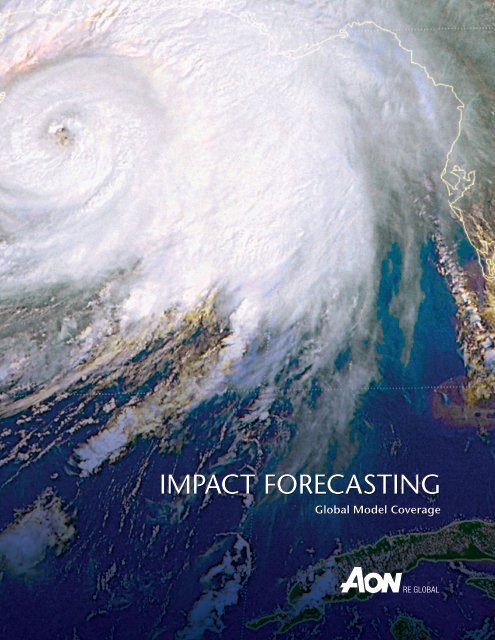
<strong>IMPACT</strong> <strong>FORECASTING</strong><br />
Global Model Coverage
2<br />
<strong>IMPACT</strong> <strong>FORECASTING</strong> and ELEMENTS<br />
Impact Forecasting, LLC, a wholly owned subsidiary of <strong>Aon</strong> Re Global, is a catastrophe modeling<br />
center of excellence whose seismologists, meteorologists, engineers, mathematicians, finance,<br />
risk management and insurance professionals analyze the financial implications of natural and<br />
man-made catastrophes around the world.<br />
Impact Forecasting provides best-in-class catastrophe modeling insight to <strong>Aon</strong> Re Global<br />
clients. Impact Forecasting’s detailed loss model, Elements, is an open-box model that allows<br />
full transparency. Elements gives users the ability to adjust frequency assumptions, have their<br />
own loss experience loaded into the model through custom damageability curves, and receive<br />
the benefit of an investment of more than 14 years and $120 million in the creation of this<br />
world-class suite of catastrophe models. Elements is the only model that is completely open<br />
for review, as well as the only model that has been developed to allow easy modification of<br />
assumptions and report generation.
North American Models<br />
Impact Forecasting has developed a robust suite of models for a wide variety of perils in North America. This<br />
includes the first western United States brush fire model, the first terrorism model available post-9/11, and the first<br />
deterministic riverine flood model.<br />
United States Peril Models<br />
><br />
><br />
><br />
Earthquake and Fire Following Earthquake<br />
Hurricane<br />
Offshore Oil Platform (Gulf of Mexico)<br />
> Storm Surge and Coastal Flooding using state-of-theart<br />
SLOSH research<br />
> Tornado / Hail<br />
> Terrorism<br />
U.S. EARThqUAkE MOdEL<br />
The earthquake model for the United States<br />
considers faulting along both established faults and<br />
earthquake locations spread over a broad area. Along<br />
with established faulting along the San Andreas<br />
in California, earthquake faulting sources exist for<br />
the New Madrid region, Cascadia in the Pacific<br />
Northwest, and Charleston region in South Carolina.<br />
Earthquake hazard models also exist for the Hawaiian<br />
Islands, Caribbean region, and Alaska. The hazard<br />
model accounts for the latest research provided<br />
by the United States Geologic Survey (USGS). For<br />
example, the model includes the latest research<br />
earthquake modeling from the USGS, including<br />
modeling of crustal events using the “Next Generation<br />
Attenuation” relations and updates to the Cascadia<br />
hazard in the Pacific Northwest. Vulnerability modeling<br />
for building, contents and interruption damages<br />
are generated using state-of-the-art engineering processes.<br />
> Workers’ Compensation / Life for Earthquake and<br />
Terrorism<br />
> Multi-Peril Crop<br />
> River Flood<br />
> Western Wildfire<br />
Canada Peril Models<br />
><br />
Terrorism: Property and Workers’ Compensation / Life<br />
3
U.S. TORNAdO / hAIL / SEvERE WINdS MOdEL<br />
U.S. hURRICANE MOdEL<br />
4<br />
The severe storms model for the United States considers tornado, hail<br />
and general severe wind threats. Impact Forecasting used historical<br />
severe storm incidence data from the U.S. Storm Prediction Center<br />
to generate a rich stochastic set of likely storm events across the<br />
Midwest and entire United States. Physical storm parameters – such<br />
as path width, path length, and storm intensity – are considered<br />
in the lifecycle of the storms. The expected wind effects due to<br />
tornado consider tornado strength (in enhanced Fujita F-scale<br />
measurement), forward velocity, direction (azimuth), and wind<br />
profile modeling. Wind vulnerability modeling incorporates the<br />
latest state-of-the-art, component-based engineering concepts.<br />
For the tropical cyclone model for the United States,<br />
we employed a Markov Chain approach as part of a<br />
Wiener process to simulate the full lifecycle for tropical<br />
storms, from inception to final dissipation. Impact<br />
Forecasting based historical data on information<br />
obtained from the National Hurricane Center (HURDAT)<br />
storm track database, which provides information on<br />
annual occurrence rates. We modeled tropical cyclone<br />
data – such as radius of maximum winds (RMW),<br />
central pressure drop (storm strength), storm speed<br />
(track velocity), and direction (azimuth) – along each<br />
step of the storm lifecycle to generate expected storm<br />
paths and intensities. Upon landfall, storm strengths are<br />
attenuated (filling model) as the storm travels on land<br />
and local site conditions are considered (terrain factors).<br />
Tropical cyclone basin models exist for the Atlantic<br />
basin (including consideration of the Caribbean islands) and eastern Pacific (including consideration of the Hawaii<br />
islands). Wind vulnerability modeling incorporates the latest state-of-the-art component-based engineering concepts.<br />
Expected losses may depend upon various construction characteristics, building age, and regional building<br />
code considerations.<br />
OFFSHORE PLATFORMS<br />
As an extension of the U.S. Atlantic basin model for Hurricane, risk to Offshore Oil Platforms in the Gulf of Mexico<br />
(GoM), are quantified for various structures, such as:<br />
><br />
Jack up, Jacket, Compliant Tower (CT), Tension Leg Platform (TLP), SPAR platform<br />
><br />
Semi-submersible, Floating Production and Storage and Offloading (FPSO)
SPECIALTY CLASS MODELING<br />
Our experts also employed specialty class modeling for unusual construction classes such as marine craft and electric<br />
transmission and distribution lines. Marine craft classes for various hull construction and boat length and are detailed<br />
in unique vulnerability classes. We also considered wind vulnerability modeling for transmission and distribution wire<br />
stock for electric utility assets.<br />
U.S. COASTAL STORM SURGE ANd INLANd FLOOdING MOdELS<br />
Hurricane storm surge and inland flooding due to riverine inundation are two flood risk models in Impact Forecasting.<br />
COASTAL STORM SURGE<br />
Impact Forecasting modeled flood risk due to coastal storm surge from<br />
tropical cyclones, using a robust approach that considers various physical<br />
criteria, such as coastal sea water depth (bathymetry), temporal effects of<br />
the hurricane life-cycle, and local site conditions (30 meter resolution DEM<br />
elevations relative to mean sea level). We determined life-cycle modeling of<br />
the hurricane path and effects, using the same software technology employed<br />
by the National Hurricane Center (SLOSH). We calibrated vulnerability due to<br />
flood inundation against known depth-damage functions provided by the U.S.<br />
Army Corp of Engineers and recent hurricane experience for Hurricane Katrina.<br />
INLAND FLOODING RISK<br />
Impact Forecasting modeled inland flood risk due to river inundation for a<br />
suite of deterministic scenarios. A full probabilistic suite of inland flood events<br />
is scheduled for release in July 2008. The USGS survey provided historical<br />
river network gauge station data; in addition, thorough exposure mapping<br />
is available using DFIRM (digital flood insurance rate maps) from FEMA.<br />
U.S. WESTERN WILdFIRE MOdEL<br />
Wildfire has become a phenomenon with large catastrophic<br />
outbreaks of fires across California and the western United States<br />
in recent years. We obtained historical wildfire data from the<br />
U.S. Forest Service and the CalFire. Our fire modeling considers:<br />
locations of historical fire perimeters; the effects of fuel loading<br />
due to timber, brush, or grassy fuels; and effects of slope<br />
conditions on suppression. Loss reporting includes consideration<br />
of multi-day duration and multi-event distance effects.<br />
5
U.S. MULTI-PERIL CROP MOdEL<br />
The U.S. multi-peril crop model considers loss effects on agricultural<br />
crop insurance products due to variations in yield and revenue.<br />
Loss modeling includes consideration of crop yield effects due<br />
to variations in meteorological conditions in temperature and<br />
precipitation. Robust reporting features include the ability to<br />
provide guidance in USDA RMA reinsurance fund allocations.<br />
TERRORISM MOdELING<br />
The Impact Forecasting terrorism model considers the consequences<br />
of various terrorist attacks against potential terrorism targets.<br />
Various attack types include both traditional blast due truck<br />
bombs and improvised explosives and unconventional attacks<br />
due to chemical, biological, radiological, and nuclear methods<br />
(CBRN). Target categories include high-profile commercial<br />
structures, sports stadiums, governmental buildings, military<br />
bases, chemical warehouses, petrochemical processing plants,<br />
utilities, and others. Flexible assumption options and “what-if”<br />
type reporting allow complete transparency in loss outcomes.<br />
Terrorism models exist for the United States, Canada,<br />
Australia, United Kingdom, France and South Africa.<br />
WORkERS’ COMPENSATION ANd LIFE MOdELING<br />
Impact Forecasting has developed models for workers’ compensation or life risks due to earthquake or terrorism<br />
perils. Liability payouts are determined by exposure to death or injury from earthquake and terrorism occurrence. For<br />
earthquake peril, death and injury risk due to structure collapse is quantified. For terrorism peril, death and injury risk<br />
are modeled upon likely attack modes such as traditional explosive blast or unconventional attacks such as CBRN.<br />
6
European / Middle Eastern / African Models<br />
Impact Forecasting has developed a suite of EMEA models, in conjunction with many of the leading universities<br />
and research organizations. Impact Forecasting’s first priority with EMEA models is to provide insight and<br />
modeling capabilities for those regions and perils where robust and credible models are not provided by other<br />
modeling firms. This included the development of the first cross-border model for Central and Eastern Europe<br />
capturing correlation between neighboring countries, and the first flood models used for pricing risk in the<br />
Belgian market. We will further expand this suite of models to meet our clients’ specific requirements.<br />
Earthquake<br />
><br />
><br />
><br />
><br />
><br />
><br />
><br />
Greece<br />
Switzerland<br />
Belgium<br />
Austria<br />
Germany<br />
Romania<br />
South Africa<br />
Storm Surge<br />
><br />
><br />
><br />
><br />
Norway<br />
Germany<br />
UK<br />
France<br />
Terrorism<br />
><br />
><br />
><br />
UK<br />
Flood<br />
SWITzERLANd EARThqUAkE MOdEL<br />
><br />
><br />
><br />
South Africa<br />
France<br />
Belgium<br />
Germany<br />
Austria<br />
The Swiss Insurance Association, the Association<br />
of the Cantonal Building Insurance Offices and<br />
the Federal Office of Private Insurance started an<br />
initiative in May 2005 to develop a countrywide<br />
earthquake cover for Switzerland. While discussions<br />
continue to finalize the details of the form of<br />
coverage, the intention is to introduce compulsory<br />
insurance cover within the next two years.<br />
Impact Forecasting has worked with the Swiss<br />
Seismological Service at ETH Zurich, leading<br />
Swiss earthquake engineer Dr. Wenk and the<br />
EDAC group at the University of Weimar led by<br />
Dr. Jochen Schwarz to develop a high quality<br />
earthquake model based on the best local<br />
knowledge available to assess earthquake risk<br />
both for the proposed compulsory earthquake<br />
insurance scheme and for private insurers.<br />
><br />
Central and Eastern Europe<br />
><br />
><br />
><br />
><br />
Poland<br />
Czech Republic<br />
Slovakia<br />
Hungary<br />
><br />
><br />
South Eastern Europe<br />
><br />
><br />
><br />
><br />
><br />
><br />
Nordic<br />
><br />
><br />
Romania<br />
Bulgaria<br />
Slovenia<br />
Croatia<br />
Bosnia-Herzegovina<br />
Serbia<br />
Norway<br />
Sweden<br />
7
GREECE EARThqUAkE MOdEL<br />
<strong>Aon</strong> Re Global’s strong market presence in Greece coupled<br />
with this new Impact Forecasting model provides clients with<br />
a unique ability to understand earthquake risk in Greece,<br />
comparing the output from the commercial vendor models<br />
AIR, EQE and RMS with the Impact Forecasting model.<br />
<strong>Aon</strong> developed this model to provide an open environment<br />
professional solution to assess catastrophe risk / reinsurance cover in<br />
Greece. In collaboration with Impact Forecasting, a team of Greek<br />
scientists including seismologists, geologists, engineers and insurance<br />
professionals developed this model, which provides the most upto-date<br />
view of earthquake risk in Greece. The model includes a<br />
comprehensive industry exposure database that gives <strong>Aon</strong> Re Global<br />
and our clients a strong understanding of the mix of exposures.<br />
BELGIAN NATURAL hAzARd RISk PRICING MOdEL<br />
As of March 1 2006, coverage of natural hazards has become a compulsory part of the standard fire insurance<br />
in Belgium. Impact Forecasting has been the first to develop a flood and earthquake model that allows insurers<br />
to estimate the expected frequency of flood losses for their portfolio as well as the annual average loss at a<br />
specific address for a given property type. Development of the model started in 2000 and it is now widely used<br />
within the Belgian insurance market to support the pricing of the risk, as well as for reinsurance calculations.<br />
To develop the flood model, Impact Forecasting worked with Dr. Patrick Willems, senior researcher at the Hydraulic<br />
Department of the K.U.Leuven. In the June 2008 release the flood hazard maps compiled by the Walloon authorities<br />
are also integrated for users who are licensed to use<br />
these data. These maps embody an extensive and<br />
comprehensive R&D effort on flooding frequency<br />
and spatial extent. Dr. Thierry Camelbeeck, leading<br />
seismologist at the Royal Observatory of Belgium,<br />
provided input with regard to the seismic zones and<br />
upper-bound magnitude to setup the earthquake<br />
model. Assumptions on the seismic vulnerability and<br />
building typology were influenced by earlier R&D<br />
work performed by Impact Forecasting for Servizio<br />
Sismico Nazionale. Prof. Daniele Veneziano at MIT<br />
(Boston, Massachusetts) is an international expert<br />
on natural hazards and helped put together and<br />
review the methodology for both hazard types.<br />
8
AUSTRIA ANd GERMANy EARThqUAkE MOdEL<br />
In 2006, the Austrian government in conjunction with the insurance association launched the HORA initiative to<br />
map flood and earthquake risks across the country. <strong>Aon</strong> joined the project as initial partner being responsible for the<br />
earthquake part.<br />
The outcome is an open model based on a newly derived earthquake catalog (created by GFZ Potsdam and ZAMG<br />
Vienna) and regionalized damage functions (created by Bauhaus University Weimar) taking into account typical<br />
building stock as well as ground conditions.<br />
The hazard catalog covers Austria and surrounding areas up to 300km around Austria. The approach has been<br />
extended to South-West Germany.<br />
ROMANIA EARThqUAkE MOdEL<br />
Romania is one of the most seismically active countries in<br />
Europe, mainly due to deep earthquakes in the so-called<br />
Vrancea zone. The Vrancea source zone accounts for more than<br />
95 percent of the released seismic energy in the country with<br />
the strongest earthquakes reaching magnitudes of almost<br />
Mw = 8 and causing large damages (local intensities up<br />
to IX X).<br />
Instead of the usual radially symmetric pattern, the<br />
intensity distribution of the Vancrea intermediatedeep<br />
earthquakes is characterized by a kidney-shaped<br />
pattern. This anomalous intensity distribution implies<br />
the need to use an attenuation function that does<br />
not merely depend on distance to the epicenter and<br />
hypocentral depth. <strong>Aon</strong> therefore commissioned the<br />
GeoForschungs-Zentrum (Potsdam) with the elaboration of a new attenuation relationship for the<br />
intermediate-deep earthquakes in the Vrancea zone that realistically reproduces the observed pattern.<br />
This new attenuation relationship, together with an updated earthquake catalogue (Grünthal and Wahlström<br />
2007) and vulnerability functions that are specific to the country will be integrated into the Impact Forecasting<br />
earthquake model for Romania. This new state-of-the-art model is expected to be released before the end of 2008.<br />
9
RIvER FLOOd MOdEL FOR CENTRAL ANd EASTERN EUROPE ANd NORdIC REGIONS<br />
Flood continues be a topic of concern to insurers,<br />
particularly in Europe. In response to the severe flooding<br />
in Europe in 2002 Impact Forecasting created the first<br />
cross-border model covering Austria Hungary, Czech<br />
Republic, Slovakia and Poland. The stochastic event set of<br />
floods used in this model cover the entire region, rather<br />
than each country individually and thus accounts for<br />
correlation in damages between countries. To develop<br />
this model, Impact Forecasting worked with hydrological<br />
consultant Hydro-GIS Ltd. The initiative was led by Dr.<br />
Harvey Rodda (Hydro-GIS), who previously worked on<br />
the RMS UK river flood model and later with Peter Brett<br />
Associates where he worked on both UK river flood<br />
assessments and on a Czech Republic flood model.<br />
Local hydrologists were engaged to build up a flood<br />
history database and to understand local data issues.<br />
The flood scenarios consider both rainfall driven<br />
floods as well as those influenced by snow-melt. The<br />
model also takes account of local river defenses and<br />
includes a significant number of breach scenarios.<br />
The EDAC group led by Dr. Jochen Schwarz at the<br />
Bauhaus University of Weimar in Germany developed<br />
specific flood damage functions for a range of building<br />
types (construction, height, age etc). This work included<br />
an analysis of a large database of actual flood claims<br />
from recent events in Germany and Austria.<br />
Recently the model has been further extended to<br />
South Eastern Europe covering Romania, Bulgaria and<br />
the entire Danube basin (Croatia, Slovenia, Bosnia-<br />
Herzegovina and Serbia). The extension is fully<br />
integrated with the original CEE model such that the<br />
cross-border flood potential is correctly quantified.<br />
A similar model has been also developed for Sweden and<br />
Norway, again covering both countries simultaneously.<br />
In the Nordic model also the possibility of storm-surge<br />
floods along the Norwegian coastline is accounted for.<br />
10
South Africa and Asia Pacific Models<br />
SOUTh AFRICA EARThqUAkE MOdEL<br />
While South Africa is less seismically active than other regions, it has experienced at least five events with<br />
a magnitude six or greater since 1800. In fact, in 1969 a Richter magnitude 6.3 earthquake northeast of Capetown<br />
virtually destroyed Tulbagh leaving many homes and businesses in ruin.<br />
Impact Forecasting is therefore developing a seismic model also<br />
for this region. Specific to South Africa is that both natural seismic<br />
activity and mine related seismic activity occurs. To better understand<br />
their space-time-magnitude distribution, a M.Sc. study is started<br />
at the mining engineering department of K.U.Leuven. The study<br />
will be supervised by Dr. Jozef Van Dyck (Impact Forecasting)<br />
and Dr. Andrzej Kijko, leading seismologist at the Council of<br />
Geosciences, Pretoria. Jan Wium, professor at the University of<br />
Stellenbosh and chairman of the commission responsible for<br />
the Seismic Building Code in South Africa, has agreed to assist<br />
in the studies of existing building stock and vulnerability.<br />
ASIA PACIFIC<br />
Impact Forecasting has been developing models in Asia Pacific since the release of the Australian probabilistic cyclone<br />
model in 1997. Pioneering the use of catastrophe analysis for reinsurance purposes, the Impact Forecasting models<br />
have been used to provide valuable insight to our clients, and have led the way in educating the insurance industry<br />
in this region.<br />
Australia Peril Models<br />
><br />
><br />
><br />
><br />
Tropical Cyclone<br />
Earthquake<br />
Bushfire, Flood, Thunderstorm and Hail<br />
Terrorism<br />
Japan Peril Models<br />
><br />
><br />
Earthquake<br />
Typhoon<br />
New Zealand Peril Models<br />
><br />
Earthquake<br />
11
AUSTRALIA CyCLONE MOdEL<br />
12<br />
<strong>Aon</strong> Re derived its Cyclone model from<br />
historic track information from the Bureau of<br />
Meteorology historic event database. We spent<br />
substantial effort in cleaning the database,<br />
for instance, by double-checking the records<br />
with the Queensland Weather Services.<br />
A series of 100km segments running parallel<br />
to the coast, each roughly 50 km offshore,<br />
have been defined as gates. Cyclones are<br />
simulated starting through any of these<br />
gates, but following track patterns with<br />
characteristics similar to cyclones in the historic<br />
database – such as the distribution of central<br />
pressure, the eye movement speed, the eye<br />
radius and the storm direction of movement.<br />
Cyclones tracks are simulated until the<br />
storms fade away, either over land or sea.<br />
Wind speeds at each location at<br />
each point in the event are determined using a proprietary wind model developed by Daneshvaran<br />
and Gardner (2001). This approach provides a method for accurately estimating wind speeds for<br />
an entire linear segment of a track between two time-based snapshots. This means that the Impact<br />
Forecasting model can calculate wind speeds during run time, rather than referencing a grid of wind<br />
speeds that were pre-generated and included in the software package for a fixed set of events.<br />
The wind speeds from the model are adjusted to take account of terrain and topography, using a database<br />
of adjustments created through analysis of the Australian Surveying and Land Information Group (AUSLIG)<br />
1:25k scale ortho-photos for major cities and land coverage maps for the remainder of Australia.<br />
We adapted the vulnerability functions in this model from U.S. vulnerability databases and compared them with<br />
the Australian Building Code specifications. The damage functions represent the various combinations of 21<br />
different construction materials and allow for differences in construction pre- and post-1980. In addition, the<br />
model incorporates the varying codes levels in different regions of Australia, both due to the Australian Wind Code<br />
(AS1170.2-1989) and for other city-applied codes in places such as Darwin.<br />
The model has previously been calibrated against a range of historic Australian events. Demand surge can be<br />
modeled in the Impact Forecasting Australia cyclone model.<br />
AUSTRALIA EARThqUAkE MOdEL<br />
The Impact Forecasting model is an exact implementation<br />
of the methodology the method outlined in Gaull et<br />
al. (1990). It is a simple yet reliable model where all<br />
parameters are known. The attenuation relationships are<br />
defined for Western Australia, South-Eastern Australia<br />
and North-Eastern Australia. As part of the model<br />
validation, exhibits in the paper were compared to the
measurements produced by the Impact Forecasting system for each of MMI, PGA and Peak Ground Velocity (PGV).<br />
AUSTRALIA EARThqUAkE MOdEL CONTINUEd<br />
The model provides adjustment to the earthquake attenuation through a model of the effects of various types of<br />
rock and soil, implemented at the postcode level of resolution. Soil characteristics were determined for the Australian<br />
continent using geomorphic map data from the Generalized Geology of the World and Linked Databases.<br />
Impact Forecasting developed damage functions to determine losses for each location as a function of post-soiladjustment<br />
hazard. The damage functions, developed for analysis in the United States, represent a wide range<br />
of construction age, material, design building code, region and lateral force resisting system.<br />
Representative Australian damage functions were chosen from this database based on a review of the Australian<br />
Building Code specifications outlined in AS1170.4-1993. In selecting the damage functions, we determined that the<br />
design code produced structures that were of reasonable construction compared to international standards, but<br />
specific earthquake-related safety measures in Australia were not required to be included. The design code<br />
is representative of a region with minimal earthquake hazard, as opposed to more hazardous regions such as<br />
New Zealand.<br />
In total, there are 17 different construction types available under the PGA approach. With three coverage types,<br />
two code levels in Australia and three age bands, there are more than 300 damage functions available for Australia.<br />
Validation of the Impact Forecasting earthquake model included a review of the industry losses from the 1989<br />
Newcastle earthquake.<br />
The Impact Forecasting model is the only Australian earthquake model to incorporate simulation of demand surge.<br />
The model can also be used to simulate human injuries and deaths for use in analysis of workers’ compensation<br />
or life insurance portfolios, as well as property. The individual events simulated generate losses to each of these<br />
three exposure types, thus allowing the combined risk to insurers from all three classes to be determined.<br />
AUSTRALIA BUShFIRE, FLOOd, ThUNdERSTORM ANd hAILS MOdEL<br />
Aspects of catastrophe modeling that are considered fundamental are the so-called “Other Perils” – all the possible<br />
losses due to natural hazards, with the exception of Earthquake and Cyclones. Understanding the losses derived<br />
from these perils is critical for any business, especially when determining retention levels on excess of loss<br />
reinsurance programs.<br />
Impact Forecasting has developed a unique statistical model based on the ICA Loss List, which models the potential<br />
losses from small but rather frequent losses for an Australian portfolio.<br />
AUSTRALIA TERRORISM MOdEL<br />
In August 2003, <strong>Aon</strong> Re announced that it had built the first<br />
property and casualty terrorism exposure loss model specifically<br />
for Australian insurers, large employers and property owners.<br />
13
The model details more than 2,000 high-profile targets across Australia, including commercial,<br />
government, infrastructure, transport, education and public places. It considers a range of potential<br />
attack modes, including conventional explosives, biological and chemical weapons.<br />
NEW zEALANd EARThqUAkE MOdEL<br />
We constructed the New Zealand earthquake model as a component of<br />
Minerva, a Catastrophe Model / DFA system developed for the New Zealand<br />
Earthquake Commission (EQC). The main Hazard component was developed<br />
in conjunction with independent experts, Dr. David Spurr and Dr. Russell Kent,<br />
under the supervision of <strong>Aon</strong> employees Impact Forecasting embodied two<br />
principal types of model, source zone and smoothed seismicity, in its model.<br />
Source zone is an older type of model and defines earthquakes in terms of time,<br />
magnitude, location and depth on a 10 km grid size. It divides the country into<br />
zones of uniform earthquake occurrence characteristics. Smoothed seismicity<br />
is a combination of distributed grid values of seismicity based on historical<br />
data for smaller more common earthquakes. The Impact Forecasting model<br />
simulates approximately 27,000 earthquakes based on area source. Faultbased<br />
methods use geological data reflecting occurrence and magnitude<br />
characteristics for the larger rare earthquakes. The model simulates 3,850 earthquake events on 156 faults.<br />
Impact Forecasting uses the Campbell (1997) attenuation model, primarily developed for California, as regarded as<br />
one of the most robust models in terms of general application. It is typical of modern attenuation models that the<br />
complete model is designed to provide spectral information, peak ground acceleration and peak ground velocity<br />
based on local soil characteristics, and assumes a fault source, which takes into account fault type and geometry.<br />
Earthquakes are assumed to be in the crustal layer, and for universal use the Campbell model must be used in<br />
conjunction with a subduction zone attenuation model.<br />
For subduction earthquakes, Impact Forecasting uses the Youngs et al. (1997) attenuation model, a model specifically<br />
developed for subduction earthquakes based on extensive data from subduction earthquakes around the Pacific<br />
Rim. The model differentiates between subduction slab earthquakes and subduction interface earthquakes, and<br />
differentiates between rock and deep soil.<br />
The authors indicate that the relationships are appropriate for moment magnitudes greater than five and distances<br />
from 10 to 500 km from the rupture surface. In the Campbell model strike slip faults and normal faults are treated<br />
the same, and oblique strike slip faults are assumed to be intermediate between reverse faults and strike slip faults in<br />
their effect.<br />
The model differentiates between hard rock, soft rock and firm soil with depths greater than 10m. It is not applicable<br />
to shallow soil and soft soil. The attenuation functions and soil adjustments used by the Impact Forecasting model<br />
are some of the most advanced anywhere in the world, with the Minerva earthquake model winning British<br />
Insurance Industry awards for its innovation.<br />
14
JAPAN EARThqUAkE MOdEL<br />
Modeling and understanding earthquake risk in Japan is complex. The Japanese insurance market typically<br />
relies on ”black-box” catastrophe models, which impede users’ understanding and confidence in the results<br />
generated because insurers are unable to customize the risk factors contained within them to suit their individual<br />
portfolio needs.<br />
In response, Impact Forecasting has created its own model for <strong>Aon</strong> Re Japan, a fully transparent portfolio<br />
management tool, providing an independent view of risk. The Impact Forecasting model is open, data driven<br />
and modular. This unique open software design gives the user unprecedented access to significant modeling<br />
functions, including:<br />
><br />
><br />
><br />
Various portfolio disaggregation options<br />
Portfolio representation to individual site resolution<br />
A choice of attenuation rules, both Japan specific and international<br />
> Scenario parameters including location, magnitude, depth, strike / dip angles,<br />
point and click fault selection and pre-defined historic earthquakes<br />
> Active fault parameters<br />
> Japan specific vulnerability models<br />
Dr. David Spurr, a leading earthquake engineering consultant was a key<br />
contributor working closely with government research organizations<br />
and universities to use the latest data and information in the model<br />
including the time-dependent probabilities for all major fault systems.<br />
dELIvERING vALUE TO CLIENTS<br />
Impact Forecasting’s client-focused approach ensures we develop modeling solutions driven by our clients’ needs,<br />
focusing on new perils and territories where an adequate modeling solution is not currently available. Key benefits<br />
of our models include:<br />
><br />
><br />
><br />
><br />
Tailored to each specific country<br />
Uses the latest local knowledge and research<br />
Completely open and transparent to our clients<br />
Provides greater insights into the sensitivity of results to data and model assumptions<br />
><br />
Covers all lines of business and coverage including business interruption<br />
15
REGIONAL hEAdqUARTERS – AON RE GLOBAL<br />
AMERICAS (GLOBAL hq)<br />
Chicago, IL USA<br />
t: +1 312 381 5300<br />
f: +1 312 381 0160<br />
EUROPE, MIddLE EAST, AFRICA<br />
Paris, France<br />
t: +33 1 5875 7300<br />
f: +33 1 5875 7777<br />
ASIA PACIFIC<br />
Singapore<br />
t: +65 6221 8222<br />
f: +65 6532 2977<br />
UNITEd kINGdOM<br />
London, United Kingdom<br />
t: +44 20 7623 5500<br />
f: +44 20 7216 3826<br />
200 East Randolph Street, Chicago, IL 60601<br />
t: +1.312.381.5300 | f: +1.312.381.0160 | www.aon.com<br />
Copyright <strong>Aon</strong> Re Global, Inc. 2008 | Published by <strong>Aon</strong> Corporate Marketing and Communications | #1306 – 08/2008