- Page 1 and 2: PUB. 115 LIST OF LIGHTS RADIO AIDS
- Page 3 and 4: 115 LIGHTS NORWAY, ICELAND AND ARCT
- Page 5 and 6: PREFACE The 2012 edition of Pub. 11
- Page 7: Section 8 Northwest Coast of Norway
- Page 11 and 12: Information is tabulated in eight c
- Page 13 and 14: TYPE ABBR. GENERAL DESCRIPTION ILLU
- Page 15 and 16: XIII
- Page 17 and 18: are used. Russian relief lightships
- Page 19 and 20: VISIBILITY TABLE Table of distances
- Page 21 and 22: RADIO DIRECTION-FINDER SETS ON SHIP
- Page 23 and 24: This whistle signal is to be repeat
- Page 25 and 26: INSTRUCTIONS FOR TAKING BEARINGS (i
- Page 27 and 28: LEGEND TABLE OF SYMBOLS (1) Type of
- Page 29 and 30: F3C (1) Frequency modulation. (2) S
- Page 31 and 32: column 1: The number assigned to ea
- Page 33 and 34: (1) No. 68 B 2207 72 B 2209 76 B 22
- Page 35 and 36: (1) No. 184 B 2248.1 188 B 2252 192
- Page 37 and 38: (1) No. 328 B 2318 332 B 2324 336 B
- Page 39 and 40: (1) No. 424 B 2380 428 B 2384 430 B
- Page 41 and 42: (1) No. 532 B 2434 536 B 2436 540 B
- Page 43 and 44: (1) No. 672 B 2526.1 676 B 2492 680
- Page 45 and 46: (1) No. 800 B 2566 804 B 2572 808 B
- Page 47 and 48: (1) No. 920 B 2620.1 (2) Name and L
- Page 49 and 50: (1) No. 1064 B 2730 1068 B 2722 107
- Page 51 and 52: (1) No. 1216 B 2808 1220 B 2816 122
- Page 53 and 54: (1) No. 1360 B 2908 1364 B 2914 136
- Page 55 and 56: (1) No. 1472 B 2970 1476 B 2975 148
- Page 57 and 58: (1) No. 1652 B 3052 1656 B 3054 166
- Page 59 and 60:
(1) No. 1780 B 3106 1784 B 3108 178
- Page 61 and 62:
(1) No. 1920 B 3156 1924 B 3160 192
- Page 63 and 64:
(1) No. 2076 B 3232 2080 B 3240 208
- Page 65 and 66:
(1) No. 2212 B 3268.1 2216 B 3269 2
- Page 67 and 68:
(1) No. 2320 B 3309.4 2324 B 3309.6
- Page 69 and 70:
(1) No. 2464 B 3370 2476 B 3372 248
- Page 71 and 72:
(1) No. 2568 B 3414 2572 B 3416 257
- Page 73 and 74:
(1) No. 2680 B 3486 2684 B 3487 268
- Page 75 and 76:
(1) No. 2820 B 3541.4 2824 B 3544 2
- Page 77 and 78:
(1) No. 2892 B 3574 2896 B 3576 290
- Page 79 and 80:
(1) No. 3004 B 3632 3008 B 3624.4 3
- Page 81 and 82:
(1) No. 3112 B 3684 3116 B 3686 312
- Page 83 and 84:
(1) No. 3232 B 3736 3236 B 3711 324
- Page 85 and 86:
(1) No. 3384 B 3752 (2) Name and Lo
- Page 87 and 88:
(1) No. 3504 B 3772 3508 B 3774 351
- Page 89 and 90:
(1) No. 3596 B 3810 3600 B 3812 360
- Page 91 and 92:
(1) No. 3744 B 3900 3748 B 3902 375
- Page 93 and 94:
(1) No. 3884 B 4036 3888 B 4037 389
- Page 95 and 96:
(1) No. 4004 B 4076 4008 B 4088 401
- Page 97 and 98:
(1) No. 4124 B 4114 4128 B 4114.1 4
- Page 99 and 100:
(1) No. 4251.2 B 4200 4251.4 B 4202
- Page 101 and 102:
(1) No. 4365 B 4253.6 4368 B 4252 4
- Page 103 and 104:
(1) No. 4488 L 0054 4489 L 0054.4 4
- Page 105 and 106:
(1) No. 4628 L 0006 4632 L 0007 463
- Page 107 and 108:
(1) No. 4764 L 0172 4768 L 0173 477
- Page 109 and 110:
(1) No. 4887 L 0212.6 4888 L 0208 4
- Page 111 and 112:
(1) No. 4996 L 0272 5000 L 0274 500
- Page 113 and 114:
(1) No. 5140 L 0315 5142 L 0315.2 5
- Page 115 and 116:
(1) No. 5272 L 0354 5276 L 0356 528
- Page 117 and 118:
(1) No. 5400 L 0438 5404 L 0434 540
- Page 119 and 120:
(1) No. 5516 L 0490 5520 L 0492 552
- Page 121 and 122:
(1) No. 5633 L 0543 5636 L 0544 563
- Page 123 and 124:
(1) No. 5756 L 0656 5760 L 0658 576
- Page 125 and 126:
(1) No. 5872 L 0628 5876 L 0698 588
- Page 127 and 128:
(1) No. 5992 L 0734 5996 L 0736 600
- Page 129 and 130:
(1) No. 6112 L 0782 6116 L 0582 612
- Page 131 and 132:
(1) No. 6224 L 0854 6228 L 0856 623
- Page 133 and 134:
(1) No. 6312 L 0896 6316 L 0898 631
- Page 135 and 136:
(1) No. 6406 L 0930.28 6407 L 0930.
- Page 137 and 138:
(1) No. 6496 L 0970 6497 L 0965 650
- Page 139 and 140:
(1) No. 6606 L 1015.5 6607 L 1015.6
- Page 141 and 142:
(1) No. 6716 L 1046 6718 L 1034 672
- Page 143 and 144:
(1) No. 6832 L 1102 6836 L 1105 683
- Page 145 and 146:
(1) No. 6904 L 1134 6908 L 1136 691
- Page 147 and 148:
(1) No. 7028 L 1162 7032 L 1160 703
- Page 149 and 150:
(1) No. 7172 L 1214 7176 L 1219 718
- Page 151 and 152:
(1) No. 7324 L 1308 7328 L 1310 732
- Page 153 and 154:
(1) No. 7500 L 1364.6 7504 L 1367.2
- Page 155 and 156:
(1) No. 7672 L 1380 7676 L 1381 768
- Page 157 and 158:
(1) No. 7840 L 1422.02 7844 L 1422.
- Page 159 and 160:
(1) No. 7972 L 1478 7976 L 1480 798
- Page 161 and 162:
(1) No. 8112 L 1528.6 8114 L 1527 8
- Page 163 and 164:
(1) No. 8228 L 1574 8232 L 1576 823
- Page 165 and 166:
(1) No. 8360 L 1641 8364 L 1644 836
- Page 167 and 168:
(1) No. 8508 L 1716 8512 L 1716.1 8
- Page 169 and 170:
(1) No. 8676 L 1752 8680 L 1754 868
- Page 171 and 172:
(1) No. 8840 L 1826 8844 L 1828 884
- Page 173 and 174:
(1) No. 8976 L 1894.1 8980 L 1894.2
- Page 175 and 176:
(1) No. 9104 L 1929 9108 L 1930.1 9
- Page 177 and 178:
(1) No. 9228 L 1987 9232 L 1988 923
- Page 179 and 180:
(1) No. 9356 L 2041 9360 L 2042 936
- Page 181 and 182:
(1) No. 9478 L 2121 9480 L 2122 948
- Page 183 and 184:
(1) No. 9600 L 2156 9602 L 2157 960
- Page 185 and 186:
(1) No. 9724 L 2225 9728 L 2226 974
- Page 187 and 188:
(1) No. 9844 L 2248 9848 L 2286 985
- Page 189 and 190:
(1) No. 9984 L 2280.4 9988 L 2281.4
- Page 191 and 192:
(1) No. 10076 L 2323 10080 L 2322 1
- Page 193 and 194:
(1) No. 10196 L 2348 10200 L 2350 1
- Page 195 and 196:
(1) No. 10328 L 2382 10332 L 2384 1
- Page 197 and 198:
(1) No. 10464 L 2424 10468 L 2425 1
- Page 199 and 200:
(1) No. 10544 L 2466 10548 L 2468 1
- Page 201 and 202:
(1) No. 10664 L 2516 10668 L 2514 1
- Page 203 and 204:
(1) No. 10788 L 2569 10792 L 2569.2
- Page 205 and 206:
(1) No. 10920 L 2626 10924 L 2630 1
- Page 207 and 208:
(1) No. 11076 L 2702 11080 L 2708 1
- Page 209 and 210:
(1) No. 11240 L 2775 11249 L 2777 1
- Page 211 and 212:
(1) No. 11392 L 2828 11396 L 2826 1
- Page 213 and 214:
(1) No. 11548 L 2904 11552 L 2906 1
- Page 215 and 216:
(1) No. 11692 L 2958.1 11700 L 2962
- Page 217 and 218:
(1) No. 11828 L 3012 11832 L 3012.4
- Page 219 and 220:
(1) No. 11968 L 3051 11972 L 3054 1
- Page 221 and 222:
(1) No. 12076 L 3094 12080 L 3095 1
- Page 223 and 224:
(1) No. 12204 L 3132 12208 L 3133 1
- Page 225 and 226:
(1) No. 12352 L 3182 12356 L 3182.2
- Page 227 and 228:
(1) No. 12488 L 3240 12492 L 3240.1
- Page 229 and 230:
(1) No. 12624 L 3326 12628 L 3327 1
- Page 231 and 232:
(1) No. 12752 L 3370 12756 L 3376 1
- Page 233 and 234:
(1) No. 12864 L 3420 12868 L 3421 1
- Page 235 and 236:
(1) No. 13008 L 3487 13012 L 3490 1
- Page 237 and 238:
(1) No. 13132 L 3544 13136 L 3545 1
- Page 239 and 240:
(1) No. 13268 L 3582 13272 L 3583 1
- Page 241 and 242:
(1) No. 13380 L 3622 13384 L 3613 1
- Page 243 and 244:
(1) No. 13472 L 3660 13476 L 3664 1
- Page 245 and 246:
(1) No. 13578 L 3716.5 13580 L 3716
- Page 247 and 248:
(1) No. 13708 L 3786 13712 L 3782 1
- Page 249 and 250:
(1) No. 13840 L 3836 13844 L 3842 1
- Page 251 and 252:
(1) No. 13980 L 3901 13984 L 3906 1
- Page 253 and 254:
(1) No. 14100 L 3965.2 14104 L 3965
- Page 255 and 256:
(1) No. 14248 L 4022 14250 L 4023.4
- Page 257 and 258:
(1) No. 14368 L 4106 14372 L 4082 (
- Page 259 and 260:
(1) No. 14504 L 4153.1 14508 L 4156
- Page 261 and 262:
(1) No. 14672 L 4232 14676 L 4232.1
- Page 263 and 264:
(1) No. 14840 L 4288 14844 L 4290 1
- Page 265 and 266:
(1) No. 14976 L 6208 14996 L 6218 1
- Page 267 and 268:
(1) No. 15160 L 6311 15162 L 6311.1
- Page 269 and 270:
(1) No. 15292 L 6404 15308 L 6408 1
- Page 271 and 272:
(1) No. 15564 L 6600 15568 L 6600.1
- Page 273 and 274:
(1) No. 15760 L 6730 15764 L 6736 1
- Page 275 and 276:
(1) No. 15956 L 6900 15968 L 6908 1
- Page 277 and 278:
(1) No. 16120 L 6984.1 16124 L 6986
- Page 279 and 280:
(1) No. 16308 L 7196 16309 L 7195 1
- Page 281 and 282:
(1) No. 16492 L 7499 16496 L 7499.1
- Page 283 and 284:
(1) No. 16880 L 8044 16888 L 8047 1
- Page 285 and 286:
(1) No. 17008 L 8203 17012 L 9294 1
- Page 287 and 288:
(1) No. 17180 L 8217.4 17184 L 8218
- Page 289 and 290:
(1) No. 17368 L 9473 (2) Name and L
- Page 291 and 292:
(1) No. (2) Name and Location (3) P
- Page 293 and 294:
(1) No. (2) Name and Location 17668
- Page 295 and 296:
(1) No. (2) Name and Location (3) P
- Page 297 and 298:
(1) No. 17848 L 4334 17850 L 4300 1
- Page 299 and 300:
(1) No. (2) Name and Location (3) P
- Page 301 and 302:
(1) No. 18044 L 4784 18048 L 4786 1
- Page 303 and 304:
(1) No. 18204 L 4484 18206 L 4490 1
- Page 305 and 306:
(1) No. 18354 L 4515.1 18358 L 4515
- Page 307 and 308:
(1) No. 18484 L 4554 18488 L 4555 1
- Page 309 and 310:
(1) No. 18616 L 4582 18620 L 4564 1
- Page 311 and 312:
(1) No. 18736 L 4660.6 18740 L 4658
- Page 313 and 314:
(1) No. 18880 L 4708.3 18884 L 4708
- Page 315 and 316:
(1) No. 19024 L 4744 19028 L 4746 1
- Page 317 and 318:
(1) No. (2) Name (3) Position 160 S
- Page 319 and 320:
(1) No. (2) Name (3) Position 820 A
- Page 321 and 322:
(1) No. (2) Name 225 Skardhsfjara 6
- Page 323 and 324:
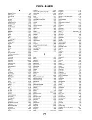
294 INDEX - LIGHTS Belgen . . . . .
- Page 325 and 326:
296 INDEX - LIGHTS Faroyskjaeret .
- Page 327 and 328:
298 INDEX - LIGHTS Harstad . . . .
- Page 329 and 330:
300 INDEX - LIGHTS Katteskallen . .
- Page 331 and 332:
302 INDEX - LIGHTS LEKA . . . . . .
- Page 333 and 334:
304 INDEX - LIGHTS Mys Set'Navolok
- Page 335 and 336:
306 INDEX - LIGHTS Ostrov Vern . .
- Page 337 and 338:
308 INDEX - LIGHTS SARPSBORG . . .
- Page 339 and 340:
310 INDEX - LIGHTS Stavsund . . . .
- Page 341 and 342:
312 INDEX - LIGHTS Tufjord . . . .
- Page 343 and 344:
A Akraberg . . . . . . . . . . . .
- Page 345 and 346:
CROSS REFERENCE - INTERNATIONAL vs.
- Page 347 and 348:
CROSS REFERENCE - INTERNATIONAL vs.
- Page 349 and 350:
CROSS REFERENCE - INTERNATIONAL vs.
- Page 351 and 352:
CROSS REFERENCE - INTERNATIONAL vs.
- Page 353 and 354:
CROSS REFERENCE - INTERNATIONAL vs.
- Page 355 and 356:
CROSS REFERENCE - INTERNATIONAL vs.
- Page 357 and 358:
CROSS REFERENCE - INTERNATIONAL vs.
- Page 359 and 360:
CROSS REFERENCE - INTERNATIONAL vs.
- Page 361 and 362:
CROSS REFERENCE - INTERNATIONAL vs.
- Page 363:
CROSS REFERENCE - INTERNATIONAL vs.


