Desert Magazine of the Southwest
Desert Magazine of the Southwest
Desert Magazine of the Southwest

Create successful ePaper yourself
Turn your PDF publications into a flip-book with our unique Google optimized e-Paper software.
MAGAZINE OF THE SOUTHWEST<br />
NOVEMBER, 1978 $1.00
Come<br />
visit us...<br />
WESTERN ART<br />
NOTES PRINTS<br />
MAPS GOLD PANS<br />
GREETING CARDS<br />
AND<br />
A LARGE<br />
ASSORTMENT OF<br />
CURRENT AND<br />
OLD BACK ISSUES<br />
A GREAT<br />
SELECTION<br />
OF BOOKS<br />
ON THE WEST<br />
HWY 111<br />
El Paseo<br />
PALM<br />
DESERT<br />
Post Office' MAGAZINE<br />
BOOK SHOP<br />
74-425 HWY 111<br />
INDIO<br />
-ii<br />
STORE HOURS<br />
10:00-4:00<br />
Monday thru Friday<br />
Saturday: 10:00 - 3:00<br />
Closed Sunday<br />
A<br />
^<br />
'&<br />
•<br />
if \<br />
MAGAZINE BOOK SHOP<br />
74-425 Highway 111 at Deep Canyon Road Palm <strong>Desert</strong>, California<br />
4
WILLIAM and JOY KNYVETT<br />
' ^-Publishers/ Editors<br />
iEORGE BRAGA, Art Director<br />
: HARLENE KNYVETT, Art Department<br />
MARY FRANCES STRONG, Field Trip Editor<br />
K. L. BOYNTON, Naturalist<br />
11ARVEL BARRETT, Circulation Manager<br />
( olor Separations by<br />
I lenry Color Service<br />
I ithographed by<br />
Wolfer Printing Company, Inc.<br />
available in Micr<strong>of</strong>ilm by<br />
)erox University Micr<strong>of</strong>ilms<br />
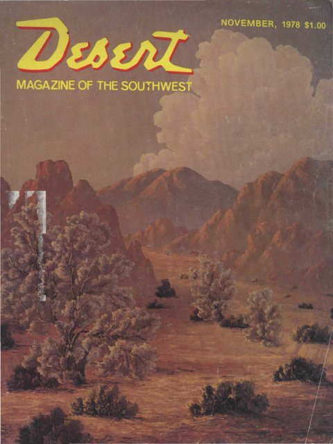
THE COVER:<br />
"hox Canyon," near Indio,<br />
C; lifornia, an original 30" x<br />
2t ' oil painting created for<br />
th ! cover by Kathi Hilton, <strong>of</strong><br />
T\ entynine Palms, Calif.<br />
Volume 41, Number 11 NOVEMBER 1978<br />
CONTENTS<br />
F E A T U R E S<br />
EXPLORING THE RIO BAVISPE 8 Roger Mitchell<br />
THE PALO VERDE 12 Annis M. Cuppett<br />
VULTURE CITY, ARIZONA 14 James R. Mitchell<br />
THE MONO PASS-BLOODY CANYON TRAIL 16 Betty Shannon<br />
PICTURESQUE CRAFTON 20 Mary Frances Strong<br />
KATHI HILTON 24 Western Art<br />
LAST GOVERNOR OF MEXICAN CALIFORNIA 28 Ka<strong>the</strong>rine Sheehey<br />
ANZA-BORRECO VISITOR CENTER UNDERWAY 32 Bill Jennings<br />
SOUTH FORK OF SHEEP CANYON<br />
HITE MARINA HAPPENING<br />
DEATH VALLEY ENCAMPMENT<br />
WHAT'S COOKING ON THE DESERT?<br />
A PEEK IN THE PUBLISHER'S POKE 4<br />
NEW BOOKS FOR DESERT READERS 6<br />
36<br />
38<br />
39<br />
41<br />
TRADING POST 42<br />
BOOKS OF THE WEST 44<br />
LETTERS TO THE EDITOR 47<br />
CALENDAR OF WESTERN EVENTS 47<br />
Dick Bloomquist<br />
Lake Powell Update<br />
Condensed Program<br />
Stella Hughes<br />
MENTS<br />
William Knyvett<br />
Book Reviews<br />
Classified Listings<br />
Mail Order Items<br />
Readers' Comments<br />
Club Activities<br />
EDITORIAL, CIRCULATION AND ADVERTISING OFFICES: 74-425 old addresses with zip codes. DESERT <strong>Magazine</strong> is published monthly.<br />
Higiway 111, P. 0. Box 1318, Palm <strong>Desert</strong>, California 92260. Telephone Second class postage paid at Palm <strong>Desert</strong>, California and at additional<br />
Are i Code 714 346-8144. SUBSCRIPTION RATES: United States and pos- mailing <strong>of</strong>fices under Act <strong>of</strong> March 3, 1879. Contents copyrighted 1978 by<br />
ses; ions; 1 year,$8.00; 2 years, $15.00; 3 years. $22.00. All o<strong>the</strong>rcountries DESERT <strong>Magazine</strong> and permission to reproduce any or all contents must<br />
add $2.00 U. S. currency for each year. See Subscription Order Form in be secured in writing. Unsolicited manuscripts and photographs will not be<br />
this issue. Allow five weeks for change <strong>of</strong> address and send both new and returned unless accompanied by self-addressed, stamped envelope.<br />
<strong>Desert</strong>/November 1978
BACK ISSU<br />
BARGAINS<br />
ODDS AND ENDS<br />
Miscellaneous Copies<br />
from 1959 to 1965<br />
Package <strong>of</strong> 10<br />
$000<br />
3<br />
No selections available<br />
VOLUMES FOR YEARS<br />
1966*1969*1974<br />
11 issues only<br />
EACH<br />
COMPLETE VOLUMES<br />
FOR YEARS<br />
1967 • 1968 • 1970<br />
1971 •1972*1973<br />
and 1975<br />
ONLY $C()0 EACH<br />
5<br />
VOLUMES FOR YEARS<br />
1976 • 1977<br />
ONLY<br />
$£00<br />
6<br />
Send check or money order to<br />
DESERT MAGAZINE<br />
P.O. Box 1318<br />
Palm <strong>Desert</strong>, Calif. 92260<br />
O<br />
NE OF <strong>the</strong> great lures <strong>of</strong> <strong>the</strong> desert<br />
area is <strong>the</strong> tales <strong>of</strong> ledges <strong>of</strong> mineral<br />
wealth being discovered and <strong>the</strong>n<br />
"lost." The finder, after a good assay<br />
report, never could retrace his trail and<br />
ano<strong>the</strong>r "lost legend" was born.<br />
The Lost Silver Ledge in <strong>the</strong> Trigos is a<br />
great example because it was found and<br />
lost by four different men. Historian<br />
Harold O. Weight described <strong>the</strong> elusive<br />
ledge 21 years ago in <strong>the</strong> May, '57 issue<br />
<strong>of</strong> <strong>Desert</strong> with a rundown <strong>of</strong> <strong>the</strong> four unfortune-ate<br />
gentlemen.<br />
The ledge was supposedly located a<br />
"day's journey" from <strong>the</strong><br />
Silver Clip Mine (see original<br />
map), <strong>the</strong> greatest lead-silver<br />
producer ever worked along<br />
<strong>the</strong> Colorado River. Ore<br />
worth over a million dollars<br />
was recovered between 1883<br />
and 1887. One <strong>of</strong> <strong>the</strong> four<br />
men mentioned in <strong>the</strong> article<br />
said <strong>the</strong> ledge was "richer<br />
than <strong>the</strong> Clip."<br />
Now, almost 100 years<br />
after <strong>the</strong> first discovery <strong>of</strong><br />
silver in <strong>the</strong> Trigo Mountains<br />
<strong>of</strong> Sou<strong>the</strong>rn Arizona, a fifth<br />
man claims to have found <strong>the</strong><br />
silver ledge!<br />
Jim Peaden, <strong>of</strong> Thousand<br />
Palms, California, a longtime<br />
<strong>Desert</strong> reader, came<br />
into <strong>the</strong> <strong>of</strong>fice just before<br />
press time with pictures and<br />
a short letter to back up his<br />
claim, both <strong>of</strong> which appear<br />
on page 47. The photos show<br />
a close-up <strong>of</strong> <strong>the</strong> ledge and<br />
its discoverers, and attests to<br />
<strong>the</strong> wildly-broken country<br />
that has been responsible for <strong>the</strong><br />
elusive "Trigo treasure" and its <strong>of</strong>fagain—on-again<br />
history.<br />
Jim has promised to keep us informed<br />
<strong>of</strong> any new developments, and hinted he<br />
had ano<strong>the</strong>r tale up his sleeve.<br />
So, for all rainbow-chasers, this makes<br />
<strong>the</strong> pulse beat just a little faster with,<br />
anticipation.<br />
in <strong>the</strong><br />
publisher's<br />
yk<br />
M' '«aprob<br />
^MS55/©I<br />
; v " • • • • • •• • • • • • • :<br />
&* * ••
Give<br />
Angel Arch in Canyonlands National Park
Ttooks<br />
for<br />
T<strong>Desert</strong><br />
Traders<br />
•\// books reviewed are available through <strong>the</strong><br />
I 'esert <strong>Magazine</strong> Book Shop. Please add 50c<br />
per total order for handling and California<br />
i ;s/'dents must include 6% state sales tax.<br />
I HEATH VALLEY |<br />
IN'49<br />
/{y William Lewis Manly<br />
Despite <strong>the</strong> millions <strong>of</strong> words in hundreds<br />
<strong>of</strong> volumes, many experts feel<br />
<strong>the</strong>re are only two or three good books<br />
about Death Valley. Although <strong>the</strong>y may<br />
disagree about <strong>the</strong> o<strong>the</strong>r one or two, just<br />
.ibout all <strong>of</strong> <strong>the</strong> specialists agree that<br />
William Manly's 1894-published recollections<br />
<strong>of</strong> his travail nearly a half-<br />
:entury earlier is <strong>the</strong> best.<br />
TRACKING<br />
DOWN<br />
OREGON<br />
Pi *'<br />
In fact, that's <strong>the</strong> only sustained objection<br />
to this famous volume—that it<br />
took so long for him to write it. Ano<strong>the</strong>r<br />
might be that it took so long for this reprint<br />
to appear. Actually, this rerun by<br />
Chalfant Press, Inc., <strong>of</strong> Bishop, California,<br />
is <strong>the</strong> fourth version<br />
Manly's role in <strong>the</strong> Death Valley tragedies<br />
<strong>of</strong> <strong>the</strong> Gold Rush colonists should<br />
be well-known to everyone by now, but<br />
this reprint, in <strong>the</strong> original type, will be a<br />
best-seller, we predict.<br />
Ironically, perhaps, one <strong>of</strong> <strong>the</strong> o<strong>the</strong>r<br />
so-called best books on <strong>the</strong> Death Valley<br />
saga was written by <strong>the</strong> founder <strong>of</strong> Chalfant<br />
Press, <strong>the</strong> pioneering Owens Valley<br />
newspaperman, William A. Chalfant.<br />
His book, "Death Valley, The Facts,"<br />
was published in 1930 and, like Manly's<br />
epic, has been out <strong>of</strong> print.<br />
Manly's tardiness in setting down an<br />
eye-witness account <strong>of</strong> <strong>the</strong> 1849 argonauts'<br />
crossing <strong>of</strong> <strong>the</strong> Amargosa River<br />
sink is explained by <strong>the</strong> fact that his book<br />
is in reality his autobiography, written<br />
when he was about 75 years old and perhaps<br />
forgetful.<br />
Ei<strong>the</strong>r forgotten or modestly omitted<br />
are many <strong>of</strong> <strong>the</strong> almost superhuman<br />
feats <strong>of</strong> Manly and John Rogers, <strong>the</strong><br />
saviors <strong>of</strong> <strong>the</strong> Bennett-Arcane party.<br />
When that party had eaten most <strong>of</strong> its<br />
oxen, and thus destroyed <strong>the</strong> best escape<br />
equipment it possessed, Manly and<br />
Rogers set out on foot, across <strong>the</strong> Panamint<br />
Mountains southwesterly toward<br />
<strong>the</strong> known Mexican settlements near <strong>the</strong><br />
ISBN 0-87004-257-2<br />
306 Pages 6" x 9"<br />
Paperbound<br />
$5.95<br />
Oregon, says author Ralph Friedman, is<br />
more than places and names on <strong>the</strong> map.<br />
"It is people, past and present, history,<br />
legend, folklore. . . ." So we invite you to<br />
track along with him, in this new book from<br />
Caxton, to encounter <strong>the</strong> rare and unusual<br />
in Oregon, "to locate a waterfall seen only<br />
by a few, to hunt out a burial g round soaked<br />
with <strong>the</strong> juices <strong>of</strong> history, to discover <strong>the</strong><br />
amazing Jim Hoskins <strong>of</strong> Pilot Rock, <strong>the</strong><br />
tragic Captain Jack, <strong>the</strong> remains <strong>of</strong> Fairfield,<br />
<strong>the</strong> cavalry names etched on a desert<br />
bluff, <strong>the</strong> legend <strong>of</strong> a gunslinger. . ."<br />
The CAXTON PRINTERS, Ltd.<br />
P.O. Box 700<br />
Caldwell, Idaho 83605<br />
old San Gabriel and San Fernando<br />
missions.<br />
They found help at <strong>the</strong> San Francisquito<br />
Ranch, near <strong>the</strong> present town <strong>of</strong><br />
Newhall, more than 200 miles away, secured<br />
horses and food, a little money and<br />
started back to Death Valley.<br />
Almost as miraculous as <strong>the</strong>ir journey<br />
out <strong>of</strong> <strong>the</strong> valley to get help was <strong>the</strong> fact<br />
that Manly and Rogers returned at all —<br />
for <strong>the</strong> temptation to abandon <strong>the</strong> little<br />
party <strong>of</strong> seven wagons would have been<br />
very great for many. But return <strong>the</strong>y did,<br />
after many weeks <strong>of</strong> travel, covering<br />
more than 500 miles.<br />
And ano<strong>the</strong>r miracle occurred. They<br />
found <strong>the</strong> little camp and most <strong>of</strong> its<br />
emaciated inhabitants still alive, and <strong>the</strong><br />
final miracle, <strong>the</strong>y were able to lead<br />
<strong>the</strong>m to safety without fur<strong>the</strong>r loss <strong>of</strong><br />
life.<br />
Manly, modestly perhaps, does not<br />
take <strong>the</strong> credit for naming <strong>the</strong> desolate<br />
camping place. Someone in <strong>the</strong> party<br />
did, but Manly at <strong>the</strong> end <strong>of</strong> this matter<strong>of</strong>-fact<br />
narrative merely says:<br />
"Just as we were ready to leave and<br />
return to camp we took <strong>of</strong>f our hats, and<br />
<strong>the</strong>n overlooking <strong>the</strong> scene <strong>of</strong> so much<br />
trial, suffering and death spoke <strong>the</strong><br />
thought uppermost saying: —'Goodbye<br />
Death Valley!' <strong>the</strong>n faced away and<br />
made our steps toward camp. Even after<br />
this in speaking <strong>of</strong> this long and narrow<br />
valley over which we had crossed into its<br />
nearly central part and on <strong>the</strong> edge <strong>of</strong><br />
which <strong>the</strong> lone camp was made, for so<br />
many days, it was called Death Valley."<br />
The book is precisely as originally<br />
written and printed, even to <strong>the</strong> predictable<br />
typographic and spelling errors<br />
from handset type. The only addition is a<br />
foreword by Donald M. Spaulding, current<br />
superintendent <strong>of</strong> Death Valley National<br />
Monument. The Chalfant people<br />
reprinted <strong>the</strong> book in cooperation with<br />
<strong>the</strong> Death Valley Natural History Association.<br />
Spaulding, from <strong>the</strong> safety <strong>of</strong> more<br />
than a century <strong>of</strong> time apart, recalls that<br />
Manly's account has long been <strong>the</strong> subject<br />
<strong>of</strong> some controversy, namely over<br />
his remembrances <strong>of</strong> <strong>the</strong> route traveled<br />
and <strong>the</strong> location <strong>of</strong> <strong>the</strong> Bennett-Arcane<br />
long camp, but he also stresses that<br />
Manly wrote only a personal account.<br />
O<strong>the</strong>rs, namely <strong>the</strong> Reverend J. W.<br />
Brier, Sr., and his wife, Juliet, wrote<br />
<strong>the</strong>irs. That none <strong>of</strong> <strong>the</strong>m agree is understandable.<br />
Paperback, 498 pages, $8.95.<br />
<strong>Desert</strong>/ November 1978
iIJTHWESTEfiN<br />
THE ' I<br />
SC'UTHWESTERN<br />
INDIAN DETOURS _<br />
B\ D. H. Thomas<br />
The mystique <strong>of</strong> <strong>the</strong> <strong>Southwest</strong> is compo<br />
,ed, in almost equal parts, <strong>of</strong> its incomparable<br />
scenery, <strong>the</strong> romance <strong>of</strong> its<br />
aboriginal residents, <strong>the</strong> daring exploits<br />
<strong>of</strong> <strong>the</strong> early white explorers and, more<br />
re ently, <strong>the</strong> sometimes audacious<br />
ac ions <strong>of</strong> its contemporary boosters and<br />
exoloiters.<br />
Ms. Thomas, a most prolific writer on<br />
a ireat variety <strong>of</strong> southwestern topics,<br />
ha resurrected <strong>the</strong> history <strong>of</strong> <strong>the</strong> greatesi<br />
regional auto tour firms <strong>of</strong> <strong>the</strong>m all,<br />
Sa ita Fe Railway's Fred Harvey-CIarksoi><br />
<strong>Southwest</strong>ern Indian Detours. The<br />
bu es and four-door sedans weren't long<br />
eni >ugh to carry that full title, which was<br />
not <strong>the</strong> corporate name anyway.<br />
I luring <strong>the</strong> expansion era <strong>of</strong> <strong>the</strong> historic<br />
Atchison, Topeka & Santa Fe Railwas'<br />
into <strong>the</strong> southwest during <strong>the</strong> 1880s<br />
an enterprising Britisher, who really was<br />
named Fred Harvey, took over station<br />
lunchrooms and later <strong>the</strong> dining car<br />
ops ration for <strong>the</strong> new railroad. Harvey<br />
House girls became a part <strong>of</strong> <strong>the</strong> langu;ige<br />
as well as <strong>the</strong> lore <strong>of</strong> <strong>the</strong> region.<br />
Haivey's dining cars made Santa Fe <strong>the</strong><br />
mo t famous way west.<br />
Particularly, Harvey had a lot to do<br />
with publicizing <strong>the</strong> wonders <strong>of</strong> <strong>the</strong> littlekncwn<br />
region as well as improving<br />
public facilities wherever Santa Fe<br />
tracks reach, and sometimes beyond.<br />
The Indian Detours represented <strong>the</strong><br />
"scnetimes beyond," stretching <strong>the</strong><br />
toui ist area served by <strong>the</strong> railroad many<br />
hundreds <strong>of</strong> miles, into nor<strong>the</strong>rn New<br />
Me: ico and Arizona Indian Country, particularly<br />
<strong>the</strong> Pueblo, Navajo and Hopi<br />
enclaves so seldom visited previously.<br />
V hen Santa Fe built through New<br />
Me: ico and Arizona under <strong>the</strong> aegis <strong>of</strong><br />
its ubsidiary, <strong>the</strong> Atlantic & Pacific,<br />
<strong>the</strong>r-3 was little hope <strong>of</strong> immediate local<br />
revc nue for its trains from ei<strong>the</strong>r freight<br />
or p issenger sources. The goal was <strong>the</strong><br />
trea .ure <strong>of</strong> <strong>the</strong> Pacific, represented by<br />
California's agricultural and mineral<br />
Dese t/November 1978<br />
wealth. Passengers mainly wanted to get<br />
to Los Angeles or San Francisco. Stopovers<br />
were only those necessary to<br />
service <strong>the</strong> trains or 10 to 20-minute<br />
meal stops at such unlikely places as Las<br />
Vegas or Gallup, New Mexico, or even<br />
less inhabited hamlets like Seligman,<br />
Arizona.<br />
But soon it became evident <strong>the</strong> romantic<br />
attractions <strong>of</strong> <strong>the</strong> aboriginal villages,<br />
<strong>the</strong> scenery and <strong>the</strong> general wild west atmosphere<br />
would bring as many tourists<br />
as through travelers, if a way to bring accommodations<br />
was found as well. Enter<br />
Mr. Harvey who became manager <strong>of</strong><br />
Santa Fe's new hotels, eating houses<br />
and even <strong>the</strong> new resort on <strong>the</strong> South<br />
Rim <strong>of</strong> <strong>the</strong> Grand Canyon.<br />
And, a few decades later, <strong>the</strong> Harvey<br />
hospitality extended to auto and bus<br />
tours beyond <strong>the</strong> rails, supplementing<br />
Model T services around El Tovar and<br />
o<strong>the</strong>r Santa Fe resorts on <strong>the</strong> South Rim<br />
and elsewhere. The new palatial buses<br />
and sedans ordered in <strong>the</strong> mid-1920s<br />
were <strong>the</strong> forerunners <strong>of</strong> <strong>the</strong> many charter<br />
and parlor car bus tours <strong>of</strong> today.<br />
The Harvey organization by this time<br />
was headed by Fred's son, Ford, who<br />
brought in ano<strong>the</strong>r Britisher to head <strong>the</strong><br />
new tour operation. Major R. Hunter<br />
Clarkson, late <strong>of</strong> His Majesty's Royal<br />
Artillery and later <strong>the</strong> embryo Royal<br />
Flying Corps, became manager <strong>of</strong> <strong>the</strong><br />
new service in 1925, after four years <strong>of</strong><br />
prior service with Harvey.<br />
Ms. Thomas' interesting history is<br />
backed with personal- interviews among<br />
<strong>the</strong> surviving drivers and women couriers<br />
from both related companies, many<br />
<strong>of</strong> whom had met and married while in<br />
Detour service. She also secured <strong>the</strong>ir<br />
scrapbooks, most importantly <strong>the</strong>ir snapshots,<br />
along with <strong>of</strong>ficial records from<br />
<strong>the</strong> railroad and <strong>the</strong> Harvey-Clarkson<br />
companies. Gray Line bought <strong>the</strong> rights<br />
to <strong>the</strong> name, Indian Detours, from <strong>the</strong><br />
major's bro<strong>the</strong>r, James Clarkson, in<br />
1968, and continues <strong>the</strong> operation today.<br />
Both <strong>the</strong> Harvey firm and <strong>the</strong> Santa<br />
Fe, persist, <strong>of</strong> course, and readers <strong>of</strong><br />
this highly informative and historically<br />
important book know that <strong>the</strong> major's old<br />
operation will never die ei<strong>the</strong>r.<br />
Illustrated with scores <strong>of</strong> rare photographs,<br />
old maps and travel posters, <strong>the</strong><br />
book is available for $5.95 paperback,<br />
and $8.95 hardcover, 327 pages.<br />
Whe<strong>the</strong>r you see Lake Powell aboard one <strong>of</strong> our boats, or yours, you'll never forget this<br />
"Grand Canyon with water!' Plan your vacation with us.<br />
• Houseboat & powerboat rentals • Guided boat tours • Restaurants •<br />
• Accommodations: RV hook-ups & rooms * Fishing guides & charters<br />
• Backcountry four-wheel guided trips • Lake fly-overs • Supplies<br />
• « HyH( Boat UUWIIIIII|f docking, tflUIOIJV, storage, dbl servicing Vlblliy<br />
Please send color brochure and rates on one or more <strong>of</strong> <strong>the</strong> following:<br />
• Wahweap • Hite • Bullfrog For Bullfr & Hite<br />
°9<br />
Lodge & Marina Marina Resort & Marina . . "YKi'wnw<br />
lpnm ..,.„..„ TIL -r i n Utah, 1-800-662-1754.<br />
• (602)645-2433 Telephone- Telephone" From o<strong>the</strong>r states •<br />
P.O. Box 1597-Page AZ 86040 Hanksville UT B4734 Hanksville UT 84734 1 800-453170D. _<br />
I Name<br />
I<br />
Name _<br />
Address.<br />
City .State. -Zip. I<br />
Phone__ . DM
y<br />
ROGER<br />
MITCHELL<br />
Above:<br />
Fording <strong>the</strong><br />
Rio Bavispe.<br />
Opposite<br />
page: Rio<br />
Bavispe<br />
country.<br />
Left: The old<br />
church at San<br />
Miguelito is<br />
well<br />
maintained.<br />
8<br />
THE RIO BAVISPE has its headwaters<br />
high in <strong>the</strong> mountains which form <strong>the</strong><br />
Continental Divide separating <strong>the</strong><br />
Mexican states <strong>of</strong> Sonora and Chihuahua.<br />
As tributaries cause it to grow, it<br />
flows northward, a thin thread <strong>of</strong> life in<br />
an o<strong>the</strong>rwise arid land. About 35 miles<br />
short <strong>of</strong> <strong>the</strong> border, <strong>the</strong> river makes an<br />
abrupt hairpin turn and starts south<br />
again. For <strong>the</strong> last 40 years <strong>the</strong> water has<br />
lingered awhile behind Angostura Dam,<br />
a pre-war project built under <strong>the</strong> supervision<br />
<strong>of</strong> engineers from Hitler's Third<br />
Reich. Eventually <strong>the</strong> river continues its<br />
flow southward, <strong>of</strong>ten irrigating fields as<br />
old as <strong>the</strong> first padres. Finally <strong>the</strong> Rio<br />
Bavispe loses its name where it joins <strong>the</strong><br />
Rio Areos. From here on <strong>the</strong> two streams<br />
are known as <strong>the</strong> Rio Yaqui as <strong>the</strong>y<br />
continue south to empty into <strong>the</strong> large<br />
Novillo Reservoir.<br />
From where <strong>the</strong> Rio Bavispe starts, at<br />
an elevation <strong>of</strong> 7000 feet in <strong>the</strong> mountains<br />
<strong>of</strong> Chihuahua, it is a journey <strong>of</strong><br />
<strong>Desert</strong>/ November 1978
ne lrly 500 miles to its final destination in<br />
thi Gulf <strong>of</strong> California near Guaymas. To<br />
thi- Mexican campesino, <strong>the</strong> river means<br />
that he can irrigate his fields and raise<br />
liv ;stock, to eke out a living from <strong>the</strong><br />
ha> sh thorny land. The water also makes<br />
thi difference between life and no life for<br />
a vide variety <strong>of</strong> wildlife all along its<br />
course. For <strong>the</strong> readers <strong>of</strong> <strong>Desert</strong>, <strong>the</strong><br />
Ri
long heads into a range <strong>of</strong> hills known as<br />
<strong>the</strong> Sierra Cenizia. Here and <strong>the</strong>re a few<br />
s Jttered live oaks <strong>of</strong>fer <strong>the</strong> traveler a bit<br />
ol shade for a roadside lunch break or a<br />
midday siesta. "Puerto de las Cenizas,"<br />
a gentle pass <strong>of</strong> about 5000 feet, is<br />
crossed and <strong>the</strong> road turns in a more<br />
sou<strong>the</strong>rly direction. As you look down<br />
<strong>the</strong> vast valley, <strong>the</strong> route is obvious —a<br />
thin brown line <strong>of</strong> a road stretches endlessly<br />
in <strong>the</strong> distance.<br />
About 25 miles from Agua Prieta,<br />
<strong>the</strong>re is a sudden change in <strong>the</strong> desert<br />
si enery as you approach a large sandy<br />
wash lined with huge oak and cottonwood<br />
trees. Hopefully <strong>the</strong>re will be just a<br />
little trickle <strong>of</strong> water in <strong>the</strong> wash as <strong>the</strong>re<br />
persons <strong>of</strong> <strong>the</strong> Mormon faith. Many Mormons<br />
responded by moving to Nor<strong>the</strong>rn<br />
Mexico where <strong>the</strong>y were welcomed and<br />
assured by Porfiro Diaz, <strong>the</strong> Mexican<br />
president, that <strong>the</strong>y could freely practice<br />
<strong>the</strong>ir religious beliefs, including polygamy.<br />
The first Mormon colonies were<br />
established in Chihuahua, but by <strong>the</strong> fall<br />
<strong>of</strong> 1892 negotiations were completed for<br />
<strong>the</strong> purchase <strong>of</strong> 200 square miles <strong>of</strong> land<br />
along <strong>the</strong> Rio Bavispe in neighboring<br />
Sonora. On February 15, 1893, a group<br />
<strong>of</strong> 100 Mormons from Chihuahua packed<br />
<strong>the</strong>ir belongings in 14 wagons and blazed<br />
<strong>the</strong> wagon road over Pulpito Pass into<br />
<strong>the</strong> Rio Bavispe Valley. Their journey <strong>of</strong><br />
80 miles took a month to complete.<br />
The "new" church in Huachineria is only a century or two old.<br />
usually is. This is <strong>the</strong> Rio Batepito, a<br />
stream that has its origins back in Arizona.<br />
The road fords <strong>the</strong> stream and<br />
more or less follows <strong>the</strong> water course<br />
downstream 13 miles to <strong>the</strong> small farming<br />
village <strong>of</strong> Colonia Morelos where <strong>the</strong><br />
Rio Batepito flows into <strong>the</strong> Rio Bavispe.<br />
Colonia Morelos doesn't look like<br />
much today, but it fills an interesting<br />
niche in <strong>the</strong> history <strong>of</strong> Sonora. It was<br />
founded by American expatriates in 1900<br />
and for 11 short years English was <strong>the</strong><br />
predominant language heard in <strong>the</strong><br />
streets <strong>of</strong> Colonia Morelos.<br />
In 1882, <strong>the</strong> United States Congress<br />
passed a law against plural marriages,<br />
which was legislation clearly aimed at<br />
10<br />
Their first permanent encampment on<br />
a terrace high above <strong>the</strong> river was abandoned<br />
after six months as it was too difficult<br />
to pump water to it. On Christmas<br />
Day, 1893, <strong>the</strong>y established a new townsite,<br />
to be named Colonia Oaxaca. The<br />
president <strong>of</strong> Mexico had suggested that<br />
name, as Oaxaca was <strong>the</strong> state where<br />
Mexico's greatest heroes were born —<br />
Benito Juarez and <strong>of</strong> course, Porfiro<br />
Diaz! The colony grew and prospered<br />
under <strong>the</strong> Sonora sun. By 1905 some 650<br />
expatriated Americans were living <strong>the</strong>re.<br />
But <strong>the</strong>n, in November <strong>of</strong> 1905, nature<br />
dealt Colonia Oaxaca a blow from which<br />
<strong>the</strong> community never recovered. Early<br />
snows in <strong>the</strong> Sierra Madre Occidental<br />
were melted suddenly with a warm spell<br />
and <strong>the</strong> Rio Bavispe flooded its banks.<br />
Trees and o<strong>the</strong>r debris became jammed<br />
in <strong>the</strong> narrows below <strong>the</strong> town creating a<br />
dam which backed water up 40 feet into<br />
<strong>the</strong> town. Although no lives were lost,<br />
most <strong>of</strong> <strong>the</strong> buildings were destroyed.<br />
Ra<strong>the</strong>r than rebuilding Colonia Oaxaca,<br />
80 percent <strong>of</strong> <strong>the</strong> inhabitants moved<br />
25 miles downstream to rebuild in <strong>the</strong><br />
newest Mormon colony <strong>of</strong> Colonia<br />
Morelos. Colonia Moreios grew and<br />
prospered as Colonia Oaxaca did until<br />
May 1911 when <strong>the</strong> regime <strong>of</strong> Porfiro<br />
Diaz was overthrown by revolution. The<br />
political climate in Mexico changed for<br />
<strong>the</strong> worse and <strong>the</strong> Mormons were no<br />
longer looked upon as welcome guests.<br />
They were harassed and threatened by<br />
roaming bands <strong>of</strong> bandits, revolutionaries,<br />
and government troops. By 1912<br />
<strong>the</strong> situation had deteriorated to <strong>the</strong><br />
point where most <strong>of</strong> <strong>the</strong> Mormons had to<br />
abandon <strong>the</strong>ir farms and flee north<br />
across <strong>the</strong> border. The political situation<br />
did not stabilize until 1920 and by that<br />
time few Mormons were interested in returning<br />
to <strong>the</strong> Rio Bavispe.<br />
As you look around Colonia Morelos<br />
today, you cannot help but notice one remaining<br />
feature <strong>of</strong> <strong>the</strong> Mormon legacy—<br />
<strong>the</strong> architecture. Many <strong>of</strong> <strong>the</strong> buildings<br />
are substantial structures made <strong>of</strong> red<br />
brick with high, steeply-pitched ro<strong>of</strong>s.<br />
These are very much different from <strong>the</strong><br />
low, drab, flat-topped adobe houses<br />
usually seen in this region. Even though<br />
<strong>the</strong> belfrey is now gone, <strong>the</strong> old churchschool<br />
house is still an imposing<br />
structure.<br />
The main road swings to <strong>the</strong> east here,<br />
circles a large hill, and <strong>the</strong>n parallels <strong>the</strong><br />
Rio Bavispe on its way southward. There<br />
are scattered ranches along <strong>the</strong> river as<br />
well as places where you can pull <strong>of</strong>f and<br />
swim or camp. Colonia Oaxaca is 32<br />
miles beyond Colonia Morelos. While<br />
most <strong>of</strong> <strong>the</strong> village was destroyed in <strong>the</strong><br />
1905 flood, one building survived. It is<br />
<strong>the</strong> red brick house with three highpitched<br />
ro<strong>of</strong>s and English-style chimneys.<br />
It is on <strong>the</strong> left where <strong>the</strong> road<br />
makes a sudden jog to <strong>the</strong> left, <strong>the</strong>n<br />
right. At <strong>the</strong> jog to <strong>the</strong> right, a side road<br />
goes left past a corral. This is <strong>the</strong> road<br />
going over historic Pulpito Pass. If you<br />
have a four-wheel-drive vehicle, you can<br />
take this road across <strong>the</strong> mountains into<br />
Chihuahua. From here it is 75 miles to<br />
<strong>the</strong> nearest paved road at Janos.<br />
<strong>Desert</strong>/November 1978
Just upstream from Colonia Oaxaca,<br />
tracks to <strong>the</strong> right go out to <strong>the</strong> river<br />
where <strong>the</strong>re is plenty <strong>of</strong> room to camp.<br />
I rom here <strong>the</strong> road leaves <strong>the</strong> river for<br />
(luite awhile as it winds its way through a<br />
series <strong>of</strong> hills. At a point 15 miles beyond<br />
()axaca, <strong>the</strong> road, now in <strong>the</strong> bottom <strong>of</strong> a<br />
narrow gorge, passes some faint petro-<br />
I lyphs pecked into <strong>the</strong> rocks on <strong>the</strong> right<br />
side <strong>of</strong> <strong>the</strong> road. Were <strong>the</strong>se made by <strong>the</strong><br />
(ipata Indians who lived in this area in<br />
recent centuries? Or were <strong>the</strong>y left by<br />
nuch earlier man long before <strong>the</strong><br />
Spanish conquest? They appear to be<br />
ciuite old.<br />
At a point 25 miles from Colonia<br />
Oaxaca a major crossroads is reached.<br />
1 he left fork goes across Carretas Pass<br />
into Chihuahua. The road is rough, but<br />
not as difficult as Pulpito Pass. From this<br />
intersection it is 80 miles to Janos.<br />
The road straight ahead soon fords <strong>the</strong><br />
river and enters Bavispe. The fork to <strong>the</strong><br />
r ght also fords <strong>the</strong> river and, likewise,<br />
goes to Bavispe via <strong>the</strong> village <strong>of</strong> San<br />
Miguelito. Remote as it is, San Miguelito<br />
h is been around for some time. It was<br />
h >re when Rhode Island and Massachusi<br />
tts were still English colonies and<br />
places like Chicago and Los Angeles<br />
were still in <strong>the</strong> wilderness. The church<br />
in San Miguelito, while being well maintained,<br />
has walls that could go back into<br />
<strong>the</strong> 1600s.<br />
The town <strong>of</strong> Bavispe is 3.3 miles north<br />
01 San Migelito and it dates back to <strong>the</strong><br />
e; rliest settlements in Sonora. Fa<strong>the</strong>r<br />
Mancos, a Franciscan missionary, was<br />
through as early as 1610 and <strong>the</strong>re was<br />
an Indian pueblo here <strong>the</strong>n. The village<br />
w is still <strong>the</strong>re in 1645 when Fa<strong>the</strong>r<br />
G ircia came through. Missionaries retirned<br />
again in 1646 and 1649 arid<br />
st lyed in 1653, when Fa<strong>the</strong>r Flores took<br />
up his residence in <strong>the</strong> valley. Things<br />
w re quiet and peaceful along <strong>the</strong> Rio<br />
Bavispe for a century or so, but <strong>the</strong><br />
A laches became more and more <strong>of</strong> a<br />
se'-ious problem in <strong>the</strong> last half <strong>of</strong> <strong>the</strong><br />
1£th century. In 1781 Bavispe was<br />
fo tified and selected as <strong>the</strong> site <strong>of</strong> a milita<br />
y presidio. Most <strong>of</strong> <strong>the</strong> troops garrisoned<br />
here were local Opata Indians.<br />
The Opatas had accepted Christianity<br />
and were loyal to <strong>the</strong> crown. In<br />
18 >.O, however, <strong>the</strong> Opatas revolted due<br />
to unjust treatment by <strong>the</strong> paymaster,<br />
an i about 500 <strong>of</strong> <strong>the</strong>m went on a rampage.<br />
They raised considerable havoc in<br />
nO'<strong>the</strong>ast Sonora until several thousand<br />
Oe ert/November 1978<br />
i<br />
^DOUGLAS<br />
^ \<br />
VAGUA PRIETA<br />
"PUERTO ^<br />
DE LAS V N^ /<br />
CENIZAS" S CD<br />
I 1 ><br />
1<br />
m<br />
-o<br />
_i<br />
\ i°<br />
t<br />
- N -<br />
1<br />
Lm 78<br />
MORMON COLONY<br />
OLD SPANISH MISSION<br />
COLONIAV<br />
SAN JOSE<br />
/<br />
/ ARIZONA<br />
SONORA<br />
o<br />
\ \ \ A ,'" x v<br />
COLONIAU?-'<br />
MORE LOSVX^JS^V-?!<br />
troops were brought in from Chihuahua<br />
to put down <strong>the</strong> revolt.<br />
Disaster struck Bavispe in May 8,<br />
1887, when an usually strong earthquake<br />
leveled much <strong>of</strong> <strong>the</strong> town, including <strong>the</strong><br />
massive church. Bavispe was rebuilt,<br />
however. Although some <strong>of</strong> <strong>the</strong> adobe<br />
walls may be quite old, most <strong>of</strong> <strong>the</strong><br />
buildings <strong>of</strong> <strong>the</strong> town date back less than<br />
a century. There is a diesel generator for<br />
<strong>the</strong> town that operates daily on a parttime<br />
schedule and very limited supplies<br />
are available. There is an old handpumped,<br />
gravity-fed gas pump across<br />
<strong>the</strong> street from <strong>the</strong> central plaza that dispenses<br />
80-octane gasoline. Unfortunate-<br />
ly, <strong>the</strong> town does not have a bakery. But<br />
bakery or not, Bavispe has its own slowpaced<br />
charm which <strong>the</strong> visitor should<br />
sample before moving on.<br />
It is 10 miles from <strong>the</strong> plaza in Bavispe<br />
to <strong>the</strong> plaza in Bacerac, <strong>the</strong> next village<br />
J<br />
r ftio ^\ ,<br />
/ /*"*<br />
SAN<br />
MIGUELITO<br />
i l i<br />
0 5 10<br />
MILES<br />
/<br />
*<br />
V<br />
/;<br />
/ A -v,<br />
N —.<br />
/ PULPITO<br />
,' PASS i--.<br />
/<br />
e<br />
i<br />
LONIA OAXACA 1<br />
s \ /•<br />
"^j J ,'VCARRETAS<br />
\p! ', PASS<br />
W < }<br />
Oyv<br />
VJ\BAVISPE<br />
ill<br />
[JIJIBACERAC<br />
ft<br />
1 HUAC HINERA \<br />
up <strong>the</strong> river. A sign at <strong>the</strong> crossroads just<br />
outside <strong>of</strong> town proudly announces <strong>the</strong><br />
population as 3120 inhabitants. I suspect<br />
civic pride might have inflated that<br />
figure a little. Like its downstream<br />
neighbor, Bacerac started as an Indian<br />
pueblo long before Fa<strong>the</strong>r Mancos came<br />
through here in 1610. In 1678 Fa<strong>the</strong>r<br />
Silva chose Bacerac as his Jesuit<br />
headquarters in <strong>the</strong> valley. He was succeeded<br />
by Fa<strong>the</strong>r Estrella in 1684 and by<br />
Fa<strong>the</strong>r Polici in 1687. During <strong>the</strong>se later<br />
years <strong>of</strong> <strong>the</strong> 17th century <strong>the</strong> town was<br />
fortified with trenches and a high wall.<br />
These precautions paid <strong>of</strong>f in "(694 when<br />
<strong>the</strong> village withstood an attack by marauding<br />
Apaches. After <strong>the</strong> Jesuits were<br />
expelled from Mexico, <strong>the</strong> Jaliscan order<br />
took over <strong>the</strong> mission in 1768 and <strong>the</strong>re<br />
has usually been a priest in Bacerac ever<br />
since.<br />
Continued on Page 39
Tk PAIO<br />
TIHE TREE<br />
ThiNks<br />
IT'S A LEAf!<br />
Text by<br />
ANNISM.CUPPETT<br />
IN LOW-LYING areas <strong>of</strong> <strong>the</strong> American<br />
<strong>Southwest</strong>, shrub-like trees with<br />
spreading branches s<strong>of</strong>ten <strong>the</strong> starkly<br />
beautiful but uncompromising desert<br />
landscape. Painted in vibrant green<br />
hues, with overtones <strong>of</strong> blue or yellow<br />
like a Gauguin canvas, <strong>the</strong>se <strong>of</strong>ten-ignored<br />
trees exist in distinct, yet harmonious,<br />
contrast to <strong>the</strong> relative drabness <strong>of</strong> <strong>the</strong><br />
surrounding chapparal.<br />
The tree, <strong>of</strong> course, is <strong>the</strong> palo verde<br />
and <strong>the</strong> remarkable circumstance <strong>of</strong> its<br />
being may be seen in <strong>the</strong> trunk and<br />
branches—which have <strong>the</strong> same lifesustaining<br />
characteristics <strong>of</strong> a leaf! To<br />
fully appreciate <strong>the</strong> drama <strong>of</strong> this statement,<br />
it may be necessary to consider<br />
<strong>the</strong> miraculous process <strong>of</strong> photosyn<strong>the</strong>sis.<br />
A quick review <strong>of</strong> this system <strong>of</strong><br />
plant life brings us to <strong>the</strong> realization that<br />
<strong>the</strong> green tint <strong>of</strong> <strong>the</strong>se generally leafless<br />
desert dwellers is chlorophyll—<strong>the</strong> same<br />
substance that dyes leaves green on any<br />
12<br />
living tree. In <strong>the</strong> plant world, water loss<br />
usually occurs through evaporation from<br />
<strong>the</strong> leaf surfaces —but <strong>the</strong> palo verde,<br />
located as it is in <strong>the</strong> dry, sandy soil,<br />
cannot afford a single additional evaporatory<br />
area. It is for this unique purpose<br />
<strong>of</strong> water conservation that <strong>the</strong> necessary<br />
chlorophyll is stored in <strong>the</strong> tree's trunk<br />
and stems, and utilized as needed in <strong>the</strong><br />
manufacturing <strong>of</strong> food for <strong>the</strong> plant.<br />
The words, palo verde, mean "green<br />
stick" in Spanish and provide an especially<br />
suitable name for three siblings <strong>of</strong><br />
<strong>the</strong> legume (pea) family. Palo verde<br />
leaves are tiny and will drop following a<br />
frost or during dry spells, leaving <strong>the</strong><br />
stems bare for <strong>the</strong> greater part <strong>of</strong> <strong>the</strong><br />
year. Cultivated palo verde, on <strong>the</strong> o<strong>the</strong>r,<br />
hand, watered <strong>of</strong>ten and thoroughly,<br />
usually hold <strong>the</strong>ir leaves for many<br />
months.<br />
It would be enlightening if we could<br />
find representatives <strong>of</strong> each group living<br />
toge<strong>the</strong>r in close harmony but this is difficult,<br />
if not impossible, even under cultivation.<br />
Perhaps <strong>the</strong> following detailed<br />
descriptions will help make <strong>the</strong> differences—and<br />
similarities —more obvious.<br />
Cercidium floridum, or blue palo<br />
verde, has <strong>the</strong> greatest range in California<br />
and Arizona and is <strong>the</strong> one most<br />
<strong>of</strong>ten associated with <strong>the</strong> name, palo<br />
verde. Its range begins around Arizona's<br />
Gila River and continues into <strong>the</strong> Sonoran<br />
<strong>Desert</strong> <strong>of</strong> California and on into<br />
Mexico and Baja California. The use <strong>of</strong><br />
floridum in <strong>the</strong> Latin name refers to <strong>the</strong><br />
plant's abundant spring bloom which is<br />
made up <strong>of</strong> clusters <strong>of</strong> bright yellow<br />
flowers with orange-tipped stamens.<br />
Most <strong>of</strong>ten found in <strong>the</strong> valleys and dry<br />
washes <strong>of</strong> <strong>the</strong> lower desert, this tree may<br />
be distinguished from o<strong>the</strong>r varieties by<br />
its green to bluish-green hue and in <strong>the</strong><br />
spring, by <strong>the</strong> two or three pair <strong>of</strong> tiny<br />
leaflets which edge a short rachis or<br />
leaf-holding stem. Seed pods follow <strong>the</strong><br />
flowers and <strong>the</strong> seeds <strong>of</strong> this tree are<br />
ra<strong>the</strong>r loosely contained within <strong>the</strong> pods.<br />
The blue palo verde—<strong>the</strong> state tree <strong>of</strong><br />
Arizona—seldom grows taller than 20<br />
feet.<br />
The yellow palo verde, or Cercidium<br />
microphyllum, is similar in its natural<br />
habitat to <strong>the</strong> blue variety but will be<br />
found in <strong>the</strong> foothills ra<strong>the</strong>r than on <strong>the</strong><br />
<strong>Desert</strong>/ November 1978
v.illey floor. It grows in Arizona's Sonora.<br />
i <strong>Desert</strong>, south into Mexico and west<br />
ir to <strong>the</strong> area around Needles, California.<br />
t^ticrophyllum is <strong>the</strong> name chosen to<br />
hnnor <strong>the</strong> small leaves arranged in pairs<br />
al )ng a rachis which averages about<br />
eight inches in length —noticeably longer<br />
than that found in <strong>the</strong> blue. The plant<br />
hiis a distinctly yellow cast to <strong>the</strong> bark<br />
and in <strong>the</strong> spring will explode into a<br />
blooming mass <strong>of</strong> yellow flowers, each<br />
m ?asuring about one inch in width. The<br />
in dividual blossoms are highlighted by<br />
a i>ale yellow or cream "flag." In addition,<br />
<strong>the</strong> tree's pods will be short and<br />
tij htly constricted between <strong>the</strong> three or<br />
four beans usually found inside.<br />
Reaching 15 feet or more in height,<br />
th • wood <strong>of</strong> <strong>the</strong> yellow palo verde is<br />
m ich s<strong>of</strong>ter than that <strong>of</strong> <strong>the</strong> blue. Because<br />
this makes it easier to cure, wood<br />
from this particular tree is <strong>of</strong>ten used for<br />
fir wood.<br />
Several names have been given to<br />
Parkinsonia aculeata, or Mexican palo<br />
ve'de, and two <strong>of</strong> <strong>the</strong>se are Jerusalem<br />
thorn and horse bean. Aculeata is a word<br />
us id for a sharp-pointed object and ac-<br />
Dei ert/November 1978<br />
curately describes <strong>the</strong> spines
Vulture City,<br />
Arizona<br />
by JAMES R.MITCHELL<br />
THE TOWN <strong>of</strong> Vulture City, located<br />
approximately 14 miles south <strong>of</strong><br />
Wickenburg, Arizona, is very well<br />
preserved if you take into account <strong>the</strong><br />
/oars it has been sitting idle in this<br />
desert area. It has remained in such<br />
good condition mainly because it has<br />
been privately owned since gold was discovered<br />
<strong>the</strong>re over 100 years ago. Currently,<br />
<strong>the</strong> present owners have opened<br />
<strong>the</strong> site to visitors and charge a small admission<br />
fee to tour <strong>the</strong> old buildings.<br />
This, at first, may sound like a "tourist<br />
trap," but it isn't. The visitor is allowed<br />
to walk around <strong>the</strong> town at his leisure<br />
and nothing has been rebuilt or changed<br />
since it was last lived in.<br />
A few years ago, nobody could visit<br />
<strong>the</strong> site without express permission from<br />
<strong>the</strong> owner and a personal escort with <strong>the</strong><br />
caretaker. Barbed wire and numerous<br />
14<br />
"no trespassing" signs surrounded <strong>the</strong><br />
old mine and town. I was delighted when<br />
I heard that <strong>the</strong> city was opened to <strong>the</strong><br />
public.<br />
The Vulture ore deposit was discovered<br />
by Henry Wickenburg in 1863 and<br />
soon it became one <strong>of</strong> <strong>the</strong> richest gold<br />
mines in <strong>the</strong> country. Wickenburg was<br />
born in Austria in 1820 and, after his<br />
fa<strong>the</strong>r died, left his homeland for <strong>the</strong><br />
United States. Upon arriving in this<br />
country, he joined Pauline Weaver in<br />
Peeples Valley and accompanied his<br />
band <strong>of</strong> explorers and prospectors for<br />
nearly a year. After becoming impatient<br />
with this large group, Wickenburg decided<br />
to set out on his own. He heard <strong>of</strong><br />
good prospecting possibilities to <strong>the</strong><br />
southwest, and headed out alone to<br />
more fully explore <strong>the</strong>m.<br />
One afternoon, while throwing stones,<br />
<strong>Desert</strong>/November 1978
he broke a piece <strong>of</strong> rock <strong>of</strong>f a nearby<br />
I ;dge. To his amazement, <strong>the</strong> freshly exposed<br />
surface glistened brightly in <strong>the</strong><br />
sunlight. It was quartz filled with raw<br />
jold. Needless to say, Wickenburg was<br />
delighted, and he immediately ga<strong>the</strong>red<br />
v'hat gold ore he could and headed back<br />
t) <strong>the</strong> Weaver party. He filed a claim<br />
v ith Weaver, and convinced some <strong>of</strong> <strong>the</strong><br />
g roup to return with him to help extract<br />
<strong>the</strong> gold.<br />
They worked for many months, but <strong>the</strong><br />
lick <strong>of</strong> water, equipment and <strong>the</strong> extreme<br />
desert temperatures caused most<br />
<strong>of</strong> his companions to abandon <strong>the</strong> project.<br />
Wickenburg <strong>the</strong>n hired help to dig <strong>the</strong><br />
ere from <strong>the</strong> mountain and haul it to <strong>the</strong><br />
river, a few miles away, so he could<br />
crush and pan it. What he didn't know<br />
v as that his hired help was keeping <strong>the</strong><br />
high grade ore and only sending him <strong>the</strong><br />
It sser quality material.<br />
Wickenburg soon realized that he was<br />
n ?ver going to be able to work <strong>the</strong> mine<br />
to its full potential by himself. Reluctantl>,<br />
he decided to sell most <strong>of</strong> his claim to<br />
a man named Benjamin Phelps. Phelps<br />
agreed to pay Wickenburg $85,000 for a<br />
four-fifths interest in <strong>the</strong> mine. An initial<br />
p lyment <strong>of</strong> $20,000 was made, and work<br />
s arted on a grand scale.<br />
In <strong>the</strong> following years, Wickenburg<br />
s| >ent nearly all <strong>of</strong> <strong>the</strong> original $20,000 in<br />
\t gal fees trying to get <strong>the</strong> remaining<br />
$i.5,000 from Phelps. He never received<br />
that money and, in addition, he never rec<<br />
ived a penny <strong>of</strong> <strong>the</strong> pr<strong>of</strong>its from his rerraining<br />
one-fifth ownership. As time<br />
passed, Wickenburg saw Phelps take<br />
well over one and one-half million dollars<br />
in gold from <strong>the</strong> mine that was once his.<br />
Wickenburg became disillusioned with<br />
mining and set up a small farm only to<br />
have a flood wash it away. He also had<br />
part <strong>of</strong> his face blown <strong>of</strong>f by a trespasser<br />
when he confronted him. His face eventually<br />
healed, but was terribly scarred<br />
for <strong>the</strong> rest <strong>of</strong> his life.<br />
As <strong>the</strong> years went by, Wickenburg<br />
became more and more despondent and<br />
finally, at <strong>the</strong> age <strong>of</strong> 85, walked out <strong>of</strong> his<br />
little cabin, put a gun to his head, and<br />
pulled <strong>the</strong> trigger. His body was found<br />
by a passerby shortly <strong>the</strong>reafter.<br />
In <strong>the</strong> meantime, Phelps was running<br />
i into trouble at <strong>the</strong> Vulture Mine. They<br />
Opposite page:<br />
Vulture Peak.<br />
Left: Old wagon and<br />
buildings at mine<br />
site. /Above: Ore car<br />
on rails at mine<br />
shaft opening.<br />
hit a fault and lost <strong>the</strong> vein. After many<br />
months <strong>of</strong> searching, <strong>the</strong>y finally were<br />
able to relocate <strong>the</strong> displaced vein only to<br />
loose it again in ano<strong>the</strong>r earth fault.<br />
With no luck at o<strong>the</strong>r relocation attempts,<br />
and a shortage <strong>of</strong> funds, Phelps<br />
sold <strong>the</strong> mine. The new owner, a Canadian<br />
named McClyde, didn't know <strong>the</strong><br />
vein had been lost, and was understandably<br />
upset upon making this discovery. It<br />
took months <strong>of</strong> work and a lot <strong>of</strong> luck before<br />
McClyde was able to find <strong>the</strong> elusive<br />
gold and resume full mining operations.<br />
In his lust for more gold, however, he decided<br />
to remove some <strong>of</strong> <strong>the</strong> high grade<br />
pillars that had been purposely left intact<br />
to support <strong>the</strong> ro<strong>of</strong> <strong>of</strong> <strong>the</strong> shaft. After removing<br />
a number <strong>of</strong> <strong>the</strong>se pillars, <strong>the</strong><br />
mine collapsed and <strong>the</strong> vein has been<br />
lost ever since.<br />
There have been numerous attempts<br />
to relocate <strong>the</strong> lode and to resume mining<br />
<strong>the</strong> old Vulture, but none have been<br />
successful. It is estimated that <strong>the</strong>re is<br />
still many millions <strong>of</strong> dollars worth <strong>of</strong><br />
gold to be mined when <strong>the</strong> vein is finally<br />
relocated. Metal detection instruments,<br />
exploratory shafts and numerous geological<br />
<strong>the</strong>ories have been unsuccessful<br />
so far. With <strong>the</strong> price <strong>of</strong> gold as high as it<br />
currently is, <strong>the</strong>re is talk <strong>of</strong> a'new, large<br />
scale attempt to find <strong>the</strong> vein.<br />
In <strong>the</strong> meantime, however, <strong>the</strong> current<br />
owners still allow visitors on this historic<br />
property in order to help defray some <strong>of</strong><br />
<strong>the</strong>ir costs. Who knows, maybe in a few<br />
years <strong>the</strong> old Vulture Mine will be reactivated<br />
and Vulture City will once again be<br />
<strong>the</strong> thriving little town that it once was,<br />
so many years ago. •
The<br />
Mono<br />
Tass-<br />
^Bloody<br />
iNYONE WHO has traveled <strong>the</strong> Tioga<br />
Pass Road (California State Highway<br />
120) through Yosemite National<br />
Park cannot but be awed by this spectacular<br />
and highest <strong>of</strong> all highway crossings<br />
<strong>of</strong> <strong>the</strong> Sierra Nevada. Yet few <strong>of</strong> today's<br />
visitors are aware that a portion <strong>of</strong> <strong>the</strong><br />
route was traversed by moccasin-clad<br />
feet long before <strong>the</strong> first white men ventured<br />
into <strong>the</strong> region.<br />
For years, tribes <strong>of</strong> <strong>the</strong> western<br />
slope's foothills had engaged in trade<br />
with <strong>the</strong> Mono Paiutes east <strong>of</strong> <strong>the</strong> Sierra,<br />
carrying <strong>the</strong>ir barter across <strong>the</strong> mountains.<br />
Their primitive path ascended into<br />
<strong>the</strong> high country, following <strong>the</strong> divide<br />
between <strong>the</strong> deep gorges <strong>of</strong> <strong>the</strong> Merced<br />
(Yosemite Valley) and <strong>the</strong> Tuolumne<br />
watersheds. However, near <strong>the</strong> summit<br />
<strong>the</strong> trail veered to <strong>the</strong> south to cross <strong>the</strong><br />
crest at Mono Pass, thus avoiding <strong>the</strong><br />
precipitous walls <strong>of</strong> Lee Vining Canyon<br />
to which <strong>the</strong> present highway clings.<br />
From <strong>the</strong> l<strong>of</strong>ty 10,604-foot height <strong>of</strong><br />
Mono Pass, which is <strong>the</strong> nor<strong>the</strong>rnmost <strong>of</strong><br />
16<br />
trailing a tribe <strong>of</strong> hostile Indians.<br />
At <strong>the</strong> time <strong>of</strong> <strong>the</strong> gold rush, Yosemite<br />
Valley was inhabited by a small band <strong>of</strong><br />
Indians. The Yosemites understandably<br />
resented <strong>the</strong> hordes <strong>of</strong> white men<br />
swarming over <strong>the</strong> foothills below <strong>the</strong>ir<br />
hidden mountain sanctuary. They realized<br />
it would be only a matter <strong>of</strong> time before<br />
<strong>the</strong>se aliens discovered <strong>the</strong>ir deep<br />
valley and <strong>the</strong>y would be driven from<br />
<strong>the</strong>ir sacred home just as <strong>the</strong> foothill<br />
tribes were already being displaced. The<br />
Yosemites, under <strong>the</strong> leadership <strong>of</strong> <strong>the</strong>ir<br />
chief, Tenaya, decided not to wait for <strong>the</strong><br />
inevitable invasion. Instead, <strong>the</strong>y struck<br />
<strong>the</strong> first blow. Early in 1850, a war party<br />
<strong>of</strong> Yosemites attacked a trading post on<br />
<strong>the</strong> South Fork <strong>of</strong> <strong>the</strong> Merced River.<br />
Relations between <strong>the</strong> Indians and<br />
whites continued to deteriorate. In December,<br />
1850, Indians led by a chief <strong>of</strong><br />
<strong>the</strong> Chowchillas attacked ano<strong>the</strong>r store.<br />
The brief but bloody Mariposa Indian<br />
War was on. Within months all <strong>the</strong> foothill<br />
tribes had been subdued. Only <strong>the</strong><br />
Canyon Trail<br />
two Sierra passes bearing <strong>the</strong> same<br />
name, <strong>the</strong> trail descended through<br />
Bloody Canyon to <strong>the</strong> Mono Basin.<br />
That stretch <strong>of</strong> <strong>the</strong> old trail from <strong>the</strong><br />
highway to Mono Pass is still <strong>the</strong> domain<br />
<strong>of</strong> <strong>the</strong> hiker. The distance from a roadside<br />
parking area to <strong>the</strong> crest is approximately<br />
four miles. The ascent is gradual,<br />
making an enjoyable, not too strenuous<br />
one-day hike, round trip. Within <strong>the</strong><br />
pass, directly at <strong>the</strong> head <strong>of</strong> Bloody Canyon,<br />
stands a picturesque cluster ot<br />
cabins and a water-filled shaft. This was<br />
<strong>the</strong> Golden Crown mine. Built <strong>of</strong> whitebark<br />
pine, <strong>the</strong> sturdy cabins have wea<strong>the</strong>red<br />
nearly a century <strong>of</strong> high Sierra winters.<br />
These and o<strong>the</strong>r historic relics<br />
serve as silent reminders <strong>of</strong> <strong>the</strong> procession<br />
<strong>of</strong> prospectors who crossed <strong>the</strong><br />
Sierra via <strong>the</strong> Mono Trail.<br />
However, <strong>the</strong>se now mostly forgotten<br />
men, chasing <strong>the</strong>ir rainbow, were not <strong>the</strong><br />
first white men to follow on <strong>the</strong> heels <strong>of</strong><br />
<strong>the</strong> Indian. In <strong>the</strong> vanguard <strong>of</strong> <strong>the</strong> white<br />
invasion was an 1852 military expedition<br />
by<br />
BETTY<br />
SHANNON<br />
Fallen remains<br />
<strong>of</strong> a once<br />
stalwart cabin<br />
at <strong>the</strong> Golden<br />
Crown Mine.<br />
<strong>Desert</strong>/November 1978
Yosemites refused to make peace. In<br />
May, 1851, a company <strong>of</strong> soldiers under<br />
<strong>the</strong> command <strong>of</strong> Captain John Boling was<br />
given orders to enter Yosemite Valley<br />
and bring in <strong>the</strong> recalcitrant tribe. Chief<br />
Tenaya and a few <strong>of</strong> his followers were<br />
captured, but many managed to escape,<br />
fleeing toward <strong>the</strong> east over <strong>the</strong>ir ancient<br />
trade route. Scouts discovered <strong>the</strong> Indian<br />
trail and <strong>the</strong> company resumed pursuit<br />
<strong>of</strong> <strong>the</strong>ir quarry. The Yosemites were<br />
overtaken while camped on <strong>the</strong> shore <strong>of</strong><br />
a beautiful mountain lake. The soldiers<br />
decided to name <strong>the</strong> lake Tenaya, to perpetuate<br />
<strong>the</strong> name <strong>of</strong> <strong>the</strong> tribe's bold and<br />
brave chieftain. However, when told <strong>of</strong><br />
<strong>the</strong> honor, <strong>the</strong> Yosemite chieft reportedly<br />
replied sullenly, "Lake already has a<br />
name, 'Py-we-ack' — Lake <strong>of</strong> <strong>the</strong> Shining<br />
Rocks."<br />
The tribe was taken to a reservation on<br />
<strong>the</strong> Fresno River. But <strong>the</strong> Yosemites<br />
longed for <strong>the</strong>ir old way <strong>of</strong> life and mountain<br />
home. So late in <strong>the</strong> year, after extracting<br />
a solemn promise <strong>of</strong> good be-<br />
^Tl«**<br />
havior from Tenaya, <strong>the</strong> authorities allowed<br />
<strong>the</strong> Indians to return to Yosemite<br />
Valley.<br />
The peace was short-lived. On May 2,<br />
1852, a party <strong>of</strong> eight prospectors blundered<br />
into <strong>the</strong> mountain stronghold.<br />
Tenaya led his braves in a surprise<br />
attack on <strong>the</strong> hopelessly outnumbered<br />
group. Two were killed; miraculously,<br />
<strong>the</strong> o<strong>the</strong>rs escaped. Warily and painfully,<br />
<strong>the</strong> survivors made <strong>the</strong>ir way back to<br />
civilization.<br />
The military decided to again go after<br />
<strong>the</strong> troublesome Yosemites. A detachment<br />
led by Lt. Tredwell Moore entered<br />
<strong>the</strong> valley in June. Five Indians, each<br />
with possessions <strong>of</strong> <strong>the</strong> murdered prospectors,<br />
were captured. All five were<br />
shot on <strong>the</strong> spot.<br />
Word <strong>of</strong> <strong>the</strong> military's swift retribution<br />
quickly reached Tenaya. The chief<br />
hastily ga<strong>the</strong>red his people, leading<br />
<strong>the</strong>m in retreat across <strong>the</strong> Sierra down<br />
Bloody Canyon to Mono Lake where <strong>the</strong>y<br />
found refuge with <strong>the</strong>ir Paiute allies.<br />
N- fc. X<br />
*<br />
Lieutenant Moore's detachment followed<br />
<strong>the</strong> Indians but <strong>the</strong>y had vanished by<br />
<strong>the</strong> time <strong>the</strong> soldiers reached <strong>the</strong> Mono<br />
Basin, and <strong>the</strong> men could elicit no information<br />
from <strong>the</strong> Paiutes regarding <strong>the</strong><br />
whereabouts <strong>of</strong> <strong>the</strong> Yosemites. Before<br />
returning to <strong>the</strong>ir post at Fort Miller,<br />
members <strong>of</strong> <strong>the</strong> expedition discovered<br />
some promising mineral deposits in <strong>the</strong><br />
vicinity <strong>of</strong> Bloody Canyon.<br />
Upon seeing <strong>the</strong> soldiers' ore samples,<br />
a prospector named Lee Vining organized<br />
a party <strong>of</strong> miners who set <strong>of</strong>f across<br />
<strong>the</strong> Sierra to prospect <strong>the</strong> region. The ultimate<br />
result <strong>of</strong> <strong>the</strong> group's explorations<br />
was a new gold rush east <strong>of</strong> <strong>the</strong> Sierra to<br />
such locations as Dogtown, Monoville,<br />
and eventually <strong>the</strong> big one, Bodie. Lee<br />
Vining left his name on a canyon, a<br />
creek, and <strong>the</strong> little town on U.S. 395<br />
overlooking Mono Lake.<br />
This east side excitement led to <strong>the</strong><br />
first improvements in <strong>the</strong> Mono Pass-<br />
Bloody Canyon trail. It is believed that a<br />
Tom McCee <strong>of</strong> Big Oak Flat near Sonora<br />
'i>
18<br />
TREASURE HUNTERS<br />
PROSPECTORS<br />
Metal-Mineral Detectors<br />
DREDGES<br />
DRY WASHERS MAPS<br />
BOOKS TOOLS ASSAY KIT<br />
SLUICE BOXES MINERAL LIGHTS<br />
LAPIDARY EQUIPMENT<br />
Send 25c for catalog to:<br />
AURORA<br />
6286 BEACH Bl VD.<br />
BUENA PARK, CALIF. 90620<br />
[714] 521-6321<br />
COE PROSPECTOR SUPPLY<br />
9264KATELLA<br />
ANAHEIM, CALIF. 92804<br />
[714|995-1703<br />
THE<br />
*O<br />
/<br />
blazed <strong>the</strong> Mono Trail in 1857, generally<br />
following <strong>the</strong> old Indian route through<br />
Tamarack Flat, past Lake Tenaya,<br />
through Tuolumne Meadows, and over<br />
Mono Pass.<br />
By this time <strong>the</strong> problems with <strong>the</strong><br />
Yosemites were over. Ironically it was<br />
not <strong>the</strong> U.S. Army, but <strong>the</strong> Mono Paiutes<br />
who finally brought <strong>the</strong> tribe to its knees.<br />
Survivors have given historians varying<br />
versions as to what actually happened.<br />
Some said that Tenaya had led his people<br />
back to <strong>the</strong>ir beloved Yosemite<br />
Valley late in <strong>the</strong> summer <strong>of</strong> 1853. But<br />
shortly after returning home, a band <strong>of</strong><br />
ungrateful young braves stealthily crossed<br />
back over <strong>the</strong> mountains and stole <strong>the</strong><br />
THE GOLD HEX BY KEN MARQUISS<br />
A single man's endeavors,<br />
Ken has compiled $3.50<br />
20 <strong>of</strong> his treasure hunts<br />
in book form. His failure to hit <strong>the</strong> "jackpot"<br />
does not mean he is treasureless.<br />
From gold panning to hardrock, from<br />
dredging to electronic metal detecting, he<br />
enjoyed a lifetime <strong>of</strong> "doing his thing."<br />
Please add 50c for postage/handling<br />
Calif, residents add 6% state sales tax<br />
<strong>Magazine</strong> Book Shop<br />
P. O. Box 1318 Palm <strong>Desert</strong>, California 92260<br />
THE SOUTHWESTERN<br />
INDIAN DETOURS<br />
A fascinating story <strong>of</strong> <strong>the</strong><br />
Fred Harvey/Santa Fe Railways<br />
experiment in bringing<br />
tourists to <strong>the</strong> <strong>Southwest</strong>.<br />
328 pages liberally illustrated<br />
with 230 rare photographs<br />
from private collections.<br />
A factual account that<br />
reads like fiction.<br />
$5.95 paperback<br />
$8.95clothbound<br />
Please add 50c for postage/ handling<br />
Calif, residents please add 6%state sales tax<br />
Order from<br />
THE SOUTHWESTERN<br />
INDIANA)ETOURS<br />
by / D, H. Thomas<br />
<strong>Desert</strong> <strong>Magazine</strong> Book Shop<br />
P.O. Box 1318, Palm <strong>Desert</strong>, Calif. 92260<br />
Monos' horses. However, many years<br />
later, ano<strong>the</strong>r survivor insisted that <strong>the</strong><br />
dispute had erupted on <strong>the</strong> shore <strong>of</strong><br />
Mono Lake during a game <strong>of</strong> skill between<br />
<strong>the</strong> two tribes. Whatever <strong>the</strong><br />
cause or place, all agreed that Tenaya<br />
and a number <strong>of</strong> Yosemites were stoned<br />
to death by <strong>the</strong> angry Mono Paiutes.<br />
For <strong>the</strong> first few years following <strong>the</strong><br />
blazing <strong>of</strong> <strong>the</strong> Mono Trail, a significant<br />
number <strong>of</strong> gold seekers used <strong>the</strong> route to<br />
reach <strong>the</strong> Mono country strikes. But<br />
after <strong>the</strong> initial deposits were exhausted,<br />
traffic dwindled to a trickle. Then in<br />
1874, a chance discovery attracted a new<br />
surge <strong>of</strong> prospectors and mining men to<br />
<strong>the</strong> very summit region that many had<br />
passed through enroute to <strong>the</strong> east side<br />
diggings.<br />
Just north <strong>of</strong> Tioga Pass, a young<br />
man, William Brusky, Jr., was tending<br />
his fa<strong>the</strong>r's flock <strong>of</strong> sheep when he found<br />
a rusty shovel and pick lying near an<br />
abandoned prospect hole. Most <strong>of</strong> a<br />
faded claim notice was illegible with <strong>the</strong><br />
exception <strong>of</strong> <strong>the</strong> date, 1860. At first <strong>the</strong><br />
ore didn't look promising enough to develop,<br />
but <strong>the</strong> following summer Brusky<br />
sunk ano<strong>the</strong>r hole on Tioga Hill and obtained<br />
some richer ore. Still, it was 1878<br />
before <strong>the</strong> potential value <strong>of</strong> <strong>the</strong> discovery<br />
was realized and <strong>the</strong> Tioga Mining<br />
District was formed. The district extended<br />
some eight miles along <strong>the</strong> summit<br />
and to <strong>the</strong> base <strong>of</strong> <strong>the</strong> Sierra on <strong>the</strong><br />
eastern side. Eventually, 350 locations<br />
were made in <strong>the</strong> district, including, in<br />
1879, a ledge <strong>of</strong> antimonial silver within<br />
Mono Pass. This property was developed<br />
as <strong>the</strong> Golden Crown and Ella Bloss<br />
mines. Mining camp newspapers were<br />
ever optimistic about each new discovery.<br />
The Mammoth City Herald was no<br />
exception. Its September 3, 1879 issue<br />
extravagantly predicted that thousands<br />
<strong>of</strong> men would be working at <strong>the</strong> head <strong>of</strong><br />
Bloody Canyon within a year.<br />
Both <strong>the</strong> Tioga Hill and Mono Pass<br />
claims were purchased by <strong>the</strong> Great<br />
Sierra Consolidated Silver Company<br />
which provided <strong>the</strong> capital for <strong>the</strong> major<br />
amount <strong>of</strong> work done in <strong>the</strong> district. The<br />
company's headquarters were at Benettville,<br />
<strong>the</strong> little village located near <strong>the</strong><br />
original Brusky "Sheepherder" discovery.<br />
At first supplies were brought in via<br />
<strong>the</strong> o<strong>the</strong>r route <strong>the</strong>n in existence, from<br />
<strong>the</strong> east side up Bloody Canyon. The<br />
trains <strong>of</strong> pack mules rubbed <strong>the</strong>ir sides<br />
<strong>Desert</strong>/ November 1978
i aw on <strong>the</strong> sharp rocks protruding beiide<br />
<strong>the</strong> narrow ledge <strong>of</strong> <strong>the</strong> trail. Thus<br />
was born <strong>the</strong> name, Bloody Canyon.<br />
With <strong>the</strong> need for heavy equipment to<br />
develop <strong>the</strong> Great Sierra's properties a<br />
new trail was built over rugged terrain<br />
fi-om <strong>the</strong> bustling camp <strong>of</strong> Lundy. During<br />
<strong>the</strong> winter <strong>of</strong> 1882, over eight tons <strong>of</strong><br />
drills, pipe, a boiler, even kitchen utensils<br />
were laboriously coaxed up nearly<br />
perpendicular mountainsides to Bennettvllle.<br />
A better route had to be developed if<br />
<strong>the</strong> company planned to continue its<br />
mining activities. The decision was made<br />
td construct a wagon road up <strong>the</strong> more<br />
gentle ascent from <strong>the</strong> west side. Work<br />
b :gan in April, 1883, and <strong>the</strong> road was<br />
completed in November—56 miles from<br />
Eig Oak Flat to Bennettville, via Lake<br />
T ?naya and Tuolumne Meadows, in<br />
g ;neral, <strong>the</strong> route followed by generations<br />
<strong>of</strong> Indian traders.<br />
However, not one load <strong>of</strong> ore was ever<br />
h luled out over <strong>the</strong> Great Sierra Wagon<br />
R >ad. By 1884, <strong>the</strong> mining company<br />
fcund itself one quarter million dollars in<br />
di bt. When new capital could not be obtained,<br />
<strong>the</strong> board <strong>of</strong> directors had little<br />
choice but to cease operations.<br />
The wagon road, which became known<br />
a: <strong>the</strong> Tioga Road, was operated for<br />
awhile as a toll road, but eventually,<br />
b< cause <strong>of</strong> neglect and lack <strong>of</strong> maintenance,<br />
declined to pack trail status. The<br />
Ti )ga Pass route did not become a<br />
th ought trans-Sierra thoroughfare until<br />
1911 when <strong>the</strong> State <strong>of</strong> California compl<br />
'ted <strong>the</strong> last spectacular stretch which<br />
so ambles up <strong>the</strong> glacier-scoured wall <strong>of</strong><br />
Lie Vining Canyon.<br />
For a number <strong>of</strong> summers, park naturali<br />
>ts have conducted hikes, usually once<br />
w< ekly, to Mono Pass. For current details<br />
check at park headquarters in Yosemite<br />
Valley or write to <strong>the</strong> Superintendent,<br />
Yosemite National Park, California<br />
95 (89.<br />
The parking area is approximately two<br />
miles west <strong>of</strong> <strong>the</strong> Tioga Pass entrance<br />
station. The trail is well marked and can<br />
be followed easily without a guide. Nature<br />
photographers will want to linger<br />
along <strong>the</strong> way to photograph <strong>the</strong> many<br />
de'icate alpine wildflowers, and fisherme<br />
n might even want to take along <strong>the</strong>ir<br />
poles and try <strong>the</strong>ir luck in Upper or<br />
Lower Sardine Lakes, which are less<br />
<strong>the</strong>n a mile below Mono Pass in Bloody<br />
Canyon. D<br />
<strong>Desert</strong>/ November 1978<br />
GORDON'S<br />
& Mineral<br />
5555 Atlantic Ave., Long Beach, Calif. 90805<br />
Phone (213) 428-6496<br />
Open Mon.-Fri., 9:30 to 6-Sa». 9:30 to 5:30-Clot«d Sunday<br />
Headquarters for:<br />
• Lapidary Supplies • Jewelry Making • Rockhound Supplies<br />
• Silver & Gold Casting Machines • Cut Stones • Rough Rock<br />
Write for FREE ALL NEW GEM SHOPPER<br />
Handy Book Order Form<br />
Name.<br />
Address.<br />
State^ Zip.<br />
Please ship <strong>the</strong> following items:<br />
California residents add 6% sales tax.<br />
Postage/handling<br />
TOTAL<br />
Mail today to:<br />
<strong>Desert</strong> <strong>Magazine</strong> Book Shop<br />
P. O. Box 1318, Palm <strong>Desert</strong>, California 92260<br />
.50<br />
• Check box if you wish this issue replaced. November 1978<br />
• — — —> — — -J
Eldon Russell poses<br />
on <strong>the</strong> plank flooring<br />
<strong>of</strong> <strong>the</strong> adobe home<br />
where he was born and<br />
reared. He and his<br />
cousin, Wanda Russell<br />
Truman have many fond<br />
memories <strong>of</strong> <strong>the</strong>ir life<br />
hereatGrafton.<br />
PICTURESQUE<br />
Wonzo Russell built this sturdy log cabin for wife number two. It is still in good condition<br />
considering its age. Even some <strong>of</strong> <strong>the</strong> original wallpaper is still in place.<br />
If TAH CONTAINS a sizable number <strong>of</strong><br />
i o ghost towns, many <strong>of</strong> which were<br />
|f former railroad or agricultural settlements.<br />
Grafton—on <strong>the</strong> Virgin River in<br />
Sou<strong>the</strong>rn Utah —is described as <strong>the</strong><br />
"most picturesque" <strong>of</strong> <strong>the</strong>m all. This old<br />
ghost town was an agricultural settlement<br />
and her story is <strong>of</strong> considerable<br />
interest. What is unusual about Crafton<br />
is, that though she was settled 116 years<br />
ago and abandoned 83 years later, <strong>the</strong><br />
love and devotion for <strong>the</strong> little town remains<br />
alive and strong today.<br />
The ghost town <strong>of</strong> Grafton was on our<br />
• list <strong>of</strong> places to visit when we renewed<br />
our acquaintance with Zion National<br />
Park last November. We spent <strong>the</strong> first<br />
few days enjoying <strong>the</strong> great formations<br />
and glorious fall colors. The campgrounds<br />
were much improved compared<br />
to our last visit <strong>of</strong> many years ago. The<br />
displays and nightly programs at <strong>the</strong><br />
Visitor Center were excellent.<br />
Early one clear, crisp morning (<strong>the</strong><br />
temperature had dropped to 27 degrees<br />
20 <strong>Desert</strong>/November 1978
Wanda Russell Truman<br />
stands in front <strong>of</strong> <strong>the</strong><br />
house her grandfa<strong>the</strong>r,<br />
Alonzo Russell, built for<br />
his first wife—some 115<br />
years ago. Wanda's<br />
parents and <strong>the</strong>ir<br />
children, occupied <strong>the</strong><br />
house for many years.<br />
GRAFTON by<br />
during <strong>the</strong> night), we left <strong>the</strong> Park and<br />
followed <strong>the</strong> Virgin River to Rockville. In<br />
th
Constructed in such a way as to be rodent-pro<strong>of</strong>, this corn crib provided storage for<br />
an important part <strong>of</strong> <strong>the</strong> Crafton pioneer's food supply.<br />
guessed it led to Grafton—which proved<br />
to be correct. Our route now dropped<br />
down to o<strong>the</strong>r fields, <strong>the</strong>n went through<br />
,i cut in formations resembling "skeps"<br />
(beehives). Immediately on our left a<br />
toad led south to a little cemetery embraced<br />
in <strong>the</strong> arms <strong>of</strong> Wire Mesa.<br />
We like to photograph old cemeteries<br />
but hesitated when we saw several people<br />
were <strong>the</strong>re. We certainly didn't wish<br />
to intrude on anyone's sorrow. When it<br />
ippeared <strong>the</strong>y were cleaning up <strong>the</strong><br />
grounds, we decided to ask directions to<br />
Grafton.<br />
We exchanged introductions, <strong>the</strong>n<br />
learned Wanda and Jake Truman and<br />
Eldon Russell came out twice yearly to<br />
burn weeds, etc., in <strong>the</strong> cemetery. It is a<br />
labor <strong>of</strong> love, since many <strong>of</strong> <strong>the</strong>ir relatives<br />
are buried <strong>the</strong>re. When we mentioned<br />
Grafton, Wanda's eyes lit up and<br />
22<br />
she responded, "If you don't mind<br />
waiting a few minutes, you can follow us<br />
over to Grafton. The fellows are about<br />
through and we planned to have a picnic<br />
lunch <strong>the</strong>re."<br />
I quickly learned that Wanda and<br />
Eldon were well-acquainted with Grafton,<br />
since <strong>the</strong>y both had been born and<br />
reared <strong>the</strong>re. In fact, <strong>the</strong>ir mutual grandfa<strong>the</strong>r,<br />
Alonzo H. Russell, had been one<br />
<strong>of</strong> <strong>the</strong> original settlers. I could hardly believe<br />
our good fortune. A guided tour by<br />
decendants <strong>of</strong> <strong>the</strong> founders and <strong>the</strong> third<br />
generation to live at Grafton—that is<br />
what a writer, generally, just dreams<br />
about.<br />
Grafton is, indeed, picturesque in a<br />
fairy-tale setting along a bend in <strong>the</strong><br />
river. Immediately nor<strong>the</strong>ast, Steamboat<br />
Mountain —now known as <strong>the</strong> "West<br />
Portal <strong>of</strong> Zion" —rises skyward like a<br />
great guardian angel. On <strong>the</strong><br />
Wire Mesa shelters <strong>the</strong> river valley. The<br />
Virgin River meanders widely along this<br />
stretch and <strong>the</strong> old ghost town stands on<br />
high ground a short distance south <strong>of</strong> it.<br />
A number <strong>of</strong> original buildings remain<br />
including <strong>the</strong> adobe church which has<br />
also served as <strong>the</strong> school and community<br />
building. The fine, two-story residence<br />
built by Alonzo Russell is beginning to<br />
show its age and <strong>the</strong> ravages <strong>of</strong> time.<br />
Across <strong>the</strong> street, <strong>the</strong> sturdy log cabin<br />
Mr. Russell built for wife number two is<br />
beautifully wea<strong>the</strong>red and has endured<br />
<strong>the</strong> elements well. On <strong>the</strong> corner is an<br />
old-looking building which is really quite<br />
new. It was built by a movie company<br />
and used during <strong>the</strong> filming <strong>of</strong> "Butch<br />
Cassidy and <strong>the</strong> Sundance Kid."<br />
Eldon Russell's family home had been<br />
built <strong>of</strong> adobe bricks—as were many <strong>of</strong><br />
<strong>the</strong> original buildings. It is slowly returning<br />
to <strong>the</strong> earth and only two partial<br />
walls and a few planks from <strong>the</strong> wooden<br />
floor remain. Along <strong>the</strong> main road, an<br />
ancient log cabin is slowly sagging on its<br />
foundation. Old fences have wea<strong>the</strong>red<br />
to a beautiful silver-grey and rugged log<br />
corn cribs have defied <strong>the</strong> elements, as<br />
well as time.<br />
Orchards still grow in Grafton's fields<br />
and several homes, west <strong>of</strong> <strong>the</strong> townsite,<br />
are occupied. J^lo doubt <strong>the</strong>ir close proximity<br />
has helped to protect <strong>the</strong> ruins<br />
from vandals. Even so, <strong>the</strong> church bell<br />
has been removed three times, but in<br />
each case, recovered. It now rests elsewhere<br />
for its own protection. The cemetery<br />
has not fared as well. Several <strong>of</strong> <strong>the</strong><br />
more ornate monuments have been<br />
stolen. They have been replaced with<br />
simple markers in <strong>the</strong> hope <strong>of</strong> discouraging<br />
fur<strong>the</strong>r <strong>the</strong>fts.<br />
It was during a Latter Day Saints Conference<br />
at Salt Lake City in 1861, that <strong>the</strong><br />
"birth <strong>of</strong> Grafton" was planned. Brigham<br />
Young had issued a call for <strong>the</strong> settlement<br />
<strong>of</strong> land along <strong>the</strong> Virgin River,<br />
between <strong>the</strong> small communities <strong>of</strong> Virgin<br />
'and Adventure. Its purpose would be to<br />
raise cotton. Due to <strong>the</strong> Civil War, cotton<br />
had become scarce and it was hoped this<br />
new endeavor would provide a much<br />
needed commodity.<br />
Seven families accepted <strong>the</strong> challenge<br />
— <strong>the</strong> Alonzo H. Russells, William<br />
Hastings, John H. Ballards, Charles<br />
Jones, John Woods, <strong>the</strong> Spendloves and<br />
Hallidays. They were later joined by<br />
o<strong>the</strong>r families and arrived in Sou<strong>the</strong>rn<br />
<strong>Desert</strong>/November 1978
Utah in late November <strong>of</strong> 1861. The<br />
b inks <strong>of</strong> <strong>the</strong> Virgin River were lined with<br />
g jlden-leaved, cottonwood trees and <strong>the</strong><br />
v ide-bottomed, ra<strong>the</strong>r narrow canyon<br />
w as flanked on both sides with brillianth<br />
-colored mesas, buttes and mountains.<br />
The grandeur <strong>of</strong> <strong>the</strong> scene must have<br />
b;en very impressive. A beautiful site on<br />
<strong>the</strong> north side <strong>of</strong> <strong>the</strong> river was chosen by<br />
<strong>the</strong> pioneers.<br />
Several projects were soon underway.<br />
A townsite, community fields and <strong>the</strong><br />
routes <strong>of</strong> irrigation ditches were laid out.<br />
V'hile some <strong>of</strong> <strong>the</strong> men and boys began<br />
clearing <strong>the</strong> land, o<strong>the</strong>rs made adobe<br />
b'icks and cut logs for construction.<br />
Meanwhile, tents and covered wagonbods<br />
served as "home" for <strong>the</strong>se stal-<br />
pared. Cotton, grain and fruit orchards<br />
were planted. Each family had about an<br />
acre <strong>of</strong> land for its personal use. The<br />
fields and orchards were community<br />
owned. Log, adobe and frame houses<br />
were built, as were a post <strong>of</strong>fice and<br />
charming church which served as school<br />
and community building. The cotton<br />
plantings did well. In 1863, five communities<br />
produced 57,000 pounds <strong>of</strong> cotton.<br />
The women were kept busy spinning<br />
and weaving cloth.<br />
The church census <strong>of</strong> 1864 revealed 28<br />
families and 168 people were living at<br />
Crafton. Crops included 166 acres <strong>of</strong><br />
wheat, 70 acres <strong>of</strong> corn, 28 acres <strong>of</strong> cotton,<br />
and 10 and one-half acres <strong>of</strong> vege-<br />
tables and tobacco. Their orchards were<br />
wart pioneers. Christmas Day, 1861, beginning to produce peaches, pears,<br />
b< ought rain, but it didn't dampen <strong>the</strong> apples, cherries, berries and grapes.<br />
jc/ous celebration. However, <strong>the</strong> rain Everyone worked hard both at home and<br />
o<br />
vl I (/ ,\"M V (//<br />
'if<br />
1<br />
2<br />
3<br />
4<br />
5<br />
IS •<br />
Church<br />
Alonzo Russell home<br />
Log cabin<br />
Movie bldg<br />
Aldon Russell adobe<br />
Alonzo Russell log cabin<br />
Occupied<br />
-HM<br />
diln't stop. It continued for 40 days and<br />
ni [hts!<br />
The Virgin River became a torrent <strong>of</strong><br />
ra ;ing water carrying considerable debris.<br />
It washed out shallow dams,<br />
wi Jened its channel and filled irrigation<br />
ditches with silt and gravel. During <strong>the</strong><br />
evening <strong>of</strong> January 8, 1862, <strong>the</strong> river<br />
suddenly rose and began flooding<br />
Gr ifton. For Mrs. Nathan Tenney, it was<br />
a lightffiare, as she was in labor and<br />
ab >ut to give birth to a baby. Quickly,<br />
se 1 eral men lifted <strong>the</strong> wagon box and<br />
carried it to high ground. Mrs. Tenney<br />
saiely delivered a son who was promptly<br />
naned "Marvelous Flood" Tenney.<br />
A great deal <strong>of</strong> prime agricultural land<br />
hail been washed away by <strong>the</strong> flood<br />
wa'ers and it was decided to relocate<br />
Gr.ifton on <strong>the</strong> south side <strong>of</strong> <strong>the</strong> river—a<br />
mile east <strong>of</strong> <strong>the</strong> first site. Again, a townsiti<br />
was laid out and new ditches pre-<br />
Des.rt/November 1978<br />
X<br />
w<br />
ColorodoCity,^/<br />
Arizona W ff<br />
on community projects. One chore everyone<br />
dreaded was "cleaning out <strong>the</strong><br />
ditches." Due to <strong>the</strong> large amount <strong>of</strong> silt<br />
carried by <strong>the</strong> Virgin River, this task had<br />
to be done weekly.<br />
Dry farming was attempted in <strong>the</strong><br />
valleys south <strong>of</strong> Grafton. While we were<br />
at <strong>the</strong> cemetery, Wanda pointed out <strong>the</strong><br />
old wagon road. It snaked up <strong>the</strong> steep<br />
sides <strong>of</strong> Wire Mesa <strong>the</strong>n led to <strong>the</strong> fields<br />
near Smithsonian Butte. It was an incredible<br />
road—one that would more than<br />
test <strong>the</strong> abilities <strong>of</strong> a modern four-wheeldiive<br />
vehicle. "It is very dangerous,"<br />
Wanda explained, "especially when<br />
coming down with a heavily loaded<br />
wagon." The over-a-century-old road<br />
has not been maintained and a vehicle<br />
may not be able to negotiate it today. A<br />
hike to <strong>the</strong> top <strong>of</strong> <strong>the</strong> mesa would doubtless<br />
provide a magnificent view.<br />
Sou<strong>the</strong>rn Utah had long been <strong>the</strong><br />
home <strong>of</strong> Paiute and Navajo Indians who<br />
claimed all <strong>the</strong> wild game, vegetation<br />
and colorful lands. They were friendly to<br />
<strong>the</strong> first white men and gave <strong>the</strong>m permission<br />
to share <strong>the</strong>ir homelands. When<br />
more and more settlers continued to arrive,<br />
establishing numerous settlements,<br />
<strong>the</strong> Indians became unhappy. The settlers'<br />
cattle and sheep ate <strong>the</strong> wild vegetation;<br />
deer and o<strong>the</strong>r game fell to <strong>the</strong><br />
white man's guns and much <strong>of</strong> <strong>the</strong>ir land<br />
was being taken over for agriculture and<br />
stock range.<br />
These same conditions brought about<br />
<strong>the</strong> Black Hawk War <strong>of</strong> 1865 in Central<br />
Utah's Sevier Valley. Hostilities in<br />
Sou<strong>the</strong>rn Utah began later <strong>the</strong> same<br />
year. Indians raided isolated ranches,<br />
ambushed travelers, as well as cattlemen<br />
checking <strong>the</strong>ir stock. In February<br />
1866, Erastus Snow was elected Briga-<br />
ZionPark 7<br />
HURCH Entrance 4-'mi.<br />
^ ^'/'''V' 1 ' 11 '' 1 '<br />
Graf ton,<br />
Washington, County<br />
dier General <strong>of</strong> Sou<strong>the</strong>rn Utah's Militia.<br />
Indian hostilities had become acute<br />
and several deaths occurred. General<br />
Snow increased his forces and established<br />
several small forts. All travel, except<br />
in large groups, was halted. Orders were<br />
given to abandon all settlements with<br />
less than 150 population, and finally<br />
martial law was declared. By increasing<br />
<strong>the</strong> population in <strong>the</strong> larger settlements,<br />
Snow felt <strong>the</strong>y would be able to defend<br />
<strong>the</strong>mselves from Indian attack.<br />
Grafton's people moved to Rockville<br />
and for several years <strong>the</strong>ir homes were<br />
abandoned. The fields had been planted<br />
and harvesting <strong>of</strong> <strong>the</strong> crops was vital for<br />
<strong>the</strong>ir sustenance. Men returned to work<br />
<strong>the</strong> fields in armed groups.<br />
General Snow's forces had routed <strong>the</strong><br />
Indians on every front and by 1869, <strong>the</strong><br />
settlers moved back to Grafton. Indian<br />
Continued on Page 46
tils<br />
it Realism<br />
"La QuintaSpring,"<br />
24"x36"<br />
Kathi Hilton<br />
KATHI HILTON, a second<br />
generation artist, was born in<br />
Indio, California, raised in Sonora,<br />
Mexico and <strong>the</strong> California desert<br />
and attended UCLA in Los<br />
Angeles.<br />
Being <strong>the</strong> daughter <strong>of</strong> famed<br />
artist, John W. Hilton, with whom<br />
our readers are most familiar, she<br />
has a keen eye for <strong>the</strong> s<strong>of</strong>t shades<br />
that make her desert landscapes so<br />
intriguing.<br />
Kathi creates a luminosity <strong>of</strong> her<br />
own as she works with <strong>the</strong> palette<br />
knife only, using a fossil wax<br />
medium mixed with <strong>the</strong> finest oils.<br />
25
I nchanted Oasis," 28"x36" Private collection <strong>of</strong> Mr. & Mrs. Bruce Bundschuh<br />
Her paintings have a textural<br />
perspective which creates great<br />
depth and realism.<br />
Working primarily in <strong>the</strong> desert<br />
<strong>Southwest</strong>, and <strong>the</strong> high country<br />
meadows <strong>of</strong> Idaho, Utah and<br />
Wyoming, she captures both <strong>the</strong>ir<br />
muted and flamboyant moods.<br />
Kathi's work can be seen in more<br />
than 11 galleries in <strong>the</strong> West. The<br />
"Sculptor's Workshop," 18"x24' Private collection <strong>of</strong> Dr. & Mrs. Thomas<br />
"Summer Breeze" 18"x24"<br />
recipient <strong>of</strong> many awards, she is a<br />
regular exhibitor at <strong>the</strong> Death<br />
Valley '49ers Encampment Art<br />
Show at <strong>the</strong> Visitors Center each<br />
November.<br />
Now residing in Twentynine<br />
Palms, California, at <strong>the</strong> family<br />
homestead, she has just completed<br />
a gallery to display her paintings.<br />
Her work may also be seen at a<br />
"Eternal Happiness" 18"x24"
one-woman show to be held at <strong>the</strong><br />
J addleback Inn Western Art<br />
(iallery in Santa Ana, California<br />
from November 30th to December<br />
i Oth, and commencing with an<br />
artist's reception and<br />
demonstration, and several <strong>of</strong> her<br />
paintings are on display at <strong>the</strong><br />
<strong>Desert</strong> <strong>Magazine</strong> Art Gallery in<br />
F'alm <strong>Desert</strong>, California. •<br />
'Moonlight and Primroses," 28"x30' Private collection <strong>of</strong> Mr. & Mrs. Jim Beltz<br />
"Moonbeams"<br />
15"x30"<br />
r<br />
"Splendor," 18"x24" Private collection <strong>of</strong> Dr. & Mrs. R. Smeton
The Last Governor<br />
<strong>of</strong> Mexican California<br />
•WOULD GOVERNOR Pio Pico have<br />
nU approved <strong>of</strong> <strong>the</strong> 605 Freeway and<br />
II <strong>the</strong> steady stream <strong>of</strong> motorized traffic<br />
only a stone's throw to <strong>the</strong> east <strong>of</strong> his<br />
beloved "El Ranchito?" Would he have<br />
welcomed today's four-lane paved Whittier<br />
Boulevard to <strong>the</strong> north <strong>of</strong> <strong>the</strong> rancho,<br />
where in Pico's day squeaky ox-drawn<br />
cairetas loaded with fruits and vegetables<br />
meandered along <strong>the</strong> dusty-insuinmer<br />
or muddy-in-winter "county<br />
road" on tedious journeys to <strong>the</strong> San<br />
C ibriel Mission or <strong>the</strong> Pueblo <strong>of</strong> Los<br />
Angeles? What about <strong>the</strong> flood control<br />
basins where in <strong>the</strong> old days <strong>the</strong> San<br />
Gabriel River used to flow unchecked,<br />
and <strong>the</strong> freight trains now rattling along<br />
<strong>the</strong> Sou<strong>the</strong>rn Pacific overpass, on <strong>the</strong><br />
west side <strong>of</strong> his ranch? What would<br />
Governor Pico have thought about all<br />
this—progress?<br />
El Ranchito, home <strong>of</strong> <strong>the</strong> last Governor<br />
<strong>of</strong> Mexican California, lies almost forgotten<br />
beside <strong>the</strong> bustle and roar <strong>of</strong> <strong>the</strong><br />
freeway, originally called "San Gabriel<br />
by KATHERINE SHEEHEY<br />
River Freeway," and Whittier Boulevard.<br />
A state park ranger presides over<br />
<strong>the</strong> spacious grounds and what remains<br />
<strong>of</strong> Don Pio Pico's "little" ranch, now designated<br />
"State Historical Landmark No.<br />
127." The ranch was much larger in<br />
Pico's heyday. Never<strong>the</strong>less, what survives<br />
is a haunting symbol <strong>of</strong> California's<br />
transition from Mexican to American<br />
rule. Pio Pico played a leading part in <strong>the</strong><br />
cultural and economic development <strong>of</strong><br />
American California in a surprising turn-<br />
Brick-paved<br />
patio <strong>of</strong> Don<br />
Pio Pico's<br />
"El<br />
Ranchito."<br />
Covered porch<br />
with stairs to<br />
<strong>the</strong> second<br />
floor may be<br />
seen at left<br />
rear. Huge<br />
ash tree<br />
towers over<br />
<strong>the</strong> structure<br />
at upper right<br />
<strong>of</strong> picture.<br />
28
Cactus along<br />
one side <strong>of</strong><br />
<strong>the</strong> historic<br />
hacienda.<br />
Adobe bricks<br />
may be<br />
clearly seen<br />
at right.<br />
around long after his days as governor<br />
during <strong>the</strong> tumultuous Mexican period.<br />
His grandparents and his fa<strong>the</strong>r acc<br />
jmpanied <strong>the</strong> trek <strong>of</strong> Juan Bautista de<br />
/ nza from Sonora, Mexico to Alta Calif<br />
irnia in 1776. His grandmo<strong>the</strong>r, Dona<br />
Maria Arballo de Gutierrez, highspirited<br />
and brave, sang and danced to<br />
entertain <strong>the</strong> soldiers along <strong>the</strong> way.<br />
Some say that Governor Pico inherited<br />
his grandmo<strong>the</strong>r's recklessness. The<br />
Anza Expedition arrived in California<br />
after a long and hazardous journey. In<br />
due course San Gabriel Mission was<br />
f lunded.<br />
Pico's fa<strong>the</strong>r was a soldier guard at <strong>the</strong><br />
f~ lission. Pio was born May 5, 1801, <strong>the</strong><br />
s ?cond son <strong>of</strong> 10 children, while his<br />
f i<strong>the</strong>r was stationed at <strong>the</strong> Mission. "I<br />
v as born in a brush shelter, not even a<br />
house," Pico states in his memoirs.<br />
When he was 18 years <strong>of</strong> age, his fa<strong>the</strong>r<br />
cied and soon Pico was supporting <strong>the</strong><br />
large family. He was successful in this<br />
v ?nture by operating a general store in<br />
S in Diego, later expanding into o<strong>the</strong>r<br />
business enterprises.<br />
Pio Pico's political life began in 1826<br />
v ith his appointment to <strong>the</strong> disputacion,<br />
a
COOK BOOKS<br />
For <strong>the</strong> outdoor enthusiast,<br />
and those who like to flavor<br />
<strong>the</strong>ir life with <strong>the</strong> unusual<br />
i N'DWN j<br />
! TOUD AND LORE<br />
HOUGHING IT EASY by Dian Thomas, puts<br />
<strong>the</strong> fun back into camping with easy and<br />
economical ways to prepare foods, equip a<br />
rampsite and organize a camping trip. Paperback.<br />
203 pages, $5.95.<br />
AMERICAN INDIAN FOOD AND LORE by<br />
Carolyn Neithammer. Original Indian plants<br />
used for foods, medicinal purposes, etc., described,<br />
plus unusual recipes. Large format,<br />
191 pages, pr<strong>of</strong>usely illustrated, $4.95.<br />
DUTCH OVEN COOK BOOK by Don Holm.<br />
New and exciting culinary adventures in<br />
Dutch Oven cooking. Heavy paperback, 106<br />
pages, $4.95.<br />
ARIZONA COOK BOOK by Al and Mildred<br />
i ischer. Unusual recipes for Indian cooking,<br />
Mexican dishes, Western specialties. Unique<br />
( ollection. Paperback, 142 pages, $3.00.<br />
CACTUS COOK BOOK compiled by Joyce L.<br />
rate. An excellent selection <strong>of</strong> recipes that<br />
iinphasize <strong>the</strong>ir edible or potable qualities.<br />
Mso includes chapter on Food Preservation.<br />
Paperback, 127 pages, $2.00.<br />
SOURDOUGH COOKBOOK by Don and<br />
Myrtle Holm. How to make a sourdough<br />
i. irter, and many dozens <strong>of</strong> sourdough rei<br />
>es. Paperback, 136 pages, illus., $4.95.<br />
URUS COOK BOOK by Glenda McGillis.<br />
An unusual and outstanding treasury <strong>of</strong><br />
• itrus cookery. Includes tips on freezing,<br />
luicing and shipping. Paperback, spiral<br />
'xiund, $2.00.<br />
CALIFORNIA COOK BOOK by Al and Mil-<br />
• Ired Fischer. Recipes di-vided into "Early<br />
Oalifornia," "California Fruits," "California<br />
'ioducts," "Sea Foods" and "Wine Cook-<br />
Ing." 400 more unique collections by <strong>the</strong><br />
Fischers. Paperback, 142 pages, $3.00.<br />
Please add 50c per total order<br />
for postage and handling<br />
California residents please aad 6% Sales tax<br />
Send check or money order today to<br />
<strong>Magazine</strong> Book Shop<br />
P. O. Box 1318<br />
Palm <strong>Desert</strong>, California 92260<br />
30 <strong>Desert</strong>/November 1978<br />
stairs were striped with "best quality<br />
Brussels" over <strong>the</strong> oil-cloth. In recent<br />
years Pico House Hotel has been restored<br />
as part <strong>of</strong> <strong>the</strong> Pueblo de Los Angeles<br />
State Historical Park in downtown Los<br />
Angeles.<br />
It was in <strong>the</strong> American period that <strong>the</strong><br />
El Ranchito property was acquired. In<br />
1850 Pico bought 9000 acres <strong>of</strong> <strong>the</strong> Paso<br />
de Bartola land grant from <strong>the</strong> heirs <strong>of</strong><br />
Juan C. Perez for $4692. The hacienda<br />
was constructed with <strong>the</strong> aid <strong>of</strong> Gabrieleno<br />
Indians, who leased farmland on <strong>the</strong><br />
ranch from Pico under a sharecropping<br />
arrangement. The house was built overlooking<br />
<strong>the</strong> rich bottomland next to <strong>the</strong><br />
San Gabriel River. Construction was in<br />
<strong>the</strong> early California manner <strong>of</strong> adobe<br />
buildings. Mixing mud, sand and<br />
manure with straw, <strong>the</strong> Indians poured<br />
<strong>the</strong> mixture into wooden forms, <strong>the</strong>n set<br />
<strong>the</strong>m aside for drying. When dry, <strong>the</strong><br />
mixture provided an excellent brick.<br />
The walls varied from two to three feet<br />
in thickness. The structure was built in a<br />
"U" shape with a court open to <strong>the</strong> east<br />
between <strong>the</strong> wings. A covered porch<br />
with stairs to <strong>the</strong> second floor is on <strong>the</strong><br />
inside <strong>of</strong> <strong>the</strong> "U" and <strong>the</strong>re is a well in<br />
<strong>the</strong> courtyard.<br />
Life at El Ranchito was exciting in <strong>the</strong><br />
early years. Don Pico was a gracious<br />
host, toge<strong>the</strong>r with his lovely wife Maria<br />
and <strong>the</strong>ir adopted children, and <strong>the</strong>y<br />
lavished hospitality and entertainment<br />
on everyone who visited <strong>the</strong> hacienda.<br />
Soon tragedy was to strike, however,<br />
first in <strong>the</strong> death <strong>of</strong> his wife in 1860, and<br />
<strong>the</strong>n in disastrous floods and financial<br />
reverses for Don Pico. In <strong>the</strong> flood <strong>of</strong><br />
1867 <strong>the</strong> course <strong>of</strong> <strong>the</strong> river changed and<br />
it came to within 50 feet <strong>of</strong> <strong>the</strong> ranch<br />
house, sweeping away beautiful gardens<br />
on <strong>the</strong> west aide, and <strong>the</strong>re was major<br />
damage to <strong>the</strong> structure. Then, after rebuilding,<br />
<strong>the</strong> hacienda was completely<br />
destroyed in <strong>the</strong> floods <strong>of</strong> 1883-1884.<br />
Only <strong>the</strong> foundations and a few walls remained.<br />
Rebuilding was started again in<br />
1884, using some <strong>of</strong> <strong>the</strong> original foundations<br />
and partial walls.<br />
Pico's fortunes were dwindling, and<br />
he had to borrow $62,000. To obtain <strong>the</strong><br />
loan, he surrendered <strong>the</strong> deeds to all <strong>of</strong><br />
his properties. It was his understanding<br />
that <strong>the</strong> properties were collateral for <strong>the</strong><br />
loan. But two months later, when he<br />
tried to repay <strong>the</strong> monies, <strong>the</strong> lenders<br />
claimed <strong>the</strong> $62,000 was for a conveyance<br />
<strong>of</strong> title to all his properties.<br />
In <strong>the</strong> years that followed, <strong>the</strong>re was<br />
endless litigation in <strong>the</strong> courts in which<br />
nothing was determined until 1892 when<br />
<strong>the</strong> California State Supreme Court ruled<br />
Schoolchildren are eager to discover <strong>the</strong> history <strong>of</strong> this last Governor <strong>of</strong> Mexican<br />
California. Wishing Well at rear <strong>of</strong> picture <strong>of</strong> courtyard has been added in recent<br />
years. Native shrubs similar to those in Pico's time are cared for by a Park Ranger.
T le ranch home <strong>of</strong> Don Pio Pico, built during <strong>the</strong> American period by Gabrieleno<br />
Indians, is a haunting symbol <strong>of</strong> <strong>the</strong> transition from Mexican to American rule. This<br />
vi-ew is from <strong>the</strong> North side.<br />
a\ ainst Pio Pico. He was evicted from his<br />
R.inchito and with a few possessions in<br />
a buggy, went to live with his friend,<br />
Jonathan Warner, in Los Angeles. Two<br />
y< ars later in 1894, he was dead at <strong>the</strong><br />
aj e <strong>of</strong> 93.<br />
The old gentleman had lived long<br />
enough at El Ranchito to witness <strong>the</strong><br />
Quaker colonists arriving in 1887 to<br />
found <strong>the</strong> City <strong>of</strong> Whittier. This progress<br />
h< viewed as he sat on <strong>the</strong> veranda <strong>of</strong> his<br />
adobe home. Portions <strong>of</strong> Whittier today<br />
w 're once part <strong>of</strong> <strong>the</strong> original Paso de<br />
Bartola land grant and were purchased<br />
from Pico. He watched <strong>the</strong> buggies and<br />
w igons clatter by along <strong>the</strong> county road<br />
as <strong>the</strong> cities <strong>of</strong> Anaheim, Fullerton and<br />
Sjnta Ana were beginning to emerge.<br />
Although El Ranchito was allowed to<br />
fall into considerable disrepair following<br />
Pi ;o's eviction, it was rescued from total<br />
otlivion by interested citizens. One <strong>of</strong><br />
th >se, Harriet Russell Strong, long-time<br />
Whittier resident who had been a friend<br />
ard visitor <strong>of</strong> Pio Pico, worked to save<br />
th > property and formed <strong>the</strong> Governor<br />
Pi :o Museum and Historical Society in<br />
th -early 1900s. Eventually <strong>the</strong> state took<br />
ov ;r <strong>the</strong> restoration and preservation <strong>of</strong><br />
th • buildings.<br />
The grounds include varieties <strong>of</strong><br />
native cactus and willows, and a double<br />
De eit/November 1978<br />
row <strong>of</strong> huge sycamore trees. A giant ash<br />
tree towers over <strong>the</strong> ranch house. Not a<br />
trace remains <strong>of</strong> <strong>the</strong> chapel, mill, corrals<br />
and many outbuildings once part <strong>of</strong> <strong>the</strong><br />
property. Gone, too, are <strong>the</strong> fig, pear<br />
and pomegranate trees, <strong>the</strong> fields <strong>of</strong> corn<br />
and barley and a grove <strong>of</strong> orange trees.<br />
Historical pictures, items and furnishings<br />
dating into <strong>the</strong> history <strong>of</strong> <strong>the</strong> cities<br />
<strong>of</strong> Whittier and Pico Rivera are on exhibit.<br />
A group <strong>of</strong> volunteer docents are<br />
available to give tours.<br />
Busloads <strong>of</strong> schoolchildren, many <strong>of</strong><br />
<strong>the</strong>m Mexican-Americans, come on field<br />
trips for a peek into history, and <strong>the</strong>se<br />
children are eager to learn about <strong>the</strong><br />
home <strong>of</strong> <strong>the</strong> last Governor <strong>of</strong> Mexican<br />
California and <strong>the</strong> man who lived <strong>the</strong>re<br />
so many years so long ago. Maybe he<br />
would have liked that.<br />
Don Pico, who loved to race fine<br />
horses, might also have been intrigued<br />
with <strong>the</strong> speedy access to his Rancho.<br />
Take <strong>the</strong> 605 Freeway to <strong>the</strong> Whittier<br />
Boulevard Off-Ramp. Pio Pico State Historic<br />
Park, 6003 S. Pioneer Boulevard, is<br />
open to <strong>the</strong> public for a small admission<br />
fee Wednesdays through Sundays from 1<br />
to 4 P.M., except holidays. Today El<br />
Ranchito stands as a link with that exciting<br />
period when two cultures met and<br />
merged to form modern California. •<br />
LOSTand<br />
FOUND...<br />
Find Lost Coins<br />
and O<strong>the</strong>r Valuables<br />
with a Garrett<br />
Metal Detector<br />
GARRETT<br />
ELECTRONICS<br />
Dept GlOO<br />
2814 National Drive<br />
Garland, Texas 75041<br />
214/278-6151<br />
MOVING?<br />
SO YOU WILL NOT MISS AN ISSUE<br />
NOTIFY US AS SOON AS POSSIBLE.<br />
Be sure to include old address<br />
as well as <strong>the</strong> new<br />
AND BOTH ZIP CODES!<br />
"Two Grey Hills"<br />
Crocheted Indian Rug Design<br />
New and simple technique in basic double<br />
crochet creates this beautiful 12" x 24" reversible<br />
fringed throw.<br />
Pattern requires 3 skeins <strong>of</strong> yarn and a size<br />
"H" crochet hook.<br />
Send $3.50 for complete easy-to-follow instructions.<br />
O<strong>the</strong>r patterns available.<br />
r- WOVEN STITCH CROCHET<br />
tjj P.O. BOX 212<br />
ALAMOGORDO, NEW MEXICO 8831O<br />
31
ter Underway<br />
Artist'; conception <strong>of</strong><br />
variou: exhibits in <strong>the</strong><br />
near m HI ion-dollar project.<br />
Det ert/November 1978<br />
<strong>Desert</strong> Adaptions<br />
Micro Climate Exhibit<br />
by BILL JENNINGS<br />
Human History<br />
Earthquake Fault Exhibit<br />
IN THESE times <strong>of</strong> Proposition 13 and<br />
<strong>the</strong> "what's in it for me?" syndrome<br />
that seems to be engulfing <strong>the</strong> state <strong>of</strong><br />
California, it is refreshing to report a<br />
community bootstrap project <strong>of</strong> nearly $1<br />
million in a small desert town, with perhaps<br />
1,000 permanent residents, working<br />
as full partners with <strong>the</strong> state and<br />
federal governments.<br />
The project is <strong>the</strong> Visitors Center for<br />
<strong>the</strong> half-million-acre-plus Anza-Borrego<br />
<strong>Desert</strong> State Park, now under construction,<br />
hopefully for dedication by Easter<br />
time next year.<br />
The Anza-Borrego <strong>Desert</strong> Natural History<br />
Association (ABDNHA) has raised<br />
more than $300,000 <strong>of</strong> <strong>the</strong> total $900,000<br />
bare-bones construction cost and is<br />
ready to contribute equally toward <strong>the</strong><br />
estimated $100,000 or more needed to<br />
install <strong>the</strong> fixtures, utilities and exhibits<br />
to complete <strong>the</strong> unique half-underground<br />
structure <strong>of</strong> steel, native stone and concrete<br />
now rising. The site is adjacent to<br />
<strong>the</strong> entrance <strong>of</strong> <strong>the</strong> park's showplace, <strong>the</strong><br />
Borrego Palm Canyon campgrounds,<br />
park headquarters and maintenance<br />
center, a mile west <strong>of</strong> Borrego Springs.<br />
The site, 200 yards from <strong>the</strong> "new"<br />
park headquarters, a former residence,<br />
is on a gradually sloping alluvial fan in<br />
lower Hellhole Canyon, commanding a<br />
sweeping view <strong>of</strong> Borrego Valley, <strong>the</strong><br />
Font's Point badlands area and sou<strong>the</strong>asterly<br />
to <strong>the</strong> Fish Creek Mountains.<br />
It was chosen carefully by state park<br />
experts. An informal environmental impact<br />
survey revealed it contains no archeological<br />
or natural historic value—but<br />
a full crop <strong>of</strong> desert plantlife, which<br />
won't be disturbed.<br />
That apparent paradox is due to <strong>the</strong><br />
center's peculiar construction. It will be<br />
mostly underground, according to Park<br />
Manager Maurice (Bud) Getty. The<br />
one-story structure will be dug into <strong>the</strong><br />
gently sloping site and <strong>the</strong> dirt and plant<br />
materials displaced by <strong>the</strong> upheaval<br />
will be replaced on top <strong>of</strong> <strong>the</strong> 7,000square-foot<br />
building, with <strong>the</strong> cholla<br />
cactus and o<strong>the</strong>r desert perennials carefully<br />
replanted on <strong>the</strong> submerged ro<strong>of</strong>.<br />
The design also will ease pollution<br />
problems, at least <strong>the</strong> visual ones caused<br />
by <strong>the</strong> presence <strong>of</strong> a manmade structure<br />
in a natural area. Architect Bob Ferris <strong>of</strong><br />
San Diego has designed an interpretative<br />
center as yet unique in California.<br />
33
Workers prepare forms for <strong>the</strong> thick reinforced concrete ro<strong>of</strong> <strong>of</strong> <strong>the</strong> new building,<br />
l>oured more than a foot thick to carry <strong>the</strong> heavy load <strong>of</strong> native soil and plants that<br />
will be put on top. The building is at ground level except for <strong>the</strong> entrance area.<br />
What shows above ground will be <strong>the</strong><br />
front or eastern facade <strong>of</strong> <strong>the</strong> one-story<br />
structure, a massive, curved wall <strong>of</strong> native<br />
stone, with a shaded entry area into<br />
<strong>the</strong> interior. An observation deck on <strong>the</strong><br />
ro<strong>of</strong> will enhance <strong>the</strong> magnificent view to<br />
<strong>the</strong> north, east and sou<strong>the</strong>ast. Steps will<br />
lead to <strong>the</strong> deck at one end, a wheelchair<br />
i amp at <strong>the</strong> o<strong>the</strong>r.<br />
Inside features will include an audio-<br />
\ isual room seating more than 50 people,<br />
,i large display area with replaceable<br />
dioramas and o<strong>the</strong>r exhibits, most <strong>of</strong><br />
which will be made on <strong>the</strong> site, in a preparator's<br />
room at one end <strong>of</strong> <strong>the</strong> exhibit<br />
area. Storage, a reference or working<br />
.ireafor visiting scientists and students,<br />
and a lobby area including an information<br />
booth and sales area complete <strong>the</strong><br />
.tructure.<br />
Visitors will be encouraged to touch<br />
exhibits and conduct <strong>the</strong>mselves through<br />
<strong>the</strong> interpretative displays, according to<br />
<strong>the</strong> desert team from <strong>the</strong> Interpretative<br />
Planning Unit <strong>of</strong> <strong>the</strong> State Parks and Recreation<br />
Department, which recently<br />
briefed park staff members and directors<br />
<strong>of</strong> <strong>the</strong> Anza Borrego <strong>Desert</strong> Natural History<br />
Association.<br />
"We have tried to stress <strong>the</strong> touch aspect<br />
in <strong>the</strong> exhibits," Leonard Smith, a<br />
park interpretative design specialist explained.<br />
14<br />
Park Manager Getty, who used to be a<br />
naturalist and interpretative specialist<br />
himself, expanded on <strong>the</strong> new concepts<br />
for <strong>the</strong> volunteer group recently.<br />
"There are many exciting new ways to<br />
present exhibits for <strong>the</strong> center," he said.<br />
"For instance, cassette TV <strong>of</strong> <strong>the</strong> flowers<br />
blooming on <strong>the</strong> desert, for immediate<br />
showing to visitors; a closed circuit TV at<br />
a water hole where <strong>the</strong> actions <strong>of</strong> a bighorn<br />
sheep might be observed; threedimensional<br />
projections; a big relief map<br />
to orient <strong>the</strong> visitor to <strong>the</strong> typography <strong>of</strong><br />
<strong>the</strong> desert and a movie projected from<br />
above to show park boundaries, a<br />
selection <strong>of</strong> approved park roads, and so<br />
on."<br />
Getty's predictions, admittedly <strong>of</strong>f <strong>the</strong><br />
top <strong>of</strong> his head, were given to <strong>the</strong> history<br />
group more than a year ago. A more<br />
concise statement <strong>of</strong> <strong>the</strong> design was<br />
made by <strong>the</strong> Sacramento-based specialists<br />
early this year, and followed Getty's<br />
blueprint surprisingly closely.<br />
But <strong>the</strong>re were some interesting additions.<br />
For example, an earthquake exhibit,<br />
complete to <strong>the</strong> taped sounds <strong>of</strong> an<br />
actual temblor and a vibrating platform<br />
on which <strong>the</strong> visitor stands to receive<br />
what amounts to a three-dimensional<br />
sensation.<br />
As you enter <strong>the</strong> main part <strong>of</strong> <strong>the</strong><br />
building you will pass between a life-size<br />
statue <strong>of</strong> J uan Bautista de Anza and a<br />
mounted bighorn ram. Anza, whose<br />
1774-1776 treks through what is now <strong>the</strong><br />
park made <strong>the</strong> place famous, gave many<br />
<strong>of</strong> <strong>the</strong> place names that will be perpetuated<br />
on <strong>the</strong> locator map in <strong>the</strong> foyer. A<br />
group <strong>of</strong> 10 or more large color transparencies<br />
showing highlights <strong>of</strong> <strong>the</strong> huge<br />
park will light up in turn as you press <strong>the</strong><br />
appropriate button.<br />
The big stuffed version <strong>of</strong> <strong>the</strong> low desert's<br />
largest naturally occurring mammal<br />
presumably wili be one confiscated from<br />
an illegal poacher, or perhaps a tragic<br />
road kill. Usually bighorns that die naturally<br />
are badly deteriorated by <strong>the</strong> time<br />
man finds <strong>the</strong> remains. It's against an<br />
1873-vintage state law for any person, or<br />
even a state agency, to possess bighorn<br />
remains without a special permit issued<br />
only by <strong>the</strong> State Department <strong>of</strong> Fish and<br />
Game.<br />
At <strong>the</strong> foot <strong>of</strong> <strong>the</strong> ram replica <strong>the</strong> park<br />
people plan to install an actual sheep<br />
skull, which visitors may pick up and<br />
examine.<br />
Smith said a base relief map covering<br />
much <strong>of</strong> <strong>the</strong> Colorado <strong>Desert</strong> from <strong>the</strong><br />
Salton Sea west to <strong>the</strong> San Ysidro Mountains,<br />
Anza-Borrego's dramatic western<br />
boundary, is also under study, based on<br />
a famous model installed in <strong>the</strong> Lavalands<br />
exhibit near Bend, Oregon.<br />
One <strong>of</strong> <strong>the</strong> most unusual exhibits will<br />
teach visitors about one <strong>of</strong> <strong>the</strong> desert's<br />
less-regarded traits, temperature variation.<br />
A circular area will include equipment<br />
monitoring actual outdoor temperatures<br />
at several levels, from <strong>the</strong> ground<br />
up.<br />
"People walking across <strong>the</strong> desert<br />
with <strong>the</strong>ir dog can't seem to understand<br />
why <strong>the</strong> dog is tired out when <strong>the</strong>y <strong>the</strong>mselves<br />
are still feeling great," Smith told<br />
<strong>the</strong> natural history buffs. "They don't<br />
understand that <strong>the</strong> ground-level temperature<br />
may be much hotter than it is a<br />
few feet higher up."<br />
Adaptation <strong>of</strong> plant and animal<br />
species to <strong>the</strong> arid, high temperature<br />
and windy conditions that are part <strong>of</strong> <strong>the</strong><br />
definition <strong>of</strong> any desert will also be illustrated,<br />
along with <strong>the</strong> story <strong>of</strong> man's<br />
impact on <strong>the</strong> desert, from <strong>the</strong> supposedly<br />
non-Indian first inhabitants through<br />
<strong>the</strong> two known Indian cultures <strong>of</strong> <strong>the</strong> Borrego<br />
region to <strong>the</strong> white man's presence,<br />
Spanish, Mexican and Anglo.<br />
Harry Daniel, president <strong>of</strong> <strong>the</strong> community<br />
association <strong>the</strong> past four years,<br />
explained <strong>the</strong> basic idea behind <strong>the</strong><br />
center.<br />
<strong>Desert</strong>/ November 1978
"Our basic philosophy is that <strong>the</strong> cen-<br />
1er will not be a dead musuem but an<br />
orientation center, a place to which people<br />
can come to find where things are in<br />
our big museum," Daniel explained two<br />
vears ago when <strong>the</strong> campaign began.<br />
"Our museum, <strong>of</strong> course, is <strong>the</strong> park<br />
itself."<br />
The association announced a $300,000<br />
campaign on Armistice Day, November<br />
11, 1976, after <strong>the</strong> state agency had said<br />
it would spend up to $400,000 as its<br />
: hare, thanks to a special bill approved<br />
hy <strong>the</strong> State Legislature had been signed<br />
by Governor Edmund G. Brown, Jr., in<br />
(ictober.<br />
Association members had accepted<br />
<strong>the</strong> challenge originally in <strong>the</strong> spring <strong>of</strong><br />
1971 when <strong>the</strong>y organized for <strong>the</strong> primary<br />
purpose <strong>of</strong> creating <strong>the</strong> center.<br />
Daniel had succeeded Alec Spencer, <strong>the</strong><br />
first president, in 1974.<br />
Ferris was appointed project architect<br />
in August, 1974. He had participated in<br />
<strong>the</strong> successful re-creation <strong>of</strong> California's<br />
first non-Indian settlement, San Diego's<br />
Old Town and was well experienced in<br />
dealing with state agencies.<br />
The drive for <strong>the</strong> original goal,<br />
i 300,000, passed <strong>the</strong> halfway point, with<br />
5164,000 by February 1, 1977. At that<br />
t me, more than 250 individuals and<br />
groups had contributed, including <strong>the</strong><br />
sixth graders at Borrego Springs' elementary<br />
school, who held an aluminum<br />
c in drive, and high school students who<br />
staged a benefit basketball game.<br />
And <strong>the</strong>re was <strong>the</strong> Borrego Springs<br />
Soroptimists, a women's service group,<br />
v hich raised more than $1,200 with a<br />
\ alentine party and fashion show.<br />
A real boost came in February,<br />
1177, when trustees <strong>of</strong> <strong>the</strong> Nevada-based<br />
Max C. Fleischmann Foundation added<br />
$?5,000, <strong>the</strong>ir largest out-<strong>of</strong>-state donation<br />
since <strong>the</strong> late yeast king established<br />
<strong>the</strong> conservation and education endowment<br />
in his will more than 20 years ago.<br />
Contributions came from more than 50<br />
California communities and at least 15<br />
s ates, <strong>the</strong> association reported recently,<br />
and <strong>the</strong> money is still coming in to Post<br />
Cffice Box 311, Borrego Springs, Calif.<br />
9 '004.<br />
And it's a good thing, because costs<br />
hive been climbing alarmingly since <strong>the</strong><br />
p oject was first announced. The original<br />
c( st estimate was $500,000, when <strong>the</strong><br />
special legislation was introduced by San<br />
Diego's state senator, James R. Mills, a<br />
<strong>Desert</strong>/November 1978<br />
noted California historian.<br />
The law put a lid on <strong>the</strong> state contribution<br />
at $400,000 payable when <strong>the</strong> local<br />
group, with Thomas McGuire, its vice<br />
president as fund chairman, was able to<br />
raise at least $200,000.<br />
Soon costs skyrocketed as <strong>the</strong> plans<br />
were finalized, and <strong>the</strong> ro<strong>of</strong> was expected<br />
to total $600,000, or a little more.<br />
Finally <strong>the</strong> bids came in last spring,<br />
with <strong>the</strong> lowest <strong>of</strong> three nicely rounded<br />
<strong>of</strong>f to $727,727, that was submitted by<br />
Riha Construction Company <strong>of</strong> La Mesa.<br />
Consternation! That was some $100,000<br />
or more out <strong>of</strong> sight, let alone including<br />
furnishings and little details like water<br />
service, electrical connections and so on.<br />
The state secured an additional grant<br />
<strong>of</strong> $130,000 from <strong>the</strong> federal government,<br />
due in part to <strong>the</strong> presence <strong>of</strong><br />
William Penn Mott, former state parks<br />
director, who now heads <strong>the</strong> California<br />
State Parks Foundation. In late 1976,<br />
Mott, a longtime friend <strong>of</strong> Anza-Borrego,<br />
threw <strong>the</strong> support <strong>of</strong> his statewide volunteer<br />
group behind <strong>the</strong> association.<br />
Coincident with its special fund drive,<br />
<strong>the</strong> association continues to publish and<br />
purchase natural history books and materials<br />
which it sells to benefit <strong>the</strong> center<br />
fund and also operates <strong>the</strong> sales counter'<br />
at park headquarters.<br />
Happily, park headquarters had<br />
moved from its old garage quarters in<br />
<strong>the</strong> Borrego Palm Canyon campgrounds<br />
to a new $69,000 complex in <strong>the</strong> former<br />
Rose Steadman home on a two-acre site<br />
at <strong>the</strong> entrance to <strong>the</strong> Palm Canyon<br />
center in July, 1977.<br />
The move to more visible and<br />
attractive quarters not only picked up<br />
headquarters' attendance records but<br />
boosted book and o<strong>the</strong>r sales as well.<br />
"It's like moving from <strong>the</strong> pits to <strong>the</strong><br />
Ritz," Park Manager Getty quipped.<br />
The new <strong>of</strong>fices and public reception<br />
area nicely complement <strong>the</strong> Visitors<br />
Center, which is just up <strong>the</strong> alluvial fan<br />
<strong>of</strong> Hellhole Canyon.<br />
Present plans call for dedication next<br />
spring, hopefully by Easter Sunday,<br />
Daniel said. Significantly, groundbreaking<br />
ceremonies, witnessed by Daniel,<br />
Getty, Sacramento <strong>of</strong>ficials and o<strong>the</strong>rs<br />
instrumental in <strong>the</strong> campaign, were held<br />
May 1, on <strong>the</strong> 50th anniversary <strong>of</strong> <strong>the</strong><br />
state park system.<br />
Hopefully, <strong>the</strong> new center will still be<br />
<strong>the</strong> crown in <strong>the</strong> state park system by <strong>the</strong><br />
hundredth anniversary, May 1, 2078. •<br />
RIVERSIDE COUNTY'S LARGEST<br />
4-WHEEL-DRIVE HEADQUARTERS<br />
Accessories for All Makes<br />
n Jeep<br />
JOHNSON'S 4WD CENTER, INC<br />
7590 Cypress [at Van Buren]<br />
P. O. Box 4277<br />
Riverside, California 92504<br />
Telephone [714)785-1330<br />
Colorado<br />
River<br />
Ghost<br />
Towns<br />
By Stanley W. Paher<br />
The skeletal remains <strong>of</strong> abandoned mines<br />
and towns in <strong>the</strong> Cerbat Mountains and<br />
o<strong>the</strong>r barren ranges in western Arizona<br />
along <strong>the</strong> Colorado River are visited by<br />
<strong>the</strong> author. Lavishly illustrated with rare<br />
old photos. Large format. Standard<br />
edition is $2.95. .<br />
Beautiful 9 1 /ax12% hardcover edition<br />
contains 15 four-color reproductions <strong>of</strong><br />
etchings by noted Roy Purcell. $9.95<br />
Limited autographed Collector's Edition<br />
includes (in addition to <strong>the</strong> 15 reproductions)<br />
a numbered and signed original<br />
etching by Roy Purcell. This volume is<br />
hard bound and inserted in a handsome,<br />
gold-embossed slip jacket. $60.00.<br />
Please add 50c for postage/handling<br />
Calif, residents please add 6%state sales tax<br />
Order from<br />
<strong>Magazine</strong> Book Shop<br />
P.O. Box 1318, Palm <strong>Desert</strong>, California92260
NO. 24 IN A SERIES ON<br />
CALIFORNIA PALM OASES<br />
South<br />
<strong>of</strong> Sheep<br />
Canyon<br />
THE SOUTH FORK <strong>of</strong> Sheep Canyon<br />
emerges from <strong>the</strong> San Ysidros some<br />
two miles below Salvador Canyon.<br />
I he route to both palm oases is, in fact,<br />
<strong>the</strong> same until Collins Valley is reached.<br />
I hen <strong>the</strong> road to Sheep veers left, or<br />
westward, and <strong>the</strong> track to Salvador<br />
ingles <strong>of</strong>f to <strong>the</strong> northwest.<br />
Collins Valley has seen much history.<br />
A fraction <strong>of</strong> a mile along <strong>the</strong> road to<br />
sheep Canyon, a dirt byway forks left to<br />
1 anta Catarina Spring at Lower Willows,<br />
once <strong>the</strong> site <strong>of</strong> an important Cahuilla<br />
village. Countless potsherds remain to<br />
this day. Thick growth hides <strong>the</strong> spring<br />
itself, which may be <strong>the</strong> best in <strong>the</strong><br />
i ntire Colorado <strong>Desert</strong>. Anza named <strong>the</strong><br />
spot for Saint Ca<strong>the</strong>rine when he camped<br />
here on March 14, 1774, while opening<br />
an overland route from Sonora; his colonizing<br />
expedition also paused at Santa<br />
Catarina on December 23, 1775. It was a<br />
welcome oasis, for not far beyond in<br />
what is now sou<strong>the</strong>rn Riverside County<br />
i ose El Puerto Real de San Carlos, "The<br />
Koyal Pass <strong>of</strong> Saint Charles," which<br />
marked <strong>the</strong> end <strong>of</strong> <strong>the</strong> long desert portion<br />
<strong>of</strong> <strong>the</strong> journey. A monument on a hill<br />
overlooking Lower Willows commemories<br />
<strong>the</strong> Spanish pathfinder's twin<br />
peaks.<br />
During <strong>the</strong> Garra Revolt <strong>of</strong> <strong>the</strong> early<br />
1850s, <strong>the</strong> Indians held councils <strong>of</strong> war at<br />
lower Willows, and several <strong>of</strong> <strong>the</strong>ir<br />
leaders were executed near <strong>the</strong> spring by<br />
<strong>the</strong> United States Army. Homesteaders<br />
arrived late in <strong>the</strong> century. Two men —<br />
loel Reed and John Collins, for whom<br />
36<br />
by DICK<br />
BLOOMQUIST<br />
Collins Valley is named —settled at<br />
Santa Catarina at different times, but<br />
both had land title troubles. White and<br />
red men alike ran cattle in <strong>the</strong> valley and<br />
up Salvador and Indian canyons, which<br />
are fairly free <strong>of</strong> boulders.<br />
A tall palm is a landmark at Santa Catarina<br />
Spring, but it may have been<br />
planted by man, as was <strong>the</strong> eucalyptus<br />
tree which stands nearby.<br />
Moving westward across Collins Valley<br />
from Lower Willows, we soon catch<br />
sight <strong>of</strong> <strong>the</strong> wild palms in Sheep Canyon's<br />
South Fork. From <strong>the</strong> small primitive<br />
camp at road's end, with its shade<br />
ramadas, tables and pit toilets, <strong>the</strong> oasis<br />
appears close indeed, but that final fraction<br />
<strong>of</strong> a mile is slow going over steep,<br />
boulder-clogged, trailless terrain. The<br />
right side <strong>of</strong> <strong>the</strong> creek presents fewer obstructions<br />
than <strong>the</strong> left, however.<br />
Despite <strong>the</strong> obstacles this is an enchanting<br />
corner <strong>of</strong> <strong>the</strong> desert. The lively<br />
stream twists and falls over smooth<br />
granite; ferns grow in shady nooks;<br />
lichens dapple thickset megaliths. I<br />
worked my way up past an occasional<br />
palm to a ten-foot waterfall encircled by<br />
a cloud <strong>of</strong> russet-green sycamores. It<br />
was December, and a portion <strong>of</strong> <strong>the</strong><br />
leaves were wearing autumn's colors.<br />
Moisture dripped and oozed inside a<br />
dank "cave" to <strong>the</strong> left, and upstream<br />
<strong>the</strong> main group <strong>of</strong> Washingtonias huddled<br />
beside <strong>the</strong> water's edge. Approximately<br />
25 palms, mostly full skirted and<br />
<strong>of</strong> moderate height, grow in <strong>the</strong> South<br />
Fork, with two o<strong>the</strong>rs on <strong>the</strong> hillside opposite<br />
<strong>the</strong> campground.<br />
The canyon takes its name from <strong>the</strong><br />
desert bighorn sheep which still roam<br />
<strong>the</strong>se mountains. I found signs <strong>of</strong> <strong>the</strong>ir<br />
presence in <strong>the</strong> form <strong>of</strong> droppings. The<br />
word "Borrego" in "Anza-Borrego <strong>Desert</strong><br />
State Park," "Borrego Springs,"<br />
"Borrego Valley," and o<strong>the</strong>r local place<br />
names also honors <strong>the</strong>se noble animals.<br />
Although <strong>the</strong> Spanish word literally<br />
means "a lamb less than one year old,"<br />
in Mexican usage it refers to <strong>the</strong> bighorn<br />
sheep.<br />
I came upon one bedrock grinding hole<br />
along <strong>the</strong> creek and saw much broken<br />
pottery near <strong>the</strong> confluence <strong>of</strong> <strong>the</strong> South<br />
Fork with <strong>the</strong> main canyon, which comes<br />
in from <strong>the</strong> right just above <strong>the</strong> primitive<br />
camp. Many palms are said to grow in<br />
Sheep Canyon proper, but only two are<br />
visible near <strong>the</strong> mouth, along with cottonwoods,<br />
sycamores and a small<br />
waterfall.<br />
For <strong>the</strong> venturesome hiker this sector<br />
<strong>Desert</strong>/November 1978
nf trie San Ysidros <strong>of</strong>fers o<strong>the</strong>r rugged<br />
palm canyons, too. Indian Canyon to <strong>the</strong><br />
! outh, in addition to its own handful <strong>of</strong><br />
' Vashingtonias, has three tributaries<br />
with palms; Cougar Canyon, <strong>the</strong> Valley<br />
<strong>of</strong> <strong>the</strong> Thousand Springs, and Deering<br />
Canyon. All are within three miles <strong>of</strong><br />
Sheep Canyon's South Fork.<br />
Abundant relics <strong>of</strong> aboriginal culture<br />
are part <strong>of</strong> <strong>the</strong> lure <strong>of</strong> Coyote Canyon,<br />
(:ollins Valley, and <strong>the</strong> San Ysidros, and<br />
Indians still occupy <strong>the</strong> Los Coyotes Re-<br />
servation a few miles to <strong>the</strong> southwest.<br />
Pottery fragments, grinding holes, shel-<br />
t :r caves, trails, rock markers, picto-<br />
Mileage Log<br />
0.0 Christmas Circle in Borrego Springs.<br />
Drive east toward Salton Sea on<br />
Palm Canyon Drive (San Diego<br />
County Road S22).<br />
0.5 Turn left on Di Giorgio Road.<br />
5.2 Pavement ends. Four-wheel-drive<br />
recommended from this point on.<br />
5.8 Enter Anza-Borrego <strong>Desert</strong> State<br />
Park.<br />
8.9 Fork. Turn left, crossing Coyote<br />
Creek.<br />
10.0 Cross Coyote Creek a second time.<br />
10.1 "Living fence" <strong>of</strong> ocotillos parallels<br />
left side <strong>of</strong> road.<br />
11.7 Road drops into Coyote Creek.<br />
Water, mud and rocks for next fourtenths<br />
<strong>of</strong> a mile as roadway winds<br />
through Lower Willows.<br />
12.1 (Approximate mileage.) Roadway<br />
climbs left bank and leaves Coyote<br />
Creek.<br />
12.5 (Approximate mileage.) Fork. Bear<br />
left. (Right branch leads to Salvador<br />
Canyon.)<br />
12.8 (Approximate mileage.) Fork. Bear<br />
right. (Left branch ends over a mile<br />
away at Santa Catarina Spring historical<br />
marker.)<br />
14.5 (Approximate mileage.) Fork. Bear<br />
left.<br />
15.0 (Approximate mileage.) Sheep Canyon<br />
Primitive Camp. South Fork<br />
palms are visible straight ahead.<br />
Elevation at oasis about 2000 feet.<br />
graphs and mescal pits (depressions in<br />
v h ich <strong>the</strong> hearts <strong>of</strong> <strong>the</strong> mescal or century<br />
plant were roasted for food) can be seen;<br />
unbroken ollas (clay pots) are sometimes<br />
discovered under overhanging boulders.<br />
It is to be hoped that park visitors will<br />
not violate <strong>the</strong> law by damaging or re-<br />
moving such signs <strong>of</strong> previous habita-<br />
tion. Important finds should be reported<br />
tn a ranger.<br />
Leaving <strong>the</strong> nor<strong>the</strong>rn San Ysidro<br />
S lountains, we'li return to Borrego<br />
Springs and hike to a large oasis near <strong>the</strong><br />
s lu<strong>the</strong>rn tip <strong>of</strong> <strong>the</strong> range—Borrego Palm<br />
Canyon. •<br />
D sert/November 1978<br />
Exploring Calif. Bywayi<br />
#tl in and around<br />
Los Angeles<br />
Exploring Calif. Byways<br />
«VI Owens Valley<br />
Exploring Historic<br />
California<br />
Exploring <strong>the</strong> Unspoiled<br />
West Vol. 1<br />
Wyoming, Montana,<br />
British Columbia,<br />
Alaska, Utah, Calif.,<br />
Colorado, Idaho,<br />
Nevada<br />
. '!•! B I N • •<br />
Exploring <strong>the</strong> Unspoiled<br />
West Vol. 2<br />
New Mexico, Arizona,<br />
Mexico, Oregon,<br />
Washington, Alaska,<br />
Hawaii, California<br />
• • -<br />
Exploring Calif. Byways<br />
#lll <strong>Desert</strong> Country<br />
Exploring Calif. Byways<br />
#VII An Historic<br />
Sketchbook<br />
Exploring Calif. Byways<br />
#IV Mountain Country<br />
.: . , - . . : = !i<br />
Guidebook to <strong>the</strong><br />
Colorado <strong>Desert</strong><br />
<strong>of</strong> California<br />
A Special<br />
Guidebook<br />
Offering!<br />
Great reading about <strong>the</strong> West from<br />
<strong>the</strong> pens <strong>of</strong> such authors as<br />
Russ Leadabrand, Choral Pepper,<br />
Marjorie Camphouse and <strong>the</strong> Society <strong>of</strong><br />
American Travel Writers.<br />
Informative little books that will make<br />
your future trips more enjoyable.<br />
Well illustrated, paperback.<br />
Supplies are limited.<br />
ONLY . .<br />
ORDER TODAY FROM<br />
$195<br />
Exploring Calif. Byways<br />
#V Historical Sites<br />
QttlOt&CQH to FHI<br />
Death Valley<br />
49er<br />
29th ANNUAL<br />
Encampment<br />
Program<br />
NOVEMBER 9-12<br />
1978<br />
One <strong>of</strong> America's<br />
great festivals<br />
THURSDAY, NOVEMBER 9<br />
8:00 a.m.-DEATH VALLEY HIKE. The<br />
D>;ath Valley Hikers Association will begin<br />
<strong>the</strong>ir annual '49er trek at Skidoo. All hikers<br />
meet at Stove Pipe Wells General Store at<br />
7 30 a.m. from where <strong>the</strong>re will be a car shuttle<br />
to Skidoo and hike down Telephone Cany>n.<br />
Hikers will overnight near <strong>the</strong> Emigrant<br />
F: mger Station Campground. The hike is 23<br />
n>iles. Anyone wishing to join <strong>the</strong> hike must<br />
h.ive heavy shoes, food and sleeping bags. Be<br />
fuepared for cold wea<strong>the</strong>r or rain.<br />
(. 30-8:00 p.m.-NATURALIST TALK, Visitor<br />
(enter Auditorium.<br />
? 30 p.m.-CAMPFIRE, Stove Pipe Wells<br />
Village. Dick Crowe, 49er Director, will tell<br />
about "Scotty's Hidden Cold Mine.<br />
9 00-DANCINC UNDER THE STARS at<br />
Siove Pipe Wells Village.<br />
FRIDAY, NOVEMBER 10<br />
(.00 a.m. —RISE EARLY and meet for a<br />
I'hoto Shoot. Take road to Sand Dunes picnic<br />
in ea—watch for sign on Highway 190 east <strong>of</strong><br />
! live Pipe Wells. Techniques <strong>of</strong> Sand Dunes<br />
I hotography with props and models.<br />
8:00 a.m.-HISTORICAL BREAKFAST at<br />
38<br />
Stove Pipe Wells Village. This year's Keepsake<br />
relates <strong>the</strong> life <strong>of</strong> T. R. Goodwin, 1st<br />
Superintendent <strong>of</strong> Death Valley National<br />
Monument. The speaker at <strong>the</strong> breakfast will<br />
be his wife and until now silent partner, Neva<br />
Goodwin, who will share many <strong>of</strong> <strong>the</strong>ir early<br />
experiences in <strong>the</strong> area.<br />
8:00 a.m.-HOOTENANY BREAKFAST at<br />
Furnace Creek Golf Course. Hootenany Hoedown—bring<br />
folding chair.<br />
10:30 a.m.-'49er GOLF TOURNAMENT,<br />
Furnace Creek Golf Course. Participants<br />
must be '49er Members and are asked to sign<br />
up 8:30 a.m. at Pro Shop.<br />
10:30 a.m.-GEOLOGICAL TOUR. Dr.<br />
Thomas Clements, Conductor. Geological<br />
tour to Ubehebe Crater, North End Points<br />
ending at Scotty's Castle. Starts at sign on<br />
main road, north <strong>of</strong> Visitor Center. Your car.<br />
11:30 a.m. —Arrival <strong>of</strong> <strong>the</strong> Death Valley<br />
Hikers at Stove Pipe Wells Village from <strong>the</strong>ir<br />
overnight base camp at Emigrant Ranger<br />
Station.<br />
12:00 Noon-Arrival <strong>of</strong> RIDERS ... 8th AN-<br />
NUAL DESERT TREK at Blacksmith Shop,<br />
Stove Pipe Wells Village. SponsoredTiy Death<br />
Valley '49ers. Riders leave Indian Wells and<br />
Trona trekking over <strong>the</strong> Slate Range into Panamint<br />
Valley, riding through <strong>the</strong> Big Horn<br />
Sheep country <strong>of</strong> Goler Wash, Butte Valley,<br />
12:30 p.m.-Arrival <strong>of</strong> PONY-DRAWN COV-<br />
ERED WAGONS at entrance to Furnace<br />
Creek Ranch. Pony-drawn covered wagons<br />
will travel 50 miles in five days.<br />
1:30 p.m.-Arrival <strong>of</strong> RiDERS <strong>of</strong> <strong>the</strong> 17th<br />
ANNUAL DEATH VALLEY TRAIL RIDE at<br />
entrance to Furnance Creek Ranch. Co-sponsored<br />
by The Equestrian Trails, Inc., and<br />
Death Valley '49ers, Inc. 120 riders will cover<br />
<strong>the</strong> 125-mile historic route from Ridgecrest by<br />
way <strong>of</strong> Indian Wells Valley to Death Valley.<br />
3:00 p.m.-DESERT BANJO AND FIDDLER<br />
SESSION. Furnace Creek Ranch.<br />
6:30-8:00 p.m.-NATURALIST TALK, Visitor<br />
Center Auditorium, Furnace Creek Ranch.<br />
7:30 p.m.-CAMPFIRE across from Stove<br />
Pipe Wells Village. Featuring "Assorted<br />
Tales," both true and false about Death Valley<br />
history.<br />
7:30 p.m.-CAMPFIRE, Texas Springs.<br />
George Sturtevant will regale us with stories<br />
about some <strong>of</strong> <strong>the</strong> fabulous characters who<br />
lived in Death Valley, Wild Rose and Trona.<br />
9:00 p.m.-DANCING UNDER THE STARS<br />
at Stove Pipe Wells Village.<br />
9:00 p.m.-SQUARE DANCING UNDER<br />
THE STARS at Furnace Creek Ranch on new<br />
tennis courts.<br />
SATURDAY, NOVEMBER 11<br />
8:00 a.m.-PHOTOCRAPHERS BREAK-<br />
FAST, Stove Pipe Wells Village. Charles and<br />
Velma Harris FPSA, noted husband and wife<br />
nature photographer team, will relate experiences<br />
encountered while photographing<br />
wildlife <strong>of</strong> Alaska and <strong>the</strong> West.<br />
8:00-AUTHOR'S BREAKFAST at Furnace<br />
Creek Golf Course. Featured speaker will be<br />
John A. Hussey <strong>of</strong> Piedmont, former National<br />
Park Service historian, consultant, author <strong>of</strong><br />
numerous books and papers relating to various<br />
aspects <strong>of</strong> <strong>the</strong> American West.<br />
8:30 a.m.-ENCAMPMENT HIKE, Salt<br />
Creek Traverse. The six-mile hike passes<br />
through <strong>the</strong> south end <strong>of</strong> <strong>the</strong> Devil's Corn-<br />
field, follows <strong>the</strong> course <strong>of</strong> Salt Creek—with<br />
its below sealevel waterfall, migratory waterfowl<br />
and desert pupfish. Meet on State Highway<br />
190 at Devil's Cornfield where car shuttle<br />
will be arranged. Bring canteen, lunch and<br />
stout shoes.<br />
10:00 a.m.-GEOLOGICAL TOUR. Dr.<br />
Thomas Clements, Conductor. Geological<br />
tour to middle part <strong>of</strong> <strong>the</strong> Valley. Starts at<br />
sign on main road, north <strong>of</strong> Visitor Center,<br />
ending at Stove Pipe Wells Village in time for<br />
<strong>the</strong> Chuck Wagon lunch. Your car.<br />
10:00 a.m.-NEW EVENT-LAPIDARY AND<br />
MINING. Adjacent to entrance Furnace<br />
Creek Ranch. View demonstrations <strong>of</strong> lapidary,<br />
silversmithing, dry washer operation,<br />
etc.<br />
10:30 a.m.-'49er GOLF TOURNAMENT,<br />
Furnace Creek Golf Course. Participants<br />
must be '49er Members.<br />
12:00 Noon-CHUCK WAGON LUNCH,<br />
Stove Pipe Wells Village.<br />
2:00 p.m.-DESERT BANJO AND FIDDLER<br />
SESSION, Furnace Creek Ranch.<br />
2:00 p.m.-BURRO FLAPJACK SWEEP-<br />
STAKES, Stove Pipe Wells Village Area. A<br />
dozen and a half prospectors, as stubborn as<br />
<strong>the</strong>ir burros, compete in a unique, hilarious<br />
race <strong>of</strong> men and beast.<br />
6:30-8:00 p.m.-NATURALIST TALK, Visitor<br />
Center Auditorium.<br />
7:30 p.m.-DESERT BANJO CONVENTION<br />
at Stove Pipe Wells Village. Featuring <strong>the</strong><br />
best plinker plunkers <strong>of</strong> five-string bluegrass<br />
banjos competing for trophies and cash<br />
prizes.<br />
7:00 p.m.-EVENING ASSEMBLY, Park<br />
Area, north <strong>of</strong> Golf Course Road, Furnace<br />
Creek Ranch. Bring your chair. Wildlife <strong>of</strong> <strong>the</strong><br />
American West by Charles and Velma Harris<br />
, FPSA, noted nature photographers from<br />
Mariposa.<br />
8:30 p.m. -15th ANNUAL OLD-FASHIONED<br />
FIDDLERS' CONTEST. Follows Evening Assembly—same<br />
location. The best Fiddlers in<br />
<strong>the</strong> West will compete for cash prizes and<br />
trophies.<br />
9:00 p.m.-SQUARE DANCING UNDER<br />
THE STARS. Join in <strong>the</strong> fun level square<br />
dance at Furnace Creek Ranch.<br />
SUNDAY, NOVEMBER 12<br />
7:00 a.m.-PROTESTANT SUNRISE SER-<br />
VICE, Desolation Canyon. Services by Christian<br />
Ministry in National Parks.<br />
8:30 a.m.-CATHOLIC MASS. Visitor Center<br />
Auditorium. Services by Fa<strong>the</strong>r Henry Grupa.<br />
8:30 a.m.-ENCAMPMENT HIKE. Cower<br />
Gulch to Valley Floor. This 2'/2-mile hike<br />
starts down Gower Gulch, near Manly Beacon,<br />
past old borax ratholes and into Golden<br />
Canyon, eventually winding up on <strong>the</strong> Badwater<br />
highway. Assemble at bottom <strong>of</strong> hill below<br />
Zabriskie Point overlook, with canteen,<br />
brunch and stout shoes.<br />
8:15 a.m.-ARTISTS' BREAKFAST, Furnace<br />
Creek Golf Course. Watch <strong>the</strong> creation <strong>of</strong> a<br />
new western painting by leading western<br />
artists and development <strong>of</strong> a portrait by Leslie<br />
B. DeMille.<br />
10:30 a.m.-CONDUCTED TOUR. Tour to<br />
South Valley points. Starts at sign on main<br />
road, north <strong>of</strong> Visitor Center, your car.<br />
6:30-8:00 p.m.-NATURALIST TALK. Visitor<br />
Center Auditorium.<br />
<strong>Desert</strong>/ November 1978
RIO BAVISPE<br />
Continued from Page 11<br />
The last village in this historic chain is<br />
Huachinera, 13 miles upstream from 1<br />
Elacerac. About halfway between <strong>the</strong> two<br />
towns, <strong>the</strong> Rio Bavispe turns eastward<br />
into <strong>the</strong> mountains, but before doing so,<br />
<strong>the</strong> road fords <strong>the</strong> river three times. If<br />
<strong>the</strong> water is high, check <strong>the</strong>se crossings<br />
c irefully before plunging in. Several <strong>of</strong><br />
<strong>the</strong>m have a very narrow, submerged vehicle<br />
way and even in normal water<br />
depth, if you get <strong>of</strong>f <strong>the</strong> route, you could<br />
easily find yourself stalled in water up to<br />
your door handles. It is always best to<br />
put your bathing suit on and wade <strong>the</strong>se<br />
f irds on foot first, or wait until a Mexic<br />
in comes through and follow his route.<br />
Huachinera's history closely parallels<br />
that <strong>of</strong> Bavispe and Bacerac. Unlike its<br />
downstream neighbors, however, Huadiinera<br />
boasts <strong>of</strong> still having its original<br />
church. It is not <strong>the</strong> big church <strong>of</strong>f <strong>the</strong><br />
present plaza with two bells in <strong>the</strong> tower,<br />
but a simple one-story adobe building a<br />
couple <strong>of</strong> blocks away. Anyone you encounter<br />
on <strong>the</strong> street can point you in <strong>the</strong><br />
right direction. The old church is now<br />
privately owned and not used for regular<br />
s Tvices, but <strong>the</strong> people who live next<br />
door have kept <strong>the</strong> building up and will<br />
let you in to look at <strong>the</strong> altar.<br />
If your time is limited, Huachinera will<br />
probably be <strong>the</strong> end <strong>of</strong> <strong>the</strong> line. It need<br />
n it be, however. If you have a fourwheel-drive<br />
vehicle, your exploration <strong>of</strong><br />
<strong>the</strong> Rio Bavispe need not stop here. You<br />
cm follow a rough track to <strong>the</strong> sou<strong>the</strong>ast<br />
into <strong>the</strong> heart <strong>of</strong> <strong>the</strong> Sierra Madre Occid<br />
>ntal to rejoin <strong>the</strong> river at Rancho Tres<br />
Rios amid some <strong>of</strong> <strong>the</strong> most spectacular<br />
si enery in Nor<strong>the</strong>rn Mexico. The road<br />
g' >es to <strong>the</strong> very headwaters <strong>of</strong> <strong>the</strong> Rio<br />
Bivispe near Colonia Chunichupa and<br />
b'yond to rejoin <strong>the</strong> paved highway at<br />
Madera. Or you can follow a road to <strong>the</strong><br />
southwest which takes you across rough<br />
lava and miles <strong>of</strong> desert wilderness to<br />
Huasabas and Moctezuma, where you<br />
c; n pick up a paved highway to Hermosillo.<br />
Whe<strong>the</strong>r you visit <strong>the</strong> Rio Bavispe<br />
Country enroute to someplace else, or as<br />
a destination in itself, it is an area you<br />
will fall in love with and return tirne and<br />
ti ne again. I should know—I have gone<br />
back many times myself. •<br />
Di sert/ November 1978<br />
This scene adjacent to <strong>the</strong> Hite Marina is one <strong>of</strong> many areas around <strong>the</strong> Lake Powell<br />
concession where wood—from collector's driftwood to firewood—has stacked along<br />
<strong>the</strong> shoreline. The wood is available to <strong>the</strong> public.<br />
Hite Marina Happenings<br />
iFTER OPENING a store, gas station<br />
and boat storage in 1977, <strong>the</strong> new<br />
owners <strong>of</strong> Lake Powell's Hite Marina<br />
set up three objectives for 1978—more<br />
rental boats, a new dock and a launch<br />
ramp.<br />
Boats were added this spring, and <strong>the</strong><br />
dock became a reality when it was in-<br />
stalled and christened in August. "It's<br />
about triple <strong>the</strong> size <strong>of</strong> <strong>the</strong> former dock,"<br />
explains Lou Mallory, general manager<br />
<strong>of</strong> Bullfrog and Hite marinas.<br />
It provides fresh water, electricity and<br />
sewage pumpout, with room to berth 47<br />
houseboats and powerboats. An attached<br />
new fuel dock can service ei<strong>the</strong>r three<br />
houseboats or six powerboats at one<br />
time.<br />
The new dock was built for <strong>the</strong> Del E.<br />
Webb Corporation, which owns Hite<br />
Resort & Marina, by <strong>the</strong> Pinkney Con-<br />
struction Co., <strong>of</strong> Boulder City, Nevada,<br />
which build many <strong>of</strong> <strong>the</strong> docks on <strong>the</strong><br />
Lower Colorado River and lakes. The<br />
new dock was assembled at Wahweap<br />
and floated 150 miles uplake, using <strong>the</strong><br />
tanker "Chevron Service" as a tugboat.<br />
The third 1978 Hite goal—a new con-<br />
crete launch ramp with adjoining park-<br />
ing—did move a step closer to reality<br />
with completion <strong>of</strong> surveying by <strong>the</strong> Na-<br />
tional Park Service. NPS has <strong>the</strong> respon-<br />
sibility for providing public facilities<br />
such as roads and ramps but presently<br />
has no funds for <strong>the</strong> project. Webb and<br />
NPS are studying alternative ways to<br />
have a ramp installed.<br />
Ano<strong>the</strong>r plus for Lake Powell enthusi-<br />
asts is Del Webb's Midweek Houseboat<br />
"Hobo Special" from Wahweap, Bull-<br />
frog and Hite Marinas with a whopping<br />
50% discount! Bullfrog and Wahweap<br />
also extend <strong>of</strong>f-season savings on room<br />
rates and boat tours. Write <strong>the</strong>m for<br />
complete details and enjoy one <strong>of</strong><br />
America's most beautiful playgrounds. •<br />
39
on <strong>the</strong><br />
<strong>Desert</strong>?<br />
Turkey!<br />
by STELLA HUGHES<br />
IT'S NOT generally known that <strong>Southwest</strong>ern<br />
tribes <strong>of</strong> American Indians<br />
raised turkeys as much as a thousand<br />
y>?ars ago. Archaeologists have found,<br />
li;hind <strong>the</strong> living quarters <strong>of</strong> <strong>the</strong> great<br />
( ive dwellers, so many turkey pens that<br />
poultry raising was indicated as a major<br />
industry.<br />
The first Spaniards, when <strong>the</strong>y invaded<br />
<strong>the</strong> country, saw <strong>the</strong> well-tended<br />
Hocks <strong>of</strong> <strong>the</strong> Zuni and were surprised to<br />
learn beautiful blankets were made from<br />
lurkey fea<strong>the</strong>rs, as well as supplying<br />
Iliem with a delicious supplement to<br />
i heir venison diet.<br />
40<br />
The big birds were plucked (possibly<br />
only <strong>the</strong> finest and s<strong>of</strong>test underfea<strong>the</strong>rs)<br />
and <strong>the</strong> fea<strong>the</strong>rs wrapped on<br />
cord warps and wefts, providing blankets<br />
that were s<strong>of</strong>t and warm. Blankets<br />
made in this manner, <strong>of</strong> both fea<strong>the</strong>rs<br />
and rabbitskins, persisted until sheep,<br />
introduced by <strong>the</strong> Spaniards, provided<br />
wool for a more serviceable product.<br />
Turkey and all <strong>the</strong> trimmings for<br />
Thanksgiving has become as traditional<br />
in <strong>Southwest</strong>ern Indian homes as that <strong>of</strong><br />
<strong>the</strong> palefaces. Many <strong>of</strong> our apache<br />
friends refer to Thanksgiving as "Turkey<br />
Day," and when <strong>the</strong> hunting season<br />
opens on wild turkey, <strong>the</strong>y turn out in<br />
droves. The San Carlos and Whiteriver<br />
Reservations in Arizona have some <strong>of</strong><br />
<strong>the</strong> largest flocks <strong>of</strong> this big game bird<br />
than any o<strong>the</strong>r area in <strong>the</strong> state.<br />
Back some 40 years ago, an old cowboy<br />
friend, Pete Cobb, told me about <strong>the</strong><br />
time he had a little joke on a couple <strong>of</strong><br />
Apaches and roasted wild turkey. This<br />
was during <strong>the</strong> time <strong>the</strong> Double Circle<br />
Cattle Company had a permit to run<br />
thousands <strong>of</strong> cattle on <strong>the</strong> San Carlos Reservation.<br />
Occasionally <strong>the</strong> owners hired<br />
Apaches to work on <strong>the</strong> roundups. On<br />
this particular ride, <strong>the</strong>re were two oldtimers,<br />
one a horse wrangler and <strong>the</strong><br />
o<strong>the</strong>r <strong>the</strong> salt packer.<br />
Pete told me <strong>the</strong>ir camp at Dry Lake<br />
was one that was most unpopular with<br />
<strong>the</strong> Apaches, as <strong>the</strong>re were numerous<br />
owls hooting and carrying on at night.<br />
Now, <strong>the</strong> Apaches are more superstitious<br />
<strong>of</strong> owls than <strong>the</strong>y are <strong>of</strong> bears and<br />
snakes, and that is a lot. So understandably,<br />
<strong>the</strong>y were highly upset when one<br />
morning <strong>the</strong> cook shot an owl out <strong>of</strong> a<br />
nearby tree. They shook <strong>the</strong>ir heads, and<br />
said he hadn't ought to have done that.<br />
They predicted only evil would come <strong>of</strong><br />
<strong>the</strong> deed. They were glad to ride <strong>of</strong>f with<br />
<strong>the</strong> rest <strong>of</strong> <strong>the</strong> crew for <strong>the</strong> usual days<br />
work.<br />
Later in <strong>the</strong> morning <strong>the</strong> boss drove up<br />
and handed <strong>the</strong> cook a fine young gobbler<br />
he'd shot earlier. The cook, being<br />
talented in this line, made a cornbread<br />
dressing and roasted <strong>the</strong> bird in a 16inch<br />
Dutch oven.<br />
When <strong>the</strong> crew rode in that evening<br />
<strong>the</strong>y were assailed with <strong>the</strong> heady aroma<br />
<strong>of</strong> roasting turkey. A respite from <strong>the</strong><br />
usual fare <strong>of</strong> beef and beans was always<br />
welcome, and <strong>the</strong> cowboys hastened to<br />
line up at <strong>the</strong> pots.<br />
Pete, having a morbid sense <strong>of</strong> humor,<br />
slipped around and whispered to <strong>the</strong><br />
Apaches that <strong>the</strong> cook had roasted <strong>the</strong><br />
owl. Without fur<strong>the</strong>r ado, and with no<br />
explanation to <strong>the</strong> boss, <strong>the</strong> Apaches<br />
slunk out <strong>of</strong> camp and rode back to <strong>the</strong>ir<br />
village. The boss was highly upset over<br />
<strong>the</strong> turn <strong>of</strong> <strong>the</strong> events as he was shorthanded,<br />
and <strong>the</strong> Indians were sorely<br />
needed. Pete never brea<strong>the</strong>d a word <strong>of</strong><br />
his part in <strong>the</strong> Apaches' sudden exodus.<br />
During <strong>the</strong> 30 years my husband was<br />
manager <strong>of</strong> <strong>the</strong> vast tribal herd for <strong>the</strong><br />
San Carlos Apaches, we <strong>of</strong>ten found ourselves<br />
shipping cattle during Thanksgiving<br />
week. Facilities at <strong>the</strong> stockpens<br />
were most primitive, <strong>the</strong> only modern<br />
conven|ence being one lonely water hydrant,<br />
while all <strong>the</strong> cooking was done in<br />
Dutch ovens. We slept in tents, and pre-<br />
<strong>Desert</strong>/November 1978
fared our meals under a brush arbor.<br />
1 he closest towns were 40 miles in ei<strong>the</strong>r<br />
direction.<br />
Not to be cheated <strong>of</strong> our holiday fare, I<br />
would buy a turkey at <strong>the</strong> trading post,<br />
£ nd <strong>the</strong> night before Thanksgiving, stuff<br />
i! with my famous dressing, and bury <strong>the</strong><br />
bird in our barbecue pit.<br />
The next day at noon <strong>the</strong> bird was<br />
resurrected, and we feasted in camp<br />
under <strong>the</strong> make-shift jacal to <strong>the</strong> tune <strong>of</strong><br />
tawling cattle.<br />
The recipe I use for stuffing is over 100<br />
years old. It was one my great grandmo<strong>the</strong>r<br />
brought from Canada, to New<br />
Eiedford, Massachusetts. Then my<br />
grandmo<strong>the</strong>r, Georgina Bouvier, taught<br />
my mo<strong>the</strong>r how to make it when my<br />
mo<strong>the</strong>r was girl living in North Dako-<br />
11. Recently, my granddaughter won<br />
first prize in a 4-H cooking contest, using<br />
<strong>the</strong> same recipe.<br />
The recipe has no doubt been adapted<br />
t > modern conveniences, as over 100<br />
V Bars ago few homemakers had a meatr<br />
lincer at <strong>the</strong>ir disposal, so hamburger is<br />
<strong>of</strong> a more recent vintage. Monosodium<br />
glutamate was probably added by my<br />
grandmo<strong>the</strong>r, and I suspect celery, in<br />
C anada, may <strong>of</strong>ten have been unavailable<br />
in <strong>the</strong> winter.<br />
French-Canadian All-Meat Stuffing<br />
(for 15-pound turkey)<br />
5 cups water<br />
2 pounds ground round beef<br />
1 pound sausage (buy <strong>the</strong> best kind)<br />
1 large onion, chopped fine<br />
4 stalks celery, chopped fine<br />
2 tablespoons salt (less if sausage is<br />
very salty)<br />
1 scant tablespoon poultry seasoning<br />
3 tablespoons Accent (monosodium glutamate)<br />
optional, but if you leave it out<br />
<strong>the</strong> stuffing does not taste as good.<br />
Accent enhances meat.<br />
1 large loaf white bread, plus 5 or 6<br />
slices. Toast bread in large pan until<br />
well toasted and dry; turn occasionally.<br />
Cut toast in Winch pieces.<br />
In a 5- or 6-quart kettle, cook slowly<br />
everything except <strong>the</strong> bread. Cook 25<br />
minutes to Vi hour. Then turn fire as low<br />
a possible, and let simmer as you add<br />
bread cubes, stirring all <strong>the</strong> while until<br />
well s<strong>of</strong>tened. Cool thoroughly. Overnight<br />
is best. Store in refrigerator until<br />
time to stuff turkey. Then roast turkey<br />
ynur favorite way. This dressing is a real<br />
winner, and once you've tried it, you'll<br />
n >ver want any o<strong>the</strong>r. •<br />
D sert/November 1978<br />
PRESENTS<br />
KATHI HILTON<br />
ONE MAN SHOW<br />
NOV. 30 to DEC. 20<br />
sODDLeeack<br />
western ant oaLLeRy<br />
"Spring Spirit,"<br />
byKathi Hilton<br />
Oil, 12"x16"<br />
1660 E. First St.—Santa Ana, California 92701<br />
Judy Henry Crandall, Director (714)835-3311 X151<br />
ZIP CODE YOUR MAIL FOR FASTER SERVICE<br />
POTTERY TREASURES<br />
The Splendor <strong>of</strong> <strong>Southwest</strong><br />
Indian Art.<br />
Photography by Jerry Jacka,<br />
Text by Spencer Gill.<br />
Masterpieces <strong>of</strong> Maria and<br />
Nampeyo, creations <strong>of</strong><br />
contemporary pottery makers<br />
and treasures from prehistoric<br />
villages and centuries-old<br />
pueblos. 85 inspiring<br />
photographs in rich color.<br />
$9.95<br />
Please add 50c<br />
for postage/handling<br />
Calif, residents please add<br />
6% state sales tax<br />
POTTERY TREASURES<br />
<strong>Desert</strong> <strong>Magazine</strong> Book Shop<br />
P.O. Box 1318, Palm <strong>Desert</strong>, California 92260<br />
41
• BOOKS-MAGAZINES<br />
DESERT MAGAZINES—assorted '46 to '74.<br />
Sinid addressed, stamped envelope for list and<br />
pi Ice. Also, True West, Vol. I, No. 1, plus assoited;<br />
Old West, Vol. I, No. 1; Frontier Times,<br />
now issue, miscellaneous copies. Specify desire.<br />
Harvey, P. 0. Box 1024, Joshua Tree, Calif.<br />
9I- !.2. (714)366-2894.<br />
STOP INCOME TAXES! Save $100's-even thousands<br />
on income taxes. Rarely used yet complrtely<br />
legal tactics and tips known only to a few<br />
ai i ountants and tax attorneys. Absolutely current,<br />
conform to 1978 laws. $5.00 for no-nonsitnse,<br />
"how-to" details. Albert Gordon, 1135 E.<br />
Cllrus Ave., #4F, Redlands, Calif. 92373.<br />
F;'R SALE, back issues Arizona Highways.<br />
Single issues or complete years. Don Waters,<br />
11 /Third, #6, ChulaVista, California92011.<br />
E>TRA INCOME? Read up ... Mailorder<br />
biioks, best prices . . . "Beginners Guide" and<br />
"Mailorder Seminar," $2 ... Details free . . .<br />
M Kilbux, 18028GE East Hartford, CT. 06118.<br />
FOR CHRISTMAS, Indian Why Stories. 30 au<strong>the</strong>ntic<br />
legends from 18 tribes. Hard cover.<br />
$!i 50 postpaid. Russell Grater, 1102 Arapaho<br />
W ly, Boulder City, Nevada 89005.<br />
106 DIFFERENT "<strong>Desert</strong> <strong>Magazine</strong>s" between<br />
1'lt6 and 1969, $30.00. Postage included. Don<br />
Witers, 1177 Third, #6, Chula Vista, CA 92011.<br />
• DESERT PAINTINGS ART<br />
SF E KINGSLEY OSMUND HARRIS original<br />
<strong>Desert</strong> Paintings display in <strong>Desert</strong> <strong>Magazine</strong>'s<br />
Western Art Gallery, Palm <strong>Desert</strong>, California.<br />
Special! Send only $2.00 (refundable) and recnlve<br />
by mail four different "Pencil Signed"<br />
8 x10" desert painting prints direct from <strong>the</strong><br />
desert artist Kingsley Osmund Harris, Dept-D,<br />
P. O. Box 1567, Portland, Oregon 97207.<br />
EMPLOYMENT<br />
RdCKY MOUNTAIN Employment Newsletter!<br />
Find your place in Colorado, Idaho, Montana,<br />
W/oming! Free details . . . Intermountain-4K,<br />
3606 Birch, Cheyenne, Wyoming 82001.<br />
EQUIPMENT<br />
PRECISION LAPIDARY Abrasive Compounds<br />
f< tumbling, polishing and grinding. Send for<br />
flee catalogue and price list. MDC Industries,<br />
400 West Glenwood Avenue, Philadelphia, PA.<br />
19140. Dealer Inquiries invited.<br />
RE ACH A SELECTIVE audience with a Classified<br />
Ad In The Trading Post section <strong>of</strong> <strong>Desert</strong><br />
<strong>Magazine</strong> for as little as $5.00 monthly.<br />
42<br />
• GEMS<br />
SHAMROCK ROCK SHOP, 593 West La Cadena<br />
Dr., Riverside, California92501. Parallel to<br />
Riverside Freeway. Phone 686-3956. Come in<br />
and browse; jewelry mountings, chains, supplies,<br />
minerals, slabs, rough material, equipment,<br />
black lights, metal detectors, maps, rock<br />
and bottle books.<br />
• MAPS<br />
OLD STATE, Railroad, County Maps. 70-110<br />
years old. All States. Stamp for catalog. Nor<strong>the</strong>rn<br />
Map, Dept. DM, Eagle River, Wisconsin 54521.<br />
1908 NEVADA STATE MAP. Limited edition<br />
mining district map 28"x29 1 /i". Good details <strong>of</strong><br />
all railroads, towns and highways. Send $3.00<br />
to: Ken Larkey, 411 E. Third St., Long Beach,<br />
California 90802.<br />
MINING<br />
ASSAYS— Gold & Silver $5.00. High quality<br />
spectrographic analysis for 65 metals $6.00.<br />
Free price list. Reed Engineering, 2166 College<br />
Ave., Costa Mesa, Calif. 92627.<br />
• MONEY MAKING<br />
OPPORTUNITIES<br />
EARN EXTRA MONEY at home. No experience<br />
necessary. Details- send self-addressed, stamped<br />
envelope to: Thrifty Needs and Gifts, 4322<br />
Clifton, El Paso, Texas 79903.<br />
• PROSPECTING<br />
DRYWASHERS! GOLD CONCENTRATORS!<br />
Guaranteed to recover minerals, gold. A hobby<br />
that pays for Itself! Write to: Nick's Nugget, P.<br />
O. Box 1081, Fontana, Calif. 92335. (714)<br />
822-2846.<br />
BEAUTIFUL CALIFORNIA Fea<strong>the</strong>r River gold<br />
nuggets. Among <strong>the</strong> world's finest grade. $3.00<br />
to $700.00 sizes. Send for price list. Prospector<br />
Jack Ward, Box 380, Sandla Park, New Mexico<br />
87047.<br />
LEARN GOLD PANNING from 38 years <strong>of</strong> experience.<br />
Packet <strong>of</strong> black sand and generous<br />
sample <strong>of</strong> gold and Instructions, $2.00. Also<br />
small jagged desert nuggets $1.00 to $12.00<br />
sizes. Prospector- Jack Ward, Box 380, Sandia<br />
Park, N.M. 87047.<br />
FIND GOLD NUGGETS, valuable old coins,<br />
relics, buried treasure with new revolutionary<br />
patented gold detector. Unaffected by black<br />
sand. Detects BB at 3 1 /2 inches. Free catalog.<br />
Gardiner, 4729BM N. 7th Ave., Phoeniz,<br />
Arizona 85013.<br />
• REAL ESTATE<br />
TWO ADJOINING residential lots in historical<br />
Virginia City. Utilities readily available—suitable<br />
for building. Contact Richard Taylor, 215<br />
Dan Street, Carson City, Nevada 89701.<br />
• SEEDS & PLANTS<br />
QUEEN PALM COCONUTS plus growing instructions<br />
$1.00 ppd. Brazilian Palm Tree approximately<br />
18" tall or Ficus Benjamina<br />
(weeping fig) $3.98 each plus $1.00 postage. 50c<br />
for plants and supply catalog. Happy House,<br />
P.O.Box 6128-D, Hollywood, Florida 33021.<br />
> TREASURE FINDERS<br />
INSTANT RICHES—Explore ghost towns. Find<br />
buried treasure, coins, relics, antiques, and<br />
more. Goldak—<strong>the</strong> finest "Metal and Treasure<br />
Locators since 1933." Send for free catalog.<br />
Goldak, Dept. D, 626 Sonora Avenue, Glendale,<br />
California 91201.<br />
TREASURE—Locate quarter mile away with ultrasensitive<br />
locator—brochure free. Research<br />
Products, Box 13441-BUC, Tampa, Florida<br />
33611<br />
• MISCELLANEOUS<br />
BELLEW MEMORIAL ARTHRITIS Medical<br />
Clinic, D.H.S., Calif. Practice limited to <strong>the</strong><br />
Bellew Vaccine Method <strong>of</strong> treating arthritis.<br />
<strong>Desert</strong> sun and climate. Phone 714-329-8723.<br />
Write P. O. Box 305, D.H.S., California 92240.<br />
PUREBRED ARABIAN grey broodmare REg.<br />
#44541, 15hh, foaled 5/2/65. Old Egyptian<br />
breeding. Beautiful, sweet natured, fine producer.<br />
1978 bay filly at side, sired by Champion<br />
Prince Hallany +#12711. $4500.00 or will separate.<br />
Owner-breeder disabled, must sell. RAFA<br />
Farm, 904 Estes Ave., Corcoran, Calif. 93212.<br />
CHRISTMAS AND 1979 unique gift and useful<br />
household merchandise catalog. Write dms<br />
Dorcee Enterprises, Box 8829, New Fairfield,<br />
Connecticut 06810.<br />
LIFETIME REGISTRATION <strong>of</strong> your pet. Protection<br />
against loss, injury or <strong>the</strong>ft, only $15.00.<br />
Amara, 18641 Beatrice, Mt. Clemens, Ml 48043.<br />
OVER 40? Herb Love Potion Recipe. Four Bonus<br />
Secrets. $2.00. Natal, Box 6676, Kansas City,<br />
Missouri 64123.<br />
FIRST TIME Ever Offered. Totally new concept<br />
in Fund Raising Projects-Ideas for all type<br />
groups. Send $2.50 with long S.A.S.E. and receive<br />
10 pr<strong>of</strong>it-making project ideas. Send to:<br />
"Fund Finds," P. O. Box 613, Borrego Springs,<br />
California 92004.<br />
<strong>Desert</strong>/November 1978
MISCELLANEOUS<br />
SI IK? RAW JUICE Therapy Heals. Book <strong>of</strong> true<br />
ca e histories by medical doctor. $4.95 postpaid.<br />
WilmaLoew, 834-6th, Redlands, Calif. 92373.<br />
Hi OK PORTABLE water treatment unit makes<br />
wiiter from rivers, lakes, streams, boat tanks<br />
sale to drink when used as instructed; improves<br />
ta: te <strong>of</strong> tap water. Removes chlorine, silt, odors,<br />
ba 1 taste and color. Treats up to 2,000 gals <strong>of</strong><br />
w.iter; EPA registered. $21.95. House <strong>of</strong> Ketuah,<br />
1137-DM Hartford Avenue, Johnston,<br />
Rhode Island 02919.<br />
19'9 BIRDS OF PREY CALENDAR. 12 color<br />
photos <strong>of</strong> owls, hawks, eagles, falcons, suitable<br />
fo framing, $4.95, includes postage, handling.<br />
Knock and Kline, 181 Ruby Dr., Prescott, Arizona<br />
86301.<br />
HI ALTHY CUP <strong>of</strong> Tea to lose weight and a<br />
Ic ely aphrodisiac Recipe. $2.00. Natal, Box<br />
66 '6, Kansas City, Missouri 64123.<br />
HOW TO PLACE YOUR AD<br />
11ail your copy and first-insertion remittance<br />
t >: Trading Post, <strong>Desert</strong> <strong>Magazine</strong>, Palm<br />
I lesert, Calif. 92260. Classified rates are 25c<br />
I er word, $5.00 minimum per insertion.<br />
headline for Classified Ads is 10th <strong>of</strong> second<br />
month preceding cover date.<br />
MAPS!<br />
ANZA-BORREQO DESERT STATE PARK<br />
TOPOGRAPHIC MAPS<br />
A set <strong>of</strong> 7 maps covering <strong>the</strong> Anza-Borrego<br />
<strong>Desert</strong> State Park, 8 1 /2"x11" format, spiral<br />
oound. $5.50<br />
JOSHUA TREE NATIONAL MONUMENT<br />
UPDATED TOPOGRAPHIC MAPS<br />
A set <strong>of</strong> 12 maps covering <strong>the</strong> Joshua Tree<br />
National Monument, 8V4"x11" format,<br />
spiral bound. $7.95<br />
ROADMAP TO CALIFORNIA'S PIONEER<br />
TOWNS, GHOST TOWNS AND MINING<br />
CAMPS<br />
Compiled by Varna Enterprises. 38"x25"<br />
11' d scaled. Sou<strong>the</strong>rn California on one side<br />
ind Nor<strong>the</strong>rn California on <strong>the</strong> o<strong>the</strong>r. Contains<br />
detailed location <strong>of</strong> place names,<br />
many <strong>of</strong> which are not on regular maps.<br />
$3.50<br />
MAP OF PIONEER TRAILS<br />
Compiled by Varna Enterprises, this is<br />
<strong>the</strong>ir new large map on pioneer trails blazed<br />
from 1541 through 1867 in <strong>the</strong> western<br />
United States. Superimposed in red on<br />
i)lack and white, 37"x45". $4.00<br />
HOADMAP TO CALIFORNIA'S LOST<br />
MINES AND BURIED TREASURES<br />
Jompiled by Varna Enterprises, 38"x25"<br />
md scaled Sou<strong>the</strong>rn California on one side<br />
*nd Nor<strong>the</strong>rn California on <strong>the</strong> o<strong>the</strong>r. $4.00<br />
Please add 50c for Postage/handling<br />
Calif, residents add 6% state sales tax<br />
Order from<br />
. <strong>Magazine</strong> Book Shop<br />
O Box 1318, Palm <strong>Desert</strong>, Calif 92260<br />
Dtsert/ November 1978<br />
EACH<br />
Including tax and postage<br />
Gold embossed on brovvn vinyl. Space for<br />
12 magazines easily inserted. A beautiful<br />
and practical addition to your home bookshelf.<br />
DESERT<br />
WORTH<br />
SAVING!<br />
MOST OF OUR READERS SAVE THEIR<br />
DESERT MAGAZINES FOR FUTURE REFER-<br />
ENCE AND READING PLEASURE. THE BEST<br />
WAY TO KEEP YOUR BACK ISSUES IS IN<br />
OUR ATTRACTIVE SPECIALLY-MADE<br />
BINDERS<br />
P. O. BOX 1318, PALM DESERT, CALIFORNIA 92260)<br />
REPLACEABLE SUBSCRIPTION FORM<br />
P. O. Box 1318, Palm <strong>Desert</strong>, California 92260<br />
November 1978<br />
• Check here if you<br />
wish this issue replaced.<br />
• ENTER ANEW SUBSCRIPTION • RENEW MY PRESENT SUBSCRIPTION<br />
NAME __^_^___<br />
ADDRESS<br />
D SENDGIFTSUBSCRIPTIONTO:<br />
NAME<br />
ADDRESS<br />
NAME<br />
ADDRESS<br />
Sign Gift Card: 'From<br />
Sign Gift Card: "From<br />
ZIP CODE<br />
One Year $8.00<br />
Two Years 15.00<br />
D PAYMENT ENCLOSED D BILL ME LATER<br />
(Or Two 1-Year) ^ ALS0SEND DESERT'S12-ISSUE<br />
Three Years 22.00 HANDSOME BROWN VINYL BINDER FOR<br />
(Or three 1-Year) $5 50 (Includes tax and postage)<br />
Foreign subscribers add $2.00/year postage. Date Binder(s) with Year(s) • Undated<br />
J<br />
43
Send orders to<br />
Box 1318<br />
Palm <strong>Desert</strong>, California 92260<br />
I COUNTER WITH AN ANGRY GOD by<br />
( obeth Laird. A fascinating true story <strong>of</strong> <strong>the</strong><br />
author's marriages to anthropologist John Peabndy<br />
Harrington, <strong>the</strong> "angry god," and to <strong>the</strong><br />
remarkable Chemehuevi Indian, George Laird.<br />
1 lie appeal <strong>of</strong> this amazing memoir is so broad it<br />
hns drawn rave reviews throughout <strong>the</strong> country<br />
and is being hailed as a classic. Hardcover, 230<br />
p les, $8.95.<br />
WHERE TO FIND GOLD IN THE MOTHER<br />
I DOE by James. Klein. As in his Where to Find<br />
d >ld In <strong>the</strong> <strong>Desert</strong> and Where to Find Gold In<br />
Sou<strong>the</strong>rn California, author Klein guides you to<br />
<strong>the</strong> areas in which people are doing <strong>the</strong> best<br />
now. He includes history, tips on equipment<br />
needed, how to pan, how to stake claims, etc.<br />
F'tperback, 121 pages, illustrated with photos<br />
and maps, $4.95 each.<br />
Uowler's LAKE POWELL BOAT AND TOUR<br />
GUIDE. This Revised Third Edition contains de-<br />
1. iled maps based on USGS topos which give<br />
( nyon rating for angling, camping, house-boating,<br />
photography and walking-hiking. Also<br />
includes marina tourist facilities, places <strong>of</strong> his-<br />
1 ical and scientific interest, mileage tables and<br />
l> utinent data on <strong>the</strong> flora and fauna. Excellent<br />
maps in color are an asset for both <strong>the</strong> novice<br />
ny Express routes, CCC camps, World War II<br />
Installations, etc. Hardcover, extensive index,<br />
highly recommended, $12.50.<br />
DESOLATION WILDERNESS, a complete guide<br />
i over 200 miles <strong>of</strong> trail and 140 trout streams<br />
irid lakes, by Robert S. Wood. Divided into eight<br />
iarate regions, each region constititues a<br />
chapter. The chapter is fur<strong>the</strong>r divided into seci<br />
ins, and each section is a separate trail. Nunerous<br />
maps, drawn by <strong>the</strong> author, show many<br />
i iles<strong>of</strong> trails and cross-country routes not found<br />
«)lsewhere. With this book, even a stranger can<br />
! id his way with ease through <strong>the</strong> 150 square<br />
i iles <strong>of</strong> mountain wilderness described. Paperik,<br />
well illustrated, $4.95.<br />
WESTERN SIERRA JEEP TRAILS by Roger<br />
Mitchell. Twenty interesting backcountry trips<br />
nisily accessible from California's great central<br />
v tlley. A rating system included to determine<br />
li iw difficult a route is before you try it. Paperluck,<br />
illustrated, maps, $2.50.<br />
44<br />
GHOSTS OF THE GLORY TRAIL by Neil Murbarger.<br />
A pioneer <strong>of</strong> <strong>the</strong> ghost town explorers<br />
and writers, Miss Murbarger's followers will be<br />
glad to know this book is still in print. First published<br />
in 1956, it now is in its seventh edition.<br />
The fast-moving chronicle is a result <strong>of</strong> personal<br />
interviews <strong>of</strong> old-timers who are no longer here<br />
to tell <strong>the</strong>ir tales. Hardcover, illustrated, 291<br />
pages, $9.95.<br />
PHOTO ALBUM OF YESTERDAY'S SOUTH:<br />
WEST compiled by Charles Shelton. Early days<br />
photo collection dating from 1860s to 1910 shows<br />
prospectors, miners, cowboys, desperados and<br />
ordinary people. 195 photos, hardcover, fine gift<br />
item, $12.50.<br />
INDIAN JEWELRY MAKING by Oscar T. Branson.<br />
This book is intended as a step-by-step<br />
how-to-do-it method <strong>of</strong> making jewelry. An intriguing<br />
all-color publication that is an asset to<br />
<strong>the</strong> consumer as well as to <strong>the</strong> producer <strong>of</strong> Indian<br />
jewelry today because it provides <strong>the</strong> basic<br />
knowledge <strong>of</strong> how jewelry is made so one can<br />
judge if it is well made and basically good design.<br />
Paperback, large format, $7.95.<br />
GRAND CANYON JEEP TRAILS I by Roger<br />
Mitchell. Eight interesting trips on <strong>the</strong> forgotten<br />
Shivwits Plateau on <strong>the</strong> Northwest rim <strong>of</strong> <strong>the</strong><br />
Grand Canyon are described. A rating system is<br />
included to determine how rough a road is before<br />
you try it. Much <strong>of</strong> <strong>the</strong> material in this book<br />
is original research, never having appeared in<br />
print before. Paperback, amply illustrated with<br />
maps and photos, $1.50.<br />
GEM TRAILS OF ARIZONA by Bessie W. Simpson.<br />
This field guide is prepared for <strong>the</strong> hobbyist<br />
and almost every location is accessible by car or<br />
pickup. Accompanied by maps to show sandy<br />
roads, steep rocky hills, etc., as cautions. Laws<br />
regarding collecting on Federal and Indian land<br />
outlined. Paperback, 88 pages, illus., $4.00.<br />
NEW MEXICO GEM TRAILS by Bessie W.<br />
Simpson. Field guide for rockhounds with 40<br />
maps and 65 locations. 88 pages, pr<strong>of</strong>usely illustrated.<br />
$4.00.<br />
AUDUBON SOCIETY FIELD GUIDE TO<br />
NORTH AMERICAN BIRDS by Miklos D. F.<br />
Udvardy. Using photographic illustrations ra<strong>the</strong>r<br />
than paintings or drawings, 508 species are<br />
described and 627 beautiful color plates included.<br />
An excellent guide with a new functional format.<br />
Covered with a sturdy vinyl, 853 paqes<br />
$8.95.<br />
THE COMPLEAT NEVADA TRAVELER by<br />
David W. Toll. An excellent guidebook listing<br />
towns <strong>of</strong> interest, campgrounds, ghost towns,<br />
state parks and recreational areas, ski areas and<br />
general items <strong>of</strong> interest. This book will appeal<br />
to <strong>the</strong> weekend traveler and vacationing families<br />
alike. Well illustrated, excellent index, 278<br />
pages, $3.50.<br />
GOLD AND SILVER IN THE WEST by T. H.<br />
Watklns. Over 200 photos, illustrations and<br />
maps, many in full color. Complete story <strong>of</strong> gold<br />
and silver mining in <strong>the</strong> American West, Alaska<br />
and British Columbia, including sagas <strong>of</strong><br />
conquistadores chasing myths in Old Mexico,<br />
speculators chasing pr<strong>of</strong>its in North American<br />
mining camps, instant towns, <strong>the</strong> evolution from<br />
simple placering to major industry, etc. Large<br />
format, hardcover, originally published at<br />
$17.50, now priced at $10.95.<br />
TOURING THE OLD WEST by K. Ruth. Ghost<br />
towns, forts, pony express stations are located<br />
and described in this inspiring guide to <strong>the</strong> historical<br />
sites throughout <strong>the</strong> West. Photos, maps<br />
and travel tips. Hardcover, $2.95.<br />
GHOSTS OF THE ADOBE WALLS by Nell Murbarger.<br />
A reprint <strong>of</strong> Arizona history by one <strong>of</strong> <strong>the</strong><br />
desert's outstanding reporters. Old mines,<br />
towns, army posts, people and areas are reborn<br />
into vivid life by an expert writer who knows her<br />
areas and subjects. With handy locator maps<br />
and many photographs. Paperback, $7.95.<br />
SOVEREIGNS OF THE SAGE by Nell Murbarger.<br />
A collection <strong>of</strong> previously told tales about<br />
<strong>the</strong> people and <strong>the</strong> places <strong>of</strong> <strong>the</strong> great American<br />
<strong>Southwest</strong> by <strong>the</strong> original author, a longtime reporter<br />
<strong>of</strong> <strong>the</strong> desert. Many photographs, some <strong>of</strong><br />
<strong>the</strong>m now lost, several excellent Norton Allen<br />
Maps. Paperback, $7.95.<br />
RETRACING THE BUTTERFIELD OVERLAND<br />
TRAIL THROUGH ARIZONA by Gerald T.<br />
Anhert. This book was written to mark <strong>the</strong> physical<br />
route and station locations in <strong>the</strong> most hazardous<br />
segment <strong>of</strong> <strong>the</strong> Butterfield Trail — Arizona.<br />
The author's original intent was merely to<br />
find, f<strong>of</strong>low and map <strong>the</strong> Trail, however, <strong>the</strong> long<br />
and difficult task resulted in putting this vital<br />
information in a book which makes it easy for<br />
o<strong>the</strong>rs to follow, or to provide a delightful armchair<br />
journey over this dramatic route. Pr<strong>of</strong>usely<br />
illustrated with maps and photos, this<br />
book is a visual hand-tool to <strong>the</strong> explorer; an exciting<br />
segment <strong>of</strong> Americana to <strong>the</strong> scholar and<br />
historian. Large format, hardcover, $9.75.<br />
THE LIFE, TIMES AND TREACHEROUS<br />
DEATH OF JESSE JAMES, by Frank Trlpiett,<br />
edited by Joseph Snell. Published originally <strong>the</strong><br />
month following Jesse James' murder in 1882,<br />
controversy has surrounded Triplett's book for<br />
almost 90 years since its first appearance. This<br />
present reprint brings to <strong>the</strong> public a work <strong>of</strong><br />
both historical value and personal interest, made<br />
more significant historically by Joseph Snell's<br />
editorial contributions, and made more interesting<br />
by <strong>the</strong> passing years which have continued<br />
<strong>the</strong> facts and legends <strong>of</strong> <strong>the</strong> most renowned<br />
outlaw <strong>of</strong> America's West—Jesse James. Hardcover,<br />
well illustrated, 343 pages, originally<br />
priced at $15.00, now only $7.50.<br />
SAND IN MY SHOE, by Helen Bagley. A firsthand<br />
account <strong>of</strong> life in Twentynine Palms, California<br />
when it was little more than a remote<br />
oasis. The book is a minor classic, a distillation<br />
<strong>of</strong> a life style that to a large extent had vanished<br />
decades before <strong>the</strong> start <strong>of</strong> Twentynine Palms as<br />
a community. Delightful reading, introduction<br />
by Harold and Lucile Weight. Hardcover, 286<br />
' pages, 35 photos, $8.95.<br />
BAJA CALIFORNIA AND ITS MISSIONS by<br />
Tomas Robertson. A must for those interested in<br />
<strong>the</strong> saga <strong>of</strong> <strong>the</strong> mission fa<strong>the</strong>rs, and who may<br />
wish to visit <strong>the</strong>se almost forgotten churches <strong>of</strong><br />
<strong>the</strong> lonesome peninsula <strong>of</strong> Baja California. Paperback,<br />
96 pages, illustrated with photos and<br />
maps, $3.50.<br />
<strong>Desert</strong>/November 1978
DE ERT COUNTRY by Steve Crouch. Ninety<br />
pho os, 60 in full color. Handsomely illustrated<br />
trib ite to <strong>the</strong> land that lies from <strong>the</strong> Big Bend<br />
cou itry <strong>of</strong> Texas across New Mexico and Arizon<br />
i, to Death Valley and Baja. Large format,<br />
har icover, published at $20.00, now priced at<br />
$10 95.<br />
RO K DRAWINGS OF THE COSO RANGE by<br />
Car pbell Grant, James Balrd and J. Kenneth<br />
Prli gle. A Maturango Museum publication, this<br />
boo tells <strong>of</strong> sites <strong>of</strong> rock art in <strong>the</strong> Coso Range<br />
whi h, at 4,000 feet, merges with <strong>the</strong> flatlands <strong>of</strong><br />
<strong>the</strong> nor<strong>the</strong>rn Mojave <strong>Desert</strong>. Paperback, ilustrat<br />
id, detailed drawings, maps, 144 pages,<br />
$3.( 5.<br />
Dor Holm's Book <strong>of</strong> FOOD DRYING, PICKLING<br />
AN i SMOKE CURING by Don and Myrtle<br />
Horn. A complete manual for all three basic methocs<br />
<strong>of</strong> food processing and preservation without<br />
refrigeration or expensive canning equipmei<br />
•:. Also contains instructions and plans for<br />
buil ling <strong>the</strong> equipment needed at home. An excell'<br />
ill publication and highly recommended for<br />
<strong>the</strong> homemaker, camp cook or <strong>the</strong> expedition<br />
leader. Paperback, well illustrated, $4.95.<br />
THi: KING'S HIGHWAY IN BAJA CALI-<br />
FORNIA by Harry Crosby. A fascinating recou<br />
iting <strong>of</strong> a trip by muleback over <strong>the</strong> rugged<br />
spir a <strong>of</strong> <strong>the</strong> Baja California peninsula, along an<br />
hist iric path created by <strong>the</strong> first Spanish padre:<br />
. It tells <strong>of</strong> <strong>the</strong> life and death <strong>of</strong> <strong>the</strong> old Jesuit<br />
mis ions. It describes how <strong>the</strong> first European<br />
sett'ers were lured into <strong>the</strong> mountains along <strong>the</strong><br />
sarr B road. Magnificent photographs, many in<br />
cole , highlight <strong>the</strong> book. Hard cover, 182 pages,<br />
larg < format, $14.50.<br />
DEATH VALLEY: Geology, Ecology, Archaeology<br />
by Charles B. Hunt. Death Valley has long<br />
bee'i a place <strong>of</strong> fascination for people <strong>the</strong> world<br />
ove , and much has been written about it. Now,<br />
how aver, all aspects <strong>of</strong> this famous (or infamous)<br />
des rt have been brought toge<strong>the</strong>r in this book.<br />
Lav ihly illustrated with 163 photos and line<br />
dra ings, paperback, 234 pages, $6.95.<br />
EDI HE AND USEFUL PLANTS OF CALIFOR-<br />
NIA by Charlotte Bringle Clarke. This unique<br />
boo is a guide to identifying more than 220<br />
plarts used by both American Indians and pionee<br />
s for food, fibers, medicine, tools and o<strong>the</strong>r<br />
pur oses. It also tells how to prepare, cook and<br />
othf rwise use <strong>the</strong>m. Plants are organized by<br />
hattat communities. Descriptions, photos,<br />
dra' 'ings and distribution information are given.<br />
An excellent reference. Hardcover, 280 pages,<br />
$10 15.<br />
HO SE IN THE SUN by George Olin. A basic<br />
desi rt primer with emphasis on <strong>the</strong> Colorado<br />
Des >rt <strong>of</strong> sou<strong>the</strong>astern California and sou<strong>the</strong>rn<br />
Ari; ina by a longtime naturalist, illustrated with<br />
his iwn outstanding color photographs. A site<br />
maf and o<strong>the</strong>r figures. Paperback, pr<strong>of</strong>usely IIlust<br />
ated, 234 pages, $6.00.<br />
Wll DLIFE OF THE SOUTHWEST DESERTS by<br />
Jim Cornett. Written for <strong>the</strong> layman and serious<br />
stuc ants alike, this excellent book on all <strong>the</strong><br />
corr non animals <strong>of</strong> <strong>the</strong> <strong>Southwest</strong> deserts. A<br />
mui for desert explorers, it presents a brief life<br />
hist 'ry <strong>of</strong> everything from ants to burros. Paperbad<br />
, 80 pages, illustrated, $3.95.<br />
BA.'A [California, Mexico] by Cliff Cross. Update<br />
i to include <strong>the</strong> new transpeninsula highway<br />
<strong>the</strong> author has outlined in detail all <strong>of</strong> <strong>the</strong><br />
serv ices, precautions, outstanding sights and<br />
thin js to do in Baja. Maps and photos galore,<br />
witt large format. 170 pages, $4.95.<br />
Des> rt/November 1978<br />
CALIFORNIA-NEVADA GHOST TOWN ATLAS<br />
and SOUTHWESTERN GHOST TOWN ATLAS<br />
by Robert Nell Johnson. These atlases are excellent<br />
do-it-yourself guides to lead you back to<br />
scenes and places <strong>of</strong> <strong>the</strong> early West. Some photos<br />
and many detailed maps with legends and<br />
bright, detailed descriptions <strong>of</strong> what you will<br />
see; also mileage and highway designations.<br />
Heavy paperback, each contains 48 pages, each<br />
$2.00.<br />
CHUCK WAGON COOKIN' by Stella Hughes.<br />
Recipes collected straight from <strong>the</strong> source—cowboy<br />
cooks. Contains Mexican recipes, instructions<br />
for deep-pit barbecue and <strong>the</strong> art <strong>of</strong> using<br />
Dutch ovens for cooking everything from sourdough<br />
biscuits to Son-<strong>of</strong>-Gun stew. Paperback,<br />
170 pages, $4.95.<br />
GEMSTONE AND MINERAL DATA BOOK by<br />
John Sinkankas. This book is a compilation <strong>of</strong><br />
data, recipes, formulas and instructions designed<br />
specifically for use bymineralogists, gemologists,<br />
Jewelers and lapidaries. While most <strong>of</strong> <strong>the</strong><br />
information is derived from <strong>the</strong> sources referenced<br />
throughout <strong>the</strong> text, much is original, reflecting<br />
<strong>the</strong> personal experiences <strong>of</strong> <strong>the</strong> author in<br />
testing materials and techniques used in lapidary<br />
and mineralogical work. Paperback, $4.95.<br />
ARIZONA PLACE NAMES by Will C. Barnes,<br />
Revised and enlarged by Byrd H. Granger. Excellent<br />
reference book with maps, Biographical<br />
information and Index. Large format, hardcover,<br />
519 pages, $11.50.<br />
RAILROADS OF NEVADA AND EASTERN<br />
CALIFORNIA VOL. II by David. F. Myrick. Just<br />
as Vol. I detailed <strong>the</strong> history <strong>of</strong> <strong>the</strong> Nor<strong>the</strong>rn<br />
Roads, Vol. II expands <strong>the</strong> railroad history to <strong>the</strong><br />
Sou<strong>the</strong>rn Roads <strong>of</strong> Nevada. This volume also<br />
contains a useful Index to both volumes, and is a<br />
reliable and accurate travel guide today as <strong>the</strong><br />
reader wanders among <strong>the</strong> ghost towns <strong>of</strong> <strong>the</strong><br />
past. Lavishly illustrated with maps and old<br />
photos, large format, hardcover, $15.00.<br />
EXPLORING DEATH VALLEY, Third Edition,<br />
by Ruth Kirk. A completely revised and<br />
up-to-date comprehensive guide to <strong>the</strong> wonders<br />
<strong>of</strong> Death Valley National Monument. Details on<br />
where to go by car, by jeep and on foot, wh.at<br />
times <strong>of</strong> day are best, possible side trips. Illustrated<br />
with maps and photos, 96 pages, paperback,<br />
$3.45.<br />
CAMP AND CAMINO IN LOWER CALIFOR-<br />
NIA: Explorations and Adventures on <strong>the</strong> Baja;<br />
1908-1910, by Arthur W. North. A handsome<br />
new edition <strong>of</strong> an old favorite <strong>of</strong> many Baja California<br />
travelers, with new illustrations and all <strong>of</strong><br />
<strong>the</strong> author's original photographs. A classic<br />
account <strong>of</strong> land and sea travels in a raw territory<br />
written after travels 70 years ago. Modern<br />
writers use North as a starting place. Hardcover,<br />
130 photographs, 346 pages, $20.00.<br />
Please add 50c per total order<br />
for Handling/Postage<br />
Calif, add 6% state sales tax<br />
NEVADA GHOST TOWNS AND MINING<br />
CAMPS by Stanley W. Paher. Covering all <strong>of</strong><br />
Nevada's 17 counties, Paher has documented<br />
575 mining camps, many <strong>of</strong> which have been<br />
erased from <strong>the</strong> earth. The book contains <strong>the</strong><br />
greatest and most complete collection <strong>of</strong> historic<br />
photographs <strong>of</strong> Nevada ever published. This,<br />
coupled with his excellent writing and map,<br />
creates a book <strong>of</strong> lasting value. Large format,<br />
700 photographs, hardcover, 492 pages, $17.50.<br />
MINING CAMPS AND GHOST TOWNS, A History<br />
<strong>of</strong> Mining In Arizona by Frank Love. Dramatic<br />
history <strong>of</strong> <strong>the</strong> mineral frontier as it affected<br />
one section <strong>of</strong> <strong>the</strong> vast American West,<br />
<strong>the</strong> Lower Colorado Region. Illustrated, hardcover,<br />
192 pages, $7.95.<br />
DESERT VACATIONS ARE FUN by Robert<br />
Needham. A complete, factual and interesting<br />
handbook for <strong>the</strong> desert camper. Valuable information<br />
on wea<strong>the</strong>r conditions, desert vehicles,<br />
campsites, food and water requirements. Information<br />
on desert wildlife, mines, ghost towns,<br />
and desert hobbies. Paperback, illustrated, 10<br />
maps, 134 pages, $3.95.<br />
BROKEN STONES, The Case For Early Man In<br />
California by Herbert L. Minshall. "The Broken<br />
Stones" peels back some <strong>of</strong> <strong>the</strong> story <strong>of</strong> man in<br />
America, back beyond <strong>the</strong> longest racial memory.<br />
Author Minshall pulls toge<strong>the</strong>r all that has<br />
been learned or suggested by amateurs as well<br />
as experts, including his own discoveries. To<br />
<strong>the</strong>m <strong>the</strong> broken stones are beginning to speak<br />
— and <strong>the</strong>y speak <strong>of</strong> <strong>the</strong> presence <strong>of</strong> man on <strong>the</strong><br />
American Continent many thousands <strong>of</strong> years<br />
before he shaped <strong>the</strong> first bow and arrow. Large<br />
format, beautifully illustrated, hardcover,<br />
$16.50.<br />
CALIFORNIA GEM TRAILS by Darold J.<br />
Henry. This completely revised fourth edition is<br />
<strong>the</strong> most authoritative guide for collectors <strong>of</strong><br />
rocks, gemstones, minerals and fossils. Pr<strong>of</strong>usely<br />
illustrated with maps and contains excellent<br />
descriptive text. Paperback, $3.00.<br />
SUCCESSFUL COIN HUNTING by Charles L.<br />
Garrett. An informative study <strong>of</strong> coin hunting,<br />
this is a complete guide on where to search,<br />
metal detector selection and use, digging tools<br />
and accessories, how to dig and <strong>the</strong> care and<br />
handling <strong>of</strong> coins. This new revised edition is a<br />
classic book in <strong>the</strong> field. Paperback, 226 pages,<br />
$5.95.<br />
ISHI IN TWO WORLDS by Theodora Kroeber.<br />
Ishi was perhaps <strong>the</strong> most remarkable personality<br />
<strong>of</strong> this century. A Yahi Indian, and lone survivor<br />
<strong>of</strong> a doomed tribe, he was found in <strong>the</strong><br />
corral <strong>of</strong> a slaughter house near Orovllle, Calif.<br />
For <strong>the</strong> rest <strong>of</strong> his life, Ishi lived under <strong>the</strong> care<br />
and protection <strong>of</strong> <strong>the</strong> staff <strong>of</strong> <strong>the</strong> University <strong>of</strong><br />
California's Museum <strong>of</strong> Anthropology. An incredibly<br />
sad but beautifully told story. Hardcover,<br />
many excellent photos, both color and<br />
black and white, 262 pages, $14.95. -<br />
LOST LEGENDS OF THE SILVER STATE by<br />
Gerald B. Hlggs. The author provides interesting<br />
reading on 16 legends about <strong>the</strong> golden age<br />
<strong>of</strong> Nevada. Illustrated with rare old photos.<br />
Hardcover, 147 pages, $7.95.<br />
RAILROADS OF ARIZONA VOL. I by David F.<br />
Myrick. More than 30 railroads <strong>of</strong> Sou<strong>the</strong>rn Arizona<br />
are presented, toge<strong>the</strong>r with 542 nostalgic<br />
illustrations, 55 special maps and an Index. A<br />
valuable travel guide and a reliable historical<br />
reference. Large format, hardcover, 477 pages,<br />
$19.50.<br />
45
DESERT WREATH<br />
Emphasizing native materials<br />
from <strong>the</strong> <strong>Southwest</strong>ern <strong>Desert</strong><br />
628 8th Ave.<br />
18"—Has over 70<br />
different items from<br />
U.S. and Central<br />
America $25.00<br />
9"—Similar to<br />
above wreath with<br />
fewer items $12.50<br />
Cost Covers Postage<br />
' handicrafts<br />
Yuma Arizona, 85364<br />
GENUINE<br />
DOMESTICATED<br />
GOLDEN CHIA SEEDS<br />
(SALVIA COLUMBARIAE)<br />
Sufficient for four 50-foot rows. Complete<br />
instructions. Packet: $2.00.<br />
HARRISON DOYLE<br />
P. O. Box 785<br />
Vista, California 92083<br />
PARADISE LODGE<br />
Travel Trailer<br />
& Camper Park<br />
46<br />
COMPLETE HOOKUPS<br />
15 MILES NORTH OF BISHOP<br />
ON LOWER ROCK CREEK<br />
• Fishing at your Campsite<br />
• Overniters Welcome<br />
• Daily, Weekly, Monthly Rates<br />
• Restaurant & Cocktail Bar<br />
• Housekeeping Cottages<br />
• Hiking — Nature Trails<br />
• Storage Area — Low Rates<br />
• Secluded Area<br />
MILES TO ...<br />
Pleasant Valley<br />
Reservoir 3<br />
Tom's Place 8<br />
Crowley Lake 12<br />
Mammoth 25<br />
How To Get There<br />
Drive North <strong>of</strong> Bishop<br />
on Hwy. 395 for 12<br />
miles - take Lower<br />
Rock Creek Road at<br />
foot <strong>of</strong> Sherwin<br />
grade - <strong>the</strong>n 3 miles<br />
Paradise Lodge.<br />
For Reservations, write, phone or drop in:<br />
P A R A D I S E LODGE<br />
Route 2, Bishop, California 93514<br />
Phone (Area Code 714) 387-2370<br />
GRAFTON<br />
Continued from Page 23<br />
raids on horses and cattle continued.<br />
Even though <strong>the</strong>y suffered severe losses<br />
and lived in fear <strong>of</strong> <strong>the</strong>ir lives, <strong>the</strong> settlers<br />
remained at Crafton.<br />
In 1870, Mormon leader Jacob Hamblin<br />
accompanied Major J. W. Powell to a<br />
peace mission with a ga<strong>the</strong>ring <strong>of</strong> Navajos<br />
at Fort Defiance, Arizona. Their<br />
journey was successful due to Hamblin's<br />
cool judgement and peace was declared.<br />
Many <strong>of</strong> <strong>the</strong> original settlers did not<br />
return to Grafton as <strong>the</strong> tempestuous<br />
Virgin River had continued to slowly<br />
erode away <strong>the</strong> fields. Over <strong>the</strong> years a<br />
number <strong>of</strong> people became disgruntled<br />
and moved to o<strong>the</strong>r communities. Alonzo<br />
Russell, Crafton's first presiding elder,<br />
clearly saw his duty in ano<strong>the</strong>r light and<br />
stated, "Brigham Young called me to<br />
settle Crafton and he has not given me a<br />
release." This sturdy, pioneer family remained<br />
and, eventually, a third generation<br />
<strong>of</strong> <strong>the</strong> Russell family called Crafton<br />
home.<br />
While <strong>the</strong> men talked, Wanda gave<br />
me a tour <strong>of</strong> her Grandfa<strong>the</strong>r Russell's<br />
home—her parents and children, including<br />
Wanda, also had lived <strong>the</strong>re for<br />
many years. Her eyes sparkled as she recalled<br />
fond memories. "The front bedroom<br />
was known as 'teacher's room,' as<br />
<strong>the</strong>y always stayed with us," Wanda<br />
explained. The one-room school, housed<br />
in <strong>the</strong> church, closed in 1919. Its last<br />
teacher was Wanda's bro<strong>the</strong>r, Anthony.<br />
"Life was hard, compared to <strong>the</strong> way<br />
we have things now," Wanda commented.<br />
"Everyone had <strong>the</strong>ir share <strong>of</strong> work to<br />
do, even <strong>the</strong> children. In <strong>the</strong> early days,<br />
nearly everything had to be made from<br />
scratch. There were few appliances. We<br />
had one <strong>of</strong> <strong>the</strong> first washing machines,<br />
but even so, it was a day-long task and<br />
done outdoors.<br />
"Water was heated in a large tub<br />
while <strong>the</strong> clo<strong>the</strong>s were wet with cold<br />
water. The hot water was placed in <strong>the</strong><br />
washer along with homemade lye soap.<br />
Each load <strong>of</strong> clo<strong>the</strong>s required turning <strong>the</strong><br />
washer by hand for 10 minutes. The<br />
clo<strong>the</strong>s were <strong>the</strong>n put through a wringer,<br />
placed in a tub <strong>of</strong> hot, soapy water and<br />
boiled for about five minutes. Two tubs<br />
<strong>of</strong> cold water provided <strong>the</strong> rinsing—<strong>the</strong><br />
last tub had bluing added. Clo<strong>the</strong>s to be<br />
starched were doused in a starch bucket.<br />
My mo<strong>the</strong>r was very fussy about <strong>the</strong><br />
ironing. We used a set <strong>of</strong> three irons<br />
heated on a wood stove. It was quite a<br />
job," she concluded.<br />
Wanda's mo<strong>the</strong>r cooked for a large<br />
family and anyone else who happened to<br />
be around at meal time. Breakfast consisted<br />
<strong>of</strong> hot biscuits, bacon, beans and<br />
fresh vegetables or fruit in season. The<br />
main meal was eaten at mid-day from a<br />
bountiful table. Supper was light,<br />
usually bread, milk, cheese and fruit<br />
(fresh or home canned). All <strong>the</strong>ir food<br />
was home-grown.<br />
"We enjoyed many simple pleasures<br />
while growing up in Grafton," Wanda<br />
told me. "There were ball games,<br />
socials, swimming and dances. The<br />
latter were never missed. When one <strong>of</strong><br />
<strong>the</strong> nearby settlements held a special<br />
dance, <strong>the</strong> young people would pile into<br />
a hay wagon and drive <strong>the</strong>re. On Sundays,<br />
everyone attended church and related<br />
activities."<br />
Our visit to Grafton is one we will always<br />
remember. I am indebted to<br />
Wanda Russell Truman for making available<br />
some <strong>of</strong> Grafton's history and<br />
sharing intimate, family memories with<br />
me.<br />
Surrounded by old, mellow buildings<br />
and <strong>the</strong> brilliant formations <strong>of</strong> Utah's<br />
Color Country, a deep sense <strong>of</strong> tranquility<br />
seems to embrace you when visiting<br />
<strong>the</strong> old town. We had made new friends<br />
and Crafton had come to life for us<br />
through Wanda's recollections. We hope<br />
to return one fall, when <strong>the</strong> annual reunion<br />
<strong>of</strong> "Grafton Folk" takes place.<br />
Stories are retold, acquaintances renewed<br />
and <strong>the</strong>re is much discussion about<br />
<strong>the</strong> "good old days." Grafton may be<br />
abandoned but she lives on in <strong>the</strong> hearts<br />
<strong>of</strong> those who knew her and in succeeding<br />
generations who have learned her story.<br />
Jerry and I were left with thoughts to<br />
ponder. Crafton personified <strong>the</strong> Early-<br />
American lifestyle—love <strong>of</strong> God—love <strong>of</strong><br />
family—love <strong>of</strong> country. People struggling<br />
toge<strong>the</strong>r to build a better tomorrow<br />
for <strong>the</strong> generations that would follow. At<br />
this period in time, should we not give<br />
thought to <strong>the</strong> ways <strong>of</strong> our ancestors?<br />
Can we not stop our wastefulness, <strong>the</strong><br />
pressures and unnecessary demands and<br />
return to a more simple lifestyle? To do<br />
so would not only help our environment,<br />
but bring renewed pleasure in each<br />
o<strong>the</strong>r, family, friends and <strong>the</strong> living creatures<br />
who share our homeland. •<br />
<strong>Desert</strong>/November 1978
^Letters<br />
to <strong>the</strong><br />
Editor<br />
Letters requesting answers must<br />
include stamped self-addressed envelope<br />
Lost Trigo Ledge Found? ...<br />
The following are notes <strong>of</strong> interest concerning<br />
<strong>the</strong> discovery <strong>of</strong> <strong>the</strong> lost silver ledge in <strong>the</strong><br />
Trigo mountains north <strong>of</strong> Yuma in Yuma<br />
County.<br />
iome years ago, my wife, Jerry, and two<br />
ycung men, Mark Corwin and Floyd Marlow,<br />
al <strong>of</strong> <strong>the</strong> Bly<strong>the</strong> area, were curious and fas-<br />
cinated by <strong>the</strong> story <strong>of</strong> this lost ledge near <strong>the</strong><br />
old Silver Clip mine. Off and on, for a period<br />
<strong>of</strong> over three years, we would go back into<br />
that area searching for <strong>the</strong> ledge. We would<br />
go to Cibola on <strong>the</strong> Colorado River, proceed<br />
along <strong>the</strong> river on <strong>the</strong> east side and up<br />
through <strong>the</strong> Clip Wash north <strong>of</strong> <strong>the</strong> old Clip<br />
diggings, working east from <strong>the</strong> Clip Wash.<br />
One day we lucked out.<br />
We took <strong>the</strong> right wash and to our amazement,<br />
came upon an old Spanish digging.<br />
While traversing <strong>the</strong> hills in that area, we saw<br />
two small hills—<strong>the</strong> photos would better describe<br />
what we had discovered. We had truly<br />
found <strong>the</strong> lost silver ledge in <strong>the</strong> Trigo mountains.<br />
To find this after so many years, to walk<br />
up <strong>the</strong> hills and look across and see that<br />
ledge, was a very, very gratifying feeling.<br />
We staked a claim and did our work on <strong>the</strong><br />
ledge. We do not at this time intend to mine<br />
<strong>the</strong> ledge. We are, however, interested in<br />
leasing <strong>the</strong> mine to a qualified mining<br />
company.<br />
JIMPEADEN,<br />
Thousand Palms, Calif.<br />
Calendar<br />
<strong>of</strong><br />
*Events<br />
This column is a public service and <strong>the</strong>re is no<br />
charge for listing your event or meeting—so take<br />
advantage <strong>of</strong> <strong>the</strong> space by sending in your announcement.<br />
We must receive <strong>the</strong> information<br />
at least three months prior to <strong>the</strong> event.<br />
NOVEMBER 4 & 5, NRC Gem and Mineral<br />
Club's 4th Annual Treasure Chest <strong>of</strong> Gems.<br />
1834 W. Valencia Dr., Fullerton, California.<br />
Contact Vic Crawford, 1679 Low Lane, Chino,<br />
California 91710for information.<br />
NOVEMBER 4 & 5, annual "Wonderful<br />
Weekend in Twentynine Palms," Twentynine<br />
Palms, California, at <strong>the</strong> Junior High School<br />
on Utah Trail, and <strong>the</strong> Art Gallery on Cottonwood<br />
Drive. Combines Gem and Mineral<br />
Show, Weed and Flower Show, Smorgasbord,<br />
Art Show and o<strong>the</strong>r activities. Free admission<br />
to exhibits and free parking.<br />
NOVEMBER 9-12, Death Valley Encampment,<br />
in <strong>the</strong> Stovepipe Wells and Furnace<br />
Creek areas <strong>of</strong> <strong>the</strong> National Monument. Hotel<br />
accommodations limited, so make reservations<br />
early or plan to "camp under <strong>the</strong> desert<br />
stars." Campfire meetings, historical talks,<br />
guided tours and exhibits. Fun for <strong>the</strong> whole<br />
family.<br />
DECEMBER 2 & 3, 9th Annual "Red Carpet"<br />
Gem and Mineral Show, Santa Monica<br />
Civic Auditorium, 1855 Main Street, Santa<br />
Monica, California. Outstanding pr<strong>of</strong>essional<br />
and amateur gemstone, mineral and fossil<br />
displays. Working demonstrations; dealers.<br />
DECEMBER 9 & 10, American River Gem<br />
and Mineral Societies 14th Annual Gem and<br />
Mineral Show, Placer County Fairgrounds,<br />
Hwy 65 and All American Blvd., Roseville,<br />
California. Exhibits, demonstrations, 75c<br />
donation.<br />
JANUARY 20 & 21, "Cemboree '79" sponsored<br />
by <strong>the</strong> Tule Gem and Mineral Society,<br />
Exeter, California.<br />
FEBRUARY 16-25, National Date Festival's<br />
"Gem and Mineral Show," sponsored by <strong>the</strong><br />
Coachella Valley Mineral Society, <strong>Desert</strong><br />
Gem and Mineral Society, San Gorgonio Gem<br />
and Mineral Society, Shadow Mountain Gem<br />
and Mineral Society. Fairgrounds, Highway<br />
j111, Indio, California. Information: Chuck<br />
Gage, National Date Festival, P.O. Drawer<br />
NNNN, Indio, Calif. 92201. Exhibit entries<br />
close January 23, 1979.<br />
<strong>Desert</strong>/ November 1978 47
CENTRAL<br />
WINTER WAS NEVER MORE F<br />
You've fished our high mountain lakes and streams, and<br />
soaked in <strong>the</strong> sun at Capitol Reef National Park and <strong>the</strong> Little<br />
Sahara Sand Dunes — those are pretty good summer<br />
memories, right?<br />
But, before you tuck that memory away with <strong>the</strong> fishing rods<br />
to collect dust, remember that Panoramaland is still here —<br />
more fascinating than ever with its winter magic.<br />
e got snow-packed mountains and miles <strong>of</strong> pristine<br />
line country just made for snowmobiling and cross-<br />
Jcountry skiing. Spectacular Capitol Reef National ParJS' a<br />
testimony to <strong>the</strong> incredible power <strong>of</strong> wind and rain, is o|<br />
year-round to sightseers.<br />
So, winter vacation with us — we've got plenty <strong>of</strong> lodging,<br />
service stations, restaurants, and free guide brochures.<br />
We think you'll find that winter is more fun — when you<br />
spend it in Panoramaland!<br />
Panoramaland<br />
For a FREE color brochure<br />
write Panoramaland, Monroe, Utah 84754