Vexcel Corporation: Vexcel Corporation: - University of Glasgow
Vexcel Corporation: Vexcel Corporation: - University of Glasgow
Vexcel Corporation: Vexcel Corporation: - University of Glasgow

Create successful ePaper yourself
Turn your PDF publications into a flip-book with our unique Google optimized e-Paper software.
16<br />
Company p y Pr<strong>of</strong>ile<br />
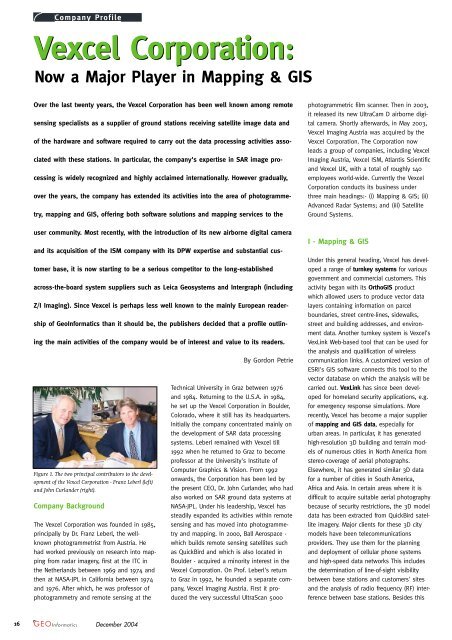
<strong>Vexcel</strong> <strong>Corporation</strong>:<br />
Now a Major Player in Mapping & GIS<br />
Over the last twenty years, the <strong>Vexcel</strong> <strong>Corporation</strong> has been well known among remote<br />
sensing specialists as a supplier <strong>of</strong> ground stations receiving satellite image data and<br />
<strong>of</strong> the hardware and s<strong>of</strong>tware required to carry out the data processing activities asso-<br />
ciated with these stations. In particular, the company's expertise in SAR image pro-<br />
cessing is widely recognized and highly acclaimed internationally. However gradually,<br />
over the years, the company has extended its activities into the area <strong>of</strong> photogramme-<br />
try, mapping and GIS, <strong>of</strong>fering both s<strong>of</strong>tware solutions and mapping services to the<br />
user community. Most recently, with the introduction <strong>of</strong> its new airborne digital camera<br />
and its acquisition <strong>of</strong> the ISM company with its DPW expertise and substantial cus-<br />
tomer base, it is now starting to be a serious competitor to the long-established<br />
across-the-board system suppliers such as Leica Geosystems and Intergraph (including<br />
Z/I Imaging). Since <strong>Vexcel</strong> is perhaps less well known to the mainly European reader-<br />
ship <strong>of</strong> GeoInformatics than it should be, the publishers decided that a pr<strong>of</strong>ile outlin-<br />
ing the main activities <strong>of</strong> the company would be <strong>of</strong> interest and value to its readers.<br />
Figure 1. The two principal contributors to the development<br />
<strong>of</strong> the <strong>Vexcel</strong> <strong>Corporation</strong> - Franz Leberl (left)<br />
and John Curlander (right).<br />
Company Background<br />
The <strong>Vexcel</strong> <strong>Corporation</strong> was founded in 1985,<br />
principally by Dr. Franz Leberl, the wellknown<br />
photogrammetrist from Austria. He<br />
had worked previously on research into mapping<br />
from radar imagery, first at the ITC in<br />
the Netherlands between 1969 and 1974 and<br />
then at NASA-JPL in California between 1974<br />
and 1976. After which, he was pr<strong>of</strong>essor <strong>of</strong><br />
photogrammetry and remote sensing at the<br />
December 2004<br />
By Gordon Petrie<br />
Technical <strong>University</strong> in Graz between 1976<br />
and 1984. Returning to the U.S.A. in 1984,<br />
he set up the <strong>Vexcel</strong> <strong>Corporation</strong> in Boulder,<br />
Colorado, where it still has its headquarters.<br />
Initially the company concentrated mainly on<br />
the development <strong>of</strong> SAR data processing<br />
systems. Leberl remained with <strong>Vexcel</strong> till<br />
1992 when he returned to Graz to become<br />
pr<strong>of</strong>essor at the <strong>University</strong>'s Institute <strong>of</strong><br />
Computer Graphics & Vision. From 1992<br />
onwards, the <strong>Corporation</strong> has been led by<br />
the present CEO, Dr. John Curlander, who had<br />
also worked on SAR ground data systems at<br />
NASA-JPL. Under his leadership, <strong>Vexcel</strong> has<br />
steadily expanded its activities within remote<br />
sensing and has moved into photogrammetry<br />
and mapping. In 2000, Ball Aerospace -<br />
which builds remote sensing satellites such<br />
as QuickBird and which is also located in<br />
Boulder - acquired a minority interest in the<br />
<strong>Vexcel</strong> <strong>Corporation</strong>. On Pr<strong>of</strong>. Leberl's return<br />
to Graz in 1992, he founded a separate company,<br />
<strong>Vexcel</strong> Imaging Austria. First it produced<br />
the very successful UltraScan 5000<br />
photogrammetric film scanner. Then in 2003,<br />
it released its new UltraCam D airborne digital<br />
camera. Shortly afterwards, in May 2003,<br />
<strong>Vexcel</strong> Imaging Austria was acquired by the<br />
<strong>Vexcel</strong> <strong>Corporation</strong>. The <strong>Corporation</strong> now<br />
leads a group <strong>of</strong> companies, including <strong>Vexcel</strong><br />
Imaging Austria, <strong>Vexcel</strong> ISM, Atlantis Scientific<br />
and <strong>Vexcel</strong> UK, with a total <strong>of</strong> roughly 140<br />
employees world-wide. Currently the <strong>Vexcel</strong><br />
<strong>Corporation</strong> conducts its business under<br />
three main headings:- (i) Mapping & GIS; (ii)<br />
Advanced Radar Systems; and (iii) Satellite<br />
Ground Systems.<br />
I - Mapping & GIS<br />
Under this general heading, <strong>Vexcel</strong> has developed<br />
a range <strong>of</strong> turnkey systems for various<br />
government and commercial customers. This<br />
activity began with its OrthoGIS product<br />
which allowed users to produce vector data<br />
layers containing information on parcel<br />
boundaries, street centre-lines, sidewalks,<br />
street and building addresses, and environment<br />
data. Another turnkey system is <strong>Vexcel</strong>'s<br />
VexLink Web-based tool that can be used for<br />
the analysis and qualification <strong>of</strong> wireless<br />
communication links. A customized version <strong>of</strong><br />
ESRI's GIS s<strong>of</strong>tware connects this tool to the<br />
vector database on which the analysis will be<br />
carried out. VexLink has since been developed<br />
for homeland security applications, e.g.<br />
for emergency response simulations. More<br />
recently, <strong>Vexcel</strong> has become a major supplier<br />
<strong>of</strong> mapping and GIS data, especially for<br />
urban areas. In particular, it has generated<br />
high-resolution 3D building and terrain models<br />
<strong>of</strong> numerous cities in North America from<br />
stereo-coverage <strong>of</strong> aerial photographs.<br />
Elsewhere, it has generated similar 3D data<br />
for a number <strong>of</strong> cities in South America,<br />
Africa and Asia. In certain areas where it is<br />
difficult to acquire suitable aerial photography<br />
because <strong>of</strong> security restrictions, the 3D model<br />
data has been extracted from QuickBird satellite<br />
imagery. Major clients for these 3D city<br />
models have been telecommunications<br />
providers. They use them for the planning<br />
and deployment <strong>of</strong> cellular phone systems<br />
and high-speed data networks This includes<br />
the determination <strong>of</strong> line-<strong>of</strong>-sight visibility<br />
between base stations and customers' sites<br />
and the analysis <strong>of</strong> radio frequency (RF) interference<br />
between base stations. Besides this
Figure 2. A perspective visualization <strong>of</strong> part <strong>of</strong> New<br />
York city. This is based on the accurate 3D terrain<br />
and building model data extracted from stereo-pairs<br />
<strong>of</strong> aerial photographs <strong>of</strong> the city by <strong>Vexcel</strong>'s mapping<br />
and GIS group.<br />
major application, <strong>Vexcel</strong> <strong>of</strong>fers its 3D urban<br />
data for visualization and simulation purposes<br />
<strong>of</strong>f-the-shelf under its Global Landscape<br />
product label.<br />
I (a) - Airborne Imagery Products<br />
These mainly comprise the hardware and<br />
s<strong>of</strong>tware products that have been developed<br />
by Pr<strong>of</strong>. Leberl and his team at <strong>Vexcel</strong><br />
Imaging Austria. The first <strong>of</strong> these was the<br />
UltraScan 5000 precision photogrammetric<br />
film scanner that was first introduced to the<br />
market at the GIS/LIS Conference held in Fort<br />
Worth, Texas in November 1998. In this context,<br />
it is worth noting that Leberl had previously<br />
designed and built the VX series <strong>of</strong> film<br />
scanners at yet another <strong>of</strong> the companies<br />
[now called VX Imaging Services] that he had<br />
founded in Boulder while he was in the<br />
U.S.A. This flatbed scanner utilized a smallformat<br />
digital camera in conjunction with a<br />
high-precision reseau (grid <strong>of</strong> crosses) that<br />
allowed the systematic scanning <strong>of</strong> the photo<br />
on a patch-by-patch basis. However the<br />
UltraScan 5000 instrument uses a rather different<br />
technology, employing a linear CCD<br />
array to scan the film systematically in a<br />
series <strong>of</strong> parallel swaths. As with the VX<br />
scanner, the individual scans (patches or<br />
swaths) are then stitched together and<br />
merged to form the final digitized version <strong>of</strong><br />
each photo that has been scanned. The<br />
UltraScan 5000 has been produced and sells<br />
at a considerably lower cost than its main<br />
rivals. Well over 400 units have been built to<br />
date, the instrument having been sold into<br />
the medical imaging market for the scanning<br />
<strong>of</strong> X-ray films as well as aerial photographic<br />
films - though the latter remains its principal<br />
market. Besides the UltraScan 5000 product,<br />
<strong>Vexcel</strong> Imaging Austria also developed the<br />
EskoScan 1318 film scanner that was sold by<br />
the Danish company, Purup-Esk<strong>of</strong>ot, into the<br />
graphic arts field. The UltraCam D large-for-<br />
Latest News? Visit www.geoinformatics.com<br />
mat digital frame camera system comprises<br />
two sets <strong>of</strong> four cameras that generate<br />
panchromatic and multi-spectral images<br />
respectively. It has already been described in<br />
previous issues <strong>of</strong> GeoInformatics. Although it<br />
was only introduced at the ASPRS Annual<br />
Conference held in Alaska in the spring <strong>of</strong><br />
2003, it has already obtained a comparable<br />
number <strong>of</strong> orders to those gained by its main<br />
rivals (Intergraph and Leica Geosystems)<br />
whose large-format airborne digital imagers<br />
were first introduced in 2000. Customers<br />
include Sanborn in the U.S.A.; Simmons<br />
Aer<strong>of</strong>ilms and GetMapping in the U.K.; IFMS<br />
in Germany; Meixner in Austria; Aerodata in<br />
Belgium; and Pasco in Japan. To date, eleven<br />
cameras have been delivered. Much <strong>of</strong> the<br />
manufacture <strong>of</strong> the mechanical components,<br />
together with the assembly <strong>of</strong> the UltraScan<br />
and UltraCam instruments, is carried out by<br />
the Wild Austria company which is located in<br />
the province <strong>of</strong> Carinthia in the southern part<br />
<strong>of</strong> Austria. The company was originally part <strong>of</strong><br />
Wild Heerbrugg and manufactured components<br />
for the main factory in Switzerland. The<br />
Wild Austria operation was then bought out<br />
by its management at the time <strong>of</strong> the formation<br />
<strong>of</strong> the Leica Geosystems company - one<br />
<strong>of</strong> the main components <strong>of</strong> which was Wild<br />
Heerbrugg. To an outside observer, it does<br />
seem slightly ironic that Wild Austria now<br />
acts as the major sub-contractor building a<br />
competitor to the ADS40 imager that is being<br />
built in the Heerbrugg factory by Leica<br />
Geosystems. Given the enormous volumes <strong>of</strong><br />
digital image data that are being generated<br />
by the UltraScan 5000 and UltraCam D instruments,<br />
it was a natural development for the<br />
<strong>Vexcel</strong> <strong>Corporation</strong> to develop its UltraMap<br />
Server data management system. This is an<br />
Oracle-based system that is used for the<br />
archiving, cataloguing and<br />
browsing <strong>of</strong> digital airborne<br />
image data or<br />
scanned aerial photography.<br />
The system is based<br />
on <strong>Vexcel</strong>'s EarthFinder<br />
product that was developed<br />
originally to support<br />
satellite image data. Its<br />
Java-based graphical user<br />
interface (GUI) allows the<br />
UltraMap s<strong>of</strong>tware to be<br />
operated either as a<br />
stand-alone system or<br />
over the Internet using a<br />
standard Web browser. In<br />
addition, the UltraMap<br />
Server forms the basis for<br />
a suite <strong>of</strong> photogrammetric<br />
application programs<br />
that allow high levels <strong>of</strong><br />
Company p y Pr<strong>of</strong>ile<br />
automation to be implemented in a production<br />
environment.<br />
I (b) - Close-Range Photogrammetry<br />
FotoG is advanced close-range photogrammetric<br />
s<strong>of</strong>tware that has been steadily<br />
developed over a considerable period <strong>of</strong><br />
time in the main Boulder <strong>of</strong>fice <strong>of</strong> <strong>Vexcel</strong>.<br />
Originally it provided an in-house capability<br />
to generate very accurate measurements<br />
that could be used to create 3D CAD models<br />
direct from film or digital photographs. The<br />
system is widely applicable to numerous<br />
industrial fields such as shipbuilding, petrochemical<br />
plants (including pipe layouts),<br />
paper and pulp mills, automotive factories<br />
(including tooling and assembly lines), architecture,<br />
etc. For some <strong>of</strong> these applications,<br />
<strong>Vexcel</strong> has provided the ground control,<br />
taken the required photographs and carried<br />
out the photogrammetric processing and<br />
measurements - thus acting as a service<br />
provider. In other cases, <strong>Vexcel</strong> has licensed<br />
the FotoG product to user organisations and<br />
companies, including the provision <strong>of</strong> training<br />
for the client's personnel, either at<br />
<strong>Vexcel</strong>'s headquarters in Boulder or at the<br />
client's own site. The data produced by<br />
FotoG is compatible with AutoCAD,<br />
MicroStation and other well known CAD<br />
packages and with the CATIA suite <strong>of</strong> engineering<br />
design programs. NASA has used<br />
FotoG to provide accurate measurements <strong>of</strong><br />
many components built for inclusion in the<br />
International Space Station (ISS). In 2003,<br />
<strong>Vexcel</strong> received the Construction Innovation<br />
Forum's NOVA award "for outstanding innovation<br />
in construction" in respect <strong>of</strong> the<br />
FotoG s<strong>of</strong>tware. In September 2004, General<br />
Figure 3. The <strong>Vexcel</strong> UltraCam D large-format digital aerial camera system<br />
showing the camera unit with its multiple lens cones (left) and the storage and<br />
computing unit (right).<br />
December 2004<br />
17
Motors (GM) gave its approval for FotoG to<br />
be used for the measurement <strong>of</strong> automobile<br />
tooling equipment in GM manufacturing<br />
plants world-wide.<br />
I (c) - <strong>Vexcel</strong> ISM<br />
As mentioned above in the introduction, the<br />
ISM company was acquired by <strong>Vexcel</strong> in May<br />
<strong>of</strong> this year (2004) and was re-named <strong>Vexcel</strong><br />
ISM. Based in Vancouver, British Columbia,<br />
ISM was founded in 1987 and has been a<br />
mainstream provider <strong>of</strong> digital photogrammetric<br />
s<strong>of</strong>tware. Its principal product is its<br />
DiAP digital photogrammetric workstation<br />
(DPW) together with the associated modules<br />
that implement aerial triangulation and data<br />
capture. Other products that are <strong>of</strong>fered<br />
include its SysImage digital orthophoto system<br />
and its TIN/CIP terrain modelling package<br />
comprising TIN generation and contour<br />
interpolation. ISM has a very substantial user<br />
community, the s<strong>of</strong>tware having been<br />
installed in over 50 countries world-wide. It<br />
has a large number <strong>of</strong> users in North<br />
America, especially in Canada, and also in<br />
Japan. In Europe, ISM has sold a large number<br />
<strong>of</strong> licences to Spanish aerial mapping<br />
companies and has a significant presence in<br />
Eastern Europe. A recently announced order<br />
since the ISM company was acquired by<br />
<strong>Vexcel</strong> has been for the supply <strong>of</strong> twelve<br />
DiAP systems to the Instituto Geografico<br />
Militar in Chile.<br />
II - Advanced Radar Systems<br />
As noted in the introduction to this pr<strong>of</strong>ile,<br />
<strong>Vexcel</strong> made its name initially through its<br />
expertise in SAR image processing techniques<br />
and it still remains in the forefront <strong>of</strong><br />
this field today. In particular, it <strong>of</strong>fers a varied<br />
range <strong>of</strong> SAR processors. One <strong>of</strong> these is<br />
the Focus processor that can handle SAR<br />
image data from the existing Radarsat, JERS-<br />
1 and ERS-1 & -2 radar satellites and is now<br />
being developed further to handle data from<br />
the forthcoming PALSAR radar mission<br />
mounted on the Japanese ALOS satellite.<br />
European readers will also be interested in<br />
the development <strong>of</strong> <strong>Vexcel</strong>'s Envisat-ASAR<br />
processor, which has been delivered to various<br />
American customers, including the<br />
Lawrence Livermore National Laboratory<br />
(LLNL), the Alaska SAR Facility (ASF) and the<br />
<strong>University</strong> <strong>of</strong> Miami's CSTARS ground station.<br />
Another product is the Phase system that<br />
processes interferometric SAR data to form<br />
digital elevation models (DEMs). It can also<br />
be used to produce maps showing (i) the<br />
Latest News? Visit www.geoinformatics.com<br />
displacement <strong>of</strong> features in areas affected by<br />
earthquakes; or (ii) the subsidence being<br />
experienced in areas where either underground<br />
mining or oil and water extraction<br />
has been taking place.<br />
On the radar mapping side, <strong>Vexcel</strong> <strong>of</strong>fers its<br />
OrthSAR product for the automated production<br />
<strong>of</strong> ortho-rectified SAR image data and<br />
the RaMS radar mosaicing s<strong>of</strong>tware for the<br />
automated production <strong>of</strong> DEMs and orthorectified<br />
mosaics. The RaMS system was<br />
developed originally to produce the SAR<br />
ortho-image mosaic <strong>of</strong> Antarctica from the<br />
hundreds <strong>of</strong> SAR image swaths obtained<br />
during the Radarsat Antarctica Mapping<br />
Project (RAMP) - which received a Group<br />
Achievement award from NASA. Other large<br />
SAR mapping projects in which <strong>Vexcel</strong> has<br />
been involved in recent years include its<br />
support for the Shuttle Radar Topography<br />
Mission (SRTM) for the production <strong>of</strong> DEMs<br />
covering North America and East Asia. This<br />
project was carried out in collaboration with<br />
the ADR Division <strong>of</strong> BAE Systems on behalf<br />
<strong>of</strong> NIMA (now NGA). Yet another large project<br />
was the production <strong>of</strong> a stereo-derived DEM<br />
<strong>of</strong> the cloud-covered area <strong>of</strong> Southern<br />
Colombia from Radarsat imagery.<br />
Figure 4. A perspective view <strong>of</strong> a chemical transfer<br />
facility based on the accurate 3D CAD model produced<br />
from measurements on multiple photographs<br />
carried out using <strong>Vexcel</strong>'s FotoG close-range photogrammetric<br />
system.<br />
II (a) - Atlantis Scientific<br />
In 2001, <strong>Vexcel</strong> took over the ownership <strong>of</strong><br />
Atlantis Scientific Inc. (ASI) based in Ottawa,<br />
Canada. Originally formed in 1981, the company<br />
is best known for its EarthView s<strong>of</strong>tware.<br />
This includes its Advanced Precision<br />
Processor (APP) <strong>of</strong>fering a full range <strong>of</strong> SAR<br />
processing algorithms and its InSAR processor<br />
which produces DEMs from repeat-pass<br />
interferometric SAR data. A new product is<br />
EarthView Stereo, which, as the name suggests,<br />
produces a DEM from a pair <strong>of</strong> stereo-<br />
SAR images. Atlantis has also undertaken<br />
numerous SAR application projects, including<br />
the monitoring <strong>of</strong> Popocatepetl Volcano in<br />
Mexico; the measurement <strong>of</strong> subsidence in<br />
Company p y Pr<strong>of</strong>ile<br />
the Belridge oil fields in California; and the<br />
generation <strong>of</strong> a DEM over the extensive<br />
NATO training range based around Goose<br />
Bay airfield in Labrador - in all three cases,<br />
using ERS InSAR data.<br />
III - Satellite Ground Stations<br />
Last, but certainly not least, in view <strong>of</strong> the<br />
high value <strong>of</strong> the business, are <strong>Vexcel</strong>'s<br />
satellite ground receiving stations and their<br />
associated image processing systems. In<br />
some cases, complete satellite data reception<br />
and processing systems, such as the<br />
Apex ground station, have been supplied to<br />
customers. Such turnkey systems comprise<br />
(i) the tracking antenna; (ii) the high-speed<br />
data reception and capture equipment; and<br />
(iii) the data processing hardware and s<strong>of</strong>tware<br />
required to handle both optical and<br />
radar data. <strong>Vexcel</strong>'s MODIS ground station is<br />
a much lower cost but complete turnkey system<br />
designed specifically to receive and process<br />
the MODIS image data being broadcast<br />
by NASA's Terra and Aqua satellites. Besides<br />
these complete systems, <strong>Vexcel</strong> also supplies<br />
units that form substantial parts <strong>of</strong> other<br />
suppliers' systems. Examples <strong>of</strong> these are<br />
the well established <strong>Vexcel</strong> Direct Capture<br />
System (VxDCS) with its large user base and<br />
the new Proton high-speed telemetry and<br />
data capture system. Among the many<br />
notable ground stations that are using<br />
<strong>Vexcel</strong>'s equipment extensively are the<br />
ground stations at the <strong>University</strong> <strong>of</strong> Miami's<br />
Center for Southeastern Tropical Advanced<br />
Remote Sensing (CSTARS) that cover the<br />
sub-tropical area <strong>of</strong> the Atlantic, the<br />
Caribbean and Gulf <strong>of</strong> Mexico, monitoring<br />
the approach <strong>of</strong> the hurricanes that cause so<br />
much devastation in the area. Other examples<br />
include the Alaska SAR Facility (ASF)<br />
located at the <strong>University</strong> <strong>of</strong> Alaska in<br />
Fairbanks, which is NASA's specialist facility<br />
for handling SAR data.<br />
Conclusion<br />
As this account has shown, <strong>Vexcel</strong> is now a<br />
heavyweight player in the fields <strong>of</strong> photogrammetry,<br />
mapping and remote sensing<br />
with a portfolio <strong>of</strong> products that is attracting<br />
attention (and orders) from all parts <strong>of</strong> the<br />
industry.<br />
G. Petrie (g.petrie@geog.gla.ac.uk), is a Pr<strong>of</strong>essor in<br />
the Department <strong>of</strong> Geography & Geomatics, <strong>University</strong><br />
<strong>of</strong> <strong>Glasgow</strong>, <strong>Glasgow</strong>, G12 8QQ, Scotland, U.K.<br />
More information: http://www.geog.gla.ac.uk/~gpetrie<br />
December 2004<br />
■<br />
19