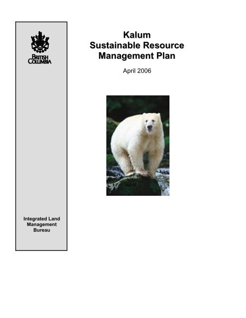
Kalum Sustainable Resource Management Plan - Integrated Land ...
Kalum Sustainable Resource Management Plan - Integrated Land ...
Kalum Sustainable Resource Management Plan - Integrated Land ...

You also want an ePaper? Increase the reach of your titles
YUMPU automatically turns print PDFs into web optimized ePapers that Google loves.
<strong>Kalum</strong><br />
<strong>Integrated</strong> <strong>Land</strong><br />
<strong>Management</strong><br />
Bureau<br />
<strong>Kalum</strong><br />
<strong>Sustainable</strong> <strong>Resource</strong><br />
<strong>Management</strong> <strong>Plan</strong><br />
April 2006
Foreword<br />
<strong>Kalum</strong> SRMP<br />
The <strong>Kalum</strong> <strong>Sustainable</strong> <strong>Resource</strong> <strong>Management</strong> <strong>Plan</strong> (SRMP) will guide land use and<br />
resource management within the plan area to help provide long-term sustainability of<br />
natural resources, jobs, and communities in the <strong>Kalum</strong> plan area. This plan implements<br />
objectives and strategies of the <strong>Kalum</strong> <strong>Land</strong> and <strong>Resource</strong> <strong>Management</strong> <strong>Plan</strong> (LRMP)<br />
that relate to forestry development and the Forest and Range Practices Act (FRPA).<br />
In keeping with the Governance Principles for Sustainability 1 , the plan provides the<br />
following:<br />
• Certainty, by providing clear management direction to resource users;<br />
• Efficiency in the allocation, development and use of natural resources, by<br />
clarifying the timing and nature of activities that can occur in the area;<br />
• Flexibility, by presenting results-based standards that will allow resource users to<br />
use their innovation and professional skills in developing implementation<br />
strategies;<br />
• Transparency, by creating the plan in a spirit of openness of information and in<br />
consultation with First Nations, stakeholders, and the general public; and<br />
• Accountability, by setting measurable objectives that can be tracked over time.<br />
The <strong>Kalum</strong> SRMP is consistent with the <strong>Sustainable</strong> <strong>Resource</strong> <strong>Management</strong> <strong>Plan</strong>ning,<br />
Standards for Creating, Implementing and Administering <strong>Sustainable</strong> <strong>Resource</strong><br />
<strong>Management</strong> <strong>Plan</strong>s, March 2004. The plan was developed in collaboration with the<br />
Ministry of Forests and Range (MOFR) and the Ministry of Environment (MOE), and in<br />
consultation with plan area stakeholders, First Nations, and the public.<br />
The plan is intended to maintain a balance of social, cultural, economic and<br />
environmental values consistent with the <strong>Kalum</strong> LRMP.<br />
1 Governance Principles for Sustainability – Application Guideline. March 2004, Ministry of <strong>Sustainable</strong> <strong>Resource</strong><br />
<strong>Management</strong> (now called <strong>Integrated</strong> <strong>Land</strong> <strong>Management</strong> Bureau).<br />
<strong>Kalum</strong> <strong>Sustainable</strong> <strong>Resource</strong> <strong>Management</strong> <strong>Plan</strong><br />
i
Order establishing <strong>Land</strong> Use Objectives in the<br />
<strong>Kalum</strong> SRMP Area<br />
I. Pursuant to Section 93.4 (1) of the <strong>Land</strong> Act, objectives listed in the <strong>Kalum</strong><br />
<strong>Sustainable</strong> <strong>Resource</strong> <strong>Management</strong> <strong>Plan</strong> (SRMP) are established as <strong>Land</strong> Use<br />
Objectives. Any footnote referenced in the objective is an integral part of the<br />
objective. Maps 2 through 9 of the <strong>Kalum</strong> SRMP provide the geographic<br />
location to which the land use objectives apply.<br />
II. Pursuant to Section 8 (2) (b) of the Forest and Range Practices Act the holder<br />
of a forest stewardship plan (FSP) must propose and submit for approval<br />
amendment to FSP within nine (9) months of the effective date of this order.<br />
III. Pursuant to Section 16 (2) of the Forest and Range Practices Act the<br />
objectives established by this order apply despite that subsection.<br />
IV. Old growth objectives established under the “order establishing provincial<br />
non-spatial old growth objectives” 1 will, on the effective date of this order,<br />
cease to have an effect for the area in this new order.<br />
V. The order takes effect on the date of notice.<br />
___________________________ __April 28, 2006____<br />
James McGregor Date<br />
Regional Executive Director<br />
Ministry of Agriculture and <strong>Land</strong>s<br />
<strong>Integrated</strong> <strong>Land</strong> <strong>Management</strong> Bureau<br />
1 “Order establishing provincial non-spatial old growth objectives” came into effect on June 30, 2004.
Table of Contents<br />
<strong>Kalum</strong> SRMP<br />
FOREWORD ............................................................................................................................................................... I<br />
TABLE OF CONTENTS ...........................................................................................................................................II<br />
LIST OF TABLES ..............................................................................................................................................III<br />
LIST OF MAPS .................................................................................................................................................III<br />
LIST OF APPENDICES.......................................................................................................................................III<br />
LIST OF ACRONYMS ....................................................................................................................................... IV<br />
GLOSSARY ...................................................................................................................................................... V<br />
1.0 PLANNING CONTEXT...............................................................................................................................1<br />
1.1 INTRODUCTION ..................................................................................................................................1<br />
1.1.1 <strong>Plan</strong> Goals..........................................................................................................................2<br />
1.1.2 SRMP Process Overview ....................................................................................................2<br />
1.2 PLAN AREA........................................................................................................................................3<br />
1.3 PLAN SCOPE ......................................................................................................................................3<br />
1.3.1 Direction from Other <strong>Plan</strong>s................................................................................................3<br />
1.3.2 Scope of the <strong>Plan</strong> ................................................................................................................3<br />
2.0 BIODIVERSITY ...........................................................................................................................................5<br />
2.1 MANAGEMENT DIRECTION FOR BIODIVERSITY..................................................................................5<br />
2.1.1 Seral Stage Distribution .....................................................................................................5<br />
2.1.2 Old Forest Retention in Undeveloped Watersheds.............................................................9<br />
2.1.3 Retention of Old Forest Through Establishment of OGMAs ............................................13<br />
2.1.4 Stand Structure through Wildlife Tree Retention..............................................................15<br />
2.1.5 Species Composition.........................................................................................................18<br />
2.1.6 Temporal and Spatial Distribution of Cutblocks ..............................................................18<br />
2.1.7 <strong>Land</strong>scape Connectivity....................................................................................................19<br />
2.1.8 Rare Ecosystems...............................................................................................................19<br />
3.0 WILDLIFE ..................................................................................................................................................20<br />
3.1 MANAGEMENT DIRECTION FOR WILDLIFE.......................................................................................20<br />
3.1.1 Grizzly Bear......................................................................................................................21<br />
4.0 AREA SPECIFIC MANAGEMENT DIRECTION.................................................................................22<br />
5.0 VISUAL RESOURCES ..............................................................................................................................24<br />
5.1 MANAGEMENT DIRECTION FOR VISUAL RESOURCES.......................................................................24<br />
6.0 COMMUNITY WATERSHEDS ...............................................................................................................25<br />
6.1 MANAGEMENT DIRECTION FOR COMMUNITY WATERSHEDS ...........................................................25<br />
6.1.1 Grandparented Community Watersheds...........................................................................25<br />
6.1.2 Community Watersheds Established Through This <strong>Plan</strong> Process ....................................25<br />
7.0 PLAN IMPLEMENTATION, MONITORING AND AMENDMENT ..................................................26<br />
7.1 IMPLEMENTATION............................................................................................................................26<br />
7.2 MONITORING ...................................................................................................................................26<br />
7.3 ADAPTIVE MANAGEMENT ...............................................................................................................26<br />
7.4 PLAN AMENDMENT..........................................................................................................................26<br />
<strong>Kalum</strong> <strong>Sustainable</strong> <strong>Resource</strong> <strong>Management</strong> <strong>Plan</strong><br />
ii
List of Tables<br />
<strong>Kalum</strong> SRMP<br />
Table 1: Seral stage definition (ages in years) by biogeoclimatic unit<br />
Table 2: Target seral stage distribution (% of forested land base in each BEC unit)<br />
Table 3: Allowable deviations from the early seral stage targets set in Table 2<br />
Table 4: Undeveloped watersheds<br />
Table 5: Target old seral stage distribution within undeveloped watersheds (% forested<br />
land base in each BEC unit/site series)<br />
Table 6: Wildlife tree patch retention targets<br />
Table 7: Target distribution of patch sizes (harvest units and leave areas)<br />
Table 8: Grizzly bear stocking standards<br />
List of Maps<br />
Map 1: <strong>Plan</strong> Area<br />
Map 2: Biogeoclimatic Zones<br />
Map 3: <strong>Land</strong>scape Units and Undeveloped Watersheds<br />
Map 4: Proposed Old Growth <strong>Management</strong> Areas<br />
Map 5: Wildlife Connectivity Corridors<br />
Map 6: Skeena Islands Rare Ecosystems<br />
Map 7: Grizzly Bear Identified Watersheds<br />
Map 8: Area Specific <strong>Management</strong><br />
Map 9: Community Watersheds<br />
Map 10: Coastal Tailed Frog WHA and Mountain Goat UWR<br />
List of Appendices<br />
Appendix A: Wildlife Objectives Established by MOE<br />
Appendix B: Visual Quality Objectives Established by MoFR<br />
Appendix C: Seral Stage Assessment<br />
Appendix D: OGMAs Area Analysis<br />
Appendix E: Patch Size Distribution Assessment<br />
Appendix F: Best <strong>Management</strong> Practices for Rare and Endangered Ecosystems<br />
<strong>Kalum</strong> <strong>Sustainable</strong> <strong>Resource</strong> <strong>Management</strong> <strong>Plan</strong><br />
iii
List of Acronyms<br />
<strong>Kalum</strong> SRMP<br />
AAC Allowable annual cut<br />
AST Approval Support Team<br />
BEC Biogeoclimatic ecosystem classification<br />
CDC Conservation Data Centre<br />
CWH Coastal Western Hemlock zone<br />
DFO Department of Fisheries and Oceans (now Fisheries and Oceans Canada)<br />
ECA Equivalent clearcut area<br />
ESSF Engelmann Spruce Sub-alpine Fir zone<br />
FDP Forest Development <strong>Plan</strong><br />
FRPA Forest and Range Practices Act<br />
FPPR Forest <strong>Plan</strong>ning and Practices Regulation<br />
FSP Forest Stewardship <strong>Plan</strong><br />
GBPU Grizzly bear population unit<br />
GIS Geographic information system<br />
ICH Interior Cedar Hemlock zone<br />
ILMB <strong>Integrated</strong> <strong>Land</strong> <strong>Management</strong> Bureau 2<br />
IPT Interagency <strong>Plan</strong>ning Team<br />
IWMS Identified wildlife management strategy<br />
LU <strong>Land</strong>scape unit<br />
LRMP <strong>Land</strong> and resource management plan<br />
MAL Ministry of Agriculture and <strong>Land</strong>s 3<br />
MELP Ministry of Environment, <strong>Land</strong>s and Parks 4<br />
MH Mountain Hemlock zone<br />
MOE Ministry of Environment 4<br />
MOF Ministry of Forests 5<br />
MOFR Ministry of Forests and Range<br />
MSRM Ministry of <strong>Sustainable</strong> <strong>Resource</strong> <strong>Management</strong> 6<br />
ND<br />
Natural disturbance<br />
NDT<br />
Natural disturbance type<br />
OGMA Old Growth <strong>Management</strong> Area<br />
PEM Predictive ecosystem mapping<br />
PIC <strong>Plan</strong> Implementation Committee<br />
SRMZ Special resource management zone<br />
SRMP <strong>Sustainable</strong> <strong>Resource</strong> <strong>Management</strong> <strong>Plan</strong><br />
TFL Tree Farm Licence<br />
THLB Timber harvesting land base<br />
TSA Timber supply area<br />
2 Prior to 2005 it was called the Ministry of <strong>Sustainable</strong> <strong>Resource</strong> <strong>Management</strong> (MSRM).<br />
3 In 2005 the Ministry of Agriculture, Food, and Fisheries was renamed the Ministry of Agriculture and <strong>Land</strong>s.<br />
4 In June of 2001 the Ministry of Environment, <strong>Land</strong>s and Parks was replaced by the Ministry of Water, <strong>Land</strong> and Air<br />
Protection and the Ministry of <strong>Sustainable</strong> <strong>Resource</strong> <strong>Management</strong>. In 2005 it was renamed the Ministry of<br />
Environment.<br />
5 In 2005 the ministry name has changed to the Ministry of Forests and Range.<br />
6 In 2005 the Ministry was eliminated and the planning function has moved to the Ministry of Agriculture and <strong>Land</strong>s,<br />
<strong>Integrated</strong> <strong>Land</strong> <strong>Management</strong> Bureau.<br />
<strong>Kalum</strong> <strong>Sustainable</strong> <strong>Resource</strong> <strong>Management</strong> <strong>Plan</strong><br />
iv
<strong>Kalum</strong> SRMP<br />
TSR Timber supply review<br />
UWR Ungulate Winter Range<br />
VLI Visual <strong>Land</strong>scape Inventory<br />
VQO Visual Quality Objective<br />
WHA Wildlife Habitat Area<br />
WLAP Ministry of Water, <strong>Land</strong>, and Air Protection 7<br />
WTP<br />
WTR<br />
Glossary<br />
Wildlife tree patch<br />
Wildlife tree retention<br />
Adaptive management An approach to managing uncertainty that emphasizes learning<br />
by trial. <strong>Management</strong> policies, practices, and plans are adopted<br />
based on best available information, and monitored to assess<br />
effects. Adoptions of policies, practices, and plans are made<br />
periodically, on the basis of research and monitoring<br />
information to incorporate “lessons learned”.<br />
Allowable annual cut (AAC) The rate of timber harvest permitted each year from a specified<br />
area of land, usually expressed as cubic metres of wood per<br />
year. The chief forester sets AACs for timber supply areas<br />
(TSA) and tree farm licences (TFLs) in accordance with<br />
Section 7 and/or Section 170 of the Forest Act. The district<br />
manager sets AACs for woodlot licences.<br />
Biodiversity The diversity of plants, animals and other living organisms in<br />
all their forms and levels of organization, including the<br />
diversity of genes, species, and ecosystems, as well as the<br />
functional processes that link them.<br />
Biogeoclimatic (BEC) zones A system of ecological classification based primarily on<br />
climate, soils, and vegetation that divide the province into large<br />
geographic areas with broadly homogeneous climate and<br />
similar dominant tree species. Zones are further broken down<br />
into subzones (based on characteristic plant communities<br />
occurring on zonal sites) and variants (based on climatic<br />
variation within a subzone).<br />
7 In 2005 it was renamed to the Ministry of Environment.<br />
<strong>Kalum</strong> <strong>Sustainable</strong> <strong>Resource</strong> <strong>Management</strong> <strong>Plan</strong><br />
v
<strong>Kalum</strong> SRMP<br />
Blue-listed species Sensitive or vulnerable species as identified by the Ministry of<br />
Environment. Blue-listed species are considered to be<br />
vulnerable and “at risk” but not yet endangered or threatened.<br />
Populations of these species may not be declining but their<br />
habitat or other requirements are such that they are sensitive to<br />
disturbance. The blue list also includes species that are<br />
generally suspected of being vulnerable, but for which<br />
information is too limited to allow designation in another<br />
category.<br />
Community watershed A drainage basin that is managed to provide a domestic water<br />
supply to a particular community of users.<br />
Connectivity A qualitative term describing the degree to which late-success<br />
ional ecosystems are linked to one another to form an<br />
interconnected network. The degree of interconnectedness and<br />
the characteristics of the linkages vary in natural landscapes<br />
based on topography and natural disturbance regime. Breaking<br />
of these linkages may result in fragmentation. Connectivity<br />
also refers to degree to which the condition of a landscape<br />
facilitates or impedes wildlife movement.<br />
Conserve Keep in a safe or sound state; to avoid wasteful or destructive<br />
use.<br />
Consistency Where resource objectives do not materially conflict with other<br />
objectives that have been established (either in policy-based<br />
land use plans, or legally by Order).<br />
Equivalent Clearcut Area<br />
(ECA)<br />
Forest Stewardship <strong>Plan</strong><br />
(FSP)<br />
<strong>Kalum</strong> <strong>Sustainable</strong> <strong>Resource</strong> <strong>Management</strong> <strong>Plan</strong><br />
The area of a cut block weighted as the area of a clear-cut,<br />
unregenerated block to estimate the equivalent effect on snow<br />
hydrology. For example, a 10 ha clear-cut, unregenerated block<br />
has an ECA of 10 ha; if a fully stocked stand has regenerated to<br />
a height of 6 metres, the block now has an ECA of 5 ha. If,<br />
instead of being clear-cut, the block was selection logged with<br />
30 per cent volume removal, the ECA is estimated to be 3 ha.<br />
An operational plan that details the logistics for development.<br />
Methods, schedules, and responsibilities for accessing,<br />
harvesting, renewing and protecting the resource are set out to<br />
enable site-specific operations to proceed.<br />
vi
<strong>Kalum</strong> SRMP<br />
Forested land base For the purpose of biodiversity analysis, the total forested land<br />
base was determined by using the direction in Chapter 2 of the<br />
<strong>Land</strong>scape Unit <strong>Plan</strong>ning Guide (1999). It includes crown<br />
owned forested land (excluding woodlots). This includes TFL<br />
land and any private land associated with TFL. The forested<br />
portions of provincial parks, protected areas, and ecological<br />
reserves were also included.<br />
Goal Broad statement that describes a general, desirable future endstate<br />
with respect to a particular subject (environmental, social<br />
or economic).<br />
Legal objective A land or resource management objective that has been<br />
established by Cabinet or an authorized minister (or minister’s<br />
delegate) for the purpose of guiding subsequent resource<br />
management planning and decision making. Making land use<br />
plan objectives “legal” (by Cabinet or ministerial Order) is the<br />
primary means in British Columbia of ensuring that the plan<br />
objectives are implemented consistently over time.<br />
Maintain Preserve from failure or decline; to cause to continue.<br />
Mitigation <strong>Resource</strong> management practices targeted at improving the<br />
compatibility between resource uses. Mitigation strategies<br />
include efforts to avoid, minimize, rectify, reduce or<br />
compensate for the impacts of one resource use on another.<br />
Monitoring Ongoing assessment of how well the management objectives of<br />
the SRMP are being implemented. Effectiveness monitoring<br />
will assess how well the management objectives are meeting<br />
the goals or intent of the SRMP.<br />
Natural Disturbance Type<br />
(NDT1/NDT2)<br />
<strong>Kalum</strong> <strong>Sustainable</strong> <strong>Resource</strong> <strong>Management</strong> <strong>Plan</strong><br />
Forest cover types resulting from a particular natural<br />
disturbance regime. Natural disturbance type 1 includes<br />
ecosystems with rare stand-initiating events. Natural<br />
disturbance type 2 includes ecosystems with infrequent standinitiating<br />
events.<br />
Objective A concise, measurable statement of a desired future condition<br />
for a resource or resource use that is attainable through<br />
management action.<br />
Old Growth <strong>Management</strong><br />
Areas (OGMAs)<br />
Areas that contain or are managed to replace specific structural<br />
old-growth attributes and that are mapped out and treated as<br />
special management areas (no harvest areas).<br />
vii
<strong>Kalum</strong> SRMP<br />
Operational plans <strong>Plan</strong>s that specify the detailed method, schedules, and<br />
responsibilities for developing and managing resources.<br />
Operational plans are typically developed by resource tenure<br />
holders and are approved by the agency with regulatory<br />
responsibility for the resource sector. Operational plans for<br />
forest management in British Columbia include, but are not<br />
limited to, “forest stewardship plans” and “range stewardship<br />
plans”.<br />
<strong>Plan</strong>ning hierarchy A continuum of interdependent planning levels ranging from<br />
broad land and resource management principals and policies, to<br />
strategic level land and resource use plans, to sustainable<br />
resource management plans, to operational-level planning.<br />
Policy based plans <strong>Land</strong> use plans that are formally approved by government, but<br />
are not implemented by legal means.<br />
Preserve Keep safe from injury, harm or distraction; to keep alive, intact<br />
or free from decay; synonym for protect.<br />
Protect Keep safe, defend or guard.<br />
Range of natural variability<br />
(RONV)<br />
<strong>Kalum</strong> <strong>Sustainable</strong> <strong>Resource</strong> <strong>Management</strong> <strong>Plan</strong><br />
In the absence of human development activities, the range<br />
within which fluctuations in the environment occur, for<br />
example, water temperature or flow cycles as influenced by<br />
time of year or rainfall.<br />
Red-listed species Taxa being considered for or already designated Extirpated,<br />
Endangered or Threatened. Extirpated taxa no longer exist in<br />
the wild in British Columbia, but occur elsewhere. Endangered<br />
taxa are facing imminent extirpation or extinction. Threatened<br />
taxa are likely to become endangered if limiting factors are not<br />
reversed.<br />
Results-based A management strategy that focuses on on-the-ground results<br />
(vs. specific methods or strategies), providing flexibility in<br />
meeting the clear environmental standards set by the Forest<br />
and Range Practices Act.<br />
Scenic area Any visually sensitive area of scenic landscape identified<br />
through a visual landscape inventory or planning process<br />
carried out or approved by a district manager.<br />
viii
<strong>Kalum</strong> SRMP<br />
Seral (forest or stage) Sequential stages in the development of plant communities<br />
(e.g. from young stage (early seral) to old stage (old seral)) that<br />
successively occupy a site and replace each other over time.<br />
Strategy A means of achieving resource objective.<br />
<strong>Sustainable</strong> A state or process that can be maintained indefinitely. The<br />
principles of sustainability integrate three closely interlinked<br />
elements – the environment, the economy and the social<br />
system – into a system that can be maintained in a healthy state<br />
indefinitely.<br />
<strong>Sustainable</strong> <strong>Resource</strong><br />
<strong>Management</strong> <strong>Plan</strong> (SRMP)<br />
<strong>Kalum</strong> <strong>Sustainable</strong> <strong>Resource</strong> <strong>Management</strong> <strong>Plan</strong><br />
A landscape-level plan that identifies spatially specific and<br />
measurable land/resource objectives for the planning area, and<br />
strategies for achieving the objectives. SRMP <strong>Plan</strong>ning<br />
integrates and replaces the province’s former array of<br />
landscape and local planning processes under one umbrella<br />
(including local resource planning, coastal planning, pre-tenure<br />
planning, and recreation management planning).<br />
Timber supply area (TSA) An integrated resource management unit established in<br />
accordance with Section 6 of the Forest Act. TSAs were<br />
originally defined by an established pattern of wood flow from<br />
management units to the primary timber-using industries. They<br />
are the primary unit for allowable annual cut determinations.<br />
Visual <strong>Land</strong>scape Inventory<br />
(VLI)<br />
Visual Quality Objectives<br />
(VQO)<br />
An inventory that identifies visible areas that have known or<br />
potential scenic value as seen from selected viewpoints, such<br />
as towns, parks, recreation sites and highway and river<br />
corridors. This province-wide inventory undertaken by the<br />
Ministry of Forests and Range is designed to provide<br />
information on visual quality for planning including strategic<br />
planning (e.g. LRMPs) and operational planning (forest<br />
development plans). One of the components of a VLI is<br />
Recommended Visual Quality Objectives (VQOs).<br />
A resource management objective established by the district<br />
manager or contained in a higher level plan that reflects the<br />
desired level of visual quality based on the physical<br />
characteristics and social concern for the area. Five categories<br />
of VQO are commonly used: preservation; retention; partial<br />
retention; modification and, maximum modification.<br />
Watershed An area of land that collects and discharges water into a single<br />
main stream through a series of smaller tributaries.<br />
ix
1.0 <strong>Plan</strong>ning Context<br />
1.1 Introduction<br />
<strong>Kalum</strong> SRMP<br />
The <strong>Kalum</strong> <strong>Land</strong> and <strong>Resource</strong> <strong>Management</strong> <strong>Plan</strong> (LRMP) recommendations were<br />
finalized and approved by Cabinet in March of 2001. In June of 2001 a new government<br />
was appointed and the Ministry of <strong>Sustainable</strong> <strong>Resource</strong> <strong>Management</strong> (MSRM) was<br />
formed as the primary agency responsible for land-use planning. In May of 2002, the<br />
Minister of MSRM gave the final approval for the LRMP and conveyed it to all<br />
participating ministries for implementation.<br />
Upon the completion of the <strong>Kalum</strong> LRMP recommendations, the <strong>Kalum</strong> LRMP Approval<br />
Support Team (AST) and Interagency <strong>Plan</strong>ning Team (IPT) identified objectives and<br />
strategies for inclusion in a higher level plan; however, due to changes in government, the<br />
higher level plan was never finalized or approved. For the most part, the LRMP is not<br />
legally binding and it remains as government policy.<br />
Since the completion of the <strong>Kalum</strong> LRMP, the Forest and Range Practices Act (FRPA,<br />
2003) has been enacted to govern forestry activities. Under the Forest Practices Code<br />
(FPC), the District Manager has discretionary power to identify LRMP zones, and<br />
objectives and strategies as ‘known information’. Licensees are required to consider this<br />
‘known information” in their operational plans even though the information itself had not<br />
been designated as legal objectives. Under FRPA, licensees are required to only consider<br />
objectives that are legally established. The FPC still applies to any activity carried out<br />
under a forest development plan (FDP), while FRPA will apply to those activities carried<br />
out under a forest stewardship plan (FSP).<br />
The Skeena Region Inter-agency <strong>Management</strong> Committee identified the <strong>Kalum</strong> LRMP<br />
area as a high priority for the establishing legal objectives. The <strong>Kalum</strong> SRMP is a<br />
landscape level plan that allows government to implement some of the <strong>Kalum</strong> LRMP<br />
objectives and strategies by making them legally binding. The <strong>Kalum</strong> SRMP maintains<br />
the balance of social, cultural, economic and environmental values as determined by the<br />
LRMP. The objectives in the SRMP are established, through an Order, as legally binding<br />
land use objectives. Any footnote that is referenced in the objective is considered to be a<br />
part of the objective and will be legally binding as well.<br />
Mineral exploration and mining will be addressed through use of the “two-zone model”.<br />
This model ensures that mining applications are considered, subject to all applicable<br />
laws, anywhere but in parks, ecological reserves, protected heritage property, or an area<br />
under the Environment and <strong>Land</strong> Use Act. This plan is consistent with the <strong>Kalum</strong> LRMP<br />
objectives regarding development of mineral and energy resources.<br />
The <strong>Kalum</strong> SRMP recognizes that the Nisga’a Final Agreement establishes a number of<br />
joint Nisga’a/Provincial/Federal committees to facilitate the planning of certain activities<br />
in areas including that part of the <strong>Kalum</strong> SRMP that is within the southern boundary of<br />
the Nass Area and Nass Wildlife Area. Such committees include:<br />
April 2006 1
<strong>Kalum</strong> SRMP<br />
- Joint Fisheries <strong>Management</strong> Committee, mandated to facilitate cooperative planning<br />
and conduct of Nisga’a fisheries and enhancement initiatives in the Nass Area, and<br />
- Nass Wildlife Committee, mandated to facilitate wildlife management within the<br />
Nass Area.<br />
1.1.1 <strong>Plan</strong> Goals<br />
The goal of the <strong>Kalum</strong> SRMP is to provide a landscape level plan that allows the<br />
government to implement the <strong>Kalum</strong> LRMP objectives and strategies as they pertain to<br />
forestry activities. This plan provides clear direction, using the best available knowledge,<br />
data, and analysis, to ensure the long-term sustainability of natural resources and the<br />
environment. The plan will create accountability by setting measurable standards for the<br />
management of resources. Additional goals are to:<br />
• establish legal land use objectives to support the implementation of the FRPA;<br />
• provide certainty to forest licensees in the development of FSP as required under<br />
FRPA;<br />
• spatially locate the direction or values given in the <strong>Kalum</strong> LRMP, and to identify<br />
measurable targets related to the geographic area.<br />
1.1.2 SRMP Process Overview<br />
The interagency team responsible for the completion of the SRMP included<br />
representatives from ILMB, MOFR and MOE. The following key phases in the planning<br />
process guided development of the SRMP:<br />
Phase 1: Process Initiation: Assembly of planning team, development and approval of<br />
project Terms of Reference and completion of a detailed work plan.<br />
Phase 2: Information Gathering: Complete review of relevant information and compile<br />
all existing inventories.<br />
Phase 3: <strong>Plan</strong> Development: Draft resource objectives for biodiversity, wildlife, visual<br />
quality, and water quality and develop implementation, monitoring and reporting<br />
methodology.<br />
Phase 4: First Nations and Licensees Consultation: Present or provide the draft plan to<br />
the licensees and affected First Nations.<br />
Phase 5: Public Review: Present the revised draft plan to the <strong>Kalum</strong> LRMP <strong>Plan</strong><br />
Implementation Committee (PIC) and incorporate comments as appropriate.<br />
Enter into a 60 day public review period and incorporate comments as<br />
appropriate.<br />
Phase 6: <strong>Plan</strong> Approval: Review and approval of the final draft plan by the Regional<br />
Director, and filing the Order.<br />
April 2006 2
<strong>Kalum</strong> SRMP<br />
Phase 7: Data Warehousing: Data sets used for plan development and analysis will be<br />
warehoused.<br />
1.2 <strong>Plan</strong> Area<br />
The <strong>Kalum</strong> SRMP area (Map 1) encompasses Crown land within the <strong>Kalum</strong> LRMP area<br />
with the exclusion of the Kowesas <strong>Land</strong>scape Unit (LU), which is covered by the<br />
Kowesas SRMP, and all parks/protected areas.<br />
1.3 <strong>Plan</strong> Scope<br />
1.3.1 Direction from Other <strong>Plan</strong>s<br />
<strong>Plan</strong> direction is complimentary to, and consistent with, the <strong>Kalum</strong> LRMP direction. The<br />
<strong>Kalum</strong> LRMP was developed through a public process involving people with a range of<br />
interests in the <strong>Kalum</strong> area: First Nations, foresters, miners, recreationists, tourism<br />
operators, environmentalists, and interested members of the local communities. LRMP<br />
objectives and strategies, which have not been given the weight of government<br />
legislation, still reflect social choices that have been approved by government for<br />
consideration in plans – these continue as government policy. Accountability for<br />
implementation of these “non-legal” components rests with resource professionals and<br />
their professional accounting bodies.<br />
The LRMP directed that an ecosystem-based land management approach be piloted in<br />
key undeveloped watersheds (Jesse, Emsley, Wathlsto, Hugh, Brim, Wahoo, and<br />
Owyacumish). Old growth retention targets for these undeveloped watersheds are<br />
consistent with the approach that is applied in the Kowesas SRMP 8 .<br />
1.3.2 Scope of the <strong>Plan</strong><br />
The <strong>Kalum</strong> SRMP was created to safeguard the public interests in the conservation and<br />
management of values and resources in the plan area, and to direct management of<br />
forestry activities occurring in the plan area. The values and issues addressed in the<br />
<strong>Kalum</strong> SRMP are identified by the <strong>Kalum</strong> LRMP.<br />
The <strong>Kalum</strong> SRMP and associated legal Orders:<br />
• establish Rosswood (Clear Creek), Usk (Skovens Brook), Kleanza (Singlehurst<br />
Creek), Gossen Creek and Hatchery Creek as Community Watersheds;<br />
• establish land use objectives for maintaining water quality in the newly established<br />
Community Watersheds;<br />
• establish land use objectives for biodiversity values including but not limited to: seral<br />
stage distribution, retention of old growth forest (through spatial Old Growth<br />
<strong>Management</strong> Areas (OGMAs)), stand structure (through wildlife tree retention),<br />
species composition, connectivity, and patch size distribution; and<br />
8 The Kowesas SRMP was in draft form and not yet approved by government at the time this SRMP was completed.<br />
April 2006 3
<strong>Kalum</strong> SRMP<br />
• establish land use objectives for grizzly bear to address the LRMP recommendations<br />
that will not be addressed by grizzly bear WHAs (forage supply).<br />
• Establish land use objectives for important areas through area specific management<br />
<strong>Management</strong> of wildlife values through the Forest and Range Practices Act and the<br />
Government Actions Regulation are the responsibility of MOE. General Wildlife Measures<br />
(GWMs) and associated Ungulate Winter Range (UWR) (mountain goat) or Wildlife Habitat<br />
Area (WHA) (tailed frog) designations are included for reference purposes in this plan<br />
(Appendix A). Future designations and GWMs will be added as they become available.<br />
Scenic areas and visual quality objectives are established by the District Manager of the<br />
Ministry of Forests and Range either under the FPC or brought into force under the FRPA<br />
Government Actions Regulation (GAR) and Forest <strong>Plan</strong>ning and Practices Regulation<br />
(FPPR). These are included for reference purposes in this plan (Appendix B).<br />
The plan may be amended from time to time to either address additional resource values<br />
or amend the existing objectives as appropriate. The amendment process is defined in a<br />
provincial policy “Keeping <strong>Land</strong> Use <strong>Plan</strong>s Current, Policy on Reviewing & Amending<br />
Strategic <strong>Land</strong> Use <strong>Plan</strong>s”.<br />
April 2006 4
2.0 Biodiversity<br />
<strong>Kalum</strong> SRMP<br />
2.1 <strong>Management</strong> Direction for Biodiversity<br />
<strong>Plan</strong> Goal for Biodiversity<br />
• To maintain the natural biodiversity of the <strong>Kalum</strong> SRMP area, including the full<br />
range of functional and healthy ecosystems, over time and at all scales.<br />
Biodiversity is addressed using two types of management: coarse filter and fine filter.<br />
“Coarse filter management” occurs throughout the land base and assumes that the habitat<br />
needs of most species will be addressed by managing forest in a way that reflects the<br />
natural disturbance patterns for the area. ”Fine filter management” addresses the<br />
specialized habitat requirements of species whose needs are not met by the “broad-brush”<br />
of coarse filter management. The management direction for biodiversity is consistent<br />
with the principals of an ecosystem management approach.<br />
The <strong>Kalum</strong> SRMP addresses the following elements of coarse filter biodiversity:<br />
• Seral stage distribution;<br />
• Retention of old growth forest through establishment of Old Growth <strong>Management</strong><br />
Areas (OGMAs);<br />
• Stand structure through wildlife tree retention;<br />
• Species composition;<br />
• Temporal and spatial distribution of cut blocks; and<br />
• Connectivity.<br />
Fine filter management for tailed frog and mountain goat is addressed by the Ministry of<br />
Environment through establishment of ungulate winter ranges (UWRs) and wildlife<br />
habitat areas (WHAs). For reference purposes these are included as Appendix A.<br />
In addition the SRMP addresses rare ecosystems on Skeena River islands and area<br />
specific LRMP direction.<br />
2.1.1 Seral Stage Distribution<br />
The goal of the seral stage distribution objectives is to maintain the range of forest stand<br />
ages that were historically found within the various biogeoclimatic subzones and variants<br />
(Map 2) within each landscape unit (Map 3) in the <strong>Kalum</strong> SRMP area.<br />
Objective 1: Maintain a range of forest seral stages by biogeoclimatic variant,<br />
within each landscape unit, consistent with Tables 1, 2, and 3.<br />
April 2006 5
<strong>Kalum</strong> SRMP<br />
Table 1. Seral stage definition by biogeoclimatic unit (based on the Biodiversity<br />
Guidebook 1995).<br />
BEC Unit NDT<br />
Forest Stand Age (years)<br />
Early Mature Old<br />
CWHvh2, vm, vm1, vm2 1 80 >250<br />
ESSFwv, MH mm1, mm2 1 120 >250<br />
CWHws1, ws2 2 80 >250<br />
ESSFmk 2 120 >250<br />
ICHmc1, mc2 2 100 >250<br />
Table 2. Target seral stage distribution (% of forested land base in each BEC unit).<br />
<strong>Land</strong>scape Unit BEO BEC Variant<br />
Nass River (K’alii<br />
Aksim Lisims)<br />
<strong>Kalum</strong><br />
Skeena River<br />
<strong>Kalum</strong><br />
Beaver<br />
Clore<br />
Exstew<br />
Hawkesbury<br />
Island West<br />
Hirsch 9<br />
Ishkheenickh (Ksi<br />
Hlginx)<br />
H ICHmc1/mc2<br />
H CWHvm<br />
CWHws1/ws2<br />
ICHmc2<br />
MHmm1/mm2<br />
I CWHws1/ws2<br />
MHmm2<br />
I CWHws1/ws2<br />
ESSFmk<br />
ESSFwv, MHmm2<br />
I CWHws1/ws2<br />
MHmm2<br />
I CWHvh2<br />
MHwh1<br />
I CWHvm<br />
CWHws1/ws2,<br />
MHmm1<br />
I CWHvm,<br />
CWHws1/ws2<br />
MHmm1<br />
I CWHws1/ws2<br />
MHmm2<br />
Seral Stage Distribution<br />
(% of forested land base)<br />
Early Mature<br />
+ old<br />
Old<br />
46 >13<br />
34<br />
>19<br />
>13<br />
>13<br />
>28<br />
>9<br />
April 2006 6<br />
36<br />
>19<br />
>9<br />
>9<br />
>19<br />
>9<br />
>19<br />
>13<br />
>19<br />
>13<br />
>9<br />
>19<br />
>13<br />
>9<br />
>19<br />
>9<br />
<strong>Kalum</strong><br />
Kasiks I CWHvm<br />
>19<br />
>13<br />
MHmm1<br />
>19<br />
Kemano 10 I CWHvm/vm1/vm2 36 >13<br />
9<br />
The old seral targets do not apply to the Wathlsto watershed of this landscape unit (see Map 3). Old seral targets for<br />
this watershed are specified in Table 5.
<strong>Kalum</strong> SRMP<br />
<strong>Land</strong>scape Unit BEO BEC Variant<br />
Lakelse 11<br />
Tseax (Ksi Sii<br />
Aks)<br />
Wedeene<br />
Dala<br />
Dasque<br />
Exchamsiks<br />
Falls 12<br />
Hawkesbury<br />
Island East<br />
Horetzky<br />
Hot Springs<br />
Jesse Bish 13<br />
Kiteen (Ksi<br />
Gahlt’in)<br />
Kitimat<br />
CWHws2<br />
ESSFmk<br />
MHmm1/mm2<br />
I CWHws1/ws2<br />
MHmm2<br />
I CWHws1/ws2<br />
ICHmc1/mc2<br />
MHmm2<br />
I CWHvh2/vm<br />
CWHws1/ws2<br />
MHmm1/mm2<br />
L CWHvm<br />
CWHws2<br />
MHmm1<br />
L CWHws1/ws2<br />
MHmm2<br />
L CWHvm<br />
MHmm1<br />
L CWHvm/vm1<br />
MHmm1<br />
L CWHvh2<br />
MHwh1<br />
L CWHws2<br />
MHmm2<br />
L CWHws1/ws2<br />
MHmm2<br />
L CWHvm<br />
MHmm1<br />
L CWHws2<br />
ICHmc1/mc2<br />
MHmm2<br />
L CWHvm<br />
CWHws1/ws2<br />
Seral Stage Distribution<br />
(% of forested land base)<br />
Early Mature<br />
+ old<br />
Old<br />
34 >9<br />
28 >9<br />
36 >19<br />
34 >9<br />
36 >19<br />
34 >9<br />
31 >9<br />
36 >19<br />
36 >13<br />
34 >9<br />
36 >19<br />
n/a >18 >13<br />
n/a >17 >9<br />
n/a >19 >19<br />
n/a >17 >9<br />
n/a >19 >19<br />
n/a >18 >13<br />
n/a >19 >19<br />
n/a >18 >13<br />
n/a >19 >19<br />
n/a >18 >13<br />
n/a >19 >19<br />
n/a >17 >9<br />
n/a >19 >19<br />
n/a >17 >9<br />
n/a >19 >19<br />
n/a >18 >13<br />
n/a >19 >19<br />
n/a >17 >9<br />
n/a >15 >9<br />
n/a >19 >19<br />
n/a >18 >13<br />
n/a >17 >9<br />
10<br />
The old seral targets do not apply to the Owyacumish, Brim, and Wahoo watersheds of this landscape unit (see Map<br />
3). Old seral targets for these watersheds are specified in Table 5.<br />
11<br />
The early seral targets do not apply to Lakelse River Special <strong>Resource</strong> <strong>Management</strong><br />
Zone (SRMZ), Subzone 2 (Map 8). Targets for this area are specified in objective 12.<br />
12<br />
The old seral targets do not apply to the Hugh watershed of this landscape unit (see Map 3). Old seral targets for<br />
this watershed are specified in Table 5.<br />
13<br />
The old seral targets do not apply to the Jesse and Emsley watersheds of this landscape unit (see Map 3). Old seral<br />
targets for these watersheds are specified in Table 5.<br />
April 2006 7
<strong>Kalum</strong> SRMP<br />
<strong>Land</strong>scape Unit BEO BEC Variant Seral Stage Distribution<br />
(% of forested land base)<br />
Early Mature<br />
+ old<br />
Old<br />
MHmm1/mm2 n/a >19 >19<br />
Kleanza Treasure L CWHws1/ws2<br />
n/a >17 >9<br />
ICHmc2<br />
n/a >15 >9<br />
MHmm2<br />
n/a >19 >19<br />
Ksedin (Ksi L CWHws1/ws2<br />
n/a >19 >9<br />
Mat’in)<br />
MHmm2<br />
n/a >19 >19<br />
Nelson Fiddler L CWHws1/ws2<br />
n/a >17 >9<br />
ICHmc2<br />
n/a >15 >9<br />
MHmm2<br />
n/a >19 >19<br />
The <strong>Kalum</strong> LRMP included transitions measures for implementation of seral stage targets<br />
which are intended to minimize the impacts on timber supply as follows:<br />
• Early, and mature + old seral stage targets will be achieved in the shortest time<br />
possible;<br />
• In (BEC) variants within landscape units where current early seral stage forests<br />
are at or below the early seral stage target (Table 2) the early seral stage percent<br />
will not exceed the target by more than an additional 10% ;<br />
• Where current early seral stage forests are above the targets the early seral stage<br />
percent will not exceed the target by more than an additional 15%.<br />
For the purposes of applying specific landscape unit transition measures, assessment<br />
results (initiated in 2003) are included in the Appendix C. Table 3 identifies adjusted<br />
early seral stage targets that are consistent with the transition strategy.<br />
Table 3. Allowable deviations from the early seral stage targets set in Table 2<br />
<strong>Land</strong>scape Unit BEC variant Maximum Early Seral<br />
Forest (% of forested land<br />
base)<br />
Nass River (K’alii Aksim ICHmc1<br />
<strong>Kalum</strong> SRMP<br />
<strong>Land</strong>scape Unit BEC variant Maximum Early Seral<br />
Forest (% of forested land<br />
base)<br />
CWHws2<br />
<strong>Kalum</strong> SRMP<br />
Kowesas SRMP 16 . Old forest retention in undeveloped watersheds contributes to the<br />
landscape unit targets. The location of undeveloped watersheds are shown on Map 3.<br />
Table 4. Undeveloped watersheds<br />
<strong>Land</strong>scape Unit Undeveloped Watersheds<br />
Jesse Bish Jesse<br />
Emsley<br />
Hirsch Wathlsto<br />
Falls Hugh<br />
Kemano Brim<br />
Wahoo<br />
Owyacumish<br />
The old seral retention targets are set at 30 % of the old forest amount predicted by<br />
Natural Disturbance (ND) in Table 5. The representation of old forest will be at the site<br />
series level. Predictive Ecosystem Mapping (PEM) is considered to be the best available<br />
information for identifying the site series present and, subsequently, the amount of<br />
hectares to be retained.<br />
Old seral forest within undeveloped watersheds will be managed through non-spatial<br />
targets over the short term; spatial OGMAs will be designated in the future. The decision<br />
to manage old seral forest through aspatial targets consider the following factors:<br />
• New biogeoclimatic ecosystem classification mapping (often referred to as BIG BEC)<br />
has not been verified and approved; and<br />
• PEM is based on the BIG BEC and has not been field verified.<br />
• The risk to biodiversity of not establishing spatial OGMAs in these watersheds at this<br />
time is considered to be low. This assumption is based on the results of the analysis<br />
completed for these watersheds which indicates that the entire target can be met from<br />
the non-contributing land base (i.e., outside of the THLB).<br />
Objective 2:<br />
Maintain old seral stage forest within each undeveloped watershed listed in Table 4<br />
and shown on Map 3 consistent with Table 5.<br />
16 Draft at the time this plan was approved.<br />
April 2006 10
<strong>Kalum</strong> SRMP<br />
Table 5. Target old seral stage forest within undeveloped watersheds (% forested<br />
land base in each BEC unit/site series)<br />
Undeveloped<br />
Watershed<br />
Jesse<br />
Emsley<br />
Wathlsto<br />
Wathlsto<br />
BEC Variant Site<br />
Series<br />
CWHvm1<br />
01<br />
03<br />
05<br />
06<br />
08<br />
09<br />
12<br />
13<br />
14<br />
CWHvm2 01<br />
03<br />
05<br />
06<br />
08<br />
09<br />
10<br />
MHmm1 01<br />
02<br />
03<br />
04<br />
06<br />
CWHvm1 01<br />
03<br />
05<br />
06<br />
08<br />
12<br />
13<br />
CWHws2 01<br />
03<br />
06<br />
10<br />
11<br />
MHmm1 01<br />
02<br />
03<br />
04<br />
06<br />
% of old forest<br />
predicted by<br />
natural<br />
disturbance<br />
Old Seral Forest<br />
Target<br />
(% of forested<br />
land base)<br />
April 2006 11<br />
89<br />
93<br />
73<br />
88<br />
73<br />
70<br />
93<br />
93<br />
78<br />
89<br />
93<br />
73<br />
88<br />
73<br />
70<br />
70<br />
86<br />
93<br />
86<br />
93<br />
93<br />
89<br />
93<br />
73<br />
88<br />
73<br />
93<br />
93<br />
89<br />
93<br />
88<br />
70<br />
70<br />
86<br />
93<br />
86<br />
93<br />
93<br />
27<br />
28<br />
22<br />
26<br />
22<br />
21<br />
28<br />
28<br />
23<br />
27<br />
28<br />
22<br />
26<br />
22<br />
21<br />
21<br />
26<br />
28<br />
26<br />
28<br />
28<br />
27<br />
28<br />
22<br />
26<br />
22<br />
28<br />
28<br />
27<br />
28<br />
26<br />
21<br />
21<br />
26<br />
28<br />
26<br />
28<br />
28
Hugh<br />
Undeveloped<br />
Watershed<br />
Wahoo<br />
Wahoo<br />
<strong>Kalum</strong> SRMP<br />
BEC Variant Site<br />
Series<br />
CWHvm1<br />
01<br />
03<br />
05<br />
06<br />
08<br />
09<br />
12<br />
13<br />
CWHvm2 01<br />
03<br />
05<br />
06<br />
08<br />
10<br />
CWHws2 01<br />
03<br />
06<br />
10<br />
MHmm1 01<br />
02<br />
03<br />
04<br />
CWHvm1<br />
CWHws2<br />
CWHws2<br />
06<br />
01<br />
03<br />
05<br />
06<br />
08<br />
13<br />
01<br />
03<br />
06<br />
07<br />
10<br />
11<br />
ESSFmk 01<br />
02<br />
03<br />
04<br />
08<br />
MHmm1 01<br />
02<br />
% of old forest<br />
predicted by<br />
natural<br />
disturbance<br />
Old Seral Forest<br />
Target<br />
(% of forested<br />
land base)<br />
April 2006 12<br />
89<br />
93<br />
73<br />
88<br />
73<br />
70<br />
93<br />
93<br />
89<br />
93<br />
73<br />
88<br />
73<br />
70<br />
86<br />
93<br />
70<br />
93<br />
86<br />
93<br />
86<br />
93<br />
93<br />
89<br />
93<br />
73<br />
88<br />
73<br />
98<br />
86<br />
93<br />
70<br />
70<br />
93<br />
78<br />
70<br />
70<br />
70<br />
70<br />
70<br />
86<br />
93<br />
27<br />
28<br />
22<br />
26<br />
22<br />
21<br />
28<br />
28<br />
27<br />
28<br />
22<br />
26<br />
22<br />
21<br />
26<br />
28<br />
21<br />
28<br />
26<br />
28<br />
26<br />
28<br />
28<br />
27<br />
28<br />
22<br />
26<br />
22<br />
29<br />
26<br />
28<br />
21<br />
21<br />
28<br />
23<br />
21<br />
21<br />
21<br />
21<br />
21<br />
26<br />
28
Brim<br />
Undeveloped<br />
Watershed<br />
Owyacumish<br />
Owyacumish<br />
<strong>Kalum</strong> SRMP<br />
BEC Variant Site<br />
Series<br />
CWHvm1<br />
01<br />
03<br />
05<br />
06<br />
08<br />
09<br />
12<br />
14<br />
CWHvm2 01<br />
03<br />
06<br />
10<br />
11<br />
MHmm1 01<br />
02<br />
03<br />
04<br />
06<br />
CWHvm1 01<br />
03<br />
05<br />
06<br />
08<br />
09<br />
12<br />
13<br />
CWHws2<br />
CWHws2<br />
14<br />
01<br />
03<br />
06<br />
10<br />
11<br />
MHmm1 01<br />
02<br />
03<br />
04<br />
06<br />
% of old forest<br />
predicted by<br />
natural<br />
disturbance<br />
Old Seral Forest<br />
Target<br />
(% of forested<br />
land base)<br />
2.1.3 Retention of Old Forest Through Establishment of OGMAs<br />
The goal of the old growth management area (OGMA) objective is to manage the<br />
retention or recruitment of old growth forest. The definition of old forest is defined in<br />
Table 1. See Appendix C for OGMAs area analysis.<br />
April 2006 13<br />
89<br />
93<br />
73<br />
88<br />
73<br />
70<br />
93<br />
78<br />
89<br />
93<br />
88<br />
70<br />
70<br />
86<br />
93<br />
86<br />
93<br />
93<br />
89<br />
93<br />
73<br />
88<br />
73<br />
70<br />
93<br />
93<br />
78<br />
89<br />
93<br />
70<br />
93<br />
78<br />
86<br />
93<br />
86<br />
93<br />
93<br />
27<br />
28<br />
22<br />
26<br />
22<br />
21<br />
28<br />
23<br />
27<br />
28<br />
26<br />
21<br />
21<br />
26<br />
28<br />
26<br />
28<br />
28<br />
27<br />
28<br />
22<br />
26<br />
22<br />
21<br />
28<br />
28<br />
23<br />
27<br />
28<br />
21<br />
28<br />
23<br />
26<br />
28<br />
26<br />
28<br />
28
<strong>Kalum</strong> SRMP<br />
OGMAs will have no legal effect on subsurface resource users (mineral exploration and<br />
mining). The subsurface resource users are encouraged to proceed with exploration and<br />
development in a way that is sensitive to the old growth values and to minimize<br />
disturbance to OGMAs where practicable. Replacement of OGMAs will be considered if<br />
they are impacted to the extent that they are not functional.<br />
Continuance of traditional uses within OGMAs by First Nations is allowed.<br />
The establishment of legal objectives for an OGMA will not affect any of the following<br />
that are in effect at the beginning of the day the Order takes effect: cutting permit, a road<br />
permit, a timber sale licence that does not provide for cutting permits, an area described<br />
in section 7 (1) (b) or 196 (1) of the FRPA, and areas described in section 22 of the FPC.<br />
Objective 3:<br />
Maintain or recruit old seral stage forest, reflective of the full range of ecosystems,<br />
including some with interior forest conditions, throughout each rotation within the<br />
Old Growth <strong>Management</strong> Areas shown on Map 4. Forest harvesting activities in the<br />
OGMAs are limited to insect or disease control measures that are necessary to<br />
mitigate severe damage to the habitat attributes in the OGMAs, or other forest<br />
values in the landscape.<br />
Operational flexibility within OGMAs:<br />
Activities that are permissible in OGMAs are limited to the following:<br />
• control of wildfire;<br />
• tree topping and seed cone collection, provided trees are not felled;<br />
• insect or disease control that is necessary to mitigate severe damage to the habitat<br />
attributes in the OGMAs, or other forest values in the landscape;<br />
• hunting, fishing, trapping;<br />
• recreation;<br />
• collection of botanical forest products;<br />
• First Nation cultural activities, provided trees are not felled for commercial<br />
purposes;<br />
• range use; and,<br />
• mining and exploration.<br />
This objective provides direction for undertaking minor modification to OGMAs for<br />
operational flexibility, and the criteria for replacement of these impacted areas.<br />
April 2006 14
<strong>Kalum</strong> SRMP<br />
Objective 4:<br />
Provide operational flexibility in managing OGMAs by allowing up to 10 hectares<br />
or 10% of the individual OGMA area, whichever is less, to be disturbed for one or<br />
more of the following purposes:<br />
• allowing road development where no practicable alternative exist;<br />
• to better reflect physical features that were intended to form the actual<br />
boundaries of the OGMA;<br />
• to improve harvest boundary alignment in a way that will contribute to<br />
the maintenance of the OGMA;<br />
• to address a compelling forest health issue; or,<br />
• to shift the location of the contiguous area of the OGMA to improve the<br />
retention of old forest attributes as identified through field assessment.<br />
The allowable disturbance described above is conditional upon a forest agreement<br />
holder identifying and reserving from harvesting an alternative area(s) within the<br />
same BEC variant within a landscape unit, provided the alternative area:<br />
• is of equal or greater extent in total than the area to be disturbed; and,<br />
• will result in equal or greater retention of key old forest attributes that<br />
are understood to be important for biodiversity conservation.<br />
Replacement and modification to OGMAs beyond the scope addressed in Objective 4<br />
will be guided by current government policy.<br />
2.1.4 Stand Structure through Wildlife Tree Retention<br />
The goal of retaining wildlife trees is to promote healthy functioning ecosystems that<br />
provide wildlife habitat elements at the forest stand level. This will be promoted by<br />
maintaining forest stand structural attributes 17 of natural forests - within managed stands -<br />
through the retention of wildlife tree patches 18 (WTP).<br />
Objective 5:<br />
Maintain structural diversity in managed stands by retaining wildlife tree patches in<br />
each cut block 19 , over the rotation, consistent with the targets in Table 6. Shift or<br />
vary targets shown in Table 6 among cut blocks within a cut block aggregate 20<br />
based on risks to biodiversity.<br />
Strategies:<br />
17<br />
Forest stand structural attributes include, but are not limited to; living and dead standing trees, coarse woody debris,<br />
large living trees, tree species diversity, a variety of layers and opening sizes in the forest canopy, and full range of<br />
above and belowground flora and fauna.<br />
18<br />
Wildlife Tree Patch: an area specifically identified for the retention and recruitment of suitable wildlife trees. It can<br />
contain a single tree or a group reserve.<br />
19<br />
The wildlife tree patches may be external or internal to the cut block.<br />
20<br />
Cut block aggregate: A group of cut blocks which are within 10 kilometers radius of each other and where the site<br />
plan or cutting permit for these blocks refers to the fact that they are a cut block aggregate.<br />
April 2006 15
<strong>Kalum</strong> SRMP<br />
• Wildlife tree retention should, as a first priority, protect trees with valuable<br />
wildlife tree attributes 21 ;<br />
• Distribute windfirm patches throughout the block with distances between patches<br />
(or to other suitable leave areas outside the block) not normally exceeding 500<br />
meters. It is recognized that windfirmness can not be guaranteed; however,<br />
reasonable steps can be taken to minimize blowdown;<br />
• Allow natural processes (insect, diseases, blowdown) to occur within wildlife tree<br />
patches unless infestation or infection in the WTP threaten to spread to the<br />
adjacent forested areas. Where intervention is required, treatment will retain a<br />
diversity of structural attributes consistent with Objective 5 or a suitable<br />
replacement WTP will be located;<br />
• Where possible, place WTPs to include rare plant species and ecosystems (listed<br />
in the most updated version with the BC Conservation Data Center or otherwise<br />
determined as rare/uncommon) 22 .<br />
Table 6. Wildlife tree patch retention targets<br />
<strong>Land</strong>scape Unit BEC Subzone Target WTP<br />
retention 23 (%)<br />
Nass River (K’alii Aksim Lisims) <strong>Kalum</strong> ICHmc 7<br />
Skeena River <strong>Kalum</strong> CWHvm<br />
CWHws<br />
ICHmc<br />
MHmm<br />
Beaver CWHws<br />
MHmm<br />
Clore CWHws<br />
ESSFmk<br />
ESSFwv<br />
MHmm<br />
Exstew CWHws<br />
MHmm<br />
Hawkesbury Island West CWHvh<br />
MHwh<br />
Hirsch CWHvm<br />
CWHws<br />
21 High value wildlife tree attributes can include: internal decay, crevices (loose bark or cracks), large brooms, active or<br />
recent wildlife use, current insect infestation, tree structure suitable for wildlife use (e.g., large nest, hunting perch,<br />
bear den, etc.), largest trees on site (height and/or diameter) and/or veterans. Where there are a few trees suitable for<br />
wildlife trees, priority should be given to retaining large, stable trees that will likely develop two or more of the<br />
above characteristics.<br />
22 Rarity analysis (based on draft PEM) has been completed for Hirsh, Jesse Bish, Kemano and Falls <strong>Land</strong>scape Units.<br />
The following site series have been identified as rare/uncommon: Hirsh LU: CWHvm1/13/14, CWHvm2/11,<br />
CWHws2/3/7/11; Jesse-Bish LU: CWHvm1/9/14, CWHvm2/10/11, MHmm1/4; Kemano LU: CWHvm1/12/13/14,<br />
CWHws2/2/7/11, MHmm1/4; Falls LU: CWHvm1/14, CWHvm2//8/9/11, CWHws2/7/11, MHmm1/4.<br />
23 % of cut block area<br />
April 2006 16<br />
5<br />
5<br />
4<br />
0<br />
8<br />
0.5<br />
6<br />
3<br />
1<br />
3<br />
6<br />
3<br />
0<br />
0<br />
5<br />
11
<strong>Kalum</strong> SRMP<br />
<strong>Land</strong>scape Unit BEC Subzone Target WTP<br />
retention 23 (%)<br />
Ishkheenickh (Ksi Hlginx)<br />
CWHvm<br />
CWHws<br />
MHmm<br />
<strong>Kalum</strong> CWHws<br />
MHmm<br />
Kasiks CWHvm<br />
MHmm 0<br />
MHmm<br />
Kemano CWHvm<br />
CWHws<br />
ESSFmk<br />
MHmm<br />
Lakelse CWHws<br />
MHmm<br />
Tseax (Ksi Sii Aks) CWHws<br />
ICHmc<br />
MHmm<br />
Wedeene CWHvm<br />
CWHvh<br />
CWHws<br />
MHmm<br />
Dala CWHvm<br />
CWHws<br />
MHmm<br />
Dasque CWHws<br />
MHmm<br />
Exchamsiks CWHvm<br />
MHmm<br />
Falls CWHvm<br />
MHmm<br />
Hawkesbury Island East CWHvh<br />
MHwh<br />
Horetzky CWHws<br />
MHmm<br />
Hot Springs CWHws<br />
MHmm<br />
Jesse Bish CWHvm<br />
MHmm<br />
Kiteen (Ksi Gahlt’in) CWHws<br />
ESSFwv<br />
ICHmc<br />
MHmm<br />
Kitimat CWHvm<br />
CWHws<br />
April 2006 17<br />
2<br />
2<br />
0<br />
10<br />
5<br />
0<br />
0<br />
0<br />
1<br />
0<br />
0<br />
7<br />
0<br />
4<br />
8<br />
0<br />
3<br />
2<br />
10<br />
3<br />
3<br />
0.5<br />
0<br />
7<br />
0<br />
0<br />
0<br />
1<br />
0<br />
1<br />
0<br />
2<br />
0<br />
7<br />
0.5<br />
1<br />
0<br />
3<br />
1<br />
7<br />
1<br />
5<br />
7
<strong>Kalum</strong> SRMP<br />
<strong>Land</strong>scape Unit BEC Subzone Target WTP<br />
retention 23 (%)<br />
Kleanza Treasure CWHws<br />
ICHmc<br />
MHmm<br />
Ksedin (Ksi Mat’in) CWHws<br />
MHmm 0<br />
MHmm<br />
Nelson Fiddler CWHws<br />
ICHmc<br />
MHmm<br />
2.1.5 Species Composition<br />
The goal of the species composition objective is to conserve the natural species<br />
abundance and diversity.<br />
Objective 6:<br />
Maintain the natural composition of dominant tree species across each landscape<br />
unit and throughout the rotation.<br />
2.1.6 Temporal and Spatial Distribution of Cutblocks<br />
This element of biodiversity is often referred to as “patch size distribution”. The goal of<br />
this objective is to create and maintain a pattern of forest seral stages distributed across<br />
the landscape that reflect the natural disturbance regime. The shape and pattern of cut<br />
blocks following timber harvesting should resemble an opening that would result from a<br />
natural disturbance.<br />
The targets in Table 7 represent a vision of desired future conditions. They will not be<br />
immediately achieved in landscape units (it may take one rotation or more). In addition,<br />
due to high amount of non-contributing land base in the plan area, the targets may not be<br />
fully achievable in all LUs. The implementation of Objective 7 will be monitored<br />
through approval of FSPs and the FRPA Forest <strong>Resource</strong>s Stewardship Monitoring<br />
Program. As a result of monitoring, the objective may be amended in the future.<br />
Analysis of the current patch size distribution has been conducted for the plan area<br />
(2003); results are included in Appendix E.<br />
Objective 7:<br />
Attain a landscape pattern of patchiness that, over a long term, reflects the natural<br />
disturbance patterns as per Table 7.<br />
April 2006 18<br />
7<br />
6<br />
2<br />
6<br />
0<br />
8<br />
5<br />
2
<strong>Kalum</strong> SRMP<br />
Table 7. Patch size distribution targets (harvest units and leave areas) 24<br />
Natural<br />
Disturbance<br />
Type<br />
NDT1, NDT2
<strong>Kalum</strong> SRMP<br />
Identified Wildlife <strong>Management</strong> Strategy (IWMS) for species that are specific to the plan<br />
area, conservation measures may be implemented to provide for their perpetuation.<br />
Implementation of these conservation measures needs to consider impacts to other<br />
resource use industries and conservation priorities.<br />
In a letter to the District Manger (2002), the Ministry of Environment, <strong>Land</strong>s and Parks<br />
(presently MOE) recommended that the Skeena Islands be made “known” as rare<br />
ecosystems under the Forest Practices Code, and that an ecosystem-wide inventory and<br />
management plan be completed to give context and direction prior to further<br />
development.<br />
In 2004 the <strong>Kalum</strong> Forest District provided funding to map and describe the red and blue-<br />
listed plant communities on the Skeena Islands, and to gain better understanding of the<br />
natural processes that maintain them. During this project high bench Sitka Spruce-<br />
Salmonberry (CWHws1/07, CWHvm1/09) and middle bench Black Cottonwood-Redosier<br />
Dogwood (CWHws1/08, CWHvm1/10) plant communities were identified as redlisted<br />
and blue-listed respectively, and MOE anticipates including them in the updated<br />
version of the IWMS.<br />
The MOE has developed best management practices for the Skeena Islands rare<br />
ecosystems. Best management practices are included in Appendix F.<br />
Objective 10:<br />
Conserve rare plant communities 25 on the Skeena Islands identified on Map 6.<br />
3.0 Wildlife<br />
3.1 <strong>Management</strong> Direction for Wildlife<br />
<strong>Plan</strong> Goals for Wildlife<br />
• To maintain the quantity and quality of wildlife populations and habitats,<br />
including plant communities, within the planning area.<br />
The responsibility for management of wildlife habitat through designation of Ungulate<br />
Winter Ranges (UWRs) and Wildlife Habitat Areas (WHAs) and establishment of<br />
General Wildlife Measures (GWMs) lies with the MoE. For reference purposes maps<br />
indicating the general location of UWR and WHA designations and GWMs are included<br />
in Appendix A..<br />
LRMP recommendations that pertain to grizzly bear that cannot be addressed by MOE<br />
through WHAs are addressed in the following section.<br />
25 Rare plant communities include: high bench Sitka Spruce-Salmonberry (CWHws1/07, CWHvm1/09) and middle<br />
bench Black Cottonwood-Red-osier Dogwood (CWHws1/08, CWHvm1/10)<br />
April 2006 20
3.1.1 Grizzly Bear<br />
<strong>Kalum</strong> SRMP<br />
The <strong>Kalum</strong> LRMP provides recommendations for the management of grizzly bear in the<br />
plan area by way of management intent/objectives, and strategies. Two strategies<br />
(mitigation measures) have been incorporated directly within Objective 11. Further to<br />
this, to meet the intent of the objective - to provide the natural levels of forage supply -<br />
forest tenure holders that operate in the area are committed to implementing all LRMP<br />
strategies (2.1 through 2.4) through their FSPs to ensure that this objective is met. In<br />
addition to the strategies/mitigation measures identified in the LRMP, forest tenure<br />
holders will have an opportunity to propose new strategies/ mitigation measures that may<br />
be appropriate to meet the objective.<br />
Objective 11:<br />
Maintain natural level of forage supply for grizzly bears in the watersheds identified<br />
on Map 7 by:<br />
a. providing an adequate supply of berry feeding;<br />
b. maintaining natural levels of forage supply as present in old growth forests;<br />
c. on the rich and wetter sites 26 implement regeneration and free to grow<br />
standards consistent with Table 8. Vary from these standards based on sitespecific<br />
factor, provided parts a) and b) in this objective will be achieved;<br />
and,<br />
d. within McKay-Davies and Copper watersheds, no more than 30% of the<br />
forested land base, excluding hardwood, will be between 25 and 100 years<br />
old.<br />
26 The rich and wetter sites are defined in CWHws1&2 as site series 06, 07, 08, 09, and 11; in CWHvm1 as site series<br />
07, 08, 09, 10, and 14; and in CWHvm2 as site series 08, and 11.<br />
April 2006 21
Table 8. Grizzly bear stocking standards<br />
<strong>Kalum</strong> SRMP<br />
Free growing stocking standards (stems/ha) 28<br />
Site Association 27<br />
Subzone<br />
Variants<br />
Target Minimum Maximum 29<br />
BaSs-Devil’s club vm1 and vm2 600 400 660<br />
BaCw-Devil’s club ws1 and ws2 600 400 660<br />
Cwss-Skunk cabbage vm1 and vm2<br />
ws1 and ws2<br />
Ss-salmonberry vm1 and vm2<br />
and<br />
ws1 and ws2<br />
Act-Red-osier dogwood<br />
4.0 Area Specific<br />
4.1 <strong>Management</strong> Direction for Area Specifc<br />
400 200 440<br />
500 200 550<br />
The <strong>Kalum</strong> LRMP identifies the following for area specific management direction:<br />
o Critical wildlife, fish habitat and biodiversity values in the Lakelse River, Upper<br />
Kitsumkalum and Miligit Valley special resource management zones;<br />
o Class I angling waters in the upper Copper River and Limonite Creek area; and,<br />
o Sensitive landscape visible form the Sue Channel/Hawkesberry protected area.<br />
LRMP recommendations pertaining to these areas are addressed in the following<br />
objectives.<br />
Objective 12:<br />
Maintain wildlife habitat and biodiversity within the Lakelse River Special<br />
<strong>Resource</strong> <strong>Management</strong> Zone (Map 8).<br />
o In Subzone 1 - no harvesting of timber or blowdown salvage will occur.<br />
o In Subzone 2 - early seral stage target is a maximum of 27%; the maximum<br />
opening size is 15 hectares; a minimum 15 % retention within the cut blocks<br />
is required to add structural diversity; and in any five year planning cycle 30<br />
at least 50% of the volume harvested is to be harvested by using a selection<br />
silviculture system.<br />
27<br />
Stocking levels for low bench floodplain site associations are not listed; site-specific prescriptions for these<br />
associations should be developed that account for the naturally low density of microsites appropriate for crop tree<br />
growth and high shrub cover.<br />
28<br />
The “well spaced” clause does not apply to forage gaps when stems are clustered as part of the site plan/ forest<br />
stewardship plan (FSP). Crop tree size vs. competing brush standards is unchanged from existing regional guidelines.<br />
When determining the number of crop trees, minimum inter-tree distances, as stated in the site plan/FSP, still apply<br />
to trees within the cluster.<br />
29<br />
If stand exceeds maximum density set in the site plan/FSP at free-growing, these guidelines recommend spacing<br />
back to this stocking level.<br />
30<br />
A five year planning cycle will start on the effective date of the “order establishing land use objectives”.<br />
April 2006 22
<strong>Kalum</strong> SRMP<br />
Objective 13:<br />
Maintain biological diversity and ecosystem representation within the Upper<br />
Kitsumkalum Valley by not harvesting timber within the Upper Kitsumkalum<br />
SRMZ (Map 8). Road construction is acceptable to access the timber outside of<br />
SRMZ where there is no other practicable route alternative.<br />
Objective 14:<br />
Conserve uncommon reticulated fens (Map 8) within the Miligit Valley area.<br />
Objective 15:<br />
Maintain a feeling of remoteness and pristine viewscape on the Upper Copper River<br />
(Zymoetz River) above the Limonite Creek (within the <strong>Kalum</strong> SRMP area). The<br />
following are practice requirements:<br />
a) permit only one bridge crossing at any time; and,<br />
b) retain a minimum of 100 meters no harvest reserve on both sides of the river.<br />
Less than 100 meters reserve is acceptable where this makes “best”<br />
operational/environmental practice, or for other site specific-reasons,<br />
provided the objective is met.<br />
For management of the Upper Copper River and implementation of Objective 15 the<br />
following rationale are provided:<br />
o the intention of the LRMP is to limit crossing of the river to a single location,<br />
and preferably to have no bridges.<br />
o the intent of the LRMP is to have a minimum of 100 m reserve; however, the<br />
table recognized that there may be areas, along the river, where less or more<br />
than 100 m reserve would be more appropriate (e.g., the boundary could be at<br />
the slope brake, or at the end of a flat).<br />
Objective 16:<br />
Maintain the visual quality of the area visible from the Sue Channel/Hawkesbury<br />
Island protected area (Map 8) by:<br />
o applying single tree or group selection silviculture system; and,<br />
o limiting the maximum opening size to 1-2 tree lengths.<br />
April 2006 23
5.0 Visual <strong>Resource</strong>s<br />
<strong>Kalum</strong> SRMP<br />
5.1 <strong>Management</strong> Direction for Visual <strong>Resource</strong>s<br />
<strong>Plan</strong> Goals for Visual <strong>Resource</strong>s:<br />
• Maintain the aesthetic values of the forest landscape to provide a secure<br />
environment for tourism operators and ensure a quality natural environment<br />
experience for Tourism, local residents and First Nation communities; and,<br />
• Minimize visual impacts through appropriate landscape design of harvest<br />
openings and industrial development.<br />
Under the Forest and Range Practices Act, Section 180 and 181, scenic areas and<br />
objectives established or continued under the FPC are continued as visual quality<br />
objectives under FRPA. In addition, under the Government Actions Regulation, Section<br />
17, existing scenic areas with recommended visual quality classes are continued under<br />
FRPA as visual quality objectives.<br />
The following guidelines are currently being used in the <strong>Kalum</strong> Forest District for the<br />
management of visual resources:<br />
• Preservation (P): Allows activities such as maintenance of minimal facilities<br />
(recreation sites and trails) that enhance natural visual unit, and do not exceed<br />
a 0-1 % denudation.<br />
• Retention (R): The goal is to repeat the line, form, colour and texture of the<br />
visual unit and to not exceed a 1-5% denudation<br />
• Partial Retention (PR): Repetition of the line, form, colours and texture is<br />
important to ensure a blending with the dominant elements, while not<br />
exceeding a 6-15% denudation of the visual unit.<br />
• Modification (M): The alteration must borrow from natural line and form to<br />
such an extent and on such a scale that are comparable to natural occurrences<br />
or events while not exceeding a 16-25% denudation of the visual unit.<br />
• Maximum Modification (MM): Alterations may be out of scale or show<br />
detail quite different from natural occurrences or events resulting in a 26-40%<br />
denudation of the visual unit.<br />
• While the intent of forest management is to maintain the integrity of Scenic<br />
Areas, catastrophic events (e.g. fire, blowdown, and infestation) may<br />
compromise visual quality from time to time.<br />
The Visual Quality Objectives and established scenic areas are included in Appendix B<br />
for reference purposes.<br />
April 2006 24
<strong>Kalum</strong> SRMP<br />
6.0 Community Watersheds<br />
6.1 <strong>Management</strong> Direction for Community Watersheds<br />
<strong>Plan</strong> goals for Community Watersheds:<br />
• To maintain water quantity and quality that meets Canadian Drinking Water<br />
Standards for purposes of human consumption and safety in areas of intensive<br />
community water use.<br />
6.1.1 Grandparented Community Watersheds<br />
The plan area includes six existing community watersheds (Map 9): Deep Creek, Drake<br />
Creek, Gitzyon Creek, Wathl Creek, Eneeksagilaguaw Creek, and Ksa Miintl Am Hawak<br />
Creek. The legal objectives for these watersheds have been set in the Section 8.2 of the<br />
FRPA Forest <strong>Plan</strong>ning and Practices Regulation.<br />
6.1.2 Community Watersheds Established Through This <strong>Plan</strong> Process<br />
The following areas are established as Community Watersheds:<br />
o Rosswood (Clear Creek): 1294 ha,<br />
o Usk (Skovens Brook): 211 ha,<br />
o Kleanza (Singlehurst Creek): 1483 ha,<br />
o Gossen (Gossen Creek): 90 ha, and<br />
o Hatchery Creek: 3289 ha.<br />
Objective 17:<br />
Maintain the quality, quantity, and natural flow regimes of water in watersheds<br />
identified on Map 9 as newly established Community Watersheds. Ensure a clearcut<br />
equivalency of less than 20% of the watershed area in sub-basins larger than<br />
250 hectares, unless a different threshold is determined as being more appropriate<br />
as a measure of maintenance of natural flow regimes.<br />
April 2006 25
<strong>Kalum</strong> SRMP<br />
7.0 <strong>Plan</strong> Implementation, Monitoring and<br />
Amendment<br />
Following Government approval of the plan, the management objectives will be applied<br />
through a dual process of implementation and monitoring. Implementation and<br />
monitoring of the plan is a shared responsibility between government agencies and<br />
stakeholders.<br />
7.1 Implementation<br />
Implementation of the <strong>Kalum</strong> SRMP will occur through on the ground activities that are<br />
guided by approved Forest Stewardship <strong>Plan</strong>s. Forest Stewardship plans are required to<br />
provide results and strategies for the legal objectives in this plan.<br />
7.2 Monitoring<br />
The monitoring phase of the plan involves ongoing assessment of (a) compliance with the<br />
plan during implementation; and (b) the effectiveness of plan direction in meeting SRMP<br />
goals and objectives. Individual government ministries and agencies will assume<br />
responsibility for monitoring those aspects of the plan relevant to their mandate. To the<br />
greatest extent possible, SRMP monitoring will take advantage of existing agency<br />
environmental and natural resource management monitoring and research programs.<br />
Monitoring of this plan will be embedded in the procedures and monitoring reports used<br />
for the <strong>Kalum</strong> LRMP. Monitoring is hierarchical such that SRMP monitoring is directly<br />
linked to LRMP monitoring.<br />
7.3 Adaptive <strong>Management</strong><br />
The <strong>Kalum</strong> SRMP was developed using the best available information and knowledge.<br />
We recognize that there is some amount of uncertainty to the ultimate effectiveness of<br />
management recommendations. To address this uncertainty an adaptive management<br />
approach is recommended that will provide continual improvement of management<br />
policies and practices. By monitoring key response indicators over time and incorporating<br />
new information and knowledge (such as BIG BEC), ILMB will be able to analyze the<br />
outcome of management practices in light of the original SRMP objectives an incorporate<br />
those results into the plan.<br />
7.4 <strong>Plan</strong> Amendment<br />
The SRMP may be subject to review at regular time periods in order to address issues<br />
that may arise. Final decisions on plan amendment are the responsibility of ILMB.<br />
Any amendment to the SRMP will be consistent with the provincial policy “Keeping<br />
<strong>Land</strong> Use <strong>Plan</strong>s Current, Policy on Reviewing & Amending Strategic <strong>Land</strong> Use <strong>Plan</strong>s”.<br />
April 2006 26
Appendix A: Wildlife Objectives Established by MOE<br />
Maps<br />
Map 10 shows the general location of UWR for mountain goat and WHAs for tailed frog.<br />
Detailed maps can be obtained from the MoE.<br />
Tailed Frogs<br />
Wildlife Habitat Areas # 6-058 and 6-059<br />
The Wildlife Habitat Areas indicated on Map 10 are established by order under the<br />
authority of sections 9(2) and 10(1) of the Government Actions Regulation (B.C. Reg.<br />
582/04).<br />
General Wildlife Measures<br />
Access<br />
• No road construction or stream crossings will be established within the core area.<br />
Where other options are not practicable, and roads or stream crossings are<br />
determined to be necessary for access, an exemption is required from the Minister<br />
of Environment or delegate.<br />
• When roads are determined to be necessary, minimize their length and width to<br />
alleviate as much as practicable, site disturbance. Reduce groundwater<br />
interception in the cut-slope; use sediment-control measures in cut-and-fill slopes<br />
(e.g., grass-seeding, armouring ditch lines, and culvert outfalls); deactivate roads<br />
but minimize digging and disturbance to adjacent roadside habitat; and minimize<br />
site disturbance during road right-of-way clearing, especially in terrain polygons<br />
with high sediment transfer potential to natal streams.<br />
• Where stream crossings are required, fall and yard away from, or bridging, all<br />
other stream channels (ephemeral or perennial) within the WHA, to reduce<br />
channel disturbance and slash loading; and ensure the type of crossing structure<br />
and any associated roads are designed and installed in a way that minimizes<br />
impacts to tailed frog in-stream and riparian habitats. Use temporary clear span<br />
bridges where practicable.<br />
Harvesting and silviculture<br />
• Do not harvest or salvage timber within the core area or special management<br />
zone.<br />
Pesticides<br />
• Do not use pesticides unless an exemption is approved by the Minister of<br />
Environment or delegate.<br />
April 2006 27
Appendix A: Wildlife Objectives Established by MOE<br />
Wildlife Habitat Areas # 6-060 to 6-067<br />
The Wildlife Habitat Areas indicated on Map 10 are established by order under the<br />
authority of sections 9(2) and 10(1) of the Government Actions Regulation (B.C. Reg.<br />
582/04).<br />
General Wildlife Measures<br />
Access<br />
• No road construction or stream crossings will be established within the core area.<br />
Where other options are not practicable, and roads or stream crossings are<br />
determined to be necessary for access, an exemption is required from the Minister<br />
of Environment or delegate.<br />
• When roads are determined to be necessary, minimize their length and width to<br />
alleviate as much as practicable, site disturbance. Reduce groundwater<br />
interception in the cut-slope; use sediment-control measures in cut-and-fill slopes<br />
(e.g., grass-seeding, armouring ditch lines, and culvert outfalls); deactivate roads<br />
but minimize digging and disturbance to adjacent roadside habitat; and minimize<br />
site disturbance during road right-of-way clearing, especially in terrain polygons<br />
with high sediment transfer potential to natal streams.<br />
• Where stream crossings are required, fall and yard away from, or bridging, all<br />
other stream channels (ephemeral or perennial) within the WHA, to reduce<br />
channel disturbance and slash loading; and ensure the type of crossing structure<br />
and any associated roads are designed and installed in a way that minimizes<br />
impacts to tailed frog in-stream and riparian habitats. Use temporary clear span<br />
bridges where practicable.<br />
Harvesting and silviculture<br />
• Do not harvest in the core area or within the gully where the gully extends beyond the<br />
core area.<br />
• For the special management zone, develop a spatially explicit management plan for<br />
approval by the Minister of Environment or delegate, prior to development, which is<br />
consistent with the goals of the general wildlife measures . Use a silviculture system<br />
that maintains 70% residual stand volume and attributes of the natural stand structure<br />
profile, evenly dispersed, including:<br />
o 70% of all original diameter classes represented in proportion to the average<br />
stand profile for the site series.<br />
o Rare site series will be retained in greater proportion than they occur in the<br />
landscape unit.<br />
o At least 50% of area will have interior-forest conditions (2 tree lengths defines<br />
edge habitat along topographic features such as gullies and bluffs, or 4 tree<br />
lengths for clear-cut edges).<br />
o Connectivity of natural forest along and between streams, and over low<br />
heights of land.<br />
April 2006 28<br />
Comment [AEH1]: More<br />
detail on 70% retention was<br />
requested, so this is excerpt from<br />
Biodiversity Guidelines and IFPA<br />
Morice FD CWD Guideline on<br />
web.
Appendix A: Wildlife Objectives Established by MOE<br />
o 70% snags, large green trees, understory plant community, vertical and<br />
horizontal structure.<br />
o coarse woody debris including large-diameter, long logs with horizontal and<br />
vertical structure.<br />
• No timber salvage should be carried out.<br />
• Avoid cross-stream yarding.<br />
• Do not use chemical applications (e.g., dust palliative polymer stabilizers and soil<br />
binders that can be sprayed within ditch lines).<br />
Pesticides<br />
• Do not use pesticides unless an exemption is approved by the Minister of<br />
Environment or delegate.<br />
April 2006 29
Appendix A: Wildlife Objectives Established by MOE<br />
Mountain Goat<br />
The Ungulate Winter Ranges indicated on Map 10 are established by order under the<br />
authority of sections 9(2) and 12(1) of the Government Actions Regulation (B.C. Reg.<br />
582/2004).<br />
General Wildlife Measures<br />
In this schedule:<br />
a) “primary forest activity” is defined as in the Forest <strong>Plan</strong>ning and Practices<br />
Regulation,<br />
b) “mountain goat winter range” are those winter ranges established by way of this<br />
Order, and<br />
c) “deactivate” or “deactivation” refers to either partial or complete treatment of<br />
roads and trails with the intent to prevent, as much as possible, motor vehicle<br />
access while taking into account site specific operating constraints; where<br />
practicable this activity will include right-of-way revegetation activities to<br />
manage long term access.<br />
1. Primary forest activities, except where exempted, will result in retention of all forest<br />
and vegetative cover within a mountain goat winter range.<br />
2. Wherever feasible, operators should refrain from felling trees within mountain goat<br />
winter range. Felling of single trees, such as a danger, guy line anchor, or tail hold<br />
tree is permitted within a mountain goat winter range when it is required to address<br />
worker safety. Trees felled for the purposes of this Measure (2) will be left on site to<br />
provide course woody debris.<br />
3. Primary forest activities that occur within 500 meters horizontal distance of a<br />
mountain goat winter range will not result in material or adverse disturbance to goats.<br />
Operational activities that have not been exempted will take place during the period<br />
starting June 15 and ending October 31.<br />
4. Access roads and structures required for primary forest activities within 500 meters of<br />
mountain goat winter range will be constructed in a manner that will facilitate<br />
effective deactivation. All roads or structures that have not been exempted will be<br />
deactivated within one year following forest harvesting activities.<br />
5. All helicopter logging activities conducted within 2000 meters line of sight of a<br />
mountain goat winter range that have not been exempted will take place during the<br />
period starting June 15 and ending October 31.<br />
6. Sections 2(2)(c) and (d) of the Government Actions Regulation apply to this order and<br />
for the purposes of clarity, this order does not apply to any cutblock that is:<br />
April 2006 30
Appendix A: Wildlife Objectives Established by MOE<br />
a) wholly or partially within the boundaries of a ungulate winter range polygon<br />
established by this order, and<br />
b) is confirmed by the Ministry of Forests and Range to be a Category A cutblock<br />
within an approved Forest Development <strong>Plan</strong> that is:<br />
i) pertinent to the area of land within which the ungulate winter range<br />
polygon is located, and<br />
ii) held by the British Columbia Timber Sales program, or an existing Forest<br />
Act agreement holder with current timber harvesting rights in the area of<br />
land, and<br />
iii) that was in effect prior to the effective date of this order.<br />
April 2006 31
Appendix B: Visual Quality Objectives Established by MOFR<br />
In progress<br />
April 2006 32
Appendix C: Seral Stage Assessment<br />
April 2006<br />
Total<br />
FLB<br />
(ha) 2<br />
Appendix C: Seral Stage Assessment<br />
Early<br />
Target<br />
(%FLB) 5<br />
<strong>Land</strong>scape Unit BEC zone<br />
(biodiversity emphasis) variant 1<br />
Early<br />
(ha) 3<br />
Early<br />
(%FLB) 4<br />
Mid<br />
(ha) 6<br />
Mid<br />
(%FLB) 7<br />
Mature<br />
(ha) 8<br />
Mature<br />
(%FLB) 9<br />
Old<br />
(ha) 10<br />
Old<br />
(%FLB) 11<br />
Mature+<br />
Old (ha) 13<br />
Nass River (K’alii Aksim<br />
Lisims) <strong>Kalum</strong> ICHmc1 1615.4 552.4 34.2 13 912.4 56.5 >46<br />
(High) ICHmc2 75.1 0.0 13 75.0 99.8 >46<br />
High Total 1690.6 552.4 32.7 150.7 8.9 913.0 54.0 74.4 4.4 987.4 58.4<br />
ICHmc2 49.5 4.0 8.1 20.5 41.4 25.0 50.5 0.0 25.0 50.5<br />
Protected Total<br />
Nass River (K’alii Aksim<br />
49.5 4.0 8.1 20.5 41.4 25.0 50.5 0.0 25.0 50.5<br />
Lisims) <strong>Kalum</strong> Total 1740.1 556.4 32.0 171.2 9.8 938.0 53.9 74.4 4.3 1012.4 58.2<br />
Skeena River <strong>Kalum</strong> ATp 4.6 0.0 85<br />
(High) CWHvm 2709.5 585.8 21.6 19 1417.1 52.3 >54<br />
CWHws1 19530.8 5417.8 27.7 13 10009.8 51.3 >51<br />
CWHws2 5019.9 1013.8 20.2 13 3799.9 75.7 >51<br />
ICHmc2 3462.9 811.6 23.4 13 1873.1 54.1 >46<br />
MHmm1 24.5 0.0 28 24.5 100.0 >54<br />
MHmm2 1692.2 147.4 8.7 28 1457.7 86.1 >54<br />
High Total 32444.4 7976.3 24.6 5881.4 18.1 6808.3 21.0 11778.4 36.3 18586.7 57.3<br />
CWHvm 155.7 9.3 5.9 13.1 8.4 74.7 48.0 58.6 37.7 133.3 85.6<br />
CWHws1 139.7 0.2 0.1 105.7 75.7 32.0 22.9 1.8 1.3 33.8 24.2<br />
Protected Total 295.4 9.4 3.2 118.8 40.2 106.7 36.1 60.4 20.5 167.1 56.6<br />
Old<br />
Target<br />
(%FLB) 12<br />
Skeena River <strong>Kalum</strong> Total 32739.8 7985.7 24.4 6000.3 18.3 6914.9 21.1 11838.9 36.2 18753.8 57.3<br />
Beaver (Intermediate) ATp 51.1 0.0 85<br />
CWHws1 16557.3 8611.5 52.0 9 7270.4 43.9 >34<br />
CWHws2 13775.8 2602.6 18.9 9 10641.5 77.2 >34<br />
MHmm2 11986.1 639.8 5.3 19 10647.1 88.8 >36<br />
Intermediate Total 42370.3 11853.8 28.0 1913.0 4.5 3040.4 7.2 25563.0 60.3 28603.4 67.5<br />
MHmm2 0.1 0.0 0.0 0.0 0.1 100.0 0.1 100.0<br />
Protected Total 0.1 0.0 0.0 0.0 0.1 100.0 0.1 100.0<br />
Mature+<br />
Old<br />
(%FLB) 14<br />
Beaver Total 42370.3 11853.8 28.0 1913.0 4.5 3040.4 7.2 25563.1 60.3 28603.5 67.5<br />
Clore (Intermediate) ATp 2882.4 0.0 85<br />
CWHws1 7420.8 3043.4 41.0 9 4265.4 57.5 >34<br />
CWHws2 15199.4 2165.3 14.2 9 12013.9 79.0 >34<br />
ESSFmk 707.1 0.0 9 707.1 100.0 >28<br />
ESSFwv 78.4 0.0 19 78.4 100.0 >36<br />
MHmm2 14192.9 540.5 3.8 19 13195.6 93.0 >36<br />
Clore Total 40481.1 5749.1 14.2 1591.7 3.9 7306.3 18.0 25833.9 63.8 33140.3 81.9<br />
Mature+<br />
Old<br />
Target<br />
(%FLB) 15<br />
33
<strong>Land</strong>scape Unit<br />
(biodiversity emphasis)<br />
April 2006<br />
BEC zone<br />
variant 1<br />
Total<br />
FLB<br />
(ha) 2<br />
Early<br />
(ha) 3<br />
Appendix C: Seral Stage Assessment<br />
Early<br />
(%FLB) 4<br />
Early<br />
Target<br />
(%FLB) 5<br />
Mid<br />
(ha) 6<br />
Mid<br />
(%FLB) 7<br />
Mature<br />
(ha) 8<br />
Mature<br />
(%FLB) 9<br />
Old<br />
(ha) 10<br />
Old<br />
(%FLB) 11<br />
Old<br />
Target<br />
(%FLB) 12<br />
Mature+<br />
Old (ha) 13<br />
Exstew (Intermediate) CWHws1 3684.7 1541.4 41.8 9 1930.2 52.4 >34<br />
Mature+<br />
Old<br />
(%FLB) 14<br />
CWHws2 3854.4 1127.6 29.3 9 2703.8 70.1 >34<br />
MHmm2 1279.1 85.9 6.7 19 1179.1 92.2 >36<br />
Exstew Total 8818.2 2754.9 31.2 250.2 2.8 1105.9 12.5 4707.2 53.4 5813.1 65.9<br />
Hawkesbury Island West CWHvh2 8506.3 214.2 2.5 13 8201.3 96.4 >36<br />
(Intermediate) MHwh1 624.9 2.8 0.4 19 576.9 92.3 >36<br />
Intermediate Total 9131.3 216.9 2.4 136.2 1.5 482.8 5.3 8295.3 90.8 8778.1 96.1<br />
CWHvh2 80.1 10.6 13.3 0.0 11.8 14.7 57.7 72.0 69.5 86.7<br />
Protected Total 80.1 10.6 13.3 0.0 11.8 14.7 57.7 72.0 69.5 86.7<br />
Hawkesbury Island West<br />
Total 9211.4 227.6 2.5 136.2 1.5 494.6 5.4 8353.0 90.7 8847.6 96.1<br />
Hirsch (Intermediate) ATp 550.4 0.0 85<br />
CWHvm 26723.8 5236.4 19.6 13 21019.7 78.7 >36<br />
CWHws1 417.1 342.6 82.1 9 74.5 17.9 >34<br />
CWHws2 273.4 18.1 6.6 9 255.3 93.4 >34<br />
MHmm1 9629.1 136.4 1.4 19 8996.9 93.4 >36<br />
Intermediate Total 37593.8 5733.5 15.3 1113.8 3.0 2892.1 7.7 27854.4 74.1 30746.5 81.8<br />
CWHvm 7.3 0.0 1.3 17.1 0.0 6.1 82.9 6.1 82.9<br />
Protected Total 7.3 0.0 1.3 17.1 0.0 6.1 82.9 6.1 82.9<br />
Hirsch Total 37601.1 5733.5 15.2 1115.0 3.0 2892.1 7.7 27860.4 74.1 30752.6 81.8<br />
Ishkheenickh (Ksi Hlginx) ATp 65.1 0.0 85<br />
(Intermediate) CWHvm 113.2 0.0 13 113.2 100.0 >36<br />
CWHws1 866.3 149.2 17.2 9 717.1 82.8 >34<br />
CWHws2 3887.2 126.4 3.3 9 3759.0 96.7 >34<br />
MHmm1 2539.2 0.0 19 2486.0 97.9 >36<br />
Ishkheenickh (Ksi Hlginx)<br />
Total 7470.9 275.6 3.7 55.0 0.7 3641.5 48.7 3498.8 46.8 7140.3 95.6<br />
<strong>Kalum</strong> (Intermediate) ATp 13.6 0.0 85<br />
CWHws1 10613.1 4175.7 39.3 9 2939.9 27.7 >34<br />
CWHws2 3468.3 1178.1 34.0 9 2283.3 65.8 >34<br />
MHmm2 1339.4 111.3 8.3 19 1204.5 89.9 >36<br />
Intermediate Total 15434.3 5465.1 35.4 3527.9 22.9 1262.5 8.2 5178.8 33.6 6441.3 41.7<br />
CWHws1 59.8 0.1 0.2 3.8 6.3 53.4 89.3 2.5 4.2 55.9 93.5<br />
Protected Total 59.8 0.1 0.2 3.8 6.3 53.4 89.3 2.5 4.2 55.9 93.5<br />
<strong>Kalum</strong> Total 15494.1 5465.2 35.3 3531.6 22.8 1315.9 8.5 5181.3 33.4 6497.3 41.9<br />
Mature+<br />
Old<br />
Target<br />
(%FLB) 15<br />
34
<strong>Land</strong>scape Unit<br />
(biodiversity emphasis)<br />
April 2006<br />
BEC zone<br />
variant 1<br />
Total<br />
FLB<br />
(ha) 2<br />
Early<br />
(ha) 3<br />
Appendix C: Seral Stage Assessment<br />
Early<br />
(%FLB) 4<br />
Early<br />
Target<br />
(%FLB) 5<br />
Mid<br />
(ha) 6<br />
Mid<br />
(%FLB) 7<br />
Mature<br />
(ha) 8<br />
Mature<br />
(%FLB) 9<br />
Old<br />
(ha) 10<br />
Old<br />
(%FLB) 11<br />
Old<br />
Target<br />
(%FLB) 12<br />
Mature+<br />
Old (ha) 13<br />
Kasiks (Intermediate) CWHvm 1092.0 0.0 13 1056.1 96.7 >36<br />
Mature+<br />
Old<br />
(%FLB) 14<br />
MHmm1 167.6 0.0 19 167.6 100.0 >36<br />
Kasiks Total 1259.6 0.0 35.9 2.8 855.1 67.9 368.6 29.3 1223.7 97.2<br />
Kemano (Intermediate) ATp 140.1 0.0 85<br />
CWHvm 3660.9 404.8 11.1 13 3177.6 86.8 >36<br />
CWHvm1 2403.0 14.8 0.6 13 2301.6 95.8 >36<br />
CWHvm2 1420.9 0.0 13 1365.8 96.1 >36<br />
CWHws2 10578.4 2075.4 19.6 9 8374.9 79.2 >34<br />
ESSFmk 187.3 0.0 9 181.0 96.6 >28<br />
MHmm1 3123.9 10.4 0.3 19 2710.5 86.8 >36<br />
MHmm2 10261.3 88.3 0.9 19 9070.1 88.4 >36<br />
Intermediate Total 31775.9 2593.7 8.2 1919.6 6.0 9333.3 29.4 17929.3 56.4 27262.6 85.8<br />
CWHvm1 532.6 6.2 1.2 55.4 10.4 86.7 16.3 384.3 72.2 471.0 88.4<br />
Protected Total 532.6 6.2 1.2 55.4 10.4 86.7 16.3 384.3 72.2 471.0 88.4<br />
Kemano Total 32308.5 2599.9 8.0 1975.1 6.1 9420.0 29.2 18313.6 56.7 27733.6 85.8<br />
Lakelse (Intermediate) ATp 132.6 0.0 85<br />
CWHws1 11868.5 6834.8 57.6 9 4402.6 37.1 >34<br />
CWHws2 7354.4 2086.4 28.4 9 5253.6 71.4 >34<br />
MHmm2 3198.1 166.2 5.2 19 2954.4 92.4 >36<br />
Intermediate Total 22553.5 9087.4 40.3 750.7 3.3 2047.5 9.1 10667.9 47.3 12715.4 56.4<br />
CWHws1 400.2 23.7 5.9 0.0 71.7 17.9 304.8 76.2 376.5 94.1<br />
CWHws2 267.7 0.0 0.0 0.0 267.7 100.0 267.7 100.0<br />
MHmm2 12.9 0.0 0.0 0.0 12.9 100.0 12.9 100.0<br />
Protected Total 680.8 23.7 3.5 0.0 71.7 10.5 585.4 86.0 657.1 96.5<br />
Lakelse Total 23234.3 9111.1 39.2 750.7 3.2 2119.2 9.1 11253.4 48.4 13372.6 57.6<br />
Mature+<br />
Old<br />
Target<br />
(%FLB) 15<br />
35
<strong>Land</strong>scape Unit<br />
(biodiversity emphasis)<br />
April 2006<br />
BEC zone<br />
variant 1<br />
Total<br />
FLB<br />
(ha) 2<br />
Early<br />
(ha) 3<br />
Appendix C: Seral Stage Assessment<br />
Early<br />
(%FLB) 4<br />
Early<br />
Target<br />
(%FLB) 5<br />
Mid<br />
(ha) 6<br />
Mid<br />
(%FLB) 7<br />
Mature<br />
(ha) 8<br />
Mature<br />
(%FLB) 9<br />
Old<br />
(ha) 10<br />
Old<br />
(%FLB) 11<br />
Old<br />
Target<br />
(%FLB) 12<br />
Mature+<br />
Old (ha) 13<br />
Tseax (Ksi Sii Aks) ATp 0.1 0.0 85<br />
(Intermediate) CWHws1 1952.6 828.1 42.4 9 1063.9 54.5 >34<br />
Mature+<br />
Old<br />
(%FLB) 14<br />
CWHws2 9252.0 913.9 9.9 9 8329.3 90.0 >34<br />
ICHmc1 1244.0 273.9 22.0 9 901.7 72.5 >31<br />
ICHmc2 11617.1 5230.8 45.0 9 5764.8 49.6 >31<br />
MHmm2 3666.3 71.8 2.0 19 3594.6 98.0 >36<br />
Intermediate Total 27732.1 7318.5 26.4 759.3 2.7 4005.6 14.4 15648.6 56.4 19654.3 70.9<br />
CWHws2 1513.1 0.0 0.0 777.9 51.4 735.2 48.6 1513.1 100.0<br />
ICHmc2 1977.0 186.0 9.4 332.6 16.8 823.1 41.6 635.3 32.1 1458.4 73.8<br />
MHmm2 747.1 0.0 9.4 1.3 305.4 40.9 432.2 57.9 737.6 98.7<br />
Protected Total 4237.1 186.0 4.4 342.0 8.1 1906.4 45.0 1802.7 42.5 3709.1 87.5<br />
Tseax (Ksi Sii Aks) Total 31969.2 7504.5 23.5 1101.3 3.4 5912.1 18.5 17451.3 54.6 23363.4 73.1<br />
Wedeene ATp 134.9 0.0 85<br />
(Intermediate) CWHvh2 310.9 20.6 6.6 13 250.6 80.6 >36<br />
CWHvm 12916.6 3240.1 25.1 13 9136.3 70.7 >36<br />
CWHvm1 5.3 0.0 13 1.6 31.0 >36<br />
CWHws1 6410.1 4633.8 72.3 9 1646.6 25.7 >34<br />
CWHws2 5532.6 1744.4 31.5 9 3744.4 67.7 >34<br />
MHmm1 4001.4 33.2 0.8 19 3418.6 85.4 >36<br />
MHmm2 3990.6 185.3 4.6 19 3482.4 87.3 >36<br />
Intermediate Total 33302.4 9857.3 29.6 1651.3 5.0 2646.4 7.9 19147.3 57.5 21793.8 65.4<br />
CWHvm 12.3 0.0 0.0 9.4 77.0 2.8 23.0 12.3 100.0<br />
MHmm1 10.8 0.0 0.0 10.8 100.0 0.0 10.8 100.0<br />
Protected Total 23.1 0.0 0.0 20.3 87.8 2.8 12.2 23.1 100.0<br />
Wedeene Total 33325.4 9857.3 29.6 1651.3 5.0 2666.7 8.0 19150.1 57.5 21816.8 65.5<br />
Dala (Low) ATp 349.0 0.0 85<br />
CWHvm 9944.6 2323.4 23.4 n/a 492.5 5.0 1113.8 11.2 6014.8 60.5 >13 7128.6 71.7 >18<br />
CWHws2 8566.9 799.6 9.3 n/a 108.8 1.3 1831.3 21.4 5827.2 68.0 >9 7658.5 89.4 >17<br />
MHmm1 11238.7 259.9 2.3 n/a 1549.3 13.8 2452.5 21.8 6977.0 62.1 >19 9429.5 83.9 >19<br />
Low Total 30099.2 3382.9 11.2 2367.8 7.9 5426.3 18.0 18922.2 62.9 24348.5 80.9<br />
CWHvm 35.4 0.0 1.5 4.2 29.7 83.8 4.3 12.0 33.9 95.8<br />
Protected Total 35.4 0.0 1.5 4.2 29.7 83.8 4.3 12.0 33.9 95.8<br />
Dala Total 30134.6 3382.9 11.2 2369.3 7.9 5456.0 18.1 18926.4 62.8 24382.4 80.9<br />
Mature+<br />
Old<br />
Target<br />
(%FLB) 15<br />
36
<strong>Land</strong>scape Unit<br />
(biodiversity emphasis)<br />
April 2006<br />
BEC zone<br />
variant 1<br />
Total<br />
FLB<br />
(ha) 2<br />
Early<br />
(ha) 3<br />
Appendix C: Seral Stage Assessment<br />
Early<br />
(%FLB) 4<br />
Early<br />
Target<br />
(%FLB) 5<br />
Mid<br />
(ha) 6<br />
Mid<br />
(%FLB) 7<br />
Mature<br />
(ha) 8<br />
Mature<br />
(%FLB) 9<br />
Old<br />
(ha) 10<br />
Old<br />
(%FLB) 11<br />
Old<br />
Target<br />
(%FLB) 12<br />
Mature+<br />
Old (ha) 13<br />
Dasque (Low) ATp 0.9 0.0 85<br />
Mature+<br />
Old<br />
(%FLB) 14<br />
CWHws1 1568.3 654.3 41.7 n/a 236.4 15.1 26.3 1.7 651.3 41.5 >9 677.6 43.2 >17<br />
CWHws2 1611.9 335.2 20.8 n/a 0.0 16.6 1.0 1260.1 78.2 >9 1276.8 79.2 >17<br />
MHmm2 684.4 29.9 4.4 n/a 0.0 4.9 0.7 649.6 94.9 >19 654.5 95.6 >19<br />
Dasque Total 3865.4 1019.4 26.4 236.4 6.1 47.9 1.2 2561.8 66.3 2609.7 67.5<br />
Exchamsiks (Low) CWHvm 3637.5 0.0 n/a 101.3 2.8 1190.2 32.7 2346.1 64.5 >13 3536.3 97.2 >18<br />
MHmm1 417.3 0.0 n/a 8.8 2.1 80.6 19.3 327.8 78.6 >19 408.4 97.9 >19<br />
Low Total 4054.8 0.0 110.1 2.7 1270.8 31.3 2673.9 65.9 3944.7 97.3<br />
CWHvm 777.6 0.0 64.3 8.3 393.6 50.6 319.8 41.1 713.4 91.7<br />
MHmm1 2.4 0.0 0.0 0.0 2.4 100.0 2.4 100.0<br />
Protected Total 780.0 0.0 64.3 8.2 393.6 50.5 322.2 41.3 715.8 91.8<br />
Exchamsiks Total 4834.8 0.0 0.0 174.3 3.6 1664.4 34.4 2996.1 62.0 4660.4 96.4<br />
Falls (Low) ATp 134.1 1.6 1.2 85<br />
CWHvm 24557.6 2517.1 10.2 n/a 833.7 3.4 3218.5 13.1 17988.3 73.2 >13 21206.8 86.4 >18<br />
CWHvm1 204.9 92.1 45.0 n/a 24.0 11.7 0.8 0.4 88.0 43.0 >13 88.8 43.3 >18<br />
CWHvm2 14.3 0.0 n/a 0.0 0.0 14.3 100.0 >13 14.3 100.0 >18<br />
MHmm1 7546.9 87.7 1.2 n/a 948.1 12.6 932.8 12.4 5578.4 73.9 >19 6511.2 86.3 >19<br />
Low Total 32457.8 2698.6 8.3 1848.7 5.7 4154.7 12.8 23755.9 73.2 27910.6 86.0<br />
CWHvm 205.5 0.4 0.2 17.4 8.5 6.6 3.2 181.0 88.1 187.6 91.3<br />
Protected Total 205.5 0.4 0.2 17.4 8.5 6.6 3.2 181.0 88.1 187.6 91.3<br />
Falls Total 32663.3 2699.0 8.3 1866.1 5.7 4161.3 12.7 23936.9 73.3 28098.2 86.0<br />
Hawkesbury Island East CWHvh2 4178.9 185.9 4.4 n/a 294.8 7.1 207.9 5.0 3490.3 83.5 >13 3698.2 88.5 >18<br />
(Low) CWHvm 0.5 0.0 n/a 0.0 0.0 0.5 100.0 >13 0.5 100.0 >18<br />
MHwh1 253.3 0.0 n/a 0.0 0.4 0.2 252.9 99.8 >19 253.3 100.0 >19<br />
Hawkesbury Island East<br />
Total 4432.7 185.9 4.2 294.8 6.7 208.3 4.7 3743.7 84.5 3952.0 89.2<br />
Horetzky (Low) ATp 74.8 0.0 85<br />
CWHvm 11.1 0.0 n/a 0.0 5.7 51.1 5.4 48.9 >13 11.1 100.0 >18<br />
CWHws2 1972.2 506.6 25.7 n/a 82.6 4.2 243.3 12.3 1139.7 57.8 >9 1383.0 70.1 >17<br />
MHmm2 4157.0 50.8 1.2 n/a 460.6 11.1 1037.3 25.0 2608.3 62.7 >19 3645.6 87.7 >19<br />
Horetzky Total 6215.1 557.4 9.0 602.6 9.7 1286.5 20.7 3768.6 60.6 5055.1 81.3<br />
Mature+<br />
Old<br />
Target<br />
(%FLB) 15<br />
37
<strong>Land</strong>scape Unit<br />
(biodiversity emphasis)<br />
April 2006<br />
BEC zone<br />
variant 1<br />
Total<br />
FLB<br />
(ha) 2<br />
Early<br />
(ha) 3<br />
Appendix C: Seral Stage Assessment<br />
Early<br />
(%FLB) 4<br />
Early<br />
Target<br />
(%FLB) 5<br />
Mid<br />
(ha) 6<br />
Mid<br />
(%FLB) 7<br />
Mature<br />
(ha) 8<br />
Mature<br />
(%FLB) 9<br />
Old<br />
(ha) 10<br />
Old<br />
(%FLB) 11<br />
Old<br />
Target<br />
(%FLB) 12<br />
Mature+<br />
Old (ha) 13<br />
Hot Springs (Low) CWHws1 6862.4 3496.5 51.0 n/a 155.3 2.3 1003.1 14.6 2207.5 32.2 >9 3210.6 46.8 >17<br />
Mature+<br />
Old<br />
(%FLB) 14<br />
CWHws2 1437.6 29.6 2.1 n/a 9.4 0.7 264.8 18.4 1133.8 78.9 >9 1398.6 97.3 >17<br />
MHmm2 816.6 0.0 n/a 46.3 5.7 269.3 33.0 501.1 61.4 >19 770.4 94.3 >19<br />
Low Total 9116.6 3526.1 38.7 210.9 2.3 1537.1 16.9 3842.4 42.1 5379.6 59.0<br />
CWHws1 933.8 488.4 52.3 32.2 3.4 277.1 29.7 136.1 14.6 413.1 44.2<br />
Protected Total 933.8 488.4 52.3 32.2 3.4 277.1 29.7 136.1 14.6 413.1 44.2<br />
Hot Springs Total 10050.4 4014.6 39.9 243.1 2.4 1814.2 18.1 3978.5 39.6 5792.7 57.6<br />
Jesse Bish (Low) ATp 24.7 0.0 85<br />
CWHvm 15525.6 663.7 4.3 n/a 276.5 1.8 1921.8 12.4 12663.6 81.6 >13 14585.4 93.9 >18<br />
MHmm1 4027.4 11.6 0.3 n/a 786.4 19.5 701.1 17.4 2528.3 62.8 >19 3229.4 80.2 >19<br />
Low Total 19577.7 675.3 3.4 1086.4 5.5 2622.9 13.4 15193.1 77.6 17816.1 91.0<br />
ATp 7.4 0.0 0.0 0.0 7.4 100.0 7.4 100.0<br />
CWHvh2 0.3 0.0 0.0 0.0 0.3 100.0 0.3 100.0<br />
CWHvm 995.3 45.7 4.6 5.5 0.6 71.4 7.2 872.6 87.7 944.1 94.9<br />
MHmm1 212.6 0.0 18.5 8.7 9.3 4.4 184.8 86.9 194.1 91.3<br />
Protected Total 1215.4 45.7 3.8 24.0 2.0 80.7 6.6 1065.1 87.6 1145.8 94.3<br />
Jesse Bish Total 20793.1 720.9 3.5 1110.4 5.3 2703.6 13.0 16258.2 78.2 18961.8 91.2<br />
Kiteen (Ksi Gahlt’in) (Low) ATp 9.3 0.0 85<br />
CWHws2 15996.7 1858.8 11.6 n/a 1129.8 7.1 1985.1 12.4 11023.1 68.9 >9 13008.1 81.3 >17<br />
ESSFwv 6.2 0.0 n/a 0.0 0.0 6.2 100.0 >19 6.2 100.0 >19<br />
ICHmc1 253.6 3.6 1.4 n/a 9.4 3.7 217.6 85.8 23.0 9.1 >9 240.6 94.9 >15<br />
ICHmc2 3072.5 1466.1 47.7 n/a 160.3 5.2 794.8 25.9 651.4 21.2 >9 1446.1 47.1 >15<br />
MHmm2 18193.3 739.5 4.1 n/a 515.3 2.8 872.7 4.8 16065.9 88.3 >19 16938.6 93.1 >19<br />
Kiteen (Ksi Gahlt’in) Total 37531.6 4067.9 10.8 1815.1 4.8 3870.8 10.3 27777.8 74.0 31648.6 84.3<br />
Mature+<br />
Old<br />
Target<br />
(%FLB) 15<br />
38
<strong>Land</strong>scape Unit<br />
(biodiversity emphasis)<br />
April 2006<br />
BEC zone<br />
variant 1<br />
Total<br />
FLB<br />
(ha) 2<br />
Early<br />
(ha) 3<br />
Appendix C: Seral Stage Assessment<br />
Early<br />
(%FLB) 4<br />
Early<br />
Target<br />
(%FLB) 5<br />
Mid<br />
(ha) 6<br />
Mid<br />
(%FLB) 7<br />
Mature<br />
(ha) 8<br />
Mature<br />
(%FLB) 9<br />
Old<br />
(ha) 10<br />
Old<br />
(%FLB) 11<br />
Old<br />
Target<br />
(%FLB) 12<br />
Mature+<br />
Old (ha) 13<br />
Kitimat (Low) ATp 333.9 0.0 85<br />
Mature+<br />
Old<br />
(%FLB) 14<br />
CWHvm 753.8 293.8 39.0 n/a 42.4 5.6 143.2 19.0 274.4 36.4 >13 417.6 55.4 >18<br />
CWHws1 25540.7 17151.5 67.2 n/a 495.1 1.9 1368.1 5.4 6526.0 25.6 >9 7894.1 30.9 >17<br />
CWHws2 21966.4 4211.7 19.2 n/a 87.1 0.4 2059.3 9.4 15608.3 71.1 >9 17667.6 80.4 >17<br />
MHmm1 8248.1 56.7 0.7 n/a 489.0 5.9 1678.3 20.3 6024.1 73.0 >19 7702.4 93.4 >19<br />
MHmm2 5522.9 238.6 4.3 n/a 208.9 3.8 1246.4 22.6 3829.1 69.3 >19 5075.4 91.9 >19<br />
Low Total 62365.8 21952.3 35.2 1391.9 2.2 6607.8 10.6 32413.8 52.0 39021.6 62.6<br />
CWHvm 30.9 3.1 10.1 0.0 0.0 27.8 89.9 27.8 89.9<br />
CWHws1 125.6 96.5 76.8 13.1 10.4 12.8 10.1 3.3 2.6 16.0 12.7<br />
Protected Total 156.6 99.6 63.6 13.1 8.4 12.8 8.1 31.1 19.8 43.8 28.0<br />
Kitimat Total 62522.3 22051.9 35.3 1405.0 2.2 6620.6 10.6 32444.9 51.9 39065.4 62.5<br />
Kleanza Treasure ATp 378.8 0.0 85<br />
(Low) CWHws1 15483.9 6576.3 42.5 n/a 541.9 3.5 3853.3 24.9 4512.4 29.1 >9 8365.8 54.0 >17<br />
CWHws2 28023.3 6518.8 23.3 n/a 143.4 0.5 2051.5 7.3 19309.6 68.9 >9 21361.1 76.2 >17<br />
ICHmc2 815.8 267.6 32.8 n/a 254.6 31.2 194.6 23.9 99.0 12.1 >9 293.6 36.0 >15<br />
MHmm2 18849.9 2127.8 11.3 n/a 78.9 0.4 2040.9 10.8 14602.4 77.5 >19 16643.3 88.3 >19<br />
Low Total 63551.6 15490.4 24.4 1018.8 1.6 8283.4 13.0 38759.1 61.0 47042.5 74.0<br />
CWHws1 234.7 17.9 7.6 17.6 7.5 101.3 43.1 97.9 41.7 199.1 84.8<br />
CWHws2 66.0 0.0 0.0 0.0 66.0 100.0 66.0 100.0<br />
MHmm2 18.8 0.0 0.0 0.0 18.8 100.0 18.8 100.0<br />
Protected Total 319.4 17.9 5.6 17.6 5.5 101.3 31.7 182.6 57.2 283.9 88.9<br />
Kleanza Treasure Total 63871.1 15508.3 24.3 1036.4 1.6 8384.7 13.1 38941.7 61.0 47326.4 74.1<br />
Ksedin (Ksi Mat’in) (Low) ATp 80.1 0.0 85<br />
CWHws1 977.3 452.9 46.3 n/a 20.9 2.1 15.6 1.6 487.9 49.9 >9 503.5 51.5 >17<br />
CWHws2 3262.8 392.1 12.0 n/a 0.0 206.0 6.3 2664.8 81.7 >9 2870.8 88.0 >17<br />
MHmm2 3560.2 5.2 0.1 n/a 129.3 3.6 251.4 7.1 3174.3 89.2 >19 3425.7 96.2 >19<br />
Ksedin (Ksi Mat’in) Total 7880.4 850.1 10.8 151.5 1.9 473.6 6.0 6405.1 81.3 6878.8 87.3<br />
Mature+<br />
Old<br />
Target<br />
(%FLB) 15<br />
39
<strong>Land</strong>scape Unit<br />
(biodiversity emphasis)<br />
April 2006<br />
BEC zone<br />
variant 1<br />
Total<br />
FLB<br />
(ha) 2<br />
Early<br />
(ha) 3<br />
Appendix C: Seral Stage Assessment<br />
Early<br />
(%FLB) 4<br />
Early<br />
Target<br />
(%FLB) 5<br />
Mid<br />
(ha) 6<br />
Mid<br />
(%FLB) 7<br />
Mature<br />
(ha) 8<br />
Mature<br />
(%FLB) 9<br />
Old<br />
(ha) 10<br />
Old<br />
(%FLB) 11<br />
Old<br />
Target<br />
(%FLB) 12<br />
Mature+<br />
Old (ha) 13<br />
Nelson Fiddler (Low) ATp 126.5 0.0 85<br />
Mature+<br />
Old<br />
(%FLB) 14<br />
CWHws1 19749.3 9510.4 48.2 n/a 3658.4 18.5 2253.7 11.4 4326.8 21.9 >9 6580.5 33.3 >17<br />
CWHws2 16428.8 3751.7 22.8 n/a 211.8 1.3 1792.4 10.9 10672.9 65.0 >9 12465.4 75.9 >17<br />
ICHmc2 437.4 46.3 10.6 n/a 192.5 44.0 11.8 2.7 186.9 42.7 >9 198.6 45.4 >15<br />
MHmm2 13806.2 1126.2 8.2 n/a 444.5 3.2 1236.3 9.0 10999.2 79.7 >19 12235.5 88.6 >19<br />
Low Total 50548.1 14434.5 28.6 4519.1 8.9 5306.4 10.5 26288.1 52.0 31594.6 62.5<br />
CWHws1 127.7 81.9 64.2 0.0 45.0 35.2 0.8 0.6 45.8 35.8<br />
CWHws2 9.4 0.0 0.0 0.0 9.4 100.0 9.4 100.0<br />
MHmm2 55.2 0.0 0.0 0.0 55.2 100.0 55.2 100.0<br />
Protected Total 192.3 81.9 42.6 0.0 45.0 23.4 65.4 34.0 110.4 57.4<br />
Nelson Fiddler Total 50548.1 14434.5 28.6 4519.1 8.9 5306.4 10.5 26288.1 52.0 31594.6 62.5<br />
Grand Total 653366.6 139167.4 21.3 36102.4 5.5 90621.1 13.9 387475.8 59.3 478096.9 73.2<br />
1. Biogeoclimatic Ecosystem Classification (BEC) zone variant.<br />
2. Total forested land base (FLB).<br />
3. Area of forested land base in early seral stage.<br />
4. Forested land base in early seral stage as a percent of total forested land base.<br />
5. Early seral stage target as a percent of forested land base (from the Biodiversity Guidebook 1995).<br />
6. Area of forested land base in mid seral stage.<br />
7. Forested land base in mid seral stage as a percent of total forested land base.<br />
8. Area of forested land base in mature seral stage.<br />
9. Forested land base in mature seral stage as a percent of total forested land base.<br />
10. Area of forested land base in old seral stage.<br />
11. Forested land base in old seral stage as a percent of total forested land base.<br />
12. Old seral stage target as a percent of forested land base (from the Biodiversity Guidebook 1995). These targets apply only to the<br />
portion of a landscape unit that is outside of undeveloped watersheds.<br />
13. Area of forested land base in mature and old seral stages.<br />
14. Forested land base in mature and old seral stages as a percent of total forested land base.<br />
15. Mature and old seral stages target as a percent of forested land base (from the Biodiversity Guidebook 1995).<br />
Mature+<br />
Old<br />
Target<br />
(%FLB) 15<br />
40
Appendix C: OGMAs Area Analysis<br />
<strong>Land</strong>scape Unit<br />
(biodiversity<br />
emphasis)<br />
April 2006<br />
BEC zone<br />
Variant 1<br />
Total<br />
FLB<br />
(ha) 2<br />
Appendix D: OGMAs Area Analysis<br />
Old age<br />
(years) 3<br />
Old Target 4<br />
Draft OGMAs 5<br />
% of<br />
target Ha<br />
Old Forest in other<br />
established or<br />
proposed<br />
designations 6<br />
% of<br />
target Ha<br />
Sum of Draft<br />
OGMAs and Old<br />
Forest in other<br />
designations 7<br />
% of<br />
target Ha<br />
% Ha<br />
Beaver<br />
(intermediate)<br />
CWHws1<br />
CWHws2<br />
16,557<br />
13,776<br />
>250<br />
>250<br />
9<br />
9<br />
1,490<br />
1,240<br />
82<br />
0<br />
1,225<br />
0<br />
14<br />
147<br />
215<br />
1,820<br />
97<br />
147<br />
1,440<br />
1,820<br />
MHmm2 11,986 >250 19 2,277 1 22 143 3,267 144 3,289<br />
LU total 42,319 5,007 1,247 5,302 6,549<br />
Clore<br />
(intermediate)<br />
CWHws1<br />
CWHws2<br />
7,421<br />
15,199<br />
>250<br />
>250<br />
9<br />
9<br />
668<br />
1,368<br />
75<br />
26<br />
499<br />
358<br />
10<br />
70<br />
64<br />
960<br />
84<br />
96<br />
562<br />
1,317<br />
ESSFmk 707 >250 9 64 94 60 0 0 94 60<br />
ESSFwv 78 >250 19 15 0 0 262 39 262 39<br />
MHmm2 14,193 >250 19 2,697 78 2,092 19 505 96 2,597<br />
LU total 37,599 4,811 3,008 1,567 4,575<br />
Dala (low) CWHvm 9,980 >250 13 1,293 93 1,208 3 36 96 1,244<br />
CWHws2 8,567 >250 9 771 68 522 29 225 97 747<br />
MHmm1 11,239 >250 19 2,135 69 1,484 27 580 97 2,064<br />
LU total 29,786 4,199 3,225 829 4,055<br />
Dasque (low) CWHws1 1,568 >250 9 141 92 130 4 5 96 135<br />
CWHws2 1,612 >250 9 145 6 8 91 133 97 141<br />
MHmm2 684 >250 19 130 94 122 2 2 95 124<br />
LU total 3,865 416 260 140 399<br />
Exchamsiks<br />
(low)<br />
CWHvm<br />
MHmm1<br />
4,415<br />
420<br />
>250<br />
>250<br />
13<br />
19<br />
574<br />
80<br />
20<br />
0<br />
113<br />
0<br />
78<br />
87<br />
446<br />
69<br />
97<br />
87<br />
559<br />
69<br />
LU total 4,835 654 113 515 628<br />
Exstew<br />
(intermediate)<br />
CWHws1<br />
CWHws2<br />
3,685<br />
3,854<br />
>250<br />
>250<br />
9<br />
9<br />
332<br />
347<br />
81<br />
35<br />
270<br />
120<br />
15<br />
63<br />
49<br />
219<br />
96<br />
98<br />
319<br />
339<br />
MHmm2 1,279 >250 19 243 63 153 35 85 98 238<br />
LU total 8,818 922 543 353 896<br />
41
<strong>Land</strong>scape Unit<br />
(biodiversity<br />
emphasis)<br />
Falls (low)<br />
April 2006<br />
BEC zone<br />
Variant 1<br />
Total<br />
FLB<br />
(ha) 2<br />
Appendix D: OGMAs Area Analysis<br />
Old age<br />
(years) 3<br />
Old Target 4<br />
% Ha<br />
Draft OGMAs 5<br />
% of<br />
target Ha<br />
Old Forest in other<br />
established or<br />
proposed<br />
designations 6<br />
% of<br />
target Ha<br />
Sum of Draft<br />
OGMAs and Old<br />
Forest in other<br />
designations 7<br />
% of<br />
target Ha<br />
CWHvm 22,358 >250 13 2,906 73 2,129 23 673 96 2,802<br />
CWHvm1 205 >250 13 27 77 21 0 0 77 21<br />
CWHvm2 14 >250 13 2 0 0 0 0 0 0<br />
MHmm1 6,678 >250 19 1,269 70 884 27 338 96 1,222<br />
LU total 29,255 4,204 3,033 1,011 4,045<br />
Hawkesbury<br />
Island East<br />
(low)<br />
CWHvh2<br />
CWHvm<br />
MHwh1<br />
4,179<br />
1<br />
253<br />
>250<br />
>250<br />
>250<br />
13<br />
13<br />
19<br />
543<br />
0<br />
48<br />
96<br />
0<br />
100<br />
521<br />
0<br />
48<br />
0<br />
0<br />
0<br />
0<br />
0<br />
0<br />
96<br />
0<br />
100<br />
521<br />
0<br />
48<br />
LU total 4,433 591 569 0 569<br />
Hawkesbury<br />
Island West<br />
CWHvh2 8,586 >250 13 1,116 91 1,021 5 57 97 1,078<br />
(intermediate) MHwh1 625 >250 19 119 99 118 0 0 99 118<br />
LU total 9,211 1,235 1,139 57 1,196<br />
Hirsch<br />
(intermediate)<br />
CWHvm<br />
CWHws1<br />
24,692<br />
417<br />
>250<br />
>250<br />
13<br />
9<br />
3,210<br />
38<br />
93<br />
77<br />
2,975<br />
29<br />
4<br />
0<br />
122<br />
0<br />
96<br />
77<br />
3,096<br />
29<br />
CWHws2 273 >250 9 25 75 18 0 0 75 18<br />
MHmm1 8,864 >250 19 1,684 83 1,406 13 216 96 1,621<br />
LU total 34,247 4,956 4,428 337 4,765<br />
Horetzky (low) CWHvm 11 >250 13 1 0 0 0 0 0 0<br />
CWHws2 1,972 >250 9 177 33 59 61 108 94 167<br />
MHmm2 4,157 >250 19 790 80 630 16 129 96 759<br />
LU total 6,140 969 689 237 926<br />
Hot Springs<br />
(low)<br />
CWHws1<br />
CWHws2<br />
7,796<br />
1,438<br />
>250<br />
>250<br />
9<br />
9<br />
702<br />
129<br />
59<br />
90<br />
412<br />
117<br />
37<br />
4<br />
263<br />
6<br />
96<br />
95<br />
675<br />
123<br />
MHmm2 817 >250 19 155 96 148 1 1 96 149<br />
LU total 10,050 986 677 270 946<br />
42
<strong>Land</strong>scape Unit<br />
(biodiversity<br />
emphasis)<br />
April 2006<br />
BEC zone<br />
Variant 1<br />
Total<br />
FLB<br />
(ha) 2<br />
Appendix D: OGMAs Area Analysis<br />
Old age<br />
(years) 3<br />
Old Target 4<br />
% Ha<br />
Draft OGMAs 5<br />
% of<br />
target Ha<br />
Old Forest in other<br />
established or<br />
proposed<br />
designations 6<br />
% of<br />
target Ha<br />
Sum of Draft<br />
OGMAs and Old<br />
Forest in other<br />
designations 7<br />
% of<br />
target Ha<br />
Ishkheenickh<br />
(Ksi Hlginx)<br />
(intermediate)<br />
CWHvm<br />
CWHws1<br />
CWHws2<br />
113<br />
866<br />
3,887<br />
>250<br />
>250<br />
>250<br />
13<br />
9<br />
9<br />
15<br />
78<br />
350<br />
107<br />
92<br />
55<br />
16<br />
72<br />
194<br />
0<br />
7<br />
40<br />
0<br />
5<br />
140<br />
107<br />
99<br />
95<br />
16<br />
77<br />
334<br />
MHmm1 2,539 >250 19 482 81 390 15 72 96 463<br />
LU total 7,406 925 672 218 889<br />
Jesse Bish<br />
(low)<br />
CWHvh2<br />
CWHvm<br />
0<br />
10,304<br />
>250<br />
>250<br />
13<br />
13<br />
0<br />
1,340<br />
0<br />
25<br />
0<br />
334<br />
923<br />
72<br />
0<br />
967<br />
923<br />
97<br />
0<br />
1,301<br />
MHmm1 2,406 >250 19 457 19 88 84 382 103 470<br />
LU total 12,711 1,797 422 1,349 1,771<br />
<strong>Kalum</strong><br />
(intermediate)<br />
CWHws1<br />
CWHws2<br />
10,673<br />
3,468<br />
>250<br />
>250<br />
9<br />
9<br />
961<br />
312<br />
93<br />
24<br />
895<br />
74<br />
3<br />
73<br />
28<br />
227<br />
96<br />
97<br />
922<br />
302<br />
MHmm2 1,339 >250 19 254 1 3 171 434 172 437<br />
LU total 15,481 1,527 972 689 1,661<br />
Kasiks<br />
(intermediate)<br />
CWHvm<br />
MHmm1<br />
1,092<br />
168<br />
>250<br />
>250<br />
13<br />
19<br />
142<br />
32<br />
52<br />
0<br />
75<br />
0<br />
41<br />
85<br />
58<br />
27<br />
93<br />
85<br />
132<br />
27<br />
LU total 1,260 174 75 85 160<br />
Kemano<br />
(intermediate)<br />
CWHvm<br />
CWHvm1<br />
2,402<br />
754<br />
>250<br />
>250<br />
13<br />
13<br />
312<br />
98<br />
45<br />
43<br />
142<br />
43<br />
51<br />
53<br />
159<br />
52<br />
96<br />
96<br />
300<br />
94<br />
CWHvm2 347 >250 13 45 0 0 104 47 104 47<br />
CWHws2 9,057 >250 9 815 1 10 96 786 98 795<br />
ESSFmk 187 >250 9 17 97 16 0 0 97 16<br />
MHmm1 464 >250 19 88 62 55 32 28 94 83<br />
MHmm2 10,261 >250 19 1,950 69 1,345 28 542 97 1,887<br />
LU total 23,472 3,325 1,610 1,613 3,223<br />
43
<strong>Land</strong>scape Unit<br />
(biodiversity<br />
emphasis)<br />
Kiteen (Ksi<br />
Gahlt’in) (low)<br />
April 2006<br />
BEC zone<br />
Variant 1<br />
Total<br />
FLB<br />
(ha) 2<br />
Appendix D: OGMAs Area Analysis<br />
Old age<br />
(years) 3<br />
Old Target 4<br />
% Ha<br />
Draft OGMAs 5<br />
% of<br />
target Ha<br />
Old Forest in other<br />
established or<br />
proposed<br />
designations 6<br />
% of<br />
target Ha<br />
Sum of Draft<br />
OGMAs and Old<br />
Forest in other<br />
designations 7<br />
% of<br />
target Ha<br />
CWHws2 15,997 >250 9 1,440 41 588 56 813 97 1,401<br />
ESSFwv 6 >250 19 1 0 0 0 0 0 0<br />
ICHmc1 254 >250 9 23 34 8 0 0 34 8<br />
ICHmc2 3,073 >250 9 277 88 243 7 19 95 262<br />
MHmm2 18,193 >250 19 3,457 70 2,411 27 931 97 3,343<br />
LU total 37,522 5,197 3,250 1,763 5,013<br />
Kitimat (low) CWHvm 785 >250 13 102 52 54 43 44 96 98<br />
CWHws1 25,666 >250 9 2,310 96 2,210 0 6 96 2,216<br />
CWHws2 21,966 >250 9 1,977 77 1,515 20 395 97 1,910<br />
MHmm1 8,248 >250 19 1,567 87 1,360 11 166 97 1,526<br />
MHmm2 5,523 >250 19 1,049 53 557 44 460 97 1,017<br />
LU total 62,188 7,005 5,696 1,070 6,766<br />
Kleanza<br />
Treasure (low)<br />
CWHws1<br />
CWHws2<br />
15,719<br />
28,089<br />
>250<br />
>250<br />
9<br />
9<br />
1,415<br />
2,528<br />
88<br />
71<br />
1,240<br />
1,804<br />
8<br />
25<br />
114<br />
624<br />
96<br />
96<br />
1,353<br />
2,428<br />
MHmm2 18,869 >250 19 3,585 70 2,512 27 961 97 3,473<br />
ICHmc2 816 >250 9 73 101 74 0 0 101 74<br />
LU total 63,492 7,601 5,630 1,699 7,329<br />
Ksedin (Ksi<br />
Mat’in) (low)<br />
CWHws1<br />
CWHws2<br />
977<br />
3,263<br />
>250<br />
>250<br />
9<br />
9<br />
88<br />
294<br />
24<br />
0<br />
21<br />
0<br />
74<br />
109<br />
65<br />
321<br />
98<br />
109<br />
86<br />
321<br />
MHmm2 3,560 >250 19 676 76 515 20 136 96 651<br />
LU total 7,800 1,058 536 522 1,058<br />
Lakelse<br />
(intermediate)<br />
CWHws1<br />
CWHws2<br />
12,269<br />
7,622<br />
>250<br />
>250<br />
9<br />
9<br />
1,104<br />
686<br />
49<br />
33<br />
546<br />
228<br />
47<br />
63<br />
522<br />
434<br />
97<br />
96<br />
1,068<br />
662<br />
MHmm2 3,211 >250 19 610 54 327 43 261 96 588<br />
LU total 23,102 2,400 1,101 1,217 2,318<br />
44
<strong>Land</strong>scape Unit<br />
(biodiversity<br />
emphasis)<br />
Nelson Fiddler<br />
(low)<br />
April 2006<br />
BEC zone<br />
Variant 1<br />
Total<br />
FLB<br />
(ha) 2<br />
Appendix D: OGMAs Area Analysis<br />
Old age<br />
(years) 3<br />
Old Target 4<br />
% Ha<br />
Draft OGMAs 5<br />
% of<br />
target Ha<br />
Old Forest in other<br />
established or<br />
proposed<br />
designations 6<br />
% of<br />
target Ha<br />
Sum of Draft<br />
OGMAs and Old<br />
Forest in other<br />
designations 7<br />
% of<br />
target Ha<br />
CWHws1 19,877 >250 9 1,789 84 1,509 3 50 87 1,559<br />
CWHws2 16,438 >250 9 1,479 48 714 49 725 97 1,439<br />
ICHmc2 437 >250 9 39 98 39 0 0 98 39<br />
MHmm2 13,861 >250 19 2,634 51 1,348 46 1,219 97 2,566<br />
LU total 50,614 5,941 3,609 1,993 5,602<br />
Skeena River<br />
<strong>Kalum</strong> (high)<br />
CWHvm<br />
CWHws1<br />
2,865<br />
19,671<br />
>250<br />
>250<br />
19<br />
13<br />
544<br />
2,557<br />
77<br />
95<br />
421<br />
2,439<br />
20<br />
1<br />
109<br />
31<br />
97<br />
97<br />
530<br />
2,470<br />
CWHws2 5,020 >250 13 653 75 489 22 146 97 635<br />
ICHmc2 3,463 >250 13 450 96 433 0 0 96 433<br />
MHmm1 25 >250 28 7 17 1 0 0 17 1<br />
MHmm2 1,692 >250 28 474 69 328 27 128 96 456<br />
LU total 32,735 4,685 4,111 414 4,524<br />
Tseax (Ksi Sii<br />
Aks)<br />
(intermediate)<br />
CWHws1<br />
CWHws2<br />
ICHmc1<br />
1,953<br />
10,765<br />
1,244<br />
>250<br />
>250<br />
>250<br />
9<br />
9<br />
9<br />
176<br />
969<br />
112<br />
69<br />
0<br />
95<br />
122<br />
1<br />
106<br />
25<br />
111<br />
0<br />
43<br />
1,074<br />
0<br />
94<br />
111<br />
95<br />
165<br />
1,075<br />
106<br />
ICHmc2 13,594 >250 9 1,223 37 448 60 737 97 1,185<br />
MHmm2 4,413 >250 19 839 12 98 86 719 97 817<br />
LU total 31,969 3,319 774 2,574 3,348<br />
45
<strong>Land</strong>scape Unit<br />
(biodiversity<br />
emphasis)<br />
Wedeene<br />
(intermediate)<br />
April 2006<br />
BEC zone<br />
Variant 1<br />
Total<br />
FLB<br />
(ha) 2<br />
Appendix D: OGMAs Area Analysis<br />
Old age<br />
(years) 3<br />
Old Target 4<br />
% Ha<br />
Draft OGMAs 5<br />
% of<br />
target Ha<br />
Old Forest in other<br />
established or<br />
proposed<br />
designations 6<br />
% of<br />
target Ha<br />
Sum of Draft<br />
OGMAs and Old<br />
Forest in other<br />
designations 7<br />
% of<br />
target Ha<br />
CWHvh2 311 >250 13 40 55 22 0 0 55 22<br />
CWHvm 12,929 >250 13 1,681 89 1,488 8 141 97 1,629<br />
CWHvm1 5 >250 13 1 0 0 0 0 0 0<br />
CWHws1 6,410 >250 9 577 95 550 0 0 95 550<br />
CWHws2 5,533 >250 9 498 98 489 0 0 98 489<br />
MHmm1 4,012 >250 19 762 0 0 98 746 98 746<br />
MHmm2 3,991 >250 19 758 38 289 59 445 97 734<br />
LU total 33,191 4,317 2,838 1,332 4,170<br />
GRAND TOTAL 619,635 77,806 49,825 27,156 76,981<br />
1. Biogeoclimatic Ecosystem Classification (BEC) zone variant.<br />
2. Total forested land base (FLB).<br />
3. Age at which a stand is considered old seral (“old growth”) as defined in the Biodiversity Guidebook (1995).<br />
4. Old seral stage target as a percent of forested land base (from the Biodiversity Guidebook 1995), and in hectares. This applies only<br />
to those portions of a landscape unit outside of undeveloped watersheds. In undeveloped watersheds, old growth targets will be<br />
accounted for non-spatially.<br />
5. Draft Old Growth <strong>Management</strong> Areas (OGMAs) as a percent of Old Target, and in hectares. The OGMA that covers the<br />
Ascaphus WHA (as identified by the Ministry of Environment) includes recruitment of stands
Appendix E: Patch Size Distribution Assessment<br />
I – All <strong>Management</strong> Units, NDT 1<br />
April 2006<br />
Appendix E: Patch Size Distribution Assessment<br />
Patch Size Class<br />
<strong>Land</strong>scape Unit (LU) Data < 40 Ha 40 – 80 Ha 80 – 250 Ha 250+ Ha Grand Total<br />
Beaver<br />
Area (ha) 2816.2 1513.6 1698 5958.4 11986.1<br />
Clore<br />
Dala<br />
Dasque<br />
Exchamsiks<br />
Exstew<br />
Falls<br />
Hawkesbury Island East<br />
Hawkesbury Island West<br />
Hirsch<br />
Horetzky<br />
Hot Springs<br />
Ishkheenickh (Ksi Hlginx)<br />
% of LU 23.50% 12.60% 14.20% 49.70% 100.00%<br />
Area (ha) 1591.3 817 1286.3 10576.8 14271.3<br />
% of LU 11.20% 5.70% 9.00% 74.10% 100.00%<br />
Area (ha) 7056.3 1851.6 1757.1 10553.8 21218.8<br />
% of LU 33.30% 8.70% 8.30% 49.70% 100.00%<br />
Area (ha) 567.1 85 7.4 24.8 684.4<br />
% of LU 82.90% 12.40% 1.10% 3.60% 100.00%<br />
Area (ha) 1910.5 956.8 1344.6 622.8 4834.8<br />
% of LU 39.50% 19.80% 27.80% 12.90% 100.00%<br />
Area (ha) 284.4 106.3 499.2 389.2 1279.1<br />
% of LU 22.20% 8.30% 39.00% 30.40% 100.00%<br />
Area (ha) 7633.8 2442.1 2501.2 19952.2 32529.3<br />
% of LU 23.50% 7.50% 7.70% 61.30% 100.00%<br />
Area (ha) 639.5 209.9 223.6 3359.7 4432.7<br />
% of LU 14.40% 4.70% 5.00% 75.80% 100.00%<br />
Area (ha) 865.7 117.3 258 7970.4 9211.4<br />
% of LU 9.40% 1.30% 2.80% 86.50% 100.00%<br />
Area (ha) 4330.2 2184.1 3292.7 26553.3 36360.2<br />
% of LU 11.90% 6.00% 9.10% 73.00% 100.00%<br />
Area (ha) 1221 489.2 291.5 2166.4 4168.1<br />
% of LU 29.30% 11.70% 7.00% 52.00% 100.00%<br />
Area (ha) 145 141 6.3 524.3 816.6<br />
% of LU 17.80% 17.30% 0.80% 64.20% 100.00%<br />
Area (ha) 847.8 242.4 300.9 1261.3 2652.4<br />
% of LU 32.00% 9.10% 11.30% 47.60% 100.00%<br />
47
April 2006<br />
Appendix E: Patch Size Distribution Assessment<br />
Patch Size Class<br />
<strong>Land</strong>scape Unit (LU) Data < 40 Ha 40 – 80 Ha 80 – 250 Ha 250+ Ha Grand Total<br />
Jesse Bish<br />
Area (ha) 4020.8 1130.9 849.5 14759.9 20761.1<br />
% of LU 19.40% 5.40% 4.10% 71.10% 100.00%<br />
<strong>Kalum</strong><br />
Area (ha) 408.8 167.2 402.6 360.8 1339.4<br />
Kasiks<br />
Kemano<br />
Kiteen (Ksi Gahlt’in)<br />
Kitimat<br />
Kleanza Treasure<br />
Ksedin (Ksi Mat’in)<br />
Lakelse<br />
Nelson Fiddler<br />
Skeena River <strong>Kalum</strong><br />
Tseax (Ksi Sii Aks)<br />
Wedeene<br />
% of LU 30.50% 12.50% 30.10% 26.90% 100.00%<br />
Area (ha) 646.2 304.1 309.3 1259.6<br />
% of LU 51.30% 24.10% 24.60% 0.00% 100.00%<br />
Area (ha) 10052.6 2835.4 4019.9 4494.8 21402.6<br />
% of LU 47.00% 13.20% 18.80% 21.00% 100.00%<br />
Area (ha) 2239.3 1247.9 1615.3 13097.1 18199.5<br />
% of LU 12.30% 6.90% 8.90% 72.00% 100.00%<br />
Area (ha) 3244.5 1400 1272.8 8638.4 14555.7<br />
% of LU 22.30% 9.60% 8.70% 59.30% 100.00%<br />
Area (ha) 3382.6 1486.3 2675.1 11324.8 18868.7<br />
% of LU 17.90% 7.90% 14.20% 60.00% 100.00%<br />
Area (ha) 652.8 138.4 29.2 2739.8 3560.2<br />
% of LU 18.30% 3.90% 0.80% 77.00% 100.00%<br />
Area (ha) 652.6 455.3 152.6 1950.5 3211<br />
% of LU 20.30% 14.20% 4.80% 60.70% 100.00%<br />
Area (ha) 3631.3 1824.6 2793.9 5611.5 13861.4<br />
% of LU 26.20% 13.20% 20.20% 40.50% 100.00%<br />
Area (ha) 1574.6 974.4 1323.1 709.8 4581.9<br />
% of LU 34.40% 21.30% 28.90% 15.50% 100.00%<br />
Area (ha) 734.6 316.2 273.4 3089.2 4413.4<br />
% of LU 16.60% 7.20% 6.20% 70.00% 100.00%<br />
Area (ha) 5063.3 1718 1929.1 12537.6 21248<br />
% of LU 23.80% 8.10% 9.10% 59.00% 100.00%<br />
Total Area (ha) 85475.2 31757.6 40457.7 178299.3 335989.8<br />
% of Total Area 25.40% 9.50% 12.00% 53.10% 100.00%<br />
48
II – All <strong>Management</strong> Units, NDT 2<br />
April 2006<br />
Appendix E: Patch Size Distribution Assessment<br />
Patch Size Class<br />
<strong>Land</strong>scape Unit (LU) Data < 40 Ha 40 – 80 Ha 80 – 250 Ha 250+ Ha Grand Total<br />
Beaver<br />
Area (ha) 4168.4 4524.5 5003.9 16636.3 30333.1<br />
Clore<br />
Dala<br />
Dasque<br />
Exstew<br />
Hirsch<br />
Horetzky<br />
Hot Springs<br />
Ishkheenickh (Ksi Hlginx)<br />
<strong>Kalum</strong><br />
Kemano<br />
Kiteen (Ksi Gahlt’in)<br />
Kitimat<br />
Kleanza Treasure<br />
% of LU 13.70% 14.90% 16.50% 54.80% 100.00%<br />
Area (ha) 2458 1825.4 2107.4 16936.6 23327.4<br />
% of LU 10.50% 7.80% 9.00% 72.60% 100.00%<br />
Area (ha) 1627.5 1366.3 1203.5 4369.7 8566.9<br />
% of LU 19.00% 15.90% 14.00% 51.00% 100.00%<br />
Area (ha) 931.3 551.4 1237.8 459.7 3180.2<br />
% of LU 29.30% 17.30% 38.90% 14.50% 100.00%<br />
Area (ha) 1927.1 1326.8 2854.2 1431 7539.1<br />
% of LU 25.60% 17.60% 37.90% 19.00% 100.00%<br />
Area (ha) 42.2 41.6 72.9 533.8 690.5<br />
% of LU 6.10% 6.00% 10.60% 77.30% 100.00%<br />
Area (ha) 580.8 328.6 183.1 879.7 1972.2<br />
% of LU 29.50% 16.70% 9.30% 44.60% 100.00%<br />
Area (ha) 1604.5 968.8 998.4 5662.1 9233.8<br />
% of LU 17.40% 10.50% 10.80% 61.30% 100.00%<br />
Area (ha) 885.4 812.8 879.2 2176.1 4753.4<br />
% of LU 18.60% 17.10% 18.50% 45.80% 100.00%<br />
Area (ha) 3035 1879.1 2234.8 6992.3 14141.1<br />
% of LU 21.50% 13.30% 15.80% 49.40% 100.00%<br />
Area (ha) 3621.4 1093.5 2548.9 3502 10765.8<br />
% of LU 33.60% 10.20% 23.70% 32.50% 100.00%<br />
Area (ha) 2030.8 1855.9 2293.6 13142.6 19322.8<br />
% of LU 10.50% 9.60% 11.90% 68.00% 100.00%<br />
Area (ha) 5212.6 3025.1 6658.9 32736.1 47632.7<br />
% of LU 10.90% 6.40% 14.00% 68.70% 100.00%<br />
Area (ha) 6697.1 4359.2 6247.1 27320.3 44623.6<br />
% of LU 15.00% 9.80% 14.00% 61.20% 100.00%<br />
49
April 2006<br />
Appendix E: Patch Size Distribution Assessment<br />
Patch Size Class<br />
<strong>Land</strong>scape Unit (LU) Data < 40 Ha 40 – 80 Ha 80 – 250 Ha 250+ Ha Grand Total<br />
Ksedin (Ksi Mat’in) Area (ha) 452.4 600.5 340.5 2846.7 4240.1<br />
Lakelse<br />
% of LU 10.70% 14.20% 8.00% 67.10% 100.00%<br />
Area (ha) 3983.6 1957.7 3717.7 10231.9 19890.9<br />
% of LU 20.00% 9.80% 18.70% 51.40% 100.00%<br />
Nass River (K’alii Aksim<br />
Lisims) <strong>Kalum</strong><br />
Area (ha)<br />
% of LU<br />
434.3<br />
25.00%<br />
170.9<br />
9.80%<br />
705.1<br />
40.50%<br />
429.8<br />
24.70%<br />
1740.1<br />
100.00%<br />
Nelson Fiddler<br />
Area (ha) 7672.1 4354 6238.6 18487.8 36752.6<br />
% of LU 20.90% 11.80% 17.00% 50.30% 100.00%<br />
Skeena River <strong>Kalum</strong> Area (ha) 8028.9 4360.8 6040.8 9722.9 28153.4<br />
% of LU 28.50% 15.50% 21.50% 34.50% 100.00%<br />
Tseax (Ksi Sii Aks) Area (ha) 3649.6 2508.3 4839.3 16558.6 27555.8<br />
% of LU 13.20% 9.10% 17.60% 60.10% 100.00%<br />
Wedeene<br />
Area (ha) 2000.7 1275.9 2223.8 6442.3 11942.6<br />
% of LU 16.80% 10.70% 18.60% 53.90% 100.00%<br />
Total Area (ha) 61043.6 39186.9 58629.4 197498 356357.9<br />
% of Total Area 17.10% 11.00% 16.50% 55.40% 100.00%<br />
50
April 2006<br />
Appendix F: Best <strong>Management</strong> Practices for rare and<br />
Endangered Ecosystems<br />
BMPs for Skeena Islands Rare and Endangered Ecosystems<br />
51