Download - foreverindus.org - WWF - Pakistan
Download - foreverindus.org - WWF - Pakistan
Download - foreverindus.org - WWF - Pakistan

You also want an ePaper? Increase the reach of your titles
YUMPU automatically turns print PDFs into web optimized ePapers that Google loves.
Final Report of Vegetation Assessment<br />
purifying the water of Lakes and rivers (Khatoon & Ali 1999). Kazmi et al. (2006) described<br />
that wetlands are the most productive environments and cradle of biodiversity. Wetlands<br />
provide countless benefits ranging from rich biological diversity to improved water quality,<br />
water storage and ground water recharge. Authors mentioned that wetlands in <strong>Pakistan</strong> cover<br />
9.7% (78,000 km 2 ) of the total area; however, this important resource is under tremendous<br />
pressure of degradation. Kazmi et al. (2006) carried out a GIS-based wetlands inventory of<br />
the lower Indus for monitoring the spatial and temporal changes in the wetlands over the last<br />
ten years. Amjad & Qidwai (2002) regarded wetlands as “supermarkets” based on their rich<br />
biodiversity, extensive and rich food webs and high productivity. Authors mentioned that it was<br />
1967 when the importance of wetlands in <strong>Pakistan</strong> was first brought to the international<br />
community and in 1976 <strong>Pakistan</strong> became signatory to the Ramsar Convention. Authors in<br />
their study presented detailed account of the fresh water, brackish water and coastal wetlands<br />
of Sindh highlighting not only biodiversity profile of selected wetlands of the area but also the<br />
issues that are confronting these important ecosystems in terms of their sustainability and<br />
environmental quality.<br />
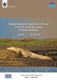
Leghari et al. (1999) conducted a study on biodiversity of Chotiari reservoir and mentioned<br />
that Chotiari reservoir is formed of a group of sub-tropical lakes and is located about 30 – 35<br />
km on the eastern side from Sanghar town. The reservoir covers an area of about 37 km 2 and<br />
after completion of the entire work it will cover about 86 km 2 areas. The reservoir is<br />
interconnected between several lakes namely Bakar, Gun Wari, Tajar, Phuleli, Seri and Sao<br />
Naro. These lakes are surrounded by Nara canal, which is a major source of water to these<br />
lakes. On the eastern side, the reservoir extends into the Thar Desert. The reservoir has a<br />
depth from 3 to 26’ with sandy, silty and muddy bottom, which provides a suitable surface for<br />
the growth of algal and aquatic plant species.<br />
Leghari et al. (1999) further reported that very little work is reported on the Chotiari reservoir.<br />
They mentioned that on the moist, water logged and swampy soil as well as in shallow water<br />
area species like Typha elephantiana, Typha dominghensis, Phragmites vallotoria, Cyperus<br />
spp., Polygonum barbatum, Fimbristylis spp., Scripus spp., Ipomoea aquatica, Marsilea<br />
minuta, Equisetum debile and Riccia spp. are found. Some of these species are used in<br />
packing and cottage industry for making mats. In the lakes there is a thick growth of<br />
submerged vegetation with floating leaves and are important in the nutrient cycling and<br />
respiratory gases. They often provide very dense habitats, which supply food and shelter to<br />
small <strong>org</strong>anisms such as fingerlings and zooplankton. These plants also serve as a food<br />
source of migratory waterfowl and fishes. The major submerged plants are Ceratophyllum<br />
demersum, Najas sp., Utricularia auro, Potamogeton spp., Hydrilla verticillata, Myriophyllum<br />
tuberculatum and Vallisneria spiralis.<br />
In the shallow and deep water there is growth of plant Nelumbo nucifera and Nymphaea lotus.<br />
The parts of these plants are used as human food. The plants floating on the water surface<br />
include species like Riccia carporus, Potamogeton natans, Azolla pinnata, Salvinia molesta,<br />
Spirodella polyrhiza and Lemna sp.<br />
1.3.3 Riverine Forests<br />
According to Wani et al. (2004) riverine forests occupy 0.332 million hectares area (m ha) in<br />
<strong>Pakistan</strong> that is about 7% of total forest in forestland. The Sindh province owns 0.272 m ha<br />
Riverine forests, which is about 82% of total riverine forest area in the country. These figures<br />
depict that the Sindh province is rich in riverine forests. Riverine forests are one of the<br />
important ecosystems of Sindh. All these forests along River Indus used to get annual<br />
inundation during monsoon before the construction of dykes along Indus. Khan & Repp<br />
(1961) mentioned that ecological conditions in these forests are very favourable in the sense<br />
that annual flooding leave the soils in these forests saturated for rest of the year for luxuriant<br />
plant growth. They further stated that by March, seven months after flooding, soil still have<br />
Indus For All Programme Page 8 of 131