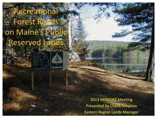
Recreational Forest Roads on Maine's Public Reserved Lands
Recreational Forest Roads on Maine's Public Reserved Lands
Recreational Forest Roads on Maine's Public Reserved Lands

Create successful ePaper yourself
Turn your PDF publications into a flip-book with our unique Google optimized e-Paper software.
<str<strong>on</strong>g>Recreati<strong>on</strong>al</str<strong>on</strong>g><br />
<str<strong>on</strong>g>Forest</str<strong>on</strong>g> <str<strong>on</strong>g>Roads</str<strong>on</strong>g><br />
<strong>on</strong> Maine’s <strong>Public</strong><br />
<strong>Reserved</strong> <strong>Lands</strong><br />
2013 NERCOFE Meeting<br />
Presented by Chuck Simps<strong>on</strong><br />
Eastern Regi<strong>on</strong> <strong>Lands</strong> Manager
Maine’s <strong>Public</strong><br />
<strong>Reserved</strong> <strong>Lands</strong><br />
• Maine Department of<br />
Agriculture, C<strong>on</strong>servati<strong>on</strong><br />
& <str<strong>on</strong>g>Forest</str<strong>on</strong>g>ry<br />
• Divisi<strong>on</strong> of Parks & <strong>Public</strong><br />
<strong>Lands</strong><br />
• 400,000 regulated forest<br />
acres; 600,000 acres total<br />
• 3 regi<strong>on</strong>al offices<br />
– Ashland<br />
– Bangor<br />
– Farmingt<strong>on</strong>
Maine’s <strong>Public</strong> <strong>Lands</strong>
Eastern Regi<strong>on</strong> <strong>Lands</strong><br />
• 160,000 acres<br />
100,000 regulated<br />
• AAC= 37,000 cord<br />
equivalents<br />
• +/- 150 campsites<br />
• Over 100 miles of<br />
hiking trails<br />
• Dozens of lakes, miles<br />
of rivers and streams
<strong>Public</strong> <strong>Lands</strong> Road Classificati<strong>on</strong>s<br />
• <strong>Public</strong> Access <str<strong>on</strong>g>Roads</str<strong>on</strong>g>:<br />
Designed for public use<br />
and maintained to a twowheel<br />
drive passable<br />
standard.<br />
• Management <str<strong>on</strong>g>Roads</str<strong>on</strong>g>:<br />
Designed for timber<br />
management or<br />
administrative use that<br />
may be also used by the<br />
public as l<strong>on</strong>g as they<br />
remain in service.<br />
• Service <str<strong>on</strong>g>Roads</str<strong>on</strong>g>:<br />
Administrative, not open<br />
to public.
<strong>Public</strong> <strong>Lands</strong> Road Classificati<strong>on</strong>s C<strong>on</strong>t.<br />
Sub-Classificati<strong>on</strong><br />
• Shared-Use <str<strong>on</strong>g>Roads</str<strong>on</strong>g>/Trails: If<br />
suitable for use by ATV’s,<br />
horses, bicycles, etc. a road<br />
or trail may be designated<br />
and signed as Shared-Use<br />
• The Eastern Regi<strong>on</strong> has 235<br />
miles of roads. Ninetyeight<br />
are <strong>Public</strong> Access, 76<br />
are Management <str<strong>on</strong>g>Roads</str<strong>on</strong>g>,<br />
and 130 are Shared-Use<br />
<str<strong>on</strong>g>Roads</str<strong>on</strong>g>.
• A major goal of<br />
<strong>Public</strong> <strong>Lands</strong> is to<br />
provide a variety<br />
of opportunities<br />
for recreati<strong>on</strong>al<br />
and access<br />
opportunities to<br />
the public.<br />
<strong>Public</strong> <str<strong>on</strong>g>Recreati<strong>on</strong>al</str<strong>on</strong>g>/Access<br />
Opportunities <strong>on</strong> <strong>Public</strong> <strong>Lands</strong><br />
• One result of this<br />
is the c<strong>on</strong>scious<br />
decisi<strong>on</strong> not to<br />
block use of<br />
suitable roads<br />
throughout the<br />
year.<br />
• Many of our<br />
roads are also<br />
parts of organized<br />
trail systems for<br />
either ATV’s or<br />
snow sleds. This<br />
forces us to plan<br />
our management<br />
activities<br />
accordingly.
Road Costs for <strong>Public</strong> <strong>Lands</strong>
Planning and C<strong>on</strong>structi<strong>on</strong><br />
• <str<strong>on</strong>g>Roads</str<strong>on</strong>g> are primarily planned for our<br />
management activities, but we have to<br />
anticipate their future use by the public.<br />
• We typically have narrower rights-of-way clearing<br />
(35’-45’) <strong>on</strong> our major roads. This makes<br />
c<strong>on</strong>structi<strong>on</strong> harder.<br />
• On roads to be designated as <strong>Public</strong> Access, we<br />
have to c<strong>on</strong>struct off-road yards.<br />
• We try to c<strong>on</strong>struct all-seas<strong>on</strong> roads whenever<br />
possible to provide future public access.<br />
• We tend to build permanent bridges/crossings instead of temporary<br />
<strong>on</strong>es. This means a bridge deck will <strong>on</strong>ly provide access for <strong>on</strong>e<br />
harvesting cycle. We do build temporary crossings when appropriate.<br />
• Due to our visual c<strong>on</strong>siderati<strong>on</strong>s, we will put turns in a road<br />
exclusively for aesthetic/visual buffers, increasing distances and costs.<br />
• Regi<strong>on</strong>al new road c<strong>on</strong>structi<strong>on</strong> costs are around $5/ft., not counting<br />
culverts or bridges.
• At times, we<br />
share roads in<br />
the winter<br />
with sleds <strong>on</strong><br />
major trails.<br />
This is <strong>on</strong>ly<br />
when we have<br />
to access<br />
certain areas<br />
in the winter.<br />
• Sleds <strong>on</strong> roads<br />
leave ice picks<br />
which inevitably<br />
end up in<br />
some<strong>on</strong>e’s tire;<br />
usually a $500<br />
truck tire.<br />
Safety and <strong>Public</strong> Use of <str<strong>on</strong>g>Roads</str<strong>on</strong>g><br />
• We have had a log truck<br />
roll over avoiding sleds,<br />
and a disabled sled being<br />
towed run into a log truck.<br />
• Vegetati<strong>on</strong> c<strong>on</strong>trol al<strong>on</strong>g our roads is always a challenge<br />
and a big safety c<strong>on</strong>cern. We wait until after berrypicking<br />
seas<strong>on</strong>, and are limited as to how wide we can<br />
clear due to visual c<strong>on</strong>cerns.<br />
• At our<br />
Nahmakanta<br />
Unit, we<br />
spent a lot of<br />
m<strong>on</strong>ey<br />
rerouting<br />
sled and ATV<br />
trails to avoid<br />
c<strong>on</strong>flicts.<br />
• There are several commercial camps whose<br />
clients use our roads for access; by coach<br />
busses in some cases.<br />
• We spend a lot of time and m<strong>on</strong>ey<br />
installing, repairing and replacing road signs.
Gates <strong>on</strong> <strong>Public</strong> <strong>Lands</strong>
The Costs<br />
• The Eastern Regi<strong>on</strong> c<strong>on</strong>tains 235 miles of roads <strong>on</strong><br />
roughly 160,000 acres.<br />
• A total of 98 miles are <strong>Public</strong> Access<br />
<str<strong>on</strong>g>Roads</str<strong>on</strong>g> and 130 are Shared-Use.<br />
• We harvest and haul approximately 40,000 cord<br />
equivalents of timber annually.<br />
• In the past three years, we have spent an average<br />
of $127,000 for signage, maintenance, repair and<br />
replacement of roads, bridges, culverts and<br />
roadside vegetati<strong>on</strong> c<strong>on</strong>trol.
Compliance with<br />
Road Use Policies<br />
• Call <strong>on</strong> the Road Gods!!
??Questi<strong>on</strong>s??
Thank You<br />
Chuck Simps<strong>on</strong>, Eastern Regi<strong>on</strong><br />
Land Manager<br />
Maine Department of<br />
Agriculture, C<strong>on</strong>servati<strong>on</strong> &<br />
<str<strong>on</strong>g>Forest</str<strong>on</strong>g>ry<br />
Divisi<strong>on</strong> of Parks & <strong>Public</strong> <strong>Lands</strong><br />
106 Hogan Road, Suite 5<br />
Bangor, Maine 04401<br />
Tel: 941-4413<br />
E-mail:<br />
chuck.simps<strong>on</strong>@maine.gov