CASE STUDY REPORT #64 PINE FLAT KINGS RIVER structures on ...
CASE STUDY REPORT #64 PINE FLAT KINGS RIVER structures on ...
CASE STUDY REPORT #64 PINE FLAT KINGS RIVER structures on ...
You also want an ePaper? Increase the reach of your titles
YUMPU automatically turns print PDFs into web optimized ePapers that Google loves.
-!<br />
included<br />
<str<strong>on</strong>g>CASE</str<strong>on</strong>g> <str<strong>on</strong>g>STUDY</str<strong>on</strong>g> <str<strong>on</strong>g>REPORT</str<strong>on</strong>g> <str<strong>on</strong>g>#64</str<strong>on</strong>g><br />
<str<strong>on</strong>g>PINE</str<strong>on</strong>g> <str<strong>on</strong>g>FLAT</str<strong>on</strong>g><br />
<str<strong>on</strong>g>KINGS</str<strong>on</strong>g> <str<strong>on</strong>g>RIVER</str<strong>on</strong>g><br />
I. Project Descripti<strong>on</strong><br />
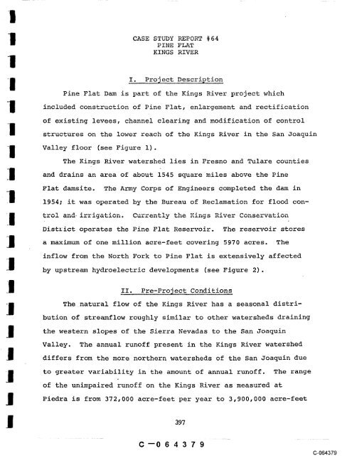
Pine Flat Dam is part of the Kings River project which<br />
c<strong>on</strong>structi<strong>on</strong> of Pine Flat, enlargement and rectificati<strong>on</strong><br />
of existing levees, channel clearing and modificati<strong>on</strong> of c<strong>on</strong>trol<br />
<str<strong>on</strong>g>structures</str<strong>on</strong>g> <strong>on</strong> the lower reach of the Kings River in the San Joaquin<br />
Valley floor (see Figure i).<br />
The Kings River watershed lies in Fresno and Tulare counties<br />
and drains an area of about 1545 square miles above the Pine<br />
Flat damsite. The Army Corps of Engineers completed the dam in<br />
1954; it was operated by the Bureau of Reclamati<strong>on</strong> for flood c<strong>on</strong>-<br />
District operates the Pine Flat Reservoir. The reservoir stores<br />
a maximum of <strong>on</strong>e milli<strong>on</strong> acre-feet covering 5970 acres. The<br />
inflow from the North Fork to Pine Flat is extensively affected<br />
by upstream hydroelectric developments (see Figure 2).<br />
~I. Pre-Pro~ect C<strong>on</strong>diti<strong>on</strong>s<br />
The~natural flow of the Kings River has a seas<strong>on</strong>al distri-<br />
buti<strong>on</strong> of streamflow roughly similar to other watersheds draining<br />
the western slopes of the Sierra Nevadas to the San Joaquin<br />
Valley. The annual runoff present in the Kings River watershed<br />
differs from the more northern watersheds of the San Joaquin due<br />
to greater variability in the amount of annual runoff. The range<br />
of the unimpaired runoff <strong>on</strong> the Kings River as measured at<br />
Piedra is from 372,000 acre-feet to acre-feet per year 3,900,000<br />
C--064379<br />
397<br />
(3-064379
02468<br />
scale of miles<br />
~I<br />
Figure 1<br />
LOCATION MAP<br />
.,,, .., .,., "-’ " "’ <str<strong>on</strong>g>PINE</str<strong>on</strong>g> <str<strong>on</strong>g>FLAT</str<strong>on</strong>g><br />
RESERVOIR<br />
’ "’~, : <str<strong>on</strong>g>FLAT</str<strong>on</strong>g><br />
i<br />
-I ~ .... i<br />
~-~;<br />
~ , ~..<br />
C--064380<br />
~ .......<br />
~ ~<br />
C-064380
NIS~H H~IAI~! H~NI>I NI :KDZr~IOLS<br />
(IN%f SMOISZI.qAIG DNI~MOHS ~D~IG DI~5~HDS
per year. Prior to the completi<strong>on</strong> of Pine Flat Dam the annual<br />
runoff was relatively unimpaired with <strong>on</strong>ly <strong>on</strong>e power development<br />
(Balch Diversi<strong>on</strong>) present <strong>on</strong> the river system. The pre-project<br />
hydrograph (Figure 3) displays year round mean m<strong>on</strong>thly flows above<br />
500 cfs (as derived from calculated inflow data).<br />
Historically this streamflow drained into Tulare Lake Basin<br />
al<strong>on</strong>g the many natural channels of the lower river secti<strong>on</strong>.<br />
During flood flows some runoff would reach the San Joaquin River,<br />
which is the natural outflow of Tulare Lake. When the depth of<br />
this intermittent lake was nearly 30 feet and the lake covered an<br />
area of 1,000 square miles, outflow to the San Joaquin River<br />
would occur. (The last recorded outflow was 1875.)<br />
Thousands of acres of lake and marsh were provided by<br />
~a~e, the Oxbow lakes, = -_ vernal channels of ~ - Kings<br />
River. These areas were excepti<strong>on</strong>ally valuable to the wildlife<br />
and waterfowl found in the San Joaquin Valley.<br />
As demands for irrigati<strong>on</strong> water and flood c<strong>on</strong>trol increased<br />
in the early 1900’s cross channels and weirs were c<strong>on</strong>structed.<br />
These changed the lower river drainage permitting it to flow to<br />
San Joaquin or into Tulare Lake Basin. Generally, water in excess<br />
of irrigati<strong>on</strong> demands was prevented from flowing into the Tulare<br />
Lake Basin.<br />
The Kings River in the vicinity of the Pine Flat project was<br />
a large, low elevati<strong>on</strong> (i,000 feet), coarse-bottomed stream with<br />
pools, riffles and perennial streamflows providing habitat for a<br />
C--064382<br />
(3-064382
variety of fishlife. Rainbow trout was the principal resident<br />
fish populati<strong>on</strong> present in a 48 mile secti<strong>on</strong> of stream below the<br />
damsite and also in the reach above the damsite. These areas pro-<br />
vided an excellent sports fishery which the DFG estimated had<br />
received an average annual use of I0,000 angler days per year.<br />
The<br />
fishery was maintained by natural propagati<strong>on</strong> and by stocking<br />
of catchables and fingerlings by the DFG. Other game species<br />
present were brown trout and smallmouth bass, neither of which<br />
were as comm<strong>on</strong> as rainbow trout. N<strong>on</strong>-game species include Sacra-<br />
mento Squawfish, western sucker, hardhead, and sculpin. The<br />
occurrence of king salm<strong>on</strong> in the lower Kings River was reported<br />
during the period prior to the c<strong>on</strong>structi<strong>on</strong> of Friant Dam <strong>on</strong> the<br />
San Joaquin River (1947) (see Case Study #63).<br />
III. Pro~ect Deve!~pment<br />
The Kings River project, including Pine Flat Dam and down-<br />
stream channelizati<strong>on</strong>, was authorized under the Federal Flood<br />
C<strong>on</strong>trol Act of 1944. The Bureau of Reclamati<strong>on</strong> operated the dam<br />
and administered the storage of irrigati<strong>on</strong> water under a series of<br />
interim c<strong>on</strong>tracts with the Kings River C<strong>on</strong>servati<strong>on</strong> District ’<br />
The district entered into a permanent c<strong>on</strong>tract with the Bureau<br />
in 1963, giving them exclusive and perpetual rights to use of<br />
storage subordinate <strong>on</strong>ly to flood c<strong>on</strong>trol purposes. There were no<br />
required releases for fishlife during the initial post-project<br />
period.<br />
C--064384<br />
C-064384
I<br />
I<br />
In 1964 the District (KRCD) applied to the State Water<br />
Resources C<strong>on</strong>trol Board for a permit to appropriate more water <strong>on</strong><br />
"Ii the upper Kings River watershed through an enlargement of Court-<br />
i<br />
I<br />
right Reservoir <strong>on</strong> Helms Creek (see Figure 2). The DFG protested<br />
this applicati<strong>on</strong> and agreed to withdraw its protest in exchange<br />
f or certain minimum releases in the Kings River below Pine Flat<br />
Dam. At this time there were already terms requiring minimum<br />
Ii releases for fishlife at Courtright Dam included in the state<br />
I<br />
water rights permit (No. 16469) and the Federal Power Commissi<strong>on</strong><br />
license (FPC 1988). In the final agreement between DFG and the<br />
district it was required that these terms be included in the new<br />
water rights permit issued for the Courtright project and that<br />
I certain minimum flow releases for Pine Flat be established.<br />
for the Kings River using the usable width method (DFG 1964).<br />
A series of measurements were made at four riffle areas. C<strong>on</strong>trolled<br />
releases from the dam were not provided during the study. The<br />
criteria that were applied during the survey are listed below<br />
_II as described by the DFG (1964).<br />
i. Approximately 50 percent of the bottom area exposed to<br />
I<br />
an average velocity of .7 cfs (temperature was not c<strong>on</strong>-<br />
sidered a critical factor).<br />
I 2. Wetting of 75 percent of normal riffle width.<br />
J<br />
3. An average depth of .5 feet.<br />
C--064385<br />
403<br />
(3-064385
As a result of the department’s study and negotiati<strong>on</strong>s with<br />
the district, the flow schedule shown <strong>on</strong> Table 1 was designed<br />
and included in the terms of the final 1964 agreement.<br />
IV. Post-Project<br />
The operati<strong>on</strong> of Pine Flat Dam for irrigati<strong>on</strong> and water c<strong>on</strong>-<br />
servati<strong>on</strong> created a change in the seas<strong>on</strong>al distributi<strong>on</strong> of stream-<br />
flow patterns. Irrigati<strong>on</strong> demands in the summer m<strong>on</strong>ths generally<br />
maintain streamflows above 2,000 cfs (see Figure 3). Reducti<strong>on</strong><br />
of this flow regime occurs in October when irrigati<strong>on</strong> demands<br />
cease. During the period prior to the release agreement (1955-<br />
1964), streamflows were reduced to less than 50 cfs and occasi<strong>on</strong>ally<br />
no release was made at the dam, resulting in dewatering of the<br />
channe!.<br />
Below the dam where streamflows empty <strong>on</strong>to the San Joaquin<br />
Valley floor water is immediately distributed into irrigati<strong>on</strong><br />
canals. As a result there is no streamflow in the lower river<br />
channels during most years and Tulare Lake Basin is kept dewatered.<br />
The channelizati<strong>on</strong> of this lower secti<strong>on</strong> and the operati<strong>on</strong> of<br />
Pine Flat has eliminated riparian habitat al<strong>on</strong>g with numerous<br />
oxbow lakes and vernal channels.<br />
The operati<strong>on</strong> of Pine Flat Dam has also influenced the<br />
upper river watershed by making it possible to re-regulate stream-<br />
flows, thereby permitting c<strong>on</strong>structi<strong>on</strong> of upstream reservoirs and<br />
power plants. The modulati<strong>on</strong> of outflow from Courtright and Wish<strong>on</strong><br />
power plants is accomplished by means of a c<strong>on</strong>tract between<br />
C--064386<br />
(3-064386
Table 1<br />
MINIMUM INSTREAM FLOW RELEASE REQUIREMENT<br />
SCHEDULE FOR <str<strong>on</strong>g>PINE</str<strong>on</strong>g> <str<strong>on</strong>g>FLAT</str<strong>on</strong>g> DAM<br />
Unimpaired runoff of Kings<br />
River at Piedra for water Minimum Flows for’Period<br />
year in acre-feet Oct. 1 - Nov. 15 Nov. 16 - Mar. 31 Apr. 1 - Sept.<br />
1,000,000 or less 50 cfs 50 cfs 50 cfs<br />
1,100,000 60 50 60<br />
1,200,000 70 50 70<br />
1,250,000 75 50 75
Pacific Gas and Electric Company and the Secretary of the Army.<br />
The Kings River supports a mixed trout and warmwater fishery.<br />
Prior to the establishment of the minimum release schedule in 1964<br />
rainbow trout populati<strong>on</strong>s were difficult to maintain due to periodic<br />
dewatering and the presence of large n<strong>on</strong>game fish populati<strong>on</strong>s.<br />
The n<strong>on</strong>game species, more tolerant to low flow c<strong>on</strong>diti<strong>on</strong>s, were<br />
so abundant that the lower river was chemically treated in 1961<br />
to c<strong>on</strong>trol the large populati<strong>on</strong>s. Shortly after chemical treat-<br />
ment, the river was stocked with approximately 200,000 rainbow<br />
trout and 20,000 brown trout.<br />
Presently the DFG manages the lower secti<strong>on</strong> of the river as<br />
a catchable trout stream with annual stocking. Angler use of the<br />
river below the dam is estimated by the department at approximately<br />
40,000 angler days per year.<br />
The Kings River immediately above Pine Flat Reservoir supports<br />
significant populati<strong>on</strong>s of n<strong>on</strong>game fish. These populati<strong>on</strong>s are<br />
difficult to c<strong>on</strong>trol due to the presence of the warm.reservoir that<br />
is highly suitable for propagati<strong>on</strong> and rearing of many n<strong>on</strong>game<br />
species. Presently the river at the headwater of the reservoir<br />
is open to underwater spearfishing from July 1 to December 31 of<br />
each year.<br />
V. C<strong>on</strong>clusi<strong>on</strong><br />
The operati<strong>on</strong> of Pine Flat Dam for the primary purpose of<br />
supplying irrigati<strong>on</strong> water generates large instream flows (greater<br />
than 2,000 cfs) during the irrigati<strong>on</strong> seas<strong>on</strong> (April through<br />
C--064388<br />
C-064388
September) while in the fall and winter limited releases are made.<br />
Until 1964, n<strong>on</strong>e of the reservoir storage was allocated for in-<br />
stream flow reservati<strong>on</strong>s for fish and wildlife in the Kings River.<br />
C<strong>on</strong>sequently, the river was occasi<strong>on</strong>ally dewatered and subjected<br />
to periods of low flow leading to the death of fish populati<strong>on</strong>s<br />
below the dam.<br />
In 1964, the DFG managed to reenter the Pine Flat project<br />
for purposes of acquiring an instream flow reservati<strong>on</strong> by a rather<br />
indirect method, which c<strong>on</strong>sisted of protesting a water rights<br />
applicati<strong>on</strong> for the enlargement of another Kings River project<br />
(Courtright Dam) that has the same sp<strong>on</strong>sor as Pine Flat (KRCD).<br />
The protest was to be dismissed if an instream flow reservati<strong>on</strong><br />
for Pine Flat could be established. As a result of negotiati<strong>on</strong>s<br />
an enlarged Courtright Reservoir was required to provide water for<br />
release below Pine Flat.<br />
The DFG employed a usable width method in the determinati<strong>on</strong><br />
of minimum instream flow for the river below Pine Flat. The<br />
minimum instream flow reservati<strong>on</strong> has four basic schedules that<br />
depend up<strong>on</strong> the annual natural runoff of the Kings River during<br />
the course of the water year.<br />
The flow schedule is effective in preserving the fishery<br />
resource below the dam downstream to the lower river where irri-<br />
gati<strong>on</strong> canals capture all the flow. Although the river does not<br />
support large self-propagating populati<strong>on</strong>s of wild trout, a catch-<br />
able trout fishery is maintained by the instream flow reservati<strong>on</strong><br />
and annual stocking to offset the effects of heavy angling<br />
pressure <strong>on</strong> the river (40,000 angler days per year).<br />
C--064389<br />
407<br />
C-064389
Case Study <str<strong>on</strong>g>#64</str<strong>on</strong>g> f<br />
Pers<strong>on</strong>al Communicati<strong>on</strong>s<br />
BIBLIOGRAPHY<br />
Toffoli, Eugene. 1976. California Department of Fish and Game.<br />
References<br />
California. Department of Fish and Game. 1964. Initial<br />
follow-up report of North Fork Kings River - Cartright,<br />
Wish<strong>on</strong> and Pine Flat Reservoirs downstream effects. 40 pp.<br />
Kings River C<strong>on</strong>servati<strong>on</strong> District. 1974. Kings River<br />
C<strong>on</strong>servati<strong>on</strong> District report. 28 pp.<br />
U. S. Federal Power Commissi<strong>on</strong>. 1965. Kings River Basin,<br />
California, planning status report. 9 pp.<br />
C--064390<br />
Ii<br />
C-064390


