Environmental Oil Spill Sensitivity Atlas for the West Greenland (68 ...
Environmental Oil Spill Sensitivity Atlas for the West Greenland (68 ...
Environmental Oil Spill Sensitivity Atlas for the West Greenland (68 ...

You also want an ePaper? Increase the reach of your titles
YUMPU automatically turns print PDFs into web optimized ePapers that Google loves.
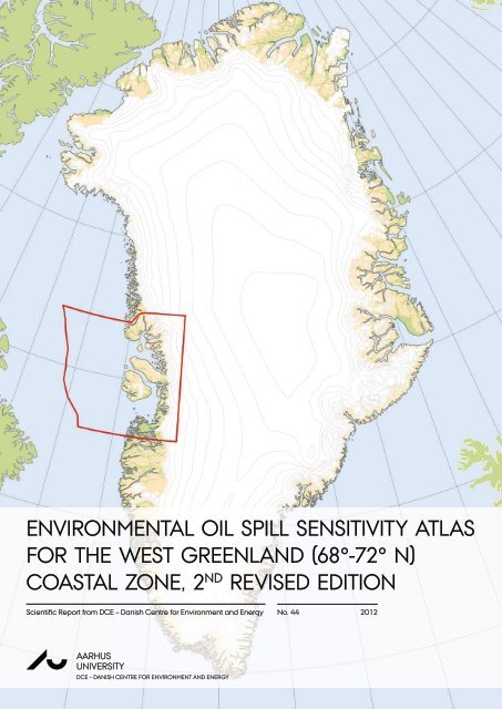
ENVIRONMENTAL OIL SPILL SENSITIVITY ATLAS<br />
FOR THE WEST GREENLAND (<strong>68</strong>°-72° N)<br />
COASTAL ZONE, 2 ND REVISED EDITION<br />
Scientifi c Report from DCE – Danish Centre <strong>for</strong> Environment and Energy No. 44 2012<br />
AU<br />
AARHUS<br />
UNIVERSITY<br />
DCE – DANISH CENTRE FOR ENVIRONMENT AND ENERGY
[Blank page]
AU<br />
ENVIRONMENTAL OIL SPILL SENSITIVITY ATLAS<br />
FOR THE WEST GREENLAND (<strong>68</strong>°-72° N)<br />
COASTAL ZONE, 2 ND REVISED EDITION<br />
Scientifi c Report from DCE – Danish Centre <strong>for</strong> Environment and Energy No. 44<br />
2012<br />
Daniel Clausen<br />
Kasper L. Johansen<br />
Anders Mosbech<br />
David Boertmann<br />
Susse Wegeberg<br />
Aarhus University, Department of Bioscience<br />
AARHUS<br />
UNIVERSITY<br />
DCE – DANISH CENTRE FOR ENVIRONMENT AND ENERGY
Data sheet<br />
Series title and no.: Scientific Report from DCE – Danish Centre <strong>for</strong> Environment and Energy No. 44<br />
Title: <strong>Environmental</strong> <strong>Oil</strong> <strong>Spill</strong> <strong>Sensitivity</strong> <strong>Atlas</strong> <strong>for</strong> <strong>the</strong> <strong>West</strong> <strong>Greenland</strong> (<strong>68</strong>°-72° N) Coastal<br />
Zone, 2nd revised edition<br />
Authors: Daniel Clausen 1 , Kasper L. Johansen 1 , Anders Mosbech 1 , David Boertmann 1 & Susse<br />
Wegeberg 1<br />
Acknowledgements: B.Ø. Olsen 1 , S. Olsvig 1 , F. von Platen 2 , E. Buch 3 , K.Q. Hansen 3 , M. Rasch 6 , N. Nielsen 6 ,<br />
H.S. Møller 6 , S. Potter 5 , C. Andreasen 4 , J. Berglund 4 & M. Myrup<br />
Institutions:<br />
1 Aarhus University, Department of Bioscience, 2 Geological Survey of Denmark and<br />
<strong>Greenland</strong> – GEUS, 3 Danish Meteorological Institute, 4 <strong>Greenland</strong> National Museum<br />
and Archives, 5 SL Ross <strong>Environmental</strong> Research Ltd., 6 Institute of Geography<br />
University of Copenhagen<br />
Publisher: Aarhus University, DCE – Danish Centre <strong>for</strong> Environment and Energy ©<br />
URL: http://dce.au.dk/en<br />
Year of publication: December 2012<br />
Editing completed: November 2012<br />
<strong>Greenland</strong> summary: Bjørn Rosing<br />
Referee: Frank Rigét<br />
Financial support: Bureau of Minerals and Petroleum, <strong>Greenland</strong> Government<br />
Please cite as: Clausen, D., Johansen, K.L., Mosbech, A., Boertmann, D. & Wegeberg, S. 2012.<br />
<strong>Environmental</strong> <strong>Oil</strong> <strong>Spill</strong> <strong>Sensitivity</strong> <strong>Atlas</strong> <strong>for</strong> <strong>the</strong> <strong>West</strong> <strong>Greenland</strong> (<strong>68</strong>°-72° N) Coastal<br />
Zone, 2nd revised edition. Aarhus University, DCE – Danish Centre <strong>for</strong> Environment<br />
and Energy, 498 pp. Scientific Report from DCE – Danish Centre <strong>for</strong> Environment and<br />
Energy No. 44<br />
http://www.dmu.dk/Pub/SR44.pdf<br />
Reproduction permitted provided <strong>the</strong> source is explicitly acknowledged<br />
Abstract: This oil spill sensitivity atlas covers <strong>the</strong> shoreline and <strong>the</strong> offshore areas of <strong>West</strong><br />
<strong>Greenland</strong> between <strong>68</strong>º N and 72º N. The coastal zone is divided into 199 shoreline<br />
segments and <strong>the</strong> offshore zone into 8 areas. A sensitivity index value is calculated <strong>for</strong><br />
each segment/area, and each segment/area is subsequently ranked according to<br />
four degrees of sensitivity. Besides this general ranking a number of smaller areas are<br />
especially selected as <strong>the</strong>y are of particular significance, <strong>the</strong>y are especially<br />
vulnerable to oil spills and <strong>the</strong>y have a size making oil spill response possible. The<br />
shoreline sensitivity ranking are shown on 37 maps (in scale 1:250,000), which also<br />
show <strong>the</strong> different elements included and <strong>the</strong> selected areas. Coast types, logistics<br />
and proposed response methods along <strong>the</strong> coasts are shown on ano<strong>the</strong>r 37 maps.<br />
The sensitivities of <strong>the</strong> offshore zones are depicted on 4 maps, one <strong>for</strong> each season.<br />
Based on all <strong>the</strong> in<strong>for</strong>mation, appropriate oil spill response methods have been<br />
assessed <strong>for</strong> each area.<br />
Keywords: <strong>West</strong> <strong>Greenland</strong>, oil spill sensitivity mapping, shoreline oil spill sensitivity, offshore oil<br />
spill sensitivity, coastal zone environmental mapping, meteorology, oceanography,<br />
ice conditions, coastal morphology, human use, archaeology, local knowledge,<br />
marine mammals, seabirds, fish, logistics, oil spill response.<br />
Layout: Daniel Clausen<br />
ISBN: 978-87-92825-78-0<br />
ISSN (electronic): 2245-0203<br />
Number of pages: 498<br />
Internet version: The report is available in electronic <strong>for</strong>mat (pdf) at<br />
http://www.dmu.dk/Pub/SR44.pdf<br />
Supplementary notes: This is an update of <strong>the</strong> atlas which was first produced in 2004 as a part of <strong>the</strong><br />
preparations <strong>for</strong> exploratory oil/gas drilling offshore <strong>Greenland</strong> (NERI Technical<br />
Report no. 494 - http://environmental-atlas.dmu.dk/).
Contents<br />
1 Table of contents 1-1<br />
1.1 List of figures 1-6<br />
2 Preface 2-1<br />
3 Summary 3-1<br />
4 Eqikkaaneq 4-1<br />
5 Sammenfatning 5-1<br />
6 Introduction 6-1<br />
6.1 Objectives 6-1<br />
6.2 Contents and organisation 6-1<br />
6.3 <strong>Sensitivity</strong> index system 6-2<br />
6.4 Selected areas 6-5<br />
6.5 Countermeasure overview 6-5<br />
7 Users Guide 7-1<br />
7.1 Shoreline and offshore sensitivity maps 7-1<br />
7.1.1 <strong>Sensitivity</strong> index and icons (animal and o<strong>the</strong>r symbols) 7-1<br />
7.1.2 Selected areas 7-2<br />
7.1.3 Season in<strong>for</strong>mation 7-2<br />
7.1.4 Resource use data 7-2<br />
7.1.5 Species distribution and abundance data 7-3<br />
7.1.6 Archaeological and historical sites included 7-3<br />
7.2 Physical environment and logistics maps 7-3<br />
7.2.1 Coastal types description 7-3<br />
7.2.2 Access 7-3<br />
7.2.3 Potential safe havens 7-12<br />
7.2.4 Countermeasures 7-12<br />
7.2.5 Topographic maps and nautical charts 7-12<br />
8 Summary in<strong>for</strong>mation 8-1<br />
8.1 Study area introduction 8-1<br />
8.1.1 The offshore area 8-1<br />
8.1.2 Currents 8-3<br />
8.1.3 Ice and wea<strong>the</strong>r 8-4<br />
8.1.4 Coastal zone geomorphology 8-4<br />
8.1.5 Marine fish and invertebrates 8-6<br />
8.1.6 Seabirds 8-10<br />
8.1.7 Marine mammals 8-13<br />
8.1.8 Archaeological and historic sites 8-14<br />
<strong>Environmental</strong> <strong>Oil</strong> <strong>Spill</strong> <strong>Atlas</strong> <strong>for</strong> <strong>the</strong> <strong>West</strong> <strong>Greenland</strong> (<strong>68</strong> o - 72 o N) Coastal Zone 1-1
1-2<br />
8.2 Areas of extreme and high sensitivity 8-14<br />
8.3 Offshore ice zones and ice edges in Davis Strait and <strong>West</strong> <strong>Greenland</strong> waters (60°-<br />
72° N) 8-16<br />
8.3.1 Definitions and terminology 8-16<br />
8.3.2 The “<strong>West</strong> Ice” 8-16<br />
8.3.3 Multiyear sea ice (“Storis” from <strong>the</strong> <strong>Greenland</strong> east coast) 8-20<br />
8.3.4 Sea ice drift 8-20<br />
8.4 Fjord and coastal ice freeze-up and break-up 8-22<br />
8.5 Regional observations of sea ice in nor<strong>the</strong>rn <strong>West</strong> <strong>Greenland</strong> (<strong>68</strong>º-72º) 8-26<br />
8.5.1 Uummannaq Fjord 8-26<br />
8.5.2 Baffin Bay, west of Ubekendt Ejland 8-26<br />
8.5.3 Vaigat and Disko Bay 8-26<br />
8.5.4 Davis Strait, west of Disko Island 8-26<br />
8.5.5 Davis Strait, west of Aasiaat and Disko Bay 8-26<br />
8.6 The <strong>West</strong> <strong>Greenland</strong> iceberg environment 8-27<br />
8.6.1 Iceberg sources 8-27<br />
8.6.2 Iceberg drift and distribution 8-30<br />
8.6.3 Icebergs from East <strong>Greenland</strong> glaciers 8-30<br />
8.6.4 Iceberg dimensions 8-31<br />
9 Offshore sensitivity 9-1<br />
Offshore sensitivity summary, winter 9-3<br />
Offshore sensitivity summary, spring 9-5<br />
Offshore sensitivity summary, summer 9-7<br />
Offshore sensitivity summary, autumn 9-9<br />
<strong>Environmental</strong> <strong>Oil</strong> <strong>Spill</strong> <strong>Atlas</strong> <strong>for</strong> <strong>the</strong> <strong>West</strong> <strong>Greenland</strong> (<strong>68</strong> o - 72 o N) Coastal Zone
10 Operational shoreline in<strong>for</strong>mation 10-1<br />
Map <strong>68</strong>01 - Kangaatsiaq 10-4<br />
Map <strong>68</strong>02 - Aalatsivik 10-10<br />
Map <strong>68</strong>03 - Lersletten 10-16<br />
Map <strong>68</strong>04 - Iluliartuup Tasersua 10-22<br />
Map <strong>68</strong>51 - Aasiaat (Egedesminde) 10-28<br />
Map <strong>68</strong>52 - Ikamiut 10-34<br />
Map <strong>68</strong>53 - Qasigiannguit (Christianshåb) 10-40<br />
Map <strong>68</strong>54 - Saqqarliup Sermia 10-46<br />
Map 6901 - Qeqertarsuaq (Godhavn) 10-52<br />
Map 6902 - Qeqertarsuup Tunua (Disko Bugt) 10-58<br />
Map 6903 - Porsild Grund 10-64<br />
Map 6904 - Ilulissat (Jakobshavn) 10-<strong>68</strong><br />
Map 6905 - Sermeq Kujalleq (Jakobshavn Isbræ) 10-74<br />
Map 6951 - Akulliit (Mellemfjord) 10-80<br />
Map 6952 - Blomsterdalen 10-86<br />
Map 6953 - Nuugaarsuk 10-92<br />
Map 6954 - Ritenbenk 10-98<br />
Map 6955 - Illuluarsuit Nunataat 10-104<br />
Map 7001 - Qeqertarsuatsiaq (Hareøen) 10-110<br />
Map 7002 - Qullissat 10-116<br />
Map 7003 - Sullorsuaq (Vaigat) 10-122<br />
Map 7004 - Ikerasak 10-128<br />
Map 7005 - Sermeq Kujalleq 10-134<br />
Map 7051 - Hollænder Bugt 10-140<br />
Map 7052 - Qaarsut 10-146<br />
Map 7053 - Uummannaq 10-152<br />
Map 7054 - Itilliarsuup Kangerlua 10-158<br />
Map 7101 - Tasiusap Imaa 10-164<br />
Map 7102 - Illorsuit (Ubekendt Ejland) 10-170<br />
Map 7103 - Upernavik Ø 10-176<br />
Map 7104 - Maarmorilik 10-182<br />
Map 7151 - Sigguk (Svartenhuk) 10-188<br />
Map 7152 - Umiiviup Kangerlua 10-194<br />
Map 7153 - Sorte Pyramide 10-200<br />
Map 7154 - Umiammakku Nunaa 10-206<br />
Map 7202 - Sullua 10-212<br />
Map 7203 - Ukkusissat Sulluat 10-218<br />
<strong>Environmental</strong> <strong>Oil</strong> <strong>Spill</strong> <strong>Atlas</strong> <strong>for</strong> <strong>the</strong> <strong>West</strong> <strong>Greenland</strong> (<strong>68</strong> o - 72 o N) Coastal Zone 1-3
11 References 11-1<br />
12 Appendix A, Shoreline sensitivity ranking 12-1<br />
13 Appendix B, Offshore sensitivity ranking 13-1<br />
14 Appendix C, Climatic data <strong>for</strong> logistics 14-1<br />
1-4<br />
14.1 <strong>West</strong> <strong>Greenland</strong> meteorology 14-1<br />
14.1.1 Sea level pressure 14-1<br />
14.1.2 Surface winds 14-1<br />
14.1.3 Air temperature 14-3<br />
14.1.4 Fog and precipitation 14-6<br />
14.2 <strong>West</strong> <strong>Greenland</strong> oceanography 14-8<br />
14.2.1 Introduction 14-8<br />
14.2.2 Circulation 14-8<br />
14.2.3 North Atlantic Oscillation (NAO) 14-12<br />
14.2.4 Conditions over <strong>Greenland</strong> 14-16<br />
14.2.5 Water masses 14-19<br />
14.2.6 Fronts 14-23<br />
14.2.7 Inter-annual variability 14-26<br />
14.2.8 Deeper layers 14-29<br />
14.2.9 Tides 14-34<br />
14.2.10 Fjord oceanography 14-36<br />
14.3 References 14-38<br />
15 Appendix D, methods and documentation 15-1<br />
15.1 Introduction 15-1<br />
15.2 The parameters of <strong>the</strong> <strong>Greenland</strong> oil spill sensitivity application 15-1<br />
15.3 Geomorphological in<strong>for</strong>mation 15-3<br />
15.3.1 Methods 15-3<br />
15.3.2 Statistics 15-4<br />
15.4 Biological and resource use in<strong>for</strong>mation 15-9<br />
15.4.1 Introduction 15-9<br />
15.4.2 Marine mammals 15-9<br />
15.4.3 Seabirds 15-10<br />
15.4.4 Fish, shellfish, fisheries and o<strong>the</strong>r human use of natural resources 15-15<br />
15.5 <strong>Sensitivity</strong> ranking procedures 15-16<br />
15.5.1 Shoreline sensitivity ranking 15-16<br />
15.5.2 Offshore sensitivity ranking 15-17<br />
15.6 References 15-19<br />
15.7 Items of cultural and/or historical interest 15-21<br />
15.7.1 Introduction 15-21<br />
15.7.2 Description of <strong>the</strong> data 15-22<br />
15.7.3 Geographical coverage 15-24<br />
15.7.4 Explanations of <strong>the</strong> classification and terms used in <strong>the</strong> table 15-25<br />
15.7.5 <strong>Sensitivity</strong> assessment 15-25<br />
15.8 Selected areas 15-28<br />
15.8.1 Brief description of <strong>the</strong> selected areas 15-28<br />
15.8.2 Pinpointing <strong>the</strong> selected areas using a grid-based GIS-analysis 15-29<br />
<strong>Environmental</strong> <strong>Oil</strong> <strong>Spill</strong> <strong>Atlas</strong> <strong>for</strong> <strong>the</strong> <strong>West</strong> <strong>Greenland</strong> (<strong>68</strong> o - 72 o N) Coastal Zone
16 Appendix E, New data and methods 16-1<br />
16.1 Introduction 16-1<br />
16.2 Biological and human resource in<strong>for</strong>mation 16-1<br />
16.3 Physical in<strong>for</strong>mation 16-2<br />
16.4 Methodology 16-2<br />
17 Appendix E, Place names 17-1<br />
18 Appendix F, Names of Animals in English, Danish and <strong>Greenland</strong>ic 18-1<br />
<strong>Environmental</strong> <strong>Oil</strong> <strong>Spill</strong> <strong>Atlas</strong> <strong>for</strong> <strong>the</strong> <strong>West</strong> <strong>Greenland</strong> (<strong>68</strong> o - 72 o N) Coastal Zone 1-5
List of Figures<br />
1-6<br />
Figure 7.1. Rocky coast east of Godhavn/Qeqertarsuaq. 7-5<br />
Figure 7.2. Rocky coast, Skalø, in Upernavik municipality. 7-5<br />
Figure 7.3. The archipelago Hunde Ejland/Kitsissuarsuit in Disko Bay. 7-6<br />
Figure 7.4. The archipelago Schades Øer /Qeqertat in Karrat Fjord. 7-6<br />
Figure 7.5. Glacier coast. 7-7<br />
Figure 7.6. Moraine coast. 7-7<br />
Figure 7.7. Alluvial fan in Umiiarfik. 7-8<br />
Figure 7.8. Talus 7-8<br />
Figure 7.9. Talus with erosional cliff. 7-9<br />
Figure 7.10. Barrier beach in Aqajarua/Mudderbugten on <strong>the</strong> east coast of Disko 7-9<br />
Figure 7.11. Barrier beach. 7-10<br />
Figure 7.12. Pocket beach surrounded by rocky coast. 7-10<br />
Figure 7.13. Delta with tidal flat, east coast of Svartenhuk Peninsula. 7-11<br />
Figure 7.14. Beach with well-sorted sand and gravel. 7-11<br />
Figure 7.15. Mixture of rocky coasts, moraine coasts and beaches. 7-12<br />
Figure 8.1. Bathymetry of <strong>the</strong> <strong>West</strong> <strong>Greenland</strong> offshore waters. 8-2<br />
Figure 8.2. Surface current patterns in <strong>the</strong> waters off <strong>West</strong> <strong>Greenland</strong>. 8-3<br />
Figure 8.3. Distribution of deep sea shrimp catches in <strong>West</strong> <strong>Greenland</strong> waters. 8-7<br />
Figure 8.4. Inshore catches of <strong>Greenland</strong> halibut. 8-8<br />
Figure 8.5. Inshore catches of snow crab. 8-9<br />
Figure 8.6. Distribution and size of seabird breeding colonies in <strong>West</strong> <strong>Greenland</strong>. 8-11<br />
Figure 8.7. Areas of extreme and high sensitivity and special status areas. 8-14<br />
Figure 9.1. Offshore map legend 9-2<br />
Figure 9.2. Offshore sensitivity in winter. Legend to map on page 9-2. 9-4<br />
Figure 9.3. Offshore sensitivity in spring. 9-6<br />
Figure 9.4. Offshore sensitivity in summer. 9-8<br />
Figure 9.5. Offshore sensitivity in autumn. 9-10<br />
Figure 10.1. Shoreline map legend 10-2<br />
<strong>Environmental</strong> <strong>Oil</strong> <strong>Spill</strong> <strong>Atlas</strong> <strong>for</strong> <strong>the</strong> <strong>West</strong> <strong>Greenland</strong> (<strong>68</strong> o - 72 o N) Coastal Zone
List of Figures (in appendices)<br />
Figure 14.1. Mean atmospheric pressure at sea level. 14-4<br />
Figure 14.2. Geographical distribution in percentages of gale <strong>for</strong>ce winds. 14-4<br />
Figure 14.3. Typical tracks <strong>for</strong> major cyclones in winter and in summer. 14-5<br />
Figure 14.4. Mean temperatures <strong>for</strong> February and August. 14-5<br />
Figure 14.5. Geographical distribution of fog in July. 14-6<br />
Figure 14.6. Surface currents in <strong>the</strong> nor<strong>the</strong>rn North Atlantic. 14-9<br />
Figure 14.7. Mean upper-layer salinity <strong>for</strong> <strong>the</strong> period 1990-97. 14-11<br />
Figure 14.8. Sea-surface height variability from POPEX. 14-12<br />
Figure 14.9. Time series of <strong>the</strong> winter index of <strong>the</strong> NAO from 1864-1995. 14-13<br />
Figure 14.10. Changes in land surface and sea surface temperature. 14-14<br />
Figure 14.11. Difference in air temperatures level between 1960-69. 14-15<br />
Figure 14.12. Changes in <strong>the</strong> 1,000 mb winds in 1990-99. 14-15<br />
Figure 14.13. Ocean circulation under high and low NAO-index conditions. 14-16<br />
Figure 14.14. Annual mean air temperatures from Nuuk and Tasiilaq. 14-17<br />
Figure 14.15. Vertical distribution of temperature, salinity and density. 14-18<br />
Figure 14.16. Seasonal T-S-plots from <strong>the</strong> <strong>West</strong> <strong>Greenland</strong> area. 14-20<br />
Figure 14.17. TS-plots from <strong>the</strong> <strong>West</strong> <strong>Greenland</strong> area. 14-21<br />
Figure 14.18. Potential temperature and salinity fields. 14-22<br />
Figure 14.19. Vertical distribution of temperature, salinity and density in 2001. 14-23<br />
Figure 14.20. Vertical distribution of temperature, salinity and density in 1950-99. 14-24<br />
Figure 14.21. Mean vertical velocity at 50 m modelled in 2000. 14-25<br />
Figure 14.22. Mean temperatures Fyllas Bank St. 2, medio June 1950-1997. 14-26<br />
Figure 14.23. Mean salinity of <strong>the</strong> upper 40 m on Fyllas Bank. 14-27<br />
Figure 14.24. Mean temperature and salinity in <strong>the</strong> upper 50 m. 14-28<br />
Figure 14.25. Mean temperature and salinity in <strong>the</strong> 50-150 m layer. 14-30<br />
Figure 14.26. Mean temperature and salinity in <strong>the</strong> 150-400 m layer. 14-31<br />
Figure 14.27. Mean temperature and salinity in <strong>the</strong> 400-600 m layer. 14-32<br />
Figure 14.28. Time series of summer salinity, temperature and density. 14-34<br />
Figure 14.29. M2-cotidal lines and amplitudes based on coastal observations. 14-36<br />
Figure 14.30. Large-scale fjord circulation. 14-36<br />
Figure 15.1. The study area in <strong>West</strong> <strong>Greenland</strong> (<strong>68</strong>° N and 72° N). 15-4<br />
Figure 15.2. Overview map of all offshore areas in <strong>West</strong> <strong>Greenland</strong>. 15-18<br />
<strong>Environmental</strong> <strong>Oil</strong> <strong>Spill</strong> <strong>Atlas</strong> <strong>for</strong> <strong>the</strong> <strong>West</strong> <strong>Greenland</strong> (<strong>68</strong> o - 72 o N) Coastal Zone 1-7
2 Preface<br />
This is an update of <strong>the</strong> atlas which was first produced in 2004 as a part of <strong>the</strong> preparations <strong>for</strong><br />
exploratory oil/gas drilling offshore <strong>Greenland</strong>.<br />
The atlas has been updated with <strong>the</strong> newest and best available in<strong>for</strong>mation. In some cases no<br />
new data was available, and <strong>the</strong> data from 2004 has been reused. Draft maps with environmental<br />
in<strong>for</strong>mation were presented to local communities <strong>for</strong> quality assurance and ga<strong>the</strong>ring of<br />
supplemental in<strong>for</strong>mation on resources and resource use. Fur<strong>the</strong>r a draft of <strong>the</strong> complete atlas<br />
was sent to relevant <strong>Greenland</strong>ic and Danish institutions <strong>for</strong> comments. However, <strong>the</strong> available<br />
in<strong>for</strong>mation was by no means complete and as fur<strong>the</strong>r in<strong>for</strong>mation becomes available, it will be<br />
relevant to update <strong>the</strong> atlas. The atlas was produced in a dynamic GIS (Geographical In<strong>for</strong>mation<br />
System) where atlas updates can be produced easily, when input data is updated. It is our<br />
hope that this atlas with all its integrated in<strong>for</strong>mation and suggestions will be a valuable tool <strong>for</strong><br />
<strong>Greenland</strong>ic authorities, oil companies and o<strong>the</strong>rs.<br />
This revision was carried out by a study team at Danish Centre <strong>for</strong> Environment and Energy (DCE).<br />
The team members (in alphabetical order)<br />
David Boertmann (DCE)<br />
Daniel Spelling Clausen (DCE)<br />
Kasper Lambert Johansen (DCE)<br />
Anders Mosbech (DCE)<br />
Susse Wegeberg (DCE) contributed with in<strong>for</strong>mation regarding current oil spill cleanup procedures.<br />
The first edition of <strong>the</strong> atlas was made by <strong>the</strong> following contributors:<br />
The National <strong>Environmental</strong> Research Institute, Department of Arctic Environment (NERI-AE)<br />
headed <strong>the</strong> study team.<br />
NERI fur<strong>the</strong>r provided <strong>the</strong> biological in<strong>for</strong>mation in <strong>the</strong> atlas and prepared <strong>the</strong> shoreline and<br />
offshore sensitivity maps. NERI also developed a CD presentation solution and an Internet version of<br />
<strong>the</strong> atlas.<br />
The Geological Survey of Denmark and <strong>Greenland</strong> (GEUS) prepared <strong>the</strong> coastal morphology maps<br />
and <strong>the</strong> basic map layout.<br />
The Institute of Geography, University of Copenhagen, was responsible <strong>for</strong> shoreline morphology<br />
classification based on air photo interpretation.<br />
SL Ross <strong>Environmental</strong> Research Ltd. developed <strong>the</strong> sections on countermeasures, access and safe<br />
havens on <strong>the</strong> Physical Environment and Logistics maps.<br />
The Danish Meteorological Institute (DMI) reviewed and compiled data regarding ice,<br />
oceanography and climate, mainly <strong>the</strong> chapters 8.1 (part), 8.4, 8.5, 8.6, 8.7 and Appendix C.<br />
The <strong>Greenland</strong> National Museum and Archives (GNMA) compiled and reviewed <strong>the</strong><br />
archaeological in<strong>for</strong>mation.<br />
The <strong>Greenland</strong> Institute of Natural Resources (GINR) contributed with in<strong>for</strong>mation regarding living<br />
resources (fish, shellfish, birds and whales) and <strong>the</strong>ir use in <strong>Greenland</strong>. The <strong>Greenland</strong> Ministry of<br />
Environment and Nature supplied various in<strong>for</strong>mation and commented on an early draft of <strong>the</strong><br />
atlas.<br />
<strong>Environmental</strong> <strong>Oil</strong> <strong>Spill</strong> <strong>Atlas</strong> <strong>for</strong> <strong>the</strong> <strong>West</strong> <strong>Greenland</strong> (<strong>68</strong> o - 72 o N) Coastal Zone 2-1
The software application used to generate shoreline and offshore sensitivity scores was originally<br />
developed <strong>for</strong> <strong>the</strong> first atlas in co-operation with AXYS <strong>Environmental</strong> Consulting Ltd.<br />
As a part of <strong>the</strong> project, a study of local knowledge, was carried out by NERI and GINR (Olsvig &<br />
Mosbech 2003).<br />
A draft version of <strong>the</strong> previous atlas was presented at community consultations in June 2003 in<br />
Aasiaat, Kitsissuarsuit, Akunnaq, Ikamiut, Qasigiannguit, Ilimanaq, Ilulissat, Oqaatsut, Saqqaq,<br />
Qeqertarsuaq, Kangerluk, Niaqornat, Qaarsut, Uummannaq, Ikerasak, Saattut, Ukkusissat, Illorsuit,<br />
Nuugaatsiaq, Upernavik Kujalleq, Kangersuatsiaq and Upernavik. We thank <strong>the</strong> residents and<br />
representatives <strong>for</strong> <strong>the</strong> local hunters and fishermens organisations <strong>for</strong> constructive participation. The<br />
community consultations were carried out by Sara Olsvig and Josephine Nymand (both NERI).<br />
The team acknowledges <strong>the</strong> previous atlas preparation team members<br />
Anders Mosbech (AU/NERI) headed <strong>the</strong> study team producing <strong>the</strong> atlas,<br />
and <strong>the</strong> team consisted of (in alphabetic order):<br />
Claus Andreasen (GNMA),<br />
Joel Berglund (GNMA),<br />
David Boertmann (AU/NERI),<br />
Erik Buch (DMI),<br />
Keld Q. Hansen (DMI),<br />
Niels Nielsen, (Institute of Geography, University of Copenhagen),<br />
Josephine Nymand (NERI),<br />
Mikkel Nyrup (GNMA),<br />
Bent Østergaard Olsen (NERI),<br />
Sara Olsvig (NERI),<br />
Frants von Platen (GEUS),<br />
Steve Potter (SL Ross <strong>Environmental</strong> Research Ltd.),<br />
Morten Rasch (Institute of Geography, University of Copenhagen),<br />
Henrik S. Møller (Institute of Geography, University of Copenhagen).<br />
Contributions from <strong>the</strong> <strong>Greenland</strong> Institute of Natural Resources were delivered by Helle Siegstad,<br />
Ole Jørgensen, Lars Witting, AnnDorte Burmeister, Lars Heilmann, Jesper Boje, Claus Simonsen and<br />
Flemming Merkel.<br />
Peter Mikkelsen (NERI), Frank Rigét (NERI) and Mikkel Tamstorf (NERI) contributed to <strong>the</strong> preparation<br />
of <strong>the</strong> offshore data analysis, and Mette Jensen (NERI) contributed to <strong>the</strong> design of <strong>the</strong> local<br />
knowledge studies. <strong>Greenland</strong> Command in Grønnedal commented on <strong>the</strong> proposed potential<br />
safe havens.<br />
The present project has been funded by <strong>the</strong> Bureau of Minerals and Petroleum, <strong>Greenland</strong> Home<br />
Rule and by <strong>the</strong> Danish Ministry of <strong>the</strong> Environment as part of <strong>the</strong> environmental support program<br />
Dancea – Danish Cooperation <strong>for</strong> Environment in <strong>the</strong> Arctic. The authors are solely responsible <strong>for</strong><br />
all results and conclusions presented in <strong>the</strong> report, and do not necessary reflect <strong>the</strong> position of <strong>the</strong><br />
Danish Ministry of <strong>the</strong> Environment.<br />
Copyright<br />
Detailed Maps: Maps: Topographic base; G/250 Vector, Copyright Kort & Matrikelstyrelsen, 2000. Projection UTM zone<br />
22N, WGS 84.<br />
Photos of shore types Fig. 7. 1- 15 by DCE.<br />
2-2<br />
<strong>Environmental</strong> <strong>Oil</strong> <strong>Spill</strong> <strong>Atlas</strong> <strong>for</strong> <strong>the</strong> <strong>West</strong> <strong>Greenland</strong> (<strong>68</strong> o - 72 o N) Coastal Zone
3 Summary<br />
<strong>Environmental</strong> <strong>Oil</strong> <strong>Spill</strong> <strong>Sensitivity</strong> <strong>Atlas</strong> <strong>for</strong> <strong>the</strong> <strong>West</strong> <strong>Greenland</strong> (<strong>68</strong>º-72º N)<br />
Coastal Zone<br />
This atlas is produced as a part of <strong>the</strong> preparations <strong>for</strong> exploratory drilling offshore <strong>Greenland</strong>. The<br />
atlas gives an overview of resources vulnerable to oil spills, <strong>for</strong> example biological resources (fish,<br />
birds etc.), and is intended as a tool to respond to an oil spill in <strong>the</strong> covered region which is <strong>the</strong><br />
waters – both coastal and offshore – between <strong>68</strong>° N and 72° N in <strong>West</strong> <strong>Greenland</strong>.<br />
The following elements are included in <strong>the</strong> atlas<br />
• coast types,<br />
• oceanography, ice and climate,<br />
• biological resources (fish, birds etc.),<br />
• fishing and hunting,<br />
• tourism,<br />
• protected areas,<br />
• archaeological sites,<br />
• logistics and oil spill response methods.<br />
As <strong>the</strong> oil spill sensitive resources are very different in character (e.g. seabird breeding colonies,<br />
important fishing areas and archaeological sites) an index value of <strong>the</strong> sensitivity of a specific<br />
area is calculated, in order to compare areas with different characteristics. The index calculations<br />
are based on a Canadian system, which has been used in Lancaster Sound. An overview of <strong>the</strong><br />
methods used in <strong>the</strong> atlas is given in Chapter 6.<br />
The coastline has been divided into segments (coastlines and groups of islands) approx. 50 km<br />
long. Each segment has been ranked in one of four categories of sensitivity based on <strong>the</strong> index<br />
calculation that includes abundance and sensitivity of a number of environmental or community<br />
elements (e.g. different birds and marine mammals, hunting areas and archaeological sites). The<br />
offshore waters between <strong>68</strong>° N and 72° N have also been divided into areas and ranked according<br />
to sensitivity, in this case on a seasonal basis.<br />
Besides <strong>the</strong> general classification of coastal sensitivity, <strong>the</strong> maps of <strong>the</strong> atlas also show smaller<br />
selected areas. They have been selected as being of particular significance, particular vulnerable<br />
to oil spills and as being of a size where an effective oil spill response can be per<strong>for</strong>med.<br />
As a part of <strong>the</strong> project, classification of <strong>the</strong> coastline morphology has been conducted from aerial<br />
photographs, e.g. <strong>the</strong> occurrence of rocky shores and beaches. An index value of <strong>the</strong> self-cleaning<br />
ability of <strong>the</strong> coast after an oil spill has been calculated, based on this classification in combination<br />
with shoreline exposure to waves and ice. For example, oil on a rocky coast exposed to wave<br />
action will be cleaned faster than oil on a beach in a protected lagoon.<br />
Based on all <strong>the</strong> in<strong>for</strong>mation, appropriate methods to respond to oil spills in <strong>the</strong> different areas have<br />
been assessed.<br />
<strong>Environmental</strong> <strong>Oil</strong> <strong>Spill</strong> <strong>Atlas</strong> <strong>for</strong> <strong>the</strong> <strong>West</strong> <strong>Greenland</strong> (<strong>68</strong> o - 72 o N) Coastal Zone 3-1
Chapter 9 in <strong>the</strong> atlas contains offshore and overview in<strong>for</strong>mation, primarily in 1: 3.5 million scale<br />
maps, and Chapter 10 contains detailed coastal in<strong>for</strong>mation in 1: 250,000 scale maps. Chapter 7<br />
is a user’s guide common to Chapter 9 and 10. Chapter 8 is a brief summary of <strong>the</strong> physical and<br />
biological conditions of <strong>the</strong> study area .<br />
Chapter 9 contains maps showing <strong>the</strong> relative sensitivity of <strong>the</strong> offshore areas within <strong>the</strong> four<br />
seasons of <strong>the</strong> year along. The elements that contribute most to <strong>the</strong> sensitivity are shown on <strong>the</strong><br />
maps as icons. Fur<strong>the</strong>r, a number of maps show ice conditions and <strong>the</strong> most important biological<br />
elements (fish, birds and marine mammals) and <strong>the</strong>ir use as a resource to humans (e.g. deep sea<br />
shrimp and <strong>Greenland</strong> halibut fisheries).<br />
Chapter 10 contains 37 maps in <strong>the</strong> scale 1: 250,000 showing index values <strong>for</strong> coastal sensitivity<br />
and symbols <strong>for</strong> <strong>the</strong> elements of <strong>the</strong> classification (hunting and fishing areas, fish, birds, marine<br />
mammals and archaeological sites). The maps also show <strong>the</strong> selected areas. Each map has a<br />
description of biological resources and human use of <strong>the</strong> area.<br />
Chapter 10 also contains 37 maps showing coast types, logistics and proposed methods to oil spill<br />
response <strong>for</strong> each area.<br />
A community consultation phase was carried out be<strong>for</strong>e <strong>the</strong> first version was finished. A draft<br />
version was presented and discussed with local communities and user organisations in June 2003,<br />
and new in<strong>for</strong>mation obtained during <strong>the</strong>se consultations was incorporated.<br />
This updated version was prepared by DCE and GINR, and was funded by BMP.<br />
3-2<br />
<strong>Environmental</strong> <strong>Oil</strong> <strong>Spill</strong> <strong>Atlas</strong> <strong>for</strong> <strong>the</strong> <strong>West</strong> <strong>Greenland</strong> (<strong>68</strong> o - 72 o N) Coastal Zone
4 Eqikkaaneq<br />
Kitaata avannaata (<strong>68</strong>°- 72° N) imartai kangerluilu – Uuliaarluernermi sumiiffiit immikkut<br />
sunnertiasut pillugit atlassi<br />
Ukioq 2000-ip aasaanerani uuliasioqatigiiffik Statoil Nuup avataani Fyllap imartaata kitaani<br />
uuliamik/gassimik ujarlerluni qillerivoq. 1977-mili Kalaallit Nunaanni imaani qillerinerit siullersaraat.<br />
Tamatuma kingorna ujarlernissamut akuersissutit arlallit tunniunneqarsimapput aammalu 2010mi<br />
2011-milu uuliasiorluni Kitaata imartaani qillerisoqartarsimavoq. Uuliasiornermi avatangiisinut<br />
sunniuteqarlussinnaasut annersaraat qillerisoqartillugu uuliarluerujussuarneq, tamatumalu<br />
kingorna uulia aqunneqarsinnaanngitsumik imaanut siaruaappat. Taamatulli pisoqarsinnaanerata<br />
ilimanassusaa annikitsuararsuuvoq.<br />
Avataasiorluni uuliasiorluni qillerinerinissanut pilersaarusiornermut atatillugu qallunaat kalaallillu<br />
pisortaasa atlassiliorneq aallartissimavaat. Suliap siunertaraa uuliaarluernermi pinngortitami<br />
sunnertiasut tamakkerlugit suunerisa nalunaarsorneqarnissaat. Tamakku ilagaat uumasut<br />
(aalisakkat, timmissat il.il.) kiisalu aalisarnermut piniarnermullu soqutigisaqaqatigiinnut<br />
attuumassuteqartut. Uuliaarluertoqartillugu suut siulliullugit illersortariaqarnersut<br />
aalajangiisoqartariaqalernissaa pisariaqalissappat uuliasioqatigiiffik pisortallu ilisimasat<br />
nalunaarsorneqarsimasut tunngavigalugit siumut naliliisinnaalersimapput. Suliaq taamani Kitaani<br />
allorniusat sanimukartut 62° N aamma <strong>68</strong>° N akornanni ingerlanneqarsimavoq.<br />
Maannakkut atlassi siulleq arlaleriarluni annertusineqartarsimavoq. Siullermik 2004-mi atlassi <strong>68</strong>°<br />
N-imiit 72° N-imut atuuttoq suliarineqarpoq, peqatigitillugulu atlassi kujammut annertusineqarpoq<br />
sineriak Kap Farvel ilanngunneqarluni. 2011-mi atlassi suli annertusineqarpoq 72° N-imiit<br />
avannamut 75° N ilanngunneqarluni (taanna immikkoortillugu saqqummersinneqarpoq).<br />
Taamaalilluni Kitaa Kap Farvelimiit Qimusseriarsuup kujataa tungaanut atlassimiilerluni.<br />
Tunuliaqutaasunik siumut sammisillugu avatangiisinik nalilersuinermut atatillugu ilaatigut<br />
misissuinerit arlallit ingerlanneqarsimammata atlassi Qeqertarsuup Tunuanut tunngatillugu<br />
aallaqqaammut suliarineqarsimasoq (<strong>68</strong>° N -72°N) nutarterniarlugu aalajangiunneqarpoq.<br />
Tamannalu pivoq paasissutissanik nutaanik pissarsiarineqarsimasut pissutigalugu taamaalilluni<br />
paasissutissat tamakkerlutik atlassimut ilanngunniassammata.<br />
Suliami immikkoortut maku ilaapput:<br />
• sinerissap iluasaanik allaaserisat,<br />
• imaq, siku silalu,<br />
• uumasut pisuussutit (timmissat, aalisakkat il.il.),<br />
• aalisarneq piniarnerlu,<br />
• piffiit immikkut illersorneqartut (soorlu timmissat inaat),<br />
• itsarnitsat eriagisariaqartut,<br />
• angalanermut tunngasut uuliaarluernermilu akiueriaatsit.<br />
Immikkoortut assigiinngeqisunik pisuussuteqarmata (soorlu timmissat ineqarfii, aalisarfiit pingaartut<br />
itsarnitsallu eriagisariaqartut), nunani allani nalinginnaavoq piffiup ataatsip qanoq<br />
sunnertiatiginera kisitsisinngorlugu nalilersuisarneq, taamaalilluni piffiit assigiinngitsut imminnut<br />
assersuunneqarsinnaanngorlugit pingaarnerutitallu tulleriiaarneqarsinnaanngorlugit. Tamanna<br />
siunertaralugu nalilersueriaatsit assigiinngitsut inerisarneqarsimapput. Suliami uani canadamiut<br />
nalilersueriaasiat aallaaviuvoq, taannalu Canadap kangiata avannaani Lancaster Sound-imi<br />
aamma atorneqarsimavoq.<br />
Sineriak immikkoortunut 50 km-rit missiliorlugit isorartutigisunut agguarneqarsimavoq<br />
malussarissutsinullu immikkoortunut sisamanut agguarneqarsimasunut. Immikkoortiterneranullu<br />
atatillugu qanoq sunnertiatiginerisa nalilersorneranni avatangiisinut inuiaqatigiinnullu<br />
<strong>Environmental</strong> <strong>Oil</strong> <strong>Spill</strong> <strong>Atlas</strong> <strong>for</strong> <strong>the</strong> <strong>West</strong> <strong>Greenland</strong> (<strong>68</strong> o - 72 o N) Coastal Zone 4-1
tunngassuteqartut ilanngunneqarsimapput (timmissat imaanilu uumasut miluumasut<br />
eqimattat assigiinngitsut, piniarfiit, aalisarfiit, itsarnitsanik eriagisariaqartut il.il.).<br />
Tamakku ataasiakkaat uuliaarluernermut qanoq sunnertiatiginerat, kiisalu immikkoortut<br />
ataasiakkaat qanoq amerlatiginerat/pingartiginerallu nalilerneqarsimalluni. Uumaasut<br />
immikkuutaartut uuliaarluernermut malussarissusaat taakku uuliaarluertoqartillugu uuliamik<br />
sunnerneqarsinnaanerata ilimanassusaa uuliamullu malussaritsiginerat tunngavigalugu<br />
nalilerneqarsimavoq. Uumasut immikkoortut taakkulu atorneqarnerat immikkoortut ataatsimut<br />
katillugit malussaritsiginerata naatsorsorneqarnerani pingaartinneqarnerpaasimavoq. Sinerissap<br />
<strong>68</strong>°N aamma 72°N-ip akornata uuliasiorfissatut agguataarneqarneratut sineriak aamma ukiup<br />
qanoq ilinerani sinerissap qanoq misikkaritsigineranut agguataarneqarpoq.<br />
Sineriak tamakkerlugu malussaritsiginerata nalinginnaq nalilersorneqarnerata saniatigut nunap<br />
assingini piffiit minnerusut immikkut toqqarneqarsimasut nalunaarsorneqarsimapput. Piffiit tamakku<br />
immikkut naleqassusaat, uuliaarluernermut immikkut malussarissusaat kiisalu annertussusaat<br />
naapertorlugu uuliaarluertoqartillugu pitsaasumik siaruatsaaliorsinnaanerat tunngavigalu<br />
immikkoortinneqarsimapput.<br />
Suliamut atatillugu timmisartumit assilisat tunngavigalugit sinerissat nalunaarsorneqarsimapput<br />
(ilusaat sunillu sananeqaateqarnerat, soorlu qaarsoqarfiunersut sioraqarfiunersulluunniit). Ilisimasaq<br />
taanna aallaavigalugu aammalu mallinut sikunullu qanoq sunnerneqartigisarnerat tunngavigalugu<br />
uuliaarluernermi imminut salissinnaassusaat kisitsisinngorlugu nalilerneqarsimavoq. Soorlu<br />
sineriak qaarsorissoq mallinit sunnerneqartuartoq sissamut kangerliumanermi oqquartamiittumut<br />
naleqqiullugu uuliamik sukkanerusumik akuiarneqartarpoq.<br />
Paasisat katersorneqarsimasut tunngavigalugit piffinni assigiinngitsuni uuliaarluernermik<br />
siaruatsaalioriaatsit naleqquttut nalilersorneqarsimapput.<br />
<strong>Atlas</strong>si aamma nassuiaatinik immikkoortortaqarpoq (kapitali 9), nunap assinganut uuttuut 1:3.5<br />
million tunngavigalugu nalunaarsorneqarsimasunik kiisalu sukumiinerusumik nassuiaatitalimmik<br />
immikkoortortaqarpoq (kapitali 10) nunap assinganut uuttuut 1:250.000 tunngavigalugu<br />
nalunaarsorneqarsimasunik. Kapitali 7 kapitalit 9-mi 10-milu nunap assingisa atornissaannut<br />
ataatsimut ilitsersuummik imaqarpoq. Kapitali 8-p imaraa atlassip sammisaani biologimut<br />
fysiskimullu tunngatillugu pissutsit naatsumik nassuiarneqarnerat.<br />
Kapitali 9 nunap assinginik imaani sumiiffiit qanoq sunnertiatigineri tunngavigalugit immikkoortut<br />
ataasiakkaat ilisarnaataannik nalunaaqutserneqarsimasunik (isumalluutinik atuineq,<br />
aalisartarfiit, aalisakkat, timmissat miluumasullu imarmiut) imaqarpoq. Taassuma saniatigut piffiup<br />
sikusarneranut tunngasunik nunap asseqarpoq kiisalu uumasut pisuussutit arlallit sumiissusaat<br />
taakkulu atorneqarneri nalunaarsorneqarsimallutik, soorlu kinguppaat qalerallillu.<br />
4-2<br />
<strong>Environmental</strong> <strong>Oil</strong> <strong>Spill</strong> <strong>Atlas</strong> <strong>for</strong> <strong>the</strong> <strong>West</strong> <strong>Greenland</strong> (<strong>68</strong> o - 72 o N) Coastal Zone
Kapitali 10 nunap assinginik uuttut 1:250.000 tunngavigalugu sananeqarsimasunik 37nik<br />
imaqarpoq taakkunanilu sinerissat sunnertiatiginerat nalilerneqarsimavoq sumullu<br />
atorneqartarnera ilisarnaaserneqarsimalluni (piniarfiit aalisarfiillu, aalisakkat, timmissat imaanilu<br />
uumasut miluumasut itsarnitsallu eriagisariaqartut). Nunap assingi piffiit immikkut pingaaruteqartut<br />
ilanngunneqarsimapput. Nunap assinginut ataasiakkaanut piffiup sumut atorneqartarneranut<br />
kiisalu sunik uumasoqarneranik paasissutissat allaaserineqarsimapput.<br />
Kapitali 10 nunap assingi 37-it saniatigut aamma nunap assinginik sinerissap qanoq ilusaanik,<br />
periarfigitsigineranik kiisalu piffinni ataasiakkaani uuliaarluernerup qanoq akiorneqarsinnaaneranik<br />
siunnersuutinik imaqarpoq.<br />
Paasissutissat pissarsiarineqarsimasut suliap ingerlanerani kommuninut soqutigisaqaqatigiinnullu<br />
ataasiakkaanut saqqummiunneqarsimapput oqallisigineqarsimallutillu.<br />
Suliap siullermeerluni saqqummersinneqarnera qallunaat Miljøstyrelsianit (avatangiisnik tapersersuinermut<br />
pilersaarut Dancea - Danish Cooperation <strong>for</strong> Environment in <strong>the</strong> Arctic) aqquti-galugu<br />
aningaasalersorneqarpoq. Namminersornerullutik Oqartussat Aatsitassanut Ikummatis-sanullu<br />
Pisortaqarfiannit (Råstofdirektoratet) nutarterineq aningaasalersorneqarpoq. Tamannalu suliaq<br />
ingerlanneqarpoq DCE-mit, Det Nationale Center <strong>for</strong> Miljø og Energi Aarhus Universitet (siornatigut<br />
Danmarks Miljøundersøgelser DMU/AU) taagorneqartumit, Pinngortitaleriffimmit, Danmarks og<br />
Grønlands Geologiske Undersøgelse (GEUS), Geografisk Institut v. Københavns Universitet, Kalaallit<br />
Nunaanni Katersugaasivik Allagaateqarfillu, Danmarks Meteorologiske Institut (DMI) aammalu<br />
canadamiut siunnersuisoqarfiannit S. L. Ross <strong>Environmental</strong> Research Ltd.-mit.<br />
<strong>Environmental</strong> <strong>Oil</strong> <strong>Spill</strong> <strong>Atlas</strong> <strong>for</strong> <strong>the</strong> <strong>West</strong> <strong>Greenland</strong> (<strong>68</strong> o - 72 o N) Coastal Zone 4-3
5 Sammenfatning<br />
Vestgrønlandske (<strong>68</strong>º-72º N) havområder og fjorde – atlas over områder der er særligt følsomme <strong>for</strong><br />
oliespild<br />
I sommeren 2000 udførte olieselskabet Statoil en bo ring efter olie/gas på havet vest <strong>for</strong> Fyllas<br />
Banke ud <strong>for</strong> Nuuk. Det var den første bo ring til havs i Grønland siden 1977. Siden er der<br />
blevet tildelt flere efter<strong>for</strong>sknings tilladelser, og både i 2010 og 2011, er der boret efter olie i<br />
Vestgrønlandske havområder. Den alvorlig ste miljømæssige påvirkning fra sådanne aktiviteter<br />
vil opstå, hvis der sker et stort oliespild fra en boring, og olien efterfølgende spredes ukontrolleret i<br />
havet. Sandsynligheden <strong>for</strong> et stort oliespild er dog lille.<br />
Som led i <strong>for</strong> beredelserne til offshore boringer efter olie iværksatte de danske og grønlandske<br />
myndigheder et atlas projekt. Hensigten med dette projekt var at få et samlet over blik over de<br />
ressourcer, der er følsomme over <strong>for</strong> et oliespild. Det drejer sig bl.a. om de biologiske ressourcer<br />
(<strong>for</strong>ekomst af fisk, fugle m.v.) og om fiskeri- og fangstinteresser. Med en kortlægning af denne<br />
viden fik såvel selskabet som myndig hederne mulighed <strong>for</strong> på <strong>for</strong>hånd at vurdere, hvor de særligt<br />
følsomme områder findes med henblik på planlægning og prioritering af en indsat i tilfælde af<br />
et oliespild. Projektet, der afsluttedes i 2000, om fattede områderne mellem 62° N og <strong>68</strong>° N ved<br />
Vestgrønland.<br />
Det oprindelige atlas er efterfølgende blevet udvidet af flere omgange. Først blev der i 2004<br />
produceret et atlas dækkende fra <strong>68</strong>° N, til 72°N, samtidig blev atlasset også udvidet mod syd<br />
så hele kyststrækningen til og med Kap Farvel er dækket. I 2011 blev atlasset yderligere udvidet<br />
fra 72°N til 75°N (udgivet særskilt). Dermed dækker atlasset hele vestkysten fra Kap Farvel til den<br />
sydlige del af Melville bugten.<br />
Da der bl.a. som led i baggrundsundersøgelserne <strong>for</strong> de strategiske miljøvurderinger er gennemført<br />
en række undersøgelser blev det besluttet at opdatere det oprindelige atlas <strong>for</strong> området i<br />
Diskobugten (<strong>68</strong>°N-72°N). Dette er gjort ved at indhente hvad der er kommet af nye oplysninger,<br />
<strong>for</strong> alle de elementer der indgår i atlasset.<br />
I projektet indgår følgende elementer:<br />
• kysttypebeskrivelser,<br />
• oceanografi, is og klima,<br />
• biologiske ressourcer (fugle, fisk osv.),<br />
• fiskeri og jagt,<br />
• turisme,<br />
• særligt beskyttede områder (f.eks. fugle fjelde),<br />
• <strong>for</strong>tidsminder,<br />
• logistiske <strong>for</strong>hold og metoder til at bekæmpe oliespild.<br />
Da elementerne har meget <strong>for</strong>skellig karakter (f.eks. fuglekolonier, vigtige fiskeriområder og<br />
<strong>for</strong>tidsminder), er det almindeligt i andre lande at udregne index-værdier som udtryk <strong>for</strong> et<br />
områdes følsomhed, så <strong>for</strong>skellige områder kan sammenlignes og prioriteres. Der er udviklet en<br />
række <strong>for</strong>skellige index-systemer til dette <strong>for</strong>mål. I dette projekt tages udgangspunkt i et canadisk<br />
system, der bl.a. er brugt i Lancaster Sound i det nordøstlige, arktiske Canada.<br />
Kysten er inddelt i segmenter (områder) af ca. 50 km’s længde, der er blevet klassificeret i fire<br />
grader af følsomhed. Klassifikationen er sket ved hjælp af en index-beregning, hvor der indgår<br />
<strong>Environmental</strong> <strong>Oil</strong> <strong>Spill</strong> <strong>Atlas</strong> <strong>for</strong> <strong>the</strong> <strong>West</strong> <strong>Greenland</strong> (<strong>68</strong> o - 72 o N) Coastal Zone 5-1
et antal miljø- og samfundselementer (<strong>for</strong>skellige fugle og hav pattedyrgrupper, jagtområder,<br />
fiskeriområder, <strong>for</strong>tidsminder m.v.). Disse elementer er givet dels en værdi <strong>for</strong> følsomhed over<strong>for</strong><br />
oliespild dels en værdi <strong>for</strong>, hvor talrig/vigtig <strong>for</strong>ekomsten er i hvert segment. De biologiske<br />
elementers føl som hed over<strong>for</strong> oliespild beregnes ud fra, hvor sand synligt det er, at den<br />
pågældende art kom mer i kontakt med olie under et oliespild, samt hvor følsom arten er over<strong>for</strong><br />
olie. De biologiske ele menter og deres udnyttelse indgår med den stør ste vægt ved beregningen<br />
af segmenternes sam lede følsomhed. Tilsvarende opdelingen af kysten i segmenter er offshoreområdet<br />
mellem <strong>68</strong>° N og 72° N også blevet opdelt og følsomhedsklassificeret, i dette tilfælde på<br />
sæsonbasis.<br />
Udover den generelle klassificering af hele kystens følsomhed er der på kortene udpeget en række<br />
mindre områder. Disse områder er udvalgt <strong>for</strong>di de er særligt værdifulde, særligt følsomme over<strong>for</strong><br />
oliespild samt <strong>for</strong>di de har en størrelse, der generelt gør det praktisk muligt at gennemføre en<br />
effektiv oliespildsbekæmpelse.<br />
Som en del af projektet er der ud fra luftfotogra fier <strong>for</strong>etaget en morfologisk kortlægning af kysterne<br />
(deres opbygning og materialesammensætning, f.eks. om de består af klippeflader eller sand). Ud<br />
fra denne viden og hvor udsatte de er over<strong>for</strong> påvirkning fra bølger og is, er der udregnet et mål<br />
(index) <strong>for</strong> deres selvrensende evne efter en eventuel olie<strong>for</strong>urening. For eksempel vil en klippekyst,<br />
der er meget udsat <strong>for</strong> bølgeslag, hurtigere blive ”vasket ren” <strong>for</strong> olie end en strand i en beskyttet<br />
lagune.<br />
På baggrund af det samlede materiale er der lavet en vurdering af egnede metoder til<br />
bekæmpelse af oliespild i de <strong>for</strong>skellige områder.<br />
<strong>Atlas</strong>set indeholder en sektion med oversigtsin<strong>for</strong>mation og kortlægning af offshore-områderne<br />
(kapitel 9), der hovedsageligt er angivet på kort i målestoks<strong>for</strong>holdet 1: 3,5 million, og en sektion<br />
med detaljeret in<strong>for</strong>mation om de kystnære områder (kapitel 10) på kortblade i målestoks<strong>for</strong>holdet<br />
1: 250.000. Kapitel 7 indeholder en fælles brugervejledning til kortene i kapitel 9 og 10. Kapitel 8<br />
indeholder en kort beskrivelse af de biologiske og fysiske konditioner i atlas området.<br />
Kapitel 9 indeholder kort, der viser offshore-områdernes relative følsomhed inden <strong>for</strong> de <strong>for</strong>skellige<br />
sæsoner med symboler <strong>for</strong> de elementer (ressourceudnyttelse, fisk, fugle og havpattedyr), der vejer<br />
tungest i følsomhedsberegningen. Desuden er der en række kort over is<strong>for</strong>holdende i området<br />
samt kort over de vigtigste områder <strong>for</strong> en række biologiske ressourcer og deres udnyttelse, bl.a. <strong>for</strong><br />
rejer og hellefisk.<br />
Kapitel 10 indeholder 37 kortblade i målestoks<strong>for</strong>holdet 1: 250.000 med angivelse af index-værdier<br />
<strong>for</strong> kysternes følsomhed og symboler <strong>for</strong> elementerne i klassifikationen (jagt- og fiskeriområder, fisk,<br />
fugle og havpattedyr samt <strong>for</strong>tidsminder). Kortene viser også de særligt udvalgte områder. Til hvert<br />
kortblad er der udarbejdet en beskrivelse med oplysninger om områdets udnyttelse og biologiske<br />
<strong>for</strong>ekomster.<br />
Derudover indeholder kapitel 10 andre 37 kortblade med angivelse af kysttyper og logistiske<br />
<strong>for</strong>hold samt <strong>for</strong>slag til metoder til bekæmpelse af oliespild <strong>for</strong> hvert område.<br />
Projektets resultater er blevet præsenteret <strong>for</strong> og diskuteret med berørte kommuner og<br />
interesseorganisationer i en høringsfase undervejs.<br />
Projektets 1. udgave blev finansieret af den danske Miljøstyrelse (via miljøstøtteprogrammet<br />
Dancea - Danish Cooperation <strong>for</strong> Environment in <strong>the</strong> Arctic) og Grønlands Selvstyres<br />
Råstofdirektorat. Denne opdatering er finansieret af Grønlands Selvstyre (Råstofdirektoratet). Det<br />
er udført af DCE Det Nationale Center <strong>for</strong> Miljø og Energi Aarhus Universitet (tidligere Danmarks<br />
Mil jøundersøgelser (DMU/AU), Grønlands Naturinstitut, Dan marks og Grønlands Geologiske<br />
Undersøgelse (GEUS), Geografisk Institut v. Københavns Universitet, Grønlands Nationalmuseum<br />
og Arkiv, Danmarks Meteorologiske Institut (DMI) samt det canadiske konsulentfirma S.L. Ross<br />
<strong>Environmental</strong> Research Ltd.<br />
5-2<br />
<strong>Environmental</strong> <strong>Oil</strong> <strong>Spill</strong> <strong>Atlas</strong> <strong>for</strong> <strong>the</strong> <strong>West</strong> <strong>Greenland</strong> (<strong>68</strong> o - 72 o N) Coastal Zone
6 Introduction<br />
6.1 Objectives<br />
This <strong>Environmental</strong> <strong>Oil</strong> <strong>Spill</strong> <strong>Sensitivity</strong> <strong>Atlas</strong> has been prepared to provide oil spill response planners<br />
and responders with tools to identify resources at risk, establish protection priorities and identify<br />
appropriate response and clean-up strategies.<br />
The atlas is designed <strong>for</strong> planning and implementing year-round oil spill countermeasures in both<br />
coastal and offshore areas in <strong>West</strong> <strong>Greenland</strong> between <strong>68</strong>° N and 72° N latitude. An important<br />
component of <strong>the</strong> atlas is a sensitivity ranking system, which is used to calculate an index value<br />
describing <strong>the</strong> relative sensitivity of coastal and offshore areas. The sensitivity index value is<br />
calculated based on in<strong>for</strong>mation on resource use (human use), biological occurrences and physical<br />
environment. The sensitivity ranking system is based on a Canadian system used in Lancaster<br />
Sound (Dickins et al. 1990) and modified to meet <strong>the</strong> specific requirements of <strong>the</strong> <strong>Greenland</strong> study<br />
area (see Chapter 6.3). As a supplement to <strong>the</strong> Canadian ranking system, a number of smaller<br />
areas have been selected <strong>for</strong> priority in case of an oil spill (see Chapter 6.4). The selection of <strong>the</strong>se<br />
areas is based on <strong>the</strong> principles from a Norwegian system (Anker-Nilssen 1994), which gives priority<br />
to oil spill sensitive areas <strong>for</strong> oil spill contingency planning, combined with expert judgment.<br />
The Disko Bay area has a relatively high population density (in a <strong>Greenland</strong> context!), while fur<strong>the</strong>r<br />
north <strong>the</strong> human population is sparse and scattered among several small settlements and a few<br />
towns. Hunting and fishing are important ways of living in <strong>the</strong> region. The region is also ecologically<br />
highly important <strong>for</strong> a number of seabird and marine mammal species. It is <strong>the</strong>re<strong>for</strong>e essential that<br />
all possible measures are taken to minimise <strong>the</strong> environmental risk of oil activities in <strong>the</strong> area. The<br />
objective of this atlas is to contribute to that ef<strong>for</strong>t.<br />
This atlas is an update of an existing atlas prepared <strong>for</strong> <strong>the</strong> central part of <strong>West</strong> <strong>Greenland</strong> between<br />
<strong>68</strong>° N and 72° N in 2004 (Mosbech et al. 2004). Combined with o<strong>the</strong>r previously released sensitivity<br />
atlases, <strong>the</strong> whole <strong>West</strong> <strong>Greenland</strong> coast from 60° N north to 75° N is now mapped.<br />
6.2 Contents and organisation<br />
The study area covers <strong>the</strong> nor<strong>the</strong>rn part of <strong>the</strong> west coast of <strong>Greenland</strong>, between <strong>68</strong>° N and 72° N<br />
including offshore areas as far west as <strong>the</strong> Canadian border.<br />
This atlas is produced both as a pdf-document available <strong>for</strong> download on <strong>the</strong> DCE/AU (Link to<br />
report) and as a CD-version. In addition to <strong>the</strong> atlas, <strong>the</strong> CD contains a series of air photos covering<br />
<strong>the</strong> area, and <strong>the</strong> shoreline sensitivity map and physical environment and logistics maps are<br />
included in a GIS application, which makes it possible to produce seamless maps at various scales.<br />
The in<strong>for</strong>mation in <strong>the</strong> atlas is organised by map scales moving from summary in<strong>for</strong>mation<br />
(Chapter 8) in a scale of approx. 1: 3.5 million to operational in<strong>for</strong>mation (Chapter 9) in a scale of 1:<br />
250,000 (G/250 Vector, copyright Danish Survey & Cadastre 1998).<br />
Chapter 7 contains a user guide to <strong>the</strong> maps, which supplements <strong>the</strong> legend.<br />
Chapter 8 contains summary maps and a brief introduction to <strong>the</strong> study area, which include:<br />
- bathymetry,<br />
- sea surface currents,<br />
- overall distribution of important species,<br />
- overview of extreme and high sensitive areas and special status areas<br />
- ice conditions<br />
Chapter 9 contains<br />
- offshore sensitivity (winter, spring, summer and autumn),<br />
<strong>Environmental</strong> <strong>Oil</strong> <strong>Spill</strong> <strong>Atlas</strong> <strong>for</strong> <strong>the</strong> <strong>West</strong> <strong>Greenland</strong> (<strong>68</strong> o - 72 o N) Coastal Zone 6-1
Chapter 10 contains <strong>the</strong> coastline operational maps, which include Shoreline <strong>Sensitivity</strong> Maps with:<br />
6-2<br />
- shoreline species,<br />
- resource use (human use),<br />
- archaeological sites,<br />
- sensitivity rankings,<br />
- selected areas,<br />
and Physical Environment and Logistics Maps with:<br />
- shoreline geomorphology,<br />
- anchorage’s and safe havens,<br />
- access by boat or aircraft,<br />
- descriptions of potential countermeasures.<br />
Fur<strong>the</strong>r in<strong>for</strong>mation on <strong>the</strong> physical environment is given in Appendix C: Climatic data <strong>for</strong> logistics.<br />
Detailed accounts of methodology, data documentation and limitations are given in Appendix D.<br />
This appendix also includes a description of which data and methods have been updated since<br />
<strong>the</strong> last version of <strong>the</strong> atlas.<br />
6.3 <strong>Sensitivity</strong> index system<br />
An environmental sensitivity ranking system is used in <strong>the</strong> atlas to determine and illustrate <strong>the</strong><br />
relative sensitivity of shoreline and offshore areas of <strong>West</strong> <strong>Greenland</strong> (<strong>68</strong>º-72º N) to <strong>the</strong> effects<br />
of an oil spill. This pre-spill ranking allows spill responders and on-scene planners to do a quick<br />
evaluation of which areas and environmental components that are most susceptible to an oil spill,<br />
and thus provides <strong>the</strong> in<strong>for</strong>mation to consensus regarding protection priorities during a spill event.<br />
Through <strong>the</strong> use of <strong>the</strong> sensitivity ranking system each shoreline segment and offshore area receive<br />
a single numeric value, which represents <strong>the</strong> relative sensitivity of that area to a marine oil spill.<br />
This numeric value is ranked as extreme, high, moderate or low and is illustrated on <strong>the</strong> summary,<br />
offshore, regional and operational maps by <strong>the</strong> use of a colour code.<br />
The ranking system is based on <strong>the</strong> scheme developed <strong>for</strong> <strong>the</strong> Canadian atlases (e.g. Lancaster<br />
Sound, Dickens et al. 1990) with some modifications to account <strong>for</strong> <strong>the</strong> different biological and<br />
physical features of <strong>the</strong> region. The sensitivity ranking system incorporates <strong>the</strong> biophysical and<br />
social elements of <strong>the</strong> region that are important from an oil spill perspective. These elements are<br />
assigned to and ranked on a relative scale within three major categories: (1) resource (human)<br />
use; (2) species occurrence; and (3) oil residence. The latter category considers <strong>the</strong> oil residence<br />
time associated with various coastal types, and <strong>the</strong> differences in ice and open water zones <strong>for</strong><br />
<strong>the</strong> shoreline and offshore areas respectively. Each of <strong>the</strong> categories is assigned a weighting<br />
factor, which is based on <strong>the</strong>ir relative importance within <strong>the</strong> region. The elements within each of<br />
<strong>the</strong> categories are ranked based on <strong>the</strong>ir relative sensitivity to potential effects of oil spills. These<br />
assigned values are <strong>the</strong>n multiplied by <strong>the</strong> weighting factor to produce a single numeric value,<br />
<strong>the</strong> PI (priority index). It is <strong>the</strong> sum of <strong>the</strong> priority indices that determines <strong>the</strong> overall sensitivity of a<br />
specific shoreline or offshore area.<br />
<strong>Environmental</strong> <strong>Oil</strong> <strong>Spill</strong> <strong>Atlas</strong> <strong>for</strong> <strong>the</strong> <strong>West</strong> <strong>Greenland</strong> (<strong>68</strong> o - 72 o N) Coastal Zone
and<br />
PI = AV x WF<br />
S = sum of PI<br />
where:<br />
AV = assigned value of <strong>the</strong> element<br />
WF = weighting factor of <strong>the</strong> category<br />
PI = priority index<br />
S = relative sensitivity of an area: <strong>the</strong> sensitivity value<br />
Criteria <strong>for</strong> ranking <strong>the</strong> relative sensitivity of <strong>the</strong> human use elements are based on <strong>the</strong>ir importance<br />
to local residents from a cultural/historic and economic perspective, and <strong>the</strong> replaceability of <strong>the</strong><br />
resource.<br />
Biological elements (species or species group) selected <strong>for</strong> <strong>the</strong> sensitivity index are listed in Table<br />
6.1. They are selected based on <strong>the</strong>ir sensitivity to oil spills, <strong>the</strong>ir ecological importance and <strong>the</strong>ir<br />
importance to biodiversity and <strong>the</strong> local human population.<br />
The following <strong>for</strong>mula is used to calculate <strong>the</strong> AV (assigned value) <strong>for</strong> each biological element<br />
(species or species group):<br />
AV = (RS x RA x TM x ORI) / C<br />
Where:<br />
RS = relative sensitivity of <strong>the</strong> species<br />
RA = relative abundance of <strong>the</strong> species<br />
TM = temporal modifier<br />
ORI = oil residence index<br />
C = constant used to reduce <strong>the</strong> maximum possible score<br />
The relative sensitivity (RS) <strong>for</strong> <strong>the</strong> species relies on available in<strong>for</strong>mation regarding <strong>the</strong> vulnerability,<br />
recovery potential and <strong>the</strong> potential <strong>for</strong> lethal and sublethal effects which are summarised in Table<br />
6.1. The relative sensitivity <strong>for</strong> <strong>the</strong> selected species ranges from 7 to 25. The relative abundance<br />
and timing of occurrence of <strong>the</strong> selected species (biological elements) is extracted from available<br />
knowledge and encoded <strong>for</strong> each shoreline and offshore area.<br />
<strong>Environmental</strong> <strong>Oil</strong> <strong>Spill</strong> <strong>Atlas</strong> <strong>for</strong> <strong>the</strong> <strong>West</strong> <strong>Greenland</strong> (<strong>68</strong> o - 72 o N) Coastal Zone 6-3
6-4<br />
Species<br />
name<br />
Alcids<br />
Analysis Vulnerability<br />
Shoreline &<br />
offshore<br />
Mortality<br />
potential<br />
Sublethal<br />
potential<br />
Recovery<br />
period<br />
Relative<br />
sensitivity<br />
Very high Very high Very high Very long 25<br />
Arctic char Shoreline Moderate Low/Short Moderate Moderate 14<br />
Baleen<br />
whales<br />
Offshore Low/Short<br />
Very low/<br />
Very short<br />
Very low/<br />
Very short<br />
Moderate 9<br />
Bearded seal Shoreline Low Very low Low Short 9<br />
Capelin Shoreline Very high High High Moderate 21<br />
Cormorants Shoreline High High High Moderate 19<br />
Deep sea<br />
shrimp<br />
<strong>Greenland</strong><br />
halibut<br />
Shoreline &<br />
offshore<br />
Shoreline &<br />
offshore<br />
Very low Very low Low Short 7<br />
Very low Very low Low Short 7<br />
Gulls Shoreline Moderate High Very high Short 17<br />
Harbour seal Shoreline Moderate Moderate High No recovery 18<br />
Hooded seal Shoreline Moderate Moderate Moderate Moderate 15<br />
Ivory gull Offshore Moderate High/Long<br />
Very high/No<br />
recovery<br />
Moderate 18<br />
Lumpsucker Shoreline Moderate Moderate High Short 15<br />
Narwhal Offshore Low/Short Low/Short Low/Short<br />
Non-alcid<br />
pursuit divers*<br />
Very high/No<br />
recovery<br />
Offshore High/Long High/Long High/Long Moderate 19<br />
Polar bear Offshore High/Long High/Long High/Long<br />
Scallop<br />
Seaducks<br />
Seaducks<br />
breeding<br />
Seaducks<br />
moultin<br />
Shoreline &<br />
offshore<br />
Shoreline &<br />
offshore<br />
Very high/No<br />
recovery<br />
High Low High Long 18<br />
Very high High Very high Long 23<br />
Shoreline Very high High Very high Long 23<br />
Shoreline Very high High Very high Long 23<br />
Seals Offshore Low/Short Low/Short High/Long Low/Short 12<br />
Snow crab Shoreline Very low Low Moderate Short 9<br />
Surface feeders*<br />
Tubenoses<br />
shoreline<br />
Offshore High/Long High/Long High/Long Low/Short 18<br />
Shoreline Moderate High High Long 18<br />
Walrus Offshore High/Long Moderate Low/Short<br />
White whale Offshore Low/Short Low/Short Low/Short<br />
Very high/No<br />
recovery<br />
Very high/No<br />
recovery<br />
Table 6.1. The relative sensitivity (RS) and characteristics of <strong>the</strong> selected species or species groups in relation<br />
to oil spills. Note that <strong>the</strong>re is not a complete correspondence between <strong>the</strong> species groups used in <strong>the</strong><br />
shoreline and <strong>the</strong> offshore sensitivity calculation. *The species group non-alcid pursuit divers include great<br />
cormorant, red-throated diver, and great nor<strong>the</strong>rn diver. The species group surface feeders include nor<strong>the</strong>rn<br />
fulmar, black-legged kittiwake, arctic tern, and <strong>the</strong> large gull species. For a detailed description see chapter<br />
14 and 15 in <strong>the</strong> appendix.<br />
<strong>Environmental</strong> <strong>Oil</strong> <strong>Spill</strong> <strong>Atlas</strong> <strong>for</strong> <strong>the</strong> <strong>West</strong> <strong>Greenland</strong> (<strong>68</strong> o - 72 o N) Coastal Zone<br />
13<br />
21<br />
18<br />
13
The biological resource constant, “C”, refers to a value which is used to limit <strong>the</strong> maximum possible<br />
biological resource score, and thus to balance <strong>the</strong> importance of <strong>the</strong> biological components with<br />
<strong>the</strong> o<strong>the</strong>r components.<br />
The oil residence index (ORI) provides a relative estimate of <strong>the</strong> potential residence period of<br />
oil stranded within <strong>the</strong> shore zone under normal conditions. The index is only an approximation,<br />
because many aspects of a spill are unknown until <strong>the</strong> time of <strong>the</strong> spill incident (e.g. <strong>the</strong> volume<br />
of spill, oil type, degree of wea<strong>the</strong>ring). The oil residence is ranked from 1 to 5 mainly based on<br />
<strong>the</strong> shoreline exposure class and <strong>the</strong> shoreline substrate. Table 6.2 shows <strong>the</strong> basic relation. A few<br />
minor modifications to <strong>the</strong> basic classification of <strong>the</strong> ORI value are made to account <strong>for</strong> slope<br />
(where steep shorelines are less vulnerable) and to account <strong>for</strong> a few geomorphologic coast types<br />
considered to have longer residence times (archipelagos, pocket beach, barrier beach and delta).<br />
In <strong>the</strong> sensitivity calculation of <strong>the</strong> offshore areas a special offshore ORI is used. The offshore ORI is<br />
determined by <strong>the</strong> length and extension of ice cover.<br />
Substrate / Exposure<br />
class<br />
Protected Semi-protected Semi-exposed Exposed<br />
Coarse sediment<br />
4 3 1 1<br />
Fine sediment 4 3 1 1<br />
Ice 1 1 1 1<br />
Not classified 4 3 2 1<br />
Rock<br />
Rock and<br />
4 3 1 1<br />
coarse sediment<br />
5 4 2 1<br />
Rock and fine<br />
sediment<br />
5 4 2 1<br />
Table 6.2. Basic <strong>Oil</strong> Residence Index (ORI) ranking based on a combination of shoreline substrate and<br />
exposure class.<br />
6.4 Selected areas<br />
In particular, a total of 16 areas along <strong>the</strong> coast and within fjords have been selected <strong>for</strong> priority<br />
in an oil spill situation. These areas are identified by a black polygon border and a number with<br />
<strong>the</strong> prefix, ‘S’. The basis <strong>for</strong> <strong>the</strong>ir selection is that <strong>the</strong>y are, relative to <strong>the</strong> shoreline in general: i) of<br />
high value ei<strong>the</strong>r environmentally or <strong>for</strong> resource use; ii) sensitive to oil spills; and iii) of a size and<br />
<strong>for</strong>m that may allow effective protection in an oil spill situation with a manageable amount of<br />
manpower and equipment. A summary of <strong>the</strong> selected areas is given in Appendix D (15.6). The<br />
selection has been supported by a grid-based GIS analysis described in Appendix D (15.6).<br />
6.5 Countermeasure overview<br />
<strong>Oil</strong> spill countermeasure considerations are described <strong>for</strong> each of <strong>the</strong> 37 operational maps in<br />
Chapter 10. The following is an overview of <strong>the</strong>ir basis and content.<br />
The low level of industrial and marine activity in <strong>the</strong> waters of <strong>West</strong> <strong>Greenland</strong> has until now<br />
given rise to a limited risk of marine oil spills. The main sources are related to fuel supply to <strong>the</strong><br />
communities and to fuel carried by fishing vessels and o<strong>the</strong>r ships. However, <strong>the</strong> risk is increased<br />
with <strong>the</strong> enhanced exploration drilling activities <strong>for</strong> crude oil initiated in 2010 in license blocks at<br />
<strong>the</strong> <strong>West</strong> coast.<br />
<strong>Environmental</strong> <strong>Oil</strong> <strong>Spill</strong> <strong>Atlas</strong> <strong>for</strong> <strong>the</strong> <strong>West</strong> <strong>Greenland</strong> (<strong>68</strong> o - 72 o N) Coastal Zone 6-5
If a significant spill occurs, response possibilities are limited, particularly during <strong>the</strong> critical initial<br />
stage of <strong>the</strong> incident. The remoteness of <strong>the</strong> region, <strong>the</strong> distance to existing response bases and,<br />
<strong>the</strong> low level of marine activity reduce <strong>the</strong> possibility of an effective initial marine-based response,<br />
unless dedicated response plans and equipment are available. The latter is, however, <strong>the</strong> case<br />
during <strong>the</strong> offshore exploration drillings taking place in <strong>the</strong> license blocks off <strong>West</strong> <strong>Greenland</strong>.<br />
The main countermeasure activities that could be carried out are described in general terms<br />
below, with specific local notes where applicable on each of <strong>the</strong> operational maps. These<br />
countermeasures could include surveillance and tracking, in situ burning of spills, also in ice, and<br />
use of dispersant in offshore areas, as well as <strong>the</strong> protection and clean-up of important coastal<br />
entities, such as <strong>the</strong> “selected areas”, site specific resources (such as sea bird breeding colonies)<br />
and extremely sensitive shore lines (see Chapter 6.4).<br />
Surveillance and tracking activities will be critical in determining <strong>the</strong> location and extent of spilled<br />
oil. This will be particularly important in establishing clean-up priorities and adjusting strategies<br />
when a long-term and geographically widespread response is required. Aircraft-based remote<br />
sensing and surveillance overflights could be mounted from airports at Kangerlussuaq, Aasiaat,<br />
Ilulissat, Qaarsut and Upernavik. A program to track oiled ice would be required <strong>for</strong> spills that occur<br />
among pack ice or <strong>for</strong> open water spills that reach <strong>the</strong> pack ice edge or persist through freeze-up<br />
in protected inshore waters.<br />
Conventional containment and recovery techniques will be severely limited by <strong>the</strong> lack of vessels<br />
with which to deploy and operate equipment unless vessels and equipment are available on<br />
standby in <strong>the</strong> area as part of a response plan <strong>for</strong> specific activities such as offshore drilling. <strong>Spill</strong>s<br />
that are not contained within <strong>the</strong> first few days of a response will likely be too thin and widespread<br />
to allow effective recovery.<br />
In situ burning may be applicable as an initial response measure <strong>for</strong> spills in ice conditions. Pack<br />
ice concentration of 6 tenths or greater will limit <strong>the</strong> spread of an oil spill and may allow <strong>the</strong><br />
opportunity <strong>for</strong> burning until some time after an incident. Due to heavy smoke development<br />
during an in situ burning operation, distance requirement between operation location and land is<br />
stipulated by <strong>the</strong> <strong>Greenland</strong> authorities.<br />
Dispersing an oil spill by applying dispersants is ano<strong>the</strong>r effective way of removing oil from <strong>the</strong><br />
surface in <strong>the</strong> early phases of an oil spill. This method and <strong>the</strong> chemicals used require approval<br />
from <strong>the</strong> <strong>Greenland</strong> authorities, which approval will be based on a Net <strong>Environmental</strong> Benefit<br />
Analysis, NEBA). As chemical dispersal of oil implies a high degree of water exchange <strong>for</strong> <strong>the</strong><br />
dispersed oil to become diluted, <strong>the</strong> technique is restricted to offshore areas to prevent or reduce<br />
surface oil from contaminating more sensitive inshore areas. Dispersants should receive particular<br />
consideration in situations where containment and recovery countermeasures may not be fully<br />
effective due to <strong>the</strong> size of <strong>the</strong> spill, <strong>the</strong> limited logistical support <strong>for</strong> a large-scale clean-up, <strong>the</strong><br />
prevailing wea<strong>the</strong>r and sea conditions, or a combination of <strong>the</strong> three.<br />
As <strong>the</strong> above mentioned alternative response techniques, in situ burning and chemical<br />
dispersion, are subjects to current research on improving efficacy and minimising <strong>the</strong> adverse<br />
environmental impacts, regulations will accordingly be updated. Please consult DCE <strong>for</strong> <strong>the</strong> current<br />
recommendations on regulation of <strong>the</strong> alternative response techniques in <strong>Greenland</strong>.<br />
Shoreline protection countermeasures will also be limited by a lack of logistical support. In case of<br />
an oil spill threat, countermeasure priority should be given to <strong>the</strong> selected areas, <strong>the</strong> site specific<br />
resources and <strong>the</strong> extremely sensitive shorelines, considering <strong>the</strong> time of <strong>the</strong> year (e.g. no birds are<br />
present at breeding colonies in <strong>the</strong> winter). Particular priority should be given to <strong>the</strong> selected areas,<br />
which are vulnerable to oiling, can generally be protected with a relatively modest ef<strong>for</strong>t and/or, in<br />
some cases, could be difficult to clean if heavily oiled.<br />
6-6<br />
<strong>Environmental</strong> <strong>Oil</strong> <strong>Spill</strong> <strong>Atlas</strong> <strong>for</strong> <strong>the</strong> <strong>West</strong> <strong>Greenland</strong> (<strong>68</strong> o - 72 o N) Coastal Zone
In many cases, deflection ra<strong>the</strong>r than containment booming will be preferred because <strong>the</strong> tidal<br />
currents exceed 1 knot. While deflection booming may not offer complete protection of <strong>the</strong><br />
“selected area” it will be valuable in limiting <strong>the</strong> extent and degree of contamination and lead to<br />
faster and more complete post-spill recovery. Deflection booming strategies will require monitoring<br />
and perhaps repositioning periodically to account <strong>for</strong> changes in current strength and direction.<br />
A more significant limitation <strong>for</strong> shoreline protection countermeasures will be that dictated by<br />
<strong>the</strong> water currents and topography. Little water current in<strong>for</strong>mation is available <strong>for</strong> <strong>the</strong> area; <strong>the</strong><br />
few data available indicates that tidal currents are strong in most areas - as high as 4 knots. This<br />
coupled with steep, rocky shorelines and bottom contours may preclude effective booming. As<br />
noted above, <strong>for</strong> areas that can be boomed, <strong>the</strong> most effective strategy may be to use deflection<br />
booming to limit <strong>the</strong> extent of shoreline oiling and <strong>the</strong>reby hasten recovery.<br />
It should be noted that <strong>the</strong>re are many areas, including some of <strong>the</strong> “selected areas”, <strong>for</strong><br />
which effective containment operations are not likely to be possible. In many areas, offshore<br />
countermeasures present <strong>the</strong> only realistic option <strong>for</strong> effective protection. For spills that may<br />
affect such areas, consideration should be given to dispersant-use and in situ burning, <strong>the</strong> latter<br />
particularly in cases of spills in ice conditions.<br />
Much of <strong>the</strong> coastline in <strong>the</strong> region covered by this atlas consists of a high-relief rocky shoreline<br />
that is moderately or highly exposed to prevailing wea<strong>the</strong>r and sea conditions as well as some<br />
ice action. In many areas, fjords, bays and o<strong>the</strong>r inshore areas may also be somewhat protected<br />
from extensive contamination by <strong>the</strong> flushing action of tidal currents and by <strong>the</strong> natural outflow of<br />
streams and rivers. As a result, much of <strong>the</strong> shoreline may not require a widespread active cleaning<br />
ef<strong>for</strong>t unless it is heavily contaminated. Where active shoreline clean-up is required, priorities <strong>for</strong><br />
restoration can be established based on both <strong>the</strong> environmental sensitivity and oil persistence<br />
factors. Disposal site selection <strong>for</strong> oily material collected was beyond <strong>the</strong> scope of this study and<br />
would require extensive study involving technical, logistical, environmental, and political factors.<br />
An alternative to land disposal within <strong>the</strong> region would be <strong>the</strong> trans-shipment of collected oily<br />
materials from temporary stockpiles to disposal sites and/or incineration elsewhere. However, in situ<br />
cleaning strategies and techniques are under consideration regarding efficacy and environmental<br />
impact, and thus recommendations will accordingly currently be updated. Please consult DCE <strong>for</strong><br />
<strong>the</strong> latest recommendations on shoreline clean-up strategies and techniques in <strong>Greenland</strong>.<br />
Marine access <strong>for</strong> shoreline clean-up may be limited in some areas by shoaling and off lying rocks<br />
and islets. In some areas, locally <strong>for</strong>ming ice and <strong>the</strong> encroachment of seasonal pack ice may also<br />
limit access. The steep shorelines in many areas will rule out <strong>the</strong> use of remote staging areas and<br />
may necessitate ship- or barge-based clean-up operations.<br />
One potential safe haven has been proposed. This is a site where unloading and/or stabilisation<br />
operations could be carried out on a stricken vessel with limited risk of fouling extensive and<br />
sensitive shorelines. It is indicated on <strong>the</strong> map sheets. There are a number of o<strong>the</strong>r locations that<br />
could be considered <strong>for</strong> use as safe havens, but have insufficient in<strong>for</strong>mation (usually limited or<br />
no soundings) to fully recommend <strong>the</strong>m. In <strong>the</strong>se instances, reconnaissance at <strong>the</strong> time of <strong>the</strong> spill<br />
would be required to determine <strong>the</strong>ir acceptability. These locations are identified in <strong>the</strong> text but not<br />
on <strong>the</strong> map sheets.<br />
<strong>Environmental</strong> <strong>Oil</strong> <strong>Spill</strong> <strong>Atlas</strong> <strong>for</strong> <strong>the</strong> <strong>West</strong> <strong>Greenland</strong> (<strong>68</strong> o - 72 o N) Coastal Zone 6-7
7 Users Guide<br />
The region covered by this atlas is <strong>the</strong> nor<strong>the</strong>rn part of <strong>West</strong> <strong>Greenland</strong>. It covers <strong>the</strong> region<br />
between <strong>68</strong>º N and 72º N and includes <strong>the</strong> <strong>for</strong>mer municipalities Kangaatsiaq (north of <strong>68</strong>º N),<br />
Aasiaat, Qasigiannguit, Ilulissat, Qeqertarsuaq, Uummannaq and Upernavik (south of 72º N). These<br />
municipalities are now united into a single nor<strong>the</strong>rn municipality: Qaasuitsup Kommunia. The<br />
offshore waters to <strong>the</strong> Canadian border are also included. The entire region is generally referred to<br />
as ‘<strong>the</strong> study region/area’, ‘<strong>the</strong> region covered by this atlas’ or ‘<strong>the</strong> sensitivity mapping region’. The<br />
atlas from 2004 will be referred to as “<strong>the</strong> previous atlas” or “<strong>the</strong> 2004 atlas”.<br />
Offshore sensitivity in<strong>for</strong>mation is given in Chapter 9. This in<strong>for</strong>mation covering <strong>the</strong> entire study area<br />
is presented on 4 one-page maps with an approximate scale of 1: 2.7 million. There is one map <strong>for</strong><br />
each of <strong>the</strong> four seasons used in <strong>the</strong> study.<br />
Detailed shoreline in<strong>for</strong>mation is given in Chapter 10 on maps with a smaller scale. The entire study<br />
area is covered by a total of 37 separate maps with a scale of 1: 250,000 (A4 size). The name of<br />
each map reflects <strong>the</strong> nor<strong>the</strong>rn latitude (degrees N) of <strong>the</strong> area covered, and <strong>the</strong> position of <strong>the</strong><br />
area from west to east, where numbering starts from west. For example, <strong>the</strong> western-most map<br />
(map number 1) that covers <strong>the</strong> area at <strong>68</strong>° N is named Map <strong>68</strong>01, and <strong>the</strong> next to <strong>the</strong> east is<br />
named Map <strong>68</strong>02. Note that <strong>the</strong>re are two rows <strong>for</strong> each latitudinal degree, thus <strong>the</strong> map to <strong>the</strong><br />
north of Map <strong>68</strong>01 is at <strong>68</strong>.5° N and is named Map <strong>68</strong>51.<br />
In Chapter 10 <strong>the</strong>re are two series of detailed maps: Shoreline <strong>Sensitivity</strong> Maps and Physical<br />
Environment and Logistics Maps. The Shoreline <strong>Sensitivity</strong> Maps are on <strong>the</strong> left-hand side, and<br />
Physical Environment and Logistics Maps are on <strong>the</strong> right. Descriptive text appears on <strong>the</strong> pages<br />
between <strong>the</strong>se maps.<br />
7.1 Shoreline and offshore sensitivity maps<br />
7.1.1 <strong>Sensitivity</strong> index and icons (animal and o<strong>the</strong>r symbols)<br />
The shoreline zone in <strong>the</strong> study area has been divided into 199 shoreline areas, each consisting<br />
of approximately 50 km of shoreline or in <strong>the</strong> archipelagos: a group of islands and skerries having<br />
roughly 50 km shoreline. The 199 shoreline areas are numbered from south to north and <strong>the</strong><br />
numbers are given on <strong>the</strong> map with <strong>the</strong> nearest latitudinal degree south of it given as prefix, e.g.<br />
69-98.<br />
The offshore zone in <strong>the</strong> study area has been divided into 8 offshore areas (including 2 major<br />
fjords/bays). The boundaries of <strong>the</strong> offshore areas are based on oceanographic, bathymetric and<br />
climatic features.<br />
An oil spill sensitivity index value has been calculated <strong>for</strong> each of <strong>the</strong> 199 shoreline and 8 offshore<br />
areas based on:<br />
i) abundance and sensitivity of selected species (or species groups),<br />
ii) resource use (human use), mainly fishing and hunting,<br />
iii) potential oil residency (ORI index); on <strong>the</strong> shoreline based mainly on wave exposure, substrate<br />
and slope of coast; in <strong>the</strong> offshore areas based solely on <strong>the</strong> length and extension of ice cover,<br />
iv) presence of towns, settlements and archaeological sites (<strong>for</strong> shorelines).<br />
The sensitivity index value <strong>for</strong> each of <strong>the</strong> 199 shoreline areas and 8 offshore areas is given on <strong>the</strong><br />
opposite page to <strong>the</strong> corresponding map in chapter 9 and 10 respectively. All areas are ranked as<br />
extreme, high, moderate and low sensitivity areas and a corresponding colour code has been used.<br />
Detailed index value calculations <strong>for</strong> each shoreline and offshore area, and <strong>the</strong> procedures used <strong>for</strong><br />
ranking <strong>the</strong>se values into <strong>the</strong> four sensitivity categories, are given in Appendix A and B. These can<br />
<strong>Environmental</strong> <strong>Oil</strong> <strong>Spill</strong> <strong>Atlas</strong> <strong>for</strong> <strong>the</strong> <strong>West</strong> <strong>Greenland</strong> (<strong>68</strong> o - 72 o N) Coastal Zone 7-1
e accessed by links on <strong>the</strong> opposite pages in <strong>the</strong> pdf-document.<br />
The importance of human resource use and <strong>the</strong> relative abundance of a number of biological<br />
occurrences in each of <strong>the</strong> 199 shoreline and 8 offshore areas has been rated on a scale from 0<br />
to 5 (see map legends in chapter 9 and 10 or table in chapter 6.3 <strong>for</strong> a list of species and species<br />
groups included in <strong>the</strong> sensitivity calculation). If human resource use or relative abundance of a<br />
particular species group is significant (rated 5, 4 or 3) it is indicated on <strong>the</strong> map with a black icon<br />
and a letter code. In <strong>the</strong> shore line maps, <strong>the</strong>se icons are placed around <strong>the</strong> shoreline number. In<br />
<strong>the</strong> offshore maps, <strong>the</strong> icons are placed within <strong>the</strong> relevant offshore area. Please note that in two<br />
instances, an icon that is used <strong>for</strong> one particular species/species group in <strong>the</strong> shore line sensitivity<br />
maps, is used <strong>for</strong> ano<strong>the</strong>r species/species group in <strong>the</strong> offshore sensitivity maps (see map legends<br />
in chapter 9 and 10).<br />
Blue icons (animal symbols) in <strong>the</strong> shore line sensitivity maps indicate a site-specific significant<br />
habitat. For example, such sites include important bird breeding colonies and terrestrial haul-outs<br />
<strong>for</strong> harbour seals. Photos of <strong>the</strong> coastal setting <strong>for</strong> about 20 bird colonies have been included in <strong>the</strong><br />
pdf-document and can be accessed from links on <strong>the</strong> opposite page to <strong>the</strong> shoreline sensitivity<br />
map.<br />
7.1.2 Selected areas<br />
To supplement <strong>the</strong> ra<strong>the</strong>r general mapping of shoreline sensitivity using <strong>the</strong> 50 km long shoreline<br />
segments, a number of small sensitive areas have been selected. A total of 13 areas along <strong>the</strong><br />
coast and within fjords have been selected as priority areas in <strong>the</strong> case of an oil spill situation.<br />
These areas are identified by a black polygon border and a number with <strong>the</strong> prefix, ‘s’ <strong>for</strong> selected.<br />
The basis <strong>for</strong> <strong>the</strong>ir selection is that, compared to <strong>the</strong> coastline in general, <strong>the</strong>y are:<br />
i) of high value ei<strong>the</strong>r environmentally or <strong>for</strong> human resource use,<br />
ii) sensitive to oil spill, and<br />
iii) of a size and <strong>for</strong>m that may allow effective protection in an oil spill situation with a<br />
manageable amount of manpower and equipment.<br />
7.1.3 Season in<strong>for</strong>mation<br />
Offshore sensitivity is presented on seasonal maps reflecting <strong>the</strong> changes in sensitivity during<br />
winter (January - March), spring (April - May), summer (June – August) and autumn (September -<br />
December).<br />
Seasonal occurrence of species and resource use on <strong>the</strong> shoreline is presented in temporal<br />
occurrence graphs associated with each of <strong>the</strong> shoreline sensitivity maps.<br />
7.1.4 Resource use data<br />
Data on resource use was extracted from NERI’s interview survey regarding fishery <strong>for</strong> capelin,<br />
lumpsucker and Arctic char (Olsvig & Mosbech 2003) as well as from unpublished material<br />
collected by Petersen (1993a, b, c, d, e, f & g). Additional in<strong>for</strong>mation of resource use (especially<br />
shrimp, <strong>Greenland</strong> halibut, snow crab and scallop fisheries) and hunting of seabirds (mainly<br />
guillemots and eiders), seals and whales were derived from <strong>Greenland</strong> Institute of Natural<br />
Resources (GINR). Finally, unpublished data from DCE have been included. Tourist activities are<br />
also included under resource use.<br />
A preliminary atlas with all <strong>the</strong> data available on human use was presented to hunters and<br />
fishermen in settlements and towns between Aasiaat and Upernavik during <strong>the</strong> summer 2003. New<br />
and supplementary in<strong>for</strong>mation was ga<strong>the</strong>red during <strong>the</strong>se sessions and were afterwards included<br />
in <strong>the</strong> present atlas.<br />
7-2<br />
<strong>Environmental</strong> <strong>Oil</strong> <strong>Spill</strong> <strong>Atlas</strong> <strong>for</strong> <strong>the</strong> <strong>West</strong> <strong>Greenland</strong> (<strong>68</strong> o - 72 o N) Coastal Zone
7.1.5 Species distribution and abundance data<br />
In<strong>for</strong>mation on species distribution and abundance is mainly derived from a number of NERI<br />
reports reviewing data on biological resources in <strong>the</strong> area. See in particular <strong>the</strong> updated strategic<br />
environmental impact assessment of hydrocarbon activities in <strong>the</strong> Disko <strong>West</strong> area compiled by<br />
NERI in 2007 (Mosbech et al. 2007) to be updated in 2011.Not all <strong>the</strong> species distribution data were<br />
available in a newer <strong>for</strong>m, and in <strong>the</strong>se cases data from <strong>the</strong> 2004 version of <strong>the</strong> atlas has been<br />
reused. For a detailed summary of updated data and changed methodology see chapter 15 in<br />
appendix E.<br />
7.1.6 Archaeological and historical sites included<br />
All known prehistoric and historic sites are included in <strong>the</strong> background database to <strong>the</strong> present<br />
atlas. However, only sites likely to be threatened by a marine oil spill are included on <strong>the</strong> maps (as<br />
purple squares). In order to protect <strong>the</strong> sites from illegal excavation, only <strong>the</strong> most basic in<strong>for</strong>mation<br />
is given. This in<strong>for</strong>mation has not been updated since <strong>the</strong> first version of <strong>the</strong> atlas.<br />
To illustrate what archaeological sites in <strong>the</strong> coastal zone look like, some photos are presented in<br />
<strong>the</strong> pdf-document.<br />
Fur<strong>the</strong>r in<strong>for</strong>mation on <strong>the</strong> archaeological sites are available from <strong>the</strong> <strong>Greenland</strong> National Museum<br />
and Archives if needed e.g. in an oil spill situation.<br />
All man made relics more than 100 years old are protected according to “Landstingslov nr. 5/1980<br />
af 16. oktober 1980 om fredning af jordfaste <strong>for</strong>tidsminder og bygninger” (The Conservation Act).<br />
The <strong>Greenland</strong> National Museum and Archives manages <strong>the</strong> legislation and is responsible <strong>for</strong><br />
recording <strong>the</strong> sites concerned.<br />
7.2 Physical environment and logistics maps<br />
7.2.1 Coastal types description<br />
The shores in <strong>the</strong> study area are classified into eleven different shoretypes on <strong>the</strong> Operational Maps<br />
of Physical Environment and Logistics. Shoretype definitions are given in Table 7.1 and photos of<br />
shore types in Figures 7.1-7.15. See also Appendix D section 15.3.<br />
7.2.2 Access<br />
For each operational map access in<strong>for</strong>mation is provided to cover <strong>the</strong> following areas:<br />
Marine access: navigational in<strong>for</strong>mation, prevailing currents, tides, local ice conditions, shoal<br />
hazards, identified anchorages, beach landing sites.<br />
Air access: size, surface and seasonality of airstrips within <strong>the</strong> area. Details of size, surface and<br />
seasonality of airstrips can be found at http://www.glv.gl/.<br />
Marine in<strong>for</strong>mation is taken from <strong>the</strong> nautical charts <strong>for</strong> <strong>the</strong> area and from <strong>the</strong> corresponding<br />
descriptions in <strong>the</strong> Arctic Pilot, Volume III published by <strong>the</strong> British Admiralty.<br />
<strong>Environmental</strong> <strong>Oil</strong> <strong>Spill</strong> <strong>Atlas</strong> <strong>for</strong> <strong>the</strong> <strong>West</strong> <strong>Greenland</strong> (<strong>68</strong> o - 72 o N) Coastal Zone 7-3
Shores developed in solid rock<br />
Table 7.1. Classification of shore types in <strong>West</strong> <strong>Greenland</strong> between <strong>68</strong>° N and 72° N.<br />
7-4<br />
Shore type Characteristics<br />
Rocky coast - Coast developed in bedrock of varying morphology, elevation and gradient.<br />
- Narrow beach with coarse sediment consisting of boulders, cobbles and pebbles<br />
might occur.<br />
- The occurrence of abraded inter-tidal plat<strong>for</strong>ms is indicated by <strong>the</strong> gradient.<br />
Archipelago - Several smaller islands normally developed in solid rock.<br />
- Rocky coasts and pocket beaches might occur, but have only been classified individually<br />
if <strong>the</strong> perimeter of <strong>the</strong> island exceeds 6 kilometres.<br />
Glacier coast - Occurrence of a glacier in <strong>the</strong> intertidal zone.<br />
Shores developed in sediments of glacial, alluvial or colluvial origin<br />
Moraine - Shore developed in unconsolidated glacial sediments.<br />
- Narrow beach with coarse sediment consisting of boulders, cobbles and pebbles<br />
might occur.<br />
- The occurrence of abraded intertidal plat<strong>for</strong>ms are indicated by <strong>the</strong> gradient.<br />
Alluvial fan - Shore developed in alluvial fan.<br />
- Narrow beach with sediment consisting of boulders, cobbles, pebbles, gravel and<br />
sand might occur.<br />
- The occurrence of intertidal plat<strong>for</strong>ms is indicated by <strong>the</strong> gradient.<br />
Talus - Shore developed in talus (colluvial fan) of varying gradient.<br />
- Narrow beach with coarse sediment consisting of boulders, cobbles and pebbles<br />
might occur.<br />
Shores developed in marine sediments<br />
Beach - Long, linear depositional beaches of well-sorted sand, gravel, pebbles, cobbles or<br />
boulders.<br />
- Beach ridge plains often occur landwards <strong>the</strong> beach.<br />
Barrier beach - Coastal environment consisting of coastal barriers and lagoons with beaches, dunes,<br />
salt marsh and tidal flats.<br />
- Spits often occur near tidal inlets.<br />
- Washover fans might occur on barriers.<br />
- Beaches consisting of well-sorted sand, gravel, pebbles or cobbles.<br />
Salt marsh and/or - Wide salt marshes with or without salt marsh cliff and/or wide intertidal flats.<br />
tidal flat<br />
- Consisting of relatively fine sediments (mud, sand, silt and clay).<br />
Pocket beach - Beach developed in <strong>the</strong> inner part of an embayment in solid rock.<br />
- No larger rivers run into <strong>the</strong> embayment.<br />
- Beaches normally consist of well-sorted sediments consisting of sand, gravel, pebble<br />
or cobbles.<br />
Shores developed in deltaic sediments<br />
Delta - Low gradient intertidal plat<strong>for</strong>m developed by fluvial sediments in front of a river valley.<br />
- Braided river channels often occur within <strong>the</strong> inter-tidal zone.<br />
- Sediment normally fine grained ranging from clay to fine sand.<br />
O<strong>the</strong>rs<br />
Not classified - The shore has not been classified due to lack of air photo in<strong>for</strong>mation (cloud cover,<br />
shadow, etc.)<br />
<strong>Environmental</strong> <strong>Oil</strong> <strong>Spill</strong> <strong>Atlas</strong> <strong>for</strong> <strong>the</strong> <strong>West</strong> <strong>Greenland</strong> (<strong>68</strong> o - 72 o N) Coastal Zone
Figure 7.1. Rocky coast east of Godhavn/Qeqertarsuaq.<br />
Figure 7.2. Rocky coast, Skalø, in Upernavik municipality.<br />
<strong>Environmental</strong> <strong>Oil</strong> <strong>Spill</strong> <strong>Atlas</strong> <strong>for</strong> <strong>the</strong> <strong>West</strong> <strong>Greenland</strong> (<strong>68</strong> o - 72 o N) Coastal Zone 7-5
Figure 7.3. The archipelago Hunde Ejland/Kitsissuarsuit in Disko Bay.<br />
Figure 7.4. The archipelago Schades Øer /Qeqertat in Karrat Fjord.<br />
7-6<br />
<strong>Environmental</strong> <strong>Oil</strong> <strong>Spill</strong> <strong>Atlas</strong> <strong>for</strong> <strong>the</strong> <strong>West</strong> <strong>Greenland</strong> (<strong>68</strong> o - 72 o N) Coastal Zone
Figure 7.5. Glacier coast.<br />
Figure 7.6. Moraine coast.<br />
<strong>Environmental</strong> <strong>Oil</strong> <strong>Spill</strong> <strong>Atlas</strong> <strong>for</strong> <strong>the</strong> <strong>West</strong> <strong>Greenland</strong> (<strong>68</strong> o - 72 o N) Coastal Zone 7-7
Figure 7.7. Alluvial fan in Umiiarfik.<br />
Figure 7.8. Talus<br />
7-8<br />
<strong>Environmental</strong> <strong>Oil</strong> <strong>Spill</strong> <strong>Atlas</strong> <strong>for</strong> <strong>the</strong> <strong>West</strong> <strong>Greenland</strong> (<strong>68</strong> o - 72 o N) Coastal Zone
Figure 7.9. Talus with erosional cliff.<br />
Figure 7.10. Barrier beach in Aqajarua/Mudderbugten on <strong>the</strong> east coast of Disko<br />
<strong>Environmental</strong> <strong>Oil</strong> <strong>Spill</strong> <strong>Atlas</strong> <strong>for</strong> <strong>the</strong> <strong>West</strong> <strong>Greenland</strong> (<strong>68</strong> o - 72 o N) Coastal Zone 7-9
Figure 7.11. Barrier beach.<br />
Figure 7.12. Pocket beach surrounded by rocky coast.<br />
7-10<br />
<strong>Environmental</strong> <strong>Oil</strong> <strong>Spill</strong> <strong>Atlas</strong> <strong>for</strong> <strong>the</strong> <strong>West</strong> <strong>Greenland</strong> (<strong>68</strong> o - 72 o N) Coastal Zone
Figure 7.13. Delta with tidal flat, east coast of Svartenhuk Peninsula/Sigguup Nunaa.<br />
Figure 7.14. Beach with well-sorted sand and gravel.<br />
<strong>Environmental</strong> <strong>Oil</strong> <strong>Spill</strong> <strong>Atlas</strong> <strong>for</strong> <strong>the</strong> <strong>West</strong> <strong>Greenland</strong> (<strong>68</strong> o - 72 o N) Coastal Zone 7-11
Figure 7.15. South coast of Nuussuaq, a mixture of rocky coasts, moraine coasts and beaches. Note that sea<br />
ice still is attached to <strong>the</strong> coast (<strong>the</strong> ice foot) in mid-May.<br />
7.2.3 Potential safe havens<br />
A safe haven is a site where unloading and/or stabilisation operations can be carried out on<br />
a stricken vessel with limited impact on <strong>the</strong> environment. Small bays and inlets which can be<br />
exclusion boomed and which are situated in areas with low sensitive coasts qualify <strong>for</strong> such<br />
areas. A few potential safe havens which generally qualify and where <strong>the</strong> navigation in<strong>for</strong>mation<br />
apparently is good are indicated on <strong>the</strong> map sheets. However, <strong>the</strong> general knowledge on <strong>the</strong><br />
navigability and water depth on o<strong>the</strong>r potential safe haven sites within <strong>the</strong> mapped region is very<br />
limited, and such sites should be investigated <strong>for</strong> <strong>the</strong>ir suitability. There<strong>for</strong>e in <strong>the</strong> text we have also<br />
included a number of sites which possibly might be used as safe havens after a reconnaissance or<br />
by involving local knowledge. It will be more feasible, at <strong>the</strong> time of an incident, to investigate <strong>the</strong><br />
use of such a nearby potential safe haven, ra<strong>the</strong>r than searching <strong>for</strong> safe havens within <strong>the</strong> entire<br />
region. If only those areas that unreservedly can be recommended <strong>for</strong> use as a safe haven were to<br />
be identified, very few would be left.<br />
7.2.4 Countermeasures<br />
Countermeasure in<strong>for</strong>mation is given <strong>for</strong> each map. Potential sites <strong>for</strong> booming and inshore<br />
containment lengths are indicated on <strong>the</strong> maps.<br />
7.2.5 Topographic maps and nautical charts<br />
Topographic map no. (at a scale of 1: 250,000) and nautical chart no. (at a scale of 1: 80,000)<br />
are given <strong>for</strong> each map. Topographic maps and nautical charts were available from The Danish<br />
National Survey and Cadastre until 2002. When writing this, it is not known where to obtain <strong>the</strong>se<br />
maps except at local marine stores and shops.<br />
7-12<br />
<strong>Environmental</strong> <strong>Oil</strong> <strong>Spill</strong> <strong>Atlas</strong> <strong>for</strong> <strong>the</strong> <strong>West</strong> <strong>Greenland</strong> (<strong>68</strong> o - 72 o N) Coastal Zone
8 Summary in<strong>for</strong>mation<br />
8.1 Study area introduction<br />
8.1.1 The offshore area<br />
The offshore parts of <strong>the</strong> study region (<strong>68</strong>º-72º N) are <strong>the</strong> eastern Davis Strait and sou<strong>the</strong>rn Baffin<br />
Bay. The shelf is <strong>the</strong> ra<strong>the</strong>r shallow (less than 200 m) waters between <strong>the</strong> coast and <strong>the</strong> steep break<br />
to <strong>the</strong> deep sea. This shelf includes several large shoals or banks, which typically ranges between<br />
20 and 200 m in depth (Figure 8.1). In <strong>the</strong> sou<strong>the</strong>rn part of <strong>the</strong> study area <strong>the</strong> shelf is up to 120 km<br />
wide, while it in <strong>the</strong> nor<strong>the</strong>rn part is wider and less well defined towards <strong>the</strong> deep sea. The shelf is<br />
traversed by deep troughs, which separate <strong>the</strong> fishing banks. There is deep water down to 2,500 m<br />
to <strong>the</strong> west of <strong>the</strong> shelf.<br />
In winter <strong>the</strong> waters are normally covered with ice: Fast ice occurs near <strong>the</strong> shore, in fjords and bays<br />
while in <strong>the</strong> offshore areas highly dynamic drift ice occurs.<br />
The banks off <strong>the</strong> sou<strong>the</strong>rn part of <strong>the</strong> study region and <strong>the</strong> Disko Bay waters have a high biological<br />
production. This high production is <strong>the</strong> basis <strong>for</strong> high densities of small schooling fish and large<br />
plankton organisms, which again are important food <strong>for</strong> large numbers of marine mammals and<br />
seabirds as well as <strong>for</strong> larger fish species, which all (including <strong>the</strong> deep sea shrimp) constitute<br />
important resources to <strong>the</strong> <strong>Greenland</strong> human population through hunting and fishing. In contrast,<br />
<strong>the</strong> productivity of <strong>the</strong> waters in <strong>the</strong> central and western Davis Strait and in Baffin Bay is lower.<br />
<strong>Environmental</strong> <strong>Oil</strong> <strong>Spill</strong> <strong>Atlas</strong> <strong>for</strong> <strong>the</strong> <strong>West</strong> <strong>Greenland</strong> (<strong>68</strong> o - 72 o N) Coastal Zone 8-1
64°W<br />
72°N<br />
70°N<br />
8-2<br />
Bathymetri<br />
Depth (m)<br />
<strong>68</strong>°N<br />
62°W<br />
200<br />
500<br />
1000<br />
1500<br />
2000<br />
62°W<br />
Sea border<br />
OS_23<br />
0 50 100 Km<br />
60°W<br />
60°W<br />
OS_24<br />
58°W<br />
58°W<br />
OS_22<br />
56°W<br />
56°W<br />
OS_25<br />
OS_21<br />
54°W<br />
OS_20<br />
54°W<br />
52°W<br />
OS_26<br />
OS_19<br />
Figure 8.1. Bathymetry of <strong>the</strong> <strong>West</strong> <strong>Greenland</strong> (<strong>68</strong>º-72º N) offshore waters. The offshore areas are shown.<br />
52°W<br />
50°W<br />
<strong>Environmental</strong> <strong>Oil</strong> <strong>Spill</strong> <strong>Atlas</strong> <strong>for</strong> <strong>the</strong> <strong>West</strong> <strong>Greenland</strong> (<strong>68</strong> o - 72 o N) Coastal Zone<br />
72°N<br />
70°N<br />
<strong>68</strong>°N
8.1.2 Currents<br />
Along <strong>West</strong> <strong>Greenland</strong> flows <strong>the</strong> <strong>West</strong> <strong>Greenland</strong> Current with two principal components. Closest<br />
to <strong>the</strong> shore <strong>the</strong> East <strong>Greenland</strong> Current brings component water of polar origin northward along<br />
<strong>the</strong> <strong>West</strong> <strong>Greenland</strong> coast. On its way, this water is diluted by run-off water from <strong>the</strong> various fjord<br />
systems. The East <strong>Greenland</strong> Current component looses its momentum on <strong>the</strong> way northward<br />
and at <strong>the</strong> latitude of Fylla Bank (64º N) it turns westward towards Canada where it joins <strong>the</strong><br />
Labrador Current. <strong>West</strong> of and below <strong>the</strong> Polar water of <strong>the</strong> East <strong>Greenland</strong> Current, ano<strong>the</strong>r water<br />
component is found, originating from <strong>the</strong> Irminger Sea and <strong>the</strong> North Atlantic Current. This relatively<br />
warm and salty water can be traced all <strong>the</strong> way along <strong>West</strong> <strong>Greenland</strong> from Cape Farewell to<br />
Thule (Avanersuaq). See Figure 8.2.<br />
The Polar Water inflow is strongest during spring and early summer (May - July), and since <strong>the</strong> East<br />
<strong>Greenland</strong> Current carry large amounts of Polar Ice with it, <strong>the</strong> distribution of Polar Ice along <strong>the</strong><br />
coasts of <strong>West</strong> <strong>Greenland</strong> will attain its maximum during <strong>the</strong> same period. The inflow of Atlantic<br />
water masses is strongest during autumn and winter explaining why <strong>the</strong> waters between 62º and<br />
67º N normally are ice free during wintertime.<br />
Baffin Baffin Baffin Baffin Baffin Baffin Baffin Baffin Baffin Baffin Baffin Baffin Baffin Baffin Baffin<br />
Baffin<br />
Island Island Island Island Island Island Island<br />
Island Island Island Island Island Island Island Island Island<br />
Labrador Labrador Labrador Labrador Labrador Labrador Labrador Labrador Labrador Labrador Labrador Labrador Labrador Labrador Labrador Labrador Labrador Labrador Labrador Labrador Labrador Labrador Labrador Labrador Labrador Labrador Labrador Labrador Labrador Labrador Labrador Labrador Labrador Labrador Labrador Labrador Labrador Labrador Labrador Labrador Labrador Labrador Labrador Labrador Labrador Labrador Labrador Labrador Labrador Current Current Current Current Current Current Current Current Current Current Current Current Current Current Current Current Current Current Current Current Current Current Current Current Current Current Current Current Current Current Current Current Current Current Current Current Current Current Current Current Current Current Current Current Current Current Current Current Current<br />
Baffin Baffin Baffin Baffin Baffin Baffin Baffin Baffin Baffin Baffin Baffin Baffin Baffin Baffin Baffin Baffin Baffin Baffin Baffin Baffin Baffin Baffin Baffin Baffin Baffin Baffin Baffin Baffin Baffin Baffin Baffin Baffin Baffin Baffin Baffin Baffin Baffin Baffin Baffin Baffin Baffin Baffin Baffin Baffin Baffin Baffin Baffin Baffin Baffin Current Current Current Current Current Current Current Current Current Current Current Current Current Current Current Current Current Current Current Current Current Current Current Current Current Current Current Current Current Current Current Current Current Current Current Current Current Current Current Current Current Current Current Current Current Current Current Current Current<br />
Baffin Baffin Baffin Baffin Baffin Baffin Baffin Baffin Baffin Baffin<br />
Baffin Baffin Baffin Baffin Baffin Baffin<br />
Bay<br />
Bay<br />
Davis<br />
Strait<br />
<strong>West</strong> <strong>West</strong> <strong>West</strong> <strong>West</strong> <strong>West</strong> <strong>West</strong> <strong>West</strong> <strong>West</strong> <strong>West</strong> <strong>West</strong> <strong>West</strong> <strong>West</strong> <strong>West</strong> <strong>West</strong> <strong>West</strong> <strong>West</strong> <strong>West</strong> <strong>West</strong> <strong>West</strong> <strong>West</strong> <strong>West</strong> <strong>West</strong> <strong>West</strong> <strong>West</strong> <strong>West</strong> <strong>West</strong> <strong>West</strong> <strong>West</strong> <strong>West</strong> <strong>West</strong> <strong>West</strong> <strong>West</strong> <strong>West</strong> <strong>West</strong> <strong>West</strong> <strong>West</strong> <strong>West</strong> <strong>West</strong> <strong>West</strong> <strong>West</strong> <strong>West</strong> <strong>West</strong> <strong>West</strong> <strong>West</strong> <strong>West</strong> <strong>West</strong> <strong>West</strong> <strong>West</strong> <strong>West</strong> <strong>Greenland</strong> <strong>Greenland</strong> <strong>Greenland</strong> <strong>Greenland</strong> <strong>Greenland</strong> <strong>Greenland</strong> <strong>Greenland</strong> <strong>Greenland</strong> <strong>Greenland</strong> <strong>Greenland</strong> <strong>Greenland</strong> <strong>Greenland</strong> <strong>Greenland</strong> <strong>Greenland</strong> <strong>Greenland</strong> <strong>Greenland</strong> <strong>Greenland</strong> <strong>Greenland</strong> <strong>Greenland</strong> <strong>Greenland</strong> <strong>Greenland</strong> <strong>Greenland</strong> <strong>Greenland</strong> <strong>Greenland</strong> <strong>Greenland</strong> <strong>Greenland</strong> <strong>Greenland</strong> <strong>Greenland</strong> <strong>Greenland</strong> <strong>Greenland</strong> <strong>Greenland</strong> <strong>Greenland</strong> <strong>Greenland</strong> <strong>Greenland</strong> <strong>Greenland</strong> <strong>Greenland</strong> <strong>Greenland</strong> <strong>Greenland</strong> <strong>Greenland</strong> <strong>Greenland</strong> <strong>Greenland</strong> <strong>Greenland</strong> <strong>Greenland</strong> <strong>Greenland</strong> <strong>Greenland</strong> <strong>Greenland</strong> <strong>Greenland</strong> <strong>Greenland</strong> <strong>Greenland</strong> Current Current Current Current Current Current Current Current Current Current Current Current Current Current Current Current Current Current Current Current Current Current Current Current Current Current Current Current Current Current Current Current Current Current Current Current Current Current Current Current Current Current Current Current Current Current Current Current Current<br />
Thule/Avanersuaq<br />
Thule/Avanersuaq<br />
Disko Disko Bay Bay Bay Bay Bay Bay Bay Bay<br />
Bay Bay Bay Bay Bay<br />
Cape Cape Farewell<br />
Farewell<br />
<strong>Greenland</strong><br />
East East East East East East East East East East East East East East East East East East East East East East East East East East East East East East East East East East East East East East East East East East East East East East East East East <strong>Greenland</strong> <strong>Greenland</strong> <strong>Greenland</strong> <strong>Greenland</strong> <strong>Greenland</strong> <strong>Greenland</strong> <strong>Greenland</strong> <strong>Greenland</strong> <strong>Greenland</strong> <strong>Greenland</strong> <strong>Greenland</strong> <strong>Greenland</strong> <strong>Greenland</strong> <strong>Greenland</strong> <strong>Greenland</strong> <strong>Greenland</strong> <strong>Greenland</strong> <strong>Greenland</strong> <strong>Greenland</strong> <strong>Greenland</strong> <strong>Greenland</strong> <strong>Greenland</strong> <strong>Greenland</strong> <strong>Greenland</strong> <strong>Greenland</strong> <strong>Greenland</strong> <strong>Greenland</strong> <strong>Greenland</strong> <strong>Greenland</strong> <strong>Greenland</strong> <strong>Greenland</strong> <strong>Greenland</strong> <strong>Greenland</strong> <strong>Greenland</strong> <strong>Greenland</strong> <strong>Greenland</strong> <strong>Greenland</strong> <strong>Greenland</strong> <strong>Greenland</strong> <strong>Greenland</strong> <strong>Greenland</strong> <strong>Greenland</strong> <strong>Greenland</strong> <strong>Greenland</strong> <strong>Greenland</strong> <strong>Greenland</strong> <strong>Greenland</strong> <strong>Greenland</strong> <strong>Greenland</strong> Current<br />
Current<br />
Current<br />
Current<br />
Current<br />
Current<br />
Current<br />
Current<br />
Current<br />
Current<br />
Current<br />
Current<br />
Current<br />
Current<br />
Current<br />
Current<br />
Current<br />
Current<br />
Current<br />
Current<br />
Current<br />
Irminger Irminger Irminger Irminger Irminger Irminger Irminger Irminger Irminger Irminger Irminger Irminger Irminger Irminger Irminger Irminger Irminger Irminger Irminger Irminger Irminger Irminger Irminger Irminger Irminger Irminger Irminger Irminger Irminger Irminger Irminger Irminger Irminger Irminger Irminger Irminger Irminger Irminger Irminger Irminger Irminger Irminger Irminger Current Current Current Current Current Current Current Current Current Current<br />
Current Current Current Current<br />
Current Current Current Current Current<br />
Current Current Current Current Current Current<br />
Current Current Current Current Current<br />
Current Current Current Current<br />
Current Current Current Current Current Current Current Current Current<br />
warm warm warm warm warm warm warm warm warm warm warm warm water<br />
water North North North North North North North North North North North North North North Atlantic Atlantic<br />
Atlantic Atlantic<br />
cold cold cold cold cold cold cold cold cold water<br />
water<br />
200 200 200 200 200 200 200 200 200 200 200 m m m m m m m m m m m m m m depth depth depth depth curve<br />
curve<br />
curve<br />
curve<br />
Figure 8.2. Surface current patterns in <strong>the</strong> waters off <strong>West</strong> <strong>Greenland</strong>.<br />
A fifty year long time-series of temperature and salinity measurements from <strong>West</strong> <strong>Greenland</strong><br />
oceanographic observation points reveal strong inter-annual variability in <strong>the</strong> oceanographic<br />
conditions off <strong>West</strong> <strong>Greenland</strong>. Moreover some distinct climatic events are evident, of which three<br />
cold periods within <strong>the</strong> recent thirty years are <strong>the</strong> most dominant. The inter-annual variability is<br />
caused by changes in <strong>the</strong> atmospheric circulation or by variation in <strong>the</strong> strength of <strong>the</strong> ocean<br />
currents transporting water to <strong>the</strong> <strong>West</strong> <strong>Greenland</strong> area, and both seem to be related to <strong>the</strong> North<br />
Atlantic Oscillation Index (NAO-index) reflecting <strong>the</strong> difference in mean sea level air pressure<br />
between <strong>the</strong> Icelandic Low and <strong>the</strong> Azores High.<br />
<strong>Environmental</strong> <strong>Oil</strong> <strong>Spill</strong> <strong>Atlas</strong> <strong>for</strong> <strong>the</strong> <strong>West</strong> <strong>Greenland</strong> (<strong>68</strong> o - 72 o N) Coastal Zone 8-3
8.1.3 Ice and wea<strong>the</strong>r<br />
Sea ice is normally present throughout <strong>the</strong> region from January to May. Inside fjords fast ice may<br />
<strong>for</strong>m from October (depending on latitude), and generally <strong>the</strong> ice cover peak in March.<br />
Icebergs and growlers originating from glaciers occur in <strong>the</strong> entire region. The density is high in<br />
Disko Bay and Uummannaq Fjord, where large and very productive glaciers are located. However,<br />
<strong>the</strong> drift and distribution of glacial ice at sea have never been investigated systematically and is<br />
<strong>the</strong>re<strong>for</strong>e only known roughly.<br />
The meteorological conditions in <strong>the</strong> area are influenced by <strong>the</strong> North American continent and <strong>the</strong><br />
North Atlantic Ocean, but also <strong>the</strong> <strong>Greenland</strong> Inland Ice and <strong>the</strong> steep coasts of <strong>Greenland</strong> have<br />
a significant impact on <strong>the</strong> local climate. Many Atlantic depressions develop and pass near <strong>the</strong><br />
sou<strong>the</strong>rn tip of <strong>Greenland</strong> and cause frequently very strong winds off <strong>West</strong> <strong>Greenland</strong>. Also smallscale<br />
phenomena such as fog or polar lows are common features near <strong>the</strong> <strong>West</strong> <strong>Greenland</strong> shores.<br />
The probability of strong winds increases close to <strong>the</strong> <strong>Greenland</strong> coast and towards <strong>the</strong> Atlantic<br />
Ocean.<br />
8.1.4 Coastal zone geomorphology<br />
South of Disko Bay in <strong>the</strong> study area (<strong>68</strong>º-72º N) <strong>the</strong> coastal zone is dominated by bedrock<br />
shorelines with many skerries and archipelagos. Small bays with sand or gravel are found between<br />
<strong>the</strong> rocks in sheltered areas. In western Disko Bay and fur<strong>the</strong>r north <strong>the</strong> coasts are more straight and<br />
often made up from sediments like sand or gravel. The tidal amplitude is 3-4 m and a rich subtidal<br />
flora and fauna exists on <strong>the</strong> bedrock shorelines.<br />
The geomorphology of <strong>the</strong> <strong>West</strong> <strong>Greenland</strong> coast has been classified according to shore type,<br />
sediment type, slope and exposure. The classification covers <strong>the</strong> coastline from about 40 km south<br />
of Kangaatsiaq to nor<strong>the</strong>rn Sigguup Nunaa (Svartenhuk). The total shoreline length is c. 10,106 km.<br />
The division of <strong>the</strong> shoreline into shore type segments is based on <strong>the</strong> geomorphology of <strong>the</strong><br />
coast. A lower shore type segment length of c. 2 km has been applied. There<strong>for</strong>e, shore types<br />
with a length less than c. 2 km are not categorised separately, but have been included in<br />
<strong>the</strong> neighbouring shore type. There<strong>for</strong>e, shore types with extent length of less than 2 km, are<br />
underrepresented in <strong>the</strong> classification. For example, <strong>the</strong> widespread pocket beaches are typically<br />
less than 2 km, and <strong>the</strong>y have <strong>the</strong>re<strong>for</strong>e been classified as <strong>the</strong>ir surrounding shore type, rocky coast<br />
or archipelago.<br />
The total number of segments identified is 3,819. Of <strong>the</strong>se 1,267 segments (4,952 km) are on <strong>the</strong><br />
mainland coast, 964 segments (3,679 km) are on bigger islands (perimeter > 6 km) and 1,588<br />
segments (1,474 km) are on smaller islands (perimeter < 6 km).<br />
The distribution of segments on shore type, sediment type, slope and exposure categories<br />
respectively are given in Tables 8.1-8.4. In terms of shoreline length, <strong>the</strong> ‘Rocky coast’ is <strong>the</strong><br />
dominant shore type (60.8 %). ‘Rock’ is <strong>the</strong> dominant substrate (71.4 %). ‘Inclined’ is <strong>the</strong> dominant<br />
slope (58.0 %) and ‘Semi-protected’ is <strong>the</strong> dominant exposure type (60.1 %). The majority of <strong>the</strong><br />
coasts within <strong>the</strong> ‘Archipelago’ shore type are rocky coasts. Toge<strong>the</strong>r <strong>the</strong> ‘Archipelago’ and ‘Rocky<br />
coast’ shore types constitute 72.2 % of <strong>the</strong> total investigated shoreline.<br />
8-4<br />
<strong>Environmental</strong> <strong>Oil</strong> <strong>Spill</strong> <strong>Atlas</strong> <strong>for</strong> <strong>the</strong> <strong>West</strong> <strong>Greenland</strong> (<strong>68</strong> o - 72 o N) Coastal Zone
Table 8.1. Shore type statistics.<br />
Shore type No. of segments km %<br />
Rocky coast 1,639 6,140 60.8<br />
Rocky coast with erosional cliff 27 85 0.8<br />
Archipelago 1,288 1,148 11.4<br />
Glacier coast 49 131 1.3<br />
Moraine 214 637 6.3<br />
Moraine with erosional cliff 11 28 0.3<br />
Alluvial fan 82 231 2.3<br />
Alluvial fan with erosional cliff 0 0 0<br />
Talus 236 863 8.5<br />
Talus with erosional cliff 19 59 0.6<br />
Beach 32 78 0.8<br />
Beach ridge plain with erosional<br />
cliff<br />
89 248 2.5<br />
Barrier beach 33 94 0.9<br />
Salt marsh and/or tidal flat 0 0 0<br />
Pocket beach 0 0 0<br />
Delta 69 187 1.9<br />
Not classified 31 177 1.8<br />
Total 3,819 10,106 100<br />
Table 8.2. Sediment type statistics.<br />
Sediment type No. of segments km %<br />
Ice 50 132 1.3<br />
Rock 2,902 7,217 71.4<br />
Rock and coarse sediment 11 35 0.3<br />
Rock and fine sediment 41 123 1.2<br />
Coarse sediment 533 1,841 18.2<br />
Fine sediment 282 758 7.5<br />
Table 8.3. Slope statistics.<br />
Slope type No. of segments km %<br />
Steep 972 3,896 38.6<br />
Inclined 2,713 5,865 58<br />
Flat 134 344 3.4<br />
Table 8.4. Exposure statistics.<br />
Exposure type No. of segments km %<br />
Protected 364 1,061 10.5<br />
Semi-protected 1,974 6,074 60.1<br />
Semi-exposed 778 1,<strong>68</strong>5 16.7<br />
Exposed 703 1,285 12.7<br />
<strong>Environmental</strong> <strong>Oil</strong> <strong>Spill</strong> <strong>Atlas</strong> <strong>for</strong> <strong>the</strong> <strong>West</strong> <strong>Greenland</strong> (<strong>68</strong> o - 72 o N) Coastal Zone 8-5
8.1.5 Marine fish and invertebrates<br />
Bottom fish dominate <strong>the</strong> offshore fish assemblage in <strong>the</strong> area. The most important fish and<br />
invertebrate species in <strong>the</strong> study area are listed in Table 8.5. There are important fisheries <strong>for</strong> deep<br />
sea shrimp (Figure 8.3), <strong>Greenland</strong> halibut (Figure 8.4) and snow crab (Figure 8.5) in <strong>the</strong> area.<br />
Table 8.5. Important fish and large invertebrate species in <strong>the</strong> area (<strong>68</strong>o - 72o N).<br />
Species Main habitat Spawning area Spawning period Exploitation<br />
Blue mussel Subtidal, rocky coast<br />
Inshore and on <strong>the</strong><br />
Subtidal, rocky coast - s<br />
Scallop<br />
banks, in area with<br />
high current velocity,<br />
20-60 m depth<br />
Same as main habitat - c & s<br />
Deep sea shrimp<br />
Snow crab<br />
8-6<br />
Mainly offshore, 100-<br />
600 m depth<br />
Coastal and fjords,<br />
180-400 m depth<br />
Larvae released at<br />
relatively shallow<br />
depth (100-200 m),<br />
Same as main habitat<br />
(July -September)<br />
Larvae released<br />
March to May<br />
Larvae released<br />
April-May<br />
Important c<br />
Atlantic cod Fjords and bays<br />
Pelagic eggs and<br />
larvae in upper water<br />
column<br />
Inshore/fjords, de-<br />
March-April See text<br />
<strong>Greenland</strong> cod Inshore/fjords mersal eggs, pelagic<br />
larvae<br />
February-March c & s<br />
Arctic cod Pelagic - - No<br />
Sand eel<br />
On <strong>the</strong> banks and in<br />
Disko Bay at depths<br />
between 10 and 80 m<br />
Wolffish Inshore and offshore<br />
Atlantic salmon Offshore and coastal<br />
On <strong>the</strong> banks, demersal<br />
eggs, larvae in <strong>the</strong><br />
water column<br />
Hard bottom, demersal<br />
eggs<br />
Freshwater (Only<br />
spawn in <strong>the</strong> bottom of<br />
<strong>the</strong> Godthåb fiord)<br />
July-August<br />
Peaks in<br />
September<br />
<strong>Environmental</strong> <strong>Oil</strong> <strong>Spill</strong> <strong>Atlas</strong> <strong>for</strong> <strong>the</strong> <strong>West</strong> <strong>Greenland</strong> (<strong>68</strong> o - 72 o N) Coastal Zone<br />
c<br />
No, (important<br />
prey item)<br />
c & s<br />
- c & s<br />
Arctic char Coastal waters, fjords Freshwater - c & s<br />
Capelin Coastal waters<br />
Atlantic halibut<br />
<strong>Greenland</strong> halibut<br />
Redfish<br />
Offshore and inshore,<br />
deep water<br />
Offshore and inshore,<br />
deep water<br />
Offshore and in fjords,<br />
150-600 m depth<br />
Lumpsucker Pelagic<br />
Beaches, demersal<br />
eggs<br />
Pelagic eggs and larvae,<br />
deep water<br />
Deep water, pelagic<br />
eggs and larvae<br />
Main spawning southwest<br />
of Iceland, larvae<br />
drifts to <strong>West</strong> <strong>Greenland</strong><br />
banks and fjords<br />
Shallow water near<br />
coast<br />
April-June<br />
c & s, important<br />
prey item<br />
Spring c & s<br />
Winter<br />
Exploitation of <strong>the</strong> species are categorised in c: commercial and s: subsistence fishery.<br />
Important<br />
c & s<br />
- -<br />
May-June c & s
72°N<br />
70°N<br />
55°W<br />
Shrimp fisheri (06-09)<br />
Avg. catch (T/y)<br />
0.1- 82<br />
83 - 243<br />
<strong>68</strong>°N<br />
244 - 498<br />
499 - 913<br />
914 - 1600<br />
0 25 50Km<br />
55°W<br />
Figure 8.3. Distribution of deep sea shrimp catches in <strong>West</strong> <strong>Greenland</strong> (<strong>68</strong>º-72º N) waters. Annual average<br />
from 2006 to 2009. Based on data from GINR.<br />
<strong>Environmental</strong> <strong>Oil</strong> <strong>Spill</strong> <strong>Atlas</strong> <strong>for</strong> <strong>the</strong> <strong>West</strong> <strong>Greenland</strong> (<strong>68</strong> o - 72 o N) Coastal Zone 8-7<br />
50°W<br />
50°W<br />
70°N<br />
<strong>68</strong>°N
8-8<br />
72°N<br />
70°N<br />
55°W<br />
Halibut fisheri (06,08,09)<br />
Avg. catch T/y<br />
0.1 - 47<br />
48 - 195<br />
<strong>68</strong>°N<br />
196 - 504<br />
505 - 863<br />
864 - 3048<br />
0 25 50Km<br />
55°W<br />
Figure 8.4. Inshore catches of <strong>Greenland</strong> halibut in <strong>the</strong> years 2006, 2008 and 2009 (red dots). Based on data<br />
from GINR.<br />
50°W<br />
50°W<br />
<strong>Environmental</strong> <strong>Oil</strong> <strong>Spill</strong> <strong>Atlas</strong> <strong>for</strong> <strong>the</strong> <strong>West</strong> <strong>Greenland</strong> (<strong>68</strong> o - 72 o N) Coastal Zone<br />
70°N<br />
<strong>68</strong>°N
72°N<br />
70°N<br />
55°W<br />
Snowcrab catch (06-09)<br />
Total catch (kg)<br />
1 - 200<br />
201 - 400<br />
401 - 600<br />
601 - 800<br />
801 - 1020<br />
0 25 50Km<br />
<strong>68</strong>°N<br />
55°W<br />
Figure 8.5. Inshore catches of snow crab in <strong>the</strong> years 2006 -2009. The catches are registered as individual<br />
points and color coded according to <strong>the</strong> total catch in kg. Based on data from GINR.<br />
<strong>Environmental</strong> <strong>Oil</strong> <strong>Spill</strong> <strong>Atlas</strong> <strong>for</strong> <strong>the</strong> <strong>West</strong> <strong>Greenland</strong> (<strong>68</strong> o - 72 o N) Coastal Zone 8-9<br />
50°W<br />
50°W<br />
70°N<br />
<strong>68</strong>°N
In recent years new resources have started to be exploited in <strong>the</strong> study area and especially snow<br />
crab fishing has proven to be successful (Figure 8.5). The snow crab fishing in <strong>the</strong> area is still<br />
relatively new, and <strong>the</strong> fishing grounds may expand or change in <strong>the</strong> years to come.<br />
Lumpsucker and capelin are coastal spawners, and capelin is found inshore during most of <strong>the</strong><br />
year. During summer, Arctic char also feed in coastal waters.<br />
8.1.6 Seabirds<br />
The study area (<strong>68</strong>°-72° N) is rich in seabirds with many species adapted to different ecological<br />
niches.<br />
Some species feed predominately on fish, such as <strong>the</strong> thick-billed murre (during summer, outer<br />
coast and offshore) and cormorants (coastal and fjords), some are surface plankton feeders like<br />
<strong>the</strong> kittiwakes and some are bottom feeders like eiders (hard bottom) and king eiders (soft bottom).<br />
The largest seabird populations are present in <strong>the</strong> area during summer, as <strong>the</strong> winter ice <strong>for</strong>ces bird<br />
populations southwards to open waters. However, recurrent open waters in winter are of extreme<br />
importance to seabirds, and such are <strong>for</strong> example located in <strong>the</strong> fjord mouths near Kangaatsiaq.<br />
Spring<br />
From April through to June, when <strong>the</strong> ice starts to break up, large numbers of birds which winter in<br />
<strong>the</strong> open water area south of <strong>the</strong> study region move into and through <strong>the</strong> study area. King eiders<br />
head <strong>for</strong> breeding areas mainly in <strong>the</strong> eastern Canadian Arctic, common eiders to breeding areas<br />
along <strong>the</strong> Canadian and <strong>Greenland</strong> coasts, little auks to <strong>the</strong> huge colonies in Thule (Avanersuaq)<br />
and thick-billed murres to <strong>the</strong> large colonies in Upernavik and Avanersuaq (and one in Disko Bay).<br />
Large numbers of kittiwakes and fulmars, which winter south of <strong>Greenland</strong>, also move into or pass<br />
through <strong>the</strong> region on <strong>the</strong>ir way to breeding grounds in <strong>the</strong> region or fur<strong>the</strong>r north.<br />
Summer<br />
There are 14 species of colony breeding seabirds in <strong>the</strong> study area (Figure 8.6). The most important<br />
colonies are <strong>the</strong> thick-billed murre colony in interior Disko Bay, large colonies of fulmar at western<br />
Disko and in Uummannaq Fjord, some large colonies with kittiwakes in northwestern Disko Bay,<br />
several large colonies of Arctic terns in Disko Bay and a number of puffin colonies in outer Disko<br />
Bay. There are moreover many small colonies of black guillemot, great cormorant, razorbill and<br />
common eiders.<br />
In July/August, post-breeders of several duck species ga<strong>the</strong>r in <strong>the</strong> coastal zone <strong>for</strong> moulting<br />
and feeding. Moulting birds loose <strong>the</strong> ability to fly <strong>for</strong> 3-4 weeks and are particular sensitive to<br />
disturbance and oil spills. The post breeding ducks are common eider (mainly scattered along<br />
<strong>the</strong> coasts and archipelagos <strong>for</strong> example at Disko and Nuussuaq; Harlequin ducks (moult in small<br />
numbers along <strong>the</strong> exposed rocky shores from Disko and southwards) and most significant <strong>the</strong><br />
king eider (<strong>the</strong>y arrive in large numbers from Canadian breeding areas from late July, and moult in<br />
remote fjords and bays).<br />
8-10<br />
<strong>Environmental</strong> <strong>Oil</strong> <strong>Spill</strong> <strong>Atlas</strong> <strong>for</strong> <strong>the</strong> <strong>West</strong> <strong>Greenland</strong> (<strong>68</strong> o - 72 o N) Coastal Zone
60°W<br />
72°N<br />
70°N<br />
Seabird Colonies<br />
Total number of individuals<br />
500 - 2500<br />
2501 - 5000<br />
<strong>68</strong>°N<br />
5001 - 10000<br />
10001 - 25000<br />
25001 - 66000<br />
0 25 50Km<br />
55°W<br />
55°W<br />
Figure 8.6. Distribution and size of seabird breeding colonies in <strong>West</strong> <strong>Greenland</strong> (<strong>68</strong>º - 72º N). Only colonies<br />
with more than 500 individuals included. All species combined.<br />
<strong>Environmental</strong> <strong>Oil</strong> <strong>Spill</strong> <strong>Atlas</strong> <strong>for</strong> <strong>the</strong> <strong>West</strong> <strong>Greenland</strong> (<strong>68</strong> o - 72 o N) Coastal Zone 8-11<br />
50°W<br />
72°N<br />
70°N<br />
<strong>68</strong>°N<br />
50°W
During summer <strong>the</strong> offshore density of seabirds generally is low compared to <strong>the</strong> autumn and<br />
spring period. The most common and widespread species in summer is <strong>the</strong> nor<strong>the</strong>rn fulmar, and<br />
most of <strong>the</strong>m are probably non-breeding immature birds. Breeding birds from <strong>the</strong> coastal colonies<br />
of gulls, fulmars and alcids may also occur, although <strong>the</strong>y usually stay closer to <strong>the</strong> coast<br />
Autumn and winter<br />
During autumn concentrations of different seabird species build up on <strong>the</strong> banks in <strong>the</strong> study area.<br />
Thick-billed murres arrive from <strong>the</strong> colonies fur<strong>the</strong>r north and little auks from <strong>the</strong> colonies in Thule<br />
(Avanersuaq). Increasing ice cover in December-January <strong>for</strong>ce <strong>the</strong> seabirds southward to wintering<br />
sites in <strong>the</strong> sou<strong>the</strong>rnmost part of <strong>the</strong> study area and fur<strong>the</strong>r south along <strong>the</strong> <strong>West</strong> <strong>Greenland</strong> coast<br />
or off Newfoundland.<br />
Table 8.6. Seabird occurrence and activity in <strong>the</strong> coastal zone and offshore areas between <strong>68</strong>o - 72o N.<br />
Species Occurrence Distribution<br />
Fulmar* b/s/w year-round c & o<br />
Great cormorant* b/s/w year-round c<br />
Common eider* b/s/m/w year-round c<br />
King eider<br />
m<br />
w<br />
Aug.-Sept.<br />
Oct.-May<br />
c<br />
c & shallow banks<br />
Long-tailed duck b/m/w year-round c<br />
Red-breasted merganser b/m/w year-round c<br />
Harlequin duck m July-August c (rocky shores)<br />
Black-legged kittiwake* b/s year-round c & o<br />
Glaucous gull* b/s/w year-round c & o<br />
Iceland gull* b/s/w year-round c & o<br />
Great black-backed gull* b/s/w year-round c & o<br />
Sabines gull<br />
b<br />
mi<br />
very localised<br />
August and May/June o<br />
Thick-billed. murre* b/s/w year-round c & o<br />
Razorbill* b/w year-round c & o<br />
Atlantic puffin* b/w year-round c & o<br />
Black guillemot* b/w<br />
summer<br />
winter<br />
c<br />
c & o<br />
Little auk*<br />
b<br />
w<br />
May - August<br />
September - May<br />
c & o<br />
o<br />
Categories of occurrence: b: breeding, s: summering, m: moulting, w: wintering.<br />
Categories of distribution: c: coastal, o: offshore<br />
8-12<br />
<strong>Environmental</strong> <strong>Oil</strong> <strong>Spill</strong> <strong>Atlas</strong> <strong>for</strong> <strong>the</strong> <strong>West</strong> <strong>Greenland</strong> (<strong>68</strong> o - 72 o N) Coastal Zone
8.1.7 Marine mammals<br />
The study area (<strong>68</strong>°-72° N) is important to many marine mammal species. Table 8.7 gives an<br />
overview of <strong>the</strong> species. Bowhead whales, narwhals, white whales and walruses are winter visitors<br />
occurring in and along <strong>the</strong> drift ice in Davis Strait and Baffin Bay. Bearded seals concentrate during<br />
winter on some parts of <strong>the</strong> banks. As <strong>the</strong> ice starts to break up, <strong>the</strong>se winter visitors move north. In<br />
May-June minke, humpback, fin and blue whales arrive in <strong>the</strong> area from <strong>the</strong> south. Ringed seals<br />
occur throughout <strong>the</strong> year but usually associated with sea ice. Harp and hooded seals start <strong>the</strong>ir<br />
migration along <strong>the</strong> <strong>West</strong> <strong>Greenland</strong> coasts in May-June and stay until November/December.<br />
These patterns are summarised in Table 8.7.<br />
Table 8.7. Overview of marine mammals present in <strong>the</strong> study area (<strong>68</strong> o - 72 o N).<br />
Species Period Main habitat<br />
Bowhead<br />
whale<br />
Minke whale<br />
Humpback<br />
whale<br />
Fin whale<br />
Blue whale<br />
Harbour porpoise<br />
Narwhal<br />
White whale<br />
December -<br />
June<br />
April -<br />
November<br />
July -<br />
November<br />
June -<br />
October<br />
June -<br />
October<br />
June -<br />
December<br />
December -<br />
April<br />
November -<br />
May<br />
Drift ice/ice<br />
edge<br />
Stock size in <strong>the</strong><br />
area/<br />
occurrence<br />
Protection /<br />
exploitation<br />
Species status<br />
(IUCN 1996<br />
categories)<br />
c. 250 Protected (1940) Vulnerable*<br />
Whole area Ra<strong>the</strong>r common Hunting regulated Lower risk<br />
Banks and<br />
coastal waters<br />
in south<br />
Banks and<br />
coastal waters<br />
Banks and<br />
coastal waters<br />
Ra<strong>the</strong>r common<br />
in south<br />
Whole area Common<br />
Pack ice/deep<br />
water<br />
Drift ice on<br />
banks<br />
Protected (1986) Vulnerable<br />
Commons Hunting regulated Endangered<br />
Few Protected (1966) Vulnerable*<br />
Thousands<br />
Some thousands<br />
Killer whale Whole year Whole area Rare<br />
Sperm whale<br />
Harp seal<br />
Hooded seal<br />
May -<br />
November<br />
May -<br />
November<br />
March -<br />
October<br />
Ringed seal Whole year<br />
Hunting<br />
unregulated<br />
Hunting<br />
unregulated<br />
Vulnerable<br />
Unknown<br />
Hunting regulated Vulnerable<br />
Hunting<br />
unregulated<br />
Lower risk<br />
Deep water Few Protected (1985) Vulnerable<br />
Whole area Common<br />
Whole area Ra<strong>the</strong>r common<br />
Whole area,<br />
mainly fjords<br />
with ice<br />
Common<br />
Hunting<br />
unregulated<br />
Hunting<br />
unregulated<br />
Hunting<br />
unregulated<br />
Lower risk<br />
Lower risk<br />
Lower risk<br />
Harbour seal Whole year Coastal waters Rare Hunting regulated Lower risk**<br />
Bearded seal Mainly winter Drift ice Common<br />
Hunting<br />
unregulated<br />
Lower risk<br />
Walrus<br />
Polar bear<br />
February -<br />
May<br />
February -<br />
May<br />
Drift ice on<br />
banks<br />
* apply to <strong>the</strong> Northwest Atlantic stock, ** local population vulnerable<br />
Some of <strong>the</strong> marine mammals, such as walrus and bearded seal feed on <strong>the</strong> bottom fauna. Ringed<br />
seal, harp seal and harbour seal feed on a broad range of pelagic prey items, whereas hooded<br />
seal mainly feed close to <strong>the</strong> bottom at great depths. Baleen whale feed on krill and smaller<br />
schooling fish species, which often are present in <strong>the</strong> productive upwelling areas of <strong>the</strong> banks at<br />
depths less than 200 m. Too<strong>the</strong>d whales cover a broader depth range. Harbour porpoise feed on<br />
fish in <strong>the</strong> upper water layers whereas o<strong>the</strong>r species e.g. sperm whale and narwhal often dive as<br />
deep as 1,000 m to feed.<br />
The only seal, which hauls out on land in <strong>the</strong> study area, is <strong>the</strong> harbour seal. Harbour seal occur<br />
in archipelagos, on remote skerries and also on <strong>the</strong> sand banks at <strong>the</strong> head of undisturbed fjords<br />
during summer time. The harbour seal is however rare today.<br />
8.1.8 Archaeological and historic sites<br />
Based on our present knowledge, <strong>Greenland</strong> seems to have been inhabited almost continuously<br />
since 4500 BP. Evidence of <strong>the</strong> various prehistoric cultures and settlements and use of resources<br />
are found almost everywhere along <strong>the</strong> <strong>Greenland</strong> coasts. Between <strong>68</strong>º and 72º N <strong>the</strong>re are <strong>for</strong><br />
example some 720 archaeological sites registered in <strong>the</strong> central database of <strong>the</strong> <strong>Greenland</strong><br />
National Museum and Archives (NKA), and <strong>the</strong>y are <strong>the</strong>re<strong>for</strong>e subject to <strong>the</strong> terms of <strong>the</strong><br />
Conservation Act (see Appendix D). The majority of <strong>the</strong> 720 sites are coastal and included in this<br />
atlas.<br />
The sensitivity of <strong>the</strong> items of archaeological interest is expressed on an ascending scale from 1 to<br />
3:<br />
1) Sites considered not likely to be impacted by marine oil spill.<br />
2) Sites considered likely to be directly impacted by marine oil spill.<br />
3) Sites of special importance, which require special considerations in <strong>the</strong> event of an oil spill or<br />
o<strong>the</strong>r activities in connection with raw material exploration and extraction.<br />
8.2 Areas of extreme and high sensitivity<br />
Figure 8.7 shows an overview of <strong>the</strong> shoreline areas of extreme (red) and high (yellow) sensitivity to<br />
marine oil spill. In total <strong>the</strong>re are 49 areas of extreme sensitivity and 48 of high sensitivity.<br />
Included on <strong>the</strong> map are also <strong>the</strong> special status areas, which can be affected by a marine oil spill.<br />
These comprise <strong>the</strong> so called Ramsar-areas, wetlands of international importance especially as<br />
waterfowl habitats designated according to <strong>the</strong> Ramsar convention (Boertmann & Egevang 2001)<br />
and Ilulissat Isfjord, which was declared a UNESCO World Heritage Site in 2003.<br />
Figure 8.7. Areas of extreme and high sensitivity and special status areas.<br />
8-14<br />
<strong>Environmental</strong> <strong>Oil</strong> <strong>Spill</strong> <strong>Atlas</strong> <strong>for</strong> <strong>the</strong> <strong>West</strong> <strong>Greenland</strong> (<strong>68</strong> o - 72 o N) Coastal Zone
72°N<br />
70°N<br />
55°W<br />
Extreme<br />
High<br />
Special status areas<br />
0 25 50Km<br />
55°W<br />
Figure 8.7. Areas of extreme and high sensitivity and special status areas (Ramsar areas and UNESCO World<br />
Heritage Site).<br />
<strong>Environmental</strong> <strong>Oil</strong> <strong>Spill</strong> <strong>Atlas</strong> <strong>for</strong> <strong>the</strong> <strong>West</strong> <strong>Greenland</strong> (<strong>68</strong> o - 72 o N) Coastal Zone 8-15<br />
50°W<br />
50°W<br />
72°N<br />
70°N<br />
<strong>68</strong>°N
8.3 Offshore ice zones and ice edges in Davis Strait and <strong>West</strong> <strong>Greenland</strong> waters<br />
(60°-72° N)<br />
8.3.1 Definitions and terminology<br />
This chapter (8.3) apply to entire <strong>West</strong> <strong>Greenland</strong> from Cape Farewell in <strong>the</strong> south (app. 60º N) to<br />
sou<strong>the</strong>rn Upernavik municipality at 72º N. It was written to <strong>the</strong> first oil spill sensitivity atlas in 2000,<br />
why it may be slightly outdated now as climate change have reduced <strong>the</strong> ice cover both in terms<br />
of coverage and in time.<br />
The following description of <strong>the</strong> sea ice environment contains a number of terms describing <strong>the</strong> sea<br />
ice thickness or stage of development, as defined by World Meteorological Organisation.<br />
Ice types: Thickness WMO-code (Egg-code)<br />
New ice-frazil, grease, slush, shuga 0-10 cm 1<br />
Nilas, ice rind 0-10 cm 1-2<br />
Young ice 10-30 cm 3<br />
Grey ice 10-15 cm 4<br />
Grey-white 15-30 cm 5<br />
First year ice 30-200 cm 6<br />
Thin first year ice 30-70 cm 7<br />
Medium first year ice 70-120 cm 1•<br />
Thick first year ice 120-200 cm 4•<br />
Multiyear ice >2 m 7•<br />
8.3.2 The “<strong>West</strong> Ice”<br />
The ice conditions between 60° N and 72° N are primarily determined by <strong>the</strong> relatively warm north<br />
or northwest flowing <strong>West</strong> <strong>Greenland</strong> Current (WGC) and <strong>the</strong> cold south flowing Baffin Current<br />
(BIC). The WGC delays <strong>the</strong> time of ice <strong>for</strong>mation in eastern Davis Strait and results in an earlier<br />
break up than in <strong>the</strong> western parts of <strong>the</strong> Davis Strait (Figure 8.11). The BIC conveys large amounts<br />
of sea ice from Baffin Bay to <strong>the</strong> Davis Strait and <strong>the</strong> Labrador Sea <strong>for</strong> most of <strong>the</strong> year, especially<br />
during winter and early spring. During this period sea ice normally covers most of <strong>the</strong> Davis Strait<br />
north of 65° N, except areas close to <strong>the</strong> <strong>Greenland</strong> coast, where a flaw lead (open water or thin<br />
ice) of varying width often appears between <strong>the</strong> shore or <strong>the</strong> fast ice and <strong>the</strong> drift ice offshore as<br />
far north as latitude 67° N. South of 65-67° N sea ice free areas dominate throughout <strong>the</strong> year.<br />
The sea ice edge (<strong>the</strong> boundary between <strong>the</strong> drift ice and <strong>the</strong> ice-free water) is normally oriented<br />
southwest towards Hudson Strait or <strong>the</strong> Labrador Coast. In <strong>the</strong> beginning of <strong>the</strong> melt season a wide<br />
lead or polynya-like feature often <strong>for</strong>ms west of Disko Island in front of Disko Bay. The eastern part of<br />
Davis Strait, south of Disko Island, is free of sea ice during this period (Figure 8.11), whereas drifting<br />
ice is dominating to <strong>the</strong> west and north. In <strong>Greenland</strong> this ice regime is recognised as <strong>the</strong> ‘The <strong>West</strong><br />
Ice’ (Figure 8.9a & b).<br />
The predominant sea ice type in <strong>the</strong> Davis Strait and <strong>the</strong> sou<strong>the</strong>rn Baffin Bay is first-year ice. Small<br />
amounts of multiyear ice of Arctic Ocean origin drift to <strong>the</strong> western parts of <strong>the</strong> area from Lancaster<br />
Sound or Nares Strait, however, <strong>the</strong> multiyear ice from <strong>the</strong>se waters does not usually reach <strong>the</strong><br />
<strong>West</strong> <strong>Greenland</strong> shores. At <strong>the</strong> end of <strong>the</strong> freeze up season first year ice in <strong>the</strong> thin and medium<br />
categories dominate in eastern parts (up to about 100 km from <strong>the</strong> <strong>Greenland</strong> coast). The western<br />
and central parts of Davis Strait and sou<strong>the</strong>rn Baffin Bay are dominated by medium and thick first<br />
year ice mixed locally with small amounts (1-3 tenths) of multiyear ice.<br />
The dominant size of ice floes range from large floes of about 1 kilometre wide to vast floes larger<br />
than 10 km. Near <strong>the</strong> ice edge in Davis Strait <strong>the</strong> size of <strong>the</strong> common floes are reduced to less than<br />
100 meters as a result of melting and break up by waves. These floes are often very consolidated.<br />
8-16<br />
<strong>Environmental</strong> <strong>Oil</strong> <strong>Spill</strong> <strong>Atlas</strong> <strong>for</strong> <strong>the</strong> <strong>West</strong> <strong>Greenland</strong> (<strong>68</strong> o - 72 o N) Coastal Zone
Figure 8.8. Probability of sea ice in <strong>West</strong> <strong>Greenland</strong> waters based on data from <strong>the</strong> period 1960-96. (A)<br />
March 1st, (B) June 4th, (C) September 3rd and (D) December 3rd (Data sources: Danish Meteorological Institute<br />
and Canadian Ice Service).<br />
<strong>Environmental</strong> <strong>Oil</strong> <strong>Spill</strong> <strong>Atlas</strong> <strong>for</strong> <strong>the</strong> <strong>West</strong> <strong>Greenland</strong> (<strong>68</strong> o - 72 o N) Coastal Zone 8-17
Figure 8.8 (cont.). Probability of sea ice in <strong>West</strong> <strong>Greenland</strong> waters based on data from <strong>the</strong> period 1960-96.<br />
(A) March 1st, (B) June 4th, (C) September 3rd and (D) December 3rd (Data sources: Danish Meteorological<br />
Institute and Canadian Ice Service).<br />
8-18<br />
<strong>Environmental</strong> <strong>Oil</strong> <strong>Spill</strong> <strong>Atlas</strong> <strong>for</strong> <strong>the</strong> <strong>West</strong> <strong>Greenland</strong> (<strong>68</strong> o - 72 o N) Coastal Zone
Figure 8.9. A. Typical winter phenomenon in eastern Davis Strait, February 26 th 1999 at a position near (66° N,<br />
55° W). Convection clouds develop rapidly near <strong>the</strong> sea ice edge when cold air masses meet <strong>the</strong> warm sea<br />
surface (Photo: Keld Q. Hansen).<br />
Figure 8.9. B. The ‘<strong>West</strong> Ice’, eastern Davis Strait, February 26 th 1999 at a position near (66° N, 57° W),<br />
normally consists of large floes of a variety of ice types ranging from young (grey) ice to thin/medium firstyear<br />
ice. Cracks and leads indicate that <strong>the</strong> ice is drifting (Photo: Keld Q.Hansen).<br />
<strong>Environmental</strong> <strong>Oil</strong> <strong>Spill</strong> <strong>Atlas</strong> <strong>for</strong> <strong>the</strong> <strong>West</strong> <strong>Greenland</strong> (<strong>68</strong> o - 72 o N) Coastal Zone 8-19
8.3.3 Multiyear sea ice (“Storis” from <strong>the</strong> <strong>Greenland</strong> east coast)<br />
A wide belt of multiyear sea ice originating from <strong>the</strong> Arctic Ocean is normally present most of <strong>the</strong><br />
year covering <strong>the</strong> entire east coast of <strong>Greenland</strong>. Under normal conditions <strong>the</strong> multiyear ice reaches<br />
<strong>the</strong> Cape Farewell area in December-January, depending on <strong>the</strong> intensity of <strong>the</strong> East <strong>Greenland</strong><br />
Current and <strong>the</strong> amount of ice in it. The track and intensity of low pressure systems in <strong>the</strong> North<br />
Atlantic Ocean also influence <strong>the</strong> distribution of sea ice near Cape Farewell (Figure 8.10).<br />
Due to long periods with strong northwestern winds resulting from cold air outbreaks from nor<strong>the</strong>rn<br />
Canada during <strong>the</strong> winter, <strong>the</strong> ice often only pass by Cape Farewell <strong>for</strong> short periods. The amount<br />
of multiyear ice in South <strong>Greenland</strong> waters peaks in early summer. The intensity of <strong>the</strong> atmospheric<br />
normally decrease in spring and summer and may cause <strong>the</strong> multiyear ice to drift north-westwards<br />
toge<strong>the</strong>r with <strong>the</strong> <strong>West</strong> <strong>Greenland</strong> Current along <strong>the</strong> Southwest <strong>Greenland</strong> coast. The width,<br />
concentration, and position of this ice belt vary from year to year. Some years <strong>the</strong> ice never passes<br />
Nunarsuit, while o<strong>the</strong>r years it passes Nuuk and <strong>the</strong> ‘Fyllas Bank’ area. The nor<strong>the</strong>rnmost position of <strong>the</strong><br />
multiyear ice on <strong>the</strong> west coast is normally situated around Paamiut (Frederikshåb) at 62° N. These<br />
waters are normally free of sea ice from early August. The diameters of <strong>the</strong> multiyear ice floes are<br />
always less than 100 m and normally about 5 to 20 meters. When multiyear ice occurs off Southwest<br />
<strong>Greenland</strong>, it is usually characterised by low or medium concentrations when averaged over large<br />
areas, however, long, narrow belts of high concentrations are also common. In <strong>Greenland</strong> this ice<br />
regime is known as <strong>the</strong> ‘Storis’ (‘Great Ice’), mainly because of <strong>the</strong> thickness of <strong>the</strong> ice. However, <strong>the</strong><br />
key word <strong>for</strong> <strong>the</strong> sea ice distribution in <strong>the</strong> South <strong>Greenland</strong> waters is variability due to strong ocean<br />
currents and severe wea<strong>the</strong>r, which characterise <strong>the</strong> area.<br />
8.3.4 Sea ice drift<br />
The drift pattern of <strong>the</strong> sea ice off <strong>West</strong> <strong>Greenland</strong> is not very well known. The local drift is to some<br />
extent controlled by <strong>the</strong> major surface current systems, <strong>the</strong> <strong>West</strong> <strong>Greenland</strong> Current and Baffin<br />
Current, however, <strong>the</strong> strength and direction of <strong>the</strong> surface winds also affect <strong>the</strong> local drift of sea ice,<br />
especially in <strong>the</strong> sou<strong>the</strong>rn waters.<br />
8-20<br />
<strong>Environmental</strong> <strong>Oil</strong> <strong>Spill</strong> <strong>Atlas</strong> <strong>for</strong> <strong>the</strong> <strong>West</strong> <strong>Greenland</strong> (<strong>68</strong> o - 72 o N) Coastal Zone
Figure 8.10. The end of <strong>the</strong> freezeup<br />
season 1994/95. Some of <strong>the</strong><br />
characteristic physical features:<br />
- The ‘<strong>West</strong> Ice’ covers most of <strong>the</strong><br />
Davis Strait including <strong>the</strong> ‘Fyllas<br />
Bank’ area, but open water areas<br />
occur north of Nuuk.<br />
- Close to <strong>the</strong> Southwest<br />
<strong>Greenland</strong> coast sea ice often<br />
<strong>for</strong>ms locally, but it is very<br />
dependent on <strong>the</strong> air temperature<br />
and <strong>the</strong> salinity stratification in <strong>the</strong><br />
sea. Due to <strong>the</strong> changeable<br />
winds in <strong>the</strong> area this kind of ice<br />
cover normally only exists <strong>for</strong> short<br />
periods (less than one week).<br />
- Large amounts of ‘Storis’ off<br />
<strong>the</strong> east coast of <strong>Greenland</strong>.<br />
Depending on <strong>the</strong> dominant wind<br />
direction <strong>the</strong> ice from time to time<br />
drifts far south of Cape Farewell.<br />
In March 1995, multiyear ice was<br />
reported south of 58° N, more than<br />
200 km from <strong>the</strong> <strong>Greenland</strong> coast,<br />
but only <strong>for</strong> a few days.<br />
The maximum coverage of<br />
<strong>the</strong> ‘<strong>West</strong> Ice’ occurred in<br />
early April this year (1995).<br />
March 31 st and April 1 st a very<br />
violent meteorological event<br />
was observed. The pass of an<br />
atmospheric low sou<strong>the</strong>ast of<br />
<strong>Greenland</strong> caused ‘Piteraq’ (very<br />
strong katabatic winds) on most<br />
of <strong>the</strong> east coast, and this event<br />
affected <strong>the</strong> sea ice dramatically<br />
as can be observed on <strong>the</strong><br />
satellite image. After a few days<br />
<strong>the</strong> ice conditions were back to<br />
a normal state again. From late<br />
April <strong>the</strong> ‘Storis’ covered most of<br />
<strong>the</strong> Julianehåb Bay and drifted<br />
later to <strong>the</strong> Davis Strait area due to<br />
dominant weak or sou<strong>the</strong>asterly<br />
winds.<br />
<strong>Environmental</strong> <strong>Oil</strong> <strong>Spill</strong> <strong>Atlas</strong> <strong>for</strong> <strong>the</strong> <strong>West</strong> <strong>Greenland</strong> (<strong>68</strong> o - 72 o N) Coastal Zone 8-21
8.4 Fjord and coastal ice freeze-up and break-up<br />
Isolated from <strong>the</strong> offshore ice conditions, sea ice<br />
<strong>for</strong>ms locally through <strong>the</strong> winter in most <strong>West</strong><br />
<strong>Greenland</strong> fjords. Generally freeze-up begins<br />
at <strong>the</strong> inner parts of <strong>the</strong> fjords in November<br />
or December, but <strong>the</strong> ice <strong>for</strong>mation can be<br />
significantly affected by very low temperatures or<br />
a <strong>for</strong>med ice cover can be reduced by very strong<br />
winds in <strong>the</strong> fjords throughout <strong>the</strong> winter.<br />
Figure 8.11. The <strong>West</strong> <strong>Greenland</strong> (<strong>68</strong>º-72º N) shore<br />
was divided into four subgroups. A study of <strong>the</strong><br />
potential oil exposure was conducted <strong>for</strong> each of<br />
<strong>the</strong>m.<br />
8-22<br />
The presence of a sea ice cover can protect <strong>the</strong><br />
<strong>West</strong> <strong>Greenland</strong> shores and fjords from offshore<br />
oil spills. Although large local differences are<br />
to be expected, <strong>the</strong> sou<strong>the</strong>rn shorelines (Disko<br />
Bay) are generally free of sea ice from late May<br />
until November or December. Towards <strong>the</strong> north<br />
(Uummannaq Fjord) <strong>the</strong> ice free periods generally<br />
persist from mid June until November.<br />
Based on historical ice charts and satellite data<br />
(Radarsat SAR and NOAA-AVHRR) it is possible<br />
to evaluate <strong>the</strong> shores likely to be susceptible to<br />
oil exposure through <strong>the</strong> year. The result of this<br />
evaluation is shown in <strong>the</strong> figure below (Figure<br />
8.12). It is important to note that <strong>the</strong> maps and<br />
tables in this section will not necessarily reflect <strong>the</strong><br />
actual conditions of oil exposure i.e. in a very mild<br />
winter or during exceptional oceanographically<br />
conditions. In addition strong winds frequently<br />
occur along <strong>the</strong> shorelines, resulting in a local<br />
break up of fast ice. Each figure represents <strong>the</strong><br />
middle part of <strong>the</strong> particular month.<br />
The <strong>West</strong> <strong>Greenland</strong> (<strong>68</strong>º-72º N) shore was<br />
divided into four subgroups. A study of <strong>the</strong><br />
potential oil exposure was conducted <strong>for</strong> each of<br />
<strong>the</strong>m (Figure 8.11):<br />
• cities/settlements,<br />
• offshore areas between 10-20 nautical<br />
miles from <strong>the</strong> coast,<br />
• major fjords,<br />
• <strong>the</strong> near shore environment.<br />
Due to <strong>the</strong> natural behaviour and variability of<br />
<strong>the</strong> sea ice of <strong>the</strong> area <strong>the</strong> tables and charts <strong>for</strong><br />
potential oil exposure may only be regarded as<br />
guidance to <strong>the</strong> expected ice conditions at that<br />
particular time of <strong>the</strong> year.<br />
<strong>Environmental</strong> <strong>Oil</strong> <strong>Spill</strong> <strong>Atlas</strong> <strong>for</strong> <strong>the</strong> <strong>West</strong> <strong>Greenland</strong> (<strong>68</strong> o - 72 o N) Coastal Zone
Figure 8.12. Distribution of fast ice (white) and glacier ice (pale green) in nor<strong>the</strong>rn <strong>West</strong> <strong>Greenland</strong>.<br />
<strong>Environmental</strong> <strong>Oil</strong> <strong>Spill</strong> <strong>Atlas</strong> <strong>for</strong> <strong>the</strong> <strong>West</strong> <strong>Greenland</strong> (<strong>68</strong> o - 72 o N) Coastal Zone 8-23
Figure 8.12 (cont.). Distribution of fast ice white) and glacier ice (pale green) in nor<strong>the</strong>rn <strong>West</strong> <strong>Greenland</strong>.<br />
8-24<br />
<strong>Environmental</strong> <strong>Oil</strong> <strong>Spill</strong> <strong>Atlas</strong> <strong>for</strong> <strong>the</strong> <strong>West</strong> <strong>Greenland</strong> (<strong>68</strong> o - 72 o N) Coastal Zone
Figure 8.12 (cont.). Distribution of fast ice white) and glacier ice (pale green) in nor<strong>the</strong>rn <strong>West</strong> <strong>Greenland</strong>.<br />
<strong>Environmental</strong> <strong>Oil</strong> <strong>Spill</strong> <strong>Atlas</strong> <strong>for</strong> <strong>the</strong> <strong>West</strong> <strong>Greenland</strong> (<strong>68</strong> o - 72 o N) Coastal Zone 8-25
8.5 Regional observations of sea ice in nor<strong>the</strong>rn <strong>West</strong> <strong>Greenland</strong> (<strong>68</strong>º-72º)<br />
8.5.1 Uummannaq Fjord<br />
Most of Uummannaq Fjord is normally covered with fast ice from late December until late May/<br />
early June. The medium first-year ice category is reached in <strong>the</strong> areas northwest, north and east of<br />
Ubekendt Ejland at <strong>the</strong> end of <strong>the</strong> freeze-up season. Freeze-up begins in <strong>the</strong> small fjords in <strong>the</strong> area<br />
in early November.<br />
8.5.2 Baffin Bay, west of Ubekendt Ejland<br />
During winter and spring, <strong>the</strong> water west of or near Ubekendt Ejland mark <strong>the</strong> shear zone between<br />
<strong>the</strong> fast ice in Uummannaq Fjord and <strong>the</strong> mobile drift ice in sou<strong>the</strong>astern Baffin Bay. When sea ice<br />
is present, <strong>the</strong> area is characterised by large ice floes primarily in <strong>the</strong> thin first-year ice category.<br />
Sea ice is normally present from December until June. Wide leads or large ice free areas are also<br />
common, which is an indication of <strong>the</strong> complexity of <strong>the</strong> surface currents. During <strong>the</strong> freeze-up and<br />
break-up season, sea ice drifts out of Uummannaq Fjord.<br />
8.5.3 Vaigat and Disko Bay<br />
During winter sea ice normally <strong>for</strong>ms in early January and melts again during May or early June,<br />
depending on <strong>the</strong> severity of <strong>the</strong> previous winter. Fast ice is generally <strong>for</strong>med in midwinter in periods<br />
of cold and calm wea<strong>the</strong>r conditions. Sea ice appears earlier and melts later close to <strong>the</strong> coast in<br />
sou<strong>the</strong>astern Disko Bay than in <strong>the</strong> rest of <strong>the</strong> Disko Bay area. The melt and break-up of <strong>the</strong> fast ice or<br />
consolidated ice in Disko Bay is often a ‘pincers process’, starting from <strong>the</strong> waters around Kronprinsens<br />
Ejland and east of Disko Island. This process is mainly controlled by <strong>the</strong> anticlockwise surface currents<br />
in <strong>the</strong> Disko Bay. The occurrence of sea ice in Disko Bay can be summarised as follows:<br />
8-26<br />
Mild winters: freeze-up early February, young ice and thin first-year ice, mostly large drift ice floes,<br />
free of sea ice early May.<br />
Normal winters: freeze-up mid January, young ice and thin first-year ice, very large floes or fast<br />
ice, free of sea late May.<br />
Cold winters: freeze-up late December, thin first-year ice, mostly fast ice except in <strong>the</strong> break-up<br />
season, free of sea late June. The latest report of sea ice in Disko Bay since 1958 is early July<br />
(1970).<br />
8.5.4 Davis Strait, west of Disko Island<br />
The waters west of Disko Island and around Hareøen are normally free of sea-ice from mid June to<br />
mid November, however, belts of sea ice occasionally drift from <strong>the</strong> central parts of sou<strong>the</strong>rn Baffin<br />
Bay to <strong>the</strong> area during summer. An ‘ice bridge’ often occurs northwest of Disko Island due to onshore<br />
currents west of Nuussuaq, even when large open water areas are present west of Uummannaq<br />
Fjord and Svartenhuk. When sea ice is present, <strong>the</strong> area is characterised by large floes of thin first<br />
year ice, however <strong>the</strong> ice cover is very variable, and large open water areas or large areas with<br />
young ice only occur from time to time.<br />
8.5.5 Davis Strait, west of Aasiaat and Disko Bay<br />
Kronprinsens Ejland south of Disko Island marks a north-south boundary between <strong>the</strong> ice regime of<br />
Disko Bay and <strong>the</strong> ice regime southwest of Disko Island. Here <strong>the</strong> sea ice is characterised by <strong>the</strong> young<br />
and thin first-year ice categories. The ice concentrations vary depending on <strong>the</strong> local meteorological<br />
conditions. Sea ice normally occurs from mid December until early May. In normal winters, a second<br />
west-east oriented ‘ice bridge’ consisting of high concentrations of slowly moving drift ice <strong>for</strong>ms<br />
west of Aasiaat at <strong>68</strong>° N, primarily due to <strong>the</strong> onshore component of <strong>the</strong> surface current. During <strong>the</strong><br />
<strong>Environmental</strong> <strong>Oil</strong> <strong>Spill</strong> <strong>Atlas</strong> <strong>for</strong> <strong>the</strong> <strong>West</strong> <strong>Greenland</strong> (<strong>68</strong> o - 72 o N) Coastal Zone
summer, belts of remaining sea ice in <strong>the</strong> central parts of Davis Strait occasionally drift close to <strong>the</strong><br />
<strong>Greenland</strong> coast.<br />
8.6 The <strong>West</strong> <strong>Greenland</strong> iceberg environment<br />
This section applies to entire <strong>West</strong> <strong>Greenland</strong> from Cape Farewell in south (app. 60º N) to Melville<br />
Bay in <strong>the</strong> north (74º N).<br />
To shipping <strong>the</strong> most dangerous aspect of ice in <strong>the</strong> sea is <strong>the</strong> occurrence of icebergs. They differ<br />
from sea ice in many ways:<br />
- <strong>the</strong>y originate from land,<br />
- <strong>the</strong>y produce fresh water when melting,<br />
- <strong>the</strong>y are deep-drafted with appreciable heights above sea level,<br />
- <strong>the</strong>y are always considered as an intense local hazard to navigation and offshore activity.<br />
The process of calving from <strong>the</strong> front of a glacier produces an infinite variety of icebergs, bergy<br />
bits and growlers with calving occurring throughout <strong>the</strong> year. Icebergs are described by <strong>the</strong>ir size<br />
according to <strong>the</strong> following classification:<br />
Type Height (above sea level) Length<br />
Growler less than 1 m up to 5 m<br />
Bergy bit 1 to 5 m 5 to 15 m<br />
Small iceberg 5 to 15 m 15 to 60 m<br />
Medium iceberg 16 to 45 m 61 to 120 m<br />
Large iceberg 46 to 75 m 121 to 200 m<br />
Very large iceberg over 75 m over 200 m<br />
The production of icebergs on a volumetric basis varies only slightly from year to year. Once<br />
calving is accomplished, meteorological and oceanographic factors begin to affect <strong>the</strong> icebergs.<br />
Icebergs are carried by sea currents directed by <strong>the</strong> integrated average of <strong>the</strong> water motion<br />
over <strong>the</strong> whole draft of <strong>the</strong> iceberg. However, wind also plays an important role, ei<strong>the</strong>r directly or<br />
indirectly.<br />
8.6.1 Iceberg sources<br />
Glaciers are numerous in <strong>West</strong> <strong>Greenland</strong>, however, <strong>the</strong> productive glaciers are concentrated<br />
between Nares Strait and Disko Bay. Although icebergs occur throughout <strong>West</strong> <strong>Greenland</strong> waters<br />
between 60° N and 72° N, <strong>the</strong>y are rare in some areas, e.g. off Sisimiut. In o<strong>the</strong>r areas, e.g. in Disko<br />
Bay, hundreds of icebergs are always present (Figure 8.13 and 8.14).<br />
Eastern Baffin Bay north of Upernavik is a major source of icebergs. More than 10,000 icebergs are<br />
calved from 19 major glaciers every year (Figure 8.15). Some of <strong>the</strong>se are capable of producing<br />
icebergs of about 1 kilometre in diameter. Several active glaciers in Uummannaq Fjord and Disko<br />
Bay produce 10-15,000 icebergs per year, and <strong>the</strong>y are very important <strong>for</strong> <strong>the</strong> iceberg input to <strong>the</strong><br />
nor<strong>the</strong>rn Davis Strait and Baffin Bay. The most active glacier is located near Ilulissat moving at <strong>the</strong><br />
rate of 20 m/day. This glacier produces over 20 km 3 of ice per year. The total annual production of<br />
icebergs calved in <strong>the</strong> Baffin Bay and <strong>the</strong> nor<strong>the</strong>rn Davis Strait is estimated to be about 25-30,000,<br />
estimates however vary up to as many as 40,000. Surveys conducted by USCG International Ice<br />
Patrol decades ago indicate that <strong>the</strong> total number of icebergs in Baffin Bay and <strong>the</strong> nor<strong>the</strong>rn Davis<br />
Strait are of <strong>the</strong> same order of magnitude. Almost no icebergs are produced south of Disko Bay.<br />
Here <strong>the</strong> fjords are longer, narrower and shallower than in <strong>the</strong> nor<strong>the</strong>rn areas of <strong>the</strong> <strong>Greenland</strong> west<br />
coast, and <strong>the</strong> calving is in <strong>the</strong> <strong>for</strong>m of growlers and bergy bits ra<strong>the</strong>r than icebergs. Growlers and<br />
bergy bits nearly always melt be<strong>for</strong>e reaching <strong>the</strong> open sea. However, from time to time <strong>the</strong> glacier<br />
in Narsalik Fjord produces ice, which affects offshore areas <strong>for</strong> a couple of days.<br />
<strong>Environmental</strong> <strong>Oil</strong> <strong>Spill</strong> <strong>Atlas</strong> <strong>for</strong> <strong>the</strong> <strong>West</strong> <strong>Greenland</strong> (<strong>68</strong> o - 72 o N) Coastal Zone 8-27
Figure 8.13. Radarsat PMR-filter image from June 14 th 1999, 20 UTC of <strong>the</strong> Disko Bay area showing <strong>the</strong> distribution<br />
of targets (icebergs). The ‘<strong>West</strong> Ice’ - edge is found in <strong>the</strong> western part of <strong>the</strong> image<br />
(source: Radarsat).<br />
Figure 8.14. June 12 th 1997. Glacial Ice, primarily small icebergs and bergy bits, from one of <strong>the</strong> major<br />
sources in nor<strong>the</strong>astern Disko Bay, Torsukattak, which produces about 16 km 3 ice/year<br />
(Photo: Keld Q. Hansen).<br />
8-28<br />
<strong>Environmental</strong> <strong>Oil</strong> <strong>Spill</strong> <strong>Atlas</strong> <strong>for</strong> <strong>the</strong> <strong>West</strong> <strong>Greenland</strong> (<strong>68</strong> o - 72 o N) Coastal Zone
Figure 8.15. Major iceberg sources and general drift pattern in <strong>the</strong> <strong>West</strong> <strong>Greenland</strong> waters(US National Ice<br />
Center, Washington DC).<br />
<strong>Environmental</strong> <strong>Oil</strong> <strong>Spill</strong> <strong>Atlas</strong> <strong>for</strong> <strong>the</strong> <strong>West</strong> <strong>Greenland</strong> (<strong>68</strong> o - 72 o N) Coastal Zone 8-29
8.6.2 Iceberg drift and distribution<br />
On a large scale <strong>the</strong> basic water currents and drift of icebergs in Baffin Bay and nor<strong>the</strong>rn Davis<br />
Strait are fairly simple. There is a north-flowing current along <strong>the</strong> <strong>West</strong> <strong>Greenland</strong> coast and<br />
a south-flowing current along Baffin Island and <strong>the</strong> Labrador coast, giving an anti-clockwise<br />
drift pattern. However, branching of <strong>the</strong> general currents cause variations, and <strong>the</strong>y can have<br />
a significant impact on <strong>the</strong> iceberg population and <strong>the</strong>ir residence time. Although <strong>the</strong> majority<br />
of icebergs from Disko Bay are carried northward to nor<strong>the</strong>astern Baffin Bay and Cape York<br />
be<strong>for</strong>e heading southward, icebergs have also been observed to be diverted into one of <strong>the</strong><br />
west-branching eddies without passing north of 70° N. Most of <strong>the</strong> icebergs from Baffin Bay drift<br />
southward in western Davis Strait, joining <strong>the</strong> Labrador Current fur<strong>the</strong>r south, although some may<br />
enter <strong>the</strong> eastern Davis Strait area west of Disko Island instead. Icebergs produced in Disko Bay or<br />
Baffin Bay generally will never reach <strong>the</strong> <strong>West</strong> <strong>Greenland</strong> shores south of <strong>68</strong>°° N. Many icebergs<br />
produced in Disko Bay enter Davis Strait, partly through Vaigat and partly along <strong>the</strong> sou<strong>the</strong>rn coast<br />
of Disko Island. Some icebergs manage to drift towards or into sou<strong>the</strong>rn Disko Bay from <strong>the</strong> Davis<br />
Strait due to onshore component of <strong>the</strong> currents west of Aasiaat. Icebergs south of Sisimiut are<br />
of East <strong>Greenland</strong> origin. Occasionally many small icebergs and bergy bits calved in Southwest<br />
<strong>Greenland</strong> fjords are observed close to <strong>the</strong> coast in this area, however, <strong>the</strong>se ice masses normally<br />
melt quickly and only rarely affect ocean areas far<strong>the</strong>r offshore.<br />
In a study in <strong>the</strong> late 1970’ies, DHI/GTO found <strong>the</strong> lowest iceberg densities in <strong>West</strong> <strong>Greenland</strong> at<br />
<strong>the</strong> nor<strong>the</strong>rn part of Lille Hellefiskebanke and at <strong>the</strong> sou<strong>the</strong>rn part of Store Hellefiskebanke between<br />
65° and 66° N. Iceberg densities increased both towards north and south. The density of icebergs in<br />
Disko Bay was significantly higher than outside <strong>the</strong> bay, with maximum concentrations of icebergs<br />
occurring in <strong>the</strong> nor<strong>the</strong>astern part of Disko Bay. The icebergs generally showed <strong>the</strong> highest density<br />
in early summer, except in <strong>the</strong> area near Disko Bay where <strong>the</strong> highest density was seen in late<br />
summer, probably due to higher calving activity of <strong>the</strong> glaciers during <strong>the</strong> summer months. A similar<br />
distribution can be derived from data from USCG International Ice Patrol and <strong>the</strong> Canadian Ice<br />
Service and can also be observed by shipping companies operating in <strong>the</strong> area.<br />
Icebergs are only occasionally seen in eastern Davis Strait between Nuuk and 67° N as a result of<br />
<strong>the</strong> pattern of dominant currents, <strong>the</strong> bathymetry and <strong>the</strong> distance to calving glaciers. Growlers,<br />
bergy bits and a few icebergs usually do not drift out of Godthåb Fjord and could hardly ever affect<br />
<strong>the</strong> ‘Fyllas Banke’. The seasonal maximum density of icebergs in this area is normally closely related<br />
to <strong>the</strong> actual distribution of ‘Storis’. Thus, under normal conditions, <strong>the</strong> seasonal maximum occurs<br />
from late April until late July. Off <strong>the</strong> ice edge of <strong>the</strong> ‘Storis’, <strong>the</strong> deterioration of icebergs increases<br />
significantly and <strong>the</strong>re<strong>for</strong>e <strong>the</strong> seasonal minimum of glacial ice in <strong>the</strong> ‘Fyllas Banke’ area normally<br />
occurs during <strong>the</strong> fall months of September to November. Due to <strong>the</strong> observed westward branching<br />
of <strong>the</strong> <strong>West</strong> <strong>Greenland</strong> Current and <strong>the</strong> bathymetry south of ‘Fyllas Banke’, <strong>the</strong> largest icebergs<br />
will probably be observed on <strong>the</strong> western side of <strong>the</strong> ‘Fylla Banke’ area, but some of <strong>the</strong>se may<br />
manage to drift nor<strong>the</strong>ast into <strong>the</strong> deeper waters between ‘Fyllas Banke’ and ‘Toqqussaq Banke’.<br />
8.6.3 Icebergs from East <strong>Greenland</strong> glaciers<br />
Thousands of large icebergs are calved every year from several glacier outlets on <strong>the</strong> east coast<br />
of <strong>Greenland</strong>. When <strong>the</strong> icebergs reach open sea <strong>the</strong>y drift southwards in <strong>the</strong> East <strong>Greenland</strong><br />
Current, which most of <strong>the</strong> year also contains large amounts of sea ice from <strong>the</strong> Arctic Ocean. Even<br />
in winter, most of <strong>the</strong> sea ice from high latitudes melts when it drifts southward off <strong>the</strong> sou<strong>the</strong>ast<br />
coast of <strong>Greenland</strong>. Many icebergs drift off <strong>the</strong> sea ice edge and melt quickly due to a higher water<br />
temperature here and to <strong>the</strong> wave/swell action. Within <strong>the</strong> sea ice edge in <strong>the</strong> cold East <strong>Greenland</strong><br />
Current, <strong>the</strong> deterioration of <strong>the</strong> icebergs is limited. The actual positions of icebergs off Southwest<br />
<strong>Greenland</strong> is to a certain extent controlled by <strong>the</strong> occurrence and <strong>the</strong> distribution of multiyear ice<br />
1-2 months earlier. Under normal conditions, sea ice occurs in <strong>the</strong> Cape Farewell area from early<br />
winter until late summer. During spring and early summer, <strong>the</strong> sea ice sometimes drifts into <strong>the</strong><br />
‘Fyllas Banke’ area. There<strong>for</strong>e, <strong>the</strong> maximum iceberg density off Southwest <strong>Greenland</strong> is expected<br />
to occur in early and mid-summer. This pattern was indirectly observed in <strong>the</strong> DHI/GTO study in <strong>the</strong><br />
late 1970’ies (Mangor & Zorn 1983). ‘Storis’ was observed off <strong>the</strong> southwest coast of <strong>Greenland</strong> <strong>for</strong><br />
8-30<br />
<strong>Environmental</strong> <strong>Oil</strong> <strong>Spill</strong> <strong>Atlas</strong> <strong>for</strong> <strong>the</strong> <strong>West</strong> <strong>Greenland</strong> (<strong>68</strong> o - 72 o N) Coastal Zone
several weeks during each of both years’ study, however, <strong>the</strong> sea ice distribution and length of <strong>the</strong><br />
sea ice season was close to normal conditions.<br />
Large variations in <strong>the</strong> number and size of icebergs rounding Cape Farewell are to be expected<br />
because of <strong>the</strong> variability of <strong>the</strong> currents, <strong>the</strong> amounts of sea ice and wea<strong>the</strong>r conditions. An<br />
important factor controlling <strong>the</strong> iceberg environment off Southwest <strong>Greenland</strong> is <strong>the</strong> input of<br />
icebergs to <strong>the</strong> East <strong>Greenland</strong> Current at high latitudes during summer. It is well known that sea ice<br />
is present off <strong>the</strong> east coast most of <strong>the</strong> year, although <strong>the</strong>re are large seasonal and inter annual<br />
variations, especially during summer. In many cases <strong>the</strong> occurrence and drift of sea ice controls<br />
<strong>the</strong> movements of icebergs. If <strong>the</strong> fast ice in fjords with major iceberg sources, e.g. Scoresbysund or<br />
Kong Oscar Fjord, does not melt during summer, or if <strong>the</strong> East <strong>Greenland</strong> sea ice does not drift off<br />
<strong>the</strong> coast, this will probably reduce <strong>the</strong> input of icebergs to <strong>the</strong> East <strong>Greenland</strong> Current and cause<br />
a decrease in <strong>the</strong> number of icebergs at lower latitudes. However, this phenomenon has not been<br />
systematically investigated.<br />
8.6.4 Iceberg dimensions<br />
The characteristics of iceberg masses and dimensions off <strong>the</strong> southwest coast of <strong>Greenland</strong> are<br />
poorly investigated, and <strong>the</strong> following is mainly based on <strong>the</strong> DHI/GTO study in <strong>the</strong> late 1970’ies.<br />
In eastern Davis Strait <strong>the</strong> largest icebergs were most frequently found south of 64° N and north<br />
of 66° N. South of 64° N, <strong>the</strong> average mass of an iceberg near <strong>the</strong> 200 m depth contour varied<br />
between 1.4 and 4.1 million tons, with a maximum mass of 8.0 million tons. Average draft was 60-<br />
80 m and maximum draft was 138 m. Between 64° N and 66° N average masses were between<br />
0.3 and 0.7 million tons. The maximum mass was 2.8 million tons. Average draft was 50-70 m and<br />
maximum draft is estimated to be 125 m.<br />
The largest icebergs north of 66° N were found north and west of Store Hellefiskebanke. The<br />
average iceberg mass was about 2 million tons with a maximum mass of 15 million tons. In Disko<br />
Bay <strong>the</strong> average masses of icebergs were in <strong>the</strong> range 5-11 million tons with a maximum recorded<br />
mass of 32 million tons. Average draft was 80-125 m and maximum draft was 187 m. It is worth<br />
noting that many icebergs are deeply drafted and due to <strong>the</strong> bathymetry large icebergs will not<br />
drift into shallow water regions, e.g. at ‘Fyllas Banke’ where <strong>the</strong> water depth in large areas is only<br />
about 100 meters. Thus, large icebergs will ground be<strong>for</strong>e <strong>the</strong>y drift into many offshore areas in<br />
<strong>Greenland</strong>.<br />
Maximum draft can be evaluated by studying factors, which limit <strong>the</strong> dimension: glacier thickness,<br />
topographic factors, which limits <strong>the</strong> possible size of <strong>the</strong> icebergs and thresholds in <strong>the</strong> mouths<br />
of <strong>the</strong> fjords with glaciers. The measurements of iceberg drafts north of 62° N indicate that<br />
an upper limit <strong>for</strong> a draft of 230 m will only be exceeded very rarely, however, no systematic<br />
‘maximum draft measurements’ exist and <strong>the</strong> extremes remain unknown. Several submarine cable<br />
crushes or breaks have occurred at water depths of about 150-200 meters; <strong>the</strong> maximum depth<br />
recorded was 208 meters, southwest of Cape Farewell. These observations agree with <strong>the</strong> DHI/<br />
GTO conclusions, however, larger drafts of icebergs of East <strong>Greenland</strong> origin cannot be excluded<br />
because observations are sparse. The large icebergs originating from Baffin Bay are expected to<br />
have a maximum draft of about 250-300 meters.<br />
A field program, Berg Watch 97, carried out by <strong>the</strong> Danish Meteorological Institute, Danish Hydraulic<br />
Institute and ASIAQ/<strong>Greenland</strong> Field Investigations documented <strong>the</strong> presence of very large<br />
icebergs in eastern Baffin Bay characterised by a draft of more than 260 meters, or a mass of up<br />
to 90,000,000 tons, or a diameter of more than 1,400 meters. Due to <strong>the</strong> predominant currents in<br />
Baffin Bay and Davis Strait, <strong>the</strong>se icebergs will not reach <strong>the</strong> <strong>West</strong> <strong>Greenland</strong> shores south of <strong>68</strong>°°<br />
N. Surveys conducted by <strong>the</strong> USCG International Ice Patrol and o<strong>the</strong>r field studies of icebergs in <strong>the</strong><br />
East Canadian waters have improved <strong>the</strong> knowledge on <strong>the</strong> iceberg environment in <strong>the</strong> western<br />
Davis Strait and <strong>the</strong> Labrador Sea. However, <strong>the</strong> amount of iceberg data relevant <strong>for</strong> <strong>the</strong> eastern<br />
Davis Strait is very sparse.<br />
<strong>Environmental</strong> <strong>Oil</strong> <strong>Spill</strong> <strong>Atlas</strong> <strong>for</strong> <strong>the</strong> <strong>West</strong> <strong>Greenland</strong> (<strong>68</strong> o - 72 o N) Coastal Zone 8-31
9 Offshore sensitivity<br />
This chapter presents four maps showing <strong>the</strong> relative sensitivity of <strong>the</strong> eight offshore areas between<br />
<strong>68</strong>º and 72º N <strong>for</strong> each of <strong>the</strong> seasons, winter, spring, summer and autumn. When interpreting <strong>the</strong><br />
maps it is important to keep in mind that <strong>the</strong> ranking of each offshore area into <strong>the</strong> categories<br />
extreme, high, moderate and low is based on a neighbourhood of offshore areas around <strong>the</strong><br />
given area within <strong>the</strong> season in question (see appendix A <strong>for</strong> details). Thus, <strong>the</strong> ranking always<br />
highlights <strong>the</strong> most sensitive areas locally at <strong>the</strong> particular time of <strong>the</strong> year. This is considered<br />
to be <strong>the</strong> most relevant in<strong>for</strong>mation <strong>for</strong> oil spill response planners and responders. However, <strong>the</strong><br />
space-time relative ranking procedure means that <strong>the</strong> sensitivity categories have no fixed break<br />
values in terms of <strong>the</strong> actual sensitivity values (see <strong>the</strong> summary in<strong>for</strong>mation associated with <strong>the</strong><br />
maps). Theoretically, one area may <strong>the</strong>re<strong>for</strong>e be ranked more sensitive than ano<strong>the</strong>r even though<br />
<strong>the</strong> sensitivity value is lower, if <strong>the</strong> neighbourhood of <strong>the</strong> latter area is dominated by areas with<br />
lower sensitivity values (space relative). It also means that it is not possible to directly compare <strong>the</strong><br />
sensitivity ranking of <strong>the</strong> offshore areas between seasons on <strong>the</strong> basis of <strong>the</strong> maps (time relative).<br />
Due to <strong>the</strong> lack of this in<strong>for</strong>mation in <strong>the</strong> maps, <strong>the</strong> following table details which seasons are most<br />
sensitive in <strong>the</strong> whole offshore region between <strong>68</strong>º and 72º N:<br />
9-1<br />
Season<br />
Average sensitivity per<br />
offshore area<br />
Spring 80<br />
Winter 60<br />
Autumn 57<br />
Summer 51<br />
Within <strong>the</strong> 8 individual offshore areas between <strong>68</strong>º and 72º N <strong>the</strong> sensitivity also varies seasonally.<br />
The following table lists <strong>the</strong> most sensitive season <strong>for</strong> each area:<br />
Area Most sensitive season<br />
<strong>Sensitivity</strong> value in<br />
most sensitive season<br />
Average sensitivity<br />
value across seasons<br />
OS_19 Summer 95 82<br />
OS_20 Spring 123 100<br />
OS_21 Spring 99 82<br />
OS_22 Spring 69 45<br />
OS_23 Spring 69 50<br />
OS_24 Spring 59 39<br />
OS_25 Spring 108 72<br />
OS_26 Summer 28 26<br />
<strong>Environmental</strong> <strong>Oil</strong> <strong>Spill</strong> <strong>Atlas</strong> <strong>for</strong> <strong>the</strong> <strong>West</strong> <strong>Greenland</strong> (<strong>68</strong> o - 72 o N) Coastal Zone
Figure 9.1. Legend to <strong>the</strong> offshore maps (Figures 9.1-9.4):<br />
0<br />
K<br />
;<br />
5<br />
4<br />
H<br />
2<br />
E<br />
L<br />
9<br />
B A<br />
Offshore species* Offshore resource use*<br />
><br />
@<br />
Al<br />
Ba<br />
De<br />
Gh<br />
Iv<br />
Na<br />
No<br />
Pb<br />
Sc<br />
Se<br />
Sl<br />
Su<br />
Wa<br />
Wh<br />
Alcids<br />
Baleen whales<br />
Deep sea shrimps<br />
<strong>Greenland</strong> halibuts<br />
Ivory gulls<br />
Narwhals<br />
Seabirds, non-alcid pursuit divers<br />
Polar bears<br />
Scallops<br />
Seaducks<br />
Seals<br />
Seabirds, surface feeders<br />
Walrusses<br />
White whales<br />
Please note that <strong>the</strong> icons used <strong>for</strong> non-alcid pursuit divers and ivory gulls in <strong>the</strong> offshore sensitivity<br />
maps are <strong>the</strong> same as <strong>the</strong> icons used <strong>for</strong> <strong>the</strong> cormorants and gulls respectively in <strong>the</strong> shore line<br />
sensitivity maps. See Chapter 7 Users Guide <strong>for</strong> fur<strong>the</strong>r in<strong>for</strong>mation on map interpretation.<br />
<strong>Environmental</strong> <strong>Oil</strong> <strong>Spill</strong> <strong>Atlas</strong> <strong>for</strong> <strong>the</strong> <strong>West</strong> <strong>Greenland</strong> (<strong>68</strong> o - 72 o N) Coastal Zone 9-2<br />
N<br />
Hu Human use<br />
Sea depth (200 m)<br />
Offshore areas sensitivity ranking<br />
Extreme<br />
High<br />
Moderate<br />
Low<br />
* Icons are only visible <strong>for</strong> species occurrences with relative<br />
abundance >= 3. Human use icons are only visible if relative<br />
importance of resource use >= 3.
Offshore sensitivity Winter (January-March)<br />
9-3<br />
<strong>Environmental</strong> description (Figure 9.1)<br />
Offshore area 19 (OS_19): Resource use (5): Important hunting and small scale fishing area <strong>for</strong> <strong>the</strong> inhabitants of Saqqaq,<br />
Ilulissat, Qasigiannguit etc. Hunting aimed at bowhead whale, white whale, narwhal, seals (all species) and seabirds.<br />
Commercial fishery target deep sea shrimp in ice-free periods, <strong>Greenland</strong> halibut, snow crab and previously also scallop.<br />
Species occurrence: De (5): Important shrimp grounds. Gh (5): Important <strong>Greenland</strong> halibut grounds in easternmost<br />
part. Sc (5): Important scallop banks near <strong>the</strong> Disko coast. Na (3): Wintering narwhals in periods with no fast ice. Wh (2):<br />
Wintering white whales. No (1): Cormorants winter in open waters. Sl (1): Mainly ringed seals.<br />
Offshore area 20 (OS_20): Resource use (5): Important area <strong>for</strong> small scale fishery and hunting <strong>for</strong> <strong>the</strong> inhabitants of<br />
Aasiaat, Qeqertarsuaq, Kangaatsiaq etc. Hunting aimed at baleen whales (bowhead, minke, fin), narwhals, white whales,<br />
walrus, seals and seabirds. Commercial fishery <strong>for</strong> deep sea shrimp(important) and snow crab (important) in ice-free<br />
periods. Species occurrence: De (5): Important shrimp grounds. Na (5): Important winter quarter <strong>for</strong> narwhals. Se (5):<br />
Important wintering ground <strong>for</strong> king eiders in sou<strong>the</strong>rn part. Sl (5): Important concentrations of wintering bearded seals in<br />
sou<strong>the</strong>rn part. Wa (5): Wintering walruses mainly in sou<strong>the</strong>rn part. Wh (5): Wintering white whales. Al (4): Wintering thickbilled<br />
murres in sou<strong>the</strong>rn part. Ba (2): Wintering bowhead whales in <strong>the</strong> marginal ice zone. Sc (2): A few Scallop banks in<br />
eastern part. No (1): Cormorants winter in open waters. Pb (1): Polar bears when ice is present.<br />
Offshore area 21 (OS_21): Resource use (3): Area <strong>for</strong> hunting and small scale fishery primarily <strong>for</strong> inhabitants of<br />
Qeqertarsuaq. Hunting is aimed at seals, walrus, narwhal, white whale and bowhead whale and seabirds. Commercial<br />
fishery <strong>for</strong> deep sea shrimp and snow crab in sou<strong>the</strong>rn part. Species occurrence: Sc (5): Important scallop banks near<br />
<strong>the</strong> Disko coast. Se (4): Important winter habitat <strong>for</strong> common eiders if open waters are present. De (3): Shrimp grounds<br />
in sou<strong>the</strong>rn part. Wa (3): Wintering walruses. Wh (3): Wintering white whales. Ba (2): Wintering bowhead whales in <strong>the</strong><br />
marginal ice zone. Na (2): Wintering narwhals. Sl (2): The shore lead is an important seal habitat (ringed and bearded<br />
seals). No (1): Cormorants winter in open waters. Pb (1): Polar bears when ice is present.<br />
Offshore area 22 (OS_22): Resource use (3): Occasional hunting <strong>for</strong> walrus. Important commercial fishery <strong>for</strong> deep<br />
sea shrimp in sou<strong>the</strong>rn part. Species occurrence: De (5): Important shrimp grounds mainly in sou<strong>the</strong>rn part. Na (5):<br />
Wintering narwhals in <strong>the</strong> western parts. Pb (3): Polar bears when ice is present. Ba (2): Wintering bowhead whales in <strong>the</strong><br />
marginal ice zone. Wh (2): Wintering white whales. Al (1): A few black guillemots. Gh (1): <strong>Greenland</strong> halibut grounds in<br />
westernmost part. Sl (1): Ringed seals are widespread. Wa (1): Walruses in small numbers, mainly transient.<br />
Offshore area 23 (OS_23): Resource use (5): Important commercial fishery (in ice free periods) <strong>for</strong> deep sea shrimpand<br />
<strong>Greenland</strong> halibut, mainly in sou<strong>the</strong>rn part. Polar bears occasionally hunted here. Species occurrence: Gh (5): Important<br />
<strong>Greenland</strong> halibut grounds on <strong>the</strong> shelf break. Na (5): Very important wintering quarter <strong>for</strong> narwhals along <strong>the</strong> shelf break.<br />
Pb (5): Important habitat <strong>for</strong> polar bears. De (3): Shrimp grounds in sou<strong>the</strong>rn part. Al (1): A few black guillemots. Sl (1):<br />
Ringed seals are widespread.<br />
Offshore area 24 (OS_24): Resource use (1): Commercial fishery <strong>for</strong> deep sea shrimpin eastern part in ice-free periods.<br />
Species occurrence: Pb (5): Important habitat <strong>for</strong> polar bears. De (2): Shrimp grounds in sou<strong>the</strong>astern part. Na (2):<br />
Wintering narwhals. Al (1): A few black guillemots. Sl (1): Ringed seals are widespread. Wa (1): Walruses in small numbers,<br />
mainly transient.<br />
Offshore area 25 (OS_25): Resource use (5): Important hunting area <strong>for</strong> inhabitants of Uummannaq, Illorsuit, Niaqornat,<br />
main quarry species are narwhal, white whale, seals (all species) and seabirds. Important commercial fishery <strong>for</strong> snow<br />
crab and deep sea shrimp especially in Vaigat. Species occurrence: Na (5): Important area <strong>for</strong> wintering narwhals. Pb (5):<br />
Important habitat <strong>for</strong> polar bears. De (4): Shrimp grounds in northwestern part and around Hareø. Sl (4): Ringed seals are<br />
widespread and especially numerous on <strong>the</strong> fast ice. Se (3): Important winter habitat <strong>for</strong> common eiders if open water<br />
is present. Wa (3): Walruses winter off Svartenhuk and Nuussuaq. Wh (3): Wintering white whales. Sc (2): A few Scallop<br />
banks in sou<strong>the</strong>rn part. Al (1): A few black guillemots.<br />
Offshore area 26 (OS_26): Resource use (4): Important hunting area <strong>for</strong> <strong>the</strong> inhabitants of Uummannaq, Illorsuit,<br />
Ukkusissat etc. Main quarry species are seals and seabirds. Commercial fishery <strong>for</strong> <strong>Greenland</strong> halibut and snow crab in<br />
ice-free periods. Species occurrence: Na (3): Wintering narwhals in period with no fast ice. Sl (1): Ringed seals on <strong>the</strong> fast<br />
ice.<br />
<strong>Environmental</strong> <strong>Oil</strong> <strong>Spill</strong> <strong>Atlas</strong> <strong>for</strong> <strong>the</strong> <strong>West</strong> <strong>Greenland</strong> (<strong>68</strong> o - 72 o N) Coastal Zone
72°N<br />
71°N<br />
70°N<br />
69°N<br />
<strong>68</strong>°N<br />
OS_23<br />
60°W<br />
62°W<br />
N<br />
Hu<br />
HNa<br />
EPb<br />
5<br />
Gh<br />
;<br />
De<br />
0 25 50100 Km<br />
60°W<br />
OS_24<br />
58°W<br />
Offshore sensitivity summary, winter<br />
Area <strong>Sensitivity</strong> value Ranking<br />
OS_19 53 Moderate<br />
OS_20 105 Extreme<br />
OS_21 70 Extreme<br />
OS_22 51 Moderate<br />
OS_23 54 High<br />
OS_24 38 Moderate<br />
OS_25 83 Extreme<br />
OS_26 23 Low<br />
Figure 9.2. Offshore sensitivity in winter. Legend to map on page 9-2.<br />
E<br />
Pb<br />
OS_22<br />
N<br />
Hu<br />
EPb<br />
;<br />
De<br />
58°W<br />
H<br />
Na<br />
OS_25<br />
56°W<br />
<strong>Environmental</strong> <strong>Oil</strong> <strong>Spill</strong> <strong>Atlas</strong> <strong>for</strong> <strong>the</strong> <strong>West</strong> <strong>Greenland</strong> (<strong>68</strong> o - 72 o N) Coastal Zone 9-4<br />
N<br />
Hu<br />
56°W<br />
EPb<br />
@ B Wh Sl<br />
H > ;<br />
Na Wa De<br />
9<br />
Se<br />
N<br />
Hu<br />
;<br />
De<br />
L<br />
Sc<br />
9Se<br />
> Wa @Wh<br />
N 0<br />
Hu Al<br />
HNa @Wh<br />
BSl<br />
> ; 9<br />
Wa<br />
De<br />
Se<br />
54°W<br />
54°W<br />
N<br />
Hu<br />
H<br />
Na<br />
52°W<br />
52°W<br />
Offshore sensitivity, winter<br />
OS_21<br />
OS_20<br />
OS_26<br />
OS_19<br />
N<br />
5 ; Gh De<br />
H L<br />
Na<br />
Hu<br />
Sc<br />
50°W<br />
72°N<br />
71°N<br />
70°N<br />
69°N<br />
<strong>68</strong>°N
Offshore sensitivity Spring (April-May)<br />
9-5<br />
<strong>Environmental</strong> description (Figure 9.2)<br />
Offshore area 19 (OS_19): Resource use (5): Important hunting and small scale fishing area <strong>for</strong> <strong>the</strong> inhabitants of Saqqaq,<br />
Ilulissat, Qasigiannguit etc. Hunting aimed at bowhead whale, white whale, narwhal, seals (all species) and seabirds.<br />
Commercial fishery target deep sea shrimp , <strong>Greenland</strong> halibut, snow crab in ice-free periods and previously also scallop.<br />
Species occurrence: Ba (5): Bowhead whales on spring migration. De (5): Important shrimp grounds. Gh (5): Important<br />
<strong>Greenland</strong> halibut grounds in easternmost part. Sc (5): Important scallop banks near <strong>the</strong> Disko coast. Su (5): Fulmars, gulls<br />
and kittiwakes assemble in open water areas. Al (4): Spring migrating thick-billed murres. Na (3): Wintering and spring<br />
migrating narwhals. No (2): Red-throated divers and cormorants in shore leads. Wh (2): Wintering and spring migrating<br />
white whales. Sl (1): Ringed seals are widespread.<br />
Offshore area 20 (OS_20): Resource use (5): Important area <strong>for</strong> small scale fishery and hunting <strong>for</strong> <strong>the</strong> inhabitants of<br />
Aasiaat, Qeqertarsuaq, Kangaatsiaq etc. Hunting aimed at baleen whales (bowhead, minke, fin), narwhals, white whales,<br />
walrus, seals and seabirds. Commercial fishery <strong>for</strong> deep sea shrimp(important) and snow crab (important). Species<br />
occurrence: Al (5): Spring migrating thick-billed murres. Ba (5): Bowhead whales on spring migration. De (5): Important<br />
shrimp grounds. Na (5): Wintering and spring migrating narwhals. Se (5): Important staging areas <strong>for</strong> king eiders in<br />
sou<strong>the</strong>rn part and <strong>for</strong> common eiders in eastern part. Wa (5): Wintering walruses in sou<strong>the</strong>rn part. Wh (5): Wintering and<br />
spring migrating white whales. Sl (4): Important concentrations of bearded seal in sou<strong>the</strong>rn part. No (3): Red-throated<br />
divers and cormorants in shore leads. Su (3): Fulmars and kittiwakes assemble in open water areas. Sc (2): A few scallop<br />
banks in eastern part. Iv (1): Spring migration of ivory gulls.<br />
Offshore area 21 (OS_21): Resource use (3): Area <strong>for</strong> hunting and small scale fishery primarily <strong>for</strong> inhabitants of<br />
Qeqertarsuaq. Hunting is aimed at seals, walrus, narwhal, white whale and bowhead whale and seabirds. Commercial<br />
fishery <strong>for</strong> deep sea shrimp and snow crab in sou<strong>the</strong>rn part in ice-free periods. Species occurrence: Ba (5): Bowhead<br />
whales on spring migration. Sc (5): Important scallop banks near <strong>the</strong> Disko coast. Se (5): Important staging areas <strong>for</strong> eiders<br />
and long-tailed ducks in open water areas. Su (5): Kittiwakes and fulmars from <strong>the</strong> large colony in Disko Fjord assemble<br />
in open water areas. Wh (5): Wintering and spring migrating white whales. Wa (4): Wintering walruses. De (3): Shrimp<br />
grounds in sou<strong>the</strong>rn part. Na (2): Wintering and spring migrating narwhals. No (2): Red-throated divers and cormorants<br />
in shore leads. Sl (2): The shore lead/shear zone is an important seal habitat (ringed and bearded seals). Al (1): Spring<br />
migrating thick-billed murres.<br />
Offshore area 22 (OS_22): Resource use (3): Occasional hunting <strong>for</strong> walrus. Important commercial fishery <strong>for</strong> deep sea<br />
shrimp in sou<strong>the</strong>rn part in ice-free periods. Species occurrence: Ba (5): Bowhead whales on spring migration. De (5):<br />
Important shrimp grounds mainly in sou<strong>the</strong>rn part. Pb (4): Polar bears widespread when ice is present. Al (3): Spring<br />
migrating thick-billed murres. Wh (3): Spring migrating white whales. Na (2): Wintering and spring migrating narwhals. Su<br />
(2): Fulmars and kittiwakes assemble in open water areas. Gh (1): <strong>Greenland</strong> halibut grounds in westernmost part. Iv (1):<br />
Spring migration of ivory gulls. Sl (1): Ringed seals are widespread. Wa (1): Walruses in small numbers, mainly transient.<br />
Offshore area 23 (OS_23): Resource use (5): Important commercial fishery (in ice free periods) <strong>for</strong> deep sea shrimp and<br />
<strong>Greenland</strong> halibut in ice-free periods, mainly in sou<strong>the</strong>rn part. Polar bears occasionally hunted here. Species occurrence:<br />
Gh (5): Important <strong>Greenland</strong> halibut grounds on <strong>the</strong> shelf break. Na (5): Wintering and spring migrating narwhals. Al<br />
(4): Spring migrating thick-billed murres. Pb (4): Polar bears widespread. Ba (3): Bowhead whales on spring migration.<br />
De (3): Shrimp grounds in sou<strong>the</strong>rn part. Iv (1): Spring migration of ivory gulls. Su (1): Nor<strong>the</strong>rn fulmars and black-legged<br />
kittiwakes assemble in open water areas.<br />
Offshore area 24 (OS_24): Resource use (1): Commercial fishery <strong>for</strong> deep sea shrimp in eastern part in ice-free periods.<br />
Species occurrence: Ba (5): Bowhead whales on spring migration. Pb (4): Polar bears widespread. Al (3): Spring migrating<br />
thick-billed murres. Su (3): Nor<strong>the</strong>rn fulmars and black-legged kittiwakes assemble in open water areas. De (2): Shrimp<br />
grounds in sou<strong>the</strong>astern part. Na (2): Wintering and spring migrating narwhals. Wh (2): Spring migrating white whales. Sl<br />
(1): Ringed and bearded seals. Wa (1): Walruses in small numbers, mainly transient.<br />
Offshore area 25 (OS_25): Resource use (5): Important hunting area <strong>for</strong> inhabitants of Uummannaq, Illorsuit, Niaqornat,<br />
main quarry species are narwhal, white whale, seals (all species) and seabirds. Important commercial fishery <strong>for</strong> snow<br />
crab and deep sea shrimp especially in Vaigat. Species occurrence: Se (5): Important staging areas <strong>for</strong> eiders and<br />
long-tailed ducks in open water areas. Su (5): Nor<strong>the</strong>rn fulmars from <strong>the</strong> large colonies in Uummannaq Fjord and blacklegged<br />
kittiwakes assemble in open water areas. Ba (4): Bowhead whales on spring migration. De (4): Shrimp grounds in<br />
northwestern part and around Hareø. Pb (4): Polar bears widespread. Na (3): Wintering and spring migrating narwhals.<br />
Sl (3): The shore lead/shear zone is an important seal habitat (ringed and bearded seals). Wa (3): Wintering walruses off<br />
Svartenhuk and Nuussuaq. Wh (3): Spring migrating white whales. Al (2): Spring migrating thick-billed murres. No (2): Redthroated<br />
divers and cormorants in shore leads. Sc (2): A few scallop banks in sou<strong>the</strong>rn part.<br />
Offshore area 26 (OS_26): Resource use (4): Important hunting area <strong>for</strong> <strong>the</strong> inhabitants of Uummannaq, Illorsuit,<br />
Ukkusissat etc. Main quarry species are seals and seabirds. Commercial fishery <strong>for</strong> <strong>Greenland</strong> halibut and snow crab.<br />
Species occurrence: Su (3): Nor<strong>the</strong>rn fulmars from <strong>the</strong> large colonies in Uummannaq Fjord and black-legged kittiwakes<br />
assemble in open water areas. Sl (1): Ringed seals are widespread. Wh (1): Spring migrating white whales.<br />
<strong>Environmental</strong> <strong>Oil</strong> <strong>Spill</strong> <strong>Atlas</strong> <strong>for</strong> <strong>the</strong> <strong>West</strong> <strong>Greenland</strong> (<strong>68</strong> o - 72 o N) Coastal Zone
72°N<br />
71°N<br />
70°N<br />
69°N<br />
<strong>68</strong>°N<br />
OS_23<br />
60°W<br />
62°W<br />
N<br />
Hu<br />
E K<br />
Pb Ba<br />
H 5<br />
Na Gh<br />
0 ;<br />
Al De<br />
0 25 50100 Km<br />
60°W<br />
OS_24<br />
58°W<br />
K<br />
Ba<br />
Offshore sensitivity summary, spring<br />
Area <strong>Sensitivity</strong> value Ranking<br />
OS_19 89 High<br />
OS_20 123 Extreme<br />
OS_21 99 Extreme<br />
OS_22 69 High<br />
OS_23 69 High<br />
OS_24 59 Moderate<br />
OS_25 108 Extreme<br />
OS_26 27 Low<br />
E<br />
A 0<br />
N<br />
0<br />
K<br />
Pb<br />
Su Al<br />
OS_22<br />
Hu<br />
Al<br />
Ba<br />
;<br />
De<br />
E<br />
Pb<br />
58°W<br />
@Wh<br />
OS_25<br />
56°W<br />
<strong>Environmental</strong> <strong>Oil</strong> <strong>Spill</strong> <strong>Atlas</strong> <strong>for</strong> <strong>the</strong> <strong>West</strong> <strong>Greenland</strong> (<strong>68</strong> o - 72 o N) Coastal Zone 9-6<br />
N<br />
Hu<br />
56°W<br />
EPb<br />
HNa<br />
@Wh<br />
K > B ;<br />
Ba Wa Sl<br />
N<br />
Hu<br />
A<br />
K<br />
9<br />
> Wa<br />
@Wh<br />
L ; Sc De<br />
A<br />
9 Su<br />
Se<br />
N<br />
Hu<br />
Su<br />
Ba<br />
A<br />
Se<br />
De<br />
K B<br />
Ba HNa<br />
Sl<br />
> @ ;<br />
Wa Wh De<br />
0 2 9<br />
Al<br />
Su<br />
No<br />
OS_21<br />
Figure 9.2. Offshore sensitivity in spring. Legend to map on page 9-2.<br />
Se<br />
54°W<br />
54°W<br />
N<br />
Hu<br />
A<br />
Su<br />
52°W<br />
52°W<br />
Offshore sensitivity, spring<br />
OS_20<br />
OS_26<br />
N<br />
; De<br />
K 5<br />
Ba HNa<br />
Gh<br />
0 A L<br />
Al<br />
OS_19<br />
Su<br />
Hu<br />
Sc<br />
50°W<br />
72°N<br />
71°N<br />
70°N<br />
69°N<br />
<strong>68</strong>°N
Offshore sensitivity Summer (June-August)<br />
9-7<br />
<strong>Environmental</strong> description (Figure 9.3)<br />
Offshore area 19 (OS_19): Resource use (5): Important hunting and small scale fishing area <strong>for</strong> <strong>the</strong> inhabitants of Saqqaq,<br />
Ilulissat, Qasigiannguit etc. Hunting aimed at minke whale, fin whale, seals (all species) and seabirds. Commercial fishery<br />
target deep sea shrimp, <strong>Greenland</strong> halibut, snow crab and previously also scallop. Species occurrence: Al (5): Important<br />
feeding areas <strong>for</strong> breeding thick-billed murres and o<strong>the</strong>r alcids from breeding colonies on <strong>the</strong> adjacent coasts. De (5):<br />
Important shrimp grounds. Gh (5): Important <strong>Greenland</strong> halibut grounds in easternmost part. Sc (5): Important scallop<br />
banks near <strong>the</strong> Disko coast. No (4): Breeding cormorants and red-throated divers <strong>for</strong>age here. Su (4): Kittiwakes, gulls,<br />
Arctic terns and fulmars from breeding colonies on <strong>the</strong> adjacent coasts. Ba (3): Summering minke, fin and humpback<br />
whales. Se (3): Breeding and moulting eiders. Sl (2): Seals are widespread in <strong>the</strong> summer, mainly harp seals.<br />
Offshore area 20 (OS_20): Resource use (5): Important area <strong>for</strong> small scale fishery and hunting <strong>for</strong> <strong>the</strong> inhabitants<br />
of Aasiaat, Qeqertarsuaq, Kangaatsiaq etc. Hunting aimed at baleen whales (minke and fin), seals and seabirds.<br />
Commercial fishery <strong>for</strong> deep sea shrimp (important) and snow crab (important). Species occurrence: Al (5): Important<br />
feeding areas <strong>for</strong> breeding thick-billed murres and o<strong>the</strong>r alcids from breeding colonies on <strong>the</strong> adjacent coasts. De (5):<br />
Important shrimp grounds. Su (4): Kittiwakes, Arctic terns, gulls and fulmars from breeding colonies on <strong>the</strong> adjacent<br />
coasts, particularly numerous in sou<strong>the</strong>rn and eastern parts. Ba (3): Summering minke, fin and humpback whales. No (3):<br />
Breeding cormorants and red-throated divers <strong>for</strong>age here. Se (3): Breeding common eiders. Sc (2): A few scallop banks in<br />
eastern part. Sl (2): Seals are widespread in <strong>the</strong> summer, mainly harp seals.<br />
Offshore area 21 (OS_21): Resource use (3): Area <strong>for</strong> hunting and small scale fishery primarily <strong>for</strong> inhabitants of<br />
Qeqertarsuaq. Hunting is aimed at seals, minke whale, fin whale and seabirds. Commercial fishery <strong>for</strong> deep sea shrimp<br />
and snow crab in sou<strong>the</strong>rn part. Species occurrence: No (5): Breeding cormorants and red-throated divers <strong>for</strong>age here.<br />
Sc (5): Important scallop banks near <strong>the</strong> Disko coast. Se (5): Breeding common eiders and moulting king eiders. Ba (3):<br />
Summering minke, fin and humpback whales and a few bowhead whales in June. De (3): Shrimp grounds in sou<strong>the</strong>rn<br />
part. Su (3): Kittiwakes, gulls and fulmars from breeding colonies on <strong>the</strong> adjacent coasts. Sl (2): Seals are widespread in<br />
<strong>the</strong> summer, ring, harp and bearded throughout <strong>the</strong> summer, hooded in late summer. Al (1): Feeding areas <strong>for</strong> breeding<br />
thick-billed murres and o<strong>the</strong>r alcids from breeding colonies on <strong>the</strong> adjacent coasts.<br />
Offshore area 22 (OS_22): Resource use (3): Important commercial fishery <strong>for</strong> deep sea shrimp in sou<strong>the</strong>rn part. Species<br />
occurrence: Al (5): Important feeding area <strong>for</strong> post-breeding thick-billed murres. De (5): Important shrimp grounds mainly<br />
in sou<strong>the</strong>rn part. Ba (2): Summering minke, fin and humpback whales and a few bowhead whales in June. Su (2): Fulmars<br />
and kittiwakes in low numbers. Gh (1): <strong>Greenland</strong> halibut grounds in westernmost part. Sl (1): Seals occur in summer,<br />
mainly ring, hooded and harp.<br />
Offshore area 23 (OS_23): Resource use (5): Important commercial fishery <strong>for</strong> deep sea shrimp and <strong>Greenland</strong> halibut,<br />
mainly in sou<strong>the</strong>rn part. Polar bears occasionally hunted here. Species occurrence: Gh (5): Important <strong>Greenland</strong> halibut<br />
grounds on <strong>the</strong> shelf break. Ba (3): Summering minke and fin whales and a few bowhead whales in June. De (3): Shrimp<br />
grounds in sou<strong>the</strong>rn part. Al (1): Summering little auks if ice is present. Sl (1): Seals occur in low numbers in summer, mainly<br />
harp and hooded. Su (1): Fulmars in low numbers.<br />
Offshore area 24 (OS_24): Resource use (1): Commercial fishery <strong>for</strong> deep sea shrimp in eastern part. Species occurrence:<br />
Al (5): Important feeding area <strong>for</strong> post-breeding thick-billed murres. Ba (4): In June still bowhead whales, later replaced<br />
by minke and fin whales. De (2): Shrimp grounds in sou<strong>the</strong>astern part. Sl (1): Seals occur in low numbers in summer,<br />
mainly harp and hooded. Su (1): Fulmars in low numbers.<br />
Offshore area 25 (OS_25): Resource use (5): Important hunting area <strong>for</strong> inhabitants of Uummannaq, Illorsuit, Niaqornat,<br />
main quarry species are seals (all species) and seabirds. Important commercial fishery <strong>for</strong> snow crab and deep sea<br />
shrimp especially in Vaigat. Species occurrence: Al (5): Important feeding areas <strong>for</strong> breeding alcids from breeding<br />
colonies on <strong>the</strong> adjacent coasts. De (4): Shrimp grounds in north-western part and around Hareø. No (3): Breeding<br />
cormorants and red-throated divers <strong>for</strong>age here. Su (3): Gulls, Arctic terns and fulmars from colonies on <strong>the</strong> coast. Sc (2):<br />
A few scallop banks in sou<strong>the</strong>rn part. Sl (2): Seals are widespread in <strong>the</strong> summer, ring, harp and bearded throughout <strong>the</strong><br />
summer, hooded in late summer. Ba (1): Summering minke and fin whales. Se (1): Breeding common eiders.<br />
Offshore area 26 (OS_26): Resource use (4): Important hunting area <strong>for</strong> <strong>the</strong> inhabitants of Uummannaq, Illorsuit,<br />
Ukkusissat etc. Main quarry species are seals and seabirds. Commercial fishery <strong>for</strong> <strong>Greenland</strong> halibut and snow crab.<br />
Species occurrence: Ba (3): Summering minke and fin whales. Su (3): Gulls and fulmars from colonies on <strong>the</strong> coast. No (2):<br />
Breeding cormorants and red-throated divers <strong>for</strong>age here. Al (1): Feeding areas <strong>for</strong> breeding thick-billed murres and o<strong>the</strong>r<br />
alcids from breeding colonies on <strong>the</strong> adjacent coasts. Se (1): Breeding common eiders. Sl (1): Ringed and harp seals.<br />
<strong>Environmental</strong> <strong>Oil</strong> <strong>Spill</strong> <strong>Atlas</strong> <strong>for</strong> <strong>the</strong> <strong>West</strong> <strong>Greenland</strong> (<strong>68</strong> o - 72 o N) Coastal Zone
72°N<br />
71°N<br />
70°N<br />
69°N<br />
<strong>68</strong>°N<br />
OS_23<br />
60°W<br />
62°W<br />
N<br />
Hu<br />
K<br />
Ba<br />
5<br />
Gh<br />
;<br />
De<br />
0 25 50100 Km<br />
60°W<br />
OS_24<br />
58°W<br />
Offshore sensitivity summary, summer<br />
Area <strong>Sensitivity</strong> value Ranking<br />
OS_19 95 Extreme<br />
OS_20 80 Extreme<br />
OS_21 77 Extreme<br />
OS_22 30 Moderate<br />
OS_23 31 High<br />
OS_24 24 Moderate<br />
OS_25 44 High<br />
OS_26 28 Moderate<br />
0 K<br />
Al Ba<br />
OS_22<br />
N<br />
Hu<br />
;<br />
De<br />
58°W<br />
0<br />
Al<br />
OS_25<br />
56°W<br />
<strong>Environmental</strong> <strong>Oil</strong> <strong>Spill</strong> <strong>Atlas</strong> <strong>for</strong> <strong>the</strong> <strong>West</strong> <strong>Greenland</strong> (<strong>68</strong> o - 72 o N) Coastal Zone 9-8<br />
N<br />
Hu<br />
0<br />
N<br />
56°W<br />
L<br />
N<br />
0<br />
2<br />
2<br />
;<br />
K<br />
A<br />
K ;<br />
A<br />
Al No Su<br />
Hu<br />
Sc<br />
Hu<br />
Al<br />
No<br />
Su<br />
De<br />
Ba<br />
OS_21<br />
9Se<br />
;<br />
De<br />
A<br />
Ba De Su<br />
2 9<br />
No Se<br />
OS_20<br />
Figure 9.3. Offshore sensitivity in summer. Legend to map on page 9-2<br />
54°W<br />
54°W<br />
N K<br />
Hu Ba<br />
A<br />
Su<br />
52°W<br />
52°W<br />
Offshore sensitivity, summer<br />
OS_26<br />
N<br />
L K A<br />
Sc Ba Su 9Se 0 2 5<br />
Al No Gh<br />
;<br />
De<br />
OS_19<br />
Hu<br />
50°W<br />
72°N<br />
71°N<br />
70°N<br />
69°N<br />
<strong>68</strong>°N
Offshore sensitivity Autumn (September-December)<br />
9-9<br />
<strong>Environmental</strong> description (Figure 9.4)<br />
Offshore area 19 (OS_19): Resource use (5): Important hunting and small scale fishing area <strong>for</strong> <strong>the</strong> inhabitants of Saqqaq,<br />
Ilulissat, Qasigiannguit etc. Hunting aimed at minke whale, fin whale, white whale, narwhal, seals (all species) and<br />
seabirds. Commercial fishery target deep sea shrimp , <strong>Greenland</strong> halibut, snow crab and previously also scallop. Species<br />
occurrence: De (5): Important shrimp grounds. Gh (5): Important <strong>Greenland</strong> halibut grounds in easternmost part. Sc (5):<br />
Important scallop banks near <strong>the</strong> Disko coast. Se (5): Staging common eiders. Wh (4): Autumn migrating (from December)<br />
and wintering white whales. Ba (3): Summering minke, fin and humpback whales until October. Na (3): Autumn (from<br />
November) migrating and wintering narwhals. No (3): Cormorants and red-throated divers stage here. Al (2): Autumn<br />
migrating thick-billed murres. Sl (1): Mainly ringed and harp seals. Su (1): Mainly fulmars and kittiwakes.<br />
Offshore area 20 (OS_20): Resource use (5): Important area <strong>for</strong> small scale fishery and hunting <strong>for</strong> <strong>the</strong> inhabitants of<br />
Aasiaat, Qeqertarsuaq, Kangaatsiaq etc. Hunting aimed at baleen whales (minke and fin), narwhals, white whales,<br />
walrus, seals and seabirds. Commercial fishery <strong>for</strong> deep sea shrimp(important) and snow crab (important). Species<br />
occurrence: De (5): Important shrimp grounds. Na (5): Autumn (from November) migrating and wintering narwhals. Wa<br />
(5): Walrus arrive to wintering areas in sou<strong>the</strong>rn part in October-November. Wh (5): Autumn migrating (from December)<br />
and wintering white whales. Al (3): Autumn migrating thick-billed murres. Ba (3): Summering minke, fin and humpback<br />
whales until October, bowhead whales from December. No (3): Cormorants and red-throated divers stage here. Sl (3):<br />
Mainly ringed and harp seals and winter concentrations of bearded seal in sou<strong>the</strong>rn part from November. Su (3): Mainly<br />
fulmars and kittiwakes. Sc (2): A few Scallop banks in eastern part.<br />
Offshore area 21 (OS_21): Resource use (3): Area <strong>for</strong> hunting and small scale fishery primarily <strong>for</strong> inhabitants of<br />
Qeqertarsuaq. Hunting is aimed at seals, walrus, narwhal, white whale, minke whale, fin whale and seabirds. Commercial<br />
fishery <strong>for</strong> deep sea shrimp and snow crab in sou<strong>the</strong>rn part. Species occurrence: Sc (5): Important scallop banks near<br />
<strong>the</strong> Disko coast. Se (5): Staging common eiders and long-tailed ducks. Wh (5): Autumn (from December) migrating and<br />
wintering white whales. Na (4): Autumn migrating (from November) Narwhals. De (3): Shrimp grounds in sou<strong>the</strong>rn part.<br />
No (3): Cormorants and red-throated divers stage here. Al (2): Autumn migrating thick-billed murres. Sl (2): Mainly ringed,<br />
bearded and harp seals. Ba (1): Minke, fin and humpback whales. Su (1): Mainly fulmars and kittiwakes.<br />
Offshore area 22 (OS_22): Resource use (3): Important commercial fishery <strong>for</strong> deep sea shrimp in sou<strong>the</strong>rn part. Species<br />
occurrence: De (5): Important shrimp grounds mainly in sou<strong>the</strong>rn part. Al (3): Migrating and staging thick-billed murres.<br />
Wh (3): Autumn (from December) migrating white whales. Na (2): Autumn migrating narwhals. Su (2): Mainly fulmars and<br />
kittiwakes. Ba (1): Minke, fin and humpback whales. Gh (1): <strong>Greenland</strong> halibut grounds in westernmost part. Sl (1): Mainly<br />
ringed, bearded and harp seals.<br />
Offshore area 23 (OS_23): Resource use (5): Important commercial fishery <strong>for</strong> deep sea shrimp and <strong>Greenland</strong> halibut,<br />
mainly in sou<strong>the</strong>rn part. Species occurrence: Al (5): Migrating and staging thick-billed murres and little auks. Gh (5):<br />
Important <strong>Greenland</strong> halibut grounds on <strong>the</strong> shelf break. Na (5): Autumn (from November) migrating and wintering<br />
narwhals. De (3): Shrimp grounds in sou<strong>the</strong>rn part. Sl (1): Mainly hooded seals along <strong>the</strong> shelf break. Su (1): Mainly fulmars.<br />
Offshore area 24 (OS_24): Resource use (1): Commercial fishery <strong>for</strong> deep sea shrimp in eastern part. Species occurrence:<br />
Al (5): Migrating and staging thick-billed murres. De (2): Shrimp grounds in sou<strong>the</strong>astern part. Na (2): Autumn (from<br />
November) migrating narwhals. Wh (2): Autumn (from November) migrating white whales. Ba (1): Minke and fin whales.<br />
Sl (1): Mainly ringed and harp seals. Su (1): Mainly fulmars and kittiwakes.<br />
Offshore area 25 (OS_25): Resource use (5): Important hunting area <strong>for</strong> inhabitants of Uummannaq, Illorsuit, Niaqornat,<br />
main quarry species are narwhal, white whale, seals (all species) and seabirds. Important commercial fishery <strong>for</strong> snow<br />
crab and deep sea shrimp especially in Vaigat. Species occurrence: Na (5): Autumn (from November) migrating and<br />
wintering narwhals. Se (5): Staging common eiders and long-tailed ducks. De (4): Shrimp grounds in northwestern part<br />
and around Hareø. No (3): Cormorants and red-throated divers stage here. Wh (3): Autumn (from November) migrating<br />
white whales. Al (2): Migrating thick-billed murres. Ba (2): Minke and fin whales. Sc (2): A few Scallop banks in sou<strong>the</strong>rn<br />
part. Sl (1): Mainly ringed and harp seals. Su (1): Mainly fulmars.<br />
Offshore area 26 (OS_26): Resource use (4): Important hunting area <strong>for</strong> <strong>the</strong> inhabitants of Uummannaq, Illorsuit,<br />
Ukkusissat etc. Main quarry species are seals and seabirds. Commercial fishery <strong>for</strong> <strong>Greenland</strong> halibut and snow crab.<br />
Species occurrence: Na (5): Autumn (from November) migrating narwhals. Ba (3): Minke and fin whales. Wh (3): Autumn<br />
(from November) migrating white whales. Sl (1): Mainly ringed and harp seals. Su (1): Mainly fulmars.<br />
<strong>Environmental</strong> <strong>Oil</strong> <strong>Spill</strong> <strong>Atlas</strong> <strong>for</strong> <strong>the</strong> <strong>West</strong> <strong>Greenland</strong> (<strong>68</strong> o - 72 o N) Coastal Zone
72°N<br />
71°N<br />
70°N<br />
69°N<br />
<strong>68</strong>°N<br />
OS_23<br />
60°W<br />
62°W<br />
N<br />
Hu<br />
H 0<br />
Na Al<br />
; 5<br />
De<br />
Gh<br />
0 25 50100 Km<br />
60°W<br />
OS_24<br />
58°W<br />
Offshore sensitivity summary, autumn<br />
OS_22<br />
Area <strong>Sensitivity</strong> value Ranking<br />
OS_19 92 Extreme<br />
OS_20 93 Extreme<br />
OS_21 84 Extreme<br />
OS_22 31 Moderate<br />
OS_23 47 High<br />
OS_24 34 Moderate<br />
OS_25 51 High<br />
OS_26 26 Low<br />
0<br />
Al<br />
58°W<br />
56°W<br />
<strong>Environmental</strong> <strong>Oil</strong> <strong>Spill</strong> <strong>Atlas</strong> <strong>for</strong> <strong>the</strong> <strong>West</strong> <strong>Greenland</strong> (<strong>68</strong> o - 72 o N) Coastal Zone 9-10<br />
N<br />
Hu<br />
56°W<br />
@Wh<br />
9<br />
Se<br />
HNa<br />
;<br />
De<br />
N<br />
Hu 9Se<br />
@Wh<br />
2<br />
N<br />
HNa<br />
L<br />
Hu ; Sc<br />
De<br />
; De @Wh<br />
0 N<br />
Al<br />
OS_25<br />
Hu<br />
No<br />
2<br />
No<br />
K > Ba Wa @Wh<br />
H B ;<br />
Na Sl De<br />
0 2 A<br />
Al<br />
No<br />
OS_21<br />
Su<br />
OS_20<br />
Figure 9.4. Offshore sensitivity in autumn. Legend to map on page 9-2.<br />
54°W<br />
54°W<br />
N HNa<br />
Hu<br />
@K<br />
Wh Ba<br />
52°W<br />
52°W<br />
Offshore sensitivity, autumn<br />
OS_26<br />
N<br />
H K<br />
Na @Wh<br />
Ba<br />
; L 5<br />
De Sc Gh<br />
2 9Se<br />
No<br />
OS_19<br />
Hu<br />
50°W<br />
72°N<br />
71°N<br />
70°N<br />
69°N<br />
<strong>68</strong>°N
10 Operational shoreline in<strong>for</strong>mation<br />
This chapter contains two series of 37 detailed maps covering <strong>the</strong> area (see key map this page;<br />
map 7201 is not included): Shoreline sensitivity maps and Physical environment and logistics<br />
maps. The Shoreline sensitivity maps are on left-hand side, and Physical environment and<br />
logistics maps are on <strong>the</strong> right. Descriptive text appears on <strong>the</strong> pages in between. There is a<br />
common legend to <strong>the</strong> maps to be unfolded on <strong>the</strong> page facing this. Please refer to <strong>the</strong> official<br />
topographical maps and nautical charts <strong>for</strong> any site names missing on <strong>the</strong> maps and to <strong>the</strong><br />
<strong>Greenland</strong> Pilot (Grønlands Lods) and <strong>the</strong> nautical charts <strong>for</strong> detailed in<strong>for</strong>mation on anchorages<br />
and sailing routes.<br />
See Chapter 7, Users guide, <strong>for</strong> fur<strong>the</strong>r in<strong>for</strong>mation on map interpretation.<br />
<strong>Environmental</strong> <strong>Oil</strong> <strong>Spill</strong> <strong>Atlas</strong> <strong>for</strong> <strong>the</strong> <strong>West</strong> <strong>Greenland</strong> (<strong>68</strong> o - 72 o N) Coastal Zone 10-1
10-2<br />
Map legend<br />
Base map<br />
Land<br />
Land below 200m<br />
(Physical maps only)<br />
Ice<br />
Lake<br />
River<br />
Contour<br />
Shoreline sensitivity maps<br />
Shoreline species*<br />
6 Al Alcids breeding<br />
D Ar Arctic char<br />
1 Ca Capelin<br />
2 Co Cormorants<br />
5 Gh <strong>Greenland</strong> halibut<br />
4 Gu Gulls<br />
7 Lu Lumpsucker<br />
M<br />
8<br />
Sb Seaducks breeding<br />
Sm Seaducks moulting<br />
A Tu Tubenoses<br />
* Icons only visible <strong>for</strong> species with a relative abundance = 3, 4 or 5<br />
Physical environment and logistics maps<br />
Logistics<br />
X<br />
S<br />
\<br />
O<br />
R<br />
!<br />
Town<br />
Settlement<br />
Abandoned settlement<br />
Harbour / Anchorage<br />
Airstrip<br />
Inshore containment<br />
with length<br />
200 m<br />
Site specific shoreline species<br />
6<br />
2<br />
4<br />
M<br />
Al Alcids breeding<br />
Co Cormorants<br />
Gu Gulls<br />
Sb Seaducks breeding<br />
A Tu Tubenoses<br />
Shoreline resource use<br />
N Resource Use (Human use)<br />
X Archeaological site<br />
Map scale: 1:250.000<br />
Projection: UTM zone 22N, WGS84<br />
Topographic base: G/250 Vector, Copyright Kort og Matrikelstyrelsen<br />
Shoretype<br />
Rocky coast<br />
Archipelago<br />
Glacier coast<br />
Moraine<br />
Alluvial fan<br />
Talus<br />
Beach<br />
Shoreline areas sensitivity ranking<br />
Extreme (> 30)<br />
High (23 - 30)<br />
Moderate (16 - 23)<br />
Low (< 16)<br />
Selected areas<br />
Selected area<br />
Maps produced by DCE -<br />
Danish Centre <strong>for</strong> Environment and Energy<br />
Aarhus University 2012<br />
<strong>Environmental</strong> <strong>Oil</strong> <strong>Spill</strong> <strong>Atlas</strong> <strong>for</strong> <strong>the</strong> <strong>West</strong> <strong>Greenland</strong> (<strong>68</strong> o - 72 o N) Coastal Zone
This page is intentionally left blank<br />
<strong>Environmental</strong> <strong>Oil</strong> <strong>Spill</strong> <strong>Atlas</strong> <strong>for</strong> <strong>the</strong> <strong>West</strong> <strong>Greenland</strong> (<strong>68</strong> o - 72 o N) Coastal Zone 10-3
<strong>68</strong>°30'N<br />
<strong>68</strong>°20'N<br />
<strong>68</strong>°10'N<br />
<strong>68</strong>°0'N<br />
Shoreline sensitivity<br />
Map <strong>68</strong>01 Kangaatsiaq<br />
<strong>68</strong>_4<br />
;<br />
De<br />
<strong>68</strong>_6<br />
;<br />
9<br />
Se<br />
De<br />
<strong>68</strong>_41<br />
;<br />
De<br />
9<br />
Se<br />
53°45'W<br />
Gu4069<br />
4<br />
N<br />
9 <<br />
Se<br />
53°45'W<br />
Sn<br />
Gu4003<br />
4<br />
Gu4070<br />
Al4001<br />
Gu4002<br />
<strong>68</strong>_3<br />
4<br />
4Gu<br />
9 ;<br />
9<br />
<strong>68</strong>_70<br />
<strong>68</strong>_42<br />
6<br />
4<br />
<strong>68</strong>_5<br />
<strong>Environmental</strong> <strong>Oil</strong> <strong>Spill</strong> <strong>Atlas</strong> <strong>for</strong> <strong>the</strong> <strong>West</strong> <strong>Greenland</strong> (<strong>68</strong> o - 72 o N) Coastal Zone<br />
Se<br />
Se<br />
;<br />
De<br />
;<br />
De<br />
De<br />
<<br />
4<br />
<strong>68</strong>_72<br />
Innalik<br />
<strong>68</strong>_71<br />
;<br />
N<br />
9 <<br />
<strong>68</strong>_7 N<br />
9 <<br />
; 9<br />
De<br />
Se<br />
Se<br />
Gu<br />
Sn<br />
Ikerasak<br />
Sn<br />
Sn<br />
De<br />
N<br />
<<br />
Sn<br />
9<br />
<<br />
<<br />
Sn<br />
Sn<br />
Kangaatsiaq<br />
Se<br />
Se<br />
<strong>68</strong>_40<br />
<<br />
<<br />
Sn<br />
Sn<br />
;<br />
De<br />
4<br />
N<br />
<strong>68</strong>_8<br />
9<br />
Se<br />
<<br />
<strong>68</strong>_9<br />
9<br />
Sn<br />
Gu4004<br />
4<br />
Gu40<strong>68</strong><br />
N<br />
<strong>68</strong>_69<br />
4<br />
<strong>68</strong>_43<br />
<<br />
<strong>68</strong>_39<br />
9<br />
6<br />
N 4<br />
6 4<br />
Al<br />
Se<br />
Alanngorsuup Imaa<br />
Se<br />
Gu<br />
Gu<br />
Sn<br />
Ikerasaarsuk<br />
Gu4067<br />
<<br />
Sn<br />
Al4005<br />
Gu4006<br />
<strong>68</strong>_2<br />
<<br />
Sn<br />
0 2 4 6 8 10 km<br />
UTM, zone 22N, WGS84<br />
53°30'W<br />
53°30'W<br />
N<br />
4<br />
<strong>68</strong>_44<br />
<strong>68</strong>_<strong>68</strong><br />
<strong>68</strong>_38<br />
<<br />
Sn<br />
N<br />
N<br />
Gu40474<br />
S99<br />
Al4046 6<br />
53°15'W<br />
53°15'W<br />
N<br />
<<br />
Sn<br />
<strong>68</strong>_1<br />
Gu4066<br />
N<br />
<strong>68</strong>_67<br />
4<br />
<strong>68</strong>_45<br />
<<br />
<strong>68</strong>_65<br />
<strong>68</strong>_66<br />
Tunorsuup Nunaa<br />
<strong>68</strong>_37<br />
9<br />
<<br />
<strong>68</strong>_34<br />
Topographic base: G/250 Vector, Copyright Kort og Matriklestyrelsen 1998<br />
Projection: UTM zone 22, WGS84<br />
Se<br />
Sn<br />
Sn<br />
N<br />
<strong>68</strong>_35 N<br />
9 4 <<br />
Se<br />
Ataneq<br />
Gu<br />
Ca<br />
Qeqertarsuatsiaq<br />
T u n o r s u a q<br />
Iginniarfik<br />
Sn<br />
53°0'W<br />
53°0'W<br />
Sn<br />
<<br />
Sn<br />
<<br />
Sn<br />
9<br />
Se<br />
N<br />
<<br />
Sn<br />
6<br />
9<br />
Se<br />
N <strong>68</strong>_1<br />
9 <<br />
Se<br />
Sn<br />
<strong>68</strong>°30'N<br />
<strong>68</strong>°20'N<br />
<strong>68</strong>°10'N<br />
<strong>68</strong>°0'N
Shoreline sensitivity Map <strong>68</strong>01 - Kangaatsiaq<br />
Resource use<br />
<strong>Environmental</strong> description<br />
R <strong>68</strong>_1 Fishing: Atlantic cod (incl. pound net), capelin, wolffish, snow crab.<br />
R <strong>68</strong>_2 Fishing: Atlantic cod (incl. pound net), wolfish, <strong>Greenland</strong> halibut, snow crab.<br />
R <strong>68</strong>_5 Fishing: Atlantic cod (incl. pound net), wolffish, <strong>Greenland</strong> halibut, snow crab.<br />
R <strong>68</strong>_7 Fishing: Atlantic cod, wolffish, <strong>Greenland</strong> halibut, snow crab.<br />
R <strong>68</strong>_8 Fishing: Atlantic cod, wolffish, <strong>Greenland</strong> halibut, snow crab. Hunting: Large whales.<br />
R <strong>68</strong>_9 Fishing: Atlantic cod (incl. pound net), wolffish, <strong>Greenland</strong> halibut, snow crab.<br />
R <strong>68</strong>_35 Fishing: Wolffish, <strong>Greenland</strong> halibut, snow crab. Hunting: Large whales, ringed seal on ice.<br />
R <strong>68</strong>_37 Fishing: Atlantic cod (pound net), wolffish, snow crab. Hunting: Ringed seal on ice.<br />
R <strong>68</strong>_38 Fishing: Atlantic cod (pound net), wolffish, <strong>Greenland</strong> halibut, snow crab.<br />
R <strong>68</strong>_40 Fishing: Atlantic cod, scallop, wolffish, <strong>Greenland</strong> halibut, snow crab.<br />
R <strong>68</strong>_41 Fishing: Atlantic cod, redfish, wolffish, snow crab. Hunting: Large whales.<br />
R <strong>68</strong>_42 Fishing: Atlantic cod, redfish, wolffish, snow crab.<br />
R <strong>68</strong>_43 Fishing: Atlantic cod (incl. pound net), wolffish, snow crab.<br />
R <strong>68</strong>_45 Fishing: Atlantic cod (pound net), wolffish. Hunting: Ringed seal on ice, snow crab.<br />
R <strong>68</strong>_<strong>68</strong> Fishing: Capelin, scallop, wolffish, snow crab. Hunting: Large whales.<br />
Species occurrence<br />
Al<strong>68</strong>009 2 colonies with breeding razorbills and black guillemots.<br />
De<strong>68</strong>003, De<strong>68</strong>004 Important fishing area <strong>for</strong> deep sea shrimp.<br />
De<strong>68</strong>005, De<strong>68</strong>006 Important fishing area <strong>for</strong> deep sea shrimp.<br />
De<strong>68</strong>041, De<strong>68</strong>042 Important fishing area <strong>for</strong> deep sea shrimp.<br />
De<strong>68</strong>070, De<strong>68</strong>071 Important fishing area <strong>for</strong> deep sea shrimp.<br />
Gu<strong>68</strong>003 2 colonies with breeding Arctic terns .<br />
Gu<strong>68</strong>009, Gu<strong>68</strong>035 3 colonies with breeding Iceland gulls, glaucous gulls and black-legged kittiwakes (S99).<br />
Gu<strong>68</strong>069, Gu<strong>68</strong>070 1 colony with breeding Arctic terns.<br />
Se<strong>68</strong>003 Se<strong>68</strong>004 Common eiders and long-tailed ducks in winter and spring (S99).<br />
Se<strong>68</strong>005, Se<strong>68</strong>006 Common eiders and long-tailed ducks in winter and spring (S99).<br />
Se<strong>68</strong>007, Se<strong>68</strong>008 Common eiders and long-tailed ducks in winter and spring (S99).<br />
Se<strong>68</strong>009, Se<strong>68</strong>035 Common eiders and long-tailed ducks in winter and spring (S99).<br />
Se<strong>68</strong>037, Se<strong>68</strong>038 Common eiders and long-tailed ducks in winter and spring (S99).<br />
Se<strong>68</strong>041, Se<strong>68</strong>042 Common eiders and long-tailed ducks in winter and spring (S99).<br />
Se<strong>68</strong>040 Common eiders in winter and spring (S99).<br />
Se<strong>68</strong>070 Common eiders and long-tailed ducks in spring.<br />
Sn<strong>68</strong>002, Sn<strong>68</strong>007 Snow crab fishing area.<br />
Sn<strong>68</strong>008, Sn<strong>68</strong>009 Snow crab fishing area.<br />
Sn<strong>68</strong>035, Sn<strong>68</strong>037 Snow crab fishing area.<br />
Sn<strong>68</strong>038, Sn<strong>68</strong>040 Snow crab fishing area.<br />
Sn<strong>68</strong>041, Sn<strong>68</strong>042 Snow crab fishing area.<br />
Sn<strong>68</strong>043, Sn<strong>68</strong>045 Snow crab fishing area.<br />
Sn<strong>68</strong>065, Sn<strong>68</strong>066 Snow crab fishing area.<br />
Sn<strong>68</strong>0<strong>68</strong>, Sn<strong>68</strong>069 Snow crab fishing area.<br />
Sn<strong>68</strong>070, Sn<strong>68</strong>071 Snow crab fishing area.<br />
Site specific species occurrence (seabird breeding colonies); blue icons<br />
Al4001, Al4046 Breeding black guillemots (S99).<br />
Al4005 Breeding black guillemots and razorbills (S99).<br />
Gu4002, Gu4003 Breeding Arctic terns (S99).<br />
Gu4004, Gu4070 Breeding Arctic terns (S99).<br />
Gu4066, Gu4067 Breeding Arctic terns.<br />
Gu40<strong>68</strong>, Gu4069 Breeding Arctic terns.<br />
Gu4006, Gu4047 Breeding Iceland gulls, glaucous gulls and black-legged kittiwakes (S99).<br />
(Continued on page 10-5).<br />
<strong>Environmental</strong> <strong>Oil</strong> <strong>Spill</strong> <strong>Atlas</strong> <strong>for</strong> <strong>the</strong> <strong>West</strong> <strong>Greenland</strong> (<strong>68</strong> o - 72 o N) Coastal Zone 10-5
Map <strong>68</strong>01 Species and Resource Occurence<br />
Alcids Nonbreeding<br />
Alcids<br />
Capelin<br />
Deep sea shrimp<br />
<strong>Greenland</strong> halibut<br />
Gulls<br />
Human Use: R<strong>68</strong>_65<br />
Human Use: R<strong>68</strong>_<strong>68</strong><br />
Human Use:<br />
R<strong>68</strong>_35,37,38,44,45,66,67,69<br />
Human Use: R<strong>68</strong>_70<br />
Human Use: R<strong>68</strong>_71<br />
Human Use: R<strong>68</strong>_1,2,3,4,5,6,7,8,9,<br />
39,40,41,42,43<br />
Scallops<br />
Seaducks<br />
Snow crab<br />
Month<br />
0 2 4 6 8 10 12
Shoreline sensitivity Map <strong>68</strong>01 - Kangaatsiaq<br />
(Continued from page 10-3).<br />
Shoreline sensitivity summary<br />
SEG_ID <strong>Sensitivity</strong> Ranking<br />
<strong>68</strong>_1 26 High<br />
<strong>68</strong>_2 35 Extreme<br />
<strong>68</strong>_3 15 Low<br />
<strong>68</strong>_4 10 Low<br />
<strong>68</strong>_5 31 Extreme<br />
<strong>68</strong>_6 16 Moderate<br />
<strong>68</strong>_7 29 Extreme<br />
<strong>68</strong>_8 30 Extreme<br />
<strong>68</strong>_9 34 Extreme<br />
<strong>68</strong>_35 28 High<br />
<strong>68</strong>_37 22 Moderate<br />
<strong>68</strong>_38 19 Moderate<br />
<strong>68</strong>_39 23 Moderate<br />
<strong>68</strong>_40 28 High<br />
<strong>68</strong>_41 28 High<br />
<strong>68</strong>_42 27 High<br />
<strong>68</strong>_43 24 High<br />
<strong>68</strong>_44 13 Low<br />
<strong>68</strong>_45 12 Low<br />
<strong>68</strong>_65 15 Moderate<br />
<strong>68</strong>_66 13 Low<br />
<strong>68</strong>_67 13 Low<br />
<strong>68</strong>_<strong>68</strong> 13 Low<br />
<strong>68</strong>_69 13 Low<br />
<strong>68</strong>_70 23 Moderate<br />
<strong>68</strong>_71 15 Low<br />
Physical environment and logistics Map <strong>68</strong>01 - Kangaatsiaq<br />
Access<br />
The nearshore waters in this area are largely uncharted and caution should be exercised. In general, <strong>the</strong> waters offshore,<br />
nearshore and within <strong>the</strong> fjords are deep, however, uncharted dangers may exist. Local knowledge is essential <strong>for</strong><br />
navigation.<br />
Numerous islands and hazards extend from <strong>the</strong> mainland coast and encumber <strong>the</strong> entrances to most fjords. Soundings<br />
are sparse in most fjords and caution is advised.<br />
Depths in Alanngorsuup Imaa (Arfersiorfik) are unknown except <strong>for</strong> a single track of mid-channel soundings and<br />
those taken in Sofias Havn (map <strong>68</strong>03), 75 km within <strong>the</strong> entrance. For <strong>the</strong> first 25 km within <strong>the</strong> entrance <strong>the</strong> fjord is<br />
encumbered with numerous islands.<br />
Several islands lie in <strong>the</strong> entrance to Ataneq. Depths are considerable but no soundings are available. The settlement of<br />
Iginniarfik lies 10 km within <strong>the</strong> fjord. The harbour is partially protected by a chain of islets.<br />
<strong>Environmental</strong> <strong>Oil</strong> <strong>Spill</strong> <strong>Atlas</strong> <strong>for</strong> <strong>the</strong> <strong>West</strong> <strong>Greenland</strong> (<strong>68</strong> o - 72 o N) Coastal Zone 10-7
Physical environment and logistics Map <strong>68</strong>01 - Kangaatsiaq<br />
Access<br />
(Continued from previous page).<br />
In average years this area is ice-bound from December to June. Break-up begins with a lead that opens up between<br />
<strong>the</strong> fast ice along <strong>the</strong> coast and <strong>the</strong> pack ice in Baffin Bay. The lead widens throughout <strong>the</strong> summer, and <strong>the</strong> coast<br />
is generally ice-free by August. First-year ice <strong>for</strong>ms in fjords and sheltered waters, however, tidal streams and stormy<br />
wea<strong>the</strong>r often break-up <strong>the</strong> ice or prevent its <strong>for</strong>mation except at <strong>the</strong> inner ends of fjords.<br />
The prevailing <strong>West</strong> <strong>Greenland</strong> Current is 0.5 knots, setting to <strong>the</strong> north and generally parallel to <strong>the</strong> coast.<br />
At Kangaatsiaq <strong>the</strong> tide attains a maximum height of 3.3 m. The tidal streams are strong between islands and in <strong>the</strong><br />
vicinity of Kangaatsiaq, but in <strong>the</strong> harbour <strong>the</strong>y are weak.<br />
A good harbour exists at <strong>the</strong> settlement of Kangaatsiaq, situated on <strong>the</strong> western extremity of <strong>the</strong> peninsula on <strong>the</strong> north<br />
side of Arfersiorfik. Vessels up to 50 m length, 4 m draft are reported to have used <strong>the</strong> berth.<br />
Charts indicate an anchorage at Ikerasak, but no o<strong>the</strong>r in<strong>for</strong>mation is available.<br />
Shorelines in this area are almost exclusively rock allowing little opportunity <strong>for</strong> marine access. There is no in<strong>for</strong>mation to<br />
indicate <strong>the</strong> potential <strong>for</strong> beach landings.<br />
There are no airports on this map. The nearest airport is at Aasiaat (map <strong>68</strong>51).<br />
10-8<br />
Countermeasures<br />
In-situ-burning and dispersion will be possible in many areas, except coastal waters (less than 10 km from <strong>the</strong> baseline),<br />
and <strong>for</strong> dispersion also in shallow waters (less than 50 m deep). These countermeasures require approval from <strong>the</strong> Bureau<br />
of Minerals and Petroleum (BMP), and should be applied <strong>for</strong> on special application <strong>for</strong>ms available from BMP.<br />
Offshore countermeasures represent <strong>the</strong> only practical method of protecting most shoreline areas, including <strong>the</strong> selected<br />
area shown on <strong>the</strong> map.<br />
Little in<strong>for</strong>mation is available on water currents <strong>for</strong> <strong>the</strong> many inlets and inter-island channels on this map. The tidal range<br />
(3 to 4 m) and high reported tidal velocities in <strong>the</strong> vicinity of Kangaatsiaq suggest that exclusion booming (applicable in<br />
currents up to 0.4 m/s, 0.75 knots) in <strong>the</strong>se areas would not likely be successful, and <strong>the</strong>re<strong>for</strong>e it is not recommended.<br />
If <strong>the</strong>re is local knowledge to suggest that tidal velocities are less than a knot, exclusion booming could be attempted<br />
across inlets and inter-island channels that are one kilometre or less in width.<br />
Alternatively, diversion booming could be attempted to protect <strong>the</strong> selected area, but <strong>the</strong> excessive length of boom<br />
required and <strong>the</strong> difficulty in anchoring in <strong>the</strong> deep nearshore waters will complicate this.<br />
Shorelines shown on this map are exposed and semi-exposed rock, which may not require active cleaning ef<strong>for</strong>ts unless<br />
heavily contaminated with heavy oils. Consideration should be given to flushing operations in <strong>the</strong> protected waters within<br />
<strong>the</strong> fjords. Access and trafficability of <strong>the</strong>se areas are unknown, but it is probable that any cleanup operation would be<br />
marine-based given <strong>the</strong> likely nature of <strong>the</strong> shoreline.<br />
Safe havens<br />
The channel southwest of Kangaatsiaq is a potential safe haven <strong>for</strong> vessel lightering operations. It is in an area of<br />
relatively low to moderate sensitivity. It may be possible, using two 500 m boom, to seal off <strong>the</strong> channel to contain any<br />
fur<strong>the</strong>r release of oil. However, tidal streams are reported to be strong in this area.<br />
Maps<br />
Danish Survey & Cadastre (KMS) topographical map: <strong>68</strong> V.1. Nautical charts: 1416, 1500, 1510, 1550.<br />
<strong>Environmental</strong> <strong>Oil</strong> <strong>Spill</strong> <strong>Atlas</strong> <strong>for</strong> <strong>the</strong> <strong>West</strong> <strong>Greenland</strong> (<strong>68</strong> o - 72 o N) Coastal Zone
<strong>68</strong>°30'N<br />
<strong>68</strong>°20'N<br />
<strong>68</strong>°10'N<br />
<strong>68</strong>°0'N<br />
Physical environment & logistics<br />
Map <strong>68</strong>01 Kangaatsiaq<br />
53°45'W<br />
53°45'W<br />
Ikerasak<br />
Innalik<br />
Kangaatsiaq<br />
<strong>Environmental</strong> <strong>Oil</strong> <strong>Spill</strong> <strong>Atlas</strong> <strong>for</strong> <strong>the</strong> <strong>West</strong> <strong>Greenland</strong> (<strong>68</strong> o - 72 o N) Coastal Zone<br />
Alanngorsuup Imaa<br />
Ikerasaarsuk<br />
0 2 4 6 8 10 km<br />
UTM, zone 22N, WGS84<br />
53°30'W<br />
53°30'W<br />
53°15'W<br />
53°15'W<br />
Qeqertarsuatsiaq<br />
T u n o r s u a q<br />
Iginniarfik<br />
Tunorsuup Nunaa<br />
Ataneq<br />
53°0'W<br />
53°0'W<br />
Topographic base: G/250 Vector, Copyright Kort og Matriklestyrelsen 1998<br />
Projection: UTM zone 22, WGS84<br />
<strong>68</strong>°30'N<br />
<strong>68</strong>°20'N<br />
<strong>68</strong>°10'N<br />
<strong>68</strong>°0'N
<strong>68</strong>°30'N<br />
<strong>68</strong>°20'N<br />
<strong>68</strong>°10'N<br />
<strong>68</strong>°0'N<br />
53°0'W<br />
Sn<br />
5<br />
<strong>68</strong>_65<br />
<<br />
Sn<br />
<strong>68</strong>_66<br />
<<br />
Sn<br />
N<br />
unaa<br />
<strong>68</strong>_34<br />
9<br />
Se<br />
N<br />
9 <<br />
Se<br />
<<br />
Sn<br />
<strong>68</strong>_10<br />
<strong>68</strong>_33<br />
9<br />
Sn<br />
Qeqertarsuatsiaap Tunuat a Imaa<br />
Se<br />
Tunorsuup Nunaa<br />
T u n o r s u a q<br />
<<br />
Sn<br />
N<br />
1 < Ca Sn<br />
1 <<br />
Niaqornaarsuk<br />
<strong>68</strong>_32<br />
Aalatsivik<br />
<strong>68</strong>_12<br />
9<br />
Saqqarput<br />
Aalatsivik Fjord<br />
Se<br />
<strong>68</strong>_48<br />
<<br />
<strong>68</strong>_46<br />
<<br />
<<br />
Gu4045<br />
<strong>68</strong>_31<br />
6<br />
2<br />
4<br />
<strong>68</strong>_36<br />
4<br />
Al4009<br />
Co4010<br />
Gu4011<br />
6<br />
4<br />
<strong>Environmental</strong> <strong>Oil</strong> <strong>Spill</strong> <strong>Atlas</strong> <strong>for</strong> <strong>the</strong> <strong>West</strong> <strong>Greenland</strong> (<strong>68</strong> o - 72 o N) Coastal Zone<br />
Sn<br />
Sn<br />
Sn<br />
N<br />
4<br />
Gu<br />
Atarngup Nunaa<br />
52°45'W<br />
52°45'W<br />
Nassuit Imaat<br />
<strong>68</strong>_47<br />
<<br />
Sn<br />
N<br />
Al4007<br />
Gu4008<br />
<strong>68</strong>_11<br />
4<br />
Gu<br />
Ca<br />
Sarfa rssuaq<br />
52°30'W<br />
52°30'W<br />
9<br />
Se<br />
N<br />
Sn<br />
N<br />
<strong>68</strong>_30<br />
<strong>68</strong>_13<br />
Shoreline sensitivity<br />
Map <strong>68</strong>02 Aalatsivik<br />
N<br />
0 2 4 6 8 10 km<br />
UTM, zone 22N, WGS84<br />
4<br />
Gu4022<br />
52°15'W<br />
52°15'W<br />
<strong>68</strong>_19<br />
4<br />
Gu4021<br />
4<br />
<strong>68</strong>_20<br />
Topographic base: G/250 Vector, Copyright Kort og Matriklestyrelsen 1998<br />
Projection: UTM zone 22, WGS84<br />
Gu<br />
52°0'W<br />
52°0'W<br />
<strong>68</strong>°30'N<br />
<strong>68</strong>°20'N<br />
<strong>68</strong>°10'N<br />
<strong>68</strong>°0'N
Shoreline sensitivity Map <strong>68</strong>02 - Aalatsivik<br />
Resource use<br />
<strong>Environmental</strong> description<br />
R <strong>68</strong>_10 Fishing: Atlantic cod (incl. pound net), redfish, wolffish, <strong>Greenland</strong> halibut, snow crab.<br />
Hunting: Ringed seal on ice.<br />
R <strong>68</strong>_11 Fishing: Atlantic cod (incl. pound net), capelin, snow crab. Hunting: Ringed seal on ice.<br />
R <strong>68</strong>_12 Fishing: Atlantic cod (incl. pound net), lumpsucker, redfish, <strong>Greenland</strong> halibut, snow crab.<br />
Hunting: Ringed seal on ice.<br />
R <strong>68</strong>_13 Fishing: Atlantic cod (pound net), redfish, <strong>Greenland</strong> halibut, snow crab. Hunting: Ringed seal<br />
on ice.<br />
R <strong>68</strong>_33 Fishing: Atlantic cod (pound net), wolffish, <strong>Greenland</strong> halibut, snow crab. Hunting: Ringed seal<br />
on ice.<br />
R <strong>68</strong>_36 Fishing: Atlantic cod (pound net), capelin, wolffish. Hunting: Ringed seal on ice.<br />
R <strong>68</strong>_47 Fishing: Arctic char at three river outlets, snow crab, capelin. Hunting: Ringed seal<br />
on ice.<br />
Species occurrence<br />
Gu<strong>68</strong>011, Gu<strong>68</strong>031 3 colonies with breeding Iceland gulls, glaucous gulls and black-legged kittiwakes.<br />
Se<strong>68</strong>010, Se<strong>68</strong>012 Common eiders and long-tailed ducks in winter and spring (S99).<br />
Se<strong>68</strong>033, Se<strong>68</strong>034 Common eiders and long-tailed ducks in winter and spring (S99).<br />
Se<strong>68</strong>011 Common eiders and long-tailed ducks in spring.<br />
Sn<strong>68</strong>010, Sn<strong>68</strong>012 Snow crab fishing area.<br />
Sn<strong>68</strong>033, Sn<strong>68</strong>034 Snow crab fishing area.<br />
Sn<strong>68</strong>046, Sn<strong>68</strong>047 Snow crab fishing area.<br />
Sn<strong>68</strong>048 Snow crab fishing area.<br />
Site specific species occurrence (seabird breeding colonies); blue icons<br />
Al4007, Al4009 Breeding black guillemots (S99).<br />
Co4010 Breeding great cormorants (S99).<br />
Gu4008, Gu4045 Breeding Iceland gulls, glaucous gulls and black-legged kittiwakes.<br />
Gu4011 Breeding Iceland gulls and glaucous gulls (S99).<br />
Shoreline sensitivity summary<br />
SEG_ID <strong>Sensitivity</strong> Ranking<br />
<strong>68</strong>_10 23 Moderate<br />
<strong>68</strong>_11 19 Moderate<br />
<strong>68</strong>_12 27 High<br />
<strong>68</strong>_13 15 Moderate<br />
<strong>68</strong>_20 14 Low<br />
<strong>68</strong>_30 15 Low<br />
<strong>68</strong>_31 15 Moderate<br />
<strong>68</strong>_32 15 Low<br />
<strong>68</strong>_33 28 High<br />
<strong>68</strong>_34 25 High<br />
<strong>68</strong>_36 13 Low<br />
<strong>68</strong>_46 14 Low<br />
<strong>68</strong>_47 28 High<br />
<strong>68</strong>_48 15 Low<br />
<strong>Environmental</strong> <strong>Oil</strong> <strong>Spill</strong> <strong>Atlas</strong> <strong>for</strong> <strong>the</strong> <strong>West</strong> <strong>Greenland</strong> (<strong>68</strong> o - 72 o N) Coastal Zone 10-11
Map <strong>68</strong>02 Species and Resource Occurence<br />
Alcids<br />
Arctic char<br />
Capelin<br />
Cormorants<br />
Deep sea shrimp<br />
<strong>Greenland</strong> halibut<br />
Gulls<br />
Human Use:<br />
R<strong>68</strong>_10,11,12,13,31,32,34,36<br />
Human Use: R<strong>68</strong>_20,30<br />
Human Use: R<strong>68</strong>_33<br />
Human Use: R<strong>68</strong>_46,47<br />
Human Use: R<strong>68</strong>_48<br />
Seaducks Moulting<br />
Seaducks<br />
Snow crab<br />
Month<br />
0 2 4 6 8 10 12
This page is intentionally left blank<br />
<strong>Environmental</strong> <strong>Oil</strong> <strong>Spill</strong> <strong>Atlas</strong> <strong>for</strong> <strong>the</strong> <strong>West</strong> <strong>Greenland</strong> (<strong>68</strong> o - 72 o N) Coastal Zone 10-13
Physical environment and logistics Map <strong>68</strong>02 - Aalatsivik<br />
10-14<br />
Access<br />
The nearshore waters in this area are largely uncharted and caution should be exercised. In general, <strong>the</strong> waters both<br />
offshore, nearshore and within <strong>the</strong> fjords are deep, however, uncharted dangers may exist. Local knowledge is essential<br />
<strong>for</strong> navigation.<br />
Depths in Alanngorsuup Imaa (Arfersiorfik) are unknown except <strong>for</strong> a single track of mid-channel soundings and<br />
those taken in Sofias Havn (map <strong>68</strong>03) 75 km within <strong>the</strong> entrance. For <strong>the</strong> first 25 km within <strong>the</strong> entrance <strong>the</strong> fjord is<br />
encumbered with numerous islands.<br />
Numerous islands and hazards extend from <strong>the</strong> mainland coast and encumber <strong>the</strong> entrances to most fjords. Soundings<br />
are sparse in most fjords and caution is advised.<br />
There is no in<strong>for</strong>mation on tides or currents within fjords <strong>for</strong> this area.<br />
No anchorages are reported <strong>for</strong> this map area.<br />
Shorelines in this area are predominantly rock allowing little opportunity <strong>for</strong> marine access. There is no in<strong>for</strong>mation to<br />
indicate <strong>the</strong> potential <strong>for</strong> beach landings.<br />
There are no airports on this map. The nearest airport is at Aasiaat (map <strong>68</strong>51).<br />
Countermeasures<br />
In-situ-burning and dispersion will be possible in many areas, except coastal waters (less than 10 km from <strong>the</strong> baseline),<br />
and <strong>for</strong> dispersion also in shallow waters (less than 50 m deep). These countermeasures require approval from <strong>the</strong> Bureau<br />
of Minerals and Petroleum (BMP), and should be applied <strong>for</strong> on special application <strong>for</strong>ms available from BMP.<br />
Offshore countermeasures represent <strong>the</strong> only practical method of protecting most shoreline areas, including <strong>the</strong> selected<br />
area shown on <strong>the</strong> map.<br />
There are several locations within <strong>the</strong>se fjords where exclusion booming could be used to reduce <strong>the</strong> extent of inshore<br />
contamination. These include: <strong>the</strong> entrance to Nassuit Imaat, estimated 200 m width; <strong>the</strong> head of Saqqarput Aalatsivik<br />
Fjord, estimated 200 m width; and <strong>the</strong> inlets within Sarfarsuaq, estimated 800 m and 200 m widths. In each of <strong>the</strong>se<br />
locations <strong>the</strong>re are no in<strong>for</strong>mations on tidal streams but <strong>the</strong>y may be strong based on <strong>the</strong> likely tidal range of 3 to 4 m and<br />
<strong>the</strong> reported strong tidal streams at Kangaatsiaq.<br />
Shorelines shown on this map are predominantly rock, which may not require active cleaning ef<strong>for</strong>ts unless heavily<br />
contaminated with heavy oils. Consideration should be given to flushing operations in <strong>the</strong> protected waters within <strong>the</strong><br />
fjords. Access and trafficability of <strong>the</strong>se areas are unknown, but it is probable that any cleanup operations would be<br />
marine-based given <strong>the</strong> likely nature of <strong>the</strong> shoreline.<br />
There are several areas near <strong>the</strong> head of <strong>the</strong>se fjords that are designated as beaches with protected or semi-protected<br />
coastal exposure. If oiled, <strong>the</strong>se areas may require cleaning using sediment removal techniques along with <strong>the</strong> temporary<br />
stockpiling and subsequent removal <strong>for</strong> disposal of collected materials. In each of <strong>the</strong>se areas marine access and beach<br />
trafficability are unknown, necessitating site surveys at <strong>the</strong> time of <strong>the</strong> cleanup.<br />
Safe havens<br />
There are no potential safe havens identified on this map. Locations near <strong>the</strong> head of <strong>the</strong> fjords in this map could be<br />
investigated <strong>for</strong> <strong>the</strong>ir suitability as safe havens as <strong>the</strong> area is of low to moderate sensitivity, but <strong>the</strong>re is no in<strong>for</strong>mation on<br />
water currents and <strong>the</strong> area is largely uncharted.<br />
Maps<br />
Danish Survey & Cadastre (KMS) topographical maps: <strong>68</strong> V.1, <strong>68</strong> V.2. Nautical charts: 1500, 1510.<br />
<strong>Environmental</strong> <strong>Oil</strong> <strong>Spill</strong> <strong>Atlas</strong> <strong>for</strong> <strong>the</strong> <strong>West</strong> <strong>Greenland</strong> (<strong>68</strong> o - 72 o N) Coastal Zone
<strong>68</strong>°30'N<br />
<strong>68</strong>°20'N<br />
<strong>68</strong>°10'N<br />
<strong>68</strong>°0'N<br />
53°0'W<br />
unaa<br />
Qeqertarsuatsiaap Tunuat a Imaa<br />
Tunorsuup Nunaa<br />
T u n o r s u a q<br />
Niaqornaarsuk<br />
Aalatsivik<br />
Saqqarput<br />
Aalatsivik Fjord<br />
Atarngup Nunaa<br />
52°45'W<br />
52°45'W<br />
Nassuit Imaat<br />
200 m<br />
200 m<br />
200 m 200 m<br />
<strong>Environmental</strong> <strong>Oil</strong> <strong>Spill</strong> <strong>Atlas</strong> <strong>for</strong> <strong>the</strong> <strong>West</strong> <strong>Greenland</strong> (<strong>68</strong> o - 72 o N) Coastal Zone<br />
Physical environment & logistics<br />
Map <strong>68</strong>02 Aalatsivik<br />
Sarfa rssuaq<br />
52°30'W<br />
52°30'W<br />
800 m<br />
0 2 4 6 8 10 km<br />
UTM, zone 22N, WGS84<br />
52°15'W<br />
52°15'W<br />
52°0'W<br />
52°0'W<br />
Topographic base: G/250 Vector, Copyright Kort og Matriklestyrelsen 1998<br />
Projection: UTM zone 22, WGS84<br />
<strong>68</strong>°30'N<br />
<strong>68</strong>°20'N<br />
<strong>68</strong>°10'N<br />
<strong>68</strong>°0'N
<strong>68</strong>°30'N<br />
<strong>68</strong>°20'N<br />
<strong>68</strong>°10'N<br />
<strong>68</strong>°0'N<br />
4<br />
<strong>68</strong>_20<br />
52°0'W<br />
52°0'W<br />
<strong>68</strong>_51<br />
1<br />
Ca<br />
7<br />
Lu<br />
<strong>68</strong>_14<br />
<strong>68</strong>_29<br />
<strong>68</strong>_18<br />
<strong>68</strong>_17<br />
4<br />
Gu4049<br />
Shoreline sensitivity<br />
Map <strong>68</strong>03 Lersletten<br />
Lersletten<br />
0 2 4 6 8 10km<br />
UTM, zone 22N, WGS84<br />
<<br />
Sn<br />
4<br />
Gu<br />
Gu4017<br />
<<br />
6<br />
4<br />
<strong>68</strong>_21<br />
<strong>Environmental</strong> <strong>Oil</strong> <strong>Spill</strong> <strong>Atlas</strong> <strong>for</strong> <strong>the</strong> <strong>West</strong> <strong>Greenland</strong> (<strong>68</strong> o - 72 o N) Coastal Zone<br />
Sn<br />
51°45'W<br />
Al4014<br />
Tunertoq<br />
51°45'W<br />
Gu4052<br />
6<br />
2<br />
4<br />
M<br />
4<br />
Sb4040<br />
<strong>68</strong>_27<br />
M<br />
Sb<br />
M<br />
Gu4043<br />
51°30'W<br />
Sb4023<br />
Gu4018<br />
Sb4019<br />
Gu4039<br />
4<br />
6<br />
Al4042<br />
<strong>68</strong>_15<br />
4<br />
M<br />
Sb4041<br />
M<br />
A l a n n g o r l e q<br />
Al4015<br />
Co4016<br />
51°30'W<br />
Tasiussarssuaq<br />
M<br />
Sb4044<br />
<strong>68</strong>_16<br />
4<br />
Gu<br />
Co4012<br />
Gu4013<br />
<strong>68</strong>_24<br />
2<br />
4<br />
4<br />
Al4024<br />
Gu4027<br />
<strong>68</strong>_28<br />
Gu<br />
6<br />
4<br />
<strong>68</strong>_22<br />
51°15'W<br />
4 7 Gu Lu<br />
2<br />
Co<br />
Sb4032<br />
Sb4036<br />
4<br />
M<br />
M<br />
M<br />
Gu4028<br />
Sb4030<br />
Co4025<br />
Gu4026<br />
Sarfaarsuk<br />
4<br />
M<br />
S100<br />
M<br />
<strong>68</strong>_23<br />
Topographic base: G/250 Vector, Copyright Kort og Matriklestyrelsen 1998<br />
Projection: UTM zone 22, WGS84<br />
6<br />
Al<br />
2<br />
Sb4034<br />
Sb4031<br />
M<br />
Sb4033<br />
A r f e r s i o r f i k<br />
51°15'W<br />
4<br />
Gu<br />
8<br />
A k u l i<br />
N o r d<br />
2<br />
Co<br />
<strong>68</strong>°30'N<br />
<strong>68</strong>°20'N<br />
<strong>68</strong>°10'N<br />
<strong>68</strong>°0'N
Shoreline sensitivity Map <strong>68</strong>03 - Lersletten<br />
<strong>Environmental</strong> description<br />
Resource use<br />
Resource use is not significant on this map sheet, but hunting <strong>for</strong> seabirds and marine mammals takes place on<br />
occasional basis.<br />
Species occurrence<br />
Co<strong>68</strong>023 1 colony with breeding great cormorants.<br />
Gu<strong>68</strong>016 5 colonies with breeding Iceland gulls, glaucous gulls and Arctic terns.<br />
Gu<strong>68</strong>017 1 colony with breeding Iceland/glaucous gulls.<br />
Gu<strong>68</strong>019 3 colonies with breeding Iceland gulls, glaucous gulls and black-legged kittiwakes.<br />
Gu<strong>68</strong>023 6 colonies with breeding Iceland gulls, glaucous gulls and black-legged kittiwakes.<br />
Gu<strong>68</strong>028 3 colonies with breeding Iceland gulls, glaucous gulls and black-legged kittiwakes.<br />
Sb<strong>68</strong>025 4 colony with breeding common eiders (S100).<br />
Sb<strong>68</strong>027 2 colony with breeding common eiders.<br />
Sm<strong>68</strong>025 Moulting common eiders, long-tailed ducks and red breasted mergansers (S100).<br />
Sn<strong>68</strong>017 ,Sn<strong>68</strong>018 Snow crab fishing area.<br />
Site specific species occurrence (seabird breeding colonies); blue icons<br />
Al4014, Al4015 Breeding black guillemots.<br />
Al4024, Al4042 Breeding black guillemots.<br />
Co4012, Co4016 Breeding great cormorants.<br />
Co4025 Breeding great cormorants.<br />
Gu4013 Breeding Iceland gulls and glaucous gulls.<br />
Gu4017 Breeding glaucous gulls and Arctic terns.<br />
Gu4018 Breeding Iceland gulls, glaucous gulls and Arctic terns.<br />
Gu4021 Breeding Iceland or glaucous gulls.<br />
Gu4022, Gu4026 Breeding Iceland gulls, glaucous gulls and black-legged kittiwakes.<br />
Gu4027 Breeding Iceland gulls, glaucous gulls and black-legged kittiwakes.<br />
Gu4028 Breeding glaucous gulls.<br />
Gu4039 Breeding Arctic terns.<br />
Gu4043 Breeding Iceland gulls, glaucous gulls and black-legged kittiwakes.<br />
Sb4019, Sb4023 Breeding common eiders.<br />
Sb4030, Sb4040 Breeding common eiders.<br />
Sb4031, Sb4036 Breeding common eiders (S100).<br />
Sb4032, Sb4033 Breeding common eiders (S100).<br />
Sb4034 Breeding common eiders (S100).<br />
Sb4041, Sb4044 Breeding common eiders.<br />
Shoreline sensitivity summary<br />
SEG_ID <strong>Sensitivity</strong> Ranking<br />
<strong>68</strong>_14 11 Low<br />
<strong>68</strong>_15 11 Low<br />
<strong>68</strong>_16 16 Moderate<br />
<strong>68</strong>_17 9 Low<br />
<strong>68</strong>_18 8 Low<br />
<strong>68</strong>_19 11 Low<br />
<strong>68</strong>_21 14 Low<br />
<strong>68</strong>_22 7 Low<br />
<strong>68</strong>_23 19 Moderate<br />
<strong>68</strong>_24 27 High<br />
<strong>68</strong>_25 20 Moderate<br />
<strong>68</strong>_27 29 Extreme<br />
<strong>68</strong>_28 31 Extreme<br />
<strong>68</strong>_29 16 Moderate<br />
<strong>Environmental</strong> <strong>Oil</strong> <strong>Spill</strong> <strong>Atlas</strong> <strong>for</strong> <strong>the</strong> <strong>West</strong> <strong>Greenland</strong> (<strong>68</strong> o - 72 o N) Coastal Zone 10-17
Map <strong>68</strong>03 Species and Resource Occurence<br />
Alcids<br />
Arctic char<br />
Cormorants<br />
Deep sea shrimp<br />
<strong>Greenland</strong> halibut<br />
Gulls<br />
Human Use:<br />
R<strong>68</strong>_14,15,16,17,18,21<br />
Human Use: R<strong>68</strong>_19,24<br />
Human Use: R<strong>68</strong>_23<br />
Human Use: R<strong>68</strong>_27<br />
Human Use: R<strong>68</strong>_22,25,28,29<br />
Seaducks Breeding<br />
Seaducks Moulting<br />
Snow crab<br />
0 2 4 6 8 10 12<br />
Month
This page is intentionally left blank<br />
<strong>Environmental</strong> <strong>Oil</strong> <strong>Spill</strong> <strong>Atlas</strong> <strong>for</strong> <strong>the</strong> <strong>West</strong> <strong>Greenland</strong> (<strong>68</strong> o - 72 o N) Coastal Zone 10-19
Physical environment and logistics Map <strong>68</strong>03 - Lersletten<br />
10-20<br />
Access<br />
Little in<strong>for</strong>mation is available <strong>for</strong> marine or shoreline areas in this map.<br />
The nearshore waters in this area are largely uncharted and caution should be exercised. In general, <strong>the</strong> waters offshore,<br />
nearshore and within <strong>the</strong> fjords appear to be deep. However, uncharted dangers may exist. Local knowledge is essential<br />
<strong>for</strong> navigation.<br />
Depths in Alanngorsuup Imaa (Arfersiorfik) are unknown except <strong>for</strong> a single track of mid-channel soundings and those<br />
taken in Sofias Havn 75 km within <strong>the</strong> entrance. For <strong>the</strong> first 25 km within <strong>the</strong> entrance <strong>the</strong> fjord is encumbered with<br />
numerous islands.<br />
Anchorage is available in Sofias Havn, depths of 9 to 18 m mid-channel.<br />
There is no in<strong>for</strong>mation on tides or currents within fjords <strong>for</strong> this area.<br />
Shorelines in this area are almost exclusively rock allowing little opportunity <strong>for</strong> marine access. There is no in<strong>for</strong>mation to<br />
indicate <strong>the</strong> potential <strong>for</strong> beach landings.<br />
There are no airports on this map. The nearest airfields are <strong>the</strong> airport at Aasiaat (map <strong>68</strong>51) and <strong>the</strong> heliport at<br />
Qasigiannguit (map <strong>68</strong>53).<br />
Countermeasures<br />
In-situ-burning and dispersion will be possible in many areas, except coastal waters (less than 10 km from <strong>the</strong> baseline),<br />
and <strong>for</strong> dispersion also in shallow waters (less than 50 m deep). These countermeasures require approval from <strong>the</strong> Bureau<br />
of Minerals and Petroleum (BMP), and should be applied <strong>for</strong> on special application <strong>for</strong>ms available from BMP.<br />
Offshore countermeasures represent <strong>the</strong> only practical method of protecting most shoreline areas including <strong>the</strong> selected<br />
area shown on <strong>the</strong> map.<br />
Exclusion booming could be considered at <strong>the</strong> inter-island channel at <strong>the</strong> east end of Tunertoq and at <strong>the</strong> entrance to<br />
Tasiussarsuaq, estimated 400 m width at each location. In each of <strong>the</strong>se locations <strong>the</strong>re is no in<strong>for</strong>mation on tidal streams<br />
but <strong>the</strong>y may be strong based on <strong>the</strong> likely tidal range of 3 to 4 m, and <strong>the</strong> reported strong tidal streams at Kangaatsiaq.<br />
Shorelines shown on this map are predominantly semi-exposed rock, which may not require active cleaning ef<strong>for</strong>ts unless<br />
heavily contaminated with heavy oils. Consideration should be given to flushing operations in <strong>the</strong> protected waters within<br />
<strong>the</strong> fjords. Access and trafficability of <strong>the</strong>se areas are unknown, but it is probable that any cleanup operations would be<br />
marine-based given <strong>the</strong> likely nature of <strong>the</strong> shoreline.<br />
There are several areas designated as beach with semi-protected coastal exposure scattered through <strong>the</strong> fjords of this<br />
map. Depending on <strong>the</strong> degree of contamination, <strong>the</strong>se areas may require cleaning using sediment removal techniques<br />
along with <strong>the</strong> temporary stockpiling and subsequent removal <strong>for</strong> disposal of collected materials. In each of <strong>the</strong>se areas,<br />
marine access and beach trafficability are unknown, necessitating site surveys at <strong>the</strong> time of <strong>the</strong> cleanup.<br />
Safe havens<br />
There are no potential safe havens identified on this map. Locations near <strong>the</strong> head of <strong>the</strong> fjords in this map could be<br />
investigated <strong>for</strong> <strong>the</strong>ir suitability as safe havens as <strong>the</strong> area is of low to moderate sensitivity, but <strong>the</strong>re is no in<strong>for</strong>mation on<br />
water currents and <strong>the</strong> area is largely uncharted.<br />
Maps<br />
Danish Survey & Cadastre (KMS) topographical map: <strong>68</strong> V.2. Nautical charts: 1500.<br />
<strong>Environmental</strong> <strong>Oil</strong> <strong>Spill</strong> <strong>Atlas</strong> <strong>for</strong> <strong>the</strong> <strong>West</strong> <strong>Greenland</strong> (<strong>68</strong> o - 72 o N) Coastal Zone
<strong>68</strong>°30'N<br />
<strong>68</strong>°20'N<br />
<strong>68</strong>°10'N<br />
<strong>68</strong>°0'N<br />
52°0'W<br />
52°0'W<br />
Physical environment & logistics<br />
Map <strong>68</strong>03 Lersletten<br />
Lersletten<br />
0 2 4 6 8 10km<br />
UTM, zone 22N, WGS84<br />
51°45'W<br />
Tunertoq<br />
51°45'W<br />
<strong>Environmental</strong> <strong>Oil</strong> <strong>Spill</strong> <strong>Atlas</strong> <strong>for</strong> <strong>the</strong> <strong>West</strong> <strong>Greenland</strong> (<strong>68</strong> o - 72 o N) Coastal Zone<br />
51°30'W<br />
A l a n n g o r l e q<br />
51°30'W<br />
Tasiussarssuaq<br />
400 m<br />
51°15'W<br />
Sarfaarsuk<br />
400 m<br />
A r f e r s i o r f i k<br />
51°15'W<br />
A k u l i<br />
N o r d<br />
Topographic base: G/250 Vector, Copyright Kort og Matriklestyrelsen 1998<br />
Projection: UTM zone 22, WGS84<br />
<strong>68</strong>°30'N<br />
<strong>68</strong>°20'N<br />
<strong>68</strong>°10'N<br />
<strong>68</strong>°0'N
<strong>68</strong>°30'N<br />
<strong>68</strong>°20'N<br />
<strong>68</strong>°10'N<br />
<strong>68</strong>°0'N<br />
00<br />
<strong>68</strong>_23<br />
4 2<br />
Gu Co<br />
51°0'W<br />
<strong>68</strong>_26<br />
8<br />
Sm<br />
4<br />
Gu<br />
M<br />
Sb4037<br />
M<br />
Sb4038<br />
<strong>68</strong>_25<br />
M 8<br />
Sb<br />
Sm<br />
4<br />
Gu4035<br />
A k u l i a r u t s i p S e r m e r s u a<br />
N o r d e n s k i ö l d G l e t s c h e r<br />
kArfersiorfik<br />
51°0'W<br />
50°45'W<br />
Iluliartuup Tasersua<br />
50°45'W<br />
<strong>Environmental</strong> <strong>Oil</strong> <strong>Spill</strong> <strong>Atlas</strong> <strong>for</strong> <strong>the</strong> <strong>West</strong> <strong>Greenland</strong> (<strong>68</strong> o - 72 o N) Coastal Zone<br />
0<br />
50°30'W<br />
Shoreline sensitivity<br />
Map <strong>68</strong>04 Iluliartuup Tasersua<br />
2<br />
4<br />
UTM, zone 22N, WGS84<br />
50°30'W<br />
6<br />
8<br />
10 km<br />
50°15'W<br />
50°15'W<br />
Topographic base: G/250 Vector, Copyright Kort og Matriklestyrelsen 1998<br />
Projection: UTM zone 22, WGS84<br />
<strong>68</strong>°30'N<br />
<strong>68</strong>°20'N<br />
<strong>68</strong>°10'N<br />
<strong>68</strong>°0'N
Shoreline sensitivity Map <strong>68</strong>04 - Iluliartuup Tasersua<br />
<strong>Environmental</strong> description<br />
Resource use<br />
Resource use is not significant on this map sheet, but hunting <strong>for</strong> seabirds and marine mammals takes place on<br />
occasional basis.<br />
Species occurrence<br />
Gu<strong>68</strong>026 2 colonies with breeding Iceland gulls and glaucous gulls.<br />
Sm<strong>68</strong>026 Moulting long-tailed ducks, common eiders and red breasted mergansers (S100).<br />
Site specific species occurrence (seabird breeding colonies); blue icons<br />
Gu4035 Breeding Iceland gulls and glaucous gulls.<br />
Sb4037, Sb4038 Breeding common eiders (S100).<br />
Shoreline sensitivity summary<br />
SEG_ID <strong>Sensitivity</strong> Ranking<br />
<strong>68</strong>_26 34 Extreme<br />
<strong>Environmental</strong> <strong>Oil</strong> <strong>Spill</strong> <strong>Atlas</strong> <strong>for</strong> <strong>the</strong> <strong>West</strong> <strong>Greenland</strong> (<strong>68</strong> o - 72 o N) Coastal Zone 10-23
Map <strong>68</strong>04 Species and Resource Occurence<br />
<strong>Greenland</strong> halibut<br />
Gulls<br />
Human Use: R<strong>68</strong>_26<br />
Seaducks Breeding<br />
Seaducks Moulting<br />
0 2 4 6 8 10 12<br />
Month
This page is intentionally left blank<br />
<strong>Environmental</strong> <strong>Oil</strong> <strong>Spill</strong> <strong>Atlas</strong> <strong>for</strong> <strong>the</strong> <strong>West</strong> <strong>Greenland</strong> (<strong>68</strong> o - 72 o N) Coastal Zone 10-25
Physical environment and logistics Map <strong>68</strong>04 - Iluliartuup Tasersua<br />
10-26<br />
Access<br />
Little in<strong>for</strong>mation is available <strong>for</strong> <strong>the</strong> limited marine and shoreline areas in this map.<br />
The nearshore waters in this area are largely uncharted and caution should be exercised. In general, <strong>the</strong> waters offshore,<br />
nearshore, and within <strong>the</strong> fjords appear to be deep. However, uncharted dangers may exist, and local knowledge is<br />
essential <strong>for</strong> navigation.<br />
There is no in<strong>for</strong>mation on tides or currents within fjords <strong>for</strong> this area.<br />
Anchorage is available in Sofias Havn, depths of 9 to 18 m mid-channel.<br />
Shorelines in this area are almost exclusively rock allowing little opportunity <strong>for</strong> marine access. There is no in<strong>for</strong>mation to<br />
indicate <strong>the</strong> potential <strong>for</strong> beach landings.<br />
There are no airports on this map. The nearest airfields are <strong>the</strong> airport at Aasiaat (map <strong>68</strong>51) and <strong>the</strong> heliport at<br />
Qasigiannguit (<strong>68</strong>53).<br />
Countermeasures<br />
In-situ-burning and dispersion will be possible in many areas, except coastal waters (less than 10 km from <strong>the</strong> baseline),<br />
and <strong>for</strong> dispersion also in shallow waters (less than 50 m deep). These countermeasures require approval from <strong>the</strong> Bureau<br />
of Minerals and Petroleum (BMP), and should be applied <strong>for</strong> on special application <strong>for</strong>ms available from BMP.<br />
Offshore countermeasures represent <strong>the</strong> only practical method of protecting most shoreline areas, including <strong>the</strong> selected<br />
area shown on <strong>the</strong> map.<br />
Should oil approach <strong>the</strong> nor<strong>the</strong>ast arm of Tasiussarsuaq, an estimated 1,000 m of boom could be deployed to limit <strong>the</strong><br />
degree of inshore contamination. There is no in<strong>for</strong>mation on tidal streams, but <strong>the</strong>y may be strong based on <strong>the</strong> likely tidal<br />
range of 3 to 4 m.<br />
Shorelines shown on this map are predominantly semi-exposed rock, which may not require active cleaning ef<strong>for</strong>ts unless<br />
heavily contaminated with heavy oils. Consideration should be given to flushing operations in <strong>the</strong> protected waters within<br />
<strong>the</strong> fjords. Access and trafficability of <strong>the</strong>se areas are unknown, but it is probable that any cleanup operations would be<br />
marine-based given <strong>the</strong> likely nature of <strong>the</strong> shoreline.<br />
There are no potential safe havens identified on this map.<br />
Safe havens<br />
Maps<br />
Danish Survey & Cadastre (KMS) topographical map: <strong>68</strong> V.2. Nautical charts: 1500.<br />
<strong>Environmental</strong> <strong>Oil</strong> <strong>Spill</strong> <strong>Atlas</strong> <strong>for</strong> <strong>the</strong> <strong>West</strong> <strong>Greenland</strong> (<strong>68</strong> o - 72 o N) Coastal Zone
<strong>68</strong>°30'N<br />
<strong>68</strong>°20'N<br />
<strong>68</strong>°10'N<br />
<strong>68</strong>°0'N<br />
51°0'W<br />
A k u l i a r u t s i p S e r m e r s u a<br />
N o r d e n s k i ö l d G l e t s c h e r<br />
kArfersiorfik<br />
51°0'W<br />
50°45'W<br />
Iluliartuup Tasersua<br />
50°45'W<br />
<strong>Environmental</strong> <strong>Oil</strong> <strong>Spill</strong> <strong>Atlas</strong> <strong>for</strong> <strong>the</strong> <strong>West</strong> <strong>Greenland</strong> (<strong>68</strong> o - 72 o N) Coastal Zone<br />
Physical environment & logistics<br />
Map <strong>68</strong>04 Iluliartuup Tasersua<br />
0<br />
50°30'W<br />
2<br />
4<br />
UTM, zone 22N, WGS84<br />
50°30'W<br />
6<br />
8<br />
10 km<br />
50°15'W<br />
50°15'W<br />
Topographic base: G/250 Vector, Copyright Kort og Matriklestyrelsen 1998<br />
Projection: UTM zone 22, WGS84<br />
<strong>68</strong>°30'N<br />
<strong>68</strong>°20'N<br />
<strong>68</strong>°10'N<br />
<strong>68</strong>°0'N
69°0'N<br />
<strong>68</strong>°50'N<br />
<strong>68</strong>°40'N<br />
<strong>68</strong>°30'N<br />
;<br />
De<br />
Al4116<br />
Co4117<br />
Gu4119<br />
Sb4120<br />
<strong>68</strong>_74<br />
4<br />
Gu4124<br />
Killiit<br />
<strong>68</strong>_73<br />
Al4121<br />
6<br />
2<br />
4<br />
M<br />
6<br />
4<br />
6<br />
Gu4072 Al4071<br />
<<br />
Sn<br />
53°30'W<br />
;<br />
De<br />
53°30'W<br />
<<br />
Sn<br />
<strong>68</strong>_96<br />
S102<br />
<strong>68</strong>_75<br />
<strong>68</strong>_95<br />
<strong>68</strong>_76<br />
<strong>68</strong>_<strong>68</strong><br />
<strong>Environmental</strong> <strong>Oil</strong> <strong>Spill</strong> <strong>Atlas</strong> <strong>for</strong> <strong>the</strong> <strong>West</strong> <strong>Greenland</strong> (<strong>68</strong> o - 72 o N) Coastal Zone<br />
6<br />
4<br />
Gu4073<br />
2<br />
Al4122 Co4123<br />
;<br />
De<br />
7<br />
Lu<br />
<<br />
Sn<br />
Gu4067<br />
6 ; Al De<br />
7 9<br />
Lu<br />
4<br />
Gu<br />
4<br />
Se<br />
Al4074<br />
Gu4075<br />
;<br />
De<br />
53°15'W<br />
53°15'W<br />
Kitsissut<br />
Kronprinsens Ejland<br />
<<br />
Sn<br />
4<br />
Gu<br />
6<br />
4<br />
4<br />
N<br />
Al4076<br />
<<br />
4<br />
Gu4118<br />
Kitsissuarsuit<br />
Hunde Ejland<br />
Gu<br />
6<br />
<strong>68</strong>_77<br />
;<br />
De<br />
Sn<br />
Tunuarssuk<br />
<<br />
Sn<br />
4<br />
Gu4077<br />
N<br />
Manermiut<br />
<strong>68</strong>_64<br />
1<br />
Ca<br />
1<br />
Ca<br />
<strong>68</strong>_79<br />
<strong>68</strong>_80<br />
<<br />
Sn<br />
53°0'W<br />
53°0'W<br />
6<br />
Al<br />
N<br />
Shoreline sensitivity<br />
Map <strong>68</strong>51 Aasiaat<br />
(Egedesminde)<br />
0<br />
2<br />
;<br />
De<br />
<strong>68</strong>_78<br />
Saqqarleq<br />
N<br />
S98<br />
4<br />
UTM, zone 22N, WGS84<br />
1 < Ca Sn<br />
N <strong>68</strong>_81<br />
<strong>68</strong>_82<br />
<<br />
Sn<br />
<strong>68</strong>_63<br />
1<br />
Ca<br />
6<br />
Maniitsormiut<br />
Aasiaat<br />
Egedesminde<br />
<<br />
<strong>68</strong>_83<br />
1<br />
< 1 Sn Ca<br />
<strong>68</strong>_62 N<br />
N<br />
7 ;<br />
4<br />
<strong>68</strong>_84<br />
<strong>68</strong>_85<br />
Topographic base: G/250 Vector, Copyright Kort og Matriklestyrelsen 1998<br />
Projection: UTM zone 22, WGS84<br />
Sn<br />
8<br />
Ca<br />
Saqqarliip Nunaa<br />
N<br />
52°45'W<br />
52°45'W<br />
10 km<br />
4<br />
Gu<br />
6<br />
Lu<br />
Al4085<br />
Gu4087<br />
6<br />
4<br />
Gu<br />
De<br />
Al<br />
G<br />
4<br />
Kuup Q<br />
69°0'N<br />
<strong>68</strong>°50'N<br />
<strong>68</strong>°40'N<br />
<strong>68</strong>°30'N
Shoreline sensitivity Map <strong>68</strong>51 - Aasiaat (Egedesminde).<br />
<strong>Environmental</strong> description<br />
Resource use<br />
R <strong>68</strong>_62 Fishing: Capelin, wolffish, snow crab. Hunting: Large whales, ringed seal on ice.<br />
R <strong>68</strong>_63 Fishing: Capelin, wolffish, snow crab. Hunting: Ringed seal on ice.<br />
R <strong>68</strong>_64 Fishing: Capelin, wolffish, snow crab. Hunting: Ringed seal on ice.<br />
R <strong>68</strong>_77 Fishing: Lumpsucker, wolffish, snow crab. Hunting: Large whales.<br />
R <strong>68</strong>_78 Fishing: Lumpsucker, wolffish, snow crab. Hunting: Large whales.<br />
R <strong>68</strong>_81 Fishing: Capelin, wolffish, snow crab. Hunting: Ringed seals on ice.<br />
Species occurrence<br />
Al<strong>68</strong>078 3 colonies with breeding razorbills, black guillemots and Atlantic puffins.<br />
Al<strong>68</strong>095 4 colonies with breeding little auks, razorbills, black guillemots and Atlantic puffins (S102).<br />
Ca<strong>68</strong>062 Important fishing area <strong>for</strong> capelin at some islands.<br />
Ca<strong>68</strong>063, Ca<strong>68</strong>064 Fishing areas <strong>for</strong> capelin (some important) at most coasts.<br />
Ca<strong>68</strong>080 Important fishing area <strong>for</strong> capelin (S98).<br />
Ca<strong>68</strong>081 Important fishing area <strong>for</strong> capelin along almost all coast.<br />
Ca<strong>68</strong>083 Important fishing area <strong>for</strong> capelin along coast of Langesund (S98).<br />
De<strong>68</strong>073, De<strong>68</strong>074 Important fishing area <strong>for</strong> deep sea shrimp.<br />
De<strong>68</strong>076, De<strong>68</strong>077 Important fishing area <strong>for</strong> deep sea shrimp.<br />
De<strong>68</strong>078, De<strong>68</strong>095 Important fishing area <strong>for</strong> deep sea shrimp.<br />
De<strong>68</strong>096 Important fishing area <strong>for</strong> deep sea shrimp.<br />
Gu<strong>68</strong>075, Gu<strong>68</strong>076 1 colony with breeding Arctic terns.<br />
Gu<strong>68</strong>095 2 colonies with breeding Arctic terns (S102).<br />
Lu<strong>68</strong>095 Important fishing area <strong>for</strong> lumpsucker along almost all coasts.<br />
Lu<strong>68</strong>096 Important fishing area <strong>for</strong> lumpsucker along all coasts.<br />
Se<strong>68</strong>095 Long-tailed ducks in spring.<br />
Sn<strong>68</strong>062, Sn<strong>68</strong>063 Snow crab fishing area.<br />
Sn<strong>68</strong>064, Sn<strong>68</strong>072 Snow crab fishing area.<br />
Sn<strong>68</strong>073, Sn<strong>68</strong>074 Snow crab fishing area.<br />
Sn<strong>68</strong>075, Sn<strong>68</strong>076 Snow crab fishing area.<br />
Sn<strong>68</strong>077, Sn<strong>68</strong>081 Snow crab fishing area.<br />
Sn<strong>68</strong>082 Snow crab fishing area (S98).<br />
Site specific species occurrence (seabird breeding colonies); blue icons<br />
Al4071, Al4074 Breeding black guillemots.<br />
Al4076 Breeding Atlantic puffins, black guillemots and razorbills.<br />
Al4116 Breeding Atlantic puffins, black guillemots, razorbills and little auks (S102).<br />
Al4121, Al4122 Breeding black guillemots.<br />
Co4117 Breeding great cormorants (S102).<br />
Co4123 Breeding great cormorants.<br />
Gu4072, Gu4073 Breeding Arctic terns.<br />
Gu4075, Gu4077 Breeding Arctic terns.<br />
Gu4118Gu4124 Breeding Arctic terns.<br />
Gu4119 Breeding Arctic terns (S102).<br />
Sb4120 Breeding common eiders (S102).<br />
(Continued on page 10-29).<br />
Shoreline sensitivity summary<br />
SEG_ID <strong>Sensitivity</strong> Ranking<br />
<strong>68</strong>_62 25 High<br />
<strong>68</strong>_63 19 Moderate<br />
<strong>Environmental</strong> <strong>Oil</strong> <strong>Spill</strong> <strong>Atlas</strong> <strong>for</strong> <strong>the</strong> <strong>West</strong> <strong>Greenland</strong> (<strong>68</strong> o - 72 o N) Coastal Zone 10-29
Map <strong>68</strong>51 Species and Resource Occurence<br />
Alcids Nonbreeding<br />
Alcids<br />
Arctic char<br />
Capelin<br />
Cormorants<br />
Deep sea shrimp<br />
<strong>Greenland</strong> halibut<br />
Gulls<br />
Human Use: R<strong>68</strong>_62,63,64<br />
Human Use: R<strong>68</strong>_72<br />
Human Use:<br />
R<strong>68</strong>_73,74,75,79,80,95<br />
Human Use: R<strong>68</strong>_76<br />
Human Use: R<strong>68</strong>_77,78<br />
Human Use: R<strong>68</strong>_81<br />
Human Use: R<strong>68</strong>_82<br />
Human Use: R<strong>68</strong>_83<br />
Human Use: R<strong>68</strong>_96<br />
Lumpsucker<br />
Seaducks Breeding<br />
Seaducks Moulting<br />
Seaducks<br />
Snow crab<br />
0 2 4 6 8 10 12<br />
Month
Shoreline sensitivity Map <strong>68</strong>51 - Aasiaat (Egedesminde).<br />
(Continued from page 10-27).<br />
Physical environment and logistics<br />
Map <strong>68</strong>51 - Aasiaat (Egedesminde).<br />
Shoreline sensitivity summary<br />
SEG_ID <strong>Sensitivity</strong> Ranking<br />
<strong>68</strong>_64 23 Moderate<br />
<strong>68</strong>_72 6 Low<br />
<strong>68</strong>_73 11 Low<br />
<strong>68</strong>_74 11 Low<br />
<strong>68</strong>_75 15 Moderate<br />
<strong>68</strong>_76 17 Moderate<br />
<strong>68</strong>_77 28 Extreme<br />
<strong>68</strong>_78 33 Extreme<br />
<strong>68</strong>_79 26 High<br />
<strong>68</strong>_80 22 Moderate<br />
<strong>68</strong>_81 24 High<br />
<strong>68</strong>_82 26 High<br />
<strong>68</strong>_83 26 High<br />
<strong>68</strong>_95 45 Extreme<br />
<strong>68</strong>_96 13 Low<br />
Access<br />
The nearshore waters in this area are largely uncharted and caution should be exercised. In general <strong>the</strong> waters offshore,<br />
nearshore and within <strong>the</strong> fjords are deep, however uncharted dangers may exist. Local knowledge is essential <strong>for</strong><br />
navigation.<br />
Numerous islands and hazards extend from <strong>the</strong> mainland coast and encumber <strong>the</strong> entrances to most fjords. Soundings<br />
are sparse in most fjords and caution is advised.<br />
Hunde Ejland, two groups of islands 15 km NNW of Aasiaat, should be given a berth of at least 1.5 km unless local<br />
knowledge is available.<br />
A rock awash and one with only 7 m water to <strong>the</strong> surface are reported in <strong>the</strong> approach to Aasiaat.<br />
In average years this area is ice-bound from December to June. Break-up begins with a lead that opens up between <strong>the</strong><br />
fast ice along <strong>the</strong> coast and <strong>the</strong> pack ice in Baffin Bay. First-year ice <strong>for</strong>ms in fjords and sheltered waters, however tidal<br />
streams and stormy wea<strong>the</strong>r often break-up <strong>the</strong> ice or prevent its <strong>for</strong>mation except at <strong>the</strong> inner ends of fjords.<br />
Very large icebergs come in <strong>the</strong> thousands from fjords on <strong>the</strong> east side of Disko Bay after break-up. When leaving Disko<br />
<strong>the</strong>y are carried north by <strong>the</strong> prevailing current.<br />
The prevailing <strong>West</strong> <strong>Greenland</strong> Current is 0.5 knots, setting to <strong>the</strong> north and generally parallel to <strong>the</strong> coast. The current<br />
does not appear to enter Disko Bay until mid summer, when <strong>the</strong> flow of melt water from coastal areas has a greater<br />
influence.<br />
At <strong>the</strong> beginning of June <strong>the</strong>re is a weak anti-clockwise current within Disko Bay. The current streng<strong>the</strong>ns through <strong>the</strong><br />
summer with <strong>the</strong> influence of melt water, and <strong>the</strong>n diminishes prior to freeze-up.<br />
<strong>Environmental</strong> <strong>Oil</strong> <strong>Spill</strong> <strong>Atlas</strong> <strong>for</strong> <strong>the</strong> <strong>West</strong> <strong>Greenland</strong> (<strong>68</strong> o - 72 o N) Coastal Zone 10-31
Physical environment and logistics Map <strong>68</strong>51 - Aasiaat (Egedesminde).<br />
10-32<br />
Access<br />
Between <strong>the</strong> islands in <strong>the</strong> vicinity of Aasiaat, <strong>the</strong> tidal streams set to <strong>the</strong> east until 3 hours after high water, and to <strong>the</strong><br />
west until 3 hours after low water.<br />
At <strong>the</strong> town of Aasiaat, vessels up to 100 m length, 6.2 m draft can berth. The harbour is navigable, day and night from<br />
early May to early December. Tidal streams in <strong>the</strong> harbour are weak. There is a wharf with depths alongside of 6.2 m and<br />
a height above mean water of 1.5 m. Facilities in <strong>the</strong> harbour include mobile cranes, boatyard and hospital, and both<br />
water and fuel are available.<br />
Anchorage is available in depths of 5 to 7 m at <strong>the</strong> trading station of Imerissoq within <strong>the</strong> Kronprinsens Ejlands. Two rocks<br />
below water lie on <strong>the</strong> north side of <strong>the</strong> entrance, and <strong>the</strong>re is shoaling on each side. Anchorage within <strong>the</strong> islands is<br />
available at Bådeløb, with ringbolts <strong>for</strong> securing lines on each side.<br />
Anchorage, <strong>for</strong> vessels to 50 m length is available in Hollænderhavn, a bay within <strong>the</strong> approach channel 13 km NW of<br />
Aasiaat on <strong>the</strong> north side of Natassat.<br />
Charts indicate an anchorage at Manermiut but no o<strong>the</strong>r in<strong>for</strong>mation is available.<br />
Shorelines in this area are exclusively rock allowing little opportunity <strong>for</strong> marine access. There is no in<strong>for</strong>mation to indicate<br />
<strong>the</strong> potential <strong>for</strong> beach landings.<br />
An all-season, asphalt-surface airport (799 x 30 m) is available at Aasiaat with IFR and VFR traffic capability.<br />
Countermeasures<br />
In-situ-burning and dispersion will be possible in many areas, except coastal waters (less than 10 km from <strong>the</strong> baseline),<br />
and <strong>for</strong> dispersion also in shallow waters (less than 50 m deep). These countermeasures require approval from <strong>the</strong> Bureau<br />
of Minerals and Petroleum (BMP), and should be applied <strong>for</strong> on special application <strong>for</strong>ms available from BMP.<br />
Offshore countermeasures represent <strong>the</strong> only practical method of protecting most shoreline areas including <strong>the</strong> selected<br />
area shown on <strong>the</strong> map.<br />
There are numerous opportunities <strong>for</strong> exclusion booming in inter-island channels and inlets, however those that are<br />
narrow enough to facilitate booming are likely to have strong tidal currents. If <strong>the</strong>re is local knowledge to suggest that<br />
tidal velocities are less than a knot, exclusion booming could be attempted across fjords or inlets that are one kilometre or<br />
less in width.<br />
Alternatively, diversion booming could be attempted to protect <strong>the</strong> sensitive areas in <strong>the</strong> vicinity of Aasiaat and eastward,<br />
but <strong>the</strong> excessive length of boom required and <strong>the</strong> difficulty in anchoring in <strong>the</strong> deep nearshore waters will complicate<br />
this.<br />
Shorelines shown on this map are exposed and semi-exposed rock, which may not require active cleaning ef<strong>for</strong>ts unless<br />
heavily contaminated with heavy oils. Consideration should be given to flushing operations in <strong>the</strong> protected waters within<br />
<strong>the</strong> numerous islands and small inlets. Access and trafficability of <strong>the</strong>se areas are unknown, but it is probable that any<br />
cleanup operations would be marine-based given <strong>the</strong> likely nature of <strong>the</strong> shoreline.<br />
Safe havens<br />
There are no potential safe havens identified on this map. The anchorages at Manermiut and Hollænderhavn could be<br />
investigated <strong>for</strong> <strong>the</strong>ir suitability as safe havens, but exclusion booming would be impractical in each one, and <strong>the</strong> latter is<br />
close to areas with high sensitivity.<br />
Maps<br />
Danish Survey & Cadastre (KMS) topographical map: <strong>68</strong> V.1. Nautical charts: 1500, 1510, 1512, 1530, 1550.<br />
<strong>Environmental</strong> <strong>Oil</strong> <strong>Spill</strong> <strong>Atlas</strong> <strong>for</strong> <strong>the</strong> <strong>West</strong> <strong>Greenland</strong> (<strong>68</strong> o - 72 o N) Coastal Zone
69°0'N<br />
<strong>68</strong>°50'N<br />
<strong>68</strong>°40'N<br />
<strong>68</strong>°30'N<br />
Killiit<br />
53°30'W<br />
53°30'W<br />
Kitsissuarsuit<br />
Hunde Ejland<br />
Tunuarssuk<br />
<strong>Environmental</strong> <strong>Oil</strong> <strong>Spill</strong> <strong>Atlas</strong> <strong>for</strong> <strong>the</strong> <strong>West</strong> <strong>Greenland</strong> (<strong>68</strong> o - 72 o N) Coastal Zone<br />
Kitsissut<br />
Kronprinsens Ejland<br />
Physical environment & logistics<br />
Map <strong>68</strong>51 Aasiaat (Egedesminde)<br />
53°15'W<br />
53°15'W<br />
Manermiut<br />
53°0'W<br />
53°0'W<br />
0<br />
2<br />
UTM, zone 22N, WGS84<br />
Saqqarleq<br />
4<br />
6<br />
Maniitsormiut<br />
Aasiaat<br />
Egedesminde<br />
10 km<br />
Saqqarliip Nunaa<br />
Kuup Q<br />
Topographic base: G/250 Vector, Copyright Kort og Matriklestyrelsen 1998<br />
Projection: UTM zone 22, WGS84<br />
8<br />
52°45'W<br />
52°45'W<br />
69°0'N<br />
<strong>68</strong>°50'N<br />
<strong>68</strong>°40'N<br />
<strong>68</strong>°30'N
69°0'N<br />
<strong>68</strong>°50'N<br />
<strong>68</strong>°40'N<br />
<strong>68</strong>°30'N<br />
N<br />
7 ;<br />
6<br />
4085<br />
4<br />
Lu<br />
4<br />
Gu<br />
<strong>68</strong>_84<br />
u4087<br />
<strong>68</strong>_85<br />
4<br />
Gu<br />
De<br />
6<br />
Al<br />
4<br />
Gu4084<br />
4<br />
Gu4088<br />
<strong>68</strong>_88<br />
1<br />
Ca<br />
<strong>68</strong>_61<br />
1<br />
4 6 4<br />
Al4079<br />
Gu4081<br />
6<br />
4 6<br />
Gu4082 Al4080<br />
Gu4094 4<br />
6 4 Gu4089<br />
Al4086<br />
N <strong>68</strong>_86<br />
7 4 1<br />
Lu Gu Ca<br />
4<br />
4<br />
Gu4092<br />
4<br />
Gu4083<br />
Al4078<br />
<<br />
Sn<br />
Kuup Qeqertai<br />
Ca<br />
Shoreline sensitivity<br />
Map <strong>68</strong>52 Ikamiut<br />
0<br />
<<br />
Sn<br />
2<br />
UTM, zone 22N, WGS84<br />
N<br />
N<br />
<strong>68</strong>_49<br />
1<br />
Ca<br />
52°30'W<br />
52°30'W<br />
4<br />
<<br />
Sn<br />
Gu4091<br />
<strong>68</strong>_60<br />
Gu4090<br />
<strong>Environmental</strong> <strong>Oil</strong> <strong>Spill</strong> <strong>Atlas</strong> <strong>for</strong> <strong>the</strong> <strong>West</strong> <strong>Greenland</strong> (<strong>68</strong> o - 72 o N) Coastal Zone<br />
6<br />
8<br />
Alanngup<br />
Nunaa<br />
Amitsuarssuk<br />
10 km<br />
Akunnaaq<br />
N<br />
52°15'W<br />
52°15'W<br />
4<br />
4<br />
Gu4095<br />
Al4109<br />
Gu4111<br />
Gu4093<br />
7<br />
Lu<br />
<strong>68</strong>_59<br />
7<br />
Lu<br />
9<br />
<strong>68</strong>_94 N<br />
6 ; 4<br />
Al<br />
6<br />
4<br />
Al4105 6<br />
Co4110 2<br />
4<br />
<strong>68</strong>_50<br />
S101<br />
4<br />
6<br />
4<br />
4<br />
<strong>68</strong>_58<br />
S113<br />
<strong>68</strong>_51<br />
6<br />
4<br />
Al4108 Gu4115<br />
Gu4113 Gu4112<br />
N<br />
1 9<br />
Ca<br />
Se<br />
Gu4096<br />
N<br />
Gu4114 Al4107<br />
<strong>68</strong>_87 N<br />
1 ; Ca De 7Lu<br />
<strong>68</strong>_89 N<br />
7 9 4<br />
7<br />
Lu<br />
Se<br />
De<br />
1<br />
Ca<br />
Gu<br />
Nivaap Paa<br />
52°0'W<br />
52°0'W<br />
Kitsissunnguit<br />
Grønne Ejland<br />
Lu<br />
Se<br />
Gu<br />
7<br />
Lu<br />
4<br />
4<br />
4<br />
4<br />
Topographic base: G/250 Vector, Copyright Kort og Matriklestyrelsen 1998<br />
Projection: UTM zone 22, WGS84<br />
6<br />
Al4106<br />
N<br />
Ikamiut<br />
< <strong>68</strong>_57 N<br />
Sn<br />
7 1 4<br />
Lu<br />
Gu4065<br />
Gu4051<br />
51°45'W<br />
Ca<br />
51°45'W<br />
Gu4049<br />
Gu<br />
Gu4050<br />
69°0'N<br />
<strong>68</strong>°50'N<br />
<strong>68</strong>°40'N<br />
<strong>68</strong>°30'N
Shoreline sensitivity Map <strong>68</strong>52 - Ikamiut<br />
<strong>Environmental</strong> description<br />
Resource use<br />
R <strong>68</strong>_50 Fishing: Atlantic cod (incl. pound net), capelin, lumpsucker, snow crab. Hunting: Ringed<br />
seal on ice (S113).<br />
R <strong>68</strong>_57 Fishing: Atlantic cod (incl. pound net), capelin, lumpsucker, snow crab. Hunting: Ringed<br />
seal on ice (S113).<br />
R <strong>68</strong>_58 Fishing: Atlantic cod (incl. pound net), Atlantic salmon, capelin, lumpsucker, snow crab.<br />
Hunting: Large whales, ringed seal on ice.<br />
R <strong>68</strong>_59 Fishing: Atlantic cod (incl pound net), Atlantic salmon, capelin, lumpsucker.<br />
R <strong>68</strong>_60 Fishing: Atlantic salmon, wolffish, snow crab. Hunting: Ringed seal on ice.<br />
R <strong>68</strong>_61 Fishing: Capelin, wolffish, snow crab. Hunting: Ringed seal on ice.<br />
R <strong>68</strong>_84 Fishing: Lumpsucker, wolffish, snow crab. Hunting: Large whales.<br />
R <strong>68</strong>_86 Fishing: Atlantic salmon, capelin, lumpsucker, snow crab.<br />
R <strong>68</strong>_87 Fishing: Arctic char at river outlet, Atlantic salmon, capelin, lumpsucker, snow crab.<br />
R <strong>68</strong>_88 Fishing: Capelin, lumpsucker, wolffish, snow crab. Hunting: Ringed seals on ice.<br />
R <strong>68</strong>_89 Fishing: Atlantic salmon, capelin, lumpsucker, snow crab.<br />
R <strong>68</strong>_94 Fishing: Lumpsucker, wolffish, <strong>Greenland</strong> halibut, snow crab. Hunting: Large whales (S101).<br />
Species occurrence<br />
Al<strong>68</strong>084 4 colonies with breeding little auks and black guillemots.<br />
Al<strong>68</strong>094 Several colonies with breeding little auks, razorbills, black guillemots and Atlantic puffins (S101).<br />
Ca<strong>68</strong>049 Important fishing area <strong>for</strong> capelin at coast of Nangissat.<br />
Ca<strong>68</strong>050 Important fishing area <strong>for</strong> capelin at coast of Sydostbugt (S113).<br />
Ca<strong>68</strong>051 Important fishing area <strong>for</strong> capelin at all coasts.<br />
Ca<strong>68</strong>057 Important fishing area <strong>for</strong> capelin at coast of Sydostbugt (S113).<br />
Ca<strong>68</strong>059 Important fishing area <strong>for</strong> capelin at coast of Nivaap Paa.<br />
Ca<strong>68</strong>061 Important fishing area <strong>for</strong> capelin at most coasts of Kannala.<br />
Ca<strong>68</strong>086 Fishing areas (some important) <strong>for</strong> capelin along most coasts.<br />
Ca<strong>68</strong>087 Important fishing area <strong>for</strong> capelin along coast of Langesund.<br />
Ca<strong>68</strong>088 Important fishing area <strong>for</strong> capelin along most coasts.<br />
De<strong>68</strong>084, De<strong>68</strong>087 Important fishing area <strong>for</strong> deep sea shrimp.<br />
De<strong>68</strong>094 Important fishing area <strong>for</strong> deep sea shrimp.<br />
Gu<strong>68</strong>057 1 colony with breeding Arctic terns.<br />
Gu<strong>68</strong>084 4 colonies with breeding Arctic terns.<br />
Gu<strong>68</strong>085 4 colonies with breeding Iceland gulls and Arctic terns.<br />
Gu<strong>68</strong>086 5 colonies with breeding Arctic terns.<br />
Gu<strong>68</strong>089 2 colonies with breeding Arctic terns.<br />
Gu<strong>68</strong>094 9 colonies with breeding Iceland gulls, glaucous gulls and Arctic terns (S101).<br />
Lu<strong>68</strong>050 Important fishing area <strong>for</strong> lumpsucker in interior Sydostbugt (S113).<br />
Lu<strong>68</strong>058 Important fishing area <strong>for</strong> lumpsucker.<br />
Lu<strong>68</strong>084 Important fishing area <strong>for</strong> lumpsucker at Isuamiut and o<strong>the</strong>r islands.<br />
Lu<strong>68</strong>051, Lu<strong>68</strong>057 Important fishing area <strong>for</strong> lumpsucker along almost all coasts (S113).<br />
Lu<strong>68</strong>087 Important fishing area <strong>for</strong> lumpsucker along almost all coasts.<br />
Lu<strong>68</strong>089, Lu<strong>68</strong>094 Important fishing area <strong>for</strong> lumpsucker along all coasts.<br />
Lu<strong>68</strong>059, Lu<strong>68</strong>086 Important fishing area <strong>for</strong> lumpsucker along all coasts.<br />
Se<strong>68</strong>059, Se<strong>68</strong>089 Common eiders and long-tailed ducks in spring.<br />
Se<strong>68</strong>094 Long-tailed ducks in spring (S101).<br />
Sn<strong>68</strong>049, Sn<strong>68</strong>057 Snow crab fishing area (S113).<br />
Sn<strong>68</strong>061, Sn<strong>68</strong>088 Snow crab fishing area.<br />
(Continued on page 10-35).<br />
<strong>Environmental</strong> <strong>Oil</strong> <strong>Spill</strong> <strong>Atlas</strong> <strong>for</strong> <strong>the</strong> <strong>West</strong> <strong>Greenland</strong> (<strong>68</strong> o - 72 o N) Coastal Zone 10-35
Map <strong>68</strong>52 Species and Resource Occurence<br />
Alcids Nonbreeding<br />
Alcids<br />
Arctic char<br />
Capelin<br />
Cormorants<br />
Deep sea shrimp<br />
<strong>Greenland</strong> halibut<br />
Gulls<br />
Human Use: R<strong>68</strong>_49,51<br />
Human Use: R<strong>68</strong>_50,57,58,59,60<br />
Human Use: R<strong>68</strong>_61,88<br />
Human Use: R<strong>68</strong>_84,94<br />
Human Use: R<strong>68</strong>_85<br />
Human Use: R<strong>68</strong>_86,87,89<br />
Lumpsucker<br />
Seaducks Moulting<br />
Seaducks<br />
Snow crab<br />
0 2 4 6 8 10 12<br />
Month
Shoreline sensitivity Map <strong>68</strong>52 - Ikamiut<br />
<strong>Environmental</strong> description<br />
(Continued from page 10-33).<br />
Site specific species occurrence (seabird breeding colonies); blue icons<br />
Al4078, Al4086 Breeding black guillemots.<br />
Al4080, Al4085 Breeding black guillemots.<br />
Al4106, Al4108 Breeding black guillemots (S101).<br />
Al4079 Breeding black guillemots and little auks.<br />
Al4105 Breeding Atlantic puffins, black guillemots and razorbills (S101).<br />
Al4107, Al4109 Breeding Atlantic puffins, black guillemots, razorbills and little auks (S101).<br />
Co4110 Breeding great cormorants (S101).<br />
Gu4065, Gu4081 Breeding Arctic terns.<br />
Gu4082, Gu4083 Breeding Arctic terns.<br />
Gu4084, Gu4087 Breeding Arctic terns.<br />
Gu4088 Breeding Iceland gulls and Arctic terns.<br />
Gu4089 Gu4090 Breeding Arctic terns.<br />
Gu4091 Gu4092 Breeding Arctic terns.<br />
Gu4093 Gu4094 Breeding Arctic terns.<br />
Gu4095 Gu4096 Breeding Arctic terns.<br />
Gu4111 Breeding Iceland or glaucous gulls and Arctic terns (S101).<br />
Gu4112 Breeding Iceland gulls and Arctic terns (S101).<br />
Gu4113, Gu4114 Breeding glaucous gulls and Arctic terns (S101).<br />
Gu4115 Breeding Arctic terns (S101).<br />
Shoreline sensitivity summary<br />
SEG_ID <strong>Sensitivity</strong> Ranking<br />
<strong>68</strong>_49 15 Low<br />
<strong>68</strong>_50 32 Extreme<br />
<strong>68</strong>_51 27 High<br />
<strong>68</strong>_57 39 Extreme<br />
<strong>68</strong>_58 36 Extreme<br />
<strong>68</strong>_59 24 High<br />
<strong>68</strong>_60 20 Moderate<br />
<strong>68</strong>_61 25 High<br />
<strong>68</strong>_84 25 High<br />
<strong>68</strong>_85 32 Extreme<br />
<strong>68</strong>_86 37 Extreme<br />
<strong>68</strong>_87 36 Extreme<br />
<strong>68</strong>_88 28 High<br />
<strong>68</strong>_89 28 Extreme<br />
<strong>68</strong>_94 36 Extreme<br />
Physical environment and logistics Map <strong>68</strong>52 - Ikamiut<br />
Access<br />
The nearshore waters in this area are largely uncharted and caution should be exercised. In general, <strong>the</strong> waters offshore,<br />
nearshore and within <strong>the</strong> fjords are deep, however uncharted dangers may exist. Local knowledge is essential <strong>for</strong><br />
navigation.<br />
Numerous islands and hazards extend from <strong>the</strong> mainland coast and encumber <strong>the</strong> entrances to most fjords. Soundings<br />
are sparse in most fjords and caution is advised.<br />
A rock awash and one with 7 m below surface are reported in <strong>the</strong> approach to Aasiaat.<br />
The area in <strong>the</strong> vicinity of Grønne Ejland, a chain of islands, islets and rocks, should be given a wide berth on <strong>the</strong> north<br />
side to avoid foul ground 5 km north of <strong>the</strong> west end of <strong>the</strong> chain.<br />
<strong>Environmental</strong> <strong>Oil</strong> <strong>Spill</strong> <strong>Atlas</strong> <strong>for</strong> <strong>the</strong> <strong>West</strong> <strong>Greenland</strong> (<strong>68</strong> o - 72 o N) Coastal Zone 10-37
Physical environment and logistics Map <strong>68</strong>52 - Ikamiut<br />
Access<br />
(Continued from previous page).<br />
In average years this area is ice-bound from December to June. Break-up begins with a lead that opens up between <strong>the</strong><br />
fast ice along <strong>the</strong> coast and <strong>the</strong> pack ice in Baffin Bay. First-year ice <strong>for</strong>ms in fjords and sheltered waters. However, tidal<br />
streams and stormy wea<strong>the</strong>r often break up <strong>the</strong> ice or prevent its <strong>for</strong>mation except at <strong>the</strong> inner ends of fjords.<br />
Very large icebergs come in <strong>the</strong> thousands from fjords on <strong>the</strong> east side of Disko Bay after break-up. When leaving Disko<br />
<strong>the</strong>y are carried north by <strong>the</strong> prevailing current.<br />
The prevailing <strong>West</strong> <strong>Greenland</strong> Current is 0.5 knots, setting to <strong>the</strong> north and generally parallel to <strong>the</strong> coast. The current<br />
does not appear to enter Disko Bay until mid-summer, when <strong>the</strong> flow of melt water from coastal areas has a greater<br />
influence.<br />
At <strong>the</strong> beginning of June <strong>the</strong>re is a weak anti-clockwise current within Disko Bay. The current streng<strong>the</strong>ns through <strong>the</strong><br />
summer with <strong>the</strong> influence of melt water and <strong>the</strong>n diminishes prior to freeze-up.<br />
Between <strong>the</strong> islands in <strong>the</strong> vicinity of Aasiaat <strong>the</strong> tidal streams sets to <strong>the</strong> east until 3 hours after high water and to <strong>the</strong><br />
west until 3 hours after low water.<br />
Good shelter <strong>for</strong> small vessels is available at <strong>the</strong> settlement of Akunnaaq on <strong>the</strong> south side of <strong>the</strong> eastern extremity of<br />
Akunap Nuna. It is seldom blocked by ice.<br />
In Sydostbugten anchorage can be found at <strong>the</strong> settlement of Ikamiut.<br />
Shorelines in this area are almost exclusively rock allowing little opportunity <strong>for</strong> marine access. There is no in<strong>for</strong>mation to<br />
indicate <strong>the</strong> potential <strong>for</strong> beach landings.<br />
There are no airports on this map. The nearest airport is at Aasiaat (map <strong>68</strong>51).<br />
10-38<br />
Countermeasures<br />
In-situ-burning and dispersion will be possible in many areas, except coastal waters (less than 10 km from <strong>the</strong> baseline),<br />
and <strong>for</strong> dispersion also in shallow waters (less than 50 m deep). These countermeasures require approval from <strong>the</strong> Bureau<br />
of Minerals and Petroleum (BMP), and should be applied <strong>for</strong> on special application <strong>for</strong>ms available from BMP.<br />
Offshore countermeasures represent <strong>the</strong> only practical method of protecting most shoreline areas including <strong>the</strong> selected<br />
area shown on <strong>the</strong> map.<br />
There are numerous opportunities <strong>for</strong> exclusion booming in inter-island channels and inlets. However, those that are<br />
narrow enough to facilitate booming are likely to have strong tidal currents. If <strong>the</strong>re is local knowledge to suggest that<br />
tidal velocities are less than a knot, exclusion booming could be attempted across fjords or inlets that are one kilometre or<br />
less in width.<br />
Shorelines shown on this map are exposed and semi-exposed rock, which may not require active cleaning ef<strong>for</strong>ts unless<br />
heavily contaminated with heavy oils. Consideration should be given to flushing operations in <strong>the</strong> protected waters within<br />
<strong>the</strong> fjords. Access and trafficability of <strong>the</strong>se areas are unknown, but it is probable that any cleanup operations would be<br />
marine-based given <strong>the</strong> likely nature of <strong>the</strong> shoreline.<br />
Three sections of beach south of Ikamiut have semi-protected coastal exposure, and may require cleaning using<br />
sediment removal techniques, along with <strong>the</strong> temporary stockpiling and subsequent removal <strong>for</strong> disposal of collected<br />
materials. In each of <strong>the</strong>se areas, marine access and beach trafficability are unknown, necessitating site surveys at <strong>the</strong><br />
time of <strong>the</strong> cleanup.<br />
Safe havens<br />
There are no potential safe havens identified on this map.<br />
Maps<br />
Danish Survey & Cadastre (KMS) topographical map: <strong>68</strong> V.1, <strong>68</strong> V.2. Nautical charts: 1500, 1512.<br />
<strong>Environmental</strong> <strong>Oil</strong> <strong>Spill</strong> <strong>Atlas</strong> <strong>for</strong> <strong>the</strong> <strong>West</strong> <strong>Greenland</strong> (<strong>68</strong> o - 72 o N) Coastal Zone
69°0'N<br />
<strong>68</strong>°50'N<br />
<strong>68</strong>°40'N<br />
<strong>68</strong>°30'N<br />
Kuup Qeqertai<br />
Physical environment & logistics<br />
Map <strong>68</strong>52 Ikamiut<br />
0<br />
2<br />
UTM, zone 22N, WGS84<br />
52°30'W<br />
52°30'W<br />
4<br />
Alanngup<br />
Nunaa<br />
Amitsuarssuk<br />
10 km<br />
Akunnaaq<br />
<strong>Environmental</strong> <strong>Oil</strong> <strong>Spill</strong> <strong>Atlas</strong> <strong>for</strong> <strong>the</strong> <strong>West</strong> <strong>Greenland</strong> (<strong>68</strong> o - 72 o N) Coastal Zone<br />
6<br />
8<br />
52°15'W<br />
52°15'W<br />
Nivaap Paa<br />
52°0'W<br />
52°0'W<br />
Kitsissunnguit<br />
Grønne Ejland<br />
Ikamiut<br />
51°45'W<br />
51°45'W<br />
Topographic base: G/250 Vector, Copyright Kort og Matriklestyrelsen 1998<br />
Projection: UTM zone 22, WGS84<br />
69°0'N<br />
<strong>68</strong>°50'N<br />
<strong>68</strong>°40'N<br />
<strong>68</strong>°30'N
69°0'N<br />
<strong>68</strong>°50'N<br />
<strong>68</strong>°40'N<br />
<strong>68</strong>°30'N<br />
7<br />
4<br />
N<br />
4<br />
4<br />
Gu4050<br />
49<br />
Gu<br />
Gu4052<br />
Al4062<br />
Co4063<br />
Gu4064<br />
Co4048<br />
2<br />
4<br />
6<br />
2<br />
4<br />
1 <strong>68</strong>_52 N<br />
Ca<br />
4 7 2<br />
<strong>68</strong>_56<br />
Co4055<br />
7<br />
4<br />
4<br />
<strong>Environmental</strong> <strong>Oil</strong> <strong>Spill</strong> <strong>Atlas</strong> <strong>for</strong> <strong>the</strong> <strong>West</strong> <strong>Greenland</strong> (<strong>68</strong> o - 72 o N) Coastal Zone<br />
2<br />
< Sn<br />
N<br />
Gu4058<br />
6<br />
Al4053<br />
1<br />
Shoreline sensitivity<br />
Map <strong>68</strong>53 Qasigiannguit<br />
0<br />
Gu<br />
2<br />
Lu<br />
4<br />
UTM, zone 22N, WGS84<br />
51°30'W<br />
4<br />
Gu<br />
Co<br />
6<br />
51°30'W<br />
Lu<br />
8<br />
10 km<br />
Ca<br />
<strong>68</strong>_92 < N<br />
Sn<br />
; 1 5<br />
De<br />
Gu4057<br />
Ca<br />
Sydostbugten<br />
7<br />
<strong>68</strong>_55<br />
5<br />
<strong>68</strong>_53<br />
4 7 Gu Lu<br />
2<br />
Co<br />
51°15'W<br />
Lu<br />
Gh<br />
Qasigiannguit<br />
51°15'W<br />
Gh<br />
N<br />
Akulliit<br />
Al4054<br />
Co4056<br />
Gu4059<br />
6<br />
Al<br />
6<br />
2<br />
4<br />
<strong>68</strong>_93<br />
D<br />
Ar<br />
Eqaluit<br />
Laksebugt<br />
N<br />
51°0'W<br />
<strong>68</strong>_91 N<br />
1 5 Ca Gh<br />
Al4098 6<br />
Co4100 2<br />
Co41012<br />
Gu4104 4<br />
Orpissooq<br />
<strong>68</strong>_54<br />
4<br />
Gu<br />
<strong>68</strong> 26<br />
51°0'W<br />
5<br />
Gh<br />
K a n g e r s u n e q<br />
N<br />
<<br />
Sn<br />
6<br />
4<br />
Gu4103<br />
4<br />
Al4060 Gu4061<br />
Al4097 6<br />
Co4099 2<br />
Gu4102<br />
4<br />
<strong>68</strong>_90 N<br />
2 4 Co Gu < Sn<br />
6<br />
Topographic base: G/250 Vector, Copyright Kort og Matriklestyrelsen 1998<br />
Projection: UTM zone 22, WGS84<br />
Al<br />
50°45'W<br />
50°45'W<br />
69°0'N<br />
<strong>68</strong>°50'N<br />
<strong>68</strong>°40'N
Shoreline sensitivity Map <strong>68</strong>53 - Qasigiannguit (Christianshåb)<br />
Resource use<br />
<strong>Environmental</strong> description<br />
R <strong>68</strong>_52 Fishing: Arctic char at river outlet and in river, capelin, lumpsucker, snow crab.<br />
Hunting: Ringed seal on ice.<br />
R <strong>68</strong>_54 Fishing: Arctic char at river outlet, Atlantic cod (incl. pound net), lumpsucker, redfish,<br />
<strong>Greenland</strong> halibut, snow crab. Hunting: Ringed seal on ice.<br />
R <strong>68</strong>_55 Fishing: Atlantic cod (incl. pound net), capelin, lumpsucker, redfish, <strong>Greenland</strong> halibut, snow<br />
crab 2. Hunting: Ringed seal on ice.<br />
R <strong>68</strong>_56 Fishing: Atlantic cod (incl. pound net), lumpsucker, redfish, snow crab. Hunting: Ringed<br />
seal on ice.<br />
R <strong>68</strong>_90 Fishing: Arctic char at river outlet, redfish, <strong>Greenland</strong> halibut, snow crab. Hunting: Ringed<br />
seals on ice.<br />
R <strong>68</strong>_91 Fishing: Arctic char at river outlet, capelin, redfish, <strong>Greenland</strong> halibut, snow crab.<br />
Hunting: Larege whales, ringed seals on ice.<br />
R <strong>68</strong>_92 Fishing: Capelin, <strong>Greenland</strong> halibut, snow crab. Hunting: Large whales.<br />
R <strong>68</strong>_93 Fishing: Arctic char at river outlets and at coast, capelin, <strong>Greenland</strong> halibut, snow crab.<br />
Species occurrence<br />
Al<strong>68</strong>053 2 colonies with breeding black guillemots.<br />
Al<strong>68</strong>090 3 colonies with breeding razorbills and black guillemots.<br />
Ar<strong>68</strong>093 3 important rivers with Arctic char and important coastal fishery in Eqaluit.<br />
Ca<strong>68</strong>052 Important fishing area <strong>for</strong> capelin at coasts of islands.<br />
Ca<strong>68</strong>091 Important fishing area in western part and also in parts of Kangersuneq, where <strong>the</strong>r is<br />
spawning along most of <strong>the</strong> shore.<br />
Ca<strong>68</strong>092 Fishing areas along almost all coasts, most of <strong>the</strong>m important.<br />
Co<strong>68</strong>052 1 colony with breeding great cormorants.<br />
Co<strong>68</strong>053 2 colonies with breeding great cormorants.<br />
Co<strong>68</strong>090 3 colonies with breeding great cormorants.<br />
De<strong>68</strong>092 Important fishing area <strong>for</strong> deep sea shrimp.<br />
Gh<strong>68</strong>054, Gh<strong>68</strong>055 Important fishing area <strong>for</strong> <strong>Greenland</strong> halibut.<br />
Gh<strong>68</strong>091, Gh<strong>68</strong>092 Important fishing area <strong>for</strong> <strong>Greenland</strong> halibut.<br />
Gu<strong>68</strong>052 5 colonies with breeding Iceland gulls, glaucous gulls and Arctic terns.<br />
Gu<strong>68</strong>053 7 colonies with breeding Iceland gulls, glaucous gulls and black-legged kittiwakes.<br />
Gu<strong>68</strong>054 4 colonies with breeding Iceland gulls, glaucous gulls and black-legged kittiwakes.<br />
Gu<strong>68</strong>056 3 colonies with breeding Iceland gulls, glaucous gulls and black-legged kittiwakes.<br />
Gu<strong>68</strong>090 5 colonies with breeding Iceland gulls and glaucous gulls.<br />
Lu<strong>68</strong>052, Lu<strong>68</strong>053 Important fishing area <strong>for</strong> lumpsucker along all coasts.<br />
Lu<strong>68</strong>055, Lu<strong>68</strong>056 Important fishing area <strong>for</strong> lumpsucker along all coasts.<br />
Sn<strong>68</strong>054, Sn<strong>68</strong>056 Snow crab fishing area.<br />
Sn<strong>68</strong>090, Sn<strong>68</strong>092 Snow crab fishing area.<br />
Site specific species occurrence (seabird breeding colonies); blue icons<br />
Al4053, Al4054 Breeding black guillemots.<br />
Al4060, Al4098 Breeding black guillemots.<br />
Al4062, Al4097 Breeding black guillemots and razorbills.<br />
Co4048, Co4055 Breeding great cormorants.<br />
Co4056, Co4063 Breeding great cormorants.<br />
Co4099, Co4100 Breeding great cormorants.<br />
Co4101 Breeding great cormorants.<br />
Gu4049, Gu4050 Breeding Arctic terns.<br />
Gu4051 Breeding Arctic terns.<br />
Gu4052 Breeding Iceland gulls and glaucous gulls.<br />
Gu4058 Breeding Iceland gulls and glaucous gulls.<br />
Gu4057 Breeding glaucous gulls.<br />
(Continued on page 10-41).<br />
<strong>Environmental</strong> <strong>Oil</strong> <strong>Spill</strong> <strong>Atlas</strong> <strong>for</strong> <strong>the</strong> <strong>West</strong> <strong>Greenland</strong> (<strong>68</strong> o - 72 o N) Coastal Zone 10-41
Map <strong>68</strong>53 Species and Resource Occurence<br />
Alcids Nonbreeding<br />
Alcids<br />
Arctic char<br />
Capelin<br />
Cormorants<br />
Deep sea shrimp<br />
<strong>Greenland</strong> halibut<br />
Gulls<br />
Human Use: R<strong>68</strong>_52,53<br />
Human Use: R<strong>68</strong>_54,55,56,90,91<br />
Human Use: R<strong>68</strong>_92<br />
Human Use: R<strong>68</strong>_93<br />
Lumpsucker<br />
Seaducks Moulting<br />
Snow crab<br />
0 2 4 6 8 10 12<br />
Month
Shoreline sensitivity Map <strong>68</strong>53 - Qasigiannguit (Christianshåb)<br />
(Continued from page 10-39).<br />
Gu4059, Gu4061 Breeding Iceland gulls, glaucous gulls and black-legged kittiwakes.<br />
Gu4064 Breeding Iceland gulls, glaucous gulls and black-legged kittiwakes.<br />
Gu4102, Gu4103 Breeding Iceland gulls and glaucous gulls.<br />
Gu4104 Breeding Iceland gulls.<br />
Shoreline sensitivity summary<br />
SEG_ID <strong>Sensitivity</strong> Ranking<br />
<strong>68</strong>_52 27 High<br />
<strong>68</strong>_53 31 Extreme<br />
<strong>68</strong>_54 31 Extreme<br />
<strong>68</strong>_55 26 High<br />
<strong>68</strong>_56 27 High<br />
<strong>68</strong>_90 25 High<br />
<strong>68</strong>_91 30 Extreme<br />
<strong>68</strong>_92 31 Extreme<br />
<strong>68</strong>_93 25 High<br />
Physical environment and logistics Map <strong>68</strong>53 - Qasigiannguit (Christianshåb)<br />
Access<br />
The nearshore waters in this area are largely uncharted and caution should be exercised. In general, <strong>the</strong> waters offshore,<br />
nearshore, and within <strong>the</strong> fjords are deep, however, uncharted dangers may exist. Local knowledge is essential <strong>for</strong><br />
navigation.<br />
Numerous islands and hazards extend from <strong>the</strong> mainland coast and encumber <strong>the</strong> entrances to most fjords. Soundings<br />
are sparse in most fjords and caution is advised.<br />
Caution is advised in <strong>the</strong> approaches to Qasigiannguit: in places, depths of 100 m or more extend close to islets in <strong>the</strong> NE<br />
chain; soundings cannot be used to indicate <strong>the</strong> presence of land.<br />
This area is ice-bound in <strong>the</strong> average year from December to June. Break-up begins with a lead that opens up between<br />
<strong>the</strong> fast ice along <strong>the</strong> coast and <strong>the</strong> pack ice in Baffin Bay. First-year ice <strong>for</strong>ms in fjords and sheltered waters, however,<br />
tidal streams and stormy wea<strong>the</strong>r often break up <strong>the</strong> ice or prevent its <strong>for</strong>mation except at <strong>the</strong> inner ends of fjords.<br />
Very large icebergs come in <strong>the</strong> thousands from fjords on <strong>the</strong> east side of Disko Bay after break-up. When leaving Disko<br />
<strong>the</strong>y are carried north by <strong>the</strong> prevailing current. Icebergs rarely obstruct navigation at Qasigiannguit.<br />
The prevailing <strong>West</strong> <strong>Greenland</strong> Current is 0.5 knots, setting to <strong>the</strong> north and generally parallel to <strong>the</strong> coast. The current<br />
does not appear to enter Disko Bay until mid-summer, when <strong>the</strong> flow of melt water from coastal areas has a greater<br />
influence.<br />
At <strong>the</strong> beginning of June <strong>the</strong>re is a weak anti-clockwise current within Disko Bay. The current streng<strong>the</strong>ns through <strong>the</strong><br />
summer with <strong>the</strong> influence of melt water and <strong>the</strong>n diminishes prior to freeze-up.<br />
At Qasigiannguit <strong>the</strong> tide attains a maximum height of 3.3 m. Tidal streams in <strong>the</strong> harbour are weak.<br />
<strong>Environmental</strong> <strong>Oil</strong> <strong>Spill</strong> <strong>Atlas</strong> <strong>for</strong> <strong>the</strong> <strong>West</strong> <strong>Greenland</strong> (<strong>68</strong> o - 72 o N) Coastal Zone 10-43
Physical environment and logistics Map <strong>68</strong>53 - Qasigiannguit (Christianshåb)<br />
Access<br />
(Continued from previous page).<br />
In Sydostbugten, anchorage can be found at <strong>the</strong> abandoned settlement of Akulliit.<br />
At Qasigiannguit anchorage is available in an outer harbour, well sheltered from seaward by a chain of islets. The inner<br />
harbour has berthing <strong>for</strong> vessels to 100 m length and 6 m draft. A jetty at Atlantkaj is 30 m long with depth alongside of 5<br />
m, and a height of 2 m above mean high water. Facilities in <strong>the</strong> harbour include mobile cranes, <strong>for</strong>klifts and hospital, and<br />
water and fuel are available.<br />
Shorelines in this area are almost exclusively rock allowing little opportunity <strong>for</strong> marine access. There is no in<strong>for</strong>mation to<br />
indicate <strong>the</strong> potential <strong>for</strong> beach landings.<br />
The possibility of beach landings could be explored in <strong>the</strong> area north of Qasigiannguit, but <strong>the</strong>re are no nearshore<br />
soundings in this area and reconnaissance would be required.<br />
An asphalt-surface heliport, VFR daytime only, is available at Qasigiannguit. The nearest airport is at Ilulissat (map 6904).<br />
10-44<br />
Countermeasures<br />
In-situ-burning and dispersion will be possible in many areas, except coastal waters (less than 10 km from <strong>the</strong> baseline),<br />
and <strong>for</strong> dispersion also in shallow waters (less than 50 m deep). These countermeasures require approval from <strong>the</strong> Bureau<br />
of Minerals and Petroleum (BMP), and should be applied <strong>for</strong> on special application <strong>for</strong>ms available from BMP.<br />
Offshore countermeasures represent <strong>the</strong> only practical method of protecting most shoreline areas including <strong>the</strong> selected<br />
area shown on <strong>the</strong> map.<br />
There are several opportunities <strong>for</strong> exclusion booming in inter-island channels and inlets, however those that are narrow<br />
enough to facilitate booming are likely to have strong tidal currents. If <strong>the</strong>re is local knowledge to suggest that tidal<br />
velocities are less than a knot, exclusion booming could be attempted across fjords or inlets that are one kilometre or less<br />
in width.<br />
Alternatively, diversion booming could be attempted to protect sensitive areas south of Qasigiannguit, but this will be<br />
complicated by <strong>the</strong> excessive length of boom required and <strong>the</strong> difficulty in anchoring in <strong>the</strong> deep nearshore waters.<br />
Shorelines shown on this map are predominantly exposed and semi-exposed rock, which may not require active<br />
cleaning ef<strong>for</strong>ts unless heavily contaminated with heavy oils. Consideration should be given to flushing operations in<br />
<strong>the</strong> protected waters within <strong>the</strong> fjords. Access and trafficability of <strong>the</strong>se areas are unknown, but it is probable that any<br />
cleanup operations would be marine-based given <strong>the</strong> likely nature of <strong>the</strong> shoreline.<br />
The several beaches on <strong>the</strong> south coast of Sydostbugten, north of Eqaluit/Laksebugt and near <strong>the</strong> head of <strong>the</strong> fjords,<br />
may, depending on <strong>the</strong> degree of oiling, require cleaning using sediment removal techniques along with <strong>the</strong> temporary<br />
stockpiling and subsequent removal <strong>for</strong> disposal of collected materials. In each of <strong>the</strong>se areas, marine access and beach<br />
trafficability are unknown, necessitating site surveys at <strong>the</strong> time of <strong>the</strong> cleanup.<br />
Safe havens<br />
A potential safe haven <strong>for</strong> vessel lightering operations is <strong>the</strong> anchorage at Qasigiannguit. It is in an area of moderate<br />
sensitivity. If local knowledge suggests that tidal currents are sufficiently low, 500 m of boom could be deployed across<br />
<strong>the</strong> bay to contain any fur<strong>the</strong>r release of oil. A potential alternative to this location would be within Eqaluit/Laksebugt:<br />
although it is not charted, it appears to be deep and af<strong>for</strong>ds good protection. It is too wide to boom effectively, but its<br />
shape may provide natural containment.<br />
Maps<br />
Danish Survey & Cadastre (KMS) topographical map: <strong>68</strong> V.2. Nautical charts: 1500, 1512, 1513, 1551.<br />
<strong>Environmental</strong> <strong>Oil</strong> <strong>Spill</strong> <strong>Atlas</strong> <strong>for</strong> <strong>the</strong> <strong>West</strong> <strong>Greenland</strong> (<strong>68</strong> o - 72 o N) Coastal Zone
69°0'N<br />
<strong>68</strong>°50'N<br />
<strong>68</strong>°40'N<br />
<strong>68</strong>°30'N<br />
Physical environment & logistics<br />
Map <strong>68</strong>53 Qasigiannguit<br />
0<br />
2<br />
4<br />
UTM, zone 22N, WGS84<br />
51°30'W<br />
6<br />
51°30'W<br />
8<br />
10 km<br />
Qasigiannguit<br />
Sydostbugten<br />
51°15'W<br />
51°15'W<br />
Akulliit<br />
Eqaluit<br />
Laksebugt<br />
<strong>Environmental</strong> <strong>Oil</strong> <strong>Spill</strong> <strong>Atlas</strong> <strong>for</strong> <strong>the</strong> <strong>West</strong> <strong>Greenland</strong> (<strong>68</strong> o - 72 o N) Coastal Zone 10-45<br />
51°0'W<br />
51°0'W<br />
Orpissooq<br />
K a n g e r s u n e q<br />
50°45'W<br />
50°45'W<br />
69°0'N<br />
<strong>68</strong>°50'N<br />
<strong>68</strong>°40'N
69°0'N<br />
<strong>68</strong>°50'N<br />
<strong>68</strong>°40'N<br />
7<br />
9<br />
2<br />
<<br />
Sn<br />
50°45'W<br />
Gu4131<br />
69_100 4 69_101<br />
D D 4 Ar Gu<br />
Ar<br />
Co4130<br />
Gu4132<br />
2<br />
4<br />
50°30'W<br />
Saqqarleq<br />
50°30'W<br />
<strong>Environmental</strong> <strong>Oil</strong> <strong>Spill</strong> <strong>Atlas</strong> <strong>for</strong> <strong>the</strong> <strong>West</strong> <strong>Greenland</strong> (<strong>68</strong> o - 72 o N) Coastal Zone<br />
50°15'W<br />
Sarfannguaq<br />
t Iluat<br />
Saqqarliup Sermia<br />
50°15'W<br />
Saqqarliup Sermia<br />
0<br />
2<br />
Shoreline sensitivity<br />
Map <strong>68</strong>54 Saqqarliup Sermia<br />
4<br />
UTM, zone 22N, WGS84<br />
6<br />
50°0'W<br />
8<br />
50°0'W<br />
10 km<br />
49°45'W<br />
49°45'W<br />
Topographic base: G/250 Vector, Copyright Kort og Matriklestyrelsen 1998<br />
Projection: UTM zone 22, WGS84<br />
69°0'N<br />
<strong>68</strong>°50'N<br />
<strong>68</strong>°40'N<br />
<strong>68</strong>°30'N
Shoreline sensitivity Map <strong>68</strong>54 - Saqqarliup Sermia<br />
<strong>Environmental</strong> description<br />
Resource use<br />
Resource use is not significant on this map sheet, but hunting <strong>for</strong> seabirds and marine mammals takes place on<br />
occasional basis.<br />
Species occurrence<br />
Ar69100, Ar69101 1 important river with Arctic char and important coastal fishing area <strong>for</strong> Arctic char along<br />
<strong>the</strong> coast.<br />
Gu69101 2 colonies with breeding Iceland/glaucous gulls.<br />
Site specific species occurrence (seabird breeding colonies); blue icons<br />
Co4130 Breeding great cormorants.<br />
Gu4131, Gu4132 Breeding Iceland or glaucous gulls.<br />
Shoreline sensitivity summary<br />
SEG_ID <strong>Sensitivity</strong> Ranking<br />
69_100 13 Low<br />
69_101 12 Low<br />
<strong>Environmental</strong> <strong>Oil</strong> <strong>Spill</strong> <strong>Atlas</strong> <strong>for</strong> <strong>the</strong> <strong>West</strong> <strong>Greenland</strong> (<strong>68</strong> o - 72 o N) Coastal Zone 10-47
Map <strong>68</strong>54 Species and Resource Occurence<br />
Arctic char: Ar69101<br />
Cormorants: Co69101<br />
<strong>Greenland</strong> halibut: Gh69100<br />
Gulls: Gu69101<br />
Human Use: R69_100<br />
Human Use: R69_101<br />
0 2 4 6 8 10 12<br />
Month
This page is intentionally left blank<br />
<strong>Environmental</strong> <strong>Oil</strong> <strong>Spill</strong> <strong>Atlas</strong> <strong>for</strong> <strong>the</strong> <strong>West</strong> <strong>Greenland</strong> (<strong>68</strong> o - 72 o N) Coastal Zone 10-49
Physical environment and logistics Map <strong>68</strong>54 - Saqqarliup Sermia<br />
10-50<br />
Access<br />
There is little in<strong>for</strong>mation on <strong>the</strong> limited marine area within this map.<br />
The nearshore waters in this area are largely uncharted and caution should be exercised. In general, <strong>the</strong> waters offshore,<br />
nearshore and within <strong>the</strong> fjords appear to be deep, however, uncharted dangers may exist. Local knowledge is essential<br />
<strong>for</strong> navigation.<br />
There is no in<strong>for</strong>mation on tides or currents within fjords <strong>for</strong> this area.<br />
No anchorages are reported <strong>for</strong> this map area.<br />
There is no in<strong>for</strong>mation to indicate <strong>the</strong> potential <strong>for</strong> beach landings.<br />
There are no airports on this map. The nearest airfield is <strong>the</strong> heliport at Qasigiannguit (map <strong>68</strong>53), and <strong>the</strong> nearest airport<br />
is at Ilulissat (map 6904).<br />
Countermeasures<br />
In-situ-burning and dispersion will be possible in many areas, except coastal waters (less than 10 km from <strong>the</strong> baseline),<br />
and <strong>for</strong> dispersion also in shallow waters (less than 50 m deep). These countermeasures require approval from <strong>the</strong> Bureau<br />
of Minerals and Petroleum (BMP), and should be applied <strong>for</strong> on special application <strong>for</strong>ms available from BMP.<br />
Offshore countermeasures represent <strong>the</strong> only practical method of protecting most shoreline areas.<br />
There are no opportunities <strong>for</strong> exclusion booming in <strong>the</strong> area shown on this map due to <strong>the</strong> width of <strong>the</strong> inlets and <strong>the</strong><br />
deep nearshore waters.<br />
Shorelines shown on this map are predominantly semi-exposed rock and moraine, which may not require active cleaning<br />
ef<strong>for</strong>ts unless heavily contaminated with heavy oils. Consideration should be given to flushing operations in <strong>the</strong> protected<br />
waters within <strong>the</strong> fjords. Access and trafficability of <strong>the</strong>se areas are unknown, but it is probable that any cleanup<br />
operations would be marine-based given <strong>the</strong> likely nature of <strong>the</strong> shoreline.<br />
There are no potential safe havens identified on this map.<br />
Safe havens<br />
Maps<br />
Danish Survey & Cadastre (KMS) topographical map: <strong>68</strong> V.2. Nautical charts: none.<br />
<strong>Environmental</strong> <strong>Oil</strong> <strong>Spill</strong> <strong>Atlas</strong> <strong>for</strong> <strong>the</strong> <strong>West</strong> <strong>Greenland</strong> (<strong>68</strong> o - 72 o N) Coastal Zone
69°0'N<br />
<strong>68</strong>°50'N<br />
<strong>68</strong>°40'N<br />
50°45'W<br />
50°30'W<br />
Saqqarleq<br />
50°30'W<br />
<strong>Environmental</strong> <strong>Oil</strong> <strong>Spill</strong> <strong>Atlas</strong> <strong>for</strong> <strong>the</strong> <strong>West</strong> <strong>Greenland</strong> (<strong>68</strong> o - 72 o N) Coastal Zone<br />
50°15'W<br />
Sarfannguaq<br />
t Iluat<br />
Saqqarliup Sermia<br />
50°15'W<br />
Saqqarliup Sermia<br />
Physical environment & logistics<br />
Map <strong>68</strong>54 Saqqarliup Sermia<br />
0<br />
2<br />
4<br />
UTM, zone 22N, WGS84<br />
6<br />
50°0'W<br />
8<br />
50°0'W<br />
10 km<br />
49°45'W<br />
49°45'W<br />
Topographic base: G/250 Vector, Copyright Kort og Matriklestyrelsen 1998<br />
Projection: UTM zone 22, WGS84<br />
69°0'N<br />
<strong>68</strong>°50'N<br />
<strong>68</strong>°40'N<br />
<strong>68</strong>°30'N
69°30'N<br />
69°20'N<br />
69°10'N<br />
69°0'N<br />
4<br />
Gu4236<br />
4 6 4<br />
Gu4232 Al4229 Gu4231<br />
4<br />
Gu4230<br />
6<br />
Al<br />
Akunnaaq<br />
7<br />
Lu<br />
Nuuk Qiterleq<br />
54°15'W<br />
54°15'W<br />
Gu4226<br />
Tu4228<br />
69_126 N<br />
7 1 Lu Ca DAr<br />
4 L<br />
Gu<br />
Se<br />
Maligiaq<br />
4<br />
A<br />
Sc<br />
Uiffaq Blåfjeld<br />
69_125<br />
<strong>Environmental</strong> <strong>Oil</strong> <strong>Spill</strong> <strong>Atlas</strong> <strong>for</strong> <strong>the</strong> <strong>West</strong> <strong>Greenland</strong> (<strong>68</strong> o - 72 o N) Coastal Zone<br />
6<br />
Al4222<br />
2<br />
Co4225<br />
4<br />
Gu4227<br />
Qujanartoq<br />
DAr<br />
6<br />
Al<br />
7<br />
Lu<br />
Kangerluk<br />
Disko Fjord<br />
2<br />
Co<br />
A<br />
Tu<br />
Alanngup Qaqqai<br />
N<br />
;<br />
De<br />
Kangaarsuk<br />
Al4224<br />
6<br />
Al4223<br />
Kangerdluarssuk<br />
6<br />
Itinneq Killeq<br />
Shoreline sensitivity<br />
Map 6901 Qeqertarsuaq (Godhavn)<br />
0<br />
2<br />
4<br />
UTM, zone 22N, WGS84<br />
6<br />
54°0'W<br />
8<br />
54°0'W<br />
10 km<br />
53°45'W<br />
53°45'W<br />
69_128 N<br />
1 7 Ca Lu DAr<br />
: 8 Ha Sm S115<br />
Tini<br />
Al4125<br />
Co4126<br />
Gu4127<br />
Sb4128<br />
Ku<br />
69_124<br />
6S104<br />
2<br />
4<br />
M<br />
Gu4124<br />
Kangikerdlak<br />
<<br />
Sn<br />
Al4121<br />
Akuliaruseq<br />
;<br />
De<br />
4<br />
6<br />
53°30'W<br />
53°30'W<br />
Itinneq Kangilleq<br />
Blæsedalen<br />
6<br />
Al<br />
4<br />
N<br />
7 1<br />
Lu<br />
4 6<br />
69_97<br />
Topographic base: G/250 Vector, Copyright Kort og Matriklestyrelsen 1998<br />
Projection: UTM zone 22, WGS84<br />
Gu<br />
Ca<br />
Qeqertarsuaq<br />
Godhavn<br />
6<br />
69_127 N<br />
D 1 7<br />
Ar Ca Lu<br />
:<br />
Ha<br />
Gu4221 Al4220<br />
2<br />
N<br />
6<br />
Al<br />
;<br />
De<br />
<<br />
Sn<br />
7<br />
Lu<br />
Kronp<br />
53°15'W<br />
69°30'N<br />
69°20'N<br />
69°10'N<br />
69°0'N
Shoreline sensitivity Map 6901 - Qeqertarsuaq (Godhavn)<br />
<strong>Environmental</strong> description<br />
Resource use<br />
R 69_97 Fishing: Lumpsucker, <strong>Greenland</strong> halibut, snow crab. Hunting: Large whales.<br />
R 69_124 Fishing: Capelin, lumpsucker, <strong>Greenland</strong> halibut, snow crab. Hunting: Large whales.<br />
R 69_125 Fishing: Arctic char along coast and at river outlet, capelin, lumpsucker, scallop,<br />
snow crab. Hunting: Large whales.<br />
R 69_126 Fishing: Arctic char along coast, Atlantic halibut, capelin, lumpsucker, scallop,<br />
wolffish, snow crab. Hunting: Large whales.<br />
R 69_127 Fishing: Arctic char along coast and at 3 river outlets, capelin, lumpsucker, wolffish<br />
Hunting: Ringed seals on ice (S115).<br />
R 69_128 Fishing: Arctic char along coast and at 3 river outlets, capelin, lumpsucker, wolffish.<br />
Hunting: Ringed seals on ice (S115).<br />
Species occurrence<br />
Al69097 4 colonies with breeding little auks, razorbills, black guillemots and Atlantic puffins (S104).<br />
Al69124 1 colony with breeding black guillemots.<br />
Al69125 3 colonies with breeding black guillemots.<br />
Ar69125 Important coastal fishing area <strong>for</strong> Arctic char in eastern part and 1 important river.<br />
Ar69126 2 rivers (1 important) with Arctic char and small important coastal fishing area near<br />
Nipisat.<br />
Ar69127, Ar69128 3 important rivers and Important coastal fishing area <strong>for</strong> Arctic char (S115).<br />
Ca69124 Important fishing areas along most of <strong>the</strong> coast.<br />
Ca69126 Spawning area along most of <strong>the</strong> coast, important fishery at sime sites.<br />
Ca69127, Ca69128 Spawning takes place along entire coast (S115).<br />
Co69125 1 colony with breeding great cormorants.<br />
De69097, De69124 Important fishing area <strong>for</strong> deep sea shrimp.<br />
De69125 Important fishing area <strong>for</strong> deep sea shrimp.<br />
Gu69124 2 colonies with breeding Iceland gulls and glaucous gulls.<br />
Gu69126 3 colonies with breeding Arctic terns.<br />
Ha69127, Ha69128 Harbour seal (previous) summer area (S115).<br />
Lu69097, Lu69126 Important fishing area <strong>for</strong> lumpsucker along all coasts.<br />
Lu69124 Fishing and spawning area <strong>for</strong> lumpsucker along all coasts.<br />
Lu69125 Important fishing area and spawning area <strong>for</strong> lumpsucker along all coasts.<br />
Lu69127<br />
(S115).<br />
Important spawning area <strong>for</strong> lumpsucker along all coasts, important fishery in western part<br />
Lu69128 Important spawning area <strong>for</strong> lumpsucker along all coasts, important fishery in some part (S115).<br />
Sc69126 Scallop fishing area.<br />
Sm69128 Moulting king eiders and common eiders (S115).<br />
Sn69097, Sn69124 Snow crab fishing area.<br />
Tu69125 1 colony with breeding nor<strong>the</strong>n fulmars.<br />
Site specific species occurrence (seabird breeding colonies); blue icons<br />
Al4125 Breeding Atlantic puffins, black guillemots, razorbills and little auks (S104).<br />
Al4220, Al4222 Breeding black guillemots.<br />
Al4223, Al4224 Breeding black guillemots.<br />
Al4229 Breeding black guillemots.<br />
Co4126 Breeding great cormorants (S104).<br />
Co4225 Breeding great cormorants.<br />
Gu4221 Breeding Iceland gulls and glaucous gulls.<br />
Gu4226 Breeding Iceland or glaucous gulls.<br />
Gu4227 Breeding Iceland gulls and glaucous gulls.<br />
Gu4127 Breeding Arctic terns (S104).<br />
Gu4230 Breeding Arctic terns.<br />
Gu4231, Gu4232 Breeding Arctic terns.<br />
Sb4128 Breeding common eiders (S104).<br />
Tu4228 Breeding nor<strong>the</strong>n fulmars.<br />
(Continued on page 10-53)<br />
<strong>Environmental</strong> <strong>Oil</strong> <strong>Spill</strong> <strong>Atlas</strong> <strong>for</strong> <strong>the</strong> <strong>West</strong> <strong>Greenland</strong> (<strong>68</strong> o - 72 o N) Coastal Zone 10-53
Map 6901 Species and Resource Occurence<br />
Alcids Nonbreeding<br />
Alcids<br />
Arctic char<br />
Capelin<br />
Cormorants<br />
Deep sea shrimp<br />
<strong>Greenland</strong> halibut<br />
Gulls<br />
Harbour Seal<br />
Human Use: R69_125,126<br />
Human Use: R69_127,128<br />
Human Use: R69_97,124<br />
Lumpsucker<br />
Scallops<br />
Seaducks Breeding<br />
Seaducks Moulting<br />
Seaducks<br />
Snow crab<br />
Tubenoses Shoreline<br />
0 2 4 6 8 10 12<br />
Month
Shoreline sensitivity Map 6901 - Qeqertarsuaq (Godhavn)<br />
(Continued from page 10-51).<br />
Shoreline sensitivity summary<br />
SEG_ID <strong>Sensitivity</strong> Ranking<br />
69_97 29 Extreme<br />
69_124 33 Extreme<br />
69_125 27 High<br />
69_126 29 Extreme<br />
69_127 33 Extreme<br />
69_128 37 Extreme<br />
Physical environment and logistics Map 6901 - Qeqertarsuaq (Godhavn)<br />
Access<br />
The nearshore waters in this area are largely uncharted and caution should be exercised. In general, <strong>the</strong> waters offshore,<br />
nearshore and within <strong>the</strong> fjords are deep, however, uncharted dangers may exist. Local knowledge is essential <strong>for</strong><br />
navigation.<br />
Few dangers are charted along <strong>the</strong> west coast of Disko Island.<br />
Several known isolated dangers are reported in <strong>the</strong> approaches to Qeqertarsuaq.<br />
Kronprinsens Ejland, a large group of islets, rocks, and islands south of Qeqertarsuaq, have shoals and below-water rocks<br />
in <strong>the</strong> vicinity. Local knowledge is essential <strong>for</strong> navigation.<br />
In average years this area is ice-bound from December to June. Break-up begins with a lead that opens up between <strong>the</strong><br />
fast ice along <strong>the</strong> coast and <strong>the</strong> pack ice in Baffin Bay. First-year ice <strong>for</strong>ms in fjords and sheltered waters, however, tidal<br />
streams and stormy wea<strong>the</strong>r often break up <strong>the</strong> ice or prevent its <strong>for</strong>mation except at <strong>the</strong> inner ends of fjords.<br />
Very large icebergs come in <strong>the</strong> thousands from fjords on <strong>the</strong> east side of Disko Bay after break-up. When leaving Disko<br />
<strong>the</strong>y are carried north by <strong>the</strong> prevailing current.<br />
The prevailing <strong>West</strong> <strong>Greenland</strong> Current is 0.5 knots, setting to <strong>the</strong> north and generally parallel to <strong>the</strong> coast. The current<br />
does not appear to enter Disko Bay until mid-summer, when <strong>the</strong> flow of melt water from coastal areas has a greater<br />
influence.<br />
At <strong>the</strong> beginning of June <strong>the</strong>re is a weak anti-clockwise current within Disko Bay. The current streng<strong>the</strong>ns through <strong>the</strong><br />
summer with <strong>the</strong> influence of melt water and <strong>the</strong>n diminishes prior to freeze-up.<br />
The tidal streams at Qeqertarsuaq are weak, both in <strong>the</strong> harbour and <strong>the</strong> approaches.<br />
Anchorage is available at <strong>the</strong> trading station of Imerigssoq within <strong>the</strong> Kronprinsens Ejland in depths of 5 to 7 m. Two<br />
below-water rocks lie on <strong>the</strong> north side of <strong>the</strong> entrance, and <strong>the</strong>re is shoaling on each side. Anchorage within <strong>the</strong> islands<br />
is available at Bådeløb, with ringbolts <strong>for</strong> securing lines on each side.<br />
<strong>Environmental</strong> <strong>Oil</strong> <strong>Spill</strong> <strong>Atlas</strong> <strong>for</strong> <strong>the</strong> <strong>West</strong> <strong>Greenland</strong> (<strong>68</strong> o - 72 o N) Coastal Zone 10-55
Physical environment and logistics Map 6901 - Qeqertarsuaq (Godhavn)<br />
10-56<br />
Access<br />
(Continued from previous page).<br />
In <strong>the</strong> islands marked as Tini, anchorage can be found in <strong>the</strong> bay that opens off <strong>the</strong> nor<strong>the</strong>ast corner in depths of 23 m.<br />
Above- and below-water rocks are reported on <strong>the</strong> east side of <strong>the</strong> entrance.<br />
At Qeqertarsuaq, vessels up to 80 m length and 6.0 m draft have used <strong>the</strong> inner harbour, with larger vessels using <strong>the</strong><br />
outer harbour. The port is normally navigable day and night from <strong>the</strong> end of May to <strong>the</strong> end of November. There is a<br />
wharf, 6 m long with depths of 1.0 m alongside, and a height of 1 m above mean high water. Facilities in <strong>the</strong> harbour<br />
include mobile cranes, boatyard, garage and hospital, and water and fuel are available.<br />
Anchorage with good protection is available in Kangerluarssuk, an inlet on <strong>the</strong> north side of Disko Fjord. Anchorage<br />
is available nearby in Kuanit, a small bay on <strong>the</strong> north side of Disko Fjord, depths not reported. Close SE of <strong>the</strong> south<br />
entrance to <strong>the</strong> fjord anchorage is available in depths of 11 m, with ringbolts on <strong>the</strong> shores <strong>for</strong> securing lines. There is a<br />
small jetty with depths of 1.9 m alongside, and a height of 1 m above mean high water.<br />
Shorelines in this area are predominantly rock allowing little opportunity <strong>for</strong> marine access. Beaches north of Kangaarsuk<br />
may be suitable <strong>for</strong> marine landings but would require reconnaissance to confirm. Several hazards and shoaling are<br />
noted on charts.<br />
An asphalt-surface heliport, VFR daytime only, is available at Qeqertarsuaq. The nearest airport is at Aasiaat (map <strong>68</strong>51).<br />
Countermeasures<br />
In-situ-burning and dispersion will be possible in many areas, except coastal waters (less than 10 km from <strong>the</strong> baseline),<br />
and <strong>for</strong> dispersion also in shallow waters (less than 50 m deep). These countermeasures require approval from <strong>the</strong> Bureau<br />
of Minerals and Petroleum (BMP), and should be applied <strong>for</strong> on special application <strong>for</strong>ms available from BMP.<br />
Offshore countermeasures represent <strong>the</strong> only practical method of protecting most shoreline areas including <strong>the</strong> selected<br />
area shown on <strong>the</strong> map.<br />
There are no opportunities <strong>for</strong> exclusion booming in <strong>the</strong> area shown on this map due to <strong>the</strong> width of <strong>the</strong> inlets and <strong>the</strong><br />
deep nearshore waters.<br />
Alternatively, diversion booming could be attempted to protect <strong>the</strong> selected area, but this will be complicated by <strong>the</strong><br />
excessive length of boom required and <strong>the</strong> difficulty in anchoring in <strong>the</strong> deep nearshore waters.<br />
Shorelines shown on this map are predominantly exposed and semi-exposed, and may not require active cleaning ef<strong>for</strong>ts<br />
unless heavily contaminated with heavy oils. Consideration should be given to flushing operations in <strong>the</strong> protected waters<br />
within <strong>the</strong> fjords. Access and trafficability of <strong>the</strong>se areas are unknown, but it is probable that any cleanup operations<br />
would be marine-based given <strong>the</strong> likely nature of <strong>the</strong> shoreline.<br />
Beaches in <strong>the</strong> vicinity of Akunnaaq and north of Kangaarsuk are exposed but may require cleaning, depending on <strong>the</strong><br />
extent of oiling, using sediment removal techniques along with <strong>the</strong> temporary stockpiling and subsequent removal <strong>for</strong><br />
disposal of collected materials. In each of <strong>the</strong>se areas, marine access and beach trafficability are unknown, necessitating<br />
site surveys at <strong>the</strong> time of <strong>the</strong> cleanup.<br />
There are no potential safe havens identified on this map.<br />
Safe havens<br />
Maps<br />
Danish Survey & Cadastre (KMS) topographical map: 69 V.1. Nautical charts: 1500, 1511, 1550, 1551.<br />
<strong>Environmental</strong> <strong>Oil</strong> <strong>Spill</strong> <strong>Atlas</strong> <strong>for</strong> <strong>the</strong> <strong>West</strong> <strong>Greenland</strong> (<strong>68</strong> o - 72 o N) Coastal Zone
69°30'N<br />
69°20'N<br />
69°10'N<br />
69°0'N<br />
Akunnaaq<br />
Nuuk Qiterleq<br />
54°15'W<br />
54°15'W<br />
Maligiaq<br />
Uiffaq Blåfjeld<br />
Qujanartoq<br />
Kangerluk<br />
Disko Fjord<br />
Alanngup Qaqqai<br />
Kangaarsuk<br />
<strong>Environmental</strong> <strong>Oil</strong> <strong>Spill</strong> <strong>Atlas</strong> <strong>for</strong> <strong>the</strong> <strong>West</strong> <strong>Greenland</strong> (<strong>68</strong> o - 72 o N) Coastal Zone<br />
Kangerdluarssuk<br />
Itinneq Killeq<br />
Physical environment & logistics<br />
Map 6901 Qeqertarsuaq (Godhavn)<br />
0<br />
2<br />
4<br />
UTM, zone 22N, WGS84<br />
6<br />
54°0'W<br />
8<br />
54°0'W<br />
10 km<br />
53°45'W<br />
53°45'W<br />
Tini<br />
Ku<br />
Akuliaruseq<br />
Kangikerdlak<br />
53°30'W<br />
53°30'W<br />
Itinneq Kangilleq<br />
Blæsedalen<br />
Qeqertarsuaq<br />
Godhavn<br />
Kronp<br />
53°15'W<br />
Topographic base: G/250 Vector, Copyright Kort og Matriklestyrelsen 1998<br />
Projection: UTM zone 22, WGS84<br />
69°30'N<br />
69°20'N<br />
69°10'N<br />
69°0'N
69°30'N<br />
69°20'N<br />
69°10'N<br />
69°0'N<br />
N N 7Lu<br />
7Lu<br />
69_123<br />
D 1 Ar Ca<br />
< ;<br />
6 220<br />
N<br />
6<br />
Al<br />
<<br />
69_97<br />
;<br />
De<br />
Sn<br />
7<br />
Lu<br />
Ippik<br />
Kitsissut<br />
Kronprinsens Ejland<br />
53°15'W<br />
53°15'W<br />
Nuugaarsunnguaq<br />
Shoreline sensitivity<br />
Map 6902 Qeqertarsuup Tunua (Disko Bay)<br />
0<br />
2<br />
UTM, zone 22N, WGS84<br />
10 km<br />
<strong>Environmental</strong> <strong>Oil</strong> <strong>Spill</strong> <strong>Atlas</strong> <strong>for</strong> <strong>the</strong> <strong>West</strong> <strong>Greenland</strong> (<strong>68</strong> o - 72 o N) Coastal Zone<br />
4<br />
6<br />
53°0'W<br />
53°0'W<br />
8<br />
52°45'W<br />
52°45'W<br />
Qeqertarsuup Tunua<br />
Disko Bay<br />
52°30'W<br />
52°30'W<br />
Aamaruutissat<br />
Skansen<br />
Innaarsuit<br />
Topographic base: G/250 Vector, Copyright Kort og Matriklestyrelsen 1998<br />
Projection: UTM zone 22, WGS84<br />
Sn<br />
De<br />
69°30'N<br />
69°20'N<br />
69°10'N<br />
69°0'N
Shoreline sensitivity Map 6902 - Qeqertarsuup Tunua (Disko Bugt)<br />
<strong>Environmental</strong> description<br />
Resource use<br />
R 69_123 Fishing: Arctic char along coast and at 2 river outlets, capelin, lumpsucker, <strong>Greenland</strong><br />
halibut, snow crab. Hunting: Large whales. Tourism: Goal <strong>for</strong> excoursions.<br />
Species occurrence<br />
Ar69123 3 important rivers with Arctic char and important coastal fishing areas.<br />
Ca69123 Spawning takes place along entire coast.<br />
De69123 Important fishing area <strong>for</strong> deep sea shrimp.<br />
Lu69123 Fishing and spawning area <strong>for</strong> lumpsucker along all coasts.<br />
Sn69123 Snow crab fishing area.<br />
Shoreline sensitivity summary<br />
SEG_ID <strong>Sensitivity</strong> Ranking<br />
69_123 25 High<br />
<strong>Environmental</strong> <strong>Oil</strong> <strong>Spill</strong> <strong>Atlas</strong> <strong>for</strong> <strong>the</strong> <strong>West</strong> <strong>Greenland</strong> (<strong>68</strong> o - 72 o N) Coastal Zone 10-59
Map 6902 Species and Resource Occurence<br />
Arctic char<br />
Capelin<br />
Deep sea shrimp<br />
<strong>Greenland</strong> halibut<br />
Human Use: R69_123<br />
Lumpsucker<br />
Seaducks Moulting<br />
Seaducks<br />
Snow crab<br />
0 2 4 6 8 10 12<br />
Month
This page is intentionally left blank<br />
<strong>Environmental</strong> <strong>Oil</strong> <strong>Spill</strong> <strong>Atlas</strong> <strong>for</strong> <strong>the</strong> <strong>West</strong> <strong>Greenland</strong> (<strong>68</strong> o - 72 o N) Coastal Zone 10-61
Physical Environment and logistics Map 6902 - Qeqertarsuup Tunua (Disko Bay)<br />
10-62<br />
Access<br />
The nearshore waters in this area are largely uncharted and caution should be exercised. In general, <strong>the</strong> waters offshore<br />
and nearshore are deep, however, uncharted dangers may exist. Local knowledge is essential <strong>for</strong> navigation.<br />
Inaarsuit (Skansen) is fronted by shoals, which make approach impossible in bad wea<strong>the</strong>r. A rock, awash, is situated in<br />
shoal ground 3 km SSW of Inaarsuit.<br />
In average years this area is ice-bound from December to June. Break-up begins with a lead that opens up between <strong>the</strong><br />
fast ice along <strong>the</strong> coast and <strong>the</strong> pack ice in Baffin Bay. First-year ice <strong>for</strong>ms in sheltered waters, however, tidal streams and<br />
stormy wea<strong>the</strong>r often break up <strong>the</strong> ice or prevent its <strong>for</strong>mation except at <strong>the</strong> inner ends of fjords.<br />
Very large icebergs come in <strong>the</strong> thousands from fjords on <strong>the</strong> east side of Disko Bay after break-up. When leaving Disko<br />
<strong>the</strong>y are carried north by <strong>the</strong> prevailing current.<br />
The prevailing <strong>West</strong> <strong>Greenland</strong> Current is 0.5 knots, setting to <strong>the</strong> north and generally parallel to <strong>the</strong> coast. The current<br />
does not appear to enter Disko Bay until mid-summer, when <strong>the</strong> flow of melt water from coastal areas has a greater<br />
influence.<br />
At <strong>the</strong> beginning of June <strong>the</strong>re is a weak anti-clockwise current within Disko Bay. The current streng<strong>the</strong>ns through <strong>the</strong><br />
summer with <strong>the</strong> influence of melt water and <strong>the</strong>n diminishes prior to freeze-up.<br />
Charts indicate an anchorage at Inaarsuit, but no o<strong>the</strong>r in<strong>for</strong>mation is available.<br />
No o<strong>the</strong>r anchorages are reported <strong>for</strong> this map area.<br />
Shorelines in this area are predominantly rock allowing little opportunity <strong>for</strong> marine access. Beaches in <strong>the</strong> vicinity of<br />
Inaarsuit may allow marine landings but would require reconnaissance to confirm. No nearshore soundings are available<br />
<strong>for</strong> coastline in this area and shoaling is likely.<br />
There are no airports on this map. The nearest airfield is <strong>the</strong> heliport at Qeqertarsuaq (map 6901), and <strong>the</strong> nearest airport<br />
is at Ilulissat (map 6904).<br />
Countermeasures<br />
In-situ-burning and dispersion will be possible in many areas, except coastal waters (less than 10 km from <strong>the</strong> baseline),<br />
and <strong>for</strong> dispersion also in shallow waters (less than 50 m deep). These countermeasures require approval from <strong>the</strong> Bureau<br />
of Minerals and Petroleum (BMP), and should be applied <strong>for</strong> on special application <strong>for</strong>ms available from BMP.<br />
Offshore countermeasures represent <strong>the</strong> only practical method of protecting most shoreline areas.<br />
There are no opportunities <strong>for</strong> exclusion booming in <strong>the</strong> area shown on this map due to <strong>the</strong> exposed nature of <strong>the</strong><br />
coastline and <strong>the</strong> deep nearshore waters.<br />
Shorelines shown on this map are predominantly highly exposed beach. Depending on <strong>the</strong> degree of contamination,<br />
<strong>the</strong>se areas may require cleaning using sediment removal techniques along with <strong>the</strong> temporary stockpiling and<br />
subsequent removal <strong>for</strong> disposal of collected materials. In each of <strong>the</strong>se areas, marine access and beach trafficability are<br />
unknown, necessitating site surveys at <strong>the</strong> time of <strong>the</strong> cleanup.<br />
There are no potential safe havens identified on this map.<br />
Safe havens<br />
Maps<br />
Danish Survey & Cadastre (KMS) topographical map: 69 V.1. Nautical charts: 1500, 1511.<br />
<strong>Environmental</strong> <strong>Oil</strong> <strong>Spill</strong> <strong>Atlas</strong> <strong>for</strong> <strong>the</strong> <strong>West</strong> <strong>Greenland</strong> (<strong>68</strong> o - 72 o N) Coastal Zone
69°30'N<br />
69°20'N<br />
69°10'N<br />
69°0'N<br />
Ippik<br />
Kitsissut<br />
Kronprinsens Ejland<br />
53°15'W<br />
53°15'W<br />
Nuugaarsunnguaq<br />
Physical environment & logistics<br />
Map 6902 Qeqertarsuup Tunua (Disko Bay)<br />
0<br />
2<br />
UTM, zone 22N, WGS84<br />
10 km<br />
<strong>Environmental</strong> <strong>Oil</strong> <strong>Spill</strong> <strong>Atlas</strong> <strong>for</strong> <strong>the</strong> <strong>West</strong> <strong>Greenland</strong> (<strong>68</strong> o - 72 o N) Coastal Zone<br />
4<br />
6<br />
53°0'W<br />
53°0'W<br />
8<br />
52°45'W<br />
52°45'W<br />
Qeqertarsuup Tunua<br />
Disko Bay<br />
52°30'W<br />
52°30'W<br />
Aamaruutissat<br />
Skansen<br />
Innaarsuit<br />
Topographic base: G/250 Vector, Copyright Kort og Matriklestyrelsen 1998<br />
Projection: UTM zone 22, WGS84<br />
69°30'N<br />
69°20'N<br />
69°10'N<br />
69°0'N
69°30'N<br />
69°20'N<br />
69°10'N<br />
69°0'N<br />
N<br />
7<br />
Lu<br />
69_123<br />
D 1 Ar Ca<br />
< ;<br />
t<br />
Sn De<br />
0<br />
52°15'W<br />
52°15'W<br />
Shoreline sensitivity<br />
Map 6903 Porsild Grund<br />
2<br />
4<br />
UTM, zone 22N, WGS84<br />
6<br />
10 km<br />
<strong>Environmental</strong> <strong>Oil</strong> <strong>Spill</strong> <strong>Atlas</strong> <strong>for</strong> <strong>the</strong> <strong>West</strong> <strong>Greenland</strong> (<strong>68</strong> o - 72 o N) Coastal Zone<br />
8<br />
52°0'W<br />
52°0'W<br />
Porsild Grund<br />
51°45'W<br />
51°45'W<br />
51°30'W<br />
51°30'W<br />
D<br />
69_<br />
Topographic base: G/250 Vector, Copyright Kort og Matriklestyrelsen 1998<br />
Projection: UTM zone 22, WGS84<br />
Ar<br />
N<br />
5 7 Gh L<br />
1<br />
Ca<br />
69°30'N<br />
69°20'N<br />
69°10'N
Shoreline sensitivity Map 6903 - Porsild Grund<br />
<strong>Environmental</strong> description<br />
Resource use<br />
R 69_123 Fishing: Arctic char along coast and at 2 river outlets, capelin, lumpsucker, <strong>Greenland</strong><br />
halibut, snow crab. Hunting: Large whales. Tourism: Goal <strong>for</strong> excoursions.<br />
Species occurrence<br />
Ar69123 3 important rivers with Arctic char and important coastal fishing areas.<br />
Ca69123 Spawning takes place along entire coast.<br />
De69123 Important fishing area <strong>for</strong> deep sea shrimp.<br />
Lu69123 Fishing and spawning area <strong>for</strong> lumpsucker along all coasts.<br />
Sn69123 Snow crab fishing area.<br />
Shoreline sensitivity summary<br />
SEG_ID <strong>Sensitivity</strong> Ranking<br />
69_123 25 High<br />
For Species and resource occurrences se table <strong>for</strong> Map 6902 on page 10-58.<br />
<strong>Environmental</strong> <strong>Oil</strong> <strong>Spill</strong> <strong>Atlas</strong> <strong>for</strong> <strong>the</strong> <strong>West</strong> <strong>Greenland</strong> (<strong>68</strong> o - 72 o N) Coastal Zone 10-65
Physical environment and logistics Map 6903 - Porsild Grund<br />
10-66<br />
Access<br />
The nearshore waters in this area are largely uncharted and caution should be exercised. In general, <strong>the</strong> waters offshore<br />
and nearshore are deep, however, uncharted dangers may exist. Local knowledge is essential <strong>for</strong> navigation.<br />
In average years this area is ice-bound from December to June. Break-up begins with a lead that opens up between <strong>the</strong><br />
fast ice along <strong>the</strong> coast and <strong>the</strong> pack ice in Baffin Bay. First-year ice <strong>for</strong>ms in sheltered waters, however, tidal streams and<br />
stormy wea<strong>the</strong>r often break up <strong>the</strong> ice or prevent its <strong>for</strong>mation.<br />
Very large icebergs come in <strong>the</strong> thousands from fjords on <strong>the</strong> east side of Disko Bay after break-up. When leaving Disko<br />
<strong>the</strong>y are carried north by <strong>the</strong> prevailing current.<br />
The prevailing <strong>West</strong> <strong>Greenland</strong> Current is 0.5 knots, setting to <strong>the</strong> north and generally parallel to <strong>the</strong> coast. The current<br />
does not appear to enter Disko Bay until mid-summer, when <strong>the</strong> flow of melt water from coastal areas has a greater<br />
influence.<br />
At <strong>the</strong> beginning of June <strong>the</strong>re is a weak anti-clockwise current within Disko Bay. The current streng<strong>the</strong>ns through <strong>the</strong><br />
summer with <strong>the</strong> influence of melt water, and <strong>the</strong>n diminishes prior to freeze-up.<br />
No anchorages are reported <strong>for</strong> this map area.<br />
There is no in<strong>for</strong>mation to indicate <strong>the</strong> potential <strong>for</strong> beach landings within this map area. Landings may be possible near<br />
<strong>the</strong> beach and barrier beach shorelines but <strong>the</strong>re are no nearshore soundings and reconnaissance would be required to<br />
determine accessibility.<br />
There are no airports on this map. The nearest airfields are <strong>the</strong> heliport at Qeqertarsuaq (map 6901) and <strong>the</strong> airport at<br />
Ilulissat (map 6904).<br />
Countermeasures<br />
In-situ-burning and dispersion will be possible in many areas, except coastal waters (less than 10 km from <strong>the</strong> baseline),<br />
and <strong>for</strong> dispersion also in shallow waters (less than 50 m deep). These countermeasures require approval from <strong>the</strong> Bureau<br />
of Minerals and Petroleum (BMP), and should be applied <strong>for</strong> on special application <strong>for</strong>ms available from BMP.<br />
Offshore countermeasures represent <strong>the</strong> only practical method of protecting most shoreline areas.<br />
There are no opportunities <strong>for</strong> exclusion booming in <strong>the</strong> area shown on this map due to <strong>the</strong> exposed nature of <strong>the</strong><br />
coastline and <strong>the</strong> deep nearshore waters.<br />
Shorelines shown on this map are predominantly highly exposed beach. Depending on <strong>the</strong> degree of contamination,<br />
<strong>the</strong>se areas may require cleaning using sediment removal techniques along with <strong>the</strong> temporary stockpiling and<br />
subsequent removal <strong>for</strong> disposal of collected materials. In each of <strong>the</strong>se areas, marine access and beach trafficability are<br />
unknown, necessitating site surveys at <strong>the</strong> time of <strong>the</strong> cleanup.<br />
There are no potential safe havens identified on this map.<br />
Safe havens<br />
Maps<br />
Danish Survey & Cadastre (KMS) topographical map: 69 V.1. Nautical charts: 1500, 1513.<br />
<strong>Environmental</strong> <strong>Oil</strong> <strong>Spill</strong> <strong>Atlas</strong> <strong>for</strong> <strong>the</strong> <strong>West</strong> <strong>Greenland</strong> (<strong>68</strong> o - 72 o N) Coastal Zone
69°30'N<br />
69°20'N<br />
69°10'N<br />
69°0'N<br />
t<br />
<strong>Environmental</strong> <strong>Oil</strong> <strong>Spill</strong> <strong>Atlas</strong> <strong>for</strong> <strong>the</strong> <strong>West</strong> <strong>Greenland</strong> (<strong>68</strong> o - 72 o N) Coastal Zone<br />
Porsild Grund<br />
Physical environment & logistics<br />
Map 6903 Porsild Grund<br />
0<br />
52°15'W<br />
52°15'W<br />
2<br />
4<br />
UTM, zone 22N, WGS84<br />
6<br />
8<br />
10 km<br />
52°0'W<br />
52°0'W<br />
51°45'W<br />
51°45'W<br />
51°30'W<br />
51°30'W<br />
Topographic base: G/250 Vector, Copyright Kort og Matriklestyrelsen 1998<br />
Projection: UTM zone 22, WGS84<br />
69°30'N<br />
69°20'N<br />
69°10'N
69°30'N<br />
69°20'N<br />
69°10'N<br />
D<br />
Ar<br />
N<br />
69_98<br />
5 7 Gh Lu<br />
1<br />
Ca<br />
51°15'W<br />
0<br />
<<br />
Sn<br />
69_118<br />
N<br />
Co4129<br />
4<br />
S108<br />
69_107<br />
<strong>Environmental</strong> <strong>Oil</strong> <strong>Spill</strong> <strong>Atlas</strong> <strong>for</strong> <strong>the</strong> <strong>West</strong> <strong>Greenland</strong> (<strong>68</strong> o - 72 o N) Coastal Zone<br />
2<br />
5<br />
Gh<br />
Gu4144<br />
1<br />
Ca<br />
N<br />
Co4147<br />
P a a k i t s o q<br />
Gu4148<br />
Shoreline sensitivity<br />
Map 6904 Ilulissat (Jakobshavn)<br />
Ilulissat<br />
Jakobshavn<br />
UTM, zone 22N, WGS84<br />
51°15'W<br />
2<br />
4<br />
Ilimanaq<br />
Claushavn<br />
6<br />
Oqaatsut<br />
Rodebay<br />
8<br />
51°0'W<br />
Kangerluarsuk<br />
10 km<br />
51°0'W<br />
Kangersuneq<br />
Co41462<br />
Gu41504<br />
Sb4152M<br />
2 6<br />
Al4145 4<br />
69_109 N<br />
7 1 4<br />
Lu Ca Gu<br />
D 2 <<br />
2 6<br />
Co4143 Al4142<br />
69_108 N<br />
1 7 Ca Lu ; De<br />
5<br />
N<br />
5 D<br />
4<br />
2<br />
Gu4135 Co4134<br />
69_106<br />
2 Co4154<br />
S107<br />
4 Gu4155<br />
69_99 69_103<br />
Gh<br />
Gh<br />
Ar<br />
50°45'W<br />
Ca<br />
Ar<br />
2<br />
Sn<br />
Co<br />
Nalluarsuk<br />
4<br />
5<br />
Co4133 Gu4137<br />
Sn<br />
Gh<br />
Tasiusaq<br />
69_100<br />
D<br />
Ar<br />
P a a k i t s u p I l o r l i a<br />
4<br />
Gu4149<br />
4<br />
Gu4136<br />
Illup Qinngua<br />
M<br />
Sb4151<br />
S i k u i u i t s o q<br />
4<br />
Gu4131<br />
69_105<br />
69_101<br />
Topographic base: G/250 Vector, Copyright Kort og Matriklestyrelsen 1998<br />
Projection: UTM zone 22, WGS84<br />
Gu<br />
2<br />
4<br />
2<br />
4<br />
Kangia<br />
Jak obshavns Isfjord<br />
50°45'W<br />
Paakitsup<br />
Nunaa<br />
50°30'W<br />
50°30'W<br />
4<br />
Co4138<br />
Gu4141<br />
Co4139<br />
Gu4140<br />
5 D<br />
Gh<br />
Ar<br />
D 4<br />
Ar<br />
4<br />
Gu<br />
5<br />
D 4<br />
Ar<br />
Gu<br />
Qinngua Avann<br />
Nun<br />
Gh<br />
Qeqer<br />
Gu<br />
69°30'N<br />
69°20'N<br />
69°10'N
Shoreline sensitivity Map 6904 - Ilulissat (Jakobshavn)<br />
Resource use<br />
<strong>Environmental</strong> description<br />
R 69_98 Fishing: Arctic char along coast, capelin, <strong>Greenland</strong> halibut, snow crab. Hunting: Large<br />
whales, ringed seals on ice. Tourism: Settlement goul <strong>for</strong> excursions.<br />
R 69_99 Fishing: Arctic char along coast, <strong>Greenland</strong> halibut. Hunting: Ringed seals on ice. Tourism:<br />
Important excoursion goal.<br />
R 69_107 Fishing: Arctic char along coast, capelin, redfish, wolffish, <strong>Greenland</strong> halibut, snow crab<br />
Hunting: Large whales, ringed seals on ice. Tourism: Very important goal <strong>for</strong><br />
Excoursions.<br />
R 69_108 Fishing: Capelin, <strong>Greenland</strong> halibut, redfish, wolffish. Hunting: Large whales. Tourism:<br />
Important goal <strong>for</strong> excoursions. (S108).<br />
R 69_109 Fishing: Arctic char along coast, capelin, <strong>Greenland</strong> halibut, snow crab. Hunting: Large<br />
whales, ringed seals on ice. (S107).<br />
Species occurrence<br />
Ar69098 2 important rivers with Arctic char and important coastal fishing area <strong>for</strong> Arctic char in<br />
sou<strong>the</strong>rn and central part.<br />
Ar69099 1 important river with Arctic char and imåportnat coastal fishing area.<br />
Ar69103 1 important river <strong>for</strong> Arctic char and important coastal fishing area.<br />
Ar69109 2 important rivers with Arctic char and important coastal fishing in eastern part (S107).<br />
Ca69098 Important fishing area and spwaning area south of Ilimanaq.<br />
Ca69107 Important fishing areas just south of town and in Bredebugt.<br />
Ca69108 Important fishing areas along most of <strong>the</strong> coast (S108).<br />
Ca69109 Important fishing area except Qingua kujalleq (S107).<br />
Co69109 2 colonies with breeding great cormorants (S107).<br />
De69108 Important fishing area <strong>for</strong> deep sea shrimp (S108).<br />
Gh69098, Gh69099 Important fishing area <strong>for</strong> <strong>Greenland</strong> halibut.<br />
Gh69103, Gh69105 Important fishing area <strong>for</strong> <strong>Greenland</strong> halibut.<br />
Gh69106, Gh69107 Important fishing area <strong>for</strong> <strong>Greenland</strong> halibut.<br />
Gh69108 Important fishing area <strong>for</strong> <strong>Greenland</strong> halibut (S108).<br />
Gu69103 4 colonies with breeding Iceland gulls and glaucous gulls.<br />
Gu69105 3 colonies with breeding Iceland gulls and glaucous gulls.<br />
Gu69109 5 colonies with breeding Iceland gulls and glaucous gulls (S107).<br />
Lu69098, Lu69108 Important spawning area <strong>for</strong> lumpsucker along all coasts (S108).<br />
Lu69109 Important spawning area <strong>for</strong> lumpsucker along all coasts (S107).<br />
Sn69109 Snow crab fishing area.<br />
Site specific species occurrence (seabird breeding colonies); blue icons<br />
Al4142, Al4145 Breeding black guillemots.<br />
Co4129, Co4133 Breeding great cormorants.<br />
Co4134, Co4138 Breeding great cormorants.<br />
Co4139, Co4143 Breeding great cormorants.<br />
Co4146, Co4154 Breeding great cormorants (S107).<br />
Co4147 Breeding great cormorants.<br />
Gu4135, Gu4140 Breeding Iceland gulls and glaucous gulls.<br />
Gu4149, Gu4150 Breeding Iceland gulls and glaucous gulls (S107).<br />
Gu4155 Breeding Iceland gulls and glaucous gulls (S107).<br />
Gu4136, Gu4141 Breeding Iceland or glaucous gulls.<br />
Gu4137, Gu4144 Breeding Iceland gulls.<br />
Gu4158 Breeding Iceland gulls.<br />
Sb4151, Sb4152 Breeding common eiders (S107).<br />
(Continued on page 10-69).<br />
<strong>Environmental</strong> <strong>Oil</strong> <strong>Spill</strong> <strong>Atlas</strong> <strong>for</strong> <strong>the</strong> <strong>West</strong> <strong>Greenland</strong> (<strong>68</strong> o - 72 o N) Coastal Zone 10-69
Map 6904 Species and Resource Occurence<br />
Alcids Nonbreeding<br />
Alcids<br />
Arctic char<br />
Capelin<br />
Cormorants<br />
Deep sea shrimp<br />
<strong>Greenland</strong> halibut<br />
Gulls<br />
Human Use: R69_103<br />
Human Use: R69_105,106<br />
Human Use: R69_107,108,109<br />
Human Use: R69_98<br />
Human Use: R69_99<br />
Lumpsucker<br />
Seaducks Breeding<br />
Seaducks Moulting<br />
Seaducks<br />
Snow crab<br />
0 2 4 6 8 10 12<br />
Month
Shoreline sensitivity Map 6904 - Ilulissat (Jakobshavn)<br />
(Continued from page 10-67).<br />
Shoreline sensitivity summary<br />
SEG_ID <strong>Sensitivity</strong> Ranking<br />
69_98 35 Extreme<br />
69_99 21 Moderate<br />
69_103 18 Moderate<br />
69_105 14 Low<br />
69_106 11 Low<br />
69_107 42 Extreme<br />
69_108 31 Extreme<br />
69_109 26 High<br />
Physical environment and logistics Map 6904 - Ilulissat (Jakobshavn)<br />
Access<br />
The nearshore waters in this area are largely uncharted and caution should be exercised. In general, <strong>the</strong> waters offshore,<br />
nearshore and within <strong>the</strong> fjords appear to be deep, however, uncharted dangers may exist. Local knowledge is essential<br />
<strong>for</strong> navigation.<br />
A heavy wire is suspended at a depth of 2.5 m across <strong>the</strong> entrances to Ilulissat (Jakobshavn) inner and outer harbours<br />
to prevent <strong>the</strong> entry of ice. Permission is required prior to entering, and vessels should confirm that <strong>the</strong> wires have been<br />
slackened prior to transit.<br />
In average years this area is ice-bound from December to June. Break-up begins with a lead that opens up between <strong>the</strong><br />
fast ice along <strong>the</strong> coast and <strong>the</strong> pack ice in Baffin Bay. First-year ice <strong>for</strong>ms in fjords and sheltered waters, however, tidal<br />
streams and stormy wea<strong>the</strong>r often break up <strong>the</strong> ice or prevent its <strong>for</strong>mation except at <strong>the</strong> inner ends of fjords.<br />
Very large icebergs come in <strong>the</strong> thousands from fjords on <strong>the</strong> east side of Disko Bay after break-up. When leaving Disko<br />
Bay <strong>the</strong>y are usually carried north by <strong>the</strong> prevailing current.<br />
At Ilulisaat calving icebergs periodically create a regular and heavy swell. This occurs without warning and produces<br />
waves to 2 m height and with a period of 6 minutes. The turbulence that is created is sufficient to tear seaweed and<br />
vegetation from <strong>the</strong> bottom. The effect may be intensified where <strong>the</strong> inlet narrows between <strong>the</strong> inner and outer harbours.<br />
The harbour can be blocked by ice floes but is usually emptied with tidal changes.<br />
<strong>Environmental</strong> <strong>Oil</strong> <strong>Spill</strong> <strong>Atlas</strong> <strong>for</strong> <strong>the</strong> <strong>West</strong> <strong>Greenland</strong> (<strong>68</strong> o - 72 o N) Coastal Zone 10-71
Physical environment and logistics Map 6904 - Ilulissat (Jakobshavn)<br />
Access<br />
(Continued from previous page).<br />
The prevailing <strong>West</strong> <strong>Greenland</strong> Current is 0.5 knots, setting to <strong>the</strong> north and generally parallel to <strong>the</strong> coast. The current<br />
does not appear to enter Disko Bay until mid-summer, when <strong>the</strong> flow of melt water from coastal areas has a greater<br />
influence.<br />
At <strong>the</strong> beginning of June <strong>the</strong>re is a weak anti-clockwise current within Disko Bay. The current streng<strong>the</strong>ns through <strong>the</strong><br />
summer with <strong>the</strong> influence of melt water and <strong>the</strong>n diminishes prior to freeze-up.<br />
At <strong>the</strong> entrance to Rodebay Bay tidal streams are so strong, that <strong>the</strong>y prevent <strong>the</strong> <strong>for</strong>mation of ice in mild winters.<br />
A mooring berth is available in <strong>the</strong> inner harbour of Ilulisaat. In <strong>the</strong> outer harbour <strong>the</strong>re is a wharf 40 m long, depth<br />
alongside of 7.0 m, and a height of 1.1 m above mean high water. Facilities in <strong>the</strong> harbour include mobile cranes,<br />
boatyard and hospital, and water and fuel is available.<br />
Near Qeqertaq anchorage is available at <strong>the</strong> head of Rodebay Bay in depths of 28 to <strong>68</strong> m.<br />
Shorelines in this area are almost exclusively rock allowing little opportunity <strong>for</strong> marine access. There is no in<strong>for</strong>mation to<br />
indicate <strong>the</strong> potential <strong>for</strong> beach landings.<br />
An all-season, asphalt-surface airport (845 x 30 m) is available at Ilulisaat with IFR and VFR traffic capability. There is road<br />
access from <strong>the</strong> airport to <strong>the</strong> town of Ilulisaat.<br />
10-72<br />
Countermeasures<br />
In-situ-burning and dispersion will be possible in many areas, except coastal waters (less than 10 km from <strong>the</strong> baseline),<br />
and <strong>for</strong> dispersion also in shallow waters (less than 50 m deep). These countermeasures require approval from <strong>the</strong> Bureau<br />
of Minerals and Petroleum (BMP), and should be applied <strong>for</strong> on special application <strong>for</strong>ms available from BMP.<br />
Offshore countermeasures represent <strong>the</strong> only practical method of protecting most shoreline areas.<br />
Exclusion booming to reduce <strong>the</strong> contamination of inshore areas should be considered at Paakitsoq with an estimated<br />
200 m of boom, at Kangersuneq with an estimated 800 m of boom and at Nalluarsuk within Jakobshavn Isfjord with an<br />
estimated 400 m of boom. In each of <strong>the</strong>se locations <strong>the</strong>re is no in<strong>for</strong>mation on tidal streams but <strong>the</strong>y may be strong.<br />
Shorelines shown on this map are predominantly exposed and semi-exposed rock, which may not require active<br />
cleaning ef<strong>for</strong>ts unless heavily contaminated with heavy oils. Consideration should be given to flushing operations in<br />
<strong>the</strong> protected waters within <strong>the</strong> fjords. Access and trafficability of <strong>the</strong>se areas are unknown, but it is probable that any<br />
cleanup operations would be marine-based given <strong>the</strong> likely nature of <strong>the</strong> shoreline. The shorelines of Kangia/Jakobshavn<br />
Isfjord are always blocked by glacier ice from <strong>the</strong> very productive glacier in <strong>the</strong> head of <strong>the</strong> fjord.<br />
Beaches south of Ilimanaq/Claushavn are highly exposed but, depending on <strong>the</strong> degree of oiling, may require cleaning<br />
using sediment removal techniques along with <strong>the</strong> temporary stockpiling and subsequent removal <strong>for</strong> disposal of<br />
collected materials. Marine access and beach trafficability are unknown, necessitating site surveys at <strong>the</strong> time of <strong>the</strong><br />
cleanup.<br />
There are no potential safe havens identified on this map.<br />
Safe havens<br />
Maps<br />
Danish Survey & Cadastre (KMS) topographical map: 69 V.2. Nautical charts: 1500, 1513, 1551, 1552.<br />
<strong>Environmental</strong> <strong>Oil</strong> <strong>Spill</strong> <strong>Atlas</strong> <strong>for</strong> <strong>the</strong> <strong>West</strong> <strong>Greenland</strong> (<strong>68</strong> o - 72 o N) Coastal Zone
69°30'N<br />
69°20'N<br />
69°10'N<br />
51°15'W<br />
0<br />
Kangerluarsuk<br />
Kangersuneq<br />
<strong>Environmental</strong> <strong>Oil</strong> <strong>Spill</strong> <strong>Atlas</strong> <strong>for</strong> <strong>the</strong> <strong>West</strong> <strong>Greenland</strong> (<strong>68</strong> o - 72 o N) Coastal Zone<br />
P a a k i t s o q<br />
Physical environment & logistics<br />
Map 6904 Ilulissat (Jakobshavn)<br />
Ilulissat<br />
Jakobshavn<br />
UTM, zone 22N, WGS84<br />
51°15'W<br />
2<br />
4<br />
Ilimanaq<br />
Claushavn<br />
6<br />
Oqaatsut<br />
Rodebay<br />
8<br />
51°0'W<br />
800 m<br />
10 km<br />
51°0'W<br />
50°45'W<br />
Nalluarsuk<br />
200 m<br />
Tasiusaq<br />
P a a k i t s u p I l o r l i a<br />
Paakitsup<br />
Nunaa<br />
Illup Qinngua<br />
50°30'W<br />
S i k u i u i t s o q<br />
400 m<br />
Kangia<br />
Jak obshavns Isfjord<br />
50°45'W<br />
50°30'W<br />
Qinngua Avann<br />
Nun<br />
Qeqer<br />
Topographic base: G/250 Vector, Copyright Kort og Matriklestyrelsen 1998<br />
Projection: UTM zone 22, WGS84<br />
69°30'N<br />
69°20'N<br />
69°10'N
69°30'N<br />
69°20'N<br />
69°10'N<br />
D 4<br />
0<br />
38<br />
41<br />
39<br />
Ar<br />
69_105<br />
4<br />
Gu<br />
5<br />
69_101<br />
D 4<br />
Ar<br />
Gu<br />
Gh<br />
Gu<br />
50°15'W<br />
ua Avannarleq<br />
Nunatarsuaq<br />
Qeqertaarsunnguit Iluat<br />
S e r m e q A v a n n a r l e q<br />
Sarfan<br />
50°15'W<br />
69_102<br />
D 8<br />
Ar<br />
Sm<br />
69_104<br />
5<br />
<strong>Environmental</strong> <strong>Oil</strong> <strong>Spill</strong> <strong>Atlas</strong> <strong>for</strong> <strong>the</strong> <strong>West</strong> <strong>Greenland</strong> (<strong>68</strong> o - 72 o N) Coastal Zone<br />
Shoreline sensitivity<br />
Map 6905 Sermeq Kujalleq (Jakobshavn Isbræ)<br />
0<br />
Gh<br />
Isua<br />
50°0'W<br />
2<br />
4<br />
UTM, zone 22N, WGS84<br />
50°0'W<br />
6<br />
8<br />
49°45'W<br />
10 km<br />
Sermeq Kujalleq<br />
Jakobshavn Isbræ<br />
49°45'W<br />
49°30'W<br />
49°30'W<br />
Topographic base: G/250 Vector, Copyright Kort og Matriklestyrelsen 1998<br />
Projection: UTM zone 22, WGS84<br />
69°30'N<br />
69°20'N<br />
69°10'N<br />
69°0'N
Shoreline sensitivity Map 6905 - Sermeq Kujalleq (Jakobshavn Isbræ)<br />
<strong>Environmental</strong> description<br />
Resource use<br />
Resource use is not significant on this map sheet, but hunting <strong>for</strong> seabirds and marine mammals takes place on<br />
occasional basis.<br />
Species occurrence<br />
Ar69102 4 important rivers with Arctic char and important coastal fishing area <strong>for</strong> Arctic char<br />
along all <strong>the</strong> coasts.<br />
Gh69104 Important fishing area <strong>for</strong> <strong>Greenland</strong> halibut.<br />
Sm69102 Long-tailed ducks in summer and autumn.<br />
Shoreline sensitivity summary<br />
SEG_ID <strong>Sensitivity</strong> Ranking<br />
69_102 13 Low<br />
69_104 10 Low<br />
<strong>Environmental</strong> <strong>Oil</strong> <strong>Spill</strong> <strong>Atlas</strong> <strong>for</strong> <strong>the</strong> <strong>West</strong> <strong>Greenland</strong> (<strong>68</strong> o - 72 o N) Coastal Zone 10-75
Map 6905 Species and Resource Occurence<br />
Arctic char<br />
<strong>Greenland</strong> halibut<br />
Human Use: R69_102<br />
Human Use: R69_104<br />
Seaducks Moulting<br />
0 2 4 6 8 10 12<br />
Month
This page is intentionally left blank<br />
<strong>Environmental</strong> <strong>Oil</strong> <strong>Spill</strong> <strong>Atlas</strong> <strong>for</strong> <strong>the</strong> <strong>West</strong> <strong>Greenland</strong> (<strong>68</strong> o - 72 o N) Coastal Zone 10-77
Physical environment and logistics Map 6905 - Sermeq Kujalleq (Jakobshavn Isbræ)<br />
10-78<br />
Access<br />
Little in<strong>for</strong>mation is available on <strong>the</strong> limited amount of marine area within this map.<br />
The nearshore waters in this area are largely uncharted and caution should be exercised. In general, <strong>the</strong> waters within <strong>the</strong><br />
fjords appear to be deep, however, uncharted dangers may exist. Local knowledge is essential <strong>for</strong> navigation. The part of<br />
Kangia/Jakobshavn Isfjord depicted on this map is usually inaccessible due to large amounts of glacier ice from <strong>the</strong> very<br />
productive glacier Sermeq Kujalleq.<br />
There is no in<strong>for</strong>mation on tides or currents within fjords <strong>for</strong> this area.<br />
No anchorages are reported <strong>for</strong> this map area.<br />
Shorelines in this area are predominantly rock and glacier allowing little opportunity <strong>for</strong> marine access. They are also<br />
blocked by glacier ice.throughout <strong>the</strong> year. There are no airports on this map. The nearest airport is at Ilulissat (map 6904).<br />
Countermeasures<br />
In-situ-burning and dispersion will be possible in many areas, except coastal waters (less than 10 km from <strong>the</strong> baseline),<br />
and <strong>for</strong> dispersion also in shallow waters (less than 50 m deep). These countermeasures require approval from <strong>the</strong> Bureau<br />
of Minerals and Petroleum (BMP), and should be applied <strong>for</strong> on special application <strong>for</strong>ms available from BMP.<br />
Offshore countermeasures represent <strong>the</strong> only practical method of protecting most shoreline areas.<br />
There are no opportunities <strong>for</strong> exclusion booming in <strong>the</strong> area shown on this map due to <strong>the</strong> width of <strong>the</strong> inlets, <strong>the</strong><br />
prescence of glacier ice and <strong>the</strong> deep nearshore waters.<br />
Shorelines shown on this map are predominantly semi-exposed rock and moraine, which may not require active cleaning<br />
ef<strong>for</strong>ts unless heavily contaminated with heavy oils. Consideration should be given to flushing operations in <strong>the</strong> protected<br />
waters within <strong>the</strong> fjords. Access and trafficability of Jakobshavn Isfjord shores are not possible from <strong>the</strong> sea side due to <strong>the</strong><br />
glacier ice.<br />
There are no potential safe havens identified on this map.<br />
Safe havens<br />
Maps<br />
Danish Survey & Cadastre (KMS) topographical map: 69 V.2. Nautical charts: none<br />
<strong>Environmental</strong> <strong>Oil</strong> <strong>Spill</strong> <strong>Atlas</strong> <strong>for</strong> <strong>the</strong> <strong>West</strong> <strong>Greenland</strong> (<strong>68</strong> o - 72 o N) Coastal Zone
69°30'N<br />
69°20'N<br />
69°10'N<br />
50°15'W<br />
ua Avannarleq<br />
Nunatarsuaq<br />
Qeqertaarsunnguit Iluat<br />
S e r m e q A v a n n a r l e q<br />
Sarfan<br />
50°15'W<br />
Isua<br />
<strong>Environmental</strong> <strong>Oil</strong> <strong>Spill</strong> <strong>Atlas</strong> <strong>for</strong> <strong>the</strong> <strong>West</strong> <strong>Greenland</strong> (<strong>68</strong> o - 72 o N) Coastal Zone<br />
Physical environment & logistics<br />
Map 6905 Sermeq Kujalleq (Jakobshavn Isbræ)<br />
0<br />
50°0'W<br />
2<br />
4<br />
UTM, zone 22N, WGS84<br />
50°0'W<br />
6<br />
8<br />
49°45'W<br />
10 km<br />
Sermeq Kujalleq<br />
Jakobshavn Isbræ<br />
49°45'W<br />
49°30'W<br />
49°30'W<br />
Topographic base: G/250 Vector, Copyright Kort og Matriklestyrelsen 1998<br />
Projection: UTM zone 22, WGS84<br />
69°30'N<br />
69°20'N<br />
69°10'N<br />
69°0'N
69°50'N<br />
69°40'N<br />
69°30'N<br />
Co4241<br />
0<br />
55°0'W<br />
2<br />
2<br />
Co4244<br />
Gu4245<br />
2<br />
4<br />
6<br />
Al4242<br />
Co4243<br />
2<br />
69_132 N<br />
9 8 D<br />
Se Sm Ar<br />
: 2 L<br />
Ha<br />
4<br />
UTM, zone 22N, WGS84<br />
Qasigissat<br />
Ivisaaqqut<br />
Co<br />
6<br />
Sc<br />
8<br />
54°45'W<br />
S109<br />
69_133 N<br />
9 8 Se Sm Co 2<br />
: L 6<br />
69_131 N<br />
D 2 Ar Co : Ha<br />
7 9<br />
<strong>Environmental</strong> <strong>Oil</strong> <strong>Spill</strong> <strong>Atlas</strong> <strong>for</strong> <strong>the</strong> <strong>West</strong> <strong>Greenland</strong> (<strong>68</strong> o - 72 o N) Coastal Zone<br />
Ha<br />
54°45'W<br />
Sc<br />
Al<br />
Akulliit / Mellemfjord<br />
10 km<br />
Lu<br />
Se<br />
K angerdluk<br />
D isko Fjord<br />
69_134<br />
9<br />
Se<br />
Kangersooq<br />
Co4235<br />
Al4233<br />
8<br />
Sm<br />
N<br />
Shoreline sensitivity<br />
Map 6951 Akulliit (Mellemfjord)<br />
54°30'W<br />
54°30'W<br />
2<br />
6<br />
4<br />
4<br />
6<br />
Naqerloq<br />
Al4234<br />
Gu4236<br />
Gu4237<br />
4<br />
A<br />
2<br />
Co4239 Gu4240<br />
Tu4238<br />
2 Co<br />
6<br />
Al<br />
69_130<br />
A 4 Tu Gu<br />
7 9<br />
Lu<br />
Se<br />
4 6 54°15'W4<br />
54°15'W<br />
Qeqertap Alanngua<br />
Kangerluk<br />
Disko Fjord<br />
54°0'W<br />
Akuliaruseq<br />
54°0'W<br />
Topographic base: G/250 Vector, Copyright Kort og Matriklestyrelsen 1998<br />
Projection: UTM zone 22, WGS84<br />
70°0'N<br />
69°50'N<br />
69°40'N<br />
69°30'N
Shoreline sensitivity Map 6951 - Akulliit (Mellemfjord)<br />
Resource use<br />
<strong>Environmental</strong> description<br />
R 69_131 Fishing: Arctic char at one river outlet, Atlantic halibut, scallop, wolffish.<br />
R 69_132 Fishing: Arctic char at 4 river outlets and along shore, Atlantic halibut, scallop. Hunting:<br />
Large whales, ringed seals on ice.<br />
R 69_133 Fishing: Arctic char at 2 river outlets, Atlantic halibut, scallop, wolffish. Hunting: Ringed<br />
seals on ice (S109).<br />
R 69_134<br />
Species occurrence<br />
Fishing: Arctic char at 2 river outlets, Atlantic halibut, wolffish. Hunting: Ringed seals on<br />
ice (S109).<br />
Al69130 2 colonies with breeding black guillemots.<br />
Al69133 2 colonies with breeding razorbills and black guillemots.<br />
Ar69131 5 rivers with Arctic char (4 important) and important fishing area <strong>for</strong> Arctic char in<br />
Avanarput.<br />
Ar69132 3 important rivers with and fishing area <strong>for</strong> Arctic char in head of Mellemfjord.<br />
Co69130, Co69131 1 colony with breeding great cormorants.<br />
Co69132 1 colony with breeding great cormorants.<br />
Co69133 2 colonies with breeding great cormorants.<br />
Gu69130 3 colonies with breeding Iceland gulls, glaucous gulls and black-legged kittiwakes.<br />
Ha69131 Harbour seal (previous) summer area.<br />
Ha69132, Ha69133 Harbour seal (previous) whelping and summering area.<br />
Lu69130, Lu69131 Spawning and fishing along all <strong>the</strong> coast.<br />
Sc69132 Scallop fishing area.<br />
Sc69133 Important scallop fishing area (S109).<br />
Se69130 King eiders, commong eiders and long-tailed ducks in spring.<br />
Se69131 Common eiders and long-tailed ducks in spring.<br />
Se69132 Common eiders and long-tailed ducks in winter and spring.<br />
Se69133 King eiders, commong eiders and long-tailed ducks in spring (S109).<br />
Se69134 Common eiders and long-tailed ducks in spring (S109).<br />
Sm69132 Moulting king eiders and common eiders.<br />
Sm69133 Moulting long-tailed ducks, king eiders and common eiders (S109).<br />
Sm69134 Moulting king eiders and common eiders (S109).<br />
Tu69130 1 large colony with breeding nor<strong>the</strong>n fulmars.<br />
Site specific species occurrence (seabird breeding colonies); blue icons<br />
Al4233 ,Al4234 Breeding black guillemots.<br />
Al4242 Breeding black guillemots and razorbills.<br />
Co4235, Co4239 Breeding great cormorants.<br />
Co4241, Co4243 Breeding great cormorants.<br />
Co4244 Breeding great cormorants.<br />
Gu4236 Breeding black-legged kittiwakes.<br />
Gu4237 Breeding Iceland gulls and glaucous gulls.<br />
Gu4240 Breeding Iceland gulls and black-legged kittiwakes.<br />
Gu4245 Breeding glaucous gulls.<br />
Tu4238 Breeding nor<strong>the</strong>n fulmars.<br />
Shoreline sensitivity summary<br />
SEG_ID <strong>Sensitivity</strong> Ranking<br />
69_130 17 Moderate<br />
69_131 19 Moderate<br />
69_132 18 Moderate<br />
69_133 18 Moderate<br />
69_134 23 High<br />
<strong>Environmental</strong> <strong>Oil</strong> <strong>Spill</strong> <strong>Atlas</strong> <strong>for</strong> <strong>the</strong> <strong>West</strong> <strong>Greenland</strong> (<strong>68</strong> o - 72 o N) Coastal Zone 10-81
Map 6951 Species and Resource Occurence<br />
Alcids Nonbreeding<br />
Alcids<br />
Arctic char<br />
Cormorants<br />
Deep sea shrimp<br />
Gulls<br />
Harbour Seal<br />
Human Use: R69_130<br />
Human Use: R69_131<br />
Human Use: R69_132,133,134<br />
Lumpsucker<br />
Scallops<br />
Seaducks Moulting<br />
Seaducks<br />
Tubenoses Shoreline<br />
0 2 4 6 8 10 12<br />
Month
This page is intentionally left blank<br />
<strong>Environmental</strong> <strong>Oil</strong> <strong>Spill</strong> <strong>Atlas</strong> <strong>for</strong> <strong>the</strong> <strong>West</strong> <strong>Greenland</strong> (<strong>68</strong> o - 72 o N) Coastal Zone 10-83
Physical environment and logistics Map 6951 - Akulliit (Mellemfjord)<br />
Access<br />
The nearshore waters in this area are largely uncharted and caution should be exercised. In general, <strong>the</strong> waters offshore,<br />
nearshore and within <strong>the</strong> fjords are deep, however, uncharted dangers may exist. Local knowledge is essential <strong>for</strong><br />
navigation.<br />
Few dangers are charted along most of <strong>the</strong> west coast of Disko Island.<br />
In average years this area is ice-bound from December to June. Break-up begins with a lead that opens up between<br />
<strong>the</strong> fast ice along <strong>the</strong> coast and <strong>the</strong> pack ice in Baffin Bay. The lead widens through <strong>the</strong> summer months, and <strong>the</strong> coast<br />
is generally ice-free by August. First-year ice <strong>for</strong>ms in fjords and sheltered waters, however, tidal streams and stormy<br />
wea<strong>the</strong>r often break up <strong>the</strong> ice or prevent its <strong>for</strong>mation except at <strong>the</strong> inner ends of fjords.<br />
The prevailing <strong>West</strong> <strong>Greenland</strong> Current is 0.5 knots, setting to <strong>the</strong> north and generally parallel to <strong>the</strong> coast.<br />
There is no o<strong>the</strong>r in<strong>for</strong>mation on tides or currents within fjords <strong>for</strong> this area.<br />
Within Mellemfjord anchorage is available close inshore at Narsarsuaq and at Enoks Havn with good shelter from all<br />
winds andSW-winds, respectively. There are many drying shoals in <strong>the</strong> inner part of <strong>the</strong> fjord necessitating great care in<br />
navigating.<br />
Shelter from south winds is available at Qasigissat, a small bay midway between Mellemfjord and Nordfjord/Kangersooq.<br />
Anchorage with shelter from all winds is available on <strong>the</strong> south shore of Nordfjord/Kangersooq. There are drying shoals in<br />
<strong>the</strong> inner part of <strong>the</strong> fjord necessitating great care in navigating.<br />
Charts indicate an anchorage at Nordre Laksebugt, <strong>the</strong> small bay south of Mellemfjord, but no o<strong>the</strong>r in<strong>for</strong>mation is<br />
available.<br />
Rock and talus shorelines through much of this area offer little opportunity <strong>for</strong> marine access. Beach shorelines within and<br />
south of Mellemfjord may allow landing. There are no nearshore soundings in this area, and reconnaissance would be<br />
required to confirm access.<br />
There are no airports on this or adjoining maps. The nearest heliport is at Qeqertarsuaq (map 6901) and <strong>the</strong> nearest<br />
airport is at Aasiaat (map <strong>68</strong>51).<br />
10-84<br />
Countermeasures<br />
In-situ-burning and dispersion will be possible in many areas, except coastal waters (less than 10 km from <strong>the</strong> baseline),<br />
and <strong>for</strong> dispersion also in shallow waters (less than 50 m deep). These countermeasures require approval from <strong>the</strong> Bureau<br />
of Minerals and Petroleum (BMP), and should be applied <strong>for</strong> on special application <strong>for</strong>ms available from BMP.<br />
Offshore countermeasures represent <strong>the</strong> only practical method of protecting most shoreline areas, including <strong>the</strong> selected<br />
area in <strong>the</strong> vicinity of Nordfjord/Kangersooq.<br />
There are no opportunities <strong>for</strong> exclusion booming in <strong>the</strong> area shown on this map due to <strong>the</strong> exposed nature of <strong>the</strong><br />
coastline, <strong>the</strong> width of <strong>the</strong> inlets and <strong>the</strong> deep nearshore waters.<br />
Shorelines shown on this map are predominantly highly exposed and may not require active cleaning ef<strong>for</strong>ts unless<br />
heavily contaminated with heavy oils. Consideration should be given to flushing operations in <strong>the</strong> protected waters within<br />
<strong>the</strong> fjords. Access and trafficability of <strong>the</strong>se areas are unknown, but it is probable that any cleanup operations would be<br />
marine-based given <strong>the</strong> likely nature of <strong>the</strong> shoreline.<br />
Beaches and alluvial shores within Mellemfjord, Nordfjord/Kangersooq and Akuliaruseq may require cleaning using<br />
sediment removal techniques along with <strong>the</strong> temporary stockpiling and subsequent removal <strong>for</strong> disposal of collected<br />
materials. In each of <strong>the</strong>se areas marine access and beach trafficability are unknown, necessitating site surveys at <strong>the</strong><br />
time of <strong>the</strong> cleanup.<br />
Safe havens<br />
No potential safe havens have been located on this map.<br />
Maps<br />
Danish Survey & Cadastre (KMS) topographical map: 69 V.1. Nautical chart: 1500.<br />
<strong>Environmental</strong> <strong>Oil</strong> <strong>Spill</strong> <strong>Atlas</strong> <strong>for</strong> <strong>the</strong> <strong>West</strong> <strong>Greenland</strong> (<strong>68</strong> o - 72 o N) Coastal Zone
69°50'N<br />
69°40'N<br />
69°30'N<br />
0<br />
55°0'W<br />
2<br />
4<br />
UTM, zone 22N, WGS84<br />
Qasigissat<br />
Ivisaaqqut<br />
6<br />
8<br />
54°45'W<br />
54°45'W<br />
Akulliit / Mellemfjord<br />
10 km<br />
K angerdluk<br />
D isko Fjord<br />
<strong>Environmental</strong> <strong>Oil</strong> <strong>Spill</strong> <strong>Atlas</strong> <strong>for</strong> <strong>the</strong> <strong>West</strong> <strong>Greenland</strong> (<strong>68</strong> o - 72 o N) Coastal Zone<br />
Kangersooq<br />
Physical environment & logistics<br />
Map 6951 Akulliit (Mellemfjord)<br />
54°30'W<br />
54°30'W<br />
Naqerloq<br />
54°15'W<br />
54°15'W<br />
Qeqertap Alanngua<br />
Kangerluk<br />
Disko Fjord<br />
54°0'W<br />
Akuliaruseq<br />
54°0'W<br />
Topographic base: G/250 Vector, Copyright Kort og Matriklestyrelsen 1998<br />
Projection: UTM zone 22, WGS84<br />
70°0'N<br />
69°50'N<br />
69°40'N<br />
69°30'N
70°0'N<br />
69°50'N<br />
69°40'N<br />
69°30'N<br />
Akuliaruseq<br />
54°0'W<br />
69_129 N<br />
D 1<br />
Ar<br />
Ca<br />
Kangerdluarssuk<br />
69_128 N<br />
1 7 D<br />
53°45'W<br />
53°45'W<br />
Kuannersuit Sulluat<br />
<strong>Environmental</strong> <strong>Oil</strong> <strong>Spill</strong> <strong>Atlas</strong> <strong>for</strong> <strong>the</strong> <strong>West</strong> <strong>Greenland</strong> (<strong>68</strong> o - 72 o N) Coastal Zone<br />
Shoreline sensitivity<br />
Map 6952 Blomsterdalen<br />
0<br />
2<br />
4<br />
UTM, zone 22N, WGS84<br />
53°30'W<br />
53°30'W<br />
6<br />
N<br />
8<br />
Blomsterdalen<br />
10 km<br />
53°15'W<br />
53°15'W<br />
53°0'W<br />
53°0'W<br />
Topographic base: G/250 Vector, Copyright Kort og Matriklestyrelsen 1998<br />
Projection: UTM zone 22, WGS84<br />
70°0'N<br />
69°50'N<br />
69°40'N<br />
69°30'N
Shoreline sensitivity Map 6952 - Blomsterdalen<br />
<strong>Environmental</strong> description<br />
Resource use<br />
R 69_129 Fishing: Arctic char along coast and at 3 river outlets, capelin, wolffish.<br />
Species occurrence<br />
Ar69129 2 important rivers and important coastal fishing area <strong>for</strong> Arctic char in Avannarput.<br />
Ca69129 Spawning and fishing areas <strong>for</strong> capelin along coast in Avannarput.<br />
Shoreline sensitivity summary<br />
SEG_ID <strong>Sensitivity</strong> Ranking<br />
69_129 31 Extreme<br />
<strong>Environmental</strong> <strong>Oil</strong> <strong>Spill</strong> <strong>Atlas</strong> <strong>for</strong> <strong>the</strong> <strong>West</strong> <strong>Greenland</strong> (<strong>68</strong> o - 72 o N) Coastal Zone 10-87
Map 6952 Species and Resource Occurence<br />
Alcids Nonbreeding<br />
Arctic char<br />
Capelin<br />
Human Use: R69_129<br />
Seaducks Moulting<br />
0 2 4 6 8 10 12<br />
Month
This page is intentionally left blank<br />
<strong>Environmental</strong> <strong>Oil</strong> <strong>Spill</strong> <strong>Atlas</strong> <strong>for</strong> <strong>the</strong> <strong>West</strong> <strong>Greenland</strong> (<strong>68</strong> o - 72 o N) Coastal Zone 10-89
Physical environment and logistics Map 6952 - Blomsterdalen<br />
10-90<br />
Access<br />
Little in<strong>for</strong>mation is available on <strong>the</strong> limited marine areas in this map.<br />
The nearshore waters in this area are largely uncharted and caution should be exercised. In general, <strong>the</strong> waters offshore,<br />
nearshore and within <strong>the</strong> fjords appear to be deep, however, uncharted dangers may exist. Local knowledge is essential<br />
<strong>for</strong> navigation.<br />
First-year ice <strong>for</strong>ms in fjords and sheltered waters.<br />
There is no in<strong>for</strong>mation on tides or currents within fjords <strong>for</strong> this area.<br />
Anchorage with good protection is available in Kangerluarssuk, an inlet on <strong>the</strong> north side of Disko Fjord.<br />
Shorelines in this area are predominantly rock and talus and offer little opportunity <strong>for</strong> marine access.<br />
There are no airports on this or adjoining maps. The nearest heliport is at Qeqertarsuaq (map 6901) and <strong>the</strong> nearest<br />
airport is at Aasiaat (map <strong>68</strong>51).<br />
Countermeasures<br />
In-situ-burning and dispersion will be possible in many areas, except coastal waters (less than 10 km from <strong>the</strong> baseline),<br />
and <strong>for</strong> dispersion also in shallow waters (less than 50 m deep). These countermeasures require approval from <strong>the</strong> Bureau<br />
of Minerals and Petroleum (BMP), and should be applied <strong>for</strong> on special application <strong>for</strong>ms available from BMP.<br />
Offshore countermeasures represent <strong>the</strong> only practical method of protecting most shoreline areas.<br />
Shorelines shown on this map are predominantly semi-exposed rock and talus, which may not require active cleaning<br />
ef<strong>for</strong>ts unless heavily contaminated with heavy oils. Consideration should be given to flushing operations in <strong>the</strong> protected<br />
waters within <strong>the</strong> three fjords on this map. Access and trafficability of <strong>the</strong>se areas are unknown, but it is probable that<br />
any cleanup operations would be marine-based given <strong>the</strong> likely nature of <strong>the</strong> shoreline. Water depths are also unknown<br />
through <strong>the</strong>se areas, necessitating reconnaissance at <strong>the</strong> time of a spill.<br />
There are no potential safe havens identified on this map.<br />
Safe havens<br />
Maps<br />
Danish Survey & Cadastre (KMS) topographical map: 69 V.1. Nautical chart: 1500.<br />
<strong>Environmental</strong> <strong>Oil</strong> <strong>Spill</strong> <strong>Atlas</strong> <strong>for</strong> <strong>the</strong> <strong>West</strong> <strong>Greenland</strong> (<strong>68</strong> o - 72 o N) Coastal Zone
70°0'N<br />
69°50'N<br />
69°40'N<br />
69°30'N<br />
Akuliaruseq<br />
54°0'W<br />
Kangerdluarssuk<br />
53°45'W<br />
53°45'W<br />
Kuannersuit Sulluat<br />
<strong>Environmental</strong> <strong>Oil</strong> <strong>Spill</strong> <strong>Atlas</strong> <strong>for</strong> <strong>the</strong> <strong>West</strong> <strong>Greenland</strong> (<strong>68</strong> o - 72 o N) Coastal Zone<br />
Physical environment & logistics<br />
Map 6952 Blomsterdalen<br />
0<br />
2<br />
4<br />
UTM, zone 22N, WGS84<br />
53°30'W<br />
53°30'W<br />
6<br />
8<br />
Blomsterdalen<br />
10 km<br />
53°15'W<br />
53°15'W<br />
53°0'W<br />
53°0'W<br />
Topographic base: G/250 Vector, Copyright Kort og Matriklestyrelsen 1998<br />
Projection: UTM zone 22, WGS84<br />
70°0'N<br />
69°50'N<br />
69°40'N<br />
69°30'N
70°0'N<br />
69°50'N<br />
69°40'N<br />
69°30'N<br />
53°0'W<br />
0<br />
2<br />
Iluliaraarsuit<br />
4<br />
UTM, zone 22N, WGS84<br />
6<br />
52°45'W<br />
52°45'W<br />
69_137 N<br />
;<br />
<<br />
<strong>Environmental</strong> <strong>Oil</strong> <strong>Spill</strong> <strong>Atlas</strong> <strong>for</strong> <strong>the</strong> <strong>West</strong> <strong>Greenland</strong> (<strong>68</strong> o - 72 o N) Coastal Zone<br />
De<br />
8<br />
Sn<br />
10 km<br />
52°30'W<br />
52°30'W<br />
Sullorsuaq Vaigat<br />
N<br />
Shoreline sensitivity<br />
Map 6953 Nuugaarsuk<br />
7<br />
52°15'W<br />
52°15'W<br />
Nuugaarsuk<br />
Flakkerhuk<br />
52°0'W<br />
52°0'W<br />
7Lu<br />
D < Ar Sn<br />
N 69_122<br />
1 ; Ca De<br />
L 8<br />
Topographic base: G/250 Vector, Copyright Kort og Matriklestyrelsen 1998<br />
Projection: UTM zone 22, WGS84<br />
Sc<br />
Sm<br />
S<br />
M<br />
70°0'N<br />
69°50'N<br />
69°40'N
Shoreline sensitivity Map 6953 - Nuugaarsuk<br />
<strong>Environmental</strong> description<br />
Resource use<br />
R 69_122 Fishing: Arctic char along coast, lumpsucker, scallop, wolffish, <strong>Greenland</strong> halibut, snow<br />
crab (S103).<br />
R 69_137 Fishing: Capelin, <strong>Greenland</strong> halibut, snow crab. Tourism: Goal <strong>for</strong> excoursions.<br />
Species occurrence<br />
Ar69122 1 important river with Arctic char and important coastal fishing areas (S103).<br />
Ca69122 Spawning takes place along entire coast (S103).<br />
De69122, De69137 Important fishing area <strong>for</strong> deep sea shrimp.<br />
Lu69122 Important spawning area <strong>for</strong> lumpsucker along all coasts, some fishing in sou<strong>the</strong>rn part (S103).<br />
Sc69122 Important scallop fishing area.<br />
Sm69122 Moulting long-tailed ducks, king eiders and common eiders (S103).<br />
Sn69122, Sn69137 Snow crab fishing area.<br />
Shoreline sensitivity summary<br />
SEG_ID <strong>Sensitivity</strong> Ranking<br />
69_122 28 High<br />
69_137 16 Moderate<br />
<strong>Environmental</strong> <strong>Oil</strong> <strong>Spill</strong> <strong>Atlas</strong> <strong>for</strong> <strong>the</strong> <strong>West</strong> <strong>Greenland</strong> (<strong>68</strong> o - 72 o N) Coastal Zone 10-93
Map 6953 Species and Resource Occurence<br />
Arctic char<br />
Capelin<br />
Deep sea shrimp<br />
<strong>Greenland</strong> halibut<br />
Human Use: R69_122<br />
Human Use: R69_137<br />
Lumpsucker<br />
Scallops<br />
Seaducks Moulting<br />
Seaducks<br />
Snow crab<br />
0 2 4 6 8 10 12<br />
Month
This page is intentionally left blank<br />
<strong>Environmental</strong> <strong>Oil</strong> <strong>Spill</strong> <strong>Atlas</strong> <strong>for</strong> <strong>the</strong> <strong>West</strong> <strong>Greenland</strong> (<strong>68</strong> o - 72 o N) Coastal Zone 10-95
Physical environment and logistics Map 6953 - Nuugaarsuk<br />
10-96<br />
Access<br />
The nearshore waters in this area are largely uncharted and caution should be exercised. In general <strong>the</strong> waters offshore<br />
and nearshore are deep, however uncharted dangers may exist. Local knowledge is essential <strong>for</strong> navigation. Shallow<br />
water is indicated close north and south of Mudderbugten on <strong>the</strong> eastern extremity of Disko Island.<br />
Near Flakkerhuk <strong>the</strong> low <strong>for</strong>eshore gives poor radar response, and vessels are advised to give a wide berth. Depths of 10<br />
m or less extend up to 1 km offshore.<br />
The NW part of Vaigat is usually ice-bound from January to late April. The SE portion does not usually freeze over<br />
completely. In June, thousands of icebergs are released from inner fjords into Vaigat, drifting north <strong>the</strong>n west at <strong>the</strong> north<br />
end of Disko Bay, rendering navigation difficult and safe anchorage almost impossible. Glacier ice frequently packs<br />
tightly against <strong>the</strong> coast.<br />
In Vaigat a weak N to NW current is found in <strong>the</strong> SE portion in early summer. The tidal stream sets to NW on <strong>the</strong> flood and<br />
to SE on <strong>the</strong> ebb.<br />
Anchorage with good holding but poor shelter is available at Nuugaarsuk 20 km NW of Mudderbugten. In SW winds <strong>the</strong>re<br />
are heavy squalls from surrounding mountains.<br />
Shorelines in this area are predominantly high-relief rock, talus and moraine allowing little opportunity <strong>for</strong> marine<br />
access. Beaches in <strong>the</strong> vicinity of Mudderbugten may allow marine landing, but nearshore soundings are sparse and<br />
reconnaissance would be required to confirm access.<br />
There are no airports on this or adjoining maps. The nearest heliport is at Qeqertarsuaq (map 6901) and nearest airport at<br />
Ilulissat (map 6904).<br />
Countermeasures<br />
In-situ-burning and dispersion will be possible in many areas, except coastal waters (less than 10 km from <strong>the</strong> baseline),<br />
and <strong>for</strong> dispersion also in shallow waters (less than 50 m deep). These countermeasures require approval from <strong>the</strong> Bureau<br />
of Minerals and Petroleum (BMP), and should be applied <strong>for</strong> on special application <strong>for</strong>ms available from BMP.<br />
Offshore countermeasures represent <strong>the</strong> only practical method of protecting most shoreline areas.<br />
There are no opportunities <strong>for</strong> exclusion booming in <strong>the</strong> area shown on this map due to <strong>the</strong> exposed nature of <strong>the</strong><br />
coastline and <strong>the</strong> deep nearshore waters.<br />
Shorelines shown on this map are highly exposed and may not require active cleaning ef<strong>for</strong>ts unless heavily<br />
contaminated with heavy oils. Access and trafficability of <strong>the</strong>se areas are unknown, but it is probable that any cleanup<br />
operations would be marine-based given <strong>the</strong> likely nature of <strong>the</strong> shoreline.<br />
Sections of <strong>the</strong> coast north and south of Mudderbugten are designated as beach. If oiled, <strong>the</strong>se areas may require<br />
cleaning using sediment removal techniques along with <strong>the</strong> temporary stockpiling and subsequent removal <strong>for</strong> disposal<br />
of collected materials. In both of <strong>the</strong>se areas, nearshore water depths, marine access and beach trafficability are<br />
unknown, necessitating site surveys at <strong>the</strong> time of <strong>the</strong> cleanup.<br />
There are no potential safe havens identified on this map.<br />
Safe havens<br />
Maps<br />
Danish Survey & Cadastre (KMS) topographical maps: 69 V.1, 69 V.2. Nautical chart: 1500.<br />
<strong>Environmental</strong> <strong>Oil</strong> <strong>Spill</strong> <strong>Atlas</strong> <strong>for</strong> <strong>the</strong> <strong>West</strong> <strong>Greenland</strong> (<strong>68</strong> o - 72 o N) Coastal Zone
70°0'N<br />
69°50'N<br />
69°40'N<br />
69°30'N<br />
53°0'W<br />
0<br />
Iluliaraarsuit<br />
Physical environment & logistics<br />
Map 6953 Nuugaarsuk<br />
2<br />
4<br />
UTM, zone 22N, WGS84<br />
6<br />
52°45'W<br />
52°45'W<br />
10 km<br />
<strong>Environmental</strong> <strong>Oil</strong> <strong>Spill</strong> <strong>Atlas</strong> <strong>for</strong> <strong>the</strong> <strong>West</strong> <strong>Greenland</strong> (<strong>68</strong> o - 72 o N) Coastal Zone<br />
8<br />
52°30'W<br />
52°30'W<br />
Sullorsuaq Vaigat<br />
52°15'W<br />
52°15'W<br />
Nuugaarsuk<br />
Flakkerhuk<br />
52°0'W<br />
52°0'W<br />
Topographic base: G/250 Vector, Copyright Kort og Matriklestyrelsen 1998<br />
Projection: UTM zone 22, WGS84<br />
S<br />
M<br />
70°0'N<br />
69°50'N<br />
69°40'N
70°0'N<br />
69°50'N<br />
69°40'N<br />
7Lu<br />
D<br />
Ar<br />
<<br />
69_122<br />
1 ; Ca De<br />
L 8<br />
Sc<br />
Sn<br />
Sm<br />
Saqqaq<br />
S103<br />
70_142 N 70_140N<br />
1 5 5 4 1<br />
Ca Gh Gh Gu Ca<br />
69_121<br />
6Al<br />
2<br />
<strong>Environmental</strong> <strong>Oil</strong> <strong>Spill</strong> <strong>Atlas</strong> <strong>for</strong> <strong>the</strong> <strong>West</strong> <strong>Greenland</strong> (<strong>68</strong> o - 72 o N) Coastal Zone<br />
Co<br />
N<br />
4 5<br />
Gu<br />
Saputit<br />
Shoreline sensitivity<br />
Map 6954 Ritenbenk<br />
0<br />
2<br />
Aqajarua<br />
Mudderbugten<br />
4<br />
51°45'W<br />
UTM, zone 22N, WGS84<br />
51°45'W<br />
6<br />
8<br />
10 km<br />
Gh<br />
51°30'W<br />
6<br />
6<br />
2<br />
4<br />
6<br />
2<br />
4<br />
6<br />
Al4209 4<br />
4 6<br />
Al4208<br />
Gu4213<br />
Al4206 4 Gu4214<br />
4<br />
Co4212<br />
Co4197<br />
Al4207<br />
Gu4215<br />
Co4211<br />
Gu4218<br />
Co4210<br />
Al4205<br />
Gu4216<br />
51°30'W<br />
Gu4217<br />
Co4188<br />
Gu4190<br />
Sb4192<br />
Oqaatsut<br />
A<br />
2<br />
4<br />
M<br />
4<br />
2<br />
Gu4204<br />
Tu4219<br />
5<br />
Gh<br />
Avannarleq<br />
Nordø<br />
Ritenbenk<br />
2<br />
Ikerasannguaq<br />
69_120<br />
4<br />
Gu<br />
Co4189<br />
Gu4191<br />
6<br />
Al4187<br />
51°15'W<br />
Qeqertaq<br />
4<br />
Gu42<strong>68</strong><br />
6<br />
2 4 Gu42036<br />
Co4199<br />
6<br />
Al<br />
S106<br />
4 2<br />
Gu4201 6<br />
6<br />
2 Al4195<br />
Al4194<br />
Co4200<br />
4<br />
N<br />
2<br />
Co<br />
Gu4202<br />
Al4267<br />
Al4193<br />
S105<br />
M < Sb Sn 2<br />
69_119 N<br />
4 6<br />
Al4186 6 D Al Ar 4Gu<br />
1 ; 2<br />
51°15'W<br />
; 1 De Ca<br />
<<br />
Sn<br />
Qeqertap Ilua<br />
Ca<br />
69_118<br />
6<br />
2<br />
4<br />
2<br />
4<br />
69_116<br />
69_117<br />
Topographic base: G/250 Vector, Copyright Kort og Matriklestyrelsen 1998<br />
Projection: UTM zone 22, WGS84<br />
6<br />
Al4196<br />
Co4198<br />
K a n g e r l u k<br />
De<br />
5<br />
Gh<br />
Al4179<br />
Co4180<br />
Gu4183<br />
N<br />
Co<br />
A lluttoq<br />
Arveprinsen<br />
Ejland<br />
Co4184<br />
Gu4185<br />
51°0'W<br />
51°0'W<br />
5<br />
Gh<br />
Gu4160<br />
2<br />
Co4<br />
4<br />
Gu4<br />
2<br />
Co<br />
G<br />
2 Co D<br />
Co415<br />
A<br />
4Gu<br />
< Sn<br />
1 N<br />
Ca<br />
Ar<br />
70°0'N<br />
69°50'N<br />
69°40'N
Shoreline sensitivity Map 6954 - Ritenbenk<br />
Resource use<br />
<strong>Environmental</strong> description<br />
R 69_118 Fishing: Arctic char at river outlet and along coast, capelin, redfish, wolfish, <strong>Greenland</strong><br />
halibut, snow crab. Hunting: Large whales, ringed seals on ice.<br />
R 69_119 Fishing: Arctic char along coast and at river outlet, wolffish, <strong>Greenland</strong> halibut, snow crab<br />
Hunting: Ringed seals on ice.<br />
R 69_120 Fishing: <strong>Greenland</strong> halibut, redfish, wolffish. Hunting: Ringed seals on ice.<br />
R 69_121 Fishing: Redfish, wolffish, <strong>Greenland</strong> halibut, snow crab.<br />
R 70_140 Fishing: Capelin, redfish, wolffish, <strong>Greenland</strong> halibut. Hunting: Ringed seals on ice.<br />
R 70_142 Fishing: Capelin, wolffish, <strong>Greenland</strong> halibut, snow crab. Tourism: Goal <strong>for</strong> excoursions.<br />
Species occurrence<br />
Al69119 4 colonies with breeding thick-billed murre, razorbills and black guillemots (S105).<br />
Al69120 4 colonies with breeding razorbills and black guillemots (S106).<br />
Al69121 Several colonies with breeding razorbills and black guillemots (S106).<br />
Ar69119 Important coastal fishing area <strong>for</strong> Arctic char along all <strong>the</strong> coast.<br />
Ca69118 Spawning area along all coasts.<br />
Ca69119 Spawning area along mosts of <strong>the</strong> coast.<br />
Ca70140 Important fishing area in Qeqertap Ilua.<br />
Ca70142 Important fishing area along entire coast.<br />
Co69119 2 colonies with breeding great cormorants (S105).<br />
Co69120 4 colonies with breeding great cormorants (S106).<br />
Co69121 3 colonies with breeding great cormorants (S106).<br />
De69118, De69119 Important fishing area <strong>for</strong> deep sea shrimp.<br />
Gh69118, Gh69120 Important fishing area <strong>for</strong> <strong>Greenland</strong> halibut.<br />
Gh69121, Gh70140 Important fishing area <strong>for</strong> <strong>Greenland</strong> halibut.<br />
Gh70142 Important fishing area <strong>for</strong> <strong>Greenland</strong> halibut.<br />
Gu69119 5 colonies with breeding Iceland gulls, glaucous gulls and black-legged kittiwakes (S105).<br />
Gu69120, Gu69121 Several colonies with breeding Iceland gulls, glaucous gulls and black-legged kittiwakes (S106).<br />
Gu70140 3 colonies with breeding Iceland gulls, glaucous gulls and black-legged kittiwakes.<br />
Sb69119 1 colony with breeding common eiders (S105).<br />
Sn69118, Sn69119 Snow crab fishing area.<br />
Site specific species occurrence (seabird breeding colonies); blue icons<br />
Al4186 Breeding thick-billed murre, black guillemots and razorbills (S105).<br />
Al4187, Al4194 Breeding black guillemots.<br />
Al4193, Al4208 Breeding black guillemots (S106).<br />
Al4207, Al4206 Breeding black guillemots (S106).<br />
Al4196 Breeding black guillemots (S106).<br />
Al4267 Breeding black guillemots.<br />
Al4195 Breeding razorbills.<br />
Al4205 Breeding black guillemots and razorbills.<br />
Al4209 Breeding black guillemots and razorbills.<br />
Co4184, Co4188 Breeding great cormorants.<br />
Co4189 Breeding great cormorants (S105).<br />
Co4199 Breeding great cormorants.<br />
Co4198, Co4197 Breeding great cormorants (S106).<br />
Co4200, Co4210 Breeding great cormorants.<br />
Co4211, Co4212 Breeding great cormorants (S106).<br />
Gu4185 Breeding glaucous gulls.<br />
Gu4190, Gu4217 Breeding Iceland gulls and glaucous gulls.<br />
Gu4218 Breeding Iceland gulls and glaucous gulls (S106).<br />
Gu4191 Breeding Iceland gulls, glaucous gulls and black-legged kittiwakes (S105).<br />
Gu4204 Breeding Iceland gulls, glaucous gulls and black-legged kittiwakes.<br />
(Continued on page 10-99).<br />
<strong>Environmental</strong> <strong>Oil</strong> <strong>Spill</strong> <strong>Atlas</strong> <strong>for</strong> <strong>the</strong> <strong>West</strong> <strong>Greenland</strong> (<strong>68</strong> o - 72 o N) Coastal Zone 10-99
Map 6954 Species and Resource Occurence<br />
Alcids Nonbreeding<br />
Alcids<br />
Arctic char<br />
Capelin<br />
Cormorants<br />
Deep sea shrimp<br />
<strong>Greenland</strong> halibut<br />
Gulls<br />
Human Use:<br />
R69_118,120,121,140<br />
Human Use: R69_119<br />
Human Use: R70_142<br />
Seaducks Breeding<br />
Snow crab<br />
Tubenoses Shoreline<br />
0 2 4 6 8 10 12<br />
Month
Shoreline sensitivity Map 6954 - Ritenbenk<br />
(Continued from page 10-97).<br />
Gu4202, Gu4216 Breeding Iceland gulls, glaucous gulls and black-legged kittiwakes.<br />
Gu4201, Gu4203 Breeding Iceland gulls, glaucous gulls and black-legged kittiwakes (S106).<br />
Gu4215, Gu4213 Breeding Iceland gulls, glaucous gulls and black-legged kittiwakes (S106).<br />
Gu42<strong>68</strong> Breeding Iceland gulls, glaucous gulls and black-legged kittiwakes.<br />
Gu4214 Breeding Iceland gulls and black-legged kittiwakes (S106).<br />
Sb4192 Breeding common eiders.<br />
Tu4219 Breeding nor<strong>the</strong>n fulmars.<br />
Shoreline sensitivity summary<br />
SEG_ID <strong>Sensitivity</strong> Ranking<br />
69_118 22 Moderate<br />
69_119 36 Extreme<br />
69_120 23 Moderate<br />
69_121 33 Extreme<br />
70_140 25 High<br />
70_142 35 Extreme<br />
Physical environment and logistics Map 6954 - Ritenbenk<br />
Access<br />
The nearshore waters in this area are largely uncharted and caution should be exercised. In general <strong>the</strong> waters offshore<br />
and nearshore are deep, however, uncharted dangers may exist. Local knowledge is essential <strong>for</strong> navigation. Shallow<br />
water is indicated close north and south of Mudderbugten on <strong>the</strong> eastern extremity of Disko Island.<br />
The area is normally frozen over from December to early June.<br />
Tidal streams in <strong>the</strong> channels connecting <strong>the</strong>se sounds and fjords can be strong. The general direction is setting to NE on<br />
<strong>the</strong> flood and SW on <strong>the</strong> ebb.<br />
There is no o<strong>the</strong>r in<strong>for</strong>mation on tides or currents within fjords <strong>for</strong> this area.<br />
Anchorage <strong>for</strong> small vessels can be made in Ata Sound at an abandoned trading station close west of <strong>the</strong> sandy beach.<br />
Anchorage can be found off <strong>the</strong> trading station at <strong>the</strong> south end of Qeqertaq. It is exposed to <strong>the</strong> south, and is frequently<br />
blocked with ice.<br />
At Kangerluarssunguaq, a narrow inlet about 3 km SE of Ritenbenk, anchorage <strong>for</strong> small vessels is available in <strong>the</strong><br />
westerly of two coves, depths of 40 m.<br />
<strong>Environmental</strong> <strong>Oil</strong> <strong>Spill</strong> <strong>Atlas</strong> <strong>for</strong> <strong>the</strong> <strong>West</strong> <strong>Greenland</strong> (<strong>68</strong> o - 72 o N) Coastal Zone 10-101
Physical environment and logistics Map 6954 - Ritenbenk<br />
Access<br />
(Continued from previous page).<br />
Anchorage can be made north of Ritenbenk in Kangerluk, a short fjord, and in Ikersannguaq, which separates <strong>the</strong> island<br />
of Oqaatsoq from <strong>the</strong> larger island of Arveprinsen Ejland.<br />
Larger vessels can anchor west of Qeqertaq in depths of 10 to 50 m.<br />
The KMS map indicate an anchorage at <strong>the</strong> south end of Arveprinsen Ejland, but no o<strong>the</strong>r in<strong>for</strong>mation is available.<br />
Beaches in <strong>the</strong> vicinity of Mudderbugten may allow marine landing, but nearshore soundings are sparse and<br />
reconnaissance would be required to confirm access. All o<strong>the</strong>r shorelines in this area are predominantly rock and offer<br />
little opportunity <strong>for</strong> marine access.<br />
There are no airports on this or adjoining maps. The nearest airport is at Ilulissat (map 6904).<br />
10-102<br />
Countermeasures<br />
In-situ-burning and dispersion will be possible in many areas, except coastal waters (less than 10 km from <strong>the</strong> baseline),<br />
and <strong>for</strong> dispersion also in shallow waters (less than 50 m deep). These countermeasures require approval from <strong>the</strong> Bureau<br />
of Minerals and Petroleum (BMP), and should be applied <strong>for</strong> on special application <strong>for</strong>ms available from BMP.<br />
Offshore countermeasures represent <strong>the</strong> only practical method of protecting most shoreline areas, including <strong>the</strong> selected<br />
area shown on <strong>the</strong> map.<br />
Exclusion booming to reduce <strong>the</strong> extent of inshore contamination should be considered at three possible locations. At<br />
Ikerasannguaq, <strong>the</strong> inlet width is 1,000 m, and <strong>the</strong> two coves south and sou<strong>the</strong>ast of Ritenbenk each have inlet widths<br />
of 800 m. Both have rock shorelines and appear to have deep water. Site surveys at <strong>the</strong> time of a spill will be required to<br />
confirm <strong>the</strong> feasibility of booming techniques.<br />
There are no o<strong>the</strong>r opportunities <strong>for</strong> exclusion booming in <strong>the</strong> area shown on this map due to <strong>the</strong> width of <strong>the</strong> inlets and<br />
<strong>the</strong> deep nearshore waters.<br />
Diversion booming could be attempted to protect <strong>the</strong> selected area, but this will be complicated by <strong>the</strong> excessive length<br />
of boom required and <strong>the</strong> difficulty in anchoring in <strong>the</strong> deep nearshore waters.<br />
Shorelines shown on this map are predominantly exposed rock, which may not require active cleaning ef<strong>for</strong>ts unless<br />
heavily contaminated with heavy oils. Consideration should be given to flushing operations in <strong>the</strong> protected waters within<br />
<strong>the</strong> fjords. Access and trafficability of <strong>the</strong>se areas are unknown, but it is probable that any cleanup operations would be<br />
marine-based given <strong>the</strong> likely nature of <strong>the</strong> shoreline.<br />
Sections of <strong>the</strong> coast north and south of Mudderbugten (Disko Island) are designated as beach. If oiled, <strong>the</strong>se areas may<br />
require cleaning using sediment removal techniques along with <strong>the</strong> temporary stockpiling and subsequent removal <strong>for</strong><br />
disposal of collected materials. In both of <strong>the</strong>se areas, nearshore water depths, marine access and beach trafficability are<br />
unknown, necessitating site surveys at <strong>the</strong> time of <strong>the</strong> cleanup.<br />
There are no potential safe havens identified on this map.<br />
Safe havens<br />
Maps<br />
Danish Survey & Cadastre (KMS) topographical map: 69 V.2. Nautical charts: 1500, 1552.<br />
<strong>Environmental</strong> <strong>Oil</strong> <strong>Spill</strong> <strong>Atlas</strong> <strong>for</strong> <strong>the</strong> <strong>West</strong> <strong>Greenland</strong> (<strong>68</strong> o - 72 o N) Coastal Zone
70°0'N<br />
69°50'N<br />
69°40'N<br />
Saqqaq<br />
0<br />
Aqajarua<br />
Mudderbugten<br />
1000 m<br />
Saputit<br />
Physical environment & logistics<br />
Map 6954 Ritenbenk<br />
2<br />
4<br />
51°45'W<br />
UTM, zone 22N, WGS84<br />
51°45'W<br />
<strong>Environmental</strong> <strong>Oil</strong> <strong>Spill</strong> <strong>Atlas</strong> <strong>for</strong> <strong>the</strong> <strong>West</strong> <strong>Greenland</strong> (<strong>68</strong> o - 72 o N) Coastal Zone<br />
6<br />
8<br />
10 km<br />
51°30'W<br />
51°30'W<br />
1000 m<br />
Oqaatsut<br />
Ritenbenk<br />
Ikerasannguaq<br />
Avannarleq<br />
Nordø<br />
800 m<br />
800 m<br />
51°15'W<br />
Qeqertaq<br />
51°15'W<br />
Qeqertap Ilua<br />
K a n g e r l u k<br />
A lluttoq<br />
Arveprinsen<br />
Ejland<br />
51°0'W<br />
51°0'W<br />
Topographic base: G/250 Vector, Copyright Kort og Matriklestyrelsen 1998<br />
Projection: UTM zone 22, WGS84<br />
50<br />
70°0'N<br />
69°50'N<br />
69°40'N
70°0'N<br />
69°50'N<br />
69°40'N<br />
69_116<br />
5<br />
Gh<br />
69_117<br />
2<br />
Gu4160<br />
4<br />
Co4159<br />
6<br />
Co4173<br />
Gu4178<br />
2 Co D<br />
4Gu<br />
< Sn<br />
1 N<br />
Ca<br />
2<br />
Co<br />
Ar<br />
Co4181<br />
Gu4182<br />
2<br />
4<br />
2<br />
2<br />
4<br />
4<br />
Co4174 Gu4177<br />
Al4172<br />
N<br />
4<br />
Gu<br />
4 2<br />
Co4175<br />
Gu4176<br />
M<br />
I k e r a s a k<br />
50°45'W<br />
4<br />
Gu4169<br />
Co4167<br />
Sb4171<br />
Gu41<strong>68</strong><br />
1<br />
Ca<br />
50°45'W<br />
4<br />
69_111<br />
<<br />
69_115<br />
69_113<br />
<strong>Environmental</strong> <strong>Oil</strong> <strong>Spill</strong> <strong>Atlas</strong> <strong>for</strong> <strong>the</strong> <strong>West</strong> <strong>Greenland</strong> (<strong>68</strong> o - 72 o N) Coastal Zone<br />
Sn<br />
2<br />
Co4146<br />
M<br />
Sb4170<br />
N<br />
2<br />
5<br />
Gh<br />
<<br />
Sn<br />
Co4163<br />
Gu4164<br />
4 M<br />
Gu<br />
Kangerluarsuk<br />
50°30'W<br />
Alianaatsoq<br />
Sb<br />
N<br />
N<br />
Gu4158<br />
2<br />
4<br />
Illuluarsuit<br />
Nunataat<br />
Al4156<br />
Co4157<br />
Torsukattak<br />
M<br />
Sb4166<br />
N<br />
4 5<br />
69_114<br />
2<br />
Co<br />
Gu<br />
4<br />
Gu4165<br />
6 69_112 N<br />
2<br />
1 7 <<br />
Ca Lu Sn 4<br />
2<br />
Co<br />
u p I l o r l i a<br />
50°30'W<br />
Illuluarsuit Kangiat<br />
Gh<br />
Kangilerngata Sermia<br />
6<br />
Al4161<br />
2<br />
Co4162<br />
69_110 N<br />
1 2 Ca Co 7Lu<br />
D 4<br />
Ar<br />
Gu<br />
50°15'W<br />
Qinngua Avannarleq<br />
S e r m e q K u j a l l e q<br />
E q i p S e r m i a<br />
Shoreline sensitivity<br />
Map 6955 Illuluarsuit Nunaat<br />
50°15'W<br />
0<br />
2<br />
UTM, zone 22N, WGS84<br />
10 km<br />
Topographic base: G/250 Vector, Copyright Kort og Matriklestyrelsen 1998<br />
Projection: UTM zone 22, WGS84<br />
4<br />
6<br />
50°0'W<br />
8<br />
50°0'W<br />
70°0'N<br />
69°50'N<br />
69°40'N
Shoreline sensitivity Map 6955 - Illuluarsuit Nunataat<br />
<strong>Environmental</strong> description<br />
Resource use<br />
R 69_110 Fishing: Arctic char along coast, capelin. Hunting: Ringed seals on ice. Tourism:<br />
Important goal <strong>for</strong> excoursions (S107).<br />
R 69_111 Fishing: Capelin, redfish, wolffish, <strong>Greenland</strong> halibut, snow crab. Hunting: Ringed seals<br />
on ice.<br />
R 69_112 Fishing: Capelin, redfish, wolffish, <strong>Greenland</strong> halibut, snow crab. Hunting: Ringed seals<br />
on ice.<br />
R 69_113 Fishing: Redfish, wolffish, <strong>Greenland</strong> halibut, snow crab. Hunting: Ringed seals on ice.<br />
Tourism: important angling site.<br />
R 69_114 Fishing: Redfish, wolfish, <strong>Greenland</strong> halibut. Hunting: Ringed seals on ice. Tourism:<br />
Important goal <strong>for</strong> excoursions.<br />
R 69_115 Fishing: <strong>Greenland</strong> halibut, redfish, wolffish. Hunting: Ringed seals on ice.<br />
R 69_116 Fishing: Redfish, wolffish, <strong>Greenland</strong> halibut, snow crab. Hunting: Ringed seals on ice.<br />
R 69_117 Fishing: Arctic char ar river outlet and along coast, capelin, redfish, wolffish, <strong>Greenland</strong><br />
halibut, snow crab. Hunting: Ringed seals on ice, Tourism: Important goal <strong>for</strong><br />
excoursions.<br />
Species occurrence<br />
Ar69110, Ar69117 1 important river with Arctic char and important coastal fishing area (S107).<br />
Ca69110, Ca69111 Important fishing areas along almost all of <strong>the</strong> coast (S107).<br />
Ca69112 Important fishing areas along almost all of <strong>the</strong> coast.<br />
Ca69117 Important fishing area along sou<strong>the</strong>rn part.<br />
Co69110, Co69112 1 colony with breeding great cormorants (S107).<br />
Co69114, Co69117 2 colonies with breeding great cormorants.<br />
Co69116 3 colonies with breeding great cormorants (S106).<br />
Gh69114, Gh69115 Important fishing area <strong>for</strong> <strong>Greenland</strong> halibut.<br />
Gh69116 Important fishing area <strong>for</strong> <strong>Greenland</strong> halibut.<br />
Gu69110 3 colonies with breeding Iceland gulls, glaucous gulls and black-legged kittiwakes (S107).<br />
Gu69115 3 colonies with breeding Iceland gulls and glaucous gulls.<br />
Gu69114,Gu69116 Several colonies with breeding Iceland gulls,glaucous gulls and black-legged kittiwakes (S106).<br />
Gu69117 4 colonies with breeding Iceland gulls and glaucous gulls.<br />
Lu69110, Lu69112 Important spawning area <strong>for</strong> lumpsucker along all coasts (S107).<br />
Sb69115 2 colony with breeding common eiders.<br />
Sn69111, Sn69112 Snow crab fishing area.<br />
Sn69113, Sn69117 Snow crab fishing area.<br />
Site specific species occurrence (seabird breeding colonies); blue icons<br />
Al4156, Al4161 Breeding black guillemots.<br />
Al4172 Breeding black guillemots.<br />
Al4179 Breeding razorbills.<br />
Co4157, Co4181 Breeding great cormorants.<br />
Co4159, Co4162 Breeding great cormorants.<br />
Co4163, Co4167 Breeding great cormorants.<br />
Co4173, Co4174 Breeding great cormorants.<br />
Co4175, Co4180 Breeding great cormorants.<br />
Gu4164, Gu4165 Breeding Iceland gulls, glaucous gulls and black-legged kittiwakes.<br />
Gu4178 Breeding Iceland gulls, glaucous gulls and black-legged kittiwakes.<br />
Gu4177 Breeding Iceland gulls and black-legged kittiwakes.<br />
Gu4169, Gu4182 Breeding Iceland gulls and glaucous gulls.<br />
(Continued on page 10-105).<br />
<strong>Environmental</strong> <strong>Oil</strong> <strong>Spill</strong> <strong>Atlas</strong> <strong>for</strong> <strong>the</strong> <strong>West</strong> <strong>Greenland</strong> (<strong>68</strong> o - 72 o N) Coastal Zone 10-105
Map 6955 Species and Resource Occurence<br />
Alcids<br />
Arctic char<br />
Capelin<br />
Cormorants<br />
Deep sea shrimp<br />
<strong>Greenland</strong> halibut<br />
Gulls<br />
Human Use: R69_110<br />
Human Use:<br />
R69_111,112,113,114,115,116,11<br />
7<br />
Lumpsucker<br />
Seaducks Breeding<br />
Seaducks Moulting<br />
Snow crab<br />
0 2 4 6 8 10 12<br />
Month
Shoreline sensitivity Map 6955 - Illuluarsuit Nunataat<br />
(Continued from page 10-103).<br />
Gu4158 Breeding Iceland gulls and glaucous gulls.<br />
Gu4160, Gu4183 Breeding Iceland or glaucous gulls.<br />
Gu41<strong>68</strong>, Gu4176 Breeding glaucous gulls.<br />
Sb4166, Sb4170 Breeding common eiders.<br />
Sb4171 Breeding common eiders.<br />
Shoreline sensitivity summary<br />
SEG_ID <strong>Sensitivity</strong> Ranking<br />
69_110 22 Moderate<br />
69_111 23 Moderate<br />
69_112 26 High<br />
69_113 19 Moderate<br />
69_114 21 Moderate<br />
69_115 25 High<br />
69_116 22 Moderate<br />
69_117 28 High<br />
<strong>Environmental</strong> <strong>Oil</strong> <strong>Spill</strong> <strong>Atlas</strong> <strong>for</strong> <strong>the</strong> <strong>West</strong> <strong>Greenland</strong> (<strong>68</strong> o - 72 o N) Coastal Zone 10-107
Physical environment and logistics Map 6955 - llluluarsuit Nunataat<br />
10-108<br />
Access<br />
Little in<strong>for</strong>mation is available <strong>for</strong> <strong>the</strong> marine areas in this map, and few soundings are reported <strong>for</strong> inshore areas<br />
and fjords. In general <strong>the</strong> waters within <strong>the</strong> fjords appear to be deep, however, uncharted dangers may exist. Local<br />
knowledge is essential <strong>for</strong> navigation.<br />
The area is normally frozen over from December to early June. The channels that connect Ikerasak (Ataa Sund) and<br />
Torsukattak are navigable, but passage can be limited by ice from nearby glaciers.<br />
Currents in <strong>the</strong> channels connecting <strong>the</strong>se sounds and fjords can be strong. There is no o<strong>the</strong>r in<strong>for</strong>mation on tides or<br />
currents within fjords <strong>for</strong> this area.<br />
No anchorages are reported <strong>for</strong> this map area.<br />
Charts indicate an anchorage in <strong>the</strong> fjord headed by Eqip Sermia, but no o<strong>the</strong>r in<strong>for</strong>mation is available.<br />
Shorelines in this area are predominantly rock allowing little opportunity <strong>for</strong> marine access.<br />
There are no airports on this or adjoining maps. The nearest airport is at Ilulissat (map 6904).<br />
Countermeasures<br />
In-situ-burning and dispersion will be possible in many areas, except coastal waters (less than 10 km from <strong>the</strong> baseline),<br />
and <strong>for</strong> dispersion also in shallow waters (less than 50 m deep). These countermeasures require approval from <strong>the</strong> Bureau<br />
of Minerals and Petroleum (BMP), and should be applied <strong>for</strong> on special application <strong>for</strong>ms available from BMP.<br />
Offshore countermeasures represent <strong>the</strong> only practical method of protecting most shoreline areas.<br />
Exclusion booming to reduce <strong>the</strong> extent of inshore contamination should be considered at three possible locations. Within<br />
Kangerluarsuk, <strong>the</strong> strait on each side of <strong>the</strong> mid-channel island has a width of approximately 800 m, and <strong>the</strong> cove close<br />
south of Kangerluarsuk has an inlet width of approximately 500 m. All three locations have rock shorelines and appear to<br />
have deep water. Site surveys at <strong>the</strong> time of a spill will be required to confirm <strong>the</strong> feasibility of booming techniques.<br />
Shorelines shown on this map are predominantly exposed and semi-exposed rock and moraine, which may not require<br />
active cleaning ef<strong>for</strong>ts unless heavily contaminated with heavy oils. Consideration should be given to flushing operations<br />
in <strong>the</strong> protected waters within <strong>the</strong> fjords. Access and trafficability of <strong>the</strong>se areas are unknown, but it is probable that any<br />
cleanup operations would be marine-based given <strong>the</strong> likely nature of <strong>the</strong> shoreline.<br />
There are no potential safe havens identified on this map.<br />
Safe havens<br />
Maps<br />
Danish Survey & Cadastre (KMS) topographical map: 69 V.2. Nautical charts: none.<br />
<strong>Environmental</strong> <strong>Oil</strong> <strong>Spill</strong> <strong>Atlas</strong> <strong>for</strong> <strong>the</strong> <strong>West</strong> <strong>Greenland</strong> (<strong>68</strong> o - 72 o N) Coastal Zone
70°0'N<br />
69°50'N<br />
69°40'N<br />
500 m<br />
I k e r a s a k<br />
50°45'W<br />
800 m<br />
50°45'W<br />
800 m<br />
Kangerluarsuk<br />
50°30'W<br />
Alianaatsoq<br />
Illuluarsuit<br />
Nunataat<br />
<strong>Environmental</strong> <strong>Oil</strong> <strong>Spill</strong> <strong>Atlas</strong> <strong>for</strong> <strong>the</strong> <strong>West</strong> <strong>Greenland</strong> (<strong>68</strong> o - 72 o N) Coastal Zone<br />
Torsukattak<br />
Illuluarsuit Kangiat<br />
u p I l o r l i a<br />
50°30'W<br />
50°15'W<br />
Kangilerngata Sermia<br />
Qinngua Avannarleq<br />
S e r m e q K u j a l l e q<br />
E q i p S e r m i a<br />
Physical environment & logistics<br />
Map 6955 Illuluarsuit Nunaat<br />
50°15'W<br />
0<br />
2<br />
UTM, zone 22N, WGS84<br />
10 km<br />
Topographic base: G/250 Vector, Copyright Kort og Matriklestyrelsen 1998<br />
Projection: UTM zone 22, WGS84<br />
4<br />
6<br />
50°0'W<br />
8<br />
50°0'W<br />
70°0'N<br />
69°50'N<br />
69°40'N
70°20'N<br />
70°10'N<br />
70°0'N<br />
6<br />
Al4254<br />
2 Co4256<br />
4 Gu4261<br />
2<br />
2 2<br />
Co4258 Co4259<br />
Gu4263 4<br />
4 Gu4265 6<br />
Al42536<br />
Al4252 2 Co4260<br />
Co4257 2<br />
4<br />
Qeqertarsuatsiaq<br />
Gu4264<br />
Hareøen<br />
70_138<br />
M<br />
Gu4262 4 6 2 ;<br />
Al Co De<br />
8 M<br />
Co4255<br />
0<br />
55°0'W<br />
2<br />
4<br />
Sm<br />
UTM, zone 22N, WGS84<br />
6<br />
Sb<br />
S109<br />
54°45'W<br />
Sb4266<br />
70_135 N<br />
; : De Ha 9Se<br />
8<br />
<strong>Environmental</strong> <strong>Oil</strong> <strong>Spill</strong> <strong>Atlas</strong> <strong>for</strong> <strong>the</strong> <strong>West</strong> <strong>Greenland</strong> (<strong>68</strong> o - 72 o N) Coastal Zone<br />
8<br />
54°45'W<br />
10 km<br />
M a l i g a a t<br />
Sm<br />
Hammer Dal<br />
Rink Dal<br />
69_134<br />
9<br />
Se<br />
Co4247<br />
8<br />
Sm<br />
N<br />
2<br />
Jens Vahl Dal<br />
Al4246<br />
Co4248<br />
Gu4249<br />
Giesecke Dal<br />
Niaqornaarsuk<br />
6<br />
2<br />
4<br />
4<br />
Gu4286<br />
Nuusaq<br />
Co4270<br />
Gu4271<br />
2<br />
4<br />
6<br />
Al4269<br />
Shoreline sensitivity<br />
Map 7001 Qeqertarsuatsiaq (Hareøen)<br />
54°30'W<br />
54°30'W<br />
54°15'W<br />
54°15'W<br />
54°0'W<br />
54°0'W<br />
Topographic base: G/250 Vector, Copyright Kort og Matriklestyrelsen 1998<br />
Projection: UTM zone 22, WGS84<br />
70°30'N<br />
70°20'N<br />
70°10'N<br />
70°0'N
Shoreline sensitivity Map 7001 - Qeqertarsuatsiaq (Hareøen)<br />
<strong>Environmental</strong> description<br />
Resource use<br />
R 70_135 Fishing: Atlantic halibut, wolffish, <strong>Greenland</strong> halibut, snow crab (S109).<br />
Species occurrence<br />
Al70138 5 colonies with breeding razorbills and black guillemots.<br />
Co70138 6 colonies with breeding great cormorants.<br />
De70135, De70138 Important fishing area <strong>for</strong> deep sea shrimp.<br />
Ha70135 Harbour seal (previous) whelping and summering area.<br />
Se70135 King eiders, commong eiders and long-tailed ducks in spring (S109).<br />
Sb70138 1 colony with breeding common eiders.<br />
Sm70135 Moulting long-tailed ducks, common and king eiders (S109).<br />
Sm70138 Moulting king eiders and common eiders.<br />
Site specific species occurrence (seabird breeding colonies); blue icons<br />
Al4246, Al4254 Breeding black guillemots.<br />
Al4252, Al4253 Breeding black guillemots and razorbills.<br />
Co4247, Co4248 Breeding great cormorants.<br />
Co4255, Co4256 Breeding great cormorants.<br />
Co4257, Co4258 Breeding great cormorants.<br />
Co4259, Co4260 Breeding great cormorants.<br />
Gu4249 Breeding Iceland or glaucous gulls.<br />
Gu4261, Gu4262 Breeding glaucous gulls.<br />
Gu4263, Gu4264 Breeding glaucous gulls.<br />
Gu4265 Breeding Iceland gulls and glaucous gulls.<br />
Sb4266 Breeding common eiders.<br />
Shoreline sensitivity summary<br />
SEG_ID <strong>Sensitivity</strong> Ranking<br />
70_135 16 Moderate<br />
70_138 12 Low<br />
<strong>Environmental</strong> <strong>Oil</strong> <strong>Spill</strong> <strong>Atlas</strong> <strong>for</strong> <strong>the</strong> <strong>West</strong> <strong>Greenland</strong> (<strong>68</strong> o - 72 o N) Coastal Zone 10-111
Map 7001 Species and Resource Occurence<br />
Alcids<br />
Cormorants<br />
Deep sea shrimp<br />
<strong>Greenland</strong> halibut<br />
Gulls<br />
Harbour Seal<br />
Human Use: R70_135<br />
Human Use: R70_138<br />
Scallops<br />
Seaducks Breeding<br />
Seaducks Moulting<br />
Seaducks<br />
Snow crab<br />
0 2 4 6 8 10 12<br />
Month
Physical environment and logistics Map 7001 - Qeqertarsuatsiaq (Hareøen)<br />
Access<br />
The nearshore waters in this area are largely uncharted and caution should be exercised. In general <strong>the</strong> waters offshore<br />
and nearshore are deep, however, uncharted dangers may exist. Local knowledge is essential <strong>for</strong> navigation. Rocks 1.8 m<br />
or less below water surface are reported close north and northwest of Niaqornaarsuk.<br />
Few dangers are charted along most of <strong>the</strong> west coast of Disko Island. Numerous rivers enter <strong>the</strong> sea north of Nordfjord<br />
with foul ground up to 1.5 km offshore.<br />
<strong>Environmental</strong> <strong>Oil</strong> <strong>Spill</strong> <strong>Atlas</strong> <strong>for</strong> <strong>the</strong> <strong>West</strong> <strong>Greenland</strong> (<strong>68</strong> o - 72 o N) Coastal Zone 10-113
Physical environment and logistics Map 7001 - Qeqertarsuatsiaq (Hareøen)<br />
10-114<br />
Access<br />
(Continued from previous page).<br />
The NW part of Vaigat is usually ice-bound from January to late April. The SE portion does not usually freeze over<br />
completely. In June, thousands of icebergs are released from inner fjords into Vaigat, drifting north <strong>the</strong>n west at <strong>the</strong> north<br />
end of Disko Bay, rendering navigation difficult and safe anchorage almost impossible. Glacier ice frequently packs<br />
tightly against <strong>the</strong> coast.<br />
The prevailing <strong>West</strong> <strong>Greenland</strong> Current is 0.5 knots, setting to <strong>the</strong> north and generally parallel to <strong>the</strong> coast.<br />
In Vaigat, a weak N to NW current is found in <strong>the</strong> SE portion in early summer. The tidal stream sets to NW on <strong>the</strong> flood and<br />
to SE on <strong>the</strong> ebb.<br />
There is no o<strong>the</strong>r in<strong>for</strong>mation on tides or currents within fjords <strong>for</strong> this area.<br />
A small bay at Niaqornaarsuk provides shelter from north winds <strong>for</strong> small vessels.<br />
Good anchorage is reported in <strong>the</strong> cove Nuusaq, <strong>the</strong> nor<strong>the</strong>ast entrance point of Vaigat. An abandoned settlement is at<br />
<strong>the</strong> head of <strong>the</strong> cove.<br />
Shorelines along Vaigat are predominantly rock and talus, which means that beach landing is unlikely. The possibility of<br />
beach landings could be explored close by <strong>the</strong> several river mouths. Beach access may be possible along <strong>the</strong> shoreline<br />
on <strong>the</strong> west coast of Disko but would require reconnaissance to confirm.<br />
There are no airports on this or adjoining maps. The nearest airport is at Qaarsut (map 7052).<br />
Countermeasures<br />
In-situ-burning and dispersion will be possible in many areas, except coastal waters (less than 10 km from <strong>the</strong> baseline),<br />
and <strong>for</strong> dispersion also in shallow waters (less than 50 m deep). These countermeasures require approval from <strong>the</strong> Bureau<br />
of Minerals and Petroleum (BMP), and should be applied <strong>for</strong> on special application <strong>for</strong>ms available from BMP.<br />
Offshore countermeasures represent <strong>the</strong> only practical method of protecting <strong>the</strong> highly exposed shoreline areas,<br />
including <strong>the</strong> selected area on <strong>the</strong> west coast of Disko.<br />
There are no opportunities <strong>for</strong> exclusion booming in <strong>the</strong> area shown on this map due to <strong>the</strong> highly exposed nature of <strong>the</strong><br />
shoreline and <strong>the</strong> deep nearshore waters.<br />
Alternatively, diversion booming could be attempted to protect <strong>the</strong> selected area, but this will be complicated by <strong>the</strong><br />
excessive length of boom required and <strong>the</strong> difficulty in anchoring in <strong>the</strong> deep nearshore waters.<br />
Shorelines shown on this map are highly exposed rock, which may not require active cleaning ef<strong>for</strong>ts unless heavily<br />
contaminated with heavy oils. Consideration should be given to flushing operations in more protected waters. Access<br />
and trafficability of <strong>the</strong>se areas are unknown, but it is probable that any cleanup operations would be marine-based<br />
given <strong>the</strong> likely nature of <strong>the</strong> shoreline.<br />
North of Nuusaq and on <strong>the</strong> west and north coasts of Disko <strong>the</strong> several areas designated as beach may require cleaning<br />
if oiled, using sediment removal techniques along with <strong>the</strong> temporary stockpiling and subsequent removal <strong>for</strong> disposal of<br />
collected materials. In each of <strong>the</strong>se areas marine access and beach trafficability are unknown, necessitating site surveys<br />
at <strong>the</strong> time of <strong>the</strong> cleanup.<br />
Safe havens<br />
There are no potential safe havens identified on this map. The anchorage at Niaqornaarsuk could be investigated <strong>for</strong><br />
its suitability as a safe haven given its moderate sensitivity, but <strong>the</strong> anchorage offers little shelter and exclusion booming<br />
would be impractical.<br />
Maps<br />
Danish Survey & Cadastre (KMS) topographical map: 70 V.1. Nautical charts: 1500, 1600.<br />
<strong>Environmental</strong> <strong>Oil</strong> <strong>Spill</strong> <strong>Atlas</strong> <strong>for</strong> <strong>the</strong> <strong>West</strong> <strong>Greenland</strong> (<strong>68</strong> o - 72 o N) Coastal Zone
70°20'N<br />
70°10'N<br />
70°0'N<br />
0<br />
55°0'W<br />
2<br />
Qeqertarsuatsiaq<br />
Hareøen<br />
4<br />
UTM, zone 22N, WGS84<br />
6<br />
54°45'W<br />
10 km<br />
M a l i g a a t<br />
Hammer Dal<br />
Rink Dal<br />
<strong>Environmental</strong> <strong>Oil</strong> <strong>Spill</strong> <strong>Atlas</strong> <strong>for</strong> <strong>the</strong> <strong>West</strong> <strong>Greenland</strong> (<strong>68</strong> o - 72 o N) Coastal Zone<br />
8<br />
54°45'W<br />
Jens Vahl Dal<br />
Giesecke Dal<br />
Niaqornaarsuk<br />
Nuusaq<br />
Physical environment & logistics<br />
Map 7001 Qeqertarsuatsiaq (Hareøen)<br />
54°30'W<br />
54°30'W<br />
54°15'W<br />
54°15'W<br />
54°0'W<br />
54°0'W<br />
Topographic base: G/250 Vector, Copyright Kort og Matriklestyrelsen 1998<br />
Projection: UTM zone 22, WGS84<br />
70°30'N<br />
70°20'N<br />
70°10'N<br />
70°0'N
70°30'N<br />
70°20'N<br />
70°10'N<br />
70°0'N<br />
54°0'W<br />
M<br />
Sb4272<br />
4<br />
Gu4251<br />
70_136<br />
;<br />
<<br />
<strong>Environmental</strong> <strong>Oil</strong> <strong>Spill</strong> <strong>Atlas</strong> <strong>for</strong> <strong>the</strong> <strong>West</strong> <strong>Greenland</strong> (<strong>68</strong> o - 72 o N) Coastal Zone<br />
De<br />
Sn<br />
70_144<br />
;<br />
De<br />
Shoreline sensitivity<br />
Map 7002 Qullissat<br />
0<br />
53°45'W<br />
53°45'W<br />
2<br />
4<br />
UTM, zone 22N, WGS84<br />
6<br />
8<br />
53°30'W<br />
<<br />
Sn<br />
10 km<br />
53°30'W<br />
S u l l o r s u a q / V a i g a t<br />
53°15'W<br />
2<br />
Co4250<br />
53°15'W<br />
Asuup Innartaa<br />
Qullissat<br />
53°0'W<br />
53°0'W<br />
Topographic base: G/250 Vector, Copyright Kort og Matriklestyrelsen 1998<br />
Projection: UTM zone 22, WGS84<br />
70°30'N<br />
70°20'N<br />
70°10'N<br />
70°0'N
Shoreline sensitivity Map 7002 - Qullissat<br />
<strong>Environmental</strong> description<br />
Resource use<br />
Resource use is not significant on this map sheet. But hunting <strong>for</strong> seabirds and marine mammals takes place on<br />
occasional basis.<br />
Species occurrence<br />
De70136, De70144 Important fishing area <strong>for</strong> deep sea shrimp.<br />
Sn70136 ,Sn70144 Snow crab fishing area.<br />
Site specific species occurrence (seabird breeding colonies); blue icons<br />
Al4269 Breeding black guillemots and razorbills.<br />
Co4250,Co4270 Breeding great cormorants.<br />
Gu4251 Breeding Iceland or glaucous gulls and black-legged kittiwakes.<br />
Gu4271 Breeding glaucous gulls and black-legged kittiwakes.<br />
Sb4272 Breeding common eiders.<br />
Shoreline sensitivity summary<br />
SEG_ID <strong>Sensitivity</strong> Ranking<br />
70_136 12 Low<br />
70_144 12 Low<br />
<strong>Environmental</strong> <strong>Oil</strong> <strong>Spill</strong> <strong>Atlas</strong> <strong>for</strong> <strong>the</strong> <strong>West</strong> <strong>Greenland</strong> (<strong>68</strong> o - 72 o N) Coastal Zone 10-117
Map 7002 Species and Resource Occurence<br />
Alcids Nonbreeding<br />
Alcids<br />
Arctic char<br />
Cormorants<br />
Deep sea shrimp<br />
<strong>Greenland</strong> halibut<br />
Gulls<br />
Human Use: R70_136,144<br />
Seaducks Breeding<br />
Seaducks Moulting<br />
Snow crab<br />
0 2 4 6 8 10 12<br />
Month
This page is intentionally left blank<br />
<strong>Environmental</strong> <strong>Oil</strong> <strong>Spill</strong> <strong>Atlas</strong> <strong>for</strong> <strong>the</strong> <strong>West</strong> <strong>Greenland</strong> (<strong>68</strong> o - 72 o N) Coastal Zone 10-119
Physical environment and logistics Map 7002 - Qullissat<br />
10-120<br />
Access<br />
The nearshore waters in this area are largely uncharted and caution should be exercised. In general, <strong>the</strong> waters offshore,<br />
nearshore and within <strong>the</strong> fjords are deep, however, uncharted dangers may exist. Local knowledge is essential <strong>for</strong><br />
navigation.<br />
The NW part of Vaigat is usually ice-bound from January to late April. The SE portion does not usually freeze over<br />
completely. In June, thousands of icebergs are released from inner fjords into Vaigat, drifting north <strong>the</strong>n west at <strong>the</strong> north<br />
end of Disko Bay, rendering navigation difficult and safe anchorage almost impossible. Glacier ice frequently packs<br />
tightly against <strong>the</strong> coast.<br />
In Vaigat, a weak N to NW current is found in <strong>the</strong> SE portion in early summer. The tidal stream sets to NW on <strong>the</strong> flood and<br />
to SE on <strong>the</strong> ebb.<br />
Anchorage is available at Qullissat in depths of 20 m and close south of this abandoned settlement at <strong>the</strong> <strong>for</strong>mer coal<br />
mine in 6 m. Both locations are exposed to ice and untenable in strong winds.<br />
Anchorage is noted on charts at Asuup Innartaa, but no o<strong>the</strong>r in<strong>for</strong>mation is available.<br />
Shorelines along <strong>the</strong> north shore of Vaigat are predominantly rock allowing little opportunity <strong>for</strong> marine access. Beach<br />
landings may be possible along <strong>the</strong> south shore of Vaigat but would require reconnaissance to confirm.<br />
There are no airports on this or adjoining maps. The nearest airfields are at Qeqertarsuaq (map 6901) and Ilulissat (map<br />
6904).<br />
Countermeasures<br />
In-situ-burning and dispersion will be possible in many areas, except coastal waters (less than 10 km from <strong>the</strong> baseline),<br />
and <strong>for</strong> dispersion also in shallow waters (less than 50 m deep). These countermeasures require approval from <strong>the</strong> Bureau<br />
of Minerals and Petroleum (BMP), and should be applied <strong>for</strong> on special application <strong>for</strong>ms available from BMP.<br />
Offshore countermeasures represent <strong>the</strong> only practical method of protecting most shoreline areas.<br />
There are no opportunities <strong>for</strong> exclusion booming in <strong>the</strong> area shown on this map due to <strong>the</strong> exposed nature of <strong>the</strong><br />
coastline and <strong>the</strong> deep nearshore waters.<br />
Shorelines shown on this map are exposed talus and rock, which may not require active cleaning ef<strong>for</strong>ts unless heavily<br />
contaminated with heavy oils. Consideration should be given to flushing operations depending on <strong>the</strong> extent of oiling.<br />
Access and trafficability of <strong>the</strong>se areas are unknown, but it is probable that any cleanup operations would be marinebased<br />
given <strong>the</strong> likely nature of <strong>the</strong> shoreline.<br />
Safe havens<br />
There are no potential safe havens identified on this map. The anchorage at Qullissat could be investigated <strong>for</strong> its<br />
suitability as a safe haven given its relatively low sensitivity, but <strong>the</strong> anchorage offers little shelter and exclusion booming<br />
would be impractical.<br />
Maps<br />
Danish Survey & Cadastre (KMS) topographical map: 70 V.1. Nautical charts: 1500, 1552, 1600.<br />
<strong>Environmental</strong> <strong>Oil</strong> <strong>Spill</strong> <strong>Atlas</strong> <strong>for</strong> <strong>the</strong> <strong>West</strong> <strong>Greenland</strong> (<strong>68</strong> o - 72 o N) Coastal Zone
70°30'N<br />
70°20'N<br />
70°10'N<br />
70°0'N<br />
54°0'W<br />
Physical environment & logistics<br />
Map 7002 Qullissat<br />
0<br />
53°45'W<br />
53°45'W<br />
UTM, zone 22N, WGS84<br />
<strong>Environmental</strong> <strong>Oil</strong> <strong>Spill</strong> <strong>Atlas</strong> <strong>for</strong> <strong>the</strong> <strong>West</strong> <strong>Greenland</strong> (<strong>68</strong> o - 72 o N) Coastal Zone<br />
2<br />
4<br />
6<br />
8<br />
53°30'W<br />
10 km<br />
53°30'W<br />
S u l l o r s u a q / V a i g a t<br />
53°15'W<br />
53°15'W<br />
Asuup Innartaa<br />
Qullissat<br />
53°0'W<br />
53°0'W<br />
Topographic base: G/250 Vector, Copyright Kort og Matriklestyrelsen 1998<br />
Projection: UTM zone 22, WGS84<br />
70°30'N<br />
70°20'N<br />
70°10'N<br />
70°0'N
70°30'N<br />
70°20'N<br />
70°10'N<br />
70°0'N<br />
t<br />
Shoreline sensitivity<br />
Map 7003 Sullorsuaq (Vaigat)<br />
0<br />
2<br />
Iluliaraarsuit<br />
4<br />
70_143<br />
; < De Sn<br />
UTM, zone 22N, WGS84<br />
52°45'W<br />
52°45'W<br />
S u l l o r s u a q / V a i g a t<br />
10 km<br />
<strong>Environmental</strong> <strong>Oil</strong> <strong>Spill</strong> <strong>Atlas</strong> <strong>for</strong> <strong>the</strong> <strong>West</strong> <strong>Greenland</strong> (<strong>68</strong> o - 72 o N) Coastal Zone<br />
6<br />
8<br />
52°30'W<br />
52°30'W<br />
Atanikerluk<br />
52°15'W<br />
52°15'W<br />
Tartunaq<br />
52°0'W<br />
52°0'W<br />
Saqqaq<br />
Topographic base: G/250 Vector, Copyright Kort og Matriklestyrelsen 1998<br />
Projection: UTM zone 22, WGS84<br />
70°30'N<br />
70°20'N<br />
70°10'N
Shoreline sensitivity Map 7003 - Sullorsuaq (Vaigat)<br />
<strong>Environmental</strong> description<br />
Resource use<br />
Resource use is not significant on this map sheet. But hunting <strong>for</strong> seabirds and marine mammals takes place on<br />
occasional basis.<br />
Species occurrence<br />
De70143 Important fishing area <strong>for</strong> deep sea shrimp.<br />
Sn70143 Snow crab fishing area.<br />
Shoreline sensitivity summary<br />
SEG_ID <strong>Sensitivity</strong> Ranking<br />
70_143 10 Low<br />
<strong>Environmental</strong> <strong>Oil</strong> <strong>Spill</strong> <strong>Atlas</strong> <strong>for</strong> <strong>the</strong> <strong>West</strong> <strong>Greenland</strong> (<strong>68</strong> o - 72 o N) Coastal Zone 10-123
Map 7003 Species and Resource Occurence<br />
Capelin<br />
Deep sea shrimp<br />
<strong>Greenland</strong> halibut<br />
Human Use: R70_143<br />
Snow crab<br />
0 2 4 6 8 10 12<br />
Month
This page is intentionally left blank<br />
<strong>Environmental</strong> <strong>Oil</strong> <strong>Spill</strong> <strong>Atlas</strong> <strong>for</strong> <strong>the</strong> <strong>West</strong> <strong>Greenland</strong> (<strong>68</strong> o - 72 o N) Coastal Zone 10-125
Physical environment and logistics Map 7003 - Sullorsuaq (Vaigat)<br />
10-126<br />
Access<br />
The nearshore waters in this area are largely uncharted and caution should be exercised. In general, <strong>the</strong> waters offshore,<br />
nearshore and within <strong>the</strong> fjords are deep, however, uncharted dangers may exist. Local knowledge is essential <strong>for</strong><br />
navigation.<br />
The NW part of Vaigat is usually ice-bound from January to late April. The SE portion does not usually freeze over<br />
completely. In June, thousands of icebergs are released from inner fjords into Vaigat, drifting north <strong>the</strong>n west at <strong>the</strong> north<br />
end of Disko Bay, rendering navigation difficult and safe anchorage almost impossible. Glacier ice frequently packs<br />
tightly against <strong>the</strong> coast.<br />
In Vaigat, a weak N to NW current is found in <strong>the</strong> SE portion in early summer. The tidal stream sets to NW on <strong>the</strong> flood and<br />
to SE on <strong>the</strong> ebb.<br />
There is no o<strong>the</strong>r in<strong>for</strong>mation on tides <strong>for</strong> this area.<br />
A good harbour <strong>for</strong> small crafts is available at <strong>the</strong> settlement Saqqaq in depths of 1 to 2 m. It is normally frozen from <strong>the</strong><br />
end of December to early May. A small bay 5 km northwest of Saqqaq provides shelter from north winds.<br />
Anchorage can be obtained off Tartunaq and in a cove close nor<strong>the</strong>ast of Atanikerluk in depths of 20 to 50 m. Ice may<br />
block both anchorages.<br />
Shorelines along <strong>the</strong> north shore of Vaigat are predominantly rock allowing little opportunity <strong>for</strong> marine access. Beach<br />
landings may be possible along <strong>the</strong> south shore of Vaigat but would require reconnaissance to confirm.<br />
There are no airports on this map. The nearest airports are at Qeqertarsuaq (map 6901) and Ilulissat (map 6904).<br />
Countermeasures<br />
In-situ-burning and dispersion will be possible in many areas, except coastal waters (less than 10 km from <strong>the</strong> baseline),<br />
and <strong>for</strong> dispersion also in shallow waters (less than 50 m deep). These countermeasures require approval from <strong>the</strong> Bureau<br />
of Minerals and Petroleum (BMP), and should be applied <strong>for</strong> on special application <strong>for</strong>ms available from BMP.<br />
Offshore countermeasures represent <strong>the</strong> only practical method of protecting most shoreline areas.<br />
There are no opportunities <strong>for</strong> exclusion booming in <strong>the</strong> area shown on this map due to <strong>the</strong> exposed nature of <strong>the</strong><br />
coastline and <strong>the</strong> deep nearshore waters.<br />
Consideration could be given to diversion booming to prevent oil from contaminating <strong>the</strong> sensitive areas in <strong>the</strong> vicinity of<br />
Saqqaq, but this will be complicated by <strong>the</strong> excessive length of boom required and <strong>the</strong> difficulty in anchoring in <strong>the</strong> deep<br />
nearshore waters.<br />
Shorelines shown on this map are predominantly exposed rock and alluvial fan, which may not require active cleaning<br />
ef<strong>for</strong>ts unless heavily contaminated with heavy oils. Consideration should be given to flushing operations on <strong>the</strong> alluvial<br />
fan areas and on <strong>the</strong> few semi-protected areas northwest of Saqqaq. Access and trafficability of <strong>the</strong>se areas are<br />
unknown, but it is probable that any cleanup operations would be marine-based given <strong>the</strong> likely nature of <strong>the</strong> shoreline.<br />
Safe havens<br />
There are no potential safe havens identified on this map. The anchorage at Tartunaq could be investigated <strong>for</strong> its<br />
suitability as a safe haven given its relatively low sensitivity, but <strong>the</strong> anchorage offers little shelter and exclusion booming<br />
would be impractical.<br />
Maps<br />
Danish Survey & Cadastre (KMS) topographical map: 70 V.2. Nautical charts: 1500, 1552, 1600.<br />
<strong>Environmental</strong> <strong>Oil</strong> <strong>Spill</strong> <strong>Atlas</strong> <strong>for</strong> <strong>the</strong> <strong>West</strong> <strong>Greenland</strong> (<strong>68</strong> o - 72 o N) Coastal Zone
70°30'N<br />
70°20'N<br />
70°10'N<br />
70°0'N<br />
t<br />
0<br />
Iluliaraarsuit<br />
Physical environment & logistics<br />
Map 7003 Sullorsuaq (Vaigat)<br />
2<br />
4<br />
UTM, zone 22N, WGS84<br />
52°45'W<br />
52°45'W<br />
S u l l o r s u a q / V a i g a t<br />
10 km<br />
<strong>Environmental</strong> <strong>Oil</strong> <strong>Spill</strong> <strong>Atlas</strong> <strong>for</strong> <strong>the</strong> <strong>West</strong> <strong>Greenland</strong> (<strong>68</strong> o - 72 o N) Coastal Zone<br />
6<br />
8<br />
52°30'W<br />
52°30'W<br />
Atanikerluk<br />
52°15'W<br />
52°15'W<br />
Tartunaq<br />
52°0'W<br />
52°0'W<br />
Saqqaq<br />
Topographic base: G/250 Vector, Copyright Kort og Matriklestyrelsen 1998<br />
Projection: UTM zone 22, WGS84<br />
70°30'N<br />
70°20'N<br />
70°10'N
70°30'N<br />
70°20'N<br />
70°10'N<br />
Saqqaq<br />
70_142<br />
1<br />
Ca<br />
51°45'W<br />
5<br />
N<br />
70_152<br />
5<br />
Gh<br />
0 2 4 6 8 10 km<br />
UTM, zone 22N, WGS84<br />
Gh<br />
51°45'W<br />
Saputit<br />
51°30'W<br />
51°30'W<br />
<strong>Environmental</strong> <strong>Oil</strong> <strong>Spill</strong> <strong>Atlas</strong> <strong>for</strong> <strong>the</strong> <strong>West</strong> <strong>Greenland</strong> (<strong>68</strong> o - 72 o N) Coastal Zone<br />
Ikerasak<br />
70_141<br />
1<br />
Ca<br />
5<br />
Gh<br />
N<br />
51°15'W<br />
Shoreline sensitivity<br />
Map 7004 Ikerasak<br />
51°15'W<br />
Qeqertap Ilua<br />
70_151<br />
5<br />
70_149<br />
5<br />
70_140N<br />
5 4 1<br />
Gh<br />
Gu<br />
1<br />
1<br />
Topographic base: G/250 Vector, Copyright Kort og Matriklestyrelsen 1998<br />
Projection: UTM zone 22, WGS84<br />
Gh<br />
51°0'W<br />
Gh<br />
Ca<br />
Ca<br />
51°0'W<br />
Ca<br />
I k e r a<br />
70°30'N<br />
70°20'N<br />
70°10'N
Shoreline sensitivity Map 7004 - Ikerasak<br />
<strong>Environmental</strong> description<br />
Resource use<br />
R 70_141 Fishing: Arctic char at river outlet, capelin, redfish, wolffish, <strong>Greenland</strong> halibut. Hunting:<br />
ringed seals on ice<br />
Species occurrence<br />
Ca70141 Important fishing area in Qeqertap Ilua.<br />
Ca70149 Spawning areas along most parts of <strong>the</strong> coast.<br />
Ca70151 Spawning and important fishing areas in bay of Illerussaq.<br />
Gh70141, Gh70149 Important fishing area <strong>for</strong> <strong>Greenland</strong> halibut.<br />
Gh70151 Important fishing area <strong>for</strong> <strong>Greenland</strong> halibut.<br />
Shoreline sensitivity summary<br />
SEG_ID <strong>Sensitivity</strong> Ranking<br />
70_141 30 Extreme<br />
70_149 15 High<br />
70_151 16 Extreme<br />
<strong>Environmental</strong> <strong>Oil</strong> <strong>Spill</strong> <strong>Atlas</strong> <strong>for</strong> <strong>the</strong> <strong>West</strong> <strong>Greenland</strong> (<strong>68</strong>o - 72o <strong>Environmental</strong> <strong>Oil</strong> <strong>Spill</strong> <strong>Atlas</strong> <strong>for</strong> <strong>the</strong> <strong>West</strong> <strong>Greenland</strong> (<strong>68</strong> N) Coastal Zone 10-129<br />
o - 72o N) Coastal Zone 10-10-129
Map 7004 Species and Resource Occurence<br />
Arctic char<br />
Capelin<br />
Deep sea shrimp<br />
<strong>Greenland</strong> halibut<br />
Human Use: R70_141<br />
Human Use: R70_149<br />
Human Use: R70_151<br />
0 2 4 6 8 10 12<br />
Month
This page is intentionally left blank<br />
<strong>Environmental</strong> <strong>Oil</strong> <strong>Spill</strong> <strong>Atlas</strong> <strong>for</strong> <strong>the</strong> <strong>West</strong> <strong>Greenland</strong> (<strong>68</strong> o - 72 o N) Coastal Zone 10-131
Physical environment and logistics Map 7004 - Ikerasak<br />
Little in<strong>for</strong>mation is available <strong>for</strong> <strong>the</strong> fjords in this area.<br />
10-132<br />
Access<br />
The nearshore waters in this area are largely uncharted and caution should be exercised. In general, <strong>the</strong> waters offshore,<br />
nearshore and within <strong>the</strong> fjords appear to be deep, however, uncharted dangers may exist. Local knowledge is essential<br />
<strong>for</strong> navigation.<br />
First-year ice <strong>for</strong>ms in fjords and sheltered waters, however, tidal streams and stormy wea<strong>the</strong>r often break up <strong>the</strong> ice or<br />
prevent its <strong>for</strong>mation except at <strong>the</strong> inner ends of fjords.<br />
There is no in<strong>for</strong>mation on tides or currents <strong>for</strong> this area.<br />
Good anchorage is available at Ikerasak settlemen. Ringbolts are available <strong>for</strong> securing lines. Fresh water may be<br />
obtained from a spring near <strong>the</strong> settlement.<br />
Shorelines in this area are predominantly rock allowing little opportunity <strong>for</strong> marine access. There is no in<strong>for</strong>mation to<br />
indicate <strong>the</strong> potential <strong>for</strong> beach landings.<br />
There are no airports on this map. The nearest airports are at Qaarsut (map 7052) and Ilulissat (map 6904).<br />
Countermeasures<br />
In-situ-burning and dispersion will be possible in many areas, except coastal waters (less than 10 km from <strong>the</strong> baseline),<br />
and <strong>for</strong> dispersion also in shallow waters (less than 50 m deep). These countermeasures require approval from <strong>the</strong> Bureau<br />
of Minerals and Petroleum (BMP), and should be applied <strong>for</strong> on special application <strong>for</strong>ms available from BMP.<br />
Offshore countermeasures represent <strong>the</strong> only practical method of protecting most shoreline areas.<br />
There are no opportunities <strong>for</strong> exclusion booming in <strong>the</strong> area shown on this map due to <strong>the</strong> width of <strong>the</strong> inlets and <strong>the</strong><br />
deep nearshore waters.<br />
Exclusion booming could be attempted at <strong>the</strong> inlet marked Saputit (to <strong>the</strong> east of Saqqaq) using up to 1,000 m of boom,<br />
but depths and water currents are unknown.<br />
Shorelines shown on this map are predominantly exposed rock, which may not require active cleaning ef<strong>for</strong>ts unless<br />
heavily contaminated with heavy oils. Consideration should be given to flushing operations in <strong>the</strong> protected waters within<br />
<strong>the</strong> fjords. Access and trafficability of <strong>the</strong>se areas are unknown, but it is probable that any cleanup operations would be<br />
marine-based given <strong>the</strong> likely nature of <strong>the</strong> shoreline.<br />
There are no potential safe havens identified on this map.<br />
Safe havens<br />
Maps<br />
Danish Survey & Cadastre (KMS) topographical map: 70 V.2. Nautical charts: 1600, 1610.<br />
<strong>Environmental</strong> <strong>Oil</strong> <strong>Spill</strong> <strong>Atlas</strong> <strong>for</strong> <strong>the</strong> <strong>West</strong> <strong>Greenland</strong> (<strong>68</strong> o - 72 o N) Coastal Zone
70°30'N<br />
70°20'N<br />
70°10'N<br />
Saqqaq<br />
51°45'W<br />
0 2 4 6 8 10 km<br />
UTM, zone 22N, WGS84<br />
51°45'W<br />
1000 m<br />
Saputit<br />
51°30'W<br />
<strong>Environmental</strong> <strong>Oil</strong> <strong>Spill</strong> <strong>Atlas</strong> <strong>for</strong> <strong>the</strong> <strong>West</strong> <strong>Greenland</strong> (<strong>68</strong> o - 72 o N) Coastal Zone<br />
Ikerasak<br />
51°15'W<br />
Physical environment & logistics<br />
Map 7004 Ikerasak<br />
51°30'W<br />
51°15'W<br />
Qeqertap Ilua<br />
51°0'W<br />
51°0'W<br />
I k e r a<br />
Topographic base: G/250 Vector, Copyright Kort og Matriklestyrelsen 1998<br />
Projection: UTM zone 22, WGS84<br />
70°30'N<br />
70°20'N<br />
70°10'N
70°30'N<br />
70°20'N<br />
70°10'N<br />
50°45'W<br />
70_150<br />
5<br />
Q a r a s s a p I m a a<br />
I k e r a s a a p S u l l u a<br />
50°45'W<br />
<strong>Environmental</strong> <strong>Oil</strong> <strong>Spill</strong> <strong>Atlas</strong> <strong>for</strong> <strong>the</strong> <strong>West</strong> <strong>Greenland</strong> (<strong>68</strong> o - 72 o N) Coastal Zone<br />
Gh<br />
50°30'W<br />
S e r m e q K u j a l l e q<br />
50°30'W<br />
70_139 N<br />
5 D<br />
Gh Ar<br />
Torsukattak<br />
50°15'W<br />
Shoreline sensitivity<br />
Map 7005 Sermeq Kujalleq<br />
50°15'W<br />
0 2 4 6 8 10km<br />
UTM, zone 22N, WGS84<br />
50°0'W<br />
50°0'W<br />
Topographic base: G/250 Vector, Copyright Kort og Matriklestyrelsen 1998<br />
Projection: UTM zone 22, WGS84<br />
70°30'N<br />
70°20'N<br />
70°10'N
Shoreline sensitivity Map 7005 - Sermeq Kujalleq<br />
<strong>Environmental</strong> description<br />
Resource use<br />
R 70_139 Fishing: Arctic char along coast and at 2 river outlets, redfish, wolffish, <strong>Greenland</strong> halibut.<br />
Hunting: Ringed seals on ice.<br />
Species occurrence<br />
Ar70139 2 important rivers and important fishing area <strong>for</strong> Arctic char in and near Amitsoq<br />
Gh70139, Gh70150 Important fishing area <strong>for</strong> <strong>Greenland</strong> halibut.<br />
Shoreline sensitivity summary<br />
SEG_ID <strong>Sensitivity</strong> Ranking<br />
70_139 17 Moderate<br />
70_150 7 Low<br />
<strong>Environmental</strong> <strong>Oil</strong> <strong>Spill</strong> <strong>Atlas</strong> <strong>for</strong> <strong>the</strong> <strong>West</strong> <strong>Greenland</strong> (<strong>68</strong> o - 72 o N) Coastal Zone 10-135
Map 7005 Species and Resource Occurence<br />
Arctic char<br />
<strong>Greenland</strong> halibut<br />
Human Use: R70_139,150<br />
0 2 4 6 8 10 12<br />
Month
This page is intentionally left blank<br />
<strong>Environmental</strong> <strong>Oil</strong> <strong>Spill</strong> <strong>Atlas</strong> <strong>for</strong> <strong>the</strong> <strong>West</strong> <strong>Greenland</strong> (<strong>68</strong> o - 72 o N) Coastal Zone 10-137
Physical environment and logistics Map 7005 - Sermeq Kujalleq<br />
Little in<strong>for</strong>mation is available <strong>for</strong> <strong>the</strong> fjords in this area.<br />
10-138<br />
Access<br />
The nearshore waters in this area are largely uncharted and caution should be exercised. In general, <strong>the</strong> waters offshore,<br />
nearshore and within <strong>the</strong> fjords appear to be deep, however, uncharted dangers may exist. Local knowledge is essential<br />
<strong>for</strong> navigation.<br />
First-year ice <strong>for</strong>ms in fjords and sheltered waters, however, tidal streams and stormy wea<strong>the</strong>r often break up <strong>the</strong> ice or<br />
prevent its <strong>for</strong>mation except at <strong>the</strong> inner ends of fjords.<br />
There is no in<strong>for</strong>mation on tides or currents <strong>for</strong> this area.<br />
No anchorages are reported <strong>for</strong> this map area.<br />
Shorelines in this area are rock or glacier, which means that beach landing is unlikely. There is no in<strong>for</strong>mation to indicate<br />
<strong>the</strong> potential <strong>for</strong> beach landings.<br />
There are no airports on this map. The nearest heliport is at Qeqertarsuaq (map 6901) and <strong>the</strong> nearest airport is at Ilulissat<br />
(map 6904) and Qaarsut (map 7052).<br />
Countermeasures<br />
In-situ-burning and dispersion will be possible in many areas, except coastal waters (less than 10 km from <strong>the</strong> baseline),<br />
and <strong>for</strong> dispersion also in shallow waters (less than 50 m deep). These countermeasures require approval from <strong>the</strong> Bureau<br />
of Minerals and Petroleum (BMP), and should be applied <strong>for</strong> on special application <strong>for</strong>ms available from BMP.<br />
Offshore countermeasures represent <strong>the</strong> only practical method of protecting most shoreline areas.<br />
There are no opportunities <strong>for</strong> exclusion booming in <strong>the</strong> area shown on this map due to <strong>the</strong> width of <strong>the</strong> inlets and <strong>the</strong><br />
deep nearshore waters.<br />
Shorelines shown on this map are predominantly semi-exposed rock and glacier, which may not require active cleaning<br />
ef<strong>for</strong>ts unless heavily contaminated with heavy oils. Consideration should be given to flushing operations in <strong>the</strong> protected<br />
waters within <strong>the</strong> fjords. Access and trafficability of <strong>the</strong>se areas are unknown, but it is probable that any cleanup<br />
operations would be marine-based given <strong>the</strong> likely nature of <strong>the</strong> shoreline.<br />
There are no potential safe havens identified on this map.<br />
Safe havens<br />
Maps<br />
Danish Survey & Cadastre (KMS) topographical map: 70 V.2. Nautical charts: none.<br />
<strong>Environmental</strong> <strong>Oil</strong> <strong>Spill</strong> <strong>Atlas</strong> <strong>for</strong> <strong>the</strong> <strong>West</strong> <strong>Greenland</strong> (<strong>68</strong> o - 72 o N) Coastal Zone
70°30'N<br />
70°20'N<br />
70°10'N<br />
50°45'W<br />
Q a r a s s a p I m a a<br />
I k e r a s a a p S u l l u a<br />
50°45'W<br />
50°30'W<br />
S e r m e q K u j a l l e q<br />
50°30'W<br />
Torsukattak<br />
<strong>Environmental</strong> <strong>Oil</strong> <strong>Spill</strong> <strong>Atlas</strong> <strong>for</strong> <strong>the</strong> <strong>West</strong> <strong>Greenland</strong> (<strong>68</strong> o - 72 o N) Coastal Zone<br />
50°15'W<br />
Physical environment & logistics<br />
Map 7005 Sermeq Kujalleq<br />
50°15'W<br />
0 2 4 6 8 10km<br />
UTM, zone 22N, WGS84<br />
50°0'W<br />
50°0'W<br />
Topographic base: G/250 Vector, Copyright Kort og Matriklestyrelsen 1998<br />
Projection: UTM zone 22, WGS84<br />
70°30'N<br />
70°20'N<br />
70°10'N
71°0'N<br />
70°50'N<br />
70°40'N<br />
70°30'N<br />
S110<br />
6<br />
Al4275<br />
Shoreline sensitivity<br />
Map 7051 Hollænder Bugt<br />
0<br />
Kangeq<br />
Iliviakassak<br />
2<br />
Co4277<br />
2<br />
Nuugsuutaa<br />
4<br />
Gu4281<br />
6<br />
4<br />
UTM, zone 22N, WGS84<br />
Al4276<br />
6<br />
4<br />
M<br />
6<br />
4<br />
M<br />
2<br />
2<br />
4<br />
Co4280<br />
Gu4283<br />
54°30'W<br />
Al4289<br />
Gu4294<br />
4<br />
54°30'W<br />
6<br />
Sb4295<br />
Al4274<br />
Gu4285<br />
Sb4287<br />
Co4279<br />
Gu4282<br />
6<br />
70_145 N<br />
; M De Sb 6<br />
Al<br />
2 4<br />
6<br />
2<br />
<strong>Environmental</strong> <strong>Oil</strong> <strong>Spill</strong> <strong>Atlas</strong> <strong>for</strong> <strong>the</strong> <strong>West</strong> <strong>Greenland</strong> (<strong>68</strong> o - 72 o N) Coastal Zone<br />
8<br />
Saarloq<br />
Co<br />
2<br />
10 km<br />
Gu<br />
4<br />
Al4273 Co4278 Gu4284<br />
Al4288<br />
Co4292<br />
Niaqornaarsuk<br />
54°15'W<br />
54°15'W<br />
Nuuluk<br />
70_146<br />
6<br />
Al<br />
6<br />
Al4290<br />
N<br />
; 4<br />
De<br />
54°0'W<br />
Gu<br />
54°0'W<br />
2<br />
4<br />
Co4291<br />
Gu4293<br />
Iterlakassak<br />
Hollænder Bugt<br />
53°45'W<br />
53°45'W<br />
Niaqorn<br />
Topographic base: G/250 Vector, Copyright Kort og Matriklestyrelsen 1998<br />
Projection: UTM zone 22, WGS84<br />
71°0'N<br />
70°50'N<br />
70°40'N<br />
70°30'N
Shoreline sensitivity Map 7051 - Hollænder Bugt<br />
<strong>Environmental</strong> description<br />
Resource use<br />
R 70_145 Fishing: Arctic char along coast and at river outlet, lumpsucker, snow crab. Hunting:<br />
Eiders, gulls (S110).<br />
R 70_146<br />
Species occurrence<br />
Fishing: Atlantic halibut, capelin, lumpsucker, redfish, wolffish, <strong>Greenland</strong> halibut. Hunting:<br />
Eiders, gulls, (S110).<br />
Al70145 4 colonies with breeding black guillemots (S110).<br />
Al70146 3 colonies with breeding black guillemots (S110).<br />
Co70145 4 colonies with breeding great cormorants (S110).<br />
De70145, De70146 Important fishing area <strong>for</strong> deep sea shrimp.<br />
Gu70145 7 colonies with breeding glaucous gulls and Arctic terns (S110).<br />
Gu70146 3 colonies with breeding glaucous gulls and Arctic terns (S110).<br />
Sb70145 1 colony with breeding common eiders (S110).<br />
Site specific species occurrence (seabird breeding colonies); blue icons<br />
Al4273, Al4276 Breeding black guillemots.<br />
Al4275, Al4274 Breeding black guillemots (S110).<br />
Al4289 Breeding black guillemots (S110).<br />
Al4288 Breeding black guillemots.<br />
Al4290 Breeding black guillemots.<br />
Co4277 Breeding great cormorants (S110).<br />
Co4278 Breeding great cormorants.<br />
Co4279, Co4280 Breeding great cormorants.<br />
Co4291, Co4292 Breeding great cormorants.<br />
Gu4281 Breeding glaucous gulls (S110).<br />
Gu4282 Breeding glaucous gulls.<br />
Gu4283 Gu4284 Breeding glaucous gulls.<br />
Gu4293 Breeding glaucous gulls.<br />
Gu4285, Gu4294 Breeding glaucous gulls and Arctic terns (S110).<br />
Gu4286 Breeding Arctic terns.<br />
Sb4287, Sb4295 Breeding common eiders (S110).<br />
Shoreline sensitivity summary<br />
SEG_ID <strong>Sensitivity</strong> Ranking<br />
70_145 25 High<br />
70_146 21 Extreme<br />
<strong>Environmental</strong> <strong>Oil</strong> <strong>Spill</strong> <strong>Atlas</strong> <strong>for</strong> <strong>the</strong> <strong>West</strong> <strong>Greenland</strong> (<strong>68</strong> o - 72 o N) Coastal Zone 10-141
Map 7051 Species and Resource Occurence<br />
Alcids Nonbreeding<br />
Alcids<br />
Arctic char<br />
Capelin<br />
Cormorants<br />
Deep sea shrimp<br />
<strong>Greenland</strong> halibut<br />
Gulls<br />
Human Use: R70_145<br />
Human Use: R70_146<br />
Lumpsucker<br />
Seaducks Breeding<br />
Seaducks Moulting<br />
Seaducks<br />
Snow crab<br />
0 2 4 6 8 10 12<br />
Month
Physical environment and logistics Map 7051 - Hollænder Bugt<br />
Access<br />
The nearshore waters in this area are largely uncharted and caution should be exercised. In general <strong>the</strong> waters offshore<br />
and nearshore are deep, however, uncharted dangers may exist. Local knowledge is essential <strong>for</strong> navigation. Between<br />
Nuussuutaa and Kangeq <strong>the</strong> coast is fronted by numerous islets and rocks.<br />
In average years This area is ice-bound from December to June. Break-up begins with a lead that opens up between<br />
<strong>the</strong> fast ice along <strong>the</strong> coast and <strong>the</strong> pack ice in Baffin Bay. The lead widens through <strong>the</strong> summer months and <strong>the</strong> coast is<br />
generally ice-free by August.<br />
<strong>Environmental</strong> <strong>Oil</strong> <strong>Spill</strong> <strong>Atlas</strong> <strong>for</strong> <strong>the</strong> <strong>West</strong> <strong>Greenland</strong> (<strong>68</strong> o - 72 o N) Coastal Zone 10-143
Physical environment and logistics Map 7051 - Hollænder Bugt<br />
Access<br />
(Continued from previous page).<br />
The prevailing <strong>West</strong> <strong>Greenland</strong> Current is 0.5 knots, setting to <strong>the</strong> north and generally parallel to <strong>the</strong> coast.<br />
There is no o<strong>the</strong>r in<strong>for</strong>mation on tides or currents within fjords <strong>for</strong> this area.<br />
A harbour (depths of 12 to 22 m) suitable <strong>for</strong> small vessels is available north of Nuussuutaa at <strong>the</strong> site of an abandoned<br />
settlement. It is open to <strong>the</strong> west but provides shelter from north winds. Shelter from all winds can be found 1 km north.<br />
Fresh water can be found from a spring in <strong>the</strong> vicinity of <strong>the</strong> old trading station. Ice normally affects <strong>the</strong> harbour only in<br />
May and June.<br />
Small vessels can find anchorage with limited protection in <strong>the</strong> cove 2.5 km SW of Nuuluk.<br />
Anchorage is available at a small settlement at Niaqornat in 35 m off a cove on <strong>the</strong> west side with ringbolts <strong>for</strong> securing<br />
lines and deep water close to shore. In NW winds <strong>the</strong> cove fills with ice and large icebergs may enter. Drinking water is<br />
available from a spring in <strong>the</strong> vicinity.<br />
Anchorage is indicated on <strong>the</strong> charts at Niaqornaarsuk, but no o<strong>the</strong>r in<strong>for</strong>mation on it is available.<br />
Shorelines in this area are predominantly rock allowing little opportunity <strong>for</strong> marine access. The possibility of beach<br />
landings could be explored close by <strong>the</strong> several river mouths but would require reconnaissance to confirm.<br />
There are no airports on this map. The nearest airport is at Qaarsut (map 7052).<br />
10-144<br />
Countermeasures<br />
In-situ-burning and dispersion will be possible in many areas, except coastal waters (less than 10 km from <strong>the</strong> baseline),<br />
and <strong>for</strong> dispersion also in shallow waters (less than 50 m deep). These countermeasures require approval from <strong>the</strong> Bureau<br />
of Minerals and Petroleum (BMP), and should be applied <strong>for</strong> on special application <strong>for</strong>ms available from BMP.<br />
Offshore countermeasures represent <strong>the</strong> only practical method of protecting <strong>the</strong> highly exposed shoreline areas in this<br />
map, including <strong>the</strong> selected area shown.<br />
There are no opportunities <strong>for</strong> exclusion booming in <strong>the</strong> area shown on this map due to <strong>the</strong> width of <strong>the</strong> inlets and <strong>the</strong><br />
deep nearshore waters.<br />
Exclusion booming to prevent oil from entering <strong>the</strong> selected area north of Nuussuutaa is not likely to be successful due to<br />
<strong>the</strong> highly exposed nature of <strong>the</strong> coast and <strong>the</strong> deep waters nearshore.<br />
Shorelines shown on this map are predominantly highly exposed rock, which may not require active cleaning ef<strong>for</strong>ts<br />
unless heavily contaminated with heavy oils. Consideration should be given to flushing operations in <strong>the</strong> few semiprotected<br />
waters along <strong>the</strong> coastline. Access and trafficability of <strong>the</strong>se areas are unknown, but it is probable that any<br />
cleanup operations would be marine-based given <strong>the</strong> likely nature of <strong>the</strong> shoreline.<br />
There are sections of <strong>the</strong> coast designated as beaches south of Nuussuutaa and in Hollænder Bugt. If oiled, <strong>the</strong>se areas<br />
may require cleaning using sediment removal techniques along with <strong>the</strong> temporary stockpiling and subsequent removal<br />
<strong>for</strong> disposal of collected materials. In each of <strong>the</strong>se areas, nearshore depths, marine access and beach trafficability are<br />
unknown, necessitating site surveys at <strong>the</strong> time of <strong>the</strong> cleanup.<br />
Safe havens<br />
There are no potential safe havens identified on this map. The anchorage at Niaqornat could be investigated <strong>for</strong> its<br />
suitability as a safe haven given its relatively low sensitivity rating, but <strong>the</strong> anchorage offers little shelter and exclusion<br />
booming would be impractical.<br />
Maps<br />
Danish Survey & Cadastre (KMS) topographical map: 70 V.1. Nautical chart: 1600.<br />
<strong>Environmental</strong> <strong>Oil</strong> <strong>Spill</strong> <strong>Atlas</strong> <strong>for</strong> <strong>the</strong> <strong>West</strong> <strong>Greenland</strong> (<strong>68</strong> o - 72 o N) Coastal Zone
71°0'N<br />
70°50'N<br />
70°40'N<br />
70°30'N<br />
Kangeq<br />
Iliviakassak<br />
Physical environment & logistics<br />
Map 7051 Hollænder Bugt<br />
0<br />
2<br />
Nuugsuutaa<br />
4<br />
UTM, zone 22N, WGS84<br />
54°30'W<br />
54°30'W<br />
6<br />
Saarloq<br />
10 km<br />
Niaqornaarsuk<br />
<strong>Environmental</strong> <strong>Oil</strong> <strong>Spill</strong> <strong>Atlas</strong> <strong>for</strong> <strong>the</strong> <strong>West</strong> <strong>Greenland</strong> (<strong>68</strong> o - 72 o N) Coastal Zone<br />
8<br />
54°15'W<br />
54°15'W<br />
Nuuluk<br />
54°0'W<br />
54°0'W<br />
Iterlakassak<br />
Hollænder Bugt<br />
53°45'W<br />
53°45'W<br />
Niaqorn<br />
Topographic base: G/250 Vector, Copyright Kort og Matriklestyrelsen 1998<br />
Projection: UTM zone 22, WGS84<br />
71°0'N<br />
70°50'N<br />
70°40'N<br />
70°30'N
71°0'N<br />
70°50'N<br />
70°40'N<br />
70°30'N<br />
Niaqornat<br />
53°30'W<br />
53°30'W<br />
Shoreline sensitivity<br />
Map 7052 Qaarsut<br />
0 2 4 6 8 10km<br />
UTM, zone 22N, WGS84<br />
Iterlaa<br />
53°15'W<br />
53°15'W<br />
<strong>Environmental</strong> <strong>Oil</strong> <strong>Spill</strong> <strong>Atlas</strong> <strong>for</strong> <strong>the</strong> <strong>West</strong> <strong>Greenland</strong> (<strong>68</strong> o - 72 o N) Coastal Zone<br />
70_147 N<br />
1<br />
Ca<br />
5<br />
Gh<br />
53°0'W<br />
53°0'W<br />
52°45'W<br />
52°45'W<br />
Qaarsut<br />
Topographic base: G/250 Vector, Copyright Kort og Matriklestyrelsen 1998<br />
Projection: UTM zone 22, WGS84<br />
A<br />
T<br />
52°30'W<br />
71°0'N<br />
70°50'N<br />
70°40'N
Shoreline sensitivity Map 7052 - Qaarsut<br />
<strong>Environmental</strong> description<br />
Resource use<br />
R 70_147 Fishing: Arctic char at coast, Atlantic halibut, capelin, redfish, wolffish, <strong>Greenland</strong> halibut.<br />
Species occurrence<br />
Ca70147 Capelin spawning and important fishing areas throughout <strong>the</strong> coast.<br />
Gh70147 Important fishing area <strong>for</strong> <strong>Greenland</strong> halibut.<br />
Shoreline sensitivity summary<br />
SEG_ID <strong>Sensitivity</strong> Ranking<br />
70_147 24 Extreme<br />
<strong>Environmental</strong> <strong>Oil</strong> <strong>Spill</strong> <strong>Atlas</strong> <strong>for</strong> <strong>the</strong> <strong>West</strong> <strong>Greenland</strong> (<strong>68</strong> o - 72 o N) Coastal Zone 10-147
Map 7052 Species and Resource Occurence<br />
Arctic char<br />
Capelin<br />
<strong>Greenland</strong> halibut<br />
Human Use: R70_147<br />
Lumpsucker<br />
0 2 4 6 8 10 12<br />
Month
This page is intentionally left blank<br />
<strong>Environmental</strong> <strong>Oil</strong> <strong>Spill</strong> <strong>Atlas</strong> <strong>for</strong> <strong>the</strong> <strong>West</strong> <strong>Greenland</strong> (<strong>68</strong> o - 72 o N) Coastal Zone 10-149
Physical environment and logistics Map 7052 - Qaarsut<br />
10-150<br />
Access<br />
The nearshore waters in this area are largely uncharted and caution should be exercised. In general, <strong>the</strong> waters offshore,<br />
nearshore and within <strong>the</strong> fjords appear to be deep, however, uncharted dangers may exist. Local knowledge is essential<br />
<strong>for</strong> navigation.<br />
First-year ice <strong>for</strong>ms in fjords and sheltered waters, however, tidal streams and stormy wea<strong>the</strong>r often break up <strong>the</strong> ice or<br />
prevent its <strong>for</strong>mation.<br />
There is no in<strong>for</strong>mation on tides or currents within fjords <strong>for</strong> this area.<br />
Anchorage is available at a small settlement at Niaqornat in 35 m off a cove on <strong>the</strong> west side with ringbolts <strong>for</strong> securing<br />
lines and deep water close to shore. In NW winds <strong>the</strong> cove fills with ice, and large icebergs may enter. Drinking water is<br />
available from a spring in <strong>the</strong> vicinity.<br />
Anchorage with good holding may be found at <strong>the</strong> trading station of Qaarsut. It offers no shelter from <strong>the</strong> east and only<br />
partial protection from <strong>the</strong> west.<br />
Shorelines in this area are predominantly rock allowing little opportunity <strong>for</strong> marine access. The possibility of beach<br />
landings could be explored close by <strong>the</strong> several river mouths but would require reconnaissance to confirm.<br />
An all-season, gravel-surface airport (900 x 30 m) is available at Qaarsut with IFR and VFR traffic capability.<br />
Countermeasures<br />
In-situ-burning and dispersion will be possible in many areas, except coastal waters (less than 10 km from <strong>the</strong> baseline),<br />
and <strong>for</strong> dispersion also in shallow waters (less than 50 m deep). These countermeasures require approval from <strong>the</strong> Bureau<br />
of Minerals and Petroleum (BMP), and should be applied <strong>for</strong> on special application <strong>for</strong>ms available from BMP.<br />
Offshore countermeasures represent <strong>the</strong> only practical method of protecting <strong>the</strong> highly exposed shoreline areas in this<br />
map.<br />
There are no opportunities <strong>for</strong> exclusion booming in <strong>the</strong> area shown on this map due to its highly exposed nature and <strong>the</strong><br />
deep nearshore waters.<br />
Shorelines shown on this map are predominantly highly exposed rock, which may not require active cleaning ef<strong>for</strong>ts<br />
unless heavily contaminated with heavy oils. Consideration should be given to flushing operations depending on <strong>the</strong><br />
extent of oiling. Access and trafficability of <strong>the</strong>se areas are unknown, but it is probable that any cleanup operations would<br />
be marine-based given <strong>the</strong> likely nature of <strong>the</strong> shoreline.<br />
Safe havens<br />
There are no potential safe havens identified on this map. The anchorage at Qaarsut could be investigated <strong>for</strong> its<br />
suitability as a safe haven but <strong>the</strong> anchorage offers little shelter and exclusion booming would be impractical.<br />
Maps<br />
Danish Survey & Cadastre (KMS) topographical maps: 70 V.1, 70 V.2. Nautical chart: 1600.<br />
<strong>Environmental</strong> <strong>Oil</strong> <strong>Spill</strong> <strong>Atlas</strong> <strong>for</strong> <strong>the</strong> <strong>West</strong> <strong>Greenland</strong> (<strong>68</strong> o - 72 o N) Coastal Zone
71°0'N<br />
70°50'N<br />
70°40'N<br />
70°30'N<br />
Niaqornat<br />
53°30'W<br />
53°30'W<br />
Physical environment & logistics<br />
Map 7052 Qaarsut<br />
0 2 4 6 8 10km<br />
UTM, zone 22N, WGS84<br />
Iterlaa<br />
53°15'W<br />
53°15'W<br />
<strong>Environmental</strong> <strong>Oil</strong> <strong>Spill</strong> <strong>Atlas</strong> <strong>for</strong> <strong>the</strong> <strong>West</strong> <strong>Greenland</strong> (<strong>68</strong> o - 72 o N) Coastal Zone<br />
53°0'W<br />
53°0'W<br />
52°45'W<br />
52°45'W<br />
Qaarsut<br />
52°30'W<br />
Topographic base: G/250 Vector, Copyright Kort og Matriklestyrelsen 1998<br />
Projection: UTM zone 22, WGS84<br />
71°0'N<br />
70°50'N<br />
70°40'N
71°0'N<br />
70°50'N<br />
70°40'N<br />
52°30'W<br />
52°30'W<br />
A<br />
Tu<br />
70_162<br />
5<br />
Gh<br />
4<br />
Gu<br />
Gu4302<br />
Tu4303<br />
4<br />
A<br />
Appat<br />
Shoreline sensitivity<br />
Map 7053 Uummannaq<br />
70_156<br />
5<br />
<strong>Environmental</strong> <strong>Oil</strong> <strong>Spill</strong> <strong>Atlas</strong> <strong>for</strong> <strong>the</strong> <strong>West</strong> <strong>Greenland</strong> (<strong>68</strong> o - 72 o N) Coastal Zone<br />
Gh<br />
0 2 4 6 8 10km<br />
UTM, zone 22N, WGS84<br />
52°15'W<br />
52°15'W<br />
Gu4297<br />
Al4296<br />
Tu4298<br />
Uummannaq<br />
6<br />
4<br />
A<br />
70_148<br />
5 1<br />
Gh Ca<br />
52°0'W<br />
52°0'W<br />
70_161<br />
5<br />
Gh<br />
Appat<br />
N<br />
70_155<br />
5<br />
Gh<br />
T o r s s u k á t a k<br />
A<br />
Tu<br />
51°45'W<br />
Salliaruseq<br />
Storøen<br />
51°45'W<br />
Saattut<br />
70_152<br />
5<br />
Gh<br />
70_153<br />
5<br />
70_165<br />
5<br />
70_160<br />
5<br />
Topographic base: G/250 Vector, Copyright Kort og Matriklestyrelsen 1998<br />
Projection: UTM zone 22, WGS84<br />
Gh<br />
Gh<br />
r l u a<br />
Gh<br />
Alannguarqap Sullua<br />
51°30'W<br />
51°30'W<br />
71°0'N<br />
70°50'N<br />
70°40'N
Shoreline sensitivity Map 7053 - Uummannaq<br />
<strong>Environmental</strong> description<br />
Resource use<br />
R 70_148 Fishing: Arctic char at coast, Atlantic halibut, capelin, redfish, wolffish, <strong>Greenland</strong> halibut.<br />
Species occurrence<br />
Ca70148 Spawning and important fishing areas in central and western and eastern part.<br />
Gh70148, Gh70152 Important fishing area <strong>for</strong> <strong>Greenland</strong> halibut.<br />
Gh70153, Gh70155 Important fishing area <strong>for</strong> <strong>Greenland</strong> halibut.<br />
Gh70156, Gh70161 Important fishing area <strong>for</strong> <strong>Greenland</strong> halibut.<br />
Gh70162, Gh70165 Important fishing area <strong>for</strong> <strong>Greenland</strong> halibut.<br />
Gu70162 2 colonies with breeding glaucous gulls and black-legged kittiwakes.<br />
Tu70155, Tu70162 1 large colony with breeding nor<strong>the</strong>n fulmars.<br />
Site specific species occurrence (seabird breeding colonies); blue icons<br />
Al4296 Breeding black guillemots.<br />
Gu4297 Breeding glaucous gulls.<br />
Gu4302 Breeding glaucous gulls and black-legged kittiwakes.<br />
Tu4298, Tu4303 Breeding nor<strong>the</strong>n fulmars.<br />
Shoreline sensitivity summary<br />
SEG_ID <strong>Sensitivity</strong> Ranking<br />
70_148 23 Extreme<br />
70_152 12 High<br />
70_153 21 Extreme<br />
70_155 23 Extreme<br />
70_156 25 Extreme<br />
70_161 15 High<br />
70_162 9 Moderate<br />
70_165 14 High<br />
<strong>Environmental</strong> <strong>Oil</strong> <strong>Spill</strong> <strong>Atlas</strong> <strong>for</strong> <strong>the</strong> <strong>West</strong> <strong>Greenland</strong> (<strong>68</strong> o - 72 o N) Coastal Zone 10-153
Map 7053 Species and Resource Occurence<br />
Alcids<br />
Arctic char<br />
Capelin<br />
<strong>Greenland</strong> halibut<br />
Gulls<br />
Human<br />
Use:R70_148,152,153,155,<br />
156,161,162,165<br />
Lumpsucker<br />
Tubenoses Shoreline<br />
0 2 4 6 8 10 12<br />
Month
Physical environment and logistics Map 7053 - Uummannaq<br />
Access<br />
The nearshore waters in this area are largely uncharted and caution should be exercised. In general, <strong>the</strong> waters offshore,<br />
nearshore and within <strong>the</strong> fjords appear to be deep, however, uncharted dangers may exist. Local knowledge is essential<br />
<strong>for</strong> navigation.<br />
<strong>Environmental</strong> <strong>Oil</strong> <strong>Spill</strong> <strong>Atlas</strong> <strong>for</strong> <strong>the</strong> <strong>West</strong> <strong>Greenland</strong> (<strong>68</strong> o - 72 o N) Coastal Zone 10-155
Physical environment and logistics Map 7053 - Uummannaq<br />
Access<br />
(Continued from previous page).<br />
Two rocks are charted, with depths of 16 and 2.7 m, about 2 km and 9 km north of Tunerit, <strong>the</strong> nor<strong>the</strong>rn extremity of <strong>the</strong><br />
island of Uummannaq.<br />
A number of islands, islets and rocks lie in <strong>the</strong> channel between <strong>the</strong> SE end of <strong>the</strong> island of Appat and <strong>the</strong> NE end of <strong>the</strong><br />
mainland.<br />
First-year ice <strong>for</strong>ms in fjords and sheltered waters, however, tidal streams and stormy wea<strong>the</strong>r often break up <strong>the</strong> ice or<br />
prevent its <strong>for</strong>mation except at <strong>the</strong> inner ends of fjords.<br />
At Uummannaq, <strong>the</strong> harbour freezes over from November or December to late June. After break-up drifting ice may be<br />
present <strong>for</strong> as long as a month afterwards.<br />
Tides in this area attain a maximum height of 2.0 m. The flood tidal stream sets strongly to <strong>the</strong> south, while <strong>the</strong> ebb sets to<br />
<strong>the</strong> north but is weak.<br />
The harbour at Uummannaq has a mooring berth <strong>for</strong> vessels to 75 m length and 5.0 m draft. Small craft can berth<br />
alongside a wharf at <strong>the</strong> head of <strong>the</strong> harbour. The wharf is 20 m long with a height of 1.5 m above mean high water,<br />
depths alongside are 3.0 m.<br />
Spraglebugt, a bay on <strong>the</strong> west side of Uummannaq Island, provides an alternative harbour <strong>for</strong> small vessels and is<br />
generally free of ice during <strong>the</strong> navigation season. Depths are 10 m and ringbolts are available <strong>for</strong> securing lines. Fresh<br />
water can be found in a river near <strong>the</strong> beacon towers, but <strong>the</strong> river is frequently dry in late summer.<br />
Shorelines in this area are predominantly rock and talus allowing little opportunity <strong>for</strong> marine access. There is no<br />
in<strong>for</strong>mation to indicate <strong>the</strong> potential <strong>for</strong> beach landings.<br />
An asphalt-surface heliport, VFR daytime only, is available at Uummannaq. The nearest airport is at Qaarsut (map 7052).<br />
10-156<br />
Countermeasures<br />
In-situ-burning and dispersion will be possible in many areas, except coastal waters (less than 10 km from <strong>the</strong> baseline),<br />
and <strong>for</strong> dispersion also in shallow waters (less than 50 m deep). These countermeasures require approval from <strong>the</strong> Bureau<br />
of Minerals and Petroleum (BMP), and should be applied <strong>for</strong> on special application <strong>for</strong>ms available from BMP.<br />
Offshore countermeasures represent <strong>the</strong> only practical method of protecting most shoreline areas.<br />
Exclusion booming to reduce inshore contamination could be considered <strong>for</strong> <strong>the</strong> inlet at <strong>the</strong> sou<strong>the</strong>ast end of <strong>the</strong> island of<br />
Appat, where <strong>the</strong> inlet width is 800 m. Water currents and depths are unknown, necessitating site surveys at <strong>the</strong> time of a<br />
spill.<br />
There are no o<strong>the</strong>r opportunities <strong>for</strong> exclusion booming in <strong>the</strong> area shown on this map due to <strong>the</strong> width of <strong>the</strong> inlets and<br />
<strong>the</strong> deep nearshore waters.<br />
Shorelines shown on this map are predominantly exposed and semi-exposed rock and talus, which may not require<br />
active cleaning ef<strong>for</strong>ts unless heavily contaminated with heavy oils. Consideration should be given to flushing operations<br />
in <strong>the</strong> protected waters within <strong>the</strong> fjords shown on this map. Access and trafficability of <strong>the</strong>se areas are unknown, but it is<br />
probable that any cleanup operations would be marine-based given <strong>the</strong> likely nature of <strong>the</strong> shoreline.<br />
There are no potential safe havens identified on this map.<br />
Safe havens<br />
Maps<br />
Danish Survey & Cadastre (KMS) topographical map: 70 V.2. Nautical charts: 1600, 1610, 1650.<br />
<strong>Environmental</strong> <strong>Oil</strong> <strong>Spill</strong> <strong>Atlas</strong> <strong>for</strong> <strong>the</strong> <strong>West</strong> <strong>Greenland</strong> (<strong>68</strong> o - 72 o N) Coastal Zone
71°0'N<br />
70°50'N<br />
70°40'N<br />
52°30'W<br />
52°30'W<br />
Appat<br />
Physical environment & logistics<br />
Map 7053 Uummannaq<br />
0 2 4 6 8 10km<br />
UTM, zone 22N, WGS84<br />
52°15'W<br />
52°15'W<br />
<strong>Environmental</strong> <strong>Oil</strong> <strong>Spill</strong> <strong>Atlas</strong> <strong>for</strong> <strong>the</strong> <strong>West</strong> <strong>Greenland</strong> (<strong>68</strong> o - 72 o N) Coastal Zone<br />
Uummannaq<br />
52°0'W<br />
52°0'W<br />
Appat<br />
T o r s s u k á t a k<br />
800 m<br />
51°45'W<br />
Salliaruseq<br />
Storøen<br />
51°45'W<br />
Saattut<br />
r l u a<br />
Alannguarqap Sullua<br />
51°30'W<br />
51°30'W<br />
Topographic base: G/250 Vector, Copyright Kort og Matriklestyrelsen 1998<br />
Projection: UTM zone 22, WGS84<br />
71°0'N<br />
70°50'N<br />
70°40'N
71°0'N<br />
70°50'N<br />
70°40'N<br />
a<br />
51°30'W<br />
0<br />
51°30'W<br />
70_164<br />
5<br />
Gh<br />
6<br />
4<br />
A<br />
Al4299<br />
Gu4300<br />
Tu4301<br />
aq<br />
51°15'W<br />
70_166<br />
5<br />
Gh<br />
P e r l e r f i u p K a n g e r l<br />
Qaqullussuit<br />
70_159<br />
5<br />
70_154<br />
5<br />
<strong>Environmental</strong> <strong>Oil</strong> <strong>Spill</strong> <strong>Atlas</strong> <strong>for</strong> <strong>the</strong> <strong>West</strong> <strong>Greenland</strong> (<strong>68</strong> o - 72 o N) Coastal Zone<br />
Gh<br />
Gh<br />
51°15'W<br />
A<br />
Tu<br />
N<br />
Amitsuatsiaq<br />
70_158<br />
5<br />
Gh<br />
51°0'W<br />
u a<br />
I t i l l i a r s u u p K a n g e r l u a<br />
Itilliarsuup Qaqqaa<br />
Shoreline sensitivity<br />
Map 7054 Itilliarsuup Kangerlua<br />
70_157<br />
D 5<br />
Ar<br />
Sermeq Silarleq<br />
Gh<br />
50°45'W<br />
N<br />
70_163<br />
5<br />
Gh<br />
S e r m i l l i p K a n g e r l u a<br />
51°0'W<br />
50°45'W<br />
0 2 4 6 8 10km<br />
UTM, zone 22N, WGS84<br />
Kangilleq<br />
50°30'W<br />
50°30'W<br />
Topographic base: G/250 Vector, Copyright Kort og Matriklestyrelsen 1998<br />
Projection: UTM zone 22, WGS84<br />
71°0'N<br />
70°50'N<br />
70°40'N
Shoreline sensitivity Map 7054 - Itilliarsuup Kangerlua<br />
Resource use<br />
<strong>Environmental</strong> description<br />
R 70_154 Fishing: Capelin, <strong>Greenland</strong> halibut, wolffish. Hunting: Ringed seals on ice.<br />
R 70_157 Fishing: Arctic char at coast and at river outlet, capelin, <strong>Greenland</strong> halibut, wolffish.<br />
Hunting: Ringed seals on ice.<br />
Species occurrence<br />
Ar70157 2 important rivers and important fishing area <strong>for</strong> Arctic char along north coast of<br />
Sermeerlat Kangerluat.<br />
Gh70154, Gh70157 Important fishing area <strong>for</strong> <strong>Greenland</strong> halibut.<br />
Gh70158, Gh70159 Important fishing area <strong>for</strong> <strong>Greenland</strong> halibut.<br />
Gh70160, Gh70163 Important fishing area <strong>for</strong> <strong>Greenland</strong> halibut.<br />
Gh70164, Gh70166 Important fishing area <strong>for</strong> <strong>Greenland</strong> halibut.<br />
Tu70159 1 colony with breeding nor<strong>the</strong>n fulmars.<br />
Site specific species occurrence (seabird breeding colonies); blue icons<br />
Al4299 Breeding black guillemots.<br />
Gu4300 Breeding glaucous gulls.<br />
Tu4301 Breeding nor<strong>the</strong>n fulmars.<br />
Shoreline sensitivity summary<br />
SEG_ID <strong>Sensitivity</strong> Ranking<br />
70_154 23 Extreme<br />
70_157 19 Extreme<br />
70_158 11 Moderate<br />
70_159 15 High<br />
70_160 24 Extreme<br />
70_163 11 Moderate<br />
70_164 12 Moderate<br />
70_166 10 Moderate<br />
<strong>Environmental</strong> <strong>Oil</strong> <strong>Spill</strong> <strong>Atlas</strong> <strong>for</strong> <strong>the</strong> <strong>West</strong> <strong>Greenland</strong> (<strong>68</strong> o - 72 o N) Coastal Zone 10-159
Map 7054 Species and Resource Occurence<br />
Alcids<br />
Arctic char<br />
Capelin<br />
<strong>Greenland</strong> halibut<br />
Gulls<br />
Human Use:R70_154,157,158,<br />
159,160,163,164,166<br />
Lumpsucker<br />
Tubenoses Shoreline<br />
0 2 4 6 8 10 12<br />
Month
This page is intentionally left blank<br />
<strong>Environmental</strong> <strong>Oil</strong> <strong>Spill</strong> <strong>Atlas</strong> <strong>for</strong> <strong>the</strong> <strong>West</strong> <strong>Greenland</strong> (<strong>68</strong> o - 72 o N) Coastal Zone 10-161
Physical environment and logistics Map 7054 - Itilliarsuup Kangerlua<br />
10-162<br />
Access<br />
The nearshore waters in this area are largely uncharted and caution should be exercised. The fjords in particular have<br />
few, if any, reported soundings. In general, <strong>the</strong> waters offshore, nearshore and within <strong>the</strong> fjords are deep, however,<br />
uncharted dangers may exist. Local knowledge is essential <strong>for</strong> navigation.<br />
First-year ice <strong>for</strong>ms in fjords and sheltered waters, however, tidal streams and stormy wea<strong>the</strong>r often break up <strong>the</strong> ice or<br />
prevent its <strong>for</strong>mation except at <strong>the</strong> inner ends of fjords.<br />
There is no o<strong>the</strong>r in<strong>for</strong>mation on tides or currents within fjords <strong>for</strong> this area.<br />
Sermillip Kangerlua may offer anchorage, but has not been surveyed.<br />
Shorelines in this area are predominantly rock which means that landing is unlikely. There is no in<strong>for</strong>mation to indicate <strong>the</strong><br />
potential <strong>for</strong> beach landings.<br />
There are no airports on this or adjoining maps. The nearest airfields are <strong>the</strong> heliport at Uummannaq (map 7053) and <strong>the</strong><br />
airport at Qaarsut (map 7052).<br />
Countermeasures<br />
In-situ-burning and dispersion will be possible in many areas, except coastal waters (less than 10 km from <strong>the</strong> baseline),<br />
and <strong>for</strong> dispersion also in shallow waters (less than 50 m deep). These countermeasures require approval from <strong>the</strong> Bureau<br />
of Minerals and Petroleum (BMP), and should be applied <strong>for</strong> on special application <strong>for</strong>ms available from BMP.<br />
Offshore countermeasures represent <strong>the</strong> only practical method of protecting most shoreline areas.<br />
Nearshore exclusion booming utilizing up to 1,000 m of boom could protect <strong>the</strong> sensitive bay on <strong>the</strong> west side of<br />
Qaqullussuit, if currents are in an acceptable range.<br />
There are no o<strong>the</strong>r opportunities <strong>for</strong> exclusion booming in <strong>the</strong> area shown on this map due to <strong>the</strong> width of <strong>the</strong> inlets and<br />
<strong>the</strong> deep nearshore waters.<br />
Shorelines shown on this map are predominantly exposed and semi-exposed rock, which may not require active<br />
cleaning ef<strong>for</strong>ts unless heavily contaminated with heavy oils. Consideration should be given to flushing operations in<br />
<strong>the</strong> more protected waters within <strong>the</strong> inlets and fjords shown on this map. Access and trafficability of <strong>the</strong>se areas are<br />
unknown, but it is probable that any cleanup operations would be marine-based given <strong>the</strong> likely nature of <strong>the</strong> shoreline.<br />
Safe havens<br />
Sermillip Kangerlua, noted as having moderate sensitivity, could be investigated <strong>for</strong> its suitability as a safe haven <strong>for</strong><br />
vessel lightering operations, however it has not been sounded. The waters appear to be deep, but if its use is considered,<br />
local knowledge and reconnaissance at <strong>the</strong> time of a spill would be required. Exclusion booming would be impractical<br />
due to <strong>the</strong> width of <strong>the</strong> channel; however <strong>the</strong> shape of <strong>the</strong> channel may af<strong>for</strong>d natural containment depending on wind<br />
direction and tidal streams.<br />
Maps<br />
Danish Survey & Cadastre (KMS) topographical map: 70 V.2. Nautical chart: 1610.<br />
<strong>Environmental</strong> <strong>Oil</strong> <strong>Spill</strong> <strong>Atlas</strong> <strong>for</strong> <strong>the</strong> <strong>West</strong> <strong>Greenland</strong> (<strong>68</strong> o - 72 o N) Coastal Zone
71°0'N<br />
70°50'N<br />
70°40'N<br />
a<br />
51°30'W<br />
51°30'W<br />
aq<br />
51°15'W<br />
P e r l e r f i u p K a n g e r l<br />
Qaqullussuit<br />
51°15'W<br />
Amitsuatsiaq<br />
<strong>Environmental</strong> <strong>Oil</strong> <strong>Spill</strong> <strong>Atlas</strong> <strong>for</strong> <strong>the</strong> <strong>West</strong> <strong>Greenland</strong> (<strong>68</strong> o - 72 o N) Coastal Zone<br />
51°0'W<br />
u a<br />
I t i l l i a r s u u p K a n g e r l u a<br />
Itilliarsuup Qaqqaa<br />
50°45'W<br />
Physical environment & logistics<br />
Map 7054 Itilliarsuup Kangerlua<br />
Sermeq Silarleq<br />
S e r m i l l i p K a n g e r l u a<br />
51°0'W<br />
50°45'W<br />
0 2 4 6 8 10km<br />
UTM, zone 22N, WGS84<br />
Kangilleq<br />
50°30'W<br />
50°30'W<br />
Topographic base: G/250 Vector, Copyright Kort og Matriklestyrelsen 1998<br />
Projection: UTM zone 22, WGS84<br />
71°0'N<br />
70°50'N<br />
70°40'N
71°20'N<br />
71°10'N<br />
71°0'N<br />
55°30'W<br />
Q i n n i v i k<br />
Arfertuarsuk<br />
<strong>Environmental</strong> <strong>Oil</strong> <strong>Spill</strong> <strong>Atlas</strong> <strong>for</strong> <strong>the</strong> <strong>West</strong> <strong>Greenland</strong> (<strong>68</strong> o - 72 o N) Coastal Zone<br />
71_193 N<br />
D 1 Ar Ca<br />
Shoreline sensitivity<br />
Map 7101 Tasiusap Imaa<br />
0<br />
2<br />
4<br />
UTM, zone 22N, WGS84<br />
55°15'W<br />
6<br />
55°15'W<br />
8<br />
10 km<br />
55°0'W<br />
55°0'W<br />
Tasiusap<br />
Imaa<br />
54°45'W<br />
54°45'W<br />
54°30'W<br />
54°30'W<br />
Akúnnerit<br />
Topographic base: G/250 Vector, Copyright Kort og Matriklestyrelsen 1998<br />
Projection: UTM zone 22, WGS84<br />
71°30'N<br />
71°20'N<br />
71°10'N<br />
71°0'N
Shoreline sensitivity Map 7101 - Tasiusap Imaa<br />
<strong>Environmental</strong> description<br />
Resource use<br />
Resource use is not significant on this map sheet. But hunting <strong>for</strong> seabirds and marine mammals takes place on<br />
occasional basis.<br />
Species occurrence<br />
Ar71193 4 important rivers and important coastal fishing areas <strong>for</strong> Arctic char.<br />
Ca71193 Capelin spawning and important fishing areas from Arfertuarsuk and eastwards.<br />
Shoreline sensitivity summary<br />
SEG_ID <strong>Sensitivity</strong> Ranking<br />
71_193 8 Moderate<br />
<strong>Environmental</strong> <strong>Oil</strong> <strong>Spill</strong> <strong>Atlas</strong> <strong>for</strong> <strong>the</strong> <strong>West</strong> <strong>Greenland</strong> (<strong>68</strong> o - 72 o N) Coastal Zone 10-165
Map 7101 Species and Resource Occurence<br />
Arctic char<br />
Capelin<br />
Human Use: R71_193<br />
Seaducks Moulting<br />
0 2 4 6 8 10 12<br />
Month
This page is intentionally left blank<br />
<strong>Environmental</strong> <strong>Oil</strong> <strong>Spill</strong> <strong>Atlas</strong> <strong>for</strong> <strong>the</strong> <strong>West</strong> <strong>Greenland</strong> (<strong>68</strong> o - 72 o N) Coastal Zone 10-167
Physical environment and logistics Map 7101 - Tasiusap Imaa<br />
10-1<strong>68</strong><br />
Access<br />
The waters nearshore and in <strong>the</strong> fjords in this area are not charted and caution should be exercised. In general, <strong>the</strong> waters<br />
offshore, nearshore and within <strong>the</strong> fjords appear to be deep, however, uncharted dangers may exist. Local knowledge is<br />
essential <strong>for</strong> navigation.<br />
In averages year this area is ice-bound from December to June. Break-up begins with a lead that opens up between<br />
<strong>the</strong> fast ice along <strong>the</strong> coast and <strong>the</strong> pack ice in Baffin Bay. The lead widens through <strong>the</strong> summer months and <strong>the</strong> coast<br />
is generally ice-free by August. First-year ice <strong>for</strong>ms in fjords and sheltered waters, however, tidal streams and stormy<br />
wea<strong>the</strong>r often break up <strong>the</strong> ice or prevent its <strong>for</strong>mation except at <strong>the</strong> inner ends of fjords.<br />
The prevailing <strong>West</strong> <strong>Greenland</strong> Current is 0.5 knots, setting to <strong>the</strong> north and generally parallel to <strong>the</strong> coast.<br />
There is no o<strong>the</strong>r in<strong>for</strong>mation on tides or currents within fjords <strong>for</strong> this area.<br />
Several good anchorages, with shelter from north and west winds, are available in <strong>the</strong> small fjord, Arfertuarsuk.<br />
Shorelines in this area are predominantly rock and talus, and are highly exposed to wea<strong>the</strong>r, allowing little opportunity<br />
<strong>for</strong> marine access. The possibility of beach landings could be explored, particularly at beaches close by <strong>the</strong> several river<br />
mouths.<br />
There are no airports on this or adjoining maps. The nearest airport is at Qaarsut (map 7052).<br />
Countermeasures<br />
In-situ-burning and dispersion will be possible in many areas, except coastal waters (less than 10 km from <strong>the</strong> baseline),<br />
and <strong>for</strong> dispersion also in shallow waters (less than 50 m deep). These countermeasures require approval from <strong>the</strong> Bureau<br />
of Minerals and Petroleum (BMP), and should be applied <strong>for</strong> on special application <strong>for</strong>ms available from BMP.<br />
Offshore countermeasures represent <strong>the</strong> only practical method of protecting most shoreline areas.<br />
There are no opportunities <strong>for</strong> exclusion booming in <strong>the</strong> area shown on this map due to <strong>the</strong> width of <strong>the</strong> inlets and <strong>the</strong><br />
deep nearshore waters.<br />
Shorelines shown on this map are predominantly highly exposed rock, which may not require active cleaning ef<strong>for</strong>ts<br />
unless heavily contaminated with heavy oils. Consideration should be given to flushing operations in <strong>the</strong> protected waters<br />
within Arfertuarsuk and Tasiusap Imaa. Access and trafficability of <strong>the</strong>se areas are unknown, but it is probable that any<br />
cleanup operations would be marine-based given <strong>the</strong> likely nature of <strong>the</strong> shoreline.<br />
There is a small section of shoreline within Tasiusap Imaa designated as beach with semi-protected coastal exposure.<br />
If oiled, this area may require cleaning using sediment removal techniques along with <strong>the</strong> temporary stockpiling<br />
and subsequent removal <strong>for</strong> disposal of collected materials. Marine access and beach trafficability are unknown,<br />
necessitating site surveys at <strong>the</strong> time of <strong>the</strong> cleanup.<br />
Safe havens<br />
There are no potential safe havens identified on this map. The anchorage at Niaqornat could be investigated <strong>for</strong> its<br />
suitability as a safe haven given its relatively low sensitivity rating, but <strong>the</strong> anchorage offers little shelter and exclusion<br />
booming would be impractical.<br />
Maps<br />
Danish Survey & Cadastre (KMS) topographical map: 71 V.1. Nautical chart: 1600.<br />
<strong>Environmental</strong> <strong>Oil</strong> <strong>Spill</strong> <strong>Atlas</strong> <strong>for</strong> <strong>the</strong> <strong>West</strong> <strong>Greenland</strong> (<strong>68</strong> o - 72 o N) Coastal Zone
71°20'N<br />
71°10'N<br />
71°0'N<br />
55°30'W<br />
Q i n n i v i k<br />
Arfertuarsuk<br />
<strong>Environmental</strong> <strong>Oil</strong> <strong>Spill</strong> <strong>Atlas</strong> <strong>for</strong> <strong>the</strong> <strong>West</strong> <strong>Greenland</strong> (<strong>68</strong> o - 72 o N) Coastal Zone<br />
Tasiusap<br />
Imaa<br />
Physical environment & logistics<br />
Map 7101 Tasiusap Imaa<br />
0<br />
2<br />
4<br />
UTM, zone 22N, WGS84<br />
55°15'W<br />
6<br />
55°15'W<br />
8<br />
10 km<br />
55°0'W<br />
55°0'W<br />
54°45'W<br />
54°45'W<br />
54°30'W<br />
54°30'W<br />
Akúnnerit<br />
Topographic base: G/250 Vector, Copyright Kort og Matriklestyrelsen 1998<br />
Projection: UTM zone 22, WGS84<br />
71°30'N<br />
71°20'N<br />
71°10'N<br />
71°0'N
71°30'N<br />
71°20'N<br />
71°10'N<br />
71°0'N<br />
t<br />
0<br />
71_191<br />
D 1<br />
Ar<br />
Sigguup Nunaa<br />
Svartenhuk Peninsula<br />
Ca<br />
N<br />
Al4321<br />
Co4322<br />
Gu4323<br />
6<br />
2<br />
4<br />
Al4338<br />
71_175<br />
<strong>Environmental</strong> <strong>Oil</strong> <strong>Spill</strong> <strong>Atlas</strong> <strong>for</strong> <strong>the</strong> <strong>West</strong> <strong>Greenland</strong> (<strong>68</strong> o - 72 o N) Coastal Zone<br />
0<br />
An<br />
6<br />
Gu4342<br />
1<br />
Ca<br />
6<br />
4<br />
S111 6<br />
M 71_192 M M<br />
4<br />
4 Gu4340<br />
Al4336 6<br />
Al4337<br />
4 Gu4341<br />
4 Gu4339<br />
Sb4345<br />
Sb4346<br />
Sb4344<br />
4 6 M<br />
Qeqertat<br />
Schades Øer<br />
Gu Al Sb<br />
Shoreline sensitivity<br />
Map 7102 Illorsuit (Ubekendt Ejland)<br />
2<br />
UTM, zone 22N, WGS84<br />
54°15'W<br />
54°15'W<br />
4<br />
6<br />
8<br />
10 km<br />
54°0'W<br />
54°0'W<br />
53°45'W<br />
53°45'W<br />
Al4335<br />
Gu4343<br />
Illorsuit<br />
Ubekendt Ejland<br />
N u u g a a t s i a a p I m a a<br />
71_174<br />
0<br />
An<br />
I l l o r s u i t I m a a t<br />
Illorsuit<br />
5<br />
Gh<br />
53°30'W<br />
53°30'W<br />
Topographic base: G/250 Vector, Copyright Kort og Matriklestyrelsen 1998<br />
Projection: UTM zone 22, WGS84<br />
N<br />
53°15'W<br />
71°30'N<br />
71°20'N<br />
71°10'N<br />
71°0'N
Shoreline sensitivity Map 7102 - Illorsuit (Ubekendt Ejland)<br />
<strong>Environmental</strong> description<br />
Resource use<br />
R 71_174 Fishing: Atlantic halibut, capelin, redfish, wolffish, <strong>Greenland</strong> halibut.<br />
R 71_191 Fishing: Arctic char along coast and at 4 river outlets, capelin.<br />
Species occurrence<br />
Al71192 4 colonies with breeding black guillemots (S111).<br />
An71174, An71175 Black guillemots in spring.<br />
Ar71191 1 river and important fishing area <strong>for</strong> Arctic char along all coasts.<br />
Ca71175 Inportant fishing area in nor<strong>the</strong>rn part.<br />
Ca71191 Important fishing area along entire coast.<br />
Gh71174 Important fishing area <strong>for</strong> <strong>Greenland</strong> halibut.<br />
Gu71192 6 colonies with breeding glaucous gulls and Arctic terns (S111).<br />
Sb71192 3 colony with breeding common eiders (S111).<br />
Site specific species occurrence (seabird breeding colonies); blue icons<br />
Al4321 Breeding black guillemots and razorbills.<br />
Al4335, Al4336 Breeding black guillemots (S111).<br />
Al4337, Al4338 Breeding black guillemots (S111).<br />
Co4322 Breeding great cormorants.<br />
Gu4323 Breeding glaucous gulls.<br />
Gu4340 Breeding glaucous gulls and Arctic terns (S111).<br />
Gu4341, Gu4342 Breeding Arctic terns (S111).<br />
Gu4343, Gu4339 Breeding Arctic terns (S111).<br />
Sb4344, Sb4346 Breeding common eiders (S111).<br />
Sb4345 Breeding common eiders (S111).<br />
Shoreline sensitivity summary<br />
SEG_ID <strong>Sensitivity</strong> Ranking<br />
71_174 20 Extreme<br />
71_175 13 High<br />
71_191 16 Extreme<br />
71_192 9 Moderate<br />
<strong>Environmental</strong> <strong>Oil</strong> <strong>Spill</strong> <strong>Atlas</strong> <strong>for</strong> <strong>the</strong> <strong>West</strong> <strong>Greenland</strong> (<strong>68</strong> o - 72 o N) Coastal Zone 10-171
Map 7102 Species and Resource Occurence<br />
Alcids Nonbreeding<br />
Alcids<br />
Arctic char<br />
Capelin<br />
Cormorants<br />
<strong>Greenland</strong> halibut<br />
Gulls<br />
Human Use:<br />
R71_174,175,191,192<br />
Lumpsucker<br />
Seaducks Breeding<br />
Seaducks Moulting<br />
Seaducks<br />
0 2 4 6 8 10 12<br />
Month
This page is intentionally left blank<br />
<strong>Environmental</strong> <strong>Oil</strong> <strong>Spill</strong> <strong>Atlas</strong> <strong>for</strong> <strong>the</strong> <strong>West</strong> <strong>Greenland</strong> (<strong>68</strong> o - 72 o N) Coastal Zone 10-173
Physical environment and logistics Map 7102 - Illorsuit (Ubekendt Ejland)<br />
10-174<br />
Access<br />
The nearshore waters in this area are largely uncharted and caution should be exercised. In general <strong>the</strong> waters offshore<br />
and nearshore appear to be deep, however, uncharted dangers may exist. Local knowledge is essential <strong>for</strong> navigation. A<br />
below-water rock is reported in <strong>the</strong> approach to Satukujoq, <strong>the</strong> SE island of <strong>the</strong> Schades Øer (Islands).<br />
Ice from Baffin Bay affects <strong>the</strong> coast south to 66° N, which it reaches in February. Ice <strong>for</strong>med in winter in Umanak Fjord<br />
seldom breaks up be<strong>for</strong>e <strong>the</strong> latter part of June.<br />
There is no in<strong>for</strong>mation on tides or currents within fjords <strong>for</strong> this area.<br />
Anchorage <strong>for</strong> small and large vessels is available at Illorsuit with depths to 40 m in <strong>the</strong> outer portion of <strong>the</strong> bight.<br />
Ringbolts <strong>for</strong> securing lines are available at <strong>the</strong> pier. The deep water and exposure to <strong>the</strong> north means that drifting ice<br />
and small icebergs are a constant hazard.<br />
In <strong>the</strong> Schades Islands anchorage can be made in a bay on <strong>the</strong> east side of Båkeø, <strong>the</strong> SW island of <strong>the</strong> group.<br />
Shorelines in this area are predominantly rock and talus and are highly exposed to wea<strong>the</strong>r allowing little opportunity<br />
<strong>for</strong> marine access. The possibility of beach landings could be explored, particularly at beaches close by <strong>the</strong> several river<br />
mouths.<br />
There are no airports on this or adjoining maps. The nearest airport is at Qaarsut (map 7052).<br />
Countermeasures<br />
In-situ-burning and dispersion will be possible in many areas, except coastal waters (less than 10 km from <strong>the</strong> baseline),<br />
and <strong>for</strong> dispersion also in shallow waters (less than 50 m deep). These countermeasures require approval from <strong>the</strong> Bureau<br />
of Minerals and Petroleum (BMP), and should be applied <strong>for</strong> on special application <strong>for</strong>ms available from BMP.<br />
Offshore countermeasures represent <strong>the</strong> only practical method of protecting most shoreline areas.<br />
There are no opportunities <strong>for</strong> exclusion booming in <strong>the</strong> area shown on this map due to <strong>the</strong> width of <strong>the</strong> inlets and <strong>the</strong><br />
deep nearshore waters.<br />
Shorelines shown on this map are predominantly exposed rock and talus, which may not require active cleaning ef<strong>for</strong>ts<br />
unless heavily contaminated with heavy oils. Consideration should be given to flushing operations in <strong>the</strong> protected waters<br />
within <strong>the</strong> fjords. Access and trafficability of <strong>the</strong>se areas are unknown, but it is probable that any cleanup operations<br />
would be marine-based given <strong>the</strong> likely nature of <strong>the</strong> shoreline.<br />
There are several sections of shoreline along <strong>the</strong> south coast of Svartenhuk Halvø that are designated as beaches.<br />
Although <strong>the</strong>se have highly exposed coasts, consideration may be given to cleaning using sediment removal techniques<br />
depending on <strong>the</strong> extent of oiling. Marine access and beach trafficability are unknown, necessitating site surveys at <strong>the</strong><br />
time of <strong>the</strong> cleanup.<br />
Safe havens<br />
There are no potential safe havens identified on this map. The anchorage at Illorsuit could be investigated <strong>for</strong> its suitability<br />
as a safe haven but <strong>the</strong> anchorage offers little shelter and exclusion booming would be impractical.<br />
Maps<br />
Danish Survey & Cadastre (KMS) topographical map: 71 V.1. Nautical chart: 1600.<br />
<strong>Environmental</strong> <strong>Oil</strong> <strong>Spill</strong> <strong>Atlas</strong> <strong>for</strong> <strong>the</strong> <strong>West</strong> <strong>Greenland</strong> (<strong>68</strong> o - 72 o N) Coastal Zone
71°30'N<br />
71°20'N<br />
71°10'N<br />
71°0'N<br />
t<br />
0<br />
Sigguup Nunaa<br />
Svartenhuk Peninsula<br />
Qeqertat<br />
Schades Øer<br />
Physical environment & logistics<br />
Map 7102 Illorsuit (Ubekendt Ejland)<br />
2<br />
UTM, zone 22N, WGS84<br />
54°15'W<br />
54°15'W<br />
4<br />
10 km<br />
<strong>Environmental</strong> <strong>Oil</strong> <strong>Spill</strong> <strong>Atlas</strong> <strong>for</strong> <strong>the</strong> <strong>West</strong> <strong>Greenland</strong> (<strong>68</strong> o - 72 o N) Coastal Zone<br />
6<br />
8<br />
54°0'W<br />
54°0'W<br />
53°45'W<br />
53°45'W<br />
Illorsuit<br />
Ubekendt Ejland<br />
N u u g a a t s i a a p I m a a<br />
I l l o r s u i t I m a a t<br />
Illorsuit<br />
53°30'W<br />
53°30'W<br />
53°15'W<br />
Topographic base: G/250 Vector, Copyright Kort og Matriklestyrelsen 1998<br />
Projection: UTM zone 22, WGS84<br />
71°30'N<br />
71°20'N<br />
71°10'N<br />
71°0'N
71°30'N<br />
71°20'N<br />
71°10'N<br />
71°0'N<br />
53°15'W<br />
53°15'W<br />
Al4326<br />
Gu4327<br />
Sb4328<br />
Nuugaatsiaq<br />
6<br />
4<br />
M<br />
4<br />
Gu<br />
I l l o r s u i t I m a a t<br />
71_178<br />
71_173<br />
1<br />
Ca<br />
71_179<br />
5<br />
<strong>Environmental</strong> <strong>Oil</strong> <strong>Spill</strong> <strong>Atlas</strong> <strong>for</strong> <strong>the</strong> <strong>West</strong> <strong>Greenland</strong> (<strong>68</strong> o - 72 o N) Coastal Zone<br />
Gh<br />
5<br />
Gh<br />
N<br />
53°0'W<br />
53°0'W<br />
K a n g i l l e q<br />
71_177<br />
5<br />
Gh<br />
Upernavik Ø<br />
Al4315<br />
Gu4317<br />
Al4314<br />
Gu4316<br />
6<br />
4<br />
6<br />
4<br />
71_172<br />
6<br />
A<br />
Tu<br />
4<br />
Gu<br />
Gu4319<br />
Sb4320<br />
71_170<br />
4<br />
Gu<br />
Shoreline sensitivity<br />
Map 7103 Upernavik Ø<br />
0<br />
2<br />
UTM, zone 22N, WGS84<br />
52°45'W<br />
52°45'W<br />
4<br />
6<br />
8<br />
Al<br />
10 km<br />
A k u l i a r u s e q<br />
70_162<br />
4<br />
M<br />
4 6<br />
Gu4312<br />
52°30'W<br />
52°30'W<br />
5<br />
Gh<br />
Al4311<br />
4<br />
Gu<br />
4<br />
4<br />
Topographic base: G/250 Vector, Copyright Kort og Matriklestyrelsen 1998<br />
Projection: UTM zone 22, WGS84<br />
6<br />
K a n g e r l u s s u a q<br />
Al4313<br />
Gu4318<br />
I n u k a s s a a t<br />
Nungutakassaq<br />
52°15'W<br />
52°15'W<br />
6<br />
Al4305<br />
Gu4306<br />
A<br />
Tu4307<br />
71°30'N<br />
71°20'N<br />
71°10'N
Shoreline sensitivity Map 7103 - Upernavik Ø<br />
<strong>Environmental</strong> description<br />
Resource use<br />
R 71_173 Fishing: Atlantic halibut, capelin, redfish, <strong>Greenland</strong> halibut.<br />
Species occurrence<br />
Al71172 4 colonies with breeding razorbills and black guillemots.<br />
Ca71173 Inportant fishing area along west and northwest coast.<br />
Gh71173, Gh71177 Important fishing area <strong>for</strong> <strong>Greenland</strong> halibut.<br />
Gh71179 Important fishing area <strong>for</strong> <strong>Greenland</strong> halibut.<br />
Gu71170 3 colonies with breeding Iceland gulls, glaucous gulls and black-legged kittiwakes.<br />
Gu71172 7 colonies with breeding Iceland gulls, glaucous gulls and black-legged kittiwakes.<br />
Gu71178 1 colony with breeding Arctic terns.<br />
Site specific species occurrence (seabird breeding colonies); blue icons<br />
Al4311 Al4313 Breeding black guillemots.<br />
Al4314 Al4326 Breeding black guillemots.<br />
Al4315 Breeding black guillemots and razorbills.<br />
Gu4312, Gu4316 Breeding Iceland gulls, glaucous gulls and black-legged kittiwakes.<br />
Gu4317 Breeding Iceland gulls and glaucous gulls.<br />
Gu4318, Gu4319 Breeding glaucous gulls.<br />
Gu4327 Breeding Arctic terns.<br />
Sb4320, Sb4328 Breeding common eiders.<br />
Shoreline sensitivity summary<br />
SEG_ID <strong>Sensitivity</strong> Ranking<br />
71_170 8 Low<br />
71_172 11 Moderate<br />
71_173 11 Moderate<br />
71_177 5 Low<br />
71_178 6 Low<br />
71_179 15 High<br />
<strong>Environmental</strong> <strong>Oil</strong> <strong>Spill</strong> <strong>Atlas</strong> <strong>for</strong> <strong>the</strong> <strong>West</strong> <strong>Greenland</strong> (<strong>68</strong> o - 72 o N) Coastal Zone 10-177
Map 7103 Species and Resource Occurence<br />
Alcids<br />
Capelin<br />
<strong>Greenland</strong> halibut<br />
Gulls<br />
Human Use:<br />
R71_170,172,173,177,178,179<br />
Lumpsucker<br />
Seaducks Breeding<br />
0 2 4 6 8 10 12<br />
Month
This page is intentionally left blank<br />
<strong>Environmental</strong> <strong>Oil</strong> <strong>Spill</strong> <strong>Atlas</strong> <strong>for</strong> <strong>the</strong> <strong>West</strong> <strong>Greenland</strong> (<strong>68</strong> o - 72 o N) Coastal Zone 10-179
Physical environment and logistics Map 7103 - Upernavik Ø<br />
10-180<br />
Access<br />
The fjords in this area are not charted and caution should be exercised. In general <strong>the</strong> waters appear to be deep,<br />
however, uncharted dangers may exist. Local knowledge is essential <strong>for</strong> navigation.<br />
A rock awash is reported in <strong>the</strong> NE part of Umanak Fjord SE of Upernavik Ø, with o<strong>the</strong>r rocks of6 m and 4 m with within 1.5<br />
km of this location.<br />
Depths are unknown in Kangerluarsuk, a fjord at <strong>the</strong> SW extremity of Alfred Wegener Peninsula.<br />
First-year ice <strong>for</strong>ms in fjords and sheltered waters, however, tidal streams and stormy wea<strong>the</strong>r often break up <strong>the</strong> ice or<br />
prevent its <strong>for</strong>mation except at <strong>the</strong> inner ends of fjords.<br />
There is no in<strong>for</strong>mation on tides or currents within fjords <strong>for</strong> this area.<br />
The open bight that <strong>for</strong>ms <strong>the</strong> south coast of Upernavik af<strong>for</strong>ds temporary shelter from north winds; however, a heavy<br />
swell is common to this location.<br />
Anchorage <strong>for</strong> small vessels can be found off Nunguutakassaq on <strong>the</strong> east shore of Inukusaat Sound, about 6 km within<br />
<strong>the</strong> entrance. Depths are 5.0 m and holding is excellent.<br />
Shorelines in this area are predominantly rock with some talus and moraine. There is no in<strong>for</strong>mation to indicate <strong>the</strong><br />
potential <strong>for</strong> beach landings.<br />
There are no airports on this or adjoining maps. The nearest airport is at Qaarsut (map 7052).<br />
Countermeasures<br />
In-situ-burning and dispersion will be possible in many areas, except coastal waters (less than 10 km from <strong>the</strong> baseline),<br />
and <strong>for</strong> dispersion also in shallow waters (less than 50 m deep). These countermeasures require approval from <strong>the</strong> Bureau<br />
of Minerals and Petroleum (BMP), and should be applied <strong>for</strong> on special application <strong>for</strong>ms available from BMP.<br />
Offshore countermeasures represent <strong>the</strong> only practical method of protecting most shoreline areas.<br />
There are no opportunities <strong>for</strong> exclusion booming in <strong>the</strong> area shown on this map due to <strong>the</strong> width of <strong>the</strong> inlets and <strong>the</strong><br />
deep nearshore waters.<br />
Shorelines shown on this map are predominantly exposed and semi-exposed rock and talus, which may not require<br />
active cleaning ef<strong>for</strong>ts unless heavily contaminated with heavy oils. Consideration should be given to flushing operations<br />
in <strong>the</strong> protected waters within <strong>the</strong> fjords shown on this map. Access and trafficability of <strong>the</strong>se areas are unknown, but it is<br />
probable that any cleanup operations would be marine-based given <strong>the</strong> likely nature of <strong>the</strong> shoreline.<br />
Safe havens<br />
There are no potential safe havens identified on this map. The anchorage within Inukassaat could be investigated <strong>for</strong> its<br />
suitability as a safe haven given its low sensitivity rating; <strong>the</strong> anchorage offers some shelter but exclusion booming would<br />
be impractical.<br />
Maps<br />
Danish Survey & Cadastre (KMS) topographical maps: 71 V.1, 71 V.2. Nautical charts: 1600, 1610.<br />
<strong>Environmental</strong> <strong>Oil</strong> <strong>Spill</strong> <strong>Atlas</strong> <strong>for</strong> <strong>the</strong> <strong>West</strong> <strong>Greenland</strong> (<strong>68</strong> o - 72 o N) Coastal Zone
71°30'N<br />
71°20'N<br />
71°10'N<br />
71°0'N<br />
53°15'W<br />
53°15'W<br />
Nuugaatsiaq<br />
I l l o r s u i t I m a a t<br />
53°0'W<br />
53°0'W<br />
K a n g i l l e q<br />
Upernavik Ø<br />
<strong>Environmental</strong> <strong>Oil</strong> <strong>Spill</strong> <strong>Atlas</strong> <strong>for</strong> <strong>the</strong> <strong>West</strong> <strong>Greenland</strong> (<strong>68</strong> o - 72 o N) Coastal Zone<br />
A k u l i a r u s e q<br />
K a n g e r l u s s u a q<br />
I n u k a s s a a t<br />
Nungutakassaq<br />
Physical environment & logistics<br />
Map 7103 Upernavik Ø<br />
0<br />
2<br />
4<br />
UTM, zone 22N, WGS84<br />
52°45'W<br />
52°45'W<br />
6<br />
8<br />
10 km<br />
52°30'W<br />
52°30'W<br />
52°15'W<br />
52°15'W<br />
Topographic base: G/250 Vector, Copyright Kort og Matriklestyrelsen 1998<br />
Projection: UTM zone 22, WGS84<br />
71°30'N<br />
71°20'N<br />
71°10'N
71°30'N<br />
71°20'N<br />
71°10'N<br />
52°15'W<br />
6<br />
Al4305<br />
4<br />
Gu4306<br />
A<br />
Tu4307<br />
71_1<strong>68</strong><br />
4<br />
Gu<br />
71_176<br />
4<br />
Gu<br />
Qiioqe<br />
K a n g e r l u a r s u k<br />
5<br />
Gh<br />
52°0'W<br />
52°0'W<br />
71_171<br />
Gu4309<br />
Al4308<br />
Sb4310<br />
6<br />
4<br />
M<br />
<strong>Environmental</strong> <strong>Oil</strong> <strong>Spill</strong> <strong>Atlas</strong> <strong>for</strong> <strong>the</strong> <strong>West</strong> <strong>Greenland</strong> (<strong>68</strong> o - 72 o N) Coastal Zone<br />
A<br />
Tu<br />
4 6<br />
Al4324<br />
Gu4325<br />
K a n g e r l u s s u a q<br />
71_169<br />
1 M<br />
Ca<br />
Sb<br />
P e r l e r f i u p K a n g e r l u a<br />
Ukkusissat<br />
51°45'W<br />
Alfred Wegener halvø<br />
51°45'W<br />
Kangerluarssup<br />
Qeqertaa<br />
4<br />
Gu4304<br />
70_165<br />
51°30'W<br />
71_167<br />
1<br />
Ca<br />
51°30'W<br />
Shoreline sensitivity<br />
Map 7104 Maarmorilik<br />
0 2 4 6 8 10 km<br />
UTM, zone 22N, WGS84<br />
Kangerluarsuup Sermia<br />
Qaamarujuk<br />
Maarmorilik<br />
Akuliarusersuaq<br />
P<br />
70_166<br />
5<br />
Topographic base: G/250 Vector, Copyright Kort og Matriklestyrelsen 1998<br />
Projection: UTM zone 22, WGS84<br />
Gh<br />
51°15'W<br />
51°15'W<br />
71°30'N<br />
71°20'N<br />
71°10'N
Shoreline sensitivity Map 7104 - Maarmorilik<br />
<strong>Environmental</strong> description<br />
Resource use<br />
Resource use is not significant on this map sheet. But hunting <strong>for</strong> seabirds and marine mammals takes place on<br />
occasional basis.<br />
Species occurrence<br />
Ca71167 Important fishing area in Qaamarujuk.<br />
Ca71169 Important fishing area in nor<strong>the</strong>rn part and spawning area in sou<strong>the</strong>rn part.<br />
Gh711<strong>68</strong> Important fishing area <strong>for</strong> <strong>Greenland</strong> halibut.<br />
Gu711<strong>68</strong>, Gu71176 3 colonies with breeding Iceland gulls, glaucous gulls and black-legged kittiwakes.<br />
Sb71169 1 colony with breeding common eiders.<br />
Tu711<strong>68</strong> 1 colony with breeding nor<strong>the</strong>n fulmars.<br />
Site specific species occurrence (seabird breeding colonies); blue icons<br />
Al4305, Al4308 Breeding black guillemots.<br />
Al4324 Breeding black guillemots.<br />
Gu4304 Breeding Arctic terns.<br />
Gu4306 Gu4325 Breeding Iceland gulls, glaucous gulls and black-legged kittiwakes.<br />
Gu4309 Breeding glaucous gulls.<br />
Sb4310 Breeding common eiders.<br />
Tu4307 Breeding nor<strong>the</strong>n fulmars.<br />
Shoreline sensitivity summary<br />
SEG_ID <strong>Sensitivity</strong> Ranking<br />
71_167 13 High<br />
71_1<strong>68</strong> 15 High<br />
71_169 12 Moderate<br />
71_171 5 Low<br />
71_176 8 Low<br />
<strong>Environmental</strong> <strong>Oil</strong> <strong>Spill</strong> <strong>Atlas</strong> <strong>for</strong> <strong>the</strong> <strong>West</strong> <strong>Greenland</strong> (<strong>68</strong> o - 72 o N) Coastal Zone 10-183
Map 7104 Species and Resource Occurence<br />
Alcids<br />
Arctic char<br />
Capelin<br />
<strong>Greenland</strong> halibut<br />
Gulls<br />
Human Use:<br />
R71_167,1<strong>68</strong>,169,171,176<br />
Seaducks Breeding<br />
Seaducks Moulting<br />
Tubenoses Shoreline<br />
0 2 4 6 8 10 12<br />
Month
This page is intentionally left blank<br />
<strong>Environmental</strong> <strong>Oil</strong> <strong>Spill</strong> <strong>Atlas</strong> <strong>for</strong> <strong>the</strong> <strong>West</strong> <strong>Greenland</strong> (<strong>68</strong> o - 72 o N) Coastal Zone 10-185
Physical environment and logistics Map 7104 - Maarmorilik<br />
10-186<br />
Access<br />
The fjords in this area are not charted and caution should be exercised. In general <strong>the</strong> waters appear to be deep,<br />
however, uncharted dangers may exist. Local knowledge is essential <strong>for</strong> navigation.<br />
First-year ice <strong>for</strong>ms in fjords and sheltered waters, however, tidal streams and stormy wea<strong>the</strong>r often break up <strong>the</strong> ice or<br />
prevent its <strong>for</strong>mation except at <strong>the</strong> inner ends of fjords.<br />
At Maarmorilik, <strong>the</strong> tide attains a maximum height of 2.0 m. The tidal stream is weak.<br />
There is no o<strong>the</strong>r in<strong>for</strong>mation on currents <strong>for</strong> this area.<br />
Anchorage is available in <strong>the</strong> bight at Ukkusissat with good holding. However, north winds may fill it with glacier ice.<br />
Maarmorilik is an abandoned mine site and has mooring <strong>for</strong> large vessels in depths of 24 to 50 m. Care must be taken to<br />
avoid a rock located near <strong>the</strong> entrance.<br />
A beach <strong>for</strong> landing is noted close north of Ukkusissat.<br />
The rest of <strong>the</strong> shorelines in this area are predominantly rock and talus allowing little opportunity <strong>for</strong> marine access. The<br />
possibility of beach landings could be explored close by <strong>the</strong> several river mouths but would require reconnaissance to<br />
confirm.<br />
There are no airports on this or adjoining maps. The nearest airport is at Qaarsut (map 7052).<br />
Countermeasures<br />
In-situ-burning and dispersion will be possible in many areas, except coastal waters (less than 10 km from <strong>the</strong> baseline),<br />
and <strong>for</strong> dispersion also in shallow waters (less than 50 m deep). These countermeasures require approval from <strong>the</strong> Bureau<br />
of Minerals and Petroleum (BMP), and should be applied <strong>for</strong> on special application <strong>for</strong>ms available from BMP.<br />
Offshore countermeasures represent <strong>the</strong> only practical method of protecting most shoreline areas.<br />
Exclusion booming could be used to prevent oil from entering <strong>the</strong> inlet at Maarmorilik, where <strong>the</strong> inlet width is 400 m and<br />
<strong>the</strong> tidal stream is reported to be weak. Depths are unknown and would require reconnaissance at <strong>the</strong> time of a spill.<br />
There are no o<strong>the</strong>r opportunities <strong>for</strong> exclusion booming in <strong>the</strong> area shown on this map due to <strong>the</strong> width of <strong>the</strong> inlets and<br />
<strong>the</strong> deep nearshore waters.<br />
Shorelines shown on this map are predominantly exposed rock and talus, which may not require active cleaning ef<strong>for</strong>ts<br />
unless heavily contaminated with heavy oils. Consideration should be given to flushing operations in <strong>the</strong> protected waters<br />
within <strong>the</strong> fjords. Access and trafficability of <strong>the</strong>se areas are unknown, but it is probable that any cleanup operations<br />
would be marine-based given <strong>the</strong> likely nature of <strong>the</strong> shoreline.<br />
Consideration should be given to flushing operations in <strong>the</strong> more protected shorelines near <strong>the</strong> heads of Kangerlussuaq<br />
and Qaamarajuk. Access and trafficability of <strong>the</strong>se areas are unknown, but it is probable that any cleanup operations<br />
would be marine-based given <strong>the</strong> likely nature of <strong>the</strong> shoreline.<br />
Safe havens<br />
A potential safe haven <strong>for</strong> vessel lightering operations is <strong>the</strong> anchorage at Maarmorilik. It is in an area of relatively low<br />
sensitivity and tidal currents are reported to be weak. Exclusion booming of <strong>the</strong> 400 m inlet could be used to contain any<br />
fur<strong>the</strong>r release of oil.<br />
Maps<br />
Danish Survey & Cadastre (KMS) topographical map: 71 V.2. Nautical charts: 1600, 1610, 1650.<br />
<strong>Environmental</strong> <strong>Oil</strong> <strong>Spill</strong> <strong>Atlas</strong> <strong>for</strong> <strong>the</strong> <strong>West</strong> <strong>Greenland</strong> (<strong>68</strong> o - 72 o N) Coastal Zone
71°30'N<br />
71°20'N<br />
71°10'N<br />
52°15'W<br />
Qiioqe<br />
K a n g e r l u a r s u k<br />
Landing<br />
52°0'W<br />
52°0'W<br />
K a n g e r l u s s u a q<br />
Alfred Wegener halvø<br />
<strong>Environmental</strong> <strong>Oil</strong> <strong>Spill</strong> <strong>Atlas</strong> <strong>for</strong> <strong>the</strong> <strong>West</strong> <strong>Greenland</strong> (<strong>68</strong> o - 72 o N) Coastal Zone<br />
P e r l e r f i u p K a n g e r l u a<br />
Ukkusissat<br />
51°45'W<br />
51°45'W<br />
Kangerluarssup<br />
Qeqertaa<br />
51°30'W<br />
Physical environment & logistics<br />
Map 7104 Maarmorilik<br />
51°30'W<br />
0 2 4 6 8 10 km<br />
UTM, zone 22N, WGS84<br />
Kangerluarsuup Sermia<br />
Qaamarujuk<br />
Maarmorilik<br />
Akuliarusersuaq<br />
P<br />
51°15'W<br />
400 m<br />
51°15'W<br />
Topographic base: G/250 Vector, Copyright Kort og Matriklestyrelsen 1998<br />
Projection: UTM zone 22, WGS84<br />
71°30'N<br />
71°20'N<br />
71°10'N
71°50'N<br />
71°40'N<br />
71°30'N<br />
Sigguk<br />
Svartenhuk<br />
Co4353<br />
6<br />
2<br />
4<br />
2<br />
6<br />
Al4352<br />
Al4347<br />
Co4348<br />
Gu4349<br />
4<br />
Gu4354<br />
Svartenhavn<br />
71_194<br />
71_196<br />
71_195<br />
<strong>Environmental</strong> <strong>Oil</strong> <strong>Spill</strong> <strong>Atlas</strong> <strong>for</strong> <strong>the</strong> <strong>West</strong> <strong>Greenland</strong> (<strong>68</strong> o - 72 o N) Coastal Zone<br />
6<br />
Al<br />
6<br />
4<br />
Gu4351<br />
Al4350<br />
Milloorfik<br />
0 2 4 6 8 10km<br />
UTM, zone 22N, WGS84<br />
55°45'W<br />
55°45'W<br />
Qeqertaq<br />
Skalø<br />
55°30'W<br />
Narsaq<br />
55°30'W<br />
Q e q e r t a p s a r q â<br />
D 6 Ar<br />
Al<br />
Qeqertap Ikera<br />
Amitsup Sullua<br />
Arfertu<br />
Illuluarsuit<br />
72_199<br />
8<br />
Shoreline sensitivity<br />
Map 7151 Sigguk (Svartenhuk)<br />
55°15'W<br />
55°15'W<br />
55°0'W<br />
55°0'W<br />
71_197<br />
8<br />
Topographic base: G/250 Vector, Copyright Kort og Matriklestyrelsen 1998<br />
Projection: UTM zone 22, WGS84<br />
Sm<br />
U m i i a r f i k<br />
Sigguup Nunaa<br />
Svartenhuk Peninsula<br />
54°45'W<br />
Sm<br />
72°0'N<br />
71°50'N<br />
71°40'N<br />
71°30'N
Shoreline sensitivity Map 7151 - Sigguk (Svartenhuk)<br />
<strong>Environmental</strong> description<br />
Resource use<br />
Resource use is not significant on this map sheet. But hunting <strong>for</strong> seabirds and marine mammals takes place on<br />
occasional basis.<br />
Species occurrence<br />
Al71194 3 colonies with breeding razorbills, black guillemots and Atlantic puffins.<br />
Al71195 2 colonies with breeding razorbills and black guillemots.<br />
Ar71195 4 important rivers with Arctic char and important fishing area in Amitsup Sullua.<br />
Sm71197 Moulting common eiders, king eiders and long-tailed ducks (S113).<br />
Sm72199 Moulting king eiders and common eiders (S113).<br />
Site specific species occurrence (seabird breeding colonies); blue icons<br />
Al4347 Breeding Atlantic puffins, black guillemots and razorbills.<br />
Al4350 Breeding black guillemots and razorbills.<br />
Al4352 Breeding black guillemots.<br />
Co4348, Co4353 Breeding great cormorants.<br />
Gu4349, Gu4351 Breeding glaucous gulls.<br />
Gu4354 Breeding Iceland or glaucous gulls.<br />
Shoreline sensitivity summary<br />
SEG_ID <strong>Sensitivity</strong> Ranking<br />
71_194 12 High<br />
71_195 12 High<br />
71_196 6 Low<br />
71_197 12 High<br />
72_199 12 Moderate<br />
<strong>Environmental</strong> <strong>Oil</strong> <strong>Spill</strong> <strong>Atlas</strong> <strong>for</strong> <strong>the</strong> <strong>West</strong> <strong>Greenland</strong> (<strong>68</strong> o - 72 o N) Coastal Zone 10-189
Map 7151 Species and Resource Occurence<br />
Alcids Nonbreeding<br />
Alcids<br />
Arctic char<br />
Cormorants<br />
Deep sea shrimp<br />
Gulls<br />
Human Use: R71_194,195<br />
Human Use: R71_196,197,199<br />
Seaducks Moulting<br />
Seaducks<br />
0 2 4 6 8 10 12<br />
Month
This page is intentionally left blank<br />
<strong>Environmental</strong> <strong>Oil</strong> <strong>Spill</strong> <strong>Atlas</strong> <strong>for</strong> <strong>the</strong> <strong>West</strong> <strong>Greenland</strong> (<strong>68</strong> o - 72 o N) Coastal Zone 10-191
Physical environment and logistics Map 7151 - Sigguk (Svartenhuk).<br />
10-192<br />
Access<br />
The nearshore waters in this area are largely uncharted and caution should be exercised. In general <strong>the</strong> waters offshore,<br />
nearshore and within <strong>the</strong> fjords are deep, however, uncharted dangers may exist. Local knowledge is essential <strong>for</strong><br />
navigation.<br />
In average years this area is ice-bound from December to June. Break-up begins with a lead that opens up between<br />
<strong>the</strong> fast ice along <strong>the</strong> coast and <strong>the</strong> pack ice in Baffin Bay. The lead widens through <strong>the</strong> summer months and <strong>the</strong> coast<br />
is generally ice-free by August. First-year ice <strong>for</strong>ms in fjords and sheltered waters, however, tidal streams and stormy<br />
wea<strong>the</strong>r often break up <strong>the</strong> ice or prevent its <strong>for</strong>mation except at <strong>the</strong> inner ends of fjords.<br />
The prevailing <strong>West</strong> <strong>Greenland</strong> Current is 0.5 knots, setting to <strong>the</strong> north and generally parallel to <strong>the</strong> coast.<br />
There is no o<strong>the</strong>r in<strong>for</strong>mation on tides or currents within fjords <strong>for</strong> this area.<br />
Anchorages are available at Svartenhavn in depths of 15 m but may be subject to swell in poor wea<strong>the</strong>r. Rocks with<br />
depths of 1.8 m and less are located about 6 km SW of <strong>the</strong> entrance to Svartenhavn.<br />
Good anchorage is reported at Milloorfik, an inlet on <strong>the</strong> NW coast of Svartenhuk Peninsula 16 km NE of Svartenhuk.<br />
Shorelines in this area are predominantly rock and talus allowing little opportunity <strong>for</strong> marine access.<br />
Pocket beaches within Svartenhavn may allow landings in good wea<strong>the</strong>r.<br />
There are no airports on this or adjoining maps. The nearest airport is at Qaarsut (map 7052) and nearest heliport at<br />
Upernavik Town.<br />
Countermeasures<br />
In-situ-burning and dispersion will be possible in many areas, except coastal waters (less than 10 km from <strong>the</strong> baseline),<br />
and <strong>for</strong> dispersion also in shallow waters (less than 50 m deep). These countermeasures require approval from <strong>the</strong> Bureau<br />
of Minerals and Petroleum (BMP), and should be applied <strong>for</strong> on special application <strong>for</strong>ms available from BMP.<br />
Offshore countermeasures represent <strong>the</strong> only practical method of protecting most shoreline areas, including <strong>the</strong> selected<br />
area shown on <strong>the</strong> map.<br />
There are no opportunities <strong>for</strong> exclusion booming in <strong>the</strong> area shown on this map due to <strong>the</strong> width of <strong>the</strong> inlets and <strong>the</strong><br />
deep, nearshore waters.<br />
Exclusion booming to protect <strong>the</strong> selected area in Umiiarfik is not likely to be successful due to its width.<br />
Shorelines shown on this map are predominantly exposed talus and may not require active cleaning ef<strong>for</strong>ts unless heavily<br />
contaminated with heavy oils. Consideration should be given to flushing operations in <strong>the</strong> protected waters within <strong>the</strong><br />
fjords. Access and trafficability of <strong>the</strong>se areas are unknown, but it is probable that any cleanup operations would be<br />
marine-based given <strong>the</strong> likely nature of <strong>the</strong> shoreline.<br />
There are sections of shoreline south of and within Svartenhavn that are designated as beaches. In particular, those<br />
within <strong>the</strong> inlet have semi-protected coastal exposure. If oiled, <strong>the</strong>se areas may require cleaning using sediment removal<br />
techniques along with <strong>the</strong> temporary stockpiling and subsequent removal <strong>for</strong> disposal of collected materials. In each of<br />
<strong>the</strong>se areas, marine access and beach trafficability are unknown, necessitating site surveys at <strong>the</strong> time of <strong>the</strong> cleanup.<br />
Safe havens<br />
There are no potential safe havens identified on this map.<br />
Maps<br />
Danish Survey & Cadastre (KMS) topographical map: 71 V.1. Nautical chart: 1600.<br />
<strong>Environmental</strong> <strong>Oil</strong> <strong>Spill</strong> <strong>Atlas</strong> <strong>for</strong> <strong>the</strong> <strong>West</strong> <strong>Greenland</strong> (<strong>68</strong> o - 72 o N) Coastal Zone
71°50'N<br />
71°40'N<br />
71°30'N<br />
Sigguk<br />
Svartenhuk<br />
Svartenhavn<br />
Milloorfik<br />
0 2 4 6 8 10km<br />
UTM, zone 22N, WGS84<br />
55°45'W<br />
55°45'W<br />
Qeqertaq<br />
Skalø<br />
55°30'W<br />
Narsaq<br />
55°30'W<br />
<strong>Environmental</strong> <strong>Oil</strong> <strong>Spill</strong> <strong>Atlas</strong> <strong>for</strong> <strong>the</strong> <strong>West</strong> <strong>Greenland</strong> (<strong>68</strong> o - 72 o N) Coastal Zone<br />
Qeqertap Ikera<br />
Q e q e r t a p s a r q â<br />
Amitsup Sullua<br />
Arfertu<br />
Illuluarsuit<br />
Physical environment & logistics<br />
Map 7151 Sigguk (Svartenhuk)<br />
55°15'W<br />
55°15'W<br />
55°0'W<br />
55°0'W<br />
U m i i a r f i k<br />
Sigguup Nunaa<br />
Svartenhuk Peninsula<br />
54°45'W<br />
Topographic base: G/250 Vector, Copyright Kort og Matriklestyrelsen 1998<br />
Projection: UTM zone 22, WGS84<br />
72°0'N<br />
71°50'N<br />
71°40'N<br />
71°30'N
72°0'N<br />
71°50'N<br />
71°40'N<br />
71°30'N<br />
f i k<br />
la<br />
54°45'W<br />
71_197<br />
8<br />
Sm<br />
54°45'W<br />
S113<br />
54°30'W<br />
54°30'W<br />
<strong>Environmental</strong> <strong>Oil</strong> <strong>Spill</strong> <strong>Atlas</strong> <strong>for</strong> <strong>the</strong> <strong>West</strong> <strong>Greenland</strong> (<strong>68</strong> o - 72 o N) Coastal Zone<br />
Shoreline sensitivity<br />
Map 7152 Umiiviup Kangerlua<br />
0<br />
2<br />
UTM, zone 22N, WGS84<br />
54°15'W<br />
4<br />
54°15'W<br />
6<br />
8<br />
10 km<br />
S112<br />
54°0'W<br />
54°0'W<br />
71_190 N<br />
1 D<br />
Ca Ar<br />
6<br />
Umiiviup Kangerlua<br />
Kangiusap Imaa<br />
Al4333<br />
M<br />
Sb4334<br />
53°45'W<br />
53°45'W<br />
Topographic base: G/250 Vector, Copyright Kort og Matriklestyrelsen 1998<br />
Projection: UTM zone 22, WGS84<br />
72°0'N<br />
71°50'N<br />
71°40'N<br />
71°30'N
Shoreline sensitivity Map 7152 - Umiiviup Kangerlua<br />
<strong>Environmental</strong> sescription<br />
Resource use<br />
R 71_190 Fishing: Arctic char along coast, and at 2 river outlets, capelin, <strong>Greenland</strong> halibut (S112).<br />
Species occurrence<br />
Ar71190 2 important rivers with Arctic char and important fishing areas <strong>for</strong> Arctic char in <strong>the</strong> bays (S112).<br />
Ca71190 Fishing areas (most important) along most of <strong>the</strong> coast (S112).<br />
Site specific species occurrence (seabird breeding colonies); blue icons<br />
Al4333 Breeding black guillemots (S112).<br />
Sb4334 Breeding common eiders (S112).<br />
Shoreline sensitivity summary<br />
SEG_ID <strong>Sensitivity</strong> Ranking<br />
71_190 20 Extreme<br />
<strong>Environmental</strong> <strong>Oil</strong> <strong>Spill</strong> <strong>Atlas</strong> <strong>for</strong> <strong>the</strong> <strong>West</strong> <strong>Greenland</strong> (<strong>68</strong> o - 72 o N) Coastal Zone 10-195
Map 7152 Species and Resource Occurence<br />
Alcids<br />
Arctic char<br />
Capelin<br />
<strong>Greenland</strong> halibut<br />
Human Use: R71_190<br />
Seaducks Breeding<br />
Seaducks Moulting<br />
0 2 4 6 8 10 12<br />
Month
This page is intentionally left blank<br />
<strong>Environmental</strong> <strong>Oil</strong> <strong>Spill</strong> <strong>Atlas</strong> <strong>for</strong> <strong>the</strong> <strong>West</strong> <strong>Greenland</strong> (<strong>68</strong> o - 72 o N) Coastal Zone 10-197
Physical environment and logistics Map 7152 - Umiiviup Kangerlua<br />
10-198<br />
Access<br />
The nearshore waters in this area are not charted and caution should be exercised. In general, <strong>the</strong> waters offshore,<br />
nearshore, and within <strong>the</strong> fjords appear to be deep, however, uncharted dangers may exist. Local knowledge is essential<br />
<strong>for</strong> navigation.<br />
First-year ice <strong>for</strong>ms in fjords and sheltered waters, however, tidal streams and stormy wea<strong>the</strong>r often break up <strong>the</strong> ice or<br />
prevent its <strong>for</strong>mation except at <strong>the</strong> inner ends of fjords.<br />
There is no in<strong>for</strong>mation on tides or currents within fjords <strong>for</strong> this area.<br />
No anchorages are reported <strong>for</strong> this map area.<br />
Shorelines in this area are predominantly rock and talus allowing little opportunity <strong>for</strong> marine access.<br />
There are no airports on this or adjoining maps. The nearest airport is at Qaarsut (map 7052) and <strong>the</strong>re is a heliport at<br />
Upernavik Town.<br />
Countermeasures<br />
In-situ-burning and dispersion will be possible in many areas, except coastal waters (less than 10 km from <strong>the</strong> baseline),<br />
and <strong>for</strong> dispersion also in shallow waters (less than 50 m deep). These countermeasures require approval from <strong>the</strong> Bureau<br />
of Minerals and Petroleum (BMP), and should be applied <strong>for</strong> on special application <strong>for</strong>ms available from BMP.<br />
Offshore countermeasures represent <strong>the</strong> only practical method of protecting most shoreline areas, including <strong>the</strong> selected<br />
area shown on <strong>the</strong> map.<br />
There are no opportunities <strong>for</strong> exclusion booming in <strong>the</strong> area shown on this map due to <strong>the</strong> width of <strong>the</strong> inlets and <strong>the</strong><br />
deep nearshore waters.<br />
Exclusion booming to protect <strong>the</strong> selected area in Umiiarfik is not likely to be successful due to its width.<br />
Shorelines shown on this map include exposed rock and talus, which may not require active cleaning ef<strong>for</strong>ts unless<br />
heavily contaminated with heavy oils. Protected areas within Kangiusap Imaa and Umiiviup Kangerlua may require<br />
flushing depending on <strong>the</strong> type and degree of oiling. Access and trafficability of <strong>the</strong>se areas are unknown, but it is<br />
probable that any cleanup operations would be marine-based given <strong>the</strong> likely nature of <strong>the</strong> shoreline.<br />
There are no potential safe havens identified on this map.<br />
Safe havens<br />
Maps<br />
Danish Survey & Cadastre (KMS) topographical map: 71 V.1. Nautical chart: 1600.<br />
<strong>Environmental</strong> <strong>Oil</strong> <strong>Spill</strong> <strong>Atlas</strong> <strong>for</strong> <strong>the</strong> <strong>West</strong> <strong>Greenland</strong> (<strong>68</strong> o - 72 o N) Coastal Zone
72°0'N<br />
71°50'N<br />
71°40'N<br />
71°30'N<br />
f i k<br />
la<br />
54°45'W<br />
54°45'W<br />
54°30'W<br />
54°30'W<br />
<strong>Environmental</strong> <strong>Oil</strong> <strong>Spill</strong> <strong>Atlas</strong> <strong>for</strong> <strong>the</strong> <strong>West</strong> <strong>Greenland</strong> (<strong>68</strong> o - 72 o N) Coastal Zone<br />
Physical environment & logistics<br />
Map 7152 Umiiviup Kangerlua<br />
0<br />
2<br />
4<br />
UTM, zone 22N, WGS84<br />
54°15'W<br />
54°15'W<br />
6<br />
8<br />
10 km<br />
54°0'W<br />
54°0'W<br />
Umiiviup Kangerlua<br />
Kangiusap Imaa<br />
53°45'W<br />
53°45'W<br />
Topographic base: G/250 Vector, Copyright Kort og Matriklestyrelsen 1998<br />
Projection: UTM zone 22, WGS84<br />
72°0'N<br />
71°50'N<br />
71°40'N<br />
71°30'N
72°0'N<br />
71°50'N<br />
71°40'N<br />
71°30'N<br />
Al4329<br />
Gu4330<br />
4 6<br />
Gu4332<br />
71_189<br />
4<br />
Gu<br />
6<br />
4<br />
53°30'W<br />
53°30'W<br />
a t<br />
Al4331<br />
U k k u s i s s a t S u l l u a t<br />
71_184<br />
Inngiu<br />
Akuliarusinnguaq<br />
71_186<br />
<strong>Environmental</strong> <strong>Oil</strong> <strong>Spill</strong> <strong>Atlas</strong> <strong>for</strong> <strong>the</strong> <strong>West</strong> <strong>Greenland</strong> (<strong>68</strong> o - 72 o N) Coastal Zone<br />
Shoreline sensitivity<br />
Map 7153 Sorte Pyramide<br />
53°15'W<br />
53°15'W<br />
71_179<br />
71_182<br />
N u u g a a t s i a a p T u n u a<br />
Nuugaatsiaq<br />
Salliarutsip<br />
Nunataa<br />
Silarleq<br />
S a l l i a r u t s i p K a n g e r l u a<br />
71_183<br />
5<br />
Gh<br />
Torsuuk<br />
53°0'W<br />
53°0'W<br />
Akuliarusinnguaq<br />
0<br />
Sorte<br />
Pyramide<br />
q<br />
2<br />
4<br />
UTM, zone 22N, WGS84<br />
Karrat<br />
Isfjord<br />
52°45'W<br />
52°45'W<br />
71_185<br />
10 km<br />
Topographic base: G/250 Vector, Copyright Kort og Matriklestyrelsen 1998<br />
Projection: UTM zone 22, WGS84<br />
6<br />
8<br />
52°30'W<br />
72°0'N<br />
71°50'N<br />
71°40'N
Shoreline sensitivity Map 7153 - Sorte Pyramide<br />
<strong>Environmental</strong> description<br />
Resource use<br />
Resource use is not significant on this map sheet. But hunting <strong>for</strong> seabirds and marine mammals takes place on<br />
occasional basis.<br />
Species occurrence<br />
Gh71183 Important fishing area <strong>for</strong> <strong>Greenland</strong> halibut.<br />
Gu71189 3 colonies with breeding Iceland/glaucous gulls and black-legged kittiwakes.<br />
Site specific species occurrence (seabird breeding colonies); blue icons<br />
Al4329, Al4331 Breeding black guillemots.<br />
Gu4330 Breeding Arctic terns.<br />
Gu4332 Breeding Iceland gulls, glaucous gulls and black-legged kittiwakes.<br />
Shoreline sensitivity summary<br />
SEG_ID <strong>Sensitivity</strong> Ranking<br />
71_182 5 Low<br />
71_183 9 Moderate<br />
71_184 10 Moderate<br />
71_185 5 Low<br />
71_186 7 Low<br />
71_189 11 Moderate<br />
<strong>Environmental</strong> <strong>Oil</strong> <strong>Spill</strong> <strong>Atlas</strong> <strong>for</strong> <strong>the</strong> <strong>West</strong> <strong>Greenland</strong> (<strong>68</strong> o - 72 o N) Coastal Zone 10-201
Map 7153 Species and Resource Occurence<br />
Arctic char<br />
Capelin<br />
<strong>Greenland</strong> halibut<br />
Gulls<br />
Human Use:<br />
R71_182,183,184,185,186,189<br />
Seaducks Moulting<br />
0 2 4 6 8 10 12<br />
Month
This page is intentionally left blank<br />
<strong>Environmental</strong> <strong>Oil</strong> <strong>Spill</strong> <strong>Atlas</strong> <strong>for</strong> <strong>the</strong> <strong>West</strong> <strong>Greenland</strong> (<strong>68</strong> o - 72 o N) Coastal Zone 10-203
Physical environment and logistics Map 7153 - Sorte Pyramide<br />
10-204<br />
Access<br />
The nearshore waters in this area are not charted and caution should be exercised. In general, <strong>the</strong> waters offshore,<br />
nearshore and within <strong>the</strong> fjords appear to be deep, however, uncharted dangers may exist. Local knowledge is essential<br />
<strong>for</strong> navigation.<br />
First-year ice <strong>for</strong>ms in fjords and sheltered waters, however, tidal streams and stormy wea<strong>the</strong>r often break up <strong>the</strong> ice or<br />
prevent its <strong>for</strong>mation except at <strong>the</strong> inner ends of fjords.<br />
There is no in<strong>for</strong>mation on tides or currents within fjords <strong>for</strong> this area.<br />
No anchorages are reported <strong>for</strong> this map area.<br />
Shorelines in this area are predominantly rock and talus allowing little opportunity <strong>for</strong> marine access.<br />
There are no airports on this map. The nearest airport is at Qaarsut (map 7052) and <strong>the</strong>re is a heliport at Upernavik Town.<br />
Countermeasures<br />
In-situ-burning and dispersion will be possible in many areas, except coastal waters (less than 10 km from <strong>the</strong> baseline),<br />
and <strong>for</strong> dispersion also in shallow waters (less than 50 m deep). These countermeasures require approval from <strong>the</strong> Bureau<br />
of Minerals and Petroleum (BMP), and should be applied <strong>for</strong> on special application <strong>for</strong>ms available from BMP.<br />
Offshore countermeasures represent <strong>the</strong> only practical method of protecting most shoreline areas.<br />
There are no opportunities <strong>for</strong> exclusion booming in <strong>the</strong> area shown on this map due to <strong>the</strong> width of <strong>the</strong> inlets and <strong>the</strong><br />
deep nearshore waters.<br />
Shorelines shown on this map are predominantly exposed and semi-exposed rock and talus, which may not require<br />
active cleaning ef<strong>for</strong>ts unless heavily contaminated with heavy oils. Consideration should be given to flushing operations<br />
in <strong>the</strong> protected waters within <strong>the</strong> fjords shown on this map. Access and trafficability of <strong>the</strong>se areas are unknown, but it is<br />
probable that any cleanup operations would be marine-based given <strong>the</strong> likely nature of <strong>the</strong> shoreline.<br />
There are no potential safe havens identified on this map.<br />
Safe havens<br />
Maps<br />
Danish Survey & Cadastre (KMS) topographical maps: 71 V.1, 71 V.2. Nautical chart: 1600.<br />
<strong>Environmental</strong> <strong>Oil</strong> <strong>Spill</strong> <strong>Atlas</strong> <strong>for</strong> <strong>the</strong> <strong>West</strong> <strong>Greenland</strong> (<strong>68</strong> o - 72 o N) Coastal Zone
72°0'N<br />
71°50'N<br />
71°40'N<br />
71°30'N<br />
53°30'W<br />
53°30'W<br />
a t<br />
U k k u s i s s a t S u l l u a t<br />
Inngiu<br />
Akuliarusinnguaq<br />
<strong>Environmental</strong> <strong>Oil</strong> <strong>Spill</strong> <strong>Atlas</strong> <strong>for</strong> <strong>the</strong> <strong>West</strong> <strong>Greenland</strong> (<strong>68</strong> o - 72 o N) Coastal Zone<br />
Physical environment & logistics<br />
Map 7153 Sorte Pyramide<br />
53°15'W<br />
53°15'W<br />
N u u g a a t s i a a p T u n u a<br />
Nuugaatsiaq<br />
Salliarutsip<br />
Nunataa<br />
Silarleq<br />
S a l l i a r u t s i p K a n g e r l u a<br />
Torsuuk<br />
53°0'W<br />
53°0'W<br />
Akuliarusinnguaq<br />
0<br />
Sorte<br />
Pyramide<br />
q<br />
2<br />
4<br />
UTM, zone 22N, WGS84<br />
Karrat<br />
Isfjord<br />
52°45'W<br />
52°45'W<br />
10 km<br />
Topographic base: G/250 Vector, Copyright Kort og Matriklestyrelsen 1998<br />
Projection: UTM zone 22, WGS84<br />
6<br />
8<br />
52°30'W<br />
72°0'N<br />
71°50'N<br />
71°40'N
72°0'N<br />
71°50'N<br />
71°40'N<br />
m<br />
52°30'W<br />
52°30'W<br />
U m i a m m a k k u S e r m i a<br />
52°15'W<br />
52°15'W<br />
71_181<br />
5<br />
<strong>Environmental</strong> <strong>Oil</strong> <strong>Spill</strong> <strong>Atlas</strong> <strong>for</strong> <strong>the</strong> <strong>West</strong> <strong>Greenland</strong> (<strong>68</strong> o - 72 o N) Coastal Zone<br />
Gh<br />
Umiammakku Nunaa<br />
K a n g i l l e q<br />
52°0'W<br />
52°0'W<br />
51°45'W<br />
Shoreline sensitivity<br />
Map 7154 Umiammakku Nunaa<br />
0 2 4 6 8 10km<br />
UTM, zone 22N, WGS84<br />
71_180<br />
5<br />
Gh<br />
51°45'W<br />
51°30'W<br />
Kangilliup Sermia<br />
Rink Isbræ<br />
51°30'W<br />
Topographic base: G/250 Vector, Copyright Kort og Matriklestyrelsen 1998<br />
Projection: UTM zone 22, WGS84<br />
72°0'N<br />
71°50'N<br />
71°40'N
Shoreline sensitivity Map 7154 - Umiammakku Nunaa<br />
<strong>Environmental</strong> description<br />
Resource use<br />
Resource use is not significant on this map sheet. But hunting <strong>for</strong> seabirds and marine mammals takes place on<br />
occasional basis.<br />
Species occurrence<br />
Gh71180, Gh71181 Important fishing area <strong>for</strong> <strong>Greenland</strong> halibut.<br />
Shoreline sensitivity summary<br />
SEG_ID <strong>Sensitivity</strong> Ranking<br />
71_180 6 Low<br />
71_181 6 Low<br />
<strong>Environmental</strong> <strong>Oil</strong> <strong>Spill</strong> <strong>Atlas</strong> <strong>for</strong> <strong>the</strong> <strong>West</strong> <strong>Greenland</strong> (<strong>68</strong> o - 72 o N) Coastal Zone 10-207
Map 7154 Species and Resource Occurence<br />
<strong>Greenland</strong> halibut: Gh71181<br />
Human Use: R71_180,181<br />
0 2 4 6 8 10 12<br />
Month
This page is intentionally left blank<br />
<strong>Environmental</strong> <strong>Oil</strong> <strong>Spill</strong> <strong>Atlas</strong> <strong>for</strong> <strong>the</strong> <strong>West</strong> <strong>Greenland</strong> (<strong>68</strong> o - 72 o N) Coastal Zone 10-209
Physical environment and logistics Map 7154 - Umiammakku Nunaa<br />
10-210<br />
Access<br />
The nearshore waters in this area are largely uncharted and caution should be exercised. The fjord Kangilleq is charted<br />
with a single track of mid-channel soundings and is generally very deep, however, uncharted dangers may exist. Local<br />
knowledge is essential <strong>for</strong> navigation.<br />
First-year ice <strong>for</strong>ms in fjords and sheltered waters, however, tidal streams and stormy wea<strong>the</strong>r often break up <strong>the</strong> ice or<br />
prevent its <strong>for</strong>mation except at <strong>the</strong> inner ends of fjords.<br />
There is no in<strong>for</strong>mation on tides or currents within this area.<br />
No anchorages are reported <strong>for</strong> this map area.<br />
Shorelines in this area are predominantly rock allowing little opportunity <strong>for</strong> marine access.<br />
There are no airports on this map. The nearest airport is at Qaarsut (map 7052) and <strong>the</strong> nearest heliport is at Upernavik<br />
Town.<br />
Countermeasures<br />
In-situ-burning and dispersion will be possible in many areas, except coastal waters (less than 10 km from <strong>the</strong> baseline),<br />
and <strong>for</strong> dispersion also in shallow waters (less than 50 m deep). These countermeasures require approval from <strong>the</strong> Bureau<br />
of Minerals and Petroleum (BMP), and should be applied <strong>for</strong> on special application <strong>for</strong>ms available from BMP.<br />
Offshore countermeasures represent <strong>the</strong> only practical method of protecting most shoreline areas.<br />
There are no opportunities <strong>for</strong> exclusion booming in <strong>the</strong> fjord shown on this map due to its width and <strong>the</strong> deep nearshore<br />
waters.<br />
Shorelines shown on this map are predominantly semi-exposed rock, which may not require active cleaning ef<strong>for</strong>ts unless<br />
heavily contaminated with heavy oils. Consideration should be given to flushing operations in <strong>the</strong> protected waters<br />
within Kangilleq. Access and trafficability of this area is unknown, but it is probable that any cleanup operations would be<br />
marine-based given <strong>the</strong> likely nature of <strong>the</strong> shoreline.<br />
There are no potential safe havens identified on this map.<br />
Safe havens<br />
Maps<br />
Danish Survey & Cadastre (KMS) topographical map: 71 V.2. Nautical charts: none.<br />
<strong>Environmental</strong> <strong>Oil</strong> <strong>Spill</strong> <strong>Atlas</strong> <strong>for</strong> <strong>the</strong> <strong>West</strong> <strong>Greenland</strong> (<strong>68</strong> o - 72 o N) Coastal Zone
72°0'N<br />
71°50'N<br />
71°40'N<br />
m<br />
52°30'W<br />
52°30'W<br />
U m i a m m a k k u S e r m i a<br />
52°15'W<br />
52°15'W<br />
<strong>Environmental</strong> <strong>Oil</strong> <strong>Spill</strong> <strong>Atlas</strong> <strong>for</strong> <strong>the</strong> <strong>West</strong> <strong>Greenland</strong> (<strong>68</strong> o - 72 o N) Coastal Zone<br />
Umiammakku Nunaa<br />
K a n g i l l e q<br />
52°0'W<br />
52°0'W<br />
51°45'W<br />
Physical environment & logistics<br />
Map 7154 Umiammakku Nunaa<br />
51°45'W<br />
0 2 4 6 8 10km<br />
UTM, zone 22N, WGS84<br />
51°30'W<br />
Kangilliup Sermia<br />
Rink Isbræ<br />
51°30'W<br />
Topographic base: G/250 Vector, Copyright Kort og Matriklestyrelsen 1998<br />
Projection: UTM zone 22, WGS84<br />
72°0'N<br />
71°50'N<br />
71°40'N
72°30'N<br />
72°20'N<br />
72°10'N<br />
72°0'N<br />
55°0'W<br />
Eqalugaarsuit Sulluat<br />
Laksefjorden<br />
54°45'W<br />
54°45'W<br />
8 Sm<br />
S u l l u a<br />
72_198<br />
54°30'W<br />
54°30'W<br />
<strong>Environmental</strong> <strong>Oil</strong> <strong>Spill</strong> <strong>Atlas</strong> <strong>for</strong> <strong>the</strong> <strong>West</strong> <strong>Greenland</strong> (<strong>68</strong> o - 72 o N) Coastal Zone<br />
54°15'W<br />
54°15'W<br />
Shoreline sensitivity<br />
Map 7202 Sullua<br />
0 2 4 6 8 10km<br />
UTM, zone 22N, WGS84<br />
54°0'W<br />
54°0'W<br />
72_188<br />
53°45'W<br />
Topographic base: G/250 Vector, Copyright Kort og Matriklestyrelsen 1998<br />
Projection: UTM zone 22, WGS84<br />
72°30'N<br />
72°20'N<br />
72°10'N<br />
72°0'N
Shoreline sensitivity Map 7202 - Sullua<br />
<strong>Environmental</strong> description<br />
Resource use<br />
Resource use is not significant on this map sheet. But hunting <strong>for</strong> seabirds and marine mammals takes place on<br />
occasional basis.<br />
Species occurrence<br />
Sm72198, Sm72199 Important moulting area <strong>for</strong> long-tailed ducks, king eiders and common eiders (S113).<br />
Shoreline sensitivity summary<br />
SEG_ID <strong>Sensitivity</strong> Ranking<br />
72_188 6 Low<br />
72_198 13 High<br />
<strong>Environmental</strong> <strong>Oil</strong> <strong>Spill</strong> <strong>Atlas</strong> <strong>for</strong> <strong>the</strong> <strong>West</strong> <strong>Greenland</strong> (<strong>68</strong> o - 72 o N) Coastal Zone 10-213
Map 7202 Species and Resource Occurence<br />
Arctic char<br />
Human Use: R72_188<br />
Human Use: R72_198<br />
Seaducks Moulting<br />
0 2 4 6 8 10 12<br />
Month
This page is intentionally left blank<br />
<strong>Environmental</strong> <strong>Oil</strong> <strong>Spill</strong> <strong>Atlas</strong> <strong>for</strong> <strong>the</strong> <strong>West</strong> <strong>Greenland</strong> (<strong>68</strong> o - 72 o N) Coastal Zone 10-215
Physical environment and logistics Map 7202 - Sullua<br />
10-216<br />
Access<br />
The nearshore waters in this area are not charted and caution should be exercised. In general, <strong>the</strong> waters<br />
within <strong>the</strong>se fjords appear to be deep, however, uncharted dangers may exist. Local knowledge is essential <strong>for</strong><br />
navigation.<br />
First-year ice <strong>for</strong>ms in fjords and sheltered waters, however, tidal streams and stormy wea<strong>the</strong>r often break up <strong>the</strong><br />
ice or prevent its <strong>for</strong>mation except at <strong>the</strong> inner ends of fjords.<br />
There is no in<strong>for</strong>mation on tides or currents within fjords <strong>for</strong> this area.<br />
No anchorages are reported <strong>for</strong> this map area.<br />
Shorelines in this area are predominantly rock and talus allowing little opportunity <strong>for</strong> marine access.<br />
Landings may be possible near <strong>the</strong> beach and alluvial shorelines within <strong>the</strong> fjords but would require<br />
reconnaissance to confirm.<br />
There are no airports on this or adjoining maps. The nearest airport is at Qaarsut (map 7052) and <strong>the</strong>re is a heliport<br />
at Upernavik town.<br />
Countermeasures<br />
In-situ-burning and dispersion will be possible in many areas, except coastal waters (less than 10 km from <strong>the</strong> baseline),<br />
and <strong>for</strong> dispersion also in shallow waters (less than 50 m deep). These countermeasures require approval from <strong>the</strong> Bureau<br />
of Minerals and Petroleum (BMP), and should be applied <strong>for</strong> on special application <strong>for</strong>ms available from BMP.<br />
Offshore countermeasures represent <strong>the</strong> only practical method of protecting most shoreline areas, including <strong>the</strong> selected<br />
area shown on <strong>the</strong> map.<br />
Although <strong>the</strong>re is no in<strong>for</strong>mation on water currents <strong>for</strong> <strong>the</strong> two fjords on this map, <strong>the</strong> tidal range (2 to 3 m) and <strong>the</strong><br />
width of <strong>the</strong> inlets suggest that exclusion booming in <strong>the</strong>se areas would not likely be successful, and <strong>the</strong>re<strong>for</strong>e it is not<br />
recommended. Exclusion booming may be possible near <strong>the</strong> head of Sullua where <strong>the</strong> fjord inlet narrows. There are no<br />
soundings in this area, and shoaling is indicated.<br />
Shorelines shown on this map are predominantly exposed rock and talus, which may not require active cleaning ef<strong>for</strong>ts<br />
unless heavily contaminated with heavy oils. Consideration should be given to flushing operations in <strong>the</strong> protected waters<br />
within <strong>the</strong> fjords. Access and trafficability of <strong>the</strong>se areas are unknown, but it is probable that any cleanup operations<br />
would be marine-based given <strong>the</strong> likely nature of <strong>the</strong> shoreline.<br />
One small section of <strong>the</strong> shoreline within Umiiarfik Sullua is designated as beach and has semi-protected coastal<br />
exposure. If oiled, this area may require cleaning using sediment removal techniques, along with <strong>the</strong> temporary<br />
stockpiling and subsequent removal <strong>for</strong> disposal of collected materials. Marine access and beach trafficability are<br />
unknown, necessitating site surveys at <strong>the</strong> time of <strong>the</strong> cleanup.<br />
There are no potential safe havens identified on this map.<br />
Safe havens<br />
Maps<br />
Danish Survey & Cadastre (KMS) topographical map: 72 V.1. Nautical charts: none.<br />
<strong>Environmental</strong> <strong>Oil</strong> <strong>Spill</strong> <strong>Atlas</strong> <strong>for</strong> <strong>the</strong> <strong>West</strong> <strong>Greenland</strong> (<strong>68</strong> o - 72 o N) Coastal Zone
72°30'N<br />
72°20'N<br />
72°10'N<br />
72°0'N<br />
55°0'W<br />
Eqalugaarsuit Sulluat<br />
Laksefjorden<br />
54°45'W<br />
54°45'W<br />
S u l l u a<br />
54°30'W<br />
54°30'W<br />
<strong>Environmental</strong> <strong>Oil</strong> <strong>Spill</strong> <strong>Atlas</strong> <strong>for</strong> <strong>the</strong> <strong>West</strong> <strong>Greenland</strong> (<strong>68</strong> o - 72 o N) Coastal Zone<br />
Physical environment & logistics<br />
Map 7202 Sullua<br />
54°15'W<br />
54°15'W<br />
0 2 4 6 8 10km<br />
UTM, zone 22N, WGS84<br />
54°0'W<br />
54°0'W<br />
53°45'W<br />
Topographic base: G/250 Vector, Copyright Kort og Matriklestyrelsen 1998<br />
Projection: UTM zone 22, WGS84<br />
72°30'N<br />
72°20'N<br />
72°10'N<br />
72°0'N
72°30'N<br />
72°20'N<br />
72°10'N<br />
72°0'N<br />
72_188<br />
53°45'W<br />
53°45'W<br />
72_187<br />
U k k u s i s s a t S u l l u a t<br />
4 6<br />
Gu4332<br />
Al4331<br />
53°30'W<br />
53°30'W<br />
<strong>Environmental</strong> <strong>Oil</strong> <strong>Spill</strong> <strong>Atlas</strong> <strong>for</strong> <strong>the</strong> <strong>West</strong> <strong>Greenland</strong> (<strong>68</strong> o - 72 o N) Coastal Zone<br />
53°15'W<br />
53°15'W<br />
Shoreline sensitivity<br />
Map 7203 Ukkusissat Sulluat<br />
53°0'W<br />
53°0'W<br />
0 2 4 6 8 10km<br />
UTM, zone 22N, WGS84<br />
52°45'W<br />
52°45'W<br />
Topographic base: G/250 Vector, Copyright Kort og Matriklestyrelsen 1998<br />
Projection: UTM zone 22, WGS84<br />
72°30'N<br />
72°20'N<br />
72°10'N
Shoreline sensitivity Map 7203 - Ukkusissat Sulluat<br />
<strong>Environmental</strong> description<br />
Resource use<br />
Resource use is not significant on this map sheet. But hunting <strong>for</strong> seabirds and marine mammals takes place on<br />
occasional basis.<br />
Shoreline sensitivity summary<br />
SEG_ID <strong>Sensitivity</strong> Ranking<br />
72_187 6 Low<br />
<strong>Environmental</strong> <strong>Oil</strong> <strong>Spill</strong> <strong>Atlas</strong> <strong>for</strong> <strong>the</strong> <strong>West</strong> <strong>Greenland</strong> (<strong>68</strong> o - 72 o N) Coastal Zone 10-219
Map 7203 Species and Resource Occurence<br />
Human Use: R72_187<br />
0 2 4 6 8 10 12<br />
Month
This page is intentionally left blank<br />
<strong>Environmental</strong> <strong>Oil</strong> <strong>Spill</strong> <strong>Atlas</strong> <strong>for</strong> <strong>the</strong> <strong>West</strong> <strong>Greenland</strong> (<strong>68</strong> o - 72 o N) Coastal Zone 10-221
Physical environment and logistics Map 7203 - Ukkusissat Sulluat<br />
10-222<br />
Access<br />
The nearshore waters in this area are largely uncharted and caution should be exercised. In general <strong>the</strong> waters within <strong>the</strong><br />
fjords appear to be deep, however, uncharted dangers may exist. Local knowledge is essential <strong>for</strong> navigation.<br />
First-year ice <strong>for</strong>ms in fjords and sheltered waters, however, tidal streams and stormy wea<strong>the</strong>r often break up <strong>the</strong> ice or<br />
prevent its <strong>for</strong>mation except at <strong>the</strong> inner ends of fjords.<br />
There is no in<strong>for</strong>mation on tides or currents within fjords <strong>for</strong> this area.<br />
No anchorages are reported <strong>for</strong> this map area.<br />
Shorelines in this area are predominantly rock and talus allowing little opportunity <strong>for</strong> marine access.<br />
Landings may be possible near <strong>the</strong> alluvial shoreline within this fjord but would require reconnaissance to confirm.<br />
There are no airports on this or adjoining maps. The nearest airport is at Qaarsut (map 7052) and <strong>the</strong>re is a heliport at<br />
Upernavik Town.<br />
Countermeasures<br />
In-situ-burning and dispersion will be possible in many areas, except coastal waters (less than 10 km from <strong>the</strong> baseline),<br />
and <strong>for</strong> dispersion also in shallow waters (less than 50 m deep). These countermeasures require approval from <strong>the</strong> Bureau<br />
of Minerals and Petroleum (BMP), and should be applied <strong>for</strong> on special application <strong>for</strong>ms available from BMP.<br />
Offshore countermeasures represent <strong>the</strong> only practical method of protecting most shoreline areas.<br />
Although <strong>the</strong>re is no in<strong>for</strong>mation on water currents or depths <strong>for</strong> <strong>the</strong> two fjords on this map, <strong>the</strong> tidal range (2 to 3 m) and<br />
<strong>the</strong> width of <strong>the</strong> inlets suggest that exclusion booming in <strong>the</strong>se areas would not likely be successful, and <strong>the</strong>re<strong>for</strong>e it is not<br />
recommended.<br />
Shorelines shown on this map are semi-exposed rock and talus, and may not require active cleaning ef<strong>for</strong>ts unless heavily<br />
contaminated with heavy oils. Consideration should be given to flushing operations in <strong>the</strong> protected waters within <strong>the</strong><br />
fjords. Access and trafficability of <strong>the</strong>se areas are unknown, but it is probable that any cleanup operations would be<br />
marine-based given <strong>the</strong> likely nature of <strong>the</strong> shoreline.<br />
There are no potential safe havens identified on this map.<br />
Safe havens<br />
Maps<br />
Danish Survey & Cadastre (KMS) topographical map: 72 V.1. Nautical charts: none.<br />
<strong>Environmental</strong> <strong>Oil</strong> <strong>Spill</strong> <strong>Atlas</strong> <strong>for</strong> <strong>the</strong> <strong>West</strong> <strong>Greenland</strong> (<strong>68</strong> o - 72 o N) Coastal Zone
72°30'N<br />
72°20'N<br />
72°10'N<br />
72°0'N<br />
53°45'W<br />
53°45'W<br />
U k k u s i s s a t S u l l u a t<br />
53°30'W<br />
53°30'W<br />
<strong>Environmental</strong> <strong>Oil</strong> <strong>Spill</strong> <strong>Atlas</strong> <strong>for</strong> <strong>the</strong> <strong>West</strong> <strong>Greenland</strong> (<strong>68</strong> o - 72 o N) Coastal Zone<br />
53°15'W<br />
53°15'W<br />
Physical environment & logistics<br />
Map 7203 Ukkusissat Sulluat<br />
53°0'W<br />
53°0'W<br />
0 2 4 6 8 10km<br />
UTM, zone 22N, WGS84<br />
52°45'W<br />
52°45'W<br />
Topographic base: G/250 Vector, Copyright Kort og Matriklestyrelsen 1998<br />
Projection: UTM zone 22, WGS84<br />
72°30'N<br />
72°20'N<br />
72°10'N
10-224<br />
This page is intentionally left blank<br />
<strong>Environmental</strong> <strong>Oil</strong> <strong>Spill</strong> <strong>Atlas</strong> <strong>for</strong> <strong>the</strong> <strong>West</strong> <strong>Greenland</strong> (<strong>68</strong> o - 72 o N) Coastal Zone
11 References<br />
Anker-Nilssen, T. 1994. Identifikasjon og prioritering av miljøressurser ved akutte oljeutslipp langs<br />
norskekysten og på Svalbard. – Norsk Institutt <strong>for</strong> Natur<strong>for</strong>skning, oppdragsmelding 310.<br />
Anonymous 1998. Physical environment of eastern Davis Strait and nor<strong>the</strong>astern Labrador Sea. An<br />
overview. – Mineral Resources Administration <strong>for</strong> <strong>Greenland</strong>. 34 pp.<br />
Boertmann, D. 2008. Grønlands Rødliste 2007. – Grønlands Hjemmestyre og Danmarks<br />
Miljøundersøgelser, 152 p.<br />
http://www2.dmu.dk/Pub/Groenlands_Roedliste_2007_DK.pdf<br />
Boertmann, D. & A. Mosbech 1997. Breeding distribution and abundance of <strong>the</strong> great cormorant<br />
Phalacrocorax carbo carbo in <strong>Greenland</strong>. - Polar Research 16: 93-100.<br />
Boertmann, D. & A. Mosbech 2001a. Important summer concentrations of seaducks in <strong>West</strong><br />
<strong>Greenland</strong>. An input to oil spill sensitivity mapping. - National <strong>Environmental</strong> Research Institute,<br />
Denmark, NERI Technical Report No. 345: 1-48.<br />
Boertmann, D. & A. Mosbech 2001b. Offshore seabird distributions during summer and autumn at<br />
<strong>West</strong> <strong>Greenland</strong>. Ship based surveys 1977 and 1992-2000. National <strong>Environmental</strong> Research<br />
Institute, Denmark. Technical Report No. 370.<br />
Boertmann, D., A. Mosbech, K. Falk & K. Kampp 1996. Seabird colonies in western <strong>Greenland</strong>. - NERI<br />
Technical Report No. 170. 148 pp.<br />
Boertmann, D., A. Mosbech & P. Johansen 1998. A review of bio log ical resources in <strong>West</strong> <strong>Greenland</strong><br />
sensitive to oil spills during winter. - NERI Technical report No. 246. 72 pp.<br />
Boertmann, D., Lyngs, P., Merkel, F. & Mosbech A. 2004: The significance of Southwest <strong>Greenland</strong> as<br />
winter quarters <strong>for</strong> seabirds. - Bird Conservation International 14: 87-112.<br />
Boertmann, D., Mosbech, A., Schiedek, D. & Johansen, K. (eds) 2009. The eastern Baffin Bay.<br />
A preliminary strategic environmental impact assessment of hydrocarbon activities in <strong>the</strong><br />
KANUMAS <strong>West</strong> area. – National <strong>Environmental</strong> Research Institute, Aarhus University, Denmark.<br />
238 pp. NERI Technical Report No.720.<br />
http://www2.dmu.dk/Pub/FR720.pdf<br />
Brown, R.G.B. 1986. Revised <strong>Atlas</strong> of Eastern Canadian Seabirds. 1 Shipboard Surveys. - Canadian<br />
Wildlife Service. 111 pp.<br />
Danish Hydraulic Institute/<strong>Greenland</strong> Technical Organization 1979. Icebergs. - <strong>Environmental</strong><br />
conditions offshore <strong>West</strong> <strong>Greenland</strong>, Vol. 4.<br />
Dickins, D., I. Bjerkelund, P. Vonk, S. Potter, K. Finley, R. Stephen, C. Holdsworth, D. Reimer, A. Godon,<br />
W. Duval, I. Buist & A. Sekerak 1990. Lancaster Sound region. A coastal atlas <strong>for</strong> environmental<br />
protection. – DF. Dickins Assosiates Ltd., Vancouver.<br />
Durinck, J. & K. Falk 1996. The distribution and abundance of seabirds off south-western <strong>Greenland</strong><br />
in autumn and winter 1988-1989. - Polar Research 15 (1): 23-42.<br />
Frederiksen, M., Boertmann, D., Cuykens, A.B., Hansen, J., Jespersen, M., Johansen, K.L., Mosbech, A.,<br />
Nielsen, T.G. & Söderkvist, J. 2008: Life in <strong>the</strong> marginal ice zone: oceanographic and biological<br />
surveys in Disko Bay and south-eastern Baffin Bay - April-May 2006. National <strong>Environmental</strong><br />
Research Institute, Aarhus University, Denmark . 92 pp. – NERI Technical Report no. 694.<br />
http://www2.dmu.dk/Pub/FR694.pdf<br />
IUCN 1996. IUCN Red List of Threatened Animals. - IUCN, Gland, Switzerland and Cambridge, UK.<br />
448 pp.<br />
Labansen, A.L., Merkel, F., Boertmann, D. & Nyeland, J. 2010. Status of <strong>the</strong> black-legged kittiwake<br />
(Rissa tridactyla) breeding population in <strong>Greenland</strong>, 2008. – Polar Research 29: 391-403<br />
Mangor, K. & R. Zorn 1983. Iceberg conditions offshore <strong>Greenland</strong>. – Iceberg Research 4.<br />
Merkel, F.R. 2010. Evidence of recent population recovery in common eiders breeding in <strong>West</strong>ern<br />
<strong>Greenland</strong>. – Journal of Wildlife Management 74: 1869-1874.<br />
Mikkelsen, N., & T. Ingerslev 2002. Nomination of <strong>the</strong> Ilulissat Isfjord <strong>for</strong> inclusion in <strong>the</strong> World<br />
heritage List. - Geological Survey of Denmark and <strong>Greenland</strong>.<br />
Mosbech, A., R. Dietz, D. Boertmann & P. Johansen 1996. <strong>Oil</strong> exploration in <strong>the</strong> Fylla Area. - NERI<br />
Technical Report 156. 90 pp.<br />
<strong>Environmental</strong> <strong>Oil</strong> <strong>Spill</strong> <strong>Atlas</strong> <strong>for</strong> <strong>the</strong> <strong>West</strong> <strong>Greenland</strong> (<strong>68</strong> o - 72 o N) Coastal Zone 11-1
Mosbech, A., D. Boertmann, J. Nymand, F. Riget & M. Acquarone 1998. The marine environment<br />
in Southwest <strong>Greenland</strong>. Biological resources, resource use and sensitivity to oil spill. - NERI<br />
Technical Report 236. 202 pp.<br />
Mosbech, A. & S. Johnson 1999. Late winter distribution and abundance of sea-associated birds in<br />
Southwest <strong>Greenland</strong>, Davis Strait and sou<strong>the</strong>rn Baffin Bay. - Polar Research 18: 1-17.<br />
Mosbech, A., K.L. Anthonsen, A. Blyth, D. Boertmann, E. Buch, D. Cake, L. Grøndahl, K.Q. Hansen, H.<br />
Kapel, S. Nielsen, N. Nielsen, F. Von Platen, S. Potter & M. Rasch 2000. <strong>Environmental</strong> <strong>Oil</strong> <strong>Spill</strong><br />
<strong>Sensitivity</strong> <strong>Atlas</strong> <strong>for</strong> <strong>the</strong> <strong>West</strong> <strong>Greenland</strong> Coastal Zone. - Ministry of Environment and Energy,<br />
The Danish Energy Agency. 279 pp.<br />
Mosbech, A., Boertmann, D. & Jespersen, M. 2007. Strategic <strong>Environmental</strong> Impact Assessment<br />
of hydrocarbon activities in <strong>the</strong> Disko <strong>West</strong> area. – National <strong>Environmental</strong> Research Institute,<br />
Aarhus University, Denmark, NERI Technical Report No. 618.<br />
National Ice Center 2009. National Ice Center Arctic sea ice charts and climatologies in gridded<br />
<strong>for</strong>mat. Edited and compiled by F. Fetterer and C. Fowler. Boulder, Colorado USA: National<br />
Snow and Ice Data Center. Digital media. http://nsidc.org/data/g02172.html<br />
National Forest and Nature Agency 1996. Danish report 1996 on <strong>the</strong> Ramsar convention. Denmark<br />
& <strong>Greenland</strong>. – Ministry of Environment and Energy. 105 pp + apps.<br />
Nielsen, S.S., A. Mosbech & J. Hinkler 2000, Fiskeriressourcer på det lave vand i Vestgrønland. –<br />
Arbejdsrapport fra DMU Nr. 118.<br />
Olsvig, S, & A. Mosbech 2003. Fiskeriressourcer på det lave vand i det nordlige Vestgrønland. En<br />
interviewundersøgelse om <strong>for</strong>ekomsten og udnyttelsen af lodde, stenbider og ørred /Kalaallit<br />
Nunaata Kitaani immami ikkattumi aalisakkat peqqumaatit. Ammassat nipisat eqauillu qanoq<br />
nalliusimaartarneri iluaqutiginiarneqarnerilu pillugit apersuinertalimmik misissuineq. - NERI<br />
Research note no. 180. 74 pp.<br />
Petersen, H.C. 1993a. Registrering af levende naturværdier i Grønland. Rapport nr. 8. Kangaatsiaq<br />
Kommune. - Grønlands Hjemmestyre (unpublished).<br />
Petersen, H.C. 1993b. Registrering af levende naturværdier i Grønland. Rapport nr. 9. Aasiaat<br />
Kommune. - Grønlands Hjemmestyre (unpublished).<br />
Petersen, H.C. 1993c. Registrering af levende naturværdier i Grønland. Rapport nr. 10 .<br />
Qasigiannguit Kommune. - Grønlands Hjemmestyre (unpublished).<br />
Petersen, H.C. 1993d. Registrering af levende naturværdier i Grønland. Rapport nr. 11. Ilulissat<br />
Kommune. - Grønlands Hjemmestyre (unpublished).<br />
Petersen, H.C. 1993e. Registrering af levende naturværdier i Grønland. Rapport nr. 12.<br />
Qeqertarsuaq Kommune. - Grønlands Hjemmestyre (unpublished).<br />
Petersen, H.C. 1993f. Registrering af levende naturværdier i Grønland. Rapport nr. 13. Uummannaq<br />
Kommune. - Grønlands Hjemmestyre (unpublished).<br />
Petersen, H.C. 1993g. Registrering af levende naturværdier i Grønland. Rapport nr. 14. Upernavik<br />
Kommune. - Grønlands Hjemmestyre (unpublished).<br />
Valeur, H.H., C. Hansen, K.Q. Hansen, L. Rasmussen & N. Thingvad 1997. Physical environment of<br />
eastern Davis Strait and nor<strong>the</strong>astern Labrador Sea. - Danish Meteorological Institute Technical<br />
Report 97-9 (2 vols).<br />
11-2<br />
<strong>Environmental</strong> <strong>Oil</strong> <strong>Spill</strong> <strong>Atlas</strong> <strong>for</strong> <strong>the</strong> <strong>West</strong> <strong>Greenland</strong> (<strong>68</strong> o - 72 o N) Coastal Zone
12 Appendix A, Shoreline sensitivity ranking<br />
Shoreline sensitivity ranking Explanation to calculations used in <strong>the</strong> table:<br />
Assigned value x Weighting factor = Priority index<br />
<strong>Sensitivity</strong> value = sum of Priority Indices<br />
For biological elements:<br />
(Relative sensitivity x Relative abundance x Temporal modifier x <strong>Oil</strong> residence index )/ Constant= Assigned value<br />
Formula <strong>for</strong> calculation of <strong>the</strong> sensitivity value of shoreline areas. Bold abbreviations indicate factors which appear in <strong>the</strong> column headlines <strong>for</strong> <strong>the</strong><br />
Shoreline sensitivity ranking table. The <strong>Oil</strong> Residence Value (ORI) is a row heading. For fur<strong>the</strong>r explanation see Chapter 6.3 and Chapter 13.
Final<br />
Ranking<br />
<strong>Sensitivity</strong><br />
value<br />
Map<br />
Relative Relative Temporal Assigned Priority<br />
Area<br />
Element<br />
Number<br />
sensitivity abundance modifier value index<br />
<strong>68</strong>_1 <strong>68</strong>01 Human Use 3.00 6.00<br />
Archaeological Sites 1.00 2.00<br />
Special Status Areas 0.00 0.00<br />
Communities 5.00 10.00<br />
<strong>Oil</strong> Residency Index 4.07 6.10<br />
Deep sea shrimp 7 1 1 0.46 0.80<br />
Snow crab 9 1 1 0.59 1.03<br />
26 High<br />
<strong>68</strong>_2 <strong>68</strong>01 Human Use 3.00 6.00<br />
Archaeological Sites 0.00 0.00<br />
Special Status Areas 0.00 0.00<br />
Communities 9.25 18.50<br />
<strong>Oil</strong> Residency Index 3.21 4.82<br />
Deep sea shrimp 7 1 1 0.36 0.63<br />
<strong>Greenland</strong> halibut 7 1 1 0.36 0.63<br />
Snow crab 9 5 1 2.31 4.05<br />
35 Extreme<br />
<strong>68</strong>_3 <strong>68</strong>01 Human Use 1.00 2.00<br />
Archaeological Sites 1.00 2.00<br />
Special Status Areas 0.00 0.00<br />
Communities 1.65 3.30<br />
<strong>Oil</strong> Residency Index 1.75 2.62<br />
Alcids 25 1 0.5 0.35 0.61<br />
Deep sea shrimp 7 3 1 0.59 1.03<br />
Gulls 17 3 0.5 0.71 1.25<br />
Seaducks 23 5 0.25 0.80 1.41<br />
Snow crab 9 2 1 0.50 0.88<br />
15 Low<br />
<strong>Environmental</strong> <strong>Oil</strong> <strong>Spill</strong> <strong>Atlas</strong> <strong>for</strong> <strong>the</strong> <strong>West</strong> <strong>Greenland</strong> (<strong>68</strong> o - 72 o N) Coastal Zone<br />
12-2
Final<br />
Ranking<br />
<strong>Sensitivity</strong><br />
value<br />
Map<br />
Relative Relative Temporal Assigned Priority<br />
Area<br />
Element<br />
Number<br />
sensitivity abundance modifier value index<br />
<strong>68</strong>_4 <strong>68</strong>01 Human Use 1.00 2.00<br />
Archaeological Sites 1.00 2.00<br />
Special Status Areas 0.00 0.00<br />
Communities 0.00 0.00<br />
<strong>Oil</strong> Residency Index 1.75 2.62<br />
Deep sea shrimp 7 5 1 0.98 1.71<br />
Seaducks 23 5 0.25 0.80 1.41<br />
Snow crab 9 1 1 0.25 0.44<br />
10 Low<br />
<strong>68</strong>_5 <strong>68</strong>01 Human Use 3.00 6.00<br />
Archaeological Sites 3.00 6.00<br />
Special Status Areas 0.00 0.00<br />
Communities 4.50 9.00<br />
<strong>Oil</strong> Residency Index 2.28 3.43<br />
Deep sea shrimp 7 5 1 1.28 2.24<br />
<strong>Greenland</strong> halibut 7 1 1 0.26 0.45<br />
Gulls 17 1 0.5 0.31 0.54<br />
Seaducks 23 5 0.25 1.05 1.84<br />
Snow crab 9 2 1 0.66 1.15<br />
31 Extreme<br />
<strong>Environmental</strong> <strong>Oil</strong> <strong>Spill</strong> <strong>Atlas</strong> <strong>for</strong> <strong>the</strong> <strong>West</strong> <strong>Greenland</strong> (<strong>68</strong> o - 72 o N) Coastal Zone 12-3
Final<br />
Ranking<br />
<strong>Sensitivity</strong><br />
value<br />
Map<br />
Relative Relative Temporal Assigned Priority<br />
Area<br />
Element<br />
Number<br />
sensitivity abundance modifier value index<br />
<strong>68</strong>_6 <strong>68</strong>01 Human Use 2.00 4.00<br />
Archaeological Sites 1.00 2.00<br />
Special Status Areas 0.00 0.00<br />
Communities 1.00 2.00<br />
<strong>Oil</strong> Residency Index 2.00 3.00<br />
Deep sea shrimp 7 5 1 1.12 1.96<br />
Seaducks 23 5 0.25 0.92 1.61<br />
Snow crab 9 2 1 0.58 1.01<br />
16 Moderate<br />
<strong>68</strong>_7 <strong>68</strong>01 Human Use 3.00 6.00<br />
Archaeological Sites 0.00 0.00<br />
Special Status Areas 0.00 0.00<br />
Communities 5.00 10.00<br />
<strong>Oil</strong> Residency Index 3.42 5.12<br />
Deep sea shrimp 7 1 1 0.38 0.67<br />
<strong>Greenland</strong> halibut 7 1 1 0.38 0.67<br />
Seaducks 23 5 0.25 1.57 2.75<br />
Snow crab 9 4 1 1.97 3.44<br />
29 Extreme<br />
<strong>Environmental</strong> <strong>Oil</strong> <strong>Spill</strong> <strong>Atlas</strong> <strong>for</strong> <strong>the</strong> <strong>West</strong> <strong>Greenland</strong> (<strong>68</strong> o - 72 o N) Coastal Zone<br />
12-4
Final<br />
Ranking<br />
<strong>Sensitivity</strong><br />
value<br />
Map<br />
Relative Relative Temporal Assigned Priority<br />
Area<br />
Element<br />
Number<br />
sensitivity abundance modifier value index<br />
<strong>68</strong>_8 <strong>68</strong>01 Human Use 4.00 8.00<br />
Archaeological Sites 1.00 2.00<br />
Special Status Areas 0.00 0.00<br />
Communities 5.70 11.40<br />
<strong>Oil</strong> Residency Index 2.26 3.39<br />
Deep sea shrimp 7 1 1 0.25 0.44<br />
<strong>Greenland</strong> halibut 7 1 1 0.25 0.44<br />
Seaducks 23 5 0.25 1.04 1.82<br />
Snow crab 9 4 1 1.30 2.28<br />
30 Extreme<br />
<strong>Environmental</strong> <strong>Oil</strong> <strong>Spill</strong> <strong>Atlas</strong> <strong>for</strong> <strong>the</strong> <strong>West</strong> <strong>Greenland</strong> (<strong>68</strong> o - 72 o N) Coastal Zone 12-5
Final<br />
Ranking<br />
<strong>Sensitivity</strong><br />
value<br />
Map<br />
Relative Relative Temporal Assigned Priority<br />
Area<br />
Element<br />
Number<br />
sensitivity abundance modifier value index<br />
<strong>68</strong>_9 <strong>68</strong>01 Human Use 3.00 6.00<br />
Archaeological Sites 1.00 2.00<br />
Special Status Areas 0.00 0.00<br />
Communities 7.55 15.10<br />
<strong>Oil</strong> Residency Index 2.08 3.11<br />
Alcids 25 3 0.5 1.25 2.18<br />
Deep sea shrimp 7 1 1 0.23 0.41<br />
<strong>Greenland</strong> halibut 7 1 1 0.23 0.41<br />
Gulls 17 3 0.5 0.85 1.48<br />
Seaducks 23 5 0.25 0.95 1.67<br />
Snow crab 9 3 1 0.90 1.57<br />
34 Extreme<br />
<strong>68</strong>_10 <strong>68</strong>02 Human Use 4.00 8.00<br />
Archaeological Sites 1.00 2.00<br />
Special Status Areas 0.00 0.00<br />
Communities 1.95 3.90<br />
<strong>Oil</strong> Residency Index 2.51 3.77<br />
Deep sea shrimp 7 1 1 0.28 0.49<br />
<strong>Greenland</strong> halibut 7 1 1 0.28 0.49<br />
Seaducks 23 5 0.25 1.16 2.02<br />
Snow crab 9 3 1 1.08 1.90<br />
23 Moderate<br />
<strong>Environmental</strong> <strong>Oil</strong> <strong>Spill</strong> <strong>Atlas</strong> <strong>for</strong> <strong>the</strong> <strong>West</strong> <strong>Greenland</strong> (<strong>68</strong> o - 72 o N) Coastal Zone<br />
12-6
Final<br />
Ranking<br />
<strong>Sensitivity</strong><br />
value<br />
Map<br />
Relative Relative Temporal Assigned Priority<br />
Area<br />
Element<br />
Number<br />
sensitivity abundance modifier value index<br />
<strong>68</strong>_11 <strong>68</strong>02 Human Use 3.00 6.00<br />
Archaeological Sites 0.00 0.00<br />
Special Status Areas 0.00 0.00<br />
Communities 0.00 0.00<br />
<strong>Oil</strong> Residency Index 3.36 5.04<br />
Alcids 25 1 0.5 0.67 1.18<br />
Gulls 17 5 0.5 2.29 4.00<br />
Seaducks 23 3 0.25 0.93 1.62<br />
Snow crab 9 1 1 0.48 0.85<br />
19 Moderate<br />
<strong>68</strong>_12 <strong>68</strong>02 Human Use 4.00 8.00<br />
Archaeological Sites 3.00 6.00<br />
Special Status Areas 0.00 0.00<br />
Communities 1.55 3.10<br />
<strong>Oil</strong> Residency Index 2.14 3.21<br />
Alcids 25 1 0.5 0.43 0.75<br />
Cormorants 19 1 0.5 0.33 0.57<br />
<strong>Greenland</strong> halibut 7 1 1 0.24 0.42<br />
Gulls 17 2 0.5 0.58 1.02<br />
Seaducks 23 5 0.25 0.98 1.72<br />
Snow crab 9 4 1 1.23 2.16<br />
27 High<br />
<strong>Environmental</strong> <strong>Oil</strong> <strong>Spill</strong> <strong>Atlas</strong> <strong>for</strong> <strong>the</strong> <strong>West</strong> <strong>Greenland</strong> (<strong>68</strong> o - 72 o N) Coastal Zone 12-7
Final<br />
Ranking<br />
<strong>Sensitivity</strong><br />
value<br />
Map<br />
Relative Relative Temporal Assigned Priority<br />
Area<br />
Element<br />
Number<br />
sensitivity abundance modifier value index<br />
<strong>68</strong>_13 <strong>68</strong>02 Human Use 3.00 6.00<br />
Archaeological Sites 1.00 2.00<br />
Special Status Areas 0.00 0.00<br />
Communities 1.35 2.70<br />
<strong>Oil</strong> Residency Index 2.30 3.45<br />
<strong>Greenland</strong> halibut 7 1 1 0.26 0.45<br />
Snow crab 9 1 1 0.33 0.58<br />
15 Moderate<br />
<strong>68</strong>_14 <strong>68</strong>03 Human Use 2.00 4.00<br />
Archaeological Sites 1.00 2.00<br />
Special Status Areas 0.00 0.00<br />
Communities 0.00 0.00<br />
<strong>Oil</strong> Residency Index 2.52 3.78<br />
<strong>Greenland</strong> halibut 7 1 1 0.28 0.49<br />
Seaducks Moulting 23 1 0.25 0.23 0.41<br />
Snow crab 9 1 1 0.36 0.63<br />
11 Low<br />
<strong>68</strong>_15 <strong>68</strong>03 Human Use 2.00 4.00<br />
Archaeological Sites 0.00 0.00<br />
Special Status Areas 0.00 0.00<br />
Communities 0.00 0.00<br />
<strong>Oil</strong> Residency Index 2.47 3.70<br />
Cormorants 19 1 0.5 0.38 0.66<br />
<strong>Greenland</strong> halibut 7 1 1 0.28 0.48<br />
Gulls 17 2 0.5 0.67 1.18<br />
Seaducks Moulting 23 1 0.25 0.23 0.40<br />
Snow crab 9 1 1 0.36 0.62<br />
11 Low<br />
<strong>Environmental</strong> <strong>Oil</strong> <strong>Spill</strong> <strong>Atlas</strong> <strong>for</strong> <strong>the</strong> <strong>West</strong> <strong>Greenland</strong> (<strong>68</strong> o - 72 o N) Coastal Zone<br />
12-8
Final<br />
Ranking<br />
<strong>Sensitivity</strong><br />
value<br />
Map<br />
Relative Relative Temporal Assigned Priority<br />
Area<br />
Element<br />
Number<br />
sensitivity abundance modifier value index<br />
<strong>68</strong>_16 <strong>68</strong>03 Human Use 2.00 4.00<br />
Archaeological Sites 0.00 0.00<br />
Special Status Areas 0.00 0.00<br />
Communities 0.00 0.00<br />
<strong>Oil</strong> Residency Index 2.61 3.91<br />
Alcids 25 2 0.5 1.04 1.82<br />
Cormorants 19 2 0.5 0.79 1.39<br />
<strong>Greenland</strong> halibut 7 1 1 0.29 0.51<br />
Gulls 17 4 0.5 1.42 2.48<br />
Seaducks Breeding 23 1 0.5 0.48 0.84<br />
Snow crab 9 2 1 0.75 1.31<br />
16 Moderate<br />
<strong>68</strong>_17 <strong>68</strong>03 Human Use 1.00 2.00<br />
Archaeological Sites 0.00 0.00<br />
Special Status Areas 0.00 0.00<br />
Communities 0.00 0.00<br />
<strong>Oil</strong> Residency Index 2.30 3.45<br />
Gulls 17 3 0.5 0.94 1.64<br />
Snow crab 9 4 1 1.32 2.32<br />
9 Low<br />
<strong>68</strong>_18 <strong>68</strong>03 Human Use 1.00 2.00<br />
Archaeological Sites 0.00 0.00<br />
Special Status Areas 0.00 0.00<br />
Communities 0.00 0.00<br />
<strong>Oil</strong> Residency Index 2.29 3.43<br />
Snow crab 9 4 1 1.32 2.31<br />
8 Low<br />
<strong>Environmental</strong> <strong>Oil</strong> <strong>Spill</strong> <strong>Atlas</strong> <strong>for</strong> <strong>the</strong> <strong>West</strong> <strong>Greenland</strong> (<strong>68</strong> o - 72 o N) Coastal Zone 12-9
Final<br />
Ranking<br />
<strong>Sensitivity</strong><br />
value<br />
Map<br />
Relative Relative Temporal Assigned Priority<br />
Area<br />
Element<br />
Number<br />
sensitivity abundance modifier value index<br />
<strong>68</strong>_19 <strong>68</strong>03 Human Use 1.00 2.00<br />
Archaeological Sites 0.00 0.00<br />
Special Status Areas 0.00 0.00<br />
Communities 0.00 0.00<br />
<strong>Oil</strong> Residency Index 3.54 5.31<br />
Gulls 17 4 0.5 1.93 3.37<br />
11 Low<br />
<strong>68</strong>_20 <strong>68</strong>02 Human Use 1.00 2.00<br />
Archaeological Sites 0.00 0.00<br />
Special Status Areas 5.00 7.50<br />
Communities 0.00 0.00<br />
<strong>Oil</strong> Residency Index 2.84 4.26<br />
14 Low<br />
<strong>68</strong>_21 <strong>68</strong>03 Human Use 1.00 2.00<br />
Archaeological Sites 0.00 0.00<br />
Special Status Areas 5.00 7.50<br />
Communities 0.00 0.00<br />
<strong>Oil</strong> Residency Index 2.74 4.11<br />
14 Low<br />
<strong>68</strong>_22 <strong>68</strong>03 Human Use 1.00 2.00<br />
Archaeological Sites 0.00 0.00<br />
Special Status Areas 0.00 0.00<br />
Communities 0.00 0.00<br />
<strong>Oil</strong> Residency Index 2.38 3.57<br />
Seaducks Breeding 23 1 0.5 0.44 0.77<br />
Seaducks Moulting 23 1 0.25 0.22 0.38<br />
7 Low<br />
<strong>Environmental</strong> <strong>Oil</strong> <strong>Spill</strong> <strong>Atlas</strong> <strong>for</strong> <strong>the</strong> <strong>West</strong> <strong>Greenland</strong> (<strong>68</strong> o - 72 o N) Coastal Zone<br />
12-10
Final<br />
Ranking<br />
<strong>Sensitivity</strong><br />
value<br />
Map<br />
Relative Relative Temporal Assigned Priority<br />
Area<br />
Element<br />
Number<br />
sensitivity abundance modifier value index<br />
<strong>68</strong>_23 <strong>68</strong>03 Human Use 1.00 2.00<br />
Archaeological Sites 0.00 0.00<br />
Special Status Areas 0.00 0.00<br />
Communities 0.00 0.00<br />
<strong>Oil</strong> Residency Index 4.13 6.19<br />
Alcids 25 1 0.5 0.83 1.44<br />
Cormorants 19 4 0.5 2.51 4.39<br />
Gulls 17 5 0.5 2.81 4.91<br />
19 Moderate<br />
<strong>68</strong>_24 <strong>68</strong>03 Human Use 1.00 2.00<br />
Archaeological Sites 0.00 0.00<br />
Special Status Areas 10.00 15.00<br />
Communities 0.00 0.00<br />
<strong>Oil</strong> Residency Index 4.39 6.59<br />
Gulls 17 1 0.5 0.60 1.05<br />
Seaducks Breeding 23 1 0.5 0.81 1.41<br />
Seaducks Moulting 23 1 0.25 0.40 0.71<br />
27 High<br />
<strong>68</strong>_25 <strong>68</strong>03 Human Use 1.00 2.00<br />
Archaeological Sites 0.00 0.00<br />
Special Status Areas 5.00 7.50<br />
Communities 0.00 0.00<br />
<strong>Oil</strong> Residency Index 2.92 4.39<br />
Seaducks Breeding 23 5 0.5 2.69 4.71<br />
Seaducks Moulting 23 3 0.25 0.81 1.41<br />
20 Moderate<br />
<strong>Environmental</strong> <strong>Oil</strong> <strong>Spill</strong> <strong>Atlas</strong> <strong>for</strong> <strong>the</strong> <strong>West</strong> <strong>Greenland</strong> (<strong>68</strong> o - 72 o N) Coastal Zone 12-11
Final<br />
Ranking<br />
<strong>Sensitivity</strong><br />
value<br />
Map<br />
Relative Relative Temporal Assigned Priority<br />
Area<br />
Element<br />
Number<br />
sensitivity abundance modifier value index<br />
<strong>68</strong>_26 <strong>68</strong>04 Human Use 1.00 2.00<br />
Archaeological Sites 3.00 6.00<br />
Special Status Areas 10.00 15.00<br />
Communities 0.00 0.00<br />
<strong>Oil</strong> Residency Index 2.64 3.97<br />
<strong>Greenland</strong> halibut 7 1 1 0.30 0.52<br />
Gulls 17 4 0.5 1.44 2.52<br />
Seaducks Breeding 23 2 0.5 0.97 1.70<br />
Seaducks Moulting 23 5 0.25 1.22 2.13<br />
34 Extreme<br />
<strong>68</strong>_27 <strong>68</strong>03 Human Use 1.00 2.00<br />
Archaeological Sites 1.00 2.00<br />
Special Status Areas 10.00 15.00<br />
Communities 0.00 0.00<br />
<strong>Oil</strong> Residency Index 2.65 3.97<br />
Arctic char 14 1 0.5 0.30 0.52<br />
Deep sea shrimp 7 1 1 0.30 0.52<br />
Gulls 17 2 0.5 0.72 1.26<br />
Seaducks Breeding 23 3 0.5 1.46 2.56<br />
Seaducks Moulting 23 2 0.25 0.49 0.85<br />
29 Extreme<br />
<strong>Environmental</strong> <strong>Oil</strong> <strong>Spill</strong> <strong>Atlas</strong> <strong>for</strong> <strong>the</strong> <strong>West</strong> <strong>Greenland</strong> (<strong>68</strong> o - 72 o N) Coastal Zone<br />
12-12
Final<br />
Ranking<br />
<strong>Sensitivity</strong><br />
value<br />
Map<br />
Relative Relative Temporal Assigned Priority<br />
Area<br />
Element<br />
Number<br />
sensitivity abundance modifier value index<br />
<strong>68</strong>_28 <strong>68</strong>03 Human Use 1.00 2.00<br />
Archaeological Sites 0.00 0.00<br />
Special Status Areas 10.00 15.00<br />
Communities 0.00 0.00<br />
<strong>Oil</strong> Residency Index 4.06 6.09<br />
Alcids 25 1 0.5 0.81 1.42<br />
Gulls 17 5 0.5 2.76 4.83<br />
Seaducks Breeding 23 1 0.5 0.75 1.31<br />
Seaducks Moulting 23 1 0.25 0.37 0.65<br />
31 Extreme<br />
<strong>68</strong>_29 <strong>68</strong>03 Human Use 1.00 2.00<br />
Archaeological Sites 1.00 2.00<br />
Special Status Areas 5.00 7.50<br />
Communities 0.00 0.00<br />
<strong>Oil</strong> Residency Index 2.94 4.42<br />
16 Moderate<br />
<strong>68</strong>_30 <strong>68</strong>02 Human Use 1.00 2.00<br />
Archaeological Sites 0.00 0.00<br />
Special Status Areas 5.00 7.50<br />
Communities 0.00 0.00<br />
<strong>Oil</strong> Residency Index 3.34 5.01<br />
15 Low<br />
<strong>Environmental</strong> <strong>Oil</strong> <strong>Spill</strong> <strong>Atlas</strong> <strong>for</strong> <strong>the</strong> <strong>West</strong> <strong>Greenland</strong> (<strong>68</strong> o - 72 o N) Coastal Zone 12-13
Final<br />
Ranking<br />
<strong>Sensitivity</strong><br />
value<br />
Map<br />
Relative Relative Temporal Assigned Priority<br />
Area<br />
Element<br />
Number<br />
sensitivity abundance modifier value index<br />
<strong>68</strong>_31 <strong>68</strong>02 Human Use 1.00 2.00<br />
Archaeological Sites 1.00 2.00<br />
Special Status Areas 0.00 0.00<br />
Communities 2.10 4.20<br />
<strong>Oil</strong> Residency Index 2.62 3.92<br />
Gulls 17 5 0.5 1.78 3.11<br />
15 Moderate<br />
<strong>68</strong>_32 <strong>68</strong>02 Human Use 1.00 2.00<br />
Archaeological Sites 0.00 0.00<br />
Special Status Areas 0.00 0.00<br />
Communities 2.35 4.70<br />
<strong>Oil</strong> Residency Index 4.20 6.30<br />
Snow crab 9 2 1 1.21 2.12<br />
15 Low<br />
<strong>68</strong>_33 <strong>68</strong>02 Human Use 4.00 8.00<br />
Archaeological Sites 1.00 2.00<br />
Special Status Areas 0.00 0.00<br />
Communities 5.00 10.00<br />
<strong>Oil</strong> Residency Index 2.42 3.63<br />
<strong>Greenland</strong> halibut 7 1 1 0.27 0.47<br />
Seaducks 23 5 0.25 1.11 1.95<br />
Seaducks Moulting 23 1 0.25 0.22 0.39<br />
Snow crab 9 3 1 1.05 1.83<br />
28 High<br />
<strong>Environmental</strong> <strong>Oil</strong> <strong>Spill</strong> <strong>Atlas</strong> <strong>for</strong> <strong>the</strong> <strong>West</strong> <strong>Greenland</strong> (<strong>68</strong> o - 72 o N) Coastal Zone<br />
12-14
Final<br />
Ranking<br />
<strong>Sensitivity</strong><br />
value<br />
Map<br />
Relative Relative Temporal Assigned Priority<br />
Area<br />
Element<br />
Number<br />
sensitivity abundance modifier value index<br />
<strong>68</strong>_34 <strong>68</strong>02 Human Use 2.00 4.00<br />
Archaeological Sites 1.00 2.00<br />
Special Status Areas 0.00 0.00<br />
Communities 5.30 10.60<br />
<strong>Oil</strong> Residency Index 2.19 3.28<br />
Deep sea shrimp 7 1 1 0.25 0.43<br />
<strong>Greenland</strong> halibut 7 1 1 0.25 0.43<br />
Seaducks 23 5 0.25 1.01 1.76<br />
Snow crab 9 4 1 1.26 2.21<br />
25 High<br />
<strong>68</strong>_35 <strong>68</strong>01 Human Use 4.00 8.00<br />
Archaeological Sites 1.00 2.00<br />
Special Status Areas 0.00 0.00<br />
Communities 3.40 6.80<br />
<strong>Oil</strong> Residency Index 2.41 3.62<br />
Alcids 25 1 0.5 0.48 0.84<br />
Deep sea shrimp 7 1 1 0.27 0.47<br />
<strong>Greenland</strong> halibut 7 1 1 0.27 0.47<br />
Gulls 17 4 0.5 1.31 2.30<br />
Seaducks 23 5 0.25 1.11 1.94<br />
Snow crab 9 3 1 1.04 1.82<br />
28 High<br />
<strong>68</strong>_36 <strong>68</strong>02 Human Use 3.00 6.00<br />
Archaeological Sites 0.00 0.00<br />
Special Status Areas 0.00 0.00<br />
Communities 1.10 2.20<br />
<strong>Oil</strong> Residency Index 3.28 4.92<br />
13 Low<br />
<strong>Environmental</strong> <strong>Oil</strong> <strong>Spill</strong> <strong>Atlas</strong> <strong>for</strong> <strong>the</strong> <strong>West</strong> <strong>Greenland</strong> (<strong>68</strong> o - 72 o N) Coastal Zone 12-15
Final<br />
Ranking<br />
<strong>Sensitivity</strong><br />
value<br />
Map<br />
Relative Relative Temporal Assigned Priority<br />
Area<br />
Element<br />
Number<br />
sensitivity abundance modifier value index<br />
<strong>68</strong>_37 <strong>68</strong>01 Human Use 3.00 6.00<br />
Archaeological Sites 1.00 2.00<br />
Special Status Areas 0.00 0.00<br />
Communities 2.75 5.50<br />
<strong>Oil</strong> Residency Index 2.52 3.78<br />
Deep sea shrimp 7 1 1 0.28 0.49<br />
Seaducks 23 5 0.25 1.16 2.03<br />
Snow crab 9 3 1 1.09 1.91<br />
22 Moderate<br />
<strong>68</strong>_38 <strong>68</strong>01 Human Use 3.00 6.00<br />
Archaeological Sites 0.00 0.00<br />
Special Status Areas 0.00 0.00<br />
Communities 3.35 6.70<br />
<strong>Oil</strong> Residency Index 2.33 3.50<br />
Deep sea shrimp 7 1 1 0.26 0.46<br />
<strong>Greenland</strong> halibut 7 1 1 0.26 0.46<br />
Snow crab 9 4 1 1.34 2.35<br />
19 Moderate<br />
<strong>68</strong>_39 <strong>68</strong>01 Human Use 2.00 4.00<br />
Archaeological Sites 1.00 2.00<br />
Special Status Areas 0.00 0.00<br />
Communities 5.00 10.00<br />
<strong>Oil</strong> Residency Index 2.65 3.98<br />
Deep sea shrimp 7 1 1 0.30 0.52<br />
Seaducks 23 5 0.25 1.22 2.13<br />
Snow crab 9 1 1 0.38 0.67<br />
23 Moderate<br />
<strong>Environmental</strong> <strong>Oil</strong> <strong>Spill</strong> <strong>Atlas</strong> <strong>for</strong> <strong>the</strong> <strong>West</strong> <strong>Greenland</strong> (<strong>68</strong> o - 72 o N) Coastal Zone<br />
12-16
Final<br />
Ranking<br />
<strong>Sensitivity</strong><br />
value<br />
Map<br />
Relative Relative Temporal Assigned Priority<br />
Area<br />
Element<br />
Number<br />
sensitivity abundance modifier value index<br />
<strong>68</strong>_40 <strong>68</strong>01 Human Use 4.00 8.00<br />
Archaeological Sites 1.00 2.00<br />
Special Status Areas 0.00 0.00<br />
Communities 5.00 10.00<br />
<strong>Oil</strong> Residency Index 2.07 3.10<br />
Deep sea shrimp 7 2 1 0.46 0.81<br />
<strong>Greenland</strong> halibut 7 1 1 0.23 0.41<br />
Seaducks 23 5 0.25 0.95 1.66<br />
Snow crab 9 3 1 0.89 1.56<br />
28 High<br />
<strong>68</strong>_41 <strong>68</strong>01 Human Use 4.00 8.00<br />
Archaeological Sites 3.00 6.00<br />
Special Status Areas 0.00 0.00<br />
Communities 3.25 6.50<br />
<strong>Oil</strong> Residency Index 1.71 2.57<br />
Alcids Nonbreeding 21 1 0.25 0.14 0.25<br />
Deep sea shrimp 7 5 1 0.96 1.<strong>68</strong><br />
Seaducks 23 5 0.25 0.79 1.38<br />
Snow crab 9 4 1 0.99 1.72<br />
28 High<br />
<strong>Environmental</strong> <strong>Oil</strong> <strong>Spill</strong> <strong>Atlas</strong> <strong>for</strong> <strong>the</strong> <strong>West</strong> <strong>Greenland</strong> (<strong>68</strong> o - 72 o N) Coastal Zone 12-17
Final<br />
Ranking<br />
<strong>Sensitivity</strong><br />
value<br />
Map<br />
Relative Relative Temporal Assigned Priority<br />
Area<br />
Element<br />
Number<br />
sensitivity abundance modifier value index<br />
<strong>68</strong>_42 <strong>68</strong>01 Human Use 3.00 6.00<br />
Archaeological Sites 1.00 2.00<br />
Special Status Areas 0.00 0.00<br />
Communities 5.00 10.00<br />
<strong>Oil</strong> Residency Index 1.92 2.88<br />
Alcids Nonbreeding 21 1 0.25 0.16 0.28<br />
Deep sea shrimp 7 5 1 1.08 1.88<br />
Seaducks 23 5 0.25 0.88 1.55<br />
Snow crab 9 4 1 1.11 1.94<br />
27 High<br />
<strong>68</strong>_43 <strong>68</strong>01 Human Use 3.00 6.00<br />
Archaeological Sites 1.00 2.00<br />
Special Status Areas 0.00 0.00<br />
Communities 4.00 8.00<br />
<strong>Oil</strong> Residency Index 2.83 4.24<br />
Deep sea shrimp 7 1 1 0.32 0.55<br />
Snow crab 9 5 1 2.03 3.56<br />
24 High<br />
<strong>68</strong>_44 <strong>68</strong>01 Human Use 2.00 4.00<br />
Archaeological Sites 0.00 0.00<br />
Special Status Areas 0.00 0.00<br />
Communities 1.70 3.40<br />
<strong>Oil</strong> Residency Index 3.49 5.23<br />
Deep sea shrimp 7 1 1 0.39 0.<strong>68</strong><br />
13 Low<br />
<strong>Environmental</strong> <strong>Oil</strong> <strong>Spill</strong> <strong>Atlas</strong> <strong>for</strong> <strong>the</strong> <strong>West</strong> <strong>Greenland</strong> (<strong>68</strong> o - 72 o N) Coastal Zone<br />
12-18
Final<br />
Ranking<br />
<strong>Sensitivity</strong><br />
value<br />
Map<br />
Relative Relative Temporal Assigned Priority<br />
Area<br />
Element<br />
Number<br />
sensitivity abundance modifier value index<br />
<strong>68</strong>_45 <strong>68</strong>01 Human Use 3.00 6.00<br />
Archaeological Sites 0.00 0.00<br />
Special Status Areas 0.00 0.00<br />
Communities 0.00 0.00<br />
<strong>Oil</strong> Residency Index 2.63 3.94<br />
Snow crab 9 3 1 1.14 1.99<br />
12 Low<br />
<strong>68</strong>_46 <strong>68</strong>02 Human Use 2.00 4.00<br />
Archaeological Sites 1.00 2.00<br />
Special Status Areas 0.00 0.00<br />
Communities 0.00 0.00<br />
<strong>Oil</strong> Residency Index 3.06 4.59<br />
Snow crab 9 4 1 1.76 3.09<br />
14 Low<br />
<strong>68</strong>_47 <strong>68</strong>02 Human Use 4.00 8.00<br />
Archaeological Sites 0.00 0.00<br />
Special Status Areas 5.00 7.50<br />
Communities 0.00 0.00<br />
<strong>Oil</strong> Residency Index 4.30 6.46<br />
Arctic char 14 2 0.5 0.96 1.69<br />
Capelin 21 1 0.25 0.36 0.63<br />
Snow crab 9 3 1 1.86 3.25<br />
28 High<br />
<strong>Environmental</strong> <strong>Oil</strong> <strong>Spill</strong> <strong>Atlas</strong> <strong>for</strong> <strong>the</strong> <strong>West</strong> <strong>Greenland</strong> (<strong>68</strong> o - 72 o N) Coastal Zone 12-19
Final<br />
Ranking<br />
<strong>Sensitivity</strong><br />
value<br />
Priority<br />
index<br />
Assigned<br />
value<br />
Temporal<br />
modifier<br />
Relative<br />
abundance<br />
Relative<br />
sensitivity<br />
Element<br />
Map<br />
Number<br />
Area<br />
<strong>68</strong>_48 <strong>68</strong>02 Human Use 2.00 4.00<br />
Archaeological Sites 0.00 0.00<br />
Special Status Areas 0.00 0.00<br />
Communities 0.00 0.00<br />
<strong>Oil</strong> Residency Index 4.02 6.03<br />
Capelin 21 1 0.25 0.34 0.59<br />
Snow crab 9 4 1 2.32 4.06<br />
15 Low<br />
<strong>68</strong>_49 <strong>68</strong>52 Human Use 2.00 4.00<br />
Archaeological Sites 0.00 0.00<br />
Special Status Areas 0.00 0.00<br />
Communities 0.00 0.00<br />
<strong>Oil</strong> Residency Index 4.12 6.18<br />
Capelin 21 3 0.25 1.04 1.82<br />
Snow crab 9 3 1 1.78 3.12<br />
15 Low<br />
<strong>68</strong>_50 <strong>68</strong>52 Human Use 4.00 8.00<br />
Archaeological Sites 1.00 2.00<br />
Special Status Areas 5.00 7.50<br />
Communities 2.30 4.60<br />
<strong>Oil</strong> Residency Index 3.62 5.42<br />
Capelin 21 3 0.25 0.91 1.59<br />
Lumpsucker 15 4 0.25 0.87 1.52<br />
Seaducks Moulting 23 1 0.25 0.33 0.58<br />
Snow crab 9 1 1 0.52 0.91<br />
32 Extreme<br />
<strong>Environmental</strong> <strong>Oil</strong> <strong>Spill</strong> <strong>Atlas</strong> <strong>for</strong> <strong>the</strong> <strong>West</strong> <strong>Greenland</strong> (<strong>68</strong> o - 72 o N) Coastal Zone<br />
12-20
Final<br />
Ranking<br />
<strong>Sensitivity</strong><br />
value<br />
Map<br />
Relative Relative Temporal Assigned Priority<br />
Area<br />
Element<br />
Number<br />
sensitivity abundance modifier value index<br />
<strong>68</strong>_51 <strong>68</strong>52 Human Use 2.00 4.00<br />
Archaeological Sites 1.00 2.00<br />
Special Status Areas 5.00 7.50<br />
Communities 1.50 3.00<br />
<strong>Oil</strong> Residency Index 3.64 5.46<br />
Capelin 21 5 0.25 1.53 2.<strong>68</strong><br />
Deep sea shrimp 7 1 1 0.41 0.71<br />
Lumpsucker 15 5 0.25 1.09 1.91<br />
27 High<br />
<strong>68</strong>_52 <strong>68</strong>53 Human Use 4.00 8.00<br />
Archaeological Sites 0.00 0.00<br />
Special Status Areas 5.00 7.50<br />
Communities 0.00 0.00<br />
<strong>Oil</strong> Residency Index 2.05 3.07<br />
Arctic char 14 1 0.5 0.23 0.40<br />
Capelin 21 3 0.25 0.52 0.90<br />
Cormorants 19 4 0.5 1.25 2.18<br />
Deep sea shrimp 7 1 1 0.23 0.40<br />
Gulls 17 5 0.5 1.39 2.44<br />
Lumpsucker 15 5 0.25 0.62 1.08<br />
Seaducks 23 1 0.25 0.19 0.33<br />
Snow crab 9 1 1 0.30 0.52<br />
27 High<br />
<strong>Environmental</strong> <strong>Oil</strong> <strong>Spill</strong> <strong>Atlas</strong> <strong>for</strong> <strong>the</strong> <strong>West</strong> <strong>Greenland</strong> (<strong>68</strong> o - 72 o N) Coastal Zone 12-21
Final<br />
Ranking<br />
<strong>Sensitivity</strong><br />
value<br />
Map<br />
Relative Relative Temporal Assigned Priority<br />
Area<br />
Element<br />
Number<br />
sensitivity abundance modifier value index<br />
<strong>68</strong>_53 <strong>68</strong>53 Human Use 2.00 4.00<br />
Archaeological Sites 1.00 2.00<br />
Special Status Areas 5.00 7.50<br />
Communities 0.00 0.00<br />
<strong>Oil</strong> Residency Index 2.76 4.14<br />
Alcids 25 4 0.5 2.21 3.86<br />
Arctic char 14 1 0.5 0.31 0.54<br />
Capelin 21 1 0.25 0.23 0.41<br />
Cormorants 19 3 0.5 1.26 2.20<br />
Deep sea shrimp 7 1 1 0.31 0.54<br />
Gulls 17 5 0.5 1.87 3.28<br />
Lumpsucker 15 5 0.25 0.83 1.45<br />
Snow crab 9 2 1 0.79 1.39<br />
31 Extreme<br />
<strong>68</strong>_54 <strong>68</strong>53 Human Use 5.00 10.00<br />
Archaeological Sites 1.00 2.00<br />
Special Status Areas 0.00 0.00<br />
Communities 0.00 0.00<br />
<strong>Oil</strong> Residency Index 3.38 5.07<br />
Alcids 25 1 0.5 0.<strong>68</strong> 1.18<br />
Arctic char 14 2 0.5 0.76 1.32<br />
Capelin 21 2 0.25 0.57 0.99<br />
Deep sea shrimp 7 1 1 0.38 0.66<br />
<strong>Greenland</strong> halibut 7 3 1 1.14 1.99<br />
Gulls 17 5 0.5 2.30 4.02<br />
Lumpsucker 15 1 0.25 0.20 0.35<br />
Seaducks Moulting 23 1 0.25 0.31 0.54<br />
Snow crab 9 3 1 1.46 2.55<br />
<strong>Environmental</strong> <strong>Oil</strong> <strong>Spill</strong> <strong>Atlas</strong> <strong>for</strong> <strong>the</strong> <strong>West</strong> <strong>Greenland</strong> (<strong>68</strong> o - 72 o N) Coastal Zone<br />
12-22
<strong>Sensitivity</strong> Final<br />
value Ranking<br />
31 Extreme<br />
Priority<br />
index<br />
Assigned<br />
value<br />
Temporal<br />
modifier<br />
Relative<br />
abundance<br />
Relative<br />
sensitivity<br />
Element<br />
Map<br />
Number<br />
Area<br />
<strong>68</strong>_55 <strong>68</strong>53 Human Use 5.00 10.00<br />
Archaeological Sites 3.00 6.00<br />
Special Status Areas 0.00 0.00<br />
Communities 0.00 0.00<br />
<strong>Oil</strong> Residency Index 2.66 4.00<br />
Alcids Nonbreeding 21 2 0.25 0.45 0.78<br />
Capelin 21 1 0.25 0.22 0.39<br />
Deep sea shrimp 7 1 1 0.30 0.52<br />
<strong>Greenland</strong> halibut 7 3 1 0.90 1.57<br />
Lumpsucker 15 5 0.25 0.80 1.40<br />
Snow crab 9 2 1 0.77 1.34<br />
26 High<br />
<strong>68</strong>_56 <strong>68</strong>53 Human Use 4.00 8.00<br />
Archaeological Sites 3.00 6.00<br />
Special Status Areas 0.00 0.00<br />
Communities 0.00 0.00<br />
<strong>Oil</strong> Residency Index 2.17 3.26<br />
Alcids 25 2 0.5 0.87 1.52<br />
Alcids Nonbreeding 21 2 0.25 0.36 0.64<br />
Cormorants 19 1 0.5 0.33 0.58<br />
Deep sea shrimp 7 2 1 0.49 0.85<br />
Gulls 17 5 0.5 1.48 2.58<br />
Lumpsucker 15 5 0.25 0.65 1.14<br />
Seaducks 23 2 0.25 0.40 0.70<br />
Snow crab 9 4 1 1.25 2.19<br />
27 High<br />
<strong>Environmental</strong> <strong>Oil</strong> <strong>Spill</strong> <strong>Atlas</strong> <strong>for</strong> <strong>the</strong> <strong>West</strong> <strong>Greenland</strong> (<strong>68</strong> o - 72 o N) Coastal Zone 12-23
Final<br />
Ranking<br />
<strong>Sensitivity</strong><br />
value<br />
Map<br />
Relative Relative Temporal Assigned Priority<br />
Area<br />
Element<br />
Number<br />
sensitivity abundance modifier value index<br />
<strong>68</strong>_57 <strong>68</strong>52 Human Use 4.00 8.00<br />
Archaeological Sites 1.00 2.00<br />
Special Status Areas 5.00 7.50<br />
Communities 3.95 7.90<br />
<strong>Oil</strong> Residency Index 3.16 4.74<br />
Alcids Nonbreeding 21 2 0.25 0.53 0.93<br />
Capelin 21 3 0.25 0.80 1.39<br />
Deep sea shrimp 7 1 1 0.35 0.62<br />
Gulls 17 3 0.5 1.29 2.26<br />
Lumpsucker 15 5 0.25 0.95 1.66<br />
Snow crab 9 3 1 1.37 2.39<br />
39 Extreme<br />
<strong>68</strong>_58 <strong>68</strong>52 Human Use 5.00 10.00<br />
Archaeological Sites 3.00 6.00<br />
Special Status Areas 0.00 0.00<br />
Communities 5.00 10.00<br />
<strong>Oil</strong> Residency Index 2.79 4.18<br />
Alcids Nonbreeding 21 2 0.25 0.47 0.82<br />
Capelin 21 2 0.25 0.47 0.82<br />
Deep sea shrimp 7 2 1 0.62 1.09<br />
Lumpsucker 15 4 0.25 0.67 1.17<br />
Seaducks 23 2 0.25 0.51 0.90<br />
Snow crab 9 2 1 0.80 1.40<br />
36 Extreme<br />
<strong>Environmental</strong> <strong>Oil</strong> <strong>Spill</strong> <strong>Atlas</strong> <strong>for</strong> <strong>the</strong> <strong>West</strong> <strong>Greenland</strong> (<strong>68</strong> o - 72 o N) Coastal Zone<br />
12-24
Final<br />
Ranking<br />
<strong>Sensitivity</strong><br />
value<br />
Priority<br />
index<br />
Assigned<br />
value<br />
Temporal<br />
modifier<br />
Relative<br />
abundance<br />
Relative<br />
sensitivity<br />
Element<br />
Map<br />
Number<br />
Area<br />
<strong>68</strong>_59 <strong>68</strong>52 Human Use 3.00 6.00<br />
Archaeological Sites 1.00 2.00<br />
Special Status Areas 0.00 0.00<br />
Communities 2.90 5.80<br />
<strong>Oil</strong> Residency Index 3.05 4.57<br />
Alcids Nonbreeding 21 2 0.25 0.51 0.90<br />
Capelin 21 3 0.25 0.77 1.34<br />
Deep sea shrimp 7 1 1 0.34 0.60<br />
Lumpsucker 15 5 0.25 0.91 1.60<br />
Seaducks 23 3 0.25 0.84 1.47<br />
24 High<br />
<strong>68</strong>_60 <strong>68</strong>52 Human Use 3.00 6.00<br />
Archaeological Sites 3.00 6.00<br />
Special Status Areas 0.00 0.00<br />
Communities 0.00 0.00<br />
<strong>Oil</strong> Residency Index 3.72 5.59<br />
Capelin 21 1 0.25 0.31 0.55<br />
Deep sea shrimp 7 1 1 0.42 0.73<br />
Lumpsucker 15 1 0.25 0.22 0.39<br />
Snow crab 9 1 1 0.54 0.94<br />
20 Moderate<br />
<strong>Environmental</strong> <strong>Oil</strong> <strong>Spill</strong> <strong>Atlas</strong> <strong>for</strong> <strong>the</strong> <strong>West</strong> <strong>Greenland</strong> (<strong>68</strong> o - 72 o N) Coastal Zone 12-25
Final<br />
Ranking<br />
<strong>Sensitivity</strong><br />
value<br />
Map<br />
Relative Relative Temporal Assigned Priority<br />
Area<br />
Element<br />
Number<br />
sensitivity abundance modifier value index<br />
<strong>68</strong>_61 <strong>68</strong>52 Human Use 3.00 6.00<br />
Archaeological Sites 5.00 10.00<br />
Special Status Areas 0.00 0.00<br />
Communities 0.00 0.00<br />
<strong>Oil</strong> Residency Index 3.16 4.74<br />
Capelin 21 5 0.25 1.33 2.32<br />
Snow crab 9 3 1 1.37 2.39<br />
25 High<br />
<strong>68</strong>_62 <strong>68</strong>51 Human Use 4.00 8.00<br />
Archaeological Sites 3.00 6.00<br />
Special Status Areas 0.00 0.00<br />
Communities 0.00 0.00<br />
<strong>Oil</strong> Residency Index 3.71 5.57<br />
Capelin 21 3 0.25 0.94 1.64<br />
Snow crab 9 4 1 2.14 3.74<br />
25 High<br />
<strong>68</strong>_63 <strong>68</strong>51 Human Use 4.00 8.00<br />
Archaeological Sites 0.00 0.00<br />
Special Status Areas 0.00 0.00<br />
Communities 0.00 0.00<br />
<strong>Oil</strong> Residency Index 3.70 5.55<br />
Capelin 21 4 0.25 1.24 2.18<br />
Snow crab 9 4 1 2.13 3.73<br />
19 Moderate<br />
<strong>Environmental</strong> <strong>Oil</strong> <strong>Spill</strong> <strong>Atlas</strong> <strong>for</strong> <strong>the</strong> <strong>West</strong> <strong>Greenland</strong> (<strong>68</strong> o - 72 o N) Coastal Zone<br />
12-26
Final<br />
Ranking<br />
<strong>Sensitivity</strong><br />
value<br />
Map<br />
Relative Relative Temporal Assigned Priority<br />
Area<br />
Element<br />
Number<br />
sensitivity abundance modifier value index<br />
<strong>68</strong>_64 <strong>68</strong>51 Human Use 4.00 8.00<br />
Archaeological Sites 3.00 6.00<br />
Special Status Areas 0.00 0.00<br />
Communities 0.00 0.00<br />
<strong>Oil</strong> Residency Index 2.67 4.01<br />
Capelin 21 4 0.25 0.90 1.57<br />
Deep sea shrimp 7 1 1 0.30 0.52<br />
Snow crab 9 4 1 1.54 2.69<br />
23 Moderate<br />
<strong>68</strong>_65 <strong>68</strong>01 Human Use 2.00 4.00<br />
Archaeological Sites 0.00 0.00<br />
Special Status Areas 0.00 0.00<br />
Communities 0.00 0.00<br />
<strong>Oil</strong> Residency Index 3.42 5.14<br />
Capelin 21 2 0.25 0.58 1.01<br />
Deep sea shrimp 7 1 1 0.38 0.67<br />
Snow crab 9 5 1 2.47 4.31<br />
15 Moderate<br />
<strong>68</strong>_66 <strong>68</strong>01 Human Use 2.00 4.00<br />
Archaeological Sites 0.00 0.00<br />
Special Status Areas 0.00 0.00<br />
Communities 0.00 0.00<br />
<strong>Oil</strong> Residency Index 3.04 4.55<br />
Gulls 17 1 0.5 0.41 0.72<br />
Snow crab 9 5 1 2.19 3.83<br />
13 Low<br />
<strong>Environmental</strong> <strong>Oil</strong> <strong>Spill</strong> <strong>Atlas</strong> <strong>for</strong> <strong>the</strong> <strong>West</strong> <strong>Greenland</strong> (<strong>68</strong> o - 72 o N) Coastal Zone 12-27
Final<br />
Ranking<br />
<strong>Sensitivity</strong><br />
value<br />
Map<br />
Relative Relative Temporal Assigned Priority<br />
Area<br />
Element<br />
Number<br />
sensitivity abundance modifier value index<br />
<strong>68</strong>_67 <strong>68</strong>01 Human Use 2.00 4.00<br />
Archaeological Sites 1.00 2.00<br />
Special Status Areas 0.00 0.00<br />
Communities 0.00 0.00<br />
<strong>Oil</strong> Residency Index 3.11 4.67<br />
Capelin 21 1 0.25 0.26 0.46<br />
Deep sea shrimp 7 1 1 0.35 0.61<br />
Snow crab 9 2 1 0.90 1.57<br />
13 Low<br />
<strong>68</strong>_<strong>68</strong> <strong>68</strong>01 Human Use 4.00 8.00<br />
Archaeological Sites 0.00 0.00<br />
Special Status Areas 0.00 0.00<br />
Communities 0.00 0.00<br />
<strong>Oil</strong> Residency Index 1.71 2.57<br />
Capelin 21 1 0.25 0.14 0.25<br />
Deep sea shrimp 7 1 1 0.19 0.34<br />
Gulls 17 1 0.5 0.23 0.41<br />
Snow crab 9 4 1 0.99 1.73<br />
13 Low<br />
<strong>68</strong>_69 <strong>68</strong>01 Human Use 2.00 4.00<br />
Archaeological Sites 1.00 2.00<br />
Special Status Areas 0.00 0.00<br />
Communities 0.15 0.30<br />
<strong>Oil</strong> Residency Index 2.10 3.14<br />
Deep sea shrimp 7 2 1 0.47 0.82<br />
Gulls 17 3 0.5 0.86 1.50<br />
Snow crab 9 3 1 0.91 1.58<br />
13 Low<br />
<strong>Environmental</strong> <strong>Oil</strong> <strong>Spill</strong> <strong>Atlas</strong> <strong>for</strong> <strong>the</strong> <strong>West</strong> <strong>Greenland</strong> (<strong>68</strong> o - 72 o N) Coastal Zone<br />
12-28
Final<br />
Ranking<br />
<strong>Sensitivity</strong><br />
value<br />
Map<br />
Relative Relative Temporal Assigned Priority<br />
Area<br />
Element<br />
Number<br />
sensitivity abundance modifier value index<br />
<strong>68</strong>_70 <strong>68</strong>01 Human Use 2.00 4.00<br />
Archaeological Sites 1.00 2.00<br />
Special Status Areas 0.00 0.00<br />
Communities 5.00 10.00<br />
<strong>Oil</strong> Residency Index 1.40 2.10<br />
Alcids Nonbreeding 21 1 0.25 0.12 0.21<br />
Deep sea shrimp 7 5 1 0.79 1.37<br />
<strong>Greenland</strong> halibut 7 1 1 0.16 0.27<br />
Gulls 17 3 0.5 0.57 1.00<br />
Seaducks 23 3 0.25 0.39 0.<strong>68</strong><br />
Snow crab 9 4 1 0.81 1.41<br />
23 Moderate<br />
<strong>68</strong>_71 <strong>68</strong>01 Human Use 2.00 4.00<br />
Archaeological Sites 1.00 2.00<br />
Special Status Areas 0.00 0.00<br />
Communities 0.00 0.00<br />
<strong>Oil</strong> Residency Index 2.00 3.01<br />
Alcids Nonbreeding 21 2 0.25 0.34 0.59<br />
Deep sea shrimp 7 5 1 1.12 1.96<br />
<strong>Greenland</strong> halibut 7 1 1 0.22 0.39<br />
Gulls 17 1 0.5 0.27 0.48<br />
Seaducks 23 2 0.25 0.37 0.65<br />
Snow crab 9 4 1 1.15 2.02<br />
15 Low<br />
<strong>Environmental</strong> <strong>Oil</strong> <strong>Spill</strong> <strong>Atlas</strong> <strong>for</strong> <strong>the</strong> <strong>West</strong> <strong>Greenland</strong> (<strong>68</strong> o - 72 o N) Coastal Zone 12-29
Final<br />
Ranking<br />
<strong>Sensitivity</strong><br />
value<br />
Map<br />
Relative Relative Temporal Assigned Priority<br />
Area<br />
Element<br />
Number<br />
sensitivity abundance modifier value index<br />
<strong>68</strong>_72 <strong>68</strong>51 Human Use 1.00 2.00<br />
Archaeological Sites 0.00 0.00<br />
Special Status Areas 0.00 0.00<br />
Communities 0.00 0.00<br />
<strong>Oil</strong> Residency Index 1.22 1.83<br />
Deep sea shrimp 7 2 1 0.27 0.48<br />
<strong>Greenland</strong> halibut 7 1 1 0.14 0.24<br />
Seaducks 23 2 0.25 0.22 0.39<br />
Seaducks Moulting 23 1 0.25 0.11 0.20<br />
Snow crab 9 4 1 0.70 1.23<br />
6 Low<br />
<strong>68</strong>_73 <strong>68</strong>51 Human Use 2.00 4.00<br />
Archaeological Sites 1.00 2.00<br />
Special Status Areas 0.00 0.00<br />
Communities 0.00 0.00<br />
<strong>Oil</strong> Residency Index 1.38 2.07<br />
Deep sea shrimp 7 3 1 0.46 0.81<br />
<strong>Greenland</strong> halibut 7 1 1 0.15 0.27<br />
Seaducks 23 2 0.25 0.25 0.45<br />
Seaducks Moulting 23 1 0.25 0.13 0.22<br />
Snow crab 9 4 1 0.80 1.39<br />
11 Low<br />
<strong>Environmental</strong> <strong>Oil</strong> <strong>Spill</strong> <strong>Atlas</strong> <strong>for</strong> <strong>the</strong> <strong>West</strong> <strong>Greenland</strong> (<strong>68</strong> o - 72 o N) Coastal Zone<br />
12-30
Final<br />
Ranking<br />
<strong>Sensitivity</strong><br />
value<br />
Map<br />
Relative Relative Temporal Assigned Priority<br />
Area<br />
Element<br />
Number<br />
sensitivity abundance modifier value index<br />
<strong>68</strong>_74 <strong>68</strong>51 Human Use 1.00 2.00<br />
Archaeological Sites 1.00 2.00<br />
Special Status Areas 0.00 0.00<br />
Communities 0.00 0.00<br />
<strong>Oil</strong> Residency Index 1.62 2.42<br />
Alcids 25 1 0.5 0.32 0.57<br />
Deep sea shrimp 7 4 1 0.72 1.27<br />
Gulls 17 1 0.5 0.22 0.38<br />
Seaducks 23 2 0.25 0.30 0.52<br />
Seaducks Moulting 23 1 0.25 0.15 0.26<br />
Snow crab 9 4 1 0.93 1.63<br />
11 Low<br />
<strong>68</strong>_75 <strong>68</strong>51 Human Use 1.00 2.00<br />
Archaeological Sites 3.00 6.00<br />
Special Status Areas 0.00 0.00<br />
Communities 0.00 0.00<br />
<strong>Oil</strong> Residency Index 1.86 2.79<br />
Deep sea shrimp 7 2 1 0.42 0.73<br />
Gulls 17 3 0.5 0.76 1.33<br />
Seaducks 23 2 0.25 0.34 0.60<br />
Snow crab 9 4 1 1.07 1.88<br />
15 Moderate<br />
<strong>Environmental</strong> <strong>Oil</strong> <strong>Spill</strong> <strong>Atlas</strong> <strong>for</strong> <strong>the</strong> <strong>West</strong> <strong>Greenland</strong> (<strong>68</strong> o - 72 o N) Coastal Zone 12-31
Final<br />
Ranking<br />
<strong>Sensitivity</strong><br />
value<br />
Map<br />
Relative Relative Temporal Assigned Priority<br />
Area<br />
Element<br />
Number<br />
sensitivity abundance modifier value index<br />
<strong>68</strong>_76 <strong>68</strong>51 Human Use 2.00 4.00<br />
Archaeological Sites 1.00 2.00<br />
Special Status Areas 0.00 0.00<br />
Communities 0.00 0.00<br />
<strong>Oil</strong> Residency Index 1.93 2.89<br />
Alcids 25 2 0.5 0.77 1.35<br />
Deep sea shrimp 7 5 1 1.08 1.89<br />
Gulls 17 4 0.5 1.05 1.83<br />
Lumpsucker 15 2 0.25 0.23 0.40<br />
Seaducks 23 2 0.25 0.35 0.62<br />
Snow crab 9 4 1 1.11 1.94<br />
17 Moderate<br />
<strong>68</strong>_77 <strong>68</strong>51 Human Use 3.00 6.00<br />
Archaeological Sites 3.00 6.00<br />
Special Status Areas 0.00 0.00<br />
Communities 4.25 8.50<br />
<strong>Oil</strong> Residency Index 2.00 3.00<br />
Alcids Nonbreeding 21 2 0.25 0.34 0.59<br />
Deep sea shrimp 7 5 1 1.12 1.96<br />
Lumpsucker 15 1 0.25 0.12 0.21<br />
Seaducks 23 2 0.25 0.37 0.64<br />
Snow crab 9 3 1 0.87 1.51<br />
28 Extreme<br />
<strong>Environmental</strong> <strong>Oil</strong> <strong>Spill</strong> <strong>Atlas</strong> <strong>for</strong> <strong>the</strong> <strong>West</strong> <strong>Greenland</strong> (<strong>68</strong> o - 72 o N) Coastal Zone<br />
12-32
Final<br />
Ranking<br />
<strong>Sensitivity</strong><br />
value<br />
Map<br />
Relative Relative Temporal Assigned Priority<br />
Area<br />
Element<br />
Number<br />
sensitivity abundance modifier value index<br />
<strong>68</strong>_78 <strong>68</strong>51 Human Use 3.00 6.00<br />
Archaeological Sites 3.00 6.00<br />
Special Status Areas 0.00 0.00<br />
Communities 5.10 10.20<br />
<strong>Oil</strong> Residency Index 2.17 3.25<br />
Alcids 25 4 0.5 1.73 3.03<br />
Alcids Nonbreeding 21 2 0.25 0.36 0.64<br />
Deep sea shrimp 7 4 1 0.97 1.70<br />
Lumpsucker 15 1 0.25 0.13 0.23<br />
Seaducks 23 2 0.25 0.40 0.70<br />
Snow crab 9 2 1 0.62 1.09<br />
33 Extreme<br />
<strong>68</strong>_79 <strong>68</strong>51 Human Use 2.00 4.00<br />
Archaeological Sites 3.00 6.00<br />
Special Status Areas 0.00 0.00<br />
Communities 5.00 10.00<br />
<strong>Oil</strong> Residency Index 1.96 2.95<br />
Capelin 21 1 0.25 0.16 0.29<br />
Deep sea shrimp 7 2 1 0.44 0.77<br />
Seaducks 23 2 0.25 0.36 0.63<br />
Snow crab 9 2 1 0.57 0.99<br />
26 High<br />
<strong>Environmental</strong> <strong>Oil</strong> <strong>Spill</strong> <strong>Atlas</strong> <strong>for</strong> <strong>the</strong> <strong>West</strong> <strong>Greenland</strong> (<strong>68</strong> o - 72 o N) Coastal Zone 12-33
Final<br />
Ranking<br />
<strong>Sensitivity</strong><br />
value<br />
Map<br />
Relative Relative Temporal Assigned Priority<br />
Area<br />
Element<br />
Number<br />
sensitivity abundance modifier value index<br />
<strong>68</strong>_80 <strong>68</strong>51 Human Use 2.00 4.00<br />
Archaeological Sites 3.00 6.00<br />
Special Status Areas 0.00 0.00<br />
Communities 2.50 5.00<br />
<strong>Oil</strong> Residency Index 2.21 3.32<br />
Capelin 21 3 0.25 0.56 0.98<br />
Deep sea shrimp 7 2 1 0.50 0.87<br />
Gulls 17 1 0.5 0.30 0.53<br />
Seaducks 23 2 0.25 0.41 0.71<br />
Snow crab 9 1 1 0.32 0.56<br />
22 Moderate<br />
<strong>68</strong>_81 <strong>68</strong>51 Human Use 3.00 6.00<br />
Archaeological Sites 5.00 10.00<br />
Special Status Areas 0.00 0.00<br />
Communities 0.30 0.60<br />
<strong>Oil</strong> Residency Index 2.25 3.37<br />
Capelin 21 5 0.25 0.94 1.65<br />
Deep sea shrimp 7 1 1 0.25 0.44<br />
Snow crab 9 4 1 1.30 2.27<br />
24 High<br />
<strong>Environmental</strong> <strong>Oil</strong> <strong>Spill</strong> <strong>Atlas</strong> <strong>for</strong> <strong>the</strong> <strong>West</strong> <strong>Greenland</strong> (<strong>68</strong> o - 72 o N) Coastal Zone<br />
12-34
Final<br />
Ranking<br />
<strong>Sensitivity</strong><br />
value<br />
Map<br />
Relative Relative Temporal Assigned Priority<br />
Area<br />
Element<br />
Number<br />
sensitivity abundance modifier value index<br />
<strong>68</strong>_82 <strong>68</strong>51 Human Use 2.00 4.00<br />
Archaeological Sites 0.00 0.00<br />
Special Status Areas 0.00 0.00<br />
Communities 5.00 10.00<br />
<strong>Oil</strong> Residency Index 3.63 5.44<br />
Arctic char 14 1 0.5 0.41 0.71<br />
Capelin 21 2 0.25 0.61 1.07<br />
Deep sea shrimp 7 1 1 0.41 0.71<br />
Seaducks 23 2 0.25 0.67 1.17<br />
Snow crab 9 3 1 1.57 2.74<br />
26 High<br />
<strong>68</strong>_83 <strong>68</strong>51 Human Use 1.00 2.00<br />
Archaeological Sites 3.00 6.00<br />
Special Status Areas 0.00 0.00<br />
Communities 5.00 10.00<br />
<strong>Oil</strong> Residency Index 2.77 4.16<br />
Capelin 21 3 0.25 0.70 1.22<br />
Deep sea shrimp 7 1 1 0.31 0.54<br />
Seaducks 23 2 0.25 0.51 0.89<br />
Snow crab 9 2 1 0.80 1.40<br />
26 High<br />
<strong>Environmental</strong> <strong>Oil</strong> <strong>Spill</strong> <strong>Atlas</strong> <strong>for</strong> <strong>the</strong> <strong>West</strong> <strong>Greenland</strong> (<strong>68</strong> o - 72 o N) Coastal Zone 12-35
Final<br />
Ranking<br />
<strong>Sensitivity</strong><br />
value<br />
Map<br />
Relative Relative Temporal Assigned Priority<br />
Area<br />
Element<br />
Number<br />
sensitivity abundance modifier value index<br />
<strong>68</strong>_84 <strong>68</strong>52 Human Use 3.00 6.00<br />
Archaeological Sites 1.00 2.00<br />
Special Status Areas 0.00 0.00<br />
Communities 2.65 5.30<br />
<strong>Oil</strong> Residency Index 1.74 2.60<br />
Alcids 25 4 0.5 1.39 2.43<br />
Alcids Nonbreeding 21 2 0.25 0.29 0.51<br />
Deep sea shrimp 7 5 1 0.97 1.70<br />
Gulls 17 5 0.5 1.18 2.06<br />
Lumpsucker 15 3 0.25 0.31 0.55<br />
Seaducks 23 2 0.25 0.32 0.56<br />
Snow crab 9 2 1 0.50 0.87<br />
25 High<br />
<strong>68</strong>_85 <strong>68</strong>52 Human Use 2.00 4.00<br />
Archaeological Sites 3.00 6.00<br />
Special Status Areas 0.00 0.00<br />
Communities 3.75 7.50<br />
<strong>Oil</strong> Residency Index 2.82 4.23<br />
Alcids 25 2 0.5 1.13 1.97<br />
Alcids Nonbreeding 21 2 0.25 0.47 0.83<br />
Capelin 21 2 0.25 0.47 0.83<br />
Deep sea shrimp 7 1 1 0.32 0.55<br />
Gulls 17 5 0.5 1.92 3.36<br />
Lumpsucker 15 2 0.25 0.34 0.59<br />
Seaducks 23 2 0.25 0.52 0.91<br />
Snow crab 9 2 1 0.81 1.42<br />
32 Extreme<br />
<strong>Environmental</strong> <strong>Oil</strong> <strong>Spill</strong> <strong>Atlas</strong> <strong>for</strong> <strong>the</strong> <strong>West</strong> <strong>Greenland</strong> (<strong>68</strong> o - 72 o N) Coastal Zone<br />
12-36
Final<br />
Ranking<br />
<strong>Sensitivity</strong><br />
value<br />
Map<br />
Relative Relative Temporal Assigned Priority<br />
Area<br />
Element<br />
Number<br />
sensitivity abundance modifier value index<br />
<strong>68</strong>_86 <strong>68</strong>52 Human Use 3.00 6.00<br />
Archaeological Sites 5.00 10.00<br />
Special Status Areas 0.00 0.00<br />
Communities 5.00 10.00<br />
<strong>Oil</strong> Residency Index 2.44 3.66<br />
Alcids Nonbreeding 21 2 0.25 0.41 0.72<br />
Capelin 21 3 0.25 0.62 1.08<br />
Deep sea shrimp 7 2 1 0.55 0.96<br />
Gulls 17 4 0.5 1.33 2.32<br />
Lumpsucker 15 5 0.25 0.73 1.28<br />
Seaducks 23 2 0.25 0.45 0.79<br />
Snow crab 9 1 1 0.35 0.62<br />
37 Extreme<br />
<strong>68</strong>_87 <strong>68</strong>52 Human Use 4.00 8.00<br />
Archaeological Sites 3.00 6.00<br />
Special Status Areas 0.00 0.00<br />
Communities 4.70 9.40<br />
<strong>Oil</strong> Residency Index 2.<strong>68</strong> 4.02<br />
Alcids Nonbreeding 21 2 0.25 0.45 0.79<br />
Arctic char 14 1 0.5 0.30 0.53<br />
Capelin 21 4 0.25 0.90 1.58<br />
Deep sea shrimp 7 4 1 1.20 2.10<br />
Lumpsucker 15 4 0.25 0.64 1.13<br />
Seaducks 23 2 0.25 0.49 0.86<br />
Snow crab 9 2 1 0.77 1.35<br />
36 Extreme<br />
<strong>Environmental</strong> <strong>Oil</strong> <strong>Spill</strong> <strong>Atlas</strong> <strong>for</strong> <strong>the</strong> <strong>West</strong> <strong>Greenland</strong> (<strong>68</strong> o - 72 o N) Coastal Zone 12-37
Final<br />
Ranking<br />
<strong>Sensitivity</strong><br />
value<br />
Map<br />
Relative Relative Temporal Assigned Priority<br />
Area<br />
Element<br />
Number<br />
sensitivity abundance modifier value index<br />
<strong>68</strong>_88 <strong>68</strong>52 Human Use 4.00 8.00<br />
Archaeological Sites 3.00 6.00<br />
Special Status Areas 0.00 0.00<br />
Communities 0.00 0.00<br />
<strong>Oil</strong> Residency Index 4.20 6.30<br />
Capelin 21 4 0.25 1.41 2.47<br />
Deep sea shrimp 7 1 1 0.47 0.82<br />
Lumpsucker 15 1 0.25 0.25 0.44<br />
Snow crab 9 4 1 2.42 4.23<br />
28 High<br />
<strong>68</strong>_89 <strong>68</strong>52 Human Use 3.00 6.00<br />
Archaeological Sites 3.00 6.00<br />
Special Status Areas 0.00 0.00<br />
Communities 1.80 3.60<br />
<strong>Oil</strong> Residency Index 2.73 4.09<br />
Alcids Nonbreeding 21 1 0.25 0.23 0.40<br />
Capelin 21 2 0.25 0.46 0.80<br />
Deep sea shrimp 7 2 1 0.61 1.07<br />
Gulls 17 3 0.5 1.11 1.95<br />
Lumpsucker 15 5 0.25 0.82 1.43<br />
Seaducks 23 4 0.25 1.00 1.76<br />
Snow crab 9 2 1 0.79 1.37<br />
28 Extreme<br />
<strong>Environmental</strong> <strong>Oil</strong> <strong>Spill</strong> <strong>Atlas</strong> <strong>for</strong> <strong>the</strong> <strong>West</strong> <strong>Greenland</strong> (<strong>68</strong> o - 72 o N) Coastal Zone<br />
12-38
Final<br />
Ranking<br />
<strong>Sensitivity</strong><br />
value<br />
Map<br />
Relative Relative Temporal Assigned Priority<br />
Area<br />
Element<br />
Number<br />
sensitivity abundance modifier value index<br />
<strong>68</strong>_90 <strong>68</strong>53 Human Use 4.00 8.00<br />
Archaeological Sites 0.00 0.00<br />
Special Status Areas 0.00 0.00<br />
Communities 0.00 0.00<br />
<strong>Oil</strong> Residency Index 2.50 3.75<br />
Alcids 25 3 0.5 1.50 2.63<br />
Arctic char 14 2 0.5 0.56 0.98<br />
Capelin 21 1 0.25 0.21 0.37<br />
Cormorants 19 5 0.5 1.90 3.33<br />
Deep sea shrimp 7 1 1 0.28 0.49<br />
<strong>Greenland</strong> halibut 7 2 1 0.56 0.98<br />
Gulls 17 4 0.5 1.36 2.38<br />
Snow crab 9 4 1 1.44 2.52<br />
25 High<br />
<strong>68</strong>_91 <strong>68</strong>53 Human Use 5.00 10.00<br />
Archaeological Sites 3.00 6.00<br />
Special Status Areas 0.00 0.00<br />
Communities 3.00 6.00<br />
<strong>Oil</strong> Residency Index 1.95 2.92<br />
Alcids Nonbreeding 21 1 0.25 0.16 0.29<br />
Arctic char 14 2 0.5 0.44 0.76<br />
Capelin 21 4 0.25 0.65 1.14<br />
Deep sea shrimp 7 2 1 0.44 0.76<br />
<strong>Greenland</strong> halibut 7 3 1 0.65 1.14<br />
Seaducks 23 1 0.25 0.18 0.31<br />
Snow crab 9 2 1 0.56 0.98<br />
30 Extreme<br />
<strong>Environmental</strong> <strong>Oil</strong> <strong>Spill</strong> <strong>Atlas</strong> <strong>for</strong> <strong>the</strong> <strong>West</strong> <strong>Greenland</strong> (<strong>68</strong> o - 72 o N) Coastal Zone 12-39
Final<br />
Ranking<br />
<strong>Sensitivity</strong><br />
value<br />
Map<br />
Relative Relative Temporal Assigned Priority<br />
Area<br />
Element<br />
Number<br />
sensitivity abundance modifier value index<br />
<strong>68</strong>_92 <strong>68</strong>53 Human Use 3.00 6.00<br />
Archaeological Sites 3.00 6.00<br />
Special Status Areas 0.00 0.00<br />
Communities 5.00 10.00<br />
<strong>Oil</strong> Residency Index 1.91 2.87<br />
Capelin 21 4 0.25 0.64 1.12<br />
Deep sea shrimp 7 5 1 1.07 1.87<br />
<strong>Greenland</strong> halibut 7 3 1 0.64 1.12<br />
Seaducks 23 2 0.25 0.35 0.62<br />
Snow crab 9 3 1 0.83 1.44<br />
31 Extreme<br />
<strong>68</strong>_93 <strong>68</strong>53 Human Use 3.00 6.00<br />
Archaeological Sites 3.00 6.00<br />
Special Status Areas 0.00 0.00<br />
Communities 2.35 4.70<br />
<strong>Oil</strong> Residency Index 1.86 2.79<br />
Arctic char 14 4 0.5 0.83 1.46<br />
Capelin 21 2 0.25 0.31 0.55<br />
Deep sea shrimp 7 2 1 0.42 0.73<br />
<strong>Greenland</strong> halibut 7 1 1 0.21 0.37<br />
Lumpsucker 15 2 0.25 0.22 0.39<br />
Seaducks 23 2 0.25 0.34 0.60<br />
Snow crab 9 2 1 0.54 0.94<br />
25 High<br />
<strong>Environmental</strong> <strong>Oil</strong> <strong>Spill</strong> <strong>Atlas</strong> <strong>for</strong> <strong>the</strong> <strong>West</strong> <strong>Greenland</strong> (<strong>68</strong> o - 72 o N) Coastal Zone<br />
12-40
Final<br />
Ranking<br />
<strong>Sensitivity</strong><br />
value<br />
Map<br />
Relative Relative Temporal Assigned Priority<br />
Area<br />
Element<br />
Number<br />
sensitivity abundance modifier value index<br />
<strong>68</strong>_94 <strong>68</strong>52 Human Use 4.00 8.00<br />
Archaeological Sites 1.00 2.00<br />
Special Status Areas 10.00 15.00<br />
Communities 0.00 0.00<br />
<strong>Oil</strong> Residency Index 1.38 2.08<br />
Alcids 25 5 0.5 1.38 2.42<br />
Alcids Nonbreeding 21 2 0.25 0.23 0.41<br />
Cormorants 19 1 0.5 0.21 0.37<br />
Deep sea shrimp 7 5 1 0.78 1.36<br />
<strong>Greenland</strong> halibut 7 1 1 0.16 0.27<br />
Gulls 17 5 0.5 0.94 1.65<br />
Lumpsucker 15 5 0.25 0.42 0.73<br />
Seaducks 23 3 0.25 0.38 0.67<br />
Seaducks Moulting 23 1 0.25 0.13 0.22<br />
Snow crab 9 2 1 0.40 0.70<br />
36 Extreme<br />
<strong>Environmental</strong> <strong>Oil</strong> <strong>Spill</strong> <strong>Atlas</strong> <strong>for</strong> <strong>the</strong> <strong>West</strong> <strong>Greenland</strong> (<strong>68</strong> o - 72 o N) Coastal Zone 12-41
Final<br />
Ranking<br />
<strong>Sensitivity</strong><br />
value<br />
Priority<br />
index<br />
Assigned<br />
value<br />
Temporal<br />
modifier<br />
Relative<br />
abundance<br />
Relative<br />
sensitivity<br />
Element<br />
Map<br />
Number<br />
Area<br />
<strong>68</strong>_95 <strong>68</strong>51 Human Use 2.00 4.00<br />
Archaeological Sites 5.00 10.00<br />
Special Status Areas 5.00 7.50<br />
Communities 4.60 9.20<br />
<strong>Oil</strong> Residency Index 1.99 2.98<br />
Alcids 25 5 0.5 1.99 3.48<br />
Alcids Nonbreeding 21 1 0.25 0.17 0.29<br />
Cormorants 19 1 0.5 0.30 0.53<br />
Deep sea shrimp 7 5 1 1.11 1.95<br />
Gulls 17 5 0.5 1.35 2.37<br />
Lumpsucker 15 4 0.25 0.48 0.83<br />
Seaducks 23 3 0.25 0.55 0.96<br />
Seaducks Breeding 23 1 0.5 0.37 0.64<br />
Snow crab 9 1 1 0.29 0.50<br />
45 Extreme<br />
<strong>68</strong>_96 <strong>68</strong>51 Human Use 2.00 4.00<br />
Archaeological Sites 1.00 2.00<br />
Special Status Areas 0.00 0.00<br />
Communities 0.00 0.00<br />
<strong>Oil</strong> Residency Index 1.41 2.11<br />
Alcids 25 2 0.5 0.56 0.99<br />
Cormorants 19 1 0.5 0.21 0.37<br />
Deep sea shrimp 7 5 1 0.79 1.38<br />
Gulls 17 2 0.5 0.38 0.67<br />
Lumpsucker 15 5 0.25 0.42 0.74<br />
Seaducks 23 2 0.25 0.26 0.45<br />
Snow crab 9 1 1 0.20 0.35<br />
13 Low<br />
<strong>Environmental</strong> <strong>Oil</strong> <strong>Spill</strong> <strong>Atlas</strong> <strong>for</strong> <strong>the</strong> <strong>West</strong> <strong>Greenland</strong> (<strong>68</strong> o - 72 o N) Coastal Zone<br />
12-42
Final<br />
Ranking<br />
<strong>Sensitivity</strong><br />
value<br />
Map<br />
Relative Relative Temporal Assigned Priority<br />
Area<br />
Element<br />
Number<br />
sensitivity abundance modifier value index<br />
69_97 6901 Human Use 3.00 6.00<br />
Archaeological Sites 1.00 2.00<br />
Special Status Areas 5.00 7.50<br />
Communities 0.00 0.00<br />
<strong>Oil</strong> Residency Index 1.83 2.75<br />
Alcids 25 5 0.5 1.83 3.20<br />
Alcids Nonbreeding 21 2 0.25 0.31 0.54<br />
Cormorants 19 1 0.5 0.28 0.49<br />
Deep sea shrimp 7 5 1 1.03 1.79<br />
<strong>Greenland</strong> halibut 7 1 1 0.21 0.36<br />
Gulls 17 2 0.5 0.50 0.87<br />
Lumpsucker 15 5 0.25 0.55 0.96<br />
Seaducks 23 2 0.25 0.34 0.59<br />
Seaducks Breeding 23 1 0.5 0.34 0.59<br />
Snow crab 9 3 1 0.79 1.38<br />
29 Extreme<br />
69_98 6904 Human Use 5.00 10.00<br />
Archaeological Sites 5.00 10.00<br />
Special Status Areas 0.00 0.00<br />
Communities 4.25 8.50<br />
<strong>Oil</strong> Residency Index 1.12 1.<strong>68</strong><br />
Arctic char 14 4 0.5 0.50 0.88<br />
Capelin 21 4 0.25 0.38 0.66<br />
Deep sea shrimp 7 2 1 0.25 0.44<br />
<strong>Greenland</strong> halibut 7 5 1 0.63 1.10<br />
Lumpsucker 15 5 0.25 0.34 0.59<br />
Seaducks 23 2 0.25 0.21 0.36<br />
Snow crab 9 1 1 0.16 0.28<br />
<strong>Environmental</strong> <strong>Oil</strong> <strong>Spill</strong> <strong>Atlas</strong> <strong>for</strong> <strong>the</strong> <strong>West</strong> <strong>Greenland</strong> (<strong>68</strong> o - 72 o N) Coastal Zone 12-43
<strong>Sensitivity</strong> Final<br />
value Ranking<br />
35 Extreme<br />
Priority<br />
index<br />
Assigned<br />
value<br />
Temporal<br />
modifier<br />
Relative<br />
abundance<br />
Relative<br />
sensitivity<br />
Element<br />
Map<br />
Number<br />
Area<br />
69_99 6904 Human Use 3.00 6.00<br />
Archaeological Sites 1.00 2.00<br />
Special Status Areas 0.00 0.00<br />
Communities 2.60 5.20<br />
<strong>Oil</strong> Residency Index 2.40 3.60<br />
Arctic char 14 3 0.5 0.81 1.41<br />
Cormorants 19 1 0.5 0.37 0.64<br />
<strong>Greenland</strong> halibut 7 5 1 1.35 2.35<br />
21 Moderate<br />
69_100 <strong>68</strong>54 Human Use 2.00 4.00<br />
Archaeological Sites 1.00 2.00<br />
Special Status Areas 0.00 0.00<br />
Communities 0.00 0.00<br />
<strong>Oil</strong> Residency Index 2.47 3.71<br />
Arctic char 14 5 0.5 1.38 2.42<br />
<strong>Greenland</strong> halibut 7 1 1 0.28 0.48<br />
13 Low<br />
69_101 <strong>68</strong>54 Human Use 1.00 2.00<br />
Archaeological Sites 0.00 0.00<br />
Special Status Areas 0.00 0.00<br />
Communities 0.00 0.00<br />
<strong>Oil</strong> Residency Index 2.78 4.18<br />
Arctic char 14 5 0.5 1.56 2.73<br />
Cormorants 19 1 0.5 0.42 0.74<br />
Gulls 17 4 0.5 1.51 2.65<br />
12 Low<br />
<strong>Environmental</strong> <strong>Oil</strong> <strong>Spill</strong> <strong>Atlas</strong> <strong>for</strong> <strong>the</strong> <strong>West</strong> <strong>Greenland</strong> (<strong>68</strong> o - 72 o N) Coastal Zone<br />
12-44
Final<br />
Ranking<br />
<strong>Sensitivity</strong><br />
value<br />
Map<br />
Relative Relative Temporal Assigned Priority<br />
Area<br />
Element<br />
Number<br />
sensitivity abundance modifier value index<br />
69_102 6905 Human Use 1.00 2.00<br />
Archaeological Sites 1.00 2.00<br />
Special Status Areas 0.00 0.00<br />
Communities 0.00 0.00<br />
<strong>Oil</strong> Residency Index 2.88 4.32<br />
Arctic char 14 5 0.5 1.61 2.82<br />
Seaducks Moulting 23 3 0.25 0.80 1.39<br />
13 Low<br />
69_103 6904 Human Use 2.00 4.00<br />
Archaeological Sites 1.00 2.00<br />
Special Status Areas 0.00 0.00<br />
Communities 0.00 0.00<br />
<strong>Oil</strong> Residency Index 2.77 4.16<br />
Arctic char 14 3 0.5 0.93 1.63<br />
Cormorants 19 1 0.5 0.42 0.74<br />
<strong>Greenland</strong> halibut 7 4 1 1.24 2.17<br />
Gulls 17 5 0.5 1.89 3.30<br />
Seaducks Moulting 23 1 0.25 0.26 0.45<br />
18 Moderate<br />
69_104 6905 Human Use 2.00 4.00<br />
Archaeological Sites 0.00 0.00<br />
Special Status Areas 0.00 0.00<br />
Communities 0.00 0.00<br />
<strong>Oil</strong> Residency Index 2.86 4.29<br />
<strong>Greenland</strong> halibut 7 3 1 0.96 1.<strong>68</strong><br />
10 Low<br />
<strong>Environmental</strong> <strong>Oil</strong> <strong>Spill</strong> <strong>Atlas</strong> <strong>for</strong> <strong>the</strong> <strong>West</strong> <strong>Greenland</strong> (<strong>68</strong> o - 72 o N) Coastal Zone 12-45
Final<br />
Ranking<br />
<strong>Sensitivity</strong><br />
value<br />
Map<br />
Relative Relative Temporal Assigned Priority<br />
Area<br />
Element<br />
Number<br />
sensitivity abundance modifier value index<br />
69_105 6904 Human Use 1.00 2.00<br />
Archaeological Sites 0.00 0.00<br />
Special Status Areas 0.00 0.00<br />
Communities 0.00 0.00<br />
<strong>Oil</strong> Residency Index 3.32 4.98<br />
Cormorants 19 1 0.5 0.50 0.88<br />
<strong>Greenland</strong> halibut 7 4 1 1.49 2.60<br />
Gulls 17 5 0.5 2.26 3.95<br />
14 Low<br />
69_106 6904 Human Use 1.00 2.00<br />
Archaeological Sites 0.00 0.00<br />
Special Status Areas 0.00 0.00<br />
Communities 0.00 0.00<br />
<strong>Oil</strong> Residency Index 3.51 5.26<br />
<strong>Greenland</strong> halibut 7 5 1 1.96 3.44<br />
11 Low<br />
69_107 6904 Human Use 5.00 10.00<br />
Archaeological Sites 5.00 10.00<br />
Special Status Areas 0.00 0.00<br />
Communities 6.60 13.20<br />
<strong>Oil</strong> Residency Index 2.09 3.13<br />
Alcids Nonbreeding 21 1 0.25 0.18 0.31<br />
Arctic char 14 2 0.5 0.47 0.82<br />
Capelin 21 3 0.25 0.53 0.92<br />
Deep sea shrimp 7 1 1 0.23 0.41<br />
<strong>Greenland</strong> halibut 7 5 1 1.17 2.05<br />
Lumpsucker 15 1 0.25 0.13 0.22<br />
Snow crab 9 1 1 0.30 0.53<br />
<strong>Environmental</strong> <strong>Oil</strong> <strong>Spill</strong> <strong>Atlas</strong> <strong>for</strong> <strong>the</strong> <strong>West</strong> <strong>Greenland</strong> (<strong>68</strong> o - 72 o N) Coastal Zone<br />
12-46
<strong>Sensitivity</strong> Final<br />
value Ranking<br />
42 Extreme<br />
Priority<br />
index<br />
Assigned<br />
value<br />
Temporal<br />
modifier<br />
Relative<br />
abundance<br />
Relative<br />
sensitivity<br />
Element<br />
Map<br />
Number<br />
Area<br />
69_108 6904 Human Use 5.00 10.00<br />
Archaeological Sites 1.00 2.00<br />
Special Status Areas 0.00 0.00<br />
Communities 4.25 8.50<br />
<strong>Oil</strong> Residency Index 1.87 2.81<br />
Alcids 25 1 0.5 0.37 0.66<br />
Alcids Nonbreeding 21 1 0.25 0.16 0.28<br />
Arctic char 14 1 0.5 0.21 0.37<br />
Capelin 21 5 0.25 0.79 1.38<br />
Cormorants 19 1 0.5 0.28 0.50<br />
Deep sea shrimp 7 4 1 0.84 1.47<br />
<strong>Greenland</strong> halibut 7 4 1 0.84 1.47<br />
Gulls 17 1 0.5 0.25 0.45<br />
Lumpsucker 15 5 0.25 0.56 0.98<br />
Snow crab 9 1 1 0.27 0.47<br />
31 Extreme<br />
<strong>Environmental</strong> <strong>Oil</strong> <strong>Spill</strong> <strong>Atlas</strong> <strong>for</strong> <strong>the</strong> <strong>West</strong> <strong>Greenland</strong> (<strong>68</strong> o - 72 o N) Coastal Zone 12-47
Final<br />
Ranking<br />
<strong>Sensitivity</strong><br />
value<br />
Map<br />
Relative Relative Temporal Assigned Priority<br />
Area<br />
Element<br />
Number<br />
sensitivity abundance modifier value index<br />
69_109 6904 Human Use 4.00 8.00<br />
Archaeological Sites 0.00 0.00<br />
Special Status Areas 0.00 0.00<br />
Communities 0.00 0.00<br />
<strong>Oil</strong> Residency Index 2.50 3.75<br />
Alcids 25 2 0.5 1.00 1.75<br />
Arctic char 14 3 0.5 0.84 1.47<br />
Capelin 21 4 0.25 0.84 1.47<br />
Cormorants 19 3 0.5 1.14 2.00<br />
Deep sea shrimp 7 1 1 0.28 0.49<br />
<strong>Greenland</strong> halibut 7 1 1 0.28 0.49<br />
Gulls 17 4 0.5 1.36 2.38<br />
Lumpsucker 15 5 0.25 0.75 1.31<br />
Seaducks Breeding 23 1 0.5 0.46 0.81<br />
Seaducks Moulting 23 1 0.25 0.23 0.40<br />
Snow crab 9 3 1 1.08 1.89<br />
26 High<br />
<strong>Environmental</strong> <strong>Oil</strong> <strong>Spill</strong> <strong>Atlas</strong> <strong>for</strong> <strong>the</strong> <strong>West</strong> <strong>Greenland</strong> (<strong>68</strong> o - 72 o N) Coastal Zone<br />
12-48
Final<br />
Ranking<br />
<strong>Sensitivity</strong><br />
value<br />
Map<br />
Relative Relative Temporal Assigned Priority<br />
Area<br />
Element<br />
Number<br />
sensitivity abundance modifier value index<br />
69_110 6955 Human Use 3.00 6.00<br />
Archaeological Sites 0.00 0.00<br />
Special Status Areas 0.00 0.00<br />
Communities 0.00 0.00<br />
<strong>Oil</strong> Residency Index 2.86 4.28<br />
Arctic char 14 3 0.5 0.96 1.<strong>68</strong><br />
Capelin 21 5 0.25 1.20 2.10<br />
Cormorants 19 5 0.5 2.17 3.80<br />
Deep sea shrimp 7 1 1 0.32 0.56<br />
Gulls 17 3 0.5 1.16 2.04<br />
Lumpsucker 15 5 0.25 0.86 1.50<br />
Seaducks Moulting 23 1 0.25 0.26 0.46<br />
22 Moderate<br />
69_111 6955 Human Use 4.00 8.00<br />
Archaeological Sites 3.00 6.00<br />
Special Status Areas 0.00 0.00<br />
Communities 0.00 0.00<br />
<strong>Oil</strong> Residency Index 2.54 3.81<br />
Capelin 21 5 0.25 1.07 1.87<br />
Deep sea shrimp 7 1 1 0.28 0.50<br />
<strong>Greenland</strong> halibut 7 1 1 0.28 0.50<br />
Snow crab 9 4 1 1.46 2.56<br />
23 Moderate<br />
<strong>Environmental</strong> <strong>Oil</strong> <strong>Spill</strong> <strong>Atlas</strong> <strong>for</strong> <strong>the</strong> <strong>West</strong> <strong>Greenland</strong> (<strong>68</strong> o - 72 o N) Coastal Zone 12-49
Final<br />
Ranking<br />
<strong>Sensitivity</strong><br />
value<br />
Map<br />
Relative Relative Temporal Assigned Priority<br />
Area<br />
Element<br />
Number<br />
sensitivity abundance modifier value index<br />
69_112 6955 Human Use 4.00 8.00<br />
Archaeological Sites 1.00 2.00<br />
Special Status Areas 0.00 0.00<br />
Communities 0.00 0.00<br />
<strong>Oil</strong> Residency Index 2.74 4.11<br />
Alcids 25 1 0.5 0.55 0.96<br />
Capelin 21 5 0.25 1.15 2.01<br />
Cormorants 19 3 0.5 1.25 2.18<br />
Deep sea shrimp 7 1 1 0.31 0.54<br />
<strong>Greenland</strong> halibut 7 1 1 0.31 0.54<br />
Gulls 17 2 0.5 0.74 1.30<br />
Lumpsucker 15 5 0.25 0.82 1.44<br />
Seaducks Moulting 23 1 0.25 0.25 0.44<br />
Snow crab 9 4 1 1.58 2.76<br />
26 High<br />
69_113 6955 Human Use 4.00 8.00<br />
Archaeological Sites 0.00 0.00<br />
Special Status Areas 0.00 0.00<br />
Communities 0.00 0.00<br />
<strong>Oil</strong> Residency Index 2.81 4.21<br />
Cormorants 19 2 0.5 0.85 1.49<br />
Deep sea shrimp 7 1 1 0.31 0.55<br />
<strong>Greenland</strong> halibut 7 1 1 0.31 0.55<br />
Gulls 17 1 0.5 0.38 0.67<br />
Seaducks Moulting 23 1 0.25 0.26 0.45<br />
Snow crab 9 4 1 1.62 2.83<br />
19 Moderate<br />
<strong>Environmental</strong> <strong>Oil</strong> <strong>Spill</strong> <strong>Atlas</strong> <strong>for</strong> <strong>the</strong> <strong>West</strong> <strong>Greenland</strong> (<strong>68</strong> o - 72 o N) Coastal Zone<br />
12-50
Final<br />
Ranking<br />
<strong>Sensitivity</strong><br />
value<br />
Map<br />
Relative Relative Temporal Assigned Priority<br />
Area<br />
Element<br />
Number<br />
sensitivity abundance modifier value index<br />
69_114 6955 Human Use 4.00 8.00<br />
Archaeological Sites 1.00 2.00<br />
Special Status Areas 0.00 0.00<br />
Communities 0.00 0.00<br />
<strong>Oil</strong> Residency Index 2.09 3.14<br />
Alcids 25 1 0.5 0.42 0.73<br />
Cormorants 19 5 0.5 1.59 2.78<br />
<strong>Greenland</strong> halibut 7 3 1 0.70 1.23<br />
Gulls 17 5 0.5 1.42 2.49<br />
Seaducks Breeding 23 1 0.5 0.38 0.67<br />
Seaducks Moulting 23 1 0.25 0.19 0.34<br />
21 Moderate<br />
69_115 6955 Human Use 3.00 6.00<br />
Archaeological Sites 3.00 6.00<br />
Special Status Areas 0.00 0.00<br />
Communities 0.00 0.00<br />
<strong>Oil</strong> Residency Index 3.04 4.56<br />
Cormorants 19 1 0.5 0.46 0.81<br />
Deep sea shrimp 7 1 1 0.34 0.60<br />
<strong>Greenland</strong> halibut 7 4 1 1.36 2.38<br />
Gulls 17 3 0.5 1.24 2.17<br />
Seaducks Breeding 23 3 0.5 1.<strong>68</strong> 2.94<br />
25 High<br />
<strong>Environmental</strong> <strong>Oil</strong> <strong>Spill</strong> <strong>Atlas</strong> <strong>for</strong> <strong>the</strong> <strong>West</strong> <strong>Greenland</strong> (<strong>68</strong> o - 72 o N) Coastal Zone 12-51
Final<br />
Ranking<br />
<strong>Sensitivity</strong><br />
value<br />
Map<br />
Relative Relative Temporal Assigned Priority<br />
Area<br />
Element<br />
Number<br />
sensitivity abundance modifier value index<br />
69_116 6955 Human Use 4.00 8.00<br />
Archaeological Sites 1.00 2.00<br />
Special Status Areas 0.00 0.00<br />
Communities 0.00 0.00<br />
<strong>Oil</strong> Residency Index 2.30 3.46<br />
Alcids 25 1 0.5 0.46 0.81<br />
Cormorants 19 4 0.5 1.40 2.45<br />
Deep sea shrimp 7 1 1 0.26 0.45<br />
<strong>Greenland</strong> halibut 7 5 1 1.29 2.26<br />
Gulls 17 4 0.5 1.25 2.19<br />
Snow crab 9 1 1 0.33 0.58<br />
22 Moderate<br />
69_117 6955 Human Use 5.00 10.00<br />
Archaeological Sites 1.00 2.00<br />
Special Status Areas 0.00 0.00<br />
Communities 0.00 0.00<br />
<strong>Oil</strong> Residency Index 2.35 3.52<br />
Alcids 25 1 0.5 0.47 0.82<br />
Arctic char 14 3 0.5 0.79 1.38<br />
Capelin 21 3 0.25 0.59 1.04<br />
Cormorants 19 5 0.5 1.78 3.12<br />
Deep sea shrimp 7 1 1 0.26 0.46<br />
<strong>Greenland</strong> halibut 7 1 1 0.26 0.46<br />
Gulls 17 5 0.5 1.60 2.79<br />
Snow crab 9 4 1 1.35 2.37<br />
28 High<br />
<strong>Environmental</strong> <strong>Oil</strong> <strong>Spill</strong> <strong>Atlas</strong> <strong>for</strong> <strong>the</strong> <strong>West</strong> <strong>Greenland</strong> (<strong>68</strong> o - 72 o N) Coastal Zone<br />
12-52
Final<br />
Ranking<br />
<strong>Sensitivity</strong><br />
value<br />
Map<br />
Relative Relative Temporal Assigned Priority<br />
Area<br />
Element<br />
Number<br />
sensitivity abundance modifier value index<br />
69_118 6954 Human Use 5.00 10.00<br />
Archaeological Sites 3.00 6.00<br />
Special Status Areas 0.00 0.00<br />
Communities 0.00 0.00<br />
<strong>Oil</strong> Residency Index 1.14 1.72<br />
Arctic char 14 2 0.5 0.26 0.45<br />
Capelin 21 4 0.25 0.38 0.67<br />
Cormorants 19 2 0.5 0.35 0.61<br />
Deep sea shrimp 7 5 1 0.64 1.12<br />
<strong>Greenland</strong> halibut 7 3 1 0.38 0.67<br />
Gulls 17 1 0.5 0.16 0.27<br />
Snow crab 9 3 1 0.49 0.87<br />
22 Moderate<br />
69_119 6954 Human Use 4.00 8.00<br />
Archaeological Sites 1.00 2.00<br />
Special Status Areas 5.00 7.50<br />
Communities 0.00 0.00<br />
<strong>Oil</strong> Residency Index 1.93 2.90<br />
Alcids 25 5 0.5 1.93 3.38<br />
Alcids Nonbreeding 21 2 0.25 0.32 0.57<br />
Arctic char 14 5 0.5 1.08 1.89<br />
Capelin 21 4 0.25 0.65 1.14<br />
Cormorants 19 3 0.5 0.88 1.54<br />
Deep sea shrimp 7 4 1 0.87 1.51<br />
<strong>Greenland</strong> halibut 7 1 1 0.22 0.38<br />
Gulls 17 5 0.5 1.31 2.30<br />
Seaducks Breeding 23 3 0.5 1.07 1.87<br />
Snow crab 9 3 1 0.83 1.46<br />
<strong>Environmental</strong> <strong>Oil</strong> <strong>Spill</strong> <strong>Atlas</strong> <strong>for</strong> <strong>the</strong> <strong>West</strong> <strong>Greenland</strong> (<strong>68</strong> o - 72 o N) Coastal Zone 12-53
<strong>Sensitivity</strong> Final<br />
value Ranking<br />
36 Extreme<br />
Priority<br />
index<br />
Assigned<br />
value<br />
Temporal<br />
modifier<br />
Relative<br />
abundance<br />
Relative<br />
sensitivity<br />
Element<br />
Map<br />
Number<br />
Area<br />
69_120 6954 Human Use 3.00 6.00<br />
Archaeological Sites 1.00 2.00<br />
Special Status Areas 0.00 0.00<br />
Communities 0.40 0.80<br />
<strong>Oil</strong> Residency Index 2.03 3.04<br />
Alcids 25 4 0.5 1.62 2.84<br />
Arctic char 14 2 0.5 0.45 0.80<br />
Capelin 21 1 0.25 0.17 0.30<br />
Cormorants 19 4 0.5 1.23 2.16<br />
Deep sea shrimp 7 1 1 0.23 0.40<br />
<strong>Greenland</strong> halibut 7 4 1 0.91 1.59<br />
Gulls 17 5 0.5 1.38 2.41<br />
Snow crab 9 1 1 0.29 0.51<br />
23 Moderate<br />
69_121 6954 Human Use 3.00 6.00<br />
Archaeological Sites 3.00 6.00<br />
Special Status Areas 0.00 0.00<br />
Communities 2.55 5.10<br />
<strong>Oil</strong> Residency Index 2.14 3.22<br />
Alcids 25 5 0.5 2.14 3.75<br />
Capelin 21 1 0.25 0.18 0.32<br />
Cormorants 19 3 0.5 0.98 1.71<br />
Deep sea shrimp 7 2 1 0.48 0.84<br />
<strong>Greenland</strong> halibut 7 4 1 0.96 1.<strong>68</strong><br />
Gulls 17 5 0.5 1.46 2.55<br />
Snow crab 9 2 1 0.62 1.08<br />
Tubenoses Shoreline 18 1 0.5 0.31 0.54<br />
33 Extreme<br />
<strong>Environmental</strong> <strong>Oil</strong> <strong>Spill</strong> <strong>Atlas</strong> <strong>for</strong> <strong>the</strong> <strong>West</strong> <strong>Greenland</strong> (<strong>68</strong> o - 72 o N) Coastal Zone<br />
12-54
Final<br />
Ranking<br />
<strong>Sensitivity</strong><br />
value<br />
Map<br />
Relative Relative Temporal Assigned Priority<br />
Area<br />
Element<br />
Number<br />
sensitivity abundance modifier value index<br />
69_122 6953 Human Use 4.00 8.00<br />
Archaeological Sites 1.00 2.00<br />
Special Status Areas 5.00 7.50<br />
Communities 0.00 0.00<br />
<strong>Oil</strong> Residency Index 1.42 2.12<br />
Arctic char 14 4 0.5 0.63 1.11<br />
Capelin 21 5 0.25 0.59 1.04<br />
Deep sea shrimp 7 5 1 0.79 1.39<br />
<strong>Greenland</strong> halibut 7 1 1 0.16 0.28<br />
Lumpsucker 15 5 0.25 0.42 0.74<br />
Seaducks 23 2 0.25 0.26 0.46<br />
Seaducks Moulting 23 5 0.5 1.30 2.28<br />
Snow crab 9 3 1 0.61 1.07<br />
28 High<br />
69_123 6902 Human Use 5.00 10.00<br />
Archaeological Sites 3.00 6.00<br />
Special Status Areas 0.00 0.00<br />
Communities 0.00 0.00<br />
<strong>Oil</strong> Residency Index 1.47 2.21<br />
Arctic char 14 5 0.5 0.82 1.44<br />
Capelin 21 5 0.25 0.62 1.08<br />
Deep sea shrimp 7 3 1 0.49 0.87<br />
<strong>Greenland</strong> halibut 7 1 1 0.16 0.29<br />
Lumpsucker 15 5 0.25 0.44 0.77<br />
Seaducks 23 1 0.25 0.14 0.24<br />
Seaducks Moulting 23 2 0.25 0.27 0.47<br />
Snow crab 9 4 1 0.85 1.48<br />
25 High<br />
<strong>Environmental</strong> <strong>Oil</strong> <strong>Spill</strong> <strong>Atlas</strong> <strong>for</strong> <strong>the</strong> <strong>West</strong> <strong>Greenland</strong> (<strong>68</strong> o - 72 o N) Coastal Zone 12-55
Final<br />
Ranking<br />
<strong>Sensitivity</strong><br />
value<br />
Map<br />
Relative Relative Temporal Assigned Priority<br />
Area<br />
Element<br />
Number<br />
sensitivity abundance modifier value index<br />
69_124 6901 Human Use 4.00 8.00<br />
Archaeological Sites 3.00 6.00<br />
Special Status Areas 0.00 0.00<br />
Communities 4.15 8.30<br />
<strong>Oil</strong> Residency Index 1.45 2.18<br />
Alcids 25 3 0.5 0.87 1.52<br />
Alcids Nonbreeding 21 1 0.25 0.12 0.21<br />
Arctic char 14 1 0.5 0.16 0.28<br />
Capelin 21 4 0.25 0.49 0.85<br />
Deep sea shrimp 7 5 1 0.81 1.42<br />
<strong>Greenland</strong> halibut 7 1 1 0.16 0.28<br />
Gulls 17 3 0.5 0.59 1.04<br />
Lumpsucker 15 5 0.25 0.44 0.76<br />
Seaducks Moulting 23 1 0.25 0.13 0.23<br />
Snow crab 9 4 1 0.84 1.46<br />
33 Extreme<br />
<strong>Environmental</strong> <strong>Oil</strong> <strong>Spill</strong> <strong>Atlas</strong> <strong>for</strong> <strong>the</strong> <strong>West</strong> <strong>Greenland</strong> (<strong>68</strong> o - 72 o N) Coastal Zone<br />
12-56
Final<br />
Ranking<br />
<strong>Sensitivity</strong><br />
value<br />
Map<br />
Relative Relative Temporal Assigned Priority<br />
Area<br />
Element<br />
Number<br />
sensitivity abundance modifier value index<br />
69_125 6901 Human Use 4.00 8.00<br />
Archaeological Sites 1.00 2.00<br />
Special Status Areas 0.00 0.00<br />
Communities 1.50 3.00<br />
<strong>Oil</strong> Residency Index 1.49 2.23<br />
Alcids 25 5 0.5 1.49 2.60<br />
Arctic char 14 3 0.5 0.50 0.87<br />
Capelin 21 1 0.25 0.12 0.22<br />
Cormorants 19 5 0.5 1.13 1.98<br />
Deep sea shrimp 7 5 1 0.83 1.46<br />
Gulls 17 2 0.5 0.40 0.71<br />
Lumpsucker 15 5 0.25 0.45 0.78<br />
Seaducks 23 2 0.25 0.27 0.48<br />
Snow crab 9 2 1 0.43 0.75<br />
Tubenoses Shoreline 18 4 0.5 0.86 1.50<br />
27 High<br />
<strong>Environmental</strong> <strong>Oil</strong> <strong>Spill</strong> <strong>Atlas</strong> <strong>for</strong> <strong>the</strong> <strong>West</strong> <strong>Greenland</strong> (<strong>68</strong> o - 72 o N) Coastal Zone 12-57
Final<br />
Ranking<br />
<strong>Sensitivity</strong><br />
value<br />
Map<br />
Relative Relative Temporal Assigned Priority<br />
Area<br />
Element<br />
Number<br />
sensitivity abundance modifier value index<br />
69_126 6901 Human Use 5.00 10.00<br />
Archaeological Sites 1.00 2.00<br />
Special Status Areas 0.00 0.00<br />
Communities 1.90 3.80<br />
<strong>Oil</strong> Residency Index 2.45 3.67<br />
Alcids 25 1 0.5 0.49 0.86<br />
Alcids Nonbreeding 21 1 0.25 0.21 0.36<br />
Arctic char 14 3 0.5 0.82 1.44<br />
Capelin 21 4 0.25 0.82 1.44<br />
Deep sea shrimp 7 2 1 0.55 0.96<br />
Gulls 17 3 0.5 1.00 1.75<br />
Lumpsucker 15 5 0.25 0.73 1.28<br />
Seaducks 23 2 0.25 0.45 0.79<br />
Seaducks Moulting 23 1 0.25 0.23 0.39<br />
Snow crab 9 1 1 0.35 0.62<br />
29 Extreme<br />
69_127 6901 Human Use 5.00 10.00<br />
Archaeological Sites 1.00 2.00<br />
Special Status Areas 5.00 7.50<br />
Communities 0.00 0.00<br />
<strong>Oil</strong> Residency Index 2.62 3.93<br />
Arctic char 14 5 0.5 1.47 2.57<br />
Capelin 21 5 0.25 1.10 1.92<br />
Harbour Seal 18 4 0.5 1.51 2.64<br />
Lumpsucker 15 5 0.25 0.79 1.37<br />
Seaducks Moulting 23 2 0.25 0.48 0.84<br />
33 Extreme<br />
<strong>Environmental</strong> <strong>Oil</strong> <strong>Spill</strong> <strong>Atlas</strong> <strong>for</strong> <strong>the</strong> <strong>West</strong> <strong>Greenland</strong> (<strong>68</strong> o - 72 o N) Coastal Zone<br />
12-58
Final<br />
Ranking<br />
<strong>Sensitivity</strong><br />
value<br />
Map<br />
Relative Relative Temporal Assigned Priority<br />
Area<br />
Element<br />
Number<br />
sensitivity abundance modifier value index<br />
69_128 6901 Human Use 5.00 10.00<br />
Archaeological Sites 1.00 2.00<br />
Special Status Areas 5.00 7.50<br />
Communities 1.95 3.90<br />
<strong>Oil</strong> Residency Index 2.73 4.10<br />
Arctic char 14 4 0.5 1.22 2.14<br />
Capelin 21 5 0.25 1.15 2.01<br />
Harbour Seal 18 4 0.5 1.57 2.75<br />
Lumpsucker 15 5 0.25 0.82 1.43<br />
Seaducks Moulting 23 3 0.25 0.75 1.32<br />
37 Extreme<br />
69_129 6952 Human Use 4.00 8.00<br />
Archaeological Sites 3.00 6.00<br />
Special Status Areas 0.00 0.00<br />
Communities 4.25 8.50<br />
<strong>Oil</strong> Residency Index 3.03 4.55<br />
Alcids Nonbreeding 21 1 0.25 0.25 0.45<br />
Arctic char 14 3 0.5 1.02 1.78<br />
Capelin 21 3 0.25 0.76 1.34<br />
Seaducks Moulting 23 1 0.25 0.28 0.49<br />
31 Extreme<br />
<strong>Environmental</strong> <strong>Oil</strong> <strong>Spill</strong> <strong>Atlas</strong> <strong>for</strong> <strong>the</strong> <strong>West</strong> <strong>Greenland</strong> (<strong>68</strong> o - 72 o N) Coastal Zone 12-59
Final<br />
Ranking<br />
<strong>Sensitivity</strong><br />
value<br />
Map<br />
Relative Relative Temporal Assigned Priority<br />
Area<br />
Element<br />
Number<br />
sensitivity abundance modifier value index<br />
69_130 6951 Human Use 1.00 2.00<br />
Archaeological Sites 0.00 0.00<br />
Special Status Areas 0.00 0.00<br />
Communities 2.20 4.40<br />
<strong>Oil</strong> Residency Index 1.44 2.16<br />
Alcids 25 3 0.5 0.87 1.51<br />
Alcids Nonbreeding 21 1 0.25 0.12 0.21<br />
Cormorants 19 5 0.5 1.10 1.92<br />
Deep sea shrimp 7 1 1 0.16 0.28<br />
Gulls 17 4 0.5 0.78 1.37<br />
Lumpsucker 15 3 0.25 0.26 0.45<br />
Seaducks 23 3 0.25 0.40 0.70<br />
Seaducks Moulting 23 1 0.25 0.13 0.23<br />
Tubenoses Shoreline 18 5 0.5 1.04 1.82<br />
17 Moderate<br />
69_131 6951 Human Use 3.00 6.00<br />
Archaeological Sites 1.00 2.00<br />
Special Status Areas 0.00 0.00<br />
Communities 0.65 1.30<br />
<strong>Oil</strong> Residency Index 1.63 2.44<br />
Arctic char 14 5 0.5 0.91 1.60<br />
Cormorants 19 5 0.5 1.24 2.17<br />
Deep sea shrimp 7 1 1 0.18 0.32<br />
Gulls 17 2 0.5 0.44 0.78<br />
Harbour Seal 18 3 0.5 0.70 1.23<br />
Lumpsucker 15 3 0.25 0.29 0.51<br />
Seaducks 23 3 0.25 0.45 0.79<br />
Seaducks Moulting 23 1 0.25 0.15 0.26<br />
<strong>Environmental</strong> <strong>Oil</strong> <strong>Spill</strong> <strong>Atlas</strong> <strong>for</strong> <strong>the</strong> <strong>West</strong> <strong>Greenland</strong> (<strong>68</strong> o - 72 o N) Coastal Zone<br />
12-60
<strong>Sensitivity</strong> Final<br />
value Ranking<br />
19 Moderate<br />
Priority<br />
index<br />
Assigned<br />
value<br />
Temporal<br />
modifier<br />
Relative<br />
abundance<br />
Relative<br />
sensitivity<br />
Element<br />
Map<br />
Number<br />
Area<br />
69_132 6951 Human Use 4.00 8.00<br />
Archaeological Sites 1.00 2.00<br />
Special Status Areas 0.00 0.00<br />
Communities 0.00 0.00<br />
<strong>Oil</strong> Residency Index 1.27 1.91<br />
Arctic char 14 4 0.5 0.57 1.00<br />
Cormorants 19 3 0.5 0.58 1.02<br />
Deep sea shrimp 7 1 1 0.14 0.25<br />
Harbour Seal 18 4 0.5 0.73 1.28<br />
Lumpsucker 15 2 0.25 0.15 0.27<br />
Seaducks 23 5 0.25 0.59 1.03<br />
Seaducks Moulting 23 5 0.25 0.59 1.03<br />
18 Moderate<br />
69_133 6951 Human Use 4.00 8.00<br />
Archaeological Sites 1.00 2.00<br />
Special Status Areas 0.00 0.00<br />
Communities 0.00 0.00<br />
<strong>Oil</strong> Residency Index 1.11 1.67<br />
Alcids 25 3 0.5 0.67 1.17<br />
Arctic char 14 2 0.5 0.25 0.44<br />
Cormorants 19 4 0.5 0.<strong>68</strong> 1.19<br />
Deep sea shrimp 7 1 1 0.12 0.22<br />
Gulls 17 1 0.5 0.15 0.27<br />
Harbour Seal 18 4 0.5 0.64 1.12<br />
Seaducks 23 5 0.25 0.51 0.90<br />
Seaducks Moulting 23 5 0.25 0.51 0.90<br />
18 Moderate<br />
<strong>Environmental</strong> <strong>Oil</strong> <strong>Spill</strong> <strong>Atlas</strong> <strong>for</strong> <strong>the</strong> <strong>West</strong> <strong>Greenland</strong> (<strong>68</strong> o - 72 o N) Coastal Zone 12-61
Final<br />
Ranking<br />
<strong>Sensitivity</strong><br />
value<br />
Map<br />
Relative Relative Temporal Assigned Priority<br />
Area<br />
Element<br />
Number<br />
sensitivity abundance modifier value index<br />
69_134 6951 Human Use 4.00 8.00<br />
Archaeological Sites 1.00 2.00<br />
Special Status Areas 5.00 7.50<br />
Communities 0.00 0.00<br />
<strong>Oil</strong> Residency Index 1.<strong>68</strong> 2.52<br />
Arctic char 14 2 0.5 0.38 0.66<br />
Seaducks 23 5 0.25 0.77 1.35<br />
Seaducks Moulting 23 5 0.25 0.77 1.35<br />
23 High<br />
70_135 7001 Human Use 3.00 6.00<br />
Archaeological Sites 1.00 2.00<br />
Special Status Areas 0.00 0.00<br />
Communities 0.00 0.00<br />
<strong>Oil</strong> Residency Index 1.13 1.70<br />
Alcids 25 1 0.5 0.23 0.40<br />
Cormorants 19 2 0.5 0.35 0.60<br />
Deep sea shrimp 7 5 1 0.64 1.11<br />
<strong>Greenland</strong> halibut 7 1 1 0.13 0.22<br />
Gulls 17 1 0.5 0.15 0.27<br />
Harbour Seal 18 5 0.5 0.82 1.43<br />
Seaducks 23 5 0.25 0.52 0.91<br />
Seaducks Moulting 23 5 0.25 0.52 0.91<br />
Snow crab 9 1 1 0.16 0.29<br />
16 Moderate<br />
<strong>Environmental</strong> <strong>Oil</strong> <strong>Spill</strong> <strong>Atlas</strong> <strong>for</strong> <strong>the</strong> <strong>West</strong> <strong>Greenland</strong> (<strong>68</strong> o - 72 o N) Coastal Zone<br />
12-62
Final<br />
Ranking<br />
<strong>Sensitivity</strong><br />
value<br />
Map<br />
Relative Relative Temporal Assigned Priority<br />
Area<br />
Element<br />
Number<br />
sensitivity abundance modifier value index<br />
70_136 7002 Human Use 2.00 4.00<br />
Archaeological Sites 1.00 2.00<br />
Special Status Areas 0.00 0.00<br />
Communities 0.00 0.00<br />
<strong>Oil</strong> Residency Index 1.17 1.75<br />
Arctic char 14 2 0.5 0.26 0.46<br />
Cormorants 19 1 0.5 0.18 0.31<br />
Deep sea shrimp 7 5 1 0.65 1.15<br />
<strong>Greenland</strong> halibut 7 1 1 0.13 0.23<br />
Gulls 17 2 0.5 0.32 0.56<br />
Seaducks Moulting 23 1 0.25 0.11 0.19<br />
Snow crab 9 3 1 0.51 0.88<br />
12 Low<br />
69_137 6953 Human Use 3.00 6.00<br />
Archaeological Sites 3.00 6.00<br />
Special Status Areas 0.00 0.00<br />
Communities 0.00 0.00<br />
<strong>Oil</strong> Residency Index 1.08 1.62<br />
Capelin 21 1 0.25 0.09 0.16<br />
Deep sea shrimp 7 5 1 0.60 1.06<br />
<strong>Greenland</strong> halibut 7 1 1 0.12 0.21<br />
Seaducks Moulting 23 1 0.25 0.10 0.17<br />
Snow crab 9 3 1 0.47 0.82<br />
16 Moderate<br />
<strong>Environmental</strong> <strong>Oil</strong> <strong>Spill</strong> <strong>Atlas</strong> <strong>for</strong> <strong>the</strong> <strong>West</strong> <strong>Greenland</strong> (<strong>68</strong> o - 72 o N) Coastal Zone 12-63
Final<br />
Ranking<br />
<strong>Sensitivity</strong><br />
value<br />
Map<br />
Relative Relative Temporal Assigned Priority<br />
Area<br />
Element<br />
Number<br />
sensitivity abundance modifier value index<br />
70_138 7001 Human Use 1.00 2.00<br />
Archaeological Sites 1.00 2.00<br />
Special Status Areas 0.00 0.00<br />
Communities 0.00 0.00<br />
<strong>Oil</strong> Residency Index 1.01 1.51<br />
Alcids 25 5 0.5 1.01 1.76<br />
Cormorants 19 5 0.5 0.77 1.34<br />
Deep sea shrimp 7 5 1 0.56 0.99<br />
Gulls 17 2 0.5 0.27 0.48<br />
Seaducks 23 2 0.25 0.19 0.32<br />
Seaducks Breeding 23 3 0.5 0.56 0.97<br />
Seaducks Moulting 23 5 0.25 0.46 0.81<br />
Snow crab 9 1 1 0.15 0.25<br />
12 Low<br />
70_139 7005 Human Use 4.00 8.00<br />
Archaeological Sites 1.00 2.00<br />
Special Status Areas 0.00 0.00<br />
Communities 0.00 0.00<br />
<strong>Oil</strong> Residency Index 2.37 3.56<br />
Arctic char 14 3 0.5 0.80 1.39<br />
<strong>Greenland</strong> halibut 7 4 1 1.06 1.86<br />
17 Moderate<br />
<strong>Environmental</strong> <strong>Oil</strong> <strong>Spill</strong> <strong>Atlas</strong> <strong>for</strong> <strong>the</strong> <strong>West</strong> <strong>Greenland</strong> (<strong>68</strong> o - 72 o N) Coastal Zone<br />
12-64
Final<br />
Ranking<br />
<strong>Sensitivity</strong><br />
value<br />
Map<br />
Relative Relative Temporal Assigned Priority<br />
Area<br />
Element<br />
Number<br />
sensitivity abundance modifier value index<br />
70_140 6954 Human Use 4.00 8.00<br />
Archaeological Sites 1.00 2.00<br />
Special Status Areas 0.00 0.00<br />
Communities 2.05 4.10<br />
<strong>Oil</strong> Residency Index 2.29 3.43<br />
Alcids 25 1 0.5 0.46 0.80<br />
Capelin 21 3 0.25 0.58 1.01<br />
Deep sea shrimp 7 1 1 0.26 0.45<br />
<strong>Greenland</strong> halibut 7 5 1 1.28 2.24<br />
Gulls 17 5 0.5 1.55 2.72<br />
25 High<br />
70_141 7004 Human Use 4.00 8.00<br />
Archaeological Sites 3.00 6.00<br />
Special Status Areas 0.00 0.00<br />
Communities 4.15 8.30<br />
<strong>Oil</strong> Residency Index 2.57 3.85<br />
Arctic char 14 1 0.5 0.29 0.50<br />
Capelin 21 4 0.25 0.86 1.51<br />
Deep sea shrimp 7 1 1 0.29 0.50<br />
<strong>Greenland</strong> halibut 7 3 1 0.86 1.51<br />
30 Extreme<br />
<strong>Environmental</strong> <strong>Oil</strong> <strong>Spill</strong> <strong>Atlas</strong> <strong>for</strong> <strong>the</strong> <strong>West</strong> <strong>Greenland</strong> (<strong>68</strong> o - 72 o N) Coastal Zone 12-65
Final<br />
Ranking<br />
<strong>Sensitivity</strong><br />
value<br />
Map<br />
Relative Relative Temporal Assigned Priority<br />
Area<br />
Element<br />
Number<br />
sensitivity abundance modifier value index<br />
70_142 6954 Human Use 4.00 8.00<br />
Archaeological Sites 5.00 10.00<br />
Special Status Areas 0.00 0.00<br />
Communities 4.10 8.20<br />
<strong>Oil</strong> Residency Index 2.45 3.67<br />
Capelin 21 5 0.25 1.03 1.80<br />
Deep sea shrimp 7 2 1 0.55 0.96<br />
<strong>Greenland</strong> halibut 7 4 1 1.10 1.92<br />
Snow crab 9 1 1 0.35 0.62<br />
35 Extreme<br />
70_143 7003 Human Use 2.00 4.00<br />
Archaeological Sites 1.00 2.00<br />
Special Status Areas 0.00 0.00<br />
Communities 0.00 0.00<br />
<strong>Oil</strong> Residency Index 1.05 1.57<br />
Capelin 21 1 0.25 0.09 0.15<br />
Deep sea shrimp 7 5 1 0.59 1.03<br />
<strong>Greenland</strong> halibut 7 1 1 0.12 0.21<br />
Snow crab 9 3 1 0.45 0.79<br />
10 Low<br />
<strong>Environmental</strong> <strong>Oil</strong> <strong>Spill</strong> <strong>Atlas</strong> <strong>for</strong> <strong>the</strong> <strong>West</strong> <strong>Greenland</strong> (<strong>68</strong> o - 72 o N) Coastal Zone<br />
12-66
Final<br />
Ranking<br />
<strong>Sensitivity</strong><br />
value<br />
Map<br />
Relative Relative Temporal Assigned Priority<br />
Area<br />
Element<br />
Number<br />
sensitivity abundance modifier value index<br />
70_144 7002 Human Use 2.00 4.00<br />
Archaeological Sites 1.00 2.00<br />
Special Status Areas 0.00 0.00<br />
Communities 0.00 0.00<br />
<strong>Oil</strong> Residency Index 1.00 1.50<br />
Alcids 25 2 0.5 0.40 0.70<br />
Alcids Nonbreeding 21 1 0.25 0.08 0.15<br />
Arctic char 14 1 0.5 0.11 0.20<br />
Cormorants 19 2 0.5 0.30 0.53<br />
Deep sea shrimp 7 5 1 0.56 0.98<br />
<strong>Greenland</strong> halibut 7 1 1 0.11 0.20<br />
Gulls 17 2 0.5 0.27 0.48<br />
Seaducks Breeding 23 1 0.5 0.18 0.32<br />
Seaducks Moulting 23 1 0.25 0.09 0.16<br />
Snow crab 9 4 1 0.58 1.01<br />
12 Low<br />
<strong>Environmental</strong> <strong>Oil</strong> <strong>Spill</strong> <strong>Atlas</strong> <strong>for</strong> <strong>the</strong> <strong>West</strong> <strong>Greenland</strong> (<strong>68</strong> o - 72 o N) Coastal Zone 12-67
Final<br />
Ranking<br />
<strong>Sensitivity</strong><br />
value<br />
Map<br />
Relative Relative Temporal Assigned Priority<br />
Area<br />
Element<br />
Number<br />
sensitivity abundance modifier value index<br />
70_145 7051 Human Use 4.00 8.00<br />
Archaeological Sites 3.00 6.00<br />
Special Status Areas 0.00 0.00<br />
Communities 0.00 0.00<br />
<strong>Oil</strong> Residency Index 1.19 1.79<br />
Alcids 25 4 0.5 0.95 1.67<br />
Alcids Nonbreeding 21 2 0.25 0.20 0.35<br />
Arctic char 14 2 0.5 0.27 0.47<br />
Cormorants 19 4 0.5 0.72 1.27<br />
Deep sea shrimp 7 5 1 0.67 1.17<br />
Gulls 17 4 0.5 0.65 1.13<br />
Lumpsucker 15 2 0.25 0.14 0.25<br />
Seaducks 23 2 0.25 0.22 0.38<br />
Seaducks Breeding 23 5 0.5 1.10 1.92<br />
Seaducks Moulting 23 1 0.25 0.11 0.19<br />
Snow crab 9 1 1 0.17 0.30<br />
25 High<br />
<strong>Environmental</strong> <strong>Oil</strong> <strong>Spill</strong> <strong>Atlas</strong> <strong>for</strong> <strong>the</strong> <strong>West</strong> <strong>Greenland</strong> (<strong>68</strong> o - 72 o N) Coastal Zone<br />
12-<strong>68</strong>
Final<br />
Ranking<br />
<strong>Sensitivity</strong><br />
value<br />
Map<br />
Relative Relative Temporal Assigned Priority<br />
Area<br />
Element<br />
Number<br />
sensitivity abundance modifier value index<br />
70_146 7051 Human Use 5.00 10.00<br />
Archaeological Sites 1.00 2.00<br />
Special Status Areas 0.00 0.00<br />
Communities 1.10 2.20<br />
<strong>Oil</strong> Residency Index 1.04 1.57<br />
Alcids 25 5 0.5 1.04 1.83<br />
Alcids Nonbreeding 21 1 0.25 0.09 0.15<br />
Capelin 21 2 0.25 0.18 0.31<br />
Cormorants 19 1 0.5 0.16 0.28<br />
Deep sea shrimp 7 3 1 0.35 0.61<br />
<strong>Greenland</strong> halibut 7 2 1 0.23 0.41<br />
Gulls 17 3 0.5 0.43 0.75<br />
Lumpsucker 15 1 0.25 0.06 0.11<br />
Seaducks 23 1 0.25 0.10 0.17<br />
Seaducks Breeding 23 2 0.5 0.38 0.67<br />
Seaducks Moulting 23 1 0.25 0.10 0.17<br />
21 Extreme<br />
<strong>Environmental</strong> <strong>Oil</strong> <strong>Spill</strong> <strong>Atlas</strong> <strong>for</strong> <strong>the</strong> <strong>West</strong> <strong>Greenland</strong> (<strong>68</strong> o - 72 o N) Coastal Zone 12-69
Final<br />
Ranking<br />
<strong>Sensitivity</strong><br />
value<br />
Map<br />
Relative Relative Temporal Assigned Priority<br />
Area<br />
Element<br />
Number<br />
sensitivity abundance modifier value index<br />
70_147 7052 Human Use 4.00 8.00<br />
Archaeological Sites 3.00 6.00<br />
Special Status Areas 0.00 0.00<br />
Communities 3.20 6.40<br />
<strong>Oil</strong> Residency Index 1.00 1.50<br />
Arctic char 14 1 0.5 0.11 0.20<br />
Capelin 21 5 0.25 0.42 0.73<br />
<strong>Greenland</strong> halibut 7 4 1 0.45 0.78<br />
Lumpsucker 15 2 0.25 0.12 0.21<br />
24 Extreme<br />
70_148 7053 Human Use 4.00 8.00<br />
Archaeological Sites 3.00 6.00<br />
Special Status Areas 0.00 0.00<br />
Communities 1.50 3.00<br />
<strong>Oil</strong> Residency Index 1.85 2.78<br />
Arctic char 14 1 0.5 0.21 0.36<br />
Capelin 21 4 0.25 0.62 1.09<br />
<strong>Greenland</strong> halibut 7 5 1 1.04 1.82<br />
23 Extreme<br />
70_149 7004 Human Use 2.00 4.00<br />
Archaeological Sites 1.00 2.00<br />
Special Status Areas 0.00 0.00<br />
Communities 0.75 1.50<br />
<strong>Oil</strong> Residency Index 2.20 3.30<br />
Arctic char 14 2 0.5 0.49 0.86<br />
Capelin 21 4 0.25 0.74 1.29<br />
<strong>Greenland</strong> halibut 7 5 1 1.23 2.16<br />
15 High<br />
<strong>Environmental</strong> <strong>Oil</strong> <strong>Spill</strong> <strong>Atlas</strong> <strong>for</strong> <strong>the</strong> <strong>West</strong> <strong>Greenland</strong> (<strong>68</strong> o - 72 o N) Coastal Zone<br />
12-70
Final<br />
Ranking<br />
<strong>Sensitivity</strong><br />
value<br />
Map<br />
Relative Relative Temporal Assigned Priority<br />
Area<br />
Element<br />
Number<br />
sensitivity abundance modifier value index<br />
70_150 7005 Human Use 1.00 2.00<br />
Archaeological Sites 0.00 0.00<br />
Special Status Areas 0.00 0.00<br />
Communities 0.00 0.00<br />
<strong>Oil</strong> Residency Index 2.12 3.18<br />
<strong>Greenland</strong> halibut 7 4 1 0.95 1.66<br />
7 Low<br />
70_151 7004 Human Use 2.00 4.00<br />
Archaeological Sites 1.00 2.00<br />
Special Status Areas 0.00 0.00<br />
Communities 1.75 3.50<br />
<strong>Oil</strong> Residency Index 2.21 3.32<br />
Capelin 21 3 0.25 0.56 0.98<br />
<strong>Greenland</strong> halibut 7 4 1 0.99 1.73<br />
16 Extreme<br />
70_152 7053 Human Use 1.00 2.00<br />
Archaeological Sites 1.00 2.00<br />
Special Status Areas 0.00 0.00<br />
Communities 1.85 3.70<br />
<strong>Oil</strong> Residency Index 2.02 3.02<br />
<strong>Greenland</strong> halibut 7 4 1 0.90 1.58<br />
12 High<br />
<strong>Environmental</strong> <strong>Oil</strong> <strong>Spill</strong> <strong>Atlas</strong> <strong>for</strong> <strong>the</strong> <strong>West</strong> <strong>Greenland</strong> (<strong>68</strong> o - 72 o N) Coastal Zone 12-71
Final<br />
Ranking<br />
<strong>Sensitivity</strong><br />
value<br />
Map<br />
Relative Relative Temporal Assigned Priority<br />
Area<br />
Element<br />
Number<br />
sensitivity abundance modifier value index<br />
70_153 7053 Human Use 2.00 4.00<br />
Archaeological Sites 3.00 6.00<br />
Special Status Areas 0.00 0.00<br />
Communities 2.90 5.80<br />
<strong>Oil</strong> Residency Index 2.05 3.08<br />
Capelin 21 1 0.25 0.17 0.30<br />
<strong>Greenland</strong> halibut 7 4 1 0.92 1.61<br />
21 Extreme<br />
70_154 7054 Human Use 3.00 6.00<br />
Archaeological Sites 3.00 6.00<br />
Special Status Areas 0.00 0.00<br />
Communities 2.10 4.20<br />
<strong>Oil</strong> Residency Index 2.53 3.80<br />
Capelin 21 2 0.25 0.43 0.74<br />
<strong>Greenland</strong> halibut 7 5 1 1.42 2.48<br />
Lumpsucker 15 1 0.25 0.15 0.27<br />
23 Extreme<br />
70_155 7053 Human Use 2.00 4.00<br />
Archaeological Sites 5.00 10.00<br />
Special Status Areas 0.00 0.00<br />
Communities 1.05 2.10<br />
<strong>Oil</strong> Residency Index 1.92 2.89<br />
Alcids 25 1 0.5 0.38 0.67<br />
Capelin 21 1 0.25 0.16 0.28<br />
<strong>Greenland</strong> halibut 7 4 1 0.86 1.51<br />
Gulls 17 1 0.5 0.26 0.46<br />
Tubenoses Shoreline 18 3 0.5 0.83 1.46<br />
23 Extreme<br />
<strong>Environmental</strong> <strong>Oil</strong> <strong>Spill</strong> <strong>Atlas</strong> <strong>for</strong> <strong>the</strong> <strong>West</strong> <strong>Greenland</strong> (<strong>68</strong> o - 72 o N) Coastal Zone<br />
12-72
Final<br />
Ranking<br />
<strong>Sensitivity</strong><br />
value<br />
Map<br />
Relative Relative Temporal Assigned Priority<br />
Area<br />
Element<br />
Number<br />
sensitivity abundance modifier value index<br />
70_156 7053 Human Use 2.00 4.00<br />
Archaeological Sites 3.00 6.00<br />
Special Status Areas 0.00 0.00<br />
Communities 5.00 10.00<br />
<strong>Oil</strong> Residency Index 2.10 3.15<br />
<strong>Greenland</strong> halibut 7 5 1 1.17 2.06<br />
Lumpsucker 15 1 0.25 0.13 0.22<br />
25 Extreme<br />
70_157 7054 Human Use 4.00 8.00<br />
Archaeological Sites 1.00 2.00<br />
Special Status Areas 0.00 0.00<br />
Communities 0.00 0.00<br />
<strong>Oil</strong> Residency Index 2.82 4.23<br />
Arctic char 14 3 0.5 0.95 1.66<br />
Capelin 21 2 0.25 0.47 0.83<br />
<strong>Greenland</strong> halibut 7 3 1 0.95 1.66<br />
Lumpsucker 15 1 0.25 0.17 0.30<br />
19 Extreme<br />
70_158 7054 Human Use 2.00 4.00<br />
Archaeological Sites 1.00 2.00<br />
Special Status Areas 0.00 0.00<br />
Communities 0.00 0.00<br />
<strong>Oil</strong> Residency Index 2.42 3.63<br />
Capelin 21 1 0.25 0.20 0.36<br />
<strong>Greenland</strong> halibut 7 3 1 0.81 1.42<br />
11 Moderate<br />
<strong>Environmental</strong> <strong>Oil</strong> <strong>Spill</strong> <strong>Atlas</strong> <strong>for</strong> <strong>the</strong> <strong>West</strong> <strong>Greenland</strong> (<strong>68</strong> o - 72 o N) Coastal Zone 12-73
Final<br />
Ranking<br />
<strong>Sensitivity</strong><br />
value<br />
Map<br />
Relative Relative Temporal Assigned Priority<br />
Area<br />
Element<br />
Number<br />
sensitivity abundance modifier value index<br />
70_159 7054 Human Use 2.00 4.00<br />
Archaeological Sites 1.00 2.00<br />
Special Status Areas 0.00 0.00<br />
Communities 0.30 0.60<br />
<strong>Oil</strong> Residency Index 2.13 3.19<br />
Alcids 25 1 0.5 0.43 0.74<br />
Capelin 21 2 0.25 0.36 0.63<br />
<strong>Greenland</strong> halibut 7 4 1 0.95 1.67<br />
Gulls 17 1 0.5 0.29 0.51<br />
Tubenoses Shoreline 18 3 0.5 0.92 1.61<br />
15 High<br />
70_160 7054 Human Use 1.00 2.00<br />
Archaeological Sites 5.00 10.00<br />
Special Status Areas 0.00 0.00<br />
Communities 3.60 7.20<br />
<strong>Oil</strong> Residency Index 1.90 2.85<br />
<strong>Greenland</strong> halibut 7 5 1 1.06 1.86<br />
Lumpsucker 15 1 0.25 0.11 0.20<br />
24 Extreme<br />
70_161 7053 Human Use 2.00 4.00<br />
Archaeological Sites 1.00 2.00<br />
Special Status Areas 0.00 0.00<br />
Communities 2.45 4.90<br />
<strong>Oil</strong> Residency Index 1.73 2.60<br />
Capelin 21 1 0.25 0.15 0.25<br />
<strong>Greenland</strong> halibut 7 4 1 0.78 1.36<br />
15 High<br />
<strong>Environmental</strong> <strong>Oil</strong> <strong>Spill</strong> <strong>Atlas</strong> <strong>for</strong> <strong>the</strong> <strong>West</strong> <strong>Greenland</strong> (<strong>68</strong> o - 72 o N) Coastal Zone<br />
12-74
Final<br />
Ranking<br />
<strong>Sensitivity</strong><br />
value<br />
Map<br />
Relative Relative Temporal Assigned Priority<br />
Area<br />
Element<br />
Number<br />
sensitivity abundance modifier value index<br />
70_162 7053 Human Use 1.00 2.00<br />
Archaeological Sites 1.00 2.00<br />
Special Status Areas 0.00 0.00<br />
Communities 0.00 0.00<br />
<strong>Oil</strong> Residency Index 1.11 1.66<br />
<strong>Greenland</strong> halibut 7 3 1 0.37 0.65<br />
Gulls 17 3 0.5 0.45 0.79<br />
Tubenoses Shoreline 18 5 0.5 0.80 1.40<br />
9 Moderate<br />
70_163 7054 Human Use 2.00 4.00<br />
Archaeological Sites 1.00 2.00<br />
Special Status Areas 0.00 0.00<br />
Communities 0.00 0.00<br />
<strong>Oil</strong> Residency Index 1.93 2.90<br />
Capelin 21 1 0.25 0.16 0.28<br />
<strong>Greenland</strong> halibut 7 4 1 0.87 1.52<br />
11 Moderate<br />
70_164 7054 Human Use 2.00 4.00<br />
Archaeological Sites 1.00 2.00<br />
Special Status Areas 0.00 0.00<br />
Communities 0.10 0.20<br />
<strong>Oil</strong> Residency Index 2.09 3.14<br />
Capelin 21 2 0.25 0.35 0.62<br />
<strong>Greenland</strong> halibut 7 4 1 0.94 1.64<br />
12 Moderate<br />
<strong>Environmental</strong> <strong>Oil</strong> <strong>Spill</strong> <strong>Atlas</strong> <strong>for</strong> <strong>the</strong> <strong>West</strong> <strong>Greenland</strong> (<strong>68</strong> o - 72 o N) Coastal Zone 12-75
Final<br />
Ranking<br />
<strong>Sensitivity</strong><br />
value<br />
Map<br />
Relative Relative Temporal Assigned Priority<br />
Area<br />
Element<br />
Number<br />
sensitivity abundance modifier value index<br />
70_165 7053 Human Use 1.00 2.00<br />
Archaeological Sites 1.00 2.00<br />
Special Status Areas 0.00 0.00<br />
Communities 2.80 5.60<br />
<strong>Oil</strong> Residency Index 1.99 2.99<br />
<strong>Greenland</strong> halibut 7 4 1 0.89 1.56<br />
14 High<br />
70_166 7054 Human Use 1.00 2.00<br />
Archaeological Sites 1.00 2.00<br />
Special Status Areas 0.00 0.00<br />
Communities 0.00 0.00<br />
<strong>Oil</strong> Residency Index 2.28 3.42<br />
Arctic char 14 2 0.5 0.51 0.89<br />
<strong>Greenland</strong> halibut 7 3 1 0.77 1.34<br />
10 Moderate<br />
71_167 7104 Human Use 2.00 4.00<br />
Archaeological Sites 0.00 0.00<br />
Special Status Areas 0.00 0.00<br />
Communities 0.05 0.10<br />
<strong>Oil</strong> Residency Index 2.80 4.20<br />
Arctic char 14 1 0.5 0.31 0.55<br />
Capelin 21 4 0.25 0.94 1.65<br />
<strong>Greenland</strong> halibut 7 2 1 0.63 1.10<br />
Gulls 17 2 0.5 0.76 1.33<br />
13 High<br />
<strong>Environmental</strong> <strong>Oil</strong> <strong>Spill</strong> <strong>Atlas</strong> <strong>for</strong> <strong>the</strong> <strong>West</strong> <strong>Greenland</strong> (<strong>68</strong> o - 72 o N) Coastal Zone<br />
12-76
Final<br />
Ranking<br />
<strong>Sensitivity</strong><br />
value<br />
Map<br />
Relative Relative Temporal Assigned Priority<br />
Area<br />
Element<br />
Number<br />
sensitivity abundance modifier value index<br />
71_1<strong>68</strong> 7104 Human Use 1.00 2.00<br />
Archaeological Sites 0.00 0.00<br />
Special Status Areas 0.00 0.00<br />
Communities 1.45 2.90<br />
<strong>Oil</strong> Residency Index 2.28 3.41<br />
Alcids 25 1 0.5 0.46 0.80<br />
Capelin 21 1 0.25 0.19 0.33<br />
<strong>Greenland</strong> halibut 7 3 1 0.76 1.34<br />
Gulls 17 4 0.5 1.24 2.17<br />
Tubenoses Shoreline 18 3 0.5 0.98 1.72<br />
15 High<br />
71_169 7104 Human Use 1.00 2.00<br />
Archaeological Sites 0.00 0.00<br />
Special Status Areas 0.00 0.00<br />
Communities 0.00 0.00<br />
<strong>Oil</strong> Residency Index 2.43 3.64<br />
Alcids 25 1 0.5 0.49 0.85<br />
Capelin 21 4 0.25 0.82 1.43<br />
<strong>Greenland</strong> halibut 7 1 1 0.27 0.48<br />
Gulls 17 1 0.5 0.33 0.58<br />
Seaducks Breeding 23 3 0.5 1.34 2.35<br />
Seaducks Moulting 23 1 0.25 0.22 0.39<br />
12 Moderate<br />
<strong>Environmental</strong> <strong>Oil</strong> <strong>Spill</strong> <strong>Atlas</strong> <strong>for</strong> <strong>the</strong> <strong>West</strong> <strong>Greenland</strong> (<strong>68</strong> o - 72 o N) Coastal Zone 12-77
Final<br />
Ranking<br />
<strong>Sensitivity</strong><br />
value<br />
Map<br />
Relative Relative Temporal Assigned Priority<br />
Area<br />
Element<br />
Number<br />
sensitivity abundance modifier value index<br />
71_170 7103 Human Use 1.00 2.00<br />
Archaeological Sites 0.00 0.00<br />
Special Status Areas 0.00 0.00<br />
Communities 0.00 0.00<br />
<strong>Oil</strong> Residency Index 1.<strong>68</strong> 2.52<br />
Alcids 25 1 0.5 0.34 0.59<br />
Capelin 21 2 0.25 0.28 0.49<br />
<strong>Greenland</strong> halibut 7 1 1 0.19 0.33<br />
Gulls 17 4 0.5 0.91 1.60<br />
8 Low<br />
71_171 7104 Human Use 1.00 2.00<br />
Archaeological Sites 0.00 0.00<br />
Special Status Areas 0.00 0.00<br />
Communities 0.00 0.00<br />
<strong>Oil</strong> Residency Index 1.75 2.63<br />
Capelin 21 2 0.25 0.29 0.51<br />
<strong>Greenland</strong> halibut 7 1 1 0.20 0.34<br />
5 Low<br />
71_172 7103 Human Use 1.00 2.00<br />
Archaeological Sites 0.00 0.00<br />
Special Status Areas 0.00 0.00<br />
Communities 0.00 0.00<br />
<strong>Oil</strong> Residency Index 1.79 2.<strong>68</strong><br />
Alcids 25 5 0.5 1.79 3.13<br />
Gulls 17 5 0.5 1.21 2.13<br />
Seaducks Breeding 23 1 0.5 0.33 0.58<br />
11 Moderate<br />
<strong>Environmental</strong> <strong>Oil</strong> <strong>Spill</strong> <strong>Atlas</strong> <strong>for</strong> <strong>the</strong> <strong>West</strong> <strong>Greenland</strong> (<strong>68</strong> o - 72 o N) Coastal Zone<br />
12-78
Final<br />
Ranking<br />
<strong>Sensitivity</strong><br />
value<br />
Map<br />
Relative Relative Temporal Assigned Priority<br />
Area<br />
Element<br />
Number<br />
sensitivity abundance modifier value index<br />
71_173 7103 Human Use 3.00 6.00<br />
Archaeological Sites 1.00 2.00<br />
Special Status Areas 0.00 0.00<br />
Communities 0.00 0.00<br />
<strong>Oil</strong> Residency Index 1.24 1.86<br />
Capelin 21 4 0.25 0.42 0.73<br />
<strong>Greenland</strong> halibut 7 3 1 0.42 0.73<br />
Lumpsucker 15 1 0.25 0.07 0.13<br />
11 Moderate<br />
71_174 7102 Human Use 4.00 8.00<br />
Archaeological Sites 1.00 2.00<br />
Special Status Areas 0.00 0.00<br />
Communities 2.20 4.40<br />
<strong>Oil</strong> Residency Index 1.65 2.47<br />
Alcids Nonbreeding 21 3 0.25 0.41 0.73<br />
Capelin 21 2 0.25 0.28 0.48<br />
<strong>Greenland</strong> halibut 7 3 1 0.55 0.97<br />
Lumpsucker 15 1 0.25 0.10 0.17<br />
Seaducks 23 2 0.25 0.30 0.53<br />
20 Extreme<br />
<strong>Environmental</strong> <strong>Oil</strong> <strong>Spill</strong> <strong>Atlas</strong> <strong>for</strong> <strong>the</strong> <strong>West</strong> <strong>Greenland</strong> (<strong>68</strong> o - 72 o N) Coastal Zone 12-79
Final<br />
Ranking<br />
<strong>Sensitivity</strong><br />
value<br />
Map<br />
Relative Relative Temporal Assigned Priority<br />
Area<br />
Element<br />
Number<br />
sensitivity abundance modifier value index<br />
71_175 7102 Human Use 2.00 4.00<br />
Archaeological Sites 1.00 2.00<br />
Special Status Areas 0.00 0.00<br />
Communities 1.45 2.90<br />
<strong>Oil</strong> Residency Index 1.01 1.51<br />
Alcids 25 2 0.5 0.40 0.70<br />
Alcids Nonbreeding 21 4 0.25 0.34 0.59<br />
Capelin 21 3 0.25 0.25 0.44<br />
Cormorants 19 1 0.5 0.15 0.27<br />
<strong>Greenland</strong> halibut 7 1 1 0.11 0.20<br />
Gulls 17 1 0.5 0.14 0.24<br />
Seaducks 23 1 0.25 0.09 0.16<br />
Seaducks Moulting 23 1 0.25 0.09 0.16<br />
13 High<br />
71_176 7104 Human Use 1.00 2.00<br />
Archaeological Sites 0.00 0.00<br />
Special Status Areas 0.00 0.00<br />
Communities 0.00 0.00<br />
<strong>Oil</strong> Residency Index 1.87 2.80<br />
Alcids 25 1 0.5 0.37 0.65<br />
<strong>Greenland</strong> halibut 7 1 1 0.21 0.37<br />
Gulls 17 4 0.5 1.02 1.78<br />
8 Low<br />
<strong>Environmental</strong> <strong>Oil</strong> <strong>Spill</strong> <strong>Atlas</strong> <strong>for</strong> <strong>the</strong> <strong>West</strong> <strong>Greenland</strong> (<strong>68</strong> o - 72 o N) Coastal Zone<br />
12-80
Final<br />
Ranking<br />
<strong>Sensitivity</strong><br />
value<br />
Map<br />
Relative Relative Temporal Assigned Priority<br />
Area<br />
Element<br />
Number<br />
sensitivity abundance modifier value index<br />
71_177 7103 Human Use 1.00 2.00<br />
Archaeological Sites 0.00 0.00<br />
Special Status Areas 0.00 0.00<br />
Communities 0.00 0.00<br />
<strong>Oil</strong> Residency Index 1.41 2.12<br />
Capelin 21 2 0.25 0.24 0.42<br />
<strong>Greenland</strong> halibut 7 3 1 0.47 0.83<br />
5 Low<br />
71_178 7103 Human Use 1.00 2.00<br />
Archaeological Sites 0.00 0.00<br />
Special Status Areas 0.00 0.00<br />
Communities 0.00 0.00<br />
<strong>Oil</strong> Residency Index 1.35 2.03<br />
Alcids 25 1 0.5 0.27 0.47<br />
<strong>Greenland</strong> halibut 7 1 1 0.15 0.26<br />
Gulls 17 3 0.5 0.55 0.96<br />
Seaducks Breeding 23 1 0.5 0.25 0.43<br />
6 Low<br />
71_179 7103 Human Use 1.00 2.00<br />
Archaeological Sites 1.00 2.00<br />
Special Status Areas 0.00 0.00<br />
Communities 3.90 7.80<br />
<strong>Oil</strong> Residency Index 1.66 2.49<br />
<strong>Greenland</strong> halibut 7 3 1 0.56 0.97<br />
15 High<br />
<strong>Environmental</strong> <strong>Oil</strong> <strong>Spill</strong> <strong>Atlas</strong> <strong>for</strong> <strong>the</strong> <strong>West</strong> <strong>Greenland</strong> (<strong>68</strong> o - 72 o N) Coastal Zone 12-81
Final<br />
Ranking<br />
<strong>Sensitivity</strong><br />
value<br />
Map<br />
Relative Relative Temporal Assigned Priority<br />
Area<br />
Element<br />
Number<br />
sensitivity abundance modifier value index<br />
71_180 7154 Human Use 1.00 2.00<br />
Archaeological Sites 0.00 0.00<br />
Special Status Areas 0.00 0.00<br />
Communities 0.00 0.00<br />
<strong>Oil</strong> Residency Index 1.<strong>68</strong> 2.52<br />
<strong>Greenland</strong> halibut 7 3 1 0.56 0.99<br />
6 Low<br />
71_181 7154 Human Use 1.00 2.00<br />
Archaeological Sites 0.00 0.00<br />
Special Status Areas 0.00 0.00<br />
Communities 0.00 0.00<br />
<strong>Oil</strong> Residency Index 1.88 2.83<br />
<strong>Greenland</strong> halibut 7 3 1 0.63 1.11<br />
6 Low<br />
71_182 7153 Human Use 1.00 2.00<br />
Archaeological Sites 0.00 0.00<br />
Special Status Areas 0.00 0.00<br />
Communities 0.00 0.00<br />
<strong>Oil</strong> Residency Index 1.69 2.53<br />
<strong>Greenland</strong> halibut 7 1 1 0.19 0.33<br />
5 Low<br />
71_183 7153 Human Use 1.00 2.00<br />
Archaeological Sites 0.00 0.00<br />
Special Status Areas 0.00 0.00<br />
Communities 1.05 2.10<br />
<strong>Oil</strong> Residency Index 2.28 3.41<br />
Capelin 21 1 0.25 0.19 0.33<br />
<strong>Greenland</strong> halibut 7 3 1 0.76 1.34<br />
9 Moderate<br />
<strong>Environmental</strong> <strong>Oil</strong> <strong>Spill</strong> <strong>Atlas</strong> <strong>for</strong> <strong>the</strong> <strong>West</strong> <strong>Greenland</strong> (<strong>68</strong> o - 72 o N) Coastal Zone<br />
12-82
Final<br />
Ranking<br />
<strong>Sensitivity</strong><br />
value<br />
Map<br />
Relative Relative Temporal Assigned Priority<br />
Area<br />
Element<br />
Number<br />
sensitivity abundance modifier value index<br />
71_184 7153 Human Use 1.00 2.00<br />
Archaeological Sites 0.00 0.00<br />
Special Status Areas 0.00 0.00<br />
Communities 2.25 4.50<br />
<strong>Oil</strong> Residency Index 1.09 1.64<br />
Alcids 25 1 0.5 0.22 0.38<br />
Capelin 21 2 0.25 0.18 0.32<br />
<strong>Greenland</strong> halibut 7 1 1 0.12 0.21<br />
Gulls 17 2 0.5 0.30 0.52<br />
10 Moderate<br />
71_185 7153 Human Use 1.00 2.00<br />
Archaeological Sites 0.00 0.00<br />
Special Status Areas 0.00 0.00<br />
Communities 0.00 0.00<br />
<strong>Oil</strong> Residency Index 1.72 2.58<br />
5 Low<br />
71_186 7153 Human Use 1.00 2.00<br />
Archaeological Sites 1.00 2.00<br />
Special Status Areas 0.00 0.00<br />
Communities 0.00 0.00<br />
<strong>Oil</strong> Residency Index 2.04 3.06<br />
<strong>Greenland</strong> halibut 7 1 1 0.23 0.40<br />
7 Low<br />
72_187 7203 Human Use 1.00 2.00<br />
Archaeological Sites 0.00 0.00<br />
Special Status Areas 0.00 0.00<br />
Communities 0.00 0.00<br />
<strong>Oil</strong> Residency Index 2.82 4.22<br />
<strong>Environmental</strong> <strong>Oil</strong> <strong>Spill</strong> <strong>Atlas</strong> <strong>for</strong> <strong>the</strong> <strong>West</strong> <strong>Greenland</strong> (<strong>68</strong> o - 72 o N) Coastal Zone 12-83
<strong>Sensitivity</strong> Final<br />
value Ranking<br />
6 Low<br />
Priority<br />
index<br />
Assigned<br />
value<br />
Temporal<br />
modifier<br />
Relative<br />
abundance<br />
Relative<br />
sensitivity<br />
Element<br />
Map<br />
Number<br />
Area<br />
72_188 7202 Human Use 1.00 2.00<br />
Archaeological Sites 0.00 0.00<br />
Special Status Areas 0.00 0.00<br />
Communities 0.00 0.00<br />
<strong>Oil</strong> Residency Index 2.83 4.24<br />
6 Low<br />
71_189 7153 Human Use 2.00 4.00<br />
Archaeological Sites 0.00 0.00<br />
Special Status Areas 0.00 0.00<br />
Communities 0.00 0.00<br />
<strong>Oil</strong> Residency Index 1.92 2.88<br />
Alcids 25 1 0.5 0.38 0.67<br />
Arctic char 14 1 0.5 0.21 0.38<br />
Capelin 21 2 0.25 0.32 0.56<br />
<strong>Greenland</strong> halibut 7 1 1 0.21 0.38<br />
Gulls 17 4 0.5 1.04 1.83<br />
Seaducks Moulting 23 1 0.25 0.18 0.31<br />
11 Moderate<br />
<strong>Environmental</strong> <strong>Oil</strong> <strong>Spill</strong> <strong>Atlas</strong> <strong>for</strong> <strong>the</strong> <strong>West</strong> <strong>Greenland</strong> (<strong>68</strong> o - 72 o N) Coastal Zone<br />
12-84
Final<br />
Ranking<br />
<strong>Sensitivity</strong><br />
value<br />
Map<br />
Relative Relative Temporal Assigned Priority<br />
Area<br />
Element<br />
Number<br />
sensitivity abundance modifier value index<br />
71_190 7152 Human Use 3.00 6.00<br />
Archaeological Sites 1.00 2.00<br />
Special Status Areas 0.00 0.00<br />
Communities 0.00 0.00<br />
<strong>Oil</strong> Residency Index 3.04 4.56<br />
Alcids 25 2 0.5 1.21 2.13<br />
Arctic char 14 3 0.5 1.02 1.79<br />
Capelin 21 4 0.25 1.02 1.79<br />
<strong>Greenland</strong> halibut 7 1 1 0.34 0.60<br />
Seaducks Breeding 23 1 0.5 0.56 0.98<br />
Seaducks Moulting 23 1 0.25 0.28 0.49<br />
20 Extreme<br />
71_191 7102 Human Use 4.00 8.00<br />
Archaeological Sites 1.00 2.00<br />
Special Status Areas 0.00 0.00<br />
Communities 0.00 0.00<br />
<strong>Oil</strong> Residency Index 1.83 2.74<br />
Arctic char 14 5 0.5 1.02 1.79<br />
Capelin 21 5 0.25 0.77 1.34<br />
Lumpsucker 15 1 0.25 0.11 0.19<br />
16 Extreme<br />
<strong>Environmental</strong> <strong>Oil</strong> <strong>Spill</strong> <strong>Atlas</strong> <strong>for</strong> <strong>the</strong> <strong>West</strong> <strong>Greenland</strong> (<strong>68</strong> o - 72 o N) Coastal Zone 12-85
Final<br />
Ranking<br />
<strong>Sensitivity</strong><br />
value<br />
Map<br />
Relative Relative Temporal Assigned Priority<br />
Area<br />
Element<br />
Number<br />
sensitivity abundance modifier value index<br />
71_192 7102 Human Use 1.00 2.00<br />
Archaeological Sites 1.00 2.00<br />
Special Status Areas 0.00 0.00<br />
Communities 0.00 0.00<br />
<strong>Oil</strong> Residency Index 1.03 1.54<br />
Alcids 25 4 0.5 0.82 1.44<br />
<strong>Greenland</strong> halibut 7 1 1 0.12 0.20<br />
Gulls 17 5 0.5 0.70 1.22<br />
Seaducks Breeding 23 3 0.5 0.57 0.99<br />
9 Moderate<br />
71_193 7101 Human Use 5.00 0.00<br />
Archaeological Sites 1.00 2.00<br />
Special Status Areas 0.00 0.00<br />
Communities 0.00 0.00<br />
<strong>Oil</strong> Residency Index 1.82 2.73<br />
Arctic char 14 5 0.5 1.02 1.79<br />
Capelin 21 4 0.25 0.61 1.07<br />
Seaducks Moulting 23 1 0.25 0.17 0.29<br />
8 Moderate<br />
<strong>Environmental</strong> <strong>Oil</strong> <strong>Spill</strong> <strong>Atlas</strong> <strong>for</strong> <strong>the</strong> <strong>West</strong> <strong>Greenland</strong> (<strong>68</strong> o - 72 o N) Coastal Zone<br />
12-86
Final<br />
Ranking<br />
<strong>Sensitivity</strong><br />
value<br />
Map<br />
Relative Relative Temporal Assigned Priority<br />
Area<br />
Element<br />
Number<br />
sensitivity abundance modifier value index<br />
71_194 7151 Human Use 1.00 2.00<br />
Archaeological Sites 0.00 0.00<br />
Special Status Areas 0.00 0.00<br />
Communities 0.00 0.00<br />
<strong>Oil</strong> Residency Index 1.89 2.83<br />
Alcids 25 5 0.5 1.89 3.31<br />
Alcids Nonbreeding 21 2 0.25 0.32 0.56<br />
Arctic char 14 2 0.5 0.42 0.74<br />
Cormorants 19 1 0.5 0.29 0.50<br />
Deep sea shrimp 7 2 1 0.42 0.74<br />
Gulls 17 1 0.5 0.26 0.45<br />
Seaducks 23 1 0.25 0.17 0.30<br />
Seaducks Moulting 23 1 0.25 0.17 0.30<br />
12 High<br />
71_195 7151 Human Use 1.00 2.00<br />
Archaeological Sites 1.00 2.00<br />
Special Status Areas 0.00 0.00<br />
Communities 0.00 0.00<br />
<strong>Oil</strong> Residency Index 2.06 3.08<br />
Alcids 25 3 0.5 1.23 2.16<br />
Arctic char 14 5 0.5 1.15 2.01<br />
Gulls 17 1 0.5 0.28 0.49<br />
Seaducks Moulting 23 2 0.25 0.38 0.66<br />
12 High<br />
<strong>Environmental</strong> <strong>Oil</strong> <strong>Spill</strong> <strong>Atlas</strong> <strong>for</strong> <strong>the</strong> <strong>West</strong> <strong>Greenland</strong> (<strong>68</strong> o - 72 o N) Coastal Zone 12-87
Final<br />
Ranking<br />
<strong>Sensitivity</strong><br />
value<br />
Map<br />
Relative Relative Temporal Assigned Priority<br />
Area<br />
Element<br />
Number<br />
sensitivity abundance modifier value index<br />
71_196 7151 Human Use 1.00 2.00<br />
Archaeological Sites 0.00 0.00<br />
Special Status Areas 0.00 0.00<br />
Communities 0.00 0.00<br />
<strong>Oil</strong> Residency Index 1.29 1.94<br />
Alcids 25 1 0.5 0.26 0.45<br />
Alcids Nonbreeding 21 1 0.25 0.11 0.19<br />
Cormorants 19 1 0.5 0.20 0.34<br />
Gulls 17 1 0.5 0.18 0.31<br />
Seaducks 23 1 0.25 0.12 0.21<br />
Seaducks Moulting 23 1 0.25 0.12 0.21<br />
6 Low<br />
71_197 7151 Human Use 1.00 2.00<br />
Archaeological Sites 0.00 0.00<br />
Special Status Areas 0.00 0.00<br />
Communities 0.00 0.00<br />
<strong>Oil</strong> Residency Index 3.15 4.73<br />
Seaducks Moulting 23 5 0.5 2.90 5.07<br />
12 High<br />
72_198 7202 Human Use 1.00 2.00<br />
Archaeological Sites 0.00 0.00<br />
Special Status Areas 0.00 0.00<br />
Communities 0.00 0.00<br />
<strong>Oil</strong> Residency Index 3.47 5.20<br />
Arctic char 14 1 0.5 0.39 0.<strong>68</strong><br />
Seaducks Moulting 23 5 0.5 3.19 5.58<br />
13 High<br />
<strong>Environmental</strong> <strong>Oil</strong> <strong>Spill</strong> <strong>Atlas</strong> <strong>for</strong> <strong>the</strong> <strong>West</strong> <strong>Greenland</strong> (<strong>68</strong> o - 72 o N) Coastal Zone<br />
12-88
Final<br />
Ranking<br />
<strong>Sensitivity</strong><br />
value<br />
Map<br />
Relative Relative Temporal Assigned Priority<br />
Area<br />
Element<br />
Number<br />
sensitivity abundance modifier value index<br />
72_199 7151 Human Use 1.00 2.00<br />
Archaeological Sites 1.00 2.00<br />
Special Status Areas 0.00 0.00<br />
Communities 0.00 0.00<br />
<strong>Oil</strong> Residency Index 2.41 3.62<br />
Seaducks Moulting 23 5 0.5 2.22 3.89<br />
12 Moderate<br />
<strong>Environmental</strong> <strong>Oil</strong> <strong>Spill</strong> <strong>Atlas</strong> <strong>for</strong> <strong>the</strong> <strong>West</strong> <strong>Greenland</strong> (<strong>68</strong> o - 72 o N) Coastal Zone 12-89
13 Appendix B, Offshore sensitivity ranking<br />
<strong>Environmental</strong> <strong>Oil</strong> <strong>Spill</strong> <strong>Atlas</strong> <strong>for</strong> <strong>the</strong> <strong>West</strong> <strong>Greenland</strong> (<strong>68</strong> o - 72 o N) Coastal Zone 13-1
Final<br />
Ranking<br />
<strong>Sensitivity</strong><br />
value<br />
Priority<br />
index<br />
Assigned<br />
value<br />
Temporal<br />
modifier<br />
Relative<br />
abundance<br />
Relative<br />
sensitivity<br />
Area Element<br />
Scenario Winter<br />
OS_19 Marine <strong>Oil</strong> Residency Index 5 7.5<br />
Special Status Areas 0 0<br />
Human Use 5 10<br />
Deep sea shrimp 7 5 1 2.80 4.90<br />
<strong>Greenland</strong> halibut 7 5 1 2.80 4.90<br />
Narwhal 13 3 1 3.12 5.46<br />
Seabirds, non-alcid pursuit divers 19 1 1 1.52 2.66<br />
Scallops 18 5 1 7.20 12.60<br />
Seals 12 1 1 0.96 1.<strong>68</strong><br />
White whale 13 2 1 2.08 3.64<br />
53 Moderate<br />
OS_20 Marine <strong>Oil</strong> Residency Index 5 7.5<br />
Special Status Areas 0 0<br />
Human Use 5 10<br />
Alcids 25 4 1 8.00 14.00<br />
Baleen whales 9 2 1 1.44 2.52<br />
Deep sea shrimp 7 5 1 2.80 4.90<br />
Narwhal 13 5 1 5.20 9.10<br />
Seabirds, non-alcid pursuit divers 19 1 1 1.52 2.66<br />
Polar bear 21 1 1 1.<strong>68</strong> 2.94<br />
Scallops 18 2 1 2.88 5.04<br />
Seaducks 23 5 1 9.20 16.10<br />
Seals 12 5 1 4.80 8.40<br />
<strong>Environmental</strong> <strong>Oil</strong> <strong>Spill</strong> <strong>Atlas</strong> <strong>for</strong> <strong>the</strong> <strong>West</strong> <strong>Greenland</strong> (<strong>68</strong> o - 72 o N) Coastal Zone<br />
13-2
Final<br />
Ranking<br />
<strong>Sensitivity</strong><br />
value<br />
Relative Relative Temporal Assigned Priority<br />
Area Element<br />
sensitivity abundance modifier value index<br />
Walrus 18 5 1 7.20 12.60<br />
White whale 13 5 1 5.20 9.10<br />
105 Extreme<br />
OS_21 Marine <strong>Oil</strong> Residency Index 5 7.5<br />
Special Status Areas 0 0<br />
Human Use 3 6<br />
Baleen whales 9 2 1 1.44 2.52<br />
Deep sea shrimp 7 3 1 1.<strong>68</strong> 2.94<br />
Narwhal 13 2 1 2.08 3.64<br />
Seabirds, non-alcid pursuit divers 19 1 1 1.52 2.66<br />
Polar bear 21 1 1 1.<strong>68</strong> 2.94<br />
Scallops 18 5 1 7.20 12.60<br />
Seaducks 23 4 1 7.36 12.88<br />
Seals 12 2 1 1.92 3.36<br />
Walrus 18 3 1 4.32 7.56<br />
White whale 13 3 1 3.12 5.46<br />
70 Extreme<br />
OS_22 Marine <strong>Oil</strong> Residency Index 5 7.5<br />
Special Status Areas 0 0<br />
Human Use 3 6<br />
Alcids 25 1 1 2.00 3.50<br />
Baleen whales 9 2 1 1.44 2.52<br />
Deep sea shrimp 7 5 1 2.80 4.90<br />
<strong>Greenland</strong> halibut 7 1 1 0.56 0.98<br />
<strong>Environmental</strong> <strong>Oil</strong> <strong>Spill</strong> <strong>Atlas</strong> <strong>for</strong> <strong>the</strong> <strong>West</strong> <strong>Greenland</strong> (<strong>68</strong> o - 72 o N) Coastal Zone 13-3
Final<br />
Ranking<br />
<strong>Sensitivity</strong><br />
value<br />
Relative Relative Temporal Assigned Priority<br />
Area Element<br />
sensitivity abundance modifier value index<br />
Narwhal 13 5 1 5.20 9.10<br />
Polar bear 21 3 1 5.04 8.82<br />
Seals 12 1 1 0.96 1.<strong>68</strong><br />
Walrus 18 1 1 1.44 2.52<br />
White whale 13 2 1 2.08 3.64<br />
51 Moderate<br />
OS_23 Marine <strong>Oil</strong> Residency Index 5 7.5<br />
Special Status Areas 0 0<br />
Human Use 5 10<br />
Alcids 25 1 1 2.00 3.50<br />
Deep sea shrimp 7 3 1 1.<strong>68</strong> 2.94<br />
<strong>Greenland</strong> halibut 7 5 1 2.80 4.90<br />
Narwhal 13 5 1 5.20 9.10<br />
Polar bear 21 5 1 8.40 14.70<br />
Seals 12 1 1 0.96 1.<strong>68</strong><br />
54 High<br />
OS_24 Marine <strong>Oil</strong> Residency Index 5 7.5<br />
Special Status Areas 0 0<br />
Human Use 1 2<br />
Alcids 25 1 1 2.00 3.50<br />
Deep sea shrimp 7 2 1 1.12 1.96<br />
Narwhal 13 2 1 2.08 3.64<br />
Polar bear 21 5 1 8.40 14.70<br />
Seals 12 1 1 0.96 1.<strong>68</strong><br />
<strong>Environmental</strong> <strong>Oil</strong> <strong>Spill</strong> <strong>Atlas</strong> <strong>for</strong> <strong>the</strong> <strong>West</strong> <strong>Greenland</strong> (<strong>68</strong> o - 72 o N) Coastal Zone<br />
13-4
Final<br />
Ranking<br />
<strong>Sensitivity</strong><br />
value<br />
Relative Relative Temporal Assigned Priority<br />
Area Element<br />
sensitivity abundance modifier value index<br />
Walrus 18 1 1 1.44 2.52<br />
38 Moderate<br />
OS_25 Marine <strong>Oil</strong> Residency Index 5 7.5<br />
Special Status Areas 0 0<br />
Human Use 5 10<br />
Alcids 25 1 1 2.00 3.50<br />
Deep sea shrimp 7 4 1 2.24 3.92<br />
Narwhal 13 5 1 5.20 9.10<br />
Polar bear 21 5 1 8.40 14.70<br />
Scallops 18 2 1 2.88 5.04<br />
Seaducks 23 3 1 5.52 9.66<br />
Seals 12 4 1 3.84 6.72<br />
Walrus 18 3 1 4.32 7.56<br />
White whale 13 3 1 3.12 5.46<br />
83 Extreme<br />
OS_26 Marine <strong>Oil</strong> Residency Index 5 7.5<br />
Special Status Areas 0 0<br />
Human Use 4 8<br />
Narwhal 13 3 1 3.12 5.46<br />
Seals 12 1 1 0.96 1.<strong>68</strong><br />
23 Low<br />
<strong>Environmental</strong> <strong>Oil</strong> <strong>Spill</strong> <strong>Atlas</strong> <strong>for</strong> <strong>the</strong> <strong>West</strong> <strong>Greenland</strong> (<strong>68</strong> o - 72 o N) Coastal Zone 13-5
Final<br />
Ranking<br />
<strong>Sensitivity</strong><br />
value<br />
Priority<br />
index<br />
Assigned<br />
value<br />
Temporal<br />
modifier<br />
Relative<br />
abundance<br />
Relative<br />
sensitivity<br />
Area Element<br />
Scenario Spring<br />
OS_19 Marine <strong>Oil</strong> Residency Index 5 7.5<br />
Special Status Areas 0 0<br />
Human Use 5 10<br />
Alcids 25 4 1 8.00 14.00<br />
Baleen whales 9 5 1 3.60 6.30<br />
Deep sea shrimp 7 5 1 2.80 4.90<br />
<strong>Greenland</strong> halibut 7 5 1 2.80 4.90<br />
Narwhal 13 3 1 3.12 5.46<br />
Seabirds, non-alcid pursuit divers 19 2 1 3.04 5.32<br />
Scallops 18 5 1 7.20 12.60<br />
Seals 12 1 1 0.96 1.<strong>68</strong><br />
Seabirds, Seabirds, surface feeders 18 5 1 7.20 12.60<br />
White whale 13 2 1 2.08 3.64<br />
89 High<br />
OS_20 Marine <strong>Oil</strong> Residency Index 5 7.5<br />
Special Status Areas 0 0<br />
Human Use 5 10<br />
Alcids 25 5 1 10.00 17.50<br />
Baleen whales 9 5 1 3.60 6.30<br />
Deep sea shrimp 7 5 1 2.80 4.90<br />
Ivory gull 18 1 1 1.44 2.52<br />
Narwhal 13 5 1 5.20 9.10<br />
Seabirds, non-alcid pursuit divers 19 3 1 4.56 7.98<br />
<strong>Environmental</strong> <strong>Oil</strong> <strong>Spill</strong> <strong>Atlas</strong> <strong>for</strong> <strong>the</strong> <strong>West</strong> <strong>Greenland</strong> (<strong>68</strong> o - 72 o N) Coastal Zone<br />
13-6
Final<br />
Ranking<br />
<strong>Sensitivity</strong><br />
value<br />
Relative Relative Temporal Assigned Priority<br />
Area Element<br />
sensitivity abundance modifier value index<br />
Scallops 18 2 1 2.88 5.04<br />
Seaducks 23 5 1 9.20 16.10<br />
Seals 12 4 1 3.84 6.72<br />
Seabirds, Seabirds, surface feeders 18 3 1 4.32 7.56<br />
Walrus 18 5 1 7.20 12.60<br />
White whale 13 5 1 5.20 9.10<br />
123 Extreme<br />
OS_21 Marine <strong>Oil</strong> Residency Index 5 7.5<br />
Special Status Areas 0 0<br />
Human Use 3 6<br />
Alcids 25 1 1 2.00 3.50<br />
Baleen whales 9 5 1 3.60 6.30<br />
Deep sea shrimp 7 3 1 1.<strong>68</strong> 2.94<br />
Narwhal 13 2 1 2.08 3.64<br />
Seabirds, non-alcid pursuit divers 19 2 1 3.04 5.32<br />
Scallops 18 5 1 7.20 12.60<br />
Seaducks 23 5 1 9.20 16.10<br />
Seals 12 2 1 1.92 3.36<br />
Seabirds, surface feeders 18 5 1 7.20 12.60<br />
Walrus 18 4 1 5.76 10.08<br />
White whale 13 5 1 5.20 9.10<br />
99 Extreme<br />
<strong>Environmental</strong> <strong>Oil</strong> <strong>Spill</strong> <strong>Atlas</strong> <strong>for</strong> <strong>the</strong> <strong>West</strong> <strong>Greenland</strong> (<strong>68</strong> o - 72 o N) Coastal Zone 13-7
Final<br />
Ranking<br />
<strong>Sensitivity</strong><br />
value<br />
Relative Relative Temporal Assigned Priority<br />
Area Element<br />
sensitivity abundance modifier value index<br />
OS_22 Marine <strong>Oil</strong> Residency Index 5 7.5<br />
Special Status Areas 0 0<br />
Human Use 3 6<br />
Alcids 25 3 1 6.00 10.50<br />
Baleen whales 9 5 1 3.60 6.30<br />
Deep sea shrimp 7 5 1 2.80 4.90<br />
<strong>Greenland</strong> halibut 7 1 1 0.56 0.98<br />
Ivory gull 18 1 1 1.44 2.52<br />
Narwhal 13 2 1 2.08 3.64<br />
Polar bear 21 4 1 6.72 11.76<br />
Seals 12 1 1 0.96 1.<strong>68</strong><br />
Seabirds, surface feeders 18 2 1 2.88 5.04<br />
Walrus 18 1 1 1.44 2.52<br />
White whale 13 3 1 3.12 5.46<br />
69 High<br />
OS_23 Marine <strong>Oil</strong> Residency Index 5 7.5<br />
Special Status Areas 0 0<br />
Human Use 5 10<br />
Alcids 25 4 1 8.00 14.00<br />
Baleen whales 9 3 1 2.16 3.78<br />
Deep sea shrimp 7 3 1 1.<strong>68</strong> 2.94<br />
<strong>Greenland</strong> halibut 7 5 1 2.80 4.90<br />
Ivory gull 18 1 1 1.44 2.52<br />
Narwhal 13 5 1 5.20 9.10<br />
Polar bear 21 4 1 6.72 11.76<br />
<strong>Environmental</strong> <strong>Oil</strong> <strong>Spill</strong> <strong>Atlas</strong> <strong>for</strong> <strong>the</strong> <strong>West</strong> <strong>Greenland</strong> (<strong>68</strong> o - 72 o N) Coastal Zone<br />
13-8
Final<br />
Ranking<br />
<strong>Sensitivity</strong><br />
value<br />
Relative Relative Temporal Assigned Priority<br />
Area Element<br />
sensitivity abundance modifier value index<br />
Seabirds, surface feeders 18 1 1 1.44 2.52<br />
69 High<br />
OS_24 Marine <strong>Oil</strong> Residency Index 5 7.5<br />
Special Status Areas 0 0<br />
Human Use 1 2<br />
Alcids 25 3 1 6.00 10.50<br />
Baleen whales 9 5 1 3.60 6.30<br />
Deep sea shrimp 7 2 1 1.12 1.96<br />
Narwhal 13 2 1 2.08 3.64<br />
Polar bear 21 4 1 6.72 11.76<br />
Seals 12 1 1 0.96 1.<strong>68</strong><br />
Seabirds, surface feeders 18 3 1 4.32 7.56<br />
Walrus 18 1 1 1.44 2.52<br />
White whale 13 2 1 2.08 3.64<br />
59 Moderate<br />
<strong>Environmental</strong> <strong>Oil</strong> <strong>Spill</strong> <strong>Atlas</strong> <strong>for</strong> <strong>the</strong> <strong>West</strong> <strong>Greenland</strong> (<strong>68</strong> o - 72 o N) Coastal Zone 13-9
Final<br />
Ranking<br />
<strong>Sensitivity</strong><br />
value<br />
Relative Relative Temporal Assigned Priority<br />
Area Element<br />
sensitivity abundance modifier value index<br />
OS_25 Marine <strong>Oil</strong> Residency Index 5 7.5<br />
Special Status Areas 0 0<br />
Human Use 5 10<br />
Alcids 25 2 1 4.00 7.00<br />
Baleen whales 9 4 1 2.88 5.04<br />
Deep sea shrimp 7 4 1 2.24 3.92<br />
Narwhal 13 3 1 3.12 5.46<br />
Seabirds, non-alcid pursuit divers 19 2 1 3.04 5.32<br />
Polar bear 21 4 1 6.72 11.76<br />
Scallops 18 2 1 2.88 5.04<br />
Seaducks 23 5 1 9.20 16.10<br />
Seals 12 3 1 2.88 5.04<br />
Seabirds, surface feeders 18 5 1 7.20 12.60<br />
Walrus 18 3 1 4.32 7.56<br />
White whale 13 3 1 3.12 5.46<br />
108 Extreme<br />
OS_26 Marine <strong>Oil</strong> Residency Index 5 7.5<br />
Special Status Areas 0 0<br />
Human Use 4 8<br />
Seals 12 1 1 0.96 1.<strong>68</strong><br />
Seabirds, surface feeders 18 3 1 4.32 7.56<br />
White whale 13 1 1 1.04 1.82<br />
27 Low<br />
<strong>Environmental</strong> <strong>Oil</strong> <strong>Spill</strong> <strong>Atlas</strong> <strong>for</strong> <strong>the</strong> <strong>West</strong> <strong>Greenland</strong> (<strong>68</strong> o - 72 o N) Coastal Zone<br />
13-10
Final<br />
Ranking<br />
<strong>Sensitivity</strong><br />
value<br />
Priority<br />
index<br />
Assigned<br />
value<br />
Temporal<br />
modifier<br />
Relative<br />
abundance<br />
Relative<br />
sensitivity<br />
Area Element<br />
Scenario Summer<br />
OS_19 Marine <strong>Oil</strong> Residency Index 5 7.5<br />
Special Status Areas 0 0<br />
Human Use 5 10<br />
Alcids 25 5 1 10.00 17.50<br />
Baleen whales 9 3 1 2.16 3.78<br />
Deep sea shrimp 7 5 1 2.80 4.90<br />
<strong>Greenland</strong> halibut 7 5 1 2.80 4.90<br />
Seabirds, non-alcid pursuit divers 19 4 1 6.08 10.64<br />
Scallops 18 5 1 7.20 12.60<br />
Seaducks 23 3 1 5.52 9.66<br />
Seals 12 2 1 1.92 3.36<br />
Seabirds, surface feeders 18 4 1 5.76 10.08<br />
95 Extreme<br />
<strong>Environmental</strong> <strong>Oil</strong> <strong>Spill</strong> <strong>Atlas</strong> <strong>for</strong> <strong>the</strong> <strong>West</strong> <strong>Greenland</strong> (<strong>68</strong> o - 72 o N) Coastal Zone 13-11
Final<br />
Ranking<br />
<strong>Sensitivity</strong><br />
value<br />
Relative Relative Temporal Assigned Priority<br />
Area Element<br />
sensitivity abundance modifier value index<br />
OS_20 Marine <strong>Oil</strong> Residency Index 5 7.5<br />
Special Status Areas 0 0<br />
Human Use 5 10<br />
Alcids 25 5 1 10.00 17.50<br />
Baleen whales 9 3 1 2.16 3.78<br />
Deep sea shrimp 7 5 1 2.80 4.90<br />
Seabirds, non-alcid pursuit divers 19 3 1 4.56 7.98<br />
Scallops 18 2 1 2.88 5.04<br />
Seaducks 23 3 1 5.52 9.66<br />
Seals 12 2 1 1.92 3.36<br />
Seabirds, surface feeders 18 4 1 5.76 10.08<br />
80 Extreme<br />
OS_21 Marine <strong>Oil</strong> Residency Index 5 7.5<br />
Special Status Areas 0 0<br />
Human Use 3 6<br />
Alcids 25 1 1 2.00 3.50<br />
Baleen whales 9 3 1 2.16 3.78<br />
Deep sea shrimp 7 3 1 1.<strong>68</strong> 2.94<br />
Seabirds, non-alcid pursuit divers 19 5 1 7.60 13.30<br />
Scallops 18 5 1 7.20 12.60<br />
Seaducks 23 5 1 9.20 16.10<br />
Seals 12 2 1 1.92 3.36<br />
Seabirds, surface feeders 18 3 1 4.32 7.56<br />
77 Extreme<br />
<strong>Environmental</strong> <strong>Oil</strong> <strong>Spill</strong> <strong>Atlas</strong> <strong>for</strong> <strong>the</strong> <strong>West</strong> <strong>Greenland</strong> (<strong>68</strong> o - 72 o N) Coastal Zone<br />
13-12
Final<br />
Ranking<br />
<strong>Sensitivity</strong><br />
value<br />
Relative Relative Temporal Assigned Priority<br />
Area Element<br />
sensitivity abundance modifier value index<br />
OS_22 Marine <strong>Oil</strong> Residency Index 3 4.5<br />
Special Status Areas 0 0<br />
Human Use 3 6<br />
Alcids 25 5 1 6.00 10.50<br />
Baleen whales 9 2 1 0.86 1.51<br />
Deep sea shrimp 7 5 1 1.<strong>68</strong> 2.94<br />
<strong>Greenland</strong> halibut 7 1 1 0.34 0.59<br />
Seals 12 1 1 0.58 1.01<br />
Seabirds, surface feeders 18 2 1 1.73 3.02<br />
30 Moderate<br />
OS_23 Marine <strong>Oil</strong> Residency Index 4 6<br />
Special Status Areas 0 0<br />
Human Use 5 10<br />
Alcids 25 1 1 1.60 2.80<br />
Baleen whales 9 3 1 1.73 3.02<br />
Deep sea shrimp 7 3 1 1.34 2.35<br />
<strong>Greenland</strong> halibut 7 5 1 2.24 3.92<br />
Seals 12 1 1 0.77 1.34<br />
Seabirds, surface feeders 18 1 1 1.15 2.02<br />
31 High<br />
OS_24 Marine <strong>Oil</strong> Residency Index 3 4.5<br />
Special Status Areas 0 0<br />
Human Use 1 2<br />
Alcids 25 5 1 6.00 10.50<br />
Baleen whales 9 4 1 1.73 3.02<br />
<strong>Environmental</strong> <strong>Oil</strong> <strong>Spill</strong> <strong>Atlas</strong> <strong>for</strong> <strong>the</strong> <strong>West</strong> <strong>Greenland</strong> (<strong>68</strong> o - 72 o N) Coastal Zone 13-13
Final<br />
Ranking<br />
<strong>Sensitivity</strong><br />
value<br />
Relative Relative Temporal Assigned Priority<br />
Area Element<br />
sensitivity abundance modifier value index<br />
Deep sea shrimp 7 2 1 0.67 1.18<br />
Seals 12 1 1 0.58 1.01<br />
Seabirds, surface feeders 18 1 1 0.86 1.51<br />
24 Moderate<br />
OS_25 Marine <strong>Oil</strong> Residency Index 3 4.5<br />
Special Status Areas 0 0<br />
Human Use 5 10<br />
Alcids 25 5 1 6.00 10.50<br />
Baleen whales 9 1 1 0.43 0.76<br />
Deep sea shrimp 7 4 1 1.34 2.35<br />
Seabirds, non-alcid pursuit divers 19 3 1 2.74 4.79<br />
Scallops 18 2 1 1.73 3.02<br />
Seaducks 23 1 1 1.10 1.93<br />
Seals 12 2 1 1.15 2.02<br />
Seabirds, surface feeders 18 3 1 2.59 4.54<br />
44 High<br />
<strong>Environmental</strong> <strong>Oil</strong> <strong>Spill</strong> <strong>Atlas</strong> <strong>for</strong> <strong>the</strong> <strong>West</strong> <strong>Greenland</strong> (<strong>68</strong> o - 72 o N) Coastal Zone<br />
13-14
Final<br />
Ranking<br />
<strong>Sensitivity</strong><br />
value<br />
Relative Relative Temporal Assigned Priority<br />
Area Element<br />
sensitivity abundance modifier value index<br />
OS_26 Marine <strong>Oil</strong> Residency Index 3 4.5<br />
Special Status Areas 0 0<br />
Human Use 4 8<br />
Alcids 25 1 1 1.20 2.10<br />
Baleen whales 9 3 1 1.30 2.27<br />
Seabirds, non-alcid pursuit divers 19 2 1 1.82 3.19<br />
Seaducks 23 1 1 1.10 1.93<br />
Seals 12 1 1 0.58 1.01<br />
Seabirds, surface feeders 18 3 1 2.59 4.54<br />
28 Moderate<br />
<strong>Environmental</strong> <strong>Oil</strong> <strong>Spill</strong> <strong>Atlas</strong> <strong>for</strong> <strong>the</strong> <strong>West</strong> <strong>Greenland</strong> (<strong>68</strong> o - 72 o N) Coastal Zone 13-15
Final<br />
Ranking<br />
<strong>Sensitivity</strong><br />
value<br />
Priority<br />
index<br />
Assigned<br />
value<br />
Temporal<br />
modifier<br />
Relative<br />
abundance<br />
Relative<br />
sensitivity<br />
Area Element<br />
Scenario Autumn<br />
OS_19 Marine <strong>Oil</strong> Residency Index 5 7.5<br />
Special Status Areas 0 0<br />
Human Use 5 10<br />
Alcids 25 2 1 4.00 7.00<br />
Baleen whales 9 3 1 2.16 3.78<br />
Deep sea shrimp 7 5 1 2.80 4.90<br />
<strong>Greenland</strong> halibut 7 5 1 2.80 4.90<br />
Narwhal 13 3 1 3.12 5.46<br />
Seabirds, non-alcid pursuit divers 19 3 1 4.56 7.98<br />
Scallops 18 5 1 7.20 12.60<br />
Seaducks 23 5 1 9.20 16.10<br />
Seals 12 1 1 0.96 1.<strong>68</strong><br />
Seabirds, surface feeders 18 1 1 1.44 2.52<br />
White whale 13 4 1 4.16 7.28<br />
92 Extreme<br />
OS_20 Marine <strong>Oil</strong> Residency Index 5 7.5<br />
Special Status Areas 0 0<br />
Human Use 5 10<br />
Alcids 25 3 1 6.00 10.50<br />
Baleen whales 9 3 1 2.16 3.78<br />
Deep sea shrimp 7 5 1 2.80 4.90<br />
Narwhal 13 5 1 5.20 9.10<br />
Seabirds, non-alcid pursuit divers 19 3 1 4.56 7.98<br />
<strong>Environmental</strong> <strong>Oil</strong> <strong>Spill</strong> <strong>Atlas</strong> <strong>for</strong> <strong>the</strong> <strong>West</strong> <strong>Greenland</strong> (<strong>68</strong> o - 72 o N) Coastal Zone<br />
13-16
Final<br />
Ranking<br />
<strong>Sensitivity</strong><br />
value<br />
Relative Relative Temporal Assigned Priority<br />
Area Element<br />
sensitivity abundance modifier value index<br />
Scallops 18 2 1 2.88 5.04<br />
Seals 12 3 1 2.88 5.04<br />
Seabirds, surface feeders 18 3 1 4.32 7.56<br />
Walrus 18 5 1 7.20 12.60<br />
White whale 13 5 1 5.20 9.10<br />
93 Extreme<br />
OS_21 Marine <strong>Oil</strong> Residency Index 5 7.5<br />
Special Status Areas 0 0<br />
Human Use 3 6<br />
Alcids 25 2 1 4.00 7.00<br />
Baleen whales 9 1 1 0.72 1.26<br />
Deep sea shrimp 7 3 1 1.<strong>68</strong> 2.94<br />
Narwhal 13 4 1 4.16 7.28<br />
Seabirds, non-alcid pursuit divers 19 3 1 4.56 7.98<br />
Scallops 18 5 1 7.20 12.60<br />
Seaducks 23 5 1 9.20 16.10<br />
Seals 12 2 1 1.92 3.36<br />
Seabirds, surface feeders 18 1 1 1.44 2.52<br />
White whale 13 5 1 5.20 9.10<br />
84 Extreme<br />
<strong>Environmental</strong> <strong>Oil</strong> <strong>Spill</strong> <strong>Atlas</strong> <strong>for</strong> <strong>the</strong> <strong>West</strong> <strong>Greenland</strong> (<strong>68</strong> o - 72 o N) Coastal Zone 13-17
Final<br />
Ranking<br />
<strong>Sensitivity</strong><br />
value<br />
Relative Relative Temporal Assigned Priority<br />
Area Element<br />
sensitivity abundance modifier value index<br />
OS_22 Marine <strong>Oil</strong> Residency Index 3 4.5<br />
Special Status Areas 0 0<br />
Human Use 3 6<br />
Alcids 25 3 1 3.60 6.30<br />
Baleen whales 9 1 1 0.43 0.76<br />
Deep sea shrimp 7 5 1 1.<strong>68</strong> 2.94<br />
<strong>Greenland</strong> halibut 7 1 1 0.34 0.59<br />
Narwhal 13 2 1 1.25 2.18<br />
Seals 12 1 1 0.58 1.01<br />
Seabirds, surface feeders 18 2 1 1.73 3.02<br />
White whale 13 3 1 1.87 3.28<br />
31 Moderate<br />
OS_23 Marine <strong>Oil</strong> Residency Index 4 6<br />
Special Status Areas 0 0<br />
Human Use 5 10<br />
Alcids 25 5 1 8.00 14.00<br />
Deep sea shrimp 7 3 1 1.34 2.35<br />
<strong>Greenland</strong> halibut 7 5 1 2.24 3.92<br />
Narwhal 13 5 1 4.16 7.28<br />
Seals 12 1 1 0.77 1.34<br />
Seabirds, surface feeders 18 1 1 1.15 2.02<br />
47 High<br />
<strong>Environmental</strong> <strong>Oil</strong> <strong>Spill</strong> <strong>Atlas</strong> <strong>for</strong> <strong>the</strong> <strong>West</strong> <strong>Greenland</strong> (<strong>68</strong> o - 72 o N) Coastal Zone<br />
13-18
Final<br />
Ranking<br />
<strong>Sensitivity</strong><br />
value<br />
Relative Relative Temporal Assigned Priority<br />
Area Element<br />
sensitivity abundance modifier value index<br />
OS_24 Marine <strong>Oil</strong> Residency Index 4 6<br />
Special Status Areas 0 0<br />
Human Use 1 2<br />
Alcids 25 5 1 8.00 14.00<br />
Baleen whales 9 1 1 0.58 1.01<br />
Deep sea shrimp 7 2 1 0.90 1.57<br />
Narwhal 13 2 1 1.66 2.91<br />
Seals 12 1 1 0.77 1.34<br />
Seabirds, surface feeders 18 1 1 1.15 2.02<br />
White whale 13 2 1 1.66 2.91<br />
34 Moderate<br />
OS_25 Marine <strong>Oil</strong> Residency Index 3 4.5<br />
Special Status Areas 0 0<br />
Human Use 5 10<br />
Alcids 25 2 1 2.40 4.20<br />
Baleen whales 9 2 1 0.86 1.51<br />
Deep sea shrimp 7 4 1 1.34 2.35<br />
Narwhal 13 5 1 3.12 5.46<br />
Seabirds, non-alcid pursuit divers 19 3 1 2.74 4.79<br />
Scallops 18 2 1 1.73 3.02<br />
Seaducks 23 5 1 5.52 9.66<br />
Seals 12 1 1 0.58 1.01<br />
Seabirds, surface feeders 18 1 1 0.86 1.51<br />
White whale 13 3 1 1.87 3.28<br />
51 High<br />
<strong>Environmental</strong> <strong>Oil</strong> <strong>Spill</strong> <strong>Atlas</strong> <strong>for</strong> <strong>the</strong> <strong>West</strong> <strong>Greenland</strong> (<strong>68</strong> o - 72 o N) Coastal Zone 13-19
Final<br />
Ranking<br />
<strong>Sensitivity</strong><br />
value<br />
Relative Relative Temporal Assigned Priority<br />
Area Element<br />
sensitivity abundance modifier value index<br />
OS_26 Marine <strong>Oil</strong> Residency Index 3 4.5<br />
Special Status Areas 0 0<br />
Human Use 4 8<br />
Baleen whales 9 3 1 1.30 2.27<br />
Narwhal 13 5 1 3.12 5.46<br />
Seals 12 1 1 0.58 1.01<br />
Seabirds, surface feeders 18 1 1 0.86 1.51<br />
White whale 13 3 1 1.87 3.28<br />
26 Low<br />
<strong>Environmental</strong> <strong>Oil</strong> <strong>Spill</strong> <strong>Atlas</strong> <strong>for</strong> <strong>the</strong> <strong>West</strong> <strong>Greenland</strong> (<strong>68</strong> o - 72 o N) Coastal Zone<br />
13-20
14 Appendix C, Climatic data <strong>for</strong> logistics<br />
The following descriptions apply to entire <strong>West</strong> <strong>Greenland</strong>, between Cape Farewell at 60º N and<br />
Upernavik at 73º N. It was written to <strong>the</strong> first oil spill sensitivity atlas in 2000, why it may be slightly<br />
outdated.<br />
14.1 <strong>West</strong> <strong>Greenland</strong> meteorology<br />
Surrounded by steep coasts, Davis Strait/Baffin Bay <strong>for</strong>ms a channel that provides ideal conditions<br />
<strong>for</strong> outbreaks of cold air southward, as well as <strong>for</strong> <strong>the</strong> injection of warm subtropical air deep into <strong>the</strong><br />
Arctic Basin. Both patterns are driven by disturbances of <strong>the</strong> polar front zone. This exchange of air<br />
masses within <strong>the</strong> lower part of <strong>the</strong> troposphere largely determines <strong>the</strong> wea<strong>the</strong>r and climate of <strong>the</strong><br />
area. Ano<strong>the</strong>r essential feature is <strong>the</strong> all year round low sea surface temperatures causing <strong>the</strong> <strong>West</strong><br />
<strong>Greenland</strong> waters to be part of <strong>the</strong> arctic zone with summer temperatures below 10° C.<br />
The upper flow of <strong>the</strong> troposphere largely controls <strong>the</strong> movement of surface wea<strong>the</strong>r phenomena,<br />
such as migrating cyclones and anticyclones.<br />
14.1.1 Sea level pressure<br />
The sea level pressure (slp) pattern is strongly influenced by <strong>the</strong> distribution of cold and warm<br />
surfaces (Figure 14.1), although in an opposite direction. The slp pattern is essentially different<br />
from <strong>the</strong> upper level pattern, particularly during winter, when an area of high pressure occurs<br />
over <strong>the</strong> nor<strong>the</strong>rnmost part of <strong>Greenland</strong> and nor<strong>the</strong>rly winds (a winter monsoon) prevail in <strong>the</strong><br />
<strong>West</strong> <strong>Greenland</strong> waters. A low pressure area extending from Newfoundland via Iceland to <strong>the</strong><br />
Norwegian Sea with a trough northward along <strong>the</strong> west coast of <strong>Greenland</strong> reflects <strong>the</strong> main zone<br />
of cyclonic activity. It appears that <strong>Greenland</strong> generally receives its wea<strong>the</strong>r from <strong>the</strong> southwest.<br />
About 60-70 percent of all cyclones approaching South <strong>Greenland</strong> arrives from between west and<br />
south-sou<strong>the</strong>ast.<br />
In summer, <strong>the</strong> mean slp gradient around <strong>Greenland</strong> is slack, and no prevailing wind direction<br />
is discernible. Cyclonic activity may occur anywhere in <strong>the</strong> <strong>Greenland</strong> area. During <strong>the</strong> year,<br />
atmospheric pressure is highest (most settled wea<strong>the</strong>r) and normally occurs around April.<br />
Atmospheric pressure is lowest in September/October over Canada and in December/January<br />
over <strong>Greenland</strong>.<br />
14.1.2 Surface winds<br />
Three main factors affect wind speeds:<br />
1. The pressure gradient associated with cyclones and anticyclones<br />
The intensity of pressure systems (particularly cyclones) is greatest in winter. Sou<strong>the</strong>rn <strong>Greenland</strong> in<br />
particular is influenced by severe wea<strong>the</strong>r that is connected with <strong>the</strong> North Atlantic winter cyclones.<br />
The nor<strong>the</strong>rn part of <strong>the</strong> Davis Strait has <strong>the</strong> lightest winds due to <strong>the</strong> moderating effect of high<br />
pressure systems. Although <strong>the</strong> main track of cyclones is south of <strong>Greenland</strong> in summer, cyclonic<br />
activity may occur anywhere in <strong>Greenland</strong>.<br />
2. The static stability of <strong>the</strong> air near <strong>the</strong> surface<br />
Stable layering or inversions impede vertical motions. In <strong>the</strong> coastal area orographic influences<br />
on <strong>the</strong> direction and speed of low level airflow are rein<strong>for</strong>ced. On <strong>the</strong> open sea <strong>the</strong> surface wind<br />
speed is reduced under stable conditions. With <strong>the</strong> movement of cold and stable air over snow/<br />
pack ice to open water, <strong>the</strong>re is a rapid destabilisation taking place due to warming from below.<br />
Vertical exchange (convection) results in an increase in <strong>the</strong> speed and gustiness of <strong>the</strong> surface<br />
wind.<br />
<strong>Environmental</strong> <strong>Oil</strong> <strong>Spill</strong> <strong>Atlas</strong> <strong>for</strong> <strong>the</strong> <strong>West</strong> <strong>Greenland</strong> (<strong>68</strong> o - 72 o N) Coastal Zone 14-1
3. Influence of topography (local winds)<br />
Surface winds and pressure patterns are also substantially modified by <strong>the</strong> steep coasts surrounding<br />
<strong>the</strong> Davis Strait, particularly that of <strong>Greenland</strong>.<br />
Down directed (katabatic) offshore winds may reach <strong>the</strong> sea level as outbursts of dry and (due<br />
to compression) relatively warm air (a foehn wind) accompanied by falling pressure, causing a<br />
trough of low pressure to develop. Foehn winds are ra<strong>the</strong>r frequent in sou<strong>the</strong>rn <strong>Greenland</strong>, however,<br />
<strong>the</strong>ir frequency declines northward along <strong>the</strong> coast. In <strong>the</strong> fjords and in <strong>the</strong> inner part of Disko Bay<br />
(e.g. Ilulissat/Jakobshavn) <strong>the</strong> foehn winds may be very strong with gusts of hurricane <strong>for</strong>ce. Their<br />
occurrence is not known in detail. At sea (or <strong>the</strong> outer coast, e.g. Aasiaat/Egedesminde) <strong>the</strong> warm<br />
wind is usually insufficient to supersede <strong>the</strong> cold air near <strong>the</strong> sea surface, resulting in <strong>the</strong> <strong>for</strong>mation<br />
of a pronounced low level inversion (and a wind minimum).<br />
Onshore winds are diverted along <strong>the</strong> coast towards lower pressure and are rein<strong>for</strong>ced. A ridge<br />
of high pressure develops. Maximum winds occur in <strong>the</strong> coastal areas, particularly around <strong>the</strong><br />
protruding coastline (e.g. Cape Farewell, Nunarsuit). The coastal jet or barrier wind propagates<br />
more or less northwards along <strong>the</strong> coast (like a surge), causing a rapid and often dramatic change<br />
from ’foehn conditions’ (broken clouds and good visibility) to ’barrier wind conditions’ (strong wind,<br />
snow or rain with poor visibility and low clouds). The surge also propagates seawards, although in a<br />
weakened <strong>for</strong>m.<br />
With cold air aloft (in an unstable air mass) <strong>the</strong> orographic influence upon flow patterns are<br />
less evident. Most essential, katabatic winds from <strong>the</strong> ice cap are likely to be of <strong>the</strong> bora type. In<br />
defiance of <strong>the</strong> warming by compression a still cold and strong easterly wind, which, contrary to<br />
foehn winds, will spread far out over <strong>the</strong> sea. Strong winds of <strong>the</strong> bora type are infrequent in <strong>the</strong><br />
<strong>West</strong> <strong>Greenland</strong> area. Their occurrence in <strong>the</strong> <strong>for</strong>m of a cold north-easterly gale or storm is known<br />
from Disko Bay and <strong>the</strong> Nuuk/Godthåb area. At present, <strong>the</strong>re is no model available to explain<br />
<strong>the</strong> extremely high winds that occur very locally in <strong>the</strong> fjords and over <strong>the</strong> archipelago, or <strong>the</strong> high<br />
winds that occur <strong>for</strong> short periods of time and extend (e.g. in heavy showers) out to <strong>the</strong> open sea.<br />
In <strong>the</strong> nor<strong>the</strong>rn part of <strong>West</strong> <strong>Greenland</strong>, north of lat. 65° N, <strong>the</strong> annual mean wind speed is 5-6 m/s,<br />
increasing south of lat. 65° N to 7-8 m/s and south of Cape Farewell to almost 10 m/s. It appears<br />
that maximum wind speeds occur in <strong>the</strong> nor<strong>the</strong>rnmost part of <strong>West</strong> <strong>Greenland</strong> as early as October/<br />
November and in midwinter <strong>for</strong> o<strong>the</strong>r areas. The minimum wind speeds occur in midsummer all<br />
over <strong>the</strong> area.<br />
Gale <strong>for</strong>ce winds<br />
The geographical distribution of gale <strong>for</strong>ce winds (above 13.8 m/s) in winter and summer is shown<br />
in Figure 14.2. The percentage of gale <strong>for</strong>ce winds is relatively low in <strong>the</strong> nor<strong>the</strong>rn part of <strong>the</strong> area,<br />
less than 5 % in winter and 1 % in summer increasing southward to a maximum of 30 % in winter<br />
and 4 % in summer in <strong>the</strong> sou<strong>the</strong>rnmost part.<br />
Most of <strong>the</strong> cyclones affecting <strong>West</strong> <strong>Greenland</strong> arrive from between south and west. Wea<strong>the</strong>r<br />
systems approaching from directions between nor<strong>the</strong>ast and sou<strong>the</strong>ast are essentially modified by<br />
<strong>the</strong> passage of <strong>the</strong> ice cap, however, <strong>the</strong>y may regenerate over <strong>the</strong> Davis Strait.<br />
In winter, sou<strong>the</strong>rn <strong>Greenland</strong> in particular is influenced by severe wea<strong>the</strong>r connected with<br />
<strong>the</strong> North Atlantic cyclones. Figure 14.3 outlines typical tracks <strong>for</strong> major cyclones. Cyclones<br />
approaching sou<strong>the</strong>rn <strong>Greenland</strong> from southwest or south usually split in <strong>the</strong> vicinity of Cape<br />
Farewell with one part moving northward along <strong>the</strong> west coast, while <strong>the</strong> o<strong>the</strong>r moves off toward<br />
Iceland. In summer, eastward moving cyclones often develop along <strong>the</strong> boundary line between<br />
<strong>the</strong> cold Canadian archipelago and <strong>the</strong> warm continent to <strong>the</strong> south of it, affecting <strong>the</strong> Davis Strait<br />
region. There<strong>for</strong>e, <strong>West</strong> <strong>Greenland</strong> wea<strong>the</strong>r, although less severe, often appears more unsettled in<br />
summer than in winter.<br />
14-2<br />
<strong>Environmental</strong> <strong>Oil</strong> <strong>Spill</strong> <strong>Atlas</strong> <strong>for</strong> <strong>the</strong> <strong>West</strong> <strong>Greenland</strong> (<strong>68</strong> o - 72 o N) Coastal Zone
Cyclones may develop locally on a small scale any time of <strong>the</strong> year. Often <strong>the</strong>y will be <strong>the</strong> result of<br />
topographic influence, i.e. lee lows. Ano<strong>the</strong>r type is <strong>the</strong> polar low. In this case <strong>the</strong> cyclone develops<br />
over open water with very cold air aloft. The diameter of a polar low is generally 200-300 km. Wind<br />
speeds exceed (as per definition) gale <strong>for</strong>ce, 15 m/s, and <strong>the</strong> system is accompanied by heavy<br />
snow showers. Occasionally, polar lows can be ra<strong>the</strong>r intense with a structure in <strong>the</strong>ir mature stage<br />
resembling that of a tropical cyclone. The lifetime of a polar low is limited, usually less than 24<br />
hours, and it dies rapidly when making landfall.<br />
14.1.3 Air temperature<br />
The sea west of <strong>Greenland</strong> belongs to <strong>the</strong> Arctic region with mean air temperatures two meters<br />
above <strong>the</strong> sea surface of below 10° C all year round. The coldest month is February and <strong>the</strong><br />
warmest month August (in <strong>the</strong> coastal area: July). The distribution of mean air temperatures <strong>for</strong> <strong>the</strong><br />
two months is shown in Figure 14.4.<br />
To <strong>the</strong> north (with sea ice occurring much of <strong>the</strong> year) <strong>the</strong> pattern is of <strong>the</strong> continental or high<br />
arctic type (cool summers and very cold winters) with temperatures ranging by as much as 30° C<br />
between <strong>the</strong> coldest and warmest month. To <strong>the</strong> south (over open water) <strong>the</strong> pattern is oceanic<br />
(cool summers and relatively mild winters) with a temperature range of less than 10° C.<br />
In summer, temperatures close to <strong>the</strong> sea surface will deviate little from those of <strong>the</strong> seawater.<br />
Freezing temperatures may occur over sea ice and/or within fog. In winter, very low temperatures<br />
occur over snow covered areas due to radiation cooling of <strong>the</strong> surface. Over open water air<br />
temperatures are normally below those of <strong>the</strong> sea surface due to advection of cold air. In <strong>the</strong><br />
coastal zone temperatures may reach 15° C or more in summer and, under foehn conditions, even<br />
in winter. Away from <strong>the</strong> coast <strong>the</strong> warm air mass is generally incapable of displacing <strong>the</strong> cool air<br />
nearest to <strong>the</strong> surface.<br />
<strong>Environmental</strong> <strong>Oil</strong> <strong>Spill</strong> <strong>Atlas</strong> <strong>for</strong> <strong>the</strong> <strong>West</strong> <strong>Greenland</strong> (<strong>68</strong> o - 72 o N) Coastal Zone 14-3
Figure 14.1. Mean atmospheric pressure (hPa) at sea level in winter (left) and summer (right).<br />
Figure 14.2. Geographical distribution in percentages of gale <strong>for</strong>ce winds (above 13.8 m/s). Left: winter.<br />
Right: summer (ECMWF-data, 1980-93).<br />
14-4<br />
<strong>Environmental</strong> <strong>Oil</strong> <strong>Spill</strong> <strong>Atlas</strong> <strong>for</strong> <strong>the</strong> <strong>West</strong> <strong>Greenland</strong> (<strong>68</strong> o - 72 o N) Coastal Zone
Figure 14.3. Typical tracks <strong>for</strong> major cyclones, (A) in winter and (B) in summer.<br />
Figure 14.4. Mean temperatures <strong>for</strong> February (left) and August (right) (partly based on ECMWF-data).<br />
<strong>Environmental</strong> <strong>Oil</strong> <strong>Spill</strong> <strong>Atlas</strong> <strong>for</strong> <strong>the</strong> <strong>West</strong> <strong>Greenland</strong> (<strong>68</strong> o - 72 o N) Coastal Zone 14-5
14.1.4 Fog and precipitation<br />
Visibility is reduced mainly by <strong>the</strong> occurrence of fog, although precipitation, snow in particular, is<br />
ano<strong>the</strong>r important cause. Fog (visibility less than 1 km) is primarily a summer phenomenon. The<br />
frequency of fog increases during May and peaks in June/July, when <strong>the</strong> temperature contrast<br />
between <strong>the</strong> cool sea surface and <strong>the</strong> relatively warm atmosphere is at a maximum. It fades out in<br />
late August. The frequency of fog in July is 20-30 % of <strong>the</strong> total time over <strong>the</strong> coldest parts of <strong>the</strong> sea<br />
area (Figure 14.5).<br />
Fog is less frequent over <strong>the</strong> coastland. It is often within sight when facing west from <strong>the</strong> inhabited<br />
places of <strong>West</strong> <strong>Greenland</strong>. Summerfog is of <strong>the</strong> advection type. It typically develops with moist air<br />
drifting slowly across a water surface with (not necessarily large) temperature variations, which<br />
occur almost everywhere in <strong>the</strong> <strong>West</strong> <strong>Greenland</strong> waters. The sun will often be visible through <strong>the</strong><br />
fog. Once <strong>for</strong>med, fog may persist even with increasing wind, however, it will gradually become<br />
patchy. Advection of an air mass to a warmer surface causes <strong>the</strong> fog to evaporate or lift to low<br />
clouds.<br />
14-6<br />
Figure 14.5. Geographical<br />
distribution of fog in July<br />
(percentage of time).<br />
<strong>Environmental</strong> <strong>Oil</strong> <strong>Spill</strong> <strong>Atlas</strong> <strong>for</strong> <strong>the</strong> <strong>West</strong> <strong>Greenland</strong> (<strong>68</strong> o - 72 o N) Coastal Zone
When <strong>the</strong>re are clear skies above, temperatures within fog are often a few degrees below that<br />
of <strong>the</strong> sea surface due to radiation cooling. Freezing temperatures within fog over a cold water<br />
surface are not unusual, and icing with rime ice or clear ice may occur. In winter, advection fog<br />
may occasionally <strong>for</strong>m within a warm and moist air mass advected from <strong>the</strong> south. Fog may<br />
even <strong>for</strong>m with a warm foehn wind blowing aloft. Radiation fog may develop under clear calm<br />
conditions over snow covered and solid pack ice. However, <strong>the</strong> air will often be too dry <strong>for</strong> <strong>the</strong> fog<br />
<strong>for</strong>mation, unless <strong>the</strong>re is a source of moisture (an open lead in <strong>the</strong> ice) nearby, due to sublimation<br />
of rime on <strong>the</strong> cold surface. Steam fog (sea smoke) <strong>for</strong>ms within cold air flowing from pack ice or<br />
from cold land out over open water. The occurrence of steam fog is often very localised, however, it<br />
may be more widespread in a very cold air mass.<br />
Visibility may also be reduced more or less by precipitation (particularly snow) and drifting snow.<br />
In winter, snow showers are present much of <strong>the</strong> time over open water causing moderate or poor<br />
visibility. The amount of precipitation is known only from coastal stations. It is high in <strong>the</strong> south due<br />
to open water and frequent cyclonic activity. Precipitation is low in <strong>the</strong> north, where <strong>the</strong> moisture<br />
content of <strong>the</strong> air is low, particularly in winter and spring. The annual precipitation ranges from 200-<br />
300 mm in <strong>the</strong> Disko area to more than 1,000 mm in sou<strong>the</strong>rnmost <strong>Greenland</strong>. In Nuuk/Godthåb it<br />
is about 600 mm.<br />
With winds blowing onshore orographic intensification takes place in <strong>the</strong> outer coastal areas. On<br />
<strong>the</strong> o<strong>the</strong>r hand offshore winds tend to reduce precipitation. Winter showers over open water are<br />
very frequent; often kept away from <strong>the</strong> coast by <strong>the</strong> land breeze <strong>the</strong>y contribute to <strong>the</strong> amount of<br />
precipitation at sea. Most of <strong>the</strong> precipitation falls in late summer or in autumn, due to maximum<br />
occurrence of open water combined with high cyclonic activity. In winter, precipitation is usually in<br />
<strong>the</strong> <strong>for</strong>m of snow.<br />
<strong>Environmental</strong> <strong>Oil</strong> <strong>Spill</strong> <strong>Atlas</strong> <strong>for</strong> <strong>the</strong> <strong>West</strong> <strong>Greenland</strong> (<strong>68</strong> o - 72 o N) Coastal Zone 14-7
14.2 <strong>West</strong> <strong>Greenland</strong> oceanography<br />
14.2.1 Introduction<br />
Along <strong>the</strong> <strong>West</strong> <strong>Greenland</strong> fishing banks two current components are dominating. Closest to <strong>the</strong> shore<br />
<strong>the</strong> East <strong>Greenland</strong> Current component is found bringing water of polar origin northward along <strong>the</strong><br />
<strong>West</strong> <strong>Greenland</strong> coast. On its way this water is diluted by run-off water from <strong>the</strong> various fjord systems.<br />
The East <strong>Greenland</strong> Current component looses its momentum on <strong>the</strong> way northward and at <strong>the</strong><br />
latitude of Fyllas Banke it turns westward towards Canada where it joins <strong>the</strong> Labrador Current. <strong>West</strong><br />
and below <strong>the</strong> Polar Water a current component is found originating from <strong>the</strong> Irminger Sea and <strong>the</strong><br />
North Atlantic Current. This relatively warm and salty water can be traced all <strong>the</strong> way along <strong>West</strong><br />
<strong>Greenland</strong> from Cape Farewell to Thule.<br />
The oceanographic conditions in <strong>the</strong> <strong>West</strong> <strong>Greenland</strong> Waters are dominated by <strong>the</strong> following water<br />
masses:<br />
14-8<br />
• Polar Water, originating from <strong>the</strong> Arctic Ocean and carried to <strong>West</strong> <strong>Greenland</strong> by <strong>the</strong> East<br />
<strong>Greenland</strong> Current<br />
• Irminger Water, Irminger Mode Water and North Atlantic Mode Water, all originating from <strong>the</strong><br />
North Atlantic Current.<br />
The inflow of Polar Water is strongest during spring and early summer (May-July), and since <strong>the</strong> East<br />
<strong>Greenland</strong> Current carry large amount of Polar Ice with it, <strong>the</strong> distribution of Polar Ice (Storis) along <strong>the</strong><br />
coasts of <strong>West</strong> <strong>Greenland</strong> will attain its maximum during <strong>the</strong> same period. The inflow of water masses<br />
of Atlantic origin is strongest during autumn and winter explaining why <strong>the</strong> waters of Southwest<br />
<strong>Greenland</strong> normally are ice-free during wintertime.<br />
A fifty year long time-series of temperature and salinity from <strong>West</strong> <strong>Greenland</strong> oceanographic<br />
observation points reveal strong inter-annual variability in <strong>the</strong> oceanographic conditions off <strong>West</strong><br />
<strong>Greenland</strong> as well as some distinct climatic events of which three cold periods within <strong>the</strong> recent thirty<br />
years are <strong>the</strong> most dominant. The inter-annual variability is caused by changes in <strong>the</strong> atmospheric<br />
circulation or by variations in <strong>the</strong> strength of <strong>the</strong> ocean currents transporting water to <strong>the</strong> <strong>West</strong><br />
<strong>Greenland</strong> area, and both seem to be related to <strong>the</strong> North Atlantic Oscillation Index (NAO-index)<br />
reflecting <strong>the</strong> difference in mean sea level air pressure between <strong>the</strong> Icelandic Low and <strong>the</strong> Azores<br />
High.<br />
14.2.2 Circulation<br />
The ocean currents around <strong>Greenland</strong> is an integral part of <strong>the</strong> circulation and water mass balance<br />
of <strong>the</strong> North Atlantic and <strong>the</strong> arctic regions, where <strong>the</strong> bottom topography is of vital importance to <strong>the</strong><br />
circulation and <strong>the</strong> distribution of water masses.<br />
<strong>Environmental</strong> <strong>Oil</strong> <strong>Spill</strong> <strong>Atlas</strong> <strong>for</strong> <strong>the</strong> <strong>West</strong> <strong>Greenland</strong> (<strong>68</strong> o - 72 o N) Coastal Zone
Figure 14.6. Surface currents in <strong>the</strong> nor<strong>the</strong>rn North Atlantic. Blue arrows = cold water. Red arrows = warm<br />
water.<br />
From southwest <strong>the</strong> North Atlantic Current, which is a continuation of <strong>the</strong> Gulf Stream, enters <strong>the</strong><br />
area. It flows northward along <strong>the</strong> west coast of Great Britain, through <strong>the</strong> Faeroe-Shetland Channel<br />
and continues along <strong>the</strong> continental slope off Norway. At around 70 o N <strong>the</strong> current splits up into two<br />
components. One of <strong>the</strong>m continues along <strong>the</strong> west coast of Norway into <strong>the</strong> Barents Sea, <strong>the</strong> o<strong>the</strong>r<br />
following <strong>the</strong> continental slope northwards to <strong>the</strong> Spitsbergen region. Here it converges with <strong>the</strong><br />
colder, less saline arctic surface water, sinks and continues as a subsurface current into <strong>the</strong> Arctic<br />
Ocean. Part of <strong>the</strong> North Atlantic Current branches off westwards into <strong>the</strong> East <strong>Greenland</strong> Current,<br />
where it underlies <strong>the</strong> Polar Water from 150 m to approximately 800 m.<br />
Be<strong>for</strong>e entering <strong>the</strong> Faeroe-Shetland Channel, part of <strong>the</strong> North Atlantic Current turns westward as<br />
<strong>the</strong> Irminger Current, which occupies <strong>the</strong> ocean area south of Iceland. Part of this current follows<br />
<strong>the</strong> Icelandic coastline to <strong>the</strong> north through <strong>the</strong> Denmark Strait and continues along <strong>the</strong> north coast<br />
of Iceland, where it meets <strong>the</strong> cold, less saline East Icelandic Current. The o<strong>the</strong>r part of <strong>the</strong> Irminger<br />
Current turns towards <strong>Greenland</strong> south of <strong>the</strong> Denmark Strait, where it flows southward along <strong>the</strong> east<br />
coast of <strong>Greenland</strong>. Some of this water rounds Cape Farewell, while a second portion remains within<br />
<strong>the</strong> Irminger Sea, where it recirculates in a cyclonical gyre.<br />
<strong>Environmental</strong> <strong>Oil</strong> <strong>Spill</strong> <strong>Atlas</strong> <strong>for</strong> <strong>the</strong> <strong>West</strong> <strong>Greenland</strong> (<strong>68</strong> o - 72 o N) Coastal Zone 14-9
Turning our attention to <strong>the</strong> cold water, it originates from <strong>the</strong> Arctic Ocean, which throughout <strong>the</strong> year<br />
is supplied with fresh water primarily from <strong>the</strong> large Russian rivers. This surplus of water leaves <strong>the</strong> area<br />
mainly at two locations:<br />
a. Through <strong>the</strong> Fram Strait i.e. <strong>the</strong> area between <strong>Greenland</strong> and Spitsbergen.<br />
b. Through <strong>the</strong> Canadian Arctic Archipelago i.e. <strong>the</strong> area between <strong>Greenland</strong> and Canada.<br />
The Fram Strait is by far <strong>the</strong> most important of <strong>the</strong> two outflow regions, making up about 75 % of<br />
<strong>the</strong> water outflow from <strong>the</strong> Arctic basin. The water is transported southward along <strong>the</strong> east coast of<br />
<strong>Greenland</strong> and constitutes <strong>the</strong> East <strong>Greenland</strong> Current. This current flows on top of <strong>the</strong> <strong>Greenland</strong>ic<br />
shelf from <strong>the</strong> Fram Strait to Cape Farewell and continues northward along <strong>the</strong> west coast of<br />
<strong>Greenland</strong> up to latitude of about 65-66 o N, where it turns westward and unites with <strong>the</strong> south flowing<br />
current off <strong>the</strong> Canadian east coast. This current, called <strong>the</strong> Baffin Current, also transports water from<br />
<strong>the</strong> Arctic Ocean, leaving <strong>the</strong> area through <strong>the</strong> second major outflow region, <strong>the</strong> Canadian Arctic<br />
archipelago. It follows <strong>the</strong> Canadian coast and continues into <strong>the</strong> Labrador Current, which meets <strong>the</strong><br />
North Atlantic Current at around 40-45 o N.<br />
The water in <strong>the</strong> Cape Farewell area is relatively stagnant. In <strong>the</strong> sou<strong>the</strong>rn part of <strong>the</strong> area water from<br />
<strong>the</strong> Labrador Current is swept east- to nor<strong>the</strong>ast by <strong>the</strong> North Atlantic Current. It flows side by side and<br />
gradually mixes with <strong>the</strong> North Atlantic Current and later <strong>the</strong> Irminger Current in <strong>the</strong> Irminger Sea and<br />
returns to <strong>the</strong> area south of Cape Farewell. There<strong>for</strong>e <strong>the</strong> current system in this area can be regarded<br />
as a great cyclonic gyre, in which <strong>the</strong> velocities are relatively small.<br />
Along <strong>the</strong> <strong>West</strong> <strong>Greenland</strong> fishing banks two current components are dominating. Closest to <strong>the</strong><br />
shore <strong>the</strong> East <strong>Greenland</strong> Current component is found bringing <strong>the</strong> water of polar origin northward<br />
along <strong>the</strong> <strong>West</strong> <strong>Greenland</strong> coast. On its way <strong>the</strong> water is diluted by run-off water from <strong>the</strong> various fjord<br />
systems. The East <strong>Greenland</strong> Current component looses its momentum on <strong>the</strong> way northward, and<br />
at <strong>the</strong> latitude of Fyllas Bank it turns westward towards Canada where it joins <strong>the</strong> Labrador Current.<br />
<strong>West</strong> and below <strong>the</strong> Polar Water a current component is found originating from <strong>the</strong> Irminger Sea and<br />
<strong>the</strong> North Atlantic Current. This relatively warm and salty water can be traced all <strong>the</strong> way along <strong>West</strong><br />
<strong>Greenland</strong> from Cape Farewell to Thule.<br />
It has recently been shown (Pickart et al. 2001) that <strong>the</strong> East <strong>Greenland</strong> Current component<br />
undergoes a major change from one side of <strong>Greenland</strong> to <strong>the</strong> o<strong>the</strong>r. On <strong>the</strong> eastern side <strong>the</strong> current is<br />
tightly trapped to <strong>the</strong> shelf break, while it on <strong>the</strong> western side extends far offshore over <strong>the</strong> deep basin,<br />
Figure 14.7. This is a year-round phenomenon.<br />
14-10<br />
<strong>Environmental</strong> <strong>Oil</strong> <strong>Spill</strong> <strong>Atlas</strong> <strong>for</strong> <strong>the</strong> <strong>West</strong> <strong>Greenland</strong> (<strong>68</strong> o - 72 o N) Coastal Zone
Figure 14.7. Mean upper-layer salinity <strong>for</strong> <strong>the</strong> period 1990-97. a) Eastern Labrador Sea. b) <strong>West</strong>ern Irminger<br />
Sea (source: Pickart et al. 2001).<br />
Several processes could explain this phenomenon:<br />
• The East <strong>Greenland</strong> Current has trouble negotiating <strong>the</strong> “sharp corner” of Cape Farewell.<br />
• Winds, which are predominantly north-westerly in this region. This implies onshore Ekman transport<br />
on <strong>the</strong> east side of <strong>Greenland</strong> and offshore on <strong>the</strong> west side.<br />
• Fluctuations in <strong>the</strong> Irminger Current component.<br />
The first two are not regarded as likely explanations, since annual oceanographic surveys show that<br />
polar water still is close to <strong>the</strong> coast just west of Cape Farewell (Buch & Nielsen 2001) and <strong>the</strong> wind<br />
influence has large annual variability.<br />
The most likely candidate <strong>the</strong>re<strong>for</strong>e is fluctuations in <strong>the</strong> Irminger Current. Recent analysis of Topex-<br />
Poseidon altimetry data (Prater 2000) as well as data from surface drifters and subsurface floats<br />
(Fratantoni et al. 1999, Lavander 2000, Cuny et al. 2001) has revealed interesting support <strong>for</strong> this<br />
<strong>the</strong>ory, all showing <strong>the</strong> presence of a localised source of high eddy variability off <strong>West</strong> <strong>Greenland</strong>,<br />
Figure14.10.<br />
The reason <strong>for</strong> <strong>the</strong> <strong>for</strong>mation of eddies in this particular region is believed to be due to baroclinic<br />
instability of <strong>the</strong> Irminger Current as a result of <strong>the</strong> underlying bathymetry, with <strong>the</strong> continental slope<br />
being particularly steep in this area.<br />
<strong>Environmental</strong> <strong>Oil</strong> <strong>Spill</strong> <strong>Atlas</strong> <strong>for</strong> <strong>the</strong> <strong>West</strong> <strong>Greenland</strong> (<strong>68</strong> o - 72 o N) Coastal Zone 14-11
Figure 14.8. a) EKE from WOCE surface drifters (from Fratantoni et al. 1999). b) Sea-surface height variability<br />
from POPEX (from Prater 2000).<br />
This picture of <strong>the</strong> surface circulation in <strong>the</strong> ocean off <strong>Greenland</strong> only reflects <strong>the</strong> average<br />
condition, and great seasonal and inter-annual variations do, however, occur. Recent research has<br />
demonstrated that <strong>the</strong> North Atlantic Oscillation (NAO) is <strong>the</strong> major source of inter-annual variability<br />
of wea<strong>the</strong>r and climate in <strong>the</strong> North Atlantic region and <strong>the</strong>reby also to variations in <strong>the</strong> ocean<br />
circulation and <strong>the</strong> oceanic environment (see Section 3).<br />
14.2.3 North Atlantic Oscillation (NAO)<br />
The NAO, which is associated with changes in <strong>the</strong> surface westerlies across <strong>the</strong> Atlantic onto<br />
Europe, refers to a meridional oscillation in <strong>the</strong> atmospheric mass with centres of action near <strong>the</strong><br />
Iceland Low and <strong>the</strong> Azores High (van Loon & Rogers 1978). Although it is evident throughout<br />
<strong>the</strong> year, it is most pronounced during winter and accounts <strong>for</strong> more than one-third of <strong>the</strong> total<br />
variance of <strong>the</strong> Sea Level Pressure (SLP) field over <strong>the</strong> North Atlantic. Because <strong>the</strong> signature of <strong>the</strong><br />
NAO is strongly regional, a simple index of NAO was defined by Hurrell (1995) as <strong>the</strong> difference<br />
between <strong>the</strong> normalised mean winter (December-March) SLP anomalies at Lisbon, Portugal and<br />
Stykkisholmur, Iceland. The SLP anomalies at each station were normalised by dividing each<br />
seasonal pressure by <strong>the</strong> long-term mean (1964-1995) standard deviation. The variability of <strong>the</strong><br />
NAO index since 1864 is shown in Figure 14.9 (Hurrell & van Loon 1997), where <strong>the</strong> heavy solid line<br />
represents <strong>the</strong> low pass filtered meridional pressure gradient. Positive values of <strong>the</strong> index indicate<br />
stronger than average westerlies over <strong>the</strong> middle latitudes associated with low-pressure anomalies<br />
over <strong>the</strong> region of <strong>the</strong> Icelandic Low and anomalous high pressures across <strong>the</strong> subtropical Atlantic.<br />
In addition to a large amount of inter-annual variability, <strong>the</strong>re have been several periods when<br />
<strong>the</strong> NAO index persisted in one phase over many winters (van Loon & Rogers 1978, Barnett 1985,<br />
Hurrell & van Loon 1997).<br />
14-12<br />
<strong>Environmental</strong> <strong>Oil</strong> <strong>Spill</strong> <strong>Atlas</strong> <strong>for</strong> <strong>the</strong> <strong>West</strong> <strong>Greenland</strong> (<strong>68</strong> o - 72 o N) Coastal Zone
Figure 14.9. Time series of <strong>the</strong> winter (December-March) index of <strong>the</strong> NAO (as defined in <strong>the</strong> text) from<br />
1864-1995. The heavy solid line represents <strong>the</strong> meridional pressure gradient smoo<strong>the</strong>d with low pass filter to<br />
remove. Fluctuations with periods less than 4 years (update from Hurrell & van Loon 1997).<br />
Over <strong>the</strong> region of <strong>the</strong> Icelandic Low seasonal pressures were anomalously low during winter from<br />
<strong>the</strong> turn of <strong>the</strong> century until about 1930 (with exception of <strong>the</strong> 1916-1919 winters), while pressures<br />
were higher than average at lower latitudes. Consequently, <strong>the</strong> wind onto Europe had a strong<br />
westerly component and <strong>the</strong> moderating influence of <strong>the</strong> ocean contributed to higher than normal<br />
temperatures over much of Europe (Parker & Folland 1988). From <strong>the</strong> early 1940’s until <strong>the</strong> early<br />
1970’s <strong>the</strong> NAO index exhibited a downward trend and this period was marked by European<br />
wintertime temperatures that were frequently lower than normal (van Loon & Williams 1976, Moses<br />
et al. 1987). A sharp reversal has occurred over <strong>the</strong> past 30 years and, since 1980, <strong>the</strong> NAO has<br />
remained in a highly positive phase with SLP anomalies of more than 3 mb in magnitude over both<br />
<strong>the</strong> subpolar and <strong>the</strong> subtropical Atlantic. The 1983 and 1989-1995 winters were marked by some<br />
<strong>the</strong> highest positive values of <strong>the</strong> NAO index recorded since 1864 (Figure 14.11).<br />
A detailed analysis by Hurrell (2000) shows that <strong>the</strong> NAO exerts a dominant influence on wintertime<br />
temperatures across much of <strong>the</strong> Nor<strong>the</strong>rn Hemisphere. Surface air temperature and sea surface<br />
temperature (SST) across wide regions of <strong>the</strong> North Atlantic Ocean, North America, <strong>the</strong> Arctic,<br />
Eurasia and <strong>the</strong> Mediterranean are significantly correlated with NAO variability. Such changes in<br />
surface temperature (and related changes in rainfall and storminess) can have significant impacts<br />
on a wide range of human activities as well as on marine and terrestrial ecosystems.<br />
<strong>Environmental</strong> <strong>Oil</strong> <strong>Spill</strong> <strong>Atlas</strong> <strong>for</strong> <strong>the</strong> <strong>West</strong> <strong>Greenland</strong> (<strong>68</strong> o - 72 o N) Coastal Zone 14-13
Figure 14.10. Changes in land surface and sea surface temperature (° C) corresponding to a unit deviation<br />
of <strong>the</strong> NAO index <strong>for</strong> <strong>the</strong> winter months (December-March) from 1935-1999. The contour increment is 0.2° C.<br />
Regions of insufficient data are not contoured (after Hurrell 2000).<br />
When <strong>the</strong> NAO index is positive, enhanced westerly flow across <strong>the</strong> North Atlantic during winter<br />
moves relatively warm (and moist) maritime air over much of Europe and far downstream across<br />
Asia, while stronger nor<strong>the</strong>rlies over <strong>Greenland</strong> and north-eastern Canada carry cold air southward<br />
and decrease land temperatures and SST over <strong>the</strong> northwest Atlantic (Figure 14.10).<br />
This can be illustrated fur<strong>the</strong>r by comparing <strong>the</strong> temperature over <strong>Greenland</strong> from a low NAO<br />
period (1960-69) to a high NAO period (1990-99), Figure14.13. It is noticed that especially offshore<br />
<strong>West</strong> <strong>Greenland</strong> was significantly warmer in <strong>the</strong> 1960’s than in <strong>the</strong> 1990’s.<br />
Changes in <strong>the</strong> wind pattern in <strong>the</strong> <strong>Greenland</strong> area are minor as illustrated in Figure 14.12. A more<br />
detailed analysis using wind observations (6 hour intervals) from a number of observation sites in<br />
<strong>Greenland</strong> confirms this statement.<br />
The influence of <strong>the</strong> changing NAO-index on <strong>the</strong> atmosphere naturally is reflected to <strong>the</strong> ocean<br />
and <strong>the</strong> ocean circulation. In Figure 14.13 <strong>the</strong> general ocean circulation of <strong>the</strong> North Atlantic is<br />
show under NAO + and NAO - - conditions.<br />
14-14<br />
<strong>Environmental</strong> <strong>Oil</strong> <strong>Spill</strong> <strong>Atlas</strong> <strong>for</strong> <strong>the</strong> <strong>West</strong> <strong>Greenland</strong> (<strong>68</strong> o - 72 o N) Coastal Zone
Figure 14.11. Difference in air temperatures at <strong>the</strong> 1,000 mb level between 1960-69. Calculated using <strong>the</strong><br />
NCEP/NCAR reanalysis database.<br />
Figure 14.12. Changes in <strong>the</strong> 1,000 mb winds between 1990-99. Calculated using <strong>the</strong> NCEP/NCAR reanalysis<br />
database.<br />
<strong>Environmental</strong> <strong>Oil</strong> <strong>Spill</strong> <strong>Atlas</strong> <strong>for</strong> <strong>the</strong> <strong>West</strong> <strong>Greenland</strong> (<strong>68</strong> o - 72 o N) Coastal Zone 14-15
Figure 14.13. Ocean circulation under high (A) and low (B) NAO-index conditions (after Blindheim et al.<br />
2001).<br />
Positive values of NAO result in an intensification of <strong>the</strong> North Atlantic Current, which is deflected<br />
towards <strong>the</strong> east having <strong>the</strong> result that <strong>the</strong> Irminger Current has low intensity, while <strong>the</strong> inflow to <strong>the</strong><br />
North Sea and <strong>the</strong> Arctic Ocean are strong. This results in warm conditions in Europe and <strong>the</strong> Arctic<br />
region. The East <strong>Greenland</strong> Current has high intensity north of <strong>the</strong> Denmark Strait but low intensity<br />
south of <strong>the</strong> strait, because water is flowing into <strong>the</strong> <strong>Greenland</strong> Sea and <strong>the</strong> Iceland Sea via <strong>the</strong> Jan<br />
Mayen- and <strong>the</strong> East Icelandic Currents.<br />
During negative NAO conditions <strong>the</strong> intensity of <strong>the</strong> North Atlantic Ocean circulation is almost quite<br />
opposite. The intensity of <strong>the</strong> North Atlantic Current is weaker resulting in several side branches,<br />
strong Irminger Current, reduced inflow to <strong>the</strong> North Sea and <strong>the</strong> Arctic Ocean. The East <strong>Greenland</strong><br />
Current has a high intensity all <strong>the</strong> way to Cape Farewell with weak inflows to <strong>the</strong> <strong>Greenland</strong>- and<br />
Iceland Seas.<br />
The above given description of <strong>the</strong> NAO index clearly illustrates <strong>the</strong> strong correlation between <strong>the</strong><br />
strength of <strong>the</strong> westerlies across <strong>the</strong> North Atlantic - <strong>the</strong> NAO index - and <strong>the</strong> climate in <strong>Greenland</strong><br />
and Europe. It also shows that <strong>the</strong> climate in <strong>Greenland</strong> and Europe are negatively correlated to<br />
each o<strong>the</strong>r, a phenomenon named Seesaw in <strong>the</strong> literature.<br />
14.2.4 Conditions over <strong>Greenland</strong><br />
Time series of annual mean air temperatures from Nuuk in <strong>West</strong> <strong>Greenland</strong> and Tasiilaq in East<br />
<strong>Greenland</strong> is shown in Figure 14.14. In addition to <strong>the</strong> inter-annual variability all stations reflects<br />
<strong>the</strong> general picture of variability outlined above in <strong>the</strong> description of <strong>the</strong> NAO index (Figure 14.11,<br />
14.12), i.e. high NAO conditions normally reflect in cold condition in <strong>Greenland</strong>. The late 1990’es<br />
are however an exception from this pattern, since both NAO and Nuuk air temperatures show<br />
relatively high values. This was due to a slight displacement of <strong>the</strong> NAO pattern towards <strong>the</strong> East or<br />
Nor<strong>the</strong>ast (ICES 2000).<br />
14-16<br />
<strong>Environmental</strong> <strong>Oil</strong> <strong>Spill</strong> <strong>Atlas</strong> <strong>for</strong> <strong>the</strong> <strong>West</strong> <strong>Greenland</strong> (<strong>68</strong> o - 72 o N) Coastal Zone
Temperature<br />
Temperature<br />
Nuuk<br />
1<br />
0<br />
-1<br />
-2<br />
-3<br />
-4<br />
-5<br />
-6<br />
1870 1880 1890 1900 1910 1920 1930 1940 1950 1960 1970 1980 1990<br />
2<br />
1<br />
0<br />
-1<br />
-2<br />
-3<br />
Figure 14.14. Annual mean air temperatures from Nuuk and Tasiilaq.<br />
Some geographical differences can be recognised of which one of <strong>the</strong> most significant is <strong>the</strong><br />
relatively long cold period experienced in Tasiilaq, East <strong>Greenland</strong> in <strong>the</strong> late 1960’es and early<br />
1970’es. These cold conditions can also be traced at <strong>the</strong> sou<strong>the</strong>rnmost <strong>West</strong> <strong>Greenland</strong> stations<br />
around 1970. The cause <strong>for</strong> <strong>the</strong> cold conditions at East- and <strong>West</strong> <strong>Greenland</strong> around 1970 has<br />
been thoroughly discussed in <strong>the</strong> literature as <strong>the</strong> well known “Mid-seventies anomaly” or <strong>the</strong> “Great<br />
salinity anomaly”, which was traced all over <strong>the</strong> North Atlantic area during <strong>the</strong> 1970’es and early<br />
1980’es. It was a result of a period of extremely high frequency of nor<strong>the</strong>rly winds over <strong>the</strong> Arctic<br />
Ocean and nor<strong>the</strong>rn North Atlantic in <strong>the</strong> 1960’es (Dickson et al. 1988). The nor<strong>the</strong>rly winds caused<br />
a greater than normal outflow of cold and relatively fresh Polar Water from <strong>the</strong> Arctic Ocean. This<br />
water toge<strong>the</strong>r with large amounts of polar ice was carried along <strong>the</strong> east coast of <strong>Greenland</strong><br />
to <strong>the</strong> <strong>West</strong> <strong>Greenland</strong> area by <strong>the</strong> East <strong>Greenland</strong> Current. It is <strong>the</strong>re<strong>for</strong>e logical that <strong>the</strong> most<br />
extreme air temperature conditions was experienced at Tasiilaq<br />
Focusing on <strong>the</strong> 1981-1995 period attention must be paid to two remarkably cold periods: 1982-<br />
1984 and 1989-1994. These two cold periods coincide well in time with <strong>the</strong> occurrence of <strong>the</strong><br />
highest positive values of NAO index (1983, 1989 and 1990) as shown in Figure 14.11.<br />
Year<br />
Tasiilaq<br />
-4<br />
1890 1900 1910 1920 1930 1940 1950 1960 1970 1980 1990<br />
Year<br />
<strong>Environmental</strong> <strong>Oil</strong> <strong>Spill</strong> <strong>Atlas</strong> <strong>for</strong> <strong>the</strong> <strong>West</strong> <strong>Greenland</strong> (<strong>68</strong> o - 72 o N) Coastal Zone 14-17
The 1982–1984 period has been discussed by Rosenørn et al. (1985) who showed that <strong>the</strong> cold<br />
conditions was due to <strong>the</strong> inflow of an extremely cold air mass from arctic Canada to <strong>the</strong> Davis<br />
Strait region with <strong>the</strong> centre in <strong>the</strong> vicinity of Aasiaat. Judging from <strong>the</strong> annual mean temperatures<br />
given in Figure 14.14, it is seen that <strong>the</strong> 1982-1984 period is one of <strong>the</strong> coldest ever recorded at<br />
<strong>Greenland</strong> although not <strong>the</strong> coldest. Rosenørn et al. (1985) showed that negative temperature<br />
anomalies were observed every month from February 1982 to November 1984, but especially <strong>the</strong><br />
winter months were extremely cold. The mean temperatures <strong>for</strong> <strong>the</strong> winter months December,<br />
January and February was in 1984 <strong>the</strong> coldest ever recorded (-15.2 o C in Nuuk) and that we shall<br />
99 years back in time to find similar conditions (-15.1 o C in 1885).<br />
14-18<br />
Cape Farewell Fyllas Bank<br />
Holsteinsborg<br />
Figure 14.15. Vertical distribution of temperature,<br />
salinity and density medio June 2001 at three NAFO<br />
standard sections – Cape Farewell, Fyllas Bank and<br />
Holsteinsborg – along <strong>the</strong> west coast of <strong>Greenland</strong>.<br />
<strong>Environmental</strong> <strong>Oil</strong> <strong>Spill</strong> <strong>Atlas</strong> <strong>for</strong> <strong>the</strong> <strong>West</strong> <strong>Greenland</strong> (<strong>68</strong> o - 72 o N) Coastal Zone
14.2.5 Water masses<br />
The waters off <strong>West</strong> <strong>Greenland</strong> are dominated by four water masses all <strong>for</strong>med outside <strong>the</strong> Davis<br />
Strait (Buch 1990/2000):<br />
• In <strong>the</strong> surface layer close to <strong>the</strong> coast cold and low saline Polar Water is found. It is carried to<br />
<strong>West</strong> <strong>Greenland</strong> by <strong>the</strong> East <strong>Greenland</strong> Current.<br />
• Below and west of <strong>the</strong> Polar Water we find water originating from <strong>the</strong> North Atlantic Current<br />
• North East Atlantic Deep Water and Northwest Atlantic Bottom Water are found at great depths.<br />
The two deep water masses are not discussed in <strong>the</strong> present context since <strong>the</strong>y are found at great<br />
depths.<br />
In Figure 14.15 <strong>the</strong> vertical distribution of temperature, salinity and density is shown on three NAFO<br />
standard sections off <strong>West</strong> <strong>Greenland</strong>. At <strong>the</strong> sou<strong>the</strong>rnmost section at Cape Farewell <strong>the</strong> front<br />
between <strong>the</strong> Polar Water and <strong>the</strong> Atlantic Water is clear and sharp. Fur<strong>the</strong>r north <strong>the</strong> front is much<br />
more diffuse - as discussed in section 2 - and <strong>the</strong> core of <strong>the</strong> Polar Water is here located at a depth<br />
of around 100 m.<br />
The T/S-characteristics of Polar Water as it is found in <strong>the</strong> East <strong>Greenland</strong> Current are temperatures<br />
generally below 0 o C but <strong>the</strong>y may rise to 3-5 o C in <strong>the</strong> surface layer during <strong>the</strong> summer. Salinity<br />
is below 34.4. Buch (1990/2000) however showed that <strong>the</strong> T/S-characteristics of Polar Water are<br />
altered on its way to <strong>West</strong> <strong>Greenland</strong> due to mixing with surrounding water masses. Along <strong>the</strong> <strong>West</strong><br />
<strong>Greenland</strong> fishing banks Polar Water <strong>the</strong>re<strong>for</strong>e is characterised by temperatures below 1 o C, which<br />
may rise to 3-5 o C during summer, salinities are below 33.75-34.0. This classification is quite similar<br />
to <strong>the</strong> one given by Kiilerich (1943).<br />
The Atlantic water component has until recently been referred to as Irminger Water, but a more<br />
detailed analysis questions this statement. Lee (19<strong>68</strong>) and Clarke (1984) have defined Irminger<br />
Water as a mixture of Irminger Sea Water, <strong>for</strong>med in <strong>the</strong> Irminger Sea during winter, and North<br />
Atlantic Water and <strong>the</strong>y characterised Irminger Water to have temperatures between 4 and 6 o C<br />
and salinities between 34.95 and 35.1.<br />
In order to study <strong>the</strong> water masses of Atlantic origin in more detail, all available obser vational data<br />
from <strong>West</strong> <strong>Greenland</strong> as published in World Ocean <strong>Atlas</strong> 1994 are used <strong>for</strong> a T/S-plot analysis. Due<br />
to <strong>the</strong> seasonal variability of <strong>the</strong> inflow of Atlantic Water T/S-diagrams have been prepared using <strong>the</strong><br />
Ocean Data View Software <strong>for</strong> each of <strong>the</strong> four seasons (Figure 14.16. a-d, S < 34.0 have disregarded).<br />
<strong>Environmental</strong> <strong>Oil</strong> <strong>Spill</strong> <strong>Atlas</strong> <strong>for</strong> <strong>the</strong> <strong>West</strong> <strong>Greenland</strong> (<strong>68</strong> o - 72 o N) Coastal Zone 14-19
14-20<br />
Spring<br />
Winter<br />
Autumn<br />
Summer<br />
Figure 14.16. Seasonal T-S-plots from <strong>the</strong> <strong>West</strong> <strong>Greenland</strong> area using all available data in <strong>the</strong> World Ocean <strong>Atlas</strong> 1994. The colour indicates<br />
<strong>the</strong> observation depth.<br />
<strong>Environmental</strong> <strong>Oil</strong> <strong>Spill</strong> <strong>Atlas</strong> <strong>for</strong> <strong>the</strong> <strong>West</strong> <strong>Greenland</strong> (<strong>68</strong> o - 72 o N) Coastal Zone
These T/S-diagrams clearly indicate <strong>the</strong> presence of Irminger Water (T~4.5 o C, S > 34.95) during all<br />
seasons. A more detailed analysis producing T/S-plot <strong>for</strong> each decade shows great decadal variability<br />
in <strong>the</strong> inflow of Irminger Water to <strong>the</strong> <strong>West</strong> <strong>Greenland</strong> area. It can <strong>for</strong> instance be seen in Figure 14.17<br />
that <strong>the</strong> inflows during <strong>the</strong> 1960’es were much higher than during <strong>the</strong> 1980’es.<br />
Figure 14.17. TS-plots from <strong>the</strong> <strong>West</strong> <strong>Greenland</strong> area using all available data in <strong>the</strong> World Ocean <strong>Atlas</strong> 1994<br />
<strong>for</strong> <strong>the</strong> 1960’es (left) and <strong>the</strong> 1980’es (right).<br />
Figure 14.16 additionally shows that throughout <strong>the</strong> year <strong>the</strong>re is a body of water in <strong>the</strong> <strong>West</strong><br />
<strong>Greenland</strong> area with salinities above 34.85 and temperatures around 4 o C. This body of water most<br />
likely have been <strong>for</strong>med by <strong>the</strong> Irminger Water mixing with <strong>the</strong> surrounding water as it flows towards<br />
<strong>West</strong> <strong>Greenland</strong> resulting in a decrease in temperature and salinity. Water off <strong>West</strong> <strong>Greenland</strong><br />
with temperatures above 4 o C and salinities between 34.85 and 34.95 is <strong>the</strong>re<strong>for</strong>e named Irminger<br />
Mode Water. This water mass can always be observed off <strong>West</strong> <strong>Greenland</strong>, while pure Irminger<br />
Water (T around 4.5 o C; S > 34.95) only occasionally is observed in <strong>the</strong> area and <strong>the</strong>n primarily in <strong>the</strong><br />
sou<strong>the</strong>rnmost part.<br />
The T/S-plots in Figure 14.16 and <strong>the</strong> example of a vertical temperature and salinity distribution<br />
plot in Figure 14.15 show that <strong>the</strong>re exists a huge volume of water with temperatures above 2.5 o C<br />
and salinities in <strong>the</strong> interval 34.50-34.85. Additionally it is seen in Figure 14.16 that <strong>the</strong> temperature<br />
increases during autumn. Water with salinities above 34.5 is found at depths excluding <strong>the</strong> possibility<br />
of a temperature rise due to atmospheric heating (see Figure 14.16 where <strong>the</strong> colour coding indicates<br />
<strong>the</strong> observation depth). The high temperatures, especially during autumn, support <strong>the</strong> assumption that<br />
water with salinities in <strong>the</strong> interval 34.5-34.85 are originating from <strong>the</strong> North Atlantic Current.<br />
Along <strong>the</strong> Cape Farewell sections of <strong>the</strong> NORWESTLANT surveys (Lee 19<strong>68</strong>) a ra<strong>the</strong>r thick layer (200<br />
to 250 metres) with salinities between 34.6-34.85 was observed at a distance of around 100 nm<br />
south of Cape Farewell. The temperatures were around 2.5 o C during <strong>the</strong> first two NORWESTLANT<br />
surveys and increased to above 4.5 o C during <strong>the</strong> third survey. Clarke (1984) reported observations<br />
from a section between Cape Farewell and Flemish Cap taken in early 1978. North of <strong>the</strong> North<br />
Atlantic Current to about 100 nm south of Cape Farewell a 200-300 thick layer with temperatures<br />
above 2.5 o C and salinities below 34.85 was observed, Figure 14.18.<br />
<strong>Environmental</strong> <strong>Oil</strong> <strong>Spill</strong> <strong>Atlas</strong> <strong>for</strong> <strong>the</strong> <strong>West</strong> <strong>Greenland</strong> (<strong>68</strong> o - 72 o N) Coastal Zone 14-21
Figure 14.18. Potential temperature and salinity fields along <strong>the</strong> Cape Farewell to Flemish Cap Section, 1978.<br />
After Clarke (1984).<br />
There is <strong>the</strong>re<strong>for</strong>e reason to believe that <strong>the</strong> water mass observed off <strong>West</strong> <strong>Greenland</strong><br />
characterised by salinities between 34.5 and 34.85 and temperatures above 2 o C (late in <strong>the</strong> year<br />
often above 5 o C), has its origin in <strong>the</strong> nor<strong>the</strong>rn part of <strong>the</strong> North Atlantic Current. The relatively low<br />
salinities most likely are due to influence from <strong>the</strong> Labrador Current. This water mass was named<br />
“Northwest Atlantic Mode Water”, by Buch (2000). A possible path towards <strong>West</strong> <strong>Greenland</strong> can be<br />
seen in Figure 14.6, where water from <strong>the</strong> nor<strong>the</strong>rn rim of <strong>the</strong> North Atlantic Current turns north at<br />
around 40 o W flowing towards <strong>the</strong> area off Sou<strong>the</strong>ast <strong>Greenland</strong>. Here it turns southward flowing<br />
towards <strong>the</strong> Cape Farewell area, where it turns northward again. In <strong>the</strong> Davis Strait at around 63-65 o N<br />
<strong>the</strong> water flows towards west until it reaches <strong>the</strong> Labrador Current.<br />
The analysis of T/S-data from <strong>West</strong> <strong>Greenland</strong> <strong>the</strong>re<strong>for</strong>e indicates <strong>the</strong> presence of three water masses<br />
of Atlantic origin:<br />
• Irminger Water - temperature around 4.5 o C and salinity above 34.95 psu,<br />
• Irminger Mode Water - Irminger Water mixed with surrounding water masses on it way to <strong>West</strong><br />
<strong>Greenland</strong> - temperature around 4 o C and salinities between 34.85 and 34.95 psu,<br />
• Northwest Atlantic Mode Water - Temperature above 2.5 o C and salinities between 34.5 and 34.85<br />
psu. In late autumn <strong>the</strong> temperatures rise to above 5 o C.<br />
14-22<br />
<strong>Environmental</strong> <strong>Oil</strong> <strong>Spill</strong> <strong>Atlas</strong> <strong>for</strong> <strong>the</strong> <strong>West</strong> <strong>Greenland</strong> (<strong>68</strong> o - 72 o N) Coastal Zone
14.2.6 Fronts<br />
Along <strong>the</strong> westcoast of <strong>Greenland</strong> a front between <strong>the</strong> low saline Polar Water (mixed with fresh water<br />
from land runoff) and <strong>the</strong> saline water of Atlantic origin is found in <strong>the</strong> surface layer just west of <strong>the</strong><br />
<strong>West</strong> <strong>Greenland</strong> fishing banks.<br />
In Figure 14.19 it is seen that <strong>the</strong> front is very sharp at <strong>the</strong> sou<strong>the</strong>rnmost sections and becoming<br />
increasingly diffuse fur<strong>the</strong>r north. At <strong>the</strong> Sisimiut/Holsteinsborg section <strong>the</strong> front seen fur<strong>the</strong>r south<br />
has almost vanished, while ano<strong>the</strong>r front at <strong>the</strong> westernmost part of <strong>the</strong> section has revealed itself<br />
reflecting <strong>the</strong> presence of newly melted <strong>West</strong>ice (drift ice from Baffin Bay and Davis Strait).<br />
A more detailed study of temperature and salinity observations throughout <strong>the</strong> year shows that <strong>the</strong><br />
front between <strong>the</strong> two water masses is weak from January to May and relatively strong <strong>the</strong> remaining<br />
part of <strong>the</strong> year with maximum strength in September and October, see Figure 14.20.<br />
The weak stratification during <strong>the</strong> winter months is a combined effect of <strong>the</strong> upper layer being<br />
homogenised by vertical overturning due to atmospheric cooling and <strong>the</strong> fact that <strong>the</strong> inflow of Polar<br />
Water is relative low in this part of <strong>the</strong> year.<br />
Fyllas Bank Paamiut/Frederikshåb<br />
Cape Farewell<br />
Sisimiut/Holsteinsborg<br />
Figure 14.19. Vertical distribution of temperature, salinity and density in June 2001 in <strong>the</strong> upper100 m at <strong>the</strong><br />
NAFO standard sections Cape Farewell, Paamiut/Frederikshåb, Fyllas Bank and Sisimiut/Holsteinsborg.<br />
<strong>Environmental</strong> <strong>Oil</strong> <strong>Spill</strong> <strong>Atlas</strong> <strong>for</strong> <strong>the</strong> <strong>West</strong> <strong>Greenland</strong> (<strong>68</strong> o - 72 o N) Coastal Zone 14-23
Figure 14.20. Vertical distribution of temperature, salinity and density in <strong>the</strong> upper100 m at Fyllas Bank in a)<br />
March and b) October. Mean Values <strong>for</strong> <strong>the</strong> period 1950-1999.<br />
It shall also be noticed that strength of <strong>the</strong> front is primarily governed by <strong>the</strong> differences in salinity.<br />
From <strong>the</strong> perspective of biological productivity <strong>the</strong> vertical velocities across <strong>the</strong> front transporting<br />
nutrient rich water from greater depth to <strong>the</strong> surface layer is of interest. Upwelling is generally found<br />
west of <strong>the</strong> <strong>West</strong> <strong>Greenland</strong> fishing grounds and to a lesser extent in <strong>the</strong> deep channels separating<br />
<strong>the</strong> banks, and it is highest from <strong>the</strong> Fyllas Bank to <strong>the</strong> Disko Bay in <strong>the</strong> area of strongest tides,<br />
Figure 14.21. Model calculations reveal that <strong>the</strong> vertical velocities can reach values of 7 x 10 -5 m/s and<br />
<strong>the</strong> simulations additionally show that <strong>the</strong>re is – as could be expected – good correlation between<br />
nor<strong>the</strong>rly winds and positive (upward) vertical velocities.<br />
14-24<br />
<strong>Environmental</strong> <strong>Oil</strong> <strong>Spill</strong> <strong>Atlas</strong> <strong>for</strong> <strong>the</strong> <strong>West</strong> <strong>Greenland</strong> (<strong>68</strong> o - 72 o N) Coastal Zone
71 o N<br />
70 o N<br />
69 o N<br />
<strong>68</strong> o N<br />
67 o N<br />
66 o N<br />
65 o N<br />
64 o N<br />
63 o N<br />
62 o N<br />
61 o N<br />
60 o N<br />
59 o N<br />
RekPro vertical velocity at 50m<br />
52 o W 50o W 48o W 46o W<br />
<strong>Environmental</strong> <strong>Oil</strong> <strong>Spill</strong> <strong>Atlas</strong> <strong>for</strong> <strong>the</strong> <strong>West</strong> <strong>Greenland</strong> (<strong>68</strong> o - 72 o N) Coastal Zone 14-25<br />
50<br />
40<br />
30<br />
20<br />
10<br />
0<br />
10 cm/s<br />
Figure 14.21. Mean vertical velocity at 50 m modelled in 2000 (April to November). Only <strong>the</strong> barotropic component<br />
is included. Red is upwelling and blue is downwelling. Bathymetry lines drawn with grey.
14.2.7 Inter-annual variability<br />
Surface conditions<br />
The most well known oceanographic time series from <strong>West</strong> <strong>Greenland</strong> is <strong>the</strong> mid-June mean<br />
temperature on top of Fyllas Bank (Fyllas Bank St. 2, 0-40 m), Figure 14.22.<br />
14-26<br />
Temperature<br />
4<br />
3,5<br />
3<br />
2,5<br />
2<br />
1,5<br />
1<br />
0,5<br />
Fylla Bank St .2<br />
0<br />
1950 1955 1960 1965 1970 1975 1980 1985 1990 1995 2000<br />
Year<br />
Figure 14.22. Mean temperatures of <strong>the</strong> upper 40 m on Fyllas Bank St. 2, medio June 1950-1997. Blue line =<br />
observations; red line = 3 year running mean.<br />
The temperature may vary quite drastically from one year to <strong>the</strong> next, often more than 1 o C, reflecting<br />
<strong>the</strong> variability of both <strong>the</strong> atmospheric influence and <strong>the</strong> inflow of Polar Water. The curve showing <strong>the</strong><br />
3-year running mean values naturally smoo<strong>the</strong>ns out <strong>the</strong> variations and reflects <strong>the</strong>re<strong>for</strong>e better <strong>the</strong><br />
large scale climatic variability.<br />
The almost 50 year long temperature time-series reveal some very distinct climatic events:<br />
• The 1950-19<strong>68</strong> period generally showed high temperatures around 2 o C.<br />
• Around 1970 a cold period - <strong>the</strong> coldest - was experienced. The cold climate of this period was<br />
due to an anomalous high inflow of Polar Water (Buch 1990/2000), which was closely linked to<br />
<strong>the</strong> “Great Salinity Anomaly”, Dickson et al. (1988).<br />
• The early 1980’es and early 1990’es, two extremely cold periods, were observed reflecting <strong>the</strong><br />
cold atmospheric conditions in <strong>the</strong> Davis Strait area as discussed above.<br />
• A remarkably low temperature was observed in 1997 although <strong>the</strong> atmospheric conditions were<br />
quite warm, Figure 14.14, which could indicate a high inflow of Polar Water.<br />
• During recent years temperatures have been ra<strong>the</strong>r high most likely due to increased inflow of<br />
Irminger Water, se below.<br />
<strong>Environmental</strong> <strong>Oil</strong> <strong>Spill</strong> <strong>Atlas</strong> <strong>for</strong> <strong>the</strong> <strong>West</strong> <strong>Greenland</strong> (<strong>68</strong> o - 72 o N) Coastal Zone
Figure 14.23 shows <strong>the</strong> time-series of <strong>the</strong> mid-June salinity on top of Fyllas Bank (actual observations<br />
as well as a 3 years running mean). The “Great Salinity Anomaly” around 1970 is clearly reflected<br />
in this data set, while <strong>the</strong> climatic anomalies in <strong>the</strong> early 1980’es and 1990’es do not expose<br />
<strong>the</strong>mselves in any significant way in <strong>the</strong> surface salinities at Fyllas Bank, which of course was not to<br />
be expected because <strong>the</strong>se cold periods was due to atmospheric cooling.<br />
Relatively low salinities were observed in 1996 and 1997 indicating that <strong>the</strong> inflow of Polar Water<br />
have been above normal in <strong>the</strong>se years.<br />
Salinity<br />
34<br />
33,5<br />
33<br />
32,5<br />
Salinity, Fylla Bank St.2<br />
32<br />
1950 1955 1960 1965 1970 1975 1980 1985 1990 1995 2000<br />
Year<br />
Figure 14.23. Mean salinity of <strong>the</strong> upper 40 m on Fyllas Bank St. 2, medio June 1961 - 1997. Blue line = observations;<br />
red line = 3 year running mean.<br />
Fur<strong>the</strong>r offshore - just west of <strong>the</strong> fishing banks <strong>the</strong>re exists relatively long time series of July<br />
temperatures and salinities from <strong>the</strong> following sections and stations:<br />
• Fyllas Bank St. 4, start 1952<br />
• Maniitsoq/Sukkertoppen St. 5, start 1970<br />
• Sisimiut/Holsteinsborg St. 5, start 1970<br />
The mean temperatures and salinities of <strong>the</strong> upper 50 metres from <strong>the</strong> three stations are shown in<br />
Figure 14.24.<br />
<strong>Environmental</strong> <strong>Oil</strong> <strong>Spill</strong> <strong>Atlas</strong> <strong>for</strong> <strong>the</strong> <strong>West</strong> <strong>Greenland</strong> (<strong>68</strong> o - 72 o N) Coastal Zone 14-27
Temperature<br />
Salinity<br />
14-28<br />
5<br />
4<br />
3<br />
2<br />
1<br />
0<br />
-1<br />
-2<br />
Temperature 0 - 50 m<br />
1950 1960 1970 1980 1990 2000<br />
35<br />
34,5<br />
34<br />
33,5<br />
33<br />
32,5<br />
32<br />
Year<br />
Salinity 0 - 50 m<br />
1950 1960 1970 1980 1990 2000<br />
Year<br />
Fylla<br />
Sukkertoppen<br />
Holsteinsborg<br />
Fylla<br />
Sukkertoppen<br />
Holsteinsborg<br />
Figure 14.24. Mean temperature and salinity in <strong>the</strong> upper 50 m at Fyllas Bank St. 4, Maniitsoq/Sukkertoppen<br />
St. 5 and Sisimiut/Holsteinsborg St. 5.<br />
<strong>Environmental</strong> <strong>Oil</strong> <strong>Spill</strong> <strong>Atlas</strong> <strong>for</strong> <strong>the</strong> <strong>West</strong> <strong>Greenland</strong> (<strong>68</strong> o - 72 o N) Coastal Zone
The time series reveal that<br />
• The overall tendency in <strong>the</strong> inter-annual variability at <strong>the</strong> three stations are comparable although<br />
individual years may show large differences in temperature and salinity as well as opposite signs<br />
in <strong>the</strong> development from <strong>the</strong> preceding year.<br />
• Generally <strong>the</strong> highest temperatures and salinities are observed at <strong>the</strong> Maniitsoq/Sukkertoppen,<br />
while <strong>the</strong> lowest salinities most often are observed at Fyllas Bank. This is due to <strong>the</strong> fact that <strong>the</strong><br />
Fyllas Bank area is influenced by Polar Water and <strong>the</strong> Sisimiut/Holsteinsborg station at this time of<br />
<strong>the</strong> year often is influenced by melting west ice and possibly also by cold, relatively fresh water of<br />
Polar origin flowing southward on <strong>the</strong> Canadian side of <strong>the</strong> Davis Strait; but none of <strong>the</strong>se reach<br />
<strong>the</strong> Maniitsoq/Sukkertoppen area.<br />
• The three cold periods mentioned above is also reflected in <strong>the</strong>se time series. Opposite to <strong>the</strong><br />
conditions at Fyllas Bank St. 2 a significant decrease in salinity was observed at all three stations<br />
during <strong>the</strong> 1982-84 period, especially in 1982, which was caused by a high inflow of polar ice<br />
to <strong>the</strong> <strong>West</strong> <strong>Greenland</strong> area in 1982 combined with <strong>the</strong> heavy <strong>for</strong>mation of ice in <strong>the</strong> Davis Strait<br />
during <strong>the</strong> extremely cold winters in 1983 and 1984.<br />
• Relatively warm and saline conditions were experienced in 1979-80.<br />
• Some years extremely cold and low saline conditions were observed at <strong>the</strong> Sisimiut/Holsteinsborg<br />
station, which is due to <strong>the</strong> presence of ice at <strong>the</strong> time of observation.<br />
14.2.8 Deeper layers<br />
The variability in <strong>the</strong> deeper layers are illustrated by <strong>the</strong> July time series of temperature and salinity<br />
from <strong>the</strong> same three stations just west of <strong>the</strong> fishing banks that were used above. In Figure 20, 21 and<br />
22 <strong>the</strong> mean values of temperature and salinity is given <strong>for</strong> <strong>the</strong> 50-150 m, 150-400 m and 400-600 m<br />
water column. This layering has been chosen <strong>for</strong> <strong>the</strong> following reason:<br />
I. The 50-150 m layer is mainly influenced by Polar Water<br />
II. The 150-400 m layer is <strong>the</strong> transition zone between Polar Water and water of Atlantic Origin<br />
III. The 400-600 m layer is occupied by Atlantic water masses.<br />
It is seen from <strong>the</strong> three figures that <strong>the</strong>re is great inter-annual variability at all depth levels, although<br />
<strong>the</strong> amplitude of <strong>the</strong> fluctuations naturally decreases with depth. This is a clear indication of <strong>the</strong> fact<br />
that <strong>the</strong> <strong>West</strong> <strong>Greenland</strong> waters are influenced by <strong>the</strong> dynamics of several currents having <strong>the</strong>ir origin<br />
in different parts of <strong>the</strong> North Atlantic. The variability of <strong>the</strong> oceanographic conditions in <strong>the</strong> <strong>West</strong><br />
<strong>Greenland</strong> area <strong>the</strong>re<strong>for</strong>e reflects <strong>the</strong> individual strengths of <strong>the</strong> various currents <strong>the</strong> particular year<br />
but also <strong>the</strong> climatic signal that <strong>the</strong> currents carry with <strong>the</strong>m from <strong>the</strong>ir respective area of <strong>for</strong>mation.<br />
In <strong>the</strong> 50-150 m layer <strong>the</strong> temperature fluctuations in general follows <strong>the</strong> same pattern as was<br />
observed in <strong>the</strong> surface layer, i.e. <strong>the</strong> cold periods are clearly seen also in this layer, because vertical<br />
convection caused by <strong>the</strong> extreme atmospheric cooling during wintertime creates cold conditions in<br />
this layer and superimposed on this is <strong>the</strong> inflow of cold Polar Water (Figure 14.25). The fluctuations<br />
in <strong>the</strong> salinity signal have, as expected, decreased compared to <strong>the</strong> surface layer. In 1982 <strong>the</strong> salinity<br />
was extremely low at <strong>the</strong> Fyllas Bank station; actually it was even lower than during <strong>the</strong> period with<br />
<strong>the</strong> “Great Salinity Anomaly” around 1970. This is a clear sign of a great inflow of Polar Water, and<br />
as mentioned above 1982 was a year with a great inflow of Polar Ice to <strong>the</strong> <strong>West</strong> <strong>Greenland</strong> area,<br />
which is a clear reflection of a high transport rate in <strong>the</strong> East <strong>Greenland</strong> Current.<br />
<strong>Environmental</strong> <strong>Oil</strong> <strong>Spill</strong> <strong>Atlas</strong> <strong>for</strong> <strong>the</strong> <strong>West</strong> <strong>Greenland</strong> (<strong>68</strong> o - 72 o N) Coastal Zone 14-29
14-30<br />
Temperature<br />
Salinity<br />
4<br />
3<br />
2<br />
1<br />
0<br />
-1<br />
-2<br />
Temperature 50 - 150 m<br />
1950 1960 1970 1980 1990 2000<br />
35<br />
34,5<br />
34<br />
33,5<br />
33<br />
32,5<br />
32<br />
Year<br />
Salinity 50 - 150 m<br />
1950 1960 1970 1980 1990 2000<br />
Year<br />
Fylla<br />
Sukkertoppen<br />
Holsteinsborg<br />
Fylla<br />
Sukkertoppen<br />
Holsteinsborg<br />
Figure 14.25. Mean temperature and salinity in <strong>the</strong> 50-150 m layer at Fyllas Bank St. 4, Maniitsoq/Sukkertoppen<br />
St. 5 and Sisimiut/Holsteinsborg St. 5.<br />
In <strong>the</strong> 150-400 m layer <strong>the</strong> temperature fluctuations still are sizeable (Figure 14.26). The cold periods<br />
still can be recognised, but it is evident that o<strong>the</strong>r signals play a dominant role in this layer, which off<br />
course was to be expected in a layer <strong>for</strong>ming <strong>the</strong> transition between two different current regimes.<br />
<strong>Environmental</strong> <strong>Oil</strong> <strong>Spill</strong> <strong>Atlas</strong> <strong>for</strong> <strong>the</strong> <strong>West</strong> <strong>Greenland</strong> (<strong>68</strong> o - 72 o N) Coastal Zone
Temperature<br />
Salinity<br />
4<br />
3<br />
2<br />
1<br />
0<br />
-1<br />
-2<br />
Temperature 150 - 400 m<br />
1950 1960 1970 1980 1990 2000<br />
35<br />
34,5<br />
34<br />
33,5<br />
33<br />
32,5<br />
32<br />
Year<br />
Salinity 150 - 400 m<br />
1950 1960 1970 1980 1990 2000<br />
Year<br />
<strong>Environmental</strong> <strong>Oil</strong> <strong>Spill</strong> <strong>Atlas</strong> <strong>for</strong> <strong>the</strong> <strong>West</strong> <strong>Greenland</strong> (<strong>68</strong> o - 72 o N) Coastal Zone 14-31<br />
Fylla<br />
Sukkertoppen<br />
Holsteinsborg<br />
Fylla<br />
Sukkertoppen<br />
Holsteinsborg<br />
Figure 14.26. Mean temperature and salinity in <strong>the</strong> 150-400 m layer at Fyllas Bank St. 4, Maniitsoq/Sukkertoppen<br />
St. 5 and Sisimiut/Holsteinsborg St. 5.
14-32<br />
Temperature<br />
Salinity<br />
6<br />
5<br />
4<br />
3<br />
2<br />
1<br />
0<br />
Temperature 400-600 m<br />
1950 1960 1970 1980 1990 2000<br />
35<br />
34,8<br />
34,6<br />
34,4<br />
34,2<br />
34<br />
Year<br />
Salinity 400 - 600 m<br />
1950 1960 1970 1980 1990 2000<br />
Year<br />
Fylla<br />
Sukkertoppen<br />
Holsteinsborg<br />
Fylla<br />
Sukkertoppen<br />
Holsteinsborg<br />
Figure 14.27. Mean temperature and salinity in <strong>the</strong> 400-600 m layer at Fyllas Bank St. 4, Maniitsoq/Sukkertoppen<br />
St. 5 and Sisimiut/Holsteinsborg St. 5.<br />
The warm conditions, as experienced in <strong>the</strong> late 1970’es and late 1980’es, <strong>the</strong>re<strong>for</strong>e reflect a<br />
dominance of water of Atlantic origin i.e. Sub-Atlantic Water. The salinity is generally highest at <strong>the</strong><br />
Maniitsoq/Sukkertoppen, which properly is due to <strong>the</strong> fact that at this depth interval <strong>the</strong> Fyllas Bank<br />
and <strong>the</strong> Sisimiut/Holsteinsborg stations are more influenced by Polar Water than <strong>the</strong> Lille Hellefiske<br />
Station. Extremely low salinity values were observed at <strong>the</strong> Fyllas Bank station around 1970 and in<br />
1982, 1984, 1990 and 1997, which can be interpreted as a sign of Polar Water dominance and<br />
confirms <strong>the</strong> trends observed in <strong>the</strong> shallower layer except <strong>for</strong> <strong>the</strong> 1984 situation. The low saline<br />
conditions at Fyllas Bank in 1984 was discussed by Buch (1990/2000), who argued that vertical<br />
convection during <strong>the</strong> previous extremely cold winter had caused huge amounts of low saline<br />
surface water to sink to great depth off <strong>West</strong> <strong>Greenland</strong> preventing inflow of Sub-Atlantic Water at<br />
normal rates.<br />
<strong>Environmental</strong> <strong>Oil</strong> <strong>Spill</strong> <strong>Atlas</strong> <strong>for</strong> <strong>the</strong> <strong>West</strong> <strong>Greenland</strong> (<strong>68</strong> o - 72 o N) Coastal Zone
The 400-600 m layer is characterised by temperatures around 4 o C and salinities around 34.8 (Figure<br />
14.27). Salinities higher than 34.8, and especially values close to 34.9, indicate high inflow rates of<br />
Irminger Water. The salinity at <strong>the</strong> Sisimiut/Holsteinsborg station is at this depth interval generally<br />
lower than on <strong>the</strong> o<strong>the</strong>r stations, which is because <strong>the</strong> Atlantic components, especially <strong>the</strong> Irminger<br />
component, do not in full strength reach as far north as <strong>the</strong> Sisimiut/Holsteinsborg area. The most<br />
extreme event was observed in 1984 at Fyllas Bank and in <strong>the</strong> temperature signal also at Maniitsoq/<br />
Sukkertoppen. The explanation to <strong>the</strong>se low temperature and salinity conditions is believed to be <strong>the</strong><br />
same as given above <strong>for</strong> <strong>the</strong> similar observations in <strong>the</strong> 150-400 m layer.<br />
The observations per<strong>for</strong>med during <strong>the</strong> summer cruises at <strong>the</strong> sou<strong>the</strong>rnmost sections in recent years<br />
have not been incorporated into <strong>the</strong> time series discussed above because <strong>the</strong> series still are to<br />
short; but it can briefly be mentioned that <strong>the</strong> late 1990’es were characterised by a higher inflow of<br />
Irminger Water than normal. A tongue of high saline water (S > 34.95) was reaching as far north as<br />
to an area between <strong>the</strong> Paamiut/Frederikshåb- and <strong>the</strong> Fyllas Bank sections, and in 1997 water with<br />
salinities above 35 was observed at <strong>the</strong> Cape Farewell section.<br />
Analysis of temperature and salinity data collected off <strong>West</strong> <strong>Greenland</strong> over <strong>the</strong> past 6-7 decades<br />
(Buch et al. 2002) are given in Figure 14.28 showing time series plot of temperature, salinity<br />
and density from stations just west of <strong>the</strong> shelf at <strong>the</strong> Cape Farewell- and Fyllas Bank sections,<br />
respectively. It is seen that <strong>the</strong> inflow of water of Atlantic Origin has changed. Be<strong>for</strong>e <strong>the</strong> 1970’es<br />
pure Irminger Water (S > 34.95) was present at <strong>the</strong> Cape Farewell St. 3 in large quantities at depths<br />
greater than 100-400 m, although <strong>the</strong> inflow was gradually decreasing. It is also noticed that <strong>the</strong><br />
heat inflow was markedly greater at that time with temperatures above 4.5 o C in <strong>the</strong> entire upper<br />
600 m water column, <strong>the</strong> upper 200 m even had temperatures above 5.5 o C. After 1970 Irminger<br />
Water has only been observed in smaller quantities after 1995, and a similar statement can be<br />
given <strong>for</strong> temperatures above 5.5 o C. In <strong>the</strong> intermediate period <strong>the</strong> dominant water mass was<br />
Irminger Mode Water. The increased activity in <strong>the</strong> circulation of Irminger Water has also been<br />
observed in <strong>the</strong> interior of <strong>the</strong> Irminger Sea after 1995 (Mortensen & Valdimarsson 1999).<br />
At <strong>the</strong> Fyllas Bank St. 4 we observe a similar trend in reduced inflow of salt and heat. The Irminger<br />
Mode Water was present in much higher quantities be<strong>for</strong>e mid 1970’es than after, and it is noticed<br />
that <strong>the</strong> three cold periods are clearly reflected in <strong>the</strong> temperatures of <strong>the</strong> upper 200 m. A weak<br />
freshening in <strong>the</strong> upper 150-200 m is additionally observed since 1965 resulting in a less dense<br />
water mass within this layer. This freshening, however, is most dominant in <strong>the</strong> upper 50-100<br />
m. A similar freshening during <strong>the</strong> same period has also been observed in <strong>the</strong> Irminger Water<br />
component north of Iceland (Malmberg 1985), indicating a reduction of <strong>the</strong> strength of <strong>the</strong> Irminger<br />
Current after 1965 and/or a more dominant influence of Polar Water. From mid 1965’es to <strong>the</strong><br />
early 1970’es, <strong>the</strong> freshening was caused by an anomalous high inflow of Polar Water closely linked<br />
to <strong>the</strong> “Great Salinity Anomaly”, whereas afterwards it is believed to be caused by a high NAO<br />
anomaly reducing <strong>the</strong> strength of <strong>the</strong> Irminger Current.<br />
<strong>Environmental</strong> <strong>Oil</strong> <strong>Spill</strong> <strong>Atlas</strong> <strong>for</strong> <strong>the</strong> <strong>West</strong> <strong>Greenland</strong> (<strong>68</strong> o - 72 o N) Coastal Zone 14-33
Figure 14.28. Time series of summer (June and July) salinity, temperature and density at: a) Cape Farewell St.<br />
3, and b) Fyllas Bank St. 4. From Buch et al. (2002).<br />
14.2.9 Tides<br />
The tide is <strong>the</strong> name given to <strong>the</strong> alternate rise and fall of sea level with an average period of 12.4<br />
h (24.8 h in some places). Locally, <strong>the</strong> periods vary by an hour or so on ei<strong>the</strong>r side of <strong>the</strong> average<br />
figure and <strong>the</strong> rise and fall sequence shows an almost infinite variety around <strong>the</strong> globe. Tides are a<br />
consequence of <strong>the</strong> simultaneous action of <strong>the</strong> gravitational <strong>for</strong>ces from <strong>the</strong> moon, sun and earth<br />
and <strong>the</strong> revolution about one ano<strong>the</strong>r of <strong>the</strong> earth-moon and <strong>the</strong> earth-sun. The fact that <strong>the</strong> paths of<br />
<strong>the</strong> rotation of <strong>the</strong> sun and <strong>the</strong> moon about <strong>the</strong> earth are not circles but ellipses, and that <strong>the</strong> planes<br />
of rotation are not always in <strong>the</strong> equatorial plane but move north and south with <strong>the</strong> annual cycle <strong>for</strong><br />
<strong>the</strong> sun and a monthly cycle <strong>for</strong> <strong>the</strong> moon, add fur<strong>the</strong>r complications to <strong>the</strong> resultant tide producing<br />
<strong>for</strong>ces. The motions of <strong>the</strong> sun and moon are known very exactly, and it is possible to express <strong>the</strong><br />
resultant tide producing <strong>for</strong>ces as <strong>the</strong> sum of a number of simple harmonic constituents, each of<br />
which has its own characteristic period, phase and amplitude - <strong>the</strong> most important is given in Table 1.<br />
14-34<br />
<strong>Environmental</strong> <strong>Oil</strong> <strong>Spill</strong> <strong>Atlas</strong> <strong>for</strong> <strong>the</strong> <strong>West</strong> <strong>Greenland</strong> (<strong>68</strong> o - 72 o N) Coastal Zone
Name Symbol<br />
Period<br />
(solar hours)<br />
Relative<br />
size<br />
Semi-diurnal<br />
· Principal lunar M 2 12.42 100<br />
· Principal solar S 2 12 47<br />
· Large lunar elliptic N 2 12.66 19<br />
· Luni-solar K 2 11.97 13<br />
Diurnal<br />
· Luni-solar K 1 23.93 58<br />
· Principal lunar O 1 25.82 42<br />
· Principal solar P 1 24.07 19<br />
· Larger lunar elliptic Q 1 26.87 8<br />
Long period<br />
· Lunar <strong>for</strong>tnightly M f 327.9 17<br />
· Lunar monthly M m 661.3 9<br />
· Solar semi-annual S sa 4383 8<br />
The most important tidal constituent in <strong>the</strong> Davis Strait-Baffin Bay area is <strong>the</strong> semidiurnal M 2 with a<br />
amphidromic 1 point at about 70 o N almost in <strong>the</strong> middle of <strong>the</strong> Baffin Bay, Figure 14.29. Along <strong>West</strong><br />
<strong>Greenland</strong> <strong>the</strong> greatest amplitude (120 cm) is found in <strong>the</strong> Nuuk area, decreasing to around 40 cm<br />
north of Disko Island.<br />
The strongest tidal signal - Spring tide - is experienced when <strong>the</strong> sun, earth and moon are lying on a<br />
line, which happens every 14 days at new moon and full moon. The lowest tidal signal - Nip tide - is<br />
experienced 7 days after spring tide at half moon (when <strong>the</strong> line between <strong>the</strong> moon and earth is<br />
perpendicular to <strong>the</strong> line between <strong>the</strong> sun and earth). The difference between high and low water at<br />
a few location along <strong>the</strong> west coast of <strong>Greenland</strong> at spring tide and nip tide are given en <strong>the</strong> table<br />
below:<br />
Difference in water level between high- and low water<br />
Location Spring tide Nip tide<br />
Nanortalik 2.7 m 0.9 m<br />
Paamiut 3.3 m 1.0 m<br />
Nuuk 4.6 m 1.5 m<br />
Maniitsoq 4.3 m 1.2 m<br />
Sisimiut 4.3 m 1.2 m<br />
Aasiaat 2.5 m 0.8 m<br />
1 Amphidromic Point = point with no tidal amplitude around which cotidal lines rotate in anti-clockwise.<br />
<strong>Environmental</strong> <strong>Oil</strong> <strong>Spill</strong> <strong>Atlas</strong> <strong>for</strong> <strong>the</strong> <strong>West</strong> <strong>Greenland</strong> (<strong>68</strong> o - 72 o N) Coastal Zone 14-35
Figure 14.29. M2-cotidal lines and amplitudes based on coastal observations.<br />
14.2.10 Fjord oceanography<br />
Most fjords in <strong>West</strong> <strong>Greenland</strong> are sill fjords i.e. resulting in strong limitations to <strong>the</strong> exchange of<br />
water between <strong>the</strong> deeper parts of <strong>the</strong> fjord and <strong>the</strong> open, Figure 14.30.<br />
Figure 14.30. Large-scale fjord circulation.<br />
14-36<br />
<strong>Environmental</strong> <strong>Oil</strong> <strong>Spill</strong> <strong>Atlas</strong> <strong>for</strong> <strong>the</strong> <strong>West</strong> <strong>Greenland</strong> (<strong>68</strong> o - 72 o N) Coastal Zone
The large-scale circulation in a fjord depends on three factors: bottom conditions, water exchange<br />
with <strong>the</strong> open ocean and <strong>the</strong> supply of fresh water from land. Schematically, <strong>the</strong> circulation consists<br />
of a surface current with brackish water which flows out of <strong>the</strong> fjord, and a current in deeper<br />
layers with more saline water going in <strong>the</strong> opposite direction. The fresh water largely comes from<br />
rivers in <strong>the</strong> drainage area, an area that normally is several times larger than <strong>the</strong> fjord itself. Direct<br />
precipitation on <strong>the</strong> sea surface is of minor importance.<br />
The inflow of fresh water to <strong>the</strong> fjord may be described as <strong>the</strong> engine which drives <strong>the</strong> largescale<br />
circulation. The inflow generally causes a higher water level in <strong>the</strong> fjord than outside. This<br />
difference in water level <strong>for</strong>ces <strong>the</strong> brackish surface water out of <strong>the</strong> fjord. On its way to <strong>the</strong> mouth<br />
of <strong>the</strong> fjord <strong>the</strong> brackish water becomes increasingly saline since <strong>the</strong> surface water mixes with <strong>the</strong><br />
underlying water. In order to replace <strong>the</strong> water entrained into <strong>the</strong> surface current an undercurrent of<br />
more saline water is flowing into <strong>the</strong> fjord at intermediate depth levels. During <strong>the</strong> winter <strong>the</strong> fresh<br />
water inflow to <strong>Greenland</strong> fjords are reduced to almost zero because lakes and rivers freeze and<br />
<strong>the</strong> precipitation on land falls as snow. The surface salinity in <strong>the</strong> fjords will <strong>the</strong>reby increase to <strong>the</strong><br />
level found in <strong>the</strong> coastal waters outside <strong>the</strong> fjord, and <strong>the</strong> circulation in <strong>the</strong> fjord will decrease to a<br />
minimum. These conditions will facilitate convection in <strong>the</strong> fjord.<br />
The deep water in <strong>West</strong> <strong>Greenland</strong> fjords are renewed through two different mechanisms:<br />
• Inflow of water from <strong>the</strong> open ocean with higher density than <strong>the</strong> deep water of <strong>the</strong> fjord. This<br />
process normally requires strong nor<strong>the</strong>rly winds along <strong>the</strong> west coast of <strong>Greenland</strong>, which will<br />
cause high density water to rise above sill level outside <strong>the</strong> fjord.<br />
• Vertical convection during autumn and winter cooling and freezing of <strong>the</strong> surface water<br />
causing salt rejection from <strong>the</strong> freezing water.<br />
The latter mechanism is functioning every winter and it is <strong>the</strong>re<strong>for</strong>e seldom to observe anoxic<br />
conditions in <strong>the</strong> deep water of <strong>Greenland</strong> fjords.<br />
<strong>Environmental</strong> <strong>Oil</strong> <strong>Spill</strong> <strong>Atlas</strong> <strong>for</strong> <strong>the</strong> <strong>West</strong> <strong>Greenland</strong> (<strong>68</strong> o - 72 o N) Coastal Zone 14-37
14.3 References<br />
Barnett, T.P. 1985. Variations in Near-Global Sea Level Pressure. J. Atmos. Sci., 42: 478-501.<br />
Blindheim, J., R. Toresen & H. Loeng 2001. Fremtidige klimatiske endringer og betydningen <strong>for</strong> fiskeressursene.<br />
Havets miljø. 2001.<br />
Buch, E. 1990/2000. A monograph on <strong>the</strong> Physical Oceanography of <strong>the</strong> <strong>Greenland</strong> Waters. <strong>Greenland</strong><br />
Fisheries Research Institute Report, (reissued in 2000 as Danish Meteorological Institute, Scientific<br />
report, 00-12). 405 pp.<br />
Buch, E. 2000. Air-Sea-Ice Conditions off Southwest <strong>Greenland</strong>, 1981-97. J. Northwest Atlantic Fishery<br />
Science, Vol. 26: 1-14.<br />
Buch, E. & M.H. Nielsen 2001. Oceanographic Investigations off <strong>West</strong> <strong>Greenland</strong> 2000. NAFO Scr. Doc ½.<br />
Buch, E., M.H. Nielsen & S.A. Pedersen 2002. On <strong>the</strong> coupling between Climate, Hydrography and Recruitment<br />
variability of Fishery Resources off <strong>West</strong> <strong>Greenland</strong>. Proceedings from ICES Decadal Symposium,<br />
Edinburg 2001.<br />
Clarke, R.A. 1984. Transport through <strong>the</strong> Cape Farewell-Flemish Cap s e c t i on. Rapp. P.v. Reun. Cons. int Explor.<br />
Mer. 185: 120-130.<br />
Cuny, J., R.B. Rhines, P.P. Niiler & S. Bacon 2001. Labrador Sea boundary currents and <strong>the</strong> fate of <strong>the</strong> Irminger<br />
Sea Water. Journal of Physical Oceanography, accepted.<br />
Dickson, R.R., J. Meincke, S.A. Malmberg & A.J. Lee 1988. The “Great Salinity Anomaly” in <strong>the</strong> Nor<strong>the</strong>rn North<br />
Atlantic 19<strong>68</strong>-1982. Prog. Oceanog. Vol. 20: 103-151.<br />
Fratantoni, D.M., P.L. Richardson & C. Wooding 1999. Circulation of <strong>the</strong> North Atlantic Ocean during <strong>the</strong> 1990’s as<br />
determined by Lagrangian drifters. EOS, Transactions AGU, 80: 43.<br />
Hurrell, J.W. 1995. Decadal Trends in <strong>the</strong> North Atlantic Oscillation Regional Temperatures and Precipitation.<br />
Science 269: 676-679.<br />
Hurrell, J.W. & H. van Loon 1997. Decadal Variations in Climate associated with <strong>the</strong> North Atlantic Oscillation.<br />
Climate Change, 36: 301-326.<br />
Hurrell, J.W. 2000. The North Atlantic Oscillation. Prepared <strong>for</strong> <strong>the</strong> National Academy of Sciences, 12 th Annual<br />
Symposium on Frontiers of Science, Irvine, CA.<br />
Kiilerich, A. 1943. The Hydrography of <strong>the</strong> <strong>West</strong> <strong>Greenland</strong> Fishing Banks. Medd. Komm. <strong>for</strong> Danmarks Fiskeri- og<br />
Hav undersøgelser. Bind II.<br />
Lavander, K.L. 2000. Float-based Observations of Convection and General Circulation in <strong>the</strong> Labrador Sea. Ph.D.<br />
Thesis, Scripps Institution of Oceanography, La Jolla, Ca.<br />
Lee, A.J. 19<strong>68</strong>. NORWESTLANT Surveys: Physical Oceanography. ICNAF Special Publ. no. 7, Part 1: 31-54, Part<br />
II: 38-159.<br />
Malmberg, S.A. 1985. The water masses between Iceland and <strong>Greenland</strong>. Rit. Fiskideildar, 9: 127-140.<br />
Mortensen, J. & H. Valdimarsson 1999. Thermohaline changes in <strong>the</strong> Irminger Sea. ICES CM 1999/L:16<br />
Moses, T., G.N. Kiladis, H.F. Diaz & R.G. Barry 1987. Characteristics and Frequency Reversals in Mean Sea Level<br />
Pressure in <strong>the</strong> North Atlantic Sector and Their Relationships to Long-Term Temperature Trends. J. of<br />
Climatology, 7: 13-30.<br />
Parker, D.E. & C.K. Folland 1988. The nature of Climatic Variability. Met. Mag., 117: 201-210.<br />
Pickart, R.S., D.J. Torres & R.A. Clarke 2001. Hydrography of <strong>the</strong> Labrador Sea during active convection. Jour. Of<br />
Phys. Oceanography. In press.<br />
Prater, M.D. 2000. Eddies in <strong>the</strong> Labrador Sea as observed by profiling RAFOS floats and remote sensing. Jour. of<br />
Phys. Oceanography. In Press.<br />
Rosenørn, S., J. Fabricius, E. Buch & S.A. Horsted 1985. Record-hard winters at <strong>West</strong> <strong>Greenland</strong>. NAFO SCR DOC.<br />
85/61. 17 pp.<br />
van Loon, H. & J. Williams 1976. The connection between Trends of Mean Temperature and Circulation at <strong>the</strong><br />
surface: Part I. Winter. Mon. Wea. Rev., 104: 365-380.<br />
van Loon, H. & J.C. Rogers 1978. The Seesaw in Winter Temperatures between <strong>Greenland</strong> and Nor<strong>the</strong>rn<br />
Europe. Part I: General Description. Mon. Wea. Rev 106: 296-310.<br />
14-38<br />
<strong>Environmental</strong> <strong>Oil</strong> <strong>Spill</strong> <strong>Atlas</strong> <strong>for</strong> <strong>the</strong> <strong>West</strong> <strong>Greenland</strong> (<strong>68</strong> o - 72 o N) Coastal Zone
15 Appendix D, methods and documentation<br />
15.1 Introduction<br />
In <strong>the</strong> Chapters 6, 7 and 8 <strong>the</strong> methods and data used in <strong>the</strong> present atlas project have been<br />
described. However, some technical details and data documentation was not included in<br />
<strong>the</strong>se chapters and is presented here. Appendix D should thus be seen as supplementary to <strong>the</strong><br />
descriptions in Chapters 6, 7 and 8.<br />
This chapter contains <strong>the</strong> detailed settings used <strong>for</strong> calculating <strong>the</strong> sensitivity index values with <strong>the</strong><br />
<strong>Greenland</strong> oil spill sensitivity application (Chapter 15.2):<br />
• a description of <strong>the</strong> data and methods used in <strong>the</strong> geomorphological coast classification<br />
(Chapter 15.3),<br />
• a description of <strong>the</strong> data and methods used to assess abundance values <strong>for</strong> <strong>the</strong> biological<br />
occurrences <strong>for</strong> each shoreline segment (Chapter 15.4),<br />
• a description of <strong>the</strong> methods used <strong>for</strong> ranking sensitivity in <strong>the</strong> coastline segments and offshore<br />
areas. (Chapter 15.5)<br />
• a description of <strong>the</strong> data and method used to assess assigned values <strong>for</strong> <strong>the</strong> archaeological<br />
sites <strong>for</strong> each shoreline segment (Chapter 15.6),<br />
• an account of <strong>the</strong> selected areas (Chapter 15.7).<br />
15.2 The parameters of <strong>the</strong> <strong>Greenland</strong> oil spill sensitivity application<br />
Below is a list of <strong>the</strong> parameter settings in <strong>the</strong> <strong>Greenland</strong> oil spill sensitivity application <strong>for</strong> <strong>the</strong> index<br />
calculations in this atlas.<br />
Assigned Values to shoreline and offshore areas:<br />
Score per community 1-10*<br />
Special status area score (Ramsar sites) 5<br />
Resource (human) use, range** 0-5<br />
Archaeological sites, range** 0-5<br />
Animal relative abundance, range** 0-5<br />
*Calculated in GIS using a 10 km buffer zone around each community. The assigned value is<br />
proportional to <strong>the</strong> length of shoreline segments included within this buffer zone.<br />
**Range from 0 (no importance/abundance) to 5 (extreme importance/abundance).<br />
Shoreline exposure class modifier <strong>for</strong> shoreline ice cover:<br />
For maximum open water periods less than 8 weeks <strong>the</strong> exposure modifier is –1.<br />
Shoreline ORI modifiers<br />
A few modifications to <strong>the</strong> basic classification of <strong>the</strong> ORI value are made to account <strong>for</strong> shoreline<br />
slope, and to account <strong>for</strong> a few geomorphological coast types considered to have longer residence<br />
times (see Chapter 6). However <strong>the</strong> maximum ORI value is limited to 5 and <strong>the</strong> minimum to 1.<br />
ORI slope modifiers<br />
Steep -1<br />
Flat +1<br />
ORI shore type modifiers<br />
Archipelagos +1<br />
Pocket beach +1<br />
Barrier beach +1<br />
Delta +1<br />
<strong>Environmental</strong> <strong>Oil</strong> <strong>Spill</strong> <strong>Atlas</strong> <strong>for</strong> <strong>the</strong> <strong>West</strong> <strong>Greenland</strong> (<strong>68</strong> o - 72 o N) Coastal Zone 15-1
Offshore ORI<br />
Offshore oil residence index values have been defined <strong>for</strong> <strong>the</strong> offshore areas to approximately<br />
correspond to <strong>the</strong> shoreline ORI values. However, <strong>the</strong> offshore ORI have been defined <strong>for</strong> each of<br />
<strong>the</strong> four seasons. In <strong>the</strong> Davis Strait <strong>the</strong> presence of <strong>the</strong> dynamic pack ice with floes and ice edges<br />
will act to restrict oil movement and thus significantly increase <strong>the</strong> potential oil exposure time. The<br />
offshore ORI values have been defined with values increasing from 3 to 5 based on <strong>the</strong> length of<br />
<strong>the</strong> open water period. Within each offshore area <strong>the</strong> open water period has been determined in<br />
<strong>the</strong> following way: For each month, <strong>the</strong> size of <strong>the</strong> area with an ice concentration of more than 50<br />
% was determined using <strong>the</strong> median monthly ice concentration <strong>for</strong> <strong>the</strong> period 2003-2007 (National<br />
Ice Center 2009). If that area covered less than 50 % of <strong>the</strong> offshore area in question <strong>the</strong> month was<br />
classified as being part of <strong>the</strong> open water period. Having determined <strong>the</strong> open water period <strong>for</strong><br />
each offshore area, <strong>the</strong> seasonal offshore ORI values were attributed as specified below.<br />
Offshore ORI values (ORI <strong>for</strong> offshore areas)<br />
0-50 % of season within <strong>the</strong> open water period 5<br />
51-90 % of season within <strong>the</strong> open water period 4<br />
91-100 % of season within <strong>the</strong> open water period 3<br />
Weighing factors<br />
Resource (human) use 2<br />
Species occurrences 1.75<br />
Special status areas (Ramsar sites) 1.5<br />
<strong>Oil</strong> residence index 1.5<br />
Application constants<br />
Biological resource constant (shoreline) 64.5*<br />
Biological resource constant (offshore) 35<br />
Maximum ORI value 5<br />
*Automatically calculated by <strong>the</strong> application.<br />
With <strong>the</strong>se settings <strong>the</strong> average contributions (PI-values) to <strong>the</strong> final sensiti vity values <strong>for</strong> <strong>the</strong><br />
shoreline segments are: biological occurrences 38 %, resource (human) use 26 %, oil residence<br />
index 12 %, archaeological sites 10 %, communities 10 % and special status areas (Ramsar sites) 5<br />
%. However, this is a simplification since <strong>the</strong> oil residence index value is a factor in <strong>the</strong> calculation<br />
of <strong>the</strong> PI-value <strong>for</strong> biological occurrences, and thus has a higher relative contribution to <strong>the</strong> final<br />
sensitivity value.<br />
15-2<br />
<strong>Environmental</strong> <strong>Oil</strong> <strong>Spill</strong> <strong>Atlas</strong> <strong>for</strong> <strong>the</strong> <strong>West</strong> <strong>Greenland</strong> (<strong>68</strong> o - 72 o N) Coastal Zone
15.3 Geomorphological in<strong>for</strong>mation<br />
The geomorphology of <strong>the</strong> <strong>West</strong> <strong>Greenland</strong> coast between c. <strong>68</strong>º N and 72º N has been classified<br />
according to shore type, sediment type, slope and exposure. The classification covers <strong>the</strong> coastline<br />
from about 40 km south of Kangaatsiaq to <strong>the</strong> west coast of nor<strong>the</strong>rn Sigguup Nunaa/Svartenhuk.<br />
The total shore-line length is c. 10,106 km (Figure 15.1).<br />
15.3.1 Methods<br />
The classification is based on air photo interpretation of digital stereo images using a digital<br />
photogrammetric workstation (DPW).<br />
The images used were in scale 1:150,000 (taken in 1985). The pictures were scanned (pixel size<br />
14 μm) imported and oriented by aero triangulation. A digital vector coastline was imported from<br />
G250-vector database of Kort & Matrikelstyrelsen (KMS). The aerial stereo images and <strong>the</strong> coastline<br />
vector were synchronised by <strong>the</strong> use of PRO600 Socet Set software. This facilitates an interactive<br />
assignment of attributes to <strong>the</strong> coastline while inspecting <strong>the</strong> stereo images.<br />
To allow <strong>the</strong> calculation of oil spill sensitivity indexes, <strong>the</strong> coastal classification is mainly based on<br />
<strong>the</strong> methods outlined in <strong>the</strong> proposal ‘<strong>West</strong> <strong>Greenland</strong> Coastal <strong>Atlas</strong> <strong>for</strong> <strong>Environmental</strong> Protection.<br />
A Proposal to <strong>the</strong> Danish Energy Agency’ produced by AXYS in July 1999 (Mosbech et al. 2000). For<br />
definition of shore types, <strong>the</strong> classification has been changed a bit to suit <strong>Greenland</strong> coasts better.<br />
In few cases <strong>the</strong> images were supplemented with interpretations of air photos in a scale of c.<br />
1:40,000 (taken in <strong>the</strong> period 1959-19<strong>68</strong>) using a manual stereoscope. In total c. 200 images<br />
were used <strong>for</strong> <strong>the</strong> classification between <strong>68</strong>° N and 72° N. Fur<strong>the</strong>rmore, topographic maps (scale<br />
1:250,000), quaternary geological maps (scale 1:500,000) and geological maps (scale 1:100,000)<br />
have been used <strong>for</strong> <strong>the</strong> classification.<br />
The division of <strong>the</strong> shoreline into shore type segments is based on <strong>the</strong> geomorphology of <strong>the</strong> coast.<br />
A shore type is a repeatable category of coastal geomorphology, which indirectly indicates <strong>the</strong><br />
coastal sediment type. Seventeen different shore types have been used <strong>for</strong> <strong>the</strong> classification (Table<br />
15.1). However, in <strong>the</strong> atlas <strong>the</strong> seventeen shore types have been reduced to twelve shore types <strong>for</strong><br />
simplicity (Table 7.1). This has been done by lumping shore types with erosional cliffs toge<strong>the</strong>r with<br />
<strong>the</strong> corresponding shore types without erosional cliffs.<br />
A lower segment length of app. 2 km was applied. There<strong>for</strong>e, shore segments with a shore extent<br />
less than app. 2 km were not categorised separately but were included in <strong>the</strong> neighbouring<br />
segments. Segments less than 2 km classified as deltas or glaciers are preserved.<br />
For each segment <strong>the</strong> shore type (Table 15.1), <strong>the</strong> sediment type (Table 15.2), <strong>the</strong> slope (Table<br />
15.3) and <strong>the</strong> exposure (Table 15.4) were classified. The segments were marked and classified<br />
directly on a corresponding digital shoreline. The shore type “Talus” and <strong>the</strong> corresponding “Talus<br />
with erosional cliff” include shorelines, which consist of rock-glaciers and larger landslide areas.<br />
These special shore types occur in <strong>the</strong> area of Disko and Nuussuaq.<br />
All islands within archipelagos are classified with unique attributes concerning shore type, sediment<br />
type, slope and exposure. Landscape elements of special geomorphologic interest (e.g. cuspate<br />
<strong>for</strong>elands and tombolos) have been classified where possible.<br />
<strong>Environmental</strong> <strong>Oil</strong> <strong>Spill</strong> <strong>Atlas</strong> <strong>for</strong> <strong>the</strong> <strong>West</strong> <strong>Greenland</strong> (<strong>68</strong> o - 72 o N) Coastal Zone 15-3
15.3.2 Statistics<br />
The total number of segments identified is 3,819. Of <strong>the</strong>se 1,267 segments (4,952 km) are on <strong>the</strong><br />
mainland coast 964 segments (3,679 km) are on bigger islands (perimeter > 6 km) and 1,588<br />
segments (1,474 km) are on smaller islands (perimeter < 6 km).<br />
The distribution of segments on shore type, sediment type, slope and exposure categories<br />
respectively are given in Tables 15.5-15.8. In terms of shoreline length, <strong>the</strong> ‘Rocky coast’ is <strong>the</strong><br />
dominant shore type (60.8 %). ‘Rock’ is <strong>the</strong> dominant substrate (71.4 %). ‘Inclined’ is <strong>the</strong> dominant<br />
slope (58.0 %) and ‘Semi-protected’ is <strong>the</strong> dominant exposure type (60.1 %). The majority of <strong>the</strong><br />
coasts within <strong>the</strong> ‘Archipelago’ shore type are rocky coasts. Toge<strong>the</strong>r <strong>the</strong> Archipelago’ and ‘Rocky<br />
coast’ shore types by length constitute 72.2 % of <strong>the</strong> total investigated shoreline<br />
Figure 15.1. The study area in <strong>West</strong> <strong>Greenland</strong> between <strong>68</strong>° N and 72° N. Length of coastline: South 5,062<br />
km, Middle 2,449 km and North 2,594 km.<br />
15-4<br />
<strong>Environmental</strong> <strong>Oil</strong> <strong>Spill</strong> <strong>Atlas</strong> <strong>for</strong> <strong>the</strong> <strong>West</strong> <strong>Greenland</strong> (<strong>68</strong> o - 72 o N) Coastal Zone
Table 15.1. Classification of shore types in South <strong>Greenland</strong> between <strong>68</strong>° and 72° N.<br />
Shores developed in solid rock.<br />
Shore type no. Shore type Segmenttype Characteristics<br />
1 Rocky coast Line<br />
2<br />
Rocky coast with erosional<br />
cliff<br />
- Coast developed in bedrock of<br />
varying morphology, elevation and<br />
gradient.<br />
- Narrow beach with coarse<br />
sediment consisting of boulders,<br />
cobbles and pebbles might occur.<br />
- The occurrence of abraded intertidal<br />
plat<strong>for</strong>ms is indicated by <strong>the</strong><br />
gradient (Table 3).<br />
- As shore type 1, but with steep or<br />
vertical erosional cliff.<br />
- Several smaller islands normally<br />
developed in solid rock.<br />
- Rocky coasts and pocket beaches<br />
might occur but have only been<br />
classified individually if <strong>the</strong> perimeter<br />
of <strong>the</strong> island exceeds 6 kilometres.<br />
- Occurrence of a glacier in <strong>the</strong><br />
intertidal zone.<br />
<strong>Environmental</strong> <strong>Oil</strong> <strong>Spill</strong> <strong>Atlas</strong> <strong>for</strong> <strong>the</strong> <strong>West</strong> <strong>Greenland</strong> (<strong>68</strong> o - 72 o N) Coastal Zone 15-5<br />
Line<br />
3 Archipelago Polygon<br />
4 Glacier coast Line<br />
Shores developed in sediments of glacial alluvial or colluvial origin<br />
Shore type no. Shore type Segmenttype Characteristics<br />
5 Moraine Line<br />
6 Moraine with erosional cliff Line<br />
7 Alluvial fan Line<br />
8<br />
Alluvial fan with erosional<br />
cliff<br />
Line<br />
9 Talus Line<br />
10 Talus with erosional cliff Line<br />
- Shore developed in<br />
unconsolidated glacial sediments.<br />
- Narrow beach with coarse<br />
sediment consisting of boulders,<br />
cobbles and pebbles might occur.<br />
- The occurrence of abraded<br />
intertidal plat<strong>for</strong>ms is indicated by <strong>the</strong><br />
gradient (Table 3).<br />
As shore type 5 but with steep or<br />
vertical erosional cliff.<br />
- Shore developed in alluvial fan.<br />
- Narrow beach with sediment<br />
consisting of boulders, cobbles,<br />
pebbles, gravel and sand might<br />
occur.<br />
- The occurrence of intertidal<br />
plat<strong>for</strong>ms is indicated by <strong>the</strong> gradient<br />
(Table 3).<br />
- As shore type 7 but with steep or<br />
vertical erosional cliff.<br />
- Shore developed in talus<br />
(colluvial fan) of varying gradient.<br />
- Narrow beach with coarse<br />
sediment consisting of boulders,<br />
cobbles and pebbles might occur.<br />
- As shore type 9 but with steep or<br />
vertical erosional cliff.
Shores developed in marine sediments<br />
15-6<br />
Shore type no. Shore type Segmenttype Characteristics<br />
11 Beach Line<br />
12<br />
Beach ridge plain with<br />
erosional cliff<br />
Line<br />
13 Barrier beach Line<br />
14 Salt marsh and/or tidal flat Line<br />
15 Pocket beach Line<br />
Shores developed in deltaic sediments:<br />
O<strong>the</strong>rs:<br />
- Long, linear depositional beaches<br />
of well-sorted sand, gravel,<br />
pebbles, cobbles or boulders.<br />
- Beach ridge plains often occur<br />
landwards <strong>the</strong> beach.<br />
- Coastal cliff cut in beach ridge<br />
plain.<br />
- Narrow beach with well sorted<br />
sediment consisting of boulders,<br />
cobbles, pebbles, granules or<br />
sand might occur.<br />
- Coastal environment consisting of<br />
coastal barriers and lagoons with<br />
beaches, dunes, salt marsh and<br />
tidal flats.<br />
- Spits often occur near tidal inlets.<br />
- Washover fans might occur on<br />
barriers.<br />
- Beaches consisting of well-sorted<br />
sand, gravel, pebbles or cobbles.<br />
- Tidal flats consisting of mud.<br />
- Wide salt marshes with or without<br />
salt marsh cliff and/or wide<br />
intertidal flats.<br />
- Consisting of relatively fine<br />
sediments (mud, sand, silt and<br />
clay).<br />
- Beach developed in <strong>the</strong> inner part<br />
of an embayment in solid rock.<br />
- No larger rivers run into <strong>the</strong><br />
embayment.<br />
- Beaches normally consist of wellsorted<br />
sediments consisting of<br />
sand, gravel, pebble or cobbles.<br />
Shore type no. Shore type Segmenttype Characteristics<br />
16 Delta Line<br />
- Low gradient intertidal plat<strong>for</strong>m<br />
developed by fluvial sediments in<br />
front of a river valley.<br />
- Braided river channels often occur<br />
within <strong>the</strong> inter-tidal zone.<br />
- Sediment normally fine grained<br />
ranging from clay to fine sand.<br />
Shore type no. Shore type Segmenttype Characteristics<br />
17 Not classified Line<br />
- The shore has not been classified<br />
due to lack of air photo in<strong>for</strong>mation<br />
(cloud cover, shadow, etc.).<br />
<strong>Environmental</strong> <strong>Oil</strong> <strong>Spill</strong> <strong>Atlas</strong> <strong>for</strong> <strong>the</strong> <strong>West</strong> <strong>Greenland</strong> (<strong>68</strong> o - 72 o N) Coastal Zone
Table 15.2. Sediment classification <strong>for</strong> <strong>West</strong> <strong>Greenland</strong> coasts between <strong>68</strong>º and 72º N.<br />
Substrate class Substrate, general Substrate, specific Shore description<br />
1 Ice Ice Glacial ice within <strong>the</strong> intertidal zone.<br />
2 Rock Rock Bedrock within <strong>the</strong> intertidal zone.<br />
3<br />
Rock and sediment<br />
Rock and coarse sediment<br />
4 Rock and fine sediment<br />
5<br />
Sediment<br />
Coarse sediment<br />
6 Fine sediment<br />
A combination of bedrock and coarse<br />
sediment including boulders, cobbles<br />
and pebbles, ei<strong>the</strong>r as veneers over <strong>the</strong><br />
bedrock or as small pocket beaches<br />
interspersed with bedrock.<br />
A combination of bedrock and fine<br />
sediment including mud, sand or mixtures<br />
of sand and boulders, cobbles or pebbles.<br />
Sediments most likely to occur as small<br />
pocket beaches interspersed with bedrock.<br />
Boulders, cobbles and pebbles.<br />
Collectively referred to as ‘gravel’. Includes<br />
‘shingle-type’ beaches.<br />
Mud, sand and combinations of sand and<br />
gravel.<br />
Table 15.3. Slope classification <strong>for</strong> <strong>West</strong> <strong>Greenland</strong> coasts between <strong>68</strong>º and 72º N.<br />
Slope class Slope<br />
1 Steep<br />
2 Inclined<br />
3 Flat<br />
Table 15.4. Exposure classification <strong>for</strong> <strong>West</strong> <strong>Greenland</strong> coasts between <strong>68</strong>º and 72º N.<br />
Exposure class Exposure<br />
1 Protected<br />
2 Semi-protected<br />
3 Semi-exposed<br />
4 Exposed<br />
<strong>Environmental</strong> <strong>Oil</strong> <strong>Spill</strong> <strong>Atlas</strong> <strong>for</strong> <strong>the</strong> <strong>West</strong> <strong>Greenland</strong> (<strong>68</strong> o - 72 o N) Coastal Zone 15-7
Table 15.5. Shore type statistics.<br />
Table 15.6. Sediment type statistics.<br />
Table 15.7. Slope statistics.<br />
Table 15.8. Exposure statistics.<br />
15-8<br />
Shore type No.of segments Km %<br />
1 1,639 6,140 60.8<br />
2 27 85 0.8<br />
3 1,288 1,148 11.4<br />
4 49 131 1.3<br />
5 214 637 6.3<br />
6 11 28 0.3<br />
7 82 231 2.3<br />
8 0 0 0<br />
9 236 863 8.5<br />
10 19 59 0.6<br />
11 32 78 0.8<br />
12 89 248 2.5<br />
13 33 94 0.9<br />
14 0 0 0<br />
15 0 0 0<br />
16 69 187 1.9<br />
17 31 177 1.8<br />
Total 3,819 10,106 100<br />
Sediment type No. of segments Km %<br />
1 50 132 1.3<br />
2 2,902 7,217 71.4<br />
3 11 35 0.3<br />
4 41 123 1.2<br />
5 533 1,841 18.2<br />
6 282 758 7.5<br />
Slope type No. of segments Km %<br />
1 972 3,896 38.6<br />
2 2,713 5,865 58<br />
3 134 344 3.4<br />
Exposure type No. of segments Km %<br />
1 364 1,061 10.5<br />
2 1,974 6,074 60.1<br />
3 778 1,<strong>68</strong>5 16.7<br />
4 703 1,285 12.7<br />
<strong>Environmental</strong> <strong>Oil</strong> <strong>Spill</strong> <strong>Atlas</strong> <strong>for</strong> <strong>the</strong> <strong>West</strong> <strong>Greenland</strong> (<strong>68</strong> o - 72 o N) Coastal Zone
15.4 Biological and resource use in<strong>for</strong>mation<br />
15.4.1 Introduction<br />
This section describes <strong>the</strong> different species/species groups included in <strong>the</strong> biological part of<br />
<strong>the</strong> atlas. The included in<strong>for</strong>mation is derived from <strong>the</strong> two strategic environmental impacts<br />
assessments of hydrocarbon activities covering <strong>the</strong> region described in this atlas and issued by<br />
NERI (Mosbech et al. 2008, Boertmann et al. 2009). Both will be updated in late 2011 or early<br />
2012. A description of <strong>the</strong> rationale behind <strong>the</strong> selection of seabird breeding colonies and<br />
behind <strong>the</strong> calculation of <strong>the</strong> relative abundance of seabirds in each shoreline segment is given.<br />
Many more species of birds, marine mammals and fish/shellfish occur in <strong>the</strong> region. These are<br />
however of insignificant importance as hunting/fishing objects, <strong>the</strong>y occur widespread without<br />
any concentration areas or <strong>the</strong>y are not particularly exposed to oil in case of a spill in <strong>the</strong> region.<br />
Following acronyms are used: DCE = Danish Centre <strong>for</strong> Environment and Energy, NERI = National<br />
<strong>Environmental</strong> Research Institute, GINR = <strong>Greenland</strong> Institute of Natural Resources.<br />
15.4.2 Marine mammals<br />
Harbour seal<br />
This seal species is rare and occur mainly in <strong>the</strong> sou<strong>the</strong>rn part of <strong>the</strong> region.<br />
Bearded seal<br />
Bearded seals occur widespread in <strong>the</strong> <strong>West</strong> <strong>Greenland</strong> waters especially during winter. Generally<br />
in small numbers but in some areas as Store Hellefiskebanke and west of Disko winter aggregations<br />
have been observed.<br />
Hunting statistics indicate that bearded seals are present in highest numbers from November to<br />
May, and may occur in small numbers throughout <strong>the</strong> year all over <strong>the</strong> area covered by this atlas.<br />
Seals<br />
In <strong>the</strong> analysis of off-shore sensitivity all species of seals are lumped into one single “species”.<br />
Walrus<br />
Walruses are winter visitors in <strong>the</strong> area and occur from February to May.<br />
Baleen whales<br />
This group comprise <strong>the</strong> species: fin whale, minke whale, humpback and bowhead whale. Fin,<br />
minke and humpback whale are summer visitors to <strong>the</strong> area and hunted under regulation by <strong>the</strong><br />
International Whaling Commission. The fourth species is <strong>the</strong> bowhead whale, which is a winter and<br />
spring visitor to <strong>the</strong> area. A few o<strong>the</strong>r species occur in <strong>the</strong> area especially blue whale, which is a<br />
rare summer visitor.<br />
White whale (Beluga)<br />
The white whale is a winter visitor to <strong>the</strong> region. These whales are present in <strong>the</strong> area from October<br />
to late May, somewhat dependent of <strong>the</strong> ice conditions.<br />
Narwhal<br />
This whale is also a winter visitor. It occurs mainly in <strong>the</strong> offshore drift ice areas but also in<br />
Uummannaq Fjord and Disko Bay. Narwhals are present in <strong>the</strong> area from October to late May,<br />
somewhat dependent of <strong>the</strong> ice conditions.<br />
Polar bear<br />
The polar bear occurs when drift ice is present in <strong>the</strong> region. It is included in <strong>the</strong> analysis of offshore<br />
sensitivity, but not in shoreline sensitivity.<br />
<strong>Environmental</strong> <strong>Oil</strong> <strong>Spill</strong> <strong>Atlas</strong> <strong>for</strong> <strong>the</strong> <strong>West</strong> <strong>Greenland</strong> (<strong>68</strong> o - 72 o N) Coastal Zone 15-9
15.4.3 Seabirds<br />
The seabird species have been assembled in some species groups. For <strong>the</strong> shoreline sensitivity<br />
analysis <strong>the</strong>se groups comprise:<br />
• Alcids, comprising breeding occurrence of thick-billed murre, razorbill, black guillemot,<br />
Atlantic puffin and little auk (dovekie).<br />
• Alcids nonbreeding, comprising <strong>the</strong> autumn, winter and spring occurrence of thick-billed<br />
murre and little auk.<br />
• Seaducks breeding, comprising breeding occurrence of common eider.<br />
• Seaducks spring, comprising spring concentrations of common eider, king eider and longtailed<br />
duck.<br />
• Seaducks moulting, comprising autumn (and late summer) concentrations of usually<br />
moulting common eider, king eider, long-tailed duck, harlequin duck and red-breasted<br />
merganser.<br />
• Gulls, comprising Iceland gull, glaucous gull, great black-backed gull, kittiwake and Arctic<br />
tern.<br />
• Cormorants, comprising only great cormorant.<br />
• Tubenoses comprising nor<strong>the</strong>rn fulmar and great shearwater.<br />
In <strong>the</strong> offshore sensitivity analyses, <strong>the</strong> following seabird species and species groups were applied:<br />
15-10<br />
• Alcids, comprising all occurrences of thick-billed murre, razorbill, black guillemot, Atlantic<br />
puffin and little auk (dovekie).<br />
• Ivory gull, this species only.<br />
• Non-alcid pursuit divers, comprising all occurrences of great cormorant, red-throated diver<br />
and great nor<strong>the</strong>rn diver.<br />
• Seaducks, comprising all occurrences of common eider and king eider<br />
• Surface feeders, comprising all occurrences of nor<strong>the</strong>rn fulmar, great shearwater, blacklegged<br />
kittiwake, Arctic tern and <strong>the</strong> large gull species.<br />
Breeding seabirds at shorelines<br />
The seabird breeding colonies included in this atlas derive from DCE’s database of seabird<br />
breeding colonies covering entire <strong>Greenland</strong> (see Boertmann et al. 1996). The selection is based<br />
upon <strong>the</strong> geographical range between <strong>68</strong>° N and 72° N and on <strong>the</strong> best available surveys, as<br />
many colonies have been surveyed several times. However, <strong>the</strong> most recent surveys are not<br />
necessarily <strong>the</strong> best, as <strong>for</strong> example aircraft based surveys are inferior to boat based surveys.<br />
All numbers of birds are expressed in individuals, as many species can only be monitored as such.<br />
Numbers expressed in pairs or nests are trans<strong>for</strong>med to individuals (No. of pairs/nests x 2).<br />
Species criteria <strong>for</strong> selection<br />
The criteria <strong>for</strong> inclusion of colonies are listed in Table 15.9.<br />
<strong>Environmental</strong> <strong>Oil</strong> <strong>Spill</strong> <strong>Atlas</strong> <strong>for</strong> <strong>the</strong> <strong>West</strong> <strong>Greenland</strong> (<strong>68</strong> o - 72 o N) Coastal Zone
Table. 15.9. Criteria <strong>for</strong> inclusion of seabird colonies.<br />
Species Criteria<br />
No. of colonies meeting<br />
<strong>the</strong> criterion<br />
No. included because o<strong>the</strong>r<br />
species meet <strong>the</strong> criteria<br />
(mixed colonies)<br />
Nor<strong>the</strong>rn fulmar all colonies 7 -<br />
Great cormorant all colonies 70 -<br />
Common eider: colonies with ≥ 5 indvs. 29 6<br />
Iceland gull colonies with ≥ 500 indvs. 9 54<br />
Glaucous gull colonies with ≥ 500 indvs. 2 76<br />
Unsp. glaucous/Iceland gull colonies with ≥ 500 indvs. 3 21<br />
Black-legged kittiwake colonies with ≥ 50 indvs. 30 11<br />
Arctic tern colonies with ≥ 30 indvs. 56 6<br />
Thick-billed murre all colonies 1 -<br />
Razorbill colonies with ≥ 5 indvs. 22 6<br />
Black guillemot colonies with ≥ 250 indvs. 10 81<br />
Little auk (dovekie) all colonies 5 -<br />
Atlantic puffin all colonies 9 -<br />
Taking into account that most colonies have a mixed species assemblage, <strong>the</strong> total number of<br />
colonies (with different geographical position) included is 178.<br />
Comments to <strong>the</strong> criteria<br />
The criteria take into account <strong>the</strong> sensitivity to oil spill of <strong>the</strong> bird species both on individual level<br />
and on population level. These sensitivities are dependent on <strong>the</strong> behaviour and ecology of <strong>the</strong><br />
birds, but also <strong>the</strong> distance to neighbouring colonies, which is a measure of <strong>the</strong> ability to re-colonise<br />
a colony site. Moreover <strong>the</strong>y take into account <strong>the</strong> status of <strong>the</strong> breeding population within <strong>the</strong><br />
region, whe<strong>the</strong>r it is decreasing, increasing or stable, and finally <strong>the</strong> international conservation<br />
status. Compared to <strong>the</strong> last atlas <strong>for</strong> <strong>the</strong> area, <strong>the</strong> number of colonies seems to be fairly stable,<br />
with <strong>the</strong> exception of great cormorants (many more now) and black-legged kittiwakes (much<br />
fewer today).<br />
Breeding sites <strong>for</strong> nor<strong>the</strong>rn fulmar are few, but most of <strong>the</strong>m with very high numbers of birds (><br />
10,000 pairs).<br />
Great cormorant colonies are found both within <strong>the</strong> fjords and on exposed coasts. The <strong>Greenland</strong><br />
cormorant population is small and most likely isolated from o<strong>the</strong>r populations in <strong>the</strong> North Atlantic.<br />
The breeding population is widely dispersed, and presently it is increasing and <strong>the</strong> range is<br />
expanding both towards north and south. Compared to <strong>the</strong> previous atlas <strong>the</strong> number of great<br />
cormorant colonies have increased significantly.<br />
The breeding population of common eider in <strong>West</strong> <strong>Greenland</strong> decreased throughout most of <strong>the</strong><br />
20 th century, but a significant increase has been observed in <strong>the</strong> recent decade caused by a much<br />
stronger regulation of <strong>the</strong> hunting pressure (Merkel 2010). Due to <strong>the</strong> decrease <strong>the</strong> <strong>West</strong> <strong>Greenland</strong><br />
population was assessed as vulnerable (VU) on <strong>the</strong> national <strong>Greenland</strong> Redlist (Boertmann 2007).<br />
Red-breasted mergansers are included where <strong>the</strong>y occur in moulting concentrations. Within<br />
<strong>the</strong> study region such are located deep inside <strong>the</strong> long fjords south of Disko Bay (Boertmann &<br />
Mosbech 2001a).<br />
Iceland gull, glaucous gull (incl. unsp. Iceland/glaucous gull) are widespread breeders in <strong>West</strong><br />
<strong>Greenland</strong> (<strong>68</strong>º-72º N). As gulls are only moderately sensitive to oil spill only <strong>the</strong> largest colonies are<br />
included. A few large colonies situated at lakes far from <strong>the</strong> sea are excluded.<br />
<strong>Environmental</strong> <strong>Oil</strong> <strong>Spill</strong> <strong>Atlas</strong> <strong>for</strong> <strong>the</strong> <strong>West</strong> <strong>Greenland</strong> (<strong>68</strong> o - 72 o N) Coastal Zone 15-11
Black-legged kittiwakes breed exclusively in colonies usually on <strong>the</strong> lower part of steep cliff faces,<br />
and <strong>the</strong> species is widespread in entire <strong>West</strong> <strong>Greenland</strong>. Colony size ranges from very few to tens<br />
of thousands. Colonies less than 50 pairs are excluded, as <strong>the</strong>y tend to be less stable over time. The<br />
population is generally decreasing in <strong>West</strong> <strong>Greenland</strong> (Labansen et al. 2009) and was assessed as<br />
vulnerable (VU) on <strong>the</strong> national <strong>Greenland</strong> Redlist (Boertmann 2007).<br />
Arctic terns usually breed in dense colonies on low islands. The population in <strong>West</strong> <strong>Greenland</strong><br />
has been decreasing although it may have stabilised now. Due to <strong>the</strong> decrease <strong>the</strong> Arctic terns<br />
was assessed as near threatened (NT) on <strong>the</strong> national <strong>Greenland</strong> Redlist (Boertmann 2007). A<br />
characteristic feature is that colonies in large areas are abandoned in certain years with adverse<br />
wea<strong>the</strong>r in spring (e.g. 1992 and 2011). Small colonies less than 30 pairs are excluded. Terns are<br />
moderately sensitive to oil spill, but colonies situated on low islands are very sensitive to disturbance<br />
e.g. from oil spill response activities.<br />
All members of <strong>the</strong> family auks (alcids), that is thick-billed murre, razorbill, black guillemot, little auk<br />
and Atlantic puffin, are very sensitive to oil spills. This is caused by <strong>the</strong>ir behaviour and also by <strong>the</strong>ir<br />
very low population turnover. Protection of <strong>the</strong>ir breeding sites <strong>the</strong>re<strong>for</strong>e has high priority.<br />
The breeding population of thick-billed murre in <strong>West</strong> <strong>Greenland</strong> is seriously decreasing due to<br />
disturbance and hunting, and <strong>the</strong> single breeding site within <strong>the</strong> sensitivity mapping region is thus<br />
naturally included. The species is assessed as vulnerable (VU) ) on <strong>the</strong> national <strong>Greenland</strong> Redlist<br />
(Boertmann 2007).<br />
Razorbills breed in small colonies (rarely more than 100 pairs) scattered throughout <strong>the</strong> sensitivity<br />
mapping region (and entire <strong>West</strong> <strong>Greenland</strong>). The colonies are difficult to monitor, because <strong>the</strong><br />
nests are concealed, and <strong>the</strong> presence of a few birds at a site may sometimes only be prospecting<br />
birds, not breeding <strong>the</strong>re. Sites with less than 5 birds are <strong>the</strong>re<strong>for</strong>e excluded.<br />
The black guillemot is <strong>the</strong> most widespread and numerous alcid within <strong>the</strong> region, where colony<br />
size ranges from a few pairs to some hundred. The colonies are often very loosely aggregated and<br />
difficult to delimit, and as a result only very large colonies with more than 250 pairs are included.<br />
There are only a few sites with breeding little auks within <strong>the</strong> atlas region and all are included.<br />
The population of Atlantic puffin is small in <strong>West</strong> <strong>Greenland</strong>, <strong>the</strong> largest colonies holding a few<br />
hundred pairs. The population was moreover decreasing until hunting and egging was prohibited<br />
in 1960. It stabilised <strong>the</strong>n and also increased, but recently it has shown sign of a decrease again,<br />
why it is assessed as near threatened (NT) ) on <strong>the</strong> national <strong>Greenland</strong> Redlist (Boertmann 2007).All<br />
<strong>the</strong> breeding colonies are included.<br />
In each shoreline segment <strong>the</strong> numbers of breeding seabirds <strong>for</strong> each of <strong>the</strong> species groups are<br />
added to calculate <strong>the</strong> input (relative abundance) to <strong>the</strong> sensitivity calculation. In some cases<br />
more than one alcid or gull species where present on one shoreline segment, in <strong>the</strong>se cases <strong>the</strong><br />
relative abundance values has been summed up. Except when a colony/shoreline segment which<br />
o<strong>the</strong>rwise only will reach a relative abundance of 3 or less, is added one point if three or more alcid<br />
species are present.:<br />
Alcids<br />
15-12<br />
Black guillemot 1-100 1<br />
101-200 2<br />
201-500 3<br />
501-1,000 4<br />
> 1,001 5<br />
<strong>Environmental</strong> <strong>Oil</strong> <strong>Spill</strong> <strong>Atlas</strong> <strong>for</strong> <strong>the</strong> <strong>West</strong> <strong>Greenland</strong> (<strong>68</strong> o - 72 o N) Coastal Zone
Seaducks<br />
Gulls<br />
Tubenoses<br />
Cormorants<br />
Razorbill 1-20 1<br />
21-50 2<br />
51-100 3<br />
101-200 4<br />
> 201 5<br />
Puffin 1-5 1<br />
6-10 2<br />
11-20 3<br />
21-50 4<br />
> 51 5<br />
Thick-billed murre 1-10 1<br />
11-50 2<br />
51-100 3<br />
101-200 4<br />
> 201 5<br />
Common eider 1-50 1<br />
51-100 2<br />
101-200 3<br />
201-500 4<br />
> 501 5<br />
Iceland Gull 1-200 1<br />
Glaucous 201-400 2<br />
Great black-backed 401-1,000 3<br />
1,001-2,000 4<br />
> 2,001 5<br />
Black-legged Kittiwake 1-100 1<br />
101-1,000 2<br />
1,001-2,000 3<br />
2,001-10,000 4<br />
> 10,001 5<br />
Arctic tern 1-50 1<br />
51-200 2<br />
201-1,000 3<br />
1,001-2,000 4<br />
> 2,001 5<br />
Nor<strong>the</strong>rn fulmar 1-200 1<br />
201-1,000 2<br />
1,001-2,000 3<br />
2,001-10,000 4<br />
> 10,001 5<br />
Great cormorant 1-20 1<br />
21-50 2<br />
51-100 3<br />
101-200 4<br />
> 201 5<br />
<strong>Environmental</strong> <strong>Oil</strong> <strong>Spill</strong> <strong>Atlas</strong> <strong>for</strong> <strong>the</strong> <strong>West</strong> <strong>Greenland</strong> (<strong>68</strong> o - 72 o N) Coastal Zone 15-13
Non-breeding coastal seabirds<br />
Included are seaducks (separated in spring and autumn occurrence), and non-breeding alcids<br />
in winter and spring. The data originates from an awrial survey conducted by NERI in 1996<br />
(Boertmann & Mosbech 2001a)<br />
The index values <strong>for</strong> non-breeding shoreline seabirds are:<br />
Seaducks:<br />
Alcids:<br />
15-14<br />
Common eider<br />
1-200 1<br />
201-500 2<br />
501-2,000 3<br />
2,001-5,000 4<br />
> 5,000 5<br />
Red-breasted merganser<br />
1-10 1<br />
11-50 2<br />
51-100 3<br />
100-200 4<br />
> 201 5<br />
Long-tailed duck<br />
Thick-billed murre<br />
Black-legged kittiwake<br />
300-500 3<br />
501-1,000 4<br />
> 1,000 5<br />
1-500 1<br />
500-1,000 2<br />
1,001-5,000 3<br />
5,001-20,000 4<br />
> 20,001 5<br />
1-100 1<br />
101-500 2<br />
501-1,000 3<br />
1,001-2,000 4<br />
> 2,001 5<br />
Offshore seabirds<br />
The in<strong>for</strong>mation regarding offshore occurrence of seabirds have primarily been retrieved from<br />
DCE’s ship and aerial survey databases (unpublished). These databases contain data from DCE’s<br />
air- and ship-based seabird and marine mammal surveys along with data from mandatory seabird<br />
and marine mammal surveys conducted from seismic vessels operating in <strong>Greenland</strong> offshore<br />
waters. The data span <strong>the</strong> years 1998 – 2010 and cover all seasons of <strong>the</strong> year. Ef<strong>for</strong>t varies<br />
considerably between years, seasons and geographic area. However in <strong>the</strong>se databases, <strong>the</strong> Disko<br />
region is by far <strong>the</strong> most well covered area in <strong>Greenland</strong>.<br />
Based on <strong>the</strong>se data, offshore density <strong>for</strong> key seabird species have been calculated <strong>for</strong> each of<br />
<strong>the</strong> four seasons used in <strong>the</strong> offshore sensitivity analyses. Subsequently, <strong>the</strong>se densities (combined<br />
with simple distribution maps and relevant published in<strong>for</strong>mation) have been used to assign<br />
relative abundance values to <strong>the</strong> seabird species groups in <strong>the</strong> offshore areas. Maps of some of <strong>the</strong><br />
density surfaces are presented in chapter 8 (see also <strong>the</strong> updated strategic environmental impact<br />
assessments to be issued by DCE late 2011/early 2012 <strong>for</strong> presentation of <strong>the</strong> results of <strong>the</strong>se<br />
analyses).<br />
<strong>Environmental</strong> <strong>Oil</strong> <strong>Spill</strong> <strong>Atlas</strong> <strong>for</strong> <strong>the</strong> <strong>West</strong> <strong>Greenland</strong> (<strong>68</strong> o - 72 o N) Coastal Zone
The following publications have also been used in <strong>the</strong> assignation of relative abundance values<br />
to offshore seabird species: Brown (1986), Mosbech et al. (1996, 1998), Durinck & Falk (1996),<br />
Boertmann & Mosbech (1997, 2001a, b), Mosbech & Johnson (1999), Merkel et al. (2002),<br />
Boertmann et al. (2004)<br />
15.4.4 Fish, shellfish, fisheries and o<strong>the</strong>r human use of natural resources<br />
Capelin, lumpsucker and Arctic char<br />
The in<strong>for</strong>mation on distribution and spawning areas <strong>for</strong> capelin, lumpsucker and Arctic char derive<br />
from an interview survey in <strong>West</strong> <strong>Greenland</strong> (<strong>68</strong>º-72º N) carried out in summer 2002 (Olsvig &<br />
Mosbech 2003) supplemented with a follow up study in <strong>the</strong> same area in summer 2003 (NERI-AE<br />
unpublished). The data mainly reflect areas where <strong>the</strong> resources are utilised. However, <strong>the</strong> data<br />
also indicate <strong>the</strong> presence of <strong>the</strong> species. Moreover in<strong>for</strong>mation from Petersen (1983a, b, c, d, e, f &<br />
g) and more general in<strong>for</strong>mation from Mosbech et al. (1998) is included.<br />
<strong>Greenland</strong> halibut<br />
GINR has supplied <strong>the</strong> data regarding <strong>Greenland</strong> halibut fishery. The data are from 2006-2009 and<br />
include both inshore and offshore fishery. The offshore fishery in <strong>the</strong> area is however, limited (about<br />
5,000 tons in 2009) compared to shoreline fishery (11,000 tons in 2009).<br />
Snow crab<br />
GINR provided <strong>the</strong> in<strong>for</strong>mation, which is unpublished. The data are from 2006-2009. The reported<br />
catches in <strong>the</strong> area has increased since <strong>the</strong> making of <strong>the</strong> previous atlas, and may continue to<br />
grow even fur<strong>the</strong>r in <strong>the</strong> future.<br />
Scallop<br />
GINR has supplied <strong>the</strong> data regarding scallop fishery. The data are distributed between <strong>the</strong><br />
years 1991 to 1999 and each single catch is referred to a geographical position. More general<br />
in<strong>for</strong>mation is derived from Mosbech et al. (1998). According to GINR, <strong>the</strong>se areas are fairly<br />
stable in time. However, new fishing grounds may turn up and some may be overexploited and<br />
subsequently given up.<br />
O<strong>the</strong>r human use<br />
From <strong>the</strong> large material collected by Petersen (1993a, b, c, d, e, f & g) more in<strong>for</strong>mation of human<br />
use of living resources is derived mainly on fishery of capelin, lumpsucker, Arctic char, Atlantic cod<br />
(mainly pound net fishing in fjord areas), <strong>Greenland</strong> halibut, wolffish (mainly spotted), redfish, snow<br />
crab and scallop and hunting <strong>for</strong> seabirds (mainly guillemots and eiders) seals and whales. Data on<br />
<strong>the</strong> location of fin- and minke whales hunting sites were provided by GINR (Witting 2000). Finally<br />
unpublished material from NERI-AE is included.<br />
Tourism<br />
Resource use includes also <strong>the</strong> use of <strong>the</strong> coast as tourist attraction and activity areas. The centre of<br />
tourist activities in <strong>the</strong> region is <strong>the</strong> town of Ilulissat, situated close to <strong>the</strong> main attraction, <strong>the</strong> World<br />
Heritage Site of Ilulissat Ice Fjord. Many o<strong>the</strong>r attractions are used including <strong>the</strong> nearby settlements,<br />
camp sites, rivers <strong>for</strong> angling etc. Data derive a.o. from interviews with local tour guides.<br />
<strong>Environmental</strong> <strong>Oil</strong> <strong>Spill</strong> <strong>Atlas</strong> <strong>for</strong> <strong>the</strong> <strong>West</strong> <strong>Greenland</strong> (<strong>68</strong> o - 72 o N) Coastal Zone 15-15
The relative human use figures <strong>for</strong> each segment are based on <strong>the</strong> number of exploited resources<br />
(incl. tourism). The maximum number of exploited resources on a shoreline segment is 9.<br />
No. of resources exploited No. of segments Human use figure<br />
7-9 17 5<br />
5-6 43 4<br />
4 48 3<br />
3 51 2<br />
0-2 40 1<br />
If <strong>the</strong>re are more than 3 important Arctic char rivers on a shoreline segment <strong>the</strong> figure is raised with<br />
1 (to a max. of 5).<br />
15.5 <strong>Sensitivity</strong> ranking procedures<br />
The shoreline and <strong>the</strong> offshore sensitivity calculations result in a numeric sensitivity value (S) <strong>for</strong> each<br />
shore line segment and offshore area, respectively. To ease <strong>the</strong> interpretation of <strong>the</strong> maps in chapter<br />
9 and 10 <strong>the</strong> sensitivity of <strong>the</strong> shore line segments and offshore areas are ranked into <strong>the</strong> classes<br />
extreme, high, moderate and low based on <strong>the</strong>se calculated values. In this section <strong>the</strong> applied<br />
ranking procedures are described.<br />
15.5.1 Shoreline sensitivity ranking<br />
Overall, <strong>the</strong> 199 shoreline segments is divided into four classes (extreme, high, moderate and low),<br />
with approximately equal number of segments in each group. Class division is based on <strong>the</strong> final<br />
sensitivity score (see chapter 6.3).<br />
Since <strong>the</strong>re are significant differences in data intensity inside <strong>the</strong> atlas area, <strong>the</strong> nor<strong>the</strong>rn part of <strong>the</strong><br />
area is ranked separately from <strong>the</strong> middle and sou<strong>the</strong>rn part (see Figure 15.1). The difference in<br />
data intensity, is due to <strong>the</strong> fact that <strong>the</strong>re are several towns and settlements in and around Disko<br />
Bay, and only few outside this area. This means that, among o<strong>the</strong>r, data relating to fisheries and<br />
human resources from <strong>the</strong> south/middle portion cannot be directly compared with data from <strong>the</strong><br />
nor<strong>the</strong>rn part, because <strong>the</strong> fishing activities is of much larger in scale in Disko Bay than <strong>for</strong> example<br />
Uumannaq Fiord.<br />
15-16<br />
Class<br />
No. of segments<br />
(north)<br />
No. of segments<br />
(middle and south)<br />
Maximum sensitivty score<br />
(north)<br />
Maximum sensitivty Score<br />
(middle and south)<br />
Extreme 13 36 25.42 45.23<br />
High 13 36 15.26 28.26<br />
Moderate 14 36 11.71 23.3<br />
Low 14 37 7.61 15.12<br />
<strong>Environmental</strong> <strong>Oil</strong> <strong>Spill</strong> <strong>Atlas</strong> <strong>for</strong> <strong>the</strong> <strong>West</strong> <strong>Greenland</strong> (<strong>68</strong> o - 72 o N) Coastal Zone
15.5.2 Offshore sensitivity ranking<br />
The ranking of each offshore area into <strong>the</strong> sensitivity categories extreme, high, moderate and low<br />
is based on a neighbourhood analysis of offshore areas around <strong>the</strong> given area within <strong>the</strong> season in<br />
question. Thus, <strong>the</strong> ranking always highlights <strong>the</strong> most sensitive areas locally at a particular time of<br />
<strong>the</strong> year (space-time relative ranking).<br />
The fact that <strong>the</strong> ranking of an offshore area is based on neighbourhood analysis of offshore areas<br />
around it means that offshore areas, which are actually not covered by <strong>the</strong> current atlas, are included<br />
in <strong>the</strong> ranking calculations. This is particularly <strong>the</strong> case <strong>for</strong> <strong>the</strong> offshore areas close to <strong>the</strong> border of<br />
<strong>the</strong> atlas area. The ranking procedure could only be applied because <strong>the</strong> update of <strong>the</strong> offshore<br />
part of <strong>the</strong> current atlas was done in conjunction with a general update of all offshore areas from all<br />
sensitivity atlases, existing or in preparation, between 56° N and 77° N in <strong>West</strong> <strong>Greenland</strong>.<br />
In <strong>the</strong> ranking procedure <strong>the</strong> neighbourhood of an offshore area was defined as all offshore areas<br />
that intersect a buffer of 250 km around <strong>the</strong> offshore area in question. In <strong>the</strong> following table <strong>the</strong><br />
neighbourhood of each offshore area covered by <strong>the</strong> atlas is listed (see Fig. 15.2 <strong>for</strong> <strong>the</strong> location of<br />
<strong>the</strong> offshore areas listed in <strong>the</strong> table):<br />
Offshore area Offshore areas included in ranking neighbourhood No of areas<br />
OS_19 7, 8, 10, 11, 12, 19, 20, 21, 22, 23, 24, 25, 26, 28, 29, 15<br />
OS_20 7, 8, 9, 10, 11, 12, 19, 20, 21, 22, 23, 24, 25, 26, 14<br />
OS_21<br />
7, 8, 9, 10, 11, 12, 19, 20, 21, 22, 23, 24, 25, 26, 27,<br />
28, 29,<br />
17<br />
OS_22<br />
7, 8, 9, 10, 11, 12, 19, 20, 21, 22, 23, 24, 25, 26, 27,<br />
28, 29,<br />
17<br />
OS_23<br />
8, 9, 10, 11, 12, 19, 20, 21, 22, 23, 24, 25, 26, 27, 28,<br />
29, 30, 31, 32,<br />
19<br />
OS_24<br />
11, 12, 19, 20, 21, 22, 23, 24, 25, 26, 27, 28, 29, 30,<br />
31, 32,<br />
16<br />
OS_25 10, 19, 20, 21, 22, 23, 24, 25, 26, 27, 28, 29, 31, 32, 14<br />
OS_26 19, 20, 21, 22, 23, 24, 25, 26, 27, 28, 29, 31, 32, 13<br />
<strong>Environmental</strong> <strong>Oil</strong> <strong>Spill</strong> <strong>Atlas</strong> <strong>for</strong> <strong>the</strong> <strong>West</strong> <strong>Greenland</strong> (<strong>68</strong> o - 72 o N) Coastal Zone 15-17
15-18<br />
75°N<br />
72°N<br />
69°N<br />
66°N<br />
63°N<br />
60°N<br />
57°N<br />
84°W<br />
78°W<br />
<strong>Atlas</strong> area<br />
62 - <strong>68</strong> N<br />
56 - 62 N<br />
<strong>68</strong> - 72 N<br />
72 - 75 N<br />
75 - 77 N<br />
33<br />
60°W<br />
72°W<br />
34<br />
30<br />
27<br />
66°W<br />
35<br />
23<br />
31<br />
0 125 250 500<br />
Km<br />
36<br />
28<br />
24<br />
22<br />
9<br />
60°W<br />
32<br />
3<br />
29<br />
8<br />
25<br />
21<br />
20<br />
12 11 10<br />
54°W<br />
7<br />
6 5<br />
15<br />
54°W<br />
26<br />
2<br />
Figure 15.2. Overview map of all offshore areas defined <strong>for</strong> <strong>the</strong> <strong>West</strong> <strong>Greenland</strong> sensitivity atlases. The offshore<br />
areas are color-coded according to <strong>the</strong> specific atlas area to which <strong>the</strong>y belong.<br />
19<br />
1<br />
Once <strong>the</strong> neighbourhood of each offshore area was established, <strong>the</strong> 15 th , 45 th and 75 th percentiles of<br />
<strong>the</strong> sensitivity values of <strong>the</strong> neighbourhood in <strong>the</strong> given season were calculated. Finally, <strong>the</strong> sensitivity<br />
value (S) each offshore area and season was ranked according to <strong>the</strong> following scheme:<br />
S of area > neighbourhood<br />
percentile<br />
4<br />
48°W<br />
18<br />
S of area ≤ neighbourhood<br />
percentile<br />
16<br />
14<br />
42°W<br />
48°W<br />
17<br />
36°W<br />
13<br />
30°W<br />
<strong>Environmental</strong> <strong>Oil</strong> <strong>Spill</strong> <strong>Atlas</strong> <strong>for</strong> <strong>the</strong> <strong>West</strong> <strong>Greenland</strong> (<strong>68</strong> o - 72 o N) Coastal Zone<br />
42°W<br />
24°W<br />
18°W<br />
75°N<br />
72°N<br />
69°N<br />
66°N<br />
63°N<br />
60°N<br />
57°N<br />
Rank Percentile range of rank<br />
0 15 Low 15<br />
15 45 Moderate 30<br />
45 75 High 30<br />
75 100 Extreme 25
15.6 References<br />
Boertmann, D. 2008. Grønlands Rødliste 2007. – Grønlands Hjemmestyre og Danmarks<br />
Miljøundersøgelser, 152 p.<br />
http://www2.dmu.dk/Pub/Groenlands_Roedliste_2007_DK.pdf<br />
Boertmann, D. & A. Mosbech 1997. Breeding distribution and abundance of <strong>the</strong> great cormorant<br />
Phalacrocorax carbo carbo in <strong>Greenland</strong>. - Polar Research 16: 93-100.<br />
Boertmann, D. & A. Mosbech 2001a. Important summer concentrations of seaducks in <strong>West</strong><br />
<strong>Greenland</strong>. An input to oil spill sensitivity mapping. - National <strong>Environmental</strong> Research Institute,<br />
Denmark, NERI Technical Report No. 345: 1-48.<br />
Boertmann, D. & A. Mosbech 2001b. Offshore seabird distributions during summer and autumn at<br />
<strong>West</strong> <strong>Greenland</strong>. Ship based surveys 1977 and 1992-2000. National <strong>Environmental</strong> Research<br />
Institute, Denmark. Technical Report No. 370.<br />
Boertmann, D., A. Mosbech, K. Falk & K. Kampp 1996. Seabird colonies in western <strong>Greenland</strong>. - NERI<br />
Technical Report No. 170. 148 pp.<br />
Boertmann, D., A. Mosbech & P. Johansen 1998. A review of bio log ical resources in <strong>West</strong> <strong>Greenland</strong><br />
sensitive to oil spills during winter. - NERI Technical report No. 246. 72 pp.<br />
Boertmann, D., Lyngs, P., Merkel, F. & Mosbech A. 2004: The significance of Southwest <strong>Greenland</strong> as<br />
winter quarters <strong>for</strong> seabirds. - Bird Conservation International 14: 87-112.<br />
Boertmann, D., Mosbech, A., Schiedek, D. & Johansen, K. (eds) 2009. The eastern Baffin Bay.<br />
A preliminary strategic environmental impact assessment of hydrocarbon activities in <strong>the</strong><br />
KANUMAS <strong>West</strong> area. – National <strong>Environmental</strong> Research Institute, Aarhus University, Denmark.<br />
238 pp. NERI Technical Report No.720.<br />
http://www2.dmu.dk/Pub/FR720.pdf<br />
Brown, R.G.B. 1986. Revised <strong>Atlas</strong> of Eastern Canadian Seabirds. 1 Shipboard Surveys. - Canadian<br />
Wildlife Service. 111 pp.<br />
Durinck, J. & K. Falk 1996. The distribution and abundance of seabirds off south-western <strong>Greenland</strong><br />
in autumn and winter 1988-1989. - Polar Research 15 (1): 23-42.<br />
Frederiksen, M., Boertmann, D., Cuykens, A.B., Hansen, J., Jespersen, M., Johansen, K.L., Mosbech, A.,<br />
Nielsen, T.G. & Söderkvist, J. 2008: Life in <strong>the</strong> marginal ice zone: oceanographic and biological<br />
surveys in Disko Bay and south-eastern Baffin Bay - April-May 2006. National <strong>Environmental</strong><br />
Research Institute, Aarhus University, Denmark . 92 pp. – NERI Technical Report no. 694.<br />
http://www2.dmu.dk/Pub/FR694.pdf<br />
Labansen, A.L., Merkel, F., Boertmann, D. & Nyeland, J. 2010. Status of <strong>the</strong> black-legged kittiwake<br />
(Rissa tridactyla) breeding population in <strong>Greenland</strong>, 2008. – Polar Research 29: 391-403.<br />
Merkel, F.R. 2010. Evidence of recent population recovery in common eiders breeding in <strong>West</strong>ern<br />
<strong>Greenland</strong>. – Journal of Wildlife Management 74: 1869-1874.<br />
Mosbech, A. & S. Johnson 1999. Late winter distribution and abundance of sea-associated birds in<br />
Southwest <strong>Greenland</strong>, Davis Strait and sou<strong>the</strong>rn Baffin Bay. - Polar Research 18: 1-17.<br />
Mosbech, A., R. Dietz, D. Boertmann & P. Johansen 1996. <strong>Oil</strong> exploration in <strong>the</strong> Fylla Area. - NERI<br />
Technical Report No. 156. 90 pp.<br />
Mosbech, A., D. Boertmann, J. Nymand, F. Riget & M. Acquarone 1998. The marine environment<br />
in Southwest <strong>Greenland</strong>. Biological resources, resource use and sensitivity to oil spill. - NERI<br />
Technical Report No. 236. 202 pp.<br />
Mosbech, A., Boertmann, D. & Jespersen, M. 2007. Strategic <strong>Environmental</strong> Impact Assessment<br />
of hydrocarbon activities in <strong>the</strong> Disko <strong>West</strong> area. – National <strong>Environmental</strong> Research Institute,<br />
Aarhus University, Denmark, NERI Technical Report No. 618.<br />
National Ice Center 2009. National Ice Center Arctic sea ice charts and climatologies in gridded<br />
<strong>for</strong>mat. Edited and compiled by F. Fetterer and C. Fowler. Boulder, Colorado USA: National<br />
Snow and Ice Data Center. Digital media. http://nsidc.org/data/g02172.html<br />
Olsvig, S. & A. Mosbech 2003. Fiskeriressourcer på det lave vand i det nordlige Vestgrønland. En<br />
interviewundersøgelse om <strong>for</strong>ekomsten og udnyttelsen af lodde, stenbider og ørred /Kalaallit<br />
Nunaata Kitaani immami ikkattumi aalisakkat peqqumaatit. Ammassat nipisat eqal?uillu<br />
qanoq nalliusimaartarneri iluaqutiginiarneqarnerilu pillugit apersuinertalimmik misissuineq. -<br />
NERI-Research note No. 180. 74. pp.<br />
<strong>Environmental</strong> <strong>Oil</strong> <strong>Spill</strong> <strong>Atlas</strong> <strong>for</strong> <strong>the</strong> <strong>West</strong> <strong>Greenland</strong> (<strong>68</strong> o - 72 o N) Coastal Zone 15-19
Petersen, H.C. 1993a. Registrering af levende naturværdier i Grønland. Rapport nr. 8. Kangaatsiaq<br />
Kommune. - Grønlands Hjemmestyre.<br />
Petersen, H.C. 1993b. Registrering af levende naturværdier i Grønland. Rapport nr. 9. Aasiaat<br />
Kommune. - Grønlands Hjemmestyre (unpublished).<br />
Petersen, H.C. 1993c. Registrering af levende naturværdier i Grønland. Rapport nr. 10.<br />
Qasigiannguit Kommune. - Grønlands Hjemmestyre (unpublished).<br />
Petersen, H.C. 1993d. Registrering af levende naturværdier i Grønland. Rapport nr. 11. Ilulissat<br />
Kommune. - Grønlands Hjemmestyre (unpublished).<br />
Petersen, H.C. 1993e. Registrering af levende naturværdier i Grønland. Rapport nr. 12.<br />
Qeqertarsuaq Kommune. - Grønlands Hjemmestyre (unpublished).<br />
Petersen, H.C. 1993f. Registrering af levende naturværdier i Grønland. Rapport nr. 13. Uummannaq<br />
Kommune. - Grønlands Hjemmestyre (unpublished).<br />
Petersen, H.C. 1993g. Registrering af levende naturværdier i Grønland. Rapport nr. 14. Upernavik<br />
Kommune. - Grønlands Hjemmestyre (unpublished).<br />
Reeves, R.R. & M.P. Heide-Jørgensen 1996. Recent status of bowhead whales, Balaena mysticetus,<br />
15-20<br />
in <strong>the</strong> wintering grounds off <strong>West</strong> <strong>Greenland</strong>. - Polar Research 15: 115-125.<br />
<strong>Environmental</strong> <strong>Oil</strong> <strong>Spill</strong> <strong>Atlas</strong> <strong>for</strong> <strong>the</strong> <strong>West</strong> <strong>Greenland</strong> (<strong>68</strong> o - 72 o N) Coastal Zone
15.7 Items of cultural and/or historical interest<br />
15.7.1 Introduction<br />
Settlement in <strong>Greenland</strong><br />
<strong>Greenland</strong> has been populated <strong>for</strong> two long periods, which toge<strong>the</strong>r span c. 4,400 years. The<br />
oldest period is c. 2400 BC-200 AD; <strong>the</strong> later period is c. 1000 AD until <strong>the</strong> present day.<br />
The settlement strategy of <strong>the</strong> various cultures, <strong>the</strong> visibility of <strong>the</strong> features and <strong>the</strong> utilisation of <strong>the</strong><br />
resources of <strong>the</strong> country have left <strong>the</strong>ir mark on <strong>the</strong> landscape. The area in question covers <strong>the</strong> west<br />
coast from <strong>68</strong>º N up to 72º N.<br />
As <strong>the</strong> crow flies this is about 500 km, but in practice it is much far<strong>the</strong>r because of fjords, islands<br />
and sounds. In this area <strong>the</strong>re are <strong>for</strong> example some 720 archaeological sites that are man-made<br />
remains which are registered in <strong>the</strong> central database of <strong>the</strong> <strong>Greenland</strong> National Museum &<br />
Archives (NKA), and which are <strong>the</strong>re<strong>for</strong>e subject to <strong>the</strong> terms of <strong>the</strong> Conservation Act (see below).<br />
Of <strong>the</strong> c. 720 known sites <strong>the</strong> main part are coastal ones included in this atlas.<br />
The natural conditions within <strong>the</strong> mapped coastal stretch vary greatly from north to south and<br />
from <strong>the</strong> outer coast to <strong>the</strong> inner fjords. Climatically, <strong>the</strong> region is in <strong>the</strong> Low Arctic zone. Islands,<br />
peninsulas and narrow strips of land between <strong>the</strong> inland ice sheet and <strong>the</strong> sea consiss of alpine,<br />
sterile rock with good vegetation areas in <strong>the</strong> more low-lying parts. Such areas, with subsistence<br />
potential <strong>for</strong> caribou, have also attracted Inuit down through <strong>the</strong> ages.<br />
In <strong>the</strong> summer <strong>the</strong> open water is typified by drifting ice floes and icebergs. In <strong>the</strong> winter <strong>the</strong> sea is<br />
frozen over. These conditions provide very different possibilities <strong>for</strong> settlement, <strong>for</strong> transport and <strong>for</strong><br />
access to resources depending on <strong>the</strong> traditions and cultural preconditions that <strong>for</strong>m <strong>the</strong> startingpoint.<br />
All Inuit immigrations to nor<strong>the</strong>rn <strong>West</strong> <strong>Greenland</strong> came through <strong>the</strong> Thule area.<br />
Around <strong>the</strong> year 1000 AD Icelandic farmers (“<strong>the</strong> Norse <strong>Greenland</strong>ers”) settled in South <strong>Greenland</strong>,<br />
and with Hans Egede’s establishment of <strong>the</strong> mission station “Håbets Koloni” (“Hope Colony”)<br />
in 1721, <strong>the</strong> foundation was laid <strong>for</strong> <strong>the</strong> Colonial Period and <strong>the</strong> later development of modern<br />
<strong>Greenland</strong>.<br />
In <strong>West</strong> <strong>Greenland</strong> (<strong>68</strong>º-72º N) <strong>the</strong> oldest part of <strong>the</strong> Palaeo-eskimo period in <strong>Greenland</strong> comprised<br />
<strong>the</strong> cultural periods ‘Saqqaq’ and ‘Early Dorset’, i.e. c. 2400 BC-200 AD. Settlements and finds from<br />
<strong>the</strong>se periods are known in large numbers from islands and <strong>the</strong> mainland coast in Disko Bay. At<br />
some of <strong>the</strong>se settlement sites <strong>the</strong> finds also include implements of organic material, something<br />
o<strong>the</strong>rwise extremely rare in <strong>the</strong> Palaeo-eskimo context.<br />
In Uummannaq and Upernavik municipalities <strong>the</strong>re are very few reports of Palaeo-eskimo<br />
settlement sites. This must be due to among o<strong>the</strong>r things:<br />
• lack of awareness in <strong>for</strong>mer times of <strong>the</strong> Palaeo-eskimo period<br />
• inadequate reconnaissance in more recent times<br />
• and subsidence/<strong>the</strong> rising of <strong>the</strong> sea level, which have left older low-lying sites under water or<br />
eroded <strong>the</strong>m down to <strong>the</strong> beach level<br />
In <strong>the</strong> areas <strong>the</strong>re are no settlement sites from <strong>the</strong> Late Dorset period (c. 1000-1200 AD). At <strong>the</strong><br />
Norse farms in South <strong>West</strong> <strong>Greenland</strong> <strong>the</strong> presence of a few Late Dorset implements suggests<br />
that <strong>the</strong> Norsemen met <strong>the</strong>se people and exchanged tools and/or raw materials with <strong>the</strong>m. This<br />
presumably happened during <strong>the</strong> Norsemen’s journeys far to <strong>the</strong> north in <strong>the</strong> Thule area. Although<br />
<strong>the</strong> Norsemen sailed around in Disko Bay, which <strong>the</strong>y called “Nordsæteren”, <strong>the</strong>re are no safely<br />
identified Norse ruins. There are many Norse objects in <strong>the</strong> ruins of <strong>the</strong> Thule culture, but often <strong>the</strong>se<br />
<strong>Environmental</strong> <strong>Oil</strong> <strong>Spill</strong> <strong>Atlas</strong> <strong>for</strong> <strong>the</strong> <strong>West</strong> <strong>Greenland</strong> (<strong>68</strong> o - 72 o N) Coastal Zone 15-21
are from <strong>the</strong> period after <strong>the</strong> disappearance of <strong>the</strong> Norse <strong>Greenland</strong>ers. From <strong>the</strong> Norse period<br />
(985-1450 AD) comes a small stone with an unusually long narrative runic inscription from <strong>the</strong><br />
island of Kingittorsuaq off Upernavik.<br />
In <strong>the</strong> course of <strong>the</strong> thirteenth century <strong>the</strong> last great Inuit wave came from Alaska. Via Canada<br />
<strong>the</strong> people of <strong>the</strong> Thule culture came over Smith Sound to <strong>the</strong> Thule area. From <strong>the</strong>re <strong>the</strong>y quickly<br />
spread all over <strong>the</strong> country. The Thule people were whalers and sealers. The umiaq (‘women’s<br />
boat’), kayak and dog-sledges gave <strong>the</strong>m great mobility and <strong>the</strong> potential <strong>for</strong> incorporating<br />
whaling in <strong>the</strong>ir hunting.<br />
Around 1500 <strong>the</strong> Norse <strong>Greenland</strong>ers had gone, and <strong>the</strong> Thule people had settled along <strong>the</strong> coast<br />
all <strong>the</strong> way round <strong>Greenland</strong>. In <strong>the</strong> centuries after that <strong>the</strong>re were great migrations of people<br />
along <strong>the</strong> coasts and an incipient concentration of <strong>the</strong> population in particular regions and large<br />
settlements. Sermermiut near Ilulissat was <strong>for</strong> example in <strong>the</strong> view of <strong>the</strong> population one of <strong>the</strong><br />
biggest settlements at <strong>the</strong> beginning of <strong>the</strong> eighteenth century.<br />
The Palaeo-eskimo period is richly represented, with many settlement sites and fine finds in<br />
Disko Bay, but it is very poorly represented far<strong>the</strong>r to <strong>the</strong> north - despite <strong>the</strong> fact that this was <strong>the</strong><br />
immigration route. The very scanty evidence of Palaeo-eskimo presence will <strong>the</strong>re<strong>for</strong>e quite<br />
naturally be given a higher risk assessment than <strong>the</strong> same kinds of features would be given in o<strong>the</strong>r<br />
parts of <strong>the</strong> country.<br />
Which items of archaeological and historical interest are included?<br />
All known coastal archaeological and historical find-sites (minus colonial trading posts, villages and<br />
<strong>the</strong> like) are included in this atlas, but with a view to <strong>the</strong> protection of <strong>the</strong> antiquities only <strong>the</strong> basic<br />
site in<strong>for</strong>mation is included.<br />
If, in connection with an acute situation or <strong>for</strong> o<strong>the</strong>r reasons, it emerges that <strong>the</strong>re is a need to<br />
establish a higher state of preparedness, detailed in<strong>for</strong>mation about <strong>the</strong> individual sites can be<br />
obtained from <strong>the</strong> <strong>Greenland</strong> National Museum & Archives, Box 145, DK-3900 Nuuk, telephone<br />
(+299) 32 26 11 or e-mail: grnatmus@greennet.gl<br />
The Conservation Act<br />
If a man-made feature is from be<strong>for</strong>e 1900, it is protected by <strong>the</strong> terms of “Landstingslov nr. 5/1980<br />
af 16. oktober 1980 om fredning af jordfaste <strong>for</strong>tidsminder og bygninger” (“<strong>the</strong> Conservation<br />
Act”). The <strong>Greenland</strong> National Museum & Archives administers this act and is responsible <strong>for</strong> <strong>the</strong><br />
registration of antiquities.<br />
15.7.2 Description of <strong>the</strong> data<br />
History<br />
For more than 200 years in<strong>for</strong>mation has been ga<strong>the</strong>red about archaeological sites in <strong>Greenland</strong>.<br />
The oldest reports are from <strong>the</strong> beginning of <strong>the</strong> eighteenth century, when Denmark began <strong>the</strong><br />
colonisation of <strong>Greenland</strong>, and when <strong>the</strong> Christian mission entered <strong>the</strong> picture in earnest. The<br />
first missionaries were much preoccupied with <strong>the</strong> fate of <strong>the</strong> Norse <strong>Greenland</strong>ers and visited <strong>the</strong><br />
ruins of <strong>the</strong>ir settlements. Thus throughout <strong>the</strong> 1800’s a large body of material was submitted to<br />
shed light on <strong>the</strong> history of Norse settlement; but it was only after 1900 that serious interest in <strong>the</strong><br />
indigenous population of <strong>the</strong> country arose. At <strong>the</strong> beginning of <strong>the</strong> 1930’s proper archaeological<br />
investigation of <strong>the</strong> prehistory of <strong>the</strong> Inuits began.<br />
In <strong>the</strong> 1950’s <strong>the</strong> first systematic archaeological investigations were conducted at Sermermiut near<br />
Ilulissat. There, <strong>for</strong> <strong>the</strong> first time, stratigraphic deposits were found from <strong>the</strong> three great Inuit periods:<br />
<strong>the</strong> Saqqaq culture, <strong>the</strong> Dorset culture and <strong>the</strong> Thule culture. Today Sermermiut is part of <strong>the</strong> area<br />
that <strong>the</strong> <strong>Greenland</strong> Home Rule has recommended as a World Heritage area under <strong>the</strong> auspices of<br />
UNESCO.<br />
15-22<br />
<strong>Environmental</strong> <strong>Oil</strong> <strong>Spill</strong> <strong>Atlas</strong> <strong>for</strong> <strong>the</strong> <strong>West</strong> <strong>Greenland</strong> (<strong>68</strong> o - 72 o N) Coastal Zone
With <strong>the</strong> transfer of <strong>the</strong> conservation and museum acts to <strong>the</strong> <strong>Greenland</strong> Home Rule in 1981, <strong>the</strong><br />
collected knowledge of antiquities in <strong>Greenland</strong> was systematised in <strong>the</strong> <strong>for</strong>m of card indices,<br />
overview maps, conservation numbers etc. This knowledge has been regularly developed and<br />
updated by field surveys and o<strong>the</strong>r ways of ga<strong>the</strong>ring in<strong>for</strong>mation about <strong>the</strong> archaeological<br />
sites. Most recently all this material has been entered in a database, which is subject to ongoing<br />
expansion and quality assurance.<br />
The data<br />
In<strong>for</strong>mation about <strong>the</strong> individual sites is a mixture of experts’ inspections in older and more recent<br />
times and various items of in<strong>for</strong>mation from past and present. It is a mixture of high quality site<br />
in<strong>for</strong>mation, less good in<strong>for</strong>mation and poor in<strong>for</strong>mation. The latter categories may also include<br />
in<strong>for</strong>mation that has not yet been verified by specialists. In<strong>for</strong>mation that sounds credible and<br />
which can be localised has been included in this atlas. The settlement type has typically been<br />
inferred from <strong>the</strong> feature types. Place-names have been used to shed light on <strong>the</strong> activities in <strong>the</strong><br />
area in question. An attempt has been made to update <strong>the</strong> in<strong>for</strong>mation up to and including <strong>the</strong><br />
summer of 2002.<br />
Data quality<br />
Much of <strong>the</strong> in<strong>for</strong>mation comes from secondary sources, and in <strong>the</strong> present context <strong>the</strong> in<strong>for</strong>mation<br />
is usually inadequate. We may lack in<strong>for</strong>mation on which and how many features are covered by<br />
<strong>the</strong> registration, how old <strong>the</strong>y are believed to be, how close to <strong>the</strong> present sea level <strong>the</strong>y are, <strong>the</strong>ir<br />
state of preservation etc. In<strong>for</strong>mation that today is important <strong>for</strong> <strong>the</strong> assessment of <strong>the</strong>ir sensitivity in<br />
an event of oil spill.<br />
For most of <strong>the</strong> coastal sites we have no in<strong>for</strong>mation on <strong>the</strong>ir position in terms of metres above sea<br />
level. In some cases this has been estimated on <strong>the</strong> basis of o<strong>the</strong>r available in<strong>for</strong>mation and/or<br />
personal experience. All coastal sites with no in<strong>for</strong>mation on altitude above sea level are treated in<br />
this atlas as being in <strong>the</strong> risk zone <strong>for</strong> oil spills, which is in Group 2, until proved o<strong>the</strong>rwise.<br />
The more recent surveys in <strong>the</strong> area have given rise to two typical comments in <strong>the</strong> database:<br />
a) <strong>the</strong> site could no longer be found<br />
b) <strong>the</strong> site no longer exists<br />
The first of <strong>the</strong>se indicates that <strong>the</strong> site is not at <strong>the</strong> place indicated, but that it may exist somewhere<br />
else nearby, or that it may have disappeared due to erosion. Sites with such in<strong>for</strong>mation have been<br />
retained as fully valid items in this atlas, since <strong>the</strong> littoral zone may have unverified remains, or <strong>the</strong>re<br />
may be features/remains close by which have not yet been registered.<br />
The second comment means that we have positive knowledge that <strong>the</strong>re was once a feature or<br />
features at <strong>the</strong> place, but that <strong>the</strong>y have now disappeared. This may have happened <strong>for</strong> example<br />
as a result of coastal erosion or construction activities. Sites listed with such in<strong>for</strong>mation have been<br />
retained as fully valid items in this atlas, since <strong>the</strong> beach zone may still have remains or traces of<br />
<strong>the</strong> features originally observed.<br />
In a number of cases <strong>the</strong>re is uncertainty about <strong>the</strong> precise geographical position of <strong>the</strong> site.<br />
On <strong>the</strong> original maps (not included here) of <strong>the</strong> antiquities each ‘antiquity circle’ covers an area<br />
with a diameter of 500 metres. The transfer of ‘points’ from paper maps to a digital map has only<br />
increased <strong>the</strong> precision if more recent GPS positions have been obtained.<br />
In <strong>the</strong> section “<strong>Sensitivity</strong> assessment” <strong>the</strong>re is an account of <strong>the</strong> principles underlying <strong>the</strong><br />
assessment of <strong>the</strong> individual sites.<br />
<strong>Environmental</strong> <strong>Oil</strong> <strong>Spill</strong> <strong>Atlas</strong> <strong>for</strong> <strong>the</strong> <strong>West</strong> <strong>Greenland</strong> (<strong>68</strong> o - 72 o N) Coastal Zone 15-23
15.7.3 Geographical coverage<br />
Besides <strong>the</strong> geographical conditions - and thus <strong>the</strong> presence of available resources - <strong>the</strong>re<br />
are many factors, which must be considered when one is assessing <strong>the</strong> representativity of<br />
<strong>the</strong> registered coastal sites. The following remarks should be noted with regard to <strong>the</strong> various<br />
municipalities:<br />
Kangaatsiaq municipality has never been systematically investigated. The municipality has a<br />
wealth of islands. Experience suggests that <strong>the</strong>re is considerable potential <strong>for</strong> archaeological<br />
“gains” on <strong>the</strong>se.<br />
The municipality is not fully covered. It must be expected that new sites will appear.<br />
Aasiaat municipality has been subjected to some archaeological reconnaissance and exploration<br />
in recent years. There is still a considerable gap in our knowledge of most of <strong>the</strong> islands. Experience<br />
suggests that <strong>the</strong>re is substantial potential <strong>for</strong> archaeological “gains” on <strong>the</strong>se.<br />
The coastal sites of <strong>the</strong> municipality are considered to be fairly well known. It must however be<br />
expected that new sites will appear.<br />
Qeqertarsuaq municipality has only been surveyed around <strong>the</strong> town of Qeqertarsuaq and around<br />
Kangerluk/Disko Fjord. Experience suggests that <strong>the</strong>re is considerable potential <strong>for</strong> archaeological<br />
“gains” on o<strong>the</strong>r parts of <strong>the</strong> coastline especially on <strong>the</strong> west- and nor<strong>the</strong>ast side of <strong>the</strong> island.<br />
The municipality is not fully covered. It must be expected that new sites will appear.<br />
Qasigiannguit municipality was comprehensively inspected in <strong>the</strong> 1980’s and 1990’s in large areas.<br />
Much of <strong>the</strong> outer coast was carefully surveyed, but we still lack detailed archaeological mapping<br />
of several islands.<br />
The coastal sites of <strong>the</strong> municipality are considered to be fairly well known. It must however be<br />
expected that new sites will appear.<br />
Ilulissat municipality was subject to some archaeological reconnaissance and exploration in <strong>the</strong><br />
1980’s and 1990’s. This is a municipality rich in cultural history, where <strong>the</strong>re is considerable potential<br />
<strong>for</strong> new material to appear.<br />
The coastal sites of <strong>the</strong> municipality are considered to be fairly well known. It must be expected<br />
that many new sites will appear.<br />
Uummannaq municipality has only been covered to a small extent, <strong>for</strong> example parts of <strong>the</strong> north<br />
coast of <strong>the</strong> Nuussuaq Peninsula and areas east of <strong>the</strong> town of Uummannaq. In<strong>for</strong>mation about<br />
o<strong>the</strong>r localities is mostly scattered with hardly any details. We lack systematic archaeological<br />
mapping.<br />
The municipality is not fully covered. It must be expected that new sites will appear.<br />
Upernavik municipality saw a certain amount of archaeological reconnaissance in <strong>the</strong> twentieth<br />
century. There is very little up-to-date in<strong>for</strong>mation - mainly scattered in<strong>for</strong>mation about individual<br />
sites, and hardly any details. We lack systematic archaeological mapping. The municipality has a<br />
wealth of islands. Experience suggests that <strong>the</strong>re is considerable potential <strong>for</strong> archaeological sites<br />
on <strong>the</strong>se.<br />
The municipality is not fully covered. It must be expected that new sites will appear.<br />
15-24<br />
<strong>Environmental</strong> <strong>Oil</strong> <strong>Spill</strong> <strong>Atlas</strong> <strong>for</strong> <strong>the</strong> <strong>West</strong> <strong>Greenland</strong> (<strong>68</strong> o - 72 o N) Coastal Zone
15.7.4 Explanations of <strong>the</strong> classification and terms used in <strong>the</strong> table<br />
Identification<br />
Fmnr. Each archaeological site entered in <strong>the</strong> <strong>Greenland</strong> Archive of Antiquities<br />
(GFA) has a fredningsnummer (‘conservation number’). All man-made remains<br />
from be<strong>for</strong>e 1900 are subject to <strong>the</strong> Conservation Act. When a report on a<br />
new find is received, <strong>the</strong> site is assigned a conservation number and entered<br />
in <strong>the</strong> GFA.<br />
Datings<br />
Periods of<br />
cultural history<br />
For each site in GFA <strong>the</strong>re is an account of when or in what periods <strong>the</strong><br />
individual features were used – that is, which periods of cultural history are<br />
represented. Distinctions are made between Inuit, Norse and European origin.<br />
If we only know that <strong>the</strong>re are ruins at <strong>the</strong> place with no dating we use <strong>the</strong><br />
overall category “Unknown”.<br />
Inuit The table shows <strong>the</strong> Inuit cultural periods that are known in <strong>Greenland</strong> and<br />
<strong>the</strong>ir chronological placing. If no accurate dating has been possible, one must<br />
refer to <strong>the</strong> next level above. The Independence cultures belong in Northwest<br />
<strong>Greenland</strong>.<br />
The Palaeo-eskimo period is considered as lasting until <strong>the</strong> end of “Late<br />
Dorset”. With “Thule” begins <strong>the</strong> Neo-eskimo period, which lasts until 1900 AD.<br />
Norse The period from <strong>the</strong> landnam (pioneering settlement) of Eric <strong>the</strong> Red until <strong>the</strong><br />
collapse of <strong>the</strong> Norse society, i.e. c. 985-1450 AD.<br />
Whaling European cultural traces dated within <strong>the</strong> period c. 1450-1721 AD, <strong>the</strong> latter<br />
being <strong>the</strong> year when Denmark’s colonisation of <strong>Greenland</strong> began.<br />
Colonial The period from 1721 until 1900 AD.<br />
Recent All cultural traces that is more recent than 1900 AD. If <strong>the</strong>re are recent features<br />
at an archaeological site, this is noted in GFA, even if <strong>the</strong>y are not subject to<br />
<strong>the</strong> protection of <strong>the</strong> Conservation Act. No distinction is made here between<br />
Inuit and European features.<br />
Site type The general terms <strong>for</strong> site types given below are used in GFA. More detailed<br />
in<strong>for</strong>mation on <strong>the</strong> feature types and o<strong>the</strong>r traces of activity at <strong>the</strong> individual<br />
sites have been entered in <strong>the</strong> database if <strong>the</strong>y are available.<br />
15.7.5 <strong>Sensitivity</strong> assessment<br />
General assessment<br />
Most of <strong>the</strong> coastal Inuit settlements were established close to <strong>the</strong> sea and just above <strong>the</strong> presentday<br />
high-water line. Most of <strong>the</strong> Norse structures lie inland, but <strong>the</strong>re are also many along <strong>the</strong> coast,<br />
where <strong>the</strong>y have been subject to <strong>the</strong> same erosive <strong>for</strong>ces as many of <strong>the</strong> Inuit remains.<br />
Because of <strong>the</strong> sinking of <strong>the</strong> land and/or <strong>the</strong> rising of <strong>the</strong> sea, many sites may today lie very close<br />
to - or even below - <strong>the</strong> current high-water line. These will <strong>the</strong>re<strong>for</strong>e be particularly sensitive in <strong>the</strong><br />
event of an oil spill:<br />
<strong>Environmental</strong> <strong>Oil</strong> <strong>Spill</strong> <strong>Atlas</strong> <strong>for</strong> <strong>the</strong> <strong>West</strong> <strong>Greenland</strong> (<strong>68</strong> o - 72 o N) Coastal Zone 15-25
• directly, because contamination will in several ways mean a deterioration of <strong>the</strong> scientific<br />
documentation value of <strong>the</strong> cultural deposits:<br />
- <strong>the</strong> preservation conditions <strong>for</strong> organic material will become considerably poorer<br />
- <strong>the</strong> possibility of conducting analyses and scientific dating will be destroyed<br />
• indirectly, because emergency measures or land-based action would be difficult to implement<br />
without causing substantial physical damage to <strong>the</strong> coastal ruins and culture layers.<br />
Many of <strong>the</strong> registered cultural remains are very difficult to recognise in <strong>the</strong> terrain, even <strong>for</strong> <strong>the</strong><br />
trained eye. The sensitivity assessment of <strong>the</strong> archaeological sites must <strong>the</strong>re<strong>for</strong>e only be regarded<br />
as providing guidelines. It is assumed that in <strong>the</strong> event of a spill, archaeological expertise will be<br />
involved in <strong>the</strong> planning of <strong>the</strong> emergency measures and in <strong>the</strong> practical implementation of <strong>the</strong><br />
plan.<br />
The assessment of sensitivity is based both on factual knowledge of <strong>the</strong> relevant local cultural<br />
history of <strong>the</strong> region and on qualified opinion.<br />
Since <strong>the</strong> atlas covers all <strong>the</strong> known coastal sites, in principle <strong>the</strong>y are all without exception at risk in<br />
<strong>the</strong> event of coastal land-based activities in connection with an oil spill.<br />
Criteria <strong>for</strong> <strong>the</strong> assessment<br />
The criteria applied are in principle <strong>the</strong> same as were used <strong>for</strong> <strong>the</strong> sensitivity assessment of <strong>the</strong><br />
archaeological sites between 62º N and <strong>68</strong>º N in <strong>the</strong> <strong>Environmental</strong> <strong>Oil</strong> <strong>Spill</strong> <strong>Sensitivity</strong> <strong>Atlas</strong> <strong>for</strong><br />
<strong>the</strong> <strong>West</strong> <strong>Greenland</strong> Coastal Zone (2000). The differences lie on <strong>the</strong> one hand in a more rigorous<br />
linguistic approach to <strong>the</strong> criteria and on <strong>the</strong> o<strong>the</strong>r in <strong>the</strong> transfer of all “coastal sites on which <strong>the</strong>re<br />
at present is no more detailed in<strong>for</strong>mation” from Group 1 to Group 2. This until we have proof that<br />
a site should be in one of <strong>the</strong> o<strong>the</strong>r groups. The sensitivity of <strong>the</strong> items of archaeological interest is<br />
expressed on an ascending scale from 1 to 3:<br />
1. Sites considered not likely to be impacted by marine oil spill.<br />
2. Sites considered likely to be directly impacted by marine oil spill.<br />
3. Sites of special importance, which requires special status in <strong>the</strong> event of an oil spill or o<strong>the</strong>r<br />
activities in connection with raw material exploration and extraction.<br />
15-26<br />
<strong>Environmental</strong> <strong>Oil</strong> <strong>Spill</strong> <strong>Atlas</strong> <strong>for</strong> <strong>the</strong> <strong>West</strong> <strong>Greenland</strong> (<strong>68</strong> o - 72 o N) Coastal Zone
Group 1 comprises sites situated more than 20 metres above sea level or traces of features<br />
considered to be of very little importance as historical documentation, because <strong>the</strong>y are very poorly<br />
preserved.<br />
In principle <strong>the</strong> features in this group could be threatened by land-based activities, <strong>for</strong> example in<br />
connection with oil spill.<br />
Group 2 comprises a) all coastal archaeological sites deemed to represent historical source value,<br />
b) sites considered to have recreational value or sightseeing value, and c) sites which can be<br />
localised, but about which <strong>the</strong>re at present is no fur<strong>the</strong>r in<strong>for</strong>mation.<br />
In principle <strong>the</strong> features in this group could be threatened by land-based activities, <strong>for</strong> example in<br />
connection with oil spill.<br />
Group 3 meets <strong>the</strong> criteria <strong>for</strong> Group 2 items a and b, but <strong>the</strong>se sites are fur<strong>the</strong>r considered to have<br />
quite special importance, especially in scientific respects. The basis of this evaluation may be <strong>the</strong><br />
result of archaeological investigations, historical source material or <strong>the</strong> like.<br />
The sightseeing value or <strong>the</strong> local population’s use of <strong>the</strong> locality in question may also be included<br />
as criteria.<br />
In principle <strong>the</strong> features in this group could be threatened by land-based activities, <strong>for</strong> example in<br />
connection with oil spill.<br />
<strong>Environmental</strong> <strong>Oil</strong> <strong>Spill</strong> <strong>Atlas</strong> <strong>for</strong> <strong>the</strong> <strong>West</strong> <strong>Greenland</strong> (<strong>68</strong> o - 72 o N) Coastal Zone 15-27
15.8 Selected areas<br />
15.8.1 Brief description of <strong>the</strong> selected areas<br />
This is a short description to <strong>the</strong> selected areas referred to in chapter 6.4.<br />
S98. The western part of Langesund. Important area <strong>for</strong> fishery of snow crab and capelin. Important<br />
hunting area, particularly <strong>for</strong> seabirds. The coasts are generally ra<strong>the</strong>r low and rocky.<br />
S99. The mouth of <strong>the</strong> fjord Afersiorfik. This is a very important area to wintering seabirds - mainly<br />
common eiders, king eiders, cormorants and thick-billed murres. The strong tidal currents keep <strong>the</strong><br />
area more or less free of ice during <strong>the</strong> winter, creating a recurrent open water area (a polynya).<br />
The area is also an important hunting area <strong>for</strong> <strong>the</strong> residents of <strong>the</strong> many settlements in and near <strong>the</strong><br />
area. The coastal morphology is predominated by rocky coasts and extensive rocky archipelagos,<br />
and <strong>the</strong>re are many archaeological sites.<br />
S100. The fjord Tassiusarsup Qinngua and Sofia Havn. There are several breeding colonies of<br />
common eiders on <strong>the</strong> small islands in this area, and <strong>the</strong> fjord is an important moulting site <strong>for</strong> redbreasted<br />
mergansers.<br />
S101. The archipelago Kitsissunnguit/Grønne Ejland. These islands have a rich bird life in <strong>the</strong><br />
summer time. The largest breeding colony of Arctic terns in <strong>Greenland</strong> is found here (18,000 pairs<br />
in 2002), and many o<strong>the</strong>r species breed: razorbills, little auks and Atlantic puffins. There is important<br />
fishery <strong>for</strong> lumpsucker in <strong>the</strong> shallow waters around <strong>the</strong> islands. The coasts are mainly rocky, but<br />
<strong>the</strong>re are also several sheltered lagoons and salt marshes and here and <strong>the</strong>re beaches with wellsorted<br />
sand or gravel. The areas was designated as a nature reserve in 2008 .<br />
S102. The island Nunatsiaq/Rotten. This is an important breeding site <strong>for</strong> Atlantic puffins. Arctic terns<br />
also breed on <strong>the</strong> island.<br />
S103. Aqajarua/Mudderbugten. A shallow bay, which was once very important to moulting king<br />
eiders. Today disturbance has driven off <strong>the</strong> moulting king eiders, but <strong>the</strong>y still occur be<strong>for</strong>e and<br />
after <strong>the</strong> moulting season. The bay is a popular fishing area <strong>for</strong> Arctic char. The area is designated<br />
as a Ramsar-site (international convention <strong>for</strong> <strong>the</strong> protection of wetlands). The coast in <strong>the</strong> head<br />
of <strong>the</strong> bay is an extensive delta with tidal flats and salt marshes. To <strong>the</strong> north and south sandy<br />
beaches are found and particularly to <strong>the</strong> north <strong>the</strong>re are lagoons and barrier beaches (Figure<br />
7.10).<br />
S104. Assissut/Brændevinskæret. A small rocky island with an important breeding colony <strong>for</strong><br />
seabirds. The species include Arctic terns, razorbills, little auks and Atlantic puffins. Moulting<br />
harlequin ducks occur on <strong>the</strong> coast July-August.<br />
S105. Innaq/Ritenbenk. A very important seabird breeding colony with great cormorants, thickbilled<br />
murre, razorbills and kittiwakes.<br />
S106. South coast of Torsukattaq. Several very large breeding colonies with kittiwakes on <strong>the</strong> steep<br />
north-facing cliffs.<br />
S107. The fjord Paakitsoq. There are several seabird breeding colonies in this fjord: great<br />
cormorants, Iceland gulls, kittiwakes and common eiders. Qinqua Avannarleq is an important<br />
angling site (Arctic char) <strong>for</strong> tourists. There are also fisheries <strong>for</strong> capelin and lumpsucker.<br />
S108. The bay including Kangersuneq east of Oqaatsut/Rodebay. Important site <strong>for</strong> capelin and<br />
lumpsucker fishery. There are some archaeological sites, and <strong>the</strong> area is an important camp and<br />
excursion site <strong>for</strong> tourist.<br />
15-28<br />
<strong>Environmental</strong> <strong>Oil</strong> <strong>Spill</strong> <strong>Atlas</strong> <strong>for</strong> <strong>the</strong> <strong>West</strong> <strong>Greenland</strong> (<strong>68</strong> o - 72 o N) Coastal Zone
S109. The fjord Kangersooq/Nordfjord and adjacent coasts. This is <strong>the</strong> most important site <strong>for</strong><br />
moulting king eiders in <strong>Greenland</strong>. They occur in July-September. Later many king eiders and<br />
common eiders stage in <strong>the</strong> area and also in <strong>the</strong> spring <strong>the</strong>se coasts are important to staging<br />
eiders. Harbour seals may still occur in <strong>the</strong> area. There are Arctic char in some rivers, and ringed<br />
seals are hunted on <strong>the</strong> ice in spring. The head of <strong>the</strong> fjord is included in a Ramsar-area.<br />
S110. The archipelago Nuussuutaa Qeqertaa and adjacent islands and coasts. Breeding colonies<br />
<strong>for</strong> seabirds like Arctic terns, black guillemots and common eiders. In spring and autumn many<br />
eiders stage in this archipelago. Important hunting area <strong>for</strong> seabirds. The coasts are mainly rocky.<br />
S111. Qeqertat/Schades Øer. A group of small and low islands with rocky shores. They hold a large<br />
breeding colony of Arctic terns and some black guillemots. Common eiders probably also bred in<br />
small numbers (Figure 7.4).<br />
S112. The bay of Umiiviup Kangerlua. The head of this bay displays a delta with extensive muddy<br />
tidal flats and salt marshes. There is fishery <strong>for</strong> Arctic char and capelin, and <strong>the</strong> salt marshes are<br />
important feeding grounds <strong>for</strong> moulting and staging geese. There are also some archaeological<br />
sites. (Figure 7.13).<br />
S113. The fjord Umiiarfik. This shallow fjord is a very important site to moulting king eiders in July<br />
to September. The coasts are low moraine coasts with some rocky outcrops, and <strong>the</strong>re are several<br />
alluvial fans (Figure 7.7).<br />
S114. Ikerasak (eastern part) in western part of Sydostbugten, south of Ikamiut. A narrow strait with<br />
rocky shores. Hunting and fishing grounds, a.o. <strong>for</strong> lumpsucker.<br />
15.8.2 Pinpointing <strong>the</strong> selected areas using a grid-based GIS-analysis<br />
The selection of <strong>the</strong>se areas is based on <strong>the</strong> principles from a Norwegian system (Anker-Nilssen<br />
1994), which gives priorities to oil spill sensitive areas <strong>for</strong> oil spill contingency planning. While <strong>the</strong><br />
Canadian index system covers <strong>the</strong> entire coast in 50-km units, and thus gives a general overview of<br />
<strong>the</strong> sensitivity, <strong>the</strong> system of selected areas uses actual topographic borders and thus pinpoints <strong>the</strong><br />
sensitive areas and leaves <strong>the</strong> rest unclassified. This analysis has not been made again with newer<br />
data, because <strong>the</strong> results from <strong>the</strong> analysis in <strong>the</strong> previous atlas, is still valid and would not yield a<br />
significantly different result.<br />
The basis <strong>for</strong> <strong>the</strong>ir selection is, compared to <strong>the</strong> coastline in general, that <strong>the</strong>y are:<br />
1. of high value ei<strong>the</strong>r environmentally or <strong>for</strong> resource use,<br />
2. sensitive to oil spill, and<br />
3. of a size and <strong>for</strong>m that may allow effective protection in an oil spill situation with a manageable<br />
amount of manpower and equipment.<br />
The last criterion is important because it elucidates <strong>the</strong> ra<strong>the</strong>r limited possibilities to protect all<br />
coastlines during a large oil spill.<br />
The selection process was supported by a grid-based GIS analysis of biological, human use, cultural<br />
and geomorphological data. The GIS analysis was per<strong>for</strong>med using ESRI’s spatial analyst extension<br />
and a grid-cell size of 2.5 km.<br />
<strong>Environmental</strong> <strong>Oil</strong> <strong>Spill</strong> <strong>Atlas</strong> <strong>for</strong> <strong>the</strong> <strong>West</strong> <strong>Greenland</strong> (<strong>68</strong> o - 72 o N) Coastal Zone 15-29
15-30<br />
Data type Data layer<br />
Coastal<br />
morphology<br />
<strong>Oil</strong> residence index (ORI) calculated layer based on exposure,<br />
shore type, substrate and slope (1 layer)<br />
Exposure<br />
Shore type<br />
Substrate<br />
Slope<br />
Potential range of grid cell<br />
values<br />
Tourism Hiking, angling, excursions, attractions and tours (1 layer). 0 or 10 or 20<br />
Archaeological and<br />
historic sites<br />
Birds<br />
Shellfish<br />
Fish<br />
Coastal sites (class 2 and 3) (1 layer) 0-22<br />
Birds colonies (13 species with a layer each) 0-25<br />
Winter seabirds (5 species with a layer each) 0-2.5<br />
<strong>Environmental</strong> <strong>Oil</strong> <strong>Spill</strong> <strong>Atlas</strong> <strong>for</strong> <strong>the</strong> <strong>West</strong> <strong>Greenland</strong> (<strong>68</strong> o - 72 o N) Coastal Zone<br />
1-5<br />
Birds moulting (1 layer) 0-24<br />
Snow crabs (1 layer) 0 or 9<br />
Scallops (1 layer) 0-18<br />
Deep Sea Shrimps (1 layer) 0 or 6<br />
Arctic char (1 layer) 0-14<br />
Capelin (1 layer) 0-21<br />
Lumpsucker (1 layer) 0-15<br />
<strong>Greenland</strong> halibut (1 layer) 0-7<br />
Table 15.12. Overview of input data and data layers <strong>for</strong> <strong>the</strong> selected areas GIS-analysis.<br />
All data were gridded in 2.5 x 2.5 km cells, and calculations of sensitivity index values <strong>for</strong> each cell<br />
followed largely <strong>the</strong> index calculation of assigned values <strong>for</strong> <strong>the</strong> 50-km segments. However, not<br />
only geographic resolution but also <strong>the</strong> resolution in number of species and relative abundance<br />
was higher in <strong>the</strong> selected area GIS analysis. The GIS analysis was based on 29 data layers (Table<br />
15.10).<br />
A GIS layer with oil residence index (ORI) values was calculated based on exposure, shore<br />
type, substrate and slope. For biological occurrences GIS layers with relative abundance (RA)<br />
x relative sensitivity (RS) values were produced. Abundance data were normalised to give <strong>the</strong><br />
relative abundances on a scale from 0 to 1 <strong>for</strong> all species, except <strong>for</strong> winter seabirds which<br />
were so widespread that a scale from 0-0.1 was applied to balance <strong>the</strong>ir importance. Relative<br />
sensitivity values are given in Table 15.11. Layers with values representing value and sensitivity of<br />
archaeological and historic sites and areas important <strong>for</strong> tourism were also produced. Values in all<br />
layers (except ORI) were summed and multiplied by ORI to produce a priority index value layer.<br />
Preparation of GIS layers<br />
(References see 15.4.5)<br />
Bird colonies, winter seabirds and moulting birds<br />
Abundance data:<br />
Bird colony data comes from <strong>the</strong> Seabird Colony Database DCE 2003.<br />
Winter seabirds data comes from Merkel et al. (2002) and DCE (unpubl.).<br />
Moulting birds data comes from Mosbech & Boertmann (1999) and Boertmann & Mosbech (2002).
Fish<br />
Abundance <strong>for</strong> each grid cell has been calculated by summation of values <strong>for</strong> spawning (10),<br />
fishing (5 or 10) and fishing sites (5 or 10). Data comes from GINR, Olsvig & Mosbech (2003) and<br />
Olsvig & Mosbech (in prep.).<br />
Shellfish<br />
Abundance of scallops was classified by <strong>the</strong> fishery intensity measured by numbers of hauls (0 to<br />
1). The relative abundance of deep sea shrimps and snow crabs was classified as fishery present<br />
(1) or fishery not present (0). Data comes from GINR.<br />
Tourism<br />
For tourism data a buffer zone of 1 km has been applied to <strong>the</strong> vector data be<strong>for</strong>e gridding, and<br />
<strong>the</strong> values 20, 10 and 0 has been applied to <strong>the</strong> grid cells with important tourism, some tourism and<br />
no tourism respectively. Tourism input data comes from interviews in 2003.<br />
Archaeological and historical sites<br />
Archaeological and historical site data comes from The National Museum and Archives database<br />
2003.<br />
<strong>Oil</strong> residence index<br />
A layer with oil residence index (ORI) grid cell values was calculated based on exposure, shore<br />
type, substrate and slope using <strong>the</strong> same algorithm as <strong>for</strong> <strong>the</strong> 50-km segments (see chapter 6.3 and<br />
15.2). The full spatial resolution (approx. 2 km) of <strong>the</strong> geomorphologic data set has been used.<br />
Priority index value layer<br />
The priority index values were calculated <strong>for</strong> each grid cell by multiplying <strong>the</strong> sum of all <strong>the</strong> o<strong>the</strong>r<br />
layers with <strong>the</strong> ORI value.<br />
Final selection<br />
The final process of deciding on <strong>the</strong> selected areas was done based on a series of maps showing<br />
priority index values <strong>for</strong> different combinations of data layers (maps included on CD-version).<br />
This process of pinpointing small areas using data with high spatial resolution is more sensitive to<br />
lack of data and imprecise data than <strong>the</strong> classification of <strong>the</strong> 50-km segments. This was taking into<br />
account in <strong>the</strong> final selection process were <strong>the</strong> results of <strong>the</strong> GIS analysis was used as support <strong>for</strong> a<br />
selection based on best professional judgement.<br />
Site specific in<strong>for</strong>mation already presented as site specific on <strong>the</strong> operational maps (bird colonies<br />
and archaeology) was toned down in <strong>the</strong> selection process to allow <strong>the</strong> o<strong>the</strong>r data to pinpoint <strong>the</strong><br />
high value sites o<strong>the</strong>rwise averaged out on <strong>the</strong> 50-km segments.<br />
The assessment of <strong>the</strong> potential <strong>for</strong> oil spill protection was done on a site by site basis <strong>for</strong> a number<br />
of preliminary selected sites. Some ra<strong>the</strong>r large sites were accepted although it will only be realistic<br />
to protect <strong>the</strong>m partially in an oil spill situation. This was done because of <strong>the</strong> high importance of<br />
<strong>the</strong>se sites and that protection of even a minor part will be valuable. Fur<strong>the</strong>rmore we do not have<br />
detailed data to reasonably split <strong>the</strong>m up in a number of smaller selected areas representing zones<br />
of sensitivity.<br />
<strong>Environmental</strong> <strong>Oil</strong> <strong>Spill</strong> <strong>Atlas</strong> <strong>for</strong> <strong>the</strong> <strong>West</strong> <strong>Greenland</strong> (<strong>68</strong> o - 72 o N) Coastal Zone 15-31
Table 15.13. Relative <strong>Sensitivity</strong> values of resources and species.<br />
15-32<br />
Species name Vulnerability Mortality potential<br />
Sublethal<br />
potential<br />
Recovery period<br />
Relative<br />
sensitivity<br />
Arctic char Moderate Low/Short Moderate Moderate 14<br />
Capelin<br />
Very high/ No<br />
recovery<br />
High/Long High/Long Moderate 21<br />
Lumpsucker Moderate Moderate High/Long Low/Short 15<br />
<strong>Greenland</strong> halibut Very low/ Very short Very low/ Very short Low/Short Low/Short 7<br />
Snow crab Very low/ Very short Low/Short Moderate Low/Short 9<br />
Deep sea shrimp Very low/ Very short Very low/ Very short Low/Short<br />
Very low/ Very<br />
short<br />
Scallop High/Long Low/Short High/Long High/Long 18<br />
Breeding Arctic<br />
tern<br />
Breeding Atlantic<br />
puffin<br />
Breeding black<br />
guillemot<br />
Breeding thickbilled<br />
murre<br />
Breeding common<br />
eider<br />
Breeding glaucous<br />
gull<br />
Breeding great<br />
black-backed gull<br />
Breeding Iceland<br />
gull<br />
Moderate High/Long<br />
Very high/ No<br />
recovery<br />
High/Long<br />
Very high/ No<br />
recovery<br />
Very high/ No<br />
recovery<br />
Very high/ No<br />
recovery<br />
Very high/ No<br />
recovery<br />
Very high/ No<br />
recovery<br />
Very high/ No<br />
recovery<br />
Moderate High/Long<br />
Moderate High/Long<br />
Moderate High/Long<br />
Breeding kittiwake High/Long High/Long<br />
Breeding lesser<br />
black backed gull<br />
Breeding little auk<br />
Breeding nor<strong>the</strong>rn<br />
fulmar<br />
Breeding razorbill<br />
Wintering thickbilled<br />
murre<br />
Wintering king<br />
eider<br />
Wintering black<br />
guillemot<br />
Wintering common<br />
eider<br />
Wintering long<br />
tailed duck<br />
Moulting harlequin<br />
duck<br />
Moderate High/Long<br />
Very high/ No<br />
recovery<br />
Very high/ No<br />
recovery<br />
Very high/ No<br />
recovery<br />
Very high/ No<br />
recovery<br />
Very high/ No<br />
recovery<br />
Very high/ No<br />
recovery<br />
Very high/ No<br />
recovery<br />
Very high/ No<br />
recovery<br />
Very high/ No<br />
recovery<br />
Very high/ No<br />
recovery<br />
Very high/ No<br />
recovery<br />
Very high/ No<br />
recovery<br />
Very high/ No<br />
recovery<br />
Very high/ No<br />
recovery<br />
<strong>Environmental</strong> <strong>Oil</strong> <strong>Spill</strong> <strong>Atlas</strong> <strong>for</strong> <strong>the</strong> <strong>West</strong> <strong>Greenland</strong> (<strong>68</strong> o - 72 o N) Coastal Zone<br />
6<br />
20<br />
High/Long 24<br />
Moderate 21<br />
Very high/ No<br />
recovery<br />
25<br />
High/ Long 24<br />
Low/Short 17<br />
Low/Short 17<br />
Low/Short 17<br />
Low/Short 19<br />
Low/Short 17<br />
High/Long 24<br />
Moderate High/Long High/Long High/Long 18<br />
Very high/ No<br />
recovery<br />
Very high/ No<br />
recovery<br />
Very high/ No<br />
recovery<br />
High/Long<br />
Very high/ No<br />
recovery<br />
Very high/ No<br />
recovery<br />
Very high/ No<br />
recovery<br />
Very high/ No<br />
recovery<br />
Very high/ No<br />
recovery<br />
Very high/ No<br />
recovery<br />
Very high/ No<br />
recovery<br />
Very high/ No<br />
recovery<br />
Very high/ No<br />
recovery<br />
Very high/ No<br />
recovery<br />
Very high/ No<br />
recovery<br />
Very high/ No<br />
recovery<br />
Very high/ No<br />
recovery<br />
Very high/ No<br />
recovery<br />
Very high/ No<br />
recovery<br />
Very high/ No<br />
recovery<br />
Very high/ No<br />
recovery<br />
High/Long 24<br />
Very high/ No<br />
recovery<br />
Very high/ No<br />
recovery<br />
25<br />
25<br />
Moderate 21<br />
Very high/ No<br />
recovery<br />
25<br />
Moderate 23<br />
High/Long 24
16 Appendix E, New data and methods<br />
16.1 Introduction<br />
This current atlas is an update of <strong>the</strong> previously published atlas from 2006. Many of <strong>the</strong> data used<br />
in <strong>the</strong> previous atlas have been updated. Moreover, some of <strong>the</strong> methods used to carry out various<br />
analyses have been changed to accommodate different types of data. This chapter presents an<br />
overview of which data has been reused, and which data is new. The changes in methodology will<br />
also be presented here. The chapter can be seen as a supplement to chapters 6, 7, 8 and 15.<br />
The present chapter contains:<br />
• a description of which biological data are new, and which data have been left unaltered<br />
(Chapter 16.2)<br />
• a description of <strong>the</strong> used physical in<strong>for</strong>mation (Chapter 16.3)<br />
• a brief description of which major methods have been changed compared to <strong>the</strong> previous<br />
atlas (Chapter 16.4)<br />
16.2 Biological and human resource in<strong>for</strong>mation<br />
Seabirds constitute an important biological factor in <strong>the</strong> calculation of oil spill sensitivity. For <strong>the</strong><br />
coastline calculations a large part of <strong>the</strong> data is from DCE seabird colony database. The database<br />
is updated with <strong>the</strong> newest available data on a regular basis. The seabird colony data used <strong>for</strong> this<br />
report was extracted in 2011, and <strong>the</strong>re<strong>for</strong>e represents <strong>the</strong> newest available data.<br />
The data concerning migrating seabirds derives from a series of shipbased surveys conducted over<br />
a series of years, compiled in a database. Since it is mandatory <strong>for</strong> all seismic survey ships to carry<br />
out marine mammal and seabird countings, <strong>the</strong> database contains a large amount of data. The<br />
offshore sensitivity calculations include <strong>the</strong> newest ship survey data available.<br />
Part of <strong>the</strong> shoreline calculations includes densities of spring and autumn migrating seabirds and<br />
moulting seaducks. These data originates from a series of aerial surveys, conducted in <strong>the</strong> mid 90’s.<br />
Both shoreline and offshore sensitivity calculations includes data concerning abundances of<br />
fish and shellfish. All of <strong>the</strong>se data have been obtained from The <strong>Greenland</strong> Institute of Natural<br />
Resources (GINR). Because all commercial fishing is reported to GINR, <strong>the</strong> data is <strong>the</strong> newest<br />
and most accurate available. The data is used both as a measure <strong>for</strong> species abundances, and<br />
as a measure <strong>for</strong> human resource use. However <strong>the</strong> use of <strong>the</strong>se data as a measure <strong>for</strong> species<br />
abundance should be treated with care. Since most commercial fishery takes place at good fishing<br />
grounds, near towns and settlements, <strong>the</strong>re is a tendency toward a clustered data pattern, in this<br />
case mainly in <strong>the</strong> Disko Bay area. This has been accounted <strong>for</strong> by ranking <strong>the</strong> sensitivity of <strong>the</strong><br />
nor<strong>the</strong>rn part of <strong>the</strong> atlas, separately from <strong>the</strong> middle and sou<strong>the</strong>rn parts (See appendix D, Chapter<br />
14.3.2, Figure 1). All data concerning fish and shellfish used <strong>for</strong> this atlas was updated with <strong>the</strong><br />
newest available in<strong>for</strong>mation.<br />
Human resource use is also partly based on commercial fishing data from GINR. The o<strong>the</strong>r part<br />
is based on an interview study, with local residents in <strong>the</strong> area. The aim of <strong>the</strong> survey was to<br />
locate <strong>the</strong> spawning and fishing sites <strong>for</strong> Atlantic cod, lumpsuckers, wolffish, capelin, Arctic char<br />
and <strong>Greenland</strong> halibut in <strong>the</strong> atlas area. This survey has not been remade, since it was unlikely<br />
that significant changes have occurred since 2003. GINR has also provided <strong>the</strong> data concerning<br />
hunting <strong>for</strong> seabirds and seals. These data are also unaltered compared to <strong>the</strong> previous atlas.<br />
The data used to asses marine mammals abundance is derived from many different sources,<br />
and is mainly used <strong>for</strong> <strong>the</strong> offshore analysis. A large part of <strong>the</strong> data derives from <strong>the</strong> ship surveys,<br />
<strong>Environmental</strong> <strong>Oil</strong> <strong>Spill</strong> <strong>Atlas</strong> <strong>for</strong> <strong>the</strong> <strong>West</strong> <strong>Greenland</strong> (<strong>68</strong> o - 72 o N) Coastal Zone 16-1
which also provided part of <strong>the</strong> data concerning seabirds. The data extraction from <strong>the</strong> ship survey<br />
database, is <strong>the</strong> newest available. Ano<strong>the</strong>r large part of <strong>the</strong> marine mammal data derives from<br />
various tracking studies carried out over a series of years. These studies include baleen whales,<br />
polar bears, narwhals and walruses. For this atlas <strong>the</strong> newest available data concerning marine<br />
mammals has been utilized.<br />
16.3 Physical in<strong>for</strong>mation<br />
In general <strong>the</strong> part concerning <strong>the</strong> physical environment has been left unaltered compared to <strong>the</strong><br />
previous atlas. This includes <strong>the</strong> in<strong>for</strong>mation about archaeological sites in <strong>the</strong> area. Even though <strong>the</strong><br />
<strong>Greenland</strong> National Museum continues to find new archeological sites in <strong>the</strong> study area, <strong>the</strong>se new<br />
data has not been included due to time constraint, and because <strong>the</strong> impact of <strong>the</strong> added data<br />
would not yield a significantly different result, compared to <strong>the</strong> current edition of <strong>the</strong> atlas.<br />
In <strong>the</strong> first edition of this atlas, a high ef<strong>for</strong>t was allocated to classify coastlines according to<br />
geomorphology, exposure to sea and slope. This classification involved <strong>the</strong> use of both satellite<br />
imagery and aerial photography. Since it is unlikely that <strong>the</strong>se factors have changed, <strong>the</strong> data<br />
have not been changed. The data concerning communities and special status areas (Ramsar and<br />
UNESCO sites), has likewise not been updated, since nothing has changed since <strong>the</strong> production of<br />
<strong>the</strong> last atlas.<br />
For <strong>the</strong> previous atlas a brief survey was conducted, with <strong>the</strong> aim to locate <strong>the</strong> most visited tourist<br />
sites in <strong>the</strong> atlas area. A new survey has not been conducted, although <strong>the</strong> tourist activities may<br />
have increased since <strong>the</strong> first edition of <strong>the</strong> atlas.<br />
The sea ice analysis was carried out by Danish Meteorological Institute (DMI). Due to time constraint<br />
it was not possible to carry out a new analysis of <strong>the</strong> same extent, <strong>the</strong>re<strong>for</strong>e a smaller analysis was<br />
made in order to calculate an offshore ORI. The data <strong>for</strong> this was collected from The Ocean and<br />
Sea Ice Satellite Application Facility (OSI SAF), which among o<strong>the</strong>r, provides a collection sea ice<br />
data derived from satellite telemetry, dating from 1978 to present date.<br />
16.4 Methodology<br />
In general <strong>the</strong> methods used to assess <strong>the</strong> shoreline sensitivity in <strong>the</strong> previous atlas, has not been<br />
changed <strong>for</strong> <strong>the</strong> preparation of <strong>the</strong> present atlas, with <strong>the</strong> exception of <strong>the</strong> sensitivity ranking<br />
procedure. Although <strong>the</strong> methods used to point out <strong>the</strong> selected areas were based on <strong>the</strong> data<br />
from <strong>the</strong> previous atlas, this part of <strong>the</strong> analysis has not been remade, because a significant part<br />
were based on expert judgments. This means that <strong>the</strong> previous results are still valid, and a new<br />
analysis would likely end up in <strong>the</strong> same results. However, snow crab abundances was not included<br />
in <strong>the</strong> previous atlas. The commercial fishery <strong>for</strong> this species has intensified, and it is now included<br />
as a separate species.<br />
The only significant change in <strong>the</strong> shoreline sensitivity calculations is <strong>the</strong> sensitivity ranking<br />
procedure. The previous atlas ranked <strong>the</strong> sensitivity based on all <strong>the</strong> shoreline segments in <strong>the</strong> atlas<br />
region. In <strong>the</strong> current edition of <strong>the</strong> atlas, <strong>the</strong> ranking procedure has been changed, so <strong>the</strong> nor<strong>the</strong>rn<br />
part is ranked separately from <strong>the</strong> sou<strong>the</strong>rn and middle part. By doing this <strong>the</strong> difference in data<br />
density within <strong>the</strong> atlas region is taken into account.<br />
The offshore calculation has been changed significantly in this edition of <strong>the</strong> atlas, <strong>for</strong> a detailed<br />
description of <strong>the</strong> applied methodology (see chapter 14.5). However compared to <strong>the</strong> previous<br />
atlas <strong>the</strong> difference methodology can be summarized in three points:<br />
16-2<br />
• Changed species groups<br />
• <strong>Sensitivity</strong> analysis covering entire <strong>West</strong> <strong>Greenland</strong><br />
• Neighborhood sensitivity ranking assignment<br />
<strong>Environmental</strong> <strong>Oil</strong> <strong>Spill</strong> <strong>Atlas</strong> <strong>for</strong> <strong>the</strong> <strong>West</strong> <strong>Greenland</strong> (<strong>68</strong> o - 72 o N) Coastal Zone
In <strong>the</strong> previous atlas <strong>the</strong> seabirds were divided into different species groups. Here <strong>the</strong> species<br />
groups have been changed according to <strong>the</strong>ir behavior at sea. There<strong>for</strong>e <strong>the</strong> species great<br />
cormorant, great nor<strong>the</strong>rn diver and red-throated diver, has been combined into <strong>the</strong> species group<br />
‘non-alcid pursuit divers’. The species nor<strong>the</strong>rn fulmar, great shearwater, black-legged kittiwake,<br />
Arctic terns and <strong>the</strong> large gull species are referred to as ‘surface feeders’. Besides <strong>the</strong>se new<br />
categories, ivory gull is included as a new species group.<br />
The second significant change in <strong>the</strong> offshore calculations methodology is <strong>the</strong> scale of <strong>the</strong><br />
analysis. The calculations <strong>for</strong> <strong>the</strong> previous atlas were made only <strong>for</strong> <strong>the</strong> offshore areas related to<br />
<strong>the</strong> atlas region. However this time <strong>the</strong> assignment of abundance values were made <strong>for</strong> <strong>the</strong> entire<br />
<strong>West</strong> <strong>Greenland</strong>, <strong>for</strong> each species, each offshore area and each season. This means that all <strong>the</strong><br />
sensitivity score ranking <strong>for</strong> each offshore area, is not only influenced by <strong>the</strong> o<strong>the</strong>r offshore region in<br />
<strong>the</strong> atlas region, <strong>the</strong> offshore areas in regions north and south of <strong>the</strong> atlas region is also a factor in<br />
<strong>the</strong> sensitivity ranking.<br />
The third change in <strong>the</strong> calculations is <strong>the</strong> sensitivity score ranking process. In <strong>the</strong> previous atlas <strong>the</strong><br />
sensitivity ranking procedure was carried out by assigning each offshore area a rank, according<br />
to which quartile <strong>the</strong> sensitivity score was placed in, compared to <strong>the</strong> rest of <strong>the</strong> offshore areas<br />
in <strong>the</strong> atlas region. Now, <strong>the</strong> sensitivity score ranking is based on a rolling ranking, where each<br />
area is compared to all <strong>the</strong> neighbouring areas, and assigned a rank based on which quartile <strong>the</strong><br />
sensitivity score is situated in. For a detailed description of this procedure see chapter 14.5.2.<br />
<strong>Environmental</strong> <strong>Oil</strong> <strong>Spill</strong> <strong>Atlas</strong> <strong>for</strong> <strong>the</strong> <strong>West</strong> <strong>Greenland</strong> (<strong>68</strong> o - 72 o N) Coastal Zone 16-3
17 Appendix E, Place names<br />
This is an index to all <strong>the</strong> place names used on <strong>the</strong> maps in Chapter 8 and 10. Some place names<br />
also have a name in Danish, which are listed too. Some place names only have a name in Danish<br />
and are listed at <strong>the</strong> end of <strong>the</strong> index. The positions listed are <strong>the</strong> positions of <strong>the</strong> names on <strong>the</strong> maps.<br />
If <strong>the</strong> place name occurs on several map-sheets, it is listed once <strong>for</strong> each map-sheet. Please note<br />
that on older maps <strong>the</strong> pre-1973 orthography of <strong>the</strong> names in <strong>Greenland</strong>ic is used.<br />
<strong>Greenland</strong>ic Danish Map sheet Latitude Longitude<br />
Aalatsivik <strong>68</strong>02 52°50' <strong>68</strong>°10'<br />
Aamaruutissat Skansen 6902 52°27' 69°25'<br />
Aasiaat Egedesminde <strong>68</strong>51 52°52' <strong>68</strong>°43'<br />
Akuliaruseq 7103 52°34' 71°28'<br />
Akuliaruseq 6951 53°58' 69°33'<br />
Akuliaruseq 6952 53°58' 69°33'<br />
Akuliaruserssuaq 7104 51°25' 71°4'<br />
Akuliarusinnguaq 7153 53°16' 71°43'<br />
Akuliarusinnguaq 7153 52°54' 71°46'<br />
Akuliarutsip Sermersua<br />
Nordenskiöld<br />
Gletscher<br />
<strong>68</strong>03 51°8' <strong>68</strong>°19'<br />
Akulliit <strong>68</strong>53 51°15' <strong>68</strong>°40'<br />
Akulliit Mellemfjord 6951 54°38' 69°45'<br />
Akunnerit 7101 54°33' 71°22'<br />
Akunnaaq <strong>68</strong>52 52°20' <strong>68</strong>°45'<br />
Akunnaaq 6901 54°17' 69°25'<br />
Alanngorleq <strong>68</strong>03 51°40' <strong>68</strong>°9'<br />
Alanngorsuup Imaa <strong>68</strong>01 53°31' <strong>68</strong>°10'<br />
Alannguarqap Sullua 7053 51°43' 70°46'<br />
Alanngup Nunaa <strong>68</strong>52 52°28' <strong>68</strong>°41'<br />
Alanngup Qaqqai 6901 54°2' 69°25'<br />
Alianaatsoq 6955 50°31' 69°59'<br />
Alluttoq Arveprinsen Ejland 6954 51°8' 69°45'<br />
Amitsuarssuk <strong>68</strong>52 52°28' <strong>68</strong>°33'<br />
Amitsuatsiaq 7054 51°9' 70°42'<br />
Amitsup Sullua 7151 55°23' 71°49'<br />
Appat 7053 52°10' 70°55'<br />
Aqajarua Mudderbugten 6954 51°56' 69°43'<br />
Aqajarua Mudderbugten 6953 51°56' 69°43'<br />
Arfersiorfik <strong>68</strong>04 50°56' <strong>68</strong>°1'<br />
Arfersiorfik <strong>68</strong>03 51°18' <strong>68</strong>°5'<br />
Arfertuarsuk 7151 55°14' 71°29'<br />
Arfertuarsuk 7101 55°14' 71°29'<br />
Asuup Innartaa 7002 53°9' 70°10'<br />
Atarnup Nunaa <strong>68</strong>02 52°41' <strong>68</strong>°2'<br />
Ateneq <strong>68</strong>01 53°5' <strong>68</strong>°4'<br />
<strong>Environmental</strong> <strong>Oil</strong> <strong>Spill</strong> <strong>Atlas</strong> <strong>for</strong> <strong>the</strong> <strong>West</strong> <strong>Greenland</strong> (<strong>68</strong> o - 72 o N) Coastal Zone 17-1
<strong>Greenland</strong>ic Danish Map sheet Latitude Longitude<br />
Avannarleq Nordø 6954 51°17' 69°48'<br />
Avannarput 6901 53°35' 69°28'<br />
Eqalugaarsuit Sulluat Laksefjorden 7202 54°55' 72°31'<br />
Eqaluit Laksebugt <strong>68</strong>53 51°11' <strong>68</strong>°52'<br />
Eqip Sermia 6955 50°15' 69°48'<br />
Iginniarfik <strong>68</strong>01 53°11' <strong>68</strong>°9'<br />
Ikamiut <strong>68</strong>52 51°50' <strong>68</strong>°38'<br />
Ikera 7201 55°46' 72°15'<br />
Ikerasak 6955 50°53' 69°43'<br />
Ikerasak 7004 51°18' 70°30'<br />
Ikerasannguaq 6954 51°22' 69°52'<br />
Ikerasaap Sullua 7005 50°50' 70°23'<br />
Ikerasaap Sullua 7004 50°50' 70°23'<br />
Ikerasaarsuk <strong>68</strong>01 53°27' <strong>68</strong>°8'<br />
Ikeresak <strong>68</strong>01 53°38' <strong>68</strong>°0'<br />
Ilimanaq Claushavn 6904 51°7' 69°5'<br />
Iliviakassak 7051 54°35' 70°43'<br />
Illorsuit Ubekendt Ejland 7102 53°46' 71°9'<br />
Illorsuit 7102 53°34' 71°14'<br />
Illorsuit Imaat 7103 53°13' 71°10'<br />
Illorsuit Imaat 7102 53°28' 71°16'<br />
Illu 7201 55°45' 72°5'<br />
Illuluarsuit 7151 55°7' 71°56'<br />
Illuluarsuit Kangiat 6955 50°29' 69°48'<br />
Illuluarsuit Nunataat 6955 50°35' 69°51'<br />
Illup Qinngua 6904 50°40' 69°2'<br />
Iluliartuup Tasersua <strong>68</strong>04 50°47' <strong>68</strong>°17'<br />
Iluliaraarsuit 7003 52°53' 70°0'<br />
Iluliaraarsuit 7002 52°53' 70°0'<br />
Iluliaraarsuit 6953 52°53' 70°0'<br />
Ilulissat Jakobshavn 6904 51°6' 69°13'<br />
Innalik <strong>68</strong>01 53°29' <strong>68</strong>°27'<br />
Innerit 7201 55°25' 72°4'<br />
Inngiu 7153 53°21' 71°47'<br />
Innaarsuit 6902 52°32' 69°25'<br />
Inukassaat 7103 52°33' 71°12'<br />
Ippik 6902 53°15' 69°18'<br />
Isua 6905 50°5' 69°4'<br />
Iterlakassak 7051 53°56' 70°49'<br />
Iterlaa 7052 53°27' 70°46'<br />
Itilliarsuup Kangerlua 7054 51°13' 70°50'<br />
Itilliarsuup Qaqqaa 7054 51°4' 70°44'<br />
Itinneq Kangilleq Blæsedalen 6901 53°31' 69°22'<br />
17-2<br />
<strong>Environmental</strong> <strong>Oil</strong> <strong>Spill</strong> <strong>Atlas</strong> <strong>for</strong> <strong>the</strong> <strong>West</strong> <strong>Greenland</strong> (<strong>68</strong> o - 72 o N) Coastal Zone
<strong>Greenland</strong>ic Danish Map sheet Latitude Longitude<br />
Itinneq Killeq 6901 53°50' 69°21'<br />
Ivisaaqqut 6951 54°48' 69°44'<br />
Kangeq 7051 54°35' 70°43'<br />
Kangerdluarssuk 6901 53°52' 69°29'<br />
Kangerluarssup<br />
Qeqertaa<br />
7104 51°45' 71°17'<br />
Kangerluarsuk 7104 52°4' 71°13'<br />
Kangerluarsuk 6952 53°52' 69°29'<br />
Kangerluarsuk 6955 50°43' 69°40'<br />
Kangerluarsuk 6904 51°3' 69°16'<br />
Kangerluarsuup Sermia 7104 51°31' 71°16'<br />
Kangerluk Diskofjord 6901 53°57' 69°29'<br />
Kangerluk 6954 51°12' 69°50'<br />
Kangerluk Diskofjord 6951 53°57' 69°29'<br />
Kangerluk Disko Fjord 6951 54°30' 69°30'<br />
Kangerluk Diskofjord 6952 53°57' 69°29'<br />
Kangerlussuaq 7201 55°18' 72°24'<br />
Kangerlussuaq 7103 52°35' 71°22'<br />
Kangerlussuaq 7104 51°57' 71°26'<br />
Kangersooq 6951 54°35' 69°58'<br />
Kangersuatsiaq Prøven 7201 55°33' 72°23'<br />
Kangersuneq <strong>68</strong>53 50°59' <strong>68</strong>°45'<br />
Kangersuneq 6904 50°57' 69°22'<br />
Kangia Jakobshavns Isfjord 6904 50°36' 69°10'<br />
Kangikerdlak 6901 53°35' 69°27'<br />
Kangilernata Sermia 6955 50°22' 69°54'<br />
Kangilleq 7054 50°39' 70°43'<br />
Kangilleq 7103 52°59' 71°28'<br />
Kangilleq 7154 52°9' 71°36'<br />
Kangilliup Sermia Rink Isbræ 7154 51°39' 71°45'<br />
Kangiusap Imaa 7152 53°50' 71°45'<br />
Kangaarsuk 6901 53°51' 69°16'<br />
Kangaatsiaq <strong>68</strong>01 53°28' <strong>68</strong>°19'<br />
Karrat Isfjord 7153 52°51' 71°35'<br />
Kigataq 7201 55°52' 72°6'<br />
Killiit <strong>68</strong>51 53°31' <strong>68</strong>°37'<br />
Kitsissuarsuit Hunde Ejland <strong>68</strong>51 53°8' <strong>68</strong>°51'<br />
Kitsissunnguit Grønne Ejland <strong>68</strong>52 52°0' <strong>68</strong>°49'<br />
Kitsissut Kronprinsens Ejland <strong>68</strong>51 53°19' 69°1'<br />
Kitsissut Kronprinsens Ejland 6901 53°19' 69°1'<br />
Kuannersuit Sulluat 6901 53°36' 69°30'<br />
Kuannersuit Sulluat 6952 53°36' 69°30'<br />
Kuup Qeqertai <strong>68</strong>51 52°39' <strong>68</strong>°37'<br />
<strong>Environmental</strong> <strong>Oil</strong> <strong>Spill</strong> <strong>Atlas</strong> <strong>for</strong> <strong>the</strong> <strong>West</strong> <strong>Greenland</strong> (<strong>68</strong> o - 72 o N) Coastal Zone 17-3
<strong>Greenland</strong>ic Danish Map sheet Latitude Longitude<br />
Kuup Qeqertai <strong>68</strong>52 52°39' <strong>68</strong>°37'<br />
Maligiaq 6901 54°12' 69°27'<br />
Maligaat 7001 54°44' 70°20'<br />
Manermiut <strong>68</strong>51 53°8' <strong>68</strong>°36'<br />
Maniitsormiut <strong>68</strong>51 52°52' <strong>68</strong>°46'<br />
Millorfik 7151 55°37' 71°46'<br />
Maarmorilik 7104 51°17' 71°8'<br />
Nalluarsuk 6904 50°46' 69°12'<br />
Naqerloq 6951 54°20' 69°34'<br />
Narsaq 7151 55°31' 71°34'<br />
Nassuit Imaat <strong>68</strong>02 52°43' <strong>68</strong>°16'<br />
Niaqornat 7051 53°40' 70°47'<br />
Niaqornaarsuk <strong>68</strong>02 52°51' <strong>68</strong>°14'<br />
Niaqornaarsuk 7001 54°12' 70°30'<br />
Niaqornaarsuk 7051 54°12' 70°30'<br />
Nivaap Paa <strong>68</strong>52 52°5' <strong>68</strong>°40'<br />
Nunatarsuaq 6904 50°25' 69°14'<br />
Nuugsuutaa 7051 54°38' 70°38'<br />
Nuugaarsuk 6953 52°15' 69°50'<br />
Nuugaarsunnguaq 6902 53°2' 69°20'<br />
Nuugaatsiaq 7153 53°13' 71°32'<br />
Nuugaatsiaap Imaa 7102 53°42' 71°22'<br />
Nuugaatsiaap Tunua 7153 53°5' 71°41'<br />
Nuuk Qiterleq 6901 54°14' 69°22'<br />
Nuuluk 7051 54°8' 70°50'<br />
Nuussaq 7001 54°5' 70°27'<br />
Oqaatsut Rodebay 6904 51°0' 69°20'<br />
Oqaatsut 6954 51°23' 69°55'<br />
Orpissooq <strong>68</strong>53 50°59' <strong>68</strong>°42'<br />
Perlerfiup Kangerlua 7104 51°44' 71°5'<br />
Perlerfiup Kangerlua 7054 51°13' 70°59'<br />
Paakitsoq 6904 50°52' 69°29'<br />
Paakitsup Ilorlia 6904 50°32' 69°30'<br />
Paakitsup Nunaa 6904 50°43' 69°24'<br />
Qaqullussuit 7054 51°22' 70°44'<br />
Qarassap Imaa 7005 50°43' 70°26'<br />
Qasigiannguit <strong>68</strong>53 51°11' <strong>68</strong>°49'<br />
Qasigissat 6951 54°49' 69°53'<br />
Qeqertap Alanngua 6951 54°11' 69°32'<br />
Qeqertap Ikera 7151 55°28' 71°57'<br />
Qeqertap Ilua 6954 51°14' 70°0'<br />
Qeqertap Ilua 7004 51°14' 70°0'<br />
Qeqertap Sarqaa 7151 55°31' 71°49'<br />
17-4<br />
<strong>Environmental</strong> <strong>Oil</strong> <strong>Spill</strong> <strong>Atlas</strong> <strong>for</strong> <strong>the</strong> <strong>West</strong> <strong>Greenland</strong> (<strong>68</strong> o - 72 o N) Coastal Zone
<strong>Greenland</strong>ic Danish Map sheet Latitude Longitude<br />
Qeqertaq Skalø 7151 55°39' 71°53'<br />
Qeqertaq 6954 51°18' 69°59'<br />
Qeqertarsuaq Godhavn 6901 53°32' 69°15'<br />
Qeqertarsuatsiaq Hareøen 7001 54°55' 70°26'<br />
Qeqertarsuatsiaq <strong>68</strong>01 53°2' <strong>68</strong>°25'<br />
Qeqertarsuatsiaap<br />
Tunuata I<br />
<strong>68</strong>02 52°55' <strong>68</strong>°23'<br />
Qeqertarsuup Tunua Disko Bugt 6902 52°45' 69°11'<br />
Qeqertat Schades Øer 7102 53°55' 71°23'<br />
Qeqertaarsunnguit Iluat 6905 50°18' 69°4'<br />
Qeqertaasaq Iterlaa 7201 55°38' 72°15'<br />
Qiioqe 7104 52°5' 71°21'<br />
Qinngua Avannarleq 6904 50°24' 69°30'<br />
Qinngua Avannarleq 6955 50°24' 69°30'<br />
Qinnivik 7101 55°20' 71°27'<br />
Qujanartoq 6901 54°3' 69°19'<br />
Qullissat 7002 53°1' 70°5'<br />
Qaamarujuk 7104 51°24' 71°7'<br />
Qaarsut 7052 52°42' 70°44'<br />
Salliaruseq Storøen 7053 51°49' 70°41'<br />
Salliarutsip Kangerlua 7153 52°57' 71°54'<br />
Salliarutsip Kangerlua 7153 53°12' 71°47'<br />
Salliarutsip Nunataa Silarl 7153 53°4' 71°52'<br />
Saputit 6954 51°35' 70°1'<br />
Saputit 7004 51°35' 70°1'<br />
Saqqaq 7003 51°57' 70°1'<br />
Saqqaq 6953 51°57' 70°1'<br />
Saqqaq 6954 51°57' 70°1'<br />
Saqqarleq <strong>68</strong>54 50°32' <strong>68</strong>°58'<br />
Saqqarleq <strong>68</strong>51 52°59' <strong>68</strong>°35'<br />
Saqqarliip Nunaa <strong>68</strong>51 52°40' <strong>68</strong>°40'<br />
Saqqarliip Nunaa <strong>68</strong>52 52°40' <strong>68</strong>°40'<br />
Saqqarliup Sermia <strong>68</strong>54 50°13' <strong>68</strong>°57'<br />
Saqqarliup Sermia <strong>68</strong>54 50°19' <strong>68</strong>°53'<br />
Saqqarput Aalatsivik<br />
Fjord<br />
<strong>68</strong>02 52°51' <strong>68</strong>°9'<br />
Sarfannguaq 6905 50°16' 69°2'<br />
Sarfannguaq <strong>68</strong>54 50°16' 69°2'<br />
Sarfarssuaq <strong>68</strong>02 52°32' <strong>68</strong>°11'<br />
Sarfaarsuk <strong>68</strong>03 51°18' <strong>68</strong>°9'<br />
Sermeq Avannarleq 6905 50°16' 69°23'<br />
<strong>Environmental</strong> <strong>Oil</strong> <strong>Spill</strong> <strong>Atlas</strong> <strong>for</strong> <strong>the</strong> <strong>West</strong> <strong>Greenland</strong> (<strong>68</strong> o - 72 o N) Coastal Zone 17-5
<strong>Greenland</strong>ic Danish Map sheet Latitude Longitude<br />
Sermeq Kujalleq Jakobshavns Isbræ 6905 49°50' 69°11'<br />
Sermeq Kujalleq 7005 50°35' 70°24'<br />
Sermeq Kujalleq 6955 50°14' 69°59'<br />
Sermeq Silarleq 7054 50°49' 70°48'<br />
Sermillip Kangerlua 7054 50°57' 70°40'<br />
Sikuiuitsoq 6904 50°32' 69°14'<br />
Sullorsuaq Vaigat 7003 52°48' 70°9'<br />
Sullorsuaq Vaigat 6953 52°30' 69°58'<br />
Sullorsuaq Vaigat 7002 53°25' 70°16'<br />
Sullua 7201 55°20' 72°9'<br />
Sullua 7202 54°34' 72°6'<br />
Saarloq 7051 54°23' 70°46'<br />
Saattoq Store Fladø 7201 56°4' 72°16'<br />
Saattut 7053 51°38' 70°49'<br />
Tasiusap Imaa 7101 55°1' 71°26'<br />
Tasiusaq 6904 50°46' 69°5'<br />
Tasiussarssuaq <strong>68</strong>03 51°31' <strong>68</strong>°23'<br />
Tikeqqap Iterlaa 7201 55°59' 72°9'<br />
Tini 6901 53°44' 69°15'<br />
Torssukattak 7053 51°53' 70°59'<br />
Torsukattak 7005 50°28' 70°1'<br />
Torsukattak 6955 50°28' 70°1'<br />
Torsuuk 7153 53°5' 71°32'<br />
Tunertoq <strong>68</strong>03 51°49' <strong>68</strong>°5'<br />
Tunorsuaq <strong>68</strong>01 53°10' <strong>68</strong>°16'<br />
Tunorsuaq <strong>68</strong>02 52°52' <strong>68</strong>°18'<br />
Tunorsuup Nunaa <strong>68</strong>01 53°6' <strong>68</strong>°18'<br />
Tunorsuup Nunaa <strong>68</strong>01 52°59' <strong>68</strong>°20'<br />
Tunuarssuk <strong>68</strong>51 53°15' <strong>68</strong>°35'<br />
Uiffaq Blåfjeld 6901 54°11' 69°23'<br />
Ukkusissat 7104 51°53' 71°3'<br />
Ukkusissat Sulluat 7202 53°48' 72°13'<br />
Ukkusissat Sulluat 7203 53°48' 72°13'<br />
Ukkusissat Sulluat 7153 53°28' 71°59'<br />
Ukkusissat Sulluat 7203 53°39' 72°6'<br />
Umiammakku Nunaa 7154 52°9' 71°43'<br />
Umiammakku Sermia 7154 52°28' 71°42'<br />
Umiiarfik 7151 54°59' 71°55'<br />
Umiiviup Kangerlua 7152 53°59' 71°38'<br />
Upernavik Kujalleq 7201 55°33' 72°9'<br />
Upernavik Ø 7103 52°55' 71°17'<br />
Uummannaq 7053 52°8' 70°41'<br />
Hammer Dal 7001 54°42' 70°9'<br />
<strong>Greenland</strong>ic Danish Map sheet Latitude Longitude<br />
Sydostbugten <strong>68</strong>53 51°30' <strong>68</strong>°36'<br />
17-6<br />
<strong>Environmental</strong> <strong>Oil</strong> <strong>Spill</strong> <strong>Atlas</strong> <strong>for</strong> <strong>the</strong> <strong>West</strong> <strong>Greenland</strong> (<strong>68</strong> o - 72 o N) Coastal Zone
Porsild Grund 6903 51°55' 69°20'<br />
Blomsterdalen 6952 53°25' 69°43'<br />
Ritenbenk 6954 51°18' 69°46'<br />
Lersletten <strong>68</strong>03 51°57' <strong>68</strong>°21'<br />
Rink Dal 7001 54°44' 70°4'<br />
Giesecke Dal 7001 54°25' 70°12'<br />
Jens Vahl Dal 7001 54°28' 70°18'<br />
Giesecke Dal 7001 54°25' 70°12'<br />
Hollænder Bugt 7051 53°48' 70°48'<br />
Alfred Wegener<br />
Halvø<br />
7104 51°53' 71°12'<br />
Sorte Pyramide 7153 52°58' 71°38'<br />
Svartenhavn 7151 55°43' 71°40'<br />
<strong>Environmental</strong> <strong>Oil</strong> <strong>Spill</strong> <strong>Atlas</strong> <strong>for</strong> <strong>the</strong> <strong>West</strong> <strong>Greenland</strong> (<strong>68</strong> o - 72 o N) Coastal Zone 17-7
18 Appendix F, Names of Animals in English, Danish and<br />
<strong>Greenland</strong>ic<br />
English and scientific name Danish name <strong>Greenland</strong>ic name<br />
Engelsk og videnskabeligt navn Dansk navn Grønlandsk navn<br />
tuluttut ilisimatuussutsik kullu taaguutaat<br />
Fish and shellfish<br />
Fisk m.m.<br />
Aalisakkat il. il.<br />
American plaice<br />
qallunaatut taaguutaat kalaallisut taaguutaat<br />
Hippoglossoides platessoides<br />
Arctic char<br />
Håising oquutaq<br />
Salvelinus alpinus<br />
Arctic cod<br />
Fjeldørred eqaluk<br />
Arctogadus glacialis<br />
Atlantic cod<br />
Istorsk<br />
Gadus morhua<br />
Atlantic halibut<br />
Torsk saarullik<br />
Hippoglossus hippoglossus<br />
Atlantic salmon<br />
Helleflynder nataarnaq<br />
Salmo salar<br />
Atlantic wolffish<br />
Laks kapisilik<br />
Anarichas lupus<br />
Beaked redfish<br />
Havkat qeeraaraq<br />
Sebastes mentella<br />
Blue mussel<br />
Dybhavrødfisk suluppaagaq itisoormiu<br />
Mytilus edulis<br />
Butterfish<br />
Blåmusling uiloq<br />
Pholis gunnellus<br />
Capelin<br />
Tangspræl pilaatalik<br />
Mallotus villosus<br />
Cutthroat trout<br />
Lodde ammassak<br />
Salmo clarki<br />
Deep sea shrimp<br />
Cutthroat ørred -<br />
Pandalus borealis<br />
Golden redfish<br />
Dybvandsreje kinguppak<br />
Sebastes marinus<br />
<strong>Greenland</strong> cod<br />
Stor rødfisk suluppaagaq<br />
Gadus ogac<br />
<strong>Greenland</strong> halibut<br />
Uvak uugaq<br />
Reinhardtius hippoglossoides<br />
Long rough dab<br />
Hellefisk qaleralik<br />
Hippoglossoides platessiodes<br />
Lumpsucker<br />
Håsing oquutaq<br />
Cyclopterus lumpus Stenbider nipisa<br />
<strong>Environmental</strong> <strong>Oil</strong> <strong>Spill</strong> <strong>Atlas</strong> <strong>for</strong> <strong>the</strong> <strong>West</strong> <strong>Greenland</strong> (<strong>68</strong> o - 72 o N) Coastal Zone 18-1
Fish and shellfish cont.<br />
Fisk m.m.<br />
Aalisakkat il. il.<br />
Polar cod<br />
Boreogadus saida<br />
Redfish<br />
Polartorsk eqalugaq<br />
Sebastes spp.<br />
Sand eel<br />
Rødfisk suluppaagaq<br />
Ammodytes sp.<br />
Scallop<br />
Tobis -<br />
Chlamys islandica<br />
Shorthorn sculpin<br />
Kammusling uiluiq<br />
Myoxocephalus scorpius.<br />
Spottet wolffish<br />
Almindelig ulk kanajoq<br />
Anarhicas minor<br />
Snow crab<br />
Plettet havkat qeeraq milattooq<br />
Chionoecetes opilio<br />
Starry skate<br />
Krabbe saattuaq<br />
Raja radiata<br />
Three-spined stickleback<br />
Tærbe allernaq<br />
Gasterosteus aculeatus<br />
Wolffish<br />
Trepigget hundestejle kakilisak pingasunik kapinar-tulik<br />
Anarhicas sp. Havkat<br />
18-2<br />
<strong>Environmental</strong> <strong>Oil</strong> <strong>Spill</strong> <strong>Atlas</strong> <strong>for</strong> <strong>the</strong> <strong>West</strong> <strong>Greenland</strong> (<strong>68</strong> o - 72 o N) Coastal Zone
Birds<br />
Fugle<br />
Timmisat<br />
Arctic skua<br />
Stercorarius parasiticus<br />
Arctic tern<br />
Almindelig kjove isunngaq<br />
Sterna paradisaea<br />
Atlantic puffin<br />
Havterne imeqqutaalaq<br />
Fratercula arctica<br />
Black guillemot<br />
Lunde qilanngaq<br />
Cepphus grylle<br />
Black-legged kittiwake<br />
Tejst serfaq<br />
Rissa tridactyla<br />
Common eider<br />
Ride taateraaq<br />
Somateria mollissima<br />
Common murre (common guillemot)<br />
Ederfugl miteq siorartooq<br />
Uria aalge<br />
Cormorant<br />
Almindelig lomvie appa sigguttooq<br />
Phalacrocorax sp.<br />
Glaucous gull<br />
Skarv oqaatsoq<br />
Larus hyperboreus<br />
Great black-backed gull<br />
Gråmåge naajarujussuaq<br />
Larus marinus<br />
Great cormorant<br />
Svartbag naajarluk<br />
Phalacrocorax carbo<br />
Great nor<strong>the</strong>rn diver<br />
Storskarv oqaatsoq<br />
Gavia immer<br />
Great shearwater<br />
Islom tuullik<br />
Puffinus gravis<br />
Great skua<br />
Storskråpe qaqullunnaq<br />
Stercorarius skua<br />
Grey phalarope<br />
Storkjove -<br />
Phalaropus fulicarius<br />
Harlequin duck<br />
Thorshane kajuaraq<br />
Histrionicus histrionicus<br />
Iceland gull<br />
Strømand toornarviarsuk<br />
Larus glaucoides<br />
Ivory gull<br />
Hvidvinget måge naajarnaq<br />
Pagophila eburnea<br />
King eider<br />
Ismåge naajavaarsuk<br />
Somateria spectabilis<br />
Little auk (dovekie)<br />
Kongeederfugl miteq siorakitsoq<br />
Alle alle<br />
Long-tailed duck<br />
Søkonge appaliarsuk<br />
Clangula hyemalis<br />
Longtailed skua<br />
Havlit alleq<br />
Stercorarius longicaudus<br />
Mallard<br />
Lille kjove papikkaaq<br />
Anas platyrhynchos Gråand qeerlutooq<br />
<strong>Environmental</strong> <strong>Oil</strong> <strong>Spill</strong> <strong>Atlas</strong> <strong>for</strong> <strong>the</strong> <strong>West</strong> <strong>Greenland</strong> (<strong>68</strong> o - 72 o N) Coastal Zone 18-3
Birds cont.<br />
Fugle<br />
Timmisat<br />
Nor<strong>the</strong>rn fulmar<br />
Fulmarus glacialis<br />
Pomarine skua<br />
Mallemuk qaqulluk<br />
Stercocarius pomarinus<br />
Purple sandpiper<br />
Mellemkjove isunngarsuaq<br />
Calidris maritima<br />
Raven<br />
Sortgrå ryle saarfaarsuk<br />
Corvus corax<br />
Razorbill<br />
Ravn tulugaq<br />
Alca torda<br />
Red-breasted merganser<br />
Alk apparluk<br />
Mergus merganser<br />
Red-necked phalarope<br />
Toppet skallesluger paaq<br />
Phalaropus lobatus<br />
Red-throated diver<br />
Odinshane naluumasortoq<br />
Gavia stellata<br />
Sabine’s gull<br />
Rødstrubet lom qarsaaq<br />
Larus sabini<br />
Thick-billed murre (Brünnich’s guillemot)<br />
Sabinemåge taateraarnaq<br />
Uria lomvia<br />
White-tailed eagle<br />
Polarlomvie appa<br />
Haliaeetus albicilla Havørn nattoralik<br />
18-4<br />
<strong>Environmental</strong> <strong>Oil</strong> <strong>Spill</strong> <strong>Atlas</strong> <strong>for</strong> <strong>the</strong> <strong>West</strong> <strong>Greenland</strong> (<strong>68</strong> o - 72 o N) Coastal Zone
Mammals<br />
Pattedyr<br />
Uumasut miluumasut<br />
Bearded seal<br />
Erignathus barbatus<br />
Bedlamer<br />
Remmesæl ussuk<br />
Phoca groenlandica<br />
Blue whale<br />
Grønlandssæl (blåside) allattooq<br />
Balaenoptera musculus<br />
Bottlenose whale<br />
Blåhval tunnulik<br />
Hyperoodon ampullatus<br />
Bowhead whale<br />
Døgling anarnak<br />
Balaena mysticetus<br />
Fin whale<br />
Grønlandshval arfivik<br />
Balaenoptera physalis<br />
Harbour porpoise<br />
Finhval tikaagulliusaaq<br />
Phocoena phocoena<br />
Harbour seal<br />
Marsvin niisa<br />
Phoca vitulina<br />
Harp seal<br />
Spættet (spraglet) sæl qasigiaq<br />
Phoca groenlandica<br />
Hooded seal<br />
Grønlandssæl (sortside) aataaq<br />
Cystophora cristata<br />
Humpback whale<br />
Klapmyds natsersuaq<br />
Megaptera novaeangliae<br />
Killer whale<br />
Pukkelhval qipoqqaq<br />
Orcinus orca<br />
Minke whale<br />
Spækhugger aarluk<br />
Balaenoptera acutorostrata<br />
Narwhal<br />
Vågehval (sildepisker) tikaagullik<br />
Monodon monoceros<br />
Polar bear<br />
Narhval qilalugaq qernertaq<br />
Ursus maritimus<br />
Ringed seal<br />
Isbjørn nanoq<br />
Phoca hispida<br />
Sei whale<br />
Ringsæl (netside) natseq<br />
Balaenoptera borealis<br />
Sperm whale<br />
Sejhval tunnullit ilaat<br />
Physeter macrocephalus<br />
Walrus<br />
Kaskelot kigutilissuaq<br />
Odobenus rosmarus<br />
White whale (beluga)<br />
Hvalros aaveq<br />
Delphinapterus leucas Hvidhval (hvidfisk) qilalugaq qaqortaq<br />
<strong>Environmental</strong> <strong>Oil</strong> <strong>Spill</strong> <strong>Atlas</strong> <strong>for</strong> <strong>the</strong> <strong>West</strong> <strong>Greenland</strong> (<strong>68</strong> o - 72 o N) Coastal Zone 18-5
ENVIRONMENTAL OIL SPILL SENSITIVITY ATLAS<br />
FOR THE WEST GREENLAND (<strong>68</strong>°-72° N)<br />
COASTAL ZONE, 2 ND REVISED EDITION<br />
This oil spill sensitivity atlas covers <strong>the</strong> shoreline and <strong>the</strong><br />
off shore areas of <strong>West</strong> <strong>Greenland</strong> between <strong>68</strong>º N and 72º N.<br />
The coastal zone is divided into 199 shoreline segments and<br />
<strong>the</strong> off shore zone into 8 areas. A sensitivity index value is<br />
calculated <strong>for</strong> each segment/area, and each segment/area<br />
is subsequently ranked according to four degrees of sensitivity.<br />
Besides this general ranking a number of smaller areas<br />
are especially selected as <strong>the</strong>y are of particular signifi cance,<br />
<strong>the</strong>y are especially vulnerable to oil spills and <strong>the</strong>y have a<br />
size making oil spill response possible. The shoreline sensitivity<br />
ranking are shown on 37 maps (in scale 1:250,000), which<br />
also show <strong>the</strong> diff erent elements included and <strong>the</strong> selected<br />
areas. Coast types, logistics and proposed response methods<br />
along <strong>the</strong> coasts are shown on ano<strong>the</strong>r 37 maps. The sensitivities<br />
of <strong>the</strong> off shore zones are depicted on 4 maps, one <strong>for</strong><br />
each season. Based on all <strong>the</strong> in<strong>for</strong>mation, appropriate oil<br />
spill response methods have been assessed <strong>for</strong> each area.<br />
ISBN: 978-87-92825-78-0<br />
ISSN: 2245-0203