

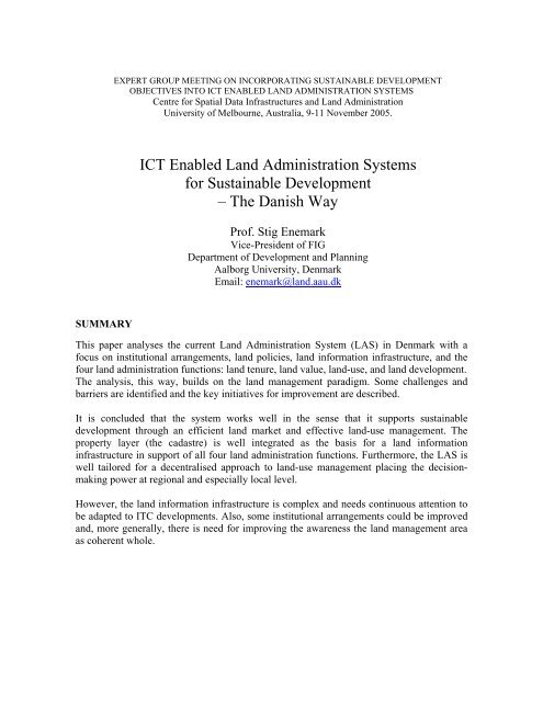
The Danish Way - Centre for Spatial Data Infrastructures and Land ...
The Danish Way - Centre for Spatial Data Infrastructures and Land ...
The Danish Way - Centre for Spatial Data Infrastructures and Land ...

Create successful ePaper yourself
Turn your PDF publications into a flip-book with our unique Google optimized e-Paper software.
SUMMARY<br />
EXPERT GROUP MEETING ON INCORPORATING SUSTAINABLE DEVELOPMENT<br />
OBJECTIVES INTO ICT ENABLED LAND ADMINISTRATION SYSTEMS<br />
<strong>Centre</strong> <strong>for</strong> <strong>Spatial</strong> <strong>Data</strong> <strong>Infrastructures</strong> <strong>and</strong> L<strong>and</strong> Administration<br />
University of Melbourne, Australia, 9-11 November 2005.<br />
ICT Enabled L<strong>and</strong> Administration Systems<br />
<strong>for</strong> Sustainable Development<br />
– <strong>The</strong> <strong>Danish</strong> <strong>Way</strong><br />
Prof. Stig Enemark<br />
Vice-President of FIG<br />
Department of Development <strong>and</strong> Planning<br />
Aalborg University, Denmark<br />
Email: enemark@l<strong>and</strong>.aau.dk<br />
This paper analyses the current L<strong>and</strong> Administration System (LAS) in Denmark with a<br />
focus on institutional arrangements, l<strong>and</strong> policies, l<strong>and</strong> in<strong>for</strong>mation infrastructure, <strong>and</strong> the<br />
four l<strong>and</strong> administration functions: l<strong>and</strong> tenure, l<strong>and</strong> value, l<strong>and</strong>-use, <strong>and</strong> l<strong>and</strong> development.<br />
<strong>The</strong> analysis, this way, builds on the l<strong>and</strong> management paradigm. Some challenges <strong>and</strong><br />
barriers are identified <strong>and</strong> the key initiatives <strong>for</strong> improvement are described.<br />
It is concluded that the system works well in the sense that it supports sustainable<br />
development through an efficient l<strong>and</strong> market <strong>and</strong> effective l<strong>and</strong>-use management. <strong>The</strong><br />
property layer (the cadastre) is well integrated as the basis <strong>for</strong> a l<strong>and</strong> in<strong>for</strong>mation<br />
infrastructure in support of all four l<strong>and</strong> administration functions. Furthermore, the LAS is<br />
well tailored <strong>for</strong> a decentralised approach to l<strong>and</strong>-use management placing the decisionmaking<br />
power at regional <strong>and</strong> especially local level.<br />
However, the l<strong>and</strong> in<strong>for</strong>mation infrastructure is complex <strong>and</strong> needs continuous attention to<br />
be adapted to ITC developments. Also, some institutional arrangements could be improved<br />
<strong>and</strong>, more generally, there is need <strong>for</strong> improving the awareness the l<strong>and</strong> management area<br />
as coherent whole.
COUNTRY PROFILE<br />
Denmark is a part of Sc<strong>and</strong>inavia <strong>and</strong> a member of the European Union. <strong>The</strong> total area is<br />
3,000 square kilometres, not including the Faeroe Isl<strong>and</strong>s <strong>and</strong> Greenl<strong>and</strong>. <strong>The</strong> population<br />
covers around 5, 3 million people with a density of 123 persons per square kilometre.<br />
About 85% of Denmark’s population lives in the cities <strong>and</strong> towns.<br />
Denmark is low-lying country, its highest point rising 175 metres above the sea.<br />
Approximately 10% of the country is used <strong>for</strong> urban zones <strong>and</strong> transport installations, 67%<br />
is agricultural l<strong>and</strong>, 12% is <strong>for</strong>ests, <strong>and</strong> the rest is semi-natural areas such as hearths, lakes<br />
<strong>and</strong> streams. <strong>The</strong> total coastline stretches 7,300 kilometres. Copenhagen is the capital.<br />
Greater Copenhagen has 1, 7 million inhabitants, one third of the <strong>Danish</strong> population. <strong>The</strong><br />
next four largest cities are Aarhus (population 275,000), Odense (180,000), Aalborg<br />
(160,000) <strong>and</strong> Esbjerg (85,000). <strong>The</strong> total number of residential units is about 2, 5 million.<br />
About 60% are owner occupied <strong>and</strong> 40 % are leased. About half of the leased units are<br />
private tenant housing, the other half is non-profit housing. <strong>The</strong> gross domestic product per<br />
capita is around 251,000 DKK (2001) equivalents to 33,000 USD. Agriculture <strong>and</strong> other<br />
primary production accounts <strong>for</strong> around 5 %, industry <strong>and</strong> construction 25%, private<br />
services 50%, <strong>and</strong> the public sector around 20%.<br />
Denmark is a constitutional monarchy governed by a representative democracy organized<br />
on three levels: at the national level there is a parliament with legislative power <strong>and</strong><br />
ministries responsible <strong>for</strong> certain fields; at the regional level there are 14 county councils<br />
responsible <strong>for</strong> regional matters such as hospitals, upper secondary schools, major roads,<br />
rural planning <strong>and</strong> administration; at the local level there are 275 municipal councils<br />
responsible <strong>for</strong> all local public functions. On average a municipality has around 20,000<br />
inhabitants. However, as per 1 January 2007 a new administrative structure will be in <strong>for</strong>ce<br />
consisting of only 5 counties <strong>and</strong> about 100 municipalities.<br />
2<br />
Copenhagen
SHORT HISTORICAL PATH TOWARDS SUSTAINABLE LAND MANAGEMNT<br />
<strong>The</strong> <strong>Danish</strong> cadastre, which derived from the enclosure movement, was established in 1844.<br />
<strong>The</strong> main purpose was the collection of l<strong>and</strong> taxes from agricultural holdings based on a<br />
valuation of the yielding capacity of the soil. From the very beginning, the cadastre<br />
consisted of two parts: the cadastral register <strong>and</strong> the cadastral maps. Both these components<br />
have been updated continually ever since.<br />
In the late 1800´s the cadastre changed from being a fiscal cadastre primarily as a basis <strong>for</strong><br />
l<strong>and</strong> valuation <strong>and</strong> taxation to a legal cadastre supporting a growing l<strong>and</strong> market. This<br />
evolution was completed in the early part of the 1900´s when taxation became based on the<br />
market value. Simultaneously, in the 1920´s a new L<strong>and</strong> Book System was established. <strong>The</strong><br />
new system was based on the cadastral identification <strong>and</strong> a close interaction between the<br />
two systems was established.<br />
During the first half of the 1900´s l<strong>and</strong> was increasingly seen as a commodity <strong>and</strong> the focus<br />
was on agricultural production <strong>and</strong> industrial revolution. L<strong>and</strong> use regulations were<br />
introduced to improve agricultural productivity <strong>and</strong> at the same time sustain the social<br />
conditions in the rural areas. <strong>The</strong>se regulations were based on cadastral in<strong>for</strong>mation. <strong>The</strong><br />
1960´s introduced a close interaction between the cadastral process (e.g. subdivision) <strong>and</strong><br />
the relevant l<strong>and</strong>-use regulations.<br />
An administrative re<strong>for</strong>m was adopted in the early 1970´s to reorganise regional <strong>and</strong> local<br />
administration. <strong>The</strong> re<strong>for</strong>m reduced the number of counties from 25 to 14 <strong>and</strong> the number<br />
of local authorities from almost 1,400 to 275. <strong>The</strong> reorganisation created the basis <strong>for</strong><br />
transferring a number of responsibilities <strong>and</strong> decision-making power to the counties <strong>and</strong><br />
especially to the municipal councils by means of decentralisation<br />
L<strong>and</strong> was increasingly seen as a community scarce resource <strong>and</strong> zoning <strong>and</strong> planning<br />
regulations were introduced to control l<strong>and</strong> development. Environmental concerns<br />
appeared in the late 1970´s <strong>and</strong> developed into the major issue in recent years. Today,<br />
comprehensive planning <strong>and</strong> environmental protection are seen as the main tools to secure<br />
sustainable development. Cadastral in<strong>for</strong>mation based on a modern IT plat<strong>for</strong>m evolved to<br />
support these processes towards sustainable l<strong>and</strong> management (Enemark <strong>and</strong> Schoeler<br />
2002).<br />
THE CURRENT LAND ADMINISTRATION SYSTEM<br />
<strong>The</strong> L<strong>and</strong> Administration System in Denmark is tailored <strong>for</strong> a decentralised approach to<br />
l<strong>and</strong>-use management placing the decision-making power at regional <strong>and</strong> especially local<br />
level. <strong>The</strong> system works well in the sense that it supports sustainable development through<br />
an efficient l<strong>and</strong> market <strong>and</strong> effective l<strong>and</strong>-use management.<br />
3
<strong>The</strong> analysis of the <strong>Danish</strong> LAS builds on the L<strong>and</strong> Management Paradigm in which l<strong>and</strong><br />
administration is seen as an area dealing with rights, restrictions <strong>and</strong> responsibilities in<br />
l<strong>and</strong>. This relates to the interaction of the three areas of l<strong>and</strong> tenure, l<strong>and</strong> value <strong>and</strong> l<strong>and</strong><br />
use. By including l<strong>and</strong> development these four areas are called the L<strong>and</strong> Administration<br />
Functions. <strong>The</strong>se functions are based on policies determining the overall objectives <strong>and</strong><br />
they are managed on the basis of appropriate l<strong>and</strong> in<strong>for</strong>mation infrastructures providing<br />
complete <strong>and</strong> up to date in <strong>for</strong>mation on the natural <strong>and</strong> built environment. This all sits<br />
within a country/state context of institutional arrangements that may change over time. <strong>The</strong><br />
Paradigm is presented in Figure 1 below (Enemark et al., 2005):<br />
<strong>The</strong> L<strong>and</strong> Policy Component<br />
E-Government E-Citizenship<br />
Figure 1. <strong>The</strong> L<strong>and</strong> Management Paradigm<br />
L<strong>and</strong> policies are expressed partly through the constitution <strong>and</strong> other more general laws<br />
such as the L<strong>and</strong> Registry Act, <strong>The</strong> Subdivision Act, <strong>The</strong> Valuation Act, <strong>and</strong> the Planning<br />
Act, <strong>and</strong> partly through the sectoral l<strong>and</strong>-use acts such as the Agricultural Holdings Act, the<br />
Environmental Protection Act, <strong>and</strong> the Nature Protection Act.<br />
A key l<strong>and</strong> policy is laid down in the Planning Act that establishes a general zoning<br />
dividing the total country into urban, recreational <strong>and</strong> rural zones. This provides a low l<strong>and</strong><br />
value in rural areas, where no developments are allowed except <strong>for</strong> agricultural <strong>and</strong> <strong>for</strong>estry<br />
purposes. <strong>The</strong> provisions on rural zones, covering about 90% of the country, are intended to<br />
provide a clear delimitation between town <strong>and</strong> country, to prevent urban sprawl <strong>and</strong><br />
uncontrolled l<strong>and</strong> development in the countryside, <strong>and</strong> to preserve valuable l<strong>and</strong>scapes. In<br />
urban areas, the l<strong>and</strong>-use opportunities are determined by planning regulations at local<br />
4
level. <strong>The</strong> Planning Act also provides a planning zone within 3 km of the coastline, in<br />
which special attention is given to protection of valuable features of the l<strong>and</strong>scape.<br />
Sectoral l<strong>and</strong> policies include the requirement that all agricultural properties be operated in<br />
accordance with agricultural <strong>and</strong> environmental considerations. This duty applies to twothirds<br />
of Denmark's l<strong>and</strong>. <strong>The</strong> protection of agricultural l<strong>and</strong> can be abolished when l<strong>and</strong> is<br />
transferred into an urban zone, which is based on planning considerations <strong>and</strong> with due<br />
regard <strong>for</strong> the quality of the agricultural l<strong>and</strong>. Conservation provisions apply to ensure<br />
responsible management of <strong>for</strong>est areas, which comprise 12 per cent of Denmark's l<strong>and</strong>.<br />
<strong>The</strong> Nature Protection Act provides the legal basis <strong>for</strong> protection <strong>and</strong> conservation of nature,<br />
l<strong>and</strong>scape features <strong>and</strong> historic elements. In addition the Act gives protection to certain areas<br />
<strong>and</strong> elements in nature <strong>and</strong> l<strong>and</strong>scape by establishing fixed protection zones along coasts,<br />
lakes, streams etc. Heritage buildings are protected through conservation orders <strong>and</strong> certain<br />
regulations.<br />
<strong>The</strong> L<strong>and</strong> In<strong>for</strong>mation Component<br />
<strong>The</strong> goal of the <strong>Danish</strong> L<strong>and</strong> In<strong>for</strong>mation Infrastructure is to reduce duplication <strong>and</strong> costs of<br />
spatial data/in<strong>for</strong>mation, to improve quality, to encourage co-operation on common<br />
st<strong>and</strong>ards <strong>and</strong> data models, to make spatial data/in<strong>for</strong>mation more accessible to all, <strong>and</strong> to<br />
facilitate e-government <strong>and</strong> participatory democracy. However, an “official infrastructure”<br />
has not yet been created. A recent government analysis (<strong>The</strong> Digital Task Force, 2001)<br />
assessed that Denmark on the one h<strong>and</strong> is in a strong position <strong>for</strong> using geo-data in a digital<br />
management environment since all the basic registers <strong>and</strong> maps are now in place in a digital<br />
<strong>for</strong>mat. On the other h<strong>and</strong>, it stated that existing co-operation structures at the operational<br />
level are too in<strong>for</strong>mal <strong>and</strong> do not sufficiently support the most expeditious utilisation of<br />
spatial data. It was there<strong>for</strong>e recommended that a governmental body be established to<br />
ensure the drive runs in a more unified <strong>and</strong> holistic direction. <strong>The</strong> body was established<br />
2002 <strong>and</strong> was named <strong>The</strong> <strong>Spatial</strong> <strong>Data</strong> Service Community.<br />
<strong>The</strong> <strong>Spatial</strong> <strong>Data</strong> Service Community is led by a steering group in which in addition to<br />
representatives from Local Government Denmark <strong>and</strong> the Association of County Councils<br />
in Denmark, the Ministry of the Environment is represented by National Survey <strong>and</strong><br />
Cadastre, the Ministry of Economics <strong>and</strong> Business Affairs by the National Agency <strong>for</strong><br />
Enterprise <strong>and</strong> Housing, the <strong>Danish</strong> Ministry of Food, Fisheries <strong>and</strong> Agriculture by the<br />
Directorate <strong>for</strong> Food, Fisheries <strong>and</strong> Agricultural Business <strong>and</strong> the Ministry of Transport by<br />
the Road Directorate. Chair <strong>and</strong> Secretariat: <strong>The</strong> National Survey <strong>and</strong> Cadastre, the<br />
Ministry of the Environment.<br />
<strong>The</strong> <strong>Spatial</strong> <strong>Data</strong> Service Community has published a vision stating that Geodata shall (i)<br />
constitute a natural tool <strong>for</strong> citizens, enterprises <strong>and</strong> the public administration, (ii) be<br />
harmonised, st<strong>and</strong>ardised, easily accessible <strong>and</strong> cheap; (ii) be a common basis <strong>for</strong> the<br />
digital administration, <strong>and</strong> (iv) create value growth <strong>for</strong> society. <strong>The</strong> strategic aims include<br />
5
areas such as Division of <strong>Data</strong> Responsibility; Pricing Structure; Basic <strong>Data</strong>; <strong>Data</strong><br />
Descriptions; Distribution <strong>and</strong> Presentation (Accessibility); Dissemination <strong>and</strong><br />
Deployment; <strong>and</strong> International Cooperation. <strong>The</strong> <strong>Spatial</strong> <strong>Data</strong> Service Community draws<br />
up an Annual Work Plan based on the seven strategic aims <strong>and</strong> other important geo-related<br />
issues in society. Committees are appointed to focus on investigation <strong>and</strong> analysis of<br />
important components in the establishment <strong>and</strong> development of spatial data. <strong>The</strong> work is<br />
carried out in cooperation with private <strong>and</strong> public partners (www.xyz-geodata.dk).<br />
<strong>The</strong> <strong>Danish</strong> society is one of the most mapped <strong>and</strong> registered societies in the world. Over<br />
the past two decades analogue maps <strong>and</strong> geo-referenced registers have been converted to a<br />
digital <strong>for</strong>m, <strong>and</strong> new data have been created to fill the gaps. <strong>The</strong> figure below shows the<br />
most important building blocks <strong>for</strong> a <strong>Danish</strong> Infrastructure <strong>for</strong> <strong>Spatial</strong> In<strong>for</strong>mation (Br<strong>and</strong>e-<br />
Lavridsen 2003). For more details see http://www.ddl.org/thedanishway/spatial_09.pdf.<br />
Figure 2. <strong>The</strong> <strong>Danish</strong> Infrastructure <strong>for</strong> <strong>Spatial</strong> In<strong>for</strong>mation<br />
6
Digital Registers. <strong>The</strong> <strong>Danish</strong> concept <strong>for</strong> integrated l<strong>and</strong> in<strong>for</strong>mation is organised as a network of<br />
interactive subsystems containing the most relevant in<strong>for</strong>mation such as the Cadastral Register, the<br />
L<strong>and</strong> Book, the Building <strong>and</strong> Housing Register, the Communal Property <strong>Data</strong> System (property<br />
valuation <strong>and</strong> taxation), <strong>and</strong> the Central Population Register. <strong>The</strong> responsibility <strong>for</strong> the spatial<br />
in<strong>for</strong>mation registers is distributed among different public authorities at the state, county <strong>and</strong><br />
municipal level. <strong>The</strong> registers can be linked by common identifiers such as cadastral number,<br />
property identification, <strong>and</strong> geo-referenced addresses, which are maintained in the Cross-Reference<br />
Register. Fundamental to the registers was the st<strong>and</strong>ardisation of addresses in connection with the<br />
establishment of the Central Population Register. At a later stage it has been widely accepted that<br />
the address issue is of great importance when talking about spatial in<strong>for</strong>mation because the address<br />
can link data from registers containing personal, property <strong>and</strong> enterprise data sets. As all addresses<br />
in Denmark have a coordinate relating to the front door, all register data can be geo-coded to the<br />
digital map series (Br<strong>and</strong>e-Lavridsen, 2003).<br />
<strong>The</strong> contents of the key registers are available to the public through the web-based Public<br />
In<strong>for</strong>mation Server launched in 2001 (www.ois.dk). <strong>The</strong> use is free of charge.<br />
Digital Maps. In December 2000 the National Survey & Cadastre finished a nationwide vectorbased<br />
map database (TOP10DK) in a scale of 1:10,000. This map series is very important in<br />
connection with an integrated use of spatial data. <strong>The</strong> map database is designed to be used in GIS<br />
connections, <strong>and</strong> eventually the map will have different linking facilities e.g. to the property-related<br />
data. <strong>The</strong> map database includes a digital elevation model. Other topographic products in smaller<br />
scales (raster-based) are also available.<br />
Large scale digital mapping in Denmark started seriously in the 1970s in connection with the<br />
introduction of natural gas. Large scale topographic maps cover Denmark in scales from 1:1000<br />
(towns <strong>and</strong> built-up areas) to 1:10.000 (rural areas). As the maps are produced on dem<strong>and</strong> from<br />
different users (municipalities, utility companies, etc.) <strong>and</strong> in different qualities, the maps do not<br />
<strong>for</strong>m a homogenous nationwide product even if they follow the general technical specifications.<br />
Generally these maps are available on the map the service of the municipalities.<br />
<strong>The</strong> computerisation of the old analogue cadastral maps (manly in the scale of 1:4000) was<br />
completed at the end of a ten year program in 1997. <strong>The</strong> maps are designed <strong>for</strong> integrated use in a<br />
modern GIS environment.<br />
<strong>The</strong> maps are available to the public through the web-based Map Service Launched 2002<br />
(www.kort<strong>for</strong>syningen.dk). <strong>The</strong> use is based on subscription <strong>and</strong> payment. However, most of the<br />
maps are also available from the municipal <strong>and</strong> county services free of charge. Furthermore, the<br />
Plan In<strong>for</strong>mation Service was launched in 2003 (www.plan<strong>for</strong>syningen.dk) giving web-based<br />
access to various kind of planning in<strong>for</strong>mation. Again most of this in<strong>for</strong>mation is also available<br />
through the municipal services.<br />
<strong>Data</strong> Models. An important condition of utilising spatial data across public institutions <strong>and</strong> sectors<br />
(<strong>and</strong> the whole geo-data business) is that the different data can "interact". <strong>The</strong>re<strong>for</strong>e, today we have<br />
data models <strong>for</strong> property data as well as planning <strong>and</strong> environmental data. However, the<br />
documentation <strong>and</strong> metadata is often a barrier <strong>for</strong> the wider utilisation of spatial data. <strong>The</strong>re<strong>for</strong>e, a<br />
meta-database was established, see www.geoinfo.dk. <strong>The</strong> meta-database gives a short overview of<br />
each data set, where to get further in<strong>for</strong>mation about the data set.<br />
Another initiative is the COT project (Common Object Types) that attempts to point out <strong>and</strong><br />
describe common object types such as buildings, road centre lines, coastlines, etc. in topographic<br />
mapping. This way, the in<strong>for</strong>mation can be shared by all kind of end users. <strong>The</strong> project is a cooperation<br />
between the National Survey <strong>and</strong> Cadastre, the county <strong>and</strong> municipal authorities, the<br />
utility owners, <strong>and</strong> private mapping companies.<br />
7
<strong>The</strong> L<strong>and</strong> Administration Functions<br />
L<strong>and</strong> tenure <strong>and</strong> cadastral systems.<br />
<strong>The</strong> National Survey <strong>and</strong> Cadastre under the Ministry of Environment is responsible <strong>for</strong><br />
geodetic <strong>and</strong> small-scale topographic mapping, nautical charting, <strong>and</strong> <strong>for</strong> maintaining <strong>and</strong><br />
updating the cadastral register <strong>and</strong> the cadastral maps. Cadastral surveying or surveying <strong>for</strong><br />
legal purposes is the responsibility of licensed surveyors in private practice. As <strong>for</strong> the<br />
topographic maps these are no longer (since 2002) produced in an analogue <strong>for</strong>mat.<br />
Politically, this is considered to be a matter of private business based on the topographical<br />
datasets.<br />
Legal rights to l<strong>and</strong> including ownership, mortgage, easements <strong>and</strong> leases are recorded in<br />
the L<strong>and</strong> Book at the local districts courts under the authority of the Ministry of Justice.<br />
<strong>The</strong> l<strong>and</strong> book is a positive title system based on the cadastral identification of the l<strong>and</strong><br />
parcels. L<strong>and</strong> transfers can then be entered into the l<strong>and</strong> book just by referring to the<br />
cadastral number in a deed; consequently there are no maps or cadastral surveys available<br />
at the l<strong>and</strong> registry. <strong>The</strong> process of l<strong>and</strong> transfer does not include the use of notaries. When<br />
transferring a part of a property, subdivision has to be carried out prior to entering the deed<br />
to the l<strong>and</strong> book. When a subdivided area is transferred from one property to another the<br />
legal rights of ownership <strong>and</strong> mortgage must be arranged prior to cadastral registration in<br />
order to ensure consistency between the two systems. This is the duty of the private<br />
surveyors. <strong>The</strong>y must also ensure that the intended future l<strong>and</strong> use is consistent with the<br />
current l<strong>and</strong>-use regulations. A system of digital lodgement of the cadastral data is in place<br />
to facilitate on-line management of the cadastral data in the interaction between the private<br />
surveyors <strong>and</strong> the National Cadastral Authority. At the same time the system works as an<br />
integrated quality control system.<br />
Strata titles are registered in the L<strong>and</strong> Book <strong>and</strong> are not included in the cadastre. To<br />
subdivide a property into strata titles, all the building units on the property must be<br />
included. <strong>The</strong> l<strong>and</strong> of the property is then owned by the strata titles holders in an ideal<br />
partnership reflecting their interest in terms of e.g. the size of the strata title units. <strong>The</strong><br />
opportunity of subdividing a property into strata titles is subject detailed political attention<br />
<strong>and</strong> regulations in order to ensure a proper supply of low cost housing in the urban areas.<br />
Buildings are not included in the cadastre. This due to the origin of the cadastre that was<br />
established <strong>for</strong> taxation purposes based on the yielding capacity of the soil, <strong>and</strong> there has<br />
never since been any attempt to include the building in the cadastre. Buildings are<br />
considered a matter of local government management based on the large scale topographic<br />
maps. In<strong>for</strong>mation on the buildings is maintained in the Building <strong>and</strong> Housing Register that<br />
includes all kind of in<strong>for</strong>mation on the year of construction, floor areas, building materials,<br />
technical installations, etc. This in<strong>for</strong>mation is linked to the large scale topographic maps<br />
<strong>and</strong> is maintained by the local municipal authority in relation to the management of<br />
building permits <strong>and</strong> urban renewal.<br />
8
Figure3. <strong>The</strong> Web Cadastre<br />
<strong>The</strong> cadastral system is well placed to serve multi-purpose needs by combining the datasets<br />
of the built <strong>and</strong> natural environments. It is generally agreed that the cadastral system should<br />
service all users, <strong>and</strong> their requirements <strong>for</strong> cadastral products should be carefully<br />
considered. <strong>The</strong> problem in this regard relates to the tension between the relative <strong>and</strong><br />
absolute accuracy of property boundaries. Where the cadastral process traditionally focused<br />
on the relative accuracy between parcel boundaries, today some users, particularly local<br />
authorities <strong>and</strong> utilities, focus on absolute accuracy in order to fully combine cadastral <strong>and</strong><br />
topographic datasets (Enemark 1998).<br />
L<strong>and</strong> Value.<br />
L<strong>and</strong> <strong>and</strong> property valuation is controlled by the Ministry of Taxation <strong>and</strong> managed by the<br />
municipal authorities. When a property is transferred, in<strong>for</strong>mation on the sales price must<br />
be recorded at the municipal valuation authority prior to entering the deed into the l<strong>and</strong><br />
book. Although values are automatically assessed on the basis of recorded sale prices <strong>and</strong><br />
property in<strong>for</strong>mation, there is a "human factor" present in the valuation process represented<br />
by local valuation committees that comprise typical laymen. <strong>The</strong> valuation is based on<br />
in<strong>for</strong>mation from the cadastre, the l<strong>and</strong> book, <strong>and</strong> zoning <strong>and</strong> planning regulations.<br />
However, the key element is the m<strong>and</strong>atory recording of property sales prices.<br />
<strong>The</strong> property value is assessed as the full market value of the property including l<strong>and</strong> <strong>and</strong><br />
buildings but excluding machinery, furniture <strong>and</strong> animals. <strong>The</strong> valuation is assessed to<br />
reflect the average cash price paid by a sensible buyer. <strong>The</strong> value should also reflect the<br />
9<br />
<strong>The</strong> Web-Cadastre is an<br />
up-to-date raster version of<br />
the official cadastre.<br />
In<strong>for</strong>mation is easy<br />
accessible <strong>and</strong> useful <strong>for</strong> all<br />
kind of purposes in<br />
government, business <strong>and</strong><br />
private.<br />
<strong>The</strong>re is, however, a need<br />
to also include to the l<strong>and</strong><br />
book in<strong>for</strong>mation <strong>and</strong><br />
relevant in<strong>for</strong>mation on<br />
l<strong>and</strong>-use restrictions. This<br />
common interface is till to<br />
be designed.
est possible economic use of the property. All public regulations such as zoning <strong>and</strong><br />
planning regulations must be taken into consideration.<br />
<strong>The</strong> l<strong>and</strong> value is assessed as the full market value (assumed cash payment) of the l<strong>and</strong><br />
without the buildings or other construction facilities. Again, the value is assessed to reflect<br />
the best possible economic use of the l<strong>and</strong> - disregarding any existing buildings <strong>and</strong> the<br />
present l<strong>and</strong> use. <strong>The</strong> l<strong>and</strong> value includes of site improvements such as drainage, sewerage<br />
or roads.<br />
11bt<br />
3dl 3dm 3dn<br />
11az<br />
1fa<br />
52 52a<br />
9au<br />
9at<br />
a<br />
40<br />
16bo<br />
4h<br />
11dn<br />
5bd<br />
3ø<br />
5ih<br />
5ii<br />
5f<br />
16eæ<br />
7dx<br />
7g<br />
7c g<br />
7c h<br />
7eb<br />
b<br />
1ac<br />
11ch<br />
11ca<br />
11bø<br />
11cv<br />
3eg<br />
3ed 3ef<br />
3ee<br />
11ce<br />
3ec<br />
3dø<br />
3ea 3eb<br />
3dæ<br />
11cf<br />
3b<br />
11cz<br />
11da<br />
3dy 3dz<br />
"ag"<br />
3du<br />
11cn 11cr<br />
3el<br />
3dt<br />
3ds<br />
11br 11bs<br />
3dx<br />
11bp11bq<br />
11cs 11bl<br />
11bo<br />
11bm11bn<br />
11co<br />
3dv<br />
11cm<br />
11bk<br />
11c p<br />
11ct<br />
11bv 11bu<br />
11bx<br />
3do 3dp 3dr<br />
11bæ<br />
11bz11by<br />
14cz<br />
11cø<br />
11bi<br />
11cq<br />
"c "<br />
40y<br />
11bf<br />
3gf<br />
8be 11ar<br />
3dh<br />
8ae<br />
3fa<br />
8r<br />
3gæ<br />
11dø 11dæ<br />
3di<br />
3dg<br />
3gø<br />
10ba<br />
1a 12a<br />
8x 52f<br />
6a<br />
52d<br />
8q<br />
3df<br />
3dk<br />
"g"<br />
12bp<br />
12bz12h 10gm<br />
21af<br />
9s<br />
9u<br />
5cy<br />
10f 9e<br />
40<br />
5cf<br />
9y<br />
9ac<br />
5i<br />
5ig<br />
9ah<br />
5c n<br />
9æ<br />
5cx<br />
9z<br />
5ik<br />
9ae 9ag<br />
5c q<br />
5k<br />
9t<br />
5c o<br />
9af<br />
16aø<br />
"g"<br />
5c p<br />
5ci<br />
16fe<br />
16fg<br />
5ck<br />
3gd<br />
3ay<br />
3ge<br />
1by<br />
9x<br />
3ga 3gx<br />
1dp<br />
29m<br />
3fø<br />
9ab 9ø<br />
9aa<br />
29q<br />
a<br />
40<br />
40a<br />
af<br />
40 aæ<br />
14<br />
bb<br />
40 ad<br />
cq<br />
21 ag<br />
1dc<br />
1c n 6c<br />
-153<br />
1aø<br />
6bc<br />
1af<br />
1c o<br />
1bl<br />
1c u 1ad 1d z 1bæ<br />
1h<br />
6be<br />
1aæ<br />
1cv 1c d 1æ<br />
1dx<br />
1ae<br />
6bd<br />
1ck<br />
1du<br />
1az 1m<br />
6bf<br />
"g"<br />
4ci<br />
1av<br />
1cy<br />
-154<br />
14e<br />
-345<br />
cl<br />
1r<br />
14bs 1g 1cæ 1cø1da 1db 1dh 1v<br />
1au<br />
-259<br />
cy<br />
1eh<br />
1at<br />
1c q<br />
1fo -411<br />
14ay 1eø<br />
1a s<br />
1v<br />
7.5 0m<br />
14bi<br />
14di<br />
14dh<br />
1ey<br />
1ap<br />
1cz<br />
14be<br />
-344<br />
8ei 8eh<br />
1ar 1ax<br />
1aq<br />
14gp<br />
1ao 1an<br />
8dø<br />
1m<br />
-413<br />
"f"<br />
1bh<br />
1be 1bd<br />
1bk<br />
1ay 1bf<br />
14dg<br />
8dt<br />
1fs<br />
1bg<br />
"m"<br />
1bi<br />
14ct<br />
14dc<br />
8dk<br />
1p 1q<br />
1r 1s 1t 1u<br />
5a<br />
1o<br />
1n<br />
-586<br />
1f<br />
1.50m<br />
14df<br />
3.0 0m<br />
Silkeborgvej<br />
-585<br />
8ek<br />
-019<br />
-018<br />
-070<br />
-087<br />
-084<br />
-017 -086<br />
1hi<br />
-571<br />
-085<br />
-015<br />
21h<br />
40c<br />
40f<br />
-016<br />
1gø 1ha<br />
40d<br />
40aa<br />
40ag<br />
40ab<br />
40ai<br />
1g 1hb 1hc<br />
cp<br />
1bs<br />
40x<br />
1hd 1he<br />
18u<br />
40h<br />
40ah 40z<br />
1bn<br />
1hf 1hg<br />
40g<br />
40v<br />
r<br />
21ah<br />
40æ<br />
40an<br />
Fredskov<br />
1hm<br />
21ai<br />
k<br />
40q<br />
1i<br />
18t<br />
40at<br />
21af<br />
Fredskov<br />
1hk<br />
40b<br />
Gellerup By, Brabr<strong>and</strong><br />
21ak<br />
40au<br />
1gy<br />
40av<br />
21ag<br />
Fredskov 1hh<br />
1by<br />
40p<br />
1gæ 1gz<br />
18i<br />
1bx<br />
1bx<br />
40ar<br />
1bx<br />
Fredskov<br />
1l<br />
40m<br />
40as<br />
-566<br />
1bø<br />
40ae<br />
18q 21g<br />
1el<br />
-167<br />
1eq<br />
1ev<br />
40ap<br />
40al<br />
40aq<br />
1cf<br />
40n 40ao<br />
-181<br />
1c a<br />
1c q<br />
40am<br />
40ak<br />
-161<br />
-162<br />
9ad<br />
-180<br />
1c e<br />
1cl<br />
1dk<br />
1de<br />
40t<br />
40az<br />
40k<br />
-166<br />
40s<br />
3ev<br />
1cv<br />
1cø<br />
3ey<br />
-163<br />
3gc<br />
1dp<br />
"c"<br />
3gb<br />
40a<br />
40u<br />
6h<br />
11du<br />
6d 6e<br />
6f<br />
40i<br />
6c<br />
5.00m<br />
L<strong>and</strong> Value per sq.m.<br />
Tytt ebæ rvej<br />
11.00-12.00m<br />
8ef<br />
8ee<br />
8eg<br />
8ed<br />
8dæ<br />
8dz<br />
8dy<br />
8dx<br />
8dv<br />
8du<br />
8ds<br />
8d r<br />
8dq<br />
8dp<br />
8di<br />
8dh<br />
8dg<br />
8df<br />
8de<br />
Gellerup Sogn<br />
Fuglsangsvej<br />
1.50m<br />
Brabr<strong>and</strong> Sogn<br />
8do<br />
8ec<br />
8eb<br />
8ea<br />
8dn<br />
8dm<br />
8dl<br />
8dc<br />
8db<br />
1.50m<br />
8dd<br />
Brabr<strong>and</strong> Sogn<br />
Gellerup Sogn<br />
10.00m<br />
8ac<br />
8ci<br />
8ck<br />
8cn<br />
8co<br />
8cp<br />
8cs<br />
8c t<br />
8cv<br />
8c x<br />
1.5 0m<br />
8cy<br />
8cz<br />
8cu<br />
8cæ<br />
8c l<br />
8cm<br />
8cq<br />
8cr<br />
8cø<br />
8da<br />
3gl<br />
3g k<br />
3gi<br />
3gp<br />
3go<br />
3gn<br />
3gm<br />
3g v<br />
3gu<br />
3gt<br />
3g s<br />
3gr<br />
3gq<br />
3gh<br />
Silkeborgvej<br />
3gg<br />
Fredskov<br />
Fredskov<br />
øgelvej<br />
40a<br />
3.50m<br />
Fre dskov<br />
"ah"<br />
8,00m<br />
7ec<br />
Fredskov<br />
13.00m<br />
Fredskov<br />
Fredskov<br />
Brabr<strong>and</strong> Skovvej<br />
8.00m<br />
Fredskov<br />
Fredskov<br />
Fredskov<br />
Fredskov<br />
6i<br />
Fredskov<br />
Edithsvej<br />
Fredskov<br />
Fredskov<br />
-179<br />
-165<br />
Edithsvej<br />
-183<br />
-178<br />
-567<br />
-168<br />
5.00m<br />
-260<br />
-258<br />
-014<br />
Sigridsvej<br />
-083<br />
5. 00m<br />
-182<br />
-177<br />
5.00m<br />
-587<br />
11.00m<br />
5. 00m<br />
5.00m<br />
Brabr<strong>and</strong> Skov vej<br />
-164-372<br />
Gudru<br />
L<strong>and</strong> Value in<br />
DKK per sq.m.<br />
5.00m<br />
5.00m<br />
-176<br />
7.00m<br />
> - 100<br />
100 - 300<br />
300 - 400<br />
400 - 600<br />
600 - 1200<br />
10<br />
11bt<br />
3dl 3dm 3dn<br />
11az<br />
1fa<br />
52 52a<br />
9au<br />
9at<br />
a<br />
40<br />
16bo<br />
4h<br />
11dn<br />
5bd<br />
3ø<br />
5ih<br />
5ii<br />
5f<br />
16eæ<br />
7dx<br />
7g<br />
7c g<br />
7c h<br />
7eb<br />
7ec<br />
b<br />
1ac<br />
11ch<br />
11ca<br />
11bø<br />
11cv<br />
3eg<br />
3ed<br />
3ef<br />
3ee<br />
11ce<br />
3ec<br />
3dø<br />
3ea 3eb<br />
3dæ<br />
11cf<br />
3b<br />
11cz<br />
11da<br />
3dy 3dz<br />
"ag"<br />
3du<br />
11cn 11cr<br />
3el<br />
3dt 3ds<br />
11br 11bs<br />
3dx<br />
11bp11bq<br />
11cs 11bl<br />
11bo<br />
11bm11bn<br />
11co<br />
3dv<br />
11cm<br />
11bk<br />
11c p<br />
11ct<br />
11bv 11bu<br />
11bx<br />
3do 3dp 3dr<br />
11bæ<br />
11bz11by<br />
14cz<br />
11cø<br />
11bi<br />
11cq<br />
"c "<br />
40y<br />
11bf<br />
3gf<br />
8be 11ar<br />
3dh<br />
8ae<br />
3fa<br />
8r<br />
3gæ<br />
11dø 11dæ<br />
3di<br />
3dg<br />
3gø<br />
10ba<br />
1a 12a<br />
8x 52f<br />
6a<br />
52d<br />
8q<br />
3df<br />
3dk<br />
"g"<br />
12bp<br />
12bz12h 10gm<br />
21af<br />
9s<br />
9u<br />
5cy<br />
10f 9e<br />
40<br />
5cf<br />
9y<br />
9ac<br />
5i<br />
5ig<br />
9ah<br />
5c n<br />
9æ<br />
5cx<br />
9z<br />
5ik<br />
9ae 9ag<br />
5c q<br />
5k<br />
9t<br />
5c o<br />
9af<br />
16aø<br />
"g"<br />
5c p<br />
5ci<br />
16fe<br />
16fg<br />
5ck<br />
3gd<br />
3ay<br />
3ge<br />
1by<br />
9x<br />
3ga 3gx<br />
1dp<br />
29m<br />
3fø<br />
9ab 9ø<br />
9aa<br />
29q<br />
a<br />
40<br />
40a<br />
af<br />
40 aæ<br />
14<br />
bb<br />
40 ad<br />
cq<br />
21 ag<br />
1dc<br />
1c n<br />
6c<br />
-153<br />
1aø<br />
6bc<br />
1af<br />
1c o<br />
1bl<br />
1cu 1ad 1dz 1bæ<br />
1h<br />
6be<br />
1aæ<br />
1cv 1c d 1æ<br />
1dx<br />
1aeProperty<br />
Value6bd<br />
1ck<br />
1du<br />
1az 1m<br />
6bf<br />
"g"<br />
4ci<br />
1av<br />
1cy<br />
-154<br />
14e<br />
-345<br />
cl<br />
1r<br />
14bs 1g 1cæ 1cø1da 1db 1dh 1v<br />
1au<br />
-259<br />
y<br />
1eh<br />
1at<br />
1c q<br />
1fo -411<br />
14ay 1eø<br />
1as<br />
1v<br />
7.5 0m<br />
14bi<br />
14di<br />
14dh<br />
1ey<br />
1ap<br />
1cz<br />
14be<br />
-344<br />
8ei 8eh<br />
1ar 1ax<br />
1aq<br />
14gp<br />
1ao 1an<br />
8dø<br />
1m<br />
-413<br />
"f"<br />
1bh<br />
1be 1bd<br />
1bk<br />
1ay 1bf<br />
14dg<br />
8dt<br />
1fs<br />
1bg<br />
"m"<br />
1bi<br />
14ct<br />
14dc<br />
8dk<br />
1p 1q 1r 1s 1t 1u<br />
5a<br />
1o<br />
1n<br />
-586<br />
1f<br />
1.50m<br />
14df<br />
3.00m<br />
Silkeborgvej<br />
-585<br />
8ek<br />
-019<br />
-018<br />
-070<br />
-087<br />
-084<br />
-017 -086<br />
1hi<br />
-571<br />
-085<br />
-015<br />
21h<br />
40c<br />
40f<br />
-016<br />
1g ø 1ha<br />
40d<br />
40aa<br />
40ag<br />
40ab<br />
40ai<br />
1g 1hb 1hc<br />
c p<br />
1bs<br />
40x<br />
1hd 1he<br />
18u<br />
40h<br />
40ah 40z<br />
1bn<br />
1hf 1hg<br />
40g<br />
40v<br />
21ah<br />
40æ 40an<br />
Fredskov<br />
1hm<br />
21ai<br />
40q<br />
1i<br />
18t<br />
40at<br />
21af<br />
Fredskov<br />
1hk<br />
40b<br />
Gellerup By, Brabr<strong>and</strong><br />
21ak<br />
40au<br />
1gy<br />
40av<br />
1by<br />
21ag<br />
Fredskov<br />
1hh<br />
40p<br />
1gæ 1gz<br />
18i<br />
1bx<br />
1bx<br />
40ar<br />
1bx<br />
Fredskov<br />
1l<br />
40m<br />
40as<br />
-566<br />
1bø<br />
40ae<br />
18q 21g<br />
1el<br />
-167<br />
1eq<br />
1ev<br />
40ap<br />
40al<br />
40aq<br />
1cf<br />
40n 40ao<br />
-181<br />
1c a<br />
1c q<br />
40am<br />
40ak<br />
-161<br />
-162<br />
9ad<br />
-180<br />
1c e<br />
1cl<br />
1dk<br />
1de<br />
40t<br />
40az<br />
40k<br />
-166<br />
40s<br />
3ev<br />
1cv<br />
1cø<br />
3ey<br />
-163<br />
3gc<br />
1dp<br />
"c "<br />
3gb<br />
40a<br />
40u<br />
6h<br />
11du<br />
6d 6e<br />
6f<br />
40i<br />
6c<br />
Figure 4. Examples presenting the l<strong>and</strong> <strong>and</strong> property values in combination with the cadastral data<br />
L<strong>and</strong> tax is levied by the county <strong>and</strong> municipal authorities based on the assessed market<br />
value of the l<strong>and</strong> <strong>for</strong> all kind of private properties. Property <strong>and</strong> l<strong>and</strong> taxes account <strong>for</strong> only<br />
about two percent of the total tax <strong>and</strong> duty revenue.<br />
<strong>The</strong> organisation of the l<strong>and</strong> valuation system is currently being revised due to the<br />
implementation of new administrative re<strong>for</strong>m. <strong>The</strong> basic principles <strong>for</strong> l<strong>and</strong> valuation <strong>and</strong><br />
taxation will, however, remain the same.<br />
L<strong>and</strong>-use <strong>and</strong> l<strong>and</strong> development.<br />
<strong>The</strong> system of planning control is based on the principle of framework control in which<br />
plans must not contradict the planning decisions at higher levels. <strong>The</strong> county councils carry<br />
out regional planning with emphasis on the regional infrastructure <strong>and</strong> the sectoral interests<br />
of the countryside. <strong>The</strong> municipal councils are responsible <strong>for</strong> municipal planning with<br />
emphasis on the local issues <strong>and</strong> the function <strong>and</strong> development of the urban areas. <strong>The</strong><br />
municipal councils are also responsible <strong>for</strong> the legally binding detailed planning of their<br />
neighbourhood areas, <strong>and</strong> <strong>for</strong> the granting of building permits that serve as a final control in<br />
the system. <strong>The</strong> Minister <strong>for</strong> the Environment can influence the planning at regional <strong>and</strong><br />
local levels through policies <strong>and</strong> national planning directives.<br />
5.00m<br />
Tyttebæ rvej<br />
11.00-12.00m<br />
8ef<br />
8ee<br />
8eg<br />
8ed<br />
8dæ<br />
8dz<br />
8dy<br />
8dx<br />
8dv<br />
8du<br />
8ds<br />
8d r<br />
8dq<br />
8dp<br />
8dh<br />
8di<br />
Gellerup Sogn<br />
Fuglsangsvej<br />
8dg<br />
8df<br />
8de<br />
1.50m<br />
Brabr<strong>and</strong> Sogn<br />
8do<br />
8ec<br />
8eb<br />
8ea<br />
8dn<br />
8dm<br />
8dl<br />
8dc<br />
8db<br />
1.50m<br />
8dd<br />
Brabr<strong>and</strong> Sogn<br />
Gellerup Sogn<br />
10.00m<br />
8ac<br />
8ci<br />
8ck<br />
8cn<br />
8co<br />
8cp<br />
1.50m<br />
8cs<br />
8c t<br />
8cy<br />
8cz<br />
8cu<br />
8cæ<br />
8c l<br />
8cm<br />
8cq<br />
8cr<br />
8cv<br />
8c x<br />
8cø<br />
8da<br />
3gl<br />
3gk<br />
3gi<br />
3gp<br />
3go<br />
3gn<br />
3gm<br />
3gv<br />
3gu<br />
3gt<br />
3g s<br />
3gr<br />
3gq<br />
3gh<br />
Si lkeborgvej<br />
3gg<br />
Fredskov<br />
Fredskov<br />
øgelvej<br />
40 a<br />
3.50m<br />
Fre dskov<br />
"ah"<br />
8,00m<br />
Fredskov<br />
13.00m<br />
Fredskov<br />
Fredskov<br />
Brabr<strong>and</strong> Skovvej<br />
8.00m<br />
Fredskov<br />
Fredskov<br />
Fredskov<br />
Fredskov<br />
6i<br />
Fredskov<br />
Edithsvej<br />
Fredskov<br />
Fredskov<br />
-179<br />
-165<br />
Edithsvej<br />
-183<br />
-178<br />
-164<br />
-567<br />
-168<br />
5.00m<br />
-260<br />
-258<br />
-014<br />
Sigridsvej<br />
-083<br />
5.00m<br />
-182<br />
-177<br />
5. 00m<br />
-587<br />
11.00m<br />
5.00m<br />
5.00m<br />
Brabra nd Skov vej<br />
-372<br />
Gudru<br />
Property Value in<br />
million DDK<br />
5.00m<br />
5.00m<br />
-176<br />
7.00m<br />
< ½<br />
½ - 1<br />
1 - 2<br />
2 - 5<br />
5 - 10<br />
10 - 55<br />
55 - 183
<strong>The</strong> system of planning control is supported by a number of the sectoral l<strong>and</strong> use acts such<br />
as the Agricultural Holdings Act, the Environmental Protection Act, <strong>and</strong> the Nature<br />
Protection Act. <strong>The</strong> sectoral l<strong>and</strong> use provisions are managed by the county <strong>and</strong> municipal<br />
authorities on the basis of sectoral l<strong>and</strong> use programmes that also feed into the<br />
comprehensive planning at regional <strong>and</strong> local level. Furthermore, the system of planning<br />
control is supported by the l<strong>and</strong> in<strong>for</strong>mation infrastructure where the cadastre <strong>for</strong>ms the<br />
basic layer <strong>for</strong> planning <strong>and</strong> administration. <strong>The</strong> system of integrated L<strong>and</strong>-Use<br />
Management is shown in the diagram below (Enemark, 2004).<br />
Figure 5. <strong>The</strong> <strong>Danish</strong> Concept <strong>for</strong> Integrated L<strong>and</strong>-Use Management<br />
<strong>The</strong> impact of central versus local government in support of sustainable development is a<br />
mix of vertical connections where each sectoral policy is implemented by a top- down<br />
approach; <strong>and</strong> horizontal connections where the different sectoral policy areas are balanced<br />
on the same level through comprehensive spatial planning.<br />
<strong>The</strong> principle of framework control ensures that planning decisions at regional <strong>and</strong> local level<br />
- in principle - will be in con<strong>for</strong>mity with overall national policies. National planning policies,<br />
however, are not <strong>for</strong>mally linked together to <strong>for</strong>m a general national plan or a "blue print". A<br />
National <strong>Spatial</strong> Development Perspective such "Denmark towards the Year 2018" (launched<br />
1993) is not a plan, but a vision, serving the purpose as a reference framework. <strong>The</strong>re are no<br />
requirements or stipulations binding the regional <strong>and</strong> local decisions. Instead, the system of<br />
framework control operates by using two means of control: dialogue <strong>and</strong> veto.<br />
<strong>The</strong> process <strong>for</strong> revising the regional plans every four years is based on a comprehensive<br />
national report presenting the current preconditions <strong>for</strong> managing the national aims <strong>and</strong><br />
objectives within specific <strong>and</strong> topical policy areas. <strong>The</strong> report is prepared by the Ministry <strong>for</strong><br />
11
Environment <strong>and</strong> Energy <strong>and</strong> is based on negotiations with relevant ministries <strong>and</strong> national<br />
agencies. <strong>The</strong> report should thus prevent the use of veto against the proposed regional plans,<br />
because national interests are considered, discussed <strong>and</strong> dealt with in advance. <strong>The</strong> adopted<br />
regional plans have a binding effect on planning at municipal level. <strong>The</strong> preparation of the<br />
plans there<strong>for</strong>e also is based on dialogue <strong>and</strong> negotiations with the local authorities. To<br />
conclude the system of framework control, the Minister of Environment <strong>and</strong> Energy also may<br />
veto a proposed local plan when national interests are at stake. <strong>The</strong> power of veto based on<br />
national interest then leads to negotiations in order to achieve a balance between the three<br />
levels of administration.<br />
In the Nordic setting, the decentralised model of l<strong>and</strong> use control is based on a cultural<br />
tradition which strives <strong>for</strong> a broad political <strong>and</strong> social consensus. <strong>The</strong> concept of<br />
decentralisation comprises a precise <strong>and</strong> finely tuned relationship between a strong national<br />
authority <strong>and</strong> autonomous county <strong>and</strong> municipal councils. <strong>The</strong> purpose is to solve the tasks<br />
at the lowest possible level so as to combine responsibility <strong>for</strong> decision making with<br />
accountability <strong>for</strong> financial <strong>and</strong> environmental consequences. To put it simply: “planning is<br />
politics”.<br />
CHALLENGES AND BARRIERS<br />
Policy level. <strong>The</strong>re is no overall comprehensive l<strong>and</strong> policy in Denmark. On the other h<strong>and</strong><br />
there is no need <strong>for</strong> such a policy since the system is already established <strong>and</strong> embedded in<br />
the cultural <strong>and</strong> institutional setting of the country. <strong>The</strong>re is, however, a need <strong>for</strong> an overall<br />
policy with regard to the National <strong>Spatial</strong> <strong>Data</strong> Infrastructure. <strong>The</strong>re is also a need <strong>for</strong> an<br />
overall policy with regard to the design <strong>and</strong> implementation of e-governance <strong>and</strong> ecitizenship<br />
in relation to l<strong>and</strong> <strong>and</strong> property management.<br />
Management level. Strategic aspects need to be considered with regard to the cadastral<br />
infrastructure <strong>and</strong> the institutional framework. For example, whether the L<strong>and</strong> Registries at<br />
the local district courts should be merged with the Cadastral Agency under the Ministry of<br />
Environment, <strong>and</strong> thereby increase the potential <strong>for</strong> access to <strong>and</strong> management of data<br />
related to l<strong>and</strong> <strong>and</strong> property. <strong>The</strong> adequacy of the current cadastral infrastructure <strong>and</strong><br />
procedures in relation to new ICT tools such as the provision of maps on-line from the<br />
relevant mapping database needs consideration. As does introduction of a 3D-cadastre to<br />
serve the registration of strata titles <strong>and</strong> some special construction works. Finally<br />
development of a marine cadastre to identify <strong>and</strong> secure rights <strong>and</strong> restrictions in the marine<br />
environment especially in the coastal zone should be considered.<br />
Operational level. Fine-tuning of property concepts is needed in relation to the cadastre,<br />
the l<strong>and</strong> book, <strong>and</strong> the valuation register. <strong>The</strong>re is also a need to develop a user-friendly<br />
interface <strong>for</strong> access to l<strong>and</strong> in<strong>for</strong>mation in order to serve the needs of users in government,<br />
business, <strong>and</strong> the public in general as a basis <strong>for</strong> implementing e-government as the overall<br />
approach to l<strong>and</strong> administration. This interface could be based on the web-cadastre in<br />
combination with the topographic database, <strong>and</strong> should also include in<strong>for</strong>mation on<br />
12
ownership, mortgage <strong>and</strong> easements, the l<strong>and</strong> <strong>and</strong> property value, as well as restrictions <strong>and</strong><br />
responsibilities related to individual properties. <strong>The</strong> in<strong>for</strong>mation should be accessible by the<br />
postal address, cadastral identification, or the name of the l<strong>and</strong>owner.<br />
CURRENT INITIATIVES FOR IMPROVEMENT<br />
A number of initiatives are currently discussed <strong>and</strong> considered <strong>for</strong> further improvement of<br />
the L<strong>and</strong> Administration System.<br />
<strong>The</strong> ICT architecture. Technology development in recent years offers new opportunities<br />
<strong>for</strong> organising the spatial in<strong>for</strong>mation. <strong>The</strong> buzz word is service-oriented IT architecture<br />
that can improve the communication between administrative systems <strong>and</strong> also establish<br />
more reliable data due to the use the original data instead of copies. This is now adopted in<br />
the governmental guidelines <strong>for</strong> service-oriented architecture e-government. <strong>The</strong> key<br />
elements are: (i) Flexibility <strong>and</strong> accessibility which facilitates decision-making at all levels,<br />
(ii) Quality, authenticity <strong>and</strong> actuality due to direct access <strong>for</strong> reading <strong>and</strong> updating in the<br />
basic databases, <strong>and</strong> (iii) St<strong>and</strong>ardisation through homogeneously selection of<br />
communications <strong>and</strong> exchange st<strong>and</strong>ards such as XML etc. This is currently being applied<br />
in the area of l<strong>and</strong> administration through close cooperation between the agencies <strong>and</strong><br />
stakeholders involved.<br />
<strong>The</strong> L<strong>and</strong> Book. <strong>The</strong> project includes a digitalisation of the l<strong>and</strong> book archives (the deeds,<br />
mortgage <strong>and</strong> easement document) <strong>and</strong> adjustment of procedures to better reflect the ITC<br />
opportunities. <strong>The</strong> latter includes implementation of the service-oriented IT-architecture<br />
mentioned above. It also includes the introduction of on-line registration base on st<strong>and</strong>ard<br />
registration <strong>for</strong>ms. Finally, the total organisation of the l<strong>and</strong> registry is discussed. It is<br />
suggested to close down the local l<strong>and</strong> registries at district courts <strong>and</strong>, instead, to establish<br />
just one national l<strong>and</strong> registry authority. It is not yet decided whether this new National<br />
authority will remain under Ministry of Justice or maybe be established in relation to the<br />
National Survey <strong>and</strong> Cadastre under the Ministry of the Environment. In this regard, a new<br />
model is introduced <strong>for</strong> consideration, where property ownership is registered in the<br />
cadastral register, easements are identified at the cadastral maps, while mortgage could be<br />
registered in relation to the financial sector (as an asset paper compared to shares, etc.). It<br />
is, however, not likely that such a radical solution will be agreed upon at this stage. This is<br />
due to a constant tension between the various ministries <strong>and</strong> agencies caused by the<br />
ongoing fight <strong>for</strong> power <strong>and</strong> resources.<br />
<strong>The</strong> Property Concept. <strong>The</strong> property concept in Denmark is a legal term that is defined<br />
slightly different in various laws (<strong>The</strong> Cadastral Act, <strong>The</strong> L<strong>and</strong> Registration Act, <strong>and</strong> the<br />
Valuation Act). <strong>The</strong>re is a necessity to find a common term that should also accommodate<br />
various other types of properties <strong>and</strong> complex commodities. Such a common term should<br />
then <strong>for</strong>m the basis <strong>for</strong> registration of all kind of property rights.<br />
13
<strong>The</strong> Cadastral Map. <strong>The</strong>re is a need to improve the accuracy of the digital cadastral maps<br />
in order to obtain better consistency with the large scale topographic maps. <strong>The</strong> project<br />
looks at ways <strong>and</strong> means to improve the accuracy <strong>and</strong> to make the maps more useful to the<br />
end users.<br />
This problem derives from the process used <strong>for</strong> producing the digital maps. Accepting that<br />
the costs of computerisation of the old analogue cadastral maps had to be reasonable, the<br />
computerisation process was undertaken in two stages: (i) state control points <strong>and</strong> cadastral<br />
surveys connected to the national grid <strong>for</strong>m a "skeleton” cadastral map (about 40 % of the<br />
boundary point s in urban areas <strong>and</strong> 20% in rural areas were entered this way); (ii) the<br />
remaining parcel areas were inserted in the map by digitising the analogue cadastral map<br />
<strong>and</strong> fitting in these to "skeleton map" by trans<strong>for</strong>mation. Identified elements in the digital<br />
map were also used to control the trans<strong>for</strong>mation of the analogue map. Metadata will<br />
indicate the way the boundary was established in the DCDB.<br />
By using of this approach the accuracy of the boundary coordinates will vary considerably,<br />
ranging from a few centimetres in some urban areas <strong>and</strong> up to several metres in some rural<br />
areas. <strong>The</strong>re<strong>for</strong>e, the digital cadastral may not totally compare to a digital topographic map.<br />
However, it must be considered that the nature <strong>and</strong> origin of those two kinds of maps are<br />
fundamentally different. It must also be noted that the digital cadastral map is a graphic<br />
map, not a numeric map. This means, that the co-ordinates <strong>for</strong> the boundary points only<br />
represent the boundary in the graphic map. <strong>The</strong> final determination of boundaries must be<br />
done according to the cadastral surveys <strong>and</strong> regulations. <strong>The</strong> parcel co-ordinates in the<br />
DCDB there<strong>for</strong>e must not be used <strong>for</strong> exact calculation of parcel areas <strong>and</strong> dimensions.<br />
<strong>The</strong> real challenge in this regard is to make this advanced product (digital cadastre map)<br />
underst<strong>and</strong>able <strong>and</strong> useful to the wide range of users: <strong>The</strong>y should underst<strong>and</strong> that the<br />
digital cadastral map in no way replace or change the legal boundaries; <strong>and</strong> they should<br />
underst<strong>and</strong> the nature of this map <strong>and</strong> the origin of the features… (Enemark, 1998).<br />
<strong>The</strong> Multipurpose Cadastre. In 2005, the educated use of the cadastral map is still one of<br />
the mayor challenges. In recent years the cadastral authority has been imposed by the<br />
obligation of registration of new themes in the cadastre such as the coastal protection zone,<br />
the dunes protection zone, <strong>and</strong> soil contaminated areas. It has also been considered to<br />
include planning regulations <strong>and</strong> various l<strong>and</strong>-use restrictions to be “hosted” by the<br />
cadastral map.<br />
This concept of “hosting” l<strong>and</strong>-use regulations in the cadastral map will now be replaced by<br />
the service-oriented IT architecture mentioned above. <strong>The</strong> focus will be on facilitating the<br />
use of the cadastral in<strong>for</strong>mation as a basic layer <strong>for</strong> registering all kind l<strong>and</strong>-use regulations<br />
<strong>and</strong> restrictions. <strong>The</strong> planning authorities <strong>and</strong> sectoral l<strong>and</strong>-use authorities must then learn<br />
how to use the cadastral in<strong>for</strong>mation within their area of responsibility including awareness<br />
of benefits <strong>and</strong> costs as well as legal <strong>and</strong> organisational impacts. <strong>The</strong> concept of the<br />
multipurpose cadastre there<strong>for</strong>e no longer means that all kind of regulations <strong>and</strong><br />
responsibilities will be registered in the cadastre. It means that the cadastre represent the<br />
basic layer to be used by the relevant authorities <strong>for</strong> registering their in<strong>for</strong>mation <strong>and</strong><br />
presenting this in<strong>for</strong>mation <strong>for</strong> decision making <strong>and</strong> to the citizens. This will require an<br />
educated use of the map to ensure consistency between cadastral changes <strong>and</strong> the connected<br />
l<strong>and</strong> restrictions (Skrubbeltrang, 2005).<br />
14
Implementation of the Administrative Re<strong>for</strong>m. As mentioned above, a new<br />
administrative structure will be in place by 1 January 2007. <strong>The</strong> scope is to empower the<br />
local authorities by establishing larger municipalities of, in principle, more than 30,000<br />
inhabitants. At the same time, the role of the regional level will change to include almost<br />
solely hospital management. Most of the responsibilities of the county authorities in terms<br />
of l<strong>and</strong> administration are then transferred to the enlarged municipalities while some will be<br />
transferred to state level to be managed by the various state agencies.<br />
<strong>The</strong> problems in this regard refer to the process <strong>for</strong> adopting this re<strong>for</strong>m, where there was<br />
no time (or political will) to organise especially the environmental management<br />
responsibilities in a clear <strong>and</strong> structured way. <strong>The</strong> planning area is, however, well in place<br />
even if there will be a major change in relation the current system when the whole level of<br />
regional planning disappears. Instead, the new regions will be responsible <strong>for</strong> preparing a<br />
whole new <strong>and</strong> strategic tool that covers general <strong>and</strong> overall aspects of relevance to the<br />
development of the region.<br />
However, these structural <strong>and</strong> institutional issues will of course find a solution over the<br />
coming years. <strong>The</strong> concerns are more around the l<strong>and</strong> in<strong>for</strong>mation data <strong>and</strong> expertise<br />
established over the years at the county authorities within areas such as nature protection,<br />
environmental management, water catchments, agricultural management, etc. How are this<br />
in<strong>for</strong>mation, knowledge <strong>and</strong> expertise to be divided <strong>and</strong> transferred to the various<br />
municipal authorities within each of the <strong>for</strong>mer county areas?<br />
This problem may in fact jeopardise the whole l<strong>and</strong> in<strong>for</strong>mation infrastructure at least in a<br />
short term perspective. On the other h<strong>and</strong> the situation may also offer new opportunities<br />
such as to organise the l<strong>and</strong> resource data on the basis of e.g. the water catchments areas<br />
rather than dividing the datasets into the various administrative jurisdictions.<br />
CONCLUSIONS<br />
<strong>The</strong> <strong>Danish</strong> L<strong>and</strong> Administration System works well in the sense that it supports<br />
sustainable development through an efficient l<strong>and</strong> market <strong>and</strong> effective l<strong>and</strong> use<br />
management. <strong>The</strong> property layer (the cadastre) is well integrated as the basis <strong>for</strong> l<strong>and</strong><br />
in<strong>for</strong>mation infrastructure in support of all four l<strong>and</strong> administration functions. This is<br />
continuously improved <strong>and</strong> adapted to new ICT opportunities. Furthermore, the LAS is<br />
well tailored <strong>for</strong> a decentralised approach to l<strong>and</strong>-use management placing the decisionmaking<br />
power at regional <strong>and</strong> especially local level.<br />
However, the l<strong>and</strong> in<strong>for</strong>mation infrastructure is complex <strong>and</strong> needs continuous attention to<br />
be adapted to ITC developments. Also, some institutional arrangements could be improved<br />
<strong>and</strong>, more generally, there is need <strong>for</strong> improving the awareness the l<strong>and</strong> management area<br />
as coherent whole.<br />
15
REFERENCES<br />
Br<strong>and</strong>e-Lavridsen, H.: Towards a <strong>Danish</strong> <strong>Spatial</strong> <strong>Data</strong> Infrastructure – What can the <strong>Danish</strong><br />
Authorities off the citizens today? Proceedings of ICA congress, Durban, 2003.<br />
Enemark, S.: Updating Digital Cadastral Maps – the <strong>Danish</strong> Experience. Proceedings of<br />
Commission 7 sessions at the FIG XXI International Congress, Brighton, UK, 19-25 July 1998, pp<br />
426-437.<br />
Enemark, S. <strong>and</strong> Scoeler, K.L. (2002): <strong>The</strong> <strong>Danish</strong> <strong>Way</strong>. <strong>The</strong> <strong>Danish</strong> Association of Chartered<br />
Surveyors, Copenhagen http://www.ddl.org/thedanishway/<br />
Enemark, S. (2004): Building L<strong>and</strong> In<strong>for</strong>mation Policies. Proceedings of Special Forum on<br />
Building L<strong>and</strong> In<strong>for</strong>mation Policies in the Americas. Aguascalientes, Mexico, 26-27 October 2004.<br />
http://www.fig.net/pub/mexico/papers_eng/ts2_enemark_eng.pdf<br />
Enemark, S., Williamson, I., <strong>and</strong> Wallace, J. (2005): Building Modern L<strong>and</strong> Administration<br />
Systems in Developed Economies. Accepted <strong>for</strong> publication in the Journal of <strong>Spatial</strong> Science,<br />
Australia in the December Issue 2005.<br />
Skrubbeltrang J.: (2005): Multipurpose cadastre - a host <strong>for</strong> l<strong>and</strong> use planning data? Proceedings<br />
of WPLA workshop, Helsinki, September, 2005.<br />
BIOGRAPHICAL NOTES<br />
Stig Enemark is Professor in L<strong>and</strong> Management <strong>and</strong> Problem Based Learning at Aalborg<br />
University, Denmark, where he was Head of the School of Surveying <strong>and</strong> Planning 1991-2005. He<br />
is Master of Science in Surveying, Planning <strong>and</strong> L<strong>and</strong> Management <strong>and</strong> he obtained his license <strong>for</strong><br />
cadastral surveying in 1970. He worked <strong>for</strong> ten years as a consultant surveyor in private practice.<br />
He is currently the President of the <strong>Danish</strong> Association of Chartered Surveyors <strong>and</strong> he is Vice-<br />
President of the International Federation of Surveyors (FIG) 2005-2008. He was Chairman of FIG<br />
Commission 2 (Professional Education) 1994-98, <strong>and</strong> he is an Honorary Member of FIG. His<br />
teaching <strong>and</strong> research are concerned with l<strong>and</strong> administration systems, l<strong>and</strong> management <strong>and</strong> spatial<br />
planning, <strong>and</strong> related educational <strong>and</strong> capacity building activities. Another research area is within<br />
Problem Based Learning <strong>and</strong> the interaction between education, research <strong>and</strong> professional practice.<br />
He has undertaken consultancies <strong>for</strong> the World Bank <strong>and</strong> the European Union especially in Eastern<br />
Europe <strong>and</strong> Sub Saharan Africa. He has more than 200 publications to his credit, <strong>and</strong> he has<br />
presented invited papers to more than 50 international conferences. For further in<strong>for</strong>mation see<br />
http://www.l<strong>and</strong>.aau.dk/~enemark<br />
CONTACTS<br />
Professor Stig Enemark<br />
Vice-President of FIG 2005-2008<br />
Department of Development <strong>and</strong> Planning<br />
Aalborg University, 11 Fibigerstrede<br />
DK 9220 Aalborg, Denmark<br />
Tel +45 9635 8344; Fax +45 9815 6541<br />
Email: enemark@l<strong>and</strong>.aau.dk<br />
Web: www.l<strong>and</strong>.aau.dk/~enemark<br />
16


