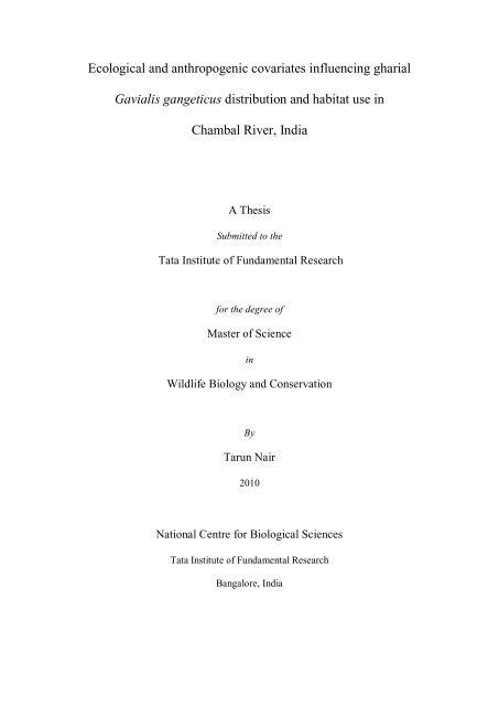
Ecological and anthropogenic covariates ... - GANGAPEDIA
Ecological and anthropogenic covariates ... - GANGAPEDIA
Ecological and anthropogenic covariates ... - GANGAPEDIA

You also want an ePaper? Increase the reach of your titles
YUMPU automatically turns print PDFs into web optimized ePapers that Google loves.
<strong>Ecological</strong> <strong>and</strong> <strong>anthropogenic</strong> <strong>covariates</strong> influencing gharial<br />
Gavialis gangeticus distribution <strong>and</strong> habitat use in<br />
Chambal River, India<br />
A Thesis<br />
Submitted to the<br />
Tata Institute of Fundamental Research<br />
for the degree of<br />
Master of Science<br />
in<br />
Wildlife Biology <strong>and</strong> Conservation<br />
By<br />
Tarun Nair<br />
2010<br />
National Centre for Biological Sciences<br />
Tata Institute of Fundamental Research<br />
Bangalore, India
EXECUTIVE SUMMARY<br />
The critically endangered gharial (Gavialis gangeticus), endemic to the Indian sub-<br />
continent, was common in the river systems of Pakistan, northern India, Bangladesh,<br />
Myanmar, Bhutan <strong>and</strong> Nepal. They are now restricted to a few, scattered locations in<br />
India <strong>and</strong> Nepal (Whitaker, 2007), having become increasingly rare due to l<strong>and</strong>-use<br />
changes, reduction in water flow, modification of river morphology, loss of nesting<br />
sites, increased mortality in fishing nets, egg-collection for consumption (Whitaker,<br />
2007; Hussain, 2009). Information on the effects of habitat attributes; biotic factors<br />
<strong>and</strong> human disturbances on gharial distribution <strong>and</strong> abundance are either scant or<br />
completely lacking, <strong>and</strong> thus are an impediment to effectively underst<strong>and</strong> the<br />
conservation needs of the species.<br />
In this regard, the objectives of my study were specifically,<br />
1) What is the extent of potential gharial habitat within the study area?<br />
2) How do different habitat attributes <strong>and</strong> conditions determine gharial distribution<br />
<strong>and</strong> abundance?<br />
3) How do different environmental <strong>and</strong> human activities influence gharial distribution<br />
<strong>and</strong> habitat site use/preference within available potential gharial habitat?<br />
The 75 km stretch of the Chambal was divided into thirty 2.5 km segments <strong>and</strong> each<br />
segment was sampled once across four sampling occasions, between February <strong>and</strong><br />
May, 2010, by row-boat, with a total survey effort of 300 km. These four sampling<br />
occasions cover the gradient from late winter to mid-summer. Boat survey <strong>and</strong><br />
stationary bank observations at basking sites were used to collect data. Habitat<br />
i
variable data like river discharge, water depth, channel width, air <strong>and</strong> water<br />
temperatures, shoreline substratum <strong>and</strong> presence of basking sites were recorded for<br />
each of the 2.5 km segments at a scale of 0.5 km.<br />
On the basis of the depth profile <strong>and</strong> shoreline substratum data, one-fifth of the study<br />
area qualified as preferred gharial habitat. Availability of undisturbed basking sites in<br />
conjunction with deep water segments emerged as the main variable explaining<br />
gharial occurrence. All human activities appeared to negatively influence the use of<br />
areas by gharials. S<strong>and</strong> mining <strong>and</strong> cultivation around the banks negatively impacted<br />
the use of such sites for basking. Gharials were seen less often <strong>and</strong> in fewer numbers<br />
in areas where fishing was high. Similar results were seen with movement of people<br />
<strong>and</strong> livestock along the river stretch. This study indicates the importance of inviolate<br />
areas that satisfy the bio-physical requirements of the gharial.<br />
I also describe a robust <strong>and</strong> easily replicable protocol for estimating gharial<br />
population size using photo-capture of basking animals. I demonstrate the conceptual,<br />
technical <strong>and</strong> logistic feasibility of applying photographic capture-recapture<br />
techniques for estimating gharial abundance in the wild.<br />
ii
ACKNOWLEDGEMENTS<br />
I thank the National Centre for Biological Sciences, Tata Institute of Fundamental<br />
Research, Centre for Wildlife Studies <strong>and</strong> Wildlife Conservation Society-India<br />
Program for support. I thank the Department of Science <strong>and</strong> Technology (DST) for<br />
providing financial support for the project.<br />
I would like to thank the Rajasthan, Madhya Pradesh <strong>and</strong> Uttar Pradesh Forest<br />
Departments for permissions. The staff of the Madhya Pradesh Forest Department<br />
(Ambah <strong>and</strong> Deori Ranges) was very co-operative, <strong>and</strong> I'd like to particularly thank,<br />
Mr. S.C. Badoria, Dr. R.K. Sharma, Vijay Singh Tomar, Jyothi, Lokinder, Satyapal,<br />
Daulat Ram, Tejpal <strong>and</strong> Ramveer. Rakesh Singh, Officer, Ram Awatar, the residents<br />
of Kuthiana, <strong>and</strong> the Baba at Ehsa were kind enough to host me, more than once.<br />
Thanks to the core group who first helped me conceptualize the idea - Rom Whitaker,<br />
late John T., Jeff Lang <strong>and</strong> Patrick Aust. And thanks to the team at the Madras<br />
Crocodile Bank too – Nikhil, Samir, (Doc) Gowri <strong>and</strong> co.<br />
I thank my guide- Dr. Jagdish Krishnaswamy, my co-guides Patrick Aust <strong>and</strong> late Dr.<br />
John Thorbjarnarson, for being very patient <strong>and</strong> supportive at all times; <strong>and</strong> my field<br />
assistants - Kaptan Singh, Jagdish, Rajveer, Shyam Singh.<br />
I am grateful to my local hosts - Rajeev Tomar <strong>and</strong> Family (Dholpur) <strong>and</strong> Col.<br />
Ramesh (Gwalior). And to Mr. Rakesh Vyas who introduced me to vital local<br />
contacts.<br />
Thanks to V. Srinivas for help with the GIS analyses, Krishnapriya Tamma, Nachiket<br />
Kelkar, Umesh Srinivasan in coming to terms with my data; my seniors from the<br />
Course, my batchmates <strong>and</strong> co-ordinators Veena P.G. <strong>and</strong> Divya Panicker for all their<br />
help.<br />
iii
Table of Contents<br />
EXECUTIVE SUMMARY ...................................................................................... i<br />
ACKNOWLEDGEMENTS ................................................................................... iii<br />
GENERAL INTRODUCTION ............................................................................... 1<br />
CHAPTER 1 ECOLOGICAL AND ANTHROPOGENIC COVARIATES<br />
INFLUENCING GHARIAL DISTRIBUTION AND HABITAT USE IN THE<br />
CHAMBAL RIVER, INDIA ................................................................................... 4<br />
ABSTRACT .......................................................................................................... 4<br />
INTRODUCTION ................................................................................................. 6<br />
METHODS ........................................................................................................... 9<br />
STUDY AREA .................................................................................................. 9<br />
FIELD METHODS.......................................................................................... 11<br />
DATA ANALYSIS ......................................................................................... 16<br />
RESULTS ........................................................................................................... 23<br />
ASSESSING CHANGES IN HABITAT AVAILABILITY AND RELATIVE<br />
ABUNDANCE OF GHARIALS ACROSS THE LOW-WATER SEASON ..... 24<br />
ACTIVITY PATTERNS OF GHARIAL WITH PROGRESS OF DRY SEASON<br />
........................................................................................................................ 27<br />
REGRESSION TREES.................................................................................... 27<br />
DISCUSSION ..................................................................................................... 32<br />
REFERENCES .................................................................................................... 37<br />
CHAPTER 2 PHOTOGRAPHIC IDENTIFICATION OF WILD GHARIALS<br />
(Gavialis gangeticus GMELIN 1789) FOR ASSESSING FEASIBILITY OF<br />
CAPTURE-RECAPTURE TECHNIQUES FOR POPULATION ESTIMATION<br />
................................................................................................................................ 44<br />
ABSTRACT ........................................................................................................ 44<br />
INTRODUCTION ............................................................................................... 45<br />
METHODS ......................................................................................................... 48<br />
STUDY AREA ................................................................................................ 48<br />
SAMPLING METHODOLOGY ..................................................................... 50<br />
IDENTIFICATION METHODS ...................................................................... 52<br />
ESTIMATING POPULATION SIZE .............................................................. 55<br />
RESULTS ........................................................................................................... 55<br />
DISCUSSION ..................................................................................................... 57<br />
LITERATURE CITED ........................................................................................ 59<br />
GENERAL CONCLUSION .................................................................................. 64<br />
APPENDIX 1 ......................................................................................................... 64
GENERAL INTRODUCTION<br />
Humans have preferentially settled along freshwater resources, <strong>and</strong> subsequently,<br />
freshwater ecosystems <strong>and</strong> species have suffered from multiple <strong>and</strong> on-going stresses<br />
from use by humans (Revenga et al 2005). Consequently, species diversity of inl<strong>and</strong><br />
waters is among the most threatened of all ecosystems <strong>and</strong> global freshwater<br />
biodiversity is declining at far greater rates than is true for even the most affected<br />
terrestrial ecosystems (Sala, 2000).<br />
The gharial (Gavialis gangeticus, Gmelin, 1789), endemic to the Indian subcontinent,<br />
was once common in the river systems of Pakistan, northern India, Bangladesh,<br />
Myanmar, Bhutan <strong>and</strong> Nepal (Whitaker <strong>and</strong> Basu, 1983; Whitaker, 1987, 2007;<br />
Hussain, 1999, 2009). However, they are now restricted to a few, scattered locations<br />
in India <strong>and</strong> Nepal (Whitaker, 2007). The gharial, is becoming increasingly rare due<br />
to l<strong>and</strong>-use changes, reduction in water flow, modification of river morphology, loss<br />
of nesting sites, increased mortality in fishing nets <strong>and</strong> egg-collection for consumption<br />
(Whitaker, 2007; Hussain, 2009); <strong>and</strong> is especially at risk from flow regulation<br />
because it prefers fast-flowing river habitats, which are prime sites for dams<br />
(Dudgeon, 2000).<br />
The Chambal river population is the largest contiguous <strong>and</strong> most viable population<br />
<strong>and</strong> has been the focus of conservation <strong>and</strong> restocking programmes. In recent times it<br />
has suffered from increasing disturbance from extractive activities <strong>and</strong> is under severe<br />
threat from hydrological modifications due to dam <strong>and</strong> reservoirs <strong>and</strong> diversion of<br />
river water for irrigation.<br />
1
In the face of increasing proposals for water extraction <strong>and</strong> impoundments on the<br />
Chambal, <strong>and</strong> nation-wide river linking aspirations, it is critical that species<br />
requirements be understood <strong>and</strong> flow regimes be restored. Bunn & Arthington (2002),<br />
illustrate how flow is a major determinant of physical habitat in streams, which in turn<br />
is a major determinant of biotic composition; that aquatic species have evolved life<br />
history strategies primarily in direct response to the natural flow regimes; that<br />
maintenance of natural patterns of longitudinal <strong>and</strong> lateral connectivity is essential to<br />
the viability of populations of many riverine species; <strong>and</strong> that the invasion <strong>and</strong><br />
success of exotic <strong>and</strong> introduced species in rivers is facilitated by the alteration of<br />
flow regimes.<br />
Information on the effects of habitat attributes (availability <strong>and</strong> profile of basking <strong>and</strong><br />
nesting sites; water flow <strong>and</strong> quality; channel depth <strong>and</strong> width, etc.); biotic factors<br />
(prey density <strong>and</strong> diversity, co-predators, etc) <strong>and</strong> human disturbances (impact of<br />
dams, barrages, canals, pollution, excessive water extraction, fishing, s<strong>and</strong>-mining,<br />
riverbed cultivation, livestock presence, etc.) on gharial distribution <strong>and</strong> abundance<br />
are either scant or completely lacking, <strong>and</strong> thus are an impediment to effectively<br />
underst<strong>and</strong> the conservation needs of the species.<br />
Literature Cited<br />
Bunn, S.E. <strong>and</strong> A.H. Arthington, Basic principles <strong>and</strong> ecological consequences of<br />
altered flow regimes for aquatic biodiversity, Environ. Manage. 30 (2002), pp. 492–<br />
507.<br />
2
Dudgeon, D. 2000. Large-scale hydrological changes in tropical Asia: Prospects for<br />
riverine biodiversity. Bioscience 50:793-806.<br />
Hussain, S. A. 1999. Reproductive success, hatchling survival <strong>and</strong> rate of increase of<br />
gharial Gavialis gangeticus in National Chambal Sanctuary, India. Biological<br />
Conservation 87:261-268.<br />
Hussain, S. A. 2009. Basking site <strong>and</strong> water depth selection by gharial Gavialis<br />
gangeticus Gmelin 1789 (Crocodylia, Reptilia) in National Chambal Sanctuary, India<br />
<strong>and</strong> its implication for river conservation. Aquatic Conservation-Marine <strong>and</strong><br />
Freshwater Ecosystems 19:127-133.<br />
Revenga, C., I. Campbell, R. Abell, P. de Villiers, <strong>and</strong> M. Bryer. 2005. Prospecting<br />
for monitoring freshwater ecosystems towards the 2010 targets. Philosophical<br />
Transactions of the Royal Society B 360:397–413.<br />
Sala, O. E., F. S. Chapin, J. J. Armesto, E. Berlow, J. Bloomfield, R. Dirzo, E. Huber-<br />
Sanwald, L. F. Huenneke, R. B. Jackson, A. Kinzig, R. Leemans, D. M. Lodge, H. A.<br />
Mooney, M. Oesterheld, N. L. Poff, M. T. Sykes, B. H. Walker, M. Walker, <strong>and</strong> D. H.<br />
Wall. 2000. Biodiversity - Global biodiversity scenarios for the year 2100. Science<br />
287:1770-1774.<br />
Whitaker, R., 1987. The management of crocodilians in India. In: Webb, G.J.W.,<br />
Manolis, S.C., Whitehead, P.J. (Eds.), Wildlife Management: Crocodiles <strong>and</strong><br />
Alligators. Surrey Beatty <strong>and</strong> Sons, Sydney, pp. 63-72.<br />
Whitaker R, Basu D. 1983. The gharial (Gavialis gangeticus): A review. Journal of<br />
Bombay Natural History Society 79: 531–548.<br />
Whitaker et al. 2007. The Gharial: Going extinct again. Iguana. 14, 1: 24 – 33.<br />
3
Chapter 1<br />
<strong>Ecological</strong> <strong>and</strong> Anthropogenic Covariates Influencing Gharial Distribution And<br />
Habitat Use In The Chambal River, India.<br />
Abstract<br />
The critically endangered gharial (Gavialis gangeticus Gmelin 1789), endemic to the<br />
Indian sub-continent, was common in the river systems of Pakistan, northern India,<br />
Bangladesh, Myanmar, Bhutan <strong>and</strong> Nepal. However, they are now restricted to a few,<br />
scattered locations in India <strong>and</strong> Nepal. The Chambal river population is the largest<br />
contiguous <strong>and</strong> most viable population <strong>and</strong> has been the focus of conservation <strong>and</strong><br />
restocking programmes. In recent times it has suffered from increasing disturbance<br />
from extractive activities <strong>and</strong> is under severe threat from hydrological modifications.<br />
In addition, the Chambal River population is reported to have suffered a severe<br />
decline between 1998 <strong>and</strong> 2006, <strong>and</strong> was also affected by the mystery die-off between<br />
late 2007 <strong>and</strong> early 2008. Inspite of its global endangered status, rigorous studies of<br />
the gharial have been limited. The goal of the current study is to identify the<br />
environmental <strong>and</strong> <strong>anthropogenic</strong> factors that influence habitat use <strong>and</strong> distribution by<br />
the Gharial in the Chambal. Row-boat survey <strong>and</strong> stationary bank observations were<br />
undertaken to sample a 75 km stretch of the Chambal River, divided into thirty 2.5 km<br />
segments. Each segment was sampled once across four sampling occasions between<br />
February <strong>and</strong> May, 2010, with a total survey effort of 300 km. Encounter rates of<br />
gharial (basking <strong>and</strong> non-basking) <strong>and</strong> corresponding environmental (e.g. water depth,<br />
air <strong>and</strong> water temperature) <strong>and</strong> <strong>anthropogenic</strong> disturbance factors were measured for<br />
each segment. I used scatter plots, Classification <strong>and</strong> Regression Trees (CART) <strong>and</strong><br />
4
egression models to identify factors affecting the encounter rates of gharials in each<br />
of the segments. A comparison of gharial counts across the 4 sampling occasions<br />
shows a peak in February, followed by similar relative abundances in March, April<br />
<strong>and</strong> May across sites, although there was a shift in activity from basking to increased<br />
submergence (basking : submerged gharial :: 2.28: 1 (in Occasion 1) to 1.36 : 1 (in<br />
Occasion 4). However, marked changes in river discharge <strong>and</strong> temperature through<br />
the study period imply that different ecological <strong>covariates</strong> may be influencing gharials<br />
at different periods.<br />
We used Bayesian spatial count regression models for analyzing the effects of two<br />
ecological <strong>covariates</strong> (s<strong>and</strong>bank availability <strong>and</strong> depth profile) <strong>and</strong> spatial adjacency<br />
on habitat-use (encounter-rates). Total Gharial abundance <strong>and</strong> habitat-usage in<br />
segments was positively influenced by presence of basking sites <strong>and</strong> greater water<br />
depth. Depth measurements were extrapolated for the entire river stretch, at 5 m<br />
intervals, using the Kriging function in a Geographical Information System.<br />
Keywords: gharial, distribution, habitat use, ecological <strong>covariates</strong>, <strong>anthropogenic</strong><br />
<strong>covariates</strong>, CART, kriging.<br />
5
Introduction<br />
Humans live disproportionately near waterways <strong>and</strong> extensively modify riparian<br />
zones (Sala, 2000). Consequently, species diversity of inl<strong>and</strong> waters is among the<br />
most threatened of all ecosystems <strong>and</strong> global freshwater biodiversity is declining at<br />
far greater rates than is true for even the most affected terrestrial ecosystems (Sala,<br />
2000). Habitat partitioning <strong>and</strong> microhabitat preferences may be evident among<br />
crocodilians, especially when multiple species cohabit (Magnusson, 1985; Herron,<br />
1994). Territoriality during the breeding season (Rootes <strong>and</strong> Chabreck 1993a);<br />
reducing intraspecific competition (Hutton, 1989); or predator avoidance (Cott, 1961)<br />
contribute to differential habitat use (Tucker et al 1997). Between 1997 <strong>and</strong> 2006, the<br />
gharial population reportedly experienced a 58% drop across its range; <strong>and</strong> its total<br />
breeding population was estimated to be less than 200 individuals, making it a<br />
critically endangered species (IUCN, 2007). The gharial, is becoming increasingly<br />
rare due to l<strong>and</strong>-use changes, reduction in water flow, modification of river<br />
morphology, loss of nesting sites, increased mortality in fishing nets <strong>and</strong> egg-<br />
collection for consumption (Whitaker, 2007; Hussain, 2009); <strong>and</strong> is especially at risk<br />
from flow regulation because it prefers fast-flowing river habitats, which are prime<br />
sites for dams (Dudgeon, 2000). The gharial (Gavialis gangeticus, Gmelin, 1789),<br />
endemic to the Indian subcontinent, was once common in the river systems of<br />
Pakistan, northern India, Bangladesh, Myanmar, Bhutan <strong>and</strong> Nepal (Whitaker <strong>and</strong><br />
Basu, 1983; Whitaker, 1987, 2007; Hussain, 1999, 2009). However, they are now<br />
restricted to a few, scattered locations in India <strong>and</strong> Nepal (Whitaker, 2007). The<br />
gharial, is becoming increasingly rare due to l<strong>and</strong>-use changes, reduction in water<br />
flow, modification of river morphology, loss of nesting sites, increased mortality in<br />
fishing nets <strong>and</strong> egg-collection for consumption (Whitaker, 2007; Hussain, 2009); <strong>and</strong><br />
6
is especially at risk from flow regulation because it prefers fast-flowing river habitats,<br />
which are prime sites for dams (Dudgeon, 2000).<br />
The few remaining breeding populations of the gharial in India occur in the Girwa<br />
River along the India-Nepal border in Uttar Pradesh, the Chambal River along the<br />
border of Uttar Pradesh, Madhya Pradesh <strong>and</strong> Rajasthan (Whitaker, 1987; Hussain,<br />
1999), the Ramganga <strong>and</strong> Palain Rivers (Corbett Tiger Reserve), Uttarakh<strong>and</strong> <strong>and</strong> the<br />
Son River (Son Gharial Sanctuary), Madhya Pradesh (Thorbjarnarson, pers. comm.).<br />
Since 1978, these river stretches have been protected as wildlife sanctuaries, <strong>and</strong> in<br />
1979 a captive reared restocking programme was undertaken in these areas.<br />
However, between 1997 <strong>and</strong> 2006, the gharial population reportedly experienced a<br />
58% drop across its range; <strong>and</strong> its total breeding population was estimated to be less<br />
than 200 individuals, making it a critically endangered species (IUCN, 2007). Very<br />
little information exists on the status of the gharial population in these protected areas;<br />
<strong>and</strong> gharial habitats <strong>and</strong> populations continue to be threatened. The Chambal river<br />
population is the largest contiguous <strong>and</strong> most viable population <strong>and</strong> has been the<br />
focus of conservation <strong>and</strong> restocking programmes. In recent times it has suffered from<br />
increasing disturbance from extractive activities <strong>and</strong> is under severe threat from<br />
hydrological modifications due to dams <strong>and</strong> reservoirs, <strong>and</strong> diversion of river water<br />
for irrigation.<br />
7
Despite the release of over 5000 young gharial into various Indian rivers, as part of<br />
the re-stocking programmes, only about 200 breeding adults still survive<br />
(http://www.gharialconservation.org/). No information on their recovery in these<br />
rivers exists <strong>and</strong> the reasons for their low survival rate remain unknown. The<br />
restocking programmes lacked monitoring of survival <strong>and</strong> dispersal of released<br />
animals <strong>and</strong> hence the efficacy of this programme could not be scientifically<br />
evaluated. Information on habitat use <strong>and</strong> preference; the effects of habitat attributes<br />
(availability <strong>and</strong> profile of basking <strong>and</strong> nesting sites; water flow <strong>and</strong> quality; channel<br />
depth <strong>and</strong> width, etc.); biotic factors (prey density <strong>and</strong> diversity, co-predators, etc) <strong>and</strong><br />
human disturbances (impact of dams, barrages, canals, pollution, excessive water<br />
extraction, fishing, s<strong>and</strong>-mining, riverbed cultivation, livestock presence, etc.) on<br />
gharial distribution <strong>and</strong> abundance are either scant or completely lacking, <strong>and</strong> thus are<br />
an impediment to effectively underst<strong>and</strong> the conservation needs of the species.<br />
For effective conservation <strong>and</strong> management of gharials within their natural habitats, it<br />
is important to be able to assess species distribution <strong>and</strong> abundance, <strong>and</strong> the influence<br />
of habitat attributes <strong>and</strong> human disturbances on them. This will indicate the<br />
population dynamics of the species <strong>and</strong> is vital to determine the status of gharial<br />
populations <strong>and</strong> the success of conservation efforts. Moreover, the ability to identify,<br />
quantify <strong>and</strong> map the limiting factors for a species will enable the prediction of the<br />
abundance of that species based on these factors. Population studies are essential to<br />
determine the status of gharials in the wild, assess the success <strong>and</strong> validity of<br />
conservation measures, make management recommendations <strong>and</strong> design conservation<br />
strategies.<br />
8
In this regard, I will investigate –<br />
1) What is the extent of potential gharial habitat within the study area?<br />
2) How do different habitat attributes <strong>and</strong> conditions determine gharial distribution<br />
<strong>and</strong> abundance?<br />
3) How do different environmental <strong>and</strong> human activities influence gharial distribution<br />
<strong>and</strong> habitat site use/preference within available potential gharial habitat?<br />
Methods<br />
Study Area<br />
The 960 km long Chambal River rises in the northern slopes of the Vindhyan<br />
escarpment, 15 km West-South-West of Mhow in Indore District in Madhya Pradesh<br />
state, at an elevation of about 843 m (Jain et al. 2007). Lying between 24°55' <strong>and</strong><br />
26°50'N, 75°34' <strong>and</strong> 79°18'E the Chambal flows first in a northerly direction in<br />
Madhya Pradesh(M.P.) for a length of about 346 km <strong>and</strong> then in a generally north-<br />
easterly direction for a length of 225 km through Rajasthan. It flows for another 217<br />
km between M.P. <strong>and</strong> Rajasthan (Raj) <strong>and</strong> further 145 km between M.P. <strong>and</strong> Uttar<br />
Pradesh (U.P.). It enters U.P. <strong>and</strong> flows for about 32 km before joining the Yamuna<br />
River in Etawah District at an elevation of 122 m, to form a part of the greater<br />
Gangetic drainage system (Jain et al. 2007). From the source down to its junction with<br />
the Yamuna, the Chambal has a fall of about 732 m. Out of this; around 305 m is<br />
within the first 16 km reach from its source. It falls for another 195 m in the next 338<br />
km, where it enters the gorge past the Chaurasigarh Fort. In the next 97 km of its run<br />
from the Chaurasigarh Fort to Kota city, the bed falls by another 91 m. In the rest of<br />
9
its 523 km run, the river passes through the flat terrain of the Malwa Plateau <strong>and</strong> later<br />
in the Gangetic Plain with an average gradient of 0.21 m/km (Jain et al. 2007). It is a<br />
typical anterior-drainage pattern river, being much older than River Yamuna <strong>and</strong><br />
Ganga, into which it eventually flows (Mani, 1974).<br />
The area lies within the semi-arid zone of north-western India at the border of<br />
Madhya Pradesh, Rajasthan <strong>and</strong> Uttar Pradesh States (Hussain 1999, 2009), <strong>and</strong> the<br />
vegetation consists of ravine, thorn forest (Champion <strong>and</strong> Seth, 1968). Evergreen<br />
riparian vegetation is completely absent, with only sparse ground-cover along the<br />
severely eroded river banks <strong>and</strong> adjacent ravine l<strong>and</strong>s (Hussain 1999, 2009). Ambient<br />
air temperatures range from 2 to 46 °C with a mean annual precipitation of 591.2mm,<br />
the bulk of which is received during the south-west monsoons (Hussain 1999, 2009).<br />
Figure 1: Map of the Study Area, River Chambal with important l<strong>and</strong>marks.<br />
10
A 600km stretch of the Chambal River, between Jawahar Sagar Dam <strong>and</strong><br />
Panchhnada, has been protected as the National Chambal Sanctuary (Hussain 1999,<br />
2009). The study area comprises a 75 km stretch of river within the Sanctuary,<br />
between 26°32'22" N, 77°45'30" E (Daburpur Ghat, M.P.) <strong>and</strong> 26°48'37" N,<br />
78°10'18" E (Sukhdyan Pura Ghat, M.P.). The study area includes the river stretch,<br />
mid-channel isl<strong>and</strong>s, s<strong>and</strong>-bars, rocky outcrops <strong>and</strong> adjacent banks. The water depth<br />
ranges from 0.02 to 18.6 m; while the channel width ranges from 44 to 400 m. River<br />
discharge levels varied from 23.9 to 75 m 3 s -1. S<strong>and</strong> occupies29.7% of the shoreline<br />
substratum, while gravel, clay-loam ad s<strong>and</strong>stone-rock occupied 16.6%, 20.5% <strong>and</strong><br />
33.2% respectively.<br />
Anthropogenic influences are chiefly in the form of s<strong>and</strong>-mining; bank-side<br />
cultivation; domestic activities like bathing, defecating <strong>and</strong> water collection; gill-net<br />
<strong>and</strong> hook-line fishing; livestock herding; grass-soaking; river crossing <strong>and</strong> temple<br />
fairs.<br />
Field Methods<br />
Gharial Habitat Use <strong>and</strong> Distribution<br />
The 75 km stretch of the Chambal was divided into thirty 2.5 km segments <strong>and</strong> each<br />
segment was sampled once across four sampling occasions, between February <strong>and</strong><br />
May, 2010, by row-boat, with a total survey effort of 300 km. These four sampling<br />
occasions cover the gradient from late winter to mid-summer. Boat survey <strong>and</strong><br />
stationary bank observations at basking sites were used to collect data. The<br />
probability of basking gharial encounters was maximized by stationary bank counts at<br />
11
sites considered favourble based on the depth profile <strong>and</strong> basking site substrate.<br />
Digiscoping <strong>and</strong> digital photography were employed to observe <strong>and</strong> record basking<br />
animals. This was achieved using a Bushnell 20 - 60x Spotting Scope <strong>and</strong> a Casio 3x<br />
6 mega pixel digital camera. This was supported by a Sony Cybershot DSC-HX1 9.1<br />
mega pixel digital camera with 20x optical zoom <strong>and</strong> a 16 x 50 Porro-Prism<br />
Binoculars. The segments were sampled during periods of maximum basking activity<br />
(between 1000 – 1700 hrs during winter; <strong>and</strong> between 0630 – 1030 hrs <strong>and</strong> 1500 –<br />
1900 hrs during summer). All basking individuals were photographed, their location<br />
<strong>and</strong> size-class noted, <strong>and</strong> basking site characteristics measured. Location <strong>and</strong> position<br />
of all non-basking gharials were recorded <strong>and</strong> their sizes were approximated from<br />
snout length (Singh <strong>and</strong> Bustard, 1982a). Locations were determined from a Global<br />
Positioning system (Garmin GPS 72). Size-classes of basking gharials were<br />
determined by calibrating natural objects or l<strong>and</strong>scape features at basking sites or by<br />
setting up measured reference markers at basking sites <strong>and</strong> then estimating gharial<br />
lengths from photographs using the public domain, image processing software<br />
'ImageJ' (Wayne Rasb<strong>and</strong>, National Institute of Health). Alternately, gharial body<br />
lengths were also estimated from tail scute spoor (Bustard & Singh, 1977).<br />
Individuals < 90 cm long were considered to be yearlings, those between 90–180 cm<br />
as juveniles, <strong>and</strong> those between 180–300 cm as sub-adults, <strong>and</strong> those > 300 cm as<br />
adults. Basking site characteristics were measured as follows –<br />
1) Basking site substrate was categorized into clay, silt, s<strong>and</strong>, gravel <strong>and</strong> rock <strong>and</strong><br />
these were determined using st<strong>and</strong>ard soil texture finger tests<br />
(www.cmg.colostate.edu).<br />
2) Basking site slope was recorded at 0, 1 <strong>and</strong> 2 meters from the water’s edge, using a<br />
Suunto MC-2 Compass/Clinometer.<br />
12
3) Depth was recorded at 5 m intervals from the basking site, upto a distance of 50 m,<br />
using a h<strong>and</strong>-held Hondex Digital Depth Sounder 3394.<br />
Explanatory variables<br />
Habitat variable data like river discharge, water depth, channel width, air <strong>and</strong> water<br />
temperatures, shoreline substratum <strong>and</strong> presence of basking sites were recorded for<br />
each of the 2.5 km segments at a scale of 0.5 km (See Table 1). Inorder to measure<br />
stage level <strong>and</strong> river discharge, I first set up a simple staff gauge at a convenient<br />
reference location to determine the water level at different stages of the study.<br />
Discharge was determined using the velocity-area approach, i.e. discharge = (cross-<br />
sectional area) X (average stream velocity). The location chosen for the purpose<br />
satisfied the following criteria –<br />
1) the cross section lay within a straight reach, <strong>and</strong> streamlines were parallel to each<br />
other<br />
2) velocities were greater than 0.15 m/s <strong>and</strong> depths greater than 0.15 m<br />
3) the streambed was relatively uniform <strong>and</strong> free of boulders <strong>and</strong> heavy aquatic<br />
growth<br />
4) flow was relatively uniform <strong>and</strong> free of eddies, slack water, <strong>and</strong> excessive<br />
turbulence.<br />
Channel width <strong>and</strong> depth were determined using a rangefinder (Nikon Monarch Laser<br />
800 6x) <strong>and</strong> depth sounder, respectively. Stream velocity was measured using 6 float<br />
measurements <strong>and</strong> a LYNX cup type water current meter with fish weight. The<br />
13
correction factor for the float measurements to convert these into stream velocity was<br />
determined from simultaneous flow meter readings.<br />
I recorded depth <strong>and</strong> width, along with GPS locations, at 0.5 km intervals along the<br />
length of the river <strong>and</strong> at 10 m intervals along the channel width at each of these 0.5<br />
km intervals. Air <strong>and</strong> water temperatures were recorded at 30 minute intervals using<br />
data loggers (HOBO Pendant Temperature Data Loggers - Part # UA-001-XX). Air<br />
temperatures were also collected from the National Informatics Centre<br />
(weather.nic.in/). Shoreline substratum was classified broadly into clay-loam, s<strong>and</strong>,<br />
gravel <strong>and</strong> s<strong>and</strong>stone-rock, based on st<strong>and</strong>ard soil texture tests. Presence of<br />
confluences, s<strong>and</strong> <strong>and</strong> spit bars, <strong>and</strong> mid-channel isl<strong>and</strong>s was recorded.<br />
Anthropogenic activities like s<strong>and</strong> mining, fishing, bankside cultivation, livestock<br />
presence, river crossing <strong>and</strong> miscellaneous activities (bathing, washing, defecation,<br />
grass soaking, temple fairs, etc) were recorded for each of the 2.5 km segments at a<br />
scale of 0.5 km (See Table 2).<br />
While the number of people, vehicles <strong>and</strong> livestock involved in each type of activity<br />
were recorded, only data on the extent of each activity type was analysed since this<br />
factor seemed to have greater influence on gharial distribution as compared to the<br />
number of people/ vehicles/ livestock per unit area.<br />
14
Variable<br />
(type)<br />
Stage Height<br />
(S)<br />
Discharge (S)<br />
Water depth<br />
(S)<br />
Equipment used<br />
Measurement<br />
Details<br />
Staff Gauge Daily (in)<br />
LYNX cup type<br />
water current<br />
meter; Float<br />
method<br />
Hondex Digital<br />
Depth Sounder<br />
3394<br />
Nikon Monarch<br />
Channel width<br />
Laser 800 6x<br />
(S)<br />
Range finder<br />
Temperature<br />
(S)<br />
Shoreline<br />
substrate type<br />
(C, D)<br />
Basking Site<br />
(S)<br />
HOBO Pendant<br />
Temp. Data<br />
Loggers (Part #<br />
UA-001-XX)<br />
Six<br />
measurements<br />
bet. Jan-May<br />
2010; m 3 /sec<br />
Measured every<br />
0.5 km;<br />
continuous (ft)<br />
Measured every<br />
0.5 km;<br />
continuous (m)<br />
Logged at 30<br />
min intervals<br />
Soil texture tests Observation<br />
Observation<br />
15<br />
Covariates<br />
Change in river<br />
level<br />
Depth at 10m<br />
intervals across<br />
channel width<br />
Mean channel<br />
width (m)<br />
Expected effects on<br />
gharial distribution/<br />
activity<br />
Increased clustering of<br />
individuals within<br />
deeper sections with<br />
decrease in water level<br />
Correlated with stage<br />
height<br />
Size-related preference<br />
for depth; larger<br />
individuals (deep<br />
segments); smaller<br />
individuals (less deep<br />
segments)<br />
Correlated with depth<br />
(1) Air <strong>and</strong> water<br />
temperatures (2)<br />
Mean, maximum<br />
<strong>and</strong> minimum ( o Basking activity<br />
C)<br />
Types - Clayloam,<br />
S<strong>and</strong>,<br />
Gravel,<br />
S<strong>and</strong>stone-rock.<br />
Extent per<br />
segment<br />
Substrate; slope at<br />
0, 1, 2 m; depth at<br />
5m intervals<br />
inversely proportional<br />
to temp; reduced<br />
proportion of basking<br />
animals<br />
Preference for areas<br />
with greater s<strong>and</strong><br />
extent<br />
Preference for areas<br />
with suitable basking<br />
sites.<br />
Table 1: Details of habitat <strong>covariates</strong> measured, Variable types: S - scalar,<br />
Categorical, D - Discrete
Variable (type)<br />
Measurement<br />
Details<br />
S<strong>and</strong> mining (D) Observation<br />
Bankside Cultivation<br />
(D)<br />
Observation<br />
Fishing (C, D) Observation<br />
River crossing (C, D) Observation<br />
Livestock (D) Observation<br />
Miscellaneous (C, D) Observation<br />
16<br />
Covariates<br />
No. of people/ tractors; Extent<br />
per segment<br />
No. of people/ pump sets; Extent<br />
per segment<br />
Type - Gill net; Hook-line. No. of<br />
people; Extent per segment<br />
Type - People; Float; Tractor;<br />
Ferry. Number. Extent per<br />
segment<br />
No. of livestock. Extent per<br />
segment<br />
No. of people. Extent per<br />
segment<br />
Table 2: Details of <strong>anthropogenic</strong> <strong>covariates</strong> measured, Variable types: S - scalar, C-<br />
categorical, D – Discrete<br />
Data Analysis<br />
Assessing changes in habitat availability <strong>and</strong> relative abundance of Gharials<br />
across the low-water season<br />
Explanatory variables like water depth <strong>and</strong> channel width, <strong>and</strong> stage height <strong>and</strong><br />
discharge, are riverine, geophysical factors, <strong>and</strong> often correlated to each other.<br />
Changes in river discharge (m 3 /sec) <strong>and</strong> in mean, maximum <strong>and</strong> minimum, air <strong>and</strong><br />
water temperatures (°C) across sampling occasions were plotted using box-<strong>and</strong>-<br />
whiskers plots (see figures 4 & 5). I also compared gharial counts across the sampling<br />
occasions to ensure that similar relative abundances were recorded across sites,
assuming closure <strong>and</strong> detection did not change as the dry season progressed (see<br />
figure 6).<br />
River discharge varied from an estimated 75 m 3 /sec at the start of Occasion 1 to 23.9<br />
m 3 /sec at the start of Occasion 4. The variations in mean, maximum <strong>and</strong> minimum air<br />
<strong>and</strong> water temperatures are summarized in Table 3—<br />
PARTICULARS RANGE<br />
Mean Daily Air Temperature 14.5 – 35.0 °C<br />
Maximum Daily Air Temperature 20.0 – 45.0 °C<br />
Minimum Daily Air Temperature 7.5 – 28.5 °C<br />
Mean Daily Water Temperature 14.8 – 34.1 °C<br />
Maximum Daily Water Temperature 16.6 – 46.3 °C<br />
Minimum Daily Water Temperature 13.4 – 28.1 °C<br />
Table 3: The variations in mean, maximum <strong>and</strong> minimum air <strong>and</strong> water temperatures<br />
Activity patterns of gharial with progress of dry season<br />
Observed differences in basking/non-basking behavior over 4 sampling occasions<br />
were represented using a bar plot (see figure 7).<br />
Mapping suitable habitat for Gharials<br />
I recorded depth <strong>and</strong> width, along with GPS locations, at 0.5 km intervals along the<br />
length of the river <strong>and</strong> at 10 m intervals along the channel width at each of these 0.5<br />
km intervals. Depth measurements were interpolated for the entire river stretch, at 5 m<br />
intervals, using the Kriging function in a Geographical Information System (GIS)<br />
(i.e., using the GIS software ESRI ArcGIS 9.2). Kriging is the method of<br />
17
interpolation deriving from regionalized variable theory, which depends on expressing<br />
spatial variation of the property in terms of the variogram, <strong>and</strong> it minimizes the<br />
prediction errors which are themselves estimated (Oliver & Webster, 1990). A 45<br />
degree directional variogram was used to fit to the following model 1.216759 Nug(0)<br />
+ 1.085575 Bessel(1000) + 1.035012 Spherical(5000). Gharial encounter rates <strong>and</strong><br />
ecological <strong>covariates</strong> (depth values <strong>and</strong> s<strong>and</strong> bank extent) were measured at 0.5 km<br />
sub-segment level, <strong>and</strong> overlaid onto a raster.<br />
S<strong>and</strong> Bank Profile<br />
Figure 2: Schematic Map of a section of the study area, representing the proportional<br />
extent of shoreline substratum (s<strong>and</strong>)<br />
2 0 2 4 Kilometers<br />
18<br />
High S<strong>and</strong><br />
Moderate S<strong>and</strong><br />
Low S<strong>and</strong><br />
No S<strong>and</strong>
Identifying ecological <strong>and</strong> <strong>anthropogenic</strong> <strong>covariates</strong> affecting Gharial encounter-<br />
rates (habitat-use)<br />
To identify factors affecting the encounter rates of gharials in each of the segments, I<br />
used Classification <strong>and</strong> Regression Trees (CART) (Breiman, 1984). The CART<br />
method is highly simple, flexible, robust, nonparametric, <strong>and</strong> hence distribution free;<br />
<strong>and</strong> can accommodate a lack of statistical independence between explanatory<br />
<strong>covariates</strong> <strong>and</strong> nested nonlinearity (De’ath & Fabricius 2000). Heterogeneity within<br />
data is hierarchically partitioned such that variation within data is reduced to the<br />
extent possible at each split. Heterogeneity (deviance) refers to the lack of fit between<br />
the split in the tree model <strong>and</strong> the response variable values. Heterogeneity in the<br />
response variable is partitioned, at each level in the tree-building process, by selecting<br />
the <strong>covariates</strong> which minimize this variation at that level. I used models with the<br />
lowest Residual Mean Deviance <strong>and</strong> number of terminal nodes (tree complexity) as<br />
measures of model selection. Availability of basking sites emerged as the main<br />
variable explaining variability in Gharial use of river segments. We can conclude in<br />
general that wherever basking sites were present, gharials were able to use them in<br />
spite of other factors. However, subject to availability of basking sites, water depth<br />
emerged as important for Gharial use of river segments.<br />
Separating spatial <strong>and</strong> covariate effects<br />
The Poisson distribution is the most natural choice for modeling count data, such as<br />
gharial abundance per site. Rivers are also connected systems <strong>and</strong> habitat use by<br />
Gharials is likely to be influenced by attributes of adjacent sites or sampling units<br />
upstream or downstream of the sampling unit.. Therefore we need to take into account<br />
19
the effects of <strong>covariates</strong> measured at the site as well spatial continuity across sampling<br />
units or spatial adjacency.<br />
We used Bayesian spatial count regression models for analyzing the effects of two<br />
ecological <strong>covariates</strong> <strong>and</strong> spatial adjacency on habitat-use (encounter-rates). While<br />
frequentist methods treat model parameters as unknown constants, Bayesian analysis<br />
consider them as r<strong>and</strong>om variables (Ellison 1996). The Poisson distribution is the<br />
most natural choice for modeling count data, such as gharial abundance per site.<br />
Although the Poisson model is generally used for abundance, animals may not be<br />
distributed completely r<strong>and</strong>omly in space, <strong>and</strong> as there are a large number of<br />
unoccupied sites (zeros) as well as clusters of animals at other sites.<br />
For site (i), gharial count [i] ~ Intercept + slope * basking site [i] + spatial effect<br />
term[i]<br />
Or gharial count [i] ~ Intercept + slope * depth [i] + spatial effect term[i]<br />
Here, gharial count (site-specific count) is assumed to come from a Zero-inflated<br />
Poisson or Negative Binomial distribution (negative binomial distribution can be used<br />
for clumped data). Intercept <strong>and</strong> slope follow uninformative or flat prior normal<br />
distributions with zero mean <strong>and</strong> low precision (high variance). The zeroes of the<br />
dataset are separately treated as Bernoulli outcomes with a probability p0 for the<br />
proportion of zeroes in the data. The remaining counts are treated as following a<br />
Poisson distribution, with overall mean of counts equal to 1 – prob(zero count) * site-<br />
specific count.<br />
<strong>Ecological</strong> datasets tend to contain a large proportion of zero values (Clarke & Green<br />
1988), <strong>and</strong> such data do not readily fit st<strong>and</strong>ard distributions (e.g. normal, Poisson,<br />
binomial, negative-binomial <strong>and</strong> beta). These are referred to as ‘zero inflated’<br />
20
(Heilbron 1994). Zero inflation is often the result of a large number of ‘true zero’<br />
observations caused by the real ecological effect of interest (Martin et al 2005).<br />
True zeros arises from a low frequency of occurrence, which can be the result of<br />
range of ecological processes <strong>and</strong> life-history strategies (Gaston 1994) or the result of<br />
a strong ecological effect that leads to sites having no organisms present; or because<br />
the species does not saturate its entire suitable habitat (Martin et al 2005). False zeros<br />
can be caused by a species not being present at the time of survey or that the observer<br />
does not detect the species, even when it was present.<br />
The Zero-Inflated Poisson (ZIP) model is especially useful in analyzing count data<br />
with a large number of zero observations, <strong>and</strong> the Zero-Inflated Negative Binomial<br />
(ZINB) model is more appropriate for cases where an upper bound exists for the<br />
response (Arab et al 2008).<br />
Figure 3: Zero-inflated nature of gharial abundance.<br />
Zero-inflated data (see figure 3) need to be analyzed using appropriate zero-inflated<br />
distributions that are variations of the Poisson <strong>and</strong> Negative Binomial distributions.<br />
21
We compared Zero-Inflated Poisson (ZIP) <strong>and</strong> Zero-Inflated Negative Binomial<br />
(ZINB) that accounts for over-dispersion which can account for both over-dispersed<br />
<strong>and</strong> under-dispersed counts. To these models I assumed a Conditional Auto-<br />
Regressive (CAR) normal distribution as an uninformative prior distribution for<br />
spatial r<strong>and</strong>om effects. The inverse of the precision parameter (spatial variance) for<br />
the CAR normal models was calculated <strong>and</strong> compared between models. The CAR<br />
prior provides spatial smoothing of parameter estimates.<br />
The value of Gharial count per segment is influenced by the probability that it takes a<br />
value conditional upon the gharial count in the neighbouring segment. The CAR<br />
model used here has four terms: the number of neighbours of each site, (2 for all<br />
segments except terminal sites which have only one neighbour), adjacency matrix<br />
based on the IDs of neighbouring sites <strong>and</strong> spatial weights which we assign as 1 for<br />
all areas. The spatial precision (1/variance) parameter tau is the important parameter<br />
for the model, as it gives us an estimate of spatial effect. Higher the parameter tau,<br />
lower is the spatial variation or spatial effect.<br />
We used the ZINB <strong>and</strong> ZIP models to estimate the slope <strong>and</strong> intercept parameters, as<br />
well as spatial variance parameter for relationship between Gharial abundance <strong>and</strong><br />
basking site presence, as well as between abundance <strong>and</strong> depth of river channel in that<br />
segment. The parameters slope, intercept, spatial variability (variance of CAR<br />
Normal), over-dispersion parameters, <strong>and</strong> other parameters of the respective<br />
distributions (ZIP, ZINB) were estimated in each model. Deviance was compared for<br />
model selection. All statistical analyses were conducted using the software R 2.11.1<br />
(R Development Core Team 2010) <strong>and</strong> WinBUGS (Spiegelhalter et al. 2007). For<br />
22
Bayesian analyses, 100 000 MCMC simulations were carried out <strong>and</strong> a burn-in period<br />
of 10000 iterations was discarded for each model.<br />
Results<br />
Total Gharial abundance <strong>and</strong> habitat-usage was positively influenced by presence of<br />
basking sites <strong>and</strong> greater water depth (see table 4).<br />
Model Intercept<br />
(beta1)<br />
Slope (beta2) Spatial variance<br />
(1/tau)<br />
23<br />
Deviance<br />
~ basking site + Mean (SD) <strong>and</strong> Mean (SD) <strong>and</strong> Mean (SD) Mean (SD)<br />
spatial effect credible<br />
interval<br />
credible interval<br />
ZIP 0.25 (0.47) 1.75 (0.47) 2.1 (0.80) 250 (10.07)<br />
ZINB 0.29 (0.48) 1.73 (0.48) 2.385 (0.95) 250.9 (10.22)<br />
~ depth + spatial<br />
effect<br />
Mean (SD) Mean (SD)<br />
ZIP 0.31 (0.60) 0.92 (0.88) 0.85 (0.40) 304.2 (14.82)<br />
ZINB 0.55 (0.54) 0.90 (0.70) 1.09 (0.47) 312.1 (12.61)<br />
Table 4: Parameter estimates for the ZINB <strong>and</strong> ZIP models for gharial abundance <strong>and</strong><br />
habitat usage influenced by basking site <strong>and</strong> depth availability.<br />
On the basis of the depth profile <strong>and</strong> shoreline substratum data, approximately one-<br />
fifth (29/150 sub-segments) of the study area qualified as preferred gharial habitat. 79<br />
out of 150 sub-segments had a mean depth of > 1m, while the extent of s<strong>and</strong>y<br />
shoreline was greater than 0.4 in 42 out of 150 sub-segments. Of these, only 29 out of<br />
150 sub-segments satisfied both criteria <strong>and</strong> were accordingly qualified as preferred<br />
gharial habitat.
Assessing changes in habitat availability <strong>and</strong> relative abundance of Gharials<br />
across the low-water season<br />
River discharge varied from 75 m 3 /sec at the start of Occasion 1 to 23.9 m 3 /sec at the<br />
start of Occasion 4.<br />
Figure 4: Box-<strong>and</strong>-whiskers plot showing reduction in discharge(m 3 /sec) across<br />
occasions.<br />
Reduced discharge <strong>and</strong> water level can mean a reduction in the extent of available<br />
habitat, in terms of preferred water depth. Decreasing water levels, through the dry<br />
season, was expected to cause increased clustering of individuals, within the deeper<br />
sections of the river. However, this did not manifest during the course of this study,<br />
probably because the dry season – reduced flow pattern had already set in at the start<br />
of the study <strong>and</strong> the clustering of gharials observed on all 4 occasions was an artefact<br />
of gharial response to reduced flow regimes.<br />
24
Figure 5: Box-<strong>and</strong>-whiskers plots showing increase in mean daily air <strong>and</strong> water<br />
temperatures (°C) respectively, across occasions.<br />
25
Figure 6: Box-<strong>and</strong>-whiskers plots comparing gharial counts across sampling<br />
occasions.<br />
The abundance of gharials in a segment on either banks were plotted against (a)<br />
Extent of s<strong>and</strong> mining on the corresponding bank (b) extent of cultivation on the<br />
corresponding bank (c) extent of human presence on the corresponding bank (d)<br />
extent of livestock presence on the corresponding bank. The plots (Refer Appendix 1)<br />
suggest that gharial abundance drops sharply when disturbance levels are present.<br />
Most plots show that gharial abundance is heavily clumped at zero values of<br />
disturbance.<br />
A comparison of gharial counts across the 4 sampling occasions shows that similar<br />
relative abundances were recorded across sites, assuming closure <strong>and</strong> detection did<br />
not change as the dry season progressed. However, marked changes in river discharge<br />
<strong>and</strong> temperature within the same period imply that different ecological <strong>covariates</strong> may<br />
be influencing gharials at different periods. Site-specificity may also suggest the<br />
26
influence of a combination of interacting <strong>covariates</strong> on gharial habitat use <strong>and</strong><br />
preference.<br />
Activity patterns of Gharial with progress of dry season<br />
No. of Gharials<br />
300<br />
250<br />
200<br />
150<br />
100<br />
50<br />
0<br />
Figure 7: Observed differences in basking/non-basking behavior over 4 sampling<br />
occasions are represented using a bar plot. Gharials are ‘thermoconformors’, avoiding<br />
extreme temperatures <strong>and</strong> that explains the decreased intensity of basking, as the dry-<br />
season progressed (Lang, 1987a, b).<br />
Regression Trees<br />
To identify factors affecting the encounter rates of gharials in each of the segments, I<br />
used Classification <strong>and</strong> Regression Trees (CART). Models with the lowest Residual<br />
Mean Deviance <strong>and</strong> number of terminal nodes (tree complexity) were used, as<br />
measures of model selection.<br />
Comparison of Basking <strong>and</strong> Non-Basking Gharials across the dry<br />
season<br />
1 2 3 4<br />
Occasion 1 2 3 4<br />
Basking 274 211 167 136<br />
NonBasking 120 88 94 100<br />
27
Occasion 1: Residual mean deviance = 29.05<br />
Figure 8: Regression Tree explaining variation in gharial encounter rates for Occasion<br />
1. Numbers at terminal nodes indicate mean gharial encounter rates influenced by<br />
mean channel depth.<br />
Encounter rates were modelled as a function of the extent of s<strong>and</strong>y shoreline substrate<br />
(preferred basking site), mean <strong>and</strong> maximum daily air temperatures, river depth, <strong>and</strong><br />
all <strong>anthropogenic</strong> variables. From these, only basking site <strong>and</strong> mean channel depth<br />
were used in the actual tree construction.<br />
28
Occasion 2: Residual mean deviance = 14.66<br />
Figure 9: Regression Tree explaining variation in gharial encounter rates for Occasion<br />
2. Numbers at terminal nodes indicate mean gharial encounter rates influenced by<br />
different combinations of ecological <strong>covariates</strong>. Here, availability, mean channel<br />
depth <strong>and</strong> mean depth positively influence gharial encounter rates, while the extent of<br />
s<strong>and</strong>stone –rock shoreline substrate negatively influences gharial encounter rates.<br />
Encounter rates were modelled as a function of all habitat <strong>and</strong> <strong>anthropogenic</strong><br />
variables. From these, only extent of s<strong>and</strong>y shoreline substrate (preferred basking<br />
site), channel width, mean channel depth <strong>and</strong> the extent of s<strong>and</strong>stone-rock shoreline<br />
substrate were used in the actual tree construction.<br />
29
Occasion 3: Residual mean deviance: = 11.04<br />
Figure 10: Regression Tree explaining variation in gharial encounter rates for<br />
Occasion 3. Numbers at terminal nodes indicate mean gharial encounter rates<br />
influenced by different combinations of ecological <strong>covariates</strong>. Here, availability,<br />
mean daily temperature, mean channel width <strong>and</strong> mean depth positively influence<br />
gharial encounter rates, while the extent of livestock negatively influences gharial<br />
encounter rates.<br />
Encounter rates were modelled as a function of all habitat <strong>and</strong> <strong>anthropogenic</strong><br />
variables. From these, only extent of s<strong>and</strong>y shoreline substrate (preferred basking<br />
site), channel width, mean channel depth, maximum daily air temperature <strong>and</strong> the<br />
total disturbance index were used in the actual tree construction.<br />
30
Occasion 4: Residual mean deviance = 16.87<br />
Figure 11: Regression Tree explaining variation in gharial encounter rates for<br />
Occasion 4. Numbers at terminal nodes indicate mean gharial encounter rates<br />
influenced by different combinations of ecological <strong>covariates</strong>. Here, availability,<br />
mean daily temperature, extent of s<strong>and</strong>y shoreline substrate <strong>and</strong> mean depth positively<br />
influences gharial encounter rates, while the extent of livestock negatively influences<br />
gharial encounter rates.<br />
Encounter rates were modelled as a function of all habitat <strong>and</strong> <strong>anthropogenic</strong><br />
variables. From these, only extent of s<strong>and</strong>y shoreline substrate (preferred basking<br />
site), mean channel depth <strong>and</strong> mean daily air temperature were used in the actual tree<br />
construction.<br />
31
Discussion<br />
Humans have preferentially settled in close proximity of freshwater resources <strong>and</strong><br />
subsequently, freshwater ecosystems <strong>and</strong> species have suffered from multiple<br />
historical <strong>and</strong> on-going stresses from use by humans (Revenga et al 2005). These<br />
stresses are often interrelated <strong>and</strong> endangered species, like the gharial (Gavialis<br />
gangeticus), are highly susceptible to these combined pressures (Malmqvist & Rundle<br />
2002). The gharial, a charismatic flagship species of freshwater ecosystems, is<br />
increasingly threatened due to human induced disturbances. L<strong>and</strong>-use changes,<br />
reduction in water flow due to dams, modification of river morphology, loss of<br />
nesting sites, mortality in fishing nets <strong>and</strong> egg-collection for consumption (Whitaker,<br />
2007; Hussain, 2009) are some of the factors affecting gharial populations. The<br />
gharial is especially at risk from change in factors like water flow because it prefers<br />
fast-flowing river habitats, which are prime sites for dams (Dudgeon, 2000).<br />
Information on the effects of habitat attributes (availability <strong>and</strong> profile of basking <strong>and</strong><br />
nesting sites; water flow <strong>and</strong> quality; channel depth <strong>and</strong> width, etc.); biotic factors<br />
(prey density <strong>and</strong> diversity, co-predators, etc) <strong>and</strong> human disturbances (impact of<br />
dams, barrages, canals, pollution, excessive water extraction, fishing, s<strong>and</strong>-mining,<br />
riverbed cultivation, livestock presence, etc.) on gharial distribution <strong>and</strong> abundance<br />
are either scant or completely lacking, <strong>and</strong> thus are an impediment to effectively<br />
underst<strong>and</strong> the conservation needs of the species.<br />
My study describes gharial habitat use in terms of river depth -channel width profile<br />
<strong>and</strong> basking site characteristics. Previous studies, using a non-mapping technique, on<br />
basking site selection <strong>and</strong> water depth preferences of the gharial have reported<br />
preference for s<strong>and</strong>y basking sites, <strong>and</strong> size-related preference for different water<br />
depths (Hussain, 2009). My study also showed a similar pattern of habitat use by<br />
32
gharial, within my study area. Gharial encounter rates <strong>and</strong> habitat-usage were higher<br />
in areas where large s<strong>and</strong>y banks were adjacent to deep pools of water, indicating that<br />
such locations were favoured for basking. I observed that gharial aggregations tend to<br />
cluster at sites which had greater water depth – channel width profile. Further, all<br />
<strong>anthropogenic</strong> activities like s<strong>and</strong> mining, bankside cultivation, human <strong>and</strong> livestock<br />
presence, fishing <strong>and</strong> people crossing the river, had a negative impact on gharials<br />
using an area. This pattern of habitat use was seen consistently in observations across<br />
all occasions.<br />
Gharial encounter rates <strong>and</strong> site occupancy were expected to be influenced by<br />
seasonality of river discharge <strong>and</strong> temperature, both of which showed marked changes<br />
across the duration of the study. Ambient air <strong>and</strong> water temperature increased from<br />
February to May, <strong>and</strong> river flow <strong>and</strong> discharge showed a decrease during this period.<br />
In a comparison of gharial counts across the 4 sampling occasions, we see a peak in<br />
February, followed by similar relative abundances in March, April <strong>and</strong> May,<br />
assuming closure <strong>and</strong> detection did not change. February is a period of intensive<br />
basking frequency, due to low temperatures, <strong>and</strong> this greatly increases detection of<br />
gharials. This period also coincides with the aggregation of large gharials for<br />
breeding. We also see similar relative abundances in March, April <strong>and</strong> May.<br />
However, marked changes in river discharge <strong>and</strong> temperature within the same period<br />
imply that factors other than discharge <strong>and</strong> temperature are influencing gharial<br />
encounter rates in this period. This indicates that other variables may be influencing<br />
spatial distribution of gharials along the river stretch at different periods. Site-<br />
specificity may also suggest the influence of a combination of these variables on<br />
gharial habitat use <strong>and</strong> preference.<br />
33
Tucker et al. (1997) report that primary change in habitat use was related to maturity<br />
status, evident by the habitat differences between immature <strong>and</strong> adult Crocodylus<br />
johnstoni. When water levels subside, crocodiles become restricted to the available<br />
aquatic habitats <strong>and</strong> social interactions become more frequent, particularly during<br />
mating <strong>and</strong> breeding seasons. Divergent foraging patterns, intraspecific behavioural<br />
interactions, thermal preference, predator avoidance or social displacement are known<br />
to influence habitat associations in crocodilians (Tucker et al 1997). Decreasing water<br />
levels, through the dry season, was expected to cause increased clustering of<br />
individuals, within the deeper sections of the river. However, this did not manifest<br />
during the course of this study, probably because the dry season – reduced flow<br />
pattern had already set in at the start of the study <strong>and</strong> the clustering of gharials<br />
observed on all 4 occasions was an artefact of gharial response to reduced flow<br />
regimes. However, water levels <strong>and</strong> discharge are critical factors that are regarded to<br />
be the key driver of river <strong>and</strong> floodplain wetl<strong>and</strong> ecosystems, <strong>and</strong> hence need to be<br />
monitored continually, across different seasons. Also, low water levels lead to<br />
increased <strong>anthropogenic</strong> disturbances, especially along shallow stretches (pers. obs.).<br />
Higher incidences of river-crossing <strong>and</strong> s<strong>and</strong> mining at these sites were observed.<br />
Large scale nest predation (of turtles, skimmers, black-bellied terns, etc) was observed<br />
following reduced water levels, <strong>and</strong> easy access to mid-river isl<strong>and</strong>s <strong>and</strong> s<strong>and</strong>-spits.<br />
Human induced disturbances were seen to have tangible impacts on the spatial<br />
distribution of gharials along the river. The presence of people at a site was seen to<br />
have a negative impact on gharials using the area. Segments which had people<br />
presence, recorded much lower gharial numbers. I observed that gharials took evasive<br />
action <strong>and</strong> submerged themselves when they spotted people, even as far as 200m<br />
away. They were seen to be particularly affected by the presence of people if they<br />
34
were on the same bank as the animals. Similarly, the presence of livestock in the<br />
vicinity also appears to have a negative influence on use of a site. In addition, gharials<br />
were unable to use mid river s<strong>and</strong> spits exposed in shallow areas because such<br />
locations would be frequently used by people to cross the river. This implies that in<br />
spite of additional available habitat for basking, gharials were unable to use them<br />
because of humans using the same resource.<br />
S<strong>and</strong> mining along the banks of the Chambal appeared to have a severe negative<br />
impact on gharial use of sites for basking. Continuous human activity in the mining<br />
areas precluded the gharials from using these sites. Gharial numbers were consistently<br />
lower in areas with mining operations, except one location where the height of the<br />
s<strong>and</strong> bank excluded the mining from view of the animals. What is also significant is<br />
the fact that mining usually takes place in large stretches of s<strong>and</strong>, areas that are<br />
preferred by the gharial for basking <strong>and</strong> nesting. S<strong>and</strong> mining therefore, not only<br />
reduces the availability of sites for basking, but also poses a severe threat to the<br />
reproductive success of gharials. In addition, s<strong>and</strong> mining also affects a suite of other<br />
riverine species like turtles <strong>and</strong> ground nesting birds by excluding their use of s<strong>and</strong><br />
banks.<br />
L<strong>and</strong> use changes along the river also appear to have a negative impact on habitat use<br />
by gharials. Agriculture along the banks in all seasons, except when banks were<br />
inundated due to flooding, was also viewed as a disturbance by the animals. I found<br />
gharial numbers to be much lower in areas proximate to cultivations. Fishing<br />
activities were another <strong>anthropogenic</strong> factor influencing the use of areas by gharials.<br />
Again, gharial numbers were seen to be lower in areas where the intensity of fishing<br />
activities was high. Gillnet fishing poses the danger of entanglement in the nets,<br />
especially with smaller size-classes. Anecdotal reports mention that animals that are<br />
35
once caught in the net are wary of reusing areas where they were caught. As gharials<br />
are obligate piscivores, their exclusion from parts of the river might negatively impact<br />
their foraging success. People <strong>and</strong> gharial seem to select similar resources (fish <strong>and</strong><br />
s<strong>and</strong>), <strong>and</strong> this could suggest competition between them. Studies from the<br />
Vikramshila Gangetic Dolphin Sanctuary in Bihar (Kelkar et al. 2010), investigated<br />
the effects of fishing on prey intensity on fish availability to the Ganges river dolphin,<br />
<strong>and</strong> estimated 85% spatial <strong>and</strong> 75% prey-resource overlap between fisheries <strong>and</strong><br />
dolphins, suggesting a high level of competition.<br />
For effective conservation <strong>and</strong> management of gharials within their natural habitats, it<br />
is important to be able to assess the impacts of various habitat attributes on species<br />
distribution <strong>and</strong> abundance. This will help underst<strong>and</strong> population dynamics of the<br />
species <strong>and</strong> is vital to determine the status of gharial populations <strong>and</strong> the success of<br />
conservation efforts. The impact of human disturbances on the behaviour <strong>and</strong> habitat<br />
use by animals also needs to be understood <strong>and</strong> quantified, especially in the face of<br />
increasing human intrusion into most ecosystems. The overall picture that emerges<br />
from my study appears to indicate that gharials avoided areas with <strong>anthropogenic</strong><br />
activities. Irrespective of the type of the disturbance, spatial distribution of gharials<br />
appeared to be negatively affected by the presence of people.<br />
In the face of increasing proposals for water extraction <strong>and</strong> impoundments on the<br />
Chambal, <strong>and</strong> nation-wide river linking aspirations, it is critical that species<br />
requirements be understood <strong>and</strong> flow regimes be restored. Bunn & Arthington (2002),<br />
illustrate how flow is a major determinant of physical habitat in streams, which in turn<br />
is a major determinant of biotic composition; aquatic species have evolved life history<br />
strategies primarily in direct response to the natural flow regimes. Maintenance of<br />
natural patterns of longitudinal <strong>and</strong> lateral connectivity is essential to the viability of<br />
36
populations of many riverine species. Alteration of flow regimes may also change the<br />
dynamics of the success of native <strong>and</strong> introduced species.<br />
The ability to identify, quantify <strong>and</strong> map the limiting factors for a species will enable<br />
the prediction of long term changes in the behavioural responses <strong>and</strong> population<br />
dynamics of the species. The long term changes in behavioural dynamics of gharials<br />
<strong>and</strong> response of the species to <strong>anthropogenic</strong> disturbance factors merit further study.<br />
Robust quantitative estimates of gharial populations are needed to objectively<br />
determine the status of gharials in the wild. This is vital to assess the success <strong>and</strong><br />
validity of conservation measures, make management recommendations <strong>and</strong> design<br />
future conservation strategies for this highly endangered <strong>and</strong> charismatic species of<br />
freshwater riverine systems.<br />
References<br />
Arab, A., M.L. Wildhaber, C.K. Wikle, C.N. Gentry. 2008. Zero-inflated modeling of<br />
fish catch per unit area resulting from multiple gears—Application to channel catfish<br />
<strong>and</strong> shovelnose sturgeon in the Missouri River: North American Journal of Fisheries<br />
Management. 28. 4: 1044 - 1058.<br />
Breiman, L, J. H. Friedman, R. A. Olshen, <strong>and</strong> C. J. Stone. 1984. Classification <strong>and</strong><br />
Regression Trees. Wadsworth, Belmont, 1984.<br />
Bunn, S.E. <strong>and</strong> A.H. Arthington. 2000. Basic principles <strong>and</strong> ecological consequences<br />
of altered flow regimes for aquatic biodiversity. Environmental Management 30,<br />
pp. 492–507.<br />
37
Bustard, HR <strong>and</strong> LAK Singh. 1977. Studies on the Indian Gharial Gavialis gangeticus<br />
(GMELIN) (REPTILIA,CROCODILIA) – I: Estimation of body length from<br />
scute length. Indian Forester 103 (2): 140-149.<br />
Champion,H.G., Seth,S.K.,1968. A Revised Survey of the Forest Types of India.<br />
Manager of Publication, Delhi. pp. 404.<br />
Choudhury, B.C., Singh,LAK., Rao, R.J., Basu, D., Sharma,R.K., Hussain,S.A.,<br />
Andrews,H.V., Whitaker,N., Whitaker,R., Lenin,J., Maskey,T., Cadi,A.,<br />
Rashid,S.M.A., Choudhury,A.A., Dahal,B., Win Ko Ko, U., Thorbjarnarson, J<br />
<strong>and</strong> Ross, JP. 2007. Gavialis gangeticus. In: IUCN 2009. IUCN Red List of<br />
Threatened Species. Version 2009.2. . Downloaded on 22<br />
November 2009.<br />
Clarke, K.R., R.H. Green. 1988. Statistical design <strong>and</strong> analysis for a biological<br />
effects study. Marine Ecology Progression Series. 46: 213–226.<br />
Colorado State University. 2009. Estimating Soil Texture. www.cmg.colostate.edu.<br />
Cott, B. 1961. Scientific results of an inquiry into the ecology <strong>and</strong> economic status of<br />
the Nile crocodile (Crocodylus niloticus) in Ug<strong>and</strong>a <strong>and</strong> Northern Rhodesia.<br />
Trans. Zool. Soc. London 29:211-356.<br />
Creel, S. <strong>and</strong> N. M. Creel. 1996. Communal hunting <strong>and</strong> pack size in African wild<br />
dogs, Lycaon pictus (vol 50, pg 1325, 1995). Animal Behaviour 51:499-499.<br />
Da Silva, C., Zeh J., Madigan D,, Laake J., Rugh D., Baraff L., Koski W., <strong>and</strong> Miller<br />
G. 2000. Capture-recapture estimation of bowhead whale population size using<br />
photo-identification data. Journal of Cetacean Management, 2:45–61.<br />
38
Da-Silva, C. Q., J. Rodrigues, J. G. Leite, <strong>and</strong> L. A. Milan. 2003. Bayesian estimation<br />
of the size of a closed population using photo-ID data with part of the population<br />
uncatchable. Communications in Statistics-Simulation <strong>and</strong> Computation 32:677-<br />
696.<br />
De’ath, G., <strong>and</strong> K. E. Fabricius. 2000. Classification <strong>and</strong> regression trees—a powerful<br />
yet simple technique for ecological data analysis. Ecology 81:3178–3192.<br />
Dudgeon, D. 2000. Large-scale hydrological changes in tropical Asia: Prospects for<br />
riverine biodiversity. Bioscience 50:793-806.<br />
Ellison, A. M. 1996. An introduction to Bayesian inference for ecological research<br />
<strong>and</strong> environmental decision-making. <strong>Ecological</strong> Applications 6:1036–1046.<br />
ESRI. ArcGIS 9.2. www.esri.com<br />
Gaston, K. J. 1994. Rarity. Chapman <strong>and</strong> Hall, London, UK.<br />
Gauthier-Clerc, M., J. P. Gendner, C. A. Ribic, W. R. Fraser, E. J. Woehler, S.<br />
Descamps, C. Gilly, C. Le Bohec, <strong>and</strong> Y. Le Maho. 2004. Long-term effects of<br />
flipper b<strong>and</strong>s on penguins. Proceedings of the Royal Society of London Series B-<br />
Biological Sciences 271:S423-S426.<br />
Heilbron, D. 1994. Zero-altered <strong>and</strong> other regression models for count data with<br />
added zeros. Biometrical Journal, 36, 531{547.<br />
Herron, J. C. 1994. Body size, spatial distribution, <strong>and</strong> microhabitat use in caimans,<br />
Melanosluchus niger, <strong>and</strong> Caiman crocodilus,in a Peruvian Lake. J. Herpetol.<br />
28:508-513.<br />
39
Hutton, J. 1989. Movements, home range, dispersal <strong>and</strong> the separation of size classes<br />
in Nile crocodiles. American Zoologist. 29:1033-1050.<br />
http://www.gharialconservation.org/. Accessed on 27.11.09.<br />
Hussain SA. 1991. Ecology of gharial (Gavialis gangeticus) in National Chambal<br />
Sanctuary, India. M.Phil dissertation. Centre for Wildlife <strong>and</strong> Ornithology,<br />
Aligarh Muslim University, Aligarh<br />
Hussain, S. A. 1999. Reproductive success, hatchling survival <strong>and</strong> rate of increase of<br />
gharial Gavialis gangeticus in National Chambal Sanctuary, India. Biological<br />
Conservation 87:261-268.<br />
Hussain, S. A. 2009. Basking site <strong>and</strong> water depth selection by gharial Gavialis<br />
gangeticus Gmelin 1789 (Crocodylia, Reptilia) in National Chambal Sanctuary,<br />
India <strong>and</strong> its implication for river conservation. Aquatic Conservation-Marine <strong>and</strong><br />
Freshwater Ecosystems 19:127-133.<br />
Jain, S.K., Agarwal, P.K., Singh, V.P.2007. Hydrology <strong>and</strong> Water Resources of India.<br />
Water Science <strong>and</strong> Technology Library. Springer-Verlag, Heidelberg. p. 1258.<br />
Kelkar N, J. Krishnaswamy, S. Choudhary, D.Sutaria. 2010. Coexistence of Fisheries<br />
with River Dolphin Conservation. Conservation Biology. Doi (10.1111/j.1523-<br />
1739.2010.01467.x)<br />
Lang JW. 1987a. Crocodile behaviour: implication for management. In Wildlife<br />
Management: Crocodiles <strong>and</strong> Alligators, Webb GJW, Manolis SC, Whitehead PJ<br />
(eds). Surrey Beatty R. Sons. Pvt. Ltd. in association with the Conservation<br />
Commission of the Northern Territory: Australia; 273–294.<br />
40
Lang JW. 1987b. Crocodile thermal selection. In Wildlife Management: Crocodiles<br />
<strong>and</strong> Alligators, Webb GJW, Manolis SC, Whitehead PJ (eds). Surrey Beatty R.<br />
Sons. Pvt. Ltd. in association with the Conservation Commission of the Northern<br />
Territory: Australia; 301–317.<br />
Lukacs, P. 2009. Closed population capture-recapture models. Ch 14 in E. Cooch, <strong>and</strong><br />
G. White, editors. Program MARK: a gentle introduction. Available:<br />
http://www.phidot.org/software/mark/docs/book/ (July 2009).<br />
Magnuson, W.E. 1982. Techniques for surveying crocodilians. Pp. 389-403 in<br />
Crocodiles. Proceedings of the 5th Working Meeting of the IUCN-SSC Crocodile<br />
Specialist Group. Gainesville, Florida, USA, 12-16 August 1980. IUCN: Gl<strong>and</strong>.<br />
Magnusson, E. 1985. Habitat selection, parasites, <strong>and</strong> injuries in Amazonian<br />
crocodiles. Amazonia 9:193-204.<br />
Malmqvist, B. & Rundle, S. 2002. Threats to running water ecosystems of the world.<br />
Environmental Conservation 29: 134–153.<br />
Mani, M.S. 1974. Ecology <strong>and</strong> Biogeography of India. W. Junk. The Hague.<br />
Martin, T.G., B.A. Wintle, J.R. Rhodes, P.M. Kuhnert, S.A. Field, S.J. Low-<br />
Choy, A.J. Tyre, H.P. Possingham. 2005. Zero tolerance ecology: improving<br />
ecological inference by modelling the source of zero observations. Ecology<br />
Letters, 8, 1235–1246.<br />
MEA. 2006. Inl<strong>and</strong> water systems. Millennium Ecosystem Assessment Synthesis<br />
Reports. Washington, DC.<br />
41
Oliver, M.A., R. Webster. 1990. Kriging: a method of interpolation for geographical<br />
information systems. International Journal of Geographical Information Science,<br />
Volume 4, Issue 3 July 1990 , pages 313 – 332.<br />
Otis, D. L., K. P. Burnham, G. C. White, <strong>and</strong> D. R. Anderson. 1978. Statistical-<br />
inference from capture data on closed animal populations. Wildlife Monographs<br />
62:7-135.<br />
R Development Core Team (2010). R: A language <strong>and</strong> environment for statistical<br />
computing. R Foundation for Statistical Computing, Vienna, Austria. ISBN 3-<br />
900051-07-0, URL http://www.R-project.org.<br />
Rasb<strong>and</strong>, W. S. (1997–2010). ImageJ, US National Institutes of Health, Bethesda,<br />
MD.<br />
Rootes, W. L., R. H. Chabreck.1993a. Reproductive status <strong>and</strong> movement of adult<br />
female alli-gators. Journal of Herpetology. 27:121-126.<br />
Revenga, C., I. Campbell, R. Abell, P. de Villiers, <strong>and</strong> M. Bryer. 2005. Prospecting<br />
for monitoring freshwater ecosystems towards the 2010 targets. Philosophical<br />
Transactions of the Royal Society B 360:397–413.<br />
Sala, O. E., F. S. Chapin, J. J. Armesto, E. Berlow, J. Bloomfield, R. Dirzo, E. Huber-<br />
Sanwald, L. F. Huenneke, R. B. Jackson, A. Kinzig, R. Leemans, D. M. Lodge,<br />
H. A. Mooney, M. Oesterheld, N. L. Poff, M. T. Sykes, B. H. Walker, M.<br />
Walker, <strong>and</strong> D. H. Wall. 2000. Biodiversity - Global biodiversity scenarios for<br />
the year 2100. Science 287:1770-1774.<br />
Singh, L.A.K., H.R. Bustard, H.R., 1982a. The snout of the gharial (Gavialis<br />
gangeticus, Gmelin). British Journal of Herpetology 6, 253 - 256.<br />
42
Spiegelhalter, D. J., A. Thomas, N. Best, <strong>and</strong> D. Lunn. 2007. Win-BUGS. Version<br />
1.4.3 user manual. MRC Biostatistics Unit, Cambridge, United Kingdom.<br />
Tucker, A. D., H. I. Mccallum, <strong>and</strong> C. J. Limpus. 1997. Habitat use by Crocodylus<br />
johnstoni in the Lynd River, Queensl<strong>and</strong> Journal Herpetology. 31: 114-121<br />
Van Lawick Goodall, J. (1971). In the shadow of man. Glasgow: Collins.<br />
Whitaker, R., 1987. The management of crocodilians in India. In: Webb, G.J.W.,<br />
Manolis, S.C., Whitehead, P.J. (Eds.), Wildlife Management: Crocodiles <strong>and</strong><br />
Alligators. Surrey Beatty <strong>and</strong> Sons, Sydney, pp. 63-72.<br />
Whitaker R, Basu D. 1983. The gharial (Gavialis gangeticus): A review. Journal of<br />
Bombay Natural History Society 79: 531–548.<br />
Whitaker et al. 2007. The Gharial: Going extinct again. Iguana. 14, 1: 24 – 33.<br />
43
Chapter 2<br />
Photographic identification of wild gharials (Gavialis gangeticus Gmelin 1789)<br />
for assessing feasibility of capture-recapture techniques for population<br />
estimation.<br />
Abstract<br />
The Gharial is a critically endangered crocodilian, endemic to the Indian<br />
subcontinent, <strong>and</strong> with populations facing severe declines across its range from both<br />
direct <strong>and</strong> indirect causes. Available population estimates of gharials have been based<br />
on direct ‘total counts’ <strong>and</strong> do not address uncertainty due to biological or<br />
observation-related factors, especially detectability. The Chambal River in Northern<br />
India is thought to have one of the last viable populations of the Gharial, <strong>and</strong> robust<br />
estimates of population size, that incorporate uncertainty are necessary for informing<br />
management <strong>and</strong> conservation decisions of this last surviving population. Individual<br />
identification of Gharial, if demonstrated under wild conditions, can enable<br />
abundance estimation within a capture-recapture frame-work, a technique that has<br />
never been used for crocodiles anywhere. It will also enable regular monitoring of<br />
their critically endangered populations. Photographic identification of individuals<br />
offers several advantages employed within the sampling framework of capture-<br />
recapture for estimating capture (detection) probabilities <strong>and</strong> population size. Photo-<br />
identification has the advantages of being a non-invasive technique, with fewer<br />
economic <strong>and</strong> logistic constraints of capture, h<strong>and</strong>ling, capture <strong>and</strong> post-capture<br />
stress, tracking, altered behaviour <strong>and</strong> the dem<strong>and</strong> for large sample sizes. Although<br />
photographic identification of individual young gharials has been used in captive<br />
44
conditions, based on tail markings <strong>and</strong> scute structures, this technique has not been<br />
adapted to field conditions. I describe a robust <strong>and</strong> easily replicable protocol for<br />
estimating gharial population size. Row-boat surveys <strong>and</strong> stationary bank<br />
observations were undertaken to sample thirty 2.5 km segments over 4 sampling<br />
occasions in the dry season of 2010, in the National Chambal Sanctuary, Chambal<br />
River, India. I also explain in detail the field challenges, precautions <strong>and</strong> methodology<br />
for conducting photo-identification of gharials.<br />
Keywords: gharial, uncertainty, individual identification, capture-recapture, detection<br />
probabilities, non-invasive.<br />
Introduction<br />
Humans live in high densities near waterways <strong>and</strong> extensively modify riparian zones<br />
(Sala, 2000). Consequently, species diversity of inl<strong>and</strong> waters is among the most<br />
threatened of all ecosystems <strong>and</strong> global freshwater biodiversity is declining at far<br />
greater rates than is true for even the most affected terrestrial ecosystems (Sala, 2000).<br />
The Gharial (Gavialis gangeticus Gmelin 1789) is a river crocodilian endemic to the<br />
Indian subcontinent. It is one of the main fish predators of the north Indian riverine<br />
floodplains. Between 1997 <strong>and</strong> 2006, the gharial population reportedly experienced a<br />
58% drop across its range; <strong>and</strong> its total breeding population was estimated to be less<br />
than 200 individuals, making it a critically endangered species (IUCN, 2007). The<br />
gharial, is becoming increasingly rare due to bank l<strong>and</strong>-use changes, reduction in river<br />
flows, modification of river morphology, loss of nesting <strong>and</strong> basking sites, increased<br />
mortality in fishing nets <strong>and</strong> egg-collection for consumption (Whitaker, 2007;<br />
45
Hussain, 2009); <strong>and</strong> is especially at risk from flow regulation because it prefers fast-<br />
flowing river habitats, which are prime sites for dams (Dudgeon, 2000).<br />
Although previous assessments report population trends <strong>and</strong> document the fall in<br />
gharial numbers, censuses based on total counts do not take into account detection<br />
probabilities <strong>and</strong> lack any measure of uncertainty in their estimates. Additionally, the<br />
lack of quantitatively robust population estimates for three generations in the past<br />
makes the calculation of exact rates of decline over the period problematic (IUCN,<br />
2007). Despite the release of over 5000 young gharial into various Indian rivers, as<br />
part of the re-stocking programmes, only about 200 breeding adults still survive<br />
(http://www.gharialconservation.org/). No information on their recovery in these<br />
rivers exists <strong>and</strong> the reasons for their low survival rate remain unknown. The<br />
restocking programmes lacked monitoring of survival <strong>and</strong> dispersal of released<br />
animals <strong>and</strong> hence the efficacy of this programme could not be evaluated.<br />
Population studies are essential to determine the status of gharials in the wild, assess<br />
the success <strong>and</strong> validity of conservation measures, make management<br />
recommendations <strong>and</strong> design conservation strategies. Magnusson (1982) <strong>and</strong> Bayliss<br />
(1987) reviewed survey methods <strong>and</strong> techniques for crocodilian population<br />
estimation. Although several survey techniques have been used to ascertain<br />
crocodilian populations worldwide, they vary greatly in terms of applicability, cost-<br />
effectiveness, the species involved, <strong>and</strong> the socio - political <strong>and</strong> administrative<br />
environment. For instance, the widely used spot light counts are often affected by the<br />
presence of vegetation, size-related wariness to approaching observers, time <strong>and</strong><br />
expenses required, <strong>and</strong> the dangers involved (Bayliss et al 1986). Similarly,<br />
conventional mark-recapture techniques, besides being affected by the above, also<br />
suffer from tag loss <strong>and</strong> unequal catchability (Bayliss 1987); altered natural behaviour<br />
46
(Gauthier-Clerc 2004), <strong>and</strong> ethical <strong>and</strong> welfare issues arising from the application of<br />
tags or marks (Wilson & McMahon 2006, McMahon et al 2006).<br />
Individual identification of rare <strong>and</strong> endangered species enable the counting <strong>and</strong><br />
monitoring of threatened populations, provide the detailed knowledge of the life<br />
histories of individual animals used in a new generation of predictive models, <strong>and</strong><br />
help underst<strong>and</strong> differences between animals within a population in terms of<br />
behavioural strategies, differential habitat use <strong>and</strong> reproductive success (McGregor &<br />
Peake, 1998). The use of natural markings to distinguish between individuals has<br />
been used for the identification of chimpanzees from facial characteristics (van<br />
Lawick Goodall, 1971); dolphins from dorsal fin cuts <strong>and</strong> nicks (Mazzoil et al 2004);<br />
Nile crocodiles (Swanepoel, 1996); African wild dogs from coat markings (Creel &<br />
Creel, 1995); tigers from strip patterns (Karanth, 1995; Karanth & Nichols, 1998), <strong>and</strong><br />
the use of pattern recognition software to identify cheetahs (Kelly, 2001) <strong>and</strong> whale<br />
sharks (Arzoumanian et al. 2005) from spot patterns.<br />
Capture-Recapture models provide a statistical framework for estimating p (detection<br />
or capture probability) <strong>and</strong> quantities of biological interest such as population size<br />
(Nichols, 1992). Since gharials are individually identifiable (Singh & Bustard, 1976),<br />
it may be possible to estimate population sizes by using individual identity within the<br />
sampling framework of capture-recapture (Otis et al., 1978). The underlying principle<br />
of the capture-recapture framework is that several samples consisting of individually<br />
identifiable gharials are drawn from a population of unknown size (N = abundance).<br />
This sampled population consists of individual gharials, with unique markings, that<br />
are counted across two or more sampling occasions. The detection probability is then<br />
estimated from the capture histories of the individual gharials, following which, the<br />
unknown abundance <strong>and</strong> density can be estimated. Multi-season capture-recapture<br />
47
data also enables the estimation of various demographic parameters, vital rates <strong>and</strong><br />
state variables (e.g. Karanth 1995; Karanth & Nichols 1998; Karanth et al. 2006).<br />
Although photographic identification of individual young gharials has been used in<br />
captive conditions, this technique has not been adapted to field conditions. The goal<br />
of this study is to demonstrate the feasibility (conceptual, technical <strong>and</strong> logistic) of<br />
applying photographic capture-recapture techniques for estimating gharial abundance<br />
in the wild. I describe a robust <strong>and</strong> easily replicable protocol for estimating gharial<br />
population size using photo-capture of basking Gharials in the wild. Row-boat<br />
surveys <strong>and</strong> stationary bank observations were undertaken to sample thirty 2.5 km<br />
segments over 4 sampling occasions in the dry season from February to May, 2010, in<br />
the National Chambal Sanctuary, Chambal River, India. I also explain in detail the<br />
field challenges, precautions <strong>and</strong> methodology for conducting photo-identification of<br />
Gharials.<br />
Methods<br />
Study Area<br />
The 960 km long Chambal River rises in the northern slopes of the Vindhyan<br />
escarpment, 15 km West-South-West of Mhow in Indore District in Madhya Pradesh<br />
state, at an elevation of about 843 m (Jain et al. 2007). Lying between 24°55' <strong>and</strong><br />
26°50'N, 75°34' <strong>and</strong> 79°18'E the Chambal flows first in a northerly direction in<br />
Madhya Pradesh(M.P.) for a length of about 346 km <strong>and</strong> then in a generally north-<br />
easterly direction for a length of 225 km through Rajasthan. It flows for another 217<br />
km between M.P. <strong>and</strong> Rajasthan (Raj) <strong>and</strong> further 145 km between M.P. <strong>and</strong> Uttar<br />
48
Pradesh (U.P.). It enters U.P. <strong>and</strong> flows for about 32 km before joining the Yamuna<br />
River in Etawah District at an elevation of 122 m, to form a part of the greater<br />
Gangetic drainage system (Jain et al. 2007). It is a typical anterior-drainage pattern<br />
river, being much older than River Yamuna <strong>and</strong> Ganga, into which it eventually flows<br />
(Mani, 1974). The area lies within the semi-arid zone of north-western India at the<br />
border of Madhya Pradesh, Rajasthan <strong>and</strong> Uttar Pradesh States (Hussain 1999, 2009),<br />
<strong>and</strong> the vegetation consists of ravine, thorn forest (Champion <strong>and</strong> Seth, 1968).<br />
Evergreen riparian vegetation is completely absent, with only sparse ground-cover<br />
along the severely eroded river banks <strong>and</strong> adjacent ravine l<strong>and</strong>s (Hussain 1999, 2009).<br />
Ambient air temperatures range from 2 - 46 °C with a mean annual precipitation of<br />
591.2mm, the bulk of which is received during the south-west monsoons (Hussain<br />
1999, 2009).<br />
Figure 1: Map of the Study Area, River Chambal with important l<strong>and</strong>marks.<br />
49
A 600km stretch of the Chambal River, between Jawahar Sagar Dam <strong>and</strong><br />
Panchhnada, has been protected as the National Chambal Sanctuary (Hussain 1999,<br />
2009). The study area comprises a 75 km stretch of river within the Sanctuary,<br />
between 26°32'22" N, 77°45'30" E (Daburpur Ghat, M.P.) <strong>and</strong> 26°48'37" N,<br />
78°10'18" E (Sukhdyan Pura Ghat, M.P.). The study area includes the river stretch,<br />
mid-channel isl<strong>and</strong>s, s<strong>and</strong>-bars, rocky outcrops <strong>and</strong> adjacent banks. The water depth<br />
ranges from 0.02 to 18.6 m; while the channel width ranges from 44 to 400 m.<br />
Sampling Methodology<br />
The 75 km stretch was divided into thirty 2.5 km segments <strong>and</strong> each segment was<br />
sampled once across four sampling occasions by row-boat. Boat survey <strong>and</strong> stationary<br />
bank observations at basking sites were used to collect data. The probability of<br />
basking gharial encounters was maximized by stationary bank counts at sites<br />
considered favourble based on the depth profile <strong>and</strong> basking site substrate.<br />
Digiscoping <strong>and</strong> digital photography were employed to observe, record <strong>and</strong> identify<br />
basking individual gharials. This was achieved using a Bushnell EXCURSION FLP<br />
20 - 60x - 80mm Spotting Scope, coupled with a Casio EX-Z110 6 mega pixel digital<br />
camera with 3x optical zoom using a Bushnell Universal Digiscoping Bracket. This<br />
was supported by a Sony Cybershot DSC-HX1 9.1 mega pixel digital camera with<br />
20x optical zoom <strong>and</strong> a 16 x 50 Porro-Prism Binoculars. The segments were sampled<br />
during periods of maximum basking activity (between 1000 – 1700 hrs during winter;<br />
<strong>and</strong> between 0630 – 1030 hrs <strong>and</strong> 1500 – 1900 hrs during summer). At each of these<br />
basking sites, all basking individuals were photographed, their location <strong>and</strong> size-class<br />
noted, <strong>and</strong> basking site characteristics measured.<br />
50
The sampling protocol was followed in order to meet the basic assumptions of<br />
capture-recapture models, as follows:<br />
1) All individuals have an equal probability of being captured:<br />
Although crocodilian population surveys are affected by biases against smaller size<br />
classes, I ensured that all zones within the study area, which included the river stretch,<br />
mid-channel isl<strong>and</strong>s, s<strong>and</strong>-bars, rocky outcrops <strong>and</strong> adjacent banks, were observed<br />
with equal effort. I used powerful optics (a Bushnell EXCURSION FLP 20 - 60x -<br />
80mm Spotting Scope <strong>and</strong> 16 x 50 Porro-Prism Binoculars) to ensure that were no<br />
‘holes’ where an individual could have zero capture probability.<br />
2) Capture does not affect subsequent recapture:<br />
This technique did not involve physical capture <strong>and</strong> restraint of gharial; <strong>and</strong> data<br />
collection through stationary bank observations were being carried out from<br />
concealed locations to minimize disturbance <strong>and</strong> observer influence. Moreover, a time<br />
period of at least three weeks between subsequent occasions was considered sufficient<br />
to aid recovery from any possible stress or disturbance arising from the study.<br />
3) Marks are not lost:<br />
The tail of the gharial is laterally compressed, <strong>and</strong> on its sides, it has black markings<br />
on a base of light to dark brown. Proximally, the tail has a double crest of projecting<br />
scutes <strong>and</strong>, distally, a single crest. Individual identification of gharial were made,<br />
primarily, by comparing natural permanent blotches <strong>and</strong> markings on the lateral<br />
scutes on the tail, <strong>and</strong> by using additional cues like size classes, injuries <strong>and</strong> scars.<br />
These markings are not known to change <strong>and</strong> are individually unique.<br />
4) Marked <strong>and</strong> unmarked individuals have the same probability of survival:<br />
51
Marked animals were accorded no exclusive treatment, since captures <strong>and</strong> subsequent<br />
recaptures through photo-identification is a non-invasive technique.<br />
5) Geographic <strong>and</strong> demographic closure:<br />
Since the timing of this study preceded the gharial hatching season, the likelihood of<br />
the demographic closure assumption being violated was low. Similarly, since the<br />
study coincided with the dry-season (low-water level), the likelihood of animals<br />
moving in <strong>and</strong> out of the study area was low, supporting the assumption of geographic<br />
closure.<br />
Identification Methods<br />
Individual identification of gharial were made, primarily, by comparing natural<br />
blotches <strong>and</strong> markings on the lateral scutes on the tail, <strong>and</strong> by using additional cues<br />
like size classes, injuries <strong>and</strong> scars. Each of these encounters was photographed, given<br />
a unique identity number <strong>and</strong> geo-tagged using a Global Positioning System (Garmin<br />
GPS 72). Group composition data (number of animals in aggregations <strong>and</strong> size-class)<br />
were collected. Gharial size-classes were determined by calibrating natural objects or<br />
l<strong>and</strong>scape features beforeh<strong>and</strong> <strong>and</strong> by setting up measured reference markers at<br />
basking sites <strong>and</strong> then estimating gharial lengths from photographs using the software<br />
'ImageJ' (Wayne Rasb<strong>and</strong>, National Institute of Health). Alternately, gharial body<br />
lengths were also estimated from tail scute spoor (Bustard & Singh, 1977).<br />
Individuals < 90 cm long were considered to be yearlings, those 90–180 cm as<br />
juveniles, those 180–300 cm as sub-adults, <strong>and</strong> those > 300 cm as adults.<br />
The tail of the gharial is laterally compressed, <strong>and</strong> on its sides, it has black markings<br />
on a base of light to dark brown. Proximally, the tail has a double crest of projecting<br />
52
scutes <strong>and</strong>, distally, a single crest. The scutes will be numbered serially from the<br />
junction -- proximally in the double-crested region <strong>and</strong> distally in the single-crested<br />
region. In the above case, only the markings present on the first row of lateral scutes<br />
immediately below the first five scutes of the single- <strong>and</strong> double- crested regions will<br />
be used for individual identification (see figure 2).<br />
In the first filter, only the presence or absence of marking on a particular scute will<br />
noted. If these match consistently for 2 or more individuals, then the second filter will<br />
take into account the position of the marking on the scute, i.e. anterior/ posterior/<br />
base/ fully black.<br />
Here, the entire scute 1 is marked. Denoted as ‘F’ for fully black.<br />
Here only the posterior side of scute 1 is marked <strong>and</strong> will be denoted<br />
‘P’. The adjoining scute will be denoted ‘B’ to indicate that only base of the scute is<br />
marked. (Adapted from Singh & Bustard, 1976),<br />
53
Single-crested region<br />
Figure 2: Lateral view of the gharial tail showing distinguishing patterns.<br />
Identification of individual in Fig 2 -<br />
Filter 1<br />
RS 5 RS 4 RS 3 RS 2 RS 1 RD 1 RD 2 RD 3 RD 4 RD 5<br />
No Yes No No Yes No No Yes No Yes<br />
Filter 2<br />
Junction of double-crested region.<br />
Single crests posterior of this point.<br />
3<br />
2<br />
1 1 2<br />
Double-crested region<br />
RS 5 RS 4 RS 3 RS 2 RS 1 RD 1 RD 2 RD 3 RD 4 RD 5<br />
--- A --- --- PB --- --- PB --- A<br />
A = Anterior B = Base P = Posterior<br />
R = Right side S = single-crested region D = double-crested region<br />
3<br />
54<br />
Fig. 2
Estimating population size<br />
To estimate abundance using capture-recapture methods, a capture history matrix for<br />
each identified individual will be constructed, in the st<strong>and</strong>ard ‘X’ matrix format (Otis<br />
et al., 1978) such that each entry assumes the value ‘1’ for being captured in that<br />
particular sampling occasion, or the value ‘0’ for not being captured in the same<br />
sampling occasion. Thus, a capture-history of 1001 would mean that a gharial was<br />
captured (photographed) on the first <strong>and</strong> fourth sampling occasions but not on the<br />
second <strong>and</strong> third occasions. Capture histories will be constructed separately for either<br />
side since most captures were obtained of only one side, <strong>and</strong> the side with most<br />
captures will be used in the analysis. Capture – Recapture data analysis <strong>and</strong> the<br />
estimation of abundance will be carried out using the software MARK or CAPTURE.<br />
Closure will also be tested statistically using MARK or CAPTURE.<br />
Results<br />
Over 400 usable photographs were obtained during the 4 sampling occasions.<br />
Preliminary analysis of the photographs suggests site fidelity, especially among<br />
individuals of the adult <strong>and</strong> sub-adult size classes which seem to favour particular<br />
basking sites.<br />
55
A B<br />
C<br />
Capture: 07.02.2010 Figure 1.<br />
Recapture: 04.03.2010 Figure 2.<br />
A – Black blotch on the single scute number 5, 6 (Posterior to Junction of doublecrested<br />
region)<br />
B - Black blotch on the single scute number 2, 3 (Posterior to Junction of doublecrested<br />
region)<br />
C- Black blotch below double scute 1, 2<br />
Figure 1 refers to the ‘photo-capture’ of an adult gharial during Occasion 1 on<br />
07.02.2010, while Figure 2 refers to the ‘photo-recapture’ of the same adult during<br />
Occasion 2 on 04.03.2010, after a period of 26 days. The two photographs have been<br />
matched on the basis of the presence <strong>and</strong> position of natural blotches on the lateral<br />
scutes <strong>and</strong> on the single-crested caudal scutes.<br />
This demonstrates that photographic identification of wild gharial is a feasible<br />
technique for identifying individuals, in order to estimate population size in a capture<br />
– recapture framework.<br />
56
Discussion<br />
One issue that needs to be addressed is the fact that only one side of the gharial is<br />
visible at any one time, <strong>and</strong> that unless both sides are photographed, an individual’s<br />
identity remains unknown when presented with only the unrecorded side. However,<br />
this can be dealt with by identifying basking sites in advance <strong>and</strong> positioning oneself<br />
before these animals emerge to bask. Thereafter, the sequence of events that<br />
accompany most basking episodes provide a way to bypass the issue. Gharials emerge<br />
head first onto basking sites, providing an opportunity to ‘capture’ one side <strong>and</strong> then<br />
re-orient themselves so as to face the river. This allows for the other side to be<br />
captured too.<br />
Other factors that could complicate the implementation of this technique are poor<br />
weather conditions, animals lying at odd angles or congregating in a way such that<br />
individuals are blocking the observers’ view of other individuals, disturbances that<br />
drive basking gharials into the water.<br />
Although the use of natural markings is non-invasive <strong>and</strong> is advantageous over<br />
applied tags in specific cases, issues relating to uncertainty in the level of<br />
identification, misidentification or misclassification, <strong>and</strong> unmarkable animals must be<br />
considered (Yoshizaki, 2007). Since conventional methods for analysis of capture–<br />
recapture data do not account for identification errors, special capture-recapture<br />
models that incorporate unmarkable animals (Da Silva et al., 2000, 2003) or models<br />
that incorporate the misidentification mechanism (Yoshizaki, 2007; Yoshizaki et al.<br />
2009) will have to be used.<br />
Capture-Recapture models provide a statistical framework for estimating p (detection<br />
or capture probability) <strong>and</strong> quantities of biological interest such as population size<br />
57
(Nichols, 1992). Since gharials are individually identifiable (Singh & Bustard, 1976),<br />
it may be possible to estimate population sizes by using individual identity within the<br />
sampling framework of capture-recapture (Otis et al., 1978). Population studies are<br />
essential to determine the status of gharials in the wild, assess the success <strong>and</strong> validity<br />
of conservation measures, make management recommendations <strong>and</strong> design<br />
conservation strategies.<br />
To obtain life-history parameters of animals <strong>and</strong> to be able to determine critical<br />
resource requirements, it is essential to monitor individuals for extended periods of<br />
time. Identifiable individuals are thus invaluable in the investigation of survival,<br />
movement, competition, behavioural strategies <strong>and</strong> reproductive strategies.<br />
Knowledge of the life histories of individual animals used in a new generation of<br />
predictive models (Sutherl<strong>and</strong>, 1995) may prove vital to the conservation of those<br />
species that are especially vulnerable to human disturbance <strong>and</strong> for which predictive<br />
measures may be of more importance than reactive measures (McGregor & Peake,<br />
1998). Individuals use habitat differently (e.g., Peake, 1997), employ different<br />
behavioural strategies (e.g., Rohner, 1996), <strong>and</strong> have different reproductive success<br />
(Newton, 1995); <strong>and</strong> therefore, individuals should be assumed to have different<br />
conservation values unless there is evidence to the contrary (McGregor & Peake,<br />
1998).<br />
58
Literature Cited<br />
Arzoumanian, Z., J. Holmberg, <strong>and</strong> B. Norman. 2005. An astronomical pattern-<br />
matching algorithm for computer-aided identification of whale sharks Rhincodon<br />
typus. Journal of Applied Ecology 42:999-1011.<br />
Bayliss, P., G. J. W. Webb, P. J. Whitehead, K. Dempsey, <strong>and</strong> A. Smith. 1986.<br />
Estimating the abundance of saltwater crocodiles, Crocodylus-porosus schneider,<br />
in tidal wetl<strong>and</strong>s of the northern territory - a mark-recapture experiment to correct<br />
spotlight counts to absolute numbers, <strong>and</strong> the calibration of helicopter <strong>and</strong><br />
spotlight counts. Australian Wildlife Research 13:309-320.<br />
Bayliss.P. 1987. Survey methods <strong>and</strong> monitoring within crocodile management<br />
programmes. Pp. 157-175. In: Webb, G.J.W., Manolis, S.C.,<strong>and</strong> Whitehead, P.J.<br />
[Eds.] Wildlife Management: Crocodiles <strong>and</strong> Alligators. Surrey Beatty <strong>and</strong> Sons<br />
Pty. Ltd. in association with the Conservation Commission of the Northern<br />
Territory. 552 pp.<br />
Brochu, C. A. 1997. Morphology, fossils, divergence timing, <strong>and</strong> the phylogenetic<br />
relationships of Gavialis. Systematic Biology 46:479-522.<br />
Bustard, HR <strong>and</strong> LAK Singh. 1977. Studies on the Indian Gharial Gavialis gangeticus<br />
(GMELIN) (REPTILIA,CROCODILIA) – I: Estimation of body length from<br />
scute length. Indian Forester 103 (2): 140-149.<br />
Champion,H.G.,Seth,S.K.,1968. A Revised Survey of the Forest Types of India.<br />
Manager of Publication, Delhi. pp. 404.<br />
Choudhury, B.C., Singh,LAK., Rao, R.J., Basu, D., Sharma,R.K., Hussain,S.A.,<br />
Andrews,H.V., Whitaker,N., Whitaker,R., Lenin,J., Maskey,T., Cadi,A.,<br />
Rashid,S.M.A., Choudhury,A.A., Dahal,B., Win Ko Ko, U., Thorbjarnarson, J<br />
59
<strong>and</strong> Ross, JP. 2007. Gavialis gangeticus. In: IUCN 2009. IUCN Red List of<br />
Threatened Species. Version 2009.2. . Downloaded on<br />
22 November 2009.<br />
Creel, S. <strong>and</strong> N. M. Creel. 1996. Communal hunting <strong>and</strong> pack size in African wild<br />
dogs, Lycaon pictus (vol 50, pg 1325, 1995). Animal Behaviour 51:499-499.<br />
Da-Silva, C. Q., J. Rodrigues, J. G. Leite, <strong>and</strong> L. A. Milan. 2003. Bayesian estimation<br />
of the size of a closed population using photo-ID data with part of the population<br />
uncatchable. Communications in Statistics-Simulation <strong>and</strong> Computation 32:677-<br />
696.<br />
Da Silva, C., Zeh J., Madigan D,, Laake J., Rugh D., Baraff L., Koski W., <strong>and</strong> Miller<br />
G. 2000. Capture-recapture estimation of bowhead whale population size using<br />
photo-identification data. Journal of Cetacean Management, 2:45–61.<br />
Dudgeon, D. 2000. Large-scale hydrological changes in tropical Asia: Prospects for<br />
riverine biodiversity. Bioscience 50:793-806.<br />
Gauthier-Clerc, M., J. P. Gendner, C. A. Ribic, W. R. Fraser, E. J. Woehler, S.<br />
Descamps, C. Gilly, C. Le Bohec, <strong>and</strong> Y. Le Maho. 2004. Long-term effects of<br />
flipper b<strong>and</strong>s on penguins. Proceedings of the Royal Society of London Series B-<br />
Biological Sciences 271:S423-S426.<br />
http://www.gharialconservation.org/. Accessed on 27.11.09.<br />
Hussain SA. 1991. Ecology of gharial (Gavialis gangeticus) in National Chambal<br />
Sanctuary, India. MPhil dissertation. Centre for Wildlife <strong>and</strong> Ornithology,<br />
Aligarh Muslim University, Aligarh<br />
Hussain, S. A. 1999. Reproductive success, hatchling survival <strong>and</strong> rate of increase of<br />
gharial Gavialis gangeticus in National Chambal Sanctuary, India. Biological<br />
Conservation 87:261-268.<br />
60
Hussain, S. A. 2009. Basking site <strong>and</strong> water depth selection by gharial Gavialis<br />
gangeticus Gmelin 1789 (Crocodylia, Reptilia) in National Chambal Sanctuary,<br />
India <strong>and</strong> its implication for river conservation. Aquatic Conservation-Marine <strong>and</strong><br />
Freshwater Ecosystems 19:127-133.<br />
Jain, S.K., Agarwal, P.K., Singh, V.P.2007. Hydrology <strong>and</strong>Water Resources of<br />
India.Water Science <strong>and</strong> Technology Library. Springer-Verlag, Heidelberg. p.<br />
1258.<br />
Karanth, K. U. 1995. Estimating Tiger Panthera-Tigris Populations From Camera-<br />
Trap Data Using Capture-Recapture Models. Biological Conservation 71:333-<br />
338.<br />
Karanth, K. U. <strong>and</strong> J. D. Nichols. 1998. Estimation of tiger densities in India using<br />
photographic captures <strong>and</strong> recaptures. Ecology 79:2852-2862.<br />
Karanth, K. U., J. D. Nichols, N. S. Kumar, <strong>and</strong> J. E. Hines. 2006. Assessing tiger<br />
population dynamics using photographic capture-recapture sampling. Ecology<br />
87:2925-2937.<br />
Kelly, M.J. 2001. Computer-aided photograph matching in studies using individual<br />
identification: an examplle from Serengeti cheetahs. J. Mammal. 82, 440-449.<br />
Lukacs, P. 2009. Closed population capture-recapture models. Ch 14 in E. Cooch, <strong>and</strong><br />
G. White, editors. Program MARK: a gentle introduction. Available:<br />
http://www.phidot.org/software/mark/docs/book/ (July 2009).<br />
Magnuson, W.E. 1982. Techniques for surveying crocodilians. Pp. 389-403 in<br />
Crocodiles. Proceedings of the 5 th Working Meeting of the IUCN-SSC Crocodile<br />
Specialist Group. Gainesville, Florida, USA, 12-16 August 1980. IUCN: Gl<strong>and</strong>.<br />
Mani, M.S. 1974. Ecology <strong>and</strong> Biogeography of India. W. Junk. The Hague.<br />
61
Mazzoil M., McCulloch S.D., Defran R.H., Murdoch M.E. 2004. Use of Digital<br />
Photography <strong>and</strong> Analysis of Dorsal Fins for Photo-Identification of Bottlenose<br />
Dolphins. Aquatic Mammals, 30: 209-219.<br />
McGregor, P. And Peake, T. 1998. The role of individual identification in<br />
conservation biology. In Behavioral Ecology <strong>and</strong> Conservation Biology: 31-35.<br />
TM Caro (Eds.). New York: Oxford University Press.<br />
McMahon, C. R., C. J. A. Bradshaw, <strong>and</strong> G. C. Hays. 2006. Br<strong>and</strong>ing can be justified<br />
in vital conservation research. Nature 439:392-392.<br />
MEA. 2006. Inl<strong>and</strong> water systems. Millennium Ecosystem Assessment Synthesis<br />
Reports. Washington, DC.<br />
Newton I, 1995. The contribution of some recent research on birds to ecological<br />
underst<strong>and</strong>ing. J Anim Ecol 64:675-696.<br />
Nichols, JD. 1992. Capture–recapture models: using marked animals to study<br />
population dynamics. BioScience 42:94–102.<br />
Otis, D. L., K. P. Burnham, G. C. White, <strong>and</strong> D. R. Anderson. 1978. Statistical-<br />
inference from capture data on closed animal populations. Wildlife<br />
Monographs:7-135.<br />
Peake TM, 1997. Variation in the vocal behaviour of the corncrake Crex crex:<br />
potential for conservation. (Ph.D. thesis) Nottingham: University of Nottingham.<br />
Rohner C, 1996. The numerical response of great horned owls to the snowshoe hare<br />
cycle, consequences of non-territorial "floaters" on demography. J Anim Ecol<br />
65:359-370.<br />
Sala, O. E., F. S. Chapin, J. J. Armesto, E. Berlow, J. Bloomfield, R. Dirzo, E. Huber-<br />
Sanwald, L. F. Huenneke, R. B. Jackson, A. Kinzig, R. Leemans, D. M. Lodge,<br />
H. A. Mooney, M. Oesterheld, N. L. Poff, M. T. Sykes, B. H. Walker, M.<br />
62
Walker, <strong>and</strong> D. H. Wall. 2000. Biodiversity - Global biodiversity scenarios for<br />
the year 2100. Science 287:1770-1774.<br />
Singh, LAK. <strong>and</strong> H.R. Bustard. 1976. A Method to Identify Individual Young Gharial<br />
(GAVIALIS GANGETICUS). British Journal of Herpetology, Vol. 5, pp.669-<br />
671.<br />
Sutherl<strong>and</strong> WJ, 1995. From individual behaviour to population ecology. Oxford:<br />
Oxford University Press.<br />
Swanepoel, D.G.L. 1996. Identification of the Nile Crocodile Crocodylus niloticus by<br />
the use of natural tail marks. Koedoe, 39, 113-115.<br />
van Lawick Goodall, J. (1971). In the shadow of man. Glasgow: Collins.<br />
Whitaker et al. 2007. The Gharial: Going extinct again. Iguana. 14, 1: 24 – 33<br />
Wilson, R. P. <strong>and</strong> C. R. McMahon. 2006. Measuring devices on wild animals: what<br />
constitutes acceptable practice? Frontiers in Ecology <strong>and</strong> the Environment 4:147-<br />
154.<br />
Yoshizaki, J. 2007. Use of natural tags in closed population capture-recapture studies:<br />
Modeling misidentification. Ph.D. Thesis. Biomathematics Graduate Program<br />
<strong>and</strong> Department of Zoology, North Carolina State University, Raleigh.<br />
Yoshizaki, J., K. H. Pollock, C. Brownie, <strong>and</strong> R. A. Webster. 2009. Modeling<br />
misidentification errors in capture-recapture studies using photographic<br />
identification of evolving marks. Ecology 90:3-9.<br />
63
GENERAL CONCLUSION<br />
Humans have preferentially settled in close proximity of freshwater resources <strong>and</strong><br />
subsequently, freshwater ecosystems <strong>and</strong> species have suffered from multiple<br />
historical <strong>and</strong> on-going stresses from use by humans. Freshwater ecosystems are<br />
increasingly threatened by human modifications of riverscapes. These stresses are<br />
often interrelated <strong>and</strong> endangered species like the gharial (Gavialis gangeticus), are<br />
highly susceptible to these combined pressures. Underst<strong>and</strong>ing the habitat<br />
requirements of species in such systems is vital for effective conservation planning.<br />
My study describes gharial habitat use in terms of river depth -channel width profile<br />
<strong>and</strong> basking site characteristics; <strong>and</strong> the effect of <strong>anthropogenic</strong> activities on the use<br />
of habitats by the gharials.<br />
On the basis of the depth profile <strong>and</strong> shoreline substratum data, approximately one-<br />
fifth (29/150 sub-segments) of the study area qualified as preferred gharial habitat.<br />
I quantified the habitat attributes of areas used by the species. The results corroborate<br />
existing qualitative information on the subject. Gharials appear to prefer areas where<br />
deep pools are in proximity of large s<strong>and</strong>y banks. The banks are used for basking <strong>and</strong><br />
the pools are an important refuge from danger, <strong>and</strong> also offer more stable temperature<br />
regimes.<br />
I also examined the effect of <strong>anthropogenic</strong> activities on the use of habitats by the<br />
gharials. All human activities appeared to negatively influence the use of areas by<br />
gharials. S<strong>and</strong> mining <strong>and</strong> cultivation around the banks negatively impacted the use of<br />
such sites for basking. Gharials were seen less often <strong>and</strong> in fewer numbers in areas<br />
64
where fishing was high. Similar results were seen with movement of people <strong>and</strong><br />
livestock along the river stretch.<br />
I also attempted to test the feasibility of capture-recapture methods for quantitative<br />
estimation of gharial numbers. I was able to identify individuals based on natural<br />
blotches on the lateral sides of the gharials tail <strong>and</strong> along the caudal scutes. Nicks,<br />
scars <strong>and</strong> injuries can also be used as a second line of identification. Hence, I propose<br />
that individual identification, used within a capture recapture framework, can provide<br />
an effective way for robust estimation of gharial abundances.<br />
For effective conservation <strong>and</strong> management of gharials within their natural habitats, it<br />
is important to be able to assess species distribution <strong>and</strong> abundance, <strong>and</strong> the influence<br />
of habitat attributes <strong>and</strong> human disturbances on them. This will help underst<strong>and</strong><br />
population dynamics of the species <strong>and</strong> is vital to determine the status of gharial<br />
populations <strong>and</strong> the success of conservation efforts. Moreover, the ability to identify,<br />
quantify <strong>and</strong> map the limiting factors for a species will enable the prediction of the<br />
abundance of that species based on these factors. Population studies are essential to<br />
determine the status of gharials in the wild, assess the success <strong>and</strong> validity of<br />
conservation measures, make management recommendations <strong>and</strong> design conservation<br />
strategies.<br />
65
APPENDIX - 1<br />
Figure 1: Scatter plots representing the effects of various disturbance factors on<br />
gharial counts during Occasion 1, in the National Chambal Sanctuary in 2010. Bank 1<br />
indicates the Rajasthan (left) bank, <strong>and</strong> Bank 2 indicates Madhya Pradesh (right)<br />
bank.<br />
No. of gharials along Raj. bank<br />
No. of gharials along Raj. bank<br />
Total No. of gharials<br />
60<br />
50<br />
40<br />
30<br />
20<br />
10<br />
0<br />
0.0 0.2 0.4 0.6 0.8 1.0<br />
Proportion of segment used by people for crossing<br />
30<br />
25<br />
20<br />
15<br />
10<br />
5<br />
0<br />
30<br />
25<br />
20<br />
15<br />
10<br />
5<br />
0<br />
0.0 0.2 0.4 0.6 0.8 1.0<br />
Proportional extent of s<strong>and</strong> mining on Raj bank<br />
0.0 0.2 0.4 0.6 0.8 1.0<br />
Proportional extent of livestock on Raj bank<br />
Total No. of gharials<br />
66<br />
No. of gharials along Raj. bank<br />
No. of gharials along Raj. bank<br />
60<br />
50<br />
40<br />
30<br />
20<br />
10<br />
0<br />
0 5 10 20 30<br />
30<br />
25<br />
20<br />
15<br />
10<br />
5<br />
0<br />
0.0 0.2 0.4 0.6 0.8 1.0<br />
Intensity of fishing<br />
0.0 0.2 0.4 0.6 0.8 1.0<br />
Proportional extent of cultivation on Raj bank<br />
0.0 0.2 0.4 0.6 0.8 1.0<br />
Proportional extent of people on Raj bank
No. of gharials along MP bank<br />
No. of gharials along MP bank<br />
30<br />
20<br />
10<br />
0<br />
0.0 0.2 0.4 0.6 0.8 1.0<br />
Proportional extent of s<strong>and</strong> mining on MP bank<br />
30<br />
20<br />
10<br />
0<br />
0.0 0.2 0.4 0.6 0.8 1.0<br />
Proportional extent of livestock on MP bank<br />
67<br />
No. of gharials along MP bank<br />
No. of gharials along MP bank<br />
0 10 20 30<br />
30<br />
20<br />
10<br />
0<br />
0.0 0.2 0.4 0.6 0.8 1.0<br />
Proportional extent of cultivation on MP bank<br />
0.0 0.2 0.4 0.6 0.8 1.0<br />
Proportional extent of people on MP bank
Figure 2: Scatter plots representing the effects of various disturbance factors on<br />
gharial counts during Occasion 2, in the National Chambal Sanctuary in 2010. Bank 1<br />
indicates the Rajasthan (left) bank, <strong>and</strong> Bank 2 indicates Madhya Pradesh (right)<br />
bank.<br />
No. of gharials along Raj. bank<br />
No. of gharials along Raj. bank<br />
Total No. of gharials<br />
30<br />
25<br />
20<br />
15<br />
10<br />
5<br />
0<br />
0.0 0.2 0.4 0.6 0.8 1.0<br />
Proportion of segment used by people for crossing<br />
15<br />
10<br />
5<br />
0<br />
0.0 0.2 0.4 0.6 0.8 1.0<br />
Proportional extent of s<strong>and</strong> mining on Raj bank<br />
15<br />
10<br />
5<br />
0<br />
0.0 0.2 0.4 0.6 0.8 1.0<br />
Proportional extent of livestock on Raj bank<br />
68<br />
No. of gharials along Raj. bank<br />
Total No. of gharials<br />
No. of gharials along Raj. bank<br />
0 5 10 15<br />
30<br />
25<br />
20<br />
15<br />
10<br />
15<br />
10<br />
5<br />
0<br />
5<br />
0<br />
0.0 0.2 0.4 0.6 0.8 1.0<br />
Intensity of fishing<br />
0.0 0.2 0.4 0.6 0.8 1.0<br />
Proportional extent of cultivation on Raj bank<br />
0.0 0.2 0.4 0.6 0.8 1.0<br />
Proportional extent of people on Raj bank
No. of gharials along MP bank<br />
No. of gharials along MP bank<br />
15<br />
10<br />
5<br />
0<br />
0.0 0.2 0.4 0.6 0.8 1.0<br />
Proportional extent of s<strong>and</strong> mining on MP bank<br />
15<br />
10<br />
5<br />
0<br />
0.0 0.2 0.4 0.6 0.8 1.0<br />
Proportional extent of livestock on MP bank<br />
69<br />
No. of gharials along MP bank<br />
No. of gharials along MP bank<br />
0 5 10 15<br />
15<br />
10<br />
5<br />
0<br />
0.0 0.2 0.4 0.6 0.8 1.0<br />
Proportional extent of cultivation on MP bank<br />
0.0 0.2 0.4 0.6 0.8 1.0<br />
Proportional extent of people on MP bank
Figure 3: Scatter plots representing the effects of various disturbance factors on<br />
gharial counts during Occasion 3, in the National Chambal Sanctuary in 2010. Bank 1<br />
indicates the Rajasthan (left) bank, <strong>and</strong> Bank 2 indicates Madhya Pradesh (right)<br />
bank.<br />
No. of gharials along Raj. bank<br />
No. of gharials along Raj. bank<br />
Total No. of gharials<br />
30<br />
25<br />
20<br />
15<br />
10<br />
5<br />
0<br />
0.0 0.1 0.2 0.3 0.4 0.5 0.6<br />
Proportion of segment used by people for crossing<br />
12<br />
10<br />
8<br />
6<br />
4<br />
2<br />
0<br />
12<br />
10<br />
8<br />
6<br />
4<br />
2<br />
0<br />
0.0 0.2 0.4 0.6 0.8 1.0<br />
Proportional extent of s<strong>and</strong> mining on Raj bank<br />
0.0 0.2 0.4 0.6 0.8 1.0<br />
Proportional extent of livestock on Raj bank<br />
70<br />
Total No. of gharials<br />
No. of gharials along Raj. bank<br />
No. of gharials along Raj. bank<br />
0 2 4 6 8 10<br />
30<br />
25<br />
20<br />
15<br />
10<br />
5<br />
0<br />
12<br />
10<br />
8<br />
6<br />
4<br />
2<br />
0<br />
0.0 0.2 0.4 0.6 0.8 1.0<br />
Intensity of fishing<br />
0.0 0.2 0.4 0.6 0.8 1.0<br />
Proportional extent of cultivation on Raj bank<br />
0.0 0.2 0.4 0.6 0.8 1.0<br />
Proportional extent of people on Raj bank
No. of gharials along MP bank<br />
No. of gharials along MP bank<br />
14<br />
12<br />
10<br />
8<br />
6<br />
4<br />
2<br />
0<br />
14<br />
12<br />
10<br />
8<br />
6<br />
4<br />
2<br />
0<br />
0.0 0.2 0.4 0.6 0.8 1.0<br />
Proportional extent of s<strong>and</strong> mining on MP bank<br />
0.0 0.2 0.4 0.6 0.8 1.0<br />
Proportional extent of livestock on MP bank<br />
71<br />
No. of gharials along MP bank<br />
No. of gharials along MP bank<br />
0 2 4 6 8 10 14<br />
14<br />
12<br />
10<br />
8<br />
6<br />
4<br />
2<br />
0<br />
0.0 0.2 0.4 0.6 0.8 1.0<br />
Proportional extent of cultivation on MP bank<br />
0.0 0.2 0.4 0.6 0.8 1.0<br />
Proportional extent of people on MP bank
Figure 4: Scatter plots representing the effects of various disturbance factors on<br />
gharial counts during Occasion 4, in the National Chambal Sanctuary in 2010. Bank 1<br />
indicates the Rajasthan (left) bank, <strong>and</strong> Bank 2 indicates Madhya Pradesh (right)<br />
bank.<br />
No. of gharials along Raj. bank<br />
No. of gharials along Raj. bank<br />
Total No. of gharials<br />
30<br />
20<br />
10<br />
0<br />
0.0 0.1 0.2 0.3 0.4<br />
Proportion of segment used by people for crossing<br />
3.0<br />
2.5<br />
2.0<br />
1.5<br />
1.0<br />
0.5<br />
0.0<br />
3.0<br />
2.5<br />
2.0<br />
1.5<br />
1.0<br />
0.5<br />
0.0<br />
0.0 0.2 0.4 0.6 0.8 1.0<br />
Proportional extent of s<strong>and</strong> mining on Raj bank<br />
0.0 0.2 0.4 0.6 0.8 1.0<br />
Proportional extent of livestock on Raj bank<br />
Total No. of gharials<br />
72<br />
No. of gharials along Raj. bank<br />
No. of gharials along Raj. bank<br />
30<br />
20<br />
10<br />
0<br />
3.0<br />
2.5<br />
2.0<br />
1.5<br />
1.0<br />
0.5<br />
0.0<br />
0.0 1.0 2.0 3.0<br />
0.0 0.1 0.2 0.3 0.4 0.5 0.6<br />
Intensity of fishing<br />
0.0 0.2 0.4 0.6 0.8 1.0<br />
Proportional extent of cultivation on Raj bank<br />
0.0 0.2 0.4 0.6 0.8 1.0<br />
Proportional extent of people on Raj bank
No. of gharials along MP bank<br />
No. of gharials along MP bank<br />
15<br />
10<br />
5<br />
0<br />
0.0 0.2 0.4 0.6 0.8 1.0<br />
Proportional extent of s<strong>and</strong> mining on MP bank<br />
15<br />
10<br />
5<br />
0<br />
0.0 0.2 0.4 0.6 0.8 1.0<br />
Proportional extent of livestock on MP bank<br />
73<br />
No. of gharials along MP bank<br />
No. of gharials along MP bank<br />
0 5 10 15<br />
15<br />
10<br />
5<br />
0<br />
0.0 0.2 0.4 0.6 0.8 1.0<br />
Proportional extent of cultivation on MP bank<br />
0.0 0.2 0.4 0.6 0.8 1.0<br />
Proportional extent of people on MP bank