A brief history and summary of the effects of river engineering - USGS
A brief history and summary of the effects of river engineering - USGS
A brief history and summary of the effects of river engineering - USGS

You also want an ePaper? Increase the reach of your titles
YUMPU automatically turns print PDFs into web optimized ePapers that Google loves.
Prepared in cooperation with <strong>the</strong> U.S. Department <strong>of</strong> State<br />
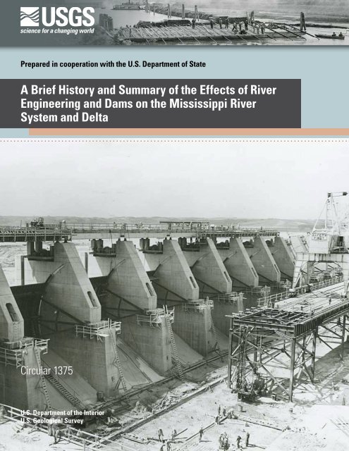
A Brief History <strong>and</strong> Summary <strong>of</strong> <strong>the</strong> Effects <strong>of</strong> River<br />
Engineering <strong>and</strong> Dams on <strong>the</strong> Mississippi River<br />
System <strong>and</strong> Delta<br />
Circular 1375<br />
U.S. Department <strong>of</strong> <strong>the</strong> Interior<br />
U.S. Geological Survey
Cover. Construction <strong>of</strong> Gavins Point Dam, circa 1961 (source: U.S. Army Corps <strong>of</strong> Engineers).
A Brief History <strong>and</strong> Summary <strong>of</strong> <strong>the</strong> Effects<br />
<strong>of</strong> River Engineering <strong>and</strong> Dams on <strong>the</strong><br />
Mississippi River System <strong>and</strong> Delta<br />
By Jason S. Alex<strong>and</strong>er, Richard C. Wilson, <strong>and</strong> W. Reed Green<br />
Prepared in cooperation with <strong>the</strong> U.S. Department <strong>of</strong> State<br />
Circular 1375<br />
U.S. Department <strong>of</strong> <strong>the</strong> Interior<br />
U.S. Geological Survey
U.S. Department <strong>of</strong> <strong>the</strong> Interior<br />
KEN SALAZAR, Secretary<br />
U.S. Geological Survey<br />
Marcia K. McNutt, Director<br />
U.S. Geological Survey, Reston, Virginia: 2012<br />
For more information on <strong>the</strong> <strong>USGS</strong>—<strong>the</strong> Federal source for science about <strong>the</strong> Earth, its natural <strong>and</strong> living<br />
resources, natural hazards, <strong>and</strong> <strong>the</strong> environment, visit http://www.usgs.gov or call 1–888–ASK–<strong>USGS</strong>.<br />
For an overview <strong>of</strong> <strong>USGS</strong> information products, including maps, imagery, <strong>and</strong> publications,<br />
visit http://www.usgs.gov/pubprod<br />
To order this <strong>and</strong> o<strong>the</strong>r <strong>USGS</strong> information products, visit http://store.usgs.gov<br />
Any use <strong>of</strong> trade, product, or firm names is for descriptive purposes only <strong>and</strong> does not imply endorsement by <strong>the</strong><br />
U.S. Government.<br />
Although this report is in <strong>the</strong> public domain, permission must be secured from <strong>the</strong> individual copyright owners to<br />
reproduce any copyrighted materials contained within this report.<br />
Suggested citation:<br />
Alex<strong>and</strong>er, J.S., Wilson, R.C., <strong>and</strong> Green, W.R., 2012, A <strong>brief</strong> <strong>history</strong> <strong>and</strong> <strong>summary</strong> <strong>of</strong> <strong>the</strong> <strong>effects</strong> <strong>of</strong> <strong>river</strong> <strong>engineering</strong><br />
<strong>and</strong> dams on <strong>the</strong> Mississippi River system <strong>and</strong> delta: U.S. Geological Survey Circular 1375, 43 p.
Contents<br />
Abstract ...........................................................................................................................................................1<br />
Introduction ....................................................................................................................................................2<br />
Purpose <strong>and</strong> Scope .............................................................................................................................2<br />
Description <strong>of</strong> <strong>the</strong> Mississippi River Basin ......................................................................................3<br />
A Brief History <strong>of</strong> River Engineering in <strong>the</strong> Mississippi River Basin .....................................................7<br />
River Engineering ..................................................................................................................................9<br />
Clearing <strong>of</strong> Snags <strong>and</strong> Obstructions .........................................................................................9<br />
Channel Straightening <strong>and</strong> Cut<strong>of</strong>fs ...........................................................................................9<br />
Revetments .................................................................................................................................10<br />
Dikes .........................................................................................................................................11<br />
Levees <strong>and</strong> Floodways ..............................................................................................................11<br />
Dams <strong>and</strong> Reservoirs ................................................................................................................11<br />
River Management ....................................................................................................................16<br />
A Summary <strong>of</strong> <strong>the</strong> Effects <strong>of</strong> River Engineering <strong>and</strong> Dams on <strong>the</strong><br />
Mississippi River System <strong>and</strong> Delta ............................................................................................17<br />
Effects on Hydrology ..........................................................................................................................18<br />
Effects on Sediment Transport .........................................................................................................20<br />
Effects on River Geomorphology .....................................................................................................24<br />
Effects on Water Quality <strong>and</strong> Fish Communities ............................................................................28<br />
Effects on Water Quality ...........................................................................................................28<br />
Effects on Fish Communities ....................................................................................................30<br />
Effects on <strong>the</strong> Mississippi River Delta ............................................................................................32<br />
Summary........................................................................................................................................................36<br />
References Cited .........................................................................................................................................37<br />
Figures<br />
1. Map showing Mississippi River Basin, primary tributaries, large main-<br />
channel dams, <strong>and</strong> selected cities along main-stem channels ............................................4<br />
2. Map showing mean annual water discharges <strong>of</strong> <strong>the</strong> main-channel <strong>and</strong><br />
primary tributaries to <strong>the</strong> Mississippi River .............................................................................5<br />
3. Map showing postdevelopment mean annual suspended-sediment<br />
discharge along <strong>the</strong> Mississippi River <strong>and</strong> major tributaries, circa 1980 ...........................6<br />
4. Photograph <strong>of</strong> American family near <strong>the</strong>ir flooded farmstead during <strong>the</strong><br />
Great Mississippi River Flood <strong>of</strong> 1927 ........................................................................................7<br />
5. Color-enhanced satellite images <strong>of</strong> <strong>the</strong> confluence area <strong>of</strong> <strong>the</strong> Mississippi,<br />
Illinois, <strong>and</strong> Missouri Rivers near St. Louis, Missouri .............................................................8<br />
6. Photograph showing a steamboat collision with snag on Mississippi River .....................9<br />
7. Photograph <strong>of</strong> construction <strong>of</strong> Missouri River revetment, June 2, 1938 ...........................10<br />
8. Photographs showing <strong>the</strong> siltation <strong>of</strong> a dike system, Indian Cave Bend,<br />
Missouri River .............................................................................................................................12<br />
9. Illustration <strong>of</strong> levee design <strong>and</strong> failure mechanisms ............................................................14<br />
iii
iv<br />
10. Construction <strong>of</strong> Gavins Point Dam, circa 1961 .......................................................................15<br />
11. Graph showing low-water surface elevation pr<strong>of</strong>iles on <strong>the</strong> upper<br />
Mississippi River before <strong>and</strong> after construction <strong>of</strong> navigation locks<br />
<strong>and</strong> dams ......................................................................................................................................16<br />
12. Schematic drawing depicting storage capacity <strong>and</strong> designated uses<br />
<strong>of</strong> water in <strong>the</strong> main-stem reservoir system in <strong>the</strong> Missouri River ....................................17<br />
13. Discharge duration hydrographs <strong>of</strong> <strong>the</strong> 25-percent to 75-percent<br />
exceedance boundaries for four locations on <strong>the</strong> Missouri River<br />
downstream from Gavins Point Dam .......................................................................................19<br />
14. Graph showing generalized longitudinal patterns <strong>of</strong> bed-elevation<br />
changes along <strong>the</strong> lower Missouri River from 1954 to <strong>the</strong> mid-1990s<br />
depicted as stage changes for constant discharge at measurement<br />
stations downstream from Gavins Point Dam ........................................................................20<br />
15. Time-series histograms <strong>of</strong> total suspended-sediment discharge at<br />
stations along <strong>the</strong> lower Missouri <strong>and</strong> lower Mississippi Rivers .......................................21<br />
16. Map showing estimated predevelopment (circa 1800) <strong>and</strong><br />
postdevelopment (circa 1980) mean annual suspended-sediment<br />
discharge along <strong>the</strong> Mississippi River <strong>and</strong> major tributaries ..............................................22<br />
17. Graph showing time series <strong>of</strong> annual suspended-sediment discharge<br />
<strong>of</strong> <strong>the</strong> Mississippi River at Tarbert L<strong>and</strong>ing, Mississippi, <strong>and</strong> <strong>the</strong> rate <strong>of</strong><br />
construction <strong>of</strong> engineered dikes <strong>and</strong> bank revetments along <strong>the</strong> lower<br />
Mississippi River .........................................................................................................................23<br />
18. Map <strong>of</strong> changes in channel <strong>and</strong> flood-plain configuration from 1890 to<br />
1989 along <strong>the</strong> lower Mississippi River ...................................................................................25<br />
19. Graphs <strong>of</strong> temporal trends in <strong>river</strong>-bed elevations for 50- to 90-percent<br />
exceedance discharges at four streamflow-gaging stations along <strong>the</strong><br />
lower Missouri River ..................................................................................................................26<br />
20. Map showing changes in l<strong>and</strong> cover from 1891 to 1989 along <strong>the</strong><br />
reach <strong>of</strong> <strong>the</strong> upper Mississippi upstream from lock <strong>and</strong> dam 8, near<br />
LaCrosse, Wisconsin ..................................................................................................................27<br />
21. Pie charts showing proportion <strong>of</strong> nitrates <strong>and</strong> water discharge from<br />
tributaries in <strong>the</strong> Mississippi River Basin ...............................................................................29<br />
22. Map showing percentage <strong>of</strong> nitrogen export from approximately<br />
equally sized interior watersheds <strong>of</strong> <strong>the</strong> Mississippi River Basin<br />
delivered to <strong>the</strong> Gulf <strong>of</strong> Mexico ................................................................................................30<br />
23. Map showing frequency <strong>of</strong> occurrence <strong>of</strong> midsummer hypoxia in <strong>the</strong><br />
Gulf <strong>of</strong> Mexico, 1985–2008 .........................................................................................................31<br />
24. Satellite image <strong>and</strong> map showing generalized extent <strong>and</strong> depositional<br />
time periods <strong>of</strong> <strong>the</strong> Mississippi River Delta complexes .......................................................32<br />
25. Graph showing time series <strong>of</strong> l<strong>and</strong>-area changes in coastal wetl<strong>and</strong>s <strong>of</strong><br />
Louisiana, 1932 to 2010 ...............................................................................................................33<br />
26. Schematics <strong>of</strong> <strong>the</strong> cross sectional shape <strong>of</strong> a <strong>river</strong> delta depicting two<br />
mass balance scenarios. A quasistatic sea-level elevation. B rising<br />
sea level .......................................................................................................................................34<br />
27. Graph showing time series <strong>of</strong> estimated sediment mass balance for <strong>the</strong><br />
Mississippi delta region under varying scenarios <strong>of</strong> sediment supply,<br />
subsidence, <strong>and</strong> sea-level rise .................................................................................................35
Conversion Factors<br />
Inch/Pound to SI<br />
Multiply By To obtain<br />
inch (in.) 2.54 centimeter (cm)<br />
foot (ft) 0.3048 meter (m)<br />
mile (mi) 1.609 kilometer (km)<br />
square foot (ft 2 ) 0.0929 square meter (m 2 )<br />
square mile (mi 2 ) 2.590 square kilometer (km 2 )<br />
cubic foot (ft 3 ) 28.32 cubic decimeter (dm 3 )<br />
cubic foot (ft 3 ) 0.02832 cubic meter (m 3 )<br />
foot per second (ft/s) 0.3048 meter per second (m/s)<br />
cubic foot per second (ft 3 /s) 0.02832 cubic meter per second (m 3 /s)<br />
pound-force per square foot (lb/ft 2 ) 47.89 newton per square meter (N/m 2 )<br />
pound per foot-second (lb/ft-s) 14.59 newton per meter-second (N/m-s)<br />
acre-feet (acre-ft) 8.11 hectare meter (ha-m)<br />
SI to Inch/Pound<br />
Multiply By To obtain<br />
millimeter (mm) 0.03937 inch (in.)<br />
meter (m) 3.281 foot (ft)<br />
kilometer (km) 0.6212 mile (mi)<br />
square meter (m 2 ) 10.76 square foot (ft 2 )<br />
square kilometer (km 2 ) 0.3861 square mile (mi 2 )<br />
cubic meter (m 3 ) 264.2 gallon (gal)<br />
cubic meter (m 3 ) 0.0002642 million gallons (Mgal)<br />
meter per second (m/s) 3.281 foot per second (ft/s)<br />
cubic meter per second (m 3 /s) 35.31 cubic feet per second (ft 3 /s)<br />
newton per square meter (N/m 2 ) 0.1622 pound-force per square foot (lb/ft 2 )<br />
newton per meter-second (N/m-s) 0.0685 pound per foot-second (lb/ft-s)<br />
hectare meter (ha-m) 0.1233 acre-feet (acre-ft)<br />
Water year is defined as <strong>the</strong> 12-month period October 1 through September 30.<br />
The water year is designated by <strong>the</strong> calendar year in which it ends.<br />
Vertical coordinate information is referenced to National Geodetic Vertical Datum <strong>of</strong> 1929 (NGVD29)<br />
A kiloyear is equivalent to 1,000 years.<br />
v
View <strong>of</strong> Lock <strong>and</strong> Dam 27, last navigation lock on <strong>the</strong> Mississippi River, oriented north;<br />
St. Louis, Missouri, is in <strong>the</strong> background (source: U.S. Army Corps <strong>of</strong> Engineers).
A Brief History <strong>and</strong> Summary <strong>of</strong> <strong>the</strong> Effects <strong>of</strong> River<br />
Engineering <strong>and</strong> Dams on <strong>the</strong> Mississippi River<br />
System <strong>and</strong> Delta<br />
By Jason S. Alex<strong>and</strong>er, Richard C. Wilson, <strong>and</strong> W. Reed Green<br />
Abstract<br />
The U.S. Geological Survey Forecast Mekong project<br />
is providing technical assistance <strong>and</strong> information to aid<br />
management decisions <strong>and</strong> build science capacity <strong>of</strong><br />
institutions in <strong>the</strong> Mekong River Basin. A component <strong>of</strong> this<br />
effort is to produce a syn<strong>the</strong>sis <strong>of</strong> <strong>the</strong> <strong>effects</strong> <strong>of</strong> dams <strong>and</strong> o<strong>the</strong>r<br />
<strong>engineering</strong> structures on large-<strong>river</strong> hydrology, sediment<br />
transport, geomorphology, ecology, water quality, <strong>and</strong> deltaic<br />
systems. The Mississippi River Basin (MRB) <strong>of</strong> <strong>the</strong> United<br />
States was used as <strong>the</strong> backdrop <strong>and</strong> context for this syn<strong>the</strong>sis<br />
because it is a continental scale <strong>river</strong> system with a total<br />
annual water discharge proportional to <strong>the</strong> Mekong River,<br />
has been highly engineered over <strong>the</strong> past two centuries, <strong>and</strong><br />
<strong>the</strong> <strong>effects</strong> <strong>of</strong> <strong>engineering</strong> have been widely studied <strong>and</strong><br />
documented by scientists <strong>and</strong> engineers.<br />
The MRB is controlled <strong>and</strong> regulated by dams <strong>and</strong> <strong>river</strong><strong>engineering</strong><br />
structures. These modifications have resulted<br />
in multiple benefits including navigation, flood control,<br />
hydropower, bank stabilization, <strong>and</strong> recreation. Dams <strong>and</strong><br />
o<strong>the</strong>r <strong>river</strong>-<strong>engineering</strong> structures in <strong>the</strong> MRB have afforded<br />
<strong>the</strong> United States substantial socioeconomic benefits;<br />
however, <strong>the</strong>se benefits also have transformed <strong>the</strong> hydrologic,<br />
sediment transport, geomorphic, water-quality, <strong>and</strong> ecologic<br />
characteristics <strong>of</strong> <strong>the</strong> <strong>river</strong> <strong>and</strong> its delta. Large dams on <strong>the</strong><br />
middle Missouri River have substantially<br />
reduced <strong>the</strong> magnitude <strong>of</strong> peak floods, increased base<br />
discharges, <strong>and</strong> reduced <strong>the</strong> overall variability <strong>of</strong> intraannual<br />
discharges. The extensive system <strong>of</strong> levees <strong>and</strong> wing dikes<br />
throughout <strong>the</strong> MRB, although providing protection from<br />
intermediate magnitude floods, have reduced overall channel<br />
capacity <strong>and</strong> increased flood stage by up to 4 meters for higher<br />
magnitude floods.<br />
Prior to major <strong>river</strong> <strong>engineering</strong>, <strong>the</strong> estimated average<br />
annual sediment yield <strong>of</strong> <strong>the</strong> Mississippi River Basin was<br />
approximately 400 million metric tons. The construction <strong>of</strong><br />
large main-channel reservoirs on <strong>the</strong> Missouri <strong>and</strong> Arkansas<br />
Rivers, sedimentation in dike fields, <strong>and</strong> protection <strong>of</strong> channel<br />
banks by revetments throughout <strong>the</strong> basin, have reduced <strong>the</strong><br />
overall sediment yield <strong>of</strong> <strong>the</strong> MRB by more than 60 percent.<br />
The primary alterations to channel morphology by dams <strong>and</strong><br />
o<strong>the</strong>r <strong>engineering</strong> projects have been (1) channel simplification<br />
<strong>and</strong> reduced dynamism; (2) lowering <strong>of</strong> channel-bed elevation;<br />
<strong>and</strong> (3) disconnection <strong>of</strong> <strong>the</strong> <strong>river</strong> channel from <strong>the</strong> flood plain,<br />
except during extreme flood events.<br />
Freshwater discharge from <strong>the</strong> Mississippi River <strong>and</strong> its<br />
associated sediment <strong>and</strong> nutrient loads strongly influence <strong>the</strong><br />
physical <strong>and</strong> biological components in <strong>the</strong> nor<strong>the</strong>rn Gulf <strong>of</strong><br />
Mexico. Ninety percent <strong>of</strong> <strong>the</strong> nitrogen load reaching <strong>the</strong><br />
Gulf <strong>of</strong> Mexico is from nonpoint sources with about<br />
60 percent coming from fertilizer <strong>and</strong> mineralized soil<br />
nitrogen. Much <strong>of</strong> <strong>the</strong> phosphorus is from animal manure<br />
from pasture <strong>and</strong> rangel<strong>and</strong>s followed by fertilizer applied<br />
to corn <strong>and</strong> soybeans. Increased nutrient enrichment in <strong>the</strong><br />
nor<strong>the</strong>rn Gulf <strong>of</strong> Mexico has resulted in <strong>the</strong> degradation <strong>of</strong><br />
water quality as more phytoplankton grow, which increases<br />
turbidity <strong>and</strong> depletes oxygen in <strong>the</strong> lower depths creating<br />
what is known as <strong>the</strong> “dead zone.” In 2002, <strong>the</strong> dead zone was<br />
22,000 square kilometers (km 2 ), an area similar to <strong>the</strong><br />
size <strong>of</strong> <strong>the</strong> State <strong>of</strong> Massachusetts.<br />
Changes in <strong>the</strong> flow regime from engineered structures<br />
have had direct <strong>and</strong> indirect <strong>effects</strong> on <strong>the</strong> fish communities.<br />
The navigation pools in <strong>the</strong> upper Mississippi River have<br />
aged, <strong>and</strong> <strong>the</strong>se overwintering habitats, which were created<br />
when <strong>the</strong> pools filled, have declined as sedimentation reduces<br />
water depth. Reproduction <strong>of</strong> paddlefish may have been<br />
adversely affected by dams, which impede access to suitable<br />
spawning habitats. Fishes that inhabit swift-current habitats in<br />
<strong>the</strong> unimpounded lower Mississippi River have not declined<br />
as much as in <strong>the</strong> upper Mississippi River. The decline <strong>of</strong> <strong>the</strong><br />
pallid sturgeon may be attributable to channelization <strong>of</strong> <strong>the</strong><br />
Missouri River above St. Louis, Missouri. The Missouri River<br />
supports a rich fish community <strong>and</strong> remains relatively intact.<br />
Never<strong>the</strong>less, <strong>the</strong> widespread <strong>and</strong> long <strong>history</strong> <strong>of</strong> human<br />
intervention in <strong>river</strong> discharge has contributed to <strong>the</strong> declines<br />
<strong>of</strong> about 25 percent <strong>of</strong> <strong>the</strong> species.
2 A Brief History <strong>and</strong> Summary <strong>of</strong> <strong>the</strong> Effects <strong>of</strong> River Engineering <strong>and</strong> Dams on <strong>the</strong> Mississippi River System <strong>and</strong> Delta<br />
The Mississippi River Delta Plain is built from six delta<br />
complexes composed <strong>of</strong> a massive area <strong>of</strong> coastal wetl<strong>and</strong>s<br />
that support <strong>the</strong> largest commercial fishery in <strong>the</strong> conterminous<br />
United States. Since <strong>the</strong> early 20th century, approximately<br />
4,900 km 2 <strong>of</strong> coastal l<strong>and</strong>s have been lost in Louisiana. One <strong>of</strong><br />
<strong>the</strong> primary mechanisms <strong>of</strong> wetl<strong>and</strong> loss on <strong>the</strong> Plaquemines-<br />
Balize complex is believed to be <strong>the</strong> disconnection <strong>of</strong> <strong>the</strong><br />
<strong>river</strong> distributary network from <strong>the</strong> delta plain by <strong>the</strong> massive<br />
system <strong>of</strong> levees on <strong>the</strong> delta top, which prevent overbank<br />
flooding <strong>and</strong> replenishment <strong>of</strong> <strong>the</strong> delta top by sediment <strong>and</strong><br />
nutrient deliveries. Efforts by Federal <strong>and</strong> State agencies to<br />
conserve <strong>and</strong> restore <strong>the</strong> Mississippi River Delta Plain began<br />
over three decades ago <strong>and</strong> have accelerated over <strong>the</strong> past<br />
decade. Regardless <strong>of</strong> <strong>the</strong>se efforts, however, l<strong>and</strong> losses are<br />
expected to continue because <strong>the</strong> reduced upstream sediment<br />
supplies are not sufficient to keep up with <strong>the</strong> projected<br />
depositional space being created by <strong>the</strong> combined forces <strong>of</strong><br />
delta plain subsidence <strong>and</strong> global sea-level rise.<br />
Introduction<br />
Large <strong>river</strong>s are important for economies <strong>and</strong> global<br />
ecosystems. For economies, a large <strong>river</strong> is an important<br />
source <strong>of</strong> transportation, power generation, <strong>and</strong> water supply,<br />
which are key elements <strong>of</strong> infrastructure, industry, <strong>and</strong><br />
security <strong>and</strong>, <strong>the</strong>refore, are cornerstones for economic<br />
development <strong>and</strong> stability. Large-<strong>river</strong> ecosystems, on <strong>the</strong><br />
o<strong>the</strong>r h<strong>and</strong>, are some <strong>of</strong> <strong>the</strong> most biodiverse on earth <strong>and</strong><br />
provide natural, renewable sources <strong>of</strong> food for industrialized<br />
<strong>and</strong> emerging economies. Large <strong>river</strong>s also are primary<br />
components <strong>of</strong> global biogeochemical cycling because <strong>the</strong>y<br />
integrate <strong>and</strong> deliver <strong>the</strong> chemical <strong>and</strong> sedimentary loads <strong>of</strong><br />
l<strong>and</strong>scapes to major deltas <strong>and</strong> continental shelves, which<br />
are also global centers <strong>of</strong> biodiversity, <strong>and</strong> provide important<br />
sources <strong>of</strong> a secure food supply (Stanley <strong>and</strong> Warne, 1997;<br />
Day <strong>and</strong> o<strong>the</strong>rs, 2007b).<br />
The importance <strong>of</strong> large <strong>river</strong>s to societies is easily<br />
recognizable because many modern <strong>and</strong> ancient population<br />
centers are located along <strong>the</strong> banks <strong>of</strong> large <strong>river</strong>s, tributary<br />
streams, <strong>and</strong> deltas. Engineering works typically are<br />
constructed along large-<strong>river</strong> systems to increase <strong>the</strong> ease <strong>of</strong><br />
transportation <strong>of</strong> goods, produce reliable base-level energy<br />
production, secure or increase water supplies, <strong>and</strong> mitigate or<br />
control flood hazards. Although <strong>engineering</strong> in <strong>river</strong> systems<br />
has economic benefits to society, <strong>the</strong>se benefits <strong>of</strong>ten come<br />
with ecologic consequences that, if not fully considered,<br />
may eventually counterbalance some economic benefits or<br />
conflict with modern societal values (Schmidt <strong>and</strong> o<strong>the</strong>rs,<br />
1998). In recent decades, industrialized nations such as <strong>the</strong><br />
United States, members <strong>of</strong> <strong>the</strong> European Union, <strong>and</strong> Australia<br />
have recognized <strong>the</strong>se ecologic consequences <strong>and</strong> have<br />
been making expensive <strong>and</strong> politically contentious attempts<br />
to rehabilitate <strong>river</strong>ine ecosystems, <strong>of</strong>ten with <strong>the</strong> goal <strong>of</strong><br />
preserving or recovering animal species pushed to <strong>the</strong> brink<br />
<strong>of</strong> extinction or improving <strong>the</strong> quality <strong>of</strong> municipal water<br />
supplies (Bernhardt <strong>and</strong> o<strong>the</strong>rs, 2005; Lake <strong>and</strong> o<strong>the</strong>rs, 2007).<br />
Over <strong>the</strong> past two decades, societal pressures to rehabilitate<br />
<strong>river</strong>ine ecosystems has advanced scientific underst<strong>and</strong>ing<br />
<strong>of</strong> <strong>the</strong> <strong>effects</strong> <strong>of</strong> alterations on <strong>river</strong> hydrology <strong>and</strong> sediment<br />
regimes on <strong>river</strong> channels, physical habitat, <strong>and</strong> water quality.<br />
The U.S. Geological Survey Forecast Mekong project<br />
is providing technical assistance <strong>and</strong> information to aid<br />
management decisions <strong>and</strong> build science capacity <strong>of</strong><br />
institutions in <strong>the</strong> Mekong River Basin in <strong>the</strong> nations <strong>of</strong><br />
Thail<strong>and</strong>, Laos, Cambodia, <strong>and</strong> Vietnam (Turnipseed, 2011).<br />
A component <strong>of</strong> this effort is to produce a syn<strong>the</strong>sis <strong>of</strong> <strong>the</strong><br />
<strong>effects</strong> <strong>of</strong> dams <strong>and</strong> o<strong>the</strong>r <strong>engineering</strong> structures on large<strong>river</strong><br />
hydrology, sediment transport, geomorphology, ecology,<br />
water quality, <strong>and</strong> deltaic systems. The Mississippi River<br />
Basin (MRB) <strong>of</strong> <strong>the</strong> United States was used as <strong>the</strong> backdrop<br />
<strong>and</strong> context for this syn<strong>the</strong>sis because it is a continental-scale<br />
<strong>river</strong> system with a total annual water discharges similar to<br />
<strong>the</strong> Mekong River, has been highly engineered over <strong>the</strong> past<br />
two centuries, <strong>and</strong> <strong>the</strong> <strong>effects</strong> <strong>of</strong> <strong>engineering</strong> have been widely<br />
studied <strong>and</strong> documented by scientists <strong>and</strong> engineers.<br />
Purpose <strong>and</strong> Scope<br />
The purpose <strong>of</strong> this report is to summarize <strong>the</strong> <strong>effects</strong><br />
<strong>of</strong> dams <strong>and</strong> o<strong>the</strong>r <strong>engineering</strong> projects (in particular levees,<br />
dikes, <strong>and</strong> revetments), on <strong>the</strong> hydrology, sediment transport,<br />
geomorphology, ecology, water quality, <strong>and</strong> delta on <strong>the</strong><br />
Mississippi River system. This report provides a synopsis<br />
<strong>of</strong> existing scientific literature <strong>and</strong> o<strong>the</strong>r agency reports<br />
organized into series <strong>of</strong> summaries that <strong>the</strong> authors deem<br />
critical to underst<strong>and</strong>ing how <strong>and</strong>, to <strong>the</strong> extent possible,<br />
why <strong>the</strong> Mississippi River <strong>and</strong> its delta have been changed<br />
by <strong>engineering</strong> activities. This report is not intended to<br />
provide new analyses or insights not previously published.<br />
This synopsis is not spatially comprehensive, in part because<br />
current scientific investigations have not quantified <strong>effects</strong><br />
on every <strong>river</strong> mile within <strong>the</strong> basin, but also because <strong>the</strong><br />
<strong>effects</strong> <strong>of</strong> particular <strong>engineering</strong> activities can generally be<br />
constrained by magnitude to particular parts <strong>of</strong> <strong>the</strong> <strong>river</strong><br />
basin. For example, <strong>engineering</strong> on <strong>the</strong> Missouri River is<br />
widely suspected to have substantially affected <strong>the</strong> natural<br />
sediment supply delivered to <strong>the</strong> Mississippi River Delta Plain
(National Research Council, 2011) <strong>and</strong>, <strong>the</strong>refore, most <strong>of</strong> <strong>the</strong><br />
scientific analyses <strong>of</strong> sediment transport have been focused on<br />
this tributary. No analyses <strong>of</strong> <strong>the</strong> potential <strong>effects</strong> <strong>of</strong> planned<br />
developments in <strong>the</strong> Mekong Basin are provided.<br />
Description <strong>of</strong> <strong>the</strong> Mississippi River Basin<br />
The MRB spans parts <strong>of</strong> 31 States in <strong>the</strong> United States<br />
<strong>and</strong> 2 Provinces in Canada (fig. 1). The MRB covers 41<br />
percent <strong>of</strong> <strong>the</strong> conterminous United States <strong>and</strong> totals 3,224,600<br />
square kilometers (km 2 ). The Mississippi River extends<br />
approximately 3,770 kilometers (km) from its headwaters at<br />
Lake Itasca, Minnesota, to <strong>the</strong> Gulf <strong>of</strong> Mexico (Kammerer,<br />
1990) <strong>and</strong>, in combination with its longest tributary <strong>the</strong><br />
Missouri River, is one <strong>of</strong> <strong>the</strong> longest <strong>river</strong>s in <strong>the</strong> world<br />
(Leopold, 1994). The MRB is bound on <strong>the</strong> west by <strong>the</strong><br />
Rocky Mountain Belt, on <strong>the</strong> north-central by <strong>the</strong> West<br />
Lake section <strong>of</strong> <strong>the</strong> Interior Plains, <strong>and</strong> on <strong>the</strong> east by <strong>the</strong><br />
Appalachian Mountains (Fenneman, 1928). Because <strong>of</strong> <strong>the</strong><br />
width <strong>of</strong> its span as well as its geographic position, <strong>the</strong> MRB<br />
is physiographically <strong>and</strong> ecologically diverse, incorporating<br />
24 ecoregions along its course to <strong>the</strong> Gulf <strong>of</strong> Mexico<br />
(Omernik, 1987; Mac <strong>and</strong> o<strong>the</strong>rs, 1998; Ricketts <strong>and</strong> o<strong>the</strong>rs,<br />
1999). Primary MRB tributary basins are <strong>the</strong> Ohio River, <strong>the</strong><br />
Missouri River, <strong>the</strong> Arkansas River, <strong>and</strong> <strong>the</strong> Red River.<br />
For <strong>the</strong> purposes <strong>of</strong> this report, <strong>the</strong> terms “upper,”<br />
“middle,” <strong>and</strong> “lower” are used in reference to <strong>the</strong> reaches<br />
<strong>of</strong> <strong>the</strong> Mississippi River upstream from St. Louis, Mo., from<br />
St. Louis to <strong>the</strong> confluence with <strong>the</strong> Ohio River, <strong>and</strong> from<br />
<strong>the</strong> confluence <strong>of</strong> <strong>the</strong> Ohio River to <strong>the</strong> Gulf <strong>of</strong> Mexico,<br />
respectively. In reference to <strong>the</strong> Missouri River, <strong>the</strong> terms<br />
“upper,” “middle,” <strong>and</strong> “lower” correspond to <strong>the</strong> reaches<br />
<strong>of</strong> <strong>the</strong> Missouri River upstream from Fort Peck Lake,<br />
Montana, between Fort Peck Lake <strong>and</strong> Gavins Point Dam,<br />
South Dakota, <strong>and</strong> downstream from Gavins Point Dam,<br />
respectively (fig. 1).<br />
The Mississippi River, in combination with its largest<br />
distributary <strong>the</strong> Atchafalaya River, discharges an annual<br />
average <strong>of</strong> 580 km 3 <strong>of</strong> water into <strong>the</strong> Gulf <strong>of</strong> Mexico (Meade<br />
<strong>and</strong> o<strong>the</strong>rs, 1995; Brown <strong>and</strong> o<strong>the</strong>rs, 2005). About half <strong>of</strong> <strong>the</strong><br />
total annual discharge is contributed by <strong>the</strong> Ohio River alone,<br />
which drains <strong>the</strong> more humid regions <strong>of</strong> <strong>the</strong> basin but only<br />
constitutes one-sixth <strong>of</strong> <strong>the</strong> total MRB area (Meade, 1995).<br />
Alternatively, <strong>the</strong> Missouri River drains approximately<br />
43 percent <strong>of</strong> <strong>the</strong> MRB but contributes only about 12 percent<br />
<strong>of</strong> <strong>the</strong> total annual water discharge (fig. 2). In <strong>the</strong> MRB, <strong>the</strong><br />
primary sources <strong>of</strong> sediment <strong>and</strong> water are decoupled. The<br />
primary source <strong>of</strong> sediment in <strong>the</strong> basin is <strong>the</strong> Missouri River,<br />
which drains large parts <strong>of</strong> <strong>the</strong> Great Plains region <strong>of</strong> North<br />
Introduction 3<br />
America (fig. 3). The Great Plains region, which includes<br />
<strong>the</strong> Missouri, Arkansas, <strong>and</strong> Red River Basins, produces<br />
proportionally larger sediment discharges because <strong>of</strong> a<br />
combination <strong>of</strong> a semiarid climate, resulting in a lower density<br />
<strong>of</strong> vegetated l<strong>and</strong> cover, yet enough precipitation to mobilize<br />
substantial masses <strong>of</strong> sediments into streams (Langbein <strong>and</strong><br />
Schumm, 1958).<br />
Dams <strong>and</strong> <strong>river</strong> <strong>engineering</strong> in <strong>the</strong> MRB have afforded<br />
<strong>the</strong> United States substantial socioeconomic benefits allowing<br />
for agricultural expansion into <strong>the</strong> nutrient-rich soils <strong>of</strong><br />
<strong>the</strong> valley bottoml<strong>and</strong>s adjacent to <strong>the</strong> <strong>river</strong> (Pinter, 2005),<br />
water supplies for irrigated agriculture <strong>and</strong> municipalities,<br />
maintenance <strong>of</strong> a deep navigation channel for shipping,<br />
base-level power generation, flood protection for communities<br />
adjacent to <strong>the</strong> <strong>river</strong>, <strong>and</strong> a resource for material extraction.<br />
Over <strong>the</strong> past 60 years, parts <strong>of</strong> <strong>the</strong> MRB also have emerged<br />
as important recreational resources, which have become a<br />
more substantial component <strong>of</strong> <strong>the</strong> economic base in rural<br />
parts <strong>of</strong> <strong>the</strong> <strong>river</strong> basin, particularly in areas surrounding<br />
reservoirs (Hesse, 1995).<br />
Although <strong>the</strong> economic benefits <strong>of</strong> dams <strong>and</strong> <strong>engineering</strong><br />
projects in <strong>the</strong> MRB have undoubtedly been substantial, <strong>the</strong>se<br />
benefits also have come with socioeconomic <strong>and</strong> ecologic<br />
costs. The construction <strong>of</strong> <strong>the</strong> massive system <strong>of</strong> reservoirs<br />
between 1932 <strong>and</strong> 1962 in <strong>the</strong> Missouri River Basin required<br />
displacement <strong>of</strong> thous<strong>and</strong>s <strong>of</strong> people, including many Native<br />
Americans, inhabiting <strong>the</strong> <strong>river</strong> bottoms (Weist, 1995;<br />
Sims, 2001). Reservoir sedimentation along <strong>the</strong> Missouri<br />
River has induced sedimentation <strong>and</strong> elevated groundwater<br />
levels upstream from reservoirs, severely enough in some<br />
locations that <strong>the</strong> U.S. Army Corps <strong>of</strong> Engineers (USACE)<br />
has permanently moved entire communities to higher ground.<br />
The channelization <strong>of</strong> <strong>the</strong> Missouri <strong>and</strong> Mississippi Rivers<br />
has come at <strong>the</strong> expense <strong>of</strong> wetl<strong>and</strong> <strong>and</strong> riparian habitats<br />
<strong>and</strong> reduced <strong>the</strong> water <strong>and</strong> nutrient storage capacity <strong>of</strong> <strong>the</strong><br />
bottoml<strong>and</strong>s, magnified flood stages, <strong>and</strong> added to <strong>the</strong> difficult<br />
problem <strong>of</strong> hypoxia in <strong>the</strong> Gulf <strong>of</strong> Mexico (Rabalais <strong>and</strong><br />
Turner, 2001; Pinter <strong>and</strong> Heine, 2005). Additionally, besides<br />
having substantial ecologic consequences, loss <strong>of</strong> wetl<strong>and</strong>s<br />
<strong>of</strong>f <strong>the</strong> coasts <strong>of</strong> Louisiana <strong>and</strong> Mississippi—which has<br />
been partly attributed to human-induced disconnection <strong>of</strong><br />
<strong>the</strong> Mississippi River Delta Plain from <strong>the</strong> Mississippi River<br />
distributary network as well as reductions in sediment loads<br />
from upstream reservoir construction—has reduced <strong>the</strong> natural<br />
wave attenuation capacity <strong>of</strong> <strong>the</strong> coastal shelf, increasing<br />
<strong>the</strong> risk <strong>of</strong> flood hazard from storm surge in nearby coastal<br />
communities (Day <strong>and</strong> o<strong>the</strong>rs, 2007a).
4 A Brief History <strong>and</strong> Summary <strong>of</strong> <strong>the</strong> Effects <strong>of</strong> River Engineering <strong>and</strong> Dams on <strong>the</strong> Mississippi River System <strong>and</strong> Delta<br />
80°<br />
90°<br />
100°<br />
110°<br />
50°<br />
ALBERTA<br />
MANITOBA<br />
SASKATCHEWAN<br />
ONTARIO<br />
CANADA<br />
UNITED STATES<br />
Fort Peck<br />
Lake FORT PECK DAM<br />
MINNESOTA<br />
NORTH<br />
DAKOTA<br />
Mi souri River<br />
QUEBEC<br />
Fort Benton<br />
GARRISON DAM<br />
Yellowstone River<br />
MONTANA<br />
46°<br />
MICHIGAN<br />
SOUTH<br />
Minneapolis<br />
DAKOTA<br />
St. Paul WISCONSIN<br />
IDAHO<br />
OAHE DAM<br />
Missouri River Basin<br />
LaCrosse<br />
NEW YORK<br />
WYOMING<br />
BIG BEND DAM<br />
Yankton<br />
Upper Mississippi<br />
MICHIGAN<br />
FORT RANDALL DAM<br />
Sioux City River Basin<br />
GAVINS POINT DAM<br />
IOWA<br />
Rock Isl<strong>and</strong><br />
PENNSYLVANIA<br />
NEBRASKA Omaha<br />
Illinois<br />
Pittsburg<br />
River Basin<br />
UTAH<br />
INDIANA OHIO<br />
Nebraska City<br />
Keokuk<br />
COLORADO<br />
ILLINOIS<br />
Waverly<br />
St. Joseph<br />
Boonville<br />
WEST<br />
KANSAS<br />
St. Louis<br />
Kansas City<br />
VIRGINIA<br />
Hermann<br />
VIRGINIA<br />
KENTUCKY<br />
Gr<strong>and</strong> Chain<br />
Arkansas River Basin<br />
Cape Girardeau<br />
Ohio River Basin<br />
MISSOURI<br />
NORTH<br />
TENNESSEE<br />
CAROLINA<br />
NEW MEXICO<br />
ARKANSAS<br />
OKLAHOMA<br />
Memphis<br />
SOUTH<br />
CAROLINA<br />
Mississippi River Basin<br />
Red River Basin<br />
Lower Mississippi<br />
River Basin<br />
GEORGIA<br />
MISSISSIPPI ALABAMA<br />
Shreveport<br />
Vicksburg<br />
TEXAS<br />
LOUISIANA<br />
Old River<br />
Natchez<br />
Red River L<strong>and</strong>ing<br />
Tarbert L<strong>and</strong>ing<br />
Baton Rouge<br />
FLORIDA<br />
New Orleans<br />
GULF OF MEXICO<br />
Head <strong>of</strong> Passes<br />
Mississippi River<br />
42°<br />
North<br />
Illinois River<br />
Platte River<br />
South<br />
Kansas River<br />
38°<br />
Ohio River<br />
Arkansas River<br />
Red River<br />
34°<br />
ATLANTIC OCEAN<br />
Atchafalaya Atchafalaya<br />
30°<br />
River<br />
0 125 250 KILOMETERS<br />
EXPLANATION<br />
Base modified from U.S. Geological Survey digital data, 1:2,000,000, 1990<br />
Albers Equal-Area Conic projection<br />
North American Datum <strong>of</strong> 1983<br />
Missouri River main-stem dam<br />
250 MILES<br />
125<br />
0<br />
Figure 1. Mississippi River Basin, primary tributaries, large main-channel dams, <strong>and</strong> selected cities along main-stem channels.<br />
Figure 1
80°<br />
90°<br />
100°<br />
110°<br />
50°<br />
ALBERTA<br />
MANITOBA<br />
SASKATCHEWAN<br />
ONTARIO<br />
CANADA<br />
UNITED STATES<br />
MINNESOTA<br />
NORTH<br />
DAKOTA<br />
Mi souri River<br />
QUEBEC<br />
Yellowstone River<br />
MONTANA<br />
46°<br />
MICHIGAN<br />
WISCONSIN<br />
IDAHO<br />
NEW YORK<br />
MICHIGAN<br />
Mississippi River<br />
SOUTH<br />
DAKOTA<br />
WYOMING<br />
42°<br />
IOWA<br />
PENNSYLVANIA<br />
North<br />
NEBRASKA<br />
INDIANA<br />
OHIO<br />
UTAH<br />
ILLINOIS<br />
Illinois River<br />
Platte River<br />
South<br />
Keokuk<br />
Kansas River<br />
COLORADO<br />
WEST<br />
VIRGINIA<br />
VIRGINIA<br />
KANSAS<br />
38°<br />
Ohio River<br />
Arkansas River<br />
KENTUCKY<br />
NORTH<br />
CAROLINA<br />
MISSOURI<br />
TENNESSEE<br />
ARKANSAS<br />
NEW MEXICO<br />
SOUTH<br />
CAROLINA<br />
OKLAHOMA<br />
Red River<br />
34°<br />
ATLANTIC OCEAN<br />
GEORGIA<br />
MISSISSIPPI ALABAMA<br />
LOUISIANA<br />
Vicksburg<br />
Natchez<br />
TEXAS<br />
FLORIDA<br />
GULF OF MEXICO<br />
Atchafalaya Atchafalaya<br />
30°<br />
River<br />
0 125 250 KILOMETERS<br />
Introduction 5<br />
EXPLANATION<br />
Base modified from U.S. Geological Survey digital data, 1:2,000,000, 1990<br />
Albers Equal-Area Conic projection<br />
North American Datum <strong>of</strong> 1983<br />
Mean annual water discharge, in<br />
cubic kilometers per year<br />
250 MILES<br />
125<br />
0<br />
0 500<br />
Figure 2. Mean annual water discharges <strong>of</strong> <strong>the</strong> main-channel <strong>and</strong> primary tributaries to <strong>the</strong> Mississippi River (modified from Meade <strong>and</strong> Moody, 2010).<br />
Figure 2
6 A Brief History <strong>and</strong> Summary <strong>of</strong> <strong>the</strong> Effects <strong>of</strong> River Engineering <strong>and</strong> Dams on <strong>the</strong> Mississippi River System <strong>and</strong> Delta<br />
80°<br />
90°<br />
100°<br />
110°<br />
50°<br />
ALBERTA<br />
MANITOBA<br />
SASKATCHEWAN<br />
ONTARIO<br />
CANADA<br />
UNITED STATES<br />
MINNESOTA<br />
NORTH<br />
DAKOTA<br />
Mi souri River<br />
QUEBEC<br />
Yellowstone River<br />
MONTANA<br />
46°<br />
MICHIGAN<br />
WISCONSIN<br />
IDAHO<br />
NEW YORK<br />
MICHIGAN<br />
Mississippi River<br />
SOUTH<br />
DAKOTA<br />
WYOMING<br />
42°<br />
IOWA<br />
PENNSYLVANIA<br />
North<br />
NEBRASKA<br />
INDIANA<br />
OHIO<br />
Burlington<br />
UTAH<br />
ILLINOIS<br />
Illinois River<br />
Platte River<br />
South<br />
Kansas River<br />
COLORADO<br />
WEST<br />
VIRGINIA<br />
VIRGINIA<br />
St. Louis<br />
KANSAS<br />
38°<br />
Arkansas River<br />
Ohio River<br />
KENTUCKY<br />
NORTH<br />
CAROLINA<br />
MISSOURI<br />
TENNESSEE<br />
ARKANSAS<br />
NEW MEXICO<br />
SOUTH<br />
CAROLINA<br />
OKLAHOMA<br />
Red River<br />
34°<br />
ATLANTIC OCEAN<br />
GEORGIA<br />
MISSISSIPPI ALABAMA<br />
Vicksburg<br />
LOUISIANA<br />
TEXAS<br />
Tarbert L<strong>and</strong>ing<br />
FLORIDA<br />
GULF OF MEXICO<br />
Atchafalaya Atchafalaya<br />
30°<br />
River<br />
0 125 250 KILOMETERS<br />
EXPLANATION<br />
Base modified from U.S. Geological Survey digital data, 1:2,000,000, 1990<br />
Albers Equal-Area Conic projection<br />
North American Datum <strong>of</strong> 1983<br />
Mean annual suspended-sediment discharge, in<br />
millions <strong>of</strong> metric tons per year—circa 1980<br />
250 MILES<br />
125<br />
0<br />
0 100 200 300 400<br />
Figure 3. Postdevelopment mean annual suspended-sediment discharge along <strong>the</strong> Mississippi River <strong>and</strong> major tributaries, circa 1980 (modified from<br />
Figure Meade 3<strong>and</strong><br />
Moody, 2010).
A Brief History <strong>of</strong> River Engineering in<br />
<strong>the</strong> Mississippi River Basin<br />
The Mississippi River <strong>and</strong> many <strong>of</strong> its tributaries have<br />
served as a vital transport route for <strong>the</strong> United States. In 1811,<br />
<strong>the</strong> first steamboat traveled from Pittsburg, Pennsylvania,<br />
down <strong>the</strong> Ohio River <strong>and</strong> <strong>the</strong>n <strong>the</strong> Mississippi River to<br />
New Orleans (Evans, 1907; Dohan, 1981); in 1819, <strong>the</strong> first<br />
steamboat traveled <strong>the</strong> Missouri River (Ferrell, 1993). By<br />
1867, <strong>the</strong> Missouri River had been cleared <strong>of</strong> snags allowing<br />
steamboats to navigate as far upstream as Fort Benton,<br />
Montana (fig. 1) (U.S. Army Corps <strong>of</strong> Engineers, 1984). The<br />
MRB also has been <strong>the</strong> source <strong>of</strong> devastating floods. The Great<br />
Mississippi River Flood <strong>of</strong> 1927, estimated at 66,545 cubic<br />
meters per second (m 3 /s) at Red River L<strong>and</strong>ing, approximately<br />
97 km below Natchez, Mississippi, inundated an estimated<br />
69,930 km 2 <strong>of</strong> l<strong>and</strong> in seven states (Barry, 1997). The 1927<br />
flood killed 246 people, <strong>and</strong> over 700,000 people were forced<br />
A Brief History <strong>of</strong> River Engineering in <strong>the</strong> Mississippi River Basin 7<br />
to evacuate (fig. 4). Total property damage from <strong>the</strong> flood was<br />
estimated at $400 million, exceeding <strong>the</strong> losses <strong>of</strong> all previous<br />
Mississippi River floods combined (U.S. Army Corps <strong>of</strong><br />
Engineers, 2002).<br />
In 1993, <strong>the</strong> costliest flood in <strong>the</strong> <strong>history</strong> <strong>of</strong> <strong>the</strong> United<br />
States occurred in <strong>the</strong> upper MRB, later deemed <strong>the</strong><br />
“Great Flood <strong>of</strong> 1993” (Johnson <strong>and</strong> o<strong>the</strong>rs, 2004). The flood<br />
was <strong>the</strong> result <strong>of</strong> widespread <strong>and</strong> persistent precipitation in <strong>the</strong><br />
Midwestern United States from June through August <strong>of</strong> 1993.<br />
The discharge <strong>of</strong> <strong>the</strong> Mississippi River during <strong>the</strong> peak <strong>of</strong> <strong>the</strong><br />
flood was estimated to be a record 30,582 m 3 /s at St. Louis,<br />
Missouri (Johnson <strong>and</strong> o<strong>the</strong>rs, 2004), <strong>and</strong> also posted a<br />
record flood stage <strong>of</strong> 15.1 meters (m) on August 1. The<br />
flooding (fig. 5) caused widespread levee failures, damaged<br />
transportation systems <strong>and</strong> municipal infrastructure,<br />
destroyed more than 50,000 homes, <strong>and</strong> killed at least<br />
48 people (Johnson <strong>and</strong> o<strong>the</strong>rs, 2004). Economic damage<br />
from <strong>the</strong> Great Flood <strong>of</strong> 1993 approached $20 billion<br />
(Johnson <strong>and</strong> o<strong>the</strong>rs, 2004).<br />
Figure 4. American<br />
family near <strong>the</strong>ir flooded<br />
farmstead during <strong>the</strong><br />
Great Mississippi River<br />
Flood <strong>of</strong> 1927 (source: U.S.<br />
Army Corps <strong>of</strong> Engineers).
8 A Brief History <strong>and</strong> Summary <strong>of</strong> <strong>the</strong> Effects <strong>of</strong> River Engineering <strong>and</strong> Dams on <strong>the</strong> Mississippi River System <strong>and</strong> Delta<br />
A. August 14, 1991—Rivers within banks<br />
N<br />
B. August 19, 1993—Rivers at peak <strong>of</strong> Great Flood <strong>of</strong> 1993<br />
N<br />
Mississippi Mississippi River River<br />
Mississippi Mississippi River River<br />
(outside (outside <strong>of</strong> banks) banks)<br />
Missouri Missouri River River<br />
Missouri Missouri River River<br />
(outside (outside <strong>of</strong> banks) banks)<br />
Illinois Illinois River River<br />
0 2.5 5 KILOMETERS<br />
0 2.5<br />
Satellite image courtesy <strong>of</strong> Jesse Allen, National Aeronautics <strong>and</strong> Space Administration Earth Observatory<br />
<strong>and</strong> U.S. Geological Survey Earth Resources Observation Systems Data Center<br />
Illinois Illinois River River<br />
(outside (outside <strong>of</strong> banks) banks)<br />
Figure 5. Images <strong>of</strong> <strong>the</strong> confluence area <strong>of</strong> <strong>the</strong> Mississippi, Illinois, <strong>and</strong> Missouri Rivers near St. Louis, Missouri.<br />
5 MILES<br />
0 2.5 5 KILOMETERS<br />
0 2.5<br />
Satellite image courtesy <strong>of</strong> Jesse Allen, National Aeronautics <strong>and</strong> Space Administration Earth Observatory<br />
<strong>and</strong> U.S. Geological Survey Earth Resources Observation Systems Data Center<br />
Figure 5<br />
5 MILES
River Engineering<br />
The MRB is controlled <strong>and</strong> regulated by dams <strong>and</strong><br />
o<strong>the</strong>r <strong>river</strong> <strong>engineering</strong> structures. These modifications, some<br />
<strong>of</strong> which began in <strong>the</strong> early 1800s (U.S. Army Corps <strong>of</strong><br />
Engineers, 2002), have resulted in multiple benefits including<br />
navigation, flood control, hydropower, bank stabilization,<br />
<strong>and</strong> recreation. The Mississippi River <strong>and</strong> its tributaries serve<br />
as major transportation routes, <strong>and</strong> <strong>the</strong> natural channel <strong>and</strong><br />
hydrology did not provide <strong>the</strong> stable, uniform, consistently<br />
deeper channel that was needed for efficient navigation <strong>of</strong><br />
<strong>the</strong> <strong>river</strong>. Channelizing <strong>and</strong> stabilizing <strong>the</strong> Mississippi <strong>and</strong><br />
Missouri Rivers was a monumental task, requiring extensive<br />
modifications to stabilize <strong>the</strong> freely me<strong>and</strong>ering <strong>river</strong> channel<br />
<strong>and</strong> banks <strong>and</strong> to create a self-scouring channel for navigation<br />
by reducing channel width <strong>and</strong> complexity. Flood control in<br />
<strong>the</strong> MRB is accomplished through a complex combination<br />
<strong>of</strong> levees to confine <strong>and</strong> separate <strong>the</strong> <strong>river</strong> channel from <strong>the</strong><br />
flood plain, engineered floodways to reduce flood stages near<br />
critical infrastructure, channel straightening to increase <strong>the</strong><br />
conveyance capacity <strong>of</strong> <strong>the</strong> channel, <strong>and</strong> <strong>the</strong> construction<br />
<strong>of</strong> dams on <strong>the</strong> tributaries to attenuate flood peaks <strong>and</strong> store<br />
irrigation water.<br />
Clearing <strong>of</strong> Snags <strong>and</strong> Obstructions<br />
The first major MRB modifications consisted <strong>of</strong><br />
widespread clearing <strong>of</strong> snags <strong>and</strong> obstructions to increase<br />
<strong>the</strong> ease <strong>and</strong> safety <strong>of</strong> <strong>river</strong> navigation. Downed trees <strong>and</strong><br />
rocks snagged <strong>and</strong> sank keelboats <strong>and</strong> steamboats, whereas<br />
s<strong>and</strong>bars <strong>and</strong> rapids slowed or prevented <strong>the</strong> upstream<br />
movement <strong>of</strong> boats (fig. 6). The Missouri River was known to<br />
be particularly treacherous for steamboat navigation because<br />
<strong>of</strong> <strong>the</strong> numerous snags caused by fallen trees <strong>and</strong> branches<br />
(Bureau <strong>of</strong> Reclamation, 2011). The USACE began removing<br />
snags <strong>and</strong> dredging <strong>the</strong> main channel <strong>of</strong> <strong>the</strong> Mississippi River<br />
in <strong>the</strong> early 1800s, <strong>and</strong> in <strong>the</strong> main channel <strong>of</strong> <strong>the</strong> lower<br />
Missouri River by 1832 (U.S. Army Corps <strong>of</strong> Engineers,<br />
1984). The problem <strong>of</strong> snags was not limited to <strong>the</strong> Missouri<br />
River. The 1882 Annual Report <strong>of</strong> <strong>the</strong> Secretary <strong>of</strong> War states,<br />
“The snag boat O.G. Wagner removed 834 <strong>river</strong> snags <strong>and</strong><br />
380 shoreline snags from <strong>the</strong> Red River in one week”<br />
(U.S. War Department, 1882). The result <strong>of</strong> <strong>the</strong> clearing <strong>of</strong><br />
snags <strong>and</strong> obstructions made navigation easier <strong>and</strong> safer;<br />
however, <strong>the</strong> modifications were only temporary because<br />
annual channel migration caused substantial bank erosion,<br />
<strong>and</strong> continuously fed <strong>the</strong> channel with additional trees from<br />
<strong>the</strong> banks. Thus, snag clearing <strong>of</strong>ten was repeated after each<br />
high-water event (U.S. Army Corps <strong>of</strong> Engineers, 1980).<br />
River <strong>engineering</strong> projects such as channel straightening, dike<br />
construction, <strong>and</strong> revetments reduced <strong>the</strong> number <strong>of</strong> snags <strong>and</strong><br />
obstructions, but channel dredging continues today.<br />
A Brief History <strong>of</strong> River Engineering in <strong>the</strong> Mississippi River Basin 9<br />
Figure 6. A steamboat collision with snag on Mississippi<br />
River (source: Mississippi River Commission).<br />
Channel Straightening <strong>and</strong> Cut<strong>of</strong>fs<br />
The me<strong>and</strong>ering <strong>river</strong>s <strong>of</strong> <strong>the</strong> MRB have been<br />
extensively modified by channel straightening <strong>and</strong> shortened<br />
by cut<strong>of</strong>fs <strong>of</strong> <strong>river</strong> bends. Me<strong>and</strong>ering “loops” are created<br />
as <strong>the</strong> <strong>river</strong> erodes <strong>the</strong> outside <strong>of</strong> a <strong>river</strong> bend <strong>and</strong> deposits<br />
sediment on <strong>the</strong> inside <strong>of</strong> <strong>the</strong> curve. This process causes<br />
<strong>the</strong> channel to migrate across <strong>the</strong> valley bottom <strong>and</strong> occurs<br />
because <strong>the</strong> velocity <strong>of</strong> <strong>the</strong> <strong>river</strong> is higher on <strong>the</strong> outside <strong>of</strong><br />
<strong>the</strong> curve <strong>and</strong> slower on <strong>the</strong> inside <strong>of</strong> <strong>the</strong> curve (Dietrich <strong>and</strong><br />
o<strong>the</strong>rs, 1979). As <strong>the</strong> process <strong>of</strong> channel migration continues,<br />
<strong>the</strong> bend in <strong>the</strong> <strong>river</strong> eventually becomes larger <strong>and</strong> more<br />
circular, <strong>the</strong> length <strong>of</strong> <strong>the</strong> channel increases, <strong>and</strong> channel<br />
slope decreases. If allowed to persist, <strong>the</strong> large-me<strong>and</strong>er loops<br />
would eventually naturally “cut <strong>of</strong>f” during a high discharge<br />
event, disconnecting <strong>the</strong> me<strong>and</strong>er loop from <strong>the</strong> channel,<br />
leaving behind an oxbow lake, <strong>and</strong> substantially shorten <strong>and</strong><br />
steepen <strong>the</strong> channel.<br />
Construction <strong>of</strong> long radius channels that reduce<br />
<strong>the</strong> overall curvature <strong>of</strong> <strong>river</strong> bends, in combination with<br />
engineered cut<strong>of</strong>fs <strong>of</strong> large me<strong>and</strong>ers, have modified <strong>the</strong><br />
channel alignment <strong>and</strong> made <strong>the</strong> <strong>river</strong> more efficient for<br />
navigation. River cut<strong>of</strong>fs were designed to ensure that <strong>the</strong><br />
artificial channel shape, size, slope, <strong>and</strong> alignment were<br />
adequate to allow <strong>the</strong> cut<strong>of</strong>f to evolve naturally with <strong>the</strong><br />
discharge <strong>of</strong> <strong>the</strong> <strong>river</strong> (Morris <strong>and</strong> Wiggert, 1972). The<br />
result is a shorter <strong>river</strong>, with higher average velocities <strong>and</strong><br />
self-scouring channels. Channelization <strong>and</strong> cut<strong>of</strong>fs in<br />
<strong>the</strong> lower Missouri River shortened <strong>the</strong> <strong>river</strong> length by<br />
approximately 116 km. Between 1929 <strong>and</strong> 1942, <strong>the</strong> USACE<br />
constructed 14 cut<strong>of</strong>fs in <strong>the</strong> lower Mississippi River between<br />
Memphis, Tennessee, <strong>and</strong> Red River L<strong>and</strong>ing, Louisiana. The<br />
engineered cut<strong>of</strong>fs, in combination with two natural cut<strong>of</strong>fs,<br />
resulted in a net shortening <strong>of</strong> <strong>the</strong> <strong>river</strong> <strong>of</strong> approximately<br />
235 km (Winkley, 1977).
10 A Brief History <strong>and</strong> Summary <strong>of</strong> <strong>the</strong> Effects <strong>of</strong> River Engineering <strong>and</strong> Dams on <strong>the</strong> Mississippi River System <strong>and</strong> Delta<br />
Revetments<br />
Revetments are used extensively throughout <strong>the</strong> MRB<br />
to stabilize <strong>river</strong> banks, prevent bank erosion, <strong>and</strong> reduce<br />
<strong>the</strong> tendency <strong>of</strong> <strong>the</strong> <strong>river</strong> to migrate across <strong>the</strong> flood plain.<br />
Revetments cover <strong>the</strong> bank from <strong>the</strong> top high water-surface<br />
elevation <strong>and</strong> extend below <strong>the</strong> water surface to <strong>the</strong> submerged<br />
toe <strong>of</strong> <strong>the</strong> bank. Revetments are constructed by using a<br />
variety <strong>of</strong> techniques <strong>and</strong> materials. Early revetments were<br />
constructed <strong>of</strong> willow fascine or lumber framework mattresses<br />
wired toge<strong>the</strong>r to form a protective structure <strong>and</strong> <strong>the</strong>n placed<br />
on <strong>the</strong> graded sloped bank (Morris <strong>and</strong> Wiggert, 1972).<br />
Mattresses were backfilled with sediment <strong>and</strong> armored with<br />
rock riprap (fig. 7). The 1920 Annual Report <strong>of</strong> <strong>the</strong> Chief <strong>of</strong><br />
Engineers (U.S. War Department, 1920) reported “for <strong>the</strong><br />
Missouri River bank protection project at Vermillion, South<br />
Dakota st<strong>and</strong>ard permeable dikes with foot mattresses <strong>and</strong><br />
revetment <strong>of</strong> continuous woven-brush mattresses with rock<br />
paved upper banks were used extensively at revetment works.”<br />
Today, common forms <strong>of</strong> revetments are articulated concrete<br />
block mattresses <strong>and</strong> trench-fill revetments. Typical concrete<br />
block mattresses used on <strong>the</strong> lower Mississippi River measure<br />
1.2 m in width <strong>and</strong> 7.6 m in length. The individual mats are<br />
woven toge<strong>the</strong>r with steel wire <strong>and</strong> placed on <strong>the</strong> bank by<br />
barge (U.S. Army Corps <strong>of</strong> Engineers, 2011). Trench-fill<br />
revetments are constructed by placing riprap along <strong>the</strong> margin<br />
<strong>of</strong> a bank, allowing <strong>the</strong> <strong>river</strong> to erode <strong>the</strong> toe <strong>of</strong> <strong>the</strong> bank,<br />
creating a trench, <strong>and</strong> allowing <strong>the</strong> riprap to fall into <strong>the</strong> trench<br />
creating <strong>the</strong> protective structure.<br />
Figure 7. Construction <strong>of</strong> Missouri River revetment, June 2, 1938 (source: U.S. Army Corps <strong>of</strong> Engineers).
Dikes<br />
Dikes are used for <strong>river</strong>-flow contraction <strong>and</strong> training<br />
<strong>and</strong> alignment <strong>of</strong> <strong>the</strong> wide me<strong>and</strong>ering <strong>river</strong> channels <strong>of</strong><br />
<strong>the</strong> MRB. Dikes extend from <strong>the</strong> <strong>river</strong>bank into <strong>the</strong> <strong>river</strong><br />
channel, perpendicular to <strong>the</strong> direction <strong>of</strong> flow. The dike<br />
structure directs <strong>the</strong> <strong>river</strong> flow toward <strong>the</strong> center <strong>of</strong> <strong>the</strong><br />
channel, increasing <strong>the</strong> velocity in <strong>the</strong> channel midsection,<br />
causing scouring <strong>of</strong> <strong>the</strong> bed sediment, <strong>and</strong> resulting in a<br />
deeper channel. Dikes take many sizes <strong>and</strong> alignments <strong>and</strong><br />
consequently have been called by a variety <strong>of</strong> names including<br />
spur dikes, spur dams, wing dikes, wing dams, groins (or<br />
groynes), contracting dikes, transverse dikes, cross dikes,<br />
cross dams, jetties, longitudinal dikes, L-head dikes, <strong>and</strong> vane<br />
dikes (U.S. Army Corps <strong>of</strong> Engineers, 1980). Dikes have two<br />
primary forms: impermeable <strong>and</strong> permeable. Impermeable<br />
dikes are armored structures constructed <strong>of</strong> riprap, concrete,<br />
rubble, or o<strong>the</strong>r hard materials <strong>and</strong> are <strong>the</strong> most commonly<br />
used dike in <strong>the</strong> MRB. Permeable dikes such as <strong>the</strong> pile-clump<br />
dike are constructed <strong>of</strong> timber piles, woody debris, or trees<br />
woven toge<strong>the</strong>r. Permeable dikes reduce <strong>the</strong> velocity <strong>of</strong> <strong>the</strong><br />
surrounding flow field, allowing sediment to naturally deposit<br />
<strong>and</strong> fill within <strong>the</strong> voids <strong>of</strong> <strong>the</strong> structure (fig. 8.). Permeable<br />
dikes are most effective in <strong>river</strong>s with heavy sediment loads,<br />
such as <strong>the</strong> Missouri River (Linsley <strong>and</strong> Franzini, 1979).<br />
Although fundamentally different in design, impermeable <strong>and</strong><br />
permeable dikes have been used to successfully create <strong>and</strong><br />
maintain <strong>the</strong> navigation channels throughout <strong>the</strong> MRB.<br />
Levees <strong>and</strong> Floodways<br />
Levees <strong>and</strong> floodways have been constructed extensively<br />
for flood protection in <strong>the</strong> MRB. In 1920, <strong>the</strong> Annual Report<br />
<strong>of</strong> <strong>the</strong> Chief <strong>of</strong> Engineers (U.S. War Department, 1920)<br />
reported 2,700 km <strong>of</strong> levees, totaling 276,694,000 m 3 <strong>of</strong><br />
material, between Rock Isl<strong>and</strong>, Illinois <strong>and</strong> Head <strong>of</strong> Passes,<br />
La. Today, <strong>the</strong> lower MRB alone has over 5,630 km <strong>of</strong><br />
levees (Mississippi River Commission, 2011). The levee<br />
is essentially a dam placed on <strong>the</strong> <strong>river</strong> bank parallel to <strong>the</strong><br />
A Brief History <strong>of</strong> River Engineering in <strong>the</strong> Mississippi River Basin 11<br />
channel to prevent flooding during times <strong>of</strong> high discharge<br />
stages (fig. 9). Unlike a dam, <strong>the</strong> levee is expected to be<br />
subjected to high water only for a few days to several weeks at<br />
a time (U.S. Army Corps <strong>of</strong> Engineers, 2000). Most levees in<br />
<strong>the</strong> MRB are constructed <strong>of</strong> compacted sediment. By design,<br />
<strong>the</strong> least permeable sediments, such as clays, are placed in <strong>the</strong><br />
<strong>river</strong>side <strong>of</strong> <strong>the</strong> structure. Levee heights are variable <strong>and</strong> are<br />
designed on <strong>the</strong> basis <strong>of</strong> a combination <strong>of</strong> factors including <strong>the</strong><br />
estimated flood stage, types <strong>of</strong> l<strong>and</strong> uses <strong>and</strong> structures behind<br />
<strong>the</strong> levee, material type, foundation, <strong>and</strong> <strong>the</strong> availability<br />
<strong>of</strong> l<strong>and</strong> for construction. The levees in <strong>the</strong> MRB generally<br />
have broad bases <strong>and</strong> gentle side slopes, particularly on <strong>the</strong><br />
l<strong>and</strong>ward side (U.S. Army Corps <strong>of</strong> Engineers, 2000).<br />
Floodways are used to supplement <strong>and</strong> enhance <strong>the</strong> flood<br />
protection capabilities <strong>of</strong> <strong>the</strong> system <strong>of</strong> levees in <strong>the</strong> MRB.<br />
Floodways are designed to carry <strong>and</strong> redirect excess flood<br />
discharges around cities to less densely populated areas, <strong>of</strong>ten<br />
agricultural areas along <strong>the</strong> valley bottoml<strong>and</strong>. When opened,<br />
<strong>the</strong> floodways reduce <strong>the</strong> discharge in <strong>the</strong> main <strong>river</strong> channel,<br />
<strong>the</strong>reby reducing flood stage, allowing high water to bypass<br />
more densely populated areas, <strong>and</strong> alleviating stress on <strong>the</strong><br />
levee systems (Winkley, 1994; Smith <strong>and</strong> Winkley, 1996). In<br />
<strong>the</strong> lower MRB, three major floodways have been constructed<br />
in Louisiana at <strong>the</strong> Atchafalaya River, <strong>the</strong> Morganza<br />
Floodway, <strong>and</strong> <strong>the</strong> West Atchafalaya Floodway, <strong>and</strong> one in<br />
Missouri at <strong>the</strong> Birds Point-New Madrid floodway.<br />
Dams <strong>and</strong> Reservoirs<br />
Dams are used throughout <strong>the</strong> MRB to stabilize,<br />
harness, <strong>and</strong> regulate <strong>the</strong> discharges <strong>of</strong> <strong>river</strong>s. The MRB has<br />
thous<strong>and</strong>s <strong>of</strong> single-purpose <strong>and</strong> multiple-purpose dams <strong>and</strong><br />
navigation locks that provide flow regulation for navigation,<br />
flood control, hydropower, water supply, irrigation, fish <strong>and</strong><br />
wildlife habitat, water-quality control, <strong>and</strong> recreation (U.S.<br />
Army Corps <strong>of</strong> Engineers, 2006). Of note, <strong>the</strong> middle <strong>and</strong><br />
lower sections <strong>of</strong> <strong>the</strong> Mississippi River are not impounded by<br />
any main-channel dams; however, all <strong>of</strong> <strong>the</strong>ir major tributaries<br />
have impoundments.
12 A Brief History <strong>and</strong> Summary <strong>of</strong> <strong>the</strong> Effects <strong>of</strong> River Engineering <strong>and</strong> Dams on <strong>the</strong> Mississippi River System <strong>and</strong> Delta<br />
A. September 1934<br />
B. November 1934<br />
Figure 8. The siltation <strong>of</strong> a dike system, Indian Cave Bend, Missouri River (source: U.S. Army Corps <strong>of</strong> Engineers,<br />
Omaha District).
C. August 1936<br />
D. May 1946<br />
A Brief History <strong>of</strong> River Engineering in <strong>the</strong> Mississippi River Basin 13<br />
Figure 8. The siltation <strong>of</strong> a dike system, Indian Cave Bend, Missouri River (source: U.S. Army Corps <strong>of</strong> Engineers,<br />
Omaha District).—Continued
14 A Brief History <strong>and</strong> Summary <strong>of</strong> <strong>the</strong> Effects <strong>of</strong> River Engineering <strong>and</strong> Dams on <strong>the</strong> Mississippi River System <strong>and</strong> Delta<br />
Figure 9. Levee design <strong>and</strong> failure mechanisms.<br />
The Missouri River Mainstem Reservoir System located<br />
in <strong>the</strong> nor<strong>the</strong>rn High Plains is an example <strong>of</strong> multiple-purpose<br />
dams <strong>and</strong> <strong>the</strong>ir operation as an integrated system. Five <strong>of</strong> <strong>the</strong><br />
six massive ear<strong>the</strong>n main-stem dams were authorized by <strong>the</strong><br />
Flood Control Act <strong>of</strong> 1944, commonly referred to as <strong>the</strong><br />
“Pick-Sloan Act.” The six main-stem dams were constructed<br />
from 1933 to 1964 (fig. 10), <strong>and</strong> <strong>the</strong> system <strong>of</strong> dams now<br />
composes <strong>the</strong> largest reservoir system in <strong>the</strong> United States<br />
(U.S. Army Corps <strong>of</strong> Engineers, 2004). The Missouri<br />
Mainstem Reservoir System is primarily operated by <strong>the</strong><br />
USACE, but <strong>the</strong> Bureau <strong>of</strong> Reclamation also operates o<strong>the</strong>r<br />
reservoirs within <strong>the</strong> system. The main-stem system contains<br />
about 90.5 million hectare-meters (ha-m) <strong>of</strong> storage capacity<br />
<strong>and</strong> 404,700 ha <strong>of</strong> surface area <strong>and</strong> constitutes over 52 percent<br />
<strong>of</strong> <strong>the</strong> total storage in <strong>the</strong> Missouri River Basin (U.S. Army<br />
Figure 9<br />
Riverside Levee<br />
Water surface<br />
Bank erosion<br />
Overtopping<br />
Internal erosion (piping)<br />
Seepage<br />
L<strong>and</strong>ward side<br />
S<strong>and</strong>boil<br />
NOT TO SCALE<br />
Corps <strong>of</strong> Engineers, 2006). Over 71 percent <strong>of</strong> <strong>the</strong> capacity<br />
<strong>of</strong> <strong>the</strong> Federal hydroelectric power system is generated by<br />
<strong>the</strong> main-stem system. The main-stem system provides flow<br />
for navigation <strong>and</strong> flood protection for over 810,000 ha in <strong>the</strong><br />
flood plain <strong>of</strong> <strong>the</strong> Missouri River.<br />
Several series <strong>of</strong> locks <strong>and</strong> dams in <strong>the</strong> MRB have helped<br />
to create an inl<strong>and</strong> navigational waterway that extends south to<br />
north from <strong>the</strong> Gulf <strong>of</strong> Mexico to Minnesota <strong>and</strong> east to west<br />
from West Virginia to Iowa. Navigational locks <strong>and</strong> dams have<br />
been built on <strong>the</strong> upper Mississippi River, Ohio River, <strong>and</strong><br />
Arkansas–Red Rivers but not on <strong>the</strong> lower Mississippi River<br />
or Missouri River. Navigation dams are similar to o<strong>the</strong>r dams<br />
in that <strong>the</strong>ir intended purpose is to impound water; however,<br />
navigation dams are designed to maintain <strong>the</strong> water surface<br />
upstream from <strong>the</strong> dam <strong>and</strong>, <strong>the</strong>reby, provide sufficient depth
for <strong>the</strong> navigation <strong>of</strong> boats <strong>and</strong> barges (fig. 11). The passage<br />
<strong>of</strong> vessels between <strong>the</strong> upper <strong>and</strong> lower water-surface levels<br />
is accomplished by a navigation lock. In 1930, <strong>the</strong> U.S.<br />
Congress authorized <strong>the</strong> construction <strong>of</strong> a 9-foot-deep <strong>and</strong><br />
400-foot-wide navigation channel on <strong>the</strong> upper Mississippi<br />
River from Minneapolis downstream to <strong>the</strong> confluence with<br />
<strong>the</strong> Missouri River. These structures were built during <strong>the</strong><br />
1930s <strong>and</strong> 1940s (with <strong>the</strong> exception <strong>of</strong> <strong>the</strong> Keokuk power<br />
dam that was constructed in 1913) <strong>and</strong> resulted in a total <strong>of</strong><br />
29 locks <strong>and</strong> dams in <strong>the</strong> upper MRB. At least partially as a<br />
result <strong>of</strong> <strong>the</strong> system <strong>of</strong> navigation locks <strong>and</strong> dams, waterborne<br />
commerce has increased on <strong>the</strong> Mississippi River from<br />
30 million tons in 1940 to nearly 400 million tons in 2011<br />
(Mississippi River Commission, 2011). Currently, <strong>the</strong>re are<br />
21 navigation locks <strong>and</strong> dams on <strong>the</strong> main stem <strong>of</strong> <strong>the</strong> Ohio<br />
A Brief History <strong>of</strong> River Engineering in <strong>the</strong> Mississippi River Basin 15<br />
Figure 10. Construction <strong>of</strong> Gavins Point Dam, circa 1961 (source: U.S. Army Corps <strong>of</strong> Engineers).<br />
River (U.S. Army Corps <strong>of</strong> Engineers, 2012a), 18 on <strong>the</strong><br />
main stems <strong>of</strong> <strong>the</strong> Arkansas <strong>and</strong> White Rivers (U.S. Army<br />
Corps <strong>of</strong> Engineers, 2012b), <strong>and</strong> 5 on <strong>the</strong> Red River<br />
(U.S. Army Corps <strong>of</strong> Engineers, 2012c). The U.S. Congress<br />
authorized <strong>the</strong> Missouri River navigation channel from<br />
St. Louis, Mo., to Kansas City, Mo., in 1910 <strong>and</strong> authorized<br />
<strong>the</strong> extension <strong>of</strong> <strong>the</strong> navigation channel to Sioux City in 1927.<br />
The Rivers <strong>and</strong> Harbors Act <strong>of</strong> 1945 authorized a 9-footdeep<br />
<strong>and</strong> 300-foot-wide channel in <strong>the</strong> lower Missouri River<br />
(U.S. Army Corps <strong>of</strong> Engineers, 2006). Although flow for<br />
navigation in <strong>the</strong> lower Missouri River is regulated by <strong>the</strong><br />
upstream system <strong>of</strong> reservoirs, <strong>the</strong> navigation channel <strong>of</strong><br />
<strong>the</strong> lower Missouri River has no system <strong>of</strong> dams with<br />
navigation locks.
16 A Brief History <strong>and</strong> Summary <strong>of</strong> <strong>the</strong> Effects <strong>of</strong> River Engineering <strong>and</strong> Dams on <strong>the</strong> Mississippi River System <strong>and</strong> Delta<br />
Elevation, in meters above<br />
National Geodetic Vertical Datum <strong>of</strong> 1929<br />
Figure 11. Low-water surface elevation pr<strong>of</strong>iles on <strong>the</strong> upper Mississippi River before <strong>and</strong> after construction <strong>of</strong> navigation<br />
locks <strong>and</strong> dams (modified from Meade, 1995).<br />
River Management<br />
250<br />
200<br />
150<br />
100<br />
0<br />
Minneapolis<br />
St. Paul<br />
Riverbed<br />
The Mississippi River is managed by <strong>the</strong> Mississippi<br />
River Commission (MRC), which was created by an Act <strong>of</strong> <strong>the</strong><br />
U.S. Congress, on June 28, 1879 (Camillo <strong>and</strong> Pearcy, 2004).<br />
The MRC is responsible for developing plans to improve <strong>the</strong><br />
condition <strong>of</strong> <strong>the</strong> Mississippi River, foster navigation, promote<br />
commerce, <strong>and</strong> prevent destructive floods. The MRC is<br />
comprised <strong>of</strong> three generals from <strong>the</strong> USACE, one member<br />
from <strong>the</strong> National Oceanic <strong>and</strong> Atmospheric Administration,<br />
<strong>and</strong> three civilian members. The responsibilities <strong>of</strong> <strong>the</strong><br />
MRC include <strong>the</strong> recommendation <strong>of</strong> policy, flood control,<br />
navigation, <strong>and</strong> environmental projects on <strong>the</strong> Mississippi<br />
River. The MRC also is responsible for <strong>the</strong> study <strong>and</strong><br />
reporting on needed system modifications <strong>and</strong> for conducting<br />
inspections <strong>and</strong> public hearings. The work <strong>of</strong> <strong>the</strong> MRC is<br />
implemented Figure by 11<br />
six USACE districts (St. Paul, Minnesota;<br />
Rock Isl<strong>and</strong>, Illinois; St. Louis, Mo.; Memphis, Tenn.;<br />
Vicksburg, Miss.; <strong>and</strong> New Orleans, Louisiana) (Camillo <strong>and</strong><br />
Pearcy, 2004). The original operating procedure <strong>of</strong> <strong>the</strong> MRC<br />
Rock Isl<strong>and</strong><br />
2,800 2,600 2,400 2,200 2,000 1,800<br />
Distance upstream from Head <strong>of</strong> Passes, in <strong>river</strong> kilometers<br />
EXPLANATION<br />
Low-water surface elevation<br />
Before lock <strong>and</strong> dam construction<br />
After lock <strong>and</strong> dam construction<br />
Keokuk<br />
for flood control was a “levees-only” approach, but <strong>the</strong> Great<br />
Mississippi River Flood <strong>of</strong> 1927 forced <strong>the</strong> MRC to reevaluate<br />
<strong>the</strong> plan for <strong>the</strong> lower Mississippi River (Barry, 1997). The<br />
U.S. Congress approved <strong>the</strong> Flood Control Act <strong>of</strong> 1928, <strong>and</strong><br />
<strong>the</strong> MRC implemented a plan that changed <strong>the</strong> flood control<br />
approach to a comprehensive system that incorporates <strong>the</strong> use<br />
<strong>of</strong> floodways, reservoirs, spillways, cut<strong>of</strong>fs, <strong>and</strong> levees, while<br />
still improving <strong>and</strong> promoting <strong>the</strong> inl<strong>and</strong> waterway.<br />
The USACE in conjunction with o<strong>the</strong>r government<br />
agencies manages <strong>the</strong> Missouri River primarily by <strong>the</strong><br />
Missouri River Master Manual (U.S. Army Corps <strong>of</strong><br />
Engineers, 2006). The Master Manual was developed for<br />
operation <strong>of</strong> <strong>the</strong> Missouri River Mainstem Reservoir System.<br />
Because <strong>the</strong> extent <strong>and</strong> storage capacity <strong>of</strong> <strong>the</strong> main-stem<br />
reservoirs is larger than all <strong>the</strong> o<strong>the</strong>r tributary reservoir<br />
projects in <strong>the</strong> basin, <strong>the</strong> Master Manual integrates <strong>the</strong><br />
operation <strong>of</strong> <strong>the</strong> system <strong>and</strong> tributary reservoirs into one<br />
comprehensive plan. The Master Manual provides guidance<br />
on implementing <strong>the</strong> authorized purposes <strong>of</strong> <strong>the</strong> Pick-Sloan<br />
Act including navigation, flood control, hydropower, water<br />
St. Louis
A Summary <strong>of</strong> <strong>the</strong> Effects <strong>of</strong> River Engineering <strong>and</strong> Dams on <strong>the</strong> Mississippi River System <strong>and</strong> Delta 17<br />
supply, irrigation, fish <strong>and</strong> wildlife, water quality, <strong>and</strong><br />
recreation. The U.S. Congress did not assign priorities to<br />
<strong>the</strong>se purposes. Instead, <strong>the</strong> USACE, in consultation with<br />
affected interests <strong>and</strong> o<strong>the</strong>r agencies, balances <strong>the</strong>se functions<br />
to obtain <strong>the</strong> optimum development <strong>and</strong> use <strong>of</strong> <strong>the</strong> water<br />
resources <strong>of</strong> <strong>the</strong> Missouri River Basin to best serve <strong>the</strong> public<br />
(U.S. Army Corps <strong>of</strong> Engineers, 2006). The Master Manual<br />
is implemented by <strong>the</strong> Missouri River Mainstem Reservoir<br />
System Current Water Control Plan (CWCP). The CWCP<br />
delineates operational objectives during periods <strong>of</strong> drought,<br />
flood, <strong>and</strong> normal run<strong>of</strong>f conditions. The USACE adjusts <strong>the</strong><br />
CWCP as conditions change to meet <strong>the</strong> operational objectives<br />
<strong>of</strong> <strong>the</strong> authorized purposes. The six main-stem reservoirs are<br />
divided into separate zones that dedicate <strong>the</strong> 9.0 million ha-m<br />
storage volume for <strong>the</strong> different authorized purposes. The top<br />
6 percent <strong>of</strong> <strong>the</strong> storage volume is <strong>the</strong> exclusive flood-control<br />
zone; 16 percent is <strong>the</strong> annual flood-control <strong>and</strong> multiple-use<br />
zone or <strong>the</strong> normal operating zone; 53 percent is <strong>the</strong> carryover<br />
multiple-use zone for irrigation, navigation, power production,<br />
water supply, recreation, <strong>and</strong> fish <strong>and</strong> wildlife; <strong>and</strong> 24 percent<br />
is <strong>the</strong> permanent pool zone (fig. 12). The main-stem system<br />
is managed by <strong>the</strong> Missouri River Reservoir Control Center<br />
(RCC). The RCC was created in 1953 <strong>and</strong> controls <strong>the</strong> entire<br />
system from one central location (Ferrell, 1993).<br />
Total storage capacity = 9,010,000 hectare-meters<br />
Exclusive flood control zone = 580,000 hectare-meters<br />
Annual flood control <strong>and</strong> multiple use zone –<br />
normal operating pool = 1,430,000 hectare-meters<br />
Carryover multiple use zone<br />
= 4,800,000 hectare-meters<br />
Permanent pool zone<br />
= 2,200,000 hectare-meters<br />
A Summary <strong>of</strong> <strong>the</strong> Effects <strong>of</strong> River<br />
Engineering <strong>and</strong> Dams on <strong>the</strong><br />
Mississippi River System <strong>and</strong> Delta<br />
Large-<strong>river</strong> systems are extremely complex in both time<br />
<strong>and</strong> space. Over time, <strong>river</strong>s respond to natural stressors,<br />
primarily climate, <strong>and</strong> adjust <strong>the</strong>ir geometries (channel size<br />
<strong>and</strong> shape) within <strong>the</strong> constraints <strong>of</strong> local geological controls.<br />
A <strong>river</strong> system in a deep bedrock canyon (for example,<br />
Colorado River in Gr<strong>and</strong> Canyon) has limited capacity to<br />
adjust its horizontal position over short time periods, whereas<br />
a <strong>river</strong> in a wide alluvial valley (<strong>the</strong> Mississippi River<br />
downstream from <strong>the</strong> Ohio River) may shift its horizontal<br />
position annually. Over space, a large <strong>river</strong> will traverse<br />
a variety <strong>of</strong> l<strong>and</strong>scapes, with local <strong>and</strong> regional geologic,<br />
climatic, <strong>and</strong> biologic changes that influence <strong>the</strong> geometry<br />
<strong>and</strong> hydraulics <strong>of</strong> <strong>the</strong> channel <strong>and</strong> flood plain. Engineering<br />
<strong>and</strong> modification <strong>of</strong> <strong>river</strong> systems are superimposed on this<br />
natural complexity, <strong>and</strong> <strong>the</strong> <strong>effects</strong> <strong>of</strong> individual <strong>engineering</strong><br />
projects typically take many decades to run <strong>the</strong>ir course, <strong>of</strong>ten<br />
in parallel to a host <strong>of</strong> o<strong>the</strong>r <strong>engineering</strong> activities <strong>and</strong> changes<br />
in l<strong>and</strong> use (Williams <strong>and</strong> Wolman, 1984).<br />
Figure 12. Storage capacity <strong>and</strong> designated uses <strong>of</strong> water in <strong>the</strong> main-stem reservoir system in <strong>the</strong> Missouri River.<br />
Figure 12
18 A Brief History <strong>and</strong> Summary <strong>of</strong> <strong>the</strong> Effects <strong>of</strong> River Engineering <strong>and</strong> Dams on <strong>the</strong> Mississippi River System <strong>and</strong> Delta<br />
The combination <strong>of</strong> natural spatial <strong>and</strong> temporal<br />
complexity, prolonged response times, number <strong>of</strong> <strong>engineering</strong><br />
activities, <strong>and</strong> limited datasets confounds <strong>the</strong> determination<br />
<strong>of</strong> clear <strong>and</strong> direct cause-<strong>and</strong>-effect relations, such as those<br />
revealed through controlled experiments in a laboratory<br />
setting. Instead, geoscientists must use a combination <strong>of</strong><br />
geologic <strong>and</strong> <strong>engineering</strong> <strong>the</strong>ory, field investigations, historical<br />
accounts, <strong>and</strong> qualitative <strong>and</strong> quantitative data from varying<br />
sources <strong>and</strong> <strong>of</strong> varying quality to infer or interpret how a<br />
<strong>river</strong> system has responded to human influences. One <strong>of</strong> <strong>the</strong><br />
primary difficulties is <strong>the</strong> fact that predevelopment datasets<br />
are typically limited in quantity, spatial <strong>and</strong> temporal extent,<br />
<strong>and</strong> quality <strong>and</strong>, <strong>the</strong>refore, an accurate characterization <strong>of</strong><br />
a reference or “control” condition is difficult. In <strong>the</strong> United<br />
States, <strong>the</strong> host <strong>of</strong> writings dating back to Spanish missionaries<br />
through government-sponsored scientific explorations <strong>of</strong> <strong>the</strong><br />
western territories in <strong>the</strong> 19th century provides some account<br />
<strong>of</strong> <strong>the</strong> predevelopment condition <strong>of</strong> <strong>the</strong> l<strong>and</strong> <strong>and</strong> <strong>river</strong> valleys.<br />
Although <strong>the</strong> predevelopment condition <strong>of</strong> a <strong>river</strong> was<br />
affected to some extent by <strong>the</strong> activities <strong>of</strong> native peoples,<br />
<strong>the</strong>se early accounts <strong>of</strong>ten are used as <strong>the</strong> reference condition<br />
when assessing human-induced changes to <strong>river</strong> systems<br />
(Moody <strong>and</strong> o<strong>the</strong>rs, 2003).<br />
Although <strong>the</strong> summaries <strong>of</strong> <strong>the</strong> <strong>effects</strong> <strong>of</strong> dams <strong>and</strong><br />
<strong>engineering</strong> projects in this report are divided into individual<br />
physical <strong>and</strong> biological components <strong>of</strong> <strong>the</strong> <strong>river</strong> system, in<br />
reality, <strong>the</strong> components work in a systematic fashion through a<br />
complex series <strong>of</strong> interactions <strong>and</strong> feedback loops, which have<br />
developed over <strong>the</strong> geologic <strong>history</strong> <strong>of</strong> <strong>the</strong> <strong>river</strong>. Many <strong>of</strong> <strong>the</strong>se<br />
interactions <strong>and</strong> feedback loops are still poorly understood by<br />
<strong>the</strong> scientific community. The summaries are a simplification<br />
<strong>of</strong> <strong>the</strong> system, intended to distill <strong>the</strong> <strong>effects</strong> <strong>of</strong> <strong>the</strong> dams <strong>and</strong><br />
<strong>engineering</strong> structures into <strong>the</strong> most completely known <strong>and</strong><br />
most clearly documented <strong>effects</strong> today.<br />
Effects on Hydrology<br />
A. Although main-channel dams are distributed<br />
throughout primary tributaries <strong>of</strong> <strong>the</strong> MRB, <strong>the</strong><br />
regions with <strong>the</strong> most intensively altered hydrology<br />
are reaches <strong>of</strong> <strong>the</strong> middle <strong>and</strong> lower Missouri River.<br />
In <strong>the</strong> middle Missouri River, most <strong>of</strong> <strong>the</strong> <strong>river</strong> is now<br />
a system <strong>of</strong> large reservoirs <strong>and</strong> short intervening<br />
open-<strong>river</strong> (free-flowing) reaches with highly altered<br />
hydrology between dams <strong>and</strong> reservoir pools (Galat<br />
<strong>and</strong> Lipkin, 2000). Below each dam, <strong>the</strong> <strong>river</strong> has<br />
substantially reduced peak flood magnitudes, shifted<br />
seasonality <strong>of</strong> high <strong>and</strong> low discharge events, <strong>and</strong><br />
overall reduced intraannual discharge variability<br />
(Hesse <strong>and</strong> Sheets, 1993; Galat <strong>and</strong> Lipkin, 2000)<br />
(fig. 13). Additionally, <strong>the</strong> magnitude, duration, <strong>and</strong><br />
daily variability <strong>of</strong> low discharges in <strong>the</strong> middle<br />
<strong>and</strong> lower Missouri River have increased (Galat<br />
<strong>and</strong> Lipkin, 2000; Ehlman <strong>and</strong> Criss, 2006). The<br />
magnitudes <strong>of</strong> <strong>the</strong> hydrologic alterations from<br />
dams on <strong>the</strong> middle Missouri River are attenuated<br />
downstream from <strong>the</strong> lowermost dam, Gavins<br />
Point, because <strong>of</strong> contributions from less regulated<br />
tributaries <strong>and</strong> are not detectable in <strong>the</strong> reaches <strong>of</strong> <strong>the</strong><br />
middle <strong>and</strong> lower Mississippi River (Jacobson <strong>and</strong><br />
Galat, 2008; Harmar <strong>and</strong> Clifford, 2006).<br />
B. In <strong>the</strong> upper Mississippi <strong>and</strong> Ohio Rivers, <strong>the</strong> system<br />
<strong>of</strong> locks <strong>and</strong> dams raises <strong>the</strong> stage <strong>of</strong> low-magnitude<br />
discharges (<strong>the</strong> goal <strong>of</strong> <strong>the</strong> structures) to allow for<br />
reliable <strong>and</strong> safe navigation, but <strong>the</strong> stages <strong>of</strong> higher<br />
discharges are reduced or unchanged because <strong>the</strong><br />
dams are overtopped or operated as a run-<strong>of</strong>-<strong>river</strong><br />
during high-magnitude discharges (Chen <strong>and</strong> Simons,<br />
1986). Loss <strong>of</strong> storage because <strong>of</strong> sedimentation<br />
in <strong>the</strong> pooled reaches behind <strong>the</strong> dams has steadily<br />
increased <strong>the</strong> flood stage at older dams since<br />
construction such that it is nearly equal to predam<br />
levels <strong>and</strong>, subsequently, <strong>the</strong> number <strong>of</strong> flood days<br />
in reaches upstream from <strong>the</strong> navigation pools also<br />
has steadily increased over time (Grugbaugh <strong>and</strong><br />
Anderson, 1989).<br />
C. Changes to hydrology in <strong>the</strong> MRB also have been<br />
associated with <strong>the</strong> construction <strong>of</strong> dikes, revetments,<br />
<strong>and</strong> levees (Belt, 1975; Criss <strong>and</strong> Shock, 2001).<br />
Wing dikes have concentrated flow into narrower<br />
channels <strong>and</strong>, in combination with reduced overall<br />
sediment supplies, caused bed incision, resulting<br />
in progressively lower stages over time for lower<br />
magnitude discharges (fig. 14). However, wing<br />
dikes, in combination with levees, have reduced<br />
overall channel capacity for intermediate <strong>and</strong> higher<br />
discharges, increasing stages over time (Pinter <strong>and</strong><br />
Heine, 2005). Levee construction is still active within<br />
<strong>the</strong> MRB, <strong>and</strong> <strong>the</strong> restriction <strong>of</strong> overbank discharges<br />
by levees has increased flood stages by up to 4 m in<br />
various locations over <strong>the</strong> past 50 years (Belt, 1975;<br />
Criss <strong>and</strong> Schock, 2001; Pinter <strong>and</strong> Heine, 2005).<br />
In <strong>the</strong> lower Mississippi River, <strong>the</strong> increase in flood<br />
stages over <strong>the</strong> past 50 years has been <strong>of</strong>fset by <strong>the</strong><br />
USACE cut<strong>of</strong>f program, which caused an initial<br />
reduction <strong>of</strong> stages by as much as 4.8 m. However,<br />
as much as 40 percent <strong>of</strong> <strong>the</strong> stage reduction from<br />
<strong>the</strong> cut<strong>of</strong>f program has been regained at Vicksburg,<br />
Mississippi, indicating that flood stages over time<br />
may return to precut<strong>of</strong>f elevations in <strong>the</strong> absence<br />
<strong>of</strong> additional <strong>engineering</strong> (Criss <strong>and</strong> Shock, 2001;<br />
Harmar <strong>and</strong> o<strong>the</strong>rs, 2005).
Discharge, in cubic meters per second<br />
4,000<br />
3,000<br />
2,000<br />
1,000<br />
0<br />
4,000<br />
3,000<br />
2,000<br />
1,000<br />
0<br />
A Summary <strong>of</strong> <strong>the</strong> Effects <strong>of</strong> River Engineering <strong>and</strong> Dams on <strong>the</strong> Mississippi River System <strong>and</strong> Delta 19<br />
Sioux City, Iowa<br />
0<br />
Jan. Mar. May July Sept. Nov.<br />
Jan. Mar. May July Sept. Nov.<br />
Nebraska City, Nebraska<br />
Jan. Mar. May July Sept. Nov.<br />
0<br />
Jan. Mar. May July Sept. Nov.<br />
Month<br />
Month<br />
Figure 13<br />
Figure 13. Discharge duration <strong>of</strong> <strong>the</strong> 25-percent to 75-percent exceedance boundaries for four locations on <strong>the</strong> Missouri<br />
River downstream from Gavins Point Dam (modified from Jacobson <strong>and</strong> o<strong>the</strong>rs, 2009).<br />
5,000<br />
4,000<br />
3,000<br />
2,000<br />
1,000<br />
7,000<br />
6,000<br />
5,000<br />
4,000<br />
3,000<br />
2,000<br />
1,000<br />
EXPLANATION<br />
Modeled daily flow<br />
Controlled by U.S. Army Corps <strong>of</strong> Engineers<br />
dam operations<br />
Not controlled by upstream dam<br />
Kansas City, Missouri<br />
Hermann, Missouri
20 A Brief History <strong>and</strong> Summary <strong>of</strong> <strong>the</strong> Effects <strong>of</strong> River Engineering <strong>and</strong> Dams on <strong>the</strong> Mississippi River System <strong>and</strong> Delta<br />
Figure 14<br />
+1<br />
Approximate stage change,<br />
in meters<br />
+3<br />
+2<br />
0<br />
-1<br />
-2<br />
-3<br />
-4<br />
-5<br />
Gavins Point Dam<br />
Sioux City<br />
1,100 m 3 /s<br />
566 m 3 /s<br />
Effects on Sediment Transport<br />
Channelized segments<br />
2,800 m 3 /s<br />
Omaha<br />
Nebraska City<br />
1,200 1,000 800 600<br />
400 200 0<br />
River distance upstream from St. Louis, in kilometers<br />
A. Prior to major <strong>river</strong> <strong>engineering</strong>, <strong>the</strong> combined<br />
Mississippi-Atchafalaya River system is estimated to<br />
have transported an annual average <strong>of</strong> approximately<br />
400 million metric tons <strong>of</strong> sediment to coastal<br />
Louisiana (Meade <strong>and</strong> Parker, 1985; Kesel <strong>and</strong><br />
o<strong>the</strong>rs, 1992). From 1987 to 2006, annual sediment<br />
delivery to <strong>the</strong> coastline averaged approximately<br />
170 million metric tons (fig. 15), a 60-percent<br />
decrease from predevelopment estimates (Rebich <strong>and</strong><br />
Demcheck, 2007; Meade <strong>and</strong> Moody, 2010). Much<br />
<strong>of</strong> <strong>the</strong> decrease in sediment loads has been attributed<br />
to <strong>the</strong> construction <strong>of</strong> <strong>the</strong> systems <strong>of</strong> dams along <strong>the</strong><br />
Missouri <strong>and</strong> Arkansas Rivers (Meade <strong>and</strong> Parker,<br />
1985). After completion <strong>of</strong> <strong>the</strong> six main-stem dams<br />
on <strong>the</strong> middle Missouri River, suspended-sediment<br />
concentrations on <strong>the</strong> lower Missouri River declined<br />
by as much as 80 percent; average annual sediment<br />
load (fig. 16) transported to <strong>the</strong> Mississippi River<br />
declined by at least 60 percent (Keown <strong>and</strong> o<strong>the</strong>rs,<br />
1986; Blevins, 2006). Similarly, construction <strong>of</strong> flood<br />
control <strong>and</strong> navigation dams on <strong>the</strong> Arkansas River<br />
resulted in a nearly 90-percent decrease in sediment<br />
transported to <strong>the</strong> lower Mississippi River from<br />
St. Joseph<br />
Kansas City<br />
Waverly<br />
Boonville<br />
8,500 m 3 /s<br />
Hermann<br />
14,000 m 3 /s<br />
m 3 /s, Cubic meters per second<br />
Figure 14. Generalized longitudinal patterns <strong>of</strong> bed-elevation changes along <strong>the</strong> lower Missouri River from 1954 to <strong>the</strong><br />
mid-1990s depicted as stage changes for constant discharge at measurement stations downstream from Gavins Point Dam<br />
(modified from Jacobson <strong>and</strong> Galat, 2008).<br />
St. Louis<br />
approximately 93 million metric tons to 11 million<br />
metric tons (Keown <strong>and</strong> o<strong>the</strong>rs, 1986).<br />
B. L<strong>and</strong> accretion in wing-dike fields on <strong>the</strong> lower<br />
Missouri River has been estimated to account<br />
for as much as 14 percent <strong>of</strong> <strong>the</strong> decline in mean<br />
annual suspended-sediment loads <strong>of</strong> <strong>the</strong> Missouri<br />
River Basin between 1910 <strong>and</strong> 1981 (Jacobson <strong>and</strong><br />
o<strong>the</strong>rs, 2009). Similar accounts <strong>of</strong> l<strong>and</strong> accretion<br />
around wing dikes have been reported in <strong>the</strong> lower<br />
Mississippi River (Kesel, 2003), indicating that<br />
sediment accumulating in dike fields, during <strong>and</strong><br />
for periods after dike construction, may account<br />
for a substantial part <strong>of</strong> initially estimated declines<br />
in basinwide sediment loads (fig. 17). However,<br />
because dike fields have already accreted substantial<br />
volumes <strong>of</strong> sediment, <strong>the</strong>ir efficacy as sediment traps<br />
today is negligible. Construction <strong>of</strong> wing dikes also<br />
coincided with channel straightening <strong>and</strong>, on <strong>the</strong><br />
lower Mississippi River, channel cut<strong>of</strong>f programs,<br />
which required substantial bank protection to ensure<br />
sustained channel stability. The emplacement <strong>of</strong><br />
revetments fur<strong>the</strong>r reduced sediment supplies by<br />
causing a 90-percent decline in bank caving, a<br />
substantial source <strong>of</strong> <strong>the</strong> total sediment load in <strong>the</strong><br />
lower Mississippi River prior to major channel<br />
<strong>engineering</strong> projects (Kesel <strong>and</strong> o<strong>the</strong>rs, 1992).
Millions <strong>of</strong> tons per year<br />
Millions <strong>of</strong> tons per year<br />
400<br />
300<br />
200<br />
100<br />
0<br />
Millions <strong>of</strong> tons per year<br />
300<br />
200<br />
600<br />
500<br />
400<br />
300<br />
200<br />
100<br />
A Summary <strong>of</strong> <strong>the</strong> Effects <strong>of</strong> River Engineering <strong>and</strong> Dams on <strong>the</strong> Mississippi River System <strong>and</strong> Delta 21<br />
FORT RANDALL DAM<br />
GAVINS POINT DAM<br />
Millions <strong>of</strong> tons per year<br />
300<br />
200<br />
100<br />
0<br />
100<br />
0<br />
1940 1950 1960<br />
Water year<br />
1970 1980<br />
1940 1950 1960 1980<br />
Water yearCANADA<br />
Missouri River<br />
Yankton<br />
Omaha<br />
1950 1960 1970 1980<br />
Water year<br />
0<br />
1950 1960<br />
Water year<br />
1970 1980<br />
UNITED STATES<br />
Hermann<br />
Mississippi River<br />
GULF OF MEXICO<br />
0 125 250 KILOMETERS<br />
250 MILES<br />
Figure 15. Total suspended-sediment discharge at stations along <strong>the</strong> lower Missouri <strong>and</strong> lower Mississippi Rivers<br />
(modified from Meade <strong>and</strong> Moody, 2010).<br />
Figure 15<br />
0<br />
Ohio River<br />
Tarbert L<strong>and</strong>ing<br />
125<br />
N
22 A Brief History <strong>and</strong> Summary <strong>of</strong> <strong>the</strong> Effects <strong>of</strong> River Engineering <strong>and</strong> Dams on <strong>the</strong> Mississippi River System <strong>and</strong> Delta<br />
50°<br />
46°<br />
42°<br />
38°<br />
34°<br />
30°<br />
50°<br />
46°<br />
42°<br />
38°<br />
34°<br />
30°<br />
IDAHO<br />
UTAH<br />
IDAHO<br />
UTAH<br />
ALBERTA<br />
CANADA<br />
Circa 1800<br />
ALBERTA<br />
CANADA<br />
110°<br />
UNITED STATES<br />
Missouri River<br />
MONTANA<br />
UNITED STATES<br />
COLORADO<br />
MONTANA<br />
WYOMING<br />
COLORADO<br />
NEW MEXICO<br />
Circa 1980<br />
SASKATCHEWAN<br />
Yellowstone River<br />
WYOMING<br />
110°<br />
Missouri River<br />
NEW MEXICO<br />
SASKATCHEWAN<br />
Yellowstone River<br />
Base modified from U.S. Geological Survey<br />
digital data, 1:2,000,000, 1990<br />
Albers Equal-Area Conic projection<br />
North American Datum <strong>of</strong> 1983<br />
NORTH<br />
DAKOTA<br />
SOUTH<br />
DAKOTA<br />
North<br />
South<br />
Kansas River<br />
Arkansas River<br />
NORTH<br />
DAKOTA<br />
SOUTH<br />
DAKOTA<br />
North<br />
South<br />
Kansas River<br />
Arkansas River<br />
100°<br />
NEBRASKA<br />
Platte Ri ver<br />
Red River<br />
KANSAS<br />
TEXAS<br />
100°<br />
NEBRASKA<br />
Platte Ri ver<br />
Red River<br />
KANSAS<br />
TEXAS<br />
MANITOBA<br />
OKLAHOMA<br />
MANITOBA<br />
OKLAHOMA<br />
0 125 250 KILOMETERS<br />
0<br />
MINNESOTA<br />
MINNESOTA<br />
250 MILES<br />
EXPLANATION<br />
Mean annual suspended-sediment discharge, in<br />
millions <strong>of</strong> metric tons per year<br />
0 100 200 300 400<br />
Figure<br />
Figure<br />
16. Estimated<br />
16<br />
predevelopment (circa 1800) <strong>and</strong> postdevelopment (circa 1980) mean annual suspended-sediment<br />
discharge along <strong>the</strong> Mississippi River <strong>and</strong> major tributaries (modified from Meade <strong>and</strong> Moody, 2010).<br />
125<br />
Mississippi River<br />
IOWA<br />
MISSOURI<br />
ARKANSAS<br />
LOUISIANA<br />
IOWA<br />
MISSOURI<br />
ARKANSAS<br />
LOUISIANA<br />
WISCONSIN<br />
Atchafalaya Atchafalaya<br />
River<br />
Mississippi River<br />
WISCONSIN<br />
Atchafalaya Atchafalaya<br />
River<br />
90°<br />
90°<br />
ONTARIO<br />
MICHIGAN<br />
ILLINOIS<br />
Illinois River<br />
ONTARIO<br />
MICHIGAN<br />
ILLINOIS<br />
MICHIGAN<br />
INDIANA<br />
KENTUCKY<br />
TENNESSEE<br />
MISSISSIPPI ALABAMA<br />
Illinois River<br />
MICHIGAN<br />
INDIANA<br />
KENTUCKY<br />
TENNESSEE<br />
MISSISSIPPI ALABAMA<br />
Ohio River<br />
OHIO<br />
OHIO<br />
PENNSYLVANIA<br />
WEST<br />
VIRGINIA VIRGINIA<br />
GEORGIA<br />
FLORIDA<br />
PENNSYLVANIA<br />
WEST<br />
VIRGINIA VIRGINIA<br />
GEORGIA<br />
FLORIDA<br />
GULF OF MEXICO<br />
Ohio River<br />
80°<br />
80°<br />
GULF OF MEXICO<br />
NORTH<br />
CAROLINA<br />
SOUTH<br />
CAROLINA<br />
NORTH<br />
CAROLINA<br />
SOUTH<br />
CAROLINA<br />
QUEBEC<br />
NEW YORK<br />
ATLANTIC OCEAN<br />
QUEBEC<br />
NEW YORK<br />
ATLANTIC OCEAN<br />
ATLANTIC OCEAN
Annual suspended-sediment discharge, in million metric tons per year<br />
600<br />
500<br />
400<br />
300<br />
200<br />
100<br />
A Summary <strong>of</strong> <strong>the</strong> Effects <strong>of</strong> River Engineering <strong>and</strong> Dams on <strong>the</strong> Mississippi River System <strong>and</strong> Delta 23<br />
Decline = -15 million<br />
metric tons per year<br />
R 2 = 0.42<br />
Revetments<br />
Dikes<br />
Decline = -1.1 million metric tons per year<br />
R<br />
0<br />
0<br />
1930 1950 1970 1990 2010<br />
2 = 0.14<br />
Figure 17. Time series <strong>of</strong> annual suspended-sediment discharge <strong>of</strong> <strong>the</strong> Mississippi River at Tarbert L<strong>and</strong>ing,<br />
Mississippi, <strong>and</strong> <strong>the</strong> rate <strong>of</strong> construction <strong>of</strong> engineered dikes <strong>and</strong> bank revetments along <strong>the</strong> lower Mississippi River<br />
(Meade <strong>and</strong> Moody, 2010).<br />
C. Since <strong>the</strong> more pronounced changes associated<br />
with <strong>the</strong> completion <strong>of</strong> major channel-<strong>engineering</strong><br />
projects, sediment transport has continued to<br />
gradually decline (Meade <strong>and</strong> Moody, 2010).<br />
Continued declines in sediment transport have<br />
been attributed to improvements in agricultural<br />
conservation practices <strong>and</strong> material extraction<br />
(dredging). These processes are more temporally<br />
<strong>and</strong> spatially diffuse than closure <strong>of</strong> large main-stem<br />
dams <strong>and</strong> were occurring simultaneously with dam<br />
<strong>and</strong> wing-dike construction, making estimates <strong>of</strong> <strong>the</strong><br />
magnitude <strong>of</strong> <strong>effects</strong> difficult (Meade <strong>and</strong> Moody,<br />
2010) (fig. 17). For example, although widespread<br />
Figure deforestation 17 <strong>and</strong> poor tillage practices substantially<br />
increased sediment yields from agricultural l<strong>and</strong>s <strong>of</strong><br />
<strong>the</strong> upper MRB in <strong>the</strong> late 19th <strong>and</strong> early to mid-20th<br />
Year<br />
400<br />
300<br />
200<br />
100<br />
Cumulative revetment or dike construction, in kilometers<br />
centuries, much <strong>of</strong> <strong>the</strong> additional sediment was stored<br />
in tributary bottoml<strong>and</strong>s <strong>and</strong> flood plains, resulting in<br />
a small net change to total sediment delivered to <strong>the</strong><br />
Mississippi River main stem (Trimble, 1999; Knox,<br />
2006). Commercial dredging also has been identified<br />
as contributing to reductions in sediment supply.<br />
Dredging operations generally are concentrated<br />
around metropolitan areas <strong>and</strong> have been estimated<br />
to extract an average <strong>of</strong> 5 to 7 million metric tons<br />
<strong>of</strong> sediment per year in <strong>the</strong> upper Mississippi <strong>and</strong><br />
lower Missouri Rivers. In <strong>the</strong> lower Missouri River,<br />
7 million metric tons <strong>of</strong> s<strong>and</strong> are <strong>the</strong> equivalent <strong>of</strong><br />
40 percent <strong>of</strong> <strong>the</strong> s<strong>and</strong> fraction <strong>of</strong> <strong>the</strong> most recent<br />
estimate <strong>of</strong> <strong>the</strong> average annual suspended-sediment<br />
load (Jacobson <strong>and</strong> o<strong>the</strong>rs, 2009).
24 A Brief History <strong>and</strong> Summary <strong>of</strong> <strong>the</strong> Effects <strong>of</strong> River Engineering <strong>and</strong> Dams on <strong>the</strong> Mississippi River System <strong>and</strong> Delta<br />
Effects on River Geomorphology<br />
A. The geomorphology <strong>of</strong> <strong>the</strong> MRB has been affected<br />
by dams, dikes, revetments, <strong>and</strong> levees in three<br />
primary ways: (1) channel simplification <strong>and</strong> reduced<br />
dynamism, (2) lowering <strong>of</strong> channel-bed elevation,<br />
<strong>and</strong> (3) disconnection <strong>of</strong> <strong>the</strong> <strong>river</strong> channel from <strong>the</strong><br />
flood plain.<br />
B. Prior to major human modification, main-stem<br />
channels <strong>of</strong> <strong>the</strong> MRB in many locations were<br />
more complex <strong>and</strong> dynamic, exhibiting substantial<br />
planform alignment shifts from year to year, which<br />
resulted in a physically <strong>and</strong> biologically diverse<br />
channel <strong>and</strong> flood-plain structure (Yin <strong>and</strong> Nelson,<br />
1996; Moody <strong>and</strong> o<strong>the</strong>rs, 2003; Harmar <strong>and</strong> Clifford,<br />
2006). This was particularly true <strong>of</strong> <strong>the</strong> lower<br />
Missouri <strong>and</strong> upper Mississippi Rivers, where <strong>the</strong><br />
<strong>river</strong> channels were composed <strong>of</strong> series <strong>of</strong> s<strong>and</strong>bar<br />
complexes, side channels, <strong>and</strong> backwaters, <strong>and</strong><br />
incorporated substantial amounts <strong>of</strong> large woody<br />
debris (Hesse, 1987). Channel simplification has been<br />
accomplished through a combination <strong>of</strong> <strong>river</strong>-channel<br />
shortening (reduction in curvature) <strong>and</strong> consolidation<br />
<strong>of</strong> multiple channel threads to a single channel<br />
(fig. 18) (Yin <strong>and</strong> Nelson, 1996). River-channel<br />
lengths in <strong>the</strong> lower Missouri River decreased by<br />
approximately 120 km, or 10 percent, over <strong>the</strong> past<br />
200 years because <strong>of</strong> natural <strong>and</strong> engineered cut<strong>of</strong>fs;<br />
active channel area has decreased by 41 percent, <strong>and</strong><br />
<strong>the</strong> number <strong>of</strong> isl<strong>and</strong>s <strong>and</strong> s<strong>and</strong>bars has decreased by<br />
99 percent (Funk <strong>and</strong> Robinson, 1974; Hallberg <strong>and</strong><br />
o<strong>the</strong>rs, 1979). In <strong>the</strong> upper <strong>and</strong> middle Mississippi<br />
River, overall channel position <strong>and</strong> length have not<br />
changed substantially, <strong>and</strong> isl<strong>and</strong> areas have increased<br />
in pools behind locks, but open-channel reaches have<br />
simpler geometry <strong>and</strong> reduced dynamism because<br />
<strong>of</strong> side-channels cut<strong>of</strong>fs, wing-dike construction,<br />
<strong>and</strong> emplacement <strong>of</strong> revetments (Chen <strong>and</strong> Simons,<br />
1986; Grugbaugh <strong>and</strong> Anderson, 1988). The channel<br />
cut<strong>of</strong>f program in <strong>the</strong> lower Mississippi River<br />
initially resulted in a total engineered shortening <strong>of</strong><br />
331 km. However, <strong>the</strong> tendency <strong>of</strong> <strong>the</strong> <strong>river</strong> to regain<br />
curvature, resulted in a net shortening <strong>of</strong> 235 km, <strong>and</strong><br />
<strong>the</strong> emplacement <strong>of</strong> revetments has kept <strong>the</strong> channel<br />
approximately <strong>the</strong> same length <strong>and</strong> in <strong>the</strong> same<br />
position since <strong>the</strong> 1970s (Winkley, 1977; Biedenharn<br />
<strong>and</strong> o<strong>the</strong>rs, 2000). Although <strong>the</strong> channel <strong>of</strong> <strong>the</strong> lower<br />
Mississippi is much shorter than prior to <strong>the</strong> cut<strong>of</strong>f<br />
program, <strong>the</strong> channel is, on average, wider than prior<br />
to <strong>the</strong> cut<strong>of</strong>f program (Kesel, 2003).<br />
C. Riverbed elevation in <strong>the</strong> MRB has lowered (scoured)<br />
in most locations where measurements are available.<br />
Streambed lowering in <strong>the</strong> lower Missouri River has<br />
resulted from a reduction in sediment supply, flow<br />
concentration by wing dikes, <strong>and</strong> localized material<br />
extraction (dredging) (fig. 19) (Jacobson <strong>and</strong> o<strong>the</strong>rs,<br />
2009). Between Gavins Point Dam <strong>and</strong> Sioux City,<br />
Iowa, <strong>the</strong> <strong>river</strong>bed has scoured as much as 4 m<br />
because <strong>the</strong> <strong>river</strong> no longer receives sediment from<br />
upstream but still retains a large sediment-transport<br />
capacity (Schmidt <strong>and</strong> Wilcock, 2008). Downstream<br />
from Sioux City, Iowa, <strong>the</strong> Missouri River channel<br />
is substantially engineered, <strong>and</strong> has scoured between<br />
2 <strong>and</strong> 5 m because <strong>of</strong> a combination <strong>of</strong> reduced<br />
sediment supply, constriction <strong>of</strong> <strong>the</strong> channel by wing<br />
dikes, <strong>and</strong> channel dredging (National Research<br />
Council, 2011). Riverbed elevation in <strong>the</strong> upper <strong>and</strong><br />
middle Mississippi River has been locally scoured<br />
<strong>and</strong> aggraded. Scour generally has been associated<br />
with reaches below dams <strong>and</strong> with channel dredging,<br />
although reaches <strong>of</strong> <strong>the</strong> upper <strong>and</strong> middle Mississippi<br />
River do not exhibit a consistent pattern or trend <strong>of</strong><br />
aggradation or degradation over time. River stage<br />
per unit discharge lowered between 0.5 <strong>and</strong> 5 m in<br />
<strong>the</strong> lower Mississippi River in response to channel<br />
shortening associated with <strong>the</strong> USACE cut<strong>of</strong>f<br />
program (Kesel, 2003). River-stage lowering in <strong>the</strong><br />
lower Mississippi River has been interpreted to be <strong>the</strong><br />
result <strong>of</strong> a combination <strong>of</strong> scour, which is apparent<br />
between at least Memphis, Tenn., <strong>and</strong> Natchez,<br />
Miss., <strong>and</strong> increased channel slope resulting in higher<br />
overall stream power (Smith <strong>and</strong> Winkley, 1996;<br />
Kesel, 2003).
Cape<br />
Girardeau<br />
A Summary <strong>of</strong> <strong>the</strong> Effects <strong>of</strong> River Engineering <strong>and</strong> Dams on <strong>the</strong> Mississippi River System <strong>and</strong> Delta 25<br />
1890<br />
Mississippi River Basin<br />
Area enlarged<br />
Cape<br />
Girardeau<br />
Figure 18. Changes in channel <strong>and</strong> flood-plain configuration from 1890 to 1989 along <strong>the</strong> lower Mississippi River<br />
(modified Figure from 18Mac<br />
<strong>and</strong> o<strong>the</strong>rs, 1998).<br />
1989<br />
N<br />
EXPLANATION<br />
L<strong>and</strong> cover/l<strong>and</strong> use<br />
Open water<br />
Marsh<br />
Grasses/forbs<br />
Woody terrestrial<br />
S<strong>and</strong>/mud<br />
Agriculture<br />
Urban/developed<br />
No coverage
26 A Brief History <strong>and</strong> Summary <strong>of</strong> <strong>the</strong> Effects <strong>of</strong> River Engineering <strong>and</strong> Dams on <strong>the</strong> Mississippi River System <strong>and</strong> Delta<br />
Mean streambed elevation, in meters above<br />
National Geodetic Vertical Datum <strong>of</strong> 1929<br />
324<br />
218<br />
323<br />
Sioux City, Iowa 217<br />
Kansas City, Missouri<br />
322<br />
216<br />
321<br />
215<br />
320<br />
214<br />
319<br />
213<br />
318<br />
212<br />
317<br />
211<br />
316<br />
210<br />
315<br />
209<br />
314<br />
1920 1940 1960 1980 2000 2020<br />
208<br />
1920 1940 1960 1980 2000 2020<br />
292<br />
150<br />
291<br />
290<br />
Omaha, Nebraska<br />
149<br />
148<br />
Hermann, Missouri<br />
289<br />
147<br />
288<br />
146<br />
287<br />
145<br />
286<br />
144<br />
285<br />
143<br />
284<br />
142<br />
283<br />
141<br />
282<br />
140<br />
1920 1940 1960 1980 2000 2020 1920 1940 1960 1980 2000 2020<br />
Year Year<br />
Figure 19. Temporal trends in <strong>river</strong>-bed elevations for 50- to 90-percent exceedance discharges at four streamflow-gaging<br />
stations along <strong>the</strong> lower Missouri River (modified from Jacobson <strong>and</strong> o<strong>the</strong>rs, 2009).<br />
Figure 19<br />
D. Prior to major <strong>engineering</strong> projects, <strong>the</strong> Mississippi<br />
River <strong>and</strong> its tributaries flooded low-lying l<strong>and</strong>s <strong>of</strong><br />
<strong>the</strong> flood plain adjacent to <strong>the</strong> <strong>river</strong> semiannually<br />
<strong>and</strong> <strong>the</strong> entire valley bottom during extreme events<br />
(Yin <strong>and</strong> Nelson, 1996). Cyclical flooding was a<br />
fundamental ecosystem process that was essential<br />
to deliver nutrients to <strong>the</strong> flood plain, replenish<br />
<strong>of</strong>f-channel wetl<strong>and</strong>s, <strong>and</strong> regenerate aging riparian<br />
forest galleries (Galat <strong>and</strong> o<strong>the</strong>rs, 1998; Dixon <strong>and</strong><br />
o<strong>the</strong>rs, 2010). The construction <strong>of</strong> levees, lowering<br />
<strong>of</strong> <strong>the</strong> <strong>river</strong>bed elevation, <strong>and</strong>, in some locations, <strong>the</strong><br />
reduction <strong>of</strong> peak-discharge magnitudes has resulted<br />
in a nearly universal disconnection <strong>of</strong> <strong>the</strong> <strong>river</strong><br />
main channel from <strong>the</strong> flood plain, except during<br />
extreme flood events (Pitlick, 1997; Galat <strong>and</strong> o<strong>the</strong>rs,<br />
1998). In <strong>the</strong> lower Missouri River, <strong>the</strong> reduction<br />
in annual peak-discharge magnitudes because <strong>of</strong><br />
flood-control dams, <strong>the</strong> lowering <strong>of</strong> <strong>the</strong> <strong>river</strong>bed<br />
elevation from reductions in sediment supply <strong>and</strong><br />
wing-dike construction, <strong>and</strong> <strong>the</strong> construction <strong>of</strong> a<br />
massive system <strong>of</strong> levees has resulted in a 90-percent<br />
reduction in flood-plain inundation (Hesse <strong>and</strong><br />
o<strong>the</strong>rs, 1989). In <strong>the</strong> upper Mississippi River, floodplain<br />
inundation in open <strong>river</strong> reaches has been<br />
substantially reduced because <strong>of</strong> <strong>river</strong>bed scour <strong>and</strong><br />
levee construction; in pooled reaches, historical flood<br />
plains are permanently inundated or have converted<br />
to wetl<strong>and</strong>s/marshes because <strong>of</strong> sedimentation <strong>and</strong><br />
increased groundwater levels (fig. 20) (Yin <strong>and</strong><br />
Nelson, 1996). In <strong>the</strong> lower Mississippi River, <strong>the</strong><br />
increase in channel capacity associated with <strong>the</strong><br />
USACE channel cut<strong>of</strong>f program, in combination<br />
with 3,000 km <strong>of</strong> levees, has reduced flood-plain<br />
inundation by approximately 90 percent relative to<br />
<strong>the</strong> preengineered condition (Kesel, 2003).
1891<br />
A Summary <strong>of</strong> <strong>the</strong> Effects <strong>of</strong> River Engineering <strong>and</strong> Dams on <strong>the</strong> Mississippi River System <strong>and</strong> Delta 27<br />
La Crosse<br />
LOCK AND<br />
DAM 7<br />
N<br />
1989<br />
LOCK AND<br />
DAM 8<br />
La Crosse<br />
Mississippi River Basin<br />
EXPLANATION<br />
L<strong>and</strong> cover, in hectares,<br />
by year<br />
1891 1989<br />
Open water<br />
3,261 6,494<br />
Marsh<br />
343 2,995<br />
Grasses/forbs<br />
4,441 1,479<br />
Woody terrestrial<br />
5,834 2,613<br />
S<strong>and</strong>/mud<br />
355 31<br />
Agriculture<br />
587 83<br />
Urban/developed<br />
238 1,362<br />
15,059 15,057<br />
Area enlarged<br />
Figure 20. Changes in l<strong>and</strong> cover from 1891 to 1989 along <strong>the</strong> reach <strong>of</strong> <strong>the</strong> upper Mississippi upstream from lock <strong>and</strong> dam 8,<br />
near Figure LaCrosse, 20<br />
Wisconsin. The dam for pool 8 was completed in 1938 (modified from Mac <strong>and</strong> o<strong>the</strong>rs, 1998).
28 A Brief History <strong>and</strong> Summary <strong>of</strong> <strong>the</strong> Effects <strong>of</strong> River Engineering <strong>and</strong> Dams on <strong>the</strong> Mississippi River System <strong>and</strong> Delta<br />
Effects on Water Quality <strong>and</strong> Fish Communities<br />
Damming a free-flowing <strong>river</strong> to create an impoundment<br />
(reservoir) changes <strong>the</strong> <strong>river</strong> upstream <strong>and</strong> downstream from<br />
<strong>the</strong> dam. As it regulates discharge, <strong>the</strong> dam changes <strong>the</strong><br />
magnitude, duration, <strong>and</strong> timing <strong>of</strong> discharge downstream,<br />
<strong>and</strong> it changes <strong>the</strong> physical <strong>and</strong> chemical condition <strong>of</strong> water as<br />
well as ecological conditions both upstream <strong>and</strong> downstream.<br />
Dams result in upstream-downstream shifts in biotic <strong>and</strong><br />
abiotic patterns <strong>and</strong> processes (Ward <strong>and</strong> Stanford, 1995);<br />
<strong>the</strong> direction <strong>and</strong> extent <strong>of</strong> <strong>the</strong> shift depend on <strong>the</strong> variable <strong>of</strong><br />
interest <strong>and</strong> are a function <strong>of</strong> <strong>the</strong> position <strong>of</strong> <strong>the</strong> dam along<br />
<strong>the</strong> <strong>river</strong> continuum (Vannote <strong>and</strong> o<strong>the</strong>rs, 1980). Reregulation<br />
<strong>of</strong> discharges from dams typically results in alternating<br />
series <strong>of</strong> lentic (still water, lakes) <strong>and</strong> lotic (flowing water)<br />
ecological functioning reaches (Ward <strong>and</strong> Stanford, 1983),<br />
affecting physical (temperature), chemical (nutrients—<br />
nitrogen <strong>and</strong> phosphorus, organic matter, metals, <strong>and</strong> o<strong>the</strong>rs),<br />
<strong>and</strong> biological characteristics at <strong>the</strong> population, community,<br />
<strong>and</strong> ecosystem levels. Regulated <strong>river</strong>s regain more natural<br />
attributes as distance downstream from <strong>the</strong> dam increases in<br />
relation to <strong>the</strong> mode <strong>of</strong> dam operation (Stanford <strong>and</strong> o<strong>the</strong>rs,<br />
1996). The extent <strong>of</strong> <strong>the</strong>se changes downstream from <strong>the</strong> dam<br />
(<strong>the</strong> tailwater) is a function <strong>of</strong> <strong>the</strong> size <strong>of</strong> <strong>the</strong> impoundment,<br />
changes to hydrology, downstream channel geomorphology,<br />
<strong>and</strong> number, size, <strong>and</strong> nature <strong>of</strong> tributary inflows <strong>and</strong> riparian<br />
conditions (Ashby <strong>and</strong> o<strong>the</strong>rs, 1997).<br />
Some <strong>of</strong> <strong>the</strong> most dramatic <strong>effects</strong> <strong>of</strong> dams result<br />
from <strong>the</strong> change <strong>of</strong> <strong>the</strong> downstream flood regime (Baxter,<br />
1977). One purpose <strong>of</strong> building dams is to reduce annual<br />
variations in water level, making <strong>the</strong> terrestrial flood plain<br />
habitable throughout <strong>the</strong> year <strong>and</strong> allowing its ecosystem to<br />
become more mature as a terrestrial ecosystem. Often, this<br />
altered terrestrial flood plain will be replaced by a different<br />
ecosystem maintained in a state <strong>of</strong> immaturity by <strong>the</strong> practice<br />
<strong>of</strong> agriculture. In a natural system, floods deliver nutrientrich<br />
sediments to <strong>the</strong> flood-plain floor <strong>and</strong> <strong>the</strong> <strong>river</strong> delta,<br />
acting as a natural fertilizer to <strong>the</strong> flood-plain soils. Dams<br />
trap sediments <strong>and</strong> reduce peak flood discharges, keeping<br />
water flows within <strong>the</strong> channel banks (as designed). This<br />
modification to <strong>the</strong> <strong>river</strong> continuum prevents nutrient-rich<br />
sediments from replenishing <strong>the</strong> flood plain or delta plain.<br />
Consequently, if a <strong>river</strong> runs into an ocean, <strong>the</strong> nutrients that<br />
would have o<strong>the</strong>rwise been deposited (filtered out) on <strong>the</strong><br />
flood plain, now discharge into <strong>the</strong> estuaries <strong>and</strong> coastal sea<br />
waters. Consequently, deltaic l<strong>and</strong> converted to agriculture<br />
must be supplemented with inorganic commercial fertilizers<br />
because <strong>of</strong> a lack <strong>of</strong> natural nutrient delivery. Excess fertilizer<br />
run<strong>of</strong>f <strong>the</strong>n becomes available for transport downstream,<br />
enriching <strong>the</strong> downstream ecosystems.<br />
Effects on Water Quality<br />
A. The freshwater discharge <strong>of</strong> <strong>the</strong> Mississippi River <strong>and</strong><br />
its associated sediment <strong>and</strong> nutrient loads have strongly<br />
influenced <strong>the</strong> physical <strong>and</strong> biological processes in <strong>the</strong><br />
nor<strong>the</strong>rn Gulf <strong>of</strong> Mexico over geologic time <strong>and</strong> past<br />
centuries, <strong>and</strong> even more strongly during <strong>the</strong> last half <strong>of</strong><br />
<strong>the</strong> 20th century (National Research Council, 2008).<br />
The Mississippi River is <strong>the</strong> dominant source <strong>of</strong><br />
freshwater, sediment, <strong>and</strong> nutrients to <strong>the</strong> nor<strong>the</strong>rn<br />
Gulf <strong>of</strong> Mexico (National Research Council, 2008),<br />
carrying roughly 96 percent <strong>of</strong> annual freshwater<br />
discharge, 98 percent <strong>of</strong> total nitrogen, <strong>and</strong> 98 percent<br />
<strong>of</strong> total phosphorus load (Dunn, 1996; Rabalais <strong>and</strong><br />
o<strong>the</strong>rs, 2002). Sediments carry nutrients <strong>and</strong> o<strong>the</strong>r<br />
contaminants. As a result <strong>of</strong> dam construction on <strong>the</strong><br />
Missouri River, <strong>the</strong> amount <strong>of</strong> sediments transported<br />
down <strong>the</strong> Mississippi River during <strong>the</strong> 1700s <strong>and</strong><br />
1800s has been reduced (Meade, 1995). Now <strong>the</strong><br />
sediment inputs from <strong>the</strong> upper Mississippi <strong>and</strong> Ohio<br />
Rivers are proportionally greater, <strong>and</strong> <strong>the</strong>se <strong>river</strong>s carry<br />
<strong>the</strong> largest proportions <strong>of</strong> <strong>the</strong> total load <strong>of</strong> nutrients in<br />
<strong>the</strong> form <strong>of</strong> nitrate (fig. 21).<br />
B. The National Research Council (2008) reported that<br />
about 90 percent <strong>of</strong> <strong>the</strong> nitrogen load reaching <strong>the</strong><br />
Gulf <strong>of</strong> Mexico from <strong>the</strong> Mississippi River is from<br />
nonpoint sources, including about 60 percent from<br />
fertilizer <strong>and</strong> mineralized soil nitrogen (Goolsby <strong>and</strong><br />
o<strong>the</strong>rs, 1999). The remaining 10 percent is from a mix<br />
<strong>of</strong> sources that include municipal <strong>and</strong> industrial point<br />
sources. Loadings <strong>of</strong> total phosphorus are relatively<br />
high <strong>and</strong> about equally divided among <strong>the</strong> combined<br />
upper <strong>and</strong> middle Mississippi, lower Mississippi, Ohio,<br />
<strong>and</strong> Missouri River Basins. Alex<strong>and</strong>er <strong>and</strong> o<strong>the</strong>rs (2008)<br />
determined that corn <strong>and</strong> soybean cultivation is <strong>the</strong><br />
largest contributor <strong>of</strong> nitrogen (52 percent), followed<br />
by atmospheric deposition (16 percent), whereas<br />
phosphorus originates primarily from animal manure<br />
on pasture <strong>and</strong> rangel<strong>and</strong>s (37 percent) followed by<br />
l<strong>and</strong>s where corn <strong>and</strong> soybeans are grown (25 percent).<br />
The proximity <strong>of</strong> sources to streams <strong>and</strong> <strong>river</strong>s is an<br />
important determinant <strong>of</strong> nitrogen <strong>and</strong> phosphorus<br />
delivery to <strong>the</strong> nor<strong>the</strong>rn Gulf <strong>of</strong> Mexico (fig. 22) <strong>and</strong><br />
<strong>the</strong> proportion <strong>of</strong> in-stream nitrogen <strong>and</strong> phosphorus<br />
delivered to <strong>the</strong> Gulf <strong>of</strong> Mexico increases with stream<br />
size; once in <strong>the</strong> <strong>river</strong>, it typically stays in <strong>the</strong> water.<br />
Reservoir trapping <strong>of</strong> phosphorus causes large<br />
local- <strong>and</strong> regional-scale differences in phosphorus<br />
delivery (Alex<strong>and</strong>er <strong>and</strong> o<strong>the</strong>rs, 2008).
A Summary <strong>of</strong> <strong>the</strong> Effects <strong>of</strong> River Engineering <strong>and</strong> Dams on <strong>the</strong> Mississippi River System <strong>and</strong> Delta 29<br />
A. Sources <strong>of</strong> nitrate in <strong>the</strong> Mississippi River Basin<br />
Upper Mississippi River<br />
(51 percent)<br />
B. Water discharge in <strong>the</strong> Mississippi River Basin<br />
Illinois River<br />
(4 percent)<br />
Missouri River<br />
(10 percent)<br />
Upper Mississippi River<br />
(22 percent)<br />
Subbasins <strong>of</strong> <strong>the</strong> Mississippi River Basin<br />
Lower Mississippi River<br />
(7 percent)<br />
Illinois River<br />
(12 percent)<br />
Lower Mississippi River<br />
(23 percent)<br />
Ohio River<br />
(41 percent)<br />
Figure 21. Proportion Figure 21<strong>of</strong><br />
nitrates <strong>and</strong> water discharge from tributaries in <strong>the</strong> Mississippi River Basin<br />
(modified from Meade, 1995).<br />
Ohio River<br />
(21 percent)<br />
Missouri River<br />
(9 percent)
30 A Brief History <strong>and</strong> Summary <strong>of</strong> <strong>the</strong> Effects <strong>of</strong> River Engineering <strong>and</strong> Dams on <strong>the</strong> Mississippi River System <strong>and</strong> Delta<br />
EXPLANATION<br />
Nitrogen delivered,<br />
in percent<br />
0 to 20<br />
Greater than 20 to 30<br />
Greater than 30 to 50<br />
Greater than 50 to 80<br />
Greater than 80 to 90<br />
Greater than 90<br />
Figure 22. Modified from Alex<strong>and</strong>er <strong>and</strong> o<strong>the</strong>rs, 2000<br />
C. Increased nutrient enrichment in <strong>the</strong> nor<strong>the</strong>rn Gulf <strong>of</strong><br />
Mexico resulting from increased nutrient loading from <strong>the</strong><br />
Mississippi River has resulted in <strong>the</strong> degradation <strong>of</strong> water<br />
quality as more algae grow, which increases turbidity<br />
<strong>and</strong> depletes oxygen (hypoxia) in <strong>the</strong> lower depths that<br />
typically affect 10 to 50 percent <strong>of</strong> <strong>the</strong> water column,<br />
<strong>and</strong> may reach within 2 m <strong>of</strong> <strong>the</strong> surface (Rabalais <strong>and</strong><br />
o<strong>the</strong>rs, 2002). The area affected by hypoxic conditions is<br />
commonly known as <strong>the</strong> “dead zone” because few marine<br />
animals can survive in <strong>the</strong> low oxygen concentrations<br />
(Rabalais <strong>and</strong> Turner, 2001). Swimming fish, crabs,<br />
<strong>and</strong> shrimp must escape or succumb to <strong>the</strong> low oxygen<br />
concentrations; o<strong>the</strong>r, less mobile organisms eventually<br />
suffocate <strong>and</strong> die. Additional factors that contribute to<br />
<strong>the</strong> hypoxia in <strong>the</strong> nor<strong>the</strong>rn Gulf <strong>of</strong> Mexico include <strong>the</strong><br />
inflow <strong>of</strong> poorly oxygenated waters from <strong>the</strong> deep gulf,<br />
<strong>river</strong> loading <strong>of</strong> organic carbon, channelizing <strong>and</strong> coastal<br />
wetl<strong>and</strong> loss, nitrogen flux from <strong>the</strong> atmosphere or deep<br />
gulf waters, <strong>and</strong> climate-induced alterations in water<br />
flux from <strong>the</strong> MRB (Rabalais <strong>and</strong> o<strong>the</strong>rs, 2002). The<br />
size <strong>of</strong> <strong>the</strong> hypoxic zone south <strong>of</strong> <strong>the</strong> Mississippi River<br />
in <strong>the</strong> Gulf <strong>of</strong> Mexico averaged 12,900 km 2 between<br />
1985 <strong>and</strong> 2002 (Rabalais <strong>and</strong> Turner, 2006) (fig. 23) <strong>and</strong><br />
was greatest in 2002 with 22,000 km 2 . The extent <strong>of</strong> <strong>the</strong><br />
oxygen-depleted waters was as large as <strong>the</strong> States <strong>of</strong><br />
New Jersey or Rhode Isl<strong>and</strong> combined with Connecticut,<br />
<strong>and</strong> at its largest was <strong>the</strong> size <strong>of</strong> Massachusetts (National<br />
Research Council, 2008).<br />
Effects on Fish Communities<br />
Figure 22. Percentage<br />
<strong>of</strong> nitrogen export from<br />
approximately equally<br />
sized interior watersheds<br />
<strong>of</strong> <strong>the</strong> Mississippi River<br />
Basin delivered to <strong>the</strong> Gulf<br />
<strong>of</strong> Mexico (modified from<br />
Alex<strong>and</strong>er <strong>and</strong> o<strong>the</strong>rs, 2000).<br />
A. Changes in <strong>the</strong> discharge regime from engineered<br />
structures can have direct <strong>and</strong> indirect <strong>effects</strong> on fish<br />
communities. The Mississippi River supports a rich fish<br />
community as discharge increases from its headwaters in<br />
<strong>the</strong> north, a cool temperate climate, flowing south more<br />
than 3,500 km to its subtropical outlet in <strong>the</strong> Gulf <strong>of</strong><br />
Mexico (Schramm, 2004). The 195 species <strong>of</strong> freshwater<br />
fish in <strong>the</strong> main stem <strong>of</strong> <strong>the</strong> Mississippi <strong>and</strong> Atchafalaya<br />
Rivers represent almost one-third <strong>of</strong> <strong>the</strong> freshwater fish<br />
species in North America (Fremling <strong>and</strong> o<strong>the</strong>rs, 1989).<br />
Most fish require several different habitats to complete a<br />
life cycle, <strong>and</strong> <strong>the</strong> quantity <strong>and</strong> quality <strong>of</strong> habitats have<br />
diminished in many reaches (Wiener <strong>and</strong> o<strong>the</strong>rs, 1998)<br />
influenced by natural <strong>and</strong> human barriers to migration.<br />
The upper Mississippi River provides many aquatic<br />
habitats, including main channel, tail water, main-<br />
channel border, side channel, navigation pool, flood-<br />
plain lake or pond, slough, <strong>and</strong> tributary mouth<br />
(Littlejohn <strong>and</strong> o<strong>the</strong>rs, 1985; Fremling <strong>and</strong> o<strong>the</strong>rs, 1989;<br />
Wiener <strong>and</strong> o<strong>the</strong>rs, 1998). These habitats can differ<br />
markedly in current velocity, depth, temperature, water<br />
quality, bottom substrate, vegetative structure, food<br />
resources, <strong>and</strong> o<strong>the</strong>r characteristics. The navigation<br />
pools in <strong>the</strong> upper Mississippi River are aging, <strong>and</strong><br />
overwintering habitats for fish have declined as<br />
sedimentation reduces water depth (McHenry <strong>and</strong><br />
o<strong>the</strong>rs, 1984; Bhowmik <strong>and</strong> Adams, 1989; Holl<strong>and</strong>-<br />
Bartels, 1992; <strong>and</strong> Gent <strong>and</strong> o<strong>the</strong>rs, 1995). Some fish
30°<br />
29°<br />
A Summary <strong>of</strong> <strong>the</strong> Effects <strong>of</strong> River Engineering <strong>and</strong> Dams on <strong>the</strong> Mississippi River System <strong>and</strong> Delta 31<br />
TEXAS<br />
Sabine<br />
Lake<br />
94° 92° 90°<br />
EXPLANATION<br />
Calcasieu<br />
Lake<br />
Frequency <strong>of</strong> occurrence <strong>of</strong> midsummer<br />
hypoxia—1985–2008<br />
Greater than or equal to 75 percent<br />
Greater than or equal to 50 percent<br />
Greater than or equal to 25 percent<br />
Less <strong>the</strong>n 25 percent<br />
LOUISIANA<br />
TEXAS<br />
Sabine River<br />
River<br />
Atchafalaya<br />
ARKANSAS<br />
LOUISIANA<br />
GULF OF MEXICO<br />
Terrebonne<br />
Bay<br />
Lake<br />
Pontchartrain<br />
Mississippi River<br />
New<br />
Orleans<br />
MISSISSIPPI<br />
GULF OF MEXICO<br />
0 25 50 KILOMETERS<br />
0 25<br />
River<br />
Mississippi<br />
MISSISSIPPI<br />
50 MILES<br />
New Orleans<br />
Area enlarged<br />
Figure 23. Frequency <strong>of</strong> occurrence <strong>of</strong> midsummer hypoxia in <strong>the</strong> Gulf <strong>of</strong> Mexico, 1985–2008 (modified from a figure<br />
provided Figure courtesy 23 <strong>of</strong> Nancy Rabalais, Louisiana Universities Marine Consortium).<br />
that inhabit swift-current habitats have declined in<br />
<strong>the</strong> upper Mississippi River since <strong>the</strong> construction <strong>of</strong><br />
navigation dams (Wiener <strong>and</strong> o<strong>the</strong>rs, 1998). Reproduction<br />
<strong>of</strong> paddlefish in <strong>the</strong> upper Mississippi River may be<br />
adversely affected by dams, which could impede<br />
paddlefish access to suitable spawning habitat.<br />
B. In <strong>the</strong> main stem <strong>of</strong> <strong>the</strong> lower Mississippi River, swiftcurrent<br />
habitats include <strong>the</strong> <strong>river</strong> channel, natural steep<br />
banks, revetted banks (covered with protective materials,<br />
mostly limestone rock to prevent erosion), <strong>and</strong> flowing<br />
s<strong>and</strong>bars (Wiener <strong>and</strong> o<strong>the</strong>rs, 1998; Baker <strong>and</strong> o<strong>the</strong>rs,<br />
1991). Dike fields in <strong>the</strong> lower Mississippi River <strong>of</strong>ten<br />
contain many fish species (Pennington <strong>and</strong> o<strong>the</strong>rs,<br />
1983). Fish that inhabit swift-current habitats in <strong>the</strong><br />
unimpounded lower Mississippi River have not declined<br />
as much as in <strong>the</strong> upper Mississippi River (Pflieger,<br />
1975; Baker <strong>and</strong> o<strong>the</strong>rs, 1991) with <strong>the</strong> exception <strong>of</strong><br />
<strong>the</strong> pallid sturgeon. The decline <strong>of</strong> <strong>the</strong> pallid sturgeon,<br />
a native species which is listed as endangered by <strong>the</strong><br />
U.S. Fish <strong>and</strong> Wildlife Service, may be attributable to<br />
channelization <strong>of</strong> <strong>the</strong> open <strong>river</strong> below St. Louis, Mo.<br />
(Wiener <strong>and</strong> o<strong>the</strong>rs, 1998).
32 A Brief History <strong>and</strong> Summary <strong>of</strong> <strong>the</strong> Effects <strong>of</strong> River Engineering <strong>and</strong> Dams on <strong>the</strong> Mississippi River System <strong>and</strong> Delta<br />
C. The Missouri River also supports a rich fish community<br />
from its headwaters in Montana flowing more than<br />
3,700 km to its confluence with <strong>the</strong> Mississippi River<br />
near St. Louis (Galat <strong>and</strong> o<strong>the</strong>rs, 2005). Seventy-three<br />
<strong>of</strong> <strong>the</strong> 136 Missouri River species are classified as “big<br />
<strong>river</strong>” species. Populations <strong>of</strong> 17 species are increasing<br />
<strong>and</strong> 9 <strong>of</strong> <strong>the</strong>se are introduced species. Populations <strong>of</strong><br />
24 species are declining, <strong>and</strong> all but one <strong>of</strong> <strong>the</strong>se are<br />
native species. The <strong>history</strong> <strong>of</strong> changes in <strong>the</strong> fish<br />
communities up <strong>and</strong> down <strong>the</strong> Missouri River has<br />
resulted from <strong>the</strong> complex interactions between natural<br />
<strong>and</strong> human factors. However, <strong>the</strong> richness <strong>of</strong> <strong>the</strong> Missouri<br />
River’s native fish populations remains relatively intact<br />
despite <strong>the</strong>se assaults; no native fish have yet been<br />
extirpated (Galat <strong>and</strong> o<strong>the</strong>rs, 2005), although <strong>the</strong> pallid<br />
sturgeon is on <strong>the</strong> Federal list <strong>of</strong> endangered 92°30' 92°00' species. 30'<br />
Never<strong>the</strong>less, <strong>the</strong> widespread <strong>and</strong> long <strong>history</strong> <strong>of</strong> human<br />
intervention has contributed to declines <strong>of</strong> about<br />
25 percent <strong>of</strong> <strong>the</strong> species. Partly 30°30' as a result <strong>of</strong> <strong>the</strong>se<br />
declines, <strong>the</strong> National Research Council (2002) has<br />
Lafayette<br />
suggested that <strong>the</strong> degradation <strong>of</strong> <strong>the</strong> Missouri River<br />
ecosystem will continue unless <strong>the</strong> part <strong>of</strong> <strong>the</strong> hydrologic<br />
<strong>and</strong> geomorphic processes that sustained <strong>the</strong> preregulation<br />
Missouri River <strong>and</strong> flood-plain ecosystem is restored.<br />
30'<br />
O<strong>the</strong>rwise, <strong>the</strong> Missouri River ecosystem will face 6<strong>the</strong><br />
prospect <strong>of</strong> extinction <strong>of</strong> species. These processes include<br />
flood pulses that emulate <strong>the</strong> natural hydrograph <strong>and</strong> 1<br />
29°00'<br />
cut-<strong>and</strong>-fill alluviation associated with <strong>river</strong> me<strong>and</strong>ering.<br />
30°30'<br />
30°00'<br />
30'<br />
29°00'<br />
92°30' 92°00'<br />
Lafayette<br />
30'<br />
Atchafalaya River<br />
6<br />
1<br />
0 25 50 KILOMETERS<br />
0 25<br />
50 MILES<br />
91°00'<br />
Mississippi River<br />
30°00'<br />
30'<br />
LOUISIANA<br />
Baton Rouge<br />
4<br />
2<br />
90°00'<br />
New Orleans<br />
30'<br />
GULF OF MEXICO<br />
Effects on <strong>the</strong> Mississippi River Delta<br />
A. The Mississippi River delta <strong>and</strong> associated coastal<br />
wetl<strong>and</strong>s are built from six delta complexes<br />
(1) Maringouin-Sale-Cypremort, (2) Teche,<br />
(3) St. Bernard, (4) Lafourche, (5) Plaquemines-<br />
Balize, <strong>and</strong> (6) Atchafalaya-Wax Lake (fig. 24)<br />
(Blum <strong>and</strong> Roberts, 2009), which are <strong>the</strong> products<br />
<strong>of</strong> 6,000 to 8,000 years <strong>of</strong> cyclical depositional<br />
<strong>and</strong> erosional processes known as <strong>the</strong> “delta cycle”<br />
(Roberts, 1997; Coleman <strong>and</strong> o<strong>the</strong>rs, 1998). The<br />
delta cycle consists <strong>of</strong> two primary phases: (1) a<br />
<strong>river</strong>-dominated phase in which <strong>the</strong> complex is<br />
protruding <strong>and</strong> exp<strong>and</strong>ing onto <strong>the</strong> sea floor, <strong>and</strong><br />
(2) a marine-dominated phase in which <strong>the</strong> delta<br />
90°00' complex 30'is<br />
progressively 89°00' ab<strong>and</strong>oned by <strong>the</strong> <strong>river</strong>,<br />
<strong>the</strong> delta subsides, <strong>and</strong> <strong>the</strong> perimeter <strong>of</strong> <strong>the</strong> delta<br />
is gradually MISSISSIPPI reworked <strong>and</strong> eroded by wave action.<br />
Two delta complexes are currently active on <strong>the</strong><br />
Mississippi River Delta Plain: <strong>the</strong> Plaquemines-<br />
Balize (also known as <strong>the</strong> “Birdfoot”) <strong>and</strong> <strong>the</strong><br />
Atchafalaya-Wax 3 Lake. The Plaquemines-Balize<br />
delta complex is currently <strong>river</strong>-dominated but is<br />
slowly transitioning to a marine-dominated phase.<br />
The Atchafalaya 5 distributary channel, which has<br />
been capturing discharge from <strong>the</strong> Mississippi River<br />
since at least 1500, began building a delta in <strong>the</strong><br />
early to middle 20th century; <strong>the</strong> Wax Lake lobe<br />
Figure 24. Generalized extent <strong>and</strong> depositional time periods <strong>of</strong> <strong>the</strong> Mississippi River Delta complexes.<br />
EXPLANATION<br />
1<br />
2<br />
3<br />
Atchafalaya River<br />
0 25 50 KILOMETERS<br />
0 25<br />
50 MILES<br />
89°00'<br />
MISSISSIPPI<br />
5<br />
91°00'<br />
Mississippi River<br />
3<br />
Modified from Blum <strong>and</strong> Roberts (2009)<br />
30'<br />
LOUISIANA<br />
Baton Rouge<br />
New Orleans<br />
4<br />
2<br />
GULF OF MEXICO<br />
Modified from Blum <strong>and</strong> Roberts (2009)<br />
EXPLANATION<br />
Mississippi River delta complexes <strong>and</strong> depositional time period<br />
Maringouin-Sale-Cypremort—About 7.5–5 kiloyears<br />
Teche—About 5.5–3.5 kiloyears<br />
St. Bernard—About 4.0–2.0 kiloyears<br />
1<br />
2<br />
3<br />
4<br />
5<br />
6<br />
Mississippi River delta complexes <strong>and</strong> depositional time period<br />
Maringouin-Sale-Cypremort—About 7.5–5 kiloyears<br />
Teche—About 5.5–3.5 kiloyears<br />
St. Bernard—About 4.0–2.0 kiloyears<br />
Lafourche—About 2.5–0.5 kiloyears<br />
Plaquemines-Balize—About 1.3–0 kiloyears<br />
Atchafalaya-Wax Lake—About 0.5–0 kiloyear
A Summary <strong>of</strong> <strong>the</strong> Effects <strong>of</strong> River Engineering <strong>and</strong> Dams on <strong>the</strong> Mississippi River System <strong>and</strong> Delta 33<br />
(not shown on fig. 24) <strong>of</strong> <strong>the</strong> Atchafalaya-Wax Lake<br />
delta complex began building in <strong>the</strong> middle <strong>of</strong> <strong>the</strong><br />
20th century with <strong>the</strong> construction <strong>of</strong> a diversion<br />
canal <strong>of</strong>f <strong>of</strong> <strong>the</strong> Atchafalaya distributary. The slow<br />
capture <strong>of</strong> flow <strong>and</strong> sediment from <strong>the</strong> Mississippi<br />
River by <strong>the</strong> Atchafalaya distributary channel was<br />
stabilized in 1963 with <strong>the</strong> construction <strong>of</strong> <strong>the</strong> Old<br />
River Control Structure, <strong>and</strong> is currently limited to<br />
passing no more than 30 percent <strong>of</strong> <strong>the</strong> total discharge<br />
<strong>of</strong> <strong>the</strong> Mississippi River (Mossa, 1996).<br />
B. Louisiana coastal wetl<strong>and</strong>s support <strong>the</strong> largest<br />
commercial fishery in <strong>the</strong> 48 conterminous States<br />
(Couvillion <strong>and</strong> o<strong>the</strong>rs, 2011). Since <strong>the</strong> early 20th<br />
century, approximately 4,900 km 2 <strong>of</strong> coastal l<strong>and</strong>s,<br />
mainly wetl<strong>and</strong>s, have been lost in Louisiana<br />
(Day <strong>and</strong> o<strong>the</strong>rs, 2007a). Wetl<strong>and</strong> losses are mainly<br />
associated with conversion to open water, but<br />
small fractions also are from wetl<strong>and</strong> draining <strong>and</strong><br />
associated vegetative community succession<br />
(Britsch <strong>and</strong> Dunbar, 1993). L<strong>and</strong>-loss rates<br />
accelerated from 17.4 km 2 /yr in <strong>the</strong> early 20th<br />
century to approximately 40 km 2 /yr by <strong>the</strong> late<br />
L<strong>and</strong> area, in square kilometers<br />
20,000<br />
19,500<br />
19,000<br />
18,500<br />
18,000<br />
17,500<br />
17,000<br />
16,500<br />
16,000<br />
15,500<br />
15,000<br />
14,500<br />
1940s <strong>and</strong> were as great as 100 km 2 /yr by <strong>the</strong> 1970s<br />
(fig. 25) (Britsch <strong>and</strong> Dunbar, 1993; Boesch <strong>and</strong><br />
o<strong>the</strong>rs, 1994). Since that time, rates have decreased<br />
to approximately 43 km 2 /yr with intermittent greater<br />
rates <strong>of</strong> loss associated with recent hurricanes<br />
(Couvillion <strong>and</strong> o<strong>the</strong>rs, 2011).<br />
C. Causes for wetl<strong>and</strong> <strong>and</strong> coastal l<strong>and</strong> losses are<br />
a mix <strong>of</strong> natural <strong>and</strong> human-induced processes,<br />
which have interacted over varying spatial-temporal<br />
scales. The natural stability <strong>of</strong> <strong>the</strong> delta surface <strong>and</strong><br />
associated wetl<strong>and</strong>s is a complex balance between<br />
<strong>the</strong> relative rates <strong>of</strong> depositional processes that drive<br />
vertical <strong>and</strong> horizontal growth <strong>of</strong> <strong>the</strong> delta plain, <strong>and</strong><br />
<strong>the</strong> processes <strong>of</strong> submergence <strong>and</strong> erosion, which<br />
drive loss <strong>of</strong> l<strong>and</strong>s on <strong>the</strong> delta top <strong>and</strong> margins<br />
(fig. 26). Replenishment <strong>of</strong> wetl<strong>and</strong> surface mass<br />
with sediment, as well as carbon fixing <strong>and</strong> sediment<br />
stabilization from vegetation growth, are <strong>the</strong> primary<br />
mechanisms by which <strong>the</strong> elevation <strong>of</strong> <strong>the</strong> delta<br />
surface remains stable against <strong>the</strong> counteracting<br />
forces <strong>of</strong> subsidence, sea-level rise, <strong>and</strong> storm<br />
surge (Paola <strong>and</strong> o<strong>the</strong>rs, 2011). One <strong>of</strong> <strong>the</strong> primary<br />
14,000<br />
1930 1940 1950 1960 1970 1980 1990 2000 2010 2015<br />
Year<br />
Figure 25. Time series <strong>of</strong> l<strong>and</strong>-area changes in coastal wetl<strong>and</strong>s <strong>of</strong> Louisiana, 1932 to 2010 (modified from Couvillion <strong>and</strong><br />
o<strong>the</strong>rs, 2011).<br />
Figure 25.
34 A Brief History <strong>and</strong> Summary <strong>of</strong> <strong>the</strong> Effects <strong>of</strong> River Engineering <strong>and</strong> Dams on <strong>the</strong> Mississippi River System <strong>and</strong> Delta<br />
Figure 26<br />
A<br />
B<br />
Sediment supply<br />
Sediment supply<br />
Delta top<br />
Delta top<br />
Foreset<br />
Sea level<br />
Foreset<br />
Sea level<br />
Figure 26. Cross sectional shape <strong>of</strong> a <strong>river</strong> delta depicting two mass balance scenarios. A quasistatic sea-level elevation.<br />
B rising sea level (modified from Paola <strong>and</strong> o<strong>the</strong>rs, 2011; used, with permission, from <strong>the</strong> Annual Review <strong>of</strong> Marine Science<br />
volume 3 © 2011 by Annual Reviews www.annual reviews.org).
A Summary <strong>of</strong> <strong>the</strong> Effects <strong>of</strong> River Engineering <strong>and</strong> Dams on <strong>the</strong> Mississippi River System <strong>and</strong> Delta 35<br />
reasons for l<strong>and</strong> loss in <strong>the</strong> Birdfoot complex <strong>of</strong> <strong>the</strong><br />
Mississippi River Delta has been attributed to <strong>the</strong><br />
construction <strong>of</strong> levees along distributary channels<br />
<strong>of</strong> <strong>the</strong> delta surface, which have compartmentalized<br />
<strong>and</strong> disconnected <strong>the</strong> delta surface from <strong>the</strong> channels.<br />
Sediments that would have o<strong>the</strong>rwise been delivered<br />
to coastal basins when <strong>the</strong> <strong>river</strong> was overbank, <strong>and</strong><br />
which nourish <strong>and</strong> replenish <strong>the</strong> adjacent wetl<strong>and</strong>s,<br />
are now carried directly to <strong>the</strong> Gulf <strong>of</strong> Mexico<br />
(Paola <strong>and</strong> o<strong>the</strong>rs, 2011). Additional losses <strong>of</strong><br />
wetl<strong>and</strong>s also are directly attributable to reduced<br />
sediment deliveries to <strong>the</strong> lower Mississippi River<br />
because <strong>of</strong> upstream reservoir construction, as<br />
well as several o<strong>the</strong>r factors including <strong>the</strong> removal<br />
<strong>of</strong> wetl<strong>and</strong>s by canal dredging for navigation <strong>and</strong><br />
<strong>the</strong> burying <strong>of</strong> wetl<strong>and</strong>s with dredge spoil piles<br />
(Bass <strong>and</strong> Turner, 1997). Dredge-spoil piles also<br />
fur<strong>the</strong>r contribute to compartmentalization <strong>of</strong><br />
wetl<strong>and</strong>s, similar to <strong>the</strong> effect <strong>of</strong> levees along delta<br />
distributaries. Saltwater intrusion, particularly along<br />
canals, <strong>and</strong> accelerated subsidence from petroleum<br />
fluid extraction also have been implicated as ano<strong>the</strong>r<br />
potential cause <strong>of</strong> wetl<strong>and</strong> deterioration <strong>and</strong> loss<br />
(Mallman <strong>and</strong> Zoback, 2007).<br />
D. In response to <strong>the</strong> growing awareness <strong>of</strong> potential<br />
economic <strong>and</strong> ecological consequences <strong>of</strong> coastal<br />
wetl<strong>and</strong> loss, <strong>the</strong> State <strong>of</strong> Louisiana began regulation<br />
<strong>of</strong> developmental activities affecting wetl<strong>and</strong> loss in<br />
Sediment mass balance, in billion tons<br />
40<br />
30<br />
20<br />
10<br />
0<br />
–10<br />
–20<br />
2000 2020 2040 2060 2080 2100<br />
Year<br />
Figure 27<br />
+10 billion tons<br />
}<br />
}<br />
St<strong>and</strong>ard<br />
deviation<br />
1978. In 1990, <strong>the</strong> U.S. Congress enacted <strong>the</strong><br />
Coastal Wetl<strong>and</strong>s Planning, Protection <strong>and</strong><br />
Restoration Act (CWPPRA), which has allocated<br />
between 30 <strong>and</strong> 80 million dollars annually <strong>and</strong><br />
funded approximately 151 coastal restoration<br />
or protection projects in Louisiana. Since 1990,<br />
approximately 450 km 2 <strong>of</strong> coastal wetl<strong>and</strong>s have<br />
been created <strong>and</strong> 2,200 km 2 have been protected by<br />
using CWPPRA funds (Coastal Wetl<strong>and</strong>s Planning,<br />
Protection <strong>and</strong> Restoration Act, 2011).<br />
E. Comprehensive coastal protection <strong>and</strong> restoration<br />
planning were undertaken by <strong>the</strong> State <strong>of</strong> Louisiana<br />
<strong>and</strong> <strong>the</strong> USACE after a devastating hurricane season<br />
in 2005. Current planning includes a “multiple lines<br />
<strong>of</strong> defense” strategy composed <strong>of</strong> a combination <strong>of</strong><br />
coastal restoration alternatives, structural protection<br />
alternatives such as levees <strong>and</strong> floodwalls, as well<br />
as nonstructural protection alternatives such as<br />
l<strong>and</strong>owner buyouts <strong>and</strong> raising existing structures<br />
(State <strong>of</strong> Louisiana, 2007; U.S. Army Corps <strong>of</strong><br />
Engineers, 2009). Regardless <strong>of</strong> <strong>the</strong> success <strong>of</strong> <strong>the</strong>se<br />
strategies, coastal l<strong>and</strong> areas are, at best, projected<br />
to lose additional delta plain l<strong>and</strong> area because, in<br />
<strong>the</strong> absence <strong>of</strong> increased sediment supplies from<br />
upstream, sediment deliveries may not be sufficient to<br />
fill <strong>the</strong> depositional space projected to be created by<br />
<strong>the</strong> combination <strong>of</strong> l<strong>and</strong> subsidence <strong>and</strong> sea-level rise<br />
(fig. 27) (Blum <strong>and</strong> Roberts, 2009).<br />
EXPLANATION<br />
Sediment required to fill accommodation<br />
With sea-level rise = 1 millimeter per year<br />
With sea-level rise accelerating from 3 to 4<br />
millimeters per year<br />
Modern supply<br />
Sediment supply = 205 metric tons per year<br />
Mass balance with accelerated sea-level rise<br />
Restored predam supply<br />
Sediment supply = 450 metric tons per year<br />
Mass balance with sea-level rise = 1 millimeter<br />
per year<br />
Mass balance with accelerated sea-level rise<br />
Figure 27. Time series <strong>of</strong> estimated sediment mass balance for <strong>the</strong> Mississippi delta region under varying scenarios <strong>of</strong><br />
sediment supply, subsidence, <strong>and</strong> sea-level rise (modified from Blum <strong>and</strong> Roberts, 2009; used by permission from Macmillan<br />
Publishers Ltd.: Nature Geoscience copyright 2011).
36 A Brief History <strong>and</strong> Summary <strong>of</strong> <strong>the</strong> Effects <strong>of</strong> River Engineering <strong>and</strong> Dams on <strong>the</strong> Mississippi River System <strong>and</strong> Delta<br />
Summary<br />
The U.S. Geological Survey Forecast Mekong project<br />
is providing technical assistance <strong>and</strong> information to aid<br />
management decisions <strong>and</strong> build science capacity <strong>of</strong><br />
institutions in <strong>the</strong> Mekong River Basin. A component <strong>of</strong> this<br />
effort is to produce a syn<strong>the</strong>sis <strong>of</strong> <strong>the</strong> <strong>effects</strong> <strong>of</strong> dams <strong>and</strong> o<strong>the</strong>r<br />
<strong>engineering</strong> structures on large-<strong>river</strong> hydrology, sediment<br />
transport, geomorphology, ecology, water quality, <strong>and</strong> deltaic<br />
systems. The Mississippi River Basin (MRB) <strong>of</strong> <strong>the</strong> United<br />
States was used as <strong>the</strong> backdrop <strong>and</strong> context for this syn<strong>the</strong>sis<br />
because it is a continental-scale <strong>river</strong> system with a total<br />
annual water discharge similar to <strong>the</strong> Mekong River, has been<br />
highly engineered over <strong>the</strong> past two centuries, <strong>and</strong> <strong>the</strong> <strong>effects</strong><br />
<strong>of</strong> <strong>engineering</strong> have been widely studied <strong>and</strong> documented by<br />
scientists <strong>and</strong> engineers.<br />
The MRB is controlled <strong>and</strong> regulated by dams <strong>and</strong><br />
o<strong>the</strong>r <strong>river</strong>-<strong>engineering</strong> structures. These modifications have<br />
resulted in multiple benefits including navigation, flood<br />
control, hydropower, bank stabilization, <strong>and</strong> recreation.<br />
The Mississippi River <strong>and</strong> its tributaries serve as a major<br />
transportation route, <strong>and</strong> a stable, uniform, deeper channel<br />
is needed for efficient navigation <strong>of</strong> <strong>the</strong> <strong>river</strong>. Channelizing<br />
<strong>and</strong> stabilizing <strong>the</strong> Mississippi <strong>and</strong> Missouri Rivers were<br />
monumental tasks, requiring extensive modifications to<br />
stabilize <strong>the</strong> freely me<strong>and</strong>ering <strong>river</strong> channels <strong>and</strong> banks <strong>and</strong><br />
create a self-scouring channel for navigation by reducing<br />
channel width <strong>and</strong> complexity. Flood control in <strong>the</strong> MRB<br />
is accomplished through a complex combination <strong>of</strong> levees<br />
to confine <strong>and</strong> separate <strong>the</strong> <strong>river</strong> channel from <strong>the</strong> flood<br />
plain, engineered floodways to reduce flood stages near<br />
critical infrastructure, channel straightening to increase <strong>the</strong><br />
conveyance capacity <strong>of</strong> <strong>the</strong> channel, <strong>and</strong> <strong>the</strong> construction<br />
<strong>of</strong> dams on <strong>the</strong> tributaries to attenuate flood peaks <strong>and</strong> store<br />
irrigation water.<br />
Dams <strong>and</strong> <strong>river</strong> <strong>engineering</strong> in <strong>the</strong> MRB have afforded<br />
<strong>the</strong> United States substantial socioeconomic benefits;<br />
however, <strong>the</strong>se benefits also have transformed <strong>the</strong> hydrologic,<br />
sediment transport, geomorphic, water-quality, <strong>and</strong> ecologic<br />
characteristics <strong>of</strong> <strong>the</strong> <strong>river</strong> <strong>and</strong> its delta. The parts <strong>of</strong> <strong>the</strong> MRB<br />
with <strong>the</strong> most altered hydrology are <strong>the</strong> middle <strong>and</strong> lower parts<br />
<strong>of</strong> <strong>the</strong> Missouri River, where large main-channel dams have<br />
substantially reduced <strong>the</strong> annual peak floods, increased base<br />
discharges, <strong>and</strong> reduced <strong>the</strong> overall variability <strong>of</strong> intraannual<br />
discharges. In <strong>the</strong> upper Mississippi River, <strong>the</strong> extensive series<br />
<strong>of</strong> locks <strong>and</strong> dams has raised <strong>the</strong> stage <strong>of</strong> low-magnitude<br />
discharges but has not altered high-magnitude peak discharges.<br />
The extensive system <strong>of</strong> levees <strong>and</strong> wing dikes throughout <strong>the</strong><br />
MRB, although providing protection from floods, has reduced<br />
overall channel capacity for high-magnitude discharges,<br />
causing increases in flood stage by up to 4 meters since<br />
construction was completed.<br />
The primary source <strong>of</strong> sediment to <strong>the</strong> Mississippi River<br />
system is <strong>the</strong> Great Plains region, drained by three primary<br />
tributaries: <strong>the</strong> Missouri River, <strong>the</strong> Arkansas River, <strong>and</strong> <strong>the</strong><br />
Red River. Prior to major <strong>engineering</strong>, <strong>the</strong> estimated average<br />
annual sediment load <strong>of</strong> <strong>the</strong> MRB was approximately 400<br />
million metric tons. The construction <strong>of</strong> large main-channel<br />
reservoirs on <strong>the</strong> Missouri <strong>and</strong> Arkansas Rivers, sedimentation<br />
in dike fields, <strong>and</strong> protection <strong>of</strong> channel banks by revetments<br />
throughout <strong>the</strong> basin have reduced <strong>the</strong> overall sediment load <strong>of</strong><br />
<strong>the</strong> MRB by more than 60 percent. S<strong>and</strong> dredging operations<br />
<strong>and</strong> improvements in agricultural conservation practices also<br />
are implicated in <strong>the</strong> decline <strong>of</strong> overall sediment yields.<br />
The primary alterations to <strong>river</strong>-channel morphology<br />
by dams, dikes, <strong>and</strong> revetments in <strong>the</strong> MRB have been<br />
(1) channel simplification <strong>and</strong> reduced dynamism;<br />
(2) lowering <strong>of</strong> channel-bed elevation; <strong>and</strong> (3) disconnection<br />
<strong>of</strong> <strong>the</strong> <strong>river</strong> channel from <strong>the</strong> flood plain. Prior to major human<br />
modification, many locations in main-stem channels <strong>of</strong> <strong>the</strong><br />
Mississippi River system were more complex <strong>and</strong> dynamic,<br />
exhibiting substantial planform alignment shifts from year<br />
to year that resulted in a physically <strong>and</strong> biologically diverse<br />
channel <strong>and</strong> flood-plain structure. Channel simplification has<br />
been accomplished through a combination <strong>of</strong> <strong>river</strong>-channel<br />
shortening (reduction in curvature) <strong>and</strong> consolidation <strong>of</strong><br />
multiple channel threads to a single channel. Channel-bed<br />
lowering has resulted from a reduction in sediment supply<br />
below main-channel dams, flow concentration by wing<br />
dikes, <strong>and</strong> localized dredging. The construction <strong>of</strong> levees, in<br />
combination with lowering <strong>of</strong> <strong>the</strong> <strong>river</strong>bed elevation <strong>and</strong>, in<br />
some locations, <strong>the</strong> reduction <strong>of</strong> peak discharge magnitudes,<br />
has resulted in a disconnection <strong>of</strong> as much as 90 percent <strong>of</strong> <strong>the</strong><br />
flood plain from <strong>the</strong> main channel <strong>of</strong> <strong>the</strong> Mississippi River <strong>and</strong><br />
its primary tributaries except during extreme floods.<br />
The freshwater discharge <strong>of</strong> <strong>the</strong> Mississippi River<br />
<strong>and</strong> its associated sediment <strong>and</strong> nutrient loads have<br />
strongly influenced <strong>the</strong> physical <strong>and</strong> biological processes<br />
in <strong>the</strong> nor<strong>the</strong>rn Gulf <strong>of</strong> Mexico over geologic time <strong>and</strong> past<br />
centuries, <strong>and</strong> even more strongly during <strong>the</strong> last half <strong>of</strong> <strong>the</strong><br />
20th century. Ninety percent <strong>of</strong> <strong>the</strong> nitrogen load reaching<br />
<strong>the</strong> Gulf <strong>of</strong> Mexico is from nonpoint sources with about 60<br />
percent from fertilizer <strong>and</strong> mineralized soil nitrogen. Much<br />
<strong>of</strong> <strong>the</strong> phosphorus is from animal manure from pasture<br />
<strong>and</strong> rangel<strong>and</strong>s, followed by fertilizer applied to corn <strong>and</strong><br />
soybeans. Increased nutrient enrichment in <strong>the</strong> nor<strong>the</strong>rn Gulf<br />
<strong>of</strong> Mexico has resulted in <strong>the</strong> degradation <strong>of</strong> water quality<br />
as more phytoplankton grow, which increases turbidity <strong>and</strong><br />
depletes oxygen in <strong>the</strong> lower depths creating what is known<br />
as <strong>the</strong> “Dead Zone.” In 2002, <strong>the</strong> Dead Zone extended over<br />
22,000 square kilometers, an area similar to <strong>the</strong> size <strong>of</strong> <strong>the</strong><br />
State <strong>of</strong> Massachusetts.<br />
Changes in <strong>the</strong> discharge regime caused by engineered<br />
structures have direct <strong>and</strong> indirect <strong>effects</strong> on <strong>the</strong> fish<br />
communities. The navigation pools in <strong>the</strong> upper Mississippi<br />
River have aged, <strong>and</strong> <strong>the</strong>se overwintering habitats, which were<br />
created when <strong>the</strong> pools filled, have declined as sedimentation<br />
reduces water depth. Reproduction <strong>of</strong> paddlefish may have<br />
been adversely affected by dams by impeding access to<br />
suitable spawning habitats. Fishes that inhabit swift-current<br />
habitats in <strong>the</strong> unimpounded lower Mississippi River have not
declined as much as those in <strong>the</strong> upper Mississippi River. The<br />
decline <strong>of</strong> <strong>the</strong> endangered pallid sturgeon may be attributable<br />
to channelization <strong>of</strong> <strong>the</strong> open <strong>river</strong> below St. Louis, Mo. The<br />
Missouri River supports a rich fish community that remains<br />
relatively intact. Never<strong>the</strong>less, <strong>the</strong> widespread <strong>and</strong> long <strong>history</strong><br />
<strong>of</strong> human intervention in <strong>river</strong> flow has contributed to <strong>the</strong><br />
declines <strong>of</strong> about 25 percent <strong>of</strong> <strong>the</strong> species.<br />
The Mississippi River Delta Plain is built from six<br />
delta complexes that were constructed over 6,000 to<br />
8,000 years. These complexes form a massive area <strong>of</strong> coastal<br />
wetl<strong>and</strong>s, which support <strong>the</strong> largest commercial fishery in<br />
<strong>the</strong> conterminous United States. Since <strong>the</strong> early 20th century,<br />
approximately 4,900 square kilometers <strong>of</strong> coastal l<strong>and</strong>s have<br />
been lost in Louisiana. One <strong>of</strong> <strong>the</strong> primary mechanisms <strong>of</strong><br />
wetl<strong>and</strong> loss on <strong>the</strong> Plaquemines-Balize complex is believed<br />
to be <strong>the</strong> disconnection <strong>of</strong> <strong>the</strong> <strong>river</strong> distributary network from<br />
<strong>the</strong> delta plain by a massive system <strong>of</strong> levees, which prevent<br />
overbank flooding <strong>and</strong>, hence, <strong>the</strong> replenishment <strong>of</strong> <strong>the</strong> delta<br />
top by sediment <strong>and</strong> nutrient deliveries. O<strong>the</strong>r mechanisms<br />
<strong>of</strong> wetl<strong>and</strong> losses include <strong>the</strong> substantially reduced sediment<br />
deliveries from upstream reservoir construction, canal<br />
dredging, human-enhanced saltwater intrusion, <strong>and</strong> enhanced<br />
l<strong>and</strong> subsidence. Efforts by Federal <strong>and</strong> State agencies to<br />
conserve <strong>and</strong> restore <strong>the</strong> Mississippi River Delta Plain began<br />
over three decades ago <strong>and</strong> have accelerated over <strong>the</strong> past<br />
decade because <strong>of</strong> growing awareness <strong>of</strong> <strong>the</strong> implications <strong>of</strong><br />
global sea-level rise <strong>and</strong> <strong>the</strong> importance <strong>of</strong> coastal wetl<strong>and</strong>s<br />
as a natural protection from storm surge in Louisiana coastal<br />
communities. Regardless <strong>of</strong> <strong>the</strong>se efforts, however, l<strong>and</strong> losses<br />
are expected to continue because upstream sediment supplies<br />
are not sufficient to keep up with <strong>the</strong> projected depositional<br />
space being created by <strong>the</strong> combined forces <strong>of</strong> delta plain<br />
subsidence <strong>and</strong> global sea-level rise.<br />
References Cited<br />
Alex<strong>and</strong>er, R.B., Smith, R.A., <strong>and</strong> Schwarz, G.E., 2000,<br />
Effect <strong>of</strong> stream channel size on <strong>the</strong> delivery <strong>of</strong> nitrogen to<br />
<strong>the</strong> Gulf <strong>of</strong> Mexico: Nature, v. 403, p. 758-761, accessed<br />
April 2012, at http://water.usgs.gov/nawqa/sparrow/nature/<br />
nature_alexetal.pdf.<br />
Alex<strong>and</strong>er, R.B., Smith, R.A,Schwarz, G.E., Boyer, E.W.,<br />
Nolan, J.V., <strong>and</strong> Brakebill, J.W., 2008, Differences in<br />
phosphorus <strong>and</strong> nitrogen delivery to <strong>the</strong> Gulf <strong>of</strong> Mexico<br />
from <strong>the</strong> Mississippi River Basin: Environmental Science<br />
<strong>and</strong> Technology, v. 42, p. 822-830.<br />
Ashby, S.L., Faulkner, S.P., Gambrell, R.P., Smith, B.A.,<br />
Hintze, P.E., <strong>and</strong> Nix, J., 1997, Assessing chemical<br />
constituents in reservoir tailwaters: U.S. Army Engineer<br />
Waterways Experiment Station Technical Report<br />
W–97–1, 47 p.<br />
References Cited 37<br />
Baker, J.A., Killgore, K.J., <strong>and</strong> Kasul, R.L., 1991, Aquatic<br />
habitats <strong>and</strong> fish communities in <strong>the</strong> Lower Mississippi<br />
River: Reviews in Aquatic Sciences v. 3, p. 313–356.<br />
Barras, J.A., Bernier, J.C. <strong>and</strong> Morton, RA., 2008, L<strong>and</strong> area<br />
change in coastal Louisiana—A multidecadal perspective<br />
(from 1956 to 2006): U.S. Geological Survey Scientific<br />
Investigations Map 3019, 9 p.<br />
Barras, J., Beville, S., Britsch, D., Hartley, S., Hawes, S.,<br />
Johnston, J., Kemp, P., Kinler, Q., Martucci, A., Porthouse,<br />
J., Reed, D., Roy, K., Sapkota, S., <strong>and</strong> Suhayda, J., 2004,<br />
Historical <strong>and</strong> projected coastal Louisiana l<strong>and</strong> changes:<br />
1978–2050: U.S. Geological Survey Open-File Report<br />
03–334 (revised January 2004), 39 p.<br />
Barry, J.M., 1997, Rising tide: <strong>the</strong> great Mississippi Flood <strong>of</strong><br />
1927 <strong>and</strong> how it changed America: New York, Simon <strong>and</strong><br />
Schuster, 523 p.<br />
Bass, A.S., <strong>and</strong> Turner, R.E., 1997, Relationships between salt<br />
marsh loss <strong>and</strong> dredged canals in three Louisiana estuaries:<br />
Journal <strong>of</strong> Coastal Research, v. 13, p. 895–903.<br />
Baxter, R.M., 1977, Environmental <strong>effects</strong> <strong>of</strong> dams <strong>and</strong><br />
impoundments: Annual Review <strong>of</strong> Ecology, Evolution,<br />
<strong>and</strong> Systematic, v. 8, p. 255–283.<br />
Beiningen, K.T., <strong>and</strong> Ebel, W.J., 1970, Effect <strong>of</strong> John Day<br />
Dam on dissolved nitrogen concentrations <strong>and</strong> salmon in<br />
<strong>the</strong> Columbia River, 1968: Transactions <strong>of</strong> <strong>the</strong> American<br />
Fisheries Society, v. 99, p. 664–671.<br />
Belt, C.B., 1975, The 1973 flood <strong>and</strong> man’s constriction <strong>of</strong><br />
<strong>the</strong> Mississippi River: Science, v. 189, p. 681–684.<br />
Bernhardt, E.S., Palmer, M.A, Allen, J.D., Alex<strong>and</strong>er, G.,<br />
Barnas, K, Brooks, S., Carr, J., Clayton, S., Dahm, C.,<br />
Follstad-Shah, J., Galat, D., Gloss, S., Goodwin, D., Hart,<br />
B., Hassett, R., Jenkinson, S., Katz, S., Kondolf, G.M.,<br />
Lake, P.S., Lave, R., Meyer, J.L., O’Donnell, T.K., Pagano,<br />
L., Powell, B., <strong>and</strong> Sudduth, E., 2005, Syn<strong>the</strong>sizing U.S.<br />
<strong>river</strong> restoration efforts: Science, v. 208, p. 636–637.<br />
Bhowmik, N.G., <strong>and</strong> Adams, J.R., 1989, Successional changes<br />
in habitat caused by sedimentation in navigation pools:<br />
Hydrobiologia, v. 176/177, p. 17–27.<br />
Biedenharn, D.S., Thorne, C.R., <strong>and</strong> Watson, C.C., 2000,<br />
Recent morphological evolution <strong>of</strong> <strong>the</strong> lower Mississippi<br />
River: Geomorphology, v. 34, p. 227–249.<br />
Blevins, D.W., 2006, The response <strong>of</strong> suspended sediment,<br />
turbidity, <strong>and</strong> velocity to historical alterations <strong>of</strong> <strong>the</strong><br />
Missouri River: U.S. Geological Survey Circular 1301, 8 p.<br />
Blum, M.D., <strong>and</strong> Roberts, H.H., 2009, Drowning <strong>of</strong> <strong>the</strong><br />
Mississippi Delta due to insufficient sediment supply <strong>and</strong><br />
global sea-level rise: Nature Geoscience, v. 2, p. 488–491.
38 A Brief History <strong>and</strong> Summary <strong>of</strong> <strong>the</strong> Effects <strong>of</strong> River Engineering <strong>and</strong> Dams on <strong>the</strong> Mississippi River System <strong>and</strong> Delta<br />
Boesch, D.F., Josselyn, M.N., Mehta, A.J., Morris, J.T.,<br />
Nuttle, W.K., Simestad, C.A., <strong>and</strong> Swift, D.J.P., 1994,<br />
Scientific assessment <strong>of</strong> coastal wetl<strong>and</strong> loss, restoration<br />
<strong>and</strong> management in Louisiana: Journal <strong>of</strong> Coastal Research,<br />
Special Issue No. 20.<br />
Britsch, L.D., <strong>and</strong> Dunbar, J.B., 1993, L<strong>and</strong> loss rates—<br />
Louisiana coastal plain: Journal <strong>of</strong> Coastal Research,<br />
v. 9, p. 324–338.<br />
Brown, A.V., Jackson, D.C., Brown, K.B., <strong>and</strong> Pierson, W.K.,<br />
2005, Lower Mississippi <strong>and</strong> its tributaries, in Benke, A.C.,<br />
<strong>and</strong> Cushing, C.E., eds., Rivers <strong>of</strong> North America:<br />
Burlington, Massachusetts, Elsevier Academic<br />
Press, 1,144 p.<br />
Bureau <strong>of</strong> Reclamation, 2011, An overview <strong>of</strong> <strong>the</strong> Pick-Sloan<br />
Missouri River Basin Program: Bureau <strong>of</strong> Reclamation,<br />
p. 3–15. (Also available at http://www.usbr.gov/gp/pick_<br />
sloan_overview.pdf.)<br />
Camillo, M.T., <strong>and</strong> Pearcy, C.A., 2004, Upon <strong>the</strong>ir<br />
shoulders—A <strong>history</strong> <strong>of</strong> <strong>the</strong> Mississippi River<br />
Commission from its inception through <strong>the</strong> advent <strong>of</strong> <strong>the</strong><br />
modern Mississippi River <strong>and</strong> Tributaries Project;<br />
Vicksburg, Miss., Mississippi River Commission, 320 p.<br />
Chen, H.C., <strong>and</strong> Simons, D.B., 1986, Hydrology, hydraulics,<br />
<strong>and</strong> geomorphology <strong>of</strong> <strong>the</strong> upper Mississippi River system:<br />
Hydrobiologia, v. 136, p. 5–20.<br />
Coastal Wetl<strong>and</strong>s Planning, Protection <strong>and</strong> Restoration Act,<br />
2011, accessed June 2011, at http://lacoast.gov.<br />
Coleman, J.M., Roberts, H.H., <strong>and</strong> Stone, G.W., 1998,<br />
Mississippi River Delta—an overview: Journal <strong>of</strong> Coastal<br />
Research, v. 14, p. 698–716.<br />
Couvillion, B.R., Barras, J.A., Steyer, G.D., Sleavin, W.,<br />
Fischer, M., Beck, H., Trahan, N., Griffin, B., <strong>and</strong><br />
Heckman, D., 2011, L<strong>and</strong> area change in coastal<br />
Louisiana from 1932 to 2010: U.S. Geological Survey<br />
Scientific Investigations Map 3164, scale 1:265,000,<br />
12 p., pamphlet.<br />
Cowdrey, A.E., 1977, L<strong>and</strong>’s end: A <strong>history</strong> <strong>of</strong> <strong>the</strong> New<br />
Orleans District, U.S. Army Corps <strong>of</strong> Engineers, U.S. Army<br />
Corps <strong>of</strong> Engineers, New Orleans District, 118 p.<br />
Criss, R.E., <strong>and</strong> Shock, E.L., 2001, Flood enhancement<br />
through flood control: Geology, v. 29, p. 875–878.<br />
Day, J.W., Boesch, D.F., Clarain, E.J., Kemp, G.P., Laska,<br />
S.B., Mitsch, W.J., Orth, K., Mashriqui, H., Reed, D.J.,<br />
Shabman, L., Simenstad, C.A., Streever, B.J., Twilley, R.R.,<br />
Watson, C.C., Wells, J.T., <strong>and</strong> Whigham, D.F., 2007a,<br />
Restoration <strong>of</strong> <strong>the</strong> Mississippi delta: Lessons from<br />
hurricanes Katrina <strong>and</strong> Rita: Science, v. 315, p. 1679–1684.<br />
Day, J.W., Gunn, J.D., Folan, W.J., Yanez-Arancibia, A., <strong>and</strong><br />
Horton, B.P., 2007b, Emergence <strong>of</strong> complex societies after<br />
sea level stabilized: EOS-Transactions, American<br />
Geophysical Union, v. 88, 169–170.<br />
Dietrich, W.E., Smith, J.D., <strong>and</strong> Dunne, T., 1979, Flow <strong>and</strong><br />
sediment transport in a s<strong>and</strong> bedded me<strong>and</strong>er: The Journal<br />
<strong>of</strong> Geology, v. 87, p. 305–315.<br />
Dixon, M.D., Johnson, W.C., Scott, M.L., <strong>and</strong> Bowen, D.,<br />
2010, Status <strong>and</strong> trend <strong>of</strong> cottonwood forests along <strong>the</strong><br />
Missouri River: Final report to <strong>the</strong> U.S. Army Corps <strong>of</strong><br />
Engineers, 111 p.<br />
Dohan, M.H., 1981, Mr. Roosevelt’s steamboat: <strong>the</strong> first<br />
steamboat to travel <strong>the</strong> Mississippi: New York, Dodd,<br />
Mead <strong>and</strong> Company, 194 p.<br />
Dunn, D.D., 1996, Trends in nutrient inflows to <strong>the</strong> Gulf <strong>of</strong><br />
Mexico from streams draining <strong>the</strong> conterminous United<br />
States, 1972–1993: U.S. Geological Survey Water-<br />
Resources Investigations Report 96–4113, 60 p.<br />
Ehlmann, B.L., <strong>and</strong> Criss, R.E., 2006, Enhanced stage <strong>and</strong><br />
stage variability on <strong>the</strong> lower Missouri River benchmarked<br />
by Lewis <strong>and</strong> Clark: Geology, v. 34, p. 977–980.<br />
Evans, N.W., 1907, The first steamboat on <strong>the</strong> Ohio: Ohio<br />
Archaeological <strong>and</strong> Historical Quarterly, v. 16, no. 3, p.<br />
310–315. (Also available at http://www.myoutbox.net/<br />
nrevans.htm.)<br />
Fenneman, N.M., 1928, Physiographic divisions <strong>of</strong> <strong>the</strong> United<br />
States: Annals <strong>of</strong> <strong>the</strong> Association <strong>of</strong> American Geographers,<br />
v. 17, p 261–353.<br />
Ferrell, J.R., 1993, Big dam era: A legislative <strong>and</strong> institutional<br />
<strong>history</strong> <strong>of</strong> <strong>the</strong> Pick-Sloan Missouri Basin Program, U.S.<br />
Army Corps <strong>of</strong> Engineers: U.S. Army Corps <strong>of</strong> Engineers,<br />
Missouri River Division, p 1–83.<br />
Fremling, C.R., Rasmussen, J.L., Sparks, R.E., Cobb, S.P.,<br />
Bryan C.F., <strong>and</strong> Claflin, T.O., 1989, Mississippi River<br />
Fisheries: A case <strong>history</strong>, in Dodge, D.P. (ed.),<br />
Proceedings <strong>of</strong> <strong>the</strong> International Large Rivers Symposium:<br />
Ottawa, Department <strong>of</strong> Fisheries <strong>and</strong> Oceans, p. 309–351.<br />
Funk, J.L., <strong>and</strong> Robinson, J.W., 1974, Changes in <strong>the</strong> channel<br />
<strong>of</strong> <strong>the</strong> lower Missouri River <strong>and</strong> <strong>effects</strong> on fish <strong>and</strong> wildlife,<br />
Missouri Department <strong>of</strong> Conservation Aquatic Series 11,<br />
Jefferson City, Missouri, 52 p.<br />
Galat, D.L., Berry, C.R., Gardner, W.M., Hendrickson, J.C.,<br />
Mestl, G.E., Power, G.J., Stone, C., <strong>and</strong> Winston, M.R.,<br />
2005, Spatiotemporal patterns <strong>and</strong> changes in Missouri<br />
River fishes: American Fisheries Society Symposium,<br />
v. 45, p. 249-291.
Galat, D.L., Fredrickson, L.H., Humburg, D.D.,<br />
Bataille, K.J., Bodie, J.R., Dohrenwend, J.,<br />
Gelwicks, G.T., Havel, J.E., Helmers, D.L., Hooker, J.B.,<br />
Jones, J.R., Knowlton, M.F., Kubisiak, J., Mzaourek, J.,<br />
McColpin, A.C., Renken, R.B., <strong>and</strong> Semlitsch, R.D., 1998,<br />
Flooding to restore connectivity <strong>of</strong> regulated, large-<strong>river</strong><br />
wetl<strong>and</strong>s: BioScience, v. 48, p. 721–733.<br />
Galat, D.L., <strong>and</strong> Lipkin, R., 2000, Restoring ecological<br />
integrity <strong>of</strong> great <strong>river</strong>s: Historical hydrographs aid in<br />
defining reference conditions for <strong>the</strong> Missouri River:<br />
Hydrobiologia, v.422/423, p. 29–48.<br />
Gent, R., Pitlo, J., Jr., <strong>and</strong> Bol<strong>and</strong>, T., 1995, Largemouth bass<br />
response to habitat <strong>and</strong> water quality rehabilitation in a<br />
backwater <strong>of</strong> <strong>the</strong> upper Mississippi River: North American<br />
Journal <strong>of</strong> Fisheries Management v. 15, p. 784–793.<br />
Goolsby, D.A., Battaglin, W.A., Lawrence, G.B., Artz,<br />
R.S., Aulenbach, B.T., Hooper, R.P., Keeney, D.R., <strong>and</strong><br />
Stensl<strong>and</strong>, G.J., 1999, Flux <strong>and</strong> sources <strong>of</strong> nutrients in <strong>the</strong><br />
Mississippi-Atchafalaya River Basin: Topic 3 report for<br />
<strong>the</strong> integrated assessment on hypoxia in <strong>the</strong> Gulf <strong>of</strong><br />
Mexico: National Oceanic <strong>and</strong> Atmospheric Administration<br />
Coastal Ocean Program Decision Analysis Series No. 17,<br />
130 p. (Also available at http://www.cop.noaa.gov/pubs/das/<br />
das17.pdf.)<br />
Graf, W.L., 1999, Dam nation: A geographic census <strong>of</strong><br />
American dams <strong>and</strong> <strong>the</strong>ir large-scale hydrologic impacts:<br />
Water Resources Research, v. 35, p. 1305–1311.<br />
Grizzle, J.M., 1981, Effects <strong>of</strong> hypolimnetic discharge on<br />
fish health below a reservoir: Transactions <strong>of</strong> <strong>the</strong> American<br />
Fisheries Society, v. 110, p. 29–43.<br />
Grugbaugh, J.W., <strong>and</strong> Anderson, R.V., 1989, Long-term<br />
<strong>effects</strong> <strong>of</strong> navigation dams on a segment <strong>of</strong> <strong>the</strong> upper<br />
Mississippi River— Regulated Rivers: Research <strong>and</strong><br />
Management, v. 4, p. 97–104.<br />
Hallberg, G.R., Harbaugh, J.M., <strong>and</strong> Witinok, P.M., 1979,<br />
Changes in <strong>the</strong> channel area <strong>of</strong> <strong>the</strong> Missouri River in Iowa,<br />
1879–1976: Iowa Geological Survey Special Report Series,<br />
No. 1, 32 p.<br />
Harmar, O.P., <strong>and</strong> Clifford, N.J., 2006, Planform dynamics <strong>of</strong><br />
<strong>the</strong> lower Mississippi River: Earth Surface Processes <strong>and</strong><br />
L<strong>and</strong>forms, v. 31, p. 825–843.<br />
Harmar, O.P., Clifford, N.J., Thorne, C.R., <strong>and</strong> Biedenharn,<br />
D.S., 2005, Morphological changes <strong>of</strong> <strong>the</strong> lower<br />
Mississippi River—Geomorphological response to<br />
<strong>engineering</strong> intervention: River Research <strong>and</strong> Applications,<br />
v., 21, p. 1107–1131.<br />
Hesse, L.W., 1987, Taming <strong>the</strong> wild Missouri River—What<br />
has it cost?: Fisheries, v.12, p.2–9.<br />
References Cited 39<br />
Hesse, L.W., 1995, Water allocation for ecosystem management<br />
<strong>of</strong> <strong>the</strong> Missouri River: Regulated Rivers—Research<br />
<strong>and</strong> Management, v. 11, p. 299–311.<br />
Hesse, L.W., Schmulbach, J.C., Carr, J.M., Kennlyne, K.D.,<br />
Unkenholz, D.G., Robinson, J.W., Mestl, G.E., 1989,<br />
Missouri River fishery resources in relation to past, present,<br />
<strong>and</strong> future stresses: Canadian Special Publication <strong>of</strong><br />
Fisheries <strong>and</strong> Aquatic Sciences, v. 106, p. 352–371.<br />
Hesse, L.W., <strong>and</strong> Sheets, W., 1993, The Missouri River<br />
hydrosystem: Fisheries, v. 18, p. 5–14.<br />
Holl<strong>and</strong>-Bartels, L.E., 1992, Water quality changes <strong>and</strong> <strong>the</strong>ir<br />
relation to fishery resources in <strong>the</strong> Upper Mississippi River.<br />
Pages 160–180 in C. D. Becker <strong>and</strong> D. A. Neitzel, editors.<br />
Water quality in North American <strong>river</strong> systems: Columbus,<br />
Ohio, Battelle Press.<br />
Jacobson, R.B., Blevins, D.W., <strong>and</strong> Bitner, C.J., 2009,<br />
Sediment regime constraints on <strong>river</strong> restoration—An<br />
example from <strong>the</strong> lower Missouri River: Geological Society<br />
<strong>of</strong> America Special Paper 451, p. 1–22.<br />
Jacobson, R.B., <strong>and</strong> Galat, D.L., 2008, Design <strong>of</strong> a naturalized<br />
flow regime—An example from <strong>the</strong> Lower Missouri River,<br />
USA: Ecohydrology, v. 1, p. 81–104.<br />
Johnson, G.P., Holmes, R.R., Jr., <strong>and</strong> Waite, L.A., 2004, The<br />
Great Flood <strong>of</strong> 1993 on <strong>the</strong> Upper Mississippi River – 10<br />
years later: U.S. Geological Survey Fact Sheet 2004–3024,<br />
p. 1–6. (Also available at http://pubs.usgs.gov/fs/2004/3024/<br />
report.pdf.)<br />
Kammerer, J.C., 1990, Largest <strong>river</strong>s in <strong>the</strong> United States:<br />
U.S. Geological Survey Open-File Report 87-242, 2 p.<br />
Kemp, K., 2000, The Mississippi levee system <strong>and</strong> <strong>the</strong> old<br />
<strong>river</strong> control structure, Tulane University: accessed, June<br />
2011, at http://www.tulane.edu/~bfleury/envirobio/<br />
enviroweb/FloodControl.htm.<br />
Keown, M.P., Dardeau, E.A., <strong>and</strong> Causey, E.M., 1986,<br />
Historic trends in <strong>the</strong> sediment flow regime <strong>of</strong> <strong>the</strong><br />
Mississippi River: Water Resources Research,<br />
v. 22, p. 1555–1564.<br />
Kesel, R.H., 2003, Human modifications to <strong>the</strong> sediment<br />
regime <strong>of</strong> <strong>the</strong> lower Mississippi River flood plain:<br />
Geomorphology, v. 56, 325–334.<br />
Kesel, R.H., Yodis, E.G., <strong>and</strong> McCraw, D.J., 1992, An<br />
approximation <strong>of</strong> <strong>the</strong> sediment budget <strong>of</strong> <strong>the</strong> lower<br />
Mississippi River prior to major human modification:<br />
Earth Surface Processes <strong>and</strong> L<strong>and</strong>forms, v. 17, p. 711–722.<br />
Knox, J.C., 2006, Floodplain sedimentation in <strong>the</strong> upper<br />
Mississippi valley—Natural versus human accelerated:<br />
Geomorphology, v. 79, p. 286–310.
40 A Brief History <strong>and</strong> Summary <strong>of</strong> <strong>the</strong> Effects <strong>of</strong> River Engineering <strong>and</strong> Dams on <strong>the</strong> Mississippi River System <strong>and</strong> Delta<br />
Lake, P.S., Bond, N., <strong>and</strong> Reich, P., 2007, Linking<br />
ecological <strong>the</strong>ory with stream restoration: Freshwater<br />
Biology, v. 52, p. 597–615.<br />
Langbein, W.B., <strong>and</strong> Schumm, S.A., 1958, Yield <strong>of</strong> sediment<br />
in relation to mean annual precipitation: Transactions <strong>of</strong> <strong>the</strong><br />
American Geophysical Union, v. 39, p. 1076–1084.<br />
Larinier, M., 2001, Environmental issues, dams <strong>and</strong> fish<br />
migration, in Marmulla, G., ed., Dams, fish <strong>and</strong> fisheries:<br />
Opportunities, challenges <strong>and</strong> conflict revolution: Food <strong>and</strong><br />
Agriculture Organization <strong>of</strong> <strong>the</strong> United Nations: Fisheries<br />
Technical Paper 419, p. 45–89.<br />
Leopold, L.B., 1994, A view <strong>of</strong> <strong>the</strong> <strong>river</strong>: Cambridge, Mass.,<br />
Harvard University Press, 298 p.<br />
Lindstedt, D.M., <strong>and</strong> Swenson, E.M., 2006, The case <strong>of</strong><br />
<strong>the</strong> dying marsh grass: Louisiana Department <strong>of</strong> Natural<br />
Resources, 19 p.<br />
Linsley, R.K., <strong>and</strong> Franzini, J.B., 1979, Water-Resources<br />
Engineering (3d ed.): New York, McGraw-Hill Book<br />
Company, p. 485–505.<br />
Littlejohn, S., Holl<strong>and</strong>, L., Jacobson, R., Huston, M., <strong>and</strong><br />
Hornung, T., 1985, Habits <strong>and</strong> habitats <strong>of</strong> fishes in <strong>the</strong><br />
Upper Mississippi River: La Crosse, Wis., U.S. Fish <strong>and</strong><br />
Wildlife Service, National Fisheries Research Center, 20 p.<br />
Lorenz, D.L., Robertson, D.M., <strong>and</strong> Hall, D.W., 2009,<br />
Trends in streamflow, <strong>and</strong> nutrient <strong>and</strong> suspended sediment<br />
concentrations <strong>and</strong> loads in <strong>the</strong> Upper Mississippi, Ohio,<br />
Red, <strong>and</strong> Great Lakes River Basins 1975–2004: U.S.<br />
Geological Survey Scientific Investigations Report<br />
2008–5213, 82 p.<br />
Mac, M.J., Opler, C.E., Puckett Haecker, C.E., <strong>and</strong> Doran,<br />
P.D., 1998, Status <strong>and</strong> trends <strong>of</strong> <strong>the</strong> nation’s biological<br />
resources, 2 vols.: Reston, Va., U.S. Department <strong>of</strong> <strong>the</strong><br />
Interior, U.S. Geological Survey.<br />
Macdonald, J.R., <strong>and</strong> Hyatt, R.A., 1973, Super saturation <strong>of</strong><br />
nitrogen in water during passage through hydroelectric<br />
turbines at Mactaquac Dam: Journal <strong>of</strong> Fisheries Research<br />
Board <strong>of</strong> Canada, v. 30, p. 1392–1394.<br />
Mallman, E.P., <strong>and</strong> Zoback, M.D., 2007, Subsidence in <strong>the</strong><br />
Louisiana coastal zone due to hydrocarbon production:<br />
Journal <strong>of</strong> Coastal Research: special issue 50, p. 443–449.<br />
McHenry, J.R., Ritchie, J.C., Cooper, C.M., <strong>and</strong> Verdon, J.,<br />
1984, Recent rates <strong>of</strong> sedimentation in <strong>the</strong> Mississippi<br />
River, in Weiner, J.G., Anderson, R.V., <strong>and</strong> McConville,<br />
D.R., eds., Contaminants in <strong>the</strong> Upper Mississippi River:<br />
Stoneham, Mass., Butterworth Publishers. p. 99-117.<br />
Meade, R.H., ed., 1995, Contaminants in <strong>the</strong> Mississippi<br />
River, 1987–92: U.S. Geological Survey Circular 1133,<br />
140 p.<br />
Meade, R.H., <strong>and</strong> Moody, J.A., 2010, Causes for <strong>the</strong> decline<br />
<strong>of</strong> suspended-sediment discharge in <strong>the</strong> Mississippi<br />
River system, 1940–2007: Hydrological Processes,<br />
v. 24, p. 35–49.<br />
Meade, R.H., <strong>and</strong> Parker, R.S., 1985, Sediment in <strong>river</strong>s <strong>of</strong><br />
<strong>the</strong> United States in National Water Summary 1984: U.S.<br />
Geological Survey Water-Supply Paper 2275, p. 49–60.<br />
Missouri River Natural Resources Committee, 1998, The<br />
Missouri River Story, in Missouri River Environmental<br />
Assessment Program Summary: Missouri River<br />
Natural Resources Committee, accessed June 2011, at<br />
http://infolink.cr.usgs.gov/The_River/MORstory.htm.<br />
Moody, J.A., Meade, R.H., <strong>and</strong> Jones, D.R., 2003, Lewis <strong>and</strong><br />
Clark’s observations <strong>and</strong> measurements <strong>of</strong> geomorphology<br />
<strong>and</strong> hydrology, <strong>and</strong> changes with time: U.S. Geological<br />
Survey Circular 1246, 110 p.<br />
Morris, H.M., <strong>and</strong> Wiggert, J.M., 1972, Applied hydraulics<br />
in <strong>engineering</strong> (2nd ed): New York, John Wiley <strong>and</strong> Sons,<br />
Inc., p. 516–529.<br />
Mossa, J., 1996, Sediment dynamics <strong>of</strong> <strong>the</strong> lowermost<br />
Mississippi River: Engineering Geology, v. 45, p. 457–479.<br />
National Research Council, 2002, The Missouri River<br />
ecosystem—Exploring <strong>the</strong> prospects for recovery:<br />
Washington, D.C., National Academy Press, 188 p.<br />
National Research Council, 2008, Mississippi River water<br />
quality <strong>and</strong> <strong>the</strong> Clean Water Act: Progress, challenges, <strong>and</strong><br />
opportunities: Washington, D.C., The National Academies<br />
Press, 239 p. (Also available at http://www.nap.edu/<br />
catalog/12051.html.)<br />
National Research Council, 2011, Missouri River planning:<br />
Recognizing <strong>and</strong> incorporating sediment management:<br />
Washington, D.C., The National Academies Press, 164 p.<br />
(Also available at http://www.nap.edu/catalog/13019.html.)<br />
Neu, H.J.A., 1975, Run<strong>of</strong>f regulation <strong>and</strong> its <strong>effects</strong> on <strong>the</strong><br />
ocean environment: Canadian Journal <strong>of</strong> Civil Engineering,<br />
v. 2, p. 583–91.<br />
Olden, J.D., <strong>and</strong> P<strong>of</strong>f, N.L., 2003, Redundancy <strong>and</strong> <strong>the</strong> choice<br />
<strong>of</strong> hydrologic indices for characterizing streamflow regimes:<br />
River Research <strong>and</strong> Applications, v. 19, p. 101–121.<br />
Omernik, J.T., 1987, Map supplement—Ecoregions <strong>of</strong> <strong>the</strong><br />
conterminous United States: Annals <strong>of</strong> <strong>the</strong> Association <strong>of</strong><br />
American Geographers, v. 77, p. 118–125.<br />
Paola, C., Twilley, R.R., Edmonds, D.A., Kim, W., Mohrig,<br />
D., Parker, G., Viparelli, E., <strong>and</strong> Voller, V.R., 2011,<br />
Natural processes in delta restoration—Application to<br />
<strong>the</strong> Mississippi delta: Annual Reviews <strong>of</strong> Marine Science,<br />
v. 3, 67–91.
Pennington, C.H., Baker, J.A., <strong>and</strong> Bond, C.L., 1983, Fishes<br />
<strong>of</strong> selected aquatic habitats on <strong>the</strong> Lower Mississippi River:<br />
Vicksburg, Miss., U.S. Army Corps <strong>of</strong> Engineers Technical<br />
Report E–83–2, 96 p.<br />
Pflieger, W. L., 1975, The fishes <strong>of</strong> Missouri: Jefferson City,<br />
Mo., Missouri Department <strong>of</strong> Conservation, 343 p.<br />
Pinter, N., 2005, One step forward, two steps back on U.S.<br />
floodplains: Science, v. 308, p. 207–208.<br />
Pinter, N., <strong>and</strong> Heine, R.A., 2005, Hydrodynamic <strong>and</strong><br />
morphodynamic response to <strong>river</strong> <strong>engineering</strong> documented<br />
by fixed-discharge analysis, Lower Missouri River, USA:<br />
Journal <strong>of</strong> Hydrology, v. 302, p. 70–91.<br />
Pitlick, J., 1997, A regional perspective <strong>of</strong> <strong>the</strong> hydrology <strong>of</strong><br />
<strong>the</strong> 1993 Mississippi River Basin floods: Annals <strong>of</strong> <strong>the</strong><br />
Association <strong>of</strong> American Geographers, v. 87, p. 135–151.<br />
Rabalais, N.N., 2006, Benthic communities <strong>and</strong> <strong>the</strong> <strong>effects</strong><br />
<strong>of</strong> hypoxia in Louisiana coastal waters: Paper presented<br />
at Hypoxia Effects on Living Resources in <strong>the</strong> Gulf <strong>of</strong><br />
Mexico, September 25–26, 2006, Tulane University, New<br />
Orleans, Louisiana, sponsored by National Oceanic <strong>and</strong><br />
Atmospheric Administration Center for Sponsored Coastal<br />
Ocean Research.<br />
Rabalais, N.N., <strong>and</strong> Turner, R.E., eds., 2001, Coastal Hypoxia:<br />
Consequences for living resources <strong>and</strong> ecosystems:<br />
Washington, D.C., American Geophysical Union, Coastal<br />
<strong>and</strong> Estuarine Studies 58, 462 p.<br />
Rabalais, N.N., <strong>and</strong> Turner, R.E., 2006, Oxygen depletion<br />
in <strong>the</strong> Gulf <strong>of</strong> Mexico adjacent to <strong>the</strong> Mississippi River in<br />
Neretin, L.N., ed., Past <strong>and</strong> present marine water column<br />
anoxia: NATO Science Series: IV–Earth <strong>and</strong> Environmental<br />
Sciences, p. 225–245.<br />
Rabalais, N.N., Turner, R.E., <strong>and</strong> Scavia, D., 2002, Beyond<br />
science into policy: Gulf <strong>of</strong> Mexico hypoxia <strong>and</strong> <strong>the</strong><br />
Mississippi River: Bioscience, v. 52, p. 129–142.<br />
Rebich, R.A., <strong>and</strong> Demcheck, D.K., 2007, Trends in nutrient<br />
<strong>and</strong> sediment concencentrations <strong>and</strong> loads in major <strong>river</strong><br />
basins <strong>of</strong> <strong>the</strong> south-central United States, 1993–2004:<br />
U.S. Geological Survey Scientific Investigations Report<br />
2007–5090, 112 p.<br />
Ribaudo, M.O., Heimlich, R., Claassen, R., <strong>and</strong> Peters, M.,<br />
2001, Least-cost management <strong>of</strong> nonpoint source pollution:<br />
Source reduction versus interception strategies for<br />
controlling nitrogen loss in <strong>the</strong> Mississippi Basin:<br />
Ecological Economics, v. 37, 183–197.<br />
References Cited 41<br />
Ricketts, T.H., Dinerstein, E., Olson, D.M., Loucks, C.J.,<br />
Eichbaum, W., DellaSala, D., Kavanaugh, K., Hedao, P.,<br />
Hurley, P.T., Carney, K.M., Abell, R., <strong>and</strong> Walters, S., 1999,<br />
Terrestrial ecoregions <strong>of</strong> North America—A conservation<br />
assessment: Washington, D.C., Isl<strong>and</strong> Press, 485 p.<br />
Roberts, H.H., 1997, Dynamic changes <strong>of</strong> <strong>the</strong> Holocene<br />
Mississippi River delta plain—The delta cycle: Journal <strong>of</strong><br />
Coastal Research, v. 13, p. 605–627.<br />
Rucker, R.R., 1972, Gas-bubble disease <strong>of</strong> salmonids:<br />
A critical review: U.S. Bureau <strong>of</strong> Sport Fisheries <strong>and</strong><br />
Wildlife, Technical Paper 58, 11 p.<br />
Scavia, Donald, Justić, Dubravko, <strong>and</strong> Bierman, V.J., Jr., 2004,<br />
Reducing hypoxia in <strong>the</strong> Gulf <strong>of</strong> Mexico—Advice from<br />
three models: Estuaries, v. 27, no. 3, p. 419–425.<br />
Scavia, Donald, Rabalais, N.N., Turner, R.E., Justić,<br />
Dubravko, <strong>and</strong> Wiseman, W.J., Jr., 2003, Predicting <strong>the</strong><br />
response <strong>of</strong> Gulf <strong>of</strong> Mexico hypoxia to variations in<br />
Mississippi River nitrogen load: Limnology <strong>and</strong><br />
Oceanography, v. 48, no. 3, p. 951–956.<br />
Schmidt, J.C., Webb, R.H., Valdez, R.A., Marzolf, G.R., <strong>and</strong><br />
Stevens, L.E., 1998, Science <strong>and</strong> values in <strong>river</strong> restoration<br />
in <strong>the</strong> Gr<strong>and</strong> Canyon: Bioscience, v. 48, p. 735–747.<br />
Schmidt, J.C., <strong>and</strong> Wilcock, P.R., 2008, Metrics for assessing<br />
<strong>the</strong> downstream <strong>effects</strong> <strong>of</strong> dams: Water Resources Research,<br />
v. 44, W04404.<br />
Schramm, H.L., Jr. 2004, Status <strong>and</strong> management <strong>of</strong><br />
fisheries in <strong>the</strong> Mississippi River, in Welcomme, R., <strong>and</strong><br />
Petr, T., eds., Proceedings <strong>of</strong> <strong>the</strong> Second International<br />
Symposium on <strong>the</strong> Management <strong>of</strong> Large Rivers for<br />
Fisheries Volume 1: Bangkok, Thail<strong>and</strong>, FAO Regional<br />
Office for Asia <strong>and</strong> <strong>the</strong> Pacific, RAP Publication 2004/16,<br />
p. 301–333<br />
Sims, H., 2001, Dam construction, displacement <strong>and</strong> issue<br />
salience: Public Administration <strong>and</strong> Development, v. 21,<br />
p. 187–200.<br />
Smith, L.M., <strong>and</strong> Winkley, B.R., 1996, The response <strong>of</strong> <strong>the</strong><br />
lower Mississippi River to <strong>river</strong> <strong>engineering</strong>: Engineering<br />
Geology, v. 45, 433–455.<br />
Sprague, L.A.; Clark, M.L.; Rus, D.L.; Zelt, R.B.; Flynn, J.L.;<br />
Davis, J.V., 2007, Nutrient <strong>and</strong> suspended-sediment trends<br />
in <strong>the</strong> Missouri River Basin, 1993–2003: U.S. Geological<br />
Survey Scientific Investigations Report 2006–5231, 80 p.<br />
Stanford, J.A., Ward, J.V., Liss, W.J., Frissell, C.A., Williams,<br />
R.N., Lichatowich, J.A., <strong>and</strong> Coutant, C.C., 1996, A general<br />
protocol for restoration <strong>of</strong> regulated <strong>river</strong>s: Regulated<br />
Rivers: Research <strong>and</strong> Management, v. 12, p. 391–413.
42 A Brief History <strong>and</strong> Summary <strong>of</strong> <strong>the</strong> Effects <strong>of</strong> River Engineering <strong>and</strong> Dams on <strong>the</strong> Mississippi River System <strong>and</strong> Delta<br />
Stanley, D., <strong>and</strong> Warne, A., 1997, Holocene sea level change<br />
<strong>and</strong> early human utilization <strong>of</strong> deltas: GSA Today, v. 7,<br />
p. 1–8.<br />
State <strong>of</strong> Louisiana, 2007, Integrated ecosystem restoration<br />
<strong>and</strong> hurricane protection—Louisiana’s comprehensive<br />
master plan for a sustainable coast: Coastal Protection <strong>and</strong><br />
Restoration Authority <strong>of</strong> Louisiana [variously paged].<br />
Stevens, M.A., Schumm, S.A., <strong>and</strong> Simons, D.B., 1975,<br />
Man-induced changes <strong>of</strong> <strong>the</strong> middle Mississippi River:<br />
Journal <strong>of</strong> <strong>the</strong> Waterways, Harbors, <strong>and</strong> Coastal<br />
Engineering Division, v. 101, p. 119–133.<br />
Thornton, K.W., Kimmel, B.L., <strong>and</strong> Payne, F.E., eds., 1990,<br />
Reservoir limnology: Ecological perspectives: New York,<br />
John Wiley <strong>and</strong> Sons, 246 p.<br />
Trimble, S.W., 1999, Decreased rates <strong>of</strong> alluvial storage in <strong>the</strong><br />
Coon Creek Basin, Wisconsin, 1975–1993: Science v. 285,<br />
p. 1244–1246.<br />
Turner, R.E., Rabalais, N.N., <strong>and</strong> Justić, Dubravko, 2006,<br />
Predicting summer hypoxia in <strong>the</strong> nor<strong>the</strong>rn Gulf <strong>of</strong><br />
Mexico—Riverine N, P, <strong>and</strong> Si loading: Marine Pollution<br />
Bulletin, v. 52, no. 2, p. 139–148.<br />
Turnipseed, D.P., 2011, Forecast Mekong: U.S. Geological<br />
Survey Fact Sheet 2011–3076, 2 p.<br />
U.S. Army Corps <strong>of</strong> Engineers, 1974, The Falls City<br />
engineers: A <strong>history</strong> <strong>of</strong> <strong>the</strong> Louisville District Corps <strong>of</strong><br />
Engineers: U.S. Army Corps <strong>of</strong> Engineers, Louisville<br />
District, p. 86.<br />
U.S. Army Corps <strong>of</strong> Engineers, 1980, Layout <strong>and</strong> design <strong>of</strong><br />
shallow-draft waterways: U.S. Army Corps <strong>of</strong> Engineers<br />
Engineering Manual 1110–2–1611, p. 7.1–7.17.<br />
U.S. Army Corps <strong>of</strong> Engineers, 1984, The Federal Engineer:<br />
Dam sites to Missile sites: A <strong>history</strong> <strong>of</strong> <strong>the</strong> Omaha District:<br />
U.S. Army Corps <strong>of</strong> Engineers, Omaha District, p. 1–22.<br />
U.S. Army Corps <strong>of</strong> Engineers, 2000, Design <strong>and</strong><br />
construction <strong>of</strong> levees: U.S. Army Corps <strong>of</strong> Engineers<br />
Engineering Manual 1110–2–1913, p. 1.1–7.6.<br />
U.S. Army Corps <strong>of</strong> Engineers, 2002, St. Louis Corps <strong>of</strong><br />
Engineers District: Esprit, U.S. Army Corps <strong>of</strong> Engineers,<br />
St. Louis District, v.41, no. 3, p. 1–4.<br />
U.S. Army Corps <strong>of</strong> Engineers, 2004, Summary Missouri<br />
River Final Environmental Impact Statement—Master<br />
Water Control Manual Review <strong>and</strong> Update: Portl<strong>and</strong>,<br />
Oregon, Northwestern Division, U.S. Army Corps<br />
<strong>of</strong> Engineers.<br />
U.S. Army Corps <strong>of</strong> Engineers, 2006, Missouri River<br />
Main-stem Reservoir System: U.S. Army Corps <strong>of</strong><br />
Engineers Master Water Control Manual, Northwestern<br />
Division, p. 1–10–4–7. (Also available at http://www.<br />
nwd-mr.usace.army.mil/rcc/index.htm.l.)<br />
U.S. Army Corps <strong>of</strong> Engineers, 2009, Louisiana coastal<br />
protection <strong>and</strong> restoration: U.S. Army Corps <strong>of</strong> Engineers,<br />
New Orleans District, Final technical report <strong>and</strong> comment<br />
addendum [variously paged].<br />
U.S. Army Corps <strong>of</strong> Engineers Team New Orleans, 2011,<br />
Concrete Mats: U.S. Army Corps <strong>of</strong> Engineers, New<br />
Orleans District, accessed June 1, 2011, at http://www.<br />
mvn.usace.army.mil/eng/ci/concrete.asp.<br />
U.S. Army Corps <strong>of</strong> Engineers, 2012a, Louisville District,<br />
History <strong>of</strong> Navigation Development on <strong>the</strong> Ohio River,<br />
accessed February 24, 2012, at http://www.lrl.usace.army.<br />
mil/opl/default.asp?MyCategory=214.<br />
U.S. Army Corps <strong>of</strong> Engineers, 2012b, Little Rock District,<br />
MKARNS <strong>history</strong> <strong>and</strong> information, accessed February 27,<br />
2012, at http://www.swl.usace.army.mil/navigation/<br />
mckarns.html<br />
U.S. Army Corps <strong>of</strong> Engineers, 2012c, Vicksburg District,<br />
Red River locks <strong>and</strong> dams, accessed February 27, 2012, at<br />
http://www.mvk.usace.army.mil/<strong>of</strong>fices/od/odr/navigation/<br />
red<strong>river</strong>/lock<strong>and</strong>dam/info.asp<br />
U.S. Environmental Protection Agency, 2000, National<br />
water quality inventory—1998 report: U.S. Environmental<br />
Protection Agency Report EPA–841–F–00–006,<br />
Washington D.C.<br />
U.S. Environmental Protection Agency, 2007, Hypoxia in <strong>the</strong><br />
Nor<strong>the</strong>rn Gulf <strong>of</strong> Mexico—An update by <strong>the</strong> EPA science<br />
advisory board: U.S. Environmental Protection Agency<br />
Report EPA–SAB–08–003, Washington D.C., 275 p.
U.S. Environmental Protection Agency, 2011, National<br />
Rivers <strong>and</strong> Streams Assessment (NRSA): U.S.<br />
Environmental Protection Agency, accessed June 2011,<br />
at http://water.epa.gov/type/rsl/monitoring/<strong>river</strong>ssurvey/<br />
<strong>river</strong>ssurvey_index.cfm.<br />
U.S. Geological Survey, 2011a, National Water Information<br />
System: Web Interface, <strong>USGS</strong> 06610000 Missouri River at<br />
Omaha, NE accessed June 5, 2011, at http://waterdata.usgs.<br />
gov/ia/nwis/uv/?site_no=06610000.<br />
U.S. Geological Survey, 2011b, Streamflow <strong>and</strong> nutrient<br />
delivery to <strong>the</strong> Gulf <strong>of</strong> Mexico for October 2010 to May<br />
2011 (preliminary): U.S. Geological Survey, accessed June<br />
2011, at http://toxics.usgs.gov/hypoxia/mississippi/oct_jun/<br />
index.html.<br />
U.S. War Department, 1882, Annual report <strong>of</strong> <strong>the</strong> Secretary<br />
<strong>of</strong> War: Washington, D.C., Government Printing Office,<br />
p. 202.<br />
U.S. War Department, 1920, Annual report <strong>of</strong> <strong>the</strong> Chief <strong>of</strong><br />
Engineers, Washington, D.C., Government Printing Office,<br />
p. 1,264.<br />
Vannote, R.L., Minshall, G.W., Cummins, K.W., Sedell, J.R.,<br />
<strong>and</strong> Cushing, C.E., 1980, The <strong>river</strong> continuum concept:<br />
Canadian Journal <strong>of</strong> Fisheries <strong>and</strong> Aquatic Sciences,<br />
v. 37, p. 130–137.<br />
Ward, J.V. <strong>and</strong> Stanford, J.A., 1983, The serial discontinuity<br />
concept <strong>of</strong> lotic ecosystems, in Fontaine, T.D.I., III, <strong>and</strong><br />
Bartell, S.M., eds., Dynamics <strong>of</strong> lotic ecosystems: Ann<br />
Arbor, Ann Arbor Science Publishers, p. 29–42.<br />
Ward, J.V., <strong>and</strong> Stanford, J.A., 1995, Ecological<br />
connectivity in alluvial <strong>river</strong> ecosystems <strong>and</strong> its disruption<br />
by flow regulation: Regulated Rivers: Research <strong>and</strong><br />
Management, v. 11, p. 105–119.<br />
Weist, K.M., 1995, Development refugees—Africans,<br />
Indians, <strong>and</strong> <strong>the</strong> big dams: Journal <strong>of</strong> Refugee Studies,<br />
v. 8, p. 163–184.<br />
Wetzel, R.G., 2001, Limnology, lake <strong>and</strong> <strong>river</strong> ecosystems<br />
(3d ed.): San Diego, California, Academic Press, 1006 p.<br />
References Cited 43<br />
Wiener, J.G., Fremling, C.R., Korschgen, C.E., Kenow, K.P.,<br />
Kirsch, E.M., Rogers, S.J., Yin, Y., <strong>and</strong> Sauer, J.S., 1998,<br />
Mississippi River in Mac, M.J., Opler, P.A., Puckett-<br />
Haecker, C.E., <strong>and</strong> Doran, P.D., eds., Status <strong>and</strong> trends<br />
<strong>of</strong> <strong>the</strong> nation’s biological resources: Reston, Va., U.S.<br />
Department <strong>of</strong> <strong>the</strong> Interior, U.S. Geological Survey,<br />
p. 351–384.<br />
Williams, G.P., <strong>and</strong> Wolman, M.G., 1984, Downstream<br />
<strong>effects</strong> <strong>of</strong> dams on alluvial <strong>river</strong>s: U.S. Geological Survey<br />
Pr<strong>of</strong>essional Paper 1286, 83 p.<br />
Winkley, B.R., 1977, Man-made cut<strong>of</strong>fs on <strong>the</strong> lower<br />
Mississippi River—conception, construction, <strong>and</strong> <strong>river</strong><br />
response: U.S. Army Corps <strong>of</strong> Engineers Vicksburg<br />
District, Vicksburg, Mississippi.<br />
Winkley, B.R., 1994, Response <strong>of</strong> <strong>the</strong> lower Mississippi<br />
River to flood control <strong>and</strong> navigation improvements,<br />
in¸Schumm, S.A., <strong>and</strong> Winkley, B.R., eds., The variability<br />
<strong>of</strong> large alluvial <strong>river</strong>s: Am. Soc. Civil Engrs. Press,<br />
New York, NY, p. 45–74.<br />
Yin, Y., <strong>and</strong> Nelson, J.C., 1996, Modifications <strong>of</strong> <strong>the</strong> upper<br />
Mississippi River <strong>and</strong> <strong>the</strong> <strong>effects</strong> on floodplain forests, in<br />
Galat, David, <strong>and</strong> Frazier, A.G., eds., Science for Floodplain<br />
Management into <strong>the</strong> 21 st Century, v. 3: Washington, D.C.,<br />
U.S. Government Printing Office, p. 29–40.<br />
Prepared by <strong>the</strong> <strong>USGS</strong> Lafayette Publishing Service Center
ISBN 978-1-4113-3424-3<br />
9 7 81411 334243<br />
Alex<strong>and</strong>er <strong>and</strong> o<strong>the</strong>rs—A Brief History <strong>and</strong> Summary <strong>of</strong> <strong>the</strong> Effects <strong>of</strong> River Engineering <strong>and</strong> Dams on <strong>the</strong> Mississippi River System <strong>and</strong> Delta—Circular 1375