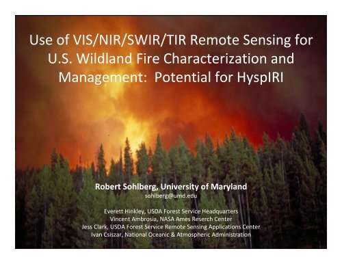
Use of VIS/NIR/SWIR/TIR Remote Sensing for U.S. Wildland ... - NASA
Use of VIS/NIR/SWIR/TIR Remote Sensing for U.S. Wildland ... - NASA
Use of VIS/NIR/SWIR/TIR Remote Sensing for U.S. Wildland ... - NASA

You also want an ePaper? Increase the reach of your titles
YUMPU automatically turns print PDFs into web optimized ePapers that Google loves.
<strong>Use</strong> <strong>of</strong> <strong>VIS</strong>/<strong>NIR</strong>/<strong>SWIR</strong>/<strong>TIR</strong> <strong>Remote</strong> <strong>Sensing</strong> <strong>for</strong><br />
U.S. <strong>Wildland</strong> Fire Characterization and<br />
Management: Potential <strong>for</strong> HyspIRI<br />
Robert Sohlberg, University <strong>of</strong> Maryland<br />
sohlberg@umd.edu<br />
Everett Hinkley, USDA Forest Service Headquarters<br />
Vincent Ambrosia, <strong>NASA</strong> Ames Reserch Center<br />
Jess Clark, USDA Forest Service <strong>Remote</strong> <strong>Sensing</strong> Applications Center<br />
Ivan Csiszar, National Oceanic & Atmospheric Administration
The Three Phases <strong>of</strong> <strong>Wildland</strong> Fire Mapping<br />
• Pre‐fire<br />
– Available fuels (type, size, arrangement, age)<br />
– Fuel Conditions (moisture, bug kill, blow down)<br />
• Active fire<br />
– Detection <strong>of</strong> ignitions (primarily via ground report in<br />
the lower 48)<br />
– Movement <strong>of</strong> the fire front, breach <strong>of</strong> containment<br />
• Post‐fire<br />
– Fire effects on vegetation and soils<br />
– Mitigation <strong>of</strong> adverse impacts (mass wasting, water<br />
quality, invasive species)
Mature Heritage<br />
• Airborne Missions<br />
– Phoenix (beginning in latter 1960s)<br />
– MASTER<br />
– AVIRIS<br />
– AMS<br />
– Military Assets<br />
• Geostationary Satellite Missions<br />
– GOES<br />
• Polar Orbit Satellite Survey Missions<br />
– AVHRR<br />
– MODIS (will continue with VIIRS)<br />
• Satellite Mapping Missions<br />
– Landsat<br />
– ASTER<br />
– Spot<br />
– ALI/Hyperion<br />
– IKONOS, Quickbird
Principal <strong>Use</strong>rs<br />
• National Interagency Fire Center<br />
• USDA Forest Service<br />
• Bureau <strong>of</strong> Land Management<br />
• National Park Service<br />
• Alaska Fire Service<br />
• Bureau <strong>of</strong> Indian Affairs<br />
• Fish and Wildlife Service<br />
• DoD (i.e. NORTHCOM)<br />
• Department <strong>of</strong> Homeland Security<br />
• FEMA<br />
• States (i.e. CAL FIRE)
<strong>Wildland</strong> Fire Assessment System<br />
• Produced daily by USDA Forest Service Rocky<br />
Mountain Research Station.<br />
• Dozens <strong>of</strong> variables and metrics reported<br />
– Fire Danger Rating<br />
– Lighting Ignition Efficiency<br />
– Haines Index (lower atmosphere stability)<br />
– Fire Weather<br />
– Fuel Moisture (10, 100 and 1,000 hour)<br />
– NDVI<br />
– Palmer Drought Index<br />
– And so on …
Satellite Fuels and Fuel Condition<br />
Pre‐Fire Characterization DSS all use<br />
the <strong>VIS</strong> / <strong>NIR</strong> / <strong>SWIR</strong> bands<br />
available on HyspIRI<br />
(in addition to a lot <strong>of</strong> wx data).<br />
Opportunity to develop new<br />
experimental methods using<br />
hyperspectral <strong>VIS</strong>/<strong>NIR</strong>/<strong>SWIR</strong> signal.<br />
<strong>TIR</strong> has potential <strong>for</strong> water balance.
• What remote sensing provides <strong>for</strong> mapping <strong>of</strong><br />
active wildland fires<br />
– Fire perimeter and active fire fronts<br />
– Problem areas –hot spots outside line<br />
– Where the fire has been<br />
– Lines <strong>of</strong> containment<br />
– Effectiveness <strong>of</strong> backfire operations<br />
– Hot‐spots during the mop‐up phase<br />
– Post‐fire burn severity
Command Structure & Customers<br />
Where the data goes<br />
• National Interagency Fire Center (NIFC)<br />
• Geographic Area Command Center (GACC)<br />
• Incident Command Posts (ICPs)<br />
FEMA Joint Field Office (JFO)<br />
Emergency Operations Centers (EOC)<br />
The ICP is the primary customer <strong>for</strong> <strong>TIR</strong> Data
National Infrared Operations<br />
Citation jet at NIFC<br />
Output Product<br />
Phoenix Sensor Workstation<br />
on Citation Jet
• GeoTiffs<br />
– Color<br />
–Grayscale<br />
• JPEGS<br />
• Mosaics<br />
• Active Heat<br />
Areas shape<br />
file<br />
PHOENIX Output Products
today<br />
from<br />
GOES
today<br />
from<br />
AVHRR
today<br />
from<br />
MODIS<br />
Produced<br />
via Direct<br />
Readout<br />
facility at<br />
USFS‐RSAC,<br />
Salt Lake City.
8/12/09 0700 MDT (1400 Z)
AMS Wildfire Sensor<br />
Band Wavelength μm<br />
1 0.42- 0.45<br />
2 0.45- 0.52 (TM1)<br />
3 0.52- 0.60 (TM2)<br />
4 0.60- 0.62<br />
5 0.63- 0.69 (TM3)<br />
6 0.69- 0.75<br />
7 0.76- 0.90 (TM4)<br />
8 0.91- 1.05<br />
9 1.55- 1.75 (TM5)<br />
10 2.08- 2.35 (TM7)<br />
11 3.60- 3.79 (VIIRS M12)<br />
12 10.26-11.26 (VIIRS M15)<br />
Total Field <strong>of</strong> View: 85.9 degrees<br />
IFOV: 2.5mrad<br />
Altitude: 25000’<br />
Spatial Resolution: 20m (at sea level)<br />
Sensor System:<br />
AMS Wildfire Instrument<br />
Two environmental enclosures<br />
(data disks & GPS; and power<br />
supplies & controllers)<br />
Scan Head<br />
Data System<br />
Enclosure
Wildfire - Collaborative Decision Environment<br />
Google Earth<br />
Weather<br />
NWS, NRL, MIT<br />
MODIS<br />
USFS, <strong>NASA</strong>/UMD<br />
Fire Incidents<br />
NIFC, USFS, USGS<br />
Airspace<br />
Restrictions<br />
FAA, <strong>NASA</strong><br />
Internet<br />
Satellite<br />
track<br />
prediction<br />
Ikhana UAS<br />
Streaming Video<br />
Visualization<br />
Group IM
WSFM #1<br />
8 July 2008<br />
9.5 hours<br />
WSFM – 2008 Flight Tracks<br />
WSFM #2 19<br />
July 2008<br />
5.0 hours<br />
WSFM #3<br />
19 Sept. 2008<br />
3.5 hours
Northern Cali<strong>for</strong>nia Firestorm - 2008<br />
Canyon – Cub Complex<br />
Images From<br />
8 & 19 July 2008<br />
Basin Fire
Airborne and Satellite<br />
Active Fire Detection Systems<br />
all use the<br />
4 and 11 μm<strong>TIR</strong> bands<br />
available on HyspIRI.
The goal <strong>of</strong> BAER mapping …<br />
Identify those areas at greatest risk <strong>for</strong><br />
adverse impacts on water quality and<br />
re‐generation due to factors such as<br />
the <strong>for</strong>mation <strong>of</strong> hydrophobic soils<br />
which can result in severe erosion.<br />
This must be done quickly and over<br />
large areas. <strong>Remote</strong> sensing is <strong>of</strong><br />
great value to help rapidly focus on<br />
those areas with the most critical<br />
need
Prefire Postfire Prefire Postfire dNBR<br />
BARC<br />
Creation <strong>of</strong> the BARC<br />
Black Pine 2 Fire<br />
Sawtooth NF<br />
73,000 Acres<br />
Normalized Burn Ratio (NBR)<br />
Differenced Normalized Burn Ratio (dNBR)<br />
NBR = (<strong>NIR</strong> –Mid IR) / (<strong>NIR</strong> + Mid IR)<br />
dNBR = Pre NBR –Post NBR<br />
Burned Area Reflecatance Classification<br />
(BARC) is a simplified dNBR<br />
Dark Green = Unchanged<br />
Cyan = Low<br />
Yellow = Moderate<br />
Red = High
Operational Fire Support at RSAC<br />
Post‐fire Assessment – Emergency, Rapid, and<br />
Extended Timing<br />
BAER Image Support<br />
BARC (Burned Area Reflectance Classification) creation<br />
Emergency Assessment<br />
Rapid Assessment <strong>of</strong> Vegetation Condition after Wildfire<br />
(RAVG)<br />
For Forest Silviculturist<br />
Rapid Assessment<br />
Monitoring Trends in Burn Severity (MTBS)<br />
National Fire Plan (NFP) and Healthy Forest Restoration Act (HFRA)<br />
Extended Assessment
Burned Area Emergency Response (BAER)<br />
Emergency Stabilization and Rehabilitation<br />
• Fast-Track Fast Track emergency assessment<br />
• Assess effects <strong>of</strong> the fire on the soil and watershed<br />
hydrologic function (erosion and flood potential) <strong>for</strong> risks<br />
to:<br />
• life<br />
• property<br />
• long-term soil productivity<br />
• water quality<br />
• resources
BAER Fire Support Statistics<br />
USGS-EROS USFS-RSAC Sum<br />
Year Fires Acres Fires Acres Fires Acres<br />
2001 5 N/A 15 310,500 20 310,500<br />
2002 10 500,000 73 2,710,599 83 3,210,599<br />
2003 17 307,034 54 1,637,471 71 1,944,505<br />
2004 24 5,000,000 25 471,102 49 5,471,102<br />
2005 23 800,000 46 734,559 69 1,534,559<br />
2006 61 2,532,907 115 2,470,856 176 5,003,763<br />
2007 48 2,422,130 106 3,508,407 154 5,930,537<br />
2008 16 544,639 98 1,755,322 114 2,999,961<br />
Sum 204 12,106,710 532 13,598,816 736 25,705,526<br />
Collaborative ef<strong>for</strong>t between USFS‐RSAC and USGS‐EROS
RAVG (Rapid Assessment <strong>of</strong> Vegetation Condition after Wildfire)<br />
• RAVG Objectives<br />
– Rapid post-fire damage<br />
assessment due to wildfire<br />
• Calculate acres <strong>of</strong> land<br />
suitable <strong>for</strong> re<strong>for</strong>estation<br />
• Spatially represent <strong>for</strong>ested<br />
vs. de<strong>for</strong>ested areas following<br />
wildfire<br />
– Delivered 30 calendar days<br />
after fire containment<br />
– Data helps determine<br />
re<strong>for</strong>estation needs
MTBS (Monitoring Trends in Burn Severity)<br />
• MTBS Objectives<br />
– Map all fires > 1,000 acres (in<br />
West) and > 500 acres (in East)<br />
between 1984 – present<br />
• Aligned with Landsat data record<br />
– Mapped using extended<br />
assessment protocol<br />
• Postfire imagery acquired during<br />
next growing season<br />
– Severity classifications focused<br />
on vegetation effects<br />
– <strong>Use</strong>d to answer National Fire<br />
Plan (NFP) and Healthy Forest<br />
Restoration Act (HFRA) questions
Airborne and Satellite<br />
Post‐Fire Characterization Systems<br />
all use the<br />
<strong>VIS</strong> / <strong>NIR</strong> / <strong>SWIR</strong> bands<br />
available on HyspIRI.
Questions ???