A Geoarchaeological Overview of South Dakota and Preliminary
A Geoarchaeological Overview of South Dakota and Preliminary
A Geoarchaeological Overview of South Dakota and Preliminary

Create successful ePaper yourself
Turn your PDF publications into a flip-book with our unique Google optimized e-Paper software.
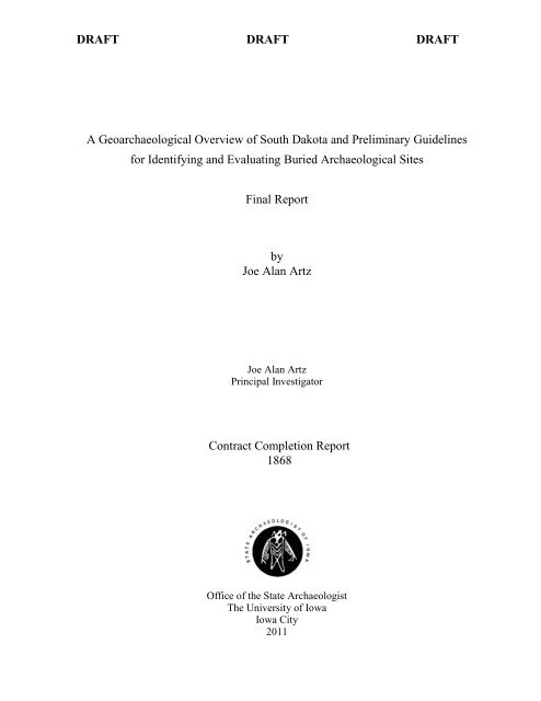
DRAFT DRAFT DRAFT<br />
A <strong>Geoarchaeological</strong> <strong>Overview</strong> <strong>of</strong> <strong>South</strong> <strong>Dakota</strong> <strong>and</strong> <strong>Preliminary</strong> Guidelines<br />
for Identifying <strong>and</strong> Evaluating Buried Archaeological Sites<br />
Final Report<br />
by<br />
Joe Alan Artz<br />
Joe Alan Artz<br />
Principal Investigator<br />
Contract Completion Report<br />
1868<br />
Office <strong>of</strong> the State Archaeologist<br />
The University <strong>of</strong> Iowa<br />
Iowa City<br />
2011
DRAFT DRAFT DRAFT<br />
The activity that is the subject <strong>of</strong> this Allocations Guide has been financed in part with the Federal<br />
funds from the National Park Service, U. S. Department <strong>of</strong> the Interior. Under Title VI <strong>of</strong> the Civil<br />
Rights Act <strong>of</strong> 1964, Section 504 <strong>of</strong> the Rehabilitation Act <strong>of</strong> 1973, the American With Disabilities Act<br />
<strong>of</strong> 1990, <strong>and</strong> <strong>South</strong> <strong>Dakota</strong> law SDCL 20-13, the State <strong>of</strong> <strong>South</strong> <strong>Dakota</strong> <strong>and</strong> U. S. Department <strong>of</strong> the<br />
Interior prohibit discrimination on the basis <strong>of</strong> race, color, creed, religion, sex, disability, ancestry or<br />
national origin. If you believe you have been discriminated against in any program, activity, or<br />
facility as described above, or if you desire further information, please write to: <strong>South</strong> <strong>Dakota</strong><br />
Division <strong>of</strong> Human Rights, State Capital, Pierre, SD 57501, or the Office <strong>of</strong> Equal Opportunity,<br />
National Park Service, 201 I Street NW, Washington, D. C. 20240.<br />
ii
DRAFT DRAFT DRAFT<br />
Table <strong>of</strong> Contents<br />
Table <strong>of</strong> Contents ................................................................................................................................................... iii<br />
List <strong>of</strong> Figures ........................................................................................................................................................ iv<br />
List <strong>of</strong> Tables ......................................................................................................................................................... iv<br />
PART I: Introduction .............................................................................................................................................. 1<br />
Background ......................................................................................................................................................... 2<br />
Objectives ........................................................................................................................................................... 3<br />
Acknowledgments............................................................................................................................................... 5<br />
Information Sources ................................................................................................................................................ 5<br />
GIS Datasets ....................................................................................................................................................... 5<br />
Bibliographic Sources ......................................................................................................................................... 6<br />
PART II. GEOARCHAEOLOGICAL OVERVIEW ............................................................................................ 10<br />
Statewide Geological <strong>Overview</strong> ............................................................................................................................ 10<br />
Geology, Geomorphology, <strong>and</strong> Archaeological Regions .................................................................................. 10<br />
Interregional Patterns ........................................................................................................................................ 11<br />
Holocene Geology <strong>and</strong> Geoarchaeology ........................................................................................................... 17<br />
Geological Processes ........................................................................................................................................ 18<br />
Regional <strong>Overview</strong>s .............................................................................................................................................. 27<br />
West River ........................................................................................................................................................ 27<br />
Missouri Trench ................................................................................................................................................ 30<br />
East River .......................................................................................................................................................... 31<br />
PART III. Developing Guidelines ........................................................................................................................ 34<br />
National Survey <strong>of</strong> Buried Site Guidelines ........................................................................................................... 34<br />
State Guidelines ................................................................................................................................................ 34<br />
Detailed State Guidelines .................................................................................................................................. 39<br />
Concepts <strong>and</strong> Considerations ................................................................................................................................ 43<br />
Buried Site Potential ......................................................................................................................................... 43<br />
Subsurface Testing Methods ............................................................................................................................. 43<br />
Other Subsurface Data Sources ......................................................................................................................... 49<br />
Projects For Deep Testing .................................................................................. Error! Bookmark not defined.<br />
Qualifications .................................................................................................................................................... 59<br />
PART IV: PRELIMINARY GUIDELINES FOR IDENTIFYING AND EVALUATING BURIED<br />
ARCHAEOLOGICAL SITES IN SOUTH DAKOTA ......................................................................................... 61<br />
Premises ................................................................................................................................................................ 61<br />
Geologic Processes ........................................................................................................................................... 61<br />
Evidence for Geologic Processes ...................................................................................................................... 61<br />
Site, Artifact, <strong>and</strong> Feature Density .................................................................................................................... 62<br />
Buried Site Potential ......................................................................................................................................... 62<br />
Sedimentary Environments <strong>and</strong> L<strong>and</strong>forms ...................................................................................................... 64<br />
Qualifications .................................................................................................................................................... 65<br />
Identifying <strong>and</strong> Evaluating Buried Site Potential <strong>and</strong> Buried Sites ...................................................................... 65<br />
Desktop Assessment ......................................................................................................................................... 65<br />
<strong>Geoarchaeological</strong> Assessment ......................................................................................................................... 66<br />
Archaeological Assessment .............................................................................................................................. 67<br />
Subsurface Site Evaluation ............................................................................................................................... 67<br />
Evaluation <strong>and</strong> Mitigation ................................................................................................................................. 68<br />
Report Documentation ...................................................................................................................................... 68<br />
iii
DRAFT DRAFT DRAFT<br />
PART V: CONCLUSIONS .................................................................................................................................. 69<br />
Summary ............................................................................................................................................................... 69<br />
Methodology ..................................................................................................................................................... 70<br />
When to apply the guidelines ............................................................................................................................ 71<br />
Recommendations ................................................................................................................................................. 72<br />
REFERENCES CITED ......................................................................................................................................... 74<br />
Appendix A: Using the Web Soil Survey ............................................................................................................. 86<br />
Appendix B: Using GIS to Estimate Archaeological Site Density in <strong>South</strong> <strong>Dakota</strong>............................................. 90<br />
List <strong>of</strong> Figures<br />
Figure 1. Archaeological regions <strong>of</strong> <strong>South</strong> <strong>Dakota</strong> (Buechler 1983; Winham <strong>and</strong> Hannus 1990). Base map is a 30<br />
m resolution, United States Geological Survey, National Elevation Dataset digital elevation model. ........... 4<br />
Figure 2. Western <strong>South</strong> <strong>Dakota</strong>, showing location <strong>of</strong> reports <strong>and</strong> publications discussed in text. ........................ 8<br />
Figure 3. Eastern <strong>South</strong> <strong>Dakota</strong> showing locations <strong>of</strong> reports <strong>and</strong> publications discussed in text. ......................... 9<br />
Figure 4. Quaternary map units <strong>of</strong> <strong>South</strong> <strong>Dakota</strong> extracted from Martin et al. (2004). ........................................ 12<br />
Figure 5. Quaternary map units in the glaciated regions <strong>of</strong> eastern <strong>South</strong> <strong>Dakota</strong> extracted from Martin et al.<br />
(2004) ............................................................................................................................................................ 13<br />
Figure 6. Distribution <strong>of</strong> Quaternary map units (Martin et al. 2004) among archaeological regions. .................. 15<br />
Figure 7. Map showing states for which archaeological survey guidelines were found, color coded to indicate<br />
how deep testing for buried sites is addressed. ............................................................................................. 35<br />
Figure 8. Location <strong>of</strong> selected bridges on major rivers in <strong>South</strong> <strong>Dakota</strong>, showing the SD DOT bridge ID numbers<br />
<strong>of</strong> those for which geotechnical .................................................................................................................... 50<br />
Figure 9. Representative stratigraphic cross sections <strong>of</strong> alluvium at three East River bridges (source SD DOT<br />
design plans. .................................................................................................................................................. 51<br />
Figure 10. Stratigraphic cross sections <strong>of</strong> valley alluvium from three West River bridges. Source: SD DOT<br />
design plans. .................................................................................................................................................. 52<br />
Figure 11. Stratigraphic cross section <strong>of</strong> valley alluvium at bridge over lower Cheyenne River. Source: SD DOT<br />
design plans. .................................................................................................................................................. 54<br />
Figure 12. Location <strong>of</strong> the lower Cheyenne River bridge on USGS quadrangle (upper) <strong>and</strong> color aerial images<br />
(lower). .......................................................................................................................................................... 55<br />
Figure 13. Screen shot from the Web Soil Survey showing l<strong>and</strong>form <strong>and</strong> parent material information for a map<br />
unit in a hypothetical project area that crosses the Pennington-Custer county line. See Appendix A for<br />
additional information. .................................................................................................................................. 57<br />
Figure B1. Survey <strong>and</strong> site density by archaeological region. Upper: percent area surveyed per region. Lower:<br />
site density as a ratio <strong>of</strong> total survey area to site area per region. Data from ARMS shapefiles. Site density is<br />
calculated using only archaeological site area that is contained within a survey area. ................................. 92<br />
List <strong>of</strong> Tables<br />
Table 1. GIS Data Sources. ..................................................................................................................................... 5<br />
Table 2. SSURGO Soils Geodatabases, obtained from the NRCS Soil Data Mart. ................................................ 6<br />
Table 3. Area (ha) <strong>of</strong> Geological Mapping Units (Martin et al. 2004) among Archaeological Regions. ............. 16<br />
Table 4. L<strong>and</strong>forms <strong>and</strong> L<strong>and</strong>scapes. .................................................................................................................... 21<br />
Table 5. Unique L<strong>and</strong>forms <strong>and</strong> Sedimentary Environments ............................................................................... 23<br />
Table 6. Summary <strong>of</strong> State Guidelines for Subsurface Testing. ........................................................................... 36<br />
Table 7. Criteria for Evaluating Buried Site Potential in <strong>South</strong> <strong>Dakota</strong>. .............................................................. 44<br />
Table 8. Common Kinds <strong>of</strong> <strong>South</strong> <strong>Dakota</strong> Undertakings <strong>and</strong> APEs. .................................................................... 59<br />
Table B1. Site <strong>and</strong> Survey Density in <strong>South</strong> <strong>Dakota</strong> (source: ARMS). ................................................................ 91<br />
iv
DRAFT DRAFT DRAFT<br />
A geoarchaeological overview <strong>of</strong> <strong>South</strong> <strong>Dakota</strong> identifies the l<strong>and</strong>forms <strong>and</strong> sedimentary<br />
environments where buried archaeological deposits are most likely to be preserved. A<br />
preliminary estimate, based on geological map data, is that at least 18% <strong>of</strong> the state consists <strong>of</strong><br />
l<strong>and</strong>scapes with significant concentrations <strong>of</strong> alluvial, colluvial, <strong>and</strong> eolian sedimentary deposits<br />
with buried site potential. Each sedimentary environment sets different conditions for buried site<br />
potential, including not only the burial <strong>of</strong> archaeological deposits, but also their preservation<br />
from subsequent erosion. Buried site potential, defined in terms <strong>of</strong> geological processes <strong>and</strong> their<br />
effect on the archaeological record, can be high (suitable for well preserved, stratified sites),<br />
moderate (suitable for burial but subject to disturbance), <strong>and</strong> low (high energy, erosional<br />
environments).<br />
Evaluating buried site potential can be approached through map <strong>and</strong> imagery interpretation,<br />
but conclusive identification requires fieldwork. Latest Wisconsinan <strong>and</strong> Holocene sediments<br />
with potential to contain buried archaeological deposits are commonly at depths greater than<br />
shallow (
DRAFT DRAFT DRAFT<br />
As in many western states, where arid <strong>and</strong> semi-arid climates result in sparse vegetation cover <strong>and</strong><br />
good surface visibility, archaeological survey in <strong>South</strong> <strong>Dakota</strong> is conducted primarily by surface survey.<br />
Buried sites are identified primarily where subsurface deposits are exposed, as in stream cutbanks, or<br />
when discovered when testing to evaluate a surface-visible site. This raises the possibility that, if not<br />
exposed at the surface or in a cutbank, buried sites may be missed by survey. If deeply buried enough,<br />
they may be missed if test pits <strong>and</strong> other excavations only penetrate to depths necessary to evaluate<br />
surface-visible archaeological deposits.<br />
BACKGROUND<br />
Published guidelines for cultural resource surveys <strong>and</strong> survey reports in <strong>South</strong> <strong>Dakota</strong> (SHPO 2005)<br />
define three levels <strong>of</strong> survey. Level I is a literature <strong>and</strong> records review that assembles existing<br />
knowledge about the proposed survey area but does not include field work. Level II surveys are used<br />
primarily in the context <strong>of</strong> linear surveys (pipelines, roads, transmission lines). Representative portions<br />
<strong>of</strong> the proposed project area are surveyed as a means <strong>of</strong> planning an intensive survey. Level II surveys<br />
are not common (Paige Olson, personal communication, 2011).<br />
Level III surveys are intensive (“100 percent”) surveys <strong>of</strong> the project APE. Subsurface testing to<br />
discover archaeological sites is included in the guidelines, which state,<br />
“Survey transects must be no more than 30 meters (100 feet) apart… The report must explain survey<br />
methods <strong>and</strong> the rationale for their use, for instance, why the archaeologist did or did not conduct subsurface<br />
testing…. Based on pr<strong>of</strong>essional judgment, the principal investigator may carry out additional minimal<br />
subsurface testing as necessary. If the principal investigator feels more information is required than what is<br />
revealed by the ground surface or minimal subsurface testing, e.g. shovel probing, augering…, the principal<br />
investigator should consult SHPO <strong>and</strong> others to develop an appropriate strategy for gaining necessary<br />
information with minimal damage to the site. Extensive testing during survey within sites is not recommended,<br />
though some testing is <strong>of</strong>ten warranted as an exploratory tool within <strong>and</strong> between features or activity areas <strong>and</strong><br />
to determine boundaries. All decisions to test or not to test should be justified” (SHPO 2005:9).<br />
The guidelines do not address subsequent phases <strong>of</strong> investigation, such as testing to evaluate National<br />
Register eligibility, or large-scale excavation to mitigate adverse effects <strong>of</strong> a National-Register-eligible<br />
property. It is during these phases that most buried-site investigations are currently undertaken in <strong>South</strong><br />
<strong>Dakota</strong>. Investigations that attempt to identify buried site potential during or in advance <strong>of</strong> initial surveys<br />
are rare (Fosha <strong>and</strong> Albanese 1998; Hajic 2008; Sundstrom et al. 1999). Buried sites are usually<br />
encountered in erosional cuts (Artz <strong>and</strong> Toom 1985; Hannus 1985; Keyser <strong>and</strong> Davis 1984), or during<br />
excavation <strong>of</strong> surface-visible sites (Black <strong>and</strong> Metcalf 1985; Hannenberger et al. 2010).<br />
The <strong>South</strong> <strong>Dakota</strong> SHPO currently considers the need for deep testing to identify or evaluate sites on<br />
a case by case basis. The consideration is <strong>of</strong>ten made after-the-fact. For example, agency <strong>and</strong> tribal<br />
review <strong>of</strong> a Level III intensive survey report will result in a recommendation that subsurface testing, or<br />
additional testing, is necessary before consultation on the effects <strong>of</strong> the undertaking on cultural resources<br />
can be concluded. Such recommendations may come from the undertaking’s lead Federal agency, from<br />
the State Archaeologist for state-funded projects, from SHPO, or from a Tribal Historic Preservation<br />
Office (THPO). The recommendation generally results in the consultant returning to the field to conduct<br />
the investigation. Additional costs are incurred <strong>and</strong> consultation is delayed.<br />
In some cases, the recommendation meets opposition from the developer, the archaeological<br />
consultant, or an agency that is party to the consultation. Negotiating an outcome increases costs,<br />
requires time, <strong>and</strong> sometimes becomes acrimonious. A recent example from <strong>South</strong> <strong>Dakota</strong> is culture<br />
resource investigations for the proposed DM&E railroad (Eigenberger et al. 2009).<br />
2
DRAFT DRAFT DRAFT<br />
Similar situations arise in many other states. In some cases, the failure <strong>of</strong> a surface or near-surface<br />
intensive survey to identify deeply buried archaeological deposits result in very large, unanticipated<br />
costs <strong>and</strong> delays. Examples include the Mondrian Tree site (32MZ58), on the Missouri River, in North<br />
<strong>Dakota</strong>, impacted by the Northern Border Pipeline (Toom <strong>and</strong> Gregg 1983); a complex <strong>of</strong> sites on the<br />
Ohio River in Ohio, impacted by the Argosy Lawrenceburg Casino (Creasman 1996; Stafford <strong>and</strong><br />
Creasman 2002); <strong>and</strong> numerous sites impacted by the Avenue <strong>of</strong> the Saints highway construction project<br />
on the Mississippi River in Missouri (Hajic et al. 1996; Morrow 1997). In each case, an initial intensive<br />
survey using traditional pedestrian <strong>and</strong> shallow testing methods had been completed. Section 106<br />
consultation led to the conclusion that the surveys were not adequate to locate potential buried sites in<br />
these major river valleys. Additional investigation identified highly significant multiple components<br />
sites, but also resulted in construction delays.<br />
There are also success stories, where geoarchaeological investigations, conducted as part <strong>of</strong> the initial,<br />
intensive survey, resulted in the discovery <strong>of</strong> deeply buried cultural deposits. In these cases, early<br />
discovery greatly increased the lead time needed to plan for treatment <strong>of</strong> the historic property, <strong>and</strong> also<br />
allowed the developer up-front notice <strong>of</strong> total costs. Examples include the Eisele Hill site (13MC15) in<br />
Iowa (Artz et al. 1995), <strong>and</strong> complexes <strong>of</strong> sites impacted by the Rocky Mountains Express natural gas<br />
pipeline in Missouri (Artz 2007) <strong>and</strong> Indiana (Artz et al. 2007, 2008). In both instances, deep testing was<br />
a requirement <strong>of</strong> the lead agency or their engineering consultant, <strong>and</strong> was driven, at least in part, by the<br />
existence <strong>of</strong> state guidelines calling for geoarchaeological investigation during or prior to intensive<br />
survey (Association <strong>of</strong> Iowa Archaeologist 1993; Division <strong>of</strong> Historic Preservation 2007).<br />
OBJECTIVES<br />
The following report has two objectives. First is a geoarchaeological overview <strong>of</strong> the state, identifying<br />
where buried sites are known to occur, <strong>and</strong> what kinds <strong>of</strong> geological contexts are most likely to contain<br />
as-yet-undiscovered buried sites. The second is to develop a set <strong>of</strong> methodological best practices that<br />
<strong>South</strong> <strong>Dakota</strong>’s State Historic Preservation Office (SHPO) can recommend to agencies <strong>and</strong><br />
archaeologists as guidelines for ensuring that a reasonable <strong>and</strong> good faith effort is made to identify <strong>and</strong><br />
evaluate buried sites.<br />
Part II, the geoarchaeological overview, begins with a statewide overview <strong>of</strong> geology <strong>and</strong><br />
geomorphology as encountered in the archaeological regions defined in the <strong>South</strong> <strong>Dakota</strong> State Plan for<br />
Archaeological Resources (Figure 1; Winham <strong>and</strong> Hannus 1990). Emphasis is given to the distribution<br />
<strong>of</strong> alluvial <strong>and</strong> eolian deposits among regions, because many such deposits are late Wisconsinan to<br />
Holocene in age, <strong>and</strong> <strong>of</strong>ten sufficiently thick to contain buried archaeological deposits.<br />
Next, the geoarchaeological overview considers <strong>South</strong> <strong>Dakota</strong> l<strong>and</strong>scapes <strong>and</strong> l<strong>and</strong>forms at the more<br />
detailed spatial scales needed for archaeological survey <strong>and</strong> excavation. A classification <strong>of</strong> the kinds <strong>and</strong><br />
regional distribution <strong>of</strong> l<strong>and</strong>forms is presented. The focus is on the geological processes at work in each<br />
l<strong>and</strong>form context, <strong>and</strong> how these affect the formation, burial, <strong>and</strong> preservation <strong>of</strong> archaeological sites.<br />
Finally, the geoarchaeological literature <strong>of</strong> <strong>South</strong> <strong>Dakota</strong> is reviewed, identifying studies that define past<br />
<strong>and</strong> current approaches to identifying <strong>and</strong> evaluating buried sites, <strong>and</strong> the results obtained.<br />
Part III develops <strong>and</strong> presents <strong>Preliminary</strong> Guidelines for the Identification <strong>and</strong> Evaluation <strong>of</strong> Buried<br />
Archaeological Sites in <strong>South</strong> <strong>Dakota</strong>. It begins with a review <strong>of</strong> buried site guidelines from other states,<br />
where practices have been developed <strong>and</strong> pursued to determine the archaeological potential <strong>of</strong><br />
sediments, <strong>and</strong> to seek sites within them. Next, the premises <strong>and</strong> concepts that underlie this project’s<br />
development <strong>of</strong> the guidelines are set forth, including both geological <strong>and</strong> methodological<br />
considerations.<br />
The guidelines presented at the end <strong>of</strong> Part II are designed to be responsive to agency approaches <strong>and</strong><br />
contractor capabilities, as these currently exist in <strong>South</strong> <strong>Dakota</strong>. The guidelines are also informed by the<br />
3
DRAFT DRAFT DRAFT<br />
Figure 1. Archaeological regions <strong>of</strong> <strong>South</strong> <strong>Dakota</strong> (Buechler 1983; Winham <strong>and</strong> Hannus 1990). Base<br />
map is a 30 m resolution, United States Geological Survey, National Elevation Dataset digital elevation<br />
model.<br />
current state <strong>of</strong> knowledge, presented in Part I, regarding the processes <strong>of</strong> erosion <strong>and</strong> deposition that are<br />
involved in the burial <strong>and</strong> preservation <strong>of</strong> buried sites in <strong>South</strong> <strong>Dakota</strong>.<br />
This study was conducted by the University <strong>of</strong> Iowa Office <strong>of</strong> the State Archaeologist with funding<br />
from the State Historical Society <strong>of</strong> <strong>South</strong> <strong>Dakota</strong>, in response to a Request for Proposals issued by that<br />
agency. The guidelines were also developed in consultation with a voluntary advisory committee with<br />
experience in the state. Through conversation <strong>and</strong> comments, the committee greatly influenced the<br />
document presented here by honing its focus on the geoarchaeological, methodological, <strong>and</strong> regulatory<br />
realities <strong>of</strong> cultural resource management in <strong>South</strong> <strong>Dakota</strong>. The committee was comprised <strong>of</strong>:<br />
Paige Olson, <strong>South</strong> <strong>Dakota</strong> State Historic Preservation Office, Pierre, SD<br />
Jim Donohue, <strong>South</strong> <strong>Dakota</strong> Archaeological Research Center (ARC), Rapid City, SD<br />
Mike Fosha, ARC<br />
Jim Haug, <strong>South</strong> <strong>Dakota</strong> State Archaeologist, ARC<br />
Michael Hilton, U.S. Forest Service,<br />
Mike Kolb, Strata Morph Geoexploration, Sun Prairie, WI<br />
Linea Sundstrom, Daystar Research, Shorewood, WI<br />
R<strong>and</strong>y Withrow, The Louis Berger Group, Marion, IA<br />
In addition, Andy Clark (ARC), Austin Buhta (Augustana College) <strong>and</strong> Jeff Buechler (<strong>Dakota</strong><br />
Research Services, Rapid City, SD) commented on the draft guidelines.<br />
4
DRAFT DRAFT DRAFT<br />
ACKNOWLEDGMENTS<br />
The author gratefully acknowledges the support <strong>of</strong> the voluntary advisory committee, named above.<br />
Jim Haug <strong>and</strong> Jane Watts at ARC provided access to <strong>South</strong> <strong>Dakota</strong>’s GIS <strong>and</strong> electronic documents<br />
archives, without which this project would not have been possible. Terry Erickson <strong>and</strong> John Weeldrier at<br />
the <strong>South</strong> <strong>Dakota</strong> Department <strong>of</strong> Transportation shared their knowledge, <strong>and</strong> provided access to,<br />
subsurface drilling information for bridges in the state. At OSA, Melanie Riley <strong>and</strong> Kat Rocheford<br />
assisted with GIS data compilation, <strong>and</strong> John Hall was a tower <strong>of</strong> patience <strong>and</strong> exactitude through the<br />
arduous task <strong>of</strong> compiling GIS data, map <strong>and</strong> figure production, <strong>and</strong> report editing. Paige Olsen provided<br />
the author with essential guidance in underst<strong>and</strong>ing the need for, <strong>and</strong> regulatory context <strong>of</strong>, the present<br />
project. Finally, the author acknowledges his many archaeologist friends <strong>and</strong> colleagues in the <strong>Dakota</strong>s<br />
who, over the years, have kept his interest in the region alive <strong>and</strong> informed.<br />
GIS DATASETS<br />
Information Sources<br />
GIS data relevant to the project were obtained from the sources shown in Tables 1 <strong>and</strong> 2. The<br />
following layers were acquired. Most were obtained from on-line clearinghouses including the <strong>South</strong><br />
<strong>Dakota</strong> GIS Data Warehouse, the <strong>South</strong> <strong>Dakota</strong> Geological Survey website, <strong>and</strong> the Natural Resources<br />
Conservation Service (NRCS) Soil Data Mart. The <strong>South</strong> <strong>Dakota</strong> Archaeological Research Center<br />
(ARC) provided copies <strong>of</strong> datasets from its Archaeological Resource Management System (ARMS).<br />
These included an Access database <strong>and</strong> ESRI shapefiles for sites, survey areas, <strong>and</strong> bibliographic<br />
sources in <strong>South</strong> <strong>Dakota</strong>.<br />
Table 1. GIS Data Sources.<br />
Name Format Source Description<br />
http://arcgis.sd.gov/server/sdgis/Data.aspx (SD GIS data warehouse)<br />
County borders Shapefile Census 2000 outline <strong>of</strong> 66 SD counties<br />
Rivers, Streams, Lakes Shapefile USGS National Hydrologic Dataset (NHD)<br />
Local roads Shapefile SD DOT secondary roads<br />
State roads Shapefile SD DOT state highways<br />
Bridges Shapefile SD DOT point locations <strong>of</strong> <strong>South</strong> <strong>Dakota</strong> bridges<br />
Geology Shapefile DENR statewide surface geology map<br />
Missouri River Shapefile DENR major SD drainage<br />
http://www.sdsmt.edu/wwwsarc/resources.html<br />
Sites Shapefile ARC Archaeological site locations<br />
Surveys Shapefile ARC Archaeological surveys<br />
ARMS-Data Access<br />
database<br />
ARC Archaeological sites database<br />
Archaeological regions Shape file SD SHPO outline <strong>of</strong> 24 archaeological regions<br />
http://www.sdgs.usd.edu/digitaldata/index.html<br />
Digital Elevation Model (DEM) Raster (Grid) USGS National Elevation Dataset (DEM)s<br />
http://soildatamart.nrcs.usda.gov/State.aspx<br />
SSURGO Soil Survey area Geodatabase NRCS statewide soils base map<br />
5
DRAFT DRAFT DRAFT<br />
Table 2. SSURGO Soils Geodatabases, obtained from the NRCS Soil Data Mart.<br />
County Database Source<br />
Bon Homme sd009_ BonHomme_soildb_SD_2002.mdb NRCS Soil data mart<br />
Brookings sd011_Brookings_soildb_SD_2002.mdb NRCS Soil data mart<br />
Brown sd013_Brown_soildb_SD_2002.mdb NRCS Soil data mart<br />
Brule sd603_Brule_soildb_SD_2002.mdb NRCS Soil data mart<br />
Buffalo sd603_Buffalo_soildb_SD_2002.mdb NRCS Soil data mart<br />
Butte sd019_Butte_soildb_SD_2002.mdb NRCS Soil data mart<br />
Charles Mix sd023_Charles_Mix_soildb_SD_2002.mdb NRCS Soil data mart<br />
Codington sd029_Codington_soildb_SD_2002.mdb NRCS Soil data mart<br />
Davison sd035_Davison_soildb_SD_2002.mdb NRCS Soil data mart<br />
Dewey sd041_Dewey_soildb_SD_2002.mdb NRCS Soil data mart<br />
Fall River sd047_Fall_River_soildb_SD_2002.mdb NRCS Soil data mart<br />
Grant sd051_Grabt_soildb_SD_2002.mdb NRCS Soil data mart<br />
Haakon sd055_Haakon_soildb_SD_2002.mdb NRCS Soil data mart<br />
Harding sd063_Harding_soildb_SD_2002.mdb NRCS Soil data mart<br />
Lawrence sd081_Lawrence_soildb_SD_2002.mdb NRCS Soil data mart<br />
McPherson sd089_Mcpherson_soildb_SD_2002.mdb NRCS Soil data mart<br />
Meade_N sd601_Meade_N_soildb_SD_2002.mdb NRCS Soil data mart<br />
Meade_S sd600_Meade_S_soildb_SD_2002.mdb NRCS Soil data mart<br />
Minnehaha sd099_Minnehaha_soildb_SD_2002.mdb NRCS Soil data mart<br />
Potter sd017_Potter_soildb_SD_2002.mdb NRCS Soil data mart<br />
Sanborn sd111_Sanborn_soildb_SD_2002.mdb NRCS Soil data mart<br />
Sully sd119_Sully_soildb_SD_2002.mdb NRCS Soil data mart<br />
Todd sd121_Todd_soildb_SD_2002.mdb NRCS Soil data mart<br />
Tripp sd123_Tripp_soildb_SD_2002.mdb NRCS Soil data mart<br />
Turner sd125_Turner_soildb_SD_2002.mdb NRCS Soil data mart<br />
BIBLIOGRAPHIC SOURCES<br />
Relevant literature was obtained from the University <strong>of</strong> Iowa Libraries, the OSA archives, <strong>and</strong> the<br />
author’s personal library. Most sources, however, were drawn from ARMS. ARMS consists <strong>of</strong> a<br />
Micros<strong>of</strong>t Access database <strong>and</strong> two GIS shapefiles, one that shows survey locations, <strong>and</strong> one that shows<br />
site locations. The Access database contains a number <strong>of</strong> tables. One <strong>of</strong> these contains bibliographic<br />
information (authors, titles, publication year, <strong>and</strong> place <strong>of</strong> publication) on reports <strong>and</strong> other references.<br />
The Surveys shapefile is linked to the bibliographic table by a common field, the Archive Number. In<br />
the Sites shapefile, individual archaeological sites are depicted as polygons <strong>and</strong> identified with their<br />
Smithsonian Institution Trinomial (SITS) site numbers. The SITS numbers are also used in the Access<br />
database to identify information about particular sites. This allows site locations in the GIS data to be<br />
linked to records about that site in the Access database.<br />
The authors field <strong>of</strong> the ARMS bibliography table was searched for individuals with research<br />
specialties in geoarchaeology. Such names in the database include earth scientists John Albanese, Robert<br />
Brakenridge, Alan Coogan, Rolfe M<strong>and</strong>el, James Martin, Michael McFaul, <strong>and</strong> Everett White, <strong>and</strong><br />
archaeologists Joe Artz, James Donohue, Dennis Toom, <strong>and</strong> David Kuehn. The titles field was searched<br />
for words that potentially identify reports with an explicitly geoarchaeological intent, including<br />
geoarchaeology <strong>and</strong> geomorphology, as well as keywords that suggest a possibility <strong>of</strong> deep testing, such<br />
as trench, backhoe, auger, testing, evaluation, <strong>and</strong> mitigation. Finally, titles with names <strong>of</strong> sites known<br />
by the author to have deeply buried components were searched for including Jim Pitts, Lange Ferguson,<br />
Beaver Creek Shelter, Lightning Spring, Medicine Crow, <strong>and</strong> Ray Long.<br />
This initial search returned 74 reports. Of these, 49 were obtained as PDF electronic documents from<br />
ARC via File Transfer Protocol (FTP). Others were either in the possession <strong>of</strong> the author, or obtained<br />
from the University <strong>of</strong> Iowa libraries, interlibrary loan, or the reports’ authors. Eight additional reports<br />
were obtained during a July 2011 visit to ARC.<br />
6
DRAFT DRAFT DRAFT<br />
Of the 82 reviewed reports, some did not contain geoarchaeologically-relevant information. A number<br />
<strong>of</strong> reports with “trench” in the title turned out to be surface surveys <strong>of</strong> locations where trenching for<br />
mineral exploration was plan. Others were large scale excavation or construction monitoring reports that<br />
contain little or no stratigraphic data.<br />
A GIS dataset called GeoarchReports was created to record the location <strong>of</strong> geoarchaeologicallyrelevant<br />
studies. Most are archaeological surveys with a corresponding feature in the Surveys shapefile.<br />
Other documents were reports on site-specific investigations. Locations <strong>of</strong> the investigated sites were<br />
selected from the Sites shapefile <strong>and</strong> appended to the GeoarchReports dataset.<br />
Fourteen studies reviewed for this report were not in the ARMS database. These were added to<br />
OSA’s copy <strong>of</strong> ARMS, <strong>and</strong> assigned “pseudo-ARMS” archive numbers OSA-0001 through OSA-0014.<br />
Their locations were manually digitized into GeoarchReports.<br />
Several reviewed studies did not have specific study areas, but were instead generalized to the entire<br />
Missouri Trench (Coogan 1987; Coogan <strong>and</strong> Irving 1959; McFaul 1985, 1986). These have no digital<br />
record in GeoarchReports or in the ARMS GIS<br />
Locations <strong>of</strong> study areas are shown in the Figures 2-3. Only those that, on review, held<br />
geoarchaeologically relevant information are listed.<br />
7
8<br />
KEY to ARMS Archives Numbers.<br />
ACU-0259 Alex 1991<br />
ACU-0292 Hanenberger <strong>and</strong> Donohue 1993<br />
ACU-0411 Sundstrom 1999<br />
ACU-0698 Sundstrom et al. 1999<br />
ACU-0788 Smith et al. 1994<br />
AFA-0085 Weston et al. 1982<br />
AFA-0099 Haberman 1980<br />
AFA-0199 Albanese 1986<br />
AFA-0225 Donohue et al. 1996<br />
AFA-0406 Buechler 2009<br />
AHN-0063 Albanese 1985<br />
AHN-0160 Albanese 1999<br />
AHN-0255 Fosha <strong>and</strong> Albanese 1998<br />
ALA-0384 Sundstrom et al. 2002<br />
AMD-0063 Donohue 1992<br />
APN-0023 Harksen 1974<br />
APN-0081 Buechler 1983<br />
APN-0475 Byrne 1995<br />
APN-0673 Kuehn 2003<br />
ASH-0020 White 1985<br />
ASH-0236 Martin 1983<br />
AST-0033 Artz <strong>and</strong> Toom 1985<br />
AWW-0004 Ahler et al. 1977<br />
AWW-0015 Ahler et al. 1974<br />
AWW-0026 S<strong>and</strong>ers et al. 1989<br />
AWW-0034 Toom 1991<br />
MTO-0006 Brakenridge & McReady 1988<br />
MTS-0101 Toom <strong>and</strong> Steinacher 1980<br />
OSA-0004 Hajic 2008<br />
OSA-0008 Keyser <strong>and</strong> Davis1984<br />
OSA-0009 Rawlings et al. 2003<br />
OSA-0010 Fredlund 1996<br />
OSA-0012 Agenbroad <strong>and</strong> Mead 1994<br />
OSA-0013 Kowal 1997<br />
OSA-0014 Over 1936<br />
QPA-0072 Miller et al. 1993<br />
RFA-0028 Abbott 1989<br />
WSD-0143 Fosha 1992<br />
WSD-0244 Pysarsky 2002<br />
WSD-0416 McFaul et al. 2010<br />
Figure 2. Western <strong>South</strong> <strong>Dakota</strong>, showing location <strong>of</strong> reports <strong>and</strong> publications discussed in text.
DRAFT DRAFT DRAFT<br />
Figure 3. Eastern <strong>South</strong> <strong>Dakota</strong> showing locations <strong>of</strong> reports <strong>and</strong> publications discussed in text.<br />
9<br />
KEY to ARMS Archive Numbers<br />
ABF-0003 Zimmerman et al. 1981<br />
ABF-0038 Ahler <strong>and</strong> Toom 1989<br />
ACL-0059 M<strong>and</strong>el 1992<br />
ADV-0004 White 1987b<br />
AHS-0015 M<strong>and</strong>el 1994<br />
AHS-0017 Fosha et al. 1994<br />
ALK-0050 Donohue <strong>and</strong> Davis 2003<br />
ALM-0040 Toom et al. 1989<br />
ALN-0010 White 1988b<br />
ALN-0011 White 1988a<br />
ALN-0204 McClell<strong>and</strong> 2009<br />
AMH-0046 White 1987a<br />
AMH-0238 Hannus et al. 1991<br />
AMH-0274 Buhta 2009<br />
ARO-0093 Messerli <strong>and</strong> Donohue2005<br />
ATP-0023 Donohue 2001<br />
ESD-0013 Haug et al. 1983<br />
MTF-0206 M<strong>and</strong>el <strong>and</strong> Brown 1985<br />
MTF-0207 Tibesar et al. 1986<br />
MTS-0101 Toom <strong>and</strong> Steinacher 1980<br />
MTS-0103 Picha <strong>and</strong> Toom 1984<br />
OSA-0005 Artz <strong>and</strong> Riley 2006<br />
OSA-0006 Artz <strong>and</strong> Krieg 2007<br />
OSA-0007 Artz <strong>and</strong> Riley 2010<br />
OSA-0011 Toom 1992<br />
RES-0035 Abbott 1992
DRAFT DRAFT DRAFT<br />
PART II. GEOARCHAEOLOGICAL OVERVIEW<br />
Statewide Geological <strong>Overview</strong><br />
This section begins with a statewide overview <strong>of</strong> <strong>South</strong> <strong>Dakota</strong>’s bedrock <strong>and</strong> glacial geology.<br />
Although <strong>of</strong>ten far pre-dating the arrival <strong>of</strong> humans in the western hemisphere, these geological deposits<br />
define the l<strong>and</strong>scapes on which human occupation took place. The second part <strong>of</strong> this section introduces<br />
the Holocene geology <strong>of</strong> the state. Emphasis is placed on identifying the major lithologies (e.g.,<br />
alluvium, colluvium, eolian silts) that comprise Holocene deposits in the state, <strong>and</strong> introducing the<br />
stratigraphic frameworks that can be used to subdivide vertical <strong>and</strong> lateral sequences <strong>of</strong> sediments into<br />
stratigraphic units. Stratigraphic units are formally (e.g., North American Commission on Stratigraphic<br />
Nomenclature 2004) referred to as “lithostratigraphic units,” a recognition <strong>of</strong> the fact that each stratum<br />
in the geologic record is comprised <strong>of</strong> rocks <strong>and</strong> sediments <strong>of</strong> similar lithology. Lithostratigraphic units<br />
can be traced <strong>and</strong> mapped across large areas. Generally speaking, it is the distribution <strong>of</strong><br />
lithostratigraphic units that are depicted on geologic (e.g., Martin et al. 2004) maps. Soils mapped by the<br />
Natural Resources Conservation Service (NRCS; Soil Survey Staff 1993) can also be identified to a<br />
specific lithologic parent material (e.g., shale, schist, alluvium), but are <strong>of</strong>ten difficult to correlate with<br />
lithostratigraphic units.<br />
GEOLOGY, GEOMORPHOLOGY, AND ARCHAEOLOGICAL REGIONS<br />
The geomorphology <strong>and</strong> surficial geology <strong>of</strong> <strong>South</strong> <strong>Dakota</strong> are varied <strong>and</strong> complex, but in general, fit<br />
well with the archaeological regions defined by Winham <strong>and</strong> Hannus (1990). The Missouri River<br />
divides the state into two halves, colloquially referred to as “East River” <strong>and</strong> “West River.” In regions<br />
east <strong>of</strong> the river, the surficial geology is comprised <strong>of</strong> Pleistocene glacial deposits. West <strong>of</strong> the river,<br />
bedrock dominates the l<strong>and</strong>scape. The White River Badl<strong>and</strong>s, Lower White, <strong>and</strong> S<strong>and</strong> Hills regions are<br />
underlain by Tertiary silts, s<strong>and</strong>stones, <strong>and</strong> clays. The Black Hills has a Precambrian core <strong>of</strong> igneous <strong>and</strong><br />
metamorphic rocks, ringed by Paleozoic, Triassic, <strong>and</strong> Jurassic limestones, s<strong>and</strong>stones, shales, <strong>and</strong> clays.<br />
In the S<strong>and</strong>stone Buttes <strong>and</strong> Gr<strong>and</strong> Moreau Tablel<strong>and</strong>s, Cretaceous s<strong>and</strong>stones <strong>and</strong> shales are exposed at<br />
the surface, with limestone capping butte tops. Tertiary bedrock is also exposed in parts <strong>of</strong> these two<br />
regions (Gries 1996).<br />
East River regions correspond to greater or lesser degrees with major glacial advances into the state.<br />
Pre-Wisconsin glaciers extended westward to <strong>and</strong> slightly beyond the Missouri River. Between 20,000<br />
<strong>and</strong> 14,000 years ago, the late Wisconsinan James Lobe advanced southward, in an area coinciding with<br />
the Upper, Middle, <strong>and</strong> Lower James regions (Clayton <strong>and</strong> Moran 1982).<br />
The Prairie Coteau Region, <strong>and</strong> parts <strong>of</strong> the Upper <strong>and</strong> Lower Big Sioux regions, escaped Late<br />
Wisconsinan glaciation. At the north tip <strong>of</strong> the Prairie Coteau, the glacier split into two lobes, the James<br />
Lobe advancing south through what became the James River valley, <strong>and</strong> the Des Moines lobe advancing<br />
to the southeast into Iowa (Clayton <strong>and</strong> Moran 1982). The terrain between the two lobes is underlain by<br />
older Wisconsinan <strong>and</strong> Illinoian glacial deposits (Gilbertson 1989; Gries 1996).<br />
A final advance into the state came about 11,700 B.P., as the Red River lobe advanced down the<br />
valley <strong>of</strong> the same name in North <strong>Dakota</strong>. The edge <strong>of</strong> this glacier corresponds roughly to the western<br />
edge <strong>of</strong> the Northeast Lowl<strong>and</strong>s region. This moraine blocked the drainage <strong>of</strong> rivers running south along<br />
the ice-front, forming Lake <strong>Dakota</strong>, a ca. 30-mi-wide body <strong>of</strong> water in the Upper James Region.<br />
10
DRAFT DRAFT DRAFT<br />
The Big Sioux, Vermillion, James, <strong>and</strong> Missouri rivers carried outwash from the late Wisconsinan<br />
glaciers. The Missouri was a major conduit for meltwater from the northern Plains, leading to its deep<br />
entrenchment into the pre-glacial l<strong>and</strong>scape (Clayton <strong>and</strong> Moran 1982; Coogan 1987).<br />
Throughout the state, streams have incised valleys into the surficial rock units, <strong>and</strong> the valleys contain<br />
alluvial fills deposited by the rivers through time. The alluvial fills are primarily Pleistocene <strong>and</strong><br />
Holocene in age. The Holocene fills, with the potential to contain buried archaeological sites, typically<br />
underlie the lowest surfaces in the valleys, <strong>and</strong> are topographically lower <strong>and</strong> laterally inset against, the<br />
older Pleistocene surfaces. Both the Holocene- <strong>and</strong> Pleistocene-age surfaces can comprise multiple,<br />
stepped levels. These terraces represent former floodplains <strong>of</strong> the streams.<br />
Eolian (windblown) deposits are widespread west <strong>of</strong> the river, <strong>and</strong> are present but less extensive in<br />
the East River regions. Dunes <strong>of</strong> eolian s<strong>and</strong> dominate the l<strong>and</strong>scape <strong>of</strong> the S<strong>and</strong> Hills Region. Dune<br />
fields occur elsewhere in the state, but outside the S<strong>and</strong> Hills, are typically silty-textured. The eolian<br />
silts, sometimes called loess, <strong>of</strong>ten mantle the l<strong>and</strong>scape in sheets <strong>of</strong> relatively constant thickness, rather<br />
than dunes. Eolian s<strong>and</strong>s <strong>and</strong> silts are found on both upl<strong>and</strong>s <strong>and</strong> terraces. Much <strong>of</strong> the eolian sediment<br />
was deposited during the terminal Wisconsinan <strong>and</strong> Holocene, <strong>and</strong> is known to contain buried<br />
archaeological sites, especially west <strong>of</strong> the Missouri River. Evidence from the Nebraska S<strong>and</strong> Hills<br />
suggests that, despite their great thickness, the dunes <strong>of</strong> this region are primarily Holocene in age<br />
(Ahlbr<strong>and</strong>t et al. 1983). Older, Pleistocene eolian deposits have been identified, such as the Red Dog<br />
Loess in the White River Badl<strong>and</strong>s region (Donohue 2001, Donohue <strong>and</strong> Hanenberger 2001; Rawlings<br />
et al. 2003). East <strong>of</strong> the Missouri River, deposits <strong>of</strong> late Pleistocene <strong>and</strong> Holocene loess have been noted<br />
as thin veneers on till plains <strong>and</strong> glacial lake plains in the Coteau upl<strong>and</strong>s (Flint 1955: 128). These windblown<br />
sediments <strong>of</strong> silts <strong>and</strong> fine s<strong>and</strong>s probably derived from local outwash deposits (Flint 1955:164;<br />
cited by Messerli <strong>and</strong> Donohue 2005).<br />
INTERREGIONAL PATTERNS<br />
A statewide but generalized perspective on buried site potential can be obtained from the 1:500,000<br />
surficial geology map <strong>of</strong> <strong>South</strong> <strong>Dakota</strong> (Martin et al. 2004). Most <strong>of</strong> the mapping units are bedrock<br />
formations or glacial deposits underlying upl<strong>and</strong>s. Seven mapping units refer to sedimentary<br />
environments that are important from the perspective <strong>of</strong> buried site potential. Their distribution is shown<br />
in Figures 4-5. The map units <strong>and</strong> their symbols (prefaced with “Q” for Quaternary) are as follows:<br />
Quaternary alluvium (Qal)<br />
Quaternary eolian (Qe)<br />
Quaternary delta (Qd)<br />
Quaternary lacustrine (Qll)<br />
Quaternary l<strong>and</strong>slide (Ql)<br />
Quaternary outwash (various units beginning with Qo)<br />
Quaternary terrace (Qt)<br />
A colluvium unit (Qc) is also mapped by Martin et al. (2004), but is not considered in this analysis. It only occurs<br />
in small areas on Black Hills mountain sides <strong>and</strong> is described as “clay to boulder sized clasts forming rubble<br />
residuum <strong>and</strong> talus” (Martin et al. 2004).<br />
At a 1:500,000 scale, these sedimentary environments cannot be mapped in detail. Only the largest<br />
contiguous areas can be shown. Nevertheless, a generalized overview <strong>of</strong> their distribution among<br />
archaeological regions is <strong>of</strong> use. For example, areas mapped as Quaternary alluvium comprise the river<br />
valleys where the widest <strong>and</strong> thickest sequences <strong>of</strong> Holocene alluvium can be expected, <strong>and</strong> where<br />
buried sites can be the most difficult to find because <strong>of</strong> the volume <strong>of</strong> sediment that is present.<br />
11
Figure 4. Quaternary map units <strong>of</strong> <strong>South</strong> <strong>Dakota</strong> extracted from Martin et al. (2004).<br />
12
Figure 5. Quaternary map units in the glaciated regions <strong>of</strong> eastern <strong>South</strong> <strong>Dakota</strong> extracted from Martin<br />
et al. (2004).<br />
13
DRAFT DRAFT DRAFT<br />
Quaternary Alluvium<br />
ArcGIS was used to calculate the total area <strong>of</strong> the Qal map unit in each archaeological region (Figure<br />
6; Table 3). The mapped valleys comprise 8-12% <strong>of</strong> the total area <strong>of</strong> West River, East River, <strong>and</strong><br />
Missouri Trench regions, but are less extensive in the Prairie <strong>and</strong> Missouri Coteau regions, where<br />
glaciated topography creates closed drainage systems. Little Quaternary alluvium is mapped in the Black<br />
Hills, where streams flow in narrow mountain valleys <strong>and</strong> canyons that are too small to be mapped at<br />
1:500,000. In the S<strong>and</strong>stone Buttes <strong>and</strong> Gr<strong>and</strong>-Moreau Tablel<strong>and</strong>s, the Qal map units do not penetrate as<br />
far into the upl<strong>and</strong>s as do those in other West River archaeological regions. This reflects the presence in<br />
these regions <strong>of</strong> relatively broad, undissected tablel<strong>and</strong>s, but also that the upper reaches <strong>of</strong> the drainage<br />
network are <strong>of</strong>ten deeply dissected, creating a rugged topography <strong>of</strong> steep narrow valleys that cannot be<br />
individually mapped at 1:500,000.<br />
Quaternary Terraces<br />
Much <strong>of</strong> the area mapped as Quaternary terraces (Qt) by Martin et al. (2004) is comprised <strong>of</strong><br />
Pleistocene <strong>and</strong> older surfaces that flank large rivers west <strong>of</strong> the Missouri River. A relatively small<br />
percentage <strong>of</strong> the Qt map units consist <strong>of</strong> lower terraces, closer in elevation to the valley floors. Most,<br />
however, are situated tens <strong>of</strong> meters above the latest Wisconsinan <strong>and</strong> Holocene-age valley floors. The<br />
geoarchaeology <strong>of</strong> sites associated with these terraces is discussed by Brakenridge <strong>and</strong> McReady (2008),<br />
Coogan (1987), Fosha (1992), Hajic (2008) <strong>and</strong> McFaul (2010), among others. For all intents <strong>and</strong><br />
purposes, these very high terraces lack buried site potential <strong>and</strong> can be so considered for purposes <strong>of</strong><br />
archaeological survey <strong>and</strong> evaluation.<br />
In East River <strong>South</strong> <strong>Dakota</strong>, Quaternary terraces are underlain by glaci<strong>of</strong>luvial outwash, mapped as<br />
Qo by Matyin et al. (2004) The outwash deposits are primarily late Wisconsinan in age, with a few<br />
remnants <strong>of</strong> pre-Wisconsinan outwash on the Prairie Coteau (Martin et al. 2004). The outwash terraces<br />
are underlain by deposits <strong>of</strong> s<strong>and</strong>s <strong>and</strong> gravel laid down by high-energy melt water floods <strong>and</strong> typically<br />
st<strong>and</strong> at elevations above the reach <strong>of</strong> Holocene flooding. These terraces typically lack buried site<br />
potential as long as they st<strong>and</strong> high enough to have escaped overbank deposition during the Holocene.<br />
Quaternary Eolian<br />
The eolian deposits mapped by Martin et al. (2004) are most extensive in the S<strong>and</strong> Hills Region;<br />
proximal to the Missouri Trench; along the <strong>South</strong> Fork Cheyenne <strong>and</strong> Cheyenne rivers; in the vicinity <strong>of</strong><br />
the Cave Hills in the S<strong>and</strong>stone Buttes Region; <strong>and</strong> in a portion <strong>of</strong> the Lake <strong>Dakota</strong> lake plain in the<br />
Upper James Region. The map unit covers 5% <strong>of</strong> the state, but is surely an underestimate. Not mapped<br />
by Martin et al. (2004) are the extensive s<strong>and</strong> <strong>and</strong> loess sheets that are found on upl<strong>and</strong>s throughout<br />
western <strong>South</strong> <strong>Dakota</strong> outside the Black Hills.<br />
Quaternary Lacustrine<br />
The Quaternary Lacustrine map unit includes the larger glacial lakes in the glaciated eastern part <strong>of</strong><br />
the state, as well as the former bed <strong>of</strong> Lake <strong>Dakota</strong>. This lake bed comprises 21% <strong>of</strong> the Upper James<br />
archaeological region. Lacustrine l<strong>and</strong>forms are also extensive in the glaciated terrains <strong>of</strong> the Missouri<br />
<strong>and</strong> Prairie Coteau. The area mapped as Qll in the extreme northeast corner <strong>of</strong> the state is the southern<br />
extent <strong>of</strong> glacial Lake Agassiz, <strong>and</strong> includes the outlet through which it drained into the Minnesota<br />
River.<br />
14
DRAFT DRAFT DRAFT<br />
Figure 6. Distribution <strong>of</strong> Quaternary map units (Martin et al. 2004) among archaeological regions.<br />
15
DRAFT DRAFT DRAFT<br />
Table 3. Area (ha) <strong>of</strong> Geological Mapping Units (Martin et al. 2004) among Archaeological Regions.<br />
Archaeological<br />
Allu-<br />
L<strong>and</strong>- LacuOut- Region<br />
West River<br />
Upl<strong>and</strong>s vium* Eolian Terrace slide strinewash Delta Total<br />
Bad River Basin 604,441 47,727 39,888 65,173 743<br />
16<br />
757,989<br />
Belle Fourche 480,121 93,826<br />
73,676<br />
647,623<br />
Black Hills 813,811 53,735 1,321 22,610 3,093<br />
894,569<br />
Central Cheyenne<br />
Gr<strong>and</strong>-Moreau<br />
758,348 78,461 36,602 64,811<br />
938,222<br />
Tablel<strong>and</strong>s 1,585,767 109,983 1,301 49,745 4,527<br />
4<br />
1,751,326<br />
Lower White 398,686 46,650 84,229 59,557<br />
589,122<br />
S<strong>and</strong> Hills 291,337 31,135 118,219 19,446<br />
460,137<br />
S<strong>and</strong>stone Buttes<br />
<strong>South</strong> Fork<br />
797,340 36,837 17,573 26,568 3,361<br />
881,679<br />
Cheyenne<br />
White River<br />
565,956 129,139 52,384 146,486 285<br />
894,251<br />
Badl<strong>and</strong>s 1,284,687 118,613 236,938 69,140 570<br />
1,709,948<br />
Total 7,580,493 746,105 588,456 597,212 12,579 0 20 0 9,524,866<br />
Percent 79.6% 7.8% 6.2% 6.3% 0.1% 0.0% 0.0% 0.0%<br />
Missouri<br />
Trench*<br />
Bad-Cheyenne 388,169 69,957 89,715 13,257 715 1,709 15,665<br />
579,186<br />
Big Bend 1,028,001 134,138 77,789 11,015<br />
1,765 50,397<br />
1,303,106<br />
Fort R<strong>and</strong>all 534,049 59,859 38,031 737<br />
10,872<br />
643,547<br />
Gr<strong>and</strong>-Moreau 640,751 101,662 108,373 12,037<br />
6,131 49,075<br />
918,029<br />
Yankton 102,935 73,232 4,660<br />
1,607<br />
182,433<br />
Total 2,693,904 438,847 318,568 37,046 715 9,605 127,616 0 3,626,301<br />
Percent 74.3% 12.1% 8.8% 1.0% 0.0% 0.3% 3.5% 0.0%<br />
East River<br />
Lower Big Sioux 289,311 75,703 20<br />
999 22,692<br />
388,725<br />
Lower James 635,833 82,884 1,147<br />
17,378<br />
737,242<br />
Middle James 762,802 121,393 13,976<br />
6,664 34,425<br />
939,260<br />
Missouri Coteau<br />
Northeast<br />
489,200 5,545 20,316<br />
5,722 71,234<br />
592,017<br />
Lowl<strong>and</strong>s 452,694 68,863 327<br />
47,236 20,748<br />
589,868<br />
Prairie Coteau 643,171 6,032<br />
16,592 78,518<br />
744,313<br />
Upper Big Sioux 492,905 88,058 518<br />
4,290 113,254<br />
699,026<br />
Upper James 959,652 188,771 43,138<br />
333,024 19,115 10,883 1,554,584<br />
Vermillion Basin 460,008 82,341 10,439<br />
820 27,330<br />
580,937<br />
Total 5,185,576 719,590 89,881 0 0 415,348 404,694 10,883 6,825,972<br />
Percent 76.0% 10.5% 1.3% 0.0% 0.0% 6.1% 5.9% 0.2%<br />
Gr<strong>and</strong> Total 15,459,974 1,904,542 996,905 634,258 13,294 424,953 532,329 10,883 19,977,139<br />
Percent 77.4% 9.5% 5.0% 3.2% 0.1% 2.1% 2.7% 0.1%<br />
* The Alluvium map unit for the Missouri Trench regions includes the surface area <strong>of</strong> Lakes Oahe, Sharpe, <strong>and</strong> Francis Case,<br />
which inundate much <strong>of</strong> the former alluvial valley <strong>of</strong> the Missouri River in <strong>South</strong> <strong>Dakota</strong>.<br />
16
DRAFT DRAFT DRAFT<br />
Quaternary L<strong>and</strong>slide<br />
The l<strong>and</strong>slide deposits mapped by Martin et al. (2004) are described by them as “l<strong>and</strong>slide, slump,<br />
<strong>and</strong> collapsed material composed <strong>of</strong> chaotically mixed boulders <strong>and</strong> finer grained rock debris [with<br />
thicknesses] up to 180 ft (55 m).” These deposits are mapped mostly in the Black Hills <strong>and</strong> in steeply<br />
dissected areas <strong>of</strong> the Gr<strong>and</strong> Moreau Tablel<strong>and</strong>s <strong>and</strong> S<strong>and</strong>stone Buttes<br />
regions. These are areas where a combination <strong>of</strong> steep slopes <strong>and</strong> erodible bedrock create the highest<br />
risk <strong>of</strong> mass wasting, with contiguous areas large enough to be mapped at 1:500,000. As previously<br />
discussed, these processes are active at smaller spatial extents throughout western North <strong>Dakota</strong>, <strong>and</strong> to<br />
a lesser extent east <strong>of</strong> the river.<br />
HOLOCENE GEOLOGY AND GEOARCHAEOLOGY<br />
Prior to the 1950s, little was known about the Holocene geology <strong>of</strong> the Northern Plains (Artz 2000).<br />
Sheldon (1905) reported hearths in the White River badl<strong>and</strong>s, exposed in stream banks, <strong>and</strong> buried 2.4-3<br />
m below the surface. In the early 1930s, W. H. Over discovered prehistoric ceramics in the A horizon <strong>of</strong><br />
a soil buried 0.5-2.5 m below the surface <strong>of</strong> Missouri River terraces north <strong>of</strong> Pierre. He referred to this<br />
manifestation as the “Old Soil Zone Culture” (Sigstad <strong>and</strong> Sigstad 1973-318-322; Wedel 1977). Also in<br />
the 1930s, collaboration between an archaeologist <strong>and</strong> a geologist resulted in assigning a terminal<br />
Wisconsinan age to a human burial <strong>and</strong> associated lanceolate points at Browns Valley, Minnesota,<br />
located just across the state line from northeastern <strong>South</strong> <strong>Dakota</strong> (Jenks 1937; Leverett 1932). A late<br />
Paleoindian affiliation was confirmed by a radiocarbon age <strong>of</strong> 9094+/-82 BP on human bone from the<br />
site (Shane 1991).<br />
The first intensive interdisciplinary collaboration between geologists <strong>and</strong> archaeologists occurred as<br />
part <strong>of</strong> the Smithsonian Institution’s River Basin Surveys (RBS) in the middle decades <strong>of</strong> the 20 th<br />
century. The Ray Long site, in the Angostura reservoir in southwest <strong>South</strong> <strong>Dakota</strong> (Hannus et al. 1986),<br />
<strong>and</strong> the Medicine Crow site in the Big Bend <strong>of</strong> the Missouri River (Ahler <strong>and</strong> Toom 1989) were among<br />
the preceramic sites discovered <strong>and</strong> investigated by the RBS (Wheeler 1955; White <strong>and</strong> Hughes n.d.).<br />
Also part <strong>of</strong> the RBS, Coogan <strong>and</strong> Irving (1959) mapped <strong>and</strong> described the terraces <strong>of</strong> the Missouri<br />
River, establishing the “MT” terrace sequence still used today in the Trench. Importantly, they<br />
demonstrated that the windblown silts mantling the MT-1 <strong>and</strong> MT-2 terraces were Holocene in age.<br />
Coogan (1960) also extended the MT sequence into the lower reaches <strong>of</strong> Soldier Creek, a Missouri River<br />
tributary in Buffalo County.<br />
Since the 1960s, knowledge about the Holocene geologic history <strong>of</strong> <strong>South</strong> <strong>Dakota</strong> has grown, but has<br />
rarely been drawn together into regional syntheses like that produced by Coogan (1987) for the Missouri<br />
River trench, or for the White River by White <strong>and</strong> Hannus (1985). However, both eolian <strong>and</strong> alluvial<br />
stratigraphic units in <strong>South</strong> <strong>Dakota</strong> have been correlated with stratigraphic sequences in neighboring<br />
states.<br />
Oahe Formation<br />
Eolian silts that mantle upl<strong>and</strong>s <strong>and</strong> Pleistocene terraces in much <strong>of</strong> western <strong>South</strong> <strong>Dakota</strong> are<br />
correlated with the Oahe Formation, first defined in western North <strong>Dakota</strong> by Clayton et al. (1976). The<br />
Oahe Formation has five members, the Mallard Isl<strong>and</strong> (late Wisconsinan), Aggie Brown (terminal<br />
Wisconsinan <strong>and</strong> early Holocene), Pick City (middle Holocene), <strong>and</strong> Riverdale (late Holocene). Of great<br />
importance in the Oahe Formation is the presence <strong>of</strong> buried soils, the dark-colored A horizons <strong>of</strong> which<br />
provide excellent stratigraphic markers for recognizing member contacts, <strong>and</strong> correlating widelyseparated<br />
exposures. The paleosols occur in the Aggie Brown <strong>and</strong> Riverdale members, <strong>and</strong> are referred<br />
to as the Leonard <strong>and</strong> Thompson paleosols, respectively (Clayton et al. 1976). Alluvial units that<br />
17
DRAFT DRAFT DRAFT<br />
correlate with the Oahe Formation are also recognized (Artz 1995), including the Leonard paleosol (Artz<br />
<strong>and</strong> Ahler 1989; Van Nest 1985).<br />
Donohue <strong>and</strong> Hannenberger (2001) note the identification <strong>of</strong> Oahe Formation sediments at sites in<br />
Dewey, Custer, Potter, Buffalo, Tripp, <strong>and</strong> Melette counties. It is present on terraces <strong>of</strong> the Missouri<br />
Trench (Coogan 1987) <strong>and</strong> in the White River badl<strong>and</strong>s (Kuehn 2003). Its presence is poorly known in<br />
the East River portions <strong>of</strong> both <strong>Dakota</strong>s.<br />
DeForest Formation<br />
The DeForest Formation is a stratigraphic sequence defined for Holocene valley alluvium in Iowa <strong>and</strong><br />
eastern Nebraska (Bettis 1990; Bettis <strong>and</strong> M<strong>and</strong>el 2000). Alluvial stratigraphy in southeastern <strong>South</strong><br />
<strong>Dakota</strong> in the James, Vermillion, <strong>and</strong> Big Sioux river drainages closely resembles <strong>and</strong> undoubtedly<br />
correlates with sediments <strong>of</strong> the DeForest Formation (Artz <strong>and</strong> Riley 2006; James Donohue <strong>and</strong> Michael<br />
Kolb, personal communication 2011). The DeForest Formation has several members. The Gunder,<br />
Roberts Creek, <strong>and</strong> Camp Creek members are early-middle Holocene, late Holocene, <strong>and</strong> historic in age,<br />
respectively, <strong>and</strong> are comprised <strong>of</strong> alluvial sediments. The Corrington Member is early-middle Holocene<br />
in age, <strong>and</strong> underlies the surface <strong>of</strong> alluvial fans. The Honey Creek Member, a late Holocene unit, has<br />
been defined in eastern Nebraska by Dillon <strong>and</strong> M<strong>and</strong>el (2005), but has not yet been widely traced in<br />
adjacent states. The DeForest Formation members are differentiated primarily by color, texture,<br />
sedimentary bedding, <strong>and</strong> soil horizonation (Bettis 1990).<br />
The northern extent <strong>of</strong> the DeForest Formation is not known but probably does not extend to the<br />
state’s northern border. The James River alluvial sequences described by Picha <strong>and</strong> Gregg (1985) in<br />
southeastern North <strong>Dakota</strong> are more complexly stratified than the usually homogenous DeForest<br />
Formation, <strong>and</strong> therefore represent a different, <strong>and</strong> as yet not formally named stratigraphic unit. Alluvial<br />
sediments in the Missouri Trench do not resemble the DeForest Formation, nor do those west <strong>of</strong> the<br />
river.<br />
Northwestern Plains Alluvial Sequences<br />
A number <strong>of</strong> alluvial terrace sequences have been defined for the northwestern Plains (Albanese <strong>and</strong><br />
Wilson 1974; Haynes 1968; Leopold <strong>and</strong> Miller 1954). Albanese (1998) extended these to western<br />
<strong>South</strong> <strong>Dakota</strong>, basing his discussion on a sequence <strong>of</strong> five units, A-E, originally defined by Haynes<br />
(1968) for a much larger area <strong>of</strong> the western United States. As summarized by Hajic (2008:9-10), Units<br />
A <strong>and</strong> B formed between about 14,000 <strong>and</strong> 8500 B.P., <strong>and</strong> contain many <strong>of</strong> the region’s known<br />
Paleoindian sites. Unit C was deposited between 7500 <strong>and</strong> 5500 BP, <strong>and</strong> is separated from Units A-B by<br />
an erosion surface that represents a ca. 1000 year gap in the sedimentary record, <strong>and</strong> in some areas, such<br />
as the Powder River Basin, is missing entirely. Unit D is primarily a colluvial unit that was deposited<br />
between 5000 <strong>and</strong> 1200 B.P., <strong>and</strong> <strong>of</strong>ten contains Middle <strong>and</strong> Late Plains Archaic sites. Unit E was<br />
deposited after 1000 B.P., following a period <strong>of</strong> regional stream entrenchment between 1200 <strong>and</strong> 1000<br />
B.P. Albanese (1998) suggests that this entrenchment resulted in the formation <strong>of</strong> three alluvial terraces,<br />
correlated with the Kaycee, Moorcr<strong>of</strong>t, <strong>and</strong> Lighting terraces defined by Leopold <strong>and</strong> Miller (1954).<br />
GEOLOGICAL PROCESSES<br />
Identifying <strong>and</strong> evaluating buried site potential requires an underst<strong>and</strong>ing <strong>of</strong> the geological processes<br />
that are at work in the l<strong>and</strong>scape. Prehistoric people focused on specific locations, <strong>and</strong> <strong>of</strong>ten specific<br />
l<strong>and</strong>forms in deciding where to live or carry out non-habitation tasks. Consequently, identifying <strong>and</strong><br />
evaluating buried sites requires an underst<strong>and</strong>ing <strong>of</strong> geological processes that work at a scale similar to<br />
that <strong>of</strong> an archaeological site or site cluster.<br />
18
DRAFT DRAFT DRAFT<br />
Generally speaking, the processes that shape the Holocene geologic record can be grouped under the<br />
headings <strong>of</strong> deposition, erosion, <strong>and</strong> weathering. L<strong>and</strong>scapes are mosaics <strong>of</strong> sedimentary environments,<br />
each characterized by different combinations <strong>of</strong> processes. Sedimentary (or depositional) environments<br />
are so fundamental to l<strong>and</strong>scape evolution that they are usually used to organize broad overviews <strong>of</strong><br />
geologic <strong>and</strong> geomorphic processes (e.g., Ferring 1992; Nichols 1990; Reineck <strong>and</strong> Singh 1995; Waters<br />
1992).<br />
In addition to its primary role as a record <strong>of</strong> past cultures, the archaeological record also provides<br />
evidence for the processes that have been active in laying down the sedimentary matrix within which<br />
archaeological deposits are found. Regardless <strong>of</strong> a site’s age, or the name given to the strata within<br />
which it occurs, the site’s geological context cannot be interpreted without applying an underst<strong>and</strong>ing <strong>of</strong><br />
geological process.<br />
Each sedimentary environment sets different conditions for buried site potential, including not only<br />
the burial <strong>of</strong> archaeological deposits, but also their preservation from subsequent erosion. Therefore,<br />
l<strong>and</strong>forms that comprise the l<strong>and</strong>scapes <strong>of</strong> <strong>South</strong> <strong>Dakota</strong> can be evaluated in terms <strong>of</strong> their potential for<br />
the burial <strong>and</strong> erosion <strong>of</strong> archaeological deposits.<br />
In any site or survey area (APE), l<strong>and</strong>scape processes can be inferred from the evidence <strong>of</strong><br />
geomorphic factors such as slope, hydrology, <strong>and</strong> erodibility <strong>of</strong> available geologic materials. L<strong>and</strong>scape<br />
processes can also be identified in data obtained by subsurface testing, including lithology (sediments),<br />
pedology (soil horizons), stratigraphic contacts, <strong>and</strong> relative or absolute age. Stratigraphy, defined as<br />
vertical <strong>and</strong> horizontal relationships <strong>of</strong> strata identified in the subsurface, provides data on changes<br />
through time <strong>and</strong> across space in geologic processes that could act to erode or bury archaeological<br />
deposits.<br />
The term “potential” is widely used in archaeology, most <strong>of</strong>ten to express the likelihood that sites will<br />
be found at a given location. Stream terraces, hill tops with extensive views, stream confluences, <strong>and</strong><br />
rock shelters are kinds <strong>of</strong> settings considered to have higher potential than steep, eroded slopes, <strong>and</strong> l<strong>and</strong><br />
far from water sources. The term can be used qualitatively, based on an individual archaeologist’s “feel”<br />
for where sites are found. Site potential can also be modeled quantitatively, <strong>and</strong> used to generate<br />
statistical probabilities <strong>of</strong> site occurrence (Minnesota Department <strong>of</strong> Transportation 2005, Kvamme<br />
1992; Mehrer <strong>and</strong> Wescott 2006; Van Leusen <strong>and</strong> Kamermans 2005).<br />
“Potential” is used differently in geoarchaeology. Initially, Midwestern <strong>and</strong> Plains geoarchaeologists<br />
considered potential to be primarily a function <strong>of</strong> the age <strong>of</strong> the sediments. Sediments had archaeological<br />
potential if they were deposited within the known span <strong>of</strong> human occupation in North America (e.g.,<br />
Thompson <strong>and</strong> Bettis 1980; Bettis <strong>and</strong> Benn 1984). However, much Holocene alluvium consists <strong>of</strong><br />
thick, basal packages <strong>of</strong> s<strong>and</strong>s <strong>and</strong> gravels deposited in active stream channels that would not have been<br />
habitable. There has been increasing awareness that potential is not just a factor <strong>of</strong> age, but also <strong>of</strong><br />
habitability <strong>and</strong> post-occupation preservation. For example, higher, better drained l<strong>and</strong>forms such as<br />
levees, alluvial fans, <strong>and</strong> colluvial slopes are more likely to have archaeological sites than lower, floodprone,<br />
ab<strong>and</strong>oned channels <strong>and</strong> flood basins (Artz 1996). These l<strong>and</strong>forms reflect different processes<br />
<strong>and</strong> rates <strong>of</strong> sediment deposition <strong>and</strong> erosion. Through subsurface coring or trenching, spatial, <strong>and</strong><br />
temporal changes can be observed in processes such as deposition, erosion, soil formation, <strong>and</strong><br />
geochemical weathering.<br />
Soil formation can provide important information about drainage, geomorphic stability, <strong>and</strong> therefore<br />
habitability <strong>of</strong> l<strong>and</strong>forms (M<strong>and</strong>el <strong>and</strong> Bettis 2001). The most habitable surfaces <strong>of</strong>ten have more well<br />
developed soil structure, <strong>and</strong> brown, yellow, <strong>and</strong> red soil colors, relative to the gleyed (gray <strong>and</strong> olive<br />
colors) soils <strong>of</strong> poorly drained surfaces (Bettis 1992).<br />
This study focuses on buried site potential which can be inferred from geomorphological <strong>and</strong><br />
stratigraphic data obtained by archaeological <strong>and</strong> geoarchaeological investigations. These data can be<br />
used to determine the potential for buried archaeological deposits to be present, <strong>and</strong> to evaluate the<br />
19
DRAFT DRAFT DRAFT<br />
integrity <strong>of</strong> deposits that are encountered. Eigenberger et al. (2009) provide a useful approach to<br />
evaluating buried site potential. Their categories are quoted here, <strong>and</strong> discussed extensively in a<br />
subsequent section, Concepts <strong>and</strong> Considerations, below.<br />
“High Potential: depositional processes are…conducive to preserving buried archaeological deposits<br />
in primary context <strong>and</strong> have the potential for separation <strong>of</strong> archaeological components.<br />
“Moderate Potential: depositional processes … are conducive to preserving buried archaeological<br />
deposits but with possible physical modifications to the primary context [i.e., eroded or otherwise<br />
disturbed].<br />
“Low Potential: deposits... are too old or too thin to contain buried archaeological deposits in primary<br />
contexts or… accumulated in high-energy depositional environments (fluvial channels, for example)<br />
where archaeological deposits would not survive in primary context” (Eigenberger et al. 2009:3-3).<br />
These definitions have the advantage <strong>of</strong> being based primarily on geological processes as they relate<br />
to habitability <strong>and</strong> post-occupational preservation <strong>of</strong> l<strong>and</strong>forms. The same general concepts are used by<br />
geoarchaeologists throughout the United States. Indeed, Eigenberger et al. (2009) state that their criteria<br />
are based on those <strong>of</strong> Hudak <strong>and</strong> Hajic (2008), working in Minnesota, Hajic (2008) working in <strong>South</strong><br />
<strong>Dakota</strong>, <strong>and</strong> Mayer <strong>and</strong> McFaul (2008), working in Wyoming.<br />
In addition to developing buried site potential criteria, Eigenberger et al. (2009) compiled a useful list<br />
<strong>of</strong> Quaternary sedimentary l<strong>and</strong>scapes <strong>and</strong> l<strong>and</strong>forms found along the “New Build” section <strong>of</strong> the<br />
proposed DM&E railroad in the <strong>South</strong> Fork Cheyenne Region (OSA-0004 in Figure 2). For each<br />
l<strong>and</strong>form, the dominant depositional processes were identified, along with the l<strong>and</strong>form’s buried site<br />
potential. Table 4, adapted from Eigenberger et al. (2009: Table 1), exp<strong>and</strong>s their approach to include<br />
the rest <strong>of</strong> <strong>South</strong> <strong>Dakota</strong>.<br />
As used here, a l<strong>and</strong>scape is a mosaic <strong>of</strong> l<strong>and</strong>forms. In Table 4, l<strong>and</strong>scapes are grouped into Upl<strong>and</strong><br />
<strong>and</strong> Stream Valley categories. L<strong>and</strong>forms in river, creek, <strong>and</strong> canyon l<strong>and</strong>scapes are primarily late<br />
Wisconsinan <strong>and</strong> Holocene in age, <strong>and</strong> thus their alluvial, eolian, <strong>and</strong> colluvial l<strong>and</strong>forms all have some<br />
degree <strong>of</strong> buried site potential. In upl<strong>and</strong> l<strong>and</strong>scapes, l<strong>and</strong>forms vary considerably in the presence,<br />
thickness <strong>of</strong> l<strong>and</strong>forms <strong>of</strong> Holocene-age l<strong>and</strong>forms <strong>and</strong> deposits that must be considered in evaluating<br />
buried site potential.<br />
Many l<strong>and</strong>forms are present in more than one l<strong>and</strong>scape. Table 5 lists the unique l<strong>and</strong>forms identified<br />
in Table 4. Each is briefly defined <strong>and</strong> discussed below. Detailed information on l<strong>and</strong>forms <strong>and</strong><br />
geological processes can be found in numerous sources, but that by Waters (1992) is both<br />
comprehensive <strong>and</strong> explicitly geoarchaeological in its perspective.<br />
Eolian Environments<br />
Dunes are comprised <strong>of</strong> windblown s<strong>and</strong> that builds to heights <strong>of</strong> several meters. In the S<strong>and</strong> Hills<br />
region, dunes can be up to 90 m thick (Martin et al. 2004). The low lying areas between dune crests are<br />
called interdunes. Some interdunal areas are deflationary, that is, cleared <strong>of</strong> dune s<strong>and</strong> by wind, leaving<br />
behind a lag <strong>of</strong> coarse s<strong>and</strong> <strong>and</strong> gravel, <strong>of</strong>ten on a bare bedrock surface. Depositional interdunes contain<br />
eolian s<strong>and</strong>s deposited by wind, or avalanched down dune slopes. In the S<strong>and</strong> Hills, wetl<strong>and</strong>s sometimes<br />
form in the interdunal areas, fed by groundwater that percolates down, then laterally, through the dune<br />
field. Dunes may advance over these wetl<strong>and</strong>s, burying them. Eigenberger et al. (2009) classified the<br />
archaeological potential <strong>of</strong> dunes as high, probably because <strong>of</strong> their thickness <strong>and</strong> Holocene age.<br />
However, when active, the windward side <strong>of</strong> the dunes is subject to deflation, with the s<strong>and</strong> blowing up<br />
<strong>and</strong> over the crest onto the advancing face <strong>of</strong> the dune. Thus sites within dunes are sometimes deflated<br />
(Waters 1992:195-200). To the author’s knowledge, dunes have not been the subject <strong>of</strong><br />
geoarchaeological investigation in <strong>South</strong> <strong>Dakota</strong>.<br />
20
DRAFT DRAFT DRAFT<br />
Table 4. L<strong>and</strong>forms <strong>and</strong> L<strong>and</strong>scapes.<br />
L<strong>and</strong>form / Sedimentary<br />
L<strong>and</strong>scape<br />
Environment<br />
UPLAND LANDSCAPES<br />
Upl<strong>and</strong>s, Unglaciated Unglaciated upl<strong>and</strong>s, shallow to<br />
bedrock (tablel<strong>and</strong>s, buttes, hills,<br />
ridges, badl<strong>and</strong>s)<br />
21<br />
Dominant Depositional<br />
Processes<br />
predominantly erosional low<br />
Buried Site<br />
Potential<br />
Cliff dunes eolian high<br />
Dunes eolian high<br />
Rockshelter/caves rockfall, colluvial high<br />
L<strong>and</strong>slides, slumps mud/debris flow, l<strong>and</strong>slide,<br />
slumping<br />
high to low<br />
Lip loess eolian moderate<br />
Loess sheet eolian moderate<br />
Low order valleys fluvial, colluvial moderate<br />
S<strong>and</strong> sheet eolian moderate<br />
High Terrace Flats predominantly erosional during<br />
Holocene<br />
Dunes eolian high<br />
Playas lacustrine, eolian high<br />
Low order valleys fluvial, colluvial high to low<br />
Loess sheets eolian moderate<br />
S<strong>and</strong> sheets eolian moderate<br />
Low order valleys fluvial, colluvial moderate to high<br />
S<strong>and</strong> Hills Dunes eolian high<br />
S<strong>and</strong> sheets eolian moderate<br />
Interdunal flats dominant erosional low<br />
Interdunal wetl<strong>and</strong>s, lakes lacustrine, eolian low<br />
Badl<strong>and</strong>s Upl<strong>and</strong>s, shallow to bedrock<br />
(tablel<strong>and</strong>s, ridges, steep slopes)<br />
low<br />
predominantly erosional low<br />
Colluvial slopes eolian high<br />
Sod tables eolian, alluvial high<br />
Lip loess eolian moderate<br />
Loess sheet eolian moderate<br />
Low order valleys fluvial, colluvial moderate<br />
L<strong>and</strong>slides, slumps mud flow, l<strong>and</strong>slide, slumping high to low<br />
Black Hills Mountains (various l<strong>and</strong>forms) predominantly erosional low<br />
Alluvial Fans colluvial, alluvial, mud/debris<br />
flow<br />
high<br />
Canyons fluvial, colluvial high<br />
Rockshelter/Caves rockfall, colluvial, alluvial high<br />
Low order valleys fluvial, colluvial moderate<br />
L<strong>and</strong>slides, Debris Flow mud/debris flow, slumping low<br />
Talus slopes debris flow, l<strong>and</strong>slide, slump low<br />
Upl<strong>and</strong>s, glaciated Glaciated upl<strong>and</strong>s, shallow to till or<br />
glaci<strong>of</strong>luvial sediment (till plains,<br />
moraines, eskers, kames, pothole<br />
lakes)<br />
glacial, glaci<strong>of</strong>luvial, lacustrine low
DRAFT DRAFT DRAFT<br />
L<strong>and</strong>scape<br />
Table 4. L<strong>and</strong>forms <strong>and</strong> L<strong>and</strong>scapes.<br />
L<strong>and</strong>form / Sedimentary<br />
Dominant Depositional Buried Site<br />
Environment<br />
Processes<br />
Potential<br />
Colluvial slopes colluvial, mud/debris flow high<br />
Dunes eolian high<br />
Low order valleys fluvial, colluvial low<br />
STREAM VALLEY LANDSCAPES<br />
Valley Bottom Terraces, overbank deposits, low energy fluvial high<br />
channel deposits, high energy fluvial low<br />
floodplain Historic period vertical <strong>and</strong><br />
lateral accretion<br />
22<br />
low (for<br />
prehistoric)<br />
Valley Margin Alluvial fans alluvial high<br />
Colluvial slopes colluvial moderate<br />
Low order valleys fluvial, colluvial high to moderate<br />
Lakes, Ponds Glacial lake plains lacustrine, alluvial low to moderate<br />
Beach ridges shoreline moderate<br />
Wisconsinan Terraces Colluvial slopes colluvial high<br />
Dunes eolian high<br />
Alluvial veneer low energy fluvial high (Missouri<br />
Trench), high to<br />
moderate (East<br />
River)<br />
Low Order Tributaries fluvial, colluvial high (Missouri<br />
Trench), high to<br />
moderate (East<br />
River)<br />
Loess Sheets eolian moderate<br />
S<strong>and</strong> Sheets eolian moderate<br />
Outwash terraces, shallow to gravel glaci<strong>of</strong>luvial, eolian, fluvial low<br />
S<strong>and</strong> sheets are flat to undulating accumulations <strong>of</strong> eolian s<strong>and</strong> that, in <strong>South</strong> <strong>Dakota</strong>, form a mantle,<br />
usually less than 2 m thick, over relatively level upl<strong>and</strong> flats <strong>and</strong> ridges. Loess (windblown dust) sheets<br />
have the same morphology as s<strong>and</strong> sheets, <strong>and</strong> are differentiated only by finer, silty to loamy textures. In<br />
reality, mantles <strong>of</strong> eolian sediment grade from s<strong>and</strong>y to silty, <strong>and</strong> are essentially equivalent from the<br />
perspective <strong>of</strong> buried site potential.<br />
Some <strong>of</strong> <strong>South</strong> <strong>Dakota</strong>’s most significant archaeological sites are buried in loess or s<strong>and</strong> sheets,<br />
including Jim Pitts (Sellet et al. 2009) in the Black Hills, Ray Long (Hannus et al. 1985) in the <strong>South</strong><br />
Fork Cheyenne Region, Medicine Crow (Ahler <strong>and</strong> Toom 1989) <strong>and</strong> Whistling Elk (Toom 1992) in the<br />
Big Bend Region. The Leonard Paleosol has proven to be an important stratigraphic marker for<br />
recognizing Paleoindian-aged sediments, <strong>and</strong> is a factor in the discovery <strong>of</strong> Paleoindian sites in the<br />
eolian mantle (Ahler et al. 1974; Albanese 1985; McFaul 2010).<br />
Cliff dunes <strong>and</strong> “lip loess” occur at the edge <strong>of</strong> upl<strong>and</strong>s at bluff edges. As winds carry sediment from<br />
valley bottoms, they experience a decrease in velocity as they overtop the bluff, <strong>and</strong> immediately lose a<br />
sizeable share <strong>of</strong> their sediment load. This results in a thickening <strong>of</strong> s<strong>and</strong> <strong>and</strong> loess sheets at the bluff top<br />
(Rawlings et al. 2003; White 1966). Bluff-edge archaeological sites are therefore subject to deeper<br />
burial, <strong>and</strong> increased potential separation <strong>of</strong> multiple components, then sites farther from the edge. These<br />
l<strong>and</strong>forms can occur anywhere an eolian mantle is accumulating on a high tablel<strong>and</strong>, butte, or ridge,<br />
primarily west <strong>of</strong> the Missouri River.
DRAFT DRAFT DRAFT<br />
Table 5. Unique L<strong>and</strong>forms <strong>and</strong> Sedimentary Environments<br />
Sedimentary Environment L<strong>and</strong>form Processes<br />
Eolian Environments Dunes eolian<br />
Interdunal wetl<strong>and</strong>s, lakes lacustrine, eolian<br />
Interdunal flats, blowouts wind deflation<br />
S<strong>and</strong> sheets eolian<br />
Loess sheets eolian<br />
Cliff dunes, lip loess eolian<br />
Playas lacustrine, eolian<br />
Alluvial Environments Levees, floodbasins, alluvial ridges<br />
(top stratum, vertical accretion)<br />
Channels <strong>and</strong> bars (bottom stratum,<br />
lateral accretion)<br />
23<br />
low energy fluvial<br />
high energy fluvial<br />
Terraces high grading upward to low energy<br />
fluvial.<br />
Floodplain fluvial vertical accretion<br />
Terrace veneer low energy fluvial<br />
Canyons fluvial, colluvial<br />
Low order valleys fluvial, colluvial<br />
Sod tables fluvial, colluvial, eolian<br />
Valley Margin Environments Colluvial slopes colluvial, mud/debris flow<br />
Alluvial fans fluvial, debris/mud flow<br />
Mass-Wasting Environments Debris, Mud flows mud flow, l<strong>and</strong>slide, slumping<br />
Slumps mud/debris flow, l<strong>and</strong>slide,<br />
slumping<br />
Talus slopes mud/debris flow, slumping<br />
Rockshelter/Cave Environments solution, wind abrasion, rockfall,<br />
colluvial, alluvial<br />
Glaci<strong>of</strong>luvial/Glaciolacustrine Outwash terraces, shallow to gravel glaci<strong>of</strong>luvial, eolian, fluvial<br />
Glacial lake plains lacustrine, alluvial, eolian<br />
Beach ridges shoreline<br />
Pothole lakes lacustrine<br />
Erosion-Dominant<br />
L<strong>and</strong>scapes<br />
Glaciated upl<strong>and</strong>s hillslope processes, headward<br />
incision <strong>of</strong> streams, mass wasting,<br />
eolian deflation; lake bed<br />
sedimentation<br />
Unglaciated upl<strong>and</strong>s hillslope processes, headward<br />
incision <strong>of</strong> streams, mass wasting,<br />
eolian deflation<br />
Mountains slope processes, headward incision<br />
<strong>of</strong> streams, mass wasting<br />
Playas are shallow depressions located on high tablel<strong>and</strong>s <strong>and</strong> flats on nonglaciated upl<strong>and</strong>s. They are<br />
shallow, <strong>of</strong>ten elliptical in shape, <strong>of</strong>ten oriented NW-SE with the prevailing winds, <strong>and</strong> may pond water,<br />
if only seasonally. Little archaeological survey <strong>and</strong> no geoarchaeological investigation <strong>of</strong> these<br />
l<strong>and</strong>forms has occurred in <strong>South</strong> <strong>Dakota</strong>, but elsewhere on the great plains, they are <strong>of</strong>ten the location <strong>of</strong>
DRAFT DRAFT DRAFT<br />
a rich archaeological record (Labelle et al. 2003). In the <strong>South</strong>ern Plains, dunes develop on the<br />
downside edge <strong>of</strong> playas, creating a context where archaeological sites can be buried.<br />
Alluvial Environments<br />
Water flowing in streams provides energy for transporting sediment. The size <strong>of</strong> sediment particles<br />
varies with discharge. Fast flowing water has more energy <strong>and</strong> can move larger particles. The current is<br />
swiftest, <strong>and</strong> therefore sediments are coarser, on the channel bed <strong>and</strong> on the s<strong>and</strong> <strong>and</strong> gravel bars that<br />
flank it. As water rises higher <strong>and</strong> spreads farther from the channel, its velocity decreases, <strong>and</strong> coarse<br />
materials drop out, until eventually the water is carrying only fine s<strong>and</strong>s, silts, <strong>and</strong> clay. Alluvial<br />
environments are therefore divided into high energy environments where s<strong>and</strong>s <strong>and</strong> gravels accumulate<br />
on channel beds <strong>and</strong> bars, <strong>and</strong> low energy environments where finer particles are deposited from<br />
overbank floods. The high energy environments are unlikely to attract occupation or preserve<br />
archaeological deposits, but the low energy environments provide not only habitable surfaces, but the<br />
potential for sites to be buried as the floodplain surface slowly aggrades. Terraces, which are former<br />
floodplains ab<strong>and</strong>oned by downcutting <strong>of</strong> the stream, have the additional advantage (from the<br />
perspective <strong>of</strong> site formation <strong>and</strong> preservation) <strong>of</strong> being elevated above the active floodplain, <strong>and</strong><br />
therefore more protected from floods <strong>and</strong> erosion.<br />
Low-lying terraces, however, can be occasionally inundated by high magnitude overbank floods,<br />
resulting in the deposition <strong>of</strong> a veneer <strong>of</strong> younger alluvium over the original terrace surface. A terrace<br />
veneer is like an eolian mantle in being relatively thin <strong>and</strong> flat. The soil formed into the terrace fill is<br />
sometimes preserved under the veneer. Such veneers may occur on outwash terraces <strong>of</strong> rivers in the<br />
glaciated part <strong>of</strong> <strong>South</strong> <strong>Dakota</strong>.<br />
Investigations <strong>of</strong> Holocene valley sediments have been conducted throughout the state, including the<br />
Big Sioux River (Artz <strong>and</strong> Riley 2010, Lueck et al. 1988), Highl<strong>and</strong> Creek (Fredlund 1996); the<br />
Cheyenne River (Fosha 1992), the Gr<strong>and</strong> River (Brakenridge <strong>and</strong> McReady 1988), Bear Creek (Harksen<br />
1974), Sage Creek (Kowal 1997; Kuehn 2003), the White River (Hannus <strong>and</strong> White 1985), <strong>and</strong> the<br />
Missouri River (Coogan 1987; McFaul 1985, 1986).<br />
Low order valleys are small tributaries that are geomorphologically different from larger valleys in<br />
being narrower <strong>and</strong> more steeply graded. Because they are narrow, colluvial transport from the valley<br />
walls <strong>of</strong>ten has an important contribution to the valley alluvium, to the extent that alluvial (stream<br />
transported) <strong>and</strong> colluvial (slope transported) sediments are intermingled or interfingered with one<br />
another in the valley fill. Many low-order valleys have a predominantly erosional history, but others are<br />
broad enough to store sediment in terraces. In general, the more V-shaped a valley, the less buried site<br />
potential it has. Lower order valleys with U-shaped or flat cross sections have sufficient valley floor<br />
space to accommodate the storage <strong>of</strong> alluvial <strong>and</strong> colluvial sediment without it being flushed out by<br />
flooding <strong>of</strong> the stream.<br />
When lower order valleys store sediment, buried site potential is high. Wooded draws in the Missouri<br />
Trench are known to contain buried archaeological sites (Artz <strong>and</strong> Toom 1985; Toom <strong>and</strong> Steinacher<br />
1980). At Lighting Spring (Keyser <strong>and</strong> Davis 1984), the confluence at one locus <strong>of</strong> three small valleys<br />
resulted in the accumulation <strong>of</strong> 3 m <strong>of</strong> sediment in ca. 3500 years, with stratified, Late Prehistoric<br />
through Middle Archaic archaeological deposits throughout that thickness. Lange-Ferguson, a Clovis<br />
mammoth kill in the Badl<strong>and</strong>s (Hannus 1985) is another example <strong>of</strong> a highly significant archaeological<br />
site buried in small valley alluvium.<br />
Canyons in the Black Hills are different from valleys elsewhere in the state because they are highly<br />
constrained in width <strong>and</strong> depth by resistant bedrock. Steep, impermeable mountain slopes rapidly<br />
contribute run<strong>of</strong>f to streams, resulting in high energy stream flow that can transport large <strong>and</strong> abundantly<br />
available cobbles <strong>and</strong> boulders, in addition to s<strong>and</strong>s, silts <strong>and</strong> clays. Relatively thick alluvial fills with<br />
24
DRAFT DRAFT DRAFT<br />
highly significant buried archaeological sites are documented in Teepee, Hell, <strong>and</strong> Gillette canyons <strong>of</strong><br />
the southern Black Hills (Sellet et al. 2009; Sundstrom 1999; Sundstrom et al. 1999, 2008).<br />
Sod tables occur in the White River Badl<strong>and</strong>s (Kuehn 2003). They are isolated remnants <strong>of</strong> formerly<br />
more extensive valley alluvium or colluvial slopes that have been mostly eaten away by erosion.<br />
Archaeological sites are known to be associated with them (Kuehn 2003), sometimes buried <strong>and</strong><br />
stratified (Winham <strong>and</strong> Hannus 1991).<br />
Valley Margin Environments<br />
Colluvial slopes are formed <strong>of</strong> sediment that accumulates at the base <strong>of</strong> valley walls by the downslope<br />
movement <strong>of</strong> colluvial sediment. Valleys walls are also dissected by steep, lower order valleys, at the<br />
mouths <strong>of</strong> which alluvial fans form. Many colluvial slopes <strong>and</strong> alluvial fans formed during the Holocene<br />
as valley slopes eroded, <strong>and</strong> small valleys extended headward onto upl<strong>and</strong>s. Colluvial slopes occur as<br />
concave-upward aprons along the base <strong>of</strong> valley walls, while alluvial fans extend as cone-like wedges <strong>of</strong><br />
sediment from the mouths <strong>of</strong> tributary valleys.<br />
The texture <strong>of</strong> the sediments that comprise valley margin l<strong>and</strong>forms is variable. Low intensity<br />
precipitation <strong>and</strong> flood events deposit fine-grained s<strong>and</strong>s, silts or clays on the footslopes <strong>and</strong> fans.<br />
Intense thunderstorms <strong>and</strong> flash floods can generate sufficient energy to entrain gravel, <strong>and</strong> even<br />
boulders. Fans <strong>and</strong> footslopes can therefore be complexly stratified, alternating between coarse <strong>and</strong> fine<br />
sediment layers, especially in high relief l<strong>and</strong>scapes, such as those <strong>of</strong> the Black Hills.<br />
Colluvial processes also function to rework eolian mantles. Coogan (1987) demonstrated that the<br />
Oahe Formation is <strong>of</strong>ten truncated by erosion, with the sediments transported downslope as colluvium.<br />
Indeed eolian <strong>and</strong> colluvial deposits are sometimes hard to differentiate in upl<strong>and</strong> <strong>and</strong> Wisconsinan<br />
terrace mantles (Albanese 1985; Coogan 1987; Fosha <strong>and</strong> Albanese 1998). Windblown sediment can be<br />
derived from the reworking <strong>of</strong> local Cretaceous <strong>and</strong> Tertiary bedrock, as can colluvial sediments.<br />
Windblown deposits can also be reworked by local slopewash processes.<br />
Mass-Wasting Environments<br />
Mass-wasting encompasses a variety <strong>of</strong> processes that result in relatively sudden <strong>and</strong> <strong>of</strong>ten<br />
catastrophic failure <strong>of</strong> steep slopes. Slumps are perhaps the simplest <strong>of</strong> these, <strong>and</strong> involve a block <strong>of</strong><br />
sediment detaching from the top <strong>of</strong> the slope <strong>and</strong> slipping down. Mudflows <strong>and</strong> debris flows require<br />
water to saturate <strong>and</strong> loosen sediment into a viscous slurry that then flows down slope, or via a stream<br />
channel. Mudflows occur on slopes cut on fine grained sediments, while debris flows entrain gravel,<br />
cobbles, <strong>and</strong> boulders. Mud- <strong>and</strong> debris flows are <strong>of</strong>ten present in fan <strong>and</strong> colluvial slope sediments, <strong>and</strong><br />
contribute to the stratigraphic complexity <strong>of</strong> these l<strong>and</strong>forms.<br />
Slump blocks can result in the downslope wasting <strong>of</strong> archaeological sites (Albanese 1999), but can<br />
also expose buried archaeological deposits (Fosha 1992; Kuehn 2003). A considerable number <strong>of</strong><br />
archaeological sites in the White River Badl<strong>and</strong>s Region appear to be contained within slump blocks<br />
(Kuehn 2003). Slumping <strong>and</strong> mudflows are a particularly serious problem along the shores <strong>of</strong> the<br />
Missouri River reservoirs. M<strong>and</strong>el (1985) provides an overview <strong>of</strong> mass wasting processes <strong>of</strong> slumping<br />
along the reservoir shorelines.<br />
Rockshelters <strong>and</strong> Caves<br />
The buried site potential <strong>of</strong> rockshelters <strong>and</strong> caves is demonstrated by the archaeological record from<br />
sites such as Beaver Creek Shelter <strong>and</strong> Capes Cave in the Black Hills, <strong>and</strong> Ludlow Cave in the Cave<br />
Hills (Abbott 1989; Alex 1991; Miller et al. 1993; Over 1936; Weston et al. 1982).). Once formed by<br />
solution (in limestone) or fissuring or wind abrasion (in s<strong>and</strong>stone), rock shelter <strong>and</strong> caves are subject to<br />
filling by ro<strong>of</strong> collapse. In addition, colluvium can wash into the site from adjacent slopes, contributing<br />
fine-grained sediment to the fill. Beaver Creek shelter is situated low enough on the bluff that its fill is<br />
25
DRAFT DRAFT DRAFT<br />
primarily overbank alluvium that aggraded to a thickness <strong>of</strong> 3 m prior to 1750 BP after which time the<br />
stream cut laterally into the site, removing deposits (Alex 1991).<br />
Glacial Lake Environments<br />
East River l<strong>and</strong>scapes include many glacial lakes <strong>and</strong> potholes. In terms <strong>of</strong> Holocene geology, these<br />
environments are best known for organic sediment sequences that yield pollen <strong>and</strong> macrobotanical<br />
evidence <strong>of</strong> late Wisconsinan through Holocene climate change (e.g., Watts <strong>and</strong> Bright 1968). The lake<br />
margins are poorly drained, <strong>and</strong> archaeological sites are usually found on adjacent upl<strong>and</strong>s. However,<br />
lake levels have fluctuated through time. Particularly during the frequent Middle Holocene droughts,<br />
lake shore <strong>and</strong> even lake bed occupations, now inundated, were available for occupation. For example,<br />
dredging <strong>of</strong> the bottom <strong>of</strong> Five Isl<strong>and</strong> Lake in northwestern Iowa encountered faunal remains <strong>and</strong><br />
associated artifacts dating to an episode <strong>of</strong> lower lake levels (Benn <strong>and</strong> Hoppin 2000; Hoppin <strong>and</strong> Benn<br />
1999)<br />
The lacustrine map unit also identifies the Lake <strong>Dakota</strong> lake plain in northeastern <strong>South</strong> <strong>Dakota</strong>. The<br />
archaeological record <strong>of</strong> this l<strong>and</strong>scape is little known (Donohue, personal communication 2011), but its<br />
geoarchaeology may parallel that <strong>of</strong> Lake Agassiz, a glacial lake <strong>of</strong> similar age in North <strong>Dakota</strong>,<br />
Minnesota, <strong>and</strong> Manitoba. The former shores <strong>of</strong> Lake Agassiz are lined with beach ridges, slightly<br />
elevated s<strong>and</strong>-<strong>and</strong>-gravel ridges that formed during periods when the elevation <strong>of</strong> the lake was stable for<br />
long periods <strong>of</strong> time, allowing wave action to create these shoreline features (Clayton et al. 1980).<br />
Slightly elevated <strong>and</strong> well drained, they were <strong>of</strong>ten selected for prehistoric occupation, as indicated by<br />
regional archaeological surveys along Lake Agassiz (Michlovic 1988). Winham <strong>and</strong> Hannus (1990)<br />
suggest that Lake <strong>Dakota</strong> beach ridges might be the location <strong>of</strong> Paleoindian sites.<br />
The Lake Agassiz basin itself is relatively poorly drained <strong>and</strong> not conducive to prehistoric habitation.<br />
The Red River <strong>and</strong> its major tributaries, however, have formed Holocene-age me<strong>and</strong>er belts within the<br />
lake plain. Natural levees within these me<strong>and</strong>er belts, formed during the late Holocene, were elevated,<br />
well drained, <strong>and</strong> attracted prehistoric occupation, with subsequent burial <strong>and</strong> vertical stratification <strong>of</strong><br />
archaeological deposits (Michlovic 1988). During the early <strong>and</strong> middle Holocene, alluvial fans formed<br />
along the margins <strong>of</strong> the lake, <strong>and</strong> contain multiple buried soils. The buried site potential <strong>of</strong> these fans is<br />
indicated by the Rustad site, a stratified, multicomponent, Early Archaic bison processing site<br />
(Michlovic <strong>and</strong> Running 2005).<br />
The Rustad site is also associated with a delta <strong>of</strong> Lake Agassiz. Deltas formed when the lake level<br />
was high. Sediment, discharged into the lake by rivers, spread out across the lake bed beneath the water<br />
surface. As the lake drained, the deltas were left as higher surfaces raised above the lake bed. One such<br />
delta is mapped on the west shore <strong>of</strong> Lake <strong>Dakota</strong> by Martin et al. (2004).<br />
Erosion-Dominated L<strong>and</strong>forms<br />
Although sedimentary environments with buried site potential are extensive in <strong>South</strong> <strong>Dakota</strong>, most <strong>of</strong><br />
the l<strong>and</strong> area is comprised <strong>of</strong> upl<strong>and</strong>s where bedrock or glacial deposits older than human prehistory are<br />
at or near the surface. The Holocene record on such l<strong>and</strong>forms is primarily one <strong>of</strong> erosion. Hillslope<br />
processes such as sheetwash <strong>and</strong> mass wasting erode slopes, <strong>and</strong> stream valleys extend their upper<br />
reaches into the upl<strong>and</strong>s by fluvial processes <strong>of</strong> headward incision. Archaeological sites in these areas<br />
are at or near the surface, <strong>and</strong> buried site potential is very low.<br />
26
DRAFT DRAFT DRAFT<br />
Regional <strong>Overview</strong>s<br />
This section reviews reports <strong>and</strong> other publications identified by the ARMS bibliographic search<br />
described under “Information Sources,” above. The summaries are brief, <strong>and</strong> are intended primarily to<br />
guide readers to studies that contain useful geoarchaeological data. The discussion is organized by<br />
archaeological regions, grouped into West River, Missouri Trench, <strong>and</strong> East River sections. Some deal<br />
with large study areas, providing information on subregional patterns <strong>of</strong> Holocene geology <strong>and</strong><br />
stratigraphy. Others are site-specific, focusing on the smaller spatial extent <strong>of</strong> individual sites or groups<br />
<strong>of</strong> sites. In general, more detail is given for sources from the East River archaeological regions, where<br />
relatively little geoarchaeology-specific work has been done, than the West River <strong>and</strong> Missouri Trench<br />
regions, where much more such work has been done.<br />
WEST RIVER<br />
The search identified no studies from the Belle Fourche, Lower White, or S<strong>and</strong> Hills regions.<br />
Black Hills<br />
Sundstrom (1999) provides an overview <strong>of</strong> l<strong>and</strong>forms <strong>and</strong> sediment sequences in the Tepee <strong>and</strong> Hell<br />
canyon areas <strong>of</strong> the southern Black Hills. She evaluates the potential for buried deposits, <strong>and</strong> for site<br />
preservation in upl<strong>and</strong>s, colluvial slopes, alluvial fans, <strong>and</strong> canyon-bottom alluvium. Fredlund (1996)<br />
provides a similarly detailed geological sequence for a stream valley in Wind Cave National Park, also<br />
in the southern Hills.<br />
Research designs for mitigative excavations <strong>of</strong> sites in Custer <strong>and</strong> Meade counties (Donohue 1992;<br />
Hanenberger et al. 1993) are good examples <strong>of</strong> using detailed knowledge <strong>of</strong> the geological context <strong>of</strong><br />
sites, gathered from previous excavations, to design an excavation strategy that maximizes data recovery<br />
from buried deposits. Subsequent work at these <strong>and</strong> other sites (Donohue et al. 1996; Smith et al. 1994;<br />
Sundstrom et al. 1999, 2002, 2008; Sellet et al. 2009) provide the basis for a regional underst<strong>and</strong>ing <strong>of</strong><br />
valley alluvium <strong>and</strong> colluvium in terrace, fan, <strong>and</strong> footslope settings on the Black Hills.<br />
Interdisciplinary studies <strong>of</strong> archaeological <strong>and</strong> geological stratigraphy were conducted at Beaver<br />
Creek Shelter (Abbot 1989; Alex 1991; Miller et al. 1993) <strong>and</strong> Capes Cave (Weston et al. 1982), both in<br />
the southern Black Hills. Beaver Creek Shelter is a particularly complex setting because it is located at<br />
the same elevation as the Beaver Creek valley floor. The primary depositional vector has therefore been<br />
alluvial, rather than rockfall, ro<strong>of</strong> spalling, <strong>and</strong> colluvial processes. Two episodes <strong>of</strong> filling, separated by<br />
an erosional episode, are documented in the shelter deposits (Miller et al. 1993).<br />
Sinkholes are a sedimentary environment that in <strong>South</strong> <strong>Dakota</strong> are unique to the Black Hills, where<br />
soluble bedrock is subject to karst-like collapse processes. At Vore site, in the Red Valley in the<br />
Wyoming part <strong>of</strong> the Black Hills, Late Prehistoric people drove bison into a sink formed by the solution<br />
<strong>of</strong> gypsum from bedrock, creating a stratified bison kill (Reher <strong>and</strong> Frison 1980). Although not an<br />
archaeological site, late Quaternary paleontological deposits at Mammoth Hot Springs site (Agenbroad<br />
<strong>and</strong> Mead 1994) are a further indication <strong>of</strong> the subsurface potential <strong>of</strong> geohydrological, solutional<br />
l<strong>and</strong>forms.<br />
Central Cheyenne<br />
Fosha (1992) provides a detailed overview <strong>of</strong> the geology <strong>and</strong> geoarchaeological potential <strong>of</strong> the<br />
Central Cheyenne region l<strong>and</strong>scape, including a synopsis <strong>of</strong> work by Brakenridge <strong>and</strong> McReady (1988)<br />
in the lower Cheyenne River valley. He describes the geological context <strong>of</strong> four sites encountered in six<br />
study areas: 39HK20, in a thick, eolian deposit with buried soils on a high, MT-4-equivalent terrace;<br />
39HK35, in eolian <strong>and</strong> colluvial sediments on a terrace at the mouth <strong>of</strong> a small tributary to the<br />
27
DRAFT DRAFT DRAFT<br />
Cheyenne; 39HK34, apparently buried in clayey, Pierre-Shale-derived colluvium, <strong>and</strong> contained in a<br />
slump block detached from the edge <strong>of</strong> a high terrace overlooking the Cheyenne River; <strong>and</strong> 39HK45, a<br />
paleontological site comprised <strong>of</strong> bison bone eroding from alluvial <strong>and</strong> colluvial slope deposits along a 1<br />
km reach <strong>of</strong> the narrow valley bottom <strong>of</strong> a small to the Cheyenne River. The stream valley is deeply<br />
incised into an extensive flat on the margin <strong>of</strong> the breaks that descend to the Cheyenne River valley<br />
floor. Although the spatial extent <strong>of</strong> his study was limited, Fosha (1992) nonetheless documented five<br />
different sedimentary contexts in which subsurface archaeological deposits could be found.<br />
Gr<strong>and</strong>-Moreau Tablel<strong>and</strong>s<br />
Hannenberg et al. (2010) conducted large scale excavations at 39DW165, on a highly dissected high<br />
terrace above the Moreau River, <strong>and</strong> 39ZB31, in less dissected upl<strong>and</strong>s at the south edge <strong>of</strong> the breaks<br />
leading to the Moreau River. At both sites buried soils are present within Oahe Formation eolian<br />
sediments, including both the late Holocene Thompson <strong>and</strong> early Holocene Leonard paleosols. At<br />
39ZB31, the Leonard soil is preserved only in swales on the Fox Hills S<strong>and</strong>stone bedrock surface where<br />
it appears to have been protected from Middle Holocene deflation <strong>of</strong> the l<strong>and</strong>scape. Preservation <strong>of</strong> the<br />
Leonard paleosol in such low-lying protected l<strong>and</strong>scapes is common in the <strong>Dakota</strong>s west <strong>of</strong> the Missouri<br />
Trench (Artz 1995).<br />
S<strong>and</strong>stone Buttes<br />
Albanese (1985) reported on the geology <strong>of</strong> three sites on elevated table l<strong>and</strong>s in highly dissected<br />
terrain in the vicinity <strong>of</strong> the North Cave Hills. The Holocene mantle at the sites is 55 to ca. 200 cm thick.<br />
On the basis <strong>of</strong> buried soils, sediment textures, <strong>and</strong> radiocarbon <strong>and</strong> artifact ages, this mantle correlates<br />
with the Oahe Formation. The Leonard paleosol formed, or is preserved, only in swales on the bedrock<br />
surface. Although sediments in similar upl<strong>and</strong> contexts are <strong>of</strong>ten considered eolian, Albanese (1985)<br />
interprets the mantle as colluvial in origin. Although he does not discuss this interpretation in detail, the<br />
implication is that sufficient topographic relief is present that sediment is subject to localized<br />
redeposition. Eolian sediments, themselves perhaps locally derived, are subject to this reworking. The<br />
processes responsible for reworking <strong>of</strong> sediments, however, must be relatively low energy, <strong>and</strong> episodic<br />
in nature, or else buried soils would not form or be preserved.<br />
Lighting Spring (39HN204) is located in a valley bottom not far from the sites described by Albanese<br />
(1985). The site is located in a basin-like setting at the confluence <strong>of</strong> three draws that descend from<br />
upl<strong>and</strong>s. Between ca. 4000 <strong>and</strong> 1660 B.P, over 3.3 m <strong>of</strong> alluvial sediment accumulated at the site,<br />
stratigraphically separating 13 occupation levels (Keyser <strong>and</strong> Davis 1984). Similar sites have not, to the<br />
author’s knowledge, been identified in northwestern <strong>South</strong> <strong>Dakota</strong> or adjoining North <strong>Dakota</strong>. A search<br />
for geomorphic settings like that <strong>of</strong> Lighting Spring might lead to the discovery <strong>of</strong> such sites.<br />
Albanese (1999) documents three bison bone beds, stratigraphically separated in over 3 m <strong>of</strong><br />
Holocene colluvium at 39HN176. A surface soil <strong>and</strong> two buried soils indicate that deposition was<br />
episodic, over a period <strong>of</strong> ca. 330 years, as suggested by radiocarbon ages. As part <strong>of</strong> this report<br />
Albanese (1999) also documents the effects <strong>of</strong> l<strong>and</strong>slides, including rotational slumping <strong>and</strong> the<br />
formation <strong>of</strong> boulder talus slopes on the l<strong>and</strong>scape <strong>and</strong> archaeological sites.<br />
Fosha <strong>and</strong> Albanese (1998) provide a brief report on the Summit Spring site, 39HN569, in the Slim<br />
Buttes. At this butte-top site, Late Prehistoric through Early Archaic archaeological deposits are buried<br />
in a Holocene sediment mantle that ranges from 15 to 455 cm thick. As at the three North Cave Hills<br />
sites (Albanese 1985), the butte-top sediments are identified as “alluvial-colluvial” in origin, suggesting<br />
low-energy, nonerosive, <strong>and</strong> localized movement <strong>of</strong> sediments through time.<br />
28
DRAFT DRAFT DRAFT<br />
<strong>South</strong> Fork Cheyenne<br />
Work by Wheeler (1995) at the Ray Long site (39FA65) is one <strong>of</strong> the earliest examples in <strong>South</strong><br />
<strong>Dakota</strong> <strong>of</strong> the kind <strong>of</strong> interdisciplinary collaboration that would come to characterize geoarchaeology,<br />
with the earth scientist <strong>and</strong> archaeologists actively working together with explicit attention to the<br />
relationship <strong>of</strong> sediments <strong>and</strong> stratigraphy to the archaeological deposits. Albanese (1986) <strong>and</strong> Byrne et<br />
al. (1996) describe the site’s geomorphic setting <strong>and</strong> soil stratigraphy. Sedimentary environments<br />
include “ephemeral stream alluvium” <strong>and</strong> valley margin colluvium, which are interfingered in parts <strong>of</strong><br />
the site (Albanese 1986). The archaeological deposits are buried in a surface mantle that can be<br />
correlated with the Oahe Formation on the basis <strong>of</strong> lithology <strong>and</strong> buried soils. Characteristic <strong>of</strong> this<br />
formation, weakly developed, A-C pr<strong>of</strong>iles are formed in the upper part <strong>of</strong> the mantle, with a thicker<br />
soil, possibly correlative with the Leonard paleosol in the lower part (Albanese 1986; Byrne et al. 1996).<br />
Burnett (2008) <strong>and</strong> Eigenberger et al. (2009) review the soils, geomorphology, <strong>and</strong> stratigraphy <strong>of</strong> the<br />
“New-Build” route <strong>of</strong> the proposed DM & E railroad, which extends a distance <strong>of</strong> 422 km, roughly<br />
paralleling the <strong>South</strong> Fork Cheyenne from the Wyoming border to Pennington County (Figure 2).<br />
Burnett (2008) identifies archaeologically sensitive areas from NRCS-mapped soils, basing his<br />
classification on depth to bedrock <strong>and</strong> parent materials. He states, “Sensitive soils were identified as<br />
those that are deeper than NRCS estimates (below 40 to 60 inches), <strong>and</strong> are derived from alluvium,<br />
or eolian sediment (including loess). Shallow soils <strong>and</strong> those derived from residuum were identified<br />
as not sensitive.”<br />
Eigengerger et al. (2009) provide a more detailed research design for identifying buried site potential,<br />
based on geomorphological mapping <strong>and</strong> subsurface investigation rather than soil survey maps. The<br />
major components <strong>of</strong> this approach were adopted for the present project.<br />
Hajic (2008) provides a geological overview <strong>of</strong> the New Build route, along with the results <strong>of</strong><br />
investigations in 13 study areas along the proposed corridor. These were selected to sample the major<br />
l<strong>and</strong>scapes <strong>and</strong> l<strong>and</strong>forms <strong>of</strong> the project corridor, including 8 areas in stream valleys <strong>of</strong> varying sizes, 2<br />
areas on upl<strong>and</strong> playas, 1 area on a loess mantled upl<strong>and</strong>, 1 in an area <strong>of</strong> l<strong>and</strong>slide deposits, 1 area on<br />
shale upl<strong>and</strong>s <strong>and</strong> 1 area on a high Pleistocene terrace. For each study area, the major l<strong>and</strong>forms were<br />
mapped on a base layer <strong>of</strong> aerial photograph <strong>and</strong> USGS topographic contours. Subsurface work was<br />
conducted with a Giddings drill rig, supplemented with cutbank examination.<br />
White River Badl<strong>and</strong>s<br />
Harksen (1974) identified the stratigraphic context <strong>of</strong> several prehistoric hearths buried in alluvium <strong>of</strong><br />
Bear Creek. When considered simply in terms <strong>of</strong> below-surface depths, radiocarbon ages on the hearths<br />
appear to be inverted, with a date <strong>of</strong> 780±130 RCYBP occurring deeper than one with a date <strong>of</strong><br />
2350±180 years RCYBP. The older date is associated with a buried soil that can be traced laterally<br />
beneath the terrace surface, <strong>and</strong> indicates an episode <strong>of</strong> surface stability <strong>and</strong> soil formation. According to<br />
Harksen (1974), “Sometime between 2350 <strong>and</strong> 780 years B.P., Bear Creek was rejuvenated <strong>and</strong> began<br />
downcutting. During this period <strong>of</strong> rejuvenation the stream was entrenched more than 10 feet into its<br />
floodplain. After this short period <strong>of</strong> rejuvenation Bear Creek again became an aggrading stream.” Early<br />
in this second aggradation episode, the younger hearth was created.<br />
White <strong>and</strong> Hannus (1985) identify a terrace sequence for the White River, with major depositional<br />
episodes at 10,500-5000 BP <strong>and</strong> 2500-800 BP. Kowal (1997) identified a similar terrace sequence in<br />
Sage Creek, a tributary <strong>of</strong> the White River. She <strong>and</strong> Kuehn (2003) also discuss an alluvial fan that<br />
yielded a radiocarbon age <strong>of</strong> 2870 RCYBP.<br />
Hannus (1985) describes the stratigraphic sequence at the Clovis-period Lange-Ferguson site. The<br />
mammoth kill/butchering site is buried in sediments <strong>of</strong> a spring-fed pond or bog that was subsequently<br />
buried by alluvium. White (1985) details the geomorphology, stratigraphy <strong>and</strong> soils <strong>of</strong> the site locality.<br />
29
DRAFT DRAFT DRAFT<br />
One finding was that the stream valley floors are underlain not only by alluvium from the stream itself,<br />
but also by alluvial fans that spread from tributary valleys, <strong>and</strong> coalesce into aprons along the valley<br />
margin, extending well out into the valley.<br />
Kuehn (2003) examined l<strong>and</strong>forms <strong>and</strong> cutbank stratigraphy in several areas <strong>of</strong> Badl<strong>and</strong>s National<br />
Park. He, like Winham <strong>and</strong> Hannus (1990), calls attention to sod tables as important locations for<br />
archaeological sites. These are flat-topped erosional remnants <strong>of</strong> formerly more extensive valley floors<br />
<strong>and</strong> colluvial slopes. Sediments are well exposed around the edges <strong>of</strong> the tables, creating good exposures<br />
for archaeological deposits. Kuehn (2003) also examined s<strong>and</strong> sheet <strong>and</strong> dune deposits on upl<strong>and</strong> <strong>and</strong><br />
high strath terrace surfaces. Buried soils correlative to the Oahe Formation occur in these deposits. He<br />
reviews radiocarbon ages from alluvial contexts (e.g., Kowal 1997).<br />
Rawlings et al. (2003) examined buried soils formed in eolian deposits at the edges <strong>of</strong> high tablel<strong>and</strong>s<br />
in the Badl<strong>and</strong>s, referring to these l<strong>and</strong>forms as “eolian cliff-top deposits.” Radiocarbon <strong>and</strong> optical spin<br />
luminescence dating indicate that soils formed in the eolian cliff-top sediments at intervals during the<br />
late Holocene. The deposits accumulated on a soil surface that formed in the early Holocene.<br />
Lower White<br />
Donohue (2001) investigated 39TP30, where archaeological deposits are contained in the upper part<br />
<strong>of</strong> a 380-cm-thick Oahe Formation eolian mantle on a terrace ca. 70 m above the White River. Buried<br />
soils were present, the uppermost yielding Extended Coalescent artifacts. The age <strong>of</strong> the lower soils was<br />
not determined.<br />
MISSOURI TRENCH<br />
Several studies identified by the search deal with the Missouri Trench as a whole. These include<br />
Coogan (1987), Coogan <strong>and</strong> Irving (1959), <strong>and</strong> McFaul (1985, 1986).<br />
Bad-Cheyenne<br />
Brakenridge <strong>and</strong> McReady (1988) mapped the alluvial terraces <strong>of</strong> the lower Cheyenne River valley in<br />
the ca. 50-km-long stretch that is subject to inundation by Lake Oahe. They relate the terrace sequence<br />
to the MT terrace system <strong>of</strong> Coogan (1987). They examined historic channel changes <strong>of</strong> the river by an<br />
examination <strong>of</strong> early maps. Information about terrace stratigraphy was obtained from lake-eroded<br />
cutbanks, at least one <strong>of</strong> which exposed the Leonard paleosol.<br />
Artz <strong>and</strong> Toom (1985) focused on areas on the west side <strong>of</strong> the Missouri Valley, above <strong>and</strong> below the<br />
Lake Oahe dam. They mapped the MT terrace sequence as found in this study area, <strong>and</strong> described<br />
several cutbank exposures <strong>of</strong> alluvium <strong>and</strong> eolian sediments. Their archaeological survey encountered<br />
buried archaeological sites exposed in cutbanks in the lower reaches <strong>of</strong> tributaries valleys, surfaces, in<br />
eolian deposits on an MT-3 terrace, <strong>and</strong> in an artificial ditch on the MT-1 terrace. The latter discovery<br />
was a human burial.<br />
Big Bend<br />
Coogan (1987; Coogan <strong>and</strong> Irving 1959, Coogan 1960) did considerable work in the Big Bend region,<br />
establishing the terrace sequence <strong>and</strong> stratigraphy. Detailed descriptions by Coogan <strong>and</strong> Irving (1959)<br />
include ones <strong>of</strong> MT-2 exposures at the Crow Creek (39BF11) <strong>and</strong> Medicine Crow (39BF2) sites (Ahler<br />
<strong>and</strong> Toom 1989; <strong>and</strong> Zimmerman et al. 1981). Irving’s work at Medicine Crow was the basis <strong>of</strong> Ahler<br />
<strong>and</strong> Toom’s (1989) detailed discussion <strong>of</strong> the geological context <strong>of</strong> pre-Plains Village components at<br />
that site.<br />
McFaul (1986), Picha <strong>and</strong> Toom (1984), Toom (1992), Toom <strong>and</strong> Steinacher (1980), <strong>and</strong> Toom et al.<br />
(1988) describe the stratigraphic context <strong>of</strong> 25 archaeological sites on Lakes Sharpe <strong>and</strong> Francis Case, in<br />
30
DRAFT DRAFT DRAFT<br />
Hughes, Lyman, Stanley, Buffalo, <strong>and</strong> Brule counties. Most <strong>of</strong> these are in loess mantles on MT<br />
terraces, but some, such as Diamond J (39HU89), are in small tributary valleys.<br />
Toom (1992) defines the Big Bend paleosol, a soil-stratigraphic unit “traceable in MT-2 terrace<br />
exposures in the Lake Sharpe area for a distance <strong>of</strong> over 30 miles.” The uppermost soil in the silt cap on<br />
MT-2, it is associated with early Plains Village components in its upper part <strong>and</strong> Plains Woodl<strong>and</strong> in its<br />
lower part.<br />
Toom <strong>and</strong> Kvamme (2002) employed geophysical remote sensing at the Whistling Elk site<br />
(39HU242). The study provided high accuracy images <strong>of</strong> fortification ditches <strong>and</strong> houses, including a<br />
very large (10 x 10 m) house inferred to have served a ceremonial, communal, or high status residential<br />
function.<br />
White, in Zimmerman et al. (1981), provides one <strong>of</strong> the more detailed stratigraphic descriptions <strong>of</strong><br />
intra-village deposits, analyzing the complex sequence <strong>of</strong> natural loess <strong>and</strong> anthropogenic fills in a<br />
fortification ditch at the Crow Creek site.<br />
Fort R<strong>and</strong>all<br />
M<strong>and</strong>el <strong>and</strong> Brown (1986) outline the MT terrace sequence as represented along the west bank <strong>of</strong><br />
Lake Francis Case. The MT-1 <strong>and</strong> MT-2 terraces are mantled by 0.25 to over 10 m <strong>of</strong> eolian silt which<br />
contains buried soils, <strong>and</strong> therefore is likely to correlate with the Oahe Formation.<br />
Gr<strong>and</strong>-Moreau<br />
This region includes the northernmost part <strong>of</strong> the Missouri Trench in <strong>South</strong> <strong>Dakota</strong>. Toom (1991)<br />
summarizes the geological history <strong>of</strong> this part <strong>of</strong> the Missouri Trench. McFaul (1986) describes in<br />
further detail the MT terrace sequence defined by Coogan <strong>and</strong> Irving (1959). S<strong>and</strong>ers et al. (1988) relate<br />
the eolian mantle on these terraces to the Oahe Formation. Both S<strong>and</strong>ers et al. (1988) <strong>and</strong> Toom (1991)<br />
present detailed discussions <strong>of</strong> the stratigraphy observed at the Travis 2 site (39WW15) on MT-2. Ahler<br />
et al. (1974) present similarly detailed discussions for the Walth Bay site (39WW0203).<br />
Coogan (1987) discusses the Walth Bay site in detail, focusing on the high lateral variability <strong>of</strong><br />
Holocene erosion <strong>and</strong> deposition evidenced in extensive bank exposures. Multiple erosion episodes<br />
occurred during the late Pleistocene <strong>and</strong> Holocene. Subsequent eolian <strong>and</strong> colluvial deposition occurred<br />
to varying thicknesses over the erosion surfaces. Perhaps the most important conclusion Coogan (1987)<br />
drew from his studies is that Holocene stratigraphy throughout the Missouri Trench in the <strong>Dakota</strong>s is<br />
complex, <strong>and</strong> that preservation <strong>of</strong> the entire Oahe Formation sequence, as described by Clayton et al.<br />
(1976), is an exception for the region as a whole.<br />
EAST RIVER<br />
The search did not identify studies in the Missouri Coteau <strong>and</strong> Prairie Coteau regions.<br />
Upper, Middle, Lower James River<br />
For a stream with such a central role in East River l<strong>and</strong>scape evolution, the Holocene stratigraphy <strong>of</strong><br />
the James River valley is virtually unknown. White (1987) conducted a soil coring transect at the<br />
Mitchell site (39DV2), an Initial Middle Missouri village located on an outwash terrace on Firesteel<br />
Creek. Soil cores pr<strong>of</strong>iles indicate an original shallow-to-gravel surface subject to prehistoric cutting to<br />
various depths <strong>and</strong> filling to various thicknesses. Depth to gravel, loamy gravel, or gravelly loam<br />
substrate ranges from 12-100 cm.<br />
M<strong>and</strong>el (1993) presents the results <strong>of</strong> backhoe trenching in a small side valley that cuts down through<br />
the ca. 30-m-high wall <strong>of</strong> the deeply entrenched James River valley. Trenches in the center <strong>of</strong> the valley<br />
encountered less than 3 m <strong>of</strong> alluvial <strong>and</strong> colluvial sediment that alternated between low-energy silts <strong>and</strong><br />
31
DRAFT DRAFT DRAFT<br />
clays, <strong>and</strong> high energy gravels. Gravel content increased with proximity to the valley wall. At the base <strong>of</strong><br />
the Holocene sediments, atop glaci<strong>of</strong>luvial outwash was a stratified organic pond deposit. M<strong>and</strong>el<br />
interpreted the sediments as late Holocene in age, <strong>and</strong> surmised that early sediments had been eroded<br />
from the valley prior to the late Holocene (M<strong>and</strong>el 1993; Fosha et al. 1994).<br />
Level I <strong>and</strong> II surveys for the CENDAK irrigation project (Haug et al. 1983) encountered four buried<br />
sites in the Upper <strong>and</strong> Middle James River in three geomorphic contexts: one in a small draw, two in<br />
larger stream valleys, <strong>and</strong> one on a glacial lake shore. At 39BE115, pottery <strong>and</strong> bison bone were found<br />
in back dirt from a farm pond excavation, <strong>and</strong> interpreted as a buried site impact by construction. The<br />
site is on Turtle Creek, in an outwash valley in the Middle James Region. The Kuhl-Poindexter site<br />
(39FK12) is located on a lower terrace <strong>of</strong> <strong>South</strong> Fork Snake Creek in the Upper James region. Two<br />
meters <strong>of</strong> alluvium was exposed in cutbanks <strong>and</strong> test units. A late prehistoric component is near the<br />
surface, but Woodl<strong>and</strong> ceramics were encountered at an unspecified depth (Haug et al. 1983:72). At<br />
39SP141, in the Upper James Region, artifacts were found at depths <strong>of</strong> 80-100 cm in a cutbank on the<br />
east edge <strong>of</strong> Cottonwood Lake. The geomorphology <strong>and</strong> stratigraphy were not described. At the Majors<br />
Gulch site, 39HD30, cultural material was found at depths <strong>of</strong> 45-80 cm in cutbanks <strong>of</strong> a narrow valley<br />
deeply incised into the Wessington Hills escarpment in the Middle James Region (Haug et al. 1983).<br />
Vermillion Basin/Yankton<br />
M<strong>and</strong>el (1992) identified DeForest Formation alluvium at 39CL10, on the Vermillion River upstream<br />
from its Missouri River confluence. A cutbank <strong>and</strong> backhoe trenches exposed a vertically-stacked<br />
sequence <strong>of</strong> the Gunder, Roberts Creek, <strong>and</strong> Camp Creek members. Two buried soils are formed in the<br />
upper <strong>and</strong> lower parts <strong>of</strong> the Roberts Creek Member, <strong>and</strong> a soil is also developed into the upper part <strong>of</strong><br />
the Gunder Member. Archaeological deposits were present in both the Roberts Creek <strong>and</strong> Gunder strata.<br />
Radiocarbon ages <strong>of</strong> 3260, 3240, <strong>and</strong> 3050 RCYBP were recovered from hearths in the upper part <strong>of</strong> the<br />
Gunder Member, <strong>and</strong> charcoal from the Roberts Creek Member yielded radiocarbon ages <strong>of</strong> 1850 <strong>and</strong><br />
1260 from the lower <strong>and</strong> upper buried A horizons, respectively. The lithology <strong>and</strong> ages <strong>of</strong> the DeForest<br />
Formation at the site are very similar to the characteristics <strong>of</strong> the DeForest Formation in Iowa <strong>and</strong><br />
eastern Nebraska (Bettis 1990; M<strong>and</strong>el <strong>and</strong> Bettis 2000).<br />
Northeast Lowl<strong>and</strong>s<br />
Messerli <strong>and</strong> Donohue (2005) describe the stratigraphy at 39RO10 <strong>and</strong> 39RO117, located on an<br />
outwash terrace between the Minnesota River <strong>and</strong> Lake Traverse. Shovel testing to unspecified depths<br />
did not encounter glacial outwash, suggesting that a loamy mantle <strong>of</strong> some thickness is present on the<br />
sites. At 39RO10, mound-like features <strong>and</strong> adjacent level ground yielded prehistoric habitation evidence,<br />
not mortuary remains or features. One <strong>of</strong> the mounds was underlain by a buried A horizon, <strong>and</strong> the<br />
overburden was interpreted as disturbed topsoil derived from elsewhere on the site. The surface layer,<br />
was interpreted as topsoil storage from constructing the nearby highway, or a post-occupation raising <strong>of</strong><br />
the l<strong>and</strong> surface for an unknown purpose.<br />
The buried soil pr<strong>of</strong>ile is described in detail, but the geologic processes <strong>and</strong> origin <strong>of</strong> the mantle are<br />
not discussed. Elsewhere in the report, the authors note that<br />
“Deposits <strong>of</strong> Late Pleistocene-Holocene loess (i.e., wind-blown sediments) have been noted as thin<br />
veneers atop some lacustrine deposits <strong>and</strong> near-level areas <strong>of</strong> glacial till in the Coteau upl<strong>and</strong>s (Flint<br />
1955: 128). These wind-blown sediments <strong>of</strong> silts <strong>and</strong> fine s<strong>and</strong>s probably derived from local outwash<br />
deposits (Flint 1955:164)” (Messerli <strong>and</strong> Donohue 2005).<br />
Little is known <strong>of</strong> these deposits, including their age, source <strong>of</strong> sediment, thickness, <strong>and</strong> correlation with<br />
regional lithostratigraphic units like the Oahe Formation.<br />
32
DRAFT DRAFT DRAFT<br />
Lower Big Sioux<br />
White (1987) described the sequence <strong>of</strong> glacial outwash terraces along Skunk Creek, with a “Post-<br />
Pleistocene” floodplain inset below the lowest outwash terrace. The floodplain deposits are not<br />
described. White (1987) infers them to be less than 1000 years old, based on his interpretation <strong>of</strong> the<br />
NRCS-mapped soils.<br />
On the Big Sioux River at the Blood Run site, White (1988a) identified a Pleistocene age strath<br />
terrace, <strong>and</strong> three Holocene terraces. The highest Holocene terrace includes valley margin alluvial fans.<br />
White (1988b) mapped the surface geology <strong>of</strong> the Big Sioux River valley northeast <strong>of</strong> Sioux Falls,<br />
identifying four terraces. One is Pleistocene in age, one is underlain by late Wisconsinan outwash, <strong>and</strong><br />
the lower two are Holocene in age.<br />
Artz <strong>and</strong> Riley (2006) map the surface geology <strong>of</strong> two portions <strong>of</strong> the Big Sioux River valley. In the<br />
northernmost <strong>of</strong> these, three Holocene terraces are present, one early-middle Holocene in age, one late<br />
Holocene, <strong>and</strong> the other historic. The relative ages were confirmed by Giddings cores (Arty <strong>and</strong> Riley<br />
2006; Artz <strong>and</strong> Krieg 2007) <strong>and</strong> backhoe trenches (McClellan 2009) that correlate the alluvium<br />
underlying each surface with the Gunder, Roberts Creek, <strong>and</strong> Camp Creek members <strong>of</strong> the DeForest<br />
Formation. An alluvial fan drapes onto the early-middle Holocene terrace. Its underlying sediments<br />
contain buried soils, <strong>and</strong> are correlated with the Corrington Member. Buried burned layers <strong>of</strong> possible<br />
cultural origin were identified in the cores.<br />
The southern area, downstream from the confluence <strong>of</strong> the Rock <strong>and</strong> Big Sioux Rivers, was mapped<br />
by Artz <strong>and</strong> Riley (2006) from aerial photographs, USGS quadrangles, <strong>and</strong> NRCS soil maps. Much <strong>of</strong><br />
this part <strong>of</strong> the valley is a low outwash terrace that is mantled by Holocene-age alluvium. Late Holocene<br />
terraces <strong>and</strong> the historic floodplain are also present. An early-middle Holocene terrace, possibly an<br />
alluvial fan, is preserved at the mouth <strong>of</strong> a small side valley. Alluvial fans are also present along the base<br />
<strong>of</strong> the bluffs <strong>of</strong> the Rock River.<br />
Artz <strong>and</strong> Riley (2010) mapped the surface geology <strong>of</strong> small valleys along a 16 mi transect from the<br />
town <strong>of</strong> Beresford east to the Iowa border. Buried site potential was assigned to valleys based on their<br />
size <strong>and</strong> the presence <strong>of</strong> NRCS-mapped alluvial soils on the valley bottoms. Valleys without mapped<br />
alluvium were considered too narrow to store sediment. Any sediment deposited within them is<br />
eventually flushed out by high-energy run<strong>of</strong>f events. If the NRCS maps alluvial soils in the stream<br />
bottoms, these valleys have a sufficiently low down-valley gradient that sediment can accumulate as<br />
alluvial fills, although well-defined terrace, floodplains, <strong>and</strong> colluvial slopes are usually lacking. The<br />
largest valleys are sufficient broad that the stream can move laterally over time, creating me<strong>and</strong>er belts,<br />
stream terraces, fans, <strong>and</strong> colluvial slopes <strong>of</strong> varying ages.<br />
33
DRAFT DRAFT DRAFT<br />
PART III. Developing Guidelines<br />
National Survey <strong>of</strong> Buried Site Guidelines<br />
A need to identify <strong>and</strong> evaluate deeply buried sites is, <strong>of</strong> course, not unique to <strong>South</strong> <strong>Dakota</strong>. Most<br />
states do not have written st<strong>and</strong>ards for buried site testing, but instead, like <strong>South</strong> <strong>Dakota</strong>, make<br />
decisions on a case-by-case basis. For the present project, 49 documents addressing archaeological<br />
survey <strong>and</strong> testing guidelines were obtained for 35 states, the District <strong>of</strong> Columbia, <strong>and</strong> New York City<br />
(Figure 7). Most <strong>of</strong> these were discovered by an on-line search. Additional resources were identified<br />
through an email request to the National Association <strong>of</strong> State Archaeologists listserv<br />
(nasa@list.uiowa.edu). Replies were received from 14 states: Texas, Oregon, the District <strong>of</strong> Columbia,<br />
Alaska, <strong>South</strong> Carolina, Pennsylvania, Minnesota, Kansas, New Hampshire, <strong>South</strong> <strong>Dakota</strong>, Ohio,<br />
Vermont, Arkansas, <strong>and</strong> Wyoming. Most replies provided Internet links to existing st<strong>and</strong>ards. Several<br />
referred exclusively to remote (geophysical) sensing in subsurface survey, rather than the<br />
geomorphological approach that is the focus <strong>of</strong> the present project. The posting also generated a brief<br />
discussion among several members about the effects <strong>of</strong> shovel test size, shape, <strong>and</strong> sampling interval.<br />
The interest shown in this topic is indicative <strong>of</strong> the dominant paradigm in current CRM field methods, in<br />
which subsurface testing is focused on relatively shallow excavations.<br />
STATE GUIDELINES<br />
Although probably not a complete list, the 49 documents listed (Table 6) provide insights into variability<br />
in national “best practices.” Guidelines from six states make no mention <strong>of</strong> subsurface investigations. Of<br />
the other 43 documents, most are concerned primarily with the use <strong>of</strong> subsurface testing in areas where<br />
surface visibility is poor, or in the evaluation <strong>of</strong> sites identified through surface survey. Thirty six<br />
documents acknowledge that, in certain contexts, sites can be buried beyond the reach <strong>of</strong> shovel tests or<br />
other near surface methods. Of these, 11 mention the fact without providing guidance on when, where,<br />
<strong>and</strong> how deep testing should occur, other than a statement that trenching or deep coring may be<br />
necessary. Sixteen <strong>of</strong> the 36 documents provided limited guidance, usually addressing the kinds <strong>of</strong><br />
l<strong>and</strong>form contexts where sites may be deeply buried, but not providing specifics on methodology.<br />
Detailed guidance, including recommended methodologies, trench/core placement <strong>and</strong> depth, pr<strong>of</strong>ile<br />
recording, <strong>and</strong> report content, are provided by 9 <strong>of</strong> the 36 documents.<br />
Table 6 records the kinds <strong>of</strong> testing methods mentioned in the 43 documents that consider subsurface<br />
testing. The “X’s” indicate that the method receives mention in the document, regardless <strong>of</strong> how<br />
extensively its use is discussed. Shovel testing is most <strong>of</strong>ten mentioned, followed by augering <strong>and</strong> larger<br />
(“formal”) test units (e.g., 1 x 1 m or larger). Remote sensing (e.g., ground penetrating radar,<br />
magnetometers, soil resistivity) is mentioned in about half the reports. All but seven reports mention<br />
backhoe trenching as a deep testing strategy, but <strong>of</strong>ten only in passing, as mentioned above.<br />
The st<strong>and</strong>ards <strong>and</strong> guidelines reviewed for this report, therefore, nearly always address subsurface<br />
testing, but most <strong>of</strong>ten mention deep testing only in passing, without elaborating on how <strong>and</strong> when it<br />
should be employed. These data suggest that, as in <strong>South</strong> <strong>Dakota</strong>, most states make decisions regarding<br />
deep testing on a case-by-case basis, with an awareness <strong>of</strong>, but no methodology for, the search for buried<br />
sites.<br />
34
Figure 7. Map showing states for which archaeological survey guidelines were found, color coded to indicate how deep testing for buried sites is<br />
addressed.<br />
35
State Year Deep Testing<br />
Alaska 2003<br />
Colorado 2004<br />
Florida n.d.<br />
Maine 1990<br />
Nebraska 2006<br />
Nevada 2010<br />
Table 6. Summary <strong>of</strong> State Guidelines for Subsurface Testing.<br />
Shovel<br />
Test<br />
Auger<br />
Test<br />
Test<br />
Pits<br />
Back-<br />
hoe Cores<br />
36<br />
Methods Mentioned<br />
Remote<br />
Sensing<br />
Size, Depth,<br />
Intervals,<br />
Screening<br />
Subsurface<br />
during<br />
Survey<br />
Alabama 2009 need<br />
acknowledged<br />
X X<br />
x x X<br />
X<br />
Arizona n.d. "h<strong>and</strong><br />
excavation"<br />
X X<br />
Arkansas 2010 limited<br />
guidance<br />
X X X X X X X<br />
Delaware 1993 limited<br />
guidance<br />
X X X X<br />
District <strong>of</strong> 1998 limited<br />
X X X X X<br />
Columbia<br />
guidance<br />
Georgia n.d. limited<br />
guidance<br />
X X X X X X X X X<br />
Hawaii 2002 X X<br />
Indiana 2007 detailed<br />
guidance<br />
Iowa 1993 detailed<br />
guidance<br />
Kansas 2007 limited<br />
guidance<br />
Kentucky 2001 limited<br />
guidance<br />
Louisiana n.d. limited<br />
guidance<br />
Maryl<strong>and</strong> 1994 need<br />
acknowledged<br />
Minnesota, 2005 detailed<br />
DOT<br />
guidance<br />
Minnesota, 2005 need<br />
SHPO<br />
acknowledged<br />
X X X X X X X X<br />
Specialist<br />
Involvement<br />
X X X X X X X X<br />
X X X X X<br />
X X X X X X X<br />
X X X X X X X<br />
X X X X X X X<br />
X X X X X X<br />
X X X X X X X
DRAFT DRAFT DRAFT<br />
Table 6. Summary <strong>of</strong> State Guidelines for Subsurface Testing.<br />
Methods Mentioned<br />
Size, Depth, Subsurface Specialist<br />
Shovel Auger Test Back-<br />
Remote Intervals, during Involve-<br />
State Year Deep Testing Test Test Pits hoe Cores Sensing Screening Survey ment<br />
Mississippi 2001 limited<br />
guidance<br />
X X X X X X X<br />
Missouri n.d. limited<br />
guidance<br />
X X X X X<br />
Montana 2003 X X X<br />
New<br />
Hampshire,<br />
DOT<br />
New<br />
Hampshire,<br />
State Arch<br />
2004 need<br />
acknowledged<br />
2003 limited<br />
guidance<br />
X X X X X X X X<br />
X X X<br />
New Jersey 2004? need<br />
acknowledged<br />
X X X X X X X<br />
New Mexico 2006 limited<br />
guidance<br />
X X X X X<br />
New York 1994 limited<br />
guidance<br />
X X X X X X X<br />
New York City 2002 need<br />
acknowledged<br />
X X X X X X<br />
North <strong>Dakota</strong> 2006 X X<br />
Oregon,<br />
fieldwork<br />
Oregon,<br />
reporting<br />
Pennsylvania 2008 detailed<br />
guidance<br />
2007 limited<br />
guidance<br />
X X X X X X X<br />
2009 X X X X X<br />
X X X X X X X<br />
<strong>South</strong> Carolina, 2005 need<br />
X X X X X X<br />
arch<br />
acknowledged<br />
<strong>South</strong> Carolina, 2005 detailed<br />
X X X X X<br />
Geoarch<br />
guidance<br />
<strong>South</strong> <strong>Dakota</strong> 2005 X X X<br />
Tennessee 2009 need<br />
acknowledged<br />
Texas n.a. need<br />
acknowledged<br />
X X X X X<br />
X X X<br />
37
DRAFT DRAFT DRAFT<br />
State Year Deep Testing<br />
Utah, DOT 2010 need<br />
acknowledged<br />
Vermont 2007 limited<br />
guidance<br />
Virginia 2009 detailed<br />
guidance<br />
Washington 2010 limited<br />
guidance<br />
West Virginia n.d. detailed<br />
guidance<br />
Wisconsin 1997 detailed<br />
guidance<br />
Wyoming BLM 2003 detailed<br />
guidance<br />
Table 6. Summary <strong>of</strong> State Guidelines for Subsurface Testing.<br />
Methods Mentioned<br />
Size, Depth, Subsurface<br />
Shovel Auger Test Back-<br />
Remote Intervals, during<br />
Test Test Pits hoe Cores Sensing Screening Survey<br />
no specific<br />
methods<br />
given<br />
X<br />
X X X X X X X<br />
38<br />
Specialist<br />
Involvement<br />
X X X X X X X<br />
X X X X X<br />
X X X X X X X X X<br />
X X X X X X X X<br />
X X X X X X<br />
Total Count by Method 38 27 24 35 26 19 17 31
DRAFT DRAFT DRAFT<br />
Of the 43 documents that mention subsurface testing, a slight majority (25 <strong>of</strong> 43) do not provide<br />
specifications for the placement, size, depth, or screening <strong>of</strong> tests. Of the 18 that do <strong>of</strong>fer such<br />
specifications, most refer only or primarily to shovel testing <strong>and</strong> other near surface methods. Even these<br />
18 documents, however, leave the field archaeologists with much discretion in conducting subsurface<br />
testing.<br />
Thirteen documents state that an earth science specialist may be brought into a project as part <strong>of</strong> deep<br />
testing efforts. Twelve <strong>of</strong> these 13 documents <strong>of</strong>fer at least limited guidance in deep testing strategies.<br />
A total <strong>of</strong> 30 documents consider deep testing as an activity that may be undertaken as part <strong>of</strong> the<br />
initial effort to discover previously unknown sites, prior to site testing <strong>and</strong> evaluation. Of these 30<br />
documents, 24 documents are ones that provide guidance for deep testing.<br />
The preceding discussion suggests that near-surface testing, primarily shovel testing, is a routine part<br />
<strong>of</strong> archaeological practice in the United States. The existence <strong>of</strong> contexts such as valley alluvium where<br />
sites may be deeply buried is also widely acknowledged, along with a need for specialist expertise.<br />
Specific guidance for searching for buried sites, however, is <strong>of</strong>fered less <strong>of</strong>ten. Documents that <strong>of</strong>fer<br />
specific guidance typically state that deep testing should be undertaken as part <strong>of</strong> the effort to find<br />
archaeological sites.<br />
The ten documents that provide detailed guidance for deep testing at the equivalent <strong>of</strong> <strong>South</strong> <strong>Dakota</strong>’s<br />
Level III survey are as follows:<br />
Indiana (Division <strong>of</strong> Historic Preservation: 2007);<br />
Iowa (Association <strong>of</strong> Iowa Archaeologists 1993);<br />
Minnesota State Historic Preservation Office (Anfinson 2005);<br />
Minnesota Department <strong>of</strong> Transportation (Monaghan et al. 2005);<br />
Pennsylvania (Bureau <strong>of</strong> Historic Preservation 2008);<br />
<strong>South</strong> Carolina (Schuldenrein 2005);<br />
Virginia (Virginia Department <strong>of</strong> Historic Resources 2009);<br />
West Virginia (Trader n.d.);<br />
Wisconsin (Kolb 1997);<br />
Wyoming (Bureau <strong>of</strong> L<strong>and</strong> Management 2003).<br />
DETAILED STATE GUIDELINES<br />
The purpose <strong>of</strong> the present project is to develop relatively detailed, deep testing guidelines for <strong>South</strong><br />
<strong>Dakota</strong>. It is useful, therefore, to review examples <strong>of</strong> the general approaches <strong>and</strong> methods used in other<br />
states. The following sections summarize the guidelines developed for Indiana, Iowa, <strong>and</strong> Minnesota.<br />
These provide the most extensive guidance <strong>and</strong> cover virtually all the concepts, considerations, <strong>and</strong><br />
methodologies laid out in the guidelines from other states cited above.<br />
Indiana<br />
In Indiana, Phase I is equivalent to <strong>South</strong> <strong>Dakota</strong>’s Level III survey, <strong>and</strong> deep testing for buried sites<br />
is referred to as Phase Ic. Phase Ic guidelines (Division <strong>of</strong> Historic Preservation 2007) state,<br />
“Subsurface reconnaissance is required in areas where archaeological remains are likely to be buried<br />
in alluvial, colluvial, or aeolian l<strong>and</strong>forms. This level <strong>of</strong> reconnaissance may require the use <strong>of</strong> small<br />
excavations, including trenches, to discover, define <strong>and</strong> assess the nature <strong>of</strong> buried deposits…. The<br />
subsurface reconnaissance attempts to find sites in both their vertical <strong>and</strong> horizontal exposures. Prior to<br />
the initiation <strong>of</strong> a subsurface reconnaissance, a plan must be submitted to the DHPA for approval….<br />
Further, in extremely complex depositional situations, such as the large floodplains <strong>of</strong> the Ohio, Wabash<br />
or White Rivers, or alluvial/colluvial fans, the work must be supervised by a qualified pr<strong>of</strong>essional with<br />
demonstrated ability in identifying <strong>and</strong> interpreting buried soil horizons <strong>and</strong> l<strong>and</strong>forms. These<br />
39
DRAFT DRAFT DRAFT<br />
individuals need to submit credentials <strong>and</strong> examples <strong>of</strong> their work to the DHPA for review. The need for<br />
this technical consultation will need to be addressed in the subsurface reconnaissance proposal.”<br />
The guidelines outline methods for controlled excavation, in levels, <strong>of</strong> backhoe trenches, <strong>and</strong> call for<br />
h<strong>and</strong> shovel skimming <strong>of</strong> trench floors. They call for deep testing on each type <strong>of</strong> l<strong>and</strong>form (e.g., terrace,<br />
alluvial fan) in the APE, <strong>and</strong> state that, “An adequate, justified sample (rule <strong>of</strong> thumb, no less than 1% to<br />
3%) <strong>of</strong> the l<strong>and</strong> surfaces with the potential for buried archaeological deposits needs to be included in the<br />
subsurface reconnaissance.” Testing intervals <strong>of</strong> 40-60 m are recommended for trenches, <strong>and</strong> 10 m for<br />
auger tests. The guidelines also set requirements for detailed soil description, trench pr<strong>of</strong>ile mapping,<br />
back dirt monitoring, <strong>and</strong> feature <strong>and</strong> artifact collection <strong>and</strong> recording (Division <strong>of</strong> Historic Preservation<br />
2007).<br />
Iowa<br />
Guidelines written by Iowa’s Association <strong>of</strong> Iowa Archaeologist (1993) state that, “Some level <strong>of</strong><br />
geomorphological assessment is essential for all phases [i.e., survey, testing, evaluation] <strong>of</strong><br />
archaeological investigations.” Deep testing as part <strong>of</strong> Level-III-equivalent surveys is required if the<br />
depth to deposits older than 12,000 years is >1 m, <strong>and</strong> the guidelines identify in some detail the<br />
l<strong>and</strong>scape. Stream valleys receive particular attention. “Geomorphological evaluation <strong>of</strong> valleys must<br />
incorporate subsurface studies extending to depth where deposits that are not likely to contain primary<br />
archaeological deposits are encountered.”<br />
The guidelines include guidance for pre-field background research, field testing, <strong>and</strong> reporting <strong>of</strong><br />
subsurface testing for buried sites. Sediment coring, manually or machines, is recommended for<br />
determining the potential for buried sites, but not for finding them, because <strong>of</strong> their small diameter<br />
(typically 2-7.6 cm). Test pits, backhoe trenches, posthole diggers, manual augers, <strong>and</strong> visual<br />
examination <strong>of</strong> natural <strong>and</strong> artificial cuts are identified as methods for discovering buried sites. Of these,<br />
auger testing is <strong>of</strong>fered as the safest way to do testing because <strong>of</strong> limited depths <strong>of</strong> cutbanks <strong>and</strong> posthole<br />
diggers, <strong>and</strong> the danger <strong>of</strong> wall collapse for test pits <strong>and</strong> trenches. The guidelines specifically mention<br />
the Seymour auger, a T-h<strong>and</strong>led posthole digger, named for a leading manufacturer <strong>of</strong> these tools. The<br />
tool is equipped with a 20-cm diameter bucket auger that, with extensions, can be advanced several<br />
meters into the ground, recovering samples in 10-20 cm intervals that can be described for stratigraphic<br />
information <strong>and</strong> screened for cultural material. Geophysical remote sensing is also mentioned as a<br />
subsurface prospection tool, with the caveat that ground truthing by the above methods is needed.<br />
The guidelines require that Level-III-equivalent subsurface testing be conducted by a formally-trained<br />
<strong>and</strong> experience earth science pr<strong>of</strong>essional, or by archaeologists who “have demonstrated pr<strong>of</strong>essional<br />
expertise in field geomorphology through experience <strong>and</strong> publication” (Association <strong>of</strong> Iowa<br />
Archaeologists (1993).<br />
Minnesota SHPO Guidelines<br />
The Minnesota State Historic Preservation Office (SHPO) guidelines (Anfinson 2005) state,<br />
“Most soils in Minnesota that might contain archaeological materials date to the post-glacial or<br />
Holocene Period (last 10,000 years) <strong>and</strong> most soils that include archaeological materials are less than<br />
one meter deep. Sites in most <strong>of</strong> these situations can be discovered <strong>and</strong> evaluated through st<strong>and</strong>ard<br />
archaeological field practices [such as] shovel testing <strong>and</strong> st<strong>and</strong>ard h<strong>and</strong>-excavated test units. It is only<br />
when complex depositional settings are anticipated or encountered within the vertical <strong>and</strong> horizontal<br />
limits <strong>of</strong> a project that the SHPO deems it necessary for archaeologists to consult a pr<strong>of</strong>essional<br />
geomorphologist. Such complex settings include areas <strong>of</strong> extensive alluvial, colluvial, or eolian<br />
deposition or areas where the natural soils have been subjected to complicated modern disturbances….<br />
The archaeological evaluation <strong>of</strong> river valleys, valley margins, <strong>and</strong> other settings where deeply buried<br />
deposits might occur must incorporate subsurface geomorphic studies extending to depths where<br />
40
DRAFT DRAFT DRAFT<br />
deposits are not likely to contain primary archaeological materials or will not be impacted by a project.<br />
These studies should be aimed at determining the origin <strong>and</strong> approximate age <strong>of</strong> the deposits <strong>and</strong> strive<br />
to identify buried l<strong>and</strong> surfaces. Sediments retrieved from buried soils should be screened through fine<br />
mesh (e.g., 25 mm) to recover microartifacts. This information will enable archaeologists to devise plans<br />
for subsurface testing” (Anfinson 2005).<br />
Methods identified for testing to identify buried sites include manual or mechanical coring, augers,<br />
test excavation, backhoe trenches, examining existing exposures, <strong>and</strong> geophysical remote sensing. Use<br />
<strong>of</strong> trenching is discouraged “except to remove sterile or heavily disturbed overburden,” because <strong>of</strong><br />
potential destruction <strong>of</strong> archaeological deposits, wall collapse concerns, <strong>and</strong> l<strong>and</strong>owner objections<br />
(Anfinson 2005).<br />
The Minnesota Protocol<br />
A second approach to deep testing is the so-called “Minnesota Protocol,” developed by Monaghan et<br />
al. (2005) with funding from the Minnesota Department <strong>of</strong> Transportation as a process for buried site<br />
testing in Minnesota. Following the protocol is not required by SHPO (Anfinson, personal<br />
communication 2010), although the guidelines acknowledge that other agencies may require alternate<br />
methodologies than those advised by SHPO (Anfinson 2005).<br />
The protocol is undertaken at the Level-III-equivalent Phase I <strong>of</strong> archaeological investigation<br />
(Monaghan et al. 2005). The decision to use the protocol is made on a case-by-case basis, <strong>and</strong> should be<br />
informed by l<strong>and</strong>form mapping done as part <strong>of</strong> Mn/Model, a Minnesota-wide, archaeological predictive<br />
model (Hudak <strong>and</strong> Hajic 2001; Minnesota Department <strong>of</strong> Transportation 2005). The protocol was<br />
developed after an extensive study that evaluated <strong>and</strong> compared the cost-benefit <strong>and</strong> archaeological<br />
effectiveness <strong>of</strong> backhoe trenching, mechanical coring, mechanical augering, <strong>and</strong> remote sensing<br />
methods. That study concluded that backhoe trenching was the preferred method, supplemented by<br />
Giddings/Vibracore/Geoprobe coring. The purpose <strong>of</strong> coring is to trace the lateral extent <strong>of</strong> backhoeexposed<br />
stratigraphy, to test deeper than backhoes can penetrate, or to test areas inaccessible to<br />
backhoes.<br />
The objective <strong>of</strong> the protocol is to discover buried sites, although<br />
“the presence or absence <strong>of</strong> a site should be considered in terms <strong>of</strong> the observed stratigraphy <strong>and</strong><br />
l<strong>and</strong>form context as they relate to the Holocene developmental history <strong>of</strong> the area. This requires<br />
reconstruction <strong>of</strong> a three-dimensional model <strong>of</strong> the subsurface. When a buried archaeological site is not<br />
discovered, such a model can explain why <strong>and</strong> estimate the probability that undiscovered, buried sites are<br />
actually present but were not located during the deep testing. Consequently, more data than just presence<br />
or absence <strong>of</strong> archaeological materials should be collected during the trenching process (Monaghan et al.<br />
(2005).<br />
Under the protocol, the first goal <strong>of</strong> subsurface testing is to determine the depth to basal deposits,<br />
defined as “Holocene alluvial deposits or depositional units that are unlikely to include archaeological<br />
deposits” (Monaghan et al. (2005). Trenching should follow OSHA safety guidelines, <strong>and</strong> include<br />
screening <strong>of</strong> samples from selected stratigraphic units for artifacts. A minimum trench length <strong>of</strong> 4 m is<br />
suggested, “the maximum length <strong>of</strong> the backhoe arm.” The spacing interval between trenches is decided<br />
on a case-by-case basis.<br />
“In general, trenches should be placed initially to study the subsurface expression <strong>of</strong> specific surface<br />
depositional features that occur on the l<strong>and</strong>form. Based on the results <strong>of</strong> these excavations, additional<br />
trenches may be placed to trace depositional features, soil horizons, or buried l<strong>and</strong>form expressions in<br />
the subsurface.<br />
“….In developing a work plan <strong>and</strong> formulating a budget, the survey team should provide either a<br />
geomorphological <strong>and</strong>/or sedimentological map (based either on Mn/Model LfSAs or other criteria), <strong>and</strong><br />
anticipate the number <strong>of</strong> trenches <strong>and</strong> trench placement strategy that will be required to test the l<strong>and</strong>form<br />
41
DRAFT DRAFT DRAFT<br />
components. The basic rational for trench numbers <strong>and</strong> placement should be outlined by the survey team<br />
as part <strong>of</strong> the work plan supplied to Mn/DOT” (Monaghan et al. (2005).<br />
Excavation to as deep as the backhoe will reach, ca. 3-4 m, is recommended unless the water table or<br />
basal deposits are encountered. The protocol stipulates methods for pr<strong>of</strong>iling, flotation sampling, <strong>and</strong><br />
radiocarbon dating.<br />
Like trenching, coring or augering first establishes the depth to basal deposits.<br />
The principal goal <strong>of</strong> the coring process is to identify stratigraphic horizons that represent stable<br />
surfaces <strong>of</strong> an age compatible with human occupation. These are identified based on their<br />
stratigraphical, pedological, <strong>and</strong> sedimentological characteristics. The depths to the top <strong>and</strong> base <strong>of</strong> these<br />
horizons are defined based on the core data, <strong>and</strong> then these target horizons are sampled with augers for<br />
the buried archaeological materials.<br />
To sample the “target horizons” using augers, the protocol pilot project used mechanically-drilled<br />
flight augers, 10-13 cm in diameter <strong>and</strong> (typically) 1.2-1.8 m long. An example <strong>of</strong> a flight auger is the<br />
screw-type drill attached to the power augers commonly used for subsurface testing in the <strong>Dakota</strong>s.<br />
Those used on core <strong>and</strong> drill rigs are designed to connect together into long, continuous strings, called<br />
“flights.” The pilot study did augering on 20 m grids. At each point on the grid, multiple auger holes<br />
were drilled, enough to test a sampling volume equivalent to that <strong>of</strong> a 25 cm diameter shovel test. This<br />
required 4-6 individual holes, depending on auger diameter.<br />
Discussion<br />
The guidelines presented above view deep testing as part <strong>of</strong> Level-III-equivalent intensive survey. A<br />
difference between them is that Iowa’s recommends that geomorphological study be conducted in<br />
advance <strong>of</strong> the archaeological survey (Association <strong>of</strong> Iowa Archaeologists 1993). The rationale is that<br />
archaeological survey <strong>of</strong> alluvial, colluvial, <strong>and</strong> eolian l<strong>and</strong>scapes should not begin until the<br />
archaeologists know about subsurface conditions. For example, pedestrian surface survey need not be<br />
undertaken in areas covered or entirely underlain by historic-period alluvium, where surface prehistoric<br />
sites will not exist. Further, the premise is that, prior to starting subsurface testing, archaeologists should<br />
know where <strong>and</strong> how deep testing should extend.<br />
In practice, in Iowa, the additional time <strong>and</strong> cost <strong>of</strong> “doing the geomorphology first” has proven to be<br />
impractical except for relatively large projects where complex depositional sequences make an initial<br />
geomorphological investigation essential. For small <strong>and</strong> quite a few large projects, archaeologists<br />
working in Iowa generally do the geomorphology “as they go.”<br />
The Minnesota protocol summarizes the relationship between geomorphological <strong>and</strong> archaeological<br />
investigations as follows,<br />
“The discovery <strong>and</strong> evaluation <strong>of</strong> buried archaeological sites is a multidisciplinary task that focuses<br />
on two different aspects <strong>of</strong> geoarchaeology. The first, discovery, emphasizes the “geology” <strong>of</strong><br />
geoarchaeology while the second, evaluation, focuses on the “archaeology” <strong>of</strong> the discipline.”<br />
To that extent, the Indiana guidelines <strong>and</strong> Minnesota protocol, as well as other states, establish a<br />
methodological approach that accomplishes both the geology <strong>and</strong> the archaeology at the same time. For<br />
example, both documents recommend that trenching proceed in systematic intervals, carefully peeled<br />
back with a smooth-bladed bucket to find artifacts as well as expose stratigraphy. Flight-augering in the<br />
Minnesota protocol is designed to sample volumes equivalent to a st<strong>and</strong>ard shovel test.<br />
Not surprisingly, in the field, the Iowa “do it first” <strong>and</strong> Minnesota/Indiana “do it together” approaches<br />
are rarely mutually exclusive. The Minnesota protocol requires that subsurface testing begin with a<br />
geologically oriented effort to find the depth to basal deposits, followed by closer interval trenching or<br />
augering to search for sites. In Iowa, archaeologists will frequently skip over, or widen sampling<br />
42
DRAFT DRAFT DRAFT<br />
intervals, in l<strong>and</strong>form contexts where pr<strong>of</strong>essional judgment indicates archaeological deposits are<br />
unlikely.<br />
The purpose <strong>of</strong> the “geo” part <strong>of</strong> geoarchaeology is to identify where, <strong>and</strong> at what depths, buried sites<br />
are likely to occur. The “archaeological” part is to actually find the sites. An important point is that a<br />
geological investigation that focuses only on the geology does little to contribute to the project’s<br />
ultimate, if not only goal, which is to find <strong>and</strong> evaluate sites (Anfinson 2005). That is the only way in<br />
which the application <strong>of</strong> earth science methods <strong>and</strong> techniques can be cost-effective <strong>and</strong> valid from an<br />
archaeological – or more precisely, geoarchaeological – perspective.<br />
Concepts <strong>and</strong> Considerations<br />
This section identifies several topics that were considered in developing buried site guidelines for<br />
<strong>South</strong> <strong>Dakota</strong>. The effectiveness <strong>of</strong> the guidelines is partially dependent on how the concepts <strong>and</strong><br />
considerations presented below are put into practice in implementing the guidelines.<br />
BURIED SITE POTENTIAL<br />
Table 7 exp<strong>and</strong>s on Eigenberger et al.’s (2009) categories <strong>of</strong> buried site potential, previously quoted.<br />
Each category is defined in terms <strong>of</strong> geological indicators <strong>and</strong> their archaeological implications. The<br />
geologic indicators are lithologic <strong>and</strong> stratigraphic properties that are observable in the geologic record<br />
<strong>and</strong> can be used to evaluate if the sediments were laid down in an environment conducive to the burial<br />
<strong>and</strong> subsequent preservation <strong>of</strong> archaeological deposits. The archaeological implications involve field<br />
methods that are necessary to do the evaluation, <strong>and</strong> to determine the appropriate depth <strong>of</strong> subsurface<br />
testing.<br />
SUBSURFACE TESTING METHODS<br />
Subsurface testing methods vary in the depth to which they penetrate, the volume <strong>of</strong> soil they can<br />
extract, their usefulness for exposing stratigraphy, the level <strong>of</strong> effort <strong>and</strong> cost <strong>of</strong> using them, <strong>and</strong> other<br />
factors (Stein 1986; Kolb 1997). The first method discussed, monitoring, is the method perhaps most<br />
<strong>of</strong>ten employed in <strong>South</strong> <strong>Dakota</strong>. It is undertaken during or slightly in advance <strong>of</strong>, construction, <strong>and</strong> with<br />
few exceptions, involves machine-excavation. (Buechler 1983; Buhta 2009; Pysarsky 2002)<br />
Other methods are discussed below in approximately increasing order <strong>of</strong> the size <strong>and</strong> volume <strong>of</strong><br />
sediment they recover. They are also in approximate order <strong>of</strong> the depth to which they can penetrate, <strong>and</strong><br />
in their reliance on machinery.<br />
Monitoring<br />
As stated above, monitoring occurs during or just prior to construction. The specific method is usually<br />
that used in construction itself, for example, backhoe trenching for a pipeline, belly-scrapers for a<br />
borrow pit. In <strong>South</strong> <strong>Dakota</strong>, it is <strong>of</strong>ten recommended by consulting archaeologist <strong>and</strong> agencies alike,<br />
<strong>and</strong> is preferred by most, if not many, tribal governments (Paige Olson, personal communication 2011).<br />
Monitoring is usually undertaken in situations where a Level III survey, finds no significant sites at or<br />
near the surface, but where the geological context is judged to hold potential for buried archaeological<br />
deposits. If undertaken in advance <strong>of</strong> actual construction, monitoring can result in intensive, systematic<br />
testing. For example, advance monitoring using a backhoe can be undertaken with smooth bladed<br />
buckets in 5-10 cm intervals, as described above, preferably far enough in advance to allow timing for<br />
examination <strong>of</strong> soil pr<strong>of</strong>iles <strong>and</strong> discovery/recovery <strong>of</strong> archaeological materials. Advance monitoring<br />
requires close scheduling with the construction contractor to avoid delays.<br />
43
DRAFT DRAFT DRAFT<br />
Table 7. Criteria for Evaluating Buried Site Potential in <strong>South</strong> <strong>Dakota</strong>.<br />
Category Description<br />
High Geological Indicators:<br />
Low-energy depositional processes are dominant, yielding strata that are:<br />
o conducive to preserving buried archaeological deposits in primary context, with stratigraphic<br />
integrity, <strong>and</strong><br />
o thick enough to have the potential for stratigraphic separation <strong>of</strong> archaeological components, either<br />
in vertically-stacked buried soils, or in environments with high sedimentation rates.<br />
Buried soils are diagnostic, but do not need to be present for buried sites to occur. If present, buried soils<br />
provide stratigraphic markers for tracing occupation surfaces laterally, <strong>and</strong> are good indicators <strong>of</strong><br />
episodic deposition, stable surfaces, <strong>and</strong> potential for stratigraphic separation <strong>of</strong> components, all <strong>of</strong><br />
which can contribute to the National Register eligibility <strong>of</strong> a buried site.<br />
Archaeological Implications:<br />
If buried deeper than 50-100 cm, subsurface testing is necessary to detect <strong>and</strong> determine the boundaries<br />
<strong>of</strong> archaeological deposits<br />
Archaeological deposits within 50-100 cm <strong>of</strong> the surface can be discovered by near-surface methods like<br />
shovel <strong>and</strong> auger testing. They may also be exposed at the surface by rodent burrowing, erosion<br />
rills/gullies, tree throw, frost heaving, <strong>and</strong> similar processes.<br />
For cultural deposits discovered in cutbanks or other sediment exposures, subsurface testing may still be<br />
necessary to determine their lateral extent.<br />
Moderate Geological Indicators:<br />
Depositional processes yield stratigraphic sequences that are<br />
o conducive to preserving buried sites, but<br />
o have been modified by high energy or erosional processes such as deflation, channel cut-<strong>and</strong>-fill, or<br />
mass-wasting that have reduced the possibility that intact archaeological deposits are preserved.<br />
Buried soils, if present, will be weakly developed <strong>and</strong> thin.<br />
Sedimentary deposits with moderate potential will exhibit both lateral <strong>and</strong> vertical variability in<br />
stratification, indicative <strong>of</strong> fluctuations between high <strong>and</strong> low energy deposition, <strong>and</strong>/or deposition <strong>and</strong><br />
erosion.<br />
Archaeological Implications:<br />
Cutbank exposures or aerial imagery interpretation may sometimes be sufficient to determine that the<br />
APE has been subject to fluctuating energy regimes. In other cases, such evidence is only present in the<br />
subsurface <strong>and</strong> can be detected by surface testing.<br />
In moderate potential sedimentary deposits, subsurface investigation might focus on detecting “pockets”<br />
<strong>of</strong> low energy sediments <strong>and</strong>, if found, testing them for the presence <strong>of</strong> archaeological deposits.<br />
In some cases, high potential deposits may overlie or underlie moderate potential ones, or transition<br />
laterally from one to the other.<br />
Low Geological Indicators:<br />
Sediments are either:<br />
o too old or too thin to contain buried archaeological deposits in primary context with stratigraphic<br />
integrity, or<br />
o accumulated in high-energy depositional environments such as stream beds or debris flows where<br />
both habitability <strong>and</strong> preservation would be unlikely.<br />
Low potential is inherent in erosional l<strong>and</strong>scapes characterized by steep slopes, erodible parent<br />
materials, <strong>and</strong> thin mantles <strong>of</strong> sediment over bedrock, till, or outwash.<br />
Soil development will be very weak or absent due the lack <strong>of</strong> l<strong>and</strong> surface stability.<br />
High energy transport environments are characterized by s<strong>and</strong>y <strong>and</strong> gravelly textures, or interbedded<br />
gravels, s<strong>and</strong>s, silts, <strong>and</strong> clays that were deposited within stream channel, in s<strong>and</strong> or gravel bars within<br />
the active channel belt, or debris flows.<br />
44
DRAFT DRAFT DRAFT<br />
Table 7. Criteria for Evaluating Buried Site Potential in <strong>South</strong> <strong>Dakota</strong>.<br />
Category Description<br />
Low Archaeological Implications:<br />
No subsurface testing is needed in low potential environments.<br />
Cutbank exposures, aerial imagery, surface evidence <strong>of</strong> severe erosion may be sufficient to determine<br />
the age, thickness, <strong>and</strong> energy regime <strong>of</strong> the APE.<br />
In other cases, such evidence is not detectable at the surface but can be identified by subsurface testing.<br />
Particularly in alluvial environments, low potential, high-energy channel deposits will <strong>of</strong>ten underlie a<br />
low-energy, high potential environment. In rockshelters, ro<strong>of</strong> fall (high energy) may cover lower-energy<br />
deposits containing archaeological deposits.<br />
If conducted during construction, the monitoring archaeologist is constrained by construction methods<br />
in the kinds <strong>of</strong> exposures available for observation. In a trenching situation, for example, trenches may<br />
be sloped back at an angle that does not provide clean pr<strong>of</strong>iles. Construction-related excavation may also<br />
occur at a pace, <strong>and</strong> over an area, that precludes the monitors from being able to effectively or safely<br />
view sediment as it is removed.<br />
The risk <strong>of</strong> monitoring, especially if concurrent with construction, is that a National Register eligible<br />
site will be encountered, <strong>and</strong> construction is delayed or halted. The author has seen such contingencies<br />
h<strong>and</strong>led in two ways. In one example (Artz et al. 2003), a sewer project involving an impact area 30 m<br />
wide <strong>and</strong> 10 m deep, the contingency <strong>of</strong> discovery was written into the construction contracts, requiring<br />
the contractor to plan in advance for possible delays. This provision was part <strong>of</strong> the memor<strong>and</strong>um <strong>of</strong><br />
agreement (MOA) among the SHPO, the lead agency, <strong>and</strong> other interested parties, executed in the<br />
planning stages <strong>of</strong> the undertaking as part <strong>of</strong> the Section 106 review <strong>and</strong> compliance process. A second<br />
example involved the construction <strong>of</strong> a septic system in the Knife River Flint primary source area <strong>of</strong><br />
North <strong>Dakota</strong>. Construction-concurrent monitoring was undertaken with the underst<strong>and</strong>ing between<br />
SHPO <strong>and</strong> the federal agency that if archaeological deposits were encountered during monitoring, areas<br />
adjacent to the site would be excavated to accomplish National Register evaluation (Artz 2010).<br />
Both are examples in which the specific location <strong>of</strong> the undertaking was such that significant,<br />
subsurface, archaeological deposits were reasonably anticipated, <strong>and</strong> in fact, were discovered. In many,<br />
if not most cases, an implicit assumption <strong>of</strong> monitoring is that the chance <strong>of</strong> encountering such deposits<br />
is low, <strong>and</strong> therefore the risk <strong>of</strong> delay is very low.<br />
Pedestrian Survey<br />
Pedestrian methods allow the inspection <strong>of</strong> cutbanks, construction excavations, animal burrows,<br />
erosional cuts, <strong>and</strong> other sediment exposures for buried sites. This method is commonplace in Level III<br />
survey, <strong>and</strong> results in the discovery <strong>of</strong> many buried sites. It is limited by the availability <strong>of</strong> exposures,<br />
<strong>and</strong> their depth. Bank exposures are most numerous <strong>and</strong> deepest along the eroded lake shores <strong>of</strong> the<br />
Missouri Trench.<br />
Shovel Tests<br />
Shovel testing is a st<strong>and</strong>ard archaeological method, used nationwide, as previously discussed (Table<br />
6). The technique exposes a soil pr<strong>of</strong>ile that can be described in detail. Shovel testing becomes<br />
increasing difficult below depths <strong>of</strong> 50 cm, <strong>and</strong> can only detect near surface archaeological deposits.<br />
Soil Probes<br />
Soil probes, like those manufactured by Oakfield (http://www.soilsamplers.com/;<br />
http://www.jmcsoil.com/), range in diameter from .75-1 inch. Pushed or driven into the soil, they bring<br />
45
DRAFT DRAFT DRAFT<br />
up a solid core <strong>of</strong> sediment that is sufficient to identify lithologic <strong>and</strong> soil properties <strong>and</strong> stratigraphic<br />
boundaries. They are too small for artifact sampling, <strong>and</strong> therefore should be considered a stratigraphic,<br />
not site identification tool. With extensions <strong>and</strong> a rubber mallet to drive the core into the ground, the<br />
author has sampled to depths <strong>of</strong> 3 m with these tools. Sliding hammers <strong>and</strong> power-hammers make deep<br />
sampling easier.<br />
Bucket Augers<br />
Bucket augers, like those manufactured by AMS (http://www.ams-samplers.com/) are a st<strong>and</strong>ard tool<br />
for soil scientists. They range in diameter from 2¼-3 in, <strong>and</strong> with extensions can be advanced to depths<br />
<strong>of</strong> 3-4 m. The auger bit allows soil to enter the bucket relatively undisturbed, although some twisting <strong>and</strong><br />
distortion <strong>of</strong> the sample occurs, due to friction with the side <strong>of</strong> the bucket. They are adequate for<br />
describing soil <strong>and</strong> sedimentary properties <strong>and</strong> detecting stratigraphic boundaries. Small-scale features<br />
such as very thin beds (laminations) <strong>of</strong> s<strong>and</strong> <strong>and</strong> silt are <strong>of</strong>ten difficult to discern because they get mixed<br />
together with the surrounding matrix. The small diameter reduces their usefulness for artifact sampling.<br />
Posthole Diggers<br />
Posthole diggers <strong>of</strong> the two-h<strong>and</strong>led, “clam shell” type penetrate to depths <strong>of</strong> 1-1.2 m, <strong>and</strong> can dig a<br />
hole the same diameter as a circular shovel test. The holes can be excavated in levels for stratigraphic<br />
control <strong>of</strong> artifact recovery. At depth, pr<strong>of</strong>iles cannot be observed, but if the extracted soil <strong>of</strong>ten comes<br />
up in intact chunks large enough for description purposes. To be used effectively, the sharp blades have<br />
to strike <strong>and</strong> penetrate into the bottom <strong>of</strong> the hole with considerable force, risking damage to artifacts, if<br />
present. They are best not used on sites with high artifact density or fragile materials like bone or<br />
ceramics.<br />
Power Augers<br />
Power augers are used fairly commonly for site prospection in the <strong>Dakota</strong>s. Those in common use<br />
excavate a 20-25 cm hole to depths <strong>of</strong> 1-1.2 m. Donohue <strong>and</strong> Davis (2003) report the use <strong>of</strong> a tractor<br />
mounted, 50-cm diameter auger. These devices churn the soil, <strong>and</strong> are too small in diameter to<br />
accurately observe stratigraphic boundaries. They are therefore not amenable to soil description, <strong>and</strong><br />
there is no depth control on recovered artifacts.<br />
Test Units<br />
Test units, 1 x 1 m or larger, are used for subsurface testing <strong>and</strong> provide excellent stratigraphic<br />
control <strong>and</strong> pr<strong>of</strong>iles. They have been excavated to depths <strong>of</strong> up to 3 m, <strong>and</strong> perhaps more, but if<br />
excavated deeper than 1.5 m, need to be stepped back or shored for worker safety <strong>and</strong> OSHA<br />
compliance.<br />
Posthole Augers (Manual)<br />
Bucket-auger-style posthole diggers. These manual, T-h<strong>and</strong>led posthole diggers are the st<strong>and</strong>ard tool<br />
for subsurface testing in Iowa. They consist <strong>of</strong> an open-sided bucket auger, 20 cm in diameter. As<br />
purchased at a hardware store, they reach a depth <strong>of</strong> 1.2 m, but with the addition <strong>of</strong> ¾” steel pipe<br />
extensions, can be carried to greater depths. In Iowa <strong>and</strong> other Midwestern states (Abbott <strong>and</strong> Neidig<br />
1993; Artz et al. 1995; Artz <strong>and</strong> Bettis 1993; Stafford 1995), they are routinely used to reach depths <strong>of</strong><br />
2-3 m. The author has excavated with them to depths <strong>of</strong> up to 6 m in alluvial fan deposits. In loam, silt<br />
loam, <strong>and</strong> silty clay loam soils, a bucketful <strong>of</strong> soil is recovered every 10 cm <strong>of</strong> depth, <strong>and</strong> thus<br />
stratigraphic control can be maintained in a st<strong>and</strong>ard depth interval. A disadvantage is that the auger<br />
blades are close-set, <strong>and</strong> the excavated soil is extensively churned. This disrupts soil structure <strong>and</strong> fine<br />
sedimentary layers, but soil color, texture, mottles, <strong>and</strong> carbonate/iron/manganese concretions can be<br />
46
DRAFT DRAFT DRAFT<br />
recorded. These properties are more than sufficient to identify the depositional environment to a degree<br />
sufficient to determine buried site potential. Notes on stratigraphy can be made as the hole is dug. A<br />
better method is to take lay out samples <strong>of</strong> soil from each level in a row on the ground, <strong>and</strong> then record<br />
them at once as a continuous pr<strong>of</strong>ile.<br />
Drill Rigs<br />
Drill rigs extract solid, continuous cores to depths <strong>of</strong> >4 m. Giddings rigs push sampling tubes into<br />
the soil using a hydraulic piston, <strong>and</strong> can also rotate a flight auger into the soil. The most commonly<br />
used tubes are 5-7.5 cm in diameter, although tubes up to 20 cm in diameter are available. Rigs can be<br />
mounted on trailers, truck beds, tractors, <strong>and</strong> six wheel all-terrain vehicles.<br />
Other core rigs in common use are the Vibracore <strong>and</strong> Geoprobe. The Vibracore minutely shakes the<br />
sampling tube at 3,000-11,000 vibrations, loosening a thin layer <strong>of</strong> soil around the tube, allowing it to<br />
penetrate the ground. A Geoprobe uses rapid, percussive force from a hydraulically powered hammer to<br />
drive the sampling tube.<br />
The advantage <strong>of</strong> drill rigs is the extraction <strong>of</strong> a solid core that is large enough in diameter for a<br />
relatively detailed description <strong>of</strong> the sediments. The core tubes are open at the bottom, so there is<br />
minimal twisting or churning <strong>of</strong> the sample, although compaction <strong>of</strong> cohesive sediments can be a<br />
problem, especially with the Giddings. The disadvantage for archaeological purposes is that the small<br />
diameter decreases the probability <strong>of</strong> finding cultural material. Therefore, drill rigs are usually used to<br />
work out stratigraphy rather than find sites.<br />
Flight Augers<br />
Flight augers are drilled into the ground like a screw, using spiral augers, connected to together to<br />
form a continuous string <strong>of</strong> auger sections, called flights. Flight augering can be done with the kinds <strong>of</strong><br />
drill rigs mentioned above. The method was proposed <strong>and</strong> tested by Monaghan et al. (2005). For a<br />
discussion <strong>of</strong> this method see the preceding section “Minnesota Protocol.”<br />
Backhoe Trenches<br />
Backhoe trenches provide excellent pr<strong>of</strong>iles. Especially when equipped with a smooth-bladed, rather<br />
than toothed, bucket, backhoes can skim soil in horizontal slices, 5-10 cm thick, sufficient for detecting<br />
artifacts <strong>and</strong> features in situ. Depending on the size <strong>of</strong> the machine, trenches can be excavated from the<br />
ground surface to depths <strong>of</strong> 6 m. For safety <strong>and</strong> OSHA compliance, excavations deeper than 1.5 m<br />
should be shored or stepped back before personnel enter. In practice, this <strong>of</strong>ten means that a trench is<br />
first dug to 1.5 m, entered <strong>and</strong> described, <strong>and</strong> then carried to depth. This limits the ability to see <strong>and</strong><br />
recover artifacts, <strong>and</strong> sediment descriptions must be made from chunks brought to the surface by the<br />
machine.<br />
Ditch Witch Trenches<br />
Ditch Witch trenchers are designed for excavating trenches for small diameter utility lines. They use a<br />
continuous chain, mounted with small, backhoe-like scoops to dig a narrow trench, 20-30 cm wide by 2-<br />
2.5 m deep. Back dirt is laid alongside the trench. Odell (1992) found the machines useful for minimally<br />
invasive testing <strong>of</strong> an archaeological site. He systematically sampled for artifacts by ¼-in-dry-screening<br />
“a linear meter” <strong>of</strong> back dirt every 10 m. Pysarski (2002) used a Ditch Witch in construction monitoring<br />
for a project on the Cheyenne River Reservation, <strong>South</strong> <strong>Dakota</strong>.<br />
Remote Sensing<br />
Geophysical remote sensing, in the <strong>Dakota</strong>s, has been employed primarily to discover <strong>and</strong> map<br />
subsurface archaeological features <strong>and</strong> artifacts on known sites. Examples include investigations at Fort<br />
47
DRAFT DRAFT DRAFT<br />
Pierre-Choteau (Kvamme 2007), Whistling Elk (Kvamme 2001; Toom <strong>and</strong> Kvamme 2002), <strong>and</strong> the<br />
steamboat North Alabama (Devore 1998) to seek <strong>and</strong> map subsurface archaeological features.<br />
The same geophysical techniques employed by archaeologists (Kvamme 2001) are also used in the<br />
earth sciences to map stratigraphic contacts. Ground penetrating radar can detect abrupt stratigraphic<br />
boundaries (Kvamme 2001) <strong>and</strong> thin bedding structures in s<strong>and</strong> dunes (Baker <strong>and</strong> Lol 2997).<br />
Electromagnetic induction is sensitive to the characteristics <strong>of</strong> different kinds <strong>of</strong> sediment <strong>and</strong> is used to<br />
detect the contact between fine-grained sediments (alluvium, loess) <strong>and</strong> bedrock (Davis 2011).<br />
Resistivity is used to trace subsurface stratigraphic contacts in alluvial sediments (Zanetske et al. 2006).<br />
Discussion<br />
Each <strong>of</strong> the above techniques has advantages <strong>and</strong> disadvantages. Shovel tests, excavation units,<br />
posthole diggers, <strong>and</strong> power auger tests, are most <strong>of</strong>ten used by archaeologists, but are limited to the<br />
depth they can penetrate, <strong>and</strong> are therefore not useful for deep site testing. Although 1 x 1 to 2 x 2 test<br />
units have been carried to depths <strong>of</strong> several meters in <strong>South</strong> <strong>Dakota</strong> <strong>and</strong> elsewhere, such units should not<br />
be carried below 1.5 m unless shored, both for safety <strong>and</strong> OSHA compliance.<br />
Coring rigs, soil probes, <strong>and</strong> small-diameter, “soil-science” bucket augers can be extended to depths<br />
<strong>of</strong> several meters, <strong>and</strong> can recover samples from below the water table, but are small diameter which<br />
seriously reduces their effectiveness at finding archaeological sites.<br />
Where high to moderate potential sediments exceed 1 m in thickness, the author recommends<br />
backhoe trenching, posthole-type bucket augering, or flight-augering for deeply buried site detection.<br />
Backhoe trenches can reach to depths <strong>of</strong> 3 m or more, <strong>and</strong> expose long continuous pr<strong>of</strong>iles capable <strong>of</strong><br />
detecting features <strong>and</strong> artifact layers. If deeper than 1.5 m, however, shoring or stepping is required, <strong>and</strong><br />
trenching is not effective at depths below the water table. H<strong>and</strong>-augering <strong>and</strong> flight-augering <strong>of</strong>fer<br />
advantages over trenches by penetrating deeper, allowing systematic screening for artifacts, <strong>and</strong><br />
eliminating dangers <strong>of</strong> wall collapse, but are more labor-intensive. They are limited, however by their<br />
small diameter (commonly no larger than 20-30 cm).<br />
Although some advocate one method over others (e.g., Monaghan et al. 2005), in practice, some tools<br />
are more practical than others in given situations. Oahe Formation loess <strong>and</strong> s<strong>and</strong> sheets, for example, if<br />
less than ca. 1-1.5 m thick, can adequately be tested with shovel, auger, or posthole tests. Thicker<br />
alluvial deposits, however, require tools capable <strong>of</strong> reaching greater depths. Another factor is the level <strong>of</strong><br />
archaeological investigation being undertaken. Coring with drill rigs can rapidly determine the general<br />
stratigraphy <strong>of</strong> a project area, providing information for defining the vertical APE <strong>and</strong> developing a<br />
strategy to seek sites. However, if continuous exposures are needed (for example, to expose the cross<br />
section <strong>of</strong> a dune or terrace contact), a backhoe trench is more suitable.<br />
Another significant factor in a cultural resource management context is the risk <strong>of</strong> construction<br />
delays. Generally speaking, completing subsurface testing during Level III surveys, conducted well in<br />
advance <strong>of</strong> construction, significantly lessens this risk. The longer subsurface testing is delayed, the<br />
greater risk that deeply buried archaeological deposits will interfere with construction schedules. The<br />
risk is greatest for monitoring. The need for, depth, <strong>and</strong> timing <strong>of</strong> subsurface testing to discover<br />
archaeological sites always involves a trade-<strong>of</strong>f between the risk to the nonrenewable archaeological<br />
record <strong>of</strong> adverse impacts to a significant site, <strong>and</strong> the risk that a specific undertaking will encounter <strong>and</strong><br />
adversely impact a site.<br />
48
DRAFT DRAFT DRAFT<br />
OTHER SUBSURFACE DATA SOURCES<br />
Geotechnical Borings<br />
An important part <strong>of</strong> the design process for many construction projects is doing subsurface borings to<br />
determine the engineering properties <strong>of</strong> the soils. In addition to obtaining samples for laboratory testing,<br />
the stratigraphy encountered in drilling the bore holes is described <strong>and</strong> reported in the form <strong>of</strong> a<br />
stratigraphic log. The logs are presented as part <strong>of</strong> a geotechnical report, along with maps showing their<br />
location within the construction site. Geotechnical logs are not as detailed as geoarchaeological<br />
descriptions, which typically employ NRCS terminology (Schoenenberger et al. 2003). Detailed<br />
descriptions are not necessary, however, for a preliminary assessment <strong>of</strong> buried site potential. Artz<br />
(2006) demonstrated the feasibility <strong>of</strong> using geotechnical logs to differentiate high potential, low-energy<br />
overbank sediments from high-energy, low potential channel sediments. He used the thickness <strong>of</strong> the<br />
overbank deposits to estimate the potential depth to which buried sites might occur.<br />
To test the applicability <strong>of</strong> this approach to <strong>South</strong> <strong>Dakota</strong>, bore logs for a sample <strong>of</strong> bridge<br />
replacement projects were obtained from the <strong>South</strong> <strong>Dakota</strong> Department <strong>of</strong> Transportation. In <strong>South</strong><br />
<strong>Dakota</strong>, geotechnical borings are used to assess the engineering qualities <strong>of</strong> the soil into which bridge<br />
pilings or piers will be set (John Weeldrier, DOT, personal communication 2011). The stratigraphy<br />
encountered in each boring is shown on the design plans as columns, divided into strata differentiated on<br />
the basis <strong>of</strong> properties such as color, texture, <strong>and</strong> consistence. The strata are connected to create a<br />
stratigraphic cross section.<br />
For this analysis, bore log data were sought for bridges spanning the Gr<strong>and</strong>, Moreau, Cheyenne, Belle<br />
Fourche, Bad, James, <strong>and</strong> Big Sioux Rivers (Figure 8). The Missouri River was not considered since its<br />
Holocene geomorphology <strong>and</strong> buried site potential are relatively well known. Crossings were selected<br />
from the upper, middle, <strong>and</strong> lower thirds <strong>of</strong> each river’s length in <strong>South</strong> <strong>Dakota</strong>. C<strong>and</strong>idate bridges were<br />
examined in GIS on a base layer <strong>of</strong> true color aerial imagery. To be selected, the valley had to intersect<br />
more than one mappable l<strong>and</strong>form unit, <strong>and</strong> preferably cross the valley orthogonal to its downstream<br />
axis, to provide a more readily interpretable cross section. Crossings were not selected from the <strong>South</strong><br />
Fork Cheyenne River, because the extensive drilling done in this valley by Hajic (2008) provided<br />
subsurface coring data.<br />
A list <strong>of</strong> 19 bridges was sent to Terry Erickson, GIS Program Specialist, <strong>and</strong> John Weeldrier,<br />
Assistant Foundation Engineer, at the SDDOT. Weeldrier pulled files for 17 bridges for which data<br />
could be located. He digitally scanned the documents <strong>and</strong> provided them to OSA as PDF files.<br />
In representative stratigraphic cross sections (Figures 9-11), elevations in ft are shown for a vertical<br />
scale. The horizontal scale is indicated by station numbers across the top. Disregarding the “+” sign,<br />
these are read as feet from an origin point. For example, station numbers <strong>of</strong> 21+00 <strong>and</strong> 22+00 are<br />
located 2100 <strong>and</strong> 2200 ft from the 0+00 station, <strong>and</strong> are 100 ft apart.<br />
Figures 9-10 show stratigraphic cross sections at bridges on the Belle Fourche, Moreau, Big Sioux,<br />
<strong>and</strong> James Rivers. The borings are taken to or into bedrock or glacial till, <strong>and</strong> therefore the whole<br />
thickness <strong>of</strong> alluvium is penetrated. Alluvium thickness ranges from 2-70 ft (0.6-21 m). Stratigraphic<br />
layers are interpolated between cores. In most bore holes, the sediment layers fine upward, as expected<br />
<strong>of</strong> alluvium. Buried site potential would be highest in the low-energy silt <strong>and</strong> clay strata, <strong>and</strong> lowest in<br />
s<strong>and</strong>y <strong>and</strong> gravelly strata.<br />
The utility <strong>of</strong> these cross sections for geoarchaeological purposes, though, is lessened because they<br />
traverse only a tiny portion <strong>of</strong> the valley floor. The <strong>South</strong> <strong>Dakota</strong> DOT rarely takes borings beyond the<br />
actual length <strong>of</strong> the bridge (John Weeldrier, personal communication 2011). The width <strong>of</strong> the cross<br />
sections in Figures 9-10 varies from 160-500 ft (49-152 m), whereas total valley width at the bridge<br />
locations is a kilometer <strong>of</strong> more. Thus, only sediments immediately adjacent to the channel are tested,<br />
<strong>and</strong> these are usually historic-period floodplain surfaces.<br />
49
Figure 8. Location <strong>of</strong> selected bridges on major rivers in <strong>South</strong> <strong>Dakota</strong>, showing the SD DOT bridge ID numbers <strong>of</strong> those for which geotechnical<br />
logs were examined.<br />
50
Figure 9. Representative stratigraphic cross sections <strong>of</strong> alluvium at three East River bridges (source SD<br />
DOT design plans.<br />
51
DRAFT DRAFT DRAFT<br />
Figure 10. Stratigraphic cross sections <strong>of</strong> valley alluvium from three West River bridges. Source: SD<br />
DOT design plans.<br />
52
DRAFT DRAFT DRAFT<br />
Figure 11 is a stratigraphic cross section <strong>of</strong> a 2400-ft-long (740 m) stretch <strong>of</strong> the Lower Cheyenne<br />
River in Ziebach <strong>and</strong> Haakon counties. The present channel is shallowly incised into a fine-grained<br />
clayey silt <strong>and</strong> fine silty s<strong>and</strong>, 10-20 ft thick. This is underlain by channel gravels that form an<br />
undulating paleotopography <strong>of</strong> gravel bars <strong>and</strong> troughs. At the northwest end <strong>of</strong> the transect, the bore<br />
logs are interpreted to represent an interfingering <strong>of</strong> gravel <strong>and</strong> silts. The alluvium is underlain by Pierre<br />
Shale. A trough northwest <strong>of</strong> the present channel in the bedrock surface indicates that at one time the<br />
channel was incised ca. 6 m into bedrock.<br />
Although much wider than the sections shown in Figures 9-10, the cross section in Figure 11<br />
underlies a low-lying, periodically inundated surface at the west end <strong>of</strong> an arm <strong>of</strong> Lake Oahe (Figure<br />
12a). The USGS quadrangle <strong>and</strong> aerial photograph (Figure 12b) indicate that a higher terrace surface is<br />
located to the northwest <strong>of</strong> the end <strong>of</strong> the bore hole transect.<br />
Because <strong>of</strong> their narrow extent, the <strong>South</strong> <strong>Dakota</strong> DOT geotechnical borings may not be <strong>of</strong> much<br />
assistance in assessing buried site potential. More useful would be cross sections that intersect multiple<br />
surfaces, including higher terraces, alluvial fans, <strong>and</strong> colluvial slopes. Other kinds <strong>of</strong> large engineering<br />
projects require geotechnical studies, sometimes distributed over large areas. The examples shown here<br />
indicate that geotechnical borings can provide certain baseline information about a survey area, most<br />
importantly, the thickness <strong>of</strong> fine-grained overbank alluvium that has the greatest buried site potential.<br />
Although no substitute for field investigation, geotechnical logs could assist in planning fieldwork. For<br />
example, knowing the potential thickness <strong>of</strong> high potential alluvium could be used to anticipate the<br />
amount <strong>of</strong> time needed to drill or trench to the base <strong>of</strong> the high potential sediments. Simply stated, time<br />
<strong>and</strong> cost increase with the thickness <strong>of</strong> the Holocene, <strong>and</strong> any advance knowledge <strong>of</strong> that parameter will<br />
be useful in developing research designs for subsurface testing.<br />
Geological Maps<br />
Sources in addition to the 1:500,000 state geological map (Martin et al. 2004) are available for<br />
estimating the distribution <strong>of</strong> buried site potential, <strong>and</strong> are probably preferable because they are prepared<br />
at lower scales. County geological maps published by the <strong>South</strong> <strong>Dakota</strong> Geological Survey are available<br />
as pdfs for most counties at 1:62,500 scale. More recent ones (e.g., McCormick <strong>and</strong> Hammond 2004) are<br />
available in GIS format. Even greater detail is <strong>of</strong>fered by an in-progress series <strong>of</strong> Black Hills geological<br />
maps at 1:24,000 (e.g., Redden et al. 2010). The modern maps digitize valley alluvium <strong>and</strong> eolian<br />
sediments in considerable detail <strong>and</strong> would provide better estimates <strong>of</strong> the aerial extent <strong>of</strong> l<strong>and</strong>scapes<br />
<strong>and</strong> l<strong>and</strong>forms with high archaeological potential.<br />
Aerial Photographs <strong>and</strong> USGS Quads<br />
USGS topographic maps at 1:24,000 scale <strong>and</strong> National Aerial Imagery Program (NAIP) aerial<br />
photography are useful for identifying l<strong>and</strong>forms with buried site potential. Topographic features with<br />
more than 3 m (10 ft) <strong>of</strong> relief are discernable on the USGS quadrangles, including terrace scarps, dunes,<br />
playas, colluvial fans, <strong>and</strong> colluvial slopes. These features are also identifiable in tonal patterns<br />
discernible on NAIP <strong>and</strong> other aerial photogrammetry series. This is particularly the case in western<br />
<strong>South</strong> <strong>Dakota</strong>, where the dry climate <strong>and</strong> sparse vegetation can make very low relief geomorphological<br />
features st<strong>and</strong> out, usually because <strong>of</strong> contrast between moist <strong>and</strong> dry soils, between bare <strong>and</strong> vegetated<br />
earth, or between different soil types, slopes, or similar factors that influence plant types <strong>and</strong> ground<br />
cover. In alluvial valleys, former channels <strong>and</strong> me<strong>and</strong>er belts st<strong>and</strong> out because they are lower lying<br />
(therefore moister) <strong>and</strong> clayier in soil texture, both <strong>of</strong> which result in darker tones on photographs. Fans<br />
are <strong>of</strong>ten clearly delimited by individual splay-like lobes spreading from the mouth <strong>of</strong> their feeder<br />
valleys, or by subtle, radiating channel patterns that distribute sediment across the fan.<br />
53
DRAFT DRAFT DRAFT<br />
Figure 11. Stratigraphic cross section <strong>of</strong> valley alluvium at bridge over lower Cheyenne River. Source:<br />
SD DOT design plans.<br />
54
DRAFT DRAFT DRAFT<br />
Figure 12. Location <strong>of</strong> the lower Cheyenne River bridge on USGS quadrangle (upper) <strong>and</strong> color aerial<br />
images (lower).<br />
55
DRAFT DRAFT DRAFT<br />
NRCS Soil Surveys<br />
Much use is made by archaeologists <strong>of</strong> NRCS soil survey maps, which are available on-line <strong>and</strong><br />
digitally at 1:24,000 as part <strong>of</strong> the nationwide Soil Survey Geographic (SSURGO) database program<br />
(http://soils.usda.gov/survey/geography/ssurgo/). All geological <strong>and</strong> geomorphological variables that<br />
affect buried site potential are expressed in soil properties. Parent materials influence soil texture. Parent<br />
materials, vegetation, climate, relief, <strong>and</strong> age all influence the differentiation <strong>of</strong> sediment into the distinct<br />
layers, or horizons, <strong>of</strong> the soil pr<strong>of</strong>ile. Most <strong>of</strong> the map units that appear as polygons on NRCS soils<br />
maps are labeled with name <strong>of</strong> a soil series, or a hyphenated pair <strong>of</strong> series. Series are usually given the<br />
name <strong>of</strong> a nearby town or other well-known place. Examples from <strong>South</strong> <strong>Dakota</strong> include the Pierre,<br />
Mobridge series. Each series occurs in a defined range <strong>of</strong> l<strong>and</strong>scapes <strong>and</strong> l<strong>and</strong>forms, which are identified<br />
in the published soils surveys (available on-line at http://soils.usda.gov/survey/printed_surveys/), <strong>and</strong> in<br />
their <strong>of</strong>ficial series descriptions (OSDs) at http://soils.usda.gov/technical/classification/osd/index.html.<br />
Limitations to the use <strong>and</strong> interpretation <strong>of</strong> soil surveys are discussed extensively in publications <strong>and</strong><br />
on-line. Among the limitations for geoarchaeological interpretation are that soil series defined by the<br />
NRCS are described only to a depth <strong>of</strong> 1.5 m. Holocene-age sediments in valleys, dunes, loess, fans <strong>and</strong><br />
colluvial slopes are <strong>of</strong>ten thicker than that, <strong>and</strong> buried sites can occur at greater depths. Second, the maps<br />
were drawn at a scale <strong>of</strong> 1:24,000 from aerial photographs, with relatively limited ground truthing. They<br />
are not intended to identify the exact kind <strong>of</strong> soil that will be found at a particular location (e.g., an<br />
archaeological site), but only the most likely kind that should occur, as well as other kinds that may be<br />
present. Even if a mapping unit carries the name <strong>of</strong> a single series (e.g., Lowry), NRCS mapping<br />
practices permit half or more <strong>of</strong> the unit to be different series.<br />
These limitations aside, NRCS soils maps can provide a useful, initial indication <strong>of</strong> buried site<br />
potential in an APE, when examined in conjunction with topographic maps <strong>and</strong> aerial imagery. Valley<br />
floors, for example, are well-defined on soils maps as linear networks <strong>of</strong> relatively narrow soil polygons.<br />
In a large valley, narrow b<strong>and</strong>s <strong>of</strong> soils with steep slopes separating soils with gentle slopes may indicate<br />
the presence <strong>of</strong> a scarp separating two terraces. Polygons that form zones at the foot <strong>of</strong>, <strong>and</strong> parallel to<br />
valley bluffs are likely to be colluvial slopes <strong>and</strong> alluvial fans.<br />
The on-line Web Soil Survey (Appendix A) provides quick access to soil survey data about an APE.<br />
The website displays a national map with various methods for zooming to an area <strong>of</strong> interest. Drawing<br />
tools are provided to allow the user to draw in the APE <strong>of</strong>, for example, a Level III survey area. The web<br />
site will then display an NRCS soils map with map units labeled, along with tabular data for each map<br />
unit. Appendix A provides a step-by-step guide to using the Web Soil Survey.<br />
Figure 13 is an example <strong>of</strong> the tabular output from an area near the Custer-Pennington county line<br />
near Rapid City. The descriptive data, obtained from the SSURGO database, identify properties <strong>of</strong> the<br />
Owanka clay loam map unit, which occurs within the hypothetical project area (Appendix A). The table<br />
indicates that the Owanka series typically forms on alluvial fans, in clay loam alluvium. This l<strong>and</strong>form<br />
has high potential for buried archaeological sites, <strong>and</strong> therefore the APE may contain buried sites. Note<br />
that the given ecological site, Loamy Terrace, appears to contradict that <strong>of</strong> the L<strong>and</strong>form setting. This is<br />
because the ecological site is based on criteria in addition to l<strong>and</strong>scape position, <strong>and</strong> is therefore <strong>of</strong> less<br />
utility for geological interpretation.<br />
Although never the final word in determining buried site potential, the NRCS soil surveys can provide<br />
a rapid assessment in advance <strong>of</strong> an actual field visit. Tools like the Web Soil Survey make the maps<br />
available to all users in the same format, facilitating communication, <strong>and</strong> can be used by all<br />
archaeologists regardless <strong>of</strong> geological background. Those well-grounded in l<strong>and</strong>scape interpretation<br />
will be better qualified to interpret the results, <strong>and</strong> indeed, may prefer to go directly to aerial<br />
photographs <strong>and</strong> other sources.<br />
56
DRAFT DRAFT DRAFT<br />
Figure 13. Screen shot from the Web Soil Survey showing l<strong>and</strong>form <strong>and</strong> parent material information for<br />
a map unit in a hypothetical project area that crosses the Pennington-Custer county line. See Appendix<br />
A for additional information.<br />
57
DRAFT DRAFT DRAFT<br />
PROJECTS FOR DEEP TESTING<br />
Table 8 is a list <strong>of</strong> undertakings that this project’s volunteer advisory committee identified as<br />
commonly requiring Level III surveys. The list is not comprehensive, but illustrates the ranges <strong>of</strong> area<br />
<strong>and</strong> depth that characterize <strong>South</strong> <strong>Dakota</strong> APEs. Undertakings are differentiated in terms <strong>of</strong> whether<br />
their APEs are block-shaped or linear. For testing a block-shaped APE, subsurface tests will usually be<br />
deployed on a grid. Corridors are tested with transects parallel to the centerline. The shape <strong>of</strong> the survey<br />
area is also important from a statistical st<strong>and</strong>point. Corridors, because <strong>of</strong> a greater ratio <strong>of</strong> area to<br />
perimeter, have a greater probability <strong>of</strong> intersecting sites than a block survey (Banning 2002).<br />
The decision to perform deep testing should be made by the agency or in consultation with SHPO.<br />
Three considerations should drive the decision:<br />
Horizontal <strong>and</strong> vertical dimensions <strong>of</strong> the APE<br />
Geological potential <strong>of</strong> the l<strong>and</strong>form(s) within the APE<br />
Local <strong>and</strong> regional archaeological site density.<br />
The horizontal <strong>and</strong> vertical dimensions <strong>of</strong> the APE greatly affect the likelihood <strong>of</strong> finding sites. Table<br />
8 qualitatively rates each project type for the horizontal <strong>and</strong> vertical impact <strong>of</strong> its APE. The other two<br />
factors being equal, a wide corridor, as for a highway, railroad, or major interstate pipeline, has a greater<br />
chance <strong>of</strong> encountering <strong>and</strong> adversely impacting buried sites than the Ditch Witched trench for a six inch<br />
water pipeline. Likewise, other factors being equal, the probability <strong>of</strong> finding buried sites increases with<br />
increasing vertical depth <strong>of</strong> the APE.<br />
The chance <strong>of</strong> finding sites also increases with the increasing density <strong>of</strong> archaeological sites <strong>and</strong> the<br />
increasing buried site potential <strong>of</strong> l<strong>and</strong>forms. Buried sites will most <strong>of</strong>ten be associated with high<br />
potential l<strong>and</strong>forms, <strong>and</strong> the number <strong>of</strong> buried sites should be proportional to regional site density. In<br />
other words, the more sites that occur in a region, the more sites should be present in subsurface<br />
contexts. With low regional site density, the probability <strong>of</strong> encountering a site by subsurface testing is<br />
vanishingly small, to the extent that the cost <strong>of</strong> subsurface testing will outweigh the risk to cultural<br />
resources.<br />
All three factors should be considered concurrently in deciding whether to pursue subsurface testing.<br />
A 1 ha undertaking in Pierre Shale-dominated upl<strong>and</strong>s is unlikely to need subsurface testing because the<br />
potential for upl<strong>and</strong> silts is low, <strong>and</strong> regional site density is low. Conversely, an APE <strong>of</strong> the same size<br />
<strong>and</strong> depth on an MT-2 terrace <strong>of</strong> the Missouri Trench has a much higher potential to affect buried sites,<br />
<strong>and</strong> needs subsurface testing, because Holocene-age eolian deposits are likely to be present, <strong>and</strong> site<br />
density in these l<strong>and</strong>scapes tends to be high.<br />
Given the added cost <strong>of</strong> subsurface testing in addition to the surface surveys that are the current<br />
practice in <strong>South</strong> <strong>Dakota</strong>, it is reasonable to ask at what point an undertaking becomes large enough, in<br />
terms <strong>of</strong> width, depth, <strong>and</strong> length, to pose a significant risk to buried archaeological sites. At a minimum,<br />
the author recommends that deep testing for buried sites be undertaken for undertakings like those in<br />
Table 8 with large <strong>and</strong> deep (>1 m) APEs. The deep testing would occur in l<strong>and</strong>form areas with high or<br />
moderate potential for buried sites. From a cost-benefit analysis, low-impact undertakings probably do<br />
not warrant the additional costs <strong>of</strong> subsurface testing <strong>of</strong> high-moderate potential l<strong>and</strong>forms, unless the<br />
undertaking is passing through an area that has a known high potential for significant archaeological<br />
deposits, such as a known earth lodge village or an area such as Buffalo Gap with known very high site<br />
densities.<br />
Decisions weighing the cost-benefits <strong>of</strong> buried site testing at Level III should ultimately be based on<br />
data currently not available, such as a better underst<strong>and</strong>ing <strong>of</strong> l<strong>and</strong>form-sediment relationships in<br />
relation to buried site locations. In addition, statistical analysis or modeling might be undertaken to<br />
apply statistical sampling concepts to determining the risk to sites posed by APEs <strong>of</strong> varying area <strong>and</strong><br />
depth (e.g., Banning 2002; Kintigh 1988; Krakker et al. 1983; Nance <strong>and</strong> Ball 1986; Sundstrom 1993;<br />
58
DRAFT DRAFT DRAFT<br />
Table 8. Common Kinds <strong>of</strong> <strong>South</strong> <strong>Dakota</strong> Undertakings <strong>and</strong> APEs.<br />
Survey<br />
Area <strong>of</strong> Maximum Vertical APE<br />
Area Project Type APE < 1m 1-3 m > 3m<br />
Block Uranium mining Large<br />
X<br />
Borrow Pits Moderate<br />
Gravel Pits Moderate<br />
Cell Towers Small X<br />
Feedlot Lagoons Small<br />
Well pads Small X? X?<br />
Linear Interstate Pipeline (Keystone XL) Large<br />
Primary roads Large<br />
Railroad (DM&E New Build) Large<br />
Bridges Moderate<br />
Lewis <strong>and</strong> Clark pipelines Moderate<br />
Secondary roads Moderate<br />
Electric Lines Small X<br />
Rural waterlines Small<br />
Shelter Belts Small X<br />
Verhagen <strong>and</strong> Borsboom 2009). An initial step toward a quantitative approach to archaeological site<br />
density in <strong>South</strong> <strong>Dakota</strong> is presented in Appendix B.<br />
QUALIFICATIONS<br />
Relatively few archaeologists have formal training in the geosciences, just as relatively few<br />
geoscientists have formal training in archaeology. Most archaeologists receive their formal education in<br />
departments <strong>of</strong> anthropology, where undergraduate <strong>and</strong> graduate programs rarely require extensive<br />
exposure to the earth sciences. This is changing with the growth <strong>of</strong> geoarchaeology as a subdiscipline,<br />
<strong>and</strong> with the emergence <strong>of</strong> Cultural Resource Management degree programs. The fact remains, however,<br />
that most field archaeologists develop their earth science skills <strong>and</strong> knowledge through in-the-field<br />
training <strong>and</strong> experience. Consequently, there is great variability among archaeologists in their ability to<br />
recognize <strong>and</strong> describe soil horizons, sedimentary layers, geomorphological l<strong>and</strong>forms, <strong>and</strong> other lines<br />
<strong>of</strong> evidence that are important to assessing buried site potential. Perhaps the least developed skillset<br />
among archaeologists is that <strong>of</strong> recognizing <strong>and</strong> interpreting the geological <strong>and</strong> pedological processes<br />
represented in the sedimentary matrix.<br />
The geosciences <strong>and</strong> archaeology are broad fields <strong>of</strong> endeavor. In the following discussion, the terms<br />
are restricted in definition: for archaeology, to field survey <strong>and</strong> excavation (finding <strong>and</strong> digging<br />
prehistoric <strong>and</strong> historic sites) <strong>and</strong>, for geosciences, field mapping <strong>and</strong> subsurface investigation <strong>of</strong><br />
l<strong>and</strong>forms, sediments, <strong>and</strong> soils, with specific attention to those <strong>of</strong> Holocene <strong>and</strong> latest Pleistocene age.<br />
By Federal st<strong>and</strong>ards (36 CFR 61), the minimum qualifications for a pr<strong>of</strong>essional archaeologist are a<br />
graduate degree <strong>and</strong> one year <strong>of</strong> full time archaeological experience, including four months in North<br />
American archaeology. The guidelines could consider similar criteria for establishing an individual’s<br />
qualifications as a geoarchaeologist, in terms geoscience education <strong>and</strong> experience.<br />
59<br />
X<br />
X<br />
X<br />
X<br />
X<br />
X<br />
X<br />
X<br />
X<br />
X
DRAFT DRAFT DRAFT<br />
For purpose <strong>of</strong> the <strong>South</strong> <strong>Dakota</strong> guidelines, however, the author recommends a focus on applied<br />
experience. From this perspective, degree credentials <strong>and</strong> years <strong>of</strong> experience are arguably less<br />
important than the particular skill sets that individuals have mastered through academic training but<br />
perhaps more importantly through field experience. In order <strong>of</strong> increasing (<strong>and</strong> cumulative) qualification<br />
to evaluate buried site potential, these skill sets are as follows:<br />
1. Skills to map layers in a pr<strong>of</strong>ile <strong>and</strong> describe them using st<strong>and</strong>ard nomenclature, minimally Munsell<br />
color(s), soil texture, inclusions, <strong>and</strong> site-disturbance features such as rodent burrows. Desired, but not<br />
required is the ability to recognize soil horizonation, formal lithostratigraphic units, <strong>and</strong> erosion<br />
surfaces.<br />
2. Skills to recognize significant geomorphological l<strong>and</strong>forms (terraces, colluvial slopes, dunes) in the<br />
field <strong>and</strong> relate them to dominant depositional processes.<br />
3. Skills necessary to interpreting buried site potential from NRCS soil surveys <strong>and</strong> geological maps,<br />
including recognizing parent materials <strong>and</strong> l<strong>and</strong>forms with potential to contain buried sites, interpreting<br />
soil horizonation in terms <strong>of</strong> relative age <strong>and</strong> site preservation <strong>and</strong> habitability potential; underst<strong>and</strong>ing<br />
the limitations <strong>of</strong> soils maps for geoarchaeological interpretation.<br />
4. Skills in interpreting aerial <strong>and</strong> topographic maps to map l<strong>and</strong>forms that represent lateral variation in<br />
depositional environments that will be underlain by similar soils <strong>and</strong> sediments.<br />
5. Skills in describe pr<strong>of</strong>iles, cores, <strong>and</strong> trenches to full NRCS specifications; group strata into lithologic<br />
units <strong>and</strong> facies; <strong>and</strong> relate them to the l<strong>and</strong>scape elements within which they occur, as well as, <strong>and</strong><br />
most importantly, the geological <strong>and</strong> pedological processes by which they formed. .<br />
6. Skills in developing a research design for placing cores, trenches, <strong>and</strong> other subsurface testing methods<br />
to maximize information return for purposes <strong>of</strong> buried site potential. Included is interpreting the results<br />
in terms <strong>of</strong> chronology <strong>and</strong> processes <strong>of</strong> l<strong>and</strong>scape evolution, <strong>and</strong> make recommendations for<br />
subsurface testing.<br />
The above skillsets are listed in ascending order <strong>of</strong> geosciences knowledge <strong>and</strong> expertise. Skillsets 1<br />
<strong>and</strong> 2 are those common to most archaeologists. Skillsets 3, 4, 5, <strong>and</strong> 6 require increasing levels <strong>of</strong><br />
formal training or experience in geoarchaeology. With each skill sets, the degree <strong>of</strong> an individual’s<br />
specialization in geoarchaeology <strong>and</strong>/or the geosciences incrementally increases.<br />
In practice, it is generally up to the Principal Investigator to assess the level <strong>of</strong> expertise his/her team,<br />
<strong>and</strong> to ensure that the person assigned or contracted for a given role is appropriate to their knowledge<br />
<strong>and</strong> skills. Expertise can be evaluated by criteria including but not limited to published works, both<br />
graphics <strong>and</strong> text; curriculum vitae, personal interviews, <strong>and</strong> on-the-job experience.<br />
60
DRAFT DRAFT DRAFT<br />
PART IV: PRELIMINARY GUIDELINES FOR IDENTIFYING AND<br />
EVALUATING BURIED ARCHAEOLOGICAL SITES IN SOUTH DAKOTA<br />
Joe Alan Artz, University <strong>of</strong> Iowa Office <strong>of</strong> the State Archaeologist<br />
Prepared for the <strong>South</strong> <strong>Dakota</strong> State Historic Preservation Office<br />
9/6//2011<br />
These guidelines were prepared by the University <strong>of</strong> Iowa Office <strong>of</strong> the State Archaeologist under the<br />
terms <strong>of</strong> a contract with the <strong>South</strong> <strong>Dakota</strong> State Historical Society. They were developed in consultation<br />
with the <strong>South</strong> <strong>Dakota</strong> State Historic Preservation Office <strong>and</strong> an advisory committee <strong>of</strong> archaeologists<br />
familiar with the archaeology <strong>and</strong> geoarchaeology <strong>of</strong> the state. An initial draft was reviewed by the<br />
advisory committee in July 2011, <strong>and</strong> their comments were incorporated into the document presented<br />
here.<br />
The intent <strong>of</strong> the guidelines is to establish a process that makes a best faith effort to identify<br />
archaeological sites that are buried deeper than can be detected by surface survey, cutbank examination,<br />
or shallow (
DRAFT DRAFT DRAFT<br />
L<strong>and</strong>scape processes active within a site or survey area can also be identified in data obtained by<br />
subsurface testing, including lithology (sediments), pedology (soil horizons), stratigraphic<br />
contacts, <strong>and</strong> relative or absolute age.<br />
Stratigraphy, defined as vertical <strong>and</strong> horizontal relationships <strong>of</strong> strata identified in the<br />
subsurface, provides data on changes through time <strong>and</strong> across space in geologic processes that<br />
could act to erode or bury archaeological deposits.<br />
Therefore, the potential for intact archaeological deposits can be inferred from geomorphological <strong>and</strong><br />
stratigraphic data, <strong>and</strong> be used to determine the potential for deposits to be present, <strong>and</strong> to evaluate the<br />
integrity <strong>of</strong> deposits that are encountered.<br />
SITE, ARTIFACT, AND FEATURE DENSITY<br />
Archaeological sites vary in number <strong>and</strong> density (site area per unit l<strong>and</strong> area) across <strong>South</strong><br />
<strong>Dakota</strong>.<br />
The detectability <strong>of</strong> buried sites is a function <strong>of</strong> size, density <strong>of</strong> artifacts/features, <strong>and</strong> testing<br />
methods.<br />
The potential for an effect / no adverse effect on a buried site is a function <strong>of</strong> the horizontal <strong>and</strong><br />
vertical dimensions <strong>of</strong> the undertaking.<br />
For sites <strong>of</strong> a given artifact density <strong>and</strong> size, the potential for adverse effects decreases with the<br />
foot print <strong>and</strong> depth <strong>of</strong> impact <strong>of</strong> the undertaking.<br />
o the chances that a 4” diameter water line or utility pole will encounter <strong>and</strong> disturb<br />
artifacts <strong>and</strong> features is small, <strong>and</strong> therefore the risk <strong>of</strong> adversely effecting a buried site<br />
is negligible.<br />
o Aerially extensive <strong>and</strong> deeply excavated projects such as roads, bridges, major<br />
pipelines, <strong>and</strong> quarries pose a greater risk to archaeological sites.<br />
Therefore, potential site/artifact/feature density <strong>and</strong> the 3D footprint <strong>of</strong> the undertaking are factors<br />
that can be considered in determining the need for Level III subsurface testing<br />
BURIED SITE POTENTIAL<br />
Three categories <strong>of</strong> buried site potential are defined in terms <strong>of</strong> geological indicators <strong>and</strong> their<br />
archaeological implications. The geologic indicators are observable in soils, sediments, <strong>and</strong> stratigraphy<br />
beneath the surface, <strong>and</strong> are used to evaluate if sediments were laid down in an environment conducive<br />
to the burial <strong>and</strong> subsequent preservation <strong>of</strong> archaeological deposits. The archaeological implications<br />
involve field methods that are necessary to do the evaluation, <strong>and</strong> to determine the appropriate depth <strong>of</strong><br />
subsurface testing.<br />
High Buried Site Potential<br />
Geological Indicators<br />
Low-energy depositional processes are dominant, yielding strata that are:<br />
conducive to preserving buried archaeological deposits in primary context, with stratigraphic<br />
integrity, <strong>and</strong><br />
thick enough to have the potential for stratigraphic separation <strong>of</strong> archaeological components,<br />
either in vertically-stacked buried soils, or in environments with high sedimentation rates.<br />
Buried soils are diagnostic, but do not need to be present for buried sites to occur. If present, buried<br />
soils provide stratigraphic markers for tracing occupation surfaces laterally, <strong>and</strong> are good indicators <strong>of</strong><br />
episodic deposition, stable surfaces, <strong>and</strong> potential for stratigraphic separation <strong>of</strong> components, all <strong>of</strong><br />
which can contribute to the National Register eligibility <strong>of</strong> a buried site.<br />
Archaeological Implications<br />
62
DRAFT DRAFT DRAFT<br />
If buried deeper than 50-100 cm, subsurface testing is necessary to detect <strong>and</strong> determine the<br />
boundaries <strong>of</strong> archaeological deposits. Archaeological deposits within 50-100 cm <strong>of</strong> the surface can be<br />
discovered by near-surface methods like shovel <strong>and</strong> auger testing. They may also be exposed at the<br />
surface by rodent burrowing, erosion rills/gullies, tree throw, frost heaving, <strong>and</strong> similar processes. For<br />
cultural deposits discovered in cutbanks or other sediment exposures, subsurface testing may still be<br />
necessary to determine their lateral extent.<br />
Moderate Buried Site Potential<br />
Geological Indicators<br />
Depositional processes yield stratigraphic sequences that are<br />
conducive to preserving buried sites, but<br />
have been modified by high energy or erosional processes such as deflation, channel cut-<strong>and</strong>fill,<br />
or mass-wasting that have reduced the possibility that intact archaeological deposits are<br />
preserved.<br />
Buried soils, if present, will be weakly developed <strong>and</strong> thin. Sedimentary deposits with moderate<br />
potential will exhibit both lateral <strong>and</strong> vertical variability in stratification, indicative <strong>of</strong> fluctuations<br />
between high <strong>and</strong> low energy deposition, <strong>and</strong>/or deposition <strong>and</strong> erosion.<br />
Archaeological Implications<br />
Cutbank exposures or aerial imagery interpretation may sometimes be sufficient to determine that the<br />
APE has been subject to fluctuating energy regimes. In other cases, such evidence is only present in the<br />
subsurface <strong>and</strong> can be detected by surface testing. In moderate potential sedimentary deposits,<br />
subsurface investigation might focus on detecting “pockets” <strong>of</strong> low energy sediments <strong>and</strong>, if found,<br />
testing them for the presence <strong>of</strong> archaeological deposits. In some cases, high potential deposits may<br />
overlie or underlie moderate potential ones, or transition laterally from one to the other.<br />
Low Buried Site Potential<br />
Geological Indicators<br />
Sediments are either:<br />
too old or too thin to contain buried archaeological deposits in primary context with<br />
stratigraphic integrity, or<br />
accumulated in high-energy depositional environments such as stream beds or debris flows<br />
where both habitability <strong>and</strong> preservation would be unlikely.<br />
Low potential is inherent in erosional l<strong>and</strong>scapes characterized by steep slopes, erodible parent<br />
materials, <strong>and</strong> thin mantles <strong>of</strong> sediment over bedrock, till, or outwash. Soil development will be very<br />
weak or absent due the lack <strong>of</strong> l<strong>and</strong> surface stability. High energy transport environments are<br />
characterized by s<strong>and</strong>y <strong>and</strong> gravelly textures, or interbedded gravels, s<strong>and</strong>s, silts, <strong>and</strong> clays that were<br />
deposited within stream channel, in s<strong>and</strong> or gravel bars within the active channel belt, or debris flows.<br />
Archaeological Implications<br />
No subsurface testing is needed in low potential environments. Cutbank exposures, aerial imagery,<br />
surface evidence <strong>of</strong> severe erosion may be sufficient to determine the age, thickness, <strong>and</strong> energy regime<br />
<strong>of</strong> the APE. In other cases, such evidence is not detectable at the surface but can be identified by<br />
subsurface testing. Particularly in alluvial environments, low potential, high-energy channel deposits<br />
will <strong>of</strong>ten underlie a low-energy, high potential environment. In rockshelters, ro<strong>of</strong> fall (high energy) may<br />
cover lower-energy deposits containing archaeological deposits.<br />
63
DRAFT DRAFT DRAFT<br />
SEDIMENTARY ENVIRONMENTS AND LANDFORMS<br />
A l<strong>and</strong>scape is a mosaic <strong>of</strong> l<strong>and</strong>forms underlain by sediments deposited in different sedimentary<br />
environments. The table below lists the major sedimentary environments <strong>and</strong> l<strong>and</strong>form types for late<br />
Wisconsinan <strong>and</strong> Holocene deposits in <strong>South</strong> <strong>Dakota</strong>. The dominant geological processes associated<br />
with each environment <strong>and</strong> l<strong>and</strong>form influence potential for the presence <strong>and</strong> preservation <strong>of</strong> buried<br />
archaeological deposits. For detailed information on l<strong>and</strong>forms <strong>and</strong> geological processes see Waters,<br />
1992, Principles <strong>of</strong> Geoarchaeology: A North American Perspective. University <strong>of</strong> Arizona Press,<br />
Tucson.<br />
Sedimentary<br />
Buried<br />
Site<br />
Environment L<strong>and</strong>form<br />
Potential Processes<br />
Eolian Environments Dunes high eolian<br />
Interdunal wetl<strong>and</strong>s, lakes low to mod lacustrine, eolian<br />
Interdunal flats, blowouts low Erosional: wind deflation<br />
S<strong>and</strong> sheets mod eolian<br />
Loess sheets mod eolian<br />
Cliff dunes, lip loess high eolian<br />
Playas high lacustrine, eolian<br />
Alluvial Environments Levees, floodbasins, alluvial ridges<br />
(top stratum, vertical accretion)<br />
high low energy fluvial<br />
Channels <strong>and</strong> bars (bottom stratum,<br />
lateral accretion)<br />
low high energy fluvial<br />
Terraces high high grading upward to low energy<br />
fluvial.<br />
Floodplain low (for Historic period vertical <strong>and</strong> lateral<br />
prehistoric<br />
)<br />
accretion<br />
Terrace veneer mod low energy fluvial<br />
Canyons high fluvial, colluvial<br />
Low order valleys mod fluvial, colluvial<br />
Sod tables high fluvial, colluvial, eolian<br />
Valley Margin<br />
Environments<br />
Mass-Wasting<br />
Environments<br />
Colluvial slopes mod to<br />
high<br />
colluvial, mud/debris flow<br />
Alluvial fans high fluvial, debris/mud flow<br />
Debris, Mud flows low mud flow, l<strong>and</strong>slide, slumping<br />
Slumps high to low mud/debris flow, l<strong>and</strong>slide, slumping<br />
Talus slopes low mud/debris flow, slumping<br />
Rockshelter/Cave high to solution, wind abrasion, rockfall,<br />
mod colluvial, alluvial<br />
Glaci<strong>of</strong>luvial/Glaciolacustrine<br />
Outwash terraces, shallow to gravel low to mod glaci<strong>of</strong>luvial, eolian, fluvial<br />
Glacial lake plains low lacustrine, alluvial, eolian<br />
Beach ridges mod shoreline<br />
Erosion-Dominant<br />
Upl<strong>and</strong>s<br />
Glaciated upl<strong>and</strong>s low hillslope processes, headward incision <strong>of</strong><br />
streams, mass wasting, eolian deflation;<br />
lake bed sedimentation<br />
Unglaciated upl<strong>and</strong>s low hillslope processes, headward incision <strong>of</strong><br />
streams, mass wasting, eolian deflation<br />
Mountains low slope processes, headward incision <strong>of</strong><br />
streams, mass wasting<br />
64
DRAFT DRAFT DRAFT<br />
QUALIFICATIONS<br />
By Federal st<strong>and</strong>ards (36 CFR 61), the minimum qualifications for a pr<strong>of</strong>essional archaeologist are a<br />
graduate degree <strong>and</strong> one year <strong>of</strong> full time archaeological experience, including four months in North<br />
American archaeology. The guidelines could consider similar criteria for establishing an individual’s<br />
qualifications as a geoarchaeologist, in terms geoscience education <strong>and</strong> experience.<br />
For practical application, however, degree credentials <strong>and</strong> years <strong>of</strong> experience are arguably less<br />
important than the particular skill sets that individuals have acquired, either through academic training or<br />
experience. The following skill sets are identified, listed in order <strong>of</strong> increasing <strong>and</strong> cumulative<br />
qualification to conduct a geoarchaeological assessment <strong>of</strong> complex l<strong>and</strong>scapes evaluate buried site<br />
potential.<br />
1. Map layers in a pr<strong>of</strong>ile <strong>and</strong> describe using st<strong>and</strong>ard nomenclature, minimally Munsell color(s), soil<br />
texture, inclusions, <strong>and</strong> krotovina. Desired, but not required: recognizing soil horizonation, formal<br />
lithostratigraphic units, <strong>and</strong> erosion surfaces.<br />
2. Recognize significant geomorphological l<strong>and</strong>forms in the field <strong>and</strong> relate them to dominant<br />
depositional processes.<br />
3. Interpret buried site potential from NRCS soil surveys, including recognizing parent materials <strong>and</strong><br />
l<strong>and</strong>forms with potential to contain buried sites, interpreting soil horizonation in terms <strong>of</strong> relative age<br />
<strong>and</strong> site preservation <strong>and</strong> habitability potential; underst<strong>and</strong>ing the limitations <strong>of</strong> soils maps for<br />
geoarchaeological interpretation.<br />
4. Interpret aerial photographs <strong>and</strong> topographic maps to map l<strong>and</strong>forms that represent lateral variation in<br />
depositional environments, <strong>and</strong> will be underlain by similar soils <strong>and</strong> sediments in similar deposition.<br />
5. Describe pr<strong>of</strong>iles, cores, <strong>and</strong> trenches to full NRCS specifications; group strata into lithologic units <strong>and</strong><br />
facies; <strong>and</strong> relate them to the l<strong>and</strong>scape elements within which they occur.<br />
6. Develop a research design for placing cores <strong>and</strong> trenches to maximize information return for purposes<br />
<strong>of</strong> buried site potential; interpret results in terms <strong>of</strong> chronology <strong>and</strong> processes <strong>of</strong> l<strong>and</strong>scape evolution,<br />
<strong>and</strong> make recommendations for subsurface testing.<br />
The above skill sets are list in ascending order <strong>of</strong> geosciences knowledge <strong>and</strong> expertise. Bullets 1 <strong>and</strong><br />
2 are skill sets common to most archaeologists. Skill sets 3, 4 <strong>and</strong> 5 require increasing levels <strong>of</strong> formal<br />
training or experience in geoarchaeology. Many, if not most, archaeologists consult NRCS soil surveys,<br />
but geoscience expertise increases the information the archaeologist can extract from them.<br />
The Principal Investigator is responsible for assessing the level <strong>of</strong> expertise <strong>of</strong> his/her team, <strong>and</strong> is<br />
responsible for ensuring that a crew or team member’s role is appropriate to the skillsets in which they<br />
have demonstrated expertise. Expertise can be evaluated by criteria including but not limited to<br />
published works, both graphics <strong>and</strong> text; curriculum vitae, personal interviews, <strong>and</strong> on-the-job<br />
experience.<br />
Identifying <strong>and</strong> Evaluating Buried Site Potential <strong>and</strong> Buried Sites<br />
DESKTOP ASSESSMENT<br />
The desktop assessment (DA) is conducted along with the records search. The records search<br />
identifies <strong>and</strong> reviews previously recorded sites within a 1 mile radius <strong>of</strong> the APE (SHPO 2005).<br />
Similarly, the purpose <strong>of</strong> the DA is to identify l<strong>and</strong>forms within the APE <strong>and</strong> evaluate their buried site<br />
potential. The DA is a preliminary, nonbinding estimate <strong>of</strong> buried site potential that does not require, but<br />
is verifiable by fieldwork.<br />
65
DRAFT DRAFT DRAFT<br />
The DA is recommended for all projects subject to SHPO review, regardless <strong>of</strong> the size <strong>and</strong> depth <strong>of</strong><br />
the APE <strong>and</strong> its location in the l<strong>and</strong>scape. Minimally, this calls for locating the APE in relation to<br />
topography as mapped on a USGS 1:24,000 quad <strong>and</strong> an NRCS soils map, <strong>and</strong> obtaining information on<br />
the soil mapping units within the APE.<br />
The USGS quad map is already needed for letter <strong>and</strong> full survey reports (SHPO 2005). Minimally, the<br />
NRCS soils map should be one downloaded from the NRCS Web Soil Survey<br />
(http://websoilsurvey.nrcs.usda.gov/app/WebSoilSurvey.aspx; Appendix A). In addition to the map,<br />
provide the tabular information on each mapped soil within the APE, including parent material <strong>and</strong><br />
l<strong>and</strong>form. Tabular data downloaded from the Web Soil Survey is an acceptable <strong>and</strong> recommended<br />
format. Use <strong>of</strong> the Web Soil Survey is documented in Appendix A.<br />
The DA can also include maps <strong>and</strong> imagery that delimit l<strong>and</strong>scapes <strong>and</strong> l<strong>and</strong>forms from other sources,<br />
including but not limited to aerial imagery maps obtained from sources such as Google Earth, Bing<br />
Maps, <strong>and</strong> the USGS Earth Explorer.<br />
A more detailed, Extended DA should be completed, prior to fieldwork, for undertakings that have<br />
large impacts (e.g., roads, interstate pipelines) or are located in geologically complex settings (e.g.,<br />
major river valleys). For such undertakings, the minimal requirements set forth above cannot provide<br />
adequate information for survey planning purposes. The DA should therefore minimally include a<br />
surface geology map <strong>of</strong> l<strong>and</strong>forms drawn on a base map <strong>of</strong> high resolution aerial photographs, <strong>and</strong><br />
interpreted in terms <strong>of</strong> the geologic processes that were most likely involved in the development <strong>of</strong> the<br />
l<strong>and</strong>scape, <strong>and</strong> the potential burial or erosion <strong>of</strong> sites, within the APE. Surficial geological maps may<br />
also be consulted. LiDAR imagery or close interval contour maps, if available for the APE, should be<br />
consulted. Historic maps are <strong>of</strong>ten useful for showing former river channel (e.g., Brakenridge <strong>and</strong><br />
McReady 1988), which can help to identify very young or intensively channeled l<strong>and</strong>forms with little<br />
archaeological potential. If geotechnical borings have been made for engineering purposes, the<br />
stratigraphic logs <strong>of</strong> bore holes may provide information on subsurface stratigraphy. The map(s) <strong>and</strong><br />
interpretations made by the Extended DA are preliminary, but verifiable by fieldwork.<br />
GEOARCHAEOLOGICAL ASSESSMENT<br />
In l<strong>and</strong>forms with moderate to high buried site potential, a <strong>Geoarchaeological</strong> Assessment (GA) <strong>and</strong><br />
an Archaeological Assessment (AA) should be conducted. The purpose <strong>of</strong> the GA is to determine the<br />
thickness <strong>and</strong> lateral extent, within the APE, <strong>of</strong> soils <strong>and</strong> sediments with moderate to high potential, <strong>and</strong><br />
recommend locations within the APE where intact archaeological deposits are likely to be preserved.<br />
The purpose <strong>of</strong> the AA (discussed below) is to search for buried archaeological deposits in high potential<br />
depositional contexts. The GA can be conducted separately or simultaneously with the Archaeological<br />
Assessment (AA). If conducted separately, the GA should be done prior to the AA. A separate GA prior<br />
to survey is recommended for large <strong>and</strong> deep APEs, or where geologically complex stratigraphy is<br />
anticipated.<br />
The GA identifies <strong>and</strong> maps the l<strong>and</strong>forms that are present in the APE, <strong>and</strong> does sufficient subsurface<br />
examination to document the stratigraphic sequence, soils, <strong>and</strong> lateral variability <strong>of</strong> deposits that<br />
underlie each l<strong>and</strong>form. The GA also documents the lateral extent <strong>and</strong> range <strong>of</strong> deposits with buried site<br />
potential, so that the AA can focus on areas <strong>of</strong> the APE that maximize, for example, the stratigraphic<br />
separation <strong>of</strong> components, or in the best-drained, least flood prone areas where artifact <strong>and</strong> feature<br />
density might be higher. Subsurface tests for the GA should be carried to the vertical depth <strong>of</strong> the APE,<br />
or into “base sediments,” which ever is encountered first. “Base sediments” are defined as deposits too<br />
old to contain archaeological sites (e.g., glacial till, bedrock), or depositional environments not<br />
conducive to habitation or site preservation (e.g., gravel-<strong>and</strong>-boulder talus or colluvium, high energy, inchannel<br />
s<strong>and</strong>s <strong>and</strong> gravels, or outwash).<br />
66
DRAFT DRAFT DRAFT<br />
The method used for subsurface examination must be capable <strong>of</strong> reaching the vertical extent <strong>of</strong> the<br />
APE or the contact with base sediments. Backhoe trenching, coring, bucket augers, cutbank<br />
examinations, <strong>and</strong> certain kinds <strong>of</strong> remote sensing (GPR, resistivity, electromagnetic induction) can be<br />
used alone or in combination to obtain the needed information. In general, shovel testing <strong>and</strong> similar<br />
methods, because <strong>of</strong> the shallow depths attainable, are not an acceptable method for a GA.<br />
The GA results in a detailed, ground-truthed map <strong>of</strong> l<strong>and</strong>forms in the APE, <strong>and</strong> documents the<br />
thickness <strong>and</strong> lateral extent <strong>of</strong> deposits with buried site potential.<br />
The GA can be conducted concurrently with the subsurface archaeological survey, especially in<br />
l<strong>and</strong>scapes that are depositionally simple (horizontally-layered strata that are not expected to change<br />
appreciably over the APE), or where extensive cutbanks provide adequate exposures to assess the<br />
subsurface geology <strong>of</strong> the APE.<br />
In depositionally complex l<strong>and</strong>scapes, or for large, high impact APEs, the GA should be done in<br />
advance <strong>of</strong> the subsurface archaeological survey. In these cases, information on the lateral extent <strong>and</strong><br />
thickness <strong>of</strong> deposits with buried site potential should be used to plan the deployment <strong>of</strong> archaeological<br />
testing to maximize the chance <strong>of</strong> discovering buried sites.<br />
If a pr<strong>of</strong>essional geoarchaeologist is not specifically called for in the Agency’s request for proposal,<br />
the Principal Investigator is responsible for determining whether the added expertise <strong>of</strong> a pr<strong>of</strong>essional<br />
geoscientist or geoarchaeologist is needed for the GA.<br />
ARCHAEOLOGICAL ASSESSMENT<br />
The AA, simply stated, carries the surface survey for sites into the subsurface. In contrast to the GA,<br />
which simply determines the potential for buried sites, the AA seeks to actually discover sites. The AA<br />
must extend to the vertical extent <strong>of</strong> the APE, or to a contact with base sediments, whichever is<br />
encountered first. Any tool or excavation method capable <strong>of</strong> reaching the appropriate depth is<br />
acceptable, provided it can identify archaeological sites. Soil cores are not acceptable for the AA<br />
because <strong>of</strong> their small (0.75-3 in) diameter, nor is shovel testing, because <strong>of</strong> limited depth. Test units are<br />
acceptable if excavated to OSHA st<strong>and</strong>ards. The recommended methods are backhoe trenching or 20cm-diameter<br />
auger tests.<br />
If subsurface testing is done with augers or a similar method, excavated soil must be screened. If done<br />
with backhoe trenching, machine excavation should proceed in horizontal slices not greater than 5 cm<br />
thick, with excavation observed by an archaeologist. Another archaeologist should constantly monitor<br />
back dirt piles for artifacts. If a trench can be safely entered in compliance with OSHA st<strong>and</strong>ards, the<br />
walls should be shovel scraped or troweled for artifacts <strong>and</strong> features.<br />
Stratigraphy exposed in all tests <strong>and</strong> trenches should be described. Minimally, the description should<br />
include Munsell color, soil texture, percent redoximorphic features (“mottles”), gravel content, <strong>and</strong><br />
carbonate stage. A full description is recommended, including the minimal observations in addition to<br />
features such as soil structure, cutans (coatings on clay surfaces), <strong>and</strong> other properties as specified in<br />
NRCS terminology (Schoeneberger et al. 2002).<br />
If a pr<strong>of</strong>essional geoarchaeologist is not specifically called for in the Agency’s request for proposal,<br />
the Principal Investigator is responsible for determining whether the added expertise <strong>of</strong> a pr<strong>of</strong>essional<br />
geoscientist or geoarchaeologist is needed for the AA.<br />
SUBSURFACE SITE EVALUATION<br />
Sites identified by surface survey on l<strong>and</strong>forms with moderate to high buried site potential should be<br />
tested to document their depth <strong>and</strong> stratigraphic integrity. If near surface shovel tests or similar methods,<br />
penetrating to 50-100 cm, cannot reach a base stratum within the vertical APE, large diameter (e.g.,<br />
67
DRAFT DRAFT DRAFT<br />
>=20 cm) augering, trenching, or test units should be excavated to test for buried cultural material. Test<br />
units <strong>and</strong> trenching should be excavated in compliance with OSHA regulations. Subsurface tests should<br />
be placed on grids or transects, <strong>and</strong> should be spaced at intervals sufficient to intersect an archaeological<br />
site, if present. Test grids or transects should extend to or beyond the horizontal extent <strong>of</strong> the surface<br />
visible site, or beyond the limit <strong>of</strong> subsurface archaeological deposits, if present. For sites exposed in<br />
cutbanks, subsurface testing using the above methods should be extended at a right angle to the cutbank<br />
exposure to determine the depth, stratigraphic integrity, <strong>and</strong> artifact content <strong>of</strong> associated archaeological<br />
deposits<br />
EVALUATION AND MITIGATION<br />
The purpose <strong>and</strong> methods for geoarchaeological work during post-survey excavations are similar to<br />
those for Level III survey, but are focused on geomorphology <strong>and</strong> stratigraphy <strong>of</strong> sites rather than survey<br />
areas. <strong>Geoarchaeological</strong> work will likely focus on tracing the lateral extent <strong>of</strong> sedimentary deposits to<br />
allow reconstruction <strong>of</strong> site paleotopography, <strong>and</strong> to determine the lateral extent <strong>of</strong> strata with high<br />
buried site potential The methods used are at the discretion <strong>of</strong> the Principal Investigator, but should be<br />
justifiable to SHPO. Drill rig or manual coring <strong>and</strong>/or trenching are the recommended methods. A<br />
preliminary phase <strong>of</strong> geoarchaeological investigation by trenching or coring is recommended to<br />
determine the lateral extent <strong>of</strong> cultural deposits or high potential sediment deposits, so that excavation<br />
units can be placed in locations that maximize, for example, the stratigraphic separation <strong>of</strong> components,<br />
or in the best-drained, least flood prone areas where artifact <strong>and</strong> feature density might be higher.<br />
In addition, the geoarchaeological part <strong>of</strong> evaluation <strong>and</strong> mitigation excavation projects also include<br />
the mapping <strong>and</strong> description <strong>of</strong> excavation pr<strong>of</strong>iles, <strong>and</strong> the definition <strong>and</strong> interpretation <strong>of</strong> natural<br />
features encountered in archaeological excavations. A preliminary phase <strong>of</strong> geoarchaeological<br />
investigation by trenching or coring is recommended to determine the lateral extent <strong>of</strong> cultural deposits<br />
<strong>and</strong> high potential sediment deposits, <strong>and</strong> to assist in planning the deployment <strong>of</strong> excavation units.<br />
REPORT DOCUMENTATION<br />
Results <strong>of</strong> DA’s <strong>and</strong> GA’s will be incorporated into letter reports <strong>and</strong> full reports according to SHPO<br />
guidelines (SHPO 2005). Letter reports, used primarily for documenting negative-result surveys, should<br />
include the results <strong>of</strong> the DA <strong>and</strong> minimally include an NRCS soils map <strong>and</strong> NRCS tabular data, as<br />
described above, in addition to the already-required USGS 7.5 minute topographic map. If a GA <strong>and</strong> AA<br />
were undertaken, these should be incorporated into the methods <strong>and</strong> statement <strong>of</strong> findings called for in<br />
Sections 7-8 <strong>of</strong> the letter report guidelines (SHPO 2005).<br />
In addition to the content specified by SHPO (2005), full reports should specify the vertical extent<br />
(depth <strong>of</strong> impact) <strong>of</strong> the APE in the introduction, <strong>and</strong> the results <strong>of</strong> the DA under Background Research.<br />
The survey methods <strong>and</strong> results section(s) should present methods used in the GA <strong>and</strong> AA <strong>and</strong> the<br />
results <strong>of</strong> the GA in terms <strong>of</strong> l<strong>and</strong>forms, stratigraphy, soils, <strong>and</strong> l<strong>and</strong>scape process interpretation. The<br />
results section should also detail the horizontal <strong>and</strong> vertical boundaries <strong>of</strong> each identified sites <strong>and</strong><br />
discussion <strong>of</strong> site-specific l<strong>and</strong>form, stratigraphic, <strong>and</strong> pedologic contexts. Finally, full reports should<br />
include pr<strong>of</strong>ile descriptions <strong>of</strong> all pr<strong>of</strong>iles recorded in the GA <strong>and</strong> AA. These can be presented in the<br />
results section, or in an appendix.<br />
68
DRAFT DRAFT DRAFT<br />
PART V: CONCLUSIONS<br />
Summary<br />
The purpose <strong>of</strong> this report has been to review the geoarchaeology <strong>of</strong> <strong>South</strong> <strong>Dakota</strong>, <strong>and</strong> to develop<br />
guidelines that set forth a methodology for identifying <strong>and</strong> evaluating buried archaeological deposits in<br />
the state. The factors considered in developing the guidelines can be summarized in the following list.<br />
The first two factors provide the geoarchaeological basis for applying the guidelines. These were the<br />
focus <strong>of</strong> Part I, the geoarchaeological overview. The next three factors are considerations involved in<br />
applying guidelines, <strong>and</strong> were the primary focus <strong>of</strong> Part II.<br />
1. It is necessary to know which sedimentary environments have the greatest buried site potential.<br />
2. It is necessary to know the l<strong>and</strong>forms <strong>and</strong> l<strong>and</strong>scapes in which these sedimentary environments occur.<br />
3. It is necessary to know whether an undertaking poses a significant risk to buried cultural resources.<br />
4. It is necessary to determine whether the geoarchaeological assessment <strong>of</strong> buried site potential in an<br />
APE will occur before, or as part <strong>of</strong>, the Level III assessment to find sites.<br />
5. It is necessary to determine what geoarchaeological methods <strong>and</strong> tools will be used for the<br />
geoarchaeological <strong>and</strong> archaeological assessments.<br />
These four factors can be translated into practical, case by case, “boots-on-the-ground” assessments<br />
<strong>of</strong> buried site potential as follows.<br />
LANDFORMS AND SEDIMENTARY ENVIRONMENTS<br />
Factors 1 <strong>and</strong> 2 are based on considerations <strong>of</strong> the three classes <strong>of</strong> buried site potential identified in<br />
Table 7, <strong>and</strong> the l<strong>and</strong>scapes, l<strong>and</strong>forms, <strong>and</strong> sedimentary environments identified in Tables 4-5. As used<br />
in the guidelines, buried site potential is qualitative, not quantitative. Low, moderate, <strong>and</strong> high do not<br />
translate, <strong>and</strong> should not be translated, into probabilities <strong>of</strong> whether or not a buried site will actually<br />
exist. Low, moderate, <strong>and</strong> high buried site potential refer solely to the geological processes that<br />
have created the sedimentary record contained in the vertical APE. These processes are discussed in<br />
the last section <strong>of</strong> Part III. The geoarchaeological concept <strong>of</strong> buried site potential presented in this report<br />
<strong>and</strong> in the guidelines is consistent with that applied in the field during every Level III survey. An<br />
archaeological walking in transects are constantly evaluating whether or not the l<strong>and</strong>scape setting is the<br />
kind <strong>of</strong> place one would expect to find an archaeological sites. Steep Pierre shale slopes are quickly<br />
climbed to reach the level ridge top where the crew slows down. Surveying a valley floor, a crew<br />
checks the cutbanks because they realize that buried sites may be found there. On upl<strong>and</strong>s, where all<br />
archaeologists known that buried sites are sometimes found, the crew will check out blow outs, cattle<br />
trails, ditch cuts, prairie dog burrows, <strong>and</strong> any other disturbance that promises a glimpse <strong>of</strong> the<br />
subsurface. The concepts presented in this report <strong>and</strong> the guidelines extend these established<br />
practices to depths greater than those visible from the surface, shallow subsurface testing, <strong>and</strong><br />
cutbank inspection. Evaluating an APE for deeply buried site potential (Table 7) requires revised <strong>and</strong><br />
different methods <strong>and</strong> approaches to survey <strong>and</strong> evaluation.<br />
However, from a boots-on-the-ground perspective, as made clear in Table 7, deep testing for<br />
archaeological deposits is only necessary in l<strong>and</strong>forms where geological conditions are right for the<br />
formation (by human occupation) <strong>and</strong> preservation <strong>of</strong> such deposits. Those l<strong>and</strong>forms are listed in<br />
Tables 4-5. This list is probably not complete. Some environments, such as sinkholes <strong>and</strong> spring-related<br />
deposits are not included. The list <strong>of</strong> processes for each environment is greatly simplified. However,<br />
69
DRAFT DRAFT DRAFT<br />
Tables 4-5 are sufficiently comprehensive for purposes <strong>of</strong> applying the guidelines to the survey<br />
<strong>and</strong> evaluation <strong>of</strong> specific APEs.<br />
Table 5 lists ca. 25 l<strong>and</strong>form or l<strong>and</strong>form mosaics, most <strong>of</strong> which have buried site potential. However,<br />
the “Erosion Dominant” mountain <strong>and</strong> upl<strong>and</strong> l<strong>and</strong>scapes, as well as the primarily low potential<br />
glaci<strong>of</strong>luvial <strong>and</strong> glaciolacustrine environments, occupy far <strong>and</strong> away the greatest portion <strong>of</strong> <strong>South</strong><br />
<strong>Dakota</strong>’s l<strong>and</strong> surface (Figure 6). The deep testing guidelines presented here do not apply to these<br />
l<strong>and</strong>scapes, except in level terrain where thick, Holocene-age eolian deposits are present. Dune<br />
fields, loess-sheets, s<strong>and</strong>-sheets, cliff-top (“lip”) eolian deposits are among these, <strong>and</strong> can be quite<br />
extensive. NRCS-mapped soils provide a tentative basis for locating some but not all such deposits.<br />
Missouri Trench <strong>and</strong> West River soil series commonly associated with Oahe Formation eolian deposits<br />
include Lowry, Sully, #, <strong>and</strong> (#). In the Gr<strong>and</strong>-Moreau region, however, McFaul (#) identified the Oahe<br />
Formation at archaeological sites where the NRCS-mapped soils make no mention <strong>of</strong> eolian parent<br />
materials or l<strong>and</strong>forms. As discussed in the geoarchaeological overview <strong>of</strong> the S<strong>and</strong>stone Butte Region<br />
in Part II, Albanese (19#) identified local colluvium as the dominant sediment environment encasing<br />
buried upl<strong>and</strong> sites. Sediments at these sites can be correlated with the Oahe Formation on the basis <strong>of</strong><br />
soil stratigraphy (e.g., Thompson <strong>and</strong> Leonard paleosols). As Coogan (1987) found along the Missouri<br />
Trench, the Oahe Formation is more than simply eolian in origin, as initial descriptions (Clayton et al.<br />
1976; Coogan <strong>and</strong> Irving 1959) suggested, or as subsequent workers have interpreted. Applying the<br />
guidelines, however, especially during Level III, will rarely need to consider these complexities.<br />
From a boots-on-the-ground perspective, what needs to be determine is whether a Holocene-age<br />
sediment mantle is present, <strong>and</strong> whether it is conducive to preservation. These judgments may be<br />
difficult to make, especially at Level III. A workable rule <strong>of</strong> thumb, however, might be that the<br />
presence <strong>of</strong> buried A horizons would be a certain indicator that the APE contains high potential<br />
for buried sites, to which the guidelines apply.<br />
Within l<strong>and</strong>forms <strong>and</strong> sedimentary environments with potential for preserved archaeological deposits,<br />
potential <strong>of</strong>ten if not always varies both horizontally <strong>and</strong> vertically across the l<strong>and</strong>scape <strong>and</strong> within an<br />
APE. Alluvial fills underlying Holocene terraces are a good example. As discussed in Part III, alluvial<br />
sediments are <strong>of</strong>ten characterized by s<strong>and</strong>y to gravelly channel sediments at the base <strong>of</strong> the sequence that<br />
grade upward into fine-textured (clay to fine s<strong>and</strong>) overbank deposits. The bridge-design cross sections<br />
shown in Figures 9-11 have examples <strong>of</strong> the differentiation <strong>of</strong> these top- <strong>and</strong> bottom-stratum deposits. In<br />
alluvial sedimentary environments, for purposes <strong>of</strong> the guidelines, only the top-stratum sediments<br />
should be considered to have high archaeological potential, <strong>and</strong> therefore deep testing for<br />
archaeological deposits need occur only in depth intervals <strong>of</strong> the APE where the top stratum<br />
occurs. From an in-the-field perspective, this <strong>of</strong>ten means that testing can stop when textures<br />
coarser than fine s<strong>and</strong> are encountered. This is a tremendous oversimplification <strong>of</strong> the sedimentary<br />
record, but the author has found it a useful rule-<strong>of</strong>-thumb for archaeological crews to follow in the field.<br />
METHODOLOGY<br />
In the list presented above, Factors 3 <strong>and</strong> 5 involve decisions about if, where, <strong>and</strong> when deep testing<br />
to identify <strong>and</strong> evaluate buried sites is undertaken. The guidelines begin with a desktop archaeological<br />
assessment that identifies the l<strong>and</strong>forms <strong>and</strong> suggests the sedimentary environments that may be present<br />
within the APE. An initial, but tentative determination can be made from low-resolution sources such as<br />
county- or quadrangle-scale geological maps or NRCS soils maps (e.g., Appendix A). The guidelines<br />
recommend use <strong>of</strong> the NRCS web soil survey as a quick way to perform a DA. Although its results<br />
should always be considered inconclusive, for many small area <strong>and</strong>/or shallow-impact<br />
undertakings, a determination based on NRCS soil mapping may be sufficient to determine that<br />
an APE (given its dimensions, depth, <strong>and</strong> regional site density) poses a sufficiently low risk to sites,<br />
70
DRAFT DRAFT DRAFT<br />
if present, that additional steps under the guidelines are not warranted. Criteria for considering the<br />
risk <strong>of</strong> undertakings at varying spatial scales are outlined in Table 8.<br />
The guidelines recommend the NRCS Web Soil Survey (Appendix A) as the best method for<br />
doing an NRCS-based DA. After an initial learning curve, the web interface is easy to use,<br />
especially when compared to attempting to extract <strong>and</strong> compile the same data from published soil<br />
surveys in book or pdf form. Very large areas, sufficient for survey areas covering many hectares<br />
or linear kilometers can be quickly digitized, <strong>and</strong> the map <strong>and</strong> tabular data downloaded. Detailed<br />
tabular data (e.g., Figure 13) might only be necessary for map units that include high potential<br />
l<strong>and</strong>forms (Tables 4-5). The output (Appendix A, Step 7; Figure 13) are not entirely compliant with<br />
archaeological graphic conventions, but in the author’s opinion would be acceptable, especially in a<br />
short- or letter-report format.<br />
Reliable l<strong>and</strong>form mapping, however, should be based on high resolution aerial imagery, topographic<br />
contours, <strong>and</strong>/or other sources. This form <strong>of</strong> mapping is strongly recommended for DAs <strong>of</strong> largearea<br />
<strong>and</strong>/or deep-impact undertakings (Table 8), especially in areas that are depositionally<br />
complex or have high site density. Soil maps, geotechnical borings, <strong>and</strong> existing knowledge from<br />
previous studies can provide a basis for suggesting the depth <strong>and</strong> thickness <strong>of</strong> Holocene-age sediments<br />
with buried site potential. However, conclusive identification can only be accomplished with field<br />
work in the form <strong>of</strong> the GA <strong>and</strong> AA set forth in the guidelines<br />
For large APEs that intersect complex depositional sequences, such as valley floors with multiple<br />
intersecting terraces <strong>and</strong> me<strong>and</strong>erbelts, the author would recommend that the GA should be done first,<br />
with the results used to develop a research design for Level III AA. In less complex settings, the GA (to<br />
identify <strong>and</strong> map sedimentary environments with high, moderate <strong>and</strong> low potential), <strong>and</strong> the AA (to<br />
search for sites in the high <strong>and</strong> moderate potential areas) will <strong>of</strong>ten occur at the same time. The<br />
qualifications section <strong>of</strong> the guidelines allow principal investigators the flexibility to assess the “bootson-the-ground”<br />
skill sets needed to conduct the deep testing, <strong>and</strong> building a team that possesses those<br />
skills.<br />
A final boots-on-the-ground decision in applying the guidelines is deciding what tools will be used to<br />
do deep testing to identify <strong>and</strong> evaluate buried site potential. Based on his experience, <strong>and</strong> a review <strong>of</strong><br />
existing deep testing practices in other states, the author recommends that backhoes or drill rigs<br />
be used for GAs to determine buried site potential. An alternative, more time- <strong>and</strong> labor-intensive,<br />
would be to use augers with extensions capable <strong>of</strong> penetrating to the bottom <strong>of</strong> the APE, or to low<br />
potential sedimentary environments, whichever is encountered first. Shovel tests, power augers, <strong>and</strong><br />
other shallow testing methods are never sufficient to evaluate deeply buried site potential. For the<br />
AA (finding sites) the author recommends backhoe trenching, posthole augers, or flight augers, or<br />
a combination <strong>of</strong> both.<br />
WHEN TO APPLY THE GUIDELINES<br />
The author strongly recommends that the guidelines be applied as part <strong>of</strong> Level III intensive<br />
surveys for cultural resources, as is common practice in other states with explicit deep testing<br />
guidelines (Table 6). An alternative, raised within the committee, would be to only apply the guidelines<br />
(i.e., do deep testing) in the post-survey, evaluation phases <strong>of</strong> work. Although perhaps more consistent<br />
with current practice in <strong>South</strong> <strong>Dakota</strong>, the author does not recommend this approach because deeply<br />
buried sites would only be discovered if they have a surface-visible component, which not all buried<br />
sites do. Such sites will either be lost, or discovered during construction. The former is less than<br />
satisfactory from a Section 106 perspective, <strong>and</strong> the latter can result in delays <strong>and</strong> added costs.<br />
There was consensus among the project advisory committee that the guidelines, <strong>and</strong> in particular the<br />
GA <strong>and</strong> AA, should not be applied across the board to all undertakings. However, there was not a<br />
71
DRAFT DRAFT DRAFT<br />
consensus on where, in the continuum <strong>of</strong> undertakings (Table 8), the decision to apply versus not apply<br />
the guidelines should be set. On this point, the consensus <strong>of</strong> the committee was that the guidelines need<br />
to be flexible because many considerations contribute to such decisions.<br />
There was a strong consensus among the project advisory committee that the scale <strong>of</strong> the<br />
undertaking (e.g., the dimensions <strong>and</strong> depth <strong>of</strong> the APE; Table 8) should be taken into account<br />
when determining the need to apply the guidelines. Undertakings covering large areas <strong>and</strong> deep<br />
impacts have a greater probability <strong>of</strong> encountering sites, <strong>and</strong> subsurface testing <strong>of</strong> moderate-to-high<br />
potential sediments in the APEs <strong>of</strong> such undertakings would seem warranted. On the other end <strong>of</strong> the<br />
spectrum, are small-area, shallow-impact undertakings such as narrow diameter pipelines that have a<br />
low probability <strong>of</strong> intersecting deeply buried sites, unless in a locality where site density, <strong>and</strong> artifact <strong>and</strong><br />
feature density within sites, is high. There was consensus within the committee that such undertakings<br />
pose little risk to the archaeological record, <strong>and</strong> that the guidelines need not apply to a large majority <strong>of</strong><br />
these undertakings. Between these two examples is a continuum <strong>of</strong> undertakings with variable sizes <strong>and</strong><br />
depths. In practice, hard-<strong>and</strong>-fast rules will be hard, <strong>and</strong> perhaps inadvisable, to define <strong>and</strong> apply.<br />
It is likely that for all but the largest <strong>and</strong> smallest projects, decisions concerning when to apply the<br />
guidelines will be made on a case by case basis, taking into consideration a) the area <strong>and</strong> depth <strong>of</strong><br />
the APE; b) the presence <strong>and</strong> proportion <strong>of</strong> high to moderate potential sediments in the APE; <strong>and</strong><br />
c) local <strong>and</strong> regional site density.<br />
A third step in the process <strong>of</strong> applying the guidelines will be to determine when the geoarchaeological<br />
assessment should take place. For large APEs that intersect complex depositional sequences, such as<br />
valley floors with multiple intersecting terraces <strong>and</strong> me<strong>and</strong>erbelts, the geoarchaeological<br />
assessment should be done first, with the results used to develop a research design for Level III<br />
subsurface testing. In less complex settings, the geoarchaeological assessment (to identify <strong>and</strong> map<br />
sedimentary environments with high, moderate <strong>and</strong> low potential), <strong>and</strong> the archaeological<br />
assessment (to search for sites in the high <strong>and</strong> moderate potential areas) may, <strong>and</strong> in practice <strong>of</strong>ten<br />
may occur at the same time.<br />
Recommendations<br />
This report has evaluated the state <strong>of</strong> current knowledge <strong>of</strong> <strong>South</strong> <strong>Dakota</strong> geoarchaeology, <strong>and</strong><br />
assessed survey <strong>and</strong> evaluation practices currently used in the state from the perspective <strong>of</strong> practices<br />
elsewhere in the nation, <strong>and</strong> also from the perspective <strong>of</strong> the geoarchaeological realities <strong>of</strong> where, <strong>and</strong><br />
how deeply, archaeological deposits can occur in the state. On this basis, guidelines for deep testing<br />
were developed to assist the <strong>South</strong> <strong>Dakota</strong> SHPO establish a process by which a good faith effort can be<br />
made to better avoid adverse effects to deeply buried sites.<br />
Before the guidelines can be fully implemented, it will be necessary for agencies, tribes, <strong>and</strong> the<br />
archaeological community to reach a consensus on the particular kinds <strong>of</strong> projects to which the<br />
guidelines should be applied. An attempt is made in this report to identify the major issues involved in<br />
such decisions. Carrying these considerations to the pr<strong>of</strong>essional community was beyond the scope <strong>of</strong><br />
the present project to address.<br />
Given the added cost <strong>of</strong> subsurface testing, additional information on the location <strong>and</strong> spatial extent <strong>of</strong><br />
high potential sedimentary environments in the state would be helpful in targeting subsurface testing<br />
efforts to place in the l<strong>and</strong>scape, <strong>and</strong> within specific APEs, where buried deposits are most likely to<br />
occur. <strong>Geoarchaeological</strong> studies should be conducted within each archaeological region to better define<br />
the distribution <strong>and</strong> thickness <strong>of</strong> sedimentary environments. Coring, geomorphological mapping, <strong>and</strong><br />
radiocarbon dating <strong>of</strong> relatively small areas in each archaeological region would provide a basis for<br />
recognizing similar stratigraphic contexts throughout the region (e.g., Hudak <strong>and</strong> Hajic 2001).<br />
72
DRAFT DRAFT DRAFT<br />
A considerable amount <strong>of</strong> geoarchaeological data is undoubtedly contained in the “gray literature” <strong>of</strong><br />
cultural resources management. Reports that do not go into depth about the soils, sediments, <strong>and</strong><br />
geomorphology <strong>of</strong> a site or project area will nonetheless <strong>of</strong>ten contain geoarchaeologically relevant<br />
information on the depth <strong>and</strong> age <strong>of</strong> buried components, topographic maps <strong>of</strong> l<strong>and</strong>forms, <strong>and</strong> pr<strong>of</strong>ile<br />
drawings. A project to review reports filed at ARC <strong>and</strong> build a geoarchaeological database would be<br />
worthwhile.<br />
Applying guidelines for deep site testing in <strong>South</strong> <strong>Dakota</strong> will lead to considerable changes in how<br />
CRM archaeology is carried out in the state. Given the depth at which known, significant sites have been<br />
discovered, surface walk over <strong>and</strong> shallow testing alone are not sufficient to comprise a good faith effort<br />
to identify archaeological deposits in locations like river valleys, colluvial slopes, alluvial fans, s<strong>and</strong><br />
dunes, <strong>and</strong> s<strong>and</strong> <strong>and</strong> loess sheets. In addition to added costs, implementing guidelines may also involve<br />
the acquisition <strong>of</strong> new skills <strong>and</strong> the integration <strong>of</strong> new concepts <strong>and</strong> approaches. This situation is<br />
similar in some respects to the rise <strong>of</strong> historic archaeology in the 1970s <strong>and</strong> 1980s. As archaeologists<br />
trained only in prehistoric archaeology began to face the need to record <strong>and</strong> evaluate historic sites as<br />
well, they developed knowledge <strong>of</strong> <strong>and</strong> appreciation for the more recent archaeological record.<br />
Similarly, in states that have adopted subsurface testing guidelines, archaeologists have become better<br />
informed about soils <strong>and</strong> l<strong>and</strong>scapes, <strong>and</strong> attention to soils <strong>and</strong> sediments can lead to the discovery <strong>of</strong><br />
significant buried sites that might otherwise have been missed.<br />
73
DRAFT DRAFT DRAFT<br />
REFERENCES CITED<br />
Abbott, Jane P.<br />
1989 Paleoecology <strong>of</strong> the Late <strong>and</strong> Post-Archaic Section <strong>of</strong> the Beaver Creek Shelter (39CU779), Wind Cave<br />
National Park, Custer County, <strong>South</strong> <strong>Dakota</strong>. Master’s thesis, <strong>South</strong> <strong>Dakota</strong> School <strong>of</strong> Mines <strong>and</strong><br />
Technology, Rapid City, <strong>South</strong> <strong>Dakota</strong> (ARMS Archive RFA-0028).<br />
Abbott, James<br />
1992 Geochemical, Geophysical, <strong>and</strong> Geomorphic Investigations at Four Archaeological Sites in Eastern<br />
<strong>South</strong> <strong>Dakota</strong>. Unpublished M.A. Thesis, University <strong>of</strong> Texas, Austin (ARMS Archive RES-0035).<br />
Abbott, L. R., <strong>and</strong> C. A. Neidig<br />
1993 Archaeological Postholing: A Proposed Subsurface Survey <strong>and</strong> Site-testing Methodology. Illinois<br />
Archaeology 5:38–45.<br />
Agenbroad, Larry D., <strong>and</strong> Jim I. Mead (editors)<br />
1994 The Hot Springs Mammoth Site: A Decade <strong>of</strong> Field <strong>and</strong> Laboratory Research in Paleontology, Geology,<br />
<strong>and</strong> Paleoecology. Mammoth Site <strong>of</strong> <strong>South</strong> <strong>Dakota</strong>, Hot Springs, <strong>South</strong> <strong>Dakota</strong>. (ARMS Archive OSA-<br />
0012<br />
Ahlbr<strong>and</strong>t, T. S., J. B. Swinehart, <strong>and</strong> D. G. Maroney<br />
1983 The Dynamic Holocene Dune Fields <strong>of</strong> the Great Plains <strong>and</strong> Rocky Mountain Basins, U.S.A. In Eolian<br />
Sediments <strong>and</strong> Processes, edited by M. E. Brookfield <strong>and</strong> T. S. Ahlbr<strong>and</strong>t, pp. 379-406. Elsevier,<br />
Amsterdam.<br />
Ahler, Stanley A (editor)<br />
1992 Phase II Cultural Resource Investigations Associated with Proposed Dam Safety Modifications at Lake<br />
Ilo National Wildlife Refuge, Dunn County, North <strong>Dakota</strong>. Department <strong>of</strong> Anthropology, University <strong>of</strong><br />
North <strong>Dakota</strong>, Gr<strong>and</strong> Forks.<br />
Ahler, Stanley A., <strong>and</strong> Dennis L. Toom<br />
1989 Archaeology <strong>of</strong> the Medicine Crow site complex (39BF2), Buffalo County, <strong>South</strong> <strong>Dakota</strong>. Illinois State<br />
Museum Society, Springfield.<br />
Ahler, Stanley A., D. K. Davies, Carl R. Falk, <strong>and</strong> D. B. Madsen<br />
1974 Holocene Stratigraphy <strong>and</strong> Archaeology in the Middle Missouri River Trench, <strong>South</strong> <strong>Dakota</strong>. Science<br />
184: 905-908.<br />
Ahler, Stanley A., A. M. Cvancara, D. B. Madsen, <strong>and</strong> R.W. Kornbrath<br />
1977 Archeological Reconnaissance <strong>and</strong> Test Excavation at the Travis 2 Site, 32WW15, Oahe Reservoir,<br />
<strong>South</strong> <strong>Dakota</strong>. University <strong>of</strong> North <strong>Dakota</strong>, Department <strong>of</strong> Anthropology, Gr<strong>and</strong> Forks, 135 p.<br />
Albanese, John P.<br />
1985 Geologic Investigation <strong>of</strong> Prehistoric Sites 39HN152, 39HN157/158, <strong>and</strong> 39HN163, Harding County,<br />
<strong>South</strong> <strong>Dakota</strong>. In, Archaeological Investigations at Three Sites in the North Cave Hills, Hardin County,<br />
<strong>South</strong> <strong>Dakota</strong>: Eagle Colorado, by Michael D. Metcalf <strong>and</strong> K. D. Black, pp. 202-248. Metcalf<br />
Archaeological Consultants, Eagle, Colorado.<br />
1986 Geological Reconnaissance Survey. In Report on 1985 Test Excavations at the Ray Long Site (39FA65)<br />
Angostura Reservoir, Fall River County, <strong>South</strong> <strong>Dakota</strong>, by L. Adrien Hannus, John P. Albanese, Linda J.<br />
Scott, <strong>and</strong> Rhoda Owen Lewis, p. 25-30. Archeological Contract Series 27. Archeology Laboratory,<br />
Augustana College, Sioux Falls, <strong>South</strong> <strong>Dakota</strong> (ARMS Archive AFA-0199).<br />
1999 Reconnaissance Geologic Investigation <strong>of</strong> the Nahani Archaeological Site (39HN176), North Cave Hills<br />
Area, Harding County, <strong>South</strong> <strong>Dakota</strong>. Consulting Geoarchaeologist, John Albanese, Casper, Wyoming<br />
(ARMS Archive AHN-0160).<br />
2000 Résumé <strong>of</strong> <strong>Geoarchaeological</strong> Research on the Northwestern Plains. In Geoarchaeology in the Great<br />
Plains, edited by Rolfe D. M<strong>and</strong>el, pp. 199-249. University <strong>of</strong> Oklahoma Press, Norman.<br />
Albanese, John P., <strong>and</strong> George C. Frison<br />
1995 Cultural <strong>and</strong> L<strong>and</strong>scape Change during the Middle Holocene, Rocky Mountain Area, Wyoming <strong>and</strong><br />
Montana. In Archaeological Geology <strong>of</strong> the Archaic Period in North America, edited by E. A. Bettis, III,<br />
pp. 1-20. Special Paper 297. Geological Society <strong>of</strong> America, Boulder, Colorado.<br />
Alex, Lynn M.<br />
1991 Archeology <strong>of</strong> Beaver Creek Shelter (39CU779): A <strong>Preliminary</strong> Statement. Rocky Mountain Region,<br />
National Park Service, Denver, Colorado (ARMS Archive ACU-0259).<br />
74
DRAFT DRAFT DRAFT<br />
Artz, Joe Alan<br />
1995 Geological Contexts <strong>of</strong> the Early <strong>and</strong> Middle Holocene Archaeological Record in North <strong>Dakota</strong> <strong>and</strong><br />
Adjacent Areas <strong>of</strong> the Northern Plains. In, Archaeological Geology <strong>of</strong> the Archaic Period in North<br />
America, edited by E. Arthur Bettis, III, pp. 67-86. Special Paper 297. Geological Society <strong>of</strong> America,<br />
San Diego, California.<br />
1996 The Meaning <strong>of</strong> Potential <strong>and</strong> the Role <strong>of</strong> Geoarchaeology in Archaeological Survey. Paper presented at<br />
the 54 th Plains Anthropological Conference, Iowa City, Iowa.<br />
2000 Archaeology <strong>and</strong> the Earth Sciences on the Northern Plains. In Geoarchaeology in the Great Plains,<br />
edited by Rolfe D. M<strong>and</strong>el, pp. 250-285. University <strong>of</strong> Oklahoma Press, Norman.<br />
2006 Decision Support Model for Assessing Archaeological Survey Needs for Bridge Replacement Projects in<br />
Iowa. Iowa Highway Research Board Project TR-513. Office <strong>of</strong> the State Archaeologist, University <strong>of</strong><br />
Iowa, Iowa City, Iowa. Available on-line,<br />
http://www.iowadot.gov/operationsresearch/search.cgi?zoom_query=TR-513; last accessed, 8/1/2011).<br />
2007 Geomorphological Investigation. In, Phase I Cultural Resources Survey <strong>of</strong> the Northeastern Missouri<br />
Segment <strong>of</strong> the Proposed Rockies Express Pipeline-East (REX-East) Project Corridor, Audrain, Rails,<br />
<strong>and</strong> Pike Counties, Missouri, by Angela R. Collins, Joe Alan Artz, Cynthia L. Peterson, <strong>and</strong> John F.<br />
Doershuk, pp. 29-58. Contract Completion Report 1495. Office <strong>of</strong> the State Archaeologist, University <strong>of</strong><br />
Iowa, Iowa City, Iowa.<br />
2010 <strong>Geoarchaeological</strong> Investigation at the Lake Ilo National Wildlife Refuge Headquarters Complex, Dunn<br />
County, North <strong>Dakota</strong>. Office <strong>of</strong> the State Archaeologist, University <strong>of</strong> Iowa, Iowa City. Submitted to<br />
SWCA, Bismarck, North <strong>Dakota</strong>.<br />
Artz, Joe Alan, <strong>and</strong> Stanley A. Ahler<br />
1989 Further Evaluation <strong>of</strong> the Alkali Creek Archeological Site, 32DU336-SEE, Dunn County, North <strong>Dakota</strong>.<br />
Contribution 250. Department <strong>of</strong> Anthropology, University <strong>of</strong> North <strong>Dakota</strong>, Gr<strong>and</strong> Forks.<br />
Artz, Joe Alan, <strong>and</strong> E. Arthur Bettis III<br />
1993 Holocene Geology as an Aid in Archaeological Survey: An Example from the Upper Mississippi River<br />
Valley. Paper presented at the 58th Annual Meeting <strong>of</strong> the Society for American Archaeology, St. Louis,<br />
Missouri.<br />
Artz, Joe Alan, <strong>and</strong> Judith J. Krieg<br />
2007 Geoarchaeology <strong>of</strong> the Lewis <strong>and</strong> Clark Rural Water System in Lincoln County, <strong>South</strong> <strong>Dakota</strong>.<br />
Earthview Environmental, Coralville, Iowa. (ARMS Archive OSA-0658).<br />
Artz, Joe Alan, <strong>and</strong> Melanie A. Riley<br />
2006 Geoarchaeology <strong>of</strong> the Lewis <strong>and</strong> Clark Rural Water System in Lyon <strong>and</strong> Sioux Counties, Iowa, <strong>and</strong><br />
Lincoln <strong>and</strong> Union Counties, <strong>South</strong> <strong>Dakota</strong>. Contract Completion Report 1487. Office <strong>of</strong> the State<br />
Archaeologist, University <strong>of</strong> Iowa, Iowa City.<br />
2010 <strong>Geoarchaeological</strong> <strong>Overview</strong> <strong>of</strong> the Lewis <strong>and</strong> Clark Rural Water System in Lyon <strong>and</strong> Sioux Counties,<br />
Iowa, Minnehaha <strong>and</strong> Union Counties, <strong>South</strong> <strong>Dakota</strong>, <strong>and</strong> Nobles <strong>and</strong> Rock Counties, Minnesota.<br />
Contract Completion Report 1766. Office <strong>of</strong> the State Archaeologist, University <strong>of</strong> Iowa, Iowa City.<br />
Artz, Joe Alan, <strong>and</strong> Dennis L. Toom<br />
1985 Archeological Survey <strong>of</strong> Selected Federal L<strong>and</strong>s on the West Bank <strong>of</strong> Lake Oahe, Oahe Dam Vicinity,<br />
Stanley County, <strong>South</strong> <strong>Dakota</strong> 1984. Contribution No. 215. (2 Volumes). Department <strong>of</strong> Anthropology<br />
<strong>and</strong> Archaeology, University <strong>of</strong> North <strong>Dakota</strong>, Gr<strong>and</strong> Forks. (ARMS Archive AST-0033, MTO-0005).<br />
Artz, Joe Alan, William E. Whittaker, <strong>and</strong> Jan Olive Nash<br />
2003 Phase IA Geomorphological, Archaeological, <strong>and</strong> Architectural/Historical Reconnaissance for the<br />
Proposed Des Moines River Outfall <strong>and</strong> Overflow Sewer, Polk County, Iowa. Contract Completion<br />
Report 1083. Office <strong>of</strong> the State Archaeologist, University <strong>of</strong> Iowa, Iowa City, Iowa.<br />
Artz, Joe Alan, Melanie A. Riley, Judith J. Krieg, <strong>and</strong> Thomas J. Chadderdon<br />
2008 Geoarchaeology <strong>of</strong> the Rockies Express Pipeline East, Spreads 5 <strong>and</strong> 6, Morgan, Johnson, Shelby,<br />
Decatur <strong>and</strong> Franklin Counties, Indiana: 2007-2008 Phase 1c Subsurface Reconnaissance. Contract<br />
Completion Report 1643. Office <strong>of</strong> the State Archaeologist, University <strong>of</strong> Iowa, Iowa City.<br />
Artz, Joe Alan, Melanie A. Riley, <strong>and</strong> Judith J.Krieg<br />
2007 <strong>Geoarchaeological</strong> Investigation (Phase Ic Subsurface Reconnaissance) along the Rockies Express<br />
Pipeline East, Spreads 5 <strong>and</strong> 6, Morgan, Johnson, Shelby, Decatur <strong>and</strong> Franklin Counties, Indiana:<br />
Office <strong>of</strong> the State Archaeologist, University <strong>of</strong> Iowa, Iowa City. Submitted to the Louis Berger Group,<br />
Marion, Iowa.<br />
75
DRAFT DRAFT DRAFT<br />
Artz, Joe Alan, <strong>and</strong> Melanie A. Riley<br />
2010 <strong>Geoarchaeological</strong> <strong>Overview</strong> <strong>of</strong> the Lewis <strong>and</strong> Clark Regional Water System in Parts <strong>of</strong> Lyon <strong>and</strong> Sioux<br />
Counties, Iowa, Minnehaha <strong>and</strong> Union Counties, <strong>South</strong> <strong>Dakota</strong>, <strong>and</strong> Nobles <strong>and</strong> Rock Counties,<br />
Minnesota. (ARMS Archive OSA-0659).<br />
Association <strong>of</strong> Iowa Archaeologists<br />
1993 Guidelines for Geomorphological Investigations in Support <strong>of</strong> Archaeological Investigations in Iowa.<br />
Journal <strong>of</strong> the Iowa Archaeological Society 40:1-4.<br />
Baker, Gregory S., <strong>and</strong> Harry M. Jol (editors)<br />
2007 Stratigraphic Analysis Using GPR. Special Paper 432. Geological Society <strong>of</strong> America, San Diego,<br />
California<br />
Banning, E.B.<br />
2002 Archaeological Survey. Manuals in Archaeological Method, Theory, <strong>and</strong> Technique. Kluwer<br />
Academic/Plenum Publishers, New York.<br />
Benn, David W., <strong>and</strong> Art Hoppin<br />
2000 Prehistoric Artifacts from Five Isl<strong>and</strong> Lake. Iowa Archaeology News 50(1): 1-4.<br />
Bettis, E. Arthur III<br />
1990 Holocene Alluvial Stratigraphy <strong>of</strong> Western Iowa. In Holocene Alluvial Stratigraphy <strong>and</strong> Selected<br />
Aspects <strong>of</strong> the Quaternary History <strong>of</strong> Western Iowa. Midwest Friends <strong>of</strong> the Pleistocene, 37th Field<br />
Conference Guidebook. Iowa Geological Survey Bureau, Iowa City.<br />
1992 Soil Morphologic Properties <strong>and</strong> Weathering Zone Characteristics as Age Indicators in Holocene<br />
Alluvium in the Upper Midwest. In Soils in Archaeology: L<strong>and</strong>scape Evolution <strong>and</strong> Human Occupation,<br />
edited by Vance T. Holliday, pp. 119–144. Smithsonian Institution Press, Washington, D.C.<br />
Bettis, E. Arthur III, <strong>and</strong> David W. Benn<br />
1984 An Archaeological <strong>and</strong> Geomorphological Survey in the Central Des Moines River Valley, Iowa. Plains<br />
Anthropologist 29:211-227.<br />
Black, Kevin D., <strong>and</strong> Michael D. Metcalf<br />
1985 Archaeological Investigations at Three Sites in the North Cave Hills, Harding County, <strong>South</strong> <strong>Dakota</strong>.<br />
Metcalf Associates. (ARMS Archive AHN-0063).<br />
Boisvert, Richard<br />
2003 Reconnaissance for Deeply Buried Deposits. Memo to Edna Feigher, Review <strong>and</strong> Compliance<br />
Coordinator from Richard Boisvert, State Archaeologist.<br />
Brakenridge, G.R., <strong>and</strong> McCready, R.<br />
1988 Late Quaternary Geology <strong>of</strong> the Lower Cheyenne River Valley, <strong>South</strong> <strong>Dakota</strong>, <strong>and</strong> Its Implications for<br />
Archaeological Site Locations. In, Cultural Resource Reconnaissance Along the Cheyenne River Arm <strong>of</strong><br />
Lake Oahe in Dewey, Haakon, Stanley, <strong>and</strong> Ziebach Counties by R. P. Winham, Kerry Lippincott, <strong>and</strong><br />
E. J. Lueck, p.410-457. Archaeological Contract Series 30. Augustana College, Center for Western<br />
Studies, Sioux Falls, <strong>South</strong> <strong>Dakota</strong>. (ARMS Archive MTO-0006).<br />
Buechler, Jeffrey V.<br />
1983 Cultural Resources Monitoring <strong>of</strong> Backhoe Testing for the Deerfield Dam Modification, Pennington<br />
County, <strong>South</strong> <strong>Dakota</strong>. CIS No. 80. Archaeological Research Center, Rapid City, <strong>South</strong> <strong>Dakota</strong> (ARMS<br />
Archive APN-0081).<br />
2009 Letter Format Report <strong>of</strong> a Cultural Resources Inventory Survey <strong>and</strong> Soil Auger Test Excavations <strong>of</strong> the<br />
Fall River Water User's District's Well <strong>and</strong> Storage Site in the Eagle Rock Subdivision <strong>of</strong> Fall River<br />
County, <strong>South</strong> <strong>Dakota</strong>. Project No.09-63. <strong>Dakota</strong> Research Services, Rapid City, <strong>South</strong> <strong>Dakota</strong> (ARMS<br />
Archive AFA-0406).<br />
Buhta, Austin A.<br />
2009 Cultural Resources Monitoring <strong>of</strong> Trench Excavation for the City <strong>of</strong> Dell Rapids Force Main<br />
Improvements Project, Quarry Road, Dell Rapids, Minnehaha County, <strong>South</strong> <strong>Dakota</strong>. Archeology<br />
Laboratory, Augustana College, Sioux Falls, <strong>South</strong> <strong>Dakota</strong> (ARMS Archive AMH-0274).<br />
Bureau <strong>of</strong> Historic Preservation<br />
2008 Guidelines for Archaeological Investigations in Pennsylvania. Pennsylvania Historical <strong>and</strong> Museum<br />
Commission, Harrisburg.<br />
Burnett, Paul<br />
2008 Assessing the Potential for Unburied Sites within the Construction Right-<strong>of</strong>-Way for the DM&E New<br />
Build Portion. Report submitted to HDR Engineering, Sioux Falls, <strong>South</strong> <strong>Dakota</strong>.<br />
76
DRAFT DRAFT DRAFT<br />
Byrne, Daniel<br />
1995 Evaluation <strong>of</strong> a Lateral Trench <strong>of</strong> 39PN377, the National Register Rockerville Flume, Pennington<br />
County, <strong>South</strong> <strong>Dakota</strong>. CIS No. 1333. Archaeological Research Center, Rapid City, <strong>South</strong> <strong>Dakota</strong><br />
(ARMS Archive APN-0475).<br />
Clayton, Lee, <strong>and</strong> Steven R. Moran<br />
1983 Chronology <strong>of</strong> Late Wisconsinan Glaciation in Middle North America. Quaternary Science Reviews<br />
1:55-82.<br />
Clayton, Lee, Steven R. Moran, <strong>and</strong> W. B. Bickley, Jr.<br />
1976 Stratigraphy, Origin, <strong>and</strong> Climatic Implications <strong>of</strong> the Late Quaternary Upl<strong>and</strong> Silt in North <strong>Dakota</strong>.<br />
Miscellaneous Series 54. North <strong>Dakota</strong> Geological Survey, Gr<strong>and</strong> Forks.<br />
Clayton, Lee, Steven R. Moran, <strong>and</strong> J. P. Bluemle<br />
1980 Explanatory Text to Accompany the Geologic Map <strong>of</strong> North <strong>Dakota</strong>. Report <strong>of</strong> Investigations 69. North<br />
<strong>Dakota</strong> Geological Survey, Gr<strong>and</strong> Forks.<br />
Coogan, Alan H.<br />
1960, Geological Age <strong>of</strong> Soldier Creek, Buffalo County, <strong>South</strong> <strong>Dakota</strong>. Iowa Academy <strong>of</strong> Science Proceedings<br />
67:314-325 (ARMS Archive RGE-0051).<br />
1987 Holocene Geomorphic <strong>and</strong> Stratigraphic Framework <strong>of</strong> Archaeological Sites along the Missouri River,<br />
Central <strong>South</strong> <strong>Dakota</strong>. U.S. Army Corps <strong>of</strong> Engineers, Omaha, Nebraska.<br />
Coogan, Alan H., <strong>and</strong> William N. Irving<br />
1959, Late Pleistocene <strong>and</strong> Recent Missouri River Terraces in the Big Bend Reservoir, <strong>South</strong> <strong>Dakota</strong>. Iowa<br />
Academy <strong>of</strong> Science Proceedings 66:317-327 (ARMS Archive RGE-0053).<br />
Creasman, S.D.<br />
1996 Final Report on the Archaeological Subsurface Reconnaissance <strong>of</strong> the Indiana Gaming Company, LP<br />
<strong>and</strong> Ameristar Casino Development Area Outside the Lawrenceburg Protective Levee, Contract<br />
Publication Series 96-10. Cultural Resource Analysts, Lexington, Kentucky.<br />
Davis, Caroline<br />
2011 Electromagnetic Survey. In Geophysical Survey in the Vicinity <strong>of</strong> the Old Third Street Cemetery Site<br />
(13DB476), City <strong>of</strong> Dubuque, Iowa, by Joe Alan Artz, Caroline A. Davis, <strong>and</strong> Glenn R. Storey, pp. 8-11.<br />
Contract Completion Report 1848. Office <strong>of</strong> the State Archaeologist, University <strong>of</strong> Iowa, Iowa City.<br />
DeVore, Steven .L.<br />
1998 Electromagnetic Conductivity Investigations Searching for the Buried Steamboat "North Alabama" in<br />
Clay County, <strong>South</strong> <strong>Dakota</strong>. National Park Service, Intermountain Support Office, Denver, Colorado.<br />
Submitted to the Archaeology Laboratory, University <strong>of</strong> <strong>South</strong> <strong>Dakota</strong>, Vermillion, <strong>South</strong> <strong>Dakota</strong>.<br />
Laboratory, University <strong>of</strong> <strong>South</strong> <strong>Dakota</strong>, Vermillion, <strong>South</strong> <strong>Dakota</strong>.<br />
Dillon, Jeremy S., <strong>and</strong> Rolfe D. M<strong>and</strong>el<br />
2005 The Honey Creek Member: A New Holocene Lithostratigraphic Unit in the Midwest. Proceedings, Iowa<br />
Academy <strong>of</strong> Science.<br />
Division <strong>of</strong> Historic Preservation<br />
2007 Historic Sites <strong>and</strong> Structures Inventory – Archaeological Sites. Indian Division <strong>of</strong> Historic Preservation,<br />
Indianapolis, Indiana.<br />
Donohue, James<br />
1992 Archaeological Mitigative Research Design for the Buster Hill Site (39MD145) Meade County, <strong>South</strong><br />
<strong>Dakota</strong>. CIS No. 767. Archaeological Research Center, Rapid City, <strong>South</strong> <strong>Dakota</strong> (ARMS Archive<br />
AMD-0063).<br />
2001 A National Register <strong>of</strong> Historic Places Evaluation <strong>of</strong> Site 39TP30, Tripp County, <strong>South</strong> <strong>Dakota</strong>. CIS<br />
1473. Archaeological Research Center, Rapid City, <strong>South</strong> <strong>Dakota</strong> (ARMS Archive ATP-0023).<br />
Donohue, James, <strong>and</strong> Tammy K. Davis<br />
2003 A Letter Report Documenting Auger Testing Along Proposed Sewer-line Routes in the Vicinity <strong>of</strong>Ssites<br />
39LK50, 39LK12, 39LK53 <strong>and</strong> 39LK41, Lake Herman State Park, Lake County, <strong>South</strong> <strong>Dakota</strong>. CIS No.<br />
1698. Archaeological Research Center, Rapid City, <strong>South</strong> <strong>Dakota</strong>. (ARMS Archive ALK0050).<br />
Donohue, James, <strong>and</strong> Ned Hannenberger<br />
2001 Mitigative Research Design for Site 39TP30, Tripp County, <strong>South</strong> <strong>Dakota</strong>. CIS No. 1550.<br />
Archaeological Research Center, Rapid City, <strong>South</strong> <strong>Dakota</strong> (ARMS Archive ATP-0023).<br />
77
DRAFT DRAFT DRAFT<br />
Donohue, James, Roger Williams, <strong>and</strong> Daniel Byrne<br />
1996 National Register Evaluations <strong>and</strong> Management Recommendations for Sites 39FA1236, 39FA1237,<br />
39FA1242, 39FA1247, 39FA1294, 39FA1295 <strong>and</strong> 39FA2040, Fall River County, <strong>South</strong> <strong>Dakota</strong>. CIS<br />
No. 1153. Archaeological Research Center, Rapid City, <strong>South</strong> <strong>Dakota</strong> (ARMS Archive AFA-0225).<br />
Eigenberger, Dylan, Alan Stanfill, <strong>and</strong> Mike Kolb<br />
2009 Proposal for the Identification <strong>and</strong> Evaluation <strong>of</strong> Deeply Buried Archaeological Sites Along the DM&E<br />
Powder River Expansion Project New Build Segment in Wyoming <strong>and</strong> <strong>South</strong> <strong>Dakota</strong>. HDR Engineering,<br />
Sioux Falls, <strong>South</strong> <strong>Dakota</strong> (ARMS Archive OSA-0654).<br />
Ferring, C, Reid<br />
1992 Alluvial Pedology <strong>and</strong> <strong>Geoarchaeological</strong> Research. In, Soils in Archaeology: L<strong>and</strong>scape Evolution <strong>and</strong><br />
Human Occupation, edited by Vance T. Holliday, pp. 1–39, Smithsonian Institution Press, Washington,<br />
D.C.<br />
Flint, R. F.<br />
1955 Pleistocene Geology <strong>of</strong> Eastern <strong>South</strong> <strong>Dakota</strong>. Pr<strong>of</strong>essional Paper 262. United States Geological Survey,<br />
Washington, D.C.<br />
Fosha, Michael R.<br />
1992 Cheyenne River <strong>Geoarchaeological</strong> Survey, Haakon <strong>and</strong> Stanley Counties, <strong>South</strong> <strong>Dakota</strong> 1992. CIS No.<br />
774. Archaeological Research Center, Rapid City, <strong>South</strong> <strong>Dakota</strong> (ARMS Archive WSD-0143).<br />
Fosha, Michael R., <strong>and</strong> John P. Albanese<br />
1998 A <strong>Geoarchaeological</strong> Examination <strong>of</strong> the Summit Springs Site 39HN569, a Multicomponent Occupation<br />
in the Slim Buttes, Harding County, <strong>South</strong> <strong>Dakota</strong>. Archaeological Research Center, Rapid City, <strong>South</strong><br />
<strong>Dakota</strong> (ARMS Archive AHN-0255).<br />
Fosha, Michael R., James K. Haug, <strong>and</strong> Rolfe D. M<strong>and</strong>el<br />
1994 Archaeological Investigations at the Bloom Site (39HS1) Hanson County, <strong>South</strong> <strong>Dakota</strong>, 1993-1994. CIS<br />
No. 939. Archaeological Research Center, Rapid City, <strong>South</strong> <strong>Dakota</strong> (ARMS Archive AHS-0017)<br />
Fredlund, Glen G.<br />
1996 Late Quaternary Geomorphic History <strong>of</strong> Lower Highl<strong>and</strong> Creek, Wind Cave National Park, <strong>South</strong><br />
<strong>Dakota</strong>. Physical Geography 17:446-464 (ARMS Archive OSA-0662).<br />
Gries, John P.<br />
1996 Roadside Geology <strong>of</strong> <strong>South</strong> <strong>Dakota</strong>. Mountain Press Publishing, Missoula, Montana.<br />
Gilbertson, Jay P.<br />
1989 Quaternary Geology <strong>of</strong> Northeastern <strong>South</strong> <strong>Dakota</strong>. Guidebook Number 3, 36 th Annual Meeting<br />
Midwest Friends <strong>of</strong> the Pleistocene. <strong>South</strong> <strong>Dakota</strong> Geological Survey, Vermillion, <strong>South</strong> <strong>Dakota</strong>.<br />
Hajic, Edwin R.<br />
2008 Geoarchaeology <strong>and</strong> Geomorphology <strong>of</strong> the DM&E Railroad “New Build” Route, Western <strong>South</strong><br />
<strong>Dakota</strong> (draft). GeoArc Research, Santa Fe, New Mexico (ARMS Archive OSA-0656)<br />
Hajic, Edwin R., Rolfe D. M<strong>and</strong>el, <strong>and</strong> E. Arthur Bettis III<br />
1996 Geomorphic Investigations (Testing), Avenue <strong>of</strong> the Saints Corridor, St. Francisville to Canton,<br />
Missouri. Charles Markman Associates, St. Louis, Missouri. Copy on file, Office <strong>of</strong> the State<br />
Archaeologist, University <strong>of</strong> Iowa, Iowa City.<br />
Hanenberger, Ned, <strong>and</strong> James Donohue<br />
1993 Archaeological Mitigative Research Design for Sites 39CU1142 <strong>and</strong> 39CU1144. CIS No. 964.<br />
Archaeological Research Center, Rapid City, <strong>South</strong> <strong>Dakota</strong> (ARMS Archive ACU-0292).<br />
Hanenerger, Ned, Kathyrn Puseman, Laura Ruggiera, Michael McFaul, Grant. D. Smith, William Doering, Lynn<br />
Traugh, Glen G. Fredlund, <strong>and</strong> James Donohue<br />
2010 The Archaeological Mitigations <strong>of</strong> the Brams (39ZB31) <strong>and</strong> Mel<strong>and</strong> (39DW165) Sites, Ziebach <strong>and</strong><br />
Dewey Counties, <strong>South</strong> <strong>Dakota</strong>. Contract Investigations 2157. <strong>South</strong> <strong>Dakota</strong> Archaeological Research<br />
Center, Rapid City, <strong>South</strong> <strong>Dakota</strong>.<br />
Hannus, L. Adrien<br />
1985 Lange/Ferguson Site, an Event <strong>of</strong> Clovis Mammoth Butchery with the Associated Bone Tool Technology:<br />
the Mammoth <strong>and</strong> Its Track. Unpublished Ph.D. dissertation, Department <strong>of</strong> Anthropology, University <strong>of</strong><br />
Utah, Salt Lake City. University Micr<strong>of</strong>ilms, Ann Arbor, Michigan. (ARMS Archive ASH-0020).<br />
Hannus, L. Adrien, John P. Albanese, Linda J. Scott, <strong>and</strong> Rhoda Owen Lewis.<br />
1986 Report on 1985 Test Excavations at the Ray Long Site (39FA65) Angostura Reservoir, Fall River<br />
County, <strong>South</strong> <strong>Dakota</strong>. Archeological Contract Series 27. Archeology Laboratory, Augustana College,<br />
Sioux Falls, <strong>South</strong> <strong>Dakota</strong> (ARMS Archive AFA-0199).<br />
78
DRAFT DRAFT DRAFT<br />
Hannus, L. Adrien, Edward Lueck, R. Peter Winham, <strong>and</strong> Everett M. White<br />
1987 Mitchell Prehistoric Indian Village 39DV2 Summary <strong>of</strong> Studies <strong>and</strong> Excavations through 1986.<br />
Archaeology Laboratory, Augustana College, Sioux Falls, <strong>South</strong> <strong>Dakota</strong> (ARMS Archive ADV-0004).<br />
Hannus, L. Adrien, Edward Lueck, R. Peter Winham, <strong>and</strong> Everett White<br />
1987 Cultural Resources Reconnaissance Survey <strong>of</strong> the Silver Valley/Skunk Creek Addition in Minnehaha<br />
County, <strong>South</strong> <strong>Dakota</strong>. Contract Series No. 31. Archeology Laboratory, Augustana College, Sioux Falls,<br />
<strong>South</strong> <strong>Dakota</strong> (ARMS Archive AMH-0046).<br />
Hannus, L. Adrien, R. Peter Winham, <strong>and</strong> Everett White<br />
1991 Archaeological Investigations to Determine the Potential for Human Interments/Cultural Remains on<br />
McKennan Hospital Property (Central Plains Clinic, Kiwanis Location) in Sioux Falls, <strong>South</strong> <strong>Dakota</strong>.<br />
Archeology Laboratory, Augustana College, Sioux Falls, <strong>South</strong> <strong>Dakota</strong> (ARMS Archive AMH-0238).<br />
Harksen, J.C.<br />
1974 Radiocarbon Dating <strong>of</strong> Terraces Along Bear Creek, Pennington County, <strong>South</strong> <strong>Dakota</strong>. Report <strong>of</strong><br />
Investigations 108. <strong>South</strong> <strong>Dakota</strong> Geological Survey, Vermillion, <strong>South</strong> <strong>Dakota</strong> (ARMS Archives APN-<br />
0023, RGE-0016).<br />
Haug, James<br />
1982 Cultural Resources Examination <strong>of</strong> the Danks Site (39FA756) Fall River County, <strong>South</strong> <strong>Dakota</strong>. CIS 65.<br />
Archaeological Research Center, Rapid City, <strong>South</strong> <strong>Dakota</strong>.<br />
Haug, James, Ronald J. Rood, <strong>and</strong> Vicki Overholser Rood<br />
1983 Class I <strong>and</strong> II Cultural Resources Investigations <strong>of</strong> a Portion <strong>of</strong> the Cendak Water Project Area, Eastern<br />
<strong>South</strong> <strong>Dakota</strong>. CIS No. 79a. Archaeological Research Center, Rapid City, <strong>South</strong> <strong>Dakota</strong> (Arms Archive<br />
ESD-0013).<br />
Haug, James, Michael R. Fosha, Jane P. Abbott, Carol Hjort, <strong>and</strong> Rolfe D. M<strong>and</strong>el<br />
1994 Exploring the Bloom Site, 1993-1994. Vol. 18, RNL-0018. Journal <strong>of</strong> <strong>South</strong> <strong>Dakota</strong> Archaeological<br />
Society, Vermillion, <strong>South</strong> <strong>Dakota</strong> (ARMS Archive RAJ-0032).<br />
Hoppin, Art, <strong>and</strong> David W. Benn<br />
1999 A Phase I Cultural Resources Survey <strong>of</strong> Shoreline <strong>and</strong> Isl<strong>and</strong> Properties, Five Isl<strong>and</strong> Lake, Palo Alto<br />
County, Iowa. BCA 743. Bear Creek Archaeology, Cresco, Iowa.<br />
Hudak, Curtis M., <strong>and</strong> Edwin R. Hajic<br />
2001 L<strong>and</strong>scape Suitability Models for Geologically Buried Precontact Cultural Resources. In: A Predictive<br />
Model <strong>of</strong> Precontact Archaeological Site Location for the State <strong>of</strong> Minnesota: Final Report, edited by G.<br />
J. Hudak, Elizabeth Hobbs, Allyson Brooks, Carol Ann Sersl<strong>and</strong>, <strong>and</strong> Crystal Phillips, unpaginated.<br />
Minnesota Department <strong>of</strong> Transportation, St. Paul, Minnesota. Electronic document available at<br />
http://www.mnmodel.dot.state.mn.us/chapters/chapter12.htm#ch121, last accessed March 15, 2010.<br />
Hughes, J. T.,<br />
1949, Investigations in Western <strong>South</strong> <strong>Dakota</strong> <strong>and</strong> Northeastern Wyoming. American Antiquity 14:266-277.<br />
Jenks, A. E.<br />
1937 Minnesota’s Browns Valley Man <strong>and</strong> Associated Burial Artifacts. Memoir 49. American Anthropological<br />
Association, Washington, D.C.<br />
Keyser, James D., <strong>and</strong> Davis, C.M.<br />
1984 Lightning Spring: 4,000 years <strong>of</strong> Pine Parkl<strong>and</strong> Prehistory. Archaeology in Montana 25(2-3):1-64.<br />
Kintigh, Keith<br />
1988 The Effectiveness <strong>of</strong> Subsurface Testing: A Simulation Approach. American Antiquity 53:686-707<br />
Kolb, Michael F.<br />
1997 Geomorphological <strong>and</strong> <strong>Geoarchaeological</strong> Investigations in Support <strong>of</strong> Archaeological Investigations. In,<br />
Guidelines for Public Archaeology in Wisconsin, edited by Jennifer L. Kolb <strong>and</strong> Katherine Stevenson,<br />
pp. 103-116. Wisconsin Archaeological Survey, Madison. Available on-line at<br />
http://www4.uwm.edu/org/was/WASurvey/WAS_Guidlines_files/Geomorph%26Geoarch_Inv.pdf,<br />
accessed 8/4/2011).<br />
Kowal, Jean P.<br />
1997 Recent Geomorphic Evolution <strong>of</strong> Sage Creek in Badl<strong>and</strong>s National Park. Unpublished Master’s thesis,<br />
Department <strong>of</strong> Geography, University <strong>of</strong> Wisconsin, Milwaukee.<br />
Krakker, James T., Michael J. Shott, <strong>and</strong> Paul D. Welch<br />
1983 Design <strong>and</strong> Evaluation <strong>of</strong> Shovel-Test Sampling in Regional Archaeological Survey. Journal <strong>of</strong> Field<br />
Archaeology 10: 469-480.<br />
79
DRAFT DRAFT DRAFT<br />
Kuehn, David D.<br />
2003 <strong>Preliminary</strong> Geoarcheological Reconnaissance in Badl<strong>and</strong>s National Park, <strong>South</strong> <strong>Dakota</strong>. Project No.<br />
88. Midwest Archeological Center, Lincoln, Nebraska (ARMS Archive APN-0673).<br />
Kvamme, K. L.<br />
1988 Development <strong>and</strong> Testing <strong>of</strong> Quantitative Models. In Quantifying the Present <strong>and</strong> Predicting the Past:<br />
Theory, Method, <strong>and</strong> Application <strong>of</strong> Archaeological Predictive Modeling, edited by W. J. Judge <strong>and</strong> L.<br />
Sebastian, pp. 325-428. U.S. Department <strong>of</strong> Interior, Bureau <strong>of</strong> L<strong>and</strong> Management Service Center,<br />
Denver, Colorado.<br />
1992 A Predictive Site Location Model on the High Plains: An Example with an Independent Test. Plains<br />
Anthropologist 37:19-38.<br />
1997 Geophysical Investigations at Fort Pierre Chouteau, <strong>South</strong> <strong>Dakota</strong>. Submitted to <strong>South</strong> <strong>Dakota</strong> State<br />
Historical Society, Pierre.<br />
2001 Current Practices in Archaeogeophysics: Magnetics, Resistivity, Conductivy, <strong>and</strong> Ground Penetrating<br />
Radar. In, Earth Sciences <strong>and</strong> Archaeology, edited by Paul Goldberg, Vance T. Holliday, <strong>and</strong> C. Reid<br />
Ferring, p. 353-384. Kluwer Academic, New York.<br />
LaBelle, Jason, Vance T. Holliday, <strong>and</strong> David J. Meltzer<br />
2003 Early Holocene Paleoindian Deposits at Nall Playa, Oklahoma Panh<strong>and</strong>le. Geoarchaeology 18:5-34.<br />
Lees, William B., Marie E. Brown, <strong>and</strong> Rolfe D. M<strong>and</strong>el<br />
1985 Cultural Resource Reconnaissance Along the Lower West Bank <strong>of</strong> Lake Francis Case in Gregory <strong>and</strong><br />
Lyman Counties, <strong>South</strong> <strong>Dakota</strong>. Office <strong>of</strong> Archaeological Research, Museum <strong>of</strong> Anthropology,<br />
University <strong>of</strong> Kansas, Lawrence (ARMS Archive MTF-0206).<br />
Leverett, F.<br />
1932, Quaternary Geology <strong>of</strong> Minnesota <strong>and</strong> Parts <strong>of</strong> Adjacent States. Pr<strong>of</strong>essional Paper 161. United States<br />
Geological Survey, Washington, D.C.<br />
Lueck, Edward, L. Adrien Hannus, Kurt Watzek, R. Peter Winham <strong>and</strong> Everett M. White<br />
1988a Cultural Resources Reconnaissance Survey along the Big Sioux River Near Canton, <strong>South</strong> <strong>Dakota</strong>.<br />
Archaeological Contract Series 39. Archaeology Laboratory, Augustana College, Sioux Falls, <strong>South</strong><br />
<strong>Dakota</strong> (ARMS Archive ALN-0010).<br />
Lueck, Edward, L. Adrien Hannus, R. Peter Winham <strong>and</strong> Everett M. White<br />
1988b An Intensive Cultural Resources Survey to Define the Boundaries <strong>of</strong> the Blood Run-Rock Isl<strong>and</strong> Site<br />
Complex in Lincoln County, <strong>South</strong> <strong>Dakota</strong>,. Archaeology Contract Series 40. Archaeology Laboratory,<br />
Augustana College, Sioux Falls, <strong>South</strong> <strong>Dakota</strong> (ARMS Archive ALN-0011).<br />
M<strong>and</strong>el, Rolfe D.<br />
1992 Geomorphology <strong>and</strong> Stratigraphy <strong>of</strong> Site 39CL10 <strong>and</strong> Adjacent Areas, <strong>South</strong>eastern <strong>South</strong> <strong>Dakota</strong>.<br />
F0019(00)0, PCEMS 238H (ARMS Archive ACL-0059).<br />
1994 Letter Report, Geomorphological Investigations at the Bloom Site (39HS1) Hanson County, <strong>South</strong><br />
<strong>Dakota</strong>. (ARMS Archive AHS-0015).<br />
1995 Geomorphic Controls <strong>of</strong> the Archaic Record in the Central Plains <strong>of</strong> the United States. In Archaeological<br />
Geology <strong>of</strong> the Archaic Period in North America, edited by E. Arthur Bettis III, pp. 37–66. Special Paper<br />
297. Geological Society <strong>of</strong> America, Boulder, Colorado.<br />
M<strong>and</strong>el, Rolfe. D., <strong>and</strong> E. Arthur Bettis, III<br />
2000 Late Quaternary L<strong>and</strong>scape Evolution in the <strong>South</strong> Big Fork Nemaha River Valley, <strong>South</strong>eastern<br />
Nebraska <strong>and</strong> Northeastern Kansas. Guidebook 11. Conservation <strong>and</strong> Survey Division. Institute <strong>of</strong><br />
Agriculture <strong>and</strong> Natural Resources, University <strong>of</strong> Nebraska, Lincoln.<br />
2001 Use <strong>and</strong> Analysis <strong>of</strong> Soils by Archaeologists <strong>and</strong> Geoscientists: a North American Perspective. In, Earth<br />
Sciences <strong>and</strong> Archaeology, edited by Paul Goldberg, Vance T. Holliday, <strong>and</strong> C. Reid Ferring, pp. 173-<br />
204. Plenum Publishers, New York.<br />
M<strong>and</strong>el, Rolfe, <strong>and</strong> Marie E. Brown<br />
1985 Environmental Setting. In, Cultural Resource Reconnaissance Along the Lower West Bank <strong>of</strong> Lake<br />
Francis Case in Gregory <strong>and</strong> Lyman Counties, <strong>South</strong> <strong>Dakota</strong>, edited by William B. Lees, Marie E.<br />
Brown, <strong>and</strong> Rolfe D. M<strong>and</strong>el, pp. 16-30. Office <strong>of</strong> Archaeological Research, Museum <strong>of</strong> Anthropology,<br />
University <strong>of</strong> Kansas, Lawrence (ARMS Archive MTF-0206).<br />
Martin, James E.<br />
1983 Archaeological <strong>and</strong> Paleontological Significance <strong>of</strong> the Lange/Ferguson Clovis Kill Site: A Report to the<br />
<strong>South</strong> <strong>Dakota</strong> Office <strong>of</strong> Cultural Preservation: Project 46-11715. <strong>South</strong> <strong>Dakota</strong> School <strong>of</strong> Mines <strong>and</strong><br />
Technology, Rapid City, <strong>South</strong> <strong>Dakota</strong> (ARMS Archive RFA-0047, ASH-0236).<br />
80
DRAFT DRAFT DRAFT<br />
Martin, James E., J. Foster Sawyer, Mark D. Fahrenback, Dennis W. Tomhave, <strong>and</strong> Layne D. Schulz<br />
2004 Geologic Map <strong>of</strong> <strong>South</strong> <strong>Dakota</strong>. General Map 10. <strong>South</strong> <strong>Dakota</strong> Department <strong>of</strong> Environment <strong>and</strong> Natural<br />
Resources, Geological Survey, Vermillion, <strong>South</strong> <strong>Dakota</strong>. Available as shapefile at<br />
http://www.sdgs.usd.edu/publications/general.html; accessed 3/15/2010.<br />
Mayer, James H., <strong>and</strong> Michael McFaul<br />
2008 Geomorphological Assessment <strong>of</strong> Archaeological Sensitivity Along the DM&E Power River Basin<br />
Expansion Project, Wyoming Segments. LaRamie Soils Service, Laramie, Wyoming.<br />
McCormick, Kelli A., <strong>and</strong> Richard H. Hammond<br />
2004. Geology <strong>of</strong> Lincoln <strong>and</strong> Union Counties, <strong>South</strong> <strong>Dakota</strong>. Bulletin 39. <strong>South</strong> <strong>Dakota</strong> Geological Survey,<br />
Vermillion, <strong>South</strong> <strong>Dakota</strong>.<br />
McClell<strong>and</strong>, Bruce R.<br />
2009 Letter Report Documenting the Results <strong>of</strong> Seven Mechanical Test Excavations Conducted Along the<br />
Proposed Minnesota Treated Water Pipeline Segment 1 in the Vicinity <strong>of</strong> Site 39LN15 (Heath Site),<br />
Lincoln County, <strong>South</strong> <strong>Dakota</strong>. TRC, Laramie, Wyoming (ARMS Archive ALN-0204).<br />
McFaul, Michael<br />
1985 Early <strong>and</strong> Late Wisconsin Age Missouri River Fill Terraces in <strong>South</strong> <strong>Dakota</strong>. Current Research in the<br />
Pleistocene 2:125-126 (ARMS Archive OSA-0665).<br />
1986 Missouri River Trench <strong>and</strong> Terrace Sequence, North-Central <strong>South</strong> <strong>Dakota</strong>. Current Research in the<br />
Pleistocene 3:86-87 (ARMS Archive OSA-0664).<br />
McFaul, Michael, Grant D. Smith, William Doering <strong>and</strong> Karen Lynn Traugh<br />
2010 <strong>Geoarchaeological</strong> Evaluation <strong>of</strong> Archaeological Sites 39DW165 <strong>and</strong> 39ZB31, Dewey <strong>and</strong> Ziebach<br />
Counties, <strong>South</strong> <strong>Dakota</strong>. In, The Archaeological Mitigations <strong>of</strong> the Brams (39ZB31) And Mel<strong>and</strong><br />
(39DW165) Sites, Ziebach And Dewey Counties, <strong>South</strong> <strong>Dakota</strong>, by Ned Hanenberger, Kathyrn Puseman,<br />
Laura Ruggiera, Michael McFaul, Grant. D. Smith, William Doering, Lynn Traugh, Glen G. Fredlund,<br />
<strong>and</strong> James Donohue. pp. 446-503. Contract Investigations 2157. <strong>South</strong> <strong>Dakota</strong> Archaeological Research<br />
Center, Rapid City.<br />
Mehrer, Mark W. <strong>and</strong> Konnie L. Wescott<br />
2006 GIS <strong>and</strong> Archaeological Site Location Modeling. Taylor <strong>and</strong> Francis, New York.<br />
Messerli, Thomas, <strong>and</strong> James Donohue<br />
2005 Cultural Resources Inventory <strong>of</strong> SD 10 Highway for SDDOT Project No. P0010(38)362, PCEMS3732,<br />
<strong>and</strong> the NRHP Evaluation <strong>of</strong> Sites 39RO10 & 39RO117, Roberts County, <strong>South</strong> <strong>Dakota</strong>. CIS No. 1769.<br />
Archaeological Research Center, Rapid City, <strong>South</strong> <strong>Dakota</strong>.<br />
Michlovic, Michael G.<br />
1988 The Archaeology <strong>of</strong> the Red River Valley. Minnesota History, Vol. 51, pp. 55-62<br />
Micholovic, Michael G., <strong>and</strong> Garry L. Running, IV (edtors)<br />
2005 Archaeology <strong>and</strong> Paleoenvironment at the Rustad Site (32RI775). Memoir 37. Plains Anthropological<br />
Society.<br />
Miller, Louise F., James E. Martin, Robert A. Alex, Lynn M. Alex, Rachel C. Benton, <strong>and</strong> Jane P. Abbott<br />
1993 Beaver Creek Shelter (39CU779): A Holocene Succession in the Black Hills <strong>of</strong> <strong>South</strong> <strong>Dakota</strong>. Memoir<br />
27. Plains Anthropological Society, Lincoln, Nebraska (ARMS Archive QPA-0072).<br />
Minnesota Department <strong>of</strong> Transportation<br />
2005 Mn/Model Statewide Archaeological Predictive Model. Electronic document at<br />
http://www.mnmodel.dot.state.mn.us, last accessed 8/13/2011).<br />
Monaghan, G. William, Kathryn C. Egan-Bruhy, Michael J. Hambacher, Daniel R. Hayes, Michael F. Kolb, Steve<br />
R. Kuehn, Staffan Peterson, James A Robertson, <strong>and</strong> Nelson R. Shaffer<br />
2005 Minnesota Deep Test Protocol Project. Commonwealth Cultural Resources Group, Jackson, Michigan<br />
(http://www.mnmodel.dot.state.mn.us/pages/DeepTestProtocol.html; accessed 8/10/2011)<br />
Morrow, Toby A (editor)<br />
1997 Supplemental Phase I Archaeological Survey <strong>of</strong> Selected Segments in the Missouri Portion <strong>of</strong> the Avenue<br />
<strong>of</strong> the Saints, Canton to St. Francisville, Clark <strong>and</strong> Lewis Counties, Missouri. Contract Completion<br />
Report 529, Office <strong>of</strong> the State Archaeologist, University <strong>of</strong> Iowa, Iowa City.<br />
Nance, J. D.<br />
1983 Regional Sampling in Archaeological Survey: the Statistical Perspective. Advances in Archaeological<br />
Method <strong>and</strong> Theory 6:289-356.<br />
Nance, Jack D., <strong>and</strong> Bruce F. Ball<br />
1986 No Surprises? The Reliability <strong>and</strong> Validity <strong>of</strong> Test Pit Sampling. American Antiquity 51:457-483.<br />
81
DRAFT DRAFT DRAFT<br />
Nichols, Gary<br />
1999 Sedimentology <strong>and</strong> Stratigraphy. Blackwell Science, Fitchburg, Massachusetts.<br />
North American Commission on Stratigraphic Nomenclature<br />
2004 North American Stratigraphic Code. Bulletin 89(11):1547-1591. American Association <strong>of</strong> Petroleum<br />
Geologists, Tulsa, Oklahoma.<br />
Odell, George H.<br />
1992 Bewitched by Mechanical Site-Testing Devices. American Antiquity 57:692-703.<br />
Over, W. H.<br />
1936 The Archaeology <strong>of</strong> Ludlow Cave <strong>and</strong> Its Significance. American Antiquity 2:126-129.<br />
Picha, Paul R., <strong>and</strong> Michael L. Gregg<br />
1993 Chronostratigraphy <strong>of</strong> Upper James River Flood Plain Sediments: Implications for <strong>South</strong>eastern North<br />
<strong>Dakota</strong> Archaeology. Geoarchaeology 8: 203-215.<br />
Picha, Paul R., <strong>and</strong> Dennis L. Toom<br />
1984 Archeological Survey <strong>of</strong> Selected Federal L<strong>and</strong>s on the West Bank <strong>of</strong> the Big Bend/Lake Sharpe Project<br />
Area, Lyman <strong>and</strong> Stanley Counties, <strong>South</strong> <strong>Dakota</strong>, 1983. Department <strong>of</strong> Anthropology, University <strong>of</strong><br />
North <strong>Dakota</strong>, Gr<strong>and</strong> Forks.<br />
Pysarsky, Ray P.<br />
2002 The <strong>South</strong> Shall Trench Again: The Results <strong>of</strong> the 2002 Archaeological Monitoring <strong>of</strong> Four Recorded<br />
Sites, An Unanticipated Survey <strong>of</strong> the Tri-County Waterline Project Along Highway 65 <strong>and</strong> Julie<br />
Thorstenson New Waterline Survey Near Lantry, Cheyenne River Sioux Reservation. Cheyenne River<br />
Archaeological Services, Timber Lake, <strong>South</strong> <strong>Dakota</strong> (ARMS Archive WSD-0244).<br />
Rawlings, J. Elmo, 3rd, Glen G. Fredlund <strong>and</strong> Shannon Mahan<br />
2003 Aeolian Cliff-Top Deposits <strong>and</strong> Buried Soils in the White River Badl<strong>and</strong>s, <strong>South</strong> <strong>Dakota</strong>, USA. The<br />
Holocene 2003 13: 121. (ARMS Archive OSA-0661).<br />
Redden, Jack A., Alvis L. Lisenbee, <strong>and</strong> Mark D. Fahrenbach<br />
2010 Geologic map <strong>of</strong> the Rapid City West Quadrangle, <strong>South</strong> <strong>Dakota</strong>. Map Series GQ24K-13. <strong>South</strong> <strong>Dakota</strong><br />
Geological Survey, Vermillion, <strong>South</strong> <strong>Dakota</strong>.<br />
Reher, Charles A., <strong>and</strong> George C. Frison<br />
1980 The Vore Site, 48CK302, a Stratified Buffalo Jump in the Wyoming Black Hills. Memoir 16. Plains<br />
Anthropological Society, Lincoln, Nebraska.<br />
Reineck, H. E., <strong>and</strong> I. B. Singh<br />
1975 Depositional Sedimentary Environments. Springer-Verlag, Berlin.<br />
S<strong>and</strong>ers, Paul H., Thomas K. Larson, Michael L. McFaul, Linda Scott Cummings, Susan C. Mulholl<strong>and</strong>, George<br />
Rapp Jr. <strong>and</strong> Larry Grathum<br />
1989 Results <strong>of</strong> the 1987 Archeological Investigations at the Travis 2 Site, 39WW15, Walworth County, <strong>South</strong><br />
<strong>Dakota</strong>. Larson-Tibesar Associates (ARMS Archive AWW-0026).<br />
Schoeneberger, P. J., D. A. Wysocki, E. C. Benham, <strong>and</strong> W. D. Broderson (editors)<br />
2002 Field Book for Describing <strong>and</strong> Sampling Soils. Version 2.0. National Soil Survey Center, Lincoln,<br />
Nebraska (http://soils.usda.gov/technical/fieldbook/; last accessed 3/1/2012).<br />
Schuldenrein, Joseph<br />
2005 Appendix A: General Guidelines for the Performance <strong>of</strong> <strong>Geoarchaeological</strong> Work. In, <strong>South</strong> Carolina<br />
St<strong>and</strong>ards <strong>and</strong> Guidelines for Archaeological Investigations, by the Council <strong>of</strong> <strong>South</strong> Carolina<br />
Pr<strong>of</strong>essional Archaeologists, <strong>South</strong> Carolina State Historic Preservation Office, <strong>and</strong> <strong>South</strong> Carolina<br />
Institute <strong>of</strong> Archaeology <strong>and</strong> Anthropology, pp. 29-33.<br />
Sellet, Frederick, Dames Donohue, <strong>and</strong> Matthew G. Hill<br />
2009 The Jim Pitts Site: A Stratified Paleoindian Site in the Black Hills <strong>of</strong> <strong>South</strong> <strong>Dakota</strong>. American Antiquity<br />
74:735-758 (ARMS Archive ZAT-0020).<br />
Smith, Grant, Michael McFaul, <strong>and</strong> Karen Lynn Traugh<br />
1994 <strong>Geoarchaeological</strong> Evaluation <strong>of</strong> the Blaine Archaeological Site (39CU1144). LaRamie Soils Service,<br />
Laramie, WY. (ARMS Archive ACU-0788).<br />
Soil Survey Division Staff<br />
1993 Soil Survey Manual. H<strong>and</strong>book 18. Soil Conservation Service, United States Department <strong>of</strong> Agriculture,<br />
Washington, D. C. (available on-line, http://soils.usda.gov/technical/manual/, last accessed 8/14/2011).<br />
Stafford, C. R.<br />
1995 <strong>Geoarchaeological</strong> Perspectives on Paleol<strong>and</strong>scapes <strong>and</strong> Regional Subsurface Archaeology. Journal <strong>of</strong><br />
Archaeological Method <strong>and</strong> Theory 2:69–104.<br />
82
DRAFT DRAFT DRAFT<br />
Stafford, C. R. <strong>and</strong> S. D. Creasman<br />
2002 The Hidden Record: Late Holocene L<strong>and</strong>scapes <strong>and</strong> Settlement Archaeology in the Lower Ohio River<br />
Valley. Geoarchaeology 17(2): 117-140.<br />
Stein, J. K.<br />
1986 Coring Archaeological Sites. American Antiquity 51:505–527.<br />
Sundstrom, Linea<br />
1993 A Simple Mathematical Procedure for Estimating the Adequacy <strong>of</strong> Site Survey Strategies. Journal <strong>of</strong><br />
Field Archaeology 20: 91-96.<br />
1999 Living on the Edge: Archaeological <strong>and</strong> Geomorphological Investigations in the Vicinity <strong>of</strong> Tepee <strong>and</strong><br />
Hell Canyons, Western Custer County, <strong>South</strong> <strong>Dakota</strong>. Day Star Research, Shorewood, Wisconsin<br />
(ARMS Archive ACU-0411).<br />
Sundstrom, Linea, Ned Hanenberger, James Donohue, Grant Smith, Michael McFaul, Karen Lynn Traugh, Bruce<br />
Potter, <strong>and</strong> Jane P. Abbott<br />
1999 The Blaine Site: A Multiple Component Camp in the Red Valley <strong>of</strong> the Black Hills, Custer County, <strong>South</strong><br />
<strong>Dakota</strong>. CIS No. 1263. Archaeological Research Center, Rapid City, SD. (ARMS Archive ACU-0698).<br />
Sundstrom, Linea, Ned Hanenberger, James Donohue, Grant Smith, Michael McFaul, Karen Lynn Traugh, Bruce<br />
Potter, <strong>and</strong> Jane P. Watts<br />
2008 The Blaine Site. Research Report No. 2. Archaeological Research Center, Rapid City, <strong>South</strong> <strong>Dakota</strong>.<br />
(ARMS Archive RRA-0002).<br />
Sundstrom, Linea, Renee Boen, Steve Keller, Jane P. Abbott <strong>and</strong> James E. Martin<br />
1994 Mountain Meadow Sites in the Northern Black Hills: A Mitigation Study <strong>of</strong> Three Sites along the Nemo-<br />
Sturgis Road Lawrence County, <strong>South</strong> <strong>Dakota</strong>. CIS No. 822. Archaeological Research Center, Rapid<br />
City, <strong>South</strong> <strong>Dakota</strong> (ARMS Archive ALA-0384).<br />
Sundstrom, Linea, Renee Boen, Steve Keller, Jane P. Watts <strong>and</strong> James Martin<br />
2002 Mountain Meadow Sites in the Northern Black Hills: A Study <strong>of</strong> Three Sites Along the Nemo-Sturgis<br />
Road, Lawrence County, <strong>South</strong> <strong>Dakota</strong>. Research Report No. 1. Archaeological Research Center, Rapid<br />
City, <strong>South</strong> <strong>Dakota</strong> (ARMS Archive RRA-0001).<br />
Thompson, Dean M., <strong>and</strong> E. Arthur Bettis III<br />
1980 Archaeology <strong>and</strong> Holocene L<strong>and</strong>scape Evolution in the Missouri Drainage <strong>of</strong> Iowa. Journal <strong>of</strong> the Iowa<br />
Archaeological Society 27:1–60.<br />
Tibesar, William, Paul S<strong>and</strong>ers, Michael L. McFaul, <strong>and</strong> Keith H. Dueholm<br />
1986 Evaluative Testing <strong>of</strong> Selected Sites along the Left Bank <strong>of</strong> Lake Francis Case, <strong>South</strong> <strong>Dakota</strong>. Larson-<br />
Tibesar Associates, Laramie, Wyoming, for US Army Corps <strong>of</strong> Engineers (ARMS Archive MTF-0207).<br />
Toom, Dennis L.<br />
1991 Archeological Excavations at the Travis 2 Site (39WW15) Walworth County, <strong>South</strong> <strong>Dakota</strong>. US Army<br />
Corps <strong>of</strong> Engineers, Omaha, Nebraska (ARMS Archive AWW-0034).<br />
1992 Climate <strong>and</strong> Sedentism in the Middle Missouri Subarea <strong>of</strong> the Plains. Unpublished Ph. D. dissertation.<br />
Department <strong>of</strong> Anthropology, University <strong>of</strong> Colorado, Boulder. (ARMS Archive OSA-0663).<br />
Toom, Dennis L., <strong>and</strong> Michael L. Gregg<br />
1983 Archaeological Excavations at the Mondrian Tree Site (32MZ58), Missouri River, McKenzie County,<br />
North <strong>Dakota</strong>. Contribution 193. Department <strong>of</strong> Anthropology, Gr<strong>and</strong> Forks, University <strong>of</strong> North<br />
<strong>Dakota</strong>, Gr<strong>and</strong> Forks.<br />
Toom, Dennis L. <strong>and</strong> Kurt L. Kvamme<br />
2002 The "Big House" at Whistling Elk Village (39HU242): Geophysical Findings <strong>and</strong> Archaeological Truths.<br />
Plains Anthropologist 47:5-16.<br />
Toom, Dennis L., <strong>and</strong> Terry L. Steinacher<br />
1980 Archeological Investigations Within Federal L<strong>and</strong>s Located on the East Bank <strong>of</strong> the Lake Sharpe Project<br />
Area, <strong>South</strong> <strong>Dakota</strong>. Technical Report No. 80-13. Department <strong>of</strong> Anthropology, University <strong>of</strong> Nebraska,<br />
NE<br />
Toom, Dennis L., Craig E. Shuler, Paul R. Picha, Margaret A. Van Ness, <strong>and</strong> John R. Bozell<br />
1989 Archeological Test Excavations at Three Sites in the Lake Sharpe Project Area, Lyman County, <strong>South</strong><br />
<strong>Dakota</strong> 1988. US Army Corps <strong>of</strong> Engineers, Omaha, Nebraska (ARMS Archive ALM-0040).<br />
Toom, Dennis L., Van Ness, Margaret A., Wheeler, C. W., <strong>and</strong> Picha, Paul R.<br />
1990 Archaeological Test Excavations at Eight Sites in the Lake Sharpe Project Area <strong>of</strong> Hughes, Lyman, <strong>and</strong><br />
Stanley Counties, <strong>South</strong> <strong>Dakota</strong>, 1987. U. S. Army Corps <strong>of</strong> Engineers, Omaha, Nebraska.<br />
83
DRAFT DRAFT DRAFT<br />
Trader, Pat<br />
n.d. Guidelines for Phase I, II, <strong>and</strong> III Archaeological Investigations <strong>and</strong> Technical Report Preparation. West<br />
Virginia Historic Preservation Office, Charleston, West Virginia.<br />
Van Nest, Julieann<br />
1985 Geological Investigations at 32DU955A. In, Phase III (Part 1) Archaeological Data Recovery at Lake<br />
Ilo National Wildlife Refuge, Dunn County, North <strong>Dakota</strong>: Interim Report for 1992-1993 Investigations<br />
at 32DU955A, edited by Matthew J. Root, pp. 77-126. Project Report 22. Center for Northwest<br />
Anthropology, Department <strong>of</strong> Anthropology, Washington State University, Pullman.<br />
Van Leusen, Martijn <strong>and</strong> Hans Kammermans, editors<br />
2005 Predictive Modelling for Archaeological Heritage Management: A Research Agenda. National Service<br />
for Archaeological Heritage, Amersfoort, the Netherl<strong>and</strong>s.<br />
Verhagen, Phillip <strong>and</strong> Arno Borsboom<br />
2009 The design <strong>of</strong> effective <strong>and</strong> efficient trial trenching strategies for discovering archaeological sites.<br />
Journal <strong>of</strong> Archaeological Science 36:1807-1815.<br />
Virginia Department <strong>of</strong> Historic Resources<br />
2009 Guidelines for Conducting Survey in Virginia. Virginia Department <strong>of</strong> Historic Resources, Richmond,<br />
Virginia.<br />
Waters, Michael R.<br />
1992 Principles <strong>of</strong> Geoarchaeology: A North American Perspective. University <strong>of</strong> Arizona Press, Tucson.<br />
Watts, W. A., <strong>and</strong> R. C. Bright<br />
1968 Pollen, Seed, <strong>and</strong> Mollusk Analysis <strong>of</strong> a Sediment Core from Pickerel Lake,, northeastern <strong>South</strong> <strong>Dakota</strong>.<br />
Geological Society <strong>of</strong> America Bulletin 79:855-876.<br />
Weston, Timothy, Mary J. Adair, Alan Simmons, Glen Fredlund, Rolfe M<strong>and</strong>el, John Parisi, <strong>and</strong> Linea Sundstrom<br />
1982 Archaeological Investigations at Cold Brook <strong>and</strong> Cottonwood Springs Reservoirs, Fall River County,<br />
<strong>South</strong> <strong>Dakota</strong>. Project No. 50. Museum <strong>of</strong> Anthropology, University <strong>of</strong> Kansas, Lawrence (ARMS<br />
Archive AFA-0085).<br />
Wheeler, R. P.<br />
1995 Archaeological Investigations in Three Reservoir Areas in <strong>South</strong> <strong>Dakota</strong> <strong>and</strong> Wyoming. Reprints in<br />
Anthropology 46. J&L Reprints, Lincoln, Nebraska,<br />
White, E. M.<br />
1966 Conditions for Cliff Dune Formation <strong>and</strong> the Climatic Implications. Plains Anthropologist 11:80-82.<br />
1985 Appendix A. Geomorphology <strong>of</strong> the Lange/Ferguson Site. In Lange/Ferguson Site, an Event <strong>of</strong> Clovis<br />
Mammoth Butchery with the Associated Bone Tool Technology: the Mammoth <strong>and</strong> Its Track, by L.<br />
Adrien Hannus, p. 220-249. Unpublished Ph.D. dissertation, Department <strong>of</strong> Anthropology, University <strong>of</strong><br />
Utah, Salt Lake City. University Micr<strong>of</strong>ilms, Ann Arbor, Michigan. (ARMS Archive ASH-0020).<br />
1987a Geology <strong>and</strong> Soils along Skunk Creek, Minnehaha County, <strong>South</strong> <strong>Dakota</strong>. In Cultural Resources<br />
Reconnaissance Survey <strong>of</strong> the Silver Valley/Skunk Creek Addition in Minnehaha County, <strong>South</strong> <strong>Dakota</strong>,<br />
by L. Adrien Hannus, Edward Lueck, R. Peter Winham, <strong>and</strong> Everett White, pp. 39-40. Contract Series<br />
No. 31. Archeology Laboratory, Augustana College, Sioux Falls, <strong>South</strong> <strong>Dakota</strong> (ARMS Archive AMH-<br />
0046).<br />
1987b A Report on the Soils. In Mitchell Prehistoric Indian Village 39DV2 Summary <strong>of</strong> Studies <strong>and</strong><br />
Excavations through 1986, by L. Adrien Hannus, Edward Lueck, R. Peter Winham, <strong>and</strong> Everett M.<br />
White, pp. A1-A25. Archaeology Laboratory, Augustana College, Sioux Falls, <strong>South</strong> <strong>Dakota</strong> (ARMS<br />
Archive ADV-0004).<br />
1988a L<strong>and</strong>forms <strong>and</strong> Soils. In An Intensive Cultural Resources Survey to Define the Boundaries <strong>of</strong> the Blood<br />
Run-Rock Isl<strong>and</strong> Site Complex in Lincoln County, <strong>South</strong> <strong>Dakota</strong>, by Edward J. Lueck, L. Adrien Hannus,<br />
<strong>and</strong> R. Peter Winham, pp. 7-9. Atrchaeological Contract Series 40. Archaeological Laboratory, Center<br />
for Western Studies, Augustana College, Sioux Falls, <strong>South</strong> <strong>Dakota</strong> (ARMS Archive ALN-0011)<br />
1988b L<strong>and</strong>scape Development <strong>and</strong> Site Potential. In A Cultural Resources Reconnaissance Survey along the<br />
Big Sioux River near Canton, <strong>South</strong> <strong>Dakota</strong>, by Edward Lueck, L. Adrien Hannus, R. Peter Winham, <strong>and</strong><br />
Everett M. White, pp. 4-9. Archaeology Contract Series 39. Archeology Laboratory, Augustana College,<br />
Sioux Falls, <strong>South</strong> <strong>Dakota</strong> (ARMS Archive ALN-0010).<br />
White, E.M., <strong>and</strong> L.A. Hannus<br />
1985 Holocene Alluviation <strong>and</strong> Erosion in the White River Badl<strong>and</strong>s, <strong>South</strong> <strong>Dakota</strong>. <strong>South</strong> <strong>Dakota</strong> Academy<br />
<strong>of</strong> Science Proceedings 64:82-94.<br />
84
DRAFT DRAFT DRAFT<br />
White, T. E., <strong>and</strong> J. T. Hughes<br />
n.d. A <strong>Preliminary</strong> Appraisal <strong>of</strong> the Physiographic History <strong>of</strong> Horsehead Creek in the Vicinity <strong>of</strong> 39FA65.<br />
Midwest Archaeological Center, Lincoln, Nebraska, 15 p.<br />
Winham, R. Peter, <strong>and</strong> L. Adrien Hannus<br />
1991 <strong>South</strong> <strong>Dakota</strong> State Plan for Archaeological Resources: Introduction <strong>and</strong> <strong>Overview</strong> to Historic Contexts<br />
<strong>and</strong> Archaeological Management Regions for Research <strong>and</strong> Planning, A Working Draft. <strong>South</strong> <strong>Dakota</strong><br />
Archaeological Research Center, Rapid City, <strong>South</strong> <strong>Dakota</strong>.<br />
Winham, R. Peter, Kerry Lippincott, <strong>and</strong> Edward Lueck<br />
1988 Cultural Resources Reconnaissance Along the Cheyenne River Arm <strong>of</strong> Lake Oahe in Dewey, Haakon,<br />
Stanley <strong>and</strong> Ziebach Counties, <strong>South</strong> <strong>Dakota</strong>. Vol. 1 <strong>and</strong> 2. Archaeological Contract Series 30.<br />
Augustana College, Center for Western Studies, Sioux Falls, <strong>South</strong> <strong>Dakota</strong>. (ARMS Archive MTO-<br />
0006).<br />
Wyoming Bureau <strong>of</strong> L<strong>and</strong> Management<br />
2003 The Wyoming Bureau <strong>of</strong> L<strong>and</strong> Management Field Guide for Evaluative Testing <strong>of</strong> Archaeological Sites:<br />
A Supplement to the Wyoming Bureau <strong>of</strong> L<strong>and</strong> Management Cultural Resources H<strong>and</strong>book. Wyoming<br />
Bureau <strong>of</strong> L<strong>and</strong> Management, Cheyenne, Wyoming.<br />
Zarnetske, J. P.. R. Haggerty, N. Crook, <strong>and</strong> D. A. Robinson<br />
2006 Hyporheic Geophysics: D.C. Resistivity Imaging <strong>of</strong> Valley-bottom Alluvium in a 3rd-order Mountain<br />
Stream, HJ Andrews Experimental Forest, Oregon, USA. Paper presented at the American Geophysical<br />
Union, San Francisco, California.<br />
Zimmerman, Larry J., Thomas Emerson, P. Willey, Mark Swegle, John B. Gregg, Pauline Gregg, Everett White,<br />
Carlyle Smith, Thomas W. <strong>and</strong> M. Pamela Bumsted<br />
1981 The Crow Creek Site (39BF11) Massacre: a <strong>Preliminary</strong> Report, Buffalo County, <strong>South</strong> <strong>Dakota</strong>.<br />
Archaeology Lab, USD, Vermillion, <strong>South</strong> <strong>Dakota</strong> (ARMS Archive ABF-0003).<br />
85
Step 1: Identify Area <strong>of</strong> Interest (AOI)<br />
Appendix A: Using the Web Soil Survey<br />
http://websoilsurvey.nrcs.usda.gov/app/WebSoilSurvey.aspx<br />
After selecting the State <strong>and</strong> County, Select View, <strong>and</strong> the map window will zoom to the county you’ve picked.<br />
Use the Magnifying glass tool at upper left <strong>of</strong> the map window to zoom in closer.<br />
Step 2: Continue zooming to your Area <strong>of</strong> Interest<br />
86
DRAFT DRAFT DRAFT<br />
Step 3. Draw your Area <strong>of</strong> Interest<br />
Use the AOI tools, one <strong>of</strong> which is depressed in the screen shot, above, drag a rectangle around the area you’d like<br />
to have a soils map <strong>of</strong>. Then click the Soil Map tab at top <strong>of</strong> screen.<br />
Step 4. Your Soil Map is drawn.<br />
The map unit symbols in the map pane are defined in the left h<strong>and</strong> pane. Click a blue hyperlink to display<br />
information about the soil.<br />
87
DRAFT DRAFT DRAFT<br />
Step 5. Examine the information about a map unit. Clicking Owanka clay loam in Step 4 opens this pop up<br />
window. For any soil you look up, information in Setting <strong>and</strong> Interpretive Groups identifies the l<strong>and</strong>form <strong>and</strong><br />
parent material <strong>of</strong> the soil, <strong>and</strong> gives you a heads up regarding buried site potential.<br />
The Owanka series is found on alluvial<br />
fans, <strong>and</strong> is formed in clayey alluvium<br />
88
DRAFT DRAFT DRAFT<br />
Step 6: Downloading your results<br />
Clicking on the Shopping Cart tab opens a window that allows you to save a report <strong>of</strong> your search. To proceed,<br />
click Checkout button at upper right.<br />
Step 7. Print, save, or PDF the report. The report has the map <strong>and</strong> map unit descriptions needed for the desktop<br />
assessment, as well as a section explaining the appropriate use <strong>of</strong> the data.<br />
89
DRAFT DRAFT DRAFT<br />
Appendix B: Using GIS to Estimate Archaeological Site Density in <strong>South</strong> <strong>Dakota</strong><br />
An approximation <strong>of</strong> regional variability in site density can be derived from the data in the ARMS<br />
GIS datasets. Two steps were involved in the calculation. First, some sites <strong>and</strong> survey areas overlap one<br />
another. Simply summing the total area <strong>of</strong> survey <strong>and</strong> site polygons would therefore inflate the total area<br />
occupied by each. Geoprocessing tools were used to merge the areas <strong>of</strong> overlap into single,<br />
nonoverlapping polygons. Sites <strong>and</strong> survey polygons also overlap region boundaries, <strong>and</strong> therefore<br />
geoprocessing tools were used to split polygons at region boundaries. Sites <strong>and</strong> surveys are, <strong>of</strong> course,<br />
mapped <strong>and</strong> digitized at a much close scale than the statewide regions. The splits at region boundaries<br />
lend spurious accuracy, but were necessary for this first approximation analysis.<br />
Total site <strong>and</strong> survey areas were calculated for each archaeological region (Table B1). The ARMS<br />
data indicate that 5.3% <strong>of</strong> the state’s l<strong>and</strong> area has been surveyed. Expressed as a percentage <strong>of</strong> the<br />
region’s total area, survey density ranges from 0.5% in the S<strong>and</strong> Hills region to 9% in the Bad-Cheyenne<br />
region to a somewhat improbable high <strong>of</strong> 54% in the Black Hills (Table B1, Figure B1, upper).<br />
All sites not having been discovered, knowledge <strong>of</strong> site density is limited to areas where people have<br />
looked for, found, <strong>and</strong> recorded sites with ARC. Scrolling across <strong>South</strong> <strong>Dakota</strong> in a GIS, many ARMS<br />
sites are located outside ARMS surveys. These sites were not included in calculating site density<br />
because the extent <strong>of</strong> the area inspected for sites is not known. Only for surveyed areas can we estimate<br />
the ratio <strong>of</strong> site to nonsite area.<br />
To calculate site density in the GIS, all sites with boundaries intersecting or contained within<br />
surveyed areas were selected. In an initial run <strong>of</strong> this process, 15,497 <strong>of</strong> 21,292 sites (73%) were<br />
selected. Visually scanning the ARMS GIS revealed that many <strong>of</strong> the sites not selected were in close<br />
proximity to a surveyed area. The proximity <strong>of</strong> sites to surveyed area may be coincidence, may have<br />
resulted from plotting/digitizing errors, or may be the result <strong>of</strong> surveyors occasionally w<strong>and</strong>ering from<br />
the APE. All three factors probably pertain. Another pattern revealed by visual scanning were cases in<br />
which sites with areas in excess <strong>of</strong> 100 ha were intersected by only a few, small, digitized survey areas.<br />
Given these vagaries, it was decided to err on the side <strong>of</strong> caution, <strong>and</strong> include only those areas <strong>of</strong> sites<br />
contained completely with a survey area. This was achieved by intersecting the sites <strong>and</strong> survey areas,<br />
removing all sites or portions <strong>of</strong> sites outside a survey area. The total area <strong>of</strong> sites within survey areas<br />
was then apportioned among archaeological regions.<br />
As shown in Table B1, site density within survey areas ranges from 0.2% in the S<strong>and</strong> Hills Region to<br />
8.3% in the Bad-Cheyenne Region. Site density can also be expressed as the ratio <strong>of</strong> surveyed area to<br />
site area. These calculations (Table B1, Figure B1, lower) give a “fieldwork” perspective on site density.<br />
For example, for every hectare <strong>of</strong> archaeological site recorded in the S<strong>and</strong> Hills, 502 ha had to be<br />
surveyed. On the other end <strong>of</strong> the spectrum, survey crews in the Bad-Cheyenne Region have been<br />
rewarded with a hectare <strong>of</strong> site for every 12 ha surveyed. Statewide, the ARMS data indicate that 1 ha <strong>of</strong><br />
site has been found for every 40 ha surveyed.<br />
90
DRAFT DRAFT DRAFT<br />
Archaeological<br />
Region Sites (ha)<br />
Table B1. Site <strong>and</strong> Survey Density in <strong>South</strong> <strong>Dakota</strong> (source: ARMS).<br />
Surveys<br />
(ha)<br />
Region<br />
(ha)<br />
91<br />
% <strong>of</strong> Region<br />
Surveyed<br />
% <strong>of</strong> Surveyed<br />
Area with Sites Survey:Site Ratio<br />
Bad River Basin 84 19,658 757,989 2.6% 0.4% 234<br />
Bad-Cheyenne 4,616 55,637 579,186 9.6% 8.3% 12<br />
Belle Fourche 530 35,210 647,623 5.4% 1.5% 66<br />
Big Bend 1,921 54,995 1,303,106 4.2% 3.5% 29<br />
Black Hills 12,291 485,602 894,569 54.3% 2.5% 40<br />
Central Cheyenne 129 15,199 938,222 1.6% 0.8% 118<br />
Fort R<strong>and</strong>all 472 37,552 643,547 5.8% 1.3% 80<br />
Gr<strong>and</strong>-Moreau 1,458 45,079 918,029 4.9% 3.2% 31<br />
Gr<strong>and</strong>-Moreau<br />
Tablel<strong>and</strong>s<br />
469 22,384 1,751,326 1.3% 2.1% 48<br />
Lower Big Sioux 488 17,554 388,725 4.5% 2.8% 36<br />
Lower James 233 38,830 737,242 5.3% 0.6% 167<br />
Lower White 43 6,835 589,122 1.2% 0.6% 159<br />
Middle James 470 37,914 939,260 4.0% 1.2% 81<br />
Missouri Coteau 35 4,559 592,017 0.8% 0.8% 130<br />
Northeast Lowl<strong>and</strong>s 133 9,282 589,868 1.6% 1.4% 70<br />
Prairie Coteau 161 12,373 744,313 1.7% 1.3% 77<br />
S<strong>and</strong> Hills 5 2,509 460,137 0.5% 0.2% 502<br />
S<strong>and</strong>stone Buttes 264 17,903 881,679 2.0% 1.5% 68<br />
<strong>South</strong> Fork Cheyenne 543 41,984 894,251 4.7% 1.3% 77<br />
Upper Big Sioux 189 12,753 699,026 1.8% 1.5% 67<br />
Upper James 787 34,619 1,554,584 2.2% 2.3% 44<br />
Vermillion Basin 96 7,333 580,937 1.3% 1.3% 76<br />
White River<br />
Badl<strong>and</strong>s<br />
635 36,516 1,709,948 2.1% 1.7% 58<br />
Yankton 290 8,143 182,433 4.5% 3.6% 28<br />
Total 26,342 1,060,423 19,977,139 5.3% 2.5% 40
DRAFT DRAFT DRAFT<br />
Figure B1. Survey <strong>and</strong> site density by archaeological region. Upper: percent area surveyed per region.<br />
Lower: site density as a ratio <strong>of</strong> total survey area to site area per region. Data from ARMS shapefiles.<br />
Site density is calculated using only archaeological site area that is contained within a survey area.<br />
92